

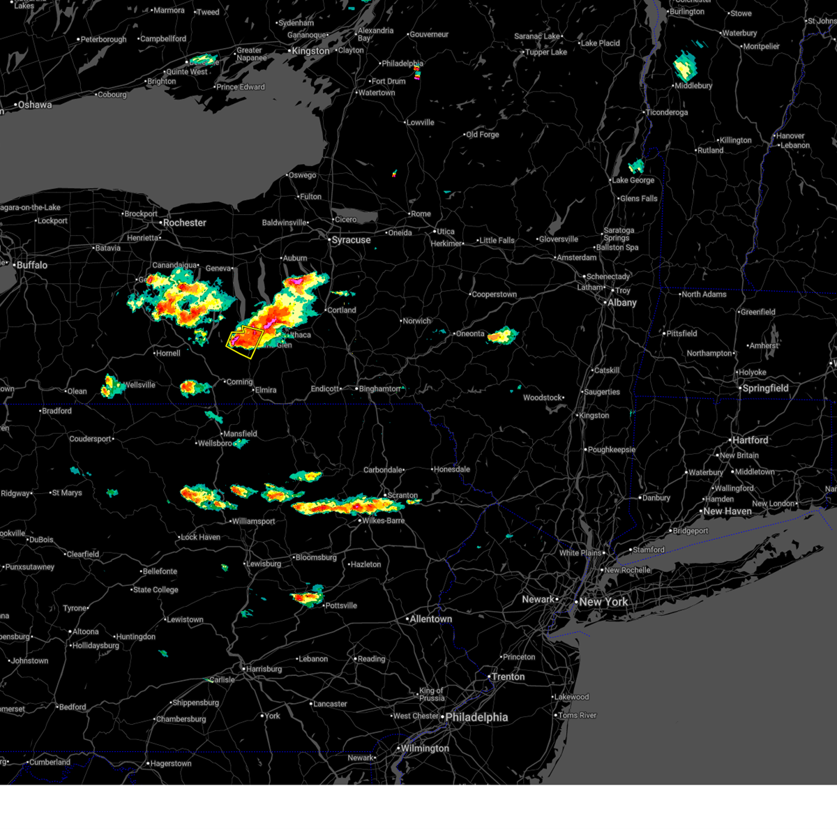
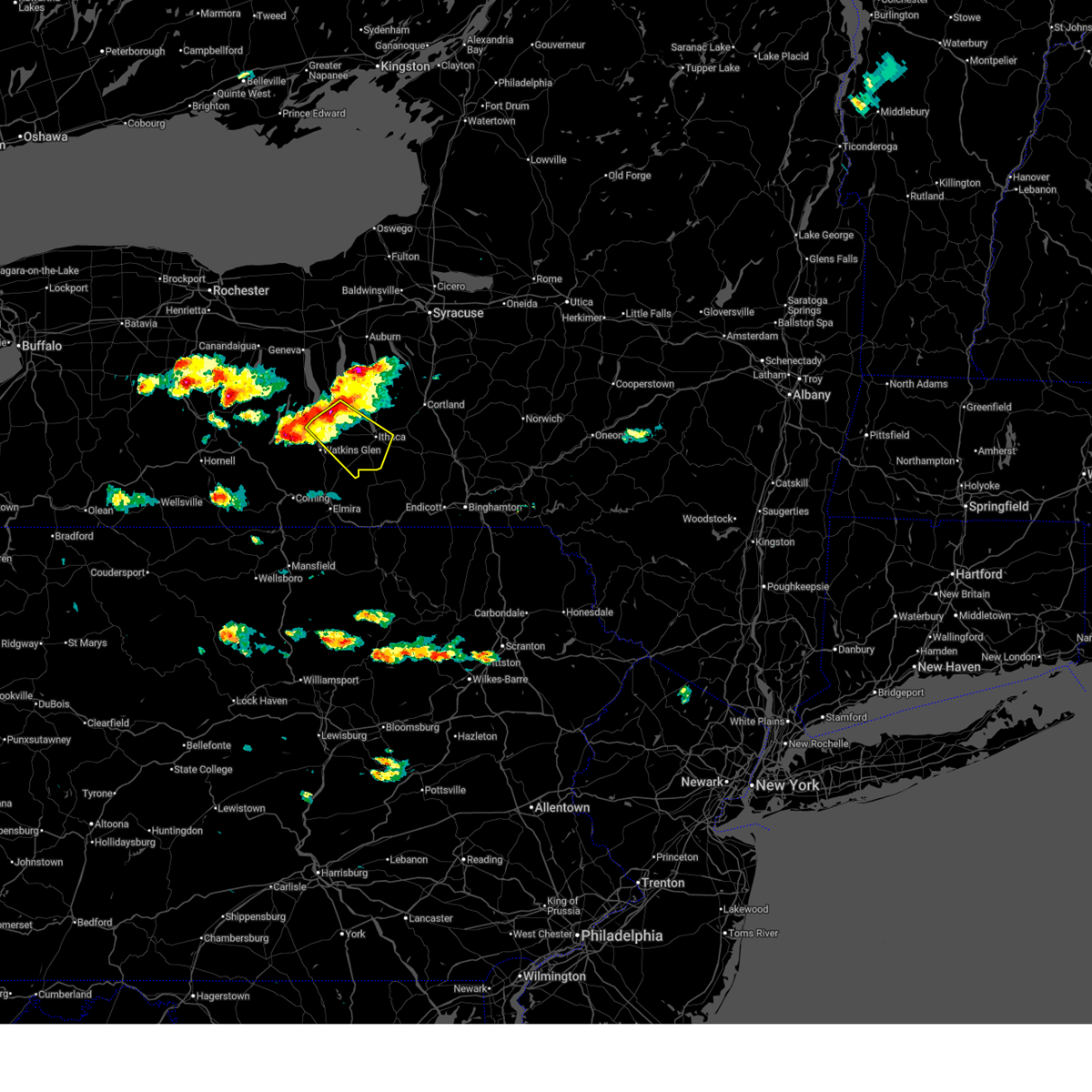
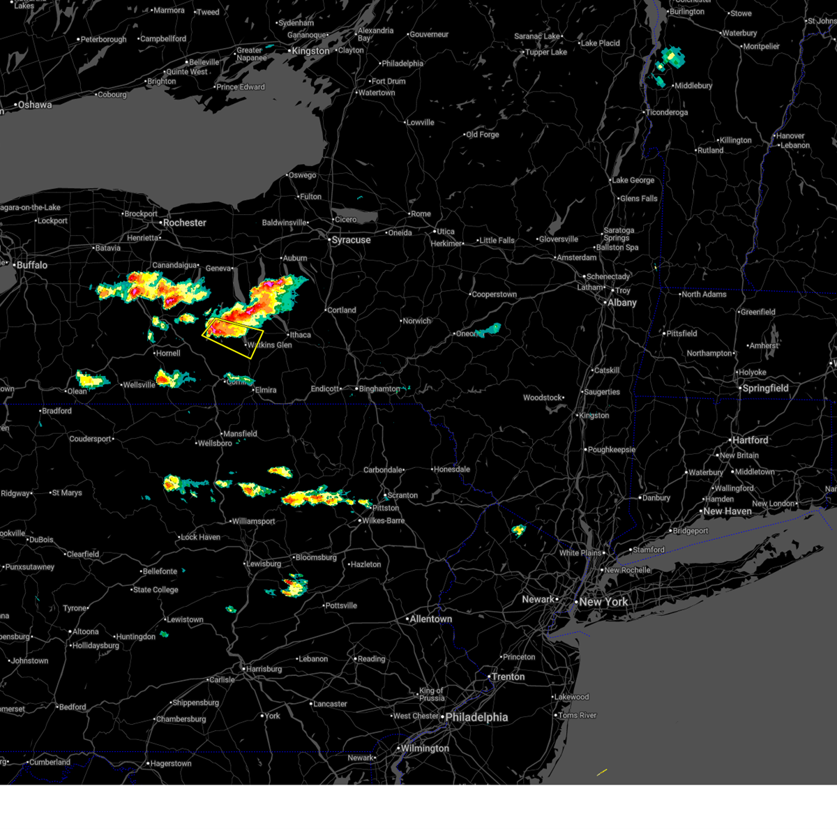
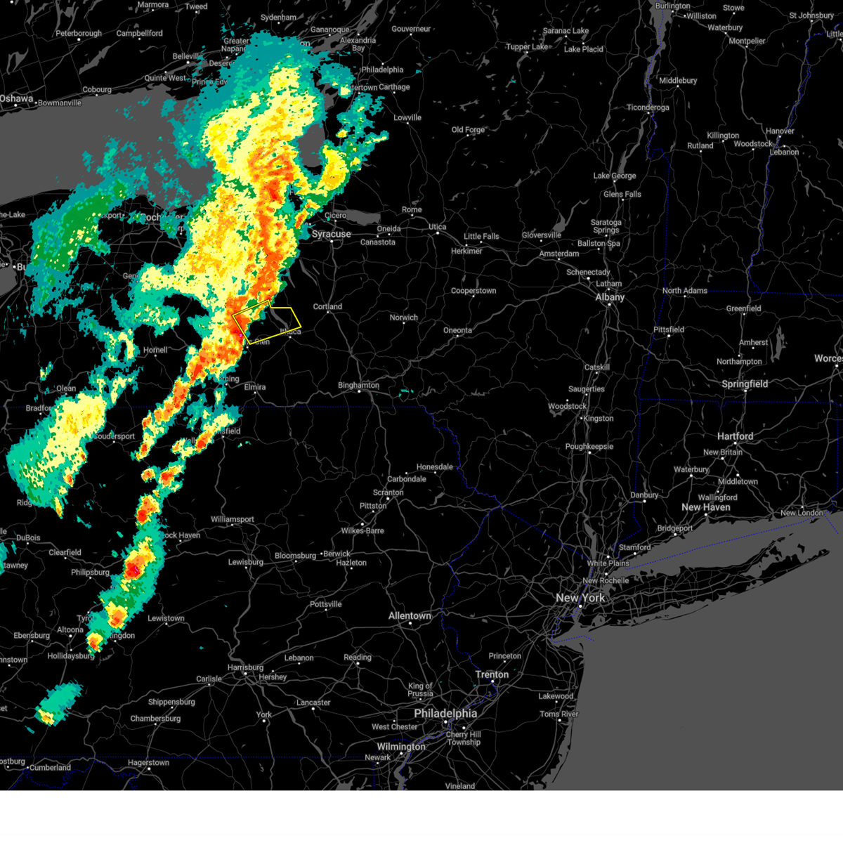
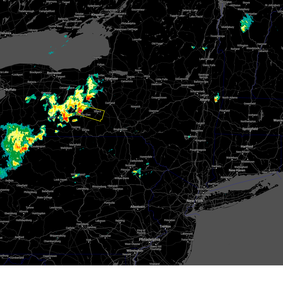
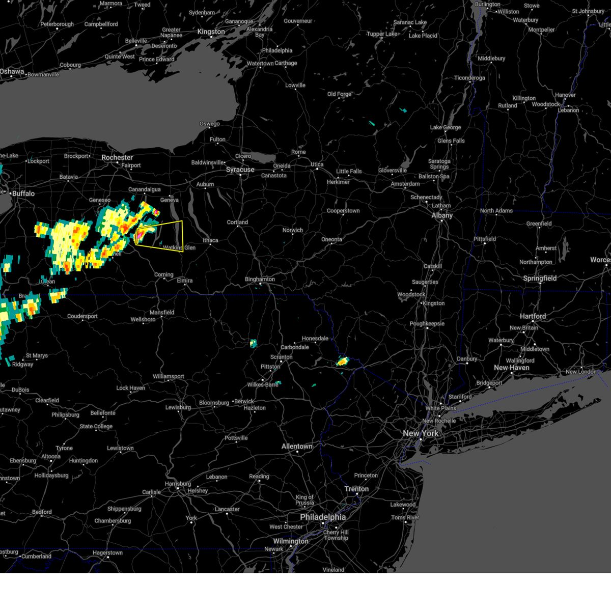
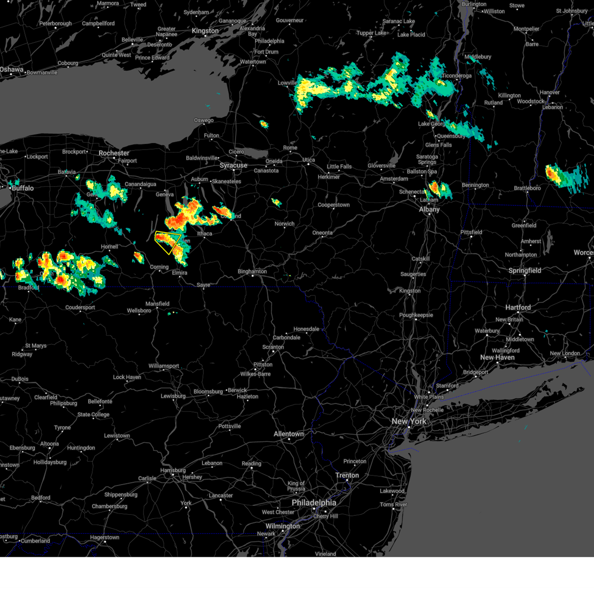
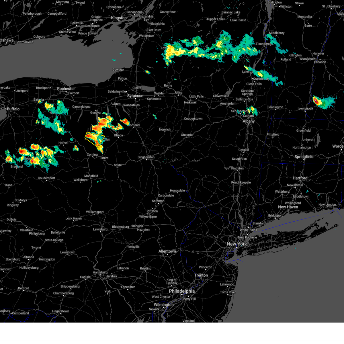
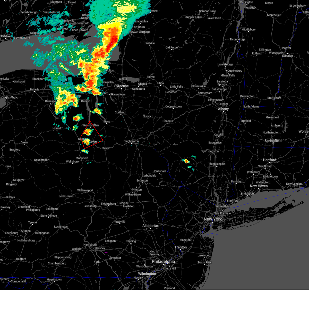
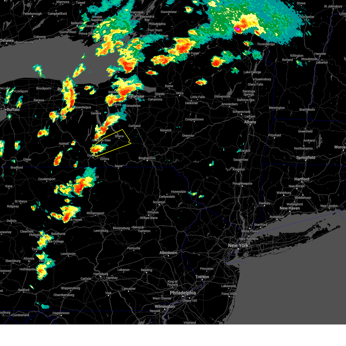
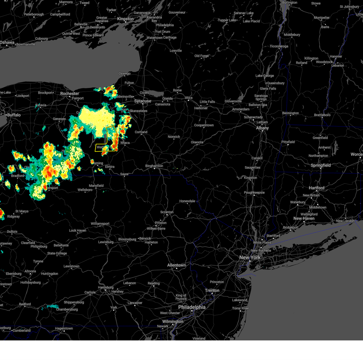
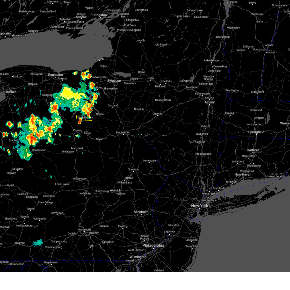
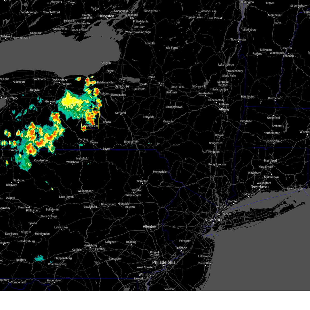
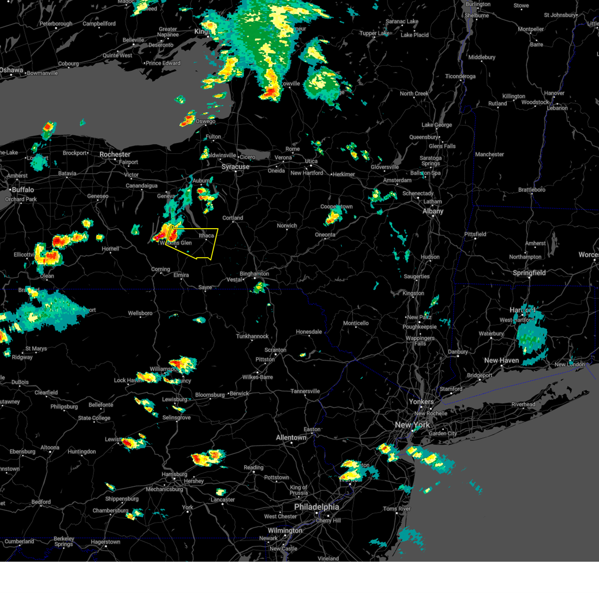
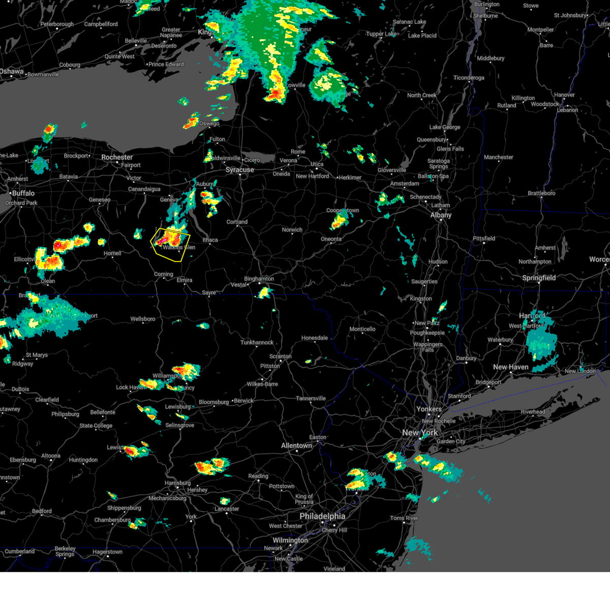
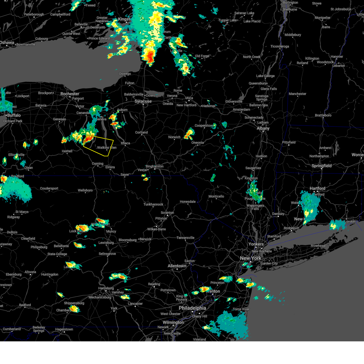
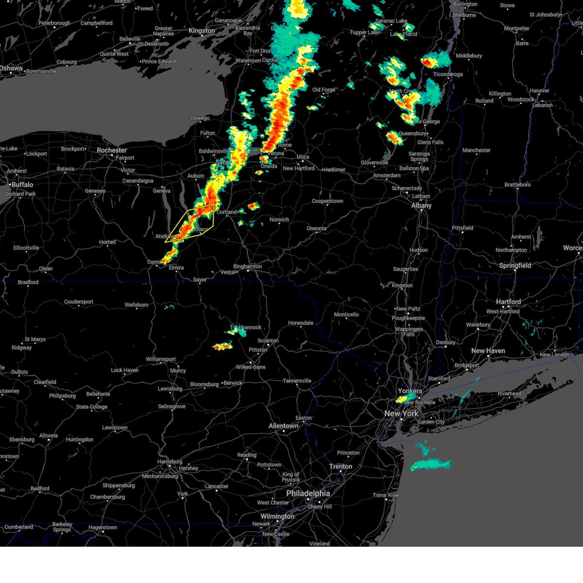
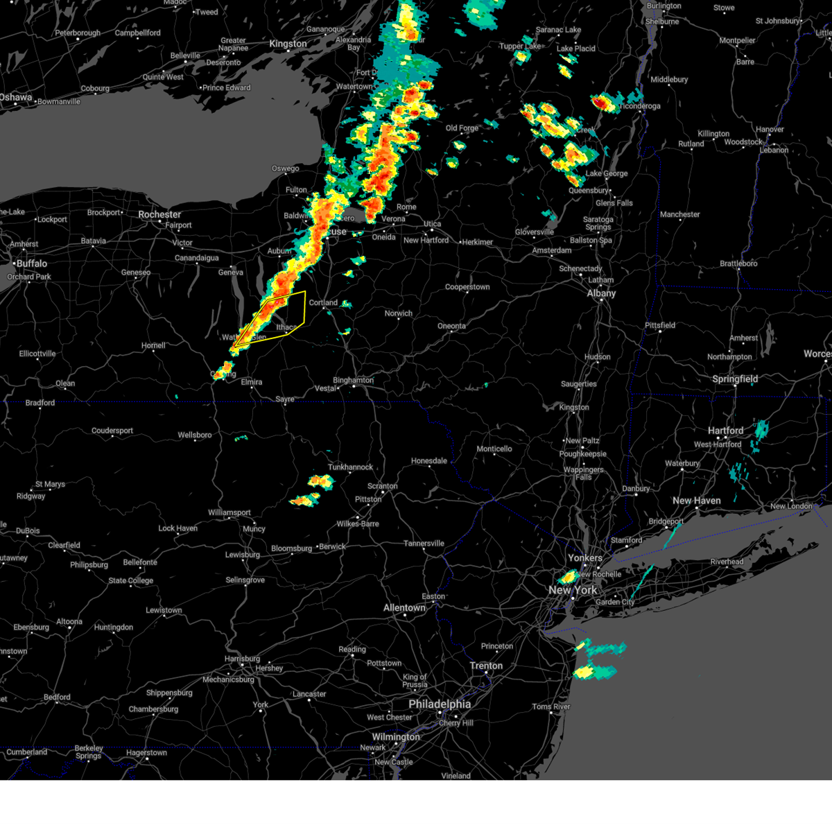
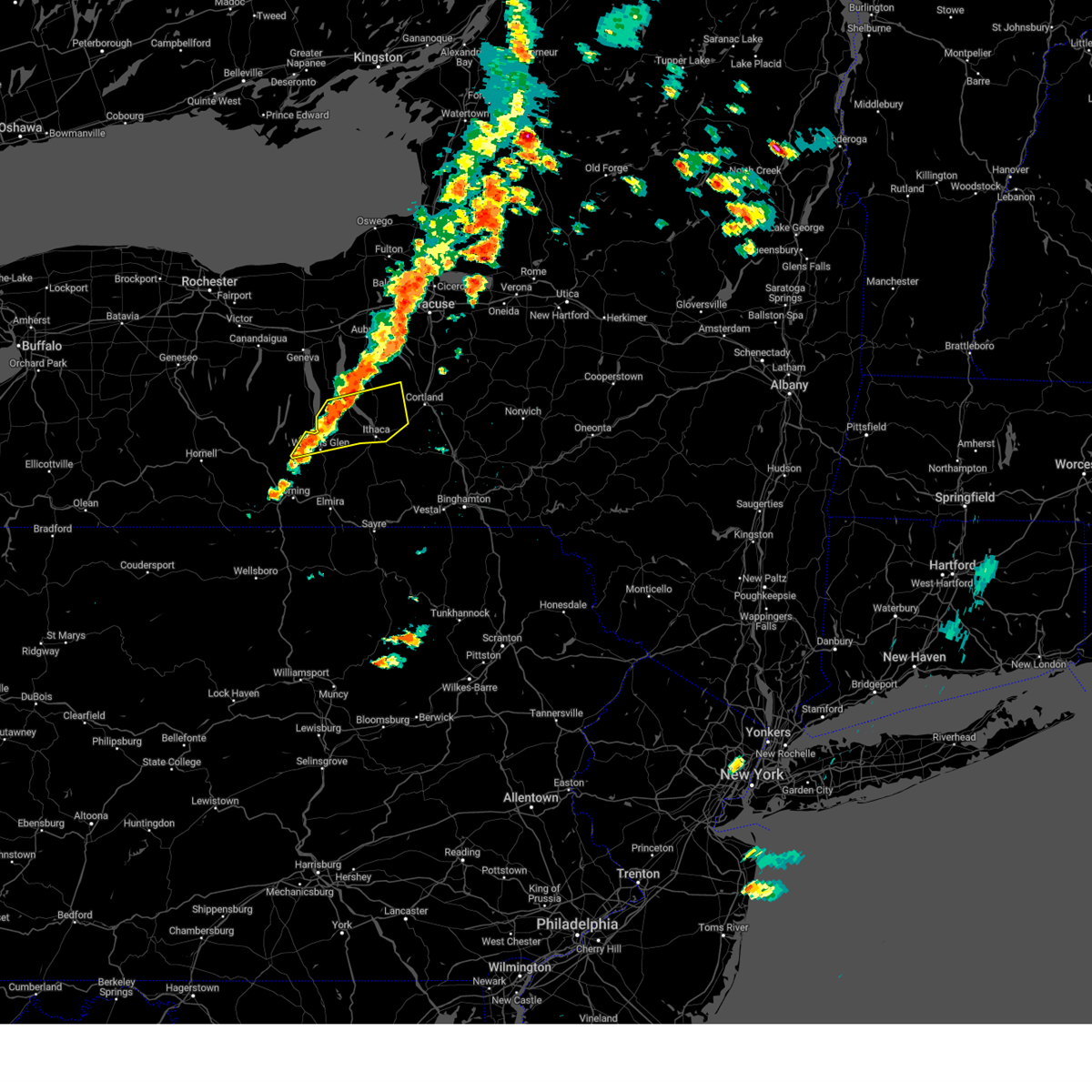
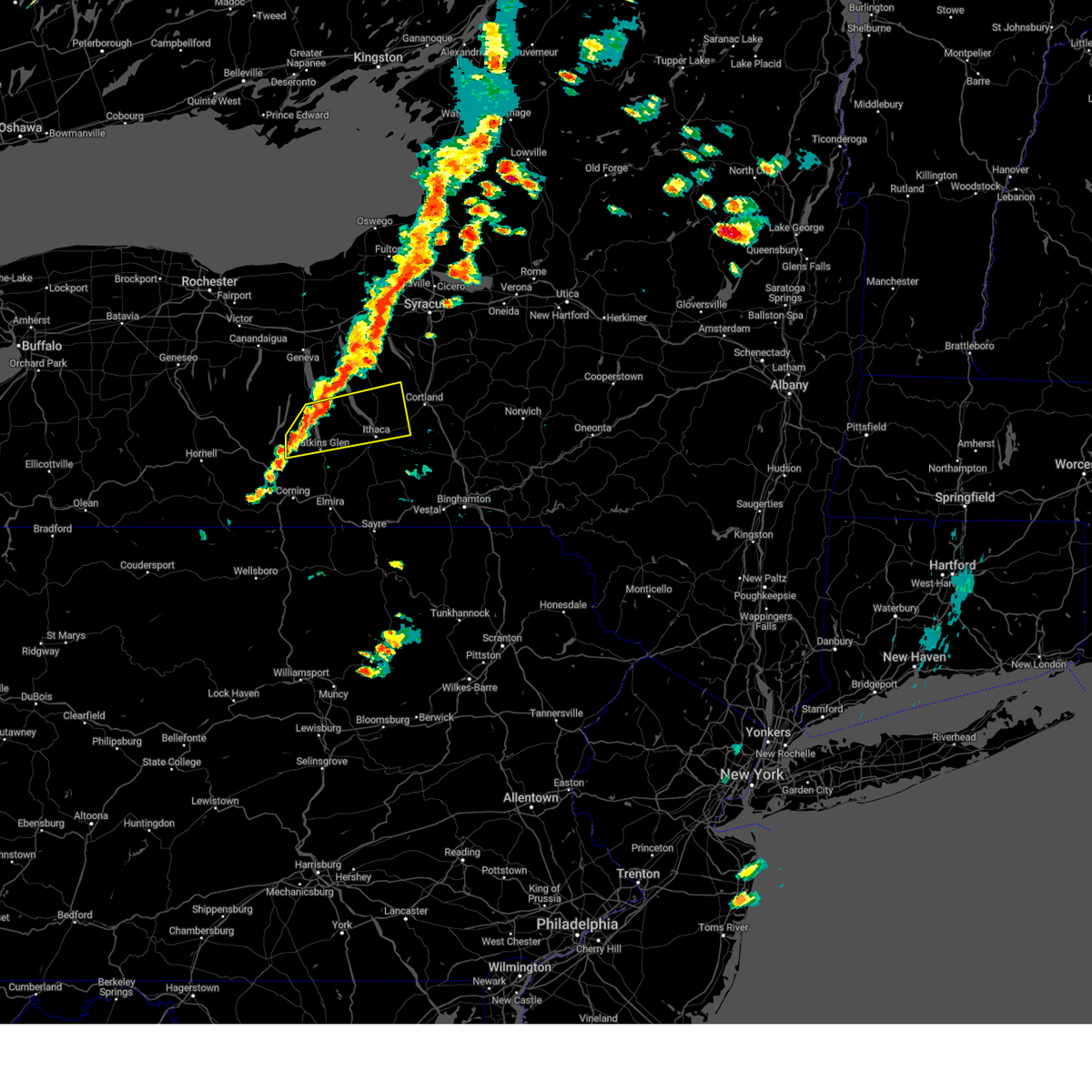
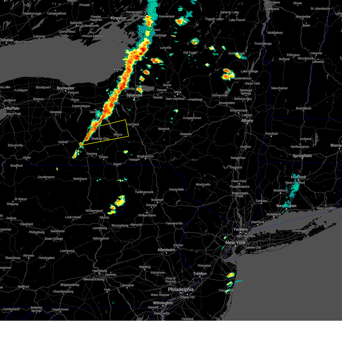
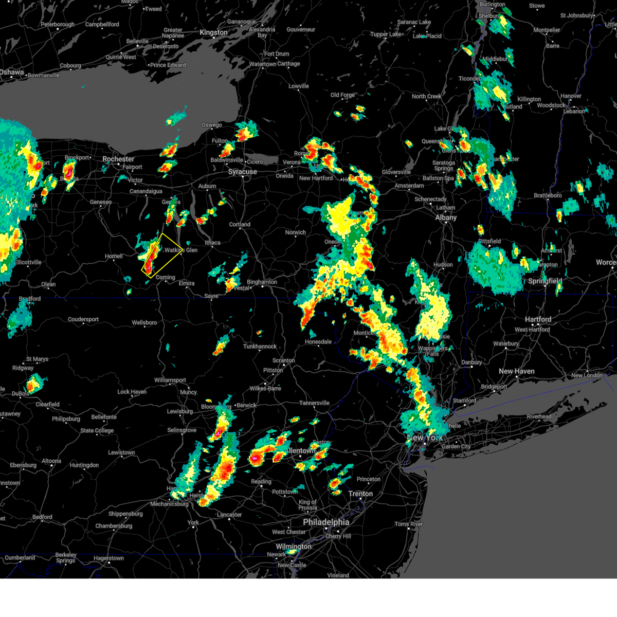
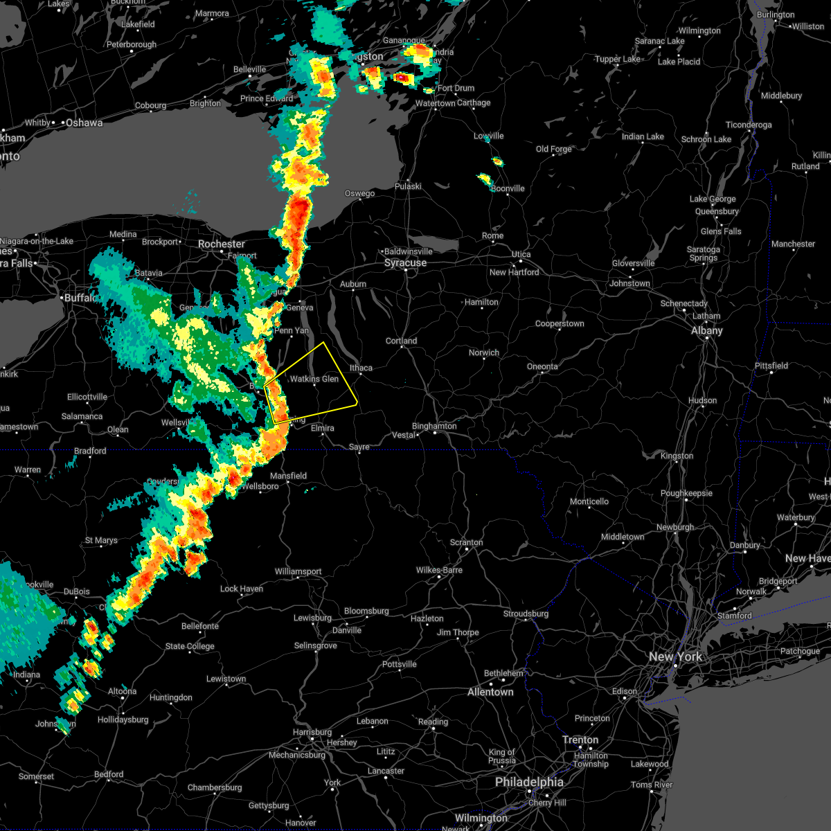
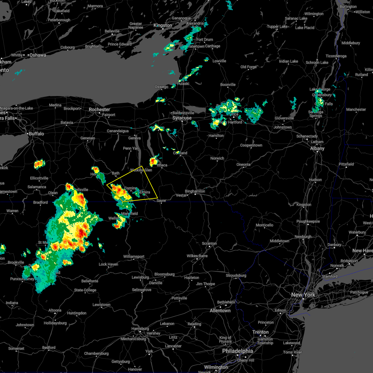
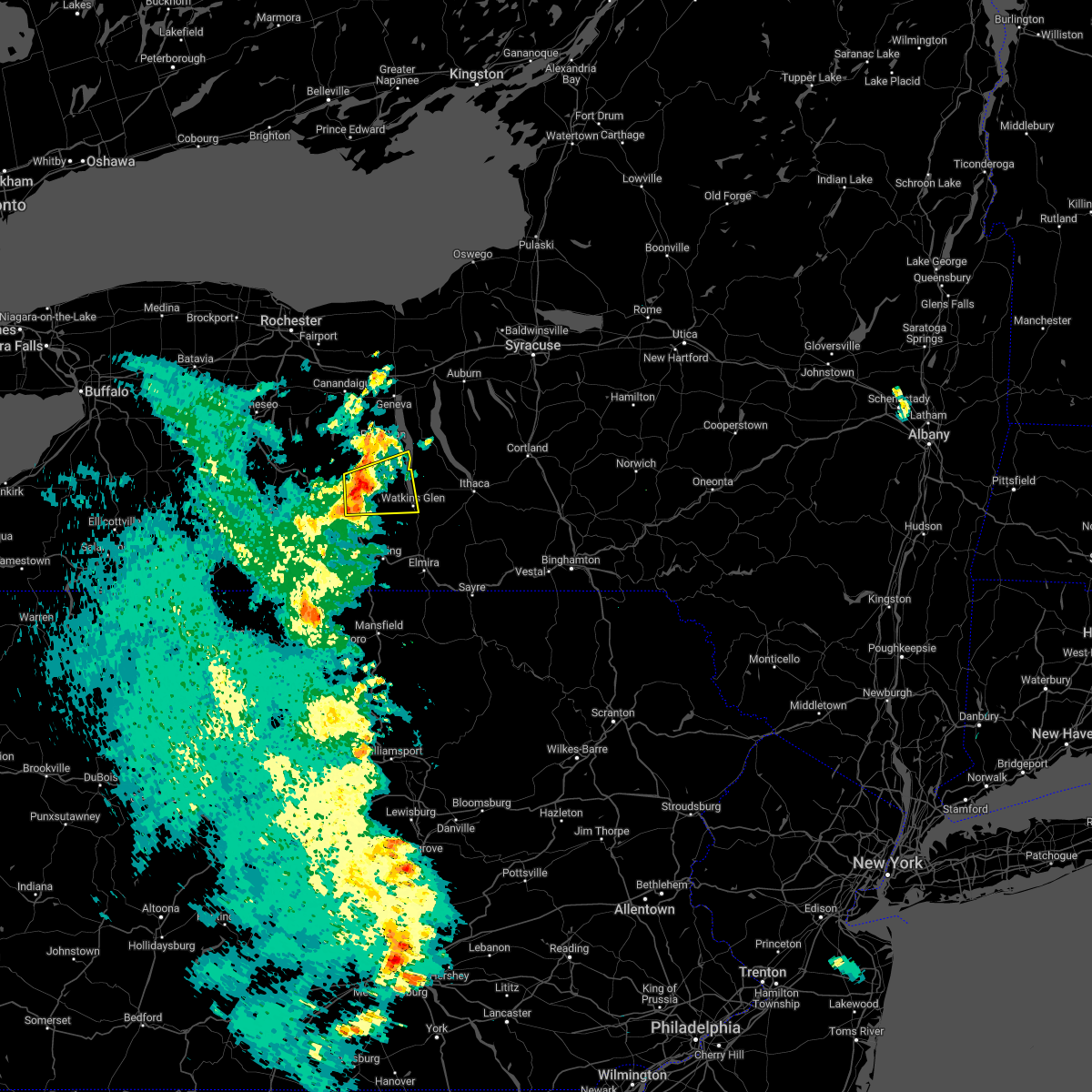
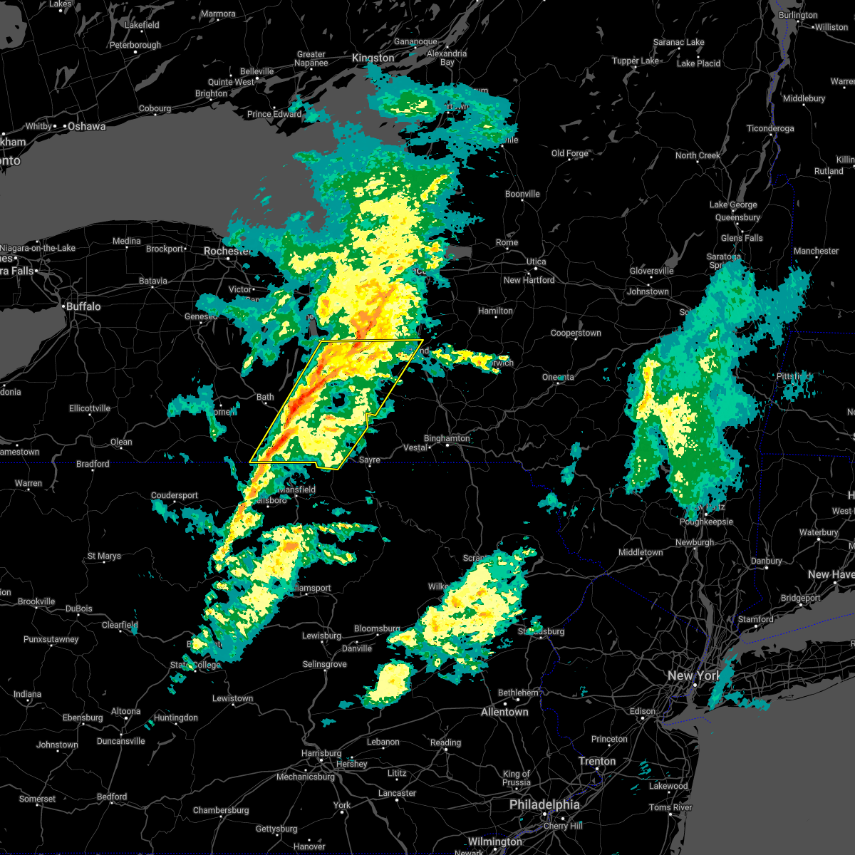
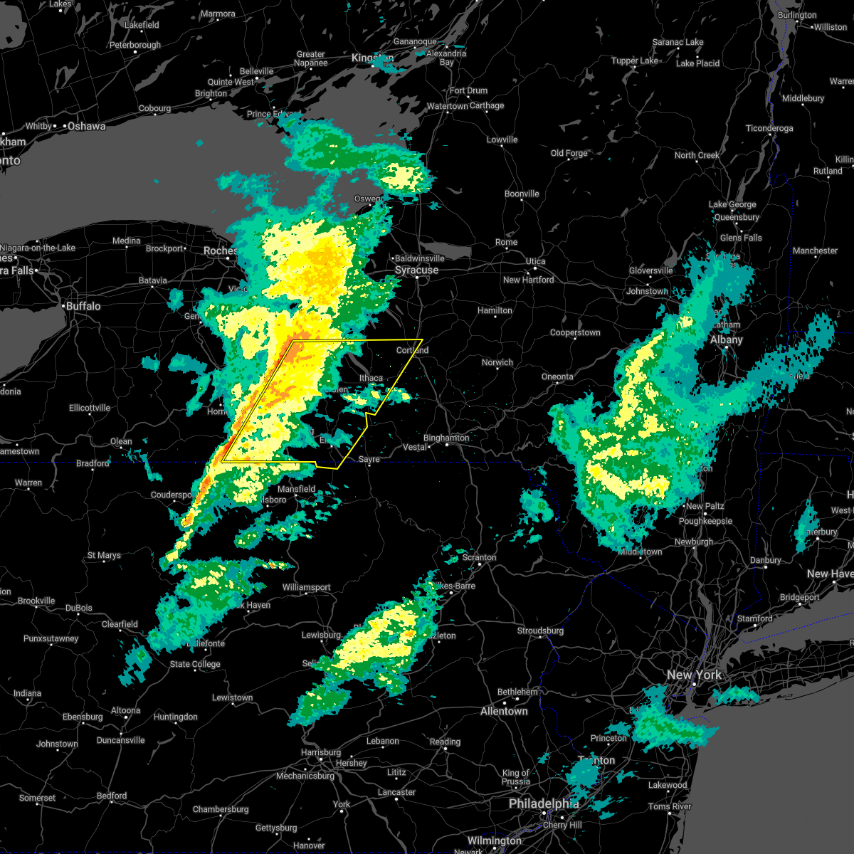
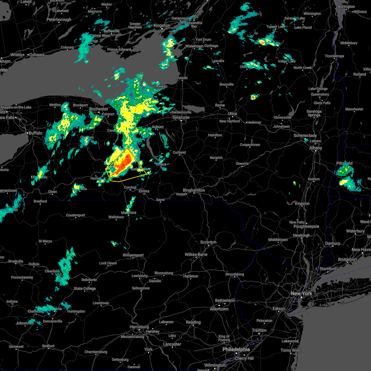
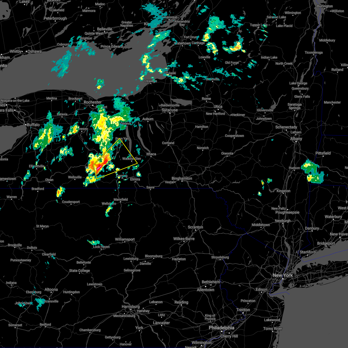
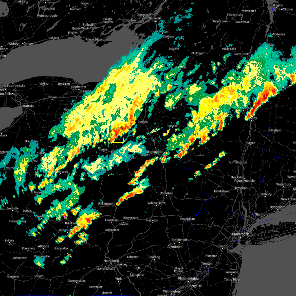
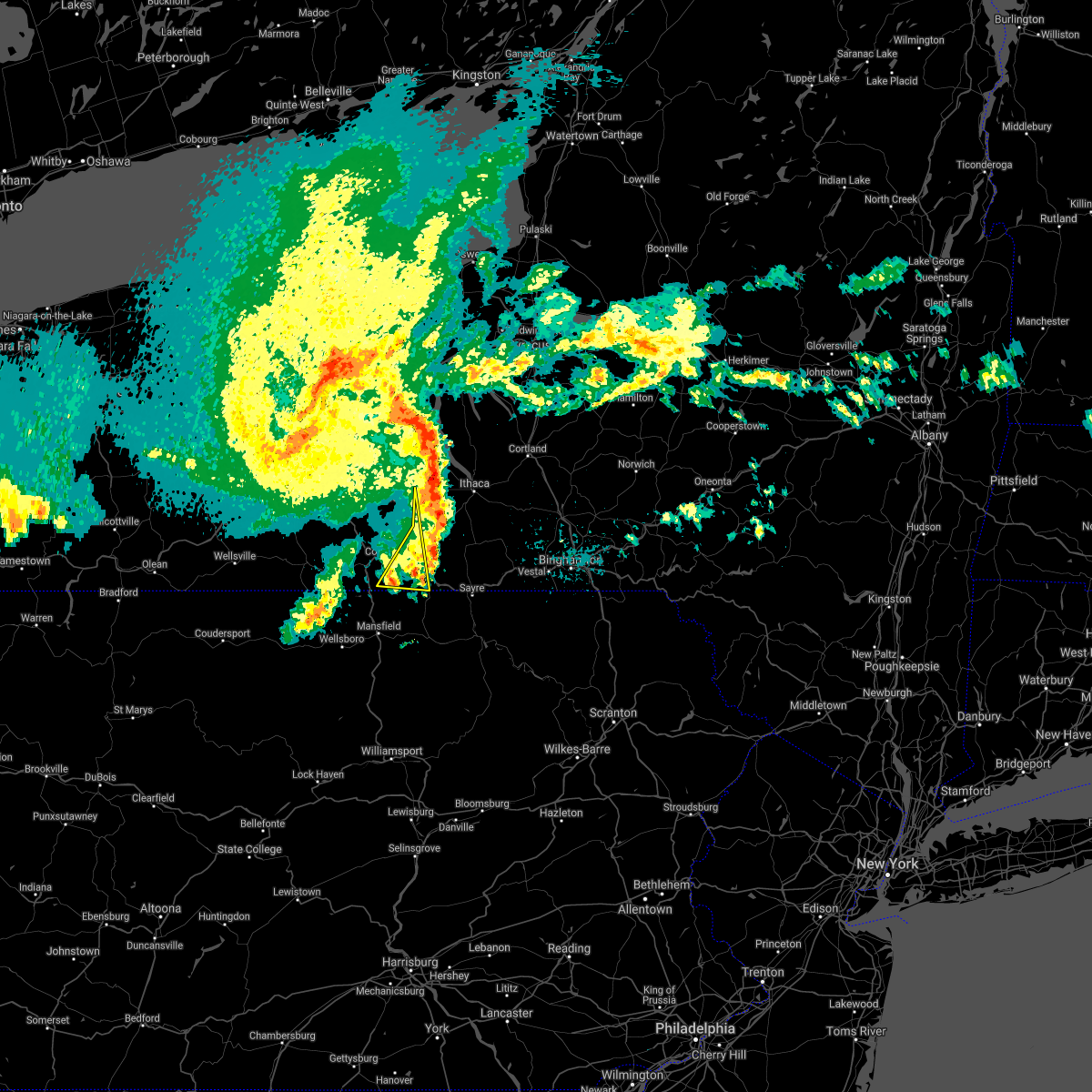
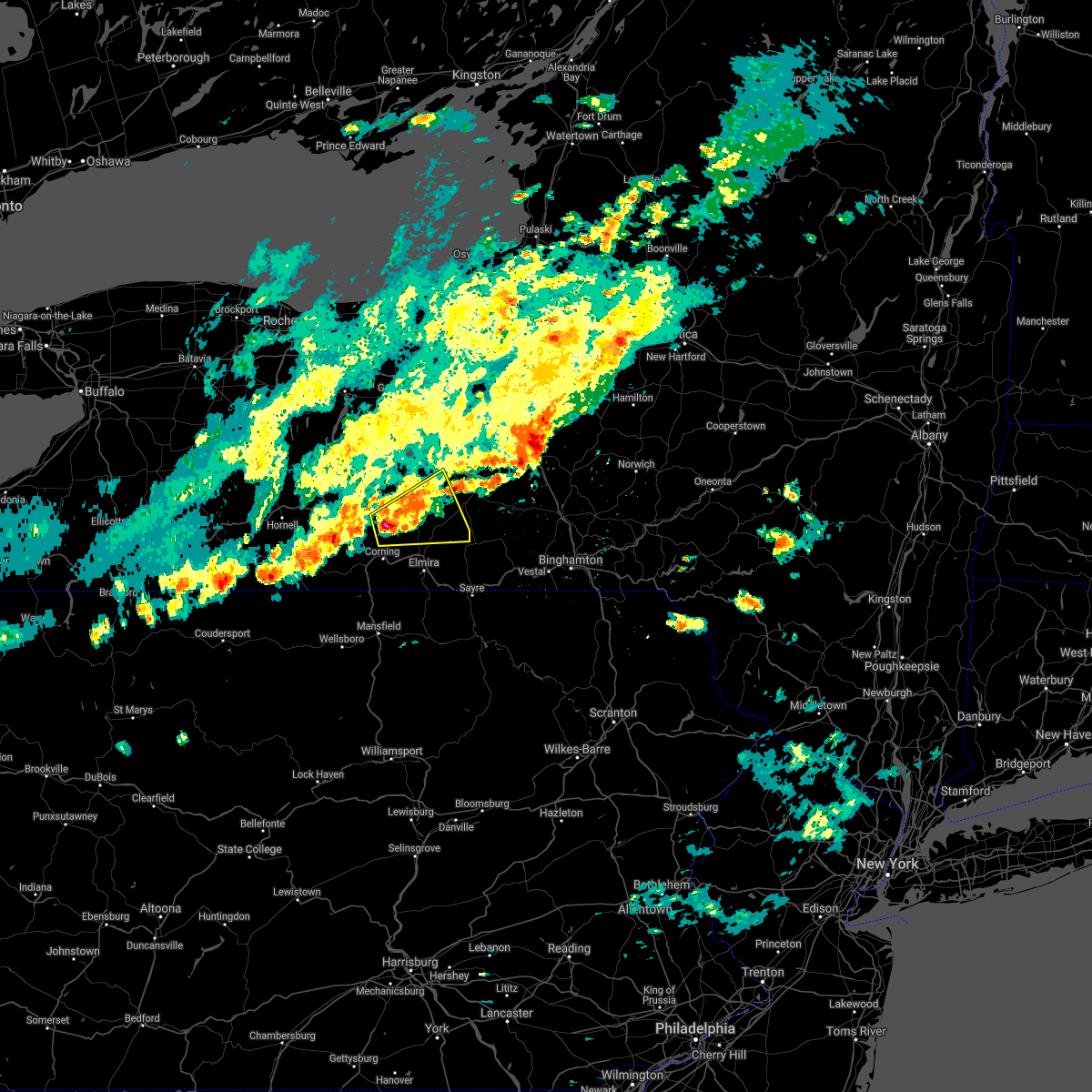
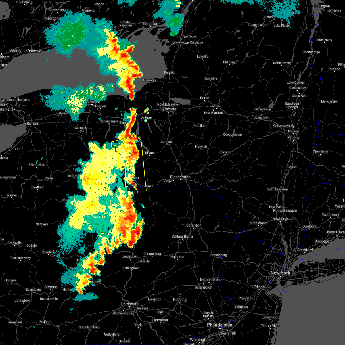
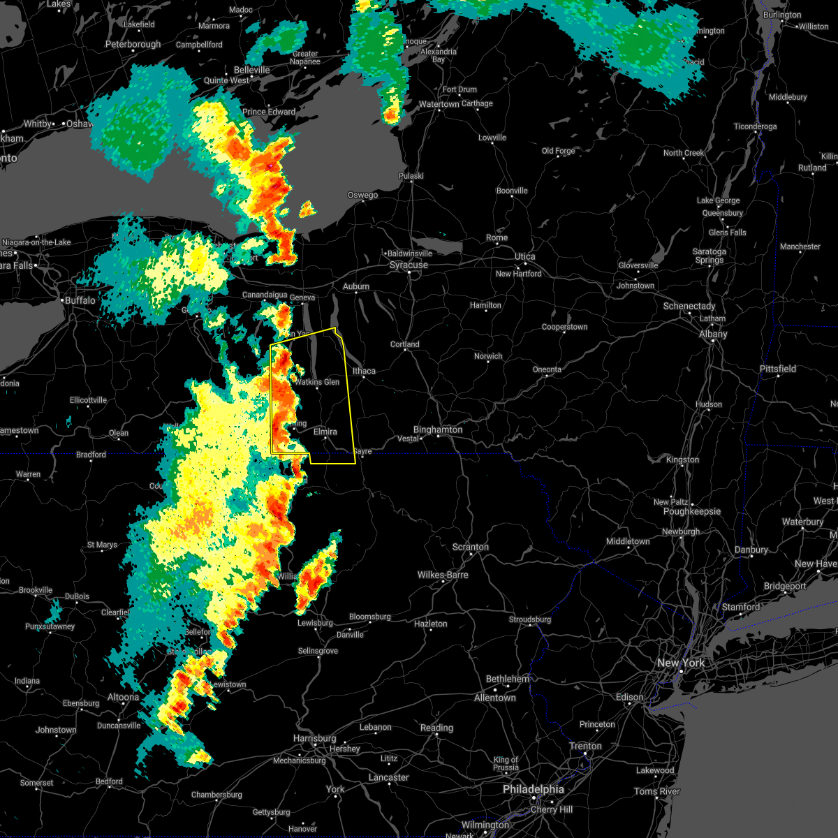
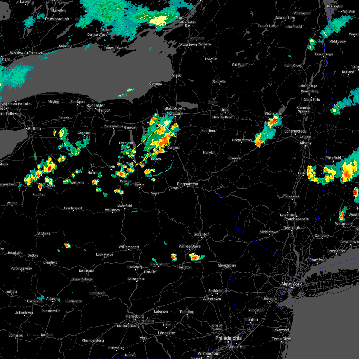
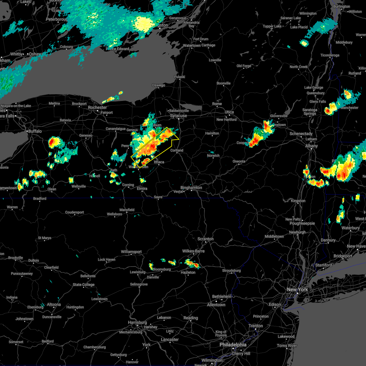
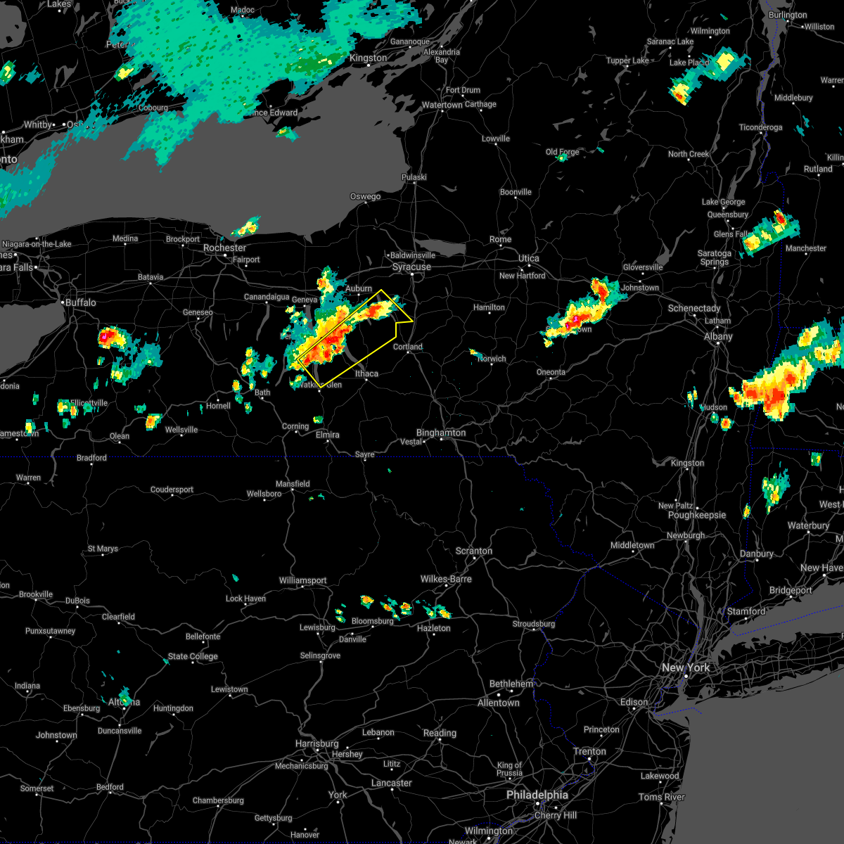
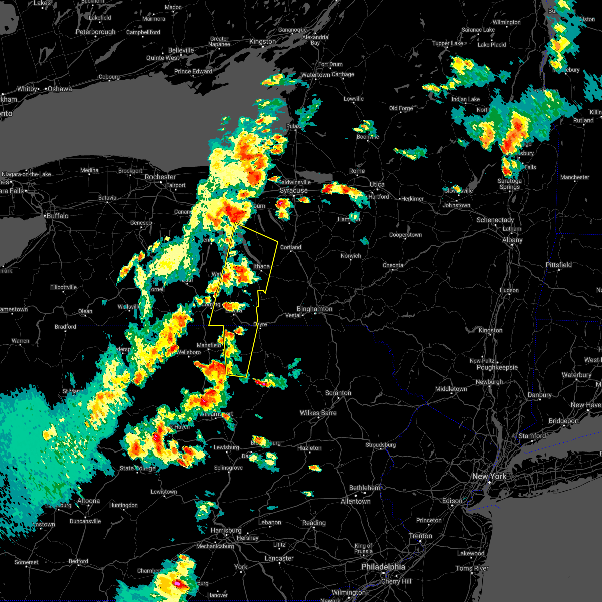
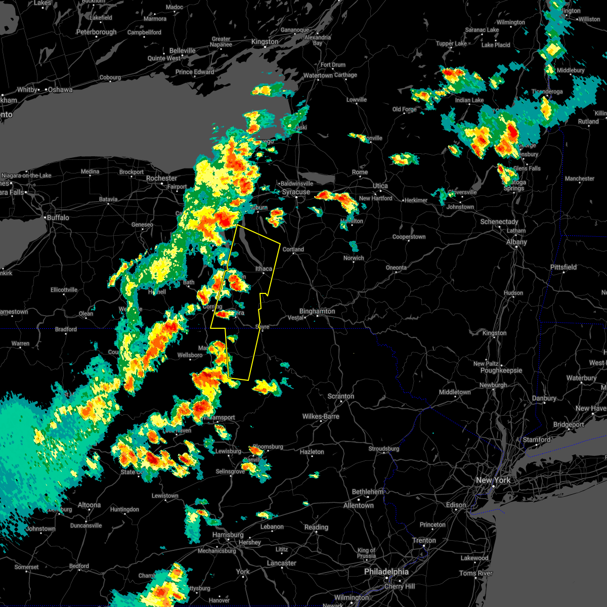
Hail Map for Burdett, NY
The Burdett, NY area has had 3 reports of on-the-ground hail by trained spotters, and has been under severe weather warnings 38 times during the past 12 months. Doppler radar has detected hail at or near Burdett, NY on 27 occasions, including 4 occasions during the past year.
| Name: | Burdett, NY |
| Where Located: | 56.3 miles SW of Syracuse, NY |
| Map: | Google Map for Burdett, NY |
| Population: | 340 |
| Housing Units: | 166 |
| More Info: | Search Google for Burdett, NY |
5
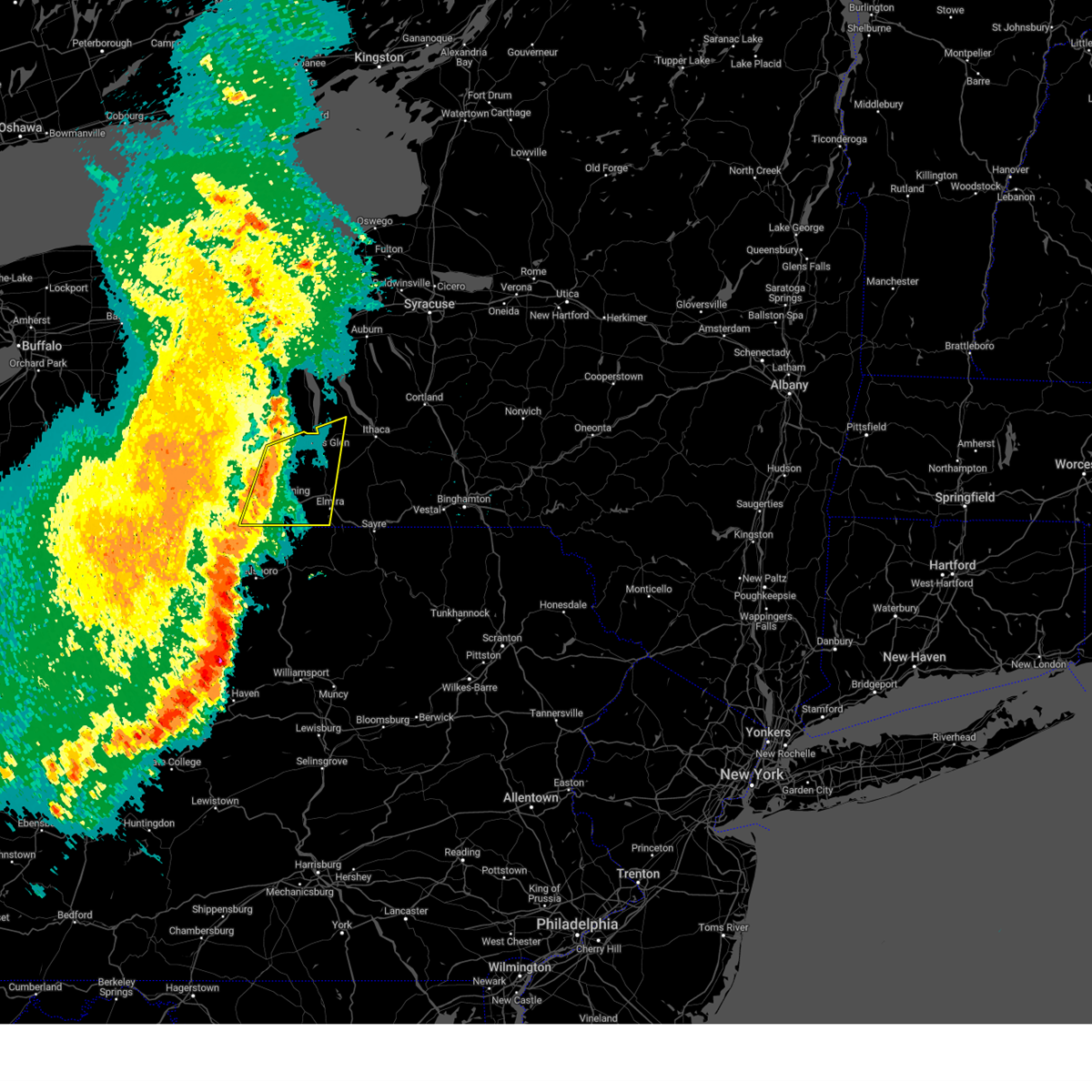
The Top Recent Hail Date for Burdett, NY is Thursday, July 3, 2025 (1st out of 27)

Hail and Wind Damage Spotted near Burdett, NY
| Date / Time | Report Details |
|---|---|
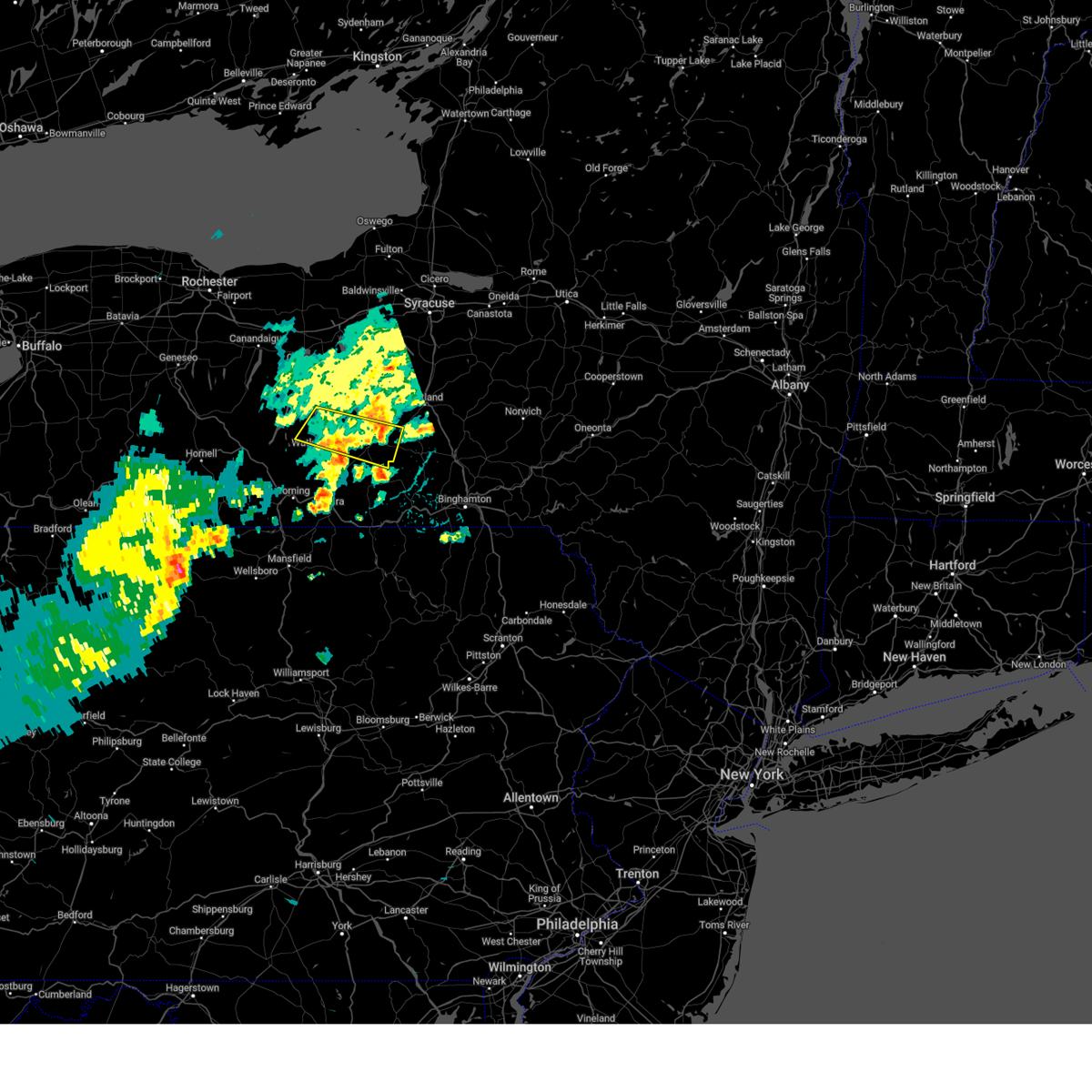
| 7/3/2025 2:59 PM EDT | Quarter sized hail reported 0.4 miles SE of Burdett, NY, nickel to quarter size hail in burdett. |
| 7/3/2025 1:59 PM EDT | Quarter sized hail reported 0.4 miles SE of Burdett, NY, corrects previous hail report from burdett. nickel to quarter size hail in burdett. |
| 7/3/2025 1:52 PM EDT |
 the severe thunderstorm warning has been cancelled and is no longer in effect the severe thunderstorm warning has been cancelled and is no longer in effect
|
| 7/3/2025 1:52 PM EDT |
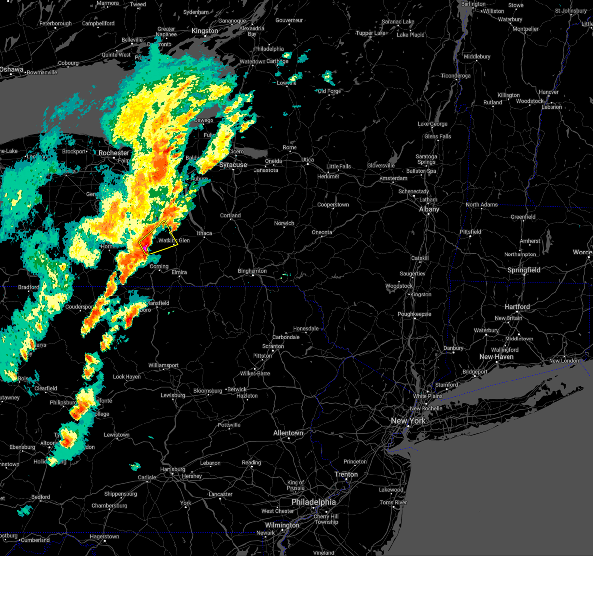
 At 152 pm edt, a severe thunderstorm was located over reading center, or near watkins glen, moving southeast at 30 mph (radar indicated). Hazards include two inch hail and 60 mph wind gusts. People and animals outdoors will be injured. expect hail damage to roofs, siding, windows, and vehicles. expect wind damage to roofs, siding, and trees. Locations impacted include, watkins glen, montour falls, burdett, wedgewood, reynoldsville, reading center, townsend, logan, bennettsburg, and watkins glen international. At 152 pm edt, a severe thunderstorm was located over reading center, or near watkins glen, moving southeast at 30 mph (radar indicated). Hazards include two inch hail and 60 mph wind gusts. People and animals outdoors will be injured. expect hail damage to roofs, siding, windows, and vehicles. expect wind damage to roofs, siding, and trees. Locations impacted include, watkins glen, montour falls, burdett, wedgewood, reynoldsville, reading center, townsend, logan, bennettsburg, and watkins glen international.
|
| 7/3/2025 1:39 PM EDT |
 Svrbgm the national weather service in binghamton has issued a * severe thunderstorm warning for, southeastern seneca county in central new york, eastern schuyler county in central new york, southeastern yates county in central new york, southwestern tompkins county in central new york, * until 215 pm edt. * at 139 pm edt, severe thunderstorms were located along a line extending from searsburg to near reynoldsville to reading center, moving southeast at 30 mph (radar indicated). Hazards include 60 mph wind gusts and quarter size hail. Hail damage to vehicles is expected. Expect wind damage to roofs, siding, and trees. Svrbgm the national weather service in binghamton has issued a * severe thunderstorm warning for, southeastern seneca county in central new york, eastern schuyler county in central new york, southeastern yates county in central new york, southwestern tompkins county in central new york, * until 215 pm edt. * at 139 pm edt, severe thunderstorms were located along a line extending from searsburg to near reynoldsville to reading center, moving southeast at 30 mph (radar indicated). Hazards include 60 mph wind gusts and quarter size hail. Hail damage to vehicles is expected. Expect wind damage to roofs, siding, and trees.
|
| 7/3/2025 1:29 PM EDT |
 Svrbgm the national weather service in binghamton has issued a * severe thunderstorm warning for, central schuyler county in central new york, southeastern yates county in central new york, northeastern steuben county in central new york, * until 215 pm edt. * at 129 pm edt, a severe thunderstorm was located near urbana, or 8 miles southwest of dundee, moving southeast at 35 mph (radar indicated). Hazards include 60 mph wind gusts and quarter size hail. Hail damage to vehicles is expected. Expect wind damage to roofs, siding, and trees. Svrbgm the national weather service in binghamton has issued a * severe thunderstorm warning for, central schuyler county in central new york, southeastern yates county in central new york, northeastern steuben county in central new york, * until 215 pm edt. * at 129 pm edt, a severe thunderstorm was located near urbana, or 8 miles southwest of dundee, moving southeast at 35 mph (radar indicated). Hazards include 60 mph wind gusts and quarter size hail. Hail damage to vehicles is expected. Expect wind damage to roofs, siding, and trees.
|
| 6/9/2025 8:14 PM EDT |
 Svrbgm the national weather service in binghamton has issued a * severe thunderstorm warning for, southeastern seneca county in central new york, northeastern schuyler county in central new york, southeastern yates county in central new york, northwestern tompkins county in central new york, * until 900 pm edt. * at 814 pm edt, a severe thunderstorm was located over rock stream, or near dundee, moving northeast at 40 mph (radar indicated). Hazards include 60 mph wind gusts and quarter size hail. Hail damage to vehicles is expected. Expect wind damage to roofs, siding, and trees. Svrbgm the national weather service in binghamton has issued a * severe thunderstorm warning for, southeastern seneca county in central new york, northeastern schuyler county in central new york, southeastern yates county in central new york, northwestern tompkins county in central new york, * until 900 pm edt. * at 814 pm edt, a severe thunderstorm was located over rock stream, or near dundee, moving northeast at 40 mph (radar indicated). Hazards include 60 mph wind gusts and quarter size hail. Hail damage to vehicles is expected. Expect wind damage to roofs, siding, and trees.
|
| 6/9/2025 8:00 PM EDT |
 At 800 pm edt, a severe thunderstorm was located over tyrone, or 10 miles southwest of dundee, moving northeast at 25 mph (radar indicated). Hazards include 60 mph wind gusts and quarter size hail. Hail damage to vehicles is expected. expect wind damage to roofs, siding, and trees. Locations impacted include, urbana, watkins glen, dundee, tyrone, wayne, bradford, burdett, reading center, porter corner, and rock stream. At 800 pm edt, a severe thunderstorm was located over tyrone, or 10 miles southwest of dundee, moving northeast at 25 mph (radar indicated). Hazards include 60 mph wind gusts and quarter size hail. Hail damage to vehicles is expected. expect wind damage to roofs, siding, and trees. Locations impacted include, urbana, watkins glen, dundee, tyrone, wayne, bradford, burdett, reading center, porter corner, and rock stream.
|
| 6/9/2025 7:48 PM EDT |
 At 747 pm edt, a severe thunderstorm was located over sonora, or 15 miles southwest of dundee, moving northeast at 25 mph (radar indicated). Hazards include golf ball size hail and 70 mph wind gusts. People and animals outdoors will be injured. expect hail damage to roofs, siding, windows, and vehicles. expect considerable tree damage. wind damage is also likely to mobile homes, roofs, and outbuildings. Locations impacted include, urbana, watkins glen, dundee, tyrone, wayne, bradford, savona, hammondsport, burdett, and reading center. At 747 pm edt, a severe thunderstorm was located over sonora, or 15 miles southwest of dundee, moving northeast at 25 mph (radar indicated). Hazards include golf ball size hail and 70 mph wind gusts. People and animals outdoors will be injured. expect hail damage to roofs, siding, windows, and vehicles. expect considerable tree damage. wind damage is also likely to mobile homes, roofs, and outbuildings. Locations impacted include, urbana, watkins glen, dundee, tyrone, wayne, bradford, savona, hammondsport, burdett, and reading center.
|
| 6/9/2025 7:45 PM EDT |
 Svrbgm the national weather service in binghamton has issued a * severe thunderstorm warning for, northwestern schuyler county in central new york, southeastern yates county in central new york, northeastern steuben county in central new york, * until 830 pm edt. * at 744 pm edt, a severe thunderstorm was located near sonora, or 16 miles northwest of corning, moving northeast at 25 mph (radar indicated). Hazards include golf ball size hail and 70 mph wind gusts. People and animals outdoors will be injured. expect hail damage to roofs, siding, windows, and vehicles. expect considerable tree damage. Wind damage is also likely to mobile homes, roofs, and outbuildings. Svrbgm the national weather service in binghamton has issued a * severe thunderstorm warning for, northwestern schuyler county in central new york, southeastern yates county in central new york, northeastern steuben county in central new york, * until 830 pm edt. * at 744 pm edt, a severe thunderstorm was located near sonora, or 16 miles northwest of corning, moving northeast at 25 mph (radar indicated). Hazards include golf ball size hail and 70 mph wind gusts. People and animals outdoors will be injured. expect hail damage to roofs, siding, windows, and vehicles. expect considerable tree damage. Wind damage is also likely to mobile homes, roofs, and outbuildings.
|
| 6/5/2025 6:58 PM EDT |
 The severe thunderstorm which prompted the warning has weakened. therefore, the warning has been allowed to expire. a severe thunderstorm watch remains in effect until 1100 pm edt for central new york. The severe thunderstorm which prompted the warning has weakened. therefore, the warning has been allowed to expire. a severe thunderstorm watch remains in effect until 1100 pm edt for central new york.
|
| 6/5/2025 6:50 PM EDT |
 The storm which prompted the warning has weakened below severe limits, and no longer poses an immediate threat to life or property. therefore, the warning has been allowed to expire. a severe thunderstorm watch remains in effect until 1100 pm edt for central new york. The storm which prompted the warning has weakened below severe limits, and no longer poses an immediate threat to life or property. therefore, the warning has been allowed to expire. a severe thunderstorm watch remains in effect until 1100 pm edt for central new york.
|
| 6/5/2025 6:06 PM EDT |
 Svrbgm the national weather service in binghamton has issued a * severe thunderstorm warning for, northern chemung county in central new york, schuyler county in central new york, east central steuben county in central new york, southwestern tompkins county in central new york, southeastern yates county in central new york, * until 645 pm edt. * at 606 pm edt, a severe thunderstorm was located near tyrone, or 9 miles west of watkins glen, moving east at 25 mph (radar indicated). Hazards include 60 mph wind gusts and quarter size hail. Hail damage to vehicles is expected. Expect wind damage to roofs, siding, and trees. Svrbgm the national weather service in binghamton has issued a * severe thunderstorm warning for, northern chemung county in central new york, schuyler county in central new york, east central steuben county in central new york, southwestern tompkins county in central new york, southeastern yates county in central new york, * until 645 pm edt. * at 606 pm edt, a severe thunderstorm was located near tyrone, or 9 miles west of watkins glen, moving east at 25 mph (radar indicated). Hazards include 60 mph wind gusts and quarter size hail. Hail damage to vehicles is expected. Expect wind damage to roofs, siding, and trees.
|
| 6/5/2025 5:46 PM EDT |
 Svrbgm the national weather service in binghamton has issued a * severe thunderstorm warning for, northern schuyler county in central new york, south central seneca county in central new york, southern tompkins county in central new york, southeastern yates county in central new york, * until 645 pm edt. * at 546 pm edt, a severe thunderstorm was located over burdett, or near watkins glen, moving east at 25 mph (radar indicated). Hazards include 60 mph wind gusts and half dollar size hail. Hail damage to vehicles is expected. Expect wind damage to roofs, siding, and trees. Svrbgm the national weather service in binghamton has issued a * severe thunderstorm warning for, northern schuyler county in central new york, south central seneca county in central new york, southern tompkins county in central new york, southeastern yates county in central new york, * until 645 pm edt. * at 546 pm edt, a severe thunderstorm was located over burdett, or near watkins glen, moving east at 25 mph (radar indicated). Hazards include 60 mph wind gusts and half dollar size hail. Hail damage to vehicles is expected. Expect wind damage to roofs, siding, and trees.
|
| 6/5/2025 5:43 PM EDT | the tornado warning has been cancelled and is no longer in effect |
| 6/5/2025 5:35 PM EDT |
 At 535 pm edt, a severe thunderstorm was located over townsendville, or 9 miles east of dundee, moving east at 25 mph (radar indicated). Hazards include two inch hail and 70 mph wind gusts. People and animals outdoors will be injured. expect hail damage to roofs, siding, windows, and vehicles. expect considerable tree damage. wind damage is also likely to mobile homes, roofs, and outbuildings. Locations impacted include, watkins glen, dundee, hector, starkey, burdett, caywood, reading center, lodi station, rock stream, glenora, lakemont, and himrod. At 535 pm edt, a severe thunderstorm was located over townsendville, or 9 miles east of dundee, moving east at 25 mph (radar indicated). Hazards include two inch hail and 70 mph wind gusts. People and animals outdoors will be injured. expect hail damage to roofs, siding, windows, and vehicles. expect considerable tree damage. wind damage is also likely to mobile homes, roofs, and outbuildings. Locations impacted include, watkins glen, dundee, hector, starkey, burdett, caywood, reading center, lodi station, rock stream, glenora, lakemont, and himrod.
|
| 6/5/2025 5:29 PM EDT |
 Torbgm the national weather service in binghamton has issued a * tornado warning for, central schuyler county in central new york, southeastern yates county in central new york, * until 600 pm edt. * at 529 pm edt, a severe thunderstorm capable of producing a tornado was located over reading center, or near watkins glen, moving east at 30 mph (radar indicated rotation). Hazards include tornado and hail up to two inches in diameter. Flying debris will be dangerous to those caught without shelter. mobile homes will be damaged or destroyed. damage to roofs, windows, and vehicles will occur. tree damage is likely. this dangerous storm will be near, watkins glen, rock stream, and burdett around 530 pm edt. reynoldsville around 540 pm edt. Other locations impacted by this tornadic thunderstorm include townsend, smith valley, logan, bennettsburg, and watkins glen state park. Torbgm the national weather service in binghamton has issued a * tornado warning for, central schuyler county in central new york, southeastern yates county in central new york, * until 600 pm edt. * at 529 pm edt, a severe thunderstorm capable of producing a tornado was located over reading center, or near watkins glen, moving east at 30 mph (radar indicated rotation). Hazards include tornado and hail up to two inches in diameter. Flying debris will be dangerous to those caught without shelter. mobile homes will be damaged or destroyed. damage to roofs, windows, and vehicles will occur. tree damage is likely. this dangerous storm will be near, watkins glen, rock stream, and burdett around 530 pm edt. reynoldsville around 540 pm edt. Other locations impacted by this tornadic thunderstorm include townsend, smith valley, logan, bennettsburg, and watkins glen state park.
|
| 6/5/2025 5:26 PM EDT |
 the severe thunderstorm warning has been cancelled and is no longer in effect the severe thunderstorm warning has been cancelled and is no longer in effect
|
| 6/5/2025 5:26 PM EDT |
 At 525 pm edt, a severe thunderstorm was located over starkey, or near dundee, moving east at 25 mph (radar indicated). Hazards include two inch hail and 70 mph wind gusts. People and animals outdoors will be injured. expect hail damage to roofs, siding, windows, and vehicles. expect considerable tree damage. wind damage is also likely to mobile homes, roofs, and outbuildings. Locations impacted include, watkins glen, dundee, hector, starkey, tyrone, burdett, caywood, reading center, himrod, porter corner, lodi station, and rock stream. At 525 pm edt, a severe thunderstorm was located over starkey, or near dundee, moving east at 25 mph (radar indicated). Hazards include two inch hail and 70 mph wind gusts. People and animals outdoors will be injured. expect hail damage to roofs, siding, windows, and vehicles. expect considerable tree damage. wind damage is also likely to mobile homes, roofs, and outbuildings. Locations impacted include, watkins glen, dundee, hector, starkey, tyrone, burdett, caywood, reading center, himrod, porter corner, lodi station, and rock stream.
|
| 6/5/2025 5:05 PM EDT | At 504 pm edt, a severe thunderstorm was located over porter corner, or near dundee, moving east at 25 mph (radar indicated). Hazards include 70 mph wind gusts and ping pong ball size hail. People and animals outdoors will be injured. expect hail damage to roofs, siding, windows, and vehicles. expect considerable tree damage. wind damage is also likely to mobile homes, roofs, and outbuildings. Locations impacted include, watkins glen, dundee, hector, starkey, urbana, tyrone, pulteney, burdett, caywood, reading center, himrod, and porter corner. |
| 6/5/2025 4:40 PM EDT |
 Svrbgm the national weather service in binghamton has issued a * severe thunderstorm warning for, northwestern schuyler county in central new york, southern seneca county in central new york, northeastern steuben county in central new york, southern yates county in central new york, * until 545 pm edt. * at 440 pm edt, a severe thunderstorm was located over prattsburg, or 14 miles west of dundee, moving east at 25 mph (radar indicated). Hazards include 70 mph wind gusts and ping pong ball size hail. People and animals outdoors will be injured. expect hail damage to roofs, siding, windows, and vehicles. expect considerable tree damage. Wind damage is also likely to mobile homes, roofs, and outbuildings. Svrbgm the national weather service in binghamton has issued a * severe thunderstorm warning for, northwestern schuyler county in central new york, southern seneca county in central new york, northeastern steuben county in central new york, southern yates county in central new york, * until 545 pm edt. * at 440 pm edt, a severe thunderstorm was located over prattsburg, or 14 miles west of dundee, moving east at 25 mph (radar indicated). Hazards include 70 mph wind gusts and ping pong ball size hail. People and animals outdoors will be injured. expect hail damage to roofs, siding, windows, and vehicles. expect considerable tree damage. Wind damage is also likely to mobile homes, roofs, and outbuildings.
|
| 5/2/2025 6:46 PM EDT |
 the severe thunderstorm warning has been cancelled and is no longer in effect the severe thunderstorm warning has been cancelled and is no longer in effect
|
| 5/2/2025 6:46 PM EDT |
 At 645 pm edt, a severe thunderstorm was located over alpine, or near odessa, moving east at 40 mph (radar indicated). Hazards include 60 mph wind gusts and half dollar size hail. Hail damage to vehicles is expected. expect wind damage to roofs, siding, and trees. Locations impacted include, enfield, west danby, cayuta, montour falls, buttermilk falls state park, alpine, newfield, odessa, catharine, and northwest ithaca. At 645 pm edt, a severe thunderstorm was located over alpine, or near odessa, moving east at 40 mph (radar indicated). Hazards include 60 mph wind gusts and half dollar size hail. Hail damage to vehicles is expected. expect wind damage to roofs, siding, and trees. Locations impacted include, enfield, west danby, cayuta, montour falls, buttermilk falls state park, alpine, newfield, odessa, catharine, and northwest ithaca.
|
| 5/2/2025 6:39 PM EDT | At 639 pm edt, a severe thunderstorm was located over odessa, moving east at 50 mph (radar indicated). Hazards include 60 mph wind gusts and half dollar size hail. Hail damage to vehicles is expected. expect wind damage to roofs, siding, and trees. Locations impacted include, enfield, west danby, reynoldsville, bennettsburg, buttermilk falls state park, reading center, odessa, catharine, watkins glen state park, and wedgewood. |
| 5/2/2025 6:22 PM EDT | Svrbgm the national weather service in binghamton has issued a * severe thunderstorm warning for, central schuyler county in central new york, northwestern chemung county in central new york, southwestern tompkins county in central new york, * until 715 pm edt. * at 622 pm edt, a severe thunderstorm was located over monterey, or 9 miles southwest of watkins glen, moving east at 35 mph (radar indicated). Hazards include 60 mph wind gusts and quarter size hail. Hail damage to vehicles is expected. Expect wind damage to roofs, siding, and trees. |
| 4/29/2025 7:08 PM EDT | At 707 pm edt, a severe thunderstorm was located near wedgewood, or near montour falls, moving east at 50 mph (radar indicated). Hazards include 60 mph wind gusts and penny size hail. Expect damage to roofs, siding, and trees. Locations impacted include, watkins glen international, mark twain state park, odessa, catharine, watkins glen state park, big flats airport, wedgewood, watkins glen, horseheads north, and beaver dams. |
| 4/29/2025 6:50 PM EDT | Svrbgm the national weather service in binghamton has issued a * severe thunderstorm warning for, southern schuyler county in central new york, northwestern chemung county in central new york, southeastern steuben county in central new york, * until 730 pm edt. * at 650 pm edt, a severe thunderstorm was located over savona, or 11 miles northwest of corning, moving east at 40 mph (radar indicated). Hazards include 60 mph wind gusts and penny size hail. expect damage to roofs, siding, and trees |
| 3/16/2025 4:17 PM EDT | Svrbgm the national weather service in binghamton has issued a * severe thunderstorm warning for, seneca county in central new york, eastern schuyler county in central new york, broome county in central new york, cayuga county in central new york, cortland county in central new york, eastern chemung county in central new york, tioga county in central new york, onondaga county in central new york, tompkins county in central new york, * until 515 pm edt. * at 417 pm edt, severe thunderstorms were located along a line extending from 6 miles southeast of lyons to lowman, moving northeast at 60 mph (radar indicated). Hazards include 60 mph wind gusts. expect damage to roofs, siding, and trees |
| 3/16/2025 4:05 PM EDT | Damage to roo in schuyler county NY, 0.4 miles SE of Burdett, NY |
| 3/16/2025 3:50 PM EDT |
 Svrbgm the national weather service in binghamton has issued a * severe thunderstorm warning for, seneca county in central new york, schuyler county in central new york, eastern yates county in central new york, cayuga county in central new york, north central chemung county in central new york, tompkins county in central new york, * until 445 pm edt. * at 350 pm edt, severe thunderstorms were located along a line extending from near vine valley to coopers plains, moving northeast at 55 mph (radar indicated). Hazards include 60 mph wind gusts. expect damage to roofs, siding, and trees Svrbgm the national weather service in binghamton has issued a * severe thunderstorm warning for, seneca county in central new york, schuyler county in central new york, eastern yates county in central new york, cayuga county in central new york, north central chemung county in central new york, tompkins county in central new york, * until 445 pm edt. * at 350 pm edt, severe thunderstorms were located along a line extending from near vine valley to coopers plains, moving northeast at 55 mph (radar indicated). Hazards include 60 mph wind gusts. expect damage to roofs, siding, and trees
|
| 8/5/2024 2:40 PM EDT |
 At 239 pm edt, a severe thunderstorm was located over reading center, or near watkins glen, moving east at 25 mph (radar indicated). Hazards include 60 mph wind gusts and quarter size hail. Hail damage to vehicles is expected. expect wind damage to roofs, siding, and trees. Locations impacted include, watkins glen, burdett, reading center, townsend, and watkins glen international. At 239 pm edt, a severe thunderstorm was located over reading center, or near watkins glen, moving east at 25 mph (radar indicated). Hazards include 60 mph wind gusts and quarter size hail. Hail damage to vehicles is expected. expect wind damage to roofs, siding, and trees. Locations impacted include, watkins glen, burdett, reading center, townsend, and watkins glen international.
|
| 8/5/2024 2:40 PM EDT |
 the severe thunderstorm warning has been cancelled and is no longer in effect the severe thunderstorm warning has been cancelled and is no longer in effect
|
| 8/5/2024 2:27 PM EDT |
 At 227 pm edt, a severe thunderstorm was located over tyrone, or near dundee, moving east at 25 mph (radar indicated). Hazards include 60 mph wind gusts and quarter size hail. Hail damage to vehicles is expected. expect wind damage to roofs, siding, and trees. Locations impacted include, watkins glen, tyrone, wayne, burdett, rock stream, reading center, townsend, watkins glen international, altay, and watkins glen state park. At 227 pm edt, a severe thunderstorm was located over tyrone, or near dundee, moving east at 25 mph (radar indicated). Hazards include 60 mph wind gusts and quarter size hail. Hail damage to vehicles is expected. expect wind damage to roofs, siding, and trees. Locations impacted include, watkins glen, tyrone, wayne, burdett, rock stream, reading center, townsend, watkins glen international, altay, and watkins glen state park.
|
| 8/5/2024 2:27 PM EDT |
 the severe thunderstorm warning has been cancelled and is no longer in effect the severe thunderstorm warning has been cancelled and is no longer in effect
|
| 8/5/2024 2:15 PM EDT |
 Svrbgm the national weather service in binghamton has issued a * severe thunderstorm warning for, western schuyler county in central new york, southeastern yates county in central new york, northeastern steuben county in central new york, * until 245 pm edt. * at 215 pm edt, a severe thunderstorm was located near urbana, or 8 miles southwest of dundee, moving east at 25 mph (radar indicated). Hazards include 60 mph wind gusts and quarter size hail. Hail damage to vehicles is expected. Expect wind damage to roofs, siding, and trees. Svrbgm the national weather service in binghamton has issued a * severe thunderstorm warning for, western schuyler county in central new york, southeastern yates county in central new york, northeastern steuben county in central new york, * until 245 pm edt. * at 215 pm edt, a severe thunderstorm was located near urbana, or 8 miles southwest of dundee, moving east at 25 mph (radar indicated). Hazards include 60 mph wind gusts and quarter size hail. Hail damage to vehicles is expected. Expect wind damage to roofs, siding, and trees.
|
| 7/16/2024 1:43 PM EDT |
 Torbgm the national weather service in binghamton has issued a * tornado warning for, southwestern schuyler county in central new york, chemung county in central new york, southeastern steuben county in central new york, * until 215 pm edt. * at 143 pm edt, a severe thunderstorm capable of producing a tornado was located over south corning, or over corning, moving northeast at 30 mph (radar indicated rotation). Hazards include tornado. Flying debris will be dangerous to those caught without shelter. mobile homes will be damaged or destroyed. damage to roofs, windows, and vehicles will occur. tree damage is likely. this dangerous storm will be near, big flats and horseheads around 150 pm edt. horseheads north around 155 pm edt. Millport around 205 pm edt. Torbgm the national weather service in binghamton has issued a * tornado warning for, southwestern schuyler county in central new york, chemung county in central new york, southeastern steuben county in central new york, * until 215 pm edt. * at 143 pm edt, a severe thunderstorm capable of producing a tornado was located over south corning, or over corning, moving northeast at 30 mph (radar indicated rotation). Hazards include tornado. Flying debris will be dangerous to those caught without shelter. mobile homes will be damaged or destroyed. damage to roofs, windows, and vehicles will occur. tree damage is likely. this dangerous storm will be near, big flats and horseheads around 150 pm edt. horseheads north around 155 pm edt. Millport around 205 pm edt.
|
| 7/15/2024 5:58 PM EDT |
 At 558 pm edt, severe thunderstorms were located along a line extending from throopsville to ovid to watkins glen to elmira heights to near sylvania, moving east at 45 mph (radar indicated. at 545 pm a 61 mph wind gusts was reported at the elmira airport). Hazards include 70 mph wind gusts and penny size hail. Expect considerable tree damage. damage is likely to mobile homes, roofs, and outbuildings. Locations impacted include, elmira, corning, southport, big flats, horseheads, penn yan, hector, elmira heights, starkey, and caton. At 558 pm edt, severe thunderstorms were located along a line extending from throopsville to ovid to watkins glen to elmira heights to near sylvania, moving east at 45 mph (radar indicated. at 545 pm a 61 mph wind gusts was reported at the elmira airport). Hazards include 70 mph wind gusts and penny size hail. Expect considerable tree damage. damage is likely to mobile homes, roofs, and outbuildings. Locations impacted include, elmira, corning, southport, big flats, horseheads, penn yan, hector, elmira heights, starkey, and caton.
|
| 7/15/2024 5:53 PM EDT |
 Svrbgm the national weather service in binghamton has issued a * severe thunderstorm warning for, southern seneca county in central new york, schuyler county in central new york, southeastern yates county in central new york, western broome county in central new york, southern cayuga county in central new york, cortland county in central new york, chemung county in central new york, tioga county in central new york, tompkins county in central new york, western susquehanna county in northeastern pennsylvania, bradford county in northeastern pennsylvania, wyoming county in northeastern pennsylvania, * until 645 pm edt. * at 551 pm edt, severe thunderstorms were located along a line extending from near lodi station to near elmira to near shunk, moving east at 50 mph (radar indicated. at 545 pm a 61 mph wind gust was reported at the elmira airport). Hazards include 70 mph wind gusts and penny size hail. Expect considerable tree damage. Damage is likely to mobile homes, roofs, and outbuildings. Svrbgm the national weather service in binghamton has issued a * severe thunderstorm warning for, southern seneca county in central new york, schuyler county in central new york, southeastern yates county in central new york, western broome county in central new york, southern cayuga county in central new york, cortland county in central new york, chemung county in central new york, tioga county in central new york, tompkins county in central new york, western susquehanna county in northeastern pennsylvania, bradford county in northeastern pennsylvania, wyoming county in northeastern pennsylvania, * until 645 pm edt. * at 551 pm edt, severe thunderstorms were located along a line extending from near lodi station to near elmira to near shunk, moving east at 50 mph (radar indicated. at 545 pm a 61 mph wind gust was reported at the elmira airport). Hazards include 70 mph wind gusts and penny size hail. Expect considerable tree damage. Damage is likely to mobile homes, roofs, and outbuildings.
|
| 7/15/2024 5:33 PM EDT | At 532 pm edt, severe thunderstorms were located along a line extending from near waterloo to near branchport to sonora to lawrenceville, moving east at 45 mph (radar indicated). Hazards include 70 mph wind gusts and quarter size hail. Hail damage to vehicles is expected. expect considerable tree damage. wind damage is also likely to mobile homes, roofs, and outbuildings. Locations impacted include, elmira, corning, southport, big flats, horseheads, bath, penn yan, hector, elmira heights, and starkey. |
| 7/15/2024 5:09 PM EDT | Svrbgm the national weather service in binghamton has issued a * severe thunderstorm warning for, schuyler county in central new york, yates county in central new york, chemung county in central new york, steuben county in central new york, northwestern bradford county in northeastern pennsylvania, * until 615 pm edt. * at 509 pm edt, severe thunderstorms were located along a line extending from near rushville to near cohocton to near west cameron to near westfield, moving east at 45 mph (radar indicated). Hazards include 60 mph wind gusts and quarter size hail. Hail damage to vehicles is expected. Expect wind damage to roofs, siding, and trees. |
| 7/10/2024 3:59 PM EDT |
 Svrbgm the national weather service in binghamton has issued a * severe thunderstorm warning for, central schuyler county in central new york, northwestern chemung county in central new york, eastern steuben county in central new york, tompkins county in central new york, * until 445 pm edt. * at 359 pm edt, a severe thunderstorm was located near hornby, or 7 miles southwest of montour falls, moving northeast at 35 mph (radar indicated). Hazards include 60 mph wind gusts and quarter size hail. Hail damage to vehicles is expected. Expect wind damage to roofs, siding, and trees. Svrbgm the national weather service in binghamton has issued a * severe thunderstorm warning for, central schuyler county in central new york, northwestern chemung county in central new york, eastern steuben county in central new york, tompkins county in central new york, * until 445 pm edt. * at 359 pm edt, a severe thunderstorm was located near hornby, or 7 miles southwest of montour falls, moving northeast at 35 mph (radar indicated). Hazards include 60 mph wind gusts and quarter size hail. Hail damage to vehicles is expected. Expect wind damage to roofs, siding, and trees.
|
| 6/17/2024 5:58 PM EDT |
 The storm which prompted the warning has moved out of the area. therefore, the warning will be allowed to expire. however, gusty winds of 40 to 50 mph are still possible with other thunderstorms in the area. The storm which prompted the warning has moved out of the area. therefore, the warning will be allowed to expire. however, gusty winds of 40 to 50 mph are still possible with other thunderstorms in the area.
|
| 6/17/2024 5:43 PM EDT |
 the severe thunderstorm warning has been cancelled and is no longer in effect the severe thunderstorm warning has been cancelled and is no longer in effect
|
| 6/17/2024 5:43 PM EDT |
 At 543 pm edt, a severe thunderstorm was located over reynoldsville, or 8 miles northeast of watkins glen, moving east at 20 mph (radar indicated). Hazards include 60 mph wind gusts. Expect damage to roofs, siding, and trees. Locations impacted include, watkins glen, montour falls, tyrone, ovid, interlaken, burdett, lodi, caywood, reynoldsville, and reading center. At 543 pm edt, a severe thunderstorm was located over reynoldsville, or 8 miles northeast of watkins glen, moving east at 20 mph (radar indicated). Hazards include 60 mph wind gusts. Expect damage to roofs, siding, and trees. Locations impacted include, watkins glen, montour falls, tyrone, ovid, interlaken, burdett, lodi, caywood, reynoldsville, and reading center.
|
| 6/17/2024 5:35 PM EDT |
 At 533 pm edt, a severe thunderstorm was located over reynoldsville, or just north of watkins glen, moving east at 20 mph. an another strong thunderstorm was developing just west of watkins glen, and was moving east (radar indicated). Hazards include 60 mph wind gusts. Expect damage to roofs, siding, and trees. Locations impacted include, penn yan, hector, starkey, watkins glen, dundee, montour falls, tyrone, ovid, interlaken, and burdett. At 533 pm edt, a severe thunderstorm was located over reynoldsville, or just north of watkins glen, moving east at 20 mph. an another strong thunderstorm was developing just west of watkins glen, and was moving east (radar indicated). Hazards include 60 mph wind gusts. Expect damage to roofs, siding, and trees. Locations impacted include, penn yan, hector, starkey, watkins glen, dundee, montour falls, tyrone, ovid, interlaken, and burdett.
|
| 6/17/2024 5:16 PM EDT |
 At 514 pm edt, severe thunderstorms were located along a line extending from near waterloo to near tyrone, moving east at 20 mph. the strongest storm was in the south end of the line, just west of glenora, and will cross the south end of seneca lake towards hector shortly. additional stronger storms may develop further north in the line (radar indicated). Hazards include 60 mph wind gusts and penny size hail. Expect damage to roofs, siding, and trees. Locations impacted include, seneca falls, waterloo, penn yan, hector, romulus, fayette, starkey, watkins glen, dundee, and montour falls. At 514 pm edt, severe thunderstorms were located along a line extending from near waterloo to near tyrone, moving east at 20 mph. the strongest storm was in the south end of the line, just west of glenora, and will cross the south end of seneca lake towards hector shortly. additional stronger storms may develop further north in the line (radar indicated). Hazards include 60 mph wind gusts and penny size hail. Expect damage to roofs, siding, and trees. Locations impacted include, seneca falls, waterloo, penn yan, hector, romulus, fayette, starkey, watkins glen, dundee, and montour falls.
|
| 6/17/2024 5:07 PM EDT |
 Svrbgm the national weather service in binghamton has issued a * severe thunderstorm warning for, seneca county in central new york, schuyler county in central new york, eastern yates county in central new york, * until 600 pm edt. * at 506 pm edt, severe thunderstorms were located along a line extending from near geneva to tyrone, moving east at 20 mph (radar indicated). Hazards include 60 mph wind gusts and penny size hail. expect damage to roofs, siding, and trees Svrbgm the national weather service in binghamton has issued a * severe thunderstorm warning for, seneca county in central new york, schuyler county in central new york, eastern yates county in central new york, * until 600 pm edt. * at 506 pm edt, severe thunderstorms were located along a line extending from near geneva to tyrone, moving east at 20 mph (radar indicated). Hazards include 60 mph wind gusts and penny size hail. expect damage to roofs, siding, and trees
|
| 8/12/2023 2:56 PM EDT |
 At 255 pm edt, a severe thunderstorm was located near tyrone, or near dundee, moving east at 20 mph (radar indicated). Hazards include 60 mph wind gusts and half dollar size hail. Hail damage to vehicles is expected. expect wind damage to roofs, siding, and trees. locations impacted include, hector, watkins glen, dundee, montour falls, tyrone, bradford, burdett, reynoldsville, reading center and wedgewood. hail threat, radar indicated max hail size, 1. 25 in wind threat, radar indicated max wind gust, 60 mph. At 255 pm edt, a severe thunderstorm was located near tyrone, or near dundee, moving east at 20 mph (radar indicated). Hazards include 60 mph wind gusts and half dollar size hail. Hail damage to vehicles is expected. expect wind damage to roofs, siding, and trees. locations impacted include, hector, watkins glen, dundee, montour falls, tyrone, bradford, burdett, reynoldsville, reading center and wedgewood. hail threat, radar indicated max hail size, 1. 25 in wind threat, radar indicated max wind gust, 60 mph.
|
| 8/12/2023 2:50 PM EDT |
 At 249 pm edt, a severe thunderstorm was located over burdett, or near watkins glen, moving east at 25 mph (radar indicated). Hazards include 60 mph wind gusts and quarter size hail. Hail damage to vehicles is expected. Expect wind damage to roofs, siding, and trees. At 249 pm edt, a severe thunderstorm was located over burdett, or near watkins glen, moving east at 25 mph (radar indicated). Hazards include 60 mph wind gusts and quarter size hail. Hail damage to vehicles is expected. Expect wind damage to roofs, siding, and trees.
|
| 8/12/2023 2:46 PM EDT |
 At 246 pm edt, a severe thunderstorm was located near tyrone, or near dundee, moving east at 20 mph (radar indicated). Hazards include 60 mph wind gusts and half dollar size hail. Hail damage to vehicles is expected. expect wind damage to roofs, siding, and trees. locations impacted include, hector, starkey, urbana, watkins glen, dundee, montour falls, tyrone, wayne, bradford and burdett. hail threat, radar indicated max hail size, 1. 25 in wind threat, radar indicated max wind gust, 60 mph. At 246 pm edt, a severe thunderstorm was located near tyrone, or near dundee, moving east at 20 mph (radar indicated). Hazards include 60 mph wind gusts and half dollar size hail. Hail damage to vehicles is expected. expect wind damage to roofs, siding, and trees. locations impacted include, hector, starkey, urbana, watkins glen, dundee, montour falls, tyrone, wayne, bradford and burdett. hail threat, radar indicated max hail size, 1. 25 in wind threat, radar indicated max wind gust, 60 mph.
|
| 8/12/2023 2:27 PM EDT |
 At 227 pm edt, a severe thunderstorm was located over pulteney, or 12 miles west of dundee, moving east at 20 mph (radar indicated). Hazards include 60 mph wind gusts and quarter size hail. Hail damage to vehicles is expected. Expect wind damage to roofs, siding, and trees. At 227 pm edt, a severe thunderstorm was located over pulteney, or 12 miles west of dundee, moving east at 20 mph (radar indicated). Hazards include 60 mph wind gusts and quarter size hail. Hail damage to vehicles is expected. Expect wind damage to roofs, siding, and trees.
|
| 7/20/2023 10:34 PM EDT |
 At 1033 pm edt, severe thunderstorms were located along a line extending from rock stream to caton, moving northeast at 40 mph (radar indicated). Hazards include 60 mph wind gusts. Expect damage to roofs, siding, and trees. locations impacted include, elmira, corning, southport, big flats, horseheads, elmira heights, caton, lindley, watkins glen and painted post. hail threat, radar indicated max hail size, <. 75 in wind threat, radar indicated max wind gust, 60 mph. At 1033 pm edt, severe thunderstorms were located along a line extending from rock stream to caton, moving northeast at 40 mph (radar indicated). Hazards include 60 mph wind gusts. Expect damage to roofs, siding, and trees. locations impacted include, elmira, corning, southport, big flats, horseheads, elmira heights, caton, lindley, watkins glen and painted post. hail threat, radar indicated max hail size, <. 75 in wind threat, radar indicated max wind gust, 60 mph.
|
| 7/20/2023 10:05 PM EDT |
 At 1005 pm edt, severe thunderstorms were located along a line extending from near sonora to near addison, moving northeast at 40 mph (radar indicated). Hazards include 60 mph wind gusts. expect damage to roofs, siding, and trees At 1005 pm edt, severe thunderstorms were located along a line extending from near sonora to near addison, moving northeast at 40 mph (radar indicated). Hazards include 60 mph wind gusts. expect damage to roofs, siding, and trees
|
| 7/18/2023 2:50 PM EDT | Trees and wires down at spencer road and route 14. time estimated from rada in schuyler county NY, 4.1 miles SE of Burdett, NY |
| 7/13/2023 3:13 PM EDT |
 The severe thunderstorm warning for southeastern seneca, northeastern schuyler, southeastern cayuga and northern tompkins counties will expire at 315 pm edt, the storms which prompted the warning have moved out of the area. therefore, the warning will be allowed to expire. however small hail and gusty winds are still possible with these thunderstorms. a severe thunderstorm watch remains in effect until 800 pm edt for central new york. remember, a severe thunderstorm warning still remains in effect for tompkins county until 415 pm. The severe thunderstorm warning for southeastern seneca, northeastern schuyler, southeastern cayuga and northern tompkins counties will expire at 315 pm edt, the storms which prompted the warning have moved out of the area. therefore, the warning will be allowed to expire. however small hail and gusty winds are still possible with these thunderstorms. a severe thunderstorm watch remains in effect until 800 pm edt for central new york. remember, a severe thunderstorm warning still remains in effect for tompkins county until 415 pm.
|
| 7/13/2023 2:59 PM EDT |
 At 259 pm edt, severe thunderstorms were located along a line extending from locke to near reynoldsville, moving east at 45 mph (radar indicated). Hazards include 60 mph wind gusts and penny size hail. Expect damage to roofs, siding, and trees. locations impacted include, ithaca, cayuga heights, lansing, enfield, groton, covert, locke, genoa, watkins glen and trumansburg. hail threat, radar indicated max hail size, 0. 75 in wind threat, radar indicated max wind gust, 60 mph. At 259 pm edt, severe thunderstorms were located along a line extending from locke to near reynoldsville, moving east at 45 mph (radar indicated). Hazards include 60 mph wind gusts and penny size hail. Expect damage to roofs, siding, and trees. locations impacted include, ithaca, cayuga heights, lansing, enfield, groton, covert, locke, genoa, watkins glen and trumansburg. hail threat, radar indicated max hail size, 0. 75 in wind threat, radar indicated max wind gust, 60 mph.
|
| 7/13/2023 2:48 PM EDT |
 At 245 pm edt, severe thunderstorms were located along a line extending from king ferry to watkins glen, moving east at 35 mph (radar indicated). Hazards include 60 mph wind gusts and penny size hail. Expect damage to roofs, siding, and trees. locations impacted include, ithaca, hector, cayuga heights, lansing, enfield, groton, covert, locke, genoa and dryden. hail threat, radar indicated max hail size, 0. 75 in wind threat, radar indicated max wind gust, 60 mph. At 245 pm edt, severe thunderstorms were located along a line extending from king ferry to watkins glen, moving east at 35 mph (radar indicated). Hazards include 60 mph wind gusts and penny size hail. Expect damage to roofs, siding, and trees. locations impacted include, ithaca, hector, cayuga heights, lansing, enfield, groton, covert, locke, genoa and dryden. hail threat, radar indicated max hail size, 0. 75 in wind threat, radar indicated max wind gust, 60 mph.
|
| 7/13/2023 2:29 PM EDT |
 At 229 pm edt, severe thunderstorms were located along a line extending from near lodi to near monterey, moving east at 35 mph (radar indicated). Hazards include 60 mph wind gusts and penny size hail. Expect damage to roofs, siding, and trees. locations impacted include, ithaca, hector, cayuga heights, starkey, lansing, enfield, groton, covert, locke and genoa. hail threat, radar indicated max hail size, 0. 75 in wind threat, radar indicated max wind gust, 60 mph. At 229 pm edt, severe thunderstorms were located along a line extending from near lodi to near monterey, moving east at 35 mph (radar indicated). Hazards include 60 mph wind gusts and penny size hail. Expect damage to roofs, siding, and trees. locations impacted include, ithaca, hector, cayuga heights, starkey, lansing, enfield, groton, covert, locke and genoa. hail threat, radar indicated max hail size, 0. 75 in wind threat, radar indicated max wind gust, 60 mph.
|
| 7/13/2023 2:21 PM EDT |
 At 220 pm edt, severe thunderstorms were located along a line extending from lodi station to near sonora, moving east at 50 mph (radar indicated). Hazards include 60 mph wind gusts. expect damage to roofs, siding, and trees At 220 pm edt, severe thunderstorms were located along a line extending from lodi station to near sonora, moving east at 50 mph (radar indicated). Hazards include 60 mph wind gusts. expect damage to roofs, siding, and trees
|
| 6/26/2023 1:47 PM EDT |
 At 147 pm edt, a severe thunderstorm was located over savona, or 11 miles northwest of corning, moving northeast at 30 mph (radar indicated). Hazards include 60 mph wind gusts and quarter size hail. Hail damage to vehicles is expected. Expect wind damage to roofs, siding, and trees. At 147 pm edt, a severe thunderstorm was located over savona, or 11 miles northwest of corning, moving northeast at 30 mph (radar indicated). Hazards include 60 mph wind gusts and quarter size hail. Hail damage to vehicles is expected. Expect wind damage to roofs, siding, and trees.
|
| 4/1/2023 4:27 PM EDT |
 At 427 pm edt, severe thunderstorms were located along a line extending from 7 miles north of sodus to millport, moving east at 50 mph (radar indicated). Hazards include 60 mph wind gusts and penny size hail. Expect damage to roofs, siding, and trees. locations impacted include, ithaca, auburn, seneca falls, bath, newfield, waterloo, penn yan, hector, romulus and fayette. hail threat, radar indicated max hail size, 0. 75 in wind threat, observed max wind gust, 60 mph. At 427 pm edt, severe thunderstorms were located along a line extending from 7 miles north of sodus to millport, moving east at 50 mph (radar indicated). Hazards include 60 mph wind gusts and penny size hail. Expect damage to roofs, siding, and trees. locations impacted include, ithaca, auburn, seneca falls, bath, newfield, waterloo, penn yan, hector, romulus and fayette. hail threat, radar indicated max hail size, 0. 75 in wind threat, observed max wind gust, 60 mph.
|
| 4/1/2023 3:49 PM EDT |
 At 349 pm edt, severe thunderstorms were located along a line extending from near greece to cameron, moving east at 50 mph (radar indicated). Hazards include 60 mph wind gusts and penny size hail. expect damage to roofs, siding, and trees At 349 pm edt, severe thunderstorms were located along a line extending from near greece to cameron, moving east at 50 mph (radar indicated). Hazards include 60 mph wind gusts and penny size hail. expect damage to roofs, siding, and trees
|
| 8/29/2022 5:45 PM EDT |
 At 545 pm edt, a severe thunderstorm was located near monterey, or near watkins glen, moving northeast at 50 mph (radar indicated). Hazards include 60 mph wind gusts. Expect damage to roofs, siding, and trees. locations impacted include, hector, starkey, campbell, watkins glen, painted post, catharine, dundee, montour falls, hornby and tyrone. hail threat, radar indicated max hail size, <. 75 in wind threat, radar indicated max wind gust, 60 mph. At 545 pm edt, a severe thunderstorm was located near monterey, or near watkins glen, moving northeast at 50 mph (radar indicated). Hazards include 60 mph wind gusts. Expect damage to roofs, siding, and trees. locations impacted include, hector, starkey, campbell, watkins glen, painted post, catharine, dundee, montour falls, hornby and tyrone. hail threat, radar indicated max hail size, <. 75 in wind threat, radar indicated max wind gust, 60 mph.
|
| 8/29/2022 5:25 PM EDT |
 At 525 pm edt, a severe thunderstorm was located over thurston, or 13 miles northwest of corning, moving east at 50 mph (radar indicated). Hazards include 60 mph wind gusts and penny size hail. expect damage to roofs, siding, and trees At 525 pm edt, a severe thunderstorm was located over thurston, or 13 miles northwest of corning, moving east at 50 mph (radar indicated). Hazards include 60 mph wind gusts and penny size hail. expect damage to roofs, siding, and trees
|
| 7/24/2022 3:58 PM EDT |
 At 358 pm edt, severe thunderstorms were located along a line extending from near tyrone to near millport to near breesport, moving northeast at 40 mph (radar indicated). Hazards include 60 mph wind gusts and penny size hail. expect damage to roofs, siding, and trees At 358 pm edt, severe thunderstorms were located along a line extending from near tyrone to near millport to near breesport, moving northeast at 40 mph (radar indicated). Hazards include 60 mph wind gusts and penny size hail. expect damage to roofs, siding, and trees
|
| 7/24/2022 3:44 PM EDT |
 At 344 pm edt, a severe thunderstorm was located near hornby, or 8 miles southwest of montour falls, moving northeast at 40 mph (radar indicated). Hazards include 60 mph wind gusts and penny size hail. Expect damage to roofs, siding, and trees. locations impacted include, elmira, corning, southport, big flats, horseheads, elmira heights, watkins glen, painted post, catharine and montour falls. hail threat, radar indicated max hail size, 0. 75 in wind threat, radar indicated max wind gust, 60 mph. At 344 pm edt, a severe thunderstorm was located near hornby, or 8 miles southwest of montour falls, moving northeast at 40 mph (radar indicated). Hazards include 60 mph wind gusts and penny size hail. Expect damage to roofs, siding, and trees. locations impacted include, elmira, corning, southport, big flats, horseheads, elmira heights, watkins glen, painted post, catharine and montour falls. hail threat, radar indicated max hail size, 0. 75 in wind threat, radar indicated max wind gust, 60 mph.
|
| 7/24/2022 3:25 PM EDT |
 At 325 pm edt, a severe thunderstorm was located over gang mills, or near corning, moving northeast at 40 mph (radar indicated). Hazards include 60 mph wind gusts and penny size hail. expect damage to roofs, siding, and trees At 325 pm edt, a severe thunderstorm was located over gang mills, or near corning, moving northeast at 40 mph (radar indicated). Hazards include 60 mph wind gusts and penny size hail. expect damage to roofs, siding, and trees
|
| 7/17/2022 8:37 PM EDT |
 At 836 pm edt, a severe thunderstorm was located over urbana, or 11 miles southwest of dundee, moving east at 15 mph (radar indicated). Hazards include 60 mph wind gusts. expect damage to roofs, siding, and trees At 836 pm edt, a severe thunderstorm was located over urbana, or 11 miles southwest of dundee, moving east at 15 mph (radar indicated). Hazards include 60 mph wind gusts. expect damage to roofs, siding, and trees
|
| 5/16/2022 12:09 PM EDT |
 At 1206 pm edt, severe thunderstorms were located along a line extending from near porter corner to alpine, moving northeast at 35 mph (law enforcement). Hazards include 60 mph wind gusts and quarter size hail. Hail damage to vehicles is expected. expect wind damage to roofs, siding, and trees. locations impacted include, ithaca, horseheads, newfield, penn yan, hector, romulus, cayuga heights, starkey, lansing and enfield. hail threat, radar indicated max hail size, 1. 00 in wind threat, radar indicated max wind gust, 60 mph. At 1206 pm edt, severe thunderstorms were located along a line extending from near porter corner to alpine, moving northeast at 35 mph (law enforcement). Hazards include 60 mph wind gusts and quarter size hail. Hail damage to vehicles is expected. expect wind damage to roofs, siding, and trees. locations impacted include, ithaca, horseheads, newfield, penn yan, hector, romulus, cayuga heights, starkey, lansing and enfield. hail threat, radar indicated max hail size, 1. 00 in wind threat, radar indicated max wind gust, 60 mph.
|
| 5/16/2022 11:41 AM EDT | At 1140 am edt, severe thunderstorms were located along a line extending from bath to near east corning, moving northeast at 35 mph (radar indicated). Hazards include 60 mph wind gusts and quarter size hail. Hail damage to vehicles is expected. Expect wind damage to roofs, siding, and trees. |
| 3/7/2022 5:55 PM EST |
 At 555 pm est, severe thunderstorms were located along a line extending from near interlaken to near elkland, moving east at 50 mph (radar indicated). Hazards include 60 mph wind gusts. Expect damage to roofs, siding, and trees. locations impacted include, ithaca, elmira, cortland, corning, southport, big flats, horseheads, newfield, hector and elmira heights. hail threat, radar indicated max hail size, <. 75 in wind threat, radar indicated max wind gust, 60 mph. At 555 pm est, severe thunderstorms were located along a line extending from near interlaken to near elkland, moving east at 50 mph (radar indicated). Hazards include 60 mph wind gusts. Expect damage to roofs, siding, and trees. locations impacted include, ithaca, elmira, cortland, corning, southport, big flats, horseheads, newfield, hector and elmira heights. hail threat, radar indicated max hail size, <. 75 in wind threat, radar indicated max wind gust, 60 mph.
|
| 3/7/2022 5:32 PM EST |
 At 532 pm est, severe thunderstorms were located along a line extending from keuka park to troupsburg, moving east at 50 mph (radar indicated). Hazards include 60 mph wind gusts. expect damage to roofs, siding, and trees At 532 pm est, severe thunderstorms were located along a line extending from keuka park to troupsburg, moving east at 50 mph (radar indicated). Hazards include 60 mph wind gusts. expect damage to roofs, siding, and trees
|
| 10/16/2021 5:10 AM EDT |
 At 510 am edt, a severe thunderstorm was located over rheims, or 16 miles southwest of dundee, moving northeast at 40 mph (radar indicated). Hazards include 60 mph wind gusts and penny size hail. Expect damage to roofs, siding, and trees. locations impacted include, bath, penn yan, urbana, watkins glen, dundee, montour falls, tyrone, pulteney, wheeler and wayne. hail threat, radar indicated max hail size, 0. 75 in wind threat, radar indicated max wind gust, 60 mph. At 510 am edt, a severe thunderstorm was located over rheims, or 16 miles southwest of dundee, moving northeast at 40 mph (radar indicated). Hazards include 60 mph wind gusts and penny size hail. Expect damage to roofs, siding, and trees. locations impacted include, bath, penn yan, urbana, watkins glen, dundee, montour falls, tyrone, pulteney, wheeler and wayne. hail threat, radar indicated max hail size, 0. 75 in wind threat, radar indicated max wind gust, 60 mph.
|
| 10/16/2021 4:58 AM EDT |
 At 457 am edt, a line of severe thunderstorms was located from near urbana to near buena vista, moving northeast at 50 mph (radar indicated). Hazards include 60 mph wind gusts and quarter size hail. Hail damage to vehicles is expected. expect wind damage to roofs, siding, and trees. locations impacted include, bath, penn yan, campbell, urbana, watkins glen, dundee, montour falls, tyrone, howard and thurston. hail threat, radar indicated max hail size, 1. 00 in wind threat, radar indicated max wind gust, 60 mph. At 457 am edt, a line of severe thunderstorms was located from near urbana to near buena vista, moving northeast at 50 mph (radar indicated). Hazards include 60 mph wind gusts and quarter size hail. Hail damage to vehicles is expected. expect wind damage to roofs, siding, and trees. locations impacted include, bath, penn yan, campbell, urbana, watkins glen, dundee, montour falls, tyrone, howard and thurston. hail threat, radar indicated max hail size, 1. 00 in wind threat, radar indicated max wind gust, 60 mph.
|
| 10/16/2021 4:49 AM EDT |
 At 449 am edt, a severe thunderstorm was located near west cameron, or 12 miles east of hornell, moving northeast at 40 mph (radar indicated). Hazards include 60 mph wind gusts. expect damage to roofs, siding, and trees At 449 am edt, a severe thunderstorm was located near west cameron, or 12 miles east of hornell, moving northeast at 40 mph (radar indicated). Hazards include 60 mph wind gusts. expect damage to roofs, siding, and trees
|
| 9/15/2021 2:34 PM EDT |
 At 234 pm edt, a severe thunderstorm was located near reynoldsville, or near watkins glen, moving east at 35 mph (radar indicated). Hazards include 60 mph wind gusts and penny size hail. Expect damage to roofs, siding, and trees. locations impacted include, hector, enfield, watkins glen, trumansburg, catharine, montour falls, odessa, burdett, reynoldsville and alpine. hail threat, radar indicated max hail size, 0. 75 in wind threat, radar indicated max wind gust, 60 mph. At 234 pm edt, a severe thunderstorm was located near reynoldsville, or near watkins glen, moving east at 35 mph (radar indicated). Hazards include 60 mph wind gusts and penny size hail. Expect damage to roofs, siding, and trees. locations impacted include, hector, enfield, watkins glen, trumansburg, catharine, montour falls, odessa, burdett, reynoldsville and alpine. hail threat, radar indicated max hail size, 0. 75 in wind threat, radar indicated max wind gust, 60 mph.
|
| 9/15/2021 2:14 PM EDT |
 At 214 pm edt, a severe thunderstorm was located over tyrone, or 7 miles west of watkins glen, moving east at 30 mph (radar indicated). Hazards include 60 mph wind gusts and half dollar size hail. Hail damage to vehicles is expected. Expect wind damage to roofs, siding, and trees. At 214 pm edt, a severe thunderstorm was located over tyrone, or 7 miles west of watkins glen, moving east at 30 mph (radar indicated). Hazards include 60 mph wind gusts and half dollar size hail. Hail damage to vehicles is expected. Expect wind damage to roofs, siding, and trees.
|
| 9/13/2021 1:38 AM EDT |
 At 138 am edt, severe thunderstorms were located along a line extending from aurora to millerton, moving east at 60 mph (radar indicated). Hazards include 60 mph wind gusts. Expect damage to roofs, siding, and trees. Locations impacted include, ithaca, elmira, cortland, corning, southport, barton, big flats, horseheads, newfield and hector. At 138 am edt, severe thunderstorms were located along a line extending from aurora to millerton, moving east at 60 mph (radar indicated). Hazards include 60 mph wind gusts. Expect damage to roofs, siding, and trees. Locations impacted include, ithaca, elmira, cortland, corning, southport, barton, big flats, horseheads, newfield and hector.
|
| 9/13/2021 1:37 AM EDT |
 At 136 am edt, severe thunderstorms were located along a line extending from near union springs to lindley, moving east at 65 mph (radar indicated). Hazards include 60 mph wind gusts. Expect damage to roofs, siding, and trees. Locations impacted include, elmira, southport, big flats, horseheads, elmira heights, caton, watkins glen, montour falls, burdett and millport. At 136 am edt, severe thunderstorms were located along a line extending from near union springs to lindley, moving east at 65 mph (radar indicated). Hazards include 60 mph wind gusts. Expect damage to roofs, siding, and trees. Locations impacted include, elmira, southport, big flats, horseheads, elmira heights, caton, watkins glen, montour falls, burdett and millport.
|
| 9/13/2021 1:26 AM EDT |
 At 125 am edt, severe thunderstorms were located along a line extending from near kendaia to lawrenceville, moving east at 60 mph (radar indicated). Hazards include 60 mph wind gusts. expect damage to roofs, siding, and trees At 125 am edt, severe thunderstorms were located along a line extending from near kendaia to lawrenceville, moving east at 60 mph (radar indicated). Hazards include 60 mph wind gusts. expect damage to roofs, siding, and trees
|
| 9/13/2021 1:16 AM EDT |
 At 116 am edt, severe thunderstorms were located along a line extending from 6 miles west of geneva to troupsburg, moving east at 65 mph (law enforcement). Hazards include 60 mph wind gusts. Expect damage to roofs, siding, and trees. Locations impacted include, elmira, corning, southport, big flats, horseheads, bath, penn yan, hector, elmira heights and starkey. At 116 am edt, severe thunderstorms were located along a line extending from 6 miles west of geneva to troupsburg, moving east at 65 mph (law enforcement). Hazards include 60 mph wind gusts. Expect damage to roofs, siding, and trees. Locations impacted include, elmira, corning, southport, big flats, horseheads, bath, penn yan, hector, elmira heights and starkey.
|
| 9/13/2021 12:45 AM EDT |
 At 1244 am edt, severe thunderstorms were located along a line extending from near geneseo to near shinglehouse, moving east at 65 mph (law enforcement has reported several locations with power outages and trees down). Hazards include 70 mph wind gusts. Expect considerable tree damage. Damage is likely to mobile homes, roofs, and outbuildings. At 1244 am edt, severe thunderstorms were located along a line extending from near geneseo to near shinglehouse, moving east at 65 mph (law enforcement has reported several locations with power outages and trees down). Hazards include 70 mph wind gusts. Expect considerable tree damage. Damage is likely to mobile homes, roofs, and outbuildings.
|
| 8/1/2021 12:45 PM EDT |
 At 1245 pm edt, a severe thunderstorm was located over monterey, or 8 miles southwest of montour falls, moving northeast at 25 mph (radar indicated). Hazards include 60 mph wind gusts and quarter size hail. Hail damage to vehicles is expected. Expect wind damage to roofs, siding, and trees. At 1245 pm edt, a severe thunderstorm was located over monterey, or 8 miles southwest of montour falls, moving northeast at 25 mph (radar indicated). Hazards include 60 mph wind gusts and quarter size hail. Hail damage to vehicles is expected. Expect wind damage to roofs, siding, and trees.
|
| 7/27/2021 2:47 PM EDT |
 At 246 pm edt, a severe thunderstorm was located over catharine, or over odessa, moving southeast at 35 mph (radar indicated). Hazards include 60 mph wind gusts and penny size hail. Expect damage to roofs, siding, and trees. Locations impacted include, newfield, danby, erin, watkins glen, catharine, montour falls, tyrone, wayne, bradford and spencer. At 246 pm edt, a severe thunderstorm was located over catharine, or over odessa, moving southeast at 35 mph (radar indicated). Hazards include 60 mph wind gusts and penny size hail. Expect damage to roofs, siding, and trees. Locations impacted include, newfield, danby, erin, watkins glen, catharine, montour falls, tyrone, wayne, bradford and spencer.
|
| 7/27/2021 2:23 PM EDT |
 At 221 pm edt, a severe thunderstorm was located over tyrone, or 9 miles southwest of dundee, moving southeast at 30 mph (law enforcement. a tree was reported on a residence in pulteney). Hazards include 60 mph wind gusts and penny size hail. expect damage to roofs, siding, and trees At 221 pm edt, a severe thunderstorm was located over tyrone, or 9 miles southwest of dundee, moving southeast at 30 mph (law enforcement. a tree was reported on a residence in pulteney). Hazards include 60 mph wind gusts and penny size hail. expect damage to roofs, siding, and trees
|
| 7/13/2021 8:51 PM EDT |
 At 851 pm edt, severe thunderstorms were located along a line extending from himrod to near pine city, moving east at 30 mph (radar indicated). Hazards include 60 mph wind gusts and nickel size hail. Expect damage to roofs, siding, and trees. Locations impacted include, chemung, elmira, southport, big flats, horseheads, penn yan, hector, elmira heights, starkey and covert. At 851 pm edt, severe thunderstorms were located along a line extending from himrod to near pine city, moving east at 30 mph (radar indicated). Hazards include 60 mph wind gusts and nickel size hail. Expect damage to roofs, siding, and trees. Locations impacted include, chemung, elmira, southport, big flats, horseheads, penn yan, hector, elmira heights, starkey and covert.
|
| 7/13/2021 8:27 PM EDT |
 At 826 pm edt, severe thunderstorms were located along a line extending from near branchport to lindley, moving east at 30 mph (radar indicated). Hazards include 60 mph wind gusts and nickel size hail. expect damage to roofs, siding, and trees At 826 pm edt, severe thunderstorms were located along a line extending from near branchport to lindley, moving east at 30 mph (radar indicated). Hazards include 60 mph wind gusts and nickel size hail. expect damage to roofs, siding, and trees
|
| 7/13/2021 4:06 PM EDT |
 At 405 pm edt, a severe thunderstorm was located over reading center, or near watkins glen, moving northeast at 35 mph (radar indicated). Hazards include 60 mph wind gusts and quarter size hail. Hail damage to vehicles is expected. Expect wind damage to roofs, siding, and trees. At 405 pm edt, a severe thunderstorm was located over reading center, or near watkins glen, moving northeast at 35 mph (radar indicated). Hazards include 60 mph wind gusts and quarter size hail. Hail damage to vehicles is expected. Expect wind damage to roofs, siding, and trees.
|
| 6/29/2021 6:28 PM EDT |
 The severe thunderstorm warning for southeastern seneca, northeastern schuyler, southeastern yates, southern cayuga, southwestern onondaga and northwestern tompkins counties will expire at 630 pm edt, the storms which prompted the warning have moved out of the area. therefore, the warning will be allowed to expire. however gusty winds are still possible with these thunderstorms. to report severe weather, contact your nearest law enforcement agency. they will relay your report to the national weather service binghamton. The severe thunderstorm warning for southeastern seneca, northeastern schuyler, southeastern yates, southern cayuga, southwestern onondaga and northwestern tompkins counties will expire at 630 pm edt, the storms which prompted the warning have moved out of the area. therefore, the warning will be allowed to expire. however gusty winds are still possible with these thunderstorms. to report severe weather, contact your nearest law enforcement agency. they will relay your report to the national weather service binghamton.
|
| 6/29/2021 6:02 PM EDT |
 At 600 pm edt, severe thunderstorms were located along a line extending from otisco to near tyrone, moving east at 25 mph (several reports of downed trees and wires). Hazards include 60 mph wind gusts and quarter size hail. winds with a bow echo near king ferry may reach 70 mph in the strongest portion of the storm. wind from this bow echo will head into lake ridge and lansingville. Hail damage to vehicles is expected. expect considerable tree damage. wind damage is also likely to mobile homes, roofs, and outbuildings. Locations impacted include, hector, owasco, starkey, covert, locke, genoa, ledyard, trumansburg, dundee and moravia. At 600 pm edt, severe thunderstorms were located along a line extending from otisco to near tyrone, moving east at 25 mph (several reports of downed trees and wires). Hazards include 60 mph wind gusts and quarter size hail. winds with a bow echo near king ferry may reach 70 mph in the strongest portion of the storm. wind from this bow echo will head into lake ridge and lansingville. Hail damage to vehicles is expected. expect considerable tree damage. wind damage is also likely to mobile homes, roofs, and outbuildings. Locations impacted include, hector, owasco, starkey, covert, locke, genoa, ledyard, trumansburg, dundee and moravia.
|
| 6/29/2021 5:47 PM EDT |
 At 546 pm edt, severe thunderstorms were located along a line extending from near otisco to urbana, moving east at 25 mph (trained weather spotters). Hazards include 60 mph wind gusts and quarter size hail. Hail damage to vehicles is expected. expect wind damage to roofs, siding, and trees. Locations impacted include, hector, owasco, starkey, skaneateles, covert, locke, genoa, ledyard, trumansburg and dundee. At 546 pm edt, severe thunderstorms were located along a line extending from near otisco to urbana, moving east at 25 mph (trained weather spotters). Hazards include 60 mph wind gusts and quarter size hail. Hail damage to vehicles is expected. expect wind damage to roofs, siding, and trees. Locations impacted include, hector, owasco, starkey, skaneateles, covert, locke, genoa, ledyard, trumansburg and dundee.
|
| 6/29/2021 5:28 PM EDT |
 At 527 pm edt, a line of severe thunderstorms were located along a line extending from near owasco to near prattsburg, moving east at 25 mph (trained weather spotters reported downed trees and wires in penn yan). Hazards include 60 mph wind gusts and quarter size hail. Hail damage to vehicles is expected. Expect wind damage to roofs, siding, and trees. At 527 pm edt, a line of severe thunderstorms were located along a line extending from near owasco to near prattsburg, moving east at 25 mph (trained weather spotters reported downed trees and wires in penn yan). Hazards include 60 mph wind gusts and quarter size hail. Hail damage to vehicles is expected. Expect wind damage to roofs, siding, and trees.
|
| 6/21/2021 4:54 PM EDT |
 At 453 pm edt, severe thunderstorms were located along a line extending from covert to blossburg, moving northeast at 40 mph (law enforcement has reported trees downed and roads closed in the montour falls area). Hazards include 60 mph wind gusts and quarter size hail. Hail damage to vehicles is expected. expect wind damage to roofs, siding, and trees. Locations impacted include, chemung, ithaca, elmira, southport, big flats, horseheads, newfield, hector, waverly and elmira heights. At 453 pm edt, severe thunderstorms were located along a line extending from covert to blossburg, moving northeast at 40 mph (law enforcement has reported trees downed and roads closed in the montour falls area). Hazards include 60 mph wind gusts and quarter size hail. Hail damage to vehicles is expected. expect wind damage to roofs, siding, and trees. Locations impacted include, chemung, ithaca, elmira, southport, big flats, horseheads, newfield, hector, waverly and elmira heights.
|
| 6/21/2021 4:42 PM EDT |
 At 441 pm edt, severe thunderstorms were located along a line extending from near hector to near arnot, moving northeast at 40 mph (radar indicated). Hazards include 60 mph wind gusts and quarter size hail. Hail damage to vehicles is expected. Expect wind damage to roofs, siding, and trees. At 441 pm edt, severe thunderstorms were located along a line extending from near hector to near arnot, moving northeast at 40 mph (radar indicated). Hazards include 60 mph wind gusts and quarter size hail. Hail damage to vehicles is expected. Expect wind damage to roofs, siding, and trees.
|
| 6/13/2021 9:22 PM EDT |
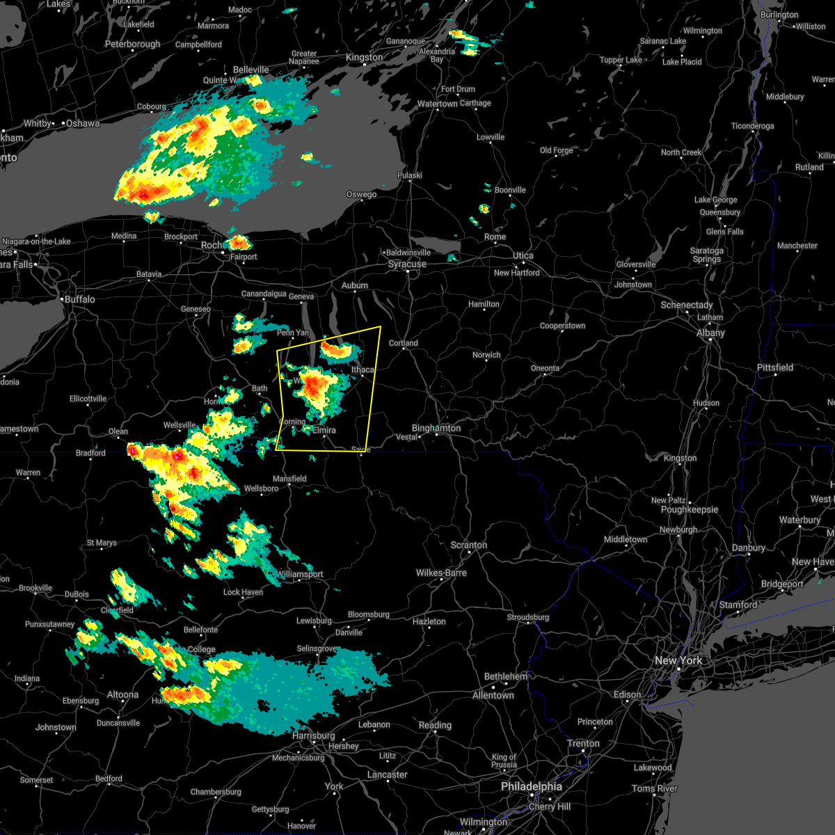 The severe thunderstorm warning for southeastern seneca, schuyler, southeastern yates, southern cayuga, chemung, southwestern tioga, eastern steuben and tompkins counties will expire at 930 pm edt, the storms which prompted the warning have weakened below severe limits, and no longer pose an immediate threat to life or property. therefore, the warning will be allowed to expire. however, small hail and gusty winds are still possible with these thunderstorms. The severe thunderstorm warning for southeastern seneca, schuyler, southeastern yates, southern cayuga, chemung, southwestern tioga, eastern steuben and tompkins counties will expire at 930 pm edt, the storms which prompted the warning have weakened below severe limits, and no longer pose an immediate threat to life or property. therefore, the warning will be allowed to expire. however, small hail and gusty winds are still possible with these thunderstorms.
|
| 6/13/2021 9:02 PM EDT |
 At 902 pm edt, severe thunderstorms were located along a line extending from caywood to near lawrenceville, moving east at 25 mph (radar indicated). Hazards include 60 mph wind gusts and quarter size hail. Hail damage to vehicles is expected. expect wind damage to roofs, siding, and trees. Locations impacted include, ithaca, elmira, corning, southport, big flats, horseheads, newfield, hector, waverly and elmira heights. At 902 pm edt, severe thunderstorms were located along a line extending from caywood to near lawrenceville, moving east at 25 mph (radar indicated). Hazards include 60 mph wind gusts and quarter size hail. Hail damage to vehicles is expected. expect wind damage to roofs, siding, and trees. Locations impacted include, ithaca, elmira, corning, southport, big flats, horseheads, newfield, hector, waverly and elmira heights.
|
| 6/13/2021 8:43 PM EDT |
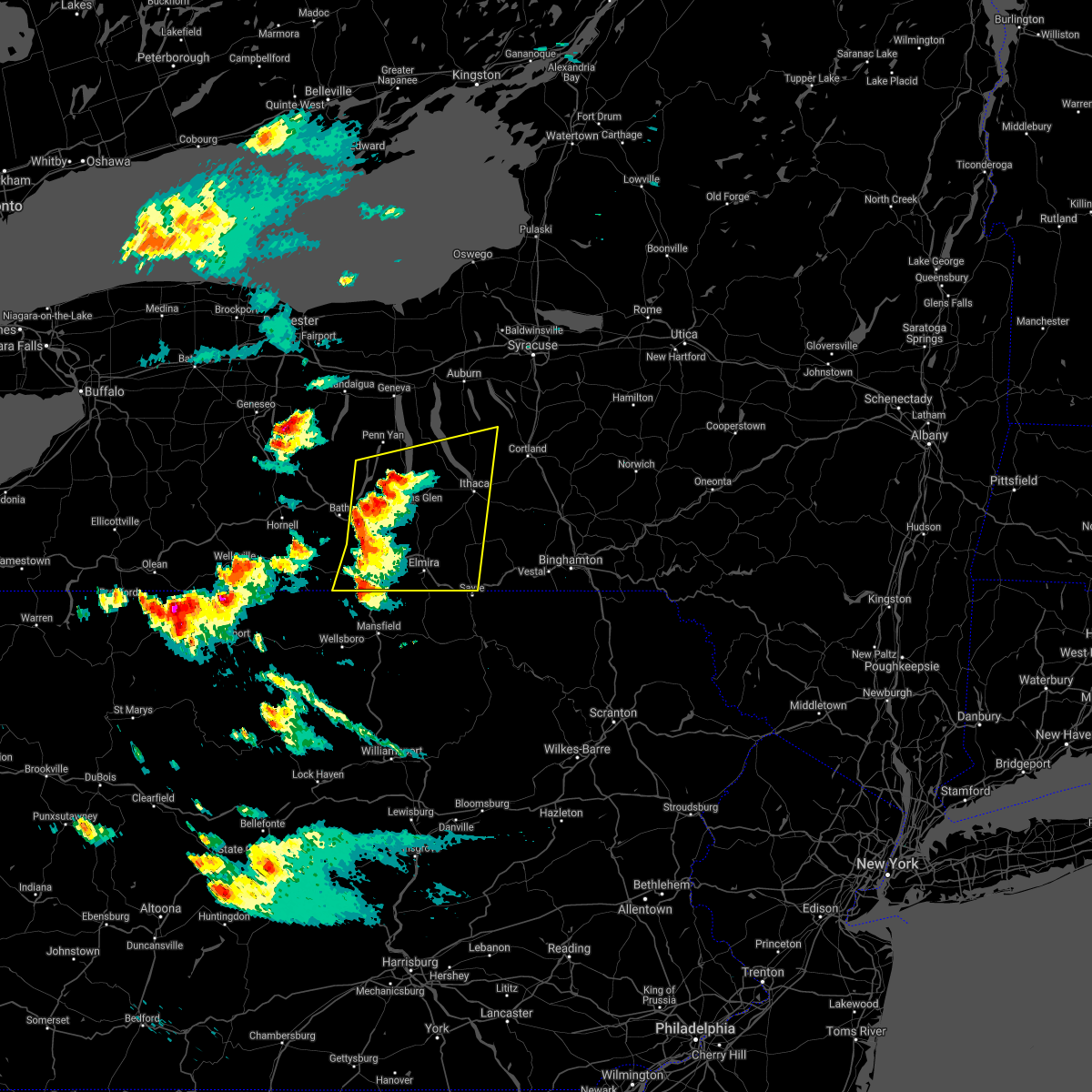 At 842 pm edt, severe thunderstorms were located along a line extending from porter corner to near elkland, moving east at 25 mph (radar indicated). Hazards include 60 mph wind gusts and quarter size hail. Hail damage to vehicles is expected. Expect wind damage to roofs, siding, and trees. At 842 pm edt, severe thunderstorms were located along a line extending from porter corner to near elkland, moving east at 25 mph (radar indicated). Hazards include 60 mph wind gusts and quarter size hail. Hail damage to vehicles is expected. Expect wind damage to roofs, siding, and trees.
|
| 6/13/2021 8:22 PM EDT |
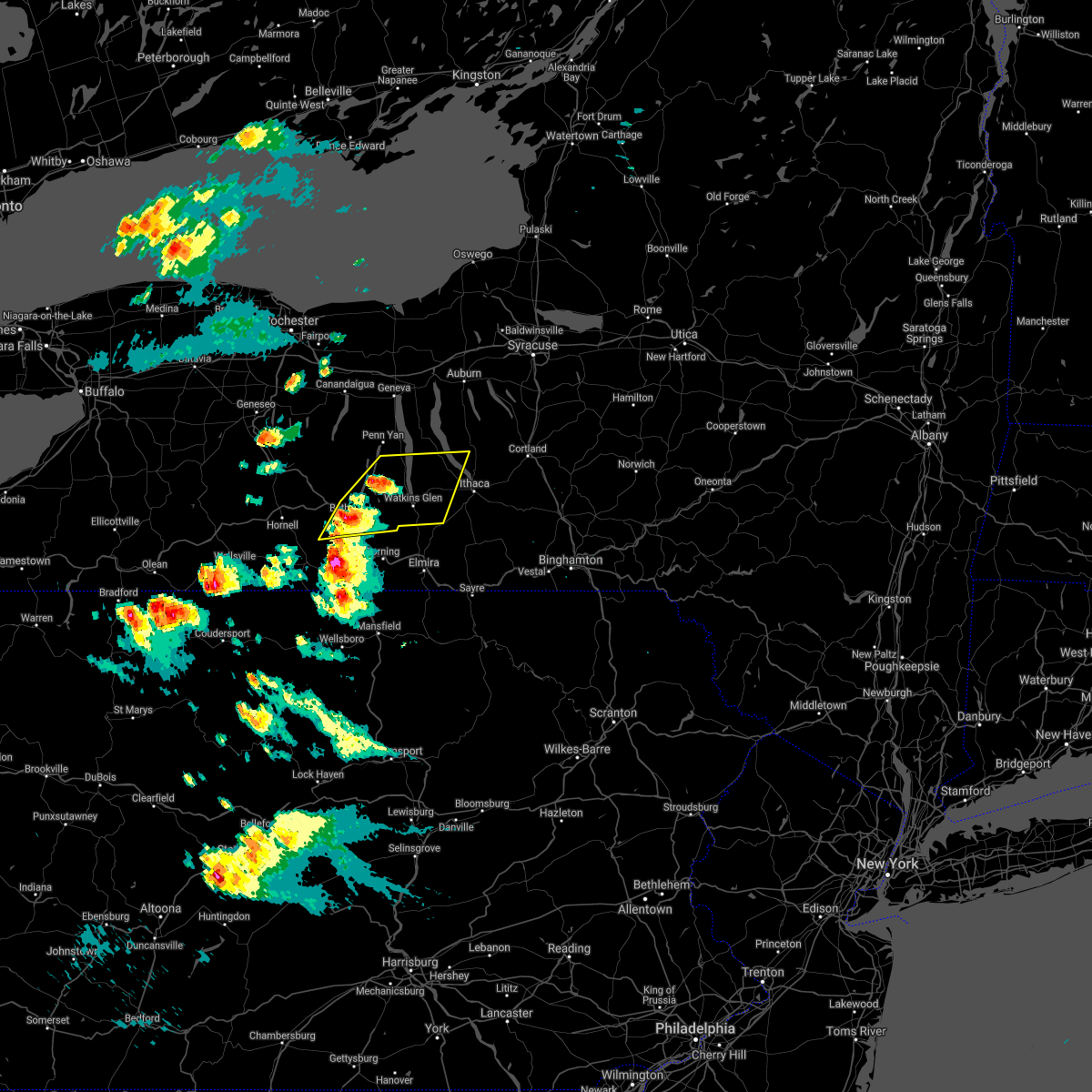 At 822 pm edt, severe thunderstorms were located along a line extending from near porter corner to near thurston, moving east at 25 mph (radar indicated). Hazards include 60 mph wind gusts and quarter size hail. Hail damage to vehicles is expected. Expect wind damage to roofs, siding, and trees. At 822 pm edt, severe thunderstorms were located along a line extending from near porter corner to near thurston, moving east at 25 mph (radar indicated). Hazards include 60 mph wind gusts and quarter size hail. Hail damage to vehicles is expected. Expect wind damage to roofs, siding, and trees.
|
| 8/27/2020 4:48 PM EDT |
 At 447 pm edt, clusters of severe thunderstorms extended from newfield to near newark valley. the strongest cluster of thunderstorms was located over newfield, or 9 miles southwest of ithaca, moving southeast at 45 mph (radar indicated). Hazards include 70 mph wind gusts and half dollar size hail. Hail damage to vehicles is expected. expect considerable tree damage. wind damage is also likely to mobile homes, roofs, and outbuildings. Locations impacted include, ithaca, newfield, owego, cayuga heights, lansing, enfield, danby, caroline, catharine and berkshire. At 447 pm edt, clusters of severe thunderstorms extended from newfield to near newark valley. the strongest cluster of thunderstorms was located over newfield, or 9 miles southwest of ithaca, moving southeast at 45 mph (radar indicated). Hazards include 70 mph wind gusts and half dollar size hail. Hail damage to vehicles is expected. expect considerable tree damage. wind damage is also likely to mobile homes, roofs, and outbuildings. Locations impacted include, ithaca, newfield, owego, cayuga heights, lansing, enfield, danby, caroline, catharine and berkshire.
|
| 8/27/2020 4:30 PM EDT |
 At 429 pm edt, a severe thunderstorm was located over burdett, or near watkins glen, moving southeast at 45 mph (radar indicated). Hazards include 70 mph wind gusts and half dollar size hail. Hail damage to vehicles is expected. expect considerable tree damage. Wind damage is also likely to mobile homes, roofs, and outbuildings. At 429 pm edt, a severe thunderstorm was located over burdett, or near watkins glen, moving southeast at 45 mph (radar indicated). Hazards include 70 mph wind gusts and half dollar size hail. Hail damage to vehicles is expected. expect considerable tree damage. Wind damage is also likely to mobile homes, roofs, and outbuildings.
|
| 8/27/2020 4:14 PM EDT |
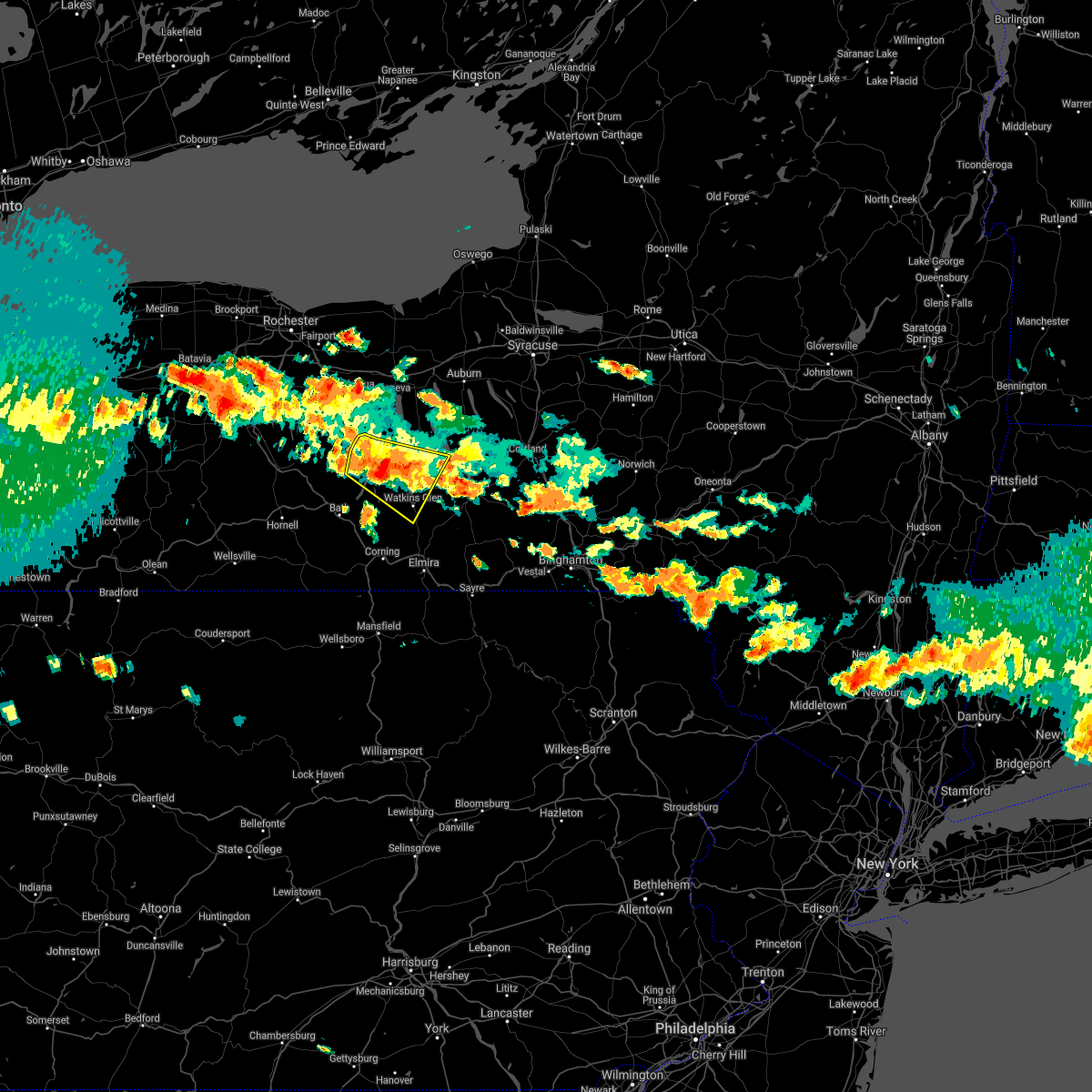 At 414 pm edt, a severe thunderstorm was located over porter corner, or over dundee, moving southeast at 45 mph (radar indicated). Hazards include 70 mph wind gusts and half dollar size hail. Hail damage to vehicles is expected. expect considerable tree damage. wind damage is also likely to mobile homes, roofs, and outbuildings. Locations impacted include, penn yan, hector, starkey, covert, watkins glen, dundee, montour falls, tyrone, pulteney and wayne. At 414 pm edt, a severe thunderstorm was located over porter corner, or over dundee, moving southeast at 45 mph (radar indicated). Hazards include 70 mph wind gusts and half dollar size hail. Hail damage to vehicles is expected. expect considerable tree damage. wind damage is also likely to mobile homes, roofs, and outbuildings. Locations impacted include, penn yan, hector, starkey, covert, watkins glen, dundee, montour falls, tyrone, pulteney and wayne.
|
| 8/27/2020 3:58 PM EDT |
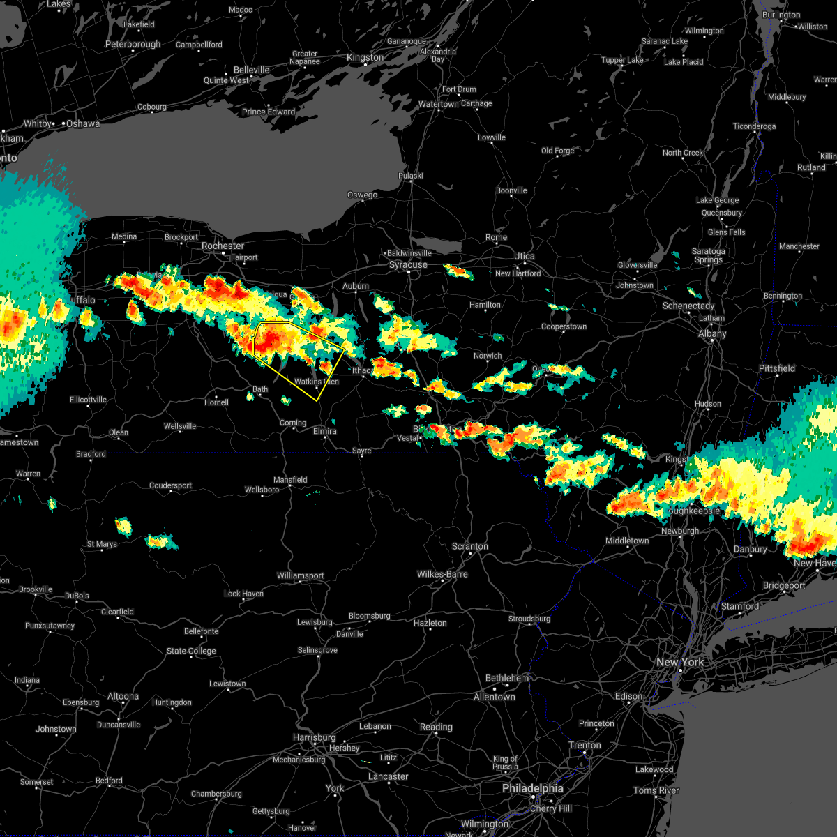 At 357 pm edt, a severe thunderstorm was located over guyanoga, or 8 miles west of penn yan, moving southeast at 40 mph (radar indicated). Hazards include two inch hail and 70 mph wind gusts. People and animals outdoors will be injured. expect hail damage to roofs, siding, windows, and vehicles. expect considerable tree damage. wind damage is also likely to mobile homes, roofs, and outbuildings. Locations impacted include, penn yan, hector, starkey, benton, covert, potter, watkins glen, dundee, montour falls and tyrone. At 357 pm edt, a severe thunderstorm was located over guyanoga, or 8 miles west of penn yan, moving southeast at 40 mph (radar indicated). Hazards include two inch hail and 70 mph wind gusts. People and animals outdoors will be injured. expect hail damage to roofs, siding, windows, and vehicles. expect considerable tree damage. wind damage is also likely to mobile homes, roofs, and outbuildings. Locations impacted include, penn yan, hector, starkey, benton, covert, potter, watkins glen, dundee, montour falls and tyrone.
|
| 8/27/2020 3:43 PM EDT |
 At 342 pm edt, a severe thunderstorm was located near vine valley, or 14 miles southwest of canandaigua, moving southeast at 40 mph (radar indicated). Hazards include two inch hail and 70 mph wind gusts. People and animals outdoors will be injured. expect hail damage to roofs, siding, windows, and vehicles. expect considerable tree damage. Wind damage is also likely to mobile homes, roofs, and outbuildings. At 342 pm edt, a severe thunderstorm was located near vine valley, or 14 miles southwest of canandaigua, moving southeast at 40 mph (radar indicated). Hazards include two inch hail and 70 mph wind gusts. People and animals outdoors will be injured. expect hail damage to roofs, siding, windows, and vehicles. expect considerable tree damage. Wind damage is also likely to mobile homes, roofs, and outbuildings.
|
| 7/19/2020 4:29 PM EDT |
 At 427 pm edt, severe thunderstorms were located along a line extending from near auburn to romulus to townsendville to near hornby, moving east at 40 mph. trees have been blown down with this line of thunderstorms (law enforcement). Hazards include 60 mph wind gusts and penny size hail. Expect damage to roofs, siding, and trees. Locations impacted include, ithaca, auburn, corning, big flats, seneca falls, horseheads, newfield, hector, romulus and fayette. At 427 pm edt, severe thunderstorms were located along a line extending from near auburn to romulus to townsendville to near hornby, moving east at 40 mph. trees have been blown down with this line of thunderstorms (law enforcement). Hazards include 60 mph wind gusts and penny size hail. Expect damage to roofs, siding, and trees. Locations impacted include, ithaca, auburn, corning, big flats, seneca falls, horseheads, newfield, hector, romulus and fayette.
|
| 7/19/2020 4:14 PM EDT |
 At 411 pm edt, severe thunderstorms were located along a line extending from near lehigh vallley junction to near benton to near himrod to campbell, moving east at 35 mph. trees have been blown down with this line of thunderstorms (law enforcement). Hazards include 60 mph wind gusts and penny size hail. Expect damage to roofs, siding, and trees. Locations impacted include, ithaca, auburn, corning, big flats, seneca falls, horseheads, newfield, waterloo, penn yan and hector. At 411 pm edt, severe thunderstorms were located along a line extending from near lehigh vallley junction to near benton to near himrod to campbell, moving east at 35 mph. trees have been blown down with this line of thunderstorms (law enforcement). Hazards include 60 mph wind gusts and penny size hail. Expect damage to roofs, siding, and trees. Locations impacted include, ithaca, auburn, corning, big flats, seneca falls, horseheads, newfield, waterloo, penn yan and hector.
|
| 7/19/2020 3:56 PM EDT |
 At 354 pm edt, severe thunderstorms were located along a line extending from near phelps to rushville to near branchport to west cameron, moving east at 35 mph. trees have been blown down in steuben county, in howard, with this line of thunderstorms (law enforcement). Hazards include 60 mph wind gusts and penny size hail. expect damage to roofs, siding, and trees At 354 pm edt, severe thunderstorms were located along a line extending from near phelps to rushville to near branchport to west cameron, moving east at 35 mph. trees have been blown down in steuben county, in howard, with this line of thunderstorms (law enforcement). Hazards include 60 mph wind gusts and penny size hail. expect damage to roofs, siding, and trees
|
| 5/25/2020 5:38 PM EDT |
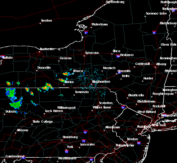 At 538 pm edt, a severe thunderstorm was located near reynoldsville, or near odessa, moving southeast at 20 mph (radar indicated). Hazards include 60 mph wind gusts and quarter size hail. Hail damage to vehicles is expected. Expect wind damage to roofs, siding, and trees. At 538 pm edt, a severe thunderstorm was located near reynoldsville, or near odessa, moving southeast at 20 mph (radar indicated). Hazards include 60 mph wind gusts and quarter size hail. Hail damage to vehicles is expected. Expect wind damage to roofs, siding, and trees.
|
| 5/25/2020 5:10 PM EDT |
 The severe thunderstorm warning for southwestern seneca, northeastern schuyler and west central tompkins counties will expire at 515 pm edt, the storm which prompted the warning has weakened below severe limits, and no longer poses an immediate threat to life or property. therefore, the warning will be allowed to expire. The severe thunderstorm warning for southwestern seneca, northeastern schuyler and west central tompkins counties will expire at 515 pm edt, the storm which prompted the warning has weakened below severe limits, and no longer poses an immediate threat to life or property. therefore, the warning will be allowed to expire.
|
| 5/25/2020 5:00 PM EDT |
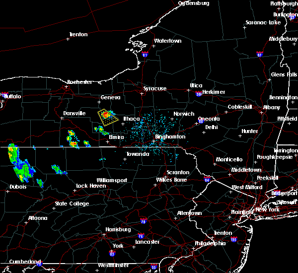 At 459 pm edt, a severe thunderstorm was located over lodi, or 10 miles northeast of dundee, moving southeast at 20 mph (radar indicated). Hazards include 60 mph wind gusts and quarter size hail. Hail damage to vehicles is expected. expect wind damage to roofs, siding, and trees. Locations impacted include, hector, covert, trumansburg, ovid, interlaken, burdett, lodi, caywood, townsendville and reynoldsville. At 459 pm edt, a severe thunderstorm was located over lodi, or 10 miles northeast of dundee, moving southeast at 20 mph (radar indicated). Hazards include 60 mph wind gusts and quarter size hail. Hail damage to vehicles is expected. expect wind damage to roofs, siding, and trees. Locations impacted include, hector, covert, trumansburg, ovid, interlaken, burdett, lodi, caywood, townsendville and reynoldsville.
|
| 5/25/2020 4:42 PM EDT |
 At 442 pm edt, a severe thunderstorm was located over ovid, or 10 miles east of penn yan, moving southeast at 20 mph (radar indicated). Hazards include 60 mph wind gusts and quarter size hail. Hail damage to vehicles is expected. Expect wind damage to roofs, siding, and trees. At 442 pm edt, a severe thunderstorm was located over ovid, or 10 miles east of penn yan, moving southeast at 20 mph (radar indicated). Hazards include 60 mph wind gusts and quarter size hail. Hail damage to vehicles is expected. Expect wind damage to roofs, siding, and trees.
|
| 10/31/2019 5:56 PM EDT |
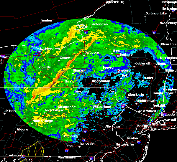 At 556 pm edt, severe thunderstorms were located along a line extending from sheldrake to near elkland, moving east at 35 mph (radar indicated). Hazards include 60 mph wind gusts. expect damage to roofs, siding, and trees At 556 pm edt, severe thunderstorms were located along a line extending from sheldrake to near elkland, moving east at 35 mph (radar indicated). Hazards include 60 mph wind gusts. expect damage to roofs, siding, and trees
|
| 8/8/2019 1:59 PM EDT |
 At 158 pm edt, severe thunderstorms were located along a line extending from near lysander to near scipio center to glenora, moving northeast at 45 mph (radar indicated). Hazards include 60 mph wind gusts and penny size hail. expect damage to roofs, siding, and trees At 158 pm edt, severe thunderstorms were located along a line extending from near lysander to near scipio center to glenora, moving northeast at 45 mph (radar indicated). Hazards include 60 mph wind gusts and penny size hail. expect damage to roofs, siding, and trees
|
| 8/8/2019 1:54 PM EDT |
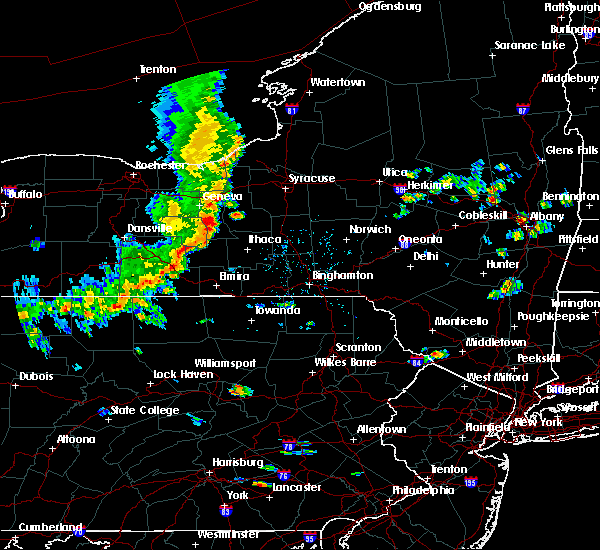 At 153 pm edt, severe thunderstorms were located along a line extending from glenora to near troupsburg, moving east at 30 mph (law enforcement has reported trees and wires down in multiple locations). Hazards include 60 mph wind gusts and penny size hail. Expect damage to roofs, siding, and trees. Locations impacted include, corning, big flats, horseheads, hector, starkey, campbell, caton, lindley, watkins glen and painted post. At 153 pm edt, severe thunderstorms were located along a line extending from glenora to near troupsburg, moving east at 30 mph (law enforcement has reported trees and wires down in multiple locations). Hazards include 60 mph wind gusts and penny size hail. Expect damage to roofs, siding, and trees. Locations impacted include, corning, big flats, horseheads, hector, starkey, campbell, caton, lindley, watkins glen and painted post.
|
| 8/8/2019 1:28 PM EDT |
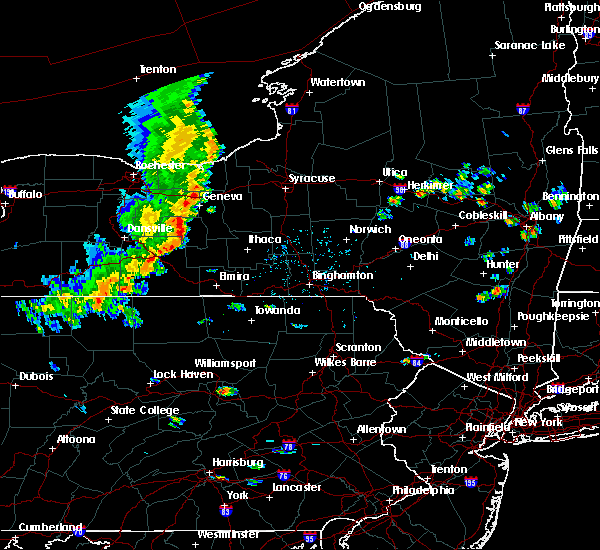 At 128 pm edt, severe thunderstorms were located along a line extending from pulteney to near whitesville, moving east at 30 mph (radar indicated). Hazards include 60 mph wind gusts and penny size hail. expect damage to roofs, siding, and trees At 128 pm edt, severe thunderstorms were located along a line extending from pulteney to near whitesville, moving east at 30 mph (radar indicated). Hazards include 60 mph wind gusts and penny size hail. expect damage to roofs, siding, and trees
|
| 7/30/2019 3:11 PM EDT |
 At 311 pm edt, severe thunderstorms were located along a line extending from near painted post to south corning to caton, moving northeast at 30 mph (radar indicated). Hazards include 60 mph wind gusts. Expect damage to roofs, siding, and trees. Locations impacted include, elmira, corning, southport, big flats, horseheads, elmira heights, caton, erin, watkins glen and painted post. At 311 pm edt, severe thunderstorms were located along a line extending from near painted post to south corning to caton, moving northeast at 30 mph (radar indicated). Hazards include 60 mph wind gusts. Expect damage to roofs, siding, and trees. Locations impacted include, elmira, corning, southport, big flats, horseheads, elmira heights, caton, erin, watkins glen and painted post.
|
| 7/30/2019 2:54 PM EDT |
 The national weather service in binghamton has issued a * severe thunderstorm warning for. schuyler county in central new york. western chemung county in central new york. southeastern steuben county in central new york. Until 345 pm edt. The national weather service in binghamton has issued a * severe thunderstorm warning for. schuyler county in central new york. western chemung county in central new york. southeastern steuben county in central new york. Until 345 pm edt.
|
| 6/20/2019 12:08 PM EDT |
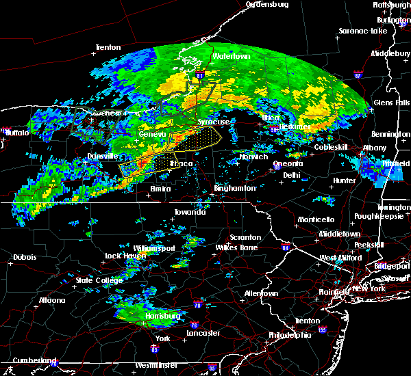 At 1207 pm edt, a severe thunderstorm was located over caywood, or 7 miles east of dundee, moving east at 40 mph (law enforcement). Hazards include 60 mph wind gusts. Expect damage to roofs, siding, and trees. Locations impacted include, hector, cayuga heights, starkey, lansing, covert, genoa, ledyard, trumansburg, dundee and tyrone. At 1207 pm edt, a severe thunderstorm was located over caywood, or 7 miles east of dundee, moving east at 40 mph (law enforcement). Hazards include 60 mph wind gusts. Expect damage to roofs, siding, and trees. Locations impacted include, hector, cayuga heights, starkey, lansing, covert, genoa, ledyard, trumansburg, dundee and tyrone.
|
| 6/20/2019 11:46 AM EDT |
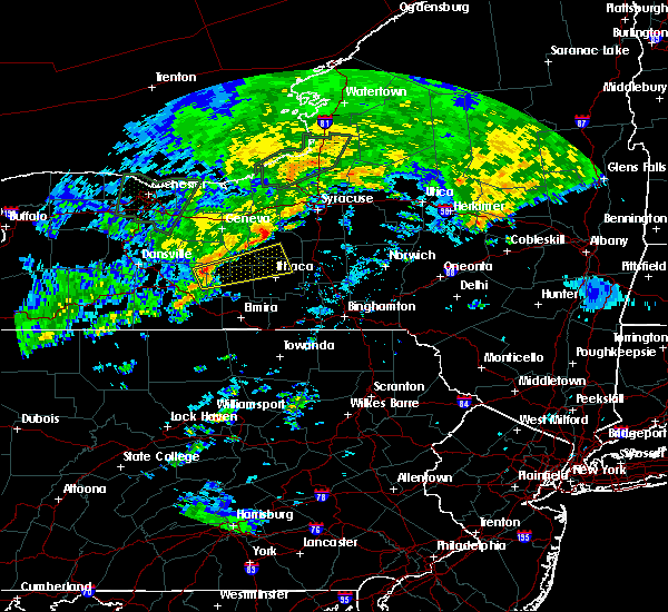 At 1145 am edt, a severe thunderstorm was located near tyrone, or near dundee, moving east at 40 mph (law enforcement). Hazards include 60 mph wind gusts. expect damage to roofs, siding, and trees At 1145 am edt, a severe thunderstorm was located near tyrone, or near dundee, moving east at 40 mph (law enforcement). Hazards include 60 mph wind gusts. expect damage to roofs, siding, and trees
|
| 4/14/2019 11:40 PM EDT |
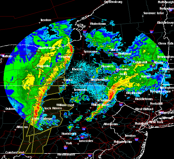 The severe thunderstorm warning for southwestern seneca, schuyler, eastern yates and eastern steuben counties will expire at 1145 pm edt, the storms which prompted the warning have weakened below severe limits, and no longer pose an immediate threat to life or property. therefore, the warning will be allowed to expire. however gusty winds are still possible with these thunderstorms. a tornado watch remains in effect until 500 am edt for central new york. The severe thunderstorm warning for southwestern seneca, schuyler, eastern yates and eastern steuben counties will expire at 1145 pm edt, the storms which prompted the warning have weakened below severe limits, and no longer pose an immediate threat to life or property. therefore, the warning will be allowed to expire. however gusty winds are still possible with these thunderstorms. a tornado watch remains in effect until 500 am edt for central new york.
|
| 4/14/2019 11:24 PM EDT |
 At 1124 pm edt, severe thunderstorms were located along a line extending from willard to near keuka park to near sonora, moving northeast at 50 mph (radar indicated). Hazards include 60 mph wind gusts. Expect damage to roofs, siding, and trees. Locations impacted include, bath, hector, romulus, starkey, campbell, urbana, watkins glen, dundee, montour falls and hornby. At 1124 pm edt, severe thunderstorms were located along a line extending from willard to near keuka park to near sonora, moving northeast at 50 mph (radar indicated). Hazards include 60 mph wind gusts. Expect damage to roofs, siding, and trees. Locations impacted include, bath, hector, romulus, starkey, campbell, urbana, watkins glen, dundee, montour falls and hornby.
|
| 4/14/2019 11:04 PM EDT |
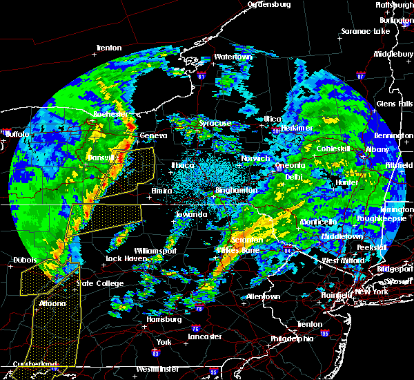 At 1104 pm edt, severe thunderstorms were located along a line extending from yatesville to near prattsburg to west cameron, moving northeast at 50 mph (radar indicated). Hazards include 60 mph wind gusts. Expect damage to roofs, siding, and trees. Locations impacted include, bath, penn yan, hector, romulus, starkey, campbell, benton, urbana, potter and watkins glen. At 1104 pm edt, severe thunderstorms were located along a line extending from yatesville to near prattsburg to west cameron, moving northeast at 50 mph (radar indicated). Hazards include 60 mph wind gusts. Expect damage to roofs, siding, and trees. Locations impacted include, bath, penn yan, hector, romulus, starkey, campbell, benton, urbana, potter and watkins glen.
|
| 4/14/2019 10:45 PM EDT |
 At 1045 pm edt, severe thunderstorms were located along a line extending from near naples to near howard to greenwood, moving northeast at 50 mph (radar indicated). Hazards include 60 mph wind gusts. expect damage to roofs, siding, and trees At 1045 pm edt, severe thunderstorms were located along a line extending from near naples to near howard to greenwood, moving northeast at 50 mph (radar indicated). Hazards include 60 mph wind gusts. expect damage to roofs, siding, and trees
|
| 9/21/2018 8:10 PM EDT |
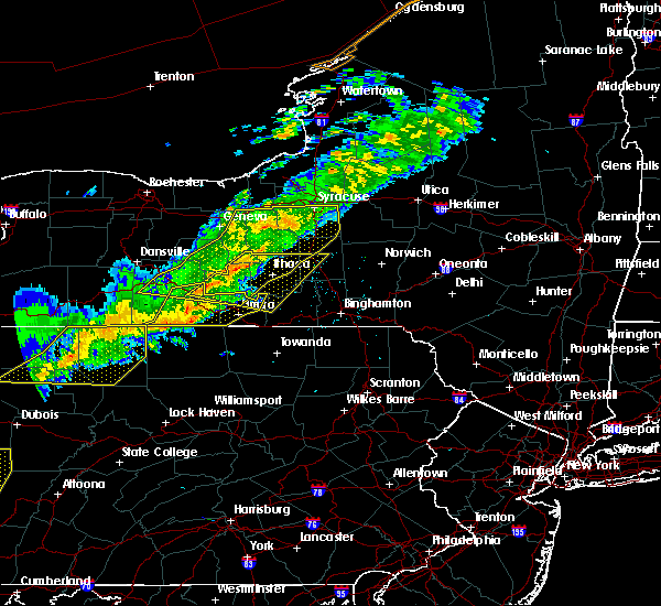 The national weather service in binghamton has issued a * severe thunderstorm warning for. southeastern seneca county in central new york. schuyler county in central new york. northern chemung county in central new york. Southwestern cortland county in central new york. The national weather service in binghamton has issued a * severe thunderstorm warning for. southeastern seneca county in central new york. schuyler county in central new york. northern chemung county in central new york. Southwestern cortland county in central new york.
|
| 9/21/2018 7:40 PM EDT |
 At 739 pm edt, severe thunderstorms were located along a line extending from near lehigh vallley junction to near canoga to near dresden to bluff point to near pulteney to near avoca to howard, moving east at 55 mph (radar indicated). Hazards include 60 mph wind gusts. Expect damage to roofs, siding, and trees. severe thunderstorms will be near, seneca falls, romulus and montezuma around 745 pm edt. auburn, sennett and ovid around 750 pm edt. dundee, starkey and fleming around 755 pm edt. hector, owasco and campbell around 800 pm edt. covert, genoa and marcellus around 805 pm edt. watkins glen, locke and moravia around 810 pm edt. Ithaca, montour falls and odessa around 815 pm edt. At 739 pm edt, severe thunderstorms were located along a line extending from near lehigh vallley junction to near canoga to near dresden to bluff point to near pulteney to near avoca to howard, moving east at 55 mph (radar indicated). Hazards include 60 mph wind gusts. Expect damage to roofs, siding, and trees. severe thunderstorms will be near, seneca falls, romulus and montezuma around 745 pm edt. auburn, sennett and ovid around 750 pm edt. dundee, starkey and fleming around 755 pm edt. hector, owasco and campbell around 800 pm edt. covert, genoa and marcellus around 805 pm edt. watkins glen, locke and moravia around 810 pm edt. Ithaca, montour falls and odessa around 815 pm edt.
|
| 5/4/2018 6:03 PM EDT |
 At 602 pm edt, severe thunderstorms were located along a line extending from near burdett to near hornby to near addison, moving east at 70 mph (radar indicated). Hazards include 60 mph wind gusts. Expect damage to trees, and power lines. these severe storms will be near, watkins glen, burdett and wedgewood around 605 pm edt. montour falls, odessa and enfield around 610 pm edt. ithaca, corning and caton around 615 pm edt. west elmira, southport and big flats around 620 pm edt. elmira, horseheads and elmira heights around 625 pm edt. Caroline, erin and van etten around 630 pm edt. At 602 pm edt, severe thunderstorms were located along a line extending from near burdett to near hornby to near addison, moving east at 70 mph (radar indicated). Hazards include 60 mph wind gusts. Expect damage to trees, and power lines. these severe storms will be near, watkins glen, burdett and wedgewood around 605 pm edt. montour falls, odessa and enfield around 610 pm edt. ithaca, corning and caton around 615 pm edt. west elmira, southport and big flats around 620 pm edt. elmira, horseheads and elmira heights around 625 pm edt. Caroline, erin and van etten around 630 pm edt.
|
| 5/4/2018 5:49 PM EDT |
 At 548 pm edt, severe thunderstorms were located along a line extending from near syracuse to kelloggsville to near genoa to near reading center, moving east at 75 mph (radar indicated). Hazards include 60 mph wind gusts. Expect damage to trees, and power lines. severe thunderstorms will be near, pompey, manlius and otisco around 555 pm edt. chittenango, cazenovia and preble around 600 pm edt. cortland, newfield and enfield around 605 pm edt. ithaca, danby and morrisville around 610 pm edt. hamilton, caroline and stockbridge around 615 pm edt. berkshire, lebanon and richford around 620 pm edt. nanticoke, waterville and sherburne around 625 pm edt. norwich, marathon and brookfield around 630 pm edt. A tornado watch remains in effect until 1000 pm edt for central new york. At 548 pm edt, severe thunderstorms were located along a line extending from near syracuse to kelloggsville to near genoa to near reading center, moving east at 75 mph (radar indicated). Hazards include 60 mph wind gusts. Expect damage to trees, and power lines. severe thunderstorms will be near, pompey, manlius and otisco around 555 pm edt. chittenango, cazenovia and preble around 600 pm edt. cortland, newfield and enfield around 605 pm edt. ithaca, danby and morrisville around 610 pm edt. hamilton, caroline and stockbridge around 615 pm edt. berkshire, lebanon and richford around 620 pm edt. nanticoke, waterville and sherburne around 625 pm edt. norwich, marathon and brookfield around 630 pm edt. A tornado watch remains in effect until 1000 pm edt for central new york.
|
| 5/4/2018 5:45 PM EDT |
 The national weather service in binghamton has issued a * severe thunderstorm warning for. southern schuyler county in central new york. chemung county in central new york. tioga county in central new york. Southern steuben county in central new york. The national weather service in binghamton has issued a * severe thunderstorm warning for. southern schuyler county in central new york. chemung county in central new york. tioga county in central new york. Southern steuben county in central new york.
|
| 8/22/2017 5:21 PM EDT |
 At 521 pm edt, severe thunderstorms were located along a line extending from scipio center to mecklenburg, moving east at 45 mph (radar indicated). Hazards include 60 mph wind gusts. Expect damage to trees, and power lines. severe thunderstorms will be near, moravia, casowasco and cascade around 525 pm edt. owasco, niles and montville around 530 pm edt. ithaca, sempronius and kelloggsville around 535 pm edt. scott and besemer around 540 pm edt. otisco, groton and preble around 545 pm edt. dryden and tully around 550 pm edt. virgil, harford and south cortland around 555 pm edt. cortland, marathon and mcgraw around 600 pm edt. A tornado watch remains in effect until 900 pm edt for central new york. At 521 pm edt, severe thunderstorms were located along a line extending from scipio center to mecklenburg, moving east at 45 mph (radar indicated). Hazards include 60 mph wind gusts. Expect damage to trees, and power lines. severe thunderstorms will be near, moravia, casowasco and cascade around 525 pm edt. owasco, niles and montville around 530 pm edt. ithaca, sempronius and kelloggsville around 535 pm edt. scott and besemer around 540 pm edt. otisco, groton and preble around 545 pm edt. dryden and tully around 550 pm edt. virgil, harford and south cortland around 555 pm edt. cortland, marathon and mcgraw around 600 pm edt. A tornado watch remains in effect until 900 pm edt for central new york.
|
| 8/4/2017 6:27 PM EDT |
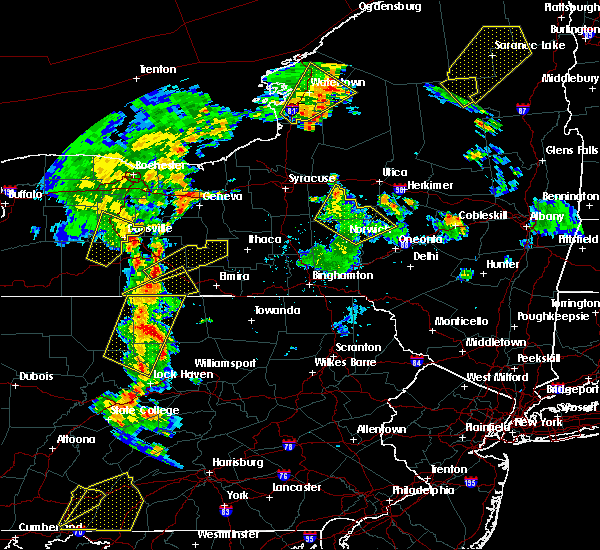 At 627 pm edt, a severe thunderstorm was located near cameron, or 15 miles west of corning, moving northeast at 45 mph (radar indicated). Hazards include 60 mph wind gusts and quarter size hail. Minor hail damage to vehicles is possible. expect wind to cause damage to trees, and power lines. this severe thunderstorm will be near, thurston around 630 pm edt. bath and campbell around 635 pm edt. savona around 640 pm edt. hornby, hammondsport and sonora around 645 pm edt. monterey around 650 pm edt. tyrone around 655 pm edt. reading center and wedgewood around 700 pm edt. Watkins glen, montour falls and burdett around 705 pm edt. At 627 pm edt, a severe thunderstorm was located near cameron, or 15 miles west of corning, moving northeast at 45 mph (radar indicated). Hazards include 60 mph wind gusts and quarter size hail. Minor hail damage to vehicles is possible. expect wind to cause damage to trees, and power lines. this severe thunderstorm will be near, thurston around 630 pm edt. bath and campbell around 635 pm edt. savona around 640 pm edt. hornby, hammondsport and sonora around 645 pm edt. monterey around 650 pm edt. tyrone around 655 pm edt. reading center and wedgewood around 700 pm edt. Watkins glen, montour falls and burdett around 705 pm edt.
|
| 6/18/2017 7:16 PM EDT |
 At 715 pm edt, severe thunderstorms were located along a line extending from near monterey to hornby to near erwins to near elkland, moving northeast at 55 mph (radar indicated). Hazards include 60 mph wind gusts and penny size hail. Expect damage to trees, and power lines. severe thunderstorms will be near, hornby, east corning and monterey around 720 pm edt. watkins glen, montour falls and odessa around 730 pm edt. big flats and millport around 735 pm edt. elmira, west elmira and horseheads around 740 pm edt. enfield and breesport around 745 pm edt. newfield around 750 pm edt. danby around 755 pm edt. Ithaca, freeville and besemer around 800 pm edt. At 715 pm edt, severe thunderstorms were located along a line extending from near monterey to hornby to near erwins to near elkland, moving northeast at 55 mph (radar indicated). Hazards include 60 mph wind gusts and penny size hail. Expect damage to trees, and power lines. severe thunderstorms will be near, hornby, east corning and monterey around 720 pm edt. watkins glen, montour falls and odessa around 730 pm edt. big flats and millport around 735 pm edt. elmira, west elmira and horseheads around 740 pm edt. enfield and breesport around 745 pm edt. newfield around 750 pm edt. danby around 755 pm edt. Ithaca, freeville and besemer around 800 pm edt.
|
| 5/1/2017 6:05 PM EDT |
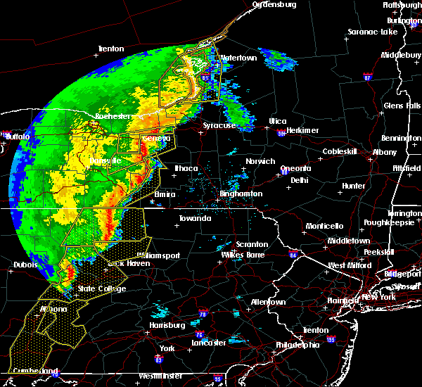 At 604 pm edt, severe thunderstorms were located along a line extending from near willard to townsendville to burdett to near monterey to coopers plains to near elkland, moving northeast at 60 mph (radar indicated). Hazards include 70 mph wind gusts and penny size hail. Expect considerable tree damage. damage is likely to mobile homes, roofs, and outbuildings. these severe storms will be near, covert, interlaken and ovid around 610 pm edt. burdett around 615 pm edt. watkins glen, odessa and catharine around 625 pm edt. horseheads north around 630 pm edt. A tornado watch remains in effect until 1000 pm edt for central new york. At 604 pm edt, severe thunderstorms were located along a line extending from near willard to townsendville to burdett to near monterey to coopers plains to near elkland, moving northeast at 60 mph (radar indicated). Hazards include 70 mph wind gusts and penny size hail. Expect considerable tree damage. damage is likely to mobile homes, roofs, and outbuildings. these severe storms will be near, covert, interlaken and ovid around 610 pm edt. burdett around 615 pm edt. watkins glen, odessa and catharine around 625 pm edt. horseheads north around 630 pm edt. A tornado watch remains in effect until 1000 pm edt for central new york.
|
| 5/1/2017 5:40 PM EDT |
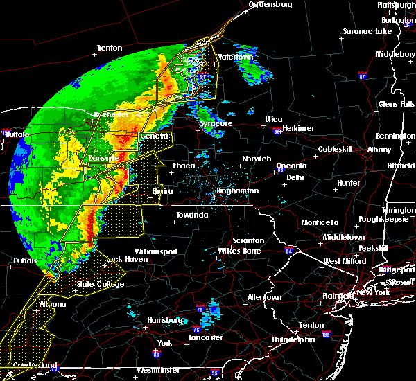 At 539 pm edt, severe thunderstorms were located along a line extending from prattsburg to near hammondsport to thurston to near woodhull to near westfield to 6 miles south of harrison valley, moving northeast at 60 mph (radar indicated). Hazards include 70 mph wind gusts and penny size hail. Expect considerable tree damage. damage is likely to mobile homes, roofs, and outbuildings. severe thunderstorms will be near, urbana, tyrone and pulteney around 545 pm edt. thurston, gang mills and keuka park around 550 pm edt. dundee, starkey and lakemont around 555 pm edt. hornby, caywood and reading center around 600 pm edt. campbell, lodi and rock stream around 605 pm edt. hector, lindley and interlaken around 610 pm edt. corning, watkins glen and montour falls around 615 pm edt. big flats, covert and reynoldsville around 620 pm edt. A tornado watch remains in effect until 1000 pm edt for central new york, and northeastern pennsylvania. At 539 pm edt, severe thunderstorms were located along a line extending from prattsburg to near hammondsport to thurston to near woodhull to near westfield to 6 miles south of harrison valley, moving northeast at 60 mph (radar indicated). Hazards include 70 mph wind gusts and penny size hail. Expect considerable tree damage. damage is likely to mobile homes, roofs, and outbuildings. severe thunderstorms will be near, urbana, tyrone and pulteney around 545 pm edt. thurston, gang mills and keuka park around 550 pm edt. dundee, starkey and lakemont around 555 pm edt. hornby, caywood and reading center around 600 pm edt. campbell, lodi and rock stream around 605 pm edt. hector, lindley and interlaken around 610 pm edt. corning, watkins glen and montour falls around 615 pm edt. big flats, covert and reynoldsville around 620 pm edt. A tornado watch remains in effect until 1000 pm edt for central new york, and northeastern pennsylvania.
|
| 7/25/2016 2:13 PM EDT |
 At 212 pm edt, a severe thunderstorm was located over caton, or near corning, moving east at 30 mph (radar indicated). Hazards include 60 mph wind gusts and quarter size hail. Hail damage to vehicles is expected. expect wind damage to roofs, siding, and trees. this severe thunderstorm will be near, east corning around 225 pm edt. big flats around 230 pm edt. southport and pine city around 235 pm edt. elmira, west elmira and horseheads around 240 pm edt. wellsburg around 245 pm edt. breesport and lowman around 250 pm edt. Erin around 255 pm edt. At 212 pm edt, a severe thunderstorm was located over caton, or near corning, moving east at 30 mph (radar indicated). Hazards include 60 mph wind gusts and quarter size hail. Hail damage to vehicles is expected. expect wind damage to roofs, siding, and trees. this severe thunderstorm will be near, east corning around 225 pm edt. big flats around 230 pm edt. southport and pine city around 235 pm edt. elmira, west elmira and horseheads around 240 pm edt. wellsburg around 245 pm edt. breesport and lowman around 250 pm edt. Erin around 255 pm edt.
|
| 7/25/2016 2:13 PM EDT |
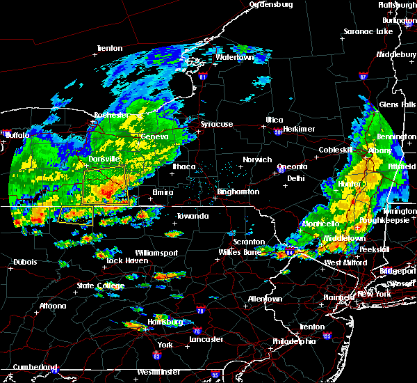 At 212 pm edt, a severe thunderstorm was located over caton, or near corning, moving east at 30 mph (radar indicated). Hazards include 60 mph wind gusts and quarter size hail. Hail damage to vehicles is expected. expect wind damage to roofs, siding, and trees. this severe thunderstorm will be near, east corning around 225 pm edt. big flats around 230 pm edt. southport and pine city around 235 pm edt. elmira, west elmira and horseheads around 240 pm edt. wellsburg around 245 pm edt. breesport and lowman around 250 pm edt. Erin around 255 pm edt. At 212 pm edt, a severe thunderstorm was located over caton, or near corning, moving east at 30 mph (radar indicated). Hazards include 60 mph wind gusts and quarter size hail. Hail damage to vehicles is expected. expect wind damage to roofs, siding, and trees. this severe thunderstorm will be near, east corning around 225 pm edt. big flats around 230 pm edt. southport and pine city around 235 pm edt. elmira, west elmira and horseheads around 240 pm edt. wellsburg around 245 pm edt. breesport and lowman around 250 pm edt. Erin around 255 pm edt.
|
| 7/13/2016 5:59 PM EDT |
 At 559 pm edt, a severe thunderstorm was located near groton, or 8 miles northeast of ithaca, moving east at 25 mph (radar indicated). Hazards include 60 mph wind gusts and quarter size hail. Hail damage to vehicles is expected. expect wind damage to roofs, siding, and trees. this severe storm will be near, freeville around 610 pm edt. Dryden around 615 pm edt. At 559 pm edt, a severe thunderstorm was located near groton, or 8 miles northeast of ithaca, moving east at 25 mph (radar indicated). Hazards include 60 mph wind gusts and quarter size hail. Hail damage to vehicles is expected. expect wind damage to roofs, siding, and trees. this severe storm will be near, freeville around 610 pm edt. Dryden around 615 pm edt.
|
| 7/13/2016 5:26 PM EDT |
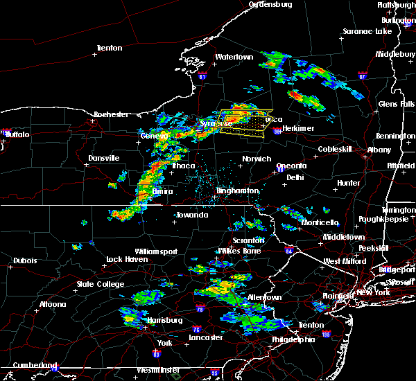 At 526 pm edt, a severe thunderstorm was located over perry city, or 10 miles northeast of watkins glen, moving east at 20 mph (radar indicated). Hazards include 60 mph wind gusts and quarter size hail. Hail damage to vehicles is expected. expect wind damage to roofs, siding, and trees. this severe thunderstorm will be near, perry city and mecklenburg around 530 pm edt. trumansburg around 535 pm edt. enfield and taughannock falls around 545 pm edt. newfield around 555 pm edt. ithaca around 605 pm edt. danby around 615 pm edt. besemer and brooktondale around 625 pm edt. Caroline, dryden and freeville around 630 pm edt. At 526 pm edt, a severe thunderstorm was located over perry city, or 10 miles northeast of watkins glen, moving east at 20 mph (radar indicated). Hazards include 60 mph wind gusts and quarter size hail. Hail damage to vehicles is expected. expect wind damage to roofs, siding, and trees. this severe thunderstorm will be near, perry city and mecklenburg around 530 pm edt. trumansburg around 535 pm edt. enfield and taughannock falls around 545 pm edt. newfield around 555 pm edt. ithaca around 605 pm edt. danby around 615 pm edt. besemer and brooktondale around 625 pm edt. Caroline, dryden and freeville around 630 pm edt.
|
| 7/14/2015 6:52 PM EDT |
 The severe thunderstorm warning for southeastern steuben, southwestern tompkins, southern schuyler and chemung counties will expire at 700 pm edt, the storm which prompted the warning has weakened below severe limits, and no longer pose an immediate threat to life or property. therefore the warning will be allowed to expire. The severe thunderstorm warning for southeastern steuben, southwestern tompkins, southern schuyler and chemung counties will expire at 700 pm edt, the storm which prompted the warning has weakened below severe limits, and no longer pose an immediate threat to life or property. therefore the warning will be allowed to expire.
|
| 7/14/2015 6:06 PM EDT |
 At 603 pm edt, a line of severe thunderstorms was located near montery in schuyler county south to lindley in steuben county moving east at 35 mph (radar indicated). Hazards include 70 mph wind gusts. Expect considerable tree damage. damage is likely to mobile homes, roofs and outbuildings. this line of thunderstorms will be near, montour falls, odessa and horseheads around 615 pm edt. breesport around 620 pm edt. erin, cayuta and alpine around 625 pm edt. Newfield and van etten around 635 pm edt. At 603 pm edt, a line of severe thunderstorms was located near montery in schuyler county south to lindley in steuben county moving east at 35 mph (radar indicated). Hazards include 70 mph wind gusts. Expect considerable tree damage. damage is likely to mobile homes, roofs and outbuildings. this line of thunderstorms will be near, montour falls, odessa and horseheads around 615 pm edt. breesport around 620 pm edt. erin, cayuta and alpine around 625 pm edt. Newfield and van etten around 635 pm edt.
|
| 6/12/2015 6:16 PM EDT |
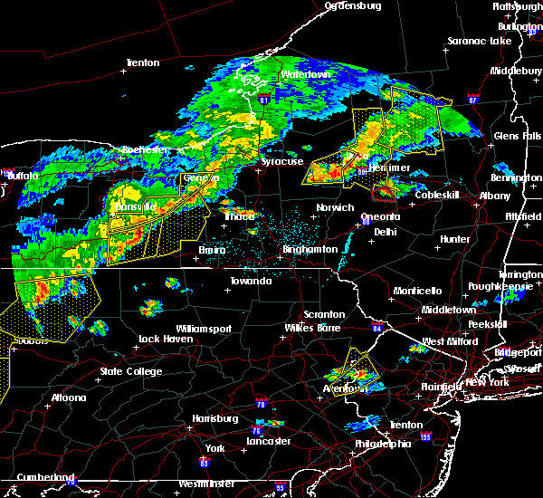 At 616 pm edt, a severe thunderstorm was located over urbana, or 13 miles southwest of dundee, moving east at 60 mph (radar indicated). Hazards include 70 mph wind gusts. Expect damage to roofs. siding and trees. this severe thunderstorm will be near, pulteney around 620 pm edt. tyrone around 625 pm edt. dundee, glenora and rock stream around 630 pm edt. hector, starkey and burdett around 635 pm edt. lodi, townsendville and searsburg around 640 pm edt. covert, interlaken and kidders around 645 pm edt. A tornado watch remains in effect until 1100 pm edt for central new york. At 616 pm edt, a severe thunderstorm was located over urbana, or 13 miles southwest of dundee, moving east at 60 mph (radar indicated). Hazards include 70 mph wind gusts. Expect damage to roofs. siding and trees. this severe thunderstorm will be near, pulteney around 620 pm edt. tyrone around 625 pm edt. dundee, glenora and rock stream around 630 pm edt. hector, starkey and burdett around 635 pm edt. lodi, townsendville and searsburg around 640 pm edt. covert, interlaken and kidders around 645 pm edt. A tornado watch remains in effect until 1100 pm edt for central new york.
|
| 6/8/2015 1:30 PM EDT |
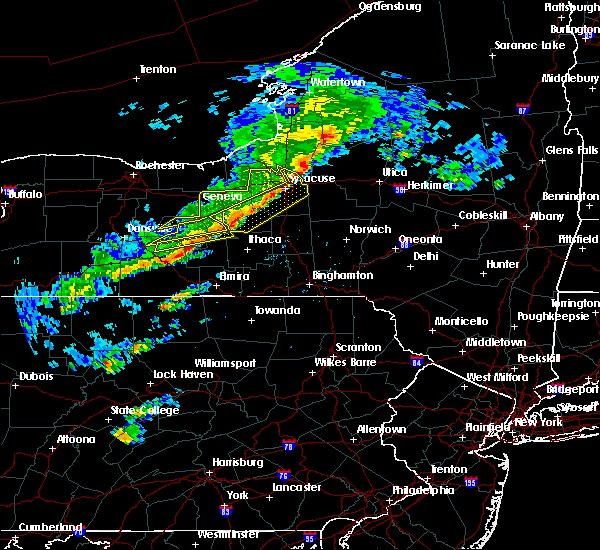 At 129 pm edt, a severe thunderstorm was located over reading center, moving east at 50 mph (radar indicated). Hazards include 60 mph wind gusts. Expect damage to roofs. siding and trees. this severe thunderstorm will be near, montour falls, hector and burdett around 135 pm edt. odessa and reynoldsville around 140 pm edt. mecklenburg, perry city and searsburg around 145 pm edt. newfield, enfield and trumansburg around 150 pm edt. ithaca and taughannock falls around 155 pm edt. besemer around 200 pm edt. Groton, dryden and freeville around 210 pm edt. At 129 pm edt, a severe thunderstorm was located over reading center, moving east at 50 mph (radar indicated). Hazards include 60 mph wind gusts. Expect damage to roofs. siding and trees. this severe thunderstorm will be near, montour falls, hector and burdett around 135 pm edt. odessa and reynoldsville around 140 pm edt. mecklenburg, perry city and searsburg around 145 pm edt. newfield, enfield and trumansburg around 150 pm edt. ithaca and taughannock falls around 155 pm edt. besemer around 200 pm edt. Groton, dryden and freeville around 210 pm edt.
|
| 6/24/2013 7:00 PM EDT | Quarter sized hail reported 0.4 miles SE of Burdett, NY |
| 6/24/2013 6:49 PM EDT | Tree down across road in schuyler county NY, 0.4 miles SE of Burdett, NY |
Hail Maps for Burdett, NY

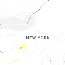
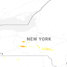
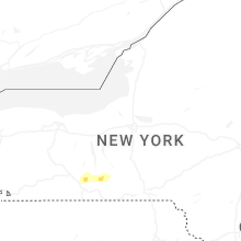
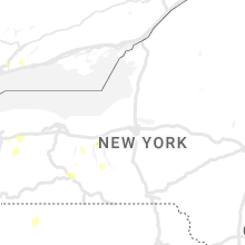

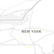


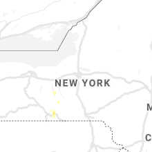


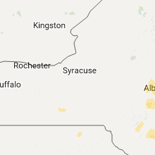


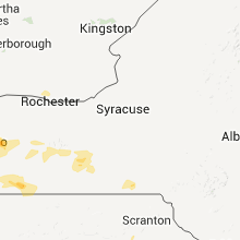


Connect with Interactive Hail Maps