

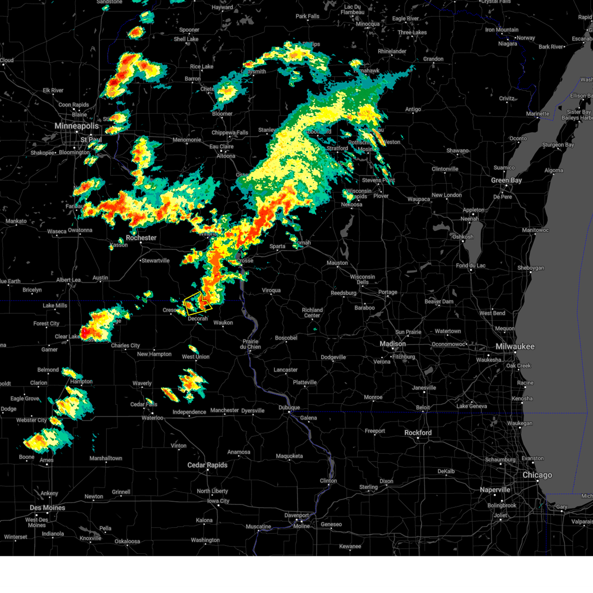
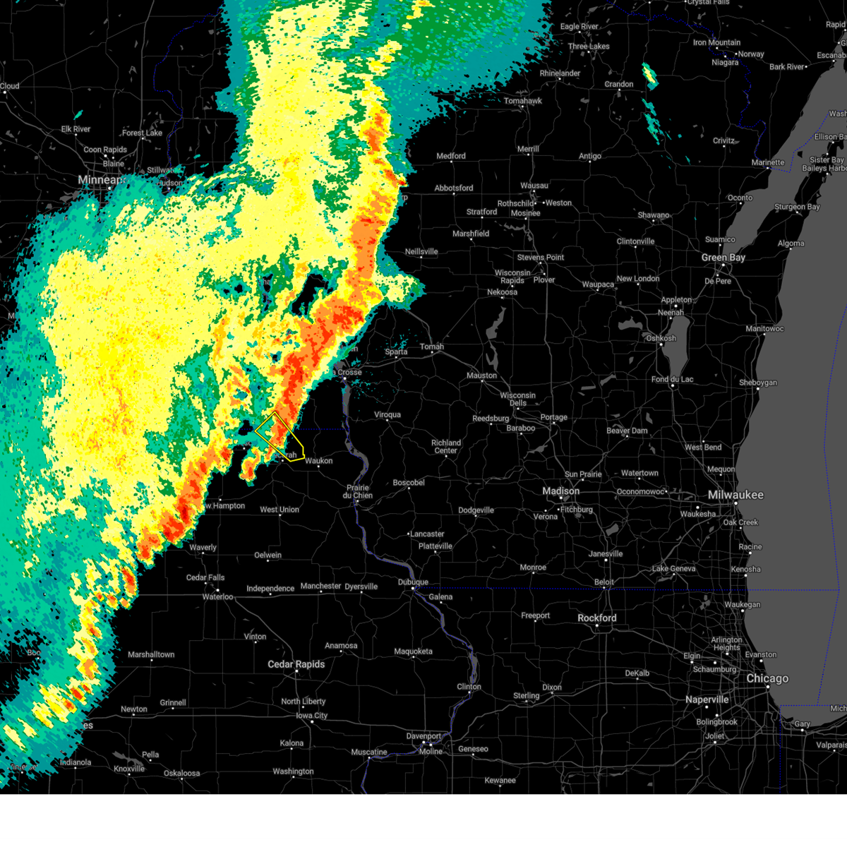
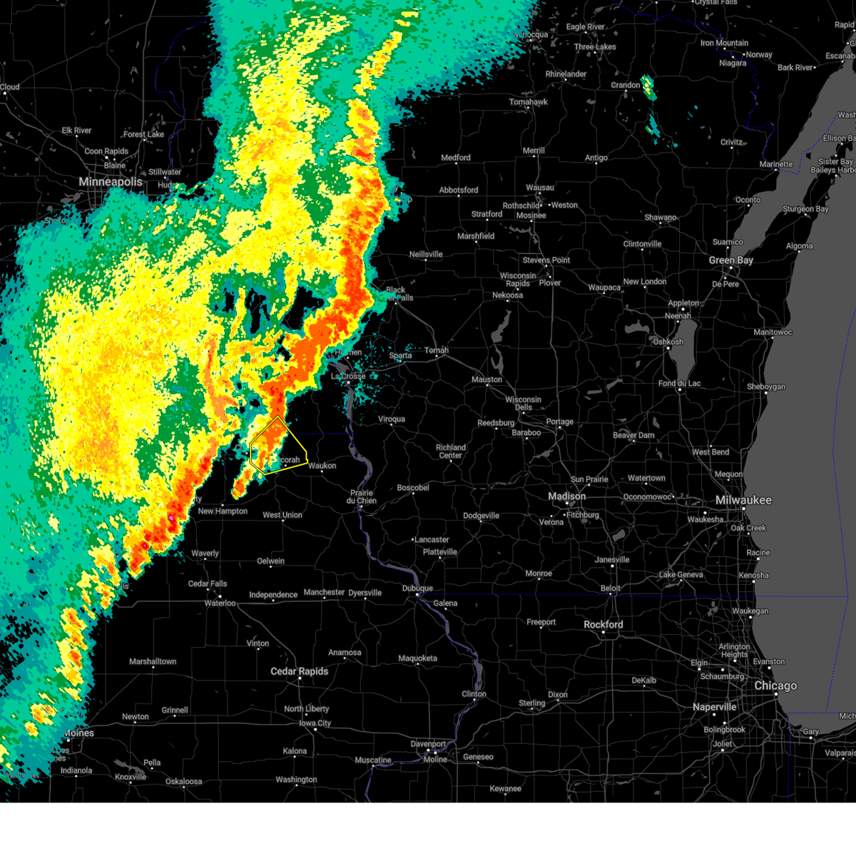
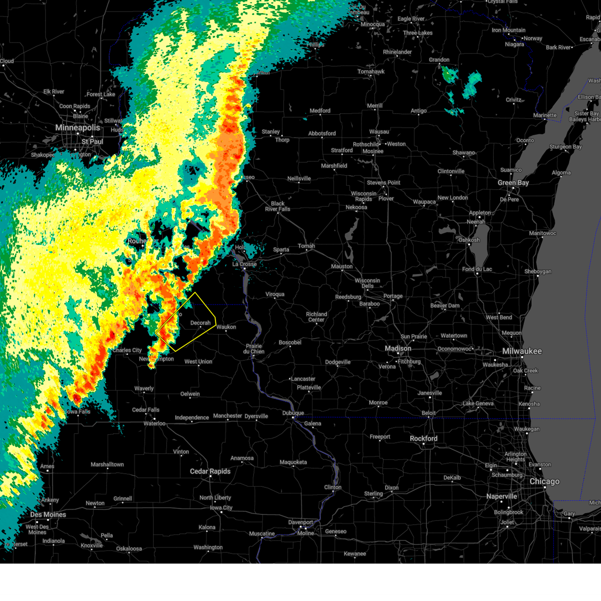
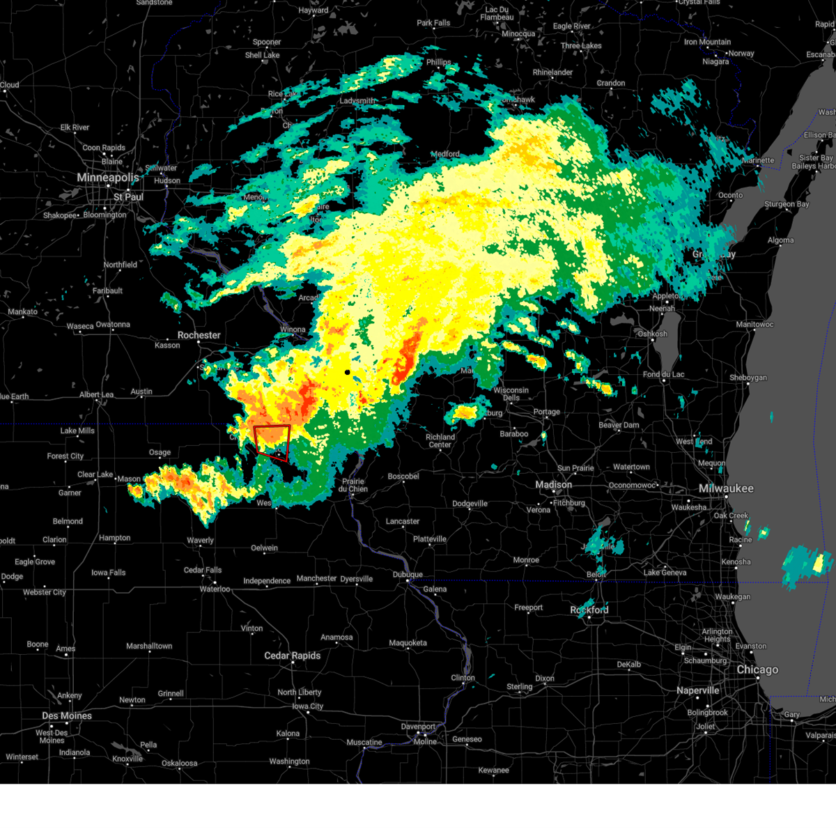
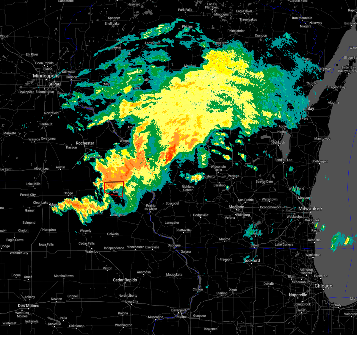
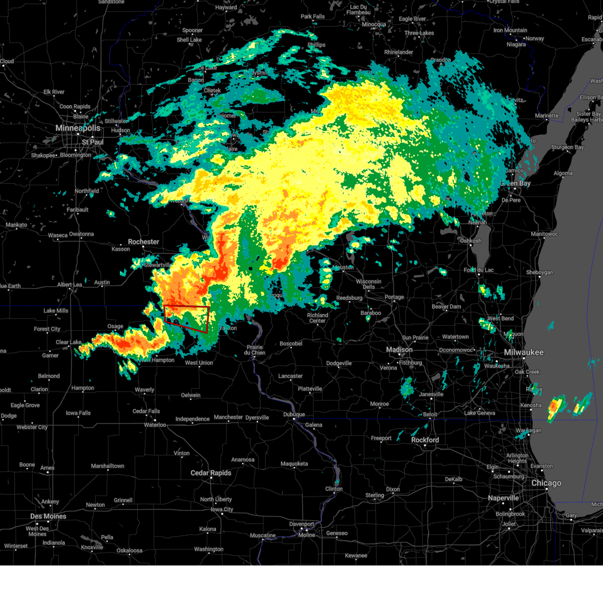
Hail Map for Burr Oak, IA
The Burr Oak, IA area has had 0 reports of on-the-ground hail by trained spotters, and has been under severe weather warnings 21 times during the past 12 months. Doppler radar has detected hail at or near Burr Oak, IA on 49 occasions, including 4 occasions during the past year.
| Name: | Burr Oak, IA |
| Where Located: | 39.3 miles SW of La Crosse, WI |
| Map: | Google Map for Burr Oak, IA |
| Population: | 166 |
| Housing Units: | 80 |
| More Info: | Search Google for Burr Oak, IA |
3
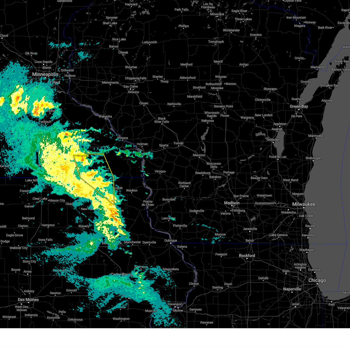
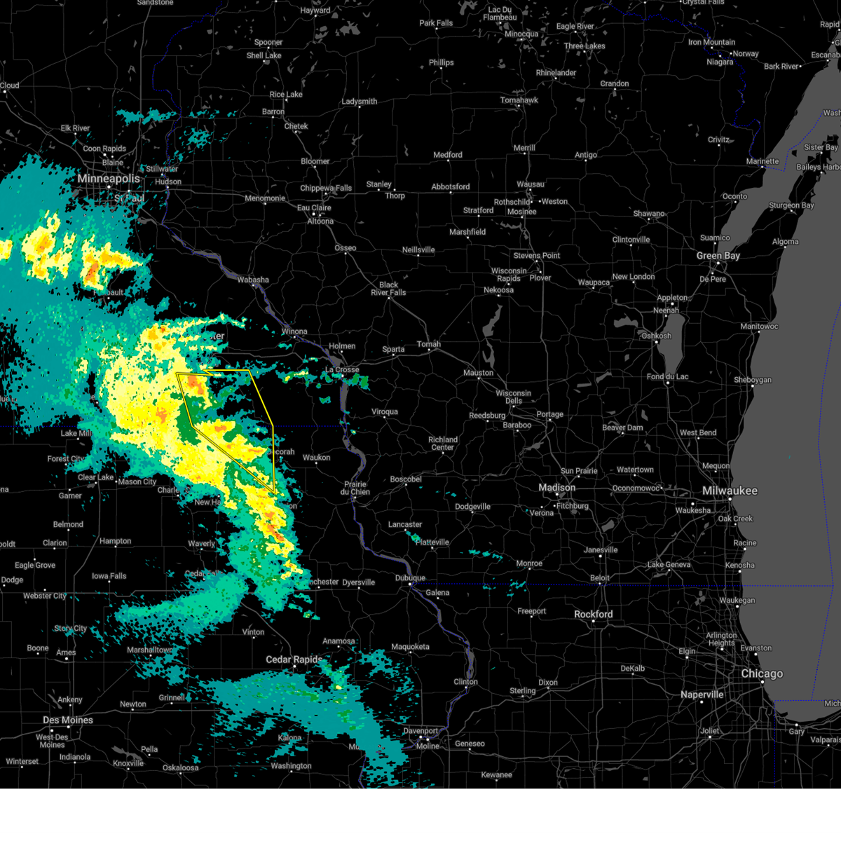
The Top Recent Hail Date for Burr Oak, IA is Wednesday, July 2, 2025 (9th out of 49)
Hail and Wind Damage Spotted near Burr Oak, IA
| Date / Time | Report Details |
|---|---|
| 6/26/2025 5:06 PM CDT | The storms which prompted the warning have weakened below severe limits, and have exited the warned area. therefore, the warning will be allowed to expire. however, heavy rain is still possible with these thunderstorms. a tornado watch remains in effect until 800 pm cdt for northeastern iowa, and southeastern minnesota. a severe thunderstorm watch remains in effect until 900 pm cdt for northeastern iowa. |
| 6/26/2025 4:32 PM CDT | At 432 pm cdt, severe thunderstorms were located along a line extending from canton to fort atkinson, moving northeast at 45 mph (radar indicated). Hazards include 60 mph wind gusts. Expect damage to roofs, siding, and trees. these severe storms will be near, decorah, calmar, ossian, and mabel around 440 pm cdt. Other locations impacted by these severe thunderstorms include choice, eldorado, festina, hesper, nordness, highlandville, and lake meyer county park. |
| 6/26/2025 4:32 PM CDT | the severe thunderstorm warning has been cancelled and is no longer in effect |
| 6/26/2025 4:19 PM CDT | Svrarx the national weather service in la crosse has issued a * severe thunderstorm warning for, eastern howard county in northeastern iowa, northern fayette county in northeastern iowa, winneshiek county in northeastern iowa, eastern chickasaw county in northeastern iowa, southeastern fillmore county in southeastern minnesota, * until 515 pm cdt. * at 418 pm cdt, severe thunderstorms were located along a line extending from near cresco to near lawler, moving northeast at 40 mph (radar indicated). Hazards include 60 mph wind gusts. Expect damage to roofs, siding, and trees. severe thunderstorms will be near, cresco, ridgeway, protivin, and waucoma around 425 pm cdt. spillville and fort atkinson around 430 pm cdt. harmony and canton around 435 pm cdt. calmar around 440 pm cdt. decorah, ossian, and mabel around 445 pm cdt. Other locations impacted by these severe thunderstorms include vernon springs county park, choice, vernon springs, festina, nordness, county roads v 58 and a 46, and bluffton. |
| 3/14/2025 9:02 PM CDT |
 the severe thunderstorm warning has been cancelled and is no longer in effect the severe thunderstorm warning has been cancelled and is no longer in effect
|
| 3/14/2025 8:55 PM CDT |
 the severe thunderstorm warning has been cancelled and is no longer in effect the severe thunderstorm warning has been cancelled and is no longer in effect
|
| 3/14/2025 8:55 PM CDT |
 At 854 pm cdt, severe thunderstorms were located along a line extending from 8 miles north of grand meadow to near stewartville to near cresco, moving north at 60 mph (radar indicated). Hazards include 60 mph wind gusts. Expect damage to roofs, siding, and trees. locations impacted include, grand meadow, vernon springs county park, forestville state park, festina, vernon springs, isinours, hutton, fillmore, ridgeway, bluffton, lime springs, bristol, racine, carimona, harmony, old barn campground, and ostrander. This includes interstate 90 in minnesota between mile markers 198 and 203. At 854 pm cdt, severe thunderstorms were located along a line extending from 8 miles north of grand meadow to near stewartville to near cresco, moving north at 60 mph (radar indicated). Hazards include 60 mph wind gusts. Expect damage to roofs, siding, and trees. locations impacted include, grand meadow, vernon springs county park, forestville state park, festina, vernon springs, isinours, hutton, fillmore, ridgeway, bluffton, lime springs, bristol, racine, carimona, harmony, old barn campground, and ostrander. This includes interstate 90 in minnesota between mile markers 198 and 203.
|
| 3/14/2025 8:22 PM CDT |
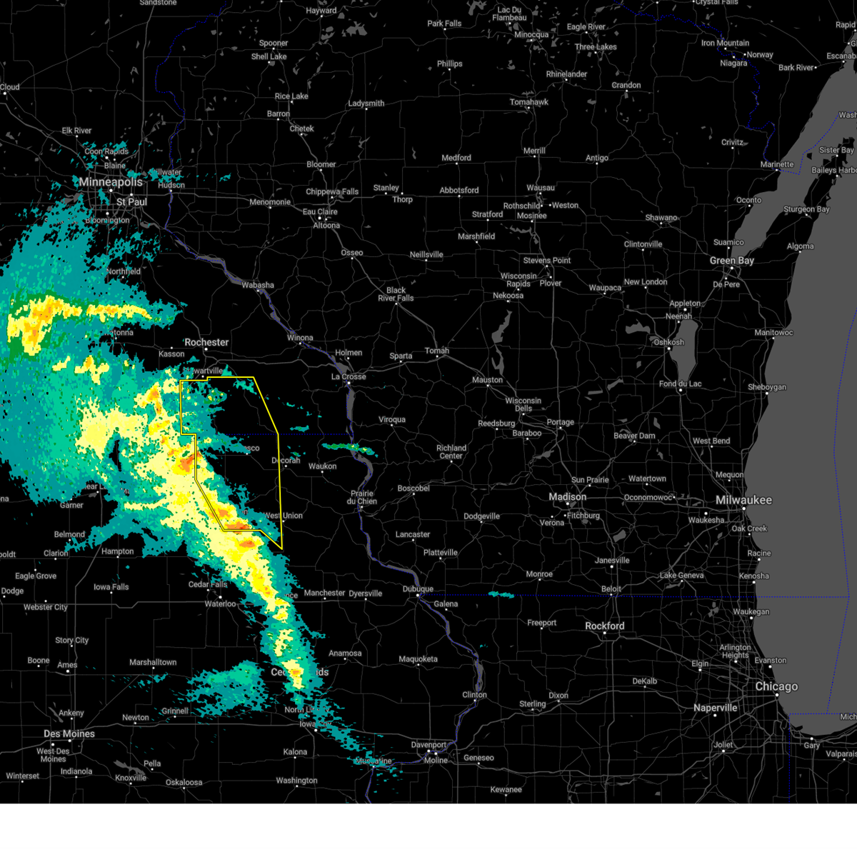 Svrarx the national weather service in la crosse has issued a * severe thunderstorm warning for, howard county in northeastern iowa, northwestern fayette county in northeastern iowa, western winneshiek county in northeastern iowa, chickasaw county in northeastern iowa, eastern mower county in southeastern minnesota, fillmore county in southeastern minnesota, * until 915 pm cdt. * at 822 pm cdt, severe thunderstorms were located along a line extending from near riceville to near elma to 6 miles east of sumner, moving north at 60 mph (radar indicated). Hazards include 60 mph wind gusts. expect damage to roofs, siding, and trees Svrarx the national weather service in la crosse has issued a * severe thunderstorm warning for, howard county in northeastern iowa, northwestern fayette county in northeastern iowa, western winneshiek county in northeastern iowa, chickasaw county in northeastern iowa, eastern mower county in southeastern minnesota, fillmore county in southeastern minnesota, * until 915 pm cdt. * at 822 pm cdt, severe thunderstorms were located along a line extending from near riceville to near elma to 6 miles east of sumner, moving north at 60 mph (radar indicated). Hazards include 60 mph wind gusts. expect damage to roofs, siding, and trees
|
| 9/19/2024 6:43 PM CDT |
 The storm which prompted the warning has weakened below severe limits, and has exited the warned area. therefore, the warning will be allowed to expire. a severe thunderstorm watch remains in effect until 1000 pm cdt for northeastern iowa, and southeastern minnesota. The storm which prompted the warning has weakened below severe limits, and has exited the warned area. therefore, the warning will be allowed to expire. a severe thunderstorm watch remains in effect until 1000 pm cdt for northeastern iowa, and southeastern minnesota.
|
| 9/19/2024 6:30 PM CDT |
 At 629 pm cdt, a severe thunderstorm was located over mabel, or 13 miles north of decorah, moving northeast at 35 mph (radar indicated). Hazards include 60 mph wind gusts and penny size hail. Expect damage to roofs, siding, and trees. This severe thunderstorm will remain over mainly rural areas of northeastern winneshiek and southeastern fillmore counties, including the following locations, burr oak, hesper, locust, and highlandville. At 629 pm cdt, a severe thunderstorm was located over mabel, or 13 miles north of decorah, moving northeast at 35 mph (radar indicated). Hazards include 60 mph wind gusts and penny size hail. Expect damage to roofs, siding, and trees. This severe thunderstorm will remain over mainly rural areas of northeastern winneshiek and southeastern fillmore counties, including the following locations, burr oak, hesper, locust, and highlandville.
|
| 9/19/2024 6:14 PM CDT |
 the severe thunderstorm warning has been cancelled and is no longer in effect the severe thunderstorm warning has been cancelled and is no longer in effect
|
| 9/19/2024 6:14 PM CDT |
 At 613 pm cdt, a severe thunderstorm was located near canton, or 10 miles northeast of cresco, moving east at 40 mph (radar indicated). Hazards include 60 mph wind gusts and penny size hail. Expect damage to roofs, siding, and trees. this severe storm will be near, mabel and canton around 620 pm cdt. Other locations impacted by this severe thunderstorm include henrytown, hesper, highlandville, burr oak, bluffton, chimney rock campground, and locust. At 613 pm cdt, a severe thunderstorm was located near canton, or 10 miles northeast of cresco, moving east at 40 mph (radar indicated). Hazards include 60 mph wind gusts and penny size hail. Expect damage to roofs, siding, and trees. this severe storm will be near, mabel and canton around 620 pm cdt. Other locations impacted by this severe thunderstorm include henrytown, hesper, highlandville, burr oak, bluffton, chimney rock campground, and locust.
|
| 9/19/2024 5:58 PM CDT |
 Svrarx the national weather service in la crosse has issued a * severe thunderstorm warning for, northeastern howard county in northeastern iowa, northern winneshiek county in northeastern iowa, southeastern fillmore county in southeastern minnesota, * until 645 pm cdt. * at 558 pm cdt, a severe thunderstorm was located near cresco, moving east at 35 mph (radar indicated). Hazards include 60 mph wind gusts and quarter size hail. Hail damage to vehicles is expected. expect wind damage to roofs, siding, and trees. this severe thunderstorm will be near, mabel around 620 pm cdt. Other locations impacted by this severe thunderstorm include vernon springs county park, henrytown, vernon springs, hesper, highlandville, bonair, and county roads v 58 and a 46. Svrarx the national weather service in la crosse has issued a * severe thunderstorm warning for, northeastern howard county in northeastern iowa, northern winneshiek county in northeastern iowa, southeastern fillmore county in southeastern minnesota, * until 645 pm cdt. * at 558 pm cdt, a severe thunderstorm was located near cresco, moving east at 35 mph (radar indicated). Hazards include 60 mph wind gusts and quarter size hail. Hail damage to vehicles is expected. expect wind damage to roofs, siding, and trees. this severe thunderstorm will be near, mabel around 620 pm cdt. Other locations impacted by this severe thunderstorm include vernon springs county park, henrytown, vernon springs, hesper, highlandville, bonair, and county roads v 58 and a 46.
|
| 8/29/2024 8:23 PM CDT |
 At 823 pm cdt, a severe thunderstorm was located over mabel, or 12 miles north of decorah, moving northeast at 40 mph (radar indicated). Hazards include 60 mph wind gusts. Expect damage to roofs, siding, and trees. This severe thunderstorm will remain over mainly rural areas of northeastern winneshiek and southeastern fillmore counties, including the following locations, newburg, highway 52 and county w 34, hesper, highlandville, burr oak, lenora, and locust. At 823 pm cdt, a severe thunderstorm was located over mabel, or 12 miles north of decorah, moving northeast at 40 mph (radar indicated). Hazards include 60 mph wind gusts. Expect damage to roofs, siding, and trees. This severe thunderstorm will remain over mainly rural areas of northeastern winneshiek and southeastern fillmore counties, including the following locations, newburg, highway 52 and county w 34, hesper, highlandville, burr oak, lenora, and locust.
|
| 8/29/2024 8:09 PM CDT |
 At 808 pm cdt, a severe thunderstorm was located near mabel, or 12 miles north of decorah, moving northeast at 40 mph (radar indicated). Hazards include 60 mph wind gusts. Expect damage to roofs, siding, and trees. this severe storm will be near, mabel around 815 pm cdt. Other locations impacted by this severe thunderstorm include hesper, highlandville, burr oak, bluffton, chimney rock campground, locust, and sattre. At 808 pm cdt, a severe thunderstorm was located near mabel, or 12 miles north of decorah, moving northeast at 40 mph (radar indicated). Hazards include 60 mph wind gusts. Expect damage to roofs, siding, and trees. this severe storm will be near, mabel around 815 pm cdt. Other locations impacted by this severe thunderstorm include hesper, highlandville, burr oak, bluffton, chimney rock campground, locust, and sattre.
|
| 8/29/2024 8:09 PM CDT |
 the severe thunderstorm warning has been cancelled and is no longer in effect the severe thunderstorm warning has been cancelled and is no longer in effect
|
| 8/29/2024 7:47 PM CDT |
 Svrarx the national weather service in la crosse has issued a * severe thunderstorm warning for, southeastern howard county in northeastern iowa, winneshiek county in northeastern iowa, northeastern chickasaw county in northeastern iowa, southeastern fillmore county in southeastern minnesota, * until 830 pm cdt. * at 746 pm cdt, a severe thunderstorm was located near cresco, moving northeast at 40 mph (radar indicated). Hazards include 60 mph wind gusts. Expect damage to roofs, siding, and trees. this severe thunderstorm will be near, mabel around 805 pm cdt. Other locations impacted by this severe thunderstorm include vernon springs county park, vernon springs, hesper, highlandville, bluffton, and locust. Svrarx the national weather service in la crosse has issued a * severe thunderstorm warning for, southeastern howard county in northeastern iowa, winneshiek county in northeastern iowa, northeastern chickasaw county in northeastern iowa, southeastern fillmore county in southeastern minnesota, * until 830 pm cdt. * at 746 pm cdt, a severe thunderstorm was located near cresco, moving northeast at 40 mph (radar indicated). Hazards include 60 mph wind gusts. Expect damage to roofs, siding, and trees. this severe thunderstorm will be near, mabel around 805 pm cdt. Other locations impacted by this severe thunderstorm include vernon springs county park, vernon springs, hesper, highlandville, bluffton, and locust.
|
| 8/5/2024 9:53 PM CDT |
 At 953 pm cdt, a severe thunderstorm capable of producing a tornado was located 7 miles northwest of decorah, moving east at 35 mph (radar indicated rotation). Hazards include tornado. Flying debris will be dangerous to those caught without shelter. mobile homes will be damaged or destroyed. damage to roofs, windows, and vehicles will occur. tree damage is likely. Locations impacted include, decorah, highway 52 and county w 34, hesper, county roads w 20 and a 34, burr oak, bluffton, chimney rock campground, and locust. At 953 pm cdt, a severe thunderstorm capable of producing a tornado was located 7 miles northwest of decorah, moving east at 35 mph (radar indicated rotation). Hazards include tornado. Flying debris will be dangerous to those caught without shelter. mobile homes will be damaged or destroyed. damage to roofs, windows, and vehicles will occur. tree damage is likely. Locations impacted include, decorah, highway 52 and county w 34, hesper, county roads w 20 and a 34, burr oak, bluffton, chimney rock campground, and locust.
|
| 8/5/2024 9:42 PM CDT |
 At 941 pm cdt, a severe thunderstorm capable of producing a tornado was located near cresco, moving east at 40 mph (radar indicated rotation). Hazards include tornado. Flying debris will be dangerous to those caught without shelter. mobile homes will be damaged or destroyed. damage to roofs, windows, and vehicles will occur. tree damage is likely. Locations impacted include, decorah, county roads w 14 and a 34, highway 52 and county w 34, state road 9 and 290th street, hesper, county roads w 20 and a 34, burr oak, bluffton, chimney rock campground, locust, kendallville, and harvest farm campground. At 941 pm cdt, a severe thunderstorm capable of producing a tornado was located near cresco, moving east at 40 mph (radar indicated rotation). Hazards include tornado. Flying debris will be dangerous to those caught without shelter. mobile homes will be damaged or destroyed. damage to roofs, windows, and vehicles will occur. tree damage is likely. Locations impacted include, decorah, county roads w 14 and a 34, highway 52 and county w 34, state road 9 and 290th street, hesper, county roads w 20 and a 34, burr oak, bluffton, chimney rock campground, locust, kendallville, and harvest farm campground.
|
| 8/5/2024 9:42 PM CDT |
 the tornado warning has been cancelled and is no longer in effect the tornado warning has been cancelled and is no longer in effect
|
| 8/5/2024 9:31 PM CDT |
 Torarx the national weather service in la crosse has issued a * tornado warning for, northeastern howard county in northeastern iowa, northern winneshiek county in northeastern iowa, * until 1015 pm cdt. * at 931 pm cdt, a severe thunderstorm capable of producing a tornado was located near cresco, moving east at 45 mph (radar indicated rotation). Hazards include tornado. Flying debris will be dangerous to those caught without shelter. mobile homes will be damaged or destroyed. damage to roofs, windows, and vehicles will occur. tree damage is likely. This tornadic thunderstorm will remain over mainly rural areas of northeastern howard and northern winneshiek counties, including the following locations, vernon springs county park, vernon springs, hesper, bonair, burr oak, bluffton, and chimney rock campground. Torarx the national weather service in la crosse has issued a * tornado warning for, northeastern howard county in northeastern iowa, northern winneshiek county in northeastern iowa, * until 1015 pm cdt. * at 931 pm cdt, a severe thunderstorm capable of producing a tornado was located near cresco, moving east at 45 mph (radar indicated rotation). Hazards include tornado. Flying debris will be dangerous to those caught without shelter. mobile homes will be damaged or destroyed. damage to roofs, windows, and vehicles will occur. tree damage is likely. This tornadic thunderstorm will remain over mainly rural areas of northeastern howard and northern winneshiek counties, including the following locations, vernon springs county park, vernon springs, hesper, bonair, burr oak, bluffton, and chimney rock campground.
|
| 7/13/2024 8:32 PM CDT |
 At 831 pm cdt, severe thunderstorms were located along a line extending from 9 miles west of new albin to 6 miles west of waukon to spillville, moving southeast at 40 mph (radar indicated). Hazards include 60 mph wind gusts. Expect damage to roofs, siding, and trees. These severe thunderstorms will remain over mainly rural areas of northeastern howard, northwestern allamakee, northern winneshiek, southwestern houston and southeastern fillmore counties, including the following locations, vernon springs county park, choice, vernon springs, hesper, highlandville, county roads v 58 and a 46, and quandahl. At 831 pm cdt, severe thunderstorms were located along a line extending from 9 miles west of new albin to 6 miles west of waukon to spillville, moving southeast at 40 mph (radar indicated). Hazards include 60 mph wind gusts. Expect damage to roofs, siding, and trees. These severe thunderstorms will remain over mainly rural areas of northeastern howard, northwestern allamakee, northern winneshiek, southwestern houston and southeastern fillmore counties, including the following locations, vernon springs county park, choice, vernon springs, hesper, highlandville, county roads v 58 and a 46, and quandahl.
|
| 7/13/2024 8:08 PM CDT |
 At 807 pm cdt, severe thunderstorms were located along a line extending from near spring grove to 7 miles southeast of canton to near cresco, moving southeast at 40 mph (radar indicated). Hazards include 60 mph wind gusts. Expect damage to roofs, siding, and trees. these severe storms will be near, cresco, spring grove, mabel, and ridgeway around 810 pm cdt. Other locations impacted by these severe thunderstorms include vernon springs county park, choice, vernon springs, county roads v 58 and a 46, hutton, quandahl, and riceford. At 807 pm cdt, severe thunderstorms were located along a line extending from near spring grove to 7 miles southeast of canton to near cresco, moving southeast at 40 mph (radar indicated). Hazards include 60 mph wind gusts. Expect damage to roofs, siding, and trees. these severe storms will be near, cresco, spring grove, mabel, and ridgeway around 810 pm cdt. Other locations impacted by these severe thunderstorms include vernon springs county park, choice, vernon springs, county roads v 58 and a 46, hutton, quandahl, and riceford.
|
| 7/13/2024 7:57 PM CDT |
 At 757 pm cdt, severe thunderstorms were located along a line extending from 8 miles northwest of spring grove to near canton to near lime springs, moving southeast at 45 mph (public). Hazards include 60 mph wind gusts. Expect damage to roofs, siding, and trees. these severe storms will be near, cresco, spring grove, and mabel around 800 pm cdt. ridgeway around 805 pm cdt. Other locations impacted by these severe thunderstorms include vernon springs county park, choice, vernon springs, county roads v 58 and a 46, hutton, quandahl, and riceford. At 757 pm cdt, severe thunderstorms were located along a line extending from 8 miles northwest of spring grove to near canton to near lime springs, moving southeast at 45 mph (public). Hazards include 60 mph wind gusts. Expect damage to roofs, siding, and trees. these severe storms will be near, cresco, spring grove, and mabel around 800 pm cdt. ridgeway around 805 pm cdt. Other locations impacted by these severe thunderstorms include vernon springs county park, choice, vernon springs, county roads v 58 and a 46, hutton, quandahl, and riceford.
|
| 7/13/2024 7:44 PM CDT |
 Svrarx the national weather service in la crosse has issued a * severe thunderstorm warning for, northeastern howard county in northeastern iowa, northwestern allamakee county in northeastern iowa, northern winneshiek county in northeastern iowa, houston county in southeastern minnesota, southeastern fillmore county in southeastern minnesota, * until 845 pm cdt. * at 743 pm cdt, severe thunderstorms were located along a line extending from near rushford to near preston to near le roy, moving southeast at 30 mph (radar indicated). Hazards include 60 mph wind gusts. Expect damage to roofs, siding, and trees. severe thunderstorms will be near, rushford and harmony around 750 pm cdt. lime springs and canton around 755 pm cdt. mabel around 810 pm cdt. cresco and spring grove around 815 pm cdt. caledonia around 820 pm cdt. Other locations impacted by these severe thunderstorms include vernon springs county park, choice, vernon springs, county roads v 58 and a 46, hutton, quandahl, and riceford. Svrarx the national weather service in la crosse has issued a * severe thunderstorm warning for, northeastern howard county in northeastern iowa, northwestern allamakee county in northeastern iowa, northern winneshiek county in northeastern iowa, houston county in southeastern minnesota, southeastern fillmore county in southeastern minnesota, * until 845 pm cdt. * at 743 pm cdt, severe thunderstorms were located along a line extending from near rushford to near preston to near le roy, moving southeast at 30 mph (radar indicated). Hazards include 60 mph wind gusts. Expect damage to roofs, siding, and trees. severe thunderstorms will be near, rushford and harmony around 750 pm cdt. lime springs and canton around 755 pm cdt. mabel around 810 pm cdt. cresco and spring grove around 815 pm cdt. caledonia around 820 pm cdt. Other locations impacted by these severe thunderstorms include vernon springs county park, choice, vernon springs, county roads v 58 and a 46, hutton, quandahl, and riceford.
|
| 6/4/2024 8:50 PM CDT |
 Svrarx the national weather service in la crosse has issued a * severe thunderstorm warning for, northeastern winneshiek county in northeastern iowa, southwestern winona county in southeastern minnesota, western houston county in southeastern minnesota, eastern fillmore county in southeastern minnesota, * until 930 pm cdt. * at 849 pm cdt, severe thunderstorms were located along a line extending from near fountain to near decorah to near spillville, moving northeast at 35 mph (radar indicated). Hazards include 60 mph wind gusts. Expect damage to roofs, siding, and trees. severe thunderstorms will be near, decorah, lanesboro, and canton around 855 pm cdt. mabel around 900 pm cdt. spring grove around 910 pm cdt. rushford around 915 pm cdt. other locations impacted by these severe thunderstorms include choice, hesper, county roads 6 and 33, highlandville, wyattville, riceford, and peterson. This includes interstate 90 in minnesota between mile markers 243 and 251. Svrarx the national weather service in la crosse has issued a * severe thunderstorm warning for, northeastern winneshiek county in northeastern iowa, southwestern winona county in southeastern minnesota, western houston county in southeastern minnesota, eastern fillmore county in southeastern minnesota, * until 930 pm cdt. * at 849 pm cdt, severe thunderstorms were located along a line extending from near fountain to near decorah to near spillville, moving northeast at 35 mph (radar indicated). Hazards include 60 mph wind gusts. Expect damage to roofs, siding, and trees. severe thunderstorms will be near, decorah, lanesboro, and canton around 855 pm cdt. mabel around 900 pm cdt. spring grove around 910 pm cdt. rushford around 915 pm cdt. other locations impacted by these severe thunderstorms include choice, hesper, county roads 6 and 33, highlandville, wyattville, riceford, and peterson. This includes interstate 90 in minnesota between mile markers 243 and 251.
|
| 6/4/2024 8:42 PM CDT |
 At 841 pm cdt, severe thunderstorms were located along a line extending from near fountain to near ridgeway to near spillville, moving northeast at 35 mph (radar indicated). Hazards include 60 mph wind gusts. Expect damage to roofs, siding, and trees. these severe storms will be near, preston, chatfield, harmony, fountain, and canton around 845 pm cdt. Other locations impacted by these severe thunderstorms include forestville state park, carimona, county roads v 58 and a 46, old barn campground, isinours, hutton, and burr oak. At 841 pm cdt, severe thunderstorms were located along a line extending from near fountain to near ridgeway to near spillville, moving northeast at 35 mph (radar indicated). Hazards include 60 mph wind gusts. Expect damage to roofs, siding, and trees. these severe storms will be near, preston, chatfield, harmony, fountain, and canton around 845 pm cdt. Other locations impacted by these severe thunderstorms include forestville state park, carimona, county roads v 58 and a 46, old barn campground, isinours, hutton, and burr oak.
|
| 6/4/2024 8:42 PM CDT |
 the severe thunderstorm warning has been cancelled and is no longer in effect the severe thunderstorm warning has been cancelled and is no longer in effect
|
| 6/4/2024 8:31 PM CDT |
 At 831 pm cdt, severe thunderstorms were located along a line extending from near wykoff to near ridgeway to near protivin, moving east at 30 mph (radar indicated. a wind gust of 68 mph was measured earlier with this line of storms). Hazards include 60 mph wind gusts. Expect damage to roofs, siding, and trees. these severe storms will be near, cresco, wykoff, spillville, ridgeway, and protivin around 835 pm cdt. preston, fountain, and fort atkinson around 840 pm cdt. harmony and calmar around 845 pm cdt. canton around 850 pm cdt. Other locations impacted by these severe thunderstorms include vernon springs county park, forestville state park, festina, vernon springs, york, lake meyer county park, and county roads v 58 and a 46. At 831 pm cdt, severe thunderstorms were located along a line extending from near wykoff to near ridgeway to near protivin, moving east at 30 mph (radar indicated. a wind gust of 68 mph was measured earlier with this line of storms). Hazards include 60 mph wind gusts. Expect damage to roofs, siding, and trees. these severe storms will be near, cresco, wykoff, spillville, ridgeway, and protivin around 835 pm cdt. preston, fountain, and fort atkinson around 840 pm cdt. harmony and calmar around 845 pm cdt. canton around 850 pm cdt. Other locations impacted by these severe thunderstorms include vernon springs county park, forestville state park, festina, vernon springs, york, lake meyer county park, and county roads v 58 and a 46.
|
| 6/4/2024 8:18 PM CDT |
 Svrarx the national weather service in la crosse has issued a * severe thunderstorm warning for, eastern howard county in northeastern iowa, western winneshiek county in northeastern iowa, northeastern chickasaw county in northeastern iowa, western fillmore county in southeastern minnesota, * until 900 pm cdt. * at 817 pm cdt, severe thunderstorms were located along a line extending from near spring valley to near protivin to near lawler, moving northeast at 30 mph (automated weather observations). Hazards include 60 mph wind gusts. Expect damage to roofs, siding, and trees. severe thunderstorms will be near, cresco, spring valley, wykoff, and protivin around 825 pm cdt. ridgeway around 830 pm cdt. preston, harmony, fountain, and spillville around 840 pm cdt. chatfield and canton around 845 pm cdt. Other locations impacted by these severe thunderstorms include vernon springs county park, forestville state park, festina, vernon springs, york, lake meyer county park, and county roads v 58 and a 46. Svrarx the national weather service in la crosse has issued a * severe thunderstorm warning for, eastern howard county in northeastern iowa, western winneshiek county in northeastern iowa, northeastern chickasaw county in northeastern iowa, western fillmore county in southeastern minnesota, * until 900 pm cdt. * at 817 pm cdt, severe thunderstorms were located along a line extending from near spring valley to near protivin to near lawler, moving northeast at 30 mph (automated weather observations). Hazards include 60 mph wind gusts. Expect damage to roofs, siding, and trees. severe thunderstorms will be near, cresco, spring valley, wykoff, and protivin around 825 pm cdt. ridgeway around 830 pm cdt. preston, harmony, fountain, and spillville around 840 pm cdt. chatfield and canton around 845 pm cdt. Other locations impacted by these severe thunderstorms include vernon springs county park, forestville state park, festina, vernon springs, york, lake meyer county park, and county roads v 58 and a 46.
|
| 5/24/2024 7:05 AM CDT |
 At 704 am cdt, severe thunderstorms were located along a line extending from near cresco to near waucoma, moving northeast at 45 mph (radar indicated). Hazards include 60 mph wind gusts. Expect damage to roofs, siding, and trees. these severe storms will be near, calmar and ridgeway around 710 am cdt. decorah around 720 am cdt. Other locations impacted by these severe thunderstorms include vernon springs county park, vernon springs, bonair, burr oak, bluffton, chimney rock campground, and state road 9 and 245th street. At 704 am cdt, severe thunderstorms were located along a line extending from near cresco to near waucoma, moving northeast at 45 mph (radar indicated). Hazards include 60 mph wind gusts. Expect damage to roofs, siding, and trees. these severe storms will be near, calmar and ridgeway around 710 am cdt. decorah around 720 am cdt. Other locations impacted by these severe thunderstorms include vernon springs county park, vernon springs, bonair, burr oak, bluffton, chimney rock campground, and state road 9 and 245th street.
|
| 5/24/2024 7:05 AM CDT |
 the severe thunderstorm warning has been cancelled and is no longer in effect the severe thunderstorm warning has been cancelled and is no longer in effect
|
| 5/24/2024 6:56 AM CDT |
 At 656 am cdt, severe thunderstorms were located along a line extending from near cresco to near hawkeye, moving northeast at 45 mph (radar indicated). Hazards include 60 mph wind gusts and penny size hail. Expect damage to roofs, siding, and trees. these severe storms will be near, cresco, ridgeway, protivin, and waucoma around 700 am cdt. spillville and fort atkinson around 705 am cdt. calmar around 710 am cdt. decorah around 720 am cdt. Other locations impacted by these severe thunderstorms include vernon springs county park, festina, vernon springs, eldorado, lake meyer county park, county roads v 58 and a 46, and bluffton. At 656 am cdt, severe thunderstorms were located along a line extending from near cresco to near hawkeye, moving northeast at 45 mph (radar indicated). Hazards include 60 mph wind gusts and penny size hail. Expect damage to roofs, siding, and trees. these severe storms will be near, cresco, ridgeway, protivin, and waucoma around 700 am cdt. spillville and fort atkinson around 705 am cdt. calmar around 710 am cdt. decorah around 720 am cdt. Other locations impacted by these severe thunderstorms include vernon springs county park, festina, vernon springs, eldorado, lake meyer county park, county roads v 58 and a 46, and bluffton.
|
| 5/24/2024 6:31 AM CDT |
 Svrarx the national weather service in la crosse has issued a * severe thunderstorm warning for, eastern howard county in northeastern iowa, fayette county in northeastern iowa, western winneshiek county in northeastern iowa, northeastern chickasaw county in northeastern iowa, * until 715 am cdt. * at 630 am cdt, severe thunderstorms were located along a line extending from new hampton to near denver, moving east at 45 mph (radar indicated). Hazards include 60 mph wind gusts and quarter size hail. Hail damage to vehicles is expected. expect wind damage to roofs, siding, and trees. severe thunderstorms will be near, waucoma around 645 am cdt. maynard and hawkeye around 650 am cdt. spillville and fort atkinson around 655 am cdt. west union, fayette, and calmar around 700 am cdt. Other locations impacted by these severe thunderstorms include vernon springs county park, donnan, festina, vernon springs, eldorado, lake meyer county park, and county roads v 58 and a 46. Svrarx the national weather service in la crosse has issued a * severe thunderstorm warning for, eastern howard county in northeastern iowa, fayette county in northeastern iowa, western winneshiek county in northeastern iowa, northeastern chickasaw county in northeastern iowa, * until 715 am cdt. * at 630 am cdt, severe thunderstorms were located along a line extending from new hampton to near denver, moving east at 45 mph (radar indicated). Hazards include 60 mph wind gusts and quarter size hail. Hail damage to vehicles is expected. expect wind damage to roofs, siding, and trees. severe thunderstorms will be near, waucoma around 645 am cdt. maynard and hawkeye around 650 am cdt. spillville and fort atkinson around 655 am cdt. west union, fayette, and calmar around 700 am cdt. Other locations impacted by these severe thunderstorms include vernon springs county park, donnan, festina, vernon springs, eldorado, lake meyer county park, and county roads v 58 and a 46.
|
| 5/21/2024 7:05 PM CDT |
 At 705 pm cdt, severe thunderstorms were located along a line extending from 6 miles east of rushford to near hokah to near stoddard to near waukon, moving northeast at 50 mph (radar indicated). Hazards include 70 mph wind gusts and penny size hail. Expect considerable tree damage. damage is likely to mobile homes, roofs, and outbuildings. locations impacted include, la crescent, lansing, hokah, new albin, brownsville and dakota. This includes interstate 90 in minnesota between mile markers 257 and 276. At 705 pm cdt, severe thunderstorms were located along a line extending from 6 miles east of rushford to near hokah to near stoddard to near waukon, moving northeast at 50 mph (radar indicated). Hazards include 70 mph wind gusts and penny size hail. Expect considerable tree damage. damage is likely to mobile homes, roofs, and outbuildings. locations impacted include, la crescent, lansing, hokah, new albin, brownsville and dakota. This includes interstate 90 in minnesota between mile markers 257 and 276.
|
| 5/21/2024 6:28 PM CDT |
 Svrarx the national weather service in la crosse has issued a * severe thunderstorm warning for, northwestern allamakee county in northeastern iowa, winneshiek county in northeastern iowa, winona county in southeastern minnesota, houston county in southeastern minnesota, eastern fillmore county in southeastern minnesota, * until 730 pm cdt. * at 627 pm cdt, severe thunderstorms were located along a line extending from near lanesboro to 7 miles south of rushford to near spring grove to fort atkinson, moving northeast at 50 mph (radar indicated). Hazards include 70 mph wind gusts and penny size hail. Expect considerable tree damage. damage is likely to mobile homes, roofs, and outbuildings. severe thunderstorms will be near, decorah, caledonia, rushford, and houston around 635 pm cdt. hokah around 645 pm cdt. la crescent and brownsville around 650 pm cdt. la crosse, new albin, and dakota around 655 pm cdt. Lansing around 710 pm cdt. Svrarx the national weather service in la crosse has issued a * severe thunderstorm warning for, northwestern allamakee county in northeastern iowa, winneshiek county in northeastern iowa, winona county in southeastern minnesota, houston county in southeastern minnesota, eastern fillmore county in southeastern minnesota, * until 730 pm cdt. * at 627 pm cdt, severe thunderstorms were located along a line extending from near lanesboro to 7 miles south of rushford to near spring grove to fort atkinson, moving northeast at 50 mph (radar indicated). Hazards include 70 mph wind gusts and penny size hail. Expect considerable tree damage. damage is likely to mobile homes, roofs, and outbuildings. severe thunderstorms will be near, decorah, caledonia, rushford, and houston around 635 pm cdt. hokah around 645 pm cdt. la crescent and brownsville around 650 pm cdt. la crosse, new albin, and dakota around 655 pm cdt. Lansing around 710 pm cdt.
|
| 5/21/2024 6:19 PM CDT |
 At 619 pm cdt, severe thunderstorms were located along a line extending from near kellogg to fountain city to near houston to decorah, moving northeast at 60 mph (radar indicated). Hazards include 70 mph wind gusts and penny size hail. Expect considerable tree damage. damage is likely to mobile homes, roofs, and outbuildings. locations impacted include, winona, decorah, caledonia, alma, spring grove, buffalo city, houston, kellogg, dakota and la crescent. This includes interstate 90 in minnesota between mile markers 233 and 276. At 619 pm cdt, severe thunderstorms were located along a line extending from near kellogg to fountain city to near houston to decorah, moving northeast at 60 mph (radar indicated). Hazards include 70 mph wind gusts and penny size hail. Expect considerable tree damage. damage is likely to mobile homes, roofs, and outbuildings. locations impacted include, winona, decorah, caledonia, alma, spring grove, buffalo city, houston, kellogg, dakota and la crescent. This includes interstate 90 in minnesota between mile markers 233 and 276.
|
| 5/21/2024 5:51 PM CDT |
 Svrarx the national weather service in la crosse has issued a * severe thunderstorm warning for, winneshiek county in northeastern iowa, winona county in southeastern minnesota, wabasha county in southeastern minnesota, western houston county in southeastern minnesota, eastern fillmore county in southeastern minnesota, * until 630 pm cdt. * at 551 pm cdt, severe thunderstorms were located along a line extending from near oronoco to near dover to near preston to near jerico, moving northeast at 70 mph (radar indicated). Hazards include 70 mph wind gusts and penny size hail. Expect considerable tree damage. damage is likely to mobile homes, roofs, and outbuildings. severe thunderstorms will be near, preston, st. charles, plainview, elgin, harmony, and lanesboro around 555 pm cdt. lewiston, altura, canton, and ridgeway around 600 pm cdt. Wabasha, alma, rushford, buffalo city, stockton, rollingstone, and kellogg around 605 pm cdt. Svrarx the national weather service in la crosse has issued a * severe thunderstorm warning for, winneshiek county in northeastern iowa, winona county in southeastern minnesota, wabasha county in southeastern minnesota, western houston county in southeastern minnesota, eastern fillmore county in southeastern minnesota, * until 630 pm cdt. * at 551 pm cdt, severe thunderstorms were located along a line extending from near oronoco to near dover to near preston to near jerico, moving northeast at 70 mph (radar indicated). Hazards include 70 mph wind gusts and penny size hail. Expect considerable tree damage. damage is likely to mobile homes, roofs, and outbuildings. severe thunderstorms will be near, preston, st. charles, plainview, elgin, harmony, and lanesboro around 555 pm cdt. lewiston, altura, canton, and ridgeway around 600 pm cdt. Wabasha, alma, rushford, buffalo city, stockton, rollingstone, and kellogg around 605 pm cdt.
|
| 6/28/2022 7:24 PM CDT |
 At 724 pm cdt, a severe thunderstorm was located near decorah, moving southeast at 35 mph (radar indicated). Hazards include ping pong ball size hail and 60 mph wind gusts. People and animals outdoors will be injured. expect hail damage to roofs, siding, windows, and vehicles. expect wind damage to roofs, siding, and trees. this severe thunderstorm will remain over mainly rural areas of northern winneshiek county, including the following locations, hesper, nordness, highlandville, burr oak, glenwood church, bluffton and chimney rock campground. hail threat, radar indicated max hail size, 1. 50 in wind threat, radar indicated max wind gust, 60 mph. At 724 pm cdt, a severe thunderstorm was located near decorah, moving southeast at 35 mph (radar indicated). Hazards include ping pong ball size hail and 60 mph wind gusts. People and animals outdoors will be injured. expect hail damage to roofs, siding, windows, and vehicles. expect wind damage to roofs, siding, and trees. this severe thunderstorm will remain over mainly rural areas of northern winneshiek county, including the following locations, hesper, nordness, highlandville, burr oak, glenwood church, bluffton and chimney rock campground. hail threat, radar indicated max hail size, 1. 50 in wind threat, radar indicated max wind gust, 60 mph.
|
| 6/28/2022 7:14 PM CDT |
 At 714 pm cdt, a severe thunderstorm was located near decorah, moving southeast at 35 mph (radar indicated). Hazards include 60 mph wind gusts and quarter size hail. Hail damage to vehicles is expected. expect wind damage to roofs, siding, and trees. this severe storm will be near, decorah around 720 pm cdt. other locations impacted by this severe thunderstorm include hesper, nordness, highlandville, burr oak, glenwood church, bluffton and chimney rock campground. hail threat, radar indicated max hail size, 1. 00 in wind threat, radar indicated max wind gust, 60 mph. At 714 pm cdt, a severe thunderstorm was located near decorah, moving southeast at 35 mph (radar indicated). Hazards include 60 mph wind gusts and quarter size hail. Hail damage to vehicles is expected. expect wind damage to roofs, siding, and trees. this severe storm will be near, decorah around 720 pm cdt. other locations impacted by this severe thunderstorm include hesper, nordness, highlandville, burr oak, glenwood church, bluffton and chimney rock campground. hail threat, radar indicated max hail size, 1. 00 in wind threat, radar indicated max wind gust, 60 mph.
|
| 6/28/2022 6:55 PM CDT |
 At 655 pm cdt, a severe thunderstorm was located near harmony, or 7 miles northeast of cresco, moving southeast at 35 mph (radar indicated). Hazards include 60 mph wind gusts and quarter size hail. Hail damage to vehicles is expected. expect wind damage to roofs, siding, and trees. this severe thunderstorm will be near, canton around 700 pm cdt. decorah around 720 pm cdt. other locations impacted by this severe thunderstorm include forestville state park, hesper, nordness, highlandville, burr oak, greenleafton and glenwood church. hail threat, radar indicated max hail size, 1. 00 in wind threat, radar indicated max wind gust, 60 mph. At 655 pm cdt, a severe thunderstorm was located near harmony, or 7 miles northeast of cresco, moving southeast at 35 mph (radar indicated). Hazards include 60 mph wind gusts and quarter size hail. Hail damage to vehicles is expected. expect wind damage to roofs, siding, and trees. this severe thunderstorm will be near, canton around 700 pm cdt. decorah around 720 pm cdt. other locations impacted by this severe thunderstorm include forestville state park, hesper, nordness, highlandville, burr oak, greenleafton and glenwood church. hail threat, radar indicated max hail size, 1. 00 in wind threat, radar indicated max wind gust, 60 mph.
|
| 6/15/2022 11:26 AM CDT |
 The severe thunderstorm warning for northeastern winneshiek county will expire at 1130 am cdt, the storms which prompted the warning will have moved out of the area. therefore, the warning will be allowed to expire. The severe thunderstorm warning for northeastern winneshiek county will expire at 1130 am cdt, the storms which prompted the warning will have moved out of the area. therefore, the warning will be allowed to expire.
|
| 6/15/2022 11:12 AM CDT |
 At 1110 am cdt, severe thunderstorms were located along a line extending from near canton to near decorah, moving northeast at 55 mph (law enforcement. no recent reports have been received from winneshiek county from this storm). Hazards include quarter size hail. Damage to vehicles is expected. these severe thunderstorms will remain over mainly rural areas of northeastern winneshiek county, including the following locations, highway 52 and county w 34, hesper, highlandville, county roads w 20 and a 34, burr oak, bluffton and chimney rock campground. hail threat, radar indicated max hail size, 1. 00 in wind threat, radar indicated max wind gust, <50 mph. At 1110 am cdt, severe thunderstorms were located along a line extending from near canton to near decorah, moving northeast at 55 mph (law enforcement. no recent reports have been received from winneshiek county from this storm). Hazards include quarter size hail. Damage to vehicles is expected. these severe thunderstorms will remain over mainly rural areas of northeastern winneshiek county, including the following locations, highway 52 and county w 34, hesper, highlandville, county roads w 20 and a 34, burr oak, bluffton and chimney rock campground. hail threat, radar indicated max hail size, 1. 00 in wind threat, radar indicated max wind gust, <50 mph.
|
| 6/15/2022 10:52 AM CDT |
 At 1051 am cdt, severe thunderstorms were located along a line extending from near lime springs to near protivin, moving east at 50 mph (law enforcement has reported nickel sized hail in alta vista and some pockets of minor wind damage in since 1030 am). Hazards include 60 mph wind gusts and quarter size hail. Hail damage to vehicles is expected. expect wind damage to roofs, siding, and trees. severe thunderstorms will be near, ridgeway around 1100 am cdt. decorah around 1115 am cdt. other locations impacted by these severe thunderstorms include hesper, highlandville, burr oak, glenwood church, bluffton, chimney rock campground and locust. hail threat, observed max hail size, 1. 00 in wind threat, observed max wind gust, 60 mph. At 1051 am cdt, severe thunderstorms were located along a line extending from near lime springs to near protivin, moving east at 50 mph (law enforcement has reported nickel sized hail in alta vista and some pockets of minor wind damage in since 1030 am). Hazards include 60 mph wind gusts and quarter size hail. Hail damage to vehicles is expected. expect wind damage to roofs, siding, and trees. severe thunderstorms will be near, ridgeway around 1100 am cdt. decorah around 1115 am cdt. other locations impacted by these severe thunderstorms include hesper, highlandville, burr oak, glenwood church, bluffton, chimney rock campground and locust. hail threat, observed max hail size, 1. 00 in wind threat, observed max wind gust, 60 mph.
|
| 5/9/2022 9:19 PM CDT |
 At 919 pm cdt, a severe thunderstorm was located near canton, or 11 miles northeast of cresco, moving east at 35 mph (radar indicated). Hazards include 60 mph wind gusts and quarter size hail. Hail damage to vehicles is expected. expect wind damage to roofs, siding, and trees. this severe thunderstorm will remain over mainly rural areas of eastern howard, northwestern winneshiek and southeastern fillmore counties, including the following locations, vernon springs county park, henrytown, vernon springs, bonair, burr oak, bluffton and chimney rock campground. hail threat, radar indicated max hail size, 1. 00 in wind threat, radar indicated max wind gust, 60 mph. At 919 pm cdt, a severe thunderstorm was located near canton, or 11 miles northeast of cresco, moving east at 35 mph (radar indicated). Hazards include 60 mph wind gusts and quarter size hail. Hail damage to vehicles is expected. expect wind damage to roofs, siding, and trees. this severe thunderstorm will remain over mainly rural areas of eastern howard, northwestern winneshiek and southeastern fillmore counties, including the following locations, vernon springs county park, henrytown, vernon springs, bonair, burr oak, bluffton and chimney rock campground. hail threat, radar indicated max hail size, 1. 00 in wind threat, radar indicated max wind gust, 60 mph.
|
| 5/9/2022 8:43 PM CDT |
 At 843 pm cdt, a severe thunderstorm was located near lime springs, or 12 miles west of cresco, moving east at 35 mph (radar indicated). Hazards include 60 mph wind gusts and quarter size hail. Hail damage to vehicles is expected. expect wind damage to roofs, siding, and trees. this severe thunderstorm will be near, lime springs around 855 pm cdt. cresco around 905 pm cdt. harmony and canton around 920 pm cdt. other locations impacted by this severe thunderstorm include vernon springs county park, henrytown, maple leaf, vernon springs, york, bonair and hutton. hail threat, radar indicated max hail size, 1. 00 in wind threat, radar indicated max wind gust, 60 mph. At 843 pm cdt, a severe thunderstorm was located near lime springs, or 12 miles west of cresco, moving east at 35 mph (radar indicated). Hazards include 60 mph wind gusts and quarter size hail. Hail damage to vehicles is expected. expect wind damage to roofs, siding, and trees. this severe thunderstorm will be near, lime springs around 855 pm cdt. cresco around 905 pm cdt. harmony and canton around 920 pm cdt. other locations impacted by this severe thunderstorm include vernon springs county park, henrytown, maple leaf, vernon springs, york, bonair and hutton. hail threat, radar indicated max hail size, 1. 00 in wind threat, radar indicated max wind gust, 60 mph.
|
| 4/12/2022 11:54 PM CDT |
 The severe thunderstorm warning for eastern howard, northwestern fayette, winneshiek and chickasaw counties will expire at midnight cdt, the storms which prompted the warning have moved out of the warned area. therefore, the warning will be allowed to expire. a severe thunderstorm watch remains in effect until 300 am cdt for northeastern iowa. remember, a severe thunderstorm warning still remains in effect for eastern winneshiek county until 12:30am. The severe thunderstorm warning for eastern howard, northwestern fayette, winneshiek and chickasaw counties will expire at midnight cdt, the storms which prompted the warning have moved out of the warned area. therefore, the warning will be allowed to expire. a severe thunderstorm watch remains in effect until 300 am cdt for northeastern iowa. remember, a severe thunderstorm warning still remains in effect for eastern winneshiek county until 12:30am.
|
| 4/12/2022 11:51 PM CDT |
 At 1151 pm cdt, severe thunderstorms were located along a line extending from near mabel to 6 miles northeast of decorah to near ossian, moving east at 50 mph (radar indicated). Hazards include 60 mph wind gusts. Expect damage to roofs, siding, and trees. severe thunderstorms will be near, waukon around 1215 am cdt. lansing and new albin around 1220 am cdt. harpers ferry around 1230 am cdt. other locations impacted by these severe thunderstorms include hanover, county roads a 52 and x 52, county roads a 52 and w 60, waterville, state road 76 and county x 16, hesper and nordness. hail threat, radar indicated max hail size, <. 75 in wind threat, radar indicated max wind gust, 60 mph. At 1151 pm cdt, severe thunderstorms were located along a line extending from near mabel to 6 miles northeast of decorah to near ossian, moving east at 50 mph (radar indicated). Hazards include 60 mph wind gusts. Expect damage to roofs, siding, and trees. severe thunderstorms will be near, waukon around 1215 am cdt. lansing and new albin around 1220 am cdt. harpers ferry around 1230 am cdt. other locations impacted by these severe thunderstorms include hanover, county roads a 52 and x 52, county roads a 52 and w 60, waterville, state road 76 and county x 16, hesper and nordness. hail threat, radar indicated max hail size, <. 75 in wind threat, radar indicated max wind gust, 60 mph.
|
| 4/12/2022 11:38 PM CDT |
 At 1138 pm cdt, a severe thunderstorm capable of producing a tornado was located near canton, or 10 miles northeast of cresco, moving northeast at 60 mph (radar indicated rotation). Hazards include tornado. Flying debris will be dangerous to those caught without shelter. mobile homes will be damaged or destroyed. damage to roofs, windows, and vehicles will occur. tree damage is likely. This tornadic thunderstorm will remain over mainly rural areas of northwestern winneshiek and southeastern fillmore counties, including the following locations, hesper, newburg and burr oak. At 1138 pm cdt, a severe thunderstorm capable of producing a tornado was located near canton, or 10 miles northeast of cresco, moving northeast at 60 mph (radar indicated rotation). Hazards include tornado. Flying debris will be dangerous to those caught without shelter. mobile homes will be damaged or destroyed. damage to roofs, windows, and vehicles will occur. tree damage is likely. This tornadic thunderstorm will remain over mainly rural areas of northwestern winneshiek and southeastern fillmore counties, including the following locations, hesper, newburg and burr oak.
|
| 4/12/2022 11:32 PM CDT |
 At 1131 pm cdt, severe thunderstorms were located along a line extending from near harmony to near fredericksburg, moving east at 45 mph (law enforcement). Hazards include 60 mph wind gusts. Expect damage to roofs, siding, and trees. locations impacted include, decorah, cresco, new hampton, west union, calmar, fredericksburg, ossian, hawkeye, lawler, spillville, fort atkinson, ridgeway, protivin, waucoma, jerico, st. Lucas, jackson junction, vernon springs county park, festina and vernon springs. At 1131 pm cdt, severe thunderstorms were located along a line extending from near harmony to near fredericksburg, moving east at 45 mph (law enforcement). Hazards include 60 mph wind gusts. Expect damage to roofs, siding, and trees. locations impacted include, decorah, cresco, new hampton, west union, calmar, fredericksburg, ossian, hawkeye, lawler, spillville, fort atkinson, ridgeway, protivin, waucoma, jerico, st. Lucas, jackson junction, vernon springs county park, festina and vernon springs.
|
| 4/12/2022 11:27 PM CDT |
 At 1127 pm cdt, a severe thunderstorm capable of producing a tornado was located near cresco, moving northeast at 55 mph (radar indicated rotation). Hazards include tornado. Flying debris will be dangerous to those caught without shelter. mobile homes will be damaged or destroyed. damage to roofs, windows, and vehicles will occur. tree damage is likely. this dangerous storm will be near, harmony around 1140 pm cdt. canton around 1145 pm cdt. Other locations impacted by this tornadic thunderstorm include granger, henrytown, newburg, amherst, hesper, bonair and county roads a 23 and v 58. At 1127 pm cdt, a severe thunderstorm capable of producing a tornado was located near cresco, moving northeast at 55 mph (radar indicated rotation). Hazards include tornado. Flying debris will be dangerous to those caught without shelter. mobile homes will be damaged or destroyed. damage to roofs, windows, and vehicles will occur. tree damage is likely. this dangerous storm will be near, harmony around 1140 pm cdt. canton around 1145 pm cdt. Other locations impacted by this tornadic thunderstorm include granger, henrytown, newburg, amherst, hesper, bonair and county roads a 23 and v 58.
|
| 4/12/2022 11:15 PM CDT |
 At 1115 pm cdt, severe thunderstorms were located along a line extending from near lime springs to near nashua, moving east at 45 mph (law enforcement). Hazards include 60 mph wind gusts. expect damage to roofs, siding, and trees At 1115 pm cdt, severe thunderstorms were located along a line extending from near lime springs to near nashua, moving east at 45 mph (law enforcement). Hazards include 60 mph wind gusts. expect damage to roofs, siding, and trees
|
| 12/15/2021 7:46 PM CST |
 At 746 pm cst, severe thunderstorms were located along a line extending from near harmony to near decorah to 6 miles south of sumner, moving east at 50 mph (radar indicated). Hazards include 70 mph wind gusts. Expect considerable tree damage. damage is likely to mobile homes, roofs, and outbuildings. Locations impacted include, decorah, oelwein, fayette, arlington, volga, elkader and farmersburg. At 746 pm cst, severe thunderstorms were located along a line extending from near harmony to near decorah to 6 miles south of sumner, moving east at 50 mph (radar indicated). Hazards include 70 mph wind gusts. Expect considerable tree damage. damage is likely to mobile homes, roofs, and outbuildings. Locations impacted include, decorah, oelwein, fayette, arlington, volga, elkader and farmersburg.
|
| 12/15/2021 7:29 PM CST |
 At 729 pm cst, severe thunderstorms were located along a line extending from lime springs to near protivin to near tripoli, moving northeast at 70 mph (radar indicated). Hazards include 70 mph wind gusts. Expect considerable tree damage. damage is likely to mobile homes, roofs, and outbuildings. severe thunderstorms will be near, spillville and ridgeway around 740 pm cst. hawkeye and waucoma around 745 pm cst. Decorah and west union around 750 pm cst. At 729 pm cst, severe thunderstorms were located along a line extending from lime springs to near protivin to near tripoli, moving northeast at 70 mph (radar indicated). Hazards include 70 mph wind gusts. Expect considerable tree damage. damage is likely to mobile homes, roofs, and outbuildings. severe thunderstorms will be near, spillville and ridgeway around 740 pm cst. hawkeye and waucoma around 745 pm cst. Decorah and west union around 750 pm cst.
|
| 8/10/2020 10:41 AM CDT |
 At 1041 am cdt, a severe thunderstorm was located near protivin, or 8 miles south of cresco, moving east at 25 mph (radar indicated). Hazards include ping pong ball size hail and 60 mph wind gusts. People and animals outdoors will be injured. expect hail damage to roofs, siding, windows, and vehicles. expect wind damage to roofs, siding, and trees. this severe storm will be near, protivin around 1045 am cdt. ridgeway around 1100 am cdt. spillville and fort atkinson around 1105 am cdt. calmar around 1115 am cdt. decorah around 1125 am cdt. Other locations impacted by this severe thunderstorm include vernon springs county park, festina, vernon springs, lake meyer county park, county roads v 58 and a 46, bluffton and new hampton airport. At 1041 am cdt, a severe thunderstorm was located near protivin, or 8 miles south of cresco, moving east at 25 mph (radar indicated). Hazards include ping pong ball size hail and 60 mph wind gusts. People and animals outdoors will be injured. expect hail damage to roofs, siding, windows, and vehicles. expect wind damage to roofs, siding, and trees. this severe storm will be near, protivin around 1045 am cdt. ridgeway around 1100 am cdt. spillville and fort atkinson around 1105 am cdt. calmar around 1115 am cdt. decorah around 1125 am cdt. Other locations impacted by this severe thunderstorm include vernon springs county park, festina, vernon springs, lake meyer county park, county roads v 58 and a 46, bluffton and new hampton airport.
|
| 8/10/2020 10:32 AM CDT |
 At 1030 am cdt, a severe thunderstorm was located near jerico, or 9 miles southwest of cresco, moving east at 25 mph (radar indicated). Hazards include 60 mph wind gusts and quarter size hail. Hail damage to vehicles is expected. expect wind damage to roofs, siding, and trees. this severe thunderstorm will be near, protivin around 1045 am cdt. ridgeway around 1100 am cdt. spillville around 1105 am cdt. calmar around 1110 am cdt. decorah around 1115 am cdt. Other locations impacted by this severe thunderstorm include vernon springs county park, festina, vernon springs, lake meyer county park, county roads v 58 and a 46, bluffton and new hampton airport. At 1030 am cdt, a severe thunderstorm was located near jerico, or 9 miles southwest of cresco, moving east at 25 mph (radar indicated). Hazards include 60 mph wind gusts and quarter size hail. Hail damage to vehicles is expected. expect wind damage to roofs, siding, and trees. this severe thunderstorm will be near, protivin around 1045 am cdt. ridgeway around 1100 am cdt. spillville around 1105 am cdt. calmar around 1110 am cdt. decorah around 1115 am cdt. Other locations impacted by this severe thunderstorm include vernon springs county park, festina, vernon springs, lake meyer county park, county roads v 58 and a 46, bluffton and new hampton airport.
|
| 7/9/2020 1:44 PM CDT |
 At 143 pm cdt, severe thunderstorms were located along a line extending from 8 miles south of canton to near fort atkinson, moving east at 15 mph (radar indicated). Hazards include 60 mph wind gusts and penny size hail. Expect damage to roofs, siding, and trees. severe thunderstorms will be near, calmar around 150 pm cdt. decorah around 205 pm cdt. ossian around 210 pm cdt. Other locations impacted by these severe thunderstorms include festina, nordness, highlandville, lake meyer county park, glenwood church, bluffton and chimney rock campground. At 143 pm cdt, severe thunderstorms were located along a line extending from 8 miles south of canton to near fort atkinson, moving east at 15 mph (radar indicated). Hazards include 60 mph wind gusts and penny size hail. Expect damage to roofs, siding, and trees. severe thunderstorms will be near, calmar around 150 pm cdt. decorah around 205 pm cdt. ossian around 210 pm cdt. Other locations impacted by these severe thunderstorms include festina, nordness, highlandville, lake meyer county park, glenwood church, bluffton and chimney rock campground.
|
| 6/26/2020 12:29 PM CDT |
 At 1228 pm cdt, a severe thunderstorm was located near harmony, or 7 miles north of cresco, moving east at 35 mph (trained weather spotters reported quarter sized hail and 60 mph winds in lime springs). Hazards include 60 mph wind gusts and quarter size hail. Hail damage to vehicles is expected. expect wind damage to roofs, siding, and trees. this severe thunderstorm will be near, harmony around 1240 pm cdt. canton around 1245 pm cdt. mabel around 100 pm cdt. Other locations impacted by this severe thunderstorm include henrytown, choice, hesper, hutton, burr oak, chimney rock campground and locust. At 1228 pm cdt, a severe thunderstorm was located near harmony, or 7 miles north of cresco, moving east at 35 mph (trained weather spotters reported quarter sized hail and 60 mph winds in lime springs). Hazards include 60 mph wind gusts and quarter size hail. Hail damage to vehicles is expected. expect wind damage to roofs, siding, and trees. this severe thunderstorm will be near, harmony around 1240 pm cdt. canton around 1245 pm cdt. mabel around 100 pm cdt. Other locations impacted by this severe thunderstorm include henrytown, choice, hesper, hutton, burr oak, chimney rock campground and locust.
|
| 7/20/2019 12:12 PM CDT |
 At 1212 pm cdt, severe thunderstorms were located along a line extending from 8 miles southeast of lanesboro to fredericksburg, moving east at 55 mph (radar indicated). Hazards include 70 mph wind gusts. Expect considerable tree damage. damage is likely to mobile homes, roofs, and outbuildings. severe thunderstorms will be near, waucoma around 1220 pm cdt. hawkeye around 1225 pm cdt. west union around 1235 pm cdt. clermont around 1240 pm cdt. elgin around 1245 pm cdt. elkader around 1255 pm cdt. farmersburg around 100 pm cdt. garnavillo around 105 pm cdt. other locations impacted by these severe thunderstorms include volney, county roads a 52 and w 60, festina, nordness, giard, quandahl and watson. People attending the allamakee county fair should seek safe shelter immediately!. At 1212 pm cdt, severe thunderstorms were located along a line extending from 8 miles southeast of lanesboro to fredericksburg, moving east at 55 mph (radar indicated). Hazards include 70 mph wind gusts. Expect considerable tree damage. damage is likely to mobile homes, roofs, and outbuildings. severe thunderstorms will be near, waucoma around 1220 pm cdt. hawkeye around 1225 pm cdt. west union around 1235 pm cdt. clermont around 1240 pm cdt. elgin around 1245 pm cdt. elkader around 1255 pm cdt. farmersburg around 100 pm cdt. garnavillo around 105 pm cdt. other locations impacted by these severe thunderstorms include volney, county roads a 52 and w 60, festina, nordness, giard, quandahl and watson. People attending the allamakee county fair should seek safe shelter immediately!.
|
| 5/27/2019 2:41 PM CDT |
 At 241 pm cdt, a severe thunderstorm capable of producing a tornado was located near mabel, or 10 miles north of decorah, moving northeast at 20 mph (radar indicated rotation). Hazards include tornado. Flying debris will be dangerous to those caught without shelter. mobile homes will be damaged or destroyed. damage to roofs, windows, and vehicles will occur. tree damage is likely. This tornadic thunderstorm will remain over mainly rural areas of northeastern winneshiek county, including the following locations, hesper, burr oak and highlandville. At 241 pm cdt, a severe thunderstorm capable of producing a tornado was located near mabel, or 10 miles north of decorah, moving northeast at 20 mph (radar indicated rotation). Hazards include tornado. Flying debris will be dangerous to those caught without shelter. mobile homes will be damaged or destroyed. damage to roofs, windows, and vehicles will occur. tree damage is likely. This tornadic thunderstorm will remain over mainly rural areas of northeastern winneshiek county, including the following locations, hesper, burr oak and highlandville.
|
| 5/27/2019 2:36 PM CDT |
 At 235 pm cdt, a severe thunderstorm capable of producing a tornado was located 7 miles southwest of mabel, or 9 miles north of decorah, moving northeast at 20 mph (radar indicated rotation). Hazards include tornado. Flying debris will be dangerous to those caught without shelter. mobile homes will be damaged or destroyed. damage to roofs, windows, and vehicles will occur. tree damage is likely. This tornadic thunderstorm will remain over mainly rural areas of northeastern winneshiek county, including the following locations, hesper, burr oak and highlandville. At 235 pm cdt, a severe thunderstorm capable of producing a tornado was located 7 miles southwest of mabel, or 9 miles north of decorah, moving northeast at 20 mph (radar indicated rotation). Hazards include tornado. Flying debris will be dangerous to those caught without shelter. mobile homes will be damaged or destroyed. damage to roofs, windows, and vehicles will occur. tree damage is likely. This tornadic thunderstorm will remain over mainly rural areas of northeastern winneshiek county, including the following locations, hesper, burr oak and highlandville.
|
| 5/27/2019 2:28 PM CDT |
 At 227 pm cdt, a severe thunderstorm capable of producing a tornado was located 8 miles northwest of decorah, moving northeast at 40 mph (radar indicated rotation). Hazards include tornado. Flying debris will be dangerous to those caught without shelter. mobile homes will be damaged or destroyed. damage to roofs, windows, and vehicles will occur. Tree damage is likely. At 227 pm cdt, a severe thunderstorm capable of producing a tornado was located 8 miles northwest of decorah, moving northeast at 40 mph (radar indicated rotation). Hazards include tornado. Flying debris will be dangerous to those caught without shelter. mobile homes will be damaged or destroyed. damage to roofs, windows, and vehicles will occur. Tree damage is likely.
|
| 5/27/2019 2:25 PM CDT |
 At 224 pm cdt, a severe thunderstorm capable of producing a tornado was located near ridgeway, or 7 miles northwest of decorah, moving northeast at 40 mph (radar indicated rotation). Hazards include tornado. Flying debris will be dangerous to those caught without shelter. mobile homes will be damaged or destroyed. damage to roofs, windows, and vehicles will occur. Tree damage is likely. At 224 pm cdt, a severe thunderstorm capable of producing a tornado was located near ridgeway, or 7 miles northwest of decorah, moving northeast at 40 mph (radar indicated rotation). Hazards include tornado. Flying debris will be dangerous to those caught without shelter. mobile homes will be damaged or destroyed. damage to roofs, windows, and vehicles will occur. Tree damage is likely.
|
| 5/27/2019 2:20 PM CDT |
 At 220 pm cdt, a severe thunderstorm capable of producing a tornado was located near ridgeway, or 8 miles west of decorah, moving northeast at 40 mph (radar indicated rotation). Hazards include tornado. Flying debris will be dangerous to those caught without shelter. mobile homes will be damaged or destroyed. damage to roofs, windows, and vehicles will occur. tree damage is likely. this dangerous storm will be near, decorah around 225 pm cdt. Other locations impacted by this tornadic thunderstorm include state road 9 and 245th street, county roads w 14 and a 34, highway 52 and county w 34, state road 9 and 290th street, hesper, highlandville and county roads w 20 and a 34. At 220 pm cdt, a severe thunderstorm capable of producing a tornado was located near ridgeway, or 8 miles west of decorah, moving northeast at 40 mph (radar indicated rotation). Hazards include tornado. Flying debris will be dangerous to those caught without shelter. mobile homes will be damaged or destroyed. damage to roofs, windows, and vehicles will occur. tree damage is likely. this dangerous storm will be near, decorah around 225 pm cdt. Other locations impacted by this tornadic thunderstorm include state road 9 and 245th street, county roads w 14 and a 34, highway 52 and county w 34, state road 9 and 290th street, hesper, highlandville and county roads w 20 and a 34.
|
| 5/24/2019 7:37 PM CDT |
 At 736 pm cdt, severe thunderstorms were located along a line extending from 7 miles southwest of brownsville to caledonia to near canton, moving northeast at 45 mph (radar indicated). Hazards include 60 mph wind gusts. Expect damage to roofs, siding, and trees. severe thunderstorms will be near, caledonia around 740 pm cdt. brownsville around 745 pm cdt. hokah around 755 pm cdt. la crescent and spring grove around 800 pm cdt. Other locations impacted by these severe thunderstorms include hesper, highlandville, quandahl, riceford, county 5 and peyton road, bluffton and locust. At 736 pm cdt, severe thunderstorms were located along a line extending from 7 miles southwest of brownsville to caledonia to near canton, moving northeast at 45 mph (radar indicated). Hazards include 60 mph wind gusts. Expect damage to roofs, siding, and trees. severe thunderstorms will be near, caledonia around 740 pm cdt. brownsville around 745 pm cdt. hokah around 755 pm cdt. la crescent and spring grove around 800 pm cdt. Other locations impacted by these severe thunderstorms include hesper, highlandville, quandahl, riceford, county 5 and peyton road, bluffton and locust.
|
| 8/1/2018 6:52 PM CDT |
 The severe thunderstorm warning for southeastern howard and northwestern winneshiek counties will expire at 700 pm cdt, the storm which prompted the warning has weakened below severe limits. therefore the warning will be allowed to expire. however small hail is still possible with this thunderstorm. The severe thunderstorm warning for southeastern howard and northwestern winneshiek counties will expire at 700 pm cdt, the storm which prompted the warning has weakened below severe limits. therefore the warning will be allowed to expire. however small hail is still possible with this thunderstorm.
|
| 8/1/2018 6:45 PM CDT |
 At 644 pm cdt, a severe thunderstorm was located near cresco, moving east at 15 mph (radar indicated). Hazards include quarter size hail. Damage to vehicles is expected. this severe storm will be near, ridgeway around 700 pm cdt. Other locations impacted by this severe thunderstorm include vernon springs county park, state road 9, county road 14, state road 9 and vernon springs. At 644 pm cdt, a severe thunderstorm was located near cresco, moving east at 15 mph (radar indicated). Hazards include quarter size hail. Damage to vehicles is expected. this severe storm will be near, ridgeway around 700 pm cdt. Other locations impacted by this severe thunderstorm include vernon springs county park, state road 9, county road 14, state road 9 and vernon springs.
|
| 8/1/2018 6:28 PM CDT |
 At 627 pm cdt, severe thunderstorms were located near cresco and east of kendallville, moving east at 20 mph (radar indicated). Hazards include quarter size hail. Damage to vehicles is expected. this severe storm will be near, cresco around 640 pm cdt. ridgeway around 700 pm cdt. Other locations impacted by this severe thunderstorm include vernon springs county park, vernon springs, bonair, county roads v 58 and a 46 and burr oak. At 627 pm cdt, severe thunderstorms were located near cresco and east of kendallville, moving east at 20 mph (radar indicated). Hazards include quarter size hail. Damage to vehicles is expected. this severe storm will be near, cresco around 640 pm cdt. ridgeway around 700 pm cdt. Other locations impacted by this severe thunderstorm include vernon springs county park, vernon springs, bonair, county roads v 58 and a 46 and burr oak.
|
| 8/1/2018 6:09 PM CDT |
 At 608 pm cdt, a severe thunderstorm was located 8 miles south of lime springs, or 8 miles west of cresco, moving east at 15 mph (radar indicated). Hazards include quarter size hail. Damage to vehicles is expected. this severe thunderstorm will be near, cresco around 640 pm cdt. ridgeway around 700 pm cdt. Other locations impacted by this severe thunderstorm include vernon springs county park, vernon springs, bonair, county roads v 58 and a 46 and burr oak. At 608 pm cdt, a severe thunderstorm was located 8 miles south of lime springs, or 8 miles west of cresco, moving east at 15 mph (radar indicated). Hazards include quarter size hail. Damage to vehicles is expected. this severe thunderstorm will be near, cresco around 640 pm cdt. ridgeway around 700 pm cdt. Other locations impacted by this severe thunderstorm include vernon springs county park, vernon springs, bonair, county roads v 58 and a 46 and burr oak.
|
| 7/13/2018 5:11 PM CDT |
 The severe thunderstorm warning for winneshiek county will expire at 515 pm cdt, the storms which prompted the warning will have moved out of the area by 515 pm. therefore the warning will be allowed to expire. a severe thunderstorm watch remains in effect until 1100 pm cdt for northeastern iowa. The severe thunderstorm warning for winneshiek county will expire at 515 pm cdt, the storms which prompted the warning will have moved out of the area by 515 pm. therefore the warning will be allowed to expire. a severe thunderstorm watch remains in effect until 1100 pm cdt for northeastern iowa.
|
| 7/13/2018 4:43 PM CDT |
 At 443 pm cdt, severe thunderstorms were located along a line extending from 7 miles northeast of cresco to near postville, moving northeast at 35 mph (radar indicated). Hazards include 60 mph wind gusts. Expect damage to roofs, siding, and trees. these severe thunderstorms will remain over mainly rural areas of winneshiek county, including the following locations, castalia, hesper, nordness, highlandville and lake meyer county park. People attending winneshiek county fair should seek safe shelter immediately!. At 443 pm cdt, severe thunderstorms were located along a line extending from 7 miles northeast of cresco to near postville, moving northeast at 35 mph (radar indicated). Hazards include 60 mph wind gusts. Expect damage to roofs, siding, and trees. these severe thunderstorms will remain over mainly rural areas of winneshiek county, including the following locations, castalia, hesper, nordness, highlandville and lake meyer county park. People attending winneshiek county fair should seek safe shelter immediately!.
|
| 7/13/2018 4:32 PM CDT |
 At 432 pm cdt, severe thunderstorms were located along a line extending from near cresco to 6 miles southwest of ossian, moving northeast at 30 mph (trained weather spotters. 50 mph winds were reported in elma in howard county iowa). Hazards include 60 mph wind gusts. Expect damage to roofs, siding, and trees. these severe storms will be near, calmar around 440 pm cdt. ossian around 445 pm cdt. other locations impacted by these severe thunderstorms include castalia, jackson junction, festina, hesper and nordness. People attending winneshiek county fair should seek safe shelter immediately!. At 432 pm cdt, severe thunderstorms were located along a line extending from near cresco to 6 miles southwest of ossian, moving northeast at 30 mph (trained weather spotters. 50 mph winds were reported in elma in howard county iowa). Hazards include 60 mph wind gusts. Expect damage to roofs, siding, and trees. these severe storms will be near, calmar around 440 pm cdt. ossian around 445 pm cdt. other locations impacted by these severe thunderstorms include castalia, jackson junction, festina, hesper and nordness. People attending winneshiek county fair should seek safe shelter immediately!.
|
| 7/13/2018 4:22 PM CDT |
 At 421 pm cdt, severe thunderstorms were located along a line extending from near cresco to near waucoma, moving northeast at 30 mph (radar indicated). Hazards include 60 mph wind gusts. Expect damage to roofs, siding, and trees. severe thunderstorms will be near, fort atkinson and spillville around 430 pm cdt. calmar and ridgeway around 435 pm cdt. ossian around 445 pm cdt. other locations impacted by these severe thunderstorms include castalia, jackson junction, festina, hesper and nordness. People attending winneshiek county fair should seek safe shelter immediately!. At 421 pm cdt, severe thunderstorms were located along a line extending from near cresco to near waucoma, moving northeast at 30 mph (radar indicated). Hazards include 60 mph wind gusts. Expect damage to roofs, siding, and trees. severe thunderstorms will be near, fort atkinson and spillville around 430 pm cdt. calmar and ridgeway around 435 pm cdt. ossian around 445 pm cdt. other locations impacted by these severe thunderstorms include castalia, jackson junction, festina, hesper and nordness. People attending winneshiek county fair should seek safe shelter immediately!.
|
| 6/30/2018 4:38 PM CDT |
 At 436 pm cdt, severe thunderstorms were located along a line extending from near spring grove to near postville, moving east at 35 mph (law enforcement. at 433 pm cdt, power lines and trees were reported down in many parts of the county). Hazards include 60 mph wind gusts. Expect damage to roofs, siding, and trees. severe thunderstorms will be near, caledonia around 445 pm cdt. waukon around 450 pm cdt. new albin around 500 pm cdt. lansing and harpers ferry around 515 pm cdt. Other locations impacted by these severe thunderstorms include hardin, wilmington, reno, newburg and black hammer. At 436 pm cdt, severe thunderstorms were located along a line extending from near spring grove to near postville, moving east at 35 mph (law enforcement. at 433 pm cdt, power lines and trees were reported down in many parts of the county). Hazards include 60 mph wind gusts. Expect damage to roofs, siding, and trees. severe thunderstorms will be near, caledonia around 445 pm cdt. waukon around 450 pm cdt. new albin around 500 pm cdt. lansing and harpers ferry around 515 pm cdt. Other locations impacted by these severe thunderstorms include hardin, wilmington, reno, newburg and black hammer.
|
| 7/19/2017 5:42 PM CDT |
 At 541 pm cdt, severe thunderstorms were located along a line extending from 7 miles southwest of canton to calmar to near hawkeye, moving east at 65 mph (trained weather spotters. damage reports continue to be received across northeast iowa from these storms). Hazards include 70 mph wind gusts. Expect considerable tree damage. damage is likely to mobile homes, roofs, and outbuildings. These severe thunderstorms will remain over mainly rural areas of eastern howard, western winneshiek and eastern chickasaw counties, including the following locations: jackson junction, vernon springs county park, vernon springs, county roads v 58 and a 46 and bluffton. At 541 pm cdt, severe thunderstorms were located along a line extending from 7 miles southwest of canton to calmar to near hawkeye, moving east at 65 mph (trained weather spotters. damage reports continue to be received across northeast iowa from these storms). Hazards include 70 mph wind gusts. Expect considerable tree damage. damage is likely to mobile homes, roofs, and outbuildings. These severe thunderstorms will remain over mainly rural areas of eastern howard, western winneshiek and eastern chickasaw counties, including the following locations: jackson junction, vernon springs county park, vernon springs, county roads v 58 and a 46 and bluffton.
|
| 7/19/2017 5:31 PM CDT |
 At 530 pm cdt, severe thunderstorms were located along a line extending from near cresco to near protivin to near fredericksburg, moving east at 65 mph (trained weather spotters). Hazards include 70 mph wind gusts. Expect considerable tree damage. damage is likely to mobile homes, roofs, and outbuildings. these severe storms will be near, ridgeway around 535 pm cdt. Other locations impacted by these severe thunderstorms include chickasaw, alta vista, chester, north washington and bassett. At 530 pm cdt, severe thunderstorms were located along a line extending from near cresco to near protivin to near fredericksburg, moving east at 65 mph (trained weather spotters). Hazards include 70 mph wind gusts. Expect considerable tree damage. damage is likely to mobile homes, roofs, and outbuildings. these severe storms will be near, ridgeway around 535 pm cdt. Other locations impacted by these severe thunderstorms include chickasaw, alta vista, chester, north washington and bassett.
|
| 7/19/2017 5:09 PM CDT |
 At 508 pm cdt, severe thunderstorms were located along a line extending from 6 miles southwest of le roy to 7 miles west of elma to near greene, moving east at 70 mph (trained weather spotters report winds of 65 to 70 mph with power outages and trees down in osage and charles city). Hazards include 70 mph wind gusts. Expect considerable tree damage. damage is likely to mobile homes, roofs, and outbuildings. these severe storms will be near, elma and ionia around 515 pm cdt. new hampton and nashua around 520 pm cdt. jerico and lime springs around 525 pm cdt. cresco, protivin and lawler around 530 pm cdt. Ridgeway and fredericksburg around 535 pm cdt. At 508 pm cdt, severe thunderstorms were located along a line extending from 6 miles southwest of le roy to 7 miles west of elma to near greene, moving east at 70 mph (trained weather spotters report winds of 65 to 70 mph with power outages and trees down in osage and charles city). Hazards include 70 mph wind gusts. Expect considerable tree damage. damage is likely to mobile homes, roofs, and outbuildings. these severe storms will be near, elma and ionia around 515 pm cdt. new hampton and nashua around 520 pm cdt. jerico and lime springs around 525 pm cdt. cresco, protivin and lawler around 530 pm cdt. Ridgeway and fredericksburg around 535 pm cdt.
|
| 7/19/2017 4:57 PM CDT |
 At 455 pm cdt, severe thunderstorms were located along a line extending from near lyle to near osage to near rockwell, moving east at 65 mph (law enforcement. these storms have a history of 55 to 65 mph winds. a measured wind gust of 65 mph was reported 2 miles north of charles city). Hazards include 70 mph wind gusts. Expect considerable tree damage. damage is likely to mobile homes, roofs, and outbuildings. severe thunderstorms will be near, riceville around 510 pm cdt. lime springs around 520 pm cdt. nashua around 525 pm cdt. cresco around 530 pm cdt. new hampton around 535 pm cdt. fredericksburg and lawler around 540 pm cdt. Other locations impacted by these severe thunderstorms include chickasaw, alta vista, chester, north washington and bassett. At 455 pm cdt, severe thunderstorms were located along a line extending from near lyle to near osage to near rockwell, moving east at 65 mph (law enforcement. these storms have a history of 55 to 65 mph winds. a measured wind gust of 65 mph was reported 2 miles north of charles city). Hazards include 70 mph wind gusts. Expect considerable tree damage. damage is likely to mobile homes, roofs, and outbuildings. severe thunderstorms will be near, riceville around 510 pm cdt. lime springs around 520 pm cdt. nashua around 525 pm cdt. cresco around 530 pm cdt. new hampton around 535 pm cdt. fredericksburg and lawler around 540 pm cdt. Other locations impacted by these severe thunderstorms include chickasaw, alta vista, chester, north washington and bassett.
|
| 5/17/2017 7:25 PM CDT |
 The severe thunderstorm warning for winneshiek and eastern fillmore counties will expire at 730 pm cdt, the storm which prompted the warning has moved out of the area. therefore the warning will be allowed to expire. a tornado watch remains in effect until 1100 pm cdt for northeastern iowa, and southeastern minnesota. The severe thunderstorm warning for winneshiek and eastern fillmore counties will expire at 730 pm cdt, the storm which prompted the warning has moved out of the area. therefore the warning will be allowed to expire. a tornado watch remains in effect until 1100 pm cdt for northeastern iowa, and southeastern minnesota.
|
| 5/17/2017 7:13 PM CDT |
 At 712 pm cdt, a severe thunderstorm was located near lanesboro, or 10 miles east of preston, moving northeast at 35 mph (trained weather spotters. this storm has a history of damaging winds). Hazards include 70 mph wind gusts. Expect considerable tree damage. damage is likely to mobile homes, roofs, and outbuildings. this severe storm will be near, rushford around 730 pm cdt. other locations impacted by this severe thunderstorm include rushford village, highland, newburg, amherst and pilot mound. A tornado watch remains in effect until 1100 pm cdt for northeastern iowa, and southeastern minnesota. At 712 pm cdt, a severe thunderstorm was located near lanesboro, or 10 miles east of preston, moving northeast at 35 mph (trained weather spotters. this storm has a history of damaging winds). Hazards include 70 mph wind gusts. Expect considerable tree damage. damage is likely to mobile homes, roofs, and outbuildings. this severe storm will be near, rushford around 730 pm cdt. other locations impacted by this severe thunderstorm include rushford village, highland, newburg, amherst and pilot mound. A tornado watch remains in effect until 1100 pm cdt for northeastern iowa, and southeastern minnesota.
|
| 5/17/2017 6:49 PM CDT |
 At 649 pm cdt, a severe thunderstorm was located 7 miles northeast of cresco, moving north at 60 mph (trained weather spotters reported 70 mph winds in ridgeway). Hazards include 70 mph wind gusts. Expect considerable tree damage. damage is likely to mobile homes, roofs, and outbuildings. this severe storm will be near, canton and mabel around 655 pm cdt. harmony around 700 pm cdt. preston around 705 pm cdt. lanesboro around 710 pm cdt. rushford around 720 pm cdt. other locations impacted by this severe thunderstorm include rushford village, highland, newburg, amherst and pilot mound. A tornado watch remains in effect until 1100 pm cdt for northeastern iowa, and southeastern minnesota. At 649 pm cdt, a severe thunderstorm was located 7 miles northeast of cresco, moving north at 60 mph (trained weather spotters reported 70 mph winds in ridgeway). Hazards include 70 mph wind gusts. Expect considerable tree damage. damage is likely to mobile homes, roofs, and outbuildings. this severe storm will be near, canton and mabel around 655 pm cdt. harmony around 700 pm cdt. preston around 705 pm cdt. lanesboro around 710 pm cdt. rushford around 720 pm cdt. other locations impacted by this severe thunderstorm include rushford village, highland, newburg, amherst and pilot mound. A tornado watch remains in effect until 1100 pm cdt for northeastern iowa, and southeastern minnesota.
|
| 5/17/2017 6:44 PM CDT |
 At 644 pm cdt, a severe thunderstorm was located near ridgeway, or near cresco, moving north at 60 mph (radar indicated). Hazards include 70 mph wind gusts. Expect considerable tree damage. damage is likely to mobile homes, roofs, and outbuildings. this severe thunderstorm will be near, canton around 655 pm cdt. harmony and mabel around 700 pm cdt. preston around 705 pm cdt. lanesboro around 710 pm cdt. rushford around 720 pm cdt. other locations impacted by this severe thunderstorm include rushford village, highland, newburg, amherst and pilot mound. A tornado watch remains in effect until 1100 pm cdt for northeastern iowa, and southeastern minnesota. At 644 pm cdt, a severe thunderstorm was located near ridgeway, or near cresco, moving north at 60 mph (radar indicated). Hazards include 70 mph wind gusts. Expect considerable tree damage. damage is likely to mobile homes, roofs, and outbuildings. this severe thunderstorm will be near, canton around 655 pm cdt. harmony and mabel around 700 pm cdt. preston around 705 pm cdt. lanesboro around 710 pm cdt. rushford around 720 pm cdt. other locations impacted by this severe thunderstorm include rushford village, highland, newburg, amherst and pilot mound. A tornado watch remains in effect until 1100 pm cdt for northeastern iowa, and southeastern minnesota.
|
| 5/17/2017 4:24 PM CDT |
 The severe thunderstorm warning for northern winneshiek county will expire at 430 pm cdt, the storms which prompted the warning will have have moved out of the area. therefore the warning will be allowed to expire. a tornado watch remains in effect until 1100 pm cdt for northeastern iowa. remember, a severe thunderstorm warning still remains in effect until 430 pm for northern winneshiek county. The severe thunderstorm warning for northern winneshiek county will expire at 430 pm cdt, the storms which prompted the warning will have have moved out of the area. therefore the warning will be allowed to expire. a tornado watch remains in effect until 1100 pm cdt for northeastern iowa. remember, a severe thunderstorm warning still remains in effect until 430 pm for northern winneshiek county.
|
| 5/17/2017 4:17 PM CDT |
 At 416 pm cdt, severe thunderstorms were located along a line extending from 7 miles southwest of canton to near decorah, moving north at 60 mph (law enforcement). Hazards include 70 mph wind gusts. Expect considerable tree damage. damage is likely to mobile homes, roofs, and outbuildings. these severe thunderstorms will remain over mainly rural areas of northern winneshiek county, including the following locations: hesper, highlandville, bluffton, locust and county roads w 14 and a 34. A tornado watch remains in effect until 1100 pm cdt for northeastern iowa. At 416 pm cdt, severe thunderstorms were located along a line extending from 7 miles southwest of canton to near decorah, moving north at 60 mph (law enforcement). Hazards include 70 mph wind gusts. Expect considerable tree damage. damage is likely to mobile homes, roofs, and outbuildings. these severe thunderstorms will remain over mainly rural areas of northern winneshiek county, including the following locations: hesper, highlandville, bluffton, locust and county roads w 14 and a 34. A tornado watch remains in effect until 1100 pm cdt for northeastern iowa.
|
| 5/17/2017 4:07 PM CDT |
 At 406 pm cdt, severe thunderstorms were located along a line extending from near ridgeway to near calmar, moving north at 55 mph (law enforcement reported 65 mph wind gusts soutwest of spillville). Hazards include 70 mph wind gusts. Expect considerable tree damage. damage is likely to mobile homes, roofs, and outbuildings. these severe storms will be near, decorah around 415 pm cdt. other locations impacted by these severe thunderstorms include hesper, nordness, highlandville, lake meyer county park and bluffton. A tornado watch remains in effect until 1100 pm cdt for northeastern iowa. At 406 pm cdt, severe thunderstorms were located along a line extending from near ridgeway to near calmar, moving north at 55 mph (law enforcement reported 65 mph wind gusts soutwest of spillville). Hazards include 70 mph wind gusts. Expect considerable tree damage. damage is likely to mobile homes, roofs, and outbuildings. these severe storms will be near, decorah around 415 pm cdt. other locations impacted by these severe thunderstorms include hesper, nordness, highlandville, lake meyer county park and bluffton. A tornado watch remains in effect until 1100 pm cdt for northeastern iowa.
|
| 5/17/2017 3:49 PM CDT |
 At 348 pm cdt, severe thunderstorms were located along a line extending from near lawler to near waucoma, moving north at 50 mph (law enforcement reported 65 mph wind gusts in northeast brwemer county around 330 pm). Hazards include 70 mph wind gusts. Expect considerable tree damage. damage is likely to mobile homes, roofs, and outbuildings. these severe storms will be near, fort atkinson around 355 pm cdt. calmar, spillville and protivin around 400 pm cdt. cresco and ridgeway around 410 pm cdt. decorah around 415 pm cdt. other locations impacted by these severe thunderstorms include st. lucas, jackson junction, vernon springs, county roads v 56 and b 33 and waucoma campground. A tornado watch remains in effect until 1100 pm cdt for northeastern iowa, and southeastern minnesota. At 348 pm cdt, severe thunderstorms were located along a line extending from near lawler to near waucoma, moving north at 50 mph (law enforcement reported 65 mph wind gusts in northeast brwemer county around 330 pm). Hazards include 70 mph wind gusts. Expect considerable tree damage. damage is likely to mobile homes, roofs, and outbuildings. these severe storms will be near, fort atkinson around 355 pm cdt. calmar, spillville and protivin around 400 pm cdt. cresco and ridgeway around 410 pm cdt. decorah around 415 pm cdt. other locations impacted by these severe thunderstorms include st. lucas, jackson junction, vernon springs, county roads v 56 and b 33 and waucoma campground. A tornado watch remains in effect until 1100 pm cdt for northeastern iowa, and southeastern minnesota.
|
| 5/17/2017 3:38 PM CDT |
 At 336 pm cdt, severe thunderstorms were located along a line extending from near fredericksburg to near hawkeye, moving north at 50 mph (law enforcement reported 65 mph winds in bremer county). Hazards include 70 mph wind gusts. Expect considerable tree damage. damage is likely to mobile homes, roofs, and outbuildings. severe thunderstorms will be near, new hampton, waucoma and lawler around 345 pm cdt. jerico around 350 pm cdt. fort atkinson, protivin and ossian around 355 pm cdt. spillville and calmar around 400 pm cdt. ridgeway around 405 pm cdt. cresco and decorah around 410 pm cdt. other locations impacted by these severe thunderstorms include st. lucas, jackson junction, vernon springs, nordness and county roads v 56 and b 33. A tornado watch remains in effect until 1100 pm cdt for northeastern iowa, and southeastern minnesota. At 336 pm cdt, severe thunderstorms were located along a line extending from near fredericksburg to near hawkeye, moving north at 50 mph (law enforcement reported 65 mph winds in bremer county). Hazards include 70 mph wind gusts. Expect considerable tree damage. damage is likely to mobile homes, roofs, and outbuildings. severe thunderstorms will be near, new hampton, waucoma and lawler around 345 pm cdt. jerico around 350 pm cdt. fort atkinson, protivin and ossian around 355 pm cdt. spillville and calmar around 400 pm cdt. ridgeway around 405 pm cdt. cresco and decorah around 410 pm cdt. other locations impacted by these severe thunderstorms include st. lucas, jackson junction, vernon springs, nordness and county roads v 56 and b 33. A tornado watch remains in effect until 1100 pm cdt for northeastern iowa, and southeastern minnesota.
|
| 7/7/2016 4:11 AM CDT |
 At 409 am cdt, severe thunderstorms were located along a line extending from 9 miles north of lanesboro to near decorah, moving east at 35 mph (trained weather spotters). Hazards include 60 mph wind gusts and penny size hail. Expect damage to roofs. siding. and trees. severe thunderstorms will be near, rushford around 425 am cdt. waukon around 435 am cdt. houston around 440 am cdt. new albin around 455 am cdt. lansing, la crescent and dakota around 500 am cdt. la crosse around 505 am cdt. other locations impacted by these severe thunderstorms include new hartford, rushford village, mound prairie, money creek and highland. Wind gusts near 60 mph have been reported along this line, including a wind gust of 62 mph at preston minnesota. At 409 am cdt, severe thunderstorms were located along a line extending from 9 miles north of lanesboro to near decorah, moving east at 35 mph (trained weather spotters). Hazards include 60 mph wind gusts and penny size hail. Expect damage to roofs. siding. and trees. severe thunderstorms will be near, rushford around 425 am cdt. waukon around 435 am cdt. houston around 440 am cdt. new albin around 455 am cdt. lansing, la crescent and dakota around 500 am cdt. la crosse around 505 am cdt. other locations impacted by these severe thunderstorms include new hartford, rushford village, mound prairie, money creek and highland. Wind gusts near 60 mph have been reported along this line, including a wind gust of 62 mph at preston minnesota.
|
| 6/22/2015 7:24 AM CDT |
 At 723 am cdt, a severe thunderstorm was located near decorah, moving east at 40 mph (radar indicated). Hazards include 60 mph wind gusts and nickel size hail. Expect damage to roofs. siding and trees. This severe thunderstorm will remain over mainly rural areas of howard and winneshiek counties, including the following locations, chester, county roads w 20 and a 34, harvest farm campground, maple leaf and county b 17 and bell avenue. At 723 am cdt, a severe thunderstorm was located near decorah, moving east at 40 mph (radar indicated). Hazards include 60 mph wind gusts and nickel size hail. Expect damage to roofs. siding and trees. This severe thunderstorm will remain over mainly rural areas of howard and winneshiek counties, including the following locations, chester, county roads w 20 and a 34, harvest farm campground, maple leaf and county b 17 and bell avenue.
|
| 6/22/2015 7:07 AM CDT |
 At 706 am cdt, a severe thunderstorm was located near decorah, moving east at 40 mph (radar indicated). Hazards include 60 mph wind gusts and nickel size hail. Expect damage to roofs. siding and trees. This severe thunderstorm will remain over mainly rural areas of howard and winneshiek counties, including the following locations, chester, county roads w 20 and a 34, harvest farm campground, maple leaf and county b 17 and bell avenue. At 706 am cdt, a severe thunderstorm was located near decorah, moving east at 40 mph (radar indicated). Hazards include 60 mph wind gusts and nickel size hail. Expect damage to roofs. siding and trees. This severe thunderstorm will remain over mainly rural areas of howard and winneshiek counties, including the following locations, chester, county roads w 20 and a 34, harvest farm campground, maple leaf and county b 17 and bell avenue.
|
| 6/22/2015 6:46 AM CDT |
 At 646 am cdt, a severe thunderstorm was located over ridgeway, or near cresco, moving east at 50 mph. hail up to 1 inch has already been reported south of cresco iowa. additional storms will move through the area during the next hour (radar indicated). Hazards include 60 mph wind gusts and quarter size hail. Hail damage to vehicles is expected. expect wind damage to roofs, siding and trees. this severe thunderstorm will be near, decorah around 700 am cdt. Other locations impacted by this severe thunderstorm include chester, county roads w 20 and a 34, harvest farm campground, maple leaf and county b 17 and bell avenue. At 646 am cdt, a severe thunderstorm was located over ridgeway, or near cresco, moving east at 50 mph. hail up to 1 inch has already been reported south of cresco iowa. additional storms will move through the area during the next hour (radar indicated). Hazards include 60 mph wind gusts and quarter size hail. Hail damage to vehicles is expected. expect wind damage to roofs, siding and trees. this severe thunderstorm will be near, decorah around 700 am cdt. Other locations impacted by this severe thunderstorm include chester, county roads w 20 and a 34, harvest farm campground, maple leaf and county b 17 and bell avenue.
|
| 1/1/0001 12:00 AM | Some trees and power lines down and building damage in winneshiek county IA, 1.6 miles SSE of Burr Oak, IA |
Hail Maps for Burr Oak, IA
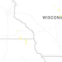


Connect with Interactive Hail Maps