

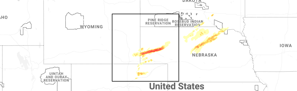
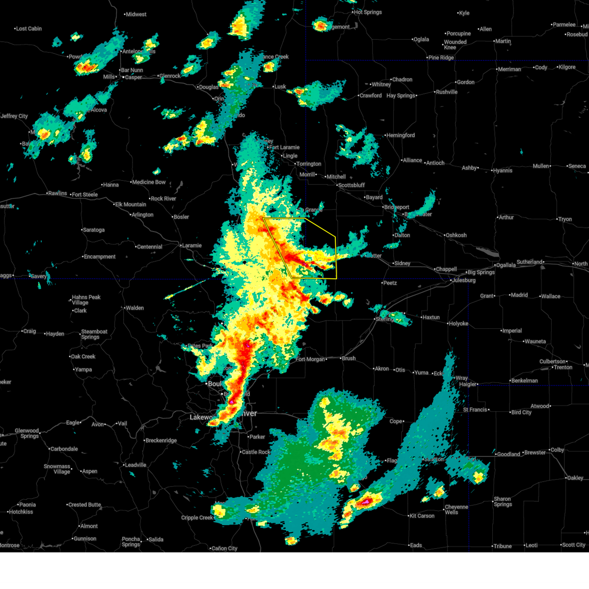
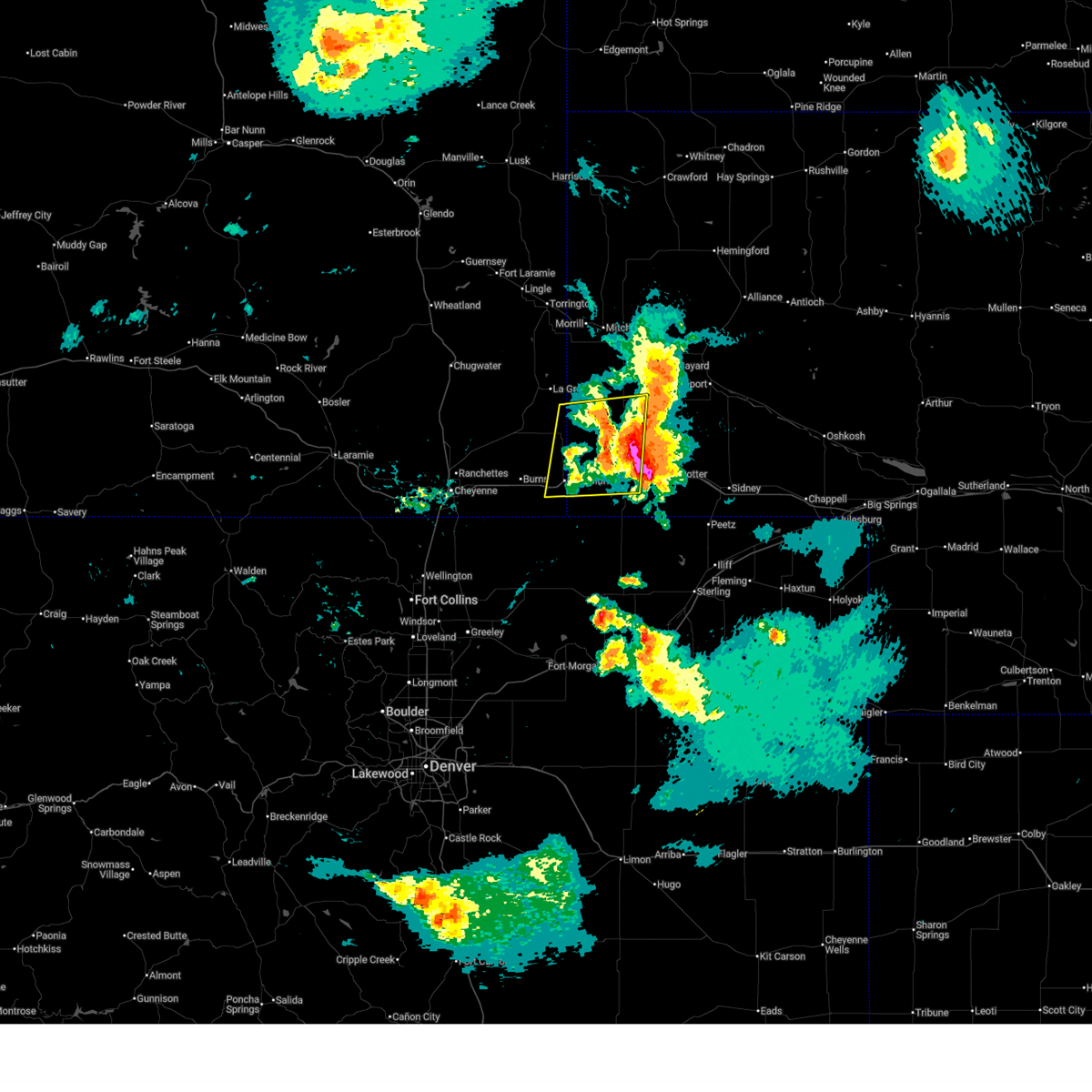
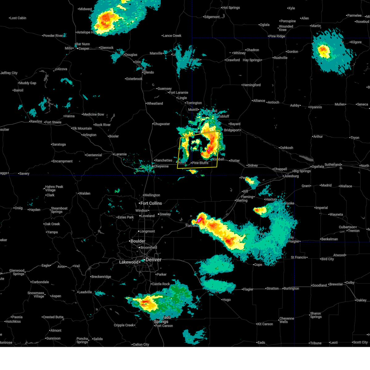
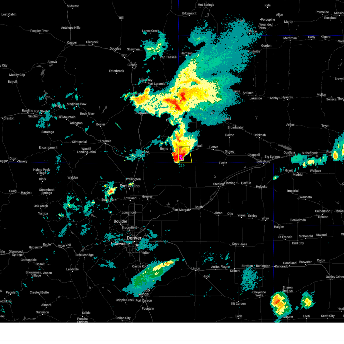
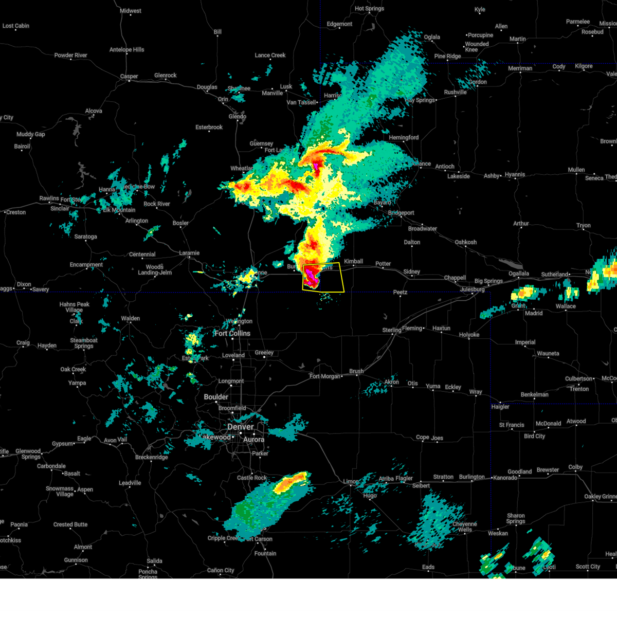
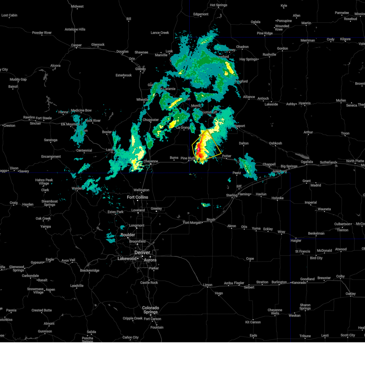
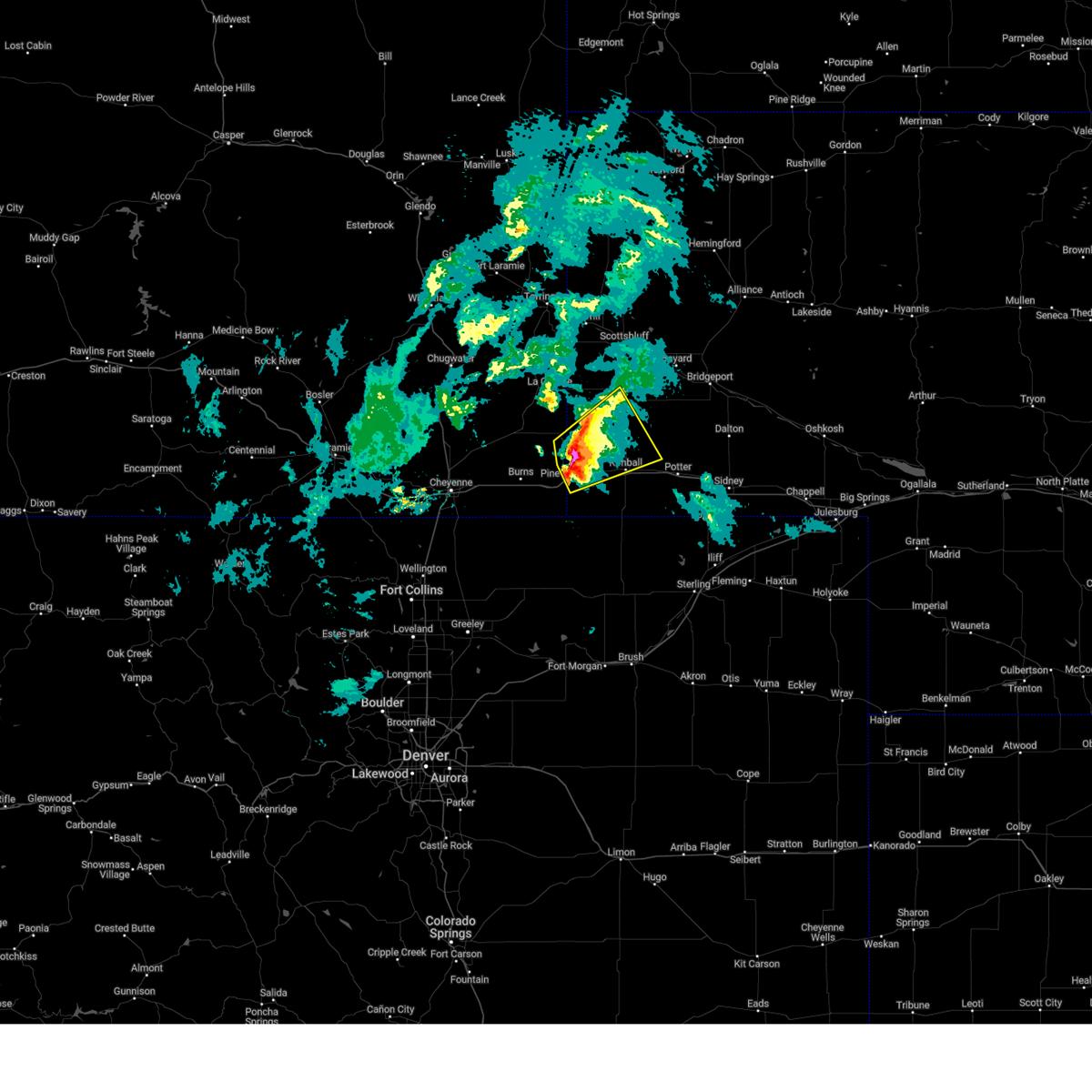
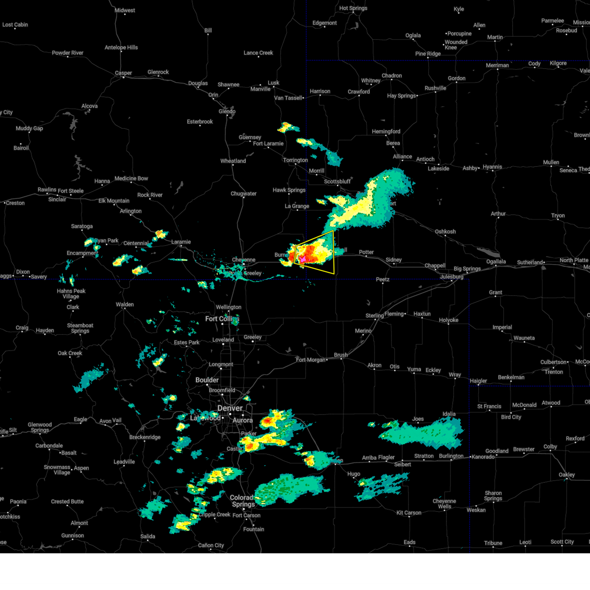
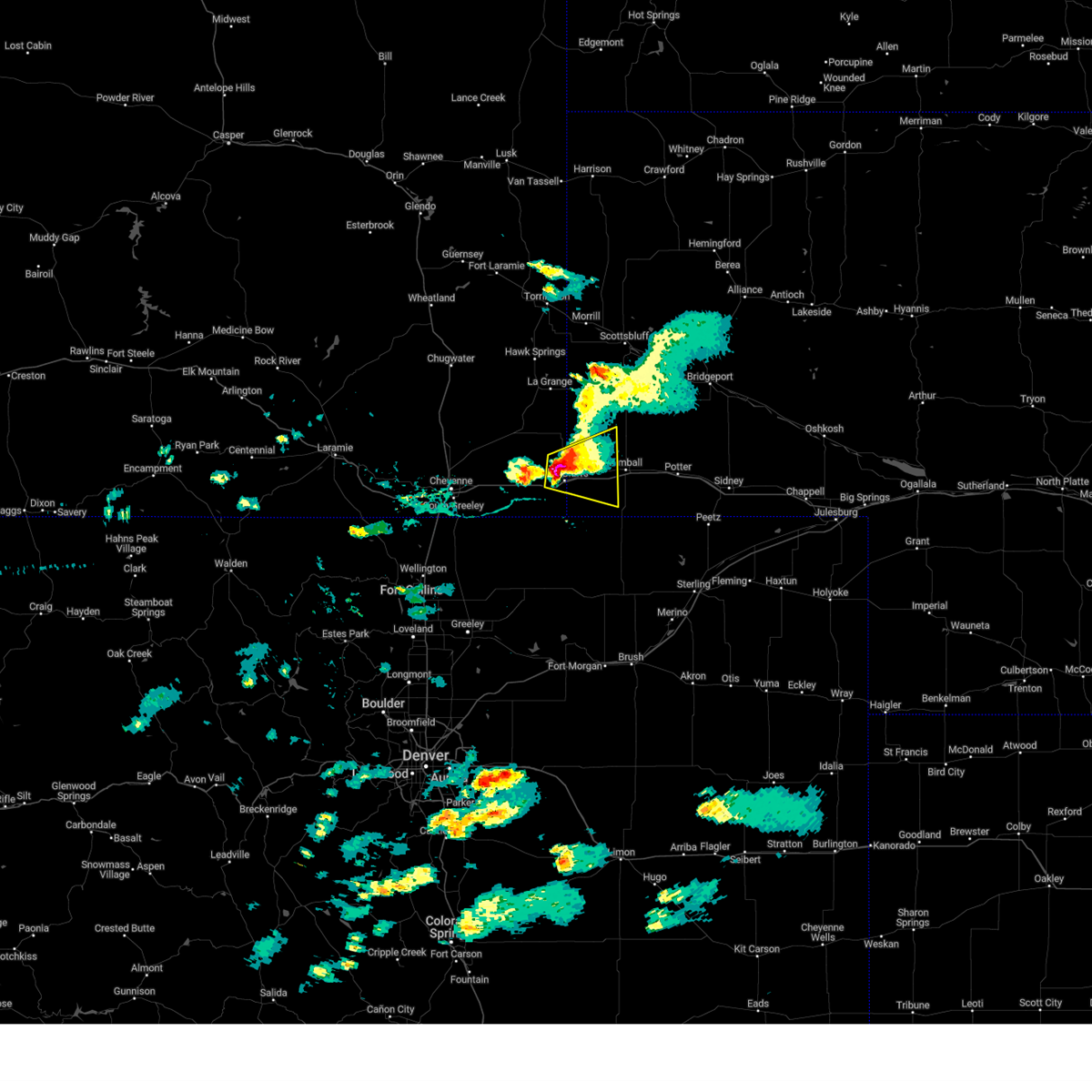
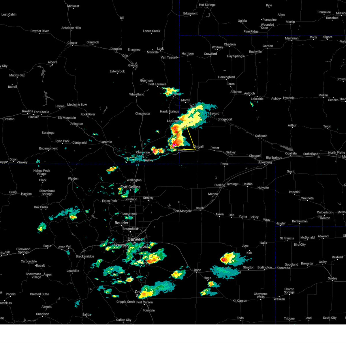
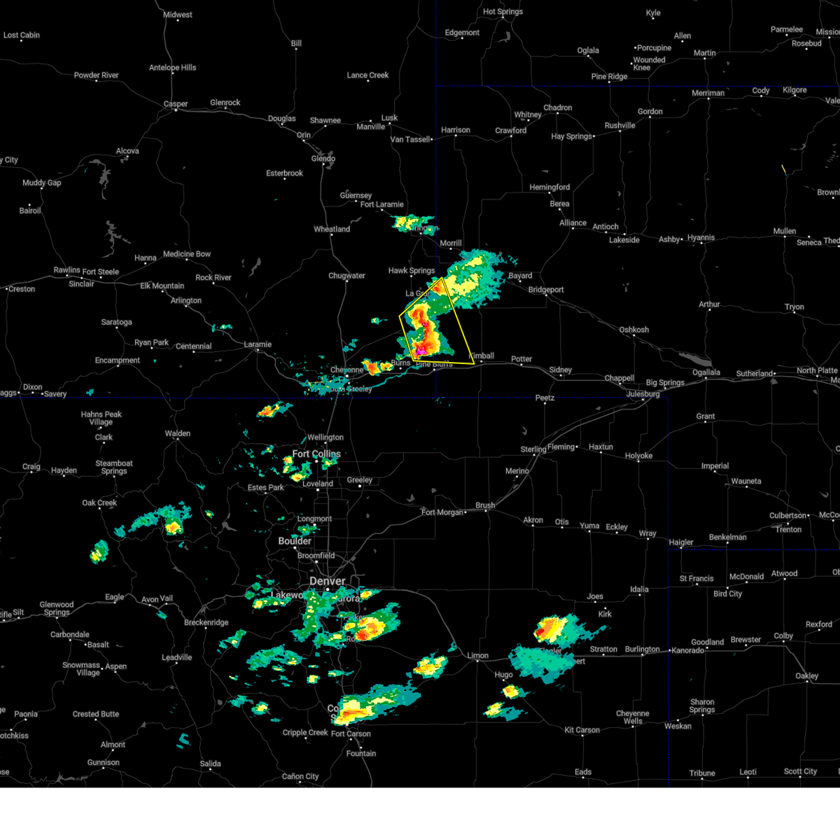
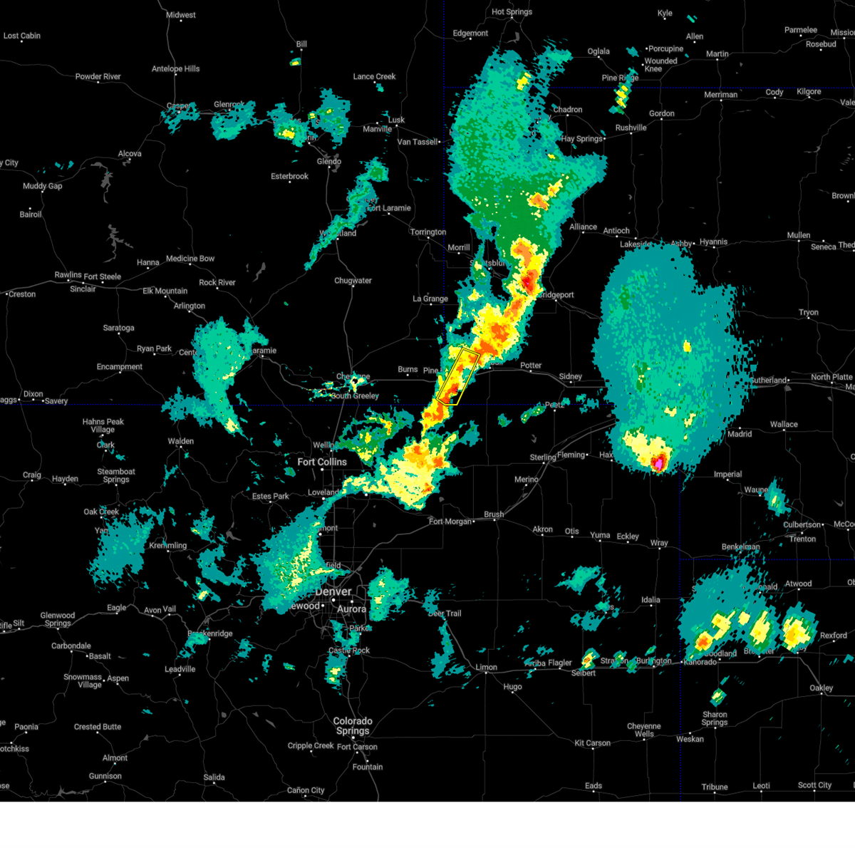
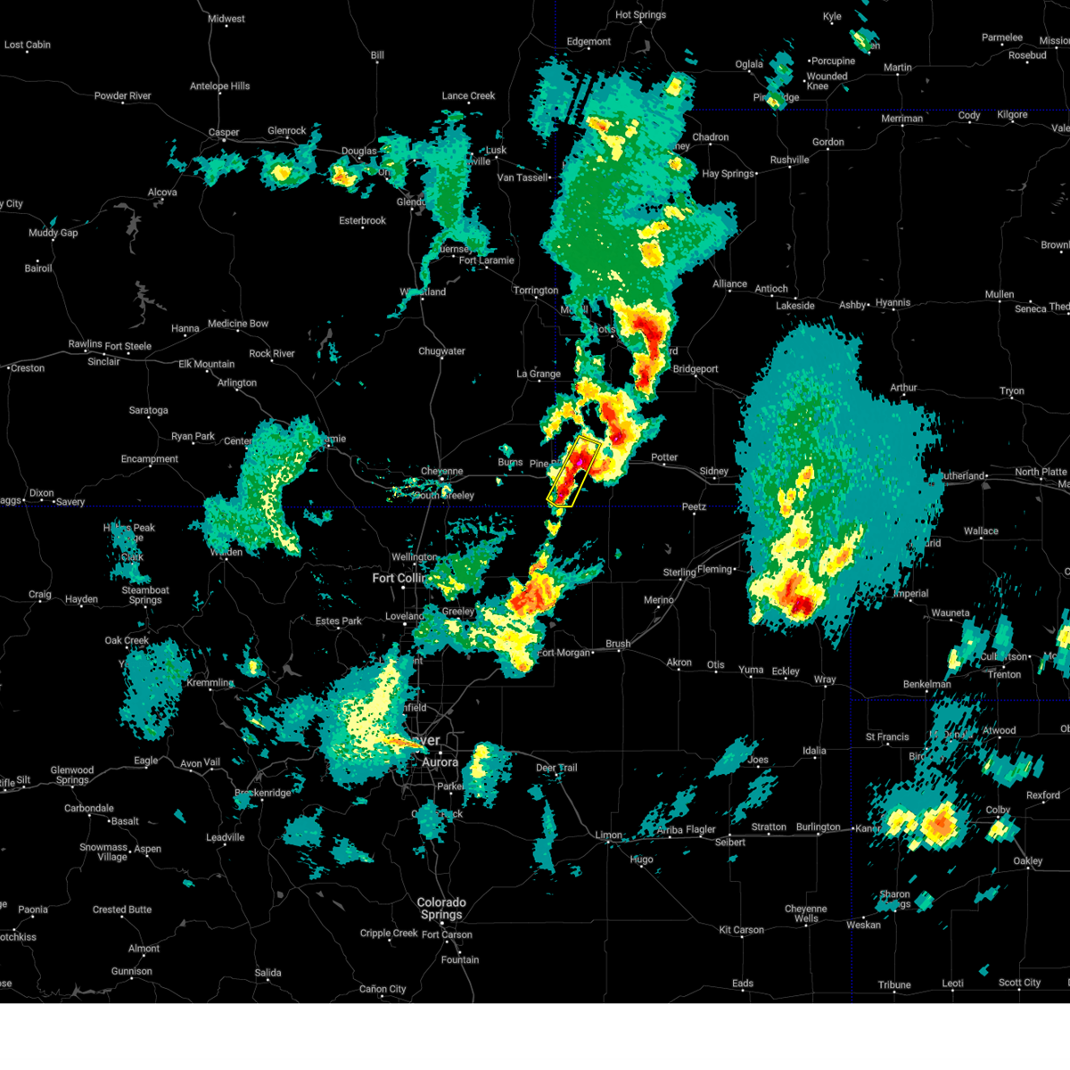
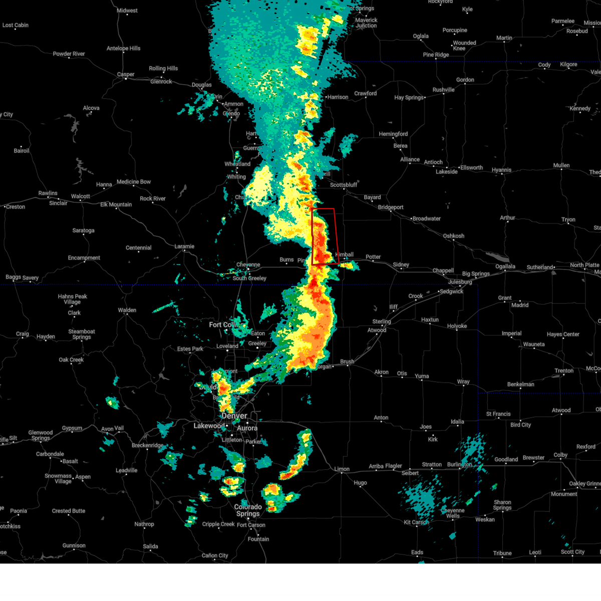
Hail Map for Bushnell, NE
The Bushnell, NE area has had 39 reports of on-the-ground hail by trained spotters, and has been under severe weather warnings 28 times during the past 12 months. Doppler radar has detected hail at or near Bushnell, NE on 77 occasions, including 10 occasions during the past year.
| Name: | Bushnell, NE |
| Where Located: | 45 miles SSW of Scottsbluff, NE |
| Map: | Google Map for Bushnell, NE |
| Population: | 124 |
| Housing Units: | 88 |
| More Info: | Search Google for Bushnell, NE |
0
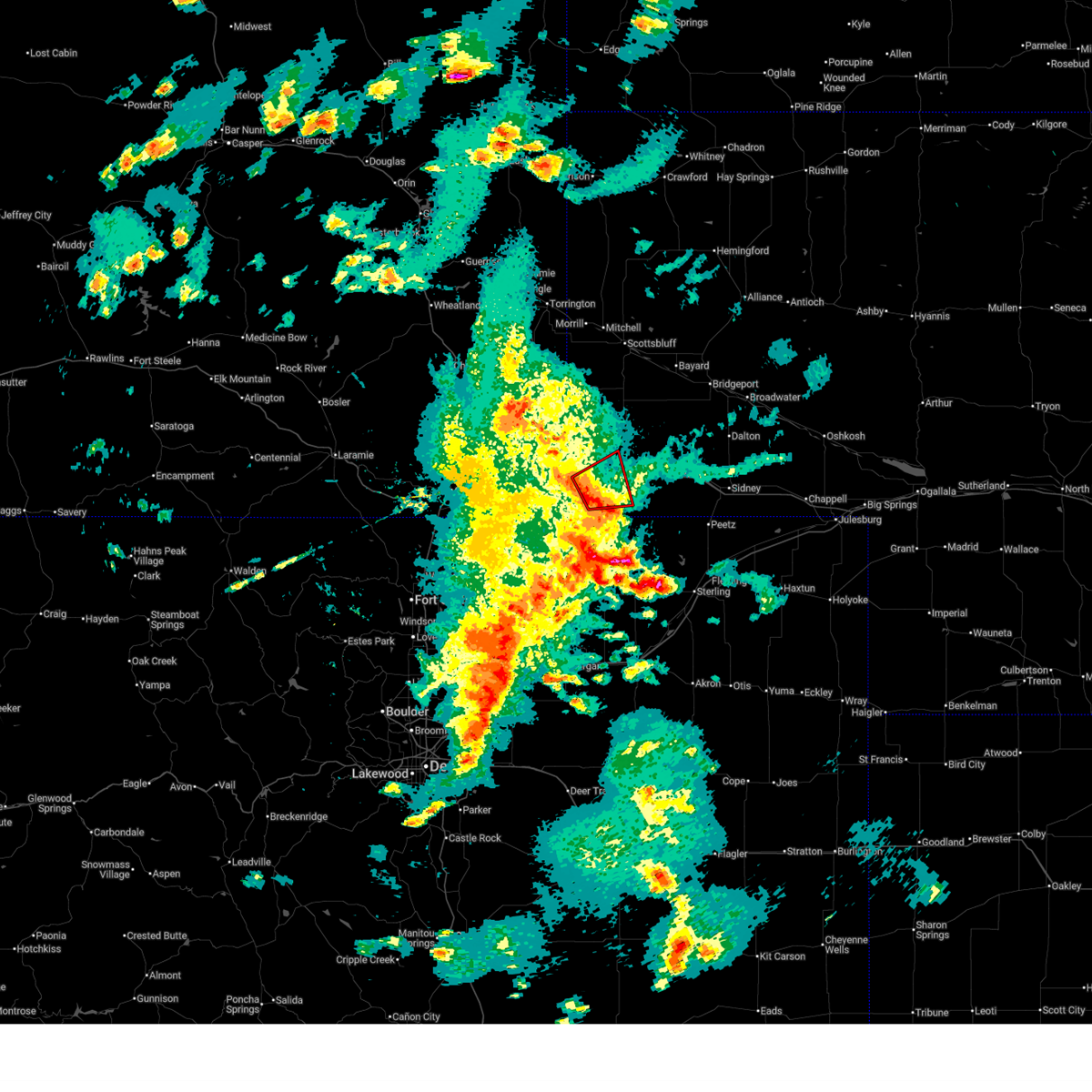
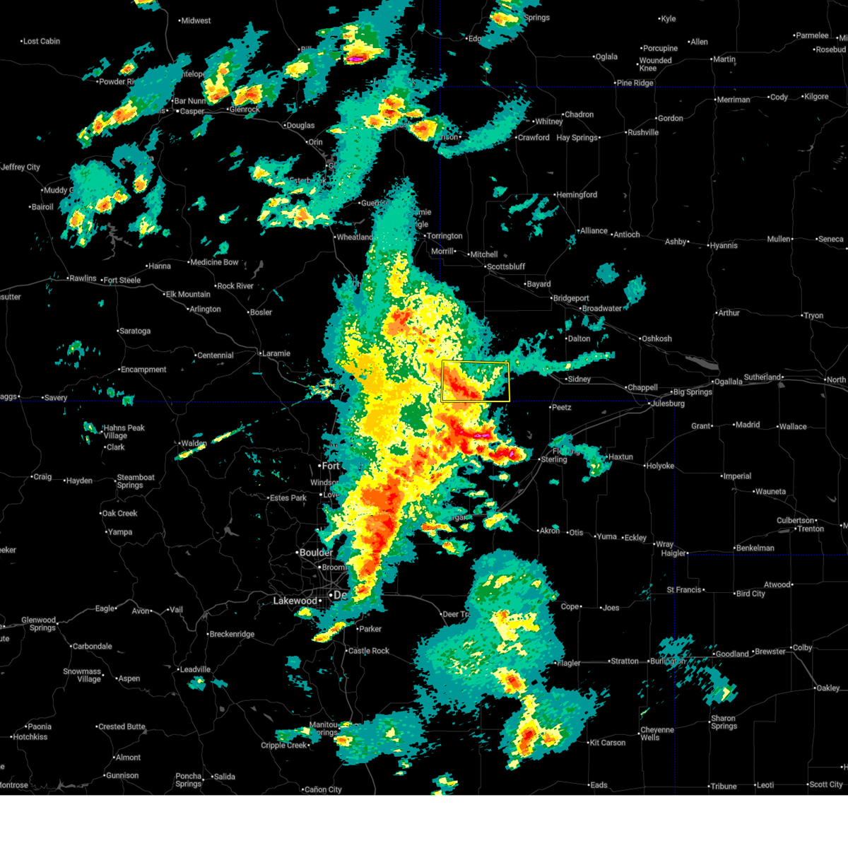
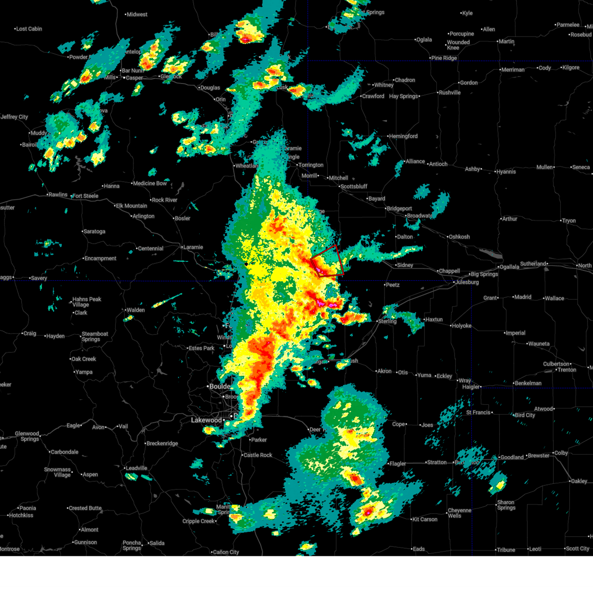
The Top Recent Hail Date for Bushnell, NE is Sunday, June 22, 2025 (28th out of 77)
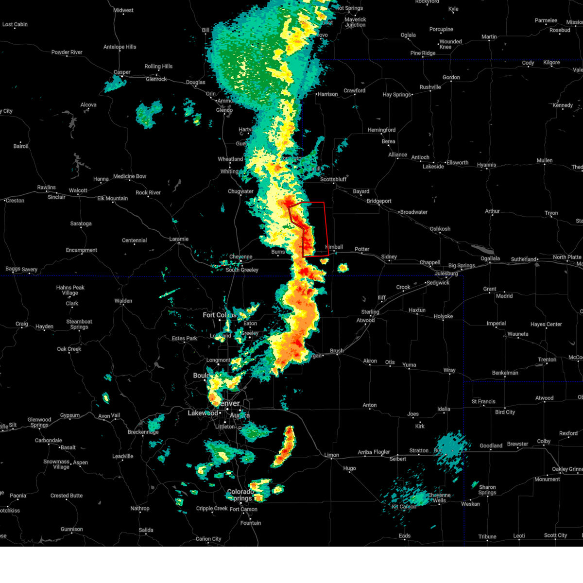
Hail and Wind Damage Spotted near Bushnell, NE
| Date / Time | Report Details |
|---|---|
| 6/17/2025 2:47 PM MDT |
 the tornado warning has been cancelled and is no longer in effect the tornado warning has been cancelled and is no longer in effect
|
| 6/17/2025 2:45 PM MDT |
 Svrcys the national weather service in cheyenne has issued a * severe thunderstorm warning for, southern kimball county in the panhandle of nebraska, * until 330 pm mdt. * at 245 pm mdt, a severe thunderstorm was located 10 miles southwest of kimball municipal airport, or 13 miles southwest of kimball, moving east at 25 mph (radar indicated). Hazards include 60 mph wind gusts and quarter size hail. Hail damage to vehicles is expected. Expect wind damage to roofs, siding, and trees. Svrcys the national weather service in cheyenne has issued a * severe thunderstorm warning for, southern kimball county in the panhandle of nebraska, * until 330 pm mdt. * at 245 pm mdt, a severe thunderstorm was located 10 miles southwest of kimball municipal airport, or 13 miles southwest of kimball, moving east at 25 mph (radar indicated). Hazards include 60 mph wind gusts and quarter size hail. Hail damage to vehicles is expected. Expect wind damage to roofs, siding, and trees.
|
| 6/17/2025 2:34 PM MDT |
 At 234 pm mdt, a severe squall line capable of producing both tornadoes and extensive straight line wind damage was located near oliver reservoir, or 10 miles southwest of kimball, moving east at 30 mph (radar indicated rotation). Hazards include tornado and quarter size hail. Flying debris will be dangerous to those caught without shelter. mobile homes will be damaged or destroyed. damage to roofs, windows, and vehicles will occur. tree damage is likely. these dangerous storms will be near, oliver reservoir around 240 pm mdt. kimball and kimball municipal airport around 245 pm mdt. Other locations impacted by this tornadic thunderstorm include oliver reservoir campground. At 234 pm mdt, a severe squall line capable of producing both tornadoes and extensive straight line wind damage was located near oliver reservoir, or 10 miles southwest of kimball, moving east at 30 mph (radar indicated rotation). Hazards include tornado and quarter size hail. Flying debris will be dangerous to those caught without shelter. mobile homes will be damaged or destroyed. damage to roofs, windows, and vehicles will occur. tree damage is likely. these dangerous storms will be near, oliver reservoir around 240 pm mdt. kimball and kimball municipal airport around 245 pm mdt. Other locations impacted by this tornadic thunderstorm include oliver reservoir campground.
|
| 6/17/2025 2:24 PM MDT | Torcys the national weather service in cheyenne has issued a * tornado warning for, western kimball county in the panhandle of nebraska, * until 300 pm mdt. * at 224 pm mdt, severe thunderstorms capable of producing both tornadoes and extensive straight line wind damage were located near bushnell, or 14 miles southwest of kimball, moving east at 25 mph (radar indicated rotation). Hazards include tornado and quarter size hail. Flying debris will be dangerous to those caught without shelter. mobile homes will be damaged or destroyed. damage to roofs, windows, and vehicles will occur. tree damage is likely. these dangerous storms will be near, oliver reservoir around 235 pm mdt. kimball municipal airport around 240 pm mdt. kimball around 245 pm mdt. Other locations impacted by this tornadic thunderstorm include oliver reservoir campground. |
| 6/17/2025 2:11 PM MDT |
 Svrcys the national weather service in cheyenne has issued a * severe thunderstorm warning for, western kimball county in the panhandle of nebraska, southwestern banner county in the panhandle of nebraska, eastern laramie county in southeastern wyoming, * until 245 pm mdt. * at 211 pm mdt, severe thunderstorms were located along a line extending from near gun barrel to near pine bluffs, moving northeast at 20 mph (radar indicated). Hazards include 60 mph wind gusts and quarter size hail. Hail damage to vehicles is expected. Expect wind damage to roofs, siding, and trees. Svrcys the national weather service in cheyenne has issued a * severe thunderstorm warning for, western kimball county in the panhandle of nebraska, southwestern banner county in the panhandle of nebraska, eastern laramie county in southeastern wyoming, * until 245 pm mdt. * at 211 pm mdt, severe thunderstorms were located along a line extending from near gun barrel to near pine bluffs, moving northeast at 20 mph (radar indicated). Hazards include 60 mph wind gusts and quarter size hail. Hail damage to vehicles is expected. Expect wind damage to roofs, siding, and trees.
|
| 6/17/2025 12:31 AM MDT | Quarter sized hail reported 10.2 miles S of Bushnell, NE |
| 6/15/2025 6:07 PM MDT |
 The storm which prompted the warning has moved out of east laramie county. severe thunderstorm warning still active for banner and kimball county. a severe thunderstorm watch remains in effect until 1100 pm mdt for the panhandle of nebraska. to report severe weather, contact your nearest law enforcement agency. they will relay your report to the national weather service cheyenne. The storm which prompted the warning has moved out of east laramie county. severe thunderstorm warning still active for banner and kimball county. a severe thunderstorm watch remains in effect until 1100 pm mdt for the panhandle of nebraska. to report severe weather, contact your nearest law enforcement agency. they will relay your report to the national weather service cheyenne.
|
| 6/15/2025 5:44 PM MDT | At 543 pm mdt, a severe thunderstorm was located 7 miles northeast of albin, or 23 miles northwest of kimball, moving east at 45 mph (radar indicated). Hazards include 60 mph wind gusts and half dollar size hail. Hail damage to vehicles is expected. expect wind damage to roofs, siding, and trees. Locations impacted include, kimball, pine bluffs, albin, bushnell, oliver reservoir, pine bluffs municipal airport, harrisburg, kimball municipal airport, oliver reservoir campground, and kimball county fairgrounds. |
| 6/15/2025 5:44 PM MDT | the severe thunderstorm warning has been cancelled and is no longer in effect |
| 6/15/2025 5:32 PM MDT |
 Svrcys the national weather service in cheyenne has issued a * severe thunderstorm warning for, northwestern kimball county in the panhandle of nebraska, banner county in the panhandle of nebraska, southeastern goshen county in southeastern wyoming, eastern laramie county in southeastern wyoming, * until 615 pm mdt. * at 532 pm mdt, a severe thunderstorm was located near albin, or 29 miles northwest of kimball, moving east at 40 mph (radar indicated). Hazards include 60 mph wind gusts. expect damage to roofs, siding, and trees Svrcys the national weather service in cheyenne has issued a * severe thunderstorm warning for, northwestern kimball county in the panhandle of nebraska, banner county in the panhandle of nebraska, southeastern goshen county in southeastern wyoming, eastern laramie county in southeastern wyoming, * until 615 pm mdt. * at 532 pm mdt, a severe thunderstorm was located near albin, or 29 miles northwest of kimball, moving east at 40 mph (radar indicated). Hazards include 60 mph wind gusts. expect damage to roofs, siding, and trees
|
| 6/12/2025 4:12 PM MDT | Mping from storm chaser of 64mph wind gust measured with handheld kestre in banner county NE, 13.6 miles S of Bushnell, NE |
| 6/2/2025 5:39 PM MDT | Ping Pong Ball sized hail reported 10.5 miles NNE of Bushnell, NE, trained spotter reports ping pong ball size hail. |
| 6/2/2025 5:39 PM MDT |
 the severe thunderstorm warning has been cancelled and is no longer in effect the severe thunderstorm warning has been cancelled and is no longer in effect
|
| 6/2/2025 5:39 PM MDT |
 At 538 pm mdt, a severe thunderstorm was located near pine bluffs, or 18 miles southwest of kimball, moving east at 20 mph (radar indicated). Hazards include 70 mph wind gusts and ping pong ball size hail. People and animals outdoors will be injured. expect hail damage to roofs, siding, windows, and vehicles. expect considerable tree damage. wind damage is also likely to mobile homes, roofs, and outbuildings. Locations impacted include, bushnell, panorama point, oliver reservoir, and oliver reservoir campground. At 538 pm mdt, a severe thunderstorm was located near pine bluffs, or 18 miles southwest of kimball, moving east at 20 mph (radar indicated). Hazards include 70 mph wind gusts and ping pong ball size hail. People and animals outdoors will be injured. expect hail damage to roofs, siding, windows, and vehicles. expect considerable tree damage. wind damage is also likely to mobile homes, roofs, and outbuildings. Locations impacted include, bushnell, panorama point, oliver reservoir, and oliver reservoir campground.
|
| 6/2/2025 5:15 PM MDT |
 Svrcys the national weather service in cheyenne has issued a * severe thunderstorm warning for, southwestern kimball county in the panhandle of nebraska, southeastern laramie county in southeastern wyoming, * until 600 pm mdt. * at 514 pm mdt, a severe thunderstorm was located over pine bluffs municipal airport, or 26 miles west of kimball, moving east at 20 mph (radar indicated). Hazards include golf ball size hail and 70 mph wind gusts. People and animals outdoors will be injured. expect hail damage to roofs, siding, windows, and vehicles. expect considerable tree damage. Wind damage is also likely to mobile homes, roofs, and outbuildings. Svrcys the national weather service in cheyenne has issued a * severe thunderstorm warning for, southwestern kimball county in the panhandle of nebraska, southeastern laramie county in southeastern wyoming, * until 600 pm mdt. * at 514 pm mdt, a severe thunderstorm was located over pine bluffs municipal airport, or 26 miles west of kimball, moving east at 20 mph (radar indicated). Hazards include golf ball size hail and 70 mph wind gusts. People and animals outdoors will be injured. expect hail damage to roofs, siding, windows, and vehicles. expect considerable tree damage. Wind damage is also likely to mobile homes, roofs, and outbuildings.
|
| 5/18/2025 4:45 PM MDT |
 the severe thunderstorm warning has been cancelled and is no longer in effect the severe thunderstorm warning has been cancelled and is no longer in effect
|
| 5/18/2025 4:30 PM MDT | At 429 pm mdt, severe thunderstorms were located along a line extending from near albin to 7 miles northwest of kimball, moving north at 65 mph (radar indicated). Hazards include 70 mph wind gusts and half dollar size hail. Hail damage to vehicles is expected. expect considerable tree damage. wind damage is also likely to mobile homes, roofs, and outbuildings. Locations impacted include, kimball, pine bluffs, albin, bushnell, oliver reservoir, pine bluffs municipal airport, meriden rest area, kimball municipal airport, oliver reservoir campground, and kimball county fairgrounds. |
| 5/18/2025 4:21 PM MDT | At 421 pm mdt, severe thunderstorms were located along a line extending from 6 miles northwest of pine bluffs to 7 miles southeast of kimball municipal airport, moving north at 40 mph (radar indicated). Hazards include 70 mph wind gusts and half dollar size hail. Hail damage to vehicles is expected. expect considerable tree damage. wind damage is also likely to mobile homes, roofs, and outbuildings. Locations impacted include, kimball, pine bluffs, albin, bushnell, oliver reservoir, pine bluffs municipal airport, meriden rest area, kimball municipal airport, panorama point, oliver reservoir campground, and kimball county fairgrounds. |
| 5/18/2025 4:20 PM MDT | At 419 pm mdt, severe thunderstorms were located along a line extending from 6 miles northwest of pine bluffs to 8 miles southeast of kimball municipal airport, moving north at 40 mph (radar indicated). Hazards include 60 mph wind gusts and half dollar size hail. Hail damage to vehicles is expected. expect wind damage to roofs, siding, and trees. Locations impacted include, kimball, pine bluffs, albin, bushnell, oliver reservoir, pine bluffs municipal airport, meriden rest area, kimball municipal airport, panorama point, oliver reservoir campground, and kimball county fairgrounds. |
| 5/18/2025 4:08 PM MDT | Svrcys the national weather service in cheyenne has issued a * severe thunderstorm warning for, kimball county in the panhandle of nebraska, southern banner county in the panhandle of nebraska, eastern laramie county in southeastern wyoming, * until 500 pm mdt. * at 408 pm mdt, severe thunderstorms were located along a line extending from near pine bluffs municipal airport to 11 miles northwest of westplains, moving north at 40 mph (radar indicated). Hazards include 60 mph wind gusts and nickel size hail. expect damage to roofs, siding, and trees |
| 3/31/2025 7:44 PM MDT |
 The severe thunderstorm which prompted the warning has moved out of the warned area. therefore, the warning will be allowed to expire. remember, a severe thunderstorm warning still remains in effect for kimball and banner counties!. The severe thunderstorm which prompted the warning has moved out of the warned area. therefore, the warning will be allowed to expire. remember, a severe thunderstorm warning still remains in effect for kimball and banner counties!.
|
| 3/31/2025 7:43 PM MDT |
 Svrcys the national weather service in cheyenne has issued a * severe thunderstorm warning for, northwestern cheyenne county in the panhandle of nebraska, northeastern kimball county in the panhandle of nebraska, southwestern morrill county in the panhandle of nebraska, eastern banner county in the panhandle of nebraska, * until 815 pm mdt. * at 743 pm mdt, a severe thunderstorm was located 8 miles south of harrisburg, or 13 miles north of kimball, moving northeast at 30 mph (radar indicated). Hazards include quarter size hail. damage to vehicles is expected Svrcys the national weather service in cheyenne has issued a * severe thunderstorm warning for, northwestern cheyenne county in the panhandle of nebraska, northeastern kimball county in the panhandle of nebraska, southwestern morrill county in the panhandle of nebraska, eastern banner county in the panhandle of nebraska, * until 815 pm mdt. * at 743 pm mdt, a severe thunderstorm was located 8 miles south of harrisburg, or 13 miles north of kimball, moving northeast at 30 mph (radar indicated). Hazards include quarter size hail. damage to vehicles is expected
|
| 3/31/2025 7:30 PM MDT | Quarter sized hail reported 6.7 miles S of Bushnell, NE |
| 3/31/2025 7:28 PM MDT |
 the severe thunderstorm warning has been cancelled and is no longer in effect the severe thunderstorm warning has been cancelled and is no longer in effect
|
| 3/31/2025 7:28 PM MDT |
 At 728 pm mdt, a severe thunderstorm was located 10 miles north of kimball, moving northeast at 35 mph (radar indicated). Hazards include quarter size hail. Damage to vehicles is expected. Locations impacted include, kimball, harrisburg, oliver reservoir, oliver reservoir campground, bushnell, and kimball county fairgrounds. At 728 pm mdt, a severe thunderstorm was located 10 miles north of kimball, moving northeast at 35 mph (radar indicated). Hazards include quarter size hail. Damage to vehicles is expected. Locations impacted include, kimball, harrisburg, oliver reservoir, oliver reservoir campground, bushnell, and kimball county fairgrounds.
|
| 3/31/2025 7:13 PM MDT | Quarter sized hail reported 9.1 miles ENE of Bushnell, NE |
| 3/31/2025 7:13 PM MDT |
 Svrcys the national weather service in cheyenne has issued a * severe thunderstorm warning for, northern kimball county in the panhandle of nebraska, western banner county in the panhandle of nebraska, east central laramie county in southeastern wyoming, * until 745 pm mdt. * at 712 pm mdt, a severe thunderstorm was located near bushnell, or 13 miles northwest of kimball, moving northeast at 35 mph (radar indicated). Hazards include quarter size hail. damage to vehicles is expected Svrcys the national weather service in cheyenne has issued a * severe thunderstorm warning for, northern kimball county in the panhandle of nebraska, western banner county in the panhandle of nebraska, east central laramie county in southeastern wyoming, * until 745 pm mdt. * at 712 pm mdt, a severe thunderstorm was located near bushnell, or 13 miles northwest of kimball, moving northeast at 35 mph (radar indicated). Hazards include quarter size hail. damage to vehicles is expected
|
| 8/19/2024 4:15 PM MDT | Golf Ball sized hail reported 13.4 miles N of Bushnell, NE, radar estimated time of trained storm spotter report of golf ball sized hail occurring. |
| 8/19/2024 4:00 PM MDT | Awos station k1ew 6 se pine bluff in kimball county NE, 9 miles NNE of Bushnell, NE |
| 8/12/2024 4:01 PM MDT |
 At 401 pm mdt, a severe thunderstorm was located near oliver reservoir, or 8 miles west of kimball, moving east at 25 mph (radar indicated). Hazards include golf ball size hail and 60 mph wind gusts. People and animals outdoors will be injured. expect hail damage to roofs, siding, windows, and vehicles. expect wind damage to roofs, siding, and trees. Locations impacted include, pine bluffs, bushnell, oliver reservoir, pine bluffs municipal airport, and oliver reservoir campground. At 401 pm mdt, a severe thunderstorm was located near oliver reservoir, or 8 miles west of kimball, moving east at 25 mph (radar indicated). Hazards include golf ball size hail and 60 mph wind gusts. People and animals outdoors will be injured. expect hail damage to roofs, siding, windows, and vehicles. expect wind damage to roofs, siding, and trees. Locations impacted include, pine bluffs, bushnell, oliver reservoir, pine bluffs municipal airport, and oliver reservoir campground.
|
| 8/12/2024 3:38 PM MDT |
 Svrcys the national weather service in cheyenne has issued a * severe thunderstorm warning for, western kimball county in the panhandle of nebraska, southwestern banner county in the panhandle of nebraska, east central laramie county in southeastern wyoming, * until 415 pm mdt. * at 337 pm mdt, a severe thunderstorm was located near pine bluffs, or 18 miles west of kimball, moving east at 25 mph (radar indicated). Hazards include two inch hail and 60 mph wind gusts. People and animals outdoors will be injured. expect hail damage to roofs, siding, windows, and vehicles. Expect wind damage to roofs, siding, and trees. Svrcys the national weather service in cheyenne has issued a * severe thunderstorm warning for, western kimball county in the panhandle of nebraska, southwestern banner county in the panhandle of nebraska, east central laramie county in southeastern wyoming, * until 415 pm mdt. * at 337 pm mdt, a severe thunderstorm was located near pine bluffs, or 18 miles west of kimball, moving east at 25 mph (radar indicated). Hazards include two inch hail and 60 mph wind gusts. People and animals outdoors will be injured. expect hail damage to roofs, siding, windows, and vehicles. Expect wind damage to roofs, siding, and trees.
|
| 8/12/2024 3:18 PM MDT |
 the severe thunderstorm warning has been cancelled and is no longer in effect the severe thunderstorm warning has been cancelled and is no longer in effect
|
| 8/12/2024 3:18 PM MDT |
 At 317 pm mdt, a severe thunderstorm was located near albin, or 25 miles northwest of kimball, moving northeast at 30 mph (radar indicated). Hazards include tennis ball size hail and 60 mph wind gusts. People and animals outdoors will be injured. expect hail damage to roofs, siding, windows, and vehicles. expect wind damage to roofs, siding, and trees. Locations impacted include, albin, bushnell, oliver reservoir, and oliver reservoir campground. At 317 pm mdt, a severe thunderstorm was located near albin, or 25 miles northwest of kimball, moving northeast at 30 mph (radar indicated). Hazards include tennis ball size hail and 60 mph wind gusts. People and animals outdoors will be injured. expect hail damage to roofs, siding, windows, and vehicles. expect wind damage to roofs, siding, and trees. Locations impacted include, albin, bushnell, oliver reservoir, and oliver reservoir campground.
|
| 8/12/2024 3:14 PM MDT |
 At 313 pm mdt, a severe thunderstorm was located near albin, or 26 miles northwest of kimball, moving northeast at 30 mph (radar indicated). Hazards include ping pong ball size hail and 60 mph wind gusts. People and animals outdoors will be injured. expect hail damage to roofs, siding, windows, and vehicles. expect wind damage to roofs, siding, and trees. Locations impacted include, la grange, albin, bushnell, meriden rest area, oliver reservoir, and oliver reservoir campground. At 313 pm mdt, a severe thunderstorm was located near albin, or 26 miles northwest of kimball, moving northeast at 30 mph (radar indicated). Hazards include ping pong ball size hail and 60 mph wind gusts. People and animals outdoors will be injured. expect hail damage to roofs, siding, windows, and vehicles. expect wind damage to roofs, siding, and trees. Locations impacted include, la grange, albin, bushnell, meriden rest area, oliver reservoir, and oliver reservoir campground.
|
| 8/12/2024 3:08 PM MDT |
 Svrcys the national weather service in cheyenne has issued a * severe thunderstorm warning for, southwestern scotts bluff county in the panhandle of nebraska, northwestern kimball county in the panhandle of nebraska, western banner county in the panhandle of nebraska, southeastern goshen county in southeastern wyoming, northeastern laramie county in southeastern wyoming, * until 345 pm mdt. * at 307 pm mdt, a severe thunderstorm was located over albin, or 28 miles northwest of kimball, moving northeast at 25 mph (radar indicated). Hazards include 60 mph wind gusts and quarter size hail. Hail damage to vehicles is expected. Expect wind damage to roofs, siding, and trees. Svrcys the national weather service in cheyenne has issued a * severe thunderstorm warning for, southwestern scotts bluff county in the panhandle of nebraska, northwestern kimball county in the panhandle of nebraska, western banner county in the panhandle of nebraska, southeastern goshen county in southeastern wyoming, northeastern laramie county in southeastern wyoming, * until 345 pm mdt. * at 307 pm mdt, a severe thunderstorm was located over albin, or 28 miles northwest of kimball, moving northeast at 25 mph (radar indicated). Hazards include 60 mph wind gusts and quarter size hail. Hail damage to vehicles is expected. Expect wind damage to roofs, siding, and trees.
|
| 7/20/2024 3:40 PM MDT | Quarter sized hail reported 6.5 miles NNW of Bushnell, NE, emergency manager measured one inch hailstones with calipers. |
| 6/14/2024 12:45 PM MDT |
 the severe thunderstorm warning has been cancelled and is no longer in effect the severe thunderstorm warning has been cancelled and is no longer in effect
|
| 6/14/2024 12:11 PM MDT |
 Svrcys the national weather service in cheyenne has issued a * severe thunderstorm warning for, central kimball county in the panhandle of nebraska, southeastern banner county in the panhandle of nebraska, * until 100 pm mdt. * at 1210 pm mdt, severe thunderstorms were located along a line extending from 9 miles north of kimball to near bushnell, moving northeast at 30 mph (radar indicated). Hazards include 60 mph wind gusts and quarter size hail. Hail damage to vehicles is expected. Expect wind damage to roofs, siding, and trees. Svrcys the national weather service in cheyenne has issued a * severe thunderstorm warning for, central kimball county in the panhandle of nebraska, southeastern banner county in the panhandle of nebraska, * until 100 pm mdt. * at 1210 pm mdt, severe thunderstorms were located along a line extending from 9 miles north of kimball to near bushnell, moving northeast at 30 mph (radar indicated). Hazards include 60 mph wind gusts and quarter size hail. Hail damage to vehicles is expected. Expect wind damage to roofs, siding, and trees.
|
| 6/2/2024 2:20 PM MDT |
 Svrcys the national weather service in cheyenne has issued a * severe thunderstorm warning for, northwestern kimball county in the panhandle of nebraska, southwestern banner county in the panhandle of nebraska, east central laramie county in southeastern wyoming, * until 300 pm mdt. * at 220 pm mdt, a severe thunderstorm was located near bushnell, or 16 miles west of kimball, moving east at 25 mph (radar indicated). Hazards include 60 mph wind gusts and quarter size hail. Hail damage to vehicles is expected. Expect wind damage to roofs, siding, and trees. Svrcys the national weather service in cheyenne has issued a * severe thunderstorm warning for, northwestern kimball county in the panhandle of nebraska, southwestern banner county in the panhandle of nebraska, east central laramie county in southeastern wyoming, * until 300 pm mdt. * at 220 pm mdt, a severe thunderstorm was located near bushnell, or 16 miles west of kimball, moving east at 25 mph (radar indicated). Hazards include 60 mph wind gusts and quarter size hail. Hail damage to vehicles is expected. Expect wind damage to roofs, siding, and trees.
|
| 5/31/2024 2:05 AM MDT |
 The storm which prompted the warning has weakened below severe limits, and no longer poses an immediate threat to life or property. therefore, the warning will be allowed to expire. however, small hail is still possible with this thunderstorm. The storm which prompted the warning has weakened below severe limits, and no longer poses an immediate threat to life or property. therefore, the warning will be allowed to expire. however, small hail is still possible with this thunderstorm.
|
| 5/31/2024 1:36 AM MDT |
 Svrcys the national weather service in cheyenne has issued a * severe thunderstorm warning for, northwestern kimball county in the panhandle of nebraska, southwestern banner county in the panhandle of nebraska, * until 215 am mdt. * at 135 am mdt, a severe thunderstorm was located 7 miles northwest of bushnell, or 17 miles west of kimball, moving southeast at 25 mph (radar indicated). Hazards include 60 mph wind gusts and quarter size hail. Hail damage to vehicles is expected. Expect wind damage to roofs, siding, and trees. Svrcys the national weather service in cheyenne has issued a * severe thunderstorm warning for, northwestern kimball county in the panhandle of nebraska, southwestern banner county in the panhandle of nebraska, * until 215 am mdt. * at 135 am mdt, a severe thunderstorm was located 7 miles northwest of bushnell, or 17 miles west of kimball, moving southeast at 25 mph (radar indicated). Hazards include 60 mph wind gusts and quarter size hail. Hail damage to vehicles is expected. Expect wind damage to roofs, siding, and trees.
|
| 4/25/2024 6:10 PM MDT |
 the severe thunderstorm warning has been cancelled and is no longer in effect the severe thunderstorm warning has been cancelled and is no longer in effect
|
| 4/25/2024 5:47 PM MDT |
 Svrcys the national weather service in cheyenne has issued a * severe thunderstorm warning for, western kimball county in the panhandle of nebraska, southeastern laramie county in southeastern wyoming, * until 630 pm mdt. * at 547 pm mdt, severe thunderstorms were located along a line extending from near oliver campground to panorama point, moving north at 10 mph (radar indicated). Hazards include 60 mph wind gusts and half dollar size hail. Hail damage to vehicles is expected. Expect wind damage to roofs, siding, and trees. Svrcys the national weather service in cheyenne has issued a * severe thunderstorm warning for, western kimball county in the panhandle of nebraska, southeastern laramie county in southeastern wyoming, * until 630 pm mdt. * at 547 pm mdt, severe thunderstorms were located along a line extending from near oliver campground to panorama point, moving north at 10 mph (radar indicated). Hazards include 60 mph wind gusts and half dollar size hail. Hail damage to vehicles is expected. Expect wind damage to roofs, siding, and trees.
|
| 6/28/2023 7:43 PM MDT |
 The severe thunderstorm warning for west central cheyenne, kimball and east central laramie counties will expire at 745 pm mdt, the storm which prompted the warning has weakened below severe limits, and has exited the warned area. therefore, the warning will be allowed to expire. however small hail, gusty winds and heavy rain are still possible with this thunderstorm. a severe thunderstorm watch remains in effect until 900 pm mdt for the panhandle of nebraska, and southeastern wyoming. to report severe weather, contact your nearest law enforcement agency. they will relay your report to the national weather service cheyenne. The severe thunderstorm warning for west central cheyenne, kimball and east central laramie counties will expire at 745 pm mdt, the storm which prompted the warning has weakened below severe limits, and has exited the warned area. therefore, the warning will be allowed to expire. however small hail, gusty winds and heavy rain are still possible with this thunderstorm. a severe thunderstorm watch remains in effect until 900 pm mdt for the panhandle of nebraska, and southeastern wyoming. to report severe weather, contact your nearest law enforcement agency. they will relay your report to the national weather service cheyenne.
|
| 6/28/2023 7:28 PM MDT |
 The severe thunderstorm warning for southwestern cheyenne and kimball counties will expire at 730 pm mdt, the storm which prompted the warning has moved out of the area. therefore, the warning will be allowed to expire. however small hail, gusty winds and heavy rain are still possible with this thunderstorm. a severe thunderstorm watch remains in effect until 900 pm mdt for the panhandle of nebraska. to report severe weather, contact your nearest law enforcement agency. they will relay your report to the national weather service cheyenne. remember, a severe thunderstorm warning still remains in effect for west central cheyenne county, kimball county and east central laramie county until 745 pm mdt. The severe thunderstorm warning for southwestern cheyenne and kimball counties will expire at 730 pm mdt, the storm which prompted the warning has moved out of the area. therefore, the warning will be allowed to expire. however small hail, gusty winds and heavy rain are still possible with this thunderstorm. a severe thunderstorm watch remains in effect until 900 pm mdt for the panhandle of nebraska. to report severe weather, contact your nearest law enforcement agency. they will relay your report to the national weather service cheyenne. remember, a severe thunderstorm warning still remains in effect for west central cheyenne county, kimball county and east central laramie county until 745 pm mdt.
|
| 6/28/2023 7:05 PM MDT |
 At 704 pm mdt, a severe thunderstorm was located near oliver campground, or 15 miles west of kimball, moving east at 20 mph (radar indicated). Hazards include 60 mph wind gusts and quarter size hail. Hail damage to vehicles is expected. expect wind damage to roofs, siding, and trees. this severe storm will be near, oliver campground around 725 pm mdt. oliver reservoir around 730 pm mdt. kimball and kimball airport around 755 pm mdt. other locations impacted by this severe thunderstorm include bushnell. this includes the following highways, interstate 80 in wyoming between mile markers 393 and 402. interstate 80 in nebraska between mile markers 1 and 43. hail threat, radar indicated max hail size, 1. 00 in wind threat, radar indicated max wind gust, 60 mph. At 704 pm mdt, a severe thunderstorm was located near oliver campground, or 15 miles west of kimball, moving east at 20 mph (radar indicated). Hazards include 60 mph wind gusts and quarter size hail. Hail damage to vehicles is expected. expect wind damage to roofs, siding, and trees. this severe storm will be near, oliver campground around 725 pm mdt. oliver reservoir around 730 pm mdt. kimball and kimball airport around 755 pm mdt. other locations impacted by this severe thunderstorm include bushnell. this includes the following highways, interstate 80 in wyoming between mile markers 393 and 402. interstate 80 in nebraska between mile markers 1 and 43. hail threat, radar indicated max hail size, 1. 00 in wind threat, radar indicated max wind gust, 60 mph.
|
| 6/28/2023 6:46 PM MDT |
 At 646 pm mdt, a severe thunderstorm was located over pine bluffs, or 20 miles west of kimball, moving east at 35 mph (radar indicated). Hazards include ping pong ball size hail and 60 mph wind gusts. People and animals outdoors will be injured. expect hail damage to roofs, siding, windows, and vehicles. expect wind damage to roofs, siding, and trees. this severe thunderstorm will be near, oliver campground and oliver reservoir around 705 pm mdt. kimball and kimball airport around 715 pm mdt. other locations impacted by this severe thunderstorm include bushnell. this includes the following highways, interstate 80 in wyoming between mile markers 393 and 402. interstate 80 in nebraska between mile markers 1 and 43. hail threat, radar indicated max hail size, 1. 50 in wind threat, radar indicated max wind gust, 60 mph. At 646 pm mdt, a severe thunderstorm was located over pine bluffs, or 20 miles west of kimball, moving east at 35 mph (radar indicated). Hazards include ping pong ball size hail and 60 mph wind gusts. People and animals outdoors will be injured. expect hail damage to roofs, siding, windows, and vehicles. expect wind damage to roofs, siding, and trees. this severe thunderstorm will be near, oliver campground and oliver reservoir around 705 pm mdt. kimball and kimball airport around 715 pm mdt. other locations impacted by this severe thunderstorm include bushnell. this includes the following highways, interstate 80 in wyoming between mile markers 393 and 402. interstate 80 in nebraska between mile markers 1 and 43. hail threat, radar indicated max hail size, 1. 50 in wind threat, radar indicated max wind gust, 60 mph.
|
| 6/28/2023 6:09 PM MDT |
 At 609 pm mdt, a severe thunderstorm was located over oliver campground, or 10 miles west of kimball, moving southeast at 20 mph. this is a destructive storm for bushnell, kimball, and dix (radar indicated). Hazards include baseball size hail and 60 mph wind gusts. People and animals outdoors will be severely injured. Expect shattered windows, extensive damage to roofs, siding, and vehicles. At 609 pm mdt, a severe thunderstorm was located over oliver campground, or 10 miles west of kimball, moving southeast at 20 mph. this is a destructive storm for bushnell, kimball, and dix (radar indicated). Hazards include baseball size hail and 60 mph wind gusts. People and animals outdoors will be severely injured. Expect shattered windows, extensive damage to roofs, siding, and vehicles.
|
| 6/28/2023 6:01 PM MDT |
 At 559 pm mdt, a destructive storm located near bushnell and kimball, moving southeast at 25 mph. this is a destructive storm for bushnell and kimball (trained spotter measured up to four inch diameter hail). Hazards include softball size hail and 60 mph wind gusts. People and animals outdoors will be severely injured. expect shattered windows, extensive damage to roofs, siding, and vehicles. locations impacted include, kimball, oliver campground, oliver reservoir, kimball airport and bushnell. This includes interstate 80 in nebraska between mile markers 1 and 24. At 559 pm mdt, a destructive storm located near bushnell and kimball, moving southeast at 25 mph. this is a destructive storm for bushnell and kimball (trained spotter measured up to four inch diameter hail). Hazards include softball size hail and 60 mph wind gusts. People and animals outdoors will be severely injured. expect shattered windows, extensive damage to roofs, siding, and vehicles. locations impacted include, kimball, oliver campground, oliver reservoir, kimball airport and bushnell. This includes interstate 80 in nebraska between mile markers 1 and 24.
|
| 6/28/2023 5:39 PM MDT |
 At 537 pm mdt, a severe thunderstorm was located 9 miles south of albin, wy, oliver campground, or 15 miles northwest of kimball, moving southeast at 25 mph. this is a destructive storm for areas near albin, bushnell, and kimball (trained spotters reported up to baseball sized hail 6 miles south of albin, wy). Hazards include baseball size hail and 60 mph wind gusts. People and animals outdoors will be severely injured. expect shattered windows, extensive damage to roofs, siding, and vehicles. locations impacted include, kimball, pine bluffs, albin, oliver campground, oliver reservoir, kimball airport and bushnell. this includes the following highways, interstate 80 in wyoming between mile markers 401 and 402. Interstate 80 in nebraska between mile markers 1 and 24. At 537 pm mdt, a severe thunderstorm was located 9 miles south of albin, wy, oliver campground, or 15 miles northwest of kimball, moving southeast at 25 mph. this is a destructive storm for areas near albin, bushnell, and kimball (trained spotters reported up to baseball sized hail 6 miles south of albin, wy). Hazards include baseball size hail and 60 mph wind gusts. People and animals outdoors will be severely injured. expect shattered windows, extensive damage to roofs, siding, and vehicles. locations impacted include, kimball, pine bluffs, albin, oliver campground, oliver reservoir, kimball airport and bushnell. this includes the following highways, interstate 80 in wyoming between mile markers 401 and 402. Interstate 80 in nebraska between mile markers 1 and 24.
|
| 6/28/2023 5:18 PM MDT |
 At 517 pm mdt, a severe thunderstorm was located over albin, or 23 miles northwest of kimball, moving southeast at 25 mph (radar indicated). Hazards include two inch hail and 60 mph wind gusts. People and animals outdoors will be injured. expect hail damage to roofs, siding, windows, and vehicles. Expect wind damage to roofs, siding, and trees. At 517 pm mdt, a severe thunderstorm was located over albin, or 23 miles northwest of kimball, moving southeast at 25 mph (radar indicated). Hazards include two inch hail and 60 mph wind gusts. People and animals outdoors will be injured. expect hail damage to roofs, siding, windows, and vehicles. Expect wind damage to roofs, siding, and trees.
|
| 6/26/2023 8:15 PM MDT | Tennis Ball sized hail reported 0.2 miles N of Bushnell, NE, facebook post showing tennnis ball sized hail. |
| 6/26/2023 7:59 PM MDT |
 At 758 pm mdt, severe thunderstorms were located along a line extending from 6 miles west of harrisburg to 10 miles north of oliver campground to near oliver reservoir, moving east at 30 mph. these are destructive storms for kimball and banner counties (radar indicated). Hazards include three inch hail and 70 mph wind gusts. People and animals outdoors will be severely injured. Expect shattered windows, extensive damage to roofs, siding, and vehicles. At 758 pm mdt, severe thunderstorms were located along a line extending from 6 miles west of harrisburg to 10 miles north of oliver campground to near oliver reservoir, moving east at 30 mph. these are destructive storms for kimball and banner counties (radar indicated). Hazards include three inch hail and 70 mph wind gusts. People and animals outdoors will be severely injured. Expect shattered windows, extensive damage to roofs, siding, and vehicles.
|
| 6/26/2023 7:50 PM MDT | Tea Cup sized hail reported 4.2 miles W of Bushnell, NE, 2.5 to 3 inch hail at oliver reservoir. this was accompanied by 60 mph winds. |
| 6/26/2023 7:48 PM MDT | Tea Cup sized hail reported 0.2 miles N of Bushnell, NE, facebook comment with a picture of several hail stones with a ruler. largest stone was 3.5 inches. |
| 6/26/2023 7:48 PM MDT |
 At 747 pm mdt, a severe thunderstorm was located 10 miles southwest of harrisburg, or 18 miles northwest of kimball, moving east at 30 mph. this is a destructive storm for southern banner county and northern kimball counties (radar indicated). Hazards include three inch hail and 70 mph wind gusts. People and animals outdoors will be severely injured. expect shattered windows, extensive damage to roofs, siding, and vehicles. locations impacted include, kimball, oliver campground, harrisburg, oliver reservoir, kimball airport and bushnell. This includes interstate 80 in nebraska between mile markers 16 and 24. At 747 pm mdt, a severe thunderstorm was located 10 miles southwest of harrisburg, or 18 miles northwest of kimball, moving east at 30 mph. this is a destructive storm for southern banner county and northern kimball counties (radar indicated). Hazards include three inch hail and 70 mph wind gusts. People and animals outdoors will be severely injured. expect shattered windows, extensive damage to roofs, siding, and vehicles. locations impacted include, kimball, oliver campground, harrisburg, oliver reservoir, kimball airport and bushnell. This includes interstate 80 in nebraska between mile markers 16 and 24.
|
| 6/26/2023 7:46 PM MDT |
 At 745 pm mdt, a severe thunderstorm capable of producing a tornado was located over oliver campground, or 9 miles west of kimball, moving southeast at 30 mph (radar indicated rotation). Hazards include tornado and baseball size hail. Flying debris will be dangerous to those caught without shelter. mobile homes will be damaged or destroyed. damage to roofs, windows, and vehicles will occur. tree damage is likely. locations impacted include, bushnell, kimball and kimball airport. This includes interstate 80 in nebraska between mile markers 6 and 22. At 745 pm mdt, a severe thunderstorm capable of producing a tornado was located over oliver campground, or 9 miles west of kimball, moving southeast at 30 mph (radar indicated rotation). Hazards include tornado and baseball size hail. Flying debris will be dangerous to those caught without shelter. mobile homes will be damaged or destroyed. damage to roofs, windows, and vehicles will occur. tree damage is likely. locations impacted include, bushnell, kimball and kimball airport. This includes interstate 80 in nebraska between mile markers 6 and 22.
|
| 6/26/2023 7:36 PM MDT |
 At 735 pm mdt, a severe thunderstorm capable of producing a tornado was located near oliver campground, or 14 miles west of kimball, moving southeast at 30 mph (radar indicated rotation). Hazards include tornado and ping pong ball size hail. Flying debris will be dangerous to those caught without shelter. mobile homes will be damaged or destroyed. damage to roofs, windows, and vehicles will occur. tree damage is likely. this dangerous storm will be near, oliver campground around 745 pm mdt. oliver reservoir around 750 pm mdt. other locations in the path of this tornadic thunderstorm include kimball and kimball airport. This includes interstate 80 in nebraska between mile markers 6 and 22. At 735 pm mdt, a severe thunderstorm capable of producing a tornado was located near oliver campground, or 14 miles west of kimball, moving southeast at 30 mph (radar indicated rotation). Hazards include tornado and ping pong ball size hail. Flying debris will be dangerous to those caught without shelter. mobile homes will be damaged or destroyed. damage to roofs, windows, and vehicles will occur. tree damage is likely. this dangerous storm will be near, oliver campground around 745 pm mdt. oliver reservoir around 750 pm mdt. other locations in the path of this tornadic thunderstorm include kimball and kimball airport. This includes interstate 80 in nebraska between mile markers 6 and 22.
|
| 6/26/2023 7:36 PM MDT |
 At 736 pm mdt, a severe thunderstorm was located 9 miles east of albin, or 18 miles northwest of kimball, moving east at 35 mph (radar indicated). Hazards include tennis ball size hail and 70 mph wind gusts. People and animals outdoors will be injured. expect hail damage to roofs, siding, windows, and vehicles. expect considerable tree damage. wind damage is also likely to mobile homes, roofs, and outbuildings. locations impacted include, kimball, oliver campground, harrisburg, oliver reservoir, kimball airport and bushnell. This includes interstate 80 in nebraska between mile markers 16 and 24. At 736 pm mdt, a severe thunderstorm was located 9 miles east of albin, or 18 miles northwest of kimball, moving east at 35 mph (radar indicated). Hazards include tennis ball size hail and 70 mph wind gusts. People and animals outdoors will be injured. expect hail damage to roofs, siding, windows, and vehicles. expect considerable tree damage. wind damage is also likely to mobile homes, roofs, and outbuildings. locations impacted include, kimball, oliver campground, harrisburg, oliver reservoir, kimball airport and bushnell. This includes interstate 80 in nebraska between mile markers 16 and 24.
|
| 6/26/2023 7:29 PM MDT | Quarter sized hail reported 11.3 miles SE of Bushnell, NE, trained spotter reports quarter sized hail. |
| 6/26/2023 7:22 PM MDT |
 At 722 pm mdt, a severe thunderstorm was located over albin, or 25 miles northwest of kimball, moving east at 35 mph (radar indicated). Hazards include 70 mph wind gusts and ping pong ball size hail. People and animals outdoors will be injured. expect hail damage to roofs, siding, windows, and vehicles. expect considerable tree damage. Wind damage is also likely to mobile homes, roofs, and outbuildings. At 722 pm mdt, a severe thunderstorm was located over albin, or 25 miles northwest of kimball, moving east at 35 mph (radar indicated). Hazards include 70 mph wind gusts and ping pong ball size hail. People and animals outdoors will be injured. expect hail damage to roofs, siding, windows, and vehicles. expect considerable tree damage. Wind damage is also likely to mobile homes, roofs, and outbuildings.
|
| 6/21/2023 4:05 PM MDT |
 At 405 pm mdt, a severe thunderstorm was located over panorama point, or 24 miles southwest of kimball, moving northeast at 10 mph (radar indicated). Hazards include 60 mph wind gusts and quarter size hail. Hail damage to vehicles is expected. expect wind damage to roofs, siding, and trees. locations impacted include, kimball, pine bluffs, oliver campground, oliver reservoir, kimball airport, panorama point and bushnell. this includes the following highways, interstate 80 in wyoming between mile markers 398 and 402. Interstate 80 in nebraska between mile markers 1 and 27. At 405 pm mdt, a severe thunderstorm was located over panorama point, or 24 miles southwest of kimball, moving northeast at 10 mph (radar indicated). Hazards include 60 mph wind gusts and quarter size hail. Hail damage to vehicles is expected. expect wind damage to roofs, siding, and trees. locations impacted include, kimball, pine bluffs, oliver campground, oliver reservoir, kimball airport, panorama point and bushnell. this includes the following highways, interstate 80 in wyoming between mile markers 398 and 402. Interstate 80 in nebraska between mile markers 1 and 27.
|
| 6/21/2023 3:39 PM MDT |
 At 338 pm mdt, severe thunderstorms were located along a line extending from 8 miles east of albin to 9 miles south of oliver campground to near panorama point, moving northeast at 20 mph (trained weather spotters). Hazards include 60 mph wind gusts and quarter size hail. Hail damage to vehicles is expected. Expect wind damage to roofs, siding, and trees. At 338 pm mdt, severe thunderstorms were located along a line extending from 8 miles east of albin to 9 miles south of oliver campground to near panorama point, moving northeast at 20 mph (trained weather spotters). Hazards include 60 mph wind gusts and quarter size hail. Hail damage to vehicles is expected. Expect wind damage to roofs, siding, and trees.
|
| 6/21/2023 3:23 PM MDT |
 At 322 pm mdt, a severe thunderstorm was located near panorama point, or 20 miles southwest of kimball, moving east at 10 mph (radar indicated). Hazards include 60 mph wind gusts and quarter size hail. Hail damage to vehicles is expected. expect wind damage to roofs, siding, and trees. locations impacted include, pine bluffs, panorama point and bushnell. this includes the following highways, interstate 80 in wyoming between mile markers 399 and 402. interstate 80 in nebraska between mile markers 1 and 11. hail threat, radar indicated max hail size, 1. 00 in wind threat, radar indicated max wind gust, 60 mph. At 322 pm mdt, a severe thunderstorm was located near panorama point, or 20 miles southwest of kimball, moving east at 10 mph (radar indicated). Hazards include 60 mph wind gusts and quarter size hail. Hail damage to vehicles is expected. expect wind damage to roofs, siding, and trees. locations impacted include, pine bluffs, panorama point and bushnell. this includes the following highways, interstate 80 in wyoming between mile markers 399 and 402. interstate 80 in nebraska between mile markers 1 and 11. hail threat, radar indicated max hail size, 1. 00 in wind threat, radar indicated max wind gust, 60 mph.
|
| 6/21/2023 2:54 PM MDT |
 At 254 pm mdt, a severe thunderstorm was located near pine bluffs, or 27 miles west of kimball, moving northeast at 10 mph (radar indicated). Hazards include 60 mph wind gusts and half dollar size hail. Hail damage to vehicles is expected. Expect wind damage to roofs, siding, and trees. At 254 pm mdt, a severe thunderstorm was located near pine bluffs, or 27 miles west of kimball, moving northeast at 10 mph (radar indicated). Hazards include 60 mph wind gusts and half dollar size hail. Hail damage to vehicles is expected. Expect wind damage to roofs, siding, and trees.
|
| 5/30/2023 6:34 PM MDT |
 At 633 pm mdt, severe thunderstorms were located along a line extending from near redington to near oliver campground, moving southeast at 30 mph (radar indicated). Hazards include 70 mph wind gusts and penny size hail. Expect considerable tree damage. damage is likely to mobile homes, roofs, and outbuildings. these severe storms will be near, redington around 640 pm mdt. other locations impacted by these severe thunderstorms include bushnell. this includes interstate 80 in nebraska between mile markers 2 and 36. thunderstorm damage threat, considerable hail threat, radar indicated max hail size, 0. 75 in wind threat, observed max wind gust, 70 mph. At 633 pm mdt, severe thunderstorms were located along a line extending from near redington to near oliver campground, moving southeast at 30 mph (radar indicated). Hazards include 70 mph wind gusts and penny size hail. Expect considerable tree damage. damage is likely to mobile homes, roofs, and outbuildings. these severe storms will be near, redington around 640 pm mdt. other locations impacted by these severe thunderstorms include bushnell. this includes interstate 80 in nebraska between mile markers 2 and 36. thunderstorm damage threat, considerable hail threat, radar indicated max hail size, 0. 75 in wind threat, observed max wind gust, 70 mph.
|
| 5/30/2023 6:09 PM MDT |
 At 608 pm mdt, severe thunderstorms were located along a line extending from near chimney rock state park to 6 miles north of pine bluffs, moving southeast at 40 mph (radar indicated and surface observations). Hazards include 70 mph wind gusts and penny size hail. Expect considerable tree damage. damage is likely to mobile homes, roofs, and outbuildings. severe thunderstorms will be near, redington around 630 pm mdt. oliver campground and oliver reservoir around 635 pm mdt. kimball and kimball airport around 650 pm mdt. other locations impacted by these severe thunderstorms include bushnell. this includes interstate 80 in nebraska between mile markers 2 and 36. thunderstorm damage threat, considerable hail threat, radar indicated max hail size, 0. 75 in wind threat, radar indicated max wind gust, 70 mph. At 608 pm mdt, severe thunderstorms were located along a line extending from near chimney rock state park to 6 miles north of pine bluffs, moving southeast at 40 mph (radar indicated and surface observations). Hazards include 70 mph wind gusts and penny size hail. Expect considerable tree damage. damage is likely to mobile homes, roofs, and outbuildings. severe thunderstorms will be near, redington around 630 pm mdt. oliver campground and oliver reservoir around 635 pm mdt. kimball and kimball airport around 650 pm mdt. other locations impacted by these severe thunderstorms include bushnell. this includes interstate 80 in nebraska between mile markers 2 and 36. thunderstorm damage threat, considerable hail threat, radar indicated max hail size, 0. 75 in wind threat, radar indicated max wind gust, 70 mph.
|
| 5/27/2023 7:00 PM MDT |
 At 659 pm mdt, severe thunderstorms were located along a line extending from near wildcat hills campground to near kimball to 12 miles east of panorama point, moving east at 25 mph (radar indicated). Hazards include 60 mph wind gusts and quarter size hail. Hail damage to vehicles is expected. Expect wind damage to roofs, siding, and trees. At 659 pm mdt, severe thunderstorms were located along a line extending from near wildcat hills campground to near kimball to 12 miles east of panorama point, moving east at 25 mph (radar indicated). Hazards include 60 mph wind gusts and quarter size hail. Hail damage to vehicles is expected. Expect wind damage to roofs, siding, and trees.
|
| 5/27/2023 6:35 PM MDT |
 At 634 pm mdt, severe thunderstorms capable of producing a tornado were located along a line extending from 8 miles northeast of la grange to 6 miles west of harrisburg to 9 miles north of oliver reservoir to near oliver campground, moving northeast at 40 mph (weather spotters reported a funnel cloud. this funnel cloud was reported over bushnell). Hazards include tornado. Flying debris will be dangerous to those caught without shelter. mobile homes will be damaged or destroyed. damage to roofs, windows, and vehicles will occur. tree damage is likely. locations impacted include, oliver reservoir, oliver campground and bushnell. This includes interstate 80 in nebraska between mile markers 1 and 17. At 634 pm mdt, severe thunderstorms capable of producing a tornado were located along a line extending from 8 miles northeast of la grange to 6 miles west of harrisburg to 9 miles north of oliver reservoir to near oliver campground, moving northeast at 40 mph (weather spotters reported a funnel cloud. this funnel cloud was reported over bushnell). Hazards include tornado. Flying debris will be dangerous to those caught without shelter. mobile homes will be damaged or destroyed. damage to roofs, windows, and vehicles will occur. tree damage is likely. locations impacted include, oliver reservoir, oliver campground and bushnell. This includes interstate 80 in nebraska between mile markers 1 and 17.
|
| 5/27/2023 6:23 PM MDT |
 At 623 pm mdt, severe thunderstorms capable of producing tornadoes were located along a line extending from la grange to 9 miles northeast of albin to 6 miles northwest of oliver campground to near pine bluffs, moving northeast at 25 mph (radar indicated rotation). Hazards include tornado. Flying debris will be dangerous to those caught without shelter. mobile homes will be damaged or destroyed. damage to roofs, windows, and vehicles will occur. tree damage is likely. these tornadic storms will remain over mainly rural areas of northwestern kimball, western banner, southeastern goshen and eastern laramie counties, including the following locations, bushnell. This includes interstate 80 in nebraska between mile markers 1 and 17. At 623 pm mdt, severe thunderstorms capable of producing tornadoes were located along a line extending from la grange to 9 miles northeast of albin to 6 miles northwest of oliver campground to near pine bluffs, moving northeast at 25 mph (radar indicated rotation). Hazards include tornado. Flying debris will be dangerous to those caught without shelter. mobile homes will be damaged or destroyed. damage to roofs, windows, and vehicles will occur. tree damage is likely. these tornadic storms will remain over mainly rural areas of northwestern kimball, western banner, southeastern goshen and eastern laramie counties, including the following locations, bushnell. This includes interstate 80 in nebraska between mile markers 1 and 17.
|
| 5/27/2023 6:15 PM MDT |
 At 615 pm mdt, severe thunderstorms were located along a line extending from 6 miles northeast of veteran to 9 miles east of albin to 8 miles east of panorama point, moving northeast at 35 mph (radar indicated). Hazards include 60 mph wind gusts and half dollar size hail. Hail damage to vehicles is expected. Expect wind damage to roofs, siding, and trees. At 615 pm mdt, severe thunderstorms were located along a line extending from 6 miles northeast of veteran to 9 miles east of albin to 8 miles east of panorama point, moving northeast at 35 mph (radar indicated). Hazards include 60 mph wind gusts and half dollar size hail. Hail damage to vehicles is expected. Expect wind damage to roofs, siding, and trees.
|
| 5/27/2023 6:06 PM MDT | Quarter sized hail reported 2.9 miles N of Bushnell, NE |
| 5/27/2023 6:02 PM MDT |
 At 602 pm mdt, severe thunderstorms capable of producing a tornado were located along a line extending from 6 miles north of albin to near pine bluffs, moving northeast at 40 mph (radar indicated rotation). Hazards include tornado. Flying debris will be dangerous to those caught without shelter. mobile homes will be damaged or destroyed. damage to roofs, windows, and vehicles will occur. tree damage is likely. these dangerous storms will be near, oliver campground and oliver reservoir around 615 pm mdt. this includes the following highways, interstate 80 in wyoming between mile markers 401 and 402. Interstate 80 in nebraska between mile markers 1 and 17. At 602 pm mdt, severe thunderstorms capable of producing a tornado were located along a line extending from 6 miles north of albin to near pine bluffs, moving northeast at 40 mph (radar indicated rotation). Hazards include tornado. Flying debris will be dangerous to those caught without shelter. mobile homes will be damaged or destroyed. damage to roofs, windows, and vehicles will occur. tree damage is likely. these dangerous storms will be near, oliver campground and oliver reservoir around 615 pm mdt. this includes the following highways, interstate 80 in wyoming between mile markers 401 and 402. Interstate 80 in nebraska between mile markers 1 and 17.
|
| 5/27/2023 6:00 PM MDT | Portions of metal roof torn off from building. reported by laramie county fd # in kimball county NE, 2.2 miles NW of Bushnell, NE |
| 5/27/2023 5:43 PM MDT |
 At 543 pm mdt, severe thunderstorms were located along a line extending from 8 miles southeast of gun barrel to near pine bluffs to near panorama point, moving northeast at 35 mph (radar indicated). Hazards include 70 mph wind gusts. Expect considerable tree damage. damage is likely to mobile homes, roofs, and outbuildings. locations impacted include, pine bluffs, burns, oliver campground, panorama point, oliver reservoir and bushnell. this includes the following highways, interstate 80 in wyoming between mile markers 386 and 402. Interstate 80 in nebraska between mile markers 1 and 15. At 543 pm mdt, severe thunderstorms were located along a line extending from 8 miles southeast of gun barrel to near pine bluffs to near panorama point, moving northeast at 35 mph (radar indicated). Hazards include 70 mph wind gusts. Expect considerable tree damage. damage is likely to mobile homes, roofs, and outbuildings. locations impacted include, pine bluffs, burns, oliver campground, panorama point, oliver reservoir and bushnell. this includes the following highways, interstate 80 in wyoming between mile markers 386 and 402. Interstate 80 in nebraska between mile markers 1 and 15.
|
| 5/27/2023 5:32 PM MDT |
 At 530 pm mdt, severe thunderstorms were located along a line extending from near hillsdale to near pine bluffs to near panorama point, moving northeast at 40 mph (radar indicated). Hazards include 60 mph wind gusts. expect damage to roofs, siding, and trees At 530 pm mdt, severe thunderstorms were located along a line extending from near hillsdale to near pine bluffs to near panorama point, moving northeast at 40 mph (radar indicated). Hazards include 60 mph wind gusts. expect damage to roofs, siding, and trees
|
| 5/18/2023 2:21 PM MDT |
 At 221 pm mdt, severe thunderstorms were located along a line extending from 10 miles south of albin to near pine bluffs to near panorama point, moving east at 30 mph (radar indicated). Hazards include 60 mph wind gusts and nickel size hail. Expect damage to roofs, siding, and trees. locations impacted include, kimball, pine bluffs, oliver campground, oliver reservoir, kimball airport, panorama point and bushnell. this includes the following highways, interstate 80 in wyoming between mile markers 397 and 402. interstate 80 in nebraska between mile markers 1 and 20. hail threat, radar indicated max hail size, 0. 88 in wind threat, radar indicated max wind gust, 60 mph. At 221 pm mdt, severe thunderstorms were located along a line extending from 10 miles south of albin to near pine bluffs to near panorama point, moving east at 30 mph (radar indicated). Hazards include 60 mph wind gusts and nickel size hail. Expect damage to roofs, siding, and trees. locations impacted include, kimball, pine bluffs, oliver campground, oliver reservoir, kimball airport, panorama point and bushnell. this includes the following highways, interstate 80 in wyoming between mile markers 397 and 402. interstate 80 in nebraska between mile markers 1 and 20. hail threat, radar indicated max hail size, 0. 88 in wind threat, radar indicated max wind gust, 60 mph.
|
| 5/18/2023 2:08 PM MDT |
 At 207 pm mdt, severe thunderstorms were located along a line extending from 10 miles south of albin to pine bluffs to 6 miles northwest of panorama point, moving east at 30 mph (radar indicated). Hazards include 60 mph wind gusts and nickel size hail. expect damage to roofs, siding, and trees At 207 pm mdt, severe thunderstorms were located along a line extending from 10 miles south of albin to pine bluffs to 6 miles northwest of panorama point, moving east at 30 mph (radar indicated). Hazards include 60 mph wind gusts and nickel size hail. expect damage to roofs, siding, and trees
|
| 8/2/2022 3:55 PM MDT |
 At 355 pm mdt, severe thunderstorms were located along a line extending from near wildcat hills campground to near oliver reservoir, moving east at 30 mph (radar indicated). Hazards include 60 mph wind gusts. expect damage to roofs, siding, and trees At 355 pm mdt, severe thunderstorms were located along a line extending from near wildcat hills campground to near oliver reservoir, moving east at 30 mph (radar indicated). Hazards include 60 mph wind gusts. expect damage to roofs, siding, and trees
|
| 7/27/2022 10:53 PM MDT |
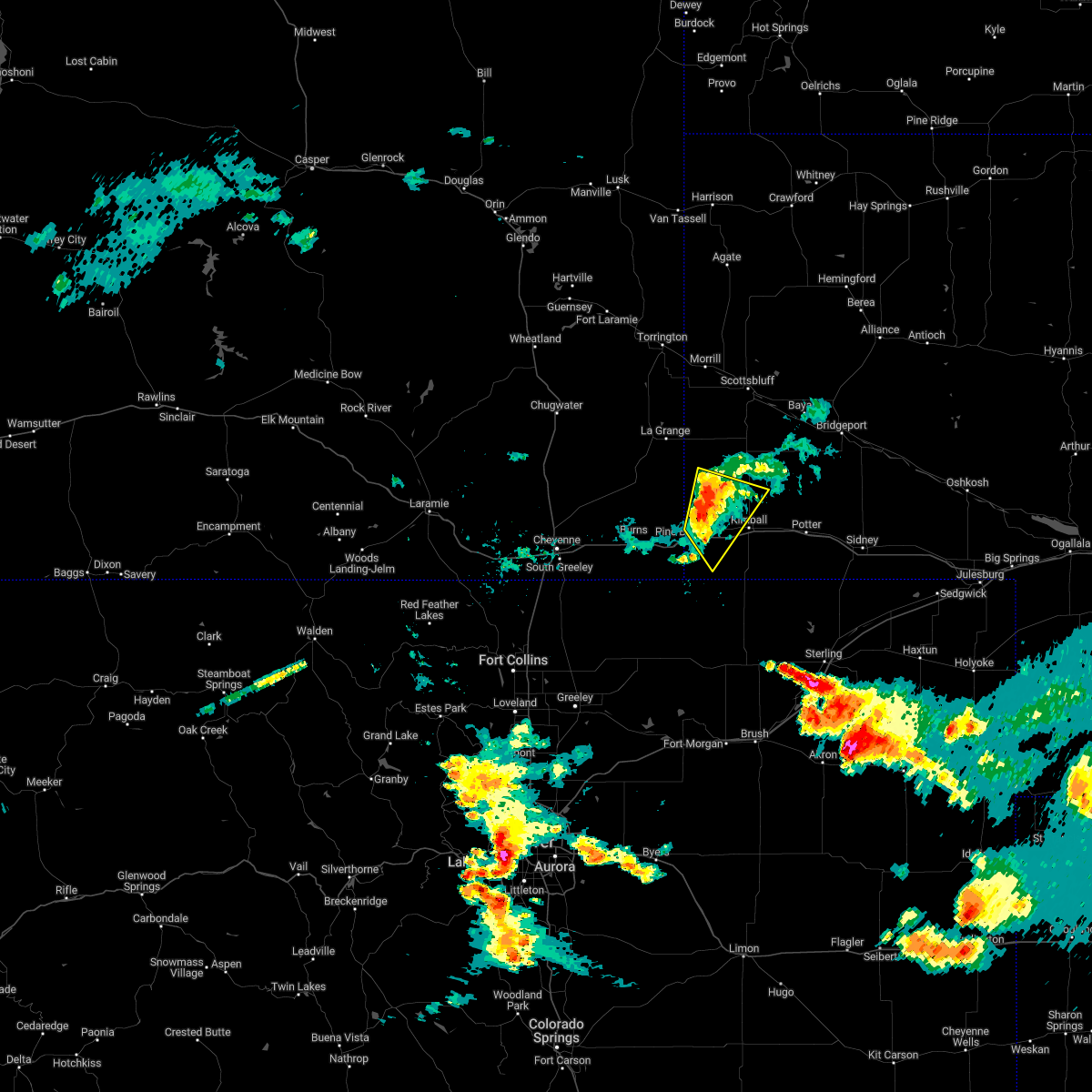 At 1052 pm mdt, severe thunderstorms were located along a line extending from 10 miles southwest of harrisburg to 7 miles northwest of oliver campground, moving southeast at 20 mph (radar indicated). Hazards include 60 mph wind gusts. Expect damage to roofs, siding, and trees. locations impacted include, oliver reservoir, oliver campground and bushnell. this includes interstate 80 in nebraska between mile markers 3 and 17. hail threat, radar indicated max hail size, <. 75 in wind threat, radar indicated max wind gust, 60 mph. At 1052 pm mdt, severe thunderstorms were located along a line extending from 10 miles southwest of harrisburg to 7 miles northwest of oliver campground, moving southeast at 20 mph (radar indicated). Hazards include 60 mph wind gusts. Expect damage to roofs, siding, and trees. locations impacted include, oliver reservoir, oliver campground and bushnell. this includes interstate 80 in nebraska between mile markers 3 and 17. hail threat, radar indicated max hail size, <. 75 in wind threat, radar indicated max wind gust, 60 mph.
|
| 7/27/2022 10:36 PM MDT |
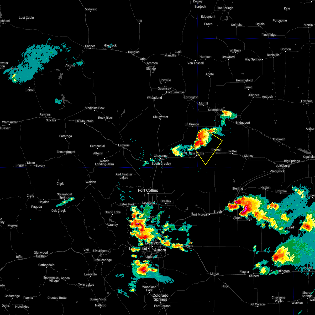 At 1035 pm mdt, severe thunderstorms were located along a line extending from 12 miles southeast of la grange to near albin, moving southeast at 20 mph (radar indicated). Hazards include 60 mph wind gusts and penny size hail. expect damage to roofs, siding, and trees At 1035 pm mdt, severe thunderstorms were located along a line extending from 12 miles southeast of la grange to near albin, moving southeast at 20 mph (radar indicated). Hazards include 60 mph wind gusts and penny size hail. expect damage to roofs, siding, and trees
|
| 7/27/2022 7:07 PM MDT |
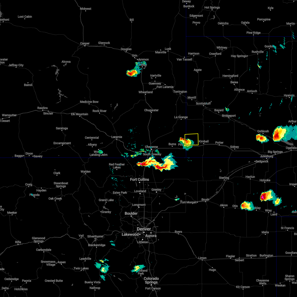 At 707 pm mdt, a severe thunderstorm was located 7 miles south of albin, or 22 miles west of kimball, moving east at 20 mph (radar indicated). Hazards include 60 mph wind gusts and half dollar size hail. Hail damage to vehicles is expected. Expect wind damage to roofs, siding, and trees. At 707 pm mdt, a severe thunderstorm was located 7 miles south of albin, or 22 miles west of kimball, moving east at 20 mph (radar indicated). Hazards include 60 mph wind gusts and half dollar size hail. Hail damage to vehicles is expected. Expect wind damage to roofs, siding, and trees.
|
| 7/7/2022 3:57 PM MDT |
 The severe thunderstorm warning for west central kimball county will expire at 400 pm mdt, the storm which prompted the warning has weakened below severe limits, and no longer poses an immediate threat to life or property. therefore, the warning will be allowed to expire. however small hail and heavy rain are still possible with this thunderstorm. The severe thunderstorm warning for west central kimball county will expire at 400 pm mdt, the storm which prompted the warning has weakened below severe limits, and no longer poses an immediate threat to life or property. therefore, the warning will be allowed to expire. however small hail and heavy rain are still possible with this thunderstorm.
|
| 7/7/2022 3:49 PM MDT |
 At 348 pm mdt, a severe thunderstorm was located near pine bluffs, or 16 miles west of kimball, moving northeast at 15 mph (radar indicated). Hazards include quarter size hail. Damage to vehicles is expected. locations impacted include, pine bluffs, oliver campground, oliver reservoir and bushnell. this includes interstate 80 in nebraska between mile markers 1 and 13. hail threat, radar indicated max hail size, 1. 00 in wind threat, radar indicated max wind gust, <50 mph. At 348 pm mdt, a severe thunderstorm was located near pine bluffs, or 16 miles west of kimball, moving northeast at 15 mph (radar indicated). Hazards include quarter size hail. Damage to vehicles is expected. locations impacted include, pine bluffs, oliver campground, oliver reservoir and bushnell. this includes interstate 80 in nebraska between mile markers 1 and 13. hail threat, radar indicated max hail size, 1. 00 in wind threat, radar indicated max wind gust, <50 mph.
|
| 7/7/2022 3:18 PM MDT |
 At 318 pm mdt, a severe thunderstorm was located near pine bluffs, or 19 miles west of kimball, moving east at 15 mph (radar indicated). Hazards include quarter size hail. damage to vehicles is expected At 318 pm mdt, a severe thunderstorm was located near pine bluffs, or 19 miles west of kimball, moving east at 15 mph (radar indicated). Hazards include quarter size hail. damage to vehicles is expected
|
| 6/17/2022 2:39 AM MDT |
 At 239 am mdt, severe thunderstorms were located along a line extending from near albin to 7 miles south of harrisburg to near dix to 10 miles north of westplains, moving northeast at 30 mph (radar indicated). Hazards include 60 mph wind gusts and penny size hail. expect damage to roofs, siding, and trees At 239 am mdt, severe thunderstorms were located along a line extending from near albin to 7 miles south of harrisburg to near dix to 10 miles north of westplains, moving northeast at 30 mph (radar indicated). Hazards include 60 mph wind gusts and penny size hail. expect damage to roofs, siding, and trees
|
| 6/17/2022 2:22 AM MDT |
 At 221 am mdt, severe thunderstorms were located along a line extending from 6 miles south of albin to near oliver campground to 6 miles northwest of westplains, moving east at 30 mph (radar indicated). Hazards include 60 mph wind gusts. Expect damage to roofs, siding, and trees. locations impacted include, kimball, pine bluffs, oliver campground, oliver reservoir, kimball airport and bushnell. this includes the following highways, interstate 80 in wyoming between mile markers 389 and 402. interstate 80 in nebraska between mile markers 1 and 29. hail threat, radar indicated max hail size, <. 75 in wind threat, radar indicated max wind gust, 60 mph. At 221 am mdt, severe thunderstorms were located along a line extending from 6 miles south of albin to near oliver campground to 6 miles northwest of westplains, moving east at 30 mph (radar indicated). Hazards include 60 mph wind gusts. Expect damage to roofs, siding, and trees. locations impacted include, kimball, pine bluffs, oliver campground, oliver reservoir, kimball airport and bushnell. this includes the following highways, interstate 80 in wyoming between mile markers 389 and 402. interstate 80 in nebraska between mile markers 1 and 29. hail threat, radar indicated max hail size, <. 75 in wind threat, radar indicated max wind gust, 60 mph.
|
| 6/17/2022 1:54 AM MDT |
 At 154 am mdt, severe thunderstorms were located along a line extending from near burns to near pine bluffs to 11 miles north of stoneham, moving northeast at 30 mph (radar indicated). Hazards include 60 mph wind gusts. expect damage to roofs, siding, and trees At 154 am mdt, severe thunderstorms were located along a line extending from near burns to near pine bluffs to 11 miles north of stoneham, moving northeast at 30 mph (radar indicated). Hazards include 60 mph wind gusts. expect damage to roofs, siding, and trees
|
| 6/12/2022 4:55 PM MDT |
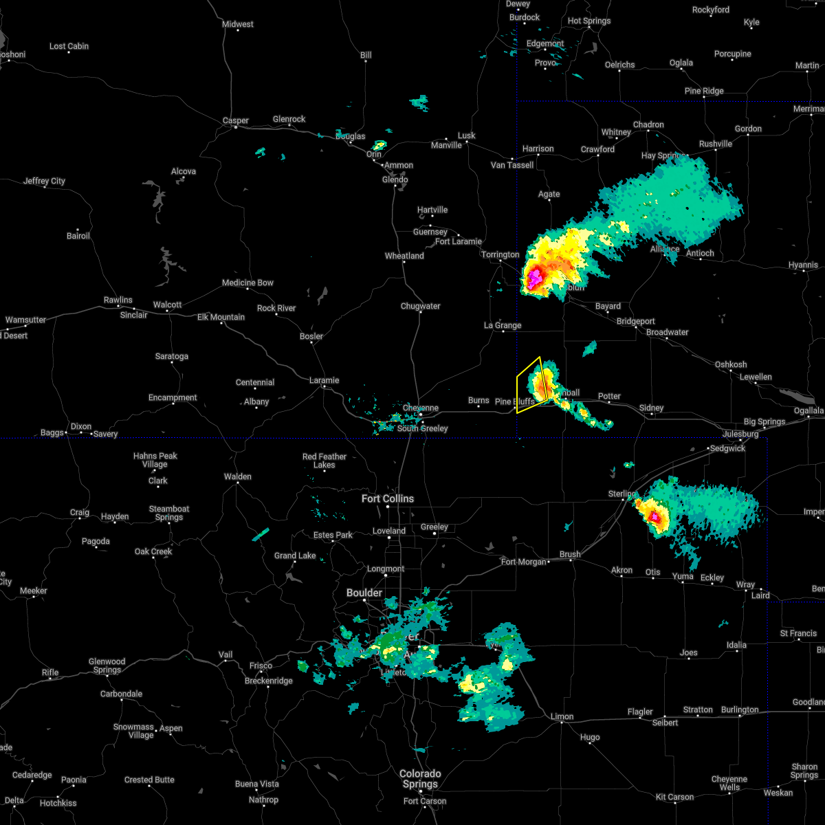 The severe thunderstorm warning for northwestern kimball and southwestern banner counties will expire at 500 pm mdt, the storm which prompted the warning has weakened below severe limits, and has exited the warned area. therefore, the warning will be allowed to expire. however gusty winds are still possible with this thunderstorm. a severe thunderstorm watch remains in effect until 1100 pm mdt for the panhandle of nebraska. The severe thunderstorm warning for northwestern kimball and southwestern banner counties will expire at 500 pm mdt, the storm which prompted the warning has weakened below severe limits, and has exited the warned area. therefore, the warning will be allowed to expire. however gusty winds are still possible with this thunderstorm. a severe thunderstorm watch remains in effect until 1100 pm mdt for the panhandle of nebraska.
|
| 6/12/2022 4:43 PM MDT |
 At 442 pm mdt, a severe thunderstorm was located 7 miles northwest of oliver campground, or 14 miles west of kimball, moving northeast at 20 mph (radar indicated). Hazards include 60 mph wind gusts and quarter size hail. Hail damage to vehicles is expected. expect wind damage to roofs, siding, and trees. locations impacted include, oliver campground and bushnell. this includes interstate 80 in nebraska between mile markers 1 and 6. hail threat, radar indicated max hail size, 1. 00 in wind threat, radar indicated max wind gust, 60 mph. At 442 pm mdt, a severe thunderstorm was located 7 miles northwest of oliver campground, or 14 miles west of kimball, moving northeast at 20 mph (radar indicated). Hazards include 60 mph wind gusts and quarter size hail. Hail damage to vehicles is expected. expect wind damage to roofs, siding, and trees. locations impacted include, oliver campground and bushnell. this includes interstate 80 in nebraska between mile markers 1 and 6. hail threat, radar indicated max hail size, 1. 00 in wind threat, radar indicated max wind gust, 60 mph.
|
| 6/12/2022 4:28 PM MDT |
 At 428 pm mdt, a severe thunderstorm was located near pine bluffs, or 18 miles west of kimball, moving east at 20 mph (radar indicated). Hazards include ping pong ball size hail and 60 mph wind gusts. People and animals outdoors will be injured. expect hail damage to roofs, siding, windows, and vehicles. expect wind damage to roofs, siding, and trees. locations impacted include, pine bluffs, oliver campground, oliver reservoir and bushnell. this includes the following highways, interstate 80 in wyoming between mile markers 398 and 402. interstate 80 in nebraska between mile markers 1 and 13. hail threat, radar indicated max hail size, 1. 50 in wind threat, radar indicated max wind gust, 60 mph. At 428 pm mdt, a severe thunderstorm was located near pine bluffs, or 18 miles west of kimball, moving east at 20 mph (radar indicated). Hazards include ping pong ball size hail and 60 mph wind gusts. People and animals outdoors will be injured. expect hail damage to roofs, siding, windows, and vehicles. expect wind damage to roofs, siding, and trees. locations impacted include, pine bluffs, oliver campground, oliver reservoir and bushnell. this includes the following highways, interstate 80 in wyoming between mile markers 398 and 402. interstate 80 in nebraska between mile markers 1 and 13. hail threat, radar indicated max hail size, 1. 50 in wind threat, radar indicated max wind gust, 60 mph.
|
| 6/12/2022 4:08 PM MDT |
 At 407 pm mdt, a severe thunderstorm was located over pine bluffs, or 24 miles west of kimball, moving east at 20 mph (radar indicated). Hazards include ping pong ball size hail and 60 mph wind gusts. People and animals outdoors will be injured. expect hail damage to roofs, siding, windows, and vehicles. Expect wind damage to roofs, siding, and trees. At 407 pm mdt, a severe thunderstorm was located over pine bluffs, or 24 miles west of kimball, moving east at 20 mph (radar indicated). Hazards include ping pong ball size hail and 60 mph wind gusts. People and animals outdoors will be injured. expect hail damage to roofs, siding, windows, and vehicles. Expect wind damage to roofs, siding, and trees.
|
| 6/3/2022 3:56 PM MDT |
 The severe thunderstorm warning for central kimball county will expire at 400 pm mdt, the storms which prompted the warning have weakened below severe limits, and no longer pose an immediate threat to life or property. therefore, the warning will be allowed to expire. The severe thunderstorm warning for central kimball county will expire at 400 pm mdt, the storms which prompted the warning have weakened below severe limits, and no longer pose an immediate threat to life or property. therefore, the warning will be allowed to expire.
|
| 6/3/2022 3:47 PM MDT |
 At 346 pm mdt, severe thunderstorms were located along a line extending from 6 miles north of kimball to near kimball airport to near panorama point, moving east at 30 mph (radar indicated). Hazards include 60 mph wind gusts and quarter size hail. Hail damage to vehicles is expected. expect wind damage to roofs, siding, and trees. locations impacted include, kimball, oliver campground, oliver reservoir, kimball airport and bushnell. this includes interstate 80 in nebraska between mile markers 3 and 26. hail threat, radar indicated max hail size, 1. 00 in wind threat, radar indicated max wind gust, 60 mph. At 346 pm mdt, severe thunderstorms were located along a line extending from 6 miles north of kimball to near kimball airport to near panorama point, moving east at 30 mph (radar indicated). Hazards include 60 mph wind gusts and quarter size hail. Hail damage to vehicles is expected. expect wind damage to roofs, siding, and trees. locations impacted include, kimball, oliver campground, oliver reservoir, kimball airport and bushnell. this includes interstate 80 in nebraska between mile markers 3 and 26. hail threat, radar indicated max hail size, 1. 00 in wind threat, radar indicated max wind gust, 60 mph.
|
| 6/3/2022 3:24 PM MDT |
 At 323 pm mdt, severe thunderstorms were located along a line extending from 7 miles northwest of oliver campground to 6 miles southeast of pine bluffs to near hereford, moving east at 30 mph (radar indicated). Hazards include 60 mph wind gusts and half dollar size hail. Hail damage to vehicles is expected. Expect wind damage to roofs, siding, and trees. At 323 pm mdt, severe thunderstorms were located along a line extending from 7 miles northwest of oliver campground to 6 miles southeast of pine bluffs to near hereford, moving east at 30 mph (radar indicated). Hazards include 60 mph wind gusts and half dollar size hail. Hail damage to vehicles is expected. Expect wind damage to roofs, siding, and trees.
|
| 5/29/2022 3:38 PM MDT |
 At 337 pm mdt, severe thunderstorms were located along a line extending from 11 miles south of redbird to near mitchell to kimball airport, moving northeast at 40 mph (radar indicated). Hazards include 60 mph wind gusts and penny size hail. Expect damage to roofs, siding, and trees. locations impacted include, scottsbluff, torrington, kimball, gering, mitchell, bayard, terrytown, morrill, minatare, lyman, potter, dix, harrison, oliver campground, wildcat hills state recreation area, stegall, montrose, panorama point, wildcat hills campground and prairie center. this includes interstate 80 in nebraska between mile markers 2 and 42. hail threat, radar indicated max hail size, 0. 75 in wind threat, radar indicated max wind gust, 60 mph. At 337 pm mdt, severe thunderstorms were located along a line extending from 11 miles south of redbird to near mitchell to kimball airport, moving northeast at 40 mph (radar indicated). Hazards include 60 mph wind gusts and penny size hail. Expect damage to roofs, siding, and trees. locations impacted include, scottsbluff, torrington, kimball, gering, mitchell, bayard, terrytown, morrill, minatare, lyman, potter, dix, harrison, oliver campground, wildcat hills state recreation area, stegall, montrose, panorama point, wildcat hills campground and prairie center. this includes interstate 80 in nebraska between mile markers 2 and 42. hail threat, radar indicated max hail size, 0. 75 in wind threat, radar indicated max wind gust, 60 mph.
|
| 5/29/2022 3:11 PM MDT |
 At 311 pm mdt, severe thunderstorms were located along a line extending from 10 miles southeast of lance creek to near stegall to 7 miles northeast of panorama point, moving northeast at 40 mph (radar indicated). Hazards include 60 mph wind gusts and penny size hail. expect damage to roofs, siding, and trees At 311 pm mdt, severe thunderstorms were located along a line extending from 10 miles southeast of lance creek to near stegall to 7 miles northeast of panorama point, moving northeast at 40 mph (radar indicated). Hazards include 60 mph wind gusts and penny size hail. expect damage to roofs, siding, and trees
|
| 7/9/2021 3:41 PM MDT |
 The severe thunderstorm warning for northwestern cheyenne, northern kimball, southwestern morrill and southeastern banner counties will expire at 345 pm mdt, the storms which prompted the warning have moved out of the area. therefore, the warning will be allowed to expire. a severe thunderstorm warning remains in effect until 430 pm mdt for eastern kimball and western cheyenne counties. a severe thunderstorm watch remains in effect until 900 pm mdt for the panhandle of nebraska. to report severe weather, contact your nearest law enforcement agency. they will relay your report to the national weather service cheyenne. The severe thunderstorm warning for northwestern cheyenne, northern kimball, southwestern morrill and southeastern banner counties will expire at 345 pm mdt, the storms which prompted the warning have moved out of the area. therefore, the warning will be allowed to expire. a severe thunderstorm warning remains in effect until 430 pm mdt for eastern kimball and western cheyenne counties. a severe thunderstorm watch remains in effect until 900 pm mdt for the panhandle of nebraska. to report severe weather, contact your nearest law enforcement agency. they will relay your report to the national weather service cheyenne.
|
| 7/9/2021 3:26 PM MDT |
 At 326 pm mdt, severe thunderstorms were located along a line extending from near oliver campground to 11 miles south of redington, moving east at 40 mph (radar indicated). Hazards include 60 mph wind gusts and half dollar size hail. Hail damage to vehicles is expected. expect wind damage to roofs, siding, and trees. locations impacted include, kimball, potter, dix, oliver campground, oliver reservoir, kimball airport and bushnell. This includes interstate 80 in nebraska between mile markers 10 and 48. At 326 pm mdt, severe thunderstorms were located along a line extending from near oliver campground to 11 miles south of redington, moving east at 40 mph (radar indicated). Hazards include 60 mph wind gusts and half dollar size hail. Hail damage to vehicles is expected. expect wind damage to roofs, siding, and trees. locations impacted include, kimball, potter, dix, oliver campground, oliver reservoir, kimball airport and bushnell. This includes interstate 80 in nebraska between mile markers 10 and 48.
|
| 7/9/2021 3:20 PM MDT | Quarter sized hail reported 0.8 miles SW of Bushnell, NE |
| 7/9/2021 3:15 PM MDT |
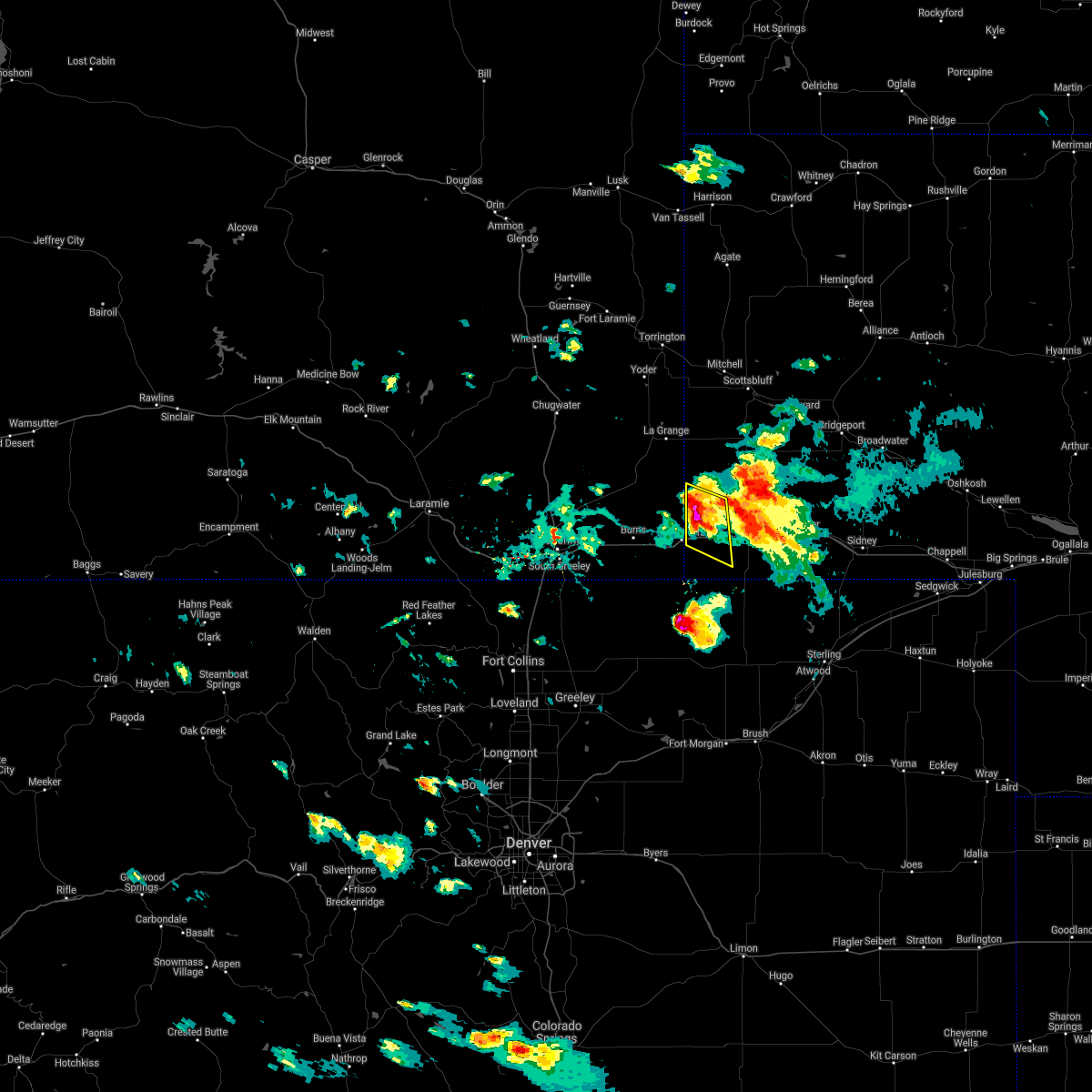 At 315 pm mdt, a severe thunderstorm was located 8 miles northeast of pine bluffs, or 17 miles west of kimball, moving southeast at 25 mph (radar indicated). Hazards include 60 mph wind gusts and half dollar size hail. Hail damage to vehicles is expected. expect wind damage to roofs, siding, and trees. locations impacted include, oliver reservoir, oliver campground and bushnell. This includes interstate 80 in nebraska between mile markers 1 and 14. At 315 pm mdt, a severe thunderstorm was located 8 miles northeast of pine bluffs, or 17 miles west of kimball, moving southeast at 25 mph (radar indicated). Hazards include 60 mph wind gusts and half dollar size hail. Hail damage to vehicles is expected. expect wind damage to roofs, siding, and trees. locations impacted include, oliver reservoir, oliver campground and bushnell. This includes interstate 80 in nebraska between mile markers 1 and 14.
|
| 7/9/2021 2:58 PM MDT |
 At 257 pm mdt, a severe thunderstorm was located near kimball, moving east at 40 mph (radar indicated). Hazards include 60 mph wind gusts and half dollar size hail. Hail damage to vehicles is expected. Expect wind damage to roofs, siding, and trees. At 257 pm mdt, a severe thunderstorm was located near kimball, moving east at 40 mph (radar indicated). Hazards include 60 mph wind gusts and half dollar size hail. Hail damage to vehicles is expected. Expect wind damage to roofs, siding, and trees.
|
| 7/9/2021 2:51 PM MDT |
 At 251 pm mdt, a severe thunderstorm was located near albin, or 29 miles west of kimball, moving southeast at 25 mph (radar indicated). Hazards include 60 mph wind gusts and half dollar size hail. Hail damage to vehicles is expected. Expect wind damage to roofs, siding, and trees. At 251 pm mdt, a severe thunderstorm was located near albin, or 29 miles west of kimball, moving southeast at 25 mph (radar indicated). Hazards include 60 mph wind gusts and half dollar size hail. Hail damage to vehicles is expected. Expect wind damage to roofs, siding, and trees.
|
| 7/9/2021 2:44 PM MDT |
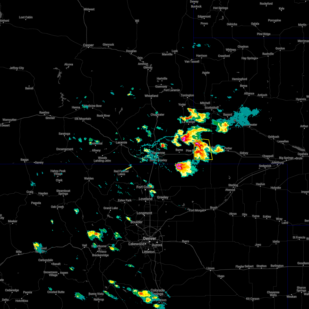 At 244 pm mdt, a severe thunderstorm was located over oliver campground, or 11 miles west of kimball, moving east at 45 mph (trained weather spotters). Hazards include 60 mph wind gusts and quarter size hail. Hail damage to vehicles is expected. expect wind damage to roofs, siding, and trees. locations impacted include, oliver reservoir, oliver campground and bushnell. This includes interstate 80 in nebraska between mile markers 1 and 19. At 244 pm mdt, a severe thunderstorm was located over oliver campground, or 11 miles west of kimball, moving east at 45 mph (trained weather spotters). Hazards include 60 mph wind gusts and quarter size hail. Hail damage to vehicles is expected. expect wind damage to roofs, siding, and trees. locations impacted include, oliver reservoir, oliver campground and bushnell. This includes interstate 80 in nebraska between mile markers 1 and 19.
|
| 7/9/2021 2:39 PM MDT |
 At 238 pm mdt, a severe thunderstorm was located near pine bluffs, or 15 miles west of kimball, moving east at 45 mph (trained weather spotters. quarter sized hail was reported in pine bluffs with this storm). Hazards include 60 mph wind gusts and quarter size hail. Hail damage to vehicles is expected. expect wind damage to roofs, siding, and trees. locations impacted include, pine bluffs, oliver campground, oliver reservoir and bushnell. this includes the following highways, interstate 80 in wyoming between mile markers 398 and 402. Interstate 80 in nebraska between mile markers 1 and 19. At 238 pm mdt, a severe thunderstorm was located near pine bluffs, or 15 miles west of kimball, moving east at 45 mph (trained weather spotters. quarter sized hail was reported in pine bluffs with this storm). Hazards include 60 mph wind gusts and quarter size hail. Hail damage to vehicles is expected. expect wind damage to roofs, siding, and trees. locations impacted include, pine bluffs, oliver campground, oliver reservoir and bushnell. this includes the following highways, interstate 80 in wyoming between mile markers 398 and 402. Interstate 80 in nebraska between mile markers 1 and 19.
|
| 7/9/2021 2:20 PM MDT |
 At 219 pm mdt, a severe thunderstorm was located near burns, or 25 miles east of cheyenne, moving east at 45 mph (radar indicated). Hazards include 60 mph wind gusts and quarter size hail. Hail damage to vehicles is expected. Expect wind damage to roofs, siding, and trees. At 219 pm mdt, a severe thunderstorm was located near burns, or 25 miles east of cheyenne, moving east at 45 mph (radar indicated). Hazards include 60 mph wind gusts and quarter size hail. Hail damage to vehicles is expected. Expect wind damage to roofs, siding, and trees.
|
| 7/3/2021 3:48 PM MDT |
 At 347 pm mdt, a severe thunderstorm was located over oliver reservoir, or near kimball, moving southeast at 15 mph (radar indicated). Hazards include 60 mph wind gusts and quarter size hail. Hail damage to vehicles is expected. expect wind damage to roofs, siding, and trees. this severe thunderstorm will be near, kimball around 405 pm mdt. kimball airport around 410 pm mdt. dix around 435 pm mdt. other locations impacted by this severe thunderstorm include bushnell. This includes interstate 80 in nebraska between mile markers 2 and 31. At 347 pm mdt, a severe thunderstorm was located over oliver reservoir, or near kimball, moving southeast at 15 mph (radar indicated). Hazards include 60 mph wind gusts and quarter size hail. Hail damage to vehicles is expected. expect wind damage to roofs, siding, and trees. this severe thunderstorm will be near, kimball around 405 pm mdt. kimball airport around 410 pm mdt. dix around 435 pm mdt. other locations impacted by this severe thunderstorm include bushnell. This includes interstate 80 in nebraska between mile markers 2 and 31.
|
| 6/8/2021 11:58 PM MDT |
 The severe thunderstorm warning for kimball and southeastern laramie counties will expire at midnight mdt, the storms which prompted the warning have weakened below severe limits, and no longer pose an immediate threat to life or property. therefore, the warning will be allowed to expire. however gusty winds and heavy rain are still possible with these thunderstorms. The severe thunderstorm warning for kimball and southeastern laramie counties will expire at midnight mdt, the storms which prompted the warning have weakened below severe limits, and no longer pose an immediate threat to life or property. therefore, the warning will be allowed to expire. however gusty winds and heavy rain are still possible with these thunderstorms.
|
| 6/8/2021 11:44 PM MDT |
 At 1144 pm mdt, severe thunderstorms were located along a line extending from 7 miles south of harrisburg to pine bluffs, moving east at 25 mph (radar indicated). Hazards include 60 mph wind gusts and quarter size hail. Hail damage to vehicles is expected. expect wind damage to roofs, siding, and trees. locations impacted include, kimball, pine bluffs, oliver campground, oliver reservoir, kimball airport and bushnell. this includes the following highways, interstate 80 in wyoming between mile markers 397 and 402. Interstate 80 in nebraska between mile markers 1 and 25. At 1144 pm mdt, severe thunderstorms were located along a line extending from 7 miles south of harrisburg to pine bluffs, moving east at 25 mph (radar indicated). Hazards include 60 mph wind gusts and quarter size hail. Hail damage to vehicles is expected. expect wind damage to roofs, siding, and trees. locations impacted include, kimball, pine bluffs, oliver campground, oliver reservoir, kimball airport and bushnell. this includes the following highways, interstate 80 in wyoming between mile markers 397 and 402. Interstate 80 in nebraska between mile markers 1 and 25.
|
| 6/8/2021 11:15 PM MDT |
 At 1115 pm mdt, severe thunderstorms were located along a line extending from 10 miles east of albin to 6 miles southeast of burns, moving east at 25 mph (radar indicated). Hazards include 60 mph wind gusts and quarter size hail. Hail damage to vehicles is expected. expect wind damage to roofs, siding, and trees. severe thunderstorms will be near, pine bluffs around 1145 pm mdt. oliver campground and oliver reservoir around 1200 am mdt. other locations impacted by these severe thunderstorms include bushnell. this includes the following highways, interstate 80 in wyoming between mile markers 389 and 402. Interstate 80 in nebraska between mile markers 1 and 25. At 1115 pm mdt, severe thunderstorms were located along a line extending from 10 miles east of albin to 6 miles southeast of burns, moving east at 25 mph (radar indicated). Hazards include 60 mph wind gusts and quarter size hail. Hail damage to vehicles is expected. expect wind damage to roofs, siding, and trees. severe thunderstorms will be near, pine bluffs around 1145 pm mdt. oliver campground and oliver reservoir around 1200 am mdt. other locations impacted by these severe thunderstorms include bushnell. this includes the following highways, interstate 80 in wyoming between mile markers 389 and 402. Interstate 80 in nebraska between mile markers 1 and 25.
|
| 6/8/2021 10:51 PM MDT |
 At 1050 pm mdt, severe thunderstorms were located along a line extending from near the intersection of highway 385 and 92 to 6 miles west of gurley to near dix to 7 miles south of oliver reservoir, moving east at 30 mph (radar indicated). Hazards include 60 mph wind gusts and quarter size hail. Hail damage to vehicles is expected. expect wind damage to roofs, siding, and trees. these severe storms will be near, the intersection of highway 385 and 92 and court house and jail rocks around 1055 pm mdt. dalton around 1100 pm mdt. kimball around 1105 pm mdt. brownson around 1125 pm mdt. other locations impacted by these severe thunderstorms include bushnell. this includes the following highways, interstate 80 in wyoming between mile markers 385 and 402. Interstate 80 in nebraska between mile markers 1 and 55. At 1050 pm mdt, severe thunderstorms were located along a line extending from near the intersection of highway 385 and 92 to 6 miles west of gurley to near dix to 7 miles south of oliver reservoir, moving east at 30 mph (radar indicated). Hazards include 60 mph wind gusts and quarter size hail. Hail damage to vehicles is expected. expect wind damage to roofs, siding, and trees. these severe storms will be near, the intersection of highway 385 and 92 and court house and jail rocks around 1055 pm mdt. dalton around 1100 pm mdt. kimball around 1105 pm mdt. brownson around 1125 pm mdt. other locations impacted by these severe thunderstorms include bushnell. this includes the following highways, interstate 80 in wyoming between mile markers 385 and 402. Interstate 80 in nebraska between mile markers 1 and 55.
|
| 6/8/2021 10:26 PM MDT |
 At 1025 pm mdt, severe thunderstorms were located along a line extending from near redington to 6 miles north of potter to kimball airport to near pine bluffs, moving east at 30 mph. a second severe thunderstorm was located near burns wyoming, also moving east at 30 mph (radar indicated). Hazards include 60 mph wind gusts and quarter size hail. Hail damage to vehicles is expected. Expect wind damage to roofs, siding, and trees. At 1025 pm mdt, severe thunderstorms were located along a line extending from near redington to 6 miles north of potter to kimball airport to near pine bluffs, moving east at 30 mph. a second severe thunderstorm was located near burns wyoming, also moving east at 30 mph (radar indicated). Hazards include 60 mph wind gusts and quarter size hail. Hail damage to vehicles is expected. Expect wind damage to roofs, siding, and trees.
|
| 6/8/2021 9:43 PM MDT |
 The severe thunderstorm warning for south central scotts bluff, kimball and banner counties will expire at 945 pm mdt, the storms which prompted the warning have weakened below severe limits, and no longer pose an immediate threat to life or property. therefore, the warning will be allowed to expire. however small hail, gusty winds and heavy rain are still possible with these thunderstorms. to report severe weather, contact your nearest law enforcement agency. they will relay your report to the national weather service cheyenne. The severe thunderstorm warning for south central scotts bluff, kimball and banner counties will expire at 945 pm mdt, the storms which prompted the warning have weakened below severe limits, and no longer pose an immediate threat to life or property. therefore, the warning will be allowed to expire. however small hail, gusty winds and heavy rain are still possible with these thunderstorms. to report severe weather, contact your nearest law enforcement agency. they will relay your report to the national weather service cheyenne.
|
| 6/8/2021 9:29 PM MDT |
 At 928 pm mdt, severe thunderstorms were located along a line extending from 9 miles southwest of wildcat hills campground to harrisburg to 11 miles north of kimball to oliver campground, moving east at 30 mph (radar indicated). Hazards include 60 mph wind gusts and penny size hail. Expect damage to roofs, siding, and trees. locations impacted include, kimball, dix, oliver campground, wildcat hills state recreation area, oliver reservoir, kimball airport, harrisburg, wildcat hills campground and bushnell. This includes interstate 80 in nebraska between mile markers 1 and 34. At 928 pm mdt, severe thunderstorms were located along a line extending from 9 miles southwest of wildcat hills campground to harrisburg to 11 miles north of kimball to oliver campground, moving east at 30 mph (radar indicated). Hazards include 60 mph wind gusts and penny size hail. Expect damage to roofs, siding, and trees. locations impacted include, kimball, dix, oliver campground, wildcat hills state recreation area, oliver reservoir, kimball airport, harrisburg, wildcat hills campground and bushnell. This includes interstate 80 in nebraska between mile markers 1 and 34.
|
| 6/8/2021 9:03 PM MDT |
 At 903 pm mdt, severe thunderstorms were located along a line extending from 6 miles southeast of la grange to 6 miles southeast of albin to pine bluffs, moving east at 30 mph (radar indicated). Hazards include 70 mph wind gusts and penny size hail. Expect considerable tree damage. Damage is likely to mobile homes, roofs, and outbuildings. At 903 pm mdt, severe thunderstorms were located along a line extending from 6 miles southeast of la grange to 6 miles southeast of albin to pine bluffs, moving east at 30 mph (radar indicated). Hazards include 70 mph wind gusts and penny size hail. Expect considerable tree damage. Damage is likely to mobile homes, roofs, and outbuildings.
|
| 7/19/2020 4:03 PM MDT |
 At 402 pm mdt, a severe thunderstorm was located 10 miles east of panorama point, or 15 miles southwest of kimball, moving east at 25 mph (radar indicated). Hazards include 60 mph wind gusts and quarter size hail. Hail damage to vehicles is expected. expect wind damage to roofs, siding, and trees. locations impacted include, oliver campground, panorama point, oliver reservoir and bushnell. This includes interstate 80 in nebraska between mile markers 1 and 18. At 402 pm mdt, a severe thunderstorm was located 10 miles east of panorama point, or 15 miles southwest of kimball, moving east at 25 mph (radar indicated). Hazards include 60 mph wind gusts and quarter size hail. Hail damage to vehicles is expected. expect wind damage to roofs, siding, and trees. locations impacted include, oliver campground, panorama point, oliver reservoir and bushnell. This includes interstate 80 in nebraska between mile markers 1 and 18.
|
| 7/19/2020 3:50 PM MDT |
 At 350 pm mdt, a severe thunderstorm was located near pine bluffs, or 18 miles west of kimball, moving east at 25 mph (radar indicated). Hazards include 60 mph wind gusts and quarter size hail. Hail damage to vehicles is expected. expect wind damage to roofs, siding, and trees. locations impacted include, pine bluffs, oliver campground, panorama point, oliver reservoir and bushnell. this includes the following highways, interstate 80 in wyoming between mile markers 392 and 402. Interstate 80 in nebraska between mile markers 1 and 18. At 350 pm mdt, a severe thunderstorm was located near pine bluffs, or 18 miles west of kimball, moving east at 25 mph (radar indicated). Hazards include 60 mph wind gusts and quarter size hail. Hail damage to vehicles is expected. expect wind damage to roofs, siding, and trees. locations impacted include, pine bluffs, oliver campground, panorama point, oliver reservoir and bushnell. this includes the following highways, interstate 80 in wyoming between mile markers 392 and 402. Interstate 80 in nebraska between mile markers 1 and 18.
|
| 7/19/2020 3:38 PM MDT | Quarter sized hail reported 15.3 miles N of Bushnell, NE, 49 mph wind gust recorded at 335 pm. |
| 7/19/2020 3:35 PM MDT |
 At 334 pm mdt, a severe thunderstorm was located near pine bluffs, or 26 miles west of kimball, moving east at 25 mph (radar indicated). Hazards include 60 mph wind gusts and quarter size hail. Hail damage to vehicles is expected. Expect wind damage to roofs, siding, and trees. At 334 pm mdt, a severe thunderstorm was located near pine bluffs, or 26 miles west of kimball, moving east at 25 mph (radar indicated). Hazards include 60 mph wind gusts and quarter size hail. Hail damage to vehicles is expected. Expect wind damage to roofs, siding, and trees.
|
| 7/13/2020 3:18 PM MDT |
 At 318 pm mdt, a severe thunderstorm was located 11 miles northwest of westplains, or 18 miles south of kimball, moving east at 30 mph (radar indicated). Hazards include 60 mph wind gusts. expect damage to roofs, siding, and trees At 318 pm mdt, a severe thunderstorm was located 11 miles northwest of westplains, or 18 miles south of kimball, moving east at 30 mph (radar indicated). Hazards include 60 mph wind gusts. expect damage to roofs, siding, and trees
|
| 7/3/2020 7:11 PM MDT | Quarter sized hail reported 5.4 miles NNW of Bushnell, NE |
| 6/6/2020 4:56 PM MDT |
 At 455 pm mdt, severe thunderstorms were located along a line extending from near meriden rest area to near grover, moving northeast at 60 mph (radar indicated). Hazards include 70 mph wind gusts. Expect considerable tree damage. Damage is likely to mobile homes, roofs, and outbuildings. At 455 pm mdt, severe thunderstorms were located along a line extending from near meriden rest area to near grover, moving northeast at 60 mph (radar indicated). Hazards include 70 mph wind gusts. Expect considerable tree damage. Damage is likely to mobile homes, roofs, and outbuildings.
|
| 6/3/2020 4:12 PM MDT |
 The severe thunderstorm warning for northwestern kimball and east central laramie counties will expire at 415 pm mdt, the storm which prompted the warning has weakened below severe limits, and no longer poses an immediate threat to life or property. therefore, the warning will be allowed to expire. however gusty winds are still possible with this thunderstorm and a special weather statement has been issued in its stead. The severe thunderstorm warning for northwestern kimball and east central laramie counties will expire at 415 pm mdt, the storm which prompted the warning has weakened below severe limits, and no longer poses an immediate threat to life or property. therefore, the warning will be allowed to expire. however gusty winds are still possible with this thunderstorm and a special weather statement has been issued in its stead.
|
| 6/3/2020 4:07 PM MDT |
 At 407 pm mdt, a severe thunderstorm was located over oliver campground, or 9 miles west of kimball, moving east at 45 mph (radar indicated). Hazards include 60 mph wind gusts and penny size hail. Expect damage to roofs, siding, and trees. locations impacted include, pine bluffs, oliver campground, oliver reservoir, kimball airport and bushnell. this includes the following highways, interstate 80 in wyoming between mile markers 400 and 402. Interstate 80 in nebraska between mile markers 1 and 20. At 407 pm mdt, a severe thunderstorm was located over oliver campground, or 9 miles west of kimball, moving east at 45 mph (radar indicated). Hazards include 60 mph wind gusts and penny size hail. Expect damage to roofs, siding, and trees. locations impacted include, pine bluffs, oliver campground, oliver reservoir, kimball airport and bushnell. this includes the following highways, interstate 80 in wyoming between mile markers 400 and 402. Interstate 80 in nebraska between mile markers 1 and 20.
|
| 6/3/2020 3:59 PM MDT |
 At 340 pm mdt, a severe thunderstorm was located 7 miles east of burns, or 29 miles west of kimball, moving east at 40 mph (radar indicated). Hazards include 70 mph wind gusts and penny size hail. Expect considerable tree damage. Damage is likely to mobile homes, roofs, and outbuildings. At 340 pm mdt, a severe thunderstorm was located 7 miles east of burns, or 29 miles west of kimball, moving east at 40 mph (radar indicated). Hazards include 70 mph wind gusts and penny size hail. Expect considerable tree damage. Damage is likely to mobile homes, roofs, and outbuildings.
|
| 6/3/2020 3:59 PM MDT |
 At 358 pm mdt, a severe thunderstorm was located near pine bluffs, or 16 miles west of kimball, moving east at 45 mph (radar indicated). Hazards include 70 mph wind gusts and penny size hail. Expect considerable tree damage. damage is likely to mobile homes, roofs, and outbuildings. locations impacted include, pine bluffs, oliver campground, oliver reservoir, kimball airport and bushnell. this includes the following highways, interstate 80 in wyoming between mile markers 394 and 402. Interstate 80 in nebraska between mile markers 1 and 20. At 358 pm mdt, a severe thunderstorm was located near pine bluffs, or 16 miles west of kimball, moving east at 45 mph (radar indicated). Hazards include 70 mph wind gusts and penny size hail. Expect considerable tree damage. damage is likely to mobile homes, roofs, and outbuildings. locations impacted include, pine bluffs, oliver campground, oliver reservoir, kimball airport and bushnell. this includes the following highways, interstate 80 in wyoming between mile markers 394 and 402. Interstate 80 in nebraska between mile markers 1 and 20.
|
| 6/3/2020 3:40 PM MDT |
 At 340 pm mdt, a severe thunderstorm was located 7 miles east of burns, or 29 miles west of kimball, moving east at 40 mph (radar indicated). Hazards include 70 mph wind gusts and penny size hail. Expect considerable tree damage. Damage is likely to mobile homes, roofs, and outbuildings. At 340 pm mdt, a severe thunderstorm was located 7 miles east of burns, or 29 miles west of kimball, moving east at 40 mph (radar indicated). Hazards include 70 mph wind gusts and penny size hail. Expect considerable tree damage. Damage is likely to mobile homes, roofs, and outbuildings.
|
| 5/23/2020 4:08 PM MDT | Half Dollar sized hail reported 9.8 miles SSE of Bushnell, NE |
| 8/20/2019 11:39 PM MDT |
 At 1138 pm mdt, severe thunderstorms were located along a line extending from 8 miles east of wild horse butte to 12 miles east of panorama point, moving east at 35 mph. these are very dangerous storms (radar indicated). Hazards include 80 mph wind gusts and quarter size hail. Flying debris will be dangerous to those caught without shelter. mobile homes will be heavily damaged. expect considerable damage to roofs, windows, and vehicles. Extensive tree damage and power outages are likely. At 1138 pm mdt, severe thunderstorms were located along a line extending from 8 miles east of wild horse butte to 12 miles east of panorama point, moving east at 35 mph. these are very dangerous storms (radar indicated). Hazards include 80 mph wind gusts and quarter size hail. Flying debris will be dangerous to those caught without shelter. mobile homes will be heavily damaged. expect considerable damage to roofs, windows, and vehicles. Extensive tree damage and power outages are likely.
|
| 8/20/2019 11:22 PM MDT |
 At 1121 pm mdt, severe thunderstorms were located along a line extending from near box butte dam to near hillsdale, moving east at 15 mph. a meteorologist at kneb reports large trees down in scotts bluff county. one tree had a diameter of 3 feet (trained weather spotters). Hazards include 70 mph wind gusts and half dollar size hail. Hail damage to vehicles is expected. expect considerable tree damage. wind damage is also likely to mobile homes, roofs, and outbuildings. locations impacted include, alliance, kimball, bridgeport, bayard, pine bluffs, minatare, hemingford, dix, albin, oliver campground, northport, angora, oliver reservoir, court house and jail rocks, harrisburg, berea, wild horse butte, chimney rock state park, bridgeport state recreation area and kilpatrick lake. this includes the following highways, interstate 80 in wyoming between mile markers 390 and 402. Interstate 80 in nebraska between mile markers 1 and 33. At 1121 pm mdt, severe thunderstorms were located along a line extending from near box butte dam to near hillsdale, moving east at 15 mph. a meteorologist at kneb reports large trees down in scotts bluff county. one tree had a diameter of 3 feet (trained weather spotters). Hazards include 70 mph wind gusts and half dollar size hail. Hail damage to vehicles is expected. expect considerable tree damage. wind damage is also likely to mobile homes, roofs, and outbuildings. locations impacted include, alliance, kimball, bridgeport, bayard, pine bluffs, minatare, hemingford, dix, albin, oliver campground, northport, angora, oliver reservoir, court house and jail rocks, harrisburg, berea, wild horse butte, chimney rock state park, bridgeport state recreation area and kilpatrick lake. this includes the following highways, interstate 80 in wyoming between mile markers 390 and 402. Interstate 80 in nebraska between mile markers 1 and 33.
|
| 8/20/2019 11:09 PM MDT |
 At 1108 pm mdt, severe thunderstorms were located along a line extending from near box butte dam to 6 miles west of hillsdale, moving south at 15 mph. at 11 pm mdt, a trained spotter reported half dollar size hail in albin (trained weather spotters). Hazards include 70 mph wind gusts and half dollar size hail. Hail damage to vehicles is expected. expect considerable tree damage. wind damage is also likely to mobile homes, roofs, and outbuildings. locations impacted include, scottsbluff, alliance, kimball, gering, bridgeport, bayard, terrytown, pine bluffs, minatare, hemingford, burns, dix, albin, oliver campground, wildcat hills state recreation area, northport, angora, wildcat hills campground, box butte dam and oliver reservoir. this includes the following highways, interstate 80 in wyoming between mile markers 388 and 402. Interstate 80 in nebraska between mile markers 1 and 33. At 1108 pm mdt, severe thunderstorms were located along a line extending from near box butte dam to 6 miles west of hillsdale, moving south at 15 mph. at 11 pm mdt, a trained spotter reported half dollar size hail in albin (trained weather spotters). Hazards include 70 mph wind gusts and half dollar size hail. Hail damage to vehicles is expected. expect considerable tree damage. wind damage is also likely to mobile homes, roofs, and outbuildings. locations impacted include, scottsbluff, alliance, kimball, gering, bridgeport, bayard, terrytown, pine bluffs, minatare, hemingford, burns, dix, albin, oliver campground, wildcat hills state recreation area, northport, angora, wildcat hills campground, box butte dam and oliver reservoir. this includes the following highways, interstate 80 in wyoming between mile markers 388 and 402. Interstate 80 in nebraska between mile markers 1 and 33.
|
| 8/20/2019 11:00 PM MDT |
 At 1059 pm mdt, severe thunderstorms were located along a line extending from 6 miles north of box butte campground to 7 miles west of hillsdale, moving south at 15 mph. at 1044 pm mdt, the scottsbluff airport asos measured a gust to 73 mph (radar indicated). Hazards include 70 mph wind gusts and quarter size hail. Hail damage to vehicles is expected. expect considerable tree damage. wind damage is also likely to mobile homes, roofs, and outbuildings. locations impacted include, scottsbluff, alliance, kimball, gering, mitchell, bridgeport, bayard, terrytown, pine bluffs, minatare, hemingford, la grange, burns, dix, albin, oliver campground, wildcat hills state recreation area, northport, angora and wildcat hills campground. this includes the following highways, interstate 80 in wyoming between mile markers 387 and 402. Interstate 80 in nebraska between mile markers 1 and 33. At 1059 pm mdt, severe thunderstorms were located along a line extending from 6 miles north of box butte campground to 7 miles west of hillsdale, moving south at 15 mph. at 1044 pm mdt, the scottsbluff airport asos measured a gust to 73 mph (radar indicated). Hazards include 70 mph wind gusts and quarter size hail. Hail damage to vehicles is expected. expect considerable tree damage. wind damage is also likely to mobile homes, roofs, and outbuildings. locations impacted include, scottsbluff, alliance, kimball, gering, mitchell, bridgeport, bayard, terrytown, pine bluffs, minatare, hemingford, la grange, burns, dix, albin, oliver campground, wildcat hills state recreation area, northport, angora and wildcat hills campground. this includes the following highways, interstate 80 in wyoming between mile markers 387 and 402. Interstate 80 in nebraska between mile markers 1 and 33.
|
| 8/20/2019 11:00 PM MDT |
 At 1050 pm mdt, severe thunderstorms were located along a line extending from 7 miles north of box butte campground to 8 miles northwest of hillsdale, moving south at 15 mph (radar indicated). Hazards include 70 mph wind gusts and quarter size hail. Hail damage to vehicles is expected. expect considerable tree damage. Wind damage is also likely to mobile homes, roofs, and outbuildings. At 1050 pm mdt, severe thunderstorms were located along a line extending from 7 miles north of box butte campground to 8 miles northwest of hillsdale, moving south at 15 mph (radar indicated). Hazards include 70 mph wind gusts and quarter size hail. Hail damage to vehicles is expected. expect considerable tree damage. Wind damage is also likely to mobile homes, roofs, and outbuildings.
|
| 8/20/2019 10:50 PM MDT |
 The national weather service in cheyenne has issued a * severe thunderstorm warning for. box butte county in the panhandle of nebraska. scotts bluff county in the panhandle of nebraska. northwestern cheyenne county in the panhandle of nebraska. Kimball county in the panhandle of nebraska. The national weather service in cheyenne has issued a * severe thunderstorm warning for. box butte county in the panhandle of nebraska. scotts bluff county in the panhandle of nebraska. northwestern cheyenne county in the panhandle of nebraska. Kimball county in the panhandle of nebraska.
|
| 8/1/2019 9:12 PM MDT |
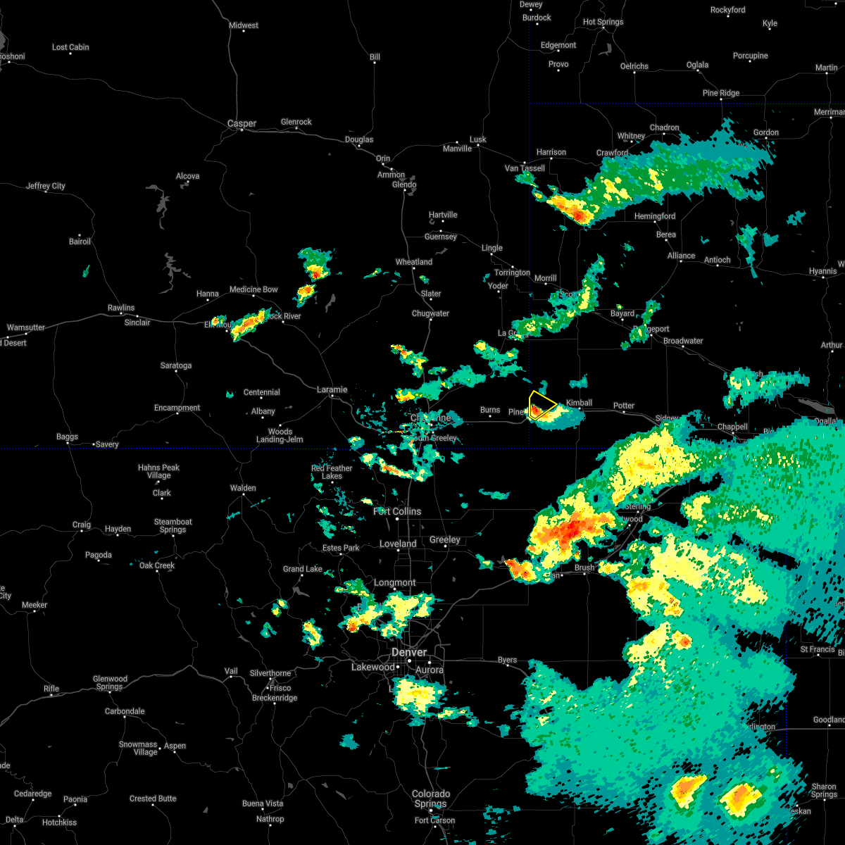 The severe thunderstorm warning for west central kimball county will expire at 915 pm mdt, the storm which prompted the warning has weakened below severe limits, and no longer poses an immediate threat to life or property. therefore, the warning will be allowed to expire. however small hail and gusty winds are still possible with this thunderstorm. The severe thunderstorm warning for west central kimball county will expire at 915 pm mdt, the storm which prompted the warning has weakened below severe limits, and no longer poses an immediate threat to life or property. therefore, the warning will be allowed to expire. however small hail and gusty winds are still possible with this thunderstorm.
|
| 8/1/2019 9:06 PM MDT |
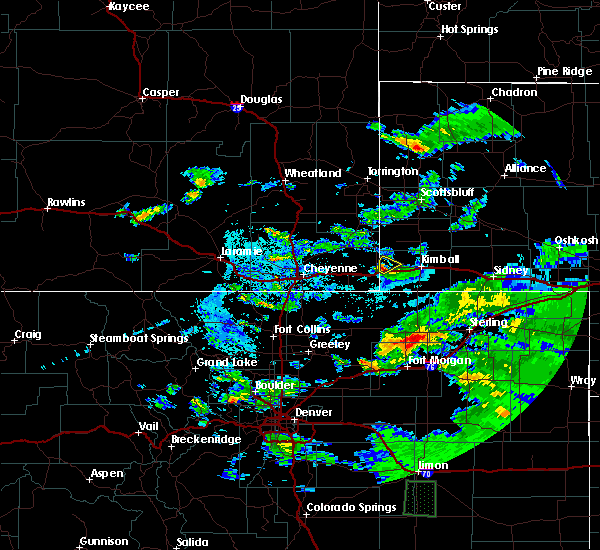 At 906 pm mdt, a severe thunderstorm was located near pine bluffs, or 18 miles west of kimball, moving northeast at 15 mph (radar indicated). Hazards include 60 mph wind gusts and quarter size hail. Hail damage to vehicles is expected. expect wind damage to roofs, siding, and trees. locations impacted include, bushnell. This includes interstate 80 in nebraska between mile markers 1 and 4. At 906 pm mdt, a severe thunderstorm was located near pine bluffs, or 18 miles west of kimball, moving northeast at 15 mph (radar indicated). Hazards include 60 mph wind gusts and quarter size hail. Hail damage to vehicles is expected. expect wind damage to roofs, siding, and trees. locations impacted include, bushnell. This includes interstate 80 in nebraska between mile markers 1 and 4.
|
| 8/1/2019 8:54 PM MDT |
 At 853 pm mdt, a severe thunderstorm was located over pine bluffs, or 21 miles west of kimball, moving northeast at 20 mph (radar indicated). Hazards include golf ball size hail and 60 mph wind gusts. People and animals outdoors will be injured. expect hail damage to roofs, siding, windows, and vehicles. expect wind damage to roofs, siding, and trees. locations impacted include, pine bluffs and bushnell. this includes the following highways, interstate 80 in wyoming between mile markers 399 and 402. Interstate 80 in nebraska between mile markers 1 and 5. At 853 pm mdt, a severe thunderstorm was located over pine bluffs, or 21 miles west of kimball, moving northeast at 20 mph (radar indicated). Hazards include golf ball size hail and 60 mph wind gusts. People and animals outdoors will be injured. expect hail damage to roofs, siding, windows, and vehicles. expect wind damage to roofs, siding, and trees. locations impacted include, pine bluffs and bushnell. this includes the following highways, interstate 80 in wyoming between mile markers 399 and 402. Interstate 80 in nebraska between mile markers 1 and 5.
|
| 8/1/2019 8:35 PM MDT |
 At 835 pm mdt, a severe thunderstorm was located near pine bluffs, or 25 miles west of kimball, moving northeast at 15 mph (radar indicated). Hazards include golf ball size hail and 60 mph wind gusts. People and animals outdoors will be injured. expect hail damage to roofs, siding, windows, and vehicles. Expect wind damage to roofs, siding, and trees. At 835 pm mdt, a severe thunderstorm was located near pine bluffs, or 25 miles west of kimball, moving northeast at 15 mph (radar indicated). Hazards include golf ball size hail and 60 mph wind gusts. People and animals outdoors will be injured. expect hail damage to roofs, siding, windows, and vehicles. Expect wind damage to roofs, siding, and trees.
|
| 7/6/2019 10:24 PM MDT |
 At 1023 pm mdt, severe thunderstorms were located along a line extending from 6 miles southwest of harrisburg to 8 miles northeast of panorama point, moving east at 35 mph (radar indicated). Hazards include 70 mph wind gusts. Expect considerable tree damage. damage is likely to mobile homes, roofs, and outbuildings. locations impacted include, kimball, pine bluffs, dix, oliver campground, oliver reservoir, kimball airport, harrisburg and bushnell. This includes interstate 80 in nebraska between mile markers 1 and 30. At 1023 pm mdt, severe thunderstorms were located along a line extending from 6 miles southwest of harrisburg to 8 miles northeast of panorama point, moving east at 35 mph (radar indicated). Hazards include 70 mph wind gusts. Expect considerable tree damage. damage is likely to mobile homes, roofs, and outbuildings. locations impacted include, kimball, pine bluffs, dix, oliver campground, oliver reservoir, kimball airport, harrisburg and bushnell. This includes interstate 80 in nebraska between mile markers 1 and 30.
|
| 7/6/2019 10:22 PM MDT |
 A severe thunderstorm warning remains in effect until 1045 pm mdt for kimball. southern banner and southeastern laramie counties. at 1022 pm mdt, severe thunderstorms were located along a line extending from 6 miles southwest of harrisburg to 7 miles northeast of panorama point, moving east at 35 mph. hazard. 70 mph wind gusts. A severe thunderstorm warning remains in effect until 1045 pm mdt for kimball. southern banner and southeastern laramie counties. at 1022 pm mdt, severe thunderstorms were located along a line extending from 6 miles southwest of harrisburg to 7 miles northeast of panorama point, moving east at 35 mph. hazard. 70 mph wind gusts.
|
| 7/6/2019 9:58 PM MDT |
 At 958 pm mdt, severe thunderstorms were located along a line extending from near albin to 7 miles west of panorama point, moving east at 35 mph (radar indicated). Hazards include 70 mph wind gusts. Expect considerable tree damage. Damage is likely to mobile homes, roofs, and outbuildings. At 958 pm mdt, severe thunderstorms were located along a line extending from near albin to 7 miles west of panorama point, moving east at 35 mph (radar indicated). Hazards include 70 mph wind gusts. Expect considerable tree damage. Damage is likely to mobile homes, roofs, and outbuildings.
|
| 7/6/2019 9:48 PM MDT |
 At 948 pm mdt, severe thunderstorms were located along a line extending from near the intersection of highway 385 and l62 to bridgeport state recreation area to 7 miles south of court house and jail rocks to kimball, moving east at 45 mph. these are very dangerous storms capable of significant damage. seek shelter immediately! (trained weather spotters. these dangerous storms have a history of producing extreme wind gusts producing widespread tree and structural damage). Hazards include 80 mph wind gusts. Flying debris will be dangerous to those caught without shelter. mobile homes will be heavily damaged. expect considerable damage to roofs, windows, and vehicles. extensive tree damage and power outages are likely. locations impacted include, sidney, kimball, bridgeport, bayard, potter, dalton, dix, gurley, oliver campground, brownson, northport, angora, oliver reservoir, court house and jail rocks, chimney rock state park, bridgeport state recreation area, the intersection of highway 385 and 92, kimball airport, moomaws corner and redington. This includes interstate 80 in nebraska between mile markers 15 and 55. At 948 pm mdt, severe thunderstorms were located along a line extending from near the intersection of highway 385 and l62 to bridgeport state recreation area to 7 miles south of court house and jail rocks to kimball, moving east at 45 mph. these are very dangerous storms capable of significant damage. seek shelter immediately! (trained weather spotters. these dangerous storms have a history of producing extreme wind gusts producing widespread tree and structural damage). Hazards include 80 mph wind gusts. Flying debris will be dangerous to those caught without shelter. mobile homes will be heavily damaged. expect considerable damage to roofs, windows, and vehicles. extensive tree damage and power outages are likely. locations impacted include, sidney, kimball, bridgeport, bayard, potter, dalton, dix, gurley, oliver campground, brownson, northport, angora, oliver reservoir, court house and jail rocks, chimney rock state park, bridgeport state recreation area, the intersection of highway 385 and 92, kimball airport, moomaws corner and redington. This includes interstate 80 in nebraska between mile markers 15 and 55.
|
| 7/6/2019 9:35 PM MDT |
 At 934 pm mdt, severe thunderstorms were located along a line extending from near lake minatare campground to chimney rock state park to 6 miles southwest of redington to near oliver reservoir, moving east at 40 mph. these are very dangerous storms capable of significant damage. seek shelter immediately! (trained weather spotters. significant structural and tree damage has been reported across scotts bluff county with these storms!). Hazards include 80 mph wind gusts. Flying debris will be dangerous to those caught without shelter. mobile homes will be heavily damaged. expect considerable damage to roofs, windows, and vehicles. extensive tree damage and power outages are likely. locations impacted include, scottsbluff, sidney, kimball, gering, mitchell, bridgeport, bayard, terrytown, minatare, potter, dalton, dix, gurley, oliver campground, wildcat hills state recreation area, brownson, northport, angora, wildcat hills campground and oliver reservoir. This includes interstate 80 in nebraska between mile markers 15 and 55. At 934 pm mdt, severe thunderstorms were located along a line extending from near lake minatare campground to chimney rock state park to 6 miles southwest of redington to near oliver reservoir, moving east at 40 mph. these are very dangerous storms capable of significant damage. seek shelter immediately! (trained weather spotters. significant structural and tree damage has been reported across scotts bluff county with these storms!). Hazards include 80 mph wind gusts. Flying debris will be dangerous to those caught without shelter. mobile homes will be heavily damaged. expect considerable damage to roofs, windows, and vehicles. extensive tree damage and power outages are likely. locations impacted include, scottsbluff, sidney, kimball, gering, mitchell, bridgeport, bayard, terrytown, minatare, potter, dalton, dix, gurley, oliver campground, wildcat hills state recreation area, brownson, northport, angora, wildcat hills campground and oliver reservoir. This includes interstate 80 in nebraska between mile markers 15 and 55.
|
| 7/6/2019 9:23 PM MDT |
 At 923 pm mdt, severe thunderstorms were located along a line extending from near scottsbluff airport to 6 miles west of chimney rock state park to 11 miles southwest of redington to near oliver campground, moving east at 40 mph (trained weather spotters). Hazards include 60 mph wind gusts. expect damage to roofs, siding, and trees At 923 pm mdt, severe thunderstorms were located along a line extending from near scottsbluff airport to 6 miles west of chimney rock state park to 11 miles southwest of redington to near oliver campground, moving east at 40 mph (trained weather spotters). Hazards include 60 mph wind gusts. expect damage to roofs, siding, and trees
|
| 7/6/2019 9:19 PM MDT |
 At 918 pm mdt, severe thunderstorms were located along a line extending from scottsbluff to near wildcat hills campground to near harrisburg to 8 miles northwest of oliver campground, moving east at 35 mph (trained weather spotters. wind gusts in excess of 60 mph have been observed along this line). Hazards include 60 mph wind gusts and penny size hail. Expect damage to roofs, siding, and trees. locations impacted include, scottsbluff, gering, terrytown, minatare, albin, oliver campground, wildcat hills state recreation area, lake minatare campground, wildcat hills campground, scotts bluff national monument, oliver reservoir, hubbard hill, harrisburg, scottsbluff airport, lake minatare, bushnell and melbeta. This includes interstate 80 in nebraska between mile markers 9 and 12. At 918 pm mdt, severe thunderstorms were located along a line extending from scottsbluff to near wildcat hills campground to near harrisburg to 8 miles northwest of oliver campground, moving east at 35 mph (trained weather spotters. wind gusts in excess of 60 mph have been observed along this line). Hazards include 60 mph wind gusts and penny size hail. Expect damage to roofs, siding, and trees. locations impacted include, scottsbluff, gering, terrytown, minatare, albin, oliver campground, wildcat hills state recreation area, lake minatare campground, wildcat hills campground, scotts bluff national monument, oliver reservoir, hubbard hill, harrisburg, scottsbluff airport, lake minatare, bushnell and melbeta. This includes interstate 80 in nebraska between mile markers 9 and 12.
|
| 7/6/2019 9:11 PM MDT |
 At 911 pm mdt, severe thunderstorms were located along a line extending from near scotts bluff national monument to near wildcat hills campground to near harrisburg to 8 miles north of pine bluffs, moving east at 35 mph (trained weather spotters. damaging winds up to 60 mph have been reported with this line of storms). Hazards include 60 mph wind gusts and penny size hail. Expect damage to roofs, siding, and trees. locations impacted include, scottsbluff, gering, terrytown, minatare, lyman, albin, oliver campground, wildcat hills state recreation area, lake minatare campground, stegall, wildcat hills campground, scotts bluff national monument, oliver reservoir, hubbard hill, harrisburg, gun barrel, scottsbluff airport, lake minatare, bushnell and melbeta. This includes interstate 80 in nebraska between mile markers 9 and 12. At 911 pm mdt, severe thunderstorms were located along a line extending from near scotts bluff national monument to near wildcat hills campground to near harrisburg to 8 miles north of pine bluffs, moving east at 35 mph (trained weather spotters. damaging winds up to 60 mph have been reported with this line of storms). Hazards include 60 mph wind gusts and penny size hail. Expect damage to roofs, siding, and trees. locations impacted include, scottsbluff, gering, terrytown, minatare, lyman, albin, oliver campground, wildcat hills state recreation area, lake minatare campground, stegall, wildcat hills campground, scotts bluff national monument, oliver reservoir, hubbard hill, harrisburg, gun barrel, scottsbluff airport, lake minatare, bushnell and melbeta. This includes interstate 80 in nebraska between mile markers 9 and 12.
|
| 7/6/2019 9:11 PM MDT |
 At 909 pm mdt, severe thunderstorms were located along a line extending from near scotts bluff national monument to near wildcat hills campground to near harrisburg to 8 miles north of pine bluffs, moving east at 35 mph (trained weather spotters. damaging). Hazards include 60 mph wind gusts and penny size hail. Expect damage to roofs, siding, and trees. locations impacted include, scottsbluff, gering, terrytown, minatare, lyman, albin, oliver campground, wildcat hills state recreation area, lake minatare campground, stegall, wildcat hills campground, scotts bluff national monument, oliver reservoir, hubbard hill, harrisburg, gun barrel, scottsbluff airport, lake minatare, bushnell and melbeta. This includes interstate 80 in nebraska between mile markers 9 and 12. At 909 pm mdt, severe thunderstorms were located along a line extending from near scotts bluff national monument to near wildcat hills campground to near harrisburg to 8 miles north of pine bluffs, moving east at 35 mph (trained weather spotters. damaging). Hazards include 60 mph wind gusts and penny size hail. Expect damage to roofs, siding, and trees. locations impacted include, scottsbluff, gering, terrytown, minatare, lyman, albin, oliver campground, wildcat hills state recreation area, lake minatare campground, stegall, wildcat hills campground, scotts bluff national monument, oliver reservoir, hubbard hill, harrisburg, gun barrel, scottsbluff airport, lake minatare, bushnell and melbeta. This includes interstate 80 in nebraska between mile markers 9 and 12.
|
| 7/6/2019 9:10 PM MDT |
 At 909 pm mdt, severe thunderstorms were located along a line extending from near scotts bluff national monument to near wildcat hills campground to near harrisburg to 8 miles north of pine bluffs, moving east at 35 mph (trained weather spotters. damaging). Hazards include 60 mph wind gusts and penny size hail. Expect damage to roofs, siding, and trees. locations impacted include, scottsbluff, gering, terrytown, minatare, lyman, albin, oliver campground, wildcat hills state recreation area, lake minatare campground, stegall, wildcat hills campground, scotts bluff national monument, oliver reservoir, hubbard hill, harrisburg, gun barrel, scottsbluff airport, lake minatare, bushnell and melbeta. This includes interstate 80 in nebraska between mile markers 9 and 12. At 909 pm mdt, severe thunderstorms were located along a line extending from near scotts bluff national monument to near wildcat hills campground to near harrisburg to 8 miles north of pine bluffs, moving east at 35 mph (trained weather spotters. damaging). Hazards include 60 mph wind gusts and penny size hail. Expect damage to roofs, siding, and trees. locations impacted include, scottsbluff, gering, terrytown, minatare, lyman, albin, oliver campground, wildcat hills state recreation area, lake minatare campground, stegall, wildcat hills campground, scotts bluff national monument, oliver reservoir, hubbard hill, harrisburg, gun barrel, scottsbluff airport, lake minatare, bushnell and melbeta. This includes interstate 80 in nebraska between mile markers 9 and 12.
|
| 7/6/2019 9:00 PM MDT |
 At 900 pm mdt, severe thunderstorms were located along a line extending from near hubbard hill to 7 miles northwest of harrisburg to 17 miles southwest of wildcat hills campground to 7 miles south of albin, moving east at 35 mph (radar indicated). Hazards include 60 mph wind gusts and quarter size hail. Hail damage to vehicles is expected. expect wind damage to roofs, siding, and trees. locations impacted include, scottsbluff, gering, terrytown, minatare, lyman, albin, oliver campground, wildcat hills state recreation area, lake minatare campground, stegall, wildcat hills campground, scotts bluff national monument, oliver reservoir, hubbard hill, harrisburg, gun barrel, scottsbluff airport, lake minatare, huntley and bushnell. This includes interstate 80 in nebraska between mile markers 9 and 12. At 900 pm mdt, severe thunderstorms were located along a line extending from near hubbard hill to 7 miles northwest of harrisburg to 17 miles southwest of wildcat hills campground to 7 miles south of albin, moving east at 35 mph (radar indicated). Hazards include 60 mph wind gusts and quarter size hail. Hail damage to vehicles is expected. expect wind damage to roofs, siding, and trees. locations impacted include, scottsbluff, gering, terrytown, minatare, lyman, albin, oliver campground, wildcat hills state recreation area, lake minatare campground, stegall, wildcat hills campground, scotts bluff national monument, oliver reservoir, hubbard hill, harrisburg, gun barrel, scottsbluff airport, lake minatare, huntley and bushnell. This includes interstate 80 in nebraska between mile markers 9 and 12.
|
| 7/6/2019 9:00 PM MDT |
 At 844 pm mdt, severe thunderstorms were located along a line extending from near stegall to 8 miles east of la grange to 7 miles north of albin to 7 miles south of gun barrel, moving east at 35 mph (radar indicated). Hazards include ping pong ball size hail and 60 mph wind gusts. People and animals outdoors will be injured. expect hail damage to roofs, siding, windows, and vehicles. expect wind damage to roofs, siding, and trees. locations impacted include, scottsbluff, gering, terrytown, minatare, la grange, lyman, albin, oliver campground, wildcat hills state recreation area, stegall, wildcat hills campground, hawk springs campground, oliver reservoir, hubbard hill, harrisburg, gun barrel, lake minatare, lake minatare campground, scotts bluff national monument and hawk springs recreation area. This includes interstate 80 in nebraska between mile markers 9 and 12. At 844 pm mdt, severe thunderstorms were located along a line extending from near stegall to 8 miles east of la grange to 7 miles north of albin to 7 miles south of gun barrel, moving east at 35 mph (radar indicated). Hazards include ping pong ball size hail and 60 mph wind gusts. People and animals outdoors will be injured. expect hail damage to roofs, siding, windows, and vehicles. expect wind damage to roofs, siding, and trees. locations impacted include, scottsbluff, gering, terrytown, minatare, la grange, lyman, albin, oliver campground, wildcat hills state recreation area, stegall, wildcat hills campground, hawk springs campground, oliver reservoir, hubbard hill, harrisburg, gun barrel, lake minatare, lake minatare campground, scotts bluff national monument and hawk springs recreation area. This includes interstate 80 in nebraska between mile markers 9 and 12.
|
| 7/6/2019 8:44 PM MDT |
 At 828 pm mdt, severe thunderstorms were located along a line extending from near hawk springs to hawk springs campground to near meriden rest area to 8 miles southwest of gun barrel, moving east at 35 mph (radar indicated). Hazards include ping pong ball size hail and 60 mph wind gusts. People and animals outdoors will be injured. expect hail damage to roofs, siding, windows, and vehicles. Expect wind damage to roofs, siding, and trees. At 828 pm mdt, severe thunderstorms were located along a line extending from near hawk springs to hawk springs campground to near meriden rest area to 8 miles southwest of gun barrel, moving east at 35 mph (radar indicated). Hazards include ping pong ball size hail and 60 mph wind gusts. People and animals outdoors will be injured. expect hail damage to roofs, siding, windows, and vehicles. Expect wind damage to roofs, siding, and trees.
|
| 7/6/2019 8:44 PM MDT |
 At 844 pm mdt, severe thunderstorms were located along a line extending from near stegall to 8 miles east of la grange to 7 miles north of albin to 7 miles south of gun barrel, moving east at 35 mph (radar indicated). Hazards include ping pong ball size hail and 60 mph wind gusts. People and animals outdoors will be injured. expect hail damage to roofs, siding, windows, and vehicles. expect wind damage to roofs, siding, and trees. locations impacted include, scottsbluff, gering, terrytown, minatare, la grange, lyman, albin, oliver campground, wildcat hills state recreation area, stegall, wildcat hills campground, hawk springs campground, oliver reservoir, hubbard hill, harrisburg, gun barrel, lake minatare, lake minatare campground, scotts bluff national monument and hawk springs recreation area. This includes interstate 80 in nebraska between mile markers 9 and 12. At 844 pm mdt, severe thunderstorms were located along a line extending from near stegall to 8 miles east of la grange to 7 miles north of albin to 7 miles south of gun barrel, moving east at 35 mph (radar indicated). Hazards include ping pong ball size hail and 60 mph wind gusts. People and animals outdoors will be injured. expect hail damage to roofs, siding, windows, and vehicles. expect wind damage to roofs, siding, and trees. locations impacted include, scottsbluff, gering, terrytown, minatare, la grange, lyman, albin, oliver campground, wildcat hills state recreation area, stegall, wildcat hills campground, hawk springs campground, oliver reservoir, hubbard hill, harrisburg, gun barrel, lake minatare, lake minatare campground, scotts bluff national monument and hawk springs recreation area. This includes interstate 80 in nebraska between mile markers 9 and 12.
|
| 7/6/2019 8:28 PM MDT |
 At 828 pm mdt, severe thunderstorms were located along a line extending from near hawk springs to hawk springs campground to near meriden rest area to 8 miles southwest of gun barrel, moving east at 35 mph (radar indicated). Hazards include ping pong ball size hail and 60 mph wind gusts. People and animals outdoors will be injured. expect hail damage to roofs, siding, windows, and vehicles. Expect wind damage to roofs, siding, and trees. At 828 pm mdt, severe thunderstorms were located along a line extending from near hawk springs to hawk springs campground to near meriden rest area to 8 miles southwest of gun barrel, moving east at 35 mph (radar indicated). Hazards include ping pong ball size hail and 60 mph wind gusts. People and animals outdoors will be injured. expect hail damage to roofs, siding, windows, and vehicles. Expect wind damage to roofs, siding, and trees.
|
| 6/7/2019 4:37 PM MDT |
 At 437 pm mdt, a severe thunderstorm was located 8 miles southwest of kimball airport, or 11 miles southwest of kimball, moving north at 30 mph (radar indicated). Hazards include 60 mph wind gusts and half dollar size hail. Hail damage to vehicles is expected. expect wind damage to roofs, siding, and trees. this severe storm will be near, kimball airport, oliver reservoir and oliver campground around 450 pm mdt. kimball around 455 pm mdt. other locations impacted by this severe thunderstorm include bushnell. This includes interstate 80 in nebraska between mile markers 1 and 30. At 437 pm mdt, a severe thunderstorm was located 8 miles southwest of kimball airport, or 11 miles southwest of kimball, moving north at 30 mph (radar indicated). Hazards include 60 mph wind gusts and half dollar size hail. Hail damage to vehicles is expected. expect wind damage to roofs, siding, and trees. this severe storm will be near, kimball airport, oliver reservoir and oliver campground around 450 pm mdt. kimball around 455 pm mdt. other locations impacted by this severe thunderstorm include bushnell. This includes interstate 80 in nebraska between mile markers 1 and 30.
|
| 6/7/2019 4:24 PM MDT |
 At 424 pm mdt, a severe thunderstorm was located 10 miles east of panorama point, or 19 miles southwest of kimball, moving north at 25 mph (radar indicated). Hazards include 60 mph wind gusts and half dollar size hail. Hail damage to vehicles is expected. Expect wind damage to roofs, siding, and trees. At 424 pm mdt, a severe thunderstorm was located 10 miles east of panorama point, or 19 miles southwest of kimball, moving north at 25 mph (radar indicated). Hazards include 60 mph wind gusts and half dollar size hail. Hail damage to vehicles is expected. Expect wind damage to roofs, siding, and trees.
|
| 6/3/2019 5:25 PM MDT | Half Dollar sized hail reported 15.7 miles NNE of Bushnell, NE |
| 5/26/2019 3:25 AM MDT |
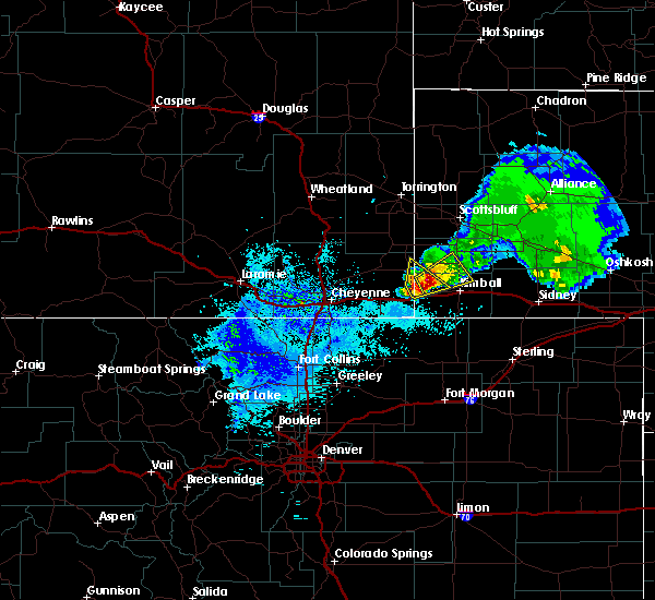 At 324 am mdt, a severe thunderstorm was located 7 miles northwest of oliver campground, or 14 miles northwest of kimball, moving northeast at 20 mph. this storm has had a history of producing lots of hail covering the ground (radar indicated). Hazards include quarter size hail. damage to vehicles is possible At 324 am mdt, a severe thunderstorm was located 7 miles northwest of oliver campground, or 14 miles northwest of kimball, moving northeast at 20 mph. this storm has had a history of producing lots of hail covering the ground (radar indicated). Hazards include quarter size hail. damage to vehicles is possible
|
| 5/26/2019 3:04 AM MDT |
 At 303 am mdt, a severe thunderstorm was located 7 miles south of albin, or 20 miles west of kimball, moving northeast at 20 mph (radar indicated). Hazards include half dollar size hail. Damage to vehicles is possible. locations impacted include, bushnell. This includes interstate 80 in nebraska between mile markers 1 and 4. At 303 am mdt, a severe thunderstorm was located 7 miles south of albin, or 20 miles west of kimball, moving northeast at 20 mph (radar indicated). Hazards include half dollar size hail. Damage to vehicles is possible. locations impacted include, bushnell. This includes interstate 80 in nebraska between mile markers 1 and 4.
|
| 5/26/2019 2:43 AM MDT |
 At 240 am mdt, a severe thunderstorm was located near pine bluffs, or 25 miles west of kimball, moving northeast at 25 mph. this storm has a history of producing a large amount of hail as it moved northeast through the burns area (radar indicated). Hazards include half dollar size hail. damage to vehicles is possible At 240 am mdt, a severe thunderstorm was located near pine bluffs, or 25 miles west of kimball, moving northeast at 25 mph. this storm has a history of producing a large amount of hail as it moved northeast through the burns area (radar indicated). Hazards include half dollar size hail. damage to vehicles is possible
|
| 5/26/2019 2:43 AM MDT |
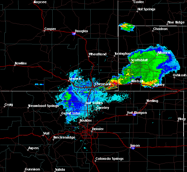 At 240 am mdt, a severe thunderstorm was located near pine bluffs, or 25 miles west of kimball, moving northeast at 25 mph. this storm has a history of producing a large amount of hail as it moved northeast through the burns area (radar indicated). Hazards include half dollar size hail. damage to vehicles is possible At 240 am mdt, a severe thunderstorm was located near pine bluffs, or 25 miles west of kimball, moving northeast at 25 mph. this storm has a history of producing a large amount of hail as it moved northeast through the burns area (radar indicated). Hazards include half dollar size hail. damage to vehicles is possible
|
| 8/8/2018 6:00 AM MDT | Tennis Ball sized hail reported 8.9 miles NW of Bushnell, NE, golf ball to tennis ball hail. |
| 8/7/2018 9:41 PM MDT |
 At 941 pm mdt, a severe thunderstorm was located 7 miles southeast of albin, or 18 miles northwest of kimball, moving southeast at 50 mph (radar indicated). Hazards include 60 mph wind gusts and quarter size hail. Hail damage to vehicles is expected. Expect wind damage to roofs, siding, and trees. At 941 pm mdt, a severe thunderstorm was located 7 miles southeast of albin, or 18 miles northwest of kimball, moving southeast at 50 mph (radar indicated). Hazards include 60 mph wind gusts and quarter size hail. Hail damage to vehicles is expected. Expect wind damage to roofs, siding, and trees.
|
| 7/28/2018 5:21 PM MDT |
 At 520 pm mdt, a severe thunderstorm was located near kimball, moving southeast at 30 mph (radar indicated). Hazards include golf ball size hail and 70 mph wind gusts. People and animals outdoors will be injured. expect hail damage to roofs, siding, windows, and vehicles. expect considerable tree damage. wind damage is also likely to mobile homes, roofs, and outbuildings. locations impacted include, kimball, dix, oliver campground, oliver reservoir, kimball airport and bushnell. this includes interstate 80 in nebraska between mile markers 11 and 34. A tornado watch remains in effect until 1000 pm mdt for the panhandle of nebraska. At 520 pm mdt, a severe thunderstorm was located near kimball, moving southeast at 30 mph (radar indicated). Hazards include golf ball size hail and 70 mph wind gusts. People and animals outdoors will be injured. expect hail damage to roofs, siding, windows, and vehicles. expect considerable tree damage. wind damage is also likely to mobile homes, roofs, and outbuildings. locations impacted include, kimball, dix, oliver campground, oliver reservoir, kimball airport and bushnell. this includes interstate 80 in nebraska between mile markers 11 and 34. A tornado watch remains in effect until 1000 pm mdt for the panhandle of nebraska.
|
| 7/28/2018 5:13 PM MDT |
 At 513 pm mdt, a severe thunderstorm was located near oliver reservoir, or 7 miles northwest of kimball, moving southeast at 30 mph (radar indicated). Hazards include 70 mph wind gusts and ping pong ball size hail. People and animals outdoors will be injured. expect hail damage to roofs, siding, windows, and vehicles. expect considerable tree damage. Wind damage is also likely to mobile homes, roofs, and outbuildings. At 513 pm mdt, a severe thunderstorm was located near oliver reservoir, or 7 miles northwest of kimball, moving southeast at 30 mph (radar indicated). Hazards include 70 mph wind gusts and ping pong ball size hail. People and animals outdoors will be injured. expect hail damage to roofs, siding, windows, and vehicles. expect considerable tree damage. Wind damage is also likely to mobile homes, roofs, and outbuildings.
|
| 6/22/2018 7:28 PM MDT |
 The severe thunderstorm warning for northwestern kimball county will expire at 730 pm mdt, the storm which prompted the warning has moved out of the area. therefore, the warning will be allowed to expire. remember, a severe thunderstorm warning still remains in effect for central and southeastern kimball county until 8 pm mdt. The severe thunderstorm warning for northwestern kimball county will expire at 730 pm mdt, the storm which prompted the warning has moved out of the area. therefore, the warning will be allowed to expire. remember, a severe thunderstorm warning still remains in effect for central and southeastern kimball county until 8 pm mdt.
|
| 6/22/2018 7:25 PM MDT |
 At 725 pm mdt, a severe thunderstorm was located over oliver reservoir, or near kimball, moving southeast at 40 mph (radar indicated). Hazards include 60 mph wind gusts and quarter size hail. Hail damage to vehicles is expected. Expect wind damage to roofs, siding, and trees. At 725 pm mdt, a severe thunderstorm was located over oliver reservoir, or near kimball, moving southeast at 40 mph (radar indicated). Hazards include 60 mph wind gusts and quarter size hail. Hail damage to vehicles is expected. Expect wind damage to roofs, siding, and trees.
|
| 6/22/2018 7:15 PM MDT |
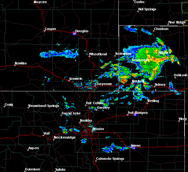 At 714 pm mdt, a severe thunderstorm was located 9 miles northwest of oliver campground, or 17 miles west of kimball, moving southeast at 35 mph (trained weather spotter reported quarter size hail four miles south of albin, wyoming). Hazards include 60 mph wind gusts and quarter size hail. Hail damage to vehicles is expected. expect wind damage to roofs, siding, and trees. Locations impacted include, bushnell. At 714 pm mdt, a severe thunderstorm was located 9 miles northwest of oliver campground, or 17 miles west of kimball, moving southeast at 35 mph (trained weather spotter reported quarter size hail four miles south of albin, wyoming). Hazards include 60 mph wind gusts and quarter size hail. Hail damage to vehicles is expected. expect wind damage to roofs, siding, and trees. Locations impacted include, bushnell.
|
| 6/22/2018 7:10 PM MDT |
 At 709 pm mdt, a severe thunderstorm was located 7 miles southeast of albin, or 20 miles west of kimball, moving southeast at 35 mph (trained weather spotters reported quarter size hail four miles of albin, wyoming). Hazards include 60 mph wind gusts and quarter size hail. Hail damage to vehicles is expected. expect wind damage to roofs, siding, and trees. This severe thunderstorm will remain over mainly rural areas of northwestern kimball, southwestern banner and east central laramie counties. At 709 pm mdt, a severe thunderstorm was located 7 miles southeast of albin, or 20 miles west of kimball, moving southeast at 35 mph (trained weather spotters reported quarter size hail four miles of albin, wyoming). Hazards include 60 mph wind gusts and quarter size hail. Hail damage to vehicles is expected. expect wind damage to roofs, siding, and trees. This severe thunderstorm will remain over mainly rural areas of northwestern kimball, southwestern banner and east central laramie counties.
|
| 6/22/2018 6:57 PM MDT |
 At 656 pm mdt, a severe thunderstorm was located near albin, or 28 miles northwest of kimball, moving southeast at 35 mph (radar indicated. previous report have come in with quarter size hail about nine west of albin, wyoming). Hazards include 60 mph wind gusts and half dollar size hail. Hail damage to vehicles is expected. Expect wind damage to roofs, siding, and trees. At 656 pm mdt, a severe thunderstorm was located near albin, or 28 miles northwest of kimball, moving southeast at 35 mph (radar indicated. previous report have come in with quarter size hail about nine west of albin, wyoming). Hazards include 60 mph wind gusts and half dollar size hail. Hail damage to vehicles is expected. Expect wind damage to roofs, siding, and trees.
|
| 6/19/2018 5:24 PM MDT | Quarter sized hail reported 8.8 miles NNW of Bushnell, NE, trained storm spotter reported quarter sized hail. |
| 6/19/2018 5:15 PM MDT |
 At 515 pm mdt, severe thunderstorms were located along a line extending from near oliver campground to near oliver reservoir to near panorama point, moving east at 25 mph (radar indicated). Hazards include 60 mph wind gusts and half dollar size hail. Hail damage to vehicles is expected. expect wind damage to roofs, siding, and trees. locations impacted include, oliver reservoir, oliver campground and bushnell. This includes interstate 80 in nebraska between mile markers 8 and 15. At 515 pm mdt, severe thunderstorms were located along a line extending from near oliver campground to near oliver reservoir to near panorama point, moving east at 25 mph (radar indicated). Hazards include 60 mph wind gusts and half dollar size hail. Hail damage to vehicles is expected. expect wind damage to roofs, siding, and trees. locations impacted include, oliver reservoir, oliver campground and bushnell. This includes interstate 80 in nebraska between mile markers 8 and 15.
|
| 6/19/2018 5:08 PM MDT | Quarter sized hail reported 5.7 miles N of Bushnell, NE, sheriff department of kimball county reported quarter sized hail as relayed by an emergency manager officer. |
| 6/19/2018 5:08 PM MDT | Tennis Ball sized hail reported 7.7 miles N of Bushnell, NE, public picture report on social media of larger then hen egg to near tennis ball sized hail south of bushnell. |
| 6/19/2018 5:04 PM MDT |
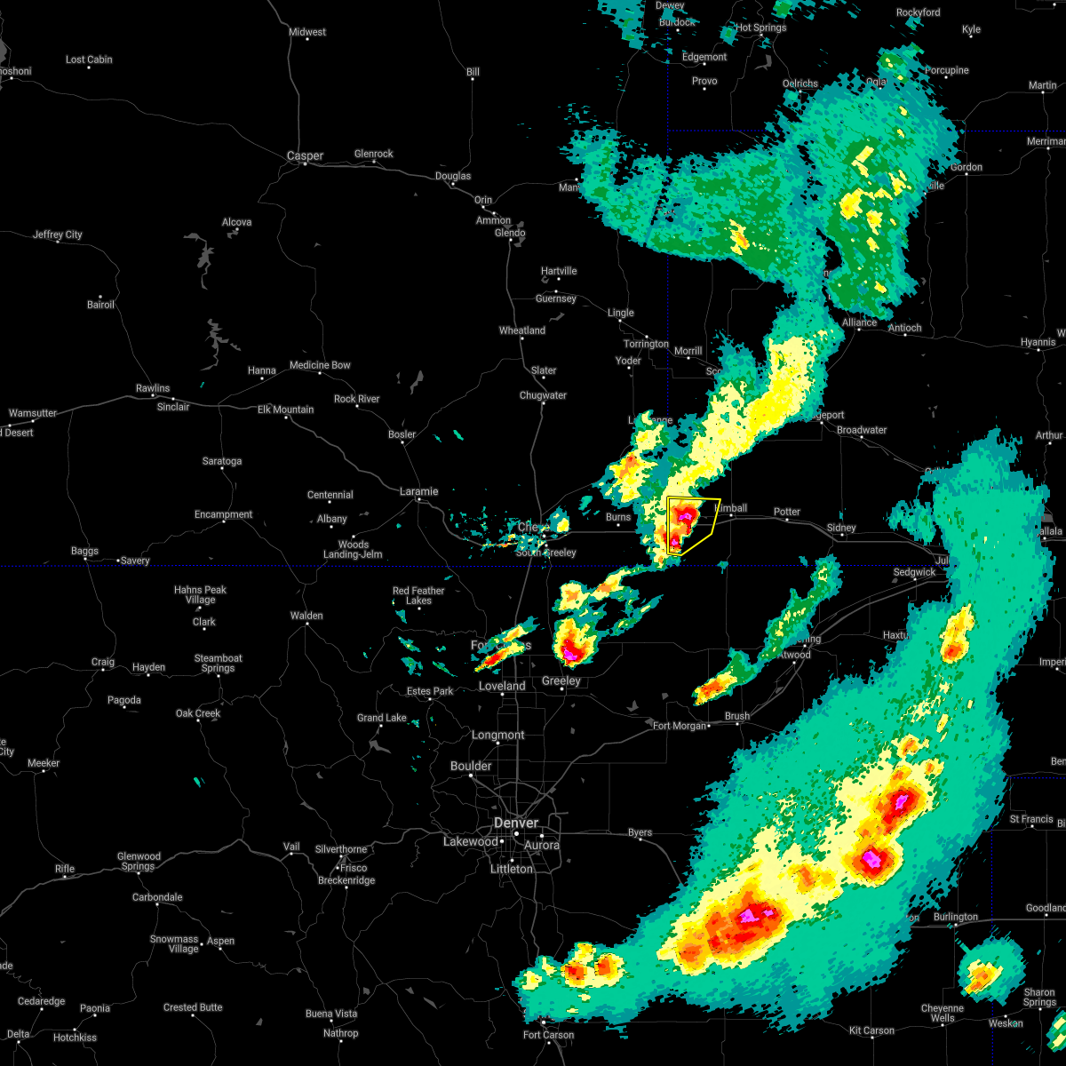 At 504 pm mdt, severe thunderstorms were located along a line extending from 6 miles northwest of oliver reservoir to near oliver campground to near panorama point, moving east at 30 mph (radar indicated). Hazards include golf ball size hail and 60 mph wind gusts. People and animals outdoors will be injured. expect hail damage to roofs, siding, windows, and vehicles. expect wind damage to roofs, siding, and trees. locations impacted include, oliver reservoir, oliver campground and bushnell. This includes interstate 80 in nebraska between mile markers 1 and 15. At 504 pm mdt, severe thunderstorms were located along a line extending from 6 miles northwest of oliver reservoir to near oliver campground to near panorama point, moving east at 30 mph (radar indicated). Hazards include golf ball size hail and 60 mph wind gusts. People and animals outdoors will be injured. expect hail damage to roofs, siding, windows, and vehicles. expect wind damage to roofs, siding, and trees. locations impacted include, oliver reservoir, oliver campground and bushnell. This includes interstate 80 in nebraska between mile markers 1 and 15.
|
| 6/19/2018 4:50 PM MDT |
 At 450 pm mdt, severe thunderstorms were located along a line extending from near albin to 12 miles west of oliver campground to pine bluffs to carpenter, moving east at 25 mph (radar indicated). Hazards include 60 mph wind gusts and half dollar size hail. Hail damage to vehicles is expected. expect wind damage to roofs, siding, and trees. locations impacted include, pine bluffs, oliver campground, oliver reservoir and bushnell. this includes the following highways, interstate 80 in wyoming between mile markers 393 and 402. Interstate 80 in nebraska between mile markers 1 and 15. At 450 pm mdt, severe thunderstorms were located along a line extending from near albin to 12 miles west of oliver campground to pine bluffs to carpenter, moving east at 25 mph (radar indicated). Hazards include 60 mph wind gusts and half dollar size hail. Hail damage to vehicles is expected. expect wind damage to roofs, siding, and trees. locations impacted include, pine bluffs, oliver campground, oliver reservoir and bushnell. this includes the following highways, interstate 80 in wyoming between mile markers 393 and 402. Interstate 80 in nebraska between mile markers 1 and 15.
|
| 6/19/2018 4:50 PM MDT |
 At 438 pm mdt, severe thunderstorms were located along a line extending from near albin to 10 miles northeast of burns to 7 miles northwest of pine bluffs to 6 miles west of carpenter, moving east at 25 mph (radar indicated). Hazards include 60 mph wind gusts and half dollar size hail. Hail damage to vehicles is expected. Expect wind damage to roofs, siding, and trees. At 438 pm mdt, severe thunderstorms were located along a line extending from near albin to 10 miles northeast of burns to 7 miles northwest of pine bluffs to 6 miles west of carpenter, moving east at 25 mph (radar indicated). Hazards include 60 mph wind gusts and half dollar size hail. Hail damage to vehicles is expected. Expect wind damage to roofs, siding, and trees.
|
| 6/19/2018 4:38 PM MDT |
 At 438 pm mdt, severe thunderstorms were located along a line extending from near albin to 10 miles northeast of burns to 7 miles northwest of pine bluffs to 6 miles west of carpenter, moving east at 25 mph (radar indicated). Hazards include 60 mph wind gusts and half dollar size hail. Hail damage to vehicles is expected. Expect wind damage to roofs, siding, and trees. At 438 pm mdt, severe thunderstorms were located along a line extending from near albin to 10 miles northeast of burns to 7 miles northwest of pine bluffs to 6 miles west of carpenter, moving east at 25 mph (radar indicated). Hazards include 60 mph wind gusts and half dollar size hail. Hail damage to vehicles is expected. Expect wind damage to roofs, siding, and trees.
|
| 6/6/2018 9:20 PM MDT |
 At 920 pm mdt, severe thunderstorms were located along a line extending from near potter to near burns, moving north at 20 mph (radar indicated). Hazards include ping pong ball size hail and 60 mph wind gusts. People and animals outdoors will be injured. expect hail damage to roofs, siding, windows, and vehicles. expect wind damage to roofs, siding, and trees. locations impacted include, kimball, pine bluffs, burns, dix, oliver campground, hillsdale, oliver reservoir, kimball airport, panorama point, carpenter and bushnell. this includes the following highways, interstate 80 in wyoming between mile markers 378 and 402. Interstate 80 in nebraska between mile markers 1 and 35. At 920 pm mdt, severe thunderstorms were located along a line extending from near potter to near burns, moving north at 20 mph (radar indicated). Hazards include ping pong ball size hail and 60 mph wind gusts. People and animals outdoors will be injured. expect hail damage to roofs, siding, windows, and vehicles. expect wind damage to roofs, siding, and trees. locations impacted include, kimball, pine bluffs, burns, dix, oliver campground, hillsdale, oliver reservoir, kimball airport, panorama point, carpenter and bushnell. this includes the following highways, interstate 80 in wyoming between mile markers 378 and 402. Interstate 80 in nebraska between mile markers 1 and 35.
|
| 6/6/2018 8:53 PM MDT |
 At 852 pm mdt, severe thunderstorms were located along a line extending from near potter to near carpenter, moving north at 20 mph (radar indicated). Hazards include ping pong ball size hail and 60 mph wind gusts. People and animals outdoors will be injured. expect hail damage to roofs, siding, windows, and vehicles. Expect wind damage to roofs, siding, and trees. At 852 pm mdt, severe thunderstorms were located along a line extending from near potter to near carpenter, moving north at 20 mph (radar indicated). Hazards include ping pong ball size hail and 60 mph wind gusts. People and animals outdoors will be injured. expect hail damage to roofs, siding, windows, and vehicles. Expect wind damage to roofs, siding, and trees.
|
| 6/6/2018 8:08 PM MDT |
 At 807 pm mdt, a severe thunderstorm was located 9 miles south of kimball airport, or 12 miles south of kimball, moving northwest at 30 mph (radar indicated). Hazards include ping pong ball size hail and 60 mph wind gusts. People and animals outdoors will be injured. expect hail damage to roofs, siding, windows, and vehicles. Expect wind damage to roofs, siding, and trees. At 807 pm mdt, a severe thunderstorm was located 9 miles south of kimball airport, or 12 miles south of kimball, moving northwest at 30 mph (radar indicated). Hazards include ping pong ball size hail and 60 mph wind gusts. People and animals outdoors will be injured. expect hail damage to roofs, siding, windows, and vehicles. Expect wind damage to roofs, siding, and trees.
|
| 5/28/2018 6:42 PM MDT |
 At 628 pm mdt, severe thunderstorms were located along a line extending from near pine bluffs to 12 miles southwest of kimball airport, moving northeast at 30 mph (radar indicated). Hazards include 60 mph wind gusts and quarter size hail. Hail damage to vehicles is expected. expect wind damage to roofs, siding, and trees. locations impacted include, kimball, pine bluffs, oliver campground, oliver reservoir, kimball airport and bushnell. this includes the following highways, interstate 80 in wyoming between mile markers 393 and 402. Interstate 80 in nebraska between mile markers 1 and 26. At 628 pm mdt, severe thunderstorms were located along a line extending from near pine bluffs to 12 miles southwest of kimball airport, moving northeast at 30 mph (radar indicated). Hazards include 60 mph wind gusts and quarter size hail. Hail damage to vehicles is expected. expect wind damage to roofs, siding, and trees. locations impacted include, kimball, pine bluffs, oliver campground, oliver reservoir, kimball airport and bushnell. this includes the following highways, interstate 80 in wyoming between mile markers 393 and 402. Interstate 80 in nebraska between mile markers 1 and 26.
|
| 5/28/2018 6:42 PM MDT |
 The severe thunderstorm warning for central kimball and southeastern laramie counties will expire at 645 pm mdt, the storms which prompted the warning have moved out of the area. therefore the warning will be allowed to expire. a severe thunderstorm watch remains in effect until 900 pm mdt for the panhandle of nebraska, and southeastern wyoming. remember, a severe thunderstorm warning still remains in effect for kimball county nebraska until 7:30 pm mdt. The severe thunderstorm warning for central kimball and southeastern laramie counties will expire at 645 pm mdt, the storms which prompted the warning have moved out of the area. therefore the warning will be allowed to expire. a severe thunderstorm watch remains in effect until 900 pm mdt for the panhandle of nebraska, and southeastern wyoming. remember, a severe thunderstorm warning still remains in effect for kimball county nebraska until 7:30 pm mdt.
|
| 5/28/2018 6:40 PM MDT |
 At 640 pm mdt, a severe thunderstorm was located 8 miles southeast of panorama point, or 22 miles southwest of kimball, moving northeast at 35 mph (radar indicated). Hazards include 60 mph wind gusts and quarter size hail. Hail damage to vehicles is expected. Expect wind damage to roofs, siding, and trees. At 640 pm mdt, a severe thunderstorm was located 8 miles southeast of panorama point, or 22 miles southwest of kimball, moving northeast at 35 mph (radar indicated). Hazards include 60 mph wind gusts and quarter size hail. Hail damage to vehicles is expected. Expect wind damage to roofs, siding, and trees.
|
| 5/28/2018 6:28 PM MDT |
 At 628 pm mdt, severe thunderstorms were located along a line extending from near pine bluffs to 12 miles southwest of kimball airport, moving northeast at 30 mph (radar indicated). Hazards include 60 mph wind gusts and quarter size hail. Hail damage to vehicles is expected. expect wind damage to roofs, siding, and trees. locations impacted include, kimball, pine bluffs, oliver campground, oliver reservoir, kimball airport and bushnell. this includes the following highways, interstate 80 in wyoming between mile markers 393 and 402. Interstate 80 in nebraska between mile markers 1 and 26. At 628 pm mdt, severe thunderstorms were located along a line extending from near pine bluffs to 12 miles southwest of kimball airport, moving northeast at 30 mph (radar indicated). Hazards include 60 mph wind gusts and quarter size hail. Hail damage to vehicles is expected. expect wind damage to roofs, siding, and trees. locations impacted include, kimball, pine bluffs, oliver campground, oliver reservoir, kimball airport and bushnell. this includes the following highways, interstate 80 in wyoming between mile markers 393 and 402. Interstate 80 in nebraska between mile markers 1 and 26.
|
| 5/28/2018 5:39 PM MDT |
 At 538 pm mdt, severe thunderstorms were located along a line extending from near hereford to near keota, moving northeast at 30 mph (radar indicated). Hazards include 60 mph wind gusts and quarter size hail. Hail damage to vehicles is expected. Expect wind damage to roofs, siding, and trees. At 538 pm mdt, severe thunderstorms were located along a line extending from near hereford to near keota, moving northeast at 30 mph (radar indicated). Hazards include 60 mph wind gusts and quarter size hail. Hail damage to vehicles is expected. Expect wind damage to roofs, siding, and trees.
|
| 8/12/2017 4:24 PM MDT |
 The severe thunderstorm warning for central kimball county will expire at 430 pm mdt, the storm which prompted the warning has weakened below severe limits, and has exited the warned area. therefore, the warning will be allowed to expire. however heavy rain is still possible with this thunderstorm. a severe thunderstorm watch remains in effect until 1100 pm mdt for the panhandle of nebraska. The severe thunderstorm warning for central kimball county will expire at 430 pm mdt, the storm which prompted the warning has weakened below severe limits, and has exited the warned area. therefore, the warning will be allowed to expire. however heavy rain is still possible with this thunderstorm. a severe thunderstorm watch remains in effect until 1100 pm mdt for the panhandle of nebraska.
|
| 8/12/2017 4:17 PM MDT |
 At 414 pm mdt, another severe thunderstorm was developing near oliver campground, or 12 miles southwest of kimball, and is slowly moving southeast at 10 mph (trained weather spotters). Hazards include 60 mph wind gusts and quarter size hail. Hail damage to vehicles is expected. expect wind damage to roofs, siding, and trees. locations impacted include, kimball, oliver campground, oliver reservoir, kimball airport and bushnell. This includes interstate 80 in nebraska between mile markers 5 and 28. At 414 pm mdt, another severe thunderstorm was developing near oliver campground, or 12 miles southwest of kimball, and is slowly moving southeast at 10 mph (trained weather spotters). Hazards include 60 mph wind gusts and quarter size hail. Hail damage to vehicles is expected. expect wind damage to roofs, siding, and trees. locations impacted include, kimball, oliver campground, oliver reservoir, kimball airport and bushnell. This includes interstate 80 in nebraska between mile markers 5 and 28.
|
| 8/12/2017 3:50 PM MDT |
 At 350 pm mdt, a severe thunderstorm was located over oliver reservoir, or 8 miles southwest of kimball, moving east at 30 mph (trained weather spotters). Hazards include 60 mph wind gusts and quarter size hail. Hail damage to vehicles is expected. Expect wind damage to roofs, siding, and trees. At 350 pm mdt, a severe thunderstorm was located over oliver reservoir, or 8 miles southwest of kimball, moving east at 30 mph (trained weather spotters). Hazards include 60 mph wind gusts and quarter size hail. Hail damage to vehicles is expected. Expect wind damage to roofs, siding, and trees.
|
| 8/12/2017 3:49 PM MDT | Quarter sized hail reported 0.2 miles N of Bushnell, NE |
| 8/12/2017 3:49 PM MDT | Quarter sized hail reported 2.9 miles N of Bushnell, NE |
| 6/12/2017 6:00 PM MDT |
 At 558 pm mdt, a confirmed tornado was located 9 miles north of oliver campground, or 13 miles northwest of kimball, moving northeast at 30 mph (weather spotters confirmed intermittent tornado touchdowns north of bushnell). Hazards include damaging tornado and three inch hail. Flying debris will be dangerous to those caught without shelter. mobile homes will be damaged or destroyed. damage to roofs, windows, and vehicles will occur. tree damage is likely. This tornado will be near, harrisburg around 630 pm mdt. At 558 pm mdt, a confirmed tornado was located 9 miles north of oliver campground, or 13 miles northwest of kimball, moving northeast at 30 mph (weather spotters confirmed intermittent tornado touchdowns north of bushnell). Hazards include damaging tornado and three inch hail. Flying debris will be dangerous to those caught without shelter. mobile homes will be damaged or destroyed. damage to roofs, windows, and vehicles will occur. tree damage is likely. This tornado will be near, harrisburg around 630 pm mdt.
|
| 6/12/2017 6:00 PM MDT |
 At 551 pm mdt, a severe thunderstorm capable of producing a tornado was located near oliver campground, or 12 miles northwest of kimball, moving northeast at 35 mph. a second area of rotation was located about 10 miles northwest of pine bluffs, also moving northeast (radar indicated rotation). Hazards include developing tornado and hail up to three inches in diameter. Flying debris will be dangerous to those caught without shelter. mobile homes will be damaged or destroyed. damage to roofs, windows, and vehicles will occur. tree damage is likely. this dangerous storm will be near, harrisburg around 625 pm mdt. other locations impacted by this tornadic thunderstorm include bushnell. This includes interstate 80 in nebraska near mile marker 12. At 551 pm mdt, a severe thunderstorm capable of producing a tornado was located near oliver campground, or 12 miles northwest of kimball, moving northeast at 35 mph. a second area of rotation was located about 10 miles northwest of pine bluffs, also moving northeast (radar indicated rotation). Hazards include developing tornado and hail up to three inches in diameter. Flying debris will be dangerous to those caught without shelter. mobile homes will be damaged or destroyed. damage to roofs, windows, and vehicles will occur. tree damage is likely. this dangerous storm will be near, harrisburg around 625 pm mdt. other locations impacted by this tornadic thunderstorm include bushnell. This includes interstate 80 in nebraska near mile marker 12.
|
| 6/12/2017 5:52 PM MDT |
 At 551 pm mdt, a severe thunderstorm capable of producing a tornado was located near oliver campground, or 12 miles northwest of kimball, moving northeast at 35 mph. a second area of rotation was located about 10 miles northwest of pine bluffs, also moving northeast (radar indicated rotation). Hazards include developing tornado and hail up to three inches in diameter. Flying debris will be dangerous to those caught without shelter. mobile homes will be damaged or destroyed. damage to roofs, windows, and vehicles will occur. tree damage is likely. this dangerous storm will be near, harrisburg around 625 pm mdt. other locations impacted by this tornadic thunderstorm include bushnell. This includes interstate 80 in nebraska near mile marker 12. At 551 pm mdt, a severe thunderstorm capable of producing a tornado was located near oliver campground, or 12 miles northwest of kimball, moving northeast at 35 mph. a second area of rotation was located about 10 miles northwest of pine bluffs, also moving northeast (radar indicated rotation). Hazards include developing tornado and hail up to three inches in diameter. Flying debris will be dangerous to those caught without shelter. mobile homes will be damaged or destroyed. damage to roofs, windows, and vehicles will occur. tree damage is likely. this dangerous storm will be near, harrisburg around 625 pm mdt. other locations impacted by this tornadic thunderstorm include bushnell. This includes interstate 80 in nebraska near mile marker 12.
|
| 6/12/2017 5:43 PM MDT |
 At 542 pm mdt, a severe thunderstorm capable of producing a tornado was located near oliver campground, or 12 miles west of kimball, moving northeast at 25 mph (radar indicated rotation). Hazards include tornado and three inch hail. Flying debris will be dangerous to those caught without shelter. mobile homes will be damaged or destroyed. damage to roofs, windows, and vehicles will occur. tree damage is likely. this tornadic thunderstorm will remain over mainly rural areas of northwestern kimball, southwestern banner and east central laramie counties, including the following locations: bushnell. This includes interstate 80 in nebraska between mile markers 3 and 13. At 542 pm mdt, a severe thunderstorm capable of producing a tornado was located near oliver campground, or 12 miles west of kimball, moving northeast at 25 mph (radar indicated rotation). Hazards include tornado and three inch hail. Flying debris will be dangerous to those caught without shelter. mobile homes will be damaged or destroyed. damage to roofs, windows, and vehicles will occur. tree damage is likely. this tornadic thunderstorm will remain over mainly rural areas of northwestern kimball, southwestern banner and east central laramie counties, including the following locations: bushnell. This includes interstate 80 in nebraska between mile markers 3 and 13.
|
| 6/12/2017 5:27 PM MDT |
 At 526 pm mdt, a confirmed tornado was located near pine bluffs, or 18 miles west of kimball, moving northeast at 25 mph (weather spotters confirmed tornado. those in bushnell should seek shelter immediately!). Hazards include damaging tornado and baseball size hail. Flying debris will be dangerous to those caught without shelter. mobile homes will be damaged or destroyed. damage to roofs, windows, and vehicles will occur. tree damage is likely. this tornado will be near, oliver campground and oliver reservoir around 545 pm mdt. other locations impacted by this tornadic thunderstorm include bushnell. this includes the following highways, interstate 80 in wyoming between mile markers 389 and 402. Interstate 80 in nebraska between mile markers 1 and 17. At 526 pm mdt, a confirmed tornado was located near pine bluffs, or 18 miles west of kimball, moving northeast at 25 mph (weather spotters confirmed tornado. those in bushnell should seek shelter immediately!). Hazards include damaging tornado and baseball size hail. Flying debris will be dangerous to those caught without shelter. mobile homes will be damaged or destroyed. damage to roofs, windows, and vehicles will occur. tree damage is likely. this tornado will be near, oliver campground and oliver reservoir around 545 pm mdt. other locations impacted by this tornadic thunderstorm include bushnell. this includes the following highways, interstate 80 in wyoming between mile markers 389 and 402. Interstate 80 in nebraska between mile markers 1 and 17.
|
| 6/12/2017 5:21 PM MDT |
 At 520 pm mdt, a severe thunderstorm capable of producing a tornado was located near pine bluffs, or 20 miles west of kimball, moving northeast at 25 mph (radar indicated rotation). Hazards include tornado and baseball size hail. Flying debris will be dangerous to those caught without shelter. mobile homes will be damaged or destroyed. damage to roofs, windows, and vehicles will occur. tree damage is likely. this dangerous storm will be near, pine bluffs around 530 pm mdt. oliver campground and oliver reservoir around 550 pm mdt. other locations impacted by this tornadic thunderstorm include bushnell. this includes the following highways, interstate 80 in wyoming between mile markers 389 and 402. Interstate 80 in nebraska between mile markers 1 and 17. At 520 pm mdt, a severe thunderstorm capable of producing a tornado was located near pine bluffs, or 20 miles west of kimball, moving northeast at 25 mph (radar indicated rotation). Hazards include tornado and baseball size hail. Flying debris will be dangerous to those caught without shelter. mobile homes will be damaged or destroyed. damage to roofs, windows, and vehicles will occur. tree damage is likely. this dangerous storm will be near, pine bluffs around 530 pm mdt. oliver campground and oliver reservoir around 550 pm mdt. other locations impacted by this tornadic thunderstorm include bushnell. this includes the following highways, interstate 80 in wyoming between mile markers 389 and 402. Interstate 80 in nebraska between mile markers 1 and 17.
|
| 5/31/2017 5:35 PM MDT |
 The severe thunderstorm warning for southwestern kimball and eastern laramie counties will expire at 545 pm mdt, the storm which prompted the warning has moved out of the area. therefore the warning will be allowed to expire. however small hail, gusty winds and heavy rain are still possible with this thunderstorm. The severe thunderstorm warning for southwestern kimball and eastern laramie counties will expire at 545 pm mdt, the storm which prompted the warning has moved out of the area. therefore the warning will be allowed to expire. however small hail, gusty winds and heavy rain are still possible with this thunderstorm.
|
| 5/31/2017 5:21 PM MDT |
 At 521 pm mdt, a severe thunderstorm was located near oliver campground, or 14 miles west of kimball, moving east at 10 mph (radar indicated). Hazards include quarter size hail. Damage to vehicles is expected. locations impacted include, kimball, pine bluffs, oliver campground, oliver reservoir, kimball airport and bushnell. This includes interstate 80 in nebraska between mile markers 1 and 22. At 521 pm mdt, a severe thunderstorm was located near oliver campground, or 14 miles west of kimball, moving east at 10 mph (radar indicated). Hazards include quarter size hail. Damage to vehicles is expected. locations impacted include, kimball, pine bluffs, oliver campground, oliver reservoir, kimball airport and bushnell. This includes interstate 80 in nebraska between mile markers 1 and 22.
|
| 5/31/2017 4:59 PM MDT |
 At 459 pm mdt, a severe thunderstorm was located near pine bluffs, or 15 miles west of kimball, moving east at 15 mph (radar indicated). Hazards include quarter size hail. damage to vehicles is expected At 459 pm mdt, a severe thunderstorm was located near pine bluffs, or 15 miles west of kimball, moving east at 15 mph (radar indicated). Hazards include quarter size hail. damage to vehicles is expected
|
| 7/27/2016 11:08 PM MDT |
 At 1108 pm mdt, a severe thunderstorm was located near oliver campground, or 9 miles northwest of kimball, moving southeast at 40 mph (radar indicated). Hazards include golf ball size hail and 70 mph wind gusts. People and animals outdoors will be injured. expect hail damage to roofs, siding, windows, and vehicles. expect considerable tree damage. wind damage is also likely to mobile homes, roofs, and outbuildings. locations impacted include, kimball, oliver reservoir, kimball airport, oliver campground and bushnell. This includes interstate 80 in nebraska between mile markers 6 and 20. At 1108 pm mdt, a severe thunderstorm was located near oliver campground, or 9 miles northwest of kimball, moving southeast at 40 mph (radar indicated). Hazards include golf ball size hail and 70 mph wind gusts. People and animals outdoors will be injured. expect hail damage to roofs, siding, windows, and vehicles. expect considerable tree damage. wind damage is also likely to mobile homes, roofs, and outbuildings. locations impacted include, kimball, oliver reservoir, kimball airport, oliver campground and bushnell. This includes interstate 80 in nebraska between mile markers 6 and 20.
|
| 7/27/2016 10:54 PM MDT |
 At 1053 pm mdt, a severe thunderstorm was located 8 miles east of albin, or 18 miles northwest of kimball, moving south at 40 mph (radar indicated). Hazards include tennis ball size hail and 70 mph wind gusts. People and animals outdoors will be injured. expect hail damage to roofs, siding, windows, and vehicles. expect considerable tree damage. Wind damage is also likely to mobile homes, roofs, and outbuildings. At 1053 pm mdt, a severe thunderstorm was located 8 miles east of albin, or 18 miles northwest of kimball, moving south at 40 mph (radar indicated). Hazards include tennis ball size hail and 70 mph wind gusts. People and animals outdoors will be injured. expect hail damage to roofs, siding, windows, and vehicles. expect considerable tree damage. Wind damage is also likely to mobile homes, roofs, and outbuildings.
|
| 7/27/2016 5:52 PM MDT | Golf Ball sized hail reported 2.2 miles NW of Bushnell, NE, wind driven golfball hail produced significant damage to a residence. |
| 7/27/2016 5:50 PM MDT | Heavy damage to a residence and several outbuildings damaged or destroye in kimball county NE, 5 miles N of Bushnell, NE |
| 7/27/2016 5:39 PM MDT |
 At 539 pm mdt, a severe thunderstorm was located near pine bluffs, or 16 miles west of kimball, moving east at 25 mph (public). Hazards include golf ball size hail and 60 mph wind gusts. People and animals outdoors will be injured. expect hail damage to roofs, siding, windows, and vehicles. expect wind damage to roofs, siding, and trees. locations impacted include, pine bluffs, oliver reservoir, oliver campground and bushnell. this includes the following highways, interstate 80 in wyoming between mile markers 401 and 402. Interstate 80 in nebraska between mile markers 1 and 19. At 539 pm mdt, a severe thunderstorm was located near pine bluffs, or 16 miles west of kimball, moving east at 25 mph (public). Hazards include golf ball size hail and 60 mph wind gusts. People and animals outdoors will be injured. expect hail damage to roofs, siding, windows, and vehicles. expect wind damage to roofs, siding, and trees. locations impacted include, pine bluffs, oliver reservoir, oliver campground and bushnell. this includes the following highways, interstate 80 in wyoming between mile markers 401 and 402. Interstate 80 in nebraska between mile markers 1 and 19.
|
| 7/27/2016 5:24 PM MDT |
 At 523 pm mdt, a severe thunderstorm was located near pine bluffs, or 20 miles west of kimball, moving east at 30 mph (radar indicated). Hazards include ping pong ball size hail. People and animals outdoors will be injured. Expect damage to roofs, siding, windows, and vehicles. At 523 pm mdt, a severe thunderstorm was located near pine bluffs, or 20 miles west of kimball, moving east at 30 mph (radar indicated). Hazards include ping pong ball size hail. People and animals outdoors will be injured. Expect damage to roofs, siding, windows, and vehicles.
|
| 6/29/2016 5:12 PM MDT | Half Dollar sized hail reported 3.3 miles S of Bushnell, NE, relayed via twitter. |
| 6/12/2016 8:57 PM MDT | The severe thunderstorm warning for northwestern cheyenne, eastern banner, morrill, southeastern sioux, eastern scotts bluff, kimball, southern box butte and southeastern laramie counties will expire at 900 pm mdt, the storms which prompted the warning have weakened below severe limits, and no longer pose an immediate threat to life or property. therefore the warning will be allowed to expire. however heavy rain is still possible with these thunderstorms. to report severe weather, contact your nearest law enforcement agency. they will relay your report to the national weather service cheyenne. |
| 6/12/2016 8:57 PM MDT | The severe thunderstorm warning for northwestern cheyenne, eastern banner, morrill, southeastern sioux, eastern scotts bluff, kimball, southern box butte and southeastern laramie counties will expire at 900 pm mdt, the storms which prompted the warning have weakened below severe limits, and no longer pose an immediate threat to life or property. therefore the warning will be allowed to expire. however heavy rain is still possible with these thunderstorms. to report severe weather, contact your nearest law enforcement agency. they will relay your report to the national weather service cheyenne. |
| 6/12/2016 8:11 PM MDT |
 At 810 pm mdt, severe thunderstorms were located along a line extending from 8 miles east of flahertys corner to 6 miles east of lake minatare to near redington to 8 miles north of potter to 6 miles southwest of kimball airport, moving northeast at 25 mph (radar indicated). Hazards include 60 mph wind gusts and nickel size hail. Expect damage to roofs. siding. And trees. At 810 pm mdt, severe thunderstorms were located along a line extending from 8 miles east of flahertys corner to 6 miles east of lake minatare to near redington to 8 miles north of potter to 6 miles southwest of kimball airport, moving northeast at 25 mph (radar indicated). Hazards include 60 mph wind gusts and nickel size hail. Expect damage to roofs. siding. And trees.
|
| 6/12/2016 7:47 PM MDT | Storm damage reported in kimball county NE, 0.2 miles N of Bushnell, NE |
| 6/12/2016 7:38 PM MDT |
 At 737 pm mdt, severe thunderstorms were located along a line extending from 7 miles west of hemingford to near kilpatrick lake to near moomaws corner to 8 miles southeast of harrisburg to near panorama point, moving east at 45 mph (radar indicated). Hazards include 60 mph wind gusts and nickel size hail. Expect damage to roofs. siding. And trees. At 737 pm mdt, severe thunderstorms were located along a line extending from 7 miles west of hemingford to near kilpatrick lake to near moomaws corner to 8 miles southeast of harrisburg to near panorama point, moving east at 45 mph (radar indicated). Hazards include 60 mph wind gusts and nickel size hail. Expect damage to roofs. siding. And trees.
|
| 6/30/2015 9:43 PM MDT |
 At 941 pm mdt, severe thunderstorms were located along a line extending from near kimball to 13 miles west of westplains, moving southeast at 45 mph (radar indicated). Hazards include 60 mph wind gusts. Expect damage to roofs. siding and trees. locations impacted include, kimball, pine bluffs, potter, dix, oliver campground, oliver reservoir, kimball airport, panorama point and bushnell. this includes the following highways, interstate 80 in wyoming between mile markers 398 and 402. Interstate 80 in nebraska between mile markers 1 and 47. At 941 pm mdt, severe thunderstorms were located along a line extending from near kimball to 13 miles west of westplains, moving southeast at 45 mph (radar indicated). Hazards include 60 mph wind gusts. Expect damage to roofs. siding and trees. locations impacted include, kimball, pine bluffs, potter, dix, oliver campground, oliver reservoir, kimball airport, panorama point and bushnell. this includes the following highways, interstate 80 in wyoming between mile markers 398 and 402. Interstate 80 in nebraska between mile markers 1 and 47.
|
| 6/30/2015 9:27 PM MDT |
 At 927 pm mdt, severe thunderstorms were located along a line extending from 7 miles southwest of harrisburg to near panorama point, moving east at 60 mph (radar indicated). Hazards include 60 mph wind gusts. Expect damage to roofs. Siding and trees. At 927 pm mdt, severe thunderstorms were located along a line extending from 7 miles southwest of harrisburg to near panorama point, moving east at 60 mph (radar indicated). Hazards include 60 mph wind gusts. Expect damage to roofs. Siding and trees.
|
| 6/25/2015 4:51 PM MDT |
 At 451 pm mdt, severe thunderstorms were located along a line extending from near wildcat hills campground to 8 miles southeast of la grange, moving southeast at 45 mph (radar indicated). Hazards include ping pong size hail and 60 mph wind gusts. People and animals outdoors will be injured. expect hail damage to roofs, siding, windows and vehicles. Expect wind damage to roofs, siding and trees. At 451 pm mdt, severe thunderstorms were located along a line extending from near wildcat hills campground to 8 miles southeast of la grange, moving southeast at 45 mph (radar indicated). Hazards include ping pong size hail and 60 mph wind gusts. People and animals outdoors will be injured. expect hail damage to roofs, siding, windows and vehicles. Expect wind damage to roofs, siding and trees.
|
| 6/25/2015 4:51 PM MDT |
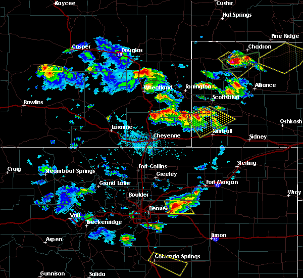 At 451 pm mdt, severe thunderstorms were located along a line extending from near wildcat hills campground to 8 miles southeast of la grange, moving southeast at 45 mph (radar indicated). Hazards include ping pong size hail and 60 mph wind gusts. People and animals outdoors will be injured. expect hail damage to roofs, siding, windows and vehicles. Expect wind damage to roofs, siding and trees. At 451 pm mdt, severe thunderstorms were located along a line extending from near wildcat hills campground to 8 miles southeast of la grange, moving southeast at 45 mph (radar indicated). Hazards include ping pong size hail and 60 mph wind gusts. People and animals outdoors will be injured. expect hail damage to roofs, siding, windows and vehicles. Expect wind damage to roofs, siding and trees.
|
| 4/15/2015 5:09 PM MDT | The national weather service in cheyenne has issued a * severe thunderstorm warning for. kimball county in the panhandle of nebraska. western cheyenne county in the panhandle of nebraska. until 600 pm mdt * at 509 pm mdt. Severe thunderstorms were located along a line. |
| 7/9/2014 4:39 PM MDT | Quarter sized hail reported 1.9 miles S of Bushnell, NE |
| 6/6/2014 1:29 PM MDT | Ping Pong Ball sized hail reported 4.2 miles W of Bushnell, NE |
| 5/19/2014 6:36 PM MDT | Quarter sized hail reported 6.7 miles S of Bushnell, NE, ranged from nickle to quarter |
| 5/7/2014 4:50 PM MDT | Quarter sized hail reported 0.2 miles N of Bushnell, NE |
| 8/30/2013 3:22 PM MDT | Quarter sized hail reported 6.8 miles E of Bushnell, NE, estimated 75 mph winds as well. |
| 8/1/2013 5:26 PM MDT | Also heavy rain was fallin in kimball county NE, 0.2 miles N of Bushnell, NE |
| 6/22/2013 6:19 PM MDT | Golf Ball sized hail reported 0.2 miles N of Bushnell, NE, reported at bushnell and at oliver lake. |
| 6/22/2013 6:08 PM MDT | Quarter sized hail reported 0.2 miles N of Bushnell, NE |
| 5/5/2012 5:49 PM MDT | Baseball sized hail reported 0.2 miles N of Bushnell, NE, numerous reports of golfball to baseball size hail in the town of bushnell. |
| 5/5/2012 4:55 PM MDT | Golf Ball sized hail reported 8.2 miles SW of Bushnell, NE, lasted for 5 to 6 minutes |
| 1/1/0001 12:00 AM | Ping Pong Ball sized hail reported 15.3 miles N of Bushnell, NE |
| 1/1/0001 12:00 AM | Golf Ball sized hail reported 15.3 miles N of Bushnell, NE |
| 1/1/0001 12:00 AM | Golf Ball sized hail reported 4.3 miles WNW of Bushnell, NE, golf ball sized hail was accompanied by torrential rain. |
| 1/1/0001 12:00 AM | Quarter sized hail reported 5.2 miles W of Bushnell, NE |
| 1/1/0001 12:00 AM | Half Dollar sized hail reported 4 miles S of Bushnell, NE, half dollar sized hail was ongoing at the time of the report. |
| 1/1/0001 12:00 AM | Quarter sized hail reported 4 miles S of Bushnell, NE, the spotter was a kimball spotter.thelocation was 4 to 5 miles north of bushnell. |
Hail Maps for Bushnell, NE

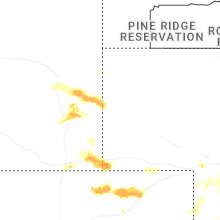

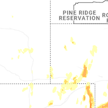


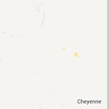


Connect with Interactive Hail Maps