

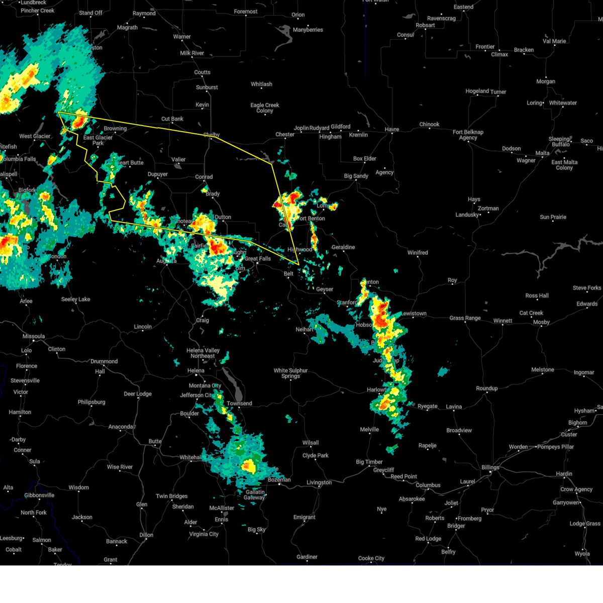
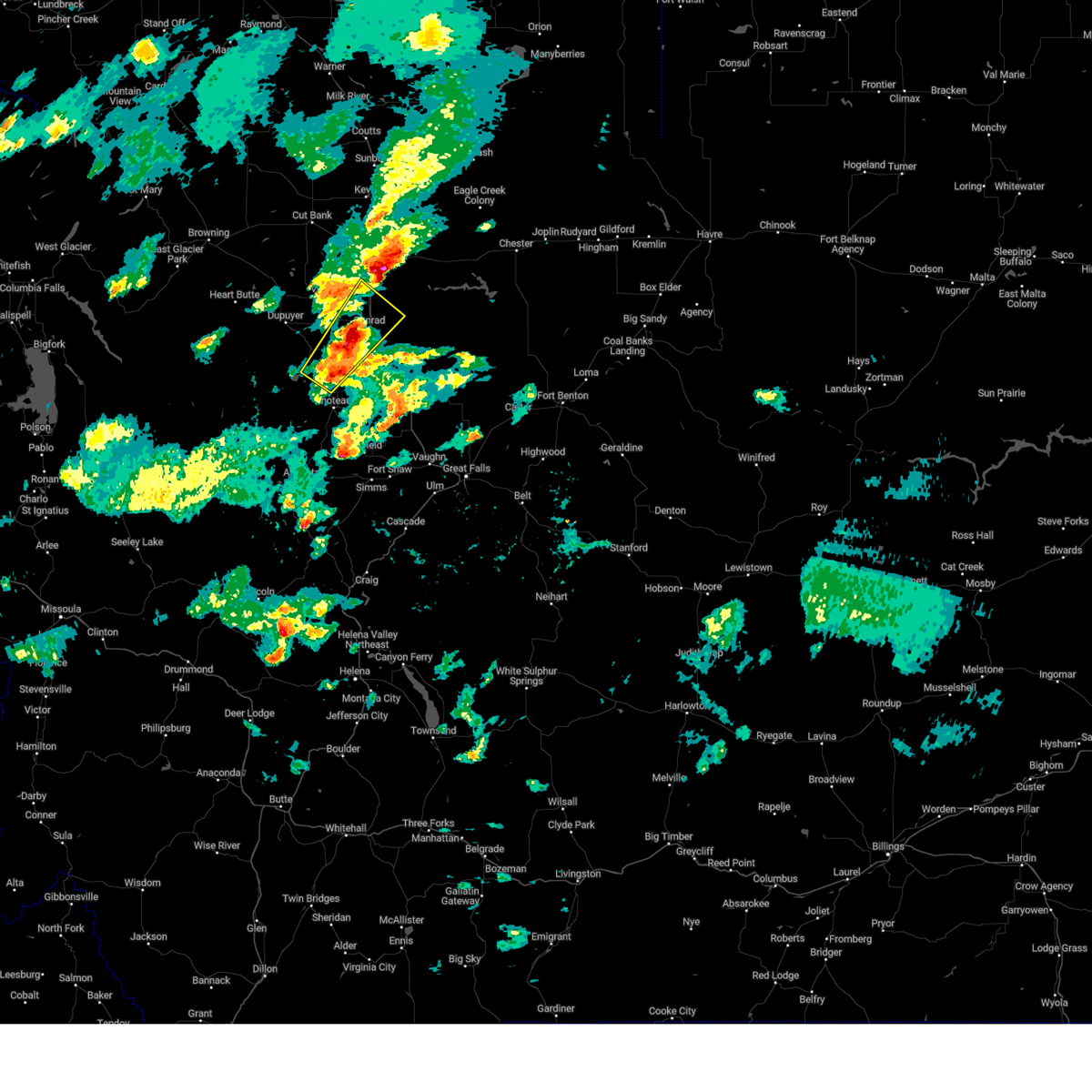
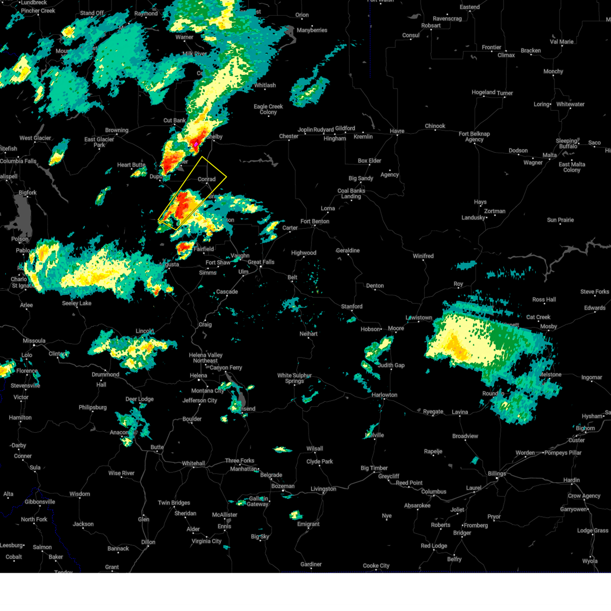
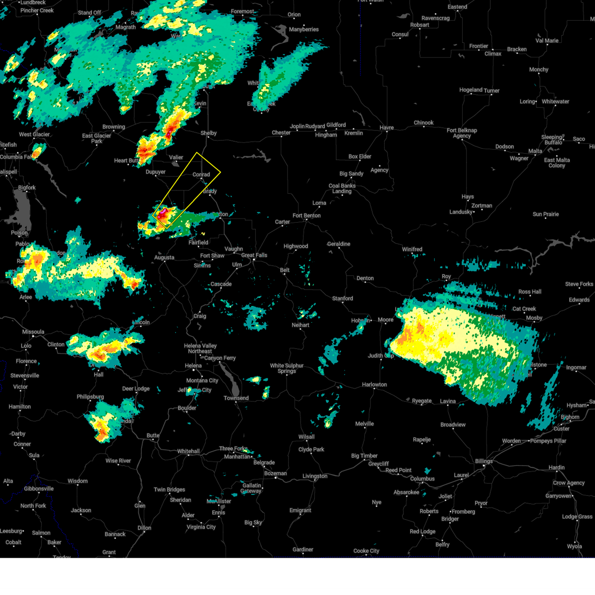
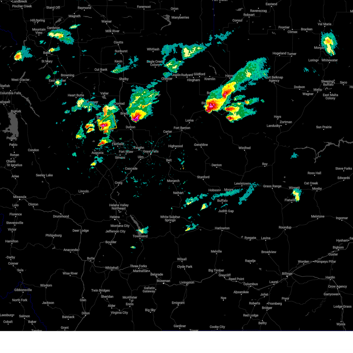
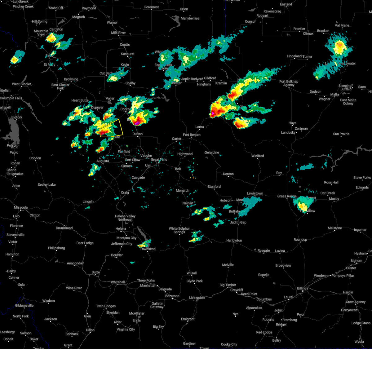
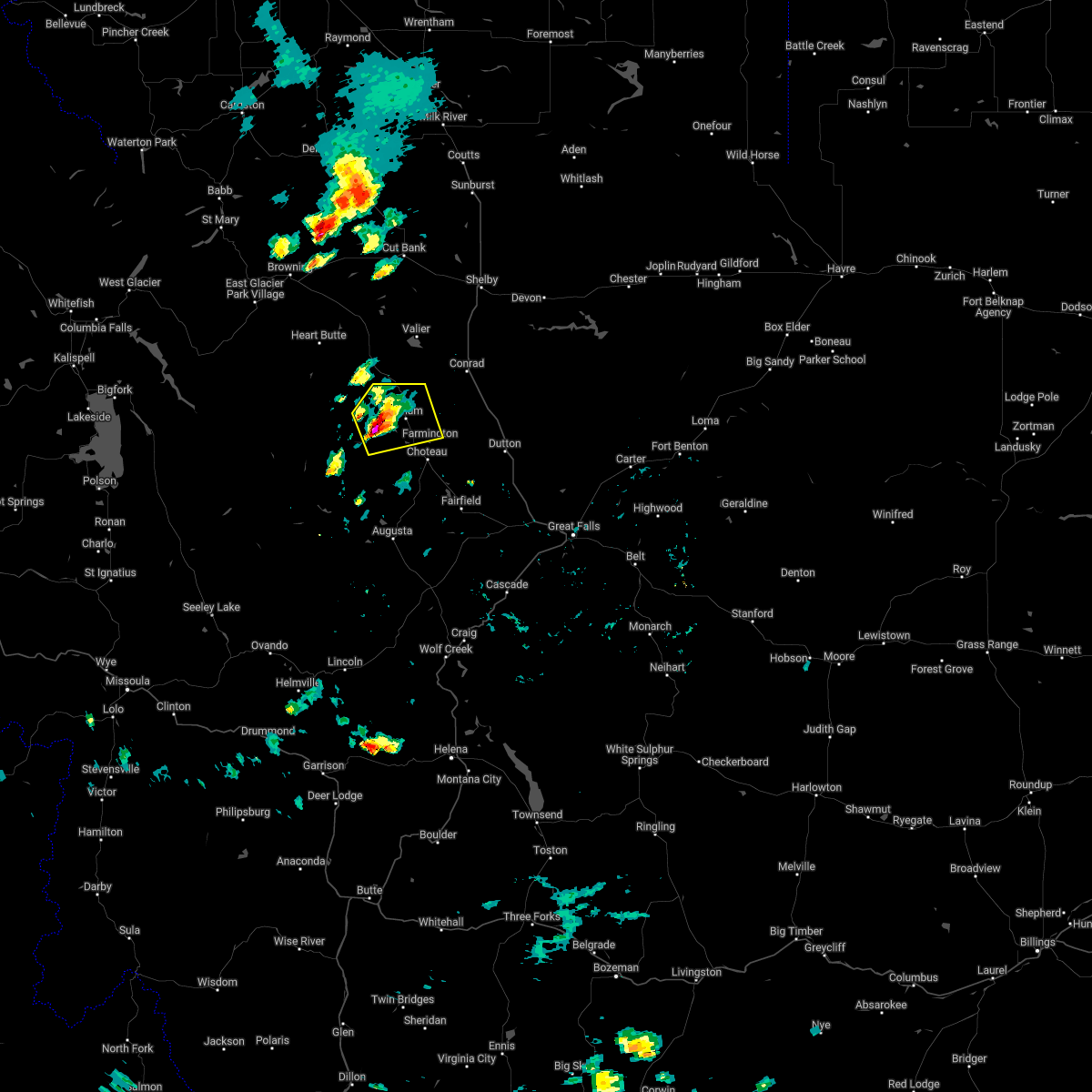
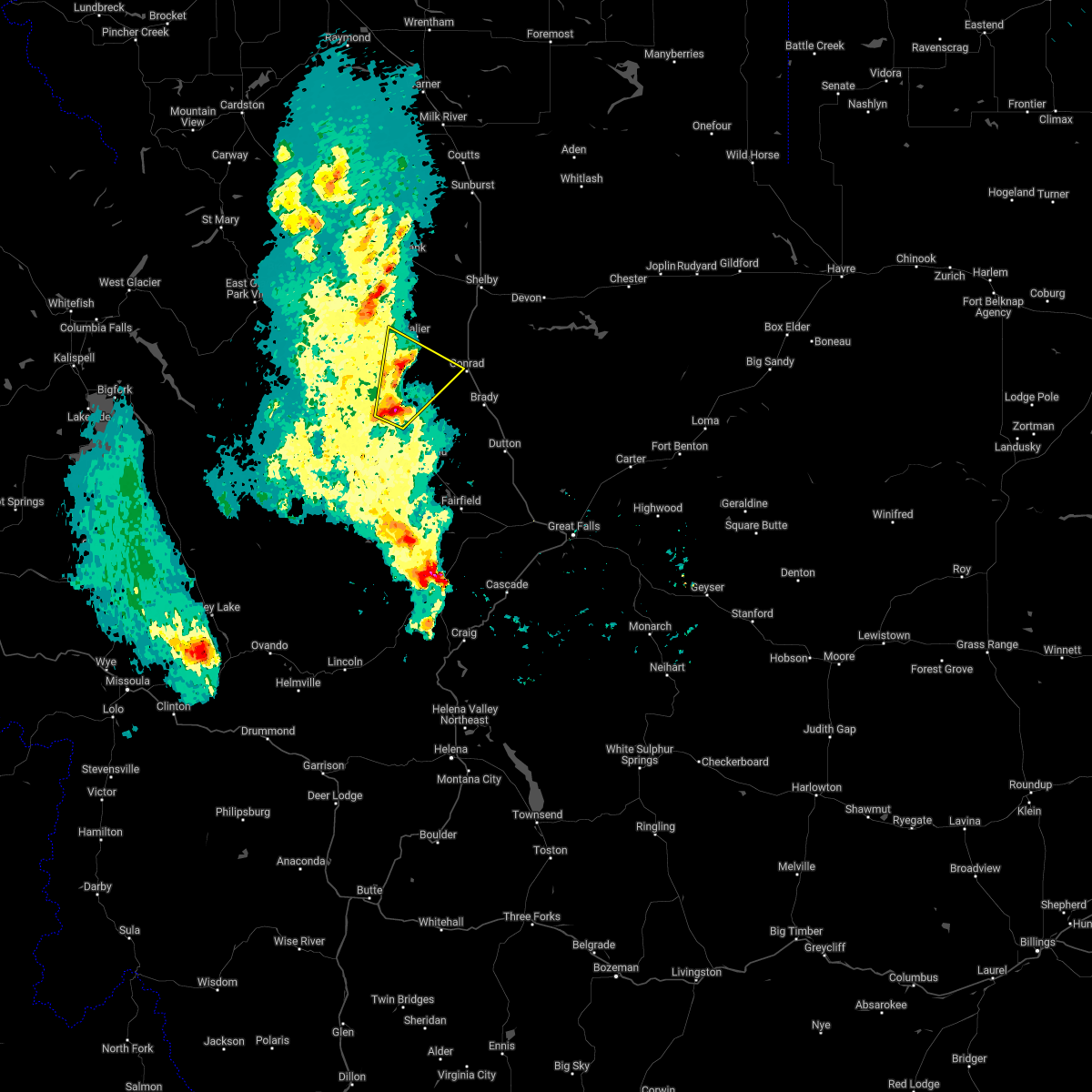
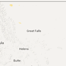
Hail Map for Bynum, MT
The Bynum, MT area has had 0 reports of on-the-ground hail by trained spotters, and has been under severe weather warnings 4 times during the past 12 months. Doppler radar has detected hail at or near Bynum, MT on 14 occasions, including 2 occasions during the past year.
| Name: | Bynum, MT |
| Where Located: | 57 miles NW of Great Falls, MT |
| Map: | Google Map for Bynum, MT |
| Population: | 31 |
| Housing Units: | 22 |
| More Info: | Search Google for Bynum, MT |
0
The Top Recent Hail Date for Bynum, MT is Monday, August 19, 2024 (14th out of 14)

Hail and Wind Damage Spotted near Bynum, MT
| Date / Time | Report Details |
|---|---|
| 6/25/2025 6:00 PM MDT | Mesonet station ricmt rice ridg in teton county MT, 6.9 miles SW of Bynum, MT |
| 8/23/2024 5:27 PM MDT |
 Svrtfx the national weather service in great falls has issued a * severe thunderstorm warning for, northwestern lewis and clark county in west central montana, pondera county in north central montana, southwestern liberty county in north central montana, southern glacier county in north central montana, southern toole county in north central montana, teton county in north central montana, southwestern chouteau county in north central montana, northeastern cascade county in central montana, * until 630 pm mdt. * at 526 pm mdt, severe thunderstorms were located along a line extending from 28 miles southwest of heart butte to 11 miles east of power to 9 miles west of highwood, moving north at 40 mph (radar indicated). Hazards include 70 mph wind gusts. Expect considerable tree damage. Damage is likely to mobile homes, roofs, and outbuildings. Svrtfx the national weather service in great falls has issued a * severe thunderstorm warning for, northwestern lewis and clark county in west central montana, pondera county in north central montana, southwestern liberty county in north central montana, southern glacier county in north central montana, southern toole county in north central montana, teton county in north central montana, southwestern chouteau county in north central montana, northeastern cascade county in central montana, * until 630 pm mdt. * at 526 pm mdt, severe thunderstorms were located along a line extending from 28 miles southwest of heart butte to 11 miles east of power to 9 miles west of highwood, moving north at 40 mph (radar indicated). Hazards include 70 mph wind gusts. Expect considerable tree damage. Damage is likely to mobile homes, roofs, and outbuildings.
|
| 8/6/2024 7:56 PM MDT |
 At 756 pm mdt, a severe thunderstorm was located near conrad, moving northeast at 40 mph (radar indicated). Hazards include quarter size hail. Damage to vehicles is expected. Locations impacted include, conrad, pendroy, bynum, and ledger. At 756 pm mdt, a severe thunderstorm was located near conrad, moving northeast at 40 mph (radar indicated). Hazards include quarter size hail. Damage to vehicles is expected. Locations impacted include, conrad, pendroy, bynum, and ledger.
|
| 8/6/2024 7:41 PM MDT |
 At 741 pm mdt, a severe thunderstorm was located 14 miles southwest of conrad, moving northeast at 25 mph (radar indicated). Hazards include quarter size hail. Damage to vehicles is expected. Locations impacted include, conrad, pendroy, bynum, and ledger. At 741 pm mdt, a severe thunderstorm was located 14 miles southwest of conrad, moving northeast at 25 mph (radar indicated). Hazards include quarter size hail. Damage to vehicles is expected. Locations impacted include, conrad, pendroy, bynum, and ledger.
|
| 8/6/2024 7:23 PM MDT |
 Svrtfx the national weather service in great falls has issued a * severe thunderstorm warning for, eastern pondera county in north central montana, north central teton county in north central montana, * until 815 pm mdt. * at 723 pm mdt, a severe thunderstorm was located 11 miles northwest of choteau, moving northeast at 40 mph (radar indicated). Hazards include quarter size hail. damage to vehicles is expected Svrtfx the national weather service in great falls has issued a * severe thunderstorm warning for, eastern pondera county in north central montana, north central teton county in north central montana, * until 815 pm mdt. * at 723 pm mdt, a severe thunderstorm was located 11 miles northwest of choteau, moving northeast at 40 mph (radar indicated). Hazards include quarter size hail. damage to vehicles is expected
|
| 6/21/2024 4:10 PM MDT |
 At 410 pm mdt, a severe thunderstorm was located 7 miles northwest of choteau, moving east at 20 mph (radar indicated). Hazards include golf ball size hail and 60 mph wind gusts. People and animals outdoors will be injured. expect hail damage to roofs, siding, windows, and vehicles. expect wind damage to roofs, siding, and trees. Locations impacted include, farmington. At 410 pm mdt, a severe thunderstorm was located 7 miles northwest of choteau, moving east at 20 mph (radar indicated). Hazards include golf ball size hail and 60 mph wind gusts. People and animals outdoors will be injured. expect hail damage to roofs, siding, windows, and vehicles. expect wind damage to roofs, siding, and trees. Locations impacted include, farmington.
|
| 6/21/2024 4:03 PM MDT |
 Svrtfx the national weather service in great falls has issued a * severe thunderstorm warning for, north central teton county in north central montana, * until 445 pm mdt. * at 403 pm mdt, a severe thunderstorm was located 9 miles northwest of choteau, moving east at 20 mph (radar indicated). Hazards include ping pong ball size hail and 60 mph wind gusts. People and animals outdoors will be injured. expect hail damage to roofs, siding, windows, and vehicles. Expect wind damage to roofs, siding, and trees. Svrtfx the national weather service in great falls has issued a * severe thunderstorm warning for, north central teton county in north central montana, * until 445 pm mdt. * at 403 pm mdt, a severe thunderstorm was located 9 miles northwest of choteau, moving east at 20 mph (radar indicated). Hazards include ping pong ball size hail and 60 mph wind gusts. People and animals outdoors will be injured. expect hail damage to roofs, siding, windows, and vehicles. Expect wind damage to roofs, siding, and trees.
|
| 8/29/2023 7:22 PM MDT | Corrects previous non-tstm wnd gst report from 2 nw pendroy. mesonet station mtpnd pendroy (mt dot in teton county MT, 6.6 miles S of Bynum, MT |
| 8/29/2023 7:15 PM MDT | Corrects previous non-tstm wnd gst report from 5 ese pendroy. mesonet station ricmt rice ridg in teton county MT, 6.9 miles SW of Bynum, MT |
| 9/3/2022 10:38 PM MDT |
 The severe thunderstorm warning for pondera, eastern glacier, toole and central teton counties will expire at 1045 pm mdt, the storms which prompted the warning have moved out of the area. therefore, the warning will be allowed to expire. however gusty winds are still possible with these thunderstorms. The severe thunderstorm warning for pondera, eastern glacier, toole and central teton counties will expire at 1045 pm mdt, the storms which prompted the warning have moved out of the area. therefore, the warning will be allowed to expire. however gusty winds are still possible with these thunderstorms.
|
| 9/3/2022 10:09 PM MDT |
 At 1008 pm mdt, severe thunderstorms were located along a line extending from 31 miles northwest of cut bank to 7 miles north of valier to near fairfield, moving east at 35 mph (radar indicated). Hazards include 60 mph wind gusts. Expect damage to roofs, siding, and trees. locations impacted include, shelby, cut bank, conrad, choteau, valier, sunburst, dutton, kevin, brady, power, ethridge, oilmont, ledger, collins, bynum, santa rita, pendroy, ferdig, devon and dunkirk. a peak wind gust of 68 mph occurred at the cut bank airport with this storm. hail threat, radar indicated max hail size, <. 75 in wind threat, radar indicated max wind gust, 60 mph. At 1008 pm mdt, severe thunderstorms were located along a line extending from 31 miles northwest of cut bank to 7 miles north of valier to near fairfield, moving east at 35 mph (radar indicated). Hazards include 60 mph wind gusts. Expect damage to roofs, siding, and trees. locations impacted include, shelby, cut bank, conrad, choteau, valier, sunburst, dutton, kevin, brady, power, ethridge, oilmont, ledger, collins, bynum, santa rita, pendroy, ferdig, devon and dunkirk. a peak wind gust of 68 mph occurred at the cut bank airport with this storm. hail threat, radar indicated max hail size, <. 75 in wind threat, radar indicated max wind gust, 60 mph.
|
| 9/3/2022 9:48 PM MDT |
 At 947 pm mdt, severe thunderstorms were located along a line extending from 28 miles north of north browning to 13 miles northwest of valier to 11 miles south of choteau, moving east at 35 mph (radar indicated). Hazards include 60 mph wind gusts. expect damage to roofs, siding, and trees At 947 pm mdt, severe thunderstorms were located along a line extending from 28 miles north of north browning to 13 miles northwest of valier to 11 miles south of choteau, moving east at 35 mph (radar indicated). Hazards include 60 mph wind gusts. expect damage to roofs, siding, and trees
|
| 8/25/2022 5:37 PM MDT | At 537 pm mdt, a severe thunderstorm was located 8 miles northwest of choteau, moving east at 20 mph (radar indicated). Hazards include 60 mph wind gusts and quarter size hail. Hail damage to vehicles is expected. Expect wind damage to roofs, siding, and trees. |
| 7/7/2022 3:37 PM MDT |
 At 337 pm mdt, a severe thunderstorm was located 7 miles northwest of choteau, moving southeast at 5 mph (radar indicated). Hazards include ping pong ball size hail and 60 mph wind gusts. People and animals outdoors will be injured. expect hail damage to roofs, siding, windows, and vehicles. expect wind damage to roofs, siding, and trees. locations impacted include, choteau, brady, collins, farmington and bynum. hail threat, radar indicated max hail size, 1. 50 in wind threat, radar indicated max wind gust, 60 mph. At 337 pm mdt, a severe thunderstorm was located 7 miles northwest of choteau, moving southeast at 5 mph (radar indicated). Hazards include ping pong ball size hail and 60 mph wind gusts. People and animals outdoors will be injured. expect hail damage to roofs, siding, windows, and vehicles. expect wind damage to roofs, siding, and trees. locations impacted include, choteau, brady, collins, farmington and bynum. hail threat, radar indicated max hail size, 1. 50 in wind threat, radar indicated max wind gust, 60 mph.
|
| 7/7/2022 3:26 PM MDT |
 At 325 pm mdt, a severe thunderstorm was located 7 miles northwest of choteau, moving east at 10 mph. this is a destructive storm for baseball size hail (trained weather spotters). Hazards include baseball size hail and 60 mph wind gusts. People and animals outdoors will be severely injured. expect shattered windows, extensive damage to roofs, siding, and vehicles. this storm has had a history of producing hail from golf ball to baseball size. locations impacted include, choteau, brady, collins, farmington and bynum. thunderstorm damage threat, destructive hail threat, observed max hail size, 2. 75 in wind threat, radar indicated max wind gust, 60 mph. At 325 pm mdt, a severe thunderstorm was located 7 miles northwest of choteau, moving east at 10 mph. this is a destructive storm for baseball size hail (trained weather spotters). Hazards include baseball size hail and 60 mph wind gusts. People and animals outdoors will be severely injured. expect shattered windows, extensive damage to roofs, siding, and vehicles. this storm has had a history of producing hail from golf ball to baseball size. locations impacted include, choteau, brady, collins, farmington and bynum. thunderstorm damage threat, destructive hail threat, observed max hail size, 2. 75 in wind threat, radar indicated max wind gust, 60 mph.
|
| 7/7/2022 3:22 PM MDT |
 The severe thunderstorm warning for north central teton county will expire at 330 pm mdt, the storm which prompted the warning has been replaced with a new severe thunderstorm warning. this storm is still capable of producing hail up to baseball size. a severe thunderstorm watch remains in effect until 900 pm mdt for north central montana. The severe thunderstorm warning for north central teton county will expire at 330 pm mdt, the storm which prompted the warning has been replaced with a new severe thunderstorm warning. this storm is still capable of producing hail up to baseball size. a severe thunderstorm watch remains in effect until 900 pm mdt for north central montana.
|
| 7/7/2022 3:21 PM MDT |
 At 320 pm mdt, a severe thunderstorm was located 7 miles north of choteau, moving east at 15 mph. this is a destructive storm for baseball size hail (trained weather spotters). Hazards include baseball size hail and 60 mph wind gusts. People and animals outdoors will be severely injured. Expect shattered windows, extensive damage to roofs, siding, and vehicles. At 320 pm mdt, a severe thunderstorm was located 7 miles north of choteau, moving east at 15 mph. this is a destructive storm for baseball size hail (trained weather spotters). Hazards include baseball size hail and 60 mph wind gusts. People and animals outdoors will be severely injured. Expect shattered windows, extensive damage to roofs, siding, and vehicles.
|
| 7/7/2022 3:12 PM MDT |
 At 312 pm mdt, a severe thunderstorm was located 8 miles northwest of choteau, moving east at 15 mph (radar indicated). Hazards include 60 mph wind gusts and quarter size hail. Hail damage to vehicles is expected. expect wind damage to roofs, siding, and trees. locations impacted include, pendroy and bynum. hail threat, radar indicated max hail size, 1. 00 in wind threat, radar indicated max wind gust, 60 mph. At 312 pm mdt, a severe thunderstorm was located 8 miles northwest of choteau, moving east at 15 mph (radar indicated). Hazards include 60 mph wind gusts and quarter size hail. Hail damage to vehicles is expected. expect wind damage to roofs, siding, and trees. locations impacted include, pendroy and bynum. hail threat, radar indicated max hail size, 1. 00 in wind threat, radar indicated max wind gust, 60 mph.
|
| 7/7/2022 2:52 PM MDT |
 At 252 pm mdt, a severe thunderstorm was located 13 miles northwest of choteau, moving east at 20 mph (radar indicated). Hazards include 60 mph wind gusts and quarter size hail. Hail damage to vehicles is expected. expect wind damage to roofs, siding, and trees. locations impacted include, pendroy and bynum. hail threat, radar indicated max hail size, 1. 00 in wind threat, radar indicated max wind gust, 60 mph. At 252 pm mdt, a severe thunderstorm was located 13 miles northwest of choteau, moving east at 20 mph (radar indicated). Hazards include 60 mph wind gusts and quarter size hail. Hail damage to vehicles is expected. expect wind damage to roofs, siding, and trees. locations impacted include, pendroy and bynum. hail threat, radar indicated max hail size, 1. 00 in wind threat, radar indicated max wind gust, 60 mph.
|
| 7/7/2022 2:38 PM MDT |
 At 237 pm mdt, a severe thunderstorm was located 17 miles northwest of choteau, moving east at 10 mph (radar indicated). Hazards include quarter size hail. damage to vehicles is expected At 237 pm mdt, a severe thunderstorm was located 17 miles northwest of choteau, moving east at 10 mph (radar indicated). Hazards include quarter size hail. damage to vehicles is expected
|
| 6/18/2022 2:45 PM MDT | Mesonet station ricmt rice ridg in teton county MT, 6.9 miles SW of Bynum, MT |
| 6/18/2022 2:36 PM MDT |
 At 235 pm mdt, a severe thunderstorm was located 16 miles northwest of choteau, moving north northeast at 35 mph (radar indicated). Hazards include 60 mph wind gusts. expect damage to roofs, siding, and trees At 235 pm mdt, a severe thunderstorm was located 16 miles northwest of choteau, moving north northeast at 35 mph (radar indicated). Hazards include 60 mph wind gusts. expect damage to roofs, siding, and trees
|
| 8/20/2020 2:55 PM MDT |
 At 254 pm mdt, severe thunderstorms were located along a line extending from near conrad to 9 miles northeast of augusta, moving northeast at 25 mph (radar indicated). Hazards include ping pong ball size hail and 60 mph wind gusts. People and animals outdoors will be injured. expect hail damage to roofs, siding, windows, and vehicles. Expect wind damage to roofs, siding, and trees. At 254 pm mdt, severe thunderstorms were located along a line extending from near conrad to 9 miles northeast of augusta, moving northeast at 25 mph (radar indicated). Hazards include ping pong ball size hail and 60 mph wind gusts. People and animals outdoors will be injured. expect hail damage to roofs, siding, windows, and vehicles. Expect wind damage to roofs, siding, and trees.
|
| 7/25/2018 9:32 PM MDT |
 At 931 pm mdt, a severe thunderstorm was located 9 miles east of choteau, moving southeast at 30 mph (trained weather spotters). Hazards include 60 mph wind gusts and quarter size hail. Hail damage appears to be diminishing. expect wind damage to roofs, siding, and trees. Locations impacted include, choteau, power, pendroy, farmington and bynum. At 931 pm mdt, a severe thunderstorm was located 9 miles east of choteau, moving southeast at 30 mph (trained weather spotters). Hazards include 60 mph wind gusts and quarter size hail. Hail damage appears to be diminishing. expect wind damage to roofs, siding, and trees. Locations impacted include, choteau, power, pendroy, farmington and bynum.
|
| 7/25/2018 8:50 PM MDT | Estimated winds of 60 mph. lots of pea size hail and rai in teton county MT, 2.5 miles SSW of Bynum, MT |
| 7/25/2018 8:44 PM MDT |
 At 844 pm mdt, a severe thunderstorm was located 15 miles northwest of choteau, moving southeast at 30 mph (radar indicated). Hazards include 60 mph wind gusts and half dollar size hail. Hail damage to vehicles is expected. Expect wind damage to roofs, siding, and trees. At 844 pm mdt, a severe thunderstorm was located 15 miles northwest of choteau, moving southeast at 30 mph (radar indicated). Hazards include 60 mph wind gusts and half dollar size hail. Hail damage to vehicles is expected. Expect wind damage to roofs, siding, and trees.
|
| 7/25/2018 7:46 PM MDT |
 At 745 pm mdt, severe thunderstorms were located along a line extending from 11 miles south of cut bank to 6 miles east of heart butte, moving southeast at 20 mph (radar indicated). Hazards include 60 mph wind gusts and half dollar size hail. Hail damage to vehicles is expected. Expect wind damage to roofs, siding, and trees. At 745 pm mdt, severe thunderstorms were located along a line extending from 11 miles south of cut bank to 6 miles east of heart butte, moving southeast at 20 mph (radar indicated). Hazards include 60 mph wind gusts and half dollar size hail. Hail damage to vehicles is expected. Expect wind damage to roofs, siding, and trees.
|
| 8/29/2013 7:59 PM MDT | 58 mph wind gust at pendro in teton county MT, 6.6 miles S of Bynum, MT |
| 1/1/0001 12:00 AM | Pendroy dot site in teton county MT, 7.3 miles S of Bynum, MT |
Hail Maps for Bynum, MT


Connect with Interactive Hail Maps