

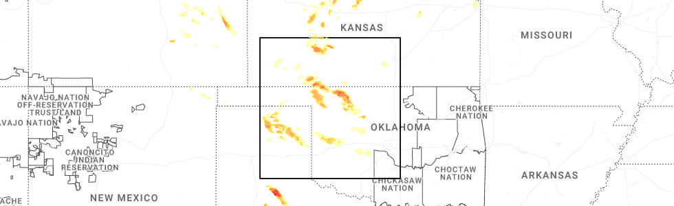
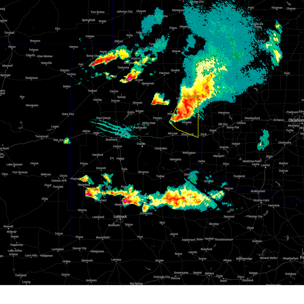
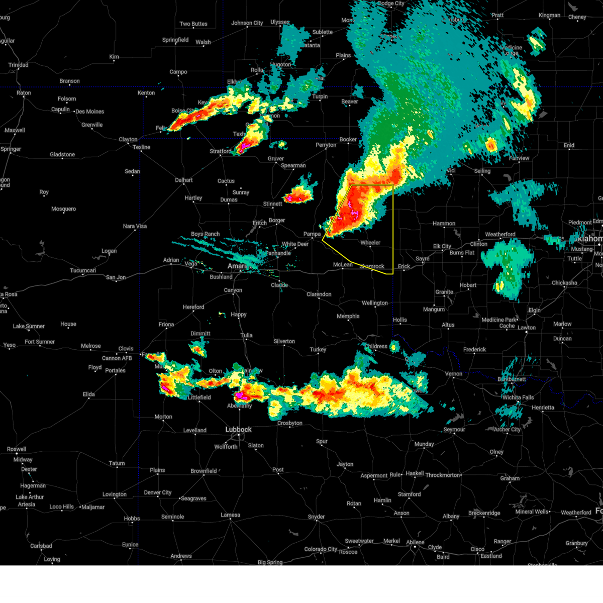
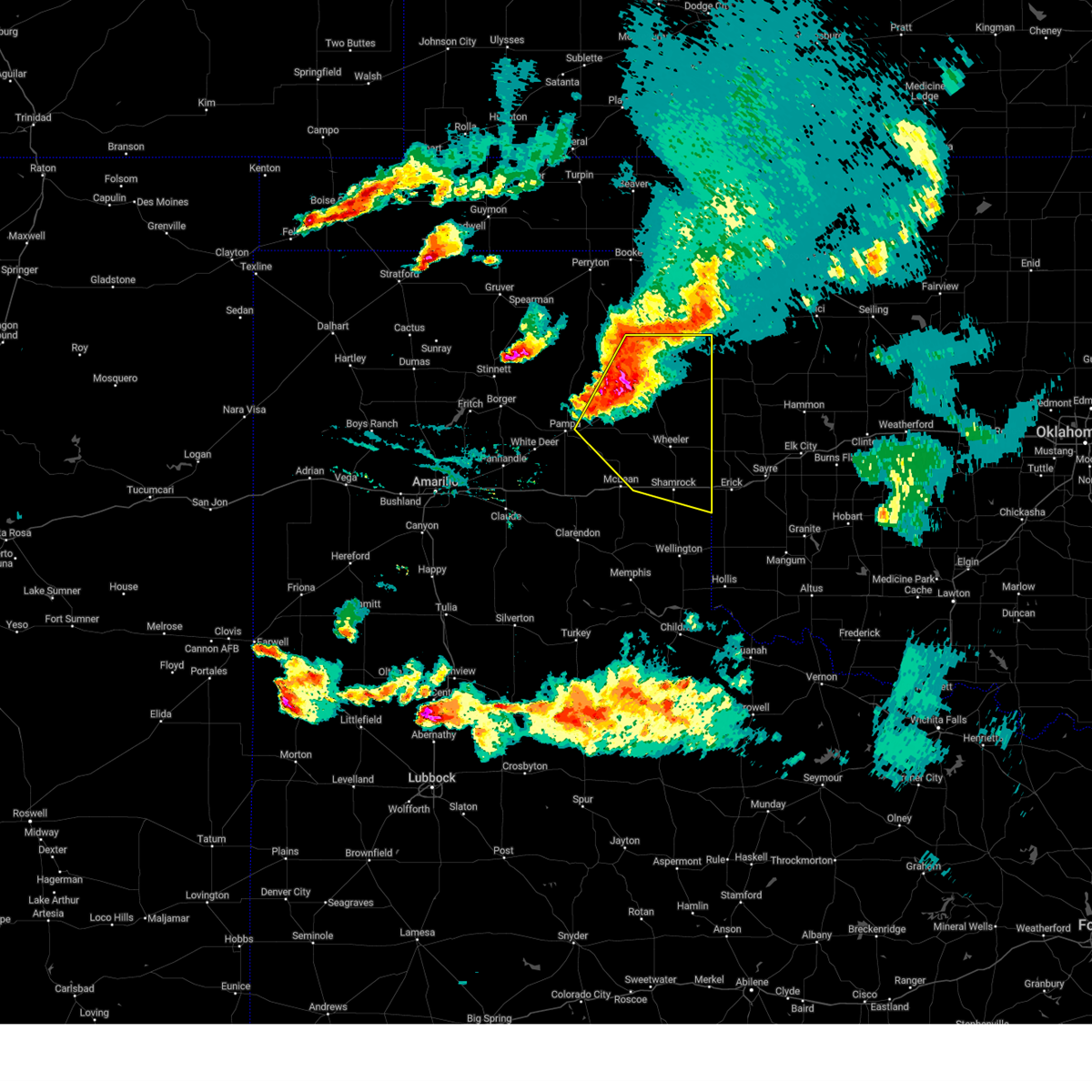
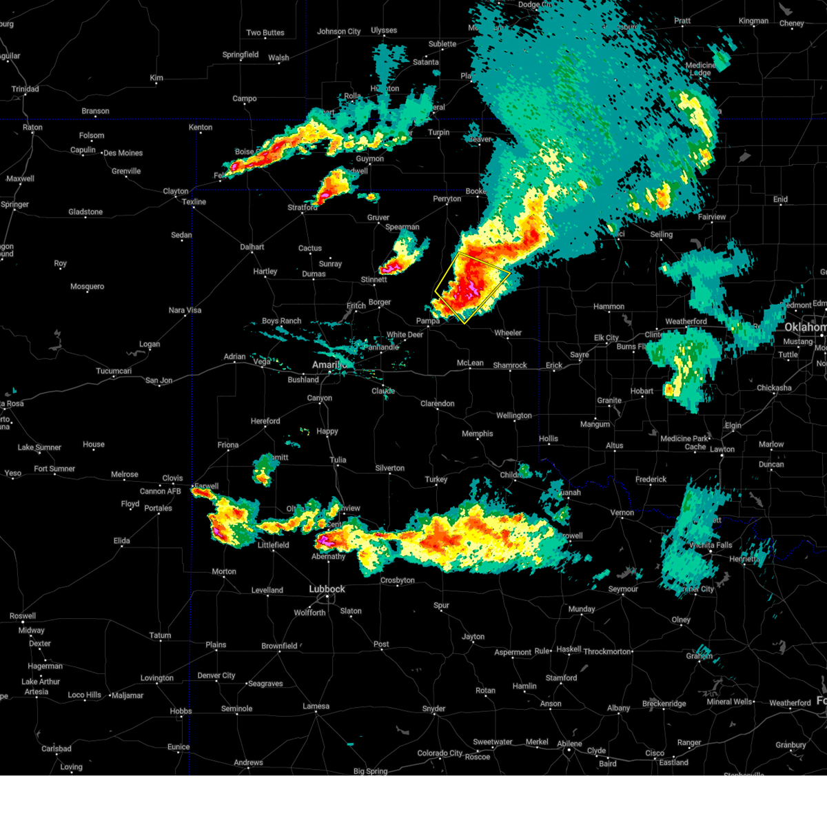
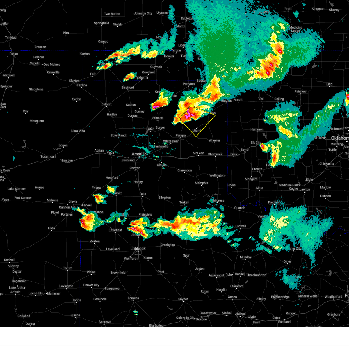
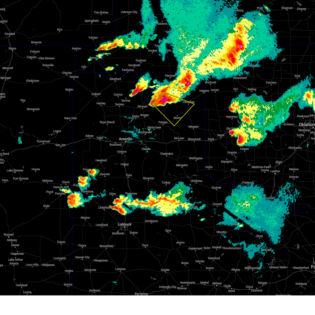
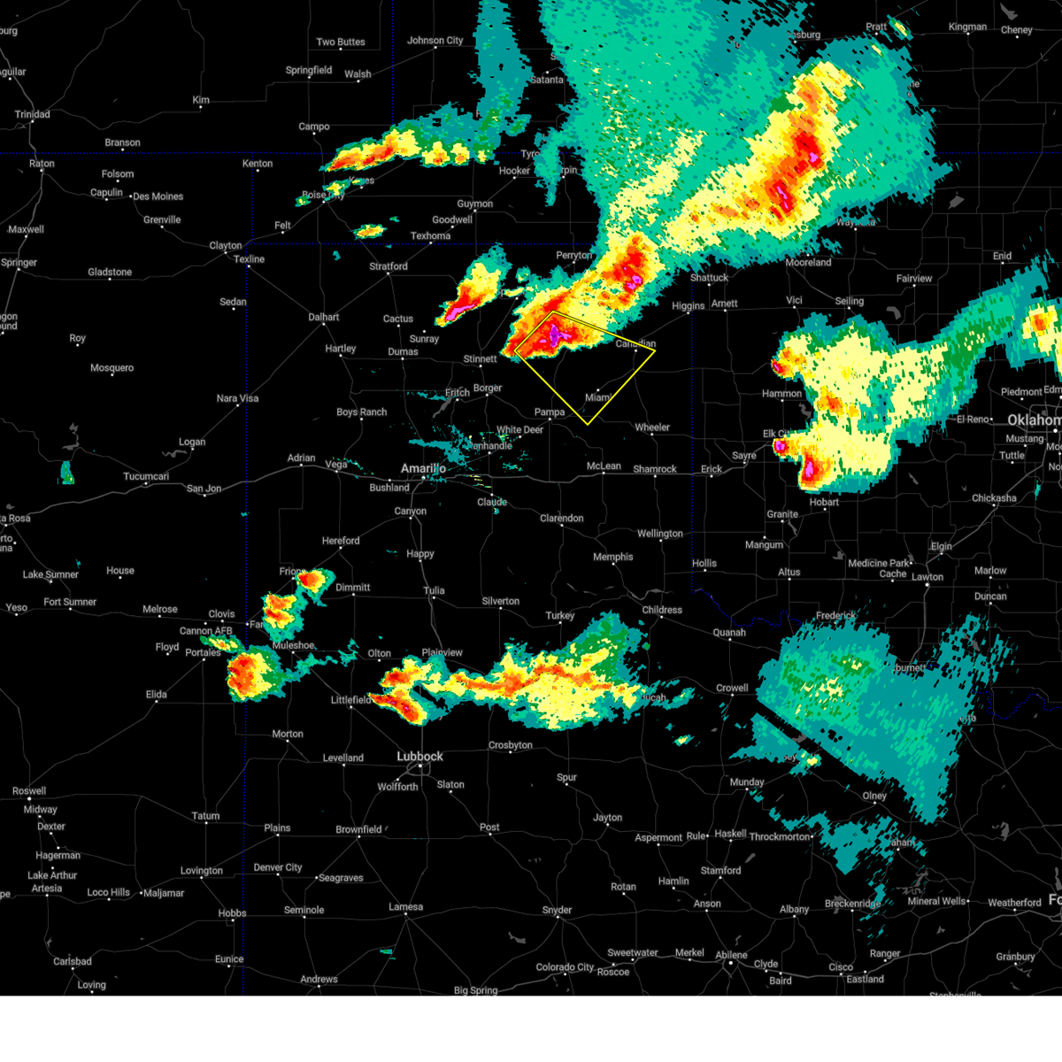
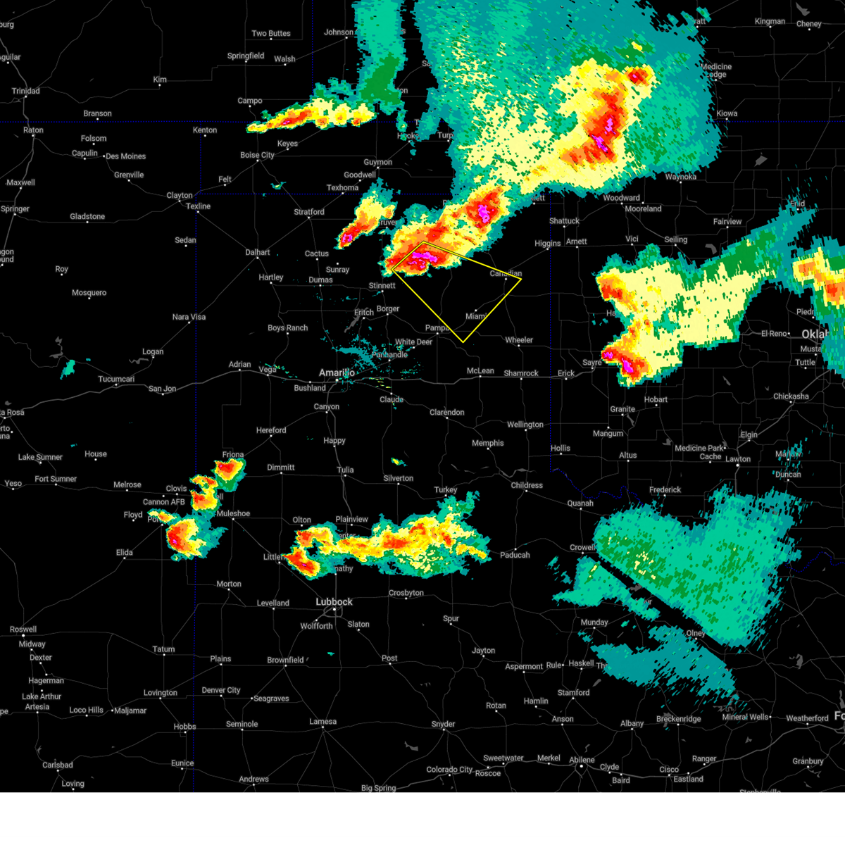
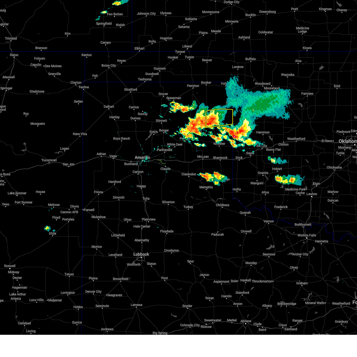
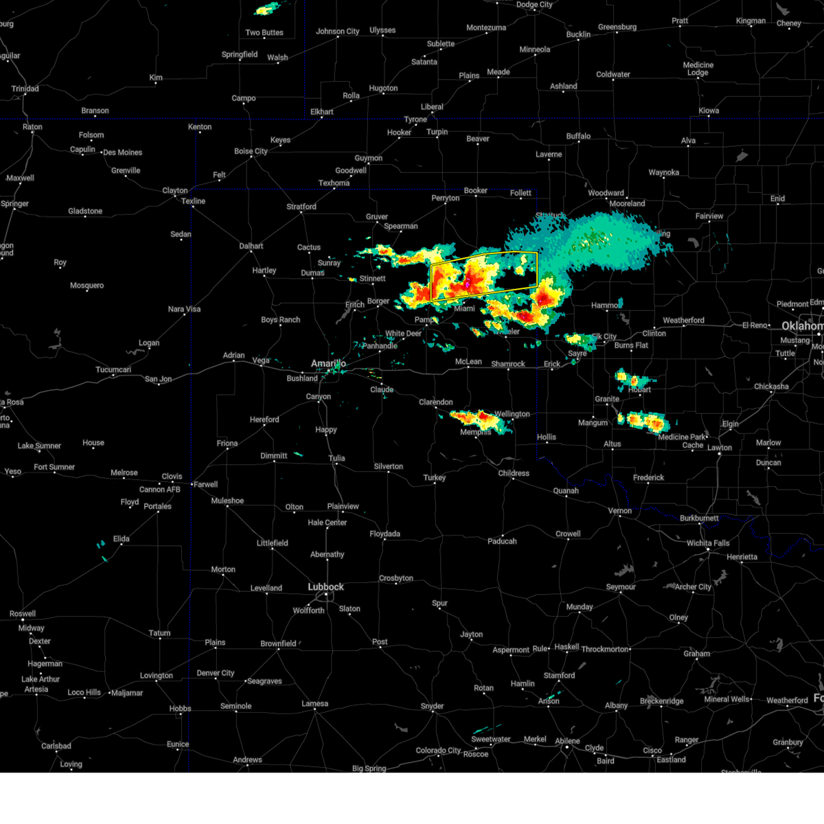
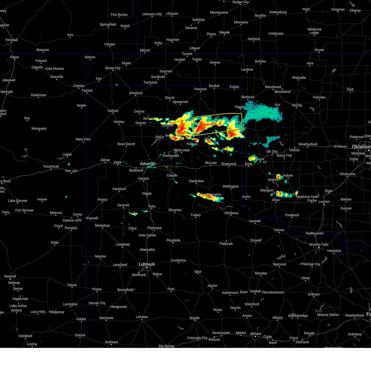
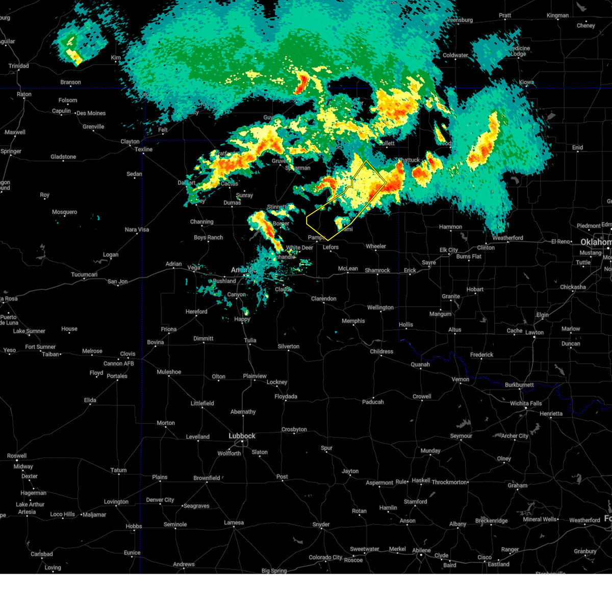
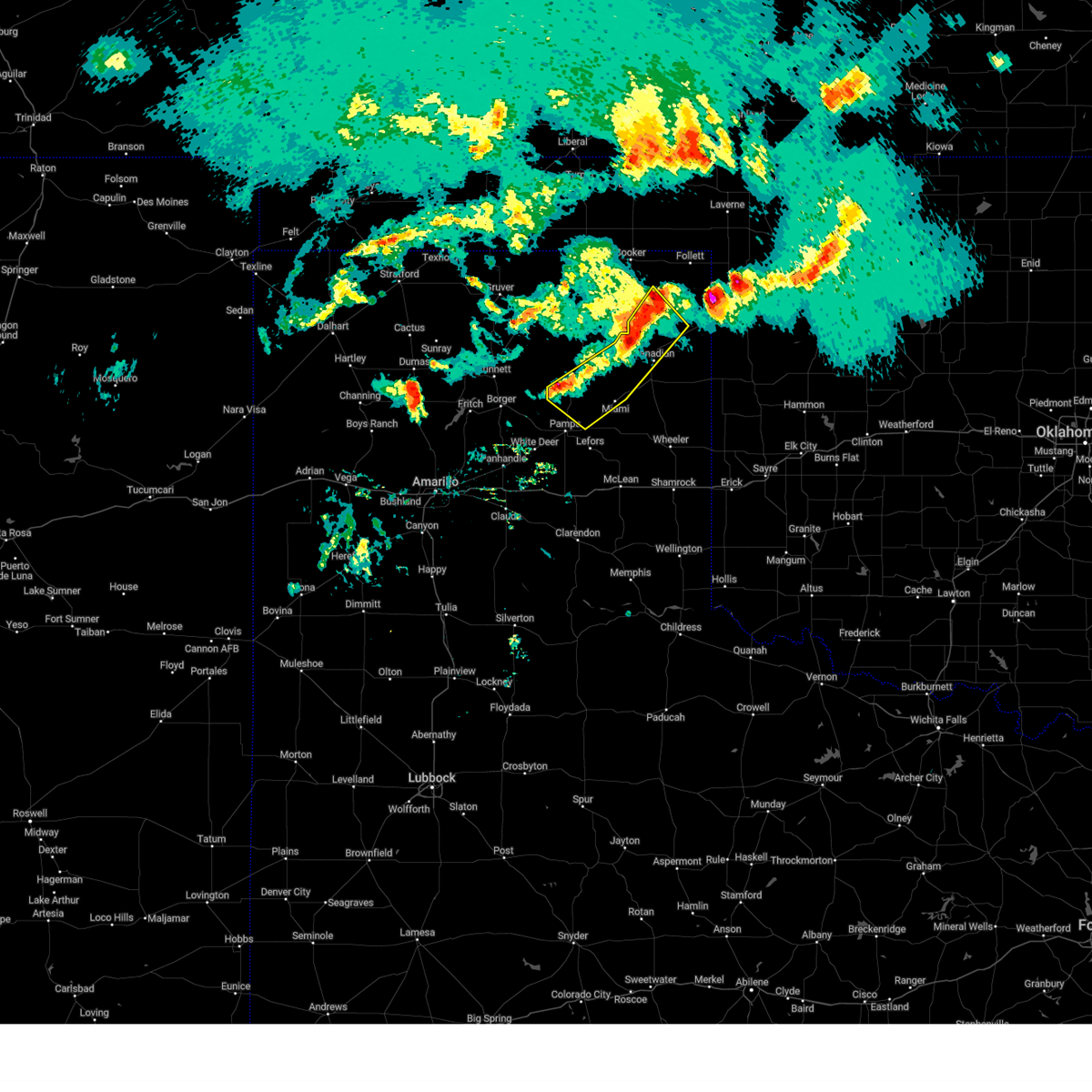
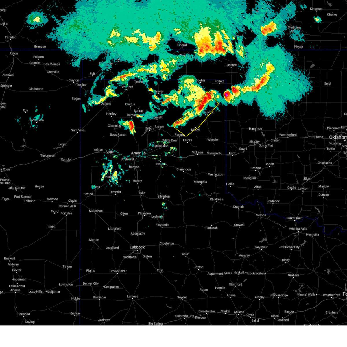
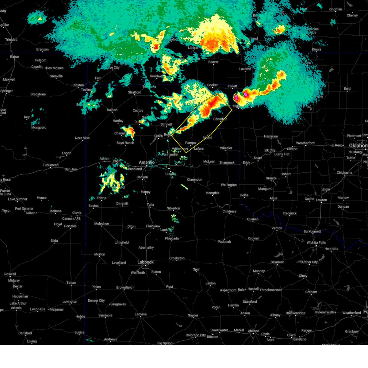
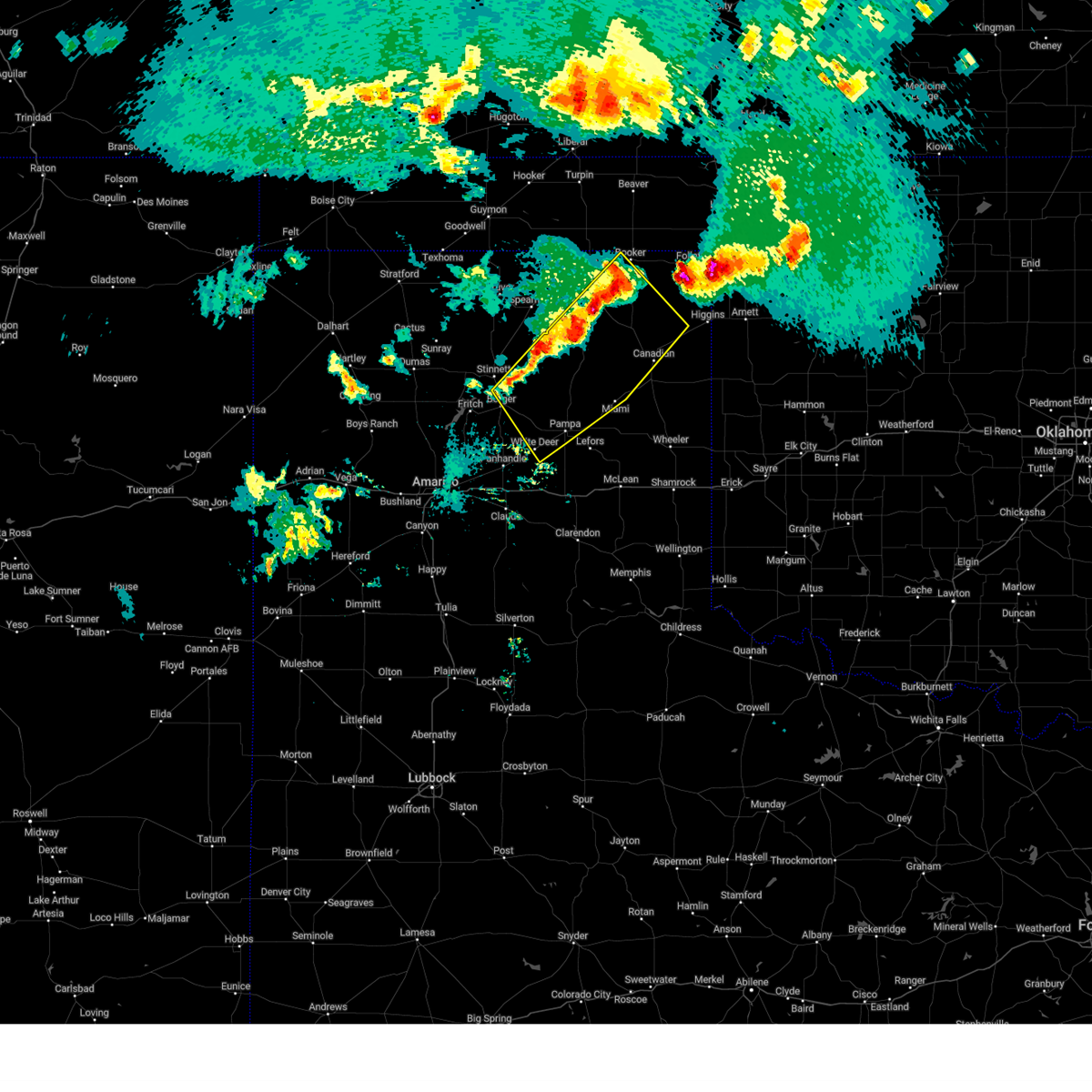
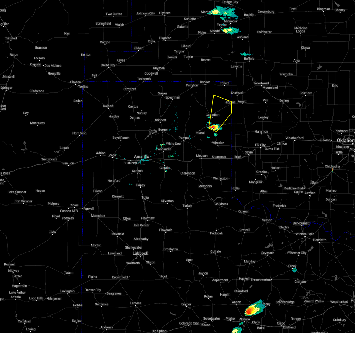
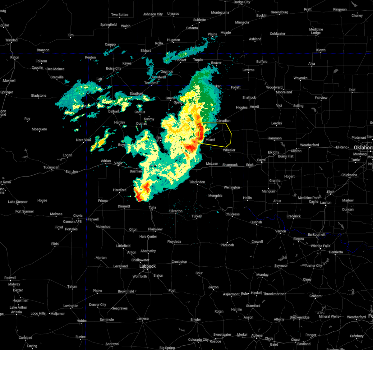
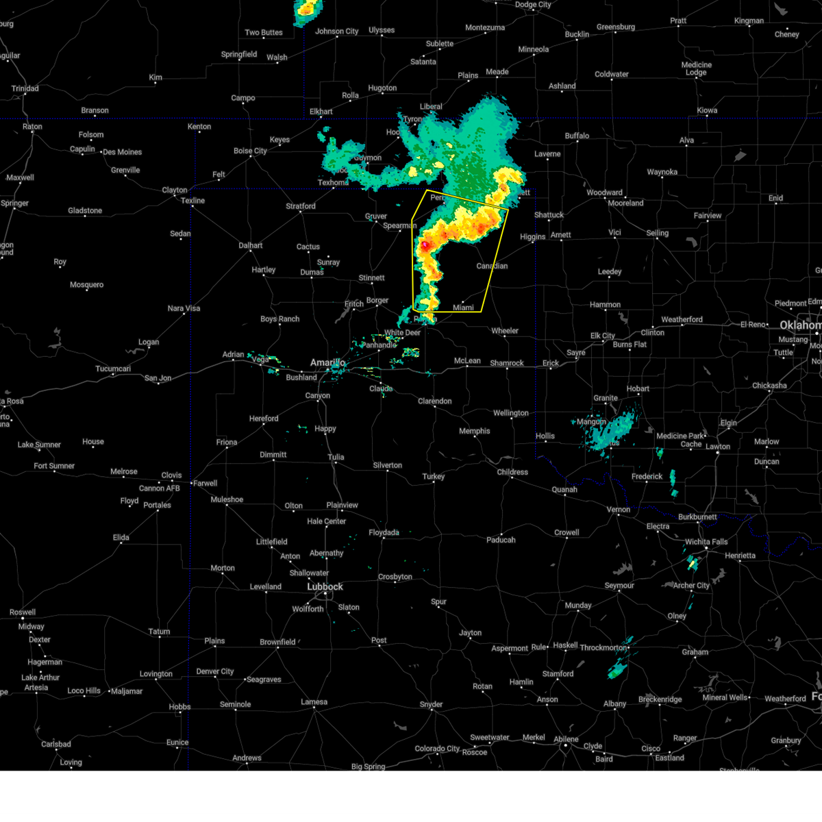
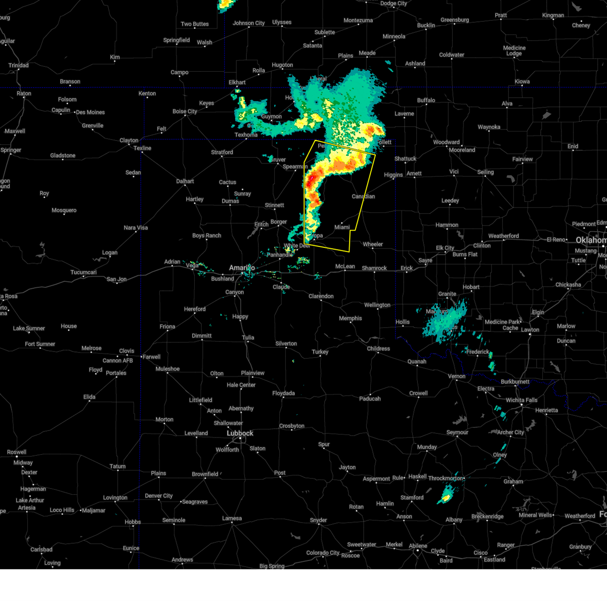
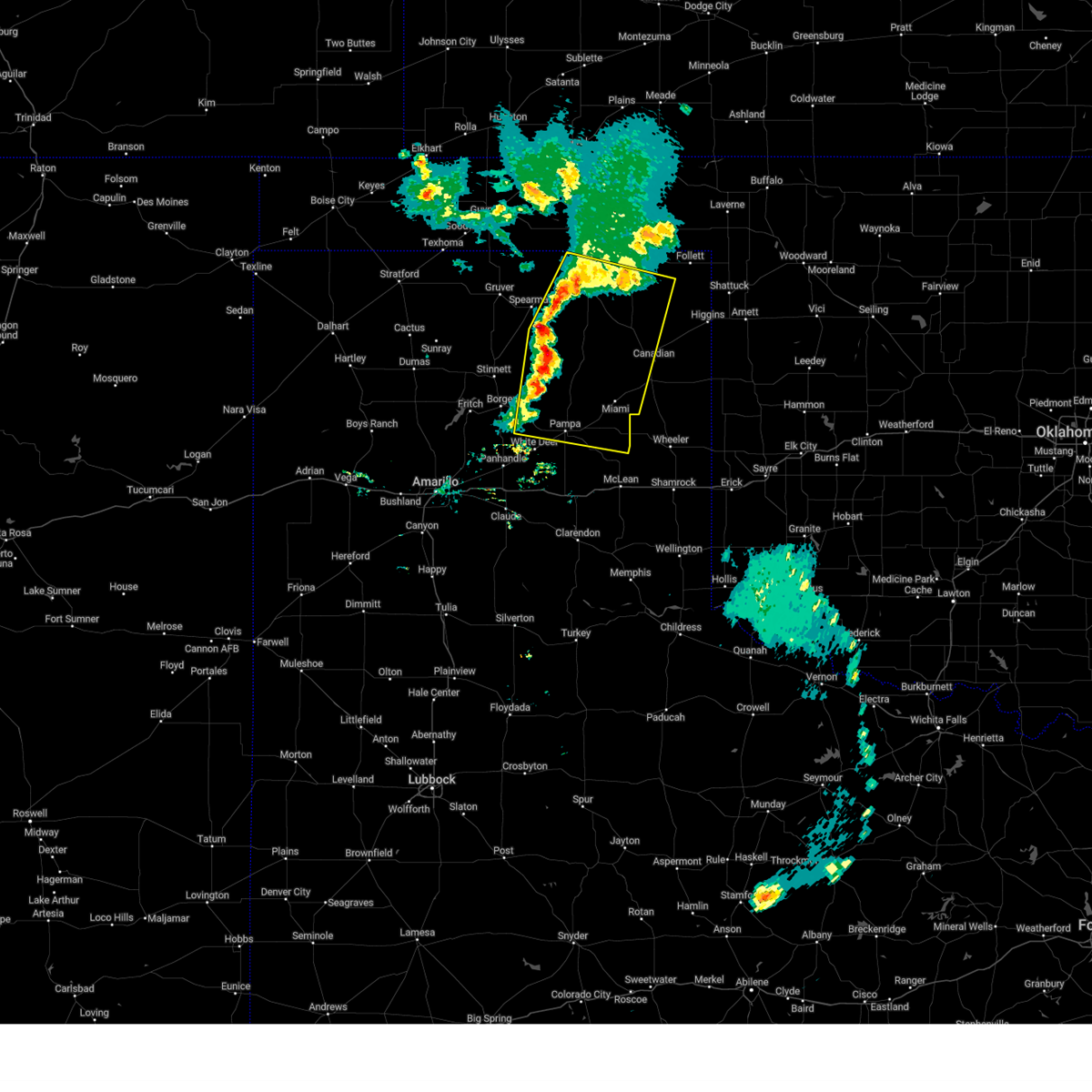
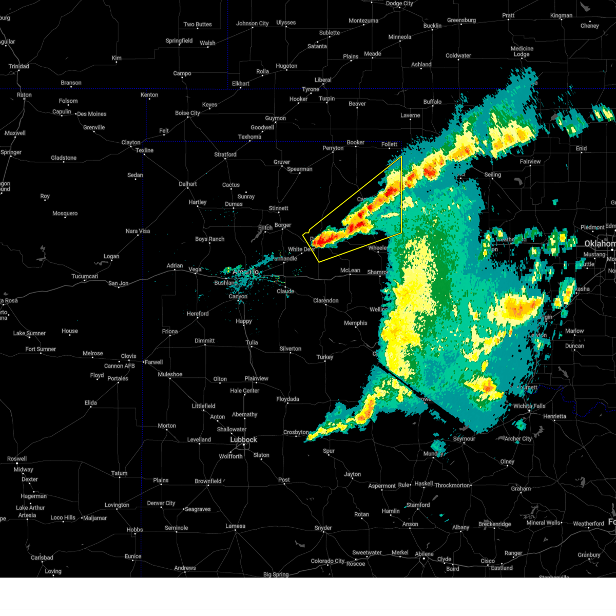
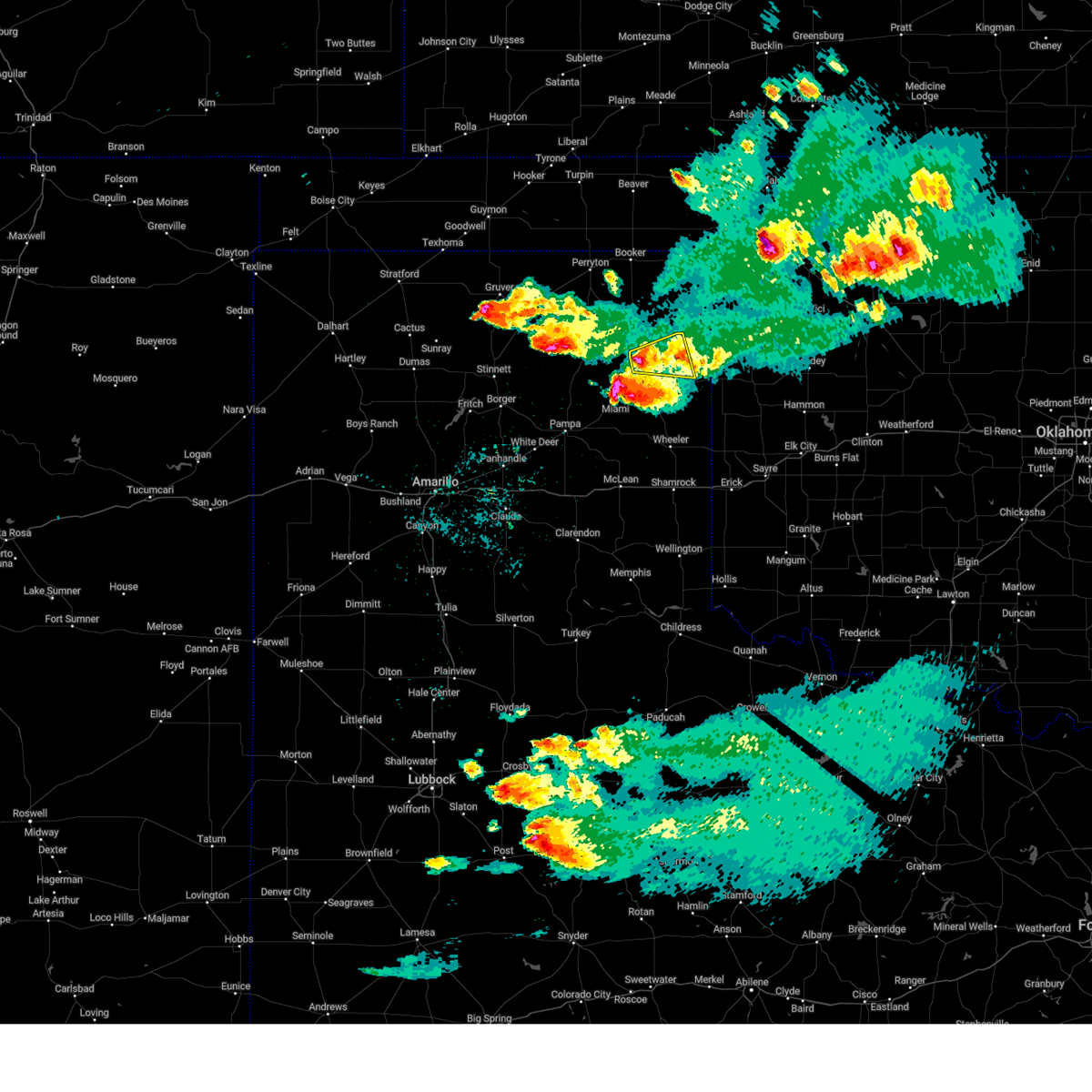
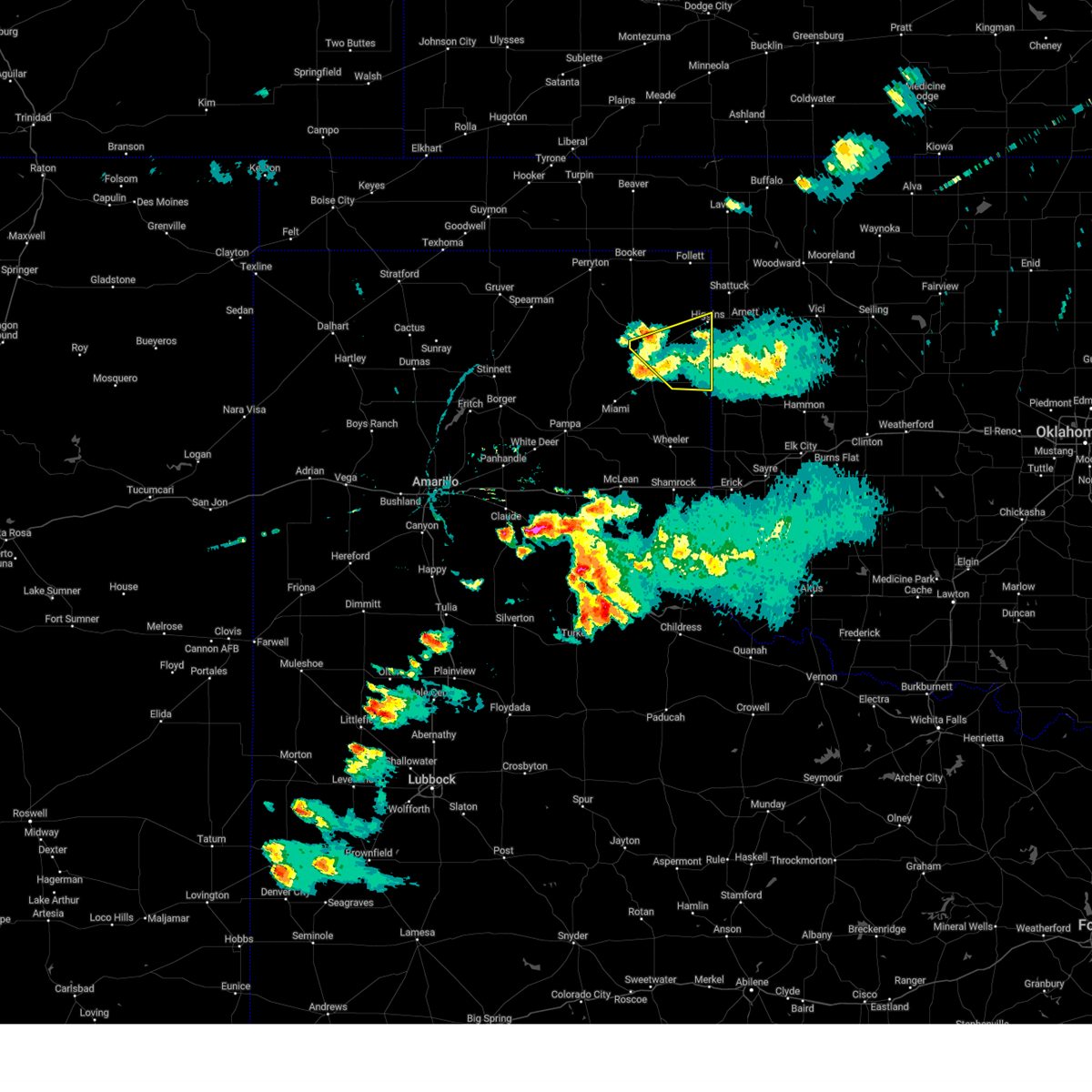
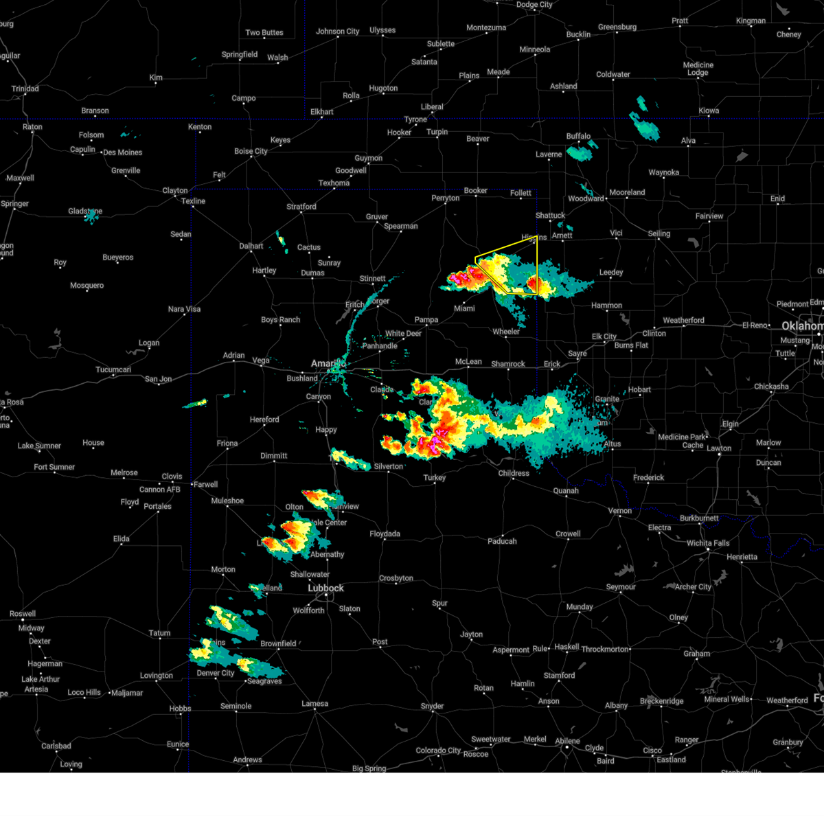
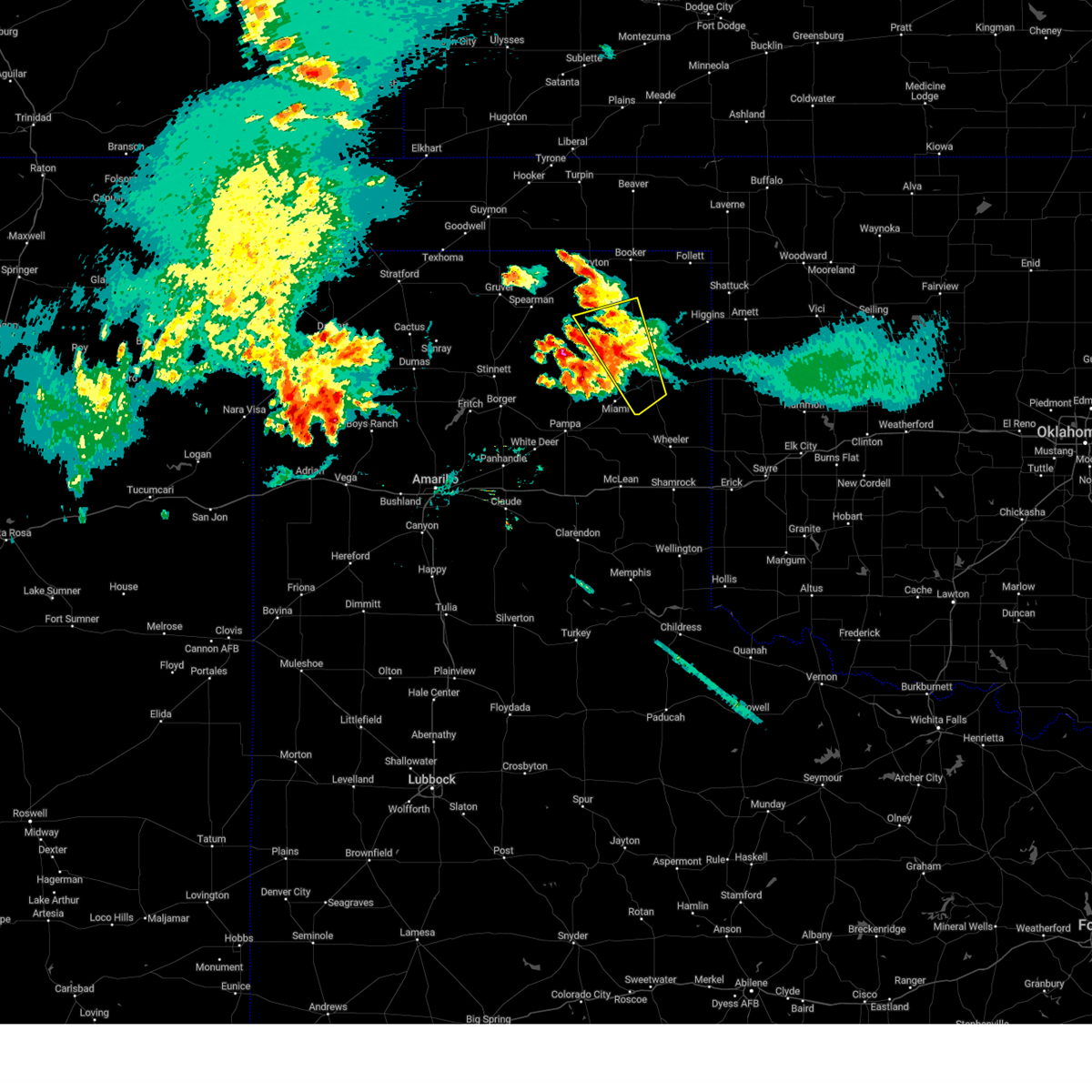
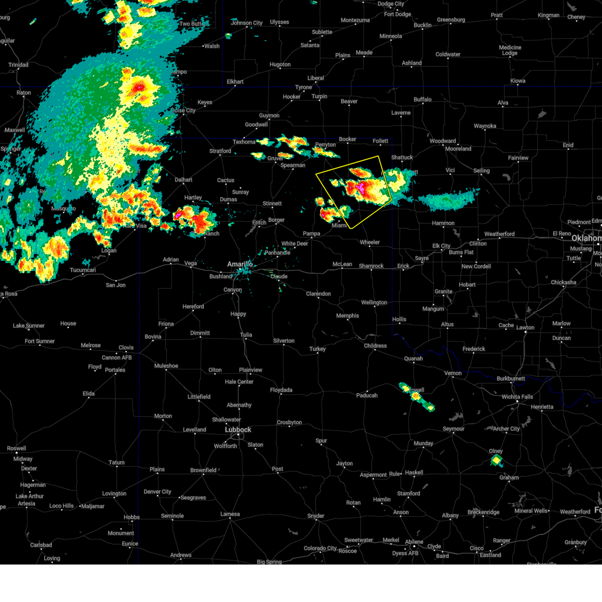
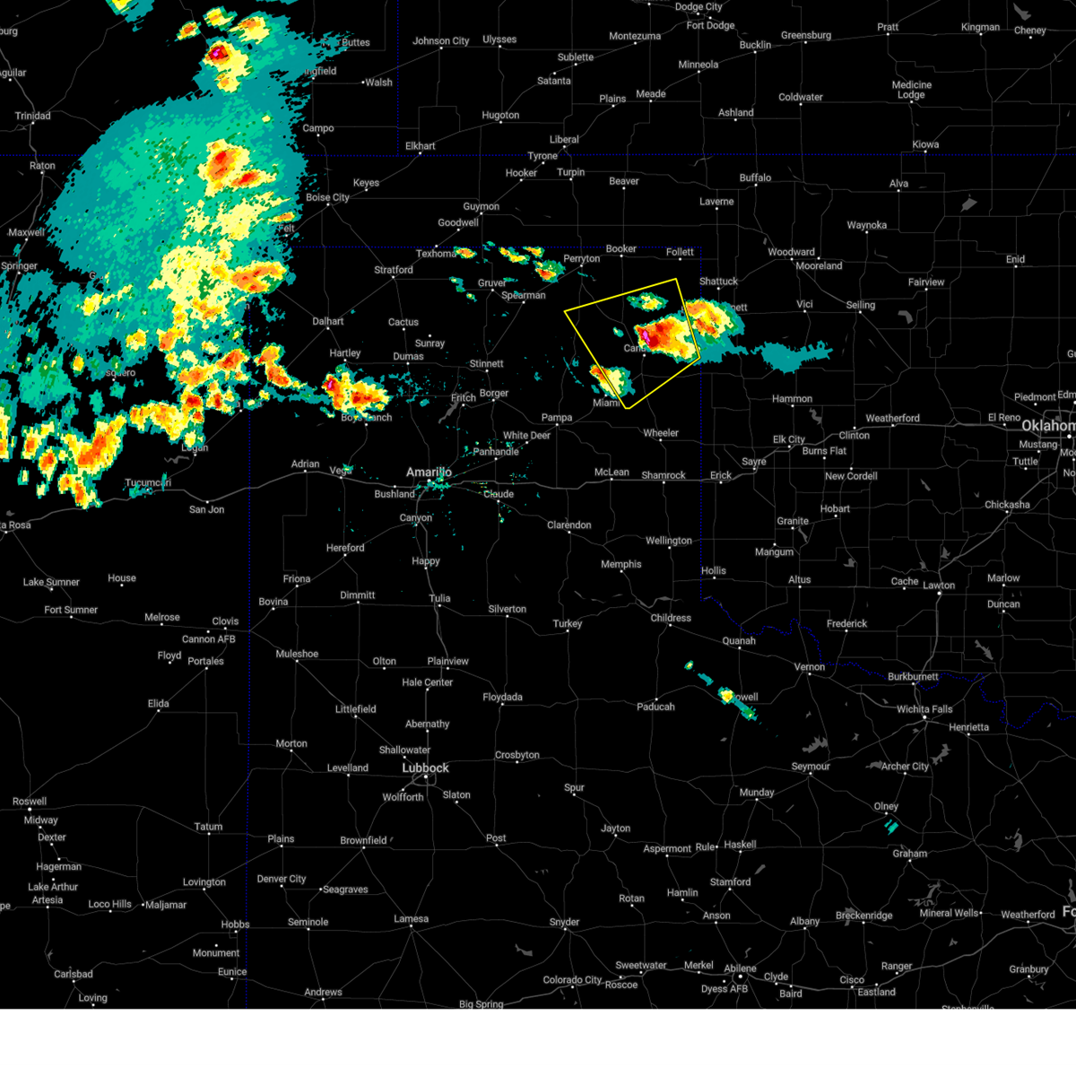
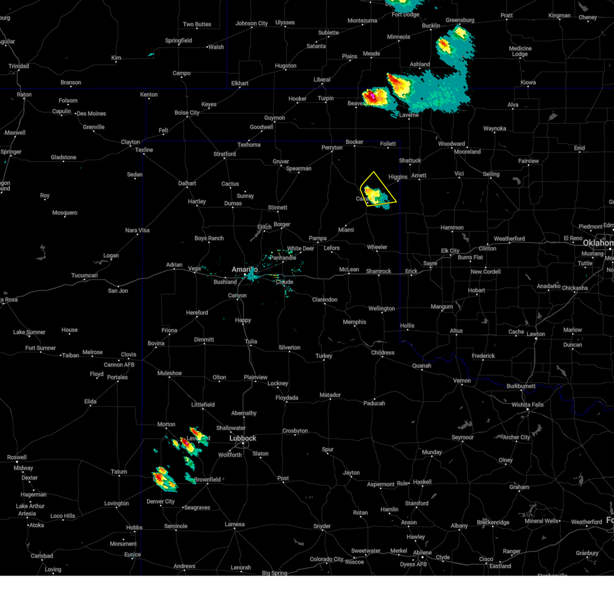
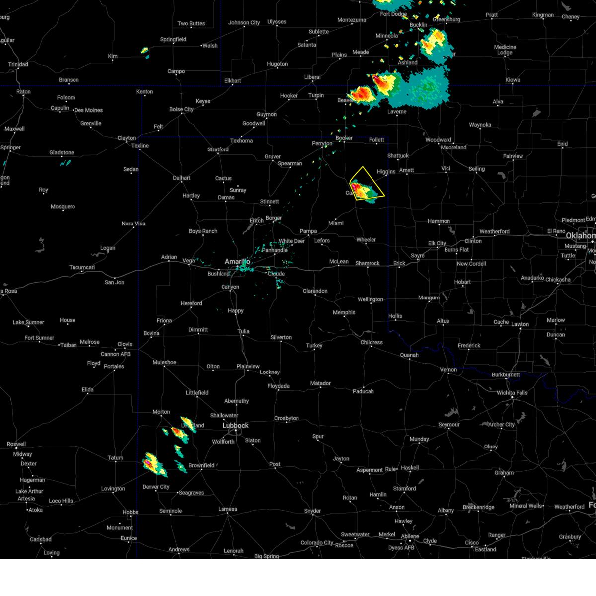
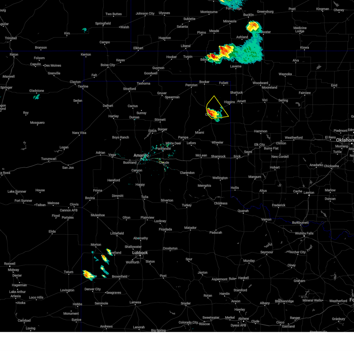
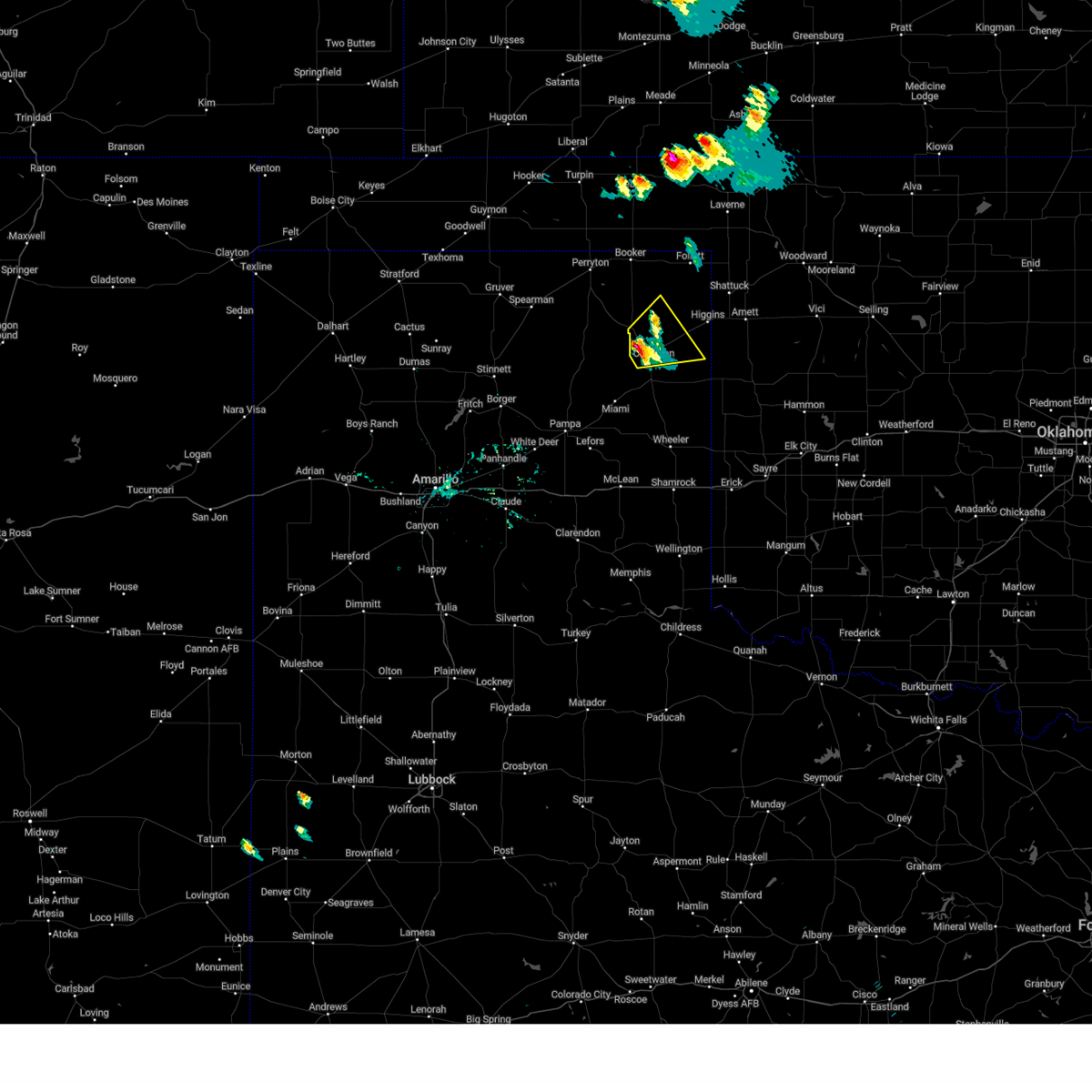
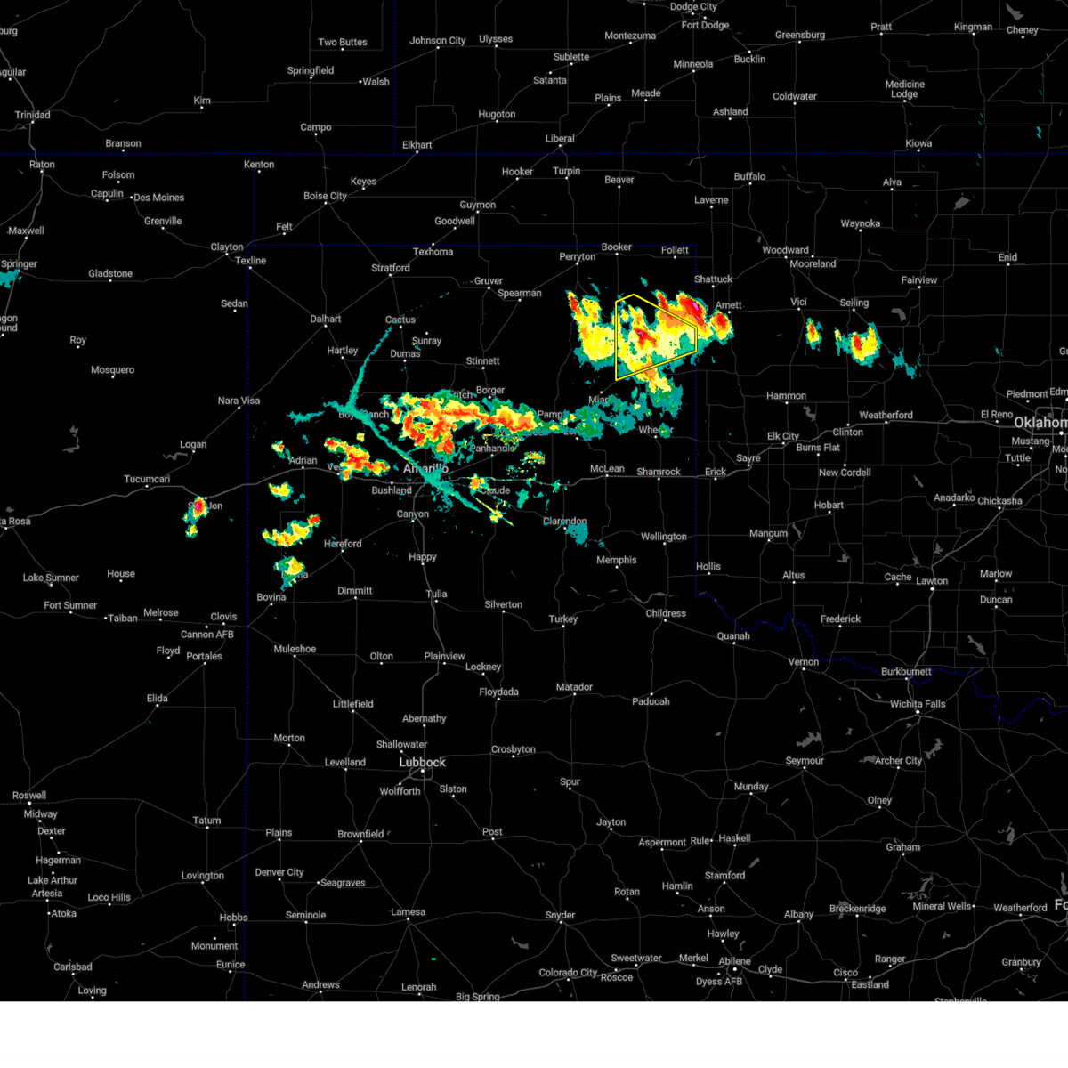
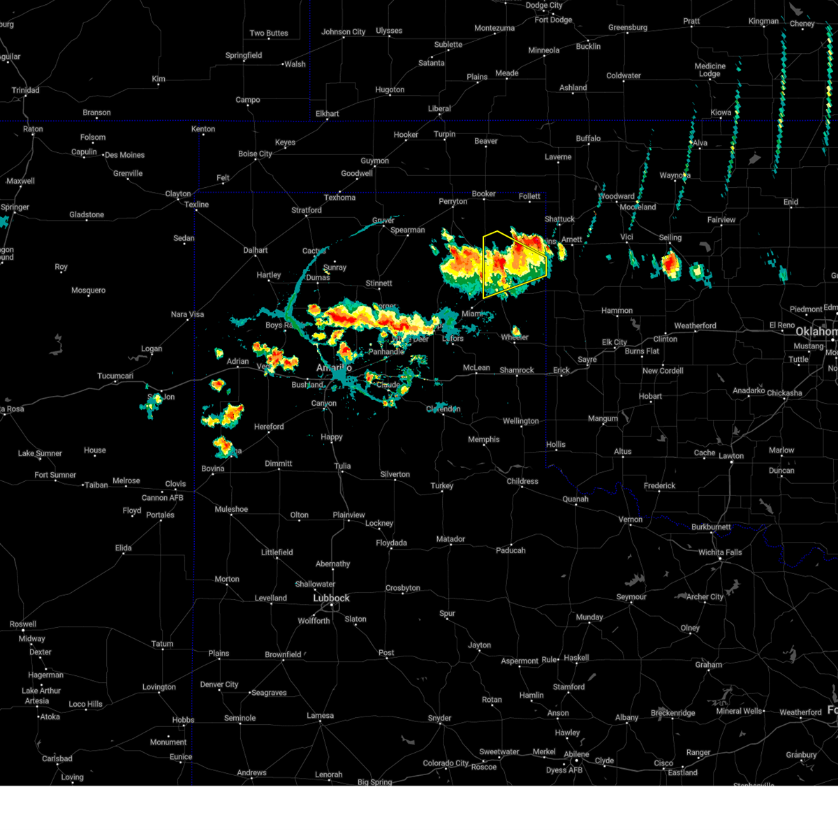
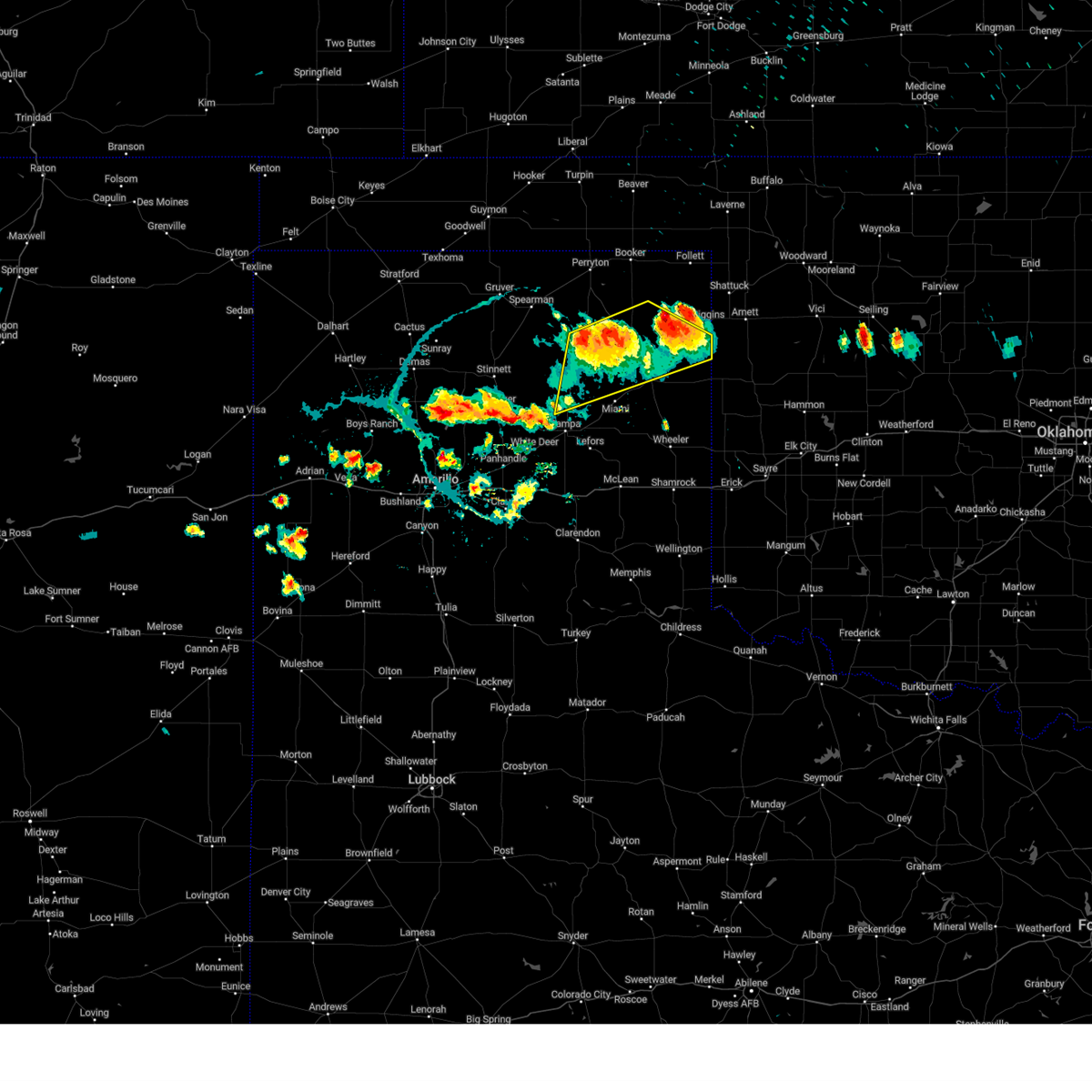
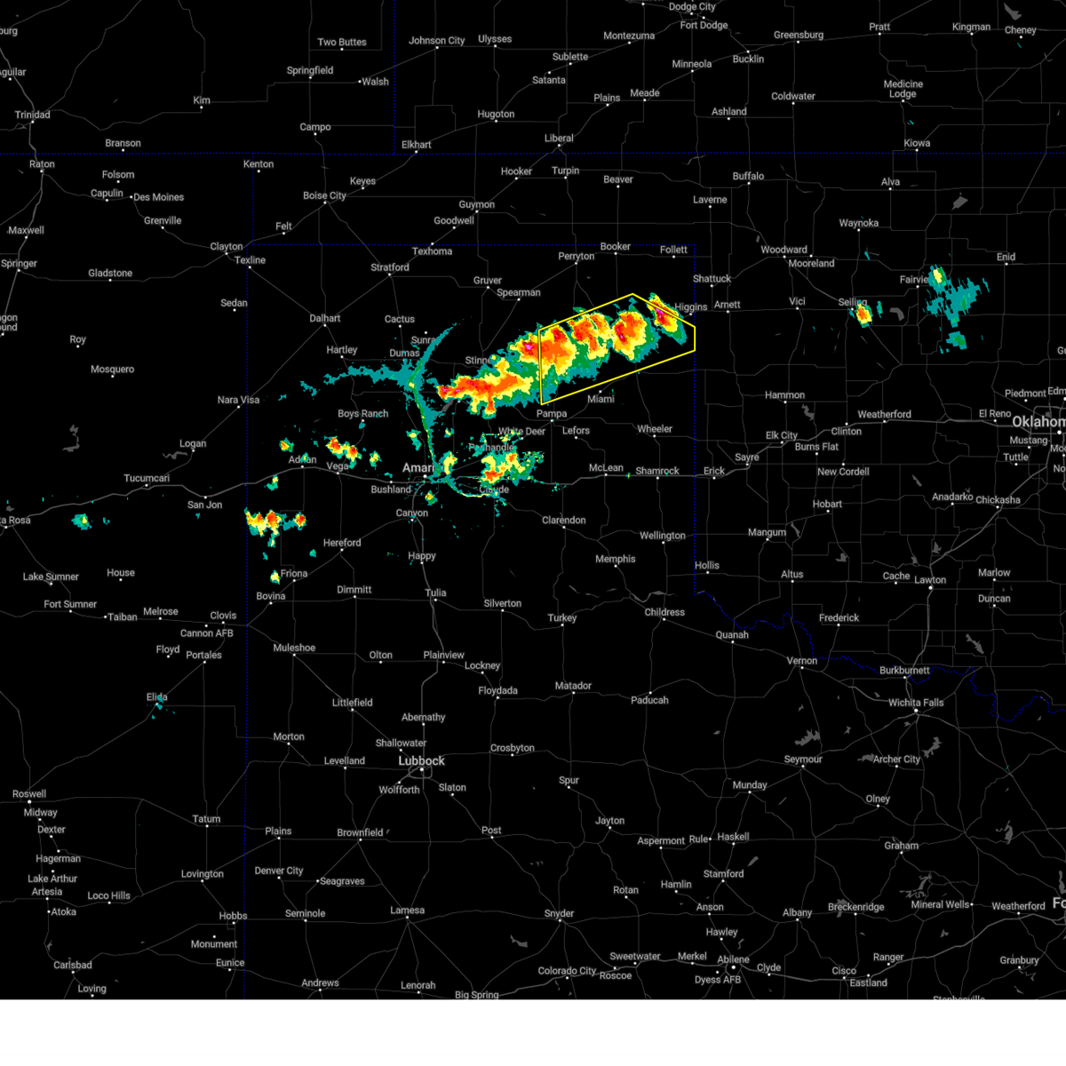
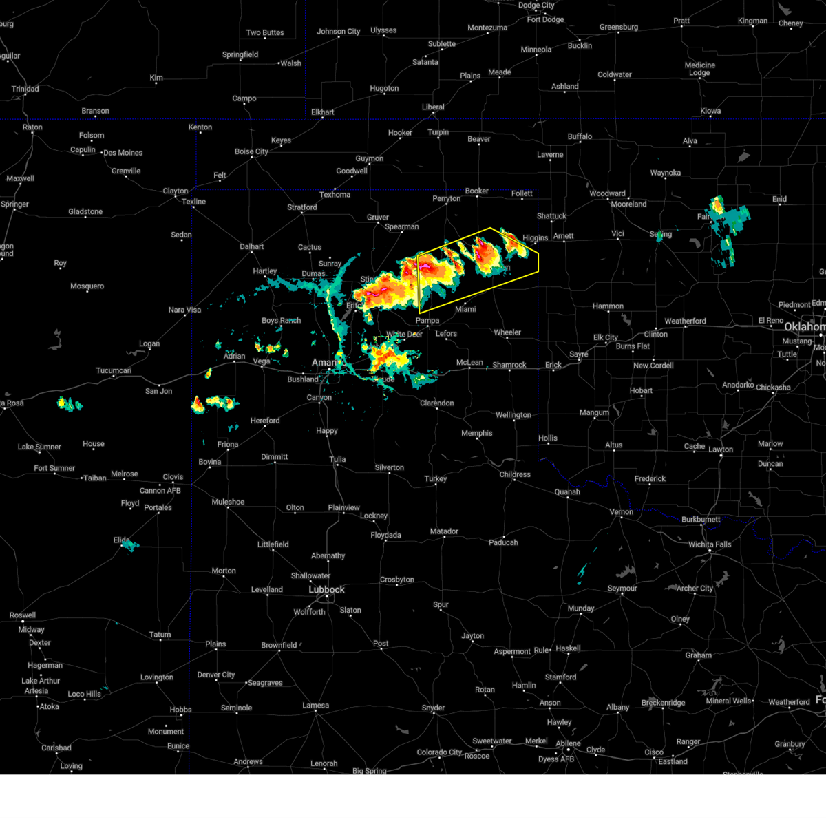
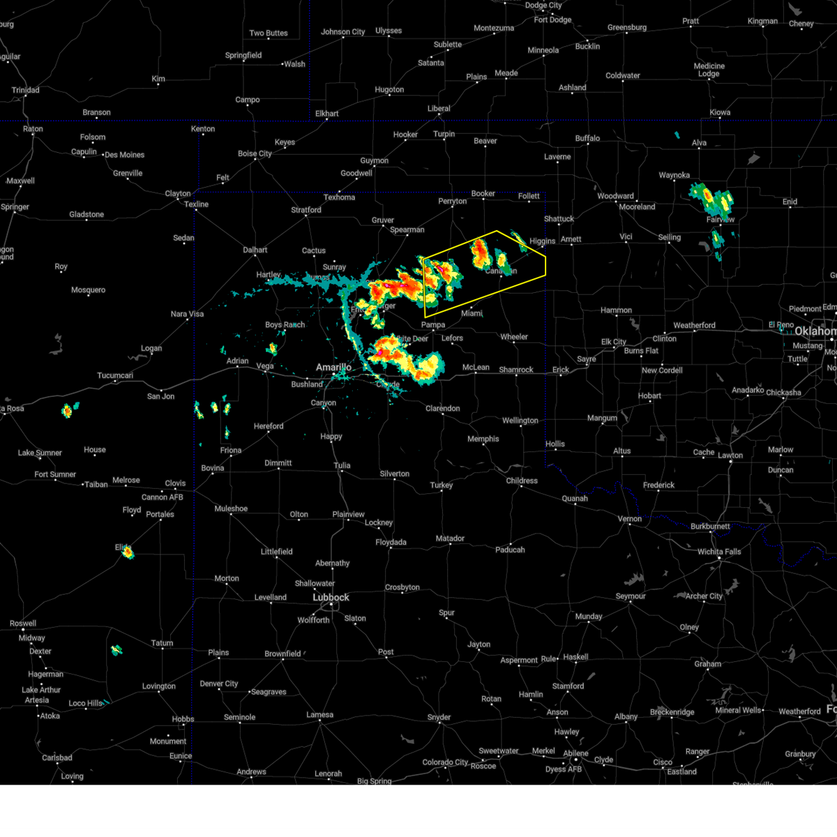
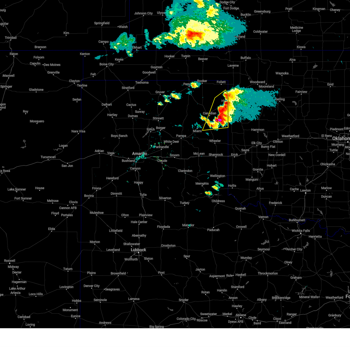
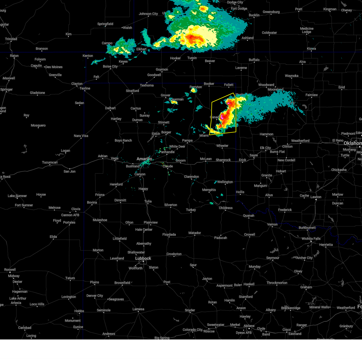
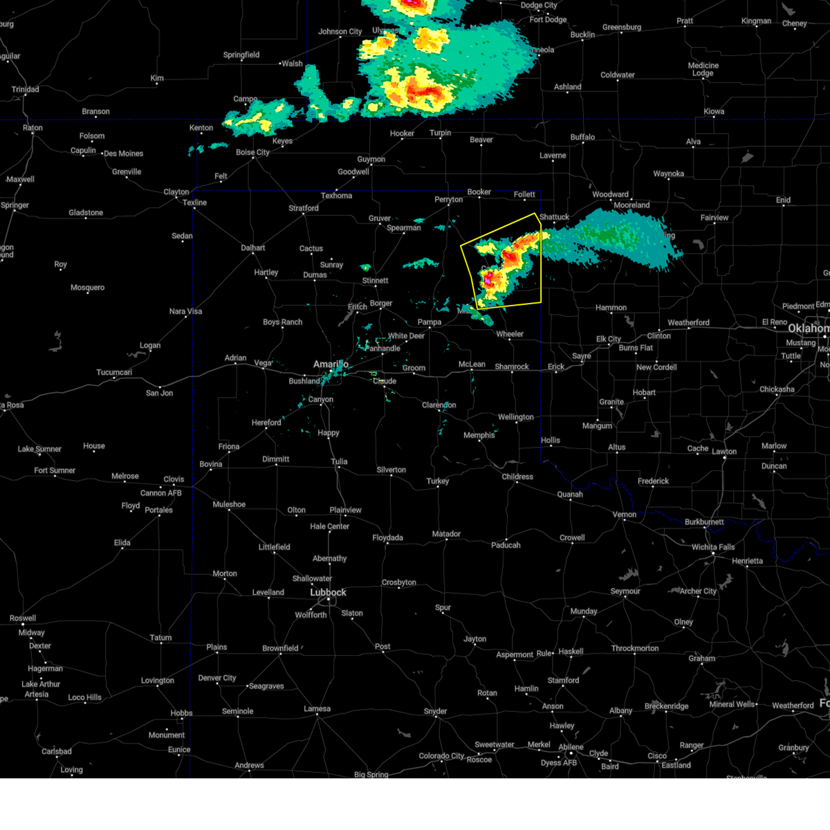
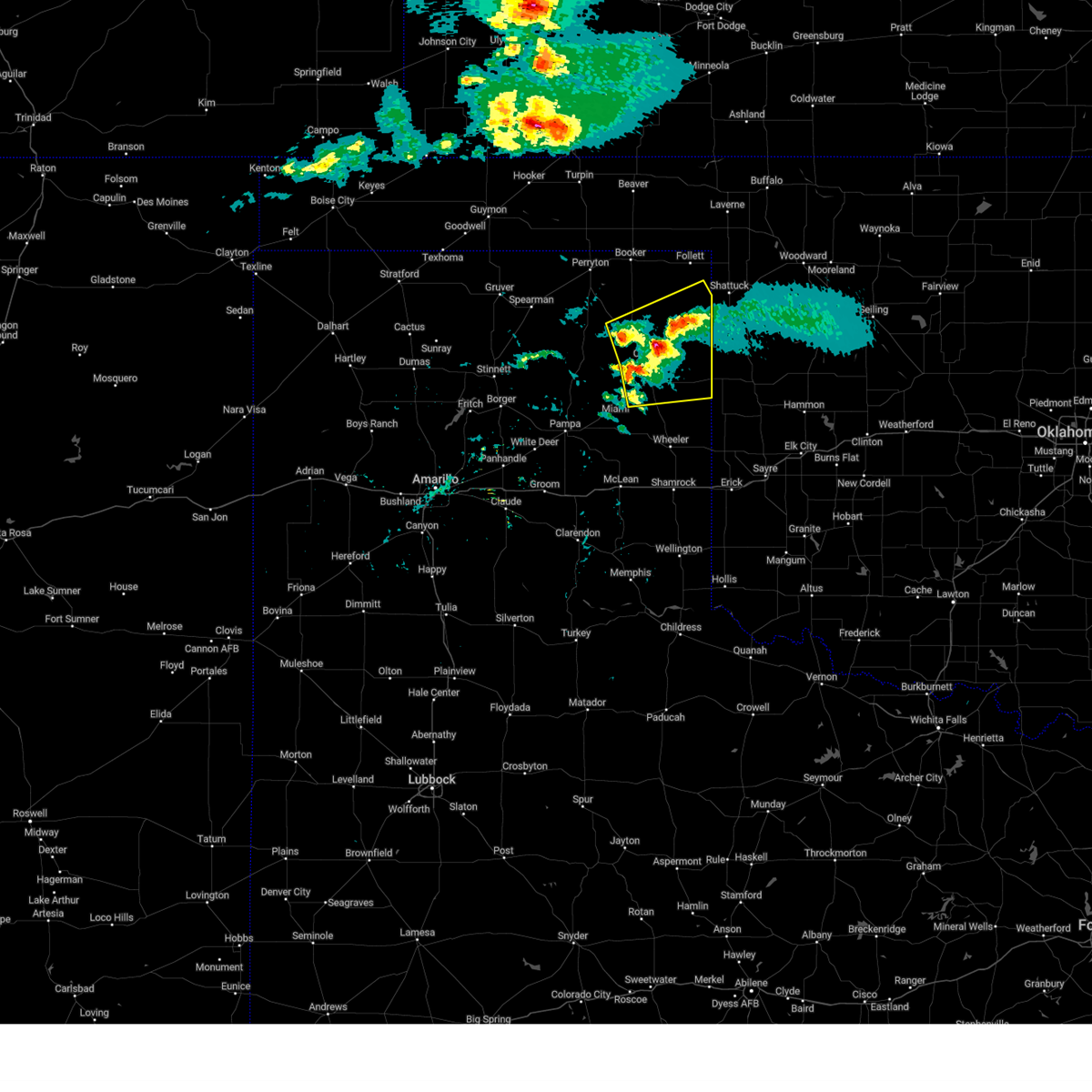
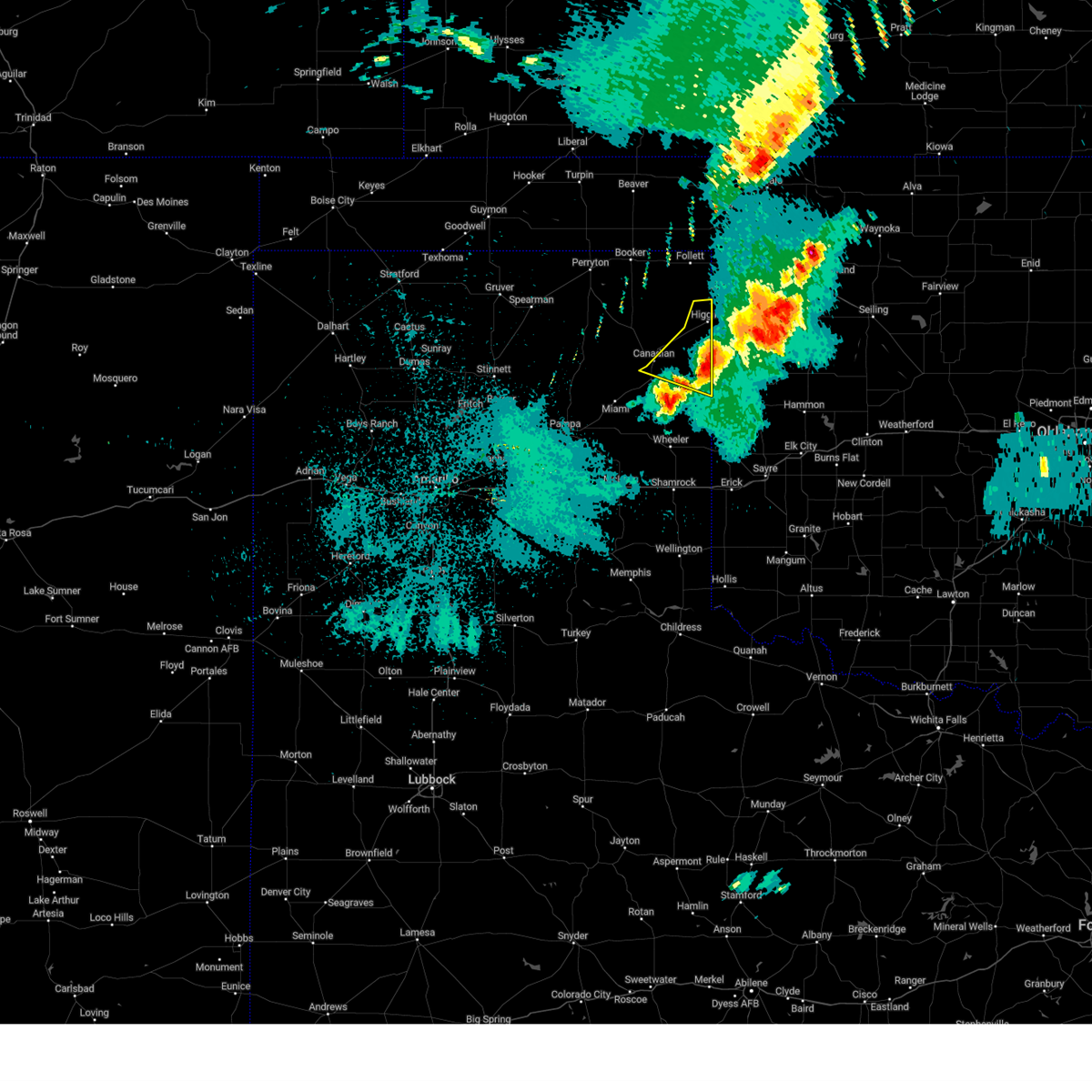
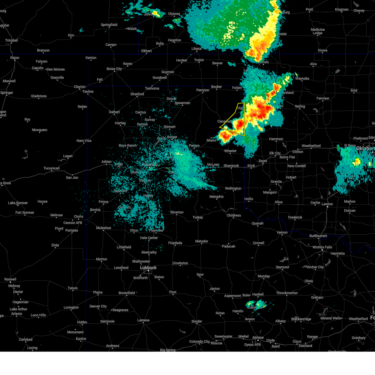
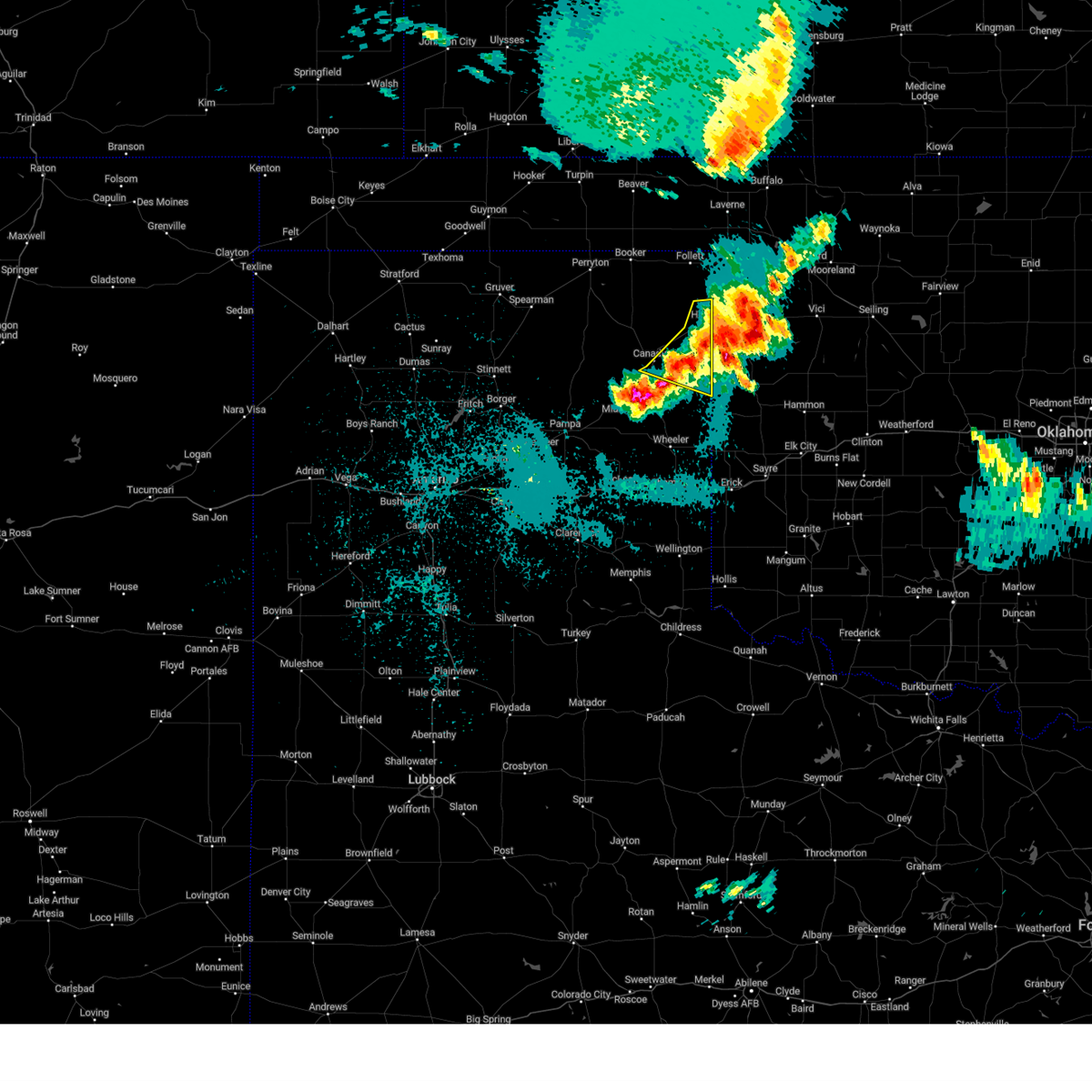
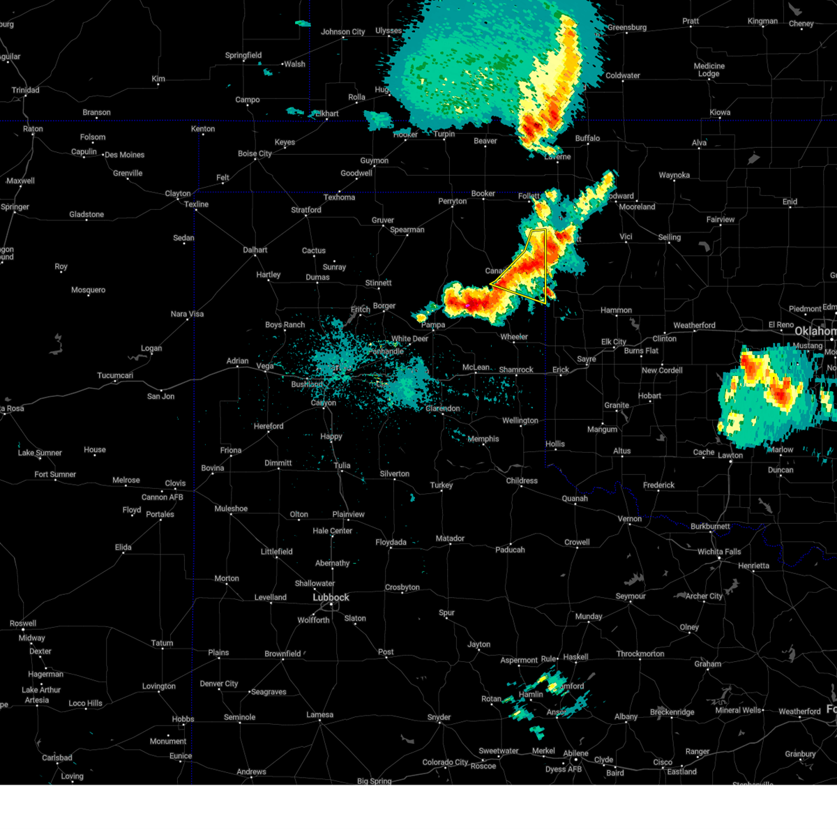
Hail Map for Canadian, TX
The Canadian, TX area has had 80 reports of on-the-ground hail by trained spotters, and has been under severe weather warnings 50 times during the past 12 months. Doppler radar has detected hail at or near Canadian, TX on 89 occasions, including 8 occasions during the past year.
| Name: | Canadian, TX |
| Where Located: | 65.8 miles SW of Woodward, OK |
| Map: | Google Map for Canadian, TX |
| Population: | 2649 |
| Housing Units: | 1068 |
| More Info: | Search Google for Canadian, TX |
1
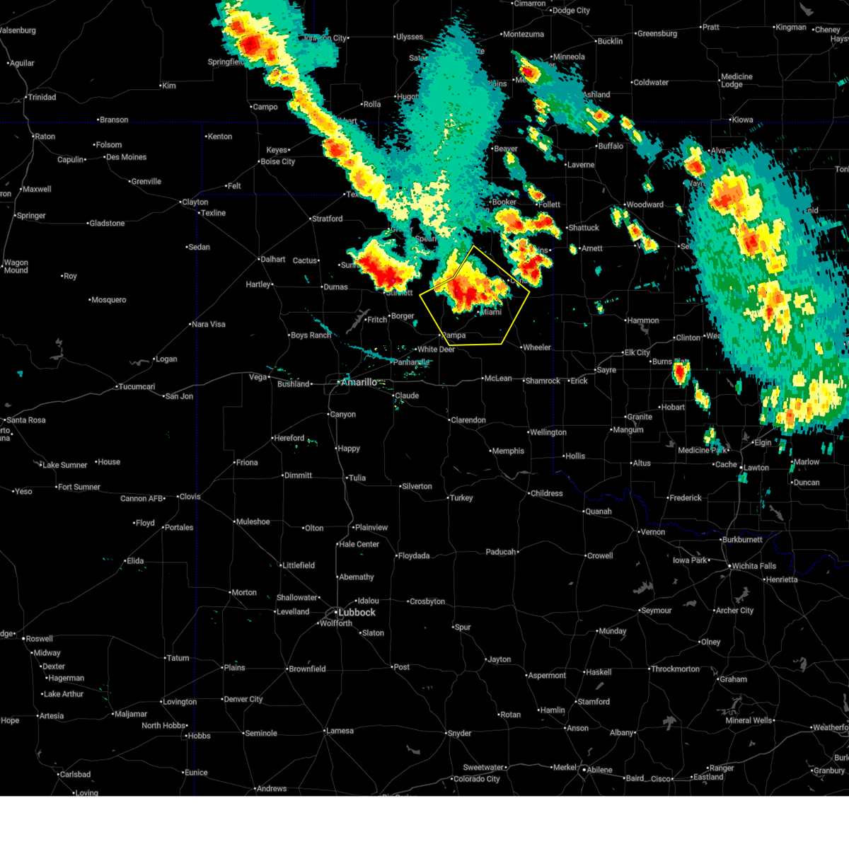
The Top Recent Hail Date for Canadian, TX is Thursday, April 24, 2025 (27th out of 89)
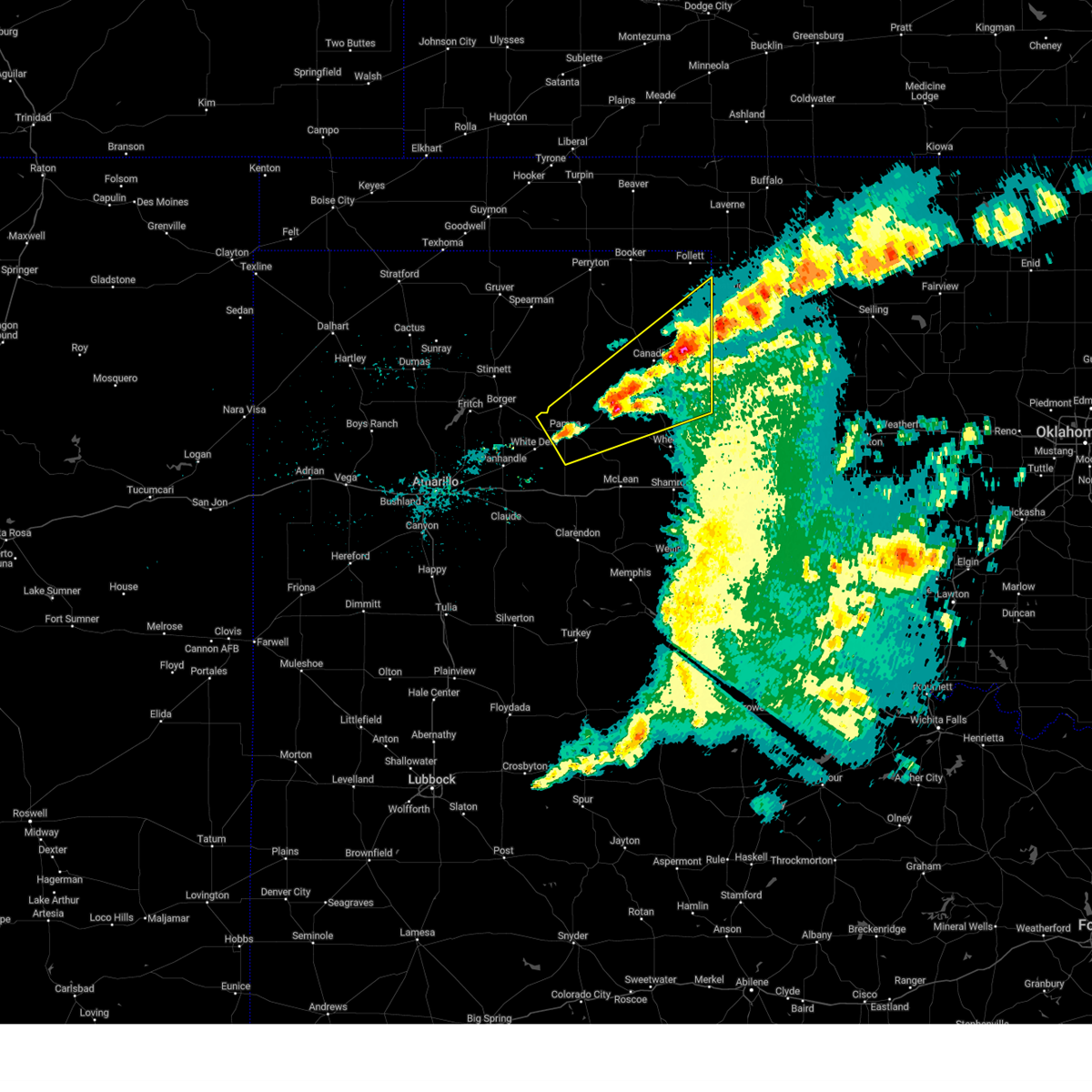
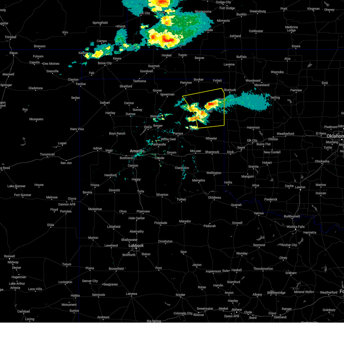
Hail and Wind Damage Spotted near Canadian, TX
| Date / Time | Report Details |
|---|---|
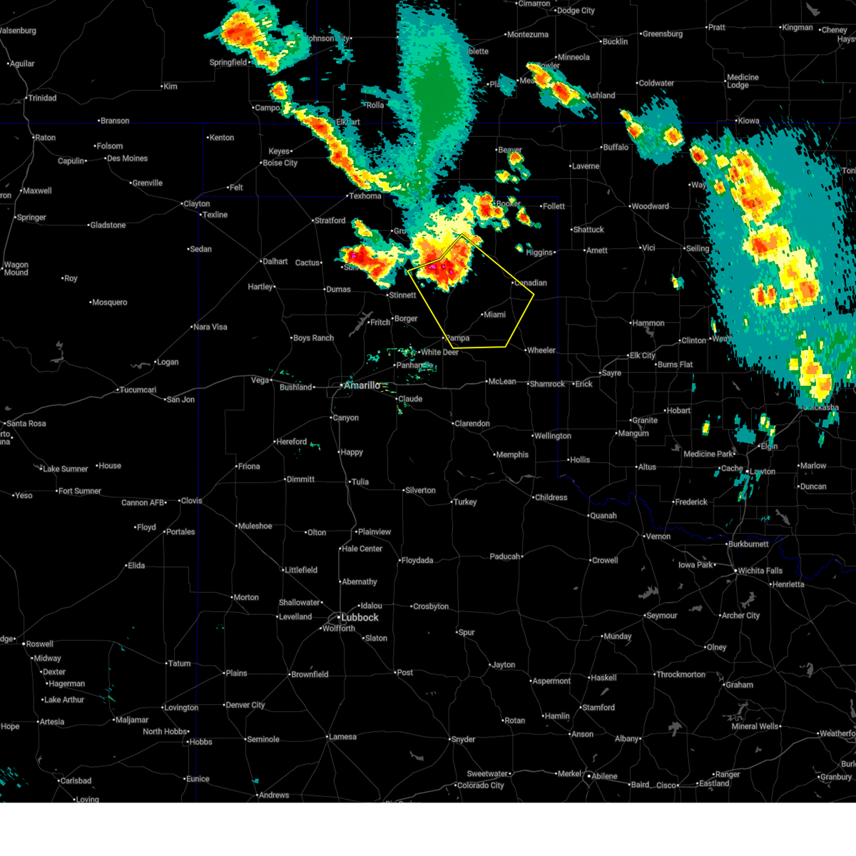
| 6/15/2025 5:09 AM CDT |
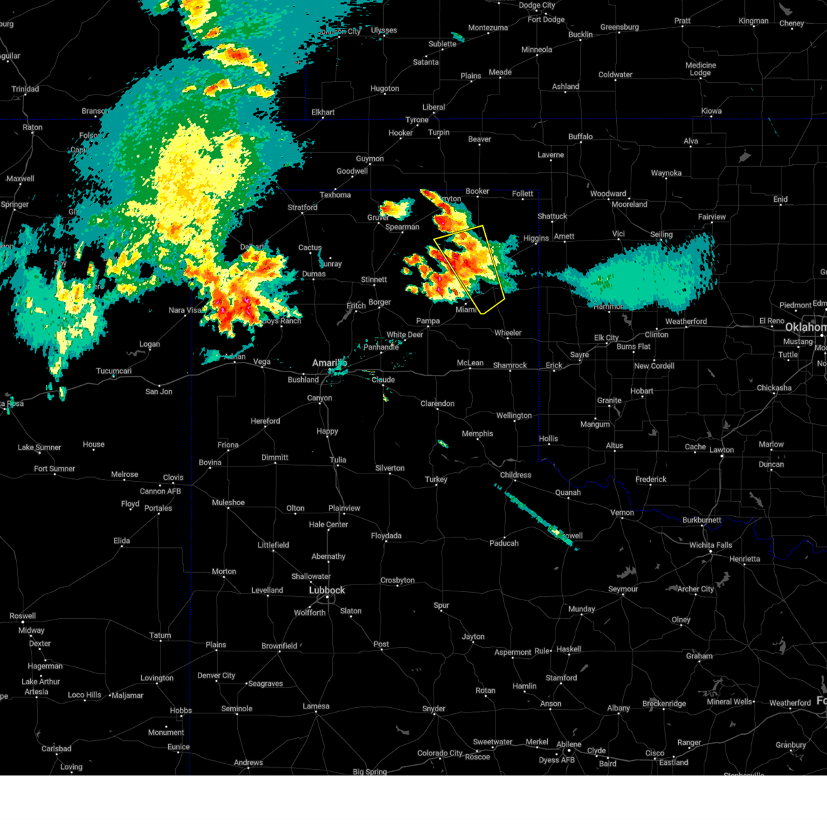
 At 509 am cdt, severe thunderstorms were located along a line extending from 7 miles west of canadian to miami to 10 miles northwest of codman, moving southeast at 40 mph (radar indicated). Hazards include 60 mph wind gusts and nickel size hail. Minor damage to roofs, siding, and trees is possible. Locations impacted include, new mobeetie, canadian, lora, mobeetie, codman, miami, and pampa. At 509 am cdt, severe thunderstorms were located along a line extending from 7 miles west of canadian to miami to 10 miles northwest of codman, moving southeast at 40 mph (radar indicated). Hazards include 60 mph wind gusts and nickel size hail. Minor damage to roofs, siding, and trees is possible. Locations impacted include, new mobeetie, canadian, lora, mobeetie, codman, miami, and pampa.
|
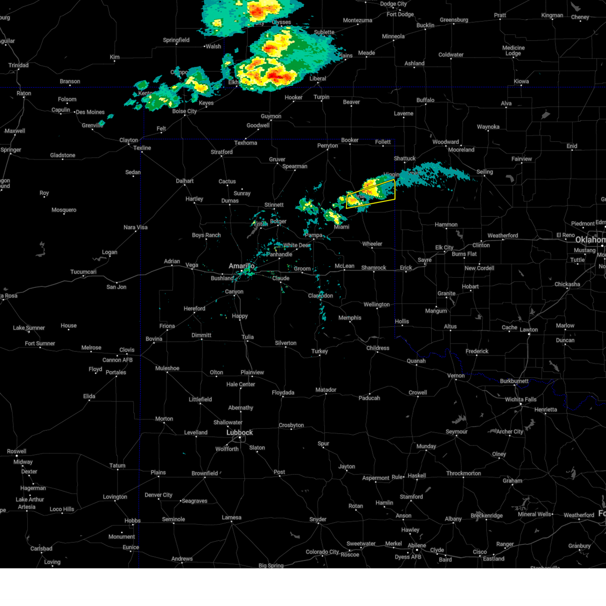
| 6/15/2025 4:37 AM CDT |
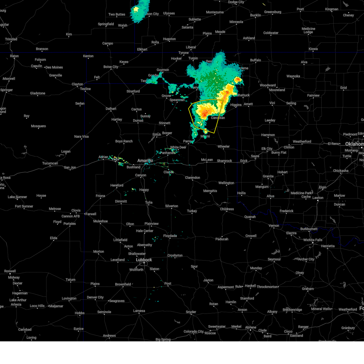
 Svrama the national weather service in amarillo has issued a * severe thunderstorm warning for, northwestern wheeler county in the panhandle of texas, northeastern hutchinson county in the panhandle of texas, northeastern gray county in the panhandle of texas, roberts county in the panhandle of texas, western hemphill county in the panhandle of texas, southeastern ochiltree county in the panhandle of texas, * until 530 am cdt. * at 437 am cdt, severe thunderstorms were located along a line extending from 7 miles southwest of wolf creek park to 22 miles northwest of codman to 15 miles east of pringle, moving southeast at 35 mph (radar indicated). Hazards include 60 mph wind gusts and nickel size hail. minor damage to roofs, siding, and trees is possible Svrama the national weather service in amarillo has issued a * severe thunderstorm warning for, northwestern wheeler county in the panhandle of texas, northeastern hutchinson county in the panhandle of texas, northeastern gray county in the panhandle of texas, roberts county in the panhandle of texas, western hemphill county in the panhandle of texas, southeastern ochiltree county in the panhandle of texas, * until 530 am cdt. * at 437 am cdt, severe thunderstorms were located along a line extending from 7 miles southwest of wolf creek park to 22 miles northwest of codman to 15 miles east of pringle, moving southeast at 35 mph (radar indicated). Hazards include 60 mph wind gusts and nickel size hail. minor damage to roofs, siding, and trees is possible
|
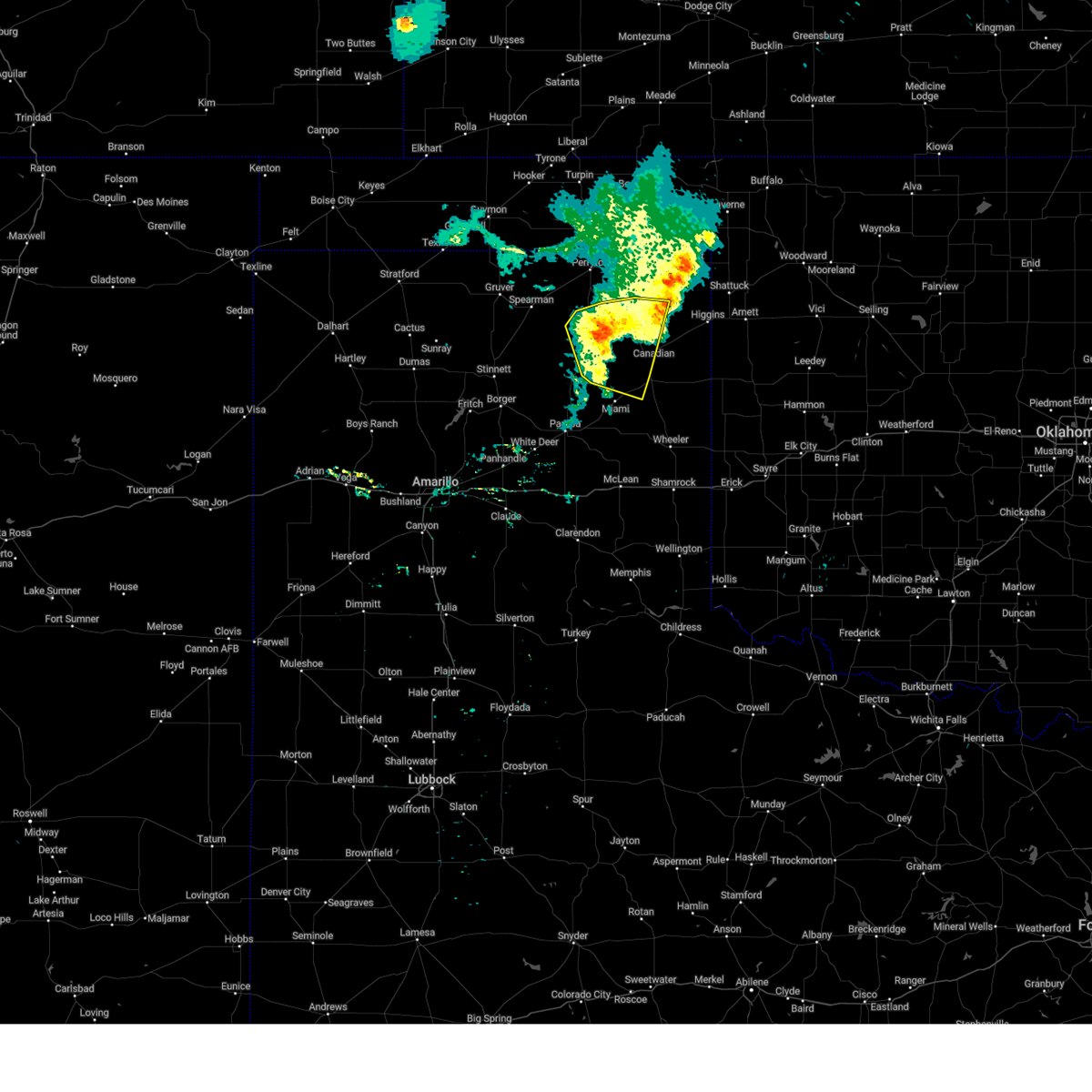
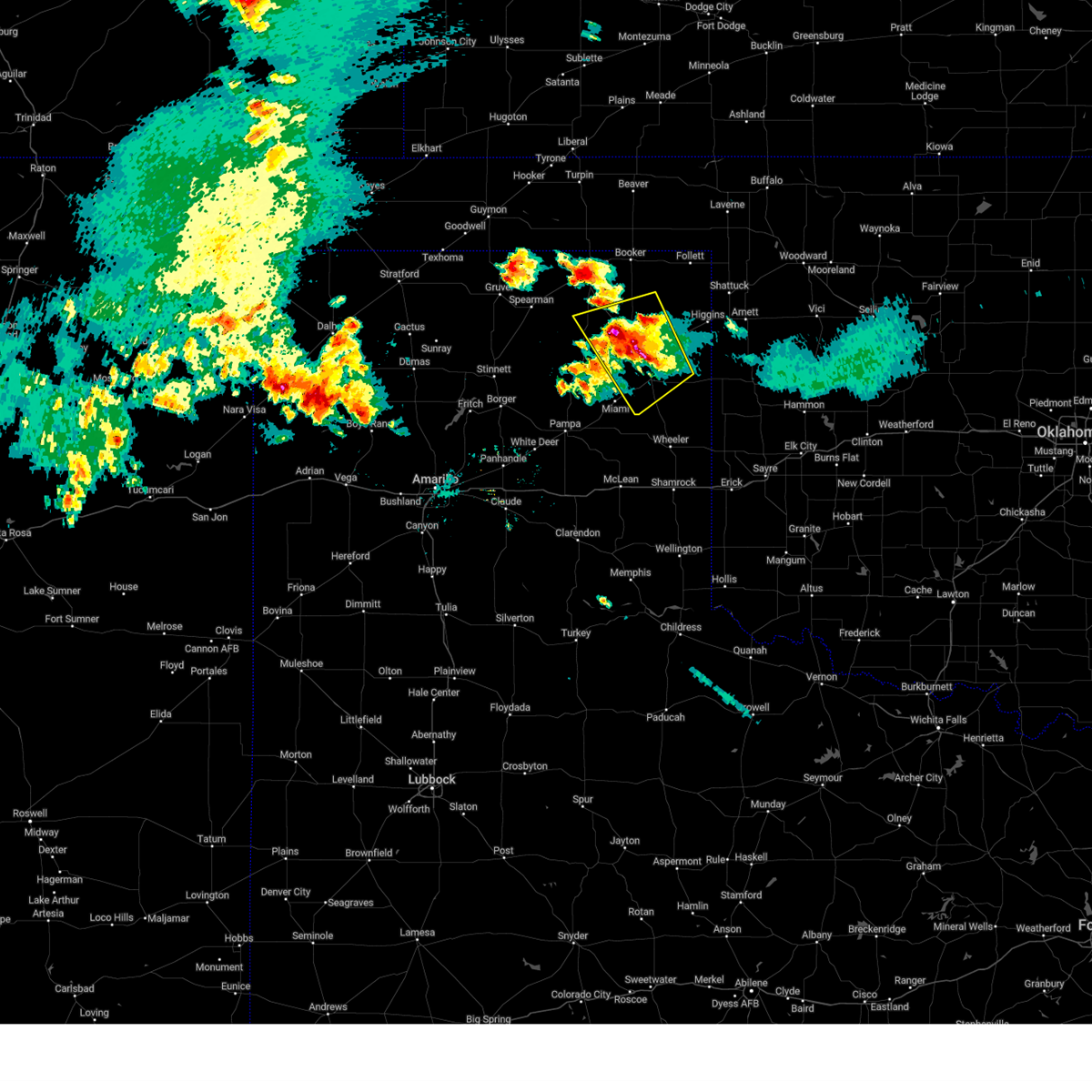
| 6/7/2025 1:44 AM CDT |
 At 144 am cdt, a severe thunderstorm was located over allison, or 23 miles southeast of canadian, moving east at 45 mph. this is a destructive storm for allison and briscoe (radar indicated). Hazards include 90 mph wind gusts and quarter size hail. You are in a life-threatening situation. flying debris may be deadly to those caught without shelter. mobile homes will be heavily damaged or destroyed. homes and businesses will have substantial roof and window damage. expect extensive tree damage and power outages. Locations impacted include, new mobeetie, canadian, twitty, mobeetie, allison, wheeler, lake marvin, kellerville, and briscoe. At 144 am cdt, a severe thunderstorm was located over allison, or 23 miles southeast of canadian, moving east at 45 mph. this is a destructive storm for allison and briscoe (radar indicated). Hazards include 90 mph wind gusts and quarter size hail. You are in a life-threatening situation. flying debris may be deadly to those caught without shelter. mobile homes will be heavily damaged or destroyed. homes and businesses will have substantial roof and window damage. expect extensive tree damage and power outages. Locations impacted include, new mobeetie, canadian, twitty, mobeetie, allison, wheeler, lake marvin, kellerville, and briscoe.
|
| 6/7/2025 1:31 AM CDT |
 the severe thunderstorm warning has been cancelled and is no longer in effect the severe thunderstorm warning has been cancelled and is no longer in effect
|
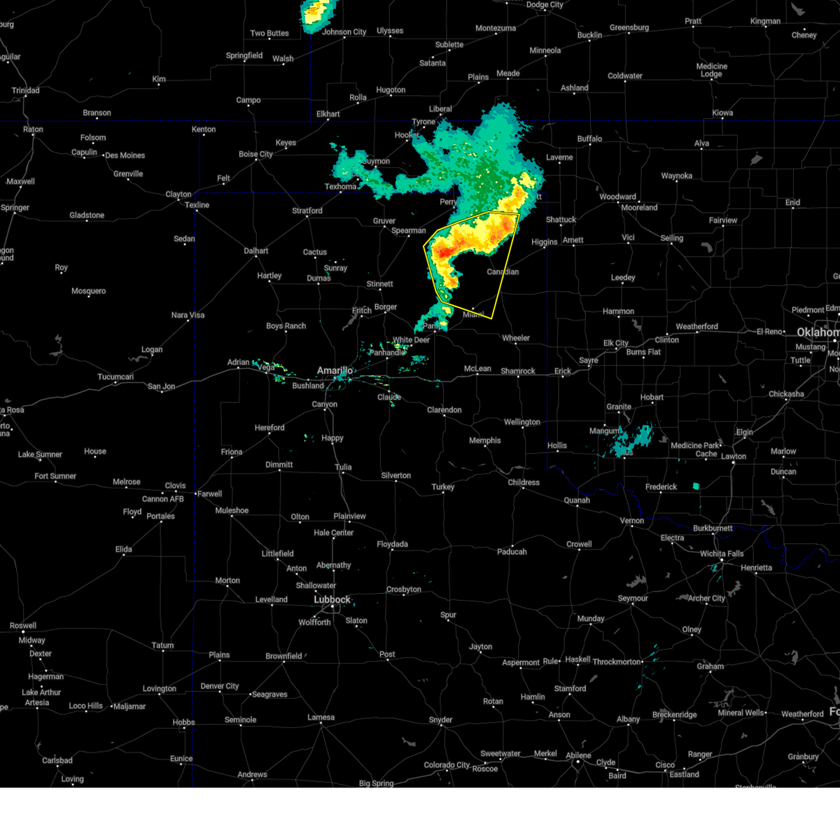
| 6/7/2025 1:31 AM CDT |
 At 129 am cdt, automated weather equipment reported a severe thunderstorm was located 5 miles northwest of briscoe, or 17 miles south of canadian, moving southeast at 45 mph. this is a destructive storm for mobeetie, briscoe, wheeler, and allison (automated weather equipment). Hazards include 90 mph wind gusts and half dollar size hail. You are in a life-threatening situation. flying debris may be deadly to those caught without shelter. mobile homes will be heavily damaged or destroyed. homes and businesses will have substantial roof and window damage. expect extensive tree damage and power outages. Locations impacted include, new mobeetie, canadian, twitty, allison, glazier, lake marvin, kellerville, miami, lora, mobeetie, wheeler, codman, and briscoe. At 129 am cdt, automated weather equipment reported a severe thunderstorm was located 5 miles northwest of briscoe, or 17 miles south of canadian, moving southeast at 45 mph. this is a destructive storm for mobeetie, briscoe, wheeler, and allison (automated weather equipment). Hazards include 90 mph wind gusts and half dollar size hail. You are in a life-threatening situation. flying debris may be deadly to those caught without shelter. mobile homes will be heavily damaged or destroyed. homes and businesses will have substantial roof and window damage. expect extensive tree damage and power outages. Locations impacted include, new mobeetie, canadian, twitty, allison, glazier, lake marvin, kellerville, miami, lora, mobeetie, wheeler, codman, and briscoe.
|
| 6/7/2025 1:23 AM CDT | Miami mesonet began gusting severe at 119 am with a peak gust of 90 mph. severe gusts ended at 130 a in hemphill county TX, 14.4 miles NNE of Canadian, TX |
| 6/7/2025 1:22 AM CDT |
 Svrama the national weather service in amarillo has issued a * severe thunderstorm warning for, wheeler county in the panhandle of texas, northeastern gray county in the panhandle of texas, northeastern collingsworth county in the panhandle of texas, eastern roberts county in the panhandle of texas, hemphill county in the panhandle of texas, * until 215 am cdt. * at 122 am cdt, a severe thunderstorm was located 8 miles east of lora, or 12 miles east of miami, moving southeast at 45 mph (radar indicated). Hazards include 70 mph wind gusts and half dollar size hail. Expect some tree damage. damage is likely to mobile homes, roofs, and outbuildings. Hail damage to vehicles is expected. Svrama the national weather service in amarillo has issued a * severe thunderstorm warning for, wheeler county in the panhandle of texas, northeastern gray county in the panhandle of texas, northeastern collingsworth county in the panhandle of texas, eastern roberts county in the panhandle of texas, hemphill county in the panhandle of texas, * until 215 am cdt. * at 122 am cdt, a severe thunderstorm was located 8 miles east of lora, or 12 miles east of miami, moving southeast at 45 mph (radar indicated). Hazards include 70 mph wind gusts and half dollar size hail. Expect some tree damage. damage is likely to mobile homes, roofs, and outbuildings. Hail damage to vehicles is expected.
|
| 6/7/2025 1:18 AM CDT |
 At 117 am cdt, a severe thunderstorm was located 4 miles northeast of lora, or 10 miles southwest of canadian, moving southeast at 35 mph (radar indicated). Hazards include golf ball size hail and 70 mph wind gusts. Expect some tree damage. damage is likely to mobile homes, roofs, and outbuildings. people and animals outdoors will be injured. expect hail damage to roofs, siding, windows, and vehicles. Locations impacted include, canadian, lora, miami, and codman. At 117 am cdt, a severe thunderstorm was located 4 miles northeast of lora, or 10 miles southwest of canadian, moving southeast at 35 mph (radar indicated). Hazards include golf ball size hail and 70 mph wind gusts. Expect some tree damage. damage is likely to mobile homes, roofs, and outbuildings. people and animals outdoors will be injured. expect hail damage to roofs, siding, windows, and vehicles. Locations impacted include, canadian, lora, miami, and codman.
|
| 6/7/2025 1:01 AM CDT |
 the severe thunderstorm warning has been cancelled and is no longer in effect the severe thunderstorm warning has been cancelled and is no longer in effect
|
| 6/7/2025 1:01 AM CDT |
 At 100 am cdt, a severe thunderstorm was located 9 miles northwest of lora, or 11 miles north of miami, moving southeast at 35 mph. this is a destructive storm for central and eastern roberts county (radar indicated). Hazards include three inch hail and 70 mph wind gusts. People and animals outdoors will be severely injured. expect shattered windows, extensive damage to roofs, siding, and vehicles. Locations impacted include, codman, canadian, lora, and miami. At 100 am cdt, a severe thunderstorm was located 9 miles northwest of lora, or 11 miles north of miami, moving southeast at 35 mph. this is a destructive storm for central and eastern roberts county (radar indicated). Hazards include three inch hail and 70 mph wind gusts. People and animals outdoors will be severely injured. expect shattered windows, extensive damage to roofs, siding, and vehicles. Locations impacted include, codman, canadian, lora, and miami.
|
| 6/7/2025 12:46 AM CDT |
 At 1244 am cdt, a severe thunderstorm was located 18 miles northwest of lora, or 18 miles northwest of miami, moving southeast at 45 mph. this is a destructive storm for central roberts county (radar indicated). Hazards include three inch hail and 70 mph wind gusts. People and animals outdoors will be severely injured. expect shattered windows, extensive damage to roofs, siding, and vehicles. Locations impacted include, codman, canadian, lora, and miami. At 1244 am cdt, a severe thunderstorm was located 18 miles northwest of lora, or 18 miles northwest of miami, moving southeast at 45 mph. this is a destructive storm for central roberts county (radar indicated). Hazards include three inch hail and 70 mph wind gusts. People and animals outdoors will be severely injured. expect shattered windows, extensive damage to roofs, siding, and vehicles. Locations impacted include, codman, canadian, lora, and miami.
|
| 6/7/2025 12:46 AM CDT |
 the severe thunderstorm warning has been cancelled and is no longer in effect the severe thunderstorm warning has been cancelled and is no longer in effect
|
| 6/7/2025 12:28 AM CDT |
 Svrama the national weather service in amarillo has issued a * severe thunderstorm warning for, northeastern hutchinson county in the panhandle of texas, north central gray county in the panhandle of texas, southeastern hansford county in the panhandle of texas, roberts county in the panhandle of texas, west central hemphill county in the panhandle of texas, southwestern ochiltree county in the panhandle of texas, * until 130 am cdt. * at 1227 am cdt, a severe thunderstorm was located 17 miles southeast of spearman, moving southeast at 35 mph (radar indicated). Hazards include 70 mph wind gusts and ping pong ball size hail. Expect some tree damage. damage is likely to mobile homes, roofs, and outbuildings. people and animals outdoors will be injured. Expect hail damage to roofs, siding, windows, and vehicles. Svrama the national weather service in amarillo has issued a * severe thunderstorm warning for, northeastern hutchinson county in the panhandle of texas, north central gray county in the panhandle of texas, southeastern hansford county in the panhandle of texas, roberts county in the panhandle of texas, west central hemphill county in the panhandle of texas, southwestern ochiltree county in the panhandle of texas, * until 130 am cdt. * at 1227 am cdt, a severe thunderstorm was located 17 miles southeast of spearman, moving southeast at 35 mph (radar indicated). Hazards include 70 mph wind gusts and ping pong ball size hail. Expect some tree damage. damage is likely to mobile homes, roofs, and outbuildings. people and animals outdoors will be injured. Expect hail damage to roofs, siding, windows, and vehicles.
|
| 6/6/2025 1:00 AM CDT | Lipscomb 8w wt mesonet measured 68 mph wind gusts from collapsing thunderstor in lipscomb county TX, 21.5 miles S of Canadian, TX |
| 6/5/2025 1:20 PM CDT |
 The storm which prompted the warning has weakened below severe limits, and no longer poses an immediate threat to life or property. therefore, the warning will be allowed to expire. however, small hail is still possible with this thunderstorm. a severe thunderstorm watch remains in effect until 900 pm cdt for the panhandle of texas. The storm which prompted the warning has weakened below severe limits, and no longer poses an immediate threat to life or property. therefore, the warning will be allowed to expire. however, small hail is still possible with this thunderstorm. a severe thunderstorm watch remains in effect until 900 pm cdt for the panhandle of texas.
|
| 6/5/2025 1:07 PM CDT |
 the severe thunderstorm warning has been cancelled and is no longer in effect the severe thunderstorm warning has been cancelled and is no longer in effect
|
| 6/5/2025 1:07 PM CDT |
 At 107 pm cdt, a severe thunderstorm was located 4 miles southwest of canadian, moving east at 40 mph (radar indicated). Hazards include 60 mph wind gusts and half dollar size hail. Minor damage to roofs, siding, and trees is possible. hail damage to vehicles is expected. Locations impacted include, glazier, lake marvin, and canadian. At 107 pm cdt, a severe thunderstorm was located 4 miles southwest of canadian, moving east at 40 mph (radar indicated). Hazards include 60 mph wind gusts and half dollar size hail. Minor damage to roofs, siding, and trees is possible. hail damage to vehicles is expected. Locations impacted include, glazier, lake marvin, and canadian.
|
| 6/5/2025 12:59 PM CDT |
 At 1259 pm cdt, a severe thunderstorm was located 8 miles north of lora, or 8 miles west of canadian, moving east at 40 mph (radar indicated). Hazards include 60 mph wind gusts and half dollar size hail. Minor damage to roofs, siding, and trees is possible. hail damage to vehicles is expected. Locations impacted include, glazier, lake marvin, and canadian. At 1259 pm cdt, a severe thunderstorm was located 8 miles north of lora, or 8 miles west of canadian, moving east at 40 mph (radar indicated). Hazards include 60 mph wind gusts and half dollar size hail. Minor damage to roofs, siding, and trees is possible. hail damage to vehicles is expected. Locations impacted include, glazier, lake marvin, and canadian.
|
| 6/5/2025 12:52 PM CDT |
 At 1252 pm cdt, a severe thunderstorm was located 8 miles north of lora, or 11 miles north of miami, moving east at 30 mph (radar indicated). Hazards include golf ball size hail and 60 mph wind gusts. Minor damage to roofs, siding, and trees is possible. people and animals outdoors will be injured. expect hail damage to roofs, siding, windows, and vehicles. Locations impacted include, glazier, lake marvin, and canadian. At 1252 pm cdt, a severe thunderstorm was located 8 miles north of lora, or 11 miles north of miami, moving east at 30 mph (radar indicated). Hazards include golf ball size hail and 60 mph wind gusts. Minor damage to roofs, siding, and trees is possible. people and animals outdoors will be injured. expect hail damage to roofs, siding, windows, and vehicles. Locations impacted include, glazier, lake marvin, and canadian.
|
| 6/5/2025 12:34 PM CDT |
 Svrama the national weather service in amarillo has issued a * severe thunderstorm warning for, central roberts county in the panhandle of texas, hemphill county in the panhandle of texas, * until 130 pm cdt. * at 1234 pm cdt, a severe thunderstorm was located 11 miles northwest of miami, moving east at 40 mph (radar indicated). Hazards include 60 mph wind gusts and half dollar size hail. Minor damage to roofs, siding, and trees is possible. Hail damage to vehicles is expected. Svrama the national weather service in amarillo has issued a * severe thunderstorm warning for, central roberts county in the panhandle of texas, hemphill county in the panhandle of texas, * until 130 pm cdt. * at 1234 pm cdt, a severe thunderstorm was located 11 miles northwest of miami, moving east at 40 mph (radar indicated). Hazards include 60 mph wind gusts and half dollar size hail. Minor damage to roofs, siding, and trees is possible. Hail damage to vehicles is expected.
|
| 6/2/2025 5:33 PM CDT | Storm damage reported in hemphill county TX, 14.4 miles NNE of Canadian, TX |
| 5/28/2025 10:05 PM CDT |
 The storms which prompted the warning have weakened below severe limits, and have exited the warned area. therefore, the warning will be allowed to expire. however, gusty winds and heavy rain are still possible with these thunderstorms. The storms which prompted the warning have weakened below severe limits, and have exited the warned area. therefore, the warning will be allowed to expire. however, gusty winds and heavy rain are still possible with these thunderstorms.
|
| 5/28/2025 9:36 PM CDT |
 the severe thunderstorm warning has been cancelled and is no longer in effect the severe thunderstorm warning has been cancelled and is no longer in effect
|
| 5/28/2025 9:36 PM CDT |
 At 936 pm cdt, severe thunderstorms were located along a line extending from near lipscomb to 7 miles northwest of pampa, moving southeast at 30 mph (radar indicated). Hazards include 60 mph wind gusts and quarter size hail. Minor damage to roofs, siding, and trees is possible. hail damage to vehicles is expected. Locations impacted include, glazier, codman, canadian, lora, and miami. At 936 pm cdt, severe thunderstorms were located along a line extending from near lipscomb to 7 miles northwest of pampa, moving southeast at 30 mph (radar indicated). Hazards include 60 mph wind gusts and quarter size hail. Minor damage to roofs, siding, and trees is possible. hail damage to vehicles is expected. Locations impacted include, glazier, codman, canadian, lora, and miami.
|
| 5/28/2025 9:19 PM CDT |
 At 918 pm cdt, severe thunderstorms were located along a line extending from 8 miles southwest of darrouzett to 8 miles north of skellytown, moving southeast at 40 mph (radar indicated). Hazards include 60 mph wind gusts and quarter size hail. Minor damage to roofs, siding, and trees is possible. hail damage to vehicles is expected. Locations impacted include, wolf creek park, skellytown, canadian, lora, pampa, kingsmill, glazier, codman, and miami. At 918 pm cdt, severe thunderstorms were located along a line extending from 8 miles southwest of darrouzett to 8 miles north of skellytown, moving southeast at 40 mph (radar indicated). Hazards include 60 mph wind gusts and quarter size hail. Minor damage to roofs, siding, and trees is possible. hail damage to vehicles is expected. Locations impacted include, wolf creek park, skellytown, canadian, lora, pampa, kingsmill, glazier, codman, and miami.
|
| 5/28/2025 8:53 PM CDT |
 Svrama the national weather service in amarillo has issued a * severe thunderstorm warning for, southwestern lipscomb county in the panhandle of texas, northeastern carson county in the panhandle of texas, eastern hutchinson county in the panhandle of texas, northwestern gray county in the panhandle of texas, roberts county in the panhandle of texas, northwestern hemphill county in the panhandle of texas, southeastern ochiltree county in the panhandle of texas, * until 1015 pm cdt. * at 853 pm cdt, severe thunderstorms were located along a line extending from 6 miles west of booker to 3 miles southeast of stinnett, moving southeast at 20 mph (radar indicated). Hazards include ping pong ball size hail and 60 mph wind gusts. Minor damage to roofs, siding, and trees is possible. people and animals outdoors will be injured. Expect hail damage to roofs, siding, windows, and vehicles. Svrama the national weather service in amarillo has issued a * severe thunderstorm warning for, southwestern lipscomb county in the panhandle of texas, northeastern carson county in the panhandle of texas, eastern hutchinson county in the panhandle of texas, northwestern gray county in the panhandle of texas, roberts county in the panhandle of texas, northwestern hemphill county in the panhandle of texas, southeastern ochiltree county in the panhandle of texas, * until 1015 pm cdt. * at 853 pm cdt, severe thunderstorms were located along a line extending from 6 miles west of booker to 3 miles southeast of stinnett, moving southeast at 20 mph (radar indicated). Hazards include ping pong ball size hail and 60 mph wind gusts. Minor damage to roofs, siding, and trees is possible. people and animals outdoors will be injured. Expect hail damage to roofs, siding, windows, and vehicles.
|
| 5/18/2025 5:14 PM CDT | Baseball sized hail reported 20 miles W of Canadian, TX, firefighter around 12 miles south of higgins reported baseball size hail. |
| 5/18/2025 4:11 PM CDT |
 Svrama the national weather service in amarillo has issued a * severe thunderstorm warning for, southeastern lipscomb county in the panhandle of texas, central hemphill county in the panhandle of texas, * until 500 pm cdt. * at 410 pm cdt, a severe thunderstorm was located 10 miles south of canadian, moving northeast at 40 mph (radar indicated). Hazards include 60 mph wind gusts and half dollar size hail. Minor damage to roofs, siding, and trees is possible. Hail damage to vehicles is expected. Svrama the national weather service in amarillo has issued a * severe thunderstorm warning for, southeastern lipscomb county in the panhandle of texas, central hemphill county in the panhandle of texas, * until 500 pm cdt. * at 410 pm cdt, a severe thunderstorm was located 10 miles south of canadian, moving northeast at 40 mph (radar indicated). Hazards include 60 mph wind gusts and half dollar size hail. Minor damage to roofs, siding, and trees is possible. Hail damage to vehicles is expected.
|
| 5/1/2025 10:16 PM CDT |
 Svrama the national weather service in amarillo has issued a * severe thunderstorm warning for, northwestern wheeler county in the panhandle of texas, northeastern gray county in the panhandle of texas, southeastern roberts county in the panhandle of texas, southwestern hemphill county in the panhandle of texas, * until 1100 pm cdt. * at 1015 pm cdt, severe thunderstorms were located along a line extending from 17 miles northwest of lora to 10 miles northwest of miami to near codman to 9 miles northeast of pampa, moving east at 35 mph (radar indicated). Hazards include 60 mph wind gusts and penny size hail. minor damage to roofs, siding, and trees is possible Svrama the national weather service in amarillo has issued a * severe thunderstorm warning for, northwestern wheeler county in the panhandle of texas, northeastern gray county in the panhandle of texas, southeastern roberts county in the panhandle of texas, southwestern hemphill county in the panhandle of texas, * until 1100 pm cdt. * at 1015 pm cdt, severe thunderstorms were located along a line extending from 17 miles northwest of lora to 10 miles northwest of miami to near codman to 9 miles northeast of pampa, moving east at 35 mph (radar indicated). Hazards include 60 mph wind gusts and penny size hail. minor damage to roofs, siding, and trees is possible
|
| 4/30/2025 8:52 PM CDT |
 The storms which prompted the warning have weakened below severe limits, and no longer pose an immediate threat to life or property. therefore, the warning will be allowed to expire. however, gusty winds and heavy rain are still possible with these thunderstorms. The storms which prompted the warning have weakened below severe limits, and no longer pose an immediate threat to life or property. therefore, the warning will be allowed to expire. however, gusty winds and heavy rain are still possible with these thunderstorms.
|
| 4/30/2025 8:43 PM CDT |
 At 843 pm cdt, severe thunderstorms were located along a line extending from 8 miles north of wolf creek park to 3 miles northeast of kingsmill, moving southeast at 25 mph (radar indicated). Hazards include 60 mph wind gusts. Minor damage to roofs, siding, and trees is possible. Locations impacted include, wolf creek park, lora, and canadian. At 843 pm cdt, severe thunderstorms were located along a line extending from 8 miles north of wolf creek park to 3 miles northeast of kingsmill, moving southeast at 25 mph (radar indicated). Hazards include 60 mph wind gusts. Minor damage to roofs, siding, and trees is possible. Locations impacted include, wolf creek park, lora, and canadian.
|
| 4/30/2025 8:31 PM CDT |
 At 831 pm cdt, severe thunderstorms were located along a line extending from 7 miles east of perryton to 3 miles north of kingsmill, moving southeast at 25 mph (radar indicated). Hazards include ping pong ball size hail and 60 mph wind gusts. Minor damage to roofs, siding, and trees is possible. people and animals outdoors will be injured. expect hail damage to roofs, siding, windows, and vehicles. Locations impacted include, wolf creek park, lora, miami, and canadian. At 831 pm cdt, severe thunderstorms were located along a line extending from 7 miles east of perryton to 3 miles north of kingsmill, moving southeast at 25 mph (radar indicated). Hazards include ping pong ball size hail and 60 mph wind gusts. Minor damage to roofs, siding, and trees is possible. people and animals outdoors will be injured. expect hail damage to roofs, siding, windows, and vehicles. Locations impacted include, wolf creek park, lora, miami, and canadian.
|
| 4/30/2025 8:25 PM CDT |
 At 823 pm cdt, severe thunderstorms were located along a line extending from 7 miles east of perryton to 3 miles northwest of kingsmill, moving southeast at 25 mph (radar indicated). Hazards include ping pong ball size hail and 60 mph wind gusts. Minor damage to roofs, siding, and trees is possible. people and animals outdoors will be injured. expect hail damage to roofs, siding, windows, and vehicles. Locations impacted include, wolf creek park, perryton, lora, farnsworth, waka, codman, miami, and canadian. At 823 pm cdt, severe thunderstorms were located along a line extending from 7 miles east of perryton to 3 miles northwest of kingsmill, moving southeast at 25 mph (radar indicated). Hazards include ping pong ball size hail and 60 mph wind gusts. Minor damage to roofs, siding, and trees is possible. people and animals outdoors will be injured. expect hail damage to roofs, siding, windows, and vehicles. Locations impacted include, wolf creek park, perryton, lora, farnsworth, waka, codman, miami, and canadian.
|
| 4/30/2025 8:25 PM CDT |
 the severe thunderstorm warning has been cancelled and is no longer in effect the severe thunderstorm warning has been cancelled and is no longer in effect
|
| 4/30/2025 8:15 PM CDT |
 At 813 pm cdt, severe thunderstorms were located along a line extending from 5 miles east of perryton to 3 miles southeast of skellytown, moving southeast at 25 mph (radar indicated). Hazards include ping pong ball size hail and 60 mph wind gusts. Minor damage to roofs, siding, and trees is possible. people and animals outdoors will be injured. expect hail damage to roofs, siding, windows, and vehicles. Locations impacted include, wolf creek park, perryton, lora, farnsworth, pampa, kingsmill, waka, codman, miami, and canadian. At 813 pm cdt, severe thunderstorms were located along a line extending from 5 miles east of perryton to 3 miles southeast of skellytown, moving southeast at 25 mph (radar indicated). Hazards include ping pong ball size hail and 60 mph wind gusts. Minor damage to roofs, siding, and trees is possible. people and animals outdoors will be injured. expect hail damage to roofs, siding, windows, and vehicles. Locations impacted include, wolf creek park, perryton, lora, farnsworth, pampa, kingsmill, waka, codman, miami, and canadian.
|
| 4/30/2025 8:15 PM CDT |
 the severe thunderstorm warning has been cancelled and is no longer in effect the severe thunderstorm warning has been cancelled and is no longer in effect
|
| 4/30/2025 7:59 PM CDT |
 Svrama the national weather service in amarillo has issued a * severe thunderstorm warning for, southwestern lipscomb county in the panhandle of texas, northeastern carson county in the panhandle of texas, eastern hutchinson county in the panhandle of texas, northern gray county in the panhandle of texas, southeastern hansford county in the panhandle of texas, roberts county in the panhandle of texas, western hemphill county in the panhandle of texas, ochiltree county in the panhandle of texas, * until 900 pm cdt. * at 758 pm cdt, severe thunderstorms were located along a line extending from near perryton to skellytown, moving southeast at 25 mph (automated weather equipment in perryton measured a 58 mph gust at 755 pm). Hazards include golf ball size hail and 60 mph wind gusts. Minor damage to roofs, siding, and trees is possible. people and animals outdoors will be injured. Expect hail damage to roofs, siding, windows, and vehicles. Svrama the national weather service in amarillo has issued a * severe thunderstorm warning for, southwestern lipscomb county in the panhandle of texas, northeastern carson county in the panhandle of texas, eastern hutchinson county in the panhandle of texas, northern gray county in the panhandle of texas, southeastern hansford county in the panhandle of texas, roberts county in the panhandle of texas, western hemphill county in the panhandle of texas, ochiltree county in the panhandle of texas, * until 900 pm cdt. * at 758 pm cdt, severe thunderstorms were located along a line extending from near perryton to skellytown, moving southeast at 25 mph (automated weather equipment in perryton measured a 58 mph gust at 755 pm). Hazards include golf ball size hail and 60 mph wind gusts. Minor damage to roofs, siding, and trees is possible. people and animals outdoors will be injured. Expect hail damage to roofs, siding, windows, and vehicles.
|
| 4/29/2025 4:18 AM CDT |
 At 417 am cdt, a severe thunderstorm was located over pampa, moving northeast at 25 mph (radar indicated). Hazards include two inch hail and 60 mph wind gusts. Minor damage to roofs, siding, and trees is possible. people and animals outdoors will be injured. expect hail damage to roofs, siding, windows, and vehicles. Locations impacted include, new mobeetie, higgins, canadian, allison, lefors, glazier, lake marvin, miami, lora, mobeetie, pampa, kingsmill, codman, and briscoe. At 417 am cdt, a severe thunderstorm was located over pampa, moving northeast at 25 mph (radar indicated). Hazards include two inch hail and 60 mph wind gusts. Minor damage to roofs, siding, and trees is possible. people and animals outdoors will be injured. expect hail damage to roofs, siding, windows, and vehicles. Locations impacted include, new mobeetie, higgins, canadian, allison, lefors, glazier, lake marvin, miami, lora, mobeetie, pampa, kingsmill, codman, and briscoe.
|
| 4/29/2025 4:15 AM CDT |
 At 414 am cdt, a severe thunderstorm was located over pampa, moving northeast at 25 mph (radar indicated). Hazards include 60 mph wind gusts and half dollar size hail. Minor damage to roofs, siding, and trees is possible. hail damage to vehicles is expected. Locations impacted include, new mobeetie, higgins, canadian, allison, lefors, glazier, lake marvin, miami, lora, mobeetie, pampa, kingsmill, codman, and briscoe. At 414 am cdt, a severe thunderstorm was located over pampa, moving northeast at 25 mph (radar indicated). Hazards include 60 mph wind gusts and half dollar size hail. Minor damage to roofs, siding, and trees is possible. hail damage to vehicles is expected. Locations impacted include, new mobeetie, higgins, canadian, allison, lefors, glazier, lake marvin, miami, lora, mobeetie, pampa, kingsmill, codman, and briscoe.
|
| 4/29/2025 4:04 AM CDT |
 Svrama the national weather service in amarillo has issued a * severe thunderstorm warning for, southeastern lipscomb county in the panhandle of texas, northwestern wheeler county in the panhandle of texas, northeastern carson county in the panhandle of texas, northern gray county in the panhandle of texas, southern roberts county in the panhandle of texas, hemphill county in the panhandle of texas, * until 530 am cdt. * at 404 am cdt, a severe thunderstorm was located near miami, moving northeast at 45 mph (radar indicated). Hazards include 60 mph wind gusts and quarter size hail. Minor damage to roofs, siding, and trees is possible. Hail damage to vehicles is expected. Svrama the national weather service in amarillo has issued a * severe thunderstorm warning for, southeastern lipscomb county in the panhandle of texas, northwestern wheeler county in the panhandle of texas, northeastern carson county in the panhandle of texas, northern gray county in the panhandle of texas, southern roberts county in the panhandle of texas, hemphill county in the panhandle of texas, * until 530 am cdt. * at 404 am cdt, a severe thunderstorm was located near miami, moving northeast at 45 mph (radar indicated). Hazards include 60 mph wind gusts and quarter size hail. Minor damage to roofs, siding, and trees is possible. Hail damage to vehicles is expected.
|
| 4/24/2025 9:37 PM CDT |
 Svrama the national weather service in amarillo has issued a * severe thunderstorm warning for, northern hemphill county in the panhandle of texas, * until 1015 pm cdt. * at 936 pm cdt, a severe thunderstorm was located 4 miles west of canadian, moving east at 30 mph (radar indicated). Hazards include two inch hail and 60 mph wind gusts. Minor damage to roofs, siding, and trees is possible. people and animals outdoors will be injured. Expect hail damage to roofs, siding, windows, and vehicles. Svrama the national weather service in amarillo has issued a * severe thunderstorm warning for, northern hemphill county in the panhandle of texas, * until 1015 pm cdt. * at 936 pm cdt, a severe thunderstorm was located 4 miles west of canadian, moving east at 30 mph (radar indicated). Hazards include two inch hail and 60 mph wind gusts. Minor damage to roofs, siding, and trees is possible. people and animals outdoors will be injured. Expect hail damage to roofs, siding, windows, and vehicles.
|
| 4/22/2025 6:49 PM CDT |
 the severe thunderstorm warning has been cancelled and is no longer in effect the severe thunderstorm warning has been cancelled and is no longer in effect
|
| 4/22/2025 6:04 PM CDT |
 Svrama the national weather service in amarillo has issued a * severe thunderstorm warning for, southeastern lipscomb county in the panhandle of texas, northern hemphill county in the panhandle of texas, * until 700 pm cdt. * at 604 pm cdt, a severe thunderstorm was located over canadian, moving east at 15 mph (radar indicated). Hazards include 60 mph wind gusts and half dollar size hail. Minor damage to roofs, siding, and trees is possible. Hail damage to vehicles is expected. Svrama the national weather service in amarillo has issued a * severe thunderstorm warning for, southeastern lipscomb county in the panhandle of texas, northern hemphill county in the panhandle of texas, * until 700 pm cdt. * at 604 pm cdt, a severe thunderstorm was located over canadian, moving east at 15 mph (radar indicated). Hazards include 60 mph wind gusts and half dollar size hail. Minor damage to roofs, siding, and trees is possible. Hail damage to vehicles is expected.
|
| 4/2/2025 12:35 AM CDT | Storm damage reported in hemphill county TX, 1.2 miles ENE of Canadian, TX |
| 4/2/2025 12:32 AM CDT | Storm damage reported in hemphill county TX, 5.8 miles W of Canadian, TX |
| 8/1/2024 7:22 PM CDT |
 The storm which prompted the warning has weakened below severe limits, and no longer poses an immediate threat to life or property. therefore, the warning will be allowed to expire. however, gusty winds are still possible with this thunderstorm. The storm which prompted the warning has weakened below severe limits, and no longer poses an immediate threat to life or property. therefore, the warning will be allowed to expire. however, gusty winds are still possible with this thunderstorm.
|
| 8/1/2024 7:15 PM CDT |
 At 714 pm cdt, a severe thunderstorm was located 14 miles south of wolf creek park, or 19 miles west of canadian, moving southwest at 15 mph (radar indicated). Hazards include 60 mph wind gusts and quarter size hail. Minor damage to roofs, siding, and trees is possible. hail damage to vehicles is expected. Locations impacted include, canadian, lora, and wolf creek park. At 714 pm cdt, a severe thunderstorm was located 14 miles south of wolf creek park, or 19 miles west of canadian, moving southwest at 15 mph (radar indicated). Hazards include 60 mph wind gusts and quarter size hail. Minor damage to roofs, siding, and trees is possible. hail damage to vehicles is expected. Locations impacted include, canadian, lora, and wolf creek park.
|
| 8/1/2024 6:54 PM CDT |
 At 653 pm cdt, a severe thunderstorm was located 11 miles south of wolf creek park, or 17 miles northwest of canadian, moving west at 10 mph (radar indicated). Hazards include 60 mph wind gusts and quarter size hail. Minor damage to roofs, siding, and trees is possible. hail damage to vehicles is expected. Locations impacted include, canadian, wolf creek park, glazier, lake marvin, and lora. At 653 pm cdt, a severe thunderstorm was located 11 miles south of wolf creek park, or 17 miles northwest of canadian, moving west at 10 mph (radar indicated). Hazards include 60 mph wind gusts and quarter size hail. Minor damage to roofs, siding, and trees is possible. hail damage to vehicles is expected. Locations impacted include, canadian, wolf creek park, glazier, lake marvin, and lora.
|
| 8/1/2024 6:27 PM CDT |
 At 626 pm cdt, a severe thunderstorm was located near canadian, moving southwest at 15 mph (radar indicated). Hazards include 60 mph wind gusts and quarter size hail. Minor damage to roofs, siding, and trees is possible. hail damage to vehicles is expected. Locations impacted include, lipscomb, canadian, wolf creek park, glazier, lake marvin, and lora. At 626 pm cdt, a severe thunderstorm was located near canadian, moving southwest at 15 mph (radar indicated). Hazards include 60 mph wind gusts and quarter size hail. Minor damage to roofs, siding, and trees is possible. hail damage to vehicles is expected. Locations impacted include, lipscomb, canadian, wolf creek park, glazier, lake marvin, and lora.
|
| 8/1/2024 6:15 PM CDT |
 At 614 pm cdt, a severe thunderstorm was located near canadian, moving southwest at 5 mph (radar indicated). Hazards include 70 mph wind gusts and quarter size hail. Expect some tree damage. damage is likely to mobile homes, roofs, and outbuildings. hail damage to vehicles is expected. Locations impacted include, lipscomb, canadian, wolf creek park, glazier, lake marvin, and lora. At 614 pm cdt, a severe thunderstorm was located near canadian, moving southwest at 5 mph (radar indicated). Hazards include 70 mph wind gusts and quarter size hail. Expect some tree damage. damage is likely to mobile homes, roofs, and outbuildings. hail damage to vehicles is expected. Locations impacted include, lipscomb, canadian, wolf creek park, glazier, lake marvin, and lora.
|
| 8/1/2024 5:59 PM CDT |
 Svrama the national weather service in amarillo has issued a * severe thunderstorm warning for, southern lipscomb county in the panhandle of texas, northeastern roberts county in the panhandle of texas, hemphill county in the panhandle of texas, southeastern ochiltree county in the panhandle of texas, * until 730 pm cdt. * at 559 pm cdt, a severe thunderstorm was located near canadian, moving southwest at 10 mph (radar indicated). Hazards include 70 mph wind gusts and half dollar size hail. Expect some tree damage. damage is likely to mobile homes, roofs, and outbuildings. Hail damage to vehicles is expected. Svrama the national weather service in amarillo has issued a * severe thunderstorm warning for, southern lipscomb county in the panhandle of texas, northeastern roberts county in the panhandle of texas, hemphill county in the panhandle of texas, southeastern ochiltree county in the panhandle of texas, * until 730 pm cdt. * at 559 pm cdt, a severe thunderstorm was located near canadian, moving southwest at 10 mph (radar indicated). Hazards include 70 mph wind gusts and half dollar size hail. Expect some tree damage. damage is likely to mobile homes, roofs, and outbuildings. Hail damage to vehicles is expected.
|
| 7/16/2024 11:01 PM CDT |
 the severe thunderstorm warning has been cancelled and is no longer in effect the severe thunderstorm warning has been cancelled and is no longer in effect
|
| 7/16/2024 10:47 PM CDT |
 At 1046 pm cdt, severe thunderstorms were located along a line extending from 4 miles west of rosston to 4 miles southeast of slapout to 8 miles south of follett to 3 miles southeast of lipscomb to 6 miles northwest of glazier to 14 miles northwest of lora to 10 miles north of skellytown, moving southeast at 45 mph (radar indicated). Hazards include 60 mph wind gusts and penny size hail. Minor damage to roofs, siding, and trees is possible. Locations impacted include, lipscomb, canadian, miami, follett, higgins, darrouzett, wolf creek park, lora, slapout, glazier, codman, and lake marvin. At 1046 pm cdt, severe thunderstorms were located along a line extending from 4 miles west of rosston to 4 miles southeast of slapout to 8 miles south of follett to 3 miles southeast of lipscomb to 6 miles northwest of glazier to 14 miles northwest of lora to 10 miles north of skellytown, moving southeast at 45 mph (radar indicated). Hazards include 60 mph wind gusts and penny size hail. Minor damage to roofs, siding, and trees is possible. Locations impacted include, lipscomb, canadian, miami, follett, higgins, darrouzett, wolf creek park, lora, slapout, glazier, codman, and lake marvin.
|
| 7/16/2024 10:34 PM CDT |
 At 1033 pm cdt, severe thunderstorms were located along a line extending from 8 miles south of knowles to 5 miles northeast of darrouzett to 5 miles northwest of lipscomb to 12 miles northwest of glazier to 11 miles northwest of canadian to 16 miles northwest of codman to borger, moving southeast at 35 mph (radar indicated). Hazards include 60 mph wind gusts and penny size hail. Minor damage to roofs, siding, and trees is possible. Locations impacted include, perryton, lipscomb, canadian, beaver, miami, booker, follett, higgins, darrouzett, gate, knowles, wolf creek park, elmwood, farnsworth, waka, glazier, lake marvin, bryans corner, lora, and mocane. At 1033 pm cdt, severe thunderstorms were located along a line extending from 8 miles south of knowles to 5 miles northeast of darrouzett to 5 miles northwest of lipscomb to 12 miles northwest of glazier to 11 miles northwest of canadian to 16 miles northwest of codman to borger, moving southeast at 35 mph (radar indicated). Hazards include 60 mph wind gusts and penny size hail. Minor damage to roofs, siding, and trees is possible. Locations impacted include, perryton, lipscomb, canadian, beaver, miami, booker, follett, higgins, darrouzett, gate, knowles, wolf creek park, elmwood, farnsworth, waka, glazier, lake marvin, bryans corner, lora, and mocane.
|
| 7/16/2024 10:34 PM CDT |
 the severe thunderstorm warning has been cancelled and is no longer in effect the severe thunderstorm warning has been cancelled and is no longer in effect
|
| 7/16/2024 10:09 PM CDT |
 Svrama the national weather service in amarillo has issued a * severe thunderstorm warning for, beaver county in the panhandle of oklahoma, lipscomb county in the panhandle of texas, hutchinson county in the panhandle of texas, roberts county in the panhandle of texas, hemphill county in the panhandle of texas, ochiltree county in the panhandle of texas, northeastern moore county in the panhandle of texas, * until 1145 pm cdt. * at 1008 pm cdt, severe thunderstorms were located along a line extending from 6 miles east of beaver to 3 miles southeast of elmwood to 8 miles south of booker to wolf creek park to 19 miles southeast of farnsworth to 17 miles east of pringle to 4 miles northwest of sanford, moving southeast at 35 mph (radar indicated). Hazards include 60 mph wind gusts and penny size hail. minor damage to roofs, siding, and trees is possible Svrama the national weather service in amarillo has issued a * severe thunderstorm warning for, beaver county in the panhandle of oklahoma, lipscomb county in the panhandle of texas, hutchinson county in the panhandle of texas, roberts county in the panhandle of texas, hemphill county in the panhandle of texas, ochiltree county in the panhandle of texas, northeastern moore county in the panhandle of texas, * until 1145 pm cdt. * at 1008 pm cdt, severe thunderstorms were located along a line extending from 6 miles east of beaver to 3 miles southeast of elmwood to 8 miles south of booker to wolf creek park to 19 miles southeast of farnsworth to 17 miles east of pringle to 4 miles northwest of sanford, moving southeast at 35 mph (radar indicated). Hazards include 60 mph wind gusts and penny size hail. minor damage to roofs, siding, and trees is possible
|
| 6/28/2024 12:50 AM CDT |
 the severe thunderstorm warning has been cancelled and is no longer in effect the severe thunderstorm warning has been cancelled and is no longer in effect
|
| 6/28/2024 12:28 AM CDT |
 the severe thunderstorm warning has been cancelled and is no longer in effect the severe thunderstorm warning has been cancelled and is no longer in effect
|
| 6/28/2024 12:28 AM CDT |
 At 1227 am cdt, severe thunderstorms were located along a line extending from 11 miles east of follett to 8 miles northwest of briscoe, moving northeast at 30 mph (radar indicated). Hazards include 60 mph wind gusts. Minor damage to roofs, siding, and trees is possible. Locations impacted include, canadian, follett, higgins, glazier, and lake marvin. At 1227 am cdt, severe thunderstorms were located along a line extending from 11 miles east of follett to 8 miles northwest of briscoe, moving northeast at 30 mph (radar indicated). Hazards include 60 mph wind gusts. Minor damage to roofs, siding, and trees is possible. Locations impacted include, canadian, follett, higgins, glazier, and lake marvin.
|
| 6/28/2024 12:14 AM CDT |
 At 1213 am cdt, automated weather equipment reported severe thunderstorms were located along a line extending from may to 3 miles southeast of lake marvin, moving east at 25 mph (automated weather equipment). Hazards include 60 mph wind gusts. Minor damage to roofs, siding, and trees is possible. Locations impacted include, lipscomb, canadian, follett, higgins, darrouzett, slapout, glazier, and lake marvin. At 1213 am cdt, automated weather equipment reported severe thunderstorms were located along a line extending from may to 3 miles southeast of lake marvin, moving east at 25 mph (automated weather equipment). Hazards include 60 mph wind gusts. Minor damage to roofs, siding, and trees is possible. Locations impacted include, lipscomb, canadian, follett, higgins, darrouzett, slapout, glazier, and lake marvin.
|
| 6/28/2024 12:03 AM CDT |
 Svrama the national weather service in amarillo has issued a * severe thunderstorm warning for, southeastern beaver county in the panhandle of oklahoma, lipscomb county in the panhandle of texas, hemphill county in the panhandle of texas, * until 100 am cdt. * at 1203 am cdt, severe thunderstorms were located along a line extending from 7 miles southeast of slapout to 8 miles east of lora, moving east at 110 mph (radar indicated). Hazards include 60 mph wind gusts. minor damage to roofs, siding, and trees is possible Svrama the national weather service in amarillo has issued a * severe thunderstorm warning for, southeastern beaver county in the panhandle of oklahoma, lipscomb county in the panhandle of texas, hemphill county in the panhandle of texas, * until 100 am cdt. * at 1203 am cdt, severe thunderstorms were located along a line extending from 7 miles southeast of slapout to 8 miles east of lora, moving east at 110 mph (radar indicated). Hazards include 60 mph wind gusts. minor damage to roofs, siding, and trees is possible
|
| 6/27/2024 11:52 PM CDT | Gust of 59 at 1152pm...followed by a gust of 65 at 1153p in lipscomb county TX, 21.5 miles S of Canadian, TX |
| 6/15/2024 7:28 PM CDT |
 the severe thunderstorm warning has been cancelled and is no longer in effect the severe thunderstorm warning has been cancelled and is no longer in effect
|
| 6/15/2024 7:19 PM CDT |
 At 718 pm cdt, a severe thunderstorm was located 6 miles west of glazier, or 8 miles north of canadian, moving northeast at 10 mph (radar indicated). Hazards include 60 mph wind gusts and quarter size hail. Minor damage to roofs, siding, and trees is possible. hail damage to vehicles is expected. Locations impacted include, canadian and glazier. At 718 pm cdt, a severe thunderstorm was located 6 miles west of glazier, or 8 miles north of canadian, moving northeast at 10 mph (radar indicated). Hazards include 60 mph wind gusts and quarter size hail. Minor damage to roofs, siding, and trees is possible. hail damage to vehicles is expected. Locations impacted include, canadian and glazier.
|
| 6/15/2024 7:07 PM CDT |
 At 706 pm cdt, a severe thunderstorm was located 7 miles north of canadian, moving northeast at 10 mph (radar indicated). Hazards include 60 mph wind gusts and half dollar size hail. Minor damage to roofs, siding, and trees is possible. hail damage to vehicles is expected. Locations impacted include, canadian and glazier. At 706 pm cdt, a severe thunderstorm was located 7 miles north of canadian, moving northeast at 10 mph (radar indicated). Hazards include 60 mph wind gusts and half dollar size hail. Minor damage to roofs, siding, and trees is possible. hail damage to vehicles is expected. Locations impacted include, canadian and glazier.
|
| 6/15/2024 6:47 PM CDT |
 Svrama the national weather service in amarillo has issued a * severe thunderstorm warning for, southwestern lipscomb county in the panhandle of texas, northern hemphill county in the panhandle of texas, * until 745 pm cdt. * at 646 pm cdt, a severe thunderstorm was located 7 miles northwest of canadian, moving northeast at 10 mph (radar indicated). Hazards include 60 mph wind gusts and quarter size hail. Minor damage to roofs, siding, and trees is possible. Hail damage to vehicles is expected. Svrama the national weather service in amarillo has issued a * severe thunderstorm warning for, southwestern lipscomb county in the panhandle of texas, northern hemphill county in the panhandle of texas, * until 745 pm cdt. * at 646 pm cdt, a severe thunderstorm was located 7 miles northwest of canadian, moving northeast at 10 mph (radar indicated). Hazards include 60 mph wind gusts and quarter size hail. Minor damage to roofs, siding, and trees is possible. Hail damage to vehicles is expected.
|
| 6/6/2024 6:23 PM CDT |
 The storm which prompted the warning has moved out of the area. therefore, the warning will be allowed to expire. The storm which prompted the warning has moved out of the area. therefore, the warning will be allowed to expire.
|
| 6/6/2024 6:12 PM CDT |
 At 612 pm cdt, a severe thunderstorm was located 8 miles northeast of glazier, or 8 miles southeast of lipscomb, moving east at 20 mph (radar indicated). Hazards include 60 mph wind gusts and quarter size hail. Minor damage to roofs, siding, and trees is possible. hail damage to vehicles is expected. Locations impacted include, canadian, glazier, and lake marvin. At 612 pm cdt, a severe thunderstorm was located 8 miles northeast of glazier, or 8 miles southeast of lipscomb, moving east at 20 mph (radar indicated). Hazards include 60 mph wind gusts and quarter size hail. Minor damage to roofs, siding, and trees is possible. hail damage to vehicles is expected. Locations impacted include, canadian, glazier, and lake marvin.
|
| 6/6/2024 6:12 PM CDT |
 the severe thunderstorm warning has been cancelled and is no longer in effect the severe thunderstorm warning has been cancelled and is no longer in effect
|
| 6/6/2024 5:59 PM CDT |
 At 559 pm cdt, a severe thunderstorm was located 5 miles northeast of glazier, or 12 miles south of lipscomb, moving southeast at 10 mph (radar indicated). Hazards include golf ball size hail and 70 mph wind gusts. Expect some tree damage. damage is likely to mobile homes, roofs, and outbuildings. people and animals outdoors will be injured. expect hail damage to roofs, siding, windows, and vehicles. Locations impacted include, canadian, glazier, and lake marvin. At 559 pm cdt, a severe thunderstorm was located 5 miles northeast of glazier, or 12 miles south of lipscomb, moving southeast at 10 mph (radar indicated). Hazards include golf ball size hail and 70 mph wind gusts. Expect some tree damage. damage is likely to mobile homes, roofs, and outbuildings. people and animals outdoors will be injured. expect hail damage to roofs, siding, windows, and vehicles. Locations impacted include, canadian, glazier, and lake marvin.
|
| 6/6/2024 5:33 PM CDT |
 At 533 pm cdt, severe thunderstorms were located along a line extending from 7 miles northeast of glazier to 21 miles northwest of codman, moving southeast at 15 mph (radar indicated). Hazards include golf ball size hail and 70 mph wind gusts. Expect some tree damage. damage is likely to mobile homes, roofs, and outbuildings. people and animals outdoors will be injured. expect hail damage to roofs, siding, windows, and vehicles. Locations impacted include, canadian, glazier, and lake marvin. At 533 pm cdt, severe thunderstorms were located along a line extending from 7 miles northeast of glazier to 21 miles northwest of codman, moving southeast at 15 mph (radar indicated). Hazards include golf ball size hail and 70 mph wind gusts. Expect some tree damage. damage is likely to mobile homes, roofs, and outbuildings. people and animals outdoors will be injured. expect hail damage to roofs, siding, windows, and vehicles. Locations impacted include, canadian, glazier, and lake marvin.
|
| 6/6/2024 5:18 PM CDT |
 At 517 pm cdt, severe thunderstorms were located along a line extending from 7 miles southeast of lipscomb to 22 miles southeast of spearman, moving south at 5 mph (radar indicated). Hazards include 70 mph wind gusts and ping pong ball size hail. Expect some tree damage. damage is likely to mobile homes, roofs, and outbuildings. people and animals outdoors will be injured. expect hail damage to roofs, siding, windows, and vehicles. Locations impacted include, canadian, glazier, and lake marvin. At 517 pm cdt, severe thunderstorms were located along a line extending from 7 miles southeast of lipscomb to 22 miles southeast of spearman, moving south at 5 mph (radar indicated). Hazards include 70 mph wind gusts and ping pong ball size hail. Expect some tree damage. damage is likely to mobile homes, roofs, and outbuildings. people and animals outdoors will be injured. expect hail damage to roofs, siding, windows, and vehicles. Locations impacted include, canadian, glazier, and lake marvin.
|
| 6/6/2024 4:58 PM CDT |
 Svrama the national weather service in amarillo has issued a * severe thunderstorm warning for, southwestern lipscomb county in the panhandle of texas, roberts county in the panhandle of texas, northern hemphill county in the panhandle of texas, southeastern ochiltree county in the panhandle of texas, * until 630 pm cdt. * at 458 pm cdt, severe thunderstorms were located along a line extending from 11 miles southeast of wolf creek park to 21 miles northwest of miami, moving east at 5 mph (radar indicated). Hazards include golf ball size hail and 70 mph wind gusts. Expect some tree damage. damage is likely to mobile homes, roofs, and outbuildings. people and animals outdoors will be injured. Expect hail damage to roofs, siding, windows, and vehicles. Svrama the national weather service in amarillo has issued a * severe thunderstorm warning for, southwestern lipscomb county in the panhandle of texas, roberts county in the panhandle of texas, northern hemphill county in the panhandle of texas, southeastern ochiltree county in the panhandle of texas, * until 630 pm cdt. * at 458 pm cdt, severe thunderstorms were located along a line extending from 11 miles southeast of wolf creek park to 21 miles northwest of miami, moving east at 5 mph (radar indicated). Hazards include golf ball size hail and 70 mph wind gusts. Expect some tree damage. damage is likely to mobile homes, roofs, and outbuildings. people and animals outdoors will be injured. Expect hail damage to roofs, siding, windows, and vehicles.
|
| 5/30/2024 7:40 PM CDT |
 the severe thunderstorm warning has been cancelled and is no longer in effect the severe thunderstorm warning has been cancelled and is no longer in effect
|
| 5/30/2024 7:40 PM CDT |
 At 740 pm cdt, severe thunderstorms were located along a line extending from 15 miles south of wolf creek park to 6 miles west of new mobeetie to 4 miles west of lake mcclellan, moving east at 30 mph (radar indicated). Hazards include 70 mph wind gusts and nickel size hail. Expect some tree damage. damage is likely to mobile homes, roofs, and outbuildings. Locations impacted include, canadian, miami, briscoe, mclean, lefors, new mobeetie, lake mcclellan, glazier, kellerville, lora, alanreed, codman, and mobeetie. At 740 pm cdt, severe thunderstorms were located along a line extending from 15 miles south of wolf creek park to 6 miles west of new mobeetie to 4 miles west of lake mcclellan, moving east at 30 mph (radar indicated). Hazards include 70 mph wind gusts and nickel size hail. Expect some tree damage. damage is likely to mobile homes, roofs, and outbuildings. Locations impacted include, canadian, miami, briscoe, mclean, lefors, new mobeetie, lake mcclellan, glazier, kellerville, lora, alanreed, codman, and mobeetie.
|
| 5/30/2024 7:06 PM CDT |
 At 706 pm cdt, severe thunderstorms were located along a line extending from 18 miles southwest of wolf creek park to 6 miles southwest of codman to 7 miles south of white deer to 4 miles southwest of washburn, moving east at 40 mph (radar indicated). Hazards include 70 mph wind gusts and nickel size hail. Expect some tree damage. damage is likely to mobile homes, roofs, and outbuildings. Locations impacted include, amarillo, pampa, canyon, canadian, panhandle, clarendon, claude, miami, briscoe, white deer, lake tanglewood, mclean, groom, lefors, skellytown, howardwick, bushland, lake mcclellan, wayside, and goodnight. At 706 pm cdt, severe thunderstorms were located along a line extending from 18 miles southwest of wolf creek park to 6 miles southwest of codman to 7 miles south of white deer to 4 miles southwest of washburn, moving east at 40 mph (radar indicated). Hazards include 70 mph wind gusts and nickel size hail. Expect some tree damage. damage is likely to mobile homes, roofs, and outbuildings. Locations impacted include, amarillo, pampa, canyon, canadian, panhandle, clarendon, claude, miami, briscoe, white deer, lake tanglewood, mclean, groom, lefors, skellytown, howardwick, bushland, lake mcclellan, wayside, and goodnight.
|
| 5/30/2024 6:44 PM CDT |
 Svrama the national weather service in amarillo has issued a * severe thunderstorm warning for, armstrong county in the panhandle of texas, randall county in the panhandle of texas, western wheeler county in the panhandle of texas, carson county in the panhandle of texas, eastern hutchinson county in the panhandle of texas, gray county in the panhandle of texas, southern potter county in the panhandle of texas, roberts county in the panhandle of texas, western hemphill county in the panhandle of texas, northwestern donley county in the panhandle of texas, * until 800 pm cdt. * at 643 pm cdt, severe thunderstorms were located along a line extending from 14 miles southeast of spearman to 6 miles northeast of skellytown to near panhandle to 4 miles north of amarillo, moving east at 40 mph (radar indicated). Hazards include 70 mph wind gusts and penny size hail. Expect some tree damage. Damage is likely to mobile homes, roofs, and outbuildings. Svrama the national weather service in amarillo has issued a * severe thunderstorm warning for, armstrong county in the panhandle of texas, randall county in the panhandle of texas, western wheeler county in the panhandle of texas, carson county in the panhandle of texas, eastern hutchinson county in the panhandle of texas, gray county in the panhandle of texas, southern potter county in the panhandle of texas, roberts county in the panhandle of texas, western hemphill county in the panhandle of texas, northwestern donley county in the panhandle of texas, * until 800 pm cdt. * at 643 pm cdt, severe thunderstorms were located along a line extending from 14 miles southeast of spearman to 6 miles northeast of skellytown to near panhandle to 4 miles north of amarillo, moving east at 40 mph (radar indicated). Hazards include 70 mph wind gusts and penny size hail. Expect some tree damage. Damage is likely to mobile homes, roofs, and outbuildings.
|
| 5/19/2024 5:05 PM CDT | Tea Cup sized hail reported 18.6 miles WNW of Canadian, TX, hail size measured with a ruler and a photo was provided via social media. time estimated based on radar data. |
| 5/19/2024 4:58 PM CDT |
 At 457 pm cdt, severe thunderstorms were located along a line extending from 7 miles northeast of glazier to 6 miles north of durham to near reydon, moving east at 55 mph (trained weather spotters). Hazards include golf ball size hail and 70 mph wind gusts. Expect some tree damage. damage is likely to mobile homes, roofs, and outbuildings. people and animals outdoors will be injured. expect hail damage to roofs, siding, windows, and vehicles. Locations impacted include, canadian, higgins, glazier, and lake marvin. At 457 pm cdt, severe thunderstorms were located along a line extending from 7 miles northeast of glazier to 6 miles north of durham to near reydon, moving east at 55 mph (trained weather spotters). Hazards include golf ball size hail and 70 mph wind gusts. Expect some tree damage. damage is likely to mobile homes, roofs, and outbuildings. people and animals outdoors will be injured. expect hail damage to roofs, siding, windows, and vehicles. Locations impacted include, canadian, higgins, glazier, and lake marvin.
|
| 5/19/2024 4:46 PM CDT |
 the severe thunderstorm warning has been cancelled and is no longer in effect the severe thunderstorm warning has been cancelled and is no longer in effect
|
| 5/19/2024 4:46 PM CDT |
 At 445 pm cdt, severe thunderstorms were located along a line extending from 6 miles northwest of glazier to 5 miles northeast of lake marvin to near allison, moving east at 55 mph (radar indicated). Hazards include golf ball size hail and 60 mph wind gusts. Minor damage to roofs, siding, and trees is possible. people and animals outdoors will be injured. expect hail damage to roofs, siding, windows, and vehicles. Locations impacted include, lipscomb, canadian, higgins, glazier, and lake marvin. At 445 pm cdt, severe thunderstorms were located along a line extending from 6 miles northwest of glazier to 5 miles northeast of lake marvin to near allison, moving east at 55 mph (radar indicated). Hazards include golf ball size hail and 60 mph wind gusts. Minor damage to roofs, siding, and trees is possible. people and animals outdoors will be injured. expect hail damage to roofs, siding, windows, and vehicles. Locations impacted include, lipscomb, canadian, higgins, glazier, and lake marvin.
|
| 5/19/2024 4:33 PM CDT |
 At 433 pm cdt, severe thunderstorms were located along a line extending from 11 miles northwest of glazier to 3 miles northwest of lake marvin to 5 miles northeast of briscoe, moving east at 55 mph (radar indicated). Hazards include golf ball size hail and 60 mph wind gusts. Minor damage to roofs, siding, and trees is possible. people and animals outdoors will be injured. expect hail damage to roofs, siding, windows, and vehicles. Locations impacted include, lipscomb, canadian, higgins, glazier, lake marvin, and lora. At 433 pm cdt, severe thunderstorms were located along a line extending from 11 miles northwest of glazier to 3 miles northwest of lake marvin to 5 miles northeast of briscoe, moving east at 55 mph (radar indicated). Hazards include golf ball size hail and 60 mph wind gusts. Minor damage to roofs, siding, and trees is possible. people and animals outdoors will be injured. expect hail damage to roofs, siding, windows, and vehicles. Locations impacted include, lipscomb, canadian, higgins, glazier, lake marvin, and lora.
|
| 5/19/2024 4:32 PM CDT | Half Dollar sized hail reported 0.2 miles WSW of Canadian, TX |
| 5/19/2024 4:26 PM CDT |
 At 425 pm cdt, severe thunderstorms were located along a line extending from 9 miles south of wolf creek park to canadian to 5 miles northwest of briscoe, moving east at 55 mph (radar indicated). Hazards include 60 mph wind gusts and half dollar size hail. Minor damage to roofs, siding, and trees is possible. hail damage to vehicles is expected. Locations impacted include, lipscomb, canadian, higgins, glazier, lake marvin, and lora. At 425 pm cdt, severe thunderstorms were located along a line extending from 9 miles south of wolf creek park to canadian to 5 miles northwest of briscoe, moving east at 55 mph (radar indicated). Hazards include 60 mph wind gusts and half dollar size hail. Minor damage to roofs, siding, and trees is possible. hail damage to vehicles is expected. Locations impacted include, lipscomb, canadian, higgins, glazier, lake marvin, and lora.
|
| 5/19/2024 4:16 PM CDT |
 Svrama the national weather service in amarillo has issued a * severe thunderstorm warning for, southern lipscomb county in the panhandle of texas, northeastern roberts county in the panhandle of texas, hemphill county in the panhandle of texas, southeastern ochiltree county in the panhandle of texas, * until 515 pm cdt. * at 415 pm cdt, severe thunderstorms were located along a line extending from 11 miles southwest of wolf creek park to 7 miles west of canadian to 8 miles southeast of miami, moving east at 55 mph (radar indicated). Hazards include 60 mph wind gusts and penny size hail. minor damage to roofs, siding, and trees is possible Svrama the national weather service in amarillo has issued a * severe thunderstorm warning for, southern lipscomb county in the panhandle of texas, northeastern roberts county in the panhandle of texas, hemphill county in the panhandle of texas, southeastern ochiltree county in the panhandle of texas, * until 515 pm cdt. * at 415 pm cdt, severe thunderstorms were located along a line extending from 11 miles southwest of wolf creek park to 7 miles west of canadian to 8 miles southeast of miami, moving east at 55 mph (radar indicated). Hazards include 60 mph wind gusts and penny size hail. minor damage to roofs, siding, and trees is possible
|
| 5/19/2024 3:55 PM CDT |
 the severe thunderstorm warning has been cancelled and is no longer in effect the severe thunderstorm warning has been cancelled and is no longer in effect
|
| 5/19/2024 3:40 PM CDT |
 At 340 pm cdt, a severe thunderstorm was located 7 miles northwest of canadian, moving northeast at 25 mph (radar indicated). Hazards include 60 mph wind gusts and quarter size hail. Minor damage to roofs, siding, and trees is possible. hail damage to vehicles is expected. Locations impacted include, canadian, glazier, and lake marvin. At 340 pm cdt, a severe thunderstorm was located 7 miles northwest of canadian, moving northeast at 25 mph (radar indicated). Hazards include 60 mph wind gusts and quarter size hail. Minor damage to roofs, siding, and trees is possible. hail damage to vehicles is expected. Locations impacted include, canadian, glazier, and lake marvin.
|
| 5/19/2024 3:21 PM CDT |
 Svrama the national weather service in amarillo has issued a * severe thunderstorm warning for, southeastern lipscomb county in the panhandle of texas, east central roberts county in the panhandle of texas, northern hemphill county in the panhandle of texas, * until 415 pm cdt. * at 320 pm cdt, a severe thunderstorm was located 7 miles west of canadian, moving east at 35 mph (radar indicated). Hazards include 60 mph wind gusts and quarter size hail. Minor damage to roofs, siding, and trees is possible. Hail damage to vehicles is expected. Svrama the national weather service in amarillo has issued a * severe thunderstorm warning for, southeastern lipscomb county in the panhandle of texas, east central roberts county in the panhandle of texas, northern hemphill county in the panhandle of texas, * until 415 pm cdt. * at 320 pm cdt, a severe thunderstorm was located 7 miles west of canadian, moving east at 35 mph (radar indicated). Hazards include 60 mph wind gusts and quarter size hail. Minor damage to roofs, siding, and trees is possible. Hail damage to vehicles is expected.
|
| 5/15/2024 8:06 PM CDT |
 the severe thunderstorm warning has been cancelled and is no longer in effect the severe thunderstorm warning has been cancelled and is no longer in effect
|
| 5/15/2024 7:42 PM CDT |
 At 742 pm cdt, severe thunderstorms were located along a line extending from 17 miles southwest of wolf creek park to 16 miles northwest of codman to 6 miles northwest of pampa, moving east at 40 mph (radar indicated). Hazards include 70 mph wind gusts and half dollar size hail. Expect some tree damage. damage is likely to mobile homes, roofs, and outbuildings. hail damage to vehicles is expected. Locations impacted include, pampa, borger, canadian, miami, skellytown, lora, and codman. At 742 pm cdt, severe thunderstorms were located along a line extending from 17 miles southwest of wolf creek park to 16 miles northwest of codman to 6 miles northwest of pampa, moving east at 40 mph (radar indicated). Hazards include 70 mph wind gusts and half dollar size hail. Expect some tree damage. damage is likely to mobile homes, roofs, and outbuildings. hail damage to vehicles is expected. Locations impacted include, pampa, borger, canadian, miami, skellytown, lora, and codman.
|
| 5/15/2024 7:30 PM CDT |
 Svrama the national weather service in amarillo has issued a * severe thunderstorm warning for, southwestern lipscomb county in the panhandle of texas, northeastern carson county in the panhandle of texas, hutchinson county in the panhandle of texas, northern gray county in the panhandle of texas, southeastern hansford county in the panhandle of texas, roberts county in the panhandle of texas, western hemphill county in the panhandle of texas, southern ochiltree county in the panhandle of texas, * until 830 pm cdt. * at 727 pm cdt, severe thunderstorms were located along a line extending from 15 miles southeast of spearman to 20 miles northwest of codman to 3 miles north of skellytown, moving east at 40 mph. these are destructive storms for miami, skellytown, and rural portions of roberts county (radar indicated). Hazards include 80 mph wind gusts and ping pong ball size hail. Flying debris will be dangerous to those caught without shelter. mobile homes will be heavily damaged. expect considerable damage to roofs, windows, and vehicles. tree damage and power outages are likely. people and animals outdoors will be injured. Expect hail damage to roofs, siding, windows, and vehicles. Svrama the national weather service in amarillo has issued a * severe thunderstorm warning for, southwestern lipscomb county in the panhandle of texas, northeastern carson county in the panhandle of texas, hutchinson county in the panhandle of texas, northern gray county in the panhandle of texas, southeastern hansford county in the panhandle of texas, roberts county in the panhandle of texas, western hemphill county in the panhandle of texas, southern ochiltree county in the panhandle of texas, * until 830 pm cdt. * at 727 pm cdt, severe thunderstorms were located along a line extending from 15 miles southeast of spearman to 20 miles northwest of codman to 3 miles north of skellytown, moving east at 40 mph. these are destructive storms for miami, skellytown, and rural portions of roberts county (radar indicated). Hazards include 80 mph wind gusts and ping pong ball size hail. Flying debris will be dangerous to those caught without shelter. mobile homes will be heavily damaged. expect considerable damage to roofs, windows, and vehicles. tree damage and power outages are likely. people and animals outdoors will be injured. Expect hail damage to roofs, siding, windows, and vehicles.
|
| 5/15/2024 6:43 PM CDT |
 Svrama the national weather service in amarillo has issued a * severe thunderstorm warning for, northwestern wheeler county in the panhandle of texas, northeastern carson county in the panhandle of texas, southeastern hutchinson county in the panhandle of texas, northern gray county in the panhandle of texas, roberts county in the panhandle of texas, western hemphill county in the panhandle of texas, * until 730 pm cdt. * at 642 pm cdt, severe thunderstorms were located along a line extending from 8 miles southwest of skellytown to 3 miles east of lora, nearly stationary (radar indicated). Hazards include 60 mph wind gusts and quarter size hail. Minor damage to roofs, siding, and trees is possible. Hail damage to vehicles is expected. Svrama the national weather service in amarillo has issued a * severe thunderstorm warning for, northwestern wheeler county in the panhandle of texas, northeastern carson county in the panhandle of texas, southeastern hutchinson county in the panhandle of texas, northern gray county in the panhandle of texas, roberts county in the panhandle of texas, western hemphill county in the panhandle of texas, * until 730 pm cdt. * at 642 pm cdt, severe thunderstorms were located along a line extending from 8 miles southwest of skellytown to 3 miles east of lora, nearly stationary (radar indicated). Hazards include 60 mph wind gusts and quarter size hail. Minor damage to roofs, siding, and trees is possible. Hail damage to vehicles is expected.
|
| 5/3/2024 10:24 PM CDT | This wind gust occurred under a thunderstorm anvil... and was not caused by a notable thunderstorm on rada in hemphill county TX, 14.4 miles NNE of Canadian, TX |
| 5/3/2024 10:24 PM CDT |
 The storm which prompted the warning has moved out of the area. therefore, the warning will be allowed to expire. however, small hail is still possible with this thunderstorm. a severe thunderstorm watch remains in effect until 1100 pm cdt for the panhandle of texas. The storm which prompted the warning has moved out of the area. therefore, the warning will be allowed to expire. however, small hail is still possible with this thunderstorm. a severe thunderstorm watch remains in effect until 1100 pm cdt for the panhandle of texas.
|
| 5/3/2024 10:15 PM CDT |
 At 1015 pm cdt, a severe thunderstorm was located 6 miles east of lake marvin, or 19 miles east of canadian, moving east at 35 mph (radar indicated). Hazards include 60 mph wind gusts and quarter size hail. Minor damage to roofs, siding, and trees is possible. hail damage to vehicles is expected. Locations impacted include, canadian, higgins, glazier, and lake marvin. At 1015 pm cdt, a severe thunderstorm was located 6 miles east of lake marvin, or 19 miles east of canadian, moving east at 35 mph (radar indicated). Hazards include 60 mph wind gusts and quarter size hail. Minor damage to roofs, siding, and trees is possible. hail damage to vehicles is expected. Locations impacted include, canadian, higgins, glazier, and lake marvin.
|
| 5/3/2024 10:04 PM CDT |
 At 1004 pm cdt, a severe thunderstorm was located over lake marvin, or 12 miles east of canadian, moving east at 40 mph (radar indicated). Hazards include 60 mph wind gusts and quarter size hail. Minor damage to roofs, siding, and trees is possible. hail damage to vehicles is expected. Locations impacted include, canadian, higgins, glazier, and lake marvin. At 1004 pm cdt, a severe thunderstorm was located over lake marvin, or 12 miles east of canadian, moving east at 40 mph (radar indicated). Hazards include 60 mph wind gusts and quarter size hail. Minor damage to roofs, siding, and trees is possible. hail damage to vehicles is expected. Locations impacted include, canadian, higgins, glazier, and lake marvin.
|
| 5/3/2024 9:46 PM CDT |
 At 946 pm cdt, severe thunderstorms were located along a line extending from 3 miles west of arnett to 5 miles north of durham to 6 miles south of lake marvin, moving east at 30 mph (radar indicated). Hazards include 60 mph wind gusts and quarter size hail. Minor damage to roofs, siding, and trees is possible. hail damage to vehicles is expected. Locations impacted include, canadian, higgins, glazier, and lake marvin. At 946 pm cdt, severe thunderstorms were located along a line extending from 3 miles west of arnett to 5 miles north of durham to 6 miles south of lake marvin, moving east at 30 mph (radar indicated). Hazards include 60 mph wind gusts and quarter size hail. Minor damage to roofs, siding, and trees is possible. hail damage to vehicles is expected. Locations impacted include, canadian, higgins, glazier, and lake marvin.
|
| 5/3/2024 9:26 PM CDT |
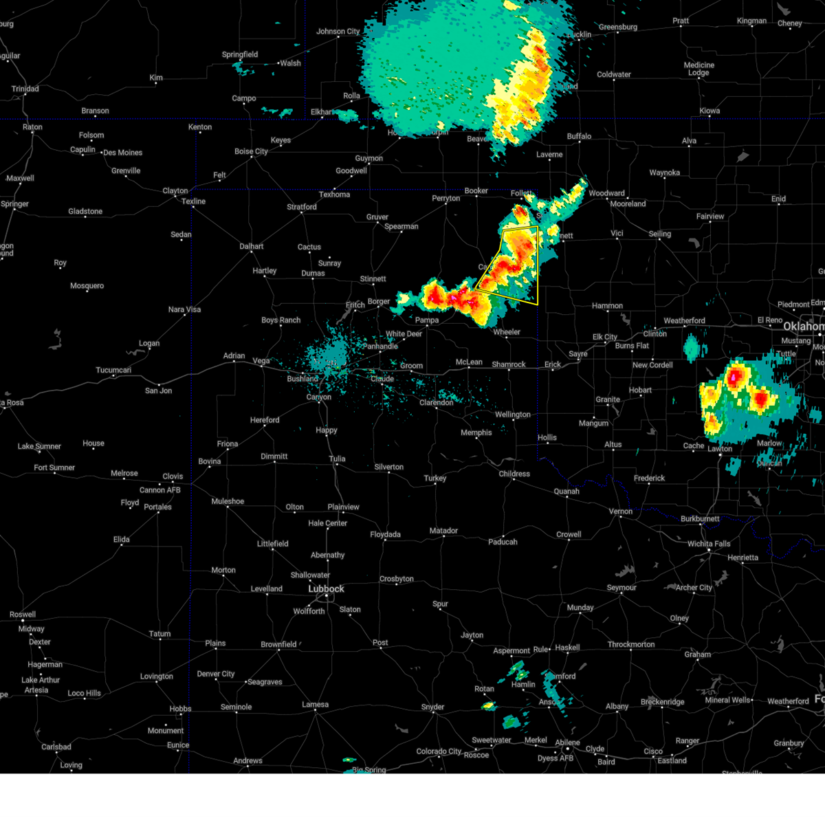 Svrama the national weather service in amarillo has issued a * severe thunderstorm warning for, southeastern lipscomb county in the panhandle of texas, hemphill county in the panhandle of texas, * until 1030 pm cdt. * at 925 pm cdt, severe thunderstorms were located along a line extending from higgins to 4 miles east of lake marvin to 9 miles southeast of canadian, moving east at 35 mph (radar indicated). Hazards include 60 mph wind gusts and quarter size hail. Minor damage to roofs, siding, and trees is possible. Hail damage to vehicles is expected. Svrama the national weather service in amarillo has issued a * severe thunderstorm warning for, southeastern lipscomb county in the panhandle of texas, hemphill county in the panhandle of texas, * until 1030 pm cdt. * at 925 pm cdt, severe thunderstorms were located along a line extending from higgins to 4 miles east of lake marvin to 9 miles southeast of canadian, moving east at 35 mph (radar indicated). Hazards include 60 mph wind gusts and quarter size hail. Minor damage to roofs, siding, and trees is possible. Hail damage to vehicles is expected.
|
| 5/3/2024 9:18 PM CDT |
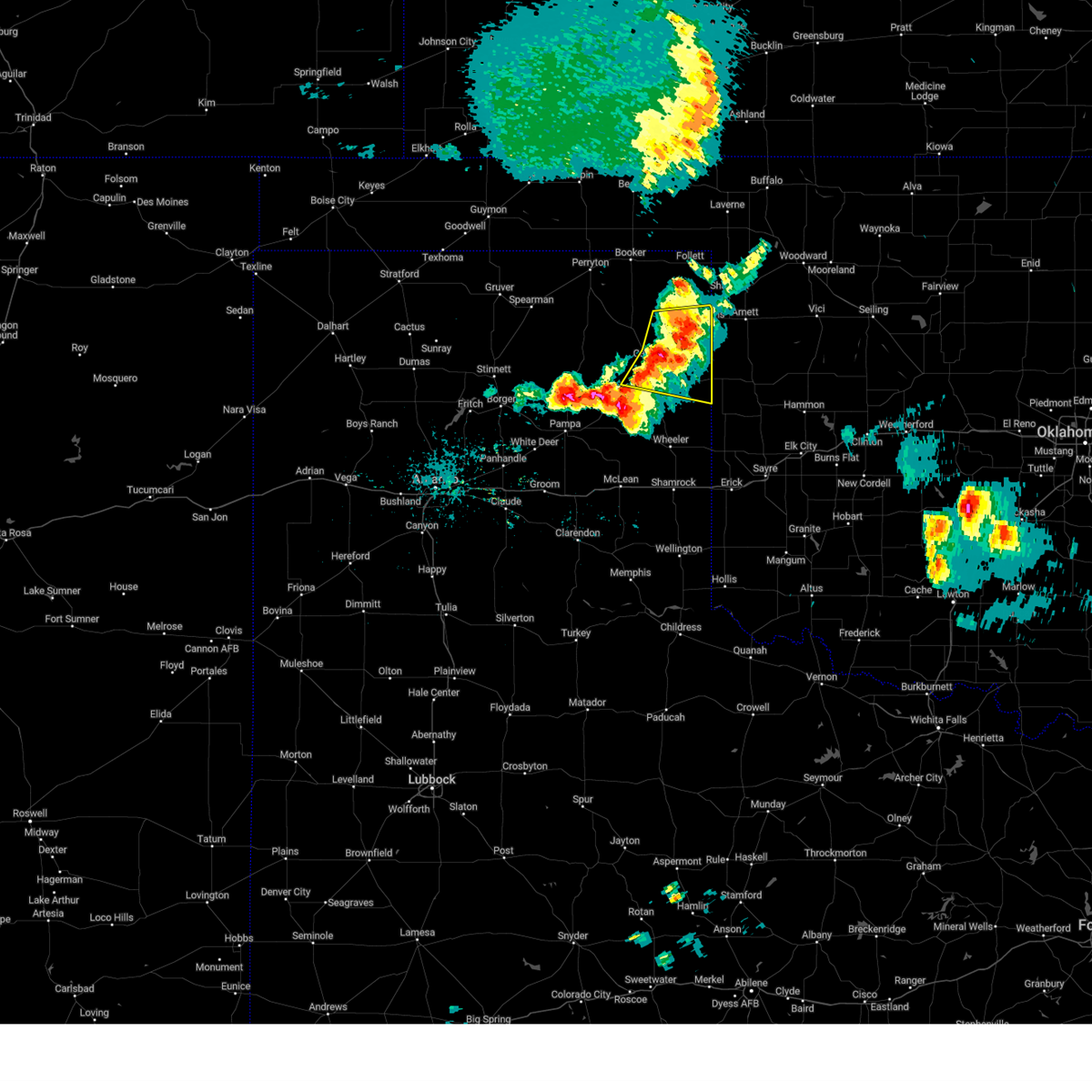 At 917 pm cdt, severe thunderstorms were located along a line extending from near higgins to lake marvin to 10 miles southeast of canadian, moving east at 35 mph (radar indicated). Hazards include 60 mph wind gusts and quarter size hail. Minor damage to roofs, siding, and trees is possible. hail damage to vehicles is expected. Locations impacted include, canadian, higgins, glazier, and lake marvin. At 917 pm cdt, severe thunderstorms were located along a line extending from near higgins to lake marvin to 10 miles southeast of canadian, moving east at 35 mph (radar indicated). Hazards include 60 mph wind gusts and quarter size hail. Minor damage to roofs, siding, and trees is possible. hail damage to vehicles is expected. Locations impacted include, canadian, higgins, glazier, and lake marvin.
|
| 5/3/2024 9:18 PM CDT |
 the severe thunderstorm warning has been cancelled and is no longer in effect the severe thunderstorm warning has been cancelled and is no longer in effect
|
| 5/3/2024 9:03 PM CDT |
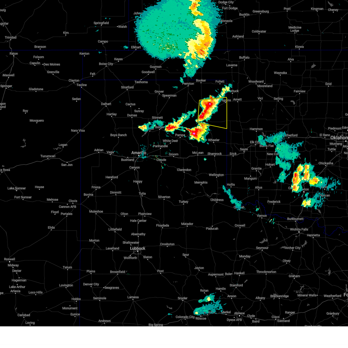 At 903 pm cdt, severe thunderstorms were located along a line extending from 8 miles southeast of lipscomb to 5 miles south of glazier to 6 miles southwest of canadian, moving east at 35 mph (radar indicated). Hazards include 60 mph wind gusts and quarter size hail. Minor damage to roofs, siding, and trees is possible. hail damage to vehicles is expected. Locations impacted include, canadian, higgins, glazier, and lake marvin. At 903 pm cdt, severe thunderstorms were located along a line extending from 8 miles southeast of lipscomb to 5 miles south of glazier to 6 miles southwest of canadian, moving east at 35 mph (radar indicated). Hazards include 60 mph wind gusts and quarter size hail. Minor damage to roofs, siding, and trees is possible. hail damage to vehicles is expected. Locations impacted include, canadian, higgins, glazier, and lake marvin.
|
| 5/3/2024 8:41 PM CDT |
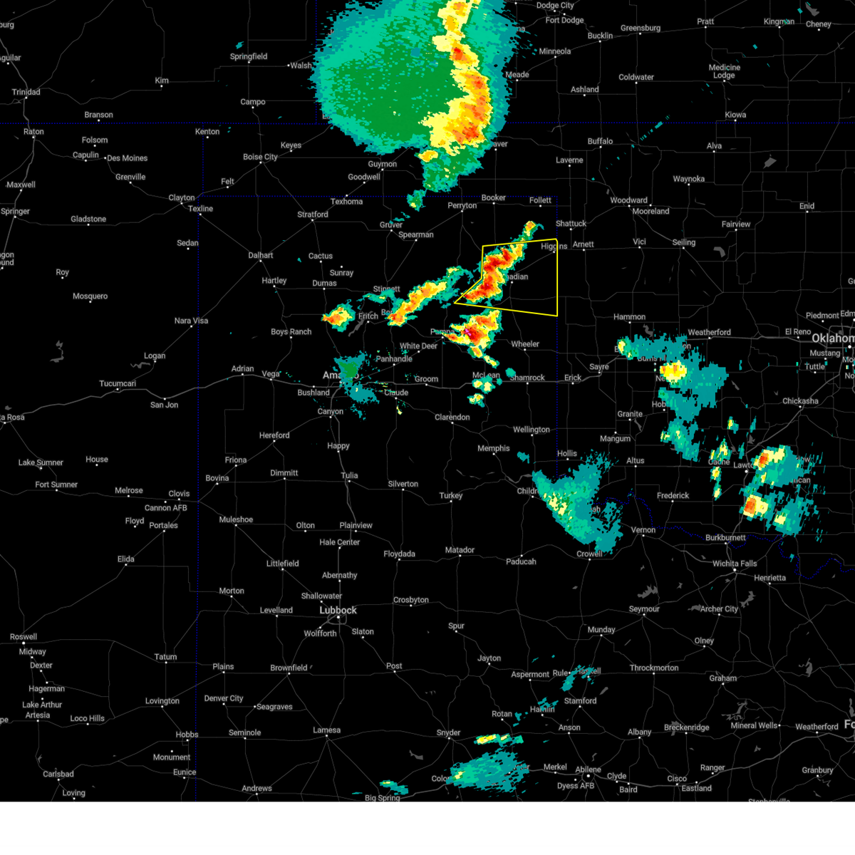 Svrama the national weather service in amarillo has issued a * severe thunderstorm warning for, southern lipscomb county in the panhandle of texas, northeastern roberts county in the panhandle of texas, hemphill county in the panhandle of texas, southeastern ochiltree county in the panhandle of texas, * until 930 pm cdt. * at 840 pm cdt, severe thunderstorms were located along a line extending from 9 miles northwest of glazier to 6 miles west of canadian to 5 miles north of miami, moving east at 45 mph (radar indicated). Hazards include 60 mph wind gusts and quarter size hail. Minor damage to roofs, siding, and trees is possible. Hail damage to vehicles is expected. Svrama the national weather service in amarillo has issued a * severe thunderstorm warning for, southern lipscomb county in the panhandle of texas, northeastern roberts county in the panhandle of texas, hemphill county in the panhandle of texas, southeastern ochiltree county in the panhandle of texas, * until 930 pm cdt. * at 840 pm cdt, severe thunderstorms were located along a line extending from 9 miles northwest of glazier to 6 miles west of canadian to 5 miles north of miami, moving east at 45 mph (radar indicated). Hazards include 60 mph wind gusts and quarter size hail. Minor damage to roofs, siding, and trees is possible. Hail damage to vehicles is expected.
|
| 9/18/2023 5:38 PM CDT |
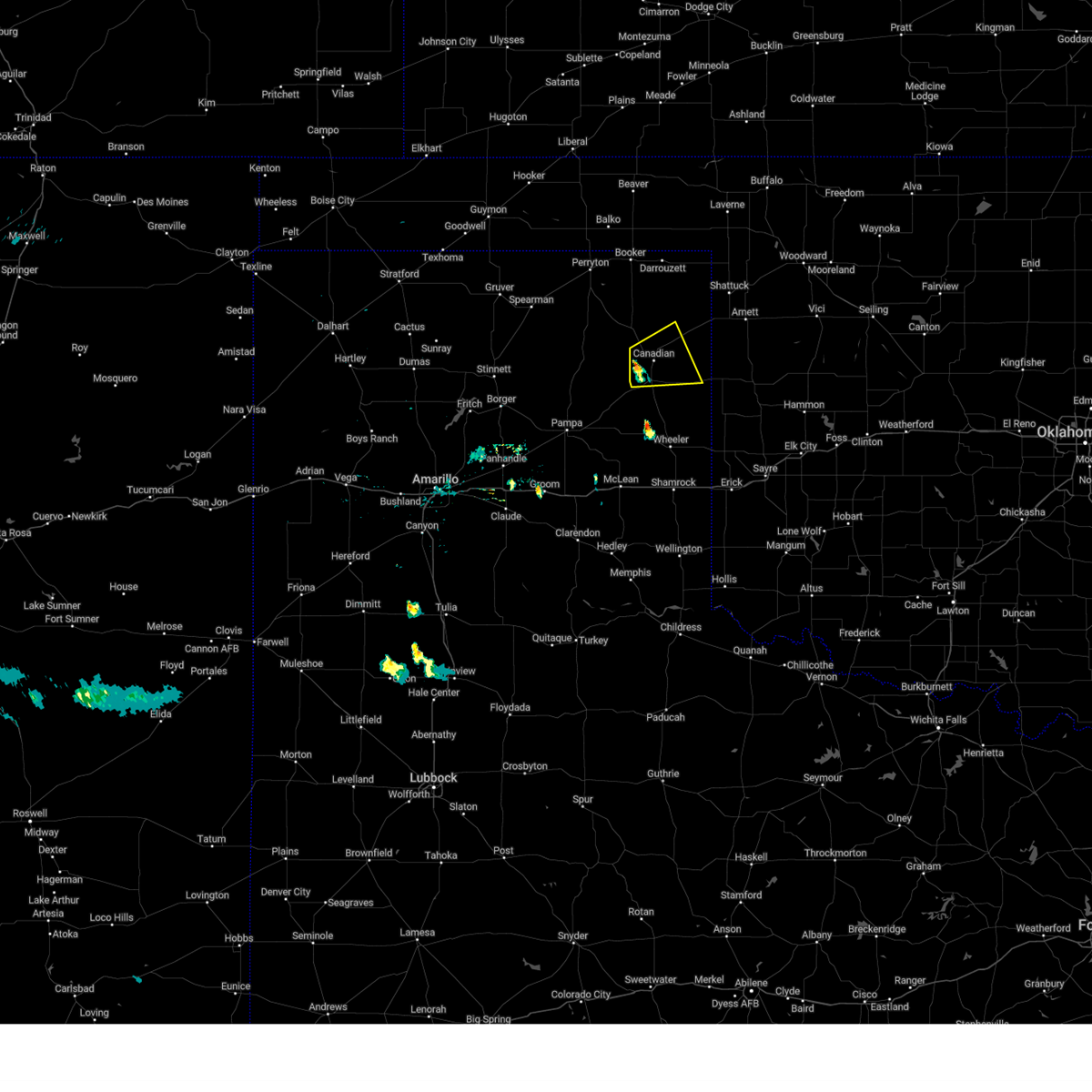 At 538 pm cdt, a severe thunderstorm was located 4 miles west of canadian, moving east at 20 mph (radar indicated). Hazards include 60 mph wind gusts and quarter size hail. Minor damage to roofs, siding, and trees is possible. Hail damage to vehicles is expected. At 538 pm cdt, a severe thunderstorm was located 4 miles west of canadian, moving east at 20 mph (radar indicated). Hazards include 60 mph wind gusts and quarter size hail. Minor damage to roofs, siding, and trees is possible. Hail damage to vehicles is expected.
|
| 9/10/2023 10:08 PM CDT |
 At 1008 pm cdt, severe thunderstorms were located along a line extending from 4 miles northwest of canadian to 11 miles northwest of miami to 11 miles east of stinnett, moving south at 30 mph (radar indicated). Hazards include 60 mph wind gusts and quarter size hail. Minor damage to roofs, siding, and trees is possible. hail damage to vehicles is expected. locations impacted include, spearman, canadian, miami, wolf creek park, lora, farnsworth, waka, and codman. hail threat, radar indicated max hail size, 1. 00in wind threat, radar indicated max wind gust, 60 mph. At 1008 pm cdt, severe thunderstorms were located along a line extending from 4 miles northwest of canadian to 11 miles northwest of miami to 11 miles east of stinnett, moving south at 30 mph (radar indicated). Hazards include 60 mph wind gusts and quarter size hail. Minor damage to roofs, siding, and trees is possible. hail damage to vehicles is expected. locations impacted include, spearman, canadian, miami, wolf creek park, lora, farnsworth, waka, and codman. hail threat, radar indicated max hail size, 1. 00in wind threat, radar indicated max wind gust, 60 mph.
|
| 9/10/2023 9:35 PM CDT |
 At 934 pm cdt, severe thunderstorms were located along a line extending from wolf creek park to 7 miles south of waka, moving south at 25 mph (automated weather equipment. at 930 pm cdt, automated weather equipment recorded a 62 mph wind gust at the spearman airport). Hazards include 70 mph wind gusts and quarter size hail. Expect some tree damage. damage is likely to mobile homes, roofs, and outbuildings. Hail damage to vehicles is expected. At 934 pm cdt, severe thunderstorms were located along a line extending from wolf creek park to 7 miles south of waka, moving south at 25 mph (automated weather equipment. at 930 pm cdt, automated weather equipment recorded a 62 mph wind gust at the spearman airport). Hazards include 70 mph wind gusts and quarter size hail. Expect some tree damage. damage is likely to mobile homes, roofs, and outbuildings. Hail damage to vehicles is expected.
|
| 8/13/2023 7:16 PM CDT |
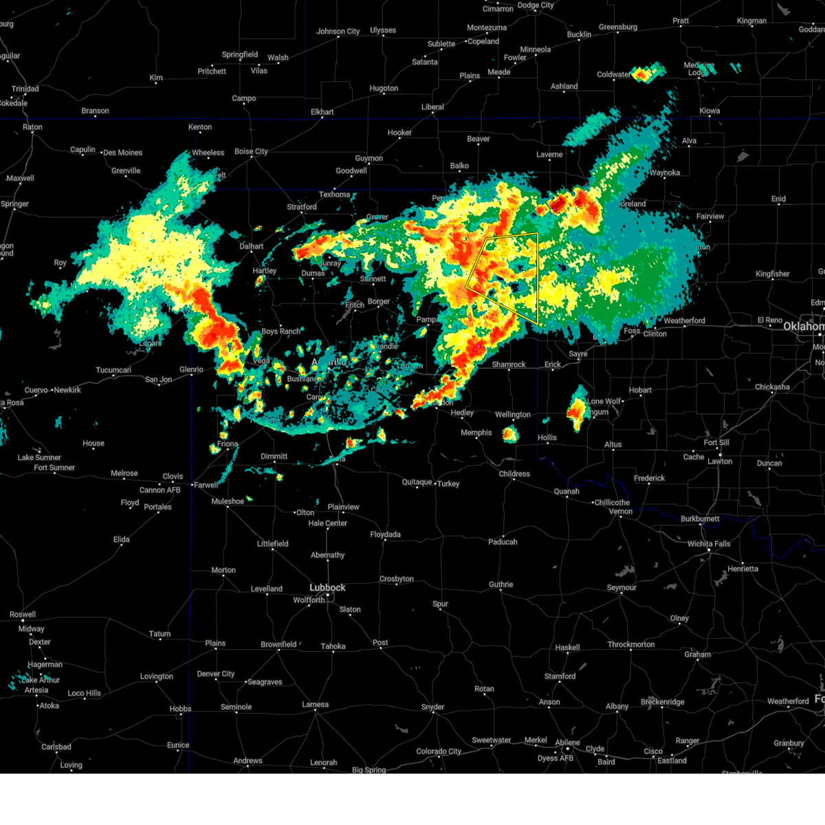 At 716 pm cdt, severe thunderstorms were located along a line extending from 5 miles north of glazier to 7 miles east of lora, moving east at 35 mph (radar indicated). Hazards include 60 mph wind gusts. Minor damage to roofs, siding, and trees is possible. locations impacted include, canadian, higgins, allison, glazier, and lake marvin. hail threat, radar indicated max hail size, <. 75 in wind threat, radar indicated max wind gust, 60 mph. At 716 pm cdt, severe thunderstorms were located along a line extending from 5 miles north of glazier to 7 miles east of lora, moving east at 35 mph (radar indicated). Hazards include 60 mph wind gusts. Minor damage to roofs, siding, and trees is possible. locations impacted include, canadian, higgins, allison, glazier, and lake marvin. hail threat, radar indicated max hail size, <. 75 in wind threat, radar indicated max wind gust, 60 mph.
|
| 8/13/2023 6:56 PM CDT |
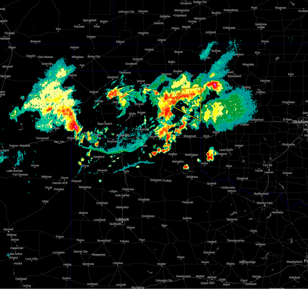 At 656 pm cdt, severe thunderstorms were located along a line extending from near higgins to 8 miles north of lora, moving south at 5 mph (radar indicated). Hazards include 60 mph wind gusts. Minor damage to roofs, siding, and trees is possible. locations impacted include, canadian, higgins, allison, glazier, and lake marvin. hail threat, radar indicated max hail size, <. 75 in wind threat, radar indicated max wind gust, 60 mph. At 656 pm cdt, severe thunderstorms were located along a line extending from near higgins to 8 miles north of lora, moving south at 5 mph (radar indicated). Hazards include 60 mph wind gusts. Minor damage to roofs, siding, and trees is possible. locations impacted include, canadian, higgins, allison, glazier, and lake marvin. hail threat, radar indicated max hail size, <. 75 in wind threat, radar indicated max wind gust, 60 mph.
|
| 8/13/2023 6:46 PM CDT |
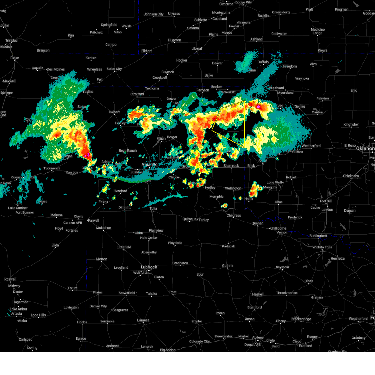 At 645 pm cdt, severe thunderstorms were located along a line extending from near higgins to 4 miles west of canadian, moving southeast at 10 mph (radar indicated). Hazards include 60 mph wind gusts. Minor damage to roofs, siding, and trees is possible. locations impacted include, canadian, higgins, allison, glazier, and lake marvin. hail threat, radar indicated max hail size, <. 75 in wind threat, radar indicated max wind gust, 60 mph. At 645 pm cdt, severe thunderstorms were located along a line extending from near higgins to 4 miles west of canadian, moving southeast at 10 mph (radar indicated). Hazards include 60 mph wind gusts. Minor damage to roofs, siding, and trees is possible. locations impacted include, canadian, higgins, allison, glazier, and lake marvin. hail threat, radar indicated max hail size, <. 75 in wind threat, radar indicated max wind gust, 60 mph.
|
| 8/13/2023 6:15 PM CDT |
 At 614 pm cdt, severe thunderstorms were located along a line extending from 7 miles south of lipscomb to 4 miles southwest of canadian, moving southeast at 20 mph (radar indicated). Hazards include ping pong ball size hail and 60 mph wind gusts. Minor damage to roofs, siding, and trees is possible. people and animals outdoors will be injured. expect hail damage to roofs, siding, windows, and vehicles. locations impacted include, lipscomb, canadian, higgins, allison, glazier, and lake marvin. hail threat, radar indicated max hail size, 1. 50 in wind threat, radar indicated max wind gust, 60 mph. At 614 pm cdt, severe thunderstorms were located along a line extending from 7 miles south of lipscomb to 4 miles southwest of canadian, moving southeast at 20 mph (radar indicated). Hazards include ping pong ball size hail and 60 mph wind gusts. Minor damage to roofs, siding, and trees is possible. people and animals outdoors will be injured. expect hail damage to roofs, siding, windows, and vehicles. locations impacted include, lipscomb, canadian, higgins, allison, glazier, and lake marvin. hail threat, radar indicated max hail size, 1. 50 in wind threat, radar indicated max wind gust, 60 mph.
|
| 8/13/2023 6:03 PM CDT |
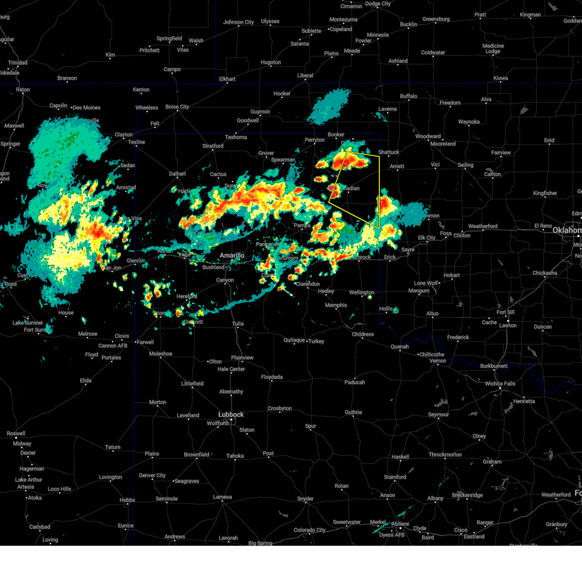 At 603 pm cdt, severe thunderstorms were located along a line extending from 6 miles southwest of lipscomb to 5 miles southwest of canadian, moving southeast at 15 mph (radar indicated). Hazards include ping pong ball size hail and 60 mph wind gusts. Minor damage to roofs, siding, and trees is possible. people and animals outdoors will be injured. Expect hail damage to roofs, siding, windows, and vehicles. At 603 pm cdt, severe thunderstorms were located along a line extending from 6 miles southwest of lipscomb to 5 miles southwest of canadian, moving southeast at 15 mph (radar indicated). Hazards include ping pong ball size hail and 60 mph wind gusts. Minor damage to roofs, siding, and trees is possible. people and animals outdoors will be injured. Expect hail damage to roofs, siding, windows, and vehicles.
|
| 7/9/2023 1:40 AM CDT |
 At 140 am cdt, automated weather equipment reported severe thunderstorms were located along a line extending from 5 miles north of durham to near new mobeetie to 5 miles southeast of kingsmill, moving southeast at 60 mph (automated weather equipment. at 131 am cdt, a 69 mph wind gust was recorded 10 miles east of miami). Hazards include 70 mph wind gusts. Expect some tree damage. damage is likely to mobile homes, roofs, and outbuildings. locations impacted include, pampa, canadian, shamrock, miami, briscoe, wheeler, mclean, lefors, new mobeetie, lake mcclellan, twitty, allison, lela, glazier, lake marvin, kellerville, lora, alanreed, codman and mobeetie. thunderstorm damage threat, considerable hail threat, radar indicated max hail size, <. 75 in wind threat, observed max wind gust, 70 mph. At 140 am cdt, automated weather equipment reported severe thunderstorms were located along a line extending from 5 miles north of durham to near new mobeetie to 5 miles southeast of kingsmill, moving southeast at 60 mph (automated weather equipment. at 131 am cdt, a 69 mph wind gust was recorded 10 miles east of miami). Hazards include 70 mph wind gusts. Expect some tree damage. damage is likely to mobile homes, roofs, and outbuildings. locations impacted include, pampa, canadian, shamrock, miami, briscoe, wheeler, mclean, lefors, new mobeetie, lake mcclellan, twitty, allison, lela, glazier, lake marvin, kellerville, lora, alanreed, codman and mobeetie. thunderstorm damage threat, considerable hail threat, radar indicated max hail size, <. 75 in wind threat, observed max wind gust, 70 mph.
|
| 7/9/2023 1:35 AM CDT |
 At 135 am cdt, automated weather equipment reported severe thunderstorms were located along a line extending from 8 miles north of durham to 5 miles north of new mobeetie to 3 miles southwest of pampa, moving southeast at 60 mph (automated weather equipment. at 127 am cdt, a 66 mph wind gust was recorded 10 miles east of miami). Hazards include 70 mph wind gusts. Expect some tree damage. damage is likely to mobile homes, roofs, and outbuildings. locations impacted include, pampa, canadian, shamrock, miami, briscoe, wheeler, mclean, lefors, new mobeetie, lake mcclellan, twitty, allison, lela, glazier, lake marvin, kellerville, lora, alanreed, codman and mobeetie. thunderstorm damage threat, considerable hail threat, radar indicated max hail size, <. 75 in wind threat, observed max wind gust, 70 mph. At 135 am cdt, automated weather equipment reported severe thunderstorms were located along a line extending from 8 miles north of durham to 5 miles north of new mobeetie to 3 miles southwest of pampa, moving southeast at 60 mph (automated weather equipment. at 127 am cdt, a 66 mph wind gust was recorded 10 miles east of miami). Hazards include 70 mph wind gusts. Expect some tree damage. damage is likely to mobile homes, roofs, and outbuildings. locations impacted include, pampa, canadian, shamrock, miami, briscoe, wheeler, mclean, lefors, new mobeetie, lake mcclellan, twitty, allison, lela, glazier, lake marvin, kellerville, lora, alanreed, codman and mobeetie. thunderstorm damage threat, considerable hail threat, radar indicated max hail size, <. 75 in wind threat, observed max wind gust, 70 mph.
|
| 7/9/2023 1:30 AM CDT |
 At 130 am cdt, automated weather equipment reported severe thunderstorms were located along a line extending from 9 miles north of durham to 6 miles north of new mobeetie to 3 miles southwest of pampa, moving southeast at 60 mph (automated weather equipment. at 122 am cdt, a 63 mph was recorded 6 miles east of canadian). Hazards include 60 mph wind gusts and penny size hail. Minor damage to roofs, siding, and trees is possible. locations impacted include, pampa, canadian, shamrock, miami, briscoe, wheeler, mclean, lefors, new mobeetie, lake mcclellan, twitty, allison, lela, glazier, lake marvin, kellerville, lora, alanreed, codman and mobeetie. hail threat, radar indicated max hail size, 0. 75in wind threat, observed max wind gust, 60 mph. At 130 am cdt, automated weather equipment reported severe thunderstorms were located along a line extending from 9 miles north of durham to 6 miles north of new mobeetie to 3 miles southwest of pampa, moving southeast at 60 mph (automated weather equipment. at 122 am cdt, a 63 mph was recorded 6 miles east of canadian). Hazards include 60 mph wind gusts and penny size hail. Minor damage to roofs, siding, and trees is possible. locations impacted include, pampa, canadian, shamrock, miami, briscoe, wheeler, mclean, lefors, new mobeetie, lake mcclellan, twitty, allison, lela, glazier, lake marvin, kellerville, lora, alanreed, codman and mobeetie. hail threat, radar indicated max hail size, 0. 75in wind threat, observed max wind gust, 60 mph.
|
| 7/9/2023 1:25 AM CDT | Severe gusts occurred from 125 am cdt to 140 am cdt with a peak gust of 69 mph at 131 am cd in hemphill county TX, 14.4 miles NNE of Canadian, TX |
| 7/9/2023 1:22 AM CDT | Severe gusts occurred from 122 am cdt through 132 am cdt with a peak of 63 mph at 122 am cd in hemphill county TX, 5.8 miles W of Canadian, TX |
| 7/9/2023 1:17 AM CDT |
 At 117 am cdt, severe thunderstorms were located along a line extending from near higgins to near lora to 7 miles northeast of skellytown, moving southeast at 60 mph (radar indicated). Hazards include 60 mph wind gusts and penny size hail. minor damage to roofs, siding, and trees is possible At 117 am cdt, severe thunderstorms were located along a line extending from near higgins to near lora to 7 miles northeast of skellytown, moving southeast at 60 mph (radar indicated). Hazards include 60 mph wind gusts and penny size hail. minor damage to roofs, siding, and trees is possible
|
| 7/9/2023 1:14 AM CDT |
 At 113 am cdt, automated weather equipment reported severe thunderstorms were located along a line extending from near higgins to 4 miles northwest of lora to 9 miles north of skellytown, moving south at 50 mph (automated weather equipment. at 1255 am cdt, a 61 mph wind gust was recorded 8 miles west of lipscomb). Hazards include 60 mph wind gusts and penny size hail. Minor damage to roofs, siding, and trees is possible. locations impacted include, lipscomb, canadian, miami, higgins, lora, glazier, codman and lake marvin. hail threat, radar indicated max hail size, 0. 75in wind threat, observed max wind gust, 60 mph. At 113 am cdt, automated weather equipment reported severe thunderstorms were located along a line extending from near higgins to 4 miles northwest of lora to 9 miles north of skellytown, moving south at 50 mph (automated weather equipment. at 1255 am cdt, a 61 mph wind gust was recorded 8 miles west of lipscomb). Hazards include 60 mph wind gusts and penny size hail. Minor damage to roofs, siding, and trees is possible. locations impacted include, lipscomb, canadian, miami, higgins, lora, glazier, codman and lake marvin. hail threat, radar indicated max hail size, 0. 75in wind threat, observed max wind gust, 60 mph.
|
| 7/9/2023 12:58 AM CDT |
 At 1257 am cdt, severe thunderstorms were located along a line extending from 6 miles northwest of higgins to 17 miles southeast of spearman, moving southeast at 45 mph (radar indicated). Hazards include 60 mph wind gusts and quarter size hail. Minor damage to roofs, siding, and trees is possible. hail damage to vehicles is expected. locations impacted include, lipscomb, canadian, miami, higgins, wolf creek park, lora, glazier, codman and lake marvin. hail threat, radar indicated max hail size, 1. 00in wind threat, radar indicated max wind gust, 60 mph. At 1257 am cdt, severe thunderstorms were located along a line extending from 6 miles northwest of higgins to 17 miles southeast of spearman, moving southeast at 45 mph (radar indicated). Hazards include 60 mph wind gusts and quarter size hail. Minor damage to roofs, siding, and trees is possible. hail damage to vehicles is expected. locations impacted include, lipscomb, canadian, miami, higgins, wolf creek park, lora, glazier, codman and lake marvin. hail threat, radar indicated max hail size, 1. 00in wind threat, radar indicated max wind gust, 60 mph.
|
| 7/9/2023 12:53 AM CDT | Wt mesonet site had severe gusts from 1253 am cdt to 1255 am cdt... with a peak of 61 mph at 1255 am cd in lipscomb county TX, 21.5 miles S of Canadian, TX |
| 7/9/2023 12:50 AM CDT |
 At 1249 am cdt, severe thunderstorms were located along a line extending from 8 miles east of lipscomb to 13 miles southeast of spearman, moving southeast at 45 mph (radar indicated). Hazards include 60 mph wind gusts and quarter size hail. Minor damage to roofs, siding, and trees is possible. Hail damage to vehicles is expected. At 1249 am cdt, severe thunderstorms were located along a line extending from 8 miles east of lipscomb to 13 miles southeast of spearman, moving southeast at 45 mph (radar indicated). Hazards include 60 mph wind gusts and quarter size hail. Minor damage to roofs, siding, and trees is possible. Hail damage to vehicles is expected.
|
| 7/7/2023 7:43 PM CDT |
 At 743 pm cdt, severe thunderstorms were located along a line extending from 6 miles south of follett to lake marvin to near wheeler, moving east at 45 mph (radar indicated). Hazards include 70 mph wind gusts and penny size hail. Expect some tree damage. damage is likely to mobile homes, roofs, and outbuildings. Locations impacted include, lipscomb, canadian, briscoe, wheeler, booker, follett, higgins, darrouzett, elmwood, new mobeetie, allison, glazier, lake marvin, slapout and mobeetie. At 743 pm cdt, severe thunderstorms were located along a line extending from 6 miles south of follett to lake marvin to near wheeler, moving east at 45 mph (radar indicated). Hazards include 70 mph wind gusts and penny size hail. Expect some tree damage. damage is likely to mobile homes, roofs, and outbuildings. Locations impacted include, lipscomb, canadian, briscoe, wheeler, booker, follett, higgins, darrouzett, elmwood, new mobeetie, allison, glazier, lake marvin, slapout and mobeetie.
|
| 7/7/2023 7:27 PM CDT | Mesonet gusted to 76 mph at 1927cdt... and quickly measured a 95 and 96 mph gust over the next two minute. last gust of 61 mph was at 1935cd in lipscomb county TX, 21.5 miles S of Canadian, TX |
| 7/7/2023 7:22 PM CDT | Storm damage reported in hemphill county TX, 14.4 miles NNE of Canadian, TX |
| 7/7/2023 7:22 PM CDT |
 At 722 pm cdt, severe thunderstorms were located along a line extending from 5 miles southwest of darrouzett to near canadian to 7 miles northwest of kellerville, moving east at 50 mph (radar indicated). Hazards include 70 mph wind gusts and penny size hail. Expect some tree damage. Damage is likely to mobile homes, roofs, and outbuildings. At 722 pm cdt, severe thunderstorms were located along a line extending from 5 miles southwest of darrouzett to near canadian to 7 miles northwest of kellerville, moving east at 50 mph (radar indicated). Hazards include 70 mph wind gusts and penny size hail. Expect some tree damage. Damage is likely to mobile homes, roofs, and outbuildings.
|
| 7/7/2023 7:04 PM CDT |
 At 703 pm cdt, severe thunderstorms were located along a line extending from 6 miles southwest of wolf creek park to 7 miles northwest of lora to 4 miles north of lefors, moving east at 45 mph (radar indicated). Hazards include 70 mph wind gusts and penny size hail. Expect some tree damage. damage is likely to mobile homes, roofs, and outbuildings. Locations impacted include, pampa, lipscomb, canadian, miami, briscoe, wheeler, lefors, higgins, wolf creek park, new mobeetie, allison, glazier, lake marvin, lora, codman and mobeetie. At 703 pm cdt, severe thunderstorms were located along a line extending from 6 miles southwest of wolf creek park to 7 miles northwest of lora to 4 miles north of lefors, moving east at 45 mph (radar indicated). Hazards include 70 mph wind gusts and penny size hail. Expect some tree damage. damage is likely to mobile homes, roofs, and outbuildings. Locations impacted include, pampa, lipscomb, canadian, miami, briscoe, wheeler, lefors, higgins, wolf creek park, new mobeetie, allison, glazier, lake marvin, lora, codman and mobeetie.
|
| 7/7/2023 6:33 PM CDT |
 At 632 pm cdt, severe thunderstorms were located along a line extending from 6 miles east of spearman to 20 miles north of pampa to 3 miles southwest of skellytown, moving east at 50 mph (radar indicated). Hazards include 70 mph wind gusts and quarter size hail. Expect some tree damage. damage is likely to mobile homes, roofs, and outbuildings. Hail damage to vehicles is expected. At 632 pm cdt, severe thunderstorms were located along a line extending from 6 miles east of spearman to 20 miles north of pampa to 3 miles southwest of skellytown, moving east at 50 mph (radar indicated). Hazards include 70 mph wind gusts and quarter size hail. Expect some tree damage. damage is likely to mobile homes, roofs, and outbuildings. Hail damage to vehicles is expected.
|
| 7/6/2023 4:44 AM CDT | Storm damage reported in hemphill county TX, 14.4 miles NNE of Canadian, TX |
| 7/6/2023 4:21 AM CDT |
 At 420 am cdt, severe thunderstorms were located along a line extending from 8 miles northwest of skellytown to 7 miles southwest of canadian to 3 miles south of higgins, moving south at 35 mph (radar indicated). Hazards include 60 mph wind gusts. Minor damage to roofs, siding, and trees is possible. locations impacted include, borger, canadian, miami, stinnett, lora, glazier, codman and lake marvin. hail threat, radar indicated max hail size, <. 75 in wind threat, radar indicated max wind gust, 60 mph. At 420 am cdt, severe thunderstorms were located along a line extending from 8 miles northwest of skellytown to 7 miles southwest of canadian to 3 miles south of higgins, moving south at 35 mph (radar indicated). Hazards include 60 mph wind gusts. Minor damage to roofs, siding, and trees is possible. locations impacted include, borger, canadian, miami, stinnett, lora, glazier, codman and lake marvin. hail threat, radar indicated max hail size, <. 75 in wind threat, radar indicated max wind gust, 60 mph.
|
| 7/6/2023 4:10 AM CDT |
 At 409 am cdt, severe thunderstorms were located along a line extending from 9 miles northeast of borger to 6 miles west of canadian to near higgins, moving south at 35 mph (radar indicated). Hazards include 60 mph wind gusts. Minor damage to roofs, siding, and trees is possible. locations impacted include, borger, lipscomb, canadian, miami, stinnett, higgins, lora, glazier, codman and lake marvin. hail threat, radar indicated max hail size, <. 75 in wind threat, observed max wind gust, 60 mph. At 409 am cdt, severe thunderstorms were located along a line extending from 9 miles northeast of borger to 6 miles west of canadian to near higgins, moving south at 35 mph (radar indicated). Hazards include 60 mph wind gusts. Minor damage to roofs, siding, and trees is possible. locations impacted include, borger, lipscomb, canadian, miami, stinnett, higgins, lora, glazier, codman and lake marvin. hail threat, radar indicated max hail size, <. 75 in wind threat, observed max wind gust, 60 mph.
|
| 7/6/2023 3:59 AM CDT |
 At 359 am cdt, severe thunderstorms were located along a line extending from 8 miles east of stinnett to 8 miles northwest of canadian to 6 miles north of higgins, moving south at 35 mph (radar indicated). Hazards include 60 mph wind gusts. Minor damage to roofs, siding, and trees is possible. locations impacted include, borger, lipscomb, canadian, miami, stinnett, higgins, lora, glazier, codman and lake marvin. hail threat, radar indicated max hail size, <. 75 in wind threat, observed max wind gust, 60 mph. At 359 am cdt, severe thunderstorms were located along a line extending from 8 miles east of stinnett to 8 miles northwest of canadian to 6 miles north of higgins, moving south at 35 mph (radar indicated). Hazards include 60 mph wind gusts. Minor damage to roofs, siding, and trees is possible. locations impacted include, borger, lipscomb, canadian, miami, stinnett, higgins, lora, glazier, codman and lake marvin. hail threat, radar indicated max hail size, <. 75 in wind threat, observed max wind gust, 60 mph.
|
| 7/6/2023 3:49 AM CDT |
 At 348 am cdt, automated weather equipment reported severe thunderstorms were located along a line extending from near pringle to 11 miles southeast of wolf creek park to 8 miles south of follett, moving south at 30 mph (radar indicated). Hazards include 60 mph wind gusts. Minor damage to roofs, siding, and trees is possible. locations impacted include, borger, lipscomb, canadian, miami, fritch, stinnett, follett, higgins, sanford, wolf creek park, glazier, lake marvin, pringle, lora and codman. hail threat, radar indicated max hail size, <. 75 in wind threat, observed max wind gust, 60 mph. At 348 am cdt, automated weather equipment reported severe thunderstorms were located along a line extending from near pringle to 11 miles southeast of wolf creek park to 8 miles south of follett, moving south at 30 mph (radar indicated). Hazards include 60 mph wind gusts. Minor damage to roofs, siding, and trees is possible. locations impacted include, borger, lipscomb, canadian, miami, fritch, stinnett, follett, higgins, sanford, wolf creek park, glazier, lake marvin, pringle, lora and codman. hail threat, radar indicated max hail size, <. 75 in wind threat, observed max wind gust, 60 mph.
|
| 7/6/2023 3:24 AM CDT |
 At 324 am cdt, severe thunderstorms were located along a line extending from 4 miles northwest of morse to 3 miles northeast of wolf creek park to 5 miles north of follett, moving south at 35 mph (automated weather equipment. at 315 am cdt, a 60 mph wind gust was recorded at the perryton airport). Hazards include 60 mph wind gusts. minor damage to roofs, siding, and trees is possible At 324 am cdt, severe thunderstorms were located along a line extending from 4 miles northwest of morse to 3 miles northeast of wolf creek park to 5 miles north of follett, moving south at 35 mph (automated weather equipment. at 315 am cdt, a 60 mph wind gust was recorded at the perryton airport). Hazards include 60 mph wind gusts. minor damage to roofs, siding, and trees is possible
|
| 7/5/2023 6:08 PM CDT |
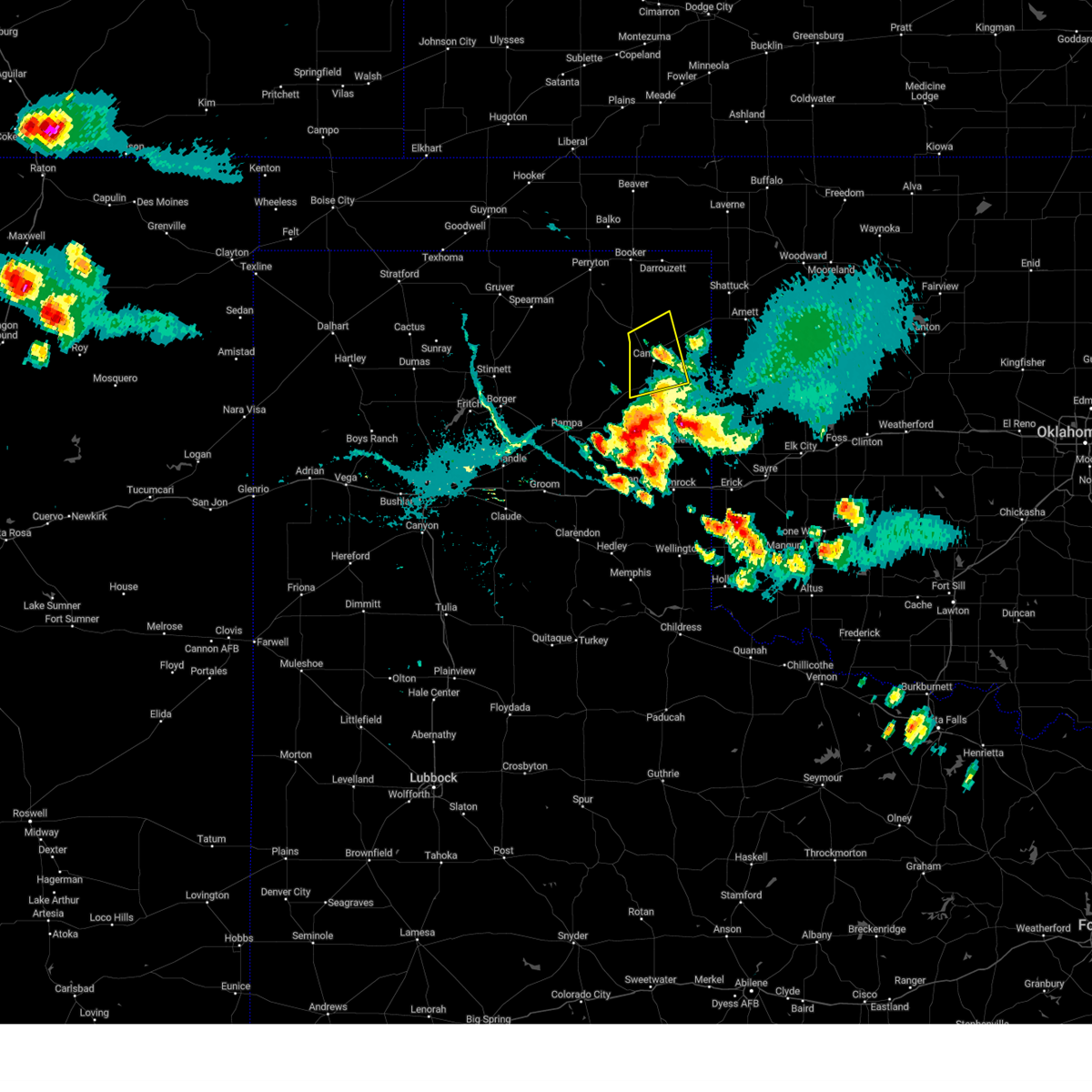 The severe thunderstorm warning for southwestern lipscomb and northwestern hemphill counties will expire at 615 pm cdt, the storm which prompted the warning has weakened below severe limits, and no longer poses an immediate threat to life or property. therefore, the warning will be allowed to expire. however gusty winds and heavy rain are still possible with this thunderstorm. The severe thunderstorm warning for southwestern lipscomb and northwestern hemphill counties will expire at 615 pm cdt, the storm which prompted the warning has weakened below severe limits, and no longer poses an immediate threat to life or property. therefore, the warning will be allowed to expire. however gusty winds and heavy rain are still possible with this thunderstorm.
|
| 7/5/2023 5:40 PM CDT |
 At 539 pm cdt, severe thunderstorms were located along a line extending from 4 miles north of canadian to 4 miles east of lora, moving east at 25 mph (radar indicated). Hazards include 60 mph wind gusts and half dollar size hail. Minor damage to roofs, siding, and trees is possible. hail damage to vehicles is expected. locations impacted include, canadian and glazier. hail threat, radar indicated max hail size, 1. 25 in wind threat, radar indicated max wind gust, 60 mph. At 539 pm cdt, severe thunderstorms were located along a line extending from 4 miles north of canadian to 4 miles east of lora, moving east at 25 mph (radar indicated). Hazards include 60 mph wind gusts and half dollar size hail. Minor damage to roofs, siding, and trees is possible. hail damage to vehicles is expected. locations impacted include, canadian and glazier. hail threat, radar indicated max hail size, 1. 25 in wind threat, radar indicated max wind gust, 60 mph.
|
| 7/5/2023 5:25 PM CDT | Measured by a west texas mesone in hemphill county TX, 15.7 miles NNE of Canadian, TX |
| 7/5/2023 5:04 PM CDT |
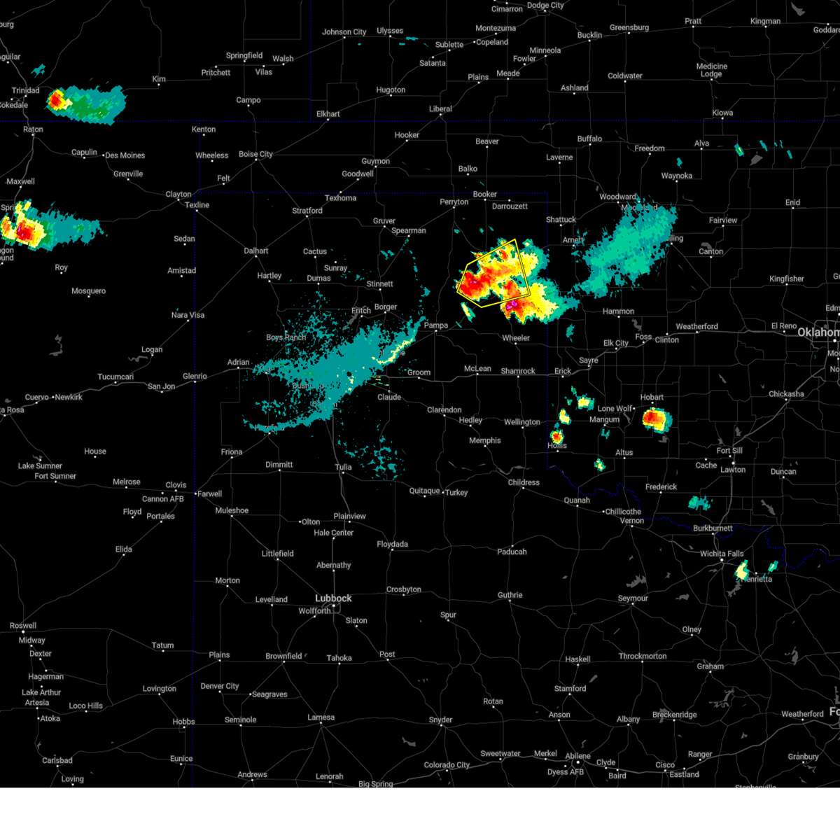 At 503 pm cdt, a severe thunderstorm was located 8 miles north of lora, or 11 miles west of canadian, moving northeast at 5 mph (radar indicated). Hazards include golf ball size hail and 60 mph wind gusts. Minor damage to roofs, siding, and trees is possible. people and animals outdoors will be injured. expect hail damage to roofs, siding, windows, and vehicles. locations impacted include, canadian, glazier and lora. thunderstorm damage threat, considerable hail threat, radar indicated max hail size, 1. 75 in wind threat, radar indicated max wind gust, 60 mph. At 503 pm cdt, a severe thunderstorm was located 8 miles north of lora, or 11 miles west of canadian, moving northeast at 5 mph (radar indicated). Hazards include golf ball size hail and 60 mph wind gusts. Minor damage to roofs, siding, and trees is possible. people and animals outdoors will be injured. expect hail damage to roofs, siding, windows, and vehicles. locations impacted include, canadian, glazier and lora. thunderstorm damage threat, considerable hail threat, radar indicated max hail size, 1. 75 in wind threat, radar indicated max wind gust, 60 mph.
|
| 7/5/2023 5:02 PM CDT | Tennis Ball sized hail reported 19.3 miles N of Canadian, TX, storm chaser reported a few very large hail stones as he traveled south on highway 83. hail appeared to be wrapping around the rear flank down downdraft of a supercell |
| 7/5/2023 4:47 PM CDT |
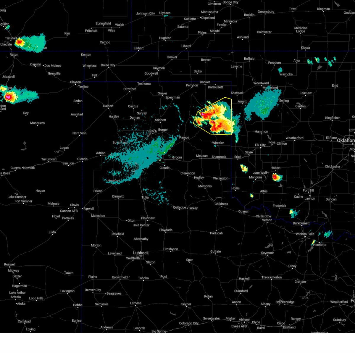 At 447 pm cdt, severe thunderstorms were located along a line extending from 11 miles northwest of canadian to 8 miles northwest of briscoe, moving northeast at 20 mph (radar indicated). Hazards include 60 mph wind gusts and half dollar size hail. Minor damage to roofs, siding, and trees is possible. Hail damage to vehicles is expected. At 447 pm cdt, severe thunderstorms were located along a line extending from 11 miles northwest of canadian to 8 miles northwest of briscoe, moving northeast at 20 mph (radar indicated). Hazards include 60 mph wind gusts and half dollar size hail. Minor damage to roofs, siding, and trees is possible. Hail damage to vehicles is expected.
|
| 7/5/2023 4:00 PM CDT |
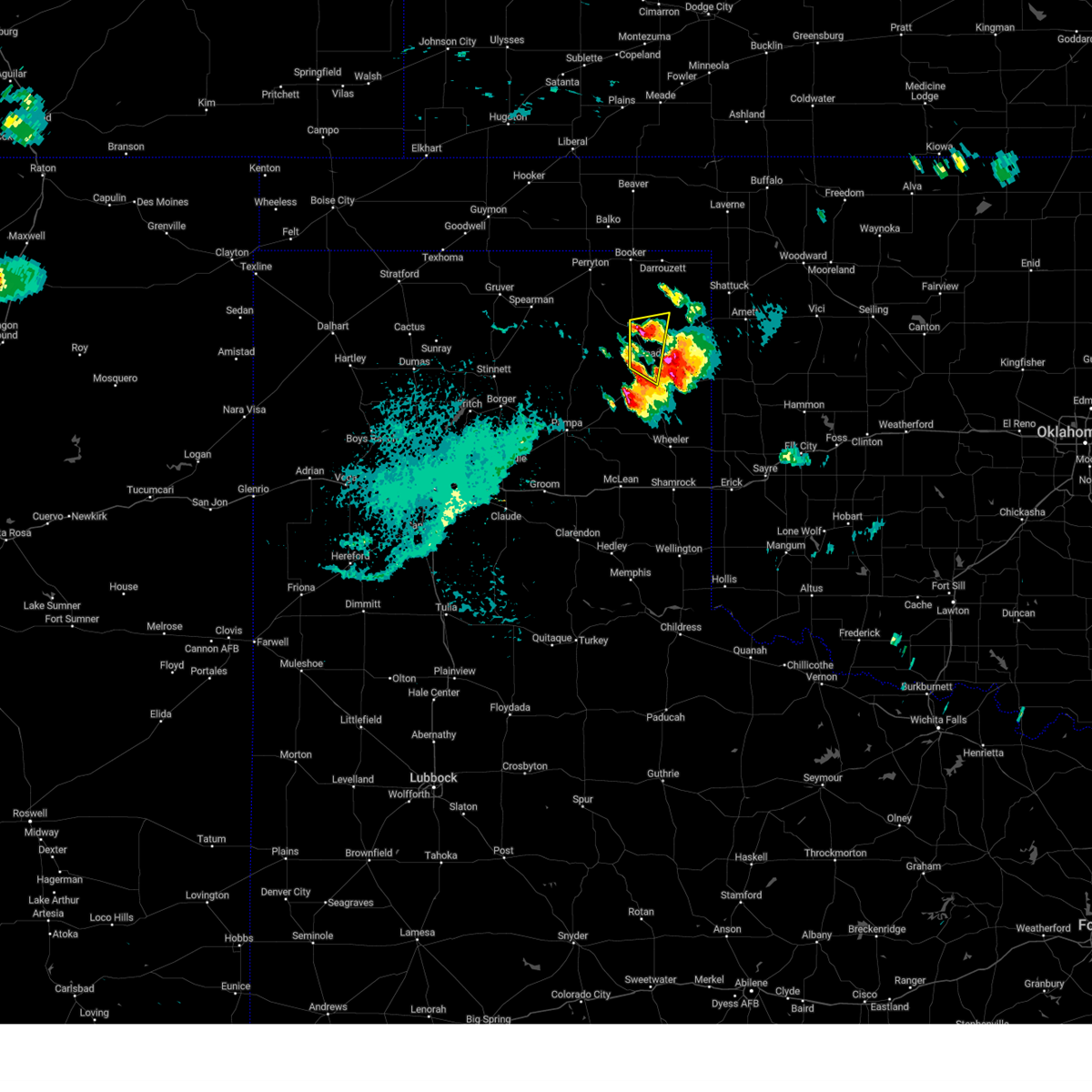 At 359 pm cdt, severe thunderstorms were located along a line extending from 12 miles northwest of glazier to 7 miles west of canadian, moving east at 10 mph (radar indicated). Hazards include ping pong ball size hail and 60 mph wind gusts. Minor damage to roofs, siding, and trees is possible. people and animals outdoors will be injured. Expect hail damage to roofs, siding, windows, and vehicles. At 359 pm cdt, severe thunderstorms were located along a line extending from 12 miles northwest of glazier to 7 miles west of canadian, moving east at 10 mph (radar indicated). Hazards include ping pong ball size hail and 60 mph wind gusts. Minor damage to roofs, siding, and trees is possible. people and animals outdoors will be injured. Expect hail damage to roofs, siding, windows, and vehicles.
|
| 7/5/2023 3:47 PM CDT | Measured by west texas mesone in hemphill county TX, 5.8 miles W of Canadian, TX |
| 7/5/2023 3:45 PM CDT | Golf Ball sized hail reported 5.2 miles SSW of Canadian, TX, picture sent via social media. location estimated by radar. |
| 6/22/2023 3:46 PM CDT |
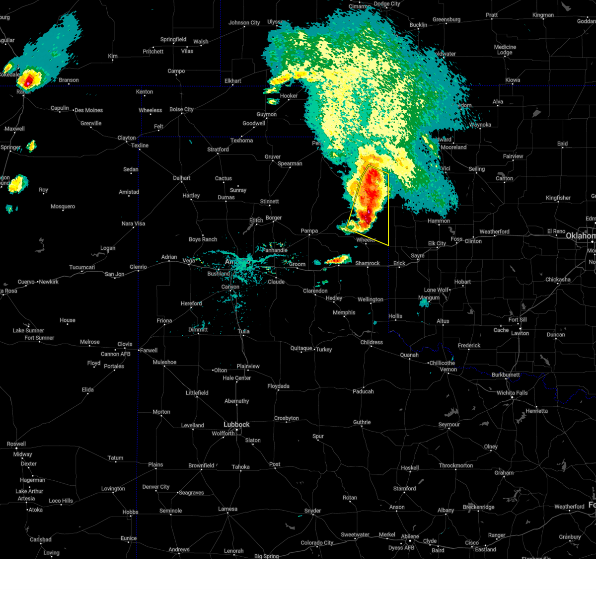 At 345 pm cdt, automated weather equipment reported severe thunderstorms were located along a line extending from 7 miles southwest of higgins to 6 miles north of briscoe, moving southeast at 25 mph (automated weather equipment). Hazards include 60 mph wind gusts and quarter size hail. Minor damage to roofs, siding, and trees is possible. hail damage to vehicles is expected. locations impacted include, canadian, briscoe, higgins, allison, glazier and lake marvin. hail threat, radar indicated max hail size, 1. 00in wind threat, observed max wind gust, 60 mph. At 345 pm cdt, automated weather equipment reported severe thunderstorms were located along a line extending from 7 miles southwest of higgins to 6 miles north of briscoe, moving southeast at 25 mph (automated weather equipment). Hazards include 60 mph wind gusts and quarter size hail. Minor damage to roofs, siding, and trees is possible. hail damage to vehicles is expected. locations impacted include, canadian, briscoe, higgins, allison, glazier and lake marvin. hail threat, radar indicated max hail size, 1. 00in wind threat, observed max wind gust, 60 mph.
|
| 6/22/2023 3:23 PM CDT | Storm damage reported in hemphill county TX, 15.7 miles NNE of Canadian, TX |
| 6/22/2023 3:17 PM CDT |
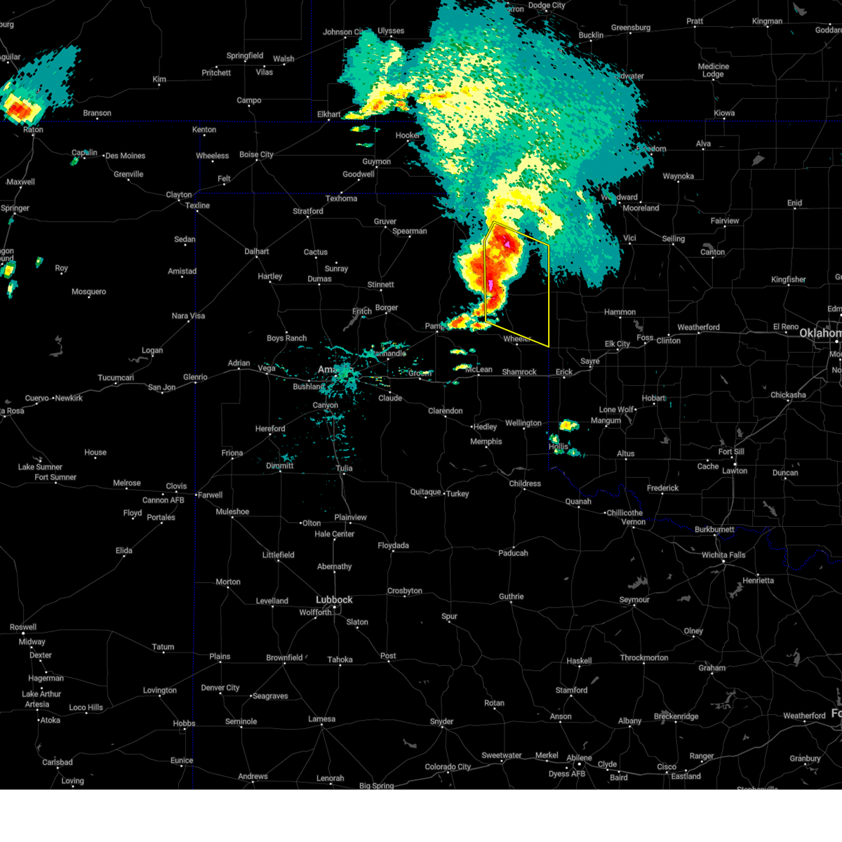 At 316 pm cdt, severe thunderstorms were located along a line extending from 6 miles south of lipscomb to 5 miles east of lora, moving southeast at 25 mph (radar indicated). Hazards include 60 mph wind gusts and quarter size hail. Minor damage to roofs, siding, and trees is possible. Hail damage to vehicles is expected. At 316 pm cdt, severe thunderstorms were located along a line extending from 6 miles south of lipscomb to 5 miles east of lora, moving southeast at 25 mph (radar indicated). Hazards include 60 mph wind gusts and quarter size hail. Minor damage to roofs, siding, and trees is possible. Hail damage to vehicles is expected.
|
| 6/17/2023 9:42 PM CDT |
 At 941 pm cdt, severe thunderstorms were located along a line extending from lake marvin to 3 miles northwest of briscoe to 7 miles west of new mobeetie, moving east at 50 mph (radar indicated). Hazards include golf ball size hail and 60 mph wind gusts. Minor damage to roofs, siding, and trees is possible. people and animals outdoors will be injured. expect hail damage to roofs, siding, windows, and vehicles. locations impacted include, canadian, shamrock, miami, briscoe, wheeler, mclean, new mobeetie, twitty, allison, lela, glazier, lake marvin, kellerville, lora, alanreed and mobeetie. thunderstorm damage threat, considerable hail threat, radar indicated max hail size, 1. 75 in wind threat, radar indicated max wind gust, 60 mph. At 941 pm cdt, severe thunderstorms were located along a line extending from lake marvin to 3 miles northwest of briscoe to 7 miles west of new mobeetie, moving east at 50 mph (radar indicated). Hazards include golf ball size hail and 60 mph wind gusts. Minor damage to roofs, siding, and trees is possible. people and animals outdoors will be injured. expect hail damage to roofs, siding, windows, and vehicles. locations impacted include, canadian, shamrock, miami, briscoe, wheeler, mclean, new mobeetie, twitty, allison, lela, glazier, lake marvin, kellerville, lora, alanreed and mobeetie. thunderstorm damage threat, considerable hail threat, radar indicated max hail size, 1. 75 in wind threat, radar indicated max wind gust, 60 mph.
|
| 6/17/2023 9:30 PM CDT |
 At 930 pm cdt, severe thunderstorms were located along a line extending from glazier to near miami to 3 miles south of codman, moving east at 45 mph (radar indicated). Hazards include 60 mph wind gusts and quarter size hail. Minor damage to roofs, siding, and trees is possible. hail damage to vehicles is expected. locations impacted include, canadian, shamrock, miami, briscoe, wheeler, mclean, lefors, new mobeetie, lake mcclellan, twitty, allison, lela, glazier, lake marvin, kellerville, lora, alanreed, codman and mobeetie. hail threat, radar indicated max hail size, 1. 00in wind threat, radar indicated max wind gust, 60 mph. At 930 pm cdt, severe thunderstorms were located along a line extending from glazier to near miami to 3 miles south of codman, moving east at 45 mph (radar indicated). Hazards include 60 mph wind gusts and quarter size hail. Minor damage to roofs, siding, and trees is possible. hail damage to vehicles is expected. locations impacted include, canadian, shamrock, miami, briscoe, wheeler, mclean, lefors, new mobeetie, lake mcclellan, twitty, allison, lela, glazier, lake marvin, kellerville, lora, alanreed, codman and mobeetie. hail threat, radar indicated max hail size, 1. 00in wind threat, radar indicated max wind gust, 60 mph.
|
| 6/17/2023 9:07 PM CDT |
 At 907 pm cdt, severe thunderstorms were located along a line extending from 12 miles northwest of canadian to 4 miles west of pampa, moving southeast at 35 mph (radar indicated). Hazards include 60 mph wind gusts and quarter size hail. Minor damage to roofs, siding, and trees is possible. hail damage to vehicles is expected. locations impacted include, pampa, canadian, shamrock, miami, briscoe, wheeler, mclean, lefors, new mobeetie, lake mcclellan, twitty, allison, lela, glazier, lake marvin, kellerville, lora, kingsmill, alanreed and codman. hail threat, radar indicated max hail size, 1. 00in wind threat, radar indicated max wind gust, 60 mph. At 907 pm cdt, severe thunderstorms were located along a line extending from 12 miles northwest of canadian to 4 miles west of pampa, moving southeast at 35 mph (radar indicated). Hazards include 60 mph wind gusts and quarter size hail. Minor damage to roofs, siding, and trees is possible. hail damage to vehicles is expected. locations impacted include, pampa, canadian, shamrock, miami, briscoe, wheeler, mclean, lefors, new mobeetie, lake mcclellan, twitty, allison, lela, glazier, lake marvin, kellerville, lora, kingsmill, alanreed and codman. hail threat, radar indicated max hail size, 1. 00in wind threat, radar indicated max wind gust, 60 mph.
|
| 6/17/2023 8:56 PM CDT |
 At 856 pm cdt, severe thunderstorms were located along a line extending from 4 miles southwest of lipscomb to 4 miles northwest of kingsmill, moving east at 45 mph (radar indicated). Hazards include 60 mph wind gusts and quarter size hail. Minor damage to roofs, siding, and trees is possible. hail damage to vehicles is expected. locations impacted include, pampa, lipscomb, canadian, shamrock, miami, briscoe, wheeler, white deer, mclean, groom, lefors, skellytown, higgins, wolf creek park, lake mcclellan, twitty, lake marvin, kingsmill, alanreed and codman. hail threat, radar indicated max hail size, 1. 00in wind threat, radar indicated max wind gust, 60 mph. At 856 pm cdt, severe thunderstorms were located along a line extending from 4 miles southwest of lipscomb to 4 miles northwest of kingsmill, moving east at 45 mph (radar indicated). Hazards include 60 mph wind gusts and quarter size hail. Minor damage to roofs, siding, and trees is possible. hail damage to vehicles is expected. locations impacted include, pampa, lipscomb, canadian, shamrock, miami, briscoe, wheeler, white deer, mclean, groom, lefors, skellytown, higgins, wolf creek park, lake mcclellan, twitty, lake marvin, kingsmill, alanreed and codman. hail threat, radar indicated max hail size, 1. 00in wind threat, radar indicated max wind gust, 60 mph.
|
| 6/17/2023 8:40 PM CDT |
 At 840 pm cdt, severe thunderstorms were located along a line extending from 6 miles east of wolf creek park to 7 miles west of skellytown, moving east at 50 mph (radar indicated). Hazards include 70 mph wind gusts and quarter size hail. Expect some tree damage. damage is likely to mobile homes, roofs, and outbuildings. Hail damage to vehicles is expected. At 840 pm cdt, severe thunderstorms were located along a line extending from 6 miles east of wolf creek park to 7 miles west of skellytown, moving east at 50 mph (radar indicated). Hazards include 70 mph wind gusts and quarter size hail. Expect some tree damage. damage is likely to mobile homes, roofs, and outbuildings. Hail damage to vehicles is expected.
|
| 6/17/2023 7:09 PM CDT |
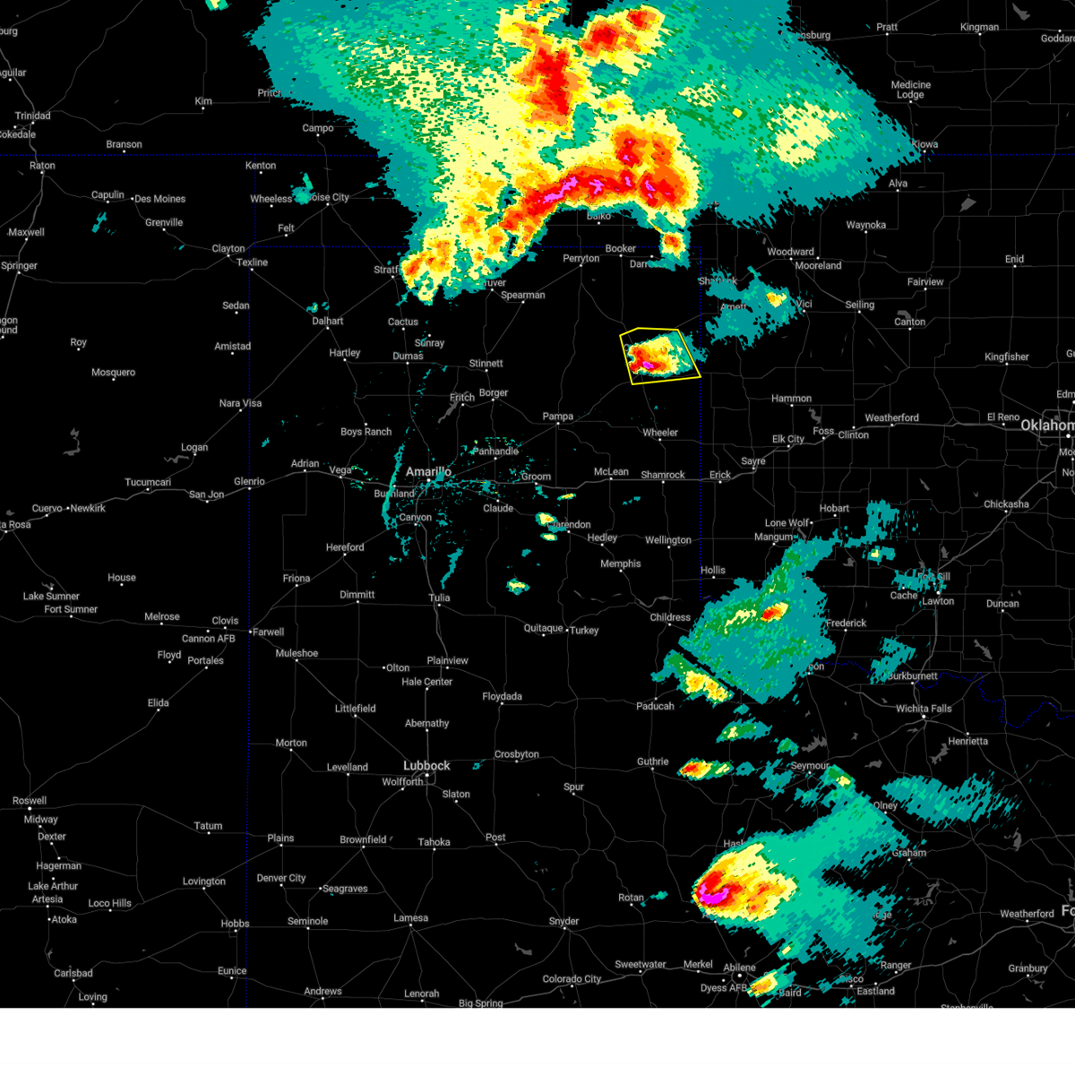 At 708 pm cdt, a severe thunderstorm was located 5 miles south of canadian, moving east at 40 mph (radar indicated). Hazards include 60 mph wind gusts and half dollar size hail. Minor damage to roofs, siding, and trees is possible. hail damage to vehicles is expected. locations impacted include, canadian, glazier and lake marvin. hail threat, radar indicated max hail size, 1. 25 in wind threat, radar indicated max wind gust, 60 mph. At 708 pm cdt, a severe thunderstorm was located 5 miles south of canadian, moving east at 40 mph (radar indicated). Hazards include 60 mph wind gusts and half dollar size hail. Minor damage to roofs, siding, and trees is possible. hail damage to vehicles is expected. locations impacted include, canadian, glazier and lake marvin. hail threat, radar indicated max hail size, 1. 25 in wind threat, radar indicated max wind gust, 60 mph.
|
| 6/17/2023 6:40 PM CDT |
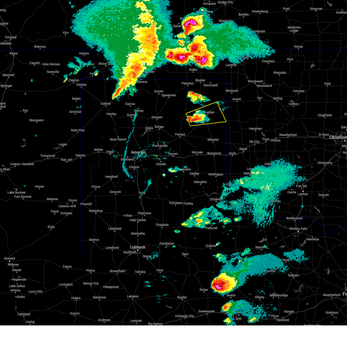 At 640 pm cdt, a severe thunderstorm was located 10 miles northwest of lora, or 10 miles north of miami, moving east at 40 mph (radar indicated). Hazards include 60 mph wind gusts and half dollar size hail. Minor damage to roofs, siding, and trees is possible. Hail damage to vehicles is expected. At 640 pm cdt, a severe thunderstorm was located 10 miles northwest of lora, or 10 miles north of miami, moving east at 40 mph (radar indicated). Hazards include 60 mph wind gusts and half dollar size hail. Minor damage to roofs, siding, and trees is possible. Hail damage to vehicles is expected.
|
| 6/15/2023 6:36 PM CDT | Tennis Ball sized hail reported 22 miles WSW of Canadian, TX |
| 6/15/2023 6:21 PM CDT | Golf Ball sized hail reported 11.9 miles NW of Canadian, TX, via spotternetwork.org. |
| 6/12/2023 12:54 PM CDT |
 At 1253 pm cdt, severe thunderstorms were located along a line extending from near canadian to briscoe, moving northeast at 45 mph (trained weather spotters). Hazards include 60 mph wind gusts and quarter size hail. Minor damage to roofs, siding, and trees is possible. hail damage to vehicles is expected. hail may accumulate on roadways causing hazardous travel. locations impacted include, canadian, briscoe, higgins, new mobeetie, allison, glazier, lake marvin and mobeetie. hail threat, observed max hail size, 1. 00in wind threat, radar indicated max wind gust, 60 mph. At 1253 pm cdt, severe thunderstorms were located along a line extending from near canadian to briscoe, moving northeast at 45 mph (trained weather spotters). Hazards include 60 mph wind gusts and quarter size hail. Minor damage to roofs, siding, and trees is possible. hail damage to vehicles is expected. hail may accumulate on roadways causing hazardous travel. locations impacted include, canadian, briscoe, higgins, new mobeetie, allison, glazier, lake marvin and mobeetie. hail threat, observed max hail size, 1. 00in wind threat, radar indicated max wind gust, 60 mph.
|
| 6/12/2023 12:47 PM CDT |
 At 1246 pm cdt, severe thunderstorms were located along a line extending from 7 miles north of lora to 3 miles north of new mobeetie, moving east at 45 mph (radar indicated). Hazards include 60 mph wind gusts and half dollar size hail. Minor damage to roofs, siding, and trees is possible. hail damage to vehicles is expected. locations impacted include, canadian, briscoe, higgins, new mobeetie, allison, glazier, lake marvin and mobeetie. hail threat, radar indicated max hail size, 1. 25 in wind threat, radar indicated max wind gust, 60 mph. At 1246 pm cdt, severe thunderstorms were located along a line extending from 7 miles north of lora to 3 miles north of new mobeetie, moving east at 45 mph (radar indicated). Hazards include 60 mph wind gusts and half dollar size hail. Minor damage to roofs, siding, and trees is possible. hail damage to vehicles is expected. locations impacted include, canadian, briscoe, higgins, new mobeetie, allison, glazier, lake marvin and mobeetie. hail threat, radar indicated max hail size, 1. 25 in wind threat, radar indicated max wind gust, 60 mph.
|
| 6/12/2023 12:36 PM CDT |
 At 1235 pm cdt, severe thunderstorms were located along a line extending from 11 miles northwest of lora to 7 miles south of miami, moving northeast at 45 mph (radar indicated). Hazards include 60 mph wind gusts and half dollar size hail. Minor damage to roofs, siding, and trees is possible. hail damage to vehicles is expected. locations impacted include, canadian, miami, briscoe, higgins, new mobeetie, lora, allison, glazier, lake marvin and mobeetie. hail threat, radar indicated max hail size, 1. 25 in wind threat, radar indicated max wind gust, 60 mph. At 1235 pm cdt, severe thunderstorms were located along a line extending from 11 miles northwest of lora to 7 miles south of miami, moving northeast at 45 mph (radar indicated). Hazards include 60 mph wind gusts and half dollar size hail. Minor damage to roofs, siding, and trees is possible. hail damage to vehicles is expected. locations impacted include, canadian, miami, briscoe, higgins, new mobeetie, lora, allison, glazier, lake marvin and mobeetie. hail threat, radar indicated max hail size, 1. 25 in wind threat, radar indicated max wind gust, 60 mph.
|
| 6/12/2023 12:20 PM CDT |
 At 1220 pm cdt, severe thunderstorms were located along a line extending from 15 miles northwest of miami to 5 miles south of codman, moving northeast at 45 mph (radar indicated). Hazards include golf ball size hail and 60 mph wind gusts. Minor damage to roofs, siding, and trees is possible. people and animals outdoors will be injured. Expect hail damage to roofs, siding, windows, and vehicles. At 1220 pm cdt, severe thunderstorms were located along a line extending from 15 miles northwest of miami to 5 miles south of codman, moving northeast at 45 mph (radar indicated). Hazards include golf ball size hail and 60 mph wind gusts. Minor damage to roofs, siding, and trees is possible. people and animals outdoors will be injured. Expect hail damage to roofs, siding, windows, and vehicles.
|
| 6/12/2023 5:11 AM CDT |
 At 511 am cdt, a severe thunderstorm was located over lora, or 6 miles northeast of miami, moving east at 35 mph (radar indicated). Hazards include 60 mph wind gusts and quarter size hail. Minor damage to roofs, siding, and trees is possible. hail damage to vehicles is expected. locations impacted include, canadian, miami, lake marvin and lora. hail threat, radar indicated max hail size, 1. 00in wind threat, radar indicated max wind gust, 60 mph. At 511 am cdt, a severe thunderstorm was located over lora, or 6 miles northeast of miami, moving east at 35 mph (radar indicated). Hazards include 60 mph wind gusts and quarter size hail. Minor damage to roofs, siding, and trees is possible. hail damage to vehicles is expected. locations impacted include, canadian, miami, lake marvin and lora. hail threat, radar indicated max hail size, 1. 00in wind threat, radar indicated max wind gust, 60 mph.
|
| 6/12/2023 4:36 AM CDT |
 At 436 am cdt, severe thunderstorms were located along a line extending from 12 miles north of skellytown to 8 miles northwest of codman to 7 miles southeast of lora, moving northeast at 25 mph (radar indicated). Hazards include 60 mph wind gusts and quarter size hail. Minor damage to roofs, siding, and trees is possible. Hail damage to vehicles is expected. At 436 am cdt, severe thunderstorms were located along a line extending from 12 miles north of skellytown to 8 miles northwest of codman to 7 miles southeast of lora, moving northeast at 25 mph (radar indicated). Hazards include 60 mph wind gusts and quarter size hail. Minor damage to roofs, siding, and trees is possible. Hail damage to vehicles is expected.
|
| 6/2/2023 5:22 PM CDT |
 The severe thunderstorm warning for lipscomb, wheeler, eastern gray, roberts, hemphill and ochiltree counties will expire at 530 pm cdt, the storm which prompted the warning has weakened below severe limits, and no longer poses an immediate threat to life or property. therefore, the warning will be allowed to expire. however gusty winds and heavy rain are still possible with this thunderstorm. a tornado watch remains in effect until 800 pm cdt for the panhandle of texas. remember, a severe thunderstorm warning still remains in effect for ochiltree and lipscomb counties until 630 pm. The severe thunderstorm warning for lipscomb, wheeler, eastern gray, roberts, hemphill and ochiltree counties will expire at 530 pm cdt, the storm which prompted the warning has weakened below severe limits, and no longer poses an immediate threat to life or property. therefore, the warning will be allowed to expire. however gusty winds and heavy rain are still possible with this thunderstorm. a tornado watch remains in effect until 800 pm cdt for the panhandle of texas. remember, a severe thunderstorm warning still remains in effect for ochiltree and lipscomb counties until 630 pm.
|
| 6/2/2023 5:00 PM CDT |
 At 500 pm cdt, a severe thunderstorm was located 8 miles southwest of wolf creek park, or 19 miles south of perryton, moving north at 40 mph (radar indicated). Hazards include 60 mph wind gusts. Minor damage to roofs, siding, and trees is possible. locations impacted include, perryton, lipscomb, canadian, shamrock, miami, briscoe, wheeler, mclean, lefors, higgins, wolf creek park, new mobeetie, twitty, farnsworth, allison, lela, glazier, lake marvin, kellerville and lora. hail threat, radar indicated max hail size, <. 75 in wind threat, radar indicated max wind gust, 60 mph. At 500 pm cdt, a severe thunderstorm was located 8 miles southwest of wolf creek park, or 19 miles south of perryton, moving north at 40 mph (radar indicated). Hazards include 60 mph wind gusts. Minor damage to roofs, siding, and trees is possible. locations impacted include, perryton, lipscomb, canadian, shamrock, miami, briscoe, wheeler, mclean, lefors, higgins, wolf creek park, new mobeetie, twitty, farnsworth, allison, lela, glazier, lake marvin, kellerville and lora. hail threat, radar indicated max hail size, <. 75 in wind threat, radar indicated max wind gust, 60 mph.
|
| 6/2/2023 4:39 PM CDT | 61 mph thunderstorm wind gust measured by mesonet at 4:39 p.m. cd in lipscomb county TX, 22.2 miles S of Canadian, TX |
| 6/2/2023 4:22 PM CDT |
 At 422 pm cdt, a severe thunderstorm was located 9 miles southeast of wolf creek park, or 16 miles northwest of canadian, moving north at 30 mph (radar indicated). Hazards include 60 mph wind gusts and quarter size hail. Minor damage to roofs, siding, and trees is possible. hail damage to vehicles is expected. locations impacted include, perryton, lipscomb, canadian, shamrock, miami, briscoe, wheeler, mclean, lefors, higgins, wolf creek park, new mobeetie, twitty, farnsworth, allison, lela, glazier, lake marvin, kellerville and lora. hail threat, radar indicated max hail size, 1. 00in wind threat, radar indicated max wind gust, 60 mph. At 422 pm cdt, a severe thunderstorm was located 9 miles southeast of wolf creek park, or 16 miles northwest of canadian, moving north at 30 mph (radar indicated). Hazards include 60 mph wind gusts and quarter size hail. Minor damage to roofs, siding, and trees is possible. hail damage to vehicles is expected. locations impacted include, perryton, lipscomb, canadian, shamrock, miami, briscoe, wheeler, mclean, lefors, higgins, wolf creek park, new mobeetie, twitty, farnsworth, allison, lela, glazier, lake marvin, kellerville and lora. hail threat, radar indicated max hail size, 1. 00in wind threat, radar indicated max wind gust, 60 mph.
|
| 6/2/2023 4:04 PM CDT |
 At 403 pm cdt, a severe thunderstorm was located 8 miles east of lora, or 12 miles south of canadian, moving east at 20 mph (radar indicated). Hazards include 60 mph wind gusts and quarter size hail. Minor damage to roofs, siding, and trees is possible. Hail damage to vehicles is expected. At 403 pm cdt, a severe thunderstorm was located 8 miles east of lora, or 12 miles south of canadian, moving east at 20 mph (radar indicated). Hazards include 60 mph wind gusts and quarter size hail. Minor damage to roofs, siding, and trees is possible. Hail damage to vehicles is expected.
|
| 2/26/2023 4:57 PM CST |
 At 457 pm cst, severe thunderstorms were located along a line extending from 5 miles north of waka to 16 miles east of pringle to near white deer, moving northeast at 60 mph (radar indicated). Hazards include two inch hail and 70 mph wind gusts. Expect some tree damage. damage is likely to mobile homes, roofs, and outbuildings. people and animals outdoors will be injured. expect hail damage to roofs, siding, windows, and vehicles. locations impacted include, pampa, borger, perryton, spearman, lipscomb, canadian, panhandle, miami, booker, white deer, skellytown, darrouzett, wolf creek park, farnsworth, waka, glazier, lora, kingsmill and codman. thunderstorm damage threat, considerable hail threat, radar indicated max hail size, 2. 00 in wind threat, radar indicated max wind gust, 70 mph. At 457 pm cst, severe thunderstorms were located along a line extending from 5 miles north of waka to 16 miles east of pringle to near white deer, moving northeast at 60 mph (radar indicated). Hazards include two inch hail and 70 mph wind gusts. Expect some tree damage. damage is likely to mobile homes, roofs, and outbuildings. people and animals outdoors will be injured. expect hail damage to roofs, siding, windows, and vehicles. locations impacted include, pampa, borger, perryton, spearman, lipscomb, canadian, panhandle, miami, booker, white deer, skellytown, darrouzett, wolf creek park, farnsworth, waka, glazier, lora, kingsmill and codman. thunderstorm damage threat, considerable hail threat, radar indicated max hail size, 2. 00 in wind threat, radar indicated max wind gust, 70 mph.
|
| 2/26/2023 4:50 PM CST |
 At 450 pm cst, severe thunderstorms were located along a line extending from 4 miles northwest of waka to 12 miles northeast of skellytown to white deer, moving northeast at 55 mph (radar indicated). Hazards include 70 mph wind gusts and quarter size hail. Expect some tree damage. damage is likely to mobile homes, roofs, and outbuildings. Hail damage to vehicles is expected. At 450 pm cst, severe thunderstorms were located along a line extending from 4 miles northwest of waka to 12 miles northeast of skellytown to white deer, moving northeast at 55 mph (radar indicated). Hazards include 70 mph wind gusts and quarter size hail. Expect some tree damage. damage is likely to mobile homes, roofs, and outbuildings. Hail damage to vehicles is expected.
|
| 12/12/2022 10:52 PM CST |
 At 1051 pm cst, severe thunderstorms were located along a line extending from arnett to 5 miles northeast of new mobeetie, moving northeast at 45 mph (radar indicated). Hazards include quarter size hail. Damage to vehicles is expected. locations impacted include, canadian, briscoe, wheeler, higgins, new mobeetie, allison, glazier, lake marvin, kellerville and mobeetie. hail threat, radar indicated max hail size, 1. 00in wind threat, radar indicated max wind gust, <50 mph. At 1051 pm cst, severe thunderstorms were located along a line extending from arnett to 5 miles northeast of new mobeetie, moving northeast at 45 mph (radar indicated). Hazards include quarter size hail. Damage to vehicles is expected. locations impacted include, canadian, briscoe, wheeler, higgins, new mobeetie, allison, glazier, lake marvin, kellerville and mobeetie. hail threat, radar indicated max hail size, 1. 00in wind threat, radar indicated max wind gust, <50 mph.
|
| 12/12/2022 10:20 PM CST |
 At 1020 pm cst, severe thunderstorms were located along a line extending from 3 miles northeast of lake marvin to 4 miles east of lefors, moving northeast at 45 mph (radar indicated). Hazards include 60 mph wind gusts and quarter size hail. Minor damage to roofs, siding, and trees is possible. Hail damage to vehicles is expected. At 1020 pm cst, severe thunderstorms were located along a line extending from 3 miles northeast of lake marvin to 4 miles east of lefors, moving northeast at 45 mph (radar indicated). Hazards include 60 mph wind gusts and quarter size hail. Minor damage to roofs, siding, and trees is possible. Hail damage to vehicles is expected.
|
| 9/15/2022 5:36 PM CDT | Storm damage reported in lipscomb county TX, 21.5 miles S of Canadian, TX |
| 9/1/2022 7:26 PM CDT |
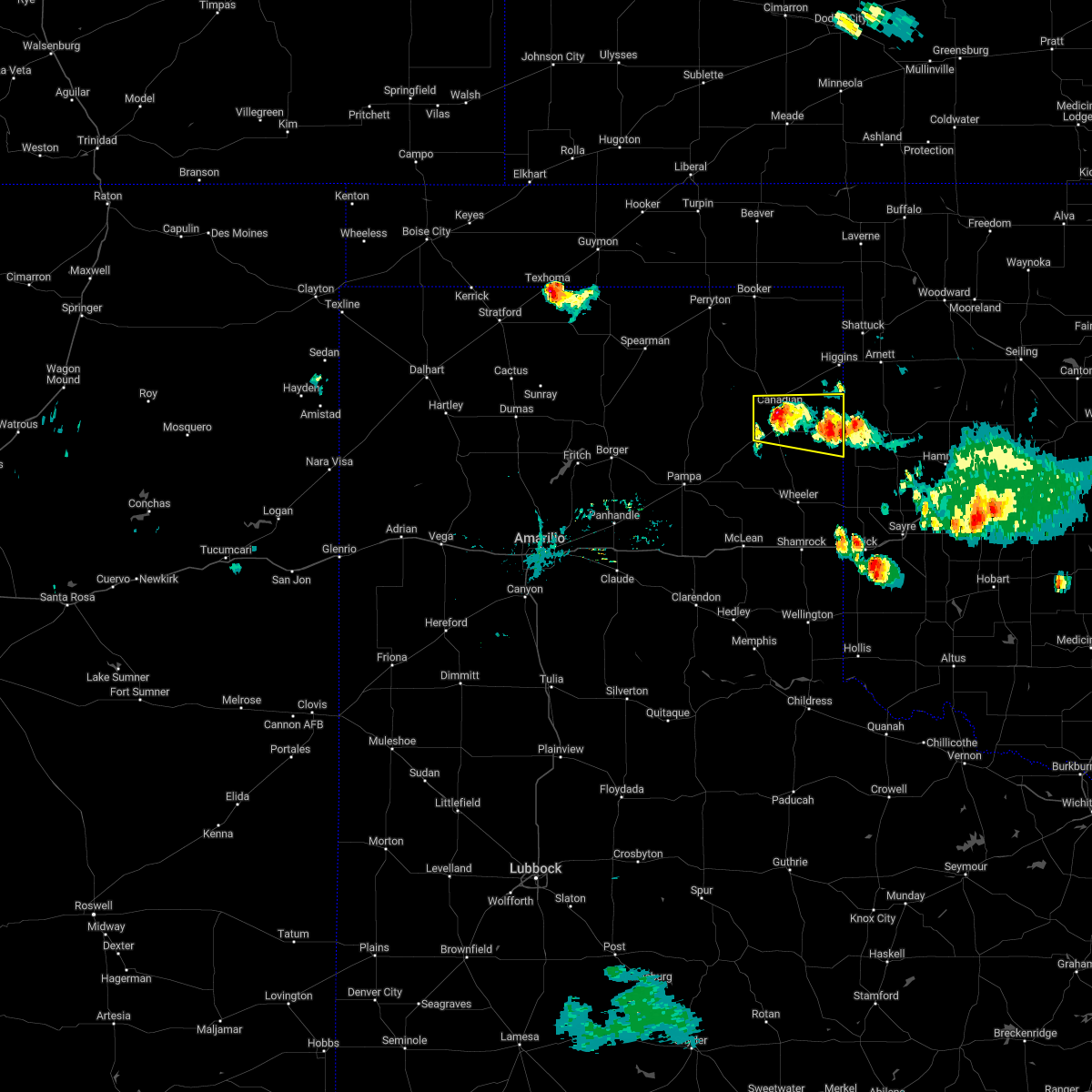 The severe thunderstorm warning for hemphill county will expire at 730 pm cdt, the storm which prompted the warning has weakened below severe limits, and no longer poses an immediate threat to life or property. therefore, the warning will be allowed to expire. however gusty winds and heavy rain are still possible with this thunderstorm. The severe thunderstorm warning for hemphill county will expire at 730 pm cdt, the storm which prompted the warning has weakened below severe limits, and no longer poses an immediate threat to life or property. therefore, the warning will be allowed to expire. however gusty winds and heavy rain are still possible with this thunderstorm.
|
| 9/1/2022 7:19 PM CDT |
 At 719 pm cdt, a severe thunderstorm was located over canadian, moving southwest at 10 mph (radar indicated). Hazards include 60 mph wind gusts and penny size hail. Minor damage to roofs, siding, and trees is possible. locations impacted include, canadian and lake marvin. hail threat, radar indicated max hail size, 0. 75in wind threat, radar indicated max wind gust, 60 mph. At 719 pm cdt, a severe thunderstorm was located over canadian, moving southwest at 10 mph (radar indicated). Hazards include 60 mph wind gusts and penny size hail. Minor damage to roofs, siding, and trees is possible. locations impacted include, canadian and lake marvin. hail threat, radar indicated max hail size, 0. 75in wind threat, radar indicated max wind gust, 60 mph.
|
| 9/1/2022 7:13 PM CDT |
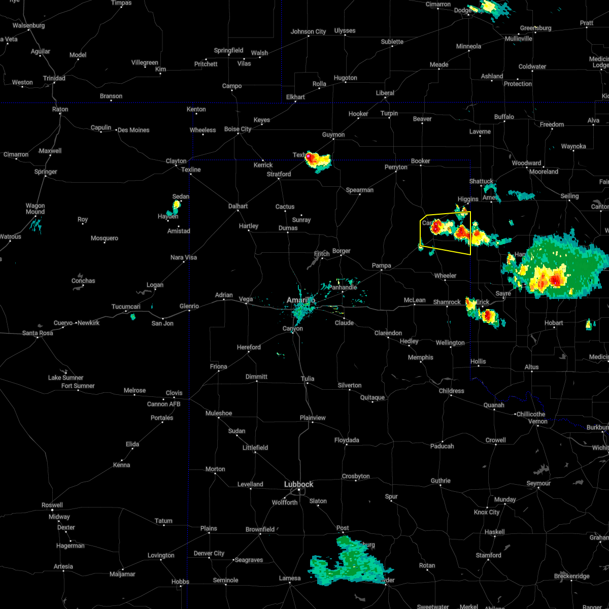 At 713 pm cdt, a severe thunderstorm was located over canadian, moving south at 20 mph (radar indicated). Hazards include 60 mph wind gusts and quarter size hail. Minor damage to roofs, siding, and trees is possible. hail damage to vehicles is expected. locations impacted include, canadian, lake marvin and glazier. hail threat, radar indicated max hail size, 1. 00in wind threat, radar indicated max wind gust, 60 mph. At 713 pm cdt, a severe thunderstorm was located over canadian, moving south at 20 mph (radar indicated). Hazards include 60 mph wind gusts and quarter size hail. Minor damage to roofs, siding, and trees is possible. hail damage to vehicles is expected. locations impacted include, canadian, lake marvin and glazier. hail threat, radar indicated max hail size, 1. 00in wind threat, radar indicated max wind gust, 60 mph.
|
| 9/1/2022 7:11 PM CDT | Sheriff office reported a few trees down in canadian. time estimated by rada in hemphill county TX, 0.2 miles WSW of Canadian, TX |
| 9/1/2022 6:52 PM CDT |
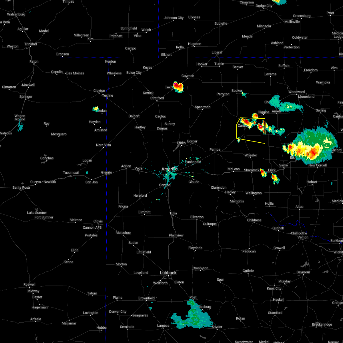 At 651 pm cdt, a severe thunderstorm was located 5 miles west of glazier, or 7 miles north of canadian, moving southwest at 10 mph (radar indicated). Hazards include 60 mph wind gusts and quarter size hail. Minor damage to roofs, siding, and trees is possible. Hail damage to vehicles is expected. At 651 pm cdt, a severe thunderstorm was located 5 miles west of glazier, or 7 miles north of canadian, moving southwest at 10 mph (radar indicated). Hazards include 60 mph wind gusts and quarter size hail. Minor damage to roofs, siding, and trees is possible. Hail damage to vehicles is expected.
|
| 7/31/2022 9:52 PM CDT | Mesonet station 67 canadian 6 in hemphill county TX, 5.8 miles W of Canadian, TX |
| 6/9/2022 9:57 PM CDT |
 The severe thunderstorm warning for northwestern wheeler, southern lipscomb, northeastern gray, eastern roberts, western hemphill and southeastern ochiltree counties will expire at 1000 pm cdt, the storms which prompted the warning have weakened below severe limits, and no longer pose an immediate threat to life or property. therefore, the warning will be allowed to expire. however gusty winds are still possible with these thunderstorms. a severe thunderstorm watch remains in effect until 200 am cdt for the panhandle of texas. The severe thunderstorm warning for northwestern wheeler, southern lipscomb, northeastern gray, eastern roberts, western hemphill and southeastern ochiltree counties will expire at 1000 pm cdt, the storms which prompted the warning have weakened below severe limits, and no longer pose an immediate threat to life or property. therefore, the warning will be allowed to expire. however gusty winds are still possible with these thunderstorms. a severe thunderstorm watch remains in effect until 200 am cdt for the panhandle of texas.
|
| 6/9/2022 9:34 PM CDT |
 At 933 pm cdt, severe thunderstorms were located along a line extending from 5 miles west of lipscomb to near canadian to 4 miles southeast of miami, moving east at 35 mph (radar indicated). Hazards include 60 mph wind gusts and nickel size hail. Minor damage to roofs, siding, and trees is possible. locations impacted include, lipscomb, canadian, miami, new mobeetie, lora, glazier, codman and mobeetie. hail threat, radar indicated max hail size, 0. 88in wind threat, radar indicated max wind gust, 60 mph. At 933 pm cdt, severe thunderstorms were located along a line extending from 5 miles west of lipscomb to near canadian to 4 miles southeast of miami, moving east at 35 mph (radar indicated). Hazards include 60 mph wind gusts and nickel size hail. Minor damage to roofs, siding, and trees is possible. locations impacted include, lipscomb, canadian, miami, new mobeetie, lora, glazier, codman and mobeetie. hail threat, radar indicated max hail size, 0. 88in wind threat, radar indicated max wind gust, 60 mph.
|
| 6/9/2022 9:17 PM CDT |
 At 917 pm cdt, severe thunderstorms were located along a line extending from 8 miles northeast of wolf creek park to 10 miles west of canadian to 3 miles west of miami, moving east at 50 mph (radar indicated). Hazards include 60 mph wind gusts and quarter size hail. Minor damage to roofs, siding, and trees is possible. hail damage to vehicles is expected. locations impacted include, lipscomb, canadian, miami, wolf creek park, new mobeetie, lora, glazier, codman and mobeetie. hail threat, radar indicated max hail size, 1. 00in wind threat, radar indicated max wind gust, 60 mph. At 917 pm cdt, severe thunderstorms were located along a line extending from 8 miles northeast of wolf creek park to 10 miles west of canadian to 3 miles west of miami, moving east at 50 mph (radar indicated). Hazards include 60 mph wind gusts and quarter size hail. Minor damage to roofs, siding, and trees is possible. hail damage to vehicles is expected. locations impacted include, lipscomb, canadian, miami, wolf creek park, new mobeetie, lora, glazier, codman and mobeetie. hail threat, radar indicated max hail size, 1. 00in wind threat, radar indicated max wind gust, 60 mph.
|
| 6/9/2022 8:57 PM CDT |
 At 857 pm cdt, severe thunderstorms were located along a line extending from 7 miles southeast of perryton to 18 miles southwest of wolf creek park to 12 miles northwest of codman, moving east at 35 mph (radar indicated). Hazards include 60 mph wind gusts and quarter size hail. Minor damage to roofs, siding, and trees is possible. Hail damage to vehicles is expected. At 857 pm cdt, severe thunderstorms were located along a line extending from 7 miles southeast of perryton to 18 miles southwest of wolf creek park to 12 miles northwest of codman, moving east at 35 mph (radar indicated). Hazards include 60 mph wind gusts and quarter size hail. Minor damage to roofs, siding, and trees is possible. Hail damage to vehicles is expected.
|
| 6/8/2022 6:32 AM CDT | West texas mesonet site 10 e miami. 58 mph or greater gusts occurred from 631 to 634 am cd in hemphill county TX, 14.4 miles NNE of Canadian, TX |
| 6/8/2022 6:26 AM CDT |
 At 626 am cdt, severe thunderstorms were located along a line extending from 6 miles north of lake meredith to 4 miles north of lora to 6 miles west of durham, moving east at 40 mph (radar indicated). Hazards include 70 mph wind gusts and quarter size hail. Expect some tree damage. damage is likely to mobile homes, roofs, and outbuildings. Hail damage to vehicles is expected. At 626 am cdt, severe thunderstorms were located along a line extending from 6 miles north of lake meredith to 4 miles north of lora to 6 miles west of durham, moving east at 40 mph (radar indicated). Hazards include 70 mph wind gusts and quarter size hail. Expect some tree damage. damage is likely to mobile homes, roofs, and outbuildings. Hail damage to vehicles is expected.
|
| 6/8/2022 6:00 AM CDT | West texas mesonet 8 w lipscomb. 58 mph or greater gusts occurred from 559 to 601 am cd in lipscomb county TX, 21.5 miles S of Canadian, TX |
| 6/8/2022 5:56 AM CDT |
 At 556 am cdt, severe thunderstorms were located along a line extending from glazier to 11 miles south of wolf creek park to pringle to near dumas, moving southeast at 40 mph (radar indicated). Hazards include 70 mph wind gusts and ping pong ball size hail. Expect some tree damage. damage is likely to mobile homes, roofs, and outbuildings. people and animals outdoors will be injured. expect hail damage to roofs, siding, windows, and vehicles. locations impacted include, dumas, borger, spearman, lipscomb, canadian, miami, cactus, fritch, sunray, stinnett, gruver, sanford, wolf creek park, waka, glazier, lake marvin, pringle, morse, lora and four way. thunderstorm damage threat, considerable hail threat, radar indicated max hail size, 1. 50 in wind threat, radar indicated max wind gust, 70 mph. At 556 am cdt, severe thunderstorms were located along a line extending from glazier to 11 miles south of wolf creek park to pringle to near dumas, moving southeast at 40 mph (radar indicated). Hazards include 70 mph wind gusts and ping pong ball size hail. Expect some tree damage. damage is likely to mobile homes, roofs, and outbuildings. people and animals outdoors will be injured. expect hail damage to roofs, siding, windows, and vehicles. locations impacted include, dumas, borger, spearman, lipscomb, canadian, miami, cactus, fritch, sunray, stinnett, gruver, sanford, wolf creek park, waka, glazier, lake marvin, pringle, morse, lora and four way. thunderstorm damage threat, considerable hail threat, radar indicated max hail size, 1. 50 in wind threat, radar indicated max wind gust, 70 mph.
|
| 6/8/2022 5:25 AM CDT |
 At 525 am cdt, severe thunderstorms were located along a line extending from near wolf creek park to spearman to 13 miles northeast of sunray to 8 miles east of conlen, moving southeast at 25 mph (radar indicated). Hazards include 70 mph wind gusts and ping pong ball size hail. Expect some tree damage. damage is likely to mobile homes, roofs, and outbuildings. people and animals outdoors will be injured. Expect hail damage to roofs, siding, windows, and vehicles. At 525 am cdt, severe thunderstorms were located along a line extending from near wolf creek park to spearman to 13 miles northeast of sunray to 8 miles east of conlen, moving southeast at 25 mph (radar indicated). Hazards include 70 mph wind gusts and ping pong ball size hail. Expect some tree damage. damage is likely to mobile homes, roofs, and outbuildings. people and animals outdoors will be injured. Expect hail damage to roofs, siding, windows, and vehicles.
|
| 6/8/2022 1:08 AM CDT | Quarter sized hail reported 0.7 miles NE of Canadian, TX, report with picture from social media. hail fell for about 3 minutes. |
| 6/8/2022 1:03 AM CDT | Quarter sized hail reported 0.2 miles WSW of Canadian, TX, deputy reported nickel to quarter sized hail fell in town for about 6 minutes. hail started at 1:03 am. |
| 6/8/2022 12:57 AM CDT |
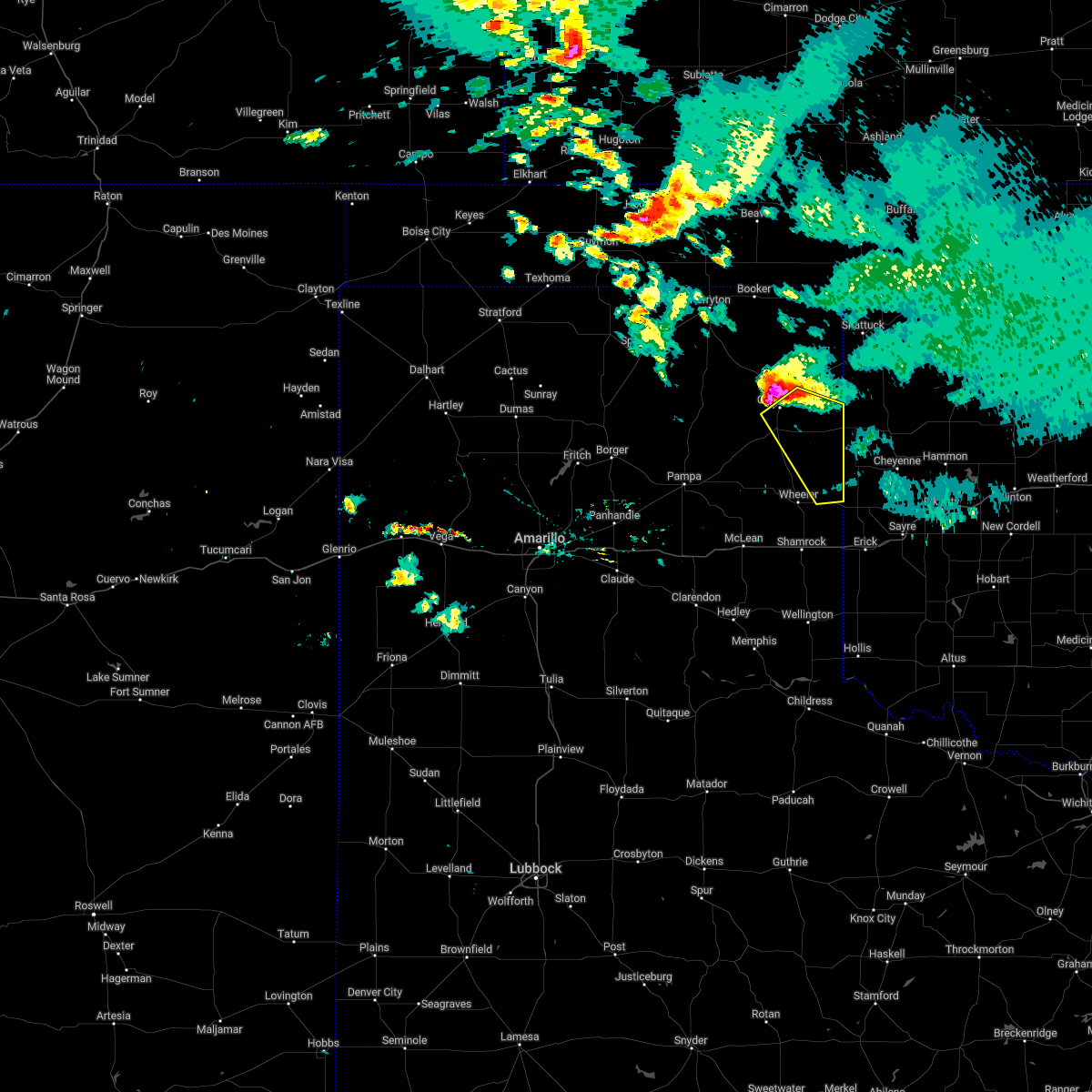 At 1256 am cdt, a severe thunderstorm was located over canadian, moving southeast at 25 mph (radar indicated). Hazards include ping pong ball size hail and 60 mph wind gusts. Minor damage to roofs, siding, and trees is possible. people and animals outdoors will be injured. Expect hail damage to roofs, siding, windows, and vehicles. At 1256 am cdt, a severe thunderstorm was located over canadian, moving southeast at 25 mph (radar indicated). Hazards include ping pong ball size hail and 60 mph wind gusts. Minor damage to roofs, siding, and trees is possible. people and animals outdoors will be injured. Expect hail damage to roofs, siding, windows, and vehicles.
|
| 6/8/2022 12:44 AM CDT |
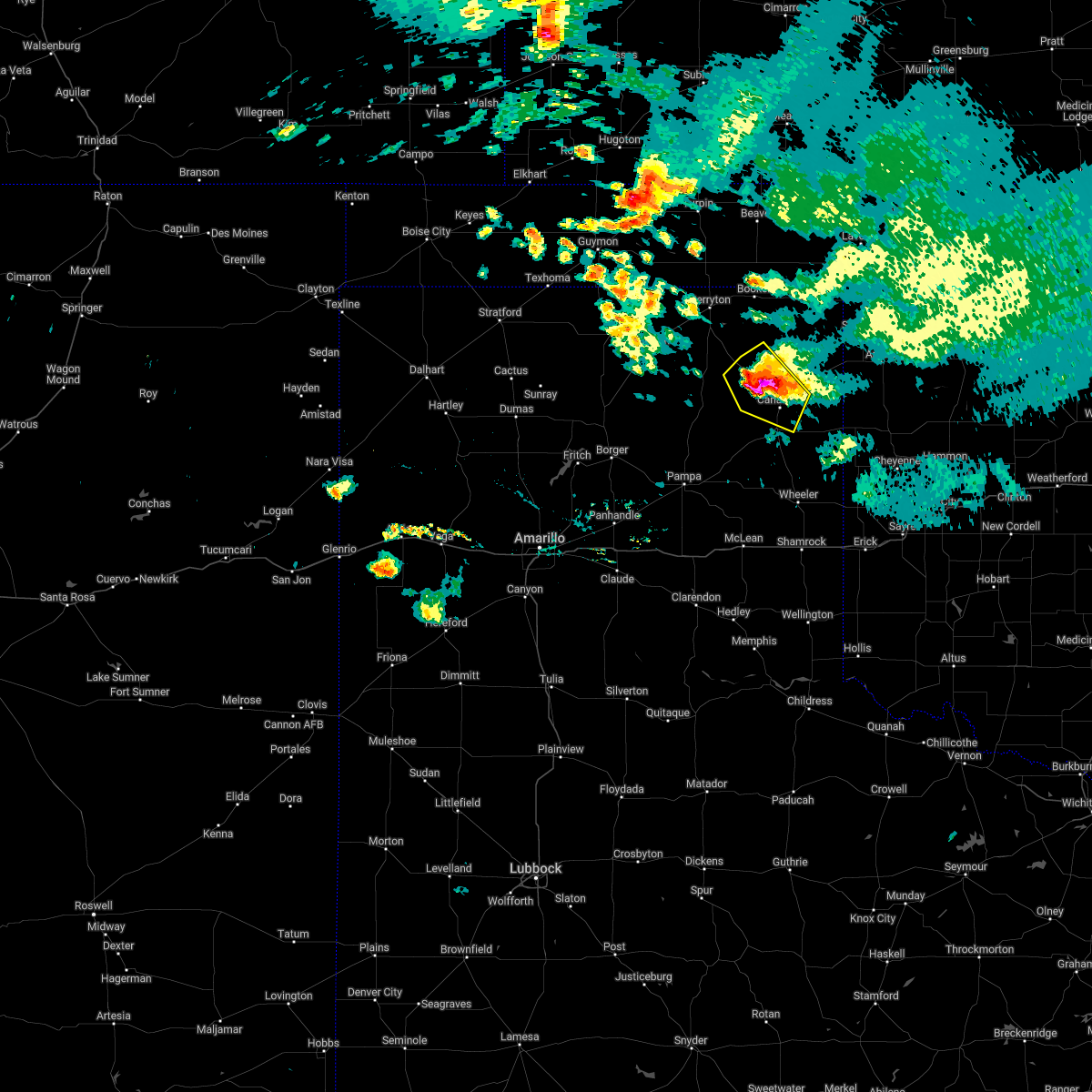 At 1244 am cdt, a severe thunderstorm was located 11 miles northwest of canadian, moving southeast at 15 mph (radar indicated). Hazards include ping pong ball size hail and 60 mph wind gusts. Minor damage to roofs, siding, and trees is possible. people and animals outdoors will be injured. expect hail damage to roofs, siding, windows, and vehicles. locations impacted include, canadian and glazier. hail threat, radar indicated max hail size, 1. 50 in wind threat, radar indicated max wind gust, 60 mph. At 1244 am cdt, a severe thunderstorm was located 11 miles northwest of canadian, moving southeast at 15 mph (radar indicated). Hazards include ping pong ball size hail and 60 mph wind gusts. Minor damage to roofs, siding, and trees is possible. people and animals outdoors will be injured. expect hail damage to roofs, siding, windows, and vehicles. locations impacted include, canadian and glazier. hail threat, radar indicated max hail size, 1. 50 in wind threat, radar indicated max wind gust, 60 mph.
|
| 6/8/2022 12:31 AM CDT |
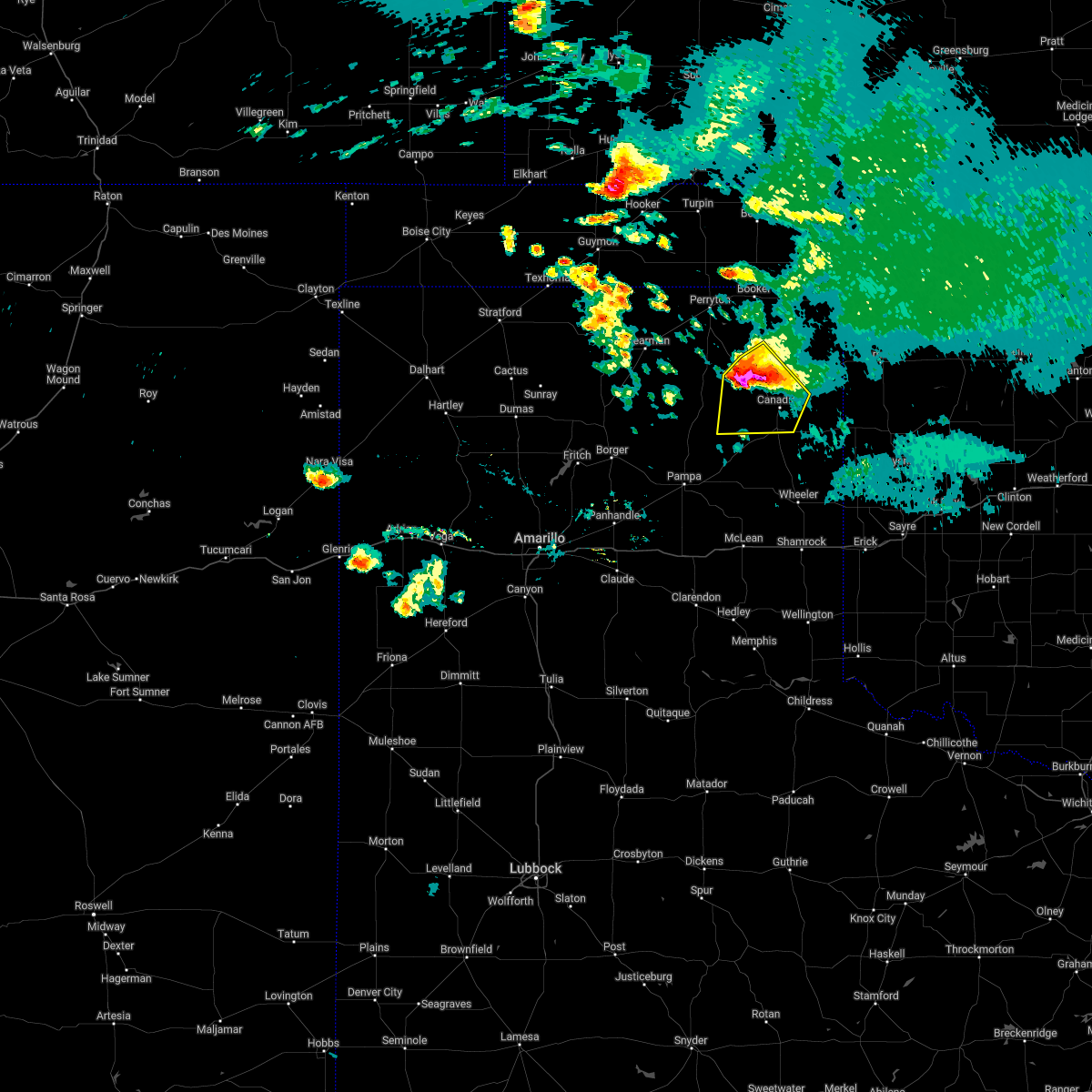 At 1231 am cdt, a severe thunderstorm was located 12 miles south of wolf creek park, or 14 miles northwest of canadian, moving southeast at 15 mph (radar indicated). Hazards include golf ball size hail and 60 mph wind gusts. Minor damage to roofs, siding, and trees is possible. people and animals outdoors will be injured. expect hail damage to roofs, siding, windows, and vehicles. locations impacted include, canadian and glazier. thunderstorm damage threat, considerable hail threat, radar indicated max hail size, 1. 75 in wind threat, radar indicated max wind gust, 60 mph. At 1231 am cdt, a severe thunderstorm was located 12 miles south of wolf creek park, or 14 miles northwest of canadian, moving southeast at 15 mph (radar indicated). Hazards include golf ball size hail and 60 mph wind gusts. Minor damage to roofs, siding, and trees is possible. people and animals outdoors will be injured. expect hail damage to roofs, siding, windows, and vehicles. locations impacted include, canadian and glazier. thunderstorm damage threat, considerable hail threat, radar indicated max hail size, 1. 75 in wind threat, radar indicated max wind gust, 60 mph.
|
| 6/8/2022 12:17 AM CDT |
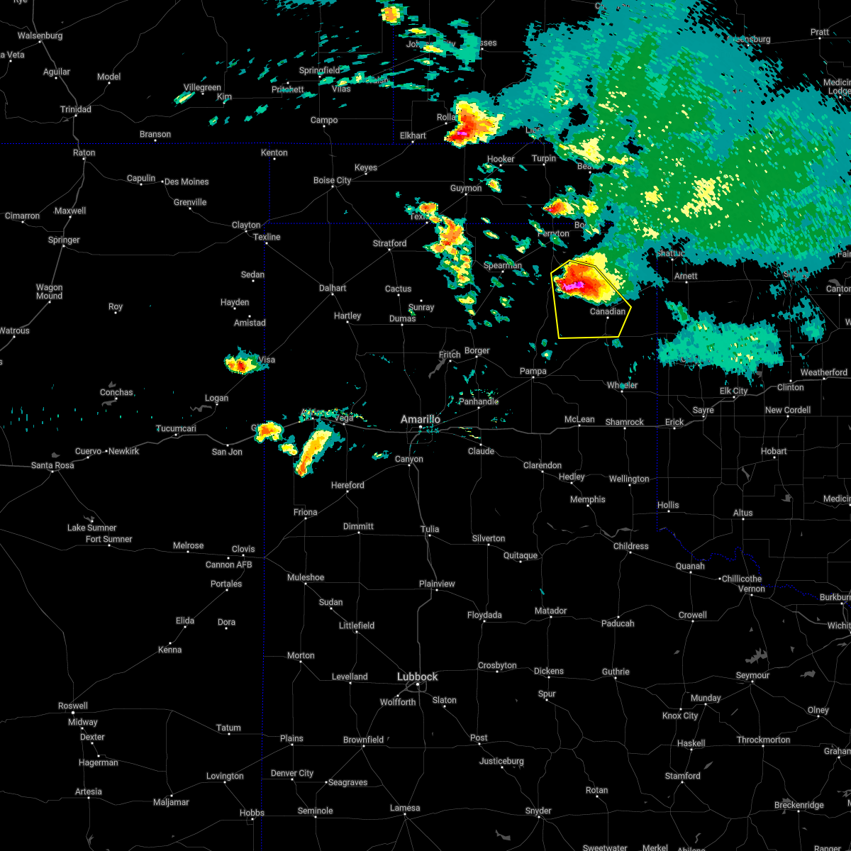 At 1217 am cdt, a severe thunderstorm was located 9 miles south of wolf creek park, or 18 miles northwest of canadian, moving southeast at 15 mph (radar indicated). Hazards include golf ball size hail and 60 mph wind gusts. Minor damage to roofs, siding, and trees is possible. people and animals outdoors will be injured. expect hail damage to roofs, siding, windows, and vehicles. locations impacted include, canadian, glazier and wolf creek park. thunderstorm damage threat, considerable hail threat, radar indicated max hail size, 1. 75 in wind threat, radar indicated max wind gust, 60 mph. At 1217 am cdt, a severe thunderstorm was located 9 miles south of wolf creek park, or 18 miles northwest of canadian, moving southeast at 15 mph (radar indicated). Hazards include golf ball size hail and 60 mph wind gusts. Minor damage to roofs, siding, and trees is possible. people and animals outdoors will be injured. expect hail damage to roofs, siding, windows, and vehicles. locations impacted include, canadian, glazier and wolf creek park. thunderstorm damage threat, considerable hail threat, radar indicated max hail size, 1. 75 in wind threat, radar indicated max wind gust, 60 mph.
|
| 6/7/2022 11:58 PM CDT |
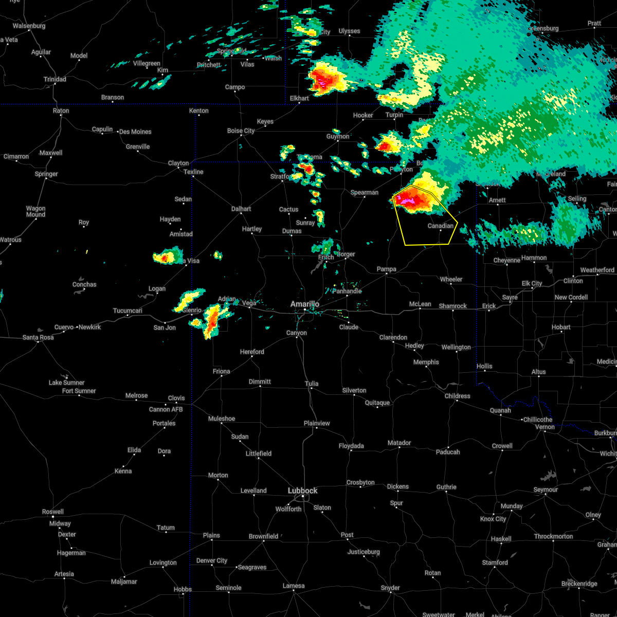 At 1158 pm cdt, a severe thunderstorm was located 5 miles southwest of wolf creek park, or 18 miles south of perryton, moving southeast at 15 mph (radar indicated). Hazards include golf ball size hail and 70 mph wind gusts. Expect some tree damage. damage is likely to mobile homes, roofs, and outbuildings. people and animals outdoors will be injured. Expect hail damage to roofs, siding, windows, and vehicles. At 1158 pm cdt, a severe thunderstorm was located 5 miles southwest of wolf creek park, or 18 miles south of perryton, moving southeast at 15 mph (radar indicated). Hazards include golf ball size hail and 70 mph wind gusts. Expect some tree damage. damage is likely to mobile homes, roofs, and outbuildings. people and animals outdoors will be injured. Expect hail damage to roofs, siding, windows, and vehicles.
|
| 5/19/2022 12:17 AM CDT |
 At 1217 am cdt, automated weather equipment reported severe thunderstorms were located along a line extending from 4 miles north of hazelton to 9 miles west of sharon, moving east at 55 mph (automated weather equipment). Hazards include 70 mph wind gusts. Expect some tree damage. damage is likely to mobile homes, roofs, and outbuildings. locations impacted include, lipscomb, canadian, follett, higgins, glazier and lake marvin. thunderstorm damage threat, considerable hail threat, radar indicated max hail size, <. 75 in wind threat, radar indicated max wind gust, 70 mph. At 1217 am cdt, automated weather equipment reported severe thunderstorms were located along a line extending from 4 miles north of hazelton to 9 miles west of sharon, moving east at 55 mph (automated weather equipment). Hazards include 70 mph wind gusts. Expect some tree damage. damage is likely to mobile homes, roofs, and outbuildings. locations impacted include, lipscomb, canadian, follett, higgins, glazier and lake marvin. thunderstorm damage threat, considerable hail threat, radar indicated max hail size, <. 75 in wind threat, radar indicated max wind gust, 70 mph.
|
| 5/19/2022 12:01 AM CDT |
 At 1201 am cdt, automated weather equipment reported severe thunderstorms were located along a line extending from 8 miles southwest of medicine lodge to gage, moving east at 55 mph (automated weather equipment). Hazards include 60 mph wind gusts and quarter size hail. Minor damage to roofs, siding, and trees is possible. hail damage to vehicles is expected. locations impacted include, lipscomb, canadian, booker, follett, higgins, darrouzett, glazier and lake marvin. hail threat, radar indicated max hail size, 1. 00in wind threat, radar indicated max wind gust, 60 mph. At 1201 am cdt, automated weather equipment reported severe thunderstorms were located along a line extending from 8 miles southwest of medicine lodge to gage, moving east at 55 mph (automated weather equipment). Hazards include 60 mph wind gusts and quarter size hail. Minor damage to roofs, siding, and trees is possible. hail damage to vehicles is expected. locations impacted include, lipscomb, canadian, booker, follett, higgins, darrouzett, glazier and lake marvin. hail threat, radar indicated max hail size, 1. 00in wind threat, radar indicated max wind gust, 60 mph.
|
| 5/18/2022 11:57 PM CDT | Storm damage reported in hemphill county TX, 5.8 miles W of Canadian, TX |
| 5/18/2022 11:46 PM CDT |
 At 1146 pm cdt, automated weather equipment reported severe thunderstorms were located along a line extending from 9 miles north of aetna to 7 miles northwest of shattuck, moving east at 55 mph (automated weather equipment). Hazards include 60 mph wind gusts and quarter size hail. Minor damage to roofs, siding, and trees is possible. hail damage to vehicles is expected. locations impacted include, perryton, lipscomb, canadian, beaver, booker, forgan, follett, higgins, darrouzett, gate, knowles, wolf creek park, elmwood, boyd, floris, glazier, lake marvin, bryans corner, mocane and slapout. hail threat, radar indicated max hail size, 1. 00in wind threat, radar indicated max wind gust, 60 mph. At 1146 pm cdt, automated weather equipment reported severe thunderstorms were located along a line extending from 9 miles north of aetna to 7 miles northwest of shattuck, moving east at 55 mph (automated weather equipment). Hazards include 60 mph wind gusts and quarter size hail. Minor damage to roofs, siding, and trees is possible. hail damage to vehicles is expected. locations impacted include, perryton, lipscomb, canadian, beaver, booker, forgan, follett, higgins, darrouzett, gate, knowles, wolf creek park, elmwood, boyd, floris, glazier, lake marvin, bryans corner, mocane and slapout. hail threat, radar indicated max hail size, 1. 00in wind threat, radar indicated max wind gust, 60 mph.
|
| 5/18/2022 11:27 PM CDT |
 At 1127 pm cdt, automated weather equipment reported severe thunderstorms were located along a line extending from 7 miles south of wilmore to 7 miles south of darrouzett, moving east at 55 mph (automated weather equipment). Hazards include 60 mph wind gusts and penny size hail. Minor damage to roofs, siding, and trees is possible. locations impacted include, perryton, lipscomb, canadian, beaver, booker, forgan, follett, higgins, darrouzett, gate, knowles, wolf creek park, elmwood, farnsworth, boyd, waka, floris, glazier, lake marvin and bryans corner. hail threat, radar indicated max hail size, 0. 75in wind threat, radar indicated max wind gust, 60 mph. At 1127 pm cdt, automated weather equipment reported severe thunderstorms were located along a line extending from 7 miles south of wilmore to 7 miles south of darrouzett, moving east at 55 mph (automated weather equipment). Hazards include 60 mph wind gusts and penny size hail. Minor damage to roofs, siding, and trees is possible. locations impacted include, perryton, lipscomb, canadian, beaver, booker, forgan, follett, higgins, darrouzett, gate, knowles, wolf creek park, elmwood, farnsworth, boyd, waka, floris, glazier, lake marvin and bryans corner. hail threat, radar indicated max hail size, 0. 75in wind threat, radar indicated max wind gust, 60 mph.
|
| 5/18/2022 11:25 PM CDT |
 At 1125 pm cdt, automated weather equipment reported severe thunderstorms were located along a line extending from 7 miles south of wilmore to 7 miles south of darrouzett, moving east at 55 mph (automated weather equipment). Hazards include 60 mph wind gusts and penny size hail. Minor damage to roofs, siding, and trees is possible. locations impacted include, perryton, spearman, lipscomb, canadian, beaver, booker, gruver, forgan, follett, higgins, darrouzett, hardesty, gate, knowles, wolf creek park, lake marvin, slapout, balko, elmwood and farnsworth. hail threat, radar indicated max hail size, 0. 75in wind threat, radar indicated max wind gust, 60 mph. At 1125 pm cdt, automated weather equipment reported severe thunderstorms were located along a line extending from 7 miles south of wilmore to 7 miles south of darrouzett, moving east at 55 mph (automated weather equipment). Hazards include 60 mph wind gusts and penny size hail. Minor damage to roofs, siding, and trees is possible. locations impacted include, perryton, spearman, lipscomb, canadian, beaver, booker, gruver, forgan, follett, higgins, darrouzett, hardesty, gate, knowles, wolf creek park, lake marvin, slapout, balko, elmwood and farnsworth. hail threat, radar indicated max hail size, 0. 75in wind threat, radar indicated max wind gust, 60 mph.
|
| 5/18/2022 10:58 PM CDT |
 At 1057 pm cdt, severe thunderstorms were located along a line extending from 6 miles north of sitka to 4 miles east of perryton, moving east at 55 mph (radar indicated). Hazards include 60 mph wind gusts and penny size hail. minor damage to roofs, siding, and trees is possible At 1057 pm cdt, severe thunderstorms were located along a line extending from 6 miles north of sitka to 4 miles east of perryton, moving east at 55 mph (radar indicated). Hazards include 60 mph wind gusts and penny size hail. minor damage to roofs, siding, and trees is possible
|
| 5/10/2022 8:35 PM CDT | Storm damage reported in hemphill county TX, 15.7 miles NNE of Canadian, TX |
| 5/10/2022 8:28 PM CDT | Storm damage reported in lipscomb county TX, 21.5 miles S of Canadian, TX |
| 5/10/2022 8:27 PM CDT |
 At 826 pm cdt, severe thunderstorms were located along a line extending from 16 miles north of codman to 6 miles southeast of miami to 5 miles southwest of kellerville to 7 miles north of brice, moving northeast at 55 mph (radar indicated). Hazards include 70 mph wind gusts and quarter size hail. Expect some tree damage. damage is likely to mobile homes, roofs, and outbuildings. Hail damage to vehicles is expected. At 826 pm cdt, severe thunderstorms were located along a line extending from 16 miles north of codman to 6 miles southeast of miami to 5 miles southwest of kellerville to 7 miles north of brice, moving northeast at 55 mph (radar indicated). Hazards include 70 mph wind gusts and quarter size hail. Expect some tree damage. damage is likely to mobile homes, roofs, and outbuildings. Hail damage to vehicles is expected.
|
| 5/10/2022 7:35 PM CDT |
 At 735 pm cdt, a severe thunderstorm was located 4 miles southeast of miami, moving north at 40 mph (radar indicated). Hazards include 60 mph wind gusts and nickel size hail. Minor damage to roofs, siding, and trees is possible. locations impacted include, canadian, miami, glazier, codman, lake marvin and lora. hail threat, radar indicated max hail size, 0. 88in wind threat, radar indicated max wind gust, 60 mph. At 735 pm cdt, a severe thunderstorm was located 4 miles southeast of miami, moving north at 40 mph (radar indicated). Hazards include 60 mph wind gusts and nickel size hail. Minor damage to roofs, siding, and trees is possible. locations impacted include, canadian, miami, glazier, codman, lake marvin and lora. hail threat, radar indicated max hail size, 0. 88in wind threat, radar indicated max wind gust, 60 mph.
|
| 5/10/2022 7:25 PM CDT |
 At 725 pm cdt, a severe thunderstorm was located 9 miles southeast of codman, or 10 miles south of miami, moving north at 40 mph (radar indicated). Hazards include 60 mph wind gusts and quarter size hail. Minor damage to roofs, siding, and trees is possible. Hail damage to vehicles is expected. At 725 pm cdt, a severe thunderstorm was located 9 miles southeast of codman, or 10 miles south of miami, moving north at 40 mph (radar indicated). Hazards include 60 mph wind gusts and quarter size hail. Minor damage to roofs, siding, and trees is possible. Hail damage to vehicles is expected.
|
| 5/10/2022 6:45 PM CDT | Quarter sized hail reported 0.4 miles E of Canadian, TX, hail was continuing through 655 pm cdt. |
| 5/10/2022 6:32 PM CDT |
 At 632 pm cdt, severe thunderstorms were located along a line extending from near lefors to near new mobeetie, moving north at 40 mph (radar indicated). Hazards include 60 mph wind gusts and quarter size hail. Minor damage to roofs, siding, and trees is possible. Hail damage to vehicles is expected. At 632 pm cdt, severe thunderstorms were located along a line extending from near lefors to near new mobeetie, moving north at 40 mph (radar indicated). Hazards include 60 mph wind gusts and quarter size hail. Minor damage to roofs, siding, and trees is possible. Hail damage to vehicles is expected.
|
| 5/10/2022 5:28 PM CDT |
 At 527 pm cdt, severe thunderstorms were located along a line extending from 4 miles north of white deer to 6 miles south of lefors, moving north at 35 mph (radar indicated). Hazards include 60 mph wind gusts and quarter size hail. Minor damage to roofs, siding, and trees is possible. Hail damage to vehicles is expected. At 527 pm cdt, severe thunderstorms were located along a line extending from 4 miles north of white deer to 6 miles south of lefors, moving north at 35 mph (radar indicated). Hazards include 60 mph wind gusts and quarter size hail. Minor damage to roofs, siding, and trees is possible. Hail damage to vehicles is expected.
|
| 4/23/2022 4:34 AM CDT |
 At 434 am cdt, a severe thunderstorm was located near codman, or 5 miles west of miami, moving northeast at 60 mph (radar indicated). Hazards include quarter size hail. damage to vehicles is expected At 434 am cdt, a severe thunderstorm was located near codman, or 5 miles west of miami, moving northeast at 60 mph (radar indicated). Hazards include quarter size hail. damage to vehicles is expected
|
| 4/23/2022 2:39 AM CDT |
 At 239 am cdt, severe thunderstorms were located along a line extending from 5 miles northwest of hayne to near baker to 8 miles west of stinnett, moving northeast at 55 mph (radar indicated). Hazards include 60 mph wind gusts. Minor damage to roofs, siding, and trees is possible. locations impacted include, borger, perryton, spearman, lipscomb, canadian, beaver, miami, fritch, hooker, stinnett, booker, gruver, tyrone, forgan, follett, higgins, optima, darrouzett, hardesty and sanford. hail threat, radar indicated max hail size, <. 75 in wind threat, radar indicated max wind gust, 60 mph. At 239 am cdt, severe thunderstorms were located along a line extending from 5 miles northwest of hayne to near baker to 8 miles west of stinnett, moving northeast at 55 mph (radar indicated). Hazards include 60 mph wind gusts. Minor damage to roofs, siding, and trees is possible. locations impacted include, borger, perryton, spearman, lipscomb, canadian, beaver, miami, fritch, hooker, stinnett, booker, gruver, tyrone, forgan, follett, higgins, optima, darrouzett, hardesty and sanford. hail threat, radar indicated max hail size, <. 75 in wind threat, radar indicated max wind gust, 60 mph.
|
| 4/23/2022 2:27 AM CDT |
 At 226 am cdt, severe thunderstorms were located along a line extending from 6 miles southeast of liberal to 6 miles west of boyd to fritch, moving east at 55 mph (radar indicated). Hazards include 60 mph wind gusts. Minor damage to roofs, siding, and trees is possible. locations impacted include, borger, guymon, perryton, spearman, lipscomb, canadian, beaver, miami, fritch, sunray, hooker, stinnett, booker, gruver, tyrone, forgan, follett, higgins, optima and darrouzett. hail threat, radar indicated max hail size, <. 75 in wind threat, radar indicated max wind gust, 60 mph. At 226 am cdt, severe thunderstorms were located along a line extending from 6 miles southeast of liberal to 6 miles west of boyd to fritch, moving east at 55 mph (radar indicated). Hazards include 60 mph wind gusts. Minor damage to roofs, siding, and trees is possible. locations impacted include, borger, guymon, perryton, spearman, lipscomb, canadian, beaver, miami, fritch, sunray, hooker, stinnett, booker, gruver, tyrone, forgan, follett, higgins, optima and darrouzett. hail threat, radar indicated max hail size, <. 75 in wind threat, radar indicated max wind gust, 60 mph.
|
| 4/23/2022 1:55 AM CDT |
 At 153 am cdt, severe thunderstorms were located along a line extending from 12 miles northeast of hough to guymon to 7 miles west of masterson, moving east at 55 mph (radar indicated). Hazards include 60 mph wind gusts. minor damage to roofs, siding, and trees is possible At 153 am cdt, severe thunderstorms were located along a line extending from 12 miles northeast of hough to guymon to 7 miles west of masterson, moving east at 55 mph (radar indicated). Hazards include 60 mph wind gusts. minor damage to roofs, siding, and trees is possible
|
| 4/22/2022 10:40 PM CDT | Half Dollar sized hail reported 1.6 miles NE of Canadian, TX, hail up to half-dollar size fell for about 3 minutes on the south side of canadian... tx. |
| 4/22/2022 10:34 PM CDT |
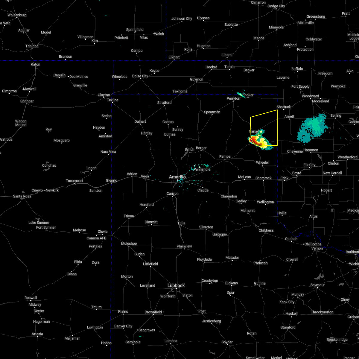 At 1034 pm cdt, a severe thunderstorm was located 4 miles south of canadian, moving northeast at 50 mph (radar indicated). Hazards include golf ball size hail and 60 mph wind gusts. Minor damage to roofs, siding, and trees is possible. people and animals outdoors will be injured. expect hail damage to roofs, siding, windows, and vehicles. locations impacted include, canadian, higgins, glazier and lake marvin. thunderstorm damage threat, considerable hail threat, radar indicated max hail size, 1. 75 in wind threat, radar indicated max wind gust, 60 mph. At 1034 pm cdt, a severe thunderstorm was located 4 miles south of canadian, moving northeast at 50 mph (radar indicated). Hazards include golf ball size hail and 60 mph wind gusts. Minor damage to roofs, siding, and trees is possible. people and animals outdoors will be injured. expect hail damage to roofs, siding, windows, and vehicles. locations impacted include, canadian, higgins, glazier and lake marvin. thunderstorm damage threat, considerable hail threat, radar indicated max hail size, 1. 75 in wind threat, radar indicated max wind gust, 60 mph.
|
| 4/22/2022 10:32 PM CDT | Golf Ball sized hail reported 5.5 miles N of Canadian, TX, twitter report shows picture of various hail sizes. golf ball hail was the largest. |
| 4/22/2022 10:22 PM CDT |
 At 1022 pm cdt, a severe thunderstorm was located over lora, or 7 miles northeast of miami, moving northeast at 45 mph (radar indicated). Hazards include golf ball size hail and 60 mph wind gusts. Minor damage to roofs, siding, and trees is possible. people and animals outdoors will be injured. Expect hail damage to roofs, siding, windows, and vehicles. At 1022 pm cdt, a severe thunderstorm was located over lora, or 7 miles northeast of miami, moving northeast at 45 mph (radar indicated). Hazards include golf ball size hail and 60 mph wind gusts. Minor damage to roofs, siding, and trees is possible. people and animals outdoors will be injured. Expect hail damage to roofs, siding, windows, and vehicles.
|
| 10/13/2021 12:46 AM CDT |
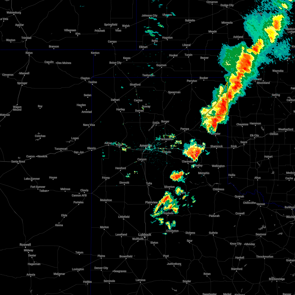 At 1245 am cdt, a severe thunderstorm was located 5 miles northeast of higgins, or 8 miles southwest of shattuck, moving northeast at 40 mph (radar indicated). Hazards include 60 mph wind gusts and penny size hail. Minor damage to roofs, siding, and trees is possible. locations impacted include, canadian, higgins, glazier and lake marvin. hail threat, radar indicated max hail size, 0. 75in wind threat, radar indicated max wind gust, 60 mph. At 1245 am cdt, a severe thunderstorm was located 5 miles northeast of higgins, or 8 miles southwest of shattuck, moving northeast at 40 mph (radar indicated). Hazards include 60 mph wind gusts and penny size hail. Minor damage to roofs, siding, and trees is possible. locations impacted include, canadian, higgins, glazier and lake marvin. hail threat, radar indicated max hail size, 0. 75in wind threat, radar indicated max wind gust, 60 mph.
|
| 10/13/2021 12:17 AM CDT |
 At 1216 am cdt, a severe thunderstorm was located 8 miles east of lipscomb, moving northeast at 55 mph (radar indicated). Hazards include 70 mph wind gusts and quarter size hail. Expect some tree damage. damage is likely to mobile homes, roofs, and outbuildings. hail damage to vehicles is expected. locations impacted include, lipscomb, canadian, follett, higgins, darrouzett, slapout, glazier and lake marvin. thunderstorm damage threat, considerable hail threat, radar indicated max hail size, 1. 00in wind threat, radar indicated max wind gust, 70 mph. At 1216 am cdt, a severe thunderstorm was located 8 miles east of lipscomb, moving northeast at 55 mph (radar indicated). Hazards include 70 mph wind gusts and quarter size hail. Expect some tree damage. damage is likely to mobile homes, roofs, and outbuildings. hail damage to vehicles is expected. locations impacted include, lipscomb, canadian, follett, higgins, darrouzett, slapout, glazier and lake marvin. thunderstorm damage threat, considerable hail threat, radar indicated max hail size, 1. 00in wind threat, radar indicated max wind gust, 70 mph.
|
| 10/12/2021 11:59 PM CDT |
 At 1158 pm cdt, a severe thunderstorm was located 8 miles northwest of glazier, or 11 miles southwest of lipscomb, moving northeast at 55 mph (radar indicated). Hazards include 70 mph wind gusts and quarter size hail. Expect some tree damage. damage is likely to mobile homes, roofs, and outbuildings. Hail damage to vehicles is expected. At 1158 pm cdt, a severe thunderstorm was located 8 miles northwest of glazier, or 11 miles southwest of lipscomb, moving northeast at 55 mph (radar indicated). Hazards include 70 mph wind gusts and quarter size hail. Expect some tree damage. damage is likely to mobile homes, roofs, and outbuildings. Hail damage to vehicles is expected.
|
| 10/12/2021 11:24 PM CDT |
 At 1124 pm cdt, a severe thunderstorm was located 5 miles west of lipscomb, moving northeast at 80 mph (radar indicated). Hazards include 60 mph wind gusts and penny size hail. Minor damage to roofs, siding, and trees is possible. Locations impacted include, lipscomb, canadian, follett, higgins, wolf creek park, glazier and lake marvin. At 1124 pm cdt, a severe thunderstorm was located 5 miles west of lipscomb, moving northeast at 80 mph (radar indicated). Hazards include 60 mph wind gusts and penny size hail. Minor damage to roofs, siding, and trees is possible. Locations impacted include, lipscomb, canadian, follett, higgins, wolf creek park, glazier and lake marvin.
|
| 10/12/2021 10:42 PM CDT |
 At 1042 pm cdt, a severe thunderstorm was located 10 miles southwest of wolf creek park, or 21 miles south of perryton, moving northeast at 60 mph (radar indicated). Hazards include 60 mph wind gusts and quarter size hail. Minor damage to roofs, siding, and trees is possible. hail damage to vehicles is expected. Locations impacted include, lipscomb, canadian, follett, higgins, wolf creek park, glazier and lake marvin. At 1042 pm cdt, a severe thunderstorm was located 10 miles southwest of wolf creek park, or 21 miles south of perryton, moving northeast at 60 mph (radar indicated). Hazards include 60 mph wind gusts and quarter size hail. Minor damage to roofs, siding, and trees is possible. hail damage to vehicles is expected. Locations impacted include, lipscomb, canadian, follett, higgins, wolf creek park, glazier and lake marvin.
|
| 10/12/2021 10:23 PM CDT |
 At 1023 pm cdt, a severe thunderstorm was located 19 miles southeast of spearman, moving northeast at 60 mph (radar indicated). Hazards include 60 mph wind gusts and quarter size hail. Minor damage to roofs, siding, and trees is possible. Hail damage to vehicles is expected. At 1023 pm cdt, a severe thunderstorm was located 19 miles southeast of spearman, moving northeast at 60 mph (radar indicated). Hazards include 60 mph wind gusts and quarter size hail. Minor damage to roofs, siding, and trees is possible. Hail damage to vehicles is expected.
|
| 9/7/2021 6:22 PM CDT |
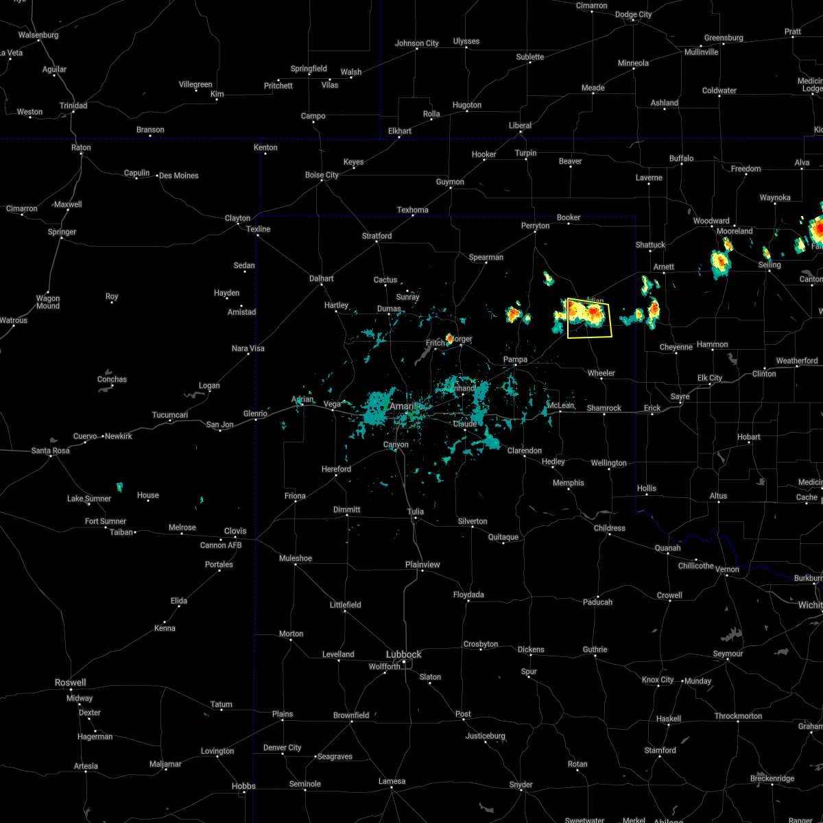 At 622 pm cdt, a severe thunderstorm was located over canadian, moving south at 15 mph (radar indicated). Hazards include 60 mph wind gusts and penny size hail. Minor damage to roofs, siding, and trees is possible. locations impacted include, canadian. hail threat, radar indicated max hail size, 0. 75in wind threat, radar indicated max wind gust, 60 mph. At 622 pm cdt, a severe thunderstorm was located over canadian, moving south at 15 mph (radar indicated). Hazards include 60 mph wind gusts and penny size hail. Minor damage to roofs, siding, and trees is possible. locations impacted include, canadian. hail threat, radar indicated max hail size, 0. 75in wind threat, radar indicated max wind gust, 60 mph.
|
| 9/7/2021 6:04 PM CDT |
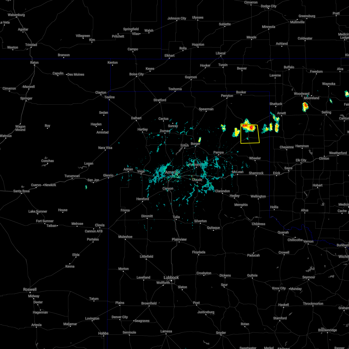 At 604 pm cdt, a severe thunderstorm was located over canadian, moving south at 20 mph (radar indicated). Hazards include 60 mph wind gusts and quarter size hail. Minor damage to roofs, siding, and trees is possible. Hail damage to vehicles is expected. At 604 pm cdt, a severe thunderstorm was located over canadian, moving south at 20 mph (radar indicated). Hazards include 60 mph wind gusts and quarter size hail. Minor damage to roofs, siding, and trees is possible. Hail damage to vehicles is expected.
|
| 8/21/2021 4:22 PM CDT |
 The severe thunderstorm warning for southern lipscomb, eastern roberts, hemphill and southeastern ochiltree counties will expire at 430 pm cdt, the storm which prompted the warning has weakened below severe limits, and no longer poses an immediate threat to life or property. therefore, the warning will be allowed to expire. however gusty winds are still possible with this thunderstorm. remember, a severe thunderstorm warning still remains in effect for northern lipscomb county and northeastern ochiltree county. The severe thunderstorm warning for southern lipscomb, eastern roberts, hemphill and southeastern ochiltree counties will expire at 430 pm cdt, the storm which prompted the warning has weakened below severe limits, and no longer poses an immediate threat to life or property. therefore, the warning will be allowed to expire. however gusty winds are still possible with this thunderstorm. remember, a severe thunderstorm warning still remains in effect for northern lipscomb county and northeastern ochiltree county.
|
| 8/21/2021 3:57 PM CDT |
 At 357 pm cdt, a severe thunderstorm was located 7 miles northwest of lora, or 10 miles north of miami, moving north at 10 mph (radar indicated). Hazards include 60 mph wind gusts and quarter size hail. Minor damage to roofs, siding, and trees is possible. hail damage to vehicles is expected. locations impacted include, lipscomb, canadian, miami, higgins, lora, glazier and lake marvin. hail threat, radar indicated max hail size, 1. 00in wind threat, radar indicated max wind gust, 60 mph. At 357 pm cdt, a severe thunderstorm was located 7 miles northwest of lora, or 10 miles north of miami, moving north at 10 mph (radar indicated). Hazards include 60 mph wind gusts and quarter size hail. Minor damage to roofs, siding, and trees is possible. hail damage to vehicles is expected. locations impacted include, lipscomb, canadian, miami, higgins, lora, glazier and lake marvin. hail threat, radar indicated max hail size, 1. 00in wind threat, radar indicated max wind gust, 60 mph.
|
| 8/21/2021 3:48 PM CDT |
 At 348 pm cdt, a severe thunderstorm was located 5 miles north of lora, or 9 miles north of miami, moving north at 10 mph (radar indicated). Hazards include 60 mph wind gusts and quarter size hail. Minor damage to roofs, siding, and trees is possible. hail damage to vehicles is expected. locations impacted include, lipscomb, canadian, miami, higgins, lora, glazier and lake marvin. hail threat, radar indicated max hail size, 1. 00in wind threat, radar indicated max wind gust, 60 mph. At 348 pm cdt, a severe thunderstorm was located 5 miles north of lora, or 9 miles north of miami, moving north at 10 mph (radar indicated). Hazards include 60 mph wind gusts and quarter size hail. Minor damage to roofs, siding, and trees is possible. hail damage to vehicles is expected. locations impacted include, lipscomb, canadian, miami, higgins, lora, glazier and lake marvin. hail threat, radar indicated max hail size, 1. 00in wind threat, radar indicated max wind gust, 60 mph.
|
| 8/21/2021 3:36 PM CDT |
 At 335 pm cdt, a severe thunderstorm was located 4 miles southwest of canadian, moving north at 10 mph. another severe thunderstorm was located 5 miles north of canadian, moving north at 10 mph (radar indicated). Hazards include 60 mph wind gusts and quarter size hail. Minor damage to roofs, siding, and trees is possible. hail damage to vehicles is expected. locations impacted include, lipscomb, canadian, miami, higgins, lora, glazier and lake marvin. hail threat, radar indicated max hail size, 1. 00in wind threat, radar indicated max wind gust, 60 mph. At 335 pm cdt, a severe thunderstorm was located 4 miles southwest of canadian, moving north at 10 mph. another severe thunderstorm was located 5 miles north of canadian, moving north at 10 mph (radar indicated). Hazards include 60 mph wind gusts and quarter size hail. Minor damage to roofs, siding, and trees is possible. hail damage to vehicles is expected. locations impacted include, lipscomb, canadian, miami, higgins, lora, glazier and lake marvin. hail threat, radar indicated max hail size, 1. 00in wind threat, radar indicated max wind gust, 60 mph.
|
| 8/21/2021 3:28 PM CDT |
 At 327 pm cdt, a severe thunderstorm was located 5 miles south of canadian, moving north at 10 mph (radar indicated). Hazards include 60 mph wind gusts and half dollar size hail. Minor damage to roofs, siding, and trees is possible. hail damage to vehicles is expected. locations impacted include, lipscomb, canadian, miami, higgins, lora, glazier and lake marvin. hail threat, radar indicated max hail size, 1. 25 in wind threat, radar indicated max wind gust, 60 mph. At 327 pm cdt, a severe thunderstorm was located 5 miles south of canadian, moving north at 10 mph (radar indicated). Hazards include 60 mph wind gusts and half dollar size hail. Minor damage to roofs, siding, and trees is possible. hail damage to vehicles is expected. locations impacted include, lipscomb, canadian, miami, higgins, lora, glazier and lake marvin. hail threat, radar indicated max hail size, 1. 25 in wind threat, radar indicated max wind gust, 60 mph.
|
| 8/21/2021 3:17 PM CDT |
 At 317 pm cdt, a severe thunderstorm was located 6 miles south of canadian, moving north at 5 mph (radar indicated). Hazards include 60 mph wind gusts and half dollar size hail. Minor damage to roofs, siding, and trees is possible. hail damage to vehicles is expected. locations impacted include, lipscomb, canadian, miami, higgins, lora, glazier and lake marvin. hail threat, radar indicated max hail size, 1. 25 in wind threat, radar indicated max wind gust, 60 mph. At 317 pm cdt, a severe thunderstorm was located 6 miles south of canadian, moving north at 5 mph (radar indicated). Hazards include 60 mph wind gusts and half dollar size hail. Minor damage to roofs, siding, and trees is possible. hail damage to vehicles is expected. locations impacted include, lipscomb, canadian, miami, higgins, lora, glazier and lake marvin. hail threat, radar indicated max hail size, 1. 25 in wind threat, radar indicated max wind gust, 60 mph.
|
| 8/21/2021 3:08 PM CDT |
 At 308 pm cdt, a severe thunderstorm was located 7 miles south of canadian, moving north at 10 mph (radar indicated). Hazards include 60 mph wind gusts and quarter size hail. Minor damage to roofs, siding, and trees is possible. hail damage to vehicles is expected. locations impacted include, lipscomb, canadian, miami, higgins, lora, glazier and lake marvin. hail threat, radar indicated max hail size, 1. 00in wind threat, radar indicated max wind gust, 60 mph. At 308 pm cdt, a severe thunderstorm was located 7 miles south of canadian, moving north at 10 mph (radar indicated). Hazards include 60 mph wind gusts and quarter size hail. Minor damage to roofs, siding, and trees is possible. hail damage to vehicles is expected. locations impacted include, lipscomb, canadian, miami, higgins, lora, glazier and lake marvin. hail threat, radar indicated max hail size, 1. 00in wind threat, radar indicated max wind gust, 60 mph.
|
| 8/21/2021 2:57 PM CDT |
 At 257 pm cdt, a severe thunderstorm was located 8 miles south of canadian, moving north at 10 mph (radar indicated). Hazards include 60 mph wind gusts and quarter size hail. Minor damage to roofs, siding, and trees is possible. Hail damage to vehicles is expected. At 257 pm cdt, a severe thunderstorm was located 8 miles south of canadian, moving north at 10 mph (radar indicated). Hazards include 60 mph wind gusts and quarter size hail. Minor damage to roofs, siding, and trees is possible. Hail damage to vehicles is expected.
|
| 7/25/2021 6:37 PM CDT |
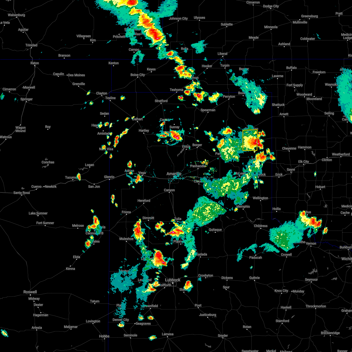 The severe thunderstorm warning for southwestern hemphill county will expire at 645 pm cdt, the storm which prompted the warning has weakened below severe limits, and has exited the warned area. therefore, the warning will be allowed to expire. however gusty winds and heavy rain are still possible with this thunderstorm. The severe thunderstorm warning for southwestern hemphill county will expire at 645 pm cdt, the storm which prompted the warning has weakened below severe limits, and has exited the warned area. therefore, the warning will be allowed to expire. however gusty winds and heavy rain are still possible with this thunderstorm.
|
| 7/25/2021 6:12 PM CDT |
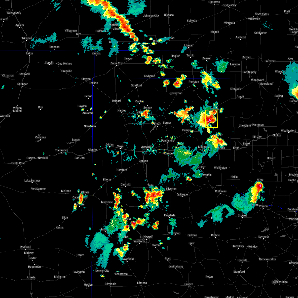 At 612 pm cdt, a severe thunderstorm was located 7 miles east of lora, or 11 miles south of canadian, moving east at 15 mph (radar indicated). Hazards include 60 mph wind gusts and quarter size hail. Minor damage to roofs, siding, and trees is possible. hail damage to vehicles is expected. Locations impacted include, canadian. At 612 pm cdt, a severe thunderstorm was located 7 miles east of lora, or 11 miles south of canadian, moving east at 15 mph (radar indicated). Hazards include 60 mph wind gusts and quarter size hail. Minor damage to roofs, siding, and trees is possible. hail damage to vehicles is expected. Locations impacted include, canadian.
|
| 7/25/2021 5:40 PM CDT |
 At 540 pm cdt, a severe thunderstorm was located over lora, or 5 miles northeast of miami, moving southeast at 10 mph (radar indicated). Hazards include ping pong ball size hail and 60 mph wind gusts. Minor damage to roofs, siding, and trees is possible. people and animals outdoors will be injured. Expect hail damage to roofs, siding, windows, and vehicles. At 540 pm cdt, a severe thunderstorm was located over lora, or 5 miles northeast of miami, moving southeast at 10 mph (radar indicated). Hazards include ping pong ball size hail and 60 mph wind gusts. Minor damage to roofs, siding, and trees is possible. people and animals outdoors will be injured. Expect hail damage to roofs, siding, windows, and vehicles.
|
| 6/25/2021 7:02 PM CDT | West texas mesonet statio in hemphill county TX, 5.8 miles W of Canadian, TX |
| 6/25/2021 5:09 PM CDT | West texas mesonet station canadian 6 in hemphill county TX, 5.8 miles W of Canadian, TX |
| 6/25/2021 4:33 PM CDT |
 At 433 pm cdt, severe thunderstorms were located along a line extending from 7 miles southwest of lake marvin to near codman, moving northeast at 35 mph (radar indicated). Hazards include ping pong ball size hail and 60 mph wind gusts. Minor damage to roofs, siding, and trees is possible. people and animals outdoors will be injured. expect hail damage to roofs, siding, windows, and vehicles. Locations impacted include, canadian, miami, briscoe, higgins, new mobeetie, lora, allison, glazier, codman, lake marvin and mobeetie. At 433 pm cdt, severe thunderstorms were located along a line extending from 7 miles southwest of lake marvin to near codman, moving northeast at 35 mph (radar indicated). Hazards include ping pong ball size hail and 60 mph wind gusts. Minor damage to roofs, siding, and trees is possible. people and animals outdoors will be injured. expect hail damage to roofs, siding, windows, and vehicles. Locations impacted include, canadian, miami, briscoe, higgins, new mobeetie, lora, allison, glazier, codman, lake marvin and mobeetie.
|
| 6/25/2021 4:26 PM CDT |
 At 425 pm cdt, severe thunderstorms were located along a line extending from 9 miles southwest of lake marvin to near codman, moving northeast at 35 mph (radar indicated). Hazards include 60 mph wind gusts and quarter size hail. Minor damage to roofs, siding, and trees is possible. Hail damage to vehicles is expected. At 425 pm cdt, severe thunderstorms were located along a line extending from 9 miles southwest of lake marvin to near codman, moving northeast at 35 mph (radar indicated). Hazards include 60 mph wind gusts and quarter size hail. Minor damage to roofs, siding, and trees is possible. Hail damage to vehicles is expected.
|
| 6/25/2021 3:20 PM CDT |
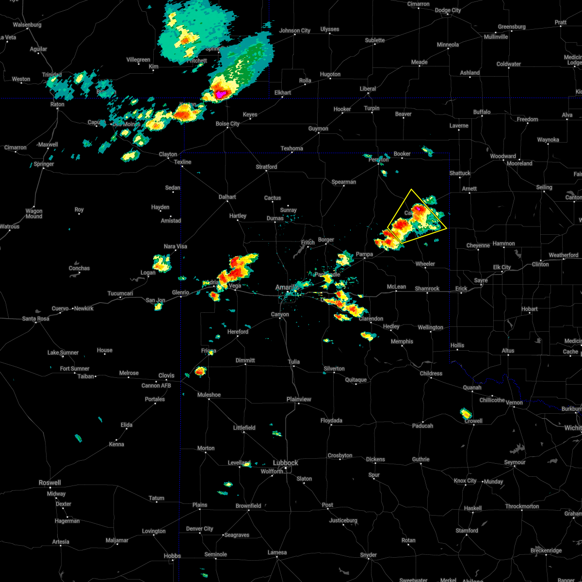 At 319 pm cdt, two severe thunderstorms, the first near canadian and the second 5 miles northwest of lora, were moving northeast at 35 mph (radar indicated). Hazards include 70 mph wind gusts and half dollar size hail. Expect some tree damage. damage is likely to mobile homes, roofs, and outbuildings. hail damage to vehicles is expected. Locations impacted include, canadian, glazier, lake marvin and lora. At 319 pm cdt, two severe thunderstorms, the first near canadian and the second 5 miles northwest of lora, were moving northeast at 35 mph (radar indicated). Hazards include 70 mph wind gusts and half dollar size hail. Expect some tree damage. damage is likely to mobile homes, roofs, and outbuildings. hail damage to vehicles is expected. Locations impacted include, canadian, glazier, lake marvin and lora.
|
| 6/25/2021 2:50 PM CDT |
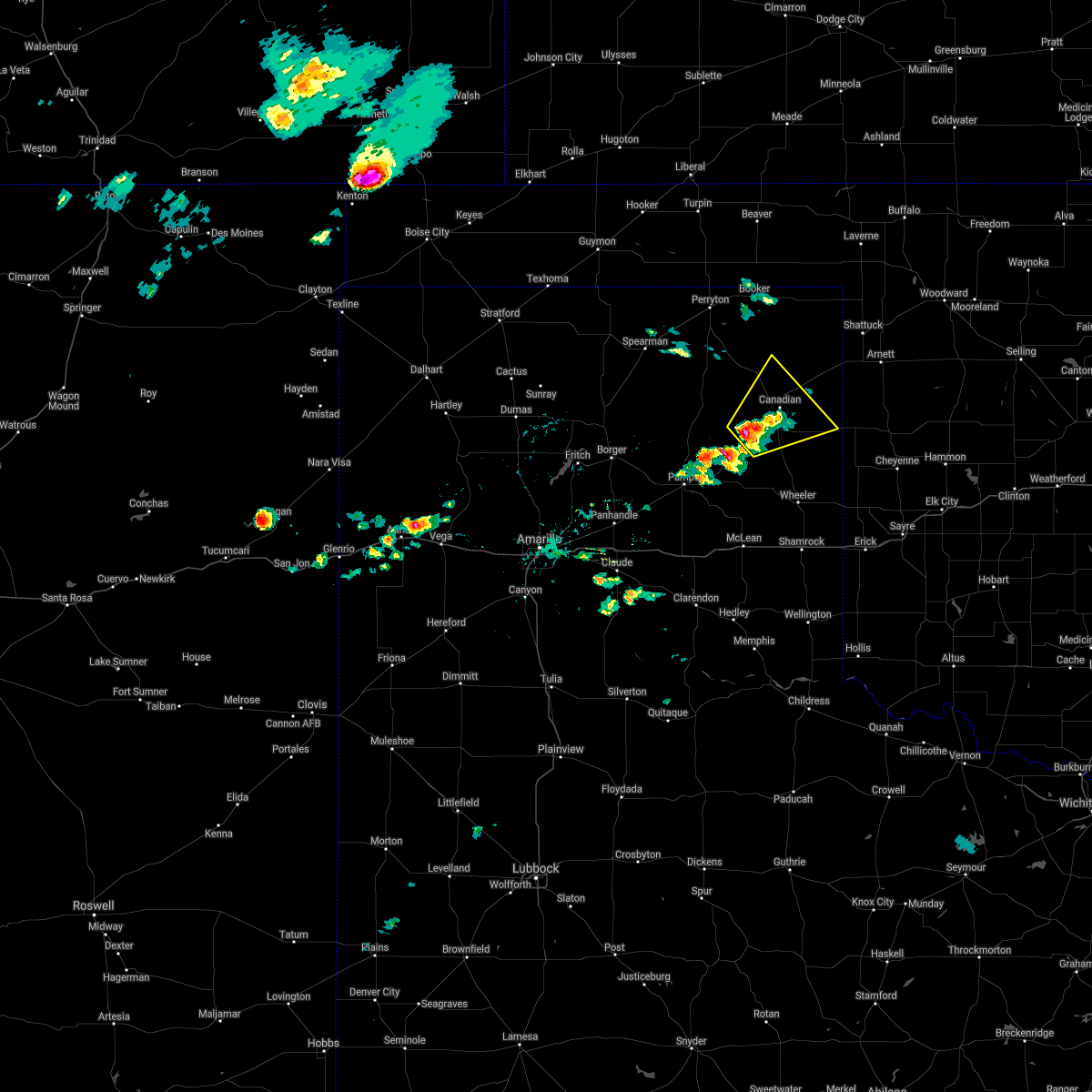 At 250 pm cdt, a severe thunderstorm was located 4 miles north of lora, or 9 miles northeast of miami, moving northeast at 25 mph (radar indicated). Hazards include 70 mph wind gusts and half dollar size hail. Expect some tree damage. damage is likely to mobile homes, roofs, and outbuildings. Hail damage to vehicles is expected. At 250 pm cdt, a severe thunderstorm was located 4 miles north of lora, or 9 miles northeast of miami, moving northeast at 25 mph (radar indicated). Hazards include 70 mph wind gusts and half dollar size hail. Expect some tree damage. damage is likely to mobile homes, roofs, and outbuildings. Hail damage to vehicles is expected.
|
| 5/7/2021 6:45 PM CDT |
 At 645 pm cdt, a severe thunderstorm was located 4 miles northwest of miami, moving east at 40 mph (radar indicated). Hazards include 60 mph wind gusts and quarter size hail. Minor damage to roofs, siding, and trees is possible. Hail damage to vehicles is expected. At 645 pm cdt, a severe thunderstorm was located 4 miles northwest of miami, moving east at 40 mph (radar indicated). Hazards include 60 mph wind gusts and quarter size hail. Minor damage to roofs, siding, and trees is possible. Hail damage to vehicles is expected.
|
| 5/6/2021 1:06 AM CDT |
 The severe thunderstorm warning for northern wheeler, southeastern roberts and hemphill counties will expire at 115 am cdt, the storm which prompted the warning has weakened below severe limits, and no longer poses an immediate threat to life or property. therefore, the warning will be allowed to expire. The severe thunderstorm warning for northern wheeler, southeastern roberts and hemphill counties will expire at 115 am cdt, the storm which prompted the warning has weakened below severe limits, and no longer poses an immediate threat to life or property. therefore, the warning will be allowed to expire.
|
| 5/6/2021 12:44 AM CDT |
 At 1244 am cdt, a severe thunderstorm was located 7 miles north of lora, or 10 miles north of miami, moving southeast at 60 mph (radar indicated). Hazards include 60 mph wind gusts and quarter size hail. Minor damage to roofs, siding, and trees is possible. hail damage to vehicles is expected. Locations impacted include, canadian, miami, briscoe, allison and lora. At 1244 am cdt, a severe thunderstorm was located 7 miles north of lora, or 10 miles north of miami, moving southeast at 60 mph (radar indicated). Hazards include 60 mph wind gusts and quarter size hail. Minor damage to roofs, siding, and trees is possible. hail damage to vehicles is expected. Locations impacted include, canadian, miami, briscoe, allison and lora.
|
| 5/6/2021 12:08 AM CDT |
 At 1208 am cdt, a severe thunderstorm was located 6 miles northeast of lora, or 8 miles southwest of canadian, moving southeast at 55 mph (radar indicated). Hazards include 60 mph wind gusts and quarter size hail. Minor damage to roofs, siding, and trees is possible. Hail damage to vehicles is expected. At 1208 am cdt, a severe thunderstorm was located 6 miles northeast of lora, or 8 miles southwest of canadian, moving southeast at 55 mph (radar indicated). Hazards include 60 mph wind gusts and quarter size hail. Minor damage to roofs, siding, and trees is possible. Hail damage to vehicles is expected.
|
| 3/17/2021 12:11 AM CDT |
 At 1210 am cdt, a severe thunderstorm was located near canadian, moving northeast at 35 mph (law enforcement. at 1209 am cdt, law enforcement reported quarter size hail in canadian). Hazards include 70 mph wind gusts and quarter size hail. Expect some tree damage. damage is likely to mobile homes, roofs, and outbuildings. hail damage to vehicles is expected. hail may accumulate on roadways causing hazardous travel. Locations impacted include, lipscomb, canadian, follett, higgins, glazier and lake marvin. At 1210 am cdt, a severe thunderstorm was located near canadian, moving northeast at 35 mph (law enforcement. at 1209 am cdt, law enforcement reported quarter size hail in canadian). Hazards include 70 mph wind gusts and quarter size hail. Expect some tree damage. damage is likely to mobile homes, roofs, and outbuildings. hail damage to vehicles is expected. hail may accumulate on roadways causing hazardous travel. Locations impacted include, lipscomb, canadian, follett, higgins, glazier and lake marvin.
|
| 3/17/2021 12:08 AM CDT | Quarter sized hail reported 2.3 miles SSW of Canadian, TX |
| 3/17/2021 12:00 AM CDT | Six power poles and lines reported down. estimated thunderstorm wind gust 80 mp in hemphill county TX, 4.7 miles SE of Canadian, TX |
| 3/16/2021 11:53 PM CDT |
 At 1153 pm cdt, a severe thunderstorm was located 6 miles southwest of canadian, moving northeast at 45 mph (radar indicated). Hazards include 70 mph wind gusts and quarter size hail. Expect some tree damage. damage is likely to mobile homes, roofs, and outbuildings. Hail damage to vehicles is expected. At 1153 pm cdt, a severe thunderstorm was located 6 miles southwest of canadian, moving northeast at 45 mph (radar indicated). Hazards include 70 mph wind gusts and quarter size hail. Expect some tree damage. damage is likely to mobile homes, roofs, and outbuildings. Hail damage to vehicles is expected.
|
| 3/16/2021 11:38 PM CDT |
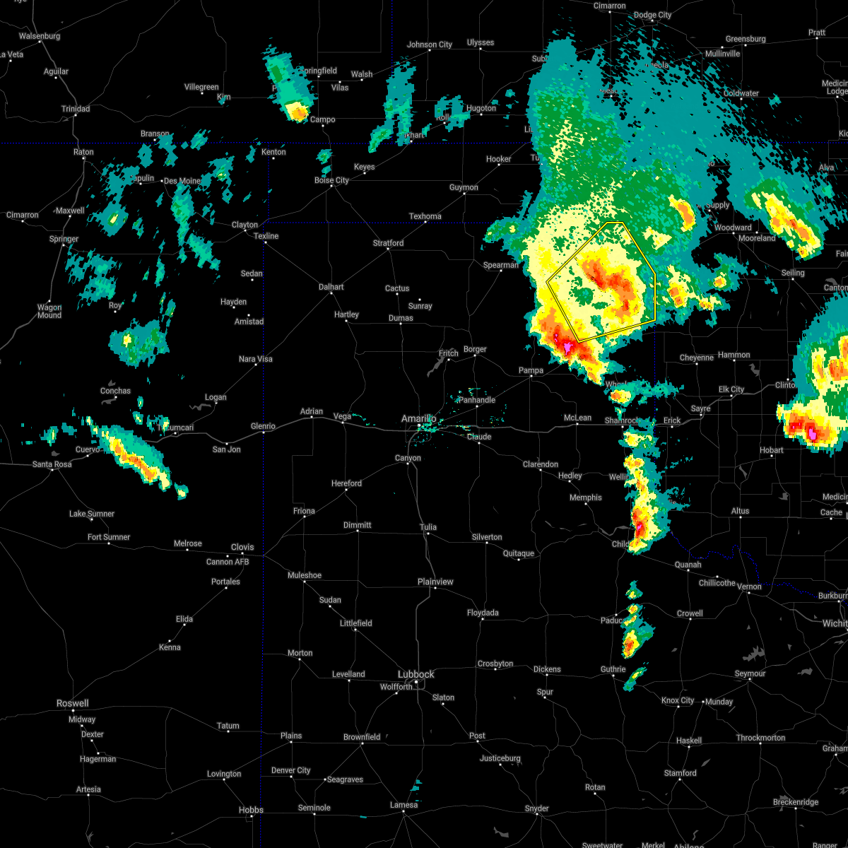 At 1137 pm cdt, a severe thunderstorm was located 6 miles south of lipscomb, moving northeast at 40 mph. this is a very dangerous storm (trained weather spotters. at 1135 pm cdt, wind damage was reported north of canadian). Hazards include 80 mph wind gusts and quarter size hail. Flying debris will be dangerous to those caught without shelter. mobile homes will be heavily damaged. expect considerable damage to roofs, windows, and vehicles. tree damage and power outages are likely. hail damage to vehicles is expected. hail may accumulate on roadways causing hazardous travel. Locations impacted include, lipscomb, canadian, higgins, darrouzett, wolf creek park, glazier and lake marvin. At 1137 pm cdt, a severe thunderstorm was located 6 miles south of lipscomb, moving northeast at 40 mph. this is a very dangerous storm (trained weather spotters. at 1135 pm cdt, wind damage was reported north of canadian). Hazards include 80 mph wind gusts and quarter size hail. Flying debris will be dangerous to those caught without shelter. mobile homes will be heavily damaged. expect considerable damage to roofs, windows, and vehicles. tree damage and power outages are likely. hail damage to vehicles is expected. hail may accumulate on roadways causing hazardous travel. Locations impacted include, lipscomb, canadian, higgins, darrouzett, wolf creek park, glazier and lake marvin.
|
| 3/16/2021 11:32 PM CDT | 18 train cars blown over in hemphill county TX, 11.6 miles SW of Canadian, TX |
| 3/16/2021 11:15 PM CDT | Downed power lines have forced the closure of u.s. highway 60 at the intersection of u.s. highway 60 and u.s. highway 8 in hemphill county TX, 2.3 miles SSW of Canadian, TX |
| 3/16/2021 11:11 PM CDT | Numerous power poles down and trees uproote in hemphill county TX, 6 miles SE of Canadian, TX |
| 3/16/2021 11:08 PM CDT |
 At 1107 pm cdt, a severe thunderstorm was located 12 miles southeast of wolf creek park, or 13 miles northwest of canadian, moving northeast at 40 mph (radar indicated). Hazards include 60 mph wind gusts and quarter size hail. Minor damage to roofs, siding, and trees is possible. hail damage to vehicles is expected. Hail may accumulate on roadways causing hazardous travel. At 1107 pm cdt, a severe thunderstorm was located 12 miles southeast of wolf creek park, or 13 miles northwest of canadian, moving northeast at 40 mph (radar indicated). Hazards include 60 mph wind gusts and quarter size hail. Minor damage to roofs, siding, and trees is possible. hail damage to vehicles is expected. Hail may accumulate on roadways causing hazardous travel.
|
| 3/16/2021 9:50 PM CDT | Quarter sized hail reported 21.4 miles WSW of Canadian, TX |
| 3/16/2021 9:21 PM CDT | Storm damage reported in hemphill county TX, 5.8 miles W of Canadian, TX |
| 3/16/2021 9:14 PM CDT | Golf Ball sized hail reported 1.4 miles NNE of Canadian, TX |
| 3/16/2021 9:14 PM CDT |
 At 914 pm cdt, a severe thunderstorm was located 5 miles east of canadian, moving northeast at 45 mph (radar indicated). Hazards include ping pong ball size hail and 60 mph wind gusts. Minor damage to roofs, siding, and trees is possible. people and animals outdoors will be injured. expect hail damage to roofs, siding, windows, and vehicles. Locations impacted include, lipscomb, canadian, glazier and lake marvin. At 914 pm cdt, a severe thunderstorm was located 5 miles east of canadian, moving northeast at 45 mph (radar indicated). Hazards include ping pong ball size hail and 60 mph wind gusts. Minor damage to roofs, siding, and trees is possible. people and animals outdoors will be injured. expect hail damage to roofs, siding, windows, and vehicles. Locations impacted include, lipscomb, canadian, glazier and lake marvin.
|
| 3/16/2021 9:13 PM CDT |
 At 913 pm cdt, a severe thunderstorm was located 5 miles north of canadian, moving northeast at 50 mph (radar indicated). Hazards include quarter size hail. Damage to vehicles is expected. Locations impacted include, canadian. At 913 pm cdt, a severe thunderstorm was located 5 miles north of canadian, moving northeast at 50 mph (radar indicated). Hazards include quarter size hail. Damage to vehicles is expected. Locations impacted include, canadian.
|
| 3/16/2021 9:12 PM CDT |
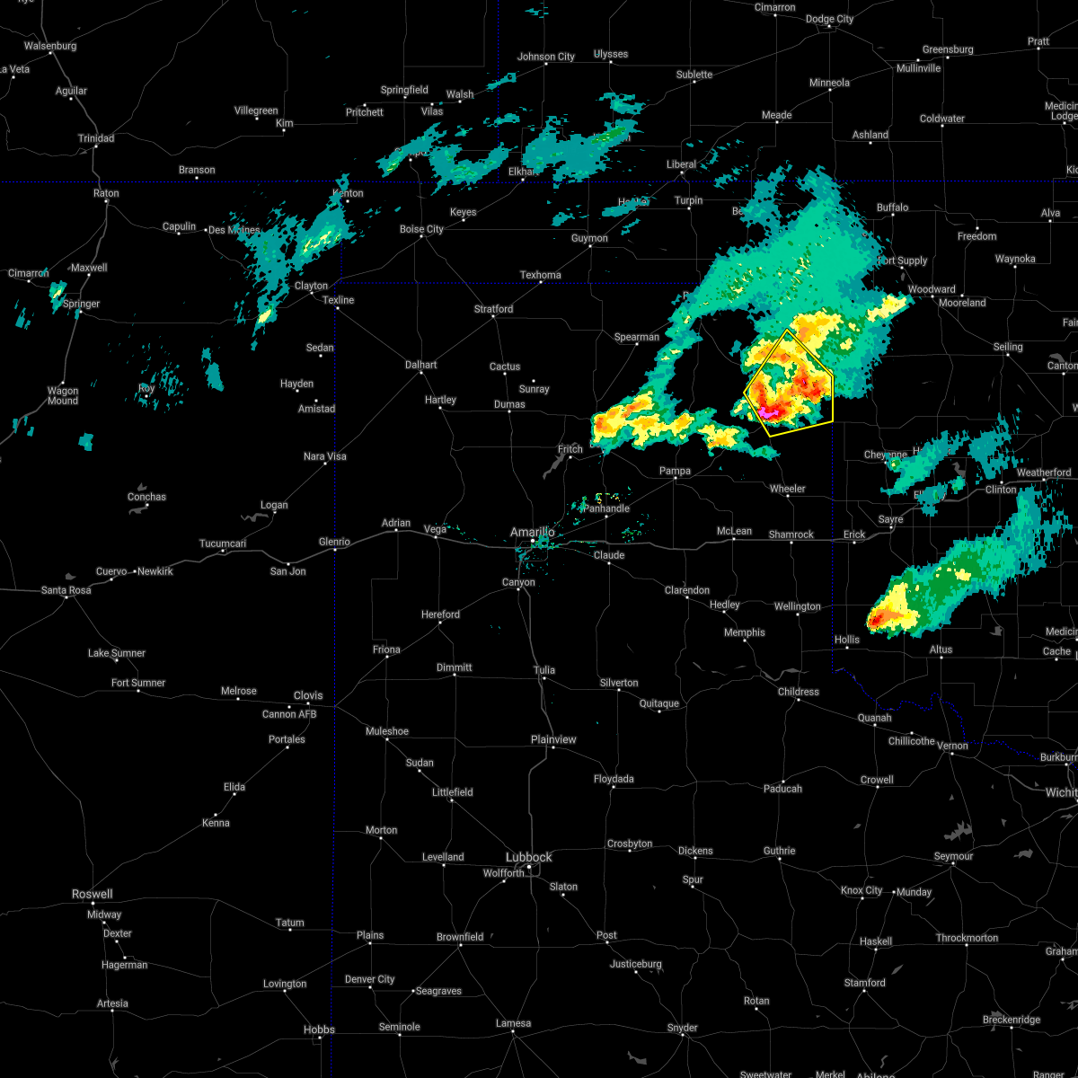 At 912 pm cdt, a severe thunderstorm was located near canadian, moving northeast at 45 mph (radar indicated). Hazards include 60 mph wind gusts and quarter size hail. Minor damage to roofs, siding, and trees is possible. Hail damage to vehicles is expected. At 912 pm cdt, a severe thunderstorm was located near canadian, moving northeast at 45 mph (radar indicated). Hazards include 60 mph wind gusts and quarter size hail. Minor damage to roofs, siding, and trees is possible. Hail damage to vehicles is expected.
|
| 3/16/2021 8:59 PM CDT |
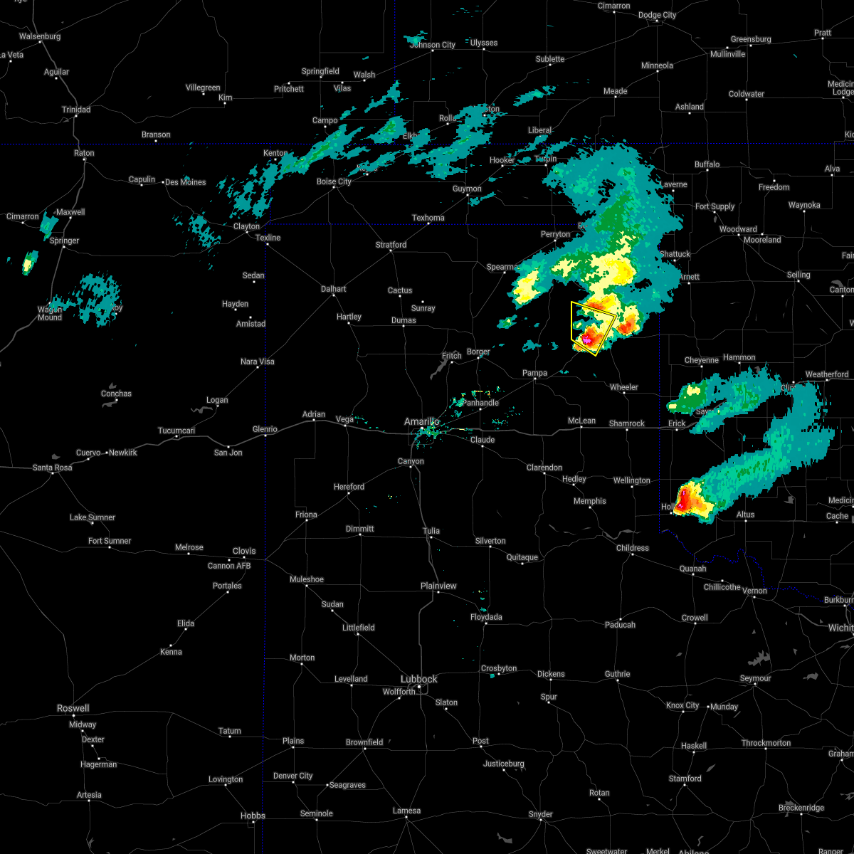 At 849 pm cdt, a severe thunderstorm was located over lora, or near miami, moving north at 25 mph (radar indicated). Hazards include 60 mph wind gusts and quarter size hail. Minor damage to roofs, siding, and trees is possible. Hail damage to vehicles is expected. At 849 pm cdt, a severe thunderstorm was located over lora, or near miami, moving north at 25 mph (radar indicated). Hazards include 60 mph wind gusts and quarter size hail. Minor damage to roofs, siding, and trees is possible. Hail damage to vehicles is expected.
|
| 3/16/2021 8:49 PM CDT |
 At 849 pm cdt, a severe thunderstorm was located over lora, or near miami, moving north at 25 mph (radar indicated). Hazards include 60 mph wind gusts and quarter size hail. Minor damage to roofs, siding, and trees is possible. Hail damage to vehicles is expected. At 849 pm cdt, a severe thunderstorm was located over lora, or near miami, moving north at 25 mph (radar indicated). Hazards include 60 mph wind gusts and quarter size hail. Minor damage to roofs, siding, and trees is possible. Hail damage to vehicles is expected.
|
| 3/16/2021 11:15 AM CDT | Downed power lines have forced the closure of u.s. highway 83 at the intersection of u.s. highway 60 and u.s. highway 8 in hemphill county TX, 2.3 miles SSW of Canadian, TX |
| 3/13/2021 10:55 PM CDT |
 The severe thunderstorm warning for southeastern beaver, lipscomb and northeastern hemphill counties will expire at 1000 pm cst, the storm which prompted the warning has weakened below severe limits, and no longer poses an immediate threat to life or property. therefore, the warning will be allowed to expire. however gusty winds up to 55 mph and heavy rain are still possible with this thunderstorm. therefore, a significant weather advisory is now in effect for southeastern beaver, eastern lipscomb, and northern hemphill counties until 1045 pm cst. The severe thunderstorm warning for southeastern beaver, lipscomb and northeastern hemphill counties will expire at 1000 pm cst, the storm which prompted the warning has weakened below severe limits, and no longer poses an immediate threat to life or property. therefore, the warning will be allowed to expire. however gusty winds up to 55 mph and heavy rain are still possible with this thunderstorm. therefore, a significant weather advisory is now in effect for southeastern beaver, eastern lipscomb, and northern hemphill counties until 1045 pm cst.
|
| 3/13/2021 10:19 PM CDT |
 At 918 pm cst, a severe thunderstorm was located 9 miles south of follett, or 11 miles west of shattuck, moving northeast at 40 mph (radar indicated). Hazards include 70 mph wind gusts and quarter size hail. Expect some tree damage. damage is likely to mobile homes, roofs, and outbuildings. Hail damage to vehicles is expected. At 918 pm cst, a severe thunderstorm was located 9 miles south of follett, or 11 miles west of shattuck, moving northeast at 40 mph (radar indicated). Hazards include 70 mph wind gusts and quarter size hail. Expect some tree damage. damage is likely to mobile homes, roofs, and outbuildings. Hail damage to vehicles is expected.
|
| 3/13/2021 9:55 PM CDT | Awos station khhf canadian (awos in hemphill county TX, 1.2 miles ENE of Canadian, TX |
| 3/13/2021 9:55 PM CDT |
 At 854 pm cst, severe thunderstorms were located along a line extending from 6 miles southeast of lipscomb to 11 miles east of lora to 4 miles southwest of kellerville, moving northeast at 45 mph (trained weather spotters. at 853 pm cdt, trained spotters reported power outages and estimated 65 to 70 mph wind gusts in canadian). Hazards include 70 mph wind gusts and quarter size hail. Expect some tree damage. damage is likely to mobile homes, roofs, and outbuildings. hail damage to vehicles is expected. locations impacted include, canadian, briscoe, wheeler, lefors, higgins, new mobeetie, lora, allison, glazier, lake marvin, kellerville and mobeetie. A tornado watch remains in effect until 900 pm cst for the panhandle of texas. At 854 pm cst, severe thunderstorms were located along a line extending from 6 miles southeast of lipscomb to 11 miles east of lora to 4 miles southwest of kellerville, moving northeast at 45 mph (trained weather spotters. at 853 pm cdt, trained spotters reported power outages and estimated 65 to 70 mph wind gusts in canadian). Hazards include 70 mph wind gusts and quarter size hail. Expect some tree damage. damage is likely to mobile homes, roofs, and outbuildings. hail damage to vehicles is expected. locations impacted include, canadian, briscoe, wheeler, lefors, higgins, new mobeetie, lora, allison, glazier, lake marvin, kellerville and mobeetie. A tornado watch remains in effect until 900 pm cst for the panhandle of texas.
|
| 3/13/2021 9:53 PM CDT | Storm damage reported in hemphill county TX, 0.2 miles WSW of Canadian, TX |
| 3/13/2021 9:50 PM CDT |
 At 849 pm cst, severe thunderstorms were located along a line extending from 6 miles southeast of lipscomb to 10 miles northwest of briscoe to 5 miles southwest of kellerville, moving east at 45 mph (public. at 844 pm cst, quarter size hail was reported in canadian). Hazards include 60 mph wind gusts and quarter size hail. Minor damage to roofs, siding, and trees is possible. hail damage to vehicles is expected. locations impacted include, canadian, briscoe, wheeler, lefors, higgins, new mobeetie, lora, allison, glazier, lake marvin, kellerville and mobeetie. A tornado watch remains in effect until 900 pm cst for the panhandle of texas. At 849 pm cst, severe thunderstorms were located along a line extending from 6 miles southeast of lipscomb to 10 miles northwest of briscoe to 5 miles southwest of kellerville, moving east at 45 mph (public. at 844 pm cst, quarter size hail was reported in canadian). Hazards include 60 mph wind gusts and quarter size hail. Minor damage to roofs, siding, and trees is possible. hail damage to vehicles is expected. locations impacted include, canadian, briscoe, wheeler, lefors, higgins, new mobeetie, lora, allison, glazier, lake marvin, kellerville and mobeetie. A tornado watch remains in effect until 900 pm cst for the panhandle of texas.
|
| 3/13/2021 9:44 PM CDT | Quarter sized hail reported 0.2 miles WSW of Canadian, TX, picture on twitter. |
| 3/13/2021 8:52 PM CDT |
 At 751 pm cst, severe thunderstorms were located along a line extending from 11 miles northwest of miami to 3 miles east of codman to 5 miles south of lefors, moving northeast at 45 mph (radar indicated). Hazards include golf ball size hail and 70 mph wind gusts. Expect some tree damage. damage is likely to mobile homes, roofs, and outbuildings. people and animals outdoors will be injured. Expect hail damage to roofs, siding, windows, and vehicles. At 751 pm cst, severe thunderstorms were located along a line extending from 11 miles northwest of miami to 3 miles east of codman to 5 miles south of lefors, moving northeast at 45 mph (radar indicated). Hazards include golf ball size hail and 70 mph wind gusts. Expect some tree damage. damage is likely to mobile homes, roofs, and outbuildings. people and animals outdoors will be injured. Expect hail damage to roofs, siding, windows, and vehicles.
|
| 3/12/2021 9:14 PM CST |
 At 914 pm cst, a severe thunderstorm was located 10 miles north of miami, moving east at 40 mph (radar indicated). Hazards include 60 mph wind gusts and quarter size hail. Minor damage to roofs, siding, and trees is possible. Hail damage to vehicles is expected. At 914 pm cst, a severe thunderstorm was located 10 miles north of miami, moving east at 40 mph (radar indicated). Hazards include 60 mph wind gusts and quarter size hail. Minor damage to roofs, siding, and trees is possible. Hail damage to vehicles is expected.
|
| 11/24/2020 2:18 PM CST | Quarter sized hail reported 9.8 miles SW of Canadian, TX, light accumulation of hail. |
| 11/24/2020 2:14 PM CST |
 At 214 pm cst, a severe thunderstorm was located 4 miles south of glazier, or 6 miles northeast of canadian, moving northeast at 40 mph (trained weather spotters). Hazards include quarter size hail. Damage to vehicles is expected. hail may accumulate on roadways causing hazardous travel. Locations impacted include, canadian, glazier and lake marvin. At 214 pm cst, a severe thunderstorm was located 4 miles south of glazier, or 6 miles northeast of canadian, moving northeast at 40 mph (trained weather spotters). Hazards include quarter size hail. Damage to vehicles is expected. hail may accumulate on roadways causing hazardous travel. Locations impacted include, canadian, glazier and lake marvin.
|
| 11/24/2020 2:05 PM CST | Quarter sized hail reported 0.7 miles NE of Canadian, TX, accumulating hail up to an inch or two deep. |
| 11/24/2020 2:05 PM CST | Quarter sized hail reported 1 miles E of Canadian, TX, accumulating hail reported... up to an inch or two deep. |
| 11/24/2020 1:58 PM CST |
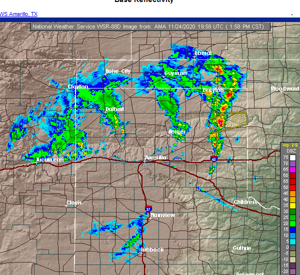 At 158 pm cst, a severe thunderstorm was located 6 miles southwest of canadian, moving northeast at 40 mph (law enforcement). Hazards include golf ball size hail. People and animals outdoors will be injured. expect damage to roofs, siding, windows, and vehicles. Locations impacted include, canadian, glazier, lake marvin and lora. At 158 pm cst, a severe thunderstorm was located 6 miles southwest of canadian, moving northeast at 40 mph (law enforcement). Hazards include golf ball size hail. People and animals outdoors will be injured. expect damage to roofs, siding, windows, and vehicles. Locations impacted include, canadian, glazier, lake marvin and lora.
|
| 11/24/2020 1:53 PM CST |
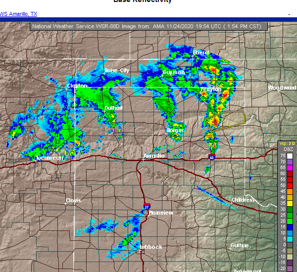 At 152 pm cst, a severe thunderstorm was located 6 miles north of lora, or 10 miles southwest of canadian, moving east at 40 mph (radar indicated). Hazards include half dollar size hail. damage to vehicles is expected At 152 pm cst, a severe thunderstorm was located 6 miles north of lora, or 10 miles southwest of canadian, moving east at 40 mph (radar indicated). Hazards include half dollar size hail. damage to vehicles is expected
|
| 9/1/2020 4:41 PM CDT |
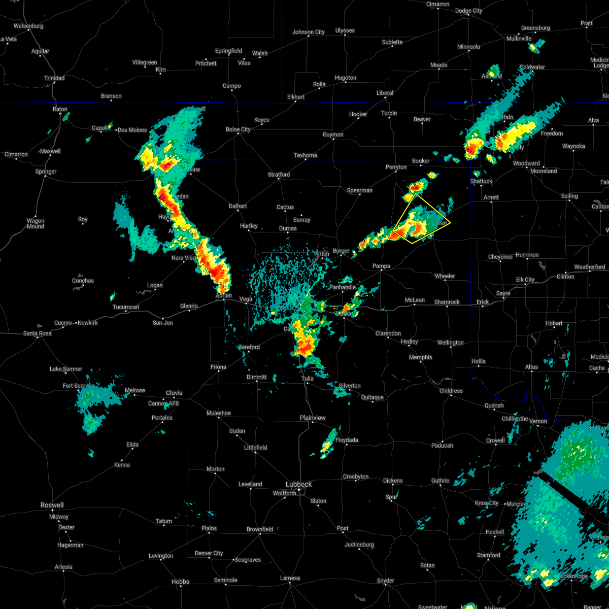 The severe thunderstorm warning for southwestern lipscomb, northeastern roberts, northwestern hemphill and southeastern ochiltree counties will expire at 445 pm cdt, the storm which prompted the warning has weakened below severe limits, and no longer poses an immediate threat to life or property. therefore, the warning will be allowed to expire. a severe thunderstorm watch remains in effect until 1000 pm cdt for the panhandle of texas. The severe thunderstorm warning for southwestern lipscomb, northeastern roberts, northwestern hemphill and southeastern ochiltree counties will expire at 445 pm cdt, the storm which prompted the warning has weakened below severe limits, and no longer poses an immediate threat to life or property. therefore, the warning will be allowed to expire. a severe thunderstorm watch remains in effect until 1000 pm cdt for the panhandle of texas.
|
| 9/1/2020 3:42 PM CDT |
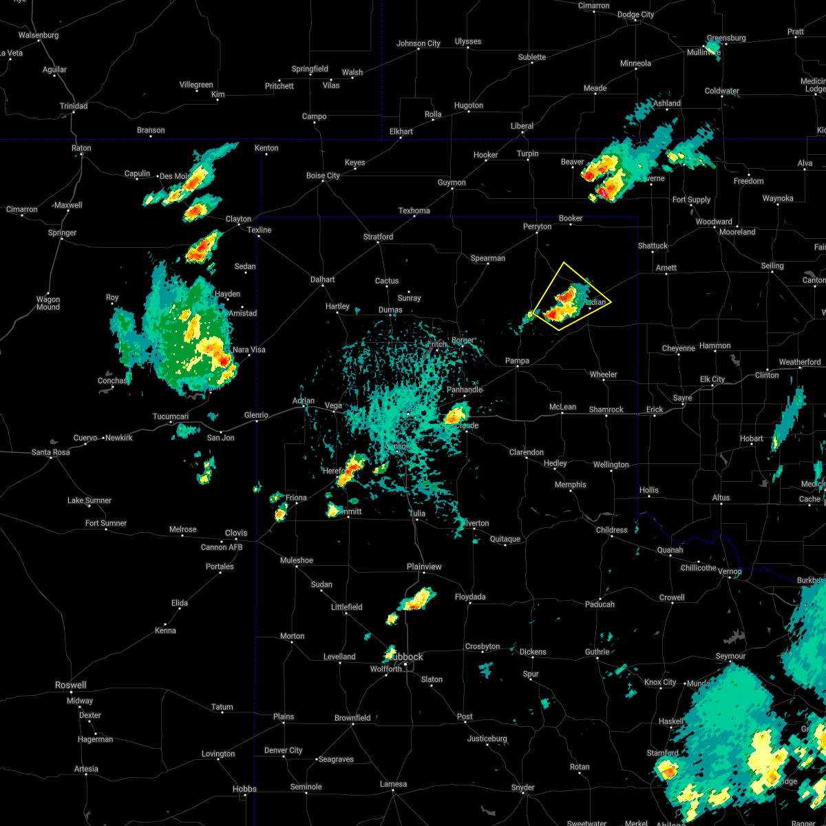 At 342 pm cdt, a severe thunderstorm was located 11 miles northwest of canadian, moving northeast at 15 mph (radar indicated). Hazards include 60 mph wind gusts and quarter size hail. Minor damage to roofs, siding, and trees is possible. Hail damage to vehicles is expected. At 342 pm cdt, a severe thunderstorm was located 11 miles northwest of canadian, moving northeast at 15 mph (radar indicated). Hazards include 60 mph wind gusts and quarter size hail. Minor damage to roofs, siding, and trees is possible. Hail damage to vehicles is expected.
|
| 8/16/2020 3:57 PM CDT |
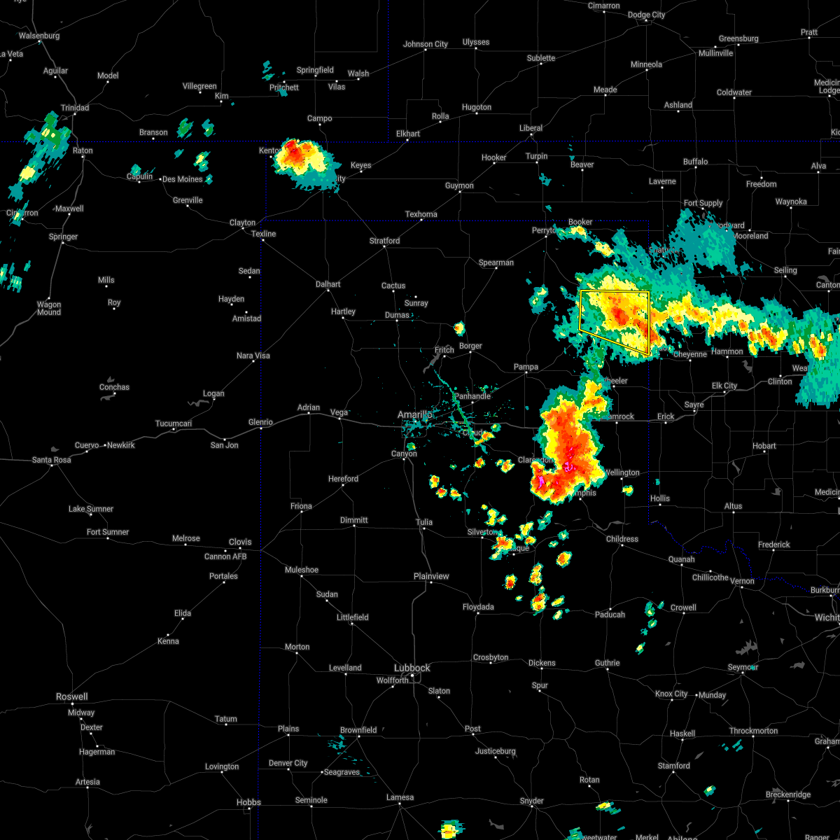 At 357 pm cdt, a severe thunderstorm was located 4 miles southwest of lake marvin, or 10 miles southeast of canadian, moving southeast at 40 mph (radar indicated). Hazards include 60 mph wind gusts and quarter size hail. Minor damage to roofs, siding, and trees is possible. hail damage to vehicles is expected. Locations impacted include, canadian, glazier and lake marvin. At 357 pm cdt, a severe thunderstorm was located 4 miles southwest of lake marvin, or 10 miles southeast of canadian, moving southeast at 40 mph (radar indicated). Hazards include 60 mph wind gusts and quarter size hail. Minor damage to roofs, siding, and trees is possible. hail damage to vehicles is expected. Locations impacted include, canadian, glazier and lake marvin.
|
| 8/16/2020 3:23 PM CDT |
 The national weather service in amarillo has issued a * severe thunderstorm warning for. southern lipscomb county in the panhandle of texas. hemphill county in the panhandle of texas. until 430 pm cdt. At 323 pm cdt, a severe thunderstorm was located 12 miles southwest. The national weather service in amarillo has issued a * severe thunderstorm warning for. southern lipscomb county in the panhandle of texas. hemphill county in the panhandle of texas. until 430 pm cdt. At 323 pm cdt, a severe thunderstorm was located 12 miles southwest.
|
| 6/22/2020 9:41 PM CDT | Quarter sized hail reported 20.8 miles S of Canadian, TX |
| 6/22/2020 8:12 PM CDT |
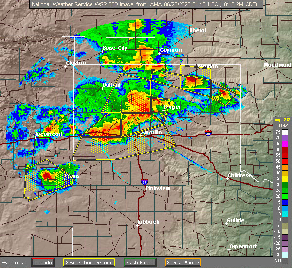 At 811 pm cdt, a severe thunderstorm was located 4 miles southwest of glazier, or 5 miles northeast of canadian, moving southeast at 20 mph (radar indicated). Hazards include golf ball size hail and 60 mph wind gusts. Damage to roofs, siding, and trees is possible. people and animals outdoors will be injured. Locations impacted include, canadian, glazier and lake marvin. At 811 pm cdt, a severe thunderstorm was located 4 miles southwest of glazier, or 5 miles northeast of canadian, moving southeast at 20 mph (radar indicated). Hazards include golf ball size hail and 60 mph wind gusts. Damage to roofs, siding, and trees is possible. people and animals outdoors will be injured. Locations impacted include, canadian, glazier and lake marvin.
|
| 6/22/2020 7:42 PM CDT |
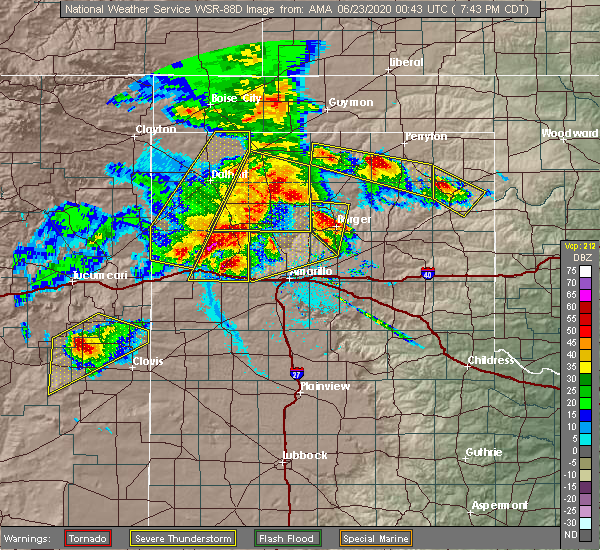 At 742 pm cdt, a severe thunderstorm was located 7 miles northwest of canadian, moving southeast at 10 mph (radar indicated). Hazards include golf ball size hail and 60 mph wind gusts. Minor damage to roofs, siding, and trees is possible. people and animals outdoors will be injured. Expect hail damage to roofs, siding, windows, and vehicles. At 742 pm cdt, a severe thunderstorm was located 7 miles northwest of canadian, moving southeast at 10 mph (radar indicated). Hazards include golf ball size hail and 60 mph wind gusts. Minor damage to roofs, siding, and trees is possible. people and animals outdoors will be injured. Expect hail damage to roofs, siding, windows, and vehicles.
|
| 6/21/2020 10:45 PM CDT | Quarter sized hail reported 13.2 miles NE of Canadian, TX |
| 6/4/2020 6:31 PM CDT |
 At 630 pm cdt, a severe thunderstorm was located 8 miles northwest of briscoe, or 13 miles east of miami, moving southeast at 40 mph (radar indicated). Hazards include ping pong ball size hail and 60 mph wind gusts. Minor damage to roofs, siding, and trees is possible. people and animals outdoors will be injured. expect hail damage to roofs, siding, windows, and vehicles. Locations impacted include, canadian, miami, codman, lake marvin and lora. At 630 pm cdt, a severe thunderstorm was located 8 miles northwest of briscoe, or 13 miles east of miami, moving southeast at 40 mph (radar indicated). Hazards include ping pong ball size hail and 60 mph wind gusts. Minor damage to roofs, siding, and trees is possible. people and animals outdoors will be injured. expect hail damage to roofs, siding, windows, and vehicles. Locations impacted include, canadian, miami, codman, lake marvin and lora.
|
| 6/4/2020 6:24 PM CDT |
 At 624 pm cdt, a severe thunderstorm was located 6 miles east of lora, or 11 miles east of miami, moving southeast at 30 mph (radar indicated). Hazards include ping pong ball size hail and 60 mph wind gusts. Minor damage to roofs, siding, and trees is possible. people and animals outdoors will be injured. expect hail damage to roofs, siding, windows, and vehicles. Locations impacted include, canadian, miami, codman, lake marvin and lora. At 624 pm cdt, a severe thunderstorm was located 6 miles east of lora, or 11 miles east of miami, moving southeast at 30 mph (radar indicated). Hazards include ping pong ball size hail and 60 mph wind gusts. Minor damage to roofs, siding, and trees is possible. people and animals outdoors will be injured. expect hail damage to roofs, siding, windows, and vehicles. Locations impacted include, canadian, miami, codman, lake marvin and lora.
|
| 6/4/2020 6:13 PM CDT |
 At 613 pm cdt, a severe thunderstorm was located near lora, or 8 miles northeast of miami, moving southeast at 30 mph (radar indicated). Hazards include ping pong ball size hail and 60 mph wind gusts. Minor damage to roofs, siding, and trees is possible. people and animals outdoors will be injured. expect hail damage to roofs, siding, windows, and vehicles. Locations impacted include, canadian, miami, codman, lake marvin and lora. At 613 pm cdt, a severe thunderstorm was located near lora, or 8 miles northeast of miami, moving southeast at 30 mph (radar indicated). Hazards include ping pong ball size hail and 60 mph wind gusts. Minor damage to roofs, siding, and trees is possible. people and animals outdoors will be injured. expect hail damage to roofs, siding, windows, and vehicles. Locations impacted include, canadian, miami, codman, lake marvin and lora.
|
| 6/4/2020 6:05 PM CDT |
 At 604 pm cdt, a severe thunderstorm was located 5 miles north of lora, or 9 miles northeast of miami, moving southeast at 30 mph (radar indicated). Hazards include ping pong ball size hail and 60 mph wind gusts. Minor damage to roofs, siding, and trees is possible. people and animals outdoors will be injured. expect hail damage to roofs, siding, windows, and vehicles. Locations impacted include, canadian, miami, glazier, codman, lake marvin and lora. At 604 pm cdt, a severe thunderstorm was located 5 miles north of lora, or 9 miles northeast of miami, moving southeast at 30 mph (radar indicated). Hazards include ping pong ball size hail and 60 mph wind gusts. Minor damage to roofs, siding, and trees is possible. people and animals outdoors will be injured. expect hail damage to roofs, siding, windows, and vehicles. Locations impacted include, canadian, miami, glazier, codman, lake marvin and lora.
|
| 6/4/2020 5:58 PM CDT |
 At 558 pm cdt, a severe thunderstorm was located 7 miles north of lora, or 11 miles north of miami, moving southeast at 35 mph (radar indicated). Hazards include ping pong ball size hail and 60 mph wind gusts. Minor damage to roofs, siding, and trees is possible. people and animals outdoors will be injured. expect hail damage to roofs, siding, windows, and vehicles. Locations impacted include, canadian, miami, higgins, lora, glazier, codman and lake marvin. At 558 pm cdt, a severe thunderstorm was located 7 miles north of lora, or 11 miles north of miami, moving southeast at 35 mph (radar indicated). Hazards include ping pong ball size hail and 60 mph wind gusts. Minor damage to roofs, siding, and trees is possible. people and animals outdoors will be injured. expect hail damage to roofs, siding, windows, and vehicles. Locations impacted include, canadian, miami, higgins, lora, glazier, codman and lake marvin.
|
| 6/4/2020 5:50 PM CDT |
 At 549 pm cdt, a severe thunderstorm was located 13 miles west of canadian, moving southeast at 30 mph (radar indicated). Hazards include ping pong ball size hail and 60 mph wind gusts. Minor damage to roofs, siding, and trees is possible. people and animals outdoors will be injured. expect hail damage to roofs, siding, windows, and vehicles. Locations impacted include, canadian, miami, higgins, lora, glazier, codman and lake marvin. At 549 pm cdt, a severe thunderstorm was located 13 miles west of canadian, moving southeast at 30 mph (radar indicated). Hazards include ping pong ball size hail and 60 mph wind gusts. Minor damage to roofs, siding, and trees is possible. people and animals outdoors will be injured. expect hail damage to roofs, siding, windows, and vehicles. Locations impacted include, canadian, miami, higgins, lora, glazier, codman and lake marvin.
|
| 6/4/2020 5:43 PM CDT |
 At 543 pm cdt, a severe thunderstorm was located 16 miles northwest of lora, or 16 miles west of canadian, moving southeast at 30 mph (radar indicated). Hazards include ping pong ball size hail and 60 mph wind gusts. Minor damage to roofs, siding, and trees is possible. people and animals outdoors will be injured. expect hail damage to roofs, siding, windows, and vehicles. Locations impacted include, canadian, miami, higgins, lora, glazier, codman and lake marvin. At 543 pm cdt, a severe thunderstorm was located 16 miles northwest of lora, or 16 miles west of canadian, moving southeast at 30 mph (radar indicated). Hazards include ping pong ball size hail and 60 mph wind gusts. Minor damage to roofs, siding, and trees is possible. people and animals outdoors will be injured. expect hail damage to roofs, siding, windows, and vehicles. Locations impacted include, canadian, miami, higgins, lora, glazier, codman and lake marvin.
|
| 6/4/2020 5:38 PM CDT |
 At 538 pm cdt, a severe thunderstorm was located 17 miles northwest of lora, or 18 miles west of canadian, moving southeast at 35 mph (radar indicated). Hazards include ping pong ball size hail and 60 mph wind gusts. Minor damage to roofs, siding, and trees is possible. people and animals outdoors will be injured. expect hail damage to roofs, siding, windows, and vehicles. Locations impacted include, canadian, miami, higgins, lora, glazier, codman and lake marvin. At 538 pm cdt, a severe thunderstorm was located 17 miles northwest of lora, or 18 miles west of canadian, moving southeast at 35 mph (radar indicated). Hazards include ping pong ball size hail and 60 mph wind gusts. Minor damage to roofs, siding, and trees is possible. people and animals outdoors will be injured. expect hail damage to roofs, siding, windows, and vehicles. Locations impacted include, canadian, miami, higgins, lora, glazier, codman and lake marvin.
|
| 6/4/2020 5:32 PM CDT | Quarter sized hail reported 1.4 miles NNE of Canadian, TX, quarter size hail lasted a few minutes. |
| 6/4/2020 5:27 PM CDT |
 At 527 pm cdt, a severe thunderstorm was located 7 miles north of lora, or 9 miles southwest of canadian, moving northeast at 25 mph (radar indicated). Hazards include ping pong ball size hail and 60 mph wind gusts. Minor damage to roofs, siding, and trees is possible. people and animals outdoors will be injured. expect hail damage to roofs, siding, windows, and vehicles. Locations impacted include, lipscomb, canadian, miami, higgins, wolf creek park, lora, glazier, codman and lake marvin. At 527 pm cdt, a severe thunderstorm was located 7 miles north of lora, or 9 miles southwest of canadian, moving northeast at 25 mph (radar indicated). Hazards include ping pong ball size hail and 60 mph wind gusts. Minor damage to roofs, siding, and trees is possible. people and animals outdoors will be injured. expect hail damage to roofs, siding, windows, and vehicles. Locations impacted include, lipscomb, canadian, miami, higgins, wolf creek park, lora, glazier, codman and lake marvin.
|
| 6/4/2020 5:15 PM CDT |
 At 515 pm cdt, a severe thunderstorm was located 10 miles southwest of wolf creek park, or 21 miles northwest of canadian, moving southeast at 30 mph (radar indicated). Hazards include ping pong ball size hail and 60 mph wind gusts. Minor damage to roofs, siding, and trees is possible. people and animals outdoors will be injured. Expect hail damage to roofs, siding, windows, and vehicles. At 515 pm cdt, a severe thunderstorm was located 10 miles southwest of wolf creek park, or 21 miles northwest of canadian, moving southeast at 30 mph (radar indicated). Hazards include ping pong ball size hail and 60 mph wind gusts. Minor damage to roofs, siding, and trees is possible. people and animals outdoors will be injured. Expect hail damage to roofs, siding, windows, and vehicles.
|
| 5/24/2020 7:30 PM CDT | Quarter sized hail reported 16.9 miles SSW of Canadian, TX, mping report of one inch hail. |
| 5/7/2020 10:49 PM CDT |
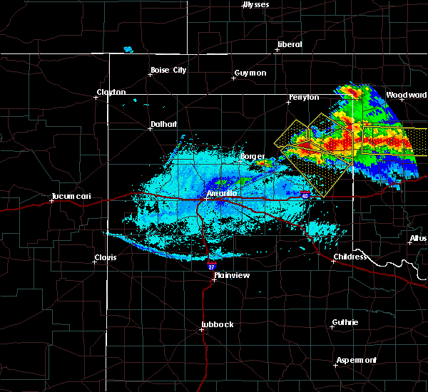 At 1048 pm cdt, a severe thunderstorm was located 4 miles west of lake marvin, or 8 miles east of canadian, moving southeast at 30 mph (radar indicated). Hazards include golf ball size hail and 60 mph wind gusts. Minor damage to roofs, siding, and trees is possible. people and animals outdoors will be injured. expect hail damage to roofs, siding, windows, and vehicles. Locations impacted include, canadian, glazier and lake marvin. At 1048 pm cdt, a severe thunderstorm was located 4 miles west of lake marvin, or 8 miles east of canadian, moving southeast at 30 mph (radar indicated). Hazards include golf ball size hail and 60 mph wind gusts. Minor damage to roofs, siding, and trees is possible. people and animals outdoors will be injured. expect hail damage to roofs, siding, windows, and vehicles. Locations impacted include, canadian, glazier and lake marvin.
|
| 5/7/2020 10:30 PM CDT | Quarter sized hail reported 0.2 miles WSW of Canadian, TX, nickel to quarter size hail. public report relayed by broadcast media. time estimated from radar. |
| 5/7/2020 10:24 PM CDT |
 At 1024 pm cdt, a severe thunderstorm was located 9 miles west of glazier, or 10 miles north of canadian, moving southeast at 20 mph (radar indicated). Hazards include 60 mph wind gusts and quarter size hail. Minor damage to roofs, siding, and trees is possible. Hail damage to vehicles is expected. At 1024 pm cdt, a severe thunderstorm was located 9 miles west of glazier, or 10 miles north of canadian, moving southeast at 20 mph (radar indicated). Hazards include 60 mph wind gusts and quarter size hail. Minor damage to roofs, siding, and trees is possible. Hail damage to vehicles is expected.
|
| 4/22/2020 4:40 AM CDT |
 The severe thunderstorm warning for southwestern lipscomb, roberts, western hemphill and ochiltree counties will expire at 445 am cdt, the storms which prompted the warning have weakened below severe limits, and no longer pose an immediate threat to life or property. therefore, the warning will be allowed to expire. however small hail is still possible with these thunderstorms. remember, a severe thunderstorm warning still remains in effect for southern roberts and northern gray county. The severe thunderstorm warning for southwestern lipscomb, roberts, western hemphill and ochiltree counties will expire at 445 am cdt, the storms which prompted the warning have weakened below severe limits, and no longer pose an immediate threat to life or property. therefore, the warning will be allowed to expire. however small hail is still possible with these thunderstorms. remember, a severe thunderstorm warning still remains in effect for southern roberts and northern gray county.
|
| 4/22/2020 4:22 AM CDT |
 At 422 am cdt, severe thunderstorms were located along a line extending from 5 miles southeast of waka to 14 miles northwest of codman, moving northeast at 50 mph (public). Hazards include half dollar size hail. Damage to vehicles is expected. Locations impacted include, perryton, canadian, miami, wolf creek park, lora, farnsworth and waka. At 422 am cdt, severe thunderstorms were located along a line extending from 5 miles southeast of waka to 14 miles northwest of codman, moving northeast at 50 mph (public). Hazards include half dollar size hail. Damage to vehicles is expected. Locations impacted include, perryton, canadian, miami, wolf creek park, lora, farnsworth and waka.
|
| 4/22/2020 4:14 AM CDT |
 At 413 am cdt, severe thunderstorms were located along a line extending from 6 miles east of spearman to 15 miles northwest of codman, moving northeast at 50 mph (public). Hazards include ping pong ball size hail. People and animals outdoors will be injured. expect damage to roofs, siding, windows, and vehicles. Locations impacted include, perryton, spearman, canadian, miami, wolf creek park, lora, farnsworth and waka. At 413 am cdt, severe thunderstorms were located along a line extending from 6 miles east of spearman to 15 miles northwest of codman, moving northeast at 50 mph (public). Hazards include ping pong ball size hail. People and animals outdoors will be injured. expect damage to roofs, siding, windows, and vehicles. Locations impacted include, perryton, spearman, canadian, miami, wolf creek park, lora, farnsworth and waka.
|
| 4/22/2020 3:51 AM CDT |
 At 350 am cdt, severe thunderstorms were located along a line extending from 5 miles east of morse to 8 miles northwest of skellytown, moving northeast at 50 mph (public. at 338 am cdt, ping ball size hail was reported on the east side of borger). Hazards include ping pong ball size hail. People and animals outdoors will be injured. Expect damage to roofs, siding, windows, and vehicles. At 350 am cdt, severe thunderstorms were located along a line extending from 5 miles east of morse to 8 miles northwest of skellytown, moving northeast at 50 mph (public. at 338 am cdt, ping ball size hail was reported on the east side of borger). Hazards include ping pong ball size hail. People and animals outdoors will be injured. Expect damage to roofs, siding, windows, and vehicles.
|
| 4/21/2020 8:03 PM CDT | Quarter sized hail reported 9.6 miles N of Canadian, TX |
| 4/21/2020 7:49 PM CDT | Golf Ball sized hail reported 16.6 miles NW of Canadian, TX |
| 4/21/2020 7:35 PM CDT | Quarter sized hail reported 12.3 miles NW of Canadian, TX |
| 4/21/2020 7:31 PM CDT | Quarter sized hail reported 13.1 miles NW of Canadian, TX |
| 4/21/2020 7:30 PM CDT |
 At 730 pm cdt, a severe thunderstorm was located 10 miles northwest of lora, or 11 miles north of miami, moving east at 25 mph (radar indicated). Hazards include 60 mph wind gusts and quarter size hail. Minor damage to roofs, siding, and trees is possible. hail damage to vehicles is expected. Locations impacted include, canadian, glazier and lora. At 730 pm cdt, a severe thunderstorm was located 10 miles northwest of lora, or 11 miles north of miami, moving east at 25 mph (radar indicated). Hazards include 60 mph wind gusts and quarter size hail. Minor damage to roofs, siding, and trees is possible. hail damage to vehicles is expected. Locations impacted include, canadian, glazier and lora.
|
| 4/21/2020 7:11 PM CDT |
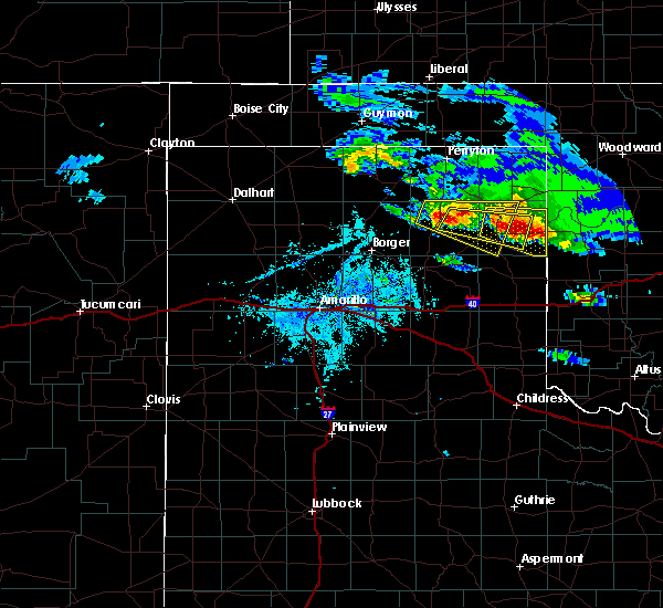 At 711 pm cdt, a severe thunderstorm was located 6 miles south of canadian, moving east at 30 mph (trained weather spotters). Hazards include ping pong ball size hail and 60 mph wind gusts. Minor damage to roofs, siding, and trees is possible. people and animals outdoors will be injured. Expect hail damage to roofs, siding, windows, and vehicles. At 711 pm cdt, a severe thunderstorm was located 6 miles south of canadian, moving east at 30 mph (trained weather spotters). Hazards include ping pong ball size hail and 60 mph wind gusts. Minor damage to roofs, siding, and trees is possible. people and animals outdoors will be injured. Expect hail damage to roofs, siding, windows, and vehicles.
|
| 4/21/2020 7:06 PM CDT |
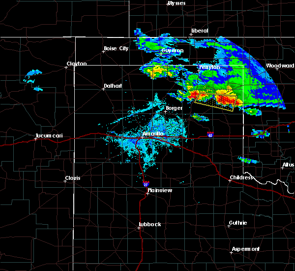 At 706 pm cdt, a severe thunderstorm was located 20 miles northwest of codman, or 20 miles northwest of miami, moving east at 30 mph (radar indicated). Hazards include 60 mph wind gusts and quarter size hail. Minor damage to roofs, siding, and trees is possible. Hail damage to vehicles is expected. At 706 pm cdt, a severe thunderstorm was located 20 miles northwest of codman, or 20 miles northwest of miami, moving east at 30 mph (radar indicated). Hazards include 60 mph wind gusts and quarter size hail. Minor damage to roofs, siding, and trees is possible. Hail damage to vehicles is expected.
|
| 4/21/2020 6:55 PM CDT | Quarter sized hail reported 4.9 miles NNE of Canadian, TX |
| 4/21/2020 6:50 PM CDT |
 At 649 pm cdt, a severe thunderstorm was located 7 miles north of lora, or 9 miles southwest of canadian, moving east at 25 mph (trained weather spotters. at 647 pm cdt, trained spotters reported half dollar size hail along highway 83 4 miles south southwest of canadian). Hazards include ping pong ball size hail and 60 mph wind gusts. Minor damage to roofs, siding, and trees is possible. people and animals outdoors will be injured. expect hail damage to roofs, siding, windows, and vehicles. Locations impacted include, canadian and lake marvin. At 649 pm cdt, a severe thunderstorm was located 7 miles north of lora, or 9 miles southwest of canadian, moving east at 25 mph (trained weather spotters. at 647 pm cdt, trained spotters reported half dollar size hail along highway 83 4 miles south southwest of canadian). Hazards include ping pong ball size hail and 60 mph wind gusts. Minor damage to roofs, siding, and trees is possible. people and animals outdoors will be injured. expect hail damage to roofs, siding, windows, and vehicles. Locations impacted include, canadian and lake marvin.
|
| 4/21/2020 6:48 PM CDT | Half Dollar sized hail reported 4.2 miles NNE of Canadian, TX, copious amounts of half dollar size hail reported by a storm chaser on highway 60 south of canadian. |
| 4/21/2020 6:46 PM CDT |
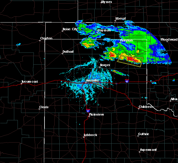 At 646 pm cdt, a severe thunderstorm was located 7 miles north of lora, or 11 miles southwest of canadian, moving east at 20 mph (radar indicated). Hazards include ping pong ball size hail and 60 mph wind gusts. Minor damage to roofs, siding, and trees is possible. people and animals outdoors will be injured. expect hail damage to roofs, siding, windows, and vehicles. Locations impacted include, canadian and lake marvin. At 646 pm cdt, a severe thunderstorm was located 7 miles north of lora, or 11 miles southwest of canadian, moving east at 20 mph (radar indicated). Hazards include ping pong ball size hail and 60 mph wind gusts. Minor damage to roofs, siding, and trees is possible. people and animals outdoors will be injured. expect hail damage to roofs, siding, windows, and vehicles. Locations impacted include, canadian and lake marvin.
|
| 4/21/2020 6:26 PM CDT |
 At 626 pm cdt, a severe thunderstorm was located 7 miles north of lora, or 11 miles north of miami, moving east at 25 mph (radar indicated). Hazards include ping pong ball size hail and 60 mph wind gusts. Minor damage to roofs, siding, and trees is possible. people and animals outdoors will be injured. expect hail damage to roofs, siding, windows, and vehicles. Locations impacted include, canadian, lake marvin and lora. At 626 pm cdt, a severe thunderstorm was located 7 miles north of lora, or 11 miles north of miami, moving east at 25 mph (radar indicated). Hazards include ping pong ball size hail and 60 mph wind gusts. Minor damage to roofs, siding, and trees is possible. people and animals outdoors will be injured. expect hail damage to roofs, siding, windows, and vehicles. Locations impacted include, canadian, lake marvin and lora.
|
| 4/21/2020 6:15 PM CDT |
 At 615 pm cdt, a severe thunderstorm was located 10 miles northwest of lora, or 12 miles north of miami, moving east at 25 mph (radar indicated). Hazards include 60 mph wind gusts and quarter size hail. Minor damage to roofs, siding, and trees is possible. Hail damage to vehicles is expected. At 615 pm cdt, a severe thunderstorm was located 10 miles northwest of lora, or 12 miles north of miami, moving east at 25 mph (radar indicated). Hazards include 60 mph wind gusts and quarter size hail. Minor damage to roofs, siding, and trees is possible. Hail damage to vehicles is expected.
|
| 9/19/2019 2:35 PM CDT |
 At 235 pm cdt, a severe thunderstorm was located 8 miles northwest of lora, or 8 miles north of miami, moving northeast at 15 mph (radar indicated). Hazards include golf ball size hail and 60 mph wind gusts. Minor damage to roofs, siding, and trees is possible. people and animals outdoors will be injured. expect hail damage to roofs, siding, windows, and vehicles. Locations impacted include, canadian, miami and lora. At 235 pm cdt, a severe thunderstorm was located 8 miles northwest of lora, or 8 miles north of miami, moving northeast at 15 mph (radar indicated). Hazards include golf ball size hail and 60 mph wind gusts. Minor damage to roofs, siding, and trees is possible. people and animals outdoors will be injured. expect hail damage to roofs, siding, windows, and vehicles. Locations impacted include, canadian, miami and lora.
|
| 9/19/2019 2:30 PM CDT |
 The national weather service in amarillo has issued a * severe thunderstorm warning for. eastern roberts county in the panhandle of texas. west central hemphill county in the panhandle of texas. until 330 pm cdt. At 229 pm cdt, a severe thunderstorm was located 7 miles north of. The national weather service in amarillo has issued a * severe thunderstorm warning for. eastern roberts county in the panhandle of texas. west central hemphill county in the panhandle of texas. until 330 pm cdt. At 229 pm cdt, a severe thunderstorm was located 7 miles north of.
|
| 8/23/2019 11:17 PM CDT | Quarter sized hail reported 16.3 miles NNE of Canadian, TX |
| 8/23/2019 10:13 PM CDT |
 At 1013 pm cdt, severe thunderstorms were located along a line extending from 4 miles north of darrouzett to 5 miles south of wolf creek park to 17 miles northwest of codman, moving east at 25 mph (radar indicated). Hazards include 60 mph wind gusts and half dollar size hail. Minor damage to roofs, siding, and trees is possible. Hail damage to vehicles is expected. At 1013 pm cdt, severe thunderstorms were located along a line extending from 4 miles north of darrouzett to 5 miles south of wolf creek park to 17 miles northwest of codman, moving east at 25 mph (radar indicated). Hazards include 60 mph wind gusts and half dollar size hail. Minor damage to roofs, siding, and trees is possible. Hail damage to vehicles is expected.
|
| 8/16/2019 11:37 PM CDT | Storm damage reported in hemphill county TX, 5.8 miles W of Canadian, TX |
| 7/10/2019 7:12 PM CDT | Quarter sized hail reported 0.6 miles NNW of Canadian, TX, social media report of quarter sized hail in canadian. report relayed by local media. |
| 6/23/2019 9:02 PM CDT | Quarter sized hail reported 0.2 miles WSW of Canadian, TX |
| 6/23/2019 8:59 PM CDT |
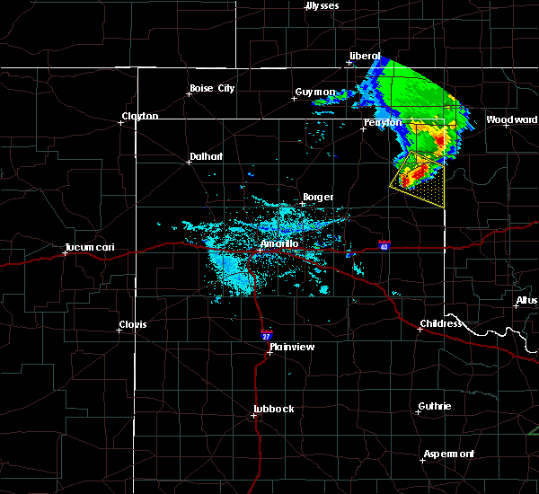 A severe thunderstorm warning remains in effect until 930 pm cdt for south central lipscomb and hemphill counties. at 858 pm cdt, a severe thunderstorm was located over canadian, moving southeast at 30 mph. hazard. 70 mph wind gusts and half dollar size hail. source. Radar indicated. A severe thunderstorm warning remains in effect until 930 pm cdt for south central lipscomb and hemphill counties. at 858 pm cdt, a severe thunderstorm was located over canadian, moving southeast at 30 mph. hazard. 70 mph wind gusts and half dollar size hail. source. Radar indicated.
|
| 6/23/2019 8:55 PM CDT | Quarter sized hail reported 9.8 miles SW of Canadian, TX, quarter size hail lasted about 3 minutes. wind was estimated 40 to 50 mph with a few peak gusts around 60 mph. |
| 6/23/2019 8:55 PM CDT | Quarter size hail lasted about 3 minutes. wind was estimated 40 to 50 mph with a few peak gusts around 60 mp in hemphill county TX, 9.8 miles SW of Canadian, TX |
| 6/23/2019 8:41 PM CDT |
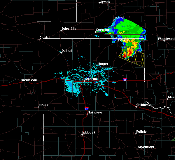 At 841 pm cdt, a severe thunderstorm was located 7 miles northwest of canadian, moving southeast at 30 mph (radar indicated). Hazards include 70 mph wind gusts and half dollar size hail. Expect some tree damage. damage is likely to mobile homes, roofs, and outbuildings. hail damage to vehicles is expected. Locations impacted include, canadian, glazier and lake marvin. At 841 pm cdt, a severe thunderstorm was located 7 miles northwest of canadian, moving southeast at 30 mph (radar indicated). Hazards include 70 mph wind gusts and half dollar size hail. Expect some tree damage. damage is likely to mobile homes, roofs, and outbuildings. hail damage to vehicles is expected. Locations impacted include, canadian, glazier and lake marvin.
|
| 6/23/2019 8:35 PM CDT |
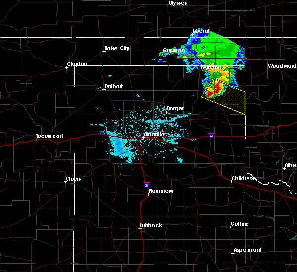 At 822 pm cdt, a severe thunderstorm was located 11 miles south of wolf creek park, or 18 miles northwest of canadian, moving southeast at 35 mph (radar indicated). Hazards include 70 mph wind gusts and half dollar size hail. Expect some tree damage. damage is likely to mobile homes, roofs, and outbuildings. Hail damage to vehicles is expected. At 822 pm cdt, a severe thunderstorm was located 11 miles south of wolf creek park, or 18 miles northwest of canadian, moving southeast at 35 mph (radar indicated). Hazards include 70 mph wind gusts and half dollar size hail. Expect some tree damage. damage is likely to mobile homes, roofs, and outbuildings. Hail damage to vehicles is expected.
|
| 6/23/2019 8:23 PM CDT |
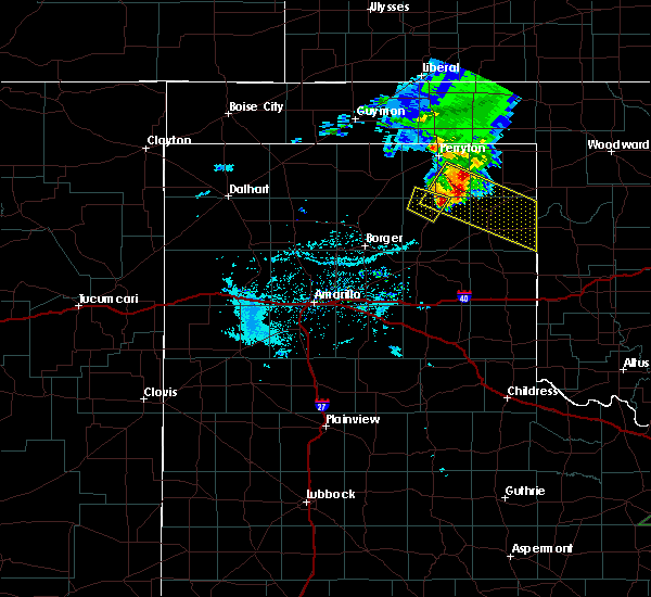 At 822 pm cdt, a severe thunderstorm was located 11 miles south of wolf creek park, or 18 miles northwest of canadian, moving southeast at 35 mph (radar indicated). Hazards include 70 mph wind gusts and half dollar size hail. Expect some tree damage. damage is likely to mobile homes, roofs, and outbuildings. Hail damage to vehicles is expected. At 822 pm cdt, a severe thunderstorm was located 11 miles south of wolf creek park, or 18 miles northwest of canadian, moving southeast at 35 mph (radar indicated). Hazards include 70 mph wind gusts and half dollar size hail. Expect some tree damage. damage is likely to mobile homes, roofs, and outbuildings. Hail damage to vehicles is expected.
|
| 6/23/2019 3:03 AM CDT |
 At 303 am cdt, severe thunderstorms were located along a line extending from 8 miles southeast of elmwood to near canadian, moving east at 35 mph (radar indicated). Hazards include 60 mph wind gusts and half dollar size hail. Minor damage to roofs, siding, and trees is possible. Hail damage to vehicles is expected. At 303 am cdt, severe thunderstorms were located along a line extending from 8 miles southeast of elmwood to near canadian, moving east at 35 mph (radar indicated). Hazards include 60 mph wind gusts and half dollar size hail. Minor damage to roofs, siding, and trees is possible. Hail damage to vehicles is expected.
|
| 6/15/2019 10:46 PM CDT |
 At 1046 pm cdt, severe thunderstorms were located along a line extending from 8 miles southwest of booker to 3 miles west of miami, moving east at 55 mph (radar indicated). Hazards include 60 mph wind gusts and nickel size hail. Minor damage to roofs, siding, and trees is possible. Locations impacted include, canadian, miami, wolf creek park, new mobeetie, lora, waka, codman and mobeetie. At 1046 pm cdt, severe thunderstorms were located along a line extending from 8 miles southwest of booker to 3 miles west of miami, moving east at 55 mph (radar indicated). Hazards include 60 mph wind gusts and nickel size hail. Minor damage to roofs, siding, and trees is possible. Locations impacted include, canadian, miami, wolf creek park, new mobeetie, lora, waka, codman and mobeetie.
|
| 6/15/2019 10:20 PM CDT |
 At 1020 pm cdt, severe thunderstorms were located along a line extending from waka to 4 miles east of skellytown, moving east at 55 mph (radar indicated). Hazards include 60 mph wind gusts and nickel size hail. minor damage to roofs, siding, and trees is possible At 1020 pm cdt, severe thunderstorms were located along a line extending from waka to 4 miles east of skellytown, moving east at 55 mph (radar indicated). Hazards include 60 mph wind gusts and nickel size hail. minor damage to roofs, siding, and trees is possible
|
| 5/27/2019 1:59 AM CDT | Quarter sized hail reported 13.3 miles SE of Canadian, TX, quarter size hail with 50 mph winds. |
| 5/27/2019 12:10 AM CDT |
 The severe thunderstorm warning for southern lipscomb, northern wheeler, northeastern gray, eastern roberts and hemphill counties will expire at 1215 am cdt, the storms which prompted the warning have weakened below severe limits, and no longer pose an immediate threat to life or property. therefore, the warning will be allowed to expire. a tornado watch remains in effect until 200 am cdt for the panhandle of texas. The severe thunderstorm warning for southern lipscomb, northern wheeler, northeastern gray, eastern roberts and hemphill counties will expire at 1215 am cdt, the storms which prompted the warning have weakened below severe limits, and no longer pose an immediate threat to life or property. therefore, the warning will be allowed to expire. a tornado watch remains in effect until 200 am cdt for the panhandle of texas.
|
| 5/26/2019 11:46 PM CDT |
 At 1145 pm cdt, severe thunderstorms were located along a line extending from 7 miles northwest of higgins to 7 miles west of new mobeetie, moving northeast at 35 mph (trained weather spotters reported quarter size hail and 60 mph wind gusts in glazier. trained spotters also reported a rotating wall cloud). Hazards include 60 mph wind gusts and quarter size hail. Minor damage to roofs, siding, and trees is possible. hail damage to vehicles is expected. locations impacted include, lipscomb, canadian, miami, briscoe, higgins, new mobeetie, lora, allison, glazier, codman, lake marvin and mobeetie. A tornado watch remains in effect until 200 am cdt for the panhandle of texas. At 1145 pm cdt, severe thunderstorms were located along a line extending from 7 miles northwest of higgins to 7 miles west of new mobeetie, moving northeast at 35 mph (trained weather spotters reported quarter size hail and 60 mph wind gusts in glazier. trained spotters also reported a rotating wall cloud). Hazards include 60 mph wind gusts and quarter size hail. Minor damage to roofs, siding, and trees is possible. hail damage to vehicles is expected. locations impacted include, lipscomb, canadian, miami, briscoe, higgins, new mobeetie, lora, allison, glazier, codman, lake marvin and mobeetie. A tornado watch remains in effect until 200 am cdt for the panhandle of texas.
|
| 5/26/2019 11:42 PM CDT | Quarter sized hail reported 9.8 miles SW of Canadian, TX |
| 5/26/2019 11:42 PM CDT | Storm damage reported in hemphill county TX, 9.8 miles SW of Canadian, TX |
| 5/26/2019 11:25 PM CDT |
 At 1125 pm cdt, severe thunderstorms were located along a line extending from near lipscomb to codman, moving northeast at 40 mph (trained spotters reported a rotating wall cloud). Hazards include 70 mph wind gusts. Expect some tree damage. damage is likely to mobile homes, roofs, and outbuildings. locations impacted include, pampa, lipscomb, canadian, miami, briscoe, higgins, new mobeetie, allison, glazier, lake marvin, lora, codman and mobeetie. A tornado watch remains in effect until 200 am cdt for the panhandle of texas. At 1125 pm cdt, severe thunderstorms were located along a line extending from near lipscomb to codman, moving northeast at 40 mph (trained spotters reported a rotating wall cloud). Hazards include 70 mph wind gusts. Expect some tree damage. damage is likely to mobile homes, roofs, and outbuildings. locations impacted include, pampa, lipscomb, canadian, miami, briscoe, higgins, new mobeetie, allison, glazier, lake marvin, lora, codman and mobeetie. A tornado watch remains in effect until 200 am cdt for the panhandle of texas.
|
| 5/26/2019 11:12 PM CDT |
 At 1112 pm cdt, severe thunderstorms were located along a line extending from 5 miles west of lipscomb to 5 miles southwest of codman, moving northeast at 40 mph (radar indicated). Hazards include 70 mph wind gusts. Expect some tree damage. Damage is likely to mobile homes, roofs, and outbuildings. At 1112 pm cdt, severe thunderstorms were located along a line extending from 5 miles west of lipscomb to 5 miles southwest of codman, moving northeast at 40 mph (radar indicated). Hazards include 70 mph wind gusts. Expect some tree damage. Damage is likely to mobile homes, roofs, and outbuildings.
|
| 5/26/2019 3:43 PM CDT |
 At 343 pm cdt, severe thunderstorms were located along a line extending from 14 miles southwest of hardesty to 12 miles south of spearman to 6 miles northwest of skellytown, moving east at 55 mph (radar indicated). Hazards include 70 mph wind gusts and quarter size hail. Expect some tree damage. damage is likely to mobile homes, roofs, and outbuildings. Hail damage to vehicles is expected. At 343 pm cdt, severe thunderstorms were located along a line extending from 14 miles southwest of hardesty to 12 miles south of spearman to 6 miles northwest of skellytown, moving east at 55 mph (radar indicated). Hazards include 70 mph wind gusts and quarter size hail. Expect some tree damage. damage is likely to mobile homes, roofs, and outbuildings. Hail damage to vehicles is expected.
|
| 5/26/2019 3:43 PM CDT |
 The national weather service in amarillo has issued a * severe thunderstorm warning for. southwestern beaver county in the panhandle of oklahoma. southeastern texas county in the panhandle of oklahoma. western lipscomb county in the panhandle of texas. Eastern hutchinson county in the panhandle of texas. The national weather service in amarillo has issued a * severe thunderstorm warning for. southwestern beaver county in the panhandle of oklahoma. southeastern texas county in the panhandle of oklahoma. western lipscomb county in the panhandle of texas. Eastern hutchinson county in the panhandle of texas.
|
| 5/23/2019 11:30 PM CDT | Quarter sized hail reported 9.8 miles SW of Canadian, TX |
| 5/23/2019 11:27 PM CDT |
 At 1127 pm cdt, a severe thunderstorm was located 4 miles west of glazier, or 7 miles north of canadian, moving northeast at 55 mph (radar indicated). Hazards include 70 mph wind gusts and quarter size hail. Expect some tree damage. damage is likely to mobile homes, roofs, and outbuildings. Hail damage to vehicles is expected. At 1127 pm cdt, a severe thunderstorm was located 4 miles west of glazier, or 7 miles north of canadian, moving northeast at 55 mph (radar indicated). Hazards include 70 mph wind gusts and quarter size hail. Expect some tree damage. damage is likely to mobile homes, roofs, and outbuildings. Hail damage to vehicles is expected.
|
| 5/23/2019 11:20 PM CDT |
 A severe thunderstorm warning remains in effect until 1145 pm cdt for northwestern hemphill county. at 1120 pm cdt, a severe thunderstorm was located near canadian, moving northeast at 45 mph. hazard. 70 mph wind gusts. source. Radar indicated. A severe thunderstorm warning remains in effect until 1145 pm cdt for northwestern hemphill county. at 1120 pm cdt, a severe thunderstorm was located near canadian, moving northeast at 45 mph. hazard. 70 mph wind gusts. source. Radar indicated.
|
| 5/23/2019 10:51 PM CDT |
 At 1051 pm cdt, a severe thunderstorm was located over miami, moving northeast at 30 mph (radar indicated). Hazards include 70 mph wind gusts. Expect some tree damage. damage is likely to mobile homes, roofs, and outbuildings. Locations impacted include, canadian, miami, codman and lora. At 1051 pm cdt, a severe thunderstorm was located over miami, moving northeast at 30 mph (radar indicated). Hazards include 70 mph wind gusts. Expect some tree damage. damage is likely to mobile homes, roofs, and outbuildings. Locations impacted include, canadian, miami, codman and lora.
|
| 5/23/2019 10:40 PM CDT |
 At 1039 pm cdt, a severe thunderstorm was located 5 miles south of codman, or 9 miles southwest of miami, moving northeast at 25 mph (radar indicated). Hazards include 70 mph wind gusts. Expect some tree damage. Damage is likely to mobile homes, roofs, and outbuildings. At 1039 pm cdt, a severe thunderstorm was located 5 miles south of codman, or 9 miles southwest of miami, moving northeast at 25 mph (radar indicated). Hazards include 70 mph wind gusts. Expect some tree damage. Damage is likely to mobile homes, roofs, and outbuildings.
|
| 5/20/2019 3:35 PM CDT |
 At 335 pm cdt, a severe thunderstorm was located 5 miles west of new mobeetie, or 11 miles southeast of miami, moving northeast at 45 mph (radar indicated). Hazards include ping pong ball size hail. People and animals outdoors will be injured. Expect damage to roofs, siding, windows, and vehicles. At 335 pm cdt, a severe thunderstorm was located 5 miles west of new mobeetie, or 11 miles southeast of miami, moving northeast at 45 mph (radar indicated). Hazards include ping pong ball size hail. People and animals outdoors will be injured. Expect damage to roofs, siding, windows, and vehicles.
|
| 5/20/2019 3:17 PM CDT |
 At 316 pm cdt, a severe thunderstorm was located 4 miles northwest of miami, moving northeast at 50 mph (radar indicated). Hazards include quarter size hail. Damage to vehicles is expected. locations impacted include, lipscomb, canadian, miami, higgins, wolf creek park, lora, glazier and lake marvin. A tornado watch remains in effect until 800 pm cdt for the panhandle of texas. At 316 pm cdt, a severe thunderstorm was located 4 miles northwest of miami, moving northeast at 50 mph (radar indicated). Hazards include quarter size hail. Damage to vehicles is expected. locations impacted include, lipscomb, canadian, miami, higgins, wolf creek park, lora, glazier and lake marvin. A tornado watch remains in effect until 800 pm cdt for the panhandle of texas.
|
| 5/20/2019 3:02 PM CDT |
 At 302 pm cdt, a severe thunderstorm was located over codman, or 7 miles southwest of miami, moving northeast at 65 mph (radar indicated). Hazards include ping pong ball size hail. People and animals outdoors will be injured. Expect damage to roofs, siding, windows, and vehicles. At 302 pm cdt, a severe thunderstorm was located over codman, or 7 miles southwest of miami, moving northeast at 65 mph (radar indicated). Hazards include ping pong ball size hail. People and animals outdoors will be injured. Expect damage to roofs, siding, windows, and vehicles.
|
| 5/20/2019 7:19 AM CDT | Quarter sized hail reported 20.8 miles S of Canadian, TX |
| 5/7/2019 8:13 PM CDT |
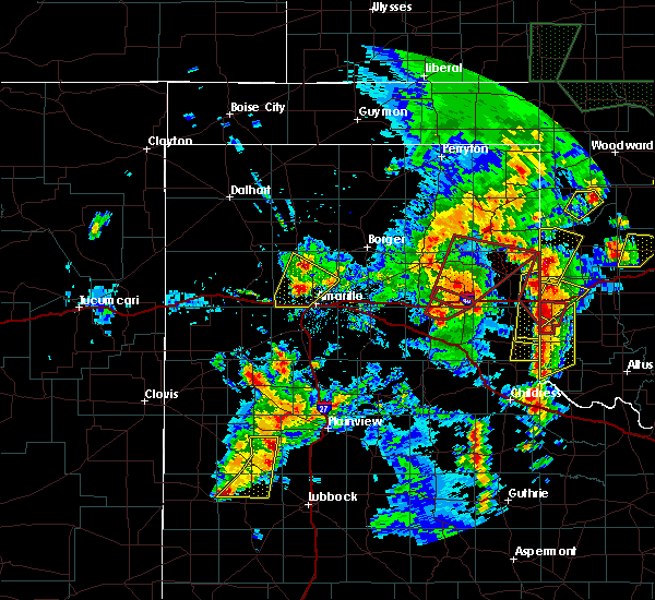 At 813 pm cdt, a severe thunderstorm was located 4 miles south of canadian, moving northeast at 55 mph (radar indicated). Hazards include 60 mph wind gusts and quarter size hail. Minor damage to roofs, siding, and trees is possible. Hail damage to vehicles is expected. At 813 pm cdt, a severe thunderstorm was located 4 miles south of canadian, moving northeast at 55 mph (radar indicated). Hazards include 60 mph wind gusts and quarter size hail. Minor damage to roofs, siding, and trees is possible. Hail damage to vehicles is expected.
|
| 5/7/2019 6:28 PM CDT |
 At 628 pm cdt, a severe thunderstorm was located over glazier, or 11 miles northeast of canadian, moving north at 35 mph (radar indicated). Hazards include 60 mph wind gusts and quarter size hail. Minor damage to roofs, siding, and trees is possible. Hail damage to vehicles is expected. At 628 pm cdt, a severe thunderstorm was located over glazier, or 11 miles northeast of canadian, moving north at 35 mph (radar indicated). Hazards include 60 mph wind gusts and quarter size hail. Minor damage to roofs, siding, and trees is possible. Hail damage to vehicles is expected.
|
| 5/5/2019 8:52 PM CDT |
 At 852 pm cdt, a severe thunderstorm was located 6 miles northwest of miami, moving east at 30 mph (radar indicated). Hazards include two inch hail and 70 mph wind gusts. Expect some tree damage. damage is likely to mobile homes, roofs, and outbuildings. people and animals outdoors will be injured. expect hail damage to roofs, siding, windows, and vehicles. Locations impacted include, canadian, miami, briscoe, wheeler, new mobeetie, lora, allison, codman, lake marvin and mobeetie. At 852 pm cdt, a severe thunderstorm was located 6 miles northwest of miami, moving east at 30 mph (radar indicated). Hazards include two inch hail and 70 mph wind gusts. Expect some tree damage. damage is likely to mobile homes, roofs, and outbuildings. people and animals outdoors will be injured. expect hail damage to roofs, siding, windows, and vehicles. Locations impacted include, canadian, miami, briscoe, wheeler, new mobeetie, lora, allison, codman, lake marvin and mobeetie.
|
| 5/5/2019 8:44 PM CDT |
 At 843 pm cdt, a severe thunderstorm was located 10 miles northwest of miami, moving east at 30 mph (radar indicated). Hazards include golf ball size hail and 70 mph wind gusts. Expect some tree damage. damage is likely to mobile homes, roofs, and outbuildings. people and animals outdoors will be injured. expect hail damage to roofs, siding, windows, and vehicles. Locations impacted include, pampa, canadian, miami, briscoe, wheeler, lefors, new mobeetie, allison, glazier, lake marvin, lora, codman and mobeetie. At 843 pm cdt, a severe thunderstorm was located 10 miles northwest of miami, moving east at 30 mph (radar indicated). Hazards include golf ball size hail and 70 mph wind gusts. Expect some tree damage. damage is likely to mobile homes, roofs, and outbuildings. people and animals outdoors will be injured. expect hail damage to roofs, siding, windows, and vehicles. Locations impacted include, pampa, canadian, miami, briscoe, wheeler, lefors, new mobeetie, allison, glazier, lake marvin, lora, codman and mobeetie.
|
| 5/5/2019 8:35 PM CDT |
 At 834 pm cdt, a severe thunderstorm was located 13 miles northwest of codman, or 15 miles northwest of miami, moving east at 20 mph (radar indicated). Hazards include 70 mph wind gusts and half dollar size hail. Expect some tree damage. damage is likely to mobile homes, roofs, and outbuildings. hail damage to vehicles is expected. Locations impacted include, pampa, canadian, miami, briscoe, wheeler, lefors, new mobeetie, allison, glazier, lake marvin, lora, codman and mobeetie. At 834 pm cdt, a severe thunderstorm was located 13 miles northwest of codman, or 15 miles northwest of miami, moving east at 20 mph (radar indicated). Hazards include 70 mph wind gusts and half dollar size hail. Expect some tree damage. damage is likely to mobile homes, roofs, and outbuildings. hail damage to vehicles is expected. Locations impacted include, pampa, canadian, miami, briscoe, wheeler, lefors, new mobeetie, allison, glazier, lake marvin, lora, codman and mobeetie.
|
| 5/5/2019 8:20 PM CDT |
 At 819 pm cdt, a severe thunderstorm was located 15 miles northwest of codman, or 17 miles northwest of miami, moving east at 35 mph (radar indicated). Hazards include 70 mph wind gusts and ping pong ball size hail. Expect some tree damage. damage is likely to mobile homes, roofs, and outbuildings. people and animals outdoors will be injured. expect hail damage to roofs, siding, windows, and vehicles. Locations impacted include, pampa, canadian, miami, briscoe, wheeler, lefors, new mobeetie, allison, glazier, lake marvin, lora, codman and mobeetie. At 819 pm cdt, a severe thunderstorm was located 15 miles northwest of codman, or 17 miles northwest of miami, moving east at 35 mph (radar indicated). Hazards include 70 mph wind gusts and ping pong ball size hail. Expect some tree damage. damage is likely to mobile homes, roofs, and outbuildings. people and animals outdoors will be injured. expect hail damage to roofs, siding, windows, and vehicles. Locations impacted include, pampa, canadian, miami, briscoe, wheeler, lefors, new mobeetie, allison, glazier, lake marvin, lora, codman and mobeetie.
|
| 5/5/2019 8:08 PM CDT |
 At 807 pm cdt, a severe thunderstorm was located 21 miles northwest of codman, or 22 miles north of pampa, moving southeast at 30 mph (radar indicated). Hazards include golf ball size hail and 70 mph wind gusts. Expect some tree damage. damage is likely to mobile homes, roofs, and outbuildings. people and animals outdoors will be injured. expect hail damage to roofs, siding, windows, and vehicles. Locations impacted include, pampa, canadian, miami, briscoe, wheeler, lefors, higgins, new mobeetie, allison, glazier, lake marvin, lora, codman and mobeetie. At 807 pm cdt, a severe thunderstorm was located 21 miles northwest of codman, or 22 miles north of pampa, moving southeast at 30 mph (radar indicated). Hazards include golf ball size hail and 70 mph wind gusts. Expect some tree damage. damage is likely to mobile homes, roofs, and outbuildings. people and animals outdoors will be injured. expect hail damage to roofs, siding, windows, and vehicles. Locations impacted include, pampa, canadian, miami, briscoe, wheeler, lefors, higgins, new mobeetie, allison, glazier, lake marvin, lora, codman and mobeetie.
|
| 5/5/2019 7:54 PM CDT |
 At 753 pm cdt, a severe thunderstorm was located 17 miles southeast of spearman, moving east at 35 mph (radar indicated). Hazards include golf ball size hail and 70 mph wind gusts. Expect some tree damage. damage is likely to mobile homes, roofs, and outbuildings. people and animals outdoors will be injured. Expect hail damage to roofs, siding, windows, and vehicles. At 753 pm cdt, a severe thunderstorm was located 17 miles southeast of spearman, moving east at 35 mph (radar indicated). Hazards include golf ball size hail and 70 mph wind gusts. Expect some tree damage. damage is likely to mobile homes, roofs, and outbuildings. people and animals outdoors will be injured. Expect hail damage to roofs, siding, windows, and vehicles.
|
| 5/4/2019 11:39 PM CDT |
 A severe thunderstorm warning remains in effect until 1145 pm cdt for southwestern hemphill county. at 1138 pm cdt, a severe thunderstorm was located 5 miles southwest of canadian, moving east at 20 mph. hazard. 60 mph wind gusts and quarter size hail. source. Radar indicated. A severe thunderstorm warning remains in effect until 1145 pm cdt for southwestern hemphill county. at 1138 pm cdt, a severe thunderstorm was located 5 miles southwest of canadian, moving east at 20 mph. hazard. 60 mph wind gusts and quarter size hail. source. Radar indicated.
|
| 5/4/2019 11:25 PM CDT | Quarter sized hail reported 10.8 miles NNE of Canadian, TX |
| 5/4/2019 11:22 PM CDT |
 At 1122 pm cdt, a severe thunderstorm was located 8 miles north of lora, or 8 miles southwest of canadian, moving east at 20 mph (radar indicated). Hazards include two inch hail and 60 mph wind gusts. Minor damage to roofs, siding, and trees is possible. people and animals outdoors will be injured. expect hail damage to roofs, siding, windows, and vehicles. Locations impacted include, canadian and lora. At 1122 pm cdt, a severe thunderstorm was located 8 miles north of lora, or 8 miles southwest of canadian, moving east at 20 mph (radar indicated). Hazards include two inch hail and 60 mph wind gusts. Minor damage to roofs, siding, and trees is possible. people and animals outdoors will be injured. expect hail damage to roofs, siding, windows, and vehicles. Locations impacted include, canadian and lora.
|
| 5/4/2019 11:04 PM CDT |
 At 1104 pm cdt, a severe thunderstorm was located 10 miles north of lora, or 13 miles west of canadian, moving east at 20 mph (radar indicated). Hazards include two inch hail and 60 mph wind gusts. Minor damage to roofs, siding, and trees is possible. people and animals outdoors will be injured. expect hail damage to roofs, siding, windows, and vehicles. Locations impacted include, canadian and lora. At 1104 pm cdt, a severe thunderstorm was located 10 miles north of lora, or 13 miles west of canadian, moving east at 20 mph (radar indicated). Hazards include two inch hail and 60 mph wind gusts. Minor damage to roofs, siding, and trees is possible. people and animals outdoors will be injured. expect hail damage to roofs, siding, windows, and vehicles. Locations impacted include, canadian and lora.
|
| 5/4/2019 10:55 PM CDT |
 At 1055 pm cdt, a severe thunderstorm was located 13 miles northwest of lora, or 14 miles north of miami, moving east at 20 mph (radar indicated). Hazards include golf ball size hail and 60 mph wind gusts. Minor damage to roofs, siding, and trees is possible. people and animals outdoors will be injured. expect hail damage to roofs, siding, windows, and vehicles. Locations impacted include, canadian and lora. At 1055 pm cdt, a severe thunderstorm was located 13 miles northwest of lora, or 14 miles north of miami, moving east at 20 mph (radar indicated). Hazards include golf ball size hail and 60 mph wind gusts. Minor damage to roofs, siding, and trees is possible. people and animals outdoors will be injured. expect hail damage to roofs, siding, windows, and vehicles. Locations impacted include, canadian and lora.
|
| 5/4/2019 10:46 PM CDT |
 At 1046 pm cdt, a severe thunderstorm was located 15 miles northwest of lora, or 16 miles north of miami, moving east at 20 mph (radar indicated). Hazards include 60 mph wind gusts and half dollar size hail. Minor damage to roofs, siding, and trees is possible. Hail damage to vehicles is expected. At 1046 pm cdt, a severe thunderstorm was located 15 miles northwest of lora, or 16 miles north of miami, moving east at 20 mph (radar indicated). Hazards include 60 mph wind gusts and half dollar size hail. Minor damage to roofs, siding, and trees is possible. Hail damage to vehicles is expected.
|
| 4/17/2019 3:34 PM CDT |
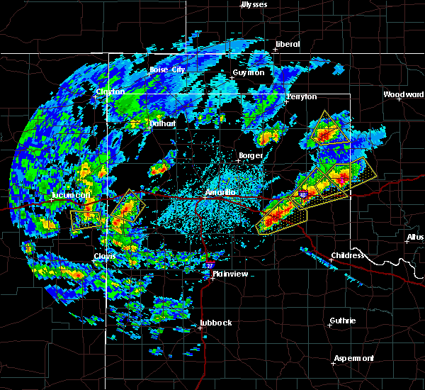 At 334 pm cdt, a severe thunderstorm was located 4 miles northeast of canadian, moving northeast at 15 mph (trained weather spotters reported golf ball size hail). Hazards include golf ball size hail and 60 mph wind gusts. Minor damage to roofs, siding, and trees is possible. people and animals outdoors will be injured. expect hail damage to roofs, siding, windows, and vehicles. Locations impacted include, canadian, glazier and lake marvin. At 334 pm cdt, a severe thunderstorm was located 4 miles northeast of canadian, moving northeast at 15 mph (trained weather spotters reported golf ball size hail). Hazards include golf ball size hail and 60 mph wind gusts. Minor damage to roofs, siding, and trees is possible. people and animals outdoors will be injured. expect hail damage to roofs, siding, windows, and vehicles. Locations impacted include, canadian, glazier and lake marvin.
|
| 4/17/2019 3:32 PM CDT |
 At 330 pm cdt, a severe thunderstorm was located near canadian, moving north at 10 mph (trained weather spotters reported golf ball size hail 1 mile east northeast of canadian at 0326 pm cdt). Hazards include two inch hail and 60 mph wind gusts. Minor damage to roofs, siding, and trees is possible. people and animals outdoors will be injured. expect hail damage to roofs, siding, windows, and vehicles. Locations impacted include, canadian and glazier. At 330 pm cdt, a severe thunderstorm was located near canadian, moving north at 10 mph (trained weather spotters reported golf ball size hail 1 mile east northeast of canadian at 0326 pm cdt). Hazards include two inch hail and 60 mph wind gusts. Minor damage to roofs, siding, and trees is possible. people and animals outdoors will be injured. expect hail damage to roofs, siding, windows, and vehicles. Locations impacted include, canadian and glazier.
|
| 4/17/2019 3:28 PM CDT | Quarter sized hail reported 0.2 miles WSW of Canadian, TX |
| 4/17/2019 3:26 PM CDT | Golf Ball sized hail reported 1.5 miles WSW of Canadian, TX |
| 4/17/2019 3:25 PM CDT |
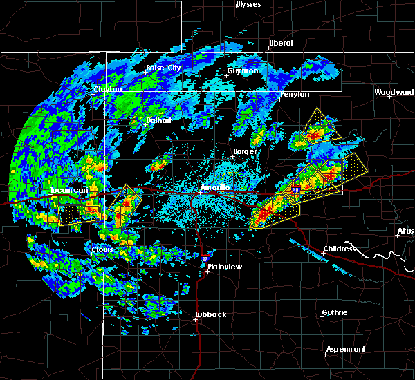 At 325 pm cdt, a severe thunderstorm was located over canadian, moving north at 10 mph (radar indicated). Hazards include golf ball size hail and 60 mph wind gusts. Minor damage to roofs, siding, and trees is possible. people and animals outdoors will be injured. expect hail damage to roofs, siding, windows, and vehicles. Locations impacted include, canadian, glazier and lake marvin. At 325 pm cdt, a severe thunderstorm was located over canadian, moving north at 10 mph (radar indicated). Hazards include golf ball size hail and 60 mph wind gusts. Minor damage to roofs, siding, and trees is possible. people and animals outdoors will be injured. expect hail damage to roofs, siding, windows, and vehicles. Locations impacted include, canadian, glazier and lake marvin.
|
| 4/17/2019 3:18 PM CDT |
 At 318 pm cdt, a severe thunderstorm was located over canadian, moving northeast at 15 mph (radar indicated). Hazards include 60 mph wind gusts and quarter size hail. Minor damage to roofs, siding, and trees is possible. Hail damage to vehicles is expected. At 318 pm cdt, a severe thunderstorm was located over canadian, moving northeast at 15 mph (radar indicated). Hazards include 60 mph wind gusts and quarter size hail. Minor damage to roofs, siding, and trees is possible. Hail damage to vehicles is expected.
|
| 6/25/2018 12:01 AM CDT | Canadian west texas mesonet wind gus in hemphill county TX, 5.8 miles W of Canadian, TX |
| 6/22/2018 8:13 PM CDT | Storm damage reported in hemphill county TX, 5.8 miles W of Canadian, TX |
| 6/22/2018 4:15 AM CDT |
 At 415 am cdt, a severe thunderstorm was located 8 miles southeast of lora, or 12 miles east of miami, moving southeast at 25 mph (radar indicated). Hazards include 60 mph wind gusts and quarter size hail. Minor damage to roofs, siding, and trees is possible. hail damage to vehicles is expected. Locations impacted include, canadian, miami, lake marvin and lora. At 415 am cdt, a severe thunderstorm was located 8 miles southeast of lora, or 12 miles east of miami, moving southeast at 25 mph (radar indicated). Hazards include 60 mph wind gusts and quarter size hail. Minor damage to roofs, siding, and trees is possible. hail damage to vehicles is expected. Locations impacted include, canadian, miami, lake marvin and lora.
|
| 6/22/2018 3:47 AM CDT |
 At 346 am cdt, a severe thunderstorm was located 8 miles north of lora, or 8 miles southwest of canadian, moving east at 30 mph (radar indicated). Hazards include 60 mph wind gusts and half dollar size hail. Minor damage to roofs, siding, and trees is possible. Hail damage to vehicles is expected. At 346 am cdt, a severe thunderstorm was located 8 miles north of lora, or 8 miles southwest of canadian, moving east at 30 mph (radar indicated). Hazards include 60 mph wind gusts and half dollar size hail. Minor damage to roofs, siding, and trees is possible. Hail damage to vehicles is expected.
|
| 6/13/2018 1:14 AM CDT |
 At 113 am cdt, a severe thunderstorm was located 9 miles south of lake marvin, or 18 miles southeast of canadian, moving southeast at 15 mph (radar indicated). Hazards include 60 mph wind gusts and quarter size hail. Minor damage to roofs, siding, and trees is possible. hail damage to vehicles is expected. Locations impacted include, canadian, briscoe, allison, new mobeetie, lake marvin and mobeetie. At 113 am cdt, a severe thunderstorm was located 9 miles south of lake marvin, or 18 miles southeast of canadian, moving southeast at 15 mph (radar indicated). Hazards include 60 mph wind gusts and quarter size hail. Minor damage to roofs, siding, and trees is possible. hail damage to vehicles is expected. Locations impacted include, canadian, briscoe, allison, new mobeetie, lake marvin and mobeetie.
|
| 6/13/2018 12:42 AM CDT |
 At 1241 am cdt, a severe thunderstorm was located near canadian, moving south at 25 mph (automated equipment reported winds. radar indicated hail). Hazards include 60 mph wind gusts and quarter size hail. Minor damage to roofs, siding, and trees is possible. hail damage to vehicles is expected. Locations impacted include, canadian, miami, briscoe, new mobeetie, lora, allison, glazier, codman, lake marvin and mobeetie. At 1241 am cdt, a severe thunderstorm was located near canadian, moving south at 25 mph (automated equipment reported winds. radar indicated hail). Hazards include 60 mph wind gusts and quarter size hail. Minor damage to roofs, siding, and trees is possible. hail damage to vehicles is expected. Locations impacted include, canadian, miami, briscoe, new mobeetie, lora, allison, glazier, codman, lake marvin and mobeetie.
|
| 6/13/2018 12:38 AM CDT | Storm damage reported in hemphill county TX, 5.8 miles W of Canadian, TX |
| 6/13/2018 12:29 AM CDT | Storm damage reported in hemphill county TX, 5.8 miles W of Canadian, TX |
| 6/13/2018 12:27 AM CDT |
 At 1227 am cdt, a severe thunderstorm was located 4 miles northeast of canadian, moving south at 25 mph (radar indicated). Hazards include 70 mph wind gusts and quarter size hail. Expect some tree damage. damage is likely to mobile homes, roofs, and outbuildings. Hail damage to vehicles is expected. At 1227 am cdt, a severe thunderstorm was located 4 miles northeast of canadian, moving south at 25 mph (radar indicated). Hazards include 70 mph wind gusts and quarter size hail. Expect some tree damage. damage is likely to mobile homes, roofs, and outbuildings. Hail damage to vehicles is expected.
|
| 6/12/2018 4:15 PM CDT |
 At 415 pm cdt, a severe thunderstorm was located near miami, moving northeast at 10 mph (radar indicated). Hazards include golf ball size hail and 60 mph wind gusts. Minor damage to roofs, siding, and trees is possible. people and animals outdoors will be injured. expect hail damage to roofs, siding, windows, and vehicles. Locations impacted include, canadian, miami, codman and lora. At 415 pm cdt, a severe thunderstorm was located near miami, moving northeast at 10 mph (radar indicated). Hazards include golf ball size hail and 60 mph wind gusts. Minor damage to roofs, siding, and trees is possible. people and animals outdoors will be injured. expect hail damage to roofs, siding, windows, and vehicles. Locations impacted include, canadian, miami, codman and lora.
|
| 6/12/2018 4:09 PM CDT |
 At 408 pm cdt, a severe thunderstorm was located near miami, moving northeast at 10 mph (radar indicated). Hazards include 60 mph wind gusts and quarter size hail. Minor damage to roofs, siding, and trees is possible. Hail damage to vehicles is expected. At 408 pm cdt, a severe thunderstorm was located near miami, moving northeast at 10 mph (radar indicated). Hazards include 60 mph wind gusts and quarter size hail. Minor damage to roofs, siding, and trees is possible. Hail damage to vehicles is expected.
|
| 5/30/2018 10:47 PM CDT |
 At 1046 pm cdt, a severe thunderstorm was located near fargo, or 13 miles northeast of shattuck, and is nearly stationary (radar indicated). Hazards include golf ball size hail and 60 mph wind gusts. Minor damage to roofs, siding, and trees is possible. people and animals outdoors will be injured. expect hail damage to roofs, siding, windows, and vehicles. Locations impacted include, lipscomb, canadian, follett, higgins, glazier and lake marvin. At 1046 pm cdt, a severe thunderstorm was located near fargo, or 13 miles northeast of shattuck, and is nearly stationary (radar indicated). Hazards include golf ball size hail and 60 mph wind gusts. Minor damage to roofs, siding, and trees is possible. people and animals outdoors will be injured. expect hail damage to roofs, siding, windows, and vehicles. Locations impacted include, lipscomb, canadian, follett, higgins, glazier and lake marvin.
|
| 5/30/2018 10:40 PM CDT |
 At 1039 pm cdt, a severe thunderstorm was located 7 miles north of glazier, or 8 miles south of lipscomb, moving northeast at 50 mph (radar indicated). Hazards include 60 mph wind gusts and quarter size hail. Minor damage to roofs, siding, and trees is possible. Hail damage to vehicles is expected. At 1039 pm cdt, a severe thunderstorm was located 7 miles north of glazier, or 8 miles south of lipscomb, moving northeast at 50 mph (radar indicated). Hazards include 60 mph wind gusts and quarter size hail. Minor damage to roofs, siding, and trees is possible. Hail damage to vehicles is expected.
|
| 5/25/2018 7:30 PM CDT | Quarter sized hail reported 20.1 miles N of Canadian, TX, report received via twitter. |
| 5/25/2018 7:24 PM CDT | Quarter sized hail reported 20.1 miles N of Canadian, TX, storm chaser reported quarter size hail via spotter network. |
| 5/18/2018 6:58 PM CDT | Quarter sized hail reported 14.2 miles ESE of Canadian, TX |
| 5/18/2018 6:58 PM CDT |
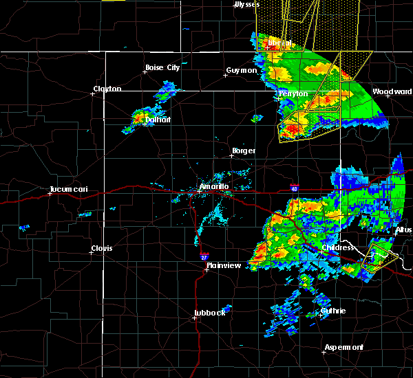 At 658 pm cdt, a severe thunderstorm was located 12 miles northwest of canadian, moving northeast at 30 mph (radar indicated). Hazards include 60 mph wind gusts and quarter size hail. Minor damage to roofs, siding, and trees is possible. Hail damage to vehicles is expected. At 658 pm cdt, a severe thunderstorm was located 12 miles northwest of canadian, moving northeast at 30 mph (radar indicated). Hazards include 60 mph wind gusts and quarter size hail. Minor damage to roofs, siding, and trees is possible. Hail damage to vehicles is expected.
|
| 5/16/2018 7:13 PM CDT |
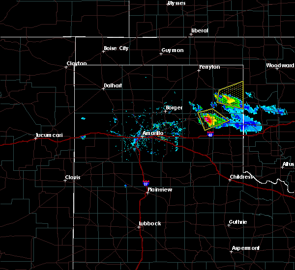 At 713 pm cdt, a severe thunderstorm was located 5 miles west of lake marvin, or 6 miles east of canadian, moving east at 15 mph (radar indicated). Hazards include 60 mph wind gusts and quarter size hail. Minor damage to roofs, siding, and trees is possible. hail damage to vehicles is expected. Locations impacted include, canadian, higgins, glazier and lake marvin. At 713 pm cdt, a severe thunderstorm was located 5 miles west of lake marvin, or 6 miles east of canadian, moving east at 15 mph (radar indicated). Hazards include 60 mph wind gusts and quarter size hail. Minor damage to roofs, siding, and trees is possible. hail damage to vehicles is expected. Locations impacted include, canadian, higgins, glazier and lake marvin.
|
| 5/16/2018 7:02 PM CDT |
 At 702 pm cdt, a severe thunderstorm was located over canadian, moving east at 10 mph (radar indicated). Hazards include ping pong ball size hail and 60 mph wind gusts. Minor damage to roofs, siding, and trees is possible. people and animals outdoors will be injured. expect hail damage to roofs, siding, windows, and vehicles. Locations impacted include, canadian and glazier. At 702 pm cdt, a severe thunderstorm was located over canadian, moving east at 10 mph (radar indicated). Hazards include ping pong ball size hail and 60 mph wind gusts. Minor damage to roofs, siding, and trees is possible. people and animals outdoors will be injured. expect hail damage to roofs, siding, windows, and vehicles. Locations impacted include, canadian and glazier.
|
| 5/16/2018 7:00 PM CDT | Ping Pong Ball sized hail reported 0.6 miles NNW of Canadian, TX |
| 5/16/2018 7:00 PM CDT | Quarter sized hail reported 2.3 miles SSW of Canadian, TX, mostly nickel size hail with a few quarters at the candian golf course |
| 5/16/2018 6:55 PM CDT | Ping Pong Ball sized hail reported 0.2 miles WSW of Canadian, TX, mostly pea to quarter size. found one stone that was the size of a ping pong ball. |
| 5/16/2018 6:55 PM CDT |
 At 655 pm cdt, a severe thunderstorm was located over canadian, moving northeast at 25 mph (radar indicated). Hazards include ping pong ball size hail and 60 mph wind gusts. Minor damage to roofs, siding, and trees is possible. people and animals outdoors will be injured. Expect hail damage to roofs, siding, windows, and vehicles. At 655 pm cdt, a severe thunderstorm was located over canadian, moving northeast at 25 mph (radar indicated). Hazards include ping pong ball size hail and 60 mph wind gusts. Minor damage to roofs, siding, and trees is possible. people and animals outdoors will be injured. Expect hail damage to roofs, siding, windows, and vehicles.
|
| 5/16/2018 6:52 PM CDT | Quarter sized hail reported 0.9 miles SSE of Canadian, TX, pea to quarter size hail |
| 5/16/2018 6:51 PM CDT |
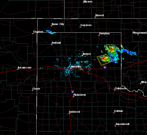 At 651 pm cdt, a severe thunderstorm was located over canadian, moving northeast at 25 mph (radar indicated). Hazards include ping pong ball size hail and 60 mph wind gusts. Minor damage to roofs, siding, and trees is possible. people and animals outdoors will be injured. expect hail damage to roofs, siding, windows, and vehicles. Locations impacted include, canadian and glazier. At 651 pm cdt, a severe thunderstorm was located over canadian, moving northeast at 25 mph (radar indicated). Hazards include ping pong ball size hail and 60 mph wind gusts. Minor damage to roofs, siding, and trees is possible. people and animals outdoors will be injured. expect hail damage to roofs, siding, windows, and vehicles. Locations impacted include, canadian and glazier.
|
| 5/16/2018 6:36 PM CDT |
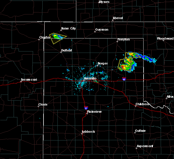 At 635 pm cdt, a severe thunderstorm was located 6 miles north of canadian, moving southeast at 15 mph (radar indicated). Hazards include 60 mph wind gusts and quarter size hail. Minor damage to roofs, siding, and trees is possible. hail damage to vehicles is expected. Locations impacted include, canadian and glazier. At 635 pm cdt, a severe thunderstorm was located 6 miles north of canadian, moving southeast at 15 mph (radar indicated). Hazards include 60 mph wind gusts and quarter size hail. Minor damage to roofs, siding, and trees is possible. hail damage to vehicles is expected. Locations impacted include, canadian and glazier.
|
| 5/16/2018 6:14 PM CDT |
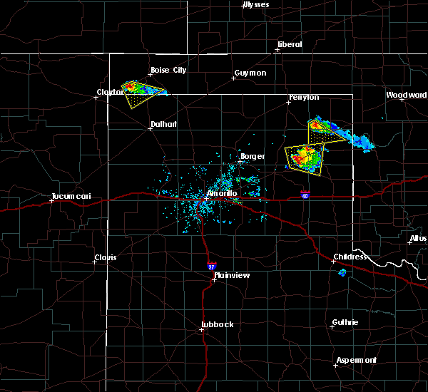 At 613 pm cdt, a severe thunderstorm was located 12 miles northwest of glazier, or 12 miles north of canadian, moving southeast at 15 mph (radar indicated). Hazards include 60 mph wind gusts and quarter size hail. Minor damage to roofs, siding, and trees is possible. Hail damage to vehicles is expected. At 613 pm cdt, a severe thunderstorm was located 12 miles northwest of glazier, or 12 miles north of canadian, moving southeast at 15 mph (radar indicated). Hazards include 60 mph wind gusts and quarter size hail. Minor damage to roofs, siding, and trees is possible. Hail damage to vehicles is expected.
|
| 5/15/2018 11:55 PM CDT |
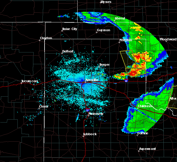 The severe thunderstorm warning for southwestern lipscomb, eastern roberts, western hemphill and southeastern ochiltree counties will expire at midnight cdt, the storms which prompted the warning have weakened below severe limits, and have exited the warned area. therefore the warning will be allowed to expire. to report severe weather, contact your nearest law enforcement agency. they will relay your report to the national weather service amarillo. The severe thunderstorm warning for southwestern lipscomb, eastern roberts, western hemphill and southeastern ochiltree counties will expire at midnight cdt, the storms which prompted the warning have weakened below severe limits, and have exited the warned area. therefore the warning will be allowed to expire. to report severe weather, contact your nearest law enforcement agency. they will relay your report to the national weather service amarillo.
|
| 5/15/2018 11:54 PM CDT | Storm damage reported in hemphill county TX, 5.8 miles W of Canadian, TX |
| 5/15/2018 11:34 PM CDT |
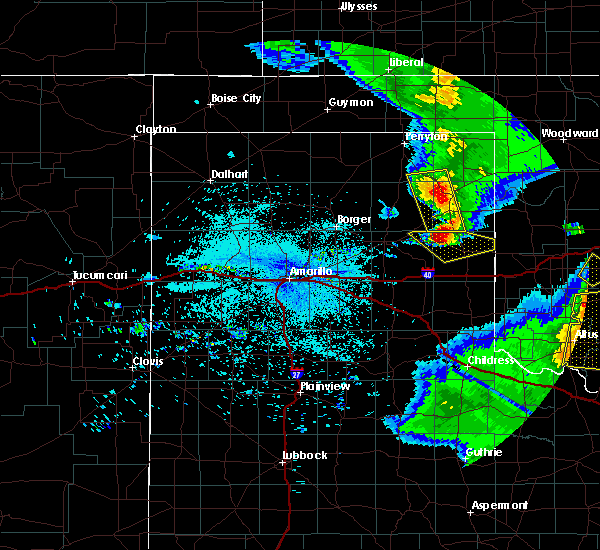 At 1134 pm cdt, severe thunderstorms were located along a line extending from 12 miles northwest of canadian to 5 miles northeast of new mobeetie, moving east at 35 mph (radar indicated). Hazards include 60 mph wind gusts and half dollar size hail. Minor damage to roofs, siding, and trees is possible. hail damage to vehicles is expected. Locations impacted include, canadian and lora. At 1134 pm cdt, severe thunderstorms were located along a line extending from 12 miles northwest of canadian to 5 miles northeast of new mobeetie, moving east at 35 mph (radar indicated). Hazards include 60 mph wind gusts and half dollar size hail. Minor damage to roofs, siding, and trees is possible. hail damage to vehicles is expected. Locations impacted include, canadian and lora.
|
| 5/15/2018 11:16 PM CDT |
 At 1115 pm cdt, severe thunderstorms were located along a line extending from 8 miles south of wolf creek park to 5 miles southeast of miami, moving east at 35 mph (radar indicated). Hazards include 60 mph wind gusts and half dollar size hail. Minor damage to roofs, siding, and trees is possible. hail damage to vehicles is expected. Locations impacted include, canadian, miami and lora. At 1115 pm cdt, severe thunderstorms were located along a line extending from 8 miles south of wolf creek park to 5 miles southeast of miami, moving east at 35 mph (radar indicated). Hazards include 60 mph wind gusts and half dollar size hail. Minor damage to roofs, siding, and trees is possible. hail damage to vehicles is expected. Locations impacted include, canadian, miami and lora.
|
| 5/15/2018 10:54 PM CDT |
 At 1054 pm cdt, severe thunderstorms were located along a line extending from 13 miles southeast of farnsworth to 4 miles north of codman, moving east at 35 mph (radar indicated). Hazards include 60 mph wind gusts and half dollar size hail. Minor damage to roofs, siding, and trees is possible. Hail damage to vehicles is expected. At 1054 pm cdt, severe thunderstorms were located along a line extending from 13 miles southeast of farnsworth to 4 miles north of codman, moving east at 35 mph (radar indicated). Hazards include 60 mph wind gusts and half dollar size hail. Minor damage to roofs, siding, and trees is possible. Hail damage to vehicles is expected.
|
| 5/13/2018 7:13 PM CDT | Quarter sized hail reported 2.3 miles SSW of Canadian, TX |
| 5/13/2018 7:12 PM CDT | Storm damage reported in lipscomb county TX, 17.4 miles S of Canadian, TX |
| 5/13/2018 6:11 PM CDT | Ping Pong Ball sized hail reported 13.9 miles SSE of Canadian, TX |
| 5/13/2018 5:51 PM CDT |
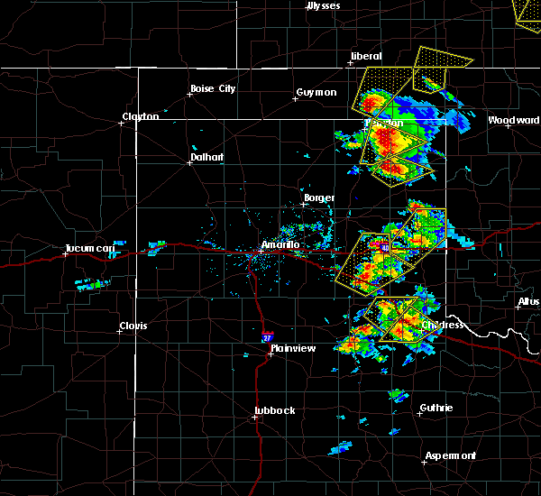 At 549 pm cdt, a severe thunderstorm was located 11 miles northwest of canadian, moving northeast at 30 mph (radar indicated. this storm produced hen egg size hail 6 miles north of miami). Hazards include 60 mph wind gusts and quarter size hail. Minor damage to roofs, siding, and trees is possible. hail damage to vehicles is expected. Locations impacted include, canadian and glazier. At 549 pm cdt, a severe thunderstorm was located 11 miles northwest of canadian, moving northeast at 30 mph (radar indicated. this storm produced hen egg size hail 6 miles north of miami). Hazards include 60 mph wind gusts and quarter size hail. Minor damage to roofs, siding, and trees is possible. hail damage to vehicles is expected. Locations impacted include, canadian and glazier.
|
| 5/13/2018 5:32 PM CDT |
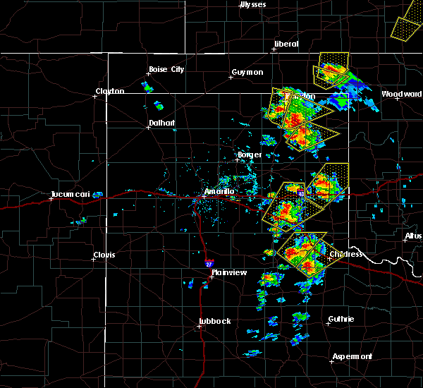 At 532 pm cdt, a severe thunderstorm was located 10 miles north of lora, or 11 miles west of canadian, moving northeast at 30 mph (radar indicated). Hazards include 60 mph wind gusts and quarter size hail. Minor damage to roofs, siding, and trees is possible. hail damage to vehicles is expected. Locations impacted include, canadian and glazier. At 532 pm cdt, a severe thunderstorm was located 10 miles north of lora, or 11 miles west of canadian, moving northeast at 30 mph (radar indicated). Hazards include 60 mph wind gusts and quarter size hail. Minor damage to roofs, siding, and trees is possible. hail damage to vehicles is expected. Locations impacted include, canadian and glazier.
|
| 5/13/2018 5:14 PM CDT |
 At 513 pm cdt, a severe thunderstorm was located 6 miles north of miami, moving northeast at 30 mph (radar indicated). Hazards include 60 mph wind gusts and quarter size hail. Minor damage to roofs, siding, and trees is possible. Hail damage to vehicles is expected. At 513 pm cdt, a severe thunderstorm was located 6 miles north of miami, moving northeast at 30 mph (radar indicated). Hazards include 60 mph wind gusts and quarter size hail. Minor damage to roofs, siding, and trees is possible. Hail damage to vehicles is expected.
|
| 4/30/2018 8:55 PM CDT |
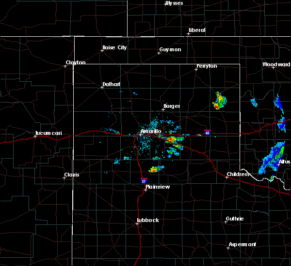 At 854 pm cdt, a severe thunderstorm was located 4 miles east of canadian, moving northeast at 50 mph (radar indicated). Hazards include 60 mph wind gusts and quarter size hail. Minor damage to roofs, siding, and trees is possible. Hail damage to vehicles is expected. At 854 pm cdt, a severe thunderstorm was located 4 miles east of canadian, moving northeast at 50 mph (radar indicated). Hazards include 60 mph wind gusts and quarter size hail. Minor damage to roofs, siding, and trees is possible. Hail damage to vehicles is expected.
|
| 3/18/2018 8:53 PM CDT |
 At 851 pm cdt, severe thunderstorms were located along a line extending from 4 miles northeast of booker to near canadian, moving east at 35 mph (radar indicated and spotters reported quarter size hail 9 miles souteast of wolf creek park at 8:48 pm cdt). Hazards include 60 mph wind gusts and quarter size hail. Minor damage to roofs, siding, and trees is possible. hail damage to vehicles is expected. Locations impacted include, lipscomb, canadian, booker, follett, higgins, darrouzett, glazier and lake marvin. At 851 pm cdt, severe thunderstorms were located along a line extending from 4 miles northeast of booker to near canadian, moving east at 35 mph (radar indicated and spotters reported quarter size hail 9 miles souteast of wolf creek park at 8:48 pm cdt). Hazards include 60 mph wind gusts and quarter size hail. Minor damage to roofs, siding, and trees is possible. hail damage to vehicles is expected. Locations impacted include, lipscomb, canadian, booker, follett, higgins, darrouzett, glazier and lake marvin.
|
| 3/18/2018 8:48 PM CDT | Quarter sized hail reported 16.7 miles SSE of Canadian, TX |
| 3/18/2018 8:28 PM CDT |
 At 827 pm cdt, severe thunderstorms were located along a line extending from 3 miles southeast of balko to 9 miles south of wolf creek park, moving northeast at 40 mph (radar indicated). Hazards include 60 mph wind gusts and quarter size hail. Minor damage to roofs, siding, and trees is possible. Hail damage to vehicles is expected. At 827 pm cdt, severe thunderstorms were located along a line extending from 3 miles southeast of balko to 9 miles south of wolf creek park, moving northeast at 40 mph (radar indicated). Hazards include 60 mph wind gusts and quarter size hail. Minor damage to roofs, siding, and trees is possible. Hail damage to vehicles is expected.
|
| 10/6/2017 9:55 PM CDT |
 At 955 pm cdt, severe thunderstorms were located along a line extending from 14 miles southeast of spearman to 22 miles northwest of codman to 12 miles north of skellytown, moving east at 65 mph (radar indicated). Hazards include 60 mph wind gusts and quarter size hail. Minor damage to roofs, siding, and trees is possible. hail damage to vehicles is expected. Locations impacted include, canadian, miami, codman and lora. At 955 pm cdt, severe thunderstorms were located along a line extending from 14 miles southeast of spearman to 22 miles northwest of codman to 12 miles north of skellytown, moving east at 65 mph (radar indicated). Hazards include 60 mph wind gusts and quarter size hail. Minor damage to roofs, siding, and trees is possible. hail damage to vehicles is expected. Locations impacted include, canadian, miami, codman and lora.
|
| 10/6/2017 9:28 PM CDT |
 At 928 pm cdt, severe thunderstorms were located along a line extending from 11 miles south of spearman to 14 miles east of stinnett to 8 miles northeast of borger, moving east at 35 mph (radar indicated). Hazards include 60 mph wind gusts and quarter size hail. Minor damage to roofs, siding, and trees is possible. Hail damage to vehicles is expected. At 928 pm cdt, severe thunderstorms were located along a line extending from 11 miles south of spearman to 14 miles east of stinnett to 8 miles northeast of borger, moving east at 35 mph (radar indicated). Hazards include 60 mph wind gusts and quarter size hail. Minor damage to roofs, siding, and trees is possible. Hail damage to vehicles is expected.
|
| 8/18/2017 12:31 AM CDT |
 At 1229 am cdt, a severe thunderstorm was located near lake marvin, or 9 miles east of canadian, moving southeast at 35 mph (radar indicated. 58 mph wind reported at canadian texas tech mesonet site). Hazards include 70 mph wind gusts and penny size hail. Expect some tree damage. damage is likely to mobile homes, roofs, and outbuildings. Locations impacted include, canadian, glazier and lake marvin. At 1229 am cdt, a severe thunderstorm was located near lake marvin, or 9 miles east of canadian, moving southeast at 35 mph (radar indicated. 58 mph wind reported at canadian texas tech mesonet site). Hazards include 70 mph wind gusts and penny size hail. Expect some tree damage. damage is likely to mobile homes, roofs, and outbuildings. Locations impacted include, canadian, glazier and lake marvin.
|
| 8/18/2017 12:18 AM CDT | Storm damage reported in hemphill county TX, 5.8 miles W of Canadian, TX |
| 8/18/2017 12:16 AM CDT |
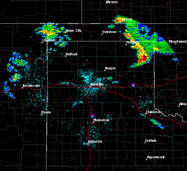 At 1216 am cdt, a severe thunderstorm was located near canadian, moving southeast at 35 mph (radar indicated). Hazards include 60 mph wind gusts and quarter size hail. Minor damage to roofs, siding, and trees is possible. hail damage to vehicles is expected. Locations impacted include, canadian, glazier and lake marvin. At 1216 am cdt, a severe thunderstorm was located near canadian, moving southeast at 35 mph (radar indicated). Hazards include 60 mph wind gusts and quarter size hail. Minor damage to roofs, siding, and trees is possible. hail damage to vehicles is expected. Locations impacted include, canadian, glazier and lake marvin.
|
| 8/17/2017 11:55 PM CDT |
 At 1155 pm cdt, a severe thunderstorm was located 12 miles northwest of canadian, moving southeast at 35 mph (trained weather spotters). Hazards include 60 mph wind gusts and nickel size hail. minor damage to roofs, siding, and trees is possible At 1155 pm cdt, a severe thunderstorm was located 12 miles northwest of canadian, moving southeast at 35 mph (trained weather spotters). Hazards include 60 mph wind gusts and nickel size hail. minor damage to roofs, siding, and trees is possible
|
| 8/13/2017 4:30 PM CDT |
 At 429 pm cdt, a severe thunderstorm was located 10 miles northwest of lora, or 12 miles north of miami, moving east at 10 mph (radar indicated). Hazards include 60 mph wind gusts and quarter size hail. Minor damage to roofs, siding, and trees is possible. hail damage to vehicles is expected. Locations impacted include, canadian and lora. At 429 pm cdt, a severe thunderstorm was located 10 miles northwest of lora, or 12 miles north of miami, moving east at 10 mph (radar indicated). Hazards include 60 mph wind gusts and quarter size hail. Minor damage to roofs, siding, and trees is possible. hail damage to vehicles is expected. Locations impacted include, canadian and lora.
|
| 8/13/2017 4:11 PM CDT |
 At 411 pm cdt, a severe thunderstorm was located 10 miles northwest of lora, or 11 miles north of miami, moving east at 15 mph (radar indicated). Hazards include 60 mph wind gusts and quarter size hail. Minor damage to roofs, siding, and trees is possible. Hail damage to vehicles is expected. At 411 pm cdt, a severe thunderstorm was located 10 miles northwest of lora, or 11 miles north of miami, moving east at 15 mph (radar indicated). Hazards include 60 mph wind gusts and quarter size hail. Minor damage to roofs, siding, and trees is possible. Hail damage to vehicles is expected.
|
| 7/3/2017 7:47 PM CDT |
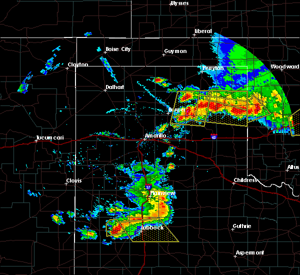 At 747 pm cdt, a severe thunderstorm was located 5 miles north of allison, or 21 miles southeast of canadian, moving southeast at 35 mph (radar indicated). Hazards include golf ball size hail and 60 mph wind gusts. Minor damage to roofs, siding, and trees is possible. people and animals outdoors will be injured. expect hail damage to roofs, siding, windows, and vehicles. Locations impacted include, canadian, glazier and lake marvin. At 747 pm cdt, a severe thunderstorm was located 5 miles north of allison, or 21 miles southeast of canadian, moving southeast at 35 mph (radar indicated). Hazards include golf ball size hail and 60 mph wind gusts. Minor damage to roofs, siding, and trees is possible. people and animals outdoors will be injured. expect hail damage to roofs, siding, windows, and vehicles. Locations impacted include, canadian, glazier and lake marvin.
|
| 7/3/2017 7:30 PM CDT |
 At 729 pm cdt, severe thunderstorms were located along a line extending from 7 miles northwest of reydon to 10 miles northwest of miami, moving south-southeast at 20 mph (radar indicated). Hazards include two inch hail and 60 mph wind gusts. Minor damage to roofs, siding, and trees is possible. people and animals outdoors will be injured. Expect hail damage to roofs, siding, windows, and vehicles. At 729 pm cdt, severe thunderstorms were located along a line extending from 7 miles northwest of reydon to 10 miles northwest of miami, moving south-southeast at 20 mph (radar indicated). Hazards include two inch hail and 60 mph wind gusts. Minor damage to roofs, siding, and trees is possible. people and animals outdoors will be injured. Expect hail damage to roofs, siding, windows, and vehicles.
|
| 7/3/2017 7:24 PM CDT | Thunderstorm wind gust measured up to 62 mp in hemphill county TX, 5.8 miles W of Canadian, TX |
| 7/3/2017 6:51 PM CDT |
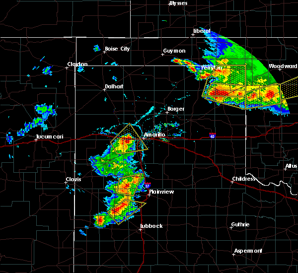 At 650 pm cdt, a severe thunderstorm was located 6 miles north of canadian, moving east at 10 mph (radar indicated). Hazards include two inch hail and 70 mph wind gusts. a wall cloud has also been observed with this storm near canadian. Minor damage to roofs, siding, and trees is possible. people and animals outdoors will be injured. expect hail damage to roofs, siding, windows, and vehicles. Locations impacted include, canadian, higgins, glazier and lake marvin. At 650 pm cdt, a severe thunderstorm was located 6 miles north of canadian, moving east at 10 mph (radar indicated). Hazards include two inch hail and 70 mph wind gusts. a wall cloud has also been observed with this storm near canadian. Minor damage to roofs, siding, and trees is possible. people and animals outdoors will be injured. expect hail damage to roofs, siding, windows, and vehicles. Locations impacted include, canadian, higgins, glazier and lake marvin.
|
| 7/3/2017 6:45 PM CDT | Large tree branches down due to thunderstorm wind in hemphill county TX, 6 miles SE of Canadian, TX |
| 7/3/2017 6:44 PM CDT | Storm damage reported in hemphill county TX, 5.8 miles W of Canadian, TX |
| 7/3/2017 6:43 PM CDT | Wind speeds up to 70 mp in hemphill county TX, 5.2 miles SE of Canadian, TX |
| 7/3/2017 6:41 PM CDT |
 At 640 pm cdt, a severe thunderstorm was located 7 miles north of canadian, moving southeast at 10 mph (radar indicated). Hazards include two inch hail and 60 mph wind gusts. Minor damage to roofs, siding, and trees is possible. people and animals outdoors will be injured. Expect hail damage to roofs, siding, windows, and vehicles. At 640 pm cdt, a severe thunderstorm was located 7 miles north of canadian, moving southeast at 10 mph (radar indicated). Hazards include two inch hail and 60 mph wind gusts. Minor damage to roofs, siding, and trees is possible. people and animals outdoors will be injured. Expect hail damage to roofs, siding, windows, and vehicles.
|
| 7/3/2017 6:29 PM CDT | Thunderstorm wind gusts up to 60 mp in hemphill county TX, 0.2 miles WSW of Canadian, TX |
| 6/13/2017 7:09 PM CDT |
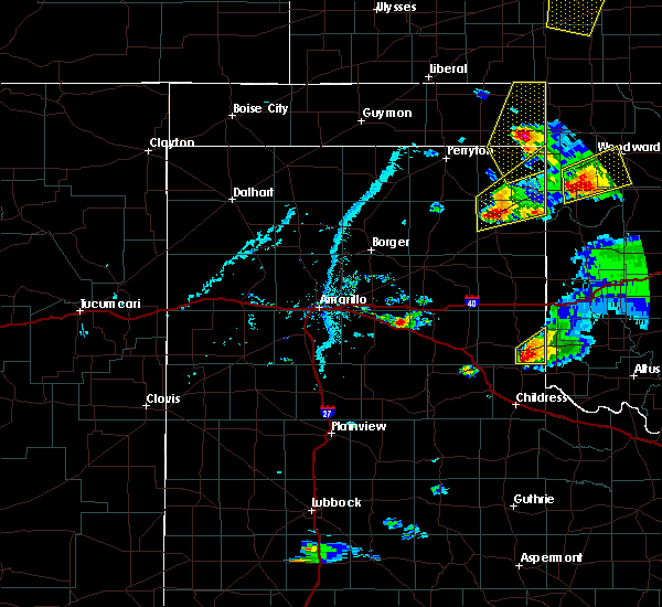 At 709 pm cdt, a severe thunderstorm was located 7 miles northwest of canadian, moving northeast at 40 mph (radar indicated). Hazards include 70 mph wind gusts and quarter size hail. Expect some tree damage. damage is likely to mobile homes, roofs, and outbuildings. hail damage to vehicles is expected. Locations impacted include, lipscomb, canadian, higgins and glazier. At 709 pm cdt, a severe thunderstorm was located 7 miles northwest of canadian, moving northeast at 40 mph (radar indicated). Hazards include 70 mph wind gusts and quarter size hail. Expect some tree damage. damage is likely to mobile homes, roofs, and outbuildings. hail damage to vehicles is expected. Locations impacted include, lipscomb, canadian, higgins and glazier.
|
| 6/13/2017 6:59 PM CDT |
 At 658 pm cdt, a severe thunderstorm was located 9 miles west of canadian, moving northeast at 40 mph (radar indicated). Hazards include ping pong ball size hail and 60 mph wind gusts. Minor damage to roofs, siding, and trees is possible. people and animals outdoors will be injured. Expect hail damage to roofs, siding, windows, and vehicles. At 658 pm cdt, a severe thunderstorm was located 9 miles west of canadian, moving northeast at 40 mph (radar indicated). Hazards include ping pong ball size hail and 60 mph wind gusts. Minor damage to roofs, siding, and trees is possible. people and animals outdoors will be injured. Expect hail damage to roofs, siding, windows, and vehicles.
|
| 6/13/2017 6:41 PM CDT | Baseball sized hail reported 22 miles WSW of Canadian, TX |
| 6/13/2017 6:35 PM CDT |
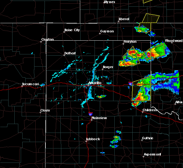 At 635 pm cdt, a severe thunderstorm was located 10 miles southeast of wolf creek park, or 15 miles northwest of canadian, moving northeast at 60 mph (radar indicated). Hazards include 60 mph wind gusts and quarter size hail. Minor damage to roofs, siding, and trees is possible. hail damage to vehicles is expected. Locations impacted include, canadian. At 635 pm cdt, a severe thunderstorm was located 10 miles southeast of wolf creek park, or 15 miles northwest of canadian, moving northeast at 60 mph (radar indicated). Hazards include 60 mph wind gusts and quarter size hail. Minor damage to roofs, siding, and trees is possible. hail damage to vehicles is expected. Locations impacted include, canadian.
|
| 6/13/2017 6:24 PM CDT | Golf Ball sized hail reported 11.6 miles SW of Canadian, TX |
| 6/13/2017 6:18 PM CDT |
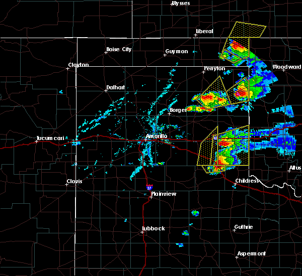 At 617 pm cdt, a severe thunderstorm was located 15 miles northwest of lora, or 16 miles north of miami, moving northeast at 60 mph (radar indicated). Hazards include 60 mph wind gusts and quarter size hail. Minor damage to roofs, siding, and trees is possible. Hail damage to vehicles is expected. At 617 pm cdt, a severe thunderstorm was located 15 miles northwest of lora, or 16 miles north of miami, moving northeast at 60 mph (radar indicated). Hazards include 60 mph wind gusts and quarter size hail. Minor damage to roofs, siding, and trees is possible. Hail damage to vehicles is expected.
|
| 6/13/2017 5:59 PM CDT |
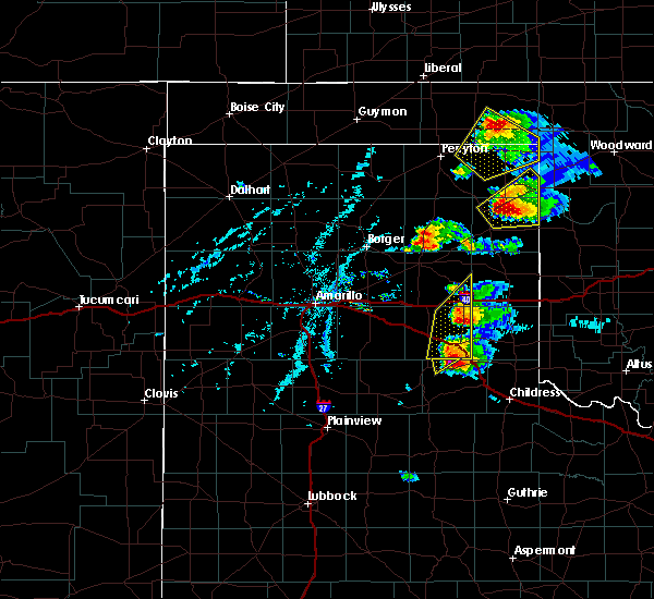 At 556 pm cdt, a severe thunderstorm was located over canadian, moving northeast at 30 mph. this is a very dangerous storm (radar indicated. law enforcement confirmed tennis ball size hail in north canadian at 5:55 pm cdt). Hazards include baseball size hail and 70 mph wind gusts. People and animals outdoors will be severely injured. expect shattered windows, extensive damage to roofs, siding, and vehicles. Locations impacted include, canadian, higgins, glazier and lake marvin. At 556 pm cdt, a severe thunderstorm was located over canadian, moving northeast at 30 mph. this is a very dangerous storm (radar indicated. law enforcement confirmed tennis ball size hail in north canadian at 5:55 pm cdt). Hazards include baseball size hail and 70 mph wind gusts. People and animals outdoors will be severely injured. expect shattered windows, extensive damage to roofs, siding, and vehicles. Locations impacted include, canadian, higgins, glazier and lake marvin.
|
| 6/13/2017 5:58 PM CDT | Baseball sized hail reported 5.3 miles SSE of Canadian, TX |
| 6/13/2017 5:58 PM CDT | Quarter sized hail reported 2.9 miles W of Canadian, TX, quarter sized hail reported just east of canadian. |
| 6/13/2017 5:55 PM CDT | Tennis Ball sized hail reported 0.2 miles WSW of Canadian, TX, tennis ball sized hail reported at 555 pm . |
| 6/13/2017 5:55 PM CDT | Hen Egg sized hail reported 0.2 miles WSW of Canadian, TX |
| 6/13/2017 5:52 PM CDT |
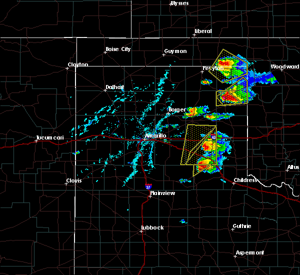 At 552 pm cdt, a severe thunderstorm was located over canadian, moving northeast at 35 mph. this is a very dangerous storm (radar indicated). Hazards include baseball size hail and 70 mph wind gusts. People and animals outdoors will be severely injured. Expect shattered windows, extensive damage to roofs, siding, and vehicles. At 552 pm cdt, a severe thunderstorm was located over canadian, moving northeast at 35 mph. this is a very dangerous storm (radar indicated). Hazards include baseball size hail and 70 mph wind gusts. People and animals outdoors will be severely injured. Expect shattered windows, extensive damage to roofs, siding, and vehicles.
|
| 6/13/2017 5:46 PM CDT |
 At 545 pm cdt, a severe thunderstorm was located over canadian, moving northeast at 35 mph. this is a very dangerous storm (radar indicated). Hazards include baseball size hail and 70 mph wind gusts. People and animals outdoors will be severely injured. expect shattered windows, extensive damage to roofs, siding, and vehicles. Locations impacted include, canadian and lake marvin. At 545 pm cdt, a severe thunderstorm was located over canadian, moving northeast at 35 mph. this is a very dangerous storm (radar indicated). Hazards include baseball size hail and 70 mph wind gusts. People and animals outdoors will be severely injured. expect shattered windows, extensive damage to roofs, siding, and vehicles. Locations impacted include, canadian and lake marvin.
|
| 6/13/2017 5:30 PM CDT |
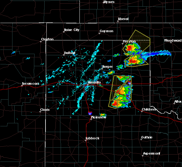 At 529 pm cdt, a severe thunderstorm was located 10 miles north of lora, or 10 miles west of canadian, moving northeast at 40 mph. this is a dangerous storm (radar indicated). Hazards include baseball size hail and 60 mph wind gusts. People and animals outdoors will be severely injured. expect shattered windows, extensive damage to roofs, siding, and vehicles. Locations impacted include, canadian, lake marvin and lora. At 529 pm cdt, a severe thunderstorm was located 10 miles north of lora, or 10 miles west of canadian, moving northeast at 40 mph. this is a dangerous storm (radar indicated). Hazards include baseball size hail and 60 mph wind gusts. People and animals outdoors will be severely injured. expect shattered windows, extensive damage to roofs, siding, and vehicles. Locations impacted include, canadian, lake marvin and lora.
|
| 6/13/2017 5:18 PM CDT |
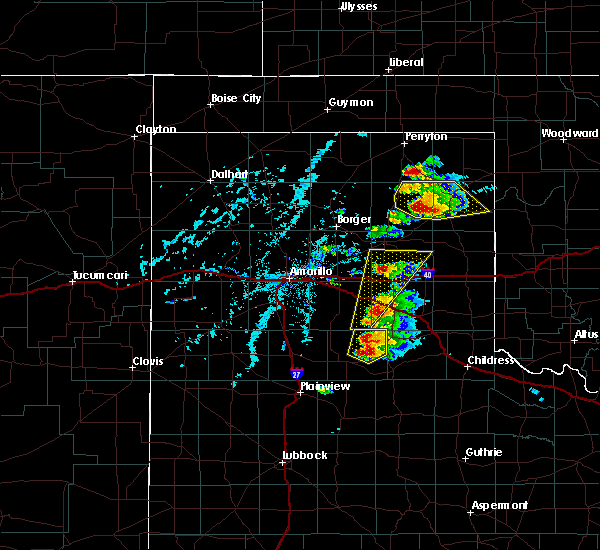 At 517 pm cdt, a severe thunderstorm was located 10 miles northwest of lora, or 10 miles north of miami, moving northeast at 35 mph. this is a dangerous storm (radar indicated). Hazards include baseball size hail and 60 mph wind gusts. People and animals outdoors will be severely injured. expect shattered windows, extensive damage to roofs, siding, and vehicles. Locations impacted include, canadian, lake marvin and lora. At 517 pm cdt, a severe thunderstorm was located 10 miles northwest of lora, or 10 miles north of miami, moving northeast at 35 mph. this is a dangerous storm (radar indicated). Hazards include baseball size hail and 60 mph wind gusts. People and animals outdoors will be severely injured. expect shattered windows, extensive damage to roofs, siding, and vehicles. Locations impacted include, canadian, lake marvin and lora.
|
| 6/13/2017 4:54 PM CDT |
 At 454 pm cdt, a severe thunderstorm was located 7 miles northwest of codman, or 11 miles west of miami, moving northeast at 45 mph (radar indicated). Hazards include tennis ball size hail and 60 mph wind gusts. Minor damage to roofs, siding, and trees is possible. people and animals outdoors will be injured. Expect hail damage to roofs, siding, windows, and vehicles. At 454 pm cdt, a severe thunderstorm was located 7 miles northwest of codman, or 11 miles west of miami, moving northeast at 45 mph (radar indicated). Hazards include tennis ball size hail and 60 mph wind gusts. Minor damage to roofs, siding, and trees is possible. people and animals outdoors will be injured. Expect hail damage to roofs, siding, windows, and vehicles.
|
| 5/27/2017 10:42 PM CDT |
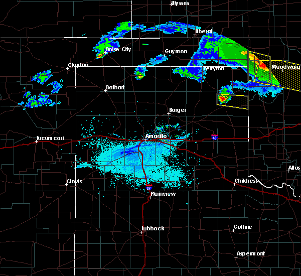 At 1041 pm cdt, a severe thunderstorm was located 5 miles west of canadian, moving east at 40 mph (radar indicated). Hazards include 60 mph wind gusts and quarter size hail. Minor damage to roofs, siding, and trees is possible. Hail damage to vehicles is expected. At 1041 pm cdt, a severe thunderstorm was located 5 miles west of canadian, moving east at 40 mph (radar indicated). Hazards include 60 mph wind gusts and quarter size hail. Minor damage to roofs, siding, and trees is possible. Hail damage to vehicles is expected.
|
| 5/18/2017 2:55 PM CDT |
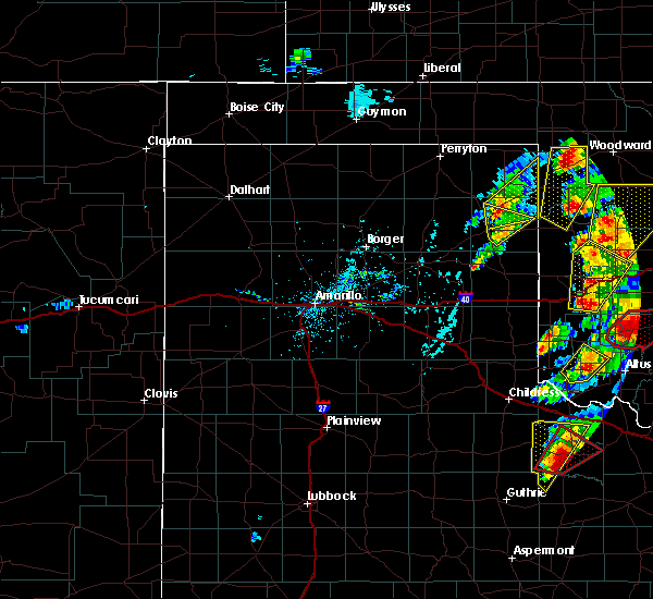 At 255 pm cdt, a severe thunderstorm was located 10 miles southwest of lake marvin, or 12 miles southeast of canadian, moving northeast at 50 mph (radar indicated). Hazards include 60 mph wind gusts and half dollar size hail. Minor damage to roofs, siding, and trees is possible. hail damage to vehicles is expected. locations impacted include, canadian and lake marvin. A tornado watch remains in effect until 800 pm cdt for the far eastern panhandle of texas. At 255 pm cdt, a severe thunderstorm was located 10 miles southwest of lake marvin, or 12 miles southeast of canadian, moving northeast at 50 mph (radar indicated). Hazards include 60 mph wind gusts and half dollar size hail. Minor damage to roofs, siding, and trees is possible. hail damage to vehicles is expected. locations impacted include, canadian and lake marvin. A tornado watch remains in effect until 800 pm cdt for the far eastern panhandle of texas.
|
| 5/18/2017 2:52 PM CDT | Ping Pong Ball sized hail reported 0.9 miles NW of Canadian, TX |
| 5/18/2017 2:50 PM CDT | Half Dollar sized hail reported 0.6 miles NNW of Canadian, TX |
| 5/18/2017 2:50 PM CDT | Half Dollar sized hail reported 0.2 miles WSW of Canadian, TX |
| 5/18/2017 2:48 PM CDT |
 At 248 pm cdt, a severe thunderstorm was located over canadian, moving northeast at 35 mph (radar indicated). Hazards include golf ball size hail and 60 mph wind gusts. Minor damage to roofs, siding, and trees is possible. people and animals outdoors will be injured. Expect hail damage to roofs, siding, windows, and vehicles. At 248 pm cdt, a severe thunderstorm was located over canadian, moving northeast at 35 mph (radar indicated). Hazards include golf ball size hail and 60 mph wind gusts. Minor damage to roofs, siding, and trees is possible. people and animals outdoors will be injured. Expect hail damage to roofs, siding, windows, and vehicles.
|
| 5/18/2017 2:45 PM CDT | Quarter sized hail reported 1.4 miles NNE of Canadian, TX |
| 5/18/2017 2:28 PM CDT |
 At 228 pm cdt, a severe thunderstorm was located over new mobeetie, or 12 miles southeast of miami, moving north-northeast at 35 mph (radar indicated). Hazards include golf ball size hail and 60 mph wind gusts. Minor damage to roofs, siding, and trees is possible. people and animals outdoors will be injured. Expect hail damage to roofs, siding, windows, and vehicles. At 228 pm cdt, a severe thunderstorm was located over new mobeetie, or 12 miles southeast of miami, moving north-northeast at 35 mph (radar indicated). Hazards include golf ball size hail and 60 mph wind gusts. Minor damage to roofs, siding, and trees is possible. people and animals outdoors will be injured. Expect hail damage to roofs, siding, windows, and vehicles.
|
| 5/16/2017 4:07 PM CDT |
 At 406 pm cdt, a severe thunderstorm was located 9 miles west of codman, or 9 miles north of pampa, moving northeast at 40 mph (radar indicated). Hazards include ping pong ball size hail and 60 mph wind gusts. Minor damage to roofs, siding, and trees is possible. people and animals outdoors will be injured. Expect hail damage to roofs, siding, windows, and vehicles. At 406 pm cdt, a severe thunderstorm was located 9 miles west of codman, or 9 miles north of pampa, moving northeast at 40 mph (radar indicated). Hazards include ping pong ball size hail and 60 mph wind gusts. Minor damage to roofs, siding, and trees is possible. people and animals outdoors will be injured. Expect hail damage to roofs, siding, windows, and vehicles.
|
| 8/23/2016 6:10 PM CDT | Trees blown dow in hemphill county TX, 0.2 miles WSW of Canadian, TX |
| 8/23/2016 6:09 PM CDT |
 At 608 pm cdt, severe thunderstorms were located along a line extending from 4 miles south of canadian to allison to 8 miles southwest of sweetwater, moving northeast at 20 mph (radar indicated). Hazards include 70 mph wind gusts and quarter size hail. Expect some tree damage. damage is likely to mobile homes. roofs, and outbuildings. hail damage to vehicles is expected. Locations impacted include, canadian, lake marvin, allison and glazier. At 608 pm cdt, severe thunderstorms were located along a line extending from 4 miles south of canadian to allison to 8 miles southwest of sweetwater, moving northeast at 20 mph (radar indicated). Hazards include 70 mph wind gusts and quarter size hail. Expect some tree damage. damage is likely to mobile homes. roofs, and outbuildings. hail damage to vehicles is expected. Locations impacted include, canadian, lake marvin, allison and glazier.
|
| 8/23/2016 5:48 PM CDT |
 At 547 pm cdt, severe thunderstorms were located along a line extending from near lora to 5 miles northeast of twitty, moving northeast at 25 mph (radar indicated. similar storms today have produced wind damage and quarter size hail). Hazards include 70 mph wind gusts and quarter size hail. Expect some tree damage. damage is likely to mobile homes, roofs, and outbuildings. Hail damage to vehicles is expected. At 547 pm cdt, severe thunderstorms were located along a line extending from near lora to 5 miles northeast of twitty, moving northeast at 25 mph (radar indicated. similar storms today have produced wind damage and quarter size hail). Hazards include 70 mph wind gusts and quarter size hail. Expect some tree damage. damage is likely to mobile homes, roofs, and outbuildings. Hail damage to vehicles is expected.
|
| 8/23/2016 5:19 PM CDT | Storm damage reported in hemphill county TX, 5.8 miles W of Canadian, TX |
| 8/8/2016 7:06 PM CDT |
 The severe thunderstorm warning for northwestern hemphill and southwestern lipscomb counties will expire at 715 pm cdt, the storms which prompted the warning have weakened below severe limits, and no longer pose an immediate threat to life or property. therefore the warning will be allowed to expire. however gusty winds and heavy rain are still possible with these thunderstorms. The severe thunderstorm warning for northwestern hemphill and southwestern lipscomb counties will expire at 715 pm cdt, the storms which prompted the warning have weakened below severe limits, and no longer pose an immediate threat to life or property. therefore the warning will be allowed to expire. however gusty winds and heavy rain are still possible with these thunderstorms.
|
| 8/8/2016 7:02 PM CDT |
 At 701 pm cdt, severe thunderstorms were located along a line extending from near darrouzett to 5 miles west of canadian, moving east at 20 mph (radar indicated). Hazards include 60 mph wind gusts and penny size hail. Minor damage to roofs. siding. and trees is possible. Locations impacted include, lipscomb and canadian. At 701 pm cdt, severe thunderstorms were located along a line extending from near darrouzett to 5 miles west of canadian, moving east at 20 mph (radar indicated). Hazards include 60 mph wind gusts and penny size hail. Minor damage to roofs. siding. and trees is possible. Locations impacted include, lipscomb and canadian.
|
| 8/8/2016 6:40 PM CDT |
 At 639 pm cdt, severe thunderstorms were located along a line extending from 6 miles west of darrouzett to 13 miles west of canadian, moving east at 20 mph (radar indicated). Hazards include 60 mph wind gusts and penny size hail. Minor damage to roofs. siding. and trees is possible. Locations impacted include, lipscomb, canadian and wolf creek park. At 639 pm cdt, severe thunderstorms were located along a line extending from 6 miles west of darrouzett to 13 miles west of canadian, moving east at 20 mph (radar indicated). Hazards include 60 mph wind gusts and penny size hail. Minor damage to roofs. siding. and trees is possible. Locations impacted include, lipscomb, canadian and wolf creek park.
|
| 8/8/2016 6:22 PM CDT |
 At 621 pm cdt, severe thunderstorms were located along a line extending from near booker to 15 miles northwest of lora, moving east at 20 mph (radar indicated). Hazards include 60 mph wind gusts and quarter size hail. Minor damage to roofs. siding. and trees is possible. Hail damage to vehicles is expected. At 621 pm cdt, severe thunderstorms were located along a line extending from near booker to 15 miles northwest of lora, moving east at 20 mph (radar indicated). Hazards include 60 mph wind gusts and quarter size hail. Minor damage to roofs. siding. and trees is possible. Hail damage to vehicles is expected.
|
| 7/15/2016 8:52 PM CDT |
 At 851 pm cdt, severe thunderstorms were located along a line extending from 6 miles south of fargo to 4 miles south of lake marvin to 8 miles west of codman, moving east at 45 mph (radar indicated). Hazards include 60 mph wind gusts. Minor damage to roofs. siding. and trees is possible. locations impacted include, pampa, canadian, miami, briscoe, wheeler, mclean, lefors, higgins, lake mcclellan, codman, lake marvin, allison, lora, glazier, kingsmill, alanreed, new mobeetie, kellerville and mobeetie. This includes interstate 40 between mile markers 114 and 125, between mile markers 127 and 128, and between mile markers 130 and 147. At 851 pm cdt, severe thunderstorms were located along a line extending from 6 miles south of fargo to 4 miles south of lake marvin to 8 miles west of codman, moving east at 45 mph (radar indicated). Hazards include 60 mph wind gusts. Minor damage to roofs. siding. and trees is possible. locations impacted include, pampa, canadian, miami, briscoe, wheeler, mclean, lefors, higgins, lake mcclellan, codman, lake marvin, allison, lora, glazier, kingsmill, alanreed, new mobeetie, kellerville and mobeetie. This includes interstate 40 between mile markers 114 and 125, between mile markers 127 and 128, and between mile markers 130 and 147.
|
| 7/15/2016 8:39 PM CDT | Storm damage reported in hemphill county TX, 11.8 miles N of Canadian, TX |
| 7/15/2016 8:13 PM CDT |
 At 813 pm cdt, severe thunderstorms were located along a line extending from 5 miles southeast of follett to 14 miles north of lora to 5 miles southeast of stinnett, moving east at 45 mph (radar indicated). Hazards include 70 mph wind gusts. Expect some tree damage. Damage is likely to mobile homes, roofs, and outbuildings. At 813 pm cdt, severe thunderstorms were located along a line extending from 5 miles southeast of follett to 14 miles north of lora to 5 miles southeast of stinnett, moving east at 45 mph (radar indicated). Hazards include 70 mph wind gusts. Expect some tree damage. Damage is likely to mobile homes, roofs, and outbuildings.
|
| 6/28/2016 7:37 PM CDT |
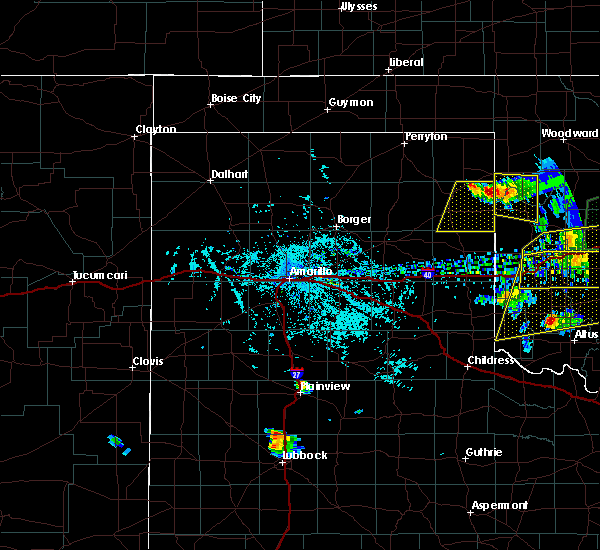 At 736 pm cdt, severe thunderstorms were located along a line extending from 3 miles east of glazier to 8 miles north of durham, moving south at 15 mph (radar indicated. similar storms today have produced wind gusts up to 75 mph). Hazards include 70 mph wind gusts and quarter size hail. Expect some tree damage. damage is likely to mobile homes, roofs, and outbuildings. Hail damage to vehicles is expected. At 736 pm cdt, severe thunderstorms were located along a line extending from 3 miles east of glazier to 8 miles north of durham, moving south at 15 mph (radar indicated. similar storms today have produced wind gusts up to 75 mph). Hazards include 70 mph wind gusts and quarter size hail. Expect some tree damage. damage is likely to mobile homes, roofs, and outbuildings. Hail damage to vehicles is expected.
|
| 5/29/2016 2:46 PM CDT | Quarter sized hail reported 17.9 miles NNW of Canadian, TX, hail covered the roadways in the area. |
| 5/29/2016 2:43 PM CDT |
 At 242 pm cdt, severe thunderstorms were located along a line extending from 15 miles north of pampa to 10 miles northwest of allison, moving northeast at 15 mph (radar indicated). Hazards include golf ball size hail and 60 mph wind gusts. Minor damage to roofs. siding. and trees is possible. people and animals outdoors will be injured. Expect hail damage to roofs, siding, windows, and vehicles. At 242 pm cdt, severe thunderstorms were located along a line extending from 15 miles north of pampa to 10 miles northwest of allison, moving northeast at 15 mph (radar indicated). Hazards include golf ball size hail and 60 mph wind gusts. Minor damage to roofs. siding. and trees is possible. people and animals outdoors will be injured. Expect hail damage to roofs, siding, windows, and vehicles.
|
| 5/29/2016 2:33 PM CDT |
 At 231 pm cdt, severe thunderstorms were located along a line extending from 13 miles north of pampa to 9 miles northeast of briscoe, moving east at 5 mph (radar indicated. at 230 pm half dollar size hail was reported by law enforcement 2 miles east of miami). Hazards include golf ball size hail and 60 mph wind gusts. Minor damage to roofs. siding. and trees is possible. people and animals outdoors will be injured. expect hail damage to roofs, siding, windows, and vehicles. Locations impacted include, canadian, miami, lora, codman and glazier. At 231 pm cdt, severe thunderstorms were located along a line extending from 13 miles north of pampa to 9 miles northeast of briscoe, moving east at 5 mph (radar indicated. at 230 pm half dollar size hail was reported by law enforcement 2 miles east of miami). Hazards include golf ball size hail and 60 mph wind gusts. Minor damage to roofs. siding. and trees is possible. people and animals outdoors will be injured. expect hail damage to roofs, siding, windows, and vehicles. Locations impacted include, canadian, miami, lora, codman and glazier.
|
| 5/29/2016 2:15 PM CDT |
 At 214 pm cdt, severe thunderstorms were located along a line extending from 15 miles north of pampa to 11 miles north of briscoe, moving east at 10 mph (radar indicated). Hazards include 60 mph wind gusts and half dollar size hail. Minor damage to roofs. siding. and trees is possible. hail damage to vehicles is expected. Locations impacted include, canadian, miami, lora, codman and glazier. At 214 pm cdt, severe thunderstorms were located along a line extending from 15 miles north of pampa to 11 miles north of briscoe, moving east at 10 mph (radar indicated). Hazards include 60 mph wind gusts and half dollar size hail. Minor damage to roofs. siding. and trees is possible. hail damage to vehicles is expected. Locations impacted include, canadian, miami, lora, codman and glazier.
|
| 5/29/2016 1:40 PM CDT |
 At 140 pm cdt, severe thunderstorms were located along a line extending from 19 miles north of codman to 4 miles southeast of miami, moving northeast at 15 mph (radar indicated). Hazards include 60 mph wind gusts and half dollar size hail. Minor damage to roofs. siding. and trees is possible. Hail damage to vehicles is expected. At 140 pm cdt, severe thunderstorms were located along a line extending from 19 miles north of codman to 4 miles southeast of miami, moving northeast at 15 mph (radar indicated). Hazards include 60 mph wind gusts and half dollar size hail. Minor damage to roofs. siding. and trees is possible. Hail damage to vehicles is expected.
|
| 5/23/2016 7:43 PM CDT | Ping Pong Ball sized hail reported 22.6 miles SSE of Canadian, TX |
| 5/23/2016 7:34 PM CDT | Golf Ball sized hail reported 22.6 miles SSE of Canadian, TX, penny and nickel hail with a few golf balls mixed in. |
| 5/22/2016 8:41 PM CDT | The national weather service in amarillo has issued a * tornado warning for. northeastern roberts county in the panhandle of texas. northern hemphill county in the panhandle of texas. southwestern lipscomb county in the panhandle of texas. Southeastern ochiltree county in the panhandle of texas. |
| 5/16/2016 9:28 PM CDT | Multiple tree limbs about 6 inches in diameter in roadway along us highway 8 in hemphill county TX, 13.7 miles N of Canadian, TX |
| 5/16/2016 9:25 PM CDT |
 At 925 pm cdt, severe thunderstorms were located along a line extending from 5 miles east of lake marvin to 5 miles northwest of lefors, moving southeast at 40 mph (radar indicated). Hazards include 70 mph wind gusts and half dollar size hail. Expect some tree damage. damage is likely to mobile homes, roofs, and outbuildings. Hail damage to vehicles is expected. At 925 pm cdt, severe thunderstorms were located along a line extending from 5 miles east of lake marvin to 5 miles northwest of lefors, moving southeast at 40 mph (radar indicated). Hazards include 70 mph wind gusts and half dollar size hail. Expect some tree damage. damage is likely to mobile homes, roofs, and outbuildings. Hail damage to vehicles is expected.
|
| 5/16/2016 9:10 PM CDT | Storm damage reported in hemphill county TX, 5.8 miles W of Canadian, TX |
| 5/16/2016 9:00 PM CDT |
 At 900 pm cdt, a severe thunderstorm capable of producing a tornado was located 4 miles northeast of canadian, moving east at 30 mph (radar indicated rotation). Hazards include tornado and golf ball size hail. Flying debris will be dangerous to those caught without shelter. mobile homes will be damaged or destroyed. damage to roofs, windows, and vehicles will occur. tree damage is likely. Locations impacted include, canadian, lake marvin and glazier. At 900 pm cdt, a severe thunderstorm capable of producing a tornado was located 4 miles northeast of canadian, moving east at 30 mph (radar indicated rotation). Hazards include tornado and golf ball size hail. Flying debris will be dangerous to those caught without shelter. mobile homes will be damaged or destroyed. damage to roofs, windows, and vehicles will occur. tree damage is likely. Locations impacted include, canadian, lake marvin and glazier.
|
| 5/16/2016 8:57 PM CDT | Trees down in canadian in hemphill county TX, 0.2 miles WSW of Canadian, TX |
| 5/16/2016 8:56 PM CDT |
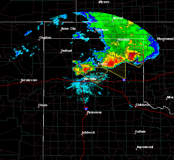 At 855 pm cdt, a confirmed tornado was located near canadian, moving east at 35 mph (weather spotters confirmed tornado). Hazards include damaging tornado and golf ball size hail. Flying debris will be dangerous to those caught without shelter. mobile homes will be damaged or destroyed. damage to roofs, windows, and vehicles will occur. Tree damage is likely. At 855 pm cdt, a confirmed tornado was located near canadian, moving east at 35 mph (weather spotters confirmed tornado). Hazards include damaging tornado and golf ball size hail. Flying debris will be dangerous to those caught without shelter. mobile homes will be damaged or destroyed. damage to roofs, windows, and vehicles will occur. Tree damage is likely.
|
| 5/16/2016 8:49 PM CDT |
 At 849 pm cdt, a severe thunderstorm was located 8 miles northwest of canadian, moving east at 35 mph (radar indicated). Hazards include 70 mph wind gusts and ping pong ball size hail. Expect some tree damage. damage is likely to mobile homes. roofs, and outbuildings. people and animals outdoors will be injured. expect hail damage to roofs, siding, windows, and vehicles. Locations impacted include, lipscomb, canadian, higgins, lake marvin and glazier. At 849 pm cdt, a severe thunderstorm was located 8 miles northwest of canadian, moving east at 35 mph (radar indicated). Hazards include 70 mph wind gusts and ping pong ball size hail. Expect some tree damage. damage is likely to mobile homes. roofs, and outbuildings. people and animals outdoors will be injured. expect hail damage to roofs, siding, windows, and vehicles. Locations impacted include, lipscomb, canadian, higgins, lake marvin and glazier.
|
| 5/16/2016 8:45 PM CDT | Quarter sized hail reported 6.3 miles S of Canadian, TX, also estimated 60 mph wind gusts. |
| 5/16/2016 8:27 PM CDT |
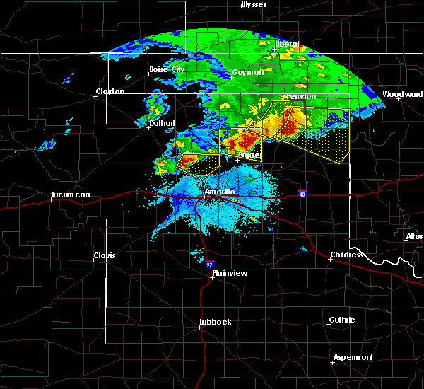 At 826 pm cdt, a severe thunderstorm was located 11 miles southwest of wolf creek park, or 21 miles northwest of canadian, moving east at 30 mph. this is a very dangerous storm (radar indicated). Hazards include 80 mph wind gusts and ping pong ball size hail. Flying debris will be dangerous to those caught without shelter. mobile homes will be heavily damaged. expect considerable damage to roofs, windows, and vehicles. tree damage and power outages are likely. people and animals outdoors will be injured. expect hail damage to roofs, siding, windows, and vehicles. Locations impacted include, lipscomb, canadian, higgins, wolf creek park, lake marvin and glazier. At 826 pm cdt, a severe thunderstorm was located 11 miles southwest of wolf creek park, or 21 miles northwest of canadian, moving east at 30 mph. this is a very dangerous storm (radar indicated). Hazards include 80 mph wind gusts and ping pong ball size hail. Flying debris will be dangerous to those caught without shelter. mobile homes will be heavily damaged. expect considerable damage to roofs, windows, and vehicles. tree damage and power outages are likely. people and animals outdoors will be injured. expect hail damage to roofs, siding, windows, and vehicles. Locations impacted include, lipscomb, canadian, higgins, wolf creek park, lake marvin and glazier.
|
| 5/16/2016 8:18 PM CDT |
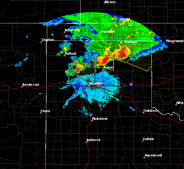 At 818 pm cdt, a severe thunderstorm was located 12 miles southwest of wolf creek park, or 21 miles south of perryton, moving east at 30 mph (radar indicated). Hazards include golf ball size hail and 70 mph wind gusts. Expect some tree damage. damage is likely to mobile homes, roofs, and outbuildings. people and animals outdoors will be injured. Expect hail damage to roofs, siding, windows, and vehicles. At 818 pm cdt, a severe thunderstorm was located 12 miles southwest of wolf creek park, or 21 miles south of perryton, moving east at 30 mph (radar indicated). Hazards include golf ball size hail and 70 mph wind gusts. Expect some tree damage. damage is likely to mobile homes, roofs, and outbuildings. people and animals outdoors will be injured. Expect hail damage to roofs, siding, windows, and vehicles.
|
| 4/28/2016 9:52 PM CDT | Storm damage reported in hemphill county TX, 14 miles N of Canadian, TX |
| 12/12/2015 7:09 PM CST |
 At 708 pm cst, severe thunderstorms were located extending from near miami to near lefors to near greenbelt lake, moving northeast at 30 mph (radar indicated). Hazards include 70 mph wind gusts and quarter size hail. Hail damage to vehicles is expected. expect some tree damage. wind damage is also likely to mobile homes, roofs and outbuildings. Locations impacted include, pampa, canadian, clarendon, miami, lefors, howardwick, lake mcclellan, lora, codman, greenbelt lake and alanreed. At 708 pm cst, severe thunderstorms were located extending from near miami to near lefors to near greenbelt lake, moving northeast at 30 mph (radar indicated). Hazards include 70 mph wind gusts and quarter size hail. Hail damage to vehicles is expected. expect some tree damage. wind damage is also likely to mobile homes, roofs and outbuildings. Locations impacted include, pampa, canadian, clarendon, miami, lefors, howardwick, lake mcclellan, lora, codman, greenbelt lake and alanreed.
|
| 12/12/2015 6:53 PM CST |
 At 653 pm cst, severe thunderstorms were located extending from miami to 6 miles east of groom, moving northeast at 30 mph (radar indicated). Hazards include 70 mph wind gusts and quarter size hail. Hail damage to vehicles is expected. expect some tree damage. wind damage is also likely to mobile homes, roofs and outbuildings. Locations impacted include, pampa, canadian, clarendon, miami, lefors, howardwick, lake mcclellan, lora, codman, greenbelt lake and alanreed. At 653 pm cst, severe thunderstorms were located extending from miami to 6 miles east of groom, moving northeast at 30 mph (radar indicated). Hazards include 70 mph wind gusts and quarter size hail. Hail damage to vehicles is expected. expect some tree damage. wind damage is also likely to mobile homes, roofs and outbuildings. Locations impacted include, pampa, canadian, clarendon, miami, lefors, howardwick, lake mcclellan, lora, codman, greenbelt lake and alanreed.
|
| 12/12/2015 6:40 PM CST |
 At 639 pm cst, severe thunderstorms were located extending from near miami to 6 miles southeast of groom, moving northeast at 30 mph (radar indicated). Hazards include 70 mph wind gusts and quarter size hail. Hail damage to vehicles is expected. expect some tree damage. Wind damage is also likely to mobile homes, roofs and outbuildings. At 639 pm cst, severe thunderstorms were located extending from near miami to 6 miles southeast of groom, moving northeast at 30 mph (radar indicated). Hazards include 70 mph wind gusts and quarter size hail. Hail damage to vehicles is expected. expect some tree damage. Wind damage is also likely to mobile homes, roofs and outbuildings.
|
| 11/16/2015 8:02 PM CST |
 At 801 pm cst, a confirmed tornado was located 11 miles north of canadian. another possible tornado was located 5 miles west of canadian. both are moving northeast at 45 mph (weather spotters confirmed tornado). Hazards include damaging tornado and golf ball size hail. Flying debris will be dangerous to those caught without shelter. mobile homes will be damaged or destroyed. damage to roofs, windows and vehicles will occur. tree damage is likely. Locations impacted include, lipscomb, canadian and glazier. At 801 pm cst, a confirmed tornado was located 11 miles north of canadian. another possible tornado was located 5 miles west of canadian. both are moving northeast at 45 mph (weather spotters confirmed tornado). Hazards include damaging tornado and golf ball size hail. Flying debris will be dangerous to those caught without shelter. mobile homes will be damaged or destroyed. damage to roofs, windows and vehicles will occur. tree damage is likely. Locations impacted include, lipscomb, canadian and glazier.
|
| 11/16/2015 7:51 PM CST |
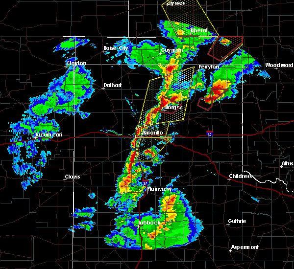 At 750 pm cst, a confirmed tornado was located just northwest of canadian, moving northeast at 35 mph (weather spotters confirmed tornado). Hazards include damaging tornado and golf ball size hail. Flying debris will be dangerous to those caught without shelter. mobile homes will be damaged or destroyed. damage to roofs, windows and vehicles will occur. Tree damage is likely. At 750 pm cst, a confirmed tornado was located just northwest of canadian, moving northeast at 35 mph (weather spotters confirmed tornado). Hazards include damaging tornado and golf ball size hail. Flying debris will be dangerous to those caught without shelter. mobile homes will be damaged or destroyed. damage to roofs, windows and vehicles will occur. Tree damage is likely.
|
| 11/16/2015 7:27 PM CST |
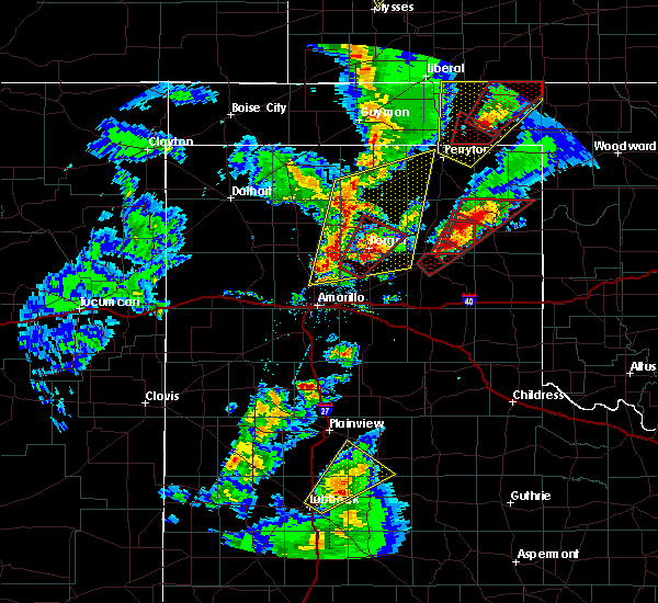 At 727 pm cst, a confirmed large and extremely dangerous tornado was located near lora, or 8 miles north of miami, moving northeast at 35 mph. this is a particularly dangerous situation (weather spotters confirmed tornado). Hazards include damaging tornado. You are in a life threatening situation. flying debris may be deadly to those caught without shelter. mobile homes will be destroyed. considerable damage to homes, businesses and vehicles is likely and complete destruction is possible. Locations impacted include, canadian, lora and glazier. At 727 pm cst, a confirmed large and extremely dangerous tornado was located near lora, or 8 miles north of miami, moving northeast at 35 mph. this is a particularly dangerous situation (weather spotters confirmed tornado). Hazards include damaging tornado. You are in a life threatening situation. flying debris may be deadly to those caught without shelter. mobile homes will be destroyed. considerable damage to homes, businesses and vehicles is likely and complete destruction is possible. Locations impacted include, canadian, lora and glazier.
|
| 11/16/2015 7:20 PM CST |
 At 719 pm cst, a confirmed large and extremely dangerous tornado was located near miami, moving northeast at 35 mph. this is a particularly dangerous situation. this tornado has a history of significant damage (weather spotters confirmed tornado). Hazards include damaging tornado. You are in a life threatening situation. flying debris may be deadly to those caught without shelter. mobile homes will be destroyed. Considerable damage to homes, businesses and vehicles is likely and complete destruction is possible. At 719 pm cst, a confirmed large and extremely dangerous tornado was located near miami, moving northeast at 35 mph. this is a particularly dangerous situation. this tornado has a history of significant damage (weather spotters confirmed tornado). Hazards include damaging tornado. You are in a life threatening situation. flying debris may be deadly to those caught without shelter. mobile homes will be destroyed. Considerable damage to homes, businesses and vehicles is likely and complete destruction is possible.
|
| 8/18/2015 11:37 PM CDT |
 At 1137 pm cdt, a severe thunderstorm was located 8 miles west of canadian, moving northeast at 40 mph (radar indicated). Hazards include 60 mph wind gusts and quarter size hail. Hail damage to vehicles is expected. Minor wind damage to roofs, siding and trees is possible. At 1137 pm cdt, a severe thunderstorm was located 8 miles west of canadian, moving northeast at 40 mph (radar indicated). Hazards include 60 mph wind gusts and quarter size hail. Hail damage to vehicles is expected. Minor wind damage to roofs, siding and trees is possible.
|
| 8/18/2015 10:52 PM CDT | Quarter sized hail reported 22.6 miles SSE of Canadian, TX |
| 8/9/2015 8:04 PM CDT |
 At 804 pm cdt, a severe thunderstorm was located 8 miles southeast of canadian, moving northeast at 15 mph (radar indicated). Hazards include 60 mph wind gusts and quarter size hail. Hail damage to vehicles is expected. Expect wind damage to roofs, siding and trees. At 804 pm cdt, a severe thunderstorm was located 8 miles southeast of canadian, moving northeast at 15 mph (radar indicated). Hazards include 60 mph wind gusts and quarter size hail. Hail damage to vehicles is expected. Expect wind damage to roofs, siding and trees.
|
| 6/12/2015 1:40 AM CDT |
 At 137 am cdt, severe thunderstorms were located along a line extending from glazier to miami to 10 miles north of panhandle, and moving east at 25 mph (radar indicated). Hazards include 60 mph wind gusts and quarter size hail. Hail damage to vehicles is expected. Minor wind damage to roofs, siding and trees is possible. At 137 am cdt, severe thunderstorms were located along a line extending from glazier to miami to 10 miles north of panhandle, and moving east at 25 mph (radar indicated). Hazards include 60 mph wind gusts and quarter size hail. Hail damage to vehicles is expected. Minor wind damage to roofs, siding and trees is possible.
|
| 6/12/2015 1:20 AM CDT |
 At 118 am cdt, severe thunderstorms were located along a line extending from 11 miles northwest of canadian to codman to 7 miles west of skellytown, and moving east at 25 mph. quarter size hail was reported in skellytown (radar indicated). Hazards include 60 mph wind gusts and quarter size hail. Hail damage to vehicles is expected. Minor wind damage to roofs, siding and trees is possible. At 118 am cdt, severe thunderstorms were located along a line extending from 11 miles northwest of canadian to codman to 7 miles west of skellytown, and moving east at 25 mph. quarter size hail was reported in skellytown (radar indicated). Hazards include 60 mph wind gusts and quarter size hail. Hail damage to vehicles is expected. Minor wind damage to roofs, siding and trees is possible.
|
| 6/12/2015 1:10 AM CDT |
 At 107 am cdt, severe thunderstorms were located along a line extending from 13 miles south of wolf creek park to 9 miles northwest of codman to 10 miles north of panhandle, and moving east at 20 mph (radar indicated). Hazards include 60 mph wind gusts and quarter size hail. Hail damage to vehicles is expected. Minor wind damage to roofs, siding and trees is possible. At 107 am cdt, severe thunderstorms were located along a line extending from 13 miles south of wolf creek park to 9 miles northwest of codman to 10 miles north of panhandle, and moving east at 20 mph (radar indicated). Hazards include 60 mph wind gusts and quarter size hail. Hail damage to vehicles is expected. Minor wind damage to roofs, siding and trees is possible.
|
| 6/7/2015 9:06 PM CDT | The severe thunderstorm warning for collingsworth, wheeler and hemphill counties will expire at 915 pm cdt, the line of storms which prompted the warning has weakened and moved out of the warned area. however, heavy rain is still possible with these thunderstorms. |
| 6/7/2015 8:58 PM CDT | At 854 pm cdt, severe thunderstorms were located along a line extending from 8 miles southwest of durham to 7 miles southeast of mclean, and moving southeast at 30 mph (radar indicated). Hazards include 60 mph wind gusts. Minor damage to roofs. Siding and trees is possible. |
| 6/7/2015 8:42 PM CDT | At 838 pm cdt, severe thunderstorms were located along a line extending from 6 miles south of lake marvin to 7 miles north of lela to 8 miles west of howardwick, and moving southeast at 30 mph (radar indicated). Hazards include 60 mph wind gusts. Minor damage to roofs. Siding and trees is possible. |
| 6/7/2015 8:25 PM CDT | At 822 pm cdt, severe thunderstorms were located along a line extending from 6 miles west of durham to new mobeetie to 6 miles southeast of groom, and moving southeast at 30 mph (radar indicated). Hazards include 60 mph wind gusts. Minor damage to roofs. Siding and trees is possible. |
| 6/7/2015 8:01 PM CDT | At 759 pm cdt, severe thunderstorms were located along a line extending from 6 miles south of higgins to 9 miles east of lora to 9 miles southeast of kingsmill, and moving southeast at 30 mph (radar indicated). Hazards include 70 mph wind gusts. Expect some tree damage. damage is likely to mobile homes. Roofs and outbuildings. |
| 6/7/2015 7:45 PM CDT | At 742 pm cdt, severe thunderstorms were located along a line extending from 9 miles southeast of follett to 6 miles southeast of canadian to kingsmill, and moving southeast at 30 mph (radar indicated). Hazards include 70 mph wind gusts. Expect some tree damage. Damage is likely to mobile homes, roofs and outbuildings. |
| 6/7/2015 7:41 PM CDT | At 739 pm cdt, severe thunderstorms were located along a line extending from 10 miles north of higgins to glazier to 5 miles west of miami, and moving east at 40 mph (radar indicated). Hazards include 70 mph wind gusts. Expect some tree damage. damage is likely to mobile homes. Roofs and outbuildings. |
| 6/7/2015 7:39 PM CDT | Storm damage reported in hemphill county TX, 5.8 miles W of Canadian, TX |
| 6/7/2015 7:37 PM CDT | Storm damage reported in hemphill county TX, 5.8 miles W of Canadian, TX |
| 6/7/2015 7:36 PM CDT | Storm damage reported in hemphill county TX, 5.8 miles W of Canadian, TX |
| 6/7/2015 7:35 PM CDT | Storm damage reported in hemphill county TX, 1.6 miles NE of Canadian, TX |
| 6/7/2015 7:29 PM CDT | At 726 pm cdt, severe thunderstorms were located along a line extending from 6 miles northeast of lipscomb to glazier to 9 miles northwest of codman, and moving east at 40 mph (radar indicated). Hazards include 60 mph wind gusts. Minor damage to roofs. Siding and trees is possible. |
| 6/7/2015 7:09 PM CDT | At 708 pm cdt, a severe thunderstorm was located 12 miles southeast of wolf creek park, and moving southeast at 35 mph (radar indicated). Hazards include 60 mph wind gusts. Minor damage to roofs. Siding and trees is possible. |
| 6/7/2015 6:39 PM CDT | At 637 pm cdt, a severe thunderstorm was located 9 miles west of wolf creek park, and moving southeast at 35 mph (radar indicated). Hazards include 60 mph wind gusts. Minor damage to roofs. Siding and trees is possible. |
| 5/27/2015 6:57 PM CDT | At 656 pm cdt, a severe thunderstorm capable of producing a tornado was located 8 miles north of canadian, and moving northeast at 5 mph (radar indicated rotation. spotters indicate tornado has lifted for now but rotation continues and redevelopment is possible). Hazards include tornado. Flying debris will be dangerous to those caught without shelter. mobile homes will be damaged or destroyed. damage to roofs, windows and vehicles will occur. Tree damage is likely. |
| 5/27/2015 6:51 PM CDT | At 649 pm cdt, a severe thunderstorm capable of producing a tornado was located 7 miles north of canadian, and moving east at 15 mph (radar indicated rotation. spotters indicate tornado has lifted for now but rotation continues and redevelopment is possible). Hazards include tornado and golf ball size hail. Flying debris will be dangerous to those caught without shelter. mobile homes will be damaged or destroyed. damage to roofs, windows and vehicles will occur. Tree damage is likely. |
| 5/27/2015 6:41 PM CDT | Closed highway 83 north of highway 60 due to trees on the roa in hemphill county TX, 2.4 miles SSE of Canadian, TX |
| 5/27/2015 6:39 PM CDT | At 636 pm cdt, a confirmed tornado was located 5 miles northwest of canadian, and moving east at 10 mph (live spotter video confirmed tornado). Hazards include damaging tornado and golf ball size hail. Flying debris will be dangerous to those caught without shelter. mobile homes will be damaged or destroyed. damage to roofs, windows and vehicles will occur. Tree damage is likely. |
| 5/27/2015 6:12 PM CDT | At 609 pm cdt, a severe thunderstorm capable of producing a tornado was located near canadian, and moving east at 10 mph (radar indicated rotation. spotters indicate tornado has lifted for now but rotation continues and redevelopment is possible). Hazards include tornado. Flying debris will be dangerous to those caught without shelter. mobile homes will be damaged or destroyed. damage to roofs, windows and vehicles will occur. Tree damage is likely. |
| 5/27/2015 6:10 PM CDT | At 607 pm cdt, a severe thunderstorm capable of producing a tornado was located near canadian, and moving east at 10 mph (radar indicated rotation. spotters indicate tornado has lifted for now but rotation continues and redevelopment is possible). Hazards include tornado. Flying debris will be dangerous to those caught without shelter. mobile homes will be damaged or destroyed. damage to roofs, windows and vehicles will occur. Tree damage is likely. |
| 5/27/2015 6:06 PM CDT | At 605 pm cdt, a confirmed tornado was located near canadian, and moving east at 10 mph (trained weather spotter confirmed tornado). Hazards include damaging tornado. Flying debris will be dangerous to those caught without shelter. mobile homes will be damaged or destroyed. damage to roofs, windows and vehicles will occur. Tree damage is likely. |
| 5/27/2015 6:01 PM CDT | At 600 pm cdt, a severe thunderstorm capable of producing a tornado was located 5 miles northwest of canadian, and moving east at 10 mph (radar indicated rotation). Hazards include tornado. Flying debris will be dangerous to those caught without shelter. mobile homes will be damaged or destroyed. damage to roofs, windows and vehicles will occur. Tree damage is likely. |
| 5/27/2015 5:31 PM CDT | At 530 pm cdt, a severe thunderstorm capable of producing a tornado was located near glazier, and moving east at 10 mph (radar indicated rotation). Hazards include tornado. Flying debris will be dangerous to those caught without shelter. mobile homes will be damaged or destroyed. damage to roofs, windows and vehicles will occur. Tree damage is likely. |
| 5/27/2015 5:12 PM CDT | At 511 pm cdt, a severe thunderstorm capable of producing a tornado was located 6 miles north of canadian, and moving east at 10 mph (spotters indicate tornado has lifted for now but rotation continues and redevelopment is possible). Hazards include tornado and golf ball size hail. Flying debris will be dangerous to those caught without shelter. mobile homes will be damaged or destroyed. damage to roofs, windows and vehicles will occur. Tree damage is likely. |
| 5/27/2015 5:07 PM CDT | Golf Ball sized hail reported 5.2 miles SSW of Canadian, TX |
| 5/27/2015 5:01 PM CDT | At 458 pm cdt, a confirmed large and extremely dangerous tornado was located near canadian, and moving southeast at 15 mph. this is a particularly dangerous situation (trained weather spotter confirmed tornado). Hazards include damaging tornado. You are in a life threatening situation. flying debris will be deadly to those caught without shelter. mobile homes will be destroyed. Considerable damage to homes, businesses and vehicles is likely and complete destruction possible. |
| 5/27/2015 4:53 PM CDT | Quarter sized hail reported 5.2 miles SSW of Canadian, TX |
| 5/27/2015 4:51 PM CDT | At 448 pm cdt, a severe thunderstorm capable of producing a tornado was located 5 miles north of canadian, and moving southeast at 25 mph (live spotter video of funnel cloud). Hazards include tornado and golf ball size hail. Flying debris will be dangerous to those caught without shelter. mobile homes will be damaged or destroyed. damage to roofs, windows and vehicles will occur. Tree damage is likely. |
| 5/27/2015 4:44 PM CDT | At 443 pm cdt, a severe thunderstorm was located 6 miles north of canadian, and moving southeast at 25 mph (radar indicated). Hazards include hen egg size hail and 60 mph wind gusts. People and animals outdoors will be injured. expect hail damage to roofs, siding, windows and vehicles. Minor wind damage to roofs, siding and trees is possible. |
| 5/27/2015 4:25 PM CDT | Hen Egg sized hail reported 11.3 miles SSE of Canadian, TX |
| 5/27/2015 4:02 PM CDT | At 401 pm cdt, a severe thunderstorm capable of producing a tornado was located 13 miles south of wolf creek park, and moving east at 5 mph (radar indicated rotation). Hazards include tornado and baseball size hail. Flying debris will be dangerous to those caught without shelter. mobile homes will be damaged or destroyed. damage to roofs, windows and vehicles will occur. Tree damage is likely. |
| 5/27/2015 3:38 PM CDT | At 335 pm cdt, a severe thunderstorm capable of producing a tornado was located 12 miles northwest of canadian, and moving east at 10 mph (live spotter video of funnel cloud). Hazards include tornado and golf ball size hail. Flying debris will be dangerous to those caught without shelter. mobile homes will be damaged or destroyed. damage to roofs, windows and vehicles will occur. Tree damage is likely. |
| 5/27/2015 3:34 PM CDT | Half Dollar sized hail reported 12.1 miles SSE of Canadian, TX |
| 5/27/2015 3:32 PM CDT | Quarter sized hail reported 10.3 miles SE of Canadian, TX |
| 5/27/2015 3:23 PM CDT | At 321 pm cdt, a severe thunderstorm capable of producing a tornado was located 13 miles south of wolf creek park, and moving southeast at 20 mph (weather spotters reported funnel cloud). Hazards include tornado. Flying debris will be dangerous to those caught without shelter. mobile homes will be damaged or destroyed. damage to roofs, windows and vehicles will occur. Tree damage is likely. |
| 4/16/2015 6:15 PM CDT | At 611 pm cdt, severe thunderstorms were located along a line extending from darrouzett to 9 miles south of canadian, and moving east at 20 mph. another severe thunderstorm was located southeast of canadian moving northeast across central and eastern hemphill county (radar indicated). Hazards include golf ball size hail and 60 mph wind gusts. People and animals outdoors will be injured. expect hail damage to roofs, siding, windows and vehicles. Minor wind damage to roofs, siding and trees is possible. |
| 4/16/2015 6:03 PM CDT | At 600 pm cdt, severe thunderstorms were located along a line extending from 6 miles northwest of lipscomb to 6 miles southeast of miami, and moving east at 25 mph. other severe thunderstorm were located over southeastern hemphill county moving northeast (radar indicated). Hazards include hen egg size hail and 60 mph wind gusts. People and animals outdoors will be injured. expect hail damage to roofs, siding, windows and vehicles. Minor wind damage to roofs, siding and trees is possible. |
| 4/16/2015 5:46 PM CDT | At 543 pm cdt, severe thunderstorms were located along a line extending from 9 miles northeast of wolf creek park to miami, and moving east at 25 mph (radar indicated). Hazards include golf ball size hail and 60 mph wind gusts. People and animals outdoors will be injured. expect hail damage to roofs, siding, windows and vehicles. Minor wind damage to roofs, siding and trees is possible. |
| 4/16/2015 5:13 PM CDT | At 510 pm cdt, a severe thunderstorm was located 5 miles northeast of briscoe, and moving north at 35 mph (radar indicated). Hazards include 60 mph wind gusts and half dollar size hail. Hail damage to vehicles is expected. Minor wind damage to roofs, siding and trees is possible. |
| 10/12/2014 6:55 PM CDT | Storm damage reported in hemphill county TX, 1.6 miles NE of Canadian, TX |
| 7/1/2014 12:11 AM CDT | Storm damage reported in hemphill county TX, 5.8 miles W of Canadian, TX |
| 7/1/2014 12:10 AM CDT | Fallen tree blocking highway 33 between county roads 17 and 1 in hemphill county TX, 8.8 miles NW of Canadian, TX |
| 7/1/2014 12:00 AM CDT | Powerlines down at 3rd street and elsie avenue. one powerline caused a fir in hemphill county TX, 0.2 miles WSW of Canadian, TX |
| 6/22/2014 10:12 PM CDT | Quarter sized hail reported 0.2 miles WSW of Canadian, TX |
| 6/22/2014 9:42 PM CDT | Golf Ball sized hail reported 4.4 miles SE of Canadian, TX, very strong winds as well |
| 6/22/2014 9:40 PM CDT | Storm damage reported in hemphill county TX, 6.5 miles ESE of Canadian, TX |
| 6/6/2014 10:03 PM CDT | Via kvii schoolnet in hemphill county TX, 11.8 miles N of Canadian, TX |
| 6/6/2014 9:59 PM CDT | Wind damage reported along highway 83 south of canadian including downed 4 to 8 inch tree limbs and downed tree in hemphill county TX, 2.2 miles NNE of Canadian, TX |
| 6/6/2014 9:46 PM CDT | Storm damage reported in hemphill county TX, 5.8 miles W of Canadian, TX |
| 6/6/2014 9:39 PM CDT | Wind gusts observed over a period of 10 minute in hemphill county TX, 0.2 miles WSW of Canadian, TX |
| 7/20/2013 2:34 PM CDT | Storm damage reported in hemphill county TX, 1.6 miles NE of Canadian, TX |
| 6/8/2013 8:55 PM CDT | Storm damage reported in hemphill county TX, 1.6 miles NE of Canadian, TX |
| 6/8/2013 8:49 PM CDT | Storm damage reported in hemphill county TX, 5.4 miles SSW of Canadian, TX |
| 5/29/2013 5:31 PM CDT | Storm damage reported in hemphill county TX, 5.8 miles W of Canadian, TX |
| 12/14/2012 5:55 PM CST | Storm damage reported in hemphill county TX, 1.6 miles NE of Canadian, TX |
| 6/1/2012 5:18 PM CDT | Half Dollar sized hail reported 9.6 miles N of Canadian, TX |
| 6/1/2012 5:15 PM CDT | Half Dollar sized hail reported 9.6 miles N of Canadian, TX, a lot of pea size hail fell in addition to the half dollar size hail. |
| 5/25/2012 8:10 PM CDT | Storm damage reported in hemphill county TX, 5.8 miles W of Canadian, TX |
| 4/2/2012 9:23 PM CDT | Quarter sized hail reported 0.2 miles WSW of Canadian, TX |
| 4/2/2012 9:12 PM CDT | Golf Ball sized hail reported 6.1 miles N of Canadian, TX |
| 3/29/2012 10:50 PM CDT | Quarter sized hail reported 11.9 miles W of Canadian, TX |
| 3/29/2012 10:40 PM CDT | Golf Ball sized hail reported 12 miles W of Canadian, TX |
| 3/29/2012 10:31 PM CDT | Quarter sized hail reported 11.9 miles W of Canadian, TX |
Hail Maps for Canadian, TX
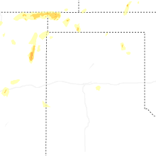
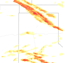
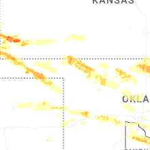
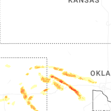
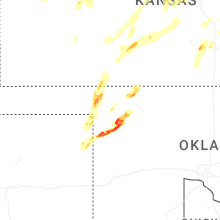
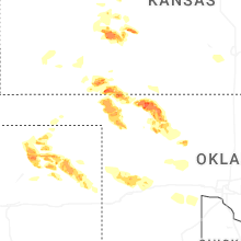
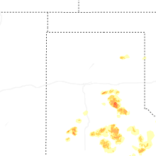


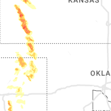

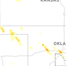

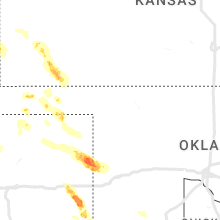


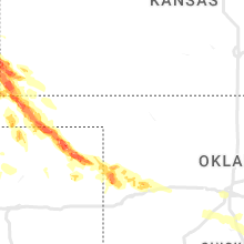


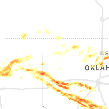

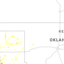


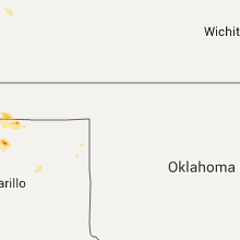


Connect with Interactive Hail Maps