

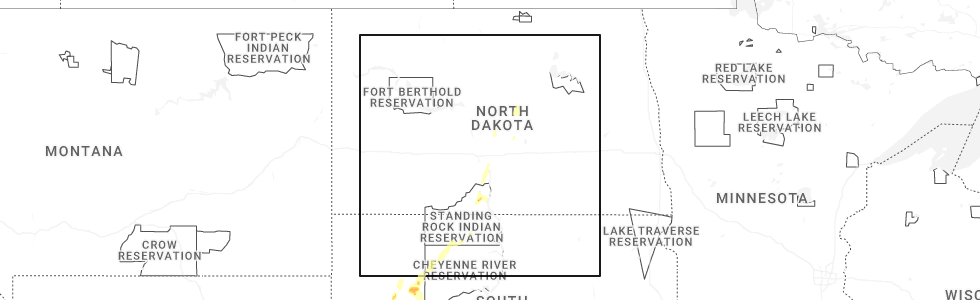
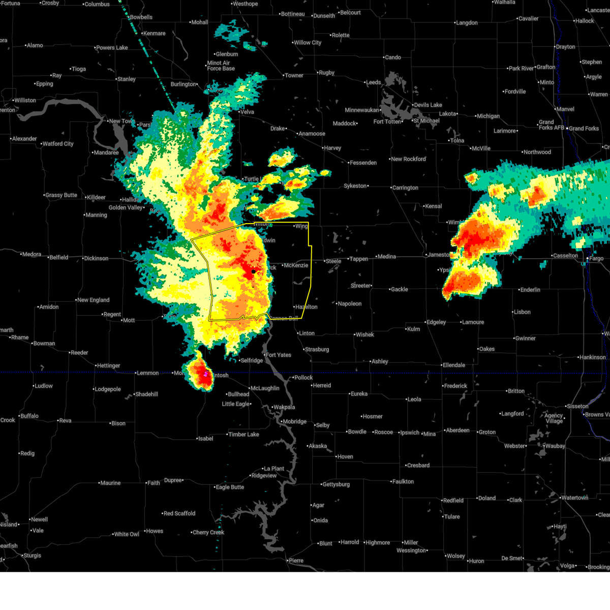
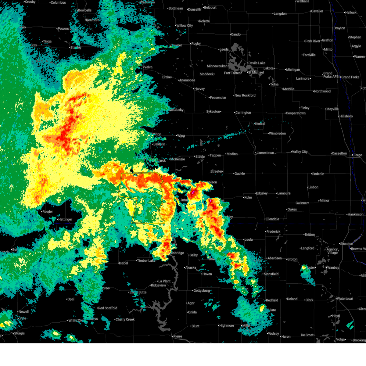
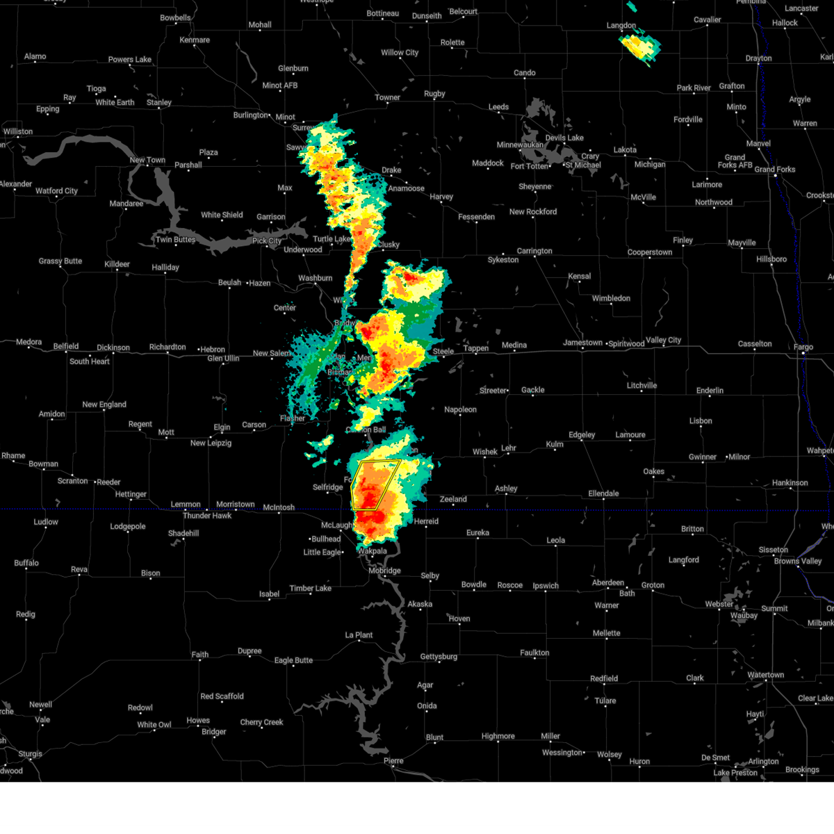
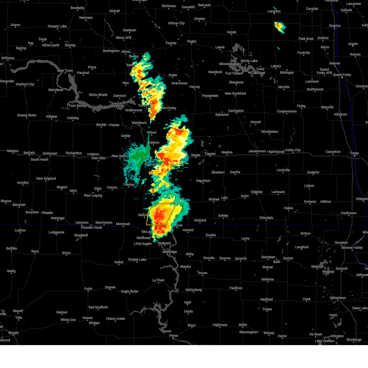
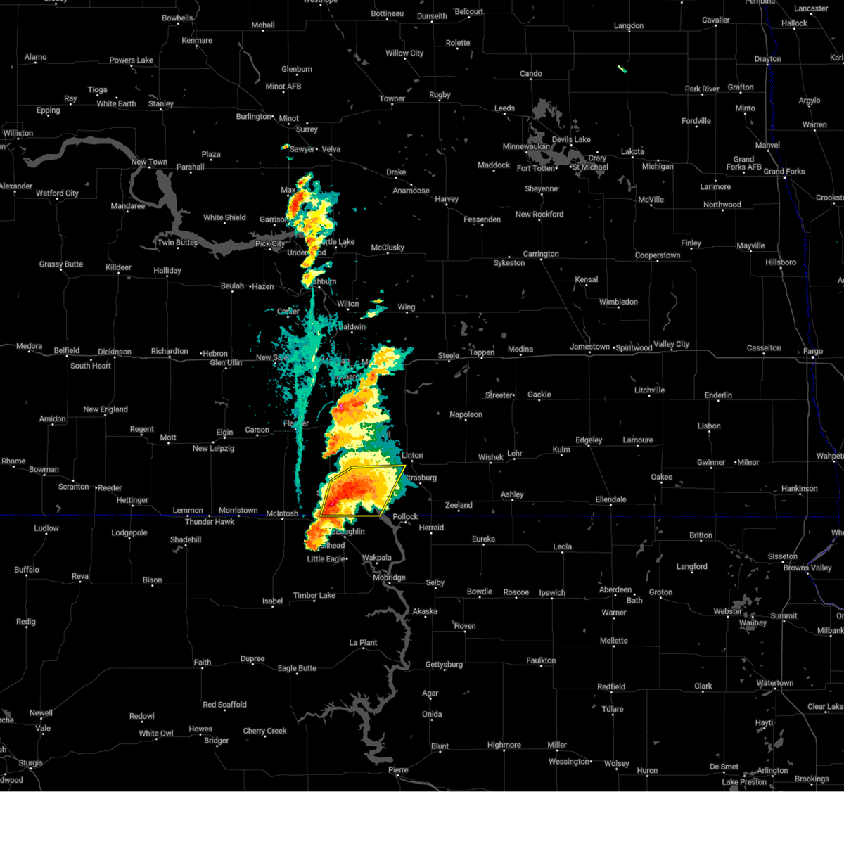
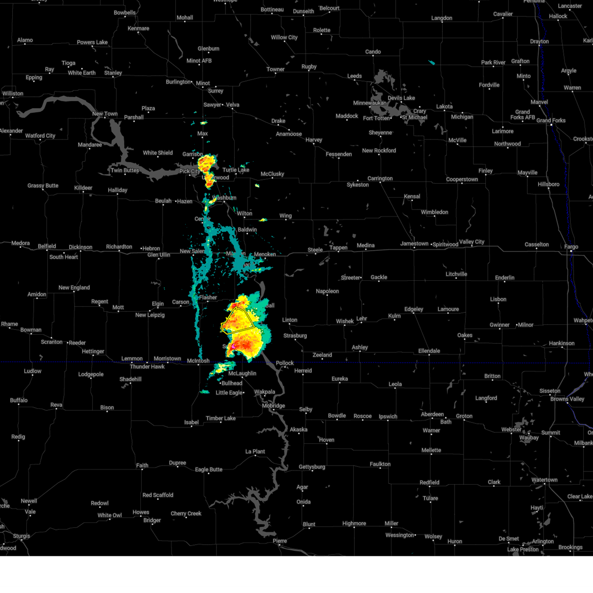
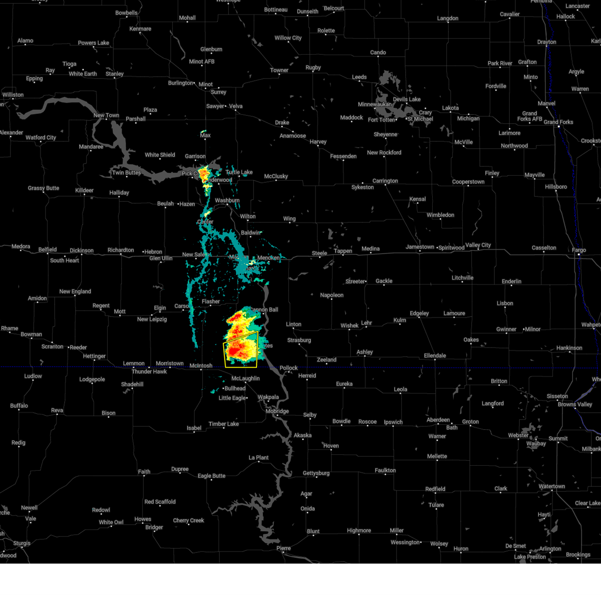
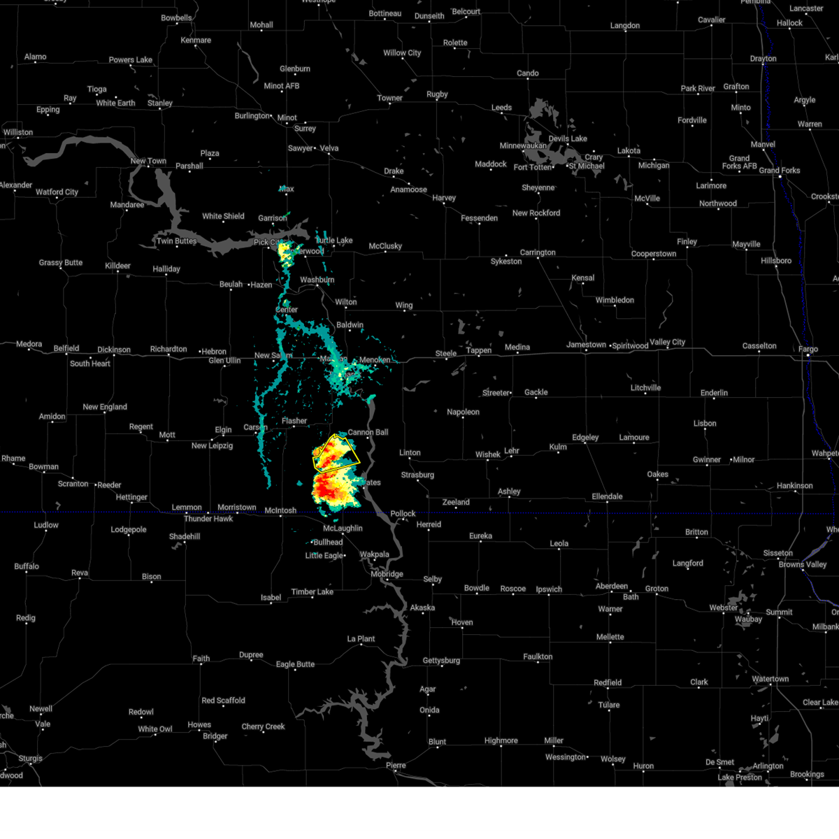
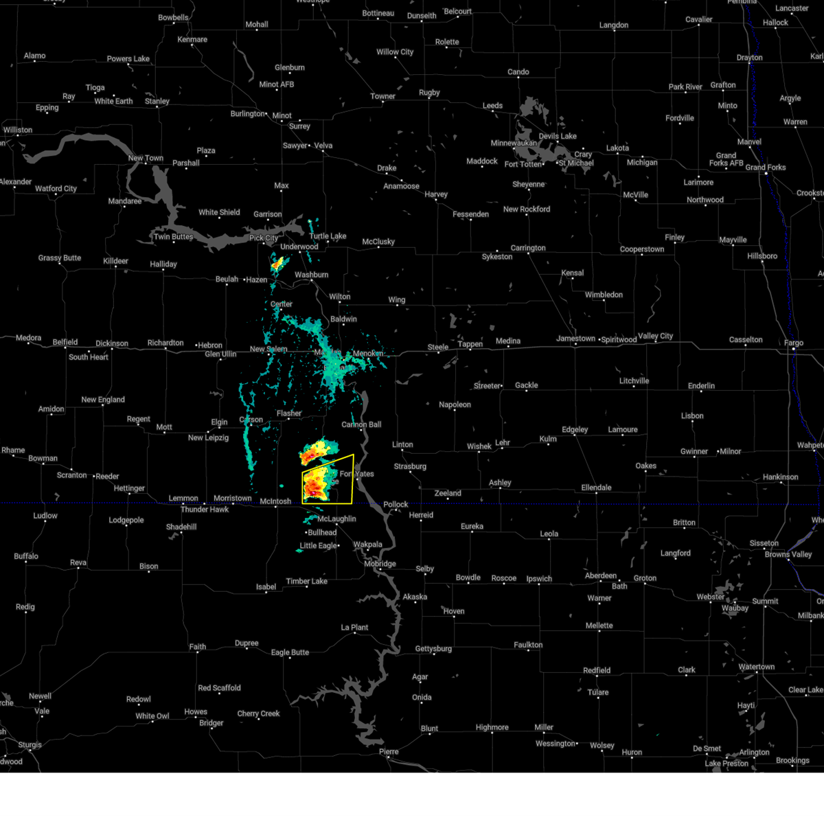
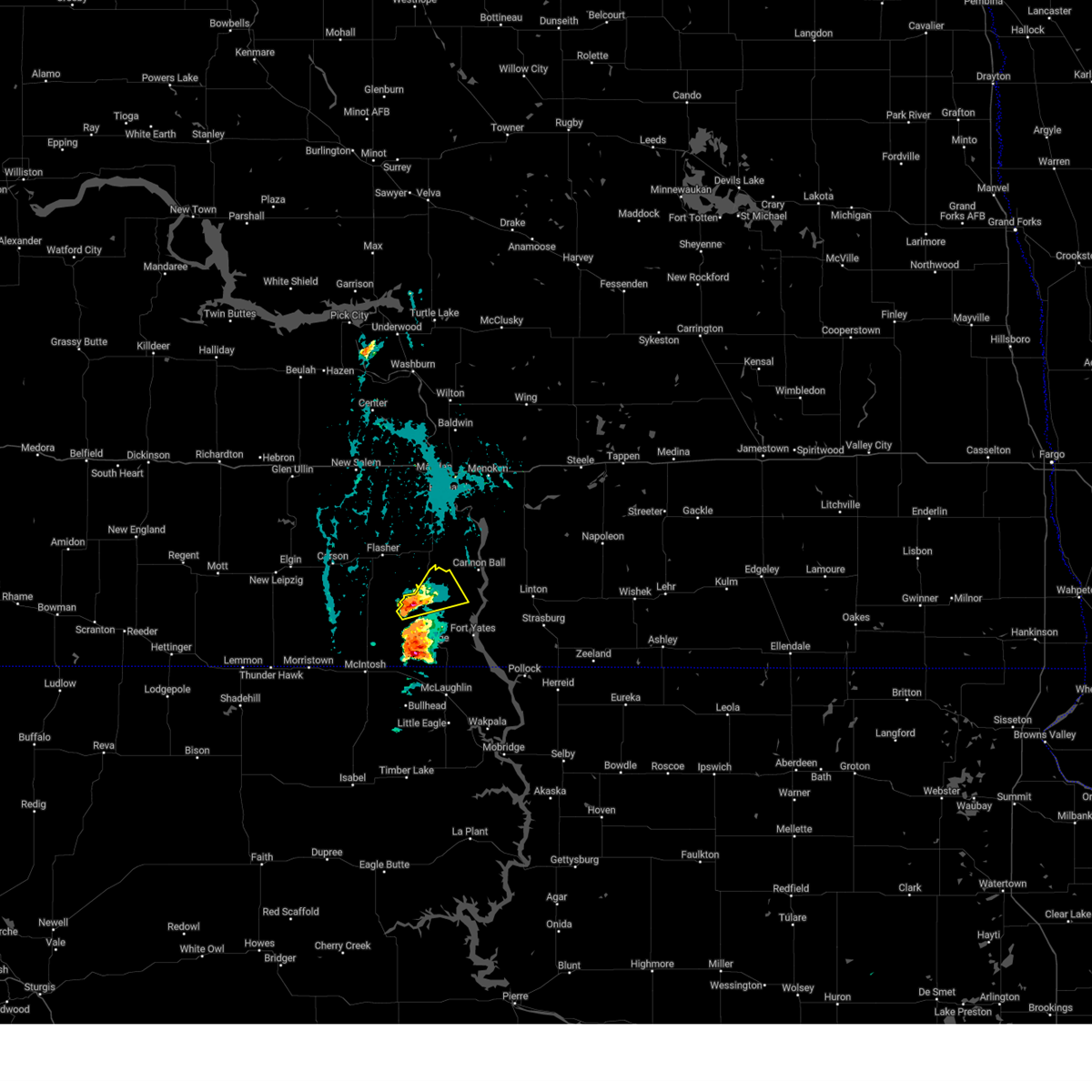
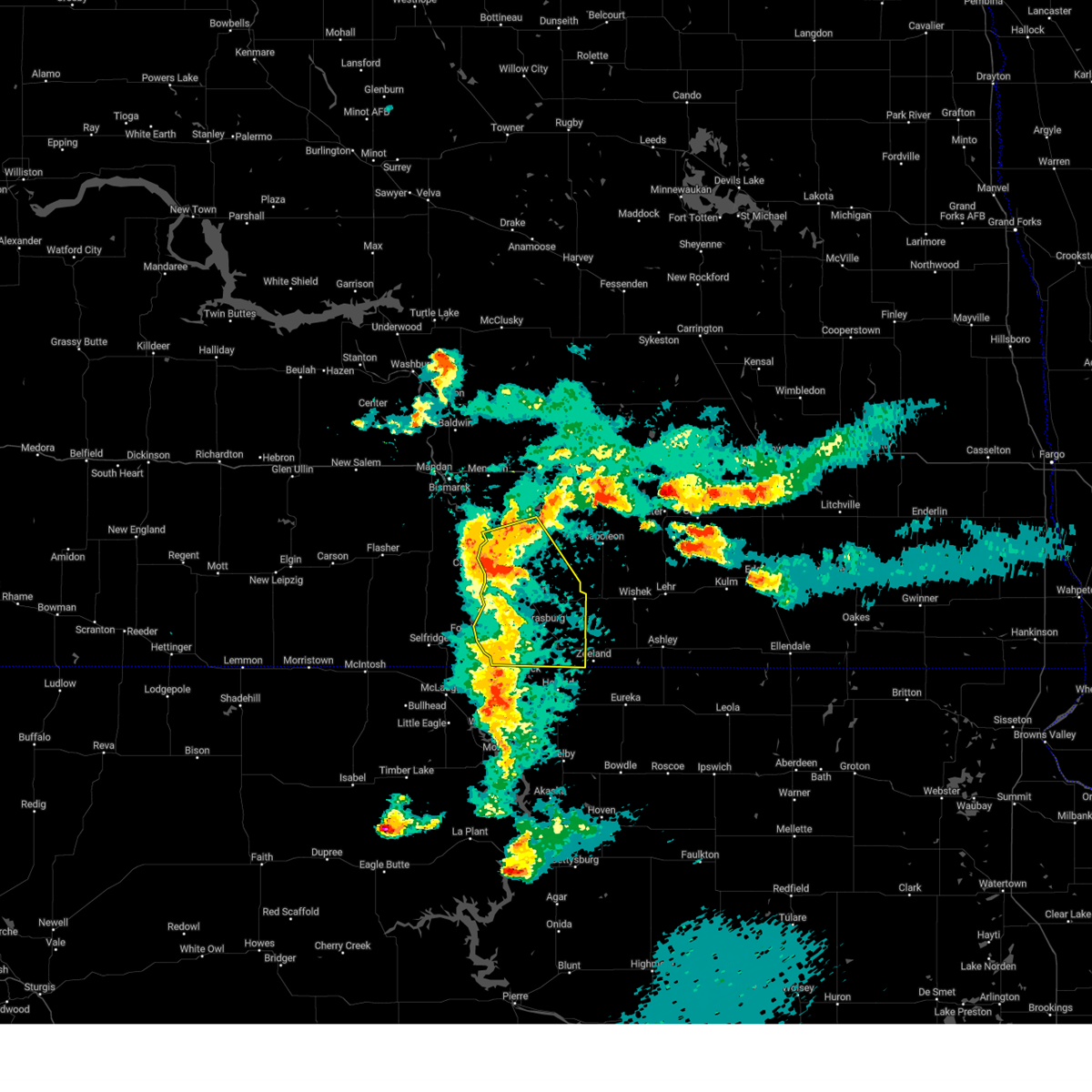
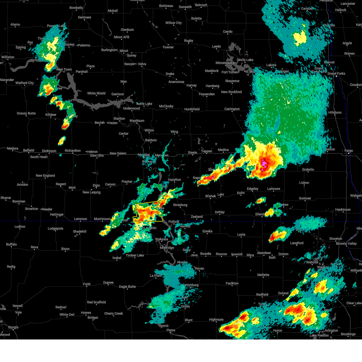
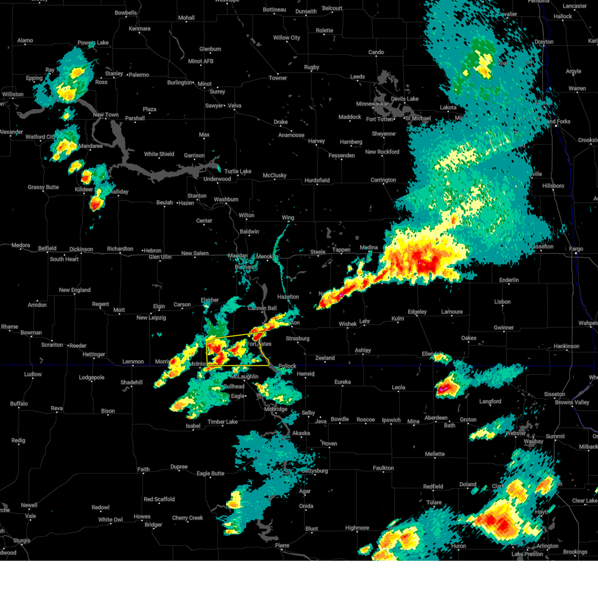
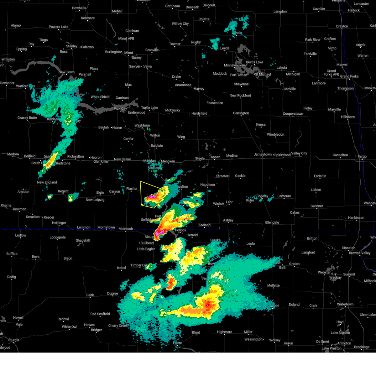
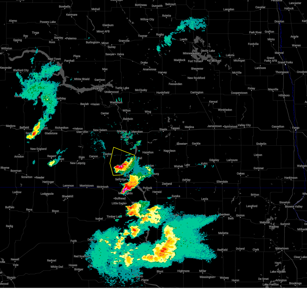
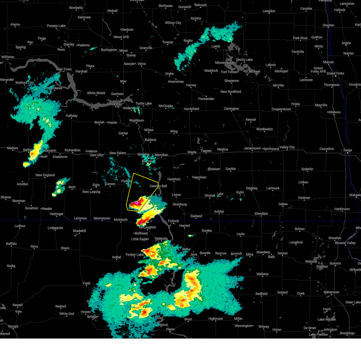
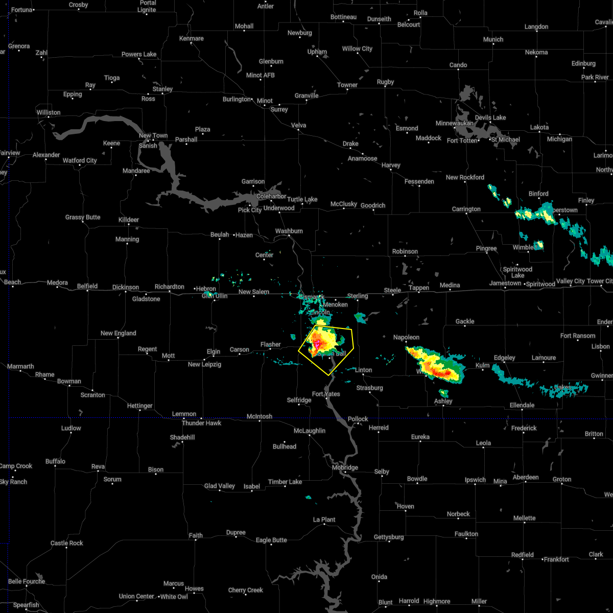
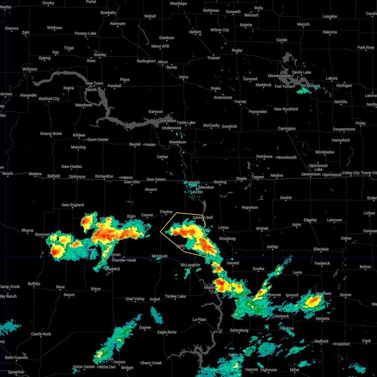
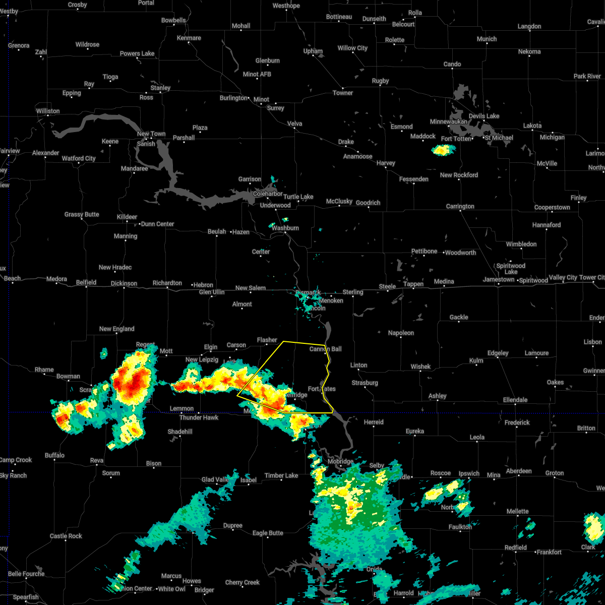
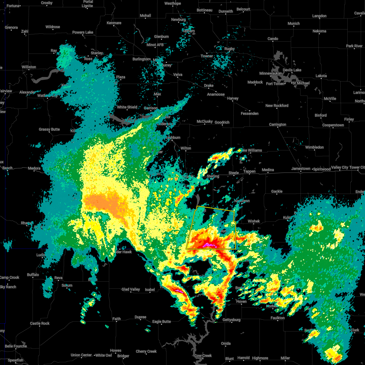
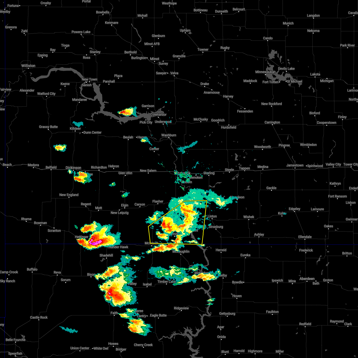
Hail Map for Cannon Ball, ND
The Cannon Ball, ND area has had 3 reports of on-the-ground hail by trained spotters, and has been under severe weather warnings 25 times during the past 12 months. Doppler radar has detected hail at or near Cannon Ball, ND on 78 occasions, including 2 occasions during the past year.
| Name: | Cannon Ball, ND |
| Where Located: | 33.5 miles SSE of Bismarck, ND |
| Map: | Google Map for Cannon Ball, ND |
| Population: | 875 |
| Housing Units: | 227 |
| More Info: | Search Google for Cannon Ball, ND |
0
The Top Recent Hail Date for Cannon Ball, ND is Monday, May 5, 2025 (49th out of 78)
Hail and Wind Damage Spotted near Cannon Ball, ND
| Date / Time | Report Details |
|---|---|
| 6/20/2025 9:59 PM CDT |
 At 958 pm cdt, a severe thunderstorm was located 9 miles southeast of prairie knights resort, or 13 miles southwest of linton, moving northeast at 70 mph (radar indicated). Hazards include 60 mph wind gusts. Expect damage to roofs, siding, and trees. Locations impacted include, linton, strasburg, fort yates, temvik, cattail recreation area, and beaver bay recreation area. At 958 pm cdt, a severe thunderstorm was located 9 miles southeast of prairie knights resort, or 13 miles southwest of linton, moving northeast at 70 mph (radar indicated). Hazards include 60 mph wind gusts. Expect damage to roofs, siding, and trees. Locations impacted include, linton, strasburg, fort yates, temvik, cattail recreation area, and beaver bay recreation area.
|
| 6/20/2025 9:39 PM CDT |
 At 939 pm cdt, severe thunderstorms were located along a line extending from near regan to 7 miles south of wing to 10 miles east of sterling to 6 miles south of braddock, moving east at 70 mph. these are destructive storms for (radar indicated). Hazards include 90 mph wind gusts and quarter size hail. You are in a life-threatening situation. flying debris may be deadly to those caught without shelter. mobile homes will be heavily damaged or destroyed. homes and businesses will have substantial roof and window damage. expect extensive tree damage and power outages. locations impacted include, bismarck, mandan, lincoln, wilton, hazelton, menoken, wing, sterling, regan, st. Anthony, driscoll, mckenzie, baldwin, hazelton recreation area, university of mary, huff, crown butte lake, moffit, lake harmon, and mcdowell dam recreation area. At 939 pm cdt, severe thunderstorms were located along a line extending from near regan to 7 miles south of wing to 10 miles east of sterling to 6 miles south of braddock, moving east at 70 mph. these are destructive storms for (radar indicated). Hazards include 90 mph wind gusts and quarter size hail. You are in a life-threatening situation. flying debris may be deadly to those caught without shelter. mobile homes will be heavily damaged or destroyed. homes and businesses will have substantial roof and window damage. expect extensive tree damage and power outages. locations impacted include, bismarck, mandan, lincoln, wilton, hazelton, menoken, wing, sterling, regan, st. Anthony, driscoll, mckenzie, baldwin, hazelton recreation area, university of mary, huff, crown butte lake, moffit, lake harmon, and mcdowell dam recreation area.
|
| 6/20/2025 9:37 PM CDT |
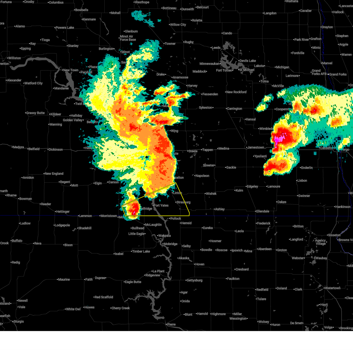 At 937 pm cdt, a severe thunderstorm was located over selfridge, or 17 miles northwest of mclaughlin, moving northeast at 70 mph (radar indicated). Hazards include 60 mph wind gusts and quarter size hail. Hail damage to vehicles is expected. expect wind damage to roofs, siding, and trees. Locations impacted include, linton, strasburg, fort yates, selfridge, hague, westfield, temvik, cattail recreation area, beaver bay recreation area, hull, standing rock, and standing rock nation. At 937 pm cdt, a severe thunderstorm was located over selfridge, or 17 miles northwest of mclaughlin, moving northeast at 70 mph (radar indicated). Hazards include 60 mph wind gusts and quarter size hail. Hail damage to vehicles is expected. expect wind damage to roofs, siding, and trees. Locations impacted include, linton, strasburg, fort yates, selfridge, hague, westfield, temvik, cattail recreation area, beaver bay recreation area, hull, standing rock, and standing rock nation.
|
| 6/20/2025 9:30 PM CDT | Fort yates nddot station measured wind gus in sioux county ND, 4.4 miles N of Cannon Ball, ND |
| 6/20/2025 9:23 PM CDT |
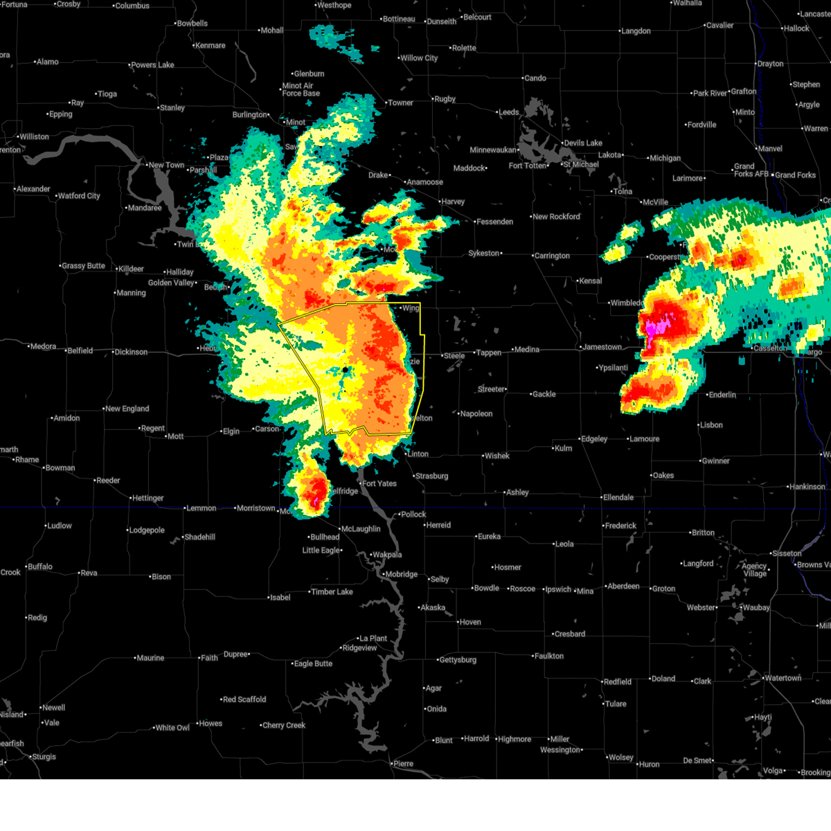
 At 922 pm cdt, severe thunderstorms were located along a line extending from wilton to 11 miles south of regan to 8 miles southeast of menoken to 6 miles northeast of cannon ball, moving east at 70 mph. these are destructive storms for south central north dakota, including bismarck and mandan (radar indicated). Hazards include 80 mph wind gusts and quarter size hail. Flying debris will be dangerous to those caught without shelter. mobile homes will be heavily damaged. expect considerable damage to roofs, windows, and vehicles. extensive tree damage and power outages are likely. locations impacted include, bismarck, mandan, lincoln, wilton, hazelton, flasher, menoken, wing, sterling, regan, st. Anthony, driscoll, judson, mckenzie, baldwin, hazelton recreation area, university of mary, huff, crown butte lake, and moffit. At 922 pm cdt, severe thunderstorms were located along a line extending from wilton to 11 miles south of regan to 8 miles southeast of menoken to 6 miles northeast of cannon ball, moving east at 70 mph. these are destructive storms for south central north dakota, including bismarck and mandan (radar indicated). Hazards include 80 mph wind gusts and quarter size hail. Flying debris will be dangerous to those caught without shelter. mobile homes will be heavily damaged. expect considerable damage to roofs, windows, and vehicles. extensive tree damage and power outages are likely. locations impacted include, bismarck, mandan, lincoln, wilton, hazelton, flasher, menoken, wing, sterling, regan, st. Anthony, driscoll, judson, mckenzie, baldwin, hazelton recreation area, university of mary, huff, crown butte lake, and moffit.
|
| 6/20/2025 9:19 PM CDT |
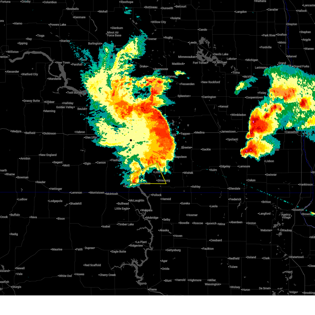
 Svrbis the national weather service in bismarck has issued a * severe thunderstorm warning for, southeastern sioux county in south central north dakota, southern emmons county in south central north dakota, * until 1015 pm cdt. * at 918 pm cdt, a severe thunderstorm was located over mcintosh, or 16 miles northwest of bullhead, moving northeast at 70 mph (radar indicated). Hazards include two inch hail and 60 mph wind gusts. People and animals outdoors will be injured. expect hail damage to roofs, siding, windows, and vehicles. Expect wind damage to roofs, siding, and trees. Svrbis the national weather service in bismarck has issued a * severe thunderstorm warning for, southeastern sioux county in south central north dakota, southern emmons county in south central north dakota, * until 1015 pm cdt. * at 918 pm cdt, a severe thunderstorm was located over mcintosh, or 16 miles northwest of bullhead, moving northeast at 70 mph (radar indicated). Hazards include two inch hail and 60 mph wind gusts. People and animals outdoors will be injured. expect hail damage to roofs, siding, windows, and vehicles. Expect wind damage to roofs, siding, and trees.
|
| 6/20/2025 9:10 PM CDT |
 The storms which prompted the warning have weakened below severe limits, and no longer pose an immediate threat to life or property. therefore, the warning will be allowed to expire. however, gusty winds are still possible with these thunderstorms. a tornado watch remains in effect until 300 am cdt/200 am mdt/ for south central north dakota. a severe thunderstorm watch remains in effect until 1000 pm cdt/900 pm mdt/ for south central north dakota. The storms which prompted the warning have weakened below severe limits, and no longer pose an immediate threat to life or property. therefore, the warning will be allowed to expire. however, gusty winds are still possible with these thunderstorms. a tornado watch remains in effect until 300 am cdt/200 am mdt/ for south central north dakota. a severe thunderstorm watch remains in effect until 1000 pm cdt/900 pm mdt/ for south central north dakota.
|
| 6/20/2025 8:58 PM CDT |
 Svrbis the national weather service in bismarck has issued a * severe thunderstorm warning for, burleigh county in south central north dakota, morton county in south central north dakota, southern oliver county in south central north dakota, northwestern emmons county in south central north dakota, * until 1000 pm cdt. * at 857 pm cdt, severe thunderstorms were located along a line extending from near center to 13 miles northwest of mandan to near st. anthony to 9 miles west of solen, moving east at 70 mph. these are destructive storms for south central north dakota, including bismarck and mandan (radar indicated). Hazards include 80 mph wind gusts and quarter size hail. Flying debris will be dangerous to those caught without shelter. mobile homes will be heavily damaged. expect considerable damage to roofs, windows, and vehicles. Extensive tree damage and power outages are likely. Svrbis the national weather service in bismarck has issued a * severe thunderstorm warning for, burleigh county in south central north dakota, morton county in south central north dakota, southern oliver county in south central north dakota, northwestern emmons county in south central north dakota, * until 1000 pm cdt. * at 857 pm cdt, severe thunderstorms were located along a line extending from near center to 13 miles northwest of mandan to near st. anthony to 9 miles west of solen, moving east at 70 mph. these are destructive storms for south central north dakota, including bismarck and mandan (radar indicated). Hazards include 80 mph wind gusts and quarter size hail. Flying debris will be dangerous to those caught without shelter. mobile homes will be heavily damaged. expect considerable damage to roofs, windows, and vehicles. Extensive tree damage and power outages are likely.
|
| 6/20/2025 8:55 PM CDT |
 At 855 pm cdt/755 pm mdt/, severe thunderstorms were located along a line extending from 7 miles west of st. anthony to 6 miles north of shields, moving east at 65 mph. these are destructive storms (trained weather spotters). Hazards include 90 mph wind gusts. You are in a life-threatening situation. flying debris may be deadly to those caught without shelter. mobile homes will be heavily damaged or destroyed. homes and businesses will have substantial roof and window damage. expect extensive tree damage and power outages. locations impacted include, carson, flasher, almont, solen, cannon ball, st. anthony, prairie knights resort, lark, raleigh, breien, hazelton recreation area, stumpf state natural area, huff, st. Gertrude, fort rice, and standing rock. At 855 pm cdt/755 pm mdt/, severe thunderstorms were located along a line extending from 7 miles west of st. anthony to 6 miles north of shields, moving east at 65 mph. these are destructive storms (trained weather spotters). Hazards include 90 mph wind gusts. You are in a life-threatening situation. flying debris may be deadly to those caught without shelter. mobile homes will be heavily damaged or destroyed. homes and businesses will have substantial roof and window damage. expect extensive tree damage and power outages. locations impacted include, carson, flasher, almont, solen, cannon ball, st. anthony, prairie knights resort, lark, raleigh, breien, hazelton recreation area, stumpf state natural area, huff, st. Gertrude, fort rice, and standing rock.
|
| 6/20/2025 8:48 PM CDT |
 Svrbis the national weather service in bismarck has issued a * severe thunderstorm warning for, northeastern sioux county in south central north dakota, southeastern morton county in south central north dakota, northeastern grant county in south central north dakota, * until 915 pm cdt/815 pm mdt/. * at 847 pm cdt/747 pm mdt/, severe thunderstorms were located along a line extending from 15 miles west of st. anthony to 10 miles southwest of flasher, moving east at 65 mph. these are destructive storms! (trained weather spotters). Hazards include 90 mph wind gusts. You are in a life-threatening situation. flying debris may be deadly to those caught without shelter. mobile homes will be heavily damaged or destroyed. homes and businesses will have substantial roof and window damage. Expect extensive tree damage and power outages. Svrbis the national weather service in bismarck has issued a * severe thunderstorm warning for, northeastern sioux county in south central north dakota, southeastern morton county in south central north dakota, northeastern grant county in south central north dakota, * until 915 pm cdt/815 pm mdt/. * at 847 pm cdt/747 pm mdt/, severe thunderstorms were located along a line extending from 15 miles west of st. anthony to 10 miles southwest of flasher, moving east at 65 mph. these are destructive storms! (trained weather spotters). Hazards include 90 mph wind gusts. You are in a life-threatening situation. flying debris may be deadly to those caught without shelter. mobile homes will be heavily damaged or destroyed. homes and businesses will have substantial roof and window damage. Expect extensive tree damage and power outages.
|
| 6/16/2025 3:15 AM CDT |
 The storms which prompted the warning have weakened below severe limits. therefore, the warning will be allowed to expire. a severe thunderstorm watch remains in effect until 500 am cdt/400 am mdt/ for south central north dakota. The storms which prompted the warning have weakened below severe limits. therefore, the warning will be allowed to expire. a severe thunderstorm watch remains in effect until 500 am cdt/400 am mdt/ for south central north dakota.
|
| 6/16/2025 2:52 AM CDT |
 At 251 am cdt/151 am mdt/, severe thunderstorms were located along a line extending from 5 miles northwest of flasher to 4 miles northwest of solen to prairie knights resort, moving northeast at 55 mph (radar indicated). Hazards include 60 mph wind gusts and nickel size hail. Expect damage to roofs, siding, and trees. locations impacted include, flasher, fort yates, selfridge, solen, cannon ball, st. Anthony, prairie knights resort, lark, raleigh, breien, hazelton recreation area, stumpf state natural area, huff, fort rice, standing rock, and standing rock nation. At 251 am cdt/151 am mdt/, severe thunderstorms were located along a line extending from 5 miles northwest of flasher to 4 miles northwest of solen to prairie knights resort, moving northeast at 55 mph (radar indicated). Hazards include 60 mph wind gusts and nickel size hail. Expect damage to roofs, siding, and trees. locations impacted include, flasher, fort yates, selfridge, solen, cannon ball, st. Anthony, prairie knights resort, lark, raleigh, breien, hazelton recreation area, stumpf state natural area, huff, fort rice, standing rock, and standing rock nation.
|
| 6/16/2025 2:34 AM CDT |
 At 234 am cdt/134 am mdt/, severe thunderstorms were located along a line extending from near flasher to 6 miles northwest of selfridge to walker, moving east at 55 mph (radar indicated). Hazards include 70 mph wind gusts and quarter size hail. Hail damage to vehicles is expected. expect considerable tree damage. wind damage is also likely to mobile homes, roofs, and outbuildings. locations impacted include, flasher, fort yates, selfridge, solen, cannon ball, st. anthony, prairie knights resort, shields, lark, raleigh, breien, hazelton recreation area, stumpf state natural area, huff, st. Gertrude, fort rice, porcupine, standing rock, and standing rock nation. At 234 am cdt/134 am mdt/, severe thunderstorms were located along a line extending from near flasher to 6 miles northwest of selfridge to walker, moving east at 55 mph (radar indicated). Hazards include 70 mph wind gusts and quarter size hail. Hail damage to vehicles is expected. expect considerable tree damage. wind damage is also likely to mobile homes, roofs, and outbuildings. locations impacted include, flasher, fort yates, selfridge, solen, cannon ball, st. anthony, prairie knights resort, shields, lark, raleigh, breien, hazelton recreation area, stumpf state natural area, huff, st. Gertrude, fort rice, porcupine, standing rock, and standing rock nation.
|
| 6/16/2025 2:18 AM CDT |
 Svrbis the national weather service in bismarck has issued a * severe thunderstorm warning for, sioux county in south central north dakota, southeastern morton county in south central north dakota, eastern grant county in south central north dakota, * until 315 am cdt/215 am mdt/. * at 217 am cdt/117 am mdt/, severe thunderstorms were located along a line extending from 5 miles northeast of carson to 10 miles west of shields to near mcintosh, moving east at 50 mph (radar indicated). Hazards include 70 mph wind gusts and ping pong ball size hail. People and animals outdoors will be injured. expect hail damage to roofs, siding, windows, and vehicles. expect considerable tree damage. Wind damage is also likely to mobile homes, roofs, and outbuildings. Svrbis the national weather service in bismarck has issued a * severe thunderstorm warning for, sioux county in south central north dakota, southeastern morton county in south central north dakota, eastern grant county in south central north dakota, * until 315 am cdt/215 am mdt/. * at 217 am cdt/117 am mdt/, severe thunderstorms were located along a line extending from 5 miles northeast of carson to 10 miles west of shields to near mcintosh, moving east at 50 mph (radar indicated). Hazards include 70 mph wind gusts and ping pong ball size hail. People and animals outdoors will be injured. expect hail damage to roofs, siding, windows, and vehicles. expect considerable tree damage. Wind damage is also likely to mobile homes, roofs, and outbuildings.
|
| 8/28/2024 6:58 PM CDT |
 At 658 pm cdt, severe thunderstorms were located along a line extending from near fort yates to 9 miles northwest of kenel, moving east at 25 mph (radar indicated). Hazards include 60 mph wind gusts and quarter size hail. Hail damage to vehicles is expected. expect wind damage to roofs, siding, and trees. Locations impacted include, fort yates and cattail recreation area. At 658 pm cdt, severe thunderstorms were located along a line extending from near fort yates to 9 miles northwest of kenel, moving east at 25 mph (radar indicated). Hazards include 60 mph wind gusts and quarter size hail. Hail damage to vehicles is expected. expect wind damage to roofs, siding, and trees. Locations impacted include, fort yates and cattail recreation area.
|
| 8/28/2024 6:48 PM CDT |
 At 648 pm cdt, severe thunderstorms were located along a line extending from 9 miles east of fort yates to 11 miles northeast of mclaughlin, moving east at 15 mph (radar indicated). Hazards include 70 mph wind gusts and quarter size hail. Hail damage to vehicles is expected. expect considerable tree damage. wind damage is also likely to mobile homes, roofs, and outbuildings. Locations impacted include, fort yates and cattail recreation area. At 648 pm cdt, severe thunderstorms were located along a line extending from 9 miles east of fort yates to 11 miles northeast of mclaughlin, moving east at 15 mph (radar indicated). Hazards include 70 mph wind gusts and quarter size hail. Hail damage to vehicles is expected. expect considerable tree damage. wind damage is also likely to mobile homes, roofs, and outbuildings. Locations impacted include, fort yates and cattail recreation area.
|
| 8/28/2024 6:09 PM CDT |
 Svrbis the national weather service in bismarck has issued a * severe thunderstorm warning for, southeastern sioux county in south central north dakota, southwestern emmons county in south central north dakota, * until 715 pm cdt. * at 609 pm cdt, severe thunderstorms were located along a line extending from near fort yates to 5 miles south of selfridge, moving southeast at 15 mph (radar indicated). Hazards include golf ball size hail and 70 mph wind gusts. People and animals outdoors will be injured. expect hail damage to roofs, siding, windows, and vehicles. expect considerable tree damage. Wind damage is also likely to mobile homes, roofs, and outbuildings. Svrbis the national weather service in bismarck has issued a * severe thunderstorm warning for, southeastern sioux county in south central north dakota, southwestern emmons county in south central north dakota, * until 715 pm cdt. * at 609 pm cdt, severe thunderstorms were located along a line extending from near fort yates to 5 miles south of selfridge, moving southeast at 15 mph (radar indicated). Hazards include golf ball size hail and 70 mph wind gusts. People and animals outdoors will be injured. expect hail damage to roofs, siding, windows, and vehicles. expect considerable tree damage. Wind damage is also likely to mobile homes, roofs, and outbuildings.
|
| 8/28/2024 5:48 PM CDT |
 At 447 pm mdt, a severe thunderstorm was located 8 miles southwest of solen, or 33 miles west of linton, moving northeast at 10 mph (radar indicated). Hazards include 60 mph wind gusts and quarter size hail. Hail damage to vehicles is expected. expect wind damage to roofs, siding, and trees. Locations impacted include, solen and standing rock. At 447 pm mdt, a severe thunderstorm was located 8 miles southwest of solen, or 33 miles west of linton, moving northeast at 10 mph (radar indicated). Hazards include 60 mph wind gusts and quarter size hail. Hail damage to vehicles is expected. expect wind damage to roofs, siding, and trees. Locations impacted include, solen and standing rock.
|
| 8/28/2024 5:32 PM CDT |
 At 532 pm cdt, a severe thunderstorm was located over selfridge, or 16 miles north of mclaughlin, moving east at 20 mph (radar indicated). Hazards include tennis ball size hail and 60 mph wind gusts. People and animals outdoors will be injured. expect hail damage to roofs, siding, windows, and vehicles. expect wind damage to roofs, siding, and trees. Locations impacted include, selfridge, standing rock, and standing rock nation. At 532 pm cdt, a severe thunderstorm was located over selfridge, or 16 miles north of mclaughlin, moving east at 20 mph (radar indicated). Hazards include tennis ball size hail and 60 mph wind gusts. People and animals outdoors will be injured. expect hail damage to roofs, siding, windows, and vehicles. expect wind damage to roofs, siding, and trees. Locations impacted include, selfridge, standing rock, and standing rock nation.
|
| 8/28/2024 5:28 PM CDT |
 At 428 pm mdt, a severe thunderstorm was located 9 miles east of shields, or 30 miles north of mclaughlin, moving northeast at 20 mph (radar indicated). Hazards include ping pong ball size hail and 60 mph wind gusts. People and animals outdoors will be injured. expect hail damage to roofs, siding, windows, and vehicles. expect wind damage to roofs, siding, and trees. Locations impacted include, solen and standing rock. At 428 pm mdt, a severe thunderstorm was located 9 miles east of shields, or 30 miles north of mclaughlin, moving northeast at 20 mph (radar indicated). Hazards include ping pong ball size hail and 60 mph wind gusts. People and animals outdoors will be injured. expect hail damage to roofs, siding, windows, and vehicles. expect wind damage to roofs, siding, and trees. Locations impacted include, solen and standing rock.
|
| 8/28/2024 5:17 PM CDT |
 Svrbis the national weather service in bismarck has issued a * severe thunderstorm warning for, southeastern sioux county in south central north dakota, * until 615 pm cdt. * at 516 pm cdt, a severe thunderstorm was located near selfridge, or 16 miles northwest of mclaughlin, moving northeast at 25 mph (radar indicated). Hazards include golf ball size hail and 60 mph wind gusts. People and animals outdoors will be injured. expect hail damage to roofs, siding, windows, and vehicles. Expect wind damage to roofs, siding, and trees. Svrbis the national weather service in bismarck has issued a * severe thunderstorm warning for, southeastern sioux county in south central north dakota, * until 615 pm cdt. * at 516 pm cdt, a severe thunderstorm was located near selfridge, or 16 miles northwest of mclaughlin, moving northeast at 25 mph (radar indicated). Hazards include golf ball size hail and 60 mph wind gusts. People and animals outdoors will be injured. expect hail damage to roofs, siding, windows, and vehicles. Expect wind damage to roofs, siding, and trees.
|
| 8/28/2024 5:14 PM CDT |
 Svrbis the national weather service in bismarck has issued a * severe thunderstorm warning for, northeastern sioux county in south central north dakota, * until 615 pm cdt. * at 513 pm cdt, a severe thunderstorm was located near shields, or 30 miles north of mclaughlin, moving northeast at 20 mph (radar indicated). Hazards include golf ball size hail and 60 mph wind gusts. People and animals outdoors will be injured. expect hail damage to roofs, siding, windows, and vehicles. Expect wind damage to roofs, siding, and trees. Svrbis the national weather service in bismarck has issued a * severe thunderstorm warning for, northeastern sioux county in south central north dakota, * until 615 pm cdt. * at 513 pm cdt, a severe thunderstorm was located near shields, or 30 miles north of mclaughlin, moving northeast at 20 mph (radar indicated). Hazards include golf ball size hail and 60 mph wind gusts. People and animals outdoors will be injured. expect hail damage to roofs, siding, windows, and vehicles. Expect wind damage to roofs, siding, and trees.
|
| 7/29/2024 8:38 PM CDT |
 the severe thunderstorm warning has been cancelled and is no longer in effect the severe thunderstorm warning has been cancelled and is no longer in effect
|
| 7/29/2024 8:38 PM CDT |
 At 838 pm cdt, severe thunderstorms were located along a line extending from hazelton to 6 miles northeast of strasburg to 6 miles southwest of hague, moving east at 40 mph (radar indicated). Hazards include 60 mph wind gusts and penny size hail. Expect damage to roofs, siding, and trees. Locations impacted include, linton, strasburg, hazelton, hague, westfield, temvik, cattail recreation area, beaver bay recreation area, and hull. At 838 pm cdt, severe thunderstorms were located along a line extending from hazelton to 6 miles northeast of strasburg to 6 miles southwest of hague, moving east at 40 mph (radar indicated). Hazards include 60 mph wind gusts and penny size hail. Expect damage to roofs, siding, and trees. Locations impacted include, linton, strasburg, hazelton, hague, westfield, temvik, cattail recreation area, beaver bay recreation area, and hull.
|
| 7/29/2024 8:25 PM CDT |
 At 825 pm cdt, severe thunderstorms were located along a line extending from 6 miles northeast of cannon ball to 5 miles south of linton to near pollock, moving east at 45 mph (radar indicated). Hazards include 60 mph wind gusts. Expect damage to roofs, siding, and trees. Locations impacted include, linton, strasburg, hazelton, fort yates, selfridge, solen, hague, westfield, cannon ball, prairie knights resort, temvik, hazelton recreation area, hull, fort rice, cattail recreation area, and beaver bay recreation area. At 825 pm cdt, severe thunderstorms were located along a line extending from 6 miles northeast of cannon ball to 5 miles south of linton to near pollock, moving east at 45 mph (radar indicated). Hazards include 60 mph wind gusts. Expect damage to roofs, siding, and trees. Locations impacted include, linton, strasburg, hazelton, fort yates, selfridge, solen, hague, westfield, cannon ball, prairie knights resort, temvik, hazelton recreation area, hull, fort rice, cattail recreation area, and beaver bay recreation area.
|
| 7/29/2024 8:02 PM CDT |
 Svrbis the national weather service in bismarck has issued a * severe thunderstorm warning for, sioux county in south central north dakota, southeastern morton county in south central north dakota, emmons county in south central north dakota, * until 900 pm cdt. * at 802 pm cdt, severe thunderstorms were located along a line extending from near solen to 4 miles north of fort yates to 11 miles northeast of mclaughlin, moving east at 40 mph (radar indicated). Hazards include 60 mph wind gusts. expect damage to roofs, siding, and trees Svrbis the national weather service in bismarck has issued a * severe thunderstorm warning for, sioux county in south central north dakota, southeastern morton county in south central north dakota, emmons county in south central north dakota, * until 900 pm cdt. * at 802 pm cdt, severe thunderstorms were located along a line extending from near solen to 4 miles north of fort yates to 11 miles northeast of mclaughlin, moving east at 40 mph (radar indicated). Hazards include 60 mph wind gusts. expect damage to roofs, siding, and trees
|
| 6/2/2024 7:11 PM CDT |
 the severe thunderstorm warning has been cancelled and is no longer in effect the severe thunderstorm warning has been cancelled and is no longer in effect
|
| 6/2/2024 6:54 PM CDT |
 At 654 pm cdt, a severe thunderstorm was located near selfridge, or 19 miles north of mclaughlin, moving east at 35 mph (radar indicated). Hazards include 60 mph wind gusts and quarter size hail. Hail damage to vehicles is expected. expect wind damage to roofs, siding, and trees. Locations impacted include, fort yates, selfridge, standing rock, and eastern standing rock nation. At 654 pm cdt, a severe thunderstorm was located near selfridge, or 19 miles north of mclaughlin, moving east at 35 mph (radar indicated). Hazards include 60 mph wind gusts and quarter size hail. Hail damage to vehicles is expected. expect wind damage to roofs, siding, and trees. Locations impacted include, fort yates, selfridge, standing rock, and eastern standing rock nation.
|
| 6/2/2024 6:38 PM CDT |
 Svrbis the national weather service in bismarck has issued a * severe thunderstorm warning for, southern sioux county in south central north dakota, * until 730 pm cdt. * at 637 pm cdt, a severe thunderstorm was located 8 miles west of selfridge, or 21 miles north of bullhead, moving east at 35 mph (radar indicated). Hazards include 60 mph wind gusts and quarter size hail. Hail damage to vehicles is expected. Expect wind damage to roofs, siding, and trees. Svrbis the national weather service in bismarck has issued a * severe thunderstorm warning for, southern sioux county in south central north dakota, * until 730 pm cdt. * at 637 pm cdt, a severe thunderstorm was located 8 miles west of selfridge, or 21 miles north of bullhead, moving east at 35 mph (radar indicated). Hazards include 60 mph wind gusts and quarter size hail. Hail damage to vehicles is expected. Expect wind damage to roofs, siding, and trees.
|
| 5/19/2024 8:20 PM CDT |
 At 820 pm cdt, a severe thunderstorm was located 13 miles southeast of lincoln, or 17 miles southeast of bismarck, moving northeast at 30 mph (radar indicated). Hazards include 60 mph wind gusts and quarter size hail. Hail damage to vehicles is expected. expect wind damage to roofs, siding, and trees. Locations impacted include, lincoln, fort rice, moffit, hazelton recreation area, university of mary, stumpf state natural area, and huff. At 820 pm cdt, a severe thunderstorm was located 13 miles southeast of lincoln, or 17 miles southeast of bismarck, moving northeast at 30 mph (radar indicated). Hazards include 60 mph wind gusts and quarter size hail. Hail damage to vehicles is expected. expect wind damage to roofs, siding, and trees. Locations impacted include, lincoln, fort rice, moffit, hazelton recreation area, university of mary, stumpf state natural area, and huff.
|
| 5/19/2024 8:20 PM CDT |
 the severe thunderstorm warning has been cancelled and is no longer in effect the severe thunderstorm warning has been cancelled and is no longer in effect
|
| 5/19/2024 7:58 PM CDT |
 Svrbis the national weather service in bismarck has issued a * severe thunderstorm warning for, northeastern sioux county in south central north dakota, southeastern burleigh county in south central north dakota, southeastern morton county in south central north dakota, northwestern emmons county in south central north dakota, * until 845 pm cdt. * at 758 pm cdt, a severe thunderstorm was located 7 miles northwest of cannon ball, or 22 miles south of bismarck, moving northeast at 30 mph (radar indicated). Hazards include golf ball size hail and 60 mph wind gusts. People and animals outdoors will be injured. expect hail damage to roofs, siding, windows, and vehicles. Expect wind damage to roofs, siding, and trees. Svrbis the national weather service in bismarck has issued a * severe thunderstorm warning for, northeastern sioux county in south central north dakota, southeastern burleigh county in south central north dakota, southeastern morton county in south central north dakota, northwestern emmons county in south central north dakota, * until 845 pm cdt. * at 758 pm cdt, a severe thunderstorm was located 7 miles northwest of cannon ball, or 22 miles south of bismarck, moving northeast at 30 mph (radar indicated). Hazards include golf ball size hail and 60 mph wind gusts. People and animals outdoors will be injured. expect hail damage to roofs, siding, windows, and vehicles. Expect wind damage to roofs, siding, and trees.
|
| 5/19/2024 7:42 PM CDT |
 the severe thunderstorm warning has been cancelled and is no longer in effect the severe thunderstorm warning has been cancelled and is no longer in effect
|
| 5/19/2024 7:42 PM CDT |
 At 741 pm cdt, a severe thunderstorm was located 5 miles northwest of solen, or 26 miles south of bismarck, moving northeast at 35 mph (radar indicated). Hazards include golf ball size hail and 60 mph wind gusts. People and animals outdoors will be injured. expect hail damage to roofs, siding, windows, and vehicles. expect wind damage to roofs, siding, and trees. Locations impacted include, solen, breien, and standing rock. At 741 pm cdt, a severe thunderstorm was located 5 miles northwest of solen, or 26 miles south of bismarck, moving northeast at 35 mph (radar indicated). Hazards include golf ball size hail and 60 mph wind gusts. People and animals outdoors will be injured. expect hail damage to roofs, siding, windows, and vehicles. expect wind damage to roofs, siding, and trees. Locations impacted include, solen, breien, and standing rock.
|
| 5/19/2024 7:31 PM CDT |
 At 730 pm cdt/630 pm mdt/, a severe thunderstorm was located 8 miles southwest of solen, or 33 miles south of bismarck, moving northeast at 35 mph (radar indicated). Hazards include ping pong ball size hail and 60 mph wind gusts. People and animals outdoors will be injured. expect hail damage to roofs, siding, windows, and vehicles. expect wind damage to roofs, siding, and trees. Locations impacted include, solen, shields, breien, porcupine, and standing rock. At 730 pm cdt/630 pm mdt/, a severe thunderstorm was located 8 miles southwest of solen, or 33 miles south of bismarck, moving northeast at 35 mph (radar indicated). Hazards include ping pong ball size hail and 60 mph wind gusts. People and animals outdoors will be injured. expect hail damage to roofs, siding, windows, and vehicles. expect wind damage to roofs, siding, and trees. Locations impacted include, solen, shields, breien, porcupine, and standing rock.
|
| 5/19/2024 7:15 PM CDT |
 Svrbis the national weather service in bismarck has issued a * severe thunderstorm warning for, northeastern sioux county in south central north dakota, southeastern morton county in south central north dakota, eastern grant county in south central north dakota, * until 800 pm cdt/700 pm mdt/. * at 714 pm cdt/614 pm mdt/, a severe thunderstorm was located near shields, or 29 miles north of mclaughlin, moving northeast at 35 mph (radar indicated). Hazards include ping pong ball size hail and 60 mph wind gusts. People and animals outdoors will be injured. expect hail damage to roofs, siding, windows, and vehicles. Expect wind damage to roofs, siding, and trees. Svrbis the national weather service in bismarck has issued a * severe thunderstorm warning for, northeastern sioux county in south central north dakota, southeastern morton county in south central north dakota, eastern grant county in south central north dakota, * until 800 pm cdt/700 pm mdt/. * at 714 pm cdt/614 pm mdt/, a severe thunderstorm was located near shields, or 29 miles north of mclaughlin, moving northeast at 35 mph (radar indicated). Hazards include ping pong ball size hail and 60 mph wind gusts. People and animals outdoors will be injured. expect hail damage to roofs, siding, windows, and vehicles. Expect wind damage to roofs, siding, and trees.
|
| 9/4/2023 8:37 PM CDT |
 At 836 pm cdt/736 pm mdt/, severe thunderstorms were located along a line extending from near new salem to 9 miles northwest of mandan to near menoken to 6 miles north of linton, moving northeast at 65 mph (radar indicated). Hazards include 70 mph wind gusts and quarter size hail. Hail damage to vehicles is expected. expect considerable tree damage. wind damage is also likely to mobile homes, roofs, and outbuildings. these severe storms will be near, hazelton and sterling around 840 pm cdt. braddock around 845 pm cdt. other locations impacted by these severe thunderstorms include double ditch indian village, mckenzie, temvik, baldwin, hazelton recreation area, university of mary, stumpf state natural area, huff, price and fort rice. thunderstorm damage threat, considerable hail threat, radar indicated max hail size, 1. 00 in wind threat, radar indicated max wind gust, 70 mph. At 836 pm cdt/736 pm mdt/, severe thunderstorms were located along a line extending from near new salem to 9 miles northwest of mandan to near menoken to 6 miles north of linton, moving northeast at 65 mph (radar indicated). Hazards include 70 mph wind gusts and quarter size hail. Hail damage to vehicles is expected. expect considerable tree damage. wind damage is also likely to mobile homes, roofs, and outbuildings. these severe storms will be near, hazelton and sterling around 840 pm cdt. braddock around 845 pm cdt. other locations impacted by these severe thunderstorms include double ditch indian village, mckenzie, temvik, baldwin, hazelton recreation area, university of mary, stumpf state natural area, huff, price and fort rice. thunderstorm damage threat, considerable hail threat, radar indicated max hail size, 1. 00 in wind threat, radar indicated max wind gust, 70 mph.
|
| 9/4/2023 8:22 PM CDT |
 At 820 pm cdt/720 pm mdt/, severe thunderstorms were located along a line extending from 6 miles northeast of heart butte dam to 5 miles west of mandan to 12 miles southeast of lincoln to 7 miles southwest of linton, moving northeast at 50 mph (radar indicated). Hazards include 70 mph wind gusts and quarter size hail. Hail damage to vehicles is expected. expect considerable tree damage. wind damage is also likely to mobile homes, roofs, and outbuildings. these severe storms will be near, bismarck, mandan, linton, lincoln, new salem and almont around 825 pm cdt. hazelton and menoken around 830 pm cdt. sterling around 840 pm cdt. braddock around 845 pm cdt. other locations impacted by these severe thunderstorms include temvik, hazelton recreation area, university of mary, huff, crown butte lake, moffit, fish creek dam, beaver bay recreation area, lake harmon and mcdowell dam recreation area. thunderstorm damage threat, considerable hail threat, radar indicated max hail size, 1. 00 in wind threat, radar indicated max wind gust, 70 mph. At 820 pm cdt/720 pm mdt/, severe thunderstorms were located along a line extending from 6 miles northeast of heart butte dam to 5 miles west of mandan to 12 miles southeast of lincoln to 7 miles southwest of linton, moving northeast at 50 mph (radar indicated). Hazards include 70 mph wind gusts and quarter size hail. Hail damage to vehicles is expected. expect considerable tree damage. wind damage is also likely to mobile homes, roofs, and outbuildings. these severe storms will be near, bismarck, mandan, linton, lincoln, new salem and almont around 825 pm cdt. hazelton and menoken around 830 pm cdt. sterling around 840 pm cdt. braddock around 845 pm cdt. other locations impacted by these severe thunderstorms include temvik, hazelton recreation area, university of mary, huff, crown butte lake, moffit, fish creek dam, beaver bay recreation area, lake harmon and mcdowell dam recreation area. thunderstorm damage threat, considerable hail threat, radar indicated max hail size, 1. 00 in wind threat, radar indicated max wind gust, 70 mph.
|
| 9/4/2023 8:06 PM CDT |
 At 804 pm cdt/704 pm mdt/, severe thunderstorms were located along a line extending from 7 miles southwest of heart butte dam to 13 miles north of flasher to near solen to 6 miles southeast of fort yates, moving north at 45 mph (radar indicated). Hazards include 70 mph wind gusts. Expect considerable tree damage. damage is likely to mobile homes, roofs, and outbuildings. severe thunderstorms will be near, almont, cannon ball, st. anthony and prairie knights resort around 810 pm cdt. heart butte dam around 710 pm mdt. bismarck, mandan and new salem around 820 pm cdt. lincoln around 825 pm cdt. menoken around 835 pm cdt. hazelton around 840 pm cdt. other locations impacted by these severe thunderstorms include temvik, hazelton recreation area, university of mary, huff, st. gertrude, crown butte lake, standing rock, moffit, fish creek dam and beaver bay recreation area. thunderstorm damage threat, considerable hail threat, radar indicated max hail size, <. 75 in wind threat, radar indicated max wind gust, 70 mph. At 804 pm cdt/704 pm mdt/, severe thunderstorms were located along a line extending from 7 miles southwest of heart butte dam to 13 miles north of flasher to near solen to 6 miles southeast of fort yates, moving north at 45 mph (radar indicated). Hazards include 70 mph wind gusts. Expect considerable tree damage. damage is likely to mobile homes, roofs, and outbuildings. severe thunderstorms will be near, almont, cannon ball, st. anthony and prairie knights resort around 810 pm cdt. heart butte dam around 710 pm mdt. bismarck, mandan and new salem around 820 pm cdt. lincoln around 825 pm cdt. menoken around 835 pm cdt. hazelton around 840 pm cdt. other locations impacted by these severe thunderstorms include temvik, hazelton recreation area, university of mary, huff, st. gertrude, crown butte lake, standing rock, moffit, fish creek dam and beaver bay recreation area. thunderstorm damage threat, considerable hail threat, radar indicated max hail size, <. 75 in wind threat, radar indicated max wind gust, 70 mph.
|
| 9/4/2023 6:53 PM MDT |
 At 750 pm cdt/650 pm mdt/, severe thunderstorms were located along a line extending from 6 miles east of heart butte dam to 4 miles north of flasher to near fort yates, moving northeast at 50 mph (radar indicated). Hazards include 70 mph wind gusts and nickel size hail. Expect considerable tree damage. damage is likely to mobile homes, roofs, and outbuildings. these severe storms will be near, solen and prairie knights resort around 755 pm cdt. almont and st. anthony around 800 pm cdt. cannon ball around 805 pm cdt. other locations impacted by these severe thunderstorms include heil, raleigh, breien, burt, lark, bentley, st. gertrude, porcupine, standing rock and leith. thunderstorm damage threat, considerable hail threat, radar indicated max hail size, 0. 88 in wind threat, radar indicated max wind gust, 70 mph. At 750 pm cdt/650 pm mdt/, severe thunderstorms were located along a line extending from 6 miles east of heart butte dam to 4 miles north of flasher to near fort yates, moving northeast at 50 mph (radar indicated). Hazards include 70 mph wind gusts and nickel size hail. Expect considerable tree damage. damage is likely to mobile homes, roofs, and outbuildings. these severe storms will be near, solen and prairie knights resort around 755 pm cdt. almont and st. anthony around 800 pm cdt. cannon ball around 805 pm cdt. other locations impacted by these severe thunderstorms include heil, raleigh, breien, burt, lark, bentley, st. gertrude, porcupine, standing rock and leith. thunderstorm damage threat, considerable hail threat, radar indicated max hail size, 0. 88 in wind threat, radar indicated max wind gust, 70 mph.
|
| 9/4/2023 6:21 PM MDT |
 At 721 pm cdt/621 pm mdt/, severe thunderstorms were located along a line extending from 4 miles west of new leipzig to 7 miles south of carson to walker, moving northeast at 50 mph (radar indicated). Hazards include 70 mph wind gusts and quarter size hail. Hail damage to vehicles is expected. expect considerable tree damage. wind damage is also likely to mobile homes, roofs, and outbuildings. severe thunderstorms will be near, elgin, carson and new leipzig around 625 pm mdt. selfridge around 730 pm cdt. shields around 630 pm mdt. flasher around 735 pm cdt. heart butte dam around 640 pm mdt. fort yates around 745 pm cdt. solen around 750 pm cdt. almont and prairie knights resort around 755 pm cdt. cannon ball and st. anthony around 800 pm cdt. other locations impacted by these severe thunderstorms include heil, raleigh, breien, burt, lark, bentley, st. gertrude, porcupine, standing rock and leith. thunderstorm damage threat, considerable hail threat, radar indicated max hail size, 1. 00 in wind threat, radar indicated max wind gust, 70 mph. At 721 pm cdt/621 pm mdt/, severe thunderstorms were located along a line extending from 4 miles west of new leipzig to 7 miles south of carson to walker, moving northeast at 50 mph (radar indicated). Hazards include 70 mph wind gusts and quarter size hail. Hail damage to vehicles is expected. expect considerable tree damage. wind damage is also likely to mobile homes, roofs, and outbuildings. severe thunderstorms will be near, elgin, carson and new leipzig around 625 pm mdt. selfridge around 730 pm cdt. shields around 630 pm mdt. flasher around 735 pm cdt. heart butte dam around 640 pm mdt. fort yates around 745 pm cdt. solen around 750 pm cdt. almont and prairie knights resort around 755 pm cdt. cannon ball and st. anthony around 800 pm cdt. other locations impacted by these severe thunderstorms include heil, raleigh, breien, burt, lark, bentley, st. gertrude, porcupine, standing rock and leith. thunderstorm damage threat, considerable hail threat, radar indicated max hail size, 1. 00 in wind threat, radar indicated max wind gust, 70 mph.
|
| 6/20/2023 6:10 PM CDT |
 At 610 pm cdt, a severe thunderstorm was located 6 miles northeast of selfridge, or 21 miles north of mclaughlin, moving north at 25 mph (radar indicated). Hazards include 60 mph wind gusts and quarter size hail. Hail damage to vehicles is expected. expect wind damage to roofs, siding, and trees. locations impacted include, selfridge, prairie knights resort and standing rock. hail threat, radar indicated max hail size, 1. 00 in wind threat, radar indicated max wind gust, 60 mph. At 610 pm cdt, a severe thunderstorm was located 6 miles northeast of selfridge, or 21 miles north of mclaughlin, moving north at 25 mph (radar indicated). Hazards include 60 mph wind gusts and quarter size hail. Hail damage to vehicles is expected. expect wind damage to roofs, siding, and trees. locations impacted include, selfridge, prairie knights resort and standing rock. hail threat, radar indicated max hail size, 1. 00 in wind threat, radar indicated max wind gust, 60 mph.
|
| 6/20/2023 5:53 PM CDT |
 At 553 pm cdt, a severe thunderstorm was located 8 miles northwest of fort yates, or 22 miles north of mclaughlin, moving north at 20 mph (radar indicated). Hazards include 60 mph wind gusts and quarter size hail. Hail damage to vehicles is expected. expect wind damage to roofs, siding, and trees. this severe storm will be near, prairie knights resort around 625 pm cdt. other locations impacted by this severe thunderstorm include standing rock. hail threat, radar indicated max hail size, 1. 00 in wind threat, radar indicated max wind gust, 60 mph. At 553 pm cdt, a severe thunderstorm was located 8 miles northwest of fort yates, or 22 miles north of mclaughlin, moving north at 20 mph (radar indicated). Hazards include 60 mph wind gusts and quarter size hail. Hail damage to vehicles is expected. expect wind damage to roofs, siding, and trees. this severe storm will be near, prairie knights resort around 625 pm cdt. other locations impacted by this severe thunderstorm include standing rock. hail threat, radar indicated max hail size, 1. 00 in wind threat, radar indicated max wind gust, 60 mph.
|
| 6/20/2023 5:38 PM CDT |
 At 537 pm cdt, a severe thunderstorm was located 5 miles southeast of selfridge, or 13 miles north of mclaughlin, moving north at 15 mph (radar indicated). Hazards include 60 mph wind gusts and quarter size hail. Hail damage to vehicles is expected. expect wind damage to roofs, siding, and trees. this severe thunderstorm will be near, selfridge around 545 pm cdt. other locations impacted by this severe thunderstorm include standing rock. hail threat, radar indicated max hail size, 1. 00 in wind threat, radar indicated max wind gust, 60 mph. At 537 pm cdt, a severe thunderstorm was located 5 miles southeast of selfridge, or 13 miles north of mclaughlin, moving north at 15 mph (radar indicated). Hazards include 60 mph wind gusts and quarter size hail. Hail damage to vehicles is expected. expect wind damage to roofs, siding, and trees. this severe thunderstorm will be near, selfridge around 545 pm cdt. other locations impacted by this severe thunderstorm include standing rock. hail threat, radar indicated max hail size, 1. 00 in wind threat, radar indicated max wind gust, 60 mph.
|
| 8/23/2022 8:14 PM CDT | At 813 pm cdt, a severe thunderstorm was located 10 miles north of cannon ball, or 21 miles southeast of bismarck, moving south at 25 mph (radar indicated). Hazards include 60 mph wind gusts and quarter size hail. Hail damage to vehicles is expected. expect wind damage to roofs, siding, and trees. locations impacted include, menoken, hazelton recreation area, fort rice and huff. hail threat, radar indicated max hail size, 1. 00 in wind threat, radar indicated max wind gust, 60 mph. |
| 8/23/2022 8:01 PM CDT | At 800 pm cdt, a severe thunderstorm was located 9 miles southeast of lincoln, or 14 miles southeast of bismarck, moving south at 35 mph (radar indicated). Hazards include 60 mph wind gusts and quarter size hail. Hail damage to vehicles is expected. expect wind damage to roofs, siding, and trees. this severe thunderstorm will remain over mainly rural areas of south central burleigh, east central morton and northwestern emmons counties, including the following locations, hazelton recreation area, fort rice, temvik, university of mary and huff. hail threat, radar indicated max hail size, 1. 00 in wind threat, radar indicated max wind gust, 60 mph. |
| 8/23/2022 7:34 PM CDT | At 733 pm cdt, a severe thunderstorm was located over lincoln, or 7 miles southeast of bismarck, moving south at 45 mph (radar indicated). Hazards include 60 mph wind gusts and quarter size hail. Hail damage to vehicles is expected. expect wind damage to roofs, siding, and trees. this severe thunderstorm will impact the following locations, hazelton recreation area, fort rice, temvik, beaver bay recreation area and huff. hail threat, radar indicated max hail size, 1. 00 in wind threat, radar indicated max wind gust, 60 mph. |
| 7/23/2022 3:03 AM MDT |
 At 402 am cdt/302 am mdt/, a severe thunderstorm was located 5 miles east of shields, or 15 miles north of selfridge, moving east at 40 mph (radar indicated). Hazards include golf ball size hail and 60 mph wind gusts. People and animals outdoors will be injured. expect hail damage to roofs, siding, windows, and vehicles. expect wind damage to roofs, siding, and trees. locations impacted include, solen, shields, raleigh, breien, st. gertrude, and porcupine. thunderstorm damage threat, considerable hail threat, radar indicated max hail size, 1. 75 in wind threat, radar indicated max wind gust, 60 mph. At 402 am cdt/302 am mdt/, a severe thunderstorm was located 5 miles east of shields, or 15 miles north of selfridge, moving east at 40 mph (radar indicated). Hazards include golf ball size hail and 60 mph wind gusts. People and animals outdoors will be injured. expect hail damage to roofs, siding, windows, and vehicles. expect wind damage to roofs, siding, and trees. locations impacted include, solen, shields, raleigh, breien, st. gertrude, and porcupine. thunderstorm damage threat, considerable hail threat, radar indicated max hail size, 1. 75 in wind threat, radar indicated max wind gust, 60 mph.
|
| 7/23/2022 2:48 AM MDT |
 At 348 am cdt/248 am mdt/, a severe thunderstorm was located near shields, or 20 miles northwest of selfridge, moving east at 40 mph (radar indicated). Hazards include golf ball size hail and 60 mph wind gusts. People and animals outdoors will be injured. expect hail damage to roofs, siding, windows, and vehicles. expect wind damage to roofs, siding, and trees. this severe thunderstorm will remain over mainly rural areas of northeastern sioux, southeastern morton and east central grant counties, including the following locations, breien, leith, raleigh, st. gertrude, and porcupine. thunderstorm damage threat, considerable hail threat, radar indicated max hail size, 1. 75 in wind threat, radar indicated max wind gust, 60 mph. At 348 am cdt/248 am mdt/, a severe thunderstorm was located near shields, or 20 miles northwest of selfridge, moving east at 40 mph (radar indicated). Hazards include golf ball size hail and 60 mph wind gusts. People and animals outdoors will be injured. expect hail damage to roofs, siding, windows, and vehicles. expect wind damage to roofs, siding, and trees. this severe thunderstorm will remain over mainly rural areas of northeastern sioux, southeastern morton and east central grant counties, including the following locations, breien, leith, raleigh, st. gertrude, and porcupine. thunderstorm damage threat, considerable hail threat, radar indicated max hail size, 1. 75 in wind threat, radar indicated max wind gust, 60 mph.
|
| 7/23/2022 2:32 AM MDT |
 At 332 am cdt/232 am mdt/, a severe thunderstorm was located 11 miles southeast of carson, or 23 miles east of elgin, moving east at 40 mph (radar indicated). Hazards include 60 mph wind gusts and half dollar size hail. Hail damage to vehicles is expected. expect wind damage to roofs, siding, and trees. this severe thunderstorm will be near, shields around 250 am mdt. other locations in the path of this severe thunderstorm include solen. hail threat, radar indicated max hail size, 1. 25 in wind threat, radar indicated max wind gust, 60 mph. At 332 am cdt/232 am mdt/, a severe thunderstorm was located 11 miles southeast of carson, or 23 miles east of elgin, moving east at 40 mph (radar indicated). Hazards include 60 mph wind gusts and half dollar size hail. Hail damage to vehicles is expected. expect wind damage to roofs, siding, and trees. this severe thunderstorm will be near, shields around 250 am mdt. other locations in the path of this severe thunderstorm include solen. hail threat, radar indicated max hail size, 1. 25 in wind threat, radar indicated max wind gust, 60 mph.
|
| 7/21/2022 6:19 PM CDT |
 At 619 pm cdt, a severe thunderstorm was located 6 miles southeast of cannon ball, or 12 miles northwest of linton, moving southeast at 40 mph (radar indicated). Hazards include golf ball size hail and 60 mph wind gusts. People and animals outdoors will be injured. expect hail damage to roofs, siding, windows, and vehicles. Expect wind damage to roofs, siding, and trees. At 619 pm cdt, a severe thunderstorm was located 6 miles southeast of cannon ball, or 12 miles northwest of linton, moving southeast at 40 mph (radar indicated). Hazards include golf ball size hail and 60 mph wind gusts. People and animals outdoors will be injured. expect hail damage to roofs, siding, windows, and vehicles. Expect wind damage to roofs, siding, and trees.
|
| 7/21/2022 6:09 PM CDT |
 At 609 pm cdt, a severe thunderstorm was located near cannon ball, or 23 miles northwest of linton, moving southeast at 45 mph (radar indicated). Hazards include golf ball size hail and 60 mph wind gusts. People and animals outdoors will be injured. expect hail damage to roofs, siding, windows, and vehicles. expect wind damage to roofs, siding, and trees. this severe thunderstorm will remain over mainly rural areas of northeastern sioux, southeastern morton and northwestern emmons counties, including the following locations, hazelton recreation area and fort rice. thunderstorm damage threat, considerable hail threat, radar indicated max hail size, 1. 75 in wind threat, radar indicated max wind gust, 60 mph. At 609 pm cdt, a severe thunderstorm was located near cannon ball, or 23 miles northwest of linton, moving southeast at 45 mph (radar indicated). Hazards include golf ball size hail and 60 mph wind gusts. People and animals outdoors will be injured. expect hail damage to roofs, siding, windows, and vehicles. expect wind damage to roofs, siding, and trees. this severe thunderstorm will remain over mainly rural areas of northeastern sioux, southeastern morton and northwestern emmons counties, including the following locations, hazelton recreation area and fort rice. thunderstorm damage threat, considerable hail threat, radar indicated max hail size, 1. 75 in wind threat, radar indicated max wind gust, 60 mph.
|
| 7/21/2022 5:37 PM CDT |
 At 536 pm cdt, a severe thunderstorm was located 7 miles southeast of fish creek dam, or 14 miles southwest of mandan, moving southeast at 40 mph (radar indicated). Hazards include golf ball size hail and 60 mph wind gusts. People and animals outdoors will be injured. expect hail damage to roofs, siding, windows, and vehicles. expect wind damage to roofs, siding, and trees. this severe thunderstorm will be near, st. anthony around 550 pm cdt. other locations in the path of this severe thunderstorm include cannon ball. thunderstorm damage threat, considerable hail threat, radar indicated max hail size, 1. 75 in wind threat, radar indicated max wind gust, 60 mph. At 536 pm cdt, a severe thunderstorm was located 7 miles southeast of fish creek dam, or 14 miles southwest of mandan, moving southeast at 40 mph (radar indicated). Hazards include golf ball size hail and 60 mph wind gusts. People and animals outdoors will be injured. expect hail damage to roofs, siding, windows, and vehicles. expect wind damage to roofs, siding, and trees. this severe thunderstorm will be near, st. anthony around 550 pm cdt. other locations in the path of this severe thunderstorm include cannon ball. thunderstorm damage threat, considerable hail threat, radar indicated max hail size, 1. 75 in wind threat, radar indicated max wind gust, 60 mph.
|
| 7/10/2022 5:27 AM CDT |
 At 527 am cdt, a severe thunderstorm was located 5 miles west of hazelton, or 14 miles northwest of linton, moving east at 55 mph (radar indicated). Hazards include 70 mph wind gusts and half dollar size hail. Hail damage to vehicles is expected. expect considerable tree damage. wind damage is also likely to mobile homes, roofs, and outbuildings. this severe thunderstorm will be near, hazelton around 530 am cdt. braddock around 545 am cdt. other locations in the path of this severe thunderstorm include napoleon. thunderstorm damage threat, considerable hail threat, radar indicated max hail size, 1. 25 in wind threat, radar indicated max wind gust, 70 mph. At 527 am cdt, a severe thunderstorm was located 5 miles west of hazelton, or 14 miles northwest of linton, moving east at 55 mph (radar indicated). Hazards include 70 mph wind gusts and half dollar size hail. Hail damage to vehicles is expected. expect considerable tree damage. wind damage is also likely to mobile homes, roofs, and outbuildings. this severe thunderstorm will be near, hazelton around 530 am cdt. braddock around 545 am cdt. other locations in the path of this severe thunderstorm include napoleon. thunderstorm damage threat, considerable hail threat, radar indicated max hail size, 1. 25 in wind threat, radar indicated max wind gust, 70 mph.
|
| 6/29/2022 9:58 PM CDT |
 The severe thunderstorm warning for eastern sioux, southeastern morton and east central grant counties will expire at 1000 pm cdt/900 pm mdt/, the storms which prompted the warning have weakened below severe limits, and no longer pose an immediate threat to life or property. therefore, the warning will be allowed to expire. a severe thunderstorm watch remains in effect until 100 am cdt/midnight mdt/ for south central north dakota. The severe thunderstorm warning for eastern sioux, southeastern morton and east central grant counties will expire at 1000 pm cdt/900 pm mdt/, the storms which prompted the warning have weakened below severe limits, and no longer pose an immediate threat to life or property. therefore, the warning will be allowed to expire. a severe thunderstorm watch remains in effect until 100 am cdt/midnight mdt/ for south central north dakota.
|
| 6/29/2022 9:56 PM CDT |
 At 956 pm cdt, a severe thunderstorm was located near linton, moving northeast at 40 mph (radar indicated). Hazards include 60 mph wind gusts and penny size hail. Expect damage to roofs, siding, and trees. this severe thunderstorm will remain over mainly rural areas of southwestern logan, northwestern mcintosh and central emmons counties, including the following locations, burnstad, kintyre, beaver lake state park and temvik. hail threat, radar indicated max hail size, 0. 75 in wind threat, radar indicated max wind gust, 60 mph. At 956 pm cdt, a severe thunderstorm was located near linton, moving northeast at 40 mph (radar indicated). Hazards include 60 mph wind gusts and penny size hail. Expect damage to roofs, siding, and trees. this severe thunderstorm will remain over mainly rural areas of southwestern logan, northwestern mcintosh and central emmons counties, including the following locations, burnstad, kintyre, beaver lake state park and temvik. hail threat, radar indicated max hail size, 0. 75 in wind threat, radar indicated max wind gust, 60 mph.
|
| 6/29/2022 9:35 PM CDT |
 At 935 pm cdt/835 pm mdt/, severe thunderstorms were located along a line extending from 5 miles northeast of shields to 8 miles east of fort yates, moving northeast at 55 mph (radar indicated). Hazards include 60 mph wind gusts and penny size hail. Expect damage to roofs, siding, and trees. locations impacted include, solen and cannon ball. hail threat, radar indicated max hail size, 0. 75 in wind threat, radar indicated max wind gust, 60 mph. At 935 pm cdt/835 pm mdt/, severe thunderstorms were located along a line extending from 5 miles northeast of shields to 8 miles east of fort yates, moving northeast at 55 mph (radar indicated). Hazards include 60 mph wind gusts and penny size hail. Expect damage to roofs, siding, and trees. locations impacted include, solen and cannon ball. hail threat, radar indicated max hail size, 0. 75 in wind threat, radar indicated max wind gust, 60 mph.
|
| 6/29/2022 9:10 PM CDT |
 At 909 pm cdt/809 pm mdt/, severe thunderstorms were located along a line extending from 10 miles southwest of shields to 10 miles southwest of fort yates, moving northeast at 35 mph (radar indicated). Hazards include 70 mph wind gusts and quarter size hail. Hail damage to vehicles is expected. expect considerable tree damage. wind damage is also likely to mobile homes, roofs, and outbuildings. severe thunderstorms will be near, fort yates around 925 pm cdt. shields around 825 pm mdt. thunderstorm damage threat, considerable hail threat, radar indicated max hail size, 1. 00 in wind threat, radar indicated max wind gust, 70 mph. At 909 pm cdt/809 pm mdt/, severe thunderstorms were located along a line extending from 10 miles southwest of shields to 10 miles southwest of fort yates, moving northeast at 35 mph (radar indicated). Hazards include 70 mph wind gusts and quarter size hail. Hail damage to vehicles is expected. expect considerable tree damage. wind damage is also likely to mobile homes, roofs, and outbuildings. severe thunderstorms will be near, fort yates around 925 pm cdt. shields around 825 pm mdt. thunderstorm damage threat, considerable hail threat, radar indicated max hail size, 1. 00 in wind threat, radar indicated max wind gust, 70 mph.
|
| 5/12/2022 5:12 AM CDT |
 The severe thunderstorm warning for eastern sioux and emmons counties will expire at 515 am cdt, the storm which prompted the warning has weakened below severe limits, and no longer poses an immediate threat to life or property. therefore, the warning will be allowed to expire. however gusty winds are still possible with this thunderstorm. The severe thunderstorm warning for eastern sioux and emmons counties will expire at 515 am cdt, the storm which prompted the warning has weakened below severe limits, and no longer poses an immediate threat to life or property. therefore, the warning will be allowed to expire. however gusty winds are still possible with this thunderstorm.
|
| 5/12/2022 5:03 AM CDT |
 At 502 am cdt, a severe thunderstorm was located 7 miles west of strasburg, or 11 miles south of linton, moving northeast at 45 mph (radar indicated). Hazards include 70 mph wind gusts and half dollar size hail. Hail damage to vehicles is expected. expect considerable tree damage. wind damage is also likely to mobile homes, roofs, and outbuildings. locations impacted include, linton, fort yates, strasburg, hague, westfield, cannon ball, prairie knights resort, temvik, cattail recreation area, beaver bay recreation area and hull. thunderstorm damage threat, considerable hail threat, radar indicated max hail size, 1. 25 in wind threat, radar indicated max wind gust, 70 mph. At 502 am cdt, a severe thunderstorm was located 7 miles west of strasburg, or 11 miles south of linton, moving northeast at 45 mph (radar indicated). Hazards include 70 mph wind gusts and half dollar size hail. Hail damage to vehicles is expected. expect considerable tree damage. wind damage is also likely to mobile homes, roofs, and outbuildings. locations impacted include, linton, fort yates, strasburg, hague, westfield, cannon ball, prairie knights resort, temvik, cattail recreation area, beaver bay recreation area and hull. thunderstorm damage threat, considerable hail threat, radar indicated max hail size, 1. 25 in wind threat, radar indicated max wind gust, 70 mph.
|
| 5/12/2022 4:46 AM CDT |
 At 446 am cdt, a severe thunderstorm was located 7 miles north of kenel, or 12 miles southeast of fort yates, moving northeast at 45 mph (radar indicated). Hazards include 70 mph wind gusts and half dollar size hail. Hail damage to vehicles is expected. expect considerable tree damage. wind damage is also likely to mobile homes, roofs, and outbuildings. locations impacted include, linton, fort yates, strasburg, hague, westfield, cannon ball, prairie knights resort, temvik, cattail recreation area, beaver bay recreation area and hull. thunderstorm damage threat, considerable hail threat, radar indicated max hail size, 1. 25 in wind threat, radar indicated max wind gust, 70 mph. At 446 am cdt, a severe thunderstorm was located 7 miles north of kenel, or 12 miles southeast of fort yates, moving northeast at 45 mph (radar indicated). Hazards include 70 mph wind gusts and half dollar size hail. Hail damage to vehicles is expected. expect considerable tree damage. wind damage is also likely to mobile homes, roofs, and outbuildings. locations impacted include, linton, fort yates, strasburg, hague, westfield, cannon ball, prairie knights resort, temvik, cattail recreation area, beaver bay recreation area and hull. thunderstorm damage threat, considerable hail threat, radar indicated max hail size, 1. 25 in wind threat, radar indicated max wind gust, 70 mph.
|
| 5/12/2022 4:36 AM CDT |
 At 436 am cdt, a severe thunderstorm was located near kenel, or 13 miles east of mclaughlin, moving northeast at 45 mph (radar indicated). Hazards include 70 mph wind gusts and nickel size hail. Expect considerable tree damage. Damage is likely to mobile homes, roofs, and outbuildings. At 436 am cdt, a severe thunderstorm was located near kenel, or 13 miles east of mclaughlin, moving northeast at 45 mph (radar indicated). Hazards include 70 mph wind gusts and nickel size hail. Expect considerable tree damage. Damage is likely to mobile homes, roofs, and outbuildings.
|
| 8/30/2021 7:12 PM CDT |
 At 711 pm cdt/611 pm mdt/, severe thunderstorms were located along a line extending from cannon ball to 8 miles northwest of fort yates to 7 miles south of shields, moving southeast at 20 mph (radar indicated). Hazards include 60 mph wind gusts and quarter size hail. Hail damage to vehicles is expected. expect wind damage to roofs, siding, and trees. locations impacted include, cannon ball, prairie knights resort, fort yates and selfridge. hail threat, radar indicated max hail size, 1. 00 in wind threat, radar indicated max wind gust, 60 mph. At 711 pm cdt/611 pm mdt/, severe thunderstorms were located along a line extending from cannon ball to 8 miles northwest of fort yates to 7 miles south of shields, moving southeast at 20 mph (radar indicated). Hazards include 60 mph wind gusts and quarter size hail. Hail damage to vehicles is expected. expect wind damage to roofs, siding, and trees. locations impacted include, cannon ball, prairie knights resort, fort yates and selfridge. hail threat, radar indicated max hail size, 1. 00 in wind threat, radar indicated max wind gust, 60 mph.
|
| 8/30/2021 6:49 PM CDT |
 At 649 pm cdt/549 pm mdt/, severe thunderstorms were located along a line extending from 5 miles north of solen to 7 miles west of shields, moving southeast at 15 mph (radar indicated). Hazards include 60 mph wind gusts and quarter size hail. Hail damage to vehicles is expected. expect wind damage to roofs, siding, and trees. severe thunderstorms will be near, solen around 700 pm cdt. other locations in the path of these severe thunderstorms include cannon ball, fort yates, selfridge and prairie knights resort. hail threat, radar indicated max hail size, 1. 00 in wind threat, radar indicated max wind gust, 60 mph. At 649 pm cdt/549 pm mdt/, severe thunderstorms were located along a line extending from 5 miles north of solen to 7 miles west of shields, moving southeast at 15 mph (radar indicated). Hazards include 60 mph wind gusts and quarter size hail. Hail damage to vehicles is expected. expect wind damage to roofs, siding, and trees. severe thunderstorms will be near, solen around 700 pm cdt. other locations in the path of these severe thunderstorms include cannon ball, fort yates, selfridge and prairie knights resort. hail threat, radar indicated max hail size, 1. 00 in wind threat, radar indicated max wind gust, 60 mph.
|
| 8/30/2021 6:34 PM CDT |
 At 634 pm cdt/534 pm mdt/, a severe thunderstorm was located 6 miles west of solen, or 22 miles north of selfridge, moving southeast at 15 mph (radar indicated). Hazards include 60 mph wind gusts and quarter size hail. Hail damage to vehicles is expected. expect wind damage to roofs, siding, and trees. locations impacted include, solen and breien. hail threat, radar indicated max hail size, 1. 00 in wind threat, radar indicated max wind gust, 60 mph. At 634 pm cdt/534 pm mdt/, a severe thunderstorm was located 6 miles west of solen, or 22 miles north of selfridge, moving southeast at 15 mph (radar indicated). Hazards include 60 mph wind gusts and quarter size hail. Hail damage to vehicles is expected. expect wind damage to roofs, siding, and trees. locations impacted include, solen and breien. hail threat, radar indicated max hail size, 1. 00 in wind threat, radar indicated max wind gust, 60 mph.
|
| 8/30/2021 6:21 PM CDT |
 At 620 pm cdt/520 pm mdt/, a severe thunderstorm was located 9 miles west of solen, or 24 miles north of selfridge, moving southeast at 20 mph (radar indicated). Hazards include golf ball size hail and 60 mph wind gusts. People and animals outdoors will be injured. expect hail damage to roofs, siding, windows, and vehicles. expect wind damage to roofs, siding, and trees. locations impacted include, solen and breien. thunderstorm damage threat, considerable hail threat, radar indicated max hail size, 1. 75 in wind threat, radar indicated max wind gust, 60 mph. At 620 pm cdt/520 pm mdt/, a severe thunderstorm was located 9 miles west of solen, or 24 miles north of selfridge, moving southeast at 20 mph (radar indicated). Hazards include golf ball size hail and 60 mph wind gusts. People and animals outdoors will be injured. expect hail damage to roofs, siding, windows, and vehicles. expect wind damage to roofs, siding, and trees. locations impacted include, solen and breien. thunderstorm damage threat, considerable hail threat, radar indicated max hail size, 1. 75 in wind threat, radar indicated max wind gust, 60 mph.
|
| 8/30/2021 6:02 PM CDT |
 At 601 pm cdt/501 pm mdt/, a severe thunderstorm was located 5 miles northeast of flasher, or 25 miles southwest of mandan, moving southeast at 15 mph. this is a destructive storm for the flasher and breien areas (radar indicated). Hazards include baseball size hail and 60 mph wind gusts. People and animals outdoors will be severely injured. Expect shattered windows, extensive damage to roofs, siding, and vehicles. At 601 pm cdt/501 pm mdt/, a severe thunderstorm was located 5 miles northeast of flasher, or 25 miles southwest of mandan, moving southeast at 15 mph. this is a destructive storm for the flasher and breien areas (radar indicated). Hazards include baseball size hail and 60 mph wind gusts. People and animals outdoors will be severely injured. Expect shattered windows, extensive damage to roofs, siding, and vehicles.
|
| 8/23/2021 10:23 PM CDT |
 The severe thunderstorm warning for southeastern sioux county will expire at 1030 pm cdt, the storm which prompted the warning has weakened below severe limits, and has exited the warned area. therefore, the warning will be allowed to expire. however gusty winds are still possible with this thunderstorm. a severe thunderstorm watch remains in effect until 300 am cdt for south central north dakota. The severe thunderstorm warning for southeastern sioux county will expire at 1030 pm cdt, the storm which prompted the warning has weakened below severe limits, and has exited the warned area. therefore, the warning will be allowed to expire. however gusty winds are still possible with this thunderstorm. a severe thunderstorm watch remains in effect until 300 am cdt for south central north dakota.
|
| 8/23/2021 10:15 PM CDT |
 At 1014 pm cdt, a severe thunderstorm was located 5 miles south of prairie knights resort, or 6 miles north of fort yates, moving northeast at 50 mph (radar indicated). Hazards include 60 mph wind gusts and quarter size hail. Hail damage to vehicles is expected. expect wind damage to roofs, siding, and trees. this severe thunderstorm will remain over mainly rural areas of southeastern sioux county. hail threat, radar indicated max hail size, 1. 00 in wind threat, radar indicated max wind gust, 60 mph. At 1014 pm cdt, a severe thunderstorm was located 5 miles south of prairie knights resort, or 6 miles north of fort yates, moving northeast at 50 mph (radar indicated). Hazards include 60 mph wind gusts and quarter size hail. Hail damage to vehicles is expected. expect wind damage to roofs, siding, and trees. this severe thunderstorm will remain over mainly rural areas of southeastern sioux county. hail threat, radar indicated max hail size, 1. 00 in wind threat, radar indicated max wind gust, 60 mph.
|
| 8/23/2021 10:06 PM CDT |
 At 1006 pm cdt, a severe thunderstorm was located 7 miles northwest of fort yates, moving northeast at 50 mph (radar indicated). Hazards include 60 mph wind gusts and quarter size hail. Hail damage to vehicles is expected. expect wind damage to roofs, siding, and trees. this severe thunderstorm will be near, fort yates around 1010 pm cdt. prairie knights resort around 1020 pm cdt. hail threat, radar indicated max hail size, 1. 00 in wind threat, radar indicated max wind gust, 60 mph. At 1006 pm cdt, a severe thunderstorm was located 7 miles northwest of fort yates, moving northeast at 50 mph (radar indicated). Hazards include 60 mph wind gusts and quarter size hail. Hail damage to vehicles is expected. expect wind damage to roofs, siding, and trees. this severe thunderstorm will be near, fort yates around 1010 pm cdt. prairie knights resort around 1020 pm cdt. hail threat, radar indicated max hail size, 1. 00 in wind threat, radar indicated max wind gust, 60 mph.
|
| 6/11/2021 1:42 AM CDT |
 At 131 am cdt/1231 am mdt/, severe thunderstorms were located along a line extending from 4 miles southwest of st. anthony to 4 miles southeast of walker, moving east at 30 mph (radar indicated). Hazards include 70 mph wind gusts and penny size hail. Expect considerable tree damage. damage is likely to mobile homes, roofs, and outbuildings. locations impacted include, fort yates, selfridge, flasher, solen, cannon ball, st. anthony, fish creek dam, shields, prairie knights resort, raleigh, breien, hazelton recreation area, huff, st. Gertrude, fort rice, porcupine, cattail recreation area and beaver bay recreation area. At 131 am cdt/1231 am mdt/, severe thunderstorms were located along a line extending from 4 miles southwest of st. anthony to 4 miles southeast of walker, moving east at 30 mph (radar indicated). Hazards include 70 mph wind gusts and penny size hail. Expect considerable tree damage. damage is likely to mobile homes, roofs, and outbuildings. locations impacted include, fort yates, selfridge, flasher, solen, cannon ball, st. anthony, fish creek dam, shields, prairie knights resort, raleigh, breien, hazelton recreation area, huff, st. Gertrude, fort rice, porcupine, cattail recreation area and beaver bay recreation area.
|
| 6/11/2021 1:31 AM CDT |
 At 131 am cdt/1231 am mdt/, severe thunderstorms were located along a line extending from 4 miles southwest of st. anthony to 4 miles southeast of walker, moving east at 30 mph (radar indicated). Hazards include 70 mph wind gusts and penny size hail. Expect considerable tree damage. damage is likely to mobile homes, roofs, and outbuildings. locations impacted include, fort yates, selfridge, flasher, solen, cannon ball, st. anthony, fish creek dam, shields, prairie knights resort, raleigh, breien, hazelton recreation area, huff, st. Gertrude, fort rice, porcupine, cattail recreation area and beaver bay recreation area. At 131 am cdt/1231 am mdt/, severe thunderstorms were located along a line extending from 4 miles southwest of st. anthony to 4 miles southeast of walker, moving east at 30 mph (radar indicated). Hazards include 70 mph wind gusts and penny size hail. Expect considerable tree damage. damage is likely to mobile homes, roofs, and outbuildings. locations impacted include, fort yates, selfridge, flasher, solen, cannon ball, st. anthony, fish creek dam, shields, prairie knights resort, raleigh, breien, hazelton recreation area, huff, st. Gertrude, fort rice, porcupine, cattail recreation area and beaver bay recreation area.
|
| 6/11/2021 1:11 AM CDT |
 At 111 am cdt/1211 am mdt/, severe thunderstorms were located along a line extending from 8 miles south of fish creek dam to 4 miles west of walker, moving east at 30 mph (radar indicated). Hazards include 70 mph wind gusts and penny size hail. Expect considerable tree damage. Damage is likely to mobile homes, roofs, and outbuildings. At 111 am cdt/1211 am mdt/, severe thunderstorms were located along a line extending from 8 miles south of fish creek dam to 4 miles west of walker, moving east at 30 mph (radar indicated). Hazards include 70 mph wind gusts and penny size hail. Expect considerable tree damage. Damage is likely to mobile homes, roofs, and outbuildings.
|
| 6/8/2021 2:24 PM CDT |
 At 224 pm cdt/124 pm mdt/, severe thunderstorms were located along a line extending from 4 miles southeast of flasher to 4 miles north of solen, moving northwest at 10 mph (radar indicated). Hazards include 60 mph wind gusts and quarter size hail. Hail damage to vehicles is expected. expect wind damage to roofs, siding, and trees. Locations impacted include, flasher, solen, cannon ball, shields, prairie knights resort, fort rice, porcupine, breien, hazelton recreation area, and huff. At 224 pm cdt/124 pm mdt/, severe thunderstorms were located along a line extending from 4 miles southeast of flasher to 4 miles north of solen, moving northwest at 10 mph (radar indicated). Hazards include 60 mph wind gusts and quarter size hail. Hail damage to vehicles is expected. expect wind damage to roofs, siding, and trees. Locations impacted include, flasher, solen, cannon ball, shields, prairie knights resort, fort rice, porcupine, breien, hazelton recreation area, and huff.
|
| 6/8/2021 2:05 PM CDT |
 At 205 pm cdt/105 pm mdt/, severe thunderstorms were located along a line extending from 8 miles north of shields to 4 miles northeast of solen, moving north at 10 mph (radar indicated). Hazards include 60 mph wind gusts and quarter size hail. Hail damage to vehicles is expected. expect wind damage to roofs, siding, and trees. Locations impacted include, shields, flasher, breien, and solen. At 205 pm cdt/105 pm mdt/, severe thunderstorms were located along a line extending from 8 miles north of shields to 4 miles northeast of solen, moving north at 10 mph (radar indicated). Hazards include 60 mph wind gusts and quarter size hail. Hail damage to vehicles is expected. expect wind damage to roofs, siding, and trees. Locations impacted include, shields, flasher, breien, and solen.
|
| 6/8/2021 1:45 PM CDT |
 At 145 pm cdt/1245 pm mdt/, severe thunderstorms were located along a line extending from 6 miles northeast of shields to 4 miles west of cannon ball, moving north at 10 mph (radar indicated). Hazards include 60 mph wind gusts and half dollar size hail. Hail damage to vehicles is expected. expect wind damage to roofs, siding, and trees. severe thunderstorms will be near, solen around 155 pm cdt. Other locations in the path of these severe thunderstorms include flasher. At 145 pm cdt/1245 pm mdt/, severe thunderstorms were located along a line extending from 6 miles northeast of shields to 4 miles west of cannon ball, moving north at 10 mph (radar indicated). Hazards include 60 mph wind gusts and half dollar size hail. Hail damage to vehicles is expected. expect wind damage to roofs, siding, and trees. severe thunderstorms will be near, solen around 155 pm cdt. Other locations in the path of these severe thunderstorms include flasher.
|
| 6/8/2021 1:30 PM CDT |
 At 130 pm cdt, a severe thunderstorm was located 5 miles southeast of solen, or 16 miles north of fort yates, and is nearly stationary (radar indicated). Hazards include ping pong ball size hail and 60 mph wind gusts. People and animals outdoors will be injured. expect hail damage to roofs, siding, windows, and vehicles. expect wind damage to roofs, siding, and trees. Locations impacted include, cannon ball and prairie knights resort. At 130 pm cdt, a severe thunderstorm was located 5 miles southeast of solen, or 16 miles north of fort yates, and is nearly stationary (radar indicated). Hazards include ping pong ball size hail and 60 mph wind gusts. People and animals outdoors will be injured. expect hail damage to roofs, siding, windows, and vehicles. expect wind damage to roofs, siding, and trees. Locations impacted include, cannon ball and prairie knights resort.
|
| 6/8/2021 1:14 PM CDT |
 At 114 pm cdt, a severe thunderstorm was located 5 miles northwest of prairie knights resort, or 16 miles north of fort yates, moving north at 5 mph (radar indicated). Hazards include golf ball size hail and 60 mph wind gusts. People and animals outdoors will be injured. expect hail damage to roofs, siding, windows, and vehicles. expect wind damage to roofs, siding, and trees. Locations impacted include, cannon ball and prairie knights resort. At 114 pm cdt, a severe thunderstorm was located 5 miles northwest of prairie knights resort, or 16 miles north of fort yates, moving north at 5 mph (radar indicated). Hazards include golf ball size hail and 60 mph wind gusts. People and animals outdoors will be injured. expect hail damage to roofs, siding, windows, and vehicles. expect wind damage to roofs, siding, and trees. Locations impacted include, cannon ball and prairie knights resort.
|
| 6/8/2021 12:59 PM CDT |
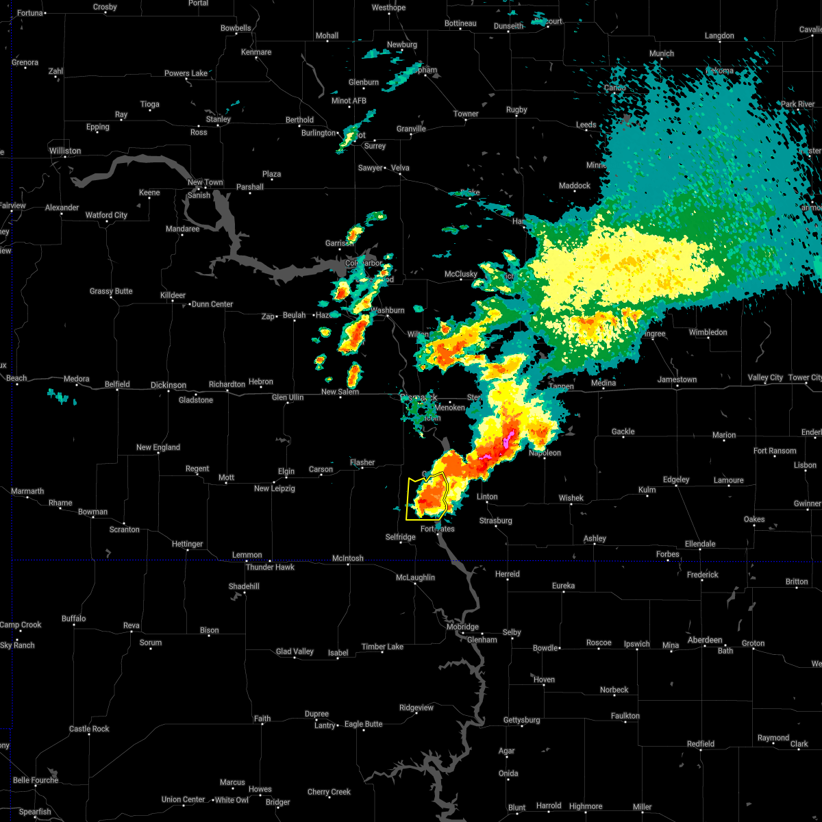 The national weather service in bismarck has issued a * severe thunderstorm warning for. northeastern sioux county in south central north dakota. until 200 pm cdt. At 1259 pm cdt, a severe thunderstorm was located near prairie knights resort, or 13 miles north of fort yates, and is nearly. The national weather service in bismarck has issued a * severe thunderstorm warning for. northeastern sioux county in south central north dakota. until 200 pm cdt. At 1259 pm cdt, a severe thunderstorm was located near prairie knights resort, or 13 miles north of fort yates, and is nearly.
|
| 8/14/2020 6:21 AM CDT |
 At 620 am cdt, severe thunderstorms were located along a line extending from near lincoln to 4 miles northwest of braddock to 9 miles east of linton, moving northeast at 50 mph (radar indicated). Hazards include 70 mph wind gusts and quarter size hail. Hail damage to vehicles is expected. expect considerable tree damage. wind damage is also likely to mobile homes, roofs, and outbuildings. these severe storms will be near, braddock around 625 am cdt. sterling around 640 am cdt. Other locations impacted by these severe thunderstorms include driscoll, moffit, kintyre, and temvik. At 620 am cdt, severe thunderstorms were located along a line extending from near lincoln to 4 miles northwest of braddock to 9 miles east of linton, moving northeast at 50 mph (radar indicated). Hazards include 70 mph wind gusts and quarter size hail. Hail damage to vehicles is expected. expect considerable tree damage. wind damage is also likely to mobile homes, roofs, and outbuildings. these severe storms will be near, braddock around 625 am cdt. sterling around 640 am cdt. Other locations impacted by these severe thunderstorms include driscoll, moffit, kintyre, and temvik.
|
| 8/14/2020 6:04 AM CDT |
 At 603 am cdt, severe thunderstorms were located along a line extending from st. anthony to 7 miles west of hazelton to 6 miles southwest of linton, moving northeast at 50 mph (radar indicated). Hazards include 60 mph wind gusts and quarter size hail. Hail damage to vehicles is expected. expect wind damage to roofs, siding, and trees. these severe storms will be near, linton and hazelton around 610 am cdt. braddock around 625 am cdt. sterling around 645 am cdt. Other locations impacted by these severe thunderstorms include driscoll, fort rice, temvik, moffit, kintyre, hazelton recreation area, university of mary, beaver bay recreation area, and huff. At 603 am cdt, severe thunderstorms were located along a line extending from st. anthony to 7 miles west of hazelton to 6 miles southwest of linton, moving northeast at 50 mph (radar indicated). Hazards include 60 mph wind gusts and quarter size hail. Hail damage to vehicles is expected. expect wind damage to roofs, siding, and trees. these severe storms will be near, linton and hazelton around 610 am cdt. braddock around 625 am cdt. sterling around 645 am cdt. Other locations impacted by these severe thunderstorms include driscoll, fort rice, temvik, moffit, kintyre, hazelton recreation area, university of mary, beaver bay recreation area, and huff.
|
| 8/14/2020 5:46 AM CDT |
 At 545 am cdt, severe thunderstorms were located along a line extending from 5 miles north of flasher to near solen to near fort yates, moving northeast at 45 mph (radar indicated). Hazards include 70 mph wind gusts and quarter size hail. Hail damage to vehicles is expected. expect considerable tree damage. wind damage is also likely to mobile homes, roofs, and outbuildings. severe thunderstorms will be near, fort yates around 550 am cdt. cannon ball around 555 am cdt. st. anthony around 610 am cdt. linton and hazelton around 615 am cdt. braddock around 630 am cdt. sterling around 645 am cdt. Other locations impacted by these severe thunderstorms include driscoll, fort rice, temvik, breien, moffit, kintyre, hazelton recreation area, university of mary, cattail recreation area, and beaver bay recreation area. At 545 am cdt, severe thunderstorms were located along a line extending from 5 miles north of flasher to near solen to near fort yates, moving northeast at 45 mph (radar indicated). Hazards include 70 mph wind gusts and quarter size hail. Hail damage to vehicles is expected. expect considerable tree damage. wind damage is also likely to mobile homes, roofs, and outbuildings. severe thunderstorms will be near, fort yates around 550 am cdt. cannon ball around 555 am cdt. st. anthony around 610 am cdt. linton and hazelton around 615 am cdt. braddock around 630 am cdt. sterling around 645 am cdt. Other locations impacted by these severe thunderstorms include driscoll, fort rice, temvik, breien, moffit, kintyre, hazelton recreation area, university of mary, cattail recreation area, and beaver bay recreation area.
|
| 8/14/2020 5:35 AM CDT |
 At 535 am cdt/435 am mdt/, severe thunderstorms were located along a line extending from 5 miles west of flasher to 7 miles west of solen to 9 miles southwest of prairie knights resort, moving northeast at 55 mph (radar indicated). Hazards include 70 mph wind gusts and half dollar size hail. Hail damage to vehicles is expected. expect considerable tree damage. wind damage is also likely to mobile homes, roofs, and outbuildings. these severe storms will be near, solen and prairie knights resort around 545 am cdt. cannon ball around 555 am cdt. other locations impacted by these severe thunderstorms include breien, lark, st. Gertrude, raleigh, and porcupine. At 535 am cdt/435 am mdt/, severe thunderstorms were located along a line extending from 5 miles west of flasher to 7 miles west of solen to 9 miles southwest of prairie knights resort, moving northeast at 55 mph (radar indicated). Hazards include 70 mph wind gusts and half dollar size hail. Hail damage to vehicles is expected. expect considerable tree damage. wind damage is also likely to mobile homes, roofs, and outbuildings. these severe storms will be near, solen and prairie knights resort around 545 am cdt. cannon ball around 555 am cdt. other locations impacted by these severe thunderstorms include breien, lark, st. Gertrude, raleigh, and porcupine.
|
| 8/14/2020 4:19 AM MDT |
 At 518 am cdt/418 am mdt/, severe thunderstorms were located along a line extending from carson to 4 miles northwest of shields to 8 miles northwest of selfridge, moving northeast at 60 mph (radar indicated). Hazards include 70 mph wind gusts and half dollar size hail. Hail damage to vehicles is expected. expect considerable tree damage. wind damage is also likely to mobile homes, roofs, and outbuildings. these severe storms will be near, flasher around 535 am cdt. solen and prairie knights resort around 540 am cdt. cannon ball around 545 am cdt. other locations impacted by these severe thunderstorms include heil, st. Gertrude, raleigh, porcupine, breien, leith, and lark. At 518 am cdt/418 am mdt/, severe thunderstorms were located along a line extending from carson to 4 miles northwest of shields to 8 miles northwest of selfridge, moving northeast at 60 mph (radar indicated). Hazards include 70 mph wind gusts and half dollar size hail. Hail damage to vehicles is expected. expect considerable tree damage. wind damage is also likely to mobile homes, roofs, and outbuildings. these severe storms will be near, flasher around 535 am cdt. solen and prairie knights resort around 540 am cdt. cannon ball around 545 am cdt. other locations impacted by these severe thunderstorms include heil, st. Gertrude, raleigh, porcupine, breien, leith, and lark.
|
| 8/14/2020 4:02 AM MDT |
 At 502 am cdt/402 am mdt/, severe thunderstorms were located along a line extending from 4 miles south of new leipzig to 10 miles north of watauga, moving northeast at 55 mph (radar indicated). Hazards include 70 mph wind gusts and half dollar size hail. Hail damage to vehicles is expected. expect considerable tree damage. wind damage is also likely to mobile homes, roofs, and outbuildings. severe thunderstorms will be near, carson and shields around 425 am mdt. flasher around 540 am cdt. solen around 545 am cdt. prairie knights resort around 550 am cdt. cannon ball around 555 am cdt. other locations impacted by these severe thunderstorms include heil, st. Gertrude, raleigh, porcupine, breien, leith and lark. At 502 am cdt/402 am mdt/, severe thunderstorms were located along a line extending from 4 miles south of new leipzig to 10 miles north of watauga, moving northeast at 55 mph (radar indicated). Hazards include 70 mph wind gusts and half dollar size hail. Hail damage to vehicles is expected. expect considerable tree damage. wind damage is also likely to mobile homes, roofs, and outbuildings. severe thunderstorms will be near, carson and shields around 425 am mdt. flasher around 540 am cdt. solen around 545 am cdt. prairie knights resort around 550 am cdt. cannon ball around 555 am cdt. other locations impacted by these severe thunderstorms include heil, st. Gertrude, raleigh, porcupine, breien, leith and lark.
|
| 7/25/2020 6:15 PM CDT |
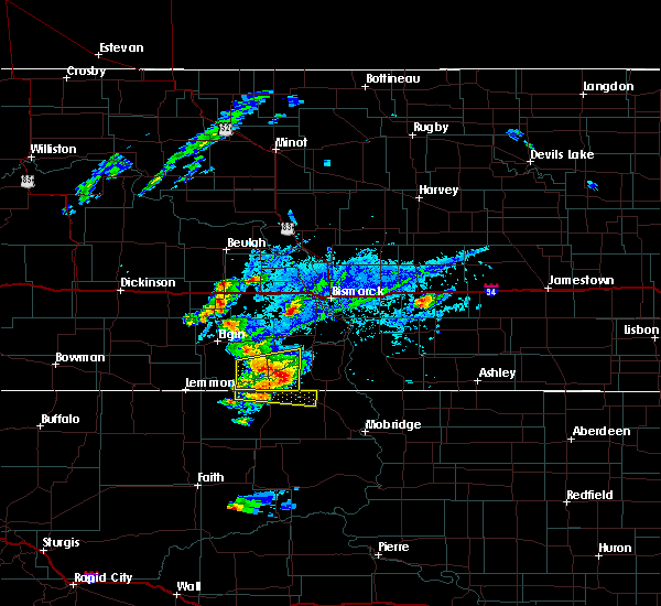 At 615 pm cdt/515 pm mdt/, a severe thunderstorm was located 11 miles northwest of walker, or 12 miles west of selfridge, moving east at 35 mph (radar indicated). Hazards include 60 mph wind gusts and quarter size hail. Hail damage to vehicles is expected. expect wind damage to roofs, siding, and trees. this severe thunderstorm will be near, selfridge around 635 pm cdt. fort yates around 700 pm cdt. Other locations impacted by this severe thunderstorm include porcupine. At 615 pm cdt/515 pm mdt/, a severe thunderstorm was located 11 miles northwest of walker, or 12 miles west of selfridge, moving east at 35 mph (radar indicated). Hazards include 60 mph wind gusts and quarter size hail. Hail damage to vehicles is expected. expect wind damage to roofs, siding, and trees. this severe thunderstorm will be near, selfridge around 635 pm cdt. fort yates around 700 pm cdt. Other locations impacted by this severe thunderstorm include porcupine.
|
| 7/17/2020 8:55 PM CDT |
 At 854 pm cdt, severe thunderstorms were located along a line extending from 7 miles southeast of cannon ball, to beaver bay recreation area, to 6 miles north of fort yates, moving east at 25 mph (radar indicated). Hazards include 70 mph wind gusts and quarter size hail. Hail damage to vehicles is expected. expect considerable tree damage. wind damage is also likely to mobile homes, roofs, and outbuildings. these severe storms will be near, linton around 925 pm cdt. strasburg around 940 pm cdt. Other locations impacted by these severe thunderstorms include temvik and beaver bay recreation area. At 854 pm cdt, severe thunderstorms were located along a line extending from 7 miles southeast of cannon ball, to beaver bay recreation area, to 6 miles north of fort yates, moving east at 25 mph (radar indicated). Hazards include 70 mph wind gusts and quarter size hail. Hail damage to vehicles is expected. expect considerable tree damage. wind damage is also likely to mobile homes, roofs, and outbuildings. these severe storms will be near, linton around 925 pm cdt. strasburg around 940 pm cdt. Other locations impacted by these severe thunderstorms include temvik and beaver bay recreation area.
|
| 7/17/2020 8:45 PM CDT |
 At 842 pm cdt, severe thunderstorms were located along a line extending from 4 miles southeast of cannon ball to 6 miles north of fort yates, moving east at 30 mph (radar indicated). Hazards include 60 mph wind gusts and quarter size hail. Hail damage to vehicles is expected. expect wind damage to roofs, siding, and trees. severe thunderstorms will be near, linton around 910 pm cdt. strasburg around 935 pm cdt. Other locations impacted by these severe thunderstorms include temvik and beaver bay recreation area. At 842 pm cdt, severe thunderstorms were located along a line extending from 4 miles southeast of cannon ball to 6 miles north of fort yates, moving east at 30 mph (radar indicated). Hazards include 60 mph wind gusts and quarter size hail. Hail damage to vehicles is expected. expect wind damage to roofs, siding, and trees. severe thunderstorms will be near, linton around 910 pm cdt. strasburg around 935 pm cdt. Other locations impacted by these severe thunderstorms include temvik and beaver bay recreation area.
|
| 7/10/2020 7:45 PM CDT |
 At 745 pm cdt, severe thunderstorms were located along a line extending from 7 miles east of cannon ball to 5 miles northwest of westfield to 7 miles northwest of kenel, moving east at 40 mph (radar indicated). Hazards include 60 mph wind gusts and quarter size hail. Hail damage to vehicles is expected. expect wind damage to roofs, siding, and trees. these severe storms will be near, strasburg and westfield around 750 pm cdt. linton around 800 pm cdt. Other locations impacted by these severe thunderstorms include temvik and beaver bay recreation area. At 745 pm cdt, severe thunderstorms were located along a line extending from 7 miles east of cannon ball to 5 miles northwest of westfield to 7 miles northwest of kenel, moving east at 40 mph (radar indicated). Hazards include 60 mph wind gusts and quarter size hail. Hail damage to vehicles is expected. expect wind damage to roofs, siding, and trees. these severe storms will be near, strasburg and westfield around 750 pm cdt. linton around 800 pm cdt. Other locations impacted by these severe thunderstorms include temvik and beaver bay recreation area.
|
| 7/10/2020 7:32 PM CDT |
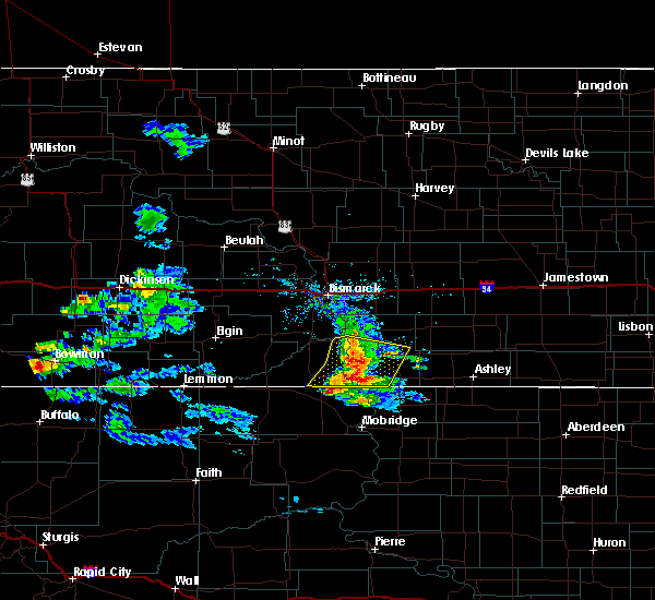 At 731 pm cdt, severe thunderstorms were located along a line extending from 5 miles east of cannon ball to 10 miles east of fort yates to 10 miles northeast of mclaughlin, moving east at 45 mph (radar indicated). Hazards include 70 mph wind gusts and half dollar size hail. Hail damage to vehicles is expected. expect considerable tree damage. wind damage is also likely to mobile homes, roofs, and outbuildings. these severe storms will be near, linton, strasburg and westfield around 750 pm cdt. Other locations impacted by these severe thunderstorms include temvik, cattail recreation area and beaver bay recreation area. At 731 pm cdt, severe thunderstorms were located along a line extending from 5 miles east of cannon ball to 10 miles east of fort yates to 10 miles northeast of mclaughlin, moving east at 45 mph (radar indicated). Hazards include 70 mph wind gusts and half dollar size hail. Hail damage to vehicles is expected. expect considerable tree damage. wind damage is also likely to mobile homes, roofs, and outbuildings. these severe storms will be near, linton, strasburg and westfield around 750 pm cdt. Other locations impacted by these severe thunderstorms include temvik, cattail recreation area and beaver bay recreation area.
|
| 7/10/2020 7:17 PM CDT |
 At 716 pm cdt, a severe thunderstorm was located 8 miles southeast of fort yates, moving northeast at 25 mph (radar indicated). Hazards include 70 mph wind gusts and ping pong ball size hail. People and animals outdoors will be injured. expect hail damage to roofs, siding, windows, and vehicles. expect considerable tree damage. wind damage is also likely to mobile homes, roofs, and outbuildings. this severe storm will be near, strasburg around 800 pm cdt. Other locations impacted by this severe thunderstorm include temvik, cattail recreation area and beaver bay recreation area. At 716 pm cdt, a severe thunderstorm was located 8 miles southeast of fort yates, moving northeast at 25 mph (radar indicated). Hazards include 70 mph wind gusts and ping pong ball size hail. People and animals outdoors will be injured. expect hail damage to roofs, siding, windows, and vehicles. expect considerable tree damage. wind damage is also likely to mobile homes, roofs, and outbuildings. this severe storm will be near, strasburg around 800 pm cdt. Other locations impacted by this severe thunderstorm include temvik, cattail recreation area and beaver bay recreation area.
|
| 7/10/2020 7:11 PM CDT |
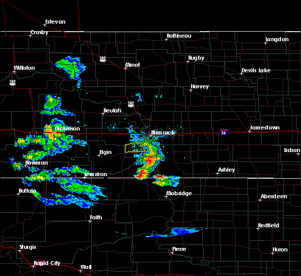 At 710 pm cdt, severe thunderstorms were located along a line extending from 8 miles north of cannon ball to 7 miles northwest of fort yates to near selfridge, moving east at 40 mph (radar indicated). Hazards include 70 mph wind gusts and half dollar size hail. Hail damage to vehicles is expected. expect considerable tree damage. wind damage is also likely to mobile homes, roofs, and outbuildings. severe thunderstorms will be near, prairie knights resort around 715 pm cdt. fort yates around 720 pm cdt. strasburg and westfield around 750 pm cdt. Other locations impacted by these severe thunderstorms include temvik, cattail recreation area and beaver bay recreation area. At 710 pm cdt, severe thunderstorms were located along a line extending from 8 miles north of cannon ball to 7 miles northwest of fort yates to near selfridge, moving east at 40 mph (radar indicated). Hazards include 70 mph wind gusts and half dollar size hail. Hail damage to vehicles is expected. expect considerable tree damage. wind damage is also likely to mobile homes, roofs, and outbuildings. severe thunderstorms will be near, prairie knights resort around 715 pm cdt. fort yates around 720 pm cdt. strasburg and westfield around 750 pm cdt. Other locations impacted by these severe thunderstorms include temvik, cattail recreation area and beaver bay recreation area.
|
| 6/30/2020 8:20 AM CDT |
 At 806 am cdt, severe thunderstorms were located along a line extending from 6 miles south of fish creek dam to 4 miles west of solen to fort yates, moving northeast at 35 mph (radar indicated). Hazards include 60 mph wind gusts and quarter size hail. Hail damage to vehicles is expected. expect wind damage to roofs, siding, and trees. severe thunderstorms will be near, solen around 810 am cdt. fish creek dam around 815 am cdt. linton around 845 am cdt. Other locations impacted by these severe thunderstorms include breien, hazelton recreation area, fort rice, cattail recreation area, beaver bay recreation area and huff. At 806 am cdt, severe thunderstorms were located along a line extending from 6 miles south of fish creek dam to 4 miles west of solen to fort yates, moving northeast at 35 mph (radar indicated). Hazards include 60 mph wind gusts and quarter size hail. Hail damage to vehicles is expected. expect wind damage to roofs, siding, and trees. severe thunderstorms will be near, solen around 810 am cdt. fish creek dam around 815 am cdt. linton around 845 am cdt. Other locations impacted by these severe thunderstorms include breien, hazelton recreation area, fort rice, cattail recreation area, beaver bay recreation area and huff.
|
| 6/30/2020 8:06 AM CDT |
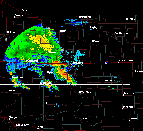 At 806 am cdt, severe thunderstorms were located along a line extending from 6 miles south of fish creek dam to 4 miles west of solen to fort yates, moving northeast at 35 mph (radar indicated). Hazards include 60 mph wind gusts and quarter size hail. Hail damage to vehicles is expected. expect wind damage to roofs, siding, and trees. severe thunderstorms will be near, solen around 810 am cdt. fish creek dam around 815 am cdt. linton around 845 am cdt. Other locations impacted by these severe thunderstorms include breien, hazelton recreation area, fort rice, cattail recreation area, beaver bay recreation area and huff. At 806 am cdt, severe thunderstorms were located along a line extending from 6 miles south of fish creek dam to 4 miles west of solen to fort yates, moving northeast at 35 mph (radar indicated). Hazards include 60 mph wind gusts and quarter size hail. Hail damage to vehicles is expected. expect wind damage to roofs, siding, and trees. severe thunderstorms will be near, solen around 810 am cdt. fish creek dam around 815 am cdt. linton around 845 am cdt. Other locations impacted by these severe thunderstorms include breien, hazelton recreation area, fort rice, cattail recreation area, beaver bay recreation area and huff.
|
| 6/28/2020 9:51 PM CDT |
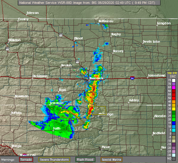 At 951 pm cdt, severe thunderstorms were located along a line extending from near cannon ball to 5 miles south of fort yates, moving east at 15 mph (radar indicated). Hazards include 60 mph wind gusts and quarter size hail. Hail damage to vehicles is expected. expect wind damage to roofs, siding, and trees. These severe storms will be near, cannon ball around 955 pm cdt. At 951 pm cdt, severe thunderstorms were located along a line extending from near cannon ball to 5 miles south of fort yates, moving east at 15 mph (radar indicated). Hazards include 60 mph wind gusts and quarter size hail. Hail damage to vehicles is expected. expect wind damage to roofs, siding, and trees. These severe storms will be near, cannon ball around 955 pm cdt.
|
| 6/28/2020 9:26 PM CDT |
 At 926 pm cdt, severe thunderstorms were located along a line extending from near solen to 6 miles east of selfridge, moving east at 15 mph (radar indicated). Hazards include 60 mph wind gusts and quarter size hail. Hail damage to vehicles is expected. expect wind damage to roofs, siding, and trees. severe thunderstorms will be near, prairie knights resort around 945 pm cdt. cannon ball around 955 pm cdt. Fort yates around 1005 pm cdt. At 926 pm cdt, severe thunderstorms were located along a line extending from near solen to 6 miles east of selfridge, moving east at 15 mph (radar indicated). Hazards include 60 mph wind gusts and quarter size hail. Hail damage to vehicles is expected. expect wind damage to roofs, siding, and trees. severe thunderstorms will be near, prairie knights resort around 945 pm cdt. cannon ball around 955 pm cdt. Fort yates around 1005 pm cdt.
|
| 6/28/2020 8:59 PM CDT |
 At 858 pm cdt, severe thunderstorms were located along a line extending from 7 miles southeast of st. anthony to selfridge, moving east at 10 mph (radar indicated). Hazards include 60 mph wind gusts and quarter size hail. Hail damage to vehicles is expected. expect wind damage to roofs, siding, and trees. Locations impacted include, selfridge, solen, breien and huff. At 858 pm cdt, severe thunderstorms were located along a line extending from 7 miles southeast of st. anthony to selfridge, moving east at 10 mph (radar indicated). Hazards include 60 mph wind gusts and quarter size hail. Hail damage to vehicles is expected. expect wind damage to roofs, siding, and trees. Locations impacted include, selfridge, solen, breien and huff.
|
| 6/28/2020 8:43 PM CDT |
 At 841 pm cdt, severe thunderstorms were located along a line extending from 5 miles southeast of st. anthony to near selfridge, moving east at 10 mph (radar indicated). Hazards include 60 mph wind gusts and quarter size hail. Hail damage to vehicles is expected. expect wind damage to roofs, siding, and trees. These severe thunderstorms will remain over mainly rural areas of eastern sioux and southeastern morton counties, including the following locations, breien and huff. At 841 pm cdt, severe thunderstorms were located along a line extending from 5 miles southeast of st. anthony to near selfridge, moving east at 10 mph (radar indicated). Hazards include 60 mph wind gusts and quarter size hail. Hail damage to vehicles is expected. expect wind damage to roofs, siding, and trees. These severe thunderstorms will remain over mainly rural areas of eastern sioux and southeastern morton counties, including the following locations, breien and huff.
|
| 6/28/2020 8:25 PM CDT |
 At 825 pm cdt, severe thunderstorms were located along a line extending from st. anthony to 7 miles west of solen, moving northeast at 15 mph (radar indicated). Hazards include 60 mph wind gusts and quarter size hail. Hail damage to vehicles is expected. expect wind damage to roofs, siding, and trees. Locations impacted include, solen, breien, hazelton recreation area, fort rice and huff. At 825 pm cdt, severe thunderstorms were located along a line extending from st. anthony to 7 miles west of solen, moving northeast at 15 mph (radar indicated). Hazards include 60 mph wind gusts and quarter size hail. Hail damage to vehicles is expected. expect wind damage to roofs, siding, and trees. Locations impacted include, solen, breien, hazelton recreation area, fort rice and huff.
|
| 6/28/2020 8:07 PM CDT |
 At 806 pm cdt, severe thunderstorms were located along a line extending from 4 miles southwest of st. anthony to 9 miles north of shields, moving northeast at 15 mph (radar indicated). Hazards include 60 mph wind gusts and quarter size hail. Hail damage to vehicles is expected. expect wind damage to roofs, siding, and trees. Locations impacted include, solen, breien, hazelton recreation area, fort rice and huff. At 806 pm cdt, severe thunderstorms were located along a line extending from 4 miles southwest of st. anthony to 9 miles north of shields, moving northeast at 15 mph (radar indicated). Hazards include 60 mph wind gusts and quarter size hail. Hail damage to vehicles is expected. expect wind damage to roofs, siding, and trees. Locations impacted include, solen, breien, hazelton recreation area, fort rice and huff.
|
| 6/28/2020 7:52 PM CDT |
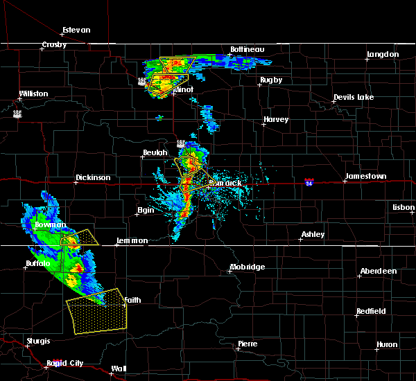 At 751 pm cdt, a severe thunderstorm was located 8 miles east of flasher, or 27 miles north of selfridge, moving northeast at 10 mph (radar indicated). Hazards include 60 mph wind gusts and quarter size hail. Hail damage to vehicles is expected. expect wind damage to roofs, siding, and trees. This severe thunderstorm will remain over mainly rural areas of southeastern morton county, including the following locations, breien, hazelton recreation area, fort rice and huff. At 751 pm cdt, a severe thunderstorm was located 8 miles east of flasher, or 27 miles north of selfridge, moving northeast at 10 mph (radar indicated). Hazards include 60 mph wind gusts and quarter size hail. Hail damage to vehicles is expected. expect wind damage to roofs, siding, and trees. This severe thunderstorm will remain over mainly rural areas of southeastern morton county, including the following locations, breien, hazelton recreation area, fort rice and huff.
|
| 6/6/2020 10:57 PM CDT |
 At 1056 pm cdt/956 pm mdt/, severe thunderstorms were located along a line extending from 6 miles southwest of new salem to 8 miles north of flasher to 9 miles northeast of shields, moving northeast at 50 mph (radar indicated). Hazards include 60 mph wind gusts. Expect damage to roofs, siding, and trees. these severe storms will be near, solen and st. anthony around 1110 pm cdt. other locations impacted by these severe thunderstorms include heil, st. Gertrude, raleigh, sweet briar lake, porcupine, breien, leith, lark and judson. At 1056 pm cdt/956 pm mdt/, severe thunderstorms were located along a line extending from 6 miles southwest of new salem to 8 miles north of flasher to 9 miles northeast of shields, moving northeast at 50 mph (radar indicated). Hazards include 60 mph wind gusts. Expect damage to roofs, siding, and trees. these severe storms will be near, solen and st. anthony around 1110 pm cdt. other locations impacted by these severe thunderstorms include heil, st. Gertrude, raleigh, sweet briar lake, porcupine, breien, leith, lark and judson.
|
| 6/6/2020 9:39 PM MDT |
 At 1039 pm cdt/939 pm mdt/, severe thunderstorms were located along a line extending from 7 miles north of heart butte dam to 6 miles northeast of carson to 6 miles west of shields, moving northeast at 45 mph (radar indicated). Hazards include 60 mph wind gusts. Expect damage to roofs, siding, and trees. these severe storms will be near, shields around 945 pm mdt. flasher around 950 pm mdt. new salem and fish creek dam around 1105 pm cdt. solen around 1110 pm cdt. st. anthony around 1120 pm cdt. other locations impacted by these severe thunderstorms include heil, st. Gertrude, raleigh, sweet briar lake, porcupine, breien, leith, lark and judson. At 1039 pm cdt/939 pm mdt/, severe thunderstorms were located along a line extending from 7 miles north of heart butte dam to 6 miles northeast of carson to 6 miles west of shields, moving northeast at 45 mph (radar indicated). Hazards include 60 mph wind gusts. Expect damage to roofs, siding, and trees. these severe storms will be near, shields around 945 pm mdt. flasher around 950 pm mdt. new salem and fish creek dam around 1105 pm cdt. solen around 1110 pm cdt. st. anthony around 1120 pm cdt. other locations impacted by these severe thunderstorms include heil, st. Gertrude, raleigh, sweet briar lake, porcupine, breien, leith, lark and judson.
|
| 6/6/2020 9:24 PM MDT |
 At 1021 pm cdt/921 pm mdt/, severe thunderstorms were located along a line extending from 9 miles west of heart butte dam to 5 miles southwest of carson to 12 miles north of watauga, moving northeast at 60 mph (radar indicated). Hazards include 70 mph wind gusts. Expect considerable tree damage. damage is likely to mobile homes, roofs, and outbuildings. severe thunderstorms will be near, carson around 925 pm mdt. heart butte dam around 930 pm mdt. glen ullin, flasher and shields around 940 pm mdt. almont around 945 pm mdt. new salem and fish creek dam around 1055 pm cdt. solen around 1100 pm cdt. other locations impacted by these severe thunderstorms include heil, st. Gertrude, raleigh, sweet briar lake, porcupine, breien, leith, lark and judson. At 1021 pm cdt/921 pm mdt/, severe thunderstorms were located along a line extending from 9 miles west of heart butte dam to 5 miles southwest of carson to 12 miles north of watauga, moving northeast at 60 mph (radar indicated). Hazards include 70 mph wind gusts. Expect considerable tree damage. damage is likely to mobile homes, roofs, and outbuildings. severe thunderstorms will be near, carson around 925 pm mdt. heart butte dam around 930 pm mdt. glen ullin, flasher and shields around 940 pm mdt. almont around 945 pm mdt. new salem and fish creek dam around 1055 pm cdt. solen around 1100 pm cdt. other locations impacted by these severe thunderstorms include heil, st. Gertrude, raleigh, sweet briar lake, porcupine, breien, leith, lark and judson.
|
| 9/20/2019 7:06 PM CDT |
 The severe thunderstorm warning for northeastern sioux and southeastern morton counties will expire at 715 pm cdt, the storm which prompted the warning has weakened below severe limits, and no longer poses an immediate threat to life or property. therefore, the warning will be allowed to expire. a severe thunderstorm watch remains in effect until 1000 pm cdt for south central north dakota. The severe thunderstorm warning for northeastern sioux and southeastern morton counties will expire at 715 pm cdt, the storm which prompted the warning has weakened below severe limits, and no longer poses an immediate threat to life or property. therefore, the warning will be allowed to expire. a severe thunderstorm watch remains in effect until 1000 pm cdt for south central north dakota.
|
| 9/20/2019 6:46 PM CDT |
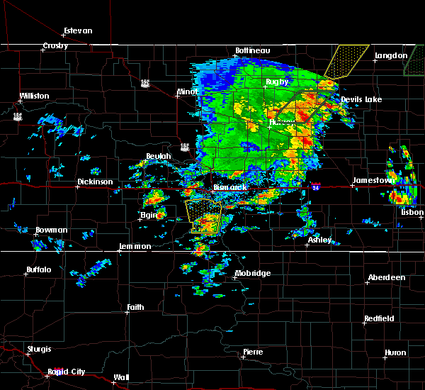 At 646 pm cdt, a severe thunderstorm was located 5 miles west of solen, or 25 miles northwest of fort yates, moving north at 40 mph (radar indicated). Hazards include ping pong ball size hail and 60 mph wind gusts. People and animals outdoors will be injured. expect hail damage to roofs, siding, windows, and vehicles. expect wind damage to roofs, siding, and trees. this severe storm will be near, st. anthony around 705 pm cdt. Other locations impacted by this severe thunderstorm include breien and huff. At 646 pm cdt, a severe thunderstorm was located 5 miles west of solen, or 25 miles northwest of fort yates, moving north at 40 mph (radar indicated). Hazards include ping pong ball size hail and 60 mph wind gusts. People and animals outdoors will be injured. expect hail damage to roofs, siding, windows, and vehicles. expect wind damage to roofs, siding, and trees. this severe storm will be near, st. anthony around 705 pm cdt. Other locations impacted by this severe thunderstorm include breien and huff.
|
| 9/20/2019 6:33 PM CDT |
 At 633 pm cdt, a severe thunderstorm was located 8 miles southwest of solen, or 16 miles north of selfridge, moving north at 40 mph (radar indicated). Hazards include 60 mph wind gusts and quarter size hail. Hail damage to vehicles is expected. expect wind damage to roofs, siding, and trees. this severe thunderstorm will be near, solen around 645 pm cdt. st. anthony around 705 pm cdt. Other locations impacted by this severe thunderstorm include breien and huff. At 633 pm cdt, a severe thunderstorm was located 8 miles southwest of solen, or 16 miles north of selfridge, moving north at 40 mph (radar indicated). Hazards include 60 mph wind gusts and quarter size hail. Hail damage to vehicles is expected. expect wind damage to roofs, siding, and trees. this severe thunderstorm will be near, solen around 645 pm cdt. st. anthony around 705 pm cdt. Other locations impacted by this severe thunderstorm include breien and huff.
|
| 9/20/2019 5:01 PM CDT |
 At 501 pm cdt, severe thunderstorms were located along a line extending from lincoln to 14 miles northwest of hazelton to cannon ball, moving northeast at 30 mph (radar indicated). Hazards include 60 mph wind gusts and quarter size hail. Hail damage to vehicles is expected. expect wind damage to roofs, siding, and trees. these severe storms will be near, lincoln around 505 pm cdt. mcdowell dam recreation area around 510 pm cdt. menoken around 515 pm cdt. Other locations impacted by these severe thunderstorms include fort abraham lincoln state park, hazelton recreation area, fort rice, university of mary and huff. At 501 pm cdt, severe thunderstorms were located along a line extending from lincoln to 14 miles northwest of hazelton to cannon ball, moving northeast at 30 mph (radar indicated). Hazards include 60 mph wind gusts and quarter size hail. Hail damage to vehicles is expected. expect wind damage to roofs, siding, and trees. these severe storms will be near, lincoln around 505 pm cdt. mcdowell dam recreation area around 510 pm cdt. menoken around 515 pm cdt. Other locations impacted by these severe thunderstorms include fort abraham lincoln state park, hazelton recreation area, fort rice, university of mary and huff.
|
| 9/20/2019 4:45 PM CDT |
 At 445 pm cdt, severe thunderstorms were located along a line extending from 5 miles southwest of lincoln to 5 miles northwest of cannon ball to 4 miles west of prairie knights resort, moving northeast at 20 mph (radar indicated). Hazards include 60 mph wind gusts and quarter size hail. Hail damage to vehicles is expected. expect wind damage to roofs, siding, and trees. severe thunderstorms will be near, lincoln around 500 pm cdt. bismarck around 505 pm cdt. mcdowell dam recreation area around 515 pm cdt. menoken around 530 pm cdt. Other locations impacted by these severe thunderstorms include fort abraham lincoln state park, hazelton recreation area, fort rice, university of mary, beaver bay recreation area and huff. At 445 pm cdt, severe thunderstorms were located along a line extending from 5 miles southwest of lincoln to 5 miles northwest of cannon ball to 4 miles west of prairie knights resort, moving northeast at 20 mph (radar indicated). Hazards include 60 mph wind gusts and quarter size hail. Hail damage to vehicles is expected. expect wind damage to roofs, siding, and trees. severe thunderstorms will be near, lincoln around 500 pm cdt. bismarck around 505 pm cdt. mcdowell dam recreation area around 515 pm cdt. menoken around 530 pm cdt. Other locations impacted by these severe thunderstorms include fort abraham lincoln state park, hazelton recreation area, fort rice, university of mary, beaver bay recreation area and huff.
|
| 9/20/2019 4:05 PM CDT |
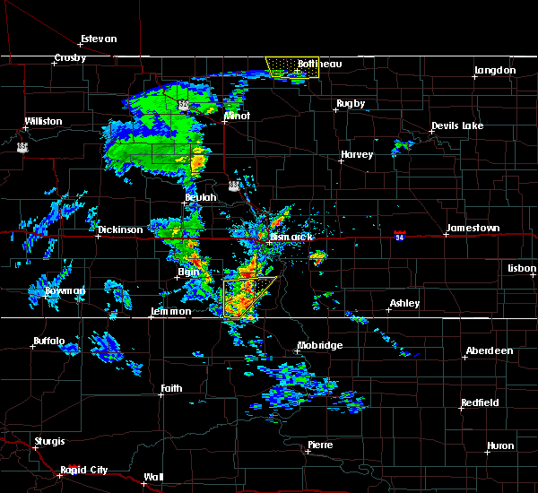 At 405 pm cdt/305 pm mdt/, severe thunderstorms were located along a line extending from 4 miles northeast of shields to 9 miles north of walker, moving northeast at 25 mph (radar indicated). Hazards include 60 mph wind gusts and half dollar size hail. Hail damage to vehicles is expected. expect wind damage to roofs, siding, and trees. these severe storms will be near, shields around 410 pm cdt. solen around 430 pm cdt. Other locations impacted by these severe thunderstorms include breien and porcupine. At 405 pm cdt/305 pm mdt/, severe thunderstorms were located along a line extending from 4 miles northeast of shields to 9 miles north of walker, moving northeast at 25 mph (radar indicated). Hazards include 60 mph wind gusts and half dollar size hail. Hail damage to vehicles is expected. expect wind damage to roofs, siding, and trees. these severe storms will be near, shields around 410 pm cdt. solen around 430 pm cdt. Other locations impacted by these severe thunderstorms include breien and porcupine.
|
| 9/20/2019 3:39 PM CDT |
 At 339 pm cdt/239 pm mdt/, severe thunderstorms were located along a line extending from 6 miles northeast of shields to 11 miles west of selfridge, moving north at 20 mph (radar indicated). Hazards include 60 mph wind gusts and half dollar size hail. Hail damage to vehicles is expected. expect wind damage to roofs, siding, and trees. these severe storms will be near, shields around 315 pm mdt. Other locations impacted by these severe thunderstorms include breien and porcupine. At 339 pm cdt/239 pm mdt/, severe thunderstorms were located along a line extending from 6 miles northeast of shields to 11 miles west of selfridge, moving north at 20 mph (radar indicated). Hazards include 60 mph wind gusts and half dollar size hail. Hail damage to vehicles is expected. expect wind damage to roofs, siding, and trees. these severe storms will be near, shields around 315 pm mdt. Other locations impacted by these severe thunderstorms include breien and porcupine.
|
| 9/20/2019 3:23 PM CDT |
 At 322 pm cdt/222 pm mdt/, a severe thunderstorm was located 10 miles northwest of walker, or 12 miles west of selfridge, moving north at 25 mph (radar indicated). Hazards include 60 mph wind gusts and half dollar size hail. Hail damage to vehicles is expected. expect wind damage to roofs, siding, and trees. this severe thunderstorm will be near, shields around 255 pm mdt. Other locations impacted by this severe thunderstorm include breien and porcupine. At 322 pm cdt/222 pm mdt/, a severe thunderstorm was located 10 miles northwest of walker, or 12 miles west of selfridge, moving north at 25 mph (radar indicated). Hazards include 60 mph wind gusts and half dollar size hail. Hail damage to vehicles is expected. expect wind damage to roofs, siding, and trees. this severe thunderstorm will be near, shields around 255 pm mdt. Other locations impacted by this severe thunderstorm include breien and porcupine.
|
| 8/6/2019 5:01 PM CDT |
 At 501 pm cdt, a severe thunderstorm was located 10 miles southeast of lincoln, or 15 miles southeast of bismarck, moving southeast at 35 mph (radar indicated). Hazards include 70 mph wind gusts and ping pong ball size hail. People and animals outdoors will be injured. expect hail damage to roofs, siding, windows, and vehicles. expect considerable tree damage. wind damage is also likely to mobile homes, roofs, and outbuildings. this severe storm will be near, hazelton around 530 pm cdt. Other locations impacted by this severe thunderstorm include moffit, hazelton recreation area, mckenzie, fort rice, beaver bay recreation area and huff. At 501 pm cdt, a severe thunderstorm was located 10 miles southeast of lincoln, or 15 miles southeast of bismarck, moving southeast at 35 mph (radar indicated). Hazards include 70 mph wind gusts and ping pong ball size hail. People and animals outdoors will be injured. expect hail damage to roofs, siding, windows, and vehicles. expect considerable tree damage. wind damage is also likely to mobile homes, roofs, and outbuildings. this severe storm will be near, hazelton around 530 pm cdt. Other locations impacted by this severe thunderstorm include moffit, hazelton recreation area, mckenzie, fort rice, beaver bay recreation area and huff.
|
| 8/6/2019 4:50 PM CDT |
 At 449 pm cdt, a severe thunderstorm was located near lincoln, or 8 miles southeast of bismarck, moving southeast at 40 mph (radar indicated). Hazards include 70 mph wind gusts and quarter size hail. Hail damage to vehicles is expected. expect considerable tree damage. wind damage is also likely to mobile homes, roofs, and outbuildings. this severe storm will be near, hazelton around 525 pm cdt. Other locations impacted by this severe thunderstorm include mckenzie, fort rice, fort abraham lincoln state park, moffit, hazelton recreation area, university of mary, beaver bay recreation area and huff. At 449 pm cdt, a severe thunderstorm was located near lincoln, or 8 miles southeast of bismarck, moving southeast at 40 mph (radar indicated). Hazards include 70 mph wind gusts and quarter size hail. Hail damage to vehicles is expected. expect considerable tree damage. wind damage is also likely to mobile homes, roofs, and outbuildings. this severe storm will be near, hazelton around 525 pm cdt. Other locations impacted by this severe thunderstorm include mckenzie, fort rice, fort abraham lincoln state park, moffit, hazelton recreation area, university of mary, beaver bay recreation area and huff.
|
| 8/6/2019 4:38 PM CDT |
 At 438 pm cdt, a severe thunderstorm was located near bismarck, moving southeast at 35 mph (radar indicated). Hazards include tennis ball size hail and 70 mph wind gusts. People and animals outdoors will be injured. expect hail damage to roofs, siding, windows, and vehicles. expect considerable tree damage. wind damage is also likely to mobile homes, roofs, and outbuildings. this severe thunderstorm will be near, lincoln around 445 pm cdt. cannon ball around 525 pm cdt. Other locations impacted by this severe thunderstorm include mckenzie, fort rice, fort abraham lincoln state park, moffit, hazelton recreation area, university of mary, beaver bay recreation area and huff. At 438 pm cdt, a severe thunderstorm was located near bismarck, moving southeast at 35 mph (radar indicated). Hazards include tennis ball size hail and 70 mph wind gusts. People and animals outdoors will be injured. expect hail damage to roofs, siding, windows, and vehicles. expect considerable tree damage. wind damage is also likely to mobile homes, roofs, and outbuildings. this severe thunderstorm will be near, lincoln around 445 pm cdt. cannon ball around 525 pm cdt. Other locations impacted by this severe thunderstorm include mckenzie, fort rice, fort abraham lincoln state park, moffit, hazelton recreation area, university of mary, beaver bay recreation area and huff.
|
| 8/6/2019 3:50 PM CDT |
 At 350 pm cdt, a severe thunderstorm was located 10 miles northwest of cannon ball, or 20 miles south of bismarck, moving east at 15 mph (radar indicated). Hazards include 60 mph wind gusts and half dollar size hail. Hail damage to vehicles is expected. expect wind damage to roofs, siding, and trees. Locations impacted include, cannon ball, hazelton recreation area, fort rice and huff. At 350 pm cdt, a severe thunderstorm was located 10 miles northwest of cannon ball, or 20 miles south of bismarck, moving east at 15 mph (radar indicated). Hazards include 60 mph wind gusts and half dollar size hail. Hail damage to vehicles is expected. expect wind damage to roofs, siding, and trees. Locations impacted include, cannon ball, hazelton recreation area, fort rice and huff.
|
| 8/6/2019 3:36 PM CDT |
 At 335 pm cdt, a severe thunderstorm was located 9 miles north of solen, or 19 miles south of bismarck, moving east at 15 mph (radar indicated). Hazards include golf ball size hail and 70 mph wind gusts. People and animals outdoors will be injured. expect hail damage to roofs, siding, windows, and vehicles. expect considerable tree damage. wind damage is also likely to mobile homes, roofs, and outbuildings. This severe thunderstorm will remain over mainly rural areas of northeastern sioux, southeastern morton and northwestern emmons counties, including the following locations, hazelton recreation area, fort rice and huff. At 335 pm cdt, a severe thunderstorm was located 9 miles north of solen, or 19 miles south of bismarck, moving east at 15 mph (radar indicated). Hazards include golf ball size hail and 70 mph wind gusts. People and animals outdoors will be injured. expect hail damage to roofs, siding, windows, and vehicles. expect considerable tree damage. wind damage is also likely to mobile homes, roofs, and outbuildings. This severe thunderstorm will remain over mainly rural areas of northeastern sioux, southeastern morton and northwestern emmons counties, including the following locations, hazelton recreation area, fort rice and huff.
|
| 7/18/2019 2:02 AM CDT |
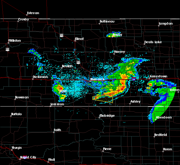 At 202 am cdt, a severe thunderstorm was located near prairie knights resort, or 9 miles north of fort yates, moving east at 30 mph (radar indicated). Hazards include 60 mph wind gusts and half dollar size hail. Hail damage to vehicles is expected. expect wind damage to roofs, siding, and trees. this severe thunderstorm will be near, linton around 235 am cdt. strasburg around 240 am cdt. Other locations impacted by this severe thunderstorm include beaver bay recreation area. At 202 am cdt, a severe thunderstorm was located near prairie knights resort, or 9 miles north of fort yates, moving east at 30 mph (radar indicated). Hazards include 60 mph wind gusts and half dollar size hail. Hail damage to vehicles is expected. expect wind damage to roofs, siding, and trees. this severe thunderstorm will be near, linton around 235 am cdt. strasburg around 240 am cdt. Other locations impacted by this severe thunderstorm include beaver bay recreation area.
|
| 7/17/2019 6:51 PM CDT |
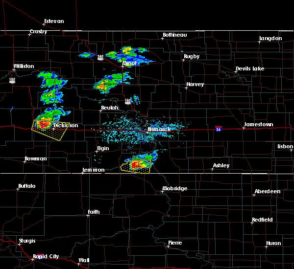 At 646 pm cdt, a severe thunderstorm was located 8 miles south of shields, or 11 miles west of selfridge, moving east at 25 mph (radar indicated). Hazards include golf ball size hail and 60 mph wind gusts. People and animals outdoors will be injured. expect hail damage to roofs, siding, windows, and vehicles. expect wind damage to roofs, siding, and trees. This severe storm will be near, selfridge around 715 pm cdt. At 646 pm cdt, a severe thunderstorm was located 8 miles south of shields, or 11 miles west of selfridge, moving east at 25 mph (radar indicated). Hazards include golf ball size hail and 60 mph wind gusts. People and animals outdoors will be injured. expect hail damage to roofs, siding, windows, and vehicles. expect wind damage to roofs, siding, and trees. This severe storm will be near, selfridge around 715 pm cdt.
|
| 7/17/2019 6:31 PM CDT |
 At 630 pm cdt/530 pm mdt/, a severe thunderstorm was located 11 miles southwest of shields, or 18 miles west of selfridge, moving east at 25 mph (radar indicated). Hazards include golf ball size hail and 60 mph wind gusts. People and animals outdoors will be injured. expect hail damage to roofs, siding, windows, and vehicles. This severe storm will be near, selfridge around 715 pm cdt. At 630 pm cdt/530 pm mdt/, a severe thunderstorm was located 11 miles southwest of shields, or 18 miles west of selfridge, moving east at 25 mph (radar indicated). Hazards include golf ball size hail and 60 mph wind gusts. People and animals outdoors will be injured. expect hail damage to roofs, siding, windows, and vehicles. This severe storm will be near, selfridge around 715 pm cdt.
|
| 7/17/2019 6:17 PM CDT |
 At 615 pm cdt/515 pm mdt/, a severe thunderstorm was located 14 miles north of mcintosh, or 23 miles west of selfridge, moving east at 20 mph (radar indicated). Hazards include 60 mph wind gusts and half dollar size hail. Hail damage to vehicles is expected. expect wind damage to roofs, siding, and trees. this severe thunderstorm will be near, selfridge around 715 pm cdt. Other locations impacted by this severe thunderstorm include porcupine. At 615 pm cdt/515 pm mdt/, a severe thunderstorm was located 14 miles north of mcintosh, or 23 miles west of selfridge, moving east at 20 mph (radar indicated). Hazards include 60 mph wind gusts and half dollar size hail. Hail damage to vehicles is expected. expect wind damage to roofs, siding, and trees. this severe thunderstorm will be near, selfridge around 715 pm cdt. Other locations impacted by this severe thunderstorm include porcupine.
|
| 7/15/2019 3:27 AM CDT |
 The severe thunderstorm warning for northeastern sioux, southeastern mclean, burleigh, morton, oliver and northwestern emmons counties will expire at 330 am cdt, the storms which prompted the warning have weakened below severe limits, and no longer pose an immediate threat to life or property. therefore, the warning will be allowed to expire. however gusty winds are still possible with these thunderstorms. The severe thunderstorm warning for northeastern sioux, southeastern mclean, burleigh, morton, oliver and northwestern emmons counties will expire at 330 am cdt, the storms which prompted the warning have weakened below severe limits, and no longer pose an immediate threat to life or property. therefore, the warning will be allowed to expire. however gusty winds are still possible with these thunderstorms.
|
| 7/15/2019 3:12 AM CDT |
 At 312 am cdt, severe thunderstorms were located along a line extending from 7 miles northwest of regan to near menoken to cannon ball, moving east at 50 mph (radar indicated). Hazards include 60 mph wind gusts. Expect damage to roofs, siding, and trees. these severe storms will be near, menoken and regan around 315 am cdt. sterling around 325 am cdt. hazelton and wing around 330 am cdt. Other locations impacted by these severe thunderstorms include double ditch indian village, mckenzie, temvik, baldwin, breien, hensler, fort clark, hazelton recreation area, university of mary and huff. At 312 am cdt, severe thunderstorms were located along a line extending from 7 miles northwest of regan to near menoken to cannon ball, moving east at 50 mph (radar indicated). Hazards include 60 mph wind gusts. Expect damage to roofs, siding, and trees. these severe storms will be near, menoken and regan around 315 am cdt. sterling around 325 am cdt. hazelton and wing around 330 am cdt. Other locations impacted by these severe thunderstorms include double ditch indian village, mckenzie, temvik, baldwin, breien, hensler, fort clark, hazelton recreation area, university of mary and huff.
|
| 7/15/2019 2:48 AM CDT |
 At 248 am cdt/148 am mdt/, severe thunderstorms were located along a line extending from near cross ranch state park to 4 miles southwest of mandan to 10 miles west of solen, moving east at 45 mph (radar indicated). Hazards include 70 mph wind gusts and penny size hail. Expect considerable tree damage. damage is likely to mobile homes, roofs, and outbuildings. these severe storms will be near, bismarck and wilton around 300 am cdt. lincoln, solen and mcdowell dam recreation area around 305 am cdt. menoken and cannon ball around 315 am cdt. regan around 320 am cdt. hazelton, wing and sterling around 330 am cdt. Other locations impacted by these severe thunderstorms include double ditch indian village, heil, raleigh, mckenzie, temvik, baldwin, breien, hensler, lark and fort clark. At 248 am cdt/148 am mdt/, severe thunderstorms were located along a line extending from near cross ranch state park to 4 miles southwest of mandan to 10 miles west of solen, moving east at 45 mph (radar indicated). Hazards include 70 mph wind gusts and penny size hail. Expect considerable tree damage. damage is likely to mobile homes, roofs, and outbuildings. these severe storms will be near, bismarck and wilton around 300 am cdt. lincoln, solen and mcdowell dam recreation area around 305 am cdt. menoken and cannon ball around 315 am cdt. regan around 320 am cdt. hazelton, wing and sterling around 330 am cdt. Other locations impacted by these severe thunderstorms include double ditch indian village, heil, raleigh, mckenzie, temvik, baldwin, breien, hensler, lark and fort clark.
|
| 7/15/2019 2:27 AM CDT |
 The national weather service in bismarck has issued a * severe thunderstorm warning for. northeastern sioux county in south central north dakota. southeastern mclean county in south central north dakota. burleigh county in south central north dakota. Morton county in south central north dakota. The national weather service in bismarck has issued a * severe thunderstorm warning for. northeastern sioux county in south central north dakota. southeastern mclean county in south central north dakota. burleigh county in south central north dakota. Morton county in south central north dakota.
|
| 7/8/2019 6:11 PM CDT |
 At 611 pm cdt/511 pm mdt/, severe thunderstorms were located along a line extending from 4 miles west of sterling to 8 miles southeast of flasher, moving east at 10 mph (radar indicated). Hazards include 60 mph wind gusts and half dollar size hail. Hail damage to vehicles is expected. expect wind damage to roofs, siding, and trees. these severe storms will be near, menoken around 615 pm cdt. sterling around 635 pm cdt. Other locations impacted by these severe thunderstorms include driscoll, raleigh, mckenzie, fort rice, breien, moffit, hazelton recreation area, university of mary and huff. At 611 pm cdt/511 pm mdt/, severe thunderstorms were located along a line extending from 4 miles west of sterling to 8 miles southeast of flasher, moving east at 10 mph (radar indicated). Hazards include 60 mph wind gusts and half dollar size hail. Hail damage to vehicles is expected. expect wind damage to roofs, siding, and trees. these severe storms will be near, menoken around 615 pm cdt. sterling around 635 pm cdt. Other locations impacted by these severe thunderstorms include driscoll, raleigh, mckenzie, fort rice, breien, moffit, hazelton recreation area, university of mary and huff.
|
| 7/8/2019 5:44 PM CDT |
 At 544 pm cdt/444 pm mdt/, severe thunderstorms were located along a line extending from near menoken to 5 miles south of flasher, moving east at 10 mph (radar indicated). Hazards include 60 mph wind gusts and half dollar size hail. Hail damage to vehicles is expected. expect wind damage to roofs, siding, and trees. severe thunderstorms will be near, menoken around 550 pm cdt. sterling around 635 pm cdt. Other locations impacted by these severe thunderstorms include driscoll, raleigh, mckenzie, fort rice, breien, moffit, hazelton recreation area, university of mary and huff. At 544 pm cdt/444 pm mdt/, severe thunderstorms were located along a line extending from near menoken to 5 miles south of flasher, moving east at 10 mph (radar indicated). Hazards include 60 mph wind gusts and half dollar size hail. Hail damage to vehicles is expected. expect wind damage to roofs, siding, and trees. severe thunderstorms will be near, menoken around 550 pm cdt. sterling around 635 pm cdt. Other locations impacted by these severe thunderstorms include driscoll, raleigh, mckenzie, fort rice, breien, moffit, hazelton recreation area, university of mary and huff.
|
| 7/2/2019 6:24 PM CDT |
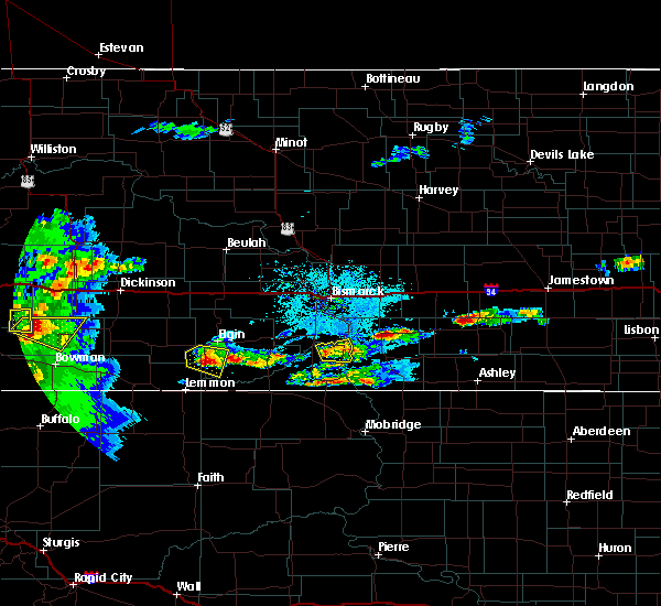 At 623 pm cdt, a severe thunderstorm was located 5 miles south of solen, or 16 miles northwest of fort yates, moving east at 15 mph (radar indicated). Hazards include 60 mph wind gusts and quarter size hail. Hail damage to vehicles is expected. expect wind damage to roofs, siding, and trees. this severe storm will be near, prairie knights resort around 650 pm cdt. Cannon ball around 710 pm cdt. At 623 pm cdt, a severe thunderstorm was located 5 miles south of solen, or 16 miles northwest of fort yates, moving east at 15 mph (radar indicated). Hazards include 60 mph wind gusts and quarter size hail. Hail damage to vehicles is expected. expect wind damage to roofs, siding, and trees. this severe storm will be near, prairie knights resort around 650 pm cdt. Cannon ball around 710 pm cdt.
|
| 7/2/2019 6:15 PM CDT |
 At 614 pm cdt, a severe thunderstorm was located 7 miles south of solen, or 17 miles northwest of fort yates, moving northeast at 10 mph (radar indicated). Hazards include ping pong ball size hail and 60 mph wind gusts. People and animals outdoors will be injured. expect hail damage to roofs, siding, windows, and vehicles. expect wind damage to roofs, siding, and trees. this severe thunderstorm will be near, solen around 645 pm cdt. prairie knights resort around 655 pm cdt. Cannon ball around 715 pm cdt. At 614 pm cdt, a severe thunderstorm was located 7 miles south of solen, or 17 miles northwest of fort yates, moving northeast at 10 mph (radar indicated). Hazards include ping pong ball size hail and 60 mph wind gusts. People and animals outdoors will be injured. expect hail damage to roofs, siding, windows, and vehicles. expect wind damage to roofs, siding, and trees. this severe thunderstorm will be near, solen around 645 pm cdt. prairie knights resort around 655 pm cdt. Cannon ball around 715 pm cdt.
|
| 7/2/2019 5:41 PM CDT |
 At 540 pm cdt, a severe thunderstorm was located near prairie knights resort, or 14 miles north of fort yates, moving north at 20 mph (radar indicated). Hazards include 60 mph wind gusts and quarter size hail. Hail damage to vehicles is expected. expect wind damage to roofs, siding, and trees. Locations impacted include, prairie knights resort and beaver bay recreation area. At 540 pm cdt, a severe thunderstorm was located near prairie knights resort, or 14 miles north of fort yates, moving north at 20 mph (radar indicated). Hazards include 60 mph wind gusts and quarter size hail. Hail damage to vehicles is expected. expect wind damage to roofs, siding, and trees. Locations impacted include, prairie knights resort and beaver bay recreation area.
|
| 7/2/2019 5:25 PM CDT |
 At 524 pm cdt, a severe thunderstorm was located near prairie knights resort, or 8 miles north of fort yates, moving northeast at 15 mph (radar indicated). Hazards include 60 mph wind gusts and quarter size hail. Hail damage to vehicles is expected. expect wind damage to roofs, siding, and trees. This severe thunderstorm will remain over mainly rural areas of northeastern sioux and west central emmons counties, including the following locations, beaver bay recreation area. At 524 pm cdt, a severe thunderstorm was located near prairie knights resort, or 8 miles north of fort yates, moving northeast at 15 mph (radar indicated). Hazards include 60 mph wind gusts and quarter size hail. Hail damage to vehicles is expected. expect wind damage to roofs, siding, and trees. This severe thunderstorm will remain over mainly rural areas of northeastern sioux and west central emmons counties, including the following locations, beaver bay recreation area.
|
| 7/2/2019 5:08 PM CDT |
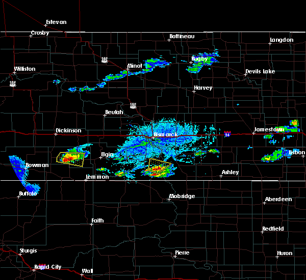 At 507 pm cdt, a severe thunderstorm was located 7 miles southwest of prairie knights resort, or 9 miles northwest of fort yates, moving north at 20 mph (radar indicated). Hazards include 60 mph wind gusts and quarter size hail. Hail damage to vehicles is expected. expect wind damage to roofs, siding, and trees. this severe thunderstorm will be near, prairie knights resort around 530 pm cdt. solen around 545 pm cdt. Other locations impacted by this severe thunderstorm include beaver bay recreation area. At 507 pm cdt, a severe thunderstorm was located 7 miles southwest of prairie knights resort, or 9 miles northwest of fort yates, moving north at 20 mph (radar indicated). Hazards include 60 mph wind gusts and quarter size hail. Hail damage to vehicles is expected. expect wind damage to roofs, siding, and trees. this severe thunderstorm will be near, prairie knights resort around 530 pm cdt. solen around 545 pm cdt. Other locations impacted by this severe thunderstorm include beaver bay recreation area.
|
| 6/28/2019 8:53 AM CDT |
 At 852 am cdt, a severe thunderstorm was located 7 miles northwest of linton, moving east at 45 mph (radar indicated). Hazards include ping pong ball size hail and 60 mph wind gusts. People and animals outdoors will be injured. expect hail damage to roofs, siding, windows, and vehicles. expect wind damage to roofs, siding, and trees. this severe thunderstorm will be near, linton around 900 am cdt. Other locations impacted by this severe thunderstorm include burnstad, beaver lake state park, temvik, beaver bay recreation area and hull. At 852 am cdt, a severe thunderstorm was located 7 miles northwest of linton, moving east at 45 mph (radar indicated). Hazards include ping pong ball size hail and 60 mph wind gusts. People and animals outdoors will be injured. expect hail damage to roofs, siding, windows, and vehicles. expect wind damage to roofs, siding, and trees. this severe thunderstorm will be near, linton around 900 am cdt. Other locations impacted by this severe thunderstorm include burnstad, beaver lake state park, temvik, beaver bay recreation area and hull.
|
| 6/28/2019 8:34 AM CDT |
 At 833 am cdt, a severe thunderstorm was located over cannon ball, or 19 miles northwest of linton, moving east at 35 mph (radar indicated). Hazards include two inch hail and 60 mph wind gusts. People and animals outdoors will be injured. expect hail damage to roofs, siding, windows, and vehicles. expect wind damage to roofs, siding, and trees. This severe thunderstorm will remain over mainly rural areas of northeastern sioux, southeastern morton and northwestern emmons counties, including the following locations, hazelton recreation area, fort rice, huff and beaver bay recreation area. At 833 am cdt, a severe thunderstorm was located over cannon ball, or 19 miles northwest of linton, moving east at 35 mph (radar indicated). Hazards include two inch hail and 60 mph wind gusts. People and animals outdoors will be injured. expect hail damage to roofs, siding, windows, and vehicles. expect wind damage to roofs, siding, and trees. This severe thunderstorm will remain over mainly rural areas of northeastern sioux, southeastern morton and northwestern emmons counties, including the following locations, hazelton recreation area, fort rice, huff and beaver bay recreation area.
|
| 6/28/2019 8:17 AM CDT |
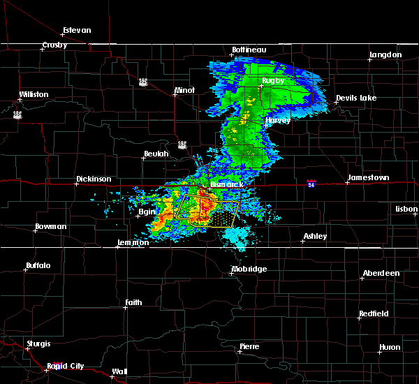 At 817 am cdt, a severe thunderstorm was located 9 miles southeast of st. anthony, or 18 miles south of bismarck, moving east at 35 mph (radar indicated). Hazards include ping pong ball size hail and 60 mph wind gusts. People and animals outdoors will be injured. expect hail damage to roofs, siding, windows, and vehicles. expect wind damage to roofs, siding, and trees. this severe storm will be near, cannon ball around 835 am cdt. Other locations impacted by this severe thunderstorm include breien, hazelton recreation area, fort rice, huff and beaver bay recreation area. At 817 am cdt, a severe thunderstorm was located 9 miles southeast of st. anthony, or 18 miles south of bismarck, moving east at 35 mph (radar indicated). Hazards include ping pong ball size hail and 60 mph wind gusts. People and animals outdoors will be injured. expect hail damage to roofs, siding, windows, and vehicles. expect wind damage to roofs, siding, and trees. this severe storm will be near, cannon ball around 835 am cdt. Other locations impacted by this severe thunderstorm include breien, hazelton recreation area, fort rice, huff and beaver bay recreation area.
|
| 6/28/2019 7:54 AM CDT |
 At 753 am cdt, a severe thunderstorm was located 7 miles west of st. anthony, or 17 miles southwest of mandan, moving east at 35 mph (radar indicated). Hazards include 60 mph wind gusts and quarter size hail. Hail damage to vehicles is expected. expect wind damage to roofs, siding, and trees. this severe thunderstorm will be near, st. anthony around 805 am cdt. cannon ball around 835 am cdt. Other locations impacted by this severe thunderstorm include breien, hazelton recreation area, fort rice, beaver bay recreation area and huff. At 753 am cdt, a severe thunderstorm was located 7 miles west of st. anthony, or 17 miles southwest of mandan, moving east at 35 mph (radar indicated). Hazards include 60 mph wind gusts and quarter size hail. Hail damage to vehicles is expected. expect wind damage to roofs, siding, and trees. this severe thunderstorm will be near, st. anthony around 805 am cdt. cannon ball around 835 am cdt. Other locations impacted by this severe thunderstorm include breien, hazelton recreation area, fort rice, beaver bay recreation area and huff.
|
| 5/15/2019 5:45 PM CDT |
 At 544 pm cdt, a severe thunderstorm was located 12 miles north of cannon ball, or 18 miles southeast of bismarck, moving east at 30 mph (radar indicated). Hazards include ping pong ball size hail and 60 mph wind gusts. People and animals outdoors will be injured. expect hail damage to roofs, siding, windows, and vehicles. expect wind damage to roofs, siding, and trees. Locations impacted include, hazelton recreation area, fort rice and huff. At 544 pm cdt, a severe thunderstorm was located 12 miles north of cannon ball, or 18 miles southeast of bismarck, moving east at 30 mph (radar indicated). Hazards include ping pong ball size hail and 60 mph wind gusts. People and animals outdoors will be injured. expect hail damage to roofs, siding, windows, and vehicles. expect wind damage to roofs, siding, and trees. Locations impacted include, hazelton recreation area, fort rice and huff.
|
| 5/15/2019 5:24 PM CDT |
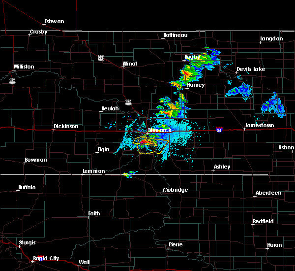 At 523 pm cdt, a severe thunderstorm was located near st. anthony, or 13 miles south of bismarck, moving east at 25 mph (radar indicated). Hazards include golf ball size hail and 60 mph wind gusts. People and animals outdoors will be injured. expect hail damage to roofs, siding, windows, and vehicles. expect wind damage to roofs, siding, and trees. This severe thunderstorm will remain over mainly rural areas of south central burleigh, southeastern morton and northwestern emmons counties, including the following locations, hazelton recreation area, fort rice and huff. At 523 pm cdt, a severe thunderstorm was located near st. anthony, or 13 miles south of bismarck, moving east at 25 mph (radar indicated). Hazards include golf ball size hail and 60 mph wind gusts. People and animals outdoors will be injured. expect hail damage to roofs, siding, windows, and vehicles. expect wind damage to roofs, siding, and trees. This severe thunderstorm will remain over mainly rural areas of south central burleigh, southeastern morton and northwestern emmons counties, including the following locations, hazelton recreation area, fort rice and huff.
|
| 7/14/2018 8:42 PM CDT |
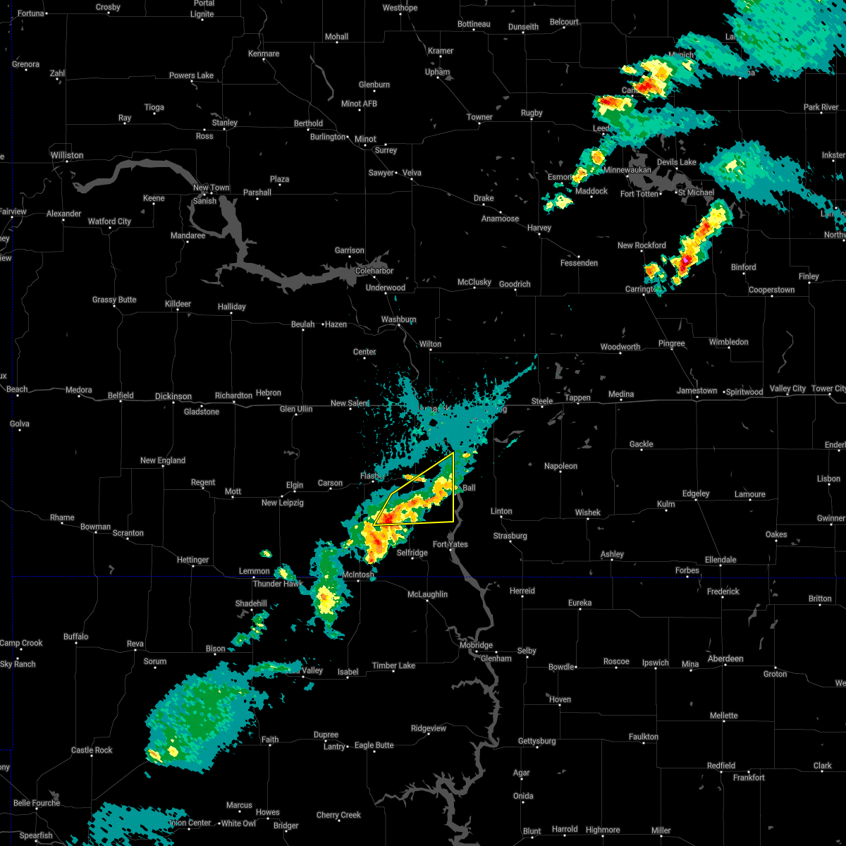 The severe thunderstorm warning for northeastern sioux. southeastern morton and eastern grant counties will expire at 845 pm cdt/745 pm mdt/. the storm which prompted the warning has weakened below severe limits. Penny size hail is still possible with the storm as it moves along the cannonball river. The severe thunderstorm warning for northeastern sioux. southeastern morton and eastern grant counties will expire at 845 pm cdt/745 pm mdt/. the storm which prompted the warning has weakened below severe limits. Penny size hail is still possible with the storm as it moves along the cannonball river.
|
| 7/14/2018 8:26 PM CDT |
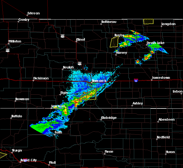 At 826 pm cdt/726 pm mdt/, a severe thunderstorm was located over solen, or 19 miles north of fort yates, moving east at 25 mph (radar indicated). Hazards include quarter size hail. Damage to vehicles is expected. Locations impacted include, solen, shields, prairie knights resort and breien. At 826 pm cdt/726 pm mdt/, a severe thunderstorm was located over solen, or 19 miles north of fort yates, moving east at 25 mph (radar indicated). Hazards include quarter size hail. Damage to vehicles is expected. Locations impacted include, solen, shields, prairie knights resort and breien.
|
| 7/14/2018 8:06 PM CDT |
 At 804 pm cdt/704 pm mdt/, a severe thunderstorm was located over solen, or 24 miles northwest of fort yates, moving east at 40 mph (radar indicated). Hazards include quarter size hail. Damage to vehicles is expected. This severe thunderstorm will remain over mainly rural areas of northeastern sioux, southeastern morton and eastern grant counties, including the following locations, breien. At 804 pm cdt/704 pm mdt/, a severe thunderstorm was located over solen, or 24 miles northwest of fort yates, moving east at 40 mph (radar indicated). Hazards include quarter size hail. Damage to vehicles is expected. This severe thunderstorm will remain over mainly rural areas of northeastern sioux, southeastern morton and eastern grant counties, including the following locations, breien.
|
| 7/14/2018 7:45 PM CDT |
 At 744 pm cdt/644 pm mdt/, a severe thunderstorm was located 6 miles southeast of flasher, or 26 miles north of selfridge, moving east at 40 mph (radar indicated). Hazards include ping pong ball size hail. People and animals outdoors will be injured. expect damage to roofs, siding, windows, and vehicles. this severe thunderstorm will be near, solen around 810 pm cdt. Other locations impacted by this severe thunderstorm include breien. At 744 pm cdt/644 pm mdt/, a severe thunderstorm was located 6 miles southeast of flasher, or 26 miles north of selfridge, moving east at 40 mph (radar indicated). Hazards include ping pong ball size hail. People and animals outdoors will be injured. expect damage to roofs, siding, windows, and vehicles. this severe thunderstorm will be near, solen around 810 pm cdt. Other locations impacted by this severe thunderstorm include breien.
|
| 7/8/2018 1:43 AM CDT |
 At 143 am cdt, severe thunderstorms were located along a line extending from mandan to 4 miles south of bismarck to 11 miles northwest of hazelton, moving northeast at 50 mph (radar indicated). Hazards include 70 mph wind gusts and nickel size hail. Expect considerable tree damage. damage is likely to mobile homes, roofs, and outbuildings. these severe storms will be near, menoken and mcdowell dam recreation area around 155 am cdt. sterling around 205 am cdt. steele and regan around 220 am cdt. wing around 225 am cdt. Other locations impacted by these severe thunderstorms include double ditch indian village, driscoll, mckenzie, fort rice, baldwin, fort abraham lincoln state park, moffit, hazelton recreation area, university of mary and arena. At 143 am cdt, severe thunderstorms were located along a line extending from mandan to 4 miles south of bismarck to 11 miles northwest of hazelton, moving northeast at 50 mph (radar indicated). Hazards include 70 mph wind gusts and nickel size hail. Expect considerable tree damage. damage is likely to mobile homes, roofs, and outbuildings. these severe storms will be near, menoken and mcdowell dam recreation area around 155 am cdt. sterling around 205 am cdt. steele and regan around 220 am cdt. wing around 225 am cdt. Other locations impacted by these severe thunderstorms include double ditch indian village, driscoll, mckenzie, fort rice, baldwin, fort abraham lincoln state park, moffit, hazelton recreation area, university of mary and arena.
|
| 7/8/2018 1:31 AM CDT |
 At 131 am cdt, severe thunderstorms were located along a line extending from 8 miles east of fish creek dam to 7 miles north of cannon ball, moving northeast at 50 mph (radar indicated). Hazards include 60 mph wind gusts and penny size hail. Expect damage to roofs, siding, and trees. severe thunderstorms will be near, mandan around 145 am cdt. bismarck around 150 am cdt. sterling around 200 am cdt. steele and regan around 220 am cdt. wing around 225 am cdt. Other locations impacted by these severe thunderstorms include double ditch indian village, driscoll, mckenzie, fort rice, baldwin, fort abraham lincoln state park, moffit, hazelton recreation area, university of mary and arena. At 131 am cdt, severe thunderstorms were located along a line extending from 8 miles east of fish creek dam to 7 miles north of cannon ball, moving northeast at 50 mph (radar indicated). Hazards include 60 mph wind gusts and penny size hail. Expect damage to roofs, siding, and trees. severe thunderstorms will be near, mandan around 145 am cdt. bismarck around 150 am cdt. sterling around 200 am cdt. steele and regan around 220 am cdt. wing around 225 am cdt. Other locations impacted by these severe thunderstorms include double ditch indian village, driscoll, mckenzie, fort rice, baldwin, fort abraham lincoln state park, moffit, hazelton recreation area, university of mary and arena.
|
| 7/4/2018 12:27 AM CDT |
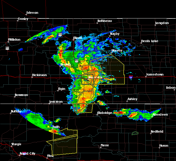 At 1226 am cdt, severe thunderstorms were located along a line extending from near cannon ball to 8 miles south of fort yates, moving east at 30 mph (public. quarter size hail was reported in selfridge at 1217 am cdt). Hazards include 60 mph wind gusts and quarter size hail. Hail damage to vehicles is expected. expect wind damage to roofs, siding, and trees. These severe storms will be near, cannon ball around 1230 am cdt. At 1226 am cdt, severe thunderstorms were located along a line extending from near cannon ball to 8 miles south of fort yates, moving east at 30 mph (public. quarter size hail was reported in selfridge at 1217 am cdt). Hazards include 60 mph wind gusts and quarter size hail. Hail damage to vehicles is expected. expect wind damage to roofs, siding, and trees. These severe storms will be near, cannon ball around 1230 am cdt.
|
| 7/4/2018 12:12 AM CDT |
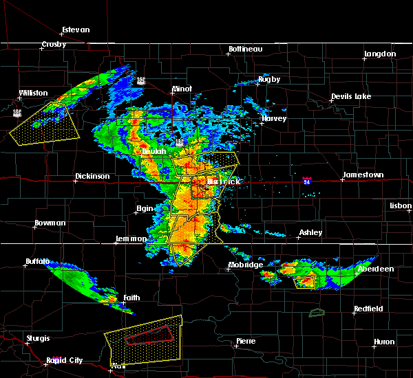 At 1212 am cdt/1112 pm mdt/, severe thunderstorms were located along a line extending from 4 miles southeast of solen to 6 miles southeast of selfridge, moving east at 40 mph (radar indicated). Hazards include 60 mph wind gusts and penny size hail. Expect damage to roofs, siding, and trees. these severe storms will be near, cannon ball and prairie knights resort around 1220 am cdt. fort yates around 1225 am cdt. Other locations impacted by these severe thunderstorms include porcupine. At 1212 am cdt/1112 pm mdt/, severe thunderstorms were located along a line extending from 4 miles southeast of solen to 6 miles southeast of selfridge, moving east at 40 mph (radar indicated). Hazards include 60 mph wind gusts and penny size hail. Expect damage to roofs, siding, and trees. these severe storms will be near, cannon ball and prairie knights resort around 1220 am cdt. fort yates around 1225 am cdt. Other locations impacted by these severe thunderstorms include porcupine.
|
| 7/3/2018 11:54 PM CDT |
 At 1153 pm cdt, severe thunderstorms were located along a line extending from 7 miles south of wilton to bismarck to 9 miles northeast of shields, moving northeast at 45 mph (trained weather spotters. 60 mph wind gusts were reported near crown butte lake). Hazards include 60 mph wind gusts and nickel size hail. Expect damage to roofs, siding, and trees. these severe storms will be near, bismarck and lincoln around 1200 am cdt. mcdowell dam recreation area around 1205 am cdt. menoken around 1210 am cdt. wing around 1225 am cdt. Other locations impacted by these severe thunderstorms include double ditch indian village, fort rice, baldwin, crown butte lake, breien, fort abraham lincoln state park, university of mary and huff. At 1153 pm cdt, severe thunderstorms were located along a line extending from 7 miles south of wilton to bismarck to 9 miles northeast of shields, moving northeast at 45 mph (trained weather spotters. 60 mph wind gusts were reported near crown butte lake). Hazards include 60 mph wind gusts and nickel size hail. Expect damage to roofs, siding, and trees. these severe storms will be near, bismarck and lincoln around 1200 am cdt. mcdowell dam recreation area around 1205 am cdt. menoken around 1210 am cdt. wing around 1225 am cdt. Other locations impacted by these severe thunderstorms include double ditch indian village, fort rice, baldwin, crown butte lake, breien, fort abraham lincoln state park, university of mary and huff.
|
| 7/3/2018 11:49 PM CDT |
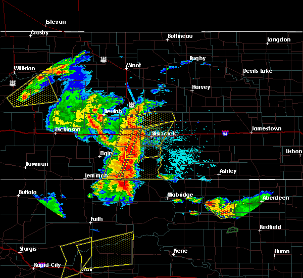 At 1149 pm cdt/1049 pm mdt/, severe thunderstorms were located along a line extending from 7 miles north of shields to 6 miles northwest of walker, moving east at 30 mph (radar indicated). Hazards include 60 mph wind gusts and quarter size hail. Hail damage to vehicles is expected. expect wind damage to roofs, siding, and trees. severe thunderstorms will be near, selfridge around 1215 am cdt. solen around 1220 am cdt. prairie knights resort around 1235 am cdt. cannon ball around 1240 am cdt. other locations impacted by these severe thunderstorms include st. Gertrude and porcupine. At 1149 pm cdt/1049 pm mdt/, severe thunderstorms were located along a line extending from 7 miles north of shields to 6 miles northwest of walker, moving east at 30 mph (radar indicated). Hazards include 60 mph wind gusts and quarter size hail. Hail damage to vehicles is expected. expect wind damage to roofs, siding, and trees. severe thunderstorms will be near, selfridge around 1215 am cdt. solen around 1220 am cdt. prairie knights resort around 1235 am cdt. cannon ball around 1240 am cdt. other locations impacted by these severe thunderstorms include st. Gertrude and porcupine.
|
| 7/3/2018 11:35 PM CDT |
 At 1134 pm cdt, severe thunderstorms were located along a line extending from near lake harmon to 8 miles northwest of st. anthony to 11 miles west of shields, moving northeast at 40 mph (radar indicated). Hazards include 60 mph wind gusts and quarter size hail. Hail damage to vehicles is expected. expect wind damage to roofs, siding, and trees. severe thunderstorms will be near, mandan, lake harmon and st. anthony around 1140 pm cdt. flasher around 1150 pm cdt. bismarck and lincoln around 1200 am cdt. menoken around 1210 am cdt. wing around 1225 am cdt. Other locations impacted by these severe thunderstorms include double ditch indian village, fort rice, baldwin, crown butte lake, breien, fort abraham lincoln state park, university of mary and huff. At 1134 pm cdt, severe thunderstorms were located along a line extending from near lake harmon to 8 miles northwest of st. anthony to 11 miles west of shields, moving northeast at 40 mph (radar indicated). Hazards include 60 mph wind gusts and quarter size hail. Hail damage to vehicles is expected. expect wind damage to roofs, siding, and trees. severe thunderstorms will be near, mandan, lake harmon and st. anthony around 1140 pm cdt. flasher around 1150 pm cdt. bismarck and lincoln around 1200 am cdt. menoken around 1210 am cdt. wing around 1225 am cdt. Other locations impacted by these severe thunderstorms include double ditch indian village, fort rice, baldwin, crown butte lake, breien, fort abraham lincoln state park, university of mary and huff.
|
| 7/3/2018 5:43 AM CDT |
 At 541 am cdt, severe thunderstorms were located along a line extending from near steele to 7 miles southwest of napoleon to 15 miles southeast of braddock to 4 miles southeast of strasburg, moving east at 60 mph. these are very dangerous storms (radar indicated). Hazards include 80 mph wind gusts and quarter size hail. Flying debris will be dangerous to those caught without shelter. mobile homes will be heavily damaged. expect considerable damage to roofs, windows, and vehicles. extensive tree damage and power outages are likely. Locations impacted include, linton, fort yates, selfridge, strasburg, hazelton, menoken, sterling, hague, westfield, cannon ball, braddock, prairie knights resort, mcdowell dam recreation area, driscoll, mckenzie, temvik, and kintyre. At 541 am cdt, severe thunderstorms were located along a line extending from near steele to 7 miles southwest of napoleon to 15 miles southeast of braddock to 4 miles southeast of strasburg, moving east at 60 mph. these are very dangerous storms (radar indicated). Hazards include 80 mph wind gusts and quarter size hail. Flying debris will be dangerous to those caught without shelter. mobile homes will be heavily damaged. expect considerable damage to roofs, windows, and vehicles. extensive tree damage and power outages are likely. Locations impacted include, linton, fort yates, selfridge, strasburg, hazelton, menoken, sterling, hague, westfield, cannon ball, braddock, prairie knights resort, mcdowell dam recreation area, driscoll, mckenzie, temvik, and kintyre.
|
| 7/3/2018 5:26 AM CDT |
 At 523 am cdt/423 am mdt/, severe thunderstorms were located along a line extending from 5 miles north of sterling to 4 miles southeast of hazelton to 8 miles north of linton to 9 miles east of fort yates, moving east at 60 mph. these are very dangerous storms (radar indicated. at the bismarck airport a wind gust to 62 mph was observed at 514 am cdt and a gust to 66 mph was observed at the mandan airport). Hazards include 80 mph wind gusts and half dollar size hail. Flying debris will be dangerous to those caught without shelter. mobile homes will be heavily damaged. expect considerable damage to roofs, windows, and vehicles. extensive tree damage and power outages are likely. locations impacted include, bismarck, mandan, linton, fort yates, selfridge, lincoln, strasburg, hazelton, menoken, sterling, solen, hague, westfield, cannon ball, braddock, st. Anthony, shields, prairie knights resort, lake harmon and mcdowell dam recreation area. At 523 am cdt/423 am mdt/, severe thunderstorms were located along a line extending from 5 miles north of sterling to 4 miles southeast of hazelton to 8 miles north of linton to 9 miles east of fort yates, moving east at 60 mph. these are very dangerous storms (radar indicated. at the bismarck airport a wind gust to 62 mph was observed at 514 am cdt and a gust to 66 mph was observed at the mandan airport). Hazards include 80 mph wind gusts and half dollar size hail. Flying debris will be dangerous to those caught without shelter. mobile homes will be heavily damaged. expect considerable damage to roofs, windows, and vehicles. extensive tree damage and power outages are likely. locations impacted include, bismarck, mandan, linton, fort yates, selfridge, lincoln, strasburg, hazelton, menoken, sterling, solen, hague, westfield, cannon ball, braddock, st. Anthony, shields, prairie knights resort, lake harmon and mcdowell dam recreation area.
|
| 7/3/2018 5:03 AM CDT |
 The national weather service in bismarck has issued a * severe thunderstorm warning for. sioux county in south central north dakota. southern burleigh county in south central north dakota. eastern morton county in south central north dakota. Southeastern grant county in south central north dakota. The national weather service in bismarck has issued a * severe thunderstorm warning for. sioux county in south central north dakota. southern burleigh county in south central north dakota. eastern morton county in south central north dakota. Southeastern grant county in south central north dakota.
|
| 7/3/2018 4:43 AM CDT |
 At 442 am cdt/342 am mdt/, severe thunderstorms were located along a line extending from near lake harmon to 9 miles south of st. anthony to near mcintosh, moving east at 55 mph. these are very dangerous storms (radar indicated). Hazards include 80 mph wind gusts and quarter size hail. Flying debris will be dangerous to those caught without shelter. mobile homes will be heavily damaged. expect considerable damage to roofs, windows, and vehicles. extensive tree damage and power outages are likely. locations impacted include, bismarck, mandan, selfridge, lincoln, new salem, carson, flasher, menoken, almont, solen, cannon ball, st. anthony, fish creek dam, shields, prairie knights resort, lake harmon, mcdowell dam recreation area, judson, mckenzie and lark. Very heavy rain will cause street flooding in bismarck and mandan. At 442 am cdt/342 am mdt/, severe thunderstorms were located along a line extending from near lake harmon to 9 miles south of st. anthony to near mcintosh, moving east at 55 mph. these are very dangerous storms (radar indicated). Hazards include 80 mph wind gusts and quarter size hail. Flying debris will be dangerous to those caught without shelter. mobile homes will be heavily damaged. expect considerable damage to roofs, windows, and vehicles. extensive tree damage and power outages are likely. locations impacted include, bismarck, mandan, selfridge, lincoln, new salem, carson, flasher, menoken, almont, solen, cannon ball, st. anthony, fish creek dam, shields, prairie knights resort, lake harmon, mcdowell dam recreation area, judson, mckenzie and lark. Very heavy rain will cause street flooding in bismarck and mandan.
|
| 7/3/2018 3:12 AM MDT |
 The national weather service in bismarck has issued a * severe thunderstorm warning for. sioux county in south central north dakota. southwestern burleigh county in south central north dakota. morton county in south central north dakota. Grant county in south central north dakota. The national weather service in bismarck has issued a * severe thunderstorm warning for. sioux county in south central north dakota. southwestern burleigh county in south central north dakota. morton county in south central north dakota. Grant county in south central north dakota.
|
| 6/29/2018 1:51 AM CDT |
 At 150 am cdt, severe thunderstorms were located along a line extending from 4 miles northwest of braddock to 6 miles west of linton to 4 miles southeast of selfridge, moving east at 60 mph (radar indicated). Hazards include 60 mph wind gusts. Expect damage to roofs, siding, and trees. these severe storms will be near, linton and braddock around 155 am cdt. strasburg around 200 am cdt. Other locations impacted by these severe thunderstorms include kintyre, temvik, cattail recreation area, beaver bay recreation area and hull. At 150 am cdt, severe thunderstorms were located along a line extending from 4 miles northwest of braddock to 6 miles west of linton to 4 miles southeast of selfridge, moving east at 60 mph (radar indicated). Hazards include 60 mph wind gusts. Expect damage to roofs, siding, and trees. these severe storms will be near, linton and braddock around 155 am cdt. strasburg around 200 am cdt. Other locations impacted by these severe thunderstorms include kintyre, temvik, cattail recreation area, beaver bay recreation area and hull.
|
| 6/29/2018 1:38 AM CDT |
 At 137 am cdt, severe thunderstorms were located along a line extending from 11 miles northwest of hazelton to prairie knights resort to 7 miles west of selfridge, moving east at 50 mph (radar indicated). Hazards include 60 mph wind gusts. Expect damage to roofs, siding, and trees. these severe storms will be near, braddock around 155 am cdt. linton around 200 am cdt. fort yates around 205 am cdt. Other locations impacted by these severe thunderstorms include fort rice, temvik, breien, kintyre, hazelton recreation area, cattail recreation area, beaver bay recreation area, hull and huff. At 137 am cdt, severe thunderstorms were located along a line extending from 11 miles northwest of hazelton to prairie knights resort to 7 miles west of selfridge, moving east at 50 mph (radar indicated). Hazards include 60 mph wind gusts. Expect damage to roofs, siding, and trees. these severe storms will be near, braddock around 155 am cdt. linton around 200 am cdt. fort yates around 205 am cdt. Other locations impacted by these severe thunderstorms include fort rice, temvik, breien, kintyre, hazelton recreation area, cattail recreation area, beaver bay recreation area, hull and huff.
|
| 6/29/2018 1:14 AM CDT |
 At 114 am cdt/1214 am mdt/, severe thunderstorms were located along a line extending from near st. anthony to 6 miles northwest of shields to 10 miles north of keldron, moving southeast at 60 mph (radar indicated). Hazards include 60 mph wind gusts. Expect damage to roofs, siding, and trees. severe thunderstorms will be near, shields and st. anthony around 1220 am mdt. cannon ball around 140 am cdt. fort yates around 145 am cdt. hazelton around 150 am cdt. westfield around 205 am cdt. hague around 215 am cdt. other locations impacted by these severe thunderstorms include raleigh, temvik, breien, lark, kintyre, hazelton recreation area, hull, huff, st. Gertrude and fort rice. At 114 am cdt/1214 am mdt/, severe thunderstorms were located along a line extending from near st. anthony to 6 miles northwest of shields to 10 miles north of keldron, moving southeast at 60 mph (radar indicated). Hazards include 60 mph wind gusts. Expect damage to roofs, siding, and trees. severe thunderstorms will be near, shields and st. anthony around 1220 am mdt. cannon ball around 140 am cdt. fort yates around 145 am cdt. hazelton around 150 am cdt. westfield around 205 am cdt. hague around 215 am cdt. other locations impacted by these severe thunderstorms include raleigh, temvik, breien, lark, kintyre, hazelton recreation area, hull, huff, st. Gertrude and fort rice.
|
| 6/14/2018 9:24 PM CDT |
 At 923 pm cdt, a severe thunderstorm was located 5 miles east of cannon ball, or 14 miles northwest of linton, moving northeast at 45 mph (radar indicated). Hazards include 60 mph wind gusts and quarter size hail. Hail damage to vehicles is expected. expect wind damage to roofs, siding, and trees. this severe thunderstorm will be near, hazelton around 940 pm cdt. braddock around 955 pm cdt. Other locations impacted by this severe thunderstorm include kintyre and temvik. At 923 pm cdt, a severe thunderstorm was located 5 miles east of cannon ball, or 14 miles northwest of linton, moving northeast at 45 mph (radar indicated). Hazards include 60 mph wind gusts and quarter size hail. Hail damage to vehicles is expected. expect wind damage to roofs, siding, and trees. this severe thunderstorm will be near, hazelton around 940 pm cdt. braddock around 955 pm cdt. Other locations impacted by this severe thunderstorm include kintyre and temvik.
|
| 7/21/2017 11:15 PM CDT |
 At 1115 pm cdt, a severe thunderstorm was located near hazelton, or 18 miles north of linton, moving southeast at 35 mph (radar indicated). Hazards include golf ball size hail and 70 mph wind gusts. People and animals outdoors will be injured. expect hail damage to roofs, siding, windows, and vehicles. expect considerable tree damage. wind damage is also likely to mobile homes, roofs, and outbuildings. this severe storm will be near, hazelton around 1125 pm cdt. Other locations impacted by this severe thunderstorm include kintyre, hazelton recreation area, fort rice and temvik. At 1115 pm cdt, a severe thunderstorm was located near hazelton, or 18 miles north of linton, moving southeast at 35 mph (radar indicated). Hazards include golf ball size hail and 70 mph wind gusts. People and animals outdoors will be injured. expect hail damage to roofs, siding, windows, and vehicles. expect considerable tree damage. wind damage is also likely to mobile homes, roofs, and outbuildings. this severe storm will be near, hazelton around 1125 pm cdt. Other locations impacted by this severe thunderstorm include kintyre, hazelton recreation area, fort rice and temvik.
|
| 7/21/2017 10:52 PM CDT |
 At 1052 pm cdt, a severe thunderstorm was located 12 miles southeast of lincoln, or 17 miles southeast of bismarck, moving southeast at 35 mph (radar indicated). Hazards include golf ball size hail and 70 mph wind gusts. People and animals outdoors will be injured. expect hail damage to roofs, siding, windows, and vehicles. expect considerable tree damage. wind damage is also likely to mobile homes, roofs, and outbuildings. this severe thunderstorm will be near, hazelton around 1120 pm cdt. linton around 1140 pm cdt. Other locations impacted by this severe thunderstorm include kintyre, hazelton recreation area, fort rice, temvik and huff. At 1052 pm cdt, a severe thunderstorm was located 12 miles southeast of lincoln, or 17 miles southeast of bismarck, moving southeast at 35 mph (radar indicated). Hazards include golf ball size hail and 70 mph wind gusts. People and animals outdoors will be injured. expect hail damage to roofs, siding, windows, and vehicles. expect considerable tree damage. wind damage is also likely to mobile homes, roofs, and outbuildings. this severe thunderstorm will be near, hazelton around 1120 pm cdt. linton around 1140 pm cdt. Other locations impacted by this severe thunderstorm include kintyre, hazelton recreation area, fort rice, temvik and huff.
|
| 7/19/2017 7:58 AM CDT |
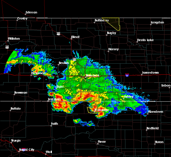 At 758 am cdt, a severe thunderstorm was located 7 miles northeast of selfridge, moving east at 35 mph (radar indicated). Hazards include golf ball size hail and 60 mph wind gusts. People and animals outdoors will be injured. expect hail damage to roofs, siding, windows, and vehicles. expect wind damage to roofs, siding, and trees. this severe storm will be near, fort yates around 815 am cdt. Other locations impacted by this severe thunderstorm include cattail recreation area and beaver bay recreation area. At 758 am cdt, a severe thunderstorm was located 7 miles northeast of selfridge, moving east at 35 mph (radar indicated). Hazards include golf ball size hail and 60 mph wind gusts. People and animals outdoors will be injured. expect hail damage to roofs, siding, windows, and vehicles. expect wind damage to roofs, siding, and trees. this severe storm will be near, fort yates around 815 am cdt. Other locations impacted by this severe thunderstorm include cattail recreation area and beaver bay recreation area.
|
| 7/19/2017 7:43 AM CDT |
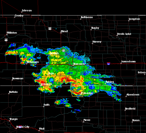 At 743 am cdt/643 am mdt/, a severe thunderstorm was located 5 miles east of shields, or 12 miles north of selfridge, moving east at 35 mph (radar indicated). Hazards include golf ball size hail and 60 mph wind gusts. People and animals outdoors will be injured. expect hail damage to roofs, siding, windows, and vehicles. expect wind damage to roofs, siding, and trees. this severe thunderstorm will be near, fort yates around 815 am cdt. Other locations impacted by this severe thunderstorm include porcupine, cattail recreation area and beaver bay recreation area. At 743 am cdt/643 am mdt/, a severe thunderstorm was located 5 miles east of shields, or 12 miles north of selfridge, moving east at 35 mph (radar indicated). Hazards include golf ball size hail and 60 mph wind gusts. People and animals outdoors will be injured. expect hail damage to roofs, siding, windows, and vehicles. expect wind damage to roofs, siding, and trees. this severe thunderstorm will be near, fort yates around 815 am cdt. Other locations impacted by this severe thunderstorm include porcupine, cattail recreation area and beaver bay recreation area.
|
| 7/18/2017 3:13 AM CDT |
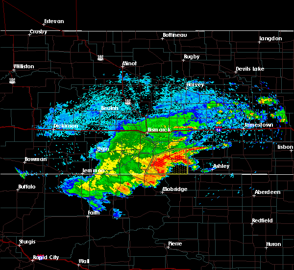 At 313 am cdt, severe thunderstorms were located along a line extending from 13 miles northeast of strasburg to near linton to 5 miles north of kenel, moving east at 35 mph (radar indicated). Hazards include 60 mph wind gusts and quarter size hail. Hail damage to vehicles is expected. expect wind damage to roofs, siding, and trees. Locations impacted include, linton, fort yates, strasburg, hague, westfield, temvik, cattail recreation area, beaver bay recreation area and hull. At 313 am cdt, severe thunderstorms were located along a line extending from 13 miles northeast of strasburg to near linton to 5 miles north of kenel, moving east at 35 mph (radar indicated). Hazards include 60 mph wind gusts and quarter size hail. Hail damage to vehicles is expected. expect wind damage to roofs, siding, and trees. Locations impacted include, linton, fort yates, strasburg, hague, westfield, temvik, cattail recreation area, beaver bay recreation area and hull.
|
| 7/18/2017 2:59 AM CDT |
 At 259 am cdt, severe thunderstorms were located along a line extending from 9 miles northeast of strasburg to 8 miles southwest of linton to 9 miles northwest of kenel, moving east at 35 mph (radar indicated). Hazards include 60 mph wind gusts and quarter size hail. Hail damage to vehicles is expected. Expect wind damage to roofs, siding, and trees. At 259 am cdt, severe thunderstorms were located along a line extending from 9 miles northeast of strasburg to 8 miles southwest of linton to 9 miles northwest of kenel, moving east at 35 mph (radar indicated). Hazards include 60 mph wind gusts and quarter size hail. Hail damage to vehicles is expected. Expect wind damage to roofs, siding, and trees.
|
| 7/14/2017 7:37 PM CDT |
 At 736 pm cdt, severe thunderstorms were located along a line extending from 12 miles northwest of hazelton to 5 miles north of solen, moving southeast at 30 mph (radar indicated). Hazards include 60 mph wind gusts. Expect damage to roofs, siding, and trees. These severe thunderstorms will remain over mainly rural areas of east central morton and northwestern emmons counties, including the following locations: hazelton recreation area, fort rice and huff. At 736 pm cdt, severe thunderstorms were located along a line extending from 12 miles northwest of hazelton to 5 miles north of solen, moving southeast at 30 mph (radar indicated). Hazards include 60 mph wind gusts. Expect damage to roofs, siding, and trees. These severe thunderstorms will remain over mainly rural areas of east central morton and northwestern emmons counties, including the following locations: hazelton recreation area, fort rice and huff.
|
| 7/14/2017 7:19 PM CDT |
 At 719 pm cdt, severe thunderstorms were located along a line extending from 7 miles northeast of menoken to 5 miles north of solen, moving east at 40 mph (radar indicated). Hazards include 60 mph wind gusts. Expect damage to roofs, siding, and trees. these severe storms will be near, sterling around 730 pm cdt. Other locations impacted by these severe thunderstorms include driscoll, mckenzie, fort rice, moffit, hazelton recreation area, and huff. At 719 pm cdt, severe thunderstorms were located along a line extending from 7 miles northeast of menoken to 5 miles north of solen, moving east at 40 mph (radar indicated). Hazards include 60 mph wind gusts. Expect damage to roofs, siding, and trees. these severe storms will be near, sterling around 730 pm cdt. Other locations impacted by these severe thunderstorms include driscoll, mckenzie, fort rice, moffit, hazelton recreation area, and huff.
|
| 7/14/2017 6:59 PM CDT |
 At 658 pm cdt, severe thunderstorms were located along a line extending from 7 miles north of mcdowell dam recreation area to 8 miles northeast of flasher, moving east at 40 mph (radar indicated). Hazards include 60 mph wind gusts and quarter size hail. Hail damage to vehicles is expected. expect wind damage to roofs, siding, and trees. severe thunderstorms will be near, mcdowell dam recreation area around 705 pm cdt. menoken around 710 pm cdt. sterling around 730 pm cdt. Other locations impacted by these severe thunderstorms include double ditch indian village, driscoll, mckenzie, fort rice, fort abraham lincoln state park, moffit, hazelton recreation area, university of mary and huff. At 658 pm cdt, severe thunderstorms were located along a line extending from 7 miles north of mcdowell dam recreation area to 8 miles northeast of flasher, moving east at 40 mph (radar indicated). Hazards include 60 mph wind gusts and quarter size hail. Hail damage to vehicles is expected. expect wind damage to roofs, siding, and trees. severe thunderstorms will be near, mcdowell dam recreation area around 705 pm cdt. menoken around 710 pm cdt. sterling around 730 pm cdt. Other locations impacted by these severe thunderstorms include double ditch indian village, driscoll, mckenzie, fort rice, fort abraham lincoln state park, moffit, hazelton recreation area, university of mary and huff.
|
| 6/27/2017 4:54 PM CDT |
 At 953 pm cdt, severe thunderstorms were located along a line extending from 13 miles south of menoken to 5 miles southeast of prairie knights resort, moving northeast at 35 mph (radar indicated). Hazards include golf ball size hail and 60 mph wind gusts. People and animals outdoors will be injured. expect hail damage to roofs, siding, windows, and vehicles. Expect wind damage to roofs, siding, and trees. At 953 pm cdt, severe thunderstorms were located along a line extending from 13 miles south of menoken to 5 miles southeast of prairie knights resort, moving northeast at 35 mph (radar indicated). Hazards include golf ball size hail and 60 mph wind gusts. People and animals outdoors will be injured. expect hail damage to roofs, siding, windows, and vehicles. Expect wind damage to roofs, siding, and trees.
|
| 8/10/2016 12:30 AM CDT |
 At 1228 am cdt, severe thunderstorms were located along a line extending from 7 miles southwest of lake isabel to 6 miles northeast of linton to 5 miles south of hague, moving southeast at 50 mph. these are very dangerous storms (linton mesonet site reports 74 mph winds). Hazards include 80 mph wind gusts and quarter size hail. Flying debris will be dangerous to those caught without shelter. mobile homes will be heavily damaged. expect considerable damage to roofs, windows, and vehicles. extensive tree damage and power outages are likely. These severe thunderstorms will remain over mainly rural areas of southern kidder, southeastern burleigh, western logan, eastern sioux and emmons counties, including the following locations: cattail recreation area, moffit, kintyre, beaver bay recreation area, temvik and hull. At 1228 am cdt, severe thunderstorms were located along a line extending from 7 miles southwest of lake isabel to 6 miles northeast of linton to 5 miles south of hague, moving southeast at 50 mph. these are very dangerous storms (linton mesonet site reports 74 mph winds). Hazards include 80 mph wind gusts and quarter size hail. Flying debris will be dangerous to those caught without shelter. mobile homes will be heavily damaged. expect considerable damage to roofs, windows, and vehicles. extensive tree damage and power outages are likely. These severe thunderstorms will remain over mainly rural areas of southern kidder, southeastern burleigh, western logan, eastern sioux and emmons counties, including the following locations: cattail recreation area, moffit, kintyre, beaver bay recreation area, temvik and hull.
|
| 8/10/2016 12:15 AM CDT |
 At 1215 am cdt, severe thunderstorms were located along a line extending from 7 miles southwest of steele to 8 miles south of hazelton to near pollock, moving east at 45 mph (radar indicated). Hazards include 70 mph wind gusts and quarter size hail. Hail damage to vehicles is expected. expect considerable tree damage. wind damage is also likely to mobile homes, roofs, and outbuildings. these severe storms will be near, westfield around 1220 am cdt. Other locations impacted by these severe thunderstorms include cattail recreation area, moffit, kintyre, fort rice, hazelton recreation area, hull, beaver bay recreation area and temvik. At 1215 am cdt, severe thunderstorms were located along a line extending from 7 miles southwest of steele to 8 miles south of hazelton to near pollock, moving east at 45 mph (radar indicated). Hazards include 70 mph wind gusts and quarter size hail. Hail damage to vehicles is expected. expect considerable tree damage. wind damage is also likely to mobile homes, roofs, and outbuildings. these severe storms will be near, westfield around 1220 am cdt. Other locations impacted by these severe thunderstorms include cattail recreation area, moffit, kintyre, fort rice, hazelton recreation area, hull, beaver bay recreation area and temvik.
|
| 8/10/2016 12:01 AM CDT |
 At 1201 am cdt, severe thunderstorms were located along a line extending from 7 miles southwest of steele to 4 miles east of cannon ball to 8 miles northwest of kenel, moving east at 40 mph (radar indicated). Hazards include 70 mph wind gusts and quarter size hail. Hail damage to vehicles is expected. expect considerable tree damage. wind damage is also likely to mobile homes, roofs, and outbuildings. these severe storms will be near, linton around 1220 am cdt. Other locations impacted by these severe thunderstorms include cattail recreation area, moffit, kintyre, fort rice, breien, hazelton recreation area, hull, huff, mckenzie and beaver bay recreation area. At 1201 am cdt, severe thunderstorms were located along a line extending from 7 miles southwest of steele to 4 miles east of cannon ball to 8 miles northwest of kenel, moving east at 40 mph (radar indicated). Hazards include 70 mph wind gusts and quarter size hail. Hail damage to vehicles is expected. expect considerable tree damage. wind damage is also likely to mobile homes, roofs, and outbuildings. these severe storms will be near, linton around 1220 am cdt. Other locations impacted by these severe thunderstorms include cattail recreation area, moffit, kintyre, fort rice, breien, hazelton recreation area, hull, huff, mckenzie and beaver bay recreation area.
|
| 8/9/2016 11:43 PM CDT |
 At 1143 pm cdt/1043 pm mdt/, severe thunderstorms were located along a line extending from near sterling to near solen to 7 miles south of selfridge, moving southeast at 45 mph (radar indicated). Hazards include 60 mph wind gusts and quarter size hail. Hail damage to vehicles is expected. expect wind damage to roofs, siding, and trees. severe thunderstorms will be near, sterling around 1150 pm cdt. linton around 1215 am cdt. strasburg around 1225 am cdt. Other locations impacted by these severe thunderstorms include cattail recreation area, moffit, porcupine, kintyre, fort rice, breien, hazelton recreation area, hull, huff and mckenzie. At 1143 pm cdt/1043 pm mdt/, severe thunderstorms were located along a line extending from near sterling to near solen to 7 miles south of selfridge, moving southeast at 45 mph (radar indicated). Hazards include 60 mph wind gusts and quarter size hail. Hail damage to vehicles is expected. expect wind damage to roofs, siding, and trees. severe thunderstorms will be near, sterling around 1150 pm cdt. linton around 1215 am cdt. strasburg around 1225 am cdt. Other locations impacted by these severe thunderstorms include cattail recreation area, moffit, porcupine, kintyre, fort rice, breien, hazelton recreation area, hull, huff and mckenzie.
|
| 7/26/2016 7:58 PM CDT |
 At 757 pm cdt, a severe thunderstorm was located over fort yates, moving southeast at 25 mph (radar indicated). Hazards include golf ball size hail and 60 mph wind gusts. People and animals outdoors will be injured. expect hail damage to roofs, siding, windows, and vehicles. expect wind damage to roofs, siding, and trees. This severe thunderstorm will remain over mainly rural areas of southeastern sioux and southern emmons counties, including the following locations: cattail recreation area and hull. At 757 pm cdt, a severe thunderstorm was located over fort yates, moving southeast at 25 mph (radar indicated). Hazards include golf ball size hail and 60 mph wind gusts. People and animals outdoors will be injured. expect hail damage to roofs, siding, windows, and vehicles. expect wind damage to roofs, siding, and trees. This severe thunderstorm will remain over mainly rural areas of southeastern sioux and southern emmons counties, including the following locations: cattail recreation area and hull.
|
| 7/26/2016 7:49 PM CDT |
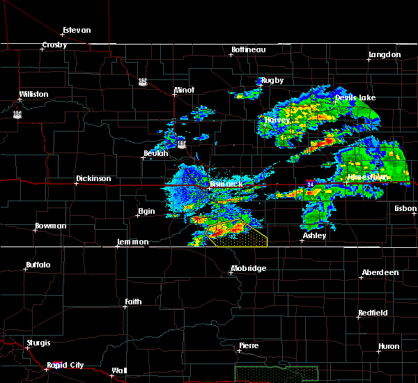 At 749 pm cdt, a severe thunderstorm was located 5 miles north of fort yates, moving southeast at 25 mph (radar indicated). Hazards include golf ball size hail and 60 mph wind gusts. People and animals outdoors will be injured. expect hail damage to roofs, siding, windows, and vehicles. expect wind damage to roofs, siding, and trees. this severe storm will be near, westfield around 830 pm cdt. Other locations impacted by this severe thunderstorm include beaver bay recreation area, cattail recreation area and hull. At 749 pm cdt, a severe thunderstorm was located 5 miles north of fort yates, moving southeast at 25 mph (radar indicated). Hazards include golf ball size hail and 60 mph wind gusts. People and animals outdoors will be injured. expect hail damage to roofs, siding, windows, and vehicles. expect wind damage to roofs, siding, and trees. this severe storm will be near, westfield around 830 pm cdt. Other locations impacted by this severe thunderstorm include beaver bay recreation area, cattail recreation area and hull.
|
| 7/26/2016 7:32 PM CDT |
 At 732 pm cdt, a severe thunderstorm was located 6 miles southwest of prairie knights resort, or 10 miles northwest of fort yates, moving southeast at 25 mph (radar indicated). Hazards include 60 mph wind gusts and quarter size hail. Hail damage to vehicles is expected. expect wind damage to roofs, siding, and trees. this severe thunderstorm will be near, prairie knights resort around 740 pm cdt. fort yates around 755 pm cdt. westfield around 830 pm cdt. Other locations impacted by this severe thunderstorm include beaver bay recreation area, cattail recreation area and hull. At 732 pm cdt, a severe thunderstorm was located 6 miles southwest of prairie knights resort, or 10 miles northwest of fort yates, moving southeast at 25 mph (radar indicated). Hazards include 60 mph wind gusts and quarter size hail. Hail damage to vehicles is expected. expect wind damage to roofs, siding, and trees. this severe thunderstorm will be near, prairie knights resort around 740 pm cdt. fort yates around 755 pm cdt. westfield around 830 pm cdt. Other locations impacted by this severe thunderstorm include beaver bay recreation area, cattail recreation area and hull.
|
| 7/22/2016 6:07 PM CDT |
 At 605 pm cdt/505 pm mdt/, a severe thunderstorm was located 9 miles west of prairie knights resort, or 14 miles northwest of fort yates, moving northeast at 15 mph (radar indicated). Hazards include 60 mph wind gusts and half dollar size hail. Hail damage to vehicles is expected. expect wind damage to roofs, siding, and trees. locations impacted include, fort yates, selfridge, flasher, solen, cannon ball, shields, prairie knights resort, raleigh, cattail recreation area, porcupine, breien, st. Gertrude and beaver bay recreation area. At 605 pm cdt/505 pm mdt/, a severe thunderstorm was located 9 miles west of prairie knights resort, or 14 miles northwest of fort yates, moving northeast at 15 mph (radar indicated). Hazards include 60 mph wind gusts and half dollar size hail. Hail damage to vehicles is expected. expect wind damage to roofs, siding, and trees. locations impacted include, fort yates, selfridge, flasher, solen, cannon ball, shields, prairie knights resort, raleigh, cattail recreation area, porcupine, breien, st. Gertrude and beaver bay recreation area.
|
| 7/22/2016 5:46 PM CDT |
 At 545 pm cdt/445 pm mdt/, a severe thunderstorm was located 9 miles north of selfridge, moving northeast at 15 mph (radar indicated). Hazards include 60 mph wind gusts and half dollar size hail. Hail damage to vehicles is expected. expect wind damage to roofs, siding, and trees. locations impacted include, fort yates, selfridge, flasher, solen, cannon ball, shields, prairie knights resort, raleigh, cattail recreation area, porcupine, breien, st. Gertrude and beaver bay recreation area. At 545 pm cdt/445 pm mdt/, a severe thunderstorm was located 9 miles north of selfridge, moving northeast at 15 mph (radar indicated). Hazards include 60 mph wind gusts and half dollar size hail. Hail damage to vehicles is expected. expect wind damage to roofs, siding, and trees. locations impacted include, fort yates, selfridge, flasher, solen, cannon ball, shields, prairie knights resort, raleigh, cattail recreation area, porcupine, breien, st. Gertrude and beaver bay recreation area.
|
| 7/22/2016 5:32 PM CDT |
 At 532 pm cdt/432 pm mdt/, a severe thunderstorm was located 5 miles north of selfridge, moving northeast at 15 mph (radar indicated). Hazards include 60 mph wind gusts and half dollar size hail. Hail damage to vehicles is expected. expect wind damage to roofs, siding, and trees. this severe thunderstorm will be near, solen and prairie knights resort around 630 pm cdt. other locations impacted by this severe thunderstorm include cattail recreation area, porcupine, raleigh, breien, st. Gertrude and beaver bay recreation area. At 532 pm cdt/432 pm mdt/, a severe thunderstorm was located 5 miles north of selfridge, moving northeast at 15 mph (radar indicated). Hazards include 60 mph wind gusts and half dollar size hail. Hail damage to vehicles is expected. expect wind damage to roofs, siding, and trees. this severe thunderstorm will be near, solen and prairie knights resort around 630 pm cdt. other locations impacted by this severe thunderstorm include cattail recreation area, porcupine, raleigh, breien, st. Gertrude and beaver bay recreation area.
|
| 7/16/2016 4:47 PM CDT |
 At 446 pm cdt, a severe thunderstorm was located over cannon ball, or 18 miles northwest of linton, moving east at 25 mph (radar indicated). Hazards include 60 mph wind gusts and quarter size hail. Hail damage to vehicles is expected. expect wind damage to roofs, siding, and trees. this severe storm will be near, hazelton around 515 pm cdt. Other locations impacted by this severe thunderstorm include hazelton recreation area, temvik and fort rice. At 446 pm cdt, a severe thunderstorm was located over cannon ball, or 18 miles northwest of linton, moving east at 25 mph (radar indicated). Hazards include 60 mph wind gusts and quarter size hail. Hail damage to vehicles is expected. expect wind damage to roofs, siding, and trees. this severe storm will be near, hazelton around 515 pm cdt. Other locations impacted by this severe thunderstorm include hazelton recreation area, temvik and fort rice.
|
| 7/16/2016 4:35 PM CDT |
 At 434 pm cdt, a severe thunderstorm was located near cannon ball, or 21 miles north of fort yates, moving east at 25 mph (radar indicated). Hazards include 60 mph wind gusts and quarter size hail. Hail damage to vehicles is expected. expect wind damage to roofs, siding, and trees. this severe storm will be near, cannon ball around 445 pm cdt. hazelton around 515 pm cdt. Other locations impacted by this severe thunderstorm include hazelton recreation area, temvik and fort rice. At 434 pm cdt, a severe thunderstorm was located near cannon ball, or 21 miles north of fort yates, moving east at 25 mph (radar indicated). Hazards include 60 mph wind gusts and quarter size hail. Hail damage to vehicles is expected. expect wind damage to roofs, siding, and trees. this severe storm will be near, cannon ball around 445 pm cdt. hazelton around 515 pm cdt. Other locations impacted by this severe thunderstorm include hazelton recreation area, temvik and fort rice.
|
| 7/16/2016 4:15 PM CDT |
 At 415 pm cdt, a severe thunderstorm was located over solen, or 24 miles north of fort yates, moving east at 25 mph (radar indicated). Hazards include 60 mph wind gusts and half dollar size hail. Hail damage to vehicles is expected. expect wind damage to roofs, siding, and trees. this severe thunderstorm will be near, cannon ball around 440 pm cdt. hazelton around 515 pm cdt. Other locations impacted by this severe thunderstorm include hazelton recreation area, temvik and fort rice. At 415 pm cdt, a severe thunderstorm was located over solen, or 24 miles north of fort yates, moving east at 25 mph (radar indicated). Hazards include 60 mph wind gusts and half dollar size hail. Hail damage to vehicles is expected. expect wind damage to roofs, siding, and trees. this severe thunderstorm will be near, cannon ball around 440 pm cdt. hazelton around 515 pm cdt. Other locations impacted by this severe thunderstorm include hazelton recreation area, temvik and fort rice.
|
| 7/11/2016 2:20 AM CDT |
 At 220 am cdt, a severe thunderstorm was located 8 miles northwest of linton, moving east at 25 mph (radar indicated). Hazards include 60 mph wind gusts and half dollar size hail. Hail damage to vehicles is expected. expect wind damage to roofs, siding, and trees. this severe storm will be near, linton around 240 am cdt. Other locations impacted by this severe thunderstorm include beaver bay recreation area, temvik and kintyre. At 220 am cdt, a severe thunderstorm was located 8 miles northwest of linton, moving east at 25 mph (radar indicated). Hazards include 60 mph wind gusts and half dollar size hail. Hail damage to vehicles is expected. expect wind damage to roofs, siding, and trees. this severe storm will be near, linton around 240 am cdt. Other locations impacted by this severe thunderstorm include beaver bay recreation area, temvik and kintyre.
|
| 7/11/2016 2:05 AM CDT | Ping Pong Ball sized hail reported 4.4 miles N of Cannon Ball, ND, time estimated from radar. hail was about the size of a silver dollar. |
| 7/11/2016 2:03 AM CDT |
 At 203 am cdt, a severe thunderstorm was located 7 miles south of hazelton, or 8 miles north of linton, moving northeast at 30 mph (radar indicated). Hazards include 60 mph wind gusts and half dollar size hail. Hail damage to vehicles is expected. expect wind damage to roofs, siding, and trees. this severe storm will be near, hazelton around 215 am cdt. braddock around 235 am cdt. Other locations impacted by this severe thunderstorm include beaver bay recreation area, temvik and kintyre. At 203 am cdt, a severe thunderstorm was located 7 miles south of hazelton, or 8 miles north of linton, moving northeast at 30 mph (radar indicated). Hazards include 60 mph wind gusts and half dollar size hail. Hail damage to vehicles is expected. expect wind damage to roofs, siding, and trees. this severe storm will be near, hazelton around 215 am cdt. braddock around 235 am cdt. Other locations impacted by this severe thunderstorm include beaver bay recreation area, temvik and kintyre.
|
| 7/11/2016 1:52 AM CDT |
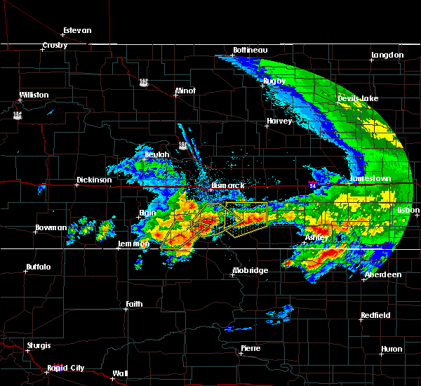 At 152 am cdt, a severe thunderstorm was located 6 miles south of solen, or 17 miles northwest of fort yates, moving northeast at 35 mph (radar indicated). Hazards include two inch hail and 60 mph wind gusts. People and animals outdoors will be injured. expect hail damage to roofs, siding, windows, and vehicles. expect wind damage to roofs, siding, and trees. this severe thunderstorm will be near, solen around 200 am cdt. prairie knights resort around 205 am cdt. cannon ball around 215 am cdt. Other locations impacted by this severe thunderstorm include fort rice, breien, beaver bay recreation area and hazelton recreation area. At 152 am cdt, a severe thunderstorm was located 6 miles south of solen, or 17 miles northwest of fort yates, moving northeast at 35 mph (radar indicated). Hazards include two inch hail and 60 mph wind gusts. People and animals outdoors will be injured. expect hail damage to roofs, siding, windows, and vehicles. expect wind damage to roofs, siding, and trees. this severe thunderstorm will be near, solen around 200 am cdt. prairie knights resort around 205 am cdt. cannon ball around 215 am cdt. Other locations impacted by this severe thunderstorm include fort rice, breien, beaver bay recreation area and hazelton recreation area.
|
| 7/11/2016 1:50 AM CDT |
 At 149 am cdt, a severe thunderstorm was located 8 miles west of linton, moving northeast at 25 mph (radar indicated). Hazards include 60 mph wind gusts and half dollar size hail. Hail damage to vehicles is expected. expect wind damage to roofs, siding, and trees. this severe thunderstorm will be near, linton around 210 am cdt. braddock around 245 am cdt. Other locations impacted by this severe thunderstorm include beaver bay recreation area, temvik and kintyre. At 149 am cdt, a severe thunderstorm was located 8 miles west of linton, moving northeast at 25 mph (radar indicated). Hazards include 60 mph wind gusts and half dollar size hail. Hail damage to vehicles is expected. expect wind damage to roofs, siding, and trees. this severe thunderstorm will be near, linton around 210 am cdt. braddock around 245 am cdt. Other locations impacted by this severe thunderstorm include beaver bay recreation area, temvik and kintyre.
|
| 7/10/2016 9:52 PM CDT |
 At 949 pm cdt, severe thunderstorms were located along a line extending from wing to fort yates, moving east at 50 mph (radar indicated). Hazards include 60 mph wind gusts and nickel size hail. Expect damage to roofs. siding. and trees. these severe storms will be near, steele around 955 pm cdt. dawson around 1005 pm cdt. tappen and westfield around 1010 pm cdt. hague around 1020 pm cdt. zeeland around 1030 pm cdt. other locations impacted by these severe thunderstorms include, robinson, steele, sterling, napoleon, temvik and strasburg. continuous lightning and very heavy rain are also going to occur with these storms. Flooding of streets and ditches will occur. At 949 pm cdt, severe thunderstorms were located along a line extending from wing to fort yates, moving east at 50 mph (radar indicated). Hazards include 60 mph wind gusts and nickel size hail. Expect damage to roofs. siding. and trees. these severe storms will be near, steele around 955 pm cdt. dawson around 1005 pm cdt. tappen and westfield around 1010 pm cdt. hague around 1020 pm cdt. zeeland around 1030 pm cdt. other locations impacted by these severe thunderstorms include, robinson, steele, sterling, napoleon, temvik and strasburg. continuous lightning and very heavy rain are also going to occur with these storms. Flooding of streets and ditches will occur.
|
| 7/10/2016 9:34 PM CDT |
 At 930 pm cdt, severe thunderstorms were located along a line extending from 10 miles south of wing to 5 miles south of selfridge, moving east at 25 mph (radar indicated). Hazards include 70 mph wind gusts and quarter size hail. Hail damage to vehicles is expected. expect considerable tree damage. wind damage is also likely to mobile homes, roofs, and outbuildings. towns in the path of these thunderstorms include, mandan, bismarck, porcupine, fort rice, driscoll, hull, horsehead lake, beaver bay recreation area, moffit kintyre and napoleon. very heavy rain will flood streets and ditches. Do not drive into the water. At 930 pm cdt, severe thunderstorms were located along a line extending from 10 miles south of wing to 5 miles south of selfridge, moving east at 25 mph (radar indicated). Hazards include 70 mph wind gusts and quarter size hail. Hail damage to vehicles is expected. expect considerable tree damage. wind damage is also likely to mobile homes, roofs, and outbuildings. towns in the path of these thunderstorms include, mandan, bismarck, porcupine, fort rice, driscoll, hull, horsehead lake, beaver bay recreation area, moffit kintyre and napoleon. very heavy rain will flood streets and ditches. Do not drive into the water.
|
| 7/10/2016 8:56 PM CDT |
 At 855 pm cdt/755 pm mdt/, severe thunderstorms were located along a line extending from 11 miles east of lake harmon to 9 miles northwest of walker, moving east at 40 mph (radar indicated). Hazards include 70 mph wind gusts and quarter size hail. Hail damage to vehicles is expected. expect considerable tree damage. wind damage is also likely to mobile homes, roofs, and outbuildings. these severe storms will be near, selfridge around 915 pm cdt. fort yates around 930 pm cdt. Other locations impacted by these severe thunderstorms include cattail recreation area, porcupine, fort rice, crown butte lake, beaver bay recreation area, double ditch indian village, moffit and fort abraham lincoln state park. At 855 pm cdt/755 pm mdt/, severe thunderstorms were located along a line extending from 11 miles east of lake harmon to 9 miles northwest of walker, moving east at 40 mph (radar indicated). Hazards include 70 mph wind gusts and quarter size hail. Hail damage to vehicles is expected. expect considerable tree damage. wind damage is also likely to mobile homes, roofs, and outbuildings. these severe storms will be near, selfridge around 915 pm cdt. fort yates around 930 pm cdt. Other locations impacted by these severe thunderstorms include cattail recreation area, porcupine, fort rice, crown butte lake, beaver bay recreation area, double ditch indian village, moffit and fort abraham lincoln state park.
|
| 7/10/2016 8:28 PM CDT |
 At 826 pm cdt/726 pm mdt/, severe thunderstorms were located along a line extending from 7 miles west of lake harmon to 5 miles north of watauga, moving east at 40 mph (radar indicated). Hazards include 60 mph wind gusts and quarter size hail. Hail damage to vehicles is expected. expect wind damage to roofs, siding, and trees. severe thunderstorms will be near, mandan and lake harmon around 835 pm cdt. selfridge around 915 pm cdt. fort yates around 930 pm cdt. other locations impacted by these severe thunderstorms include cattail recreation area, porcupine, sweet briar lake, fort rice, raleigh, judson, driscoll, crown butte lake, lark and beaver bay recreation area. torrential rain is occurring with these storms, and may lead to flooding of streets, creeks, and culverts. Do not drive your vehicle through flooded roadways. At 826 pm cdt/726 pm mdt/, severe thunderstorms were located along a line extending from 7 miles west of lake harmon to 5 miles north of watauga, moving east at 40 mph (radar indicated). Hazards include 60 mph wind gusts and quarter size hail. Hail damage to vehicles is expected. expect wind damage to roofs, siding, and trees. severe thunderstorms will be near, mandan and lake harmon around 835 pm cdt. selfridge around 915 pm cdt. fort yates around 930 pm cdt. other locations impacted by these severe thunderstorms include cattail recreation area, porcupine, sweet briar lake, fort rice, raleigh, judson, driscoll, crown butte lake, lark and beaver bay recreation area. torrential rain is occurring with these storms, and may lead to flooding of streets, creeks, and culverts. Do not drive your vehicle through flooded roadways.
|
| 7/9/2016 10:22 PM CDT |
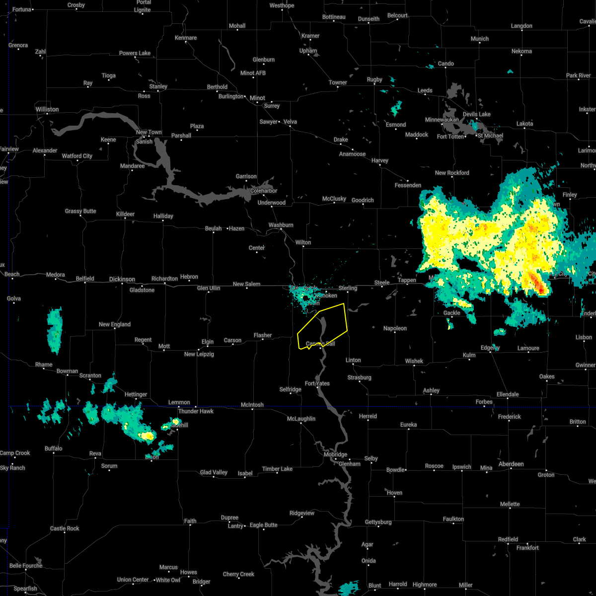 The severe thunderstorm warning for south central burleigh, northwestern emmons and southeastern morton counties will expire at 1030 pm cdt, the storm which prompted the warning has weakened below severe limits, and no longer pose an immediate threat to life or property. therefore the warning will be allowed to expire. however gusty winds are still possible with this thunderstorm. a severe thunderstorm watch remains in effect until 200 am cdt for south central north dakota. The severe thunderstorm warning for south central burleigh, northwestern emmons and southeastern morton counties will expire at 1030 pm cdt, the storm which prompted the warning has weakened below severe limits, and no longer pose an immediate threat to life or property. therefore the warning will be allowed to expire. however gusty winds are still possible with this thunderstorm. a severe thunderstorm watch remains in effect until 200 am cdt for south central north dakota.
|
| 7/9/2016 10:12 PM CDT |
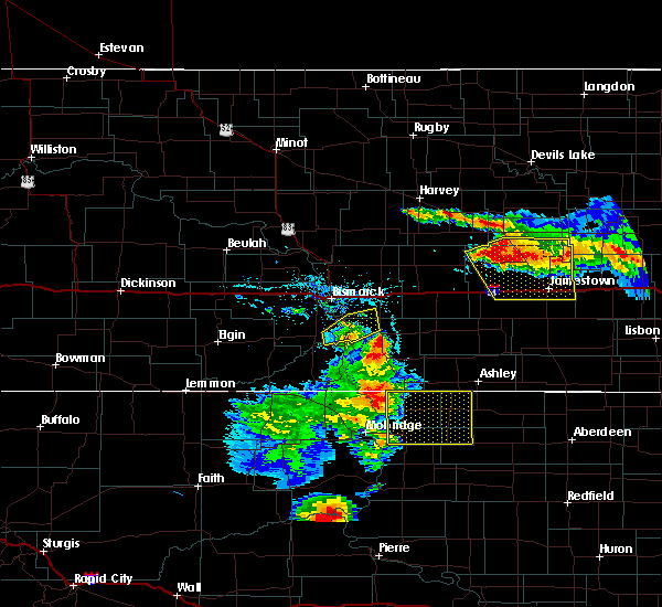 At 1012 pm cdt, a severe thunderstorm was located 6 miles north of cannon ball, or 23 miles northwest of linton, moving east at 35 mph (trained weather spotters). Hazards include 60 mph wind gusts and quarter size hail. Hail damage to vehicles is expected. expect wind damage to roofs, siding, and trees. Locations impacted include, solen, huff, fort rice and hazelton recreation area. At 1012 pm cdt, a severe thunderstorm was located 6 miles north of cannon ball, or 23 miles northwest of linton, moving east at 35 mph (trained weather spotters). Hazards include 60 mph wind gusts and quarter size hail. Hail damage to vehicles is expected. expect wind damage to roofs, siding, and trees. Locations impacted include, solen, huff, fort rice and hazelton recreation area.
|
| 7/9/2016 9:50 PM CDT |
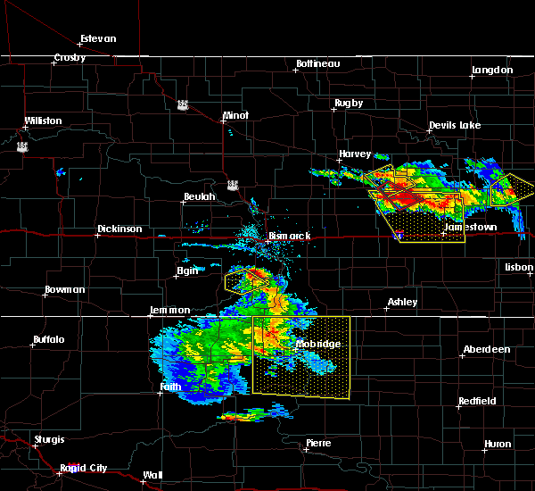 At 949 pm cdt, a severe thunderstorm was located 6 miles north of solen, or 23 miles south of bismarck, moving northeast at 40 mph (radar indicated). Hazards include 60 mph wind gusts and half dollar size hail. Hail damage to vehicles is expected. Expect wind damage to roofs, siding, and trees. At 949 pm cdt, a severe thunderstorm was located 6 miles north of solen, or 23 miles south of bismarck, moving northeast at 40 mph (radar indicated). Hazards include 60 mph wind gusts and half dollar size hail. Hail damage to vehicles is expected. Expect wind damage to roofs, siding, and trees.
|
| 7/9/2016 7:42 AM CDT |
 At 741 am cdt, a severe thunderstorm was located 9 miles southwest of st. anthony, or 23 miles south of mandan, moving northeast at 35 mph (radar indicated). Hazards include 60 mph wind gusts and quarter size hail. Hail damage to vehicles is expected. expect wind damage to roofs, siding, and trees. this severe storm will be near, st. anthony around 800 am cdt. Other locations impacted by this severe thunderstorm include breien. At 741 am cdt, a severe thunderstorm was located 9 miles southwest of st. anthony, or 23 miles south of mandan, moving northeast at 35 mph (radar indicated). Hazards include 60 mph wind gusts and quarter size hail. Hail damage to vehicles is expected. expect wind damage to roofs, siding, and trees. this severe storm will be near, st. anthony around 800 am cdt. Other locations impacted by this severe thunderstorm include breien.
|
| 7/9/2016 7:23 AM CDT |
 At 722 am cdt/622 am mdt/, a severe thunderstorm was located over flasher, or 29 miles east of elgin, moving northeast at 35 mph (radar indicated). Hazards include 60 mph wind gusts and quarter size hail. Hail damage to vehicles is expected. expect wind damage to roofs, siding, and trees. this severe thunderstorm will be near, flasher around 730 am cdt. st. anthony around 800 am cdt. Other locations impacted by this severe thunderstorm include breien, lark and raleigh. At 722 am cdt/622 am mdt/, a severe thunderstorm was located over flasher, or 29 miles east of elgin, moving northeast at 35 mph (radar indicated). Hazards include 60 mph wind gusts and quarter size hail. Hail damage to vehicles is expected. expect wind damage to roofs, siding, and trees. this severe thunderstorm will be near, flasher around 730 am cdt. st. anthony around 800 am cdt. Other locations impacted by this severe thunderstorm include breien, lark and raleigh.
|
| 7/6/2016 9:28 PM CDT |
 The severe thunderstorm warning for southeastern grant, sioux, western emmons and southeastern morton counties will expire at 930 pm cdt/830 pm mdt/, the storms which prompted the warning have weakened below severe limits, and no longer pose an immediate threat to life or property. therefore the warning will be allowed to expire. however gusty winds to 55 mph are still possible with these thunderstorms. a severe thunderstorm watch remains in effect until 1000 pm cdt/900 pm mdt/ for south central north dakota. The severe thunderstorm warning for southeastern grant, sioux, western emmons and southeastern morton counties will expire at 930 pm cdt/830 pm mdt/, the storms which prompted the warning have weakened below severe limits, and no longer pose an immediate threat to life or property. therefore the warning will be allowed to expire. however gusty winds to 55 mph are still possible with these thunderstorms. a severe thunderstorm watch remains in effect until 1000 pm cdt/900 pm mdt/ for south central north dakota.
|
| 7/6/2016 9:02 PM CDT |
 At 900 pm cdt/800 pm mdt/, severe thunderstorms were located along a line extending from 6 miles north of solen to 4 miles southwest of prairie knights resort to 4 miles south of selfridge, moving east at 40 mph (trained weather spotters). Hazards include 60 mph wind gusts. Expect damage to roofs. siding. and trees. locations impacted include, linton, fort yates, selfridge, hazelton, flasher, solen, cannon ball, prairie knights resort, shields, and st. Anthony. At 900 pm cdt/800 pm mdt/, severe thunderstorms were located along a line extending from 6 miles north of solen to 4 miles southwest of prairie knights resort to 4 miles south of selfridge, moving east at 40 mph (trained weather spotters). Hazards include 60 mph wind gusts. Expect damage to roofs. siding. and trees. locations impacted include, linton, fort yates, selfridge, hazelton, flasher, solen, cannon ball, prairie knights resort, shields, and st. Anthony.
|
| 7/6/2016 8:42 PM CDT |
 At 841 pm cdt/741 pm mdt/, severe thunderstorms were located along a line extending from 7 miles east of flasher to 8 miles east of shields to 7 miles northwest of walker, moving east at 40 mph (trained weather spotters). Hazards include 60 mph wind gusts. Expect damage to roofs. siding. and trees. locations impacted include, linton, fort yates, selfridge, hazelton, flasher, solen, cannon ball, prairie knights resort, shields, st. Anthony, lark, and raleigh. At 841 pm cdt/741 pm mdt/, severe thunderstorms were located along a line extending from 7 miles east of flasher to 8 miles east of shields to 7 miles northwest of walker, moving east at 40 mph (trained weather spotters). Hazards include 60 mph wind gusts. Expect damage to roofs. siding. and trees. locations impacted include, linton, fort yates, selfridge, hazelton, flasher, solen, cannon ball, prairie knights resort, shields, st. Anthony, lark, and raleigh.
|
| 7/6/2016 8:28 PM CDT |
 At 826 pm cdt/726 pm mdt/, severe thunderstorms were located along a line extending from near flasher to shields to 5 miles north of mcintosh, moving east at 45 mph (trained weather spotters). Hazards include 60 mph wind gusts. Expect damage to roofs. siding. and trees. severe thunderstorms will be near, shields around 730 pm mdt. selfridge and solen around 855 pm cdt. prairie knights resort around 900 pm cdt. cannon ball around 910 pm cdt. linton and hazelton around 925 pm cdt. Other locations impacted by these severe thunderstorms include cattail recreation area, porcupine, fort rice, raleigh, breien, hazelton recreation area and huff. At 826 pm cdt/726 pm mdt/, severe thunderstorms were located along a line extending from near flasher to shields to 5 miles north of mcintosh, moving east at 45 mph (trained weather spotters). Hazards include 60 mph wind gusts. Expect damage to roofs. siding. and trees. severe thunderstorms will be near, shields around 730 pm mdt. selfridge and solen around 855 pm cdt. prairie knights resort around 900 pm cdt. cannon ball around 910 pm cdt. linton and hazelton around 925 pm cdt. Other locations impacted by these severe thunderstorms include cattail recreation area, porcupine, fort rice, raleigh, breien, hazelton recreation area and huff.
|
| 7/6/2016 6:59 PM MDT |
 At 756 pm cdt/656 pm mdt/, severe thunderstorms were located along a line extending from 10 miles north of carson to 19 miles north of watauga to 5 miles south of keldron, moving southeast at 45 mph (trained weather spotters). Hazards include 60 mph wind gusts. Expect damage to roofs. siding. and trees. Locations impacted include, elgin, fort yates, selfridge, carson, flasher, new leipzig, solen, morristown and cannon ball. At 756 pm cdt/656 pm mdt/, severe thunderstorms were located along a line extending from 10 miles north of carson to 19 miles north of watauga to 5 miles south of keldron, moving southeast at 45 mph (trained weather spotters). Hazards include 60 mph wind gusts. Expect damage to roofs. siding. and trees. Locations impacted include, elgin, fort yates, selfridge, carson, flasher, new leipzig, solen, morristown and cannon ball.
|
| 7/6/2016 6:39 PM MDT |
 At 739 pm cdt/639 pm mdt/, severe thunderstorms were located along a line extending from heart butte dam to 10 miles southeast of elgin to near thunder hawk, moving southeast at 45 mph (radar indicated). Hazards include 70 mph wind gusts and penny size hail. Expect considerable tree damage. damage is likely to mobile homes, roofs, and outbuildings. these severe storms will be near, morristown around 655 pm mdt. carson around 700 pm mdt. flasher around 820 pm cdt. selfridge around 830 pm cdt. other locations impacted by these severe thunderstorms include porcupine, raleigh, breien, heil, leith, lark and st. Gertrude. At 739 pm cdt/639 pm mdt/, severe thunderstorms were located along a line extending from heart butte dam to 10 miles southeast of elgin to near thunder hawk, moving southeast at 45 mph (radar indicated). Hazards include 70 mph wind gusts and penny size hail. Expect considerable tree damage. damage is likely to mobile homes, roofs, and outbuildings. these severe storms will be near, morristown around 655 pm mdt. carson around 700 pm mdt. flasher around 820 pm cdt. selfridge around 830 pm cdt. other locations impacted by these severe thunderstorms include porcupine, raleigh, breien, heil, leith, lark and st. Gertrude.
|
| 7/6/2016 6:26 PM MDT |
 At 726 pm cdt/626 pm mdt/, severe thunderstorms were located along a line extending from 8 miles northwest of heart butte dam to 5 miles southeast of new leipzig to north lemmon, moving southeast at 45 mph (radar indicated). Hazards include 70 mph wind gusts and penny size hail. Expect considerable tree damage. damage is likely to mobile homes, roofs, and outbuildings. severe thunderstorms will be near, thunder hawk around 640 pm mdt. carson and morristown around 655 pm mdt. flasher around 820 pm cdt. selfridge around 830 pm cdt. other locations impacted by these severe thunderstorms include porcupine, raleigh, breien, heil, leith, lark and st. Gertrude. At 726 pm cdt/626 pm mdt/, severe thunderstorms were located along a line extending from 8 miles northwest of heart butte dam to 5 miles southeast of new leipzig to north lemmon, moving southeast at 45 mph (radar indicated). Hazards include 70 mph wind gusts and penny size hail. Expect considerable tree damage. damage is likely to mobile homes, roofs, and outbuildings. severe thunderstorms will be near, thunder hawk around 640 pm mdt. carson and morristown around 655 pm mdt. flasher around 820 pm cdt. selfridge around 830 pm cdt. other locations impacted by these severe thunderstorms include porcupine, raleigh, breien, heil, leith, lark and st. Gertrude.
|
| 6/22/2016 1:12 AM CDT |
 At 112 am cdt, severe thunderstorms were located along a line extending from 4 miles northwest of steele to 6 miles northwest of cannon ball, moving east at 55 mph (public). Hazards include 70 mph wind gusts and quarter size hail. Hail damage to vehicles is expected. expect considerable tree damage. wind damage is also likely to mobile homes, roofs, and outbuildings. these severe storms will be near, steele around 115 am cdt. dawson and lake isabel around 125 am cdt. tappen around 130 am cdt. Other locations impacted by these severe thunderstorms include moffit, kintyre, fort rice, hazelton recreation area, driscoll, huff, mckenzie and temvik. At 112 am cdt, severe thunderstorms were located along a line extending from 4 miles northwest of steele to 6 miles northwest of cannon ball, moving east at 55 mph (public). Hazards include 70 mph wind gusts and quarter size hail. Hail damage to vehicles is expected. expect considerable tree damage. wind damage is also likely to mobile homes, roofs, and outbuildings. these severe storms will be near, steele around 115 am cdt. dawson and lake isabel around 125 am cdt. tappen around 130 am cdt. Other locations impacted by these severe thunderstorms include moffit, kintyre, fort rice, hazelton recreation area, driscoll, huff, mckenzie and temvik.
|
| 6/22/2016 12:58 AM CDT |
 At 1257 am cdt, severe thunderstorms were located along a line extending from 10 miles north of sterling to 6 miles southwest of st. anthony, moving southeast at 55 mph (public reported 75 mph 6 miles north of bismarck). Hazards include 70 mph wind gusts and quarter size hail. Hail damage to vehicles is expected. expect considerable tree damage. wind damage is also likely to mobile homes, roofs, and outbuildings. these severe storms will be near, steele and cannon ball around 120 am cdt. dawson around 125 am cdt. lake isabel around 130 am cdt. Other locations impacted by these severe thunderstorms include moffit, kintyre, fort abraham lincoln state park, fort rice, hazelton recreation area, driscoll, huff, mckenzie, temvik and university of mary. At 1257 am cdt, severe thunderstorms were located along a line extending from 10 miles north of sterling to 6 miles southwest of st. anthony, moving southeast at 55 mph (public reported 75 mph 6 miles north of bismarck). Hazards include 70 mph wind gusts and quarter size hail. Hail damage to vehicles is expected. expect considerable tree damage. wind damage is also likely to mobile homes, roofs, and outbuildings. these severe storms will be near, steele and cannon ball around 120 am cdt. dawson around 125 am cdt. lake isabel around 130 am cdt. Other locations impacted by these severe thunderstorms include moffit, kintyre, fort abraham lincoln state park, fort rice, hazelton recreation area, driscoll, huff, mckenzie, temvik and university of mary.
|
| 6/22/2016 12:40 AM CDT |
 At 1238 am cdt, severe thunderstorms were located along a line extending from 6 miles southwest of regan to 5 miles south of fish creek dam, moving southeast at 45 mph (radar indicated). Hazards include 70 mph wind gusts and quarter size hail. Hail damage to vehicles is expected. expect considerable tree damage. wind damage is also likely to mobile homes, roofs, and outbuildings. these severe storms will be near, bismarck and mandan around 1245 am cdt. regan around 1245 am cdt. st. anthony around 100 am cdt. steele and cannon ball around 125 am cdt. dawson and lake isabel around 130 am cdt. Other locations impacted by these severe thunderstorms include fort rice, driscoll, crown butte lake, double ditch indian village, kintyre, moffit, fort abraham lincoln state park, baldwin, hazelton recreation area and huff. At 1238 am cdt, severe thunderstorms were located along a line extending from 6 miles southwest of regan to 5 miles south of fish creek dam, moving southeast at 45 mph (radar indicated). Hazards include 70 mph wind gusts and quarter size hail. Hail damage to vehicles is expected. expect considerable tree damage. wind damage is also likely to mobile homes, roofs, and outbuildings. these severe storms will be near, bismarck and mandan around 1245 am cdt. regan around 1245 am cdt. st. anthony around 100 am cdt. steele and cannon ball around 125 am cdt. dawson and lake isabel around 130 am cdt. Other locations impacted by these severe thunderstorms include fort rice, driscoll, crown butte lake, double ditch indian village, kintyre, moffit, fort abraham lincoln state park, baldwin, hazelton recreation area and huff.
|
| 6/22/2016 12:30 AM CDT |
 At 1230 am cdt, severe thunderstorms were located along a line extending from 4 miles southeast of wilton to 6 miles southwest of fish creek dam, moving southeast at 45 mph (radar indicated). Hazards include 70 mph wind gusts and quarter size hail. Hail damage to vehicles is expected. expect considerable tree damage. wind damage is also likely to mobile homes, roofs, and outbuildings. severe thunderstorms will be near, regan around 1240 am cdt. st. anthony around 100 am cdt. steele and cannon ball around 125 am cdt. dawson and lake isabel around 130 am cdt. Other locations impacted by these severe thunderstorms include fort rice, driscoll, crown butte lake, double ditch indian village, kintyre, moffit, fort abraham lincoln state park, baldwin, hazelton recreation area and huff. At 1230 am cdt, severe thunderstorms were located along a line extending from 4 miles southeast of wilton to 6 miles southwest of fish creek dam, moving southeast at 45 mph (radar indicated). Hazards include 70 mph wind gusts and quarter size hail. Hail damage to vehicles is expected. expect considerable tree damage. wind damage is also likely to mobile homes, roofs, and outbuildings. severe thunderstorms will be near, regan around 1240 am cdt. st. anthony around 100 am cdt. steele and cannon ball around 125 am cdt. dawson and lake isabel around 130 am cdt. Other locations impacted by these severe thunderstorms include fort rice, driscoll, crown butte lake, double ditch indian village, kintyre, moffit, fort abraham lincoln state park, baldwin, hazelton recreation area and huff.
|
| 6/17/2016 4:35 AM CDT | At 435 am cdt, severe thunderstorms were located along a line extending from wilton to near menoken to 6 miles northeast of solen, moving east at 50 mph (trained weather spotters. around 430 am cdt...golf ball to two inch diameter hail and 70 mph wind gusts were reported by spotters in north bismarck). Hazards include two inch hail and 70 mph wind gusts. People and animals outdoors will be injured. expect hail damage to roofs, siding, windows, and vehicles. expect considerable tree damage. wind damage is also likely to mobile homes, roofs, and outbuildings. these severe storms will be near, menoken around 440 am cdt. sterling and regan around 450 am cdt. hazelton and wing around 500 am cdt. Other locations impacted by these severe thunderstorms include fort rice, driscoll, crown butte lake, double ditch indian village, moffit, fort abraham lincoln state park, baldwin, hazelton recreation area, nelson lake and arena. |
| 6/17/2016 4:28 AM CDT | At 428 am cdt, severe thunderstorms were located along a line extending from 5 miles southwest of wilton to lincoln to 4 miles northwest of solen, moving east at 50 mph (radar indicated. at 423 am cdt...58 mph wind gusts were recorded at the bismarck airport). Hazards include 70 mph wind gusts and half dollar size hail. Hail damage to vehicles is expected. expect considerable tree damage. wind damage is also likely to mobile homes, roofs, and outbuildings. these severe storms will be near, lincoln and mcdowell dam recreation area around 430 am cdt. wilton and menoken around 435 am cdt. sterling and regan around 450 am cdt. hazelton and wing around 500 am cdt. Other locations impacted by these severe thunderstorms include fort rice, driscoll, crown butte lake, double ditch indian village, moffit, fort abraham lincoln state park, baldwin, breien, hazelton recreation area and nelson lake. |
| 6/17/2016 4:15 AM CDT | At 415 am cdt, severe thunderstorms were located along a line extending from 8 miles south of cross ranch state park to 6 miles southwest of bismarck to 9 miles west of solen, moving east at 45 mph (radar indicated). Hazards include 70 mph wind gusts and half dollar size hail. Hail damage to vehicles is expected. expect considerable tree damage. wind damage is also likely to mobile homes, roofs, and outbuildings. these severe storms will be near, bismarck and lincoln around 425 am cdt. wilton and mcdowell dam recreation area around 430 am cdt. menoken around 435 am cdt. sterling and regan around 450 am cdt. hazelton and wing around 500 am cdt. Other locations impacted by these severe thunderstorms include fort rice, driscoll, crown butte lake, double ditch indian village, moffit, fort abraham lincoln state park, baldwin, breien, hazelton recreation area and nelson lake. |
| 6/17/2016 3:58 AM CDT | At 358 am cdt, severe thunderstorms were located along a line extending from 4 miles south of center to 7 miles east of fish creek dam to 7 miles south of flasher, moving east at 50 mph (radar indicated). Hazards include 70 mph wind gusts and half dollar size hail. Hail damage to vehicles is expected. expect considerable tree damage. wind damage is also likely to mobile homes, roofs, and outbuildings. severe thunderstorms will be near, st. anthony around 405 am cdt. bismarck and lincoln around 420 am cdt. solen and mcdowell dam recreation area around 425 am cdt. wilton and menoken around 430 am cdt. regan around 440 am cdt. sterling around 445 am cdt. hazelton and wing around 455 am cdt. braddock around 500 am cdt. Other locations impacted by these severe thunderstorms include fort rice, driscoll, crown butte lake, double ditch indian village, moffit, fort abraham lincoln state park, baldwin, breien, hazelton recreation area and nelson lake. |
| 5/25/2016 5:58 PM CDT |
 At 557 pm cdt, severe thunderstorms were located along a line extending from 12 miles northwest of hazelton to near linton, moving east at 20 mph. these storms will also effect highway 83 (radar indicated). Hazards include 60 mph wind gusts and quarter size hail. Hail damage to vehicles is expected. expect wind damage to roofs, siding, and trees. Locations impacted include, hazelton, braddock, beaver bay recreation area and temvik. At 557 pm cdt, severe thunderstorms were located along a line extending from 12 miles northwest of hazelton to near linton, moving east at 20 mph. these storms will also effect highway 83 (radar indicated). Hazards include 60 mph wind gusts and quarter size hail. Hail damage to vehicles is expected. expect wind damage to roofs, siding, and trees. Locations impacted include, hazelton, braddock, beaver bay recreation area and temvik.
|
| 5/25/2016 5:36 PM CDT |
 At 535 pm cdt, severe thunderstorms were located along a line extending from 11 miles north of cannon ball to 7 miles west of linton, moving northeast at 25 mph (radar indicated). Hazards include 60 mph wind gusts and quarter size hail. Hail damage to vehicles is expected. expect wind damage to roofs, siding, and trees. These severe thunderstorms will remain over mainly rural areas of northeastern sioux, northern emmons and east central morton counties, including the following locations: kintyre, fort rice, beaver bay recreation area, hazelton recreation area and temvik. At 535 pm cdt, severe thunderstorms were located along a line extending from 11 miles north of cannon ball to 7 miles west of linton, moving northeast at 25 mph (radar indicated). Hazards include 60 mph wind gusts and quarter size hail. Hail damage to vehicles is expected. expect wind damage to roofs, siding, and trees. These severe thunderstorms will remain over mainly rural areas of northeastern sioux, northern emmons and east central morton counties, including the following locations: kintyre, fort rice, beaver bay recreation area, hazelton recreation area and temvik.
|
| 5/25/2016 5:22 PM CDT |
 At 519 pm cdt, a severe thunderstorm was located near cannon ball, or 21 miles north of fort yates, moving east at 25 mph (radar indicated. at 508 pm cdt quarter sized hail was reported in solen). Hazards include 60 mph wind gusts and quarter size hail. Hail damage to vehicles is expected. expect wind damage to roofs, siding, and trees. this severe storm will be near, cannon ball around 530 pm cdt. other locations impacted by this severe thunderstorm include fort rice. Highway 1806 in southeastern morton county and highway 24 in sioux county will also be affected by this severe thunderstorm. At 519 pm cdt, a severe thunderstorm was located near cannon ball, or 21 miles north of fort yates, moving east at 25 mph (radar indicated. at 508 pm cdt quarter sized hail was reported in solen). Hazards include 60 mph wind gusts and quarter size hail. Hail damage to vehicles is expected. expect wind damage to roofs, siding, and trees. this severe storm will be near, cannon ball around 530 pm cdt. other locations impacted by this severe thunderstorm include fort rice. Highway 1806 in southeastern morton county and highway 24 in sioux county will also be affected by this severe thunderstorm.
|
| 5/25/2016 4:58 PM CDT |
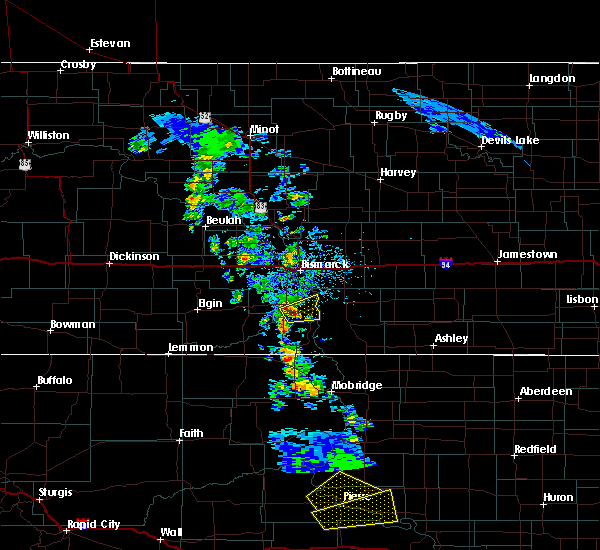 At 456 pm cdt, a severe thunderstorm was located just west of solen, or 21 miles northwest of fort yates, moving northeast at 25 mph (radar indicated). Hazards include 60 mph wind gusts and quarter size hail. Hail damage to vehicles is expected. expect wind damage to roofs, siding, and trees. this severe storm will be near, solen around 505 pm cdt. cannon ball around 525 pm cdt. other locations impacted by this severe thunderstorm include breien and fort rice. This storm will also move over highway 24 in sioux county and affect highway 1806 in southeastern morton county. At 456 pm cdt, a severe thunderstorm was located just west of solen, or 21 miles northwest of fort yates, moving northeast at 25 mph (radar indicated). Hazards include 60 mph wind gusts and quarter size hail. Hail damage to vehicles is expected. expect wind damage to roofs, siding, and trees. this severe storm will be near, solen around 505 pm cdt. cannon ball around 525 pm cdt. other locations impacted by this severe thunderstorm include breien and fort rice. This storm will also move over highway 24 in sioux county and affect highway 1806 in southeastern morton county.
|
| 5/25/2016 4:43 PM CDT |
 At 441 pm cdt, a severe thunderstorm was located near breien or 9 miles west of solen, or 20 miles north of selfridge, moving northeast at 25 mph (radar indicated). Hazards include 60 mph wind gusts and quarter size hail. Hail damage to vehicles is expected. expect wind damage to roofs, siding, and trees. this severe thunderstorm will be near, solen around 505 pm cdt. cannon ball around 530 pm cdt. south of breien around 445 pm cdt. Other locations impacted by this severe thunderstorm include breien and fort rice. At 441 pm cdt, a severe thunderstorm was located near breien or 9 miles west of solen, or 20 miles north of selfridge, moving northeast at 25 mph (radar indicated). Hazards include 60 mph wind gusts and quarter size hail. Hail damage to vehicles is expected. expect wind damage to roofs, siding, and trees. this severe thunderstorm will be near, solen around 505 pm cdt. cannon ball around 530 pm cdt. south of breien around 445 pm cdt. Other locations impacted by this severe thunderstorm include breien and fort rice.
|
| 7/27/2015 11:04 PM CDT |
 At 1103 pm cdt, severe thunderstorms were located along a line extending from 7 miles east of lake harmon to 12 miles southeast of menoken to 6 miles northeast of herreid, moving east at 40 mph (radar indicated). Hazards include 60 mph wind gusts. Expect damage to roofs. siding and trees. locations impacted include, bismarck, mandan, linton, fort yates, lincoln, strasburg, hazelton, menoken, sterling, solen, hague, westfield, cannon ball, braddock, mcdowell dam recreation area, st. Anthony, lake harmon, prairie knights resort, mckenzie and cattail recreation area. At 1103 pm cdt, severe thunderstorms were located along a line extending from 7 miles east of lake harmon to 12 miles southeast of menoken to 6 miles northeast of herreid, moving east at 40 mph (radar indicated). Hazards include 60 mph wind gusts. Expect damage to roofs. siding and trees. locations impacted include, bismarck, mandan, linton, fort yates, lincoln, strasburg, hazelton, menoken, sterling, solen, hague, westfield, cannon ball, braddock, mcdowell dam recreation area, st. Anthony, lake harmon, prairie knights resort, mckenzie and cattail recreation area.
|
| 7/27/2015 10:45 PM CDT |
 At 1044 pm cdt /944 pm mdt/, severe thunderstorms were located along a line extending from 4 miles west of lake harmon to 7 miles south of lincoln to near pollock, moving east at 35 mph (radar indicated). Hazards include 60 mph wind gusts. Expect damage to roofs. siding and trees. locations impacted include, bismarck, mandan, linton, fort yates, selfridge, lincoln, strasburg, hazelton, menoken, sterling, solen, hague, westfield, cannon ball, braddock, shields, mcdowell dam recreation area, st. Anthony, lake harmon and prairie knights resort. At 1044 pm cdt /944 pm mdt/, severe thunderstorms were located along a line extending from 4 miles west of lake harmon to 7 miles south of lincoln to near pollock, moving east at 35 mph (radar indicated). Hazards include 60 mph wind gusts. Expect damage to roofs. siding and trees. locations impacted include, bismarck, mandan, linton, fort yates, selfridge, lincoln, strasburg, hazelton, menoken, sterling, solen, hague, westfield, cannon ball, braddock, shields, mcdowell dam recreation area, st. Anthony, lake harmon and prairie knights resort.
|
| 7/27/2015 10:27 PM CDT |
 At 1026 pm cdt /926 pm mdt/, severe thunderstorms were located along a line extending from 10 miles south of center to near st. anthony to 4 miles northeast of kenel, moving east at 40 mph (radar indicated). Hazards include 60 mph wind gusts. Expect damage to roofs. Siding and trees. At 1026 pm cdt /926 pm mdt/, severe thunderstorms were located along a line extending from 10 miles south of center to near st. anthony to 4 miles northeast of kenel, moving east at 40 mph (radar indicated). Hazards include 60 mph wind gusts. Expect damage to roofs. Siding and trees.
|
| 7/27/2015 10:03 PM CDT |
 At 1000 pm cdt /900 pm mdt/, severe thunderstorms were located along a line extending from 12 miles northeast of glen ullin to 5 miles northwest of fish creek dam to near flasher to 4 miles northwest of selfridge, moving northeast at 50 mph (trained weather spotters. at 955 pm cdt /855 pm mdt...60 mph winds were reported at heart butte dam). Hazards include 60 mph wind gusts and penny size hail. Expect damage to roofs. siding and trees. locations impacted include, mandan, glen ullin, elgin, selfridge, new salem, hebron, carson, flasher, almont, solen, cannon ball, shields, st. Anthony, heart butte dam, prairie knights resort, fish creek dam, lake harmon, judson, lark and raleigh. At 1000 pm cdt /900 pm mdt/, severe thunderstorms were located along a line extending from 12 miles northeast of glen ullin to 5 miles northwest of fish creek dam to near flasher to 4 miles northwest of selfridge, moving northeast at 50 mph (trained weather spotters. at 955 pm cdt /855 pm mdt...60 mph winds were reported at heart butte dam). Hazards include 60 mph wind gusts and penny size hail. Expect damage to roofs. siding and trees. locations impacted include, mandan, glen ullin, elgin, selfridge, new salem, hebron, carson, flasher, almont, solen, cannon ball, shields, st. Anthony, heart butte dam, prairie knights resort, fish creek dam, lake harmon, judson, lark and raleigh.
|
| 7/27/2015 9:39 PM CDT |
 At 937 pm cdt /837 pm mdt/, severe thunderstorms were located along a line extending from 5 miles west of glen ullin to 7 miles southwest of almont to 8 miles southeast of carson to 6 miles northeast of mcintosh, moving northeast at 60 mph (radar indicated). Hazards include 60 mph wind gusts and penny size hail. Expect damage to roofs. Siding and trees. At 937 pm cdt /837 pm mdt/, severe thunderstorms were located along a line extending from 5 miles west of glen ullin to 7 miles southwest of almont to 8 miles southeast of carson to 6 miles northeast of mcintosh, moving northeast at 60 mph (radar indicated). Hazards include 60 mph wind gusts and penny size hail. Expect damage to roofs. Siding and trees.
|
| 6/21/2015 9:52 PM CDT |
 At 951 pm cdt, a severe thunderstorm was located over linton, moving southeast at 50 mph (radar indicated). Hazards include 60 mph wind gusts and nickel size hail. Expect damage to roofs. siding and trees. this severe storm will be near, strasburg around 1000 pm cdt. other locations impacted by this severe thunderstorm include kintyre, temvik, hull and beaver bay recreation area. A tornado watch remains in effect until 1100 pm cdt for southeastern north dakota. At 951 pm cdt, a severe thunderstorm was located over linton, moving southeast at 50 mph (radar indicated). Hazards include 60 mph wind gusts and nickel size hail. Expect damage to roofs. siding and trees. this severe storm will be near, strasburg around 1000 pm cdt. other locations impacted by this severe thunderstorm include kintyre, temvik, hull and beaver bay recreation area. A tornado watch remains in effect until 1100 pm cdt for southeastern north dakota.
|
| 6/21/2015 9:34 PM CDT |
 At 933 pm cdt, a severe thunderstorm was located 8 miles southwest of hazelton, or 13 miles northwest of linton, moving east at 45 mph (radar indicated). Hazards include 70 mph wind gusts and nickel size hail. Expect considerable tree damage. damage is likely to mobile homes, roofs and outbuildings. this severe storm will be near, hazelton around 940 pm cdt. linton around 950 pm cdt. other locations impacted by this severe thunderstorm include kintyre, fort rice, hazelton recreation area, hull, huff, beaver bay recreation area and temvik. A tornado watch remains in effect until 1100 pm cdt for southeastern north dakota. At 933 pm cdt, a severe thunderstorm was located 8 miles southwest of hazelton, or 13 miles northwest of linton, moving east at 45 mph (radar indicated). Hazards include 70 mph wind gusts and nickel size hail. Expect considerable tree damage. damage is likely to mobile homes, roofs and outbuildings. this severe storm will be near, hazelton around 940 pm cdt. linton around 950 pm cdt. other locations impacted by this severe thunderstorm include kintyre, fort rice, hazelton recreation area, hull, huff, beaver bay recreation area and temvik. A tornado watch remains in effect until 1100 pm cdt for southeastern north dakota.
|
| 6/21/2015 9:11 PM CDT |
 At 911 pm cdt, a severe thunderstorm was located 8 miles northeast of solen, or 21 miles south of bismarck, moving southeast at 45 mph (radar indicated). Hazards include 60 mph wind gusts and nickel size hail. Expect damage to roofs. siding and trees. this severe thunderstorm will be near, cannon ball around 925 pm cdt. hazelton around 940 pm cdt. linton around 950 pm cdt. other locations impacted by this severe thunderstorm include kintyre, fort rice, breien, hazelton recreation area, hull, huff, beaver bay recreation area and temvik. A tornado watch remains in effect until 1100 pm cdt for southeastern north dakota. At 911 pm cdt, a severe thunderstorm was located 8 miles northeast of solen, or 21 miles south of bismarck, moving southeast at 45 mph (radar indicated). Hazards include 60 mph wind gusts and nickel size hail. Expect damage to roofs. siding and trees. this severe thunderstorm will be near, cannon ball around 925 pm cdt. hazelton around 940 pm cdt. linton around 950 pm cdt. other locations impacted by this severe thunderstorm include kintyre, fort rice, breien, hazelton recreation area, hull, huff, beaver bay recreation area and temvik. A tornado watch remains in effect until 1100 pm cdt for southeastern north dakota.
|
| 6/19/2015 10:03 PM CDT |
 At 1001 pm cdt, severe thunderstorms were located along a line extending from 9 miles north of steele to linton, moving southeast at 65 mph (radar indicated). Hazards include 70 mph wind gusts and nickel size hail. Expect considerable tree damage. damage is likely to mobile homes, roofs and outbuildings. Locations impacted include, linton, napoleon, ashley, steele, medina, wishek, gackle, hazelton, tappen, streeter, sterling, cleveland, lehr, dawson, braddock, lake isabel, driscoll, eldridge, mckenzie and windsor. At 1001 pm cdt, severe thunderstorms were located along a line extending from 9 miles north of steele to linton, moving southeast at 65 mph (radar indicated). Hazards include 70 mph wind gusts and nickel size hail. Expect considerable tree damage. damage is likely to mobile homes, roofs and outbuildings. Locations impacted include, linton, napoleon, ashley, steele, medina, wishek, gackle, hazelton, tappen, streeter, sterling, cleveland, lehr, dawson, braddock, lake isabel, driscoll, eldridge, mckenzie and windsor.
|
| 6/19/2015 9:45 PM CDT |
 At 944 pm cdt, severe thunderstorms were located along a line extending from 10 miles south of hurdsfield to 6 miles northwest of linton, moving east at 55 mph. these are very dangerous storms (radar indicated. these storms have a history of producing winds as high as 85 mph in bismarck and mandan). Hazards include 80 mph wind gusts and nickel size hail. Flying debris will be dangerous to those caught without shelter. mobile homes will be heavily damaged. expect considerable damage to roofs, windows and vehicles. Extensive tree damage and power outages are likely. At 944 pm cdt, severe thunderstorms were located along a line extending from 10 miles south of hurdsfield to 6 miles northwest of linton, moving east at 55 mph. these are very dangerous storms (radar indicated. these storms have a history of producing winds as high as 85 mph in bismarck and mandan). Hazards include 80 mph wind gusts and nickel size hail. Flying debris will be dangerous to those caught without shelter. mobile homes will be heavily damaged. expect considerable damage to roofs, windows and vehicles. Extensive tree damage and power outages are likely.
|
| 6/19/2015 9:15 PM CDT |
 At 912 pm cdt, a severe thunderstorm was located 11 miles northwest of hazelton, or 20 miles southeast of bismarck, moving east at 75 mph. this is a very dangerous storm (radar indicated. these storms have a history of producing winds up to 85 mph in mandan and bismarck). Hazards include 80 mph wind gusts and nickel size hail. Flying debris will be dangerous to those caught without shelter. mobile homes will be heavily damaged. expect considerable damage to roofs, windows and vehicles. extensive tree damage and power outages are likely. this severe thunderstorm will be near, hazelton around 920 pm cdt. braddock around 925 pm cdt. napoleon around 940 pm cdt. Other locations impacted by this severe thunderstorm include huff, kintyre, burnstad, fort rice, temvik and hazelton recreation area. At 912 pm cdt, a severe thunderstorm was located 11 miles northwest of hazelton, or 20 miles southeast of bismarck, moving east at 75 mph. this is a very dangerous storm (radar indicated. these storms have a history of producing winds up to 85 mph in mandan and bismarck). Hazards include 80 mph wind gusts and nickel size hail. Flying debris will be dangerous to those caught without shelter. mobile homes will be heavily damaged. expect considerable damage to roofs, windows and vehicles. extensive tree damage and power outages are likely. this severe thunderstorm will be near, hazelton around 920 pm cdt. braddock around 925 pm cdt. napoleon around 940 pm cdt. Other locations impacted by this severe thunderstorm include huff, kintyre, burnstad, fort rice, temvik and hazelton recreation area.
|
| 6/2/2015 7:02 PM CDT | At 659 pm cdt, a severe thunderstorm was located near prairie knights resort, or 11 miles north of fort yates, moving southeast at 35 mph (trained weather spotters). Hazards include tennis ball size hail and 60 mph wind gusts. People and animals outdoors will be injured. expect hail damage to roofs, siding, windows and vehicles. expect wind damage to roofs, siding and trees. this severe storm will be near, strasburg around 735 pm cdt. other locations impacted by this severe thunderstorm include temvik and beaver bay recreation area. A tornado watch remains in effect until 1000 pm cdt for south central north dakota. |
| 6/2/2015 7:00 PM CDT | Golf Ball sized hail reported 4.4 miles N of Cannon Ball, ND, hail lasted for 10 minutes |
| 6/2/2015 6:39 PM CDT | At 637 pm cdt, a severe thunderstorm was located over solen, or 20 miles north of fort yates, moving southeast at 40 mph (radar indicated). Hazards include tennis ball size hail and 60 mph wind gusts. People and animals outdoors will be injured. expect hail damage to roofs, siding, windows and vehicles. expect wind damage to roofs, siding and trees. this severe thunderstorm will be near, cannon ball and prairie knights resort around 650 pm cdt. linton around 720 pm cdt. strasburg around 730 pm cdt. other locations impacted by this severe thunderstorm include beaver bay recreation area and temvik. A tornado watch remains in effect until 1000 pm cdt for south central north dakota. |
| 6/2/2015 6:26 PM CDT | At 625 pm cdt, a severe thunderstorm was located near solen, or 25 miles south of bismarck, moving southeast at 40 mph (radar indicated). Hazards include tennis ball size hail and 60 mph wind gusts. People and animals outdoors will be injured. expect hail damage to roofs, siding, windows and vehicles. expect wind damage to roofs, siding and trees. this severe storm will be near, cannon ball around 640 pm cdt. other locations impacted by this severe thunderstorm include hazelton recreation area and fort rice. A tornado watch remains in effect until 1000 pm cdt for south central north dakota. |
| 6/2/2015 6:03 PM CDT | At 602 pm cdt, a severe thunderstorm was located near st. anthony, or 18 miles south of mandan, moving southeast at 35 mph (radar indicated). Hazards include golf ball size hail and 60 mph wind gusts. People and animals outdoors will be injured. expect hail damage to roofs, siding, windows and vehicles. expect wind damage to roofs, siding and trees. this severe storm will be near, st. anthony around 605 pm cdt. solen around 625 pm cdt. cannon ball around 640 pm cdt. other locations impacted by this severe thunderstorm include huff, hazelton recreation area and fort rice. A tornado watch remains in effect until 1000 pm cdt for south central north dakota. |
| 6/2/2015 5:44 PM CDT | At 542 pm cdt, a severe thunderstorm was located 7 miles southeast of fish creek dam, or 16 miles southwest of mandan, moving east at 30 mph (radar indicated). Hazards include golf ball size hail and 60 mph wind gusts. People and animals outdoors will be injured. expect hail damage to roofs, siding, windows and vehicles. expect wind damage to roofs, siding and trees. this severe thunderstorm will be near, st. anthony around 605 pm cdt. other locations impacted by this severe thunderstorm include huff, fort rice, hazelton recreation area and university of mary. A tornado watch remains in effect until 1000 pm cdt for south central north dakota. |
| 6/2/2015 3:01 PM CDT | At 300 pm cdt, a severe thunderstorm was located 5 miles east of prairie knights resort, or 12 miles northeast of fort yates, moving east at 20 mph (radar indicated). Hazards include golf ball size hail and 60 mph wind gusts. People and animals outdoors will be injured. expect hail damage to roofs, siding, windows and vehicles. expect wind damage to roofs, siding and trees. this severe storm will be near, linton around 345 pm cdt. other locations impacted by this severe thunderstorm include beaver bay recreation area. A tornado watch remains in effect until 1000 pm cdt for south central north dakota. |
| 6/2/2015 2:54 PM CDT | At 253 pm cdt, a severe thunderstorm was located near prairie knights resort, or 12 miles north of fort yates, moving east at 20 mph (radar indicated). Hazards include ping pong ball size hail and 60 mph wind gusts. People and animals outdoors will be injured. expect hail damage to roofs, siding, windows and vehicles. expect wind damage to roofs, siding and trees. this severe storm will be near, linton around 340 pm cdt. other locations impacted by this severe thunderstorm include temvik and beaver bay recreation area. A tornado watch remains in effect until 1000 pm cdt for south central north dakota. |
| 6/2/2015 2:46 PM CDT | Quarter sized hail reported 4.4 miles N of Cannon Ball, ND, hail lasted around 10 minutes and heavy rain also reported |
| 6/2/2015 2:43 PM CDT | At 242 pm cdt, a severe thunderstorm was located over prairie knights resort, or 12 miles north of fort yates, moving east at 25 mph (radar indicated). Hazards include 60 mph wind gusts and quarter size hail. Hail damage to vehicles is expected. expect wind damage to roofs, siding and trees. this severe thunderstorm will be near, linton around 330 pm cdt. Other locations impacted by this severe thunderstorm include temvik and beaver bay recreation area. |
| 6/2/2015 2:43 PM CDT | At 242 pm cdt, a severe thunderstorm was located over prairie knights resort, or 12 miles north of fort yates, moving east at 25 mph (radar indicated). Hazards include 60 mph wind gusts and quarter size hail. Hail damage to vehicles is expected. expect wind damage to roofs, siding and trees. this severe thunderstorm will be near, linton around 330 pm cdt. Other locations impacted by this severe thunderstorm include temvik and beaver bay recreation area. |
| 6/2/2015 2:43 PM CDT | At 242 pm cdt, a severe thunderstorm was located over prairie knights resort, or 12 miles north of fort yates, moving east at 25 mph (radar indicated). Hazards include 60 mph wind gusts and quarter size hail. Hail damage to vehicles is expected. expect wind damage to roofs, siding and trees. this severe thunderstorm will be near, linton around 330 pm cdt. Other locations impacted by this severe thunderstorm include temvik and beaver bay recreation area. |
| 3/28/2015 8:57 PM CDT | A severe thunderstorm warning remains in effect for eastern sioux. southeastern morton. western mcintosh. western logan and emmons counties until 930 pm cdt. at 854 pm cdt. severe thunderstorms were located along a line extending from braddock to 10 miles west of kenel. Moving east at 45 mph. |
| 3/28/2015 8:40 PM CDT | The national weather service in bismarck has issued a * severe thunderstorm warning for. emmons county in south central north dakota. western logan county in southeast north dakota. western mcintosh county in southeast north dakota. Southeastern morton county in south central north dakota. |
| 3/28/2015 8:19 PM CDT | A severe thunderstorm warning remains in effect for sioux. southeastern morton. eastern grant and western emmons counties until 845 pm cdt/745 pm mdt/. at 817 pm cdt/717 pm mdt/. severe thunderstorms were located along a line extending from st. anthony to 14 miles southwest of selfridge. Moving east at 60 mph. |
| 3/28/2015 7:58 PM CDT | The national weather service in bismarck has issued a * severe thunderstorm warning for. western emmons county in south central north dakota. grant county in south central north dakota. southern morton county in south central north dakota. Sioux county in south central north dakota. |
| 7/21/2014 6:05 PM CDT | Storm damage reported in emmons county ND, 10.8 miles SSW of Cannon Ball, ND |
| 7/6/2014 11:14 PM CDT | Roof and deck damaged and a shed destroye in emmons county ND, 5.9 miles SW of Cannon Ball, ND |
Hail Maps for Cannon Ball, ND
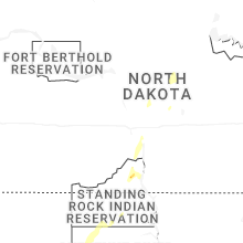


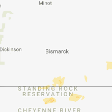


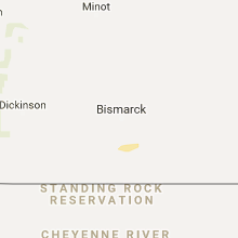


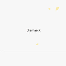


Connect with Interactive Hail Maps