

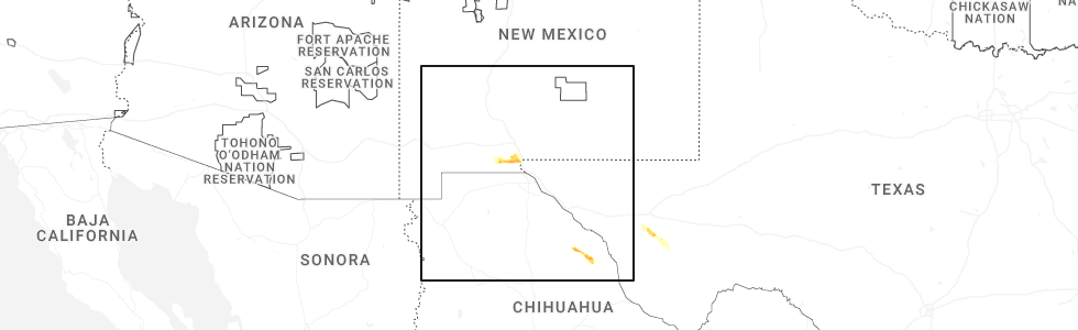
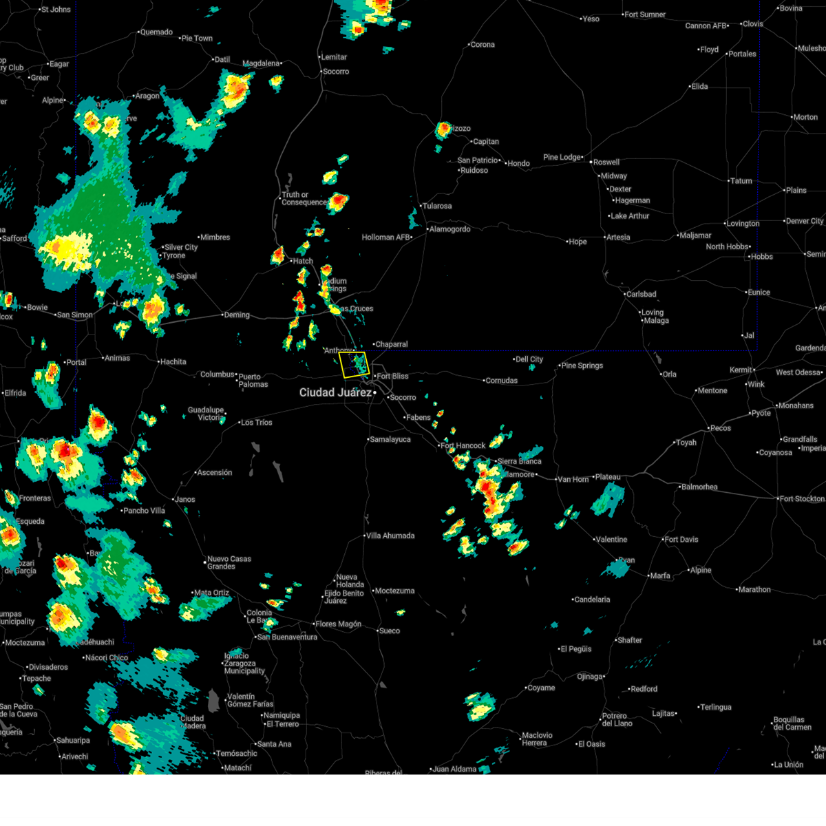
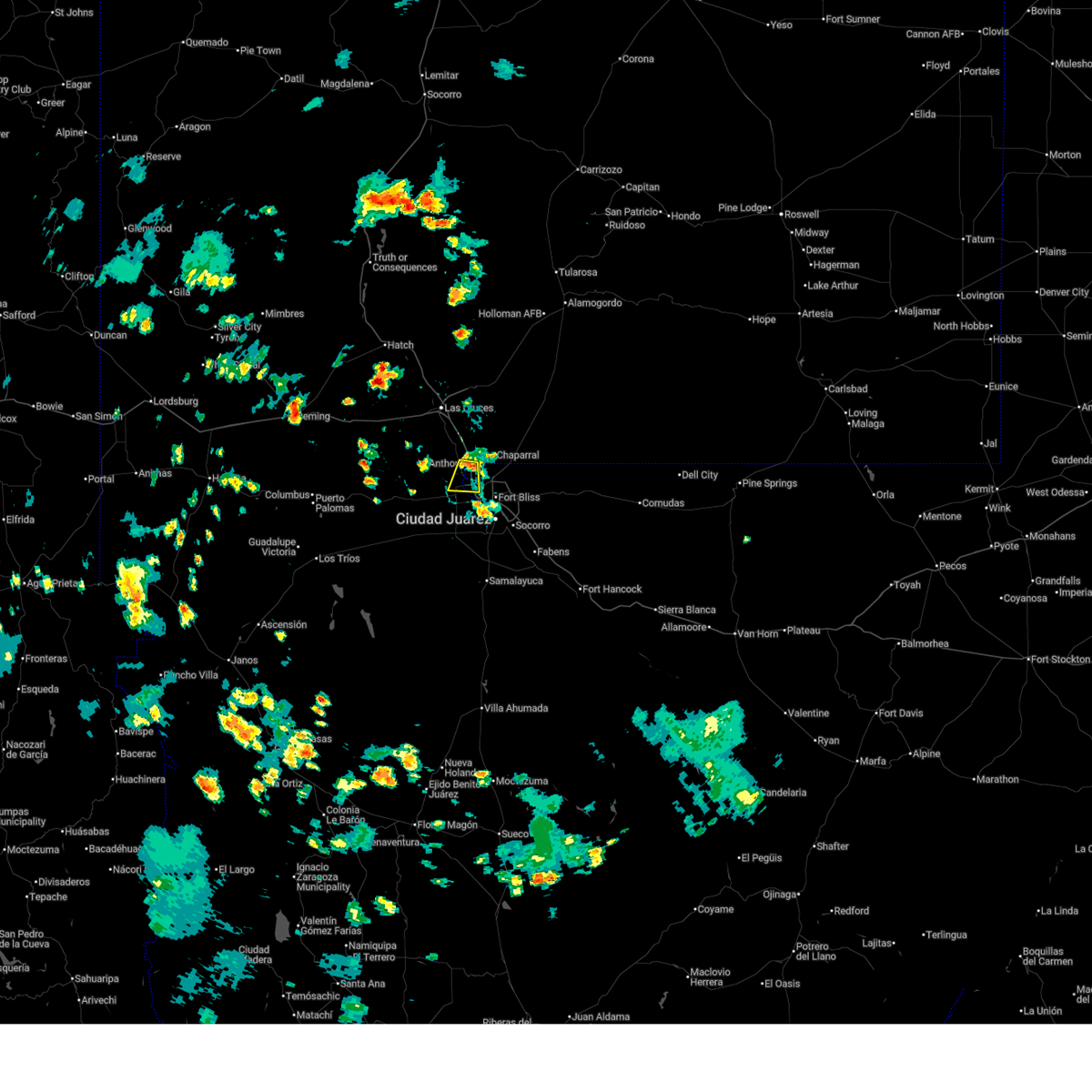
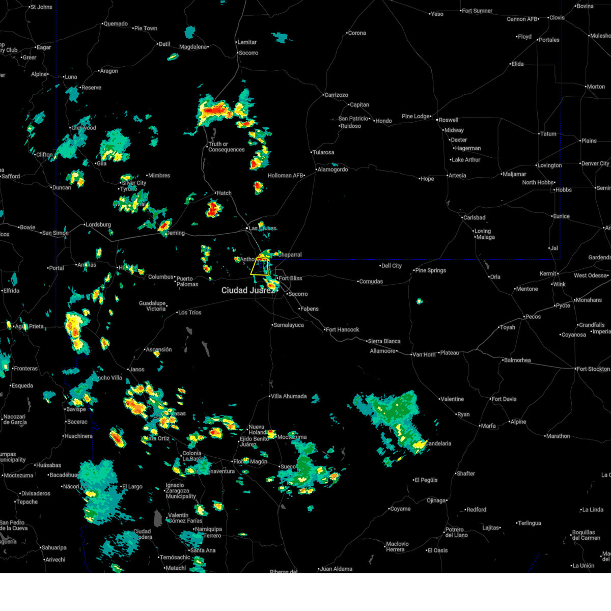
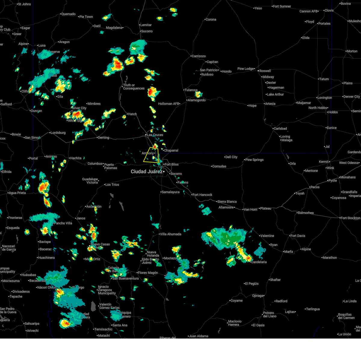
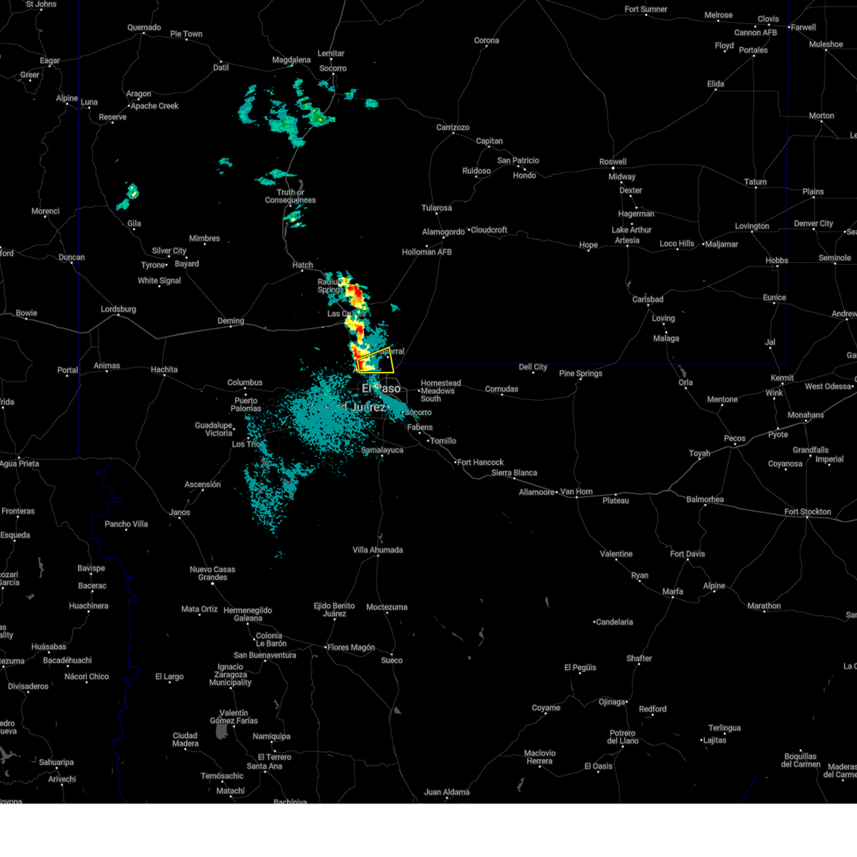
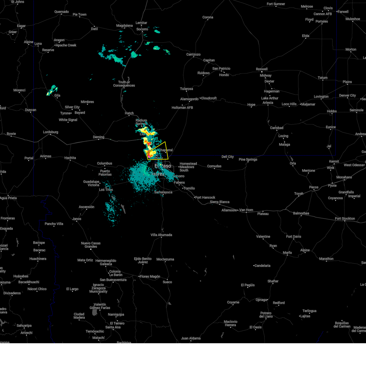
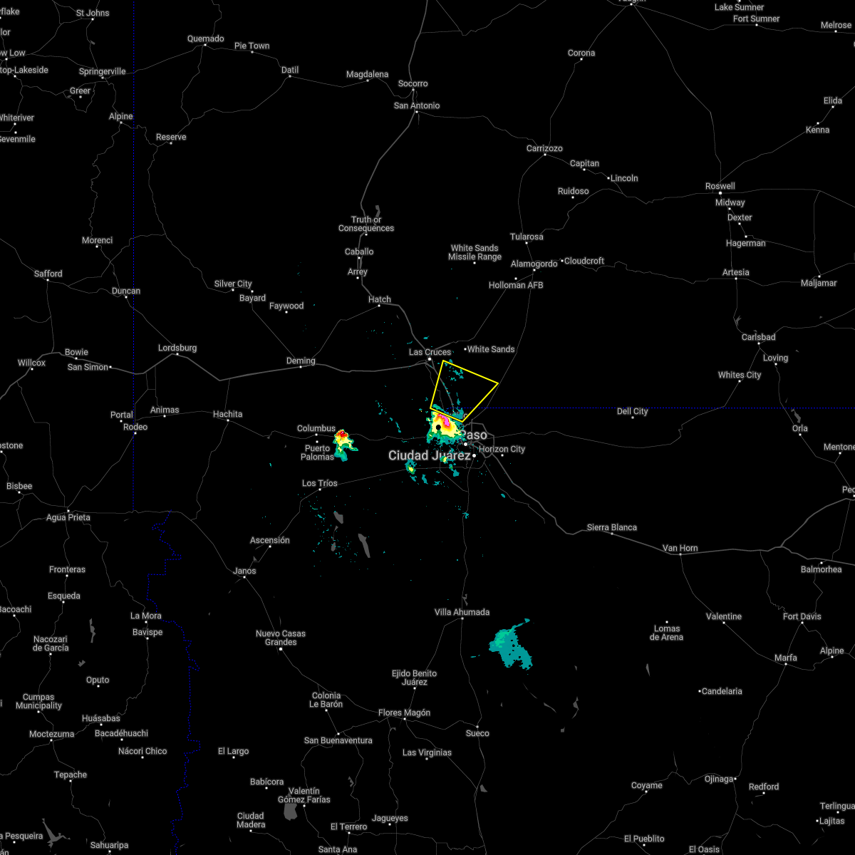
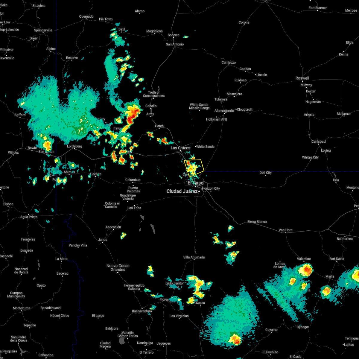
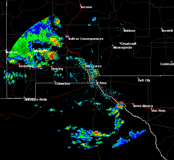
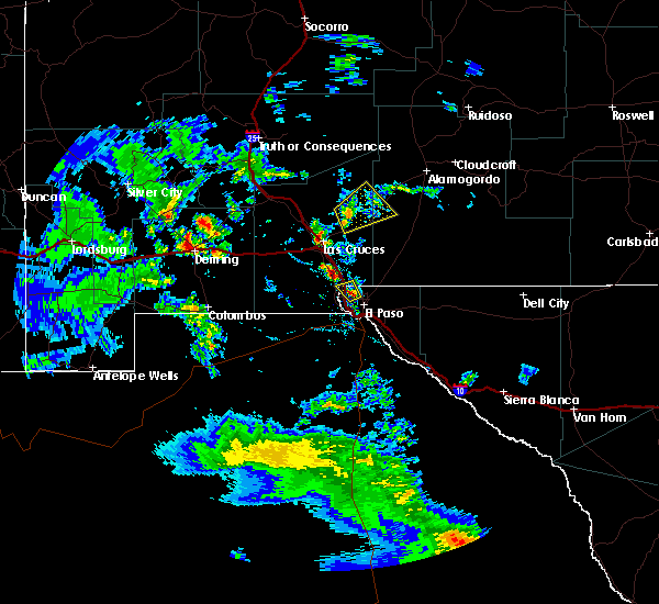
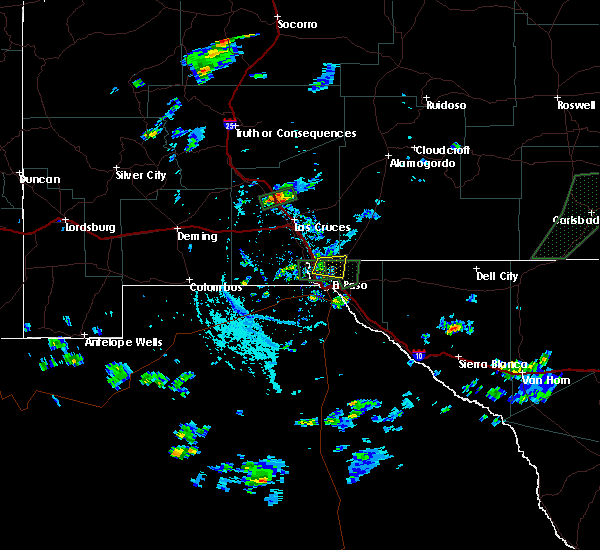
Hail Map for Canutillo, TX
The Canutillo, TX area has had 0 reports of on-the-ground hail by trained spotters, and has been under severe weather warnings 6 times during the past 12 months. Doppler radar has detected hail at or near Canutillo, TX on 29 occasions, including 2 occasions during the past year.
| Name: | Canutillo, TX |
| Where Located: | 13.2 miles NNW of El Paso, TX |
| Map: | Google Map for Canutillo, TX |
| Population: | 6321 |
| Housing Units: | 2071 |
| More Info: | Search Google for Canutillo, TX |
0
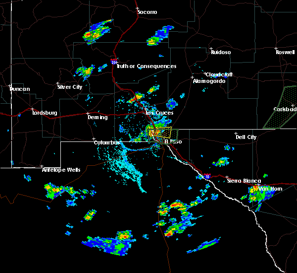
The Top Recent Hail Date for Canutillo, TX is Saturday, May 3, 2025 (27th out of 29)
Hail and Wind Damage Spotted near Canutillo, TX
| Date / Time | Report Details |
|---|---|
| 7/13/2025 4:53 PM MDT |
 Svrepz the national weather service in el paso has issued a * severe thunderstorm warning for, south central dona ana county in south central new mexico, northwestern el paso county in western texas, * until 545 pm mdt. * at 453 pm mdt, a severe thunderstorm was located over canutillo, moving west at 5 mph (radar indicated). Hazards include 60 mph wind gusts and quarter size hail. Hail damage to vehicles is expected. Expect wind damage to roofs, siding, and trees. Svrepz the national weather service in el paso has issued a * severe thunderstorm warning for, south central dona ana county in south central new mexico, northwestern el paso county in western texas, * until 545 pm mdt. * at 453 pm mdt, a severe thunderstorm was located over canutillo, moving west at 5 mph (radar indicated). Hazards include 60 mph wind gusts and quarter size hail. Hail damage to vehicles is expected. Expect wind damage to roofs, siding, and trees.
|
| 7/7/2025 4:54 PM MDT |
 The storm which prompted the warning has weakened below severe limits, and no longer poses an immediate threat to life or property. therefore, the warning will be allowed to expire. however, heavy rain is still possible with this thunderstorm. The storm which prompted the warning has weakened below severe limits, and no longer poses an immediate threat to life or property. therefore, the warning will be allowed to expire. however, heavy rain is still possible with this thunderstorm.
|
| 7/7/2025 4:43 PM MDT |
 At 443 pm mdt, a severe thunderstorm was located near anthony, moving south at 10 mph (radar indicated). Hazards include 60 mph wind gusts and penny size hail. Expect damage to roofs, siding, and trees. Locations impacted include, west el paso, santa teresa, anthony, sunland park, canutillo, anthony gap, westway, vinton, and la union. At 443 pm mdt, a severe thunderstorm was located near anthony, moving south at 10 mph (radar indicated). Hazards include 60 mph wind gusts and penny size hail. Expect damage to roofs, siding, and trees. Locations impacted include, west el paso, santa teresa, anthony, sunland park, canutillo, anthony gap, westway, vinton, and la union.
|
| 7/7/2025 4:16 PM MDT |
 Svrepz the national weather service in el paso has issued a * severe thunderstorm warning for, southeastern dona ana county in south central new mexico, northwestern el paso county in western texas, * until 500 pm mdt. * at 415 pm mdt, a severe thunderstorm was located over berino, moving south at 10 mph (radar indicated). Hazards include 60 mph wind gusts and penny size hail. expect damage to roofs, siding, and trees Svrepz the national weather service in el paso has issued a * severe thunderstorm warning for, southeastern dona ana county in south central new mexico, northwestern el paso county in western texas, * until 500 pm mdt. * at 415 pm mdt, a severe thunderstorm was located over berino, moving south at 10 mph (radar indicated). Hazards include 60 mph wind gusts and penny size hail. expect damage to roofs, siding, and trees
|
| 5/3/2025 10:02 PM MDT |
 At 1001 pm mdt, a severe thunderstorm was located over anthony, moving east at 15 mph (radar indicated). Hazards include 60 mph wind gusts and quarter size hail. Hail damage to vehicles is expected. expect wind damage to roofs, siding, and trees. Locations impacted include, anthony gap, westway, chaparral, vinton, anthony, la union, chamberino, northeast el paso, and franklin mountains state park. At 1001 pm mdt, a severe thunderstorm was located over anthony, moving east at 15 mph (radar indicated). Hazards include 60 mph wind gusts and quarter size hail. Hail damage to vehicles is expected. expect wind damage to roofs, siding, and trees. Locations impacted include, anthony gap, westway, chaparral, vinton, anthony, la union, chamberino, northeast el paso, and franklin mountains state park.
|
| 5/3/2025 9:36 PM MDT |
 Svrepz the national weather service in el paso has issued a * severe thunderstorm warning for, southeastern dona ana county in south central new mexico, northwestern el paso county in western texas, * until 1015 pm mdt. * at 935 pm mdt, a severe thunderstorm was located 4 miles west of la union, moving east at 15 mph (radar indicated). Hazards include 60 mph wind gusts and quarter size hail. Hail damage to vehicles is expected. Expect wind damage to roofs, siding, and trees. Svrepz the national weather service in el paso has issued a * severe thunderstorm warning for, southeastern dona ana county in south central new mexico, northwestern el paso county in western texas, * until 1015 pm mdt. * at 935 pm mdt, a severe thunderstorm was located 4 miles west of la union, moving east at 15 mph (radar indicated). Hazards include 60 mph wind gusts and quarter size hail. Hail damage to vehicles is expected. Expect wind damage to roofs, siding, and trees.
|
| 7/9/2024 7:08 PM MDT |
 Svrepz the national weather service in el paso has issued a * severe thunderstorm warning for, southwestern otero county in south central new mexico, southeastern dona ana county in south central new mexico, northwestern el paso county in western texas, * until 800 pm mdt. * at 706 pm mdt, thunderstorm outflow was located over west el paso moving south and east (radar and surface observations indicating severe winds). Hazards include 55-65 mph wind gusts. expect damage to roofs, siding, and trees Svrepz the national weather service in el paso has issued a * severe thunderstorm warning for, southwestern otero county in south central new mexico, southeastern dona ana county in south central new mexico, northwestern el paso county in western texas, * until 800 pm mdt. * at 706 pm mdt, thunderstorm outflow was located over west el paso moving south and east (radar and surface observations indicating severe winds). Hazards include 55-65 mph wind gusts. expect damage to roofs, siding, and trees
|
| 6/6/2023 5:36 PM MDT |
 At 535 pm mdt, severe thunderstorms were located along a line extending from 10 miles south of afton to 10 miles southwest of la union to 4 miles west of santa teresa to near west el paso, moving north at 45 mph (radar indicated). Hazards include 70 mph wind gusts with dust blow visibility of 1/4 mile. Expect considerable tree damage. damage is likely to mobile homes, roofs, and outbuildings. locations impacted include, west el paso, central el paso, northeast el paso, chaparral, las cruces, santa teresa, anthony, vado, sunland park, nmsu main campus, dona ana, canutillo, afton, anthony gap, berino, vinton, mesilla, san miguel, westway and fort bliss. this includes the following highways, interstate 10 in new mexico between mile markers 129 and 164. interstate 10 in texas between mile markers 1 and 23. interstate 25 in new mexico between mile markers 1 and 11. highway 70 in new mexico between mile markers 150 and 153. highway 54 in new mexico near mile marker 1. thunderstorm damage threat, considerable hail threat, radar indicated max hail size, <. 75 in wind threat, radar indicated max wind gust, 70 mph. At 535 pm mdt, severe thunderstorms were located along a line extending from 10 miles south of afton to 10 miles southwest of la union to 4 miles west of santa teresa to near west el paso, moving north at 45 mph (radar indicated). Hazards include 70 mph wind gusts with dust blow visibility of 1/4 mile. Expect considerable tree damage. damage is likely to mobile homes, roofs, and outbuildings. locations impacted include, west el paso, central el paso, northeast el paso, chaparral, las cruces, santa teresa, anthony, vado, sunland park, nmsu main campus, dona ana, canutillo, afton, anthony gap, berino, vinton, mesilla, san miguel, westway and fort bliss. this includes the following highways, interstate 10 in new mexico between mile markers 129 and 164. interstate 10 in texas between mile markers 1 and 23. interstate 25 in new mexico between mile markers 1 and 11. highway 70 in new mexico between mile markers 150 and 153. highway 54 in new mexico near mile marker 1. thunderstorm damage threat, considerable hail threat, radar indicated max hail size, <. 75 in wind threat, radar indicated max wind gust, 70 mph.
|
| 6/6/2023 5:22 PM MDT |
 At 520 pm mdt, strong thunderstorms with very strong outflow winds were located along a line extending from 17 miles south of afton to 16 miles southwest of la union to 8 miles southwest of santa teresa to 5 miles south of sunland park, moving north at 45 mph (radar indicated). Hazards include 70 mph wind gusts. Expect considerable tree damage. Damage is likely to mobile homes, roofs, and outbuildings. At 520 pm mdt, strong thunderstorms with very strong outflow winds were located along a line extending from 17 miles south of afton to 16 miles southwest of la union to 8 miles southwest of santa teresa to 5 miles south of sunland park, moving north at 45 mph (radar indicated). Hazards include 70 mph wind gusts. Expect considerable tree damage. Damage is likely to mobile homes, roofs, and outbuildings.
|
| 8/9/2022 4:46 PM MDT |
 At 445 pm mdt, a severe thunderstorm was located over canutillo, moving west at 10 mph. official nws employee confirmed quarter to ping pong sized hail (trained weather spotters). Hazards include 60 mph wind gusts and half dollar size hail. Hail damage to vehicles is expected. expect wind damage to roofs, siding, and trees. locations impacted include, west el paso, santa teresa, sunland park, canutillo, la union, vinton and union pacific intermodal terminal. this includes interstate 10 in texas between mile markers 4 and 12. hail threat, observed max hail size, 1. 25 in wind threat, radar indicated max wind gust, 60 mph. At 445 pm mdt, a severe thunderstorm was located over canutillo, moving west at 10 mph. official nws employee confirmed quarter to ping pong sized hail (trained weather spotters). Hazards include 60 mph wind gusts and half dollar size hail. Hail damage to vehicles is expected. expect wind damage to roofs, siding, and trees. locations impacted include, west el paso, santa teresa, sunland park, canutillo, la union, vinton and union pacific intermodal terminal. this includes interstate 10 in texas between mile markers 4 and 12. hail threat, observed max hail size, 1. 25 in wind threat, radar indicated max wind gust, 60 mph.
|
| 8/9/2022 4:38 PM MDT |
 At 438 pm mdt, a severe thunderstorm was located near west el paso, moving west at 10 mph (radar indicated). Hazards include 60 mph wind gusts and quarter size hail. Hail damage to vehicles is expected. Expect wind damage to roofs, siding, and trees. At 438 pm mdt, a severe thunderstorm was located near west el paso, moving west at 10 mph (radar indicated). Hazards include 60 mph wind gusts and quarter size hail. Hail damage to vehicles is expected. Expect wind damage to roofs, siding, and trees.
|
| 4/26/2022 10:46 PM MDT |
 At 1046 pm mdt, a severe thunderstorm was located over canutillo, moving northeast at 30 mph (trained weather spotters). Hazards include golf ball size hail and 60 mph wind gusts. People and animals outdoors will be injured. expect hail damage to roofs, siding, windows, and vehicles. Expect wind damage to roofs, siding, and trees. At 1046 pm mdt, a severe thunderstorm was located over canutillo, moving northeast at 30 mph (trained weather spotters). Hazards include golf ball size hail and 60 mph wind gusts. People and animals outdoors will be injured. expect hail damage to roofs, siding, windows, and vehicles. Expect wind damage to roofs, siding, and trees.
|
| 4/26/2022 10:46 PM MDT |
 The national weather service in el paso has issued a * severe thunderstorm warning for. southwestern otero county in south central new mexico. southeastern dona ana county in south central new mexico. northwestern el paso county in western texas. Until 1130 pm mdt. The national weather service in el paso has issued a * severe thunderstorm warning for. southwestern otero county in south central new mexico. southeastern dona ana county in south central new mexico. northwestern el paso county in western texas. Until 1130 pm mdt.
|
| 4/26/2022 10:38 PM MDT |
 At 1037 pm mdt, a severe thunderstorm was located over santa teresa, moving northeast at 25 mph (trained spotters reported). Hazards include golf ball size hail and 60 mph wind gusts. People and animals outdoors will be injured. expect hail damage to roofs, siding, windows, and vehicles. expect wind damage to roofs, siding, and trees. locations impacted include, west el paso, santa teresa, anthony, sunland park, canutillo, westway, vinton, la union, union pacific intermodal terminal and franklin mountains state park. this includes interstate 10 in texas between mile markers 3 and 13. thunderstorm damage threat, considerable hail threat, observed max hail size, 1. 75 in wind threat, radar indicated max wind gust, 60 mph. At 1037 pm mdt, a severe thunderstorm was located over santa teresa, moving northeast at 25 mph (trained spotters reported). Hazards include golf ball size hail and 60 mph wind gusts. People and animals outdoors will be injured. expect hail damage to roofs, siding, windows, and vehicles. expect wind damage to roofs, siding, and trees. locations impacted include, west el paso, santa teresa, anthony, sunland park, canutillo, westway, vinton, la union, union pacific intermodal terminal and franklin mountains state park. this includes interstate 10 in texas between mile markers 3 and 13. thunderstorm damage threat, considerable hail threat, observed max hail size, 1. 75 in wind threat, radar indicated max wind gust, 60 mph.
|
| 4/26/2022 10:16 PM MDT |
 At 1015 pm mdt, a severe thunderstorm was located 7 miles southwest of santa teresa, moving northeast at 25 mph (radar indicated). Hazards include 60 mph wind gusts and quarter size hail. Hail damage to vehicles is possible. Expect wind damage to roofs, siding, and trees. At 1015 pm mdt, a severe thunderstorm was located 7 miles southwest of santa teresa, moving northeast at 25 mph (radar indicated). Hazards include 60 mph wind gusts and quarter size hail. Hail damage to vehicles is possible. Expect wind damage to roofs, siding, and trees.
|
| 8/10/2021 7:37 PM MDT |
 The severe thunderstorm warning for southeastern dona ana and northwestern el paso counties will expire at 745 pm mdt, the storm which prompted the warning has weakened below severe limits, and has exited the warned area. therefore, the warning will be allowed to expire. however gusty winds are still possible with this thunderstorm. The severe thunderstorm warning for southeastern dona ana and northwestern el paso counties will expire at 745 pm mdt, the storm which prompted the warning has weakened below severe limits, and has exited the warned area. therefore, the warning will be allowed to expire. however gusty winds are still possible with this thunderstorm.
|
| 8/10/2021 6:53 PM MDT |
 At 652 pm mdt, a severe thunderstorm was located near chamberino, moving east at 10 mph (radar indicated). Hazards include 60 mph wind gusts and penny size hail. possible damage to roofs, siding, and trees At 652 pm mdt, a severe thunderstorm was located near chamberino, moving east at 10 mph (radar indicated). Hazards include 60 mph wind gusts and penny size hail. possible damage to roofs, siding, and trees
|
| 7/11/2021 8:55 PM MDT |
 The severe thunderstorm warning for south central dona ana and el paso counties will expire at 900 pm mdt, the storms which prompted the warning have weakened below severe limits, and have exited the warned area. therefore, the warning will be allowed to expire. however gusty winds are still possible with these thunderstorms. a severe thunderstorm watch remains in effect until 1000 pm mdt for south central new mexico, and western texas. The severe thunderstorm warning for south central dona ana and el paso counties will expire at 900 pm mdt, the storms which prompted the warning have weakened below severe limits, and have exited the warned area. therefore, the warning will be allowed to expire. however gusty winds are still possible with these thunderstorms. a severe thunderstorm watch remains in effect until 1000 pm mdt for south central new mexico, and western texas.
|
| 7/11/2021 8:35 PM MDT |
 At 835 pm mdt, severe thunderstorms were located along a line extending from 7 miles north of far east el paso to 3 miles east of west el paso to 6 miles west of santa teresa, moving southeast at 25 mph (radar indicated). Hazards include 60 mph wind gusts. Expect damage to roofs, siding, and trees. locations impacted include, west el paso, east el paso, central el paso, northeast el paso, far east el paso, mission valley, tornillo, fabens, clint, horizon city, santa teresa, anthony, sunland park, indian cliffs ranch, canutillo, san elizario, vinton, westway, fort bliss and socorro. This includes interstate 10 in texas between mile markers 1 and 56. At 835 pm mdt, severe thunderstorms were located along a line extending from 7 miles north of far east el paso to 3 miles east of west el paso to 6 miles west of santa teresa, moving southeast at 25 mph (radar indicated). Hazards include 60 mph wind gusts. Expect damage to roofs, siding, and trees. locations impacted include, west el paso, east el paso, central el paso, northeast el paso, far east el paso, mission valley, tornillo, fabens, clint, horizon city, santa teresa, anthony, sunland park, indian cliffs ranch, canutillo, san elizario, vinton, westway, fort bliss and socorro. This includes interstate 10 in texas between mile markers 1 and 56.
|
| 7/11/2021 8:11 PM MDT |
 At 811 pm mdt, severe thunderstorms were located along a line extending from 3 miles northeast of northeast el paso to canutillo to 8 miles southeast of afton, moving southeast at 55 mph (radar indicated). Hazards include 70 mph wind gusts and ping pong ball size hail. People and animals outdoors will be injured. expect hail damage to roofs, siding, windows, and vehicles. expect considerable tree damage. Wind damage is also likely to mobile homes, roofs, and outbuildings. At 811 pm mdt, severe thunderstorms were located along a line extending from 3 miles northeast of northeast el paso to canutillo to 8 miles southeast of afton, moving southeast at 55 mph (radar indicated). Hazards include 70 mph wind gusts and ping pong ball size hail. People and animals outdoors will be injured. expect hail damage to roofs, siding, windows, and vehicles. expect considerable tree damage. Wind damage is also likely to mobile homes, roofs, and outbuildings.
|
| 7/11/2021 7:49 PM MDT |
 At 748 pm mdt, severe thunderstorms were located along a line extending from 7 miles south of afton to near sunland park to 6 miles northeast of hueco tanks, moving southwest at 40 mph. these are very dangerous storms (radar indicated). Hazards include 80 mph wind gusts and golf ball size hail. Flying debris will be dangerous to those caught without shelter. mobile homes will be heavily damaged. expect considerable damage to roofs, windows, and vehicles. extensive tree damage and power outages are likely. locations impacted include, west el paso, east el paso, central el paso, northeast el paso, far east el paso, mission valley, chaparral, loma linda, clint, horizon city, santa teresa, anthony, desert haven, hueco tanks, vado, sunland park, canutillo, afton, san elizario and anthony gap. this includes the following highways, interstate 10 in new mexico between mile markers 157 and 164. interstate 10 in texas between mile markers 1 and 46. Highway 54 in new mexico between mile markers 1 and 5. At 748 pm mdt, severe thunderstorms were located along a line extending from 7 miles south of afton to near sunland park to 6 miles northeast of hueco tanks, moving southwest at 40 mph. these are very dangerous storms (radar indicated). Hazards include 80 mph wind gusts and golf ball size hail. Flying debris will be dangerous to those caught without shelter. mobile homes will be heavily damaged. expect considerable damage to roofs, windows, and vehicles. extensive tree damage and power outages are likely. locations impacted include, west el paso, east el paso, central el paso, northeast el paso, far east el paso, mission valley, chaparral, loma linda, clint, horizon city, santa teresa, anthony, desert haven, hueco tanks, vado, sunland park, canutillo, afton, san elizario and anthony gap. this includes the following highways, interstate 10 in new mexico between mile markers 157 and 164. interstate 10 in texas between mile markers 1 and 46. Highway 54 in new mexico between mile markers 1 and 5.
|
| 7/11/2021 7:31 PM MDT |
 At 730 pm mdt, severe thunderstorms were located along a line extending from 7 miles northeast of afton to near anthony gap to 19 miles east of mcgregor range base, moving southwest at 35 mph. near zero visibility is possible from blowing dust ahead of the rain (radar indicated). Hazards include 70 mph wind gusts and penny size hail. Expect considerable tree damage. Damage is likely to mobile homes, roofs, and outbuildings. At 730 pm mdt, severe thunderstorms were located along a line extending from 7 miles northeast of afton to near anthony gap to 19 miles east of mcgregor range base, moving southwest at 35 mph. near zero visibility is possible from blowing dust ahead of the rain (radar indicated). Hazards include 70 mph wind gusts and penny size hail. Expect considerable tree damage. Damage is likely to mobile homes, roofs, and outbuildings.
|
| 9/8/2020 6:23 PM MDT |
 At 621 pm mdt, a severe thunderstorm was located 9 miles west of santa teresa, moving east at 20 mph. areas of blowing dust are also occurring with visibility below 1 mile possible in places (radar indicated). Hazards include 60 mph wind gusts and visibility below 1 mile. Expect damage to roofs, siding, and trees. locations impacted include, west el paso, central el paso, chaparral, santa teresa, anthony, sunland park, anthony gap, canutillo, berino, westway, vinton, chamberino, la union, union pacific intermodal terminal and franklin mountains state park. this includes the following highways, interstate 10 in new mexico between mile markers 160 and 164. Interstate 10 in texas between mile markers 1 and 16. At 621 pm mdt, a severe thunderstorm was located 9 miles west of santa teresa, moving east at 20 mph. areas of blowing dust are also occurring with visibility below 1 mile possible in places (radar indicated). Hazards include 60 mph wind gusts and visibility below 1 mile. Expect damage to roofs, siding, and trees. locations impacted include, west el paso, central el paso, chaparral, santa teresa, anthony, sunland park, anthony gap, canutillo, berino, westway, vinton, chamberino, la union, union pacific intermodal terminal and franklin mountains state park. this includes the following highways, interstate 10 in new mexico between mile markers 160 and 164. Interstate 10 in texas between mile markers 1 and 16.
|
| 9/8/2020 6:02 PM MDT |
 At 602 pm mdt, a severe thunderstorm was located 15 miles south of afton, moving east at 20 mph (radar indicated). Hazards include 60 mph wind gusts. expect damage to roofs, siding, and trees At 602 pm mdt, a severe thunderstorm was located 15 miles south of afton, moving east at 20 mph (radar indicated). Hazards include 60 mph wind gusts. expect damage to roofs, siding, and trees
|
| 7/21/2020 4:14 PM MDT |
 At 413 pm mdt, a severe thunderstorm was located over canutillo, moving south at 10 mph (radar indicated). Hazards include 60 mph wind gusts and nickel size hail. expect damage to roofs, siding, and trees At 413 pm mdt, a severe thunderstorm was located over canutillo, moving south at 10 mph (radar indicated). Hazards include 60 mph wind gusts and nickel size hail. expect damage to roofs, siding, and trees
|
| 6/5/2020 9:26 PM MDT |
 At 921 pm mdt, a severe thunderstorm was located 15 miles southwest of santa teresa, moving northeast at 25 mph. this storm will likely pass west of el paso, but the wind and dust it produces will move into west and central el paso (radar indicated). Hazards include 60 mph wind gusts and thick blowing dust. Damage to roofs, siding, and trees is possible. thick blowing dust will severely drop visibilities. Travel along i-10 in west el paso and southern dona ana county will be difficult and dangerous due to buffeting winds and poor visibility. At 921 pm mdt, a severe thunderstorm was located 15 miles southwest of santa teresa, moving northeast at 25 mph. this storm will likely pass west of el paso, but the wind and dust it produces will move into west and central el paso (radar indicated). Hazards include 60 mph wind gusts and thick blowing dust. Damage to roofs, siding, and trees is possible. thick blowing dust will severely drop visibilities. Travel along i-10 in west el paso and southern dona ana county will be difficult and dangerous due to buffeting winds and poor visibility.
|
| 3/19/2020 12:08 AM MDT |
 The severe thunderstorm warning for southwestern otero, southeastern dona ana, western hudspeth and el paso counties will expire at 1215 am mdt, the storm which prompted the warning has weakened below severe limits, and no longer poses an immediate threat to life or property. therefore, the warning will be allowed to expire. however gusty winds to near 50 mph are still possible with this line of showers and thunderstorms as it moves across northern el paso county and into southwest otero county. The severe thunderstorm warning for southwestern otero, southeastern dona ana, western hudspeth and el paso counties will expire at 1215 am mdt, the storm which prompted the warning has weakened below severe limits, and no longer poses an immediate threat to life or property. therefore, the warning will be allowed to expire. however gusty winds to near 50 mph are still possible with this line of showers and thunderstorms as it moves across northern el paso county and into southwest otero county.
|
| 3/18/2020 11:54 PM MDT |
 At 1152 pm mdt, a line of fast moving showers and thunderstorm, with very strong winds, was moving across the i-10 corridor between las cruces and el paso. this line was moving east at 60 mph (radar indicated). Hazards include 60 mph wind gusts and penny size hail. Expect damage to roofs, siding, and trees. Locations impacted include, west el paso, east el paso, central el paso, northeast el paso, far east el paso, mission valley, chaparral, santa teresa, anthony, hueco tanks, vado, las cruces, white sands missile range headquarters, sunland park, nmsu main campus, canutillo, anthony gap, berino, vinton and san miguel. At 1152 pm mdt, a line of fast moving showers and thunderstorm, with very strong winds, was moving across the i-10 corridor between las cruces and el paso. this line was moving east at 60 mph (radar indicated). Hazards include 60 mph wind gusts and penny size hail. Expect damage to roofs, siding, and trees. Locations impacted include, west el paso, east el paso, central el paso, northeast el paso, far east el paso, mission valley, chaparral, santa teresa, anthony, hueco tanks, vado, las cruces, white sands missile range headquarters, sunland park, nmsu main campus, canutillo, anthony gap, berino, vinton and san miguel.
|
| 3/18/2020 11:38 PM MDT |
 At 1136 pm mdt, a severe thunderstorm was located near santa teresa, moving east at 50 mph (radar indicated). Hazards include 60 mph wind gusts and penny size hail. expect damage to roofs, siding, and trees At 1136 pm mdt, a severe thunderstorm was located near santa teresa, moving east at 50 mph (radar indicated). Hazards include 60 mph wind gusts and penny size hail. expect damage to roofs, siding, and trees
|
| 8/23/2019 8:41 PM MDT |
 The severe thunderstorm warning for southeastern dona ana and northwestern el paso counties will expire at 845 pm mdt, the storm which prompted the warning has weakened below severe limits, and no longer poses an immediate threat to life or property. therefore, the warning will be allowed to expire. The severe thunderstorm warning for southeastern dona ana and northwestern el paso counties will expire at 845 pm mdt, the storm which prompted the warning has weakened below severe limits, and no longer poses an immediate threat to life or property. therefore, the warning will be allowed to expire.
|
| 8/23/2019 8:24 PM MDT |
 At 824 pm mdt, a severe thunderstorm was located over santa teresa, moving south at 10 mph (radar indicated). Hazards include 60 mph wind gusts and penny size hail. Expect damage to roofs, siding, and trees. Locations impacted include, west el paso, central el paso, santa teresa, anthony, sunland park, canutillo, westway, vinton, la union and union pacific intermodal terminal. At 824 pm mdt, a severe thunderstorm was located over santa teresa, moving south at 10 mph (radar indicated). Hazards include 60 mph wind gusts and penny size hail. Expect damage to roofs, siding, and trees. Locations impacted include, west el paso, central el paso, santa teresa, anthony, sunland park, canutillo, westway, vinton, la union and union pacific intermodal terminal.
|
| 8/23/2019 8:07 PM MDT |
 At 806 pm mdt, a severe thunderstorm was located near la union, moving south at 10 mph (radar indicated). Hazards include 60 mph wind gusts and penny size hail. expect damage to roofs, siding, and trees At 806 pm mdt, a severe thunderstorm was located near la union, moving south at 10 mph (radar indicated). Hazards include 60 mph wind gusts and penny size hail. expect damage to roofs, siding, and trees
|
| 6/4/2019 3:25 PM MDT |
 At 324 pm mdt, severe thunderstorms were located near santa teresa, moving north at 25 mph (radar indicated). Hazards include 70 mph wind gusts and quarter size hail. Hail damage to vehicles is expected. expect considerable tree damage. Wind damage is also likely to mobile homes, roofs, and outbuildings. At 324 pm mdt, severe thunderstorms were located near santa teresa, moving north at 25 mph (radar indicated). Hazards include 70 mph wind gusts and quarter size hail. Hail damage to vehicles is expected. expect considerable tree damage. Wind damage is also likely to mobile homes, roofs, and outbuildings.
|
| 6/4/2019 3:11 PM MDT |
 At 310 pm mdt, a severe thunderstorm was located just south of central el paso, moving north at 25 mph (radar indicated). Hazards include 60 mph wind gusts and quarter size hail. Hail damage to vehicles is expected. Expect wind damage to roofs, siding, and trees. At 310 pm mdt, a severe thunderstorm was located just south of central el paso, moving north at 25 mph (radar indicated). Hazards include 60 mph wind gusts and quarter size hail. Hail damage to vehicles is expected. Expect wind damage to roofs, siding, and trees.
|
| 4/22/2019 4:59 PM MDT |
 At 456 pm mdt, severe thunderstorms with strong possibly damaging winds were moving into the vicinity of el paso texas and surrounding locations (radar indicated). Hazards include 60 mph wind gusts. expect damage to roofs, siding, and trees At 456 pm mdt, severe thunderstorms with strong possibly damaging winds were moving into the vicinity of el paso texas and surrounding locations (radar indicated). Hazards include 60 mph wind gusts. expect damage to roofs, siding, and trees
|
| 6/3/2018 4:57 PM MDT |
 At 423 pm mdt, severe thunderstorms were moving into the area (radar indicated). Hazards include golf ball size hail and 70 mph wind gusts. People and animals outdoors will be injured. expect hail damage to roofs, siding, windows, and vehicles. expect considerable tree damage. Wind damage is also likely to mobile homes, roofs, and outbuildings. At 423 pm mdt, severe thunderstorms were moving into the area (radar indicated). Hazards include golf ball size hail and 70 mph wind gusts. People and animals outdoors will be injured. expect hail damage to roofs, siding, windows, and vehicles. expect considerable tree damage. Wind damage is also likely to mobile homes, roofs, and outbuildings.
|
| 6/3/2018 4:25 PM MDT |
 At 423 pm mdt, severe thunderstorms were moving into the area (radar indicated). Hazards include golf ball size hail and 70 mph wind gusts. People and animals outdoors will be injured. expect hail damage to roofs, siding, windows, and vehicles. expect considerable tree damage. Wind damage is also likely to mobile homes, roofs, and outbuildings. At 423 pm mdt, severe thunderstorms were moving into the area (radar indicated). Hazards include golf ball size hail and 70 mph wind gusts. People and animals outdoors will be injured. expect hail damage to roofs, siding, windows, and vehicles. expect considerable tree damage. Wind damage is also likely to mobile homes, roofs, and outbuildings.
|
| 5/21/2018 5:42 PM MDT |
 At 542 pm mdt, a severe thunderstorm was located 7 miles south of central el paso, moving northeast at 30 mph (radar indicated). Hazards include 60 mph wind gusts and half dollar size hail. Hail damage to vehicles is expected. Expect wind damage to roofs, siding, and trees. At 542 pm mdt, a severe thunderstorm was located 7 miles south of central el paso, moving northeast at 30 mph (radar indicated). Hazards include 60 mph wind gusts and half dollar size hail. Hail damage to vehicles is expected. Expect wind damage to roofs, siding, and trees.
|
| 8/13/2017 4:41 PM MDT |
 At 441 pm mdt, a severe thunderstorm was located over northeast el paso, moving east at 10 mph (radar indicated). Hazards include 60 mph wind gusts. Expect damage to roofs, siding, and trees. Locations impacted include, east el paso, west el paso, northeast el paso, el paso, fort bliss and franklin mountains state park. At 441 pm mdt, a severe thunderstorm was located over northeast el paso, moving east at 10 mph (radar indicated). Hazards include 60 mph wind gusts. Expect damage to roofs, siding, and trees. Locations impacted include, east el paso, west el paso, northeast el paso, el paso, fort bliss and franklin mountains state park.
|
| 8/13/2017 4:18 PM MDT |
 At 418 pm mdt, a severe thunderstorm was located near west el paso, moving east at 20 mph (radar indicated). Hazards include 60 mph wind gusts and half dollar size hail. Hail damage to vehicles is expected. Expect wind damage to roofs, siding, and trees. At 418 pm mdt, a severe thunderstorm was located near west el paso, moving east at 20 mph (radar indicated). Hazards include 60 mph wind gusts and half dollar size hail. Hail damage to vehicles is expected. Expect wind damage to roofs, siding, and trees.
|
| 7/27/2017 1:42 PM MDT |
 At 141 pm mdt, a severe thunderstorm was located near northeast el paso, moving west at 30 mph (radar indicated). Hazards include 60 mph wind gusts and quarter size hail. Hail damage to vehicles is expected. Expect wind damage to roofs, siding, and trees. At 141 pm mdt, a severe thunderstorm was located near northeast el paso, moving west at 30 mph (radar indicated). Hazards include 60 mph wind gusts and quarter size hail. Hail damage to vehicles is expected. Expect wind damage to roofs, siding, and trees.
|
| 7/22/2017 4:37 PM MDT |
 At 435 pm mdt, a severe thunderstorm was located near santa teresa (radar indicated). Hazards include 60 mph wind gusts and penny size hail. expect damage to roofs, siding, and trees At 435 pm mdt, a severe thunderstorm was located near santa teresa (radar indicated). Hazards include 60 mph wind gusts and penny size hail. expect damage to roofs, siding, and trees
|
| 6/19/2017 6:37 PM MDT |
 The severe thunderstorm warning for south central dona ana and northwestern el paso counties will expire at 645 pm mdt, the storm which prompted the warning has weakened below severe limits, and no longer pose an immediate threat to life or property. therefore, the warning will be allowed to expire. however small hail and heavy rain are still possible with this thunderstorm. The severe thunderstorm warning for south central dona ana and northwestern el paso counties will expire at 645 pm mdt, the storm which prompted the warning has weakened below severe limits, and no longer pose an immediate threat to life or property. therefore, the warning will be allowed to expire. however small hail and heavy rain are still possible with this thunderstorm.
|
| 6/19/2017 5:57 PM MDT |
 At 556 pm mdt, a severe thunderstorm was located over canutillo, or near west el paso, moving southwest at 5 mph (radar indicated). Hazards include 60 mph wind gusts and quarter size hail. Hail damage to vehicles is expected. Expect wind damage to roofs, siding, and trees. At 556 pm mdt, a severe thunderstorm was located over canutillo, or near west el paso, moving southwest at 5 mph (radar indicated). Hazards include 60 mph wind gusts and quarter size hail. Hail damage to vehicles is expected. Expect wind damage to roofs, siding, and trees.
|
| 6/19/2017 5:25 PM MDT |
 The severe thunderstorm warning for southwestern otero, southeastern dona ana and northwestern el paso counties will expire at 530 pm mdt, the storm which prompted the warning has weakened below severe limits, and no longer pose an immediate threat to life or property. therefore, the warning will be allowed to expire. however small hail and gusty winds are still possible with this thunderstorm. The severe thunderstorm warning for southwestern otero, southeastern dona ana and northwestern el paso counties will expire at 530 pm mdt, the storm which prompted the warning has weakened below severe limits, and no longer pose an immediate threat to life or property. therefore, the warning will be allowed to expire. however small hail and gusty winds are still possible with this thunderstorm.
|
| 6/19/2017 4:46 PM MDT |
 At 446 pm mdt, a severe thunderstorm was located 4 miles northwest of chaparral, moving west at 10 mph (radar indicated). Hazards include 60 mph wind gusts and quarter size hail. Hail damage to vehicles is expected. Expect wind damage to roofs, siding, and trees. At 446 pm mdt, a severe thunderstorm was located 4 miles northwest of chaparral, moving west at 10 mph (radar indicated). Hazards include 60 mph wind gusts and quarter size hail. Hail damage to vehicles is expected. Expect wind damage to roofs, siding, and trees.
|
| 5/30/2017 7:59 PM MDT |
 At 758 pm mdt, a severe thunderstorm was located near westway, or 5 miles north of west el paso, moving northwest at 10 mph (radar indicated). Hazards include 60 mph wind gusts and quarter size hail. Hail damage to vehicles is expected. Expect wind damage to roofs, siding, and trees. At 758 pm mdt, a severe thunderstorm was located near westway, or 5 miles north of west el paso, moving northwest at 10 mph (radar indicated). Hazards include 60 mph wind gusts and quarter size hail. Hail damage to vehicles is expected. Expect wind damage to roofs, siding, and trees.
|
| 8/27/2016 7:48 PM MDT |
 At 747 pm mdt, severe thunderstorms were located along a line extending from near anthony to near west el paso to 11 miles southwest of mission valley, moving east at 15 mph (radar indicated). Hazards include 60 mph wind gusts and quarter size hail. Hail damage to vehicles is expected. Expect wind damage to roofs, siding, and trees. At 747 pm mdt, severe thunderstorms were located along a line extending from near anthony to near west el paso to 11 miles southwest of mission valley, moving east at 15 mph (radar indicated). Hazards include 60 mph wind gusts and quarter size hail. Hail damage to vehicles is expected. Expect wind damage to roofs, siding, and trees.
|
| 8/21/2016 4:25 PM MDT |
 The severe thunderstorm warning for southeastern dona ana, southwestern otero and northwestern el paso counties will expire at 430 pm mdt, the storm which prompted the warning has weakened below severe limits, and no longer pose an immediate threat to life or property. therefore, the warning will be allowed to expire. however heavy rain is still possible with this thunderstorm. The severe thunderstorm warning for southeastern dona ana, southwestern otero and northwestern el paso counties will expire at 430 pm mdt, the storm which prompted the warning has weakened below severe limits, and no longer pose an immediate threat to life or property. therefore, the warning will be allowed to expire. however heavy rain is still possible with this thunderstorm.
|
| 8/21/2016 3:47 PM MDT |
 At 346 pm mdt, a severe thunderstorm was located 4 miles northwest of northeast el paso, moving east at 10 mph (radar indicated). Hazards include 60 mph wind gusts and quarter size hail. Hail damage to vehicles is expected. Expect wind damage to roofs, siding, and trees. At 346 pm mdt, a severe thunderstorm was located 4 miles northwest of northeast el paso, moving east at 10 mph (radar indicated). Hazards include 60 mph wind gusts and quarter size hail. Hail damage to vehicles is expected. Expect wind damage to roofs, siding, and trees.
|
| 8/21/2016 3:12 PM MDT |
 At 311 pm mdt, a severe thunderstorm was located near la union, or 4 miles southwest of anthony, moving southeast at 15 mph (radar indicated). Hazards include golf ball size hail and 60 mph wind gusts. People and animals outdoors will be injured. expect hail damage to roofs, siding, windows, and vehicles. expect wind damage to roofs, siding, and trees. Locations impacted include, anthony, west el paso, vinton, la union, chamberino, westway, anthony gap, canutillo, berino, and franklin mountains state park. At 311 pm mdt, a severe thunderstorm was located near la union, or 4 miles southwest of anthony, moving southeast at 15 mph (radar indicated). Hazards include golf ball size hail and 60 mph wind gusts. People and animals outdoors will be injured. expect hail damage to roofs, siding, windows, and vehicles. expect wind damage to roofs, siding, and trees. Locations impacted include, anthony, west el paso, vinton, la union, chamberino, westway, anthony gap, canutillo, berino, and franklin mountains state park.
|
| 8/21/2016 3:01 PM MDT |
 At 300 pm mdt, a severe thunderstorm was located over chamberino, or 5 miles west of anthony, moving southeast at 10 mph (radar indicated). Hazards include quarter size hail. damage to vehicles is expected At 300 pm mdt, a severe thunderstorm was located over chamberino, or 5 miles west of anthony, moving southeast at 10 mph (radar indicated). Hazards include quarter size hail. damage to vehicles is expected
|
| 6/24/2016 8:42 PM MDT | The severe thunderstorm warning for southwestern otero, southeastern dona ana and northern el paso counties will expire at 845 pm mdt, the storms which prompted the warning have weakened below severe limits, and no longer pose an immediate threat to life or property. therefore the warning will be allowed to expire. however gusty winds to 45 mph are still possible with along with blowing dust reducing visibilities to under a half mile. |
| 6/24/2016 8:42 PM MDT | The severe thunderstorm warning for southwestern otero, southeastern dona ana and northern el paso counties will expire at 845 pm mdt, the storms which prompted the warning have weakened below severe limits, and no longer pose an immediate threat to life or property. therefore the warning will be allowed to expire. however gusty winds to 45 mph are still possible with along with blowing dust reducing visibilities to under a half mile. |
| 6/24/2016 8:15 PM MDT |
 At 814 pm mdt, severe thunderstorms were located along a line extending from near anthony gap to 4 miles northwest of northeast el paso to near central el paso, moving east at 45 mph. blowing dust is accompanying this boundary with visibilities possibly near zero (radar indicated). Hazards include 60 mph wind gusts. Expect damage to roofs. siding. and trees. Locations impacted include, sunland park, west el paso, northeast el paso, anthony, east el paso, chaparral, mcgregor range base, central el paso, el paso, vinton, fort bliss, la union, berino, santa teresa, canutillo, montana vista, chamberino, westway, anthony gap, franklin mountains state park. At 814 pm mdt, severe thunderstorms were located along a line extending from near anthony gap to 4 miles northwest of northeast el paso to near central el paso, moving east at 45 mph. blowing dust is accompanying this boundary with visibilities possibly near zero (radar indicated). Hazards include 60 mph wind gusts. Expect damage to roofs. siding. and trees. Locations impacted include, sunland park, west el paso, northeast el paso, anthony, east el paso, chaparral, mcgregor range base, central el paso, el paso, vinton, fort bliss, la union, berino, santa teresa, canutillo, montana vista, chamberino, westway, anthony gap, franklin mountains state park.
|
| 6/24/2016 7:56 PM MDT |
 At 755 pm mdt, severe thunderstorms were located along a line extending from 6 miles southwest of chamberino to 3 miles northwest of santa teresa to 8 miles southwest of sunland park, moving east at 45 mph (radar indicated). Hazards include 70 mph wind gusts. Expect considerable tree damage. Damage is likely to mobile homes, roofs, and outbuildings. At 755 pm mdt, severe thunderstorms were located along a line extending from 6 miles southwest of chamberino to 3 miles northwest of santa teresa to 8 miles southwest of sunland park, moving east at 45 mph (radar indicated). Hazards include 70 mph wind gusts. Expect considerable tree damage. Damage is likely to mobile homes, roofs, and outbuildings.
|
| 10/21/2015 2:26 PM MDT |
 At 226 pm mdt, a severe thunderstorm was located 4 miles south of central el paso, moving north at 30 mph (radar indicated). Hazards include quarter size hail. damage to vehicles is expected At 226 pm mdt, a severe thunderstorm was located 4 miles south of central el paso, moving north at 30 mph (radar indicated). Hazards include quarter size hail. damage to vehicles is expected
|
| 10/21/2015 2:26 PM MDT |
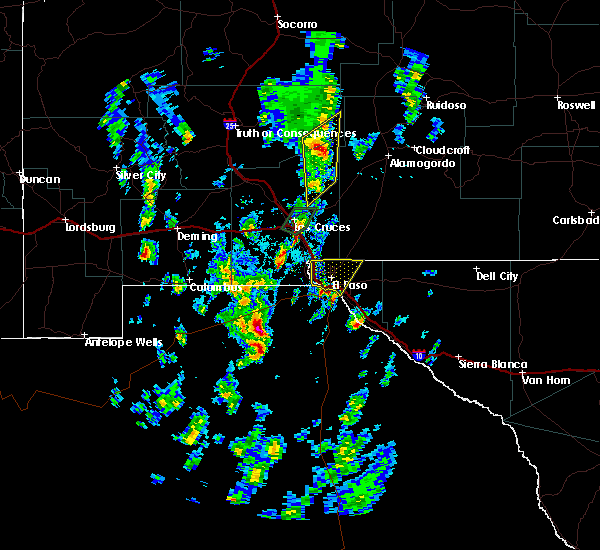 At 226 pm mdt, a severe thunderstorm was located 4 miles south of central el paso, moving north at 30 mph (radar indicated). Hazards include quarter size hail. damage to vehicles is expected At 226 pm mdt, a severe thunderstorm was located 4 miles south of central el paso, moving north at 30 mph (radar indicated). Hazards include quarter size hail. damage to vehicles is expected
|
| 10/20/2015 5:12 PM MDT |
 At 511 pm mdt, a severe thunderstorm was located over el paso moving northeast at 35 mph (radar indicated). Hazards include 60 mph wind gusts and quarter size hail. Hail damage to vehicles is expected. Expect wind damage to roofs, siding and trees. At 511 pm mdt, a severe thunderstorm was located over el paso moving northeast at 35 mph (radar indicated). Hazards include 60 mph wind gusts and quarter size hail. Hail damage to vehicles is expected. Expect wind damage to roofs, siding and trees.
|
| 10/20/2015 5:12 PM MDT |
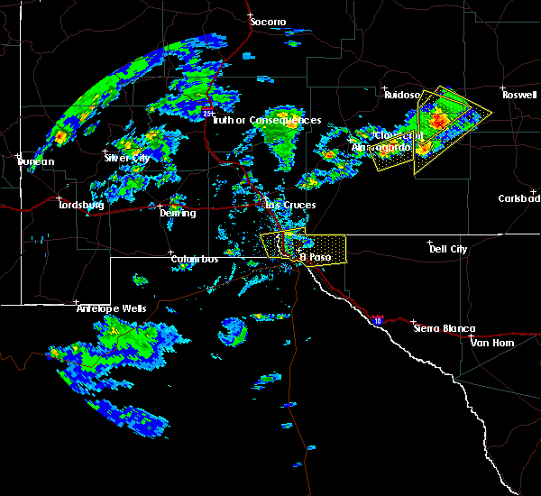 At 511 pm mdt, a severe thunderstorm was located over el paso moving northeast at 35 mph (radar indicated). Hazards include 60 mph wind gusts and quarter size hail. Hail damage to vehicles is expected. Expect wind damage to roofs, siding and trees. At 511 pm mdt, a severe thunderstorm was located over el paso moving northeast at 35 mph (radar indicated). Hazards include 60 mph wind gusts and quarter size hail. Hail damage to vehicles is expected. Expect wind damage to roofs, siding and trees.
|
| 10/20/2015 4:48 PM MDT |
 At 447 pm mdt, a severe thunderstorm was located over el paso, or 5 miles east of central el paso, and is nearly stationary (radar indicated). Hazards include 60 mph wind gusts and quarter size hail. Hail damage to vehicles is expected. expect wind damage to roofs, siding and trees. Locations impacted include, sunland park, west el paso, northeast el paso, anthony, east el paso, chaparral, central el paso, el paso, vinton, fort bliss, la union, santa teresa, canutillo, montana vista, westway, anthony gap, franklin mountains state park, hueco tanks. At 447 pm mdt, a severe thunderstorm was located over el paso, or 5 miles east of central el paso, and is nearly stationary (radar indicated). Hazards include 60 mph wind gusts and quarter size hail. Hail damage to vehicles is expected. expect wind damage to roofs, siding and trees. Locations impacted include, sunland park, west el paso, northeast el paso, anthony, east el paso, chaparral, central el paso, el paso, vinton, fort bliss, la union, santa teresa, canutillo, montana vista, westway, anthony gap, franklin mountains state park, hueco tanks.
|
| 10/20/2015 4:36 PM MDT |
 At 435 pm mdt, a severe thunderstorm was located over sunland park, moving east at 45 mph (radar indicated). Hazards include 60 mph wind gusts and quarter size hail. Hail damage to vehicles is expected. Expect wind damage to roofs, siding and trees. At 435 pm mdt, a severe thunderstorm was located over sunland park, moving east at 45 mph (radar indicated). Hazards include 60 mph wind gusts and quarter size hail. Hail damage to vehicles is expected. Expect wind damage to roofs, siding and trees.
|
| 10/7/2015 2:57 PM MDT |
 At 257 pm mdt, severe thunderstorms were located along a line extending from near mesquite to near canutillo, moving east at 25 mph (radar indicated). Hazards include 60 mph wind gusts and quarter size hail. Hail damage to vehicles is expected. expect wind damage to roofs, siding and trees. Locations impacted include, west el paso, northeast el paso, anthony, chaparral, el paso, san miguel, vinton, la mesa, la union, berino, santa teresa, san miguel in dona ana county, canutillo, mesquite, chamberino, westway, vado, anthony gap, franklin mountains state park. At 257 pm mdt, severe thunderstorms were located along a line extending from near mesquite to near canutillo, moving east at 25 mph (radar indicated). Hazards include 60 mph wind gusts and quarter size hail. Hail damage to vehicles is expected. expect wind damage to roofs, siding and trees. Locations impacted include, west el paso, northeast el paso, anthony, chaparral, el paso, san miguel, vinton, la mesa, la union, berino, santa teresa, san miguel in dona ana county, canutillo, mesquite, chamberino, westway, vado, anthony gap, franklin mountains state park.
|
| 10/7/2015 2:31 PM MDT |
 At 230 pm mdt, severe thunderstorms were located along a line extending from 3 miles west of san miguel to 5 miles southwest of la union, moving east at 25 mph (radar indicated). Hazards include 60 mph wind gusts and quarter size hail. Hail damage to vehicles is expected. Expect wind damage to roofs, siding and trees. At 230 pm mdt, severe thunderstorms were located along a line extending from 3 miles west of san miguel to 5 miles southwest of la union, moving east at 25 mph (radar indicated). Hazards include 60 mph wind gusts and quarter size hail. Hail damage to vehicles is expected. Expect wind damage to roofs, siding and trees.
|
| 10/7/2015 1:55 PM MDT |
 At 154 pm mdt, severe thunderstorms were located along a line extending from 14 miles southwest of san miguel to 13 miles west of la union, moving northeast at 25 mph (radar indicated). Hazards include 60 mph wind gusts and quarter size hail. Hail damage to vehicles is expected. Expect wind damage to roofs, siding and trees. At 154 pm mdt, severe thunderstorms were located along a line extending from 14 miles southwest of san miguel to 13 miles west of la union, moving northeast at 25 mph (radar indicated). Hazards include 60 mph wind gusts and quarter size hail. Hail damage to vehicles is expected. Expect wind damage to roofs, siding and trees.
|
| 10/3/2015 2:29 PM MDT |
 At 228 pm mdt, a severe thunderstorm was located 8 miles northwest of chaparral, moving northeast at 30 mph (radar indicated). Hazards include 60 mph wind gusts and quarter size hail. Hail damage to vehicles is expected. expect wind damage to roofs, siding and trees. Locations impacted include, anthony, vinton, la union, chamberino, berino, westway, vado. At 228 pm mdt, a severe thunderstorm was located 8 miles northwest of chaparral, moving northeast at 30 mph (radar indicated). Hazards include 60 mph wind gusts and quarter size hail. Hail damage to vehicles is expected. expect wind damage to roofs, siding and trees. Locations impacted include, anthony, vinton, la union, chamberino, berino, westway, vado.
|
| 10/3/2015 1:59 PM MDT |
 At 158 pm mdt, a severe thunderstorm was located 11 miles west of la union, or 15 miles southwest of anthony, moving northeast at 30 mph (radar indicated). Hazards include 60 mph wind gusts and quarter size hail. Hail damage to vehicles is expected. Expect wind damage to roofs, siding and trees. At 158 pm mdt, a severe thunderstorm was located 11 miles west of la union, or 15 miles southwest of anthony, moving northeast at 30 mph (radar indicated). Hazards include 60 mph wind gusts and quarter size hail. Hail damage to vehicles is expected. Expect wind damage to roofs, siding and trees.
|
| 10/3/2015 1:19 PM MDT |
 At 118 pm mdt, a severe thunderstorm was located 9 miles north of chaparral, moving northeast at 55 mph (radar indicated). Hazards include 60 mph wind gusts and quarter size hail. Hail damage to vehicles is expected. expect wind damage to roofs, siding and trees. Locations impacted include, west el paso, northeast el paso, anthony, chaparral, el paso, vinton, la union, berino, santa teresa, canutillo, chamberino, westway, vado, anthony gap, franklin mountains state park. At 118 pm mdt, a severe thunderstorm was located 9 miles north of chaparral, moving northeast at 55 mph (radar indicated). Hazards include 60 mph wind gusts and quarter size hail. Hail damage to vehicles is expected. expect wind damage to roofs, siding and trees. Locations impacted include, west el paso, northeast el paso, anthony, chaparral, el paso, vinton, la union, berino, santa teresa, canutillo, chamberino, westway, vado, anthony gap, franklin mountains state park.
|
| 10/3/2015 12:56 PM MDT |
 At 1255 pm mdt, a severe thunderstorm was located near chamberino, or 7 miles west of anthony, moving northeast at 25 mph (radar indicated). Hazards include 60 mph wind gusts and quarter size hail. Hail damage to vehicles is expected. Expect wind damage to roofs, siding and trees. At 1255 pm mdt, a severe thunderstorm was located near chamberino, or 7 miles west of anthony, moving northeast at 25 mph (radar indicated). Hazards include 60 mph wind gusts and quarter size hail. Hail damage to vehicles is expected. Expect wind damage to roofs, siding and trees.
|
| 7/11/2015 5:28 PM MDT |
 At 527 pm mdt, a severe thunderstorm was located near la union, or 8 miles southwest of anthony, moving north at 20 mph (radar indicated). Hazards include 60 mph wind gusts and penny size hail. Expect damage to roofs. Siding and trees. At 527 pm mdt, a severe thunderstorm was located near la union, or 8 miles southwest of anthony, moving north at 20 mph (radar indicated). Hazards include 60 mph wind gusts and penny size hail. Expect damage to roofs. Siding and trees.
|
| 7/10/2015 10:54 PM MDT |
 The severe thunderstorm warning for south central dona ana and northwestern el paso counties will expire at 1100 pm mdt, the storm which prompted the warning has weakened below severe limits, and no longer poses an immediate threat to life or property. therefore the warning will be allowed to expire. however small hail and heavy rain are still possible with this thunderstorm. The severe thunderstorm warning for south central dona ana and northwestern el paso counties will expire at 1100 pm mdt, the storm which prompted the warning has weakened below severe limits, and no longer poses an immediate threat to life or property. therefore the warning will be allowed to expire. however small hail and heavy rain are still possible with this thunderstorm.
|
| 7/10/2015 10:21 PM MDT |
 At 1020 pm mdt, a severe thunderstorm was located 9 miles west of santa teresa, or 12 miles west of sunland park, moving east at 25 mph (radar indicated). Hazards include 60 mph wind gusts and penny size hail. Expect damage to roofs. Siding and trees. At 1020 pm mdt, a severe thunderstorm was located 9 miles west of santa teresa, or 12 miles west of sunland park, moving east at 25 mph (radar indicated). Hazards include 60 mph wind gusts and penny size hail. Expect damage to roofs. Siding and trees.
|
| 7/10/2015 6:10 PM MDT |
 The severe thunderstorm warning for southern dona ana and northwestern el paso counties will expire at 615 pm mdt, the storm which prompted the warning has weakened below severe limits, and no longer poses an immediate threat to life or property. therefore the warning will be allowed to expire. however heavy rain and pea size hail is still possible with this thunderstorm. The severe thunderstorm warning for southern dona ana and northwestern el paso counties will expire at 615 pm mdt, the storm which prompted the warning has weakened below severe limits, and no longer poses an immediate threat to life or property. therefore the warning will be allowed to expire. however heavy rain and pea size hail is still possible with this thunderstorm.
|
| 7/10/2015 6:10 PM MDT |
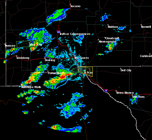 The severe thunderstorm warning for southern dona ana and northwestern el paso counties will expire at 615 pm mdt, the storm which prompted the warning has weakened below severe limits, and no longer poses an immediate threat to life or property. therefore the warning will be allowed to expire. however heavy rain and pea size hail is still possible with this thunderstorm. The severe thunderstorm warning for southern dona ana and northwestern el paso counties will expire at 615 pm mdt, the storm which prompted the warning has weakened below severe limits, and no longer poses an immediate threat to life or property. therefore the warning will be allowed to expire. however heavy rain and pea size hail is still possible with this thunderstorm.
|
| 7/10/2015 5:40 PM MDT |
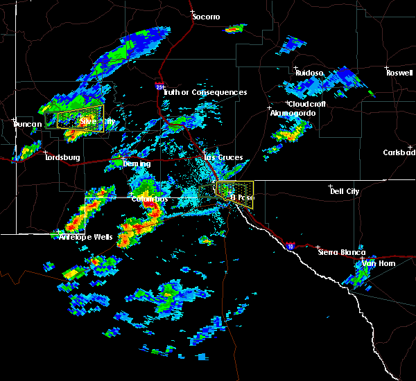 At 539 pm mdt, a severe thunderstorm was located over northeast el paso, and is moving east southeast at 30 mph (radar indicated). Hazards include ping pong ball size hail and 60 mph wind gusts. People and animals outdoors will be injured. expect hail damage to roofs, siding, windows and vehicles. expect wind damage to roofs, siding and trees. Locations impacted include, horizon city, west el paso, northeast el paso, east el paso, central el paso, el paso, fort bliss, montana vista, westway, and franklin mountains state park. At 539 pm mdt, a severe thunderstorm was located over northeast el paso, and is moving east southeast at 30 mph (radar indicated). Hazards include ping pong ball size hail and 60 mph wind gusts. People and animals outdoors will be injured. expect hail damage to roofs, siding, windows and vehicles. expect wind damage to roofs, siding and trees. Locations impacted include, horizon city, west el paso, northeast el paso, east el paso, central el paso, el paso, fort bliss, montana vista, westway, and franklin mountains state park.
|
| 7/10/2015 5:24 PM MDT |
 At 524 pm mdt, a severe thunderstorm was located near northeast el paso, moving east at 30 mph (radar indicated). Hazards include 60 mph wind gusts and quarter size hail. Hail damage to vehicles is expected. Expect wind damage to roofs, siding and trees. At 524 pm mdt, a severe thunderstorm was located near northeast el paso, moving east at 30 mph (radar indicated). Hazards include 60 mph wind gusts and quarter size hail. Hail damage to vehicles is expected. Expect wind damage to roofs, siding and trees.
|
| 7/10/2015 5:07 PM MDT |
 At 505 pm mdt, a severe thunderstorm was located near canutillo, or near west el paso, moving east at 20 mph (radar indicated. at 454 pm mdt 68 mph winds and penny size hail was reported at the nws el paso office in santa teresa). Hazards include 60 mph wind gusts and nickel size hail. Expect damage to roofs. siding and trees. Locations impacted include, sunland park, west el paso, northeast el paso, central el paso, el paso, vinton, fort bliss, la union, westway, santa teresa, canutillo, and franklin mountains state park. At 505 pm mdt, a severe thunderstorm was located near canutillo, or near west el paso, moving east at 20 mph (radar indicated. at 454 pm mdt 68 mph winds and penny size hail was reported at the nws el paso office in santa teresa). Hazards include 60 mph wind gusts and nickel size hail. Expect damage to roofs. siding and trees. Locations impacted include, sunland park, west el paso, northeast el paso, central el paso, el paso, vinton, fort bliss, la union, westway, santa teresa, canutillo, and franklin mountains state park.
|
| 7/10/2015 4:46 PM MDT |
 At 446 pm mdt, a severe thunderstorm was located over santa teresa, or near west el paso, moving east at 25 mph (radar indicated). Hazards include 60 mph wind gusts and penny size hail. Expect damage to roofs. Siding and trees. At 446 pm mdt, a severe thunderstorm was located over santa teresa, or near west el paso, moving east at 25 mph (radar indicated). Hazards include 60 mph wind gusts and penny size hail. Expect damage to roofs. Siding and trees.
|
| 5/30/2015 7:38 PM MDT | The severe thunderstorm warning for south central dona ana and northwestern el paso counties will expire at 745 pm mdt, the storm which prompted the warning has weakened below severe limits. |
| 5/30/2015 7:38 PM MDT | The severe thunderstorm warning for south central dona ana and northwestern el paso counties will expire at 745 pm mdt, the storm which prompted the warning has weakened below severe limits. |
| 5/30/2015 7:21 PM MDT | At 714 pm mdt, a severe thunderstorm was reported, producing quarter size hail, and damaging winds in excess of 60 mph. this storm was located 5 miles northwest of anthony, moving south at 10 mph. this storm continues to pulse between strong and severe limits. locations impacted include, anthony, berino, san miguel, san miguel in dona ana county, chamberino, vado, mesquite, la union, la mesa, westway,. |
| 5/30/2015 7:21 PM MDT | At 714 pm mdt, a severe thunderstorm was reported, producing quarter size hail, and damaging winds in excess of 60 mph. this storm was located 5 miles northwest of anthony, moving south at 10 mph. this storm continues to pulse between strong and severe limits. locations impacted include, anthony, berino, san miguel, san miguel in dona ana county, chamberino, vado, mesquite, la union, la mesa, westway,. |
| 5/30/2015 6:55 PM MDT | At 649 pm mdt, national weather service meteorologists detected a severe thunderstorm capable of producing quarter size hail, and damaging winds in excess of 60 mph. this storm was located 9 miles northwest of anthony, moving south at 10 mph. |
| 5/30/2015 6:55 PM MDT | At 649 pm mdt, national weather service meteorologists detected a severe thunderstorm capable of producing quarter size hail, and damaging winds in excess of 60 mph. this storm was located 9 miles northwest of anthony, moving south at 10 mph. |
| 5/30/2015 6:00 PM MDT | At 548 pm mdt, a severe thunderstorm was reported, producing quarter size hail, and damaging winds in excess of 60 mph. this storm was located 12 miles east of leasburg, moving southeast at 5 mph. radar indicates this storm continues to pulse between strong and severe. locations impacted include, leasburg, las cruces, chaparral, anthony, east mesa, talavera, berino, san miguel, san miguel in dona ana county, fairacres, lookout peak, twin peaks, aguirre springs, soledad canyon,. |
| 5/30/2015 6:00 PM MDT | At 548 pm mdt, a severe thunderstorm was reported, producing quarter size hail, and damaging winds in excess of 60 mph. this storm was located 12 miles east of leasburg, moving southeast at 5 mph. radar indicates this storm continues to pulse between strong and severe. locations impacted include, leasburg, las cruces, chaparral, anthony, east mesa, talavera, berino, san miguel, san miguel in dona ana county, fairacres, lookout peak, twin peaks, aguirre springs, soledad canyon,. |
| 5/30/2015 5:23 PM MDT | At 516 pm mdt, national weather service meteorologists detected a severe thunderstorm capable of producing quarter size hail, and damaging winds in excess of 60 mph. this storm was located 11 miles northeast of leasburg, moving southeast at 5 mph. |
| 5/30/2015 5:23 PM MDT | At 516 pm mdt, national weather service meteorologists detected a severe thunderstorm capable of producing quarter size hail, and damaging winds in excess of 60 mph. this storm was located 11 miles northeast of leasburg, moving southeast at 5 mph. |
| 5/14/2015 3:29 PM MDT | At 325 pm mdt, national weather service meteorologists detected a line of severe thunderstorms capable of producing damaging winds in excess of 60 mph. these storms were moving into the city of el paso and surrounding areas. winds gusts from 50 to 60 mph have been measured with these storms. locations impacted include, mcgregor range base, mission valley, east el paso, northeast el paso, west el paso, sunland park, chaparral, anthony, horizon city, fabens, colonia del paso, lake way estates, franklin mountains state park, hueco tanks,. |
| 5/14/2015 3:29 PM MDT | At 325 pm mdt, national weather service meteorologists detected a line of severe thunderstorms capable of producing damaging winds in excess of 60 mph. these storms were moving into the city of el paso and surrounding areas. winds gusts from 50 to 60 mph have been measured with these storms. locations impacted include, mcgregor range base, mission valley, east el paso, northeast el paso, west el paso, sunland park, chaparral, anthony, horizon city, fabens, colonia del paso, lake way estates, franklin mountains state park, hueco tanks,. |
| 5/14/2015 2:58 PM MDT | At 247 pm mdt, national weather service meteorologists detected a line of severe thunderstorms capable of producing damaging winds in excess of 60 mph. |
| 5/14/2015 2:58 PM MDT | At 247 pm mdt, national weather service meteorologists detected a line of severe thunderstorms capable of producing damaging winds in excess of 60 mph. |
| 1/1/0001 12:00 AM | Trees and power lines down in el paso county TX, 0.3 miles NNW of Canutillo, TX |
Hail Maps for Canutillo, TX
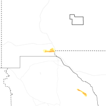
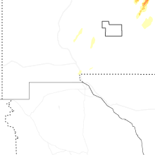


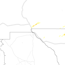
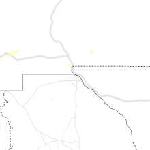
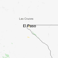
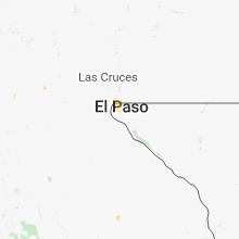


Connect with Interactive Hail Maps