

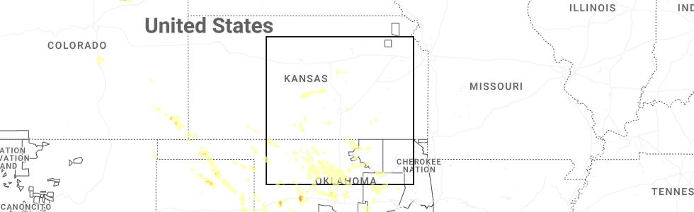
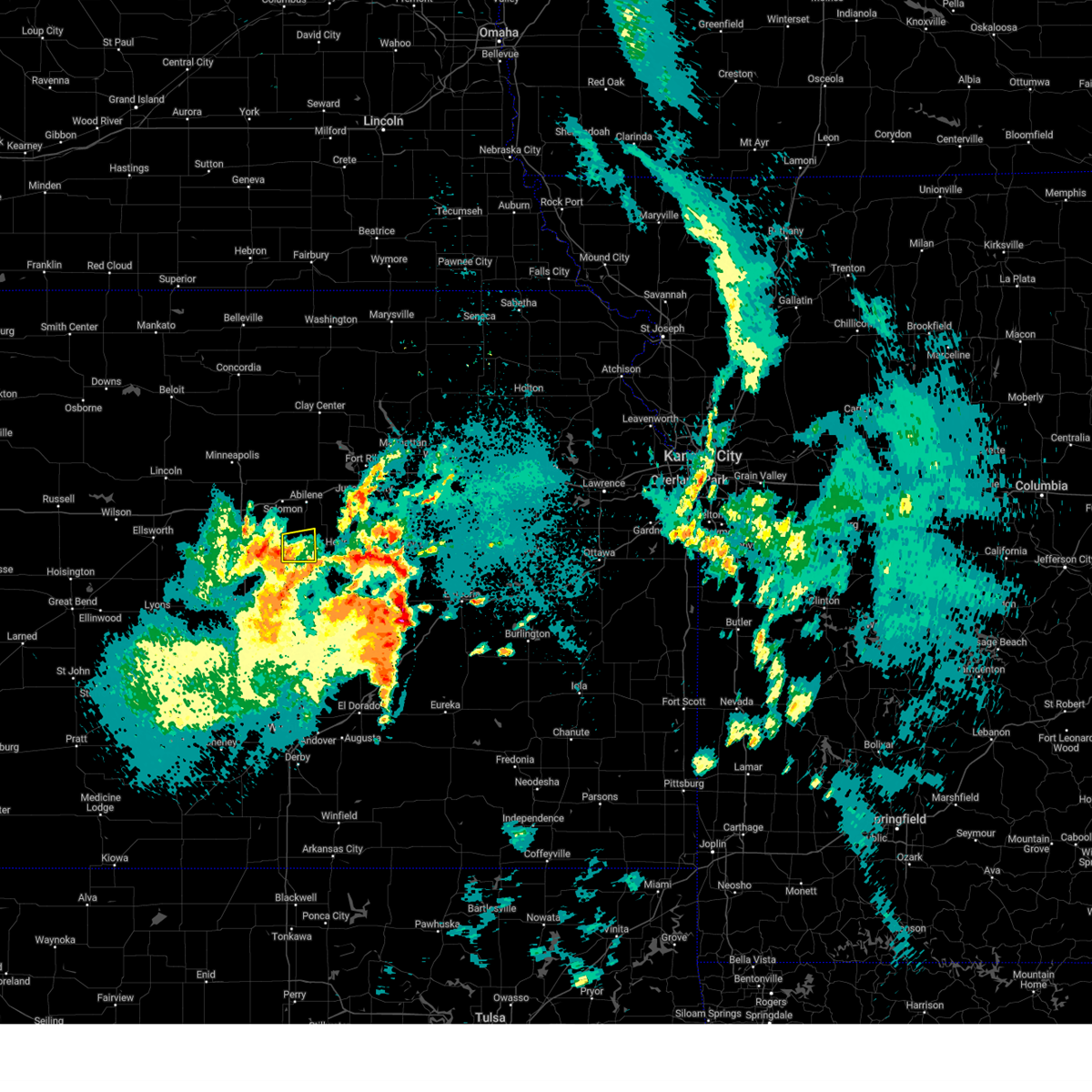
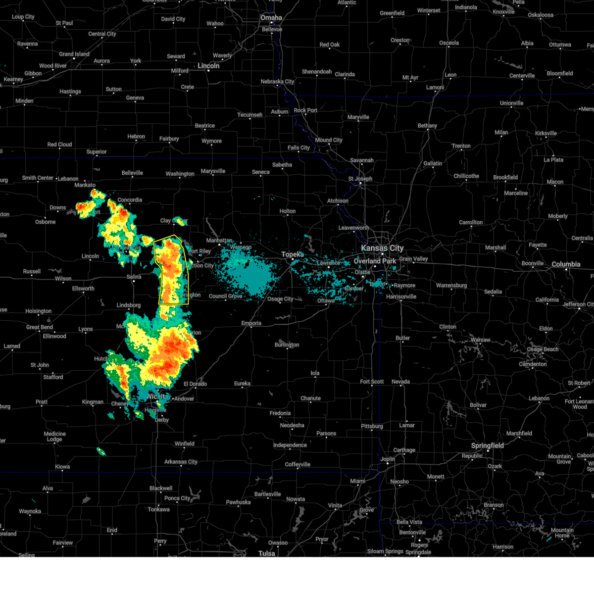
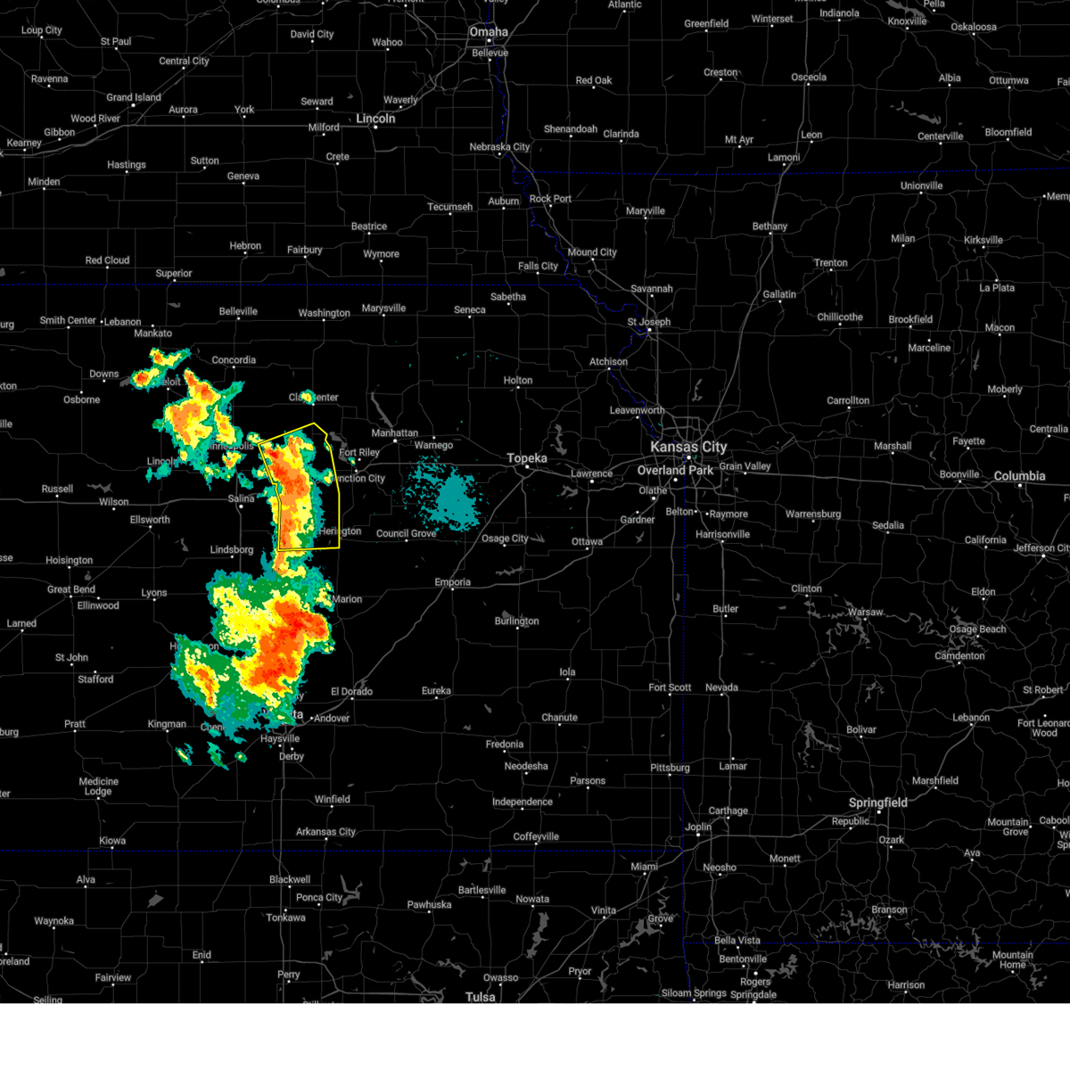
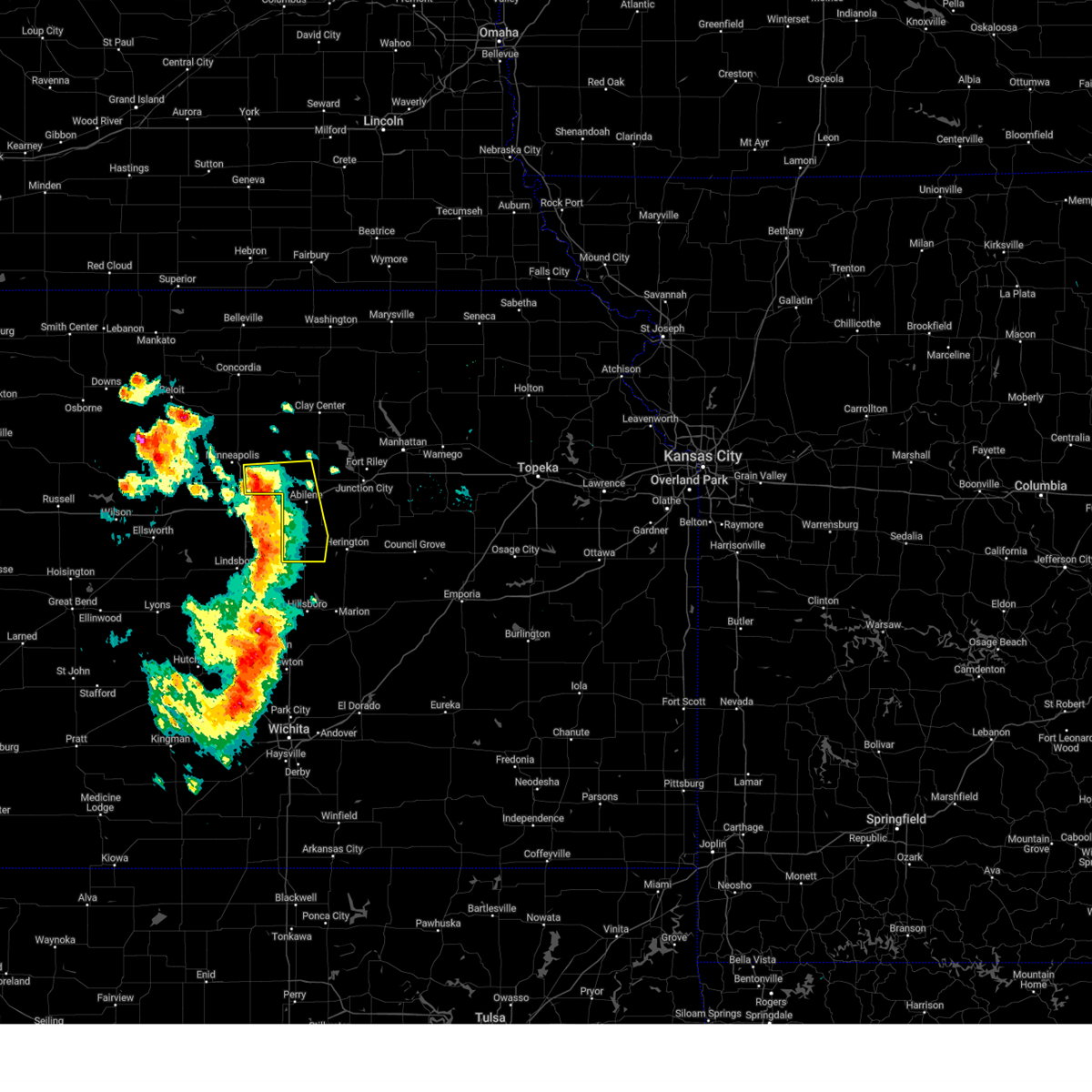
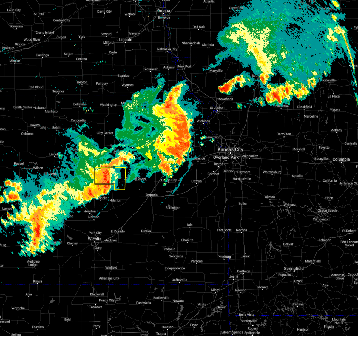
Hail Map for Carlton, KS
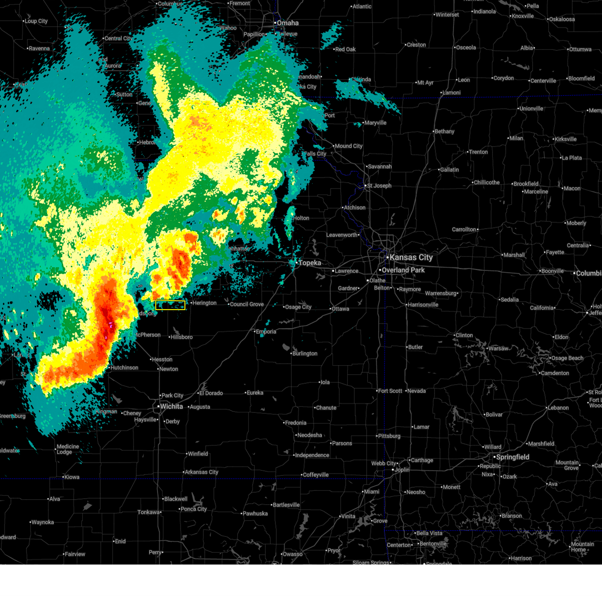
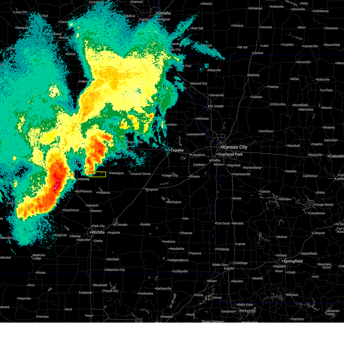
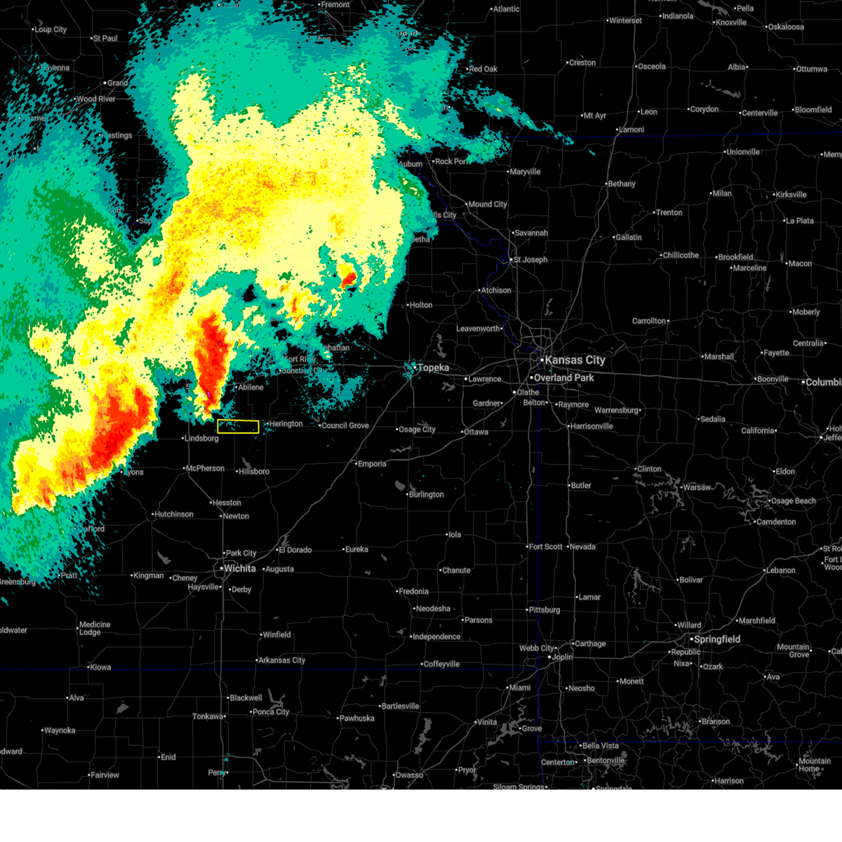
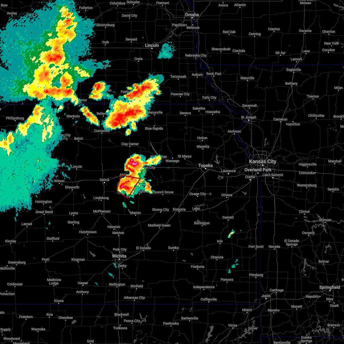
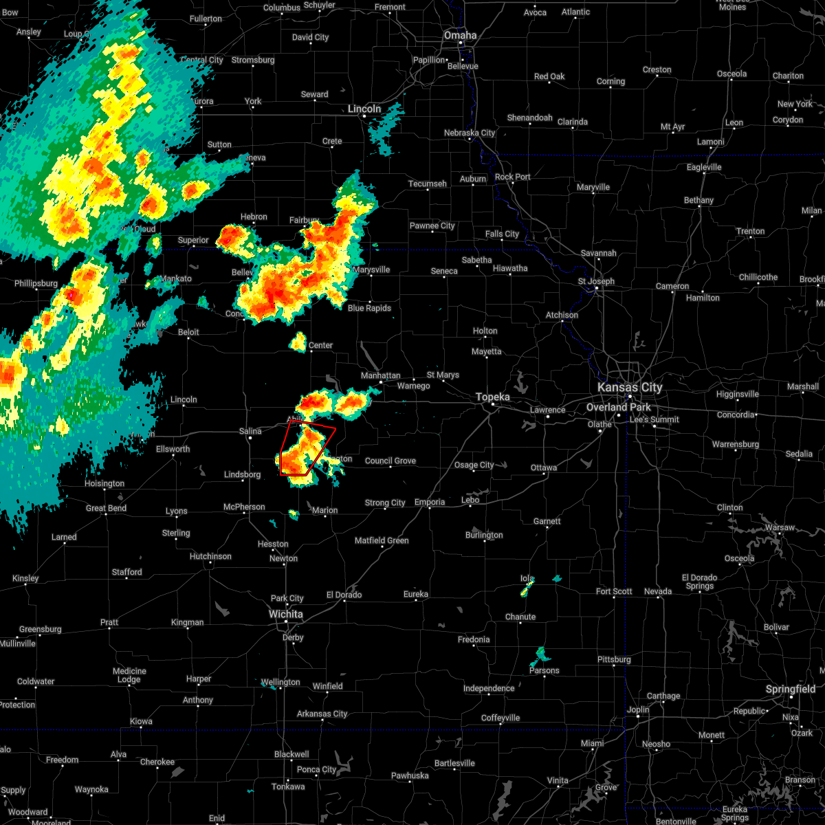
The Carlton, KS area has had 0 reports of on-the-ground hail by trained spotters, and has been under severe weather warnings 19 times during the past 12 months. Doppler radar has detected hail at or near Carlton, KS on 77 occasions, including 5 occasions during the past year.
| Name: | Carlton, KS |
| Where Located: | 52 miles SW of Manhattan, KS |
| Map: | Google Map for Carlton, KS |
| Population: | 42 |
| Housing Units: | 20 |
| More Info: | Search Google for Carlton, KS |
0
The Top Recent Hail Date for Carlton, KS is Saturday, June 14, 2025 (77th out of 77)
Hail and Wind Damage Spotted near Carlton, KS
| Date / Time | Report Details |
|---|---|
| 6/17/2025 3:20 AM CDT |
 The storm which prompted the warning has weakened below severe limits, and no longer poses an immediate threat to life or property. therefore, the warning will be allowed to expire. however, gusty winds are still possible with this thunderstorm. a severe thunderstorm watch remains in effect until 700 am cdt for central kansas. The storm which prompted the warning has weakened below severe limits, and no longer poses an immediate threat to life or property. therefore, the warning will be allowed to expire. however, gusty winds are still possible with this thunderstorm. a severe thunderstorm watch remains in effect until 700 am cdt for central kansas.
|
| 6/17/2025 3:08 AM CDT |
 At 308 am cdt, a severe thunderstorm was located over carlton, or 16 miles west of herington, moving east at 20 mph (radar indicated). Hazards include 70 mph wind gusts. Expect considerable tree damage. damage is likely to mobile homes, roofs, and outbuildings. Locations impacted include, hope and carlton. At 308 am cdt, a severe thunderstorm was located over carlton, or 16 miles west of herington, moving east at 20 mph (radar indicated). Hazards include 70 mph wind gusts. Expect considerable tree damage. damage is likely to mobile homes, roofs, and outbuildings. Locations impacted include, hope and carlton.
|
| 6/17/2025 2:45 AM CDT |
 Svrtop the national weather service in topeka has issued a * severe thunderstorm warning for, southwestern dickinson county in central kansas, * until 330 am cdt. * at 245 am cdt, a severe thunderstorm was located 6 miles northeast of gypsum, or 11 miles southwest of abilene, moving east at 25 mph (radar indicated). Hazards include 70 mph wind gusts and half dollar size hail. Hail damage to vehicles is expected. expect considerable tree damage. Wind damage is also likely to mobile homes, roofs, and outbuildings. Svrtop the national weather service in topeka has issued a * severe thunderstorm warning for, southwestern dickinson county in central kansas, * until 330 am cdt. * at 245 am cdt, a severe thunderstorm was located 6 miles northeast of gypsum, or 11 miles southwest of abilene, moving east at 25 mph (radar indicated). Hazards include 70 mph wind gusts and half dollar size hail. Hail damage to vehicles is expected. expect considerable tree damage. Wind damage is also likely to mobile homes, roofs, and outbuildings.
|
| 5/20/2025 12:36 AM CDT |
 The storm which prompted the warning has weakened below severe limits, and no longer poses an immediate threat to life or property. therefore, the warning will be allowed to expire. however, small hail, gusty winds and heavy rain are still possible with this thunderstorm. The storm which prompted the warning has weakened below severe limits, and no longer poses an immediate threat to life or property. therefore, the warning will be allowed to expire. however, small hail, gusty winds and heavy rain are still possible with this thunderstorm.
|
| 5/20/2025 12:15 AM CDT |
 At 1213 am cdt, a severe thunderstorm was located near gypsum, and is moving east at 20 mph (radar indicated). Hazards include 60 mph wind gusts and nickel size hail. Expect damage to roofs, siding, and trees. Locations impacted include, carlton. At 1213 am cdt, a severe thunderstorm was located near gypsum, and is moving east at 20 mph (radar indicated). Hazards include 60 mph wind gusts and nickel size hail. Expect damage to roofs, siding, and trees. Locations impacted include, carlton.
|
| 5/20/2025 12:02 AM CDT |
 Svrtop the national weather service in topeka has issued a * severe thunderstorm warning for, southwestern dickinson county in central kansas, * until 1245 am cdt. * at 1202 am cdt, a severe thunderstorm was located 5 miles southwest of gypsum, moving east at 25 mph (radar indicated). Hazards include 70 mph wind gusts and quarter size hail. Hail damage to vehicles is expected. expect considerable tree damage. Wind damage is also likely to mobile homes, roofs, and outbuildings. Svrtop the national weather service in topeka has issued a * severe thunderstorm warning for, southwestern dickinson county in central kansas, * until 1245 am cdt. * at 1202 am cdt, a severe thunderstorm was located 5 miles southwest of gypsum, moving east at 25 mph (radar indicated). Hazards include 70 mph wind gusts and quarter size hail. Hail damage to vehicles is expected. expect considerable tree damage. Wind damage is also likely to mobile homes, roofs, and outbuildings.
|
| 9/20/2024 7:58 PM CDT |
 the severe thunderstorm warning has been cancelled and is no longer in effect the severe thunderstorm warning has been cancelled and is no longer in effect
|
| 9/20/2024 7:49 PM CDT |
 At 748 pm cdt, severe thunderstorms were located along a line extending from 6 miles northeast of longford to near moonlight to near tampa, moving northeast at 40 mph (radar indicated). Hazards include 60 mph wind gusts. Expect damage to roofs, siding, and trees. locations impacted include, abilene, herington, chapman, enterprise, hope, woodbine, manchester, longford, carlton, moonlight, and talmage. This includes interstate 70 between mile markers 272 and 289. At 748 pm cdt, severe thunderstorms were located along a line extending from 6 miles northeast of longford to near moonlight to near tampa, moving northeast at 40 mph (radar indicated). Hazards include 60 mph wind gusts. Expect damage to roofs, siding, and trees. locations impacted include, abilene, herington, chapman, enterprise, hope, woodbine, manchester, longford, carlton, moonlight, and talmage. This includes interstate 70 between mile markers 272 and 289.
|
| 9/20/2024 7:49 PM CDT |
 the severe thunderstorm warning has been cancelled and is no longer in effect the severe thunderstorm warning has been cancelled and is no longer in effect
|
| 9/20/2024 7:39 PM CDT |
 Svrtop the national weather service in topeka has issued a * severe thunderstorm warning for, dickinson county in central kansas, southeastern ottawa county in north central kansas, southern clay county in north central kansas, * until 815 pm cdt. * at 739 pm cdt, severe thunderstorms were located along a line extending from near longford to near abilene to 4 miles west of tampa, moving northeast at 40 mph (radar indicated). Hazards include 60 mph wind gusts. expect damage to roofs, siding, and trees Svrtop the national weather service in topeka has issued a * severe thunderstorm warning for, dickinson county in central kansas, southeastern ottawa county in north central kansas, southern clay county in north central kansas, * until 815 pm cdt. * at 739 pm cdt, severe thunderstorms were located along a line extending from near longford to near abilene to 4 miles west of tampa, moving northeast at 40 mph (radar indicated). Hazards include 60 mph wind gusts. expect damage to roofs, siding, and trees
|
| 9/20/2024 7:19 PM CDT |
 At 719 pm cdt, severe thunderstorms were located along a line extending from 4 miles northeast of bennington to 5 miles north of gypsum to 6 miles north of canton, moving east at 30 mph (radar indicated). Hazards include 70 mph wind gusts and penny size hail. Expect considerable tree damage. damage is likely to mobile homes, roofs, and outbuildings. locations impacted include, abilene, solomon, enterprise, bennington, hope, manchester, carlton, niles, and talmage. This includes interstate 70 between mile markers 267 and 279. At 719 pm cdt, severe thunderstorms were located along a line extending from 4 miles northeast of bennington to 5 miles north of gypsum to 6 miles north of canton, moving east at 30 mph (radar indicated). Hazards include 70 mph wind gusts and penny size hail. Expect considerable tree damage. damage is likely to mobile homes, roofs, and outbuildings. locations impacted include, abilene, solomon, enterprise, bennington, hope, manchester, carlton, niles, and talmage. This includes interstate 70 between mile markers 267 and 279.
|
| 9/20/2024 7:13 PM CDT |
 At 711 pm cdt, severe thunderstorms were located along a line extending from near bennington to 4 miles northwest of gypsum to 5 miles north of canton, moving east-northeast at 30 mph (radar indicated). Hazards include 70 mph wind gusts and penny size hail. Expect considerable tree damage. damage is likely to mobile homes, roofs, and outbuildings. locations impacted include, abilene, minneapolis, solomon, enterprise, bennington, hope, manchester, carlton, niles, and talmage. this includes interstate 70 between mile markers 267 and 279. At 7:04 pm cdt, the automated weather station at the salina, ks airport measured a 67 mph wind gust. At 711 pm cdt, severe thunderstorms were located along a line extending from near bennington to 4 miles northwest of gypsum to 5 miles north of canton, moving east-northeast at 30 mph (radar indicated). Hazards include 70 mph wind gusts and penny size hail. Expect considerable tree damage. damage is likely to mobile homes, roofs, and outbuildings. locations impacted include, abilene, minneapolis, solomon, enterprise, bennington, hope, manchester, carlton, niles, and talmage. this includes interstate 70 between mile markers 267 and 279. At 7:04 pm cdt, the automated weather station at the salina, ks airport measured a 67 mph wind gust.
|
| 9/20/2024 7:00 PM CDT |
 Svrtop the national weather service in topeka has issued a * severe thunderstorm warning for, western dickinson county in central kansas, southeastern ottawa county in north central kansas, * until 745 pm cdt. * at 659 pm cdt, severe thunderstorms were located along a line extending from near bennington to 3 miles northwest of gypsum to 5 miles west of moundridge, moving east at 35 mph (radar indicated). Hazards include 60 mph wind gusts and penny size hail. expect damage to roofs, siding, and trees Svrtop the national weather service in topeka has issued a * severe thunderstorm warning for, western dickinson county in central kansas, southeastern ottawa county in north central kansas, * until 745 pm cdt. * at 659 pm cdt, severe thunderstorms were located along a line extending from near bennington to 3 miles northwest of gypsum to 5 miles west of moundridge, moving east at 35 mph (radar indicated). Hazards include 60 mph wind gusts and penny size hail. expect damage to roofs, siding, and trees
|
| 7/31/2024 9:57 PM CDT |
 the severe thunderstorm warning has been cancelled and is no longer in effect the severe thunderstorm warning has been cancelled and is no longer in effect
|
| 7/31/2024 9:57 PM CDT |
 At 955 pm cdt, a severe thunderstorm was located over woodbine, moving east at 50 mph (radar indicated). Hazards include 70 mph wind gusts and nickel size hail. Expect considerable tree damage. damage is likely to mobile homes, roofs, and outbuildings. Locations impacted include, herington, white city, hope, woodbine, carlton, latimer, and burdick. At 955 pm cdt, a severe thunderstorm was located over woodbine, moving east at 50 mph (radar indicated). Hazards include 70 mph wind gusts and nickel size hail. Expect considerable tree damage. damage is likely to mobile homes, roofs, and outbuildings. Locations impacted include, herington, white city, hope, woodbine, carlton, latimer, and burdick.
|
| 7/31/2024 9:40 PM CDT |
 At 939 pm cdt, a severe thunderstorm was located 8 miles northwest of hope, moving east at 55 mph (radar indicated). Hazards include 70 mph wind gusts and nickel size hail. Expect considerable tree damage. damage is likely to mobile homes, roofs, and outbuildings. Locations impacted include, abilene, herington, enterprise, white city, hope, woodbine, carlton, latimer, and burdick. At 939 pm cdt, a severe thunderstorm was located 8 miles northwest of hope, moving east at 55 mph (radar indicated). Hazards include 70 mph wind gusts and nickel size hail. Expect considerable tree damage. damage is likely to mobile homes, roofs, and outbuildings. Locations impacted include, abilene, herington, enterprise, white city, hope, woodbine, carlton, latimer, and burdick.
|
| 7/31/2024 9:27 PM CDT |
 Svrtop the national weather service in topeka has issued a * severe thunderstorm warning for, southern dickinson county in central kansas, southwestern geary county in east central kansas, western morris county in east central kansas, * until 1015 pm cdt. * at 926 pm cdt, a severe thunderstorm was located 5 miles north of gypsum, moving east at 55 mph (radar indicated. 77 mph wind gusts were reported at salina airport at 917 pm). Hazards include 70 mph wind gusts and nickel size hail. Expect considerable tree damage. Damage is likely to mobile homes, roofs, and outbuildings. Svrtop the national weather service in topeka has issued a * severe thunderstorm warning for, southern dickinson county in central kansas, southwestern geary county in east central kansas, western morris county in east central kansas, * until 1015 pm cdt. * at 926 pm cdt, a severe thunderstorm was located 5 miles north of gypsum, moving east at 55 mph (radar indicated. 77 mph wind gusts were reported at salina airport at 917 pm). Hazards include 70 mph wind gusts and nickel size hail. Expect considerable tree damage. Damage is likely to mobile homes, roofs, and outbuildings.
|
| 7/31/2024 8:00 PM CDT |
 At 800 pm cdt, severe thunderstorms were located along a line extending from near milford lake to 3 miles southwest of carlton, moving east at 40 mph (radar indicated). Hazards include 60 mph wind gusts and quarter size hail. Hail damage to vehicles is expected. expect wind damage to roofs, siding, and trees. locations impacted include, southwestern manhattan, junction city, abilene, herington, ogden, grandview plaza, chapman, wakefield, enterprise, white city, milford, hope, woodbine, carlton, latimer, talmage, milford lake, and moonlight. This includes interstate 70 between mile markers 269 and 313. At 800 pm cdt, severe thunderstorms were located along a line extending from near milford lake to 3 miles southwest of carlton, moving east at 40 mph (radar indicated). Hazards include 60 mph wind gusts and quarter size hail. Hail damage to vehicles is expected. expect wind damage to roofs, siding, and trees. locations impacted include, southwestern manhattan, junction city, abilene, herington, ogden, grandview plaza, chapman, wakefield, enterprise, white city, milford, hope, woodbine, carlton, latimer, talmage, milford lake, and moonlight. This includes interstate 70 between mile markers 269 and 313.
|
| 7/31/2024 7:46 PM CDT |
 Svrtop the national weather service in topeka has issued a * severe thunderstorm warning for, dickinson county in central kansas, geary county in east central kansas, southwestern riley county in northeastern kansas, western morris county in east central kansas, southeastern clay county in north central kansas, * until 830 pm cdt. * at 744 pm cdt, severe thunderstorms were located along a line extending from 4 miles southwest of wakefield to 6 miles southeast of assaria, moving east at 45 mph (radar indicated). Hazards include 60 mph wind gusts and quarter size hail. Hail damage to vehicles is expected. Expect wind damage to roofs, siding, and trees. Svrtop the national weather service in topeka has issued a * severe thunderstorm warning for, dickinson county in central kansas, geary county in east central kansas, southwestern riley county in northeastern kansas, western morris county in east central kansas, southeastern clay county in north central kansas, * until 830 pm cdt. * at 744 pm cdt, severe thunderstorms were located along a line extending from 4 miles southwest of wakefield to 6 miles southeast of assaria, moving east at 45 mph (radar indicated). Hazards include 60 mph wind gusts and quarter size hail. Hail damage to vehicles is expected. Expect wind damage to roofs, siding, and trees.
|
| 7/4/2024 1:02 AM CDT |
 the severe thunderstorm warning has been cancelled and is no longer in effect the severe thunderstorm warning has been cancelled and is no longer in effect
|
| 7/4/2024 1:02 AM CDT |
 At 101 am cdt, severe thunderstorms were located along a line extending from 4 miles north of wakefield to 3 miles northeast of moonlight to near carlton, moving east at 50 mph (radar indicated). Hazards include 60 mph wind gusts. Expect damage to roofs, siding, and trees. locations impacted include, junction city, abilene, herington, grandview plaza, chapman, wakefield, riley, enterprise, milford, hope, woodbine, carlton, talmage, milford lake, and moonlight. This includes interstate 70 between mile markers 269 and 300. At 101 am cdt, severe thunderstorms were located along a line extending from 4 miles north of wakefield to 3 miles northeast of moonlight to near carlton, moving east at 50 mph (radar indicated). Hazards include 60 mph wind gusts. Expect damage to roofs, siding, and trees. locations impacted include, junction city, abilene, herington, grandview plaza, chapman, wakefield, riley, enterprise, milford, hope, woodbine, carlton, talmage, milford lake, and moonlight. This includes interstate 70 between mile markers 269 and 300.
|
| 7/4/2024 12:48 AM CDT |
 At 1248 am cdt, severe thunderstorms were located along a line extending from 7 miles southeast of idana to near talmage to near gypsum, moving east at 45 mph (radar indicated). Hazards include 70 mph wind gusts. Expect considerable tree damage. damage is likely to mobile homes, roofs, and outbuildings. locations impacted include, junction city, abilene, herington, grandview plaza, chapman, solomon, wakefield, riley, enterprise, milford, hope, woodbine, manchester, longford, carlton, oak hill, talmage, milford lake, and moonlight. This includes interstate 70 between mile markers 267 and 300. At 1248 am cdt, severe thunderstorms were located along a line extending from 7 miles southeast of idana to near talmage to near gypsum, moving east at 45 mph (radar indicated). Hazards include 70 mph wind gusts. Expect considerable tree damage. damage is likely to mobile homes, roofs, and outbuildings. locations impacted include, junction city, abilene, herington, grandview plaza, chapman, solomon, wakefield, riley, enterprise, milford, hope, woodbine, manchester, longford, carlton, oak hill, talmage, milford lake, and moonlight. This includes interstate 70 between mile markers 267 and 300.
|
| 7/4/2024 12:35 AM CDT |
 Svrtop the national weather service in topeka has issued a * severe thunderstorm warning for, dickinson county in central kansas, western geary county in east central kansas, southwestern riley county in northeastern kansas, eastern ottawa county in north central kansas, southern clay county in north central kansas, * until 115 am cdt. * at 1234 am cdt, severe thunderstorms were located along a line extending from 3 miles west of oak hill to 4 miles northeast of niles to 4 miles south of salina, moving east at 45 mph (at 12:28am, law enforcement reported 55 to 65mph winds in culver). Hazards include 70 mph wind gusts. Expect considerable tree damage. Damage is likely to mobile homes, roofs, and outbuildings. Svrtop the national weather service in topeka has issued a * severe thunderstorm warning for, dickinson county in central kansas, western geary county in east central kansas, southwestern riley county in northeastern kansas, eastern ottawa county in north central kansas, southern clay county in north central kansas, * until 115 am cdt. * at 1234 am cdt, severe thunderstorms were located along a line extending from 3 miles west of oak hill to 4 miles northeast of niles to 4 miles south of salina, moving east at 45 mph (at 12:28am, law enforcement reported 55 to 65mph winds in culver). Hazards include 70 mph wind gusts. Expect considerable tree damage. Damage is likely to mobile homes, roofs, and outbuildings.
|
| 6/26/2024 4:37 AM CDT |
 The storm which prompted the warning has weakened below severe limits, and no longer poses an immediate threat to life or property. therefore, the warning will be allowed to expire. a severe thunderstorm watch remains in effect until 700 am cdt for central and east central kansas. The storm which prompted the warning has weakened below severe limits, and no longer poses an immediate threat to life or property. therefore, the warning will be allowed to expire. a severe thunderstorm watch remains in effect until 700 am cdt for central and east central kansas.
|
| 6/26/2024 4:28 AM CDT |
 the severe thunderstorm warning has been cancelled and is no longer in effect the severe thunderstorm warning has been cancelled and is no longer in effect
|
| 6/26/2024 4:28 AM CDT |
 At 428 am cdt, a severe thunderstorm was located 4 miles south of abilene, moving southeast at 50 mph (radar indicated). Hazards include 60 mph wind gusts and penny size hail. Expect damage to roofs, siding, and trees. locations impacted include, abilene, herington, enterprise, hope, woodbine, and carlton. This includes interstate 70 between mile markers 269 and 279. At 428 am cdt, a severe thunderstorm was located 4 miles south of abilene, moving southeast at 50 mph (radar indicated). Hazards include 60 mph wind gusts and penny size hail. Expect damage to roofs, siding, and trees. locations impacted include, abilene, herington, enterprise, hope, woodbine, and carlton. This includes interstate 70 between mile markers 269 and 279.
|
| 6/26/2024 4:06 AM CDT |
 the severe thunderstorm warning has been cancelled and is no longer in effect the severe thunderstorm warning has been cancelled and is no longer in effect
|
| 6/26/2024 4:06 AM CDT |
 At 406 am cdt, severe thunderstorms were located along a line extending from 4 miles northeast of moonlight to solomon, moving southeast at 45 mph (radar indicated). Hazards include 60 mph wind gusts and penny size hail. Expect damage to roofs, siding, and trees. locations impacted include, abilene, herington, chapman, solomon, enterprise, hope, woodbine, manchester, carlton, niles, moonlight, and talmage. This includes interstate 70 between mile markers 267 and 289. At 406 am cdt, severe thunderstorms were located along a line extending from 4 miles northeast of moonlight to solomon, moving southeast at 45 mph (radar indicated). Hazards include 60 mph wind gusts and penny size hail. Expect damage to roofs, siding, and trees. locations impacted include, abilene, herington, chapman, solomon, enterprise, hope, woodbine, manchester, carlton, niles, moonlight, and talmage. This includes interstate 70 between mile markers 267 and 289.
|
| 6/26/2024 3:52 AM CDT |
 At 352 am cdt, severe thunderstorms were located along a line extending from 8 miles southwest of wakefield to 5 miles north of niles, moving southeast at 45 mph (radar indicated). Hazards include 60 mph wind gusts and penny size hail. Expect damage to roofs, siding, and trees. locations impacted include, abilene, herington, chapman, solomon, enterprise, hope, woodbine, manchester, longford, carlton, niles, talmage, and moonlight. This includes interstate 70 between mile markers 267 and 289. At 352 am cdt, severe thunderstorms were located along a line extending from 8 miles southwest of wakefield to 5 miles north of niles, moving southeast at 45 mph (radar indicated). Hazards include 60 mph wind gusts and penny size hail. Expect damage to roofs, siding, and trees. locations impacted include, abilene, herington, chapman, solomon, enterprise, hope, woodbine, manchester, longford, carlton, niles, talmage, and moonlight. This includes interstate 70 between mile markers 267 and 289.
|
| 6/26/2024 3:37 AM CDT |
 Svrtop the national weather service in topeka has issued a * severe thunderstorm warning for, dickinson county in central kansas, eastern ottawa county in north central kansas, southwestern clay county in north central kansas, * until 445 am cdt. * at 337 am cdt, severe thunderstorms were located along a line extending from 4 miles northeast of oak hill to near wells, moving southeast at 45 mph (radar indicated). Hazards include 60 mph wind gusts. expect damage to roofs, siding, and trees Svrtop the national weather service in topeka has issued a * severe thunderstorm warning for, dickinson county in central kansas, eastern ottawa county in north central kansas, southwestern clay county in north central kansas, * until 445 am cdt. * at 337 am cdt, severe thunderstorms were located along a line extending from 4 miles northeast of oak hill to near wells, moving southeast at 45 mph (radar indicated). Hazards include 60 mph wind gusts. expect damage to roofs, siding, and trees
|
| 6/15/2024 4:32 PM CDT |
 Svrtop the national weather service in topeka has issued a * severe thunderstorm warning for, northwestern dickinson county in central kansas, * until 515 pm cdt. * at 431 pm cdt, a severe thunderstorm was located near carlton, moving northeast at 35 mph (radar indicated). Hazards include 60 mph wind gusts. expect damage to roofs, siding, and trees Svrtop the national weather service in topeka has issued a * severe thunderstorm warning for, northwestern dickinson county in central kansas, * until 515 pm cdt. * at 431 pm cdt, a severe thunderstorm was located near carlton, moving northeast at 35 mph (radar indicated). Hazards include 60 mph wind gusts. expect damage to roofs, siding, and trees
|
| 6/8/2024 12:37 AM CDT |
 The storm which prompted the warning has weakened below severe limits, and no longer poses an immediate threat to life or property. therefore, the warning will be allowed to expire. a severe thunderstorm watch remains in effect until 100 am cdt for central and east central kansas. The storm which prompted the warning has weakened below severe limits, and no longer poses an immediate threat to life or property. therefore, the warning will be allowed to expire. a severe thunderstorm watch remains in effect until 100 am cdt for central and east central kansas.
|
| 6/8/2024 12:21 AM CDT |
 Svrtop the national weather service in topeka has issued a * severe thunderstorm warning for, southern dickinson county in central kansas, * until 1245 am cdt. * at 1220 am cdt, a severe thunderstorm was located 4 miles northeast of gypsum, moving east at 50 mph (a wind gust of 68 mph was reported by the salina asos at midnight). Hazards include 70 mph wind gusts and quarter size hail. Hail damage to vehicles is expected. expect considerable tree damage. Wind damage is also likely to mobile homes, roofs, and outbuildings. Svrtop the national weather service in topeka has issued a * severe thunderstorm warning for, southern dickinson county in central kansas, * until 1245 am cdt. * at 1220 am cdt, a severe thunderstorm was located 4 miles northeast of gypsum, moving east at 50 mph (a wind gust of 68 mph was reported by the salina asos at midnight). Hazards include 70 mph wind gusts and quarter size hail. Hail damage to vehicles is expected. expect considerable tree damage. Wind damage is also likely to mobile homes, roofs, and outbuildings.
|
| 6/7/2024 11:09 PM CDT |
 At 1108 pm cdt, a severe thunderstorm was located 7 miles northeast of carlton, moving east at 50 mph (radar indicated). Hazards include 70 mph wind gusts and nickel size hail. Expect considerable tree damage. damage is likely to mobile homes, roofs, and outbuildings. locations impacted include, abilene, herington, chapman, solomon, enterprise, hope, woodbine, carlton, and moonlight. This includes interstate 70 between mile markers 267 and 289. At 1108 pm cdt, a severe thunderstorm was located 7 miles northeast of carlton, moving east at 50 mph (radar indicated). Hazards include 70 mph wind gusts and nickel size hail. Expect considerable tree damage. damage is likely to mobile homes, roofs, and outbuildings. locations impacted include, abilene, herington, chapman, solomon, enterprise, hope, woodbine, carlton, and moonlight. This includes interstate 70 between mile markers 267 and 289.
|
| 6/7/2024 10:57 PM CDT |
 Svrtop the national weather service in topeka has issued a * severe thunderstorm warning for, dickinson county in central kansas, * until 1130 pm cdt. * at 1056 pm cdt, a severe thunderstorm was located 5 miles north of gypsum, moving east at 50 mph (radar indicated). Hazards include 70 mph wind gusts and nickel size hail. Expect considerable tree damage. Damage is likely to mobile homes, roofs, and outbuildings. Svrtop the national weather service in topeka has issued a * severe thunderstorm warning for, dickinson county in central kansas, * until 1130 pm cdt. * at 1056 pm cdt, a severe thunderstorm was located 5 miles north of gypsum, moving east at 50 mph (radar indicated). Hazards include 70 mph wind gusts and nickel size hail. Expect considerable tree damage. Damage is likely to mobile homes, roofs, and outbuildings.
|
| 5/19/2024 6:53 PM CDT |
 At 652 pm cdt, severe thunderstorms were located along a line extending from 4 miles northeast of talmage to near enterprise to near hope, moving east at 30 mph (trained weather spotters reported ping pong ball size hail 1 mile northwest of abilene at 6:52pm). Hazards include 70 mph wind gusts and ping pong ball size hail. People and animals outdoors will be injured. expect hail damage to roofs, siding, windows, and vehicles. expect considerable tree damage. wind damage is also likely to mobile homes, roofs, and outbuildings. locations impacted include, abilene, chapman, enterprise, hope, woodbine, manchester, carlton, moonlight, and talmage. This includes interstate 70 between mile markers 270 and 289. At 652 pm cdt, severe thunderstorms were located along a line extending from 4 miles northeast of talmage to near enterprise to near hope, moving east at 30 mph (trained weather spotters reported ping pong ball size hail 1 mile northwest of abilene at 6:52pm). Hazards include 70 mph wind gusts and ping pong ball size hail. People and animals outdoors will be injured. expect hail damage to roofs, siding, windows, and vehicles. expect considerable tree damage. wind damage is also likely to mobile homes, roofs, and outbuildings. locations impacted include, abilene, chapman, enterprise, hope, woodbine, manchester, carlton, moonlight, and talmage. This includes interstate 70 between mile markers 270 and 289.
|
| 5/19/2024 6:45 PM CDT |
 At 645 pm cdt, severe thunderstorms were located along a line extending from near talmage to near enterprise to 4 miles west of hope, moving east at 25 mph (radar indicated). Hazards include 70 mph wind gusts and ping pong ball size hail. People and animals outdoors will be injured. expect hail damage to roofs, siding, windows, and vehicles. expect considerable tree damage. wind damage is also likely to mobile homes, roofs, and outbuildings. locations impacted include, abilene, chapman, solomon, enterprise, hope, woodbine, manchester, carlton, moonlight, and talmage. This includes interstate 70 between mile markers 267 and 289. At 645 pm cdt, severe thunderstorms were located along a line extending from near talmage to near enterprise to 4 miles west of hope, moving east at 25 mph (radar indicated). Hazards include 70 mph wind gusts and ping pong ball size hail. People and animals outdoors will be injured. expect hail damage to roofs, siding, windows, and vehicles. expect considerable tree damage. wind damage is also likely to mobile homes, roofs, and outbuildings. locations impacted include, abilene, chapman, solomon, enterprise, hope, woodbine, manchester, carlton, moonlight, and talmage. This includes interstate 70 between mile markers 267 and 289.
|
| 5/19/2024 6:45 PM CDT |
 the severe thunderstorm warning has been cancelled and is no longer in effect the severe thunderstorm warning has been cancelled and is no longer in effect
|
| 5/19/2024 6:38 PM CDT |
 At 638 pm cdt, severe thunderstorms were located along a line extending from near talmage to 3 miles southwest of enterprise to 6 miles west of hope, moving east at 25 mph (radar indicated). Hazards include 70 mph wind gusts and ping pong ball size hail. People and animals outdoors will be injured. expect hail damage to roofs, siding, windows, and vehicles. expect considerable tree damage. wind damage is also likely to mobile homes, roofs, and outbuildings. locations impacted include, abilene, chapman, solomon, enterprise, hope, woodbine, manchester, carlton, moonlight, and talmage. This includes interstate 70 between mile markers 267 and 289. At 638 pm cdt, severe thunderstorms were located along a line extending from near talmage to 3 miles southwest of enterprise to 6 miles west of hope, moving east at 25 mph (radar indicated). Hazards include 70 mph wind gusts and ping pong ball size hail. People and animals outdoors will be injured. expect hail damage to roofs, siding, windows, and vehicles. expect considerable tree damage. wind damage is also likely to mobile homes, roofs, and outbuildings. locations impacted include, abilene, chapman, solomon, enterprise, hope, woodbine, manchester, carlton, moonlight, and talmage. This includes interstate 70 between mile markers 267 and 289.
|
| 5/19/2024 6:24 PM CDT |
 Svrtop the national weather service in topeka has issued a * severe thunderstorm warning for, dickinson county in central kansas, southeastern ottawa county in north central kansas, * until 700 pm cdt. * at 624 pm cdt, severe thunderstorms were located along a line extending from near talmage to 5 miles southwest of abilene to near carlton, moving east at 25 mph (radar indicated). Hazards include 70 mph wind gusts and ping pong ball size hail. People and animals outdoors will be injured. expect hail damage to roofs, siding, windows, and vehicles. expect considerable tree damage. Wind damage is also likely to mobile homes, roofs, and outbuildings. Svrtop the national weather service in topeka has issued a * severe thunderstorm warning for, dickinson county in central kansas, southeastern ottawa county in north central kansas, * until 700 pm cdt. * at 624 pm cdt, severe thunderstorms were located along a line extending from near talmage to 5 miles southwest of abilene to near carlton, moving east at 25 mph (radar indicated). Hazards include 70 mph wind gusts and ping pong ball size hail. People and animals outdoors will be injured. expect hail damage to roofs, siding, windows, and vehicles. expect considerable tree damage. Wind damage is also likely to mobile homes, roofs, and outbuildings.
|
| 5/19/2024 6:12 PM CDT |
 At 612 pm cdt, severe thunderstorms were located along a line extending from 5 miles northeast of niles to 5 miles south of solomon to near gypsum, moving east at 30 mph (radar indicated). Hazards include golf ball size hail and 70 mph wind gusts. People and animals outdoors will be injured. expect hail damage to roofs, siding, windows, and vehicles. expect considerable tree damage. wind damage is also likely to mobile homes, roofs, and outbuildings. locations impacted include, abilene, solomon, manchester, carlton, niles, and talmage. This includes interstate 70 between mile markers 267 and 277. At 612 pm cdt, severe thunderstorms were located along a line extending from 5 miles northeast of niles to 5 miles south of solomon to near gypsum, moving east at 30 mph (radar indicated). Hazards include golf ball size hail and 70 mph wind gusts. People and animals outdoors will be injured. expect hail damage to roofs, siding, windows, and vehicles. expect considerable tree damage. wind damage is also likely to mobile homes, roofs, and outbuildings. locations impacted include, abilene, solomon, manchester, carlton, niles, and talmage. This includes interstate 70 between mile markers 267 and 277.
|
| 5/19/2024 6:02 PM CDT |
 At 601 pm cdt, severe thunderstorms were located along a line extending from 3 miles east of bennington to 3 miles south of new cambria to near assaria, moving east at 25 mph (trained weather spotters. at 5:58pm, ping pong ball size hail was reported 5 miles south of bennington). Hazards include golf ball size hail and 70 mph wind gusts. People and animals outdoors will be injured. expect hail damage to roofs, siding, windows, and vehicles. expect considerable tree damage. wind damage is also likely to mobile homes, roofs, and outbuildings. locations impacted include, abilene, solomon, bennington, manchester, carlton, niles, and talmage. This includes interstate 70 between mile markers 267 and 277. At 601 pm cdt, severe thunderstorms were located along a line extending from 3 miles east of bennington to 3 miles south of new cambria to near assaria, moving east at 25 mph (trained weather spotters. at 5:58pm, ping pong ball size hail was reported 5 miles south of bennington). Hazards include golf ball size hail and 70 mph wind gusts. People and animals outdoors will be injured. expect hail damage to roofs, siding, windows, and vehicles. expect considerable tree damage. wind damage is also likely to mobile homes, roofs, and outbuildings. locations impacted include, abilene, solomon, bennington, manchester, carlton, niles, and talmage. This includes interstate 70 between mile markers 267 and 277.
|
| 5/19/2024 5:49 PM CDT |
 At 548 pm cdt, severe thunderstorms were located along a line extending from near bennington to near salina to 3 miles south of smolan, moving east at 30 mph (trained weather spotters. at 5:37pm, trained spotters reported ping-pong ball size hail and 60mph winds in culver). Hazards include 70 mph wind gusts and ping pong ball size hail. People and animals outdoors will be injured. expect hail damage to roofs, siding, windows, and vehicles. expect considerable tree damage. wind damage is also likely to mobile homes, roofs, and outbuildings. locations impacted include, abilene, solomon, bennington, culver, manchester, carlton, niles, and talmage. This includes interstate 70 between mile markers 267 and 277. At 548 pm cdt, severe thunderstorms were located along a line extending from near bennington to near salina to 3 miles south of smolan, moving east at 30 mph (trained weather spotters. at 5:37pm, trained spotters reported ping-pong ball size hail and 60mph winds in culver). Hazards include 70 mph wind gusts and ping pong ball size hail. People and animals outdoors will be injured. expect hail damage to roofs, siding, windows, and vehicles. expect considerable tree damage. wind damage is also likely to mobile homes, roofs, and outbuildings. locations impacted include, abilene, solomon, bennington, culver, manchester, carlton, niles, and talmage. This includes interstate 70 between mile markers 267 and 277.
|
| 5/19/2024 5:42 PM CDT |
 Svrtop the national weather service in topeka has issued a * severe thunderstorm warning for, western dickinson county in central kansas, southeastern ottawa county in north central kansas, * until 630 pm cdt. * at 542 pm cdt, severe thunderstorms were located along a line extending from 3 miles west of bennington to 4 miles northwest of salina to 5 miles southwest of smolan, moving east at 25 mph (radar indicated). Hazards include 70 mph wind gusts and ping pong ball size hail. People and animals outdoors will be injured. expect hail damage to roofs, siding, windows, and vehicles. expect considerable tree damage. Wind damage is also likely to mobile homes, roofs, and outbuildings. Svrtop the national weather service in topeka has issued a * severe thunderstorm warning for, western dickinson county in central kansas, southeastern ottawa county in north central kansas, * until 630 pm cdt. * at 542 pm cdt, severe thunderstorms were located along a line extending from 3 miles west of bennington to 4 miles northwest of salina to 5 miles southwest of smolan, moving east at 25 mph (radar indicated). Hazards include 70 mph wind gusts and ping pong ball size hail. People and animals outdoors will be injured. expect hail damage to roofs, siding, windows, and vehicles. expect considerable tree damage. Wind damage is also likely to mobile homes, roofs, and outbuildings.
|
| 5/6/2024 6:48 PM CDT |
 At 647 pm cdt, severe thunderstorms were located along a line extending from near manchester to 6 miles south of solomon to 6 miles northwest of durham, moving northeast at 50 mph (trained weather spotters. at 644 pm, spotters reported quarter-sized hail west of carlton). Hazards include 70 mph wind gusts and half dollar size hail. Hail damage to vehicles is expected. expect considerable tree damage. wind damage is also likely to mobile homes, roofs, and outbuildings. locations impacted include, abilene, solomon, enterprise, and carlton. This includes interstate 70 between mile markers 267 and 281. At 647 pm cdt, severe thunderstorms were located along a line extending from near manchester to 6 miles south of solomon to 6 miles northwest of durham, moving northeast at 50 mph (trained weather spotters. at 644 pm, spotters reported quarter-sized hail west of carlton). Hazards include 70 mph wind gusts and half dollar size hail. Hail damage to vehicles is expected. expect considerable tree damage. wind damage is also likely to mobile homes, roofs, and outbuildings. locations impacted include, abilene, solomon, enterprise, and carlton. This includes interstate 70 between mile markers 267 and 281.
|
| 5/6/2024 6:32 PM CDT |
 Svrtop the national weather service in topeka has issued a * severe thunderstorm warning for, western dickinson county in central kansas, * until 700 pm cdt. * at 632 pm cdt, severe thunderstorms were located along a line extending from niles to 3 miles west of gypsum to 3 miles northeast of galva, moving northeast at 50 mph (radar indicated). Hazards include 70 mph wind gusts and quarter size hail. Hail damage to vehicles is expected. expect considerable tree damage. Wind damage is also likely to mobile homes, roofs, and outbuildings. Svrtop the national weather service in topeka has issued a * severe thunderstorm warning for, western dickinson county in central kansas, * until 700 pm cdt. * at 632 pm cdt, severe thunderstorms were located along a line extending from niles to 3 miles west of gypsum to 3 miles northeast of galva, moving northeast at 50 mph (radar indicated). Hazards include 70 mph wind gusts and quarter size hail. Hail damage to vehicles is expected. expect considerable tree damage. Wind damage is also likely to mobile homes, roofs, and outbuildings.
|
| 7/14/2023 3:27 PM CDT |
 The severe thunderstorm warning for dickinson county will expire at 330 pm cdt, the storms which prompted the warning have weakened below severe limits, and no longer pose an immediate threat to life or property. therefore, the warning will be allowed to expire. however gusty winds are still possible with these thunderstorms. a severe thunderstorm watch remains in effect until 700 pm cdt for central and east central kansas. The severe thunderstorm warning for dickinson county will expire at 330 pm cdt, the storms which prompted the warning have weakened below severe limits, and no longer pose an immediate threat to life or property. therefore, the warning will be allowed to expire. however gusty winds are still possible with these thunderstorms. a severe thunderstorm watch remains in effect until 700 pm cdt for central and east central kansas.
|
| 7/14/2023 3:11 PM CDT |
 At 311 pm cdt, severe thunderstorms were located along a line extending from 3 miles east of enterprise to 4 miles northwest of ramona, moving east at 45 mph (radar indicated). Hazards include 60 mph wind gusts. Expect damage to roofs, siding, and trees. locations impacted include, abilene, herington, chapman, solomon, enterprise, hope, woodbine and carlton. this includes interstate 70 between mile markers 267 and 284. hail threat, radar indicated max hail size, <. 75 in wind threat, radar indicated max wind gust, 60 mph. At 311 pm cdt, severe thunderstorms were located along a line extending from 3 miles east of enterprise to 4 miles northwest of ramona, moving east at 45 mph (radar indicated). Hazards include 60 mph wind gusts. Expect damage to roofs, siding, and trees. locations impacted include, abilene, herington, chapman, solomon, enterprise, hope, woodbine and carlton. this includes interstate 70 between mile markers 267 and 284. hail threat, radar indicated max hail size, <. 75 in wind threat, radar indicated max wind gust, 60 mph.
|
| 7/14/2023 2:59 PM CDT |
 At 258 pm cdt, severe thunderstorms were located along a line extending from near abilene to 4 miles south of carlton, moving east at 50 mph (radar indicated). Hazards include 60 mph wind gusts. Expect damage to roofs, siding, and trees. locations impacted include, abilene, herington, chapman, solomon, enterprise, hope, woodbine, carlton and moonlight. this includes interstate 70 between mile markers 267 and 289. hail threat, radar indicated max hail size, <. 75 in wind threat, radar indicated max wind gust, 60 mph. At 258 pm cdt, severe thunderstorms were located along a line extending from near abilene to 4 miles south of carlton, moving east at 50 mph (radar indicated). Hazards include 60 mph wind gusts. Expect damage to roofs, siding, and trees. locations impacted include, abilene, herington, chapman, solomon, enterprise, hope, woodbine, carlton and moonlight. this includes interstate 70 between mile markers 267 and 289. hail threat, radar indicated max hail size, <. 75 in wind threat, radar indicated max wind gust, 60 mph.
|
| 7/14/2023 2:45 PM CDT |
 At 245 pm cdt, severe thunderstorms were located along a line extending from near solomon to 6 miles south of gypsum, moving east at 35 mph (radar indicated). Hazards include 60 mph wind gusts. expect damage to roofs, siding, and trees At 245 pm cdt, severe thunderstorms were located along a line extending from near solomon to 6 miles south of gypsum, moving east at 35 mph (radar indicated). Hazards include 60 mph wind gusts. expect damage to roofs, siding, and trees
|
| 7/4/2023 10:57 PM CDT |
 At 1057 pm cdt, severe thunderstorms were located along a line extending from 4 miles southeast of alma to 5 miles northeast of council grove lake to near burdick, moving east at 40 mph (radar indicated). Hazards include 60 mph wind gusts and penny size hail. expect damage to roofs, siding, and trees At 1057 pm cdt, severe thunderstorms were located along a line extending from 4 miles southeast of alma to 5 miles northeast of council grove lake to near burdick, moving east at 40 mph (radar indicated). Hazards include 60 mph wind gusts and penny size hail. expect damage to roofs, siding, and trees
|
| 7/4/2023 10:45 PM CDT |
 At 1045 pm cdt, severe thunderstorms were located along a line extending from 4 miles southwest of st. marys to 5 miles south of volland to near burdick, moving east at 65 mph (radar indicated). Hazards include 60 mph wind gusts and penny size hail. Expect damage to roofs, siding, and trees. locations impacted include, junction city, herington, council grove, eskridge, grandview plaza, chapman, enterprise, white city, alta vista, hope, dwight, allen, woodbine, wilsey, parkerville, carlton, bushong, dunlap, latimer and council grove lake. this includes interstate 70 between mile markers 282 and 301. hail threat, radar indicated max hail size, 0. 75 in wind threat, radar indicated max wind gust, 60 mph. At 1045 pm cdt, severe thunderstorms were located along a line extending from 4 miles southwest of st. marys to 5 miles south of volland to near burdick, moving east at 65 mph (radar indicated). Hazards include 60 mph wind gusts and penny size hail. Expect damage to roofs, siding, and trees. locations impacted include, junction city, herington, council grove, eskridge, grandview plaza, chapman, enterprise, white city, alta vista, hope, dwight, allen, woodbine, wilsey, parkerville, carlton, bushong, dunlap, latimer and council grove lake. this includes interstate 70 between mile markers 282 and 301. hail threat, radar indicated max hail size, 0. 75 in wind threat, radar indicated max wind gust, 60 mph.
|
| 7/4/2023 10:36 PM CDT |
 At 1035 pm cdt, severe thunderstorms were located along a line extending from wamego to 4 miles northwest of alta vista to near ramona, moving east at 60 mph (radar indicated). Hazards include 60 mph wind gusts and penny size hail. Expect damage to roofs, siding, and trees. locations impacted include, northwestern topeka, manhattan, junction city, abilene, wamego, herington, council grove, rossville, alma, eskridge, st. marys, ogden, grandview plaza, dover, silver lake, chapman, enterprise, st. george, maple hill and white city. this includes interstate 70 between mile markers 277 and 355. hail threat, radar indicated max hail size, 0. 75 in wind threat, radar indicated max wind gust, 60 mph. At 1035 pm cdt, severe thunderstorms were located along a line extending from wamego to 4 miles northwest of alta vista to near ramona, moving east at 60 mph (radar indicated). Hazards include 60 mph wind gusts and penny size hail. Expect damage to roofs, siding, and trees. locations impacted include, northwestern topeka, manhattan, junction city, abilene, wamego, herington, council grove, rossville, alma, eskridge, st. marys, ogden, grandview plaza, dover, silver lake, chapman, enterprise, st. george, maple hill and white city. this includes interstate 70 between mile markers 277 and 355. hail threat, radar indicated max hail size, 0. 75 in wind threat, radar indicated max wind gust, 60 mph.
|
| 7/4/2023 10:24 PM CDT |
 At 1024 pm cdt, severe thunderstorms were located along a line extending from near st. george to 8 miles northwest of dwight to 5 miles west of ramona, moving east at 65 mph (radar indicated). Hazards include 60 mph wind gusts and penny size hail. expect damage to roofs, siding, and trees At 1024 pm cdt, severe thunderstorms were located along a line extending from near st. george to 8 miles northwest of dwight to 5 miles west of ramona, moving east at 65 mph (radar indicated). Hazards include 60 mph wind gusts and penny size hail. expect damage to roofs, siding, and trees
|
| 7/1/2023 6:12 PM CDT |
 The severe thunderstorm warning for southern dickinson county will expire at 615 pm cdt, the storm which prompted the warning has moved out of the area. therefore, the warning will be allowed to expire. The severe thunderstorm warning for southern dickinson county will expire at 615 pm cdt, the storm which prompted the warning has moved out of the area. therefore, the warning will be allowed to expire.
|
| 7/1/2023 5:44 PM CDT |
 At 543 pm cdt, a severe thunderstorm was located 6 miles north of carlton, moving east at 40 mph (radar indicated). Hazards include 60 mph wind gusts. Expect damage to roofs, siding, and trees. locations impacted include, herington, hope, woodbine and carlton. hail threat, radar indicated max hail size, <. 75 in wind threat, radar indicated max wind gust, 60 mph. At 543 pm cdt, a severe thunderstorm was located 6 miles north of carlton, moving east at 40 mph (radar indicated). Hazards include 60 mph wind gusts. Expect damage to roofs, siding, and trees. locations impacted include, herington, hope, woodbine and carlton. hail threat, radar indicated max hail size, <. 75 in wind threat, radar indicated max wind gust, 60 mph.
|
| 7/1/2023 5:29 PM CDT |
 At 528 pm cdt, a severe thunderstorm was located 5 miles southeast of salina, moving east at 35 mph (radar indicated). Hazards include 60 mph wind gusts. expect damage to roofs, siding, and trees At 528 pm cdt, a severe thunderstorm was located 5 miles southeast of salina, moving east at 35 mph (radar indicated). Hazards include 60 mph wind gusts. expect damage to roofs, siding, and trees
|
| 6/21/2022 7:51 PM CDT |
 At 750 pm cdt, severe thunderstorms were located along a line extending from 5 miles west of longford to near enterprise to near herington, moving east at 30 mph (emergency management reported a tree down on the north side of abilene along interstate 70). Hazards include 70 mph wind gusts and quarter size hail. Hail damage to vehicles is expected. expect considerable tree damage. wind damage is also likely to mobile homes, roofs, and outbuildings. locations impacted include, abilene, herington, minneapolis, chapman, solomon, enterprise, bennington, hope, woodbine, wells, manchester, longford, carlton, niles, talmage and moonlight. this includes interstate 70 between mile markers 267 and 289. thunderstorm damage threat, considerable hail threat, radar indicated max hail size, 1. 00 in wind threat, observed max wind gust, 70 mph. At 750 pm cdt, severe thunderstorms were located along a line extending from 5 miles west of longford to near enterprise to near herington, moving east at 30 mph (emergency management reported a tree down on the north side of abilene along interstate 70). Hazards include 70 mph wind gusts and quarter size hail. Hail damage to vehicles is expected. expect considerable tree damage. wind damage is also likely to mobile homes, roofs, and outbuildings. locations impacted include, abilene, herington, minneapolis, chapman, solomon, enterprise, bennington, hope, woodbine, wells, manchester, longford, carlton, niles, talmage and moonlight. this includes interstate 70 between mile markers 267 and 289. thunderstorm damage threat, considerable hail threat, radar indicated max hail size, 1. 00 in wind threat, observed max wind gust, 70 mph.
|
| 6/21/2022 7:45 PM CDT |
 At 744 pm cdt, severe thunderstorms were located along a line extending from 4 miles northeast of wells to near abilene to 3 miles northeast of ramona, moving east at 30 mph (radar indicated). Hazards include 60 mph wind gusts and quarter size hail. Hail damage to vehicles is expected. Expect wind damage to roofs, siding, and trees. At 744 pm cdt, severe thunderstorms were located along a line extending from 4 miles northeast of wells to near abilene to 3 miles northeast of ramona, moving east at 30 mph (radar indicated). Hazards include 60 mph wind gusts and quarter size hail. Hail damage to vehicles is expected. Expect wind damage to roofs, siding, and trees.
|
| 6/21/2022 7:30 PM CDT |
 At 729 pm cdt, severe thunderstorms were located along a line extending from near wells to near niles to 5 miles southwest of carlton, moving east at 25 mph (radar indicated). Hazards include 60 mph wind gusts and quarter size hail. Hail damage to vehicles is expected. Expect wind damage to roofs, siding, and trees. At 729 pm cdt, severe thunderstorms were located along a line extending from near wells to near niles to 5 miles southwest of carlton, moving east at 25 mph (radar indicated). Hazards include 60 mph wind gusts and quarter size hail. Hail damage to vehicles is expected. Expect wind damage to roofs, siding, and trees.
|
| 5/17/2022 10:52 PM CDT |
 At 1052 pm cdt, severe thunderstorms were located along a line extending from 7 miles south of wakefield to near ramona to 5 miles southwest of canton, moving east at 45 mph (radar indicated). Hazards include 60 mph wind gusts and nickel size hail. Expect damage to roofs, siding, and trees. locations impacted include, abilene, herington, chapman, solomon, enterprise, hope, woodbine, manchester, carlton, moonlight and talmage. this includes interstate 70 between mile markers 267 and 289. hail threat, radar indicated max hail size, 0. 88 in wind threat, radar indicated max wind gust, 60 mph. At 1052 pm cdt, severe thunderstorms were located along a line extending from 7 miles south of wakefield to near ramona to 5 miles southwest of canton, moving east at 45 mph (radar indicated). Hazards include 60 mph wind gusts and nickel size hail. Expect damage to roofs, siding, and trees. locations impacted include, abilene, herington, chapman, solomon, enterprise, hope, woodbine, manchester, carlton, moonlight and talmage. this includes interstate 70 between mile markers 267 and 289. hail threat, radar indicated max hail size, 0. 88 in wind threat, radar indicated max wind gust, 60 mph.
|
| 5/17/2022 10:34 PM CDT |
 At 1033 pm cdt, severe thunderstorms were located along a line extending from 3 miles east of longford to 4 miles south of carlton to 7 miles northwest of mcpherson, moving east at 40 mph (radar indicated). Hazards include 60 mph wind gusts and penny size hail. Expect damage to roofs, siding, and trees. locations impacted include, abilene, herington, chapman, solomon, enterprise, hope, woodbine, manchester, longford, carlton, moonlight and talmage. this includes interstate 70 between mile markers 267 and 289. hail threat, radar indicated max hail size, 0. 75 in wind threat, radar indicated max wind gust, 60 mph. At 1033 pm cdt, severe thunderstorms were located along a line extending from 3 miles east of longford to 4 miles south of carlton to 7 miles northwest of mcpherson, moving east at 40 mph (radar indicated). Hazards include 60 mph wind gusts and penny size hail. Expect damage to roofs, siding, and trees. locations impacted include, abilene, herington, chapman, solomon, enterprise, hope, woodbine, manchester, longford, carlton, moonlight and talmage. this includes interstate 70 between mile markers 267 and 289. hail threat, radar indicated max hail size, 0. 75 in wind threat, radar indicated max wind gust, 60 mph.
|
| 5/17/2022 10:18 PM CDT |
 At 1018 pm cdt, severe thunderstorms were located along a line extending from 5 miles west of oak hill to 4 miles north of gypsum to 6 miles southwest of marquette, moving east at 45 mph (radar indicated). Hazards include 60 mph wind gusts and nickel size hail. expect damage to roofs, siding, and trees At 1018 pm cdt, severe thunderstorms were located along a line extending from 5 miles west of oak hill to 4 miles north of gypsum to 6 miles southwest of marquette, moving east at 45 mph (radar indicated). Hazards include 60 mph wind gusts and nickel size hail. expect damage to roofs, siding, and trees
|
| 5/17/2022 9:59 PM CDT |
 At 958 pm cdt, severe thunderstorms were located along a line extending from near dover to 3 miles west of dunlap, moving southeast at 30 mph. other severe thunderstorms were located near woodbine and were moving northeast at 30 mph (radar indicated). Hazards include 60 mph wind gusts and quarter size hail. Hail damage to vehicles is expected. Expect wind damage to roofs, siding, and trees. At 958 pm cdt, severe thunderstorms were located along a line extending from near dover to 3 miles west of dunlap, moving southeast at 30 mph. other severe thunderstorms were located near woodbine and were moving northeast at 30 mph (radar indicated). Hazards include 60 mph wind gusts and quarter size hail. Hail damage to vehicles is expected. Expect wind damage to roofs, siding, and trees.
|
| 4/29/2022 6:29 PM CDT |
 At 628 pm cdt, a severe thunderstorm capable of producing a tornado was located 5 miles north of carlton, moving north-northeast at 35 mph (radar indicated rotation). Hazards include tornado and two inch hail. Flying debris will be dangerous to those caught without shelter. mobile homes will be damaged or destroyed. damage to roofs, windows, and vehicles will occur. tree damage is likely. locations impacted include, abilene, enterprise and carlton. This includes interstate 70 between mile markers 271 and 275. At 628 pm cdt, a severe thunderstorm capable of producing a tornado was located 5 miles north of carlton, moving north-northeast at 35 mph (radar indicated rotation). Hazards include tornado and two inch hail. Flying debris will be dangerous to those caught without shelter. mobile homes will be damaged or destroyed. damage to roofs, windows, and vehicles will occur. tree damage is likely. locations impacted include, abilene, enterprise and carlton. This includes interstate 70 between mile markers 271 and 275.
|
| 4/29/2022 6:13 PM CDT |
 At 612 pm cdt, a severe thunderstorm capable of producing a tornado was located 4 miles southwest of carlton, moving north at 35 mph (at 610 pm, weather spotters reported a funnel cloud north of durham). Hazards include tornado and golf ball size hail. Flying debris will be dangerous to those caught without shelter. mobile homes will be damaged or destroyed. damage to roofs, windows, and vehicles will occur. Tree damage is likely. At 612 pm cdt, a severe thunderstorm capable of producing a tornado was located 4 miles southwest of carlton, moving north at 35 mph (at 610 pm, weather spotters reported a funnel cloud north of durham). Hazards include tornado and golf ball size hail. Flying debris will be dangerous to those caught without shelter. mobile homes will be damaged or destroyed. damage to roofs, windows, and vehicles will occur. Tree damage is likely.
|
| 4/29/2022 6:08 PM CDT |
 At 608 pm cdt, a severe thunderstorm was located 5 miles south of carlton, moving northeast at 45 mph (radar indicated). Hazards include ping pong ball size hail and 60 mph wind gusts. People and animals outdoors will be injured. expect hail damage to roofs, siding, windows, and vehicles. Expect wind damage to roofs, siding, and trees. At 608 pm cdt, a severe thunderstorm was located 5 miles south of carlton, moving northeast at 45 mph (radar indicated). Hazards include ping pong ball size hail and 60 mph wind gusts. People and animals outdoors will be injured. expect hail damage to roofs, siding, windows, and vehicles. Expect wind damage to roofs, siding, and trees.
|
| 4/29/2022 5:11 PM CDT |
 At 511 pm cdt, a severe thunderstorm was located 5 miles northwest of tampa, moving northeast at 45 mph (radar indicated). Hazards include 60 mph wind gusts and half dollar size hail. Hail damage to vehicles is expected. Expect wind damage to roofs, siding, and trees. At 511 pm cdt, a severe thunderstorm was located 5 miles northwest of tampa, moving northeast at 45 mph (radar indicated). Hazards include 60 mph wind gusts and half dollar size hail. Hail damage to vehicles is expected. Expect wind damage to roofs, siding, and trees.
|
| 4/12/2022 9:29 PM CDT |
 At 929 pm cdt, severe thunderstorms were located along a line extending from solomon to 6 miles southeast of salina to lindsborg, moving east at 25 mph (radar indicated). Hazards include 60 mph wind gusts and quarter size hail. Hail damage to vehicles is expected. Expect wind damage to roofs, siding, and trees. At 929 pm cdt, severe thunderstorms were located along a line extending from solomon to 6 miles southeast of salina to lindsborg, moving east at 25 mph (radar indicated). Hazards include 60 mph wind gusts and quarter size hail. Hail damage to vehicles is expected. Expect wind damage to roofs, siding, and trees.
|
| 12/15/2021 3:00 PM CST |
 At 259 pm cst, severe thunderstorms were located along a line extending from 3 miles northeast of niles to near gypsum to 7 miles east of lindsborg, moving northeast at 45 mph. these are destructive storms! (trained weather spotters. winds around salina have gusted over 80 mph). Hazards include 80 mph wind gusts. Flying debris will be dangerous to those caught without shelter. mobile homes will be heavily damaged. expect considerable damage to roofs, windows, and vehicles. Extensive tree damage and power outages are likely. At 259 pm cst, severe thunderstorms were located along a line extending from 3 miles northeast of niles to near gypsum to 7 miles east of lindsborg, moving northeast at 45 mph. these are destructive storms! (trained weather spotters. winds around salina have gusted over 80 mph). Hazards include 80 mph wind gusts. Flying debris will be dangerous to those caught without shelter. mobile homes will be heavily damaged. expect considerable damage to roofs, windows, and vehicles. Extensive tree damage and power outages are likely.
|
| 8/7/2021 9:53 PM CDT |
 The severe thunderstorm warning for dickinson, western geary, southwestern riley, western morris and southeastern clay counties will expire at 1000 pm cdt, the storms which prompted the warning have moved out of the area. therefore, the warning will be allowed to expire. a severe thunderstorm watch remains in effect until 100 am cdt for central, north central, northeastern and east central kansas. remember, a severe thunderstorm warning still remains in effect for riley, geary, and morris counties until 1030 pm cdt. The severe thunderstorm warning for dickinson, western geary, southwestern riley, western morris and southeastern clay counties will expire at 1000 pm cdt, the storms which prompted the warning have moved out of the area. therefore, the warning will be allowed to expire. a severe thunderstorm watch remains in effect until 100 am cdt for central, north central, northeastern and east central kansas. remember, a severe thunderstorm warning still remains in effect for riley, geary, and morris counties until 1030 pm cdt.
|
| 8/7/2021 9:37 PM CDT |
 At 935 pm cdt, severe thunderstorms were located along a line extending from 4 miles northeast of wakefield to 3 miles northwest of ramona, moving east at 50 mph (radar indicated). Hazards include 70 mph wind gusts. Expect considerable tree damage. damage is likely to mobile homes, roofs, and outbuildings. locations impacted include, junction city, abilene, herington, ogden, grandview plaza, chapman, wakefield, riley, enterprise, milford, hope, woodbine, carlton, latimer, talmage, milford lake, moonlight, keats and burdick. this includes interstate 70 between mile markers 270 and 304. thunderstorm damage threat, considerable hail threat, radar indicated max hail size, <. 75 in wind threat, radar indicated max wind gust, 70 mph. At 935 pm cdt, severe thunderstorms were located along a line extending from 4 miles northeast of wakefield to 3 miles northwest of ramona, moving east at 50 mph (radar indicated). Hazards include 70 mph wind gusts. Expect considerable tree damage. damage is likely to mobile homes, roofs, and outbuildings. locations impacted include, junction city, abilene, herington, ogden, grandview plaza, chapman, wakefield, riley, enterprise, milford, hope, woodbine, carlton, latimer, talmage, milford lake, moonlight, keats and burdick. this includes interstate 70 between mile markers 270 and 304. thunderstorm damage threat, considerable hail threat, radar indicated max hail size, <. 75 in wind threat, radar indicated max wind gust, 70 mph.
|
| 8/7/2021 9:22 PM CDT |
 At 922 pm cdt, severe thunderstorms were located along a line extending from 6 miles south of clay center to 3 miles south of carlton, moving east at 50 mph (radar indicated). Hazards include 70 mph wind gusts. Expect considerable tree damage. damage is likely to mobile homes, roofs, and outbuildings. locations impacted include, junction city, abilene, herington, ogden, grandview plaza, chapman, solomon, wakefield, riley, enterprise, milford, hope, woodbine, manchester, longford, carlton, oak hill, latimer, niles and talmage. this includes interstate 70 between mile markers 267 and 304. thunderstorm damage threat, considerable hail threat, radar indicated max hail size, <. 75 in wind threat, radar indicated max wind gust, 70 mph. At 922 pm cdt, severe thunderstorms were located along a line extending from 6 miles south of clay center to 3 miles south of carlton, moving east at 50 mph (radar indicated). Hazards include 70 mph wind gusts. Expect considerable tree damage. damage is likely to mobile homes, roofs, and outbuildings. locations impacted include, junction city, abilene, herington, ogden, grandview plaza, chapman, solomon, wakefield, riley, enterprise, milford, hope, woodbine, manchester, longford, carlton, oak hill, latimer, niles and talmage. this includes interstate 70 between mile markers 267 and 304. thunderstorm damage threat, considerable hail threat, radar indicated max hail size, <. 75 in wind threat, radar indicated max wind gust, 70 mph.
|
| 8/7/2021 9:08 PM CDT |
 At 907 pm cdt, severe thunderstorms were located along a line extending from 3 miles northeast of oak hill to 5 miles southwest of gypsum, moving east at 50 mph (radar indicated). Hazards include 60 mph wind gusts. expect damage to roofs, siding, and trees At 907 pm cdt, severe thunderstorms were located along a line extending from 3 miles northeast of oak hill to 5 miles southwest of gypsum, moving east at 50 mph (radar indicated). Hazards include 60 mph wind gusts. expect damage to roofs, siding, and trees
|
| 6/25/2021 9:53 PM CDT |
 The severe thunderstorm warning for southwestern dickinson county will expire at 1000 pm cdt, the storm which prompted the warning has weakened below severe limits, and no longer poses an immediate threat to life or property. therefore, the warning will be allowed to expire. however gusty winds and heavy rain are still possible with this thunderstorm. a severe thunderstorm watch remains in effect until 1100 pm cdt for central kansas. The severe thunderstorm warning for southwestern dickinson county will expire at 1000 pm cdt, the storm which prompted the warning has weakened below severe limits, and no longer poses an immediate threat to life or property. therefore, the warning will be allowed to expire. however gusty winds and heavy rain are still possible with this thunderstorm. a severe thunderstorm watch remains in effect until 1100 pm cdt for central kansas.
|
| 6/25/2021 9:52 PM CDT |
 At 951 pm cdt, a severe thunderstorm was located 6 miles northwest of hope, moving northeast at 40 mph (trained weather spotters reported in carlton at 934 pm cdt). Hazards include 60 mph wind gusts. Expect damage to roofs, siding, and trees. Locations impacted include, abilene, solomon, enterprise, hope and carlton. At 951 pm cdt, a severe thunderstorm was located 6 miles northwest of hope, moving northeast at 40 mph (trained weather spotters reported in carlton at 934 pm cdt). Hazards include 60 mph wind gusts. Expect damage to roofs, siding, and trees. Locations impacted include, abilene, solomon, enterprise, hope and carlton.
|
| 6/25/2021 9:44 PM CDT |
 At 944 pm cdt, a severe thunderstorm was located 6 miles northeast of carlton, moving northeast at 40 mph (radar indicated). Hazards include 60 mph wind gusts and penny size hail. Expect damage to roofs, siding, and trees. Locations impacted include, abilene, solomon, enterprise, hope and carlton. At 944 pm cdt, a severe thunderstorm was located 6 miles northeast of carlton, moving northeast at 40 mph (radar indicated). Hazards include 60 mph wind gusts and penny size hail. Expect damage to roofs, siding, and trees. Locations impacted include, abilene, solomon, enterprise, hope and carlton.
|
| 6/25/2021 9:32 PM CDT |
 At 932 pm cdt, a severe thunderstorm was located near carlton, moving northeast at 40 mph (radar indicated). Hazards include 60 mph wind gusts and quarter size hail. Hail damage to vehicles is expected. expect wind damage to roofs, siding, and trees. Locations impacted include, abilene, solomon, enterprise, hope and carlton. At 932 pm cdt, a severe thunderstorm was located near carlton, moving northeast at 40 mph (radar indicated). Hazards include 60 mph wind gusts and quarter size hail. Hail damage to vehicles is expected. expect wind damage to roofs, siding, and trees. Locations impacted include, abilene, solomon, enterprise, hope and carlton.
|
| 6/25/2021 9:24 PM CDT |
 At 924 pm cdt, a severe thunderstorm was located near gypsum, moving northeast at 40 mph (radar indicated). Hazards include 60 mph wind gusts and penny size hail. expect damage to roofs, siding, and trees At 924 pm cdt, a severe thunderstorm was located near gypsum, moving northeast at 40 mph (radar indicated). Hazards include 60 mph wind gusts and penny size hail. expect damage to roofs, siding, and trees
|
| 5/8/2021 9:13 PM CDT |
 At 912 pm cdt, a severe thunderstorm was located near abilene, moving east at 45 mph (emergency management. at 912 pm cdt, emergency management reported quarter sized hail in abilene). Hazards include golf ball size hail and 70 mph wind gusts. People and animals outdoors will be injured. expect hail damage to roofs, siding, windows, and vehicles. expect considerable tree damage. wind damage is also likely to mobile homes, roofs, and outbuildings. this severe storm will be near, chapman around 925 pm cdt. This includes interstate 70 between mile markers 267 and 289. At 912 pm cdt, a severe thunderstorm was located near abilene, moving east at 45 mph (emergency management. at 912 pm cdt, emergency management reported quarter sized hail in abilene). Hazards include golf ball size hail and 70 mph wind gusts. People and animals outdoors will be injured. expect hail damage to roofs, siding, windows, and vehicles. expect considerable tree damage. wind damage is also likely to mobile homes, roofs, and outbuildings. this severe storm will be near, chapman around 925 pm cdt. This includes interstate 70 between mile markers 267 and 289.
|
| 5/8/2021 9:06 PM CDT |
 At 906 pm cdt, a severe thunderstorm was located near abilene, moving east at 40 mph (radar indicated). Hazards include golf ball size hail and 70 mph wind gusts. People and animals outdoors will be injured. expect hail damage to roofs, siding, windows, and vehicles. expect considerable tree damage. wind damage is also likely to mobile homes, roofs, and outbuildings. this severe storm will be near, enterprise around 920 pm cdt. chapman around 925 pm cdt. This includes interstate 70 between mile markers 267 and 289. At 906 pm cdt, a severe thunderstorm was located near abilene, moving east at 40 mph (radar indicated). Hazards include golf ball size hail and 70 mph wind gusts. People and animals outdoors will be injured. expect hail damage to roofs, siding, windows, and vehicles. expect considerable tree damage. wind damage is also likely to mobile homes, roofs, and outbuildings. this severe storm will be near, enterprise around 920 pm cdt. chapman around 925 pm cdt. This includes interstate 70 between mile markers 267 and 289.
|
| 5/8/2021 8:48 PM CDT |
 At 847 pm cdt, a severe thunderstorm was located near new cambria, moving east at 45 mph (trained weather spotters. spotters in saline county have reported hail with this storm as large as 2 inches in diameter). Hazards include golf ball size hail and 70 mph wind gusts. People and animals outdoors will be injured. expect hail damage to roofs, siding, windows, and vehicles. expect considerable tree damage. wind damage is also likely to mobile homes, roofs, and outbuildings. this severe thunderstorm will be near, solomon around 855 pm cdt. abilene around 905 pm cdt. enterprise around 915 pm cdt. chapman around 925 pm cdt. woodbine around 930 pm cdt. This includes interstate 70 between mile markers 267 and 289. At 847 pm cdt, a severe thunderstorm was located near new cambria, moving east at 45 mph (trained weather spotters. spotters in saline county have reported hail with this storm as large as 2 inches in diameter). Hazards include golf ball size hail and 70 mph wind gusts. People and animals outdoors will be injured. expect hail damage to roofs, siding, windows, and vehicles. expect considerable tree damage. wind damage is also likely to mobile homes, roofs, and outbuildings. this severe thunderstorm will be near, solomon around 855 pm cdt. abilene around 905 pm cdt. enterprise around 915 pm cdt. chapman around 925 pm cdt. woodbine around 930 pm cdt. This includes interstate 70 between mile markers 267 and 289.
|
| 7/15/2020 2:47 AM CDT |
 At 247 am cdt, severe thunderstorms were located along a line extending from 5 miles southwest of hope to near lincolnville to 7 miles east of florence, moving northeast at 55 mph (radar indicated). Hazards include 60 mph wind gusts. Expect damage to roofs, siding, and trees. Locations impacted include, herington, council grove, white city, hope, woodbine, wilsey, parkerville, carlton, dunlap, latimer, council grove lake and burdick. At 247 am cdt, severe thunderstorms were located along a line extending from 5 miles southwest of hope to near lincolnville to 7 miles east of florence, moving northeast at 55 mph (radar indicated). Hazards include 60 mph wind gusts. Expect damage to roofs, siding, and trees. Locations impacted include, herington, council grove, white city, hope, woodbine, wilsey, parkerville, carlton, dunlap, latimer, council grove lake and burdick.
|
| 7/15/2020 2:33 AM CDT |
 At 233 am cdt, severe thunderstorms were located along a line extending from 9 miles south of gypsum to 3 miles southeast of durham to 6 miles southwest of marion, moving northeast at 50 mph (radar indicated). Hazards include 70 mph wind gusts and penny size hail. Expect considerable tree damage. Damage is likely to mobile homes, roofs, and outbuildings. At 233 am cdt, severe thunderstorms were located along a line extending from 9 miles south of gypsum to 3 miles southeast of durham to 6 miles southwest of marion, moving northeast at 50 mph (radar indicated). Hazards include 70 mph wind gusts and penny size hail. Expect considerable tree damage. Damage is likely to mobile homes, roofs, and outbuildings.
|
| 7/2/2020 11:52 PM CDT |
 The severe thunderstorm warning for western dickinson, eastern ottawa and southern clay counties will expire at midnight cdt, the storms which prompted the warning have weakened below severe limits, and no longer pose an immediate threat to life or property. therefore, the warning will be allowed to expire. however gusty winds and heavy rain are still possible with these thunderstorms. a severe thunderstorm watch remains in effect until 200 am cdt for central and north central kansas. The severe thunderstorm warning for western dickinson, eastern ottawa and southern clay counties will expire at midnight cdt, the storms which prompted the warning have weakened below severe limits, and no longer pose an immediate threat to life or property. therefore, the warning will be allowed to expire. however gusty winds and heavy rain are still possible with these thunderstorms. a severe thunderstorm watch remains in effect until 200 am cdt for central and north central kansas.
|
| 7/2/2020 11:46 PM CDT |
 At 1146 pm cdt, severe thunderstorms were located along a line extending from 5 miles west of palmer to near morganville to 8 miles northwest of durham, moving east at 35 mph (radar indicated). Hazards include 60 mph wind gusts. Expect damage to roofs, siding, and trees. locations impacted include, abilene, solomon, enterprise, manchester, longford, carlton, oak hill, niles, moonlight and talmage. This includes interstate 70 between mile markers 267 and 281. At 1146 pm cdt, severe thunderstorms were located along a line extending from 5 miles west of palmer to near morganville to 8 miles northwest of durham, moving east at 35 mph (radar indicated). Hazards include 60 mph wind gusts. Expect damage to roofs, siding, and trees. locations impacted include, abilene, solomon, enterprise, manchester, longford, carlton, oak hill, niles, moonlight and talmage. This includes interstate 70 between mile markers 267 and 281.
|
| 7/2/2020 11:30 PM CDT |
 At 1130 pm cdt, severe thunderstorms were located along a line extending from near agenda to 6 miles west of morganville to 5 miles north of gypsum, moving east at 35 mph (radar indicated). Hazards include 60 mph wind gusts. Expect damage to roofs, siding, and trees. locations impacted include, abilene, clay center, solomon, enterprise, clyde, clifton, miltonvale, morganville, palmer, manchester, longford, vining, carlton, oak hill, niles, talmage, idana and moonlight. This includes interstate 70 between mile markers 267 and 281. At 1130 pm cdt, severe thunderstorms were located along a line extending from near agenda to 6 miles west of morganville to 5 miles north of gypsum, moving east at 35 mph (radar indicated). Hazards include 60 mph wind gusts. Expect damage to roofs, siding, and trees. locations impacted include, abilene, clay center, solomon, enterprise, clyde, clifton, miltonvale, morganville, palmer, manchester, longford, vining, carlton, oak hill, niles, talmage, idana and moonlight. This includes interstate 70 between mile markers 267 and 281.
|
| 7/2/2020 11:21 PM CDT |
 At 1120 pm cdt, severe thunderstorms were located along a line extending from near chester to 5 miles east of aurora to 4 miles east of salina, moving east at 35 mph (trained weather spotters. a 66 mph wind gust was reported at the salina airport at 1105 pm). Hazards include 60 mph wind gusts. expect damage to roofs, siding, and trees At 1120 pm cdt, severe thunderstorms were located along a line extending from near chester to 5 miles east of aurora to 4 miles east of salina, moving east at 35 mph (trained weather spotters. a 66 mph wind gust was reported at the salina airport at 1105 pm). Hazards include 60 mph wind gusts. expect damage to roofs, siding, and trees
|
| 6/4/2020 1:23 AM CDT |
 The severe thunderstorm warning for southern dickinson county will expire at 130 am cdt, the storm which prompted the warning has weakened below severe limits, and no longer poses an immediate threat to life or property. therefore, the warning will be allowed to expire. however gusty winds and heavy rain are still possible with this thunderstorm. a severe thunderstorm watch remains in effect until 300 am cdt for central and east central kansas. The severe thunderstorm warning for southern dickinson county will expire at 130 am cdt, the storm which prompted the warning has weakened below severe limits, and no longer poses an immediate threat to life or property. therefore, the warning will be allowed to expire. however gusty winds and heavy rain are still possible with this thunderstorm. a severe thunderstorm watch remains in effect until 300 am cdt for central and east central kansas.
|
| 6/4/2020 12:45 AM CDT |
 At 1245 am cdt, a severe thunderstorm was located 5 miles northwest of gypsum, moving east at 30 mph (radar indicated). Hazards include 60 mph wind gusts and quarter size hail. Hail damage to vehicles is expected. Expect wind damage to roofs, siding, and trees. At 1245 am cdt, a severe thunderstorm was located 5 miles northwest of gypsum, moving east at 30 mph (radar indicated). Hazards include 60 mph wind gusts and quarter size hail. Hail damage to vehicles is expected. Expect wind damage to roofs, siding, and trees.
|
| 5/14/2020 7:28 PM CDT |
 At 726 pm cdt, a severe thunderstorm was located 4 miles northwest of carlton, moving east at 20 mph (radar indicated). Hazards include 60 mph wind gusts and half dollar size hail. Hail damage to vehicles is expected. Expect wind damage to roofs, siding, and trees. At 726 pm cdt, a severe thunderstorm was located 4 miles northwest of carlton, moving east at 20 mph (radar indicated). Hazards include 60 mph wind gusts and half dollar size hail. Hail damage to vehicles is expected. Expect wind damage to roofs, siding, and trees.
|
| 8/29/2019 11:38 PM CDT |
 At 1137 pm cdt, severe thunderstorms were located along a line extending from near solomon to lindsborg, moving east at 45 mph (radar indicated. a 59 mph wind gust was reported at salina around 1135 pm cdt). Hazards include 60 mph wind gusts. expect damage to roofs, siding, and trees At 1137 pm cdt, severe thunderstorms were located along a line extending from near solomon to lindsborg, moving east at 45 mph (radar indicated. a 59 mph wind gust was reported at salina around 1135 pm cdt). Hazards include 60 mph wind gusts. expect damage to roofs, siding, and trees
|
| 8/17/2019 11:54 PM CDT |
 The severe thunderstorm warning for southern dickinson county will expire at midnight cdt. the storm which prompted the warning has weakened below severe limits, and no longer poses an immediate threat to life or property. therefore, the warning will be allowed to expire. However gusty winds around 40 mph and heavy rain are still possible with this. The severe thunderstorm warning for southern dickinson county will expire at midnight cdt. the storm which prompted the warning has weakened below severe limits, and no longer poses an immediate threat to life or property. therefore, the warning will be allowed to expire. However gusty winds around 40 mph and heavy rain are still possible with this.
|
| 8/17/2019 11:46 PM CDT |
 At 1145 pm cdt, a severe thunderstorm was located 4 miles southwest of hope, moving east at 50 mph (radar indicated). Hazards include 60 mph wind gusts. Expect damage to roofs, siding, and trees. Locations impacted include, herington, hope and carlton. At 1145 pm cdt, a severe thunderstorm was located 4 miles southwest of hope, moving east at 50 mph (radar indicated). Hazards include 60 mph wind gusts. Expect damage to roofs, siding, and trees. Locations impacted include, herington, hope and carlton.
|
| 8/17/2019 11:37 PM CDT |
 A severe thunderstorm warning remains in effect until midnight cdt for southern dickinson county. at 1136 pm cdt, severe thunderstorms were located along a line extending from near carlton to near lehigh, moving east at 45 mph. hazard. 60 mph wind gusts. source. radar indicated. These storms have a history of producing. A severe thunderstorm warning remains in effect until midnight cdt for southern dickinson county. at 1136 pm cdt, severe thunderstorms were located along a line extending from near carlton to near lehigh, moving east at 45 mph. hazard. 60 mph wind gusts. source. radar indicated. These storms have a history of producing.
|
| 8/17/2019 11:15 PM CDT |
 The national weather service in topeka has issued a * severe thunderstorm warning for. southern dickinson county in central kansas. until midnight cdt. At 1114 pm cdt, severe thunderstorms were located along a line extending from near salina to 5 miles north of mcpherson, moving. The national weather service in topeka has issued a * severe thunderstorm warning for. southern dickinson county in central kansas. until midnight cdt. At 1114 pm cdt, severe thunderstorms were located along a line extending from near salina to 5 miles north of mcpherson, moving.
|
| 5/28/2019 7:45 PM CDT |
 At 745 pm cdt, a severe thunderstorm was located 4 miles west of hope, moving northeast at 40 mph (radar indicated). Hazards include 60 mph wind gusts and quarter size hail. Hail damage to vehicles is expected. Expect wind damage to roofs, siding, and trees. At 745 pm cdt, a severe thunderstorm was located 4 miles west of hope, moving northeast at 40 mph (radar indicated). Hazards include 60 mph wind gusts and quarter size hail. Hail damage to vehicles is expected. Expect wind damage to roofs, siding, and trees.
|
| 5/28/2019 11:02 AM CDT |
 At 1101 am cdt, a severe thunderstorm was located 6 miles northwest of hope, moving northeast at 55 mph (radar indicated). Hazards include 60 mph wind gusts and half dollar size hail. Hail damage to vehicles is expected. expect wind damage to roofs, siding, and trees. locations impacted include, abilene, chapman, enterprise, hope, woodbine, carlton and moonlight. This includes interstate 70 between mile markers 275 and 289. At 1101 am cdt, a severe thunderstorm was located 6 miles northwest of hope, moving northeast at 55 mph (radar indicated). Hazards include 60 mph wind gusts and half dollar size hail. Hail damage to vehicles is expected. expect wind damage to roofs, siding, and trees. locations impacted include, abilene, chapman, enterprise, hope, woodbine, carlton and moonlight. This includes interstate 70 between mile markers 275 and 289.
|
| 5/28/2019 10:46 AM CDT |
 At 1046 am cdt, a severe thunderstorm was located 7 miles southwest of carlton, moving northeast at 55 mph (radar indicated). Hazards include 60 mph wind gusts and half dollar size hail. Hail damage to vehicles is expected. Expect wind damage to roofs, siding, and trees. At 1046 am cdt, a severe thunderstorm was located 7 miles southwest of carlton, moving northeast at 55 mph (radar indicated). Hazards include 60 mph wind gusts and half dollar size hail. Hail damage to vehicles is expected. Expect wind damage to roofs, siding, and trees.
|
| 5/27/2019 1:54 AM CDT |
 At 154 am cdt, severe thunderstorms were located along a line extending from 5 miles east of jamestown to near longford to 4 miles west of durham, moving northeast at 60 mph (radar indicated). Hazards include 70 mph wind gusts and nickel size hail. Expect considerable tree damage. damage is likely to mobile homes, roofs, and outbuildings. these severe storms will be near, concordia, longford and oak hill around 200 am cdt. idana around 205 am cdt. This includes interstate 70 between mile markers 267 and 280. At 154 am cdt, severe thunderstorms were located along a line extending from 5 miles east of jamestown to near longford to 4 miles west of durham, moving northeast at 60 mph (radar indicated). Hazards include 70 mph wind gusts and nickel size hail. Expect considerable tree damage. damage is likely to mobile homes, roofs, and outbuildings. these severe storms will be near, concordia, longford and oak hill around 200 am cdt. idana around 205 am cdt. This includes interstate 70 between mile markers 267 and 280.
|
| 5/27/2019 1:44 AM CDT |
 At 144 am cdt, severe thunderstorms were located along a line extending from 3 miles southeast of scottsville to 5 miles southeast of wells to canton, moving northeast at 55 mph. these are very dangerous storms (radar indicated. these storms have the history of producing 70 to 80 mph winds). Hazards include 80 mph wind gusts and nickel size hail. Flying debris will be dangerous to those caught without shelter. mobile homes will be heavily damaged. expect considerable damage to roofs, windows, and vehicles. extensive tree damage and power outages are likely. these severe storms will be near, jamestown and manchester around 150 am cdt. concordia and longford around 155 am cdt. oak hill around 200 am cdt. idana around 205 am cdt. This includes interstate 70 between mile markers 267 and 280. At 144 am cdt, severe thunderstorms were located along a line extending from 3 miles southeast of scottsville to 5 miles southeast of wells to canton, moving northeast at 55 mph. these are very dangerous storms (radar indicated. these storms have the history of producing 70 to 80 mph winds). Hazards include 80 mph wind gusts and nickel size hail. Flying debris will be dangerous to those caught without shelter. mobile homes will be heavily damaged. expect considerable damage to roofs, windows, and vehicles. extensive tree damage and power outages are likely. these severe storms will be near, jamestown and manchester around 150 am cdt. concordia and longford around 155 am cdt. oak hill around 200 am cdt. idana around 205 am cdt. This includes interstate 70 between mile markers 267 and 280.
|
| 5/27/2019 1:35 AM CDT |
 At 135 am cdt, severe thunderstorms were located along a line extending from 6 miles southwest of simpson to 4 miles southwest of bennington to 5 miles south of mcpherson, moving northeast at 60 mph. these are very dangerous storms (76 mph winds were measured in salina at 132 am). Hazards include 80 mph wind gusts and nickel size hail. Flying debris will be dangerous to those caught without shelter. mobile homes will be heavily damaged. expect considerable damage to roofs, windows, and vehicles. extensive tree damage and power outages are likely. locations impacted include, abilene, concordia, solomon, enterprise, clyde, miltonvale, glasco, jamestown, wells, manchester, longford, aurora, carlton, oak hill, talmage and idana. This includes interstate 70 between mile markers 267 and 280. At 135 am cdt, severe thunderstorms were located along a line extending from 6 miles southwest of simpson to 4 miles southwest of bennington to 5 miles south of mcpherson, moving northeast at 60 mph. these are very dangerous storms (76 mph winds were measured in salina at 132 am). Hazards include 80 mph wind gusts and nickel size hail. Flying debris will be dangerous to those caught without shelter. mobile homes will be heavily damaged. expect considerable damage to roofs, windows, and vehicles. extensive tree damage and power outages are likely. locations impacted include, abilene, concordia, solomon, enterprise, clyde, miltonvale, glasco, jamestown, wells, manchester, longford, aurora, carlton, oak hill, talmage and idana. This includes interstate 70 between mile markers 267 and 280.
|
| 5/27/2019 1:28 AM CDT |
 At 127 am cdt, severe thunderstorms were located along a line extending from 5 miles northwest of barnard to near culver to near inman, moving northeast at 60 mph (trained weather spotters reported 70 mph winds in culver at 127 am). Hazards include 70 mph wind gusts and nickel size hail. Expect considerable tree damage. damage is likely to mobile homes, roofs, and outbuildings. locations impacted include, abilene, concordia, solomon, enterprise, clyde, miltonvale, glasco, jamestown, wells, manchester, longford, aurora, carlton, oak hill, talmage and idana. This includes interstate 70 between mile markers 267 and 280. At 127 am cdt, severe thunderstorms were located along a line extending from 5 miles northwest of barnard to near culver to near inman, moving northeast at 60 mph (trained weather spotters reported 70 mph winds in culver at 127 am). Hazards include 70 mph wind gusts and nickel size hail. Expect considerable tree damage. damage is likely to mobile homes, roofs, and outbuildings. locations impacted include, abilene, concordia, solomon, enterprise, clyde, miltonvale, glasco, jamestown, wells, manchester, longford, aurora, carlton, oak hill, talmage and idana. This includes interstate 70 between mile markers 267 and 280.
|
| 5/27/2019 1:22 AM CDT |
 At 121 am cdt, severe thunderstorms were located along a line extending from 6 miles west of barnard to 5 miles southwest of culver to 3 miles south of inman, moving northeast at 60 mph (radar indicated). Hazards include 70 mph wind gusts and nickel size hail. Expect considerable tree damage. Damage is likely to mobile homes, roofs, and outbuildings. At 121 am cdt, severe thunderstorms were located along a line extending from 6 miles west of barnard to 5 miles southwest of culver to 3 miles south of inman, moving northeast at 60 mph (radar indicated). Hazards include 70 mph wind gusts and nickel size hail. Expect considerable tree damage. Damage is likely to mobile homes, roofs, and outbuildings.
|
| 5/21/2019 4:00 PM CDT |
 At 359 pm cdt, severe thunderstorms were located along a line extending from 4 miles northeast of talmage to 5 miles south of abilene to 5 miles south of carlton, moving northeast at 35 mph (trained weather spotters). Hazards include 60 mph wind gusts and quarter size hail. Hail damage to vehicles is expected. Expect wind damage to roofs, siding, and trees. At 359 pm cdt, severe thunderstorms were located along a line extending from 4 miles northeast of talmage to 5 miles south of abilene to 5 miles south of carlton, moving northeast at 35 mph (trained weather spotters). Hazards include 60 mph wind gusts and quarter size hail. Hail damage to vehicles is expected. Expect wind damage to roofs, siding, and trees.
|
| 5/21/2019 3:41 PM CDT |
 At 340 pm cdt, severe thunderstorms were located along a line extending from 3 miles southwest of manchester to 7 miles north of carlton to 10 miles north of canton, moving north at 50 mph (radar indicated). Hazards include 60 mph wind gusts and quarter size hail. Hail damage to vehicles is expected. expect wind damage to roofs, siding, and trees. locations impacted include, abilene, solomon, enterprise, carlton, moonlight and talmage. This includes interstate 70 between mile markers 267 and 283. At 340 pm cdt, severe thunderstorms were located along a line extending from 3 miles southwest of manchester to 7 miles north of carlton to 10 miles north of canton, moving north at 50 mph (radar indicated). Hazards include 60 mph wind gusts and quarter size hail. Hail damage to vehicles is expected. expect wind damage to roofs, siding, and trees. locations impacted include, abilene, solomon, enterprise, carlton, moonlight and talmage. This includes interstate 70 between mile markers 267 and 283.
|
| 5/21/2019 3:22 PM CDT |
 At 322 pm cdt, severe thunderstorms were located along a line extending from 3 miles southeast of new cambria to 7 miles southwest of carlton to 3 miles southeast of galva, moving north at 50 mph (radar indicated). Hazards include 60 mph wind gusts and quarter size hail. Hail damage to vehicles is expected. Expect wind damage to roofs, siding, and trees. At 322 pm cdt, severe thunderstorms were located along a line extending from 3 miles southeast of new cambria to 7 miles southwest of carlton to 3 miles southeast of galva, moving north at 50 mph (radar indicated). Hazards include 60 mph wind gusts and quarter size hail. Hail damage to vehicles is expected. Expect wind damage to roofs, siding, and trees.
|
| 5/18/2019 9:33 PM CDT |
 At 932 pm cdt, severe thunderstorms were located along a line extending from near abilene to 7 miles south of enterprise, moving northeast at 35 mph (emergency management. at 932 pm cdt...emergency management and fire department reported 55 to 60 mph wind gusts 7 miles south of abilene and 9 miles southeast of abilene. quarter size hail was also reported 9 miles southeast of abilene). Hazards include 70 mph wind gusts and quarter size hail. Hail damage to vehicles is expected. expect considerable tree damage. wind damage is also likely to mobile homes, roofs, and outbuildings. locations impacted include, abilene, solomon, hope, carlton and talmage. This includes interstate 70 between mile markers 267 and 276. At 932 pm cdt, severe thunderstorms were located along a line extending from near abilene to 7 miles south of enterprise, moving northeast at 35 mph (emergency management. at 932 pm cdt...emergency management and fire department reported 55 to 60 mph wind gusts 7 miles south of abilene and 9 miles southeast of abilene. quarter size hail was also reported 9 miles southeast of abilene). Hazards include 70 mph wind gusts and quarter size hail. Hail damage to vehicles is expected. expect considerable tree damage. wind damage is also likely to mobile homes, roofs, and outbuildings. locations impacted include, abilene, solomon, hope, carlton and talmage. This includes interstate 70 between mile markers 267 and 276.
|
| 5/18/2019 9:07 PM CDT |
 At 906 pm cdt, severe thunderstorms were located along a line extending from 5 miles north of gypsum to 3 miles west of carlton, moving northeast at 30 mph (radar indicated. at 10 pm cdt...local mesonet station in gypsum reported a 58 mph wind gust). Hazards include 70 mph wind gusts and quarter size hail. Hail damage to vehicles is expected. expect considerable tree damage. wind damage is also likely to mobile homes, roofs, and outbuildings. locations impacted include, abilene, solomon, hope, carlton and talmage. This includes interstate 70 between mile markers 267 and 276. At 906 pm cdt, severe thunderstorms were located along a line extending from 5 miles north of gypsum to 3 miles west of carlton, moving northeast at 30 mph (radar indicated. at 10 pm cdt...local mesonet station in gypsum reported a 58 mph wind gust). Hazards include 70 mph wind gusts and quarter size hail. Hail damage to vehicles is expected. expect considerable tree damage. wind damage is also likely to mobile homes, roofs, and outbuildings. locations impacted include, abilene, solomon, hope, carlton and talmage. This includes interstate 70 between mile markers 267 and 276.
|
| 5/18/2019 8:53 PM CDT |
 At 852 pm cdt, severe thunderstorms were located along a line extending from 3 miles northeast of assaria to 4 miles south of gypsum, moving northeast at 30 mph (radar indicated. this storm has had a history of producing 70 mph wind gusts near lindsborg and marquette). Hazards include 70 mph wind gusts and quarter size hail. Hail damage to vehicles is expected. expect considerable tree damage. Wind damage is also likely to mobile homes, roofs, and outbuildings. At 852 pm cdt, severe thunderstorms were located along a line extending from 3 miles northeast of assaria to 4 miles south of gypsum, moving northeast at 30 mph (radar indicated. this storm has had a history of producing 70 mph wind gusts near lindsborg and marquette). Hazards include 70 mph wind gusts and quarter size hail. Hail damage to vehicles is expected. expect considerable tree damage. Wind damage is also likely to mobile homes, roofs, and outbuildings.
|
| 5/6/2019 7:22 PM CDT |
 The severe thunderstorm warning for southwestern dickinson county will expire at 730 pm cdt, the storm which prompted the warning has weakened below severe limits, and no longer poses an immediate threat to life or property. therefore, the warning will be allowed to expire. however small hail, gusty winds and heavy rain are still possible with this thunderstorm. a severe thunderstorm watch remains in effect until 900 pm cdt for central kansas. The severe thunderstorm warning for southwestern dickinson county will expire at 730 pm cdt, the storm which prompted the warning has weakened below severe limits, and no longer poses an immediate threat to life or property. therefore, the warning will be allowed to expire. however small hail, gusty winds and heavy rain are still possible with this thunderstorm. a severe thunderstorm watch remains in effect until 900 pm cdt for central kansas.
|
| 5/6/2019 7:18 PM CDT |
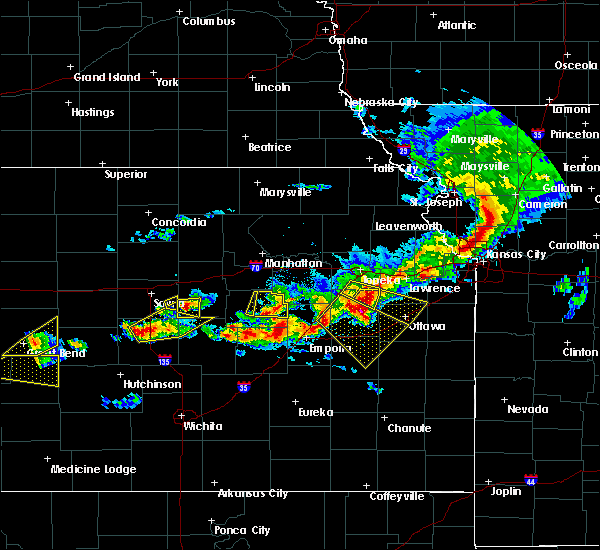 At 707 pm cdt, a severe thunderstorm was located near carlton, moving east at 25 mph (radar indicated). Hazards include 60 mph wind gusts and half dollar size hail. Hail damage to vehicles is expected. expect wind damage to roofs, siding, and trees. Locations impacted include, carlton. At 707 pm cdt, a severe thunderstorm was located near carlton, moving east at 25 mph (radar indicated). Hazards include 60 mph wind gusts and half dollar size hail. Hail damage to vehicles is expected. expect wind damage to roofs, siding, and trees. Locations impacted include, carlton.
|
| 5/6/2019 7:08 PM CDT |
 At 707 pm cdt, a severe thunderstorm was located near carlton, moving east at 25 mph (radar indicated). Hazards include 60 mph wind gusts and half dollar size hail. Hail damage to vehicles is expected. expect wind damage to roofs, siding, and trees. Locations impacted include, carlton. At 707 pm cdt, a severe thunderstorm was located near carlton, moving east at 25 mph (radar indicated). Hazards include 60 mph wind gusts and half dollar size hail. Hail damage to vehicles is expected. expect wind damage to roofs, siding, and trees. Locations impacted include, carlton.
|
| 5/6/2019 6:57 PM CDT |
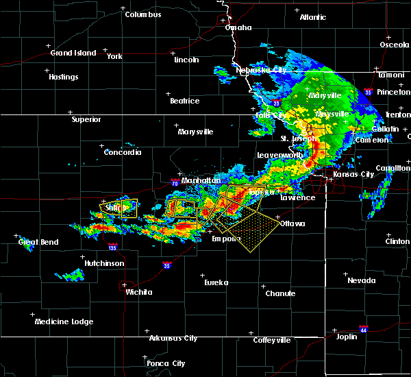 At 657 pm cdt, a severe thunderstorm was located near gypsum, moving east at 25 mph (radar indicated). Hazards include 60 mph wind gusts and half dollar size hail. Hail damage to vehicles is expected. expect wind damage to roofs, siding, and trees. Locations impacted include, carlton. At 657 pm cdt, a severe thunderstorm was located near gypsum, moving east at 25 mph (radar indicated). Hazards include 60 mph wind gusts and half dollar size hail. Hail damage to vehicles is expected. expect wind damage to roofs, siding, and trees. Locations impacted include, carlton.
|
| 5/6/2019 6:46 PM CDT |
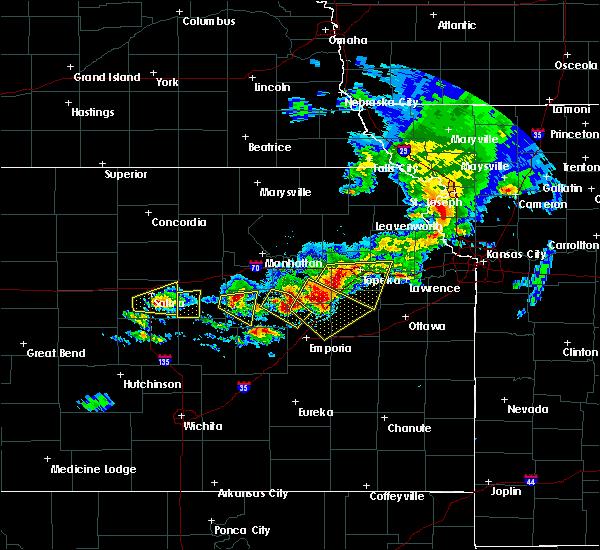 At 645 pm cdt, a severe thunderstorm was located 4 miles northwest of gypsum, moving east at 25 mph (radar indicated). Hazards include ping pong ball size hail and 60 mph wind gusts. People and animals outdoors will be injured. expect hail damage to roofs, siding, windows, and vehicles. expect wind damage to roofs, siding, and trees. Locations impacted include, carlton. At 645 pm cdt, a severe thunderstorm was located 4 miles northwest of gypsum, moving east at 25 mph (radar indicated). Hazards include ping pong ball size hail and 60 mph wind gusts. People and animals outdoors will be injured. expect hail damage to roofs, siding, windows, and vehicles. expect wind damage to roofs, siding, and trees. Locations impacted include, carlton.
|
| 5/6/2019 6:33 PM CDT |
 At 632 pm cdt, a severe thunderstorm was located near assaria, moving east at 25 mph (radar indicated). Hazards include ping pong ball size hail and 60 mph wind gusts. People and animals outdoors will be injured. expect hail damage to roofs, siding, windows, and vehicles. Expect wind damage to roofs, siding, and trees. At 632 pm cdt, a severe thunderstorm was located near assaria, moving east at 25 mph (radar indicated). Hazards include ping pong ball size hail and 60 mph wind gusts. People and animals outdoors will be injured. expect hail damage to roofs, siding, windows, and vehicles. Expect wind damage to roofs, siding, and trees.
|
| 5/6/2019 5:56 PM CDT |
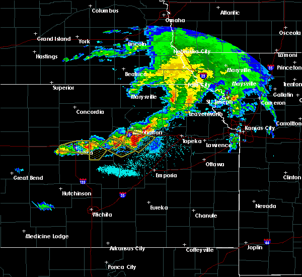 At 556 pm cdt, a severe thunderstorm was located 6 miles north of carlton, moving east at 30 mph (radar indicated). Hazards include golf ball size hail and 60 mph wind gusts. People and animals outdoors will be injured. expect hail damage to roofs, siding, windows, and vehicles. expect wind damage to roofs, siding, and trees. locations impacted include, solomon and carlton. This includes interstate 70 between mile markers 267 and 271. At 556 pm cdt, a severe thunderstorm was located 6 miles north of carlton, moving east at 30 mph (radar indicated). Hazards include golf ball size hail and 60 mph wind gusts. People and animals outdoors will be injured. expect hail damage to roofs, siding, windows, and vehicles. expect wind damage to roofs, siding, and trees. locations impacted include, solomon and carlton. This includes interstate 70 between mile markers 267 and 271.
|
| 5/6/2019 5:41 PM CDT |
 At 541 pm cdt, a severe thunderstorm was located 4 miles southeast of new cambria, moving east at 25 mph (radar indicated). Hazards include two inch hail and 60 mph wind gusts. People and animals outdoors will be injured. expect hail damage to roofs, siding, windows, and vehicles. expect wind damage to roofs, siding, and trees. locations impacted include, solomon and carlton. This includes interstate 70 between mile markers 267 and 271. At 541 pm cdt, a severe thunderstorm was located 4 miles southeast of new cambria, moving east at 25 mph (radar indicated). Hazards include two inch hail and 60 mph wind gusts. People and animals outdoors will be injured. expect hail damage to roofs, siding, windows, and vehicles. expect wind damage to roofs, siding, and trees. locations impacted include, solomon and carlton. This includes interstate 70 between mile markers 267 and 271.
|
| 5/6/2019 5:40 PM CDT |
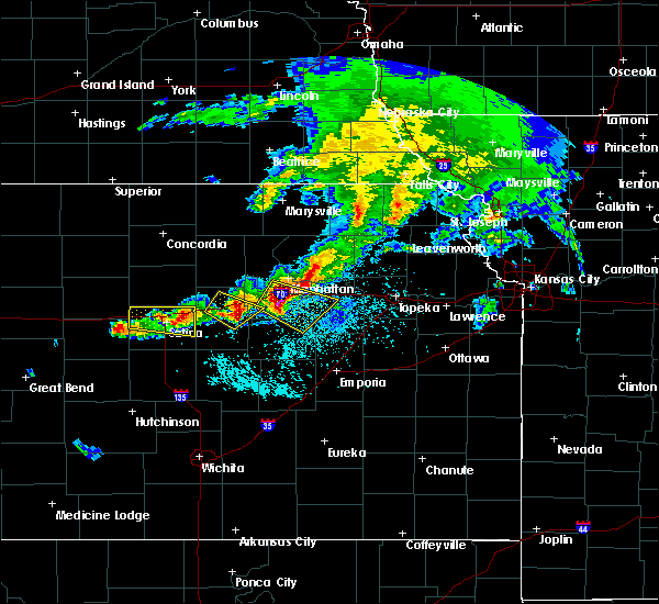 At 540 pm cdt, a severe thunderstorm was located 4 miles south of new cambria, moving east at 25 mph (radar indicated). Hazards include ping pong ball size hail and 60 mph wind gusts. People and animals outdoors will be injured. expect hail damage to roofs, siding, windows, and vehicles. expect wind damage to roofs, siding, and trees. locations impacted include, solomon and carlton. This includes interstate 70 between mile markers 267 and 271. At 540 pm cdt, a severe thunderstorm was located 4 miles south of new cambria, moving east at 25 mph (radar indicated). Hazards include ping pong ball size hail and 60 mph wind gusts. People and animals outdoors will be injured. expect hail damage to roofs, siding, windows, and vehicles. expect wind damage to roofs, siding, and trees. locations impacted include, solomon and carlton. This includes interstate 70 between mile markers 267 and 271.
|
| 5/6/2019 5:36 PM CDT |
 At 535 pm cdt, a severe thunderstorm was located 5 miles east of salina, moving southeast at 25 mph (radar indicated). Hazards include 60 mph wind gusts and half dollar size hail. Hail damage to vehicles is expected. Expect wind damage to roofs, siding, and trees. At 535 pm cdt, a severe thunderstorm was located 5 miles east of salina, moving southeast at 25 mph (radar indicated). Hazards include 60 mph wind gusts and half dollar size hail. Hail damage to vehicles is expected. Expect wind damage to roofs, siding, and trees.
|
| 9/20/2018 8:36 PM CDT |
 At 815 pm cdt, severe thunderstorms were located along a line extending from near leonardville to 4 miles northeast of gypsum, moving east at 30 mph (radar indicated). Hazards include 60 mph wind gusts. Expect damage to roofs, siding, and trees. locations impacted include, abilene, clay center, herington, chapman, solomon, wakefield, enterprise, hope, woodbine, manchester, longford, carlton, oak hill, talmage, idana and moonlight. This includes interstate 70 between mile markers 267 and 289. At 815 pm cdt, severe thunderstorms were located along a line extending from near leonardville to 4 miles northeast of gypsum, moving east at 30 mph (radar indicated). Hazards include 60 mph wind gusts. Expect damage to roofs, siding, and trees. locations impacted include, abilene, clay center, herington, chapman, solomon, wakefield, enterprise, hope, woodbine, manchester, longford, carlton, oak hill, talmage, idana and moonlight. This includes interstate 70 between mile markers 267 and 289.
|
| 9/20/2018 8:15 PM CDT |
 At 815 pm cdt, severe thunderstorms were located along a line extending from near leonardville to 4 miles northeast of gypsum, moving east at 30 mph (radar indicated). Hazards include 60 mph wind gusts. Expect damage to roofs, siding, and trees. locations impacted include, abilene, clay center, herington, chapman, solomon, wakefield, enterprise, hope, woodbine, manchester, longford, carlton, oak hill, talmage, idana and moonlight. This includes interstate 70 between mile markers 267 and 289. At 815 pm cdt, severe thunderstorms were located along a line extending from near leonardville to 4 miles northeast of gypsum, moving east at 30 mph (radar indicated). Hazards include 60 mph wind gusts. Expect damage to roofs, siding, and trees. locations impacted include, abilene, clay center, herington, chapman, solomon, wakefield, enterprise, hope, woodbine, manchester, longford, carlton, oak hill, talmage, idana and moonlight. This includes interstate 70 between mile markers 267 and 289.
|
| 9/20/2018 7:52 PM CDT |
 The national weather service in topeka has issued a * severe thunderstorm warning for. dickinson county in central kansas. clay county in north central kansas. until 845 pm cdt. At 751 pm cdt, severe thunderstorms were located along a line. The national weather service in topeka has issued a * severe thunderstorm warning for. dickinson county in central kansas. clay county in north central kansas. until 845 pm cdt. At 751 pm cdt, severe thunderstorms were located along a line.
|
| 7/19/2018 1:58 PM CDT |
 At 158 pm cdt, severe thunderstorms were located along a line extending from 4 miles south of clay center to 7 miles southwest of wakefield to 5 miles northwest of hope, moving east at 30 mph (radar indicated). Hazards include 60 mph wind gusts and quarter size hail. Hail damage to vehicles is expected. expect wind damage to roofs, siding, and trees. locations impacted include, abilene, herington, chapman, solomon, wakefield, enterprise, hope, woodbine, manchester, longford, carlton, oak hill, talmage and moonlight. This includes interstate 70 between mile markers 267 and 289. At 158 pm cdt, severe thunderstorms were located along a line extending from 4 miles south of clay center to 7 miles southwest of wakefield to 5 miles northwest of hope, moving east at 30 mph (radar indicated). Hazards include 60 mph wind gusts and quarter size hail. Hail damage to vehicles is expected. expect wind damage to roofs, siding, and trees. locations impacted include, abilene, herington, chapman, solomon, wakefield, enterprise, hope, woodbine, manchester, longford, carlton, oak hill, talmage and moonlight. This includes interstate 70 between mile markers 267 and 289.
|
| 7/19/2018 1:31 PM CDT |
 At 131 pm cdt, severe thunderstorms were located along a line extending from 3 miles southeast of miltonvale to 3 miles southwest of longford to near gypsum, moving east at 30 mph (trained weather spotters. these storms have a history of producing damaging winds). Hazards include 70 mph wind gusts and quarter size hail. Hail damage to vehicles is expected. expect considerable tree damage. wind damage is also likely to mobile homes, roofs, and outbuildings. locations impacted include, abilene, herington, chapman, solomon, wakefield, enterprise, hope, woodbine, manchester, longford, carlton, oak hill, talmage and moonlight. This includes interstate 70 between mile markers 267 and 289. At 131 pm cdt, severe thunderstorms were located along a line extending from 3 miles southeast of miltonvale to 3 miles southwest of longford to near gypsum, moving east at 30 mph (trained weather spotters. these storms have a history of producing damaging winds). Hazards include 70 mph wind gusts and quarter size hail. Hail damage to vehicles is expected. expect considerable tree damage. wind damage is also likely to mobile homes, roofs, and outbuildings. locations impacted include, abilene, herington, chapman, solomon, wakefield, enterprise, hope, woodbine, manchester, longford, carlton, oak hill, talmage and moonlight. This includes interstate 70 between mile markers 267 and 289.
|
| 7/19/2018 1:18 PM CDT |
 At 118 pm cdt, severe thunderstorms were located along a line extending from 4 miles southwest of miltonvale to near wells to 5 miles northeast of assaria, moving east at 30 mph (radar indicated). Hazards include 70 mph wind gusts and nickel size hail. Expect considerable tree damage. Damage is likely to mobile homes, roofs, and outbuildings. At 118 pm cdt, severe thunderstorms were located along a line extending from 4 miles southwest of miltonvale to near wells to 5 miles northeast of assaria, moving east at 30 mph (radar indicated). Hazards include 70 mph wind gusts and nickel size hail. Expect considerable tree damage. Damage is likely to mobile homes, roofs, and outbuildings.
|
| 6/18/2018 7:37 PM CDT |
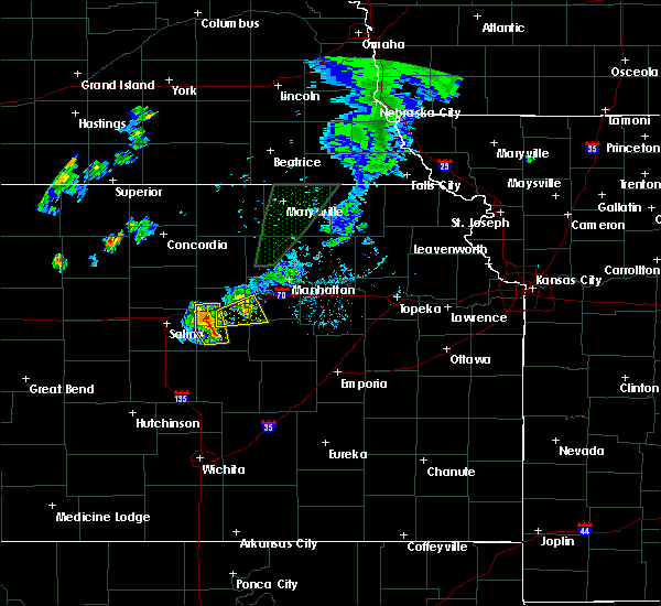 At 737 pm cdt, severe thunderstorms were located along a line extending from 3 miles southwest of talmage to 6 miles northwest of hope, moving northeast at 20 mph (radar indicated). Hazards include 60 mph wind gusts. Expect damage to roofs, siding, and trees. locations impacted include, abilene, solomon and carlton. This includes interstate 70 between mile markers 267 and 278. At 737 pm cdt, severe thunderstorms were located along a line extending from 3 miles southwest of talmage to 6 miles northwest of hope, moving northeast at 20 mph (radar indicated). Hazards include 60 mph wind gusts. Expect damage to roofs, siding, and trees. locations impacted include, abilene, solomon and carlton. This includes interstate 70 between mile markers 267 and 278.
|
| 6/18/2018 7:11 PM CDT |
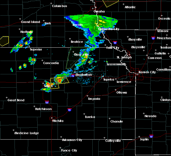 At 711 pm cdt, a severe thunderstorm was located 6 miles northeast of gypsum, moving northeast at 25 mph (radar indicated). Hazards include 60 mph wind gusts. expect damage to roofs, siding, and trees At 711 pm cdt, a severe thunderstorm was located 6 miles northeast of gypsum, moving northeast at 25 mph (radar indicated). Hazards include 60 mph wind gusts. expect damage to roofs, siding, and trees
|
| 5/29/2018 8:43 PM CDT |
 At 800 pm cdt, a severe thunderstorm was located 5 miles northeast of gypsum, moving northeast at 40 mph (radar indicated). Hazards include 60 mph wind gusts and nickel size hail. expect damage to roofs, siding, and trees At 800 pm cdt, a severe thunderstorm was located 5 miles northeast of gypsum, moving northeast at 40 mph (radar indicated). Hazards include 60 mph wind gusts and nickel size hail. expect damage to roofs, siding, and trees
|
| 5/29/2018 8:01 PM CDT |
 At 800 pm cdt, a severe thunderstorm was located 5 miles northeast of gypsum, moving northeast at 40 mph (radar indicated). Hazards include 60 mph wind gusts and nickel size hail. expect damage to roofs, siding, and trees At 800 pm cdt, a severe thunderstorm was located 5 miles northeast of gypsum, moving northeast at 40 mph (radar indicated). Hazards include 60 mph wind gusts and nickel size hail. expect damage to roofs, siding, and trees
|
| 5/14/2018 12:01 AM CDT |
 At 1156 pm cdt, severe thunderstorms were located along a line extending from 6 miles north of wells to near new cambria to near lindsborg, moving east at 45 mph (radar indicated). Hazards include 70 mph wind gusts and nickel size hail. Expect considerable tree damage. Damage is likely to mobile homes, roofs, and outbuildings. At 1156 pm cdt, severe thunderstorms were located along a line extending from 6 miles north of wells to near new cambria to near lindsborg, moving east at 45 mph (radar indicated). Hazards include 70 mph wind gusts and nickel size hail. Expect considerable tree damage. Damage is likely to mobile homes, roofs, and outbuildings.
|
| 5/13/2018 11:56 PM CDT |
 At 1156 pm cdt, severe thunderstorms were located along a line extending from 6 miles north of wells to near new cambria to near lindsborg, moving east at 45 mph (radar indicated). Hazards include 70 mph wind gusts and nickel size hail. Expect considerable tree damage. Damage is likely to mobile homes, roofs, and outbuildings. At 1156 pm cdt, severe thunderstorms were located along a line extending from 6 miles north of wells to near new cambria to near lindsborg, moving east at 45 mph (radar indicated). Hazards include 70 mph wind gusts and nickel size hail. Expect considerable tree damage. Damage is likely to mobile homes, roofs, and outbuildings.
|
| 9/16/2017 7:27 PM CDT |
 At 727 pm cdt, a severe thunderstorm was located 7 miles south of carlton, moving east at 20 mph (radar indicated). Hazards include 60 mph wind gusts and quarter size hail. Hail damage to vehicles is expected. expect wind damage to roofs, siding, and trees. Locations impacted include, hope and carlton. At 727 pm cdt, a severe thunderstorm was located 7 miles south of carlton, moving east at 20 mph (radar indicated). Hazards include 60 mph wind gusts and quarter size hail. Hail damage to vehicles is expected. expect wind damage to roofs, siding, and trees. Locations impacted include, hope and carlton.
|
| 9/16/2017 7:19 PM CDT |
 At 719 pm cdt, a severe thunderstorm was located 7 miles southwest of carlton, moving northeast at 30 mph (radar indicated). Hazards include 60 mph wind gusts and quarter size hail. Hail damage to vehicles is expected. expect wind damage to roofs, siding, and trees. Locations impacted include, hope and carlton. At 719 pm cdt, a severe thunderstorm was located 7 miles southwest of carlton, moving northeast at 30 mph (radar indicated). Hazards include 60 mph wind gusts and quarter size hail. Hail damage to vehicles is expected. expect wind damage to roofs, siding, and trees. Locations impacted include, hope and carlton.
|
| 9/16/2017 7:03 PM CDT |
 At 703 pm cdt, a severe thunderstorm was located 8 miles southeast of assaria, moving northeast at 20 mph (radar indicated). Hazards include 60 mph wind gusts and half dollar size hail. Hail damage to vehicles is expected. Expect wind damage to roofs, siding, and trees. At 703 pm cdt, a severe thunderstorm was located 8 miles southeast of assaria, moving northeast at 20 mph (radar indicated). Hazards include 60 mph wind gusts and half dollar size hail. Hail damage to vehicles is expected. Expect wind damage to roofs, siding, and trees.
|
| 6/29/2017 7:31 PM CDT |
 At 1230 am cdt, severe thunderstorms were located along a line extending from near niles to near carlton, moving east at 45 mph (radar indicated. a wind gust of 68 mph was measured at salina from this storm shortly after midnight). Hazards include 60 mph wind gusts and quarter size hail. Hail damage to vehicles is expected. expect wind damage to roofs, siding, and trees. these severe storms will be near, abilene around 1240 am cdt. talmage and moonlight around 1245 am cdt. This includes interstate 70 between mile markers 267 and 288. At 1230 am cdt, severe thunderstorms were located along a line extending from near niles to near carlton, moving east at 45 mph (radar indicated. a wind gust of 68 mph was measured at salina from this storm shortly after midnight). Hazards include 60 mph wind gusts and quarter size hail. Hail damage to vehicles is expected. expect wind damage to roofs, siding, and trees. these severe storms will be near, abilene around 1240 am cdt. talmage and moonlight around 1245 am cdt. This includes interstate 70 between mile markers 267 and 288.
|
| 6/29/2017 7:12 PM CDT |
 At 1211 am cdt, severe thunderstorms were located along a line extending from near bennington to 3 miles east of assaria, moving east at 45 mph (automated surface observation site. a gust of 64 mph was measured at salina). Hazards include 60 mph wind gusts. Expect damage to roofs, siding, and trees. severe thunderstorms will be near, niles around 1220 am cdt. carlton around 1230 am cdt. talmage around 1235 am cdt. moonlight around 1245 am cdt. This includes interstate 70 between mile markers 267 and 288. At 1211 am cdt, severe thunderstorms were located along a line extending from near bennington to 3 miles east of assaria, moving east at 45 mph (automated surface observation site. a gust of 64 mph was measured at salina). Hazards include 60 mph wind gusts. Expect damage to roofs, siding, and trees. severe thunderstorms will be near, niles around 1220 am cdt. carlton around 1230 am cdt. talmage around 1235 am cdt. moonlight around 1245 am cdt. This includes interstate 70 between mile markers 267 and 288.
|
| 6/15/2017 5:45 PM CDT |
 At 545 pm cdt, severe thunderstorms were located along a line extending from 7 miles south of clay center to near moonlight to 5 miles west of tampa, moving west at 25 mph. these are very dangerous storms (radar indicated). Hazards include 80 mph wind gusts and golf ball size hail. Flying debris will be dangerous to those caught without shelter. mobile homes will be heavily damaged. expect considerable damage to roofs, windows, and vehicles. Extensive tree damage and power outages are likely. At 545 pm cdt, severe thunderstorms were located along a line extending from 7 miles south of clay center to near moonlight to 5 miles west of tampa, moving west at 25 mph. these are very dangerous storms (radar indicated). Hazards include 80 mph wind gusts and golf ball size hail. Flying debris will be dangerous to those caught without shelter. mobile homes will be heavily damaged. expect considerable damage to roofs, windows, and vehicles. Extensive tree damage and power outages are likely.
|
| 6/15/2017 5:33 PM CDT |
 At 532 pm cdt, a severe thunderstorm was located over carlton, moving east at 60 mph. this is a very dangerous storm (trained weather spotters reported a 70 mph wind gust 2 miles north of lindsborg at 530 pm). Hazards include 90 mph wind gusts and quarter size hail. You are in a life-threatening situation. flying debris may be deadly to those caught without shelter. mobile homes will be heavily damaged or destroyed. homes and businesses will have substantial roof and window damage. expect extensive tree damage and power outages. this severe storm will be near, hope and woodbine around 545 pm cdt. This includes interstate 70 between mile markers 267 and 282. At 532 pm cdt, a severe thunderstorm was located over carlton, moving east at 60 mph. this is a very dangerous storm (trained weather spotters reported a 70 mph wind gust 2 miles north of lindsborg at 530 pm). Hazards include 90 mph wind gusts and quarter size hail. You are in a life-threatening situation. flying debris may be deadly to those caught without shelter. mobile homes will be heavily damaged or destroyed. homes and businesses will have substantial roof and window damage. expect extensive tree damage and power outages. this severe storm will be near, hope and woodbine around 545 pm cdt. This includes interstate 70 between mile markers 267 and 282.
|
| 6/15/2017 5:05 PM CDT |
 At 505 pm cdt, a severe thunderstorm was located 6 miles west of woodbine, moving east at 20 mph (radar indicated). Hazards include golf ball size hail and 60 mph wind gusts. People and animals outdoors will be injured. expect hail damage to roofs, siding, windows, and vehicles. expect wind damage to roofs, siding, and trees. locations impacted include, abilene, herington, chapman, solomon, enterprise, hope, woodbine, carlton and latimer. This includes interstate 70 between mile markers 267 and 283. At 505 pm cdt, a severe thunderstorm was located 6 miles west of woodbine, moving east at 20 mph (radar indicated). Hazards include golf ball size hail and 60 mph wind gusts. People and animals outdoors will be injured. expect hail damage to roofs, siding, windows, and vehicles. expect wind damage to roofs, siding, and trees. locations impacted include, abilene, herington, chapman, solomon, enterprise, hope, woodbine, carlton and latimer. This includes interstate 70 between mile markers 267 and 283.
|
| 6/15/2017 4:54 PM CDT |
 At 454 pm cdt, a severe thunderstorm was located 5 miles north of hope, moving east at 25 mph (radar indicated). Hazards include golf ball size hail and 60 mph wind gusts. People and animals outdoors will be injured. expect hail damage to roofs, siding, windows, and vehicles. Expect wind damage to roofs, siding, and trees. At 454 pm cdt, a severe thunderstorm was located 5 miles north of hope, moving east at 25 mph (radar indicated). Hazards include golf ball size hail and 60 mph wind gusts. People and animals outdoors will be injured. expect hail damage to roofs, siding, windows, and vehicles. Expect wind damage to roofs, siding, and trees.
|
| 10/6/2016 5:26 PM CDT |
 The severe thunderstorm warning for southeastern dickinson county will expire at 530 pm cdt, the storm which prompted the warning has weakened below severe limits, and no longer pose an immediate threat to life or property. therefore the warning will be allowed to expire. however small. The severe thunderstorm warning for southeastern dickinson county will expire at 530 pm cdt, the storm which prompted the warning has weakened below severe limits, and no longer pose an immediate threat to life or property. therefore the warning will be allowed to expire. however small.
|
| 10/6/2016 5:11 PM CDT |
 At 511 pm cdt, a severe thunderstorm was located 5 miles south of abilene, moving northeast at 20 mph (radar indicated). Hazards include 60 mph wind gusts and half dollar size hail. Hail damage to vehicles is expected. expect wind damage to roofs, siding, and trees. locations impacted include, chapman, enterprise, hope, woodbine and carlton. this includes interstate 70 between mile markers 280 and 286. A tornado watch remains in effect until 900 pm cdt for central kansas. At 511 pm cdt, a severe thunderstorm was located 5 miles south of abilene, moving northeast at 20 mph (radar indicated). Hazards include 60 mph wind gusts and half dollar size hail. Hail damage to vehicles is expected. expect wind damage to roofs, siding, and trees. locations impacted include, chapman, enterprise, hope, woodbine and carlton. this includes interstate 70 between mile markers 280 and 286. A tornado watch remains in effect until 900 pm cdt for central kansas.
|
| 10/6/2016 4:43 PM CDT |
 At 443 pm cdt, a severe thunderstorm was located 5 miles northwest of carlton, moving northeast at 20 mph (radar indicated). Hazards include 60 mph wind gusts and quarter size hail. Hail damage to vehicles is expected. Expect wind damage to roofs, siding, and trees. At 443 pm cdt, a severe thunderstorm was located 5 miles northwest of carlton, moving northeast at 20 mph (radar indicated). Hazards include 60 mph wind gusts and quarter size hail. Hail damage to vehicles is expected. Expect wind damage to roofs, siding, and trees.
|
| 7/28/2016 7:57 PM CDT |
 The severe thunderstorm warning for western morris, geary, eastern clay, riley, southeastern dickinson and western pottawatomie counties will expire at 800 pm cdt, the storms which prompted the warning have weakened below severe limits, and no longer pose an immediate threat to life or property. therefore the warning will be allowed to expire. however small hail, gusty winds and heavy rain are still possible with these thunderstorms. a severe thunderstorm watch remains in effect until 1100 pm cdt for north central, northeastern, east central and central kansas. The severe thunderstorm warning for western morris, geary, eastern clay, riley, southeastern dickinson and western pottawatomie counties will expire at 800 pm cdt, the storms which prompted the warning have weakened below severe limits, and no longer pose an immediate threat to life or property. therefore the warning will be allowed to expire. however small hail, gusty winds and heavy rain are still possible with these thunderstorms. a severe thunderstorm watch remains in effect until 1100 pm cdt for north central, northeastern, east central and central kansas.
|
| 7/28/2016 7:45 PM CDT |
 At 744 pm cdt, severe thunderstorms were located along a line extending from near randolph to 8 miles north of dwight to herington, moving east at 45 mph (radar indicated). Hazards include 60 mph wind gusts. Expect damage to roofs. siding. and trees. locations impacted include, manhattan, junction city, herington, ogden, grandview plaza, chapman, riley, enterprise, white city, milford, leonardville, hope, dwight, olsburg, woodbine, randolph, green, parkerville, carlton and latimer. This includes interstate 70 between mile markers 282 and 316. At 744 pm cdt, severe thunderstorms were located along a line extending from near randolph to 8 miles north of dwight to herington, moving east at 45 mph (radar indicated). Hazards include 60 mph wind gusts. Expect damage to roofs. siding. and trees. locations impacted include, manhattan, junction city, herington, ogden, grandview plaza, chapman, riley, enterprise, white city, milford, leonardville, hope, dwight, olsburg, woodbine, randolph, green, parkerville, carlton and latimer. This includes interstate 70 between mile markers 282 and 316.
|
| 7/28/2016 7:34 PM CDT |
 At 731 pm cdt, severe thunderstorms were located along a line extending from 7 miles northwest of randolph to junction city to near carlton, moving southeast at 40 mph (trained weather spotters estimated wind gusts of 60 mph on the northwest side of junction city). Hazards include 60 mph wind gusts. Expect damage to roofs. siding. and trees. locations impacted include, manhattan, junction city, abilene, herington, ogden, grandview plaza, chapman, wakefield, riley, enterprise, white city, milford, leonardville, hope, dwight, olsburg, woodbine, randolph, green and parkerville. This includes interstate 70 between mile markers 273 and 316. At 731 pm cdt, severe thunderstorms were located along a line extending from 7 miles northwest of randolph to junction city to near carlton, moving southeast at 40 mph (trained weather spotters estimated wind gusts of 60 mph on the northwest side of junction city). Hazards include 60 mph wind gusts. Expect damage to roofs. siding. and trees. locations impacted include, manhattan, junction city, abilene, herington, ogden, grandview plaza, chapman, wakefield, riley, enterprise, white city, milford, leonardville, hope, dwight, olsburg, woodbine, randolph, green and parkerville. This includes interstate 70 between mile markers 273 and 316.
|
| 7/28/2016 7:28 PM CDT |
 At 727 pm cdt, severe thunderstorms were located along a line extending from 8 miles northwest of randolph to junction city to near carlton, moving southeast at 35 mph (radar indicated). Hazards include 60 mph wind gusts and penny size hail. Expect damage to roofs. siding. and trees. locations impacted include, manhattan, junction city, abilene, herington, ogden, grandview plaza, chapman, wakefield, riley, enterprise, white city, milford, leonardville, hope, dwight, olsburg, woodbine, randolph, green and parkerville. This includes interstate 70 between mile markers 273 and 316. At 727 pm cdt, severe thunderstorms were located along a line extending from 8 miles northwest of randolph to junction city to near carlton, moving southeast at 35 mph (radar indicated). Hazards include 60 mph wind gusts and penny size hail. Expect damage to roofs. siding. and trees. locations impacted include, manhattan, junction city, abilene, herington, ogden, grandview plaza, chapman, wakefield, riley, enterprise, white city, milford, leonardville, hope, dwight, olsburg, woodbine, randolph, green and parkerville. This includes interstate 70 between mile markers 273 and 316.
|
| 7/28/2016 7:19 PM CDT |
 At 719 pm cdt, severe thunderstorms were located along a line extending from 8 miles north of green to near junction city to near carlton, moving southeast at 35 mph (radar indicated). Hazards include 60 mph wind gusts and penny size hail. Expect damage to roofs. siding. And trees. At 719 pm cdt, severe thunderstorms were located along a line extending from 8 miles north of green to near junction city to near carlton, moving southeast at 35 mph (radar indicated). Hazards include 60 mph wind gusts and penny size hail. Expect damage to roofs. siding. And trees.
|
| 7/13/2016 8:04 AM CDT |
 At 803 am cdt, severe thunderstorms were located along a line extending from near clay center to near wakefield to tampa, moving east at 50 mph (trained weather spotters estimated 60 mph wind gusts 1 mile south of longford). Hazards include 60 mph wind gusts. Expect damage to roofs. siding. and trees. locations impacted include, abilene, herington, chapman, wakefield, enterprise, bennington, hope, woodbine, wells, manchester, longford, carlton, oak hill, moonlight, niles and talmage. This includes interstate 70 between mile markers 268 and 289. At 803 am cdt, severe thunderstorms were located along a line extending from near clay center to near wakefield to tampa, moving east at 50 mph (trained weather spotters estimated 60 mph wind gusts 1 mile south of longford). Hazards include 60 mph wind gusts. Expect damage to roofs. siding. and trees. locations impacted include, abilene, herington, chapman, wakefield, enterprise, bennington, hope, woodbine, wells, manchester, longford, carlton, oak hill, moonlight, niles and talmage. This includes interstate 70 between mile markers 268 and 289.
|
| 7/13/2016 7:51 AM CDT |
 At 750 am cdt, severe thunderstorms were located along a line extending from near miltonvale to near solomon to 10 miles north of canton, moving east at 45 mph (radar indicated). Hazards include ping pong ball size hail and 60 mph wind gusts. People and animals outdoors will be injured. expect hail damage to roofs, siding, windows, and vehicles. expect wind damage to roofs, siding, and trees. locations impacted include, abilene, herington, chapman, wakefield, enterprise, bennington, hope, woodbine, wells, manchester, longford, carlton, oak hill, moonlight, niles and talmage. This includes interstate 70 between mile markers 268 and 289. At 750 am cdt, severe thunderstorms were located along a line extending from near miltonvale to near solomon to 10 miles north of canton, moving east at 45 mph (radar indicated). Hazards include ping pong ball size hail and 60 mph wind gusts. People and animals outdoors will be injured. expect hail damage to roofs, siding, windows, and vehicles. expect wind damage to roofs, siding, and trees. locations impacted include, abilene, herington, chapman, wakefield, enterprise, bennington, hope, woodbine, wells, manchester, longford, carlton, oak hill, moonlight, niles and talmage. This includes interstate 70 between mile markers 268 and 289.
|
| 7/13/2016 7:42 AM CDT |
 At 741 am cdt, severe thunderstorms were located along a line extending from 5 miles southwest of miltonvale to niles to 8 miles southeast of lindsborg, moving east at 50 mph (radar indicated). Hazards include 60 mph wind gusts and penny size hail. Expect damage to roofs. siding. And trees. At 741 am cdt, severe thunderstorms were located along a line extending from 5 miles southwest of miltonvale to niles to 8 miles southeast of lindsborg, moving east at 50 mph (radar indicated). Hazards include 60 mph wind gusts and penny size hail. Expect damage to roofs. siding. And trees.
|
| 7/6/2016 2:35 AM CDT |
 The severe thunderstorm warning for dickinson county will expire at 245 am cdt, the storm which prompted the warning has weakened below severe limits, and has exited the warned area. therefore the warning will be allowed to expire. a severe thunderstorm watch remains in effect until 900 am cdt for east central and central kansas. The severe thunderstorm warning for dickinson county will expire at 245 am cdt, the storm which prompted the warning has weakened below severe limits, and has exited the warned area. therefore the warning will be allowed to expire. a severe thunderstorm watch remains in effect until 900 am cdt for east central and central kansas.
|
| 7/6/2016 2:13 AM CDT |
 At 213 am cdt, a severe thunderstorm was located 6 miles southeast of new cambria, moving east at 20 mph (radar indicated). Hazards include 70 mph wind gusts and quarter size hail. Hail damage to vehicles is expected. expect considerable tree damage. Wind damage is also likely to mobile homes, roofs, and outbuildings. At 213 am cdt, a severe thunderstorm was located 6 miles southeast of new cambria, moving east at 20 mph (radar indicated). Hazards include 70 mph wind gusts and quarter size hail. Hail damage to vehicles is expected. expect considerable tree damage. Wind damage is also likely to mobile homes, roofs, and outbuildings.
|
| 6/15/2016 6:49 PM CDT |
 At 647 pm cdt, severe thunderstorms were located along a line extending from near manchester to near hope, moving northeast at 25 mph (law enforcement. at 645 pm, the sheriff reported some wind damage in enterprise with power lines down). Hazards include 60 mph wind gusts and quarter size hail. Hail damage to vehicles is expected. expect wind damage to roofs, siding, and trees. locations impacted include, abilene, herington, solomon, enterprise, hope, woodbine, manchester, carlton, niles and talmage. This includes interstate 70 between mile markers 267 and 281. At 647 pm cdt, severe thunderstorms were located along a line extending from near manchester to near hope, moving northeast at 25 mph (law enforcement. at 645 pm, the sheriff reported some wind damage in enterprise with power lines down). Hazards include 60 mph wind gusts and quarter size hail. Hail damage to vehicles is expected. expect wind damage to roofs, siding, and trees. locations impacted include, abilene, herington, solomon, enterprise, hope, woodbine, manchester, carlton, niles and talmage. This includes interstate 70 between mile markers 267 and 281.
|
| 6/15/2016 6:20 PM CDT |
 At 620 pm cdt, severe thunderstorms were located along a line extending from near niles to near carlton, moving northeast at 25 mph (radar indicated). Hazards include ping pong ball size hail and 60 mph wind gusts. People and animals outdoors will be injured. expect hail damage to roofs, siding, windows, and vehicles. expect wind damage to roofs, siding, and trees. locations impacted include, abilene, herington, solomon, enterprise, hope, woodbine, manchester, carlton, niles and talmage. This includes interstate 70 between mile markers 267 and 281. At 620 pm cdt, severe thunderstorms were located along a line extending from near niles to near carlton, moving northeast at 25 mph (radar indicated). Hazards include ping pong ball size hail and 60 mph wind gusts. People and animals outdoors will be injured. expect hail damage to roofs, siding, windows, and vehicles. expect wind damage to roofs, siding, and trees. locations impacted include, abilene, herington, solomon, enterprise, hope, woodbine, manchester, carlton, niles and talmage. This includes interstate 70 between mile markers 267 and 281.
|
| 6/15/2016 6:08 PM CDT |
 At 608 pm cdt, severe thunderstorms were located along a line extending from 5 miles northwest of new cambria to 6 miles south of carlton, moving northeast at 25 mph (radar indicated). Hazards include 60 mph wind gusts and quarter size hail. Hail damage to vehicles is expected. Expect wind damage to roofs, siding, and trees. At 608 pm cdt, severe thunderstorms were located along a line extending from 5 miles northwest of new cambria to 6 miles south of carlton, moving northeast at 25 mph (radar indicated). Hazards include 60 mph wind gusts and quarter size hail. Hail damage to vehicles is expected. Expect wind damage to roofs, siding, and trees.
|
| 5/26/2016 5:24 PM CDT |
 At 523 pm cdt, a severe thunderstorm was located near hope, moving north at 45 mph (radar indicated). Hazards include two inch hail and 60 mph wind gusts. People and animals outdoors will be injured. expect hail damage to roofs, siding, windows, and vehicles. expect wind damage to roofs, siding, and trees. locations impacted include, abilene, chapman, solomon, enterprise, hope and carlton. this includes interstate 70 between mile markers 267 and 285. A tornado watch remains in effect until 1000 pm cdt for east central kansas. At 523 pm cdt, a severe thunderstorm was located near hope, moving north at 45 mph (radar indicated). Hazards include two inch hail and 60 mph wind gusts. People and animals outdoors will be injured. expect hail damage to roofs, siding, windows, and vehicles. expect wind damage to roofs, siding, and trees. locations impacted include, abilene, chapman, solomon, enterprise, hope and carlton. this includes interstate 70 between mile markers 267 and 285. A tornado watch remains in effect until 1000 pm cdt for east central kansas.
|
| 5/26/2016 5:00 PM CDT |
 At 500 pm cdt, a severe thunderstorm was located near durham, moving northeast at 40 mph (radar indicated). Hazards include two inch hail and 60 mph wind gusts. People and animals outdoors will be injured. expect hail damage to roofs, siding, windows, and vehicles. Expect wind damage to roofs, siding, and trees. At 500 pm cdt, a severe thunderstorm was located near durham, moving northeast at 40 mph (radar indicated). Hazards include two inch hail and 60 mph wind gusts. People and animals outdoors will be injured. expect hail damage to roofs, siding, windows, and vehicles. Expect wind damage to roofs, siding, and trees.
|
| 5/24/2016 10:23 PM CDT | The national weather service in topeka has issued a * severe thunderstorm warning for. western geary county in east central kansas. southeastern clay county in north central kansas. dickinson county in central kansas. Until 1100 pm cdt. |
| 4/24/2016 9:22 PM CDT |
 At 921 pm cdt, a severe thunderstorm was located over carlton, moving east at 40 mph (radar indicated). Hazards include 60 mph wind gusts and nickel size hail. Expect damage to roofs. siding. And trees. At 921 pm cdt, a severe thunderstorm was located over carlton, moving east at 40 mph (radar indicated). Hazards include 60 mph wind gusts and nickel size hail. Expect damage to roofs. siding. And trees.
|
| 9/7/2015 6:06 PM CDT |
 The severe thunderstorm warning for dickinson county will expire at 615 pm cdt, the storm which prompted the warning has weakened below severe limits, and no longer pose an immediate threat to life or property. therefore the warning will be allowed to expire. however gusty winds near 50 mph and heavy rain are still possible with this thunderstorm. a severe thunderstorm watch remains in effect until 900 pm cdt for central kansas. The severe thunderstorm warning for dickinson county will expire at 615 pm cdt, the storm which prompted the warning has weakened below severe limits, and no longer pose an immediate threat to life or property. therefore the warning will be allowed to expire. however gusty winds near 50 mph and heavy rain are still possible with this thunderstorm. a severe thunderstorm watch remains in effect until 900 pm cdt for central kansas.
|
| 9/7/2015 5:54 PM CDT |
 At 554 pm cdt, a severe thunderstorm was located 6 miles northeast of gypsum, moving east at 30 mph (radar indicated). Hazards include 60 mph wind gusts and nickel size hail. Expect damage to roofs. siding and trees. locations impacted include, abilene, herington, solomon, enterprise, hope, woodbine and carlton. This includes interstate 70 between mile markers 267 and 280. At 554 pm cdt, a severe thunderstorm was located 6 miles northeast of gypsum, moving east at 30 mph (radar indicated). Hazards include 60 mph wind gusts and nickel size hail. Expect damage to roofs. siding and trees. locations impacted include, abilene, herington, solomon, enterprise, hope, woodbine and carlton. This includes interstate 70 between mile markers 267 and 280.
|
| 9/7/2015 5:29 PM CDT |
 At 528 pm cdt, a severe thunderstorm was located near gypsum, moving east at 35 mph (measured at the salina airport at 518 pm cdt). Hazards include 60 mph wind gusts and nickel size hail. Expect damage to roofs. Siding and trees. At 528 pm cdt, a severe thunderstorm was located near gypsum, moving east at 35 mph (measured at the salina airport at 518 pm cdt). Hazards include 60 mph wind gusts and nickel size hail. Expect damage to roofs. Siding and trees.
|
| 7/13/2015 5:57 PM CDT |
 At 556 pm cdt, a severe thunderstorm was located near hope, moving east at 20 mph (radar indicated). Hazards include two inch hail and 60 mph wind gusts. People and animals outdoors will be injured. expect hail damage to roofs, siding, windows and vehicles. expect wind damage to roofs, siding and trees. Locations impacted include, hope and carlton. At 556 pm cdt, a severe thunderstorm was located near hope, moving east at 20 mph (radar indicated). Hazards include two inch hail and 60 mph wind gusts. People and animals outdoors will be injured. expect hail damage to roofs, siding, windows and vehicles. expect wind damage to roofs, siding and trees. Locations impacted include, hope and carlton.
|
| 7/13/2015 5:47 PM CDT |
 A severe thunderstorm warning remains in effect until 615 pm cdt for southwestern dickinson county. at 547 pm cdt. a severe thunderstorm was located near carlton. moving east at 20 mph. hazard. two inch hail and 60 mph wind gusts. source. Radar indicated. A severe thunderstorm warning remains in effect until 615 pm cdt for southwestern dickinson county. at 547 pm cdt. a severe thunderstorm was located near carlton. moving east at 20 mph. hazard. two inch hail and 60 mph wind gusts. source. Radar indicated.
|
| 7/13/2015 5:24 PM CDT |
 At 524 pm cdt, a severe thunderstorm was located near gypsum, moving east at 20 mph (radar indicated). Hazards include 60 mph wind gusts and quarter size hail. Hail damage to vehicles is expected. Expect wind damage to roofs, siding and trees. At 524 pm cdt, a severe thunderstorm was located near gypsum, moving east at 20 mph (radar indicated). Hazards include 60 mph wind gusts and quarter size hail. Hail damage to vehicles is expected. Expect wind damage to roofs, siding and trees.
|
| 6/7/2015 7:37 PM CDT | At 735 pm cdt, a severe thunderstorm was located 7 miles north of gypsum, and moving southeast at 35 mph (radar indicated). Hazards include tennis ball size hail and 60 mph wind gusts. People and animals outdoors will be injured. expect hail damage to roofs, siding, windows and vehicles. expect wind damage to roofs, siding and trees. Locations impacted include, herington, carlton and hope. |
| 6/7/2015 7:28 PM CDT | At 725 pm cdt, a severe thunderstorm was located near new cambria, and moving southeast at 35 mph (radar indicated). Hazards include hen egg size hail and 60 mph wind gusts. People and animals outdoors will be injured. expect hail damage to roofs, siding, windows and vehicles. Expect wind damage to roofs, siding and trees. |
| 6/5/2015 1:28 AM CDT | At 125 am cdt, severe thunderstorms were located along a line extending from manchester to 5 miles north of woodbine, and moving south at 25 mph (radar indicated). Hazards include 60 mph wind gusts and penny size hail. Expect damage to roofs. siding and trees. locations impacted include, herington, solomon, woodbine, hope and carlton. This includes interstate 70 between mile markers 267 and 292. |
| 6/5/2015 1:04 AM CDT | At 101 am cdt, severe thunderstorms were located along a line extending from scottsville to 5 miles west of manchester to 5 miles northeast of chapman, and moving south at 25 mph (radar indicated). Hazards include 60 mph wind gusts and penny size hail. Expect damage to roofs. Siding and trees. |
| 5/25/2015 4:09 PM CDT | At 404 pm cdt, a severe thunderstorm was located near carlton, and moving north at 35 mph (trained weather spotters reported half dollar size hail 2 miles southwest of carlton with this storm). Hazards include 60 mph wind gusts and half dollar size hail. Hail damage to vehicles is expected. expect wind damage to roofs, siding and trees. Locations impacted include, mainly rural areas of western dickinson county. |
| 5/25/2015 4:03 PM CDT | At 402 pm cdt, a severe thunderstorm was located near carlton, and moving north at 35 mph (radar indicated). Hazards include 60 mph wind gusts and quarter size hail. Hail damage to vehicles is expected. Expect wind damage to roofs, siding and trees. |
| 5/7/2014 6:40 PM CDT | Trees reported down in dickinson county KS, 0.3 miles SSW of Carlton, KS |
| 5/7/2014 6:40 PM CDT | Trees reported down in dickinson county KS, 2.9 miles W of Carlton, KS |
Hail Maps for Carlton, KS


Connect with Interactive Hail Maps