

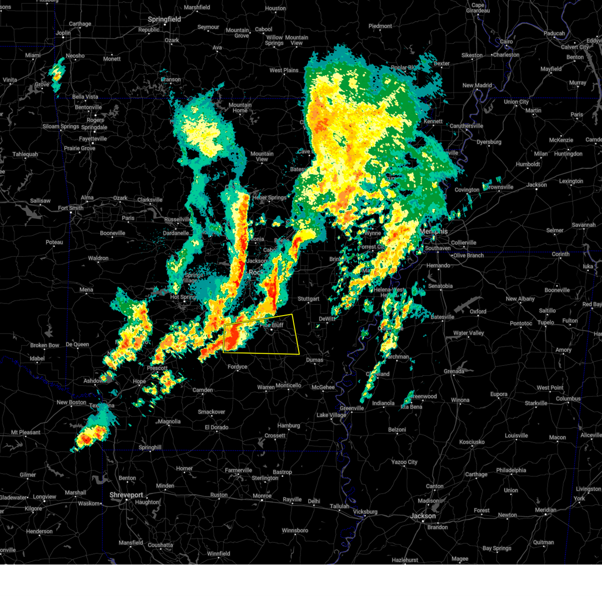
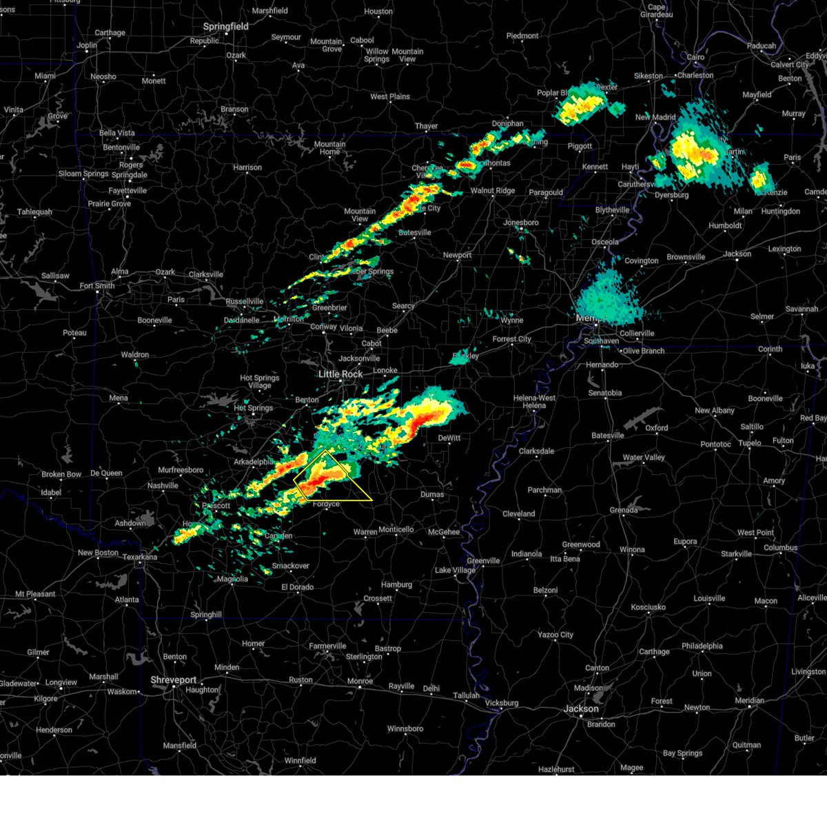
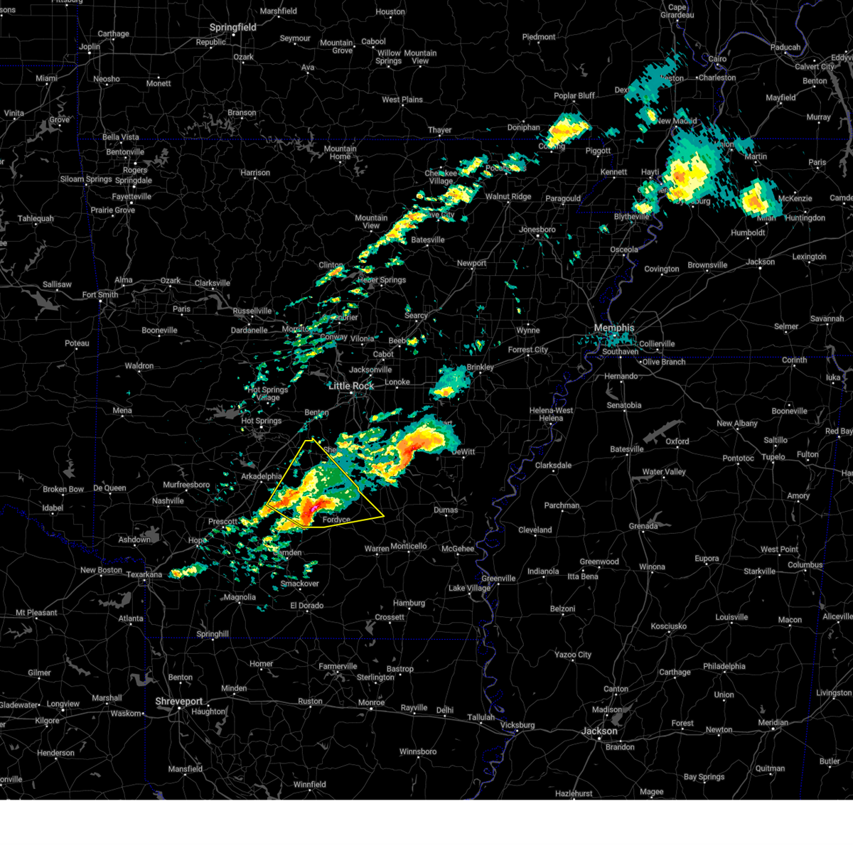
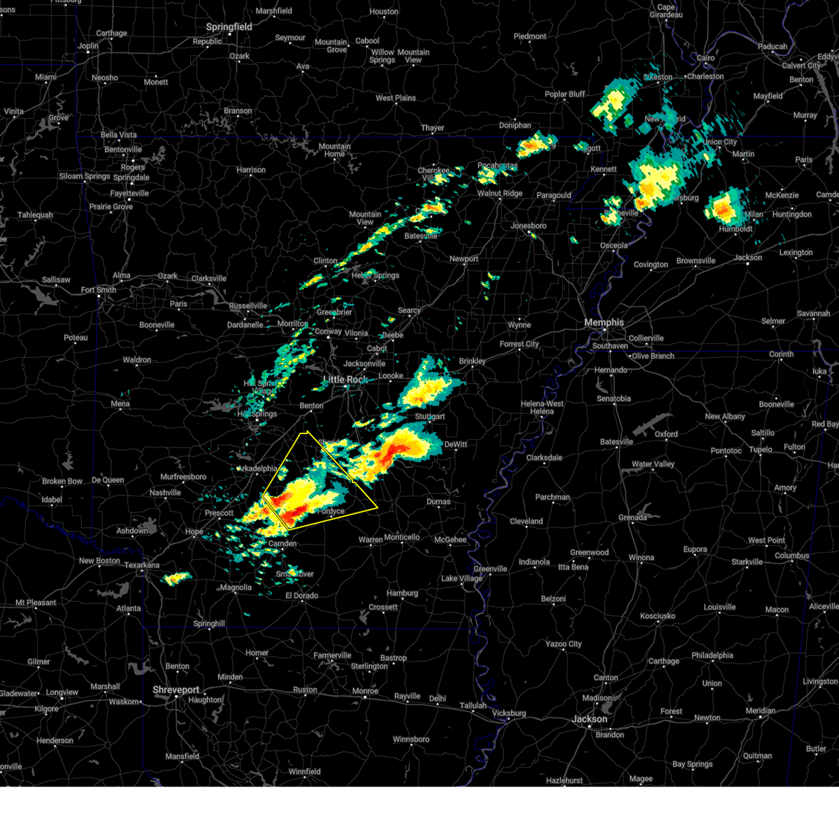
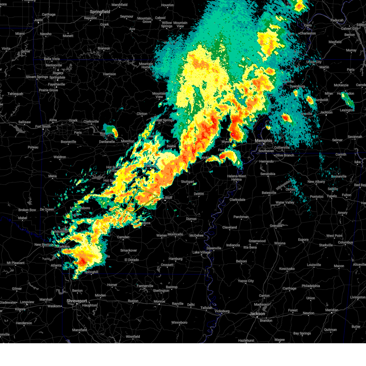
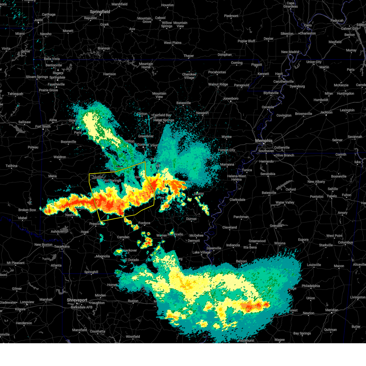
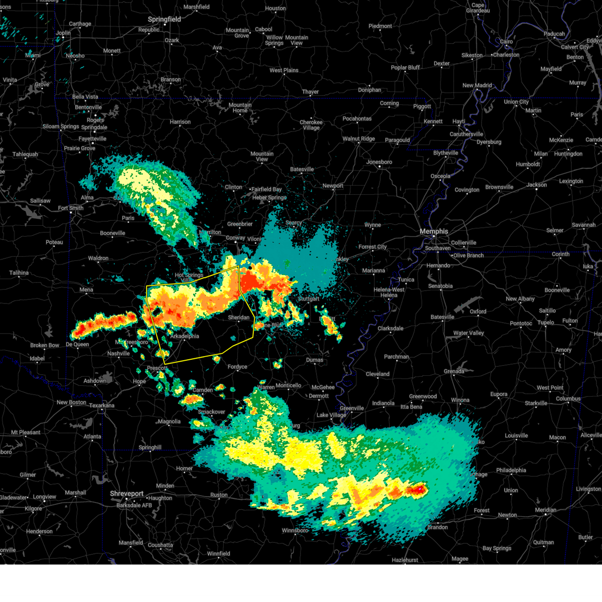
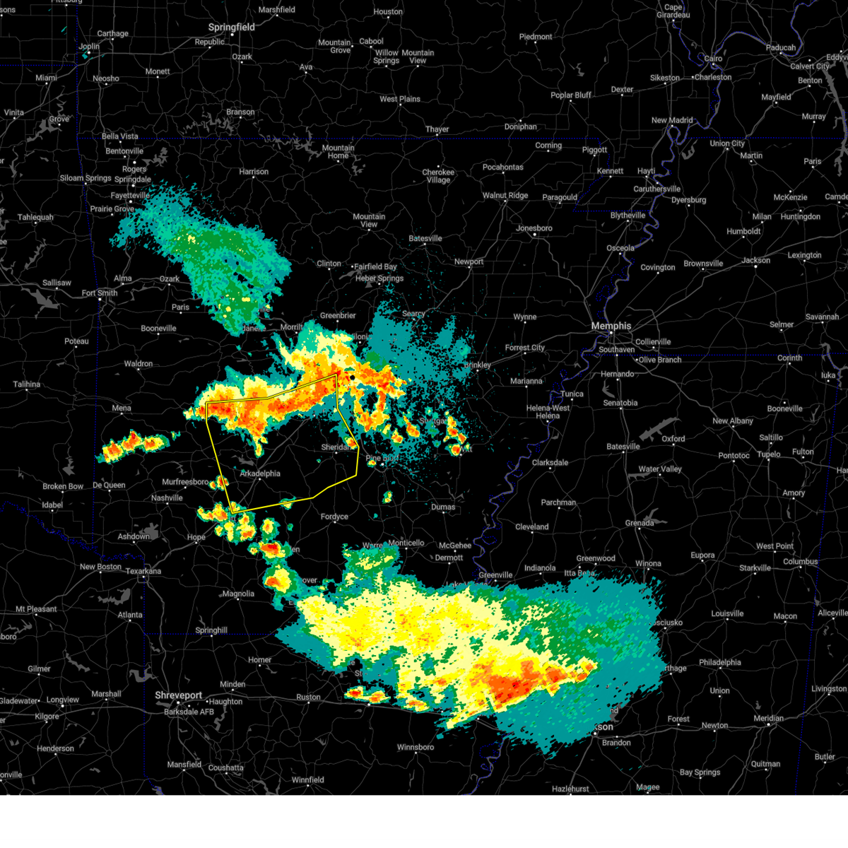
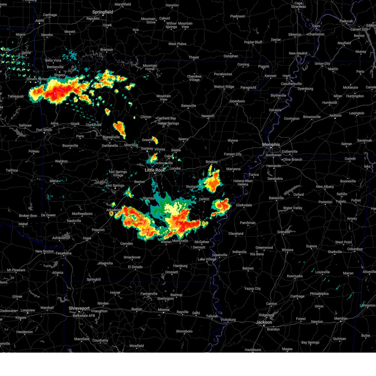
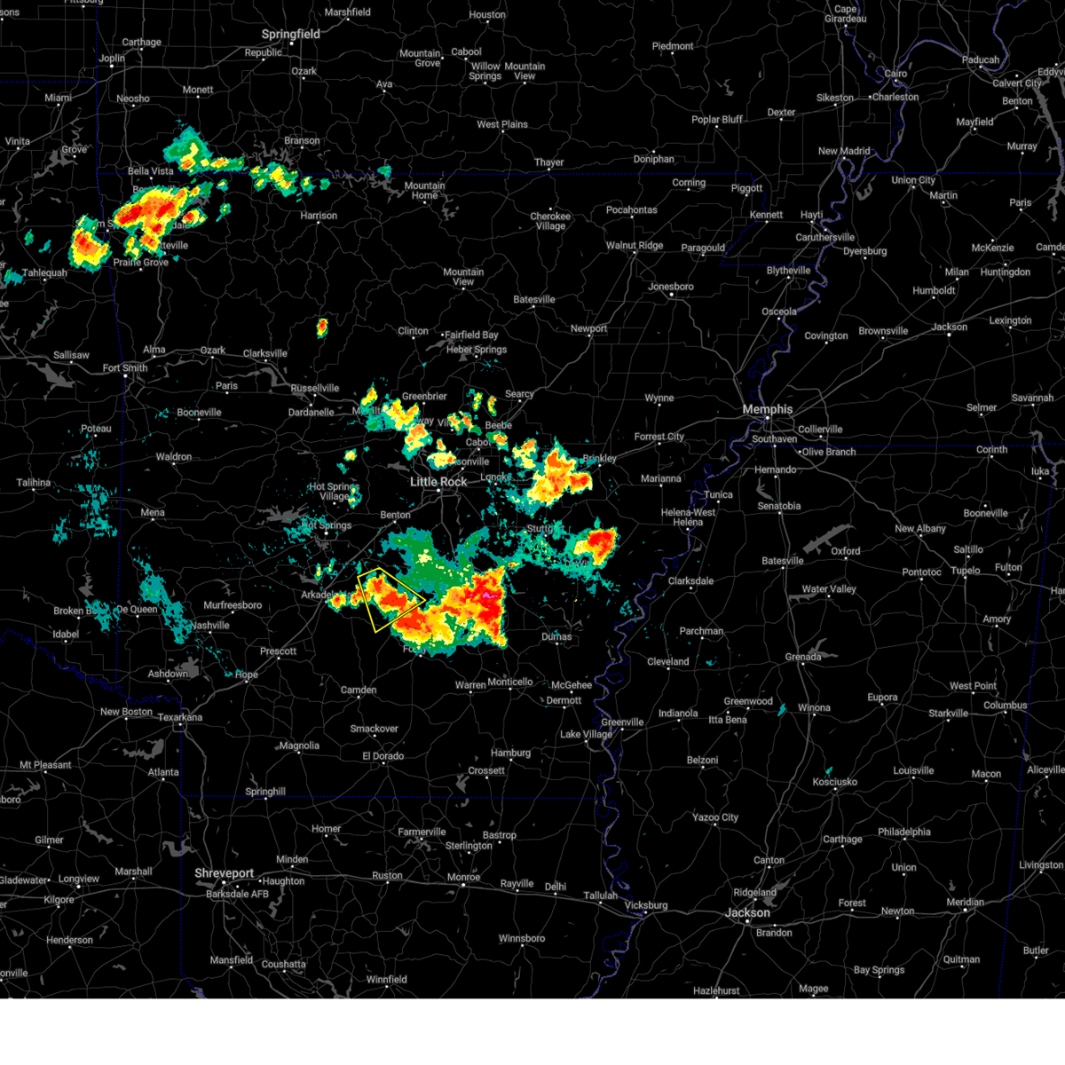
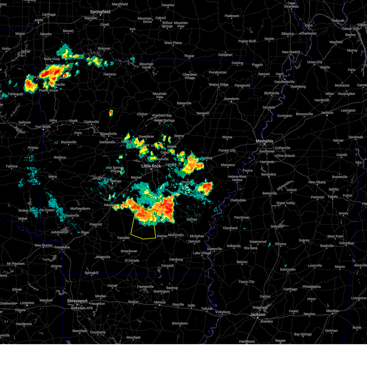
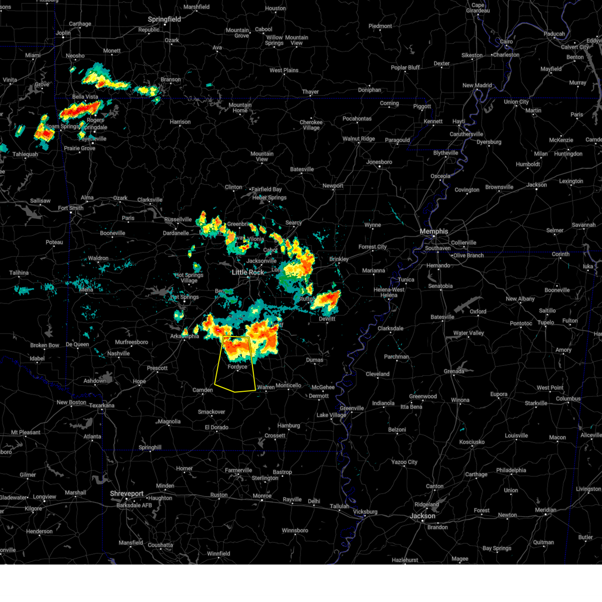
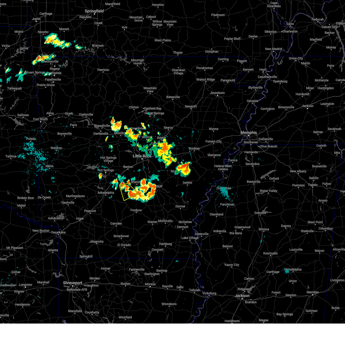
Hail Map for Carthage, AR
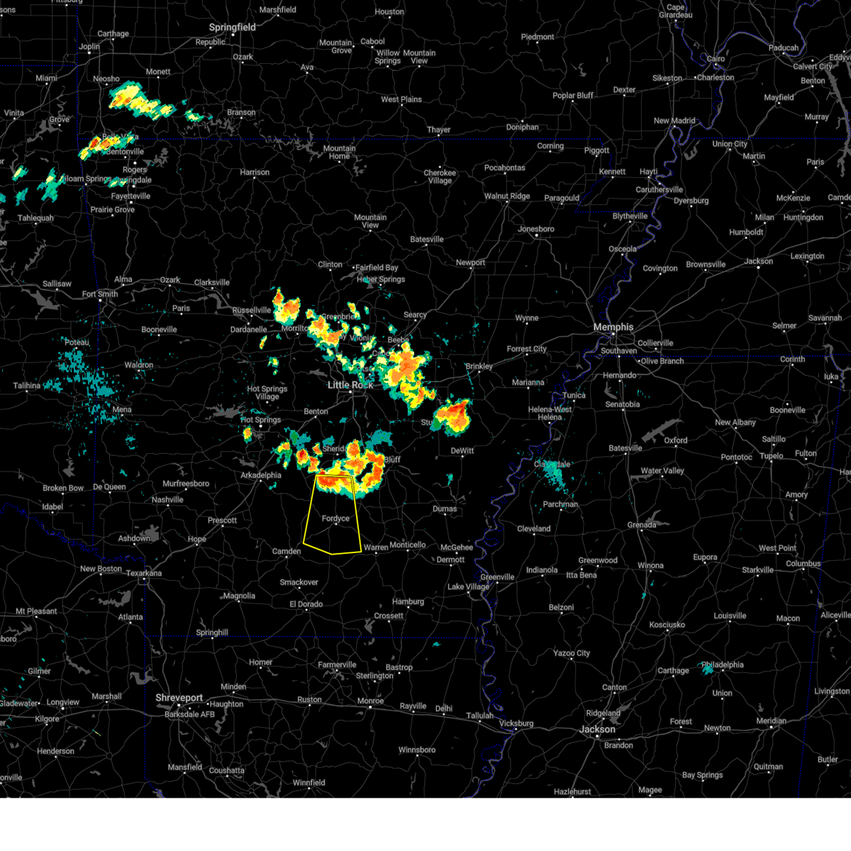
The Carthage, AR area has had 1 report of on-the-ground hail by trained spotters, and has been under severe weather warnings 46 times during the past 12 months. Doppler radar has detected hail at or near Carthage, AR on 53 occasions, including 6 occasions during the past year.
| Name: | Carthage, AR |
| Where Located: | 49.3 miles SSW of Little Rock, AR |
| Map: | Google Map for Carthage, AR |
| Population: | 343 |
| Housing Units: | 163 |
| More Info: | Search Google for Carthage, AR |
2
The Top Recent Hail Date for Carthage, AR is Friday, August 16, 2024 (11th out of 53)

Hail and Wind Damage Spotted near Carthage, AR
| Date / Time | Report Details |
|---|---|
| 5/20/2025 4:04 AM CDT |
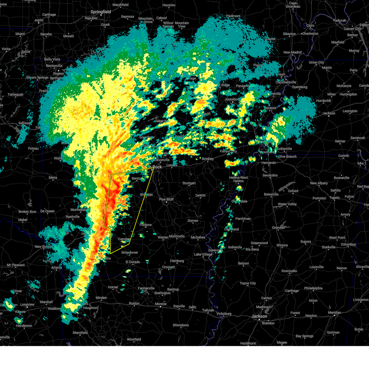
 Svrlzk the national weather service in little rock has issued a * severe thunderstorm warning for, northern cleveland county in southeastern arkansas, southern grant county in central arkansas, northeastern dallas county in southwestern arkansas, southwestern jefferson county in southeastern arkansas, northwestern lincoln county in southeastern arkansas, * until 445 am cdt. * at 404 am cdt, a severe thunderstorm was located 8 miles east of carthage, or 13 miles south of sheridan, moving east at 45 mph (radar indicated). Hazards include 60 mph wind gusts. expect damage to roofs, siding, and trees Svrlzk the national weather service in little rock has issued a * severe thunderstorm warning for, northern cleveland county in southeastern arkansas, southern grant county in central arkansas, northeastern dallas county in southwestern arkansas, southwestern jefferson county in southeastern arkansas, northwestern lincoln county in southeastern arkansas, * until 445 am cdt. * at 404 am cdt, a severe thunderstorm was located 8 miles east of carthage, or 13 miles south of sheridan, moving east at 45 mph (radar indicated). Hazards include 60 mph wind gusts. expect damage to roofs, siding, and trees
|
| 5/17/2025 11:55 PM CDT |
 At 1155 pm cdt, severe thunderstorms were located along a line extending from 7 miles south of sheridan to 6 miles west of lamont to near carthage to 11 miles south of leola, moving east at 35 mph (radar indicated). Hazards include 60 mph wind gusts and quarter size hail. Hail damage to vehicles is expected. expect wind damage to roofs, siding, and trees. Locations impacted include, tulip, lamont, cottondale, carthage, glenlake, watson chapel, staves, sulphur springs, madding, hardin, rob roy, millerville, kedron, cross roads in grant county, warbritton, ain, slabtown, manning, farindale, faith,. At 1155 pm cdt, severe thunderstorms were located along a line extending from 7 miles south of sheridan to 6 miles west of lamont to near carthage to 11 miles south of leola, moving east at 35 mph (radar indicated). Hazards include 60 mph wind gusts and quarter size hail. Hail damage to vehicles is expected. expect wind damage to roofs, siding, and trees. Locations impacted include, tulip, lamont, cottondale, carthage, glenlake, watson chapel, staves, sulphur springs, madding, hardin, rob roy, millerville, kedron, cross roads in grant county, warbritton, ain, slabtown, manning, farindale, faith,.
|
| 5/17/2025 11:46 PM CDT |
 Svrlzk the national weather service in little rock has issued a * severe thunderstorm warning for, northern cleveland county in southeastern arkansas, southern grant county in central arkansas, northeastern dallas county in southwestern arkansas, southwestern jefferson county in southeastern arkansas, west central lincoln county in southeastern arkansas, * until 1230 am cdt. * at 1145 pm cdt, severe thunderstorms were located along a line extending from near dogwood to near carthage to 10 miles southwest of leola, moving east at 30 mph (radar indicated). Hazards include 60 mph wind gusts and nickel size hail. expect damage to roofs, siding, and trees Svrlzk the national weather service in little rock has issued a * severe thunderstorm warning for, northern cleveland county in southeastern arkansas, southern grant county in central arkansas, northeastern dallas county in southwestern arkansas, southwestern jefferson county in southeastern arkansas, west central lincoln county in southeastern arkansas, * until 1230 am cdt. * at 1145 pm cdt, severe thunderstorms were located along a line extending from near dogwood to near carthage to 10 miles southwest of leola, moving east at 30 mph (radar indicated). Hazards include 60 mph wind gusts and nickel size hail. expect damage to roofs, siding, and trees
|
| 4/30/2025 5:08 PM CDT |
 Svrlzk the national weather service in little rock has issued a * severe thunderstorm warning for, northwestern cleveland county in southeastern arkansas, southwestern lonoke county in central arkansas, grant county in central arkansas, dallas county in southwestern arkansas, western jefferson county in southeastern arkansas, east central garland county in central arkansas, saline county in central arkansas, eastern hot spring county in southwestern arkansas, southeastern pulaski county in central arkansas, * until 615 pm cdt. * at 508 pm cdt, severe thunderstorms were located along a line extending from 8 miles northwest of salem in saline county to near tull to near sparkman, moving northeast at 35 mph (radar indicated). Hazards include 60 mph wind gusts. expect damage to roofs, siding, and trees Svrlzk the national weather service in little rock has issued a * severe thunderstorm warning for, northwestern cleveland county in southeastern arkansas, southwestern lonoke county in central arkansas, grant county in central arkansas, dallas county in southwestern arkansas, western jefferson county in southeastern arkansas, east central garland county in central arkansas, saline county in central arkansas, eastern hot spring county in southwestern arkansas, southeastern pulaski county in central arkansas, * until 615 pm cdt. * at 508 pm cdt, severe thunderstorms were located along a line extending from 8 miles northwest of salem in saline county to near tull to near sparkman, moving northeast at 35 mph (radar indicated). Hazards include 60 mph wind gusts. expect damage to roofs, siding, and trees
|
| 4/30/2025 4:18 PM CDT |
 Svrlzk the national weather service in little rock has issued a * severe thunderstorm warning for, eastern clark county in southwestern arkansas, western grant county in central arkansas, northwestern dallas county in southwestern arkansas, central garland county in central arkansas, central saline county in central arkansas, hot spring county in southwestern arkansas, * until 515 pm cdt. * at 417 pm cdt, severe thunderstorms were located along a line extending from near jessieville to near hot springs to 9 miles northeast of degray lake state park to near caddo valley to gurdon, moving northeast at 35 mph (radar indicated). Hazards include 60 mph wind gusts. expect damage to roofs, siding, and trees Svrlzk the national weather service in little rock has issued a * severe thunderstorm warning for, eastern clark county in southwestern arkansas, western grant county in central arkansas, northwestern dallas county in southwestern arkansas, central garland county in central arkansas, central saline county in central arkansas, hot spring county in southwestern arkansas, * until 515 pm cdt. * at 417 pm cdt, severe thunderstorms were located along a line extending from near jessieville to near hot springs to 9 miles northeast of degray lake state park to near caddo valley to gurdon, moving northeast at 35 mph (radar indicated). Hazards include 60 mph wind gusts. expect damage to roofs, siding, and trees
|
| 4/20/2025 8:21 PM CDT | At 821 pm cdt, a severe thunderstorm was located near carthage, or 14 miles northwest of fordyce, moving northeast at 30 mph (radar indicated). Hazards include 60 mph wind gusts. Expect damage to roofs, siding, and trees. Locations impacted include, cross roads in grant county, princeton, tulip, lamont, farindale, bunn, rison, carthage, leola, staves, grapevine, ivan, toledo, millerville, ramsey,. |
| 4/20/2025 7:59 PM CDT | Svrlzk the national weather service in little rock has issued a * severe thunderstorm warning for, northern cleveland county in southeastern arkansas, southern grant county in central arkansas, dallas county in southwestern arkansas, southwestern jefferson county in southeastern arkansas, * until 845 pm cdt. * at 759 pm cdt, a severe thunderstorm was located 8 miles east of sparkman, or 17 miles west of fordyce, moving northeast at 25 mph (radar indicated). Hazards include 60 mph wind gusts. expect damage to roofs, siding, and trees |
| 4/5/2025 11:30 AM CDT |
 the severe thunderstorm warning has been cancelled and is no longer in effect the severe thunderstorm warning has been cancelled and is no longer in effect
|
| 4/5/2025 11:30 AM CDT |
 At 1129 am cdt, severe thunderstorms were located along a line extending from 6 miles west of lamont to near louann, moving east at 35 mph (radar indicated). Hazards include 60 mph wind gusts and penny size hail. Expect damage to roofs, siding, and trees. Locations impacted include, delhi, cullendale, east camden, harmony grove, lamont, millers bluff, frenchport, elliot, locust bayou, fairview in ouachita county, carthage, warner, standard umpstead, harlow, thornton, hopeville, staves, sulphur springs, ivan, woodberry,. At 1129 am cdt, severe thunderstorms were located along a line extending from 6 miles west of lamont to near louann, moving east at 35 mph (radar indicated). Hazards include 60 mph wind gusts and penny size hail. Expect damage to roofs, siding, and trees. Locations impacted include, delhi, cullendale, east camden, harmony grove, lamont, millers bluff, frenchport, elliot, locust bayou, fairview in ouachita county, carthage, warner, standard umpstead, harlow, thornton, hopeville, staves, sulphur springs, ivan, woodberry,.
|
| 4/5/2025 11:04 AM CDT |
 Svrlzk the national weather service in little rock has issued a * severe thunderstorm warning for, northwestern cleveland county in southeastern arkansas, southeastern clark county in southwestern arkansas, southeastern grant county in central arkansas, central calhoun county in southwestern arkansas, dallas county in southwestern arkansas, ouachita county in southwestern arkansas, southwestern jefferson county in southeastern arkansas, * until 1145 am cdt. * at 1103 am cdt, severe thunderstorms were located along a line extending from 6 miles west of carthage to near stephens, moving east at 35 mph (radar indicated). Hazards include 60 mph wind gusts and penny size hail. expect damage to roofs, siding, and trees Svrlzk the national weather service in little rock has issued a * severe thunderstorm warning for, northwestern cleveland county in southeastern arkansas, southeastern clark county in southwestern arkansas, southeastern grant county in central arkansas, central calhoun county in southwestern arkansas, dallas county in southwestern arkansas, ouachita county in southwestern arkansas, southwestern jefferson county in southeastern arkansas, * until 1145 am cdt. * at 1103 am cdt, severe thunderstorms were located along a line extending from 6 miles west of carthage to near stephens, moving east at 35 mph (radar indicated). Hazards include 60 mph wind gusts and penny size hail. expect damage to roofs, siding, and trees
|
| 4/5/2025 11:01 AM CDT |
 At 1101 am cdt, severe thunderstorms were located along a line extending from near otter creek to 9 miles north of camden, moving east at 45 mph (radar indicated). Hazards include 60 mph wind gusts and nickel size hail. Expect damage to roofs, siding, and trees. Locations impacted include, lono, otter creek, magnet cove, tulip, east camden, traskwood, harmony grove, ouachita, vaden, gifford, malvern, glen rose, carthage, white oak lake state park, bauxite, jenkins ferry state park, belfast, quapaw quarter, hillcrest neighborhood, dalark,. At 1101 am cdt, severe thunderstorms were located along a line extending from near otter creek to 9 miles north of camden, moving east at 45 mph (radar indicated). Hazards include 60 mph wind gusts and nickel size hail. Expect damage to roofs, siding, and trees. Locations impacted include, lono, otter creek, magnet cove, tulip, east camden, traskwood, harmony grove, ouachita, vaden, gifford, malvern, glen rose, carthage, white oak lake state park, bauxite, jenkins ferry state park, belfast, quapaw quarter, hillcrest neighborhood, dalark,.
|
| 4/5/2025 10:47 AM CDT |
 At 1047 am cdt, severe thunderstorms were located along a line extending from near salem in saline county to near poison springs state park, moving east at 45 mph (radar indicated). Hazards include 60 mph wind gusts and nickel size hail. Expect damage to roofs, siding, and trees. Locations impacted include, otter creek, traskwood, ouachita, jenkins ferry state park, de roche, quapaw quarter, hillcrest neighborhood, dalark, haskell, buena vista, bryant, camden, red oak, princeton, social hill, holly springs, whelen springs, baseline, congo, troy,. At 1047 am cdt, severe thunderstorms were located along a line extending from near salem in saline county to near poison springs state park, moving east at 45 mph (radar indicated). Hazards include 60 mph wind gusts and nickel size hail. Expect damage to roofs, siding, and trees. Locations impacted include, otter creek, traskwood, ouachita, jenkins ferry state park, de roche, quapaw quarter, hillcrest neighborhood, dalark, haskell, buena vista, bryant, camden, red oak, princeton, social hill, holly springs, whelen springs, baseline, congo, troy,.
|
| 4/5/2025 10:27 AM CDT |
 Svrlzk the national weather service in little rock has issued a * severe thunderstorm warning for, eastern clark county in southwestern arkansas, western grant county in central arkansas, western calhoun county in southwestern arkansas, dallas county in southwestern arkansas, ouachita county in southwestern arkansas, southeastern garland county in central arkansas, saline county in central arkansas, hot spring county in southwestern arkansas, central pulaski county in central arkansas, * until 1115 am cdt. * at 1026 am cdt, severe thunderstorms were located along a line extending from near lonsdale to rosston, moving east at 45 mph (radar indicated). Hazards include 60 mph wind gusts and nickel size hail. expect damage to roofs, siding, and trees Svrlzk the national weather service in little rock has issued a * severe thunderstorm warning for, eastern clark county in southwestern arkansas, western grant county in central arkansas, western calhoun county in southwestern arkansas, dallas county in southwestern arkansas, ouachita county in southwestern arkansas, southeastern garland county in central arkansas, saline county in central arkansas, hot spring county in southwestern arkansas, central pulaski county in central arkansas, * until 1115 am cdt. * at 1026 am cdt, severe thunderstorms were located along a line extending from near lonsdale to rosston, moving east at 45 mph (radar indicated). Hazards include 60 mph wind gusts and nickel size hail. expect damage to roofs, siding, and trees
|
| 4/4/2025 11:02 PM CDT |
 At 1102 pm cdt, severe thunderstorms were located along a line extending from near thiel to jenkins ferry state park to leola to near carthage, moving northeast at 45 mph (radar indicated). Hazards include 60 mph wind gusts and quarter size hail. Hail damage to vehicles is expected. expect wind damage to roofs, siding, and trees. Locations impacted include, cross roads in grant county, tulip, ain, slabtown, thiel, buie, sheridan, jenkins ferry state park, belfast, leola, center grove, brush creek, poyen, prattsville, millerville, dogwood, cane creek, carthage,. At 1102 pm cdt, severe thunderstorms were located along a line extending from near thiel to jenkins ferry state park to leola to near carthage, moving northeast at 45 mph (radar indicated). Hazards include 60 mph wind gusts and quarter size hail. Hail damage to vehicles is expected. expect wind damage to roofs, siding, and trees. Locations impacted include, cross roads in grant county, tulip, ain, slabtown, thiel, buie, sheridan, jenkins ferry state park, belfast, leola, center grove, brush creek, poyen, prattsville, millerville, dogwood, cane creek, carthage,.
|
| 4/4/2025 10:46 PM CDT |
 Svrlzk the national weather service in little rock has issued a * severe thunderstorm warning for, central grant county in central arkansas, northwestern dallas county in southwestern arkansas, southeastern hot spring county in southwestern arkansas, * until 1130 pm cdt. * at 1045 pm cdt, severe thunderstorms were located along a line extending from 12 miles south of perla to 10 miles west of leola to 12 miles west of carthage to near sparkman, moving northeast at 50 mph (radar indicated). Hazards include 60 mph wind gusts and quarter size hail. Hail damage to vehicles is expected. Expect wind damage to roofs, siding, and trees. Svrlzk the national weather service in little rock has issued a * severe thunderstorm warning for, central grant county in central arkansas, northwestern dallas county in southwestern arkansas, southeastern hot spring county in southwestern arkansas, * until 1130 pm cdt. * at 1045 pm cdt, severe thunderstorms were located along a line extending from 12 miles south of perla to 10 miles west of leola to 12 miles west of carthage to near sparkman, moving northeast at 50 mph (radar indicated). Hazards include 60 mph wind gusts and quarter size hail. Hail damage to vehicles is expected. Expect wind damage to roofs, siding, and trees.
|
| 4/4/2025 1:15 AM CDT |
 The storm which prompted the warning has weakened below severe limits, and no longer poses an immediate threat to life or property. therefore, the warning has been allowed to expire. however small hail, gusty winds and heavy rain are still possible with this thunderstorm. The storm which prompted the warning has weakened below severe limits, and no longer poses an immediate threat to life or property. therefore, the warning has been allowed to expire. however small hail, gusty winds and heavy rain are still possible with this thunderstorm.
|
| 4/4/2025 1:03 AM CDT |
 At 103 am cdt, a severe thunderstorm was located near carthage, or 16 miles northwest of rison, moving northeast at 30 mph (radar indicated). Hazards include quarter size hail. Damage to vehicles is expected. Locations impacted include, cross roads in grant county, princeton, lamont, farindale, rowell, bunn, rison, carthage, staves, grapevine, ivan, toledo, millerville,. At 103 am cdt, a severe thunderstorm was located near carthage, or 16 miles northwest of rison, moving northeast at 30 mph (radar indicated). Hazards include quarter size hail. Damage to vehicles is expected. Locations impacted include, cross roads in grant county, princeton, lamont, farindale, rowell, bunn, rison, carthage, staves, grapevine, ivan, toledo, millerville,.
|
| 4/4/2025 1:03 AM CDT |
 the severe thunderstorm warning has been cancelled and is no longer in effect the severe thunderstorm warning has been cancelled and is no longer in effect
|
| 4/4/2025 12:41 AM CDT |
 the severe thunderstorm warning has been cancelled and is no longer in effect the severe thunderstorm warning has been cancelled and is no longer in effect
|
| 4/4/2025 12:41 AM CDT |
 At 1240 am cdt, a severe thunderstorm was located 10 miles south of carthage, or 13 miles northwest of fordyce, moving northeast at 30 mph (radar indicated). Hazards include 60 mph wind gusts and half dollar size hail. Hail damage to vehicles is expected. expect wind damage to roofs, siding, and trees. Locations impacted include, lono, tulip, sparkman, lamont, carthage, buie, jenkins ferry state park, staves, dalark, ivan, kingsland, prattsville, millerville, ramsey, cross roads in grant county, princeton, fenter, manning, holly springs, farindale,. At 1240 am cdt, a severe thunderstorm was located 10 miles south of carthage, or 13 miles northwest of fordyce, moving northeast at 30 mph (radar indicated). Hazards include 60 mph wind gusts and half dollar size hail. Hail damage to vehicles is expected. expect wind damage to roofs, siding, and trees. Locations impacted include, lono, tulip, sparkman, lamont, carthage, buie, jenkins ferry state park, staves, dalark, ivan, kingsland, prattsville, millerville, ramsey, cross roads in grant county, princeton, fenter, manning, holly springs, farindale,.
|
| 4/4/2025 12:28 AM CDT |
 Svrlzk the national weather service in little rock has issued a * severe thunderstorm warning for, northern cleveland county in southeastern arkansas, east central clark county in southwestern arkansas, southern grant county in central arkansas, north central calhoun county in southwestern arkansas, dallas county in southwestern arkansas, northeastern ouachita county in southwestern arkansas, southeastern hot spring county in southwestern arkansas, * until 115 am cdt. * at 1228 am cdt, a severe thunderstorm was located 9 miles southeast of sparkman, or 16 miles west of fordyce, moving northeast at 35 mph (radar indicated). Hazards include 60 mph wind gusts and quarter size hail. Hail damage to vehicles is expected. Expect wind damage to roofs, siding, and trees. Svrlzk the national weather service in little rock has issued a * severe thunderstorm warning for, northern cleveland county in southeastern arkansas, east central clark county in southwestern arkansas, southern grant county in central arkansas, north central calhoun county in southwestern arkansas, dallas county in southwestern arkansas, northeastern ouachita county in southwestern arkansas, southeastern hot spring county in southwestern arkansas, * until 115 am cdt. * at 1228 am cdt, a severe thunderstorm was located 9 miles southeast of sparkman, or 16 miles west of fordyce, moving northeast at 35 mph (radar indicated). Hazards include 60 mph wind gusts and quarter size hail. Hail damage to vehicles is expected. Expect wind damage to roofs, siding, and trees.
|
| 4/2/2025 7:18 PM CDT |
 the severe thunderstorm warning has been cancelled and is no longer in effect the severe thunderstorm warning has been cancelled and is no longer in effect
|
| 4/2/2025 6:55 PM CDT | At 655 pm cdt, a severe thunderstorm was located near leola, or 19 miles southwest of sheridan, moving northeast at 60 mph (radar indicated). Hazards include 60 mph wind gusts and quarter size hail. Hail damage to vehicles is expected. expect wind damage to roofs, siding, and trees. Locations impacted include, cross roads in grant county, tulip, ain, slabtown, thiel, prague, carthage, buie, sheridan, jenkins ferry state park, leola, center grove, brush creek, clear lake, prattsville, millerville, dogwood, willow,. |
| 4/2/2025 6:55 PM CDT | the severe thunderstorm warning has been cancelled and is no longer in effect |
| 4/2/2025 6:38 PM CDT | Svrlzk the national weather service in little rock has issued a * severe thunderstorm warning for, east central clark county in southwestern arkansas, central grant county in central arkansas, northwestern dallas county in southwestern arkansas, west central jefferson county in southeastern arkansas, southeastern hot spring county in southwestern arkansas, * until 730 pm cdt. * at 638 pm cdt, a severe thunderstorm was located near sparkman, or 14 miles southeast of arkadelphia, moving northeast at 60 mph (radar indicated). Hazards include two inch hail and 60 mph wind gusts. People and animals outdoors will be injured. expect hail damage to roofs, siding, windows, and vehicles. Expect wind damage to roofs, siding, and trees. |
| 3/14/2025 11:55 PM CDT |
 Svrlzk the national weather service in little rock has issued a * severe thunderstorm warning for, cleveland county in southeastern arkansas, southeastern grant county in central arkansas, eastern dallas county in southwestern arkansas, southwestern jefferson county in southeastern arkansas, western lincoln county in southeastern arkansas, * until 1245 am cdt. * at 1155 pm cdt, a severe thunderstorm was located 9 miles northwest of fordyce, moving east at 50 mph (radar indicated). Hazards include 60 mph wind gusts and quarter size hail. Hail damage to vehicles is expected. Expect wind damage to roofs, siding, and trees. Svrlzk the national weather service in little rock has issued a * severe thunderstorm warning for, cleveland county in southeastern arkansas, southeastern grant county in central arkansas, eastern dallas county in southwestern arkansas, southwestern jefferson county in southeastern arkansas, western lincoln county in southeastern arkansas, * until 1245 am cdt. * at 1155 pm cdt, a severe thunderstorm was located 9 miles northwest of fordyce, moving east at 50 mph (radar indicated). Hazards include 60 mph wind gusts and quarter size hail. Hail damage to vehicles is expected. Expect wind damage to roofs, siding, and trees.
|
| 1/5/2025 12:24 PM CST |
 Svrlzk the national weather service in little rock has issued a * severe thunderstorm warning for, northwestern bradley county in southeastern arkansas, cleveland county in southeastern arkansas, calhoun county in southwestern arkansas, eastern dallas county in southwestern arkansas, central ouachita county in southwestern arkansas, western lincoln county in southeastern arkansas, * until 115 pm cst. * at 1224 pm cst, severe thunderstorms were located along a line extending from 8 miles east of carthage to near louann, moving east at 50 mph (radar indicated). Hazards include 60 mph wind gusts. expect damage to roofs, siding, and trees Svrlzk the national weather service in little rock has issued a * severe thunderstorm warning for, northwestern bradley county in southeastern arkansas, cleveland county in southeastern arkansas, calhoun county in southwestern arkansas, eastern dallas county in southwestern arkansas, central ouachita county in southwestern arkansas, western lincoln county in southeastern arkansas, * until 115 pm cst. * at 1224 pm cst, severe thunderstorms were located along a line extending from 8 miles east of carthage to near louann, moving east at 50 mph (radar indicated). Hazards include 60 mph wind gusts. expect damage to roofs, siding, and trees
|
| 8/18/2024 10:12 PM CDT |
 The storms which prompted the warning have moved out of portions of the warned area. therefore, the warning will be allowed to expire. however strong winds are still possible with these thunderstorms. a severe thunderstorm watch remains in effect until midnight cdt for central, southeastern and southwestern arkansas. remember, a severe thunderstorm warning still remains in effect for portions of ouachita, calhoun, cleveland, dallas, and lincoln counties until 1045 pm cdt. The storms which prompted the warning have moved out of portions of the warned area. therefore, the warning will be allowed to expire. however strong winds are still possible with these thunderstorms. a severe thunderstorm watch remains in effect until midnight cdt for central, southeastern and southwestern arkansas. remember, a severe thunderstorm warning still remains in effect for portions of ouachita, calhoun, cleveland, dallas, and lincoln counties until 1045 pm cdt.
|
| 8/18/2024 10:01 PM CDT |
 the severe thunderstorm warning has been cancelled and is no longer in effect the severe thunderstorm warning has been cancelled and is no longer in effect
|
| 8/18/2024 10:01 PM CDT |
 At 1000 pm cdt, severe thunderstorms were located along a line extending from 6 miles north of feenyville to near herbine to near ellisville to near camden, moving south at 55 mph (radar indicated). Hazards include 70 mph wind gusts and nickel size hail. Expect considerable tree damage. damage is likely to mobile homes, roofs, and outbuildings. Locations impacted include, pine bluff, camden, arkadelphia, fordyce, star city, rison, white hall, gurdon, altheimer, bearden, grady, kingsland, sparkman, thornton, carthage, chidester, whelen springs, beirne, whitefield, little bayou meto park,. At 1000 pm cdt, severe thunderstorms were located along a line extending from 6 miles north of feenyville to near herbine to near ellisville to near camden, moving south at 55 mph (radar indicated). Hazards include 70 mph wind gusts and nickel size hail. Expect considerable tree damage. damage is likely to mobile homes, roofs, and outbuildings. Locations impacted include, pine bluff, camden, arkadelphia, fordyce, star city, rison, white hall, gurdon, altheimer, bearden, grady, kingsland, sparkman, thornton, carthage, chidester, whelen springs, beirne, whitefield, little bayou meto park,.
|
| 8/18/2024 9:50 PM CDT |
 At 950 pm cdt, severe thunderstorms were located along a line extending from hensley island to 7 miles west of white hall to near carthage to near gurdon, moving southeast at 55 mph (radar indicated). Hazards include 70 mph wind gusts and nickel size hail. Expect considerable tree damage. damage is likely to mobile homes, roofs, and outbuildings. Locations impacted include, pine bluff, camden, arkadelphia, fordyce, star city, rison, white hall, gurdon, altheimer, bearden, caddo valley, leola, grady, kingsland, sparkman, thornton, carthage, chidester, whelen springs, beirne,. At 950 pm cdt, severe thunderstorms were located along a line extending from hensley island to 7 miles west of white hall to near carthage to near gurdon, moving southeast at 55 mph (radar indicated). Hazards include 70 mph wind gusts and nickel size hail. Expect considerable tree damage. damage is likely to mobile homes, roofs, and outbuildings. Locations impacted include, pine bluff, camden, arkadelphia, fordyce, star city, rison, white hall, gurdon, altheimer, bearden, caddo valley, leola, grady, kingsland, sparkman, thornton, carthage, chidester, whelen springs, beirne,.
|
| 8/18/2024 9:42 PM CDT |
 the severe thunderstorm warning has been cancelled and is no longer in effect the severe thunderstorm warning has been cancelled and is no longer in effect
|
| 8/18/2024 9:42 PM CDT |
 At 941 pm cdt, severe thunderstorms were located along a line extending from warbritton to near kedron to 9 miles northwest of fordyce to 6 miles east of whelen springs, moving southeast at 55 mph (radar indicated). Hazards include 70 mph wind gusts and nickel size hail. Expect considerable tree damage. damage is likely to mobile homes, roofs, and outbuildings. Locations impacted include, pine bluff, camden, arkadelphia, sheridan, fordyce, star city, rison, white hall, gurdon, redfield, altheimer, bearden, caddo valley, leola, grady, tull, kingsland, sparkman, thornton, carthage,. At 941 pm cdt, severe thunderstorms were located along a line extending from warbritton to near kedron to 9 miles northwest of fordyce to 6 miles east of whelen springs, moving southeast at 55 mph (radar indicated). Hazards include 70 mph wind gusts and nickel size hail. Expect considerable tree damage. damage is likely to mobile homes, roofs, and outbuildings. Locations impacted include, pine bluff, camden, arkadelphia, sheridan, fordyce, star city, rison, white hall, gurdon, redfield, altheimer, bearden, caddo valley, leola, grady, tull, kingsland, sparkman, thornton, carthage,.
|
| 8/18/2024 9:34 PM CDT |
 the severe thunderstorm warning has been cancelled and is no longer in effect the severe thunderstorm warning has been cancelled and is no longer in effect
|
| 8/18/2024 9:29 PM CDT |
 Svrlzk the national weather service in little rock has issued a * severe thunderstorm warning for, cleveland county in southeastern arkansas, clark county in southwestern arkansas, southwestern lonoke county in central arkansas, grant county in central arkansas, northern calhoun county in southwestern arkansas, dallas county in southwestern arkansas, northern ouachita county in southwestern arkansas, jefferson county in southeastern arkansas, southeastern saline county in central arkansas, northern lincoln county in southeastern arkansas, southern hot spring county in southwestern arkansas, southeastern pulaski county in central arkansas, * until 1015 pm cdt. * at 928 pm cdt, severe thunderstorms were located along a line extending from near hensley island to near redfield to near sheridan to near leola to near gum springs in clark county, moving southeast at 45 mph (radar indicated). Hazards include 60 mph wind gusts and nickel size hail. expect damage to roofs, siding, and trees Svrlzk the national weather service in little rock has issued a * severe thunderstorm warning for, cleveland county in southeastern arkansas, clark county in southwestern arkansas, southwestern lonoke county in central arkansas, grant county in central arkansas, northern calhoun county in southwestern arkansas, dallas county in southwestern arkansas, northern ouachita county in southwestern arkansas, jefferson county in southeastern arkansas, southeastern saline county in central arkansas, northern lincoln county in southeastern arkansas, southern hot spring county in southwestern arkansas, southeastern pulaski county in central arkansas, * until 1015 pm cdt. * at 928 pm cdt, severe thunderstorms were located along a line extending from near hensley island to near redfield to near sheridan to near leola to near gum springs in clark county, moving southeast at 45 mph (radar indicated). Hazards include 60 mph wind gusts and nickel size hail. expect damage to roofs, siding, and trees
|
| 8/18/2024 9:13 PM CDT |
 At 912 pm cdt, severe thunderstorms were located along a line extending from near cane creek to near perla to near degray lake state park, moving south at 55 mph (radar indicated). Hazards include 60 mph wind gusts and nickel size hail. Expect damage to roofs, siding, and trees. Locations impacted include, little rock, hot springs, benton, west little rock, maumelle, bryant, hot springs village, arkadelphia, malvern, sheridan, southwest little rock, haskell, shannon hills, gurdon, mountain pine, rockport, caddo valley, traskwood, leola, tull,. At 912 pm cdt, severe thunderstorms were located along a line extending from near cane creek to near perla to near degray lake state park, moving south at 55 mph (radar indicated). Hazards include 60 mph wind gusts and nickel size hail. Expect damage to roofs, siding, and trees. Locations impacted include, little rock, hot springs, benton, west little rock, maumelle, bryant, hot springs village, arkadelphia, malvern, sheridan, southwest little rock, haskell, shannon hills, gurdon, mountain pine, rockport, caddo valley, traskwood, leola, tull,.
|
| 8/18/2024 8:57 PM CDT |
 Svrlzk the national weather service in little rock has issued a * severe thunderstorm warning for, clark county in southwestern arkansas, grant county in central arkansas, northern dallas county in southwestern arkansas, garland county in central arkansas, saline county in central arkansas, hot spring county in southwestern arkansas, southeastern montgomery county in western arkansas, central pulaski county in central arkansas, * until 945 pm cdt. * at 856 pm cdt, severe thunderstorms were located along a line extending from near roland in pulaski county to near hot springs village to 7 miles west of lake ouachita state park, moving south at 50 mph (radar indicated). Hazards include 60 mph wind gusts and nickel size hail. expect damage to roofs, siding, and trees Svrlzk the national weather service in little rock has issued a * severe thunderstorm warning for, clark county in southwestern arkansas, grant county in central arkansas, northern dallas county in southwestern arkansas, garland county in central arkansas, saline county in central arkansas, hot spring county in southwestern arkansas, southeastern montgomery county in western arkansas, central pulaski county in central arkansas, * until 945 pm cdt. * at 856 pm cdt, severe thunderstorms were located along a line extending from near roland in pulaski county to near hot springs village to 7 miles west of lake ouachita state park, moving south at 50 mph (radar indicated). Hazards include 60 mph wind gusts and nickel size hail. expect damage to roofs, siding, and trees
|
| 8/18/2024 6:42 PM CDT |
 At 642 pm cdt, a severe thunderstorm was located near carthage, or 21 miles southwest of sheridan, moving southeast at 30 mph (radar indicated). Hazards include 60 mph wind gusts and quarter size hail. Hail damage to vehicles is expected. expect wind damage to roofs, siding, and trees. Locations impacted include, carthage, tulip, willow,. At 642 pm cdt, a severe thunderstorm was located near carthage, or 21 miles southwest of sheridan, moving southeast at 30 mph (radar indicated). Hazards include 60 mph wind gusts and quarter size hail. Hail damage to vehicles is expected. expect wind damage to roofs, siding, and trees. Locations impacted include, carthage, tulip, willow,.
|
| 8/18/2024 6:17 PM CDT |
 Svrlzk the national weather service in little rock has issued a * severe thunderstorm warning for, southwestern grant county in central arkansas, northeastern dallas county in southwestern arkansas, southeastern hot spring county in southwestern arkansas, * until 700 pm cdt. * at 617 pm cdt, a severe thunderstorm was located 8 miles west of thiel, or 10 miles south of malvern, moving southeast at 30 mph (radar indicated). Hazards include 60 mph wind gusts and quarter size hail. Hail damage to vehicles is expected. Expect wind damage to roofs, siding, and trees. Svrlzk the national weather service in little rock has issued a * severe thunderstorm warning for, southwestern grant county in central arkansas, northeastern dallas county in southwestern arkansas, southeastern hot spring county in southwestern arkansas, * until 700 pm cdt. * at 617 pm cdt, a severe thunderstorm was located 8 miles west of thiel, or 10 miles south of malvern, moving southeast at 30 mph (radar indicated). Hazards include 60 mph wind gusts and quarter size hail. Hail damage to vehicles is expected. Expect wind damage to roofs, siding, and trees.
|
| 8/18/2024 6:14 PM CDT |
 At 613 pm cdt, severe thunderstorms were located along a line extending from near fordyce to near thornton, moving south at 25 mph (radar indicated). Hazards include 60 mph wind gusts and nickel size hail. Expect damage to roofs, siding, and trees. Locations impacted include, fordyce, bearden, kingsland, thornton, carthage, ellisville, weeks, tipton, harlow, marks mill state park, tinsman, chambersville, farindale, bunn, hopeville, staves, ivan, new edinburg, millville, ramsey,. At 613 pm cdt, severe thunderstorms were located along a line extending from near fordyce to near thornton, moving south at 25 mph (radar indicated). Hazards include 60 mph wind gusts and nickel size hail. Expect damage to roofs, siding, and trees. Locations impacted include, fordyce, bearden, kingsland, thornton, carthage, ellisville, weeks, tipton, harlow, marks mill state park, tinsman, chambersville, farindale, bunn, hopeville, staves, ivan, new edinburg, millville, ramsey,.
|
| 8/18/2024 6:14 PM CDT |
 the severe thunderstorm warning has been cancelled and is no longer in effect the severe thunderstorm warning has been cancelled and is no longer in effect
|
| 8/18/2024 5:59 PM CDT |
 the severe thunderstorm warning has been cancelled and is no longer in effect the severe thunderstorm warning has been cancelled and is no longer in effect
|
| 8/18/2024 5:56 PM CDT |
 At 555 pm cdt, severe thunderstorms were located along a line extending from 10 miles northwest of kingsland to 12 miles north of fordyce to near carthage, moving south at 25 mph (radar indicated). Hazards include 60 mph wind gusts and nickel size hail. Expect damage to roofs, siding, and trees. Locations impacted include, fordyce, bearden, kingsland, thornton, carthage, ellisville, weeks, lamont, tipton, harlow, marks mill state park, tinsman, chambersville, farindale, bunn, hopeville, staves, grapevine, ivan, new edinburg,. At 555 pm cdt, severe thunderstorms were located along a line extending from 10 miles northwest of kingsland to 12 miles north of fordyce to near carthage, moving south at 25 mph (radar indicated). Hazards include 60 mph wind gusts and nickel size hail. Expect damage to roofs, siding, and trees. Locations impacted include, fordyce, bearden, kingsland, thornton, carthage, ellisville, weeks, lamont, tipton, harlow, marks mill state park, tinsman, chambersville, farindale, bunn, hopeville, staves, grapevine, ivan, new edinburg,.
|
| 8/18/2024 5:44 PM CDT |
 At 544 pm cdt, a severe thunderstorm was located near thiel, or 10 miles southeast of malvern, moving southeast at 30 mph (radar indicated). Hazards include 60 mph wind gusts and quarter size hail. Hail damage to vehicles is expected. expect wind damage to roofs, siding, and trees. Locations impacted include, leola, carthage, jenkins ferry state park, thiel, dogwood, lono, tulip, brush creek,. At 544 pm cdt, a severe thunderstorm was located near thiel, or 10 miles southeast of malvern, moving southeast at 30 mph (radar indicated). Hazards include 60 mph wind gusts and quarter size hail. Hail damage to vehicles is expected. expect wind damage to roofs, siding, and trees. Locations impacted include, leola, carthage, jenkins ferry state park, thiel, dogwood, lono, tulip, brush creek,.
|
| 8/18/2024 5:43 PM CDT |
 Svrlzk the national weather service in little rock has issued a * severe thunderstorm warning for, northwestern bradley county in southeastern arkansas, western cleveland county in southeastern arkansas, southern grant county in central arkansas, northeastern calhoun county in southwestern arkansas, eastern dallas county in southwestern arkansas, northeastern ouachita county in southwestern arkansas, * until 630 pm cdt. * at 543 pm cdt, severe thunderstorms were located along a line extending from 8 miles southwest of lamont to 10 miles southeast of leola to carthage, moving south at 25 mph (radar indicated). Hazards include 60 mph wind gusts and nickel size hail. expect damage to roofs, siding, and trees Svrlzk the national weather service in little rock has issued a * severe thunderstorm warning for, northwestern bradley county in southeastern arkansas, western cleveland county in southeastern arkansas, southern grant county in central arkansas, northeastern calhoun county in southwestern arkansas, eastern dallas county in southwestern arkansas, northeastern ouachita county in southwestern arkansas, * until 630 pm cdt. * at 543 pm cdt, severe thunderstorms were located along a line extending from 8 miles southwest of lamont to 10 miles southeast of leola to carthage, moving south at 25 mph (radar indicated). Hazards include 60 mph wind gusts and nickel size hail. expect damage to roofs, siding, and trees
|
| 8/18/2024 5:31 PM CDT |
 Svrlzk the national weather service in little rock has issued a * severe thunderstorm warning for, southwestern grant county in central arkansas, north central dallas county in southwestern arkansas, southeastern hot spring county in southwestern arkansas, * until 615 pm cdt. * at 531 pm cdt, a severe thunderstorm was located near poyen, or near malvern, moving southeast at 30 mph (radar indicated). Hazards include 60 mph wind gusts and quarter size hail. Hail damage to vehicles is expected. Expect wind damage to roofs, siding, and trees. Svrlzk the national weather service in little rock has issued a * severe thunderstorm warning for, southwestern grant county in central arkansas, north central dallas county in southwestern arkansas, southeastern hot spring county in southwestern arkansas, * until 615 pm cdt. * at 531 pm cdt, a severe thunderstorm was located near poyen, or near malvern, moving southeast at 30 mph (radar indicated). Hazards include 60 mph wind gusts and quarter size hail. Hail damage to vehicles is expected. Expect wind damage to roofs, siding, and trees.
|
| 7/8/2024 9:53 PM CDT |
 The storms which prompted the warning have weakened below severe limits, and no longer pose an immediate threat to life or property. therefore, the warning will be allowed to expire. a tornado watch remains in effect until midnight cdt for central and southwestern arkansas. remember, a tornado warning still remains in effect for portions of hot spring, dallas, and grand counties until 10:15 pm. The storms which prompted the warning have weakened below severe limits, and no longer pose an immediate threat to life or property. therefore, the warning will be allowed to expire. a tornado watch remains in effect until midnight cdt for central and southwestern arkansas. remember, a tornado warning still remains in effect for portions of hot spring, dallas, and grand counties until 10:15 pm.
|
| 7/8/2024 9:14 PM CDT |
 Svrlzk the national weather service in little rock has issued a * severe thunderstorm warning for, central clark county in southwestern arkansas, southwestern grant county in central arkansas, dallas county in southwestern arkansas, hot spring county in southwestern arkansas, * until 1000 pm cdt. * at 913 pm cdt, severe thunderstorms were located along a line extending from near gum springs in clark county to 9 miles east of sparkman, moving north at 30 mph (radar indicated). Hazards include 60 mph wind gusts. expect damage to roofs, siding, and trees Svrlzk the national weather service in little rock has issued a * severe thunderstorm warning for, central clark county in southwestern arkansas, southwestern grant county in central arkansas, dallas county in southwestern arkansas, hot spring county in southwestern arkansas, * until 1000 pm cdt. * at 913 pm cdt, severe thunderstorms were located along a line extending from near gum springs in clark county to 9 miles east of sparkman, moving north at 30 mph (radar indicated). Hazards include 60 mph wind gusts. expect damage to roofs, siding, and trees
|
| 3/4/2024 6:06 PM CST |
 Svrlzk the national weather service in little rock has issued a * severe thunderstorm warning for, grant county in central arkansas, north central dallas county in southwestern arkansas, western jefferson county in southeastern arkansas, southeastern saline county in central arkansas, * until 645 pm cst. * at 606 pm cst, a severe thunderstorm was located near leola, or 14 miles southwest of sheridan, moving northeast at 35 mph (radar indicated). Hazards include 60 mph wind gusts and quarter size hail. Hail damage to vehicles is expected. Expect wind damage to roofs, siding, and trees. Svrlzk the national weather service in little rock has issued a * severe thunderstorm warning for, grant county in central arkansas, north central dallas county in southwestern arkansas, western jefferson county in southeastern arkansas, southeastern saline county in central arkansas, * until 645 pm cst. * at 606 pm cst, a severe thunderstorm was located near leola, or 14 miles southwest of sheridan, moving northeast at 35 mph (radar indicated). Hazards include 60 mph wind gusts and quarter size hail. Hail damage to vehicles is expected. Expect wind damage to roofs, siding, and trees.
|
| 6/26/2023 12:18 AM CDT |
 At 1217 am cdt, a severe thunderstorm was located near degray lake state park, or 8 miles north of arkadelphia, moving southeast at 30 mph (radar indicated). Hazards include 60 mph wind gusts and quarter size hail. Hail damage to vehicles is expected. expect wind damage to roofs, siding, and trees. locations impacted include, arkadelphia, caddo valley, sparkman, carthage, degray lake state park, donaldson, friendship, bismarck, lower lake recreation area, tulip, manning, joan, de roche, willow, dalark, griffithtown, midway in hot spring county, hail threat, radar indicated max hail size, 1. 00 in wind threat, radar indicated max wind gust, 60 mph. At 1217 am cdt, a severe thunderstorm was located near degray lake state park, or 8 miles north of arkadelphia, moving southeast at 30 mph (radar indicated). Hazards include 60 mph wind gusts and quarter size hail. Hail damage to vehicles is expected. expect wind damage to roofs, siding, and trees. locations impacted include, arkadelphia, caddo valley, sparkman, carthage, degray lake state park, donaldson, friendship, bismarck, lower lake recreation area, tulip, manning, joan, de roche, willow, dalark, griffithtown, midway in hot spring county, hail threat, radar indicated max hail size, 1. 00 in wind threat, radar indicated max wind gust, 60 mph.
|
| 6/26/2023 12:13 AM CDT |
 At 1212 am cdt, a severe thunderstorm was located over kingsland, or 7 miles east of fordyce, moving southeast at 35 mph (radar indicated). Hazards include 60 mph wind gusts and quarter size hail. Hail damage to vehicles is expected. Expect wind damage to roofs, siding, and trees. At 1212 am cdt, a severe thunderstorm was located over kingsland, or 7 miles east of fordyce, moving southeast at 35 mph (radar indicated). Hazards include 60 mph wind gusts and quarter size hail. Hail damage to vehicles is expected. Expect wind damage to roofs, siding, and trees.
|
| 6/26/2023 12:07 AM CDT |
 At 1207 am cdt, a severe thunderstorm was located over degray lake state park, or 12 miles north of arkadelphia, moving southeast at 30 mph (radar indicated). Hazards include 60 mph wind gusts and quarter size hail. Hail damage to vehicles is expected. expect wind damage to roofs, siding, and trees. locations impacted include, arkadelphia, caddo valley, sparkman, carthage, degray lake state park, donaldson, friendship, bismarck, lower lake recreation area, tulip, manning, joan, de roche, willow, dalark, griffithtown, midway in hot spring county, hail threat, radar indicated max hail size, 1. 00 in wind threat, radar indicated max wind gust, 60 mph. At 1207 am cdt, a severe thunderstorm was located over degray lake state park, or 12 miles north of arkadelphia, moving southeast at 30 mph (radar indicated). Hazards include 60 mph wind gusts and quarter size hail. Hail damage to vehicles is expected. expect wind damage to roofs, siding, and trees. locations impacted include, arkadelphia, caddo valley, sparkman, carthage, degray lake state park, donaldson, friendship, bismarck, lower lake recreation area, tulip, manning, joan, de roche, willow, dalark, griffithtown, midway in hot spring county, hail threat, radar indicated max hail size, 1. 00 in wind threat, radar indicated max wind gust, 60 mph.
|
| 6/25/2023 11:53 PM CDT |
 At 1153 pm cdt, a severe thunderstorm was located over lofton, or 12 miles southwest of hot springs, moving southeast at 20 mph (radar indicated). Hazards include 60 mph wind gusts and quarter size hail. Hail damage to vehicles is expected. expect wind damage to roofs, siding, and trees. locations impacted include, arkadelphia, caddo valley, sparkman, carthage, lofton, degray lake state park, donaldson, friendship, bismarck, lower lake recreation area, tulip, manning, joan, de roche, point cedar, willow, pettyview, dalark, griffithtown, hempwallace, hail threat, radar indicated max hail size, 1. 00 in wind threat, radar indicated max wind gust, 60 mph. At 1153 pm cdt, a severe thunderstorm was located over lofton, or 12 miles southwest of hot springs, moving southeast at 20 mph (radar indicated). Hazards include 60 mph wind gusts and quarter size hail. Hail damage to vehicles is expected. expect wind damage to roofs, siding, and trees. locations impacted include, arkadelphia, caddo valley, sparkman, carthage, lofton, degray lake state park, donaldson, friendship, bismarck, lower lake recreation area, tulip, manning, joan, de roche, point cedar, willow, pettyview, dalark, griffithtown, hempwallace, hail threat, radar indicated max hail size, 1. 00 in wind threat, radar indicated max wind gust, 60 mph.
|
| 6/25/2023 11:40 PM CDT |
 At 1139 pm cdt, a severe thunderstorm was located 8 miles northeast of caddo valley, or 11 miles southwest of malvern, moving southeast at 30 mph (radar indicated). Hazards include 60 mph wind gusts and quarter size hail. Hail damage to vehicles is expected. Expect wind damage to roofs, siding, and trees. At 1139 pm cdt, a severe thunderstorm was located 8 miles northeast of caddo valley, or 11 miles southwest of malvern, moving southeast at 30 mph (radar indicated). Hazards include 60 mph wind gusts and quarter size hail. Hail damage to vehicles is expected. Expect wind damage to roofs, siding, and trees.
|
| 6/18/2023 2:47 AM CDT |
 At 247 am cdt, severe thunderstorms were located along a line extending from near carthage to near fordyce to near hampton municipal airport, moving east at 60 mph (radar indicated). Hazards include 70 mph wind gusts and penny size hail. Expect considerable tree damage. damage is likely to mobile homes, roofs, and outbuildings. locations impacted include, warren, fordyce, rison, hampton, hermitage, kingsland, thornton, carthage, harrell, ingalls, ellisville, hilo, lamont, hampton municipal airport, hebron, kedron, weeks, mt elba, tipton, marks mill state park, thunderstorm damage threat, considerable hail threat, radar indicated max hail size, 0. 75 in wind threat, radar indicated max wind gust, 70 mph. At 247 am cdt, severe thunderstorms were located along a line extending from near carthage to near fordyce to near hampton municipal airport, moving east at 60 mph (radar indicated). Hazards include 70 mph wind gusts and penny size hail. Expect considerable tree damage. damage is likely to mobile homes, roofs, and outbuildings. locations impacted include, warren, fordyce, rison, hampton, hermitage, kingsland, thornton, carthage, harrell, ingalls, ellisville, hilo, lamont, hampton municipal airport, hebron, kedron, weeks, mt elba, tipton, marks mill state park, thunderstorm damage threat, considerable hail threat, radar indicated max hail size, 0. 75 in wind threat, radar indicated max wind gust, 70 mph.
|
| 6/18/2023 2:36 AM CDT |
 At 235 am cdt, severe thunderstorms were located along a line extending from 6 miles southwest of leola to near thornton to 10 miles northeast of smackover, moving east at 60 mph (radar indicated). Hazards include 70 mph wind gusts and penny size hail. Expect considerable tree damage. damage is likely to mobile homes, roofs, and outbuildings. locations impacted include, warren, fordyce, rison, hampton, bearden, hermitage, kingsland, thornton, carthage, harrell, louann, ingalls, hampton municipal airport, weeks, tipton, herbine, ellisville, hilo, lamont, harlow, thunderstorm damage threat, considerable hail threat, radar indicated max hail size, 0. 75 in wind threat, radar indicated max wind gust, 70 mph. At 235 am cdt, severe thunderstorms were located along a line extending from 6 miles southwest of leola to near thornton to 10 miles northeast of smackover, moving east at 60 mph (radar indicated). Hazards include 70 mph wind gusts and penny size hail. Expect considerable tree damage. damage is likely to mobile homes, roofs, and outbuildings. locations impacted include, warren, fordyce, rison, hampton, bearden, hermitage, kingsland, thornton, carthage, harrell, louann, ingalls, hampton municipal airport, weeks, tipton, herbine, ellisville, hilo, lamont, harlow, thunderstorm damage threat, considerable hail threat, radar indicated max hail size, 0. 75 in wind threat, radar indicated max wind gust, 70 mph.
|
| 6/18/2023 2:15 AM CDT |
 At 214 am cdt, severe thunderstorms were located along a line extending from arkadelphia to 8 miles northeast of chidester to 6 miles north of stephens, moving east at 60 mph (radar indicated). Hazards include 70 mph wind gusts and penny size hail. Expect considerable tree damage. Damage is likely to mobile homes, roofs, and outbuildings. At 214 am cdt, severe thunderstorms were located along a line extending from arkadelphia to 8 miles northeast of chidester to 6 miles north of stephens, moving east at 60 mph (radar indicated). Hazards include 70 mph wind gusts and penny size hail. Expect considerable tree damage. Damage is likely to mobile homes, roofs, and outbuildings.
|
| 6/18/2023 1:59 AM CDT |
 At 158 am cdt, severe thunderstorms were located along a line extending from near carthage to near thornton to hampton municipal airport, moving east at 40 mph (radar indicated). Hazards include 60 mph wind gusts and penny size hail. Expect damage to roofs, siding, and trees. locations impacted include, pine bluff, warren, fordyce, rison, hampton, bearden, hermitage, wilmar, kingsland, thornton, carthage, harrell, ingalls, hampton municipal airport, moro bay, weeks, tipton, herbine, ellisville, hilo, hail threat, radar indicated max hail size, 0. 75 in wind threat, radar indicated max wind gust, 60 mph. At 158 am cdt, severe thunderstorms were located along a line extending from near carthage to near thornton to hampton municipal airport, moving east at 40 mph (radar indicated). Hazards include 60 mph wind gusts and penny size hail. Expect damage to roofs, siding, and trees. locations impacted include, pine bluff, warren, fordyce, rison, hampton, bearden, hermitage, wilmar, kingsland, thornton, carthage, harrell, ingalls, hampton municipal airport, moro bay, weeks, tipton, herbine, ellisville, hilo, hail threat, radar indicated max hail size, 0. 75 in wind threat, radar indicated max wind gust, 60 mph.
|
| 6/18/2023 1:36 AM CDT |
 At 136 am cdt, severe thunderstorms were located along a line extending from 7 miles northeast of sparkman to 9 miles northwest of bearden to 6 miles southwest of highland industrial park, moving east at 50 mph (radar indicated). Hazards include 60 mph wind gusts and penny size hail. expect damage to roofs, siding, and trees At 136 am cdt, severe thunderstorms were located along a line extending from 7 miles northeast of sparkman to 9 miles northwest of bearden to 6 miles southwest of highland industrial park, moving east at 50 mph (radar indicated). Hazards include 60 mph wind gusts and penny size hail. expect damage to roofs, siding, and trees
|
| 6/14/2023 10:12 PM CDT |
 At 1012 pm cdt, a severe thunderstorm was located near carthage, or 13 miles north of fordyce, moving east at 50 mph (radar indicated). Hazards include 60 mph wind gusts and quarter size hail. Hail damage to vehicles is expected. expect wind damage to roofs, siding, and trees. locations impacted include, fordyce, rison, kingsland, carthage, mt elba, tipton, marks mill state park, hebron, toledo, kedron, bunn, staves, ivan, mt zion, new edinburg, randall, hail threat, radar indicated max hail size, 1. 00 in wind threat, radar indicated max wind gust, 60 mph. At 1012 pm cdt, a severe thunderstorm was located near carthage, or 13 miles north of fordyce, moving east at 50 mph (radar indicated). Hazards include 60 mph wind gusts and quarter size hail. Hail damage to vehicles is expected. expect wind damage to roofs, siding, and trees. locations impacted include, fordyce, rison, kingsland, carthage, mt elba, tipton, marks mill state park, hebron, toledo, kedron, bunn, staves, ivan, mt zion, new edinburg, randall, hail threat, radar indicated max hail size, 1. 00 in wind threat, radar indicated max wind gust, 60 mph.
|
| 6/14/2023 9:56 PM CDT |
 At 956 pm cdt, a severe thunderstorm was located 9 miles west of carthage, or 19 miles east of arkadelphia, moving southeast at 40 mph (radar indicated). Hazards include 60 mph wind gusts and quarter size hail. Hail damage to vehicles is expected. Expect wind damage to roofs, siding, and trees. At 956 pm cdt, a severe thunderstorm was located 9 miles west of carthage, or 19 miles east of arkadelphia, moving southeast at 40 mph (radar indicated). Hazards include 60 mph wind gusts and quarter size hail. Hail damage to vehicles is expected. Expect wind damage to roofs, siding, and trees.
|
| 6/14/2023 6:56 PM CDT |
 At 655 pm cdt, a severe thunderstorm was located near dogwood, or 10 miles southwest of sheridan, moving southeast at 50 mph (radar indicated). Hazards include two inch hail and 60 mph wind gusts. People and animals outdoors will be injured. expect hail damage to roofs, siding, windows, and vehicles. Expect wind damage to roofs, siding, and trees. At 655 pm cdt, a severe thunderstorm was located near dogwood, or 10 miles southwest of sheridan, moving southeast at 50 mph (radar indicated). Hazards include two inch hail and 60 mph wind gusts. People and animals outdoors will be injured. expect hail damage to roofs, siding, windows, and vehicles. Expect wind damage to roofs, siding, and trees.
|
| 6/14/2023 6:46 PM CDT |
 At 646 pm cdt, a severe thunderstorm was located near poyen, or 11 miles west of sheridan, moving east at 40 mph (radar indicated). Hazards include baseball size hail and 70 mph wind gusts. People and animals outdoors will be severely injured. expect shattered windows, extensive damage to roofs, siding, and vehicles. locations impacted include, sheridan, haskell, traskwood, leola, tull, carthage, prattsville, poyen, cane creek, jenkins ferry state park, thiel, dogwood, belfast, ain, lono, tulip, shaw, buie, center grove, millerville, thunderstorm damage threat, destructive hail threat, observed max hail size, 2. 75 in wind threat, observed max wind gust, 70 mph. At 646 pm cdt, a severe thunderstorm was located near poyen, or 11 miles west of sheridan, moving east at 40 mph (radar indicated). Hazards include baseball size hail and 70 mph wind gusts. People and animals outdoors will be severely injured. expect shattered windows, extensive damage to roofs, siding, and vehicles. locations impacted include, sheridan, haskell, traskwood, leola, tull, carthage, prattsville, poyen, cane creek, jenkins ferry state park, thiel, dogwood, belfast, ain, lono, tulip, shaw, buie, center grove, millerville, thunderstorm damage threat, destructive hail threat, observed max hail size, 2. 75 in wind threat, observed max wind gust, 70 mph.
|
| 6/14/2023 6:39 PM CDT |
 At 638 pm cdt, a severe thunderstorm was located near poyen, or near malvern, moving east at 40 mph. this is a destructive storm for locations within the warning polygon. take cover now, large hail can be deadly! this storm has a history of baseball size hail and 70 mph winds! (radar indicated). Hazards include baseball size hail and 70 mph wind gusts. People and animals outdoors will be severely injured. expect shattered windows, extensive damage to roofs, siding, and vehicles. locations impacted include, benton, malvern, sheridan, haskell, rockport, traskwood, leola, tull, carthage, prattsville, poyen, perla, cane creek, jenkins ferry state park, orion, thiel, dogwood, belfast, ain, lono, thunderstorm damage threat, destructive hail threat, observed max hail size, 2. 75 in wind threat, observed max wind gust, 70 mph. At 638 pm cdt, a severe thunderstorm was located near poyen, or near malvern, moving east at 40 mph. this is a destructive storm for locations within the warning polygon. take cover now, large hail can be deadly! this storm has a history of baseball size hail and 70 mph winds! (radar indicated). Hazards include baseball size hail and 70 mph wind gusts. People and animals outdoors will be severely injured. expect shattered windows, extensive damage to roofs, siding, and vehicles. locations impacted include, benton, malvern, sheridan, haskell, rockport, traskwood, leola, tull, carthage, prattsville, poyen, perla, cane creek, jenkins ferry state park, orion, thiel, dogwood, belfast, ain, lono, thunderstorm damage threat, destructive hail threat, observed max hail size, 2. 75 in wind threat, observed max wind gust, 70 mph.
|
| 6/14/2023 6:27 PM CDT |
 At 625 pm cdt, a severe thunderstorm was located over rockport, or over malvern, moving east at 40 mph. this is a destructive storm for the locations within the warning polygon, falling hail can be deadly; take cover now! this storm has a history of baseball size hail and 70 mph winds! (radar indicated). Hazards include baseball size hail and 70 mph wind gusts. People and animals outdoors will be severely injured. Expect shattered windows, extensive damage to roofs, siding, and vehicles. At 625 pm cdt, a severe thunderstorm was located over rockport, or over malvern, moving east at 40 mph. this is a destructive storm for the locations within the warning polygon, falling hail can be deadly; take cover now! this storm has a history of baseball size hail and 70 mph winds! (radar indicated). Hazards include baseball size hail and 70 mph wind gusts. People and animals outdoors will be severely injured. Expect shattered windows, extensive damage to roofs, siding, and vehicles.
|
| 6/14/2023 12:25 AM CDT |
 At 1224 am cdt, a severe thunderstorm was located 8 miles southeast of carthage, or 13 miles west of rison, moving northeast at 40 mph (radar indicated). Hazards include ping pong ball size hail. People and animals outdoors will be injured. expect damage to roofs, siding, windows, and vehicles. locations impacted include, fordyce, rison, kingsland, carthage, lamont, toledo, kedron, sulphur springs, farindale, faith, bunn, calmer, staves, grapevine, ivan, mt zion, hardin, randall, millerville, hail threat, radar indicated max hail size, 1. 50 in wind threat, radar indicated max wind gust, <50 mph. At 1224 am cdt, a severe thunderstorm was located 8 miles southeast of carthage, or 13 miles west of rison, moving northeast at 40 mph (radar indicated). Hazards include ping pong ball size hail. People and animals outdoors will be injured. expect damage to roofs, siding, windows, and vehicles. locations impacted include, fordyce, rison, kingsland, carthage, lamont, toledo, kedron, sulphur springs, farindale, faith, bunn, calmer, staves, grapevine, ivan, mt zion, hardin, randall, millerville, hail threat, radar indicated max hail size, 1. 50 in wind threat, radar indicated max wind gust, <50 mph.
|
| 6/14/2023 12:09 AM CDT |
 At 1208 am cdt, a severe thunderstorm was located 9 miles south of carthage, or 13 miles northwest of fordyce, moving northeast at 40 mph (radar indicated). Hazards include two inch hail. People and animals outdoors will be injured. Expect damage to roofs, siding, windows, and vehicles. At 1208 am cdt, a severe thunderstorm was located 9 miles south of carthage, or 13 miles northwest of fordyce, moving northeast at 40 mph (radar indicated). Hazards include two inch hail. People and animals outdoors will be injured. Expect damage to roofs, siding, windows, and vehicles.
|
| 6/14/2023 12:05 AM CDT |
 At 1205 am cdt, a severe thunderstorm was located 10 miles east of sparkman, or 16 miles northwest of fordyce, moving northeast at 45 mph (radar indicated). Hazards include ping pong ball size hail. People and animals outdoors will be injured. expect damage to roofs, siding, windows, and vehicles. locations impacted include, fordyce, carthage, princeton, pine grove, ivan, holly springs, bunn, ramsey, hopeville, hail threat, radar indicated max hail size, 1. 50 in wind threat, radar indicated max wind gust, <50 mph. At 1205 am cdt, a severe thunderstorm was located 10 miles east of sparkman, or 16 miles northwest of fordyce, moving northeast at 45 mph (radar indicated). Hazards include ping pong ball size hail. People and animals outdoors will be injured. expect damage to roofs, siding, windows, and vehicles. locations impacted include, fordyce, carthage, princeton, pine grove, ivan, holly springs, bunn, ramsey, hopeville, hail threat, radar indicated max hail size, 1. 50 in wind threat, radar indicated max wind gust, <50 mph.
|
| 6/13/2023 11:58 PM CDT |
 At 1157 pm cdt, a severe thunderstorm was located near sparkman, or 21 miles west of fordyce, moving northeast at 50 mph (radar indicated). Hazards include half dollar size hail. Damage to vehicles is expected. locations impacted include, fordyce, sparkman, carthage, amy, princeton, ouachita, holly springs, vaden, bunn, tates bluff, pine grove, ivan, ramsey, hopeville, hail threat, radar indicated max hail size, 1. 25 in wind threat, radar indicated max wind gust, <50 mph. At 1157 pm cdt, a severe thunderstorm was located near sparkman, or 21 miles west of fordyce, moving northeast at 50 mph (radar indicated). Hazards include half dollar size hail. Damage to vehicles is expected. locations impacted include, fordyce, sparkman, carthage, amy, princeton, ouachita, holly springs, vaden, bunn, tates bluff, pine grove, ivan, ramsey, hopeville, hail threat, radar indicated max hail size, 1. 25 in wind threat, radar indicated max wind gust, <50 mph.
|
| 6/13/2023 11:48 PM CDT |
 At 1148 pm cdt, a severe thunderstorm was located 7 miles southwest of sparkman, or 18 miles north of camden, moving northeast at 45 mph (radar indicated). Hazards include half dollar size hail. Damage to vehicles is expected. locations impacted include, fordyce, sparkman, carthage, chidester, whelen springs, amy, princeton, ouachita, holly springs, vaden, bunn, tates bluff, pine grove, ivan, ramsey, hopeville, hail threat, radar indicated max hail size, 1. 25 in wind threat, radar indicated max wind gust, <50 mph. At 1148 pm cdt, a severe thunderstorm was located 7 miles southwest of sparkman, or 18 miles north of camden, moving northeast at 45 mph (radar indicated). Hazards include half dollar size hail. Damage to vehicles is expected. locations impacted include, fordyce, sparkman, carthage, chidester, whelen springs, amy, princeton, ouachita, holly springs, vaden, bunn, tates bluff, pine grove, ivan, ramsey, hopeville, hail threat, radar indicated max hail size, 1. 25 in wind threat, radar indicated max wind gust, <50 mph.
|
| 6/13/2023 11:32 PM CDT |
 At 1132 pm cdt, a severe thunderstorm was located over bluff city, or 15 miles east of prescott, moving northeast at 50 mph (radar indicated). Hazards include quarter size hail. damage to vehicles is expected At 1132 pm cdt, a severe thunderstorm was located over bluff city, or 15 miles east of prescott, moving northeast at 50 mph (radar indicated). Hazards include quarter size hail. damage to vehicles is expected
|
| 6/13/2023 6:50 PM CDT |
 At 650 pm cdt, a severe thunderstorm was located 13 miles west of leola, or 14 miles east of arkadelphia, moving east at 55 mph (radar indicated). Hazards include quarter size hail. Damage to vehicles is expected. locations impacted include, leola, carthage, prattsville, thiel, jenkins ferry state park, dogwood, lono, tulip, manning, joan, willow, brush creek, dalark, griffithtown, hail threat, observed max hail size, 1. 00 in wind threat, radar indicated max wind gust, <50 mph. At 650 pm cdt, a severe thunderstorm was located 13 miles west of leola, or 14 miles east of arkadelphia, moving east at 55 mph (radar indicated). Hazards include quarter size hail. Damage to vehicles is expected. locations impacted include, leola, carthage, prattsville, thiel, jenkins ferry state park, dogwood, lono, tulip, manning, joan, willow, brush creek, dalark, griffithtown, hail threat, observed max hail size, 1. 00 in wind threat, radar indicated max wind gust, <50 mph.
|
| 6/13/2023 6:38 PM CDT |
 At 638 pm cdt, a severe thunderstorm was located near arkadelphia, moving east at 55 mph (radar indicated). Hazards include quarter size hail. Damage to vehicles is expected. locations impacted include, arkadelphia, leola, carthage, prattsville, gum springs in clark county, richwoods, thiel, jenkins ferry state park, dogwood, lono, tulip, curtis, manning, joan, willow, brush creek, dalark, griffithtown, hail threat, observed max hail size, 1. 00 in wind threat, radar indicated max wind gust, <50 mph. At 638 pm cdt, a severe thunderstorm was located near arkadelphia, moving east at 55 mph (radar indicated). Hazards include quarter size hail. Damage to vehicles is expected. locations impacted include, arkadelphia, leola, carthage, prattsville, gum springs in clark county, richwoods, thiel, jenkins ferry state park, dogwood, lono, tulip, curtis, manning, joan, willow, brush creek, dalark, griffithtown, hail threat, observed max hail size, 1. 00 in wind threat, radar indicated max wind gust, <50 mph.
|
| 6/13/2023 6:22 PM CDT |
 At 621 pm cdt, a severe thunderstorm was located near halfway, or 11 miles southwest of arkadelphia, moving east at 55 mph (radar indicated). Hazards include half dollar size hail. damage to vehicles is expected At 621 pm cdt, a severe thunderstorm was located near halfway, or 11 miles southwest of arkadelphia, moving east at 55 mph (radar indicated). Hazards include half dollar size hail. damage to vehicles is expected
|
| 4/15/2023 6:01 PM CDT |
 At 601 pm cdt, a severe thunderstorm was located 10 miles west of leola, or 17 miles east of arkadelphia, moving northeast at 35 mph (radar indicated). Hazards include 60 mph wind gusts and quarter size hail. Hail damage to vehicles is expected. Expect wind damage to roofs, siding, and trees. At 601 pm cdt, a severe thunderstorm was located 10 miles west of leola, or 17 miles east of arkadelphia, moving northeast at 35 mph (radar indicated). Hazards include 60 mph wind gusts and quarter size hail. Hail damage to vehicles is expected. Expect wind damage to roofs, siding, and trees.
|
| 3/24/2023 6:05 PM CDT |
 At 605 pm cdt, a severe thunderstorm was located 7 miles southeast of carthage, or 12 miles north of fordyce, moving east at 50 mph (radar indicated). Hazards include 60 mph wind gusts and quarter size hail. Hail damage to vehicles is expected. expect wind damage to roofs, siding, and trees. locations impacted include, rison, carthage, lamont, ain, staves, grapevine, farindale, bunn, millerville, ivan, hail threat, radar indicated max hail size, 1. 00 in wind threat, radar indicated max wind gust, 60 mph. At 605 pm cdt, a severe thunderstorm was located 7 miles southeast of carthage, or 12 miles north of fordyce, moving east at 50 mph (radar indicated). Hazards include 60 mph wind gusts and quarter size hail. Hail damage to vehicles is expected. expect wind damage to roofs, siding, and trees. locations impacted include, rison, carthage, lamont, ain, staves, grapevine, farindale, bunn, millerville, ivan, hail threat, radar indicated max hail size, 1. 00 in wind threat, radar indicated max wind gust, 60 mph.
|
| 3/24/2023 5:57 PM CDT |
 At 557 pm cdt, a severe thunderstorm capable of producing a tornado was located 8 miles south of carthage, or 12 miles northwest of fordyce, moving northeast at 55 mph (radar indicated rotation). Hazards include tornado. Flying debris will be dangerous to those caught without shelter. mobile homes will be damaged or destroyed. damage to roofs, windows, and vehicles will occur. Tree damage is likely. At 557 pm cdt, a severe thunderstorm capable of producing a tornado was located 8 miles south of carthage, or 12 miles northwest of fordyce, moving northeast at 55 mph (radar indicated rotation). Hazards include tornado. Flying debris will be dangerous to those caught without shelter. mobile homes will be damaged or destroyed. damage to roofs, windows, and vehicles will occur. Tree damage is likely.
|
| 3/24/2023 5:46 PM CDT |
 At 546 pm cdt, a severe thunderstorm was located near sparkman, or 19 miles northwest of fordyce, moving east at 50 mph (radar indicated). Hazards include 60 mph wind gusts and quarter size hail. Hail damage to vehicles is expected. Expect wind damage to roofs, siding, and trees. At 546 pm cdt, a severe thunderstorm was located near sparkman, or 19 miles northwest of fordyce, moving east at 50 mph (radar indicated). Hazards include 60 mph wind gusts and quarter size hail. Hail damage to vehicles is expected. Expect wind damage to roofs, siding, and trees.
|
| 3/11/2023 11:44 PM CDT |
 At 1044 pm cst, severe thunderstorms were located along a line extending from sheridan to near carthage to 9 miles east of sparkman, moving east at 60 mph (radar indicated). Hazards include 60 mph wind gusts and quarter size hail. Hail damage to vehicles is expected. Expect wind damage to roofs, siding, and trees. At 1044 pm cst, severe thunderstorms were located along a line extending from sheridan to near carthage to 9 miles east of sparkman, moving east at 60 mph (radar indicated). Hazards include 60 mph wind gusts and quarter size hail. Hail damage to vehicles is expected. Expect wind damage to roofs, siding, and trees.
|
| 3/11/2023 11:25 PM CDT |
 At 1025 pm cst, severe thunderstorms were located along a line extending from 6 miles west of leola to near gurdon, moving east at 55 mph (radar indicated). Hazards include 60 mph wind gusts and quarter size hail. Hail damage to vehicles is expected. expect wind damage to roofs, siding, and trees. locations impacted include, arkadelphia, gurdon, leola, sparkman, carthage, chidester, whelen springs, beirne, gum springs in clark county, richwoods, jenkins ferry state park, donaldson, friendship, lono, tulip, curtis, ouachita, reader, vaden, dalark, hail threat, radar indicated max hail size, 1. 00 in wind threat, radar indicated max wind gust, 60 mph. At 1025 pm cst, severe thunderstorms were located along a line extending from 6 miles west of leola to near gurdon, moving east at 55 mph (radar indicated). Hazards include 60 mph wind gusts and quarter size hail. Hail damage to vehicles is expected. expect wind damage to roofs, siding, and trees. locations impacted include, arkadelphia, gurdon, leola, sparkman, carthage, chidester, whelen springs, beirne, gum springs in clark county, richwoods, jenkins ferry state park, donaldson, friendship, lono, tulip, curtis, ouachita, reader, vaden, dalark, hail threat, radar indicated max hail size, 1. 00 in wind threat, radar indicated max wind gust, 60 mph.
|
| 3/11/2023 11:01 PM CDT |
 At 1001 pm cst, severe thunderstorms were located along a line extending from near degray lake state park to 7 miles west of okolona, moving east at 60 mph (radar indicated). Hazards include 60 mph wind gusts and quarter size hail. Hail damage to vehicles is expected. Expect wind damage to roofs, siding, and trees. At 1001 pm cst, severe thunderstorms were located along a line extending from near degray lake state park to 7 miles west of okolona, moving east at 60 mph (radar indicated). Hazards include 60 mph wind gusts and quarter size hail. Hail damage to vehicles is expected. Expect wind damage to roofs, siding, and trees.
|
| 3/3/2023 12:45 AM CST |
 At 1244 am cst, severe thunderstorms were located along a line extending from prattsville to near carthage to 7 miles northwest of louann, moving east at 40 mph (radar indicated). Hazards include 60 mph wind gusts and penny size hail. expect damage to roofs, siding, and trees At 1244 am cst, severe thunderstorms were located along a line extending from prattsville to near carthage to 7 miles northwest of louann, moving east at 40 mph (radar indicated). Hazards include 60 mph wind gusts and penny size hail. expect damage to roofs, siding, and trees
|
| 3/3/2023 12:44 AM CST | Numerous trees and powerlines down northeast of carthage on highway 22 in dallas county AR, 4.5 miles SW of Carthage, AR |
| 3/3/2023 12:44 AM CST |
 At 1244 am cst, a severe thunderstorm capable of producing a tornado was located over carthage, or 17 miles southwest of sheridan, moving northeast at 50 mph (radar indicated rotation). Hazards include tornado. Flying debris will be dangerous to those caught without shelter. mobile homes will be damaged or destroyed. damage to roofs, windows, and vehicles will occur. Tree damage is likely. At 1244 am cst, a severe thunderstorm capable of producing a tornado was located over carthage, or 17 miles southwest of sheridan, moving northeast at 50 mph (radar indicated rotation). Hazards include tornado. Flying debris will be dangerous to those caught without shelter. mobile homes will be damaged or destroyed. damage to roofs, windows, and vehicles will occur. Tree damage is likely.
|
| 3/3/2023 12:17 AM CST |
 At 1217 am cst, severe thunderstorms were located along a line extending from lonsdale to 12 miles west of leola to near poison springs state park, moving east at 40 mph (radar indicated). Hazards include 60 mph wind gusts and penny size hail. Expect damage to roofs, siding, and trees. Locations impacted include, benton, bryant, hot springs village, camden, malvern, haskell, rockport, traskwood, leola, tull, sparkman, carthage, prattsville, poyen, chidester, perla, lonsdale, white oak lake state park, jenkins ferry state park, salem in saline county,. At 1217 am cst, severe thunderstorms were located along a line extending from lonsdale to 12 miles west of leola to near poison springs state park, moving east at 40 mph (radar indicated). Hazards include 60 mph wind gusts and penny size hail. Expect damage to roofs, siding, and trees. Locations impacted include, benton, bryant, hot springs village, camden, malvern, haskell, rockport, traskwood, leola, tull, sparkman, carthage, prattsville, poyen, chidester, perla, lonsdale, white oak lake state park, jenkins ferry state park, salem in saline county,.
|
| 3/2/2023 11:43 PM CST |
 At 1141 pm cst, severe thunderstorms were located along a line extending from near hot springs national park to near caddo valley to rosston, moving east at 40 mph (radar indicated). Hazards include 60 mph wind gusts and penny size hail. expect damage to roofs, siding, and trees At 1141 pm cst, severe thunderstorms were located along a line extending from near hot springs national park to near caddo valley to rosston, moving east at 40 mph (radar indicated). Hazards include 60 mph wind gusts and penny size hail. expect damage to roofs, siding, and trees
|
| 11/4/2022 10:57 PM CDT |
 At 1056 pm cdt, a severe thunderstorm was located over orion, or 13 miles northeast of sheridan, moving northeast at 70 mph (radar indicated). Hazards include 60 mph wind gusts and nickel size hail. Expect damage to roofs, siding, and trees. Locations impacted include, little rock, benton, bryant, sheridan, haskell, shannon hills, traskwood, leola, tull, carthage, prattsville, poyen, lamont, cane creek, jenkins ferry state park, east end, orion, thiel, mabelvale, dogwood,. At 1056 pm cdt, a severe thunderstorm was located over orion, or 13 miles northeast of sheridan, moving northeast at 70 mph (radar indicated). Hazards include 60 mph wind gusts and nickel size hail. Expect damage to roofs, siding, and trees. Locations impacted include, little rock, benton, bryant, sheridan, haskell, shannon hills, traskwood, leola, tull, carthage, prattsville, poyen, lamont, cane creek, jenkins ferry state park, east end, orion, thiel, mabelvale, dogwood,.
|
| 11/4/2022 10:23 PM CDT |
 At 1023 pm cdt, a severe thunderstorm was located 12 miles west of leola, or 15 miles east of arkadelphia, moving northeast at 65 mph (radar indicated). Hazards include 60 mph wind gusts and nickel size hail. expect damage to roofs, siding, and trees At 1023 pm cdt, a severe thunderstorm was located 12 miles west of leola, or 15 miles east of arkadelphia, moving northeast at 65 mph (radar indicated). Hazards include 60 mph wind gusts and nickel size hail. expect damage to roofs, siding, and trees
|
| 8/16/2022 3:01 PM CDT |
 At 301 pm cdt, a severe thunderstorm was located near carthage, or 15 miles south of sheridan, moving southeast at 20 mph (radar indicated). Hazards include 60 mph wind gusts and penny size hail. Expect damage to roofs, siding, and trees. locations impacted include, leola, carthage, dogwood, jenkins ferry state park, ain, tulip, grapevine, farindale, bunn, millerville, cross roads in grant county, hail threat, radar indicated max hail size, 0. 75 in wind threat, radar indicated max wind gust, 60 mph. At 301 pm cdt, a severe thunderstorm was located near carthage, or 15 miles south of sheridan, moving southeast at 20 mph (radar indicated). Hazards include 60 mph wind gusts and penny size hail. Expect damage to roofs, siding, and trees. locations impacted include, leola, carthage, dogwood, jenkins ferry state park, ain, tulip, grapevine, farindale, bunn, millerville, cross roads in grant county, hail threat, radar indicated max hail size, 0. 75 in wind threat, radar indicated max wind gust, 60 mph.
|
| 8/16/2022 2:34 PM CDT |
 At 234 pm cdt, a severe thunderstorm was located over leola, or 14 miles southwest of sheridan, moving southeast at 20 mph (radar indicated). Hazards include 60 mph wind gusts and penny size hail. expect damage to roofs, siding, and trees At 234 pm cdt, a severe thunderstorm was located over leola, or 14 miles southwest of sheridan, moving southeast at 20 mph (radar indicated). Hazards include 60 mph wind gusts and penny size hail. expect damage to roofs, siding, and trees
|
| 5/21/2022 10:31 PM CDT |
 At 1031 pm cdt, severe thunderstorms were located along a line extending from near lamont to near fordyce to near chidester, moving southeast at 45 mph (radar indicated). Hazards include 60 mph wind gusts and quarter size hail. Hail damage to vehicles is expected. expect wind damage to roofs, siding, and trees. locations impacted include, camden, fordyce, rison, gurdon, bearden, stephens, kingsland, sparkman, thornton, carthage, chidester, whelen springs, beirne, white oak lake state park, tipton, poison springs state park, cullendale, ellisville, lamont, harlow, this includes interstate 30 between mile markers 53 and 60. hail threat, radar indicated max hail size, 1. 00 in wind threat, radar indicated max wind gust, 60 mph. At 1031 pm cdt, severe thunderstorms were located along a line extending from near lamont to near fordyce to near chidester, moving southeast at 45 mph (radar indicated). Hazards include 60 mph wind gusts and quarter size hail. Hail damage to vehicles is expected. expect wind damage to roofs, siding, and trees. locations impacted include, camden, fordyce, rison, gurdon, bearden, stephens, kingsland, sparkman, thornton, carthage, chidester, whelen springs, beirne, white oak lake state park, tipton, poison springs state park, cullendale, ellisville, lamont, harlow, this includes interstate 30 between mile markers 53 and 60. hail threat, radar indicated max hail size, 1. 00 in wind threat, radar indicated max wind gust, 60 mph.
|
| 5/21/2022 10:10 PM CDT |
 At 1010 pm cdt, severe thunderstorms were located along a line extending from sheridan to near carthage to near beirne, moving southeast at 30 mph (radar indicated). Hazards include 60 mph wind gusts and quarter size hail. Hail damage to vehicles is expected. Expect wind damage to roofs, siding, and trees. At 1010 pm cdt, severe thunderstorms were located along a line extending from sheridan to near carthage to near beirne, moving southeast at 30 mph (radar indicated). Hazards include 60 mph wind gusts and quarter size hail. Hail damage to vehicles is expected. Expect wind damage to roofs, siding, and trees.
|
| 5/21/2022 9:29 PM CDT |
 At 928 pm cdt, severe thunderstorms were located along a line extending from near perla to near okolona, moving southeast at 45 mph (radar indicated). Hazards include 60 mph wind gusts and quarter size hail. Hail damage to vehicles is expected. Expect wind damage to roofs, siding, and trees. At 928 pm cdt, severe thunderstorms were located along a line extending from near perla to near okolona, moving southeast at 45 mph (radar indicated). Hazards include 60 mph wind gusts and quarter size hail. Hail damage to vehicles is expected. Expect wind damage to roofs, siding, and trees.
|
| 5/15/2022 5:52 PM CDT |
 The severe thunderstorm warning for northern cleveland, southeastern grant and dallas counties will expire at 600 pm cdt, the storms which prompted the warning are exiting into areas to the south. therefore, the warning will be allowed to expire. a severe thunderstorm watch remains in effect until 600 pm cdt for central and southeastern arkansas. a severe thunderstorm watch also remains in effect until 900 pm cdt for southeastern and southwestern arkansas. &&. The severe thunderstorm warning for northern cleveland, southeastern grant and dallas counties will expire at 600 pm cdt, the storms which prompted the warning are exiting into areas to the south. therefore, the warning will be allowed to expire. a severe thunderstorm watch remains in effect until 600 pm cdt for central and southeastern arkansas. a severe thunderstorm watch also remains in effect until 900 pm cdt for southeastern and southwestern arkansas. &&.
|
| 5/15/2022 5:28 PM CDT |
 At 527 pm cdt, severe thunderstorms were located along a line extending from near kedron to 9 miles southeast of carthage to 9 miles northeast of sparkman, moving southeast at 40 mph (radar indicated). Hazards include 60 mph wind gusts and nickel size hail. Expect damage to roofs, siding, and trees. locations impacted include, fordyce, rison, kingsland, carthage, lamont, toledo, princeton, tulip, manning, holly springs, farindale, bunn, staves, pine grove, grapevine, ivan, ramsey, hail threat, radar indicated max hail size, 0. 88 in wind threat, radar indicated max wind gust, 60 mph. At 527 pm cdt, severe thunderstorms were located along a line extending from near kedron to 9 miles southeast of carthage to 9 miles northeast of sparkman, moving southeast at 40 mph (radar indicated). Hazards include 60 mph wind gusts and nickel size hail. Expect damage to roofs, siding, and trees. locations impacted include, fordyce, rison, kingsland, carthage, lamont, toledo, princeton, tulip, manning, holly springs, farindale, bunn, staves, pine grove, grapevine, ivan, ramsey, hail threat, radar indicated max hail size, 0. 88 in wind threat, radar indicated max wind gust, 60 mph.
|
| 5/15/2022 5:07 PM CDT |
 At 506 pm cdt, severe thunderstorms were located along a line extending from 6 miles southeast of sheridan to leola to 8 miles east of arkadelphia, moving southeast at 35 mph (radar indicated). Hazards include 60 mph wind gusts and nickel size hail. expect damage to roofs, siding, and trees At 506 pm cdt, severe thunderstorms were located along a line extending from 6 miles southeast of sheridan to leola to 8 miles east of arkadelphia, moving southeast at 35 mph (radar indicated). Hazards include 60 mph wind gusts and nickel size hail. expect damage to roofs, siding, and trees
|
| 5/15/2022 4:53 PM CDT |
 At 452 pm cdt, severe thunderstorms were located along a line extending from 6 miles west of cane creek to near poyen to 9 miles northeast of caddo valley, moving southeast at 40 mph (radar indicated). Hazards include 60 mph wind gusts and quarter size hail. Hail damage to vehicles is expected. expect wind damage to roofs, siding, and trees. locations impacted include, benton, arkadelphia, malvern, sheridan, haskell, rockport, caddo valley, traskwood, leola, tull, carthage, prattsville, poyen, perla, jenkins ferry state park, thiel, dogwood, degray lake state park, donaldson, friendship, this includes interstate 30 between mile markers 74 and 108. hail threat, radar indicated max hail size, 1. 00 in wind threat, radar indicated max wind gust, 60 mph. At 452 pm cdt, severe thunderstorms were located along a line extending from 6 miles west of cane creek to near poyen to 9 miles northeast of caddo valley, moving southeast at 40 mph (radar indicated). Hazards include 60 mph wind gusts and quarter size hail. Hail damage to vehicles is expected. expect wind damage to roofs, siding, and trees. locations impacted include, benton, arkadelphia, malvern, sheridan, haskell, rockport, caddo valley, traskwood, leola, tull, carthage, prattsville, poyen, perla, jenkins ferry state park, thiel, dogwood, degray lake state park, donaldson, friendship, this includes interstate 30 between mile markers 74 and 108. hail threat, radar indicated max hail size, 1. 00 in wind threat, radar indicated max wind gust, 60 mph.
|
| 5/15/2022 4:30 PM CDT |
 At 430 pm cdt, severe thunderstorms were located along a line extending from near benton to near hot springs to near meyers, moving southeast at 35 mph (radar indicated). Hazards include 60 mph wind gusts and quarter size hail. Hail damage to vehicles is expected. Expect wind damage to roofs, siding, and trees. At 430 pm cdt, severe thunderstorms were located along a line extending from near benton to near hot springs to near meyers, moving southeast at 35 mph (radar indicated). Hazards include 60 mph wind gusts and quarter size hail. Hail damage to vehicles is expected. Expect wind damage to roofs, siding, and trees.
|
| 4/16/2022 10:44 AM CDT |
 At 1044 am cdt, a severe thunderstorm was located over carthage, or 19 miles southwest of sheridan, moving southeast at 30 mph (radar indicated). Hazards include 60 mph wind gusts and quarter size hail. Hail damage to vehicles is expected. expect wind damage to roofs, siding, and trees. locations impacted include, leola, carthage, jenkins ferry state park, tulip, hail threat, radar indicated max hail size, 1. 00 in wind threat, radar indicated max wind gust, 60 mph. At 1044 am cdt, a severe thunderstorm was located over carthage, or 19 miles southwest of sheridan, moving southeast at 30 mph (radar indicated). Hazards include 60 mph wind gusts and quarter size hail. Hail damage to vehicles is expected. expect wind damage to roofs, siding, and trees. locations impacted include, leola, carthage, jenkins ferry state park, tulip, hail threat, radar indicated max hail size, 1. 00 in wind threat, radar indicated max wind gust, 60 mph.
|
| 4/16/2022 10:33 AM CDT |
 At 1033 am cdt, a severe thunderstorm was located near leola, or 17 miles southeast of malvern, moving east at 30 mph (radar indicated). Hazards include 60 mph wind gusts and quarter size hail. Hail damage to vehicles is expected. expect wind damage to roofs, siding, and trees. locations impacted include, sheridan, leola, carthage, prattsville, thiel, jenkins ferry state park, dogwood, lono, cross roads in grant county, tulip, slabtown, willow, brush creek, millerville, hail threat, radar indicated max hail size, 1. 00 in wind threat, radar indicated max wind gust, 60 mph. At 1033 am cdt, a severe thunderstorm was located near leola, or 17 miles southeast of malvern, moving east at 30 mph (radar indicated). Hazards include 60 mph wind gusts and quarter size hail. Hail damage to vehicles is expected. expect wind damage to roofs, siding, and trees. locations impacted include, sheridan, leola, carthage, prattsville, thiel, jenkins ferry state park, dogwood, lono, cross roads in grant county, tulip, slabtown, willow, brush creek, millerville, hail threat, radar indicated max hail size, 1. 00 in wind threat, radar indicated max wind gust, 60 mph.
|
| 4/16/2022 10:20 AM CDT |
 At 1020 am cdt, a severe thunderstorm was located 9 miles southwest of thiel, or 12 miles south of malvern, moving east at 30 mph (radar indicated). Hazards include 60 mph wind gusts and quarter size hail. Hail damage to vehicles is expected. Expect wind damage to roofs, siding, and trees. At 1020 am cdt, a severe thunderstorm was located 9 miles southwest of thiel, or 12 miles south of malvern, moving east at 30 mph (radar indicated). Hazards include 60 mph wind gusts and quarter size hail. Hail damage to vehicles is expected. Expect wind damage to roofs, siding, and trees.
|
| 4/16/2022 7:34 AM CDT |
 At 734 am cdt, a severe thunderstorm was located 9 miles southwest of carthage, or 21 miles northwest of fordyce, moving southeast at 30 mph (radar indicated). Hazards include 60 mph wind gusts and half dollar size hail. Hail damage to vehicles is expected. expect wind damage to roofs, siding, and trees. locations impacted include, sparkman, carthage, joan, princeton, tulip, willow, pine grove, dalark, griffithtown, manning, ouachita, hail threat, radar indicated max hail size, 1. 25 in wind threat, radar indicated max wind gust, 60 mph. At 734 am cdt, a severe thunderstorm was located 9 miles southwest of carthage, or 21 miles northwest of fordyce, moving southeast at 30 mph (radar indicated). Hazards include 60 mph wind gusts and half dollar size hail. Hail damage to vehicles is expected. expect wind damage to roofs, siding, and trees. locations impacted include, sparkman, carthage, joan, princeton, tulip, willow, pine grove, dalark, griffithtown, manning, ouachita, hail threat, radar indicated max hail size, 1. 25 in wind threat, radar indicated max wind gust, 60 mph.
|
| 4/16/2022 7:21 AM CDT |
 At 721 am cdt, a severe thunderstorm was located 9 miles north of sparkman, or 15 miles east of arkadelphia, moving southeast at 25 mph (radar indicated). Hazards include golf ball size hail and 60 mph wind gusts. People and animals outdoors will be injured. expect hail damage to roofs, siding, windows, and vehicles. expect wind damage to roofs, siding, and trees. locations impacted include, sparkman, carthage, joan, princeton, tulip, willow, pine grove, dalark, griffithtown, manning, ouachita, thunderstorm damage threat, considerable hail threat, radar indicated max hail size, 1. 75 in wind threat, radar indicated max wind gust, 60 mph. At 721 am cdt, a severe thunderstorm was located 9 miles north of sparkman, or 15 miles east of arkadelphia, moving southeast at 25 mph (radar indicated). Hazards include golf ball size hail and 60 mph wind gusts. People and animals outdoors will be injured. expect hail damage to roofs, siding, windows, and vehicles. expect wind damage to roofs, siding, and trees. locations impacted include, sparkman, carthage, joan, princeton, tulip, willow, pine grove, dalark, griffithtown, manning, ouachita, thunderstorm damage threat, considerable hail threat, radar indicated max hail size, 1. 75 in wind threat, radar indicated max wind gust, 60 mph.
|
| 4/16/2022 7:06 AM CDT |
 At 705 am cdt, severe thunderstorms were located along a line extending from near rockport to 12 miles north of sparkman to near richwoods, moving southeast at 30 mph (radar indicated). Hazards include golf ball size hail and 60 mph wind gusts. People and animals outdoors will be injured. expect hail damage to roofs, siding, windows, and vehicles. Expect wind damage to roofs, siding, and trees. At 705 am cdt, severe thunderstorms were located along a line extending from near rockport to 12 miles north of sparkman to near richwoods, moving southeast at 30 mph (radar indicated). Hazards include golf ball size hail and 60 mph wind gusts. People and animals outdoors will be injured. expect hail damage to roofs, siding, windows, and vehicles. Expect wind damage to roofs, siding, and trees.
|
| 4/13/2022 3:36 PM CDT |
 At 335 pm cdt, severe thunderstorms were located along a line extending from sheridan to carthage to 5 miles west of fordyce, moving east at 55 mph (radar indicated). Hazards include 60 mph wind gusts and penny size hail. Expect damage to roofs, siding, and trees. Locations impacted include, pine bluff, sheridan, fordyce, rison, white hall, kingsland, carthage, cottondale, lamont, hebron, pine bluff arsenal, kedron, warbritton, mt elba, toledo, herbine, sulphur springs, sherrill, ain, pastoria, this includes interstate 530 between mile markers 24 and 46. At 335 pm cdt, severe thunderstorms were located along a line extending from sheridan to carthage to 5 miles west of fordyce, moving east at 55 mph (radar indicated). Hazards include 60 mph wind gusts and penny size hail. Expect damage to roofs, siding, and trees. Locations impacted include, pine bluff, sheridan, fordyce, rison, white hall, kingsland, carthage, cottondale, lamont, hebron, pine bluff arsenal, kedron, warbritton, mt elba, toledo, herbine, sulphur springs, sherrill, ain, pastoria, this includes interstate 530 between mile markers 24 and 46.
|
| 4/13/2022 3:24 PM CDT |
 At 324 pm cdt, severe thunderstorms were located along a line extending from near poyen to near carthage to 8 miles southeast of sparkman, moving east at 50 mph (radar indicated). Hazards include 60 mph wind gusts and penny size hail. expect damage to roofs, siding, and trees At 324 pm cdt, severe thunderstorms were located along a line extending from near poyen to near carthage to 8 miles southeast of sparkman, moving east at 50 mph (radar indicated). Hazards include 60 mph wind gusts and penny size hail. expect damage to roofs, siding, and trees
|
| 4/13/2022 1:02 PM CDT |
 At 101 pm cdt, severe thunderstorms were located along a line extending from 8 miles west of leola to near sparkman to 6 miles east of chidester, moving east at 60 mph (radar indicated). Hazards include 60 mph wind gusts and penny size hail. expect damage to roofs, siding, and trees At 101 pm cdt, severe thunderstorms were located along a line extending from 8 miles west of leola to near sparkman to 6 miles east of chidester, moving east at 60 mph (radar indicated). Hazards include 60 mph wind gusts and penny size hail. expect damage to roofs, siding, and trees
|
| 4/13/2022 12:24 PM CDT |
 At 1224 pm cdt, severe thunderstorms were located along a line extending from near lonsdale to near malvern to richwoods, moving northeast at 80 mph (radar indicated). Hazards include 60 mph wind gusts and nickel size hail. expect damage to roofs, siding, and trees At 1224 pm cdt, severe thunderstorms were located along a line extending from near lonsdale to near malvern to richwoods, moving northeast at 80 mph (radar indicated). Hazards include 60 mph wind gusts and nickel size hail. expect damage to roofs, siding, and trees
|
| 12/10/2021 10:06 PM CST |
 At 1006 pm cst, a severe thunderstorm was located 7 miles southwest of leola, or 17 miles south of malvern, moving east at 60 mph (radar indicated). Hazards include 60 mph wind gusts and quarter size hail. Hail damage to vehicles is expected. Expect wind damage to roofs, siding, and trees. At 1006 pm cst, a severe thunderstorm was located 7 miles southwest of leola, or 17 miles south of malvern, moving east at 60 mph (radar indicated). Hazards include 60 mph wind gusts and quarter size hail. Hail damage to vehicles is expected. Expect wind damage to roofs, siding, and trees.
|
| 6/7/2021 5:04 PM CDT |
 At 504 pm cdt, severe thunderstorms were located along a line extending from near carthage to near fordyce to near weeks to near hilo, moving north at 50 mph (radar indicated). Hazards include 60 mph wind gusts. expect damage to roofs, siding, and trees At 504 pm cdt, severe thunderstorms were located along a line extending from near carthage to near fordyce to near weeks to near hilo, moving north at 50 mph (radar indicated). Hazards include 60 mph wind gusts. expect damage to roofs, siding, and trees
|
| 6/7/2021 4:56 PM CDT |
 The national weather service in little rock has issued a * severe thunderstorm warning for. northeastern clark county in southwestern arkansas. western grant county in central arkansas. northwestern dallas county in southwestern arkansas. Southeastern garland county in central arkansas. The national weather service in little rock has issued a * severe thunderstorm warning for. northeastern clark county in southwestern arkansas. western grant county in central arkansas. northwestern dallas county in southwestern arkansas. Southeastern garland county in central arkansas.
|
| 6/7/2021 4:44 PM CDT |
 At 442 pm cdt, severe thunderstorms were located along a line extending from 13 miles east of richwoods to near sparkman to 11 miles northwest of harlow to near bearden, moving northeast at 45 mph (radar indicated). Hazards include 60 mph wind gusts. Expect damage to roofs, siding, and trees. Locations impacted include, fordyce, bearden, sparkman, thornton, carthage, harlow, highland industrial park, princeton, tulip, eagle mills, manning, ouachita, holly springs, vaden, bunn, hopeville, willow, pine grove, dalark, millville,. At 442 pm cdt, severe thunderstorms were located along a line extending from 13 miles east of richwoods to near sparkman to 11 miles northwest of harlow to near bearden, moving northeast at 45 mph (radar indicated). Hazards include 60 mph wind gusts. Expect damage to roofs, siding, and trees. Locations impacted include, fordyce, bearden, sparkman, thornton, carthage, harlow, highland industrial park, princeton, tulip, eagle mills, manning, ouachita, holly springs, vaden, bunn, hopeville, willow, pine grove, dalark, millville,.
|
| 6/7/2021 4:31 PM CDT |
 At 431 pm cdt, severe thunderstorms were located along a line extending from 11 miles east of gurdon to near sparkman to 10 miles west of bearden to 6 miles northwest of highland industrial park, moving northeast at 45 mph (radar indicated). Hazards include 60 mph wind gusts and penny size hail. Expect damage to roofs, siding, and trees. Locations impacted include, camden, fordyce, bearden, sparkman, thornton, carthage, harlow, highland industrial park, east camden, amy, tulip, harmony grove, ouachita, vaden, warner, hopeville, dalark, millville, ramsey, princeton,. At 431 pm cdt, severe thunderstorms were located along a line extending from 11 miles east of gurdon to near sparkman to 10 miles west of bearden to 6 miles northwest of highland industrial park, moving northeast at 45 mph (radar indicated). Hazards include 60 mph wind gusts and penny size hail. Expect damage to roofs, siding, and trees. Locations impacted include, camden, fordyce, bearden, sparkman, thornton, carthage, harlow, highland industrial park, east camden, amy, tulip, harmony grove, ouachita, vaden, warner, hopeville, dalark, millville, ramsey, princeton,.
|
| 6/7/2021 4:15 PM CDT |
 At 415 pm cdt, severe thunderstorms were located along a line extending from near whelen springs to near chidester to near poison springs state park to near camden, moving northeast at 45 mph (radar indicated). Hazards include 60 mph wind gusts and penny size hail. expect damage to roofs, siding, and trees At 415 pm cdt, severe thunderstorms were located along a line extending from near whelen springs to near chidester to near poison springs state park to near camden, moving northeast at 45 mph (radar indicated). Hazards include 60 mph wind gusts and penny size hail. expect damage to roofs, siding, and trees
|
| 6/7/2021 4:52 AM CDT |
 At 452 am cdt, severe thunderstorms were located along a line extending from near carthage to 8 miles north of fordyce to near harlow, moving east at 35 mph (radar indicated). Hazards include 60 mph wind gusts and penny size hail. Expect damage to roofs, siding, and trees. Locations impacted include, camden, fordyce, bearden, kingsland, thornton, carthage, ellisville, harlow, hebron, highland industrial park, tipton, marks mill state park, east camden, tulip, hopeville, staves, ivan, woodberry, millville, ramsey,. At 452 am cdt, severe thunderstorms were located along a line extending from near carthage to 8 miles north of fordyce to near harlow, moving east at 35 mph (radar indicated). Hazards include 60 mph wind gusts and penny size hail. Expect damage to roofs, siding, and trees. Locations impacted include, camden, fordyce, bearden, kingsland, thornton, carthage, ellisville, harlow, hebron, highland industrial park, tipton, marks mill state park, east camden, tulip, hopeville, staves, ivan, woodberry, millville, ramsey,.
|
| 6/7/2021 4:28 AM CDT |
 At 427 am cdt, severe thunderstorms were located along a line extending from 11 miles northeast of sparkman to 10 miles northwest of harlow to 6 miles west of highland industrial park, moving east at 30 mph (radar indicated). Hazards include 60 mph wind gusts and penny size hail. expect damage to roofs, siding, and trees At 427 am cdt, severe thunderstorms were located along a line extending from 11 miles northeast of sparkman to 10 miles northwest of harlow to 6 miles west of highland industrial park, moving east at 30 mph (radar indicated). Hazards include 60 mph wind gusts and penny size hail. expect damage to roofs, siding, and trees
|
| 4/14/2021 5:23 AM CDT |
 At 523 am cdt, a severe thunderstorm was located near sparkman, or 19 miles southeast of arkadelphia, moving northeast at 55 mph (radar indicated). Hazards include quarter size hail. damage to vehicles is expected At 523 am cdt, a severe thunderstorm was located near sparkman, or 19 miles southeast of arkadelphia, moving northeast at 55 mph (radar indicated). Hazards include quarter size hail. damage to vehicles is expected
|
| 4/10/2021 1:14 AM CDT |
 At 113 am cdt, severe thunderstorms were located along a line extending from 6 miles north of kingsland to hilo to near strong, moving east at 65 mph. this storm has a history of producing 60 mph wind gusts, most recently in camden (radar indicated). Hazards include 60 mph wind gusts and quarter size hail. Hail damage to vehicles is expected. expect wind damage to roofs, siding, and trees. Locations impacted include, warren, fordyce, rison, hampton, hermitage, calion, kingsland, thornton, carthage, harrell, ingalls, hampton municipal airport, moro bay, weeks, tipton, herbine, hilo, ellisville, harlow, hebron,. At 113 am cdt, severe thunderstorms were located along a line extending from 6 miles north of kingsland to hilo to near strong, moving east at 65 mph. this storm has a history of producing 60 mph wind gusts, most recently in camden (radar indicated). Hazards include 60 mph wind gusts and quarter size hail. Hail damage to vehicles is expected. expect wind damage to roofs, siding, and trees. Locations impacted include, warren, fordyce, rison, hampton, hermitage, calion, kingsland, thornton, carthage, harrell, ingalls, hampton municipal airport, moro bay, weeks, tipton, herbine, hilo, ellisville, harlow, hebron,.
|
| 4/10/2021 12:57 AM CDT |
 At 1254 am cdt, severe thunderstorms were located along a line extending from carthage southward to millers bluff, moving east at 60 mph. this storm has a history of producing 60 mph wind gusts recently in the town of camden (radar indicated). Hazards include 60 mph wind gusts and quarter size hail. Hail damage to vehicles is expected. Expect wind damage to roofs, siding, and trees. At 1254 am cdt, severe thunderstorms were located along a line extending from carthage southward to millers bluff, moving east at 60 mph. this storm has a history of producing 60 mph wind gusts recently in the town of camden (radar indicated). Hazards include 60 mph wind gusts and quarter size hail. Hail damage to vehicles is expected. Expect wind damage to roofs, siding, and trees.
|
| 4/10/2021 12:47 AM CDT |
 At 1246 am cdt, severe thunderstorms were located along a line extending from near sparkman to louann to near atlanta, moving east at 65 mph (radar indicated). Hazards include 60 mph wind gusts and quarter size hail. Hail damage to vehicles is expected. expect wind damage to roofs, siding, and trees. Locations impacted include, camden, arkadelphia, gurdon, bearden, stephens, caddo valley, sparkman, carthage, chidester, louann, whelen springs, gum springs in clark county, white oak lake state park, poison springs state park, cullendale, harlow, richwoods, highland industrial park, degray lake state park, east camden, this includes interstate 30 between mile markers 63 and 80. At 1246 am cdt, severe thunderstorms were located along a line extending from near sparkman to louann to near atlanta, moving east at 65 mph (radar indicated). Hazards include 60 mph wind gusts and quarter size hail. Hail damage to vehicles is expected. expect wind damage to roofs, siding, and trees. Locations impacted include, camden, arkadelphia, gurdon, bearden, stephens, caddo valley, sparkman, carthage, chidester, louann, whelen springs, gum springs in clark county, white oak lake state park, poison springs state park, cullendale, harlow, richwoods, highland industrial park, degray lake state park, east camden, this includes interstate 30 between mile markers 63 and 80.
|
| 4/10/2021 12:30 AM CDT |
 At 1229 am cdt, severe thunderstorms were located along a line extending from gum springs in clark county to 7 miles southwest of poison springs state park to near emerson, moving southeast at 60 mph. this line of storms has a history of producing 60 mph wind gusts (radar indicated). Hazards include 60 mph wind gusts and quarter size hail. Hail damage to vehicles is expected. expect wind damage to roofs, siding, and trees. Locations impacted include, camden, arkadelphia, gurdon, bearden, stephens, amity, caddo valley, sparkman, carthage, chidester, louann, okolona, whelen springs, beirne, gum springs in clark county, white oak lake state park, degray lake state park, poison springs state park, cullendale, harlow, this includes interstate 30 between mile markers 53 and 80. At 1229 am cdt, severe thunderstorms were located along a line extending from gum springs in clark county to 7 miles southwest of poison springs state park to near emerson, moving southeast at 60 mph. this line of storms has a history of producing 60 mph wind gusts (radar indicated). Hazards include 60 mph wind gusts and quarter size hail. Hail damage to vehicles is expected. expect wind damage to roofs, siding, and trees. Locations impacted include, camden, arkadelphia, gurdon, bearden, stephens, amity, caddo valley, sparkman, carthage, chidester, louann, okolona, whelen springs, beirne, gum springs in clark county, white oak lake state park, degray lake state park, poison springs state park, cullendale, harlow, this includes interstate 30 between mile markers 53 and 80.
|
| 4/10/2021 12:14 AM CDT |
 At 1212 am cdt, severe thunderstorms were located along a line extending from 7 miles southeast of amity to 6 miles southeast of emmet to near smithland, moving southeast at 65 mph. this line of storms does have a history of producing 60 mph wind gusts (radar indicated). Hazards include 60 mph wind gusts and quarter size hail. Hail damage to vehicles is expected. Expect wind damage to roofs, siding, and trees. At 1212 am cdt, severe thunderstorms were located along a line extending from 7 miles southeast of amity to 6 miles southeast of emmet to near smithland, moving southeast at 65 mph. this line of storms does have a history of producing 60 mph wind gusts (radar indicated). Hazards include 60 mph wind gusts and quarter size hail. Hail damage to vehicles is expected. Expect wind damage to roofs, siding, and trees.
|
| 4/7/2021 2:45 PM CDT |
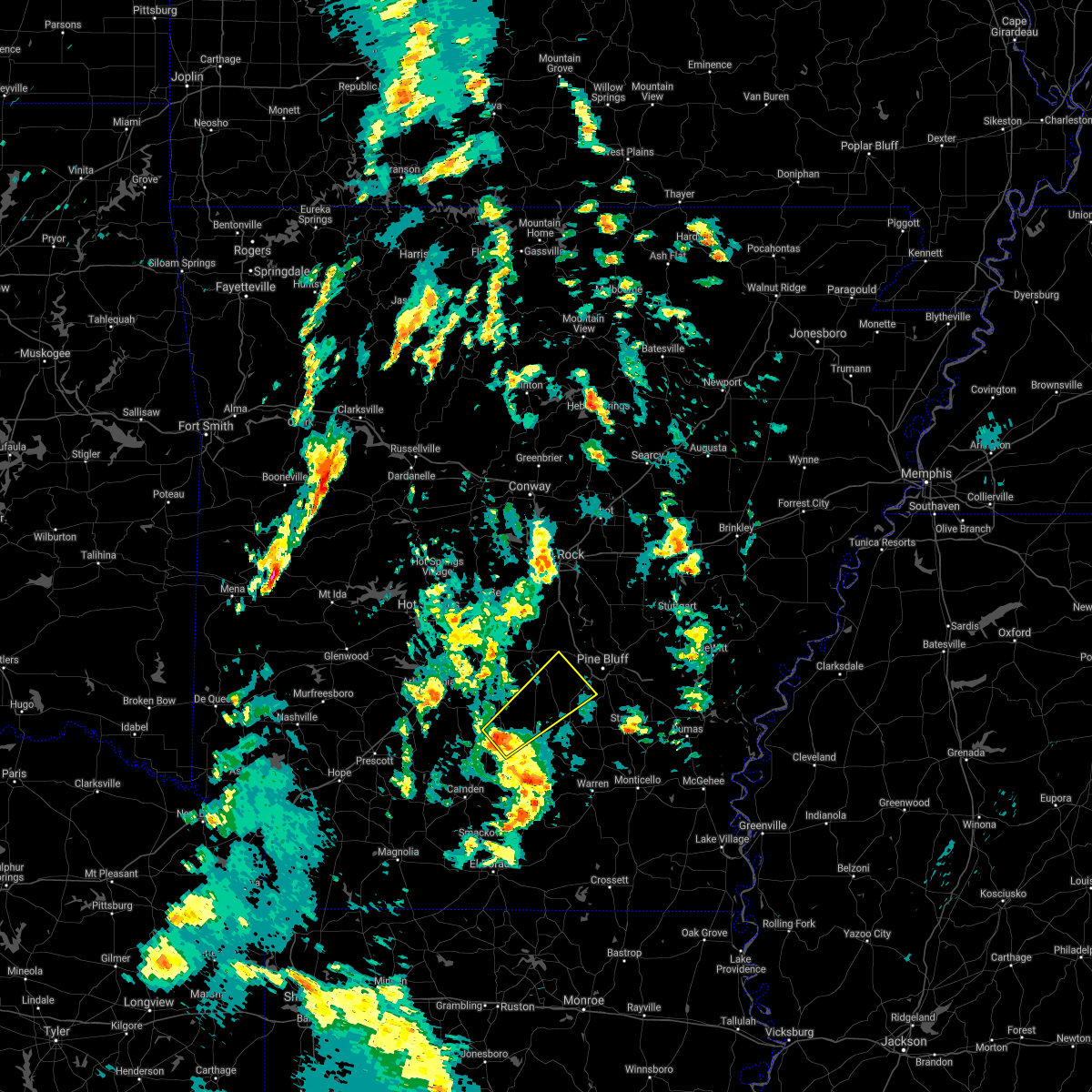 At 244 pm cdt, a severe thunderstorm was located 10 miles northwest of thornton, or 11 miles northwest of fordyce, moving northeast at 55 mph (radar indicated). Hazards include 60 mph wind gusts and quarter size hail. Hail damage to vehicles is expected. Expect wind damage to roofs, siding, and trees. At 244 pm cdt, a severe thunderstorm was located 10 miles northwest of thornton, or 11 miles northwest of fordyce, moving northeast at 55 mph (radar indicated). Hazards include 60 mph wind gusts and quarter size hail. Hail damage to vehicles is expected. Expect wind damage to roofs, siding, and trees.
|
| 3/31/2021 12:39 AM CDT |
 At 1239 am cdt, a severe thunderstorm was located over carthage, or 18 miles southwest of sheridan, moving east at 40 mph (radar indicated). Hazards include 60 mph wind gusts and quarter size hail. Hail damage to vehicles is expected. expect wind damage to roofs, siding, and trees. Locations impacted include, rison, leola, carthage, lamont, princeton, tulip, staves, grapevine, farindale, bunn, millerville,. At 1239 am cdt, a severe thunderstorm was located over carthage, or 18 miles southwest of sheridan, moving east at 40 mph (radar indicated). Hazards include 60 mph wind gusts and quarter size hail. Hail damage to vehicles is expected. expect wind damage to roofs, siding, and trees. Locations impacted include, rison, leola, carthage, lamont, princeton, tulip, staves, grapevine, farindale, bunn, millerville,.
|
| 3/31/2021 12:25 AM CDT |
 At 1225 am cdt, a severe thunderstorm was located 10 miles west of carthage, or 19 miles east of arkadelphia, moving east at 40 mph (radar indicated). Hazards include 60 mph wind gusts and quarter size hail. Hail damage to vehicles is expected. Expect wind damage to roofs, siding, and trees. At 1225 am cdt, a severe thunderstorm was located 10 miles west of carthage, or 19 miles east of arkadelphia, moving east at 40 mph (radar indicated). Hazards include 60 mph wind gusts and quarter size hail. Hail damage to vehicles is expected. Expect wind damage to roofs, siding, and trees.
|
| 3/31/2021 12:16 AM CDT |
 At 1216 am cdt, a severe thunderstorm was located 10 miles north of sparkman, or 13 miles east of arkadelphia, moving east at 35 mph (radar indicated). Hazards include 60 mph wind gusts and quarter size hail. Hail damage to vehicles is expected. expect wind damage to roofs, siding, and trees. Locations impacted include, leola, carthage, manning, princeton, tulip, willow,. At 1216 am cdt, a severe thunderstorm was located 10 miles north of sparkman, or 13 miles east of arkadelphia, moving east at 35 mph (radar indicated). Hazards include 60 mph wind gusts and quarter size hail. Hail damage to vehicles is expected. expect wind damage to roofs, siding, and trees. Locations impacted include, leola, carthage, manning, princeton, tulip, willow,.
|
| 3/31/2021 12:07 AM CDT |
 At 1207 am cdt, a severe thunderstorm was located 8 miles southeast of arkadelphia, moving east at 35 mph (radar indicated). Hazards include 60 mph wind gusts and quarter size hail. Hail damage to vehicles is expected. expect wind damage to roofs, siding, and trees. Locations impacted include, leola, carthage, joan, princeton, tulip, willow, dalark, griffithtown, manning,. At 1207 am cdt, a severe thunderstorm was located 8 miles southeast of arkadelphia, moving east at 35 mph (radar indicated). Hazards include 60 mph wind gusts and quarter size hail. Hail damage to vehicles is expected. expect wind damage to roofs, siding, and trees. Locations impacted include, leola, carthage, joan, princeton, tulip, willow, dalark, griffithtown, manning,.
|
| 3/30/2021 11:55 PM CDT |
 At 1155 pm cdt, a severe thunderstorm was located over gum springs in clark county, or near arkadelphia, moving east at 35 mph (radar indicated). Hazards include golf ball size hail and 60 mph wind gusts. People and animals outdoors will be injured. expect hail damage to roofs, siding, windows, and vehicles. Expect wind damage to roofs, siding, and trees. At 1155 pm cdt, a severe thunderstorm was located over gum springs in clark county, or near arkadelphia, moving east at 35 mph (radar indicated). Hazards include golf ball size hail and 60 mph wind gusts. People and animals outdoors will be injured. expect hail damage to roofs, siding, windows, and vehicles. Expect wind damage to roofs, siding, and trees.
|
| 3/27/2021 7:12 PM CDT |
 At 712 pm cdt, a severe thunderstorm capable of producing a tornado was located near carthage, or 12 miles north of fordyce, moving east at 50 mph (radar indicated rotation). Hazards include tornado and two inch hail. Flying debris will be dangerous to those caught without shelter. mobile homes will be damaged or destroyed. damage to roofs, windows, and vehicles will occur. tree damage is likely. Locations impacted include, carthage, lamont, farindale, bunn, staves, grapevine,. At 712 pm cdt, a severe thunderstorm capable of producing a tornado was located near carthage, or 12 miles north of fordyce, moving east at 50 mph (radar indicated rotation). Hazards include tornado and two inch hail. Flying debris will be dangerous to those caught without shelter. mobile homes will be damaged or destroyed. damage to roofs, windows, and vehicles will occur. tree damage is likely. Locations impacted include, carthage, lamont, farindale, bunn, staves, grapevine,.
|
| 3/27/2021 7:04 PM CDT |
 At 703 pm cdt, a severe thunderstorm was located 7 miles southwest of carthage, or 17 miles northwest of fordyce, moving northeast at 45 mph. this is a very dangerous storm (radar indicated). Hazards include three inch hail and 60 mph wind gusts. People and animals outdoors will be severely injured. expect shattered windows, extensive damage to roofs, siding, and vehicles. Locations impacted include, rison, carthage, lamont, princeton, tulip, staves, grapevine, ivan, farindale, bunn, millerville,. At 703 pm cdt, a severe thunderstorm was located 7 miles southwest of carthage, or 17 miles northwest of fordyce, moving northeast at 45 mph. this is a very dangerous storm (radar indicated). Hazards include three inch hail and 60 mph wind gusts. People and animals outdoors will be severely injured. expect shattered windows, extensive damage to roofs, siding, and vehicles. Locations impacted include, rison, carthage, lamont, princeton, tulip, staves, grapevine, ivan, farindale, bunn, millerville,.
|
| 3/27/2021 7:00 PM CDT |
 At 659 pm cdt, a severe thunderstorm capable of producing a tornado was located 10 miles east of sparkman, or 17 miles northwest of fordyce, moving northeast at 45 mph (radar indicated rotation). Hazards include tornado and half dollar size hail. Flying debris will be dangerous to those caught without shelter. mobile homes will be damaged or destroyed. damage to roofs, windows, and vehicles will occur. Tree damage is likely. At 659 pm cdt, a severe thunderstorm capable of producing a tornado was located 10 miles east of sparkman, or 17 miles northwest of fordyce, moving northeast at 45 mph (radar indicated rotation). Hazards include tornado and half dollar size hail. Flying debris will be dangerous to those caught without shelter. mobile homes will be damaged or destroyed. damage to roofs, windows, and vehicles will occur. Tree damage is likely.
|
| 3/27/2021 6:58 PM CDT |
 At 658 pm cdt, a severe thunderstorm was located 8 miles east of sparkman, or 19 miles northwest of fordyce, moving northeast at 45 mph (radar indicated). Hazards include 60 mph wind gusts and half dollar size hail. Hail damage to vehicles is expected. Expect wind damage to roofs, siding, and trees. At 658 pm cdt, a severe thunderstorm was located 8 miles east of sparkman, or 19 miles northwest of fordyce, moving northeast at 45 mph (radar indicated). Hazards include 60 mph wind gusts and half dollar size hail. Hail damage to vehicles is expected. Expect wind damage to roofs, siding, and trees.
|
| 3/27/2021 5:26 PM CDT |
 A severe thunderstorm warning remains in effect until 600 pm cdt for northwestern cleveland. grant. northeastern dallas. northwestern jefferson and southeastern saline counties. At 526 pm cdt, severe thunderstorms were located along a line extending from near carthage to 7 miles north of lamont, moving northeast at 50 mph. A severe thunderstorm warning remains in effect until 600 pm cdt for northwestern cleveland. grant. northeastern dallas. northwestern jefferson and southeastern saline counties. At 526 pm cdt, severe thunderstorms were located along a line extending from near carthage to 7 miles north of lamont, moving northeast at 50 mph.
|
| 3/27/2021 5:11 PM CDT |
 At 511 pm cdt, a severe thunderstorm was located near carthage, or 16 miles north of fordyce, moving northeast at 40 mph (radar indicated). Hazards include 60 mph wind gusts and quarter size hail. Hail damage to vehicles is expected. Expect wind damage to roofs, siding, and trees. At 511 pm cdt, a severe thunderstorm was located near carthage, or 16 miles north of fordyce, moving northeast at 40 mph (radar indicated). Hazards include 60 mph wind gusts and quarter size hail. Hail damage to vehicles is expected. Expect wind damage to roofs, siding, and trees.
|
| 8/14/2020 7:10 AM CDT |
 The severe thunderstorm warning for east central clark, central grant, northwestern dallas and eastern hot spring counties will expire at 715 am cdt, the storms which prompted the warning have weakened below severe limits, and no longer pose an immediate threat to life or property. therefore, the warning will be allowed to expire. however gusty winds and heavy rain are still possible with these thunderstorms. The severe thunderstorm warning for east central clark, central grant, northwestern dallas and eastern hot spring counties will expire at 715 am cdt, the storms which prompted the warning have weakened below severe limits, and no longer pose an immediate threat to life or property. therefore, the warning will be allowed to expire. however gusty winds and heavy rain are still possible with these thunderstorms.
|
| 8/14/2020 6:55 AM CDT |
 At 654 am cdt, severe thunderstorms were located along a line extending from near poyen to 7 miles northeast of sparkman, moving southeast at 35 mph (radar indicated). Hazards include 60 mph wind gusts. Expect damage to roofs, siding, and trees. Locations impacted include, malvern, sheridan, rockport, traskwood, leola, carthage, prattsville, poyen, perla, jenkins ferry state park, thiel, dogwood, donaldson, magnet cove, ain, lono, tulip, gifford, glen rose, buie, this includes interstate 30 between mile markers 95 and 106. At 654 am cdt, severe thunderstorms were located along a line extending from near poyen to 7 miles northeast of sparkman, moving southeast at 35 mph (radar indicated). Hazards include 60 mph wind gusts. Expect damage to roofs, siding, and trees. Locations impacted include, malvern, sheridan, rockport, traskwood, leola, carthage, prattsville, poyen, perla, jenkins ferry state park, thiel, dogwood, donaldson, magnet cove, ain, lono, tulip, gifford, glen rose, buie, this includes interstate 30 between mile markers 95 and 106.
|
| 8/14/2020 6:27 AM CDT |
 At 627 am cdt, severe thunderstorms were located along a line extending from near rockport to near caddo valley, moving east at 25 mph (radar indicated). Hazards include 60 mph wind gusts. expect damage to roofs, siding, and trees At 627 am cdt, severe thunderstorms were located along a line extending from near rockport to near caddo valley, moving east at 25 mph (radar indicated). Hazards include 60 mph wind gusts. expect damage to roofs, siding, and trees
|
| 5/25/2020 8:14 PM CDT |
 At 814 pm cdt, a severe thunderstorm was located near lamont, or 9 miles northwest of rison, moving north at 45 mph (radar indicated). Hazards include 60 mph wind gusts. expect damage to roofs, siding, and trees At 814 pm cdt, a severe thunderstorm was located near lamont, or 9 miles northwest of rison, moving north at 45 mph (radar indicated). Hazards include 60 mph wind gusts. expect damage to roofs, siding, and trees
|
| 4/28/2020 11:48 PM CDT |
 At 1148 pm cdt, severe thunderstorms were located along a line extending from 7 miles north of lamont to near carthage to near sparkman to near beirne, moving southeast at 35 mph (radar indicated). Hazards include 60 mph wind gusts and quarter size hail. Hail damage to vehicles is expected. expect wind damage to roofs, siding, and trees. Locations impacted include, arkadelphia, sheridan, gurdon, leola, sparkman, carthage, okolona, whelen springs, beirne, gum springs in clark county, lamont, richwoods, dogwood, jenkins ferry state park, ain, tulip, curtis, ouachita, vaden, dalark, this includes interstate 30 between mile markers 53 and 72. At 1148 pm cdt, severe thunderstorms were located along a line extending from 7 miles north of lamont to near carthage to near sparkman to near beirne, moving southeast at 35 mph (radar indicated). Hazards include 60 mph wind gusts and quarter size hail. Hail damage to vehicles is expected. expect wind damage to roofs, siding, and trees. Locations impacted include, arkadelphia, sheridan, gurdon, leola, sparkman, carthage, okolona, whelen springs, beirne, gum springs in clark county, lamont, richwoods, dogwood, jenkins ferry state park, ain, tulip, curtis, ouachita, vaden, dalark, this includes interstate 30 between mile markers 53 and 72.
|
| 4/28/2020 11:35 PM CDT |
 At 1134 pm cdt, severe thunderstorms were located along a line extending from near prattsville to 11 miles west of leola to near richwoods to 6 miles northwest of okolona, moving southeast at 35 mph (radar indicated). Hazards include 60 mph wind gusts and quarter size hail. Hail damage to vehicles is expected. expect wind damage to roofs, siding, and trees. locations impacted include, arkadelphia, sheridan, murfreesboro, white hall, gurdon, caddo valley, leola, sparkman, carthage, prattsville, poyen, okolona, whelen springs, beirne, gum springs in clark county, jenkins ferry state park, crater of diamonds state park, dogwood, lamont, halfway, this includes the following highways, interstate 30 between mile markers 53 and 83. Interstate 530 near mile marker 35. At 1134 pm cdt, severe thunderstorms were located along a line extending from near prattsville to 11 miles west of leola to near richwoods to 6 miles northwest of okolona, moving southeast at 35 mph (radar indicated). Hazards include 60 mph wind gusts and quarter size hail. Hail damage to vehicles is expected. expect wind damage to roofs, siding, and trees. locations impacted include, arkadelphia, sheridan, murfreesboro, white hall, gurdon, caddo valley, leola, sparkman, carthage, prattsville, poyen, okolona, whelen springs, beirne, gum springs in clark county, jenkins ferry state park, crater of diamonds state park, dogwood, lamont, halfway, this includes the following highways, interstate 30 between mile markers 53 and 83. Interstate 530 near mile marker 35.
|
| 4/28/2020 11:14 PM CDT |
 At 1114 pm cdt, severe thunderstorms were located along a line extending from near perla to 10 miles northeast of arkadelphia to near caddo valley to 7 miles east of narrows dam, moving southeast at 35 mph (radar indicated). Hazards include 60 mph wind gusts and quarter size hail. Hail damage to vehicles is expected. Expect wind damage to roofs, siding, and trees. At 1114 pm cdt, severe thunderstorms were located along a line extending from near perla to 10 miles northeast of arkadelphia to near caddo valley to 7 miles east of narrows dam, moving southeast at 35 mph (radar indicated). Hazards include 60 mph wind gusts and quarter size hail. Hail damage to vehicles is expected. Expect wind damage to roofs, siding, and trees.
|
| 4/12/2020 7:55 PM CDT |
 At 754 pm cdt, severe thunderstorms were located along a line extending from near salem in saline county to near tull to dogwood to near carthage to 10 miles north of harlow, moving east at 70 mph (radar indicated). Hazards include 70 mph wind gusts and quarter size hail. Hail damage to vehicles is expected. expect considerable tree damage. wind damage is also likely to mobile homes, roofs, and outbuildings. locations impacted include, little rock, pine bluff, benton, bryant, sheridan, star city, rison, white hall, shannon hills, england, wrightsville, redfield, altheimer, humphrey, leola, tull, kingsland, carthage, prattsville, humnoke, this includes the following highways, interstate 30 between mile markers 117 and 127. Interstate 530 between mile markers 5 and 46. At 754 pm cdt, severe thunderstorms were located along a line extending from near salem in saline county to near tull to dogwood to near carthage to 10 miles north of harlow, moving east at 70 mph (radar indicated). Hazards include 70 mph wind gusts and quarter size hail. Hail damage to vehicles is expected. expect considerable tree damage. wind damage is also likely to mobile homes, roofs, and outbuildings. locations impacted include, little rock, pine bluff, benton, bryant, sheridan, star city, rison, white hall, shannon hills, england, wrightsville, redfield, altheimer, humphrey, leola, tull, kingsland, carthage, prattsville, humnoke, this includes the following highways, interstate 30 between mile markers 117 and 127. Interstate 530 between mile markers 5 and 46.
|
| 4/12/2020 7:45 PM CDT |
 At 744 pm cdt, severe thunderstorms were located along a line extending from 8 miles northeast of lonsdale to near traskwood to jenkins ferry state park to near carthage to near sparkman, moving east at 80 mph (radar indicated). Hazards include 60 mph wind gusts and quarter size hail. Hail damage to vehicles is expected. Expect wind damage to roofs, siding, and trees. At 744 pm cdt, severe thunderstorms were located along a line extending from 8 miles northeast of lonsdale to near traskwood to jenkins ferry state park to near carthage to near sparkman, moving east at 80 mph (radar indicated). Hazards include 60 mph wind gusts and quarter size hail. Hail damage to vehicles is expected. Expect wind damage to roofs, siding, and trees.
|
| 1/10/2020 11:51 PM CST |
 At 1150 pm cst, severe thunderstorms were located along a line extending from near thiel to 11 miles west of carthage to near sparkman to near chidester, moving east at 10 mph (radar indicated). Hazards include 60 mph wind gusts. expect damage to roofs, siding, and trees At 1150 pm cst, severe thunderstorms were located along a line extending from near thiel to 11 miles west of carthage to near sparkman to near chidester, moving east at 10 mph (radar indicated). Hazards include 60 mph wind gusts. expect damage to roofs, siding, and trees
|
| 5/18/2019 5:09 PM CDT |
 The national weather service in little rock has issued a * severe thunderstorm warning for. northern bradley county in southeastern arkansas. cleveland county in southeastern arkansas. grant county in central arkansas. Northeastern calhoun county in southwestern arkansas. The national weather service in little rock has issued a * severe thunderstorm warning for. northern bradley county in southeastern arkansas. cleveland county in southeastern arkansas. grant county in central arkansas. Northeastern calhoun county in southwestern arkansas.
|
| 5/18/2019 4:46 PM CDT |
 At 445 pm cdt, severe thunderstorms were located along a line extending from near poyen to 10 miles west of carthage to 10 miles south of sparkman, moving east at 35 mph (radar indicated). Hazards include 60 mph wind gusts and nickel size hail. Expect damage to roofs, siding, and trees. Locations impacted include, malvern, bearden, leola, sparkman, carthage, prattsville, poyen, chidester, perla, jenkins ferry state park, thiel, amy, lono, tulip, ouachita, gifford, vaden, buie, dalark, fenter, a tornado watch remains in effect until 800 pm cdt for central and southwestern arkansas. At 445 pm cdt, severe thunderstorms were located along a line extending from near poyen to 10 miles west of carthage to 10 miles south of sparkman, moving east at 35 mph (radar indicated). Hazards include 60 mph wind gusts and nickel size hail. Expect damage to roofs, siding, and trees. Locations impacted include, malvern, bearden, leola, sparkman, carthage, prattsville, poyen, chidester, perla, jenkins ferry state park, thiel, amy, lono, tulip, ouachita, gifford, vaden, buie, dalark, fenter, a tornado watch remains in effect until 800 pm cdt for central and southwestern arkansas.
|
| 5/18/2019 4:21 PM CDT |
 At 420 pm cdt, severe thunderstorms were located along a line extending from 9 miles southwest of malvern to near richwoods to near bluff city, moving east at 40 mph (radar indicated). Hazards include 60 mph wind gusts and nickel size hail. expect damage to roofs, siding, and trees At 420 pm cdt, severe thunderstorms were located along a line extending from 9 miles southwest of malvern to near richwoods to near bluff city, moving east at 40 mph (radar indicated). Hazards include 60 mph wind gusts and nickel size hail. expect damage to roofs, siding, and trees
|
| 5/8/2019 5:15 PM CDT |
 At 514 pm cdt, a severe thunderstorm was located near carthage, or 13 miles north of fordyce, moving northeast at 30 mph (radar indicated). Hazards include 60 mph wind gusts. Expect damage to roofs, siding, and trees. Locations impacted include, kingsland, carthage, ivan, farindale, bunn, ramsey,. At 514 pm cdt, a severe thunderstorm was located near carthage, or 13 miles north of fordyce, moving northeast at 30 mph (radar indicated). Hazards include 60 mph wind gusts. Expect damage to roofs, siding, and trees. Locations impacted include, kingsland, carthage, ivan, farindale, bunn, ramsey,.
|
| 5/8/2019 4:43 PM CDT |
 At 443 pm cdt, a severe thunderstorm was located 7 miles east of sparkman, or 18 miles west of fordyce, moving northeast at 30 mph (radar indicated). Hazards include 60 mph wind gusts. expect damage to roofs, siding, and trees At 443 pm cdt, a severe thunderstorm was located 7 miles east of sparkman, or 18 miles west of fordyce, moving northeast at 30 mph (radar indicated). Hazards include 60 mph wind gusts. expect damage to roofs, siding, and trees
|
| 12/1/2018 2:44 AM CST |
 At 243 am cst, severe thunderstorms were located along a line extending from carthage to 7 miles north of fordyce to near harlow, moving northeast at 55 mph (radar indicated). Hazards include 60 mph wind gusts. expect damage to roofs, siding, and trees At 243 am cst, severe thunderstorms were located along a line extending from carthage to 7 miles north of fordyce to near harlow, moving northeast at 55 mph (radar indicated). Hazards include 60 mph wind gusts. expect damage to roofs, siding, and trees
|
| 12/1/2018 2:35 AM CST |
 At 234 am cst, severe thunderstorms were located along a line extending from 6 miles southwest of carthage to 7 miles northwest of thornton to near highland industrial park, moving east at 45 mph (radar indicated). Hazards include 70 mph wind gusts and nickel size hail. Expect considerable tree damage. damage is likely to mobile homes, roofs, and outbuildings. locations impacted include, pine bluff, camden, sheridan, fordyce, rison, white hall, redfield, bearden, leola, kingsland, sparkman, thornton, carthage, tipton, dogwood, poison springs state park, lamont, harlow, hebron, kedron, this includes interstate 530 between mile markers 19 and 40. A tornado watch remains in effect until 800 am cst for central, southeastern and southwestern arkansas. At 234 am cst, severe thunderstorms were located along a line extending from 6 miles southwest of carthage to 7 miles northwest of thornton to near highland industrial park, moving east at 45 mph (radar indicated). Hazards include 70 mph wind gusts and nickel size hail. Expect considerable tree damage. damage is likely to mobile homes, roofs, and outbuildings. locations impacted include, pine bluff, camden, sheridan, fordyce, rison, white hall, redfield, bearden, leola, kingsland, sparkman, thornton, carthage, tipton, dogwood, poison springs state park, lamont, harlow, hebron, kedron, this includes interstate 530 between mile markers 19 and 40. A tornado watch remains in effect until 800 am cst for central, southeastern and southwestern arkansas.
|
| 12/1/2018 2:05 AM CST |
 At 205 am cst, severe thunderstorms were located along a line extending from near richwoods to near sparkman to chidester, moving northeast at 60 mph (radar indicated). Hazards include 70 mph wind gusts and nickel size hail. Expect considerable tree damage. Damage is likely to mobile homes, roofs, and outbuildings. At 205 am cst, severe thunderstorms were located along a line extending from near richwoods to near sparkman to chidester, moving northeast at 60 mph (radar indicated). Hazards include 70 mph wind gusts and nickel size hail. Expect considerable tree damage. Damage is likely to mobile homes, roofs, and outbuildings.
|
| 12/1/2018 1:56 AM CST |
 At 155 am cst, severe thunderstorms were located along a line extending from halfway to near gurdon to near whelen springs, moving northeast at 70 mph (radar indicated). Hazards include 70 mph wind gusts. Expect considerable tree damage. damage is likely to mobile homes, roofs, and outbuildings. Locations impacted include, hot springs, arkadelphia, malvern, gurdon, amity, caddo valley, leola, sparkman, carthage, okolona, whelen springs, beirne, gum springs in clark county, halfway, richwoods, degray lake state park, donaldson, friendship, bismarck, antoine, this includes interstate 30 between mile markers 53 and 96. At 155 am cst, severe thunderstorms were located along a line extending from halfway to near gurdon to near whelen springs, moving northeast at 70 mph (radar indicated). Hazards include 70 mph wind gusts. Expect considerable tree damage. damage is likely to mobile homes, roofs, and outbuildings. Locations impacted include, hot springs, arkadelphia, malvern, gurdon, amity, caddo valley, leola, sparkman, carthage, okolona, whelen springs, beirne, gum springs in clark county, halfway, richwoods, degray lake state park, donaldson, friendship, bismarck, antoine, this includes interstate 30 between mile markers 53 and 96.
|
| 12/1/2018 1:31 AM CST |
 At 131 am cst, severe thunderstorms were located along a line extending from near nashville to near blevins to emmet, moving northeast at 65 mph (radar indicated). Hazards include 60 mph wind gusts. expect damage to roofs, siding, and trees At 131 am cst, severe thunderstorms were located along a line extending from near nashville to near blevins to emmet, moving northeast at 65 mph (radar indicated). Hazards include 60 mph wind gusts. expect damage to roofs, siding, and trees
|
| 8/19/2018 9:06 PM CDT |
 At 906 pm cdt, severe thunderstorms were located along a line extending from 15 miles southeast of ola to near jessieville to near perla to 7 miles southwest of leola to near sparkman, moving east at 40 mph (radar indicated). Hazards include 60 mph wind gusts and nickel size hail. Expect damage to roofs, siding, and trees. Locations impacted include, hot springs, hot springs village, malvern, haskell, rockport, traskwood, leola, tull, sparkman, carthage, prattsville, poyen, perla, lonsdale, jenkins ferry state park, jessieville, thiel, hot springs national park, hot springs memorial field, lake ouachita state park,. At 906 pm cdt, severe thunderstorms were located along a line extending from 15 miles southeast of ola to near jessieville to near perla to 7 miles southwest of leola to near sparkman, moving east at 40 mph (radar indicated). Hazards include 60 mph wind gusts and nickel size hail. Expect damage to roofs, siding, and trees. Locations impacted include, hot springs, hot springs village, malvern, haskell, rockport, traskwood, leola, tull, sparkman, carthage, prattsville, poyen, perla, lonsdale, jenkins ferry state park, jessieville, thiel, hot springs national park, hot springs memorial field, lake ouachita state park,.
|
| 8/19/2018 8:55 PM CDT |
 At 855 pm cdt, severe thunderstorms were located along a line extending from 12 miles south of plainview in yell county to near jessieville to near rockport to 14 miles west of leola to near sparkman, moving east at 40 mph (radar indicated). Hazards include 60 mph wind gusts and nickel size hail. Expect damage to roofs, siding, and trees. Locations impacted include, hot springs, hot springs village, arkadelphia, malvern, haskell, mountain pine, rockport, caddo valley, traskwood, leola, tull, sparkman, carthage, prattsville, poyen, perla, lonsdale, gum springs in clark county, jenkins ferry state park, jessieville,. At 855 pm cdt, severe thunderstorms were located along a line extending from 12 miles south of plainview in yell county to near jessieville to near rockport to 14 miles west of leola to near sparkman, moving east at 40 mph (radar indicated). Hazards include 60 mph wind gusts and nickel size hail. Expect damage to roofs, siding, and trees. Locations impacted include, hot springs, hot springs village, arkadelphia, malvern, haskell, mountain pine, rockport, caddo valley, traskwood, leola, tull, sparkman, carthage, prattsville, poyen, perla, lonsdale, gum springs in clark county, jenkins ferry state park, jessieville,.
|
| 8/19/2018 8:46 PM CDT |
 At 845 pm cdt, severe thunderstorms were located along a line extending from 12 miles south of plainview in yell county to 6 miles north of lake ouachita state park to 8 miles southeast of hot springs memorial field to 8 miles east of arkadelphia to 7 miles east of gurdon, moving east at 40 mph (radar indicated). Hazards include 60 mph wind gusts and nickel size hail. expect damage to roofs, siding, and trees At 845 pm cdt, severe thunderstorms were located along a line extending from 12 miles south of plainview in yell county to 6 miles north of lake ouachita state park to 8 miles southeast of hot springs memorial field to 8 miles east of arkadelphia to 7 miles east of gurdon, moving east at 40 mph (radar indicated). Hazards include 60 mph wind gusts and nickel size hail. expect damage to roofs, siding, and trees
|
| 8/8/2018 5:11 PM CDT |
 At 510 pm cdt, severe thunderstorms were located along a line extending from dogwood to 9 miles southwest of lamont to near thornton, moving east at 40 mph (radar indicated). Hazards include 60 mph wind gusts and penny size hail. Expect damage to roofs, siding, and trees. Locations impacted include, sheridan, fordyce, leola, kingsland, thornton, carthage, harlow, jenkins ferry state park, hebron, tipton, thiel, marks mill state park, dogwood, ain, hopeville, staves, ivan, new edinburg, millerville, ramsey,. At 510 pm cdt, severe thunderstorms were located along a line extending from dogwood to 9 miles southwest of lamont to near thornton, moving east at 40 mph (radar indicated). Hazards include 60 mph wind gusts and penny size hail. Expect damage to roofs, siding, and trees. Locations impacted include, sheridan, fordyce, leola, kingsland, thornton, carthage, harlow, jenkins ferry state park, hebron, tipton, thiel, marks mill state park, dogwood, ain, hopeville, staves, ivan, new edinburg, millerville, ramsey,.
|
| 8/8/2018 4:55 PM CDT | Trees were blown down along highway 16 in dallas county AR, 4.8 miles W of Carthage, AR |
| 8/8/2018 4:50 PM CDT | Trees and power lines were blown down on highway 22 in dallas county AR, 1.8 miles SW of Carthage, AR |
| 8/8/2018 4:50 PM CDT | Trees and power lines were blown down on highway 22 in dallas county AR, 1.8 miles SW of Carthage, AR |
| 8/8/2018 4:41 PM CDT | Trees were blown down on highway 9 and highway 30 in dallas county AR, 5.5 miles E of Carthage, AR |
| 8/8/2018 4:37 PM CDT |
 At 436 pm cdt, severe thunderstorms were located along a line extending from 9 miles east of arkadelphia to sparkman to 6 miles west of bearden, moving northeast at 30 mph (radar indicated). Hazards include 60 mph wind gusts and penny size hail. expect damage to roofs, siding, and trees At 436 pm cdt, severe thunderstorms were located along a line extending from 9 miles east of arkadelphia to sparkman to 6 miles west of bearden, moving northeast at 30 mph (radar indicated). Hazards include 60 mph wind gusts and penny size hail. expect damage to roofs, siding, and trees
|
| 6/13/2018 4:32 PM CDT |
 At 431 pm cdt, a severe thunderstorm was located near leola, or 16 miles southwest of sheridan, moving south at 10 mph (radar indicated). Hazards include 60 mph wind gusts and quarter size hail. Hail damage to vehicles is expected. Expect wind damage to roofs, siding, and trees. At 431 pm cdt, a severe thunderstorm was located near leola, or 16 miles southwest of sheridan, moving south at 10 mph (radar indicated). Hazards include 60 mph wind gusts and quarter size hail. Hail damage to vehicles is expected. Expect wind damage to roofs, siding, and trees.
|
| 6/8/2018 5:23 PM CDT |
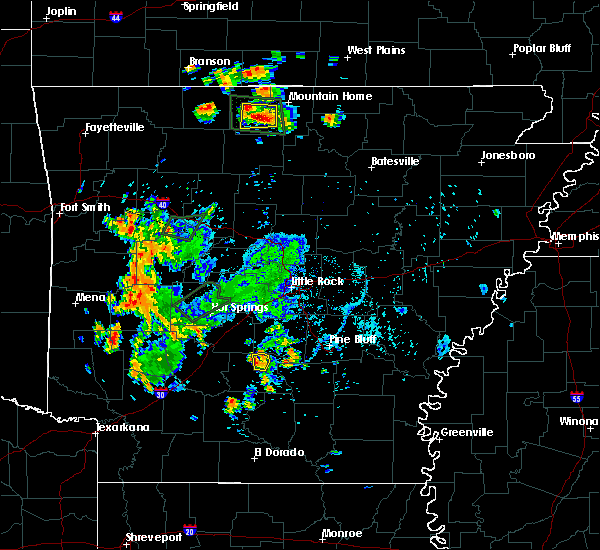 The severe thunderstorm warning for north central dallas county will expire at 530 pm cdt, the storm which prompted the warning has weakened below severe limits, and no longer poses an immediate threat to life or property. therefore, the warning will be allowed to expire. however small hail and gusty winds are still possible with this thunderstorm. The severe thunderstorm warning for north central dallas county will expire at 530 pm cdt, the storm which prompted the warning has weakened below severe limits, and no longer poses an immediate threat to life or property. therefore, the warning will be allowed to expire. however small hail and gusty winds are still possible with this thunderstorm.
|
| 6/8/2018 5:17 PM CDT |
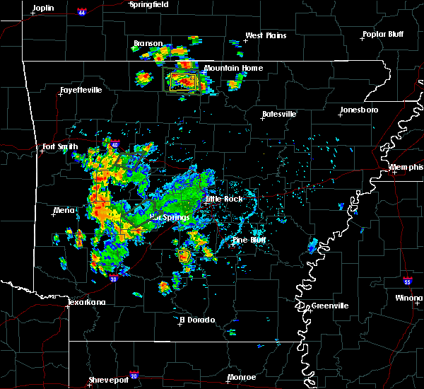 At 517 pm cdt, a severe thunderstorm was located near carthage, or 18 miles northwest of fordyce, moving north at 10 mph (radar indicated). Hazards include 60 mph wind gusts and quarter size hail. Hail damage to vehicles is expected. expect wind damage to roofs, siding, and trees. Locations impacted include, carthage, tulip,. At 517 pm cdt, a severe thunderstorm was located near carthage, or 18 miles northwest of fordyce, moving north at 10 mph (radar indicated). Hazards include 60 mph wind gusts and quarter size hail. Hail damage to vehicles is expected. expect wind damage to roofs, siding, and trees. Locations impacted include, carthage, tulip,.
|
| 6/8/2018 5:15 PM CDT | Trees blown over in tuli in dallas county AR, 5.5 miles E of Carthage, AR |
| 6/8/2018 5:01 PM CDT |
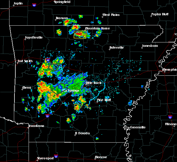 At 501 pm cdt, a severe thunderstorm was located near carthage, or 17 miles northwest of fordyce, moving north at 10 mph (radar indicated). Hazards include 60 mph wind gusts and quarter size hail. Hail damage to vehicles is expected. Expect wind damage to roofs, siding, and trees. At 501 pm cdt, a severe thunderstorm was located near carthage, or 17 miles northwest of fordyce, moving north at 10 mph (radar indicated). Hazards include 60 mph wind gusts and quarter size hail. Hail damage to vehicles is expected. Expect wind damage to roofs, siding, and trees.
|
| 2/24/2018 4:10 PM CST |
 The severe thunderstorm warning for southwestern grant, northeastern dallas and southeastern hot spring counties will expire at 415 pm cst, the storm which prompted the warning has weakened below severe limits, and no longer poses an immediate threat to life or property. therefore, the warning will be allowed to expire. however gusty winds and heavy rain are still possible with this thunderstorm. a tornado watch remains in effect until 600 pm cst for central and southwestern arkansas. The severe thunderstorm warning for southwestern grant, northeastern dallas and southeastern hot spring counties will expire at 415 pm cst, the storm which prompted the warning has weakened below severe limits, and no longer poses an immediate threat to life or property. therefore, the warning will be allowed to expire. however gusty winds and heavy rain are still possible with this thunderstorm. a tornado watch remains in effect until 600 pm cst for central and southwestern arkansas.
|
| 2/24/2018 3:53 PM CST |
 At 353 pm cst, a severe thunderstorm was located 12 miles southwest of thiel, or 13 miles south of malvern, moving east at 45 mph (radar indicated). Hazards include 60 mph wind gusts. Expect damage to roofs, siding, and trees. Locations impacted include, sheridan, leola, carthage, prattsville, poyen, thiel, jenkins ferry state park, dogwood, lono, cross roads in grant county, tulip, slabtown, farindale, willow, brush creek, millerville, a tornado watch remains in effect until 600 pm cst for central and southwestern arkansas. At 353 pm cst, a severe thunderstorm was located 12 miles southwest of thiel, or 13 miles south of malvern, moving east at 45 mph (radar indicated). Hazards include 60 mph wind gusts. Expect damage to roofs, siding, and trees. Locations impacted include, sheridan, leola, carthage, prattsville, poyen, thiel, jenkins ferry state park, dogwood, lono, cross roads in grant county, tulip, slabtown, farindale, willow, brush creek, millerville, a tornado watch remains in effect until 600 pm cst for central and southwestern arkansas.
|
| 2/24/2018 3:47 PM CST |
 At 347 pm cst, a line of severe thunderstorms were located 10 miles east of arkadelphia, moving east at 45 mph (radar indicated). Hazards include 60 mph wind gusts. Expect damage to roofs, siding, and trees. Locations impacted include, sheridan, leola, carthage, prattsville, poyen, thiel, jenkins ferry state park, dogwood, donaldson, lono, cross roads in grant county, tulip, slabtown, manning, farindale, bunn, joan, willow, brush creek, dalark, a tornado watch remains in effect until 600 pm cst for central, southeastern and southwestern arkansas. At 347 pm cst, a line of severe thunderstorms were located 10 miles east of arkadelphia, moving east at 45 mph (radar indicated). Hazards include 60 mph wind gusts. Expect damage to roofs, siding, and trees. Locations impacted include, sheridan, leola, carthage, prattsville, poyen, thiel, jenkins ferry state park, dogwood, donaldson, lono, cross roads in grant county, tulip, slabtown, manning, farindale, bunn, joan, willow, brush creek, dalark, a tornado watch remains in effect until 600 pm cst for central, southeastern and southwestern arkansas.
|
| 2/24/2018 3:33 PM CST |
 At 333 pm cst, a severe thunderstorm was located over arkadelphia, moving east at 45 mph (radar indicated). Hazards include 60 mph wind gusts. expect damage to roofs, siding, and trees At 333 pm cst, a severe thunderstorm was located over arkadelphia, moving east at 45 mph (radar indicated). Hazards include 60 mph wind gusts. expect damage to roofs, siding, and trees
|
| 7/1/2017 5:07 PM CDT |
 At 507 pm cdt, severe thunderstorms were located along a line extending from 7 miles northeast of halfway to near caddo valley to 6 miles northeast of sparkman, moving northeast at 40 mph (radar indicated). Hazards include 60 mph wind gusts and nickel size hail. expect damage to roofs, siding, and trees At 507 pm cdt, severe thunderstorms were located along a line extending from 7 miles northeast of halfway to near caddo valley to 6 miles northeast of sparkman, moving northeast at 40 mph (radar indicated). Hazards include 60 mph wind gusts and nickel size hail. expect damage to roofs, siding, and trees
|
| 5/28/2017 2:48 AM CDT |
 At 248 am cdt, severe thunderstorms were located along a line extending from 6 miles southwest of lonsdale to near caddo valley to beirne, moving east at 45 mph (radar indicated). Hazards include 60 mph wind gusts and nickel size hail. expect damage to roofs, siding, and trees At 248 am cdt, severe thunderstorms were located along a line extending from 6 miles southwest of lonsdale to near caddo valley to beirne, moving east at 45 mph (radar indicated). Hazards include 60 mph wind gusts and nickel size hail. expect damage to roofs, siding, and trees
|
| 4/29/2017 7:25 PM CDT |
 At 725 pm cdt, a severe thunderstorm was located near leola, or 18 miles southeast of malvern, moving northeast at 45 mph (radar indicated). Hazards include 60 mph wind gusts and quarter size hail. Hail damage to vehicles is expected. Expect wind damage to roofs, siding, and trees. At 725 pm cdt, a severe thunderstorm was located near leola, or 18 miles southeast of malvern, moving northeast at 45 mph (radar indicated). Hazards include 60 mph wind gusts and quarter size hail. Hail damage to vehicles is expected. Expect wind damage to roofs, siding, and trees.
|
| 4/29/2017 7:23 PM CDT |
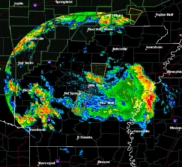 At 723 pm cdt, a severe thunderstorm was located 7 miles west of carthage, or 20 miles south of malvern, moving north at 40 mph (radar indicated). Hazards include 60 mph wind gusts and quarter size hail. Hail damage to vehicles is expected. expect wind damage to roofs, siding, and trees. Locations impacted include, carthage, princeton, tulip, willow,. At 723 pm cdt, a severe thunderstorm was located 7 miles west of carthage, or 20 miles south of malvern, moving north at 40 mph (radar indicated). Hazards include 60 mph wind gusts and quarter size hail. Hail damage to vehicles is expected. expect wind damage to roofs, siding, and trees. Locations impacted include, carthage, princeton, tulip, willow,.
|
| 4/29/2017 7:03 PM CDT |
 At 703 pm cdt, a severe thunderstorm was located near sparkman, or 20 miles west of fordyce, moving north at 40 mph (radar indicated). Hazards include 60 mph wind gusts and quarter size hail. Hail damage to vehicles is expected. expect wind damage to roofs, siding, and trees. Locations impacted include, sparkman, carthage, princeton, tulip, willow, pine grove, manning, ouachita, holly springs,. At 703 pm cdt, a severe thunderstorm was located near sparkman, or 20 miles west of fordyce, moving north at 40 mph (radar indicated). Hazards include 60 mph wind gusts and quarter size hail. Hail damage to vehicles is expected. expect wind damage to roofs, siding, and trees. Locations impacted include, sparkman, carthage, princeton, tulip, willow, pine grove, manning, ouachita, holly springs,.
|
| 4/29/2017 6:43 PM CDT |
 At 642 pm cdt, a severe thunderstorm was located 10 miles east of chidester, or 11 miles north of camden, moving north at 40 mph (radar indicated). Hazards include 60 mph wind gusts and quarter size hail. Hail damage to vehicles is expected. Expect wind damage to roofs, siding, and trees. At 642 pm cdt, a severe thunderstorm was located 10 miles east of chidester, or 11 miles north of camden, moving north at 40 mph (radar indicated). Hazards include 60 mph wind gusts and quarter size hail. Hail damage to vehicles is expected. Expect wind damage to roofs, siding, and trees.
|
| 4/10/2017 8:48 PM CDT |
 At 848 pm cdt, severe thunderstorms were located along a line extending from near carthage to 11 miles northwest of kingsland to near fordyce, moving east at 35 mph (radar indicated). Hazards include 60 mph wind gusts and penny size hail. Expect damage to roofs, siding, and trees. Locations impacted include, fordyce, rison, kingsland, thornton, carthage, lamont, hebron, kedron, mt elba, tipton, marks mill state park, toledo, sulphur springs, ain, tulip, hopeville, staves, ivan, millerville, ramsey,. At 848 pm cdt, severe thunderstorms were located along a line extending from near carthage to 11 miles northwest of kingsland to near fordyce, moving east at 35 mph (radar indicated). Hazards include 60 mph wind gusts and penny size hail. Expect damage to roofs, siding, and trees. Locations impacted include, fordyce, rison, kingsland, thornton, carthage, lamont, hebron, kedron, mt elba, tipton, marks mill state park, toledo, sulphur springs, ain, tulip, hopeville, staves, ivan, millerville, ramsey,.
|
| 4/10/2017 8:27 PM CDT | Trees were blown dow in dallas county AR, 10.1 miles NNE of Carthage, AR |
| 4/10/2017 8:25 PM CDT |
 At 825 pm cdt, severe thunderstorms were located along a line extending from 9 miles northeast of sparkman to 12 miles southwest of carthage to near bearden, moving east at 35 mph (radar indicated). Hazards include 60 mph wind gusts and penny size hail. expect damage to roofs, siding, and trees At 825 pm cdt, severe thunderstorms were located along a line extending from 9 miles northeast of sparkman to 12 miles southwest of carthage to near bearden, moving east at 35 mph (radar indicated). Hazards include 60 mph wind gusts and penny size hail. expect damage to roofs, siding, and trees
|
| 12/17/2016 6:35 PM CST |
 At 635 pm cst, a severe thunderstorm capable of producing a tornado was located over carthage, or 17 miles southwest of sheridan, moving northeast at 50 mph (radar indicated rotation). Hazards include tornado. Flying debris will be dangerous to those caught without shelter. mobile homes will be damaged or destroyed. damage to roofs, windows, and vehicles will occur. Tree damage is likely. At 635 pm cst, a severe thunderstorm capable of producing a tornado was located over carthage, or 17 miles southwest of sheridan, moving northeast at 50 mph (radar indicated rotation). Hazards include tornado. Flying debris will be dangerous to those caught without shelter. mobile homes will be damaged or destroyed. damage to roofs, windows, and vehicles will occur. Tree damage is likely.
|
| 12/17/2016 6:30 PM CST |
 At 630 pm cst, a severe thunderstorm was located near carthage, or 20 miles southwest of sheridan, moving northeast at 50 mph (radar indicated). Hazards include 60 mph wind gusts and penny size hail. expect damage to roofs, siding, and trees At 630 pm cst, a severe thunderstorm was located near carthage, or 20 miles southwest of sheridan, moving northeast at 50 mph (radar indicated). Hazards include 60 mph wind gusts and penny size hail. expect damage to roofs, siding, and trees
|
| 7/14/2016 6:51 PM CDT |
 The severe thunderstorm warning for southeastern pulaski, central dallas, northwestern jefferson, southeastern saline, grant and northwestern cleveland counties will expire at 700 pm cdt, the storms which prompted the warning have moved out of the area. therefore the warning will be allowed to expire. however gusty winds are still possible with these thunderstorms. a severe thunderstorm watch remains in effect until 900 pm cdt for southeastern, central and southwestern arkansas. The severe thunderstorm warning for southeastern pulaski, central dallas, northwestern jefferson, southeastern saline, grant and northwestern cleveland counties will expire at 700 pm cdt, the storms which prompted the warning have moved out of the area. therefore the warning will be allowed to expire. however gusty winds are still possible with these thunderstorms. a severe thunderstorm watch remains in effect until 900 pm cdt for southeastern, central and southwestern arkansas.
|
| 7/14/2016 6:24 PM CDT |
 At 623 pm cdt, severe thunderstorms were located along a line extending from orion to 8 miles southeast of dogwood to 7 miles south of carthage, moving east at 30 mph (trained weather spotters). Hazards include 60 mph wind gusts. Expect damage to roofs. siding. and trees. Locations impacted include, little rock, bryant, sheridan, shannon hills, wrightsville, redfield, leola, tull, carthage, prattsville, poyen, jenkins ferry state park, east end, cane creek, dogwood, thiel, orion, hensley island, pine bluff arsenal, alexander,. At 623 pm cdt, severe thunderstorms were located along a line extending from orion to 8 miles southeast of dogwood to 7 miles south of carthage, moving east at 30 mph (trained weather spotters). Hazards include 60 mph wind gusts. Expect damage to roofs. siding. and trees. Locations impacted include, little rock, bryant, sheridan, shannon hills, wrightsville, redfield, leola, tull, carthage, prattsville, poyen, jenkins ferry state park, east end, cane creek, dogwood, thiel, orion, hensley island, pine bluff arsenal, alexander,.
|
| 7/14/2016 5:53 PM CDT |
 At 553 pm cdt, severe thunderstorms were located along a line extending from near lonsdale to near malvern to 6 miles east of arkadelphia, moving east at 20 mph (radar indicated). Hazards include 60 mph wind gusts and quarter size hail. Hail damage to vehicles is expected. Expect wind damage to roofs, siding, and trees. At 553 pm cdt, severe thunderstorms were located along a line extending from near lonsdale to near malvern to 6 miles east of arkadelphia, moving east at 20 mph (radar indicated). Hazards include 60 mph wind gusts and quarter size hail. Hail damage to vehicles is expected. Expect wind damage to roofs, siding, and trees.
|
| 5/10/2016 1:33 AM CDT |
 At 133 am cdt, a severe thunderstorm capable of producing a tornado was located near carthage, or 13 miles north of fordyce, moving east at 35 mph (radar indicated rotation). Hazards include tornado. Flying debris will be dangerous to those caught without shelter. mobile homes will be damaged or destroyed. damage to roofs, windows, and vehicles will occur. Tree damage is likely. At 133 am cdt, a severe thunderstorm capable of producing a tornado was located near carthage, or 13 miles north of fordyce, moving east at 35 mph (radar indicated rotation). Hazards include tornado. Flying debris will be dangerous to those caught without shelter. mobile homes will be damaged or destroyed. damage to roofs, windows, and vehicles will occur. Tree damage is likely.
|
| 5/10/2016 1:29 AM CDT |
 At 129 am cdt, a severe thunderstorm was located near carthage, or 15 miles north of fordyce, moving east at 35 mph (radar indicated). Hazards include 60 mph wind gusts and quarter size hail. Hail damage to vehicles is expected. Expect wind damage to roofs, siding, and trees. At 129 am cdt, a severe thunderstorm was located near carthage, or 15 miles north of fordyce, moving east at 35 mph (radar indicated). Hazards include 60 mph wind gusts and quarter size hail. Hail damage to vehicles is expected. Expect wind damage to roofs, siding, and trees.
|
| 5/10/2016 1:05 AM CDT |
 At 105 am cdt, a severe thunderstorm was located 8 miles northeast of sparkman, or 20 miles southeast of arkadelphia, moving east at 35 mph (radar indicated). Hazards include 60 mph wind gusts and quarter size hail. Hail damage to vehicles is expected. expect wind damage to roofs, siding, and trees. Locations impacted include, sparkman, carthage, ramsey, manning, tulip, princeton, a tornado watch remains in effect until 200 am cdt for southwestern arkansas. At 105 am cdt, a severe thunderstorm was located 8 miles northeast of sparkman, or 20 miles southeast of arkadelphia, moving east at 35 mph (radar indicated). Hazards include 60 mph wind gusts and quarter size hail. Hail damage to vehicles is expected. expect wind damage to roofs, siding, and trees. Locations impacted include, sparkman, carthage, ramsey, manning, tulip, princeton, a tornado watch remains in effect until 200 am cdt for southwestern arkansas.
|
| 5/10/2016 12:52 AM CDT |
 At 1252 am cdt, a severe thunderstorm was located near sparkman, or 15 miles southeast of arkadelphia, moving east at 25 mph (radar indicated). Hazards include 60 mph wind gusts and quarter size hail. Hail damage to vehicles is expected. Expect wind damage to roofs, siding, and trees. At 1252 am cdt, a severe thunderstorm was located near sparkman, or 15 miles southeast of arkadelphia, moving east at 25 mph (radar indicated). Hazards include 60 mph wind gusts and quarter size hail. Hail damage to vehicles is expected. Expect wind damage to roofs, siding, and trees.
|
| 3/30/2016 6:23 PM CDT |
 The tornado warning for northeastern dallas and southwestern grant counties will expire at 630 pm cdt, the tornadic thunderstorm which prompted the warning has weakened. moved out of the warned area. therefore the warning will be allowed to expire. a tornado watch remains in effect until 1000 pm cdt for southern arkansas. The tornado warning for northeastern dallas and southwestern grant counties will expire at 630 pm cdt, the tornadic thunderstorm which prompted the warning has weakened. moved out of the warned area. therefore the warning will be allowed to expire. a tornado watch remains in effect until 1000 pm cdt for southern arkansas.
|
| 3/30/2016 6:14 PM CDT |
 At 613 pm cdt, a severe thunderstorm capable of producing a tornado was located near carthage, or 21 miles southwest of sheridan, moving northeast at 40 mph (radar indicated rotation). Hazards include tornado. Flying debris will be dangerous to those caught without shelter. mobile homes will be damaged or destroyed. damage to roofs, windows, and vehicles will occur. tree damage is likely. Locations impacted include, leola, carthage, dogwood, jenkins ferry state , tulip, farindale,. At 613 pm cdt, a severe thunderstorm capable of producing a tornado was located near carthage, or 21 miles southwest of sheridan, moving northeast at 40 mph (radar indicated rotation). Hazards include tornado. Flying debris will be dangerous to those caught without shelter. mobile homes will be damaged or destroyed. damage to roofs, windows, and vehicles will occur. tree damage is likely. Locations impacted include, leola, carthage, dogwood, jenkins ferry state , tulip, farindale,.
|
| 3/30/2016 6:03 PM CDT |
 At 603 pm cdt, a severe thunderstorm capable of producing a tornado was located 8 miles northeast of sparkman, or 20 miles southeast of arkadelphia, moving northeast at 40 mph (radar indicated rotation). Hazards include tornado. Flying debris will be dangerous to those caught without shelter. mobile homes will be damaged or destroyed. damage to roofs, windows, and vehicles will occur. tree damage is likely. Locations impacted include, leola, carthage, dogwood, jenkins ferry state , princeton, farindale, manning, tulip,. At 603 pm cdt, a severe thunderstorm capable of producing a tornado was located 8 miles northeast of sparkman, or 20 miles southeast of arkadelphia, moving northeast at 40 mph (radar indicated rotation). Hazards include tornado. Flying debris will be dangerous to those caught without shelter. mobile homes will be damaged or destroyed. damage to roofs, windows, and vehicles will occur. tree damage is likely. Locations impacted include, leola, carthage, dogwood, jenkins ferry state , princeton, farindale, manning, tulip,.
|
| 3/30/2016 5:54 PM CDT |
 At 553 pm cdt, a severe thunderstorm capable of producing a tornado was located near sparkman, or 19 miles southeast of arkadelphia, moving northeast at 60 mph (radar indicated rotation). Hazards include tornado. Flying debris will be dangerous to those caught without shelter. mobile homes will be damaged or destroyed. damage to roofs, windows, and vehicles will occur. Tree damage is likely. At 553 pm cdt, a severe thunderstorm capable of producing a tornado was located near sparkman, or 19 miles southeast of arkadelphia, moving northeast at 60 mph (radar indicated rotation). Hazards include tornado. Flying debris will be dangerous to those caught without shelter. mobile homes will be damaged or destroyed. damage to roofs, windows, and vehicles will occur. Tree damage is likely.
|
| 3/30/2016 5:36 PM CDT |
 At 535 pm cdt, a severe thunderstorm was located 7 miles west of highland industrial park, or 7 miles north of camden, moving northeast at 45 mph (radar indicated). Hazards include 60 mph wind gusts and penny size hail. Expect damage to roofs. siding. and trees. Locations impacted include, camden, bearden, leola, carthage, cullendale, east camden, amy, ramsey, holly springs, pine grove, warner, millville, ouachita, tulip, lester, eagle mills, bunn, princeton, farindale, harmony grove, a tornado watch remains in effect until 1000 pm cdt for southwestern arkansas. At 535 pm cdt, a severe thunderstorm was located 7 miles west of highland industrial park, or 7 miles north of camden, moving northeast at 45 mph (radar indicated). Hazards include 60 mph wind gusts and penny size hail. Expect damage to roofs. siding. and trees. Locations impacted include, camden, bearden, leola, carthage, cullendale, east camden, amy, ramsey, holly springs, pine grove, warner, millville, ouachita, tulip, lester, eagle mills, bunn, princeton, farindale, harmony grove, a tornado watch remains in effect until 1000 pm cdt for southwestern arkansas.
|
| 3/30/2016 5:26 PM CDT |
 At 526 pm cdt, a severe thunderstorm was located over camden, moving northeast at 55 mph (radar indicated). Hazards include 70 mph wind gusts and penny size hail. Expect considerable tree damage. Damage is likely to mobile homes, roofs, and outbuildings. At 526 pm cdt, a severe thunderstorm was located over camden, moving northeast at 55 mph (radar indicated). Hazards include 70 mph wind gusts and penny size hail. Expect considerable tree damage. Damage is likely to mobile homes, roofs, and outbuildings.
|
| 12/13/2015 12:10 PM CST |
 The severe thunderstorm warning for calhoun, western bradley, dallas, southwestern grant, northeastern ouachita and southeastern hot spring counties will expire at 1215 pm cst, the warning will be allowed to expire. however gusty winds and heavy rain are still possible with these thunderstorms. The severe thunderstorm warning for calhoun, western bradley, dallas, southwestern grant, northeastern ouachita and southeastern hot spring counties will expire at 1215 pm cst, the warning will be allowed to expire. however gusty winds and heavy rain are still possible with these thunderstorms.
|
| 12/13/2015 11:56 AM CST |
 At 1155 am cst, severe thunderstorms were located along a line extending from 8 miles southwest of leola to near calion, moving northeast at 30 mph (radar indicated). Hazards include 60 mph wind gusts. Expect damage to roofs. siding. and trees. Locations impacted include, fordyce, hampton, bearden, leola, thornton, carthage, harrell, jenkins ferry state park, ellisville, dogwood, hilo, thiel, harlow, moro bay state park, hampton municipal airport, moro bay, tinsman, artesian, ramsey and willow. At 1155 am cst, severe thunderstorms were located along a line extending from 8 miles southwest of leola to near calion, moving northeast at 30 mph (radar indicated). Hazards include 60 mph wind gusts. Expect damage to roofs. siding. and trees. Locations impacted include, fordyce, hampton, bearden, leola, thornton, carthage, harrell, jenkins ferry state park, ellisville, dogwood, hilo, thiel, harlow, moro bay state park, hampton municipal airport, moro bay, tinsman, artesian, ramsey and willow.
|
| 12/13/2015 11:37 AM CST |
 At 1137 am cst, severe thunderstorms were located along a line extending from 10 miles north of sparkman to near norphlet, moving northeast at 30 mph (radar indicated). Hazards include 60 mph wind gusts. Expect damage to roofs. siding. And trees. At 1137 am cst, severe thunderstorms were located along a line extending from 10 miles north of sparkman to near norphlet, moving northeast at 30 mph (radar indicated). Hazards include 60 mph wind gusts. Expect damage to roofs. siding. And trees.
|
| 6/17/2015 5:42 PM CDT |
 At 539 pm cdt, a severe thunderstorm was located near carthage, and moving north at 45 mph (radar indicated). Hazards include 60 mph wind gusts. Expect damage to roofs. Siding and trees. At 539 pm cdt, a severe thunderstorm was located near carthage, and moving north at 45 mph (radar indicated). Hazards include 60 mph wind gusts. Expect damage to roofs. Siding and trees.
|
| 5/25/2015 8:06 PM CDT | At 804 pm cdt, severe thunderstorms were located along a line extending from paron to poyen and holly springs, and moving east at 50 mph (radar indicated). Hazards include 70 mph wind gusts and nickel size hail. Expect considerable tree damage. Damage is likely to mobile homes, roofs and outbuildings. |
| 5/25/2015 7:37 PM CDT | At 736 pm cdt, severe thunderstorms were located along a line extending from lena lndg rec area to hot springs to caddo valley to whelen springs, and moving east at 50 mph (radar indicated). Hazards include 70 mph wind gusts and nickel size hail. Expect considerable tree damage. Damage is likely to mobile homes, roofs and outbuildings. |
| 5/25/2015 7:25 PM CDT | At 722 pm cdt, a severe thunderstorm was located 5 miles northwest of bearden, and moving north at 35 mph (radar indicated). Hazards include 60 mph wind gusts and quarter size hail. Hail damage to vehicles is expected. Expect wind damage to roofs, siding and trees. |
| 5/24/2015 3:32 PM CDT | At 329 pm cdt, severe thunderstorms were located along a line extending from leola to 6 miles southeast of dogwood to 6 miles northwest of grays lake, and moving northeast at 50 mph (radar indicated). Hazards include 60 mph wind gusts. Expect damage to roofs. Siding and trees. |
| 5/24/2015 3:15 PM CDT | At 313 pm cdt, severe thunderstorms were located along a line extending from 8 miles southwest of carthage to 7 miles south of carthage to fordyce, and moving northeast at 50 mph (radar indicated). Hazards include 60 mph wind gusts and penny size hail. Expect damage to roofs. Siding and trees. |
| 5/9/2015 6:45 PM CDT | At 643 pm cdt, severe thunderstorms were located along a line extending from 6 miles northeast of prattsville to sheridan to 8 miles southeast of dogwood, and moving east at 30 mph (radar indicated). Hazards include 60 mph wind gusts and quarter size hail. Hail damage to vehicles is expected. Expect wind damage to roofs, siding and trees. |
| 5/9/2015 6:24 PM CDT | At 621 pm cdt, severe thunderstorms were located along a line extending from poyen to thiel to leola, and moving east at 30 mph (radar indicated). Hazards include 60 mph wind gusts and quarter size hail. Hail damage to vehicles is expected. Expect wind damage to roofs, siding and trees. |
| 4/19/2015 6:29 PM CDT | At 625 pm cdt, a severe thunderstorm was located 5 miles northwest of grapevine, and moving northeast at 40 mph (radar indicated). Hazards include quarter to golf ball size hail and 60 mph wind gusts. People and animals outdoors will be injured. expect hail damage to roofs, siding, windows and vehicles. Expect wind damage to roofs, siding and trees. |
| 4/19/2015 6:13 PM CDT | At 612 pm cdt, a severe thunderstorm was located near leola, and moving east at 40 mph (radar indicated). Hazards include 60 mph wind gusts and quarter size hail. Hail damage to vehicles is expected. Expect wind damage to roofs, siding and trees. |
| 4/19/2015 5:55 PM CDT | At 527 pm cdt, a severe thunderstorm was located 7 miles east of richwoods, and moving east at 40 mph (radar indicated). Hazards include 60 mph wind gusts and quarter size hail. Hail damage to vehicles is expected. Expect wind damage to roofs, siding and trees. |
| 4/19/2015 5:55 PM CDT | A severe thunderstorm warning remains in effect for southeastern hot spring. southwestern grant. northern dallas and east central clark counties until 615 pm cdt. at 553 pm cdt. a severe thunderstorm was located 6 miles southwest of leola. and moving east at 40 mph. hazard. 60 mph wind gusts and quarter size hail. |
| 4/19/2015 5:55 PM CDT | A severe thunderstorm warning remains in effect for southeastern hot spring. southwestern grant. northern dallas and east central clark counties until 615 pm cdt. at 553 pm cdt. a severe thunderstorm was located 6 miles southwest of leola. and moving east at 40 mph. hazard. 60 mph wind gusts and quarter size hail. |
| 4/19/2015 5:30 PM CDT | The national weather service in little rock has issued a * severe thunderstorm warning for. east central clark county in southwest arkansas. northern dallas county in southwest arkansas. southwestern grant county in central arkansas. Southeastern hot spring county in southwest arkansas. |
| 4/4/2014 12:30 AM CDT | Spotters report numerous trees down from near carthage to a few miles north of carthage. a few vehicles were moved off highway 167 into the ditc in dallas county AR, 0.4 miles ENE of Carthage, AR |
| 1/1/0001 12:00 AM | A tree was down across a road...and some power outages were reported at carthag in dallas county AR, 0.4 miles ENE of Carthage, AR |
| 1/1/0001 12:00 AM | Quarter sized hail reported 7.8 miles N of Carthage, AR |
Hail Maps for Carthage, AR


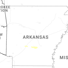


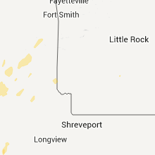


Connect with Interactive Hail Maps