

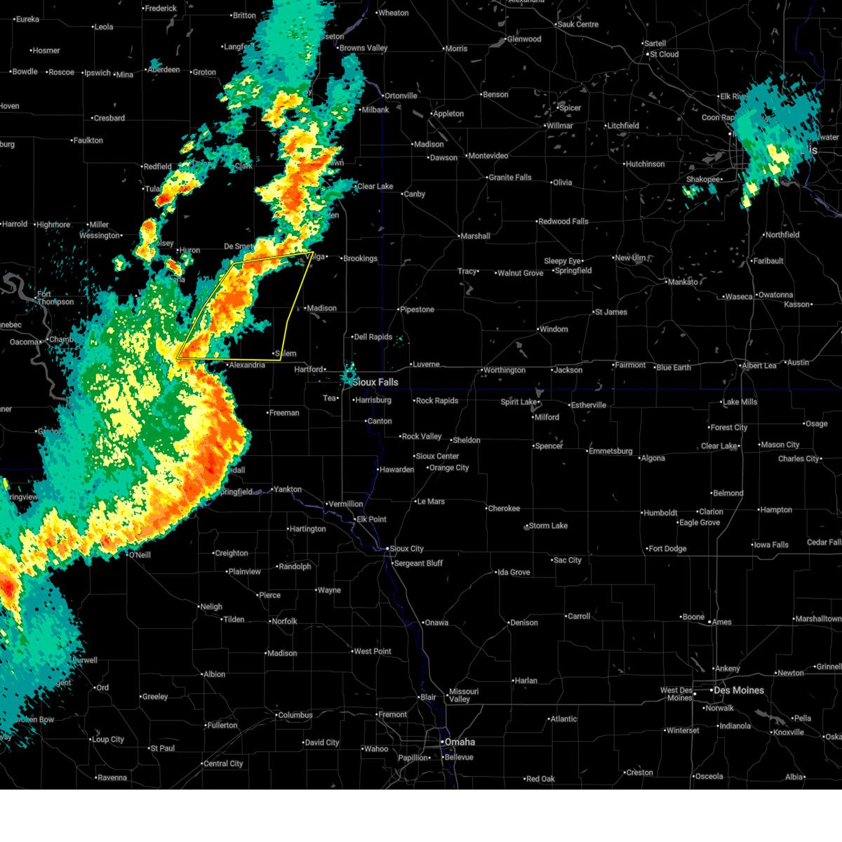
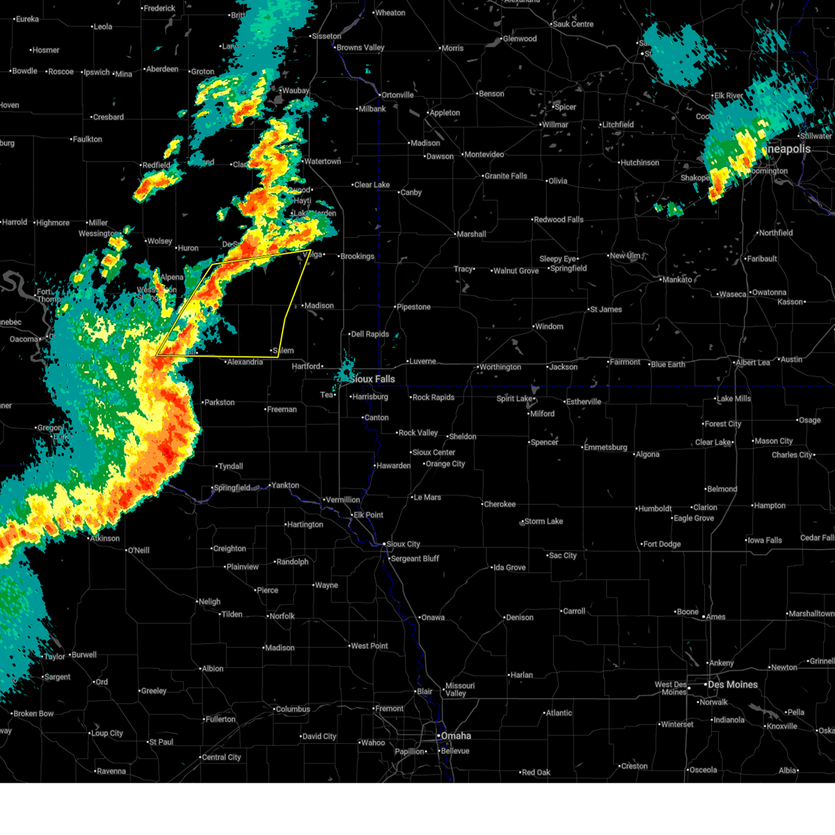
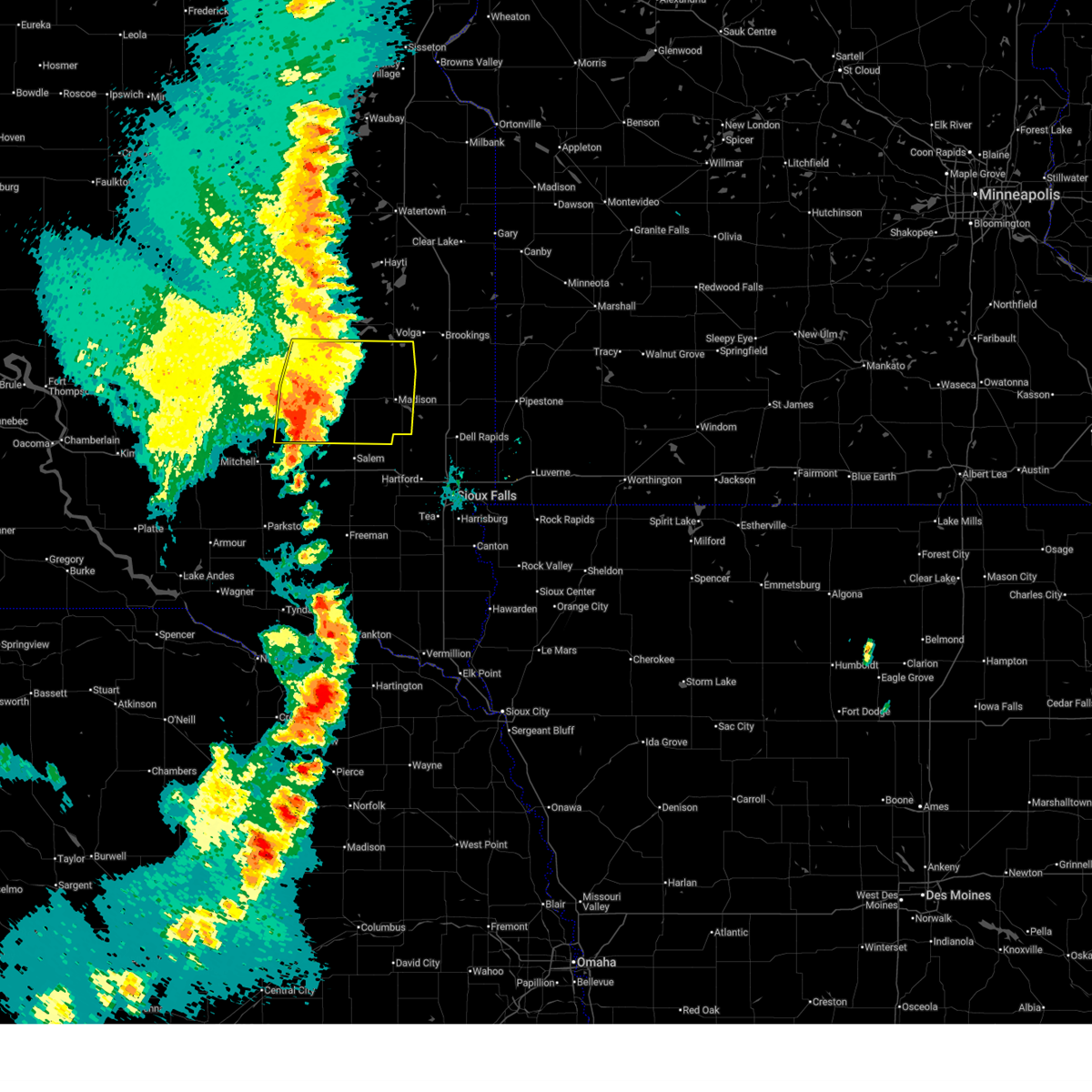
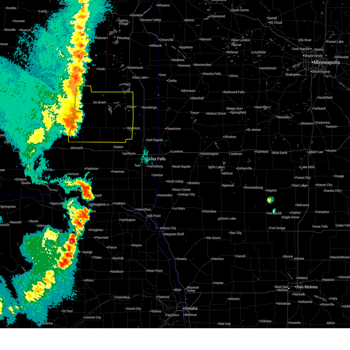
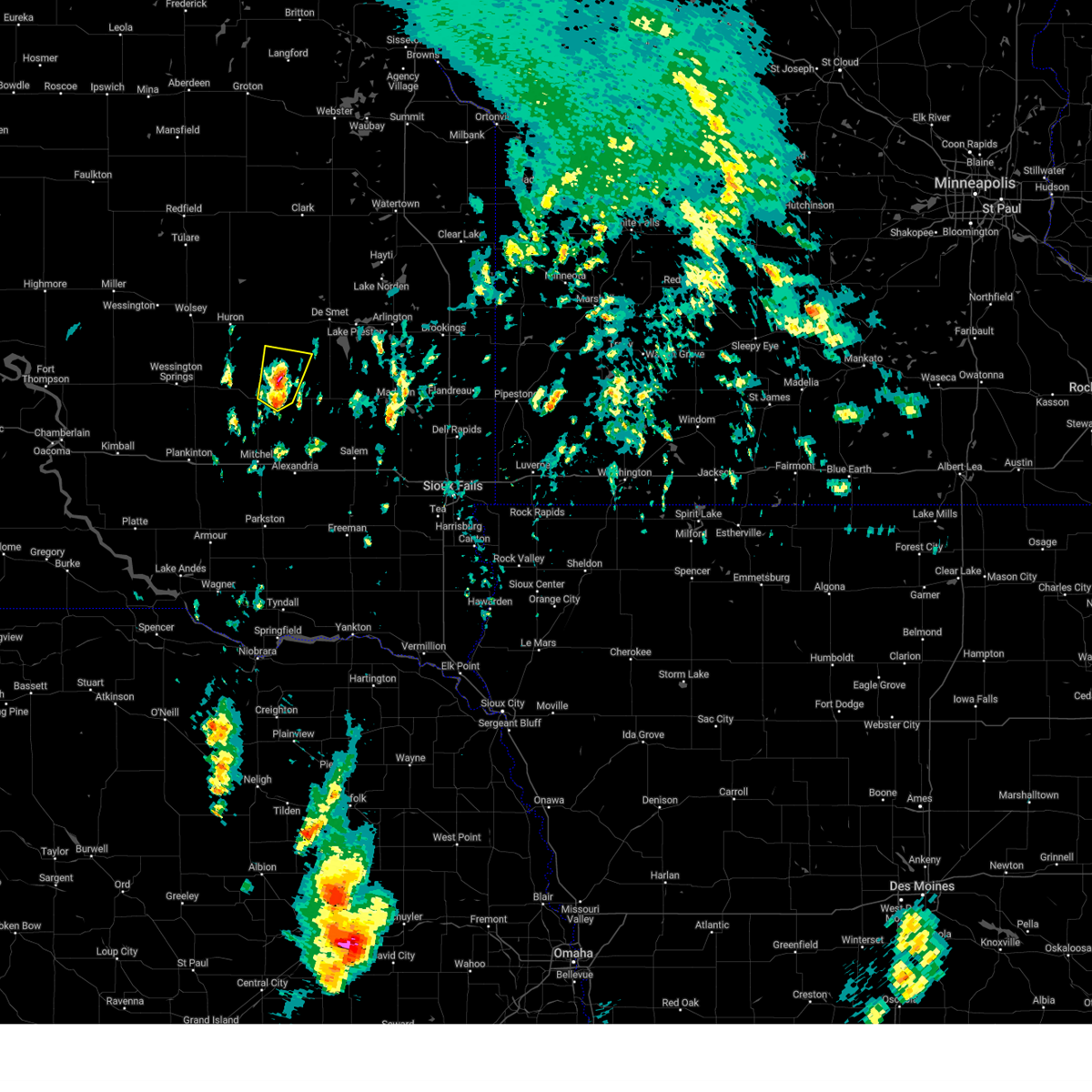
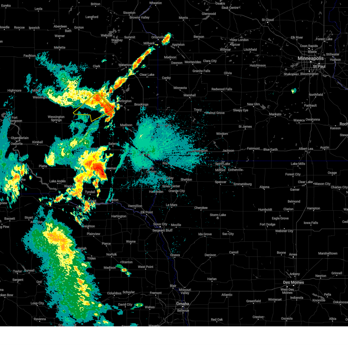
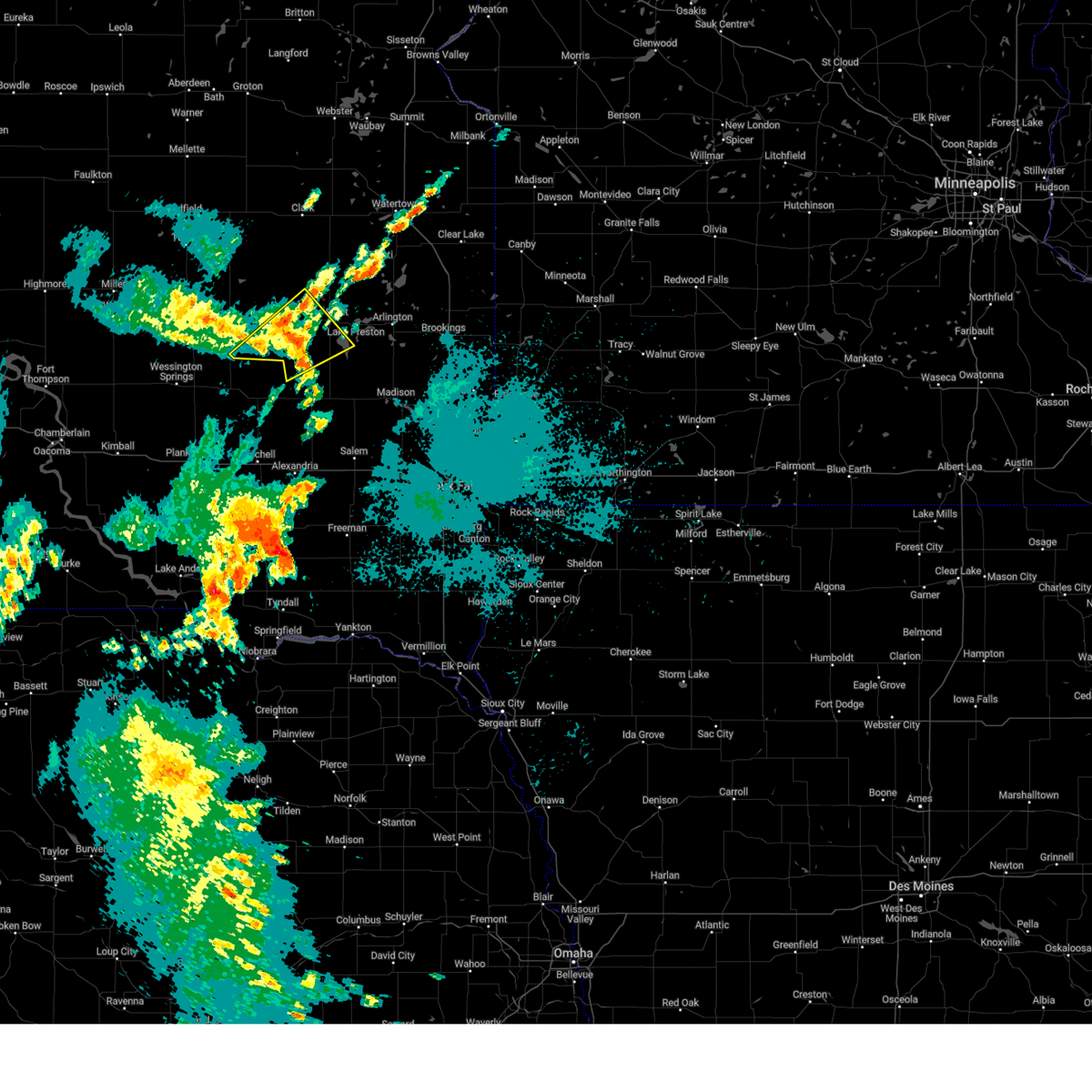
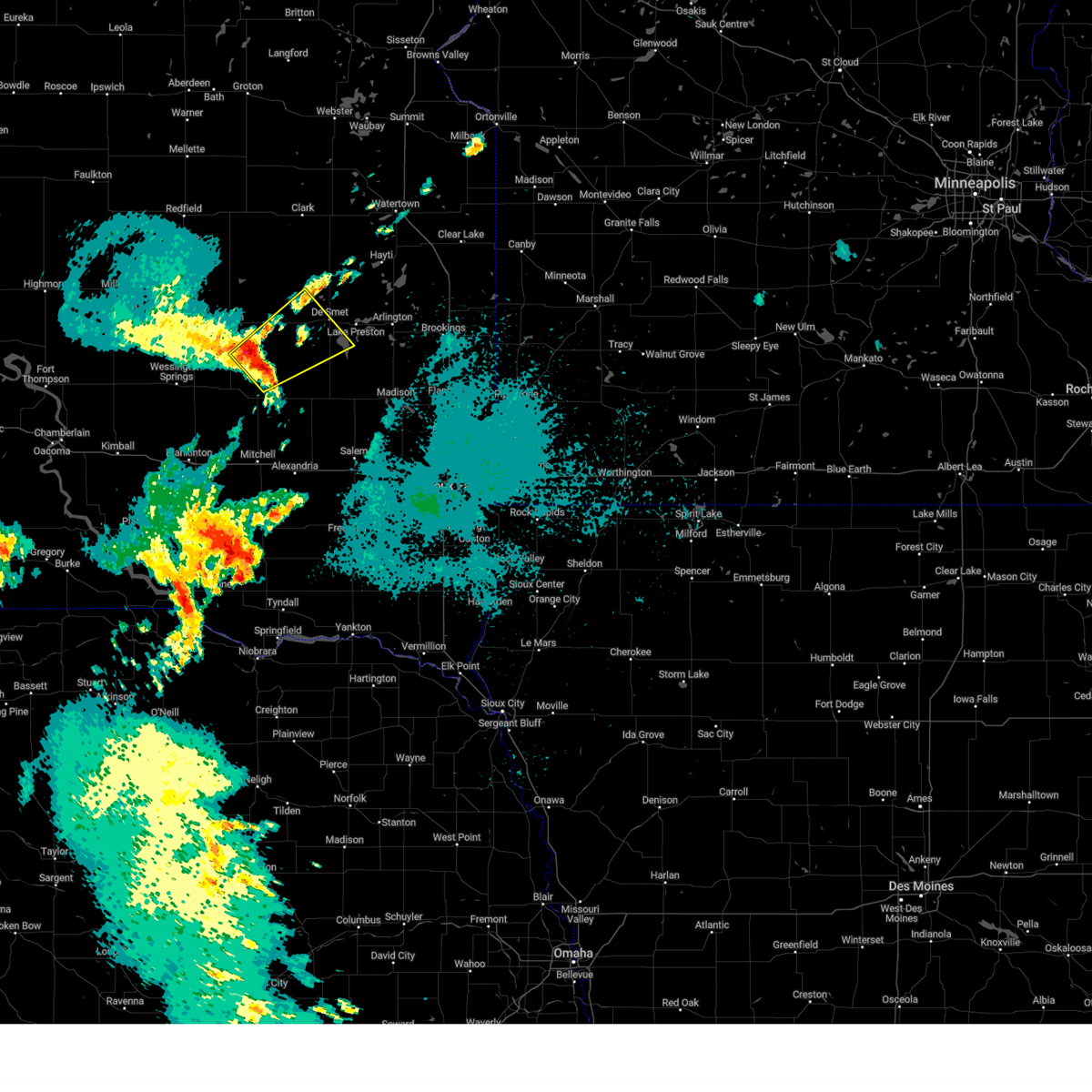
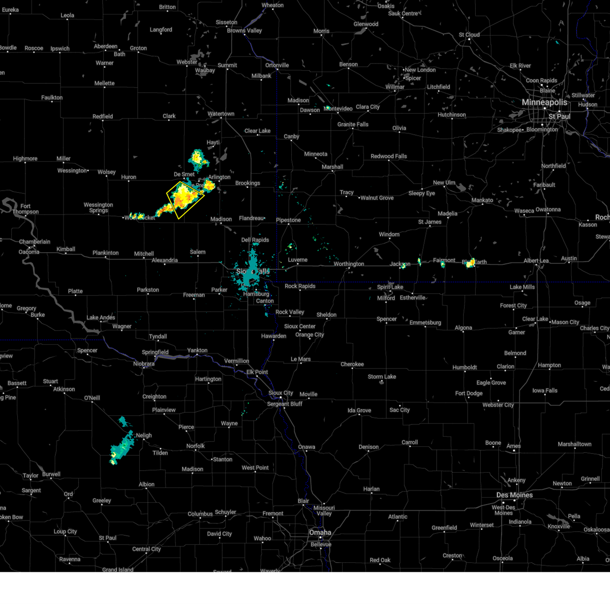
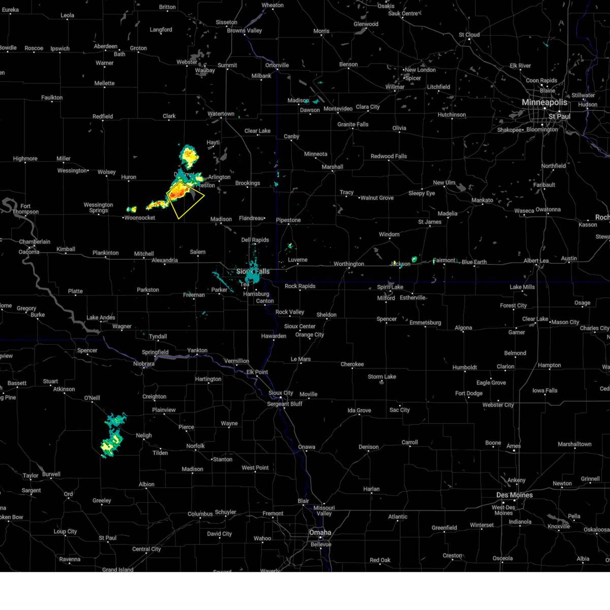
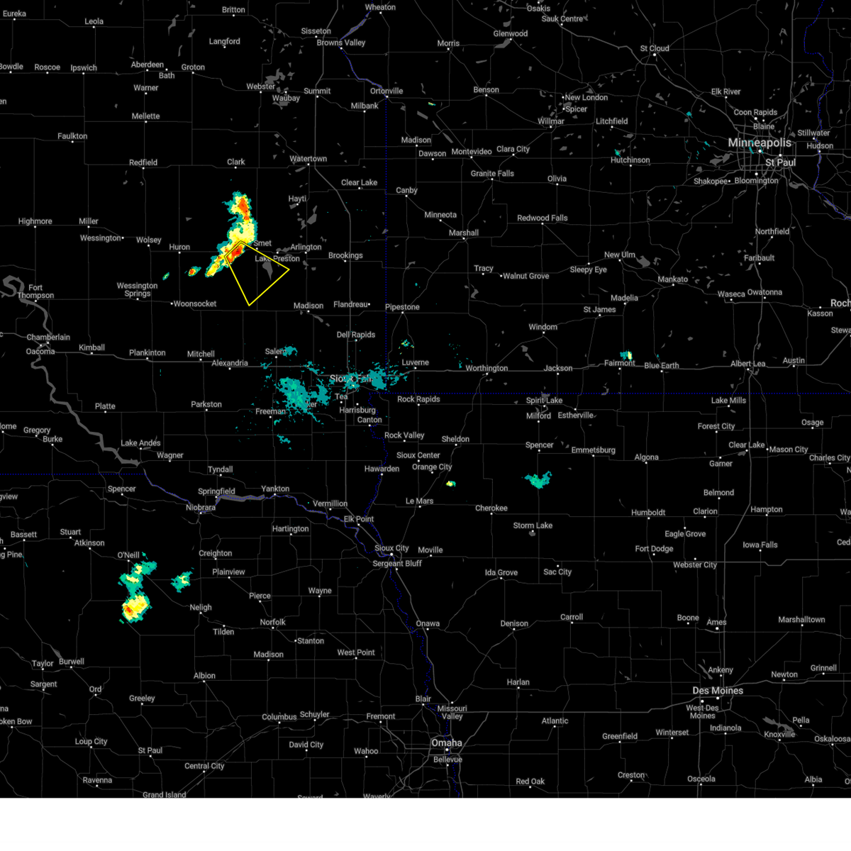
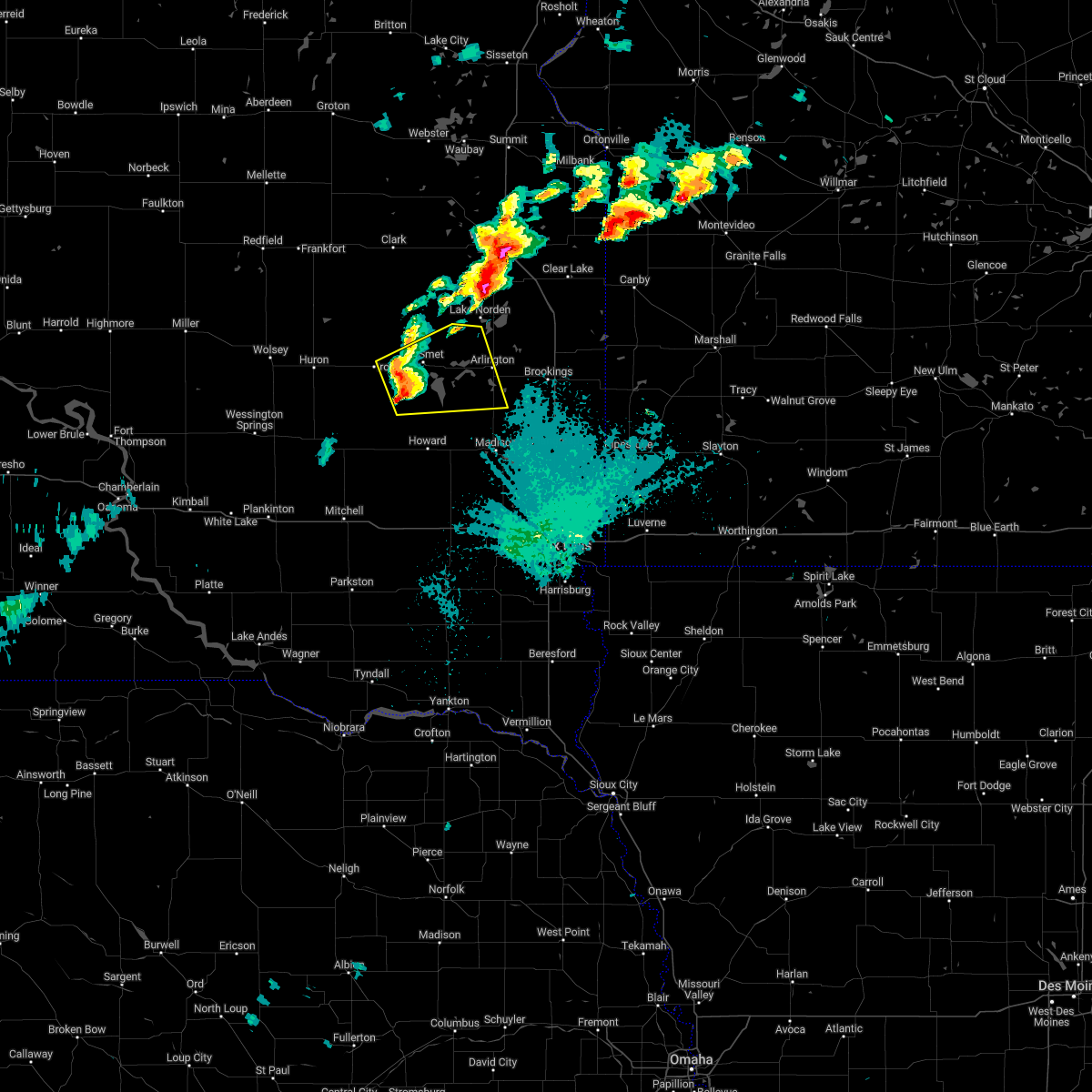
Hail Map for Carthage, SD
The Carthage, SD area has had 2 reports of on-the-ground hail by trained spotters, and has been under severe weather warnings 17 times during the past 12 months. Doppler radar has detected hail at or near Carthage, SD on 44 occasions, including 2 occasions during the past year.
| Name: | Carthage, SD |
| Where Located: | 65.5 miles NW of Sioux Falls, SD |
| Map: | Google Map for Carthage, SD |
| Population: | 144 |
| Housing Units: | 136 |
| More Info: | Search Google for Carthage, SD |
0
The Top Recent Hail Date for Carthage, SD is Monday, August 26, 2024 (44th out of 44)

Hail and Wind Damage Spotted near Carthage, SD
| Date / Time | Report Details |
|---|---|
| 7/15/2025 7:44 PM CDT | The storms which prompted the warning have moved out of the area. therefore, the warning will be allowed to expire. however, gusty winds are still possible with these thunderstorms. a severe thunderstorm watch remains in effect until 1100 pm cdt for southeastern and east central south dakota. remember, a severe thunderstorm warning still remains in effect for portions of kingsbury, miner, mccook, and lake counties until 845 pm!. |
| 7/15/2025 7:19 PM CDT |
 the severe thunderstorm warning has been cancelled and is no longer in effect the severe thunderstorm warning has been cancelled and is no longer in effect
|
| 7/15/2025 7:19 PM CDT |
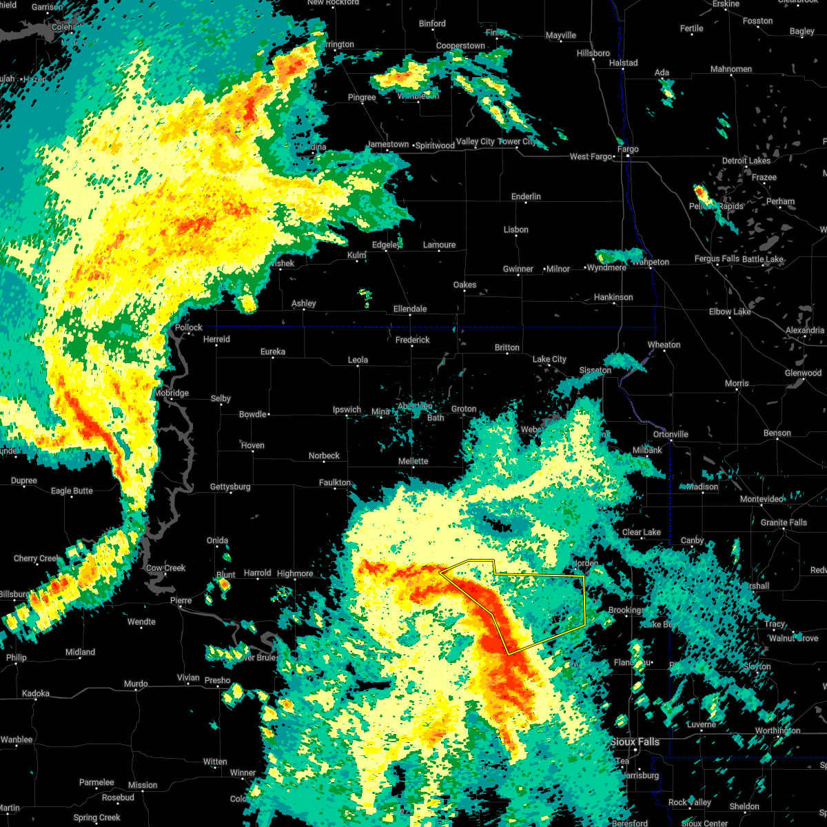
 At 719 pm cdt, severe thunderstorms were located along a line extending from 9 miles south of lake thompson state recreation area to near canova to near mitchell, moving east at 30 mph (radar indicated). Hazards include 60 mph wind gusts and quarter size hail. Hail damage to vehicles is expected. expect wind damage to roofs, siding, and trees. Locations impacted include, howard, canova, fulton, farmer, winfred, oldham, spencer in mccook county, ramona and salem. At 719 pm cdt, severe thunderstorms were located along a line extending from 9 miles south of lake thompson state recreation area to near canova to near mitchell, moving east at 30 mph (radar indicated). Hazards include 60 mph wind gusts and quarter size hail. Hail damage to vehicles is expected. expect wind damage to roofs, siding, and trees. Locations impacted include, howard, canova, fulton, farmer, winfred, oldham, spencer in mccook county, ramona and salem.
|
| 7/15/2025 6:51 PM CDT |
 Svrfsd the national weather service in sioux falls has issued a * severe thunderstorm warning for, northern davison county in southeastern south dakota, southern kingsbury county in east central south dakota, eastern sanborn county in east central south dakota, western lake county in east central south dakota, southeastern beadle county in east central south dakota, east central aurora county in south central south dakota, miner county in east central south dakota, northwestern mccook county in southeastern south dakota, northern hanson county in southeastern south dakota, west central brookings county in east central south dakota, * until 745 pm cdt. * at 651 pm cdt, severe thunderstorms were located along a line extending from carthage to near artesian to near mount vernon, moving east at 25 mph (radar indicated). Hazards include 60 mph wind gusts and half dollar size hail. Hail damage to vehicles is expected. expect wind damage to roofs, siding, and trees. severe thunderstorms will be near, mitchell, carthage, fedora, and roswell around 655 pm cdt. vilas around 705 pm cdt. howard and fulton around 710 pm cdt. Other locations in the path of these severe thunderstorms include oldham, canova and farmer. Svrfsd the national weather service in sioux falls has issued a * severe thunderstorm warning for, northern davison county in southeastern south dakota, southern kingsbury county in east central south dakota, eastern sanborn county in east central south dakota, western lake county in east central south dakota, southeastern beadle county in east central south dakota, east central aurora county in south central south dakota, miner county in east central south dakota, northwestern mccook county in southeastern south dakota, northern hanson county in southeastern south dakota, west central brookings county in east central south dakota, * until 745 pm cdt. * at 651 pm cdt, severe thunderstorms were located along a line extending from carthage to near artesian to near mount vernon, moving east at 25 mph (radar indicated). Hazards include 60 mph wind gusts and half dollar size hail. Hail damage to vehicles is expected. expect wind damage to roofs, siding, and trees. severe thunderstorms will be near, mitchell, carthage, fedora, and roswell around 655 pm cdt. vilas around 705 pm cdt. howard and fulton around 710 pm cdt. Other locations in the path of these severe thunderstorms include oldham, canova and farmer.
|
| 7/9/2025 11:34 PM CDT |
 At 1133 pm cdt, severe thunderstorms were located along a line extending from near hamlin education center to near hetland to near ramona to near canova, moving east at 50 mph (radar indicated). Hazards include 60 mph wind gusts. Expect damage to roofs, siding, and trees. these severe storms will be near, madison, lake herman state park, ramona, sinai, and orland around 1140 pm cdt. Nunda around 1145 pm cdt. At 1133 pm cdt, severe thunderstorms were located along a line extending from near hamlin education center to near hetland to near ramona to near canova, moving east at 50 mph (radar indicated). Hazards include 60 mph wind gusts. Expect damage to roofs, siding, and trees. these severe storms will be near, madison, lake herman state park, ramona, sinai, and orland around 1140 pm cdt. Nunda around 1145 pm cdt.
|
| 7/9/2025 11:34 PM CDT |
 the severe thunderstorm warning has been cancelled and is no longer in effect the severe thunderstorm warning has been cancelled and is no longer in effect
|
| 7/9/2025 10:48 PM CDT |
 Svrfsd the national weather service in sioux falls has issued a * severe thunderstorm warning for, northern davison county in southeastern south dakota, kingsbury county in east central south dakota, sanborn county in east central south dakota, lake county in east central south dakota, eastern beadle county in east central south dakota, miner county in east central south dakota, northern mccook county in southeastern south dakota, northern hanson county in southeastern south dakota, western brookings county in east central south dakota, * until 1145 pm cdt. * at 1048 pm cdt, severe thunderstorms were located along a line extending from near carpenter to near yale to 7 miles north of artesian to near letcher, moving east at 50 mph (radar indicated). Hazards include 60 mph wind gusts. Expect damage to roofs, siding, and trees. severe thunderstorms will be near, iroquois, carthage, artesian, and fedora around 1055 pm cdt. roswell around 1100 pm cdt. vilas around 1105 pm cdt. lake thompson state recreation area, de smet, and howard around 1110 pm cdt. lake preston and canova around 1120 pm cdt. winfred and oldham around 1125 pm cdt. ramona, badger, and hetland around 1130 pm cdt. arlington around 1135 pm cdt. Other locations impacted by these severe thunderstorms include bancroft and erwin. Svrfsd the national weather service in sioux falls has issued a * severe thunderstorm warning for, northern davison county in southeastern south dakota, kingsbury county in east central south dakota, sanborn county in east central south dakota, lake county in east central south dakota, eastern beadle county in east central south dakota, miner county in east central south dakota, northern mccook county in southeastern south dakota, northern hanson county in southeastern south dakota, western brookings county in east central south dakota, * until 1145 pm cdt. * at 1048 pm cdt, severe thunderstorms were located along a line extending from near carpenter to near yale to 7 miles north of artesian to near letcher, moving east at 50 mph (radar indicated). Hazards include 60 mph wind gusts. Expect damage to roofs, siding, and trees. severe thunderstorms will be near, iroquois, carthage, artesian, and fedora around 1055 pm cdt. roswell around 1100 pm cdt. vilas around 1105 pm cdt. lake thompson state recreation area, de smet, and howard around 1110 pm cdt. lake preston and canova around 1120 pm cdt. winfred and oldham around 1125 pm cdt. ramona, badger, and hetland around 1130 pm cdt. arlington around 1135 pm cdt. Other locations impacted by these severe thunderstorms include bancroft and erwin.
|
| 5/19/2025 4:32 PM CDT | the severe thunderstorm warning has been cancelled and is no longer in effect |
| 5/19/2025 4:22 PM CDT |
 At 422 pm cdt, a severe thunderstorm was located 7 miles north of artesian, or 24 miles southeast of huron, moving northeast at 30 mph (radar indicated). Hazards include quarter size hail. Damage to vehicles is expected. This severe storm will be near, carthage around 425 pm cdt. At 422 pm cdt, a severe thunderstorm was located 7 miles north of artesian, or 24 miles southeast of huron, moving northeast at 30 mph (radar indicated). Hazards include quarter size hail. Damage to vehicles is expected. This severe storm will be near, carthage around 425 pm cdt.
|
| 5/19/2025 4:10 PM CDT | Svrfsd the national weather service in sioux falls has issued a * severe thunderstorm warning for, southwestern kingsbury county in east central south dakota, eastern sanborn county in east central south dakota, southeastern beadle county in east central south dakota, northwestern miner county in east central south dakota, * until 445 pm cdt. * at 410 pm cdt, a severe thunderstorm was located over artesian, or 21 miles north of mitchell, moving north at 30 mph (radar indicated). Hazards include quarter size hail. Damage to vehicles is expected. This severe thunderstorm will be near, carthage around 425 pm cdt. |
| 8/27/2024 12:36 AM CDT |
 The storm which prompted the warning has weakened below severe limits, and has exited the warned area. therefore, the warning will be allowed to expire. a severe thunderstorm watch remains in effect until 600 am cdt for east central south dakota. The storm which prompted the warning has weakened below severe limits, and has exited the warned area. therefore, the warning will be allowed to expire. a severe thunderstorm watch remains in effect until 600 am cdt for east central south dakota.
|
| 8/27/2024 12:15 AM CDT |
 At 1214 am cdt, a severe thunderstorm was located near iroquois, or 17 miles west of lake thompson state recreation area, moving northeast at 40 mph (radar indicated). Hazards include 60 mph wind gusts and quarter size hail. Hail damage to vehicles is expected. expect wind damage to roofs, siding, and trees. Locations impacted include, de smet and lake thompson state recreation area. At 1214 am cdt, a severe thunderstorm was located near iroquois, or 17 miles west of lake thompson state recreation area, moving northeast at 40 mph (radar indicated). Hazards include 60 mph wind gusts and quarter size hail. Hail damage to vehicles is expected. expect wind damage to roofs, siding, and trees. Locations impacted include, de smet and lake thompson state recreation area.
|
| 8/27/2024 12:15 AM CDT |
 the severe thunderstorm warning has been cancelled and is no longer in effect the severe thunderstorm warning has been cancelled and is no longer in effect
|
| 8/26/2024 11:57 PM CDT |
 Svrfsd the national weather service in sioux falls has issued a * severe thunderstorm warning for, western kingsbury county in east central south dakota, northeastern sanborn county in east central south dakota, southeastern beadle county in east central south dakota, northwestern miner county in east central south dakota, * until 1245 am cdt. * at 1156 pm cdt, a severe thunderstorm was located 12 miles south of cavour, or 15 miles southeast of huron, moving northeast at 40 mph (radar indicated). Hazards include 60 mph wind gusts and nickel size hail. Expect damage to roofs, siding, and trees. this severe thunderstorm will be near, iroquois around 1210 am cdt. carthage around 1215 am cdt. Other locations in the path of this severe thunderstorm include de smet and lake thompson state recreation area. Svrfsd the national weather service in sioux falls has issued a * severe thunderstorm warning for, western kingsbury county in east central south dakota, northeastern sanborn county in east central south dakota, southeastern beadle county in east central south dakota, northwestern miner county in east central south dakota, * until 1245 am cdt. * at 1156 pm cdt, a severe thunderstorm was located 12 miles south of cavour, or 15 miles southeast of huron, moving northeast at 40 mph (radar indicated). Hazards include 60 mph wind gusts and nickel size hail. Expect damage to roofs, siding, and trees. this severe thunderstorm will be near, iroquois around 1210 am cdt. carthage around 1215 am cdt. Other locations in the path of this severe thunderstorm include de smet and lake thompson state recreation area.
|
| 8/15/2024 9:04 PM CDT |
 the severe thunderstorm warning has been cancelled and is no longer in effect the severe thunderstorm warning has been cancelled and is no longer in effect
|
| 8/15/2024 8:45 PM CDT |
 At 845 pm cdt, a severe thunderstorm was located near lake thompson state recreation area, moving southeast at 25 mph (radar indicated). Hazards include 60 mph wind gusts and quarter size hail. Hail damage to vehicles is expected. expect wind damage to roofs, siding, and trees. This severe thunderstorm will remain over mainly rural areas of southwestern kingsbury and northeastern miner counties. At 845 pm cdt, a severe thunderstorm was located near lake thompson state recreation area, moving southeast at 25 mph (radar indicated). Hazards include 60 mph wind gusts and quarter size hail. Hail damage to vehicles is expected. expect wind damage to roofs, siding, and trees. This severe thunderstorm will remain over mainly rural areas of southwestern kingsbury and northeastern miner counties.
|
| 8/15/2024 8:27 PM CDT |
 Svrfsd the national weather service in sioux falls has issued a * severe thunderstorm warning for, southwestern kingsbury county in east central south dakota, northeastern miner county in east central south dakota, * until 915 pm cdt. * at 827 pm cdt, a severe thunderstorm was located near de smet, or 10 miles west of lake thompson state recreation area, moving southeast at 25 mph (radar indicated). Hazards include 60 mph wind gusts and quarter size hail. Hail damage to vehicles is expected. expect wind damage to roofs, siding, and trees. This severe thunderstorm will be near, lake thompson state recreation area around 830 pm cdt. Svrfsd the national weather service in sioux falls has issued a * severe thunderstorm warning for, southwestern kingsbury county in east central south dakota, northeastern miner county in east central south dakota, * until 915 pm cdt. * at 827 pm cdt, a severe thunderstorm was located near de smet, or 10 miles west of lake thompson state recreation area, moving southeast at 25 mph (radar indicated). Hazards include 60 mph wind gusts and quarter size hail. Hail damage to vehicles is expected. expect wind damage to roofs, siding, and trees. This severe thunderstorm will be near, lake thompson state recreation area around 830 pm cdt.
|
| 7/14/2024 4:14 AM CDT |
 The storms which prompted the warning have weakened below severe limits, and no longer pose an immediate threat to life or property. therefore, the warning will be allowed to expire. however, gusty winds and heavy rain are still possible with these thunderstorms. a severe thunderstorm watch remains in effect until 800 am cdt for south central, central, southeastern and east central south dakota. The storms which prompted the warning have weakened below severe limits, and no longer pose an immediate threat to life or property. therefore, the warning will be allowed to expire. however, gusty winds and heavy rain are still possible with these thunderstorms. a severe thunderstorm watch remains in effect until 800 am cdt for south central, central, southeastern and east central south dakota.
|
| 7/14/2024 3:50 AM CDT |
 At 348 am cdt, severe thunderstorms were located along a line extending from de smet to canova to 6 miles south of clayton, moving east at 50 mph (trained weather spotters. at 336 am, the huron regional airport asos recorded a 62 mph wind gust). Hazards include 70 mph wind gusts. Expect considerable tree damage. damage is likely to mobile homes, roofs, and outbuildings. Locations impacted include, mitchell, huron, chamberlain, plankinton, kimball, lake vermillion state recreation area, lake thompson state recreation area, salem, de smet, wessington springs, arlington, howard, canistota, woonsocket, alexandria, lake preston, bridgewater, montrose, mount vernon, and emery. At 348 am cdt, severe thunderstorms were located along a line extending from de smet to canova to 6 miles south of clayton, moving east at 50 mph (trained weather spotters. at 336 am, the huron regional airport asos recorded a 62 mph wind gust). Hazards include 70 mph wind gusts. Expect considerable tree damage. damage is likely to mobile homes, roofs, and outbuildings. Locations impacted include, mitchell, huron, chamberlain, plankinton, kimball, lake vermillion state recreation area, lake thompson state recreation area, salem, de smet, wessington springs, arlington, howard, canistota, woonsocket, alexandria, lake preston, bridgewater, montrose, mount vernon, and emery.
|
| 7/14/2024 3:19 AM CDT |
 At 318 am cdt, severe thunderstorms were located along a line extending from near yale to near artesian to near parkston, moving east at 50 mph (trained weather spotters. at 257 am, an sddot site 3 nnw of wolsey recorded a 70 mph wind gust). Hazards include 70 mph wind gusts. Expect considerable tree damage. damage is likely to mobile homes, roofs, and outbuildings. Locations impacted include, alexandria, ethan, iroquois, fulton, fedora, carthage, roswell, farmer, emery, vilas, de smet, howard, spencer in mccook county, canova, lake thompson state recreation area, bridgewater, salem, lake preston, canistota, oldham, montrose and hetland. At 318 am cdt, severe thunderstorms were located along a line extending from near yale to near artesian to near parkston, moving east at 50 mph (trained weather spotters. at 257 am, an sddot site 3 nnw of wolsey recorded a 70 mph wind gust). Hazards include 70 mph wind gusts. Expect considerable tree damage. damage is likely to mobile homes, roofs, and outbuildings. Locations impacted include, alexandria, ethan, iroquois, fulton, fedora, carthage, roswell, farmer, emery, vilas, de smet, howard, spencer in mccook county, canova, lake thompson state recreation area, bridgewater, salem, lake preston, canistota, oldham, montrose and hetland.
|
| 7/14/2024 3:02 AM CDT |
 Svrfsd the national weather service in sioux falls has issued a * severe thunderstorm warning for, davison county in southeastern south dakota, kingsbury county in east central south dakota, sanborn county in east central south dakota, beadle county in east central south dakota, aurora county in south central south dakota, jerauld county in central south dakota, miner county in east central south dakota, mccook county in southeastern south dakota, hanson county in southeastern south dakota, brule county in south central south dakota, * until 415 am cdt. * at 301 am cdt, severe thunderstorms were located along a line extending from 9 miles northwest of huron to near woonsocket to near corsica, moving east at 50 mph (radar indicated). Hazards include 70 mph wind gusts. Expect considerable tree damage. damage is likely to mobile homes, roofs, and outbuildings. severe thunderstorms will be near, huron, woonsocket, mount vernon, letcher, forestburg, and loomis around 305 am cdt. mitchell and cavour around 310 am cdt. ethan, artesian, and yale around 315 am cdt. iroquois around 320 am cdt. Other locations in the path of these severe thunderstorms include fulton, fedora, alexandria, carthage, roswell, vilas, farmer, de smet, howard, emery, spencer in mccook county and canova. Svrfsd the national weather service in sioux falls has issued a * severe thunderstorm warning for, davison county in southeastern south dakota, kingsbury county in east central south dakota, sanborn county in east central south dakota, beadle county in east central south dakota, aurora county in south central south dakota, jerauld county in central south dakota, miner county in east central south dakota, mccook county in southeastern south dakota, hanson county in southeastern south dakota, brule county in south central south dakota, * until 415 am cdt. * at 301 am cdt, severe thunderstorms were located along a line extending from 9 miles northwest of huron to near woonsocket to near corsica, moving east at 50 mph (radar indicated). Hazards include 70 mph wind gusts. Expect considerable tree damage. damage is likely to mobile homes, roofs, and outbuildings. severe thunderstorms will be near, huron, woonsocket, mount vernon, letcher, forestburg, and loomis around 305 am cdt. mitchell and cavour around 310 am cdt. ethan, artesian, and yale around 315 am cdt. iroquois around 320 am cdt. Other locations in the path of these severe thunderstorms include fulton, fedora, alexandria, carthage, roswell, vilas, farmer, de smet, howard, emery, spencer in mccook county and canova.
|
| 9/8/2022 10:34 PM CDT |
 At 1034 pm cdt, a severe thunderstorm was located near carthage, or 10 miles southwest of lake thompson state recreation area, moving east at 35 mph (radar indicated). Hazards include quarter size hail. Damage to vehicles is expected. this severe thunderstorm will be near, de smet around 1045 pm cdt. lake thompson state recreation area around 1050 pm cdt. other locations in the path of this severe thunderstorm include lake preston, oldham, hetland, arlington and badger. hail threat, radar indicated max hail size, 1. 00 in wind threat, radar indicated max wind gust, <50 mph. At 1034 pm cdt, a severe thunderstorm was located near carthage, or 10 miles southwest of lake thompson state recreation area, moving east at 35 mph (radar indicated). Hazards include quarter size hail. Damage to vehicles is expected. this severe thunderstorm will be near, de smet around 1045 pm cdt. lake thompson state recreation area around 1050 pm cdt. other locations in the path of this severe thunderstorm include lake preston, oldham, hetland, arlington and badger. hail threat, radar indicated max hail size, 1. 00 in wind threat, radar indicated max wind gust, <50 mph.
|
| 8/2/2022 8:40 PM CDT |
 At 840 pm cdt, severe thunderstorms were located along a line extending from near bryant to ramona to near lake herman state park, moving east at 60 mph (radar indicated). Hazards include 60 mph wind gusts. the strongest winds are likely occurring ahead of the rain and lightning!. Expect damage to roofs, siding, and trees. severe thunderstorms will be near, madison, lake herman state park, ramona and orland around 845 pm cdt. wentworth, sinai and nunda around 850 pm cdt. volga, arlington, badger, chester and hetland around 855 pm cdt. brookings, colman and lake poinsett around 900 pm cdt. aurora, egan, trent and oakwood state park around 905 pm cdt. flandreau and bruce around 910 pm cdt. elkton, white and ward around 915 pm cdt. other locations impacted by these severe thunderstorms include bancroft, flandreau santee sioux tribal nation, erwin and bushnell. hail threat, radar indicated max hail size, <. 75 in wind threat, radar indicated max wind gust, 60 mph. At 840 pm cdt, severe thunderstorms were located along a line extending from near bryant to ramona to near lake herman state park, moving east at 60 mph (radar indicated). Hazards include 60 mph wind gusts. the strongest winds are likely occurring ahead of the rain and lightning!. Expect damage to roofs, siding, and trees. severe thunderstorms will be near, madison, lake herman state park, ramona and orland around 845 pm cdt. wentworth, sinai and nunda around 850 pm cdt. volga, arlington, badger, chester and hetland around 855 pm cdt. brookings, colman and lake poinsett around 900 pm cdt. aurora, egan, trent and oakwood state park around 905 pm cdt. flandreau and bruce around 910 pm cdt. elkton, white and ward around 915 pm cdt. other locations impacted by these severe thunderstorms include bancroft, flandreau santee sioux tribal nation, erwin and bushnell. hail threat, radar indicated max hail size, <. 75 in wind threat, radar indicated max wind gust, 60 mph.
|
| 8/2/2022 8:22 PM CDT |
 At 820 pm cdt, severe thunderstorms were located along a line extending from near roswell to near carthage to 8 miles northwest of yale, moving east at 55 mph (radar indicated). Hazards include 70 mph wind gusts. Expect considerable tree damage. damage is likely to mobile homes, roofs, and outbuildings. these severe storms will be near, vilas around 825 pm cdt. lake thompson state recreation area, de smet and howard around 830 pm cdt. lake preston around 840 pm cdt. other locations impacted by these severe thunderstorms include bancroft and erwin. thunderstorm damage threat, considerable hail threat, radar indicated max hail size, <. 75 in wind threat, radar indicated max wind gust, 70 mph. At 820 pm cdt, severe thunderstorms were located along a line extending from near roswell to near carthage to 8 miles northwest of yale, moving east at 55 mph (radar indicated). Hazards include 70 mph wind gusts. Expect considerable tree damage. damage is likely to mobile homes, roofs, and outbuildings. these severe storms will be near, vilas around 825 pm cdt. lake thompson state recreation area, de smet and howard around 830 pm cdt. lake preston around 840 pm cdt. other locations impacted by these severe thunderstorms include bancroft and erwin. thunderstorm damage threat, considerable hail threat, radar indicated max hail size, <. 75 in wind threat, radar indicated max wind gust, 70 mph.
|
| 8/2/2022 8:07 PM CDT |
 At 806 pm cdt, severe thunderstorms were located along a line extending from 8 miles south of artesian to 10 miles west of carthage to near wolsey, moving east at 55 mph (radar indicated). Hazards include 70 mph wind gusts. Expect considerable tree damage. damage is likely to mobile homes, roofs, and outbuildings. these severe storms will be near, artesian around 810 pm cdt. iroquois, carthage and fedora around 815 pm cdt. roswell around 820 pm cdt. cavour and yale around 825 pm cdt. lake thompson state recreation area, de smet, howard and vilas around 830 pm cdt. lake preston around 840 pm cdt. other locations impacted by these severe thunderstorms include bancroft, broadland and erwin. thunderstorm damage threat, considerable hail threat, radar indicated max hail size, <. 75 in wind threat, radar indicated max wind gust, 70 mph. At 806 pm cdt, severe thunderstorms were located along a line extending from 8 miles south of artesian to 10 miles west of carthage to near wolsey, moving east at 55 mph (radar indicated). Hazards include 70 mph wind gusts. Expect considerable tree damage. damage is likely to mobile homes, roofs, and outbuildings. these severe storms will be near, artesian around 810 pm cdt. iroquois, carthage and fedora around 815 pm cdt. roswell around 820 pm cdt. cavour and yale around 825 pm cdt. lake thompson state recreation area, de smet, howard and vilas around 830 pm cdt. lake preston around 840 pm cdt. other locations impacted by these severe thunderstorms include bancroft, broadland and erwin. thunderstorm damage threat, considerable hail threat, radar indicated max hail size, <. 75 in wind threat, radar indicated max wind gust, 70 mph.
|
| 8/2/2022 7:56 PM CDT |
 At 754 pm cdt, severe thunderstorms were located along a line extending from near loomis to 10 miles north of forestburg to near wolsey, moving northeast at 65 mph (radar indicated). Hazards include 60 mph wind gusts. the strongest winds may be occurring ahead of the rainfall. Expect damage to roofs, siding, and trees. severe thunderstorms will be near, cavour around 805 pm cdt. huron, carthage and yale around 810 pm cdt. iroquois and artesian around 815 pm cdt. fedora and roswell around 820 pm cdt. lake thompson state recreation area, de smet and vilas around 825 pm cdt. howard and lake preston around 830 pm cdt. other locations impacted by these severe thunderstorms include bancroft, broadland and erwin. hail threat, radar indicated max hail size, <. 75 in wind threat, radar indicated max wind gust, 60 mph. At 754 pm cdt, severe thunderstorms were located along a line extending from near loomis to 10 miles north of forestburg to near wolsey, moving northeast at 65 mph (radar indicated). Hazards include 60 mph wind gusts. the strongest winds may be occurring ahead of the rainfall. Expect damage to roofs, siding, and trees. severe thunderstorms will be near, cavour around 805 pm cdt. huron, carthage and yale around 810 pm cdt. iroquois and artesian around 815 pm cdt. fedora and roswell around 820 pm cdt. lake thompson state recreation area, de smet and vilas around 825 pm cdt. howard and lake preston around 830 pm cdt. other locations impacted by these severe thunderstorms include bancroft, broadland and erwin. hail threat, radar indicated max hail size, <. 75 in wind threat, radar indicated max wind gust, 60 mph.
|
| 7/5/2022 3:30 PM CDT |
 At 330 pm cdt, severe thunderstorms were located along a line extending from near oldham to near chester, moving east at 40 mph (radar indicated). Hazards include 80 mph wind gusts and half dollar size hail. Flying debris will be dangerous to those caught without shelter. mobile homes will be heavily damaged. expect considerable damage to roofs, windows, and vehicles. extensive tree damage and power outages are likely. severe thunderstorms will be near, madison, wentworth and chester around 335 pm cdt. colman around 345 pm cdt. other locations in the path of these severe thunderstorms include egan, trent, nunda, jasper, pipestone, pipestone national monument, trosky, flandreau and ward. thunderstorm damage threat, destructive hail threat, radar indicated max hail size, 1. 25 in wind threat, radar indicated max wind gust, 80 mph. At 330 pm cdt, severe thunderstorms were located along a line extending from near oldham to near chester, moving east at 40 mph (radar indicated). Hazards include 80 mph wind gusts and half dollar size hail. Flying debris will be dangerous to those caught without shelter. mobile homes will be heavily damaged. expect considerable damage to roofs, windows, and vehicles. extensive tree damage and power outages are likely. severe thunderstorms will be near, madison, wentworth and chester around 335 pm cdt. colman around 345 pm cdt. other locations in the path of these severe thunderstorms include egan, trent, nunda, jasper, pipestone, pipestone national monument, trosky, flandreau and ward. thunderstorm damage threat, destructive hail threat, radar indicated max hail size, 1. 25 in wind threat, radar indicated max wind gust, 80 mph.
|
| 7/5/2022 2:48 PM CDT |
 At 247 pm cdt, severe thunderstorms were located along a line extending from near de smet to howard to near spencer in mccook county, moving east at 35 mph (emergency management. at 230 pm cdt, an 80 mph wind with trees down was reported in cavour). Hazards include 70 mph wind gusts and quarter size hail. Hail damage to vehicles is expected. expect considerable tree damage. wind damage is also likely to mobile homes, roofs, and outbuildings. locations impacted include, canova, winfred, lake herman state park, oldham, orland, madison, ramona, wentworth, sinai, chester, hartford, wall lake and nunda. thunderstorm damage threat, considerable hail threat, radar indicated max hail size, 1. 00 in wind threat, radar indicated max wind gust, 70 mph. At 247 pm cdt, severe thunderstorms were located along a line extending from near de smet to howard to near spencer in mccook county, moving east at 35 mph (emergency management. at 230 pm cdt, an 80 mph wind with trees down was reported in cavour). Hazards include 70 mph wind gusts and quarter size hail. Hail damage to vehicles is expected. expect considerable tree damage. wind damage is also likely to mobile homes, roofs, and outbuildings. locations impacted include, canova, winfred, lake herman state park, oldham, orland, madison, ramona, wentworth, sinai, chester, hartford, wall lake and nunda. thunderstorm damage threat, considerable hail threat, radar indicated max hail size, 1. 00 in wind threat, radar indicated max wind gust, 70 mph.
|
| 7/5/2022 2:30 PM CDT |
 At 230 pm cdt, severe thunderstorms were located along a line extending from near iroquois to near roswell to 8 miles north of farmer, moving east at 35 mph (radar indicated). Hazards include 70 mph wind gusts and quarter size hail. Hail damage to vehicles is expected. expect considerable tree damage. wind damage is also likely to mobile homes, roofs, and outbuildings. severe thunderstorms will be near, roswell around 235 pm cdt. howard, canova and vilas around 245 pm cdt. de smet around 250 pm cdt. other locations in the path of these severe thunderstorms include lake thompson state recreation area, winfred, lake preston, lake herman state park, oldham, orland, madison and ramona. thunderstorm damage threat, considerable hail threat, radar indicated max hail size, 1. 00 in wind threat, radar indicated max wind gust, 70 mph. At 230 pm cdt, severe thunderstorms were located along a line extending from near iroquois to near roswell to 8 miles north of farmer, moving east at 35 mph (radar indicated). Hazards include 70 mph wind gusts and quarter size hail. Hail damage to vehicles is expected. expect considerable tree damage. wind damage is also likely to mobile homes, roofs, and outbuildings. severe thunderstorms will be near, roswell around 235 pm cdt. howard, canova and vilas around 245 pm cdt. de smet around 250 pm cdt. other locations in the path of these severe thunderstorms include lake thompson state recreation area, winfred, lake preston, lake herman state park, oldham, orland, madison and ramona. thunderstorm damage threat, considerable hail threat, radar indicated max hail size, 1. 00 in wind threat, radar indicated max wind gust, 70 mph.
|
| 7/5/2022 2:08 PM CDT |
 At 206 pm cdt, severe thunderstorms were located along a line extending from near yale to 7 miles south of cavour to near forestburg, moving southeast at 40 mph. these are destructive storms for iroquois (radar indicated. at 203 pm cdt, the huron airport reported a 96 mph wind gust). Hazards include 90 mph wind gusts and ping pong ball size hail. You are in a life-threatening situation. flying debris may be deadly to those caught without shelter. mobile homes will be heavily damaged or destroyed. homes and businesses will have substantial roof and window damage. expect extensive tree damage and power outages. these severe storms will be near, iroquois and artesian around 220 pm cdt. fedora around 225 pm cdt. carthage around 230 pm cdt. de smet around 235 pm cdt. roswell around 240 pm cdt. lake thompson state recreation area around 245 pm cdt. howard, lake preston and vilas around 250 pm cdt. canova around 300 pm cdt. other locations impacted by these severe thunderstorms include bancroft. thunderstorm damage threat, destructive hail threat, radar indicated max hail size, 1. 50 in wind threat, radar indicated max wind gust, 90 mph. At 206 pm cdt, severe thunderstorms were located along a line extending from near yale to 7 miles south of cavour to near forestburg, moving southeast at 40 mph. these are destructive storms for iroquois (radar indicated. at 203 pm cdt, the huron airport reported a 96 mph wind gust). Hazards include 90 mph wind gusts and ping pong ball size hail. You are in a life-threatening situation. flying debris may be deadly to those caught without shelter. mobile homes will be heavily damaged or destroyed. homes and businesses will have substantial roof and window damage. expect extensive tree damage and power outages. these severe storms will be near, iroquois and artesian around 220 pm cdt. fedora around 225 pm cdt. carthage around 230 pm cdt. de smet around 235 pm cdt. roswell around 240 pm cdt. lake thompson state recreation area around 245 pm cdt. howard, lake preston and vilas around 250 pm cdt. canova around 300 pm cdt. other locations impacted by these severe thunderstorms include bancroft. thunderstorm damage threat, destructive hail threat, radar indicated max hail size, 1. 50 in wind threat, radar indicated max wind gust, 90 mph.
|
| 7/5/2022 2:02 PM CDT |
 At 159 pm cdt, a severe thunderstorm was located 9 miles north of artesian, or 20 miles southeast of huron, moving east at 55 mph (radar indicated. at 140 pm cdt, a 76 mph gust was reported 3 miles northwest of wosley). Hazards include 70 mph wind gusts and ping pong ball size hail. People and animals outdoors will be injured. expect hail damage to roofs, siding, windows, and vehicles. expect considerable tree damage. wind damage is also likely to mobile homes, roofs, and outbuildings. this severe storm will be near, carthage and fedora around 210 pm cdt. roswell around 215 pm cdt. vilas around 220 pm cdt. howard around 225 pm cdt. canova around 230 pm cdt. other locations impacted by this severe thunderstorm include bancroft and broadland. thunderstorm damage threat, considerable hail threat, radar indicated max hail size, 1. 50 in wind threat, radar indicated max wind gust, 70 mph. At 159 pm cdt, a severe thunderstorm was located 9 miles north of artesian, or 20 miles southeast of huron, moving east at 55 mph (radar indicated. at 140 pm cdt, a 76 mph gust was reported 3 miles northwest of wosley). Hazards include 70 mph wind gusts and ping pong ball size hail. People and animals outdoors will be injured. expect hail damage to roofs, siding, windows, and vehicles. expect considerable tree damage. wind damage is also likely to mobile homes, roofs, and outbuildings. this severe storm will be near, carthage and fedora around 210 pm cdt. roswell around 215 pm cdt. vilas around 220 pm cdt. howard around 225 pm cdt. canova around 230 pm cdt. other locations impacted by this severe thunderstorm include bancroft and broadland. thunderstorm damage threat, considerable hail threat, radar indicated max hail size, 1. 50 in wind threat, radar indicated max wind gust, 70 mph.
|
| 7/5/2022 1:37 PM CDT |
 At 136 pm cdt, a severe thunderstorm was located near virgil, or 11 miles southwest of huron, moving east at 55 mph (radar indicated). Hazards include 70 mph wind gusts and ping pong ball size hail. People and animals outdoors will be injured. expect hail damage to roofs, siding, windows, and vehicles. expect considerable tree damage. wind damage is also likely to mobile homes, roofs, and outbuildings. this severe thunderstorm will be near, huron around 140 pm cdt. cavour around 150 pm cdt. other locations in the path of this severe thunderstorm include artesian, carthage, fedora, roswell, howard, vilas and canova. thunderstorm damage threat, considerable hail threat, radar indicated max hail size, 1. 50 in wind threat, radar indicated max wind gust, 70 mph. At 136 pm cdt, a severe thunderstorm was located near virgil, or 11 miles southwest of huron, moving east at 55 mph (radar indicated). Hazards include 70 mph wind gusts and ping pong ball size hail. People and animals outdoors will be injured. expect hail damage to roofs, siding, windows, and vehicles. expect considerable tree damage. wind damage is also likely to mobile homes, roofs, and outbuildings. this severe thunderstorm will be near, huron around 140 pm cdt. cavour around 150 pm cdt. other locations in the path of this severe thunderstorm include artesian, carthage, fedora, roswell, howard, vilas and canova. thunderstorm damage threat, considerable hail threat, radar indicated max hail size, 1. 50 in wind threat, radar indicated max wind gust, 70 mph.
|
| 7/3/2022 4:57 PM CDT |
 At 457 pm cdt, a severe thunderstorm was located near carthage, or 17 miles southwest of lake thompson state recreation area, moving east at 35 mph (radar indicated). Hazards include 60 mph wind gusts and penny size hail. Expect damage to roofs, siding, and trees. locations impacted include, howard, winfred and oldham. hail threat, radar indicated max hail size, 0. 75 in wind threat, radar indicated max wind gust, 60 mph. At 457 pm cdt, a severe thunderstorm was located near carthage, or 17 miles southwest of lake thompson state recreation area, moving east at 35 mph (radar indicated). Hazards include 60 mph wind gusts and penny size hail. Expect damage to roofs, siding, and trees. locations impacted include, howard, winfred and oldham. hail threat, radar indicated max hail size, 0. 75 in wind threat, radar indicated max wind gust, 60 mph.
|
| 7/3/2022 4:42 PM CDT |
 The severe thunderstorm warning for southwestern kingsbury, eastern sanborn, southeastern beadle and western miner counties will expire at 445 pm cdt, the storm which prompted the warning has moved out of the area. therefore, the warning will be allowed to expire. however gusty winds are still possible with this thunderstorm. a severe thunderstorm watch remains in effect until 700 pm cdt for southeastern and east central south dakota. to report severe weather, contact your nearest law enforcement agency. they will relay your report to the national weather service sioux falls. The severe thunderstorm warning for southwestern kingsbury, eastern sanborn, southeastern beadle and western miner counties will expire at 445 pm cdt, the storm which prompted the warning has moved out of the area. therefore, the warning will be allowed to expire. however gusty winds are still possible with this thunderstorm. a severe thunderstorm watch remains in effect until 700 pm cdt for southeastern and east central south dakota. to report severe weather, contact your nearest law enforcement agency. they will relay your report to the national weather service sioux falls.
|
| 7/3/2022 4:41 PM CDT |
 At 441 pm cdt, a severe thunderstorm was located over carthage, or 18 miles southwest of lake thompson state recreation area, moving east at 25 mph (radar indicated). Hazards include 70 mph wind gusts and quarter size hail. Hail damage to vehicles is expected. expect considerable tree damage. wind damage is also likely to mobile homes, roofs, and outbuildings. this severe thunderstorm will be near, vilas around 455 pm cdt. other locations in the path of this severe thunderstorm include howard, winfred and oldham. thunderstorm damage threat, considerable hail threat, radar indicated max hail size, 1. 00 in wind threat, radar indicated max wind gust, 70 mph. At 441 pm cdt, a severe thunderstorm was located over carthage, or 18 miles southwest of lake thompson state recreation area, moving east at 25 mph (radar indicated). Hazards include 70 mph wind gusts and quarter size hail. Hail damage to vehicles is expected. expect considerable tree damage. wind damage is also likely to mobile homes, roofs, and outbuildings. this severe thunderstorm will be near, vilas around 455 pm cdt. other locations in the path of this severe thunderstorm include howard, winfred and oldham. thunderstorm damage threat, considerable hail threat, radar indicated max hail size, 1. 00 in wind threat, radar indicated max wind gust, 70 mph.
|
| 7/3/2022 4:29 PM CDT |
 At 428 pm cdt, a severe thunderstorm was located near artesian, or 24 miles southeast of huron, moving east at 45 mph (trained weather spotters). Hazards include 70 mph wind gusts and quarter size hail. at 417 pm cdt a 63 mph wind was reported east of forestburg by a weather station. Hail damage to vehicles is expected. expect considerable tree damage. wind damage is also likely to mobile homes, roofs, and outbuildings. Locations impacted include, carthage, artesian, forestburg, fedora and roswell. At 428 pm cdt, a severe thunderstorm was located near artesian, or 24 miles southeast of huron, moving east at 45 mph (trained weather spotters). Hazards include 70 mph wind gusts and quarter size hail. at 417 pm cdt a 63 mph wind was reported east of forestburg by a weather station. Hail damage to vehicles is expected. expect considerable tree damage. wind damage is also likely to mobile homes, roofs, and outbuildings. Locations impacted include, carthage, artesian, forestburg, fedora and roswell.
|
| 7/3/2022 4:17 PM CDT |
 At 416 pm cdt, a severe thunderstorm was located 7 miles north of forestburg, or 18 miles southeast of huron, moving east at 35 mph (radar indicated). Hazards include golf ball size hail and 70 mph wind gusts. People and animals outdoors will be injured. expect hail damage to roofs, siding, windows, and vehicles. expect considerable tree damage. wind damage is also likely to mobile homes, roofs, and outbuildings. Locations impacted include, artesian, fedora, carthage and roswell. At 416 pm cdt, a severe thunderstorm was located 7 miles north of forestburg, or 18 miles southeast of huron, moving east at 35 mph (radar indicated). Hazards include golf ball size hail and 70 mph wind gusts. People and animals outdoors will be injured. expect hail damage to roofs, siding, windows, and vehicles. expect considerable tree damage. wind damage is also likely to mobile homes, roofs, and outbuildings. Locations impacted include, artesian, fedora, carthage and roswell.
|
| 7/3/2022 4:00 PM CDT |
 At 400 pm cdt, a severe thunderstorm was located near alpena, or 14 miles south of huron, moving east at 35 mph (radar indicated). Hazards include tennis ball size hail and 70 mph wind gusts. People and animals outdoors will be injured. expect hail damage to roofs, siding, windows, and vehicles. expect considerable tree damage. wind damage is also likely to mobile homes, roofs, and outbuildings. this severe thunderstorm will be near, forestburg around 420 pm cdt. Other locations in the path of this severe thunderstorm include artesian, carthage, fedora and roswell. At 400 pm cdt, a severe thunderstorm was located near alpena, or 14 miles south of huron, moving east at 35 mph (radar indicated). Hazards include tennis ball size hail and 70 mph wind gusts. People and animals outdoors will be injured. expect hail damage to roofs, siding, windows, and vehicles. expect considerable tree damage. wind damage is also likely to mobile homes, roofs, and outbuildings. this severe thunderstorm will be near, forestburg around 420 pm cdt. Other locations in the path of this severe thunderstorm include artesian, carthage, fedora and roswell.
|
| 6/13/2022 2:05 AM CDT |
 At 204 am cdt, severe thunderstorms were located along a line extending from 7 miles southeast of carpenter to near de smet to 8 miles northeast of carthage, moving northeast at 45 mph (radar indicated). Hazards include 60 mph wind gusts. Expect damage to roofs, siding, and trees. Locations impacted include, lake thompson state recreation area, de smet, arlington, lake preston, iroquois, carthage, oldham, yale, badger, hetland, erwin and bancroft. At 204 am cdt, severe thunderstorms were located along a line extending from 7 miles southeast of carpenter to near de smet to 8 miles northeast of carthage, moving northeast at 45 mph (radar indicated). Hazards include 60 mph wind gusts. Expect damage to roofs, siding, and trees. Locations impacted include, lake thompson state recreation area, de smet, arlington, lake preston, iroquois, carthage, oldham, yale, badger, hetland, erwin and bancroft.
|
| 6/13/2022 1:50 AM CDT |
 At 150 am cdt, severe thunderstorms were located along a line extending from near yale to near iroquois to near carthage, moving northeast at 50 mph (radar indicated). Hazards include 70 mph wind gusts. Expect considerable tree damage. damage is likely to mobile homes, roofs, and outbuildings. Locations impacted include, de smet, lake thompson state recreation area, lake preston, oldham, badger, hetland and arlington. At 150 am cdt, severe thunderstorms were located along a line extending from near yale to near iroquois to near carthage, moving northeast at 50 mph (radar indicated). Hazards include 70 mph wind gusts. Expect considerable tree damage. damage is likely to mobile homes, roofs, and outbuildings. Locations impacted include, de smet, lake thompson state recreation area, lake preston, oldham, badger, hetland and arlington.
|
| 6/13/2022 1:29 AM CDT |
 At 128 am cdt, severe thunderstorms were located along a line extending from near huron to 12 miles south of cavour to near forestburg, moving northeast at 55 mph (trained weather spotters. a gust to 64 mph was reported near lane around 120 am). Hazards include 70 mph wind gusts. Expect considerable tree damage. damage is likely to mobile homes, roofs, and outbuildings. these severe storms will be near, cavour around 140 am cdt. Other locations in the path of these severe thunderstorms include iroquois, yale, carthage, de smet, lake thompson state recreation area, lake preston, oldham, badger, hetland and arlington. At 128 am cdt, severe thunderstorms were located along a line extending from near huron to 12 miles south of cavour to near forestburg, moving northeast at 55 mph (trained weather spotters. a gust to 64 mph was reported near lane around 120 am). Hazards include 70 mph wind gusts. Expect considerable tree damage. damage is likely to mobile homes, roofs, and outbuildings. these severe storms will be near, cavour around 140 am cdt. Other locations in the path of these severe thunderstorms include iroquois, yale, carthage, de smet, lake thompson state recreation area, lake preston, oldham, badger, hetland and arlington.
|
| 6/13/2022 1:24 AM CDT |
 At 123 am cdt, severe thunderstorms were located along a line extending from near virgil to 9 miles east of alpena to near forestburg, moving northeast at 55 mph (radar indicated). Hazards include 60 mph wind gusts. Expect damage to roofs, siding, and trees. severe thunderstorms will be near, cavour around 140 am cdt. Other locations in the path of these severe thunderstorms include iroquois, yale, carthage, de smet, lake thompson state recreation area, lake preston, oldham, badger, hetland and arlington. At 123 am cdt, severe thunderstorms were located along a line extending from near virgil to 9 miles east of alpena to near forestburg, moving northeast at 55 mph (radar indicated). Hazards include 60 mph wind gusts. Expect damage to roofs, siding, and trees. severe thunderstorms will be near, cavour around 140 am cdt. Other locations in the path of these severe thunderstorms include iroquois, yale, carthage, de smet, lake thompson state recreation area, lake preston, oldham, badger, hetland and arlington.
|
| 5/30/2022 12:38 AM CDT |
 The severe thunderstorm warning for northwestern miner county will expire at 1245 am cdt, the storm which prompted the warning has weakened below severe limits, and no longer poses an immediate threat to life or property. therefore, the warning will be allowed to expire. however gusty winds are still possible with this thunderstorm. a tornado watch remains in effect until 200 am cdt for east central south dakota. The severe thunderstorm warning for northwestern miner county will expire at 1245 am cdt, the storm which prompted the warning has weakened below severe limits, and no longer poses an immediate threat to life or property. therefore, the warning will be allowed to expire. however gusty winds are still possible with this thunderstorm. a tornado watch remains in effect until 200 am cdt for east central south dakota.
|
| 5/30/2022 12:29 AM CDT |
 At 1228 am cdt, a severe thunderstorm was located near carthage, or 19 miles southwest of lake thompson state recreation area, moving northeast at 35 mph (radar indicated). Hazards include 60 mph wind gusts. Expect damage to roofs, siding, and trees. this severe thunderstorm will remain over mainly rural areas of northwestern miner county. hail threat, radar indicated max hail size, <. 75 in wind threat, radar indicated max wind gust, 60 mph. At 1228 am cdt, a severe thunderstorm was located near carthage, or 19 miles southwest of lake thompson state recreation area, moving northeast at 35 mph (radar indicated). Hazards include 60 mph wind gusts. Expect damage to roofs, siding, and trees. this severe thunderstorm will remain over mainly rural areas of northwestern miner county. hail threat, radar indicated max hail size, <. 75 in wind threat, radar indicated max wind gust, 60 mph.
|
| 5/29/2022 11:58 PM CDT |
 At 1158 pm cdt, a severe thunderstorm was located near artesian, or 13 miles north of mitchell, moving northeast at 35 mph (radar indicated). Hazards include 60 mph wind gusts and half dollar size hail. Hail damage to vehicles is expected. expect wind damage to roofs, siding, and trees. this severe thunderstorm will be near, artesian around 1210 am cdt. fedora around 1215 am cdt. roswell around 1220 am cdt. vilas around 1225 am cdt. carthage around 1235 am cdt. hail threat, radar indicated max hail size, 1. 25 in wind threat, radar indicated max wind gust, 60 mph. At 1158 pm cdt, a severe thunderstorm was located near artesian, or 13 miles north of mitchell, moving northeast at 35 mph (radar indicated). Hazards include 60 mph wind gusts and half dollar size hail. Hail damage to vehicles is expected. expect wind damage to roofs, siding, and trees. this severe thunderstorm will be near, artesian around 1210 am cdt. fedora around 1215 am cdt. roswell around 1220 am cdt. vilas around 1225 am cdt. carthage around 1235 am cdt. hail threat, radar indicated max hail size, 1. 25 in wind threat, radar indicated max wind gust, 60 mph.
|
| 5/29/2022 1:16 AM CDT |
 At 116 am cdt, severe thunderstorms were located along a line extending from near fordham colony to near de smet to howard, moving northeast at 60 mph (radar indicated). Hazards include 60 mph wind gusts. Expect damage to roofs, siding, and trees. locations impacted include, lake preston, oldham, badger, hetland and arlington. hail threat, radar indicated max hail size, <. 75 in wind threat, radar indicated max wind gust, 60 mph. At 116 am cdt, severe thunderstorms were located along a line extending from near fordham colony to near de smet to howard, moving northeast at 60 mph (radar indicated). Hazards include 60 mph wind gusts. Expect damage to roofs, siding, and trees. locations impacted include, lake preston, oldham, badger, hetland and arlington. hail threat, radar indicated max hail size, <. 75 in wind threat, radar indicated max wind gust, 60 mph.
|
| 5/29/2022 12:58 AM CDT |
 At 1257 am cdt, severe thunderstorms were located along a line extending from 7 miles southwest of hillside colony to 7 miles northwest of carthage to 7 miles north of fulton, moving northeast at 60 mph (trained weather spotters. a wind gust to 69 mph was reported near forestburg around 1245 am). Hazards include 60 mph wind gusts. Expect damage to roofs, siding, and trees. severe thunderstorms will be near, lake thompson state recreation area around 110 am cdt. de smet around 115 am cdt. other locations in the path of these severe thunderstorms include lake preston, hetland, oldham and badger. hail threat, radar indicated max hail size, <. 75 in wind threat, radar indicated max wind gust, 60 mph. At 1257 am cdt, severe thunderstorms were located along a line extending from 7 miles southwest of hillside colony to 7 miles northwest of carthage to 7 miles north of fulton, moving northeast at 60 mph (trained weather spotters. a wind gust to 69 mph was reported near forestburg around 1245 am). Hazards include 60 mph wind gusts. Expect damage to roofs, siding, and trees. severe thunderstorms will be near, lake thompson state recreation area around 110 am cdt. de smet around 115 am cdt. other locations in the path of these severe thunderstorms include lake preston, hetland, oldham and badger. hail threat, radar indicated max hail size, <. 75 in wind threat, radar indicated max wind gust, 60 mph.
|
| 5/12/2022 5:15 PM CDT |
 At 513 pm cdt, severe thunderstorms were located along a line extending from 9 miles southeast of hitchcock to 6 miles northwest of carthage, moving northeast at 65 mph. these are destructive storms for iraquois, bancroft, and yale (radar indicated. at 5 pm cdt, a 90 mph wind gust was reported at the huron airport). Hazards include 90 mph wind gusts and half dollar size hail. You are in a life-threatening situation. flying debris may be deadly to those caught without shelter. mobile homes will be heavily damaged or destroyed. homes and businesses will have substantial roof and window damage. expect extensive tree damage and power outages. These severe thunderstorms will remain over mainly rural areas of western kingsbury, sanborn, beadle and western miner counties, including the following locations, bancroft and broadland. At 513 pm cdt, severe thunderstorms were located along a line extending from 9 miles southeast of hitchcock to 6 miles northwest of carthage, moving northeast at 65 mph. these are destructive storms for iraquois, bancroft, and yale (radar indicated. at 5 pm cdt, a 90 mph wind gust was reported at the huron airport). Hazards include 90 mph wind gusts and half dollar size hail. You are in a life-threatening situation. flying debris may be deadly to those caught without shelter. mobile homes will be heavily damaged or destroyed. homes and businesses will have substantial roof and window damage. expect extensive tree damage and power outages. These severe thunderstorms will remain over mainly rural areas of western kingsbury, sanborn, beadle and western miner counties, including the following locations, bancroft and broadland.
|
| 5/12/2022 5:13 PM CDT |
 At 512 pm cdt, severe thunderstorms were located along a line extending from near carthage to near colman to near larchwood, moving northeast at 85 mph. these are destructive storms for brookings, pipestone, lake wilson, and surrounding areas (radar indicated). Hazards include 90 mph wind gusts. You are in a life-threatening situation. flying debris may be deadly to those caught without shelter. mobile homes will be heavily damaged or destroyed. homes and businesses will have substantial roof and window damage. expect extensive tree damage and power outages. severe thunderstorms will be near, flandreau, egan and nunda around 520 pm cdt. brookings, garretson, lake preston, sherman and hetland around 525 pm cdt. elkton, aurora, hardwick, badger, ward and blue mounds state park around 530 pm cdt. edgerton, lake benton, white, leota, lismore and trosky around 535 pm cdt. chandler and arco around 540 pm cdt. hendricks, ivanhoe, lake wilson, holland and woodstock around 545 pm cdt. ruthton and current lake around 550 pm cdt. florence around 555 pm cdt. other locations impacted by these severe thunderstorms include kenneth, ihlen, flandreau santee sioux tribal nation, hadley, steen, magnolia, erwin, bushnell and hatfield. thunderstorm damage threat, destructive hail threat, radar indicated max hail size, <. 75 in wind threat, radar indicated max wind gust, 90 mph. At 512 pm cdt, severe thunderstorms were located along a line extending from near carthage to near colman to near larchwood, moving northeast at 85 mph. these are destructive storms for brookings, pipestone, lake wilson, and surrounding areas (radar indicated). Hazards include 90 mph wind gusts. You are in a life-threatening situation. flying debris may be deadly to those caught without shelter. mobile homes will be heavily damaged or destroyed. homes and businesses will have substantial roof and window damage. expect extensive tree damage and power outages. severe thunderstorms will be near, flandreau, egan and nunda around 520 pm cdt. brookings, garretson, lake preston, sherman and hetland around 525 pm cdt. elkton, aurora, hardwick, badger, ward and blue mounds state park around 530 pm cdt. edgerton, lake benton, white, leota, lismore and trosky around 535 pm cdt. chandler and arco around 540 pm cdt. hendricks, ivanhoe, lake wilson, holland and woodstock around 545 pm cdt. ruthton and current lake around 550 pm cdt. florence around 555 pm cdt. other locations impacted by these severe thunderstorms include kenneth, ihlen, flandreau santee sioux tribal nation, hadley, steen, magnolia, erwin, bushnell and hatfield. thunderstorm damage threat, destructive hail threat, radar indicated max hail size, <. 75 in wind threat, radar indicated max wind gust, 90 mph.
|
| 5/12/2022 5:03 PM CDT |
 At 503 pm cdt, severe thunderstorms were located along a line extending from near wolsey to 6 miles north of artesian, moving northeast at 65 mph (radar indicated). Hazards include 70 mph wind gusts and half dollar size hail. Hail damage to vehicles is expected. expect considerable tree damage. wind damage is also likely to mobile homes, roofs, and outbuildings. these severe storms will be near, carthage around 510 pm cdt. cavour around 515 pm cdt. iroquois, yale and hitchcock around 520 pm cdt. Other locations impacted by these severe thunderstorms include bancroft and broadland. At 503 pm cdt, severe thunderstorms were located along a line extending from near wolsey to 6 miles north of artesian, moving northeast at 65 mph (radar indicated). Hazards include 70 mph wind gusts and half dollar size hail. Hail damage to vehicles is expected. expect considerable tree damage. wind damage is also likely to mobile homes, roofs, and outbuildings. these severe storms will be near, carthage around 510 pm cdt. cavour around 515 pm cdt. iroquois, yale and hitchcock around 520 pm cdt. Other locations impacted by these severe thunderstorms include bancroft and broadland.
|
| 5/12/2022 4:58 PM CDT |
 At 458 pm cdt, severe thunderstorms were located along a line extending from 6 miles north of fulton to near hartford to worthing, moving east at 85 mph. these are destructive storms for alexandria, sioux falls, colton, lennox, larchwood, and surrounding areas (radar indicated). Hazards include 90 mph wind gusts. You are in a life-threatening situation. flying debris may be deadly to those caught without shelter. mobile homes will be heavily damaged or destroyed. homes and businesses will have substantial roof and window damage. expect extensive tree damage and power outages. these severe storms will be near, sioux falls, canton, harrisburg, tea, hartford, crooks, wall lake, worthing, ellis and lake alvin state recreation area around 505 pm cdt. larchwood, howard and renner around 510 pm cdt. brandon, salem, lester, winfred, corson, rowena and palisades state park around 515 pm cdt. lake herman state park, valley springs, hills, montrose, beaver creek and orland around 520 pm cdt. madison, luverne and humboldt around 525 pm cdt. colton, wentworth and chester around 530 pm cdt. colman and lyons around 535 pm cdt. baltic, egan, trent and dell rapids around 540 pm cdt. Other locations impacted by these severe thunderstorms include steen. At 458 pm cdt, severe thunderstorms were located along a line extending from 6 miles north of fulton to near hartford to worthing, moving east at 85 mph. these are destructive storms for alexandria, sioux falls, colton, lennox, larchwood, and surrounding areas (radar indicated). Hazards include 90 mph wind gusts. You are in a life-threatening situation. flying debris may be deadly to those caught without shelter. mobile homes will be heavily damaged or destroyed. homes and businesses will have substantial roof and window damage. expect extensive tree damage and power outages. these severe storms will be near, sioux falls, canton, harrisburg, tea, hartford, crooks, wall lake, worthing, ellis and lake alvin state recreation area around 505 pm cdt. larchwood, howard and renner around 510 pm cdt. brandon, salem, lester, winfred, corson, rowena and palisades state park around 515 pm cdt. lake herman state park, valley springs, hills, montrose, beaver creek and orland around 520 pm cdt. madison, luverne and humboldt around 525 pm cdt. colton, wentworth and chester around 530 pm cdt. colman and lyons around 535 pm cdt. baltic, egan, trent and dell rapids around 540 pm cdt. Other locations impacted by these severe thunderstorms include steen.
|
| 5/12/2022 4:46 PM CDT |
 At 446 pm cdt, severe thunderstorms were located along a line extending from 6 miles north of wessington springs to near letcher, moving northeast at 65 mph (radar indicated). Hazards include 70 mph wind gusts and half dollar size hail. Hail damage to vehicles is expected. expect considerable tree damage. wind damage is also likely to mobile homes, roofs, and outbuildings. severe thunderstorms will be near, alpena and forestburg around 450 pm cdt. artesian, fedora and virgil around 455 pm cdt. wolsey around 500 pm cdt. huron and carthage around 505 pm cdt. cavour around 510 pm cdt. iroquois and hitchcock around 515 pm cdt. Other locations impacted by these severe thunderstorms include bancroft and broadland. At 446 pm cdt, severe thunderstorms were located along a line extending from 6 miles north of wessington springs to near letcher, moving northeast at 65 mph (radar indicated). Hazards include 70 mph wind gusts and half dollar size hail. Hail damage to vehicles is expected. expect considerable tree damage. wind damage is also likely to mobile homes, roofs, and outbuildings. severe thunderstorms will be near, alpena and forestburg around 450 pm cdt. artesian, fedora and virgil around 455 pm cdt. wolsey around 500 pm cdt. huron and carthage around 505 pm cdt. cavour around 510 pm cdt. iroquois and hitchcock around 515 pm cdt. Other locations impacted by these severe thunderstorms include bancroft and broadland.
|
| 5/12/2022 4:40 PM CDT |
 At 438 pm cdt, severe thunderstorms were located along a line extending from 6 miles west of dimock to 8 miles southeast of freeman to near wakonda, moving northeast at 85 mph. these are destructive storms for alexandria, lake vermillion state park, sioux falls, lennox, larchwood, and surrounding areas (radar indicated). Hazards include 80 mph wind gusts. Flying debris will be dangerous to those caught without shelter. mobile homes will be heavily damaged. expect considerable damage to roofs, windows, and vehicles. extensive tree damage and power outages are likely. severe thunderstorms will be near, beresford, parker, centerville, marion, hurley and dolton around 445 pm cdt. canistota, alexandria, chancellor, monroe and davis around 450 pm cdt. lake vermillion state recreation area, lennox, wall lake, worthing, fulton and farmer around 455 pm cdt. canton, tea, hartford, humboldt, montrose, spencer in mccook county and ellis around 500 pm cdt. sioux falls, harrisburg, crooks, colton, canova, fedora, roswell, lyons, lake alvin state recreation area and renner around 505 pm cdt. brandon, baltic, larchwood, howard, lester, chester, vilas, rowena, corson and dell rapids around 510 pm cdt. valley springs, hills, beaver creek, trent, wentworth, carthage, winfred and palisades state park around 515 pm cdt. luverne, garretson, colman, egan and sherman around 520 pm cdt. Other locations impacted by these severe thunderstorms include steen. At 438 pm cdt, severe thunderstorms were located along a line extending from 6 miles west of dimock to 8 miles southeast of freeman to near wakonda, moving northeast at 85 mph. these are destructive storms for alexandria, lake vermillion state park, sioux falls, lennox, larchwood, and surrounding areas (radar indicated). Hazards include 80 mph wind gusts. Flying debris will be dangerous to those caught without shelter. mobile homes will be heavily damaged. expect considerable damage to roofs, windows, and vehicles. extensive tree damage and power outages are likely. severe thunderstorms will be near, beresford, parker, centerville, marion, hurley and dolton around 445 pm cdt. canistota, alexandria, chancellor, monroe and davis around 450 pm cdt. lake vermillion state recreation area, lennox, wall lake, worthing, fulton and farmer around 455 pm cdt. canton, tea, hartford, humboldt, montrose, spencer in mccook county and ellis around 500 pm cdt. sioux falls, harrisburg, crooks, colton, canova, fedora, roswell, lyons, lake alvin state recreation area and renner around 505 pm cdt. brandon, baltic, larchwood, howard, lester, chester, vilas, rowena, corson and dell rapids around 510 pm cdt. valley springs, hills, beaver creek, trent, wentworth, carthage, winfred and palisades state park around 515 pm cdt. luverne, garretson, colman, egan and sherman around 520 pm cdt. Other locations impacted by these severe thunderstorms include steen.
|
| 4/12/2022 6:22 PM CDT |
 The severe thunderstorm warning for southwestern kingsbury, northeastern sanborn, southeastern beadle and northern miner counties will expire at 630 pm cdt, the storm which prompted the warning has weakened below severe limits, and no longer poses an immediate threat to life or property. therefore, the warning will be allowed to expire. a severe thunderstorm watch remains in effect until midnight cdt for east central south dakota. remember, a severe thunderstorm warning still remains in effect for southern miner county until 645 pm. The severe thunderstorm warning for southwestern kingsbury, northeastern sanborn, southeastern beadle and northern miner counties will expire at 630 pm cdt, the storm which prompted the warning has weakened below severe limits, and no longer poses an immediate threat to life or property. therefore, the warning will be allowed to expire. a severe thunderstorm watch remains in effect until midnight cdt for east central south dakota. remember, a severe thunderstorm warning still remains in effect for southern miner county until 645 pm.
|
| 4/12/2022 6:02 PM CDT |
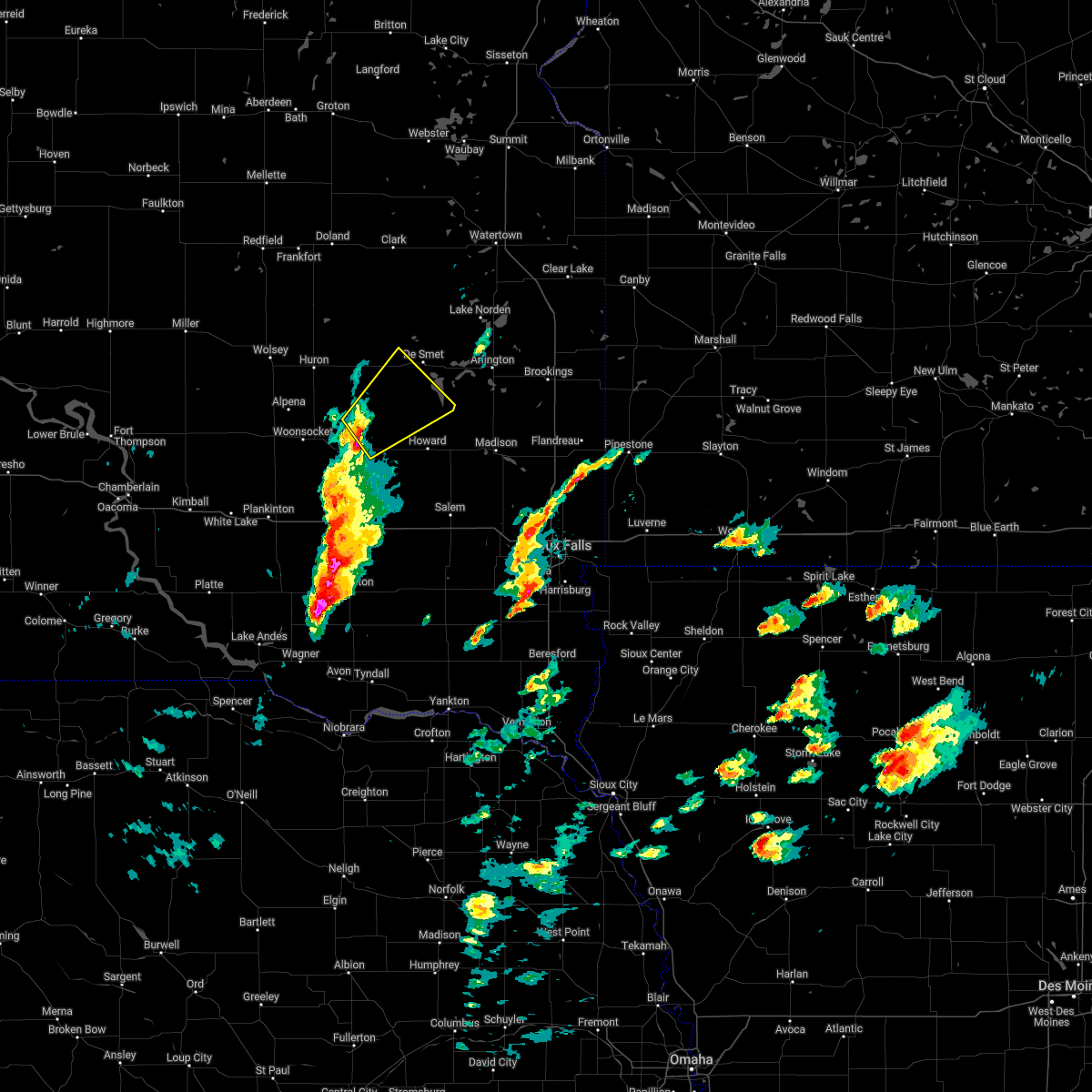 At 601 pm cdt, a severe thunderstorm was located near fedora, or 25 miles southwest of lake thompson state recreation area, moving northeast at 50 mph (radar indicated). Hazards include 60 mph wind gusts and half dollar size hail. Hail damage to vehicles is expected. expect wind damage to roofs, siding, and trees. this severe thunderstorm will be near, carthage around 610 pm cdt. hail threat, radar indicated max hail size, 1. 25 in wind threat, radar indicated max wind gust, 60 mph. At 601 pm cdt, a severe thunderstorm was located near fedora, or 25 miles southwest of lake thompson state recreation area, moving northeast at 50 mph (radar indicated). Hazards include 60 mph wind gusts and half dollar size hail. Hail damage to vehicles is expected. expect wind damage to roofs, siding, and trees. this severe thunderstorm will be near, carthage around 610 pm cdt. hail threat, radar indicated max hail size, 1. 25 in wind threat, radar indicated max wind gust, 60 mph.
|
| 8/26/2021 10:31 AM CDT |
 At 1030 am cdt, severe thunderstorms were located along a line extending from near altamont to near bruce to near nunda, moving east at 45 mph (law enforcement reported trees down in arlington at around 1015 am). Hazards include 70 mph wind gusts. Expect considerable tree damage. damage is likely to mobile homes, roofs, and outbuildings. locations impacted include, white. thunderstorm damage threat, considerable hail threat, radar indicated max hail size, <. 75 in wind threat, radar indicated max wind gust, 70 mph. At 1030 am cdt, severe thunderstorms were located along a line extending from near altamont to near bruce to near nunda, moving east at 45 mph (law enforcement reported trees down in arlington at around 1015 am). Hazards include 70 mph wind gusts. Expect considerable tree damage. damage is likely to mobile homes, roofs, and outbuildings. locations impacted include, white. thunderstorm damage threat, considerable hail threat, radar indicated max hail size, <. 75 in wind threat, radar indicated max wind gust, 70 mph.
|
| 8/26/2021 10:08 AM CDT |
 At 1007 am cdt, severe thunderstorms were located along a line extending from 6 miles southeast of watertown to badger to 8 miles southwest of oldham, moving east at 45 mph (emergency management reported multiple trees down in de smet around 950 am). Hazards include 70 mph wind gusts. Expect considerable tree damage. damage is likely to mobile homes, roofs, and outbuildings. locations impacted include, ramona, oakwood state park, bruce, nunda and white. thunderstorm damage threat, considerable hail threat, radar indicated max hail size, <. 75 in wind threat, radar indicated max wind gust, 70 mph. At 1007 am cdt, severe thunderstorms were located along a line extending from 6 miles southeast of watertown to badger to 8 miles southwest of oldham, moving east at 45 mph (emergency management reported multiple trees down in de smet around 950 am). Hazards include 70 mph wind gusts. Expect considerable tree damage. damage is likely to mobile homes, roofs, and outbuildings. locations impacted include, ramona, oakwood state park, bruce, nunda and white. thunderstorm damage threat, considerable hail threat, radar indicated max hail size, <. 75 in wind threat, radar indicated max wind gust, 70 mph.
|
| 8/26/2021 10:01 AM CDT |
 At 1000 am cdt, severe thunderstorms were located along a line extending from near watertown to near badger to 9 miles south of lake thompson state recreation area, moving east at 45 mph (radar indicated). Hazards include 60 mph wind gusts. Expect damage to roofs, siding, and trees. severe thunderstorms will be near, badger around 1005 am cdt. ramona and oakwood state park around 1020 am cdt. other locations in the path of these severe thunderstorms include bruce, nunda and white. hail threat, radar indicated max hail size, <. 75 in wind threat, radar indicated max wind gust, 60 mph. At 1000 am cdt, severe thunderstorms were located along a line extending from near watertown to near badger to 9 miles south of lake thompson state recreation area, moving east at 45 mph (radar indicated). Hazards include 60 mph wind gusts. Expect damage to roofs, siding, and trees. severe thunderstorms will be near, badger around 1005 am cdt. ramona and oakwood state park around 1020 am cdt. other locations in the path of these severe thunderstorms include bruce, nunda and white. hail threat, radar indicated max hail size, <. 75 in wind threat, radar indicated max wind gust, 60 mph.
|
| 8/28/2020 1:31 AM CDT |
 At 131 am cdt, severe thunderstorms were located along a line extending from bryant to 7 miles southwest of lake thompson state recreation area to 8 miles north of farmer, moving east at 55 mph. these are very dangerous storms (radar indicated). Hazards include 90 mph wind gusts and penny size hail. You are in a life-threatening situation. flying debris may be deadly to those caught without shelter. mobile homes will be heavily damaged or destroyed. homes and businesses will have substantial roof and window damage. expect extensive tree damage and power outages. these severe storms will be near, lake thompson state recreation area around 135 am cdt. oldham, badger and canova around 145 am cdt. ramona around 150 am cdt. bruce, sinai, orland, nunda and oakwood state park around 200 am cdt. volga around 205 am cdt. brookings around 210 am cdt. chester around 215 am cdt. Other locations impacted by these severe thunderstorms include erwin. At 131 am cdt, severe thunderstorms were located along a line extending from bryant to 7 miles southwest of lake thompson state recreation area to 8 miles north of farmer, moving east at 55 mph. these are very dangerous storms (radar indicated). Hazards include 90 mph wind gusts and penny size hail. You are in a life-threatening situation. flying debris may be deadly to those caught without shelter. mobile homes will be heavily damaged or destroyed. homes and businesses will have substantial roof and window damage. expect extensive tree damage and power outages. these severe storms will be near, lake thompson state recreation area around 135 am cdt. oldham, badger and canova around 145 am cdt. ramona around 150 am cdt. bruce, sinai, orland, nunda and oakwood state park around 200 am cdt. volga around 205 am cdt. brookings around 210 am cdt. chester around 215 am cdt. Other locations impacted by these severe thunderstorms include erwin.
|
| 8/28/2020 1:17 AM CDT |
 At 117 am cdt, severe thunderstorms were located along a line extending from carpenter to near iroquois to near artesian, moving east at 60 mph. these are very dangerous storms (radar indicated). Hazards include 80 mph wind gusts and nickel size hail. Flying debris will be dangerous to those caught without shelter. mobile homes will be heavily damaged. expect considerable damage to roofs, windows, and vehicles. extensive tree damage and power outages are likely. severe thunderstorms will be near, de smet and carthage around 130 am cdt. lake thompson state recreation area and vilas around 135 am cdt. howard and lake preston around 140 am cdt. hetland around 145 am cdt. arlington and oldham around 150 am cdt. ramona around 155 am cdt. volga and oakwood state park around 200 am cdt. bruce, sinai and nunda around 205 am cdt. Other locations impacted by these severe thunderstorms include bancroft and erwin. At 117 am cdt, severe thunderstorms were located along a line extending from carpenter to near iroquois to near artesian, moving east at 60 mph. these are very dangerous storms (radar indicated). Hazards include 80 mph wind gusts and nickel size hail. Flying debris will be dangerous to those caught without shelter. mobile homes will be heavily damaged. expect considerable damage to roofs, windows, and vehicles. extensive tree damage and power outages are likely. severe thunderstorms will be near, de smet and carthage around 130 am cdt. lake thompson state recreation area and vilas around 135 am cdt. howard and lake preston around 140 am cdt. hetland around 145 am cdt. arlington and oldham around 150 am cdt. ramona around 155 am cdt. volga and oakwood state park around 200 am cdt. bruce, sinai and nunda around 205 am cdt. Other locations impacted by these severe thunderstorms include bancroft and erwin.
|
| 8/28/2020 1:09 AM CDT |
 At 109 am cdt, severe thunderstorms were located along a line extending from 7 miles west of carpenter to 7 miles southeast of cavour to forestburg, moving east at 60 mph. these are very dangerous storms (radar indicated). Hazards include 80 mph wind gusts and nickel size hail. Flying debris will be dangerous to those caught without shelter. mobile homes will be heavily damaged. expect considerable damage to roofs, windows, and vehicles. extensive tree damage and power outages are likely. severe thunderstorms will be near, iroquois around 115 am cdt. fedora around 125 am cdt. de smet, carthage and roswell around 130 am cdt. lake thompson state recreation area and vilas around 135 am cdt. howard and lake preston around 140 am cdt. winfred and hetland around 145 am cdt. arlington around 150 am cdt. ramona around 155 am cdt. Other locations impacted by these severe thunderstorms include bancroft and erwin. At 109 am cdt, severe thunderstorms were located along a line extending from 7 miles west of carpenter to 7 miles southeast of cavour to forestburg, moving east at 60 mph. these are very dangerous storms (radar indicated). Hazards include 80 mph wind gusts and nickel size hail. Flying debris will be dangerous to those caught without shelter. mobile homes will be heavily damaged. expect considerable damage to roofs, windows, and vehicles. extensive tree damage and power outages are likely. severe thunderstorms will be near, iroquois around 115 am cdt. fedora around 125 am cdt. de smet, carthage and roswell around 130 am cdt. lake thompson state recreation area and vilas around 135 am cdt. howard and lake preston around 140 am cdt. winfred and hetland around 145 am cdt. arlington around 150 am cdt. ramona around 155 am cdt. Other locations impacted by these severe thunderstorms include bancroft and erwin.
|
| 8/9/2020 2:08 AM CDT |
 The severe thunderstorm warning for kingsbury, northeastern sanborn, beadle, northwestern miner and west central brookings counties will expire at 215 am cdt, the storms which prompted the warning have weakened below severe limits, and no longer pose an immediate threat to life or property. therefore, the warning will be allowed to expire. however gusty winds are still possible with these thunderstorms. a severe thunderstorm watch remains in effect until 500 am cdt for east central south dakota. The severe thunderstorm warning for kingsbury, northeastern sanborn, beadle, northwestern miner and west central brookings counties will expire at 215 am cdt, the storms which prompted the warning have weakened below severe limits, and no longer pose an immediate threat to life or property. therefore, the warning will be allowed to expire. however gusty winds are still possible with these thunderstorms. a severe thunderstorm watch remains in effect until 500 am cdt for east central south dakota.
|
| 8/9/2020 1:55 AM CDT |
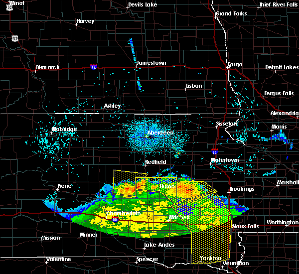 At 155 am cdt, severe thunderstorms were located along a line extending from near hitchcock to 10 miles southeast of carpenter to near lake thompson state recreation area, moving northeast at 55 mph (radar indicated). Hazards include 70 mph wind gusts and penny size hail. Expect considerable tree damage. damage is likely to mobile homes, roofs, and outbuildings. these severe storms will be near, lake thompson state recreation area, lake preston and oldham around 200 am cdt. hetland around 210 am cdt. arlington and badger around 215 am cdt. Other locations impacted by these severe thunderstorms include bancroft, broadland and erwin. At 155 am cdt, severe thunderstorms were located along a line extending from near hitchcock to 10 miles southeast of carpenter to near lake thompson state recreation area, moving northeast at 55 mph (radar indicated). Hazards include 70 mph wind gusts and penny size hail. Expect considerable tree damage. damage is likely to mobile homes, roofs, and outbuildings. these severe storms will be near, lake thompson state recreation area, lake preston and oldham around 200 am cdt. hetland around 210 am cdt. arlington and badger around 215 am cdt. Other locations impacted by these severe thunderstorms include bancroft, broadland and erwin.
|
| 8/9/2020 1:32 AM CDT |
 At 132 am cdt, severe thunderstorms were located along a line extending from near wessington to near cavour to near carthage, moving northeast at 55 mph (radar indicated). Hazards include 70 mph wind gusts and penny size hail. Expect considerable tree damage. damage is likely to mobile homes, roofs, and outbuildings. severe thunderstorms will be near, carthage, cavour and yale around 140 am cdt. iroquois around 145 am cdt. lake thompson state recreation area and hitchcock around 155 am cdt. lake preston and oldham around 200 am cdt. hetland around 210 am cdt. arlington and badger around 215 am cdt. Other locations impacted by these severe thunderstorms include bancroft, broadland and erwin. At 132 am cdt, severe thunderstorms were located along a line extending from near wessington to near cavour to near carthage, moving northeast at 55 mph (radar indicated). Hazards include 70 mph wind gusts and penny size hail. Expect considerable tree damage. damage is likely to mobile homes, roofs, and outbuildings. severe thunderstorms will be near, carthage, cavour and yale around 140 am cdt. iroquois around 145 am cdt. lake thompson state recreation area and hitchcock around 155 am cdt. lake preston and oldham around 200 am cdt. hetland around 210 am cdt. arlington and badger around 215 am cdt. Other locations impacted by these severe thunderstorms include bancroft, broadland and erwin.
|
| 8/9/2020 1:23 AM CDT |
 At 123 am cdt, severe thunderstorms were located along a line extending from near wolsey to 9 miles south of huron to near artesian, moving northeast at 45 mph (radar indicated). Hazards include 70 mph wind gusts and penny size hail. Expect considerable tree damage. damage is likely to mobile homes, roofs, and outbuildings. these severe storms will be near, artesian around 130 am cdt. cavour around 135 am cdt. huron and carthage around 140 am cdt. Other locations impacted by these severe thunderstorms include broadland. At 123 am cdt, severe thunderstorms were located along a line extending from near wolsey to 9 miles south of huron to near artesian, moving northeast at 45 mph (radar indicated). Hazards include 70 mph wind gusts and penny size hail. Expect considerable tree damage. damage is likely to mobile homes, roofs, and outbuildings. these severe storms will be near, artesian around 130 am cdt. cavour around 135 am cdt. huron and carthage around 140 am cdt. Other locations impacted by these severe thunderstorms include broadland.
|
| 8/9/2020 12:56 AM CDT |
 At 1256 am cdt, severe thunderstorms were located along a line extending from near pleasant valley country church to near wessington springs to near storla, moving northeast at 45 mph (radar indicated). Hazards include 60 mph wind gusts and penny size hail. Expect damage to roofs, siding, and trees. severe thunderstorms will be near, lane around 100 am cdt. alpena and forestburg around 110 am cdt. artesian around 120 am cdt. wolsey and virgil around 125 am cdt. cavour around 135 am cdt. huron and carthage around 140 am cdt. Other locations impacted by these severe thunderstorms include broadland. At 1256 am cdt, severe thunderstorms were located along a line extending from near pleasant valley country church to near wessington springs to near storla, moving northeast at 45 mph (radar indicated). Hazards include 60 mph wind gusts and penny size hail. Expect damage to roofs, siding, and trees. severe thunderstorms will be near, lane around 100 am cdt. alpena and forestburg around 110 am cdt. artesian around 120 am cdt. wolsey and virgil around 125 am cdt. cavour around 135 am cdt. huron and carthage around 140 am cdt. Other locations impacted by these severe thunderstorms include broadland.
|
| 7/3/2020 1:35 AM CDT |
 At 134 am cdt, severe thunderstorms were located along a line extending from near winfred to near spencer in mccook county to near milltown, moving east at 30 mph (ground observation stations). Hazards include 60 mph wind gusts. Expect damage to roofs, siding, and trees. these severe storms will be near, winfred around 140 am cdt. ramona around 145 am cdt. Salem around 150 am cdt. At 134 am cdt, severe thunderstorms were located along a line extending from near winfred to near spencer in mccook county to near milltown, moving east at 30 mph (ground observation stations). Hazards include 60 mph wind gusts. Expect damage to roofs, siding, and trees. these severe storms will be near, winfred around 140 am cdt. ramona around 145 am cdt. Salem around 150 am cdt.
|
| 7/3/2020 1:08 AM CDT |
 At 108 am cdt, severe thunderstorms were located along a line extending from near carthage to 7 miles north of fulton to 7 miles west of dimock, moving east at 30 mph (ground observation stations). Hazards include 60 mph wind gusts. Expect damage to roofs, siding, and trees. severe thunderstorms will be near, howard and farmer around 120 am cdt. spencer in mccook county around 130 am cdt. winfred around 135 am cdt. ramona around 145 am cdt. Salem around 150 am cdt. At 108 am cdt, severe thunderstorms were located along a line extending from near carthage to 7 miles north of fulton to 7 miles west of dimock, moving east at 30 mph (ground observation stations). Hazards include 60 mph wind gusts. Expect damage to roofs, siding, and trees. severe thunderstorms will be near, howard and farmer around 120 am cdt. spencer in mccook county around 130 am cdt. winfred around 135 am cdt. ramona around 145 am cdt. Salem around 150 am cdt.
|
| 6/8/2020 11:28 PM CDT |
 The severe thunderstorm warning for eastern sanborn and northwestern miner counties will expire at 1130 pm cdt, the storm which prompted the warning has moved out of the area. therefore, the warning will be allowed to expire. a severe thunderstorm watch remains in effect until 200 am cdt for southeastern and east central south dakota. remember, a tornado warning still remains in effect for miner county. The severe thunderstorm warning for eastern sanborn and northwestern miner counties will expire at 1130 pm cdt, the storm which prompted the warning has moved out of the area. therefore, the warning will be allowed to expire. a severe thunderstorm watch remains in effect until 200 am cdt for southeastern and east central south dakota. remember, a tornado warning still remains in effect for miner county.
|
| 6/8/2020 11:20 PM CDT |
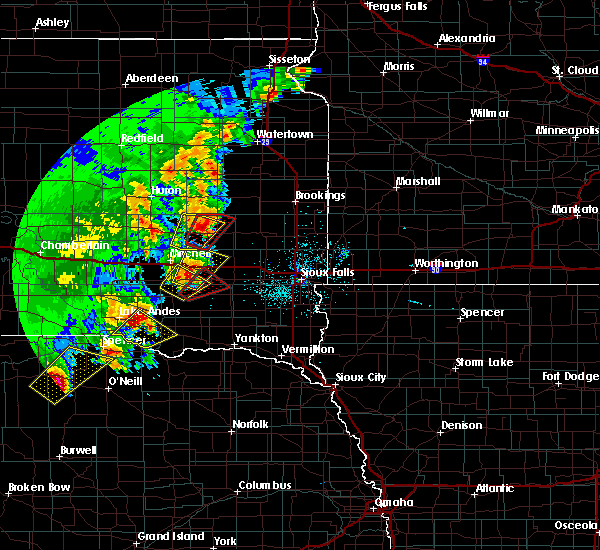 At 1119 pm cdt, a severe thunderstorm capable of producing a tornado was located over vilas, or 21 miles south of lake thompson state recreation area, moving northeast at 20 mph (radar indicated rotation). Hazards include tornado and golf ball size hail. Flying debris will be dangerous to those caught without shelter. mobile homes will be damaged or destroyed. damage to roofs, windows, and vehicles will occur. tree damage is likely. This tornadic thunderstorm will remain over mainly rural areas of northern miner county. At 1119 pm cdt, a severe thunderstorm capable of producing a tornado was located over vilas, or 21 miles south of lake thompson state recreation area, moving northeast at 20 mph (radar indicated rotation). Hazards include tornado and golf ball size hail. Flying debris will be dangerous to those caught without shelter. mobile homes will be damaged or destroyed. damage to roofs, windows, and vehicles will occur. tree damage is likely. This tornadic thunderstorm will remain over mainly rural areas of northern miner county.
|
| 6/8/2020 11:06 PM CDT |
 At 1105 pm cdt, a severe thunderstorm capable of producing a tornado was located over roswell, or 24 miles northeast of mitchell, moving northeast at 30 mph (radar indicated rotation). Hazards include tornado and golf ball size hail. Flying debris will be dangerous to those caught without shelter. mobile homes will be damaged or destroyed. damage to roofs, windows, and vehicles will occur. tree damage is likely. this dangerous storm will be near, vilas around 1115 pm cdt. howard around 1120 pm cdt. At 1104 pm cdt, a funnel cloud was reported 2 miles south of roswell. At 1105 pm cdt, a severe thunderstorm capable of producing a tornado was located over roswell, or 24 miles northeast of mitchell, moving northeast at 30 mph (radar indicated rotation). Hazards include tornado and golf ball size hail. Flying debris will be dangerous to those caught without shelter. mobile homes will be damaged or destroyed. damage to roofs, windows, and vehicles will occur. tree damage is likely. this dangerous storm will be near, vilas around 1115 pm cdt. howard around 1120 pm cdt. At 1104 pm cdt, a funnel cloud was reported 2 miles south of roswell.
|
| 6/8/2020 11:00 PM CDT |
 At 1100 pm cdt, a severe thunderstorm capable of producing a tornado was located near roswell, or 21 miles northeast of mitchell, moving northeast at 20 mph (radar indicated rotation). Hazards include tornado and golf ball size hail. Flying debris will be dangerous to those caught without shelter. mobile homes will be damaged or destroyed. damage to roofs, windows, and vehicles will occur. tree damage is likely. this dangerous storm will be near, roswell around 1110 pm cdt. vilas around 1120 pm cdt. Howard around 1125 pm cdt. At 1100 pm cdt, a severe thunderstorm capable of producing a tornado was located near roswell, or 21 miles northeast of mitchell, moving northeast at 20 mph (radar indicated rotation). Hazards include tornado and golf ball size hail. Flying debris will be dangerous to those caught without shelter. mobile homes will be damaged or destroyed. damage to roofs, windows, and vehicles will occur. tree damage is likely. this dangerous storm will be near, roswell around 1110 pm cdt. vilas around 1120 pm cdt. Howard around 1125 pm cdt.
|
| 6/8/2020 10:54 PM CDT |
 At 1054 pm cdt, a severe thunderstorm was located near fedora, or 18 miles northeast of mitchell, moving northeast at 30 mph (radar indicated). Hazards include golf ball size hail. People and animals outdoors will be injured. expect damage to roofs, siding, windows, and vehicles. this severe storm will be near, fedora and roswell around 1105 pm cdt. Carthage around 1125 pm cdt. At 1054 pm cdt, a severe thunderstorm was located near fedora, or 18 miles northeast of mitchell, moving northeast at 30 mph (radar indicated). Hazards include golf ball size hail. People and animals outdoors will be injured. expect damage to roofs, siding, windows, and vehicles. this severe storm will be near, fedora and roswell around 1105 pm cdt. Carthage around 1125 pm cdt.
|
| 6/8/2020 10:48 PM CDT |
 At 1048 pm cdt, a severe thunderstorm was located 7 miles southwest of fedora, or 15 miles northeast of mitchell, moving northeast at 30 mph (radar indicated). Hazards include ping pong ball size hail. People and animals outdoors will be injured. expect damage to roofs, siding, windows, and vehicles. this severe thunderstorm will be near, fedora and roswell around 1105 pm cdt. Carthage around 1125 pm cdt. At 1048 pm cdt, a severe thunderstorm was located 7 miles southwest of fedora, or 15 miles northeast of mitchell, moving northeast at 30 mph (radar indicated). Hazards include ping pong ball size hail. People and animals outdoors will be injured. expect damage to roofs, siding, windows, and vehicles. this severe thunderstorm will be near, fedora and roswell around 1105 pm cdt. Carthage around 1125 pm cdt.
|
| 8/15/2019 6:21 PM CDT |
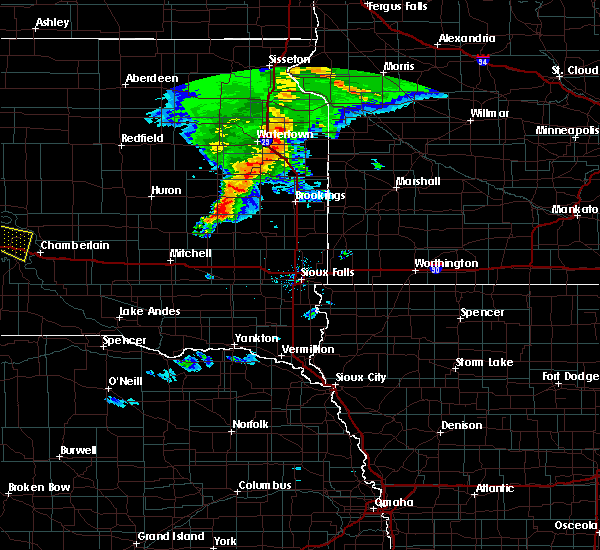 The tornado warning for southwestern kingsbury and northwestern miner counties will expire at 630 pm cdt, the storm which prompted the warning has weakened below severe limits, and no longer appears capable of producing a tornado. therefore, the warning will be allowed to expire. a severe thunderstorm watch remains in effect until 900 pm cdt for east central south dakota. The tornado warning for southwestern kingsbury and northwestern miner counties will expire at 630 pm cdt, the storm which prompted the warning has weakened below severe limits, and no longer appears capable of producing a tornado. therefore, the warning will be allowed to expire. a severe thunderstorm watch remains in effect until 900 pm cdt for east central south dakota.
|
| 8/15/2019 6:20 PM CDT |
 The severe thunderstorm warning for southwestern kingsbury and northwestern miner counties will expire at 630 pm cdt, the storm which prompted the warning has moved out of the area. therefore, the warning will be allowed to expire. a severe thunderstorm watch remains in effect until 900 pm cdt for east central south dakota. The severe thunderstorm warning for southwestern kingsbury and northwestern miner counties will expire at 630 pm cdt, the storm which prompted the warning has moved out of the area. therefore, the warning will be allowed to expire. a severe thunderstorm watch remains in effect until 900 pm cdt for east central south dakota.
|
| 8/15/2019 6:09 PM CDT |
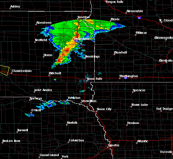 At 609 pm cdt, a severe thunderstorm capable of producing a tornado was located near carthage, or 16 miles southwest of lake thompson state recreation area, moving east at 35 mph (radar indicated rotation). Hazards include tornado and quarter size hail. Flying debris will be dangerous to those caught without shelter. mobile homes will be damaged or destroyed. damage to roofs, windows, and vehicles will occur. tree damage is likely. This tornadic thunderstorm will remain over mainly rural areas of southwestern kingsbury and northwestern miner counties. At 609 pm cdt, a severe thunderstorm capable of producing a tornado was located near carthage, or 16 miles southwest of lake thompson state recreation area, moving east at 35 mph (radar indicated rotation). Hazards include tornado and quarter size hail. Flying debris will be dangerous to those caught without shelter. mobile homes will be damaged or destroyed. damage to roofs, windows, and vehicles will occur. tree damage is likely. This tornadic thunderstorm will remain over mainly rural areas of southwestern kingsbury and northwestern miner counties.
|
| 8/15/2019 6:07 PM CDT |
 At 607 pm cdt, a severe thunderstorm was located near carthage, or 17 miles southwest of lake thompson state recreation area, moving east at 30 mph (radar indicated). Hazards include 60 mph wind gusts and quarter size hail. Hail damage to vehicles is expected. expect wind damage to roofs, siding, and trees. This severe storm will be near, carthage around 615 pm cdt. At 607 pm cdt, a severe thunderstorm was located near carthage, or 17 miles southwest of lake thompson state recreation area, moving east at 30 mph (radar indicated). Hazards include 60 mph wind gusts and quarter size hail. Hail damage to vehicles is expected. expect wind damage to roofs, siding, and trees. This severe storm will be near, carthage around 615 pm cdt.
|
| 8/15/2019 5:57 PM CDT |
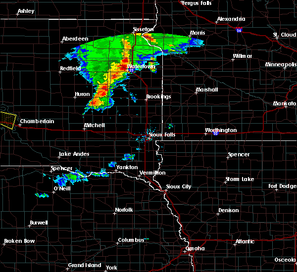 The national weather service in sioux falls has issued a * tornado warning for. southwestern kingsbury county in east central south dakota. northeastern sanborn county in east central south dakota. southeastern beadle county in east central south dakota. Northwestern miner county in east central south dakota. The national weather service in sioux falls has issued a * tornado warning for. southwestern kingsbury county in east central south dakota. northeastern sanborn county in east central south dakota. southeastern beadle county in east central south dakota. Northwestern miner county in east central south dakota.
|
| 8/15/2019 5:43 PM CDT |
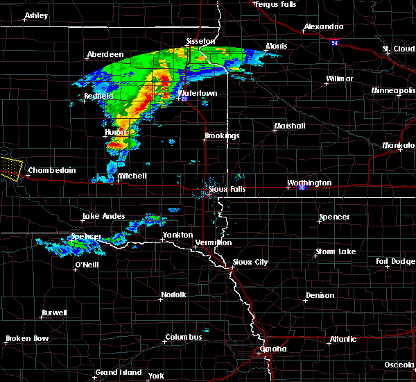 At 543 pm cdt, a severe thunderstorm was located 8 miles south of cavour, or 12 miles southeast of huron, moving east at 30 mph (radar indicated). Hazards include 60 mph wind gusts and quarter size hail. Hail damage to vehicles is expected. expect wind damage to roofs, siding, and trees. This severe thunderstorm will be near, carthage around 615 pm cdt. At 543 pm cdt, a severe thunderstorm was located 8 miles south of cavour, or 12 miles southeast of huron, moving east at 30 mph (radar indicated). Hazards include 60 mph wind gusts and quarter size hail. Hail damage to vehicles is expected. expect wind damage to roofs, siding, and trees. This severe thunderstorm will be near, carthage around 615 pm cdt.
|
| 7/28/2019 7:53 PM CDT |
 The severe thunderstorm warning for kingsbury, northern sanborn, southeastern beadle, northeastern jerauld and northern miner counties will expire at 800 pm cdt, the storms which prompted the warning have moved out of the area. therefore, the warning will be allowed to expire. a severe thunderstorm watch remains in effect until midnight cdt for central and east central south dakota. remember, a severe thunderstorm warnings still remain in effect for portions of jerauld county until 815 pm cdt and for portions of sanborn and miner counties until 830 pm cdt. The severe thunderstorm warning for kingsbury, northern sanborn, southeastern beadle, northeastern jerauld and northern miner counties will expire at 800 pm cdt, the storms which prompted the warning have moved out of the area. therefore, the warning will be allowed to expire. a severe thunderstorm watch remains in effect until midnight cdt for central and east central south dakota. remember, a severe thunderstorm warnings still remain in effect for portions of jerauld county until 815 pm cdt and for portions of sanborn and miner counties until 830 pm cdt.
|
| 7/28/2019 7:36 PM CDT |
 At 736 pm cdt, severe thunderstorms were located along a line extending from near bryant to near carthage to 6 miles northeast of woonsocket, moving southeast at 40 mph (radar indicated). Hazards include 60 mph wind gusts and penny size hail. Expect damage to roofs, siding, and trees. these severe storms will be near, carthage around 740 pm cdt. artesian and badger around 755 pm cdt. Other locations impacted by these severe thunderstorms include bancroft and erwin. At 736 pm cdt, severe thunderstorms were located along a line extending from near bryant to near carthage to 6 miles northeast of woonsocket, moving southeast at 40 mph (radar indicated). Hazards include 60 mph wind gusts and penny size hail. Expect damage to roofs, siding, and trees. these severe storms will be near, carthage around 740 pm cdt. artesian and badger around 755 pm cdt. Other locations impacted by these severe thunderstorms include bancroft and erwin.
|
| 7/28/2019 7:13 PM CDT |
 At 713 pm cdt, severe thunderstorms were located along a line extending from near willow lake to near cavour to near virgil, moving southeast at 40 mph (radar indicated). Hazards include 60 mph wind gusts. Expect damage to roofs, siding, and trees. severe thunderstorms will be near, iroquois around 720 pm cdt. woonsocket around 730 pm cdt. carthage around 735 pm cdt. forestburg around 745 pm cdt. artesian and badger around 755 pm cdt. Other locations impacted by these severe thunderstorms include bancroft and erwin. At 713 pm cdt, severe thunderstorms were located along a line extending from near willow lake to near cavour to near virgil, moving southeast at 40 mph (radar indicated). Hazards include 60 mph wind gusts. Expect damage to roofs, siding, and trees. severe thunderstorms will be near, iroquois around 720 pm cdt. woonsocket around 730 pm cdt. carthage around 735 pm cdt. forestburg around 745 pm cdt. artesian and badger around 755 pm cdt. Other locations impacted by these severe thunderstorms include bancroft and erwin.
|
| 7/20/2019 6:53 AM CDT |
 At 652 am cdt, severe thunderstorms were located along a line extending from 7 miles northeast of de smet to near fedora to mount vernon, moving east at 40 mph (radar indicated. at 638 am, emergency management in iroquois reported a 74 mph wind gust). Hazards include 70 mph wind gusts and quarter size hail. Hail damage to vehicles is expected. expect considerable tree damage. wind damage is also likely to mobile homes, roofs, and outbuildings. these severe storms will be near, carthage and roswell around 655 am cdt. lake preston around 700 am cdt. mitchell, howard and vilas around 705 am cdt. badger and hetland around 710 am cdt. winfred and fulton around 715 am cdt. Other locations impacted by these severe thunderstorms include bancroft and erwin. At 652 am cdt, severe thunderstorms were located along a line extending from 7 miles northeast of de smet to near fedora to mount vernon, moving east at 40 mph (radar indicated. at 638 am, emergency management in iroquois reported a 74 mph wind gust). Hazards include 70 mph wind gusts and quarter size hail. Hail damage to vehicles is expected. expect considerable tree damage. wind damage is also likely to mobile homes, roofs, and outbuildings. these severe storms will be near, carthage and roswell around 655 am cdt. lake preston around 700 am cdt. mitchell, howard and vilas around 705 am cdt. badger and hetland around 710 am cdt. winfred and fulton around 715 am cdt. Other locations impacted by these severe thunderstorms include bancroft and erwin.
|
| 7/20/2019 6:42 AM CDT |
 The severe thunderstorm warning for northwestern davison, western kingsbury, sanborn, beadle, aurora, jerauld, northwestern miner and brule counties will expire at 645 am cdt, the storms which prompted the warning have moved out of the area. therefore, the warning will be allowed to expire. a severe thunderstorm watch remains in effect until 1100 am cdt for south central, central, southeastern and east central south dakota. remember, a severe thunderstorm warning still remains in effect for portions of davison, kingsbury, sanborn, beadle, aurora, and miner counties until 715 am cdt. The severe thunderstorm warning for northwestern davison, western kingsbury, sanborn, beadle, aurora, jerauld, northwestern miner and brule counties will expire at 645 am cdt, the storms which prompted the warning have moved out of the area. therefore, the warning will be allowed to expire. a severe thunderstorm watch remains in effect until 1100 am cdt for south central, central, southeastern and east central south dakota. remember, a severe thunderstorm warning still remains in effect for portions of davison, kingsbury, sanborn, beadle, aurora, and miner counties until 715 am cdt.
|
| 7/20/2019 6:36 AM CDT |
 At 636 am cdt, severe thunderstorms were located along a line extending from 8 miles south of willow lake to 6 miles north of artesian to near plankinton, moving east at 40 mph (radar indicated). Hazards include 70 mph wind gusts and quarter size hail. Hail damage to vehicles is expected. expect considerable tree damage. wind damage is also likely to mobile homes, roofs, and outbuildings. severe thunderstorms will be near, artesian around 640 am cdt. de smet around 645 am cdt. carthage and fedora around 650 am cdt. roswell around 655 am cdt. mitchell, lake preston and loomis around 700 am cdt. howard and vilas around 705 am cdt. badger and hetland around 710 am cdt. winfred and fulton around 715 am cdt. Other locations impacted by these severe thunderstorms include bancroft and erwin. At 636 am cdt, severe thunderstorms were located along a line extending from 8 miles south of willow lake to 6 miles north of artesian to near plankinton, moving east at 40 mph (radar indicated). Hazards include 70 mph wind gusts and quarter size hail. Hail damage to vehicles is expected. expect considerable tree damage. wind damage is also likely to mobile homes, roofs, and outbuildings. severe thunderstorms will be near, artesian around 640 am cdt. de smet around 645 am cdt. carthage and fedora around 650 am cdt. roswell around 655 am cdt. mitchell, lake preston and loomis around 700 am cdt. howard and vilas around 705 am cdt. badger and hetland around 710 am cdt. winfred and fulton around 715 am cdt. Other locations impacted by these severe thunderstorms include bancroft and erwin.
|
| 7/20/2019 6:12 AM CDT |
 At 611 am cdt, severe thunderstorms were located along a line extending from near carpenter to 9 miles south of cavour to near kimball, moving east at 35 mph (radar indicated. at 604 am, huron airport reported a wind gust of 62 mph). Hazards include 70 mph wind gusts and quarter size hail. Hail damage to vehicles is expected. expect considerable tree damage. wind damage is also likely to mobile homes, roofs, and outbuildings. these severe storms will be near, white lake around 635 am cdt. plankinton and carthage around 645 am cdt. Other locations impacted by these severe thunderstorms include bancroft, broadland and pukwana. At 611 am cdt, severe thunderstorms were located along a line extending from near carpenter to 9 miles south of cavour to near kimball, moving east at 35 mph (radar indicated. at 604 am, huron airport reported a wind gust of 62 mph). Hazards include 70 mph wind gusts and quarter size hail. Hail damage to vehicles is expected. expect considerable tree damage. wind damage is also likely to mobile homes, roofs, and outbuildings. these severe storms will be near, white lake around 635 am cdt. plankinton and carthage around 645 am cdt. Other locations impacted by these severe thunderstorms include bancroft, broadland and pukwana.
|
| 7/20/2019 5:55 AM CDT |
 At 555 am cdt, severe thunderstorms were located along a line extending from 7 miles west of carpenter to near alpena to 8 miles east of chamberlain, moving east at 35 mph (radar indicated). Hazards include 60 mph wind gusts and penny size hail. Expect damage to roofs, siding, and trees. severe thunderstorms will be near, alpena around 600 am cdt. white lake around 630 am cdt. plankinton and carthage around 645 am cdt. Other locations impacted by these severe thunderstorms include bancroft, broadland and pukwana. At 555 am cdt, severe thunderstorms were located along a line extending from 7 miles west of carpenter to near alpena to 8 miles east of chamberlain, moving east at 35 mph (radar indicated). Hazards include 60 mph wind gusts and penny size hail. Expect damage to roofs, siding, and trees. severe thunderstorms will be near, alpena around 600 am cdt. white lake around 630 am cdt. plankinton and carthage around 645 am cdt. Other locations impacted by these severe thunderstorms include bancroft, broadland and pukwana.
|
| 7/13/2019 7:43 PM CDT |
 The severe thunderstorm warning for southwestern kingsbury, northeastern sanborn, southeastern beadle and northwestern miner counties will expire at 745 pm cdt, the storm which prompted the warning has weakened below severe limits, and no longer poses an immediate threat to life or property. therefore, the warning will be allowed to expire. however, gusty winds of 40 to 50 mph are still likely with this thunderstorm near carthage and into extreme southern kingsury county. The severe thunderstorm warning for southwestern kingsbury, northeastern sanborn, southeastern beadle and northwestern miner counties will expire at 745 pm cdt, the storm which prompted the warning has weakened below severe limits, and no longer poses an immediate threat to life or property. therefore, the warning will be allowed to expire. however, gusty winds of 40 to 50 mph are still likely with this thunderstorm near carthage and into extreme southern kingsury county.
|
| 7/13/2019 7:33 PM CDT |
 At 732 pm cdt, a severe thunderstorm was located near carthage, or 20 miles southwest of lake thompson state recreation area, moving southeast at 20 mph (radar indicated). Hazards include 60 mph wind gusts. Expect damage to roofs, siding, and trees. this severe storm will be near, carthage around 740 pm cdt. Strongest winds are likely to impact areas near the four county intersection of beadle, kingsbury, sanborn and miner, and into areas near carthage through 745 pm. At 732 pm cdt, a severe thunderstorm was located near carthage, or 20 miles southwest of lake thompson state recreation area, moving southeast at 20 mph (radar indicated). Hazards include 60 mph wind gusts. Expect damage to roofs, siding, and trees. this severe storm will be near, carthage around 740 pm cdt. Strongest winds are likely to impact areas near the four county intersection of beadle, kingsbury, sanborn and miner, and into areas near carthage through 745 pm.
|
| 7/13/2019 7:16 PM CDT |
 At 716 pm cdt, a severe thunderstorm was located 9 miles west of carthage, or 19 miles southeast of huron, moving southeast at 25 mph (radar indicated). Hazards include 70 mph wind gusts and penny size hail. Expect considerable tree damage. damage is likely to mobile homes, roofs, and outbuildings. This severe storm will be near, carthage around 735 pm cdt. At 716 pm cdt, a severe thunderstorm was located 9 miles west of carthage, or 19 miles southeast of huron, moving southeast at 25 mph (radar indicated). Hazards include 70 mph wind gusts and penny size hail. Expect considerable tree damage. damage is likely to mobile homes, roofs, and outbuildings. This severe storm will be near, carthage around 735 pm cdt.
|
| 7/13/2019 6:56 PM CDT |
 At 656 pm cdt, a severe thunderstorm was located 7 miles south of cavour, or 12 miles southeast of huron, moving southeast at 45 mph (radar indicated). Hazards include 70 mph wind gusts and nickel size hail. Expect considerable tree damage. damage is likely to mobile homes, roofs, and outbuildings. this severe thunderstorm will be near, carthage around 720 pm cdt. Howard and vilas around 735 pm cdt. At 656 pm cdt, a severe thunderstorm was located 7 miles south of cavour, or 12 miles southeast of huron, moving southeast at 45 mph (radar indicated). Hazards include 70 mph wind gusts and nickel size hail. Expect considerable tree damage. damage is likely to mobile homes, roofs, and outbuildings. this severe thunderstorm will be near, carthage around 720 pm cdt. Howard and vilas around 735 pm cdt.
|
| 5/8/2018 8:01 PM CDT |
 At 801 pm cdt, a severe thunderstorm was located near roswell, or 20 miles southwest of lake thompson state recreation area, moving southeast at 10 mph (radar indicated). Hazards include ping pong ball size hail. People and animals outdoors will be injured. expect damage to roofs, siding, windows, and vehicles. This severe storm will be near, vilas around 815 pm cdt. At 801 pm cdt, a severe thunderstorm was located near roswell, or 20 miles southwest of lake thompson state recreation area, moving southeast at 10 mph (radar indicated). Hazards include ping pong ball size hail. People and animals outdoors will be injured. expect damage to roofs, siding, windows, and vehicles. This severe storm will be near, vilas around 815 pm cdt.
|
| 5/8/2018 7:54 PM CDT |
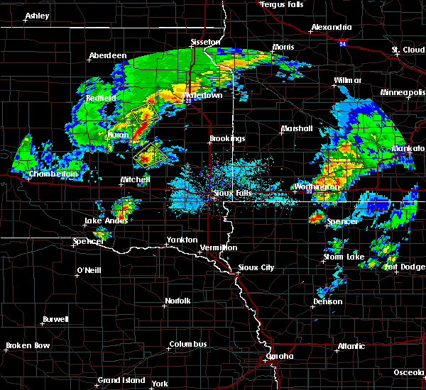 At 752 pm cdt, a severe thunderstorm was located near carthage, or 17 miles southwest of lake thompson state recreation area, moving northeast at 15 mph (at 750 pm, trained weather spotters reported accumulating quarter sized hail about 5 miles south of carthage). Hazards include quarter size hail. Damage to vehicles is expected. This severe thunderstorm will remain over mainly rural areas of south central kingsbury and northern miner counties. At 752 pm cdt, a severe thunderstorm was located near carthage, or 17 miles southwest of lake thompson state recreation area, moving northeast at 15 mph (at 750 pm, trained weather spotters reported accumulating quarter sized hail about 5 miles south of carthage). Hazards include quarter size hail. Damage to vehicles is expected. This severe thunderstorm will remain over mainly rural areas of south central kingsbury and northern miner counties.
|
| 5/8/2018 7:50 PM CDT | Quarter sized hail reported 4.8 miles N of Carthage, SD, piles of hail up to about 6 inches deep. most hail was small... but some as big as quarters. |
| 5/8/2018 7:45 PM CDT |
 At 745 pm cdt, a severe thunderstorm was located near carthage, or 19 miles southwest of lake thompson state recreation area, moving northeast at 15 mph (radar indicated). Hazards include quarter size hail. Damage to vehicles is expected. This severe thunderstorm will be near, carthage around 755 pm cdt. At 745 pm cdt, a severe thunderstorm was located near carthage, or 19 miles southwest of lake thompson state recreation area, moving northeast at 15 mph (radar indicated). Hazards include quarter size hail. Damage to vehicles is expected. This severe thunderstorm will be near, carthage around 755 pm cdt.
|
| 9/19/2017 10:26 PM CDT |
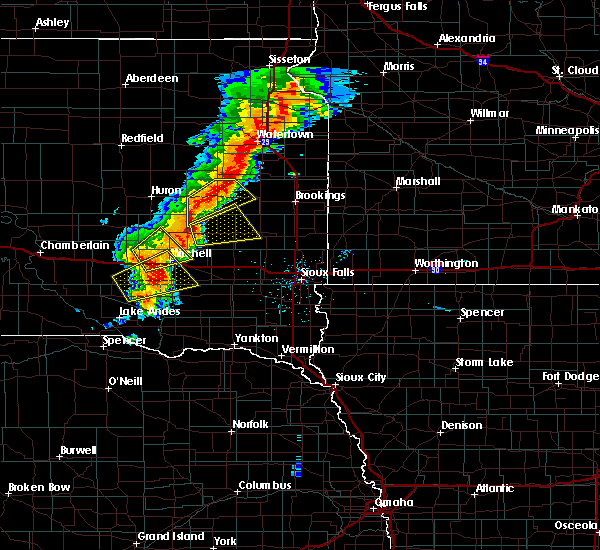 At 1026 pm cdt, a severe thunderstorm was located near de smet, or 10 miles west of lake thompson state recreation area, moving northeast at 35 mph (radar indicated). Hazards include 60 mph wind gusts and quarter size hail. Hail damage to vehicles is expected. expect wind damage to roofs, siding, and trees. this severe storm will be near, lake thompson state recreation area and de smet around 1035 pm cdt. lake preston around 1050 pm cdt. other locations impacted by this severe thunderstorm include erwin. A tornado watch remains in effect until midnight cdt for east central south dakota. At 1026 pm cdt, a severe thunderstorm was located near de smet, or 10 miles west of lake thompson state recreation area, moving northeast at 35 mph (radar indicated). Hazards include 60 mph wind gusts and quarter size hail. Hail damage to vehicles is expected. expect wind damage to roofs, siding, and trees. this severe storm will be near, lake thompson state recreation area and de smet around 1035 pm cdt. lake preston around 1050 pm cdt. other locations impacted by this severe thunderstorm include erwin. A tornado watch remains in effect until midnight cdt for east central south dakota.
|
| 9/19/2017 9:55 PM CDT |
 At 955 pm cdt, a severe thunderstorm was located 12 miles north of artesian, or 16 miles southeast of huron, moving northeast at 35 mph (radar indicated). Hazards include 60 mph wind gusts and half dollar size hail. Hail damage to vehicles is expected. expect wind damage to roofs, siding, and trees. this severe thunderstorm will be near, iroquois around 1015 pm cdt. lake thompson state recreation area and de smet around 1040 pm cdt. lake preston around 1050 pm cdt. other locations impacted by this severe thunderstorm include bancroft and erwin. A tornado watch remains in effect until midnight cdt for east central south dakota. At 955 pm cdt, a severe thunderstorm was located 12 miles north of artesian, or 16 miles southeast of huron, moving northeast at 35 mph (radar indicated). Hazards include 60 mph wind gusts and half dollar size hail. Hail damage to vehicles is expected. expect wind damage to roofs, siding, and trees. this severe thunderstorm will be near, iroquois around 1015 pm cdt. lake thompson state recreation area and de smet around 1040 pm cdt. lake preston around 1050 pm cdt. other locations impacted by this severe thunderstorm include bancroft and erwin. A tornado watch remains in effect until midnight cdt for east central south dakota.
|
| 8/25/2017 7:14 PM CDT |
 At 713 pm cdt, a severe thunderstorm was located near vilas, or 19 miles south of lake thompson state recreation area, moving east at 45 mph (radar indicated). Hazards include 70 mph wind gusts and quarter size hail. Hail damage to vehicles is expected. expect considerable tree damage. wind damage is also likely to mobile homes, roofs, and outbuildings. this severe storm will be near, howard around 718 pm cdt. winfred around 730 pm cdt. ramona around 740 pm cdt. Madison and lake herman state park around 745 pm cdt. At 713 pm cdt, a severe thunderstorm was located near vilas, or 19 miles south of lake thompson state recreation area, moving east at 45 mph (radar indicated). Hazards include 70 mph wind gusts and quarter size hail. Hail damage to vehicles is expected. expect considerable tree damage. wind damage is also likely to mobile homes, roofs, and outbuildings. this severe storm will be near, howard around 718 pm cdt. winfred around 730 pm cdt. ramona around 740 pm cdt. Madison and lake herman state park around 745 pm cdt.
|
| 8/25/2017 7:00 PM CDT |
 At 700 pm cdt, a severe thunderstorm was located near carthage, or 19 miles southwest of lake thompson state recreation area, moving east at 55 mph (radar indicated). Hazards include 70 mph wind gusts and quarter size hail. Hail damage to vehicles is expected. expect considerable tree damage. wind damage is also likely to mobile homes, roofs, and outbuildings. this severe thunderstorm will be near, howard around 710 pm cdt. oldham around 725 pm cdt. ramona around 730 pm cdt. Sinai and nunda around 740 pm cdt. At 700 pm cdt, a severe thunderstorm was located near carthage, or 19 miles southwest of lake thompson state recreation area, moving east at 55 mph (radar indicated). Hazards include 70 mph wind gusts and quarter size hail. Hail damage to vehicles is expected. expect considerable tree damage. wind damage is also likely to mobile homes, roofs, and outbuildings. this severe thunderstorm will be near, howard around 710 pm cdt. oldham around 725 pm cdt. ramona around 730 pm cdt. Sinai and nunda around 740 pm cdt.
|
| 8/25/2017 6:54 PM CDT |
 At 654 pm cdt, the most intense part of a severe thunderstorm was located 8 miles west of carthage, or 20 miles southeast of huron, moving east at 40 mph (radar indicated). Hazards include 60 mph wind gusts and half dollar size hail. Hail damage to vehicles is expected. expect wind damage to roofs, siding, and trees. This severe storm will be near, carthage around 705 pm cdt. At 654 pm cdt, the most intense part of a severe thunderstorm was located 8 miles west of carthage, or 20 miles southeast of huron, moving east at 40 mph (radar indicated). Hazards include 60 mph wind gusts and half dollar size hail. Hail damage to vehicles is expected. expect wind damage to roofs, siding, and trees. This severe storm will be near, carthage around 705 pm cdt.
|
| 8/25/2017 6:36 PM CDT |
 At 636 pm cdt, a severe thunderstorm was located 8 miles north of forestburg, or 16 miles south of huron, moving east at 40 mph (radar indicated). Hazards include 70 mph wind gusts and half dollar size hail. Hail damage to vehicles is expected. expect considerable tree damage. wind damage is also likely to mobile homes, roofs, and outbuildings. This severe thunderstorm will be near, carthage around 705 pm cdt. At 636 pm cdt, a severe thunderstorm was located 8 miles north of forestburg, or 16 miles south of huron, moving east at 40 mph (radar indicated). Hazards include 70 mph wind gusts and half dollar size hail. Hail damage to vehicles is expected. expect considerable tree damage. wind damage is also likely to mobile homes, roofs, and outbuildings. This severe thunderstorm will be near, carthage around 705 pm cdt.
|
| 7/25/2017 5:42 PM CDT | Quarter sized hail reported 0.1 miles E of Carthage, SD |
| 7/25/2017 5:38 PM CDT |
 At 538 pm cdt, a severe thunderstorm was located over carthage, or 17 miles southwest of lake thompson state recreation area, moving northeast at 40 mph (radar indicated). Hazards include two inch hail and 60 mph wind gusts. People and animals outdoors will be injured. expect hail damage to roofs, siding, windows, and vehicles. expect wind damage to roofs, siding, and trees. this severe storm will be near, lake thompson state recreation area around 605 pm cdt. oldham around 610 pm cdt. Lake preston around 615 pm cdt. At 538 pm cdt, a severe thunderstorm was located over carthage, or 17 miles southwest of lake thompson state recreation area, moving northeast at 40 mph (radar indicated). Hazards include two inch hail and 60 mph wind gusts. People and animals outdoors will be injured. expect hail damage to roofs, siding, windows, and vehicles. expect wind damage to roofs, siding, and trees. this severe storm will be near, lake thompson state recreation area around 605 pm cdt. oldham around 610 pm cdt. Lake preston around 615 pm cdt.
|
| 7/25/2017 5:31 PM CDT |
 At 531 pm cdt, a severe thunderstorm was located near carthage, or 22 miles southwest of lake thompson state recreation area, moving northeast at 40 mph (radar indicated). Hazards include ping pong ball size hail and 60 mph wind gusts. People and animals outdoors will be injured. expect hail damage to roofs, siding, windows, and vehicles. expect wind damage to roofs, siding, and trees. this severe thunderstorm will be near, carthage around 540 pm cdt. lake thompson state recreation area around 605 pm cdt. oldham around 610 pm cdt. Lake preston around 615 pm cdt. At 531 pm cdt, a severe thunderstorm was located near carthage, or 22 miles southwest of lake thompson state recreation area, moving northeast at 40 mph (radar indicated). Hazards include ping pong ball size hail and 60 mph wind gusts. People and animals outdoors will be injured. expect hail damage to roofs, siding, windows, and vehicles. expect wind damage to roofs, siding, and trees. this severe thunderstorm will be near, carthage around 540 pm cdt. lake thompson state recreation area around 605 pm cdt. oldham around 610 pm cdt. Lake preston around 615 pm cdt.
|
| 7/19/2017 12:24 PM CDT |
 At 1223 pm cdt, severe thunderstorms were located along a line extending from near bryant to near lake thompson state recreation area to near carthage, moving east at 40 mph (radar indicated). Hazards include 70 mph wind gusts and nickel size hail. Expect considerable tree damage. damage is likely to mobile homes, roofs, and outbuildings. these severe storms will be near, lake thompson state recreation area around 1230 pm cdt. This warning has been extended eastward. At 1223 pm cdt, severe thunderstorms were located along a line extending from near bryant to near lake thompson state recreation area to near carthage, moving east at 40 mph (radar indicated). Hazards include 70 mph wind gusts and nickel size hail. Expect considerable tree damage. damage is likely to mobile homes, roofs, and outbuildings. these severe storms will be near, lake thompson state recreation area around 1230 pm cdt. This warning has been extended eastward.
|
| 7/19/2017 12:07 PM CDT |
 At 1206 pm cdt, severe thunderstorms were located along a line extending from willow lake to 6 miles east of iroquois to 10 miles west of carthage, moving east at 40 mph. these are very dangerous storms (radar indicated). Hazards include 80 mph wind gusts and nickel size hail. Flying debris will be dangerous to those caught without shelter. mobile homes will be heavily damaged. expect considerable damage to roofs, windows, and vehicles. extensive tree damage and power outages are likely. these severe storms will be near, de smet around 1220 pm cdt. lake thompson state recreation area around 1225 pm cdt. lake preston around 1230 pm cdt. other locations impacted by these severe thunderstorms include bancroft and erwin. the strongest wind signature extends from cavour to iroquois, and points a few miles southward from there. New development is occurring on the southern side of this complex, so future warnings may be needed further south closer to highway 34. At 1206 pm cdt, severe thunderstorms were located along a line extending from willow lake to 6 miles east of iroquois to 10 miles west of carthage, moving east at 40 mph. these are very dangerous storms (radar indicated). Hazards include 80 mph wind gusts and nickel size hail. Flying debris will be dangerous to those caught without shelter. mobile homes will be heavily damaged. expect considerable damage to roofs, windows, and vehicles. extensive tree damage and power outages are likely. these severe storms will be near, de smet around 1220 pm cdt. lake thompson state recreation area around 1225 pm cdt. lake preston around 1230 pm cdt. other locations impacted by these severe thunderstorms include bancroft and erwin. the strongest wind signature extends from cavour to iroquois, and points a few miles southward from there. New development is occurring on the southern side of this complex, so future warnings may be needed further south closer to highway 34.
|
| 7/19/2017 11:45 AM CDT |
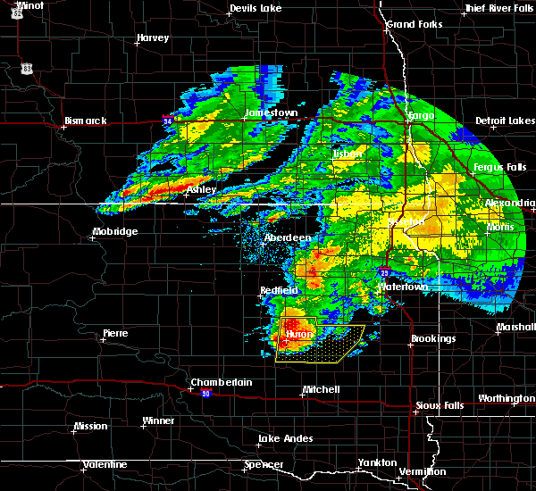 At 1145 am cdt, severe thunderstorms were located along a line extending from near carpenter to near iroquois to 11 miles southeast of huron, moving east at 45 mph. these are very dangerous storms (radar indicated). Hazards include 80 mph wind gusts and quarter size hail. Flying debris will be dangerous to those caught without shelter. mobile homes will be heavily damaged. expect considerable damage to roofs, windows, and vehicles. extensive tree damage and power outages are likely. severe thunderstorms will be near, iroquois around 1150 am cdt. de smet and carthage around 1210 pm cdt. lake preston around 1220 pm cdt. lake thompson state recreation area around 1225 pm cdt. other locations impacted by these severe thunderstorms include bancroft and erwin. this storm has a history of very strong winds. At 11:36 am, the huron airport gusted to 83 mph. At 1145 am cdt, severe thunderstorms were located along a line extending from near carpenter to near iroquois to 11 miles southeast of huron, moving east at 45 mph. these are very dangerous storms (radar indicated). Hazards include 80 mph wind gusts and quarter size hail. Flying debris will be dangerous to those caught without shelter. mobile homes will be heavily damaged. expect considerable damage to roofs, windows, and vehicles. extensive tree damage and power outages are likely. severe thunderstorms will be near, iroquois around 1150 am cdt. de smet and carthage around 1210 pm cdt. lake preston around 1220 pm cdt. lake thompson state recreation area around 1225 pm cdt. other locations impacted by these severe thunderstorms include bancroft and erwin. this storm has a history of very strong winds. At 11:36 am, the huron airport gusted to 83 mph.
|
| 7/17/2017 8:30 PM CDT |
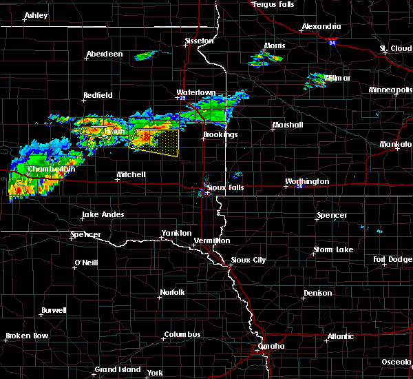 At 830 pm cdt, a severe thunderstorm was located near lake thompson state recreation area, moving east at 60 mph (radar indicated). Hazards include 70 mph wind gusts and quarter size hail. Hail damage to vehicles is expected. expect considerable tree damage. wind damage is also likely to mobile homes, roofs, and outbuildings. this severe storm will be near, oldham around 835 pm cdt. Ramona around 845 pm cdt. At 830 pm cdt, a severe thunderstorm was located near lake thompson state recreation area, moving east at 60 mph (radar indicated). Hazards include 70 mph wind gusts and quarter size hail. Hail damage to vehicles is expected. expect considerable tree damage. wind damage is also likely to mobile homes, roofs, and outbuildings. this severe storm will be near, oldham around 835 pm cdt. Ramona around 845 pm cdt.
|
| 7/17/2017 8:10 PM CDT |
 At 810 pm cdt, a severe thunderstorm was located 8 miles southwest of de smet, or 11 miles west of lake thompson state recreation area, moving east at 45 mph (radar indicated). Hazards include 70 mph wind gusts. Expect considerable tree damage. damage is likely to mobile homes, roofs, and outbuildings. this severe thunderstorm will be near, de smet around 815 pm cdt. lake thompson state recreation area around 825 pm cdt. lake preston around 830 pm cdt. oldham around 835 pm cdt. Ramona around 845 pm cdt. At 810 pm cdt, a severe thunderstorm was located 8 miles southwest of de smet, or 11 miles west of lake thompson state recreation area, moving east at 45 mph (radar indicated). Hazards include 70 mph wind gusts. Expect considerable tree damage. damage is likely to mobile homes, roofs, and outbuildings. this severe thunderstorm will be near, de smet around 815 pm cdt. lake thompson state recreation area around 825 pm cdt. lake preston around 830 pm cdt. oldham around 835 pm cdt. Ramona around 845 pm cdt.
|
| 6/13/2017 7:11 PM CDT |
 The severe thunderstorm warning for central davison. eastern sanborn. miner and northwestern hanson counties will expire at 715 pm cdt. the storm which prompted the warning has moved out of the area. therefore the warning will be allowed to expire. However small hail and gusty winds to 50 mph are still possible with this thunderstorm. The severe thunderstorm warning for central davison. eastern sanborn. miner and northwestern hanson counties will expire at 715 pm cdt. the storm which prompted the warning has moved out of the area. therefore the warning will be allowed to expire. However small hail and gusty winds to 50 mph are still possible with this thunderstorm.
|
| 6/13/2017 6:56 PM CDT |
 At 655 pm cdt, severe thunderstorms were located along a line extending from near willow lake to 6 miles northeast of carthage to near roswell, moving northeast at 50 mph (radar indicated). Hazards include 60 mph wind gusts and quarter size hail. Hail damage to vehicles is expected. expect wind damage to roofs, siding, and trees. severe thunderstorms will be near, lake thompson state recreation area and de smet around 705 pm cdt. lake preston and winfred around 715 pm cdt. hetland around 725 pm cdt. arlington, ramona and badger around 730 pm cdt. other locations impacted by these severe thunderstorms include erwin. A tornado watch remains in effect until 1000 pm cdt for east central south dakota. At 655 pm cdt, severe thunderstorms were located along a line extending from near willow lake to 6 miles northeast of carthage to near roswell, moving northeast at 50 mph (radar indicated). Hazards include 60 mph wind gusts and quarter size hail. Hail damage to vehicles is expected. expect wind damage to roofs, siding, and trees. severe thunderstorms will be near, lake thompson state recreation area and de smet around 705 pm cdt. lake preston and winfred around 715 pm cdt. hetland around 725 pm cdt. arlington, ramona and badger around 730 pm cdt. other locations impacted by these severe thunderstorms include erwin. A tornado watch remains in effect until 1000 pm cdt for east central south dakota.
|
| 6/13/2017 6:44 PM CDT |
 At 643 pm cdt, a severe thunderstorm was located near loomis, or 8 miles north of mitchell, moving northeast at 60 mph (trained weather spotters. at 642 pm cdt, trained spotters reported quarter size hail 7 miles southwest of mitchell). Hazards include ping pong ball size hail and 60 mph wind gusts. People and animals outdoors will be injured. expect hail damage to roofs, siding, windows, and vehicles. expect wind damage to roofs, siding, and trees. this severe storm will be near, artesian around 655 pm cdt. fedora and roswell around 700 pm cdt. carthage around 710 pm cdt. A tornado watch remains in effect until 1000 pm cdt for southeastern and east central south dakota. At 643 pm cdt, a severe thunderstorm was located near loomis, or 8 miles north of mitchell, moving northeast at 60 mph (trained weather spotters. at 642 pm cdt, trained spotters reported quarter size hail 7 miles southwest of mitchell). Hazards include ping pong ball size hail and 60 mph wind gusts. People and animals outdoors will be injured. expect hail damage to roofs, siding, windows, and vehicles. expect wind damage to roofs, siding, and trees. this severe storm will be near, artesian around 655 pm cdt. fedora and roswell around 700 pm cdt. carthage around 710 pm cdt. A tornado watch remains in effect until 1000 pm cdt for southeastern and east central south dakota.
|
| 6/13/2017 6:25 PM CDT |
 At 625 pm cdt, a severe thunderstorm was located near mount vernon, or 11 miles southwest of mitchell, moving northeast at 60 mph (radar indicated). Hazards include ping pong ball size hail and 60 mph wind gusts. People and animals outdoors will be injured. expect hail damage to roofs, siding, windows, and vehicles. expect wind damage to roofs, siding, and trees. this severe thunderstorm will be near, mitchell and loomis around 640 pm cdt. letcher around 645 pm cdt. artesian around 655 pm cdt. fedora and roswell around 700 pm cdt. carthage around 710 pm cdt. A tornado watch remains in effect until 1000 pm cdt for south central, southeastern and east central south dakota. At 625 pm cdt, a severe thunderstorm was located near mount vernon, or 11 miles southwest of mitchell, moving northeast at 60 mph (radar indicated). Hazards include ping pong ball size hail and 60 mph wind gusts. People and animals outdoors will be injured. expect hail damage to roofs, siding, windows, and vehicles. expect wind damage to roofs, siding, and trees. this severe thunderstorm will be near, mitchell and loomis around 640 pm cdt. letcher around 645 pm cdt. artesian around 655 pm cdt. fedora and roswell around 700 pm cdt. carthage around 710 pm cdt. A tornado watch remains in effect until 1000 pm cdt for south central, southeastern and east central south dakota.
|
| 6/11/2017 5:12 AM CDT |
 At 512 am cdt, severe thunderstorms were located along a line extending from 6 miles southeast of bryant to near oldham to near canova, moving east at 45 mph (radar indicated). Hazards include ping pong ball size hail and 60 mph wind gusts. People and animals outdoors will be injured. expect hail damage to roofs, siding, windows, and vehicles. expect wind damage to roofs, siding, and trees. these severe storms will be near, oldham around 515 am cdt. ramona and badger around 520 am cdt. winfred around 525 am cdt. sinai around 530 am cdt. nunda and oakwood state park around 535 am cdt. lake herman state park, bruce and orland around 540 am cdt. Other locations impacted by these severe thunderstorms include erwin. At 512 am cdt, severe thunderstorms were located along a line extending from 6 miles southeast of bryant to near oldham to near canova, moving east at 45 mph (radar indicated). Hazards include ping pong ball size hail and 60 mph wind gusts. People and animals outdoors will be injured. expect hail damage to roofs, siding, windows, and vehicles. expect wind damage to roofs, siding, and trees. these severe storms will be near, oldham around 515 am cdt. ramona and badger around 520 am cdt. winfred around 525 am cdt. sinai around 530 am cdt. nunda and oakwood state park around 535 am cdt. lake herman state park, bruce and orland around 540 am cdt. Other locations impacted by these severe thunderstorms include erwin.
|
| 6/11/2017 5:04 AM CDT |
 The national weather service in sioux falls has issued a * severe thunderstorm warning for. northwestern moody county in east central south dakota. kingsbury county in east central south dakota. lake county in east central south dakota. Miner county in east central south dakota. The national weather service in sioux falls has issued a * severe thunderstorm warning for. northwestern moody county in east central south dakota. kingsbury county in east central south dakota. lake county in east central south dakota. Miner county in east central south dakota.
|
| 6/11/2017 5:00 AM CDT |
 At 500 am cdt, severe thunderstorms were located along a line extending from 7 miles southeast of bryant to 6 miles southeast of carthage to 6 miles northwest of fulton, moving east at 50 mph (radar indicated). Hazards include 70 mph wind gusts and ping pong ball size hail. People and animals outdoors will be injured. expect hail damage to roofs, siding, windows, and vehicles. expect considerable tree damage. wind damage is also likely to mobile homes, roofs, and outbuildings. these severe storms will be near, howard and badger around 510 am cdt. farmer around 515 am cdt. Other locations impacted by these severe thunderstorms include bancroft and erwin. At 500 am cdt, severe thunderstorms were located along a line extending from 7 miles southeast of bryant to 6 miles southeast of carthage to 6 miles northwest of fulton, moving east at 50 mph (radar indicated). Hazards include 70 mph wind gusts and ping pong ball size hail. People and animals outdoors will be injured. expect hail damage to roofs, siding, windows, and vehicles. expect considerable tree damage. wind damage is also likely to mobile homes, roofs, and outbuildings. these severe storms will be near, howard and badger around 510 am cdt. farmer around 515 am cdt. Other locations impacted by these severe thunderstorms include bancroft and erwin.
|
| 6/11/2017 4:45 AM CDT |
 At 445 am cdt, severe thunderstorms were located along a line extending from 7 miles south of willow lake to 6 miles north of artesian to loomis, moving east at 50 mph (radar indicated). Hazards include ping pong ball size hail and 60 mph wind gusts. People and animals outdoors will be injured. expect hail damage to roofs, siding, windows, and vehicles. expect wind damage to roofs, siding, and trees. these severe storms will be near, carthage and roswell around 455 am cdt. howard, fulton and vilas around 505 am cdt. badger and farmer around 510 am cdt. Other locations impacted by these severe thunderstorms include bancroft and erwin. At 445 am cdt, severe thunderstorms were located along a line extending from 7 miles south of willow lake to 6 miles north of artesian to loomis, moving east at 50 mph (radar indicated). Hazards include ping pong ball size hail and 60 mph wind gusts. People and animals outdoors will be injured. expect hail damage to roofs, siding, windows, and vehicles. expect wind damage to roofs, siding, and trees. these severe storms will be near, carthage and roswell around 455 am cdt. howard, fulton and vilas around 505 am cdt. badger and farmer around 510 am cdt. Other locations impacted by these severe thunderstorms include bancroft and erwin.
|
| 6/11/2017 4:35 AM CDT |
 At 434 am cdt, severe thunderstorms were located along a line extending from 9 miles southwest of willow lake to 6 miles northeast of forestburg to near aurora center, moving east at 50 mph (radar indicated). Hazards include golf ball size hail and 60 mph wind gusts. People and animals outdoors will be injured. expect hail damage to roofs, siding, windows, and vehicles. expect wind damage to roofs, siding, and trees. severe thunderstorms will be near, artesian around 445 am cdt. mitchell and fedora around 450 am cdt. carthage and roswell around 455 am cdt. howard, fulton and vilas around 505 am cdt. badger around 510 am cdt. farmer around 515 am cdt. Other locations impacted by these severe thunderstorms include bancroft and erwin. At 434 am cdt, severe thunderstorms were located along a line extending from 9 miles southwest of willow lake to 6 miles northeast of forestburg to near aurora center, moving east at 50 mph (radar indicated). Hazards include golf ball size hail and 60 mph wind gusts. People and animals outdoors will be injured. expect hail damage to roofs, siding, windows, and vehicles. expect wind damage to roofs, siding, and trees. severe thunderstorms will be near, artesian around 445 am cdt. mitchell and fedora around 450 am cdt. carthage and roswell around 455 am cdt. howard, fulton and vilas around 505 am cdt. badger around 510 am cdt. farmer around 515 am cdt. Other locations impacted by these severe thunderstorms include bancroft and erwin.
|
| 6/11/2017 4:26 AM CDT |
 At 426 am cdt, severe thunderstorms were located along a line extending from near cavour to 7 miles north of forestburg to near aurora center, moving east at 40 mph (radar indicated). Hazards include golf ball size hail and 60 mph wind gusts. People and animals outdoors will be injured. expect hail damage to roofs, siding, windows, and vehicles. expect wind damage to roofs, siding, and trees. these severe storms will be near, cavour and forestburg around 430 am cdt. yale around 435 am cdt. artesian around 440 am cdt. Mitchell, iroquois, letcher, fedora and loomis around 445 am cdt. At 426 am cdt, severe thunderstorms were located along a line extending from near cavour to 7 miles north of forestburg to near aurora center, moving east at 40 mph (radar indicated). Hazards include golf ball size hail and 60 mph wind gusts. People and animals outdoors will be injured. expect hail damage to roofs, siding, windows, and vehicles. expect wind damage to roofs, siding, and trees. these severe storms will be near, cavour and forestburg around 430 am cdt. yale around 435 am cdt. artesian around 440 am cdt. Mitchell, iroquois, letcher, fedora and loomis around 445 am cdt.
|
| 6/11/2017 4:19 AM CDT |
 At 418 am cdt, severe thunderstorms were located along a line extending from near iroquois to 7 miles northwest of aurora center, moving east at 45 mph (radar indicated). Hazards include golf ball size hail and 60 mph wind gusts. People and animals outdoors will be injured. expect hail damage to roofs, siding, windows, and vehicles. expect wind damage to roofs, siding, and trees. these severe storms will be near, iroquois around 425 am cdt. de smet and letcher around 440 am cdt. mitchell, lake thompson state recreation area, lake preston and loomis around 445 am cdt. At 414 am, the huron airport reported a wind gust to 58 mph. At 418 am cdt, severe thunderstorms were located along a line extending from near iroquois to 7 miles northwest of aurora center, moving east at 45 mph (radar indicated). Hazards include golf ball size hail and 60 mph wind gusts. People and animals outdoors will be injured. expect hail damage to roofs, siding, windows, and vehicles. expect wind damage to roofs, siding, and trees. these severe storms will be near, iroquois around 425 am cdt. de smet and letcher around 440 am cdt. mitchell, lake thompson state recreation area, lake preston and loomis around 445 am cdt. At 414 am, the huron airport reported a wind gust to 58 mph.
|
| 6/11/2017 4:05 AM CDT |
 At 405 am cdt, severe thunderstorms were located along a line extending from near cavour to 11 miles southwest of wessington springs, moving east at 45 mph (radar indicated). Hazards include golf ball size hail and 60 mph wind gusts. People and animals outdoors will be injured. expect hail damage to roofs, siding, windows, and vehicles. expect wind damage to roofs, siding, and trees. severe thunderstorms will be near, cavour and yale around 410 am cdt. iroquois around 420 am cdt. aurora center around 425 am cdt. de smet and letcher around 440 am cdt. Mitchell, lake thompson state recreation area, lake preston and loomis around 445 am cdt. At 405 am cdt, severe thunderstorms were located along a line extending from near cavour to 11 miles southwest of wessington springs, moving east at 45 mph (radar indicated). Hazards include golf ball size hail and 60 mph wind gusts. People and animals outdoors will be injured. expect hail damage to roofs, siding, windows, and vehicles. expect wind damage to roofs, siding, and trees. severe thunderstorms will be near, cavour and yale around 410 am cdt. iroquois around 420 am cdt. aurora center around 425 am cdt. de smet and letcher around 440 am cdt. Mitchell, lake thompson state recreation area, lake preston and loomis around 445 am cdt.
|
| 8/18/2016 9:12 PM CDT | The severe thunderstorm warning for northeastern miner, northwestern lake and southeastern kingsbury counties will expire at 915 pm cdt, the storm which prompted the warning has weakened below severe limits, and no longer pose an immediate threat to life or property. therefore, the warning will be allowed to expire. a severe thunderstorm watch remains in effect until 200 am cdt for east central south dakota. |
| 8/18/2016 9:00 PM CDT |
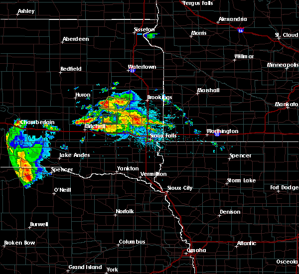 At 859 pm cdt, a severe thunderstorm was located near lake thompson state recreation area, moving northeast at 10 mph (radar indicated). Hazards include 60 mph wind gusts and quarter size hail. Hail damage to vehicles is expected. expect wind damage to roofs, siding, and trees. this severe storm will be near, lake thompson state recreation area around 905 pm cdt. oldham around 910 pm cdt. Lake preston around 915 pm cdt. At 859 pm cdt, a severe thunderstorm was located near lake thompson state recreation area, moving northeast at 10 mph (radar indicated). Hazards include 60 mph wind gusts and quarter size hail. Hail damage to vehicles is expected. expect wind damage to roofs, siding, and trees. this severe storm will be near, lake thompson state recreation area around 905 pm cdt. oldham around 910 pm cdt. Lake preston around 915 pm cdt.
|
| 8/18/2016 8:38 PM CDT |
 At 838 pm cdt, a severe thunderstorm was located near lake thompson state recreation area, moving northeast at 10 mph (radar indicated). Hazards include 60 mph wind gusts and half dollar size hail. Hail damage to vehicles is expected. expect wind damage to roofs, siding, and trees. this severe thunderstorm will be near, lake thompson state recreation area around 900 pm cdt. oldham around 905 pm cdt. Lake preston around 915 pm cdt. At 838 pm cdt, a severe thunderstorm was located near lake thompson state recreation area, moving northeast at 10 mph (radar indicated). Hazards include 60 mph wind gusts and half dollar size hail. Hail damage to vehicles is expected. expect wind damage to roofs, siding, and trees. this severe thunderstorm will be near, lake thompson state recreation area around 900 pm cdt. oldham around 905 pm cdt. Lake preston around 915 pm cdt.
|
| 7/6/2016 10:24 PM CDT |
 At 1023 pm cdt, severe thunderstorms were located along a line extending from 9 miles northwest of de smet to 9 miles north of howard to 6 miles south of vilas, moving east at 60 mph (radar indicated). Hazards include 60 mph wind gusts and penny size hail. Expect damage to roofs. siding. and trees. these severe storms will be near, ramona, winfred and oldham around 1035 pm cdt. lake herman state park, badger and orland around 1045 pm cdt. Other locations impacted by these severe thunderstorms include erwin and bancroft. At 1023 pm cdt, severe thunderstorms were located along a line extending from 9 miles northwest of de smet to 9 miles north of howard to 6 miles south of vilas, moving east at 60 mph (radar indicated). Hazards include 60 mph wind gusts and penny size hail. Expect damage to roofs. siding. and trees. these severe storms will be near, ramona, winfred and oldham around 1035 pm cdt. lake herman state park, badger and orland around 1045 pm cdt. Other locations impacted by these severe thunderstorms include erwin and bancroft.
|
| 7/6/2016 10:05 PM CDT |
 At 1004 pm cdt, severe thunderstorms were located along a line extending from near yale to 7 miles southwest of carthage to 7 miles south of artesian, moving east at 60 mph (radar indicated). Hazards include 60 mph wind gusts and penny size hail. Expect damage to roofs. siding. and trees. at 947 pm, a 58 mph wind gust was reported at the huron airport. severe thunderstorms will be near, carthage around 1010 pm cdt. fedora and roswell around 1015 pm cdt. howard around 1020 pm cdt. canova and vilas around 1025 pm cdt. de smet and oldham around 1030 pm cdt. lake preston, ramona and winfred around 1035 pm cdt. madison, lake herman state park, badger, orland and hetland around 1045 pm cdt. Other locations impacted by these severe thunderstorms include erwin and bancroft. At 1004 pm cdt, severe thunderstorms were located along a line extending from near yale to 7 miles southwest of carthage to 7 miles south of artesian, moving east at 60 mph (radar indicated). Hazards include 60 mph wind gusts and penny size hail. Expect damage to roofs. siding. and trees. at 947 pm, a 58 mph wind gust was reported at the huron airport. severe thunderstorms will be near, carthage around 1010 pm cdt. fedora and roswell around 1015 pm cdt. howard around 1020 pm cdt. canova and vilas around 1025 pm cdt. de smet and oldham around 1030 pm cdt. lake preston, ramona and winfred around 1035 pm cdt. madison, lake herman state park, badger, orland and hetland around 1045 pm cdt. Other locations impacted by these severe thunderstorms include erwin and bancroft.
|
| 5/25/2016 8:27 PM CDT |
 At 826 pm cdt, a severe thunderstorm was located near artesian, or 22 miles southeast of huron, moving east at 50 mph (trained weather spotters. at 819 pm cdt...quarter size hail was reported near forestburg). Hazards include 60 mph wind gusts and quarter size hail. Hail damage to vehicles is expected. expect wind damage to roofs, siding, and trees. this severe storm will be near, fedora around 835 pm cdt. Carthage and roswell around 840 pm cdt. At 826 pm cdt, a severe thunderstorm was located near artesian, or 22 miles southeast of huron, moving east at 50 mph (trained weather spotters. at 819 pm cdt...quarter size hail was reported near forestburg). Hazards include 60 mph wind gusts and quarter size hail. Hail damage to vehicles is expected. expect wind damage to roofs, siding, and trees. this severe storm will be near, fedora around 835 pm cdt. Carthage and roswell around 840 pm cdt.
|
| 5/25/2016 7:59 PM CDT |
 At 759 pm cdt, a severe thunderstorm was located near woonsocket, or 19 miles south of huron, moving east at 35 mph (radar indicated). Hazards include 60 mph wind gusts and quarter size hail. Hail damage to vehicles is expected. expect wind damage to roofs, siding, and trees. this severe thunderstorm will be near, forestburg around 805 pm cdt. artesian around 825 pm cdt. fedora around 835 pm cdt. Carthage and roswell around 845 pm cdt. At 759 pm cdt, a severe thunderstorm was located near woonsocket, or 19 miles south of huron, moving east at 35 mph (radar indicated). Hazards include 60 mph wind gusts and quarter size hail. Hail damage to vehicles is expected. expect wind damage to roofs, siding, and trees. this severe thunderstorm will be near, forestburg around 805 pm cdt. artesian around 825 pm cdt. fedora around 835 pm cdt. Carthage and roswell around 845 pm cdt.
|
| 7/23/2015 10:13 PM CDT |
 At 1012 pm cdt, a confirmed tornado was located near fedora, or 22 miles southwest of lake thompson state recreation area, moving east at 10 mph (law enforcement confirmed tornado. at 1010 pm cdt a tornado was reported on the ground 2 miles northwest of fedora). Hazards include damaging tornado and quarter size hail. Flying debris will be dangerous to those caught without shelter. mobile homes will be damaged or destroyed. damage to roofs, windows and vehicles will occur. tree damage is likely. This tornado will be near, carthage around 1025 pm cdt. At 1012 pm cdt, a confirmed tornado was located near fedora, or 22 miles southwest of lake thompson state recreation area, moving east at 10 mph (law enforcement confirmed tornado. at 1010 pm cdt a tornado was reported on the ground 2 miles northwest of fedora). Hazards include damaging tornado and quarter size hail. Flying debris will be dangerous to those caught without shelter. mobile homes will be damaged or destroyed. damage to roofs, windows and vehicles will occur. tree damage is likely. This tornado will be near, carthage around 1025 pm cdt.
|
| 7/23/2015 10:13 PM CDT |
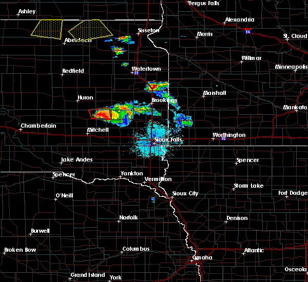 At 1012 pm cdt, a confirmed tornado was located near fedora, or 22 miles southwest of lake thompson state recreation area, moving east at 10 mph (law enforcement confirmed tornado. at 1010 pm cdt a tornado was reported on the ground 2 miles northwest of fedora). Hazards include damaging tornado and quarter size hail. Flying debris will be dangerous to those caught without shelter. mobile homes will be damaged or destroyed. damage to roofs, windows and vehicles will occur. tree damage is likely. This tornado will be near, carthage around 1025 pm cdt. At 1012 pm cdt, a confirmed tornado was located near fedora, or 22 miles southwest of lake thompson state recreation area, moving east at 10 mph (law enforcement confirmed tornado. at 1010 pm cdt a tornado was reported on the ground 2 miles northwest of fedora). Hazards include damaging tornado and quarter size hail. Flying debris will be dangerous to those caught without shelter. mobile homes will be damaged or destroyed. damage to roofs, windows and vehicles will occur. tree damage is likely. This tornado will be near, carthage around 1025 pm cdt.
|
| 7/23/2015 9:59 PM CDT |
 At 959 pm cdt, a severe thunderstorm capable of producing a tornado was located near fedora, or 24 miles southwest of lake thompson state recreation area, moving east at 10 mph (radar indicated rotation). Hazards include tornado and quarter size hail. Flying debris will be dangerous to those caught without shelter. mobile homes will be damaged or destroyed. damage to roofs, windows and vehicles will occur. tree damage is likely. this dangerous storm will be near, carthage around 1020 pm cdt. Vilas around 1030 pm cdt. At 959 pm cdt, a severe thunderstorm capable of producing a tornado was located near fedora, or 24 miles southwest of lake thompson state recreation area, moving east at 10 mph (radar indicated rotation). Hazards include tornado and quarter size hail. Flying debris will be dangerous to those caught without shelter. mobile homes will be damaged or destroyed. damage to roofs, windows and vehicles will occur. tree damage is likely. this dangerous storm will be near, carthage around 1020 pm cdt. Vilas around 1030 pm cdt.
|
| 7/23/2015 9:45 PM CDT |
 At 945 pm cdt, a severe thunderstorm capable of producing a tornado was located 8 miles north of artesian, or 20 miles southeast of huron, moving east at 25 mph (radar indicated rotation). Hazards include tornado. Flying debris will be dangerous to those caught without shelter. mobile homes will be damaged or destroyed. damage to roofs, windows and vehicles will occur. tree damage is likely. This dangerous storm will be near, carthage around 1015 pm cdt. At 945 pm cdt, a severe thunderstorm capable of producing a tornado was located 8 miles north of artesian, or 20 miles southeast of huron, moving east at 25 mph (radar indicated rotation). Hazards include tornado. Flying debris will be dangerous to those caught without shelter. mobile homes will be damaged or destroyed. damage to roofs, windows and vehicles will occur. tree damage is likely. This dangerous storm will be near, carthage around 1015 pm cdt.
|
| 7/23/2015 9:31 PM CDT |
 At 930 pm cdt, a severe thunderstorm was located near fedora, or 23 miles southwest of lake thompson state recreation area, moving east at 30 mph (radar indicated). Hazards include 60 mph wind gusts and half dollar size hail. Hail damage to vehicles is expected. expect wind damage to roofs, siding and trees. This severe storm will be near, carthage and roswell around 940 pm cdt. At 930 pm cdt, a severe thunderstorm was located near fedora, or 23 miles southwest of lake thompson state recreation area, moving east at 30 mph (radar indicated). Hazards include 60 mph wind gusts and half dollar size hail. Hail damage to vehicles is expected. expect wind damage to roofs, siding and trees. This severe storm will be near, carthage and roswell around 940 pm cdt.
|
| 7/23/2015 8:55 PM CDT |
 At 855 pm cdt, a severe thunderstorm was located over forestburg, or 22 miles north of mitchell, moving east at 30 mph (radar indicated). Hazards include 60 mph wind gusts and half dollar size hail. Hail damage to vehicles is expected. expect wind damage to roofs, siding and trees. this severe thunderstorm will be near, artesian around 915 pm cdt. fedora around 930 pm cdt. Carthage and roswell around 940 pm cdt. At 855 pm cdt, a severe thunderstorm was located over forestburg, or 22 miles north of mitchell, moving east at 30 mph (radar indicated). Hazards include 60 mph wind gusts and half dollar size hail. Hail damage to vehicles is expected. expect wind damage to roofs, siding and trees. this severe thunderstorm will be near, artesian around 915 pm cdt. fedora around 930 pm cdt. Carthage and roswell around 940 pm cdt.
|
| 6/20/2015 2:37 AM CDT |
 At 236 am cdt, severe thunderstorms were located along a line extending from 7 miles southwest of iroquois to near canova to near clayton, moving east at 65 mph (radar indicated). Hazards include 70 mph wind gusts. Expect considerable tree damage. damage is likely to mobile homes, roofs and outbuildings. these severe storms will be near, bridgewater and canova around 240 am cdt. carthage around 245 am cdt. canistota and winfred around 250 am cdt. de smet and orland around 255 am cdt. Madison, lake thompson state recreation area, lake herman state park and lake preston around 300 am cdt. At 236 am cdt, severe thunderstorms were located along a line extending from 7 miles southwest of iroquois to near canova to near clayton, moving east at 65 mph (radar indicated). Hazards include 70 mph wind gusts. Expect considerable tree damage. damage is likely to mobile homes, roofs and outbuildings. these severe storms will be near, bridgewater and canova around 240 am cdt. carthage around 245 am cdt. canistota and winfred around 250 am cdt. de smet and orland around 255 am cdt. Madison, lake thompson state recreation area, lake herman state park and lake preston around 300 am cdt.
|
| 6/20/2015 2:26 AM CDT |
 At 224 am cdt, severe thunderstorms were located along a line extending from 9 miles south of huron to 8 miles north of fulton to 8 miles east of corsica, moving east at 65 mph. these are very dangerous storms (radar indicated). Hazards include 80 mph wind gusts. Flying debris will be dangerous to those caught without shelter. mobile homes will be heavily damaged. expect considerable damage to roofs, windows and vehicles. extensive tree damage and power outages are likely. severe thunderstorms will be near, ethan, iroquois and canova around 240 am cdt. winfred and carthage around 245 am cdt. lake thompson state recreation area, lake herman state park, de smet and orland around 255 am cdt. madison, lake preston, bridgewater, wentworth and oldham around 300 am cdt. Other locations impacted by these severe thunderstorms include erwin, bancroft and broadland. At 224 am cdt, severe thunderstorms were located along a line extending from 9 miles south of huron to 8 miles north of fulton to 8 miles east of corsica, moving east at 65 mph. these are very dangerous storms (radar indicated). Hazards include 80 mph wind gusts. Flying debris will be dangerous to those caught without shelter. mobile homes will be heavily damaged. expect considerable damage to roofs, windows and vehicles. extensive tree damage and power outages are likely. severe thunderstorms will be near, ethan, iroquois and canova around 240 am cdt. winfred and carthage around 245 am cdt. lake thompson state recreation area, lake herman state park, de smet and orland around 255 am cdt. madison, lake preston, bridgewater, wentworth and oldham around 300 am cdt. Other locations impacted by these severe thunderstorms include erwin, bancroft and broadland.
|
| 6/9/2015 6:37 PM CDT |
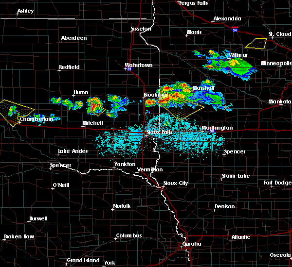 At 636 pm cdt, a severe thunderstorm was located near carthage, or 22 miles southwest of lake thompson state recreation area, moving southeast at 35 mph (radar indicated). Hazards include 60 mph wind gusts and penny size hail. Expect damage to roofs. siding and trees. this severe storm will be near, fedora around 645 pm cdt. Roswell around 650 pm cdt. At 636 pm cdt, a severe thunderstorm was located near carthage, or 22 miles southwest of lake thompson state recreation area, moving southeast at 35 mph (radar indicated). Hazards include 60 mph wind gusts and penny size hail. Expect damage to roofs. siding and trees. this severe storm will be near, fedora around 645 pm cdt. Roswell around 650 pm cdt.
|
| 6/9/2015 6:30 PM CDT | Trees down... branches down... telephone poles down in miner county SD, 0.1 miles E of Carthage, SD |
| 6/9/2015 6:18 PM CDT |
 At 617 pm cdt, a severe thunderstorm was located 9 miles south of cavour, or 14 miles southeast of huron, moving southeast at 30 mph (radar indicated). Hazards include 60 mph wind gusts and quarter size hail. Hail damage to vehicles is expected. expect wind damage to roofs, siding and trees. this severe thunderstorm will be near, carthage around 640 pm cdt. fedora around 650 pm cdt. Roswell around 655 pm cdt. At 617 pm cdt, a severe thunderstorm was located 9 miles south of cavour, or 14 miles southeast of huron, moving southeast at 30 mph (radar indicated). Hazards include 60 mph wind gusts and quarter size hail. Hail damage to vehicles is expected. expect wind damage to roofs, siding and trees. this severe thunderstorm will be near, carthage around 640 pm cdt. fedora around 650 pm cdt. Roswell around 655 pm cdt.
|
| 6/9/2015 6:11 PM CDT |
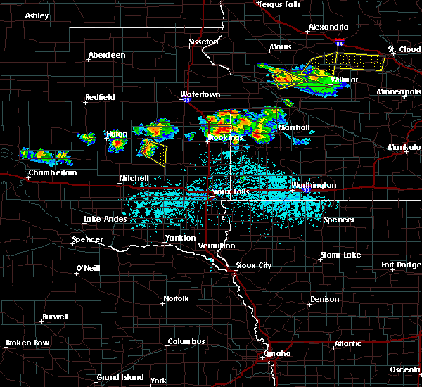 At 611 pm cdt, a severe thunderstorm was located near carthage, or 14 miles southwest of lake thompson state recreation area, moving southeast at 30 mph (radar indicated). Hazards include 60 mph wind gusts and nickel size hail. Expect damage to roofs. siding and trees. This severe thunderstorm will remain over mainly rural areas of south central kingsbury and northeastern miner counties. At 611 pm cdt, a severe thunderstorm was located near carthage, or 14 miles southwest of lake thompson state recreation area, moving southeast at 30 mph (radar indicated). Hazards include 60 mph wind gusts and nickel size hail. Expect damage to roofs. siding and trees. This severe thunderstorm will remain over mainly rural areas of south central kingsbury and northeastern miner counties.
|
| 6/9/2015 5:53 PM CDT |
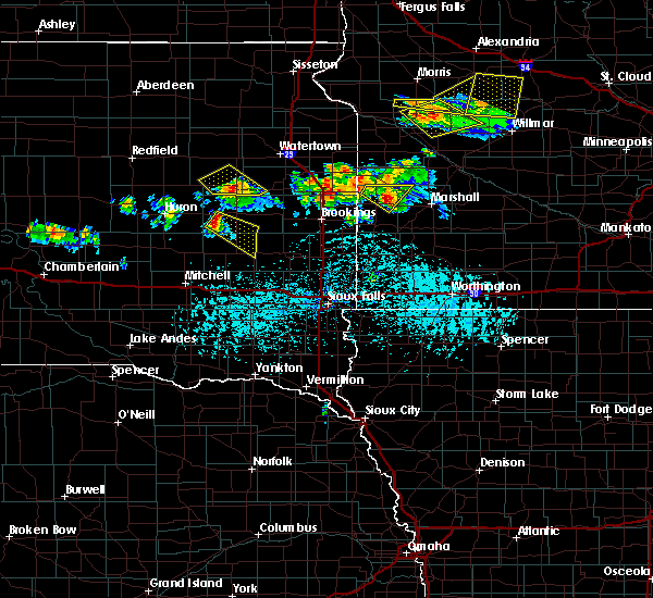 At 553 pm cdt, a severe thunderstorm was located 7 miles north of carthage, or 14 miles west of lake thompson state recreation area, moving southeast at 30 mph (radar indicated). Hazards include 60 mph wind gusts and nickel size hail. Expect damage to roofs. siding and trees. This severe thunderstorm will be near, carthage around 600 pm cdt. At 553 pm cdt, a severe thunderstorm was located 7 miles north of carthage, or 14 miles west of lake thompson state recreation area, moving southeast at 30 mph (radar indicated). Hazards include 60 mph wind gusts and nickel size hail. Expect damage to roofs. siding and trees. This severe thunderstorm will be near, carthage around 600 pm cdt.
|
| 1/1/0001 12:00 AM | Thunderstorm wind gusts estimated at 60 mph with heavy rain and frequent lightnin in miner county SD, 3.6 miles WSW of Carthage, SD |
| 1/1/0001 12:00 AM | Thunderstorm wind gusts estimated at 60 mph with heavy in miner county SD, 3.6 miles WSW of Carthage, SD |
Hail Maps for Carthage, SD


Connect with Interactive Hail Maps