

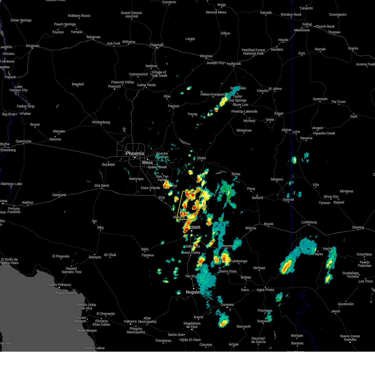
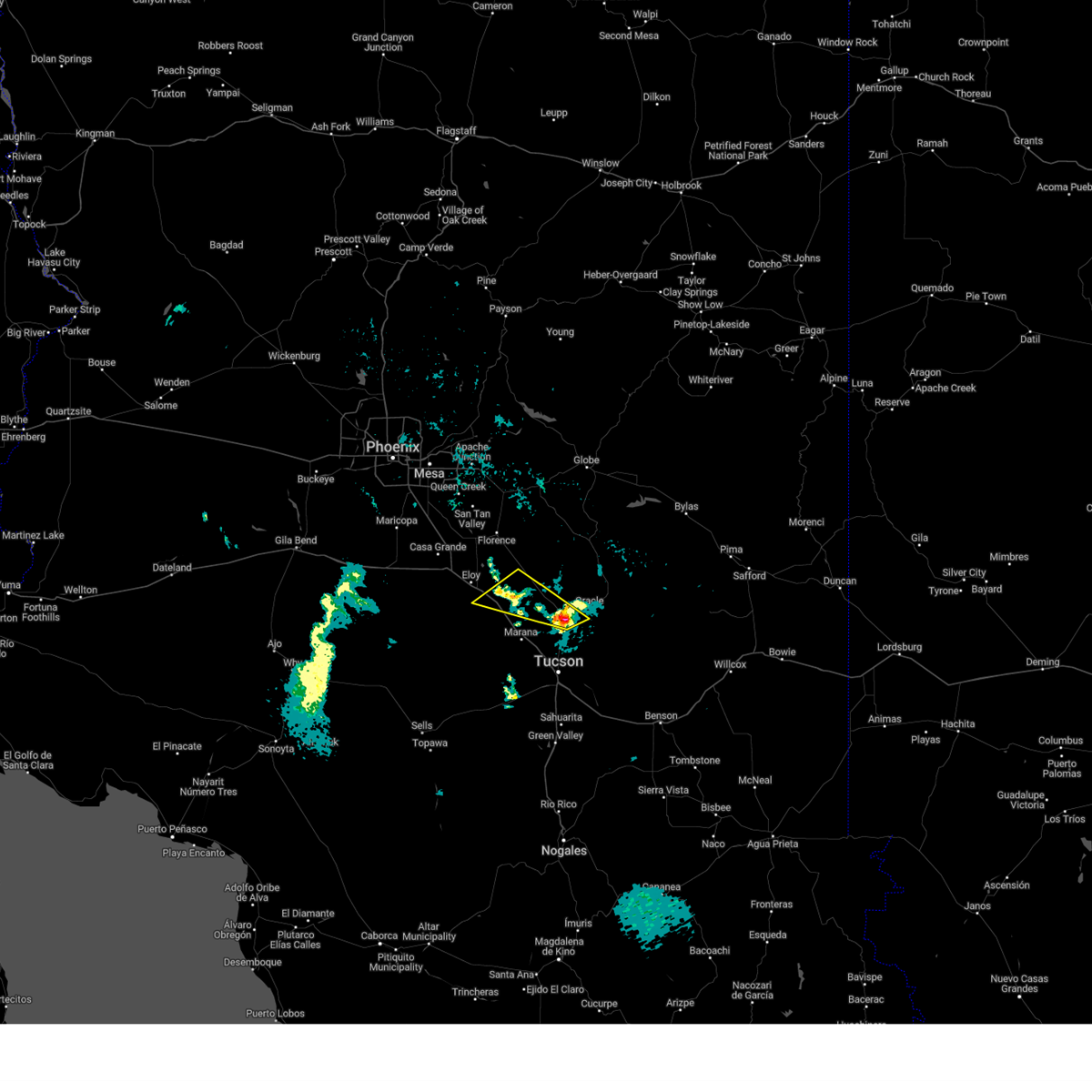
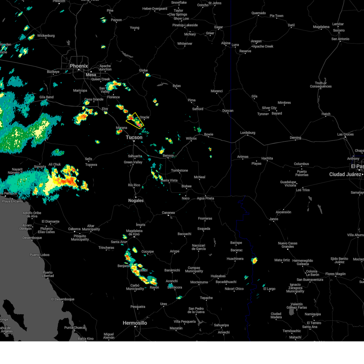
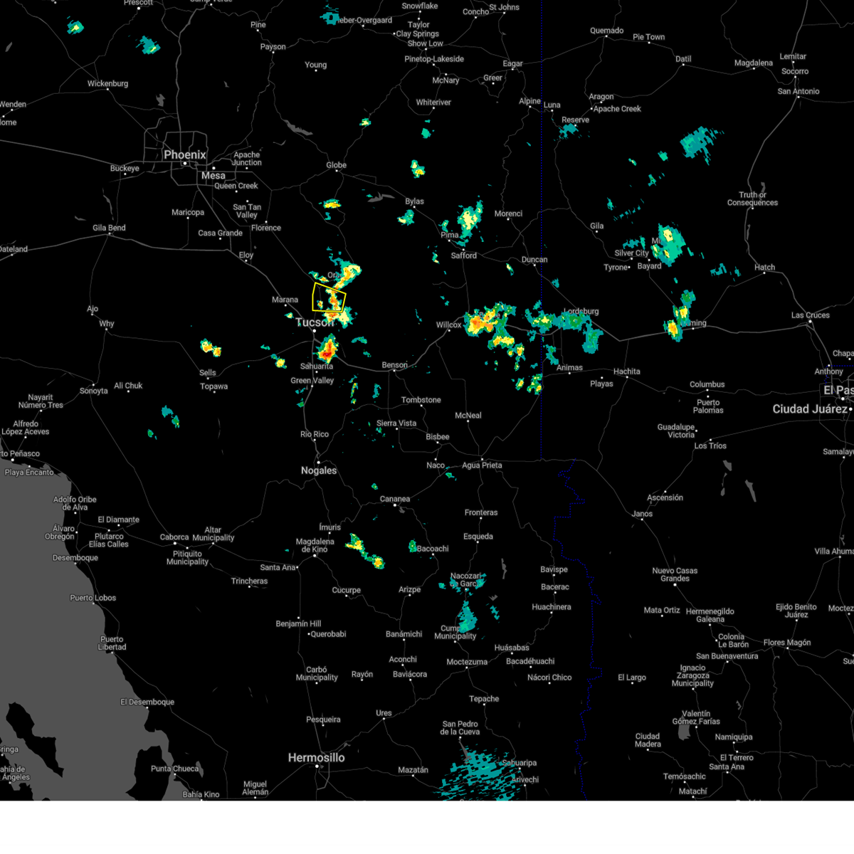
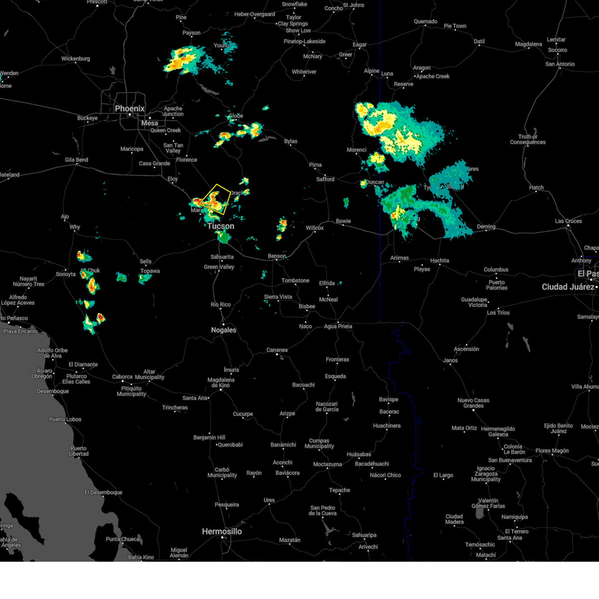
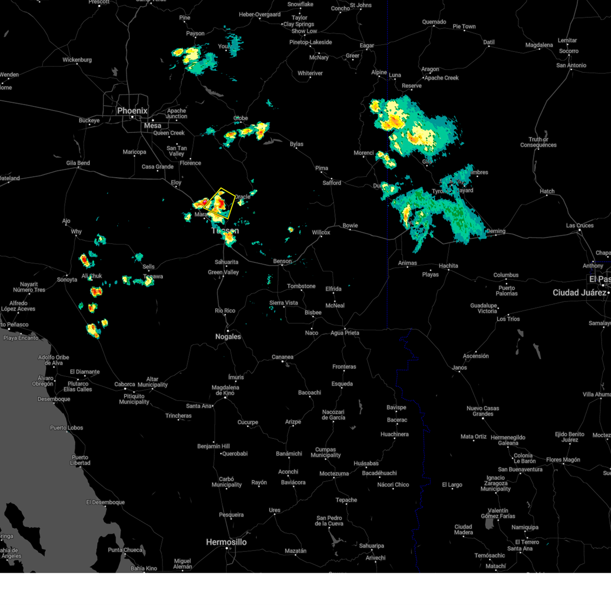
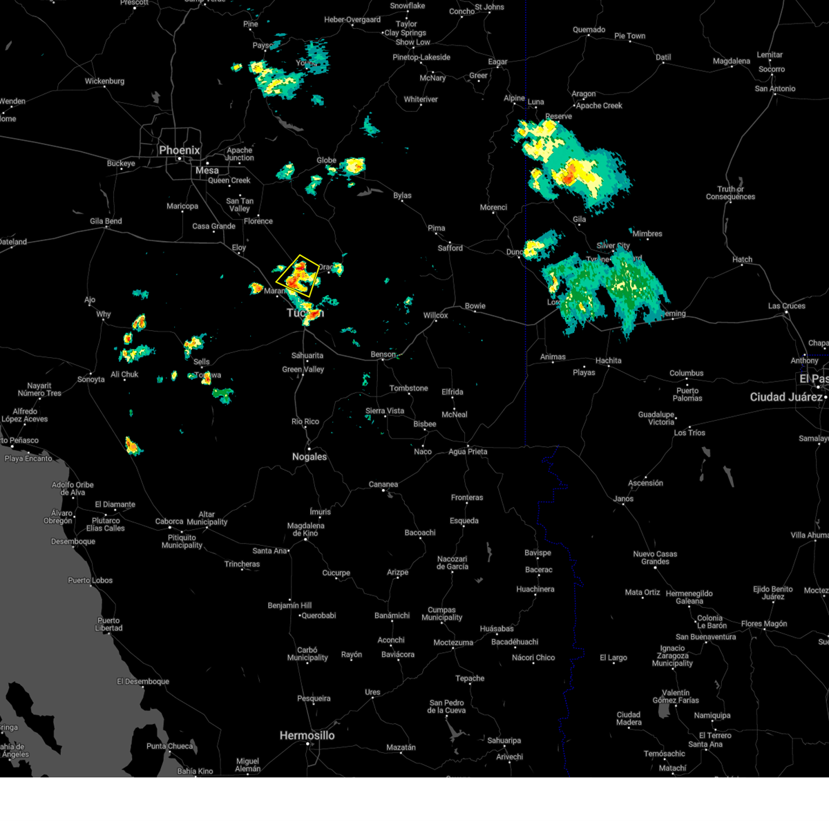
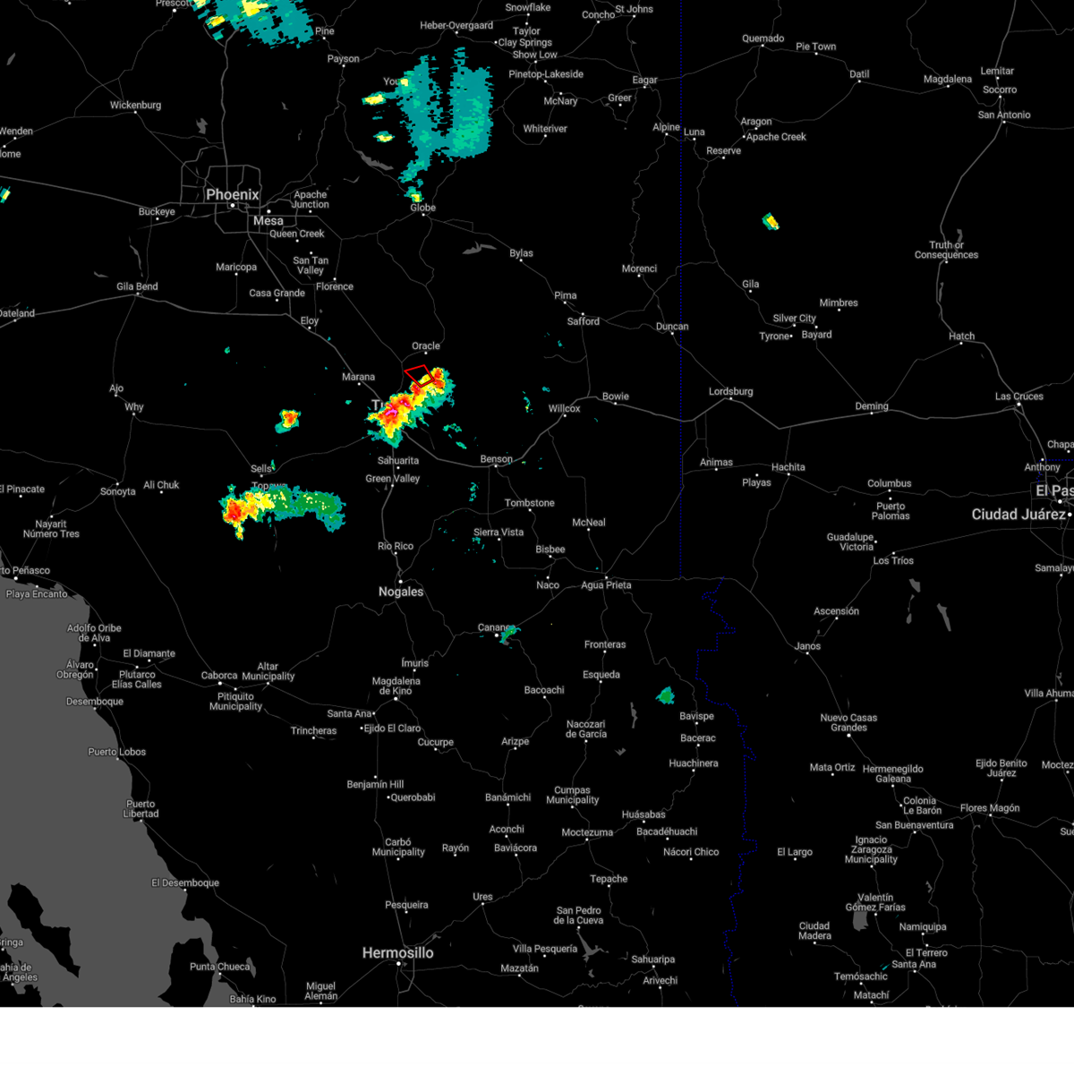
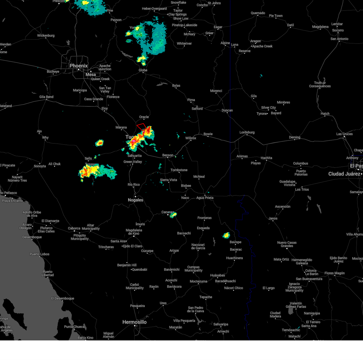
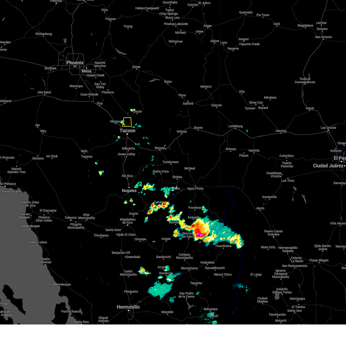
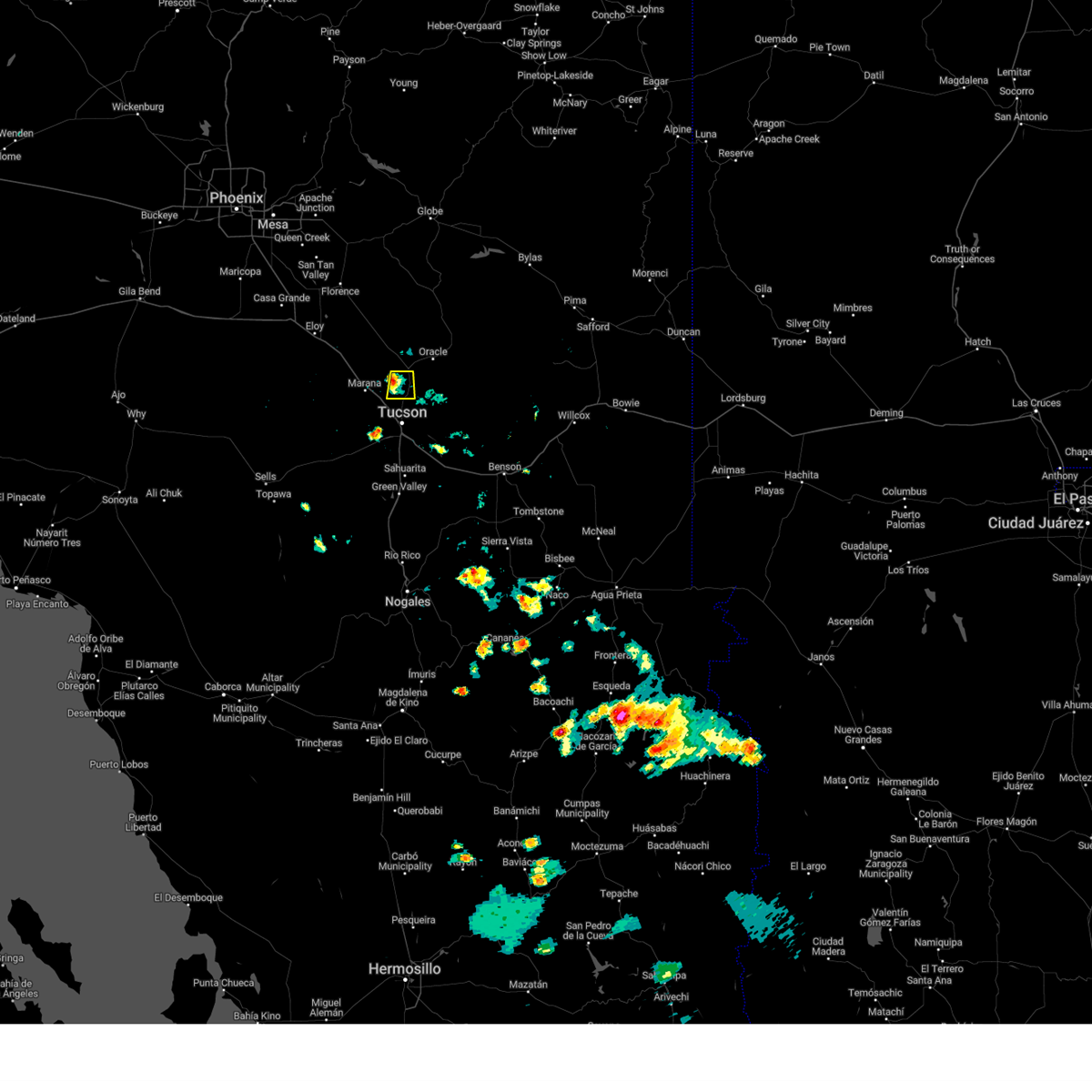
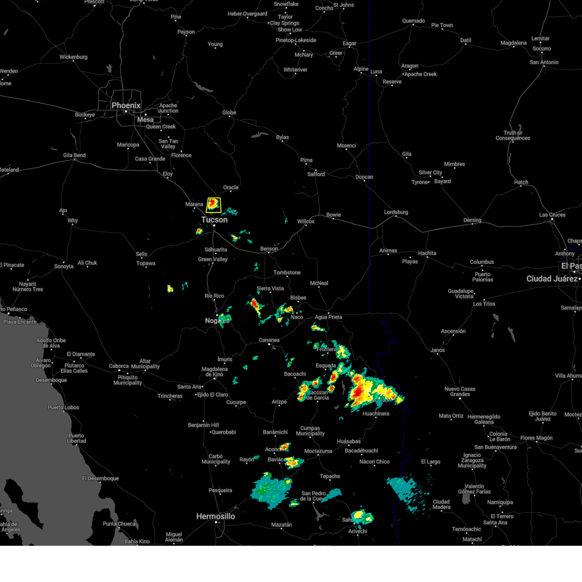
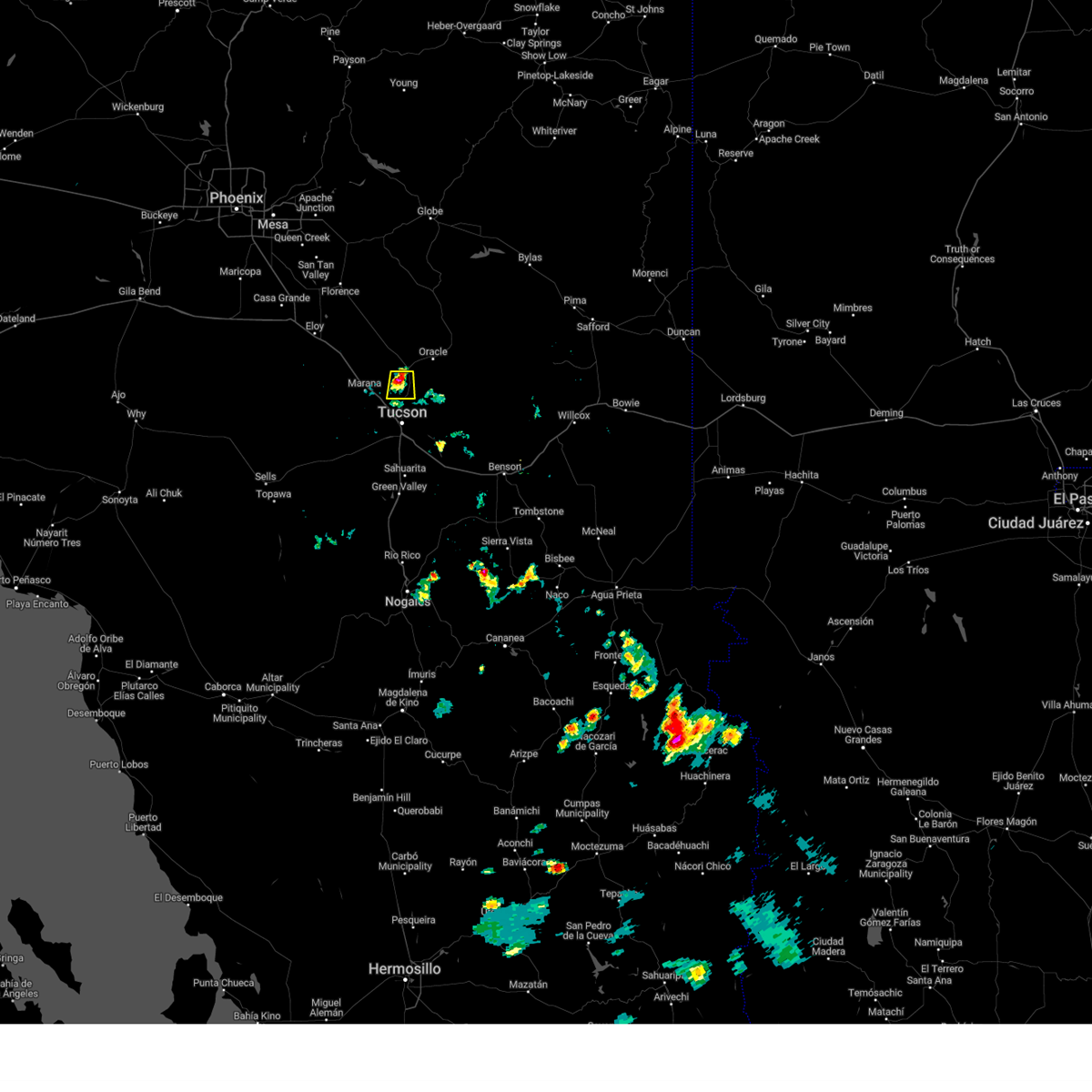
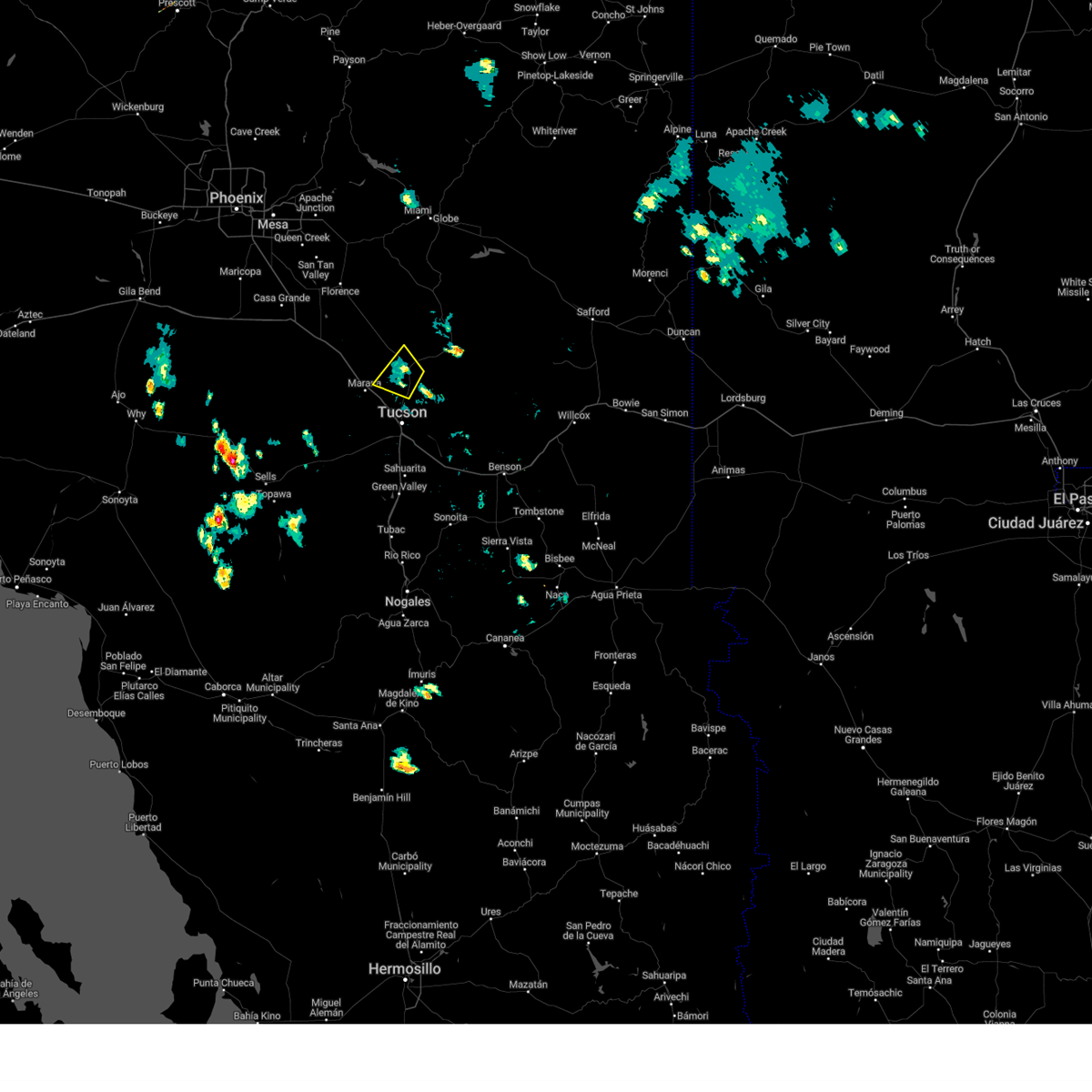
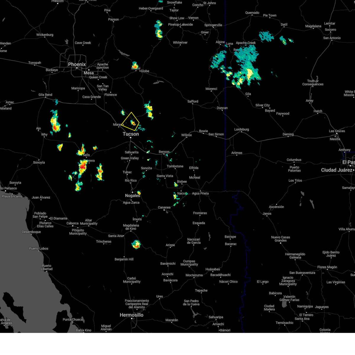
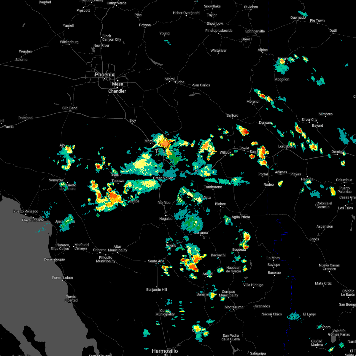
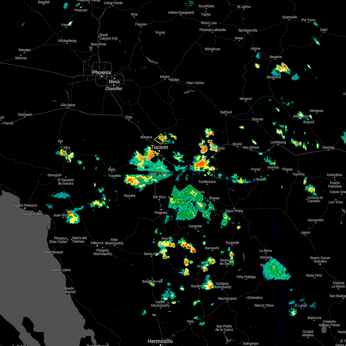
Hail Map for Catalina, AZ
The Catalina, AZ area has had 0 reports of on-the-ground hail by trained spotters, and has been under severe weather warnings 44 times during the past 12 months. Doppler radar has detected hail at or near Catalina, AZ on 45 occasions, including 7 occasions during the past year.
| Name: | Catalina, AZ |
| Where Located: | 19.2 miles NNE of Tucson, AZ |
| Map: | Google Map for Catalina, AZ |
| Population: | 7569 |
| Housing Units: | 3290 |
| More Info: | Search Google for Catalina, AZ |
1
The Top Recent Hail Date for Catalina, AZ is Sunday, July 14, 2024 (4th out of 45)

Hail and Wind Damage Spotted near Catalina, AZ
| Date / Time | Report Details |
|---|---|
| 8/23/2024 4:17 PM MST |
 Svrtwc the national weather service in tucson has issued a * severe thunderstorm warning for, northern pima county in southeastern arizona, southeastern pinal county in southeastern arizona, * until 500 pm mst. * at 416 pm mst, a severe thunderstorm was located 10 miles north of marana, moving north at 10 mph (radar indicated). Hazards include 60 mph wind gusts and penny size hail. expect damage to roofs, siding, and trees Svrtwc the national weather service in tucson has issued a * severe thunderstorm warning for, northern pima county in southeastern arizona, southeastern pinal county in southeastern arizona, * until 500 pm mst. * at 416 pm mst, a severe thunderstorm was located 10 miles north of marana, moving north at 10 mph (radar indicated). Hazards include 60 mph wind gusts and penny size hail. expect damage to roofs, siding, and trees
|
| 8/21/2024 12:51 PM MST |
 The storm which prompted the warning has weakened below severe limits, and no longer poses an immediate threat to life or property. therefore, the warning will be allowed to expire. however, gusty winds and heavy rain are still possible with this thunderstorm. The storm which prompted the warning has weakened below severe limits, and no longer poses an immediate threat to life or property. therefore, the warning will be allowed to expire. however, gusty winds and heavy rain are still possible with this thunderstorm.
|
| 8/21/2024 12:35 PM MST |
 At 1235 pm mst, a severe thunderstorm was located over flowing wells, or 9 miles south of oro valley, moving north at 20 mph (radar indicated). Hazards include 60 mph wind gusts and quarter size hail. Hail damage to vehicles is expected. expect wind damage to roofs, siding, and trees. locations impacted include, tucson, catalina, oro valley, marana, casas adobes, flowing wells, avra valley, tortolita, tucson estates, saguaro national park west, tucson mountain park, catalina state park, catalina foothills, and picture rocks. this includes the following highways, interstate 10 between mile markers 240 and 259. Route 77 between mile markers 70 and 84. At 1235 pm mst, a severe thunderstorm was located over flowing wells, or 9 miles south of oro valley, moving north at 20 mph (radar indicated). Hazards include 60 mph wind gusts and quarter size hail. Hail damage to vehicles is expected. expect wind damage to roofs, siding, and trees. locations impacted include, tucson, catalina, oro valley, marana, casas adobes, flowing wells, avra valley, tortolita, tucson estates, saguaro national park west, tucson mountain park, catalina state park, catalina foothills, and picture rocks. this includes the following highways, interstate 10 between mile markers 240 and 259. Route 77 between mile markers 70 and 84.
|
| 8/21/2024 12:17 PM MST |
 Svrtwc the national weather service in tucson has issued a * severe thunderstorm warning for, northeastern pima county in southeastern arizona, * until 100 pm mst. * at 1216 pm mst, a severe thunderstorm was located over south tucson, or 7 miles west of tucson, moving north at 20 mph (radar indicated). Hazards include 60 mph wind gusts and quarter size hail. Hail damage to vehicles is expected. Expect wind damage to roofs, siding, and trees. Svrtwc the national weather service in tucson has issued a * severe thunderstorm warning for, northeastern pima county in southeastern arizona, * until 100 pm mst. * at 1216 pm mst, a severe thunderstorm was located over south tucson, or 7 miles west of tucson, moving north at 20 mph (radar indicated). Hazards include 60 mph wind gusts and quarter size hail. Hail damage to vehicles is expected. Expect wind damage to roofs, siding, and trees.
|
| 8/20/2024 9:17 PM MST |
 Svrtwc the national weather service in tucson has issued a * severe thunderstorm warning for, northeastern pima county in southeastern arizona, south central pinal county in southeastern arizona, * until 1000 pm mst. * at 917 pm mst, a severe thunderstorm was located near saddlebrooke ranch, or 7 miles northwest of catalina, moving northwest at 15 mph (radar indicated). Hazards include 60 mph wind gusts and penny size hail. expect damage to roofs, siding, and trees Svrtwc the national weather service in tucson has issued a * severe thunderstorm warning for, northeastern pima county in southeastern arizona, south central pinal county in southeastern arizona, * until 1000 pm mst. * at 917 pm mst, a severe thunderstorm was located near saddlebrooke ranch, or 7 miles northwest of catalina, moving northwest at 15 mph (radar indicated). Hazards include 60 mph wind gusts and penny size hail. expect damage to roofs, siding, and trees
|
| 8/10/2024 3:24 PM MST |
 Svrtwc the national weather service in tucson has issued a * severe thunderstorm warning for, northeastern pima county in southeastern arizona, south central pinal county in southeastern arizona, * until 415 pm mst. * at 323 pm mst, a severe thunderstorm was located over saddlebrooke ranch, or near catalina, moving northwest at 15 mph (radar indicated). Hazards include 60 mph wind gusts and penny size hail. expect damage to roofs, siding, and trees Svrtwc the national weather service in tucson has issued a * severe thunderstorm warning for, northeastern pima county in southeastern arizona, south central pinal county in southeastern arizona, * until 415 pm mst. * at 323 pm mst, a severe thunderstorm was located over saddlebrooke ranch, or near catalina, moving northwest at 15 mph (radar indicated). Hazards include 60 mph wind gusts and penny size hail. expect damage to roofs, siding, and trees
|
| 8/2/2024 6:43 PM MST |
 The storm which prompted the warning has weakened below severe limits, and no longer poses an immediate threat to life or property. therefore, the warning will be allowed to expire. however, heavy rain is still occurring with this thunderstorm. remember, a flash flood warning still remains in effect for northeastern pima county until 945 pm mst. The storm which prompted the warning has weakened below severe limits, and no longer poses an immediate threat to life or property. therefore, the warning will be allowed to expire. however, heavy rain is still occurring with this thunderstorm. remember, a flash flood warning still remains in effect for northeastern pima county until 945 pm mst.
|
| 8/2/2024 6:24 PM MST |
 At 624 pm mst, a severe thunderstorm was located over catalina state park, or near oro valley, moving west at 5 mph (radar indicated). Hazards include 70 mph wind gusts and quarter size hail. Hail damage to vehicles is expected. expect considerable tree damage. wind damage is also likely to mobile homes, roofs, and outbuildings. locations impacted include, catalina, oro valley, marana, casas adobes, tortolita, catalina state park, and catalina foothills. this includes the following highways, interstate 10 between mile markers 247 and 249. Route 77 between mile markers 75 and 87. At 624 pm mst, a severe thunderstorm was located over catalina state park, or near oro valley, moving west at 5 mph (radar indicated). Hazards include 70 mph wind gusts and quarter size hail. Hail damage to vehicles is expected. expect considerable tree damage. wind damage is also likely to mobile homes, roofs, and outbuildings. locations impacted include, catalina, oro valley, marana, casas adobes, tortolita, catalina state park, and catalina foothills. this includes the following highways, interstate 10 between mile markers 247 and 249. Route 77 between mile markers 75 and 87.
|
| 8/2/2024 6:17 PM MST |
 Svrtwc the national weather service in tucson has issued a * severe thunderstorm warning for, northeastern pima county in southeastern arizona, southeastern pinal county in southeastern arizona, * until 645 pm mst. * at 617 pm mst, a severe thunderstorm was located over catalina state park, or over oro valley, moving west at 10 mph (radar indicated). Hazards include 60 mph wind gusts and quarter size hail. Hail damage to vehicles is expected. Expect wind damage to roofs, siding, and trees. Svrtwc the national weather service in tucson has issued a * severe thunderstorm warning for, northeastern pima county in southeastern arizona, southeastern pinal county in southeastern arizona, * until 645 pm mst. * at 617 pm mst, a severe thunderstorm was located over catalina state park, or over oro valley, moving west at 10 mph (radar indicated). Hazards include 60 mph wind gusts and quarter size hail. Hail damage to vehicles is expected. Expect wind damage to roofs, siding, and trees.
|
| 8/2/2024 6:10 PM MST |
 At 610 pm mst, severe thunderstorms were located along a line extending from near sabino canyon recreation area to near catalina to near oracle, moving northwest at 10 mph (radar indicated). Hazards include 60 mph wind gusts and quarter size hail. Hail damage to vehicles is expected. expect wind damage to roofs, siding, and trees. locations impacted include, catalina, oro valley, saddlebrooke, saddlebrooke ranch, mount lemmon/summerhaven, catalina state park, and oracle junction. this includes the following highways, route 77 between mile markers 80 and 93. Route 79 between mile markers 92 and 94. At 610 pm mst, severe thunderstorms were located along a line extending from near sabino canyon recreation area to near catalina to near oracle, moving northwest at 10 mph (radar indicated). Hazards include 60 mph wind gusts and quarter size hail. Hail damage to vehicles is expected. expect wind damage to roofs, siding, and trees. locations impacted include, catalina, oro valley, saddlebrooke, saddlebrooke ranch, mount lemmon/summerhaven, catalina state park, and oracle junction. this includes the following highways, route 77 between mile markers 80 and 93. Route 79 between mile markers 92 and 94.
|
| 8/2/2024 6:01 PM MST |
 Svrtwc the national weather service in tucson has issued a * severe thunderstorm warning for, northeastern pima county in southeastern arizona, southeastern pinal county in southeastern arizona, * until 645 pm mst. * at 601 pm mst, a severe thunderstorm was located near mount lemmon/summerhaven, or near catalina, moving west at 10 mph (radar indicated). Hazards include 60 mph wind gusts and quarter size hail. Hail damage to vehicles is expected. Expect wind damage to roofs, siding, and trees. Svrtwc the national weather service in tucson has issued a * severe thunderstorm warning for, northeastern pima county in southeastern arizona, southeastern pinal county in southeastern arizona, * until 645 pm mst. * at 601 pm mst, a severe thunderstorm was located near mount lemmon/summerhaven, or near catalina, moving west at 10 mph (radar indicated). Hazards include 60 mph wind gusts and quarter size hail. Hail damage to vehicles is expected. Expect wind damage to roofs, siding, and trees.
|
| 7/25/2024 7:43 PM MST |
 The storm which prompted the warning has weakened below severe limits, and no longer poses an immediate threat to life or property. therefore, the warning will be allowed to expire. however, gusty winds and heavy rain are still possible with this thunderstorm. remember, a flash flood warning still remains in effect for tucson and surrounding areas of the metro this evening. The storm which prompted the warning has weakened below severe limits, and no longer poses an immediate threat to life or property. therefore, the warning will be allowed to expire. however, gusty winds and heavy rain are still possible with this thunderstorm. remember, a flash flood warning still remains in effect for tucson and surrounding areas of the metro this evening.
|
| 7/25/2024 7:32 PM MST |
 At 731 pm mst, a severe thunderstorm was located over catalina state park, or over oro valley, moving south at 15 mph (radar indicated). Hazards include 60 mph wind gusts. Expect damage to roofs, siding, and trees. locations impacted include, catalina, oro valley, marana, oracle, casas adobes, saddlebrooke, san manuel, saddlebrooke ranch, tortolita, mount lemmon/summerhaven, catalina state park, saguaro national park west, picture rocks, campo bonito, dove mountain, oracle junction, and biosphere 2. this includes the following highways, interstate 10 between mile markers 235 and 247. route 77 between mile markers 78 and 111. Route 79 between mile markers 92 and 106. At 731 pm mst, a severe thunderstorm was located over catalina state park, or over oro valley, moving south at 15 mph (radar indicated). Hazards include 60 mph wind gusts. Expect damage to roofs, siding, and trees. locations impacted include, catalina, oro valley, marana, oracle, casas adobes, saddlebrooke, san manuel, saddlebrooke ranch, tortolita, mount lemmon/summerhaven, catalina state park, saguaro national park west, picture rocks, campo bonito, dove mountain, oracle junction, and biosphere 2. this includes the following highways, interstate 10 between mile markers 235 and 247. route 77 between mile markers 78 and 111. Route 79 between mile markers 92 and 106.
|
| 7/25/2024 7:16 PM MST |
 Svrtwc the national weather service in tucson has issued a * severe thunderstorm warning for, northeastern pima county in southeastern arizona, southeastern pinal county in southeastern arizona, * until 745 pm mst. * at 716 pm mst, severe thunderstorms were located along a line extending from near san manuel to near saddlebrooke ranch to 6 miles east of pinal airpark, moving south at 20 mph (radar indicated). Hazards include 60 mph wind gusts. expect damage to roofs, siding, and trees Svrtwc the national weather service in tucson has issued a * severe thunderstorm warning for, northeastern pima county in southeastern arizona, southeastern pinal county in southeastern arizona, * until 745 pm mst. * at 716 pm mst, severe thunderstorms were located along a line extending from near san manuel to near saddlebrooke ranch to 6 miles east of pinal airpark, moving south at 20 mph (radar indicated). Hazards include 60 mph wind gusts. expect damage to roofs, siding, and trees
|
| 7/25/2024 5:21 PM MST |
 The storm which prompted the warning has weakened below severe limits, and no longer poses an immediate threat to life or property. therefore, the warning will be allowed to expire. however, gusty winds and heavy rain are still possible with this thunderstorm. to report severe weather, contact your nearest law enforcement agency. they will relay your report to the national weather service tucson. remember, a severe thunderstorm warning still remains in effect for tucson metro in pima county until 6 pm. The storm which prompted the warning has weakened below severe limits, and no longer poses an immediate threat to life or property. therefore, the warning will be allowed to expire. however, gusty winds and heavy rain are still possible with this thunderstorm. to report severe weather, contact your nearest law enforcement agency. they will relay your report to the national weather service tucson. remember, a severe thunderstorm warning still remains in effect for tucson metro in pima county until 6 pm.
|
| 7/25/2024 4:51 PM MST |
 Svrtwc the national weather service in tucson has issued a * severe thunderstorm warning for, northeastern pima county in southeastern arizona, * until 530 pm mst. * at 451 pm mst, a severe thunderstorm was located near catalina state park, or near oro valley, moving southwest at 5 mph (radar indicated). Hazards include 60 mph wind gusts and quarter size hail. Hail damage to vehicles is expected. Expect wind damage to roofs, siding, and trees. Svrtwc the national weather service in tucson has issued a * severe thunderstorm warning for, northeastern pima county in southeastern arizona, * until 530 pm mst. * at 451 pm mst, a severe thunderstorm was located near catalina state park, or near oro valley, moving southwest at 5 mph (radar indicated). Hazards include 60 mph wind gusts and quarter size hail. Hail damage to vehicles is expected. Expect wind damage to roofs, siding, and trees.
|
| 7/24/2024 5:02 PM MST |
 the severe thunderstorm warning has been cancelled and is no longer in effect the severe thunderstorm warning has been cancelled and is no longer in effect
|
| 7/24/2024 4:44 PM MST |
 At 444 pm mst, a severe thunderstorm was located near saddlebrooke ranch, or 9 miles northwest of catalina, moving southwest at 10 mph (radar indicated). Hazards include 60 mph wind gusts and quarter size hail. Hail damage to vehicles is expected. expect wind damage to roofs, siding, and trees. locations impacted include, catalina, oro valley, marana, saddlebrooke, saddlebrooke ranch, tortolita, and oracle junction. this includes the following highways, route 77 between mile markers 84 and 95. Route 79 between mile markers 92 and 103. At 444 pm mst, a severe thunderstorm was located near saddlebrooke ranch, or 9 miles northwest of catalina, moving southwest at 10 mph (radar indicated). Hazards include 60 mph wind gusts and quarter size hail. Hail damage to vehicles is expected. expect wind damage to roofs, siding, and trees. locations impacted include, catalina, oro valley, marana, saddlebrooke, saddlebrooke ranch, tortolita, and oracle junction. this includes the following highways, route 77 between mile markers 84 and 95. Route 79 between mile markers 92 and 103.
|
| 7/24/2024 4:27 PM MST |
 Svrtwc the national weather service in tucson has issued a * severe thunderstorm warning for, northern pima county in southeastern arizona, south central pinal county in southeastern arizona, * until 515 pm mst. * at 426 pm mst, severe thunderstorms were located near saddlebrooke ranch, or 11 miles northwest of catalina, moving southwest at 10 mph (radar indicated). Hazards include 60 mph wind gusts and quarter size hail. Hail damage to vehicles is expected. Expect wind damage to roofs, siding, and trees. Svrtwc the national weather service in tucson has issued a * severe thunderstorm warning for, northern pima county in southeastern arizona, south central pinal county in southeastern arizona, * until 515 pm mst. * at 426 pm mst, severe thunderstorms were located near saddlebrooke ranch, or 11 miles northwest of catalina, moving southwest at 10 mph (radar indicated). Hazards include 60 mph wind gusts and quarter size hail. Hail damage to vehicles is expected. Expect wind damage to roofs, siding, and trees.
|
| 7/21/2024 5:10 PM MST |
 The storm which prompted the warning near the western portions of the catalina mountains has weakened below severe limits. therefore, the warning will be allowed to expire. however, gusty winds are still possible with these thunderstorms. The storm which prompted the warning near the western portions of the catalina mountains has weakened below severe limits. therefore, the warning will be allowed to expire. however, gusty winds are still possible with these thunderstorms.
|
| 7/21/2024 4:54 PM MST |
 At 453 pm mst, a severe thunderstorm was located near catalina foothills, or 7 miles southeast of oro valley, moving south at 10 mph (radar indicated). Hazards include 60 mph wind gusts. Expect damage to roofs, siding, and trees. locations impacted include, northern tucson, catalina, oro valley, flowing wells, mount lemmon/summerhaven, sabino canyon recreation area, catalina foothills, catalina state park. This includes route 77 between mile markers 72 and 87. At 453 pm mst, a severe thunderstorm was located near catalina foothills, or 7 miles southeast of oro valley, moving south at 10 mph (radar indicated). Hazards include 60 mph wind gusts. Expect damage to roofs, siding, and trees. locations impacted include, northern tucson, catalina, oro valley, flowing wells, mount lemmon/summerhaven, sabino canyon recreation area, catalina foothills, catalina state park. This includes route 77 between mile markers 72 and 87.
|
| 7/21/2024 4:31 PM MST |
 Svrtwc the national weather service in tucson has issued a * severe thunderstorm warning for, northeastern pima county in southeastern arizona, * until 515 pm mst. * at 430 pm mst, a severe thunderstorm was located near catalina state park, or near catalina, moving south at 10 mph (radar indicated). Hazards include 60 mph wind gusts and penny size hail. expect damage to roofs, siding, and trees Svrtwc the national weather service in tucson has issued a * severe thunderstorm warning for, northeastern pima county in southeastern arizona, * until 515 pm mst. * at 430 pm mst, a severe thunderstorm was located near catalina state park, or near catalina, moving south at 10 mph (radar indicated). Hazards include 60 mph wind gusts and penny size hail. expect damage to roofs, siding, and trees
|
| 7/18/2024 8:36 PM MST |
 The storm which prompted the warning near summerhaven has weakened below severe limits. therefore, the warning will be allowed to expire. however, heavy rain is still expected with this thunderstorm. an urban and small stream flood advisory remains in effect until 1115 pm mst. The storm which prompted the warning near summerhaven has weakened below severe limits. therefore, the warning will be allowed to expire. however, heavy rain is still expected with this thunderstorm. an urban and small stream flood advisory remains in effect until 1115 pm mst.
|
| 7/18/2024 8:03 PM MST |
 Svrtwc the national weather service in tucson has issued a * severe thunderstorm warning for, northeastern pima county in southeastern arizona, * until 845 pm mst. * at 802 pm mst, a severe thunderstorm was located near mount lemmon/summerhaven, or 8 miles southeast of catalina, moving southwest at 10 mph (radar indicated). Hazards include 60 mph wind gusts. expect damage to roofs, siding, and trees Svrtwc the national weather service in tucson has issued a * severe thunderstorm warning for, northeastern pima county in southeastern arizona, * until 845 pm mst. * at 802 pm mst, a severe thunderstorm was located near mount lemmon/summerhaven, or 8 miles southeast of catalina, moving southwest at 10 mph (radar indicated). Hazards include 60 mph wind gusts. expect damage to roofs, siding, and trees
|
| 7/14/2024 6:34 PM MST |
 At 634 pm mst, severe thunderstorms were located through northwest tucson along a line extending from near mount lemmon/summerhaven to tortolita to near tucson mountain park, moving northwest at 15 mph (radar indicated). Hazards include 80 mph wind gusts and quarter size hail. Flying debris will be dangerous to those caught without shelter. mobile homes will be heavily damaged. expect considerable damage to roofs, windows, and vehicles. extensive tree damage and power outages are likely. locations impacted include, tucson, catalina, oro valley, marana, casas adobes, drexel heights, flowing wells, saddlebrooke, south tucson, tortolita, san xavier community, mount lemmon/summerhaven, catalina state park, tucson estates, saguaro national park west, catalina foothills, tucson mountain park, valencia west, picture rocks, and campo bonito. this includes the following highways, interstate 10 between mile markers 237 and 261. interstate 19 between mile markers 61 and 63. route 77 between mile markers 70 and 90. Route 86 between mile markers 162 and 171. At 634 pm mst, severe thunderstorms were located through northwest tucson along a line extending from near mount lemmon/summerhaven to tortolita to near tucson mountain park, moving northwest at 15 mph (radar indicated). Hazards include 80 mph wind gusts and quarter size hail. Flying debris will be dangerous to those caught without shelter. mobile homes will be heavily damaged. expect considerable damage to roofs, windows, and vehicles. extensive tree damage and power outages are likely. locations impacted include, tucson, catalina, oro valley, marana, casas adobes, drexel heights, flowing wells, saddlebrooke, south tucson, tortolita, san xavier community, mount lemmon/summerhaven, catalina state park, tucson estates, saguaro national park west, catalina foothills, tucson mountain park, valencia west, picture rocks, and campo bonito. this includes the following highways, interstate 10 between mile markers 237 and 261. interstate 19 between mile markers 61 and 63. route 77 between mile markers 70 and 90. Route 86 between mile markers 162 and 171.
|
| 7/14/2024 6:16 PM MST |
 At 615 pm mst, severe thunderstorms were located along a line extending from near mount lemmon/summerhaven to oro valley to near tucson mountain park, moving northwest at 15 mph (radar indicated). Hazards include 75 mph wind gusts and quarter size hail. Hail damage to vehicles is expected. expect considerable tree damage. wind damage is also likely to mobile homes, roofs, and outbuildings. locations impacted include, tucson, catalina, oro valley, marana, casas adobes, drexel heights, flowing wells, tanque verde, saddlebrooke, south tucson, pascua pueblo yaqui reservation, tortolita, san xavier community, mount lemmon/summerhaven, sabino canyon recreation area, tucson estates, saguaro national park west, valencia west, and catalina state park. this includes the following highways, interstate 10 between mile markers 237 and 266. interstate 19 between mile markers 57 and 63. route 77 between mile markers 70 and 90. Route 86 between mile markers 160 and 171. At 615 pm mst, severe thunderstorms were located along a line extending from near mount lemmon/summerhaven to oro valley to near tucson mountain park, moving northwest at 15 mph (radar indicated). Hazards include 75 mph wind gusts and quarter size hail. Hail damage to vehicles is expected. expect considerable tree damage. wind damage is also likely to mobile homes, roofs, and outbuildings. locations impacted include, tucson, catalina, oro valley, marana, casas adobes, drexel heights, flowing wells, tanque verde, saddlebrooke, south tucson, pascua pueblo yaqui reservation, tortolita, san xavier community, mount lemmon/summerhaven, sabino canyon recreation area, tucson estates, saguaro national park west, valencia west, and catalina state park. this includes the following highways, interstate 10 between mile markers 237 and 266. interstate 19 between mile markers 57 and 63. route 77 between mile markers 70 and 90. Route 86 between mile markers 160 and 171.
|
| 7/14/2024 6:16 PM MST |
 the severe thunderstorm warning has been cancelled and is no longer in effect the severe thunderstorm warning has been cancelled and is no longer in effect
|
| 7/14/2024 6:08 PM MST |
 The tornado threat has diminished for the summerhaven area and the tornado warning has been cancelled. however, large hail and damaging winds remain likely and a severe thunderstorm warning remains in effect for the area. The tornado threat has diminished for the summerhaven area and the tornado warning has been cancelled. however, large hail and damaging winds remain likely and a severe thunderstorm warning remains in effect for the area.
|
| 7/14/2024 6:00 PM MST |
 Tortwc the national weather service in tucson has issued a * tornado warning for, northeastern pima county in southeastern arizona, southern pinal county in southeastern arizona, * until 615 pm mst. * at 600 pm mst, a severe thunderstorm capable of producing a tornado was located over mount lemmon/summerhaven, or 7 miles east of catalina, moving northwest at 10 mph (radar indicated rotation). Hazards include tornado. Flying debris will be dangerous to those caught without shelter. mobile homes will be damaged or destroyed. damage to roofs, windows, and vehicles will occur. tree damage is likely. This tornadic thunderstorm will remain over mainly remote areas of northeastern pima and southern pinal counties. Tortwc the national weather service in tucson has issued a * tornado warning for, northeastern pima county in southeastern arizona, southern pinal county in southeastern arizona, * until 615 pm mst. * at 600 pm mst, a severe thunderstorm capable of producing a tornado was located over mount lemmon/summerhaven, or 7 miles east of catalina, moving northwest at 10 mph (radar indicated rotation). Hazards include tornado. Flying debris will be dangerous to those caught without shelter. mobile homes will be damaged or destroyed. damage to roofs, windows, and vehicles will occur. tree damage is likely. This tornadic thunderstorm will remain over mainly remote areas of northeastern pima and southern pinal counties.
|
| 7/14/2024 5:49 PM MST |
 At 548 pm mst, severe thunderstorms were located across tucson along a line extending from 7 miles east of mount lemmon/summerhaven to near catalina foothills to drexel heights, moving northwest at 20 mph (radar indicated). Hazards include 70 mph wind gusts and penny size hail. Expect considerable tree damage. damage is likely to mobile homes, roofs, and outbuildings. locations impacted include, tucson, catalina, oro valley, marana, davis-monthan air force base, casas adobes, drexel heights, flowing wells, tanque verde, saddlebrooke, south tucson, pascua pueblo yaqui reservation, tortolita, san xavier community, mount lemmon/summerhaven, sabino canyon recreation area, summit, tucson estates, saguaro national park west, and valencia west. this includes the following highways, interstate 10 between mile markers 237 and 271. interstate 19 between mile markers 52 and 63. route 77 between mile markers 70 and 90. Route 86 between mile markers 157 and 171. At 548 pm mst, severe thunderstorms were located across tucson along a line extending from 7 miles east of mount lemmon/summerhaven to near catalina foothills to drexel heights, moving northwest at 20 mph (radar indicated). Hazards include 70 mph wind gusts and penny size hail. Expect considerable tree damage. damage is likely to mobile homes, roofs, and outbuildings. locations impacted include, tucson, catalina, oro valley, marana, davis-monthan air force base, casas adobes, drexel heights, flowing wells, tanque verde, saddlebrooke, south tucson, pascua pueblo yaqui reservation, tortolita, san xavier community, mount lemmon/summerhaven, sabino canyon recreation area, summit, tucson estates, saguaro national park west, and valencia west. this includes the following highways, interstate 10 between mile markers 237 and 271. interstate 19 between mile markers 52 and 63. route 77 between mile markers 70 and 90. Route 86 between mile markers 157 and 171.
|
| 7/14/2024 5:39 PM MST |
 Svrtwc the national weather service in tucson has issued a * severe thunderstorm warning for, northeastern pima county in southeastern arizona, northwestern cochise county in southeastern arizona, southeastern pinal county in southeastern arizona, * until 645 pm mst. * at 538 pm mst, severe thunderstorms were located along a line extending from 13 miles east of mount lemmon/summerhaven to sabino canyon recreation area to near tucson international airport, moving northwest at 10 mph (radar indicated). Hazards include 60 mph wind gusts and penny size hail. expect damage to roofs, siding, and trees Svrtwc the national weather service in tucson has issued a * severe thunderstorm warning for, northeastern pima county in southeastern arizona, northwestern cochise county in southeastern arizona, southeastern pinal county in southeastern arizona, * until 645 pm mst. * at 538 pm mst, severe thunderstorms were located along a line extending from 13 miles east of mount lemmon/summerhaven to sabino canyon recreation area to near tucson international airport, moving northwest at 10 mph (radar indicated). Hazards include 60 mph wind gusts and penny size hail. expect damage to roofs, siding, and trees
|
| 7/11/2024 5:58 PM MST |
 The storms which prompted the warning for the greater tucson area have weakened below severe limits. therefore, the warning will be allowed to expire. heavy rain has caused flooding in some locations with a flash flood warning in effect for portions of the metro area until 730 pm mst. The storms which prompted the warning for the greater tucson area have weakened below severe limits. therefore, the warning will be allowed to expire. heavy rain has caused flooding in some locations with a flash flood warning in effect for portions of the metro area until 730 pm mst.
|
| 7/11/2024 5:41 PM MST |
 At 539 pm mst, several severe thunderstorms were occurring across the greater tucson area. the strongest storms were noted over west tucson, moving southwest at 10 mph (radar indicated). Hazards include 65 mph wind gusts. Expect damage to roofs, siding, and trees. locations impacted include, tucson, catalina, oro valley, marana, davis-monthan air force base, casas adobes, drexel heights, flowing wells, tanque verde, vail, corona de tucson, south tucson, pascua pueblo yaqui reservation, tortolita, san xavier community, sabino canyon recreation area, summit, tucson estates, valencia west, and saguaro national park east. this includes the following highways, interstate 10 between mile markers 244 and 287. interstate 19 between mile markers 53 and 63. route 77 between mile markers 70 and 84. route 83 between mile markers 51 and 58. Route 86 between mile markers 159 and 171. At 539 pm mst, several severe thunderstorms were occurring across the greater tucson area. the strongest storms were noted over west tucson, moving southwest at 10 mph (radar indicated). Hazards include 65 mph wind gusts. Expect damage to roofs, siding, and trees. locations impacted include, tucson, catalina, oro valley, marana, davis-monthan air force base, casas adobes, drexel heights, flowing wells, tanque verde, vail, corona de tucson, south tucson, pascua pueblo yaqui reservation, tortolita, san xavier community, sabino canyon recreation area, summit, tucson estates, valencia west, and saguaro national park east. this includes the following highways, interstate 10 between mile markers 244 and 287. interstate 19 between mile markers 53 and 63. route 77 between mile markers 70 and 84. route 83 between mile markers 51 and 58. Route 86 between mile markers 159 and 171.
|
| 7/11/2024 5:23 PM MST |
 At 522 pm mst, several severe thunderstorms were occurring across the greater tucson area. the strongest storms were noted over northern and northwest tucson, and east tucson, moving southwest at 10 mph (radar indicated). Hazards include 60 mph wind gusts. Expect damage to roofs, siding, and trees. locations impacted include, tucson, catalina, oro valley, marana, davis-monthan air force base, casas adobes, drexel heights, flowing wells, tanque verde, vail, corona de tucson, south tucson, pascua pueblo yaqui reservation, tortolita, san xavier community, mount lemmon/summerhaven, sabino canyon recreation area, summit, tucson estates, and valencia west. this includes the following highways, interstate 10 between mile markers 244 and 295. interstate 19 between mile markers 53 and 63. route 77 between mile markers 70 and 86. route 83 between mile markers 51 and 58. Route 86 between mile markers 159 and 171. At 522 pm mst, several severe thunderstorms were occurring across the greater tucson area. the strongest storms were noted over northern and northwest tucson, and east tucson, moving southwest at 10 mph (radar indicated). Hazards include 60 mph wind gusts. Expect damage to roofs, siding, and trees. locations impacted include, tucson, catalina, oro valley, marana, davis-monthan air force base, casas adobes, drexel heights, flowing wells, tanque verde, vail, corona de tucson, south tucson, pascua pueblo yaqui reservation, tortolita, san xavier community, mount lemmon/summerhaven, sabino canyon recreation area, summit, tucson estates, and valencia west. this includes the following highways, interstate 10 between mile markers 244 and 295. interstate 19 between mile markers 53 and 63. route 77 between mile markers 70 and 86. route 83 between mile markers 51 and 58. Route 86 between mile markers 159 and 171.
|
| 7/11/2024 5:22 PM MST |
 The storm which prompted the warning has weakened below severe limits, and has exited the warned area. therefore, the warning will be allowed to expire. remember, a severe thunderstorm warning still remains in effect for pima county until 6:00 pm mst. The storm which prompted the warning has weakened below severe limits, and has exited the warned area. therefore, the warning will be allowed to expire. remember, a severe thunderstorm warning still remains in effect for pima county until 6:00 pm mst.
|
| 7/11/2024 4:58 PM MST |
 Svrtwc the national weather service in tucson has issued a * severe thunderstorm warning for, northeastern pima county in southeastern arizona, * until 600 pm mst. * at 457 pm mst, a large area of severe thunderstorms were developing along multiple thunderstorm outflows across the greater tucson area. storm movement is to the southwest at 10 mph (radar indicated). Hazards include 60 mph wind gusts. expect damage to roofs, siding, and trees Svrtwc the national weather service in tucson has issued a * severe thunderstorm warning for, northeastern pima county in southeastern arizona, * until 600 pm mst. * at 457 pm mst, a large area of severe thunderstorms were developing along multiple thunderstorm outflows across the greater tucson area. storm movement is to the southwest at 10 mph (radar indicated). Hazards include 60 mph wind gusts. expect damage to roofs, siding, and trees
|
| 7/11/2024 4:56 PM MST |
 At 456 pm mst, a severe thunderstorm was located 18 miles southeast of coolidge airport, or 20 miles southeast of florence, moving southwest at 25 mph (radar indicated). Hazards include 60 mph wind gusts and quarter size hail. Hail damage to vehicles is expected. expect wind damage to roofs, siding, and trees. locations impacted include, catalina, oro valley, oracle, mammoth, saddlebrooke, saddlebrooke ranch, campo bonito, oracle junction, and biosphere 2. this includes the following highways, route 77 between mile markers 84 and 111. Route 79 between mile markers 92 and 109. At 456 pm mst, a severe thunderstorm was located 18 miles southeast of coolidge airport, or 20 miles southeast of florence, moving southwest at 25 mph (radar indicated). Hazards include 60 mph wind gusts and quarter size hail. Hail damage to vehicles is expected. expect wind damage to roofs, siding, and trees. locations impacted include, catalina, oro valley, oracle, mammoth, saddlebrooke, saddlebrooke ranch, campo bonito, oracle junction, and biosphere 2. this includes the following highways, route 77 between mile markers 84 and 111. Route 79 between mile markers 92 and 109.
|
| 7/11/2024 4:39 PM MST |
 Svrtwc the national weather service in tucson has issued a * severe thunderstorm warning for, northeastern pima county in southeastern arizona, eastern pinal county in southeastern arizona, * until 530 pm mst. * at 438 pm mst, a severe thunderstorm was located 14 miles southwest of kearny, or 17 miles southwest of hayden, moving southwest at 25 mph (radar indicated). Hazards include 60 mph wind gusts and quarter size hail. Hail damage to vehicles is expected. Expect wind damage to roofs, siding, and trees. Svrtwc the national weather service in tucson has issued a * severe thunderstorm warning for, northeastern pima county in southeastern arizona, eastern pinal county in southeastern arizona, * until 530 pm mst. * at 438 pm mst, a severe thunderstorm was located 14 miles southwest of kearny, or 17 miles southwest of hayden, moving southwest at 25 mph (radar indicated). Hazards include 60 mph wind gusts and quarter size hail. Hail damage to vehicles is expected. Expect wind damage to roofs, siding, and trees.
|
| 7/11/2024 3:54 PM MST |
 the severe thunderstorm warning has been cancelled and is no longer in effect the severe thunderstorm warning has been cancelled and is no longer in effect
|
| 7/11/2024 3:41 PM MST |
 Svrtwc the national weather service in tucson has issued a * severe thunderstorm warning for, northeastern pima county in southeastern arizona, * until 430 pm mst. * at 340 pm mst, a severe thunderstorm was located over casas adobes, or near oro valley, moving southwest at 10 mph (radar indicated). Hazards include 60 mph wind gusts. expect damage to roofs, siding, and trees Svrtwc the national weather service in tucson has issued a * severe thunderstorm warning for, northeastern pima county in southeastern arizona, * until 430 pm mst. * at 340 pm mst, a severe thunderstorm was located over casas adobes, or near oro valley, moving southwest at 10 mph (radar indicated). Hazards include 60 mph wind gusts. expect damage to roofs, siding, and trees
|
| 7/5/2024 4:31 PM MST |
 The storm which prompted the warning has weakened below severe limits, and no longer poses an immediate threat to life or property. therefore, the warning will be allowed to expire. The storm which prompted the warning has weakened below severe limits, and no longer poses an immediate threat to life or property. therefore, the warning will be allowed to expire.
|
| 7/5/2024 4:12 PM MST |
 At 412 pm mst, a severe thunderstorm was located near tortolita, or near oro valley, moving west at 5 mph (radar indicated). Hazards include 60 mph wind gusts. Expect damage to roofs, siding, and trees. locations impacted include, catalina, oro valley, marana, saddlebrooke, tortolita, and catalina state park. This includes route 77 between mile markers 79 and 89. At 412 pm mst, a severe thunderstorm was located near tortolita, or near oro valley, moving west at 5 mph (radar indicated). Hazards include 60 mph wind gusts. Expect damage to roofs, siding, and trees. locations impacted include, catalina, oro valley, marana, saddlebrooke, tortolita, and catalina state park. This includes route 77 between mile markers 79 and 89.
|
| 7/5/2024 3:59 PM MST |
 At 357 pm mst, a severe thunderstorm was located just northwest of oro valley, moving south at 5 mph. a tornado is possible with this storm but has not been reported or observed (radar indicated). Hazards include 70 mph wind gusts and penny size hail. Expect considerable tree damage. damage is likely to mobile homes, roofs, and outbuildings. locations impacted include, catalina, oro valley, marana, saddlebrooke, tortolita, and catalina state park. This includes route 77 between mile markers 79 and 89. At 357 pm mst, a severe thunderstorm was located just northwest of oro valley, moving south at 5 mph. a tornado is possible with this storm but has not been reported or observed (radar indicated). Hazards include 70 mph wind gusts and penny size hail. Expect considerable tree damage. damage is likely to mobile homes, roofs, and outbuildings. locations impacted include, catalina, oro valley, marana, saddlebrooke, tortolita, and catalina state park. This includes route 77 between mile markers 79 and 89.
|
| 7/5/2024 3:43 PM MST |
 Svrtwc the national weather service in tucson has issued a * severe thunderstorm warning for, northeastern pima county in southeastern arizona, southeastern pinal county in southeastern arizona, * until 430 pm mst. * at 343 pm mst, a severe thunderstorm was located near and west of oro valley, moving south at 5 mph (radar indicated). Hazards include 60 mph wind gusts and penny size hail. expect damage to roofs, siding, and trees Svrtwc the national weather service in tucson has issued a * severe thunderstorm warning for, northeastern pima county in southeastern arizona, southeastern pinal county in southeastern arizona, * until 430 pm mst. * at 343 pm mst, a severe thunderstorm was located near and west of oro valley, moving south at 5 mph (radar indicated). Hazards include 60 mph wind gusts and penny size hail. expect damage to roofs, siding, and trees
|
| 8/31/2023 6:23 PM MST |
 The severe thunderstorm warning for northeastern pima and south central pinal counties will expire at 630 pm mst, the storm which prompted the warning has weakened below severe limits, and no longer poses an immediate threat to life or property. therefore, the warning will be allowed to expire. however gusty winds are still possible with this thunderstorm. The severe thunderstorm warning for northeastern pima and south central pinal counties will expire at 630 pm mst, the storm which prompted the warning has weakened below severe limits, and no longer poses an immediate threat to life or property. therefore, the warning will be allowed to expire. however gusty winds are still possible with this thunderstorm.
|
| 8/31/2023 6:06 PM MST |
 At 606 pm mst, a severe thunderstorm was located over oro valley, moving west at 10 mph (radar indicated). Hazards include 60 mph wind gusts and quarter size hail. Hail damage to vehicles is expected. expect wind damage to roofs, siding, and trees. locations impacted include, catalina, oro valley, marana, casas adobes, tortolita, catalina state park and dove mountain. hail threat, radar indicated max hail size, 1. 00 in wind threat, radar indicated max wind gust, 60 mph. At 606 pm mst, a severe thunderstorm was located over oro valley, moving west at 10 mph (radar indicated). Hazards include 60 mph wind gusts and quarter size hail. Hail damage to vehicles is expected. expect wind damage to roofs, siding, and trees. locations impacted include, catalina, oro valley, marana, casas adobes, tortolita, catalina state park and dove mountain. hail threat, radar indicated max hail size, 1. 00 in wind threat, radar indicated max wind gust, 60 mph.
|
| 8/31/2023 5:47 PM MST |
 At 547 pm mst, a severe thunderstorm was located over catalina state park, or near oro valley, moving west at 10 mph (radar indicated). Hazards include 60 mph wind gusts and quarter size hail. Hail damage to vehicles is expected. Expect wind damage to roofs, siding, and trees. At 547 pm mst, a severe thunderstorm was located over catalina state park, or near oro valley, moving west at 10 mph (radar indicated). Hazards include 60 mph wind gusts and quarter size hail. Hail damage to vehicles is expected. Expect wind damage to roofs, siding, and trees.
|
| 8/31/2023 5:27 PM MST |
 The severe thunderstorm warning for northeastern pima and southern pinal counties will expire at 530 pm mst, the storm which prompted the warning has weakened below severe limits, and no longer poses an immediate threat to life or property. therefore, the warning will be allowed to expire. however gusty winds and heavy rain are still possible with this thunderstorm. The severe thunderstorm warning for northeastern pima and southern pinal counties will expire at 530 pm mst, the storm which prompted the warning has weakened below severe limits, and no longer poses an immediate threat to life or property. therefore, the warning will be allowed to expire. however gusty winds and heavy rain are still possible with this thunderstorm.
|
| 8/31/2023 5:09 PM MST |
 At 508 pm mst, a severe thunderstorm was located over mount lemmon/summerhaven, or 7 miles southeast of catalina, moving west at 10 mph (radar indicated). Hazards include 60 mph wind gusts and quarter size hail. Hail damage to vehicles is expected. expect wind damage to roofs, siding, and trees. locations impacted include, catalina, saddlebrooke, mount lemmon/summerhaven, sabino canyon recreation area, catalina foothills and seven falls. hail threat, radar indicated max hail size, 1. 00 in wind threat, radar indicated max wind gust, 60 mph. At 508 pm mst, a severe thunderstorm was located over mount lemmon/summerhaven, or 7 miles southeast of catalina, moving west at 10 mph (radar indicated). Hazards include 60 mph wind gusts and quarter size hail. Hail damage to vehicles is expected. expect wind damage to roofs, siding, and trees. locations impacted include, catalina, saddlebrooke, mount lemmon/summerhaven, sabino canyon recreation area, catalina foothills and seven falls. hail threat, radar indicated max hail size, 1. 00 in wind threat, radar indicated max wind gust, 60 mph.
|
| 8/31/2023 4:46 PM MST |
 At 446 pm mst, a severe thunderstorm was located over mount lemmon/summerhaven, or 10 miles southeast of catalina, moving west at 10 mph (radar indicated). Hazards include 60 mph wind gusts and quarter size hail. Hail damage to vehicles is expected. Expect wind damage to roofs, siding, and trees. At 446 pm mst, a severe thunderstorm was located over mount lemmon/summerhaven, or 10 miles southeast of catalina, moving west at 10 mph (radar indicated). Hazards include 60 mph wind gusts and quarter size hail. Hail damage to vehicles is expected. Expect wind damage to roofs, siding, and trees.
|
| 8/30/2023 7:40 PM MST |
 The severe thunderstorm warning for northeastern pima and southern pinal counties will expire at 745 pm mst, the storm which prompted the warning has weakened below severe limits. therefore, the warning will be allowed to expire. The severe thunderstorm warning for northeastern pima and southern pinal counties will expire at 745 pm mst, the storm which prompted the warning has weakened below severe limits. therefore, the warning will be allowed to expire.
|
| 8/30/2023 7:04 PM MST |
 At 702 pm mst, a severe thunderstorm was located near and north of mount lemmon/summerhaven, or near catalina, moving southwest at 10 mph (radar indicated). Hazards include 60 mph wind gusts and quarter size hail. Hail damage to vehicles is expected. Expect wind damage to roofs, siding, and trees. At 702 pm mst, a severe thunderstorm was located near and north of mount lemmon/summerhaven, or near catalina, moving southwest at 10 mph (radar indicated). Hazards include 60 mph wind gusts and quarter size hail. Hail damage to vehicles is expected. Expect wind damage to roofs, siding, and trees.
|
| 8/22/2023 4:24 PM MST |
 At 424 pm mst, a severe thunderstorm was located 10 miles northwest of saddlebrooke, or 11 miles northwest of catalina, moving northwest at 35 mph (radar indicated). Hazards include 60 mph wind gusts and penny size hail. expect damage to roofs, siding, and trees At 424 pm mst, a severe thunderstorm was located 10 miles northwest of saddlebrooke, or 11 miles northwest of catalina, moving northwest at 35 mph (radar indicated). Hazards include 60 mph wind gusts and penny size hail. expect damage to roofs, siding, and trees
|
| 8/21/2023 6:57 PM MST |
 At 655 pm mst, severe thunderstorms were located along a line extending from near vail to near summit to near green valley, moving northwest at 30 mph (radar indicated). Hazards include 70 mph wind gusts and penny size hail. radar is indicating 70 plus mph winds just above the surface northwest of the corona de tucson area. Expect considerable tree damage. Damage is likely to mobile homes, roofs, and outbuildings. At 655 pm mst, severe thunderstorms were located along a line extending from near vail to near summit to near green valley, moving northwest at 30 mph (radar indicated). Hazards include 70 mph wind gusts and penny size hail. radar is indicating 70 plus mph winds just above the surface northwest of the corona de tucson area. Expect considerable tree damage. Damage is likely to mobile homes, roofs, and outbuildings.
|
| 8/16/2023 6:40 PM MST |
 The severe thunderstorm warning for northeastern pima and south central pinal counties will expire at 645 pm mst, the storm which prompted the warning has weakened below severe limits, and no longer poses an immediate threat to life or property. therefore, the warning will be allowed to expire. however gusty winds are still possible with this thunderstorm. The severe thunderstorm warning for northeastern pima and south central pinal counties will expire at 645 pm mst, the storm which prompted the warning has weakened below severe limits, and no longer poses an immediate threat to life or property. therefore, the warning will be allowed to expire. however gusty winds are still possible with this thunderstorm.
|
| 8/16/2023 6:19 PM MST |
 At 619 pm mst, a severe thunderstorm was located 7 miles north of tortolita, or 8 miles northeast of marana, moving northwest at 15 mph (radar indicated). Hazards include 60 mph wind gusts and quarter size hail. Hail damage to vehicles is expected. expect wind damage to roofs, siding, and trees. locations impacted include, catalina, oro valley, marana, casas adobes, saddlebrooke, tortolita, catalina state park, catalina foothills, oracle junction and dove mountain. hail threat, radar indicated max hail size, 1. 00 in wind threat, radar indicated max wind gust, 60 mph. At 619 pm mst, a severe thunderstorm was located 7 miles north of tortolita, or 8 miles northeast of marana, moving northwest at 15 mph (radar indicated). Hazards include 60 mph wind gusts and quarter size hail. Hail damage to vehicles is expected. expect wind damage to roofs, siding, and trees. locations impacted include, catalina, oro valley, marana, casas adobes, saddlebrooke, tortolita, catalina state park, catalina foothills, oracle junction and dove mountain. hail threat, radar indicated max hail size, 1. 00 in wind threat, radar indicated max wind gust, 60 mph.
|
| 8/16/2023 6:00 PM MST |
 At 559 pm mst, a severe thunderstorm was located near tortolita, or near oro valley, moving northwest at 15 mph (radar indicated). Hazards include 60 mph wind gusts and quarter size hail. Hail damage to vehicles is expected. Expect wind damage to roofs, siding, and trees. At 559 pm mst, a severe thunderstorm was located near tortolita, or near oro valley, moving northwest at 15 mph (radar indicated). Hazards include 60 mph wind gusts and quarter size hail. Hail damage to vehicles is expected. Expect wind damage to roofs, siding, and trees.
|
| 7/31/2023 7:12 PM MST |
 At 710 pm mst, a line of severe thunderstorms from dove mmountain to almost three points continued to move to the northwest at 15 mph with damaging winds, frequent lightning and very heavy rains the major threats (radar indicated). Hazards include 60 mph wind gusts and penny size hail. Expect damage to roofs, siding, and trees. locations impacted include, tucson, catalina, oro valley, marana, casas adobes, drexel heights, flowing wells, saddlebrooke, three points, avra valley, pascua pueblo yaqui reservation, tortolita, tucson estates, saguaro national park west, valencia west, catalina foothills, picture rocks, dove mountain, san xavier mission and oracle junction. hail threat, radar indicated max hail size, 0. 75 in wind threat, radar indicated max wind gust, 60 mph. At 710 pm mst, a line of severe thunderstorms from dove mmountain to almost three points continued to move to the northwest at 15 mph with damaging winds, frequent lightning and very heavy rains the major threats (radar indicated). Hazards include 60 mph wind gusts and penny size hail. Expect damage to roofs, siding, and trees. locations impacted include, tucson, catalina, oro valley, marana, casas adobes, drexel heights, flowing wells, saddlebrooke, three points, avra valley, pascua pueblo yaqui reservation, tortolita, tucson estates, saguaro national park west, valencia west, catalina foothills, picture rocks, dove mountain, san xavier mission and oracle junction. hail threat, radar indicated max hail size, 0. 75 in wind threat, radar indicated max wind gust, 60 mph.
|
| 7/31/2023 6:41 PM MST |
 At 641 pm mst, severe thunderstorms were located along a line extending from near saddlebrooke to flowing wells to 7 miles south of pascua pueblo yaqui reservation, moving northwest at 15 mph (radar indicated). Hazards include 60 mph wind gusts and penny size hail. expect damage to roofs, siding, and trees At 641 pm mst, severe thunderstorms were located along a line extending from near saddlebrooke to flowing wells to 7 miles south of pascua pueblo yaqui reservation, moving northwest at 15 mph (radar indicated). Hazards include 60 mph wind gusts and penny size hail. expect damage to roofs, siding, and trees
|
| 7/26/2023 7:38 PM MST |
 The severe thunderstorm warning for northeastern pima and south central pinal counties will expire at 745 pm mst, the storm which prompted the warning has weakened below severe limits. therefore, the warning will be allowed to expire. The severe thunderstorm warning for northeastern pima and south central pinal counties will expire at 745 pm mst, the storm which prompted the warning has weakened below severe limits. therefore, the warning will be allowed to expire.
|
| 7/26/2023 6:56 PM MST |
 At 656 pm mst, a severe thunderstorm was located over catalina state park, or over oro valley, moving west at 15 mph (radar indicated). Hazards include 60 mph wind gusts and penny size hail. expect damage to roofs, siding, and trees At 656 pm mst, a severe thunderstorm was located over catalina state park, or over oro valley, moving west at 15 mph (radar indicated). Hazards include 60 mph wind gusts and penny size hail. expect damage to roofs, siding, and trees
|
| 7/25/2023 4:36 PM MST |
 The severe thunderstorm warning for northern pima and south central pinal counties will expire at 445 pm mst, the storm which prompted the warning has weakened below severe limits, and no longer poses an immediate threat to life or property. therefore, the warning will be allowed to expire. however gusty winds are still possible with this thunderstorm. The severe thunderstorm warning for northern pima and south central pinal counties will expire at 445 pm mst, the storm which prompted the warning has weakened below severe limits, and no longer poses an immediate threat to life or property. therefore, the warning will be allowed to expire. however gusty winds are still possible with this thunderstorm.
|
| 7/25/2023 4:23 PM MST |
 At 423 pm mst, a severe thunderstorm was located over catalina, and is nearly stationary (radar indicated). Hazards include 60 mph wind gusts and nickel size hail. Expect damage to roofs, siding, and trees. locations impacted include, catalina, oro valley, marana, saddlebrooke, tortolita, catalina state park, oracle junction and dove mountain. hail threat, radar indicated max hail size, 0. 88 in wind threat, radar indicated max wind gust, 60 mph. At 423 pm mst, a severe thunderstorm was located over catalina, and is nearly stationary (radar indicated). Hazards include 60 mph wind gusts and nickel size hail. Expect damage to roofs, siding, and trees. locations impacted include, catalina, oro valley, marana, saddlebrooke, tortolita, catalina state park, oracle junction and dove mountain. hail threat, radar indicated max hail size, 0. 88 in wind threat, radar indicated max wind gust, 60 mph.
|
| 7/25/2023 4:07 PM MST |
 At 407 pm mst, a severe thunderstorm was located over catalina, and is nearly stationary (radar indicated). Hazards include 60 mph wind gusts and nickel size hail. expect damage to roofs, siding, and trees At 407 pm mst, a severe thunderstorm was located over catalina, and is nearly stationary (radar indicated). Hazards include 60 mph wind gusts and nickel size hail. expect damage to roofs, siding, and trees
|
| 7/17/2023 5:16 PM MST |
 At 514 pm mst, an area of severe thunderstorms was located near marana and oro valley, moving northwest at 15 mph (radar indicated). Hazards include 60 mph wind gusts and quarter size hail. Hail damage to vehicles is expected. expect wind damage to roofs, siding, and trees. locations impacted include, tucson, catalina, oro valley, marana, casas adobes, drexel heights, flowing wells, saddlebrooke, avra valley, tortolita, catalina state park, tucson estates, saguaro national park west, catalina foothills, valencia west, picture rocks, dove mountain and ryan airfield. hail threat, radar indicated max hail size, 1. 00 in wind threat, radar indicated max wind gust, 60 mph. At 514 pm mst, an area of severe thunderstorms was located near marana and oro valley, moving northwest at 15 mph (radar indicated). Hazards include 60 mph wind gusts and quarter size hail. Hail damage to vehicles is expected. expect wind damage to roofs, siding, and trees. locations impacted include, tucson, catalina, oro valley, marana, casas adobes, drexel heights, flowing wells, saddlebrooke, avra valley, tortolita, catalina state park, tucson estates, saguaro national park west, catalina foothills, valencia west, picture rocks, dove mountain and ryan airfield. hail threat, radar indicated max hail size, 1. 00 in wind threat, radar indicated max wind gust, 60 mph.
|
| 7/17/2023 4:48 PM MST |
 At 447 pm mst, an are of severe thunderstorms was located over northwest, central and southwest tucson, moving west and northwest at 15 to 20 mph (radar indicated). Hazards include 60 mph wind gusts and quarter size hail. Hail damage to vehicles is expected. Expect wind damage to roofs, siding, and trees. At 447 pm mst, an are of severe thunderstorms was located over northwest, central and southwest tucson, moving west and northwest at 15 to 20 mph (radar indicated). Hazards include 60 mph wind gusts and quarter size hail. Hail damage to vehicles is expected. Expect wind damage to roofs, siding, and trees.
|
| 9/21/2022 4:50 PM MST |
 At 450 pm mst, a severe thunderstorm was located over oracle, moving north at 25 mph (radar indicated). Hazards include 60 mph wind gusts and quarter size hail. Hail damage to vehicles is expected. Expect wind damage to roofs, siding, and trees. At 450 pm mst, a severe thunderstorm was located over oracle, moving north at 25 mph (radar indicated). Hazards include 60 mph wind gusts and quarter size hail. Hail damage to vehicles is expected. Expect wind damage to roofs, siding, and trees.
|
| 9/11/2022 6:35 PM MST |
 The severe thunderstorm warning for northeastern pima and southeastern pinal counties will expire at 645 pm mst, the storm which prompted the warning has weakened below severe limits, and no longer poses an immediate threat to life or property. therefore, the warning will be allowed to expire. The severe thunderstorm warning for northeastern pima and southeastern pinal counties will expire at 645 pm mst, the storm which prompted the warning has weakened below severe limits, and no longer poses an immediate threat to life or property. therefore, the warning will be allowed to expire.
|
| 9/11/2022 6:00 PM MST |
 At 600 pm mst, a severe thunderstorm was located near mount lemmon/summerhaven, or near catalina, moving northwest at 25 mph (radar indicated). Hazards include 60 mph wind gusts and quarter size hail. Hail damage to vehicles is expected. Expect wind damage to roofs, siding, and trees. At 600 pm mst, a severe thunderstorm was located near mount lemmon/summerhaven, or near catalina, moving northwest at 25 mph (radar indicated). Hazards include 60 mph wind gusts and quarter size hail. Hail damage to vehicles is expected. Expect wind damage to roofs, siding, and trees.
|
| 8/10/2022 7:25 PM MST |
 At 724 pm mst, a severe thunderstorm was located near catalina foothills, or 7 miles southeast of oro valley, moving west and northwest at 10 to 15 mph (radar indicated). Hazards include 60 mph wind gusts and quarter size hail. Hail damage to vehicles is expected. expect wind damage to roofs, siding, and trees. locations impacted include, catalina, oro valley, oracle, saddlebrooke, tortolita, mount lemmon/summerhaven, sabino canyon recreation area, catalina state park, catalina foothills and biosphere 2. hail threat, radar indicated max hail size, 1. 00 in wind threat, radar indicated max wind gust, 60 mph. At 724 pm mst, a severe thunderstorm was located near catalina foothills, or 7 miles southeast of oro valley, moving west and northwest at 10 to 15 mph (radar indicated). Hazards include 60 mph wind gusts and quarter size hail. Hail damage to vehicles is expected. expect wind damage to roofs, siding, and trees. locations impacted include, catalina, oro valley, oracle, saddlebrooke, tortolita, mount lemmon/summerhaven, sabino canyon recreation area, catalina state park, catalina foothills and biosphere 2. hail threat, radar indicated max hail size, 1. 00 in wind threat, radar indicated max wind gust, 60 mph.
|
| 8/10/2022 6:59 PM MST |
 At 659 pm mst, a severe thunderstorm was located over mount lemmon/summerhaven, or 8 miles east of catalina, moving northwest at 15 mph (radar indicated). Hazards include 60 mph wind gusts and quarter size hail. Hail damage to vehicles is expected. Expect wind damage to roofs, siding, and trees. At 659 pm mst, a severe thunderstorm was located over mount lemmon/summerhaven, or 8 miles east of catalina, moving northwest at 15 mph (radar indicated). Hazards include 60 mph wind gusts and quarter size hail. Hail damage to vehicles is expected. Expect wind damage to roofs, siding, and trees.
|
| 8/1/2022 6:37 PM MST |
 The severe thunderstorm warning for northeastern pima and southeastern pinal counties will expire at 645 pm mst, the storm which prompted the warning has weakened below severe limits, and no longer poses an immediate threat to life or property. therefore, the warning will be allowed to expire. The severe thunderstorm warning for northeastern pima and southeastern pinal counties will expire at 645 pm mst, the storm which prompted the warning has weakened below severe limits, and no longer poses an immediate threat to life or property. therefore, the warning will be allowed to expire.
|
| 8/1/2022 6:22 PM MST |
 At 621 pm mst, a severe thunderstorm was located near saddlebrooke, or 7 miles west of oracle, moving northwest at 5 mph (radar indicated). Hazards include 60 mph wind gusts and quarter size hail. Hail damage to vehicles is expected. expect wind damage to roofs, siding, and trees. locations impacted include, catalina, oracle, saddlebrooke, biosphere 2 and oracle junction. hail threat, radar indicated max hail size, 1. 00 in wind threat, radar indicated max wind gust, 60 mph. At 621 pm mst, a severe thunderstorm was located near saddlebrooke, or 7 miles west of oracle, moving northwest at 5 mph (radar indicated). Hazards include 60 mph wind gusts and quarter size hail. Hail damage to vehicles is expected. expect wind damage to roofs, siding, and trees. locations impacted include, catalina, oracle, saddlebrooke, biosphere 2 and oracle junction. hail threat, radar indicated max hail size, 1. 00 in wind threat, radar indicated max wind gust, 60 mph.
|
| 8/1/2022 5:59 PM MST |
 At 559 pm mst, a severe thunderstorm was located near saddlebrooke, or near oracle, moving northwest at 5 mph (radar indicated). Hazards include 60 mph wind gusts and quarter size hail. Hail damage to vehicles is expected. Expect wind damage to roofs, siding, and trees. At 559 pm mst, a severe thunderstorm was located near saddlebrooke, or near oracle, moving northwest at 5 mph (radar indicated). Hazards include 60 mph wind gusts and quarter size hail. Hail damage to vehicles is expected. Expect wind damage to roofs, siding, and trees.
|
| 7/24/2022 3:24 PM MST |
 The severe thunderstorm warning for northeastern pima and southeastern pinal counties will expire at 330 pm mst, the storm which prompted the warning has weakened below severe limits, and no longer poses an immediate threat to life or property. therefore, the warning will be allowed to expire. however gusty winds and heavy rain are still possible with this thunderstorm. to report severe weather, contact your nearest law enforcement agency. they will relay your report to the national weather service tucson. The severe thunderstorm warning for northeastern pima and southeastern pinal counties will expire at 330 pm mst, the storm which prompted the warning has weakened below severe limits, and no longer poses an immediate threat to life or property. therefore, the warning will be allowed to expire. however gusty winds and heavy rain are still possible with this thunderstorm. to report severe weather, contact your nearest law enforcement agency. they will relay your report to the national weather service tucson.
|
| 7/24/2022 3:06 PM MST |
 At 306 pm mst, a severe thunderstorm was located over oro valley, and is nearly stationary (radar indicated). Hazards include 60 mph wind gusts and quarter size hail. Hail damage to vehicles is expected. expect wind damage to roofs, siding, and trees. locations impacted include, catalina, oro valley, marana, tortolita and catalina state park. hail threat, radar indicated max hail size, 1. 00 in wind threat, radar indicated max wind gust, 60 mph. At 306 pm mst, a severe thunderstorm was located over oro valley, and is nearly stationary (radar indicated). Hazards include 60 mph wind gusts and quarter size hail. Hail damage to vehicles is expected. expect wind damage to roofs, siding, and trees. locations impacted include, catalina, oro valley, marana, tortolita and catalina state park. hail threat, radar indicated max hail size, 1. 00 in wind threat, radar indicated max wind gust, 60 mph.
|
| 7/24/2022 2:37 PM MST |
 At 237 pm mst, a severe thunderstorm was located over oro valley, and is nearly stationary (radar indicated). Hazards include 60 mph wind gusts and quarter size hail. Hail damage to vehicles is expected. Expect wind damage to roofs, siding, and trees. At 237 pm mst, a severe thunderstorm was located over oro valley, and is nearly stationary (radar indicated). Hazards include 60 mph wind gusts and quarter size hail. Hail damage to vehicles is expected. Expect wind damage to roofs, siding, and trees.
|
| 7/17/2022 6:43 PM MST |
 The severe thunderstorm warning for northeastern pima and southeastern pinal counties will expire at 645 pm mst, the storm which prompted the warning has weakened below severe limits, and no longer poses an immediate threat to life or property. therefore, the warning will be allowed to expire. The severe thunderstorm warning for northeastern pima and southeastern pinal counties will expire at 645 pm mst, the storm which prompted the warning has weakened below severe limits, and no longer poses an immediate threat to life or property. therefore, the warning will be allowed to expire.
|
| 7/17/2022 6:29 PM MST |
 At 629 pm mst, a severe thunderstorm was located near saddlebrooke, or near oracle, moving northwest at 15 mph (radar indicated). Hazards include 60 mph wind gusts and quarter size hail. Hail damage to vehicles is expected. expect wind damage to roofs, siding, and trees. locations impacted include, catalina, oracle, saddlebrooke, mount lemmon/summerhaven, campo bonito, oracle junction and biosphere 2. hail threat, radar indicated max hail size, 1. 00 in wind threat, radar indicated max wind gust, 60 mph. At 629 pm mst, a severe thunderstorm was located near saddlebrooke, or near oracle, moving northwest at 15 mph (radar indicated). Hazards include 60 mph wind gusts and quarter size hail. Hail damage to vehicles is expected. expect wind damage to roofs, siding, and trees. locations impacted include, catalina, oracle, saddlebrooke, mount lemmon/summerhaven, campo bonito, oracle junction and biosphere 2. hail threat, radar indicated max hail size, 1. 00 in wind threat, radar indicated max wind gust, 60 mph.
|
| 7/17/2022 5:56 PM MST |
 At 556 pm mst, a severe thunderstorm was located near mount lemmon/summerhaven, or 9 miles southeast of oracle, moving northwest at 15 mph (radar indicated). Hazards include 60 mph wind gusts and quarter size hail. Hail damage to vehicles is expected. Expect wind damage to roofs, siding, and trees. At 556 pm mst, a severe thunderstorm was located near mount lemmon/summerhaven, or 9 miles southeast of oracle, moving northwest at 15 mph (radar indicated). Hazards include 60 mph wind gusts and quarter size hail. Hail damage to vehicles is expected. Expect wind damage to roofs, siding, and trees.
|
| 10/5/2021 4:21 PM MST |
 The severe thunderstorm warning for northeastern pima county will expire at 430 pm mst, the storm which prompted the warning near eastern tucson has weakened below severe limits, and has exited the warned area. therefore, the warning will be allowed to expire. The severe thunderstorm warning for northeastern pima county will expire at 430 pm mst, the storm which prompted the warning near eastern tucson has weakened below severe limits, and has exited the warned area. therefore, the warning will be allowed to expire.
|
| 10/5/2021 4:00 PM MST |
 At 357 pm mst, a severe thunderstorm was located near eastern and northeastern tucson, moving northeast at 20 mph (radar indicated). Hazards include 60 mph wind gusts and quarter size hail. Hail damage to vehicles is expected. expect wind damage to roofs, siding, and trees. locations impacted include, tucson, catalina, tanque verde, mount lemmon/summerhaven, sabino canyon recreation area, catalina foothills, saguaro national park east, seven falls and redington. hail threat, radar indicated max hail size, 1. 00 in wind threat, radar indicated max wind gust, 60 mph. At 357 pm mst, a severe thunderstorm was located near eastern and northeastern tucson, moving northeast at 20 mph (radar indicated). Hazards include 60 mph wind gusts and quarter size hail. Hail damage to vehicles is expected. expect wind damage to roofs, siding, and trees. locations impacted include, tucson, catalina, tanque verde, mount lemmon/summerhaven, sabino canyon recreation area, catalina foothills, saguaro national park east, seven falls and redington. hail threat, radar indicated max hail size, 1. 00 in wind threat, radar indicated max wind gust, 60 mph.
|
| 10/5/2021 3:38 PM MST |
 At 338 pm mst, a severe thunderstorm was located near and southwest of davis-monthan air force base, moving northeast at 25 mph (radar indicated). Hazards include 60 mph wind gusts and quarter size hail. Hail damage to vehicles is expected. Expect wind damage to roofs, siding, and trees. At 338 pm mst, a severe thunderstorm was located near and southwest of davis-monthan air force base, moving northeast at 25 mph (radar indicated). Hazards include 60 mph wind gusts and quarter size hail. Hail damage to vehicles is expected. Expect wind damage to roofs, siding, and trees.
|
| 9/5/2021 6:40 PM MST |
 The severe thunderstorm warning for northern pima and southeastern pinal counties will expire at 645 pm mst, the storm which prompted the warning has weakened below severe limits, and no longer poses an immediate threat to life or property. therefore, the warning will be allowed to expire. however gusty winds and heavy rain are still possible with this thunderstorm. to report severe weather, contact your nearest law enforcement agency. they will relay your report to the national weather service tucson. The severe thunderstorm warning for northern pima and southeastern pinal counties will expire at 645 pm mst, the storm which prompted the warning has weakened below severe limits, and no longer poses an immediate threat to life or property. therefore, the warning will be allowed to expire. however gusty winds and heavy rain are still possible with this thunderstorm. to report severe weather, contact your nearest law enforcement agency. they will relay your report to the national weather service tucson.
|
| 9/5/2021 6:20 PM MST |
 At 620 pm mst, a severe thunderstorm was located near saddlebrooke, or near oracle, moving southwest at 25 mph (radar indicated). Hazards include 60 mph wind gusts and penny size hail. Expect damage to roofs, siding, and trees. locations impacted include, catalina, oro valley, marana, oracle, saddlebrooke, tortolita, catalina state park, oracle junction, biosphere 2 and dove mountain. hail threat, radar indicated max hail size, 0. 75 in wind threat, radar indicated max wind gust, 60 mph. At 620 pm mst, a severe thunderstorm was located near saddlebrooke, or near oracle, moving southwest at 25 mph (radar indicated). Hazards include 60 mph wind gusts and penny size hail. Expect damage to roofs, siding, and trees. locations impacted include, catalina, oro valley, marana, oracle, saddlebrooke, tortolita, catalina state park, oracle junction, biosphere 2 and dove mountain. hail threat, radar indicated max hail size, 0. 75 in wind threat, radar indicated max wind gust, 60 mph.
|
| 9/5/2021 5:58 PM MST |
 At 558 pm mst, severe thunderstorms were located along a line extending from 6 miles southeast of dudleyville to 10 miles north of oracle to 17 miles north of saddlebrooke to 18 miles southwest of kearny, moving southwest at 25 mph (radar indicated). Hazards include 60 mph wind gusts. expect damage to roofs, siding, and trees At 558 pm mst, severe thunderstorms were located along a line extending from 6 miles southeast of dudleyville to 10 miles north of oracle to 17 miles north of saddlebrooke to 18 miles southwest of kearny, moving southwest at 25 mph (radar indicated). Hazards include 60 mph wind gusts. expect damage to roofs, siding, and trees
|
| 9/5/2021 5:28 PM MST |
 The severe thunderstorm warning for northeastern pima county will expire at 530 pm mst, the storm which prompted the warning has weakened below severe limits, and no longer poses an immediate threat to life or property. therefore, the warning will be allowed to expire. however heavy rain is still possible with this thunderstorm. The severe thunderstorm warning for northeastern pima county will expire at 530 pm mst, the storm which prompted the warning has weakened below severe limits, and no longer poses an immediate threat to life or property. therefore, the warning will be allowed to expire. however heavy rain is still possible with this thunderstorm.
|
| 9/5/2021 5:15 PM MST |
 At 513 pm mst, a severe thunderstorm was located near mount lemmon/summerhaven, moving south at 15 mph (radar indicated). Hazards include 60 mph wind gusts. Expect damage to roofs, siding, and trees. locations impacted include, tucson, catalina, casas adobes, flowing wells, tanque verde, mount lemmon/summerhaven, sabino canyon recreation area, catalina foothills, catalina state park, saguaro national park east and seven falls. hail threat, radar indicated max hail size, <. 75 in wind threat, radar indicated max wind gust, 60 mph. At 513 pm mst, a severe thunderstorm was located near mount lemmon/summerhaven, moving south at 15 mph (radar indicated). Hazards include 60 mph wind gusts. Expect damage to roofs, siding, and trees. locations impacted include, tucson, catalina, casas adobes, flowing wells, tanque verde, mount lemmon/summerhaven, sabino canyon recreation area, catalina foothills, catalina state park, saguaro national park east and seven falls. hail threat, radar indicated max hail size, <. 75 in wind threat, radar indicated max wind gust, 60 mph.
|
| 9/5/2021 4:47 PM MST |
 At 446 pm mst, a severe thunderstorm was located near mount lemmon/summerhaven, or near catalina, moving south at 15 mph (radar indicated). Hazards include 60 mph wind gusts. expect damage to roofs, siding, and trees At 446 pm mst, a severe thunderstorm was located near mount lemmon/summerhaven, or near catalina, moving south at 15 mph (radar indicated). Hazards include 60 mph wind gusts. expect damage to roofs, siding, and trees
|
| 9/5/2021 4:14 PM MST |
 At 413 pm mst, a severe thunderstorm was located near catalina foothills, or near tucson, moving west at 15 mph (radar indicated). Hazards include 60 mph wind gusts and penny size hail. Expect damage to roofs, siding, and trees. locations impacted include, tucson, catalina, oro valley, marana, davis-monthan air force base, casas adobes, drexel heights, flowing wells, tanque verde, south tucson, tortolita, mount lemmon/summerhaven, sabino canyon recreation area, catalina state park, catalina foothills, saguaro national park west, tucson estates, picture rocks, dove mountain and seven falls. hail threat, radar indicated max hail size, 0. 75 in wind threat, radar indicated max wind gust, 60 mph. At 413 pm mst, a severe thunderstorm was located near catalina foothills, or near tucson, moving west at 15 mph (radar indicated). Hazards include 60 mph wind gusts and penny size hail. Expect damage to roofs, siding, and trees. locations impacted include, tucson, catalina, oro valley, marana, davis-monthan air force base, casas adobes, drexel heights, flowing wells, tanque verde, south tucson, tortolita, mount lemmon/summerhaven, sabino canyon recreation area, catalina state park, catalina foothills, saguaro national park west, tucson estates, picture rocks, dove mountain and seven falls. hail threat, radar indicated max hail size, 0. 75 in wind threat, radar indicated max wind gust, 60 mph.
|
| 9/5/2021 3:52 PM MST |
 At 351 pm mst, a severe thunderstorm was located near tanque verde, or 10 miles northeast of davis-monthan air force base, moving west at 15 to 20 mph (radar indicated). Hazards include 60 mph wind gusts and penny size hail. expect damage to roofs, siding, and trees At 351 pm mst, a severe thunderstorm was located near tanque verde, or 10 miles northeast of davis-monthan air force base, moving west at 15 to 20 mph (radar indicated). Hazards include 60 mph wind gusts and penny size hail. expect damage to roofs, siding, and trees
|
| 8/28/2021 5:57 PM MST |
 The severe thunderstorm warning for northeastern pima and southeastern pinal counties will expire at 600 pm mst, the storms which prompted the warning have weakened below severe limits, and no longer pose an immediate threat to life or property. therefore, the warning will be allowed to expire. however gusty winds and heavy rain are still possible with these thunderstorms. a flash flood warning remains in effect for much of the region. The severe thunderstorm warning for northeastern pima and southeastern pinal counties will expire at 600 pm mst, the storms which prompted the warning have weakened below severe limits, and no longer pose an immediate threat to life or property. therefore, the warning will be allowed to expire. however gusty winds and heavy rain are still possible with these thunderstorms. a flash flood warning remains in effect for much of the region.
|
| 8/28/2021 5:27 PM MST |
 At 525 pm mst, severe thunderstorms were located along a line extending from 6 miles north of saddlebrooke to near casas adobes, moving west at 15 mph (radar indicated). Hazards include 60 mph wind gusts and penny size hail. Expect damage to roofs, siding, and trees. locations impacted include, marana, flowing wells, saddlebrooke, avra valley, tortolita, saguaro national park west, picture rocks, red rock, dove mountain hail threat, radar indicated max hail size, 0. 75 in wind threat, radar indicated max wind gust, 60 mph. At 525 pm mst, severe thunderstorms were located along a line extending from 6 miles north of saddlebrooke to near casas adobes, moving west at 15 mph (radar indicated). Hazards include 60 mph wind gusts and penny size hail. Expect damage to roofs, siding, and trees. locations impacted include, marana, flowing wells, saddlebrooke, avra valley, tortolita, saguaro national park west, picture rocks, red rock, dove mountain hail threat, radar indicated max hail size, 0. 75 in wind threat, radar indicated max wind gust, 60 mph.
|
| 8/28/2021 4:58 PM MST |
 At 457 pm mst, severe thunderstorms were located along a line extending from oracle to near flowing wells, moving west at 15 mph (radar indicated). Hazards include 60 mph wind gusts and penny size hail. expect damage to roofs, siding, and trees At 457 pm mst, severe thunderstorms were located along a line extending from oracle to near flowing wells, moving west at 15 mph (radar indicated). Hazards include 60 mph wind gusts and penny size hail. expect damage to roofs, siding, and trees
|
| 8/28/2021 4:26 PM MST |
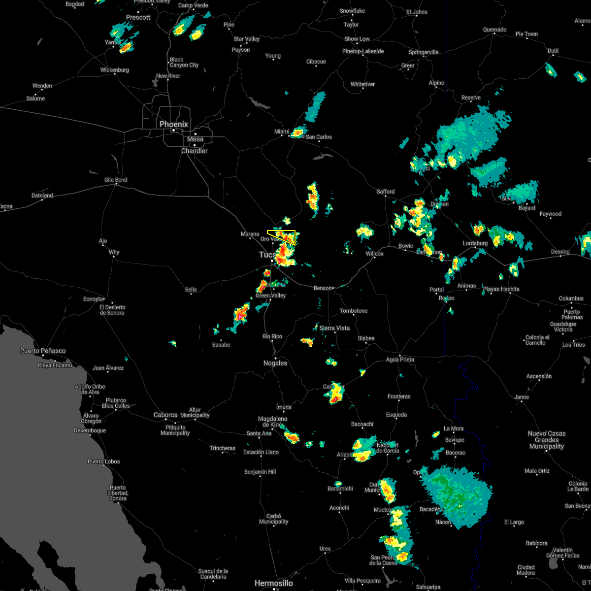 At 426 pm mst, a severe thunderstorm was located near catalina, moving west at 15 mph (radar indicated). Hazards include 60 mph wind gusts. expect damage to roofs, siding, and trees At 426 pm mst, a severe thunderstorm was located near catalina, moving west at 15 mph (radar indicated). Hazards include 60 mph wind gusts. expect damage to roofs, siding, and trees
|
| 7/23/2021 12:20 AM MST |
 At 1217 am mst, an area of severe thunderstorms with extremely heavy rainfall was located near northwest tucson and marana, moving northwest at 15 mph (radar indicated). Hazards include 60 mph wind gusts, torrential downpours. Expect damage to roofs, siding, and trees. locations impacted include, northwest tucson, catalina, oro valley, marana, sahuarita, casas adobes, drexel heights, flowing wells, three points, avra valley, tortolita, east sahuarita, sabino canyon recreation area, summit and tucson estates. this includes the following highways, interstate 10 between mile markers 233 and 280. interstate 19 between mile markers 45 and 63. route 77 between mile markers 70 and 86. route 86 between mile markers 150 and 171. Route 286 between mile markers 44 and 45. At 1217 am mst, an area of severe thunderstorms with extremely heavy rainfall was located near northwest tucson and marana, moving northwest at 15 mph (radar indicated). Hazards include 60 mph wind gusts, torrential downpours. Expect damage to roofs, siding, and trees. locations impacted include, northwest tucson, catalina, oro valley, marana, sahuarita, casas adobes, drexel heights, flowing wells, three points, avra valley, tortolita, east sahuarita, sabino canyon recreation area, summit and tucson estates. this includes the following highways, interstate 10 between mile markers 233 and 280. interstate 19 between mile markers 45 and 63. route 77 between mile markers 70 and 86. route 86 between mile markers 150 and 171. Route 286 between mile markers 44 and 45.
|
| 7/22/2021 11:45 PM MST |
 At 1144 pm mst, an area of severe thunderstorms was located over tucson, moving northwest at 15 mph (radar indicated). Hazards include 60 mph wind gusts. expect damage to roofs, siding, and trees At 1144 pm mst, an area of severe thunderstorms was located over tucson, moving northwest at 15 mph (radar indicated). Hazards include 60 mph wind gusts. expect damage to roofs, siding, and trees
|
| 7/20/2021 10:07 PM MST |
 The severe thunderstorm warning for northeastern pima and southeastern pinal counties will expire at 1015 pm mst, the storm which prompted the warning northwest of tucson has moved northwestward into southern pinal county. therefore, the warning will be allowed to expire. a warning continues for south central pinal county. The severe thunderstorm warning for northeastern pima and southeastern pinal counties will expire at 1015 pm mst, the storm which prompted the warning northwest of tucson has moved northwestward into southern pinal county. therefore, the warning will be allowed to expire. a warning continues for south central pinal county.
|
| 7/20/2021 9:24 PM MST |
 At 923 pm mst, an area of severe thunderstorms was located over near tortolita and oro valley, moving west at 10 mph (radar indicated). Hazards include 60 mph wind gusts and nickel size hail. expect damage to roofs, siding, and trees At 923 pm mst, an area of severe thunderstorms was located over near tortolita and oro valley, moving west at 10 mph (radar indicated). Hazards include 60 mph wind gusts and nickel size hail. expect damage to roofs, siding, and trees
|
| 7/20/2021 8:46 PM MST |
 At 845 pm mst, a severe thunderstorm was located near mount lemmon/summerhaven, or 11 miles southeast of oracle, moving west at 10 mph (radar indicated). Hazards include 60 mph wind gusts and quarter size hail. Hail damage to vehicles is expected. Expect wind damage to roofs, siding, and trees. At 845 pm mst, a severe thunderstorm was located near mount lemmon/summerhaven, or 11 miles southeast of oracle, moving west at 10 mph (radar indicated). Hazards include 60 mph wind gusts and quarter size hail. Hail damage to vehicles is expected. Expect wind damage to roofs, siding, and trees.
|
| 7/10/2021 7:48 PM MST |
 At 748 pm mst, a severe thunderstorm was located over south tucson, or over tucson, moving west at 10 mph (radar indicated). Hazards include 60 mph wind gusts. Expect damage to roofs, siding, and trees. locations impacted include, tucson, catalina, oro valley, marana, davis-monthan air force base, casas adobes, drexel heights, flowing wells, tanque verde, south tucson, avra valley, pascua pueblo yaqui reservation, tortolita, mount lemmon/summerhaven, sabino canyon recreation area, tucson estates, saguaro national park west, valencia west, catalina state park and catalina foothills. this includes the following highways, interstate 10 between mile markers 233 and 277. interstate 19 between mile markers 54 and 63. route 77 between mile markers 70 and 86. Route 86 between mile markers 158 and 171. At 748 pm mst, a severe thunderstorm was located over south tucson, or over tucson, moving west at 10 mph (radar indicated). Hazards include 60 mph wind gusts. Expect damage to roofs, siding, and trees. locations impacted include, tucson, catalina, oro valley, marana, davis-monthan air force base, casas adobes, drexel heights, flowing wells, tanque verde, south tucson, avra valley, pascua pueblo yaqui reservation, tortolita, mount lemmon/summerhaven, sabino canyon recreation area, tucson estates, saguaro national park west, valencia west, catalina state park and catalina foothills. this includes the following highways, interstate 10 between mile markers 233 and 277. interstate 19 between mile markers 54 and 63. route 77 between mile markers 70 and 86. Route 86 between mile markers 158 and 171.
|
| 7/10/2021 7:14 PM MST |
 At 714 pm mst, a severe thunderstorm was located over tucson, moving west at 10 mph (radar indicated). Hazards include 60 mph wind gusts. expect damage to roofs, siding, and trees At 714 pm mst, a severe thunderstorm was located over tucson, moving west at 10 mph (radar indicated). Hazards include 60 mph wind gusts. expect damage to roofs, siding, and trees
|
| 7/2/2021 3:37 PM MST |
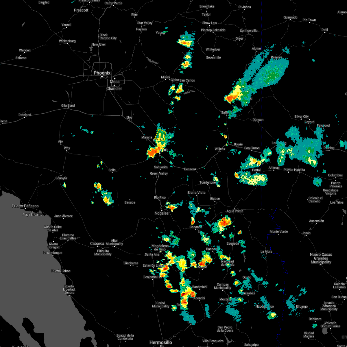 The severe thunderstorm warning for northeastern pima and southeastern pinal counties will expire at 345 pm mst, the storm which prompted the warning has moved out of the area. therefore, the warning will be allowed to expire. however gusty winds and heavy rain are still possible with this thunderstorm. The severe thunderstorm warning for northeastern pima and southeastern pinal counties will expire at 345 pm mst, the storm which prompted the warning has moved out of the area. therefore, the warning will be allowed to expire. however gusty winds and heavy rain are still possible with this thunderstorm.
|
| 7/2/2021 3:16 PM MST |
 At 315 pm mst, a severe thunderstorm was located over catalina, moving west at 5 mph (radar indicated). Hazards include 60 mph wind gusts and penny size hail. Expect damage to roofs, siding, and trees. locations impacted include, catalina, oro valley, marana, saddlebrooke, tortolita, catalina state park and oracle junction. this includes the following highways, route 77 between mile markers 83 and 93. Route 79 between mile markers 92 and 95. At 315 pm mst, a severe thunderstorm was located over catalina, moving west at 5 mph (radar indicated). Hazards include 60 mph wind gusts and penny size hail. Expect damage to roofs, siding, and trees. locations impacted include, catalina, oro valley, marana, saddlebrooke, tortolita, catalina state park and oracle junction. this includes the following highways, route 77 between mile markers 83 and 93. Route 79 between mile markers 92 and 95.
|
| 7/2/2021 3:01 PM MST |
 At 301 pm mst, a severe thunderstorm was located over catalina, moving west at 5 mph (radar indicated). Hazards include 60 mph wind gusts and quarter size hail. Hail damage to vehicles is expected. Expect wind damage to roofs, siding, and trees. At 301 pm mst, a severe thunderstorm was located over catalina, moving west at 5 mph (radar indicated). Hazards include 60 mph wind gusts and quarter size hail. Hail damage to vehicles is expected. Expect wind damage to roofs, siding, and trees.
|
| 8/16/2020 4:25 PM MST |
 At 424 pm mst, severe thunderstorms were located along a line extending from near hayden to near catalina state park north of tucson, moving southwest at 10 to 15 mph (radar indicated). Hazards include 60 mph wind gusts and quarter size hail. Hail damage to vehicles is expected. Expect wind damage to roofs, siding, and trees. At 424 pm mst, severe thunderstorms were located along a line extending from near hayden to near catalina state park north of tucson, moving southwest at 10 to 15 mph (radar indicated). Hazards include 60 mph wind gusts and quarter size hail. Hail damage to vehicles is expected. Expect wind damage to roofs, siding, and trees.
|
| 8/16/2020 4:15 PM MST |
 At 415 pm mst, a severe thunderstorm was located over catalina state park, or over catalina, moving southwest at 15 mph (radar indicated). Hazards include 60 mph wind gusts and quarter size hail. Hail damage to vehicles is expected. expect wind damage to roofs, siding, and trees. locations impacted include, catalina, oro valley, marana, casas adobes, flowing wells, saddlebrooke, tortolita, mount lemmon/summerhaven, catalina state park, catalina foothills, dove mountain, oracle junction and biosphere 2. this includes the following highways, interstate 10 between mile markers 243 and 255. route 77 between mile markers 71 and 96. Route 79 between mile markers 92 and 94. At 415 pm mst, a severe thunderstorm was located over catalina state park, or over catalina, moving southwest at 15 mph (radar indicated). Hazards include 60 mph wind gusts and quarter size hail. Hail damage to vehicles is expected. expect wind damage to roofs, siding, and trees. locations impacted include, catalina, oro valley, marana, casas adobes, flowing wells, saddlebrooke, tortolita, mount lemmon/summerhaven, catalina state park, catalina foothills, dove mountain, oracle junction and biosphere 2. this includes the following highways, interstate 10 between mile markers 243 and 255. route 77 between mile markers 71 and 96. Route 79 between mile markers 92 and 94.
|
| 8/16/2020 3:53 PM MST |
 At 351 pm mst, a severe thunderstorm was located near catalina, moving southwest at 10 to 15 mph (radar indicated). Hazards include 60 mph wind gusts and quarter size hail. Hail damage to vehicles is expected. Expect wind damage to roofs, siding, and trees. At 351 pm mst, a severe thunderstorm was located near catalina, moving southwest at 10 to 15 mph (radar indicated). Hazards include 60 mph wind gusts and quarter size hail. Hail damage to vehicles is expected. Expect wind damage to roofs, siding, and trees.
|
| 8/16/2020 3:35 PM MST |
 At 335 pm mst, a severe thunderstorm was located over oro valley, moving west at 5 to 10 mph (radar indicated). Hazards include 60 mph wind gusts and nickel size hail. Expect damage to roofs, siding, and trees. locations impacted include, north tucson, catalina, oro valley, casas adobes, flowing wells, tortolita, catalina foothills, catalina state park and dove mountain. This includes route 77 between mile markers 70 and 87. At 335 pm mst, a severe thunderstorm was located over oro valley, moving west at 5 to 10 mph (radar indicated). Hazards include 60 mph wind gusts and nickel size hail. Expect damage to roofs, siding, and trees. locations impacted include, north tucson, catalina, oro valley, casas adobes, flowing wells, tortolita, catalina foothills, catalina state park and dove mountain. This includes route 77 between mile markers 70 and 87.
|
| 8/16/2020 3:15 PM MST |
 At 314 pm mst, a severe thunderstorm was located over catalina state park, or over oro valley, moving west at 5 to 10 mph (radar indicated). Hazards include 60 mph wind gusts and nickel size hail. expect damage to roofs, siding, and trees At 314 pm mst, a severe thunderstorm was located over catalina state park, or over oro valley, moving west at 5 to 10 mph (radar indicated). Hazards include 60 mph wind gusts and nickel size hail. expect damage to roofs, siding, and trees
|
| 7/11/2020 8:57 PM MST |
 The severe thunderstorm warning for northeastern pima and southeastern pinal counties will expire at 900 pm mst, the storm which prompted the warning has weakened below severe limits, and no longer poses a threat. therefore, the warning will be allowed to expire. however gusty winds are still possible. The severe thunderstorm warning for northeastern pima and southeastern pinal counties will expire at 900 pm mst, the storm which prompted the warning has weakened below severe limits, and no longer poses a threat. therefore, the warning will be allowed to expire. however gusty winds are still possible.
|
| 7/11/2020 8:28 PM MST |
 The severe thunderstorm warning for northeastern pima county will expire at 830 pm mst, the storm which prompted the warning over tucson has moved northwest and prompted a new warning near marana. therefore, this warning will be allowed to expire. however gusty winds are still possible. The severe thunderstorm warning for northeastern pima county will expire at 830 pm mst, the storm which prompted the warning over tucson has moved northwest and prompted a new warning near marana. therefore, this warning will be allowed to expire. however gusty winds are still possible.
|
| 7/11/2020 8:23 PM MST |
 At 822 pm mst, a severe thunderstorm was located near tortolita and just west of marana, moving west at 15 mph (radar indicated). Hazards include 60 mph wind gusts, small hail, blowing dust, and brief heavy rain. expect damage to roofs, siding, and trees At 822 pm mst, a severe thunderstorm was located near tortolita and just west of marana, moving west at 15 mph (radar indicated). Hazards include 60 mph wind gusts, small hail, blowing dust, and brief heavy rain. expect damage to roofs, siding, and trees
|
| 7/11/2020 7:39 PM MST |
 At 737 pm mst, a severe thunderstorm was located over tanque verde, or 8 miles northeast of davis-monthan air force base, moving west at 15 mph (radar indicated). Hazards include 60 mph wind gusts, small hail, dense blowing dust, and heavy rain. expect damage to roofs, siding, and trees At 737 pm mst, a severe thunderstorm was located over tanque verde, or 8 miles northeast of davis-monthan air force base, moving west at 15 mph (radar indicated). Hazards include 60 mph wind gusts, small hail, dense blowing dust, and heavy rain. expect damage to roofs, siding, and trees
|
| 11/29/2019 7:30 AM MST |
 At 729 am mst, severe thunderstorms were located along a line extending from 9 miles east of aravaipa canyon wilderness to near green valley, including the tucson metro area, moving east at 35 mph (radar indicated). Hazards include 60 mph wind gusts. expect damage to roofs, siding, and trees At 729 am mst, severe thunderstorms were located along a line extending from 9 miles east of aravaipa canyon wilderness to near green valley, including the tucson metro area, moving east at 35 mph (radar indicated). Hazards include 60 mph wind gusts. expect damage to roofs, siding, and trees
|
| 11/29/2019 6:58 AM MST |
 At 656 am mst, a line of scattered showers and thunderstorms extended across portions of the area, moving east at 40 mph (radar indicated). Hazards include 60 mph wind gusts. expect damage to roofs, siding, and trees At 656 am mst, a line of scattered showers and thunderstorms extended across portions of the area, moving east at 40 mph (radar indicated). Hazards include 60 mph wind gusts. expect damage to roofs, siding, and trees
|
| 9/26/2019 4:10 PM MST |
 The severe thunderstorm warning for north central pima county will expire at 415 pm mst, the storms which prompted the warning around the marana, avra valley and picture rocks area has weakened below severe limits. therefore, the warning will be allowed to expire. however gusty winds are still possible from earlier outflows. The severe thunderstorm warning for north central pima county will expire at 415 pm mst, the storms which prompted the warning around the marana, avra valley and picture rocks area has weakened below severe limits. therefore, the warning will be allowed to expire. however gusty winds are still possible from earlier outflows.
|
| 9/26/2019 3:32 PM MST |
 At 332 pm mst, a severe thunderstorm was located near saguaro national park west, or 8 miles southwest of marana, moving northeast at 30 mph (radar indicated). Hazards include 60 mph wind gusts. expect damage to roofs, siding, and trees At 332 pm mst, a severe thunderstorm was located near saguaro national park west, or 8 miles southwest of marana, moving northeast at 30 mph (radar indicated). Hazards include 60 mph wind gusts. expect damage to roofs, siding, and trees
|
| 7/24/2019 5:52 PM MST |
 At 551 pm mst, severe thunderstorms were located along a line extending from near tortolita to 6 miles northwest of saguaro national park west, moving northwest at 10 mph (radar indicated). Hazards include 60 mph wind gusts and quarter size hail. Hail damage to vehicles is expected. Expect wind damage to roofs, siding, and trees. At 551 pm mst, severe thunderstorms were located along a line extending from near tortolita to 6 miles northwest of saguaro national park west, moving northwest at 10 mph (radar indicated). Hazards include 60 mph wind gusts and quarter size hail. Hail damage to vehicles is expected. Expect wind damage to roofs, siding, and trees.
|
| 5/11/2019 8:25 PM MST |
 The severe thunderstorm warning for northeastern pima county will expire at 830 pm mst, the storm which prompted the warning has weakened below severe limits, and no longer poses an immediate threat to life or property. therefore, the warning will be allowed to expire. however gusty winds and heavy rain are still expected with this thunderstorm as it drifts to the west. The severe thunderstorm warning for northeastern pima county will expire at 830 pm mst, the storm which prompted the warning has weakened below severe limits, and no longer poses an immediate threat to life or property. therefore, the warning will be allowed to expire. however gusty winds and heavy rain are still expected with this thunderstorm as it drifts to the west.
|
| 5/11/2019 8:12 PM MST |
 At 808 pm mst, a severe thunderstorm located near saguaro national park west, or 7 miles southeast of marana, moving west-northwest at 15 mph (radar indicates the storm is moving to the west-northwest over drexel heights and the tucson heights area. strong gusts to 60 mph will proceed the storm. less of a threat exists for the oro valley area at this time). Hazards include 60 mph wind gusts. Expect damage to roofs, siding, and trees. locations impacted include, tucson, catalina, oro valley, marana, davis-monthan air force base, casas adobes, drexel heights, flowing wells, south tucson, three points, avra valley, pascua pueblo yaqui reservation, tortolita, summit, catalina state park, tucson estates, saguaro national park west, catalina foothills, valencia west and tucson international airport. this includes the following highways, interstate 10 between mile markers 233 and 268. interstate 19 between mile markers 51 and 63. route 77 between mile markers 70 and 85. Route 86 between mile markers 154 and 171. At 808 pm mst, a severe thunderstorm located near saguaro national park west, or 7 miles southeast of marana, moving west-northwest at 15 mph (radar indicates the storm is moving to the west-northwest over drexel heights and the tucson heights area. strong gusts to 60 mph will proceed the storm. less of a threat exists for the oro valley area at this time). Hazards include 60 mph wind gusts. Expect damage to roofs, siding, and trees. locations impacted include, tucson, catalina, oro valley, marana, davis-monthan air force base, casas adobes, drexel heights, flowing wells, south tucson, three points, avra valley, pascua pueblo yaqui reservation, tortolita, summit, catalina state park, tucson estates, saguaro national park west, catalina foothills, valencia west and tucson international airport. this includes the following highways, interstate 10 between mile markers 233 and 268. interstate 19 between mile markers 51 and 63. route 77 between mile markers 70 and 85. Route 86 between mile markers 154 and 171.
|
| 5/11/2019 7:45 PM MST |
 At 743 pm mst, a severe thunderstorm was located over drexel heights, or near tucson, moving northwest at 25 mph (radar and observation indicated). Hazards include 60 mph wind gusts. winds gusts to 53 mph at afb dm and 56 mph at tucson airport. strong damaging gusts will continue to move northwest. expect damage to roofs, siding, and trees At 743 pm mst, a severe thunderstorm was located over drexel heights, or near tucson, moving northwest at 25 mph (radar and observation indicated). Hazards include 60 mph wind gusts. winds gusts to 53 mph at afb dm and 56 mph at tucson airport. strong damaging gusts will continue to move northwest. expect damage to roofs, siding, and trees
|
| 9/2/2018 5:06 PM MST |
 The severe thunderstorm warning for northeastern pima county will expire at 515 pm mst, the storm which prompted the warning has weakened below severe limits, and no longer poses an immediate threat to life or property. therefore, the warning will be allowed to expire. The severe thunderstorm warning for northeastern pima county will expire at 515 pm mst, the storm which prompted the warning has weakened below severe limits, and no longer poses an immediate threat to life or property. therefore, the warning will be allowed to expire.
|
| 9/2/2018 4:32 PM MST |
 At 432 pm mst, a severe thunderstorm was located over casas adobes, or near oro valley, moving east at 10 mph (radar indicated). Hazards include 70 mph wind gusts and quarter size hail. Hail damage to vehicles is expected. expect considerable tree damage. Wind damage is also likely to mobile homes, roofs, and outbuildings. At 432 pm mst, a severe thunderstorm was located over casas adobes, or near oro valley, moving east at 10 mph (radar indicated). Hazards include 70 mph wind gusts and quarter size hail. Hail damage to vehicles is expected. expect considerable tree damage. Wind damage is also likely to mobile homes, roofs, and outbuildings.
|
| 8/22/2018 3:00 PM MST |
 At 244 pm mst, a severe thunderstorm was located over tortolita, or near marana, moving north at 10 mph. quarter sized hail has been reported with this storm near tangerine and la canada rd`s (trained weather spotters). Hazards include 60 mph wind gusts and quarter size hail. Hail damage to vehicles is expected. expect wind damage to roofs, siding, and trees. locations impacted include, tucson, oro valley, marana, tortolita, flowing wells, casas adobes, dove mountain, catalina, catalina state park, picture rocks and catalina foothills. this includes the following highways, interstate 10 between mile markers 240 and 253. Route 77 between mile markers 72 and 89. At 244 pm mst, a severe thunderstorm was located over tortolita, or near marana, moving north at 10 mph. quarter sized hail has been reported with this storm near tangerine and la canada rd`s (trained weather spotters). Hazards include 60 mph wind gusts and quarter size hail. Hail damage to vehicles is expected. expect wind damage to roofs, siding, and trees. locations impacted include, tucson, oro valley, marana, tortolita, flowing wells, casas adobes, dove mountain, catalina, catalina state park, picture rocks and catalina foothills. this includes the following highways, interstate 10 between mile markers 240 and 253. Route 77 between mile markers 72 and 89.
|
| 8/22/2018 2:45 PM MST |
 At 244 pm mst, a severe thunderstorm was located over tortolita, or near marana, moving north at 10 mph. quarter sized hail has been reported with this storm near tangerine and la canada rd`s (trained weather spotters). Hazards include 60 mph wind gusts and quarter size hail. Hail damage to vehicles is expected. expect wind damage to roofs, siding, and trees. locations impacted include, tucson, oro valley, marana, tortolita, flowing wells, casas adobes, dove mountain, catalina, catalina state park, picture rocks and catalina foothills. this includes the following highways, interstate 10 between mile markers 240 and 253. Route 77 between mile markers 72 and 89. At 244 pm mst, a severe thunderstorm was located over tortolita, or near marana, moving north at 10 mph. quarter sized hail has been reported with this storm near tangerine and la canada rd`s (trained weather spotters). Hazards include 60 mph wind gusts and quarter size hail. Hail damage to vehicles is expected. expect wind damage to roofs, siding, and trees. locations impacted include, tucson, oro valley, marana, tortolita, flowing wells, casas adobes, dove mountain, catalina, catalina state park, picture rocks and catalina foothills. this includes the following highways, interstate 10 between mile markers 240 and 253. Route 77 between mile markers 72 and 89.
|
| 8/22/2018 2:39 PM MST |
 At 239 pm mst, a severe thunderstorm was located near tortolita, or near marana, moving north at 10 mph (radar indicated). Hazards include 60 mph wind gusts and quarter size hail. Hail damage to vehicles is expected. Expect wind damage to roofs, siding, and trees. At 239 pm mst, a severe thunderstorm was located near tortolita, or near marana, moving north at 10 mph (radar indicated). Hazards include 60 mph wind gusts and quarter size hail. Hail damage to vehicles is expected. Expect wind damage to roofs, siding, and trees.
|
| 8/12/2018 6:22 PM MST |
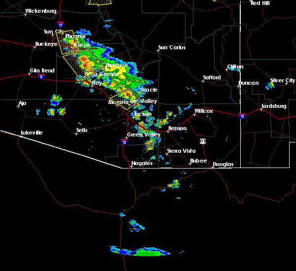 At 620 pm mst, a severe thunderstorm was located 12 miles north of oro valley, moving southwest at 20 mph (radar indicated). Hazards include 60 mph wind gusts and quarter size hail. Hail damage to vehicles is expected. expect wind damage to roofs, siding, and trees. locations impacted include, oro valley, tortolita, casas adobes, saddlebrooke, oracle junction, biosphere 2, dove mountain, catalina. this includes the following highways, route 77 between mile markers 76 and 97. Route 79 between mile markers 92 and 100. At 620 pm mst, a severe thunderstorm was located 12 miles north of oro valley, moving southwest at 20 mph (radar indicated). Hazards include 60 mph wind gusts and quarter size hail. Hail damage to vehicles is expected. expect wind damage to roofs, siding, and trees. locations impacted include, oro valley, tortolita, casas adobes, saddlebrooke, oracle junction, biosphere 2, dove mountain, catalina. this includes the following highways, route 77 between mile markers 76 and 97. Route 79 between mile markers 92 and 100.
|
| 8/12/2018 5:58 PM MST |
 At 557 pm mst, a severe thunderstorm was located near oracle, or 17 miles northeast of oro valley, moving southwest at 20 mph (radar indicated). Hazards include 60 mph wind gusts and quarter size hail. Hail damage to vehicles is expected. Expect wind damage to roofs, siding, and trees. At 557 pm mst, a severe thunderstorm was located near oracle, or 17 miles northeast of oro valley, moving southwest at 20 mph (radar indicated). Hazards include 60 mph wind gusts and quarter size hail. Hail damage to vehicles is expected. Expect wind damage to roofs, siding, and trees.
|
| 8/10/2018 4:01 PM MST |
 At 400 pm mst, a severe thunderstorm was located near oro valley and catalina, moving southwest at 5 mph (radar indicated). Hazards include 60 mph wind gusts and penny size hail, along with heavy rainfall and possible flooding. Expect damage to roofs, siding, and trees. locations impacted include, northwest tucson, oro valley, tortolita, flowing wells, casas adobes, dove mountain, catalina, catalina state park, catalina foothills. this includes the following highways, interstate 10 between mile markers 240 and 259. Route 77 between mile markers 70 and 87. At 400 pm mst, a severe thunderstorm was located near oro valley and catalina, moving southwest at 5 mph (radar indicated). Hazards include 60 mph wind gusts and penny size hail, along with heavy rainfall and possible flooding. Expect damage to roofs, siding, and trees. locations impacted include, northwest tucson, oro valley, tortolita, flowing wells, casas adobes, dove mountain, catalina, catalina state park, catalina foothills. this includes the following highways, interstate 10 between mile markers 240 and 259. Route 77 between mile markers 70 and 87.
|
| 8/10/2018 3:38 PM MST |
 At 337 pm mst, a severe thunderstorm was located over and near oro valley, moving southwest at 10 mph (radar indicated). Hazards include 60 mph wind gusts and penny size hail, along with heavy rain. expect damage to roofs, siding, and trees At 337 pm mst, a severe thunderstorm was located over and near oro valley, moving southwest at 10 mph (radar indicated). Hazards include 60 mph wind gusts and penny size hail, along with heavy rain. expect damage to roofs, siding, and trees
|
| 8/7/2018 5:19 PM MST |
 At 517 pm mst, a severe and long-lived thunderstorm was located near san manuel, or 20 miles northeast of oro valley, moving northwest at 15 mph (radar indicated). Hazards include 60 mph wind gusts and quarter size hail. Hail damage to vehicles is expected. expect wind damage to roofs, siding, and trees. locations impacted include, san manuel, oracle, campo bonito, mount lemmon/summerhaven and catalina. This includes route 77 between mile markers 106 and 110. At 517 pm mst, a severe and long-lived thunderstorm was located near san manuel, or 20 miles northeast of oro valley, moving northwest at 15 mph (radar indicated). Hazards include 60 mph wind gusts and quarter size hail. Hail damage to vehicles is expected. expect wind damage to roofs, siding, and trees. locations impacted include, san manuel, oracle, campo bonito, mount lemmon/summerhaven and catalina. This includes route 77 between mile markers 106 and 110.
|
| 8/7/2018 4:48 PM MST |
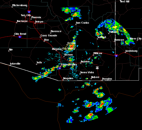 At 448 pm mst, doppler radar indicated a severe thunderstorm capable of producing quarter size hail and damaging winds in excess of 60 mph. this storm was located near san manuel, or 19 miles northeast of oro valley, and moving northwest at 10 mph. At 448 pm mst, doppler radar indicated a severe thunderstorm capable of producing quarter size hail and damaging winds in excess of 60 mph. this storm was located near san manuel, or 19 miles northeast of oro valley, and moving northwest at 10 mph.
|
| 8/1/2018 7:59 PM MST |
 At 759 pm mst, a severe thunderstorm was located near and northwest of oro valley, moving northwest at 5 mph (radar indicated). Hazards include 60 mph wind gusts and penny size hail. expect damage to roofs, siding, and trees At 759 pm mst, a severe thunderstorm was located near and northwest of oro valley, moving northwest at 5 mph (radar indicated). Hazards include 60 mph wind gusts and penny size hail. expect damage to roofs, siding, and trees
|
| 7/15/2017 3:29 PM MST |
 At 328 pm mst, a severe thunderstorm was located near biosphere 2, or 11 miles northeast of oro valley, moving southwest at 10 mph (radar indicated). Hazards include 60 mph wind gusts. expect damage to roofs, siding, and trees At 328 pm mst, a severe thunderstorm was located near biosphere 2, or 11 miles northeast of oro valley, moving southwest at 10 mph (radar indicated). Hazards include 60 mph wind gusts. expect damage to roofs, siding, and trees
|
| 9/13/2016 1:30 PM MST |
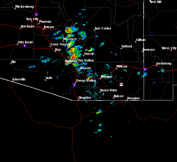 At 130 pm mst, doppler radar indicated a severe thunderstorm capable of producing quarter size hail and damaging winds in excess of 60 mph. this storm was located 10 miles northeast of marana, and moving northeast at 15 mph. * this severe thunderstorm will remain over mainly remote areas of south central pinal and northern pima counties. At 130 pm mst, doppler radar indicated a severe thunderstorm capable of producing quarter size hail and damaging winds in excess of 60 mph. this storm was located 10 miles northeast of marana, and moving northeast at 15 mph. * this severe thunderstorm will remain over mainly remote areas of south central pinal and northern pima counties.
|
| 7/29/2016 5:16 PM MST |
 At 515 pm mst, doppler radar indicated a severe thunderstorm capable of producing quarter size hail and damaging winds in excess of 60 mph. this storm was located 9 miles northeast of tanque verde, or 20 miles northeast of tucson, and moving west at 15 mph. At 515 pm mst, doppler radar indicated a severe thunderstorm capable of producing quarter size hail and damaging winds in excess of 60 mph. this storm was located 9 miles northeast of tanque verde, or 20 miles northeast of tucson, and moving west at 15 mph.
|
| 7/27/2016 6:20 PM MST |
 At 613 pm mst, doppler radar indicated an area of severe thunderstorms capable of producing damaging winds in excess of 60 mph. these storms were immediately north and east of tucson, moving southwest at 20 mph. a very strong outflow will precede these storms with areas of blowing dust. locations impacted include, tucson, oro valley, marana, flowing wells, tanque verde, casas adobes, tortolita, catalina foothills, mount lemmon/summerhaven, rita ranch, vail, davis-monthan air force base and sabino canyon. At 613 pm mst, doppler radar indicated an area of severe thunderstorms capable of producing damaging winds in excess of 60 mph. these storms were immediately north and east of tucson, moving southwest at 20 mph. a very strong outflow will precede these storms with areas of blowing dust. locations impacted include, tucson, oro valley, marana, flowing wells, tanque verde, casas adobes, tortolita, catalina foothills, mount lemmon/summerhaven, rita ranch, vail, davis-monthan air force base and sabino canyon.
|
| 7/27/2016 6:00 PM MST |
 At 557 pm mst, doppler radar indicated a line of severe thunderstorms capable of producing damaging winds in excess of 60 mph. these storms were located just north and northeast of tucson from near oracle through the tanque verde area and the rincons, and moving southwest at 20 mph. At 557 pm mst, doppler radar indicated a line of severe thunderstorms capable of producing damaging winds in excess of 60 mph. these storms were located just north and northeast of tucson from near oracle through the tanque verde area and the rincons, and moving southwest at 20 mph.
|
| 7/19/2016 4:26 PM MST |
 The severe thunderstorm warning for south central pinal and northeastern pima counties will expire at 430 pm mst, the storm which prompted the warning has weakened below severe limits, and no longer poses an immediate threat to life or property. therefore the warning will be allowed to expire. however gusty winds are still possible with this thunderstorm as it moves into eastern pinal county. The severe thunderstorm warning for south central pinal and northeastern pima counties will expire at 430 pm mst, the storm which prompted the warning has weakened below severe limits, and no longer poses an immediate threat to life or property. therefore the warning will be allowed to expire. however gusty winds are still possible with this thunderstorm as it moves into eastern pinal county.
|
| 7/19/2016 3:55 PM MST |
 At 354 pm mst, doppler radar indicated a severe thunderstorm capable of producing damaging winds in excess of 60 mph. this storm was located near oro valley, and moving northwest at 15 to 20 mph. At 354 pm mst, doppler radar indicated a severe thunderstorm capable of producing damaging winds in excess of 60 mph. this storm was located near oro valley, and moving northwest at 15 to 20 mph.
|
| 6/26/2016 7:13 PM MST |
 At 711 pm mst, doppler radar indicated a severe thunderstorm capable of producing damaging winds in excess of 60 mph. this storm was located southeast of flowing wells, or 7 miles northwest of tucson, and moving northwest at 25 to 30 mph. At 711 pm mst, doppler radar indicated a severe thunderstorm capable of producing damaging winds in excess of 60 mph. this storm was located southeast of flowing wells, or 7 miles northwest of tucson, and moving northwest at 25 to 30 mph.
|
| 10/18/2015 2:19 PM MST |
 At 217 pm mst, a trained weather spotter reported quarter sized hail from a severe thunderstorm over tortolita. in addition to. At 217 pm mst, a trained weather spotter reported quarter sized hail from a severe thunderstorm over tortolita. in addition to.
|
| 10/18/2015 2:05 PM MST |
 At 204 pm mst, doppler radar indicated a severe thunderstorm capable of producing quarter size hail and damaging winds in excess of 60 mph. a trained weather spotter recently reported hail to the size of quarters beginning to cover the ground near thornydale and cortaro roads. this storm was located over casas adobes, and moving northeast at 20 mph. At 204 pm mst, doppler radar indicated a severe thunderstorm capable of producing quarter size hail and damaging winds in excess of 60 mph. a trained weather spotter recently reported hail to the size of quarters beginning to cover the ground near thornydale and cortaro roads. this storm was located over casas adobes, and moving northeast at 20 mph.
|
| 10/6/2015 1:07 PM MST |
 The severe thunderstorm warning for northeastern pima county will expire at 115 pm mst, the storm which prompted the warning has weakened below severe limits and exited the warned area. therefore the warning will be allowed to expire. The severe thunderstorm warning for northeastern pima county will expire at 115 pm mst, the storm which prompted the warning has weakened below severe limits and exited the warned area. therefore the warning will be allowed to expire.
|
| 10/6/2015 12:50 PM MST |
 At 1250 pm mst, doppler radar indicated a severe thunderstorm capable of producing quarter size hail and damaging winds in excess of 60 mph. this storm was located near seven falls, moving northeast at 35 mph. locations impacted include, tucson, oro valley, flowing wells, tanque verde, drexel-alvernon, casas adobes, drexel heights, tortolita, tucson estates, south tucson, catalina foothills, mount lemmon/summerhaven, seven falls, catalina state park, davis-monthan air force base, sabino canyon and catalina. At 1250 pm mst, doppler radar indicated a severe thunderstorm capable of producing quarter size hail and damaging winds in excess of 60 mph. this storm was located near seven falls, moving northeast at 35 mph. locations impacted include, tucson, oro valley, flowing wells, tanque verde, drexel-alvernon, casas adobes, drexel heights, tortolita, tucson estates, south tucson, catalina foothills, mount lemmon/summerhaven, seven falls, catalina state park, davis-monthan air force base, sabino canyon and catalina.
|
| 10/6/2015 12:39 PM MST |
 At 1239 pm mst, doppler radar indicated a severe thunderstorm capable of producing quarter size hail and damaging winds in excess of 60 mph. this storm was located over tucson, moving northeast at 40 mph. locations impacted include, tucson, oro valley, marana, flowing wells, littletown, drexel-alvernon, casas adobes, drexel heights, valencia west, tanque verde, tucson estates, summit, tortolita, south tucson, catalina foothills, mount lemmon/summerhaven, seven falls, san xavier mission, catalina state park and davis-monthan air force base. At 1239 pm mst, doppler radar indicated a severe thunderstorm capable of producing quarter size hail and damaging winds in excess of 60 mph. this storm was located over tucson, moving northeast at 40 mph. locations impacted include, tucson, oro valley, marana, flowing wells, littletown, drexel-alvernon, casas adobes, drexel heights, valencia west, tanque verde, tucson estates, summit, tortolita, south tucson, catalina foothills, mount lemmon/summerhaven, seven falls, san xavier mission, catalina state park and davis-monthan air force base.
|
| 10/6/2015 12:26 PM MST |
 At 1226 pm mst, doppler radar indicated a severe thunderstorm capable of producing quarter size hail and damaging winds in excess of 60 mph. this storm was located over drexel heights, and moving northeast at 40 mph. At 1226 pm mst, doppler radar indicated a severe thunderstorm capable of producing quarter size hail and damaging winds in excess of 60 mph. this storm was located over drexel heights, and moving northeast at 40 mph.
|
| 10/6/2015 12:19 PM MST |
 At 1219 pm mst, doppler radar indicated a severe thunderstorm capable of producing quarter size hail and damaging winds in excess of 60 mph. this storm was located near casas adobes, and moving northeast at 25 mph. At 1219 pm mst, doppler radar indicated a severe thunderstorm capable of producing quarter size hail and damaging winds in excess of 60 mph. this storm was located near casas adobes, and moving northeast at 25 mph.
|
| 9/22/2015 11:20 AM MST |
 At 1119 am mst, doppler radar indicated a severe thunderstorm capable of producing damaging winds in excess of 60 mph. this storm was located about 5 miles west of saddlebrooke, and moving east at 30 mph. At 1119 am mst, doppler radar indicated a severe thunderstorm capable of producing damaging winds in excess of 60 mph. this storm was located about 5 miles west of saddlebrooke, and moving east at 30 mph.
|
| 8/31/2015 8:26 PM MST |
 The severe thunderstorm warning for northeastern pima county will expire at 830 pm mst, the storm which prompted the warning has weakened below severe limits, and no longer poses an immediate threat to life or property. therefore the warning will be allowed to expire. to report severe weather, contact your nearest law enforcement agency. they will relay your report to the national weather service tucson. The severe thunderstorm warning for northeastern pima county will expire at 830 pm mst, the storm which prompted the warning has weakened below severe limits, and no longer poses an immediate threat to life or property. therefore the warning will be allowed to expire. to report severe weather, contact your nearest law enforcement agency. they will relay your report to the national weather service tucson.
|
| 8/31/2015 8:04 PM MST |
 At 803 pm mst, doppler radar indicated a severe thunderstorm capable of producing damaging winds in excess of 60 mph. this storm was located near oro valley, and moving east at 10 mph. At 803 pm mst, doppler radar indicated a severe thunderstorm capable of producing damaging winds in excess of 60 mph. this storm was located near oro valley, and moving east at 10 mph.
|
| 8/23/2015 3:53 PM MST |
 At 352 pm mst, doppler radar indicated a severe thunderstorm capable of producing quarter size hail and damaging winds in excess of 60 mph. this storm was located near oracle and biosphere 2, and moving south at 10 mph. At 352 pm mst, doppler radar indicated a severe thunderstorm capable of producing quarter size hail and damaging winds in excess of 60 mph. this storm was located near oracle and biosphere 2, and moving south at 10 mph.
|
| 6/30/2015 5:30 PM MST |
 At 528 pm mst, reports of one inch hail of occurred near campbell and roger. doppler radar incicates this storm will continue to produce large hail and possibly strong winds to 60 mph. locations impacted include, tucson, oro valley, marana, tucson estates, flowing wells, tortolita, casas adobes, drexel heights, valencia west, drexel-alvernon, three points, avra valley, south tucson, ryan field, catalina foothills, picture rocks, san xavier mission, catalina state park, davis-monthan air force base and saguaro national park west. At 528 pm mst, reports of one inch hail of occurred near campbell and roger. doppler radar incicates this storm will continue to produce large hail and possibly strong winds to 60 mph. locations impacted include, tucson, oro valley, marana, tucson estates, flowing wells, tortolita, casas adobes, drexel heights, valencia west, drexel-alvernon, three points, avra valley, south tucson, ryan field, catalina foothills, picture rocks, san xavier mission, catalina state park, davis-monthan air force base and saguaro national park west.
|
| 6/30/2015 5:19 PM MST |
 At 518 pm mst, doppler radar indicated a severe thunderstorm capable of producing quarter size hail and damaging winds in excess of 60 mph. this storm was located over flowing wells, and moving southwest at 25 mph. At 518 pm mst, doppler radar indicated a severe thunderstorm capable of producing quarter size hail and damaging winds in excess of 60 mph. this storm was located over flowing wells, and moving southwest at 25 mph.
|
| 8/5/2012 7:20 PM MST | 6 to 8 inch thick tree down... numerous branches 2 to 4 inch broken in pima county AZ, 1.5 miles NE of Catalina, AZ |
| 8/5/2012 7:18 PM MST | Storm damage reported in pima county AZ, 1.1 miles NNW of Catalina, AZ |
Hail Maps for Catalina, AZ


Connect with Interactive Hail Maps