

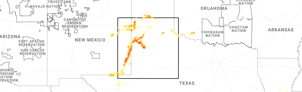
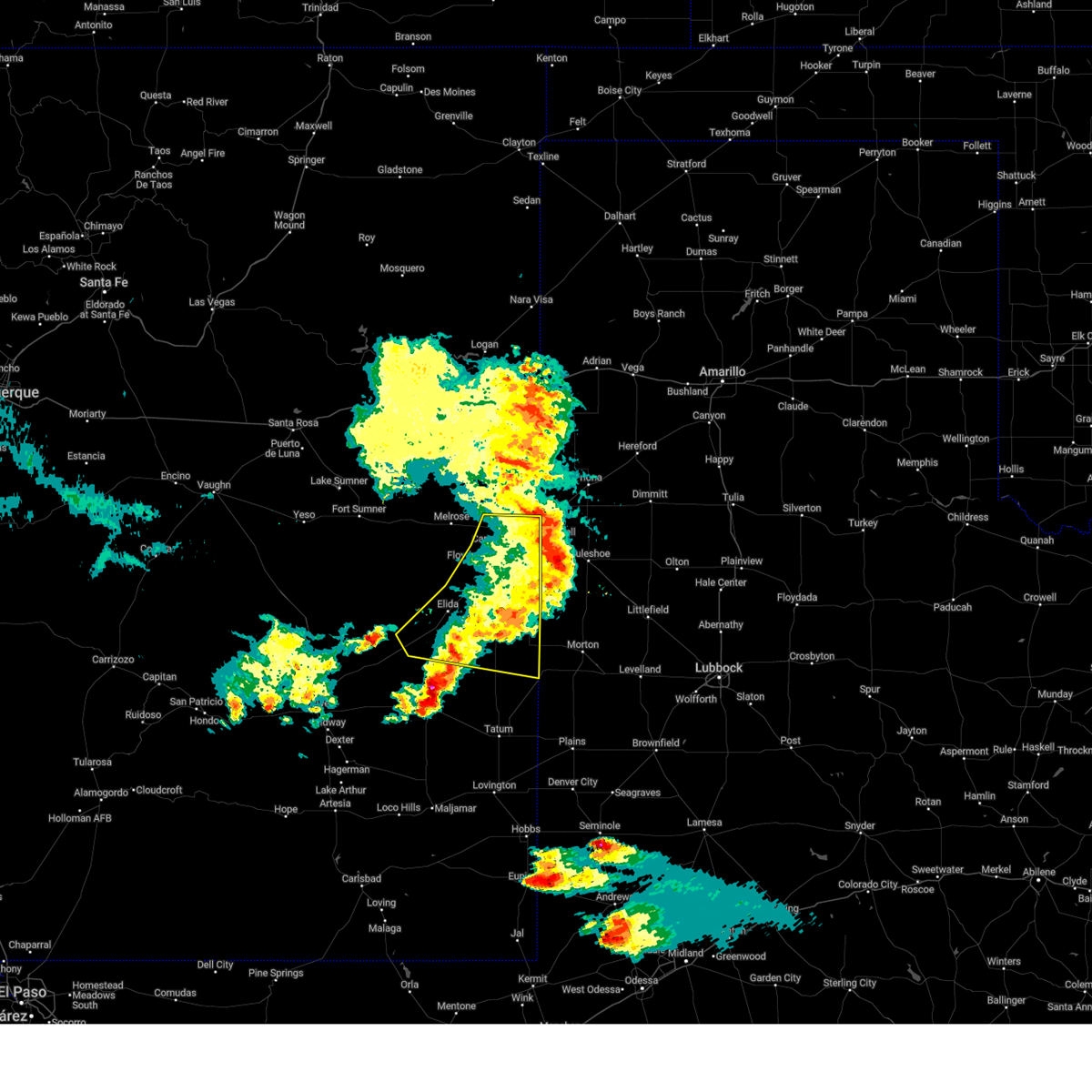
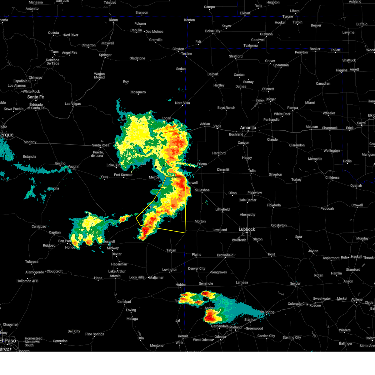
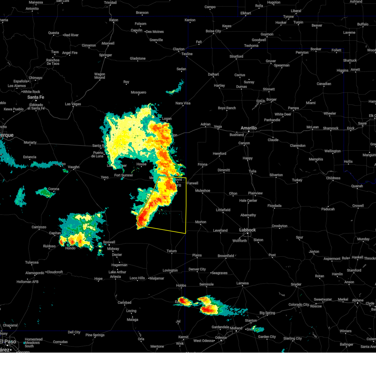
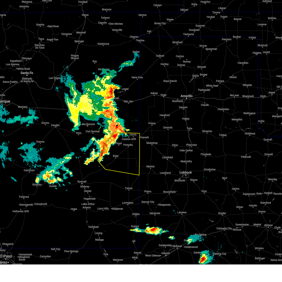
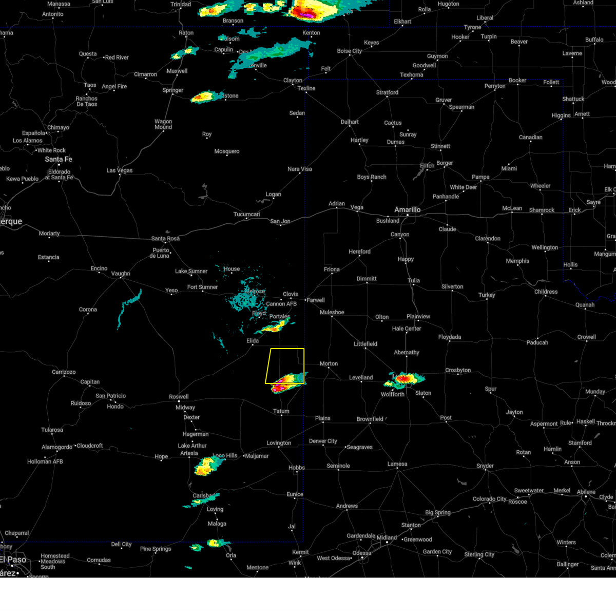
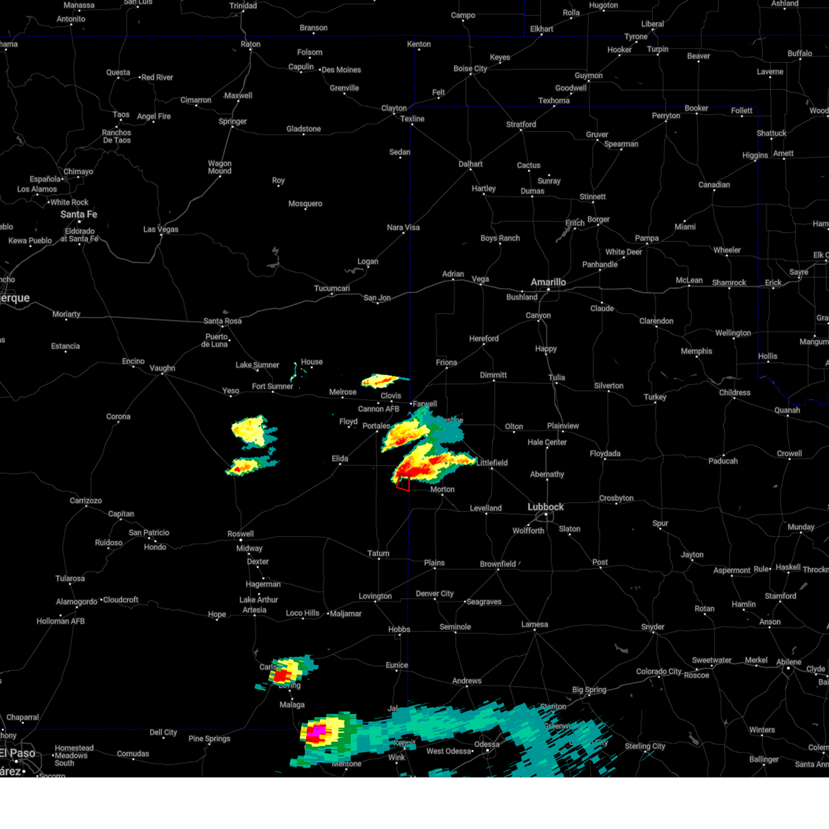
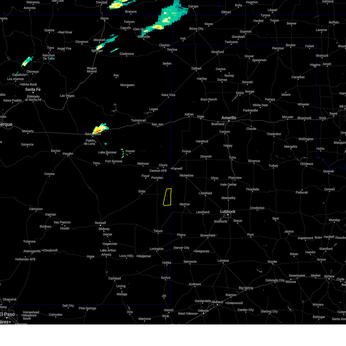
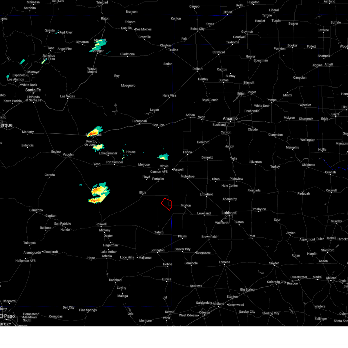
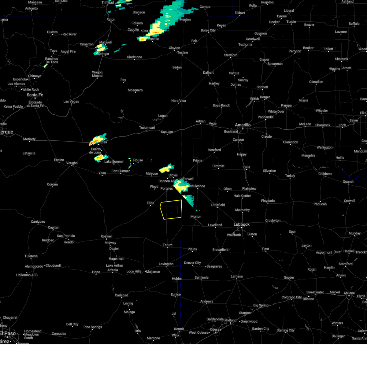
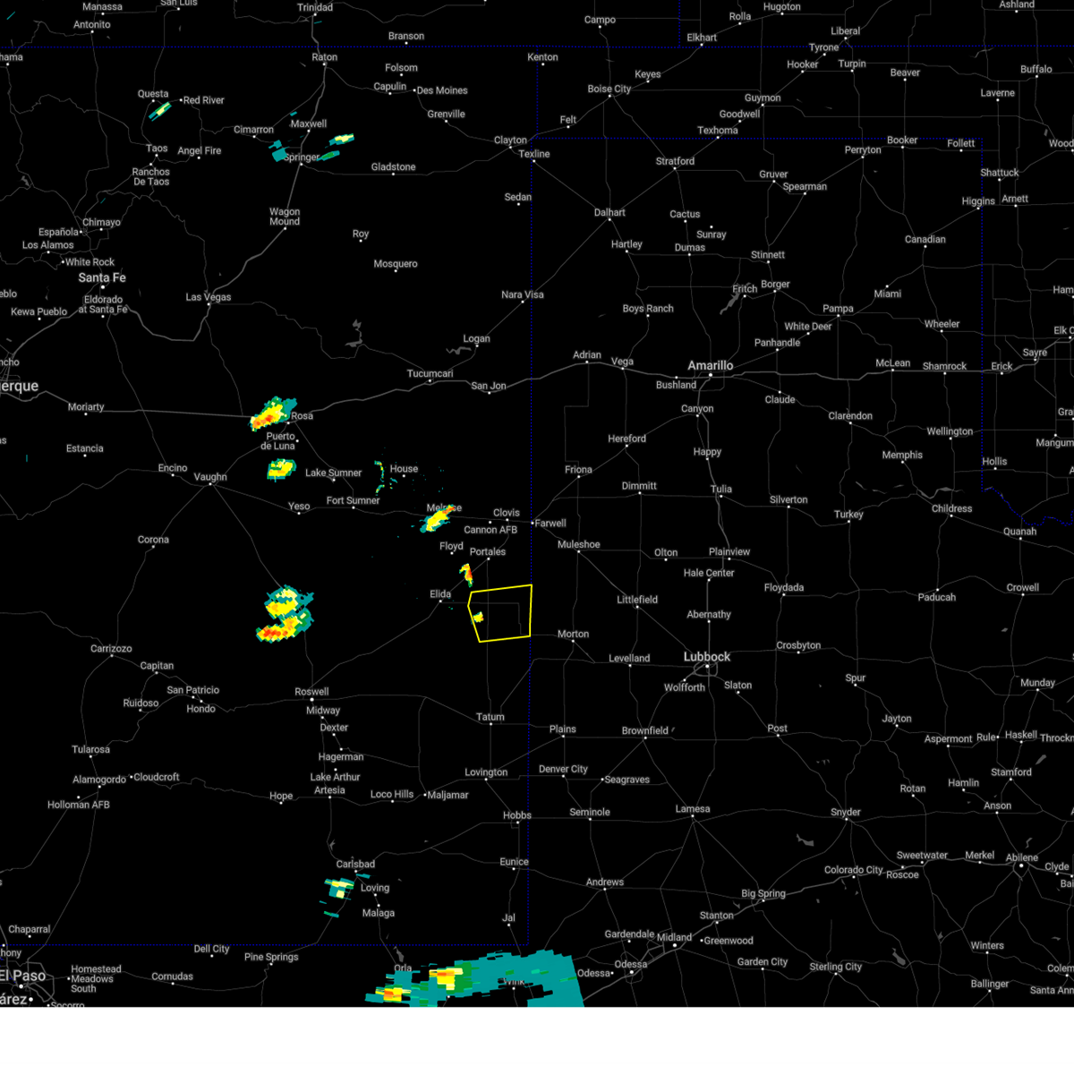
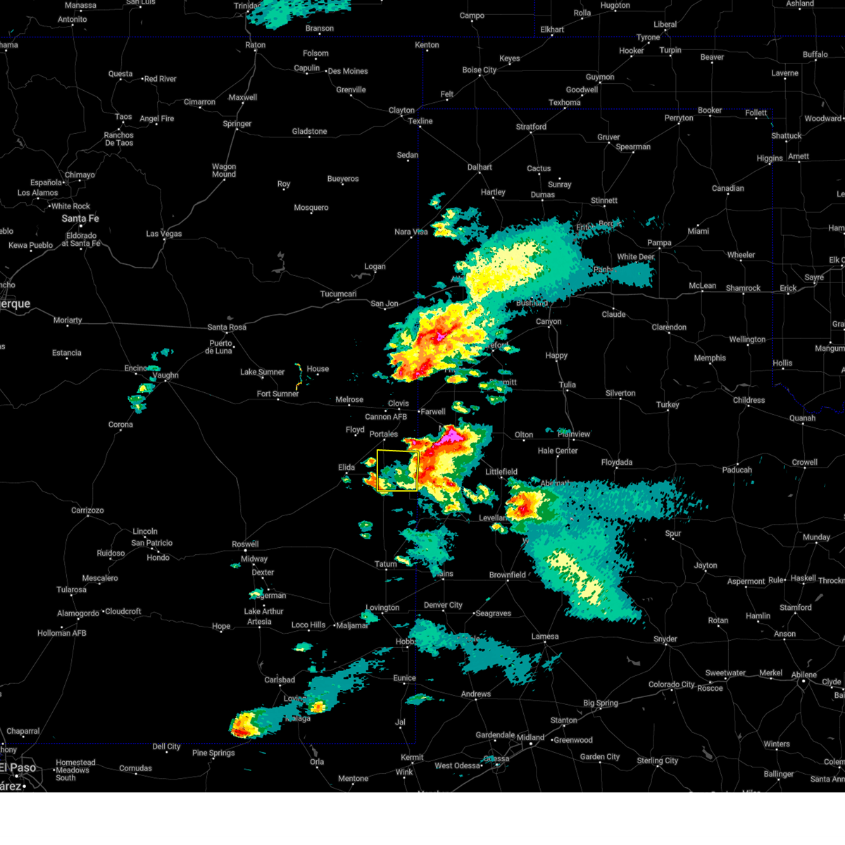
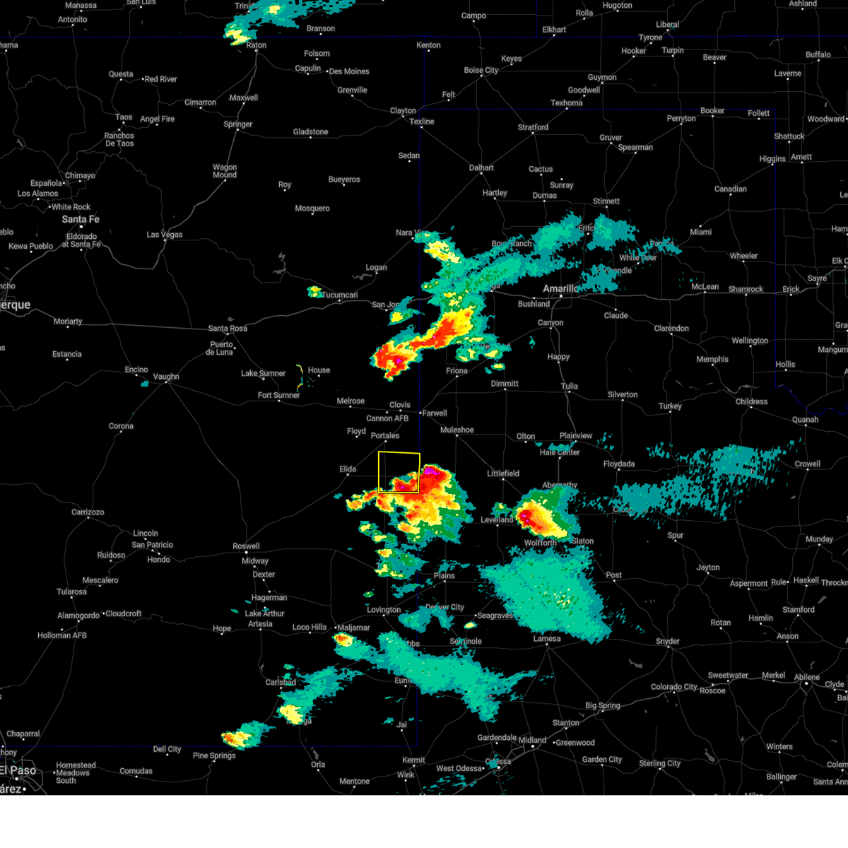
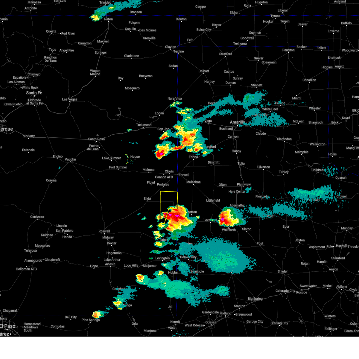
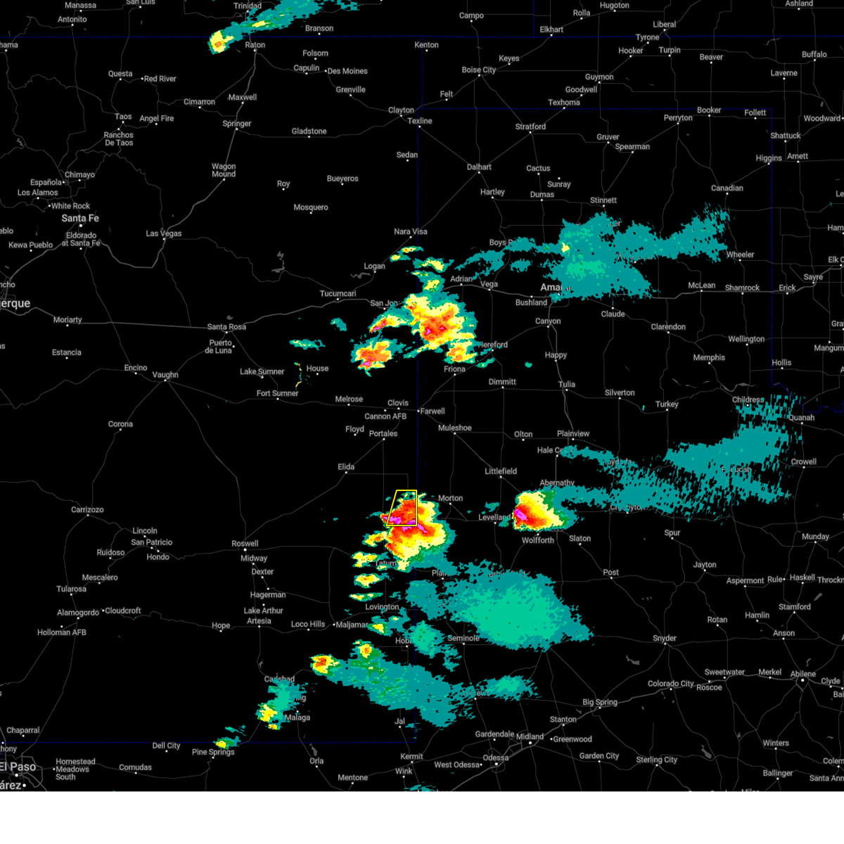
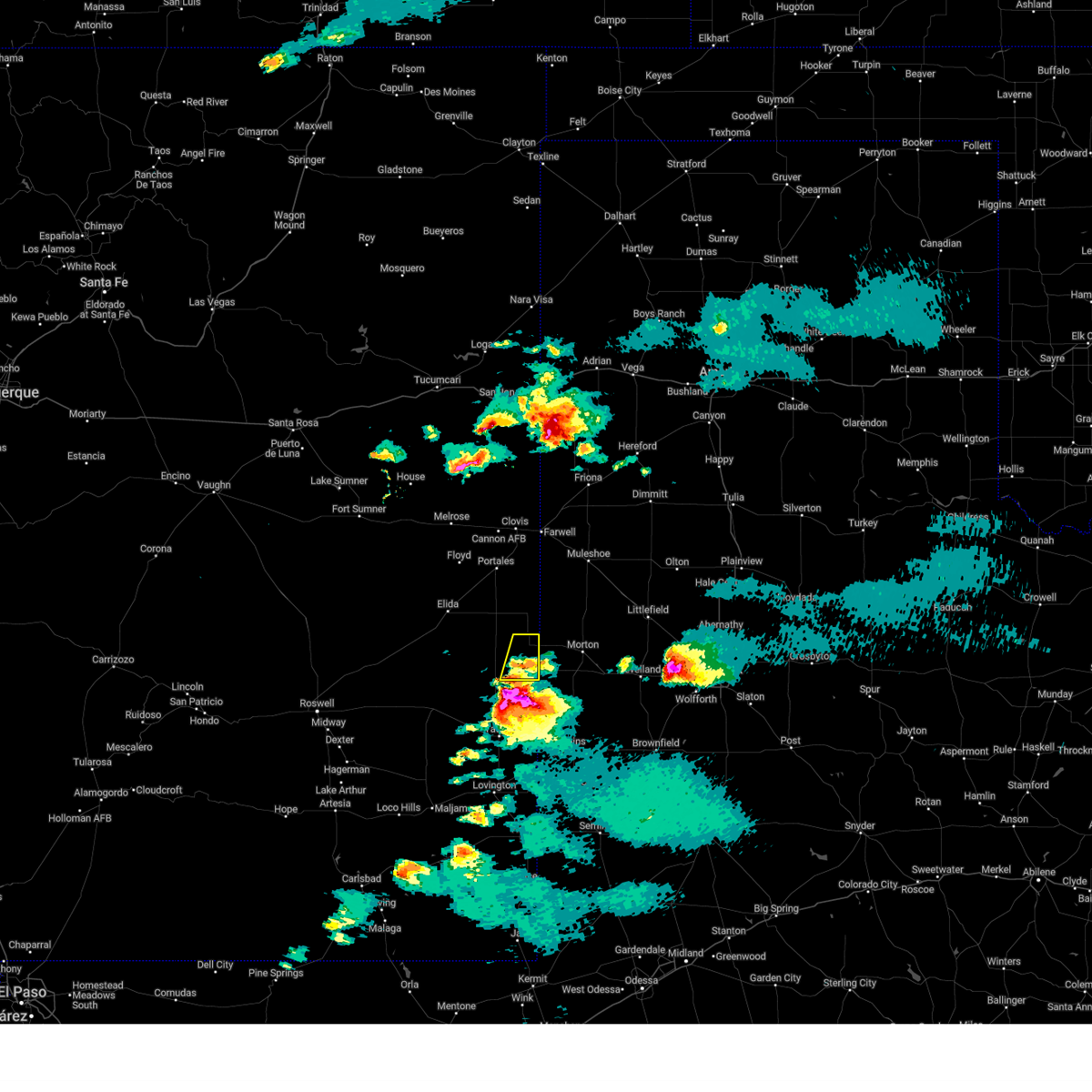
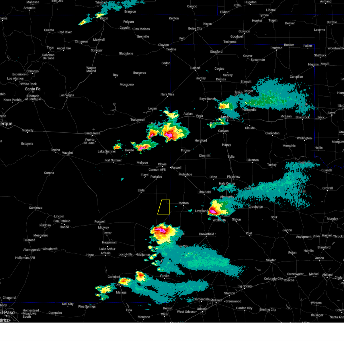
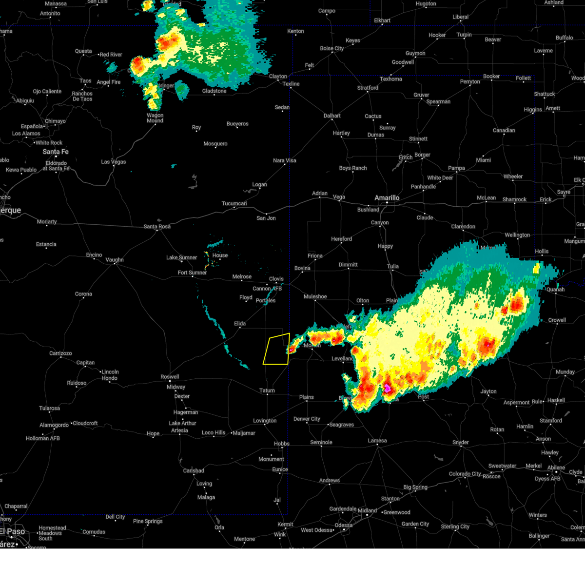
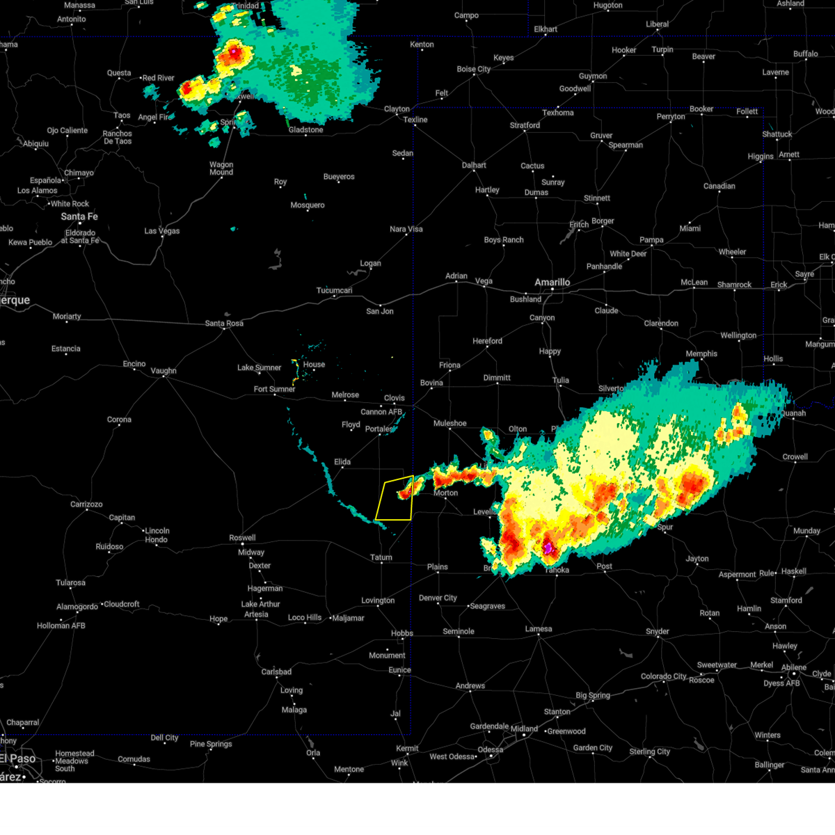
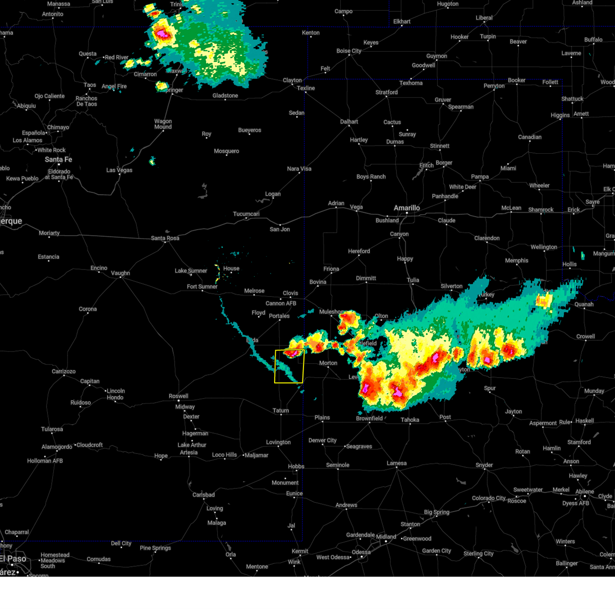
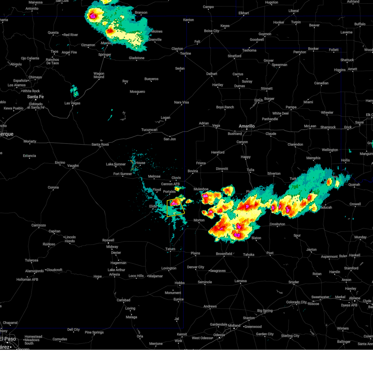
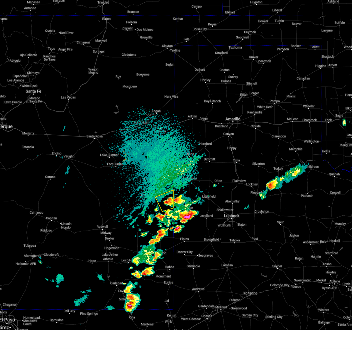
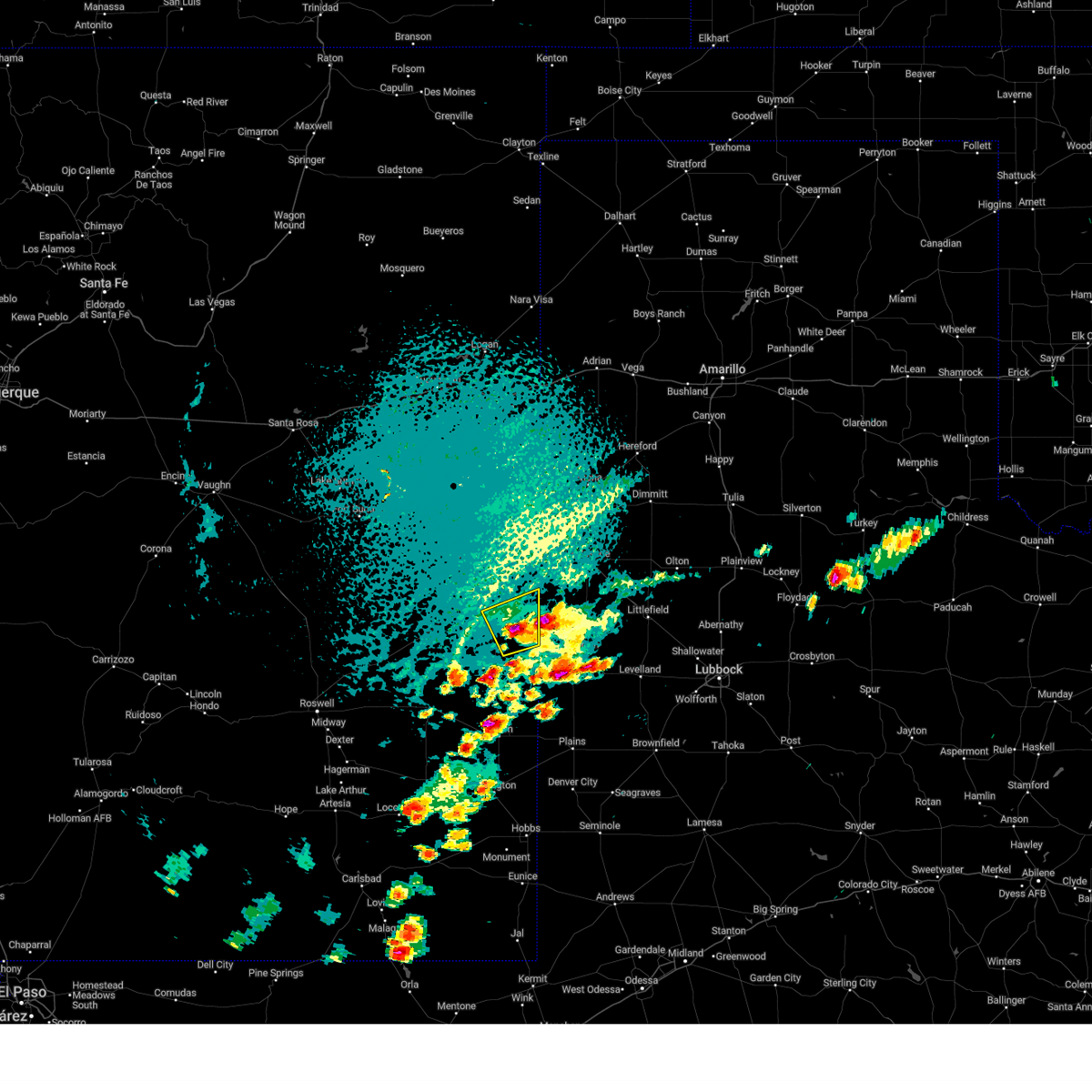
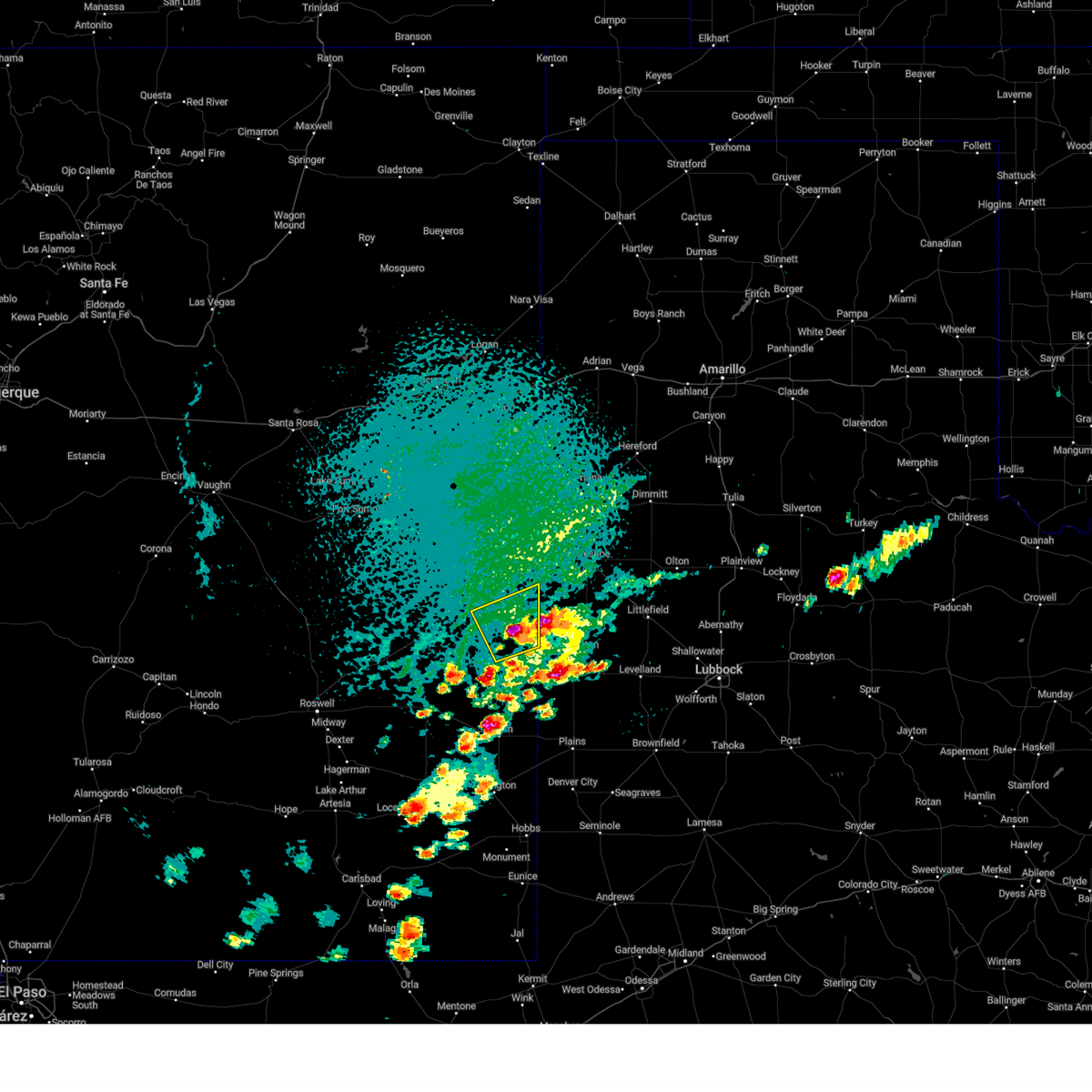
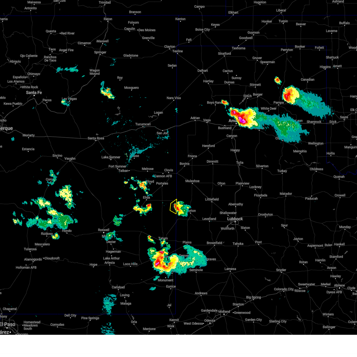
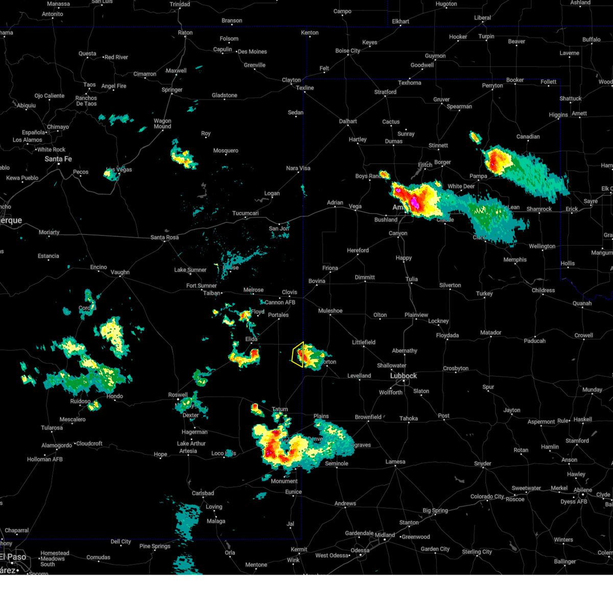
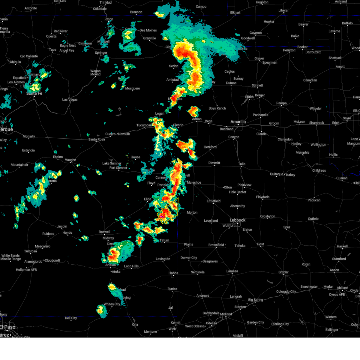
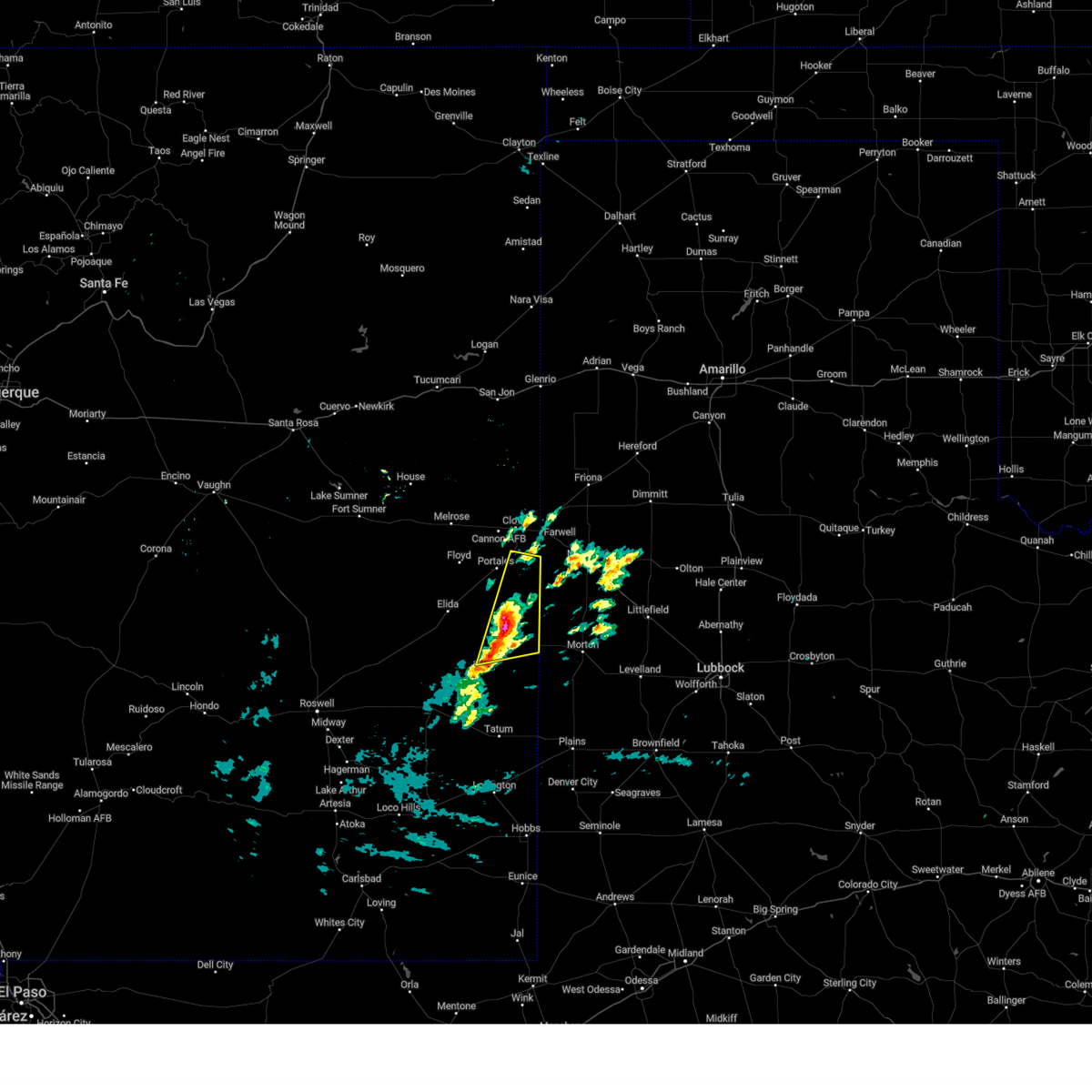
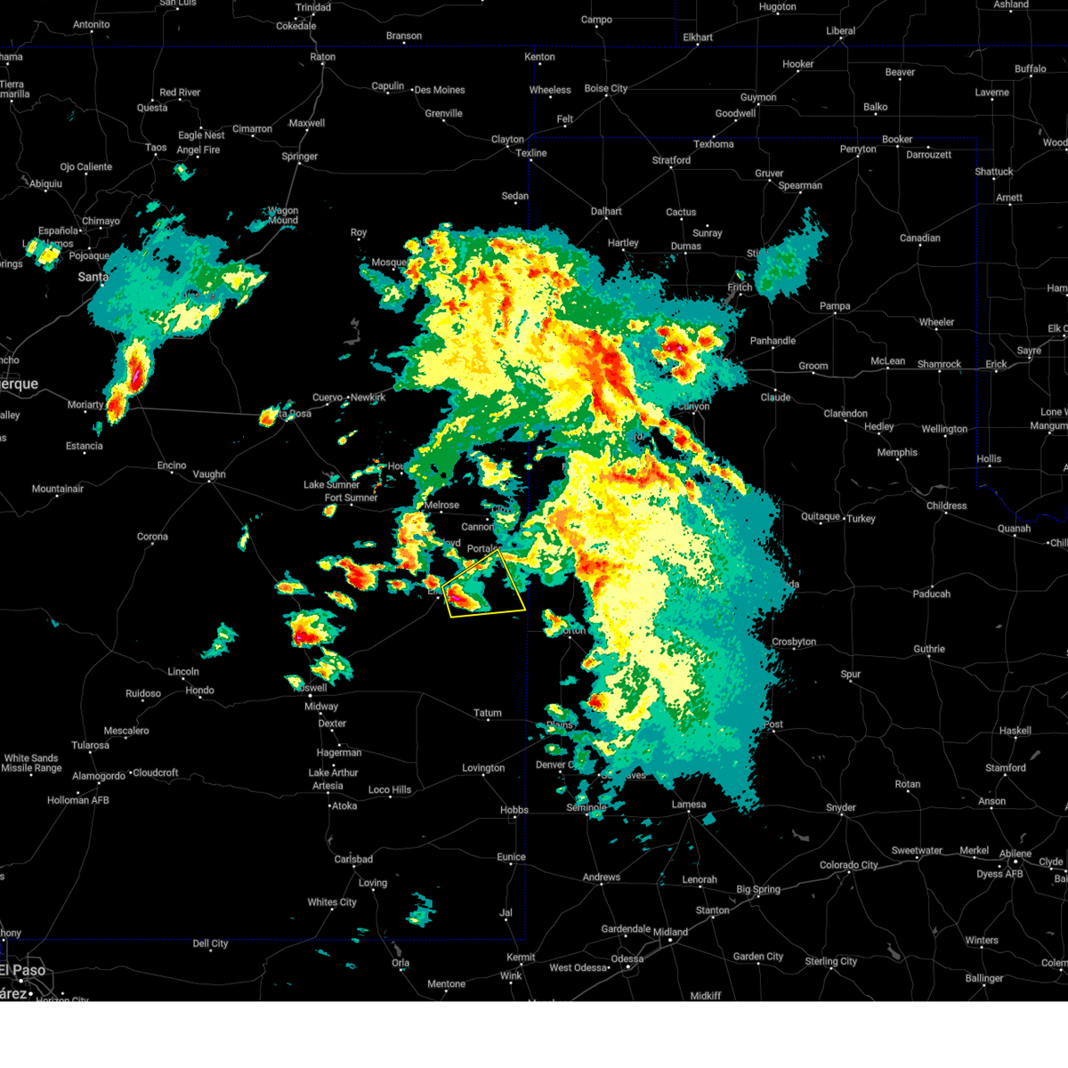
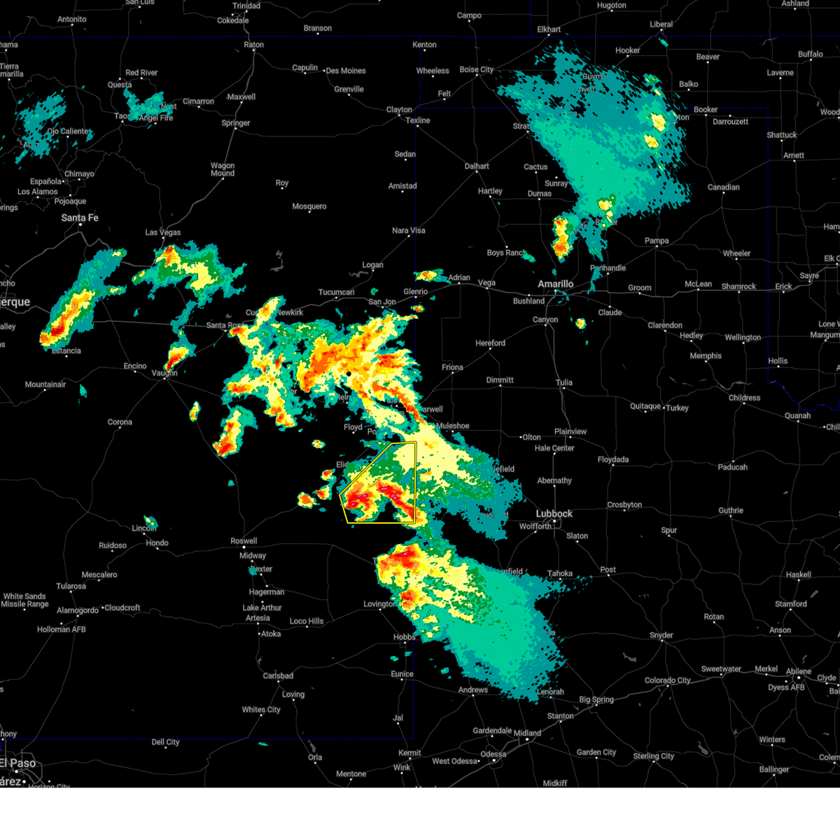
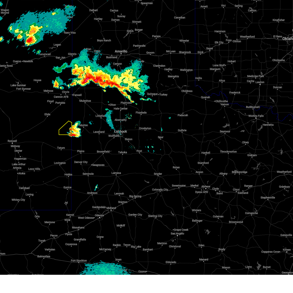
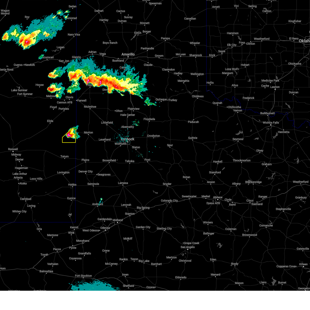
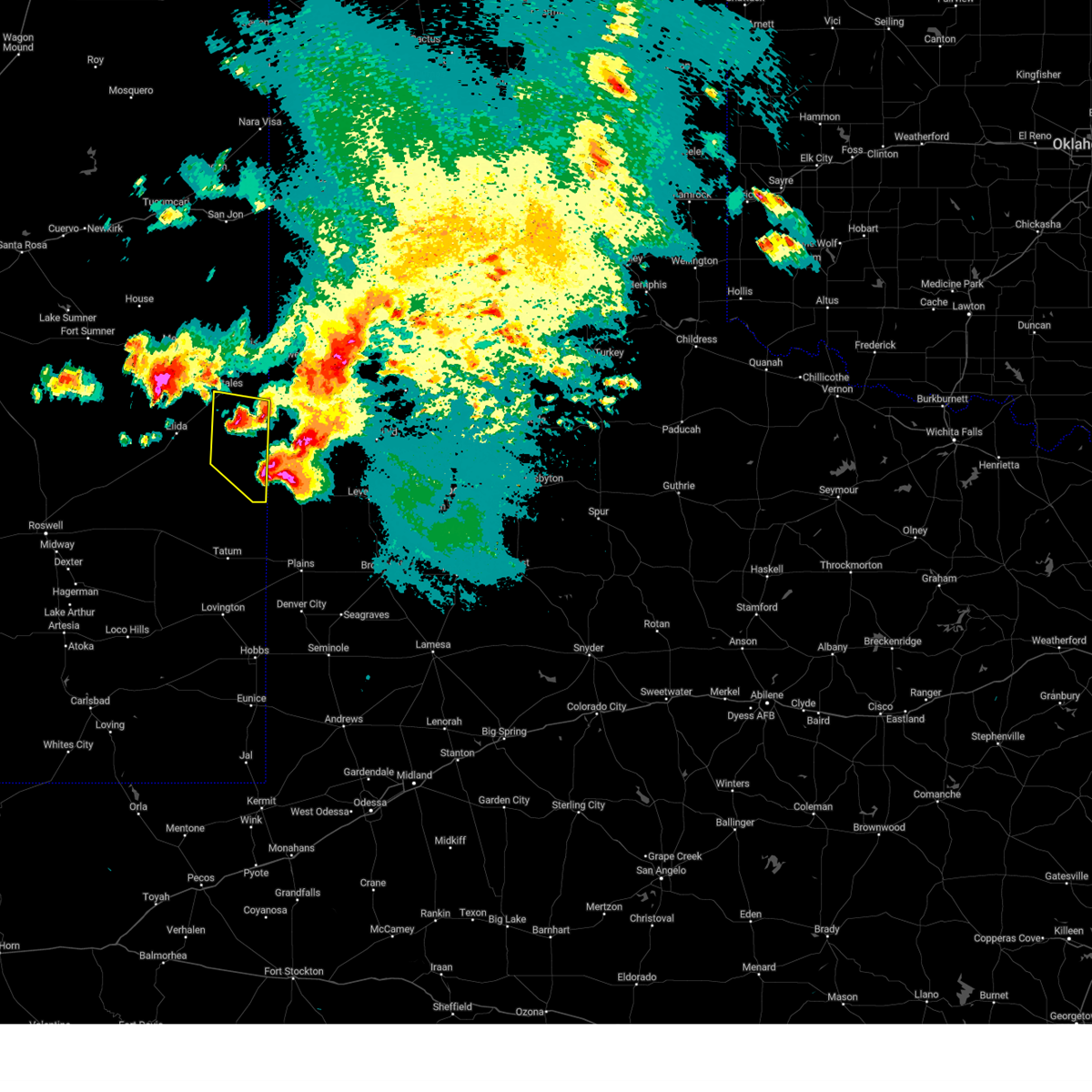
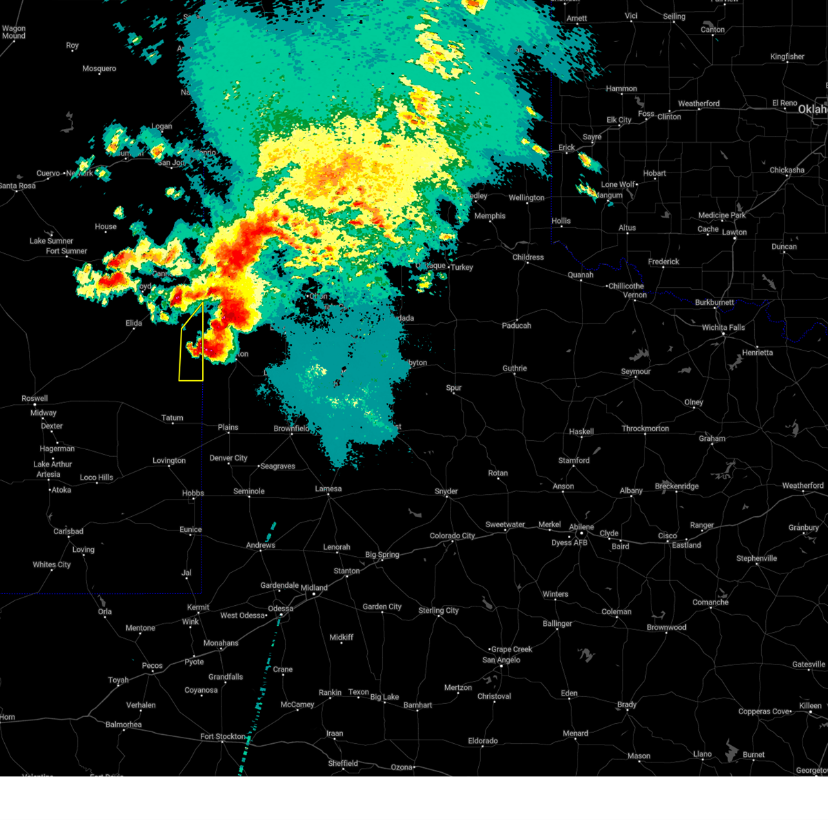
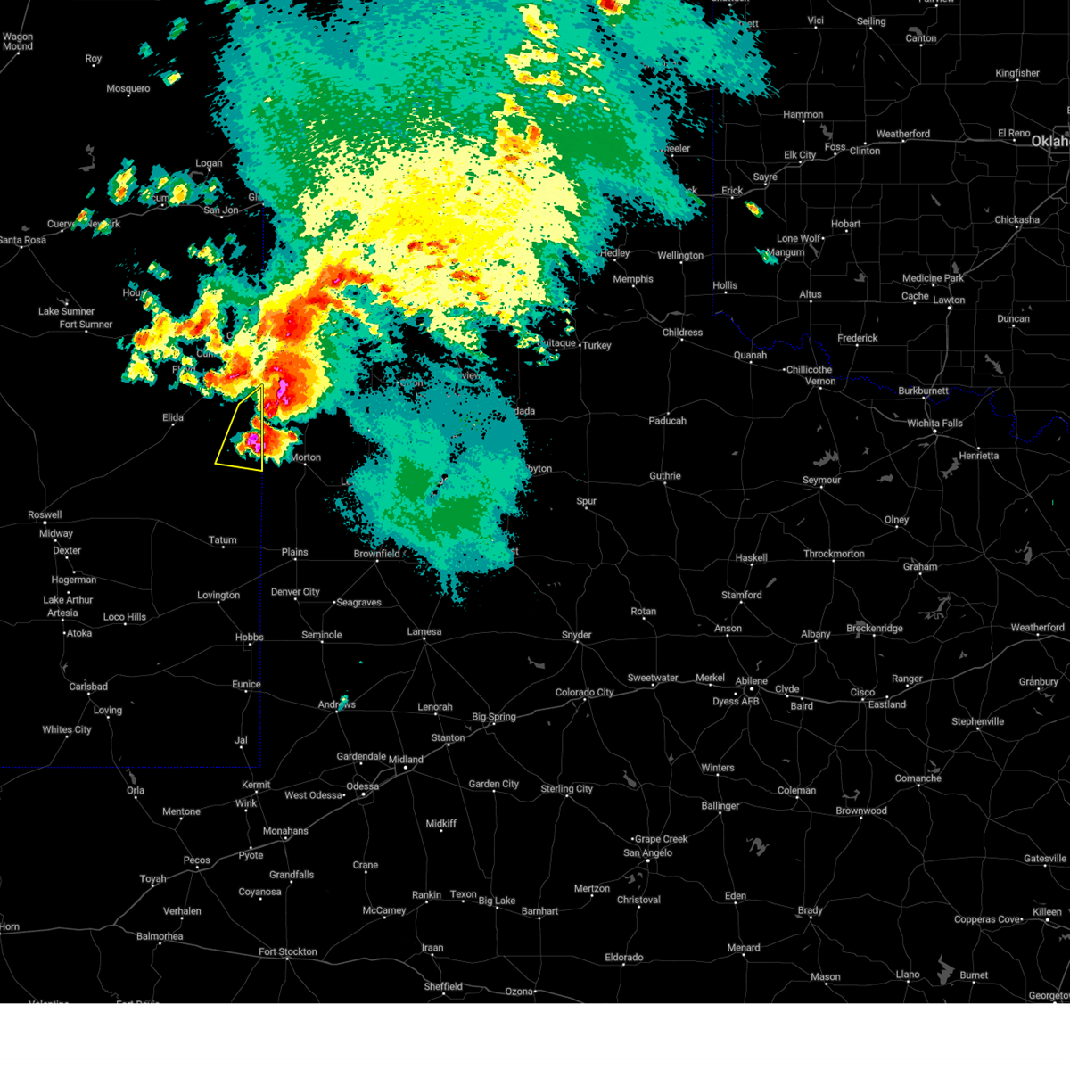
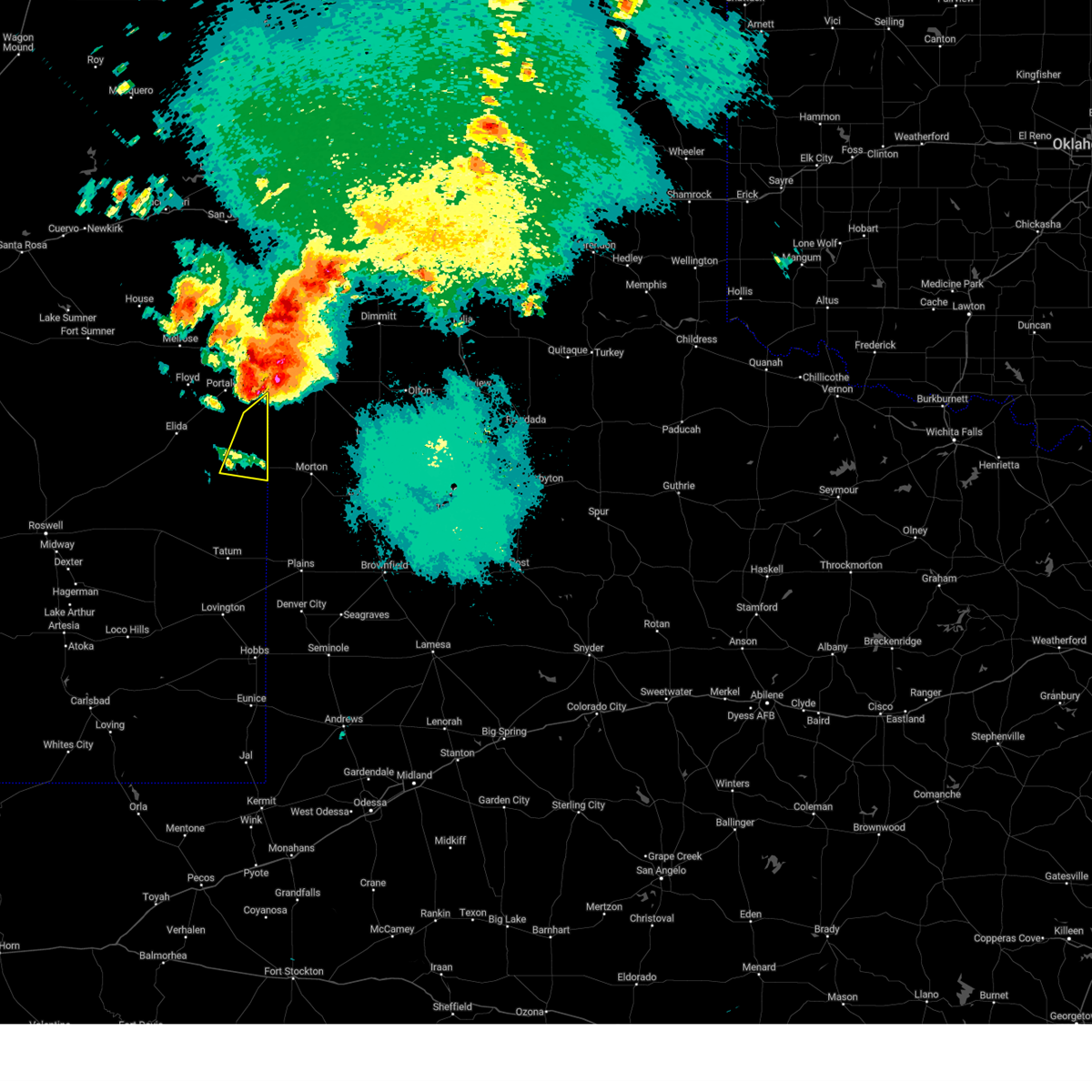
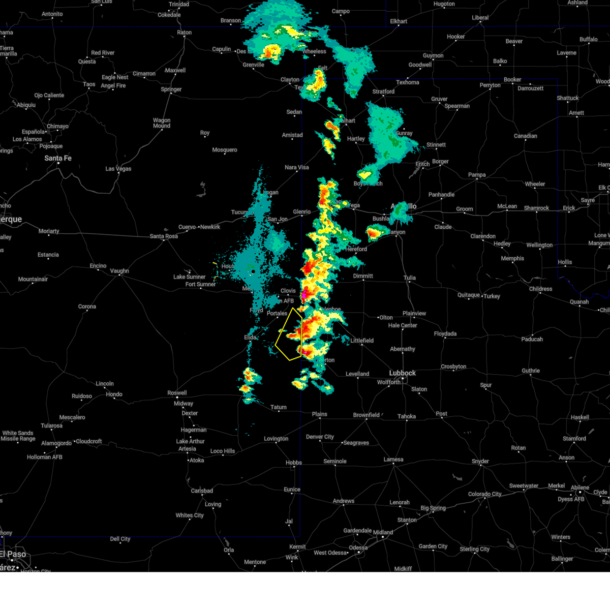
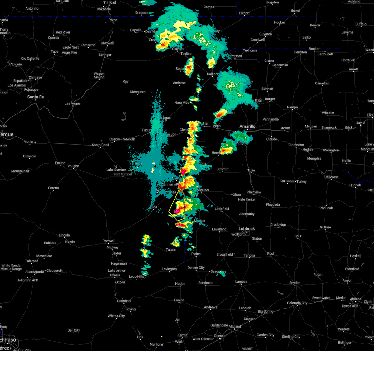
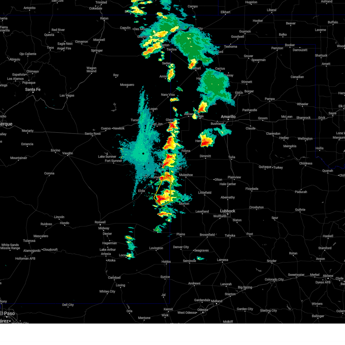
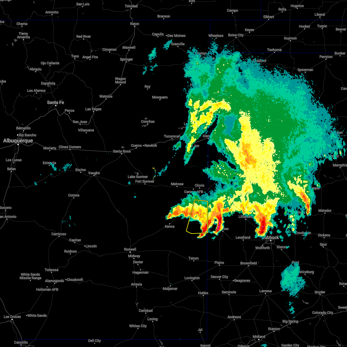
Hail Map for Causey, NM
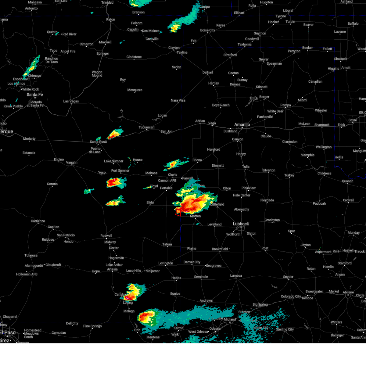
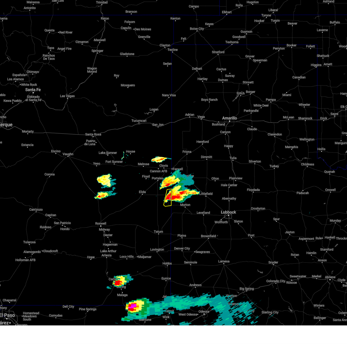
The Causey, NM area has had 19 reports of on-the-ground hail by trained spotters, and has been under severe weather warnings 30 times during the past 12 months. Doppler radar has detected hail at or near Causey, NM on 103 occasions, including 6 occasions during the past year.
| Name: | Causey, NM |
| Where Located: | 74.6 miles WNW of Lubbock, TX |
| Map: | Google Map for Causey, NM |
| Population: | 104 |
| Housing Units: | 53 |
| More Info: | Search Google for Causey, NM |
1
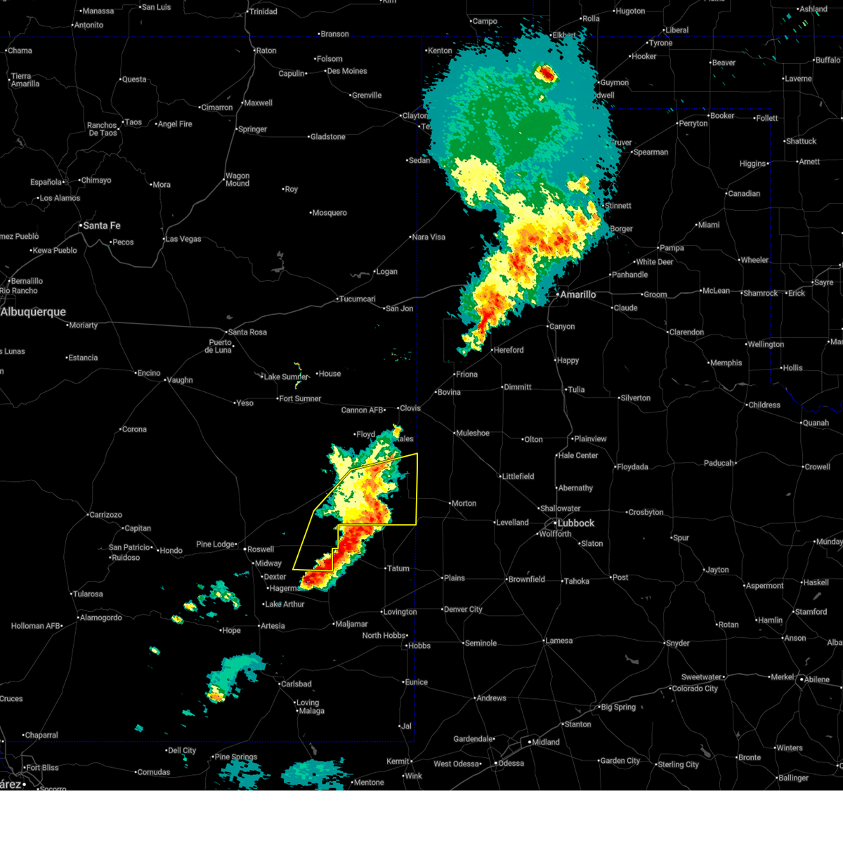
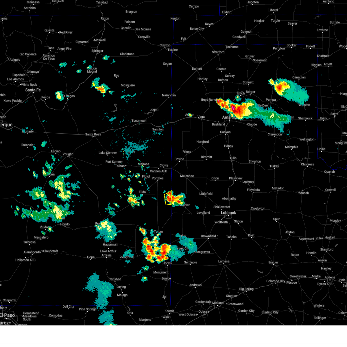
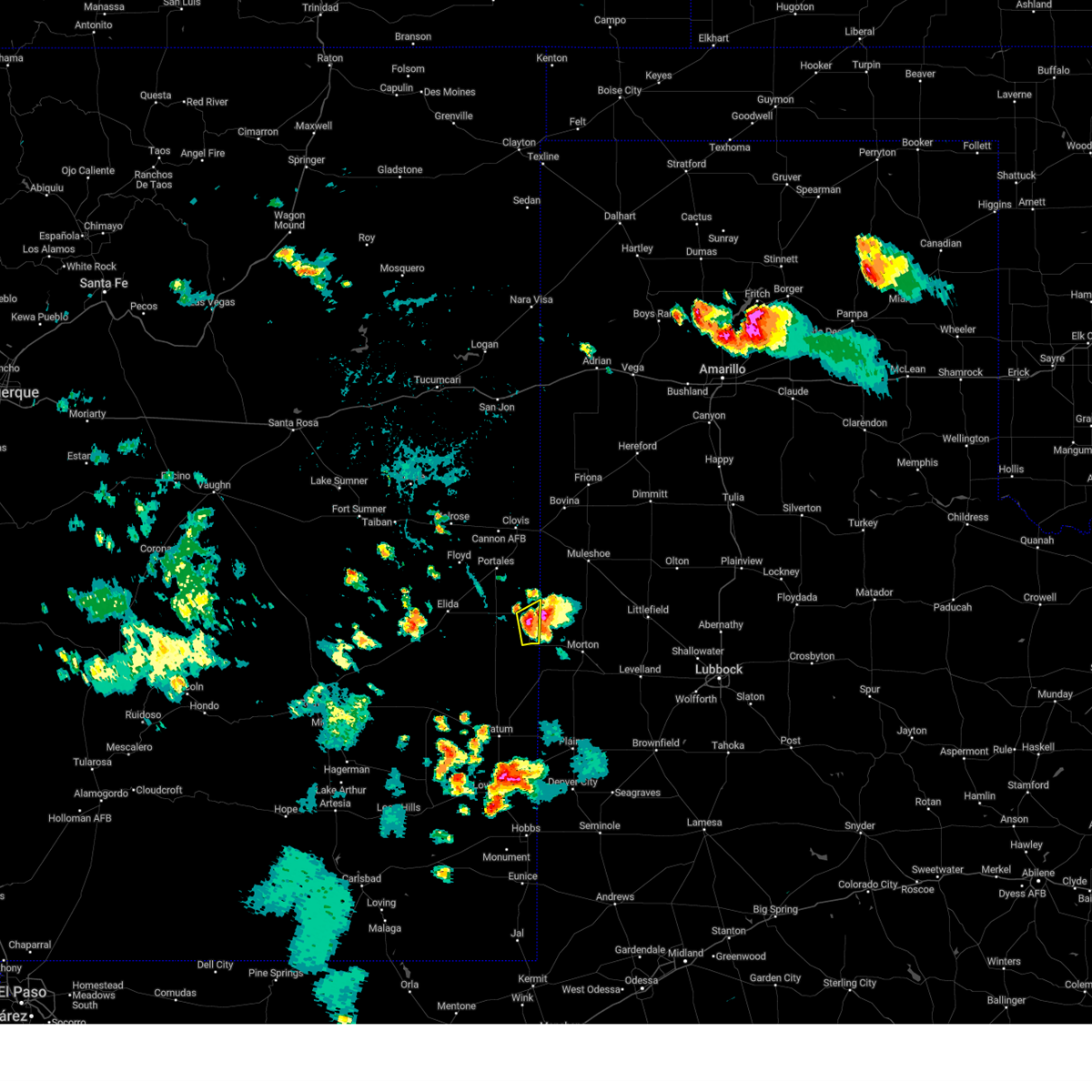
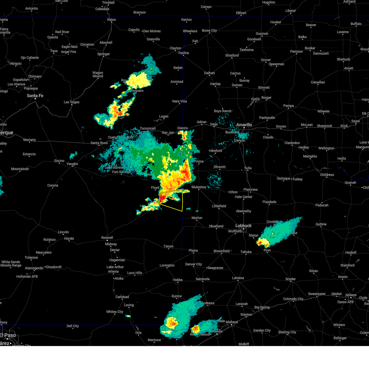
The Top Recent Hail Date for Causey, NM is Friday, April 25, 2025 (8th out of 103)
Hail and Wind Damage Spotted near Causey, NM
| Date / Time | Report Details |
|---|---|
| 6/22/2025 8:03 PM MDT |
 The severe thunderstorm warning that was previously in effect has been allowed to expire. gusty winds, heavy rain, and small hail will continue. The severe thunderstorm warning that was previously in effect has been allowed to expire. gusty winds, heavy rain, and small hail will continue.
|
| 6/22/2025 7:36 PM MDT |
 At 736 pm mdt, severe thunderstorms were located along a line from near pep to 27 miles southeast of elkins, moving east at 30 mph (radar indicated). Hazards include 60 mph wind gusts and quarter size hail. Hail damage to vehicles is expected. expect wind damage to roofs, siding, and trees. locations impacted include, dora, causey, milnesand, pep, lingo and rogers. This includes highway 380 between mile markers 183 and 200. At 736 pm mdt, severe thunderstorms were located along a line from near pep to 27 miles southeast of elkins, moving east at 30 mph (radar indicated). Hazards include 60 mph wind gusts and quarter size hail. Hail damage to vehicles is expected. expect wind damage to roofs, siding, and trees. locations impacted include, dora, causey, milnesand, pep, lingo and rogers. This includes highway 380 between mile markers 183 and 200.
|
| 6/22/2025 6:59 PM MDT |
 Svrabq the national weather service in albuquerque has issued a * severe thunderstorm warning for, southern roosevelt county in east central new mexico, northeastern chaves county in southeastern new mexico, * until 800 pm mdt. * at 659 pm mdt, severe thunderstorms were located along a line from 11 miles southeast of elida to 10 miles east of bottomless lakes state park, moving east at 30 mph (radar indicated). Hazards include 60 mph wind gusts and quarter size hail. Hail damage to vehicles is expected. Expect wind damage to roofs, siding, and trees. Svrabq the national weather service in albuquerque has issued a * severe thunderstorm warning for, southern roosevelt county in east central new mexico, northeastern chaves county in southeastern new mexico, * until 800 pm mdt. * at 659 pm mdt, severe thunderstorms were located along a line from 11 miles southeast of elida to 10 miles east of bottomless lakes state park, moving east at 30 mph (radar indicated). Hazards include 60 mph wind gusts and quarter size hail. Hail damage to vehicles is expected. Expect wind damage to roofs, siding, and trees.
|
| 6/9/2025 9:13 PM MDT |
 The storms which prompted the warning have weakened below severe limits, and no longer pose an immediate threat to life or property. therefore, the warning will be allowed to expire. however, small hail, gusty winds, and heavy rain are still possible with these thunderstorms. a severe thunderstorm watch remains in effect until 1000 pm mdt for portions of east central and southeast new mexico. The storms which prompted the warning have weakened below severe limits, and no longer pose an immediate threat to life or property. therefore, the warning will be allowed to expire. however, small hail, gusty winds, and heavy rain are still possible with these thunderstorms. a severe thunderstorm watch remains in effect until 1000 pm mdt for portions of east central and southeast new mexico.
|
| 6/9/2025 8:59 PM MDT |
 At 859 pm mdt, severe thunderstorms were located along a line from 10 miles northeast of texico to 14 miles west of milnesand, moving east at 45 mph (radar indicated). Hazards include 60 mph wind gusts and quarter size hail. Hail damage to vehicles is expected. expect wind damage to roofs, siding, and trees. locations impacted include, clovis, portales, texico, elida, dora, causey, pep, oasis state park, arch and lingo. This includes highway 60 between mile markers 374 and 397. At 859 pm mdt, severe thunderstorms were located along a line from 10 miles northeast of texico to 14 miles west of milnesand, moving east at 45 mph (radar indicated). Hazards include 60 mph wind gusts and quarter size hail. Hail damage to vehicles is expected. expect wind damage to roofs, siding, and trees. locations impacted include, clovis, portales, texico, elida, dora, causey, pep, oasis state park, arch and lingo. This includes highway 60 between mile markers 374 and 397.
|
| 6/9/2025 8:28 PM MDT |
 At 828 pm mdt, severe thunderstorms were located along a line from over clovis to 8 miles southeast of elida, moving east at 45 mph (trained spotters reported). Hazards include 70 mph wind gusts and quarter size hail. Hail damage to vehicles is expected. expect considerable tree damage. wind damage is also likely to mobile homes, roofs, and outbuildings. locations impacted include, clovis, portales, texico, elida, dora, causey, pep, oasis state park, arch and cannon air force base. This includes highway 60 between mile markers 366 and 397. At 828 pm mdt, severe thunderstorms were located along a line from over clovis to 8 miles southeast of elida, moving east at 45 mph (trained spotters reported). Hazards include 70 mph wind gusts and quarter size hail. Hail damage to vehicles is expected. expect considerable tree damage. wind damage is also likely to mobile homes, roofs, and outbuildings. locations impacted include, clovis, portales, texico, elida, dora, causey, pep, oasis state park, arch and cannon air force base. This includes highway 60 between mile markers 366 and 397.
|
| 6/9/2025 7:58 PM MDT |
 Svrabq the national weather service in albuquerque has issued a * severe thunderstorm warning for, southern curry county in east central new mexico, roosevelt county in east central new mexico, northeastern chaves county in southeastern new mexico, * until 915 pm mdt. * at 758 pm mdt, severe thunderstorms were located along a line from near melrose to 14 miles north of elkins, moving east at 45 mph (trained spotters reported). Hazards include 60 mph wind gusts and quarter size hail. Hail damage to vehicles is expected. Expect wind damage to roofs, siding, and trees. Svrabq the national weather service in albuquerque has issued a * severe thunderstorm warning for, southern curry county in east central new mexico, roosevelt county in east central new mexico, northeastern chaves county in southeastern new mexico, * until 915 pm mdt. * at 758 pm mdt, severe thunderstorms were located along a line from near melrose to 14 miles north of elkins, moving east at 45 mph (trained spotters reported). Hazards include 60 mph wind gusts and quarter size hail. Hail damage to vehicles is expected. Expect wind damage to roofs, siding, and trees.
|
| 6/6/2025 4:39 PM MDT | Quarter sized hail reported 22.5 miles N of Causey, NM |
| 6/6/2025 4:20 PM MDT | the severe thunderstorm warning has been cancelled and is no longer in effect |
| 6/6/2025 3:54 PM MDT |
 Svrabq the national weather service in albuquerque has issued a * severe thunderstorm warning for, southeastern roosevelt county in east central new mexico, * until 445 pm mdt. * at 354 pm mdt, a severe thunderstorm was located over milnesand, or 37 miles south of portales, moving northeast at 25 mph (radar indicated). Hazards include 60 mph wind gusts and quarter size hail. Hail damage to vehicles is expected. Expect wind damage to roofs, siding, and trees. Svrabq the national weather service in albuquerque has issued a * severe thunderstorm warning for, southeastern roosevelt county in east central new mexico, * until 445 pm mdt. * at 354 pm mdt, a severe thunderstorm was located over milnesand, or 37 miles south of portales, moving northeast at 25 mph (radar indicated). Hazards include 60 mph wind gusts and quarter size hail. Hail damage to vehicles is expected. Expect wind damage to roofs, siding, and trees.
|
| 6/5/2025 5:35 PM CDT | Baseball sized hail reported 12.3 miles WNW of Causey, NM, observed by the icechip project. |
| 6/5/2025 5:35 PM CDT | Tea Cup sized hail reported 12.3 miles WNW of Causey, NM, report from mping: tea cup (3.00 in.). |
| 6/5/2025 5:33 PM CDT | Tea Cup sized hail reported 12.1 miles W of Causey, NM, observed by the icechip project. |
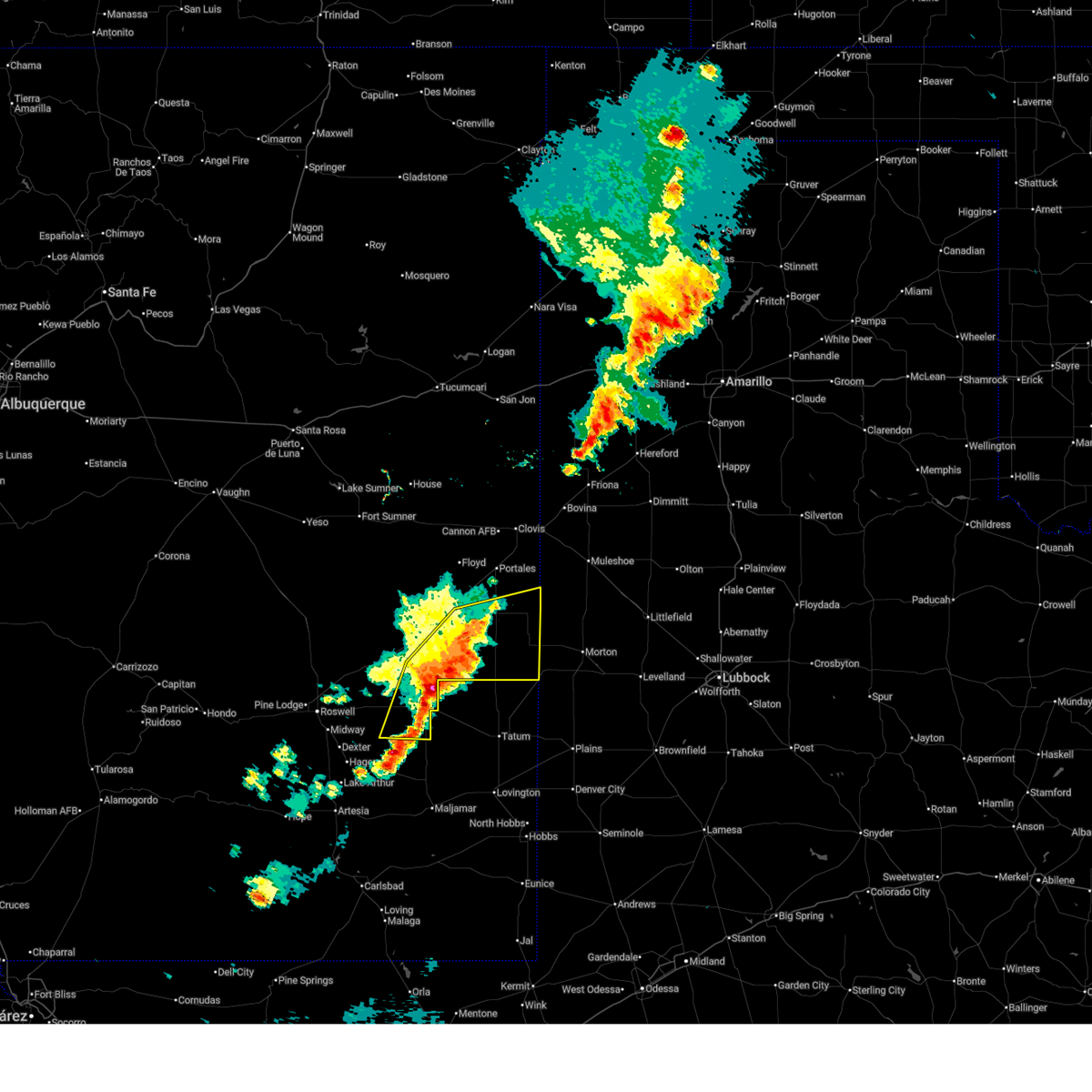
| 6/5/2025 4:18 PM MDT |
 the tornado warning has been cancelled and is no longer in effect the tornado warning has been cancelled and is no longer in effect
|
| 6/5/2025 4:07 PM MDT |
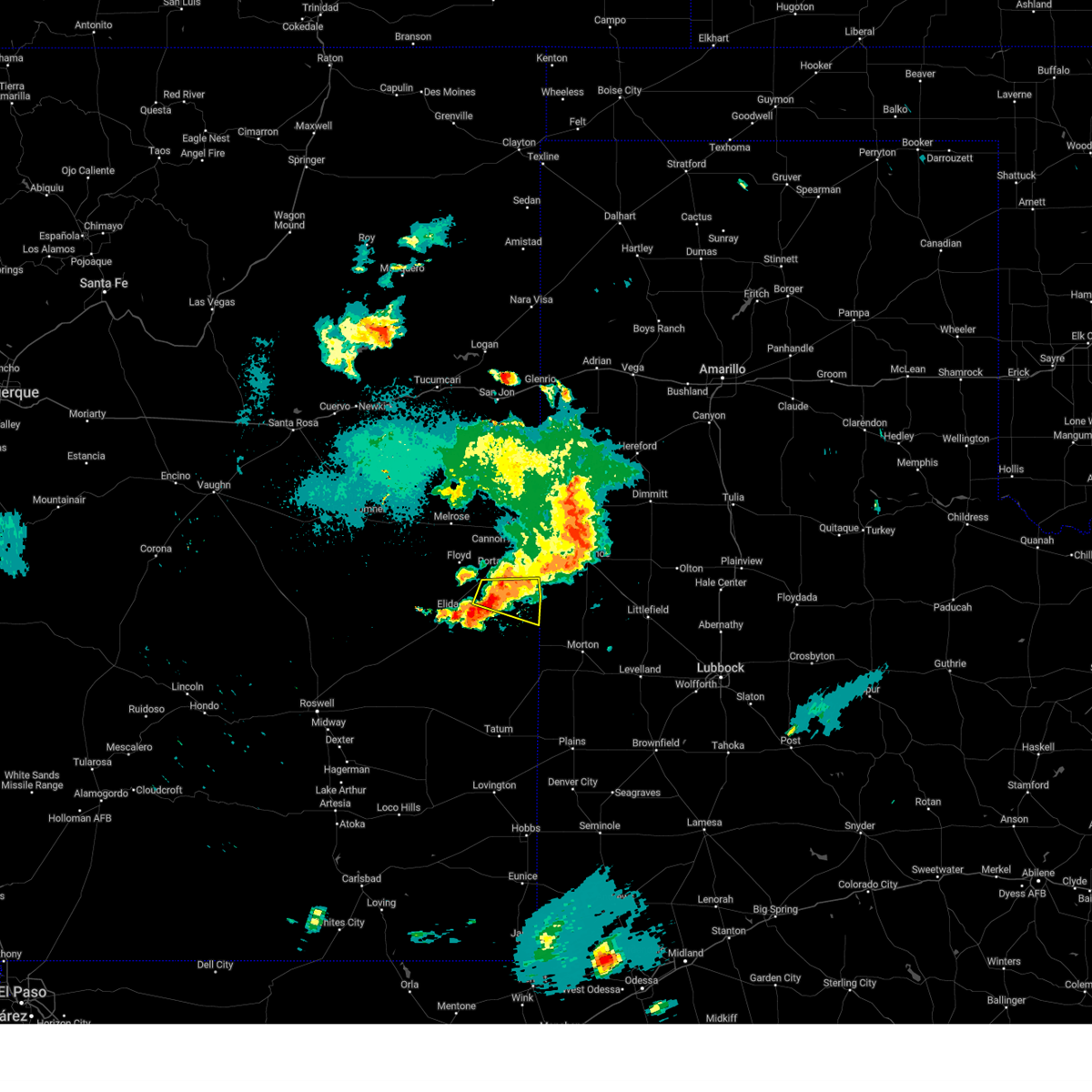
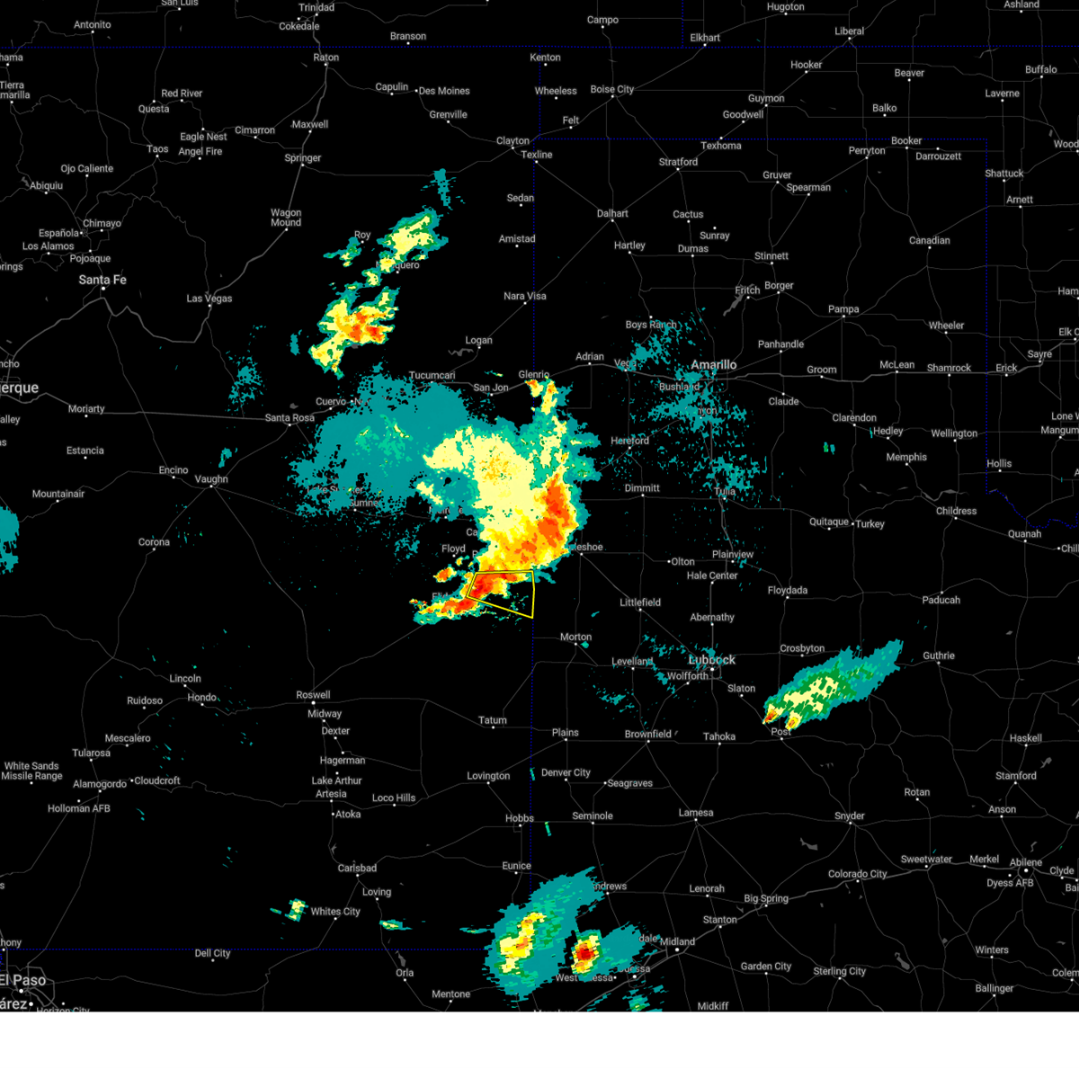
 At 407 pm mdt, a confirmed tornado was located near causey, or 29 miles southeast of portales, moving east at 10 mph (weather spotters confirmed tornado). Hazards include damaging tornado and quarter size hail. Flying debris will be dangerous to those caught without shelter. mobile homes will be damaged or destroyed. damage to roofs, windows and vehicles will occur. tree damage is likely. Locations impacted include, causey and lingo. At 407 pm mdt, a confirmed tornado was located near causey, or 29 miles southeast of portales, moving east at 10 mph (weather spotters confirmed tornado). Hazards include damaging tornado and quarter size hail. Flying debris will be dangerous to those caught without shelter. mobile homes will be damaged or destroyed. damage to roofs, windows and vehicles will occur. tree damage is likely. Locations impacted include, causey and lingo.
|
| 6/5/2025 4:00 PM MDT |
 The severe thunderstorm warning that was previously in effect has been upgraded to a tornado warning. please refer to that bulletin for the latest information on this dangerous weather situation. a tornado watch remains in effect until 900 pm mdt thursday for a portion of east central new mexico. The severe thunderstorm warning that was previously in effect has been upgraded to a tornado warning. please refer to that bulletin for the latest information on this dangerous weather situation. a tornado watch remains in effect until 900 pm mdt thursday for a portion of east central new mexico.
|
| 6/5/2025 3:59 PM MDT |
 Torabq the national weather service in albuquerque has issued a * tornado warning for, southeastern roosevelt county in east central new mexico, * until 430 pm mdt. * at 359 pm mdt, a confirmed tornado was located near lingo, or 29 miles southeast of portales, moving east at 15 mph (weather spotters confirmed tornado). Hazards include damaging tornado. Flying debris will be dangerous to those caught without shelter. mobile homes will be damaged or destroyed. damage to roofs, windows and vehicles will occur. Tree damage is likely. Torabq the national weather service in albuquerque has issued a * tornado warning for, southeastern roosevelt county in east central new mexico, * until 430 pm mdt. * at 359 pm mdt, a confirmed tornado was located near lingo, or 29 miles southeast of portales, moving east at 15 mph (weather spotters confirmed tornado). Hazards include damaging tornado. Flying debris will be dangerous to those caught without shelter. mobile homes will be damaged or destroyed. damage to roofs, windows and vehicles will occur. Tree damage is likely.
|
| 6/5/2025 3:50 PM MDT |
 At 350 pm mdt, a severe thunderstorm was located over causey, or 25 miles southeast of portales, moving east at 15 mph (radar indicated). Hazards include 60 mph wind gusts and half dollar size hail. Hail damage to vehicles is expected. expect wind damage to roofs, siding, and trees. Locations impacted include, causey and lingo. At 350 pm mdt, a severe thunderstorm was located over causey, or 25 miles southeast of portales, moving east at 15 mph (radar indicated). Hazards include 60 mph wind gusts and half dollar size hail. Hail damage to vehicles is expected. expect wind damage to roofs, siding, and trees. Locations impacted include, causey and lingo.
|
| 6/5/2025 3:49 PM MDT |
 At 349 pm mdt, a severe thunderstorm capable of producing a tornado was located near causey, or 28 miles southeast of portales, moving east at 20 mph (radar indicated rotation). Hazards include tornado. Flying debris will be dangerous to those caught without shelter. mobile homes will be damaged or destroyed. damage to roofs, windows and vehicles will occur. tree damage is likely. Locations impacted include, causey and lingo. At 349 pm mdt, a severe thunderstorm capable of producing a tornado was located near causey, or 28 miles southeast of portales, moving east at 20 mph (radar indicated rotation). Hazards include tornado. Flying debris will be dangerous to those caught without shelter. mobile homes will be damaged or destroyed. damage to roofs, windows and vehicles will occur. tree damage is likely. Locations impacted include, causey and lingo.
|
| 6/5/2025 3:43 PM MDT |
 At 343 pm mdt, a confirmed tornado was located near lingo, or 28 miles southeast of portales, moving southeast at 20 mph (weather spotters confirmed tornado). Hazards include damaging tornado. Flying debris will be dangerous to those caught without shelter. mobile homes will be damaged or destroyed. damage to roofs, windows and vehicles will occur. tree damage is likely. Locations impacted include, causey and lingo. At 343 pm mdt, a confirmed tornado was located near lingo, or 28 miles southeast of portales, moving southeast at 20 mph (weather spotters confirmed tornado). Hazards include damaging tornado. Flying debris will be dangerous to those caught without shelter. mobile homes will be damaged or destroyed. damage to roofs, windows and vehicles will occur. tree damage is likely. Locations impacted include, causey and lingo.
|
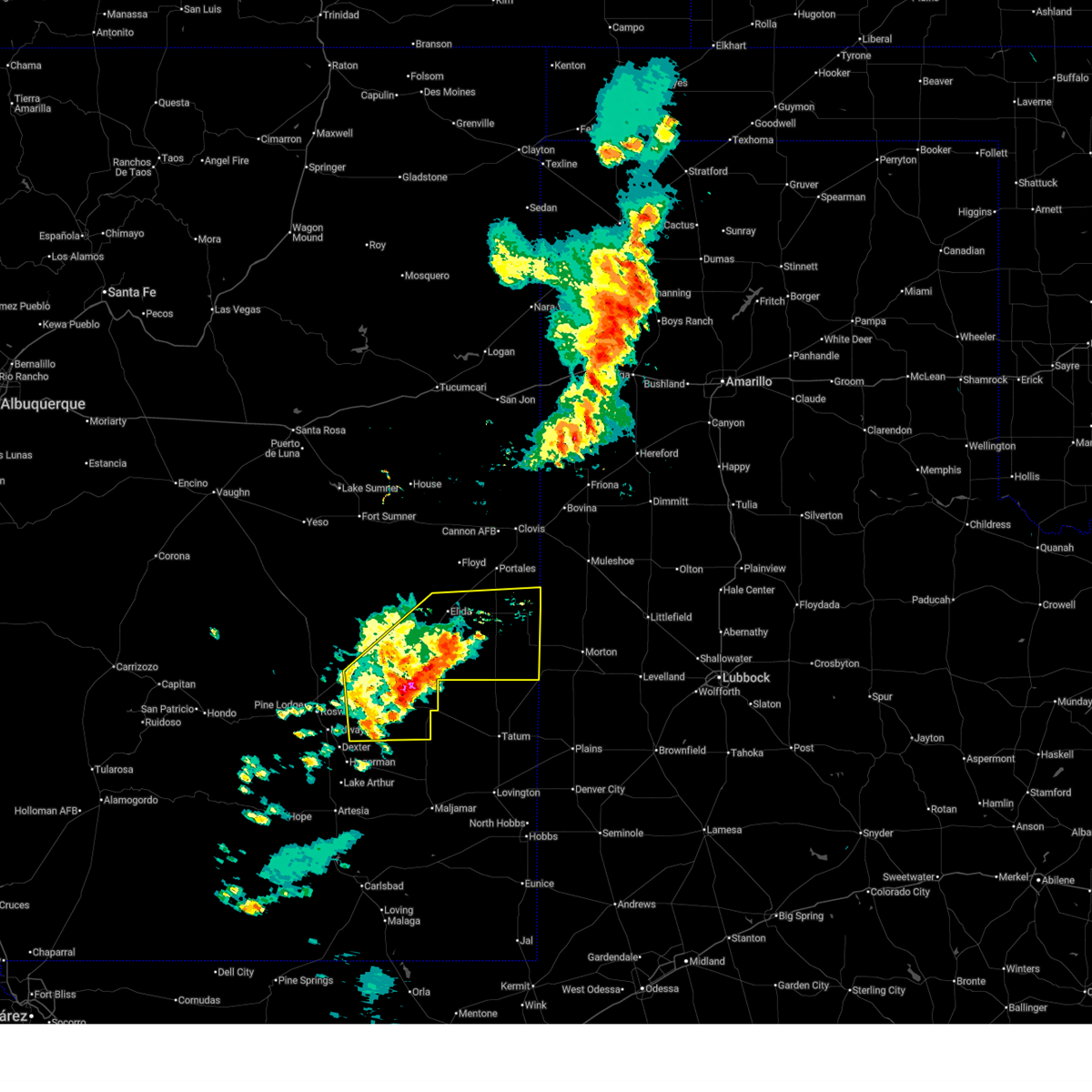
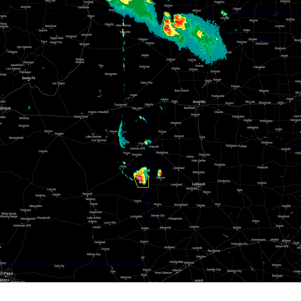
| 6/5/2025 3:38 PM MDT | Golf Ball sized hail reported 1.3 miles NNE of Causey, NM, location estimated. south of causey. |
| 6/5/2025 3:37 PM MDT | Torabq the national weather service in albuquerque has issued a * tornado warning for, southeastern roosevelt county in east central new mexico, * until 400 pm mdt. * at 337 pm mdt, a severe thunderstorm capable of producing a tornado was located near lingo, or 26 miles south of portales, moving southeast at 20 mph (radar indicated rotation). Hazards include tornado. Flying debris will be dangerous to those caught without shelter. mobile homes will be damaged or destroyed. damage to roofs, windows and vehicles will occur. Tree damage is likely. |
| 6/5/2025 3:35 PM MDT | Hen Egg sized hail reported 1.6 miles SE of Causey, NM, report from mping: hen egg (2.00 in.). |
| 6/5/2025 3:28 PM MDT |
 At 328 pm mdt, a severe thunderstorm was located 6 miles east of pep, or 23 miles south of portales, moving east at 15 mph (radar indicated). Hazards include golf ball size hail and 60 mph wind gusts. People and animals outdoors will be injured. expect hail damage to roofs, siding, windows, and vehicles. expect wind damage to roofs, siding, and trees. Locations impacted include, dora, causey, pep, lingo and rogers. At 328 pm mdt, a severe thunderstorm was located 6 miles east of pep, or 23 miles south of portales, moving east at 15 mph (radar indicated). Hazards include golf ball size hail and 60 mph wind gusts. People and animals outdoors will be injured. expect hail damage to roofs, siding, windows, and vehicles. expect wind damage to roofs, siding, and trees. Locations impacted include, dora, causey, pep, lingo and rogers.
|
| 6/5/2025 3:19 PM MDT |
 At 319 pm mdt, a severe thunderstorm was located near pep, or 22 miles south of portales, moving east at 15 mph (radar indicated). Hazards include 60 mph wind gusts and half dollar size hail. Hail damage to vehicles is expected. expect wind damage to roofs, siding, and trees. Locations impacted include, dora, causey, pep, lingo and rogers. At 319 pm mdt, a severe thunderstorm was located near pep, or 22 miles south of portales, moving east at 15 mph (radar indicated). Hazards include 60 mph wind gusts and half dollar size hail. Hail damage to vehicles is expected. expect wind damage to roofs, siding, and trees. Locations impacted include, dora, causey, pep, lingo and rogers.
|
| 6/5/2025 3:07 PM MDT | At 307 pm mdt, a severe thunderstorm was located near pep, or 22 miles south of portales, moving northeast at 15 mph (radar indicated). Hazards include golf ball size hail and 60 mph wind gusts. People and animals outdoors will be injured. expect hail damage to roofs, siding, windows, and vehicles. expect wind damage to roofs, siding, and trees. Locations impacted include, dora, causey, pep, lingo and rogers. |
| 6/5/2025 2:57 PM MDT | Svrabq the national weather service in albuquerque has issued a * severe thunderstorm warning for, southeastern roosevelt county in east central new mexico, * until 400 pm mdt. * at 257 pm mdt, a severe thunderstorm was located over pep, or 22 miles south of portales, moving east at 15 mph (radar indicated). Hazards include ping pong ball size hail and 60 mph wind gusts. People and animals outdoors will be injured. expect hail damage to roofs, siding, windows, and vehicles. Expect wind damage to roofs, siding, and trees. |
| 4/25/2025 8:13 PM MDT |
 the severe thunderstorm warning has been cancelled and is no longer in effect the severe thunderstorm warning has been cancelled and is no longer in effect
|
| 4/25/2025 7:46 PM MDT |
 At 746 pm mdt, a severe thunderstorm was located near causey, or 23 miles southeast of portales, moving north at 35 mph (radar indicated). Hazards include 60 mph wind gusts and half dollar size hail. Hail damage to vehicles is expected. expect wind damage to roofs, siding, and trees. Locations impacted include, dora, causey, pep and rogers. At 746 pm mdt, a severe thunderstorm was located near causey, or 23 miles southeast of portales, moving north at 35 mph (radar indicated). Hazards include 60 mph wind gusts and half dollar size hail. Hail damage to vehicles is expected. expect wind damage to roofs, siding, and trees. Locations impacted include, dora, causey, pep and rogers.
|
| 4/25/2025 7:29 PM MDT |
 Svrabq the national weather service in albuquerque has issued a * severe thunderstorm warning for, southeastern roosevelt county in east central new mexico, * until 815 pm mdt. * at 729 pm mdt, a severe thunderstorm was located 6 miles southeast of pep, or 29 miles south of portales, moving north at 35 mph (radar indicated). Hazards include golf ball size hail and 70 mph wind gusts. People and animals outdoors will be injured. expect hail damage to roofs, siding, windows, and vehicles. expect considerable tree damage. Wind damage is also likely to mobile homes, roofs, and outbuildings. Svrabq the national weather service in albuquerque has issued a * severe thunderstorm warning for, southeastern roosevelt county in east central new mexico, * until 815 pm mdt. * at 729 pm mdt, a severe thunderstorm was located 6 miles southeast of pep, or 29 miles south of portales, moving north at 35 mph (radar indicated). Hazards include golf ball size hail and 70 mph wind gusts. People and animals outdoors will be injured. expect hail damage to roofs, siding, windows, and vehicles. expect considerable tree damage. Wind damage is also likely to mobile homes, roofs, and outbuildings.
|
| 4/25/2025 7:28 PM MDT | Ping Pong Ball sized hail reported 13.6 miles NNE of Causey, NM |
| 4/25/2025 7:20 PM MDT |
 At 720 pm mdt, a severe thunderstorm was located 11 miles south of lingo, or 39 miles south of portales, moving north at 50 mph (radar indicated). Hazards include tennis ball size hail and 70 mph wind gusts. People and animals outdoors will be injured. expect hail damage to roofs, siding, windows, and vehicles. expect considerable tree damage. wind damage is also likely to mobile homes, roofs, and outbuildings. Locations impacted include, lingo. At 720 pm mdt, a severe thunderstorm was located 11 miles south of lingo, or 39 miles south of portales, moving north at 50 mph (radar indicated). Hazards include tennis ball size hail and 70 mph wind gusts. People and animals outdoors will be injured. expect hail damage to roofs, siding, windows, and vehicles. expect considerable tree damage. wind damage is also likely to mobile homes, roofs, and outbuildings. Locations impacted include, lingo.
|
| 4/25/2025 7:11 PM MDT |
 At 711 pm mdt, a severe thunderstorm was located 11 miles southeast of milnesand, or 45 miles south of portales, moving north at 50 mph (radar indicated). Hazards include golf ball size hail and 70 mph wind gusts. People and animals outdoors will be injured. expect hail damage to roofs, siding, windows, and vehicles. expect considerable tree damage. wind damage is also likely to mobile homes, roofs, and outbuildings. Locations impacted include, lingo. At 711 pm mdt, a severe thunderstorm was located 11 miles southeast of milnesand, or 45 miles south of portales, moving north at 50 mph (radar indicated). Hazards include golf ball size hail and 70 mph wind gusts. People and animals outdoors will be injured. expect hail damage to roofs, siding, windows, and vehicles. expect considerable tree damage. wind damage is also likely to mobile homes, roofs, and outbuildings. Locations impacted include, lingo.
|
| 4/25/2025 6:53 PM MDT |
 Svrabq the national weather service in albuquerque has issued a * severe thunderstorm warning for, southeastern roosevelt county in east central new mexico, * until 745 pm mdt. * at 653 pm mdt, a severe thunderstorm was located 23 miles south of milnesand, or 59 miles south of portales, moving north at 45 mph (radar indicated). Hazards include golf ball size hail and 70 mph wind gusts. People and animals outdoors will be injured. expect hail damage to roofs, siding, windows, and vehicles. expect considerable tree damage. Wind damage is also likely to mobile homes, roofs, and outbuildings. Svrabq the national weather service in albuquerque has issued a * severe thunderstorm warning for, southeastern roosevelt county in east central new mexico, * until 745 pm mdt. * at 653 pm mdt, a severe thunderstorm was located 23 miles south of milnesand, or 59 miles south of portales, moving north at 45 mph (radar indicated). Hazards include golf ball size hail and 70 mph wind gusts. People and animals outdoors will be injured. expect hail damage to roofs, siding, windows, and vehicles. expect considerable tree damage. Wind damage is also likely to mobile homes, roofs, and outbuildings.
|
| 11/2/2024 4:28 AM MDT | The storms that prompted the warning have weakened below severe limits, and have exited the warned area. therefore, the warning will be allowed to expire. |
| 11/2/2024 3:59 AM MDT | At 359 am mdt, severe thunderstorms were located along a line from near portales to 11 miles southwest of milnesand, moving northeast at 55 mph (radar indicated). Hazards include 70 mph wind gusts and small hail. Expect considerable tree damage. damage is likely to mobile homes, roofs, and outbuildings. Locations impacted include, portales, dora, causey, pep, milnesand, lingo, arch and rogers. |
| 11/2/2024 3:49 AM MDT | Svrabq the national weather service in albuquerque has issued a * severe thunderstorm warning for, southeastern roosevelt county in east central new mexico, east central chaves county in southeastern new mexico, * until 430 am mdt. * at 349 am mdt, severe thunderstorms were located along a line from near portales to 15 miles southwest of milnesand, moving northeast at 55 mph (radar indicated). Hazards include 70 mph wind gusts and small hail. Expect considerable tree damage. Damage is likely to mobile homes, roofs, and outbuildings. |
| 7/7/2024 6:48 PM MDT |
 the severe thunderstorm warning has been cancelled and is no longer in effect the severe thunderstorm warning has been cancelled and is no longer in effect
|
| 7/7/2024 6:36 PM MDT |
 At 636 pm mdt, a severe thunderstorm was located near lingo, or 20 miles west of morton, moving south at 15 mph (radar indicated). Hazards include 60 mph wind gusts and quarter size hail. Hail damage to vehicles is expected. expect wind damage to roofs, siding, and trees. Locations impacted include, causey, milnesand, and lingo. At 636 pm mdt, a severe thunderstorm was located near lingo, or 20 miles west of morton, moving south at 15 mph (radar indicated). Hazards include 60 mph wind gusts and quarter size hail. Hail damage to vehicles is expected. expect wind damage to roofs, siding, and trees. Locations impacted include, causey, milnesand, and lingo.
|
| 7/7/2024 6:14 PM MDT |
 Svrabq the national weather service in albuquerque has issued a * severe thunderstorm warning for, southeastern roosevelt county in east central new mexico, * until 715 pm mdt. * at 614 pm mdt, a severe thunderstorm was located over lingo, or 23 miles west of morton, moving south at 15 mph (radar indicated). Hazards include 60 mph wind gusts and quarter size hail. Hail damage to vehicles is expected. Expect wind damage to roofs, siding, and trees. Svrabq the national weather service in albuquerque has issued a * severe thunderstorm warning for, southeastern roosevelt county in east central new mexico, * until 715 pm mdt. * at 614 pm mdt, a severe thunderstorm was located over lingo, or 23 miles west of morton, moving south at 15 mph (radar indicated). Hazards include 60 mph wind gusts and quarter size hail. Hail damage to vehicles is expected. Expect wind damage to roofs, siding, and trees.
|
| 7/7/2024 5:35 PM MDT |
 Svrabq the national weather service in albuquerque has issued a * severe thunderstorm warning for, east central roosevelt county in east central new mexico, * until 630 pm mdt. * at 535 pm mdt, a severe thunderstorm was located near dora, or 15 miles southeast of portales, moving south at 10 mph (radar indicated). Hazards include 60 mph wind gusts and quarter size hail. Hail damage to vehicles is expected. Expect wind damage to roofs, siding, and trees. Svrabq the national weather service in albuquerque has issued a * severe thunderstorm warning for, east central roosevelt county in east central new mexico, * until 630 pm mdt. * at 535 pm mdt, a severe thunderstorm was located near dora, or 15 miles southeast of portales, moving south at 10 mph (radar indicated). Hazards include 60 mph wind gusts and quarter size hail. Hail damage to vehicles is expected. Expect wind damage to roofs, siding, and trees.
|
| 7/4/2024 3:16 PM MDT |
 the severe thunderstorm warning has been cancelled and is no longer in effect the severe thunderstorm warning has been cancelled and is no longer in effect
|
| 7/4/2024 3:05 PM MDT |
 At 305 pm mdt, severe thunderstorms were located along a line extending from near causey to 6 miles east of pep, moving northwest at 10 mph (radar indicated). Hazards include 60 mph wind gusts and quarter size hail. Hail damage to vehicles is expected. expect wind damage to roofs, siding, and trees. Locations impacted include, dora, causey, lingo, pep, and rogers. At 305 pm mdt, severe thunderstorms were located along a line extending from near causey to 6 miles east of pep, moving northwest at 10 mph (radar indicated). Hazards include 60 mph wind gusts and quarter size hail. Hail damage to vehicles is expected. expect wind damage to roofs, siding, and trees. Locations impacted include, dora, causey, lingo, pep, and rogers.
|
| 7/4/2024 2:55 PM MDT |
 Svrabq the national weather service in albuquerque has issued a * severe thunderstorm warning for, southeastern roosevelt county in east central new mexico, * until 330 pm mdt. * at 254 pm mdt, severe thunderstorms were located along a line extending from near causey to 6 miles east of pep, moving northwest at 10 mph (radar indicated). Hazards include 60 mph wind gusts and quarter size hail. Hail damage to vehicles is expected. Expect wind damage to roofs, siding, and trees. Svrabq the national weather service in albuquerque has issued a * severe thunderstorm warning for, southeastern roosevelt county in east central new mexico, * until 330 pm mdt. * at 254 pm mdt, severe thunderstorms were located along a line extending from near causey to 6 miles east of pep, moving northwest at 10 mph (radar indicated). Hazards include 60 mph wind gusts and quarter size hail. Hail damage to vehicles is expected. Expect wind damage to roofs, siding, and trees.
|
| 6/25/2024 6:21 PM MDT |
 the severe thunderstorm warning has been cancelled and is no longer in effect the severe thunderstorm warning has been cancelled and is no longer in effect
|
| 6/25/2024 6:15 PM MDT |
 At 615 pm mdt, a severe thunderstorm was located near causey, or 18 miles northwest of morton, moving southeast at 5 mph (radar indicated). Hazards include 60 mph wind gusts and quarter size hail. Hail damage to vehicles is expected. expect wind damage to roofs, siding, and trees. Locations impacted include, causey and lingo. At 615 pm mdt, a severe thunderstorm was located near causey, or 18 miles northwest of morton, moving southeast at 5 mph (radar indicated). Hazards include 60 mph wind gusts and quarter size hail. Hail damage to vehicles is expected. expect wind damage to roofs, siding, and trees. Locations impacted include, causey and lingo.
|
| 6/25/2024 5:59 PM MDT |
 The severe thunderstorm which prompted the warning is still present. this warning has been replaced by a new severe thunderstorm warning. remember, a severe thunderstorm warning remains in effect. The severe thunderstorm which prompted the warning is still present. this warning has been replaced by a new severe thunderstorm warning. remember, a severe thunderstorm warning remains in effect.
|
| 6/25/2024 5:57 PM MDT |
 Svrabq the national weather service in albuquerque has issued a * severe thunderstorm warning for, east central roosevelt county in east central new mexico, * until 645 pm mdt. * at 557 pm mdt, a severe thunderstorm was located over causey, or 20 miles northwest of morton, and is nearly stationary (radar indicated). Hazards include 70 mph wind gusts and quarter size hail. Hail damage to vehicles is expected. expect considerable tree damage. Wind damage is also likely to mobile homes, roofs, and outbuildings. Svrabq the national weather service in albuquerque has issued a * severe thunderstorm warning for, east central roosevelt county in east central new mexico, * until 645 pm mdt. * at 557 pm mdt, a severe thunderstorm was located over causey, or 20 miles northwest of morton, and is nearly stationary (radar indicated). Hazards include 70 mph wind gusts and quarter size hail. Hail damage to vehicles is expected. expect considerable tree damage. Wind damage is also likely to mobile homes, roofs, and outbuildings.
|
| 6/25/2024 5:30 PM MDT |
 Svrabq the national weather service in albuquerque has issued a * severe thunderstorm warning for, east central roosevelt county in east central new mexico, * until 600 pm mdt. * at 530 pm mdt, a severe thunderstorm was located over causey, or 22 miles southeast of portales, and is nearly stationary (radar indicated). Hazards include 70 mph wind gusts and half dollar size hail. Hail damage to vehicles is expected. expect considerable tree damage. Wind damage is also likely to mobile homes, roofs, and outbuildings. Svrabq the national weather service in albuquerque has issued a * severe thunderstorm warning for, east central roosevelt county in east central new mexico, * until 600 pm mdt. * at 530 pm mdt, a severe thunderstorm was located over causey, or 22 miles southeast of portales, and is nearly stationary (radar indicated). Hazards include 70 mph wind gusts and half dollar size hail. Hail damage to vehicles is expected. expect considerable tree damage. Wind damage is also likely to mobile homes, roofs, and outbuildings.
|
| 5/31/2024 8:08 PM MDT |
 the severe thunderstorm warning has been cancelled and is no longer in effect the severe thunderstorm warning has been cancelled and is no longer in effect
|
| 5/31/2024 7:31 PM MDT |
 Svrabq the national weather service in albuquerque has issued a * severe thunderstorm warning for, southern roosevelt county in east central new mexico, northeastern chaves county in southeastern new mexico, * until 830 pm mdt. * at 731 pm mdt, a severe thunderstorm was located near elida, or 25 miles southwest of portales, moving east at 15 mph (radar indicated). Hazards include 60 mph wind gusts and half dollar size hail. Hail damage to vehicles is expected. Expect wind damage to roofs, siding, and trees. Svrabq the national weather service in albuquerque has issued a * severe thunderstorm warning for, southern roosevelt county in east central new mexico, northeastern chaves county in southeastern new mexico, * until 830 pm mdt. * at 731 pm mdt, a severe thunderstorm was located near elida, or 25 miles southwest of portales, moving east at 15 mph (radar indicated). Hazards include 60 mph wind gusts and half dollar size hail. Hail damage to vehicles is expected. Expect wind damage to roofs, siding, and trees.
|
| 5/30/2024 4:32 PM CDT | Golf Ball sized hail reported 17.7 miles NNW of Causey, NM, report from mping: golf ball (1.75 in.). |
| 5/30/2024 4:31 PM CDT | Ping Pong Ball sized hail reported 17.7 miles NNW of Causey, NM, report from mping: ping pong ball (1.50 in.). |
| 5/30/2024 4:14 PM CDT | Ping Pong Ball sized hail reported 17.7 miles NNW of Causey, NM, quarter to ping pong size. |
| 5/28/2024 11:35 PM MDT |
 the severe thunderstorm warning has been cancelled and is no longer in effect the severe thunderstorm warning has been cancelled and is no longer in effect
|
| 5/28/2024 11:02 PM MDT |
 At 1102 pm mdt, severe thunderstorms were located along a line extending from texico to near arch to 9 miles north of causey, moving southeast at 25 mph (radar indicated). Hazards include 70 mph wind gusts and ping pong ball size hail. People and animals outdoors will be injured. expect hail damage to roofs, siding, windows, and vehicles. expect considerable tree damage. wind damage is also likely to mobile homes, roofs, and outbuildings. Locations impacted include, texico, dora, causey, lingo, arch, and rogers. At 1102 pm mdt, severe thunderstorms were located along a line extending from texico to near arch to 9 miles north of causey, moving southeast at 25 mph (radar indicated). Hazards include 70 mph wind gusts and ping pong ball size hail. People and animals outdoors will be injured. expect hail damage to roofs, siding, windows, and vehicles. expect considerable tree damage. wind damage is also likely to mobile homes, roofs, and outbuildings. Locations impacted include, texico, dora, causey, lingo, arch, and rogers.
|
| 5/28/2024 10:44 PM MDT |
 Svrabq the national weather service in albuquerque has issued a * severe thunderstorm warning for, east central roosevelt county in east central new mexico, southeastern curry county in east central new mexico, * until 1145 pm mdt. * at 1043 pm mdt, severe thunderstorms were located along a line extending from near texico to 9 miles west of west camp to 6 miles southeast of portales, moving southeast at 25 mph (radar indicated). Hazards include 70 mph wind gusts and half dollar size hail. Hail damage to vehicles is expected. expect considerable tree damage. Wind damage is also likely to mobile homes, roofs, and outbuildings. Svrabq the national weather service in albuquerque has issued a * severe thunderstorm warning for, east central roosevelt county in east central new mexico, southeastern curry county in east central new mexico, * until 1145 pm mdt. * at 1043 pm mdt, severe thunderstorms were located along a line extending from near texico to 9 miles west of west camp to 6 miles southeast of portales, moving southeast at 25 mph (radar indicated). Hazards include 70 mph wind gusts and half dollar size hail. Hail damage to vehicles is expected. expect considerable tree damage. Wind damage is also likely to mobile homes, roofs, and outbuildings.
|
| 12/23/2023 2:07 PM MST |
 At 207 pm mst, severe thunderstorms were located along a line extending from 10 miles east of logan to near arch, moving northeast at 45 mph (public). Hazards include 60 mph wind gusts. Expect damage to roofs, siding, and trees. locations impacted include, clovis, texico, san jon, grady, causey, glenrio, arch, lingo, broadview, and wheatland. hail threat, radar indicated max hail size, <. 75 in wind threat, radar indicated max wind gust, 60 mph. At 207 pm mst, severe thunderstorms were located along a line extending from 10 miles east of logan to near arch, moving northeast at 45 mph (public). Hazards include 60 mph wind gusts. Expect damage to roofs, siding, and trees. locations impacted include, clovis, texico, san jon, grady, causey, glenrio, arch, lingo, broadview, and wheatland. hail threat, radar indicated max hail size, <. 75 in wind threat, radar indicated max wind gust, 60 mph.
|
| 12/23/2023 1:49 PM MST |
 At 149 pm mst, severe thunderstorms were located along a line extending from near logan to dora, moving northeast at 45 mph (radar indicated). Hazards include 60 mph wind gusts and penny size hail. expect damage to roofs, siding, and trees At 149 pm mst, severe thunderstorms were located along a line extending from near logan to dora, moving northeast at 45 mph (radar indicated). Hazards include 60 mph wind gusts and penny size hail. expect damage to roofs, siding, and trees
|
| 12/23/2023 1:33 PM MST |
 At 133 pm mst, severe thunderstorms were located along a line extending from 7 miles northeast of tucumcari to 8 miles west of pep, moving northeast at 45 mph (radar indicated). Hazards include 60 mph wind gusts and penny size hail. expect damage to roofs, siding, and trees At 133 pm mst, severe thunderstorms were located along a line extending from 7 miles northeast of tucumcari to 8 miles west of pep, moving northeast at 45 mph (radar indicated). Hazards include 60 mph wind gusts and penny size hail. expect damage to roofs, siding, and trees
|
| 9/15/2023 10:50 PM MDT |
 At 1050 pm mdt, a severe thunderstorm was located 13 miles northwest of elida, or 29 miles west of portales, moving southeast at 40 mph (radar indicated). Hazards include ping pong ball size hail and 60 mph wind gusts. People and animals outdoors will be injured. expect hail damage to roofs, siding, windows, and vehicles. Expect wind damage to roofs, siding, and trees. At 1050 pm mdt, a severe thunderstorm was located 13 miles northwest of elida, or 29 miles west of portales, moving southeast at 40 mph (radar indicated). Hazards include ping pong ball size hail and 60 mph wind gusts. People and animals outdoors will be injured. expect hail damage to roofs, siding, windows, and vehicles. Expect wind damage to roofs, siding, and trees.
|
| 9/14/2023 11:08 PM MDT |
 The severe thunderstorm warning for east central roosevelt county will expire at 1115 pm mdt, the storm which prompted the warning has weakened below severe limits, and no longer poses an immediate threat to life or property. therefore, the warning will be allowed to expire. however, small hail, gusty winds and heavy rain are still possible with this thunderstorm. to report severe weather, contact your local law enforcement and the national weather service in albuquerque. The severe thunderstorm warning for east central roosevelt county will expire at 1115 pm mdt, the storm which prompted the warning has weakened below severe limits, and no longer poses an immediate threat to life or property. therefore, the warning will be allowed to expire. however, small hail, gusty winds and heavy rain are still possible with this thunderstorm. to report severe weather, contact your local law enforcement and the national weather service in albuquerque.
|
| 9/14/2023 10:56 PM MDT |
 At 1055 pm mdt, a severe thunderstorm was located near dora, or 11 miles south of portales, moving southeast at 25 mph (radar indicated). Hazards include 60 mph wind gusts and quarter size hail. Hail damage to vehicles is expected. expect wind damage to roofs, siding, and trees. locations impacted include, dora, causey, arch, and rogers. hail threat, radar indicated max hail size, 1. 00 in wind threat, radar indicated max wind gust, 60 mph. At 1055 pm mdt, a severe thunderstorm was located near dora, or 11 miles south of portales, moving southeast at 25 mph (radar indicated). Hazards include 60 mph wind gusts and quarter size hail. Hail damage to vehicles is expected. expect wind damage to roofs, siding, and trees. locations impacted include, dora, causey, arch, and rogers. hail threat, radar indicated max hail size, 1. 00 in wind threat, radar indicated max wind gust, 60 mph.
|
| 9/14/2023 10:40 PM MDT |
 At 1040 pm mdt, a severe thunderstorm was located 7 miles southwest of portales, moving east at 30 mph (radar indicated). Hazards include 60 mph wind gusts and quarter size hail. Hail damage to vehicles is expected. Expect wind damage to roofs, siding, and trees. At 1040 pm mdt, a severe thunderstorm was located 7 miles southwest of portales, moving east at 30 mph (radar indicated). Hazards include 60 mph wind gusts and quarter size hail. Hail damage to vehicles is expected. Expect wind damage to roofs, siding, and trees.
|
| 8/5/2023 7:36 PM MDT |
 At 736 pm mdt, a severe thunderstorm was located 7 miles northeast of milnesand, or 27 miles west of morton, moving southeast at 25 mph (radar indicated). Hazards include 60 mph wind gusts and quarter size hail. Hail damage to vehicles is expected. Expect wind damage to roofs, siding, and trees. At 736 pm mdt, a severe thunderstorm was located 7 miles northeast of milnesand, or 27 miles west of morton, moving southeast at 25 mph (radar indicated). Hazards include 60 mph wind gusts and quarter size hail. Hail damage to vehicles is expected. Expect wind damage to roofs, siding, and trees.
|
| 7/7/2023 4:26 PM MDT |
 The severe thunderstorm warning for southeastern roosevelt county will expire at 430 pm mdt, the storm which prompted the warning has moved out of the area. therefore, the warning will be allowed to expire. however gusty winds are still possible. The severe thunderstorm warning for southeastern roosevelt county will expire at 430 pm mdt, the storm which prompted the warning has moved out of the area. therefore, the warning will be allowed to expire. however gusty winds are still possible.
|
| 7/7/2023 4:06 PM MDT |
 At 405 pm mdt, a severe thunderstorm was located near milnesand, or 25 miles north of tatum, moving south at 10 mph (radar indicated). Hazards include 60 mph wind gusts and quarter size hail. Hail damage to vehicles is expected. expect wind damage to roofs, siding, and trees. locations impacted include, causey, milnesand and lingo. hail threat, radar indicated max hail size, 1. 00 in wind threat, radar indicated max wind gust, 60 mph. At 405 pm mdt, a severe thunderstorm was located near milnesand, or 25 miles north of tatum, moving south at 10 mph (radar indicated). Hazards include 60 mph wind gusts and quarter size hail. Hail damage to vehicles is expected. expect wind damage to roofs, siding, and trees. locations impacted include, causey, milnesand and lingo. hail threat, radar indicated max hail size, 1. 00 in wind threat, radar indicated max wind gust, 60 mph.
|
| 7/7/2023 3:35 PM MDT |
 At 334 pm mdt, a severe thunderstorm was located near milnesand, or 31 miles north of tatum, moving northeast at 25 mph (radar indicated). Hazards include 60 mph wind gusts and quarter size hail. Hail damage to vehicles is expected. Expect wind damage to roofs, siding, and trees. At 334 pm mdt, a severe thunderstorm was located near milnesand, or 31 miles north of tatum, moving northeast at 25 mph (radar indicated). Hazards include 60 mph wind gusts and quarter size hail. Hail damage to vehicles is expected. Expect wind damage to roofs, siding, and trees.
|
| 6/3/2023 2:56 PM MDT |
 At 256 pm mdt, a severe thunderstorm was located 7 miles south of portales, moving southeast at 10 mph (radar indicated). Hazards include 60 mph wind gusts and quarter size hail. Hail damage to vehicles is expected. expect wind damage to roofs, siding, and trees. locations impacted include, dora, arch and rogers. hail threat, radar indicated max hail size, 1. 00 in wind threat, radar indicated max wind gust, 60 mph. At 256 pm mdt, a severe thunderstorm was located 7 miles south of portales, moving southeast at 10 mph (radar indicated). Hazards include 60 mph wind gusts and quarter size hail. Hail damage to vehicles is expected. expect wind damage to roofs, siding, and trees. locations impacted include, dora, arch and rogers. hail threat, radar indicated max hail size, 1. 00 in wind threat, radar indicated max wind gust, 60 mph.
|
| 6/3/2023 2:39 PM MDT |
 At 239 pm mdt, a severe thunderstorm was located near portales, moving southeast at 10 mph (radar indicated). Hazards include 60 mph wind gusts and half dollar size hail. Hail damage to vehicles is expected. Expect wind damage to roofs, siding, and trees. At 239 pm mdt, a severe thunderstorm was located near portales, moving southeast at 10 mph (radar indicated). Hazards include 60 mph wind gusts and half dollar size hail. Hail damage to vehicles is expected. Expect wind damage to roofs, siding, and trees.
|
| 6/2/2023 11:22 AM MDT |
 The severe thunderstorm warning for southeastern roosevelt, northeastern chaves and southeastern curry counties will expire at 1130 am mdt, the storms which prompted the warning have weakened below severe limits, and no longer pose an immediate threat to life or property. therefore, the warning will be allowed to expire. however, gusty winds and heavy rain are still possible in far southeastern roosevelt counties. a tornado watch remains in effect until 700 pm mdt for southeastern and east central new mexico. The severe thunderstorm warning for southeastern roosevelt, northeastern chaves and southeastern curry counties will expire at 1130 am mdt, the storms which prompted the warning have weakened below severe limits, and no longer pose an immediate threat to life or property. therefore, the warning will be allowed to expire. however, gusty winds and heavy rain are still possible in far southeastern roosevelt counties. a tornado watch remains in effect until 700 pm mdt for southeastern and east central new mexico.
|
| 6/2/2023 11:12 AM MDT |
 At 1111 am mdt, severe thunderstorms were located along a line extending from near west camp to milnesand, moving northeast at 20 mph (radar indicated). Hazards include 60 mph wind gusts and quarter size hail. Hail damage to vehicles is expected. expect wind damage to roofs, siding, and trees. locations impacted include, clovis, texico, dora, causey, milnesand, lingo, arch, pep and rogers. this includes highway 60 between mile markers 388 and 397. hail threat, radar indicated max hail size, 1. 00 in wind threat, radar indicated max wind gust, 60 mph. At 1111 am mdt, severe thunderstorms were located along a line extending from near west camp to milnesand, moving northeast at 20 mph (radar indicated). Hazards include 60 mph wind gusts and quarter size hail. Hail damage to vehicles is expected. expect wind damage to roofs, siding, and trees. locations impacted include, clovis, texico, dora, causey, milnesand, lingo, arch, pep and rogers. this includes highway 60 between mile markers 388 and 397. hail threat, radar indicated max hail size, 1. 00 in wind threat, radar indicated max wind gust, 60 mph.
|
| 6/2/2023 10:42 AM MDT |
 At 1042 am mdt, severe thunderstorms were located along a line extending from near west camp to near milnesand, moving northeast at 25 mph (radar indicated). Hazards include 60 mph wind gusts and quarter size hail. Hail damage to vehicles is expected. Expect wind damage to roofs, siding, and trees. At 1042 am mdt, severe thunderstorms were located along a line extending from near west camp to near milnesand, moving northeast at 25 mph (radar indicated). Hazards include 60 mph wind gusts and quarter size hail. Hail damage to vehicles is expected. Expect wind damage to roofs, siding, and trees.
|
| 6/2/2023 10:30 AM MDT |
 At 1030 am mdt, a severe thunderstorm was located near arch, or 15 miles southeast of portales, moving northeast at 25 mph (radar indicated). Hazards include 60 mph wind gusts and quarter size hail. Hail damage to vehicles is expected. expect wind damage to roofs, siding, and trees. locations impacted include, dora, causey, lingo, arch, pep and rogers. hail threat, radar indicated max hail size, 1. 00 in wind threat, radar indicated max wind gust, 60 mph. At 1030 am mdt, a severe thunderstorm was located near arch, or 15 miles southeast of portales, moving northeast at 25 mph (radar indicated). Hazards include 60 mph wind gusts and quarter size hail. Hail damage to vehicles is expected. expect wind damage to roofs, siding, and trees. locations impacted include, dora, causey, lingo, arch, pep and rogers. hail threat, radar indicated max hail size, 1. 00 in wind threat, radar indicated max wind gust, 60 mph.
|
| 6/2/2023 10:03 AM MDT |
 At 1003 am mdt, a severe thunderstorm was located near dora, or 20 miles south of portales, moving northeast at 25 mph (radar indicated). Hazards include 60 mph wind gusts and quarter size hail. Hail damage to vehicles is expected. Expect wind damage to roofs, siding, and trees. At 1003 am mdt, a severe thunderstorm was located near dora, or 20 miles south of portales, moving northeast at 25 mph (radar indicated). Hazards include 60 mph wind gusts and quarter size hail. Hail damage to vehicles is expected. Expect wind damage to roofs, siding, and trees.
|
| 5/31/2023 6:48 PM MDT |
 At 648 pm mdt, a severe thunderstorm was located 8 miles east of elida, or 18 miles southwest of portales, moving east at 25 mph (radar indicated). Hazards include 60 mph wind gusts and half dollar size hail. Hail damage to vehicles is expected. Expect wind damage to roofs, siding, and trees. At 648 pm mdt, a severe thunderstorm was located 8 miles east of elida, or 18 miles southwest of portales, moving east at 25 mph (radar indicated). Hazards include 60 mph wind gusts and half dollar size hail. Hail damage to vehicles is expected. Expect wind damage to roofs, siding, and trees.
|
| 5/31/2023 5:11 PM MDT |
 At 510 pm mdt, a severe thunderstorm was located 9 miles southwest of pep, or 30 miles south of portales, moving northeast at 20 mph (radar indicated. at 5:02 pm storm spotters reported a brief funnel cloud west of milnesand with this storm). Hazards include 60 mph wind gusts and quarter size hail. Hail damage to vehicles is expected. Expect wind damage to roofs, siding, and trees. At 510 pm mdt, a severe thunderstorm was located 9 miles southwest of pep, or 30 miles south of portales, moving northeast at 20 mph (radar indicated. at 5:02 pm storm spotters reported a brief funnel cloud west of milnesand with this storm). Hazards include 60 mph wind gusts and quarter size hail. Hail damage to vehicles is expected. Expect wind damage to roofs, siding, and trees.
|
| 5/28/2023 7:10 PM MDT |
 The severe thunderstorm warning for southeastern roosevelt and northeastern chaves counties will expire at 715 pm mdt, the storm which prompted the warning has weakened below severe limits, and no longer poses an immediate threat to life or property. therefore, the warning will be allowed to expire. however small hail, gusty winds and heavy rain are still possible with this thunderstorm. remember, a severe thunderstorm warning remains in effect for extreme southern roosevelt county and extreme eastern chaves county until 8 pm mdt. The severe thunderstorm warning for southeastern roosevelt and northeastern chaves counties will expire at 715 pm mdt, the storm which prompted the warning has weakened below severe limits, and no longer poses an immediate threat to life or property. therefore, the warning will be allowed to expire. however small hail, gusty winds and heavy rain are still possible with this thunderstorm. remember, a severe thunderstorm warning remains in effect for extreme southern roosevelt county and extreme eastern chaves county until 8 pm mdt.
|
| 5/28/2023 6:48 PM MDT |
 At 648 pm mdt, a severe thunderstorm was located 11 miles west of pep, or 28 miles south of portales, moving east at 20 mph (radar indicated). Hazards include 60 mph wind gusts and half dollar size hail. Hail damage to vehicles is expected. expect wind damage to roofs, siding, and trees. Locations impacted include, elida, dora, causey, pep and rogers. At 648 pm mdt, a severe thunderstorm was located 11 miles west of pep, or 28 miles south of portales, moving east at 20 mph (radar indicated). Hazards include 60 mph wind gusts and half dollar size hail. Hail damage to vehicles is expected. expect wind damage to roofs, siding, and trees. Locations impacted include, elida, dora, causey, pep and rogers.
|
| 5/28/2023 6:12 PM MDT |
 At 611 pm mdt, a severe thunderstorm was located near elida, or 27 miles southwest of portales, moving east at 20 mph (radar indicated). Hazards include 60 mph wind gusts and quarter size hail. Hail damage to vehicles is expected. Expect wind damage to roofs, siding, and trees. At 611 pm mdt, a severe thunderstorm was located near elida, or 27 miles southwest of portales, moving east at 20 mph (radar indicated). Hazards include 60 mph wind gusts and quarter size hail. Hail damage to vehicles is expected. Expect wind damage to roofs, siding, and trees.
|
| 5/27/2023 1:27 AM MDT |
 The severe thunderstorm warning for southeastern roosevelt county will expire at 130 am mdt, the storm which prompted the warning has moved out of the area. therefore, the warning will be allowed to expire. however small hail, gusty winds and heavy rain are still possible with this thunderstorm. a severe thunderstorm watch remains in effect until 300 am mdt for east central new mexico. The severe thunderstorm warning for southeastern roosevelt county will expire at 130 am mdt, the storm which prompted the warning has moved out of the area. therefore, the warning will be allowed to expire. however small hail, gusty winds and heavy rain are still possible with this thunderstorm. a severe thunderstorm watch remains in effect until 300 am mdt for east central new mexico.
|
| 5/27/2023 1:01 AM MDT |
 At 101 am mdt, a severe thunderstorm was located 7 miles southwest of lingo, or 23 miles west of morton, moving east at 15 mph (radar indicated). Hazards include ping pong ball size hail and 60 mph wind gusts. People and animals outdoors will be injured. expect hail damage to roofs, siding, windows, and vehicles. expect wind damage to roofs, siding, and trees. locations impacted include, causey, milnesand and lingo. hail threat, radar indicated max hail size, 1. 50 in wind threat, radar indicated max wind gust, 60 mph. At 101 am mdt, a severe thunderstorm was located 7 miles southwest of lingo, or 23 miles west of morton, moving east at 15 mph (radar indicated). Hazards include ping pong ball size hail and 60 mph wind gusts. People and animals outdoors will be injured. expect hail damage to roofs, siding, windows, and vehicles. expect wind damage to roofs, siding, and trees. locations impacted include, causey, milnesand and lingo. hail threat, radar indicated max hail size, 1. 50 in wind threat, radar indicated max wind gust, 60 mph.
|
| 5/27/2023 12:29 AM MDT |
 At 1229 am mdt, a severe thunderstorm was located near milnesand, or 31 miles west of morton, moving southeast at 15 mph (radar indicated). Hazards include two inch hail and 70 mph wind gusts. People and animals outdoors will be injured. expect hail damage to roofs, siding, windows, and vehicles. expect considerable tree damage. Wind damage is also likely to mobile homes, roofs, and outbuildings. At 1229 am mdt, a severe thunderstorm was located near milnesand, or 31 miles west of morton, moving southeast at 15 mph (radar indicated). Hazards include two inch hail and 70 mph wind gusts. People and animals outdoors will be injured. expect hail damage to roofs, siding, windows, and vehicles. expect considerable tree damage. Wind damage is also likely to mobile homes, roofs, and outbuildings.
|
| 5/27/2023 12:09 AM MDT |
 At 1209 am mdt, a severe thunderstorm was located near pep, or 28 miles south of portales, moving southeast at 10 mph (radar indicated). Hazards include two inch hail and 70 mph wind gusts. People and animals outdoors will be injured. expect hail damage to roofs, siding, windows, and vehicles. expect considerable tree damage. wind damage is also likely to mobile homes, roofs, and outbuildings. locations impacted include, dora and pep. thunderstorm damage threat, considerable hail threat, radar indicated max hail size, 2. 00 in wind threat, radar indicated max wind gust, 70 mph. At 1209 am mdt, a severe thunderstorm was located near pep, or 28 miles south of portales, moving southeast at 10 mph (radar indicated). Hazards include two inch hail and 70 mph wind gusts. People and animals outdoors will be injured. expect hail damage to roofs, siding, windows, and vehicles. expect considerable tree damage. wind damage is also likely to mobile homes, roofs, and outbuildings. locations impacted include, dora and pep. thunderstorm damage threat, considerable hail threat, radar indicated max hail size, 2. 00 in wind threat, radar indicated max wind gust, 70 mph.
|
| 5/26/2023 11:44 PM MDT |
 At 1143 pm mdt, a severe thunderstorm was located 10 miles southeast of elida, or 25 miles southwest of portales, moving southeast at 10 mph. this is a destructive storm for rural areas outside elida (radar indicated). Hazards include 80 mph wind gusts and baseball size hail. Flying debris will be dangerous to those caught without shelter. mobile homes will be heavily damaged. expect considerable damage to roofs, windows, and vehicles. Extensive tree damage and power outages are likely. At 1143 pm mdt, a severe thunderstorm was located 10 miles southeast of elida, or 25 miles southwest of portales, moving southeast at 10 mph. this is a destructive storm for rural areas outside elida (radar indicated). Hazards include 80 mph wind gusts and baseball size hail. Flying debris will be dangerous to those caught without shelter. mobile homes will be heavily damaged. expect considerable damage to roofs, windows, and vehicles. Extensive tree damage and power outages are likely.
|
| 5/25/2023 12:36 AM MDT |
 At 1236 am mdt, severe thunderstorms were located along a line extending from 10 miles northwest of kenna to near bledsoe, moving southeast at 20 mph (radar indicated). Hazards include 60 mph wind gusts and quarter size hail. Hail damage to vehicles is expected. expect wind damage to roofs, siding, and trees. locations impacted include, elida, dora, causey, milnesand, kenna, lingo, pep and rogers. hail threat, radar indicated max hail size, 1. 00 in wind threat, radar indicated max wind gust, 60 mph. At 1236 am mdt, severe thunderstorms were located along a line extending from 10 miles northwest of kenna to near bledsoe, moving southeast at 20 mph (radar indicated). Hazards include 60 mph wind gusts and quarter size hail. Hail damage to vehicles is expected. expect wind damage to roofs, siding, and trees. locations impacted include, elida, dora, causey, milnesand, kenna, lingo, pep and rogers. hail threat, radar indicated max hail size, 1. 00 in wind threat, radar indicated max wind gust, 60 mph.
|
| 5/25/2023 12:14 AM MDT |
 At 1213 am mdt, severe thunderstorms were located along a line extending from 15 miles northwest of kenna to near lingo, moving southeast at 20 mph (radar indicated). Hazards include 70 mph wind gusts and ping pong ball size hail. People and animals outdoors will be injured. expect hail damage to roofs, siding, windows, and vehicles. expect considerable tree damage. Wind damage is also likely to mobile homes, roofs, and outbuildings. At 1213 am mdt, severe thunderstorms were located along a line extending from 15 miles northwest of kenna to near lingo, moving southeast at 20 mph (radar indicated). Hazards include 70 mph wind gusts and ping pong ball size hail. People and animals outdoors will be injured. expect hail damage to roofs, siding, windows, and vehicles. expect considerable tree damage. Wind damage is also likely to mobile homes, roofs, and outbuildings.
|
| 5/24/2023 11:38 PM MDT |
 At 1137 pm mdt, severe thunderstorms were located along a line extending from 23 miles south of taiban to 6 miles southeast of causey, moving east at 15 mph (radar indicated). Hazards include two inch hail and 70 mph wind gusts. People and animals outdoors will be injured. expect hail damage to roofs, siding, windows, and vehicles. expect considerable tree damage. wind damage is also likely to mobile homes, roofs, and outbuildings. locations impacted include, portales, elida, dora, floyd, causey, kenna, lingo, arch, pep and oasis state park. thunderstorm damage threat, considerable hail threat, radar indicated max hail size, 2. 00 in wind threat, radar indicated max wind gust, 70 mph. At 1137 pm mdt, severe thunderstorms were located along a line extending from 23 miles south of taiban to 6 miles southeast of causey, moving east at 15 mph (radar indicated). Hazards include two inch hail and 70 mph wind gusts. People and animals outdoors will be injured. expect hail damage to roofs, siding, windows, and vehicles. expect considerable tree damage. wind damage is also likely to mobile homes, roofs, and outbuildings. locations impacted include, portales, elida, dora, floyd, causey, kenna, lingo, arch, pep and oasis state park. thunderstorm damage threat, considerable hail threat, radar indicated max hail size, 2. 00 in wind threat, radar indicated max wind gust, 70 mph.
|
| 5/24/2023 11:14 PM MDT |
 At 1114 pm mdt, severe thunderstorms were located along a line extending from 21 miles southwest of taiban to near causey, moving southeast at 15 mph (radar indicated). Hazards include golf ball size hail and 60 mph wind gusts. People and animals outdoors will be injured. expect hail damage to roofs, siding, windows, and vehicles. Expect wind damage to roofs, siding, and trees. At 1114 pm mdt, severe thunderstorms were located along a line extending from 21 miles southwest of taiban to near causey, moving southeast at 15 mph (radar indicated). Hazards include golf ball size hail and 60 mph wind gusts. People and animals outdoors will be injured. expect hail damage to roofs, siding, windows, and vehicles. Expect wind damage to roofs, siding, and trees.
|
| 5/24/2023 10:37 PM MDT |
 At 1037 pm mdt, a severe thunderstorm was located near causey, or 22 miles southeast of portales, moving southeast at 20 mph (radar indicated). Hazards include 60 mph wind gusts and half dollar size hail. Hail damage to vehicles is expected. expect wind damage to roofs, siding, and trees. locations impacted include, portales, dora, causey, lingo, arch and rogers. hail threat, radar indicated max hail size, 1. 25 in wind threat, radar indicated max wind gust, 60 mph. At 1037 pm mdt, a severe thunderstorm was located near causey, or 22 miles southeast of portales, moving southeast at 20 mph (radar indicated). Hazards include 60 mph wind gusts and half dollar size hail. Hail damage to vehicles is expected. expect wind damage to roofs, siding, and trees. locations impacted include, portales, dora, causey, lingo, arch and rogers. hail threat, radar indicated max hail size, 1. 25 in wind threat, radar indicated max wind gust, 60 mph.
|
| 5/24/2023 10:16 PM MDT |
 At 1015 pm mdt, a severe thunderstorm was located near dora, or 16 miles southeast of portales, moving southeast at 15 mph (radar indicated). Hazards include golf ball size hail and 60 mph wind gusts. People and animals outdoors will be injured. expect hail damage to roofs, siding, windows, and vehicles. Expect wind damage to roofs, siding, and trees. At 1015 pm mdt, a severe thunderstorm was located near dora, or 16 miles southeast of portales, moving southeast at 15 mph (radar indicated). Hazards include golf ball size hail and 60 mph wind gusts. People and animals outdoors will be injured. expect hail damage to roofs, siding, windows, and vehicles. Expect wind damage to roofs, siding, and trees.
|
| 5/24/2023 9:45 PM MDT |
 At 945 pm mdt, a severe thunderstorm was located over lingo, or 18 miles west of morton, moving southeast at 10 mph (radar indicated). Hazards include ping pong ball size hail and 60 mph wind gusts. People and animals outdoors will be injured. expect hail damage to roofs, siding, windows, and vehicles. Expect wind damage to roofs, siding, and trees. At 945 pm mdt, a severe thunderstorm was located over lingo, or 18 miles west of morton, moving southeast at 10 mph (radar indicated). Hazards include ping pong ball size hail and 60 mph wind gusts. People and animals outdoors will be injured. expect hail damage to roofs, siding, windows, and vehicles. Expect wind damage to roofs, siding, and trees.
|
| 5/24/2023 9:26 PM MDT |
 At 925 pm mdt, a severe thunderstorm was located 9 miles southeast of arch, or 21 miles southeast of portales, moving southeast at 10 mph (radar indicated). Hazards include tennis ball size hail and 70 mph wind gusts. People and animals outdoors will be injured. expect hail damage to roofs, siding, windows, and vehicles. expect considerable tree damage. wind damage is also likely to mobile homes, roofs, and outbuildings. locations impacted include, causey, lingo and rogers. thunderstorm damage threat, considerable hail threat, radar indicated max hail size, 2. 50 in wind threat, radar indicated max wind gust, 70 mph. At 925 pm mdt, a severe thunderstorm was located 9 miles southeast of arch, or 21 miles southeast of portales, moving southeast at 10 mph (radar indicated). Hazards include tennis ball size hail and 70 mph wind gusts. People and animals outdoors will be injured. expect hail damage to roofs, siding, windows, and vehicles. expect considerable tree damage. wind damage is also likely to mobile homes, roofs, and outbuildings. locations impacted include, causey, lingo and rogers. thunderstorm damage threat, considerable hail threat, radar indicated max hail size, 2. 50 in wind threat, radar indicated max wind gust, 70 mph.
|
| 5/24/2023 9:04 PM MDT |
 At 903 pm mdt, a severe thunderstorm was located near arch, or 17 miles southeast of portales, moving southeast at 10 mph (radar indicated). Hazards include 70 mph wind gusts and nickel size hail. Expect considerable tree damage. Damage is likely to mobile homes, roofs, and outbuildings. At 903 pm mdt, a severe thunderstorm was located near arch, or 17 miles southeast of portales, moving southeast at 10 mph (radar indicated). Hazards include 70 mph wind gusts and nickel size hail. Expect considerable tree damage. Damage is likely to mobile homes, roofs, and outbuildings.
|
| 5/24/2023 8:45 PM MDT |
 At 843 pm mdt, a severe thunderstorm was located 8 miles southeast of arch, or 19 miles southeast of portales, moving south at 40 mph. this is a destructive storm for southeast curry (trained weather spotters). Hazards include 80 mph wind gusts and golf ball size hail. Flying debris will be dangerous to those caught without shelter. mobile homes will be heavily damaged. expect considerable damage to roofs, windows, and vehicles. extensive tree damage and power outages are likely. locations impacted include, clovis, portales, farwell, texico, dora, floyd, causey, saint vrain, ranchvale and arch. This includes highway 60 between mile markers 369 and 397. At 843 pm mdt, a severe thunderstorm was located 8 miles southeast of arch, or 19 miles southeast of portales, moving south at 40 mph. this is a destructive storm for southeast curry (trained weather spotters). Hazards include 80 mph wind gusts and golf ball size hail. Flying debris will be dangerous to those caught without shelter. mobile homes will be heavily damaged. expect considerable damage to roofs, windows, and vehicles. extensive tree damage and power outages are likely. locations impacted include, clovis, portales, farwell, texico, dora, floyd, causey, saint vrain, ranchvale and arch. This includes highway 60 between mile markers 369 and 397.
|
| 5/24/2023 8:05 PM MDT |
 At 805 pm mdt, a severe thunderstorm was located near clovis, moving south at 40 mph. this is a destructive storm for clovis and portales (trained weather spotters). Hazards include 80 mph wind gusts and two inch hail. Flying debris will be dangerous to those caught without shelter. mobile homes will be heavily damaged. expect considerable damage to roofs, windows, and vehicles. Extensive tree damage and power outages are likely. At 805 pm mdt, a severe thunderstorm was located near clovis, moving south at 40 mph. this is a destructive storm for clovis and portales (trained weather spotters). Hazards include 80 mph wind gusts and two inch hail. Flying debris will be dangerous to those caught without shelter. mobile homes will be heavily damaged. expect considerable damage to roofs, windows, and vehicles. Extensive tree damage and power outages are likely.
|
| 5/10/2023 11:24 PM MDT |
 The severe thunderstorm warning for southeastern roosevelt and southeastern curry counties will expire at 1130 pm mdt, the storms which prompted the warning have weakened below severe limits, and have exited the warned area. therefore, the warning will be allowed to expire. The severe thunderstorm warning for southeastern roosevelt and southeastern curry counties will expire at 1130 pm mdt, the storms which prompted the warning have weakened below severe limits, and have exited the warned area. therefore, the warning will be allowed to expire.
|
| 5/10/2023 11:13 PM MDT |
 At 1112 pm mdt, severe thunderstorms were located along a line extending from near clovis to near causey, moving northeast at 40 mph (radar indicated). Hazards include 60 mph wind gusts and quarter size hail. Hail damage to vehicles is expected. expect wind damage to roofs, siding, and trees. locations impacted include, clovis, texico, dora, causey, arch, portair, pleasant hill, rogers and cannon air force base. this includes highway 60 between mile markers 382 and 397. hail threat, radar indicated max hail size, 1. 00 in wind threat, radar indicated max wind gust, 60 mph. At 1112 pm mdt, severe thunderstorms were located along a line extending from near clovis to near causey, moving northeast at 40 mph (radar indicated). Hazards include 60 mph wind gusts and quarter size hail. Hail damage to vehicles is expected. expect wind damage to roofs, siding, and trees. locations impacted include, clovis, texico, dora, causey, arch, portair, pleasant hill, rogers and cannon air force base. this includes highway 60 between mile markers 382 and 397. hail threat, radar indicated max hail size, 1. 00 in wind threat, radar indicated max wind gust, 60 mph.
|
| 5/10/2023 10:51 PM MDT |
 At 1050 pm mdt, severe thunderstorms were located along a line extending from near cannon air force base to near pep, moving northeast at 60 mph (radar indicated). Hazards include 60 mph wind gusts and half dollar size hail. Hail damage to vehicles is expected. Expect wind damage to roofs, siding, and trees. At 1050 pm mdt, severe thunderstorms were located along a line extending from near cannon air force base to near pep, moving northeast at 60 mph (radar indicated). Hazards include 60 mph wind gusts and half dollar size hail. Hail damage to vehicles is expected. Expect wind damage to roofs, siding, and trees.
|
| 5/10/2023 10:12 PM MDT |
 The severe thunderstorm warning for east central roosevelt county will expire at 1015 pm mdt, the storm which prompted the warning has weakened below severe limits, and has exited the warned area. therefore, the warning will be allowed to expire. The severe thunderstorm warning for east central roosevelt county will expire at 1015 pm mdt, the storm which prompted the warning has weakened below severe limits, and has exited the warned area. therefore, the warning will be allowed to expire.
|
| 5/10/2023 9:49 PM MDT |
 At 948 pm mdt, a severe thunderstorm was located near causey, or 19 miles southeast of portales, moving northeast at 40 mph (radar indicated). Hazards include two inch hail and 60 mph wind gusts. People and animals outdoors will be injured. expect hail damage to roofs, siding, windows, and vehicles. expect wind damage to roofs, siding, and trees. locations impacted include, dora, causey, lingo, arch and rogers. thunderstorm damage threat, considerable hail threat, radar indicated max hail size, 2. 00 in wind threat, radar indicated max wind gust, 60 mph. At 948 pm mdt, a severe thunderstorm was located near causey, or 19 miles southeast of portales, moving northeast at 40 mph (radar indicated). Hazards include two inch hail and 60 mph wind gusts. People and animals outdoors will be injured. expect hail damage to roofs, siding, windows, and vehicles. expect wind damage to roofs, siding, and trees. locations impacted include, dora, causey, lingo, arch and rogers. thunderstorm damage threat, considerable hail threat, radar indicated max hail size, 2. 00 in wind threat, radar indicated max wind gust, 60 mph.
|
| 5/10/2023 9:41 PM MDT |
 At 940 pm mdt, a severe thunderstorm was located near pep, or 22 miles south of portales, moving northeast at 40 mph (radar indicated). Hazards include ping pong ball size hail and 60 mph wind gusts. People and animals outdoors will be injured. expect hail damage to roofs, siding, windows, and vehicles. Expect wind damage to roofs, siding, and trees. At 940 pm mdt, a severe thunderstorm was located near pep, or 22 miles south of portales, moving northeast at 40 mph (radar indicated). Hazards include ping pong ball size hail and 60 mph wind gusts. People and animals outdoors will be injured. expect hail damage to roofs, siding, windows, and vehicles. Expect wind damage to roofs, siding, and trees.
|
| 5/24/2022 12:53 AM MDT |
 The severe thunderstorm warning for southeastern roosevelt county will expire at 100 am mdt, the storms which prompted the warning have weakened below severe limits, and no longer pose an immediate threat to life or property. therefore, the warning will be allowed to expire. however small hail and gusty winds are still possible with these thunderstorms. a severe thunderstorm watch remains in effect until 300 am mdt for east central new mexico. The severe thunderstorm warning for southeastern roosevelt county will expire at 100 am mdt, the storms which prompted the warning have weakened below severe limits, and no longer pose an immediate threat to life or property. therefore, the warning will be allowed to expire. however small hail and gusty winds are still possible with these thunderstorms. a severe thunderstorm watch remains in effect until 300 am mdt for east central new mexico.
|
| 5/24/2022 12:32 AM MDT |
 At 1231 am mdt, severe thunderstorms were located along a line extending from 7 miles north of causey to 7 miles north of maple, moving east at 30 mph (radar indicated). Hazards include 60 mph wind gusts and quarter size hail. Hail damage to vehicles is expected. expect wind damage to roofs, siding, and trees. locations impacted include, dora, causey, lingo, arch, pep and rogers. hail threat, radar indicated max hail size, 1. 00 in wind threat, radar indicated max wind gust, 60 mph. At 1231 am mdt, severe thunderstorms were located along a line extending from 7 miles north of causey to 7 miles north of maple, moving east at 30 mph (radar indicated). Hazards include 60 mph wind gusts and quarter size hail. Hail damage to vehicles is expected. expect wind damage to roofs, siding, and trees. locations impacted include, dora, causey, lingo, arch, pep and rogers. hail threat, radar indicated max hail size, 1. 00 in wind threat, radar indicated max wind gust, 60 mph.
|
| 5/24/2022 12:14 AM MDT |
 At 1214 am mdt, severe thunderstorms were located along a line extending from 9 miles northwest of dora to 7 miles northeast of causey, moving east at 20 mph (radar indicated). Hazards include 60 mph wind gusts and quarter size hail. Hail damage to vehicles is expected. Expect wind damage to roofs, siding, and trees. At 1214 am mdt, severe thunderstorms were located along a line extending from 9 miles northwest of dora to 7 miles northeast of causey, moving east at 20 mph (radar indicated). Hazards include 60 mph wind gusts and quarter size hail. Hail damage to vehicles is expected. Expect wind damage to roofs, siding, and trees.
|
| 5/23/2022 11:58 PM MDT |
 At 1157 pm mdt, a severe thunderstorm was located near arch, or 16 miles southeast of portales, moving east at 20 mph (radar indicated). Hazards include 60 mph wind gusts and quarter size hail. Hail damage to vehicles is expected. expect wind damage to roofs, siding, and trees. locations impacted include, dora, arch and rogers. hail threat, radar indicated max hail size, 1. 00 in wind threat, radar indicated max wind gust, 60 mph. At 1157 pm mdt, a severe thunderstorm was located near arch, or 16 miles southeast of portales, moving east at 20 mph (radar indicated). Hazards include 60 mph wind gusts and quarter size hail. Hail damage to vehicles is expected. expect wind damage to roofs, siding, and trees. locations impacted include, dora, arch and rogers. hail threat, radar indicated max hail size, 1. 00 in wind threat, radar indicated max wind gust, 60 mph.
|
| 5/23/2022 11:38 PM MDT |
 At 1138 pm mdt, a severe thunderstorm was located near arch, or 12 miles southeast of portales, moving east at 20 mph (radar indicated). Hazards include 60 mph wind gusts and quarter size hail. Hail damage to vehicles is expected. Expect wind damage to roofs, siding, and trees. At 1138 pm mdt, a severe thunderstorm was located near arch, or 12 miles southeast of portales, moving east at 20 mph (radar indicated). Hazards include 60 mph wind gusts and quarter size hail. Hail damage to vehicles is expected. Expect wind damage to roofs, siding, and trees.
|
| 5/23/2022 5:11 PM MDT |
 The severe thunderstorm warning for eastern roosevelt county will expire at 515 pm mdt, the storm which prompted the warning has moved out of the area. therefore, the warning will be allowed to expire. a severe thunderstorm watch remains in effect until 1000 pm mdt for east central new mexico. The severe thunderstorm warning for eastern roosevelt county will expire at 515 pm mdt, the storm which prompted the warning has moved out of the area. therefore, the warning will be allowed to expire. a severe thunderstorm watch remains in effect until 1000 pm mdt for east central new mexico.
|
| 5/23/2022 4:59 PM MDT |
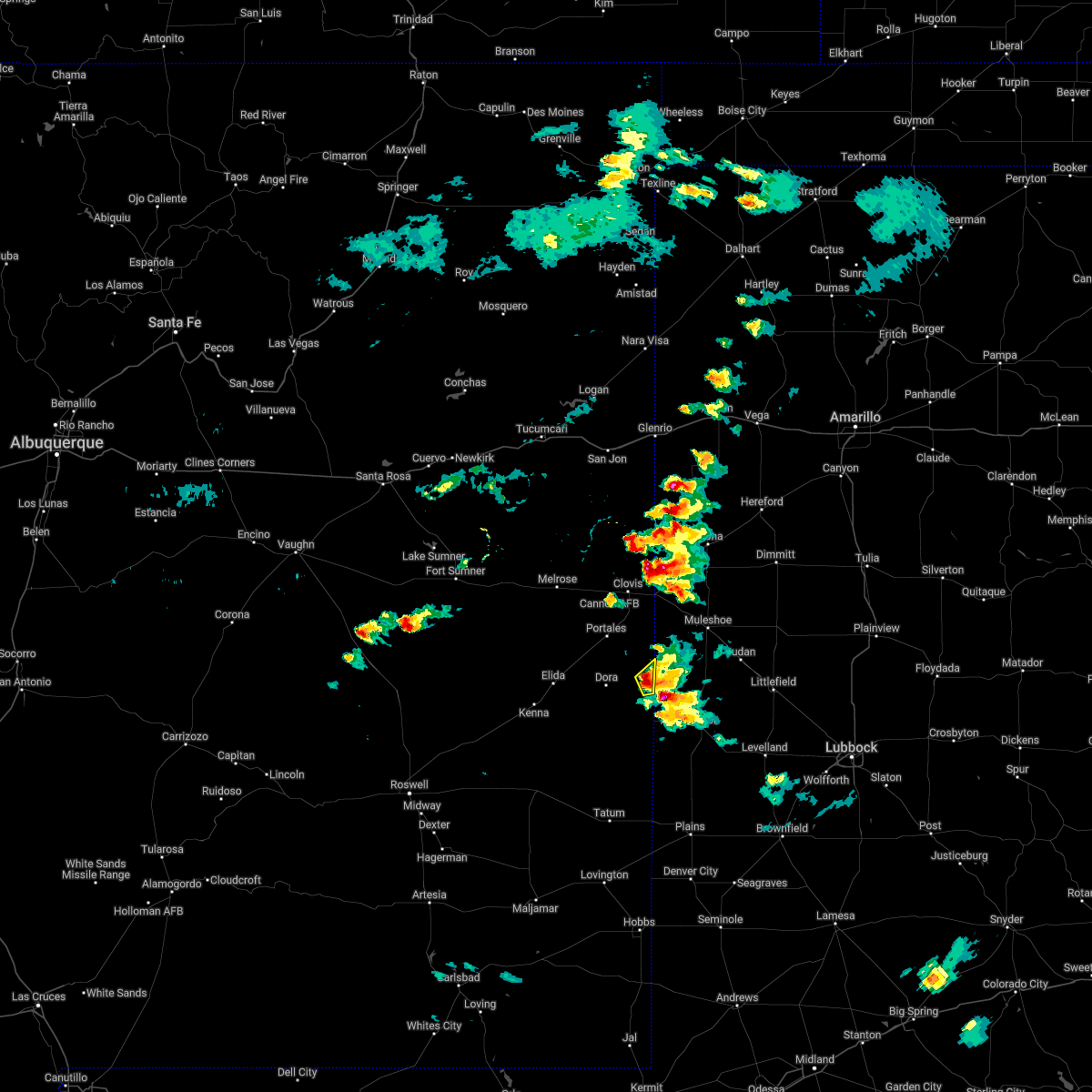 At 458 pm mdt, a severe thunderstorm was located 7 miles northeast of causey, or 21 miles southeast of portales, moving northeast at 20 mph (radar indicated). Hazards include 60 mph wind gusts and quarter size hail. Hail damage to vehicles is expected. expect wind damage to roofs, siding, and trees. locations impacted include, causey. hail threat, radar indicated max hail size, 1. 00 in wind threat, radar indicated max wind gust, 60 mph. At 458 pm mdt, a severe thunderstorm was located 7 miles northeast of causey, or 21 miles southeast of portales, moving northeast at 20 mph (radar indicated). Hazards include 60 mph wind gusts and quarter size hail. Hail damage to vehicles is expected. expect wind damage to roofs, siding, and trees. locations impacted include, causey. hail threat, radar indicated max hail size, 1. 00 in wind threat, radar indicated max wind gust, 60 mph.
|
| 5/23/2022 5:45 PM CDT | Golf Ball sized hail reported 6.4 miles NW of Causey, NM |
| 5/23/2022 4:44 PM MDT |
 At 444 pm mdt, a severe thunderstorm was located near causey, or 20 miles southeast of portales, moving northeast at 20 mph (radar indicated). Hazards include 60 mph wind gusts and quarter size hail. Hail damage to vehicles is expected. Expect wind damage to roofs, siding, and trees. At 444 pm mdt, a severe thunderstorm was located near causey, or 20 miles southeast of portales, moving northeast at 20 mph (radar indicated). Hazards include 60 mph wind gusts and quarter size hail. Hail damage to vehicles is expected. Expect wind damage to roofs, siding, and trees.
|
| 5/23/2022 4:41 PM MDT | Golf Ball sized hail reported 6.5 miles SE of Causey, NM, report from mping: golf ball (1.75 in.). |
| 5/23/2022 4:39 PM MDT | Quarter sized hail reported 5.9 miles SSE of Causey, NM, report from mping: quarter (1.00 in.). |
| 5/23/2022 4:37 PM MDT |
 At 437 pm mdt, a severe thunderstorm was located near causey, or 20 miles southeast of portales, moving northeast at 20 mph (radar indicated). Hazards include 60 mph wind gusts and half dollar size hail. Hail damage to vehicles is expected. expect wind damage to roofs, siding, and trees. locations impacted include, causey and rogers. hail threat, radar indicated max hail size, 1. 25 in wind threat, radar indicated max wind gust, 60 mph. At 437 pm mdt, a severe thunderstorm was located near causey, or 20 miles southeast of portales, moving northeast at 20 mph (radar indicated). Hazards include 60 mph wind gusts and half dollar size hail. Hail damage to vehicles is expected. expect wind damage to roofs, siding, and trees. locations impacted include, causey and rogers. hail threat, radar indicated max hail size, 1. 25 in wind threat, radar indicated max wind gust, 60 mph.
|
| 5/23/2022 4:12 PM MDT |
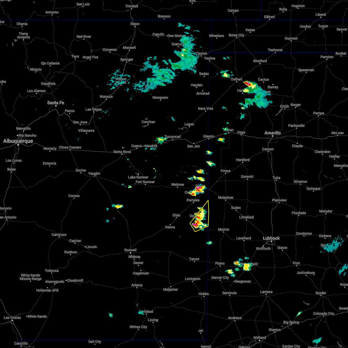 At 412 pm mdt, a severe thunderstorm was located near pep, or 22 miles south of portales, moving northeast at 25 mph (radar indicated). Hazards include golf ball size hail and 70 mph wind gusts. People and animals outdoors will be injured. expect hail damage to roofs, siding, windows, and vehicles. expect considerable tree damage. wind damage is also likely to mobile homes, roofs, and outbuildings. locations impacted include, dora, causey, arch, pep and rogers. thunderstorm damage threat, considerable hail threat, radar indicated max hail size, 1. 75 in wind threat, radar indicated max wind gust, 70 mph. At 412 pm mdt, a severe thunderstorm was located near pep, or 22 miles south of portales, moving northeast at 25 mph (radar indicated). Hazards include golf ball size hail and 70 mph wind gusts. People and animals outdoors will be injured. expect hail damage to roofs, siding, windows, and vehicles. expect considerable tree damage. wind damage is also likely to mobile homes, roofs, and outbuildings. locations impacted include, dora, causey, arch, pep and rogers. thunderstorm damage threat, considerable hail threat, radar indicated max hail size, 1. 75 in wind threat, radar indicated max wind gust, 70 mph.
|
| 5/23/2022 4:01 PM MDT |
 At 401 pm mdt, a severe thunderstorm was located over pep, or 23 miles south of portales, moving northeast at 25 mph (radar indicated). Hazards include 60 mph wind gusts and half dollar size hail. Hail damage to vehicles is expected. Expect wind damage to roofs, siding, and trees. At 401 pm mdt, a severe thunderstorm was located over pep, or 23 miles south of portales, moving northeast at 25 mph (radar indicated). Hazards include 60 mph wind gusts and half dollar size hail. Hail damage to vehicles is expected. Expect wind damage to roofs, siding, and trees.
|
| 5/1/2022 4:19 PM MDT |
 At 418 pm mdt, a severe thunderstorm was located near maple, or 17 miles northwest of morton, moving northeast at 45 mph (radar indicated). Hazards include 60 mph wind gusts and half dollar size hail. Hail damage to vehicles is expected. expect wind damage to roofs, siding, and trees. locations impacted include, causey and lingo. hail threat, radar indicated max hail size, 1. 25 in wind threat, radar indicated max wind gust, 60 mph. At 418 pm mdt, a severe thunderstorm was located near maple, or 17 miles northwest of morton, moving northeast at 45 mph (radar indicated). Hazards include 60 mph wind gusts and half dollar size hail. Hail damage to vehicles is expected. expect wind damage to roofs, siding, and trees. locations impacted include, causey and lingo. hail threat, radar indicated max hail size, 1. 25 in wind threat, radar indicated max wind gust, 60 mph.
|
| 5/1/2022 4:02 PM MDT |
 At 402 pm mdt, a severe thunderstorm was located near lingo, or 19 miles west of morton, moving northeast at 45 mph (radar indicated). Hazards include 60 mph wind gusts and half dollar size hail. Hail damage to vehicles is expected. Expect wind damage to roofs, siding, and trees. At 402 pm mdt, a severe thunderstorm was located near lingo, or 19 miles west of morton, moving northeast at 45 mph (radar indicated). Hazards include 60 mph wind gusts and half dollar size hail. Hail damage to vehicles is expected. Expect wind damage to roofs, siding, and trees.
|
| 7/26/2021 2:52 PM MDT |
 At 251 pm mdt, a severe thunderstorm was located near arch, or 18 miles southeast of portales, moving northeast at 5 mph (radar indicated). Hazards include 60 mph wind gusts and quarter size hail. Hail damage to vehicles is expected. Expect wind damage to roofs, siding, and trees. At 251 pm mdt, a severe thunderstorm was located near arch, or 18 miles southeast of portales, moving northeast at 5 mph (radar indicated). Hazards include 60 mph wind gusts and quarter size hail. Hail damage to vehicles is expected. Expect wind damage to roofs, siding, and trees.
|
| 7/26/2021 2:49 PM MDT |
 At 249 pm mdt, a severe thunderstorm was located near pep, or 30 miles south of portales, moving northeast at 5 mph (radar indicated). Hazards include 60 mph wind gusts and quarter size hail. Hail damage to vehicles is expected. Expect wind damage to roofs, siding, and trees. At 249 pm mdt, a severe thunderstorm was located near pep, or 30 miles south of portales, moving northeast at 5 mph (radar indicated). Hazards include 60 mph wind gusts and quarter size hail. Hail damage to vehicles is expected. Expect wind damage to roofs, siding, and trees.
|
| 7/5/2021 1:13 AM MDT |
 At 112 am mdt, severe thunderstorms were located along a line extending from 12 miles northwest of elkins to 12 miles southeast of kenna to near causey, moving south at 35 mph (radar indicated). Hazards include 60 mph wind gusts. Expect damage to roofs, siding, and trees. Locations impacted include, elida, dora, causey, milnesand, kenna, elkins, lingo, arch, pep and rogers. At 112 am mdt, severe thunderstorms were located along a line extending from 12 miles northwest of elkins to 12 miles southeast of kenna to near causey, moving south at 35 mph (radar indicated). Hazards include 60 mph wind gusts. Expect damage to roofs, siding, and trees. Locations impacted include, elida, dora, causey, milnesand, kenna, elkins, lingo, arch, pep and rogers.
|
| 7/5/2021 12:47 AM MDT |
 At 1245 am mdt, severe thunderstorms were located along a line extending from 23 miles northwest of elkins to near elida to 6 miles southeast of arch, moving south at 40 mph (radar indicated). Hazards include 60 to 70 mph wind gusts. Expect damage to roofs, siding, and trees. Locations impacted include, portales, elida, dora, causey, milnesand, kenna, elkins, lingo, arch and pep. At 1245 am mdt, severe thunderstorms were located along a line extending from 23 miles northwest of elkins to near elida to 6 miles southeast of arch, moving south at 40 mph (radar indicated). Hazards include 60 to 70 mph wind gusts. Expect damage to roofs, siding, and trees. Locations impacted include, portales, elida, dora, causey, milnesand, kenna, elkins, lingo, arch and pep.
|
| 7/5/2021 12:24 AM MDT |
 At 1223 am mdt, severe thunderstorms were located along a line extending from 19 miles south of fort sumner to 9 miles north of elida to near west camp, moving south at 35 mph (radar indicated). Hazards include 70 mph wind gusts. Expect considerable tree damage. Damage is likely to mobile homes, roofs, and outbuildings. At 1223 am mdt, severe thunderstorms were located along a line extending from 19 miles south of fort sumner to 9 miles north of elida to near west camp, moving south at 35 mph (radar indicated). Hazards include 70 mph wind gusts. Expect considerable tree damage. Damage is likely to mobile homes, roofs, and outbuildings.
|
| 6/26/2021 6:43 PM MDT |
 At 643 pm mdt, a severe thunderstorm was located over causey, or 22 miles northwest of morton, moving east at 15 mph (radar indicated). Hazards include 60 mph wind gusts and quarter size hail. Hail damage to vehicles is expected. Expect wind damage to roofs, siding, and trees. At 643 pm mdt, a severe thunderstorm was located over causey, or 22 miles northwest of morton, moving east at 15 mph (radar indicated). Hazards include 60 mph wind gusts and quarter size hail. Hail damage to vehicles is expected. Expect wind damage to roofs, siding, and trees.
|
| 6/26/2021 6:20 PM MDT |
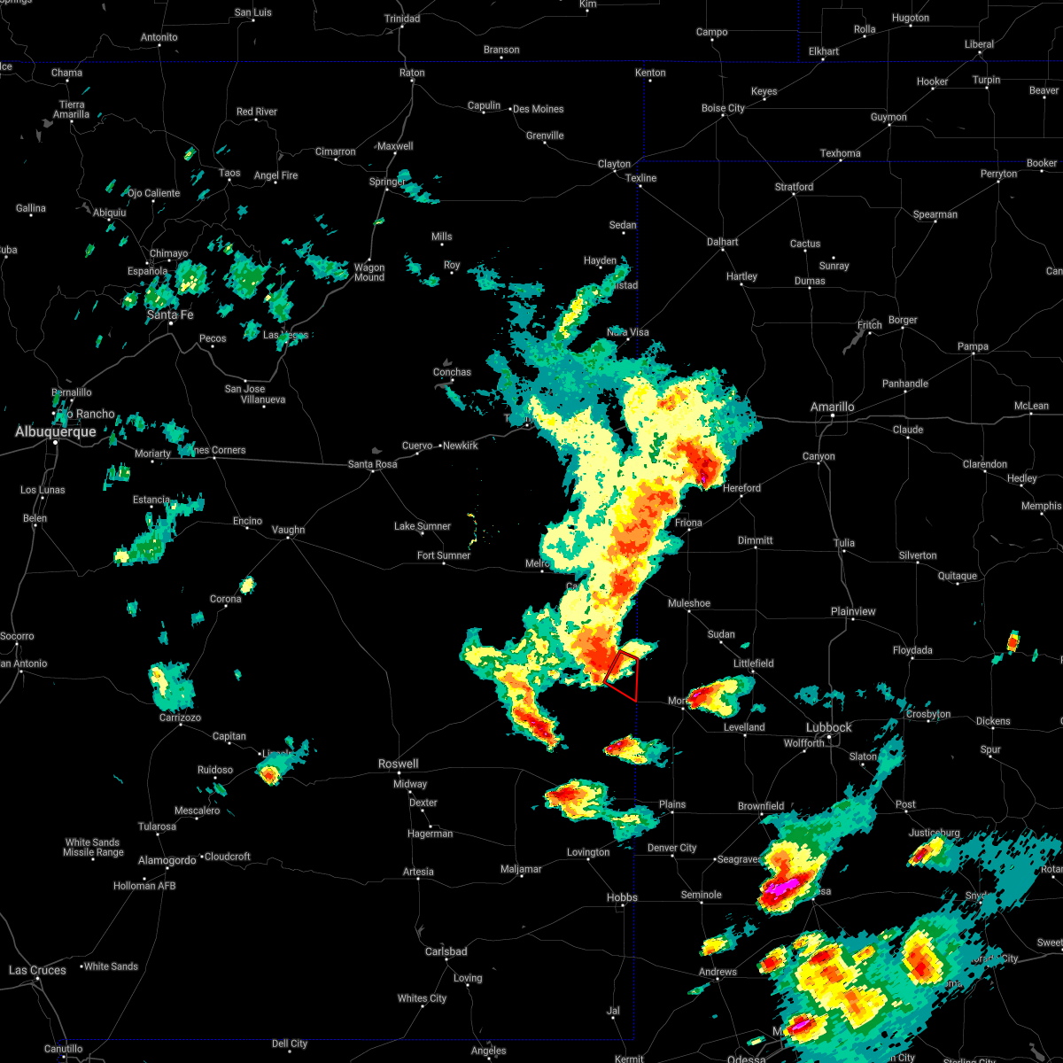 At 620 pm mdt, a severe thunderstorm capable of producing a tornado was located over causey, or 22 miles southeast of portales, moving southeast at 35 mph. this is near causey (radar indicated rotation). Hazards include tornado. Flying debris will be dangerous to those caught without shelter. mobile homes will be damaged or destroyed. damage to roofs, windows, and vehicles will occur. tree damage is likely. This tornadic thunderstorm will remain over mainly rural areas of east central roosevelt county. At 620 pm mdt, a severe thunderstorm capable of producing a tornado was located over causey, or 22 miles southeast of portales, moving southeast at 35 mph. this is near causey (radar indicated rotation). Hazards include tornado. Flying debris will be dangerous to those caught without shelter. mobile homes will be damaged or destroyed. damage to roofs, windows, and vehicles will occur. tree damage is likely. This tornadic thunderstorm will remain over mainly rural areas of east central roosevelt county.
|
| 6/26/2021 6:07 PM MDT |
 At 606 pm mdt, severe thunderstorms were located along a line extending from near rhea to 8 miles north of farwell to 7 miles southeast of clovis to 8 miles east of portales to 8 miles southwest of arch to near dora, moving southeast at 35 mph. cannon air force base reported a wind gust of 61 mph at 555 pm mdt (radar indicated). Hazards include 60 mph wind gusts and penny size hail. Expect damage to roofs, siding, and trees. locations impacted include, clovis, portales, texico, dora, floyd, causey, ranchvale, arch, oasis state park and cannon air force base. This includes highway 60 between mile markers 377 and 397. At 606 pm mdt, severe thunderstorms were located along a line extending from near rhea to 8 miles north of farwell to 7 miles southeast of clovis to 8 miles east of portales to 8 miles southwest of arch to near dora, moving southeast at 35 mph. cannon air force base reported a wind gust of 61 mph at 555 pm mdt (radar indicated). Hazards include 60 mph wind gusts and penny size hail. Expect damage to roofs, siding, and trees. locations impacted include, clovis, portales, texico, dora, floyd, causey, ranchvale, arch, oasis state park and cannon air force base. This includes highway 60 between mile markers 377 and 397.
|
| 6/26/2021 5:43 PM MDT |
 At 543 pm mdt, severe thunderstorms were located along a line extending from near bellview to 10 miles northeast of ranchvale to near cannon air force base to near oasis state park to 6 miles south of portales to 6 miles west of dora, moving southeast at 35 mph (radar indicated). Hazards include 70 mph wind gusts and penny size hail. Expect considerable tree damage. Damage is likely to mobile homes, roofs, and outbuildings. At 543 pm mdt, severe thunderstorms were located along a line extending from near bellview to 10 miles northeast of ranchvale to near cannon air force base to near oasis state park to 6 miles south of portales to 6 miles west of dora, moving southeast at 35 mph (radar indicated). Hazards include 70 mph wind gusts and penny size hail. Expect considerable tree damage. Damage is likely to mobile homes, roofs, and outbuildings.
|
| 6/12/2021 9:52 PM MDT |
 The severe thunderstorm warning for roosevelt, northeastern chaves and southeastern curry counties will expire at 1000 pm mdt, the storms which prompted the warning have weakened below severe limits, and no longer pose an immediate threat to life or property. therefore, the warning will be allowed to expire. however heavy rain is still possible with these thunderstorms. a severe thunderstorm watch remains in effect until 1000 pm mdt for southeastern and east central new mexico. The severe thunderstorm warning for roosevelt, northeastern chaves and southeastern curry counties will expire at 1000 pm mdt, the storms which prompted the warning have weakened below severe limits, and no longer pose an immediate threat to life or property. therefore, the warning will be allowed to expire. however heavy rain is still possible with these thunderstorms. a severe thunderstorm watch remains in effect until 1000 pm mdt for southeastern and east central new mexico.
|
| 6/12/2021 9:24 PM MDT |
 At 923 pm mdt, severe thunderstorms were located along a line extending from near cannon air force base to near dora to 12 miles south of kenna, moving southeast at 30 mph (radar indicated). Hazards include 60 mph wind gusts and half dollar size hail. Hail damage to vehicles is expected. Expect wind damage to roofs, siding, and trees. At 923 pm mdt, severe thunderstorms were located along a line extending from near cannon air force base to near dora to 12 miles south of kenna, moving southeast at 30 mph (radar indicated). Hazards include 60 mph wind gusts and half dollar size hail. Hail damage to vehicles is expected. Expect wind damage to roofs, siding, and trees.
|
| 6/12/2021 8:35 PM MDT |
 At 835 pm mdt, severe thunderstorms were located along a line extending from near melrose to 12 miles north of elida to 8 miles north of elkins, moving southeast at 30 mph (radar indicated). Hazards include 60 mph wind gusts and half dollar size hail. Hail damage to vehicles is expected. Expect wind damage to roofs, siding, and trees. At 835 pm mdt, severe thunderstorms were located along a line extending from near melrose to 12 miles north of elida to 8 miles north of elkins, moving southeast at 30 mph (radar indicated). Hazards include 60 mph wind gusts and half dollar size hail. Hail damage to vehicles is expected. Expect wind damage to roofs, siding, and trees.
|
| 6/6/2021 6:36 PM MDT |
 At 635 pm mdt, severe wind gusts from decaying thunderstorms were located along a line extending from near broadview to 9 miles southwest of portales, moving east at 30 mph (radar indicated). Hazards include 60 mph wind gusts. expect damage to roofs, siding, and trees At 635 pm mdt, severe wind gusts from decaying thunderstorms were located along a line extending from near broadview to 9 miles southwest of portales, moving east at 30 mph (radar indicated). Hazards include 60 mph wind gusts. expect damage to roofs, siding, and trees
|
| 6/2/2021 7:58 PM MDT |
 At 758 pm mdt, a severe thunderstorm was located near milnesand, or 27 miles north of tatum, moving northeast at 30 mph (radar indicated). Hazards include 60 mph wind gusts and half dollar size hail. Hail damage to vehicles is expected. Expect wind damage to roofs, siding, and trees. At 758 pm mdt, a severe thunderstorm was located near milnesand, or 27 miles north of tatum, moving northeast at 30 mph (radar indicated). Hazards include 60 mph wind gusts and half dollar size hail. Hail damage to vehicles is expected. Expect wind damage to roofs, siding, and trees.
|
| 6/1/2021 11:59 PM MDT |
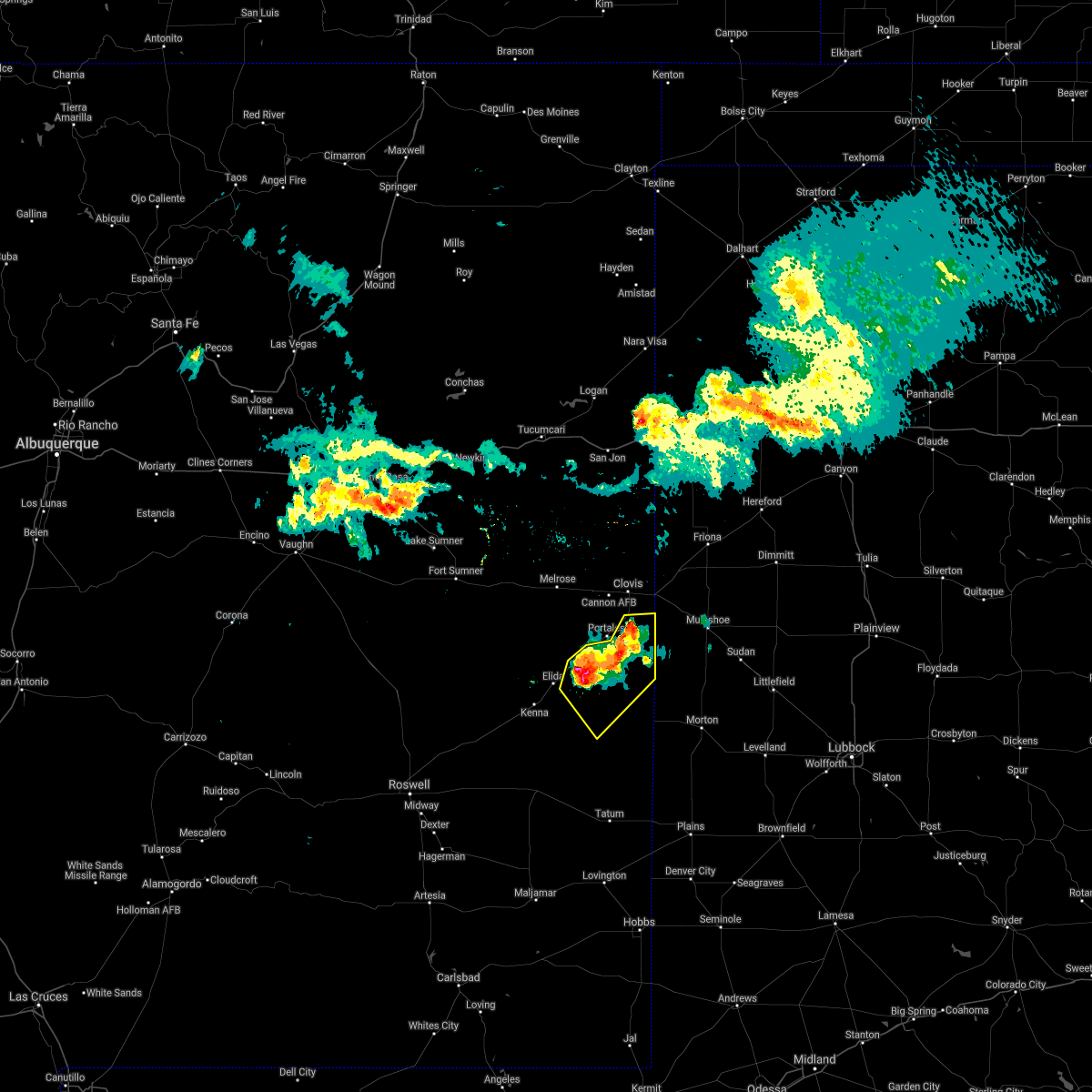 At 1159 pm mdt, severe thunderstorms were located along a line extending from 8 miles north of arch to 8 miles east of elida, moving southeast at 25 mph (radar indicated). Hazards include 60 mph wind gusts and penny size hail. Expect damage to roofs, siding, and trees. Locations impacted include, portales, dora, causey, arch, pep and rogers. At 1159 pm mdt, severe thunderstorms were located along a line extending from 8 miles north of arch to 8 miles east of elida, moving southeast at 25 mph (radar indicated). Hazards include 60 mph wind gusts and penny size hail. Expect damage to roofs, siding, and trees. Locations impacted include, portales, dora, causey, arch, pep and rogers.
|
| 6/1/2021 11:47 PM MDT |
 At 1146 pm mdt, severe thunderstorms were located along a line extending from 7 miles east of oasis state park to 6 miles northeast of elida, moving southeast at 25 mph (radar indicated). Hazards include 60 mph wind gusts and penny size hail. Expect damage to roofs, siding, and trees. Locations impacted include, portales, dora, causey, arch, pep and rogers. At 1146 pm mdt, severe thunderstorms were located along a line extending from 7 miles east of oasis state park to 6 miles northeast of elida, moving southeast at 25 mph (radar indicated). Hazards include 60 mph wind gusts and penny size hail. Expect damage to roofs, siding, and trees. Locations impacted include, portales, dora, causey, arch, pep and rogers.
|
| 6/1/2021 11:38 PM MDT |
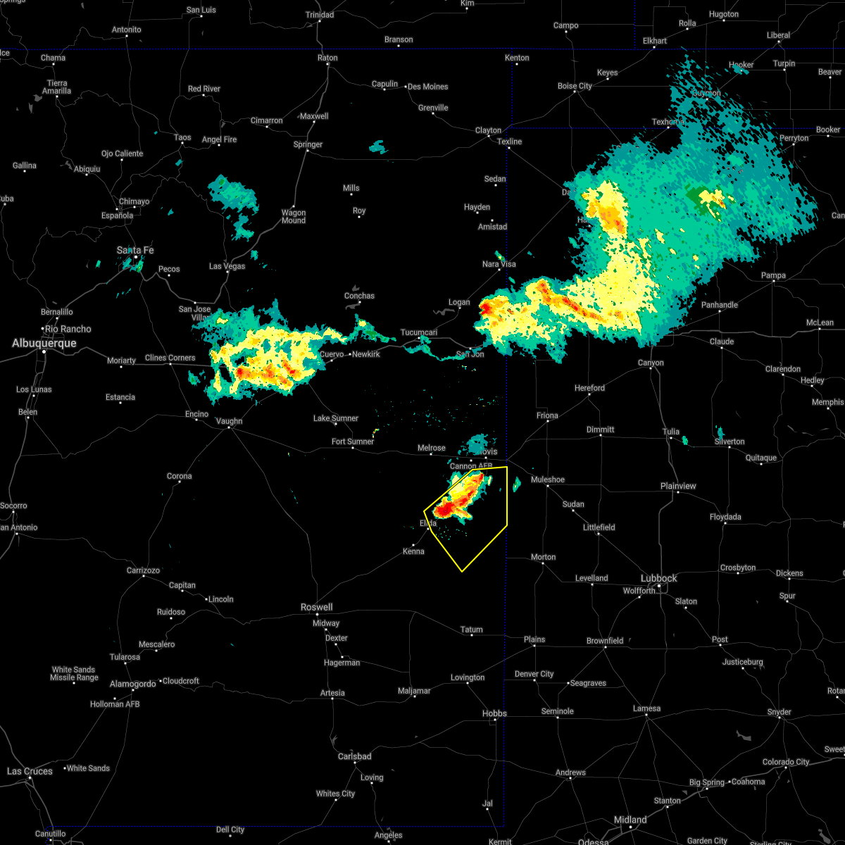 At 1137 pm mdt, severe thunderstorms were located along a line extending from 6 miles east of oasis state park to 6 miles northeast of elida, moving southeast at 30 mph (radar indicated). Hazards include 60 mph wind gusts and penny size hail. Expect damage to roofs, siding, and trees. Locations impacted include, portales, dora, causey, arch, pep, oasis state park and rogers. At 1137 pm mdt, severe thunderstorms were located along a line extending from 6 miles east of oasis state park to 6 miles northeast of elida, moving southeast at 30 mph (radar indicated). Hazards include 60 mph wind gusts and penny size hail. Expect damage to roofs, siding, and trees. Locations impacted include, portales, dora, causey, arch, pep, oasis state park and rogers.
|
| 6/1/2021 11:16 PM MDT |
 At 1116 pm mdt, severe thunderstorms were located along a line extending from near saint vrain to 14 miles north of elida, moving southeast at 25 mph (radar indicated). Hazards include 60 mph wind gusts. expect damage to roofs, siding, and trees At 1116 pm mdt, severe thunderstorms were located along a line extending from near saint vrain to 14 miles north of elida, moving southeast at 25 mph (radar indicated). Hazards include 60 mph wind gusts. expect damage to roofs, siding, and trees
|
| 5/30/2021 7:29 PM MDT | Quarter sized hail reported 16.6 miles NNE of Causey, NM, mostly nickels... but a few quarter size stones. |
| 5/30/2021 7:26 PM MDT |
 At 723 pm mdt, a severe thunderstorm was located 13 miles east of milnesand moving northeast at 15 mph (radar indicated). Hazards include 60 mph wind gusts and half dollar size hail. Hail damage to vehicles is expected. Expect wind damage to roofs, siding, and trees. At 723 pm mdt, a severe thunderstorm was located 13 miles east of milnesand moving northeast at 15 mph (radar indicated). Hazards include 60 mph wind gusts and half dollar size hail. Hail damage to vehicles is expected. Expect wind damage to roofs, siding, and trees.
|
| 5/30/2021 6:25 PM MDT |
 At 624 pm mdt, a severe thunderstorm was located near bledsoe, or 22 miles southwest of morton, moving northeast at 15 mph (radar indicated). Hazards include ping pong ball size hail and 60 mph wind gusts. People and animals outdoors will be injured. expect hail damage to roofs, siding, windows, and vehicles. Expect wind damage to roofs, siding, and trees. At 624 pm mdt, a severe thunderstorm was located near bledsoe, or 22 miles southwest of morton, moving northeast at 15 mph (radar indicated). Hazards include ping pong ball size hail and 60 mph wind gusts. People and animals outdoors will be injured. expect hail damage to roofs, siding, windows, and vehicles. Expect wind damage to roofs, siding, and trees.
|
| 5/30/2021 5:41 PM MDT |
 At 541 pm mdt, a severe thunderstorm was located 7 miles southwest of lingo, or 26 miles west of morton, moving northeast at 25 mph (radar indicated). Hazards include 60 mph wind gusts and quarter size hail. Hail damage to vehicles is expected. expect wind damage to roofs, siding, and trees. Locations impacted include, causey, milnesand and lingo. At 541 pm mdt, a severe thunderstorm was located 7 miles southwest of lingo, or 26 miles west of morton, moving northeast at 25 mph (radar indicated). Hazards include 60 mph wind gusts and quarter size hail. Hail damage to vehicles is expected. expect wind damage to roofs, siding, and trees. Locations impacted include, causey, milnesand and lingo.
|
| 5/30/2021 5:15 PM MDT |
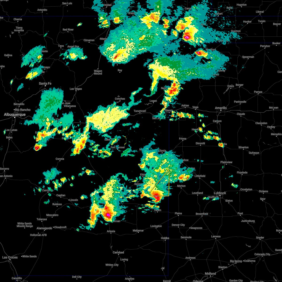 At 514 pm mdt, a severe thunderstorm was located over milnesand, or 24 miles north of tatum, moving northeast at 25 mph (radar indicated). Hazards include 60 mph wind gusts and half dollar size hail. Hail damage to vehicles is expected. Expect wind damage to roofs, siding, and trees. At 514 pm mdt, a severe thunderstorm was located over milnesand, or 24 miles north of tatum, moving northeast at 25 mph (radar indicated). Hazards include 60 mph wind gusts and half dollar size hail. Hail damage to vehicles is expected. Expect wind damage to roofs, siding, and trees.
|
| 5/28/2021 7:35 PM MDT |
 At 735 pm mdt, severe thunderstorms were located along a line extending from 7 miles southeast of muleshoe to 18 miles northwest of maljamar, moving southeast at 40 mph (radar indicated). Hazards include 60 mph wind gusts and nickel size hail. Expect damage to roofs, siding, and trees. locations impacted include, clovis, farwell, texico, dora, causey, milnesand, lingo, arch, pep and rogers. This includes highway 60 between mile markers 390 and 397. At 735 pm mdt, severe thunderstorms were located along a line extending from 7 miles southeast of muleshoe to 18 miles northwest of maljamar, moving southeast at 40 mph (radar indicated). Hazards include 60 mph wind gusts and nickel size hail. Expect damage to roofs, siding, and trees. locations impacted include, clovis, farwell, texico, dora, causey, milnesand, lingo, arch, pep and rogers. This includes highway 60 between mile markers 390 and 397.
|
| 5/28/2021 7:06 PM MDT |
 At 705 pm mdt, severe thunderstorms were located along a line extending from near oklahoma lane to 14 miles east of bottomless lakes state park, moving southeast at 40 mph (radar indicated). Hazards include 60 mph wind gusts and quarter size hail. Hail damage to vehicles is expected. expect wind damage to roofs, siding, and trees. locations impacted include, clovis, portales, farwell, texico, elida, dora, causey, milnesand, arch and oasis state park. this includes the following highways, highway 60 between mile markers 390 and 397. Highway 380 between mile markers 176 and 200. At 705 pm mdt, severe thunderstorms were located along a line extending from near oklahoma lane to 14 miles east of bottomless lakes state park, moving southeast at 40 mph (radar indicated). Hazards include 60 mph wind gusts and quarter size hail. Hail damage to vehicles is expected. expect wind damage to roofs, siding, and trees. locations impacted include, clovis, portales, farwell, texico, elida, dora, causey, milnesand, arch and oasis state park. this includes the following highways, highway 60 between mile markers 390 and 397. Highway 380 between mile markers 176 and 200.
|
| 5/28/2021 6:43 PM MDT |
 The national weather service in albuquerque has issued a * severe thunderstorm warning for. roosevelt county in east central new mexico. northeastern chaves county in southeastern new mexico. southeastern curry county in east central new mexico. Until 745 pm mdt. The national weather service in albuquerque has issued a * severe thunderstorm warning for. roosevelt county in east central new mexico. northeastern chaves county in southeastern new mexico. southeastern curry county in east central new mexico. Until 745 pm mdt.
|
| 5/26/2021 6:47 PM MDT |
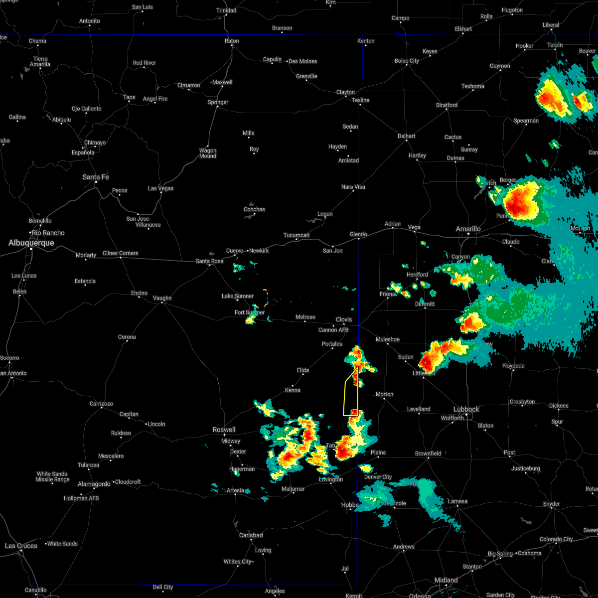 At 647 pm mdt, a severe thunderstorm was located near bledsoe, or 18 miles west of morton, moving northeast at 40 mph (radar indicated). Hazards include 60 mph wind gusts and penny size hail. Expect damage to roofs, siding, and trees. Locations impacted include, causey and lingo. At 647 pm mdt, a severe thunderstorm was located near bledsoe, or 18 miles west of morton, moving northeast at 40 mph (radar indicated). Hazards include 60 mph wind gusts and penny size hail. Expect damage to roofs, siding, and trees. Locations impacted include, causey and lingo.
|
| 5/26/2021 6:33 PM MDT |
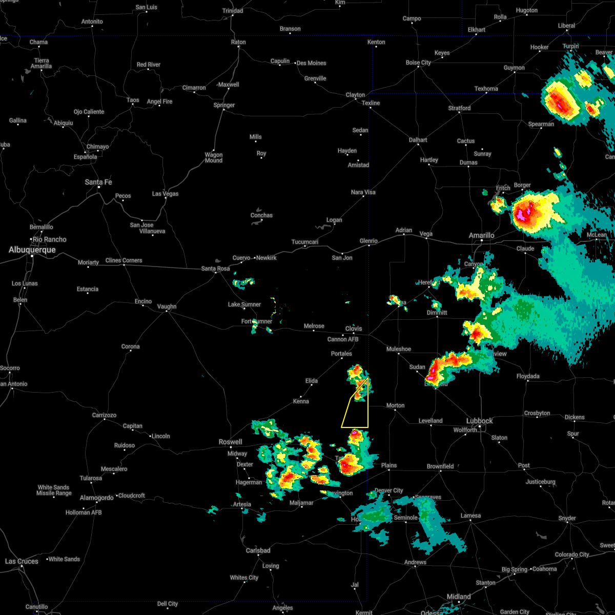 At 633 pm mdt, a severe thunderstorm was located 8 miles east of crossroads, or 21 miles north of tatum, moving northeast at 35 mph (radar indicated). Hazards include 60 mph wind gusts and quarter size hail. Hail damage to vehicles is expected. Expect wind damage to roofs, siding, and trees. At 633 pm mdt, a severe thunderstorm was located 8 miles east of crossroads, or 21 miles north of tatum, moving northeast at 35 mph (radar indicated). Hazards include 60 mph wind gusts and quarter size hail. Hail damage to vehicles is expected. Expect wind damage to roofs, siding, and trees.
|
| 6/22/2020 11:41 PM MDT |
 The severe thunderstorm warning for east central roosevelt county will expire at 1145 pm mdt, the storm which prompted the warning has weakened below severe limits, and has exited the warned area. therefore the warning will be allowed to expire. The severe thunderstorm warning for east central roosevelt county will expire at 1145 pm mdt, the storm which prompted the warning has weakened below severe limits, and has exited the warned area. therefore the warning will be allowed to expire.
|
| 6/22/2020 11:33 PM MDT |
 At 1132 pm mdt, a severe thunderstorm was located 7 miles southeast of arch, or 18 miles southeast of portales, moving east at 30 mph (radar indicated). Hazards include 60 mph wind gusts and quarter size hail. Hail damage to vehicles is expected. expect wind damage to roofs, siding, and trees. Locations impacted include, causey and arch. At 1132 pm mdt, a severe thunderstorm was located 7 miles southeast of arch, or 18 miles southeast of portales, moving east at 30 mph (radar indicated). Hazards include 60 mph wind gusts and quarter size hail. Hail damage to vehicles is expected. expect wind damage to roofs, siding, and trees. Locations impacted include, causey and arch.
|
| 6/22/2020 11:19 PM MDT |
 At 1118 pm mdt, a severe thunderstorm was located near arch, or 12 miles east of portales, moving southeast at 35 mph (radar indicated). Hazards include 60 mph wind gusts and quarter size hail. Hail damage to vehicles is expected. Expect wind damage to roofs, siding, and trees. At 1118 pm mdt, a severe thunderstorm was located near arch, or 12 miles east of portales, moving southeast at 35 mph (radar indicated). Hazards include 60 mph wind gusts and quarter size hail. Hail damage to vehicles is expected. Expect wind damage to roofs, siding, and trees.
|
| 6/22/2020 9:39 PM MDT |
 The severe thunderstorm warning for southeastern roosevelt county will expire at 945 pm mdt, the storm which prompted the warning has weakened below severe limits, and no longer poses an immediate threat to life or property. therefore, the warning will be allowed to expire. The severe thunderstorm warning for southeastern roosevelt county will expire at 945 pm mdt, the storm which prompted the warning has weakened below severe limits, and no longer poses an immediate threat to life or property. therefore, the warning will be allowed to expire.
|
| 6/22/2020 9:22 PM MDT |
 At 922 pm mdt, a severe thunderstorm was located near causey, or 20 miles northwest of morton, moving southeast at 20 mph (radar indicated). Hazards include 60 mph wind gusts and quarter size hail. Hail damage to vehicles is expected. expect wind damage to roofs, siding, and trees. Locations impacted include, dora, causey, milnesand, lingo, pep and rogers. At 922 pm mdt, a severe thunderstorm was located near causey, or 20 miles northwest of morton, moving southeast at 20 mph (radar indicated). Hazards include 60 mph wind gusts and quarter size hail. Hail damage to vehicles is expected. expect wind damage to roofs, siding, and trees. Locations impacted include, dora, causey, milnesand, lingo, pep and rogers.
|
| 6/22/2020 9:15 PM MDT | Quarter sized hail reported 1.7 miles S of Causey, NM |
| 6/22/2020 8:43 PM MDT |
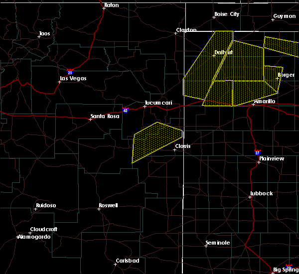 At 841 pm mdt, a severe thunderstorm was located near arch, or 11 miles southeast of portales, moving southeast at 20 mph (at 813 pm mdt trained storm spotters reported tennis ball sized hail). Hazards include tennis ball size hail and 60 mph wind gusts. People and animals outdoors will be injured. expect hail damage to roofs, siding, windows, and vehicles. Expect wind damage to roofs, siding, and trees. At 841 pm mdt, a severe thunderstorm was located near arch, or 11 miles southeast of portales, moving southeast at 20 mph (at 813 pm mdt trained storm spotters reported tennis ball sized hail). Hazards include tennis ball size hail and 60 mph wind gusts. People and animals outdoors will be injured. expect hail damage to roofs, siding, windows, and vehicles. Expect wind damage to roofs, siding, and trees.
|
| 6/22/2020 8:29 PM MDT |
 At 828 pm mdt, a severe thunderstorm was located near arch, or 7 miles southeast of portales, moving southeast at 20 mph (at 813 pm mdt trained weather spotters reported 2 and one quarter inch diameter hail just east of portales). Hazards include tennis ball size hail and 60 mph wind gusts. People and animals outdoors will be injured. expect hail damage to roofs, siding, windows, and vehicles. expect wind damage to roofs, siding, and trees. Locations impacted include, portales, dora, causey, lingo, arch, pep and rogers. At 828 pm mdt, a severe thunderstorm was located near arch, or 7 miles southeast of portales, moving southeast at 20 mph (at 813 pm mdt trained weather spotters reported 2 and one quarter inch diameter hail just east of portales). Hazards include tennis ball size hail and 60 mph wind gusts. People and animals outdoors will be injured. expect hail damage to roofs, siding, windows, and vehicles. expect wind damage to roofs, siding, and trees. Locations impacted include, portales, dora, causey, lingo, arch, pep and rogers.
|
| 6/22/2020 8:22 PM MDT |
 At 820 pm mdt, a severe thunderstorm was located near arch, or 7 miles southeast of portales, moving southeast at 25 mph (at 811 pm mdt half dollar sized hail was reported by trained weather spotters in portales). Hazards include 60 mph wind gusts and half dollar size hail. Hail damage to vehicles is expected. expect wind damage to roofs, siding, and trees. Locations impacted include, portales, dora, causey, lingo, arch, pep and rogers. At 820 pm mdt, a severe thunderstorm was located near arch, or 7 miles southeast of portales, moving southeast at 25 mph (at 811 pm mdt half dollar sized hail was reported by trained weather spotters in portales). Hazards include 60 mph wind gusts and half dollar size hail. Hail damage to vehicles is expected. expect wind damage to roofs, siding, and trees. Locations impacted include, portales, dora, causey, lingo, arch, pep and rogers.
|
| 6/22/2020 7:50 PM MDT |
 At 750 pm mdt, a severe thunderstorm was located over oasis state park, or near portales, moving southeast at 25 mph (radar indicated). Hazards include ping pong ball size hail and 60 mph wind gusts. People and animals outdoors will be injured. expect hail damage to roofs, siding, windows, and vehicles. Expect wind damage to roofs, siding, and trees. At 750 pm mdt, a severe thunderstorm was located over oasis state park, or near portales, moving southeast at 25 mph (radar indicated). Hazards include ping pong ball size hail and 60 mph wind gusts. People and animals outdoors will be injured. expect hail damage to roofs, siding, windows, and vehicles. Expect wind damage to roofs, siding, and trees.
|
| 3/17/2020 6:26 AM MDT |
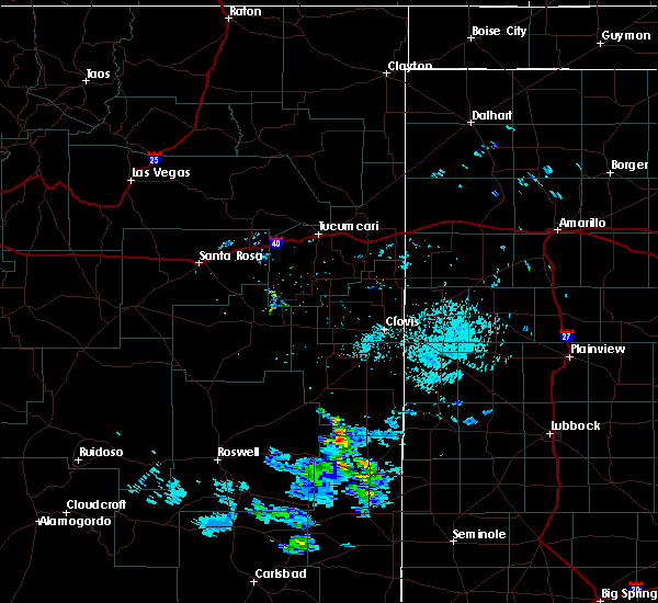 At 626 am mdt, a severe thunderstorm was located near lingo, or 23 miles west of morton, moving northeast at 40 mph (radar indicated). Hazards include 60 mph wind gusts and half dollar size hail. Hail damage to vehicles is expected. Expect wind damage to roofs, siding, and trees. At 626 am mdt, a severe thunderstorm was located near lingo, or 23 miles west of morton, moving northeast at 40 mph (radar indicated). Hazards include 60 mph wind gusts and half dollar size hail. Hail damage to vehicles is expected. Expect wind damage to roofs, siding, and trees.
|
| 9/28/2019 7:50 PM MDT |
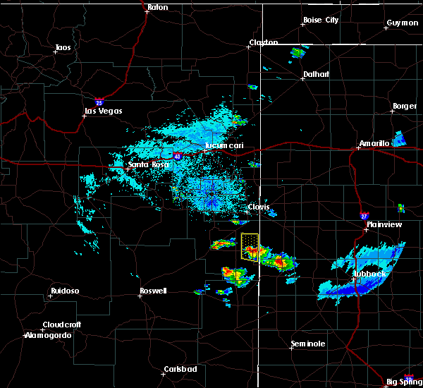 At 750 pm mdt, a severe thunderstorm was located near causey, or 20 miles southeast of portales, moving north at 50 mph (radar indicated). Hazards include 60 mph wind gusts and penny size hail. Expect damage to roofs, siding, and trees. Locations impacted include, causey, arch and rogers. At 750 pm mdt, a severe thunderstorm was located near causey, or 20 miles southeast of portales, moving north at 50 mph (radar indicated). Hazards include 60 mph wind gusts and penny size hail. Expect damage to roofs, siding, and trees. Locations impacted include, causey, arch and rogers.
|
| 9/28/2019 7:40 PM MDT |
 At 740 pm mdt, a severe thunderstorm was located near lingo, or 24 miles west of morton, moving north at 45 mph (radar indicated). Hazards include 60 mph wind gusts and penny size hail. expect damage to roofs, siding, and trees At 740 pm mdt, a severe thunderstorm was located near lingo, or 24 miles west of morton, moving north at 45 mph (radar indicated). Hazards include 60 mph wind gusts and penny size hail. expect damage to roofs, siding, and trees
|
| 8/3/2019 1:58 PM MDT |
 At 157 pm mdt, a severe thunderstorm was located near arch, or 15 miles east of portales, moving south at 25 mph (radar indicated). Hazards include 60 mph wind gusts and half dollar size hail. Hail damage to vehicles is expected. Expect wind damage to roofs, siding, and trees. At 157 pm mdt, a severe thunderstorm was located near arch, or 15 miles east of portales, moving south at 25 mph (radar indicated). Hazards include 60 mph wind gusts and half dollar size hail. Hail damage to vehicles is expected. Expect wind damage to roofs, siding, and trees.
|
| 6/17/2019 7:23 PM MDT |
 The severe thunderstorm warning for east central roosevelt county will expire at 730 pm mdt, the storm which prompted the warning has weakened below severe limits, and no longer poses an immediate threat to life or property. therefore the warning will be allowed to expire. however small hail, gusty winds and heavy rain are still possible with this thunderstorm. minor flooding is likely near and east of arch until around 830 pm. a severe thunderstorm watch remains in effect until 900 pm mdt for east central new mexico. to report severe weather, contact your nearest law enforcement agency. they will relay your report to the national weather service albuquerque. The severe thunderstorm warning for east central roosevelt county will expire at 730 pm mdt, the storm which prompted the warning has weakened below severe limits, and no longer poses an immediate threat to life or property. therefore the warning will be allowed to expire. however small hail, gusty winds and heavy rain are still possible with this thunderstorm. minor flooding is likely near and east of arch until around 830 pm. a severe thunderstorm watch remains in effect until 900 pm mdt for east central new mexico. to report severe weather, contact your nearest law enforcement agency. they will relay your report to the national weather service albuquerque.
|
| 6/17/2019 7:10 PM MDT |
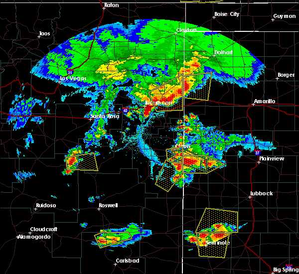 At 710 pm mdt, a severe thunderstorm was located near causey, or 20 miles southeast of portales, moving northeast at 20 mph (radar indicated). Hazards include 60 mph wind gusts and quarter size hail. Hail damage to vehicles is expected. expect wind damage to roofs, siding, and trees. Locations impacted include, causey, arch and rogers. At 710 pm mdt, a severe thunderstorm was located near causey, or 20 miles southeast of portales, moving northeast at 20 mph (radar indicated). Hazards include 60 mph wind gusts and quarter size hail. Hail damage to vehicles is expected. expect wind damage to roofs, siding, and trees. Locations impacted include, causey, arch and rogers.
|
| 6/17/2019 6:37 PM MDT |
 At 636 pm mdt, a severe thunderstorm was located over pep, or 23 miles south of portales, moving northeast at 20 mph. another strengthening thunderstorm was located over rogers, also moving northeast at 20 mph (radar indicated). Hazards include ping pong ball size hail and 60 mph wind gusts. People and animals outdoors will be injured. expect hail damage to roofs, siding, windows, and vehicles. Expect wind damage to roofs, siding, and trees. At 636 pm mdt, a severe thunderstorm was located over pep, or 23 miles south of portales, moving northeast at 20 mph. another strengthening thunderstorm was located over rogers, also moving northeast at 20 mph (radar indicated). Hazards include ping pong ball size hail and 60 mph wind gusts. People and animals outdoors will be injured. expect hail damage to roofs, siding, windows, and vehicles. Expect wind damage to roofs, siding, and trees.
|
| 5/26/2019 7:40 PM MDT |
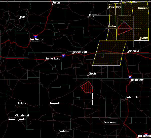 At 740 pm mdt, a confirmed tornado was located near dora, or 17 miles southeast of portales, moving northeast at 35 mph (weather spotters confirmed tornado). Hazards include damaging tornado and ping pong ball size hail. Flying debris will be dangerous to those caught without shelter. mobile homes will be damaged or destroyed. damage to roofs, windows, and vehicles will occur. tree damage is likely. This tornadic thunderstorm will remain over mainly rural areas of east central roosevelt county. At 740 pm mdt, a confirmed tornado was located near dora, or 17 miles southeast of portales, moving northeast at 35 mph (weather spotters confirmed tornado). Hazards include damaging tornado and ping pong ball size hail. Flying debris will be dangerous to those caught without shelter. mobile homes will be damaged or destroyed. damage to roofs, windows, and vehicles will occur. tree damage is likely. This tornadic thunderstorm will remain over mainly rural areas of east central roosevelt county.
|
| 5/26/2019 7:29 PM MDT |
 At 729 pm mdt, a severe thunderstorm capable of producing a tornado was located over dora, or 18 miles south of portales, moving northeast at 40 mph (radar indicated rotation). Hazards include tornado and tennis ball size hail. Flying debris will be dangerous to those caught without shelter. mobile homes will be damaged or destroyed. damage to roofs, windows, and vehicles will occur. tree damage is likely. this dangerous storm will be near, rogers around 740 pm mdt. Arch around 750 pm mdt. At 729 pm mdt, a severe thunderstorm capable of producing a tornado was located over dora, or 18 miles south of portales, moving northeast at 40 mph (radar indicated rotation). Hazards include tornado and tennis ball size hail. Flying debris will be dangerous to those caught without shelter. mobile homes will be damaged or destroyed. damage to roofs, windows, and vehicles will occur. tree damage is likely. this dangerous storm will be near, rogers around 740 pm mdt. Arch around 750 pm mdt.
|
| 5/26/2019 7:26 PM MDT |
 The severe thunderstorm warning for southeastern roosevelt, eastern chaves and southeastern curry counties will expire at 730 pm mdt, the storms which prompted the warning have weakened below severe limits, and no longer pose an immediate threat to life or property. therefore the warning will be allowed to expire. however small hail is still possible with these thunderstorms. a severe thunderstorm watch remains in effect until 900 pm mdt for east central new mexico. remember, a tornado warning remains in effect for southern roosevelt county until 800 pm mdt. The severe thunderstorm warning for southeastern roosevelt, eastern chaves and southeastern curry counties will expire at 730 pm mdt, the storms which prompted the warning have weakened below severe limits, and no longer pose an immediate threat to life or property. therefore the warning will be allowed to expire. however small hail is still possible with these thunderstorms. a severe thunderstorm watch remains in effect until 900 pm mdt for east central new mexico. remember, a tornado warning remains in effect for southern roosevelt county until 800 pm mdt.
|
| 5/26/2019 7:18 PM MDT |
 At 718 pm mdt, a severe thunderstorm capable of producing a tornado was located near dora, or 19 miles south of portales, moving east at 35 mph (radar indicated rotation). Hazards include tornado and tennis ball size hail. Flying debris will be dangerous to those caught without shelter. mobile homes will be damaged or destroyed. damage to roofs, windows, and vehicles will occur. tree damage is likely. this dangerous storm will be near, dora around 730 pm mdt. Rogers around 740 pm mdt. At 718 pm mdt, a severe thunderstorm capable of producing a tornado was located near dora, or 19 miles south of portales, moving east at 35 mph (radar indicated rotation). Hazards include tornado and tennis ball size hail. Flying debris will be dangerous to those caught without shelter. mobile homes will be damaged or destroyed. damage to roofs, windows, and vehicles will occur. tree damage is likely. this dangerous storm will be near, dora around 730 pm mdt. Rogers around 740 pm mdt.
|
| 5/26/2019 7:09 PM MDT |
 At 709 pm mdt, severe thunderstorms were located along a line extending from near bootleg to 13 miles west of milnesand, moving east at 35 mph. these are very dangerous storms (radar indicated). Hazards include three inch hail and 70 mph wind gusts. People and animals outdoors will be severely injured. expect shattered windows, extensive damage to roofs, siding, and vehicles. Locations impacted include, clovis, portales, farwell, texico, elida, dora, causey, ranchvale, arch and oasis state park. At 709 pm mdt, severe thunderstorms were located along a line extending from near bootleg to 13 miles west of milnesand, moving east at 35 mph. these are very dangerous storms (radar indicated). Hazards include three inch hail and 70 mph wind gusts. People and animals outdoors will be severely injured. expect shattered windows, extensive damage to roofs, siding, and vehicles. Locations impacted include, clovis, portales, farwell, texico, elida, dora, causey, ranchvale, arch and oasis state park.
|
| 5/26/2019 7:08 PM MDT |
 The tornado warning for southeastern roosevelt county will expire at 715 pm mdt, the storm which prompted the warning has weakened below severe limits, and no longer appears capable of producing a tornado. therefore the warning will be allowed to expire. a severe thunderstorm watch remains in effect until 900 pm mdt for east central new mexico. The tornado warning for southeastern roosevelt county will expire at 715 pm mdt, the storm which prompted the warning has weakened below severe limits, and no longer appears capable of producing a tornado. therefore the warning will be allowed to expire. a severe thunderstorm watch remains in effect until 900 pm mdt for east central new mexico.
|
| 5/26/2019 6:54 PM MDT |
 At 654 pm mdt, a confirmed tornado was located near pep, or 24 miles south of portales, moving northeast at 35 mph (weather spotters confirmed tornado). Hazards include damaging tornado and ping pong ball size hail. Flying debris will be dangerous to those caught without shelter. mobile homes will be damaged or destroyed. damage to roofs, windows, and vehicles will occur. tree damage is likely. This tornado will be near, causey and lingo around 705 pm mdt. At 654 pm mdt, a confirmed tornado was located near pep, or 24 miles south of portales, moving northeast at 35 mph (weather spotters confirmed tornado). Hazards include damaging tornado and ping pong ball size hail. Flying debris will be dangerous to those caught without shelter. mobile homes will be damaged or destroyed. damage to roofs, windows, and vehicles will occur. tree damage is likely. This tornado will be near, causey and lingo around 705 pm mdt.
|
| 5/26/2019 6:49 PM MDT |
 At 648 pm mdt, severe thunderstorms were located along a line extending from near bellview to 6 miles south of kenna, moving east at 35 mph (radar indicated). Hazards include 70 mph wind gusts and quarter size hail. Hail damage to vehicles is expected. expect considerable tree damage. Wind damage is also likely to mobile homes, roofs, and outbuildings. At 648 pm mdt, severe thunderstorms were located along a line extending from near bellview to 6 miles south of kenna, moving east at 35 mph (radar indicated). Hazards include 70 mph wind gusts and quarter size hail. Hail damage to vehicles is expected. expect considerable tree damage. Wind damage is also likely to mobile homes, roofs, and outbuildings.
|
| 5/26/2019 6:34 PM MDT |
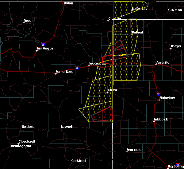 At 634 pm mdt, a confirmed tornado was located near pep, or 29 miles south of portales, moving northeast at 35 mph (weather spotters confirmed tornado). Hazards include damaging tornado and ping pong ball size hail. Flying debris will be dangerous to those caught without shelter. mobile homes will be damaged or destroyed. damage to roofs, windows, and vehicles will occur. tree damage is likely. this tornado will be near, pep around 645 pm mdt. Causey and lingo around 700 pm mdt. At 634 pm mdt, a confirmed tornado was located near pep, or 29 miles south of portales, moving northeast at 35 mph (weather spotters confirmed tornado). Hazards include damaging tornado and ping pong ball size hail. Flying debris will be dangerous to those caught without shelter. mobile homes will be damaged or destroyed. damage to roofs, windows, and vehicles will occur. tree damage is likely. this tornado will be near, pep around 645 pm mdt. Causey and lingo around 700 pm mdt.
|
| 5/26/2019 6:28 PM MDT |
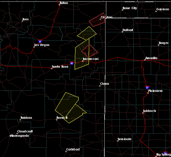 At 628 pm mdt, a confirmed tornado was located 8 miles northwest of milnesand, or 31 miles south of portales, moving east at 40 mph (weather spotters confirmed tornado). Hazards include damaging tornado and ping pong ball size hail. Flying debris will be dangerous to those caught without shelter. mobile homes will be damaged or destroyed. damage to roofs, windows, and vehicles will occur. tree damage is likely. the tornado will be near, pep around 640 pm mdt. Causey and lingo around 700 pm mdt. At 628 pm mdt, a confirmed tornado was located 8 miles northwest of milnesand, or 31 miles south of portales, moving east at 40 mph (weather spotters confirmed tornado). Hazards include damaging tornado and ping pong ball size hail. Flying debris will be dangerous to those caught without shelter. mobile homes will be damaged or destroyed. damage to roofs, windows, and vehicles will occur. tree damage is likely. the tornado will be near, pep around 640 pm mdt. Causey and lingo around 700 pm mdt.
|
| 5/26/2019 6:12 PM MDT |
 At 612 pm mdt, a severe thunderstorm was located 7 miles southeast of kenna, or 35 miles southwest of portales, moving east at 50 mph (radar indicated). Hazards include 70 mph wind gusts and quarter size hail. Hail damage to vehicles is expected. expect considerable tree damage. Wind damage is also likely to mobile homes, roofs, and outbuildings. At 612 pm mdt, a severe thunderstorm was located 7 miles southeast of kenna, or 35 miles southwest of portales, moving east at 50 mph (radar indicated). Hazards include 70 mph wind gusts and quarter size hail. Hail damage to vehicles is expected. expect considerable tree damage. Wind damage is also likely to mobile homes, roofs, and outbuildings.
|
| 5/26/2019 5:23 PM MDT | Tea Cup sized hail reported 6.1 miles ENE of Causey, NM |
| 5/25/2019 12:27 PM MDT |
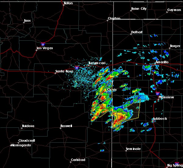 At 1226 pm mdt, a severe thunderstorm was located 7 miles west of pep, or 26 miles south of portales, moving northeast at 20 mph (radar indicated). Hazards include 60 mph wind gusts and half dollar size hail. Hail damage to vehicles is expected. expect wind damage to roofs, siding, and trees. Locations impacted include, dora, causey and pep. At 1226 pm mdt, a severe thunderstorm was located 7 miles west of pep, or 26 miles south of portales, moving northeast at 20 mph (radar indicated). Hazards include 60 mph wind gusts and half dollar size hail. Hail damage to vehicles is expected. expect wind damage to roofs, siding, and trees. Locations impacted include, dora, causey and pep.
|
| 5/25/2019 11:56 AM MDT |
 At 1156 am mdt, a severe thunderstorm was located 13 miles west of milnesand, or 33 miles northwest of tatum, moving northeast at 25 mph (radar indicated). Hazards include 60 mph wind gusts and half dollar size hail. Hail damage to vehicles is expected. Expect wind damage to roofs, siding, and trees. At 1156 am mdt, a severe thunderstorm was located 13 miles west of milnesand, or 33 miles northwest of tatum, moving northeast at 25 mph (radar indicated). Hazards include 60 mph wind gusts and half dollar size hail. Hail damage to vehicles is expected. Expect wind damage to roofs, siding, and trees.
|
| 8/8/2018 7:56 PM MDT |
 At 756 pm mdt, a severe thunderstorm was located over lingo, or 22 miles west of morton, moving southwest at 10 mph (radar indicated). Hazards include ping pong ball size hail and 60 mph wind gusts. People and animals outdoors will be injured. expect hail damage to roofs, siding, windows, and vehicles. expect wind damage to roofs, siding, and trees. Locations impacted include, causey and lingo. At 756 pm mdt, a severe thunderstorm was located over lingo, or 22 miles west of morton, moving southwest at 10 mph (radar indicated). Hazards include ping pong ball size hail and 60 mph wind gusts. People and animals outdoors will be injured. expect hail damage to roofs, siding, windows, and vehicles. expect wind damage to roofs, siding, and trees. Locations impacted include, causey and lingo.
|
| 8/8/2018 7:22 PM MDT |
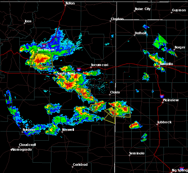 At 722 pm mdt, a severe thunderstorm was located over causey, or 21 miles northwest of morton, moving southwest at 10 mph (radar indicated). Hazards include ping pong ball size hail and 60 mph wind gusts. People and animals outdoors will be injured. expect hail damage to roofs, siding, windows, and vehicles. Expect wind damage to roofs, siding, and trees. At 722 pm mdt, a severe thunderstorm was located over causey, or 21 miles northwest of morton, moving southwest at 10 mph (radar indicated). Hazards include ping pong ball size hail and 60 mph wind gusts. People and animals outdoors will be injured. expect hail damage to roofs, siding, windows, and vehicles. Expect wind damage to roofs, siding, and trees.
|
| 8/8/2018 7:03 PM MDT |
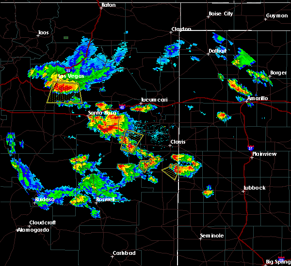 At 703 pm mdt, a severe thunderstorm was located 8 miles north of causey, or 19 miles southeast of portales, moving southwest at 10 mph (radar indicated). Hazards include 60 mph wind gusts and half dollar size hail. Hail damage to vehicles is expected. Expect wind damage to roofs, siding, and trees. At 703 pm mdt, a severe thunderstorm was located 8 miles north of causey, or 19 miles southeast of portales, moving southwest at 10 mph (radar indicated). Hazards include 60 mph wind gusts and half dollar size hail. Hail damage to vehicles is expected. Expect wind damage to roofs, siding, and trees.
|
| 4/29/2018 6:15 PM MDT |
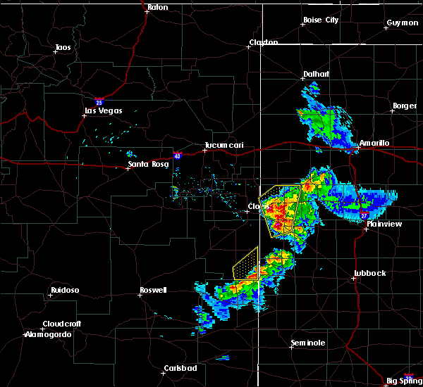 At 615 pm mdt, a severe thunderstorm was located near bledsoe, or 18 miles west of morton, moving northeast at 10 mph (radar indicated). Hazards include 60 mph wind gusts and penny size hail. Expect damage to roofs, siding, and trees. Locations impacted include, causey and lingo. At 615 pm mdt, a severe thunderstorm was located near bledsoe, or 18 miles west of morton, moving northeast at 10 mph (radar indicated). Hazards include 60 mph wind gusts and penny size hail. Expect damage to roofs, siding, and trees. Locations impacted include, causey and lingo.
|
| 4/29/2018 5:48 PM MDT |
 At 548 pm mdt, a severe thunderstorm was located 7 miles northeast of milnesand, or 26 miles west of morton, moving northeast at 10 mph (radar indicated). Hazards include 60 mph wind gusts and half dollar size hail. Hail damage to vehicles is expected. Expect wind damage to roofs, siding, and trees. At 548 pm mdt, a severe thunderstorm was located 7 miles northeast of milnesand, or 26 miles west of morton, moving northeast at 10 mph (radar indicated). Hazards include 60 mph wind gusts and half dollar size hail. Hail damage to vehicles is expected. Expect wind damage to roofs, siding, and trees.
|
| 9/17/2017 1:36 PM MDT |
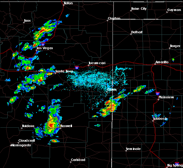 At 136 pm mdt, a severe thunderstorm was located 8 miles southeast of arch, or 20 miles southeast of portales, moving northeast at 10 mph (radar indicated). Hazards include 60 mph wind gusts and nickel size hail. Expect damage to roofs, siding, and trees. Locations impacted include, causey. At 136 pm mdt, a severe thunderstorm was located 8 miles southeast of arch, or 20 miles southeast of portales, moving northeast at 10 mph (radar indicated). Hazards include 60 mph wind gusts and nickel size hail. Expect damage to roofs, siding, and trees. Locations impacted include, causey.
|
| 9/17/2017 1:25 PM MDT |
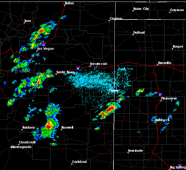 At 125 pm mdt, severe thunderstorms were located along a line extending from 7 miles north of causey to pep, moving northeast at 20 mph (radar indicated). Hazards include 60 mph wind gusts and nickel size hail. Expect damage to roofs, siding, and trees. Locations impacted include, dora, causey, pep and rogers. At 125 pm mdt, severe thunderstorms were located along a line extending from 7 miles north of causey to pep, moving northeast at 20 mph (radar indicated). Hazards include 60 mph wind gusts and nickel size hail. Expect damage to roofs, siding, and trees. Locations impacted include, dora, causey, pep and rogers.
|
| 9/17/2017 1:09 PM MDT |
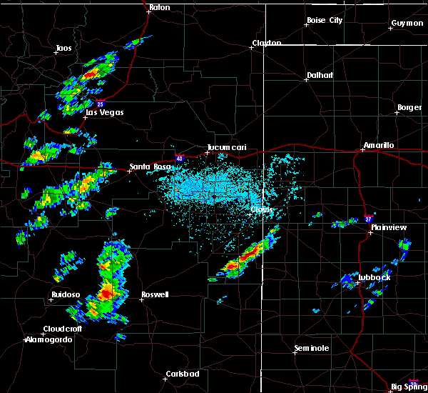 At 109 pm mdt, severe thunderstorms were located along a line extending from 7 miles north of causey to 6 miles southwest of pep, moving northeast at 20 mph (radar indicated). Hazards include 60 mph wind gusts and quarter size hail. Hail damage to vehicles is expected. Expect wind damage to roofs, siding, and trees. At 109 pm mdt, severe thunderstorms were located along a line extending from 7 miles north of causey to 6 miles southwest of pep, moving northeast at 20 mph (radar indicated). Hazards include 60 mph wind gusts and quarter size hail. Hail damage to vehicles is expected. Expect wind damage to roofs, siding, and trees.
|
| 7/4/2017 6:48 PM MDT |
 At 648 pm mdt, a severe thunderstorm was located near arch, or 13 miles southeast of portales, moving southeast at 35 mph (radar indicated). Hazards include 60 mph wind gusts and nickel size hail. Expect damage to roofs, siding, and trees. Locations impacted include, elida, dora, causey, lingo, arch, pep and rogers. At 648 pm mdt, a severe thunderstorm was located near arch, or 13 miles southeast of portales, moving southeast at 35 mph (radar indicated). Hazards include 60 mph wind gusts and nickel size hail. Expect damage to roofs, siding, and trees. Locations impacted include, elida, dora, causey, lingo, arch, pep and rogers.
|
| 7/4/2017 6:42 PM MDT |
 At 642 pm mdt, a severe thunderstorm was located near arch, or 10 miles southeast of portales, moving southeast at 35 mph (radar indicated). Hazards include 60 mph wind gusts and nickel size hail. Expect damage to roofs, siding, and trees. Locations impacted include, portales, elida, dora, causey, lingo, arch, pep and rogers. At 642 pm mdt, a severe thunderstorm was located near arch, or 10 miles southeast of portales, moving southeast at 35 mph (radar indicated). Hazards include 60 mph wind gusts and nickel size hail. Expect damage to roofs, siding, and trees. Locations impacted include, portales, elida, dora, causey, lingo, arch, pep and rogers.
|
| 7/4/2017 6:31 PM MDT |
 At 630 pm mdt, a severe thunderstorm was located near portales, moving southeast at 40 mph (radar indicated). Hazards include 60 mph wind gusts and nickel size hail. Expect damage to roofs, siding, and trees. Locations impacted include, portales, elida, dora, causey, lingo, arch, pep and rogers. At 630 pm mdt, a severe thunderstorm was located near portales, moving southeast at 40 mph (radar indicated). Hazards include 60 mph wind gusts and nickel size hail. Expect damage to roofs, siding, and trees. Locations impacted include, portales, elida, dora, causey, lingo, arch, pep and rogers.
|
| 7/4/2017 6:10 PM MDT |
 At 608 pm mdt, an outflow boundary associated with strong to severe thunderstorms was located near portales, moving south at 30 mph (radar indicated). Hazards include 60 mph wind gusts. expect damage to roofs, siding, and trees At 608 pm mdt, an outflow boundary associated with strong to severe thunderstorms was located near portales, moving south at 30 mph (radar indicated). Hazards include 60 mph wind gusts. expect damage to roofs, siding, and trees
|
| 7/1/2017 10:37 PM MDT |
 The severe thunderstorm warning for southeastern roosevelt and east central chaves counties will expire at 1045 pm mdt, the storms which prompted the warning have weakened below severe limits, and no longer pose an immediate threat to life or property. therefore the warning will be allowed to expire. however gusty winds are still possible with these thunderstorms. The severe thunderstorm warning for southeastern roosevelt and east central chaves counties will expire at 1045 pm mdt, the storms which prompted the warning have weakened below severe limits, and no longer pose an immediate threat to life or property. therefore the warning will be allowed to expire. however gusty winds are still possible with these thunderstorms.
|
| 7/1/2017 10:25 PM MDT |
 The severe thunderstorm warning for east central roosevelt and southeastern curry counties will expire at 1030 pm mdt, the storm which prompted the warning has weakened below severe limits, and no longer pose an immediate threat to life or property. therefore the warning will be allowed to expire. however gusty winds are still possible with this thunderstorm. The severe thunderstorm warning for east central roosevelt and southeastern curry counties will expire at 1030 pm mdt, the storm which prompted the warning has weakened below severe limits, and no longer pose an immediate threat to life or property. therefore the warning will be allowed to expire. however gusty winds are still possible with this thunderstorm.
|
| 7/1/2017 10:17 PM MDT |
 At 1017 pm mdt, severe thunderstorms were located along a line extending from near causey to 6 miles north of caprock, moving southeast at 40 mph (radar indicated). Hazards include 70 mph wind gusts and nickel size hail. Expect considerable tree damage. damage is likely to mobile homes, roofs, and outbuildings. Locations impacted include, dora, causey, milnesand, lingo and pep. At 1017 pm mdt, severe thunderstorms were located along a line extending from near causey to 6 miles north of caprock, moving southeast at 40 mph (radar indicated). Hazards include 70 mph wind gusts and nickel size hail. Expect considerable tree damage. damage is likely to mobile homes, roofs, and outbuildings. Locations impacted include, dora, causey, milnesand, lingo and pep.
|
| 7/1/2017 10:07 PM MDT |
 At 1007 pm mdt, a severe thunderstorm was located near arch, or 11 miles southeast of portales, moving southeast at 25 mph (radar indicated). Hazards include 70 mph wind gusts and nickel size hail. Expect considerable tree damage. damage is likely to mobile homes, roofs, and outbuildings. Locations impacted include, clovis, portales, texico, floyd, causey, saint vrain, ranchvale, arch, oasis state park and cannon air force base. At 1007 pm mdt, a severe thunderstorm was located near arch, or 11 miles southeast of portales, moving southeast at 25 mph (radar indicated). Hazards include 70 mph wind gusts and nickel size hail. Expect considerable tree damage. damage is likely to mobile homes, roofs, and outbuildings. Locations impacted include, clovis, portales, texico, floyd, causey, saint vrain, ranchvale, arch, oasis state park and cannon air force base.
|
| 7/1/2017 10:03 PM MDT |
 At 1003 pm mdt, severe thunderstorms were located along a line extending from dora to 11 miles northwest of caprock, moving southeast at 35 mph (radar indicated). Hazards include 70 mph wind gusts and quarter size hail. Hail damage to vehicles is expected. expect considerable tree damage. Wind damage is also likely to mobile homes, roofs, and outbuildings. At 1003 pm mdt, severe thunderstorms were located along a line extending from dora to 11 miles northwest of caprock, moving southeast at 35 mph (radar indicated). Hazards include 70 mph wind gusts and quarter size hail. Hail damage to vehicles is expected. expect considerable tree damage. Wind damage is also likely to mobile homes, roofs, and outbuildings.
|
| 7/1/2017 9:46 PM MDT |
 At 946 pm mdt, a severe thunderstorm was located near oasis state park, or 7 miles northwest of portales, moving southeast at 25 mph (radar indicated). Hazards include 70 mph wind gusts. Expect considerable tree damage. Damage is likely to mobile homes, roofs, and outbuildings. At 946 pm mdt, a severe thunderstorm was located near oasis state park, or 7 miles northwest of portales, moving southeast at 25 mph (radar indicated). Hazards include 70 mph wind gusts. Expect considerable tree damage. Damage is likely to mobile homes, roofs, and outbuildings.
|
| 6/30/2017 11:20 PM MDT |
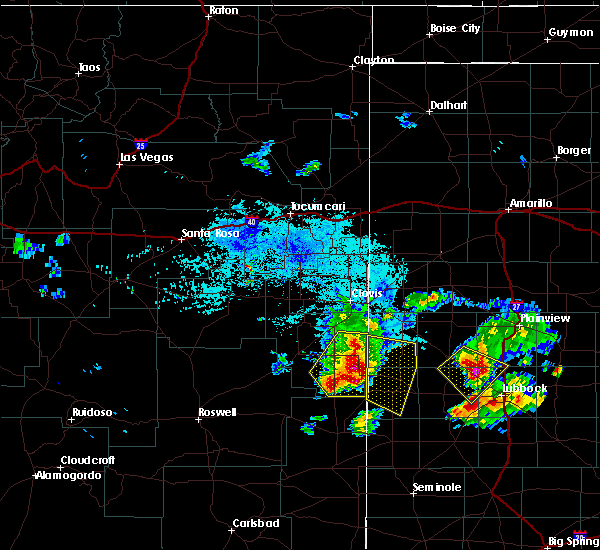 At 1120 pm mdt, a severe thunderstorm was located over lingo, or 22 miles west of morton, moving southeast at 35 mph. this is a very dangerous storm (radar indicated). Hazards include 80 mph wind gusts and tennis ball size hail. Flying debris will be dangerous to those caught without shelter. mobile homes will be heavily damaged. expect considerable damage to roofs, windows, and vehicles. extensive tree damage and power outages are likely. Locations impacted include, dora, causey, milnesand, lingo, arch, pep and rogers. At 1120 pm mdt, a severe thunderstorm was located over lingo, or 22 miles west of morton, moving southeast at 35 mph. this is a very dangerous storm (radar indicated). Hazards include 80 mph wind gusts and tennis ball size hail. Flying debris will be dangerous to those caught without shelter. mobile homes will be heavily damaged. expect considerable damage to roofs, windows, and vehicles. extensive tree damage and power outages are likely. Locations impacted include, dora, causey, milnesand, lingo, arch, pep and rogers.
|
| 6/30/2017 10:53 PM MDT |
 At 1053 pm mdt, a severe thunderstorm was located near dora, or 13 miles south of portales, moving southeast at 30 mph (radar indicated). Hazards include two inch hail and 70 mph wind gusts. People and animals outdoors will be injured. expect hail damage to roofs, siding, windows, and vehicles. expect considerable tree damage. wind damage is also likely to mobile homes, roofs, and outbuildings. Locations impacted include, portales, elida, dora, causey, milnesand, lingo, arch, pep and rogers. At 1053 pm mdt, a severe thunderstorm was located near dora, or 13 miles south of portales, moving southeast at 30 mph (radar indicated). Hazards include two inch hail and 70 mph wind gusts. People and animals outdoors will be injured. expect hail damage to roofs, siding, windows, and vehicles. expect considerable tree damage. wind damage is also likely to mobile homes, roofs, and outbuildings. Locations impacted include, portales, elida, dora, causey, milnesand, lingo, arch, pep and rogers.
|
| 6/30/2017 10:29 PM MDT |
 At 1029 pm mdt, a severe thunderstorm was located 10 miles northwest of dora, or 13 miles southwest of portales, moving southeast at 35 mph (radar indicated). Hazards include 70 mph wind gusts and ping pong ball size hail. People and animals outdoors will be injured. expect hail damage to roofs, siding, windows, and vehicles. expect considerable tree damage. Wind damage is also likely to mobile homes, roofs, and outbuildings. At 1029 pm mdt, a severe thunderstorm was located 10 miles northwest of dora, or 13 miles southwest of portales, moving southeast at 35 mph (radar indicated). Hazards include 70 mph wind gusts and ping pong ball size hail. People and animals outdoors will be injured. expect hail damage to roofs, siding, windows, and vehicles. expect considerable tree damage. Wind damage is also likely to mobile homes, roofs, and outbuildings.
|
| 5/10/2017 1:50 AM MDT |
 The severe thunderstorm warning for southeastern roosevelt county will expire at 200 am mdt, the storms which prompted the warning have weakened below severe limits, and no longer pose an immediate threat to life or property. therefore the warning will be allowed to expire. however heavy rain is still possible with these thunderstorms. a severe thunderstorm watch remains in effect until 600 am mdt for southeastern and east central new mexico. The severe thunderstorm warning for southeastern roosevelt county will expire at 200 am mdt, the storms which prompted the warning have weakened below severe limits, and no longer pose an immediate threat to life or property. therefore the warning will be allowed to expire. however heavy rain is still possible with these thunderstorms. a severe thunderstorm watch remains in effect until 600 am mdt for southeastern and east central new mexico.
|
| 5/10/2017 1:29 AM MDT |
 At 128 am mdt, severe thunderstorms were located along a line extending from near arch to 10 miles north of causey, moving northeast at 40 mph (radar indicated). Hazards include 60 mph wind gusts. Expect damage to roofs, siding, and trees. Locations impacted include, portales, elida, dora, floyd, causey, arch, pep, oasis state park and rogers. At 128 am mdt, severe thunderstorms were located along a line extending from near arch to 10 miles north of causey, moving northeast at 40 mph (radar indicated). Hazards include 60 mph wind gusts. Expect damage to roofs, siding, and trees. Locations impacted include, portales, elida, dora, floyd, causey, arch, pep, oasis state park and rogers.
|
| 5/10/2017 1:16 AM MDT |
 At 115 am mdt, severe thunderstorms were located along a line extending from 6 miles northeast of elida to 7 miles south of arch, moving north at 35 mph (radar indicated). Hazards include 60 mph wind gusts. expect damage to roofs, siding, and trees At 115 am mdt, severe thunderstorms were located along a line extending from 6 miles northeast of elida to 7 miles south of arch, moving north at 35 mph (radar indicated). Hazards include 60 mph wind gusts. expect damage to roofs, siding, and trees
|
| 5/9/2017 10:26 PM MDT |
 The tornado warning for southeastern roosevelt county will expire at 1030 pm mdt, the tornado warning that was previously in effect has been reissued for roosevelt county and is in effect until 11 pm mdt. please refer to that bulletin for the latest severe weather information. a severe thunderstorm watch remains in effect until 600 am mdt for east central new mexico. The tornado warning for southeastern roosevelt county will expire at 1030 pm mdt, the tornado warning that was previously in effect has been reissued for roosevelt county and is in effect until 11 pm mdt. please refer to that bulletin for the latest severe weather information. a severe thunderstorm watch remains in effect until 600 am mdt for east central new mexico.
|
| 5/9/2017 10:25 PM MDT |
 At 1025 pm mdt, a severe thunderstorm capable of producing a tornado was located near causey, or 21 miles southeast of portales, moving northeast at 40 mph (radar indicated rotation). Hazards include tornado and hail up to two inches in diameter. Flying debris will be dangerous to those caught without shelter. mobile homes will be damaged or destroyed. damage to roofs, windows, and vehicles will occur. tree damage is likely. This tornadic thunderstorm will remain over mainly rural areas of east central roosevelt county. At 1025 pm mdt, a severe thunderstorm capable of producing a tornado was located near causey, or 21 miles southeast of portales, moving northeast at 40 mph (radar indicated rotation). Hazards include tornado and hail up to two inches in diameter. Flying debris will be dangerous to those caught without shelter. mobile homes will be damaged or destroyed. damage to roofs, windows, and vehicles will occur. tree damage is likely. This tornadic thunderstorm will remain over mainly rural areas of east central roosevelt county.
|
| 5/9/2017 10:08 PM MDT |
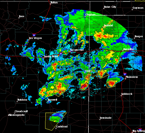 At 953 pm mdt, a severe thunderstorm capable of producing a tornado was located near pep, or 27 miles south of portales, moving northeast at 25 mph (radar indicated rotation). Hazards include tornado and quarter size hail. Flying debris will be dangerous to those caught without shelter. mobile homes will be damaged or destroyed. damage to roofs, windows, and vehicles will occur. tree damage is likely. This dangerous storm will be near, causey around 1015 pm mdt. At 953 pm mdt, a severe thunderstorm capable of producing a tornado was located near pep, or 27 miles south of portales, moving northeast at 25 mph (radar indicated rotation). Hazards include tornado and quarter size hail. Flying debris will be dangerous to those caught without shelter. mobile homes will be damaged or destroyed. damage to roofs, windows, and vehicles will occur. tree damage is likely. This dangerous storm will be near, causey around 1015 pm mdt.
|
| 5/9/2017 9:53 PM MDT |
 At 953 pm mdt, a severe thunderstorm capable of producing a tornado was located near pep, or 27 miles south of portales, moving northeast at 25 mph (radar indicated rotation). Hazards include tornado and quarter size hail. Flying debris will be dangerous to those caught without shelter. mobile homes will be damaged or destroyed. damage to roofs, windows, and vehicles will occur. tree damage is likely. This dangerous storm will be near, causey around 1015 pm mdt. At 953 pm mdt, a severe thunderstorm capable of producing a tornado was located near pep, or 27 miles south of portales, moving northeast at 25 mph (radar indicated rotation). Hazards include tornado and quarter size hail. Flying debris will be dangerous to those caught without shelter. mobile homes will be damaged or destroyed. damage to roofs, windows, and vehicles will occur. tree damage is likely. This dangerous storm will be near, causey around 1015 pm mdt.
|
| 5/9/2017 9:39 PM MDT |
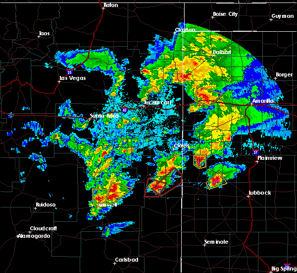 At 939 pm mdt, a severe thunderstorm capable of producing a tornado was located near milnesand, or 31 miles south of portales, moving northeast at 35 mph (radar indicated rotation). Hazards include tornado and quarter size hail. Flying debris will be dangerous to those caught without shelter. mobile homes will be damaged or destroyed. damage to roofs, windows, and vehicles will occur. tree damage is likely. this dangerous storm will be near, pep around 950 pm mdt. causey and lingo around 1005 pm mdt. Rogers around 1010 pm mdt. At 939 pm mdt, a severe thunderstorm capable of producing a tornado was located near milnesand, or 31 miles south of portales, moving northeast at 35 mph (radar indicated rotation). Hazards include tornado and quarter size hail. Flying debris will be dangerous to those caught without shelter. mobile homes will be damaged or destroyed. damage to roofs, windows, and vehicles will occur. tree damage is likely. this dangerous storm will be near, pep around 950 pm mdt. causey and lingo around 1005 pm mdt. Rogers around 1010 pm mdt.
|
| 5/9/2017 7:51 PM MDT |
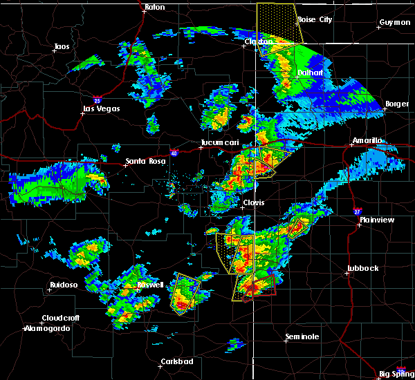 The severe thunderstorm warning for southeastern roosevelt county will expire at 800 pm mdt, the storm which prompted the warning has weakened below severe limits, and no longer pose an immediate threat to life or property. therefore the warning will be allowed to expire. a tornado watch remains in effect until 1000 pm mdt for east central new mexico. The severe thunderstorm warning for southeastern roosevelt county will expire at 800 pm mdt, the storm which prompted the warning has weakened below severe limits, and no longer pose an immediate threat to life or property. therefore the warning will be allowed to expire. a tornado watch remains in effect until 1000 pm mdt for east central new mexico.
|
| 5/9/2017 7:32 PM MDT |
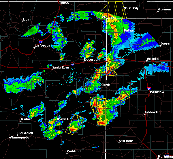 At 732 pm mdt, a severe thunderstorm was located 7 miles southwest of lingo, or 26 miles west of morton, moving north at 40 mph (radar indicated). Hazards include 60 mph wind gusts and quarter size hail. Hail damage to vehicles is expected. Expect wind damage to roofs, siding, and trees. At 732 pm mdt, a severe thunderstorm was located 7 miles southwest of lingo, or 26 miles west of morton, moving north at 40 mph (radar indicated). Hazards include 60 mph wind gusts and quarter size hail. Hail damage to vehicles is expected. Expect wind damage to roofs, siding, and trees.
|
| 5/31/2016 7:32 PM MDT |
 At 732 pm mdt, a severe thunderstorm was located 6 miles southwest of pep, or 28 miles south of portales, moving northeast at 15 mph (radar indicated). Hazards include 60 mph wind gusts and quarter size hail. Hail damage to vehicles is expected. expect wind damage to roofs, siding, and trees. Locations impacted include, dora, causey, milnesand and pep. At 732 pm mdt, a severe thunderstorm was located 6 miles southwest of pep, or 28 miles south of portales, moving northeast at 15 mph (radar indicated). Hazards include 60 mph wind gusts and quarter size hail. Hail damage to vehicles is expected. expect wind damage to roofs, siding, and trees. Locations impacted include, dora, causey, milnesand and pep.
|
| 5/31/2016 7:04 PM MDT |
 At 704 pm mdt, a severe thunderstorm was located 7 miles northwest of milnesand, or 31 miles north of tatum, moving northeast at 10 mph (radar indicated). Hazards include quarter size hail and 60 mph wind gusts. Hail damage to vehicles is expected. Expect wind damage to roofs, siding, and trees. At 704 pm mdt, a severe thunderstorm was located 7 miles northwest of milnesand, or 31 miles north of tatum, moving northeast at 10 mph (radar indicated). Hazards include quarter size hail and 60 mph wind gusts. Hail damage to vehicles is expected. Expect wind damage to roofs, siding, and trees.
|
| 5/29/2016 5:36 PM MDT |
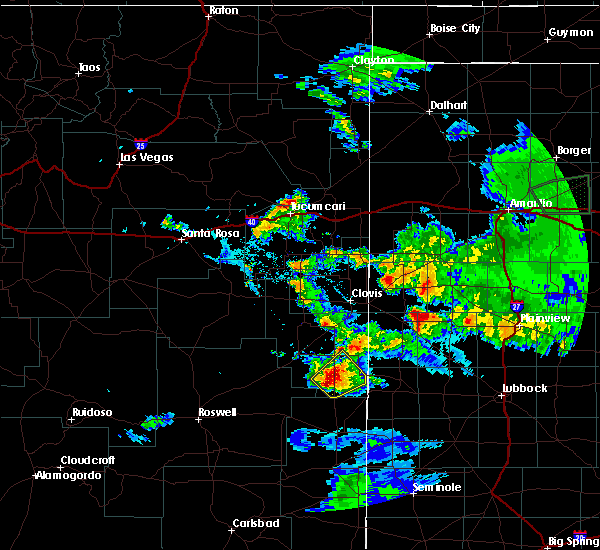 At 536 pm mdt, a severe thunderstorm was located near milnesand, or 31 miles north of tatum, and is nearly stationary (radar indicated). Hazards include 60 mph wind gusts and half dollar size hail. Hail damage to vehicles is expected. expect wind damage to roofs, siding and trees. Locations impacted include, dora, causey, lingo, milnesand and pep. At 536 pm mdt, a severe thunderstorm was located near milnesand, or 31 miles north of tatum, and is nearly stationary (radar indicated). Hazards include 60 mph wind gusts and half dollar size hail. Hail damage to vehicles is expected. expect wind damage to roofs, siding and trees. Locations impacted include, dora, causey, lingo, milnesand and pep.
|
| 5/29/2016 5:25 PM MDT |
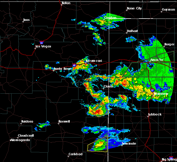 At 525 pm mdt, a severe thunderstorm was located near milnesand, or 31 miles north of tatum, moving northeast at 5 mph (radar indicated). Hazards include quarter size hail and 60 mph wind gusts. Hail damage to vehicles is expected. Expect wind damage to roofs, siding and trees. At 525 pm mdt, a severe thunderstorm was located near milnesand, or 31 miles north of tatum, moving northeast at 5 mph (radar indicated). Hazards include quarter size hail and 60 mph wind gusts. Hail damage to vehicles is expected. Expect wind damage to roofs, siding and trees.
|
| 5/29/2016 4:43 PM MDT |
 At 443 pm mdt, a severe thunderstorm was located 6 miles west of pep, or 23 miles south of portales, moving northeast at 10 mph (radar indicated). Hazards include quarter size hail and 60 mph wind gusts. Hail damage to vehicles is expected. Expect wind damage to roofs, siding and trees. At 443 pm mdt, a severe thunderstorm was located 6 miles west of pep, or 23 miles south of portales, moving northeast at 10 mph (radar indicated). Hazards include quarter size hail and 60 mph wind gusts. Hail damage to vehicles is expected. Expect wind damage to roofs, siding and trees.
|
| 5/29/2016 4:16 PM MDT |
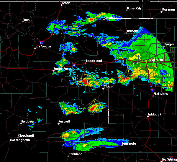 At 415 pm mdt, a severe thunderstorm was located 9 miles west of pep, or 25 miles south of portales, moving northeast at 15 mph (radar indicated). Hazards include quarter size hail and 60 mph wind gusts. Hail damage to vehicles is expected. Expect wind damage to roofs, siding and trees. At 415 pm mdt, a severe thunderstorm was located 9 miles west of pep, or 25 miles south of portales, moving northeast at 15 mph (radar indicated). Hazards include quarter size hail and 60 mph wind gusts. Hail damage to vehicles is expected. Expect wind damage to roofs, siding and trees.
|
| 5/22/2016 12:29 AM MDT | A severe thunderstorm warning remains in effect until 1245 am mdt for east central roosevelt county. at 1229 am mdt. a severe thunderstorm was located near arch. or 18 miles southeast of portales. moving northeast at 35 mph. hazard. 60 mph wind gusts and quarter size hail. source. Radar indicated. |
| 6/14/2015 5:40 PM MDT |
 The severe thunderstorm warning for southeastern roosevelt county will expire at 545 pm mdt. the storm which prompted the warning has weakened below severe limits. and no longer pose an immediate threat to life or property. therefore the warning will be allowed to expire. A severe thunderstorm watch remains in effect until 1000 pm mdt for. The severe thunderstorm warning for southeastern roosevelt county will expire at 545 pm mdt. the storm which prompted the warning has weakened below severe limits. and no longer pose an immediate threat to life or property. therefore the warning will be allowed to expire. A severe thunderstorm watch remains in effect until 1000 pm mdt for.
|
| 6/14/2015 5:24 PM MDT |
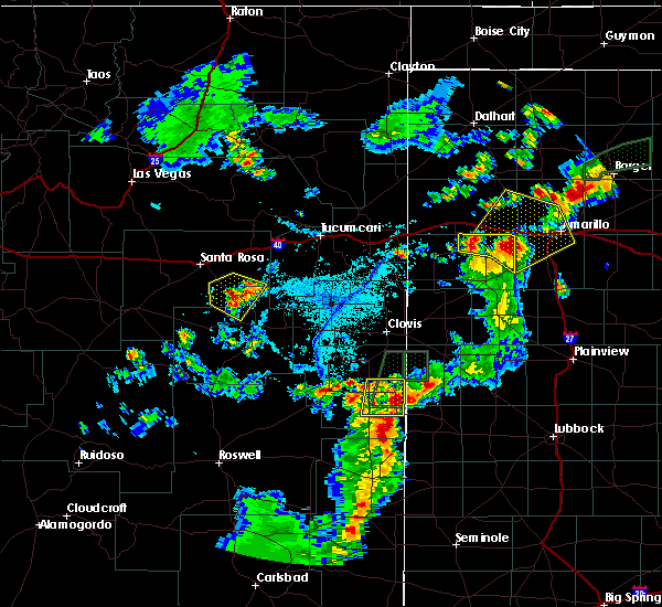 At 524 pm mdt, a severe thunderstorm was located over causey, or 21 miles northwest of morton, moving east at 5 mph (radar indicated). Hazards include 60 mph wind gusts and quarter size hail. Hail damage to vehicles is expected. expect wind damage to roofs, siding and trees. Locations impacted include, dora, causey, lingo, pep and rogers. At 524 pm mdt, a severe thunderstorm was located over causey, or 21 miles northwest of morton, moving east at 5 mph (radar indicated). Hazards include 60 mph wind gusts and quarter size hail. Hail damage to vehicles is expected. expect wind damage to roofs, siding and trees. Locations impacted include, dora, causey, lingo, pep and rogers.
|
| 6/14/2015 5:00 PM MDT |
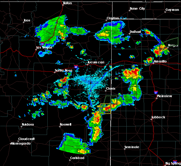 At 500 pm mdt, a severe thunderstorm was located near causey, or 20 miles southeast of portales, and is nearly stationary (radar indicated). Hazards include quarter size hail and 60 mph wind gusts. Hail damage to vehicles is expected. Expect wind damage to roofs, siding and trees. At 500 pm mdt, a severe thunderstorm was located near causey, or 20 miles southeast of portales, and is nearly stationary (radar indicated). Hazards include quarter size hail and 60 mph wind gusts. Hail damage to vehicles is expected. Expect wind damage to roofs, siding and trees.
|
| 6/14/2015 4:41 PM MDT |
 At 441 pm mdt, a severe thunderstorm was located 6 miles north of causey, or 18 miles southeast of portales, and is nearly stationary (radar indicated). Hazards include 60 mph wind gusts and quarter size hail. Hail damage to vehicles is expected. expect wind damage to roofs, siding and trees. locations impacted include, causey and rogers. Other locations affected include grulla national wildlife refuge. At 441 pm mdt, a severe thunderstorm was located 6 miles north of causey, or 18 miles southeast of portales, and is nearly stationary (radar indicated). Hazards include 60 mph wind gusts and quarter size hail. Hail damage to vehicles is expected. expect wind damage to roofs, siding and trees. locations impacted include, causey and rogers. Other locations affected include grulla national wildlife refuge.
|
| 6/14/2015 4:20 PM MDT |
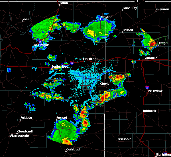 At 419 pm mdt, a severe thunderstorm was located near arch, or 17 miles southeast of portales, moving south at 5 mph (radar indicated). Hazards include half dollar size hail and 60 mph wind gusts. Hail damage to vehicles is expected. Expect wind damage to roofs, siding and trees. At 419 pm mdt, a severe thunderstorm was located near arch, or 17 miles southeast of portales, moving south at 5 mph (radar indicated). Hazards include half dollar size hail and 60 mph wind gusts. Hail damage to vehicles is expected. Expect wind damage to roofs, siding and trees.
|
| 6/13/2015 5:42 PM MDT | The severe thunderstorm warning for southern curry, northeastern chaves and roosevelt counties will expire at 545 pm mdt, the severe thunderstorm which prompted the warning has weakened. therefore the warning will be allowed to expire. a severe thunderstorm watch remains in effect until 900 pm mdt for southeastern new mexico. |
| 6/13/2015 5:30 PM MDT |
 At 529 pm mdt, a severe thunderstorm was located near kenna, or 38 miles southwest of portales, moving northeast at 45 mph (radar indicated). Hazards include 60 mph wind gusts and quarter size hail. Hail damage to vehicles is expected. expect wind damage to roofs, siding and trees. locations impacted include, clovis, portales, farwell, texico, melrose, elida, dora, causey, oasis state park and saint vrain. Other locations affected include grulla national wildlife refuge. At 529 pm mdt, a severe thunderstorm was located near kenna, or 38 miles southwest of portales, moving northeast at 45 mph (radar indicated). Hazards include 60 mph wind gusts and quarter size hail. Hail damage to vehicles is expected. expect wind damage to roofs, siding and trees. locations impacted include, clovis, portales, farwell, texico, melrose, elida, dora, causey, oasis state park and saint vrain. Other locations affected include grulla national wildlife refuge.
|
| 6/13/2015 5:07 PM MDT |
 At 506 pm mdt, severe thunderstorms were located along a line extending from 5 miles northeast of saint vrain to 6 miles northwest of oasis state park to 10 miles north of elida to 5 miles southwest of kenna, moving east at 35 mph (radar indicated). Hazards include 60 mph wind gusts and penny size hail. Expect damage to roofs. Siding and trees. At 506 pm mdt, severe thunderstorms were located along a line extending from 5 miles northeast of saint vrain to 6 miles northwest of oasis state park to 10 miles north of elida to 5 miles southwest of kenna, moving east at 35 mph (radar indicated). Hazards include 60 mph wind gusts and penny size hail. Expect damage to roofs. Siding and trees.
|
| 6/13/2015 4:24 PM MDT |
 At 424 pm mdt, a severe thunderstorm was located near elida, or 27 miles southwest of portales, moving north at 25 mph (radar indicated). Hazards include quarter size hail and 60 mph wind gusts. Hail damage to vehicles is expected. Expect wind damage to roofs, siding and trees. At 424 pm mdt, a severe thunderstorm was located near elida, or 27 miles southwest of portales, moving north at 25 mph (radar indicated). Hazards include quarter size hail and 60 mph wind gusts. Hail damage to vehicles is expected. Expect wind damage to roofs, siding and trees.
|
| 5/29/2015 6:37 PM MDT | At 636 pm mdt, a severe thunderstorm was located near dora, or 20 miles south of portales, moving southeast at 15 mph. this is a very dangerous storm (radar indicated). Hazards include golf ball size hail and 80 mph wind gusts. Flying debris will be dangerous to those caught without shelter. mobile homes will be heavily damaged. expect considerable damage to roofs, windows and vehicles. Extensive tree damage and power outages are likely. |
| 5/19/2015 3:52 AM MDT | At 352 am mdt, a severe thunderstorm was located 6 miles south of arch, or 14 miles southeast of portales, moving northeast at 40 mph (radar indicated). Hazards include quarter size hail. Damage to vehicles is expected. locations impacted include, causey, arch and rogers. 1. 00in. |
| 5/19/2015 3:28 AM MDT | At 328 am mdt, a severe thunderstorm was located near milnesand, or 31 miles south of portales, moving northeast at 40 mph (radar indicated). Hazards include quarter size hail. damage to vehicles is expected |
| 5/18/2015 7:48 PM MDT | At 747 pm mdt, a severe thunderstorm was located 8 miles southwest of arch, or 14 miles southeast of portales, moving north at 40 mph (radar indicated). Hazards include 60 mph wind gusts and quarter size hail. Hail damage to vehicles is expected. expect wind damage to roofs, siding and trees. this severe storm will be near, arch around 800 pm mdt. other locations impacted by this severe thunderstorm include rogers. 1. 00in. |
| 5/18/2015 7:22 PM MDT | At 722 pm mdt, a severe thunderstorm was located near lingo, or 26 miles west of morton, moving north at 40 mph (radar indicated). Hazards include quarter size hail and 60 mph wind gusts. Hail damage to vehicles is expected. Expect wind damage to roofs, siding and trees. |
| 5/15/2015 9:53 PM MDT | At 948 pm mdt, a severe thunderstorm was located near pep, and moving northeast at 35 mph (radar indicated. quarer size hail was reported 8 miles west of lingo). Hazards include 60 mph wind gusts and quarter size hail. Hail damage to vehicles is expected. expect wind damage to roofs, siding and trees. locations impacted include, lingo and causey. 1. 00in. |
| 5/15/2015 9:47 PM MDT | Quarter sized hail reported 10.1 miles NE of Causey, NM |
| 5/15/2015 9:27 PM MDT | At 918 pm mdt, a severe thunderstorm was located 9 miles west of milnesand, and moving northeast at 45 mph (radar indicated). Hazards include 60 mph wind gusts and quarter size hail. Hail damage to vehicles is expected. Expect wind damage to roofs, siding and trees. |
| 5/9/2015 2:35 AM MDT | At 230 am mdt, a severe thunderstorm was located near pep, and moving northeast at 45 mph (radar indicated). Hazards include 60 mph wind gusts and quarter size hail. Hail damage to vehicles is expected. Expect wind damage to roofs, siding and trees. |
| 6/19/2014 2:26 PM MDT | Quarter sized hail reported 8 miles S of Causey, NM, dime to quarter size hail for the past 12 minutes. hail covering the ground. |
| 6/5/2013 8:05 PM MDT | Storm damage reported in roosevelt county NM, 17.5 miles NNE of Causey, NM |
| 1/1/0001 12:00 AM | Golf Ball sized hail reported 17.7 miles NNW of Causey, NM, only hail...no rain at this time. |
Hail Maps for Causey, NM


Connect with Interactive Hail Maps