

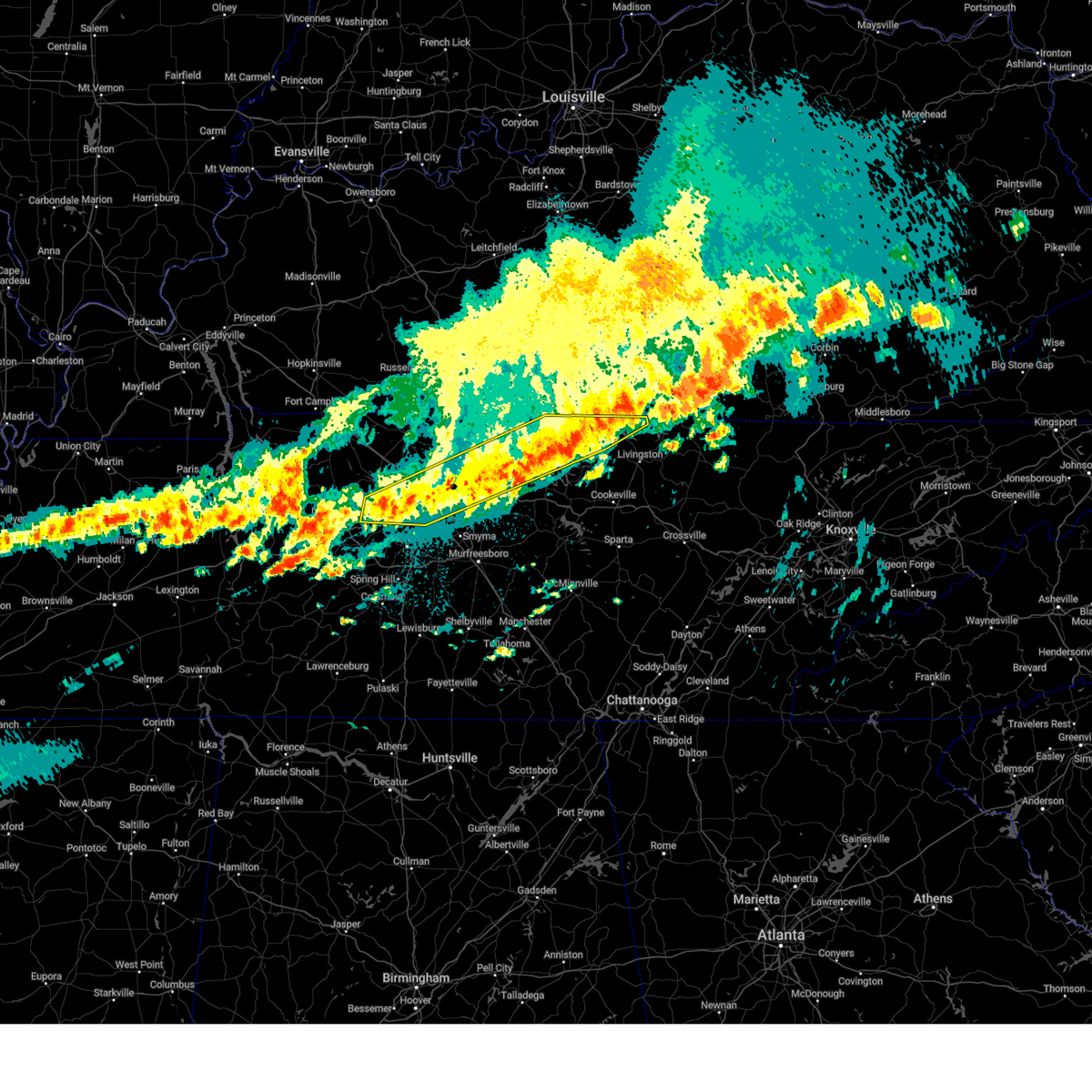
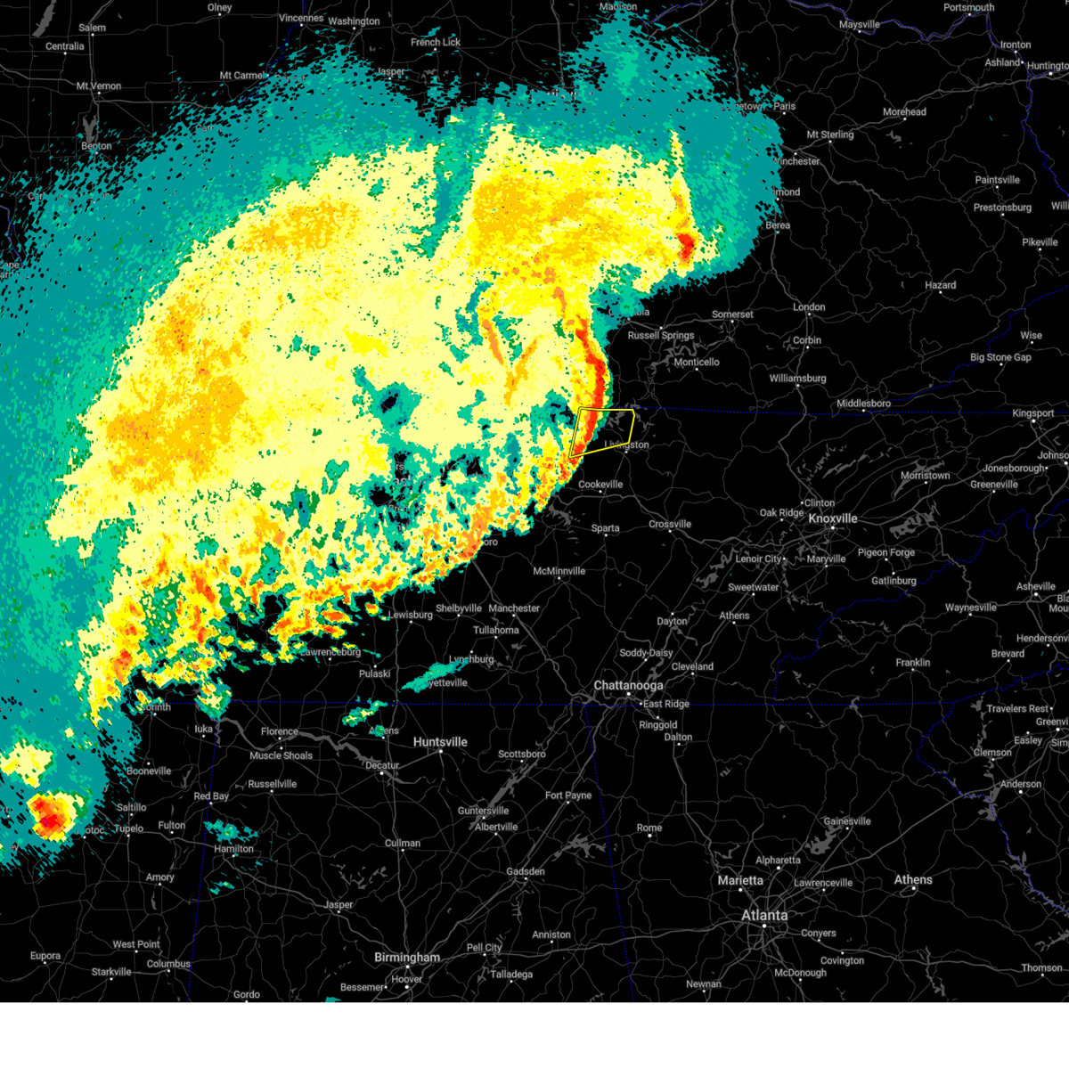
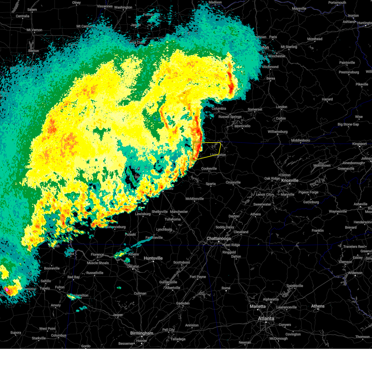
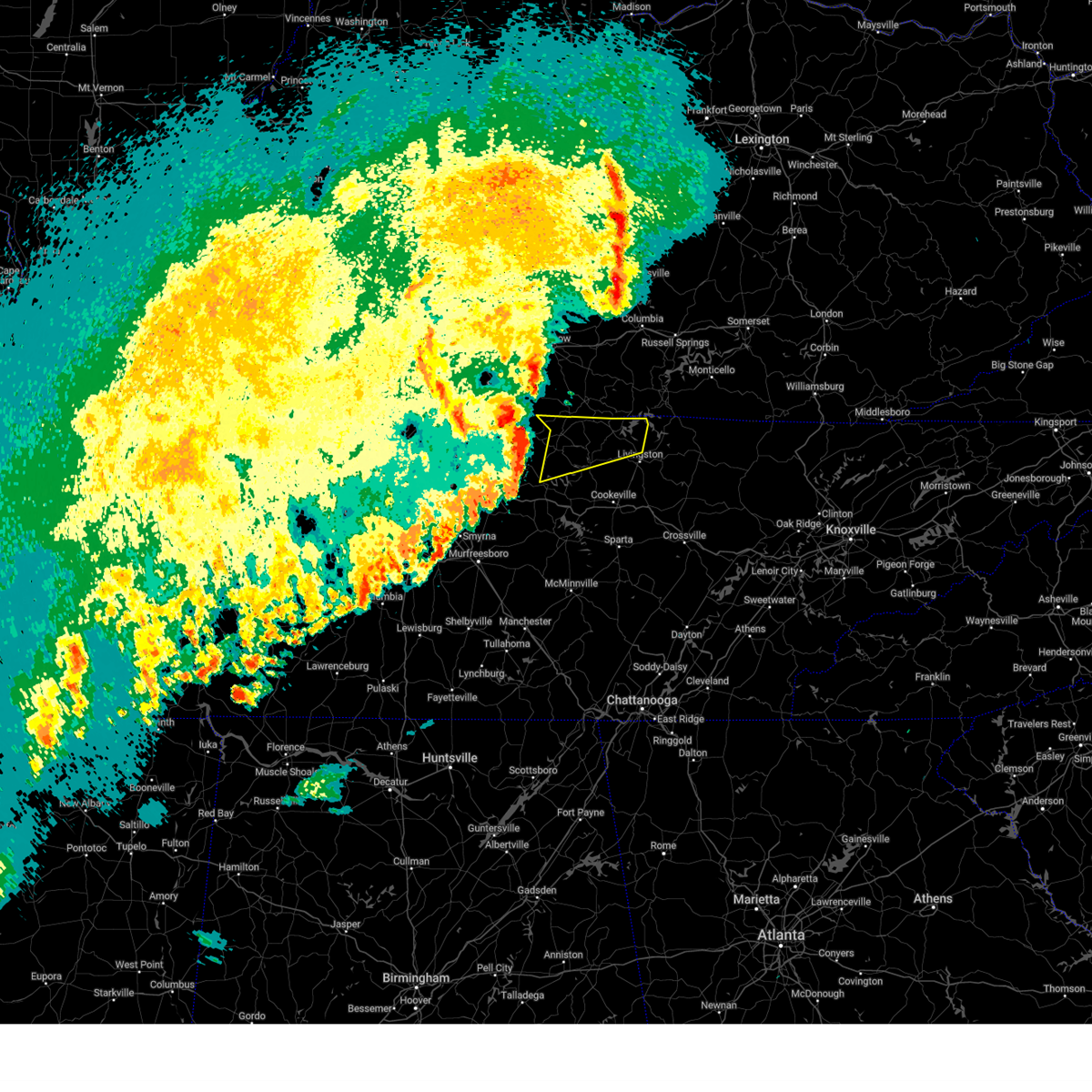
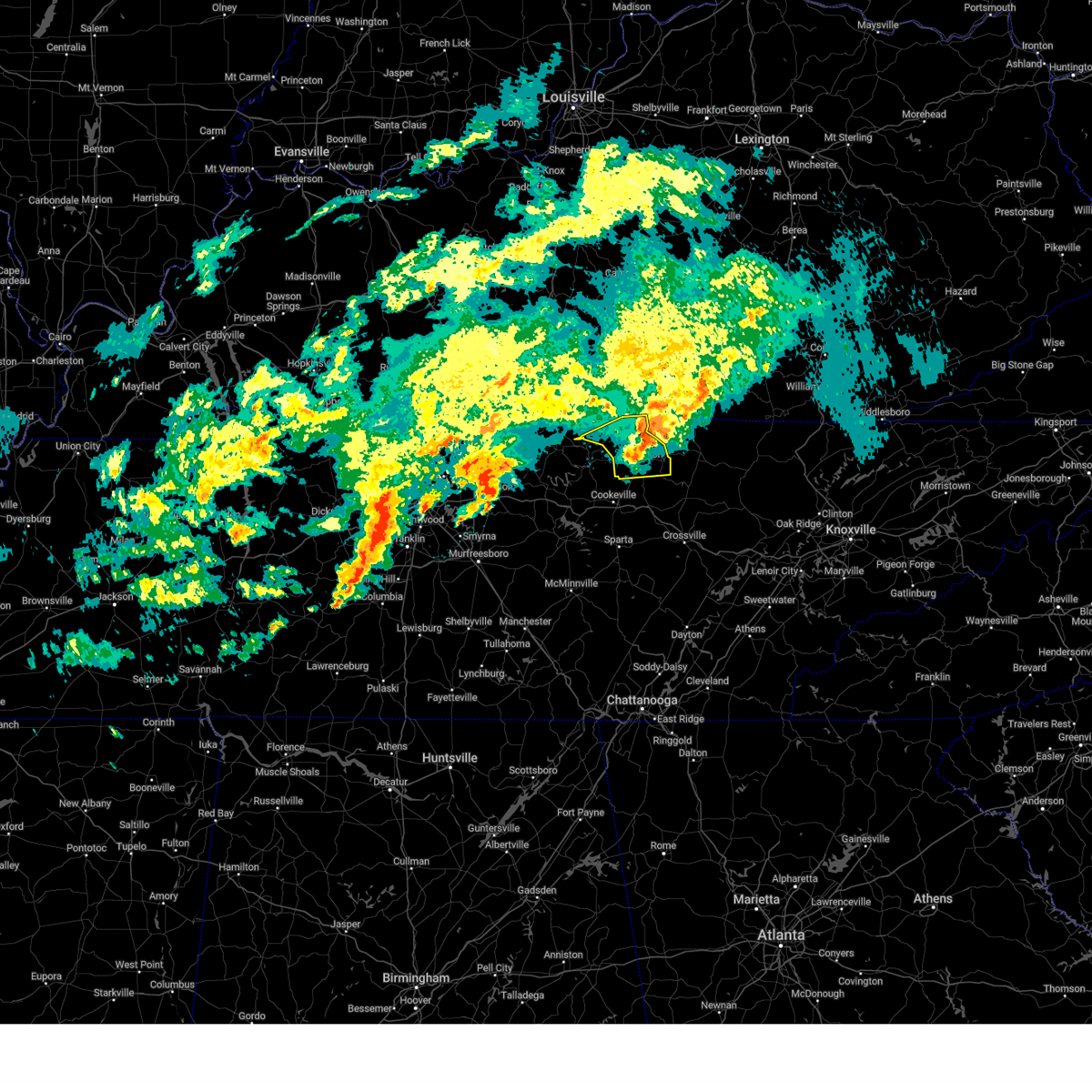
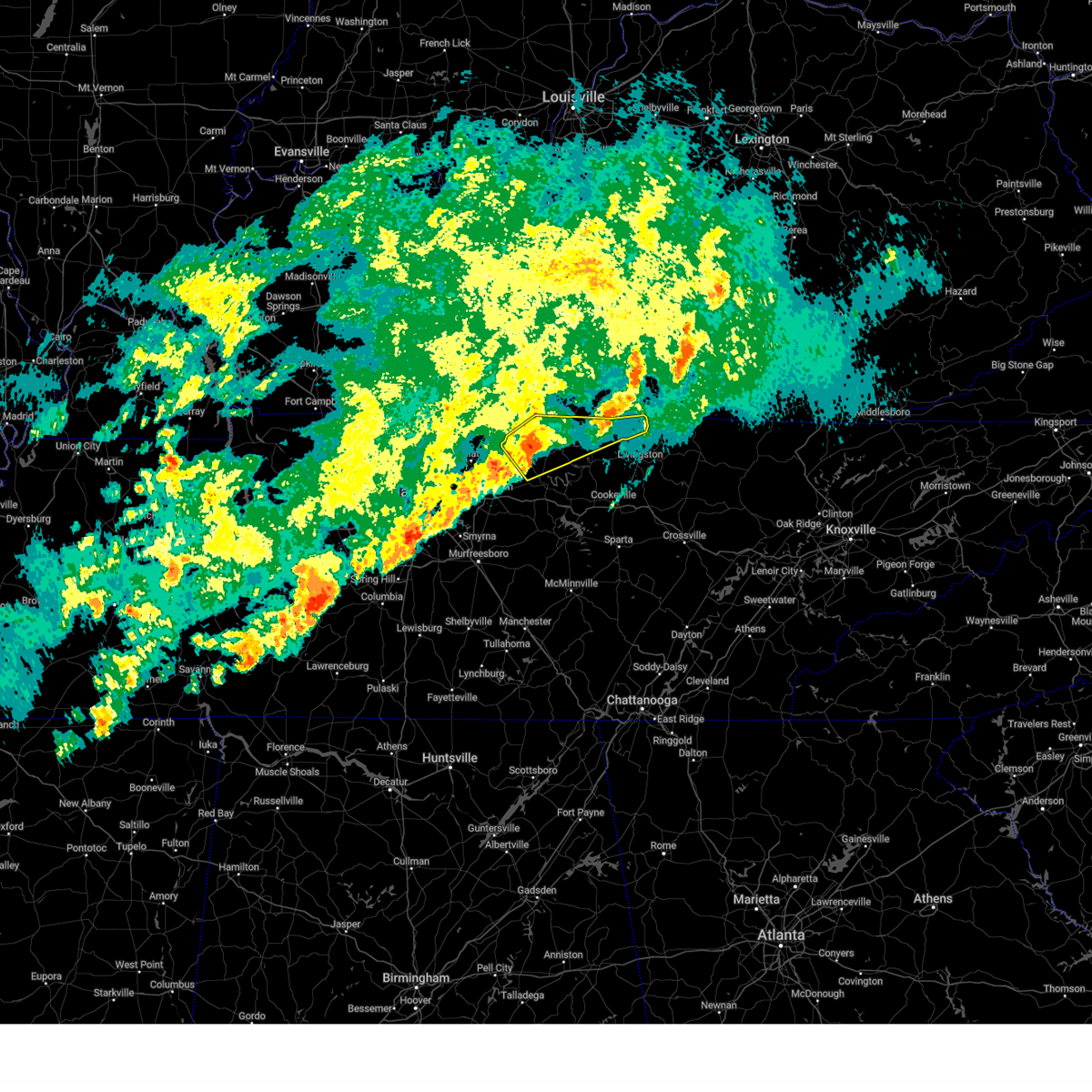
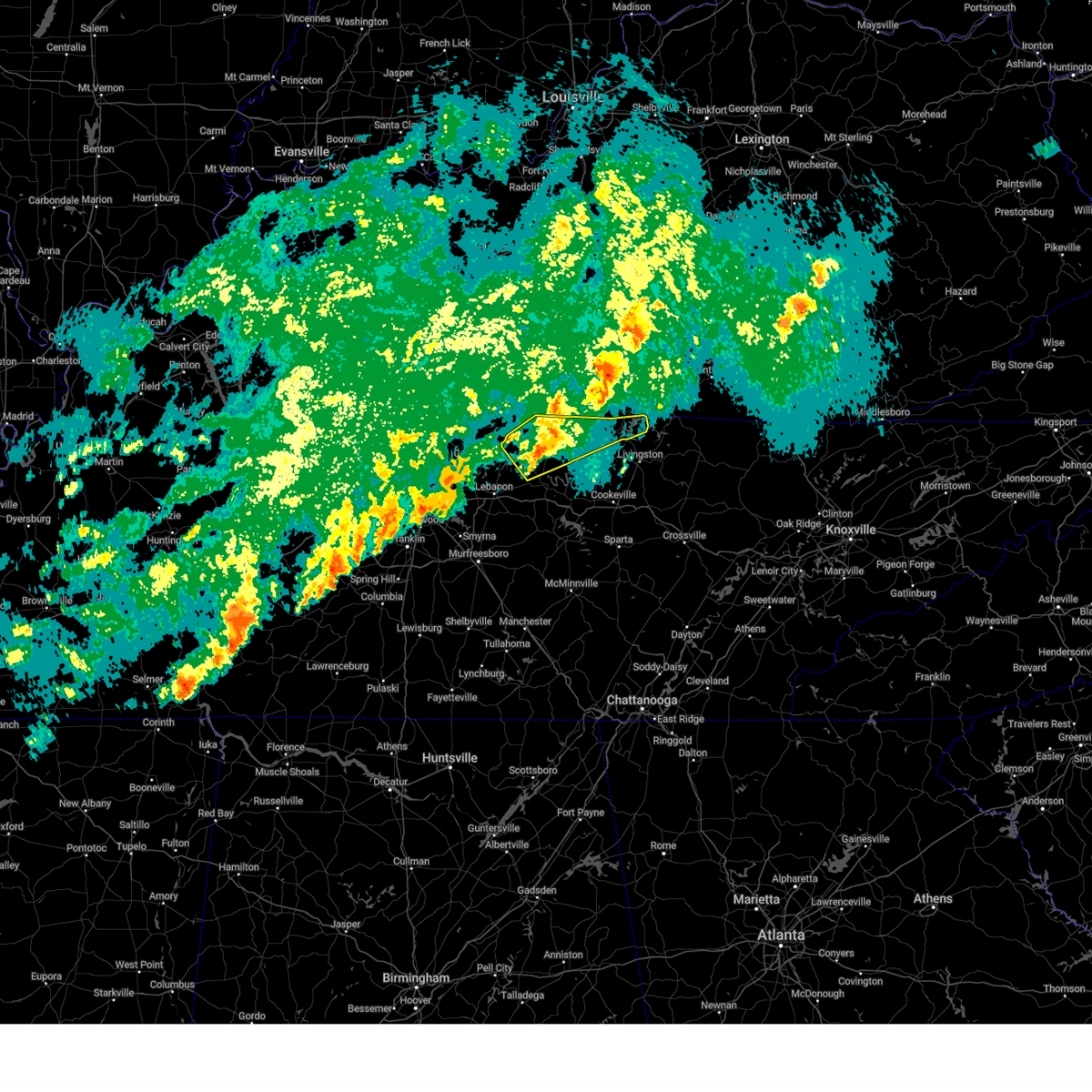
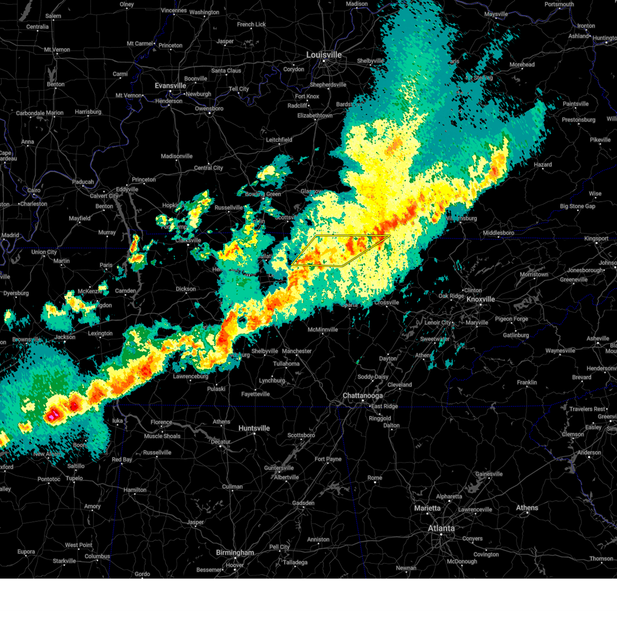
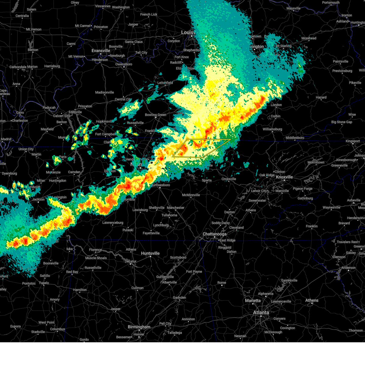
Hail Map for Celina, TN
The Celina, TN area has had 11 reports of on-the-ground hail by trained spotters, and has been under severe weather warnings 26 times during the past 12 months. Doppler radar has detected hail at or near Celina, TN on 62 occasions, including 3 occasions during the past year.
| Name: | Celina, TN |
| Where Located: | 76.1 miles ENE of Nashville, TN |
| Map: | Google Map for Celina, TN |
| Population: | 1495 |
| Housing Units: | 748 |
| More Info: | Search Google for Celina, TN |
0
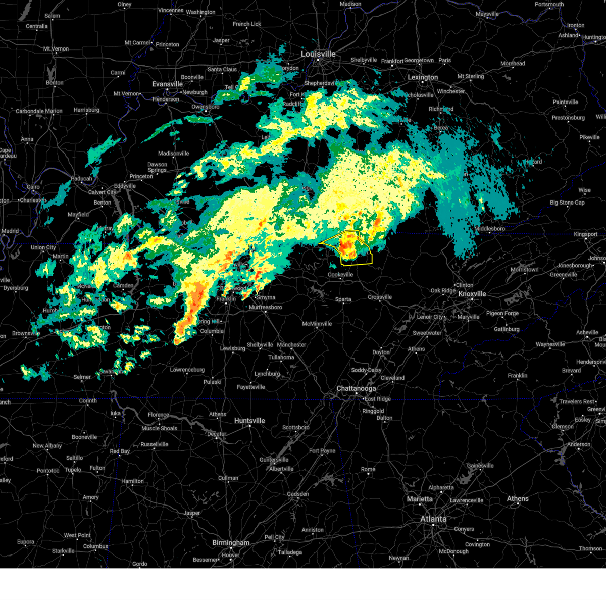
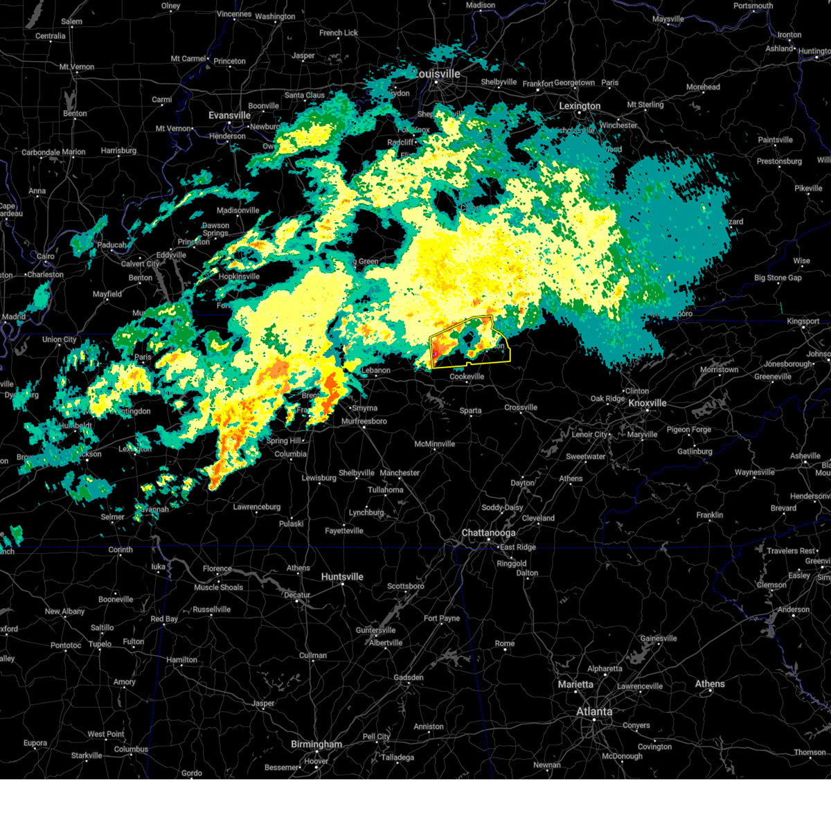
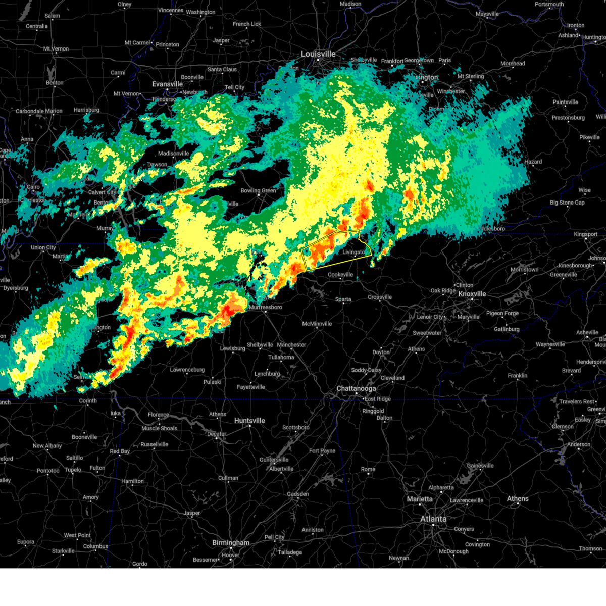
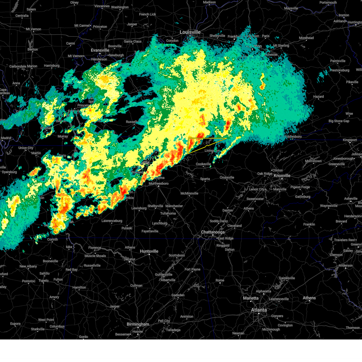
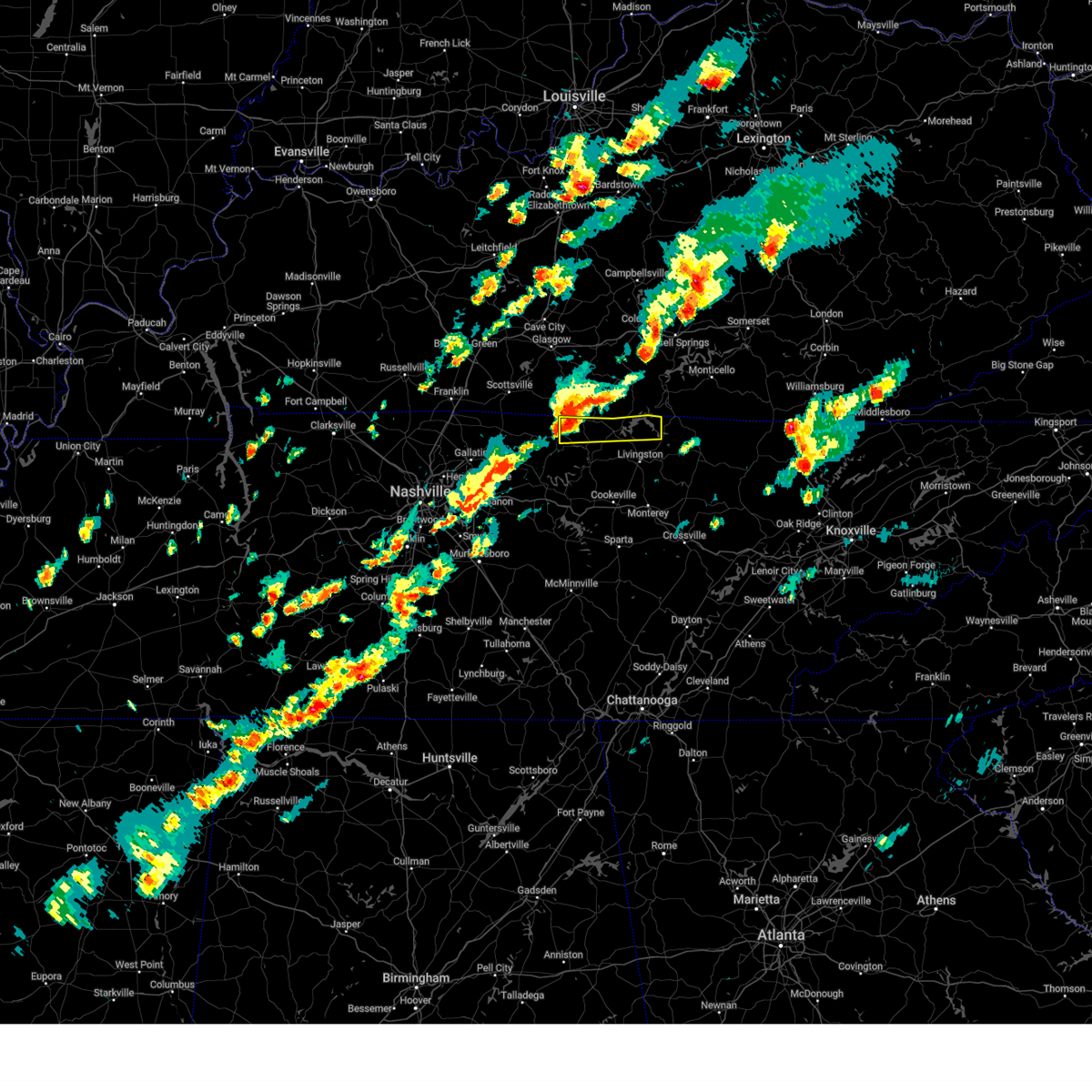
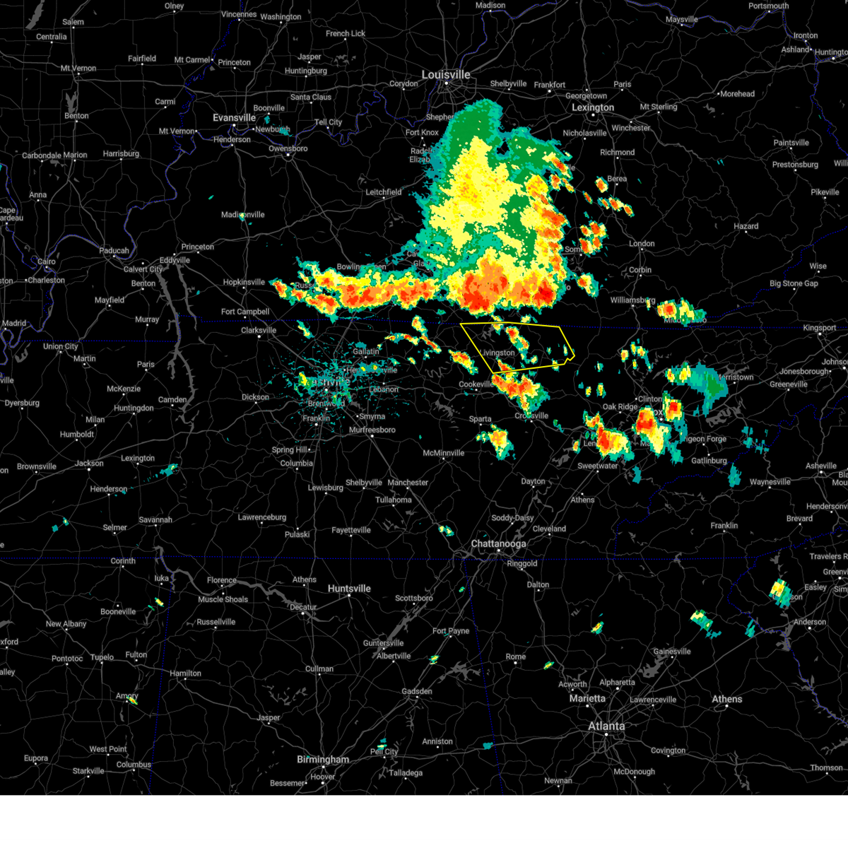
The Top Recent Hail Date for Celina, TN is Thursday, May 8, 2025 (27th out of 62)

Hail and Wind Damage Spotted near Celina, TN
| Date / Time | Report Details |
|---|---|
| 5/16/2025 11:35 PM CDT |
 the severe thunderstorm warning has been cancelled and is no longer in effect the severe thunderstorm warning has been cancelled and is no longer in effect
|
| 5/16/2025 11:35 PM CDT |
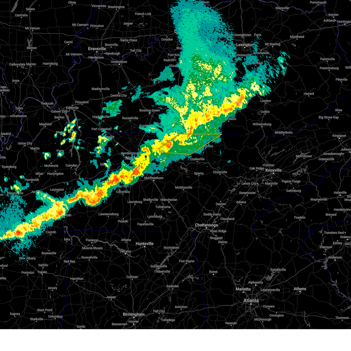
 At 1135 pm cdt, severe thunderstorms were located along a line extending from 6 miles east of celina to forest hills, moving east at 55 mph (radar indicated). Hazards include 60 mph wind gusts and quarter size hail. Hail damage to vehicles is expected. expect wind damage to roofs, siding, and trees. locations impacted include, red boiling springs, madison, hermitage, belle meade, hartsville, moss, pleasant shade, gallatin, bledsoe creek state park, dickerson chapel recreation area, hendersonville, berry hill, mount juliet, boles, oak hill, green hill, forest hills, celina, bethpage, and goodlettsville. this includes the following highways, interstate 40 between mile markers 186 and 235. interstate 65 between mile markers 75 and 98. interstate 24 between mile markers 38 and 57. Interstate 840 near mile marker 76. At 1135 pm cdt, severe thunderstorms were located along a line extending from 6 miles east of celina to forest hills, moving east at 55 mph (radar indicated). Hazards include 60 mph wind gusts and quarter size hail. Hail damage to vehicles is expected. expect wind damage to roofs, siding, and trees. locations impacted include, red boiling springs, madison, hermitage, belle meade, hartsville, moss, pleasant shade, gallatin, bledsoe creek state park, dickerson chapel recreation area, hendersonville, berry hill, mount juliet, boles, oak hill, green hill, forest hills, celina, bethpage, and goodlettsville. this includes the following highways, interstate 40 between mile markers 186 and 235. interstate 65 between mile markers 75 and 98. interstate 24 between mile markers 38 and 57. Interstate 840 near mile marker 76.
|
| 5/16/2025 11:08 PM CDT |
 At 1107 pm cdt, severe thunderstorms were located along a line extending from near red boiling springs to near burns, moving east at 55 mph (radar indicated). Hazards include 60 mph wind gusts and quarter size hail. Hail damage to vehicles is expected. expect wind damage to roofs, siding, and trees. locations impacted include, charlotte, black jack, hartsville, moss, pleasant shade, millersville, gallatin, bledsoe creek state park, dickerson chapel recreation area, hendersonville, cottontown, mount juliet, westmoreland, white bluff, forest hills, cheatham dam, goodlettsville, dixon springs, oak grove, and nashville. this includes the following highways, interstate 40 between mile markers 186 and 235. interstate 65 between mile markers 75 and 121. interstate 24 between mile markers 22 and 57. Interstate 840 near mile marker 76. At 1107 pm cdt, severe thunderstorms were located along a line extending from near red boiling springs to near burns, moving east at 55 mph (radar indicated). Hazards include 60 mph wind gusts and quarter size hail. Hail damage to vehicles is expected. expect wind damage to roofs, siding, and trees. locations impacted include, charlotte, black jack, hartsville, moss, pleasant shade, millersville, gallatin, bledsoe creek state park, dickerson chapel recreation area, hendersonville, cottontown, mount juliet, westmoreland, white bluff, forest hills, cheatham dam, goodlettsville, dixon springs, oak grove, and nashville. this includes the following highways, interstate 40 between mile markers 186 and 235. interstate 65 between mile markers 75 and 121. interstate 24 between mile markers 22 and 57. Interstate 840 near mile marker 76.
|
| 5/16/2025 11:08 PM CDT |
 the severe thunderstorm warning has been cancelled and is no longer in effect the severe thunderstorm warning has been cancelled and is no longer in effect
|
| 5/16/2025 10:40 PM CDT | Svrohx the national weather service in nashville has issued a * severe thunderstorm warning for, northern smith county in middle tennessee, southern montgomery county in middle tennessee, sumner county in middle tennessee, southeastern stewart county in middle tennessee, houston county in middle tennessee, northern wilson county in middle tennessee, cheatham county in middle tennessee, clay county in middle tennessee, northern humphreys county in middle tennessee, robertson county in middle tennessee, davidson county in middle tennessee, dickson county in middle tennessee, northern jackson county in middle tennessee, macon county in middle tennessee, trousdale county in middle tennessee, * until 1145 pm cdt. * at 1040 pm cdt, severe thunderstorms were located along a line extending from near westmoreland to near mcewen, moving east at 55 mph (radar indicated). Hazards include 60 mph wind gusts and quarter size hail. Hail damage to vehicles is expected. Expect wind damage to roofs, siding, and trees. |
| 5/16/2025 11:23 AM CDT |
 the severe thunderstorm warning has been cancelled and is no longer in effect the severe thunderstorm warning has been cancelled and is no longer in effect
|
| 5/16/2025 11:11 AM CDT |
 Svrohx the national weather service in nashville has issued a * severe thunderstorm warning for, northwestern clay county in middle tennessee, northern macon county in middle tennessee, * until 1145 am cdt. * at 1110 am cdt, a severe thunderstorm was located near lafayette, moving east at 65 mph (radar indicated). Hazards include 60 mph wind gusts and quarter size hail. Hail damage to vehicles is expected. Expect wind damage to roofs, siding, and trees. Svrohx the national weather service in nashville has issued a * severe thunderstorm warning for, northwestern clay county in middle tennessee, northern macon county in middle tennessee, * until 1145 am cdt. * at 1110 am cdt, a severe thunderstorm was located near lafayette, moving east at 65 mph (radar indicated). Hazards include 60 mph wind gusts and quarter size hail. Hail damage to vehicles is expected. Expect wind damage to roofs, siding, and trees.
|
| 5/8/2025 4:41 PM CDT | the severe thunderstorm warning has been cancelled and is no longer in effect |
| 5/8/2025 4:20 PM CDT |
 Svrohx the national weather service in nashville has issued a * severe thunderstorm warning for, northwestern overton county in middle tennessee, northern jackson county in middle tennessee, central clay county in middle tennessee, * until 500 pm cdt. * at 419 pm cdt, a severe thunderstorm was located near gainesboro, moving east at 25 mph (radar indicated). Hazards include 60 mph wind gusts and quarter size hail. Hail damage to vehicles is expected. Expect wind damage to roofs, siding, and trees. Svrohx the national weather service in nashville has issued a * severe thunderstorm warning for, northwestern overton county in middle tennessee, northern jackson county in middle tennessee, central clay county in middle tennessee, * until 500 pm cdt. * at 419 pm cdt, a severe thunderstorm was located near gainesboro, moving east at 25 mph (radar indicated). Hazards include 60 mph wind gusts and quarter size hail. Hail damage to vehicles is expected. Expect wind damage to roofs, siding, and trees.
|
| 4/5/2025 6:24 PM CDT |
 At 624 pm cdt, severe thunderstorms were located along a line extending from 8 miles south of edmonton to 7 miles southwest of burkesville to 7 miles south of celina, moving east at 55 mph (radar indicated). Hazards include 60 mph wind gusts and penny size hail. Expect damage to roofs, siding, and trees. Locations impacted include, dale hollow lake, celina, whitleyville, moss, standing stone state park, and gainesboro. At 624 pm cdt, severe thunderstorms were located along a line extending from 8 miles south of edmonton to 7 miles southwest of burkesville to 7 miles south of celina, moving east at 55 mph (radar indicated). Hazards include 60 mph wind gusts and penny size hail. Expect damage to roofs, siding, and trees. Locations impacted include, dale hollow lake, celina, whitleyville, moss, standing stone state park, and gainesboro.
|
| 4/5/2025 6:10 PM CDT |
 At 610 pm cdt, severe thunderstorms were located along a line extending from 16 miles southeast of glasgow to near tompkinsville to near gainesboro, moving northeast at 60 mph (radar indicated). Hazards include 60 mph wind gusts and quarter size hail. Hail damage to vehicles is expected. expect wind damage to roofs, siding, and trees. Locations impacted include, dale hollow lake, celina, whitleyville, moss, standing stone state park, and gainesboro. At 610 pm cdt, severe thunderstorms were located along a line extending from 16 miles southeast of glasgow to near tompkinsville to near gainesboro, moving northeast at 60 mph (radar indicated). Hazards include 60 mph wind gusts and quarter size hail. Hail damage to vehicles is expected. expect wind damage to roofs, siding, and trees. Locations impacted include, dale hollow lake, celina, whitleyville, moss, standing stone state park, and gainesboro.
|
| 4/5/2025 6:10 PM CDT |
 the severe thunderstorm warning has been cancelled and is no longer in effect the severe thunderstorm warning has been cancelled and is no longer in effect
|
| 4/5/2025 5:49 PM CDT |
 Svrohx the national weather service in nashville has issued a * severe thunderstorm warning for, northwestern overton county in middle tennessee, northeastern smith county in middle tennessee, northern jackson county in middle tennessee, clay county in middle tennessee, eastern macon county in middle tennessee, * until 645 pm cdt. * at 549 pm cdt, severe thunderstorms were located along a line extending from 9 miles southeast of scottsville to near lafayette to near carthage, moving northeast at 55 mph (radar indicated). Hazards include 60 mph wind gusts and quarter size hail. Hail damage to vehicles is expected. Expect wind damage to roofs, siding, and trees. Svrohx the national weather service in nashville has issued a * severe thunderstorm warning for, northwestern overton county in middle tennessee, northeastern smith county in middle tennessee, northern jackson county in middle tennessee, clay county in middle tennessee, eastern macon county in middle tennessee, * until 645 pm cdt. * at 549 pm cdt, severe thunderstorms were located along a line extending from 9 miles southeast of scottsville to near lafayette to near carthage, moving northeast at 55 mph (radar indicated). Hazards include 60 mph wind gusts and quarter size hail. Hail damage to vehicles is expected. Expect wind damage to roofs, siding, and trees.
|
| 4/3/2025 8:26 AM CDT |
 The storm which prompted the warning has weakened below severe limits, and has exited the warned area. therefore, the warning will be allowed to expire. The storm which prompted the warning has weakened below severe limits, and has exited the warned area. therefore, the warning will be allowed to expire.
|
| 4/3/2025 8:11 AM CDT |
 the severe thunderstorm warning has been cancelled and is no longer in effect the severe thunderstorm warning has been cancelled and is no longer in effect
|
| 4/3/2025 8:11 AM CDT |
 At 811 am cdt, a severe thunderstorm was located near celina, moving east at 50 mph (radar indicated). Hazards include 60 mph wind gusts and quarter size hail. Hail damage to vehicles is expected. expect wind damage to roofs, siding, and trees. Locations impacted include, dale hollow lake, celina, standing stone state park, and livingston. At 811 am cdt, a severe thunderstorm was located near celina, moving east at 50 mph (radar indicated). Hazards include 60 mph wind gusts and quarter size hail. Hail damage to vehicles is expected. expect wind damage to roofs, siding, and trees. Locations impacted include, dale hollow lake, celina, standing stone state park, and livingston.
|
| 4/3/2025 7:51 AM CDT |
 Svrohx the national weather service in nashville has issued a * severe thunderstorm warning for, overton county in middle tennessee, jackson county in middle tennessee, clay county in middle tennessee, * until 830 am cdt. * at 751 am cdt, a severe thunderstorm was located near gainesboro, moving east at 50 mph (radar indicated). Hazards include 60 mph wind gusts and quarter size hail. Hail damage to vehicles is expected. Expect wind damage to roofs, siding, and trees. Svrohx the national weather service in nashville has issued a * severe thunderstorm warning for, overton county in middle tennessee, jackson county in middle tennessee, clay county in middle tennessee, * until 830 am cdt. * at 751 am cdt, a severe thunderstorm was located near gainesboro, moving east at 50 mph (radar indicated). Hazards include 60 mph wind gusts and quarter size hail. Hail damage to vehicles is expected. Expect wind damage to roofs, siding, and trees.
|
| 4/3/2025 5:31 AM CDT |
 Svrohx the national weather service in nashville has issued a * severe thunderstorm warning for, northern overton county in middle tennessee, northeastern smith county in middle tennessee, jackson county in middle tennessee, clay county in middle tennessee, southeastern macon county in middle tennessee, * until 615 am cdt. * at 531 am cdt, a severe thunderstorm was located 8 miles west of gainesboro, moving northeast at 50 mph (radar indicated). Hazards include 60 mph wind gusts and quarter size hail. Hail damage to vehicles is expected. Expect wind damage to roofs, siding, and trees. Svrohx the national weather service in nashville has issued a * severe thunderstorm warning for, northern overton county in middle tennessee, northeastern smith county in middle tennessee, jackson county in middle tennessee, clay county in middle tennessee, southeastern macon county in middle tennessee, * until 615 am cdt. * at 531 am cdt, a severe thunderstorm was located 8 miles west of gainesboro, moving northeast at 50 mph (radar indicated). Hazards include 60 mph wind gusts and quarter size hail. Hail damage to vehicles is expected. Expect wind damage to roofs, siding, and trees.
|
| 4/3/2025 5:14 AM CDT |
 Svrohx the national weather service in nashville has issued a * severe thunderstorm warning for, northwestern pickett county in middle tennessee, northern jackson county in middle tennessee, clay county in middle tennessee, * until 600 am cdt. * at 513 am cdt, a severe thunderstorm was located 9 miles west of celina, moving northeast at 55 mph (radar indicated). Hazards include 60 mph wind gusts and quarter size hail. Hail damage to vehicles is expected. Expect wind damage to roofs, siding, and trees. Svrohx the national weather service in nashville has issued a * severe thunderstorm warning for, northwestern pickett county in middle tennessee, northern jackson county in middle tennessee, clay county in middle tennessee, * until 600 am cdt. * at 513 am cdt, a severe thunderstorm was located 9 miles west of celina, moving northeast at 55 mph (radar indicated). Hazards include 60 mph wind gusts and quarter size hail. Hail damage to vehicles is expected. Expect wind damage to roofs, siding, and trees.
|
| 4/3/2025 4:37 AM CDT |
 The storm which prompted the warning has weakened below severe limits, and no longer poses an immediate threat to life or property. therefore, the warning will be allowed to expire. however, small hail, gusty winds and heavy rain are still possible with this thunderstorm. a tornado watch remains in effect until 600 am cdt for middle tennessee. The storm which prompted the warning has weakened below severe limits, and no longer poses an immediate threat to life or property. therefore, the warning will be allowed to expire. however, small hail, gusty winds and heavy rain are still possible with this thunderstorm. a tornado watch remains in effect until 600 am cdt for middle tennessee.
|
| 4/3/2025 3:58 AM CDT |
 Svrohx the national weather service in nashville has issued a * severe thunderstorm warning for, northern smith county in middle tennessee, northern jackson county in middle tennessee, clay county in middle tennessee, macon county in middle tennessee, central trousdale county in middle tennessee, * until 445 am cdt. * at 358 am cdt, a severe thunderstorm was located near lafayette, moving northeast at 45 mph (radar indicated). Hazards include 60 mph wind gusts and quarter size hail. Hail damage to vehicles is expected. Expect wind damage to roofs, siding, and trees. Svrohx the national weather service in nashville has issued a * severe thunderstorm warning for, northern smith county in middle tennessee, northern jackson county in middle tennessee, clay county in middle tennessee, macon county in middle tennessee, central trousdale county in middle tennessee, * until 445 am cdt. * at 358 am cdt, a severe thunderstorm was located near lafayette, moving northeast at 45 mph (radar indicated). Hazards include 60 mph wind gusts and quarter size hail. Hail damage to vehicles is expected. Expect wind damage to roofs, siding, and trees.
|
| 3/31/2025 12:27 AM CDT |
 the severe thunderstorm warning has been cancelled and is no longer in effect the severe thunderstorm warning has been cancelled and is no longer in effect
|
| 3/30/2025 11:48 PM CDT |
 At 1148 pm cdt, severe thunderstorms were located along a line extending from near celina to 8 miles east of hartsville, moving east at 45 mph (radar indicated). Hazards include 60 mph wind gusts and penny size hail. Expect damage to roofs, siding, and trees. Locations impacted include, red boiling springs, celina, byrdstown, whitleyville, moss, gainesboro, dixon springs, pleasant shade, dale hollow lake, boles, and standing stone state park. At 1148 pm cdt, severe thunderstorms were located along a line extending from near celina to 8 miles east of hartsville, moving east at 45 mph (radar indicated). Hazards include 60 mph wind gusts and penny size hail. Expect damage to roofs, siding, and trees. Locations impacted include, red boiling springs, celina, byrdstown, whitleyville, moss, gainesboro, dixon springs, pleasant shade, dale hollow lake, boles, and standing stone state park.
|
| 3/30/2025 11:38 PM CDT |
 Svrohx the national weather service in nashville has issued a * severe thunderstorm warning for, northwestern overton county in middle tennessee, northwestern pickett county in middle tennessee, northern smith county in middle tennessee, jackson county in middle tennessee, clay county in middle tennessee, southeastern macon county in middle tennessee, trousdale county in middle tennessee, * until 1245 am cdt. * at 1137 pm cdt, severe thunderstorms were located along a line extending from 6 miles south of tompkinsville to hartsville, moving east at 45 mph (radar indicated). Hazards include 70 mph wind gusts and penny size hail. Expect considerable tree damage. Damage is likely to mobile homes, roofs, and outbuildings. Svrohx the national weather service in nashville has issued a * severe thunderstorm warning for, northwestern overton county in middle tennessee, northwestern pickett county in middle tennessee, northern smith county in middle tennessee, jackson county in middle tennessee, clay county in middle tennessee, southeastern macon county in middle tennessee, trousdale county in middle tennessee, * until 1245 am cdt. * at 1137 pm cdt, severe thunderstorms were located along a line extending from 6 miles south of tompkinsville to hartsville, moving east at 45 mph (radar indicated). Hazards include 70 mph wind gusts and penny size hail. Expect considerable tree damage. Damage is likely to mobile homes, roofs, and outbuildings.
|
| 9/24/2024 3:27 PM CDT |
 Svrohx the national weather service in nashville has issued a * severe thunderstorm warning for, northwestern overton county in middle tennessee, northwestern pickett county in middle tennessee, northwestern jackson county in middle tennessee, clay county in middle tennessee, northeastern macon county in middle tennessee, * until 400 pm cdt. * at 326 pm cdt, a severe thunderstorm was located near red boiling springs, or 14 miles west of celina, moving east at 45 mph (radar indicated). Hazards include 60 mph wind gusts and nickel size hail. expect damage to roofs, siding, and trees Svrohx the national weather service in nashville has issued a * severe thunderstorm warning for, northwestern overton county in middle tennessee, northwestern pickett county in middle tennessee, northwestern jackson county in middle tennessee, clay county in middle tennessee, northeastern macon county in middle tennessee, * until 400 pm cdt. * at 326 pm cdt, a severe thunderstorm was located near red boiling springs, or 14 miles west of celina, moving east at 45 mph (radar indicated). Hazards include 60 mph wind gusts and nickel size hail. expect damage to roofs, siding, and trees
|
| 7/30/2024 2:35 PM CDT |
 Svrohx the national weather service in nashville has issued a * severe thunderstorm warning for, northern overton county in middle tennessee, pickett county in middle tennessee, eastern clay county in middle tennessee, fentress county in middle tennessee, * until 315 pm cdt. * at 235 pm cdt, severe thunderstorms were located along a line extending from tompkinsville to near zula, moving southeast at 40 mph (radar indicated). Hazards include 60 mph wind gusts. expect damage to roofs, siding, and trees Svrohx the national weather service in nashville has issued a * severe thunderstorm warning for, northern overton county in middle tennessee, pickett county in middle tennessee, eastern clay county in middle tennessee, fentress county in middle tennessee, * until 315 pm cdt. * at 235 pm cdt, severe thunderstorms were located along a line extending from tompkinsville to near zula, moving southeast at 40 mph (radar indicated). Hazards include 60 mph wind gusts. expect damage to roofs, siding, and trees
|
| 6/26/2024 6:38 PM CDT |
 At 638 pm cdt, a severe thunderstorm was located near moss, or 10 miles west of celina, moving northeast at 25 mph (radar indicated). Hazards include 60 mph wind gusts. Expect damage to roofs, siding, and trees. Locations impacted include, celina, dale hollow lake, and moss. At 638 pm cdt, a severe thunderstorm was located near moss, or 10 miles west of celina, moving northeast at 25 mph (radar indicated). Hazards include 60 mph wind gusts. Expect damage to roofs, siding, and trees. Locations impacted include, celina, dale hollow lake, and moss.
|
| 6/26/2024 6:38 PM CDT |
 the severe thunderstorm warning has been cancelled and is no longer in effect the severe thunderstorm warning has been cancelled and is no longer in effect
|
| 6/26/2024 6:15 PM CDT |
 the severe thunderstorm warning has been cancelled and is no longer in effect the severe thunderstorm warning has been cancelled and is no longer in effect
|
| 6/26/2024 6:15 PM CDT |
 At 615 pm cdt, a severe thunderstorm was located near red boiling springs, moving northeast at 25 mph (radar indicated). Hazards include 60 mph wind gusts. Expect damage to roofs, siding, and trees. Locations impacted include, celina, gainesboro, red boiling springs, dale hollow lake, whitleyville, and moss. At 615 pm cdt, a severe thunderstorm was located near red boiling springs, moving northeast at 25 mph (radar indicated). Hazards include 60 mph wind gusts. Expect damage to roofs, siding, and trees. Locations impacted include, celina, gainesboro, red boiling springs, dale hollow lake, whitleyville, and moss.
|
| 6/26/2024 5:38 PM CDT |
 Svrohx the national weather service in nashville has issued a * severe thunderstorm warning for, smith county in middle tennessee, northwestern jackson county in middle tennessee, clay county in middle tennessee, southeastern macon county in middle tennessee, southeastern trousdale county in middle tennessee, * until 645 pm cdt. * at 538 pm cdt, a severe thunderstorm was located near carthage, moving northeast at 30 mph (radar indicated). Hazards include 60 mph wind gusts. expect damage to roofs, siding, and trees Svrohx the national weather service in nashville has issued a * severe thunderstorm warning for, smith county in middle tennessee, northwestern jackson county in middle tennessee, clay county in middle tennessee, southeastern macon county in middle tennessee, southeastern trousdale county in middle tennessee, * until 645 pm cdt. * at 538 pm cdt, a severe thunderstorm was located near carthage, moving northeast at 30 mph (radar indicated). Hazards include 60 mph wind gusts. expect damage to roofs, siding, and trees
|
| 5/26/2024 3:10 PM CDT |
 The storms which prompted the warning have weakened below severe limits, and no longer pose an immediate threat to life or property. therefore, the warning will be allowed to expire. however, small hail and gusty winds are still possible with these thunderstorms. a tornado watch remains in effect until 600 pm cdt for middle tennessee. The storms which prompted the warning have weakened below severe limits, and no longer pose an immediate threat to life or property. therefore, the warning will be allowed to expire. however, small hail and gusty winds are still possible with these thunderstorms. a tornado watch remains in effect until 600 pm cdt for middle tennessee.
|
| 5/26/2024 3:01 PM CDT |
 the severe thunderstorm warning has been cancelled and is no longer in effect the severe thunderstorm warning has been cancelled and is no longer in effect
|
| 5/26/2024 3:01 PM CDT |
 At 300 pm cdt, severe thunderstorms were located along a line extending from near tompkinsville to 7 miles north of gainesboro to 9 miles northeast of carthage, moving east at 50 mph (radar indicated). Hazards include 60 mph wind gusts and penny size hail. Expect damage to roofs, siding, and trees. Locations impacted include, celina, gainesboro, granville, whitleyville, and moss. At 300 pm cdt, severe thunderstorms were located along a line extending from near tompkinsville to 7 miles north of gainesboro to 9 miles northeast of carthage, moving east at 50 mph (radar indicated). Hazards include 60 mph wind gusts and penny size hail. Expect damage to roofs, siding, and trees. Locations impacted include, celina, gainesboro, granville, whitleyville, and moss.
|
| 5/26/2024 2:32 PM CDT |
 Svrohx the national weather service in nashville has issued a * severe thunderstorm warning for, northern smith county in middle tennessee, jackson county in middle tennessee, clay county in middle tennessee, macon county in middle tennessee, trousdale county in middle tennessee, * until 315 pm cdt. * at 231 pm cdt, severe thunderstorms were located along a line extending from 10 miles northeast of westmoreland to 6 miles south of lafayette to 8 miles south of hartsville, moving east at 50 mph (radar indicated). Hazards include 60 mph wind gusts and nickel size hail. expect damage to roofs, siding, and trees Svrohx the national weather service in nashville has issued a * severe thunderstorm warning for, northern smith county in middle tennessee, jackson county in middle tennessee, clay county in middle tennessee, macon county in middle tennessee, trousdale county in middle tennessee, * until 315 pm cdt. * at 231 pm cdt, severe thunderstorms were located along a line extending from 10 miles northeast of westmoreland to 6 miles south of lafayette to 8 miles south of hartsville, moving east at 50 mph (radar indicated). Hazards include 60 mph wind gusts and nickel size hail. expect damage to roofs, siding, and trees
|
| 5/26/2024 11:26 AM CDT |
 Svrohx the national weather service in nashville has issued a * severe thunderstorm warning for, northern overton county in middle tennessee, pickett county in middle tennessee, eastern clay county in middle tennessee, fentress county in middle tennessee, * until 1230 pm cdt. * at 1126 am cdt, severe thunderstorms were located along a line extending from near albany to near livingston, moving east at 60 mph (radar indicated). Hazards include 60 mph wind gusts and nickel size hail. expect damage to roofs, siding, and trees Svrohx the national weather service in nashville has issued a * severe thunderstorm warning for, northern overton county in middle tennessee, pickett county in middle tennessee, eastern clay county in middle tennessee, fentress county in middle tennessee, * until 1230 pm cdt. * at 1126 am cdt, severe thunderstorms were located along a line extending from near albany to near livingston, moving east at 60 mph (radar indicated). Hazards include 60 mph wind gusts and nickel size hail. expect damage to roofs, siding, and trees
|
| 5/26/2024 11:07 AM CDT |
 At 1106 am cdt, severe thunderstorms were located along a line extending from 8 miles east of tompkinsville to near celina to 6 miles south of red boiling springs, moving east at 60 mph (radar indicated). Hazards include 60 mph wind gusts and nickel size hail. Expect damage to roofs, siding, and trees. Locations impacted include, livingston, celina, gainesboro, byrdstown, whitleyville, moss, dale hollow lake, and standing stone state park. At 1106 am cdt, severe thunderstorms were located along a line extending from 8 miles east of tompkinsville to near celina to 6 miles south of red boiling springs, moving east at 60 mph (radar indicated). Hazards include 60 mph wind gusts and nickel size hail. Expect damage to roofs, siding, and trees. Locations impacted include, livingston, celina, gainesboro, byrdstown, whitleyville, moss, dale hollow lake, and standing stone state park.
|
| 5/26/2024 11:07 AM CDT |
 the severe thunderstorm warning has been cancelled and is no longer in effect the severe thunderstorm warning has been cancelled and is no longer in effect
|
| 5/26/2024 11:04 AM CDT | Trees down on mitchell street in celin in clay county TN, 0.9 miles NE of Celina, TN |
| 5/26/2024 10:40 AM CDT |
 Svrohx the national weather service in nashville has issued a * severe thunderstorm warning for, northern overton county in middle tennessee, western pickett county in middle tennessee, northeastern smith county in middle tennessee, northern jackson county in middle tennessee, clay county in middle tennessee, macon county in middle tennessee, trousdale county in middle tennessee, * until 1130 am cdt. * at 1039 am cdt, severe thunderstorms were located along a line extending from 10 miles west of tompkinsville to near red boiling springs to near hartsville, moving east at 65 mph (radar indicated). Hazards include 60 mph wind gusts and nickel size hail. expect damage to roofs, siding, and trees Svrohx the national weather service in nashville has issued a * severe thunderstorm warning for, northern overton county in middle tennessee, western pickett county in middle tennessee, northeastern smith county in middle tennessee, northern jackson county in middle tennessee, clay county in middle tennessee, macon county in middle tennessee, trousdale county in middle tennessee, * until 1130 am cdt. * at 1039 am cdt, severe thunderstorms were located along a line extending from 10 miles west of tompkinsville to near red boiling springs to near hartsville, moving east at 65 mph (radar indicated). Hazards include 60 mph wind gusts and nickel size hail. expect damage to roofs, siding, and trees
|
| 5/23/2024 4:16 PM CDT | Monroe county dispatch reported trees that had to be removed from highway 216 near vernon. time estimated from ohx radar. dispatch reported some minor flooding of roadw in monroe county KY, 6.2 miles S of Celina, TN |
| 5/22/2024 5:29 PM CDT |
 At 528 pm cdt, severe thunderstorms were located along a line extending from 8 miles southeast of burkesville to near livingston to baxter, moving east at 55 mph (radar indicated). Hazards include 60 mph wind gusts and penny size hail. Expect damage to roofs, siding, and trees. locations impacted include, cookeville, livingston, jamestown, celina, gainesboro, byrdstown, fairfield glade, algood, monterey, baxter, allardt, hamptons crossroads, slate springs, clarkrange, cummins falls state park, ashlock, grimsley, burgess falls state park, rickman, and pall mall. This includes interstate 40 between mile markers 270 and 315. At 528 pm cdt, severe thunderstorms were located along a line extending from 8 miles southeast of burkesville to near livingston to baxter, moving east at 55 mph (radar indicated). Hazards include 60 mph wind gusts and penny size hail. Expect damage to roofs, siding, and trees. locations impacted include, cookeville, livingston, jamestown, celina, gainesboro, byrdstown, fairfield glade, algood, monterey, baxter, allardt, hamptons crossroads, slate springs, clarkrange, cummins falls state park, ashlock, grimsley, burgess falls state park, rickman, and pall mall. This includes interstate 40 between mile markers 270 and 315.
|
| 5/22/2024 5:29 PM CDT |
 the severe thunderstorm warning has been cancelled and is no longer in effect the severe thunderstorm warning has been cancelled and is no longer in effect
|
| 5/22/2024 5:14 PM CDT | A few trees down. report and video received via faceboo in clay county TN, 0.1 miles NE of Celina, TN |
| 5/22/2024 5:13 PM CDT |
 Svrohx the national weather service in nashville has issued a * severe thunderstorm warning for, overton county in middle tennessee, pickett county in middle tennessee, northern cumberland county in middle tennessee, southeastern smith county in middle tennessee, northern de kalb county in middle tennessee, jackson county in middle tennessee, clay county in middle tennessee, northwestern white county in middle tennessee, putnam county in middle tennessee, fentress county in middle tennessee, * until 600 pm cdt. * at 513 pm cdt, severe thunderstorms were located along a line extending from near celina to gainesboro to near gordonsville, moving east at 55 mph (radar indicated). Hazards include 60 mph wind gusts and penny size hail. expect damage to roofs, siding, and trees Svrohx the national weather service in nashville has issued a * severe thunderstorm warning for, overton county in middle tennessee, pickett county in middle tennessee, northern cumberland county in middle tennessee, southeastern smith county in middle tennessee, northern de kalb county in middle tennessee, jackson county in middle tennessee, clay county in middle tennessee, northwestern white county in middle tennessee, putnam county in middle tennessee, fentress county in middle tennessee, * until 600 pm cdt. * at 513 pm cdt, severe thunderstorms were located along a line extending from near celina to gainesboro to near gordonsville, moving east at 55 mph (radar indicated). Hazards include 60 mph wind gusts and penny size hail. expect damage to roofs, siding, and trees
|
| 5/22/2024 5:04 PM CDT |
 the severe thunderstorm warning has been cancelled and is no longer in effect the severe thunderstorm warning has been cancelled and is no longer in effect
|
| 5/22/2024 5:04 PM CDT |
 At 504 pm cdt, a severe thunderstorm was located near celina, moving east at 50 mph (radar indicated). Hazards include 60 mph wind gusts and penny size hail. Expect damage to roofs, siding, and trees. Locations impacted include, livingston, celina, gainesboro, whitleyville, moss, dale hollow lake, and standing stone state park. At 504 pm cdt, a severe thunderstorm was located near celina, moving east at 50 mph (radar indicated). Hazards include 60 mph wind gusts and penny size hail. Expect damage to roofs, siding, and trees. Locations impacted include, livingston, celina, gainesboro, whitleyville, moss, dale hollow lake, and standing stone state park.
|
| 5/22/2024 4:54 PM CDT |
 the severe thunderstorm warning has been cancelled and is no longer in effect the severe thunderstorm warning has been cancelled and is no longer in effect
|
| 5/22/2024 4:54 PM CDT |
 At 453 pm cdt, a severe thunderstorm was located near red boiling springs, or 10 miles northwest of gainesboro, moving east at 45 mph (radar indicated). Hazards include 60 mph wind gusts and penny size hail. Expect damage to roofs, siding, and trees. Locations impacted include, livingston, carthage, celina, gainesboro, red boiling springs, south carthage, whitleyville, moss, bugtussle, pleasant shade, dale hollow lake, boles, and standing stone state park. At 453 pm cdt, a severe thunderstorm was located near red boiling springs, or 10 miles northwest of gainesboro, moving east at 45 mph (radar indicated). Hazards include 60 mph wind gusts and penny size hail. Expect damage to roofs, siding, and trees. Locations impacted include, livingston, carthage, celina, gainesboro, red boiling springs, south carthage, whitleyville, moss, bugtussle, pleasant shade, dale hollow lake, boles, and standing stone state park.
|
| 5/22/2024 4:45 PM CDT |
 the severe thunderstorm warning has been cancelled and is no longer in effect the severe thunderstorm warning has been cancelled and is no longer in effect
|
| 5/22/2024 4:45 PM CDT |
 At 444 pm cdt, a severe thunderstorm was located near red boiling springs, or 7 miles east of lafayette, moving east at 55 mph (radar indicated). Hazards include 60 mph wind gusts and penny size hail. Expect damage to roofs, siding, and trees. Locations impacted include, lafayette, livingston, carthage, celina, gainesboro, red boiling springs, south carthage, whitleyville, moss, bugtussle, dixon springs, pleasant shade, dale hollow lake, boles, and standing stone state park. At 444 pm cdt, a severe thunderstorm was located near red boiling springs, or 7 miles east of lafayette, moving east at 55 mph (radar indicated). Hazards include 60 mph wind gusts and penny size hail. Expect damage to roofs, siding, and trees. Locations impacted include, lafayette, livingston, carthage, celina, gainesboro, red boiling springs, south carthage, whitleyville, moss, bugtussle, dixon springs, pleasant shade, dale hollow lake, boles, and standing stone state park.
|
| 5/22/2024 4:35 PM CDT |
 Svrohx the national weather service in nashville has issued a * severe thunderstorm warning for, northwestern overton county in middle tennessee, northern smith county in middle tennessee, jackson county in middle tennessee, northeastern wilson county in middle tennessee, clay county in middle tennessee, macon county in middle tennessee, trousdale county in middle tennessee, * until 515 pm cdt. * at 435 pm cdt, a severe thunderstorm was located near lafayette, moving east at 55 mph (radar indicated). Hazards include 60 mph wind gusts and penny size hail. expect damage to roofs, siding, and trees Svrohx the national weather service in nashville has issued a * severe thunderstorm warning for, northwestern overton county in middle tennessee, northern smith county in middle tennessee, jackson county in middle tennessee, northeastern wilson county in middle tennessee, clay county in middle tennessee, macon county in middle tennessee, trousdale county in middle tennessee, * until 515 pm cdt. * at 435 pm cdt, a severe thunderstorm was located near lafayette, moving east at 55 mph (radar indicated). Hazards include 60 mph wind gusts and penny size hail. expect damage to roofs, siding, and trees
|
| 5/8/2024 7:38 AM CDT |
 At 738 am cdt, a severe thunderstorm was located near livingston, moving east at 40 mph (radar indicated). Hazards include 60 mph wind gusts and quarter size hail. Hail damage to vehicles is expected. expect wind damage to roofs, siding, and trees. Locations impacted include, livingston, celina, byrdstown, crawford, dale hollow lake, standing stone state park, and wolf river dock. At 738 am cdt, a severe thunderstorm was located near livingston, moving east at 40 mph (radar indicated). Hazards include 60 mph wind gusts and quarter size hail. Hail damage to vehicles is expected. expect wind damage to roofs, siding, and trees. Locations impacted include, livingston, celina, byrdstown, crawford, dale hollow lake, standing stone state park, and wolf river dock.
|
| 5/8/2024 7:24 AM CDT |
 the severe thunderstorm warning has been cancelled and is no longer in effect the severe thunderstorm warning has been cancelled and is no longer in effect
|
| 5/8/2024 7:24 AM CDT |
 At 724 am cdt, a severe thunderstorm was located near gainesboro, moving east at 40 mph (radar indicated). Hazards include 60 mph wind gusts and quarter size hail. Hail damage to vehicles is expected. expect wind damage to roofs, siding, and trees. Locations impacted include, livingston, celina, gainesboro, byrdstown, whitleyville, moss, crawford, dale hollow lake, standing stone state park, wolf river dock, and boles. At 724 am cdt, a severe thunderstorm was located near gainesboro, moving east at 40 mph (radar indicated). Hazards include 60 mph wind gusts and quarter size hail. Hail damage to vehicles is expected. expect wind damage to roofs, siding, and trees. Locations impacted include, livingston, celina, gainesboro, byrdstown, whitleyville, moss, crawford, dale hollow lake, standing stone state park, wolf river dock, and boles.
|
| 5/8/2024 7:10 AM CDT |
 Svrohx the national weather service in nashville has issued a * severe thunderstorm warning for, overton county in middle tennessee, western pickett county in middle tennessee, central jackson county in middle tennessee, clay county in middle tennessee, eastern macon county in middle tennessee, * until 800 am cdt. * at 710 am cdt, a severe thunderstorm was located 7 miles southeast of red boiling springs, or 9 miles northwest of gainesboro, moving east at 40 mph (radar indicated). Hazards include 60 mph wind gusts and quarter size hail. Hail damage to vehicles is expected. Expect wind damage to roofs, siding, and trees. Svrohx the national weather service in nashville has issued a * severe thunderstorm warning for, overton county in middle tennessee, western pickett county in middle tennessee, central jackson county in middle tennessee, clay county in middle tennessee, eastern macon county in middle tennessee, * until 800 am cdt. * at 710 am cdt, a severe thunderstorm was located 7 miles southeast of red boiling springs, or 9 miles northwest of gainesboro, moving east at 40 mph (radar indicated). Hazards include 60 mph wind gusts and quarter size hail. Hail damage to vehicles is expected. Expect wind damage to roofs, siding, and trees.
|
| 12/9/2023 6:11 PM CST |
 The tornado warning for northwestern clay and eastern macon counties will expire at 615 pm cst, the storm which prompted the warning has weakened below severe limits, and no longer appears capable of producing a tornado. therefore, the warning will be allowed to expire. a tornado watch remains in effect until 700 pm cst for middle tennessee. a tornado watch also remains in effect until 1100 pm cst for middle tennessee. The tornado warning for northwestern clay and eastern macon counties will expire at 615 pm cst, the storm which prompted the warning has weakened below severe limits, and no longer appears capable of producing a tornado. therefore, the warning will be allowed to expire. a tornado watch remains in effect until 700 pm cst for middle tennessee. a tornado watch also remains in effect until 1100 pm cst for middle tennessee.
|
| 12/9/2023 5:57 PM CST |
 At 556 pm cst, a severe thunderstorm was located near hartsville, moving northeast at 50 mph (trained weather spotters). Hazards include 60 mph wind gusts and quarter size hail. Hail damage to vehicles is expected. Expect wind damage to roofs, siding, and trees. At 556 pm cst, a severe thunderstorm was located near hartsville, moving northeast at 50 mph (trained weather spotters). Hazards include 60 mph wind gusts and quarter size hail. Hail damage to vehicles is expected. Expect wind damage to roofs, siding, and trees.
|
| 12/9/2023 5:46 PM CST |
 At 546 pm cst, a severe thunderstorm capable of producing a tornado was located over lafayette, moving east at 50 mph (radar indicated rotation). Hazards include tornado. Flying debris will be dangerous to those caught without shelter. mobile homes will be damaged or destroyed. damage to roofs, windows, and vehicles will occur. tree damage is likely. this dangerous storm will be near, red boiling springs around 550 pm cst. Other locations impacted by this tornadic thunderstorm include moss, bugtussle, and boles. At 546 pm cst, a severe thunderstorm capable of producing a tornado was located over lafayette, moving east at 50 mph (radar indicated rotation). Hazards include tornado. Flying debris will be dangerous to those caught without shelter. mobile homes will be damaged or destroyed. damage to roofs, windows, and vehicles will occur. tree damage is likely. this dangerous storm will be near, red boiling springs around 550 pm cst. Other locations impacted by this tornadic thunderstorm include moss, bugtussle, and boles.
|
| 6/26/2023 2:21 AM CDT |
 The severe thunderstorm warning for overton, northern smith, jackson, clay, macon, trousdale and northwestern putnam counties will expire at 230 am cdt, the storm which prompted the warning has weakened below severe limits, and no longer poses an immediate threat to life or property. therefore, the warning will be allowed to expire. however gusty winds and heavy rain are still possible with this thunderstorm. a severe thunderstorm watch remains in effect until 300 am cdt for middle tennessee. The severe thunderstorm warning for overton, northern smith, jackson, clay, macon, trousdale and northwestern putnam counties will expire at 230 am cdt, the storm which prompted the warning has weakened below severe limits, and no longer poses an immediate threat to life or property. therefore, the warning will be allowed to expire. however gusty winds and heavy rain are still possible with this thunderstorm. a severe thunderstorm watch remains in effect until 300 am cdt for middle tennessee.
|
| 6/26/2023 1:44 AM CDT |
 At 144 am cdt, a severe thunderstorm was located near red boiling springs, or 9 miles southeast of lafayette, moving east at 60 mph (radar indicated). Hazards include 60 mph wind gusts and nickel size hail. expect damage to roofs, siding, and trees At 144 am cdt, a severe thunderstorm was located near red boiling springs, or 9 miles southeast of lafayette, moving east at 60 mph (radar indicated). Hazards include 60 mph wind gusts and nickel size hail. expect damage to roofs, siding, and trees
|
| 6/26/2023 12:44 AM CDT |
 At 1242 am cdt, severe thunderstorms were located along a line extending from near celina to 8 miles southwest of helenwood, moving southeast at 40 mph (radar indicated). Hazards include 60 mph wind gusts and penny size hail. expect damage to roofs, siding, and trees At 1242 am cdt, severe thunderstorms were located along a line extending from near celina to 8 miles southwest of helenwood, moving southeast at 40 mph (radar indicated). Hazards include 60 mph wind gusts and penny size hail. expect damage to roofs, siding, and trees
|
| 6/26/2023 12:21 AM CDT |
 At 1221 am cdt, severe thunderstorms were located along a line extending from near tompkinsville to near sunnybrook to oneida, moving southeast at 50 mph (radar indicated). Hazards include 60 mph wind gusts and penny size hail. Expect damage to roofs, siding, and trees. locations impacted include, jamestown, celina, byrdstown, allardt, wolf river dock, moss, dale hollow lake, pickett state park, pall mall and standing stone state park. hail threat, radar indicated max hail size, 0. 75 in wind threat, radar indicated max wind gust, 60 mph. At 1221 am cdt, severe thunderstorms were located along a line extending from near tompkinsville to near sunnybrook to oneida, moving southeast at 50 mph (radar indicated). Hazards include 60 mph wind gusts and penny size hail. Expect damage to roofs, siding, and trees. locations impacted include, jamestown, celina, byrdstown, allardt, wolf river dock, moss, dale hollow lake, pickett state park, pall mall and standing stone state park. hail threat, radar indicated max hail size, 0. 75 in wind threat, radar indicated max wind gust, 60 mph.
|
| 6/26/2023 12:07 AM CDT |
 At 1206 am cdt, severe thunderstorms were located along a line extending from near tompkinsville to near albany to near co-operative, moving southeast at 50 mph (radar indicated). Hazards include 60 mph wind gusts and penny size hail. expect damage to roofs, siding, and trees At 1206 am cdt, severe thunderstorms were located along a line extending from near tompkinsville to near albany to near co-operative, moving southeast at 50 mph (radar indicated). Hazards include 60 mph wind gusts and penny size hail. expect damage to roofs, siding, and trees
|
| 6/11/2023 4:37 PM CDT |
 At 437 pm cdt, a severe thunderstorm was located near celina, moving northeast at 35 mph (radar indicated). Hazards include 60 mph wind gusts and quarter size hail. Hail damage to vehicles is expected. Expect wind damage to roofs, siding, and trees. At 437 pm cdt, a severe thunderstorm was located near celina, moving northeast at 35 mph (radar indicated). Hazards include 60 mph wind gusts and quarter size hail. Hail damage to vehicles is expected. Expect wind damage to roofs, siding, and trees.
|
| 6/11/2023 3:16 PM CDT |
 At 316 pm cdt, a severe thunderstorm was located over celina, moving east at 35 mph (radar indicated). Hazards include 60 mph wind gusts and quarter size hail. Hail damage to vehicles is expected. Expect wind damage to roofs, siding, and trees. At 316 pm cdt, a severe thunderstorm was located over celina, moving east at 35 mph (radar indicated). Hazards include 60 mph wind gusts and quarter size hail. Hail damage to vehicles is expected. Expect wind damage to roofs, siding, and trees.
|
| 6/11/2023 3:15 PM CDT | Multiple trees down along campground road at dale hollow dam campgroun in clay county TN, 2.2 miles W of Celina, TN |
| 7/21/2022 2:27 AM CDT |
 At 226 am cdt, severe thunderstorms were located along a line extending from 7 miles northeast of jamestown to near celina, moving southeast at 30 mph (radar indicated). Hazards include 60 mph wind gusts and penny size hail. expect damage to roofs, siding, and trees At 226 am cdt, severe thunderstorms were located along a line extending from 7 miles northeast of jamestown to near celina, moving southeast at 30 mph (radar indicated). Hazards include 60 mph wind gusts and penny size hail. expect damage to roofs, siding, and trees
|
| 1/1/2022 1:29 PM CST |
 At 129 pm cst, severe thunderstorms were located along a line extending from near tompkinsville to near lebanon, moving east at 65 mph (radar indicated). Hazards include 60 mph wind gusts. expect damage to roofs, siding, and trees At 129 pm cst, severe thunderstorms were located along a line extending from near tompkinsville to near lebanon, moving east at 65 mph (radar indicated). Hazards include 60 mph wind gusts. expect damage to roofs, siding, and trees
|
| 12/6/2021 6:38 AM CST |
 At 637 am cst, severe thunderstorms were located along a line extending from near celina to near gordonsville, moving east at 50 mph (radar indicated). Hazards include 60 mph wind gusts. expect damage to roofs, siding, and trees At 637 am cst, severe thunderstorms were located along a line extending from near celina to near gordonsville, moving east at 50 mph (radar indicated). Hazards include 60 mph wind gusts. expect damage to roofs, siding, and trees
|
| 6/21/2021 2:52 PM CDT |
 At 252 pm cdt, a severe thunderstorm was located over gainesboro, moving northeast at 45 mph (radar indicated). Hazards include 60 mph wind gusts. Expect damage to roofs, siding, and trees. Locations impacted include, livingston, celina, gainesboro, whitleyville, cummins falls state park and standing stone state park. At 252 pm cdt, a severe thunderstorm was located over gainesboro, moving northeast at 45 mph (radar indicated). Hazards include 60 mph wind gusts. Expect damage to roofs, siding, and trees. Locations impacted include, livingston, celina, gainesboro, whitleyville, cummins falls state park and standing stone state park.
|
| 6/21/2021 2:38 PM CDT |
 At 237 pm cdt, a severe thunderstorm was located 7 miles east of carthage, moving northeast at 45 mph (radar indicated). Hazards include 60 mph wind gusts. expect damage to roofs, siding, and trees At 237 pm cdt, a severe thunderstorm was located 7 miles east of carthage, moving northeast at 45 mph (radar indicated). Hazards include 60 mph wind gusts. expect damage to roofs, siding, and trees
|
| 5/4/2021 7:29 AM CDT |
 At 729 am cdt, severe thunderstorms were located along a line extending from 8 miles south of tompkinsville to near smithville, moving east at 75 mph (radar indicated). Hazards include 60 mph wind gusts. expect damage to roofs, siding, and trees At 729 am cdt, severe thunderstorms were located along a line extending from 8 miles south of tompkinsville to near smithville, moving east at 75 mph (radar indicated). Hazards include 60 mph wind gusts. expect damage to roofs, siding, and trees
|
| 5/4/2021 6:52 AM CDT |
 At 651 am cdt, severe thunderstorms were located along a line extending from near lafayette to 6 miles west of watertown, moving east at 45 mph (radar indicated). Hazards include 60 mph wind gusts and penny size hail. expect damage to roofs, siding, and trees At 651 am cdt, severe thunderstorms were located along a line extending from near lafayette to 6 miles west of watertown, moving east at 45 mph (radar indicated). Hazards include 60 mph wind gusts and penny size hail. expect damage to roofs, siding, and trees
|
| 5/4/2021 3:37 AM CDT |
 At 336 am cdt, a severe thunderstorm was located 7 miles southwest of albany, or 7 miles northwest of byrdstown, moving northeast at 30 mph (radar indicated). Hazards include quarter size hail. Damage to vehicles is expected. Locations impacted include, celina, byrdstown, wolf river dock, dale hollow lake, static and huntersville. At 336 am cdt, a severe thunderstorm was located 7 miles southwest of albany, or 7 miles northwest of byrdstown, moving northeast at 30 mph (radar indicated). Hazards include quarter size hail. Damage to vehicles is expected. Locations impacted include, celina, byrdstown, wolf river dock, dale hollow lake, static and huntersville.
|
| 5/4/2021 3:07 AM CDT |
 At 307 am cdt, a severe thunderstorm was located near celina, moving northeast at 30 mph (radar indicated). Hazards include quarter size hail. damage to vehicles is expected At 307 am cdt, a severe thunderstorm was located near celina, moving northeast at 30 mph (radar indicated). Hazards include quarter size hail. damage to vehicles is expected
|
| 5/4/2021 1:55 AM CDT | Quarter sized hail reported 7.9 miles W of Celina, TN |
| 5/4/2021 1:37 AM CDT |
 At 136 am cdt, a severe thunderstorm was located over celina, moving east at 25 mph (radar indicated). Hazards include quarter size hail. Damage to vehicles is expected. Locations impacted include, celina. At 136 am cdt, a severe thunderstorm was located over celina, moving east at 25 mph (radar indicated). Hazards include quarter size hail. Damage to vehicles is expected. Locations impacted include, celina.
|
| 5/4/2021 1:34 AM CDT |
 At 134 am cdt, a severe thunderstorm was located over celina, moving east at 30 mph (radar indicated). Hazards include quarter size hail. damage to vehicles is expected At 134 am cdt, a severe thunderstorm was located over celina, moving east at 30 mph (radar indicated). Hazards include quarter size hail. damage to vehicles is expected
|
| 5/4/2021 1:18 AM CDT |
 At 117 am cdt, a severe thunderstorm was located 8 miles west of celina, moving east at 25 mph (radar indicated). Hazards include quarter size hail. Damage to vehicles is expected. Locations impacted include, celina and whitleyville. At 117 am cdt, a severe thunderstorm was located 8 miles west of celina, moving east at 25 mph (radar indicated). Hazards include quarter size hail. Damage to vehicles is expected. Locations impacted include, celina and whitleyville.
|
| 5/4/2021 12:58 AM CDT |
 At 1258 am cdt, a severe thunderstorm was located near red boiling springs, or 11 miles northwest of gainesboro, moving east at 25 mph (radar indicated). Hazards include quarter size hail. damage to vehicles is expected At 1258 am cdt, a severe thunderstorm was located near red boiling springs, or 11 miles northwest of gainesboro, moving east at 25 mph (radar indicated). Hazards include quarter size hail. damage to vehicles is expected
|
| 3/27/2021 8:55 AM CDT |
 The severe thunderstorm warning for northern overton, western pickett, eastern clay and west central fentress counties will expire at 900 am cdt, the storm which prompted the warning has weakened below severe limits, and no longer poses an immediate threat to life or property. therefore, the warning will be allowed to expire. however heavy rain is still possible with this thunderstorm. The severe thunderstorm warning for northern overton, western pickett, eastern clay and west central fentress counties will expire at 900 am cdt, the storm which prompted the warning has weakened below severe limits, and no longer poses an immediate threat to life or property. therefore, the warning will be allowed to expire. however heavy rain is still possible with this thunderstorm.
|
| 3/27/2021 8:26 AM CDT |
 At 825 am cdt, a severe thunderstorm was located near livingston, moving east at 40 mph (radar indicated). Hazards include quarter size hail. damage to vehicles is expected At 825 am cdt, a severe thunderstorm was located near livingston, moving east at 40 mph (radar indicated). Hazards include quarter size hail. damage to vehicles is expected
|
| 3/27/2021 7:57 AM CDT |
 At 757 am cdt, a severe thunderstorm was located 8 miles west of gainesboro, moving northeast at 35 mph (radar indicated). Hazards include 60 mph wind gusts and quarter size hail. Hail damage to vehicles is expected. Expect wind damage to roofs, siding, and trees. At 757 am cdt, a severe thunderstorm was located 8 miles west of gainesboro, moving northeast at 35 mph (radar indicated). Hazards include 60 mph wind gusts and quarter size hail. Hail damage to vehicles is expected. Expect wind damage to roofs, siding, and trees.
|
| 5/3/2020 5:43 PM CDT |
 At 542 pm cdt, severe thunderstorms were located along a line extending from near red boiling springs to near gainesboro to near baxter, moving east at 50 mph (radar indicated). Hazards include 70 mph wind gusts. Expect considerable tree damage. Damage is likely to mobile homes, roofs, and outbuildings. At 542 pm cdt, severe thunderstorms were located along a line extending from near red boiling springs to near gainesboro to near baxter, moving east at 50 mph (radar indicated). Hazards include 70 mph wind gusts. Expect considerable tree damage. Damage is likely to mobile homes, roofs, and outbuildings.
|
| 1/11/2020 7:23 PM CST |
 The severe thunderstorm warning for jackson and central clay counties will expire at 730 pm cst, the storms which prompted the warning have moved out of the area. therefore, the warning will be allowed to expire. The severe thunderstorm warning for jackson and central clay counties will expire at 730 pm cst, the storms which prompted the warning have moved out of the area. therefore, the warning will be allowed to expire.
|
| 1/11/2020 7:15 PM CST |
 At 714 pm cst, severe thunderstorms were located along a line extending from near tompkinsville to near baxter, moving east at 35 mph (radar indicated). Hazards include 60 mph wind gusts. Expect damage to roofs, siding, and trees. Locations impacted include, celina, gainesboro, moss and whitleyville. At 714 pm cst, severe thunderstorms were located along a line extending from near tompkinsville to near baxter, moving east at 35 mph (radar indicated). Hazards include 60 mph wind gusts. Expect damage to roofs, siding, and trees. Locations impacted include, celina, gainesboro, moss and whitleyville.
|
| 1/11/2020 6:57 PM CST |
 At 657 pm cst, severe thunderstorms were located along a line extending from 7 miles southwest of tompkinsville to near gordonsville, moving east at 35 mph (radar indicated). Hazards include 60-65 mph wind gusts. Expect damage to roofs, siding, and trees. Locations impacted include, carthage, celina, gainesboro, red boiling springs, south carthage, moss, whitleyville and granville. At 657 pm cst, severe thunderstorms were located along a line extending from 7 miles southwest of tompkinsville to near gordonsville, moving east at 35 mph (radar indicated). Hazards include 60-65 mph wind gusts. Expect damage to roofs, siding, and trees. Locations impacted include, carthage, celina, gainesboro, red boiling springs, south carthage, moss, whitleyville and granville.
|
| 1/11/2020 6:42 PM CST |
 At 642 pm cst, severe thunderstorms were located along a line extending from 8 miles northwest of red boiling springs to near gordonsville, moving east at 35 mph (radar indicated). Hazards include 70 mph wind gusts. Expect considerable tree damage. Damage is likely to mobile homes, roofs, and outbuildings. At 642 pm cst, severe thunderstorms were located along a line extending from 8 miles northwest of red boiling springs to near gordonsville, moving east at 35 mph (radar indicated). Hazards include 70 mph wind gusts. Expect considerable tree damage. Damage is likely to mobile homes, roofs, and outbuildings.
|
| 6/21/2019 8:59 PM CDT |
 A severe thunderstorm warning remains in effect until 915 pm cdt for overton. pickett. southeastern jackson. eastern clay. central putnam and fentress counties. At 859 pm cdt, severe thunderstorms were located along a line extending from near sunnybrook to 9 miles south of byrdstown to near algood, moving east at 65 mph. A severe thunderstorm warning remains in effect until 915 pm cdt for overton. pickett. southeastern jackson. eastern clay. central putnam and fentress counties. At 859 pm cdt, severe thunderstorms were located along a line extending from near sunnybrook to 9 miles south of byrdstown to near algood, moving east at 65 mph.
|
| 6/21/2019 8:44 PM CDT | Trees and powerlines down county wide. a downed powerline caused a fire which burned an outdoor garage down to the ground at neely cree in clay county TN, 0.1 miles NE of Celina, TN |
| 6/21/2019 8:33 PM CDT |
 At 833 pm cdt, severe thunderstorms were located along a line extending from near celina to near gainesboro to near gordonsville, moving east at 55 mph (radar indicated). Hazards include 70 mph wind gusts and nickel size hail. Expect considerable tree damage. Damage is likely to mobile homes, roofs, and outbuildings. At 833 pm cdt, severe thunderstorms were located along a line extending from near celina to near gainesboro to near gordonsville, moving east at 55 mph (radar indicated). Hazards include 70 mph wind gusts and nickel size hail. Expect considerable tree damage. Damage is likely to mobile homes, roofs, and outbuildings.
|
| 5/30/2019 12:54 PM CDT |
 At 1253 pm cdt, a severe thunderstorm was located 10 miles south of burkesville, or 11 miles northeast of celina, moving northeast at 35 mph (radar indicated). Hazards include 60 mph wind gusts and quarter size hail. Hail damage to vehicles is expected. expect wind damage to roofs, siding, and trees. Locations impacted include, celina and dale hollow lake. At 1253 pm cdt, a severe thunderstorm was located 10 miles south of burkesville, or 11 miles northeast of celina, moving northeast at 35 mph (radar indicated). Hazards include 60 mph wind gusts and quarter size hail. Hail damage to vehicles is expected. expect wind damage to roofs, siding, and trees. Locations impacted include, celina and dale hollow lake.
|
| 5/30/2019 12:37 PM CDT |
 At 1236 pm cdt, a severe thunderstorm was located near celina, moving northeast at 35 mph (radar indicated). Hazards include 60 mph wind gusts and quarter size hail. Hail damage to vehicles is expected. Expect wind damage to roofs, siding, and trees. At 1236 pm cdt, a severe thunderstorm was located near celina, moving northeast at 35 mph (radar indicated). Hazards include 60 mph wind gusts and quarter size hail. Hail damage to vehicles is expected. Expect wind damage to roofs, siding, and trees.
|
| 8/11/2018 8:11 PM CDT |
 At 810 pm cdt, a severe thunderstorm was located near celina, moving east at 20 mph (radar indicated). Hazards include 60 mph wind gusts and nickel size hail. expect damage to roofs, siding, and trees At 810 pm cdt, a severe thunderstorm was located near celina, moving east at 20 mph (radar indicated). Hazards include 60 mph wind gusts and nickel size hail. expect damage to roofs, siding, and trees
|
| 7/20/2018 8:15 PM CDT |
 At 815 pm cdt, a severe thunderstorm was located over celina, moving east at 20 mph (radar indicated). Hazards include 60 mph wind gusts and nickel size hail. Expect damage to roofs, siding, and trees. locations impacted include, livingston, celina, dale hollow lake and standing stone state park. A tornado watch remains in effect until 200 am cdt for middle tennessee. At 815 pm cdt, a severe thunderstorm was located over celina, moving east at 20 mph (radar indicated). Hazards include 60 mph wind gusts and nickel size hail. Expect damage to roofs, siding, and trees. locations impacted include, livingston, celina, dale hollow lake and standing stone state park. A tornado watch remains in effect until 200 am cdt for middle tennessee.
|
| 7/20/2018 8:08 PM CDT | Several trees down on moss arcot roa in clay county TN, 0.1 miles NE of Celina, TN |
| 7/20/2018 8:07 PM CDT | Quarter sized hail reported 0.1 miles NE of Celina, TN, quarter size hail reported in celina. |
| 7/20/2018 7:56 PM CDT |
 At 756 pm cdt, a severe thunderstorm was located near celina, moving east at 20 mph (radar indicated). Hazards include 60 mph wind gusts and nickel size hail. expect damage to roofs, siding, and trees At 756 pm cdt, a severe thunderstorm was located near celina, moving east at 20 mph (radar indicated). Hazards include 60 mph wind gusts and nickel size hail. expect damage to roofs, siding, and trees
|
| 7/20/2018 7:30 PM CDT | Quarter sized hail reported 3.9 miles SW of Celina, TN, estimated 1 inch hail reported in pea ridge |
| 7/20/2018 7:29 PM CDT |
 At 728 pm cdt, severe thunderstorms were located along a line extending from sunnybrook to 9 miles west of byrdstown to near livingston, moving east at 30 mph (radar indicated). Hazards include 60 mph wind gusts and quarter size hail. Hail damage to vehicles is expected. expect wind damage to roofs, siding, and trees. locations impacted include, livingston, jamestown, celina, gainesboro, byrdstown, allardt, wolf river dock, dale hollow lake, pall mall, pickett state park, standing stone state park and grimsley. A tornado watch remains in effect until 200 am cdt for middle tennessee. At 728 pm cdt, severe thunderstorms were located along a line extending from sunnybrook to 9 miles west of byrdstown to near livingston, moving east at 30 mph (radar indicated). Hazards include 60 mph wind gusts and quarter size hail. Hail damage to vehicles is expected. expect wind damage to roofs, siding, and trees. locations impacted include, livingston, jamestown, celina, gainesboro, byrdstown, allardt, wolf river dock, dale hollow lake, pall mall, pickett state park, standing stone state park and grimsley. A tornado watch remains in effect until 200 am cdt for middle tennessee.
|
| 7/20/2018 7:12 PM CDT |
 At 711 pm cdt, severe thunderstorms were located along a line extending from near albany to near celina to 7 miles northeast of gainesboro, moving east at 30 mph (radar indicated). Hazards include 60 mph wind gusts and quarter size hail. Hail damage to vehicles is expected. Expect wind damage to roofs, siding, and trees. At 711 pm cdt, severe thunderstorms were located along a line extending from near albany to near celina to 7 miles northeast of gainesboro, moving east at 30 mph (radar indicated). Hazards include 60 mph wind gusts and quarter size hail. Hail damage to vehicles is expected. Expect wind damage to roofs, siding, and trees.
|
| 7/20/2018 7:06 PM CDT |
 At 704 pm cdt, a severe thunderstorm was located near celina, moving east at 35 mph. additional severe thunderstorms were just north of the state line in kentucky. these storms may come southward into tennessee, and all the storms were showing some rotation on radar (radar indicated). Hazards include 60 mph wind gusts and penny size hail. Expect damage to roofs, siding, and trees. locations impacted include, livingston, celina, gainesboro, byrdstown, wolf river dock, moss, whitleyville, dale hollow lake, standing stone state park, static and huntersville. A tornado watch remains in effect until 200 am cdt for middle tennessee. At 704 pm cdt, a severe thunderstorm was located near celina, moving east at 35 mph. additional severe thunderstorms were just north of the state line in kentucky. these storms may come southward into tennessee, and all the storms were showing some rotation on radar (radar indicated). Hazards include 60 mph wind gusts and penny size hail. Expect damage to roofs, siding, and trees. locations impacted include, livingston, celina, gainesboro, byrdstown, wolf river dock, moss, whitleyville, dale hollow lake, standing stone state park, static and huntersville. A tornado watch remains in effect until 200 am cdt for middle tennessee.
|
| 7/20/2018 6:53 PM CDT |
 At 652 pm cdt, a severe thunderstorm was located 7 miles north of gainesboro, moving east at 35 mph. additional thunderstorms were moving east southeast out of kentucky (radar indicated). Hazards include 60 mph wind gusts and penny size hail. expect damage to roofs, siding, and trees At 652 pm cdt, a severe thunderstorm was located 7 miles north of gainesboro, moving east at 35 mph. additional thunderstorms were moving east southeast out of kentucky (radar indicated). Hazards include 60 mph wind gusts and penny size hail. expect damage to roofs, siding, and trees
|
| 6/27/2018 3:18 PM CDT |
 At 317 pm cdt, severe thunderstorms were located along a line extending from near jamestown to 8 miles north of monterey to near gainesboro, moving southeast at 40 mph (emergency management. at 311 pm cdt, several trees and power lines were reportedly blown down across livingston with these storms). Hazards include 60 mph wind gusts. Expect damage to roofs, siding, and trees. Locations impacted include, livingston, jamestown, celina, gainesboro, byrdstown, allardt, grimsley, whitleyville, rickman, pall mall, wolf river dock, clarkrange, crawford, dale hollow lake, pickett state park and standing stone state park. At 317 pm cdt, severe thunderstorms were located along a line extending from near jamestown to 8 miles north of monterey to near gainesboro, moving southeast at 40 mph (emergency management. at 311 pm cdt, several trees and power lines were reportedly blown down across livingston with these storms). Hazards include 60 mph wind gusts. Expect damage to roofs, siding, and trees. Locations impacted include, livingston, jamestown, celina, gainesboro, byrdstown, allardt, grimsley, whitleyville, rickman, pall mall, wolf river dock, clarkrange, crawford, dale hollow lake, pickett state park and standing stone state park.
|
| 6/27/2018 2:58 PM CDT |
 At 257 pm cdt, severe thunderstorms were located along a line extending from near byrdstown to livingston to red boiling springs, moving southeast at 35 mph (radar indicated). Hazards include 60 mph wind gusts and penny size hail. expect damage to roofs, siding, and trees At 257 pm cdt, severe thunderstorms were located along a line extending from near byrdstown to livingston to red boiling springs, moving southeast at 35 mph (radar indicated). Hazards include 60 mph wind gusts and penny size hail. expect damage to roofs, siding, and trees
|
| 6/27/2018 2:41 PM CDT |
 At 220 pm cdt, a severe thunderstorm was located near tompkinsville, or 8 miles northwest of celina, moving southeast at 40 mph (radar indicated). Hazards include 60 mph wind gusts and penny size hail. expect damage to roofs, siding, and trees At 220 pm cdt, a severe thunderstorm was located near tompkinsville, or 8 miles northwest of celina, moving southeast at 40 mph (radar indicated). Hazards include 60 mph wind gusts and penny size hail. expect damage to roofs, siding, and trees
|
| 6/27/2018 2:36 PM CDT | Trees reported down along new hope road in clay county TN, 5.3 miles SSE of Celina, TN |
| 6/27/2018 2:21 PM CDT |
 At 220 pm cdt, a severe thunderstorm was located near tompkinsville, or 8 miles northwest of celina, moving southeast at 40 mph (radar indicated). Hazards include 60 mph wind gusts and penny size hail. expect damage to roofs, siding, and trees At 220 pm cdt, a severe thunderstorm was located near tompkinsville, or 8 miles northwest of celina, moving southeast at 40 mph (radar indicated). Hazards include 60 mph wind gusts and penny size hail. expect damage to roofs, siding, and trees
|
| 6/26/2018 2:54 PM CDT |
 At 253 pm cdt, severe thunderstorms were located along a line extending from near jamestown to near gainesboro, moving east at 30 mph (radar indicated). Hazards include 60 mph wind gusts. Expect damage to roofs, siding, and trees. Locations impacted include, livingston, jamestown, celina, gainesboro, byrdstown, allardt, whitleyville, dale hollow lake, pall mall, pickett state park, standing stone state park and wolf river dock. At 253 pm cdt, severe thunderstorms were located along a line extending from near jamestown to near gainesboro, moving east at 30 mph (radar indicated). Hazards include 60 mph wind gusts. Expect damage to roofs, siding, and trees. Locations impacted include, livingston, jamestown, celina, gainesboro, byrdstown, allardt, whitleyville, dale hollow lake, pall mall, pickett state park, standing stone state park and wolf river dock.
|
| 6/26/2018 2:43 PM CDT |
 At 241 pm cdt, severe thunderstorms were located along a line extending from near byrdstown to gainesboro, moving east at 30 mph (emergency management. at 230 pm cdt, trees were reportedly blown down near byrdstown with these storms). Hazards include 60 mph wind gusts and penny size hail. Expect damage to roofs, siding, and trees. Locations impacted include, livingston, jamestown, celina, gainesboro, byrdstown, allardt, wolf river dock, whitleyville, dale hollow lake, pall mall, pickett state park and standing stone state park. At 241 pm cdt, severe thunderstorms were located along a line extending from near byrdstown to gainesboro, moving east at 30 mph (emergency management. at 230 pm cdt, trees were reportedly blown down near byrdstown with these storms). Hazards include 60 mph wind gusts and penny size hail. Expect damage to roofs, siding, and trees. Locations impacted include, livingston, jamestown, celina, gainesboro, byrdstown, allardt, wolf river dock, whitleyville, dale hollow lake, pall mall, pickett state park and standing stone state park.
|
| 6/26/2018 2:22 PM CDT |
 At 221 pm cdt, severe thunderstorms were located along a line extending from near dale hollow lake to gainesboro, moving east at 30 mph (radar indicated. at 215 pm cdt, trees were reportedly blown down in monroe county, kentucky with this line of storms). Hazards include 60 mph wind gusts and penny size hail. expect damage to roofs, siding, and trees At 221 pm cdt, severe thunderstorms were located along a line extending from near dale hollow lake to gainesboro, moving east at 30 mph (radar indicated. at 215 pm cdt, trees were reportedly blown down in monroe county, kentucky with this line of storms). Hazards include 60 mph wind gusts and penny size hail. expect damage to roofs, siding, and trees
|
| 5/31/2018 4:20 PM CDT |
 At 420 pm cdt, a severe thunderstorm was located 7 miles northeast of red boiling springs, or 12 miles west of celina, moving east at 35 mph (radar indicated). Hazards include 60 mph wind gusts and quarter size hail. Hail damage to vehicles is expected. expect wind damage to roofs, siding, and trees. Locations impacted include, celina, whitleyville and moss. At 420 pm cdt, a severe thunderstorm was located 7 miles northeast of red boiling springs, or 12 miles west of celina, moving east at 35 mph (radar indicated). Hazards include 60 mph wind gusts and quarter size hail. Hail damage to vehicles is expected. expect wind damage to roofs, siding, and trees. Locations impacted include, celina, whitleyville and moss.
|
| 5/31/2018 4:02 PM CDT |
 At 401 pm cdt, a severe thunderstorm was located near red boiling springs, or near lafayette, moving east at 35 mph (radar indicated). Hazards include 60 mph wind gusts and quarter size hail. Hail damage to vehicles is expected. Expect wind damage to roofs, siding, and trees. At 401 pm cdt, a severe thunderstorm was located near red boiling springs, or near lafayette, moving east at 35 mph (radar indicated). Hazards include 60 mph wind gusts and quarter size hail. Hail damage to vehicles is expected. Expect wind damage to roofs, siding, and trees.
|
| 2/24/2018 11:50 PM CST |
 At 1149 pm cst, severe thunderstorms were located along a line extending from near celina to 8 miles southeast of watertown, moving east at 35 mph (radar indicated). Hazards include 60 mph wind gusts. Expect damage to roofs, siding, and trees. locations impacted include, carthage, celina, gainesboro, watertown, gordonsville, hickman, south carthage, alexandria, dowelltown, liberty, lascassas, whitleyville, center hill lake, granville, dale hollow lake, edgar evans state park, milton and standing stone state park. A tornado watch remains in effect until 200 am cst for middle tennessee. At 1149 pm cst, severe thunderstorms were located along a line extending from near celina to 8 miles southeast of watertown, moving east at 35 mph (radar indicated). Hazards include 60 mph wind gusts. Expect damage to roofs, siding, and trees. locations impacted include, carthage, celina, gainesboro, watertown, gordonsville, hickman, south carthage, alexandria, dowelltown, liberty, lascassas, whitleyville, center hill lake, granville, dale hollow lake, edgar evans state park, milton and standing stone state park. A tornado watch remains in effect until 200 am cst for middle tennessee.
|
| 2/24/2018 11:27 PM CST |
 At 1127 pm cst, severe thunderstorms were located along a line extending from 7 miles east of red boiling springs to near walterhill, moving east at 35 mph (radar indicated). Hazards include 60 mph wind gusts. expect damage to roofs, siding, and trees At 1127 pm cst, severe thunderstorms were located along a line extending from 7 miles east of red boiling springs to near walterhill, moving east at 35 mph (radar indicated). Hazards include 60 mph wind gusts. expect damage to roofs, siding, and trees
|
| 2/24/2018 11:12 PM CST |
 At 1111 pm cst, severe thunderstorms were located along a line extending from 6 miles south of tompkinsville to 12 miles south of nolensville, moving east at 45 mph (radar indicated). Hazards include 60 mph wind gusts. Expect damage to roofs, siding, and trees. locations impacted include, murfreesboro, lebanon, lafayette, carthage, celina, gainesboro, hartsville, smyrna, la vergne, spring hill, mount juliet, nolensville, thompson`s station, watertown, gordonsville, red boiling springs, walterhill, rural hill, belinda city and hickman. A tornado watch remains in effect until 200 am cst for middle tennessee. At 1111 pm cst, severe thunderstorms were located along a line extending from 6 miles south of tompkinsville to 12 miles south of nolensville, moving east at 45 mph (radar indicated). Hazards include 60 mph wind gusts. Expect damage to roofs, siding, and trees. locations impacted include, murfreesboro, lebanon, lafayette, carthage, celina, gainesboro, hartsville, smyrna, la vergne, spring hill, mount juliet, nolensville, thompson`s station, watertown, gordonsville, red boiling springs, walterhill, rural hill, belinda city and hickman. A tornado watch remains in effect until 200 am cst for middle tennessee.
|
| 2/24/2018 10:41 PM CST |
 At 1041 pm cst, severe thunderstorms were located along a line extending from 6 miles north of lafayette to near spring hill, moving east at 45 mph (radar indicated). Hazards include 60 mph wind gusts. expect damage to roofs, siding, and trees At 1041 pm cst, severe thunderstorms were located along a line extending from 6 miles north of lafayette to near spring hill, moving east at 45 mph (radar indicated). Hazards include 60 mph wind gusts. expect damage to roofs, siding, and trees
|
| 11/18/2017 5:45 PM CST | Several trees down throughout the count in clay county TN, 0.1 miles NE of Celina, TN |
| 11/18/2017 5:44 PM CST |
 At 544 pm cst, severe thunderstorms were located along a line extending from near celina to 6 miles northwest of smithville, moving east at 45 mph (radar indicated). Hazards include 70 mph wind gusts. Expect considerable tree damage. Damage is likely to mobile homes, roofs, and outbuildings. At 544 pm cst, severe thunderstorms were located along a line extending from near celina to 6 miles northwest of smithville, moving east at 45 mph (radar indicated). Hazards include 70 mph wind gusts. Expect considerable tree damage. Damage is likely to mobile homes, roofs, and outbuildings.
|
| 9/20/2017 4:35 PM CDT |
 At 435 pm cdt, a severe thunderstorm was located 7 miles southwest of celina, moving south at 10 mph (radar indicated). Hazards include 60 mph wind gusts and quarter size hail. Hail damage to vehicles is expected. Expect wind damage to roofs, siding, and trees. At 435 pm cdt, a severe thunderstorm was located 7 miles southwest of celina, moving south at 10 mph (radar indicated). Hazards include 60 mph wind gusts and quarter size hail. Hail damage to vehicles is expected. Expect wind damage to roofs, siding, and trees.
|
| 7/6/2017 4:37 PM CDT | Trees down on swan ridge road in clay county TN, 3.8 miles W of Celina, TN |
| 7/1/2017 3:52 PM CDT | Tree down in arcott. time estimated based on rada in clay county TN, 4 miles NE of Celina, TN |
| 7/1/2017 3:45 PM CDT | A couple of trees down in celina. time estimated based on rada in clay county TN, 0.1 miles NE of Celina, TN |
| 5/27/2017 8:06 PM CDT |
 At 805 pm cdt, severe thunderstorms were located along a line extending from near celina to 7woodbury, moving east at 45 mph (radar indicated). Hazards include 70 mph wind gusts and quarter size hail. Hail damage to vehicles is expected. expect considerable tree damage. Wind damage is also likely to mobile homes, roofs, and outbuildings. At 805 pm cdt, severe thunderstorms were located along a line extending from near celina to 7woodbury, moving east at 45 mph (radar indicated). Hazards include 70 mph wind gusts and quarter size hail. Hail damage to vehicles is expected. expect considerable tree damage. Wind damage is also likely to mobile homes, roofs, and outbuildings.
|
| 5/27/2017 7:43 PM CDT |
 At 743 pm cdt, a severe thunderstorm was located 9 miles north of carthage, moving east at 45 mph (radar indicated). Hazards include 70 mph wind gusts and quarter size hail. Hail damage to vehicles is expected. expect considerable tree damage. Wind damage is also likely to mobile homes, roofs, and outbuildings. At 743 pm cdt, a severe thunderstorm was located 9 miles north of carthage, moving east at 45 mph (radar indicated). Hazards include 70 mph wind gusts and quarter size hail. Hail damage to vehicles is expected. expect considerable tree damage. Wind damage is also likely to mobile homes, roofs, and outbuildings.
|
| 5/27/2017 7:42 PM CDT | Tree down on highway 53 in pea ridg in clay county TN, 4.7 miles SW of Celina, TN |
| 5/27/2017 6:20 PM CDT |
 The severe thunderstorm warning for clay county will expire at 630 pm cdt, the storm which prompted the warning has moved out of the area. therefore the warning will be allowed to expire. a severe thunderstorm watch remains in effect until midnight cdt for middle tennessee. The severe thunderstorm warning for clay county will expire at 630 pm cdt, the storm which prompted the warning has moved out of the area. therefore the warning will be allowed to expire. a severe thunderstorm watch remains in effect until midnight cdt for middle tennessee.
|
| 5/27/2017 6:03 PM CDT | Quarter sized hail reported 3.4 miles E of Celina, TN, nickel to quarter size hail |
| 5/27/2017 6:03 PM CDT |
 At 602 pm cdt, a severe thunderstorm was located near celina, moving east at 35 mph (radar indicated). Hazards include 60 mph wind gusts and quarter size hail. Hail damage to vehicles is expected. Expect wind damage to roofs, siding, and trees. At 602 pm cdt, a severe thunderstorm was located near celina, moving east at 35 mph (radar indicated). Hazards include 60 mph wind gusts and quarter size hail. Hail damage to vehicles is expected. Expect wind damage to roofs, siding, and trees.
|
| 5/24/2017 12:48 PM CDT |
 At 1248 pm cdt, a severe thunderstorm was located near celina, moving northeast at 35 mph (radar indicated). Hazards include 60 mph wind gusts and quarter size hail. Hail damage to vehicles is expected. Expect wind damage to roofs, siding, and trees. At 1248 pm cdt, a severe thunderstorm was located near celina, moving northeast at 35 mph (radar indicated). Hazards include 60 mph wind gusts and quarter size hail. Hail damage to vehicles is expected. Expect wind damage to roofs, siding, and trees.
|
| 5/24/2017 12:19 PM CDT |
 At 1219 pm cdt, a severe thunderstorm was located near red boiling springs, or 12 miles northwest of gainesboro, moving northeast at 35 mph (radar indicated). Hazards include 60 mph wind gusts. expect damage to roofs, siding, and trees At 1219 pm cdt, a severe thunderstorm was located near red boiling springs, or 12 miles northwest of gainesboro, moving northeast at 35 mph (radar indicated). Hazards include 60 mph wind gusts. expect damage to roofs, siding, and trees
|
| 4/30/2017 5:23 PM CDT |
 At 522 pm cdt, a severe thunderstorm was located near celina, moving northeast at 30 mph (radar indicated). Hazards include 60 mph wind gusts. Expect damage to roofs, siding, and trees. locations impacted include, celina, dale hollow lake and moss. A tornado watch remains in effect until 700 pm cdt for middle tennessee. At 522 pm cdt, a severe thunderstorm was located near celina, moving northeast at 30 mph (radar indicated). Hazards include 60 mph wind gusts. Expect damage to roofs, siding, and trees. locations impacted include, celina, dale hollow lake and moss. A tornado watch remains in effect until 700 pm cdt for middle tennessee.
|
| 4/30/2017 5:07 PM CDT |
 At 506 pm cdt, a severe thunderstorm was located 8 miles east of red boiling springs, or 11 miles west of celina, moving northeast at 30 mph (radar indicated). Hazards include 60 mph wind gusts. expect damage to roofs, siding, and trees At 506 pm cdt, a severe thunderstorm was located 8 miles east of red boiling springs, or 11 miles west of celina, moving northeast at 30 mph (radar indicated). Hazards include 60 mph wind gusts. expect damage to roofs, siding, and trees
|
| 4/29/2017 8:14 PM CDT | Quarter sized hail reported 3.7 miles NNE of Celina, TN |
| 4/29/2017 8:08 PM CDT |
 At 807 pm cdt, a severe thunderstorm was located 9 miles south of celina, moving north at 45 mph (radar indicated). Hazards include 60 mph wind gusts and quarter size hail. Hail damage to vehicles is expected. Expect wind damage to roofs, siding, and trees. At 807 pm cdt, a severe thunderstorm was located 9 miles south of celina, moving north at 45 mph (radar indicated). Hazards include 60 mph wind gusts and quarter size hail. Hail damage to vehicles is expected. Expect wind damage to roofs, siding, and trees.
|
| 4/5/2017 5:41 PM CDT |
 The severe thunderstorm warning for clay and northeastern macon counties will expire at 545 pm cdt, the storm which prompted the warning has moved out of the area. therefore the warning will be allowed to expire. a tornado watch remains in effect until 900 pm cdt for middle tennessee. to report severe weather, contact your nearest law enforcement agency. they will relay your report to the national weather service nashville. The severe thunderstorm warning for clay and northeastern macon counties will expire at 545 pm cdt, the storm which prompted the warning has moved out of the area. therefore the warning will be allowed to expire. a tornado watch remains in effect until 900 pm cdt for middle tennessee. to report severe weather, contact your nearest law enforcement agency. they will relay your report to the national weather service nashville.
|
| 4/5/2017 5:28 PM CDT |
 At 527 pm cdt, a severe thunderstorm was located near celina, moving northeast at 40 mph (radar indicated). Hazards include 60 mph wind gusts and quarter size hail. Hail damage to vehicles is expected. expect wind damage to roofs, siding, and trees. locations impacted include, celina, red boiling springs, dale hollow lake, moss, bugtussle and boles. A tornado watch remains in effect until 900 pm cdt for middle tennessee. At 527 pm cdt, a severe thunderstorm was located near celina, moving northeast at 40 mph (radar indicated). Hazards include 60 mph wind gusts and quarter size hail. Hail damage to vehicles is expected. expect wind damage to roofs, siding, and trees. locations impacted include, celina, red boiling springs, dale hollow lake, moss, bugtussle and boles. A tornado watch remains in effect until 900 pm cdt for middle tennessee.
|
| 4/5/2017 5:12 PM CDT |
 At 512 pm cdt, a severe thunderstorm was located 8 miles west of celina, moving northeast at 50 mph (radar indicated). Hazards include 60 mph wind gusts and quarter size hail. Hail damage to vehicles is expected. Expect wind damage to roofs, siding, and trees. At 512 pm cdt, a severe thunderstorm was located 8 miles west of celina, moving northeast at 50 mph (radar indicated). Hazards include 60 mph wind gusts and quarter size hail. Hail damage to vehicles is expected. Expect wind damage to roofs, siding, and trees.
|
| 4/5/2017 5:03 PM CDT |
 At 503 pm cdt, a severe thunderstorm was located 7 miles east of red boiling springs, or 11 miles north of gainesboro, moving northeast at 60 mph (radar indicated). Hazards include 60 mph wind gusts and half dollar size hail. Hail damage to vehicles is expected. expect wind damage to roofs, siding, and trees. locations impacted include, celina, red boiling springs, whitleyville and moss. A tornado watch remains in effect until 900 pm cdt for middle tennessee. At 503 pm cdt, a severe thunderstorm was located 7 miles east of red boiling springs, or 11 miles north of gainesboro, moving northeast at 60 mph (radar indicated). Hazards include 60 mph wind gusts and half dollar size hail. Hail damage to vehicles is expected. expect wind damage to roofs, siding, and trees. locations impacted include, celina, red boiling springs, whitleyville and moss. A tornado watch remains in effect until 900 pm cdt for middle tennessee.
|
| 4/5/2017 5:02 PM CDT | Quarter sized hail reported 8.9 miles E of Celina, TN, image of hail slightly larger than a quarter |
| 4/5/2017 4:51 PM CDT |
 At 451 pm cdt, a severe thunderstorm was located 10 miles northeast of carthage, moving northeast at 60 mph (radar indicated). Hazards include 60 mph wind gusts and quarter size hail. Hail damage to vehicles is expected. Expect wind damage to roofs, siding, and trees. At 451 pm cdt, a severe thunderstorm was located 10 miles northeast of carthage, moving northeast at 60 mph (radar indicated). Hazards include 60 mph wind gusts and quarter size hail. Hail damage to vehicles is expected. Expect wind damage to roofs, siding, and trees.
|
| 3/27/2017 5:51 PM CDT |
 The severe thunderstorm warning for northern overton, pickett, clay and northwestern fentress counties will expire at 600 pm cdt, the storm which prompted the warning has moved out of the area. therefore the warning will be allowed to expire. a severe thunderstorm watch remains in effect until 1000 pm cdt for middle tennessee. The severe thunderstorm warning for northern overton, pickett, clay and northwestern fentress counties will expire at 600 pm cdt, the storm which prompted the warning has moved out of the area. therefore the warning will be allowed to expire. a severe thunderstorm watch remains in effect until 1000 pm cdt for middle tennessee.
|
| 3/27/2017 5:32 PM CDT | Gutters blown off a factory in celin in clay county TN, 0.1 miles NE of Celina, TN |
| 3/27/2017 5:32 PM CDT | A few trees were blown down outside of celina on hwy 53 s... hwy 52... and cedar hill r in clay county TN, 2.7 miles W of Celina, TN |
| 3/27/2017 5:31 PM CDT |
 At 531 pm cdt, a severe thunderstorm was located over celina, moving northeast at 55 mph (radar indicated). Hazards include 60 mph wind gusts and nickel size hail. expect damage to roofs, siding, and trees At 531 pm cdt, a severe thunderstorm was located over celina, moving northeast at 55 mph (radar indicated). Hazards include 60 mph wind gusts and nickel size hail. expect damage to roofs, siding, and trees
|
| 3/1/2017 8:22 AM CST |
 At 821 am cst, severe thunderstorms were located along a line extending from 8 miles south of burkesville to sparta, moving east at 75 mph (radar indicated). Hazards include 70 mph wind gusts and penny size hail. Expect considerable tree damage. damage is likely to mobile homes, roofs, and outbuildings. locations impacted include, cookeville, sparta, smithville, celina, gainesboro, algood, baxter, hamptons crossroads, bakers crossroads, moss, burgess falls state park, edgar evans state park and standing stone state park. A tornado watch remains in effect until 1000 am cst for middle tennessee. At 821 am cst, severe thunderstorms were located along a line extending from 8 miles south of burkesville to sparta, moving east at 75 mph (radar indicated). Hazards include 70 mph wind gusts and penny size hail. Expect considerable tree damage. damage is likely to mobile homes, roofs, and outbuildings. locations impacted include, cookeville, sparta, smithville, celina, gainesboro, algood, baxter, hamptons crossroads, bakers crossroads, moss, burgess falls state park, edgar evans state park and standing stone state park. A tornado watch remains in effect until 1000 am cst for middle tennessee.
|
| 3/1/2017 8:20 AM CST |
 At 820 am cst, severe thunderstorms were located along a line extending from 9 miles west of byrdstown to 11 miles southeast of smithville, moving east at 65 mph (radar indicated). Hazards include 70 mph wind gusts and penny size hail. Expect considerable tree damage. Damage is likely to mobile homes, roofs, and outbuildings. At 820 am cst, severe thunderstorms were located along a line extending from 9 miles west of byrdstown to 11 miles southeast of smithville, moving east at 65 mph (radar indicated). Hazards include 70 mph wind gusts and penny size hail. Expect considerable tree damage. Damage is likely to mobile homes, roofs, and outbuildings.
|
| 3/1/2017 8:06 AM CST | Emergency management reported trees down on mill road in the moss community. time estimated from rada in clay county TN, 6.7 miles ESE of Celina, TN |
| 3/1/2017 8:00 AM CST |
 At 800 am cst, a severe thunderstorm capable of producing a tornado was located near red boiling springs, or 13 miles east of lafayette, moving east at 55 mph (radar indicated rotation). Hazards include tornado. Flying debris will be dangerous to those caught without shelter. mobile homes will be damaged or destroyed. damage to roofs, windows, and vehicles will occur. tree damage is likely. this dangerous storm will be near, celina around 815 am cst. Other locations impacted by this tornadic thunderstorm include moss, bugtussle and boles. At 800 am cst, a severe thunderstorm capable of producing a tornado was located near red boiling springs, or 13 miles east of lafayette, moving east at 55 mph (radar indicated rotation). Hazards include tornado. Flying debris will be dangerous to those caught without shelter. mobile homes will be damaged or destroyed. damage to roofs, windows, and vehicles will occur. tree damage is likely. this dangerous storm will be near, celina around 815 am cst. Other locations impacted by this tornadic thunderstorm include moss, bugtussle and boles.
|
| 3/1/2017 7:58 AM CST |
 At 758 am cst, severe thunderstorms were located along a line extending from 6 miles north of red boiling springs to 8 miles southwest of smithville, moving east at 75 mph (radar indicated). Hazards include 70 mph wind gusts and penny size hail. Expect considerable tree damage. Damage is likely to mobile homes, roofs, and outbuildings. At 758 am cst, severe thunderstorms were located along a line extending from 6 miles north of red boiling springs to 8 miles southwest of smithville, moving east at 75 mph (radar indicated). Hazards include 70 mph wind gusts and penny size hail. Expect considerable tree damage. Damage is likely to mobile homes, roofs, and outbuildings.
|
| 3/1/2017 7:49 AM CST |
 At 748 am cst, a severe thunderstorm capable of producing a tornado was located over lafayette, moving east at 55 mph (radar indicated rotation). Hazards include tornado. Flying debris will be dangerous to those caught without shelter. mobile homes will be damaged or destroyed. damage to roofs, windows, and vehicles will occur. tree damage is likely. this dangerous storm will be near, red boiling springs around 800 am cst. celina around 815 am cst. Other locations impacted by this tornadic thunderstorm include moss, bugtussle and boles. At 748 am cst, a severe thunderstorm capable of producing a tornado was located over lafayette, moving east at 55 mph (radar indicated rotation). Hazards include tornado. Flying debris will be dangerous to those caught without shelter. mobile homes will be damaged or destroyed. damage to roofs, windows, and vehicles will occur. tree damage is likely. this dangerous storm will be near, red boiling springs around 800 am cst. celina around 815 am cst. Other locations impacted by this tornadic thunderstorm include moss, bugtussle and boles.
|
| 12/18/2016 12:48 AM CST |
 At 1247 am cst, a severe thunderstorm was located 7 miles west of byrdstown, moving northeast at 70 mph (radar indicated). Hazards include 60 mph wind gusts. Expect damage to roofs, siding, and trees. Locations impacted include, livingston, celina, byrdstown, wolf river dock, pall mall, dale hollow lake and standing stone state park. At 1247 am cst, a severe thunderstorm was located 7 miles west of byrdstown, moving northeast at 70 mph (radar indicated). Hazards include 60 mph wind gusts. Expect damage to roofs, siding, and trees. Locations impacted include, livingston, celina, byrdstown, wolf river dock, pall mall, dale hollow lake and standing stone state park.
|
| 12/18/2016 12:36 AM CST | Tree through the roof at cherry creek apartments. 2 people displace in clay county TN, 0.1 miles NE of Celina, TN |
| 12/18/2016 12:35 AM CST |
 At 1235 am cst, a severe thunderstorm was located near celina, moving northeast at 70 mph (radar indicated). Hazards include 60 mph wind gusts. expect damage to roofs, siding, and trees At 1235 am cst, a severe thunderstorm was located near celina, moving northeast at 70 mph (radar indicated). Hazards include 60 mph wind gusts. expect damage to roofs, siding, and trees
|
| 12/17/2016 11:59 PM CST | Tree on highway 52 just east of macon county line. car ran into tree on roadwa in clay county TN, 7.3 miles E of Celina, TN |
| 12/17/2016 11:59 AM CST | Tree on highway 52 just east of macon county line. car ran into tree on roadwa in clay county TN, 7.3 miles E of Celina, TN |
| 7/8/2016 9:58 PM CDT |
 At 958 pm cdt, severe thunderstorms were located along a line extending from near celina to near baxter, moving east at 60 mph (radar indicated). Hazards include 70 mph wind gusts and penny size hail. Expect considerable tree damage. damage is likely to mobile homes, roofs, and outbuildings. Locations impacted include, livingston, jamestown, celina, gainesboro, byrdstown, allardt, granville, rickman, wolf river dock, standing stone state park, whitleyville, crawford, moss, pall mall, dale hollow lake, grimsley, pickett state park and clarkrange. At 958 pm cdt, severe thunderstorms were located along a line extending from near celina to near baxter, moving east at 60 mph (radar indicated). Hazards include 70 mph wind gusts and penny size hail. Expect considerable tree damage. damage is likely to mobile homes, roofs, and outbuildings. Locations impacted include, livingston, jamestown, celina, gainesboro, byrdstown, allardt, granville, rickman, wolf river dock, standing stone state park, whitleyville, crawford, moss, pall mall, dale hollow lake, grimsley, pickett state park and clarkrange.
|
| 7/8/2016 9:50 PM CDT |
 At 950 pm cdt, severe thunderstorms were located along a line extending from tompkinsville to baxter, moving east at 50 mph (radar indicated). Hazards include 60 mph wind gusts and penny size hail. Expect damage to roofs. siding. And trees. At 950 pm cdt, severe thunderstorms were located along a line extending from tompkinsville to baxter, moving east at 50 mph (radar indicated). Hazards include 60 mph wind gusts and penny size hail. Expect damage to roofs. siding. And trees.
|
| 7/8/2016 9:44 PM CDT |
 At 944 pm cdt, severe thunderstorms were located along a line extending from near tompkinsville to gainesboro, moving east at 45 mph (radar indicated). Hazards include 60 mph wind gusts and penny size hail. Expect damage to roofs. siding. and trees. Locations impacted include, lafayette, celina, gainesboro, hartsville, red boiling springs, boles, dixon springs, pleasant shade, whitleyville, bugtussle and moss. At 944 pm cdt, severe thunderstorms were located along a line extending from near tompkinsville to gainesboro, moving east at 45 mph (radar indicated). Hazards include 60 mph wind gusts and penny size hail. Expect damage to roofs. siding. and trees. Locations impacted include, lafayette, celina, gainesboro, hartsville, red boiling springs, boles, dixon springs, pleasant shade, whitleyville, bugtussle and moss.
|
| 7/8/2016 9:22 PM CDT |
 At 922 pm cdt, severe thunderstorms were located along a line extending from red boiling springs to carthage, moving east at 55 mph (radar indicated). Hazards include 70 mph wind gusts and penny size hail. Expect considerable tree damage. Damage is likely to mobile homes, roofs, and outbuildings. At 922 pm cdt, severe thunderstorms were located along a line extending from red boiling springs to carthage, moving east at 55 mph (radar indicated). Hazards include 70 mph wind gusts and penny size hail. Expect considerable tree damage. Damage is likely to mobile homes, roofs, and outbuildings.
|
| 7/8/2016 3:07 PM CDT |
 The tornado warning for eastern clay and northwestern overton counties will expire at 315 pm cdt, the tornado threat has diminished and the tornado warning has been cancelled. however, large hail and damaging winds remain likely and a severe thunderstorm warning remains in effect for the area. a severe thunderstorm watch remains in effect until 800 pm cdt for middle tennessee. to report severe weather, contact your nearest law enforcement agency. they will relay your report to the national weather service nashville. The tornado warning for eastern clay and northwestern overton counties will expire at 315 pm cdt, the tornado threat has diminished and the tornado warning has been cancelled. however, large hail and damaging winds remain likely and a severe thunderstorm warning remains in effect for the area. a severe thunderstorm watch remains in effect until 800 pm cdt for middle tennessee. to report severe weather, contact your nearest law enforcement agency. they will relay your report to the national weather service nashville.
|
| 7/8/2016 2:57 PM CDT | Half Dollar sized hail reported 4.7 miles SW of Celina, TN |
| 7/8/2016 2:56 PM CDT |
 At 255 pm cdt, a severe thunderstorm capable of producing a tornado was located over celina, moving east at 25 mph (radar indicated rotation). Hazards include tornado and half dollar size hail. Flying debris will be dangerous to those caught without shelter. mobile homes will be damaged or destroyed. damage to roofs, windows, and vehicles will occur. tree damage is likely. This tornadic thunderstorm will remain over mainly rural areas of eastern clay and northwestern overton counties, including the following locations: standing stone state park and dale hollow lake. At 255 pm cdt, a severe thunderstorm capable of producing a tornado was located over celina, moving east at 25 mph (radar indicated rotation). Hazards include tornado and half dollar size hail. Flying debris will be dangerous to those caught without shelter. mobile homes will be damaged or destroyed. damage to roofs, windows, and vehicles will occur. tree damage is likely. This tornadic thunderstorm will remain over mainly rural areas of eastern clay and northwestern overton counties, including the following locations: standing stone state park and dale hollow lake.
|
| 7/8/2016 2:49 PM CDT |
 At 248 pm cdt, a severe thunderstorm capable of producing a tornado was located near celina, moving east at 25 mph (radar indicated rotation). Hazards include tornado and quarter size hail. Flying debris will be dangerous to those caught without shelter. mobile homes will be damaged or destroyed. damage to roofs, windows, and vehicles will occur. tree damage is likely. this dangerous storm will be near, celina around 300 pm cdt. Other locations impacted by this tornadic thunderstorm include standing stone state park, dale hollow lake and moss. At 248 pm cdt, a severe thunderstorm capable of producing a tornado was located near celina, moving east at 25 mph (radar indicated rotation). Hazards include tornado and quarter size hail. Flying debris will be dangerous to those caught without shelter. mobile homes will be damaged or destroyed. damage to roofs, windows, and vehicles will occur. tree damage is likely. this dangerous storm will be near, celina around 300 pm cdt. Other locations impacted by this tornadic thunderstorm include standing stone state park, dale hollow lake and moss.
|
| 7/8/2016 2:41 PM CDT |
 At 241 pm cdt, a severe thunderstorm was located near celina, moving east at 30 mph (radar indicated). Hazards include 60 mph wind gusts and quarter size hail. Hail damage to vehicles is expected. expect wind damage to roofs, siding, and trees. Locations impacted include, celina, dale hollow lake and moss. At 241 pm cdt, a severe thunderstorm was located near celina, moving east at 30 mph (radar indicated). Hazards include 60 mph wind gusts and quarter size hail. Hail damage to vehicles is expected. expect wind damage to roofs, siding, and trees. Locations impacted include, celina, dale hollow lake and moss.
|
| 7/8/2016 2:37 PM CDT |
 At 236 pm cdt, a severe thunderstorm was located near celina, moving east at 35 mph (radar indicated). Hazards include 60 mph wind gusts and quarter size hail. Hail damage to vehicles is expected. expect wind damage to roofs, siding, and trees. Locations impacted include, celina, dale hollow lake and moss. At 236 pm cdt, a severe thunderstorm was located near celina, moving east at 35 mph (radar indicated). Hazards include 60 mph wind gusts and quarter size hail. Hail damage to vehicles is expected. expect wind damage to roofs, siding, and trees. Locations impacted include, celina, dale hollow lake and moss.
|
| 7/8/2016 2:28 PM CDT |
 At 227 pm cdt, a severe thunderstorm was located near tompkinsville, or 11 miles northwest of celina, moving east at 30 mph (radar indicated). Hazards include 60 mph wind gusts and penny size hail. Expect damage to roofs. siding. And trees. At 227 pm cdt, a severe thunderstorm was located near tompkinsville, or 11 miles northwest of celina, moving east at 30 mph (radar indicated). Hazards include 60 mph wind gusts and penny size hail. Expect damage to roofs. siding. And trees.
|
| 7/7/2016 3:55 PM CDT |
 At 353 pm cdt, a cluster of severe thunderstorms were located alonga line from gainesboro to celina, moving southeast at 55 mph (radar indicated). Hazards include 60 mph wind gusts. Expect damage to roofs. siding. and trees. Locations impacted include, cookeville, livingston, carthage, celina, gainesboro, baxter, granville, dale hollow lake, standing stone state park, dixon springs, pleasant shade, whitleyville and moss. At 353 pm cdt, a cluster of severe thunderstorms were located alonga line from gainesboro to celina, moving southeast at 55 mph (radar indicated). Hazards include 60 mph wind gusts. Expect damage to roofs. siding. and trees. Locations impacted include, cookeville, livingston, carthage, celina, gainesboro, baxter, granville, dale hollow lake, standing stone state park, dixon springs, pleasant shade, whitleyville and moss.
|
| 7/7/2016 3:32 PM CDT |
 At 331 pm cdt, a severe thunderstorm was located 7 miles south of lafayette, moving southeast at 55 mph (radar indicated). Hazards include 60 mph wind gusts. Expect damage to roofs. siding. And trees. At 331 pm cdt, a severe thunderstorm was located 7 miles south of lafayette, moving southeast at 55 mph (radar indicated). Hazards include 60 mph wind gusts. Expect damage to roofs. siding. And trees.
|
| 7/6/2016 4:50 PM CDT |
 At 449 pm cdt, severe thunderstorms were located along a line extending from celina to carthage, moving east at 55 mph (radar indicated). Hazards include 60 mph wind gusts and penny size hail. Expect damage to roofs. siding. And trees. At 449 pm cdt, severe thunderstorms were located along a line extending from celina to carthage, moving east at 55 mph (radar indicated). Hazards include 60 mph wind gusts and penny size hail. Expect damage to roofs. siding. And trees.
|
| 7/6/2016 4:44 PM CDT |
 At 444 pm cdt, severe thunderstorms were located along a line extending from near celina to near carthage, moving east at 50 mph (radar indicated). Hazards include 60 mph wind gusts and penny size hail. Expect damage to roofs. siding. and trees. Locations impacted include, celina, gainesboro, granville, dale hollow lake, standing stone state park, pleasant shade, whitleyville, moss and boles. At 444 pm cdt, severe thunderstorms were located along a line extending from near celina to near carthage, moving east at 50 mph (radar indicated). Hazards include 60 mph wind gusts and penny size hail. Expect damage to roofs. siding. and trees. Locations impacted include, celina, gainesboro, granville, dale hollow lake, standing stone state park, pleasant shade, whitleyville, moss and boles.
|
| 7/6/2016 4:27 PM CDT |
 At 426 pm cdt, severe thunderstorms were located along a line extending from near tompkinsville to near hartsville, moving east at 50 mph (radar indicated). Hazards include 60 mph wind gusts and penny size hail. Expect damage to roofs. siding. And trees. At 426 pm cdt, severe thunderstorms were located along a line extending from near tompkinsville to near hartsville, moving east at 50 mph (radar indicated). Hazards include 60 mph wind gusts and penny size hail. Expect damage to roofs. siding. And trees.
|
| 7/4/2016 4:05 PM CDT |
 The severe thunderstorm warning for clay, northwestern pickett and northern jackson counties will expire at 415 pm cdt, the storm which prompted the warning has moved out of the area, and a new severe thunderstorm warning has been issued for eastern clay county and pickett county. a severe thunderstorm watch remains in effect until 800 pm cdt for middle tennessee. to report severe weather, contact your nearest law enforcement agency. they will relay your report to the national weather service nashville. The severe thunderstorm warning for clay, northwestern pickett and northern jackson counties will expire at 415 pm cdt, the storm which prompted the warning has moved out of the area, and a new severe thunderstorm warning has been issued for eastern clay county and pickett county. a severe thunderstorm watch remains in effect until 800 pm cdt for middle tennessee. to report severe weather, contact your nearest law enforcement agency. they will relay your report to the national weather service nashville.
|
| 7/4/2016 3:54 PM CDT |
 At 353 pm cdt, a severe thunderstorm was located near celina, moving northeast at 45 mph (radar indicated). Hazards include 60 mph wind gusts. Expect damage to roofs. siding. and trees. Locations impacted include, celina, whitleyville, dale hollow lake and moss. At 353 pm cdt, a severe thunderstorm was located near celina, moving northeast at 45 mph (radar indicated). Hazards include 60 mph wind gusts. Expect damage to roofs. siding. and trees. Locations impacted include, celina, whitleyville, dale hollow lake and moss.
|
| 7/4/2016 3:40 PM CDT |
 At 340 pm cdt, a severe thunderstorm was located 7 miles northwest of gainesboro, moving northeast at 45 mph (radar indicated). Hazards include 60 mph wind gusts. Expect damage to roofs. siding. And trees. At 340 pm cdt, a severe thunderstorm was located 7 miles northwest of gainesboro, moving northeast at 45 mph (radar indicated). Hazards include 60 mph wind gusts. Expect damage to roofs. siding. And trees.
|
| 7/4/2016 3:30 PM CDT | Numerous trees down. time estimated from rada in clay county TN, 8.4 miles E of Celina, TN |
| 7/4/2016 3:22 PM CDT |
 At 322 pm cdt, a severe thunderstorm was located near red boiling springs, or 9 miles northwest of gainesboro, moving northeast at 45 mph (radar indicated). Hazards include 60 mph wind gusts. Expect damage to roofs. siding. And trees. At 322 pm cdt, a severe thunderstorm was located near red boiling springs, or 9 miles northwest of gainesboro, moving northeast at 45 mph (radar indicated). Hazards include 60 mph wind gusts. Expect damage to roofs. siding. And trees.
|
| 6/4/2016 11:59 AM CDT |
 At 1157 am cdt, severe thunderstorms were located along a line extending from 9 miles northeast of tompkinsville to near celina, moving northeast at 30 mph (radar indicated). Hazards include 60 mph wind gusts. Expect damage to roofs. siding. and trees. Locations impacted include, celina and dale hollow lake. At 1157 am cdt, severe thunderstorms were located along a line extending from 9 miles northeast of tompkinsville to near celina, moving northeast at 30 mph (radar indicated). Hazards include 60 mph wind gusts. Expect damage to roofs. siding. and trees. Locations impacted include, celina and dale hollow lake.
|
| 6/4/2016 11:31 AM CDT |
 At 1130 am cdt, severe thunderstorms were located along a line extending from near tompkinsville to near gainesboro, moving northeast at 30 mph (radar indicated). Hazards include 60 mph wind gusts and nickel size hail. Expect damage to roofs. siding. And trees. At 1130 am cdt, severe thunderstorms were located along a line extending from near tompkinsville to near gainesboro, moving northeast at 30 mph (radar indicated). Hazards include 60 mph wind gusts and nickel size hail. Expect damage to roofs. siding. And trees.
|
| 5/12/2016 3:15 PM CDT | Tree down along hwy 52 near moss in clay county TN, 5.1 miles E of Celina, TN |
| 5/12/2016 2:47 PM CDT |
 At 246 pm cdt, a severe thunderstorm was located near red boiling springs, or 10 miles southeast of lafayette, moving northeast at 50 mph (radar indicated). Hazards include 60 mph wind gusts and penny size hail. Expect damage to roofs. siding. And trees. At 246 pm cdt, a severe thunderstorm was located near red boiling springs, or 10 miles southeast of lafayette, moving northeast at 50 mph (radar indicated). Hazards include 60 mph wind gusts and penny size hail. Expect damage to roofs. siding. And trees.
|
| 5/4/2016 4:52 PM CDT |
 At 452 pm cdt, a severe thunderstorm was located near celina, moving southeast at 40 mph (radar indicated). Hazards include 60 mph wind gusts and quarter size hail. Hail damage to vehicles is expected. expect wind damage to roofs, siding, and trees. Locations impacted include, celina and standing stone state park. At 452 pm cdt, a severe thunderstorm was located near celina, moving southeast at 40 mph (radar indicated). Hazards include 60 mph wind gusts and quarter size hail. Hail damage to vehicles is expected. expect wind damage to roofs, siding, and trees. Locations impacted include, celina and standing stone state park.
|
| 5/4/2016 4:36 PM CDT |
 At 436 pm cdt, a severe thunderstorm was located 8 miles west of celina, moving southeast at 40 mph (radar indicated). Hazards include 60 mph wind gusts and quarter size hail. Hail damage to vehicles is expected. Expect wind damage to roofs, siding, and trees. At 436 pm cdt, a severe thunderstorm was located 8 miles west of celina, moving southeast at 40 mph (radar indicated). Hazards include 60 mph wind gusts and quarter size hail. Hail damage to vehicles is expected. Expect wind damage to roofs, siding, and trees.
|
| 4/6/2016 6:51 PM CDT |
 At 651 pm cdt, severe thunderstorms were located along a line extending from 6 miles east of burkesville to near livingston, moving northeast at 60 mph (radar indicated). Hazards include 60 mph wind gusts. Expect damage to roofs. siding. and trees. Locations impacted include, livingston, celina, standing stone state park and dale hollow lake. At 651 pm cdt, severe thunderstorms were located along a line extending from 6 miles east of burkesville to near livingston, moving northeast at 60 mph (radar indicated). Hazards include 60 mph wind gusts. Expect damage to roofs. siding. and trees. Locations impacted include, livingston, celina, standing stone state park and dale hollow lake.
|
| 4/6/2016 6:30 PM CDT |
 At 629 pm cdt, severe thunderstorms were located along a line extending from near tompkinsville to near gainesboro, moving east at 50 mph (radar indicated. this storm does have a history of producing damage, including large trees down and power outages). Hazards include 60 mph wind gusts. Expect damage to roofs. siding. and trees. Locations impacted include, livingston, celina, gainesboro, granville, dale hollow lake, standing stone state park, whitleyville and moss. At 629 pm cdt, severe thunderstorms were located along a line extending from near tompkinsville to near gainesboro, moving east at 50 mph (radar indicated. this storm does have a history of producing damage, including large trees down and power outages). Hazards include 60 mph wind gusts. Expect damage to roofs. siding. and trees. Locations impacted include, livingston, celina, gainesboro, granville, dale hollow lake, standing stone state park, whitleyville and moss.
|
| 4/6/2016 6:10 PM CDT |
 At 609 pm cdt, severe thunderstorms were located along a line extending from 7 miles north of red boiling springs to carthage, moving northeast at 60 mph (radar indicated. this storm does have a history of producing wind damage, including large trees down and power outages). Hazards include 60 mph wind gusts. Expect damage to roofs. siding. And trees. At 609 pm cdt, severe thunderstorms were located along a line extending from 7 miles north of red boiling springs to carthage, moving northeast at 60 mph (radar indicated. this storm does have a history of producing wind damage, including large trees down and power outages). Hazards include 60 mph wind gusts. Expect damage to roofs. siding. And trees.
|
| 7/14/2015 2:06 PM CDT |
 At 206 pm cdt, a severe thunderstorm was located near celina, moving southeast at 35 mph (radar indicated). Hazards include 60 mph wind gusts and quarter size hail. Hail damage to vehicles is expected. expect wind damage to roofs, siding and trees. This severe thunderstorm will remain over mainly rural areas of eastern clay, northwestern pickett and northwestern overton counties, including the following locations, standing stone state park and dale hollow lake. At 206 pm cdt, a severe thunderstorm was located near celina, moving southeast at 35 mph (radar indicated). Hazards include 60 mph wind gusts and quarter size hail. Hail damage to vehicles is expected. expect wind damage to roofs, siding and trees. This severe thunderstorm will remain over mainly rural areas of eastern clay, northwestern pickett and northwestern overton counties, including the following locations, standing stone state park and dale hollow lake.
|
| 7/14/2015 2:00 PM CDT | Tree down in 2000 block of highway 52 in clay county TN, 4.8 miles SE of Celina, TN |
| 7/14/2015 1:49 PM CDT |
 At 149 pm cdt, a severe thunderstorm was located near tompkinsville, or 8 miles northwest of celina, moving southeast at 35 mph (radar indicated). Hazards include two inch hail and 60 mph wind gusts. People and animals outdoors will be injured. expect hail damage to roofs, siding, windows and vehicles. expect wind damage to roofs, siding and trees. this severe storm will be near, celina around 200 pm cdt. Other locations impacted by this severe thunderstorm include standing stone state park, dale hollow lake and moss. At 149 pm cdt, a severe thunderstorm was located near tompkinsville, or 8 miles northwest of celina, moving southeast at 35 mph (radar indicated). Hazards include two inch hail and 60 mph wind gusts. People and animals outdoors will be injured. expect hail damage to roofs, siding, windows and vehicles. expect wind damage to roofs, siding and trees. this severe storm will be near, celina around 200 pm cdt. Other locations impacted by this severe thunderstorm include standing stone state park, dale hollow lake and moss.
|
| 7/14/2015 1:40 PM CDT |
 At 139 pm cdt, a severe thunderstorm was located over tompkinsville, or 13 miles northwest of celina, moving southeast at 35 mph (radar indicated). Hazards include ping pong ball size hail and 60 mph wind gusts. People and animals outdoors will be injured. expect hail damage to roofs, siding, windows and vehicles. expect wind damage to roofs, siding and trees. this severe thunderstorm will be near, celina around 200 pm cdt. Other locations impacted by this severe thunderstorm include standing stone state park, dale hollow lake and moss. At 139 pm cdt, a severe thunderstorm was located over tompkinsville, or 13 miles northwest of celina, moving southeast at 35 mph (radar indicated). Hazards include ping pong ball size hail and 60 mph wind gusts. People and animals outdoors will be injured. expect hail damage to roofs, siding, windows and vehicles. expect wind damage to roofs, siding and trees. this severe thunderstorm will be near, celina around 200 pm cdt. Other locations impacted by this severe thunderstorm include standing stone state park, dale hollow lake and moss.
|
| 7/13/2015 7:46 PM CDT | Quarter sized hail reported 4.4 miles SSW of Celina, TN, at pea ridge quarter sized hail and larger reported along with several trees down and structural damage to out building. |
| 7/13/2015 7:46 PM CDT | At pea ridge quarter sized hail and larger reported along with several trees down and structural damage to out buildin in clay county TN, 4.4 miles SSW of Celina, TN |
| 7/13/2015 7:26 PM CDT | Quarter sized hail reported 4.7 miles SW of Celina, TN, willow grove resort reported quarter sized hail |
| 7/13/2015 7:25 PM CDT |
 At 724 pm cdt, a severe thunderstorm was located 7 miles east of celina, moving southeast at 25 mph (radar indicated). Hazards include golf ball size hail and 60 mph wind gusts. People and animals outdoors will be injured. expect hail damage to roofs, siding, windows and vehicles. expect wind damage to roofs, siding and trees. this severe storm will be near, livingston around 750 pm cdt. Other locations impacted by this severe thunderstorm include grimsley, standing stone state park, crawford, rickman and dale hollow lake. At 724 pm cdt, a severe thunderstorm was located 7 miles east of celina, moving southeast at 25 mph (radar indicated). Hazards include golf ball size hail and 60 mph wind gusts. People and animals outdoors will be injured. expect hail damage to roofs, siding, windows and vehicles. expect wind damage to roofs, siding and trees. this severe storm will be near, livingston around 750 pm cdt. Other locations impacted by this severe thunderstorm include grimsley, standing stone state park, crawford, rickman and dale hollow lake.
|
| 7/13/2015 7:16 PM CDT |
 At 716 pm cdt, a severe thunderstorm capable of producing a tornado was located near celina, moving south at 20 mph (radar indicated rotation). Hazards include tornado and ping pong ball size hail. Flying debris will be dangerous to those caught without shelter. mobile homes will be damaged or destroyed. damage to roofs, windows and vehicles will occur. tree damage is likely. this dangerous storm will be near, celina around 720 pm cdt. Other locations impacted by this tornadic thunderstorm include dale hollow lake. At 716 pm cdt, a severe thunderstorm capable of producing a tornado was located near celina, moving south at 20 mph (radar indicated rotation). Hazards include tornado and ping pong ball size hail. Flying debris will be dangerous to those caught without shelter. mobile homes will be damaged or destroyed. damage to roofs, windows and vehicles will occur. tree damage is likely. this dangerous storm will be near, celina around 720 pm cdt. Other locations impacted by this tornadic thunderstorm include dale hollow lake.
|
| 7/13/2015 6:57 PM CDT |
 At 655 pm cdt, a severe thunderstorm was located 7 miles south of burkesville, or 10 miles northeast of celina, moving south at 25 mph (radar indicated). Hazards include 60 mph wind gusts and half dollar size hail. Hail damage to vehicles is expected. expect wind damage to roofs, siding and trees. this severe thunderstorm will be near, celina around 715 pm cdt. livingston around 750 pm cdt. Other locations impacted by this severe thunderstorm include grimsley, standing stone state park, crawford, rickman and dale hollow lake. At 655 pm cdt, a severe thunderstorm was located 7 miles south of burkesville, or 10 miles northeast of celina, moving south at 25 mph (radar indicated). Hazards include 60 mph wind gusts and half dollar size hail. Hail damage to vehicles is expected. expect wind damage to roofs, siding and trees. this severe thunderstorm will be near, celina around 715 pm cdt. livingston around 750 pm cdt. Other locations impacted by this severe thunderstorm include grimsley, standing stone state park, crawford, rickman and dale hollow lake.
|
| 7/12/2015 4:25 PM CDT | Power lines down on buzzard ln and turkey town rd along with a couple of downed trees in the southern part of clay county. event time was radar estimate in clay county TN, 6.9 miles N of Celina, TN |
| 4/20/2015 2:57 AM CDT | The severe thunderstorm warning for eastern jackson, eastern clay, western pickett and northern overton counties will expire at 300 am cdt, the line of storms which prompted the warning have weakened below severe limits, and no longer poses an immediate threat to life or property. however, gusty winds to 50 mph are still possible with these thunderstorms. |
| 4/20/2015 2:50 AM CDT | At 246 am cdt, severe thunderstorms were located along a line extending from 10 miles northeast of celina to rickman, and moving east at 50 mph (radar indicated). Hazards include 60 mph wind gusts. Expect damage to roofs. siding and trees. severe thunderstorms will be near, byrdstown around 300 am cdt. 75in. |
| 4/20/2015 2:39 AM CDT | At 236 am cdt, severe thunderstorms were located along a line extending from celina to 8 miles northwest of algood, and moving east at 50 mph (radar indicated). Hazards include 60 mph wind gusts. Expect damage to roofs. siding and trees. severe thunderstorms will be near, livingston around 250 am cdt. byrdstown around 300 am cdt. other locations in the warning include dale hollow lake and standing stone state park. 75in. |
| 4/20/2015 2:36 AM CDT | Trees and power lines down on highway 52 west in clay county TN, 0.1 miles NE of Celina, TN |
| 4/20/2015 2:19 AM CDT | At 218 am cdt, severe thunderstorms were located along a line extending from 7 miles south of tompkinsville to 9 miles east of carthage, and moving east at 50 mph (radar indicated). Hazards include 60 mph wind gusts. Expect damage to roofs. siding and trees. severe thunderstorms will be near, gainesboro around 225 am cdt. celina around 235 am cdt. livingston around 250 am cdt. byrdstown around 300 am cdt. other locations in the warning include boles, whitleyville, moss, standing stone state park and dale hollow lake. 75in. |
| 4/19/2015 4:43 PM CDT | At 440 pm cdt, a severe thunderstorm was located 8 miles east of red boiling springs, and moving northeast at 40 mph (radar indicated). Hazards include 60 mph wind gusts. Expect damage to roofs. siding and trees. the severe thunderstorm will be near, celina around 455 pm cdt. other locations in the warning include moss and boles. 75in. |
| 4/19/2015 4:26 PM CDT | At 424 pm cdt, a severe thunderstorm was located 8 miles south of red boiling springs, and moving northeast at 40 mph (radar indicated). Hazards include 60 mph wind gusts and penny size hail. Expect damage to roofs. siding and trees. the severe thunderstorm will be near, celina around 455 pm cdt. other locations in the warning include whitleyville, boles and moss. 0. 75in. |
| 4/10/2015 4:09 AM CDT | A severe thunderstorm warning remains in effect for jackson. eastern clay. pickett and northern overton counties until 445 am cdt. at 407 am cdt. severe thunderstorms were located along a line extending from 6 miles southwest of albany to 6 miles northwest of livingston to 6 miles south of gainesboro. And moving east at 40. |
| 4/10/2015 3:54 AM CDT | The national weather service in nashville has issued a * severe thunderstorm warning for. eastern clay county in middle tennessee. jackson county in middle tennessee. northern overton county in middle tennessee. Pickett county in middle tennessee. |
| 4/10/2015 3:41 AM CDT | A severe thunderstorm warning remains in effect for jackson. clay. east central wilson. smith. northwestern putnam and northwestern overton counties until 400 am cdt. at 339 am cdt. severe thunderstorms were located along a line extending from 6 miles north of celina to 5 miles northwest of gainesboro to gordonsville. And moving northeast at 60 mph. |
| 4/10/2015 3:27 AM CDT | The national weather service in nashville has issued a * severe thunderstorm warning for. clay county in middle tennessee. jackson county in middle tennessee. southeastern macon county in middle tennessee. Northwestern overton county in middle tennessee. |
| 10/12/2014 3:55 PM CDT | Significant wind damage occurred in celina. numerous trees were snapped or uprooted with power lines down. some homes suffered siding and exterior damage and one busine in clay county TN, 0.1 miles NE of Celina, TN |
| 5/22/2014 5:08 PM CDT | Trees down and power out in the fairview community near the jackson-overton county lin in clay county TN, 3.5 miles NW of Celina, TN |
| 2/20/2014 9:33 PM CST | Multiple trees were reported down... a subdivision was without power... and a home was reported with roof damage on old highway 5 in clay county TN, 4.7 miles SW of Celina, TN |
| 11/1/2013 12:05 AM CDT | A large tree fell on a truck at 4630 new hope roa in clay county TN, 5.7 miles ESE of Celina, TN |
| 10/31/2013 11:30 PM CDT | Tree limbs were blown down across the count in clay county TN, 0.1 miles NE of Celina, TN |
| 5/21/2013 2:16 PM CDT | Several trees blown down across clay county with power outages in clay county TN, 0.1 miles NE of Celina, TN |
| 1/30/2013 4:43 AM CST | Trees and power lines down in clay county TN, 0.1 miles NE of Celina, TN |
| 1/30/2013 4:38 AM CST | Trees and power lines are down across the following roads...union hill rd.... mosey purcell rd.... bakerton pea ridge firetower rd.... mccormick ridge rd.... and commer in clay county TN, 0.1 miles NE of Celina, TN |
| 1/30/2013 4:33 AM CST | State highway 53 near mile marker 3 is closed due to trees down across the roa in clay county TN, 0.1 miles NE of Celina, TN |
| 1/30/2013 4:30 AM CST | Several trees and power lines down in clay county...also damage to barn roofs and silos in clay county TN, 0.1 miles NE of Celina, TN |
| 7/8/2012 7:08 PM CDT | A few trees were downed on roadways across the count in clay county TN, 0.1 miles NE of Celina, TN |
| 7/8/2012 7:00 PM CDT | Trees downed across western portions of the count in clay county TN, 5.1 miles E of Celina, TN |
| 7/2/2012 5:27 PM CDT | Quarter sized hail reported 7.1 miles SSE of Celina, TN, quarter size hail west of vernon. |
| 1/1/0001 12:00 AM | Trees blown down on new hope road northwest of celina in clay county TN, 4.8 miles SE of Celina, TN |
| 1/1/0001 12:00 AM | Trees down and barns damaged in monroe county KY, 6.9 miles S of Celina, TN |
| 1/1/0001 12:00 AM | Quarter sized hail reported 0.1 miles NE of Celina, TN, hail was reported near celina estimated to be quarter size |
Hail Maps for Celina, TN


Connect with Interactive Hail Maps