

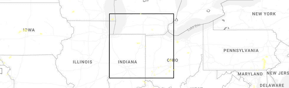
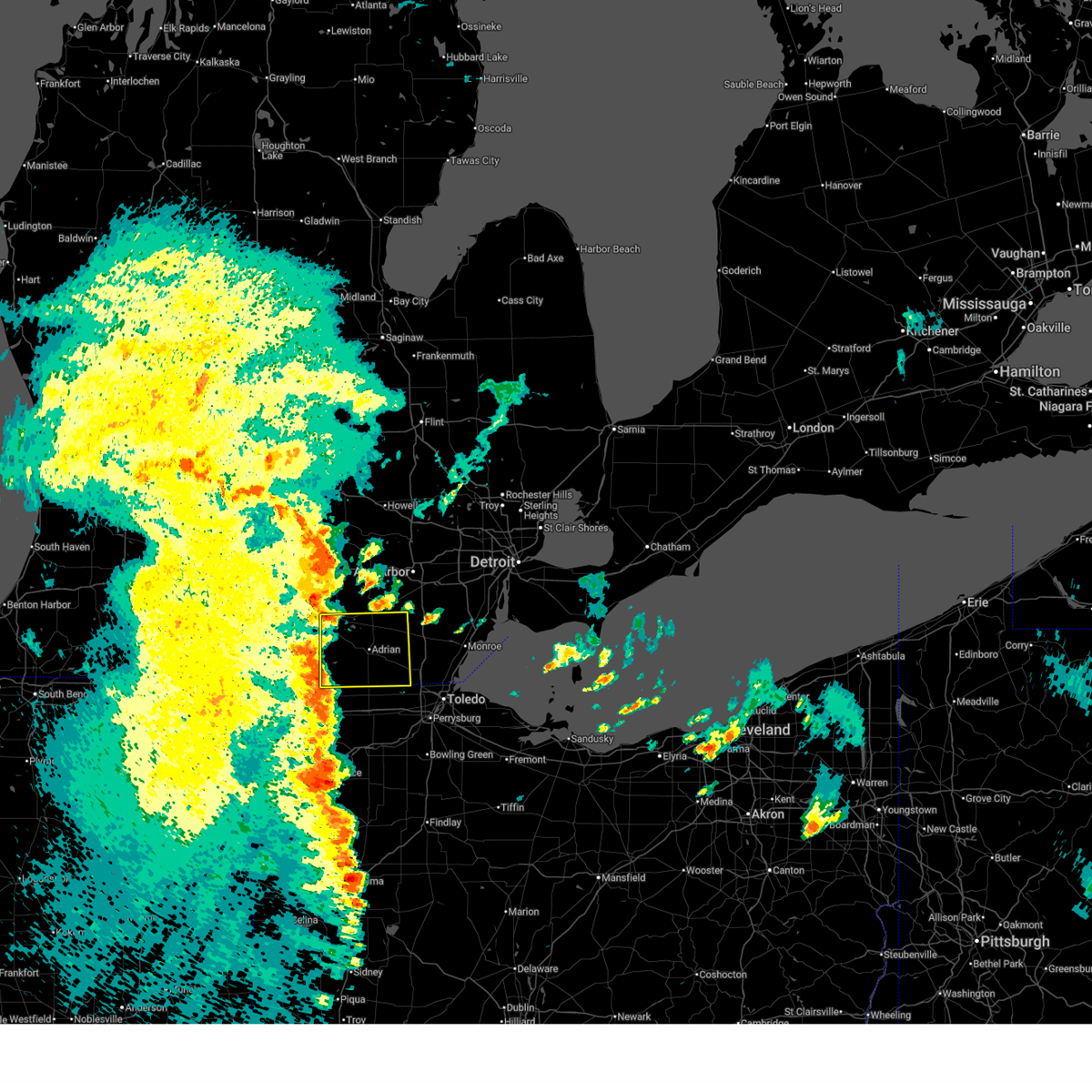
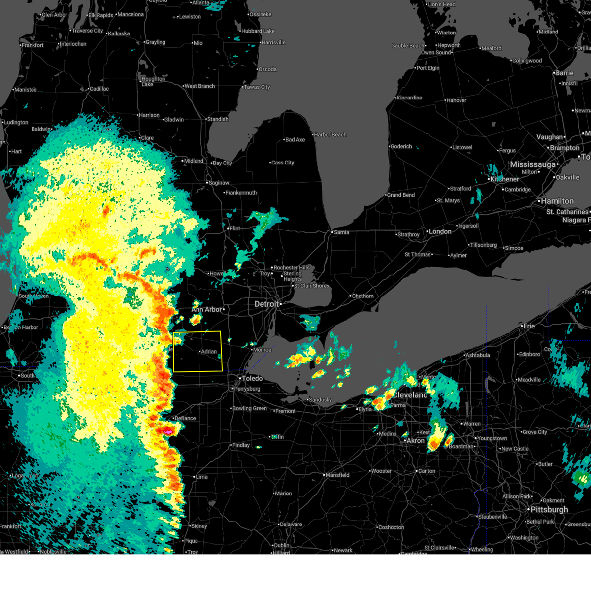
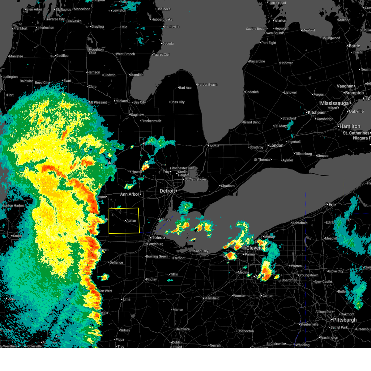
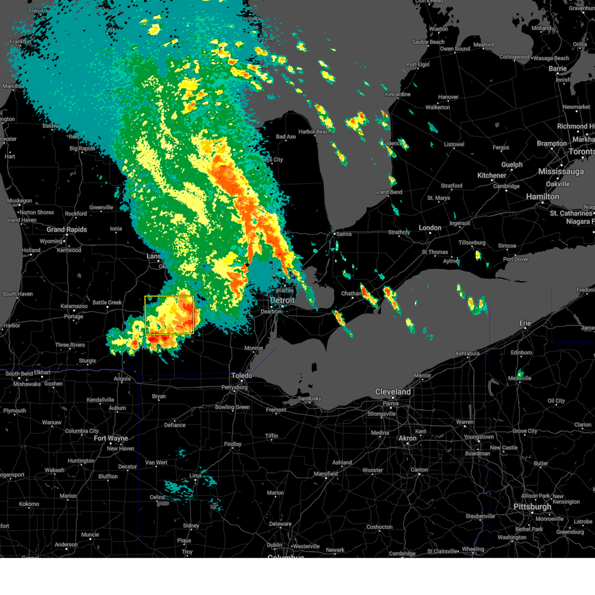
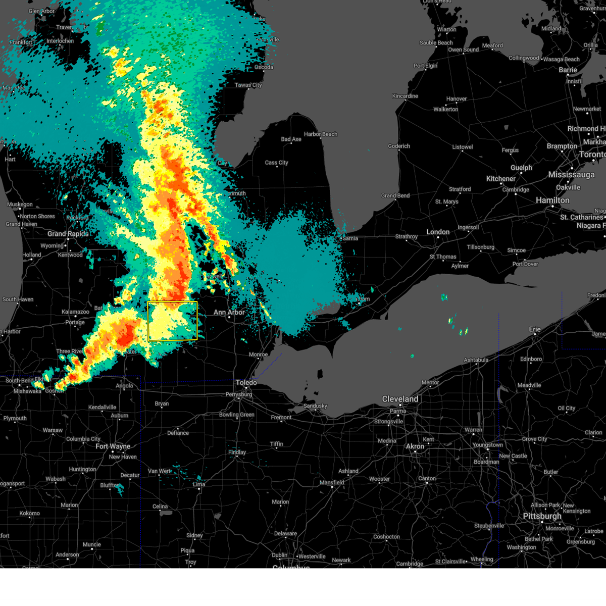
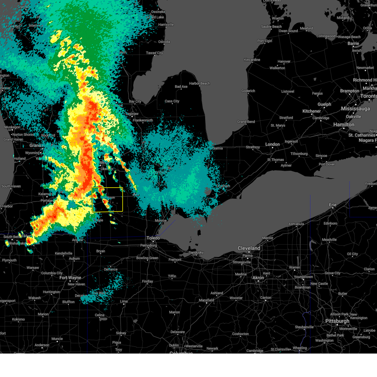
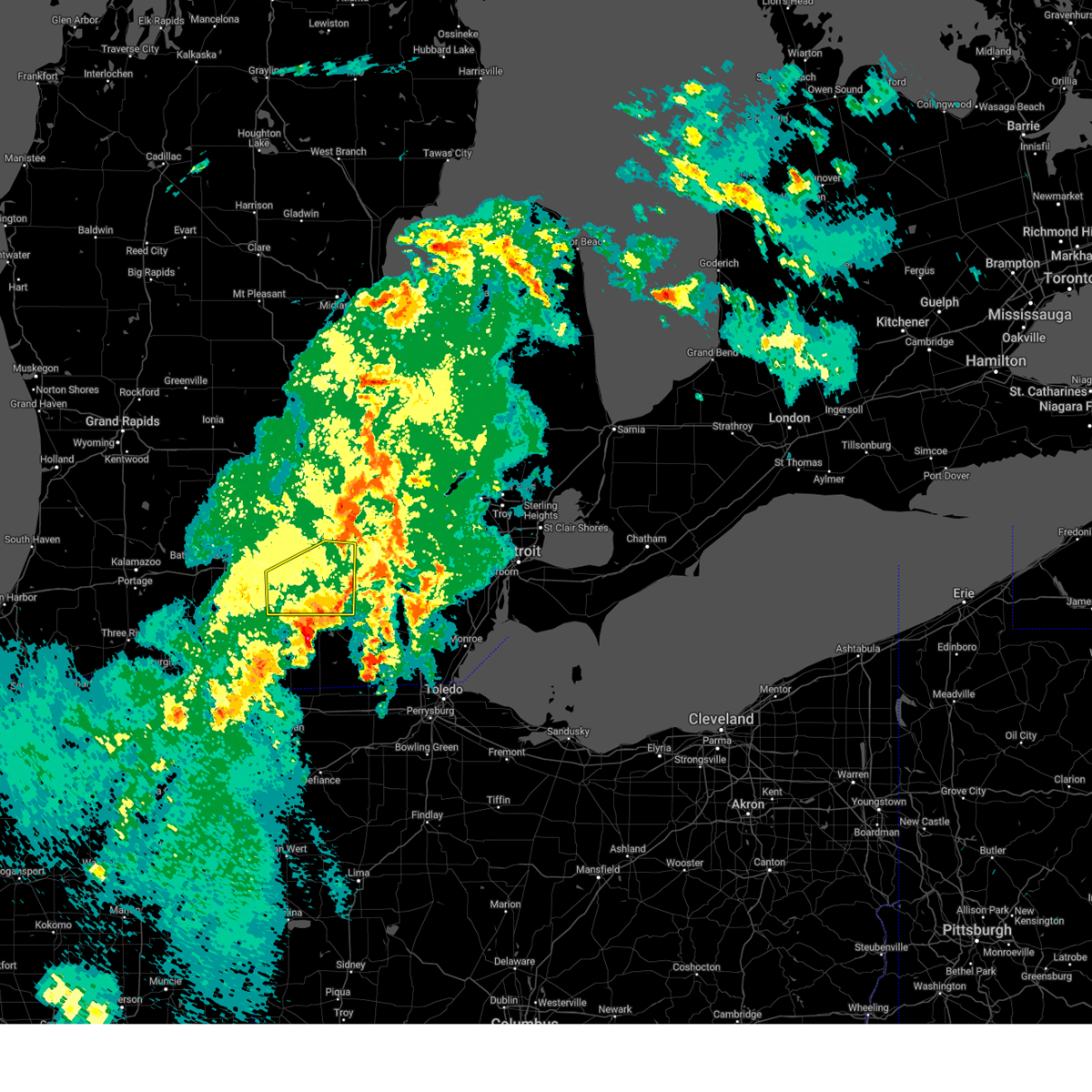
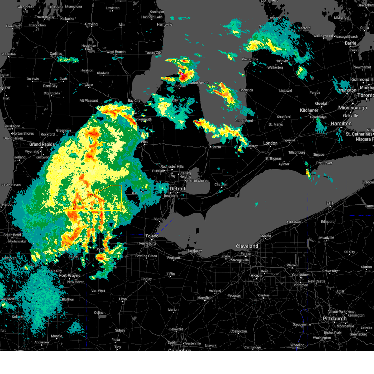
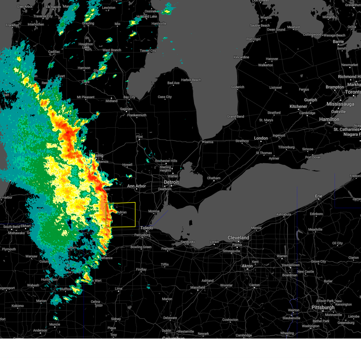
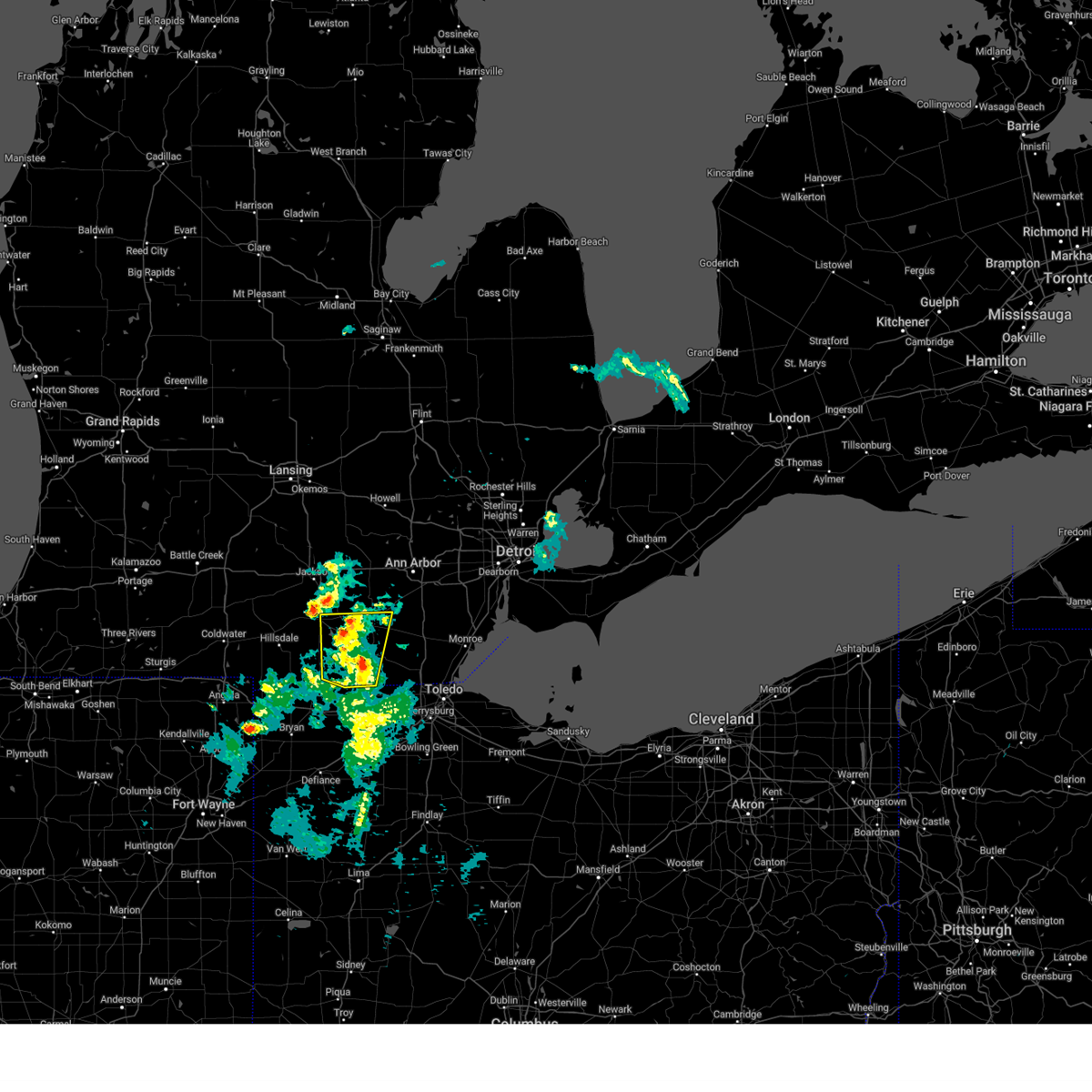
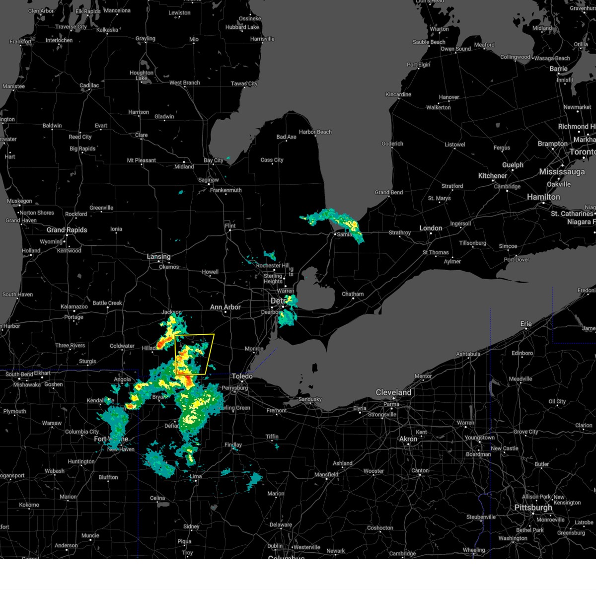
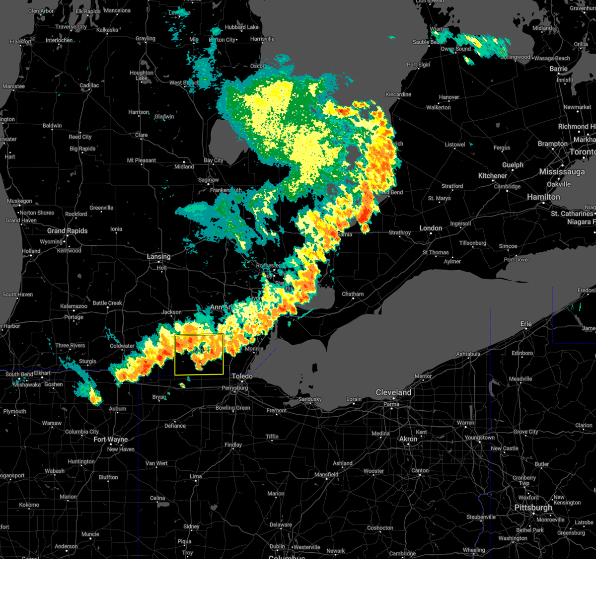
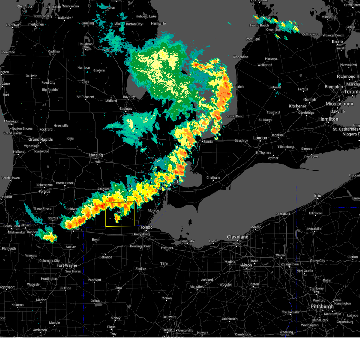
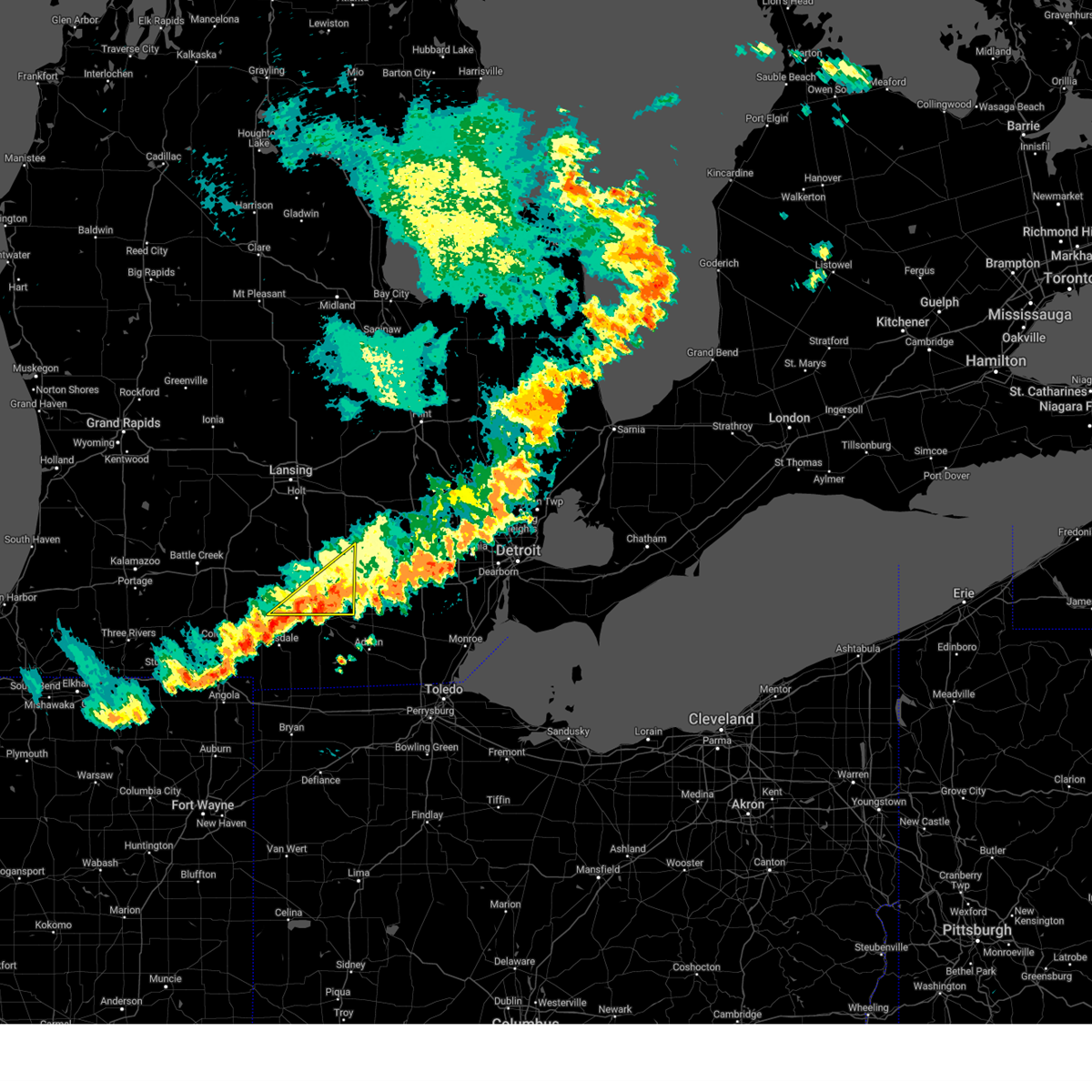
Hail Map for Cement City, MI
The Cement City, MI area has had 0 reports of on-the-ground hail by trained spotters, and has been under severe weather warnings 32 times during the past 12 months. Doppler radar has detected hail at or near Cement City, MI on 26 occasions, including 3 occasions during the past year.
| Name: | Cement City, MI |
| Where Located: | 73 miles SSW of Flint, MI |
| Map: | Google Map for Cement City, MI |
| Population: | 438 |
| Housing Units: | 187 |
| More Info: | Search Google for Cement City, MI |
0
The Top Recent Hail Date for Cement City, MI is Thursday, June 26, 2025 (26th out of 26)
Hail and Wind Damage Spotted near Cement City, MI
| Date / Time | Report Details |
|---|---|
| 6/26/2025 1:45 PM EDT |
 Svrdtx the national weather service in detroit/pontiac has issued a * severe thunderstorm warning for, northern lenawee county in southeastern michigan, * until 300 pm edt. * at 145 pm edt, a severe thunderstorm was located near addison, or 10 miles northwest of hudson, moving east at 35 mph (radar indicated). Hazards include 60 mph wind gusts. Expect damage to roofs, siding, and trees. this severe thunderstorm will be near, addison around 150 pm edt. cement city around 155 pm edt. onsted around 200 pm edt. clinton around 220 pm edt. tecumseh around 225 pm edt. Other locations impacted by this severe thunderstorm include manitou beach-devils lake, rome center, macon, springville, cambridge junction, ridgeway, and tipton. Svrdtx the national weather service in detroit/pontiac has issued a * severe thunderstorm warning for, northern lenawee county in southeastern michigan, * until 300 pm edt. * at 145 pm edt, a severe thunderstorm was located near addison, or 10 miles northwest of hudson, moving east at 35 mph (radar indicated). Hazards include 60 mph wind gusts. Expect damage to roofs, siding, and trees. this severe thunderstorm will be near, addison around 150 pm edt. cement city around 155 pm edt. onsted around 200 pm edt. clinton around 220 pm edt. tecumseh around 225 pm edt. Other locations impacted by this severe thunderstorm include manitou beach-devils lake, rome center, macon, springville, cambridge junction, ridgeway, and tipton.
|
| 6/24/2025 4:46 PM EDT |
 Svrdtx the national weather service in detroit/pontiac has issued a * severe thunderstorm warning for, northern lenawee county in southeastern michigan, southwestern washtenaw county in southeastern michigan, * until 545 pm edt. * at 446 pm edt, a severe thunderstorm was located over cement city, or 13 miles north of hudson, moving east at 25 mph (radar indicated). Hazards include 60 mph wind gusts. Expect damage to roofs, siding, and trees. this severe thunderstorm will be near, onsted around 450 pm edt. tecumseh and clinton around 515 pm edt. Other locations impacted by this severe thunderstorm include manitou beach-devils lake, macon, springville, cambridge junction, bridgewater, ridgeway, tipton, and pleasant lake. Svrdtx the national weather service in detroit/pontiac has issued a * severe thunderstorm warning for, northern lenawee county in southeastern michigan, southwestern washtenaw county in southeastern michigan, * until 545 pm edt. * at 446 pm edt, a severe thunderstorm was located over cement city, or 13 miles north of hudson, moving east at 25 mph (radar indicated). Hazards include 60 mph wind gusts. Expect damage to roofs, siding, and trees. this severe thunderstorm will be near, onsted around 450 pm edt. tecumseh and clinton around 515 pm edt. Other locations impacted by this severe thunderstorm include manitou beach-devils lake, macon, springville, cambridge junction, bridgewater, ridgeway, tipton, and pleasant lake.
|
| 6/18/2025 7:03 PM EDT |
 At 703 pm edt, severe thunderstorms were located along a line extending from near cement city to near adrian to 6 miles southeast of morenci, moving northeast at 55 mph (radar indicated). Hazards include 60 mph wind gusts. Expect damage to roofs, siding, and trees. these severe storms will be near, adrian, tecumseh, and clinton around 710 pm edt. blissfield around 720 pm edt. britton around 725 pm edt. Other locations impacted by these severe thunderstorms include manitou beach-devils lake, seneca, lime creek, macon, munson, canandaigua, ogden center, ridgeway, tipton, and palmyra. At 703 pm edt, severe thunderstorms were located along a line extending from near cement city to near adrian to 6 miles southeast of morenci, moving northeast at 55 mph (radar indicated). Hazards include 60 mph wind gusts. Expect damage to roofs, siding, and trees. these severe storms will be near, adrian, tecumseh, and clinton around 710 pm edt. blissfield around 720 pm edt. britton around 725 pm edt. Other locations impacted by these severe thunderstorms include manitou beach-devils lake, seneca, lime creek, macon, munson, canandaigua, ogden center, ridgeway, tipton, and palmyra.
|
| 6/18/2025 6:50 PM EDT |
 At 649 pm edt, severe thunderstorms were located along a line extending from hudson to morenci to near wauseon, moving northeast at 40 mph (radar indicated). Hazards include 60 mph wind gusts. Expect damage to roofs, siding, and trees. these severe storms will be near, clayton around 655 pm edt. adrian and onsted around 700 pm edt. tecumseh and blissfield around 715 pm edt. clinton and britton around 720 pm edt. deerfield around 725 pm edt. Other locations impacted by these severe thunderstorms include manitou beach-devils lake, seneca, lime creek, macon, munson, canandaigua, ogden center, ridgeway, tipton, and palmyra. At 649 pm edt, severe thunderstorms were located along a line extending from hudson to morenci to near wauseon, moving northeast at 40 mph (radar indicated). Hazards include 60 mph wind gusts. Expect damage to roofs, siding, and trees. these severe storms will be near, clayton around 655 pm edt. adrian and onsted around 700 pm edt. tecumseh and blissfield around 715 pm edt. clinton and britton around 720 pm edt. deerfield around 725 pm edt. Other locations impacted by these severe thunderstorms include manitou beach-devils lake, seneca, lime creek, macon, munson, canandaigua, ogden center, ridgeway, tipton, and palmyra.
|
| 6/18/2025 6:37 PM EDT |
 At 637 pm edt, severe thunderstorms were located along a line extending from 6 miles southwest of hudson to fayette to 6 miles south of stryker, moving northeast at 55 mph (radar indicated). Hazards include 60 mph wind gusts. Expect damage to roofs, siding, and trees. these severe storms will be near, hudson and morenci around 640 pm edt. clayton around 645 pm edt. adrian and onsted around 655 pm edt. blissfield around 700 pm edt. tecumseh, clinton, and deerfield around 705 pm edt. britton around 710 pm edt. Other locations impacted by these severe thunderstorms include manitou beach-devils lake, seneca, lime creek, macon, munson, canandaigua, ogden center, ridgeway, tipton, and palmyra. At 637 pm edt, severe thunderstorms were located along a line extending from 6 miles southwest of hudson to fayette to 6 miles south of stryker, moving northeast at 55 mph (radar indicated). Hazards include 60 mph wind gusts. Expect damage to roofs, siding, and trees. these severe storms will be near, hudson and morenci around 640 pm edt. clayton around 645 pm edt. adrian and onsted around 655 pm edt. blissfield around 700 pm edt. tecumseh, clinton, and deerfield around 705 pm edt. britton around 710 pm edt. Other locations impacted by these severe thunderstorms include manitou beach-devils lake, seneca, lime creek, macon, munson, canandaigua, ogden center, ridgeway, tipton, and palmyra.
|
| 6/18/2025 6:25 PM EDT |
 Svrdtx the national weather service in detroit/pontiac has issued a * severe thunderstorm warning for, lenawee county in southeastern michigan, * until 745 pm edt. * at 624 pm edt, severe thunderstorms were located along a line extending from near pioneer to west unity to 8 miles south of bryan, moving northeast at 55 mph (radar indicated). Hazards include 60 mph wind gusts. Expect damage to roofs, siding, and trees. severe thunderstorms will be near, morenci around 635 pm edt. hudson around 640 pm edt. clayton around 645 pm edt. adrian around 650 pm edt. tecumseh and blissfield around 700 pm edt. clinton, deerfield, and britton around 705 pm edt. Other locations impacted by these severe thunderstorms include manitou beach-devils lake, seneca, lime creek, macon, munson, canandaigua, ogden center, ridgeway, tipton, and palmyra. Svrdtx the national weather service in detroit/pontiac has issued a * severe thunderstorm warning for, lenawee county in southeastern michigan, * until 745 pm edt. * at 624 pm edt, severe thunderstorms were located along a line extending from near pioneer to west unity to 8 miles south of bryan, moving northeast at 55 mph (radar indicated). Hazards include 60 mph wind gusts. Expect damage to roofs, siding, and trees. severe thunderstorms will be near, morenci around 635 pm edt. hudson around 640 pm edt. clayton around 645 pm edt. adrian around 650 pm edt. tecumseh and blissfield around 700 pm edt. clinton, deerfield, and britton around 705 pm edt. Other locations impacted by these severe thunderstorms include manitou beach-devils lake, seneca, lime creek, macon, munson, canandaigua, ogden center, ridgeway, tipton, and palmyra.
|
| 5/16/2025 12:40 AM EDT |
 the severe thunderstorm warning has been cancelled and is no longer in effect the severe thunderstorm warning has been cancelled and is no longer in effect
|
| 5/16/2025 12:04 AM EDT |
 At 1204 am edt, severe thunderstorms were located along a line extending from near albion to near homer, moving northeast at 50 mph (radar indicated). Hazards include 60 mph wind gusts. Expect damage to roofs, siding, and trees. Locations impacted include, jackson, brooklyn, grass lake, vandercook lake, leoni, spring arbor, napoleon, sandstone, norvell, pulaski, concord, horton, springport, parma, hanover, pleasant lake, liberty, clark lake, lake columbia, rives junction,. At 1204 am edt, severe thunderstorms were located along a line extending from near albion to near homer, moving northeast at 50 mph (radar indicated). Hazards include 60 mph wind gusts. Expect damage to roofs, siding, and trees. Locations impacted include, jackson, brooklyn, grass lake, vandercook lake, leoni, spring arbor, napoleon, sandstone, norvell, pulaski, concord, horton, springport, parma, hanover, pleasant lake, liberty, clark lake, lake columbia, rives junction,.
|
| 5/15/2025 11:33 PM EDT |
 Svrgrr the national weather service in grand rapids has issued a * severe thunderstorm warning for, jackson county in south central michigan, * until 100 am edt. * at 1133 pm edt, severe thunderstorms were located along a line extending from near eaton rapids to 5 miles southwest of marshall, moving east at 35 mph (radar indicated). Hazards include 60 mph wind gusts. expect damage to roofs, siding, and trees Svrgrr the national weather service in grand rapids has issued a * severe thunderstorm warning for, jackson county in south central michigan, * until 100 am edt. * at 1133 pm edt, severe thunderstorms were located along a line extending from near eaton rapids to 5 miles southwest of marshall, moving east at 35 mph (radar indicated). Hazards include 60 mph wind gusts. expect damage to roofs, siding, and trees
|
| 4/2/2025 9:41 PM EDT |
 The storms which prompted the warning have weakened below severe limits, and have exited the warned area. therefore, the warning will be allowed to expire. The storms which prompted the warning have weakened below severe limits, and have exited the warned area. therefore, the warning will be allowed to expire.
|
| 4/2/2025 9:15 PM EDT | the severe thunderstorm warning has been cancelled and is no longer in effect |
| 4/2/2025 9:15 PM EDT | At 914 pm edt, severe thunderstorms were located along a line extending from 6 miles east of albion to 8 miles southwest of jackson to 8 miles northwest of addison, moving northeast at 80 mph (radar indicated). Hazards include 60 mph wind gusts. Expect damage to roofs, siding, and trees. Locations impacted include, hanover, parma, grass lake, jackson county airpo, horton, oak point, concord, brooklyn, jackson, pleasant lake, liberty, norvell, pulaski, leoni, napoleon, vandercook lake, clark lake, spring arbor, lake columbia, sunset beach,. |
| 4/2/2025 8:55 PM EDT |
 Svrgrr the national weather service in grand rapids has issued a * severe thunderstorm warning for, southeastern calhoun county in south central michigan, jackson county in south central michigan, * until 945 pm edt. * at 855 pm edt, severe thunderstorms were located along a line extending from 6 miles south of union city to near coldwater to near fremont, moving northeast at 70 mph (radar indicated). Hazards include 70 mph wind gusts. Expect considerable tree damage. Damage is likely to mobile homes, roofs, and outbuildings. Svrgrr the national weather service in grand rapids has issued a * severe thunderstorm warning for, southeastern calhoun county in south central michigan, jackson county in south central michigan, * until 945 pm edt. * at 855 pm edt, severe thunderstorms were located along a line extending from 6 miles south of union city to near coldwater to near fremont, moving northeast at 70 mph (radar indicated). Hazards include 70 mph wind gusts. Expect considerable tree damage. Damage is likely to mobile homes, roofs, and outbuildings.
|
| 3/30/2025 6:28 PM EDT | At 626 pm edt, severe thunderstorms were located along a line extending from lakeview to near grass lake, moving northeast at 55 mph. these are destructive storms for central and southern michigan (jackson asos reported 96 mph winds at 6:17 pm). Hazards include wind gusts in excess of 80 mph. Flying debris will be dangerous to those caught without shelter. mobile homes will be heavily damaged. expect considerable damage to roofs, windows, and vehicles. extensive tree damage and power outages are likely. Locations impacted include, alma, charlotte, elm hall, eden, jackson, bell oak, bath, forest hill, pompeii, spring arbor, riverdale, michigan center, eagle, onondaga, springport, oak point, dansville, lansing, norvell, bannister,. |
| 3/30/2025 6:19 PM EDT |
 At 619 pm edt, severe thunderstorms were located along a line extending from jackson to near clayton to near archbold, moving northeast at 70 mph (radar indicated). Hazards include 70 mph wind gusts and penny size hail. Expect considerable tree damage. damage is likely to mobile homes, roofs, and outbuildings. these severe storms will be near, onsted, morenci, adrian, and clayton around 625 pm edt. tecumseh and clinton around 630 pm edt. blissfield around 635 pm edt. britton around 640 pm edt. deerfield around 645 pm edt. Other locations impacted by these severe thunderstorms include seneca, manitou beach-devils lake, macon, lime creek, munson, ogden center, canandaigua, ridgeway, palmyra, and tipton. At 619 pm edt, severe thunderstorms were located along a line extending from jackson to near clayton to near archbold, moving northeast at 70 mph (radar indicated). Hazards include 70 mph wind gusts and penny size hail. Expect considerable tree damage. damage is likely to mobile homes, roofs, and outbuildings. these severe storms will be near, onsted, morenci, adrian, and clayton around 625 pm edt. tecumseh and clinton around 630 pm edt. blissfield around 635 pm edt. britton around 640 pm edt. deerfield around 645 pm edt. Other locations impacted by these severe thunderstorms include seneca, manitou beach-devils lake, macon, lime creek, munson, ogden center, canandaigua, ridgeway, palmyra, and tipton.
|
| 3/30/2025 6:08 PM EDT |
 At 607 pm edt, severe thunderstorms were located along a line extending from 10 miles northeast of litchfield to 6 miles west of hudson to near bryan, moving northeast at 70 mph (radar indicated). Hazards include 70 mph wind gusts and penny size hail. Expect considerable tree damage. damage is likely to mobile homes, roofs, and outbuildings. these severe storms will be near, hudson and addison around 610 pm edt. cement city, morenci, and clayton around 615 pm edt. onsted around 620 pm edt. adrian around 625 pm edt. tecumseh and clinton around 630 pm edt. blissfield around 635 pm edt. britton and deerfield around 640 pm edt. Other locations impacted by these severe thunderstorms include seneca, manitou beach-devils lake, macon, lime creek, munson, ogden center, canandaigua, ridgeway, palmyra, and tipton. At 607 pm edt, severe thunderstorms were located along a line extending from 10 miles northeast of litchfield to 6 miles west of hudson to near bryan, moving northeast at 70 mph (radar indicated). Hazards include 70 mph wind gusts and penny size hail. Expect considerable tree damage. damage is likely to mobile homes, roofs, and outbuildings. these severe storms will be near, hudson and addison around 610 pm edt. cement city, morenci, and clayton around 615 pm edt. onsted around 620 pm edt. adrian around 625 pm edt. tecumseh and clinton around 630 pm edt. blissfield around 635 pm edt. britton and deerfield around 640 pm edt. Other locations impacted by these severe thunderstorms include seneca, manitou beach-devils lake, macon, lime creek, munson, ogden center, canandaigua, ridgeway, palmyra, and tipton.
|
| 3/30/2025 6:07 PM EDT | At 606 pm edt, severe thunderstorms were located along a line extending from 9 miles south of portland to 7 miles west of cement city, moving east at 70 mph (trained weather spotters at 5 pm reported 70 mph winds southwest of nashville). Hazards include 70 mph wind gusts. Expect considerable tree damage. damage is likely to mobile homes, roofs, and outbuildings. Locations impacted include, alma, charlotte, elm hall, eden, jackson, bell oak, bath, forest hill, pompeii, spring arbor, riverdale, michigan center, eagle, onondaga, springport, oak point, dansville, lansing, norvell, bannister,. |
| 3/30/2025 5:56 PM EDT | Svrgrr the national weather service in grand rapids has issued a * severe thunderstorm warning for, jackson county in south central michigan, ingham county in south central michigan, gratiot county in central michigan, clinton county in south central michigan, eaton county in south central michigan, * until 730 pm edt. * at 555 pm edt, severe thunderstorms were located along a line extending from near lake odessa to 5 miles east of litchfield, moving east at 70 mph. these storms have a history of producing destructive wind gusts of 70 mph (radar indicated). Hazards include 70 mph wind gusts. Expect considerable tree damage. Damage is likely to mobile homes, roofs, and outbuildings. |
| 3/30/2025 5:54 PM EDT |
 Svrdtx the national weather service in detroit/pontiac has issued a * severe thunderstorm warning for, lenawee county in southeastern michigan, * until 700 pm edt. * at 552 pm edt, severe thunderstorms were located along a line extending from near quincy to 8 miles west of pioneer to near hicksville, moving northeast at 65 mph (radar indicated). Hazards include 70 mph wind gusts and penny size hail. Expect considerable tree damage. damage is likely to mobile homes, roofs, and outbuildings. severe thunderstorms will be near, hudson and addison around 610 pm edt. cement city, morenci, and clayton around 615 pm edt. onsted around 620 pm edt. adrian around 625 pm edt. tecumseh and clinton around 630 pm edt. blissfield and britton around 635 pm edt. deerfield around 640 pm edt. Other locations impacted by these severe thunderstorms include seneca, manitou beach-devils lake, macon, lime creek, munson, ogden center, canandaigua, ridgeway, palmyra, and tipton. Svrdtx the national weather service in detroit/pontiac has issued a * severe thunderstorm warning for, lenawee county in southeastern michigan, * until 700 pm edt. * at 552 pm edt, severe thunderstorms were located along a line extending from near quincy to 8 miles west of pioneer to near hicksville, moving northeast at 65 mph (radar indicated). Hazards include 70 mph wind gusts and penny size hail. Expect considerable tree damage. damage is likely to mobile homes, roofs, and outbuildings. severe thunderstorms will be near, hudson and addison around 610 pm edt. cement city, morenci, and clayton around 615 pm edt. onsted around 620 pm edt. adrian around 625 pm edt. tecumseh and clinton around 630 pm edt. blissfield and britton around 635 pm edt. deerfield around 640 pm edt. Other locations impacted by these severe thunderstorms include seneca, manitou beach-devils lake, macon, lime creek, munson, ogden center, canandaigua, ridgeway, palmyra, and tipton.
|
| 3/15/2025 5:20 PM EDT |
 the severe thunderstorm warning has been cancelled and is no longer in effect the severe thunderstorm warning has been cancelled and is no longer in effect
|
| 3/15/2025 4:51 PM EDT |
 At 451 pm edt, a severe thunderstorm was located near adrian, moving northeast at 65 mph (radar indicated). Hazards include 60 mph wind gusts and nickel size hail. Expect damage to roofs, siding, and trees. this severe storm will be near, adrian around 455 pm edt. tecumseh around 500 pm edt. clinton around 505 pm edt. Other locations impacted by this severe thunderstorm include seneca, manitou beach-devils lake, lime creek, canandaigua, tipton, sand creek, jasper, rome center, medina, and weston. At 451 pm edt, a severe thunderstorm was located near adrian, moving northeast at 65 mph (radar indicated). Hazards include 60 mph wind gusts and nickel size hail. Expect damage to roofs, siding, and trees. this severe storm will be near, adrian around 455 pm edt. tecumseh around 500 pm edt. clinton around 505 pm edt. Other locations impacted by this severe thunderstorm include seneca, manitou beach-devils lake, lime creek, canandaigua, tipton, sand creek, jasper, rome center, medina, and weston.
|
| 3/15/2025 4:40 PM EDT |
 Svrdtx the national weather service in detroit/pontiac has issued a * severe thunderstorm warning for, lenawee county in southeastern michigan, * until 545 pm edt. * at 440 pm edt, a severe thunderstorm was located over morenci, moving northeast at 75 mph (radar indicated). Hazards include 60 mph wind gusts and nickel size hail. Expect damage to roofs, siding, and trees. this severe thunderstorm will be near, adrian around 450 pm edt. tecumseh around 455 pm edt. clinton around 500 pm edt. Other locations impacted by this severe thunderstorm include seneca, manitou beach-devils lake, lime creek, munson, canandaigua, tipton, sand creek, jasper, rome center, and medina. Svrdtx the national weather service in detroit/pontiac has issued a * severe thunderstorm warning for, lenawee county in southeastern michigan, * until 545 pm edt. * at 440 pm edt, a severe thunderstorm was located over morenci, moving northeast at 75 mph (radar indicated). Hazards include 60 mph wind gusts and nickel size hail. Expect damage to roofs, siding, and trees. this severe thunderstorm will be near, adrian around 450 pm edt. tecumseh around 455 pm edt. clinton around 500 pm edt. Other locations impacted by this severe thunderstorm include seneca, manitou beach-devils lake, lime creek, munson, canandaigua, tipton, sand creek, jasper, rome center, and medina.
|
| 8/27/2024 6:25 PM EDT |
 At 625 pm edt, severe thunderstorms were located along a line extending from near dundee to near adrian to near hudson, moving east at 40 mph (radar indicated). Hazards include 60 mph wind gusts. Expect damage to roofs, siding, and trees. these severe storms will be near, blissfield and deerfield around 630 pm edt. morenci around 635 pm edt. Other locations impacted by these severe thunderstorms include seneca, manitou beach-devils lake, macon, lime creek, munson, ogden center, canandaigua, ridgeway, palmyra, and tipton. At 625 pm edt, severe thunderstorms were located along a line extending from near dundee to near adrian to near hudson, moving east at 40 mph (radar indicated). Hazards include 60 mph wind gusts. Expect damage to roofs, siding, and trees. these severe storms will be near, blissfield and deerfield around 630 pm edt. morenci around 635 pm edt. Other locations impacted by these severe thunderstorms include seneca, manitou beach-devils lake, macon, lime creek, munson, ogden center, canandaigua, ridgeway, palmyra, and tipton.
|
| 8/27/2024 6:11 PM EDT |
 At 611 pm edt, severe thunderstorms were located along a line extending from willis to near adrian to 7 miles southeast of hillsdale, moving southeast at 40 mph (radar indicated). Hazards include 60 mph wind gusts. Expect damage to roofs, siding, and trees. these severe storms will be near, adrian, hudson, britton, and clayton around 615 pm edt. blissfield and deerfield around 620 pm edt. morenci around 625 pm edt. Other locations impacted by these severe thunderstorms include seneca, manitou beach-devils lake, macon, lime creek, munson, ogden center, canandaigua, ridgeway, palmyra, and tipton. At 611 pm edt, severe thunderstorms were located along a line extending from willis to near adrian to 7 miles southeast of hillsdale, moving southeast at 40 mph (radar indicated). Hazards include 60 mph wind gusts. Expect damage to roofs, siding, and trees. these severe storms will be near, adrian, hudson, britton, and clayton around 615 pm edt. blissfield and deerfield around 620 pm edt. morenci around 625 pm edt. Other locations impacted by these severe thunderstorms include seneca, manitou beach-devils lake, macon, lime creek, munson, ogden center, canandaigua, ridgeway, palmyra, and tipton.
|
| 8/27/2024 6:05 PM EDT |
 At 605 pm edt, severe thunderstorms were located along a line extending from near dexter to near cement city, moving east at 45 mph (radar indicated). Hazards include 60 mph wind gusts and penny size hail. Expect damage to roofs, siding, and trees. Locations impacted include, jackson, brooklyn, grass lake, vandercook lake, leoni, napoleon, norvell, horton, hanover, oak point, liberty, clark lake, lake columbia, sunset beach, michigan center,. At 605 pm edt, severe thunderstorms were located along a line extending from near dexter to near cement city, moving east at 45 mph (radar indicated). Hazards include 60 mph wind gusts and penny size hail. Expect damage to roofs, siding, and trees. Locations impacted include, jackson, brooklyn, grass lake, vandercook lake, leoni, napoleon, norvell, horton, hanover, oak point, liberty, clark lake, lake columbia, sunset beach, michigan center,.
|
| 8/27/2024 5:53 PM EDT |
 At 552 pm edt, severe thunderstorms were located along a line extending from saline to near brooklyn to near reading, moving east at 45 mph (radar indicated). Hazards include 60 mph wind gusts. Expect damage to roofs, siding, and trees. these severe storms will be near, tecumseh, clinton, onsted, and addison around 600 pm edt. hudson and clayton around 610 pm edt. adrian and britton around 615 pm edt. blissfield and deerfield around 635 pm edt. Other locations impacted by these severe thunderstorms include seneca, manitou beach-devils lake, macon, lime creek, munson, ogden center, canandaigua, ridgeway, palmyra, and tipton. At 552 pm edt, severe thunderstorms were located along a line extending from saline to near brooklyn to near reading, moving east at 45 mph (radar indicated). Hazards include 60 mph wind gusts. Expect damage to roofs, siding, and trees. these severe storms will be near, tecumseh, clinton, onsted, and addison around 600 pm edt. hudson and clayton around 610 pm edt. adrian and britton around 615 pm edt. blissfield and deerfield around 635 pm edt. Other locations impacted by these severe thunderstorms include seneca, manitou beach-devils lake, macon, lime creek, munson, ogden center, canandaigua, ridgeway, palmyra, and tipton.
|
| 8/27/2024 5:52 PM EDT |
 At 552 pm edt, severe thunderstorms were located along a line extending from near chelsea to 8 miles west of cement city, moving east at 35 mph (radar indicated). Hazards include 60 mph wind gusts and penny size hail. Expect damage to roofs, siding, and trees. Locations impacted include, jackson, brooklyn, grass lake, vandercook lake, leoni, spring arbor, napoleon, sandstone, norvell, pulaski, concord, horton, hanover, jackson county airpo, oak point, pleasant lake, liberty, clark lake, lake columbia, sunset beach,. At 552 pm edt, severe thunderstorms were located along a line extending from near chelsea to 8 miles west of cement city, moving east at 35 mph (radar indicated). Hazards include 60 mph wind gusts and penny size hail. Expect damage to roofs, siding, and trees. Locations impacted include, jackson, brooklyn, grass lake, vandercook lake, leoni, spring arbor, napoleon, sandstone, norvell, pulaski, concord, horton, hanover, jackson county airpo, oak point, pleasant lake, liberty, clark lake, lake columbia, sunset beach,.
|
| 8/27/2024 5:39 PM EDT |
 Svrdtx the national weather service in detroit/pontiac has issued a * severe thunderstorm warning for, lenawee county in southeastern michigan, * until 700 pm edt. * at 539 pm edt, severe thunderstorms were located along a line extending from near ann arbor to near cement city to near quincy, moving east at 45 mph (radar indicated). Hazards include 60 mph wind gusts. Expect damage to roofs, siding, and trees. severe thunderstorms will be near, addison and cement city around 545 pm edt. clinton and onsted around 550 pm edt. tecumseh around 600 pm edt. hudson, britton, and clayton around 610 pm edt. adrian around 615 pm edt. deerfield around 630 pm edt. blissfield around 635 pm edt. Other locations impacted by these severe thunderstorms include seneca, manitou beach-devils lake, macon, lime creek, munson, ogden center, canandaigua, ridgeway, palmyra, and tipton. Svrdtx the national weather service in detroit/pontiac has issued a * severe thunderstorm warning for, lenawee county in southeastern michigan, * until 700 pm edt. * at 539 pm edt, severe thunderstorms were located along a line extending from near ann arbor to near cement city to near quincy, moving east at 45 mph (radar indicated). Hazards include 60 mph wind gusts. Expect damage to roofs, siding, and trees. severe thunderstorms will be near, addison and cement city around 545 pm edt. clinton and onsted around 550 pm edt. tecumseh around 600 pm edt. hudson, britton, and clayton around 610 pm edt. adrian around 615 pm edt. deerfield around 630 pm edt. blissfield around 635 pm edt. Other locations impacted by these severe thunderstorms include seneca, manitou beach-devils lake, macon, lime creek, munson, ogden center, canandaigua, ridgeway, palmyra, and tipton.
|
| 8/27/2024 5:12 PM EDT |
 Svrgrr the national weather service in grand rapids has issued a * severe thunderstorm warning for, jackson county in south central michigan, * until 615 pm edt. * at 512 pm edt, severe thunderstorms were located along a line extending from 6 miles southwest of stockbridge to near albion, moving east at 45 mph (radar indicated). Hazards include 60 mph wind gusts and penny size hail. expect damage to roofs, siding, and trees Svrgrr the national weather service in grand rapids has issued a * severe thunderstorm warning for, jackson county in south central michigan, * until 615 pm edt. * at 512 pm edt, severe thunderstorms were located along a line extending from 6 miles southwest of stockbridge to near albion, moving east at 45 mph (radar indicated). Hazards include 60 mph wind gusts and penny size hail. expect damage to roofs, siding, and trees
|
| 7/16/2024 2:19 AM EDT |
 the severe thunderstorm warning has been cancelled and is no longer in effect the severe thunderstorm warning has been cancelled and is no longer in effect
|
| 7/16/2024 2:06 AM EDT |
 At 205 am edt, severe thunderstorms were located along a line extending from near grass lake to brooklyn, moving east at 45 mph (radar indicated). Hazards include 60 mph wind gusts. Expect damage to roofs, siding, and trees. Locations impacted include, brooklyn, grass lake, leoni, napoleon, norvell, clark lake, lake columbia, oak point, sunset beach, michigan center,. At 205 am edt, severe thunderstorms were located along a line extending from near grass lake to brooklyn, moving east at 45 mph (radar indicated). Hazards include 60 mph wind gusts. Expect damage to roofs, siding, and trees. Locations impacted include, brooklyn, grass lake, leoni, napoleon, norvell, clark lake, lake columbia, oak point, sunset beach, michigan center,.
|
| 7/16/2024 1:57 AM EDT |
 Svrgrr the national weather service in grand rapids has issued a * severe thunderstorm warning for, jackson county in south central michigan, * until 230 am edt. * at 157 am edt, severe thunderstorms were located along a line extending from 7 miles northwest of jackson to vandercook lake to near addison, moving northeast at 50 mph (radar indicated). Hazards include 60 mph wind gusts. expect damage to roofs, siding, and trees Svrgrr the national weather service in grand rapids has issued a * severe thunderstorm warning for, jackson county in south central michigan, * until 230 am edt. * at 157 am edt, severe thunderstorms were located along a line extending from 7 miles northwest of jackson to vandercook lake to near addison, moving northeast at 50 mph (radar indicated). Hazards include 60 mph wind gusts. expect damage to roofs, siding, and trees
|
| 6/16/2024 11:59 PM EDT |
 The storms which prompted the warning have weakened below severe limits, and no longer pose an immediate threat to life or property. therefore, the warning will be allowed to expire. The storms which prompted the warning have weakened below severe limits, and no longer pose an immediate threat to life or property. therefore, the warning will be allowed to expire.
|
| 6/16/2024 11:21 PM EDT |
 Svrgrr the national weather service in grand rapids has issued a * severe thunderstorm warning for, calhoun county in south central michigan, jackson county in south central michigan, southern ingham county in south central michigan, southeastern eaton county in south central michigan, * until midnight edt. * at 1121 pm edt, severe thunderstorms were located along a line extending from 6 miles west of eaton rapids to near homer, moving east at 35 mph (radar indicated). Hazards include 60 mph wind gusts. expect damage to roofs, siding, and trees Svrgrr the national weather service in grand rapids has issued a * severe thunderstorm warning for, calhoun county in south central michigan, jackson county in south central michigan, southern ingham county in south central michigan, southeastern eaton county in south central michigan, * until midnight edt. * at 1121 pm edt, severe thunderstorms were located along a line extending from 6 miles west of eaton rapids to near homer, moving east at 35 mph (radar indicated). Hazards include 60 mph wind gusts. expect damage to roofs, siding, and trees
|
| 6/13/2024 5:39 PM EDT |
 the severe thunderstorm warning has been cancelled and is no longer in effect the severe thunderstorm warning has been cancelled and is no longer in effect
|
| 6/13/2024 5:01 PM EDT |
 Svrgrr the national weather service in grand rapids has issued a * severe thunderstorm warning for, jackson county in south central michigan, * until 630 pm edt. * at 500 pm edt, severe thunderstorms were located along a line extending from near leslie to near brownlee park, moving southeast at 40 mph (radar indicated). Hazards include 60 mph wind gusts and penny size hail. expect damage to roofs, siding, and trees Svrgrr the national weather service in grand rapids has issued a * severe thunderstorm warning for, jackson county in south central michigan, * until 630 pm edt. * at 500 pm edt, severe thunderstorms were located along a line extending from near leslie to near brownlee park, moving southeast at 40 mph (radar indicated). Hazards include 60 mph wind gusts and penny size hail. expect damage to roofs, siding, and trees
|
| 5/7/2024 8:09 PM EDT |
 The storm which prompted the warning has weakened below severe limits, and no longer poses an immediate threat to life or property. therefore, the warning will be allowed to expire. a tornado watch remains in effect until 1100 pm edt for south central michigan. The storm which prompted the warning has weakened below severe limits, and no longer poses an immediate threat to life or property. therefore, the warning will be allowed to expire. a tornado watch remains in effect until 1100 pm edt for south central michigan.
|
| 5/7/2024 7:57 PM EDT |
 At 757 pm edt, a severe thunderstorm was located 6 miles west of cement city, or 11 miles south of jackson, moving northeast at 60 mph (radar indicated). Hazards include golf ball size hail and 60 mph wind gusts. People and animals outdoors will be injured. expect hail damage to roofs, siding, windows, and vehicles. expect wind damage to roofs, siding, and trees. Locations impacted include, jackson, brooklyn, grass lake, vandercook lake, leoni, spring arbor, napoleon, sandstone, norvell, pulaski, concord, horton, springport, parma, hanover, pleasant lake, liberty, clark lake, lake columbia, rives junction,. At 757 pm edt, a severe thunderstorm was located 6 miles west of cement city, or 11 miles south of jackson, moving northeast at 60 mph (radar indicated). Hazards include golf ball size hail and 60 mph wind gusts. People and animals outdoors will be injured. expect hail damage to roofs, siding, windows, and vehicles. expect wind damage to roofs, siding, and trees. Locations impacted include, jackson, brooklyn, grass lake, vandercook lake, leoni, spring arbor, napoleon, sandstone, norvell, pulaski, concord, horton, springport, parma, hanover, pleasant lake, liberty, clark lake, lake columbia, rives junction,.
|
| 5/7/2024 7:24 PM EDT |
 At 721 pm edt, a severe thunderstorm was located 6 miles northeast of jackson, moving northeast at 35 mph. another severe thunderstorm tracking northeast of homeer in calhoun county could lead to additional damage for the southern part of the county (radar indicated). Hazards include 70 mph wind gusts and quarter size hail. Hail damage to vehicles is expected. expect considerable tree damage. wind damage is also likely to mobile homes, roofs, and outbuildings. Locations impacted include, jackson, brooklyn, grass lake, vandercook lake, leoni, spring arbor, napoleon, sandstone, norvell, pulaski, concord, horton, springport, parma, hanover, pleasant lake, liberty, clark lake, lake columbia, rives junction,. At 721 pm edt, a severe thunderstorm was located 6 miles northeast of jackson, moving northeast at 35 mph. another severe thunderstorm tracking northeast of homeer in calhoun county could lead to additional damage for the southern part of the county (radar indicated). Hazards include 70 mph wind gusts and quarter size hail. Hail damage to vehicles is expected. expect considerable tree damage. wind damage is also likely to mobile homes, roofs, and outbuildings. Locations impacted include, jackson, brooklyn, grass lake, vandercook lake, leoni, spring arbor, napoleon, sandstone, norvell, pulaski, concord, horton, springport, parma, hanover, pleasant lake, liberty, clark lake, lake columbia, rives junction,.
|
| 5/7/2024 6:56 PM EDT |
 At 656 pm edt, a severe thunderstorm was located 6 miles east of albion, moving northeast at 40 mph (radar indicated). Hazards include 70 mph wind gusts and quarter size hail. Hail damage to vehicles is expected. expect considerable tree damage. wind damage is also likely to mobile homes, roofs, and outbuildings. Locations impacted include, jackson, brooklyn, grass lake, vandercook lake, leoni, spring arbor, napoleon, sandstone, norvell, pulaski, concord, horton, springport, parma, hanover, pleasant lake, liberty, clark lake, lake columbia, rives junction,. At 656 pm edt, a severe thunderstorm was located 6 miles east of albion, moving northeast at 40 mph (radar indicated). Hazards include 70 mph wind gusts and quarter size hail. Hail damage to vehicles is expected. expect considerable tree damage. wind damage is also likely to mobile homes, roofs, and outbuildings. Locations impacted include, jackson, brooklyn, grass lake, vandercook lake, leoni, spring arbor, napoleon, sandstone, norvell, pulaski, concord, horton, springport, parma, hanover, pleasant lake, liberty, clark lake, lake columbia, rives junction,.
|
| 5/7/2024 6:42 PM EDT |
 Svrgrr the national weather service in grand rapids has issued a * severe thunderstorm warning for, jackson county in south central michigan, * until 815 pm edt. * at 641 pm edt, a severe thunderstorm was located over homer, or 6 miles southwest of albion, moving northeast at 25 mph (radar indicated). Hazards include 60 mph wind gusts and quarter size hail. Hail damage to vehicles is expected. Expect wind damage to roofs, siding, and trees. Svrgrr the national weather service in grand rapids has issued a * severe thunderstorm warning for, jackson county in south central michigan, * until 815 pm edt. * at 641 pm edt, a severe thunderstorm was located over homer, or 6 miles southwest of albion, moving northeast at 25 mph (radar indicated). Hazards include 60 mph wind gusts and quarter size hail. Hail damage to vehicles is expected. Expect wind damage to roofs, siding, and trees.
|
| 4/17/2024 2:24 PM EDT |
 Svrdtx the national weather service in detroit/pontiac has issued a * severe thunderstorm warning for, lenawee county in southeastern michigan, * until 330 pm edt. * at 223 pm edt, a severe thunderstorm was located near fayette, or 9 miles west of morenci, moving northeast at 40 mph (radar indicated). Hazards include 60 mph wind gusts and nickel size hail. Expect damage to roofs, siding, and trees. this severe thunderstorm will be near, morenci around 230 pm edt. clayton around 240 pm edt. adrian around 250 pm edt. tecumseh around 300 pm edt. britton around 310 pm edt. Other locations impacted by this severe thunderstorm include seneca, manitou beach-devils lake, macon, lime creek, munson, ogden center, canandaigua, ridgeway, palmyra, and tipton. Svrdtx the national weather service in detroit/pontiac has issued a * severe thunderstorm warning for, lenawee county in southeastern michigan, * until 330 pm edt. * at 223 pm edt, a severe thunderstorm was located near fayette, or 9 miles west of morenci, moving northeast at 40 mph (radar indicated). Hazards include 60 mph wind gusts and nickel size hail. Expect damage to roofs, siding, and trees. this severe thunderstorm will be near, morenci around 230 pm edt. clayton around 240 pm edt. adrian around 250 pm edt. tecumseh around 300 pm edt. britton around 310 pm edt. Other locations impacted by this severe thunderstorm include seneca, manitou beach-devils lake, macon, lime creek, munson, ogden center, canandaigua, ridgeway, palmyra, and tipton.
|
| 8/24/2023 10:39 PM EDT |
 At 1038 pm edt, a severe thunderstorm was located over manchester, moving southeast at 20 mph (radar indicated). Hazards include 70 mph wind gusts. Expect considerable tree damage. damage is likely to mobile homes, roofs, and outbuildings. this severe storm will be near, tecumseh around 1105 pm edt. britton around 1130 pm edt. deerfield around 1150 pm edt. Other locations impacted by this severe thunderstorm include manitou beach-devils lake, whittaker, ogden center, canandaigua, ridgeway, palmyra, pleasant lake, sand creek, medina and weston. At 1038 pm edt, a severe thunderstorm was located over manchester, moving southeast at 20 mph (radar indicated). Hazards include 70 mph wind gusts. Expect considerable tree damage. damage is likely to mobile homes, roofs, and outbuildings. this severe storm will be near, tecumseh around 1105 pm edt. britton around 1130 pm edt. deerfield around 1150 pm edt. Other locations impacted by this severe thunderstorm include manitou beach-devils lake, whittaker, ogden center, canandaigua, ridgeway, palmyra, pleasant lake, sand creek, medina and weston.
|
| 8/24/2023 10:25 PM EDT |
 At 1024 pm edt, a severe thunderstorm was located near grass lake, or 7 miles west of manchester, moving east southeast at 60 mph (radar indicated). Hazards include 70 mph wind gusts and penny size hail. Expect considerable tree damage. damage is likely to mobile homes, roofs, and outbuildings. locations impacted include, jackson, brooklyn, grass lake, vandercook lake, leoni, napoleon, norvell, oak point, sunset beach, michigan center, munith, thunderstorm damage threat, considerable hail threat, radar indicated max hail size, 0. 75 in wind threat, radar indicated max wind gust, 70 mph. At 1024 pm edt, a severe thunderstorm was located near grass lake, or 7 miles west of manchester, moving east southeast at 60 mph (radar indicated). Hazards include 70 mph wind gusts and penny size hail. Expect considerable tree damage. damage is likely to mobile homes, roofs, and outbuildings. locations impacted include, jackson, brooklyn, grass lake, vandercook lake, leoni, napoleon, norvell, oak point, sunset beach, michigan center, munith, thunderstorm damage threat, considerable hail threat, radar indicated max hail size, 0. 75 in wind threat, radar indicated max wind gust, 70 mph.
|
| 8/24/2023 9:50 PM EDT |
 At 950 pm edt, severe thunderstorms were located along a line extending from near hartland to 6 miles south of stockbridge to near homer, moving southeast at 45 mph (radar indicated). Hazards include 70 mph wind gusts. Expect considerable tree damage. damage is likely to mobile homes, roofs, and outbuildings. severe thunderstorms will be near, manchester around 1010 pm edt. saline around 1020 pm edt. milan and addison around 1030 pm edt. hudson around 1035 pm edt. clayton around 1040 pm edt. morenci around 1050 pm edt. Other locations impacted by these severe thunderstorms include manitou beach-devils lake, whittaker, ogden center, canandaigua, ridgeway, palmyra, pleasant lake, sand creek, medina and weston. At 950 pm edt, severe thunderstorms were located along a line extending from near hartland to 6 miles south of stockbridge to near homer, moving southeast at 45 mph (radar indicated). Hazards include 70 mph wind gusts. Expect considerable tree damage. damage is likely to mobile homes, roofs, and outbuildings. severe thunderstorms will be near, manchester around 1010 pm edt. saline around 1020 pm edt. milan and addison around 1030 pm edt. hudson around 1035 pm edt. clayton around 1040 pm edt. morenci around 1050 pm edt. Other locations impacted by these severe thunderstorms include manitou beach-devils lake, whittaker, ogden center, canandaigua, ridgeway, palmyra, pleasant lake, sand creek, medina and weston.
|
| 8/24/2023 9:33 PM EDT |
 At 931 pm edt, severe thunderstorms were located along a line extending from 7 miles south of williamston to near eaton rapids, moving southeast at 55 mph. these are destructive storms for rives junction, jackson, grass lake, napoleon and munith (radar indicated). Hazards include 80 mph wind gusts and penny size hail. Flying debris will be dangerous to those caught without shelter. mobile homes will be heavily damaged. expect considerable damage to roofs, windows, and vehicles. Extensive tree damage and power outages are likely. At 931 pm edt, severe thunderstorms were located along a line extending from 7 miles south of williamston to near eaton rapids, moving southeast at 55 mph. these are destructive storms for rives junction, jackson, grass lake, napoleon and munith (radar indicated). Hazards include 80 mph wind gusts and penny size hail. Flying debris will be dangerous to those caught without shelter. mobile homes will be heavily damaged. expect considerable damage to roofs, windows, and vehicles. Extensive tree damage and power outages are likely.
|
| 7/29/2023 1:27 AM EDT |
 At 127 am edt, severe thunderstorms were located along a line extending from near cement city to blissfield to near whitehouse, moving east at 40 mph (radar indicated). Hazards include 60 mph wind gusts and quarter size hail. Hail damage to vehicles is expected. expect wind damage to roofs, siding, and trees. these severe storms will be near, blissfield around 130 am edt. deerfield around 135 am edt. other locations impacted by these severe thunderstorms include seneca, manitou beach-devils lake, macon, lime creek, munson, ogden center, canandaigua, ridgeway, palmyra and tipton. hail threat, radar indicated max hail size, 1. 00 in wind threat, radar indicated max wind gust, 60 mph. At 127 am edt, severe thunderstorms were located along a line extending from near cement city to blissfield to near whitehouse, moving east at 40 mph (radar indicated). Hazards include 60 mph wind gusts and quarter size hail. Hail damage to vehicles is expected. expect wind damage to roofs, siding, and trees. these severe storms will be near, blissfield around 130 am edt. deerfield around 135 am edt. other locations impacted by these severe thunderstorms include seneca, manitou beach-devils lake, macon, lime creek, munson, ogden center, canandaigua, ridgeway, palmyra and tipton. hail threat, radar indicated max hail size, 1. 00 in wind threat, radar indicated max wind gust, 60 mph.
|
| 7/29/2023 1:10 AM EDT |
 At 110 am edt, severe thunderstorms were located along a line extending from 9 miles northeast of jonesville to 6 miles south of adrian to near liberty center, moving east at 45 mph (radar indicated). Hazards include 60 mph wind gusts and quarter size hail. Hail damage to vehicles is expected. expect wind damage to roofs, siding, and trees. these severe storms will be near, adrian around 115 am edt. blissfield around 125 am edt. deerfield around 130 am edt. other locations impacted by these severe thunderstorms include seneca, manitou beach-devils lake, macon, lime creek, munson, ogden center, canandaigua, ridgeway, palmyra and tipton. hail threat, radar indicated max hail size, 1. 00 in wind threat, radar indicated max wind gust, 60 mph. At 110 am edt, severe thunderstorms were located along a line extending from 9 miles northeast of jonesville to 6 miles south of adrian to near liberty center, moving east at 45 mph (radar indicated). Hazards include 60 mph wind gusts and quarter size hail. Hail damage to vehicles is expected. expect wind damage to roofs, siding, and trees. these severe storms will be near, adrian around 115 am edt. blissfield around 125 am edt. deerfield around 130 am edt. other locations impacted by these severe thunderstorms include seneca, manitou beach-devils lake, macon, lime creek, munson, ogden center, canandaigua, ridgeway, palmyra and tipton. hail threat, radar indicated max hail size, 1. 00 in wind threat, radar indicated max wind gust, 60 mph.
|
| 7/29/2023 12:53 AM EDT |
 At 1252 am edt, severe thunderstorms were located along a line extending from litchfield to near clayton to near wauseon, moving east at 45 mph (radar indicated). Hazards include 60 mph wind gusts and quarter size hail. Hail damage to vehicles is expected. expect wind damage to roofs, siding, and trees. severe thunderstorms will be near, adrian around 105 am edt. blissfield around 115 am edt. deerfield and cement city around 120 am edt. onsted around 130 am edt. other locations impacted by these severe thunderstorms include seneca, manitou beach-devils lake, macon, lime creek, munson, ogden center, canandaigua, ridgeway, palmyra and tipton. hail threat, radar indicated max hail size, 1. 00 in wind threat, radar indicated max wind gust, 60 mph. At 1252 am edt, severe thunderstorms were located along a line extending from litchfield to near clayton to near wauseon, moving east at 45 mph (radar indicated). Hazards include 60 mph wind gusts and quarter size hail. Hail damage to vehicles is expected. expect wind damage to roofs, siding, and trees. severe thunderstorms will be near, adrian around 105 am edt. blissfield around 115 am edt. deerfield and cement city around 120 am edt. onsted around 130 am edt. other locations impacted by these severe thunderstorms include seneca, manitou beach-devils lake, macon, lime creek, munson, ogden center, canandaigua, ridgeway, palmyra and tipton. hail threat, radar indicated max hail size, 1. 00 in wind threat, radar indicated max wind gust, 60 mph.
|
| 7/26/2023 7:27 PM EDT |
 The severe thunderstorm warning for jackson county will expire at 730 pm edt, the storms which prompted the warning have weakened below severe limits, and have exited the warned area. therefore, the warning will be allowed to expire. however, lightning and heavy rain are still possible with these thunderstorms. The severe thunderstorm warning for jackson county will expire at 730 pm edt, the storms which prompted the warning have weakened below severe limits, and have exited the warned area. therefore, the warning will be allowed to expire. however, lightning and heavy rain are still possible with these thunderstorms.
|
| 7/26/2023 7:17 PM EDT |
 At 717 pm edt, severe thunderstorms were located along a line extending from 6 miles northwest of jackson to near onsted, moving east at 45 mph (radar indicated). Hazards include 60 mph wind gusts. Expect damage to roofs, siding, and trees. locations impacted include, jackson, brooklyn, grass lake, vandercook lake, leoni, spring arbor, napoleon, sandstone, norvell, pulaski, concord, horton, parma, hanover, jackson county airpo, oak point, sunset beach, michigan center, munith, hail threat, radar indicated max hail size, <. 75 in wind threat, radar indicated max wind gust, 60 mph. At 717 pm edt, severe thunderstorms were located along a line extending from 6 miles northwest of jackson to near onsted, moving east at 45 mph (radar indicated). Hazards include 60 mph wind gusts. Expect damage to roofs, siding, and trees. locations impacted include, jackson, brooklyn, grass lake, vandercook lake, leoni, spring arbor, napoleon, sandstone, norvell, pulaski, concord, horton, parma, hanover, jackson county airpo, oak point, sunset beach, michigan center, munith, hail threat, radar indicated max hail size, <. 75 in wind threat, radar indicated max wind gust, 60 mph.
|
| 7/26/2023 6:34 PM EDT |
 At 634 pm edt, a severe thunderstorm was located near homer, or 9 miles southwest of albion, moving east at 55 mph (radar indicated). Hazards include 60 mph wind gusts. expect damage to roofs, siding, and trees At 634 pm edt, a severe thunderstorm was located near homer, or 9 miles southwest of albion, moving east at 55 mph (radar indicated). Hazards include 60 mph wind gusts. expect damage to roofs, siding, and trees
|
| 7/26/2023 2:38 PM EDT |
 At 237 pm edt, severe thunderstorms were located along a line extending from near onsted to clayton to near fayette, moving east at 50 mph (radar indicated). Hazards include 60 mph wind gusts. Expect damage to roofs, siding, and trees. these severe storms will be near, adrian and tecumseh around 250 pm edt. britton around 300 pm edt. blissfield and deerfield around 305 pm edt. other locations impacted by these severe thunderstorms include seneca, manitou beach-devils lake, macon, lime creek, munson, ogden center, canandaigua, ridgeway, palmyra and tipton. people attending lenawee county fair should seek safe shelter immediately! hail threat, radar indicated max hail size, <. 75 in wind threat, radar indicated max wind gust, 60 mph. At 237 pm edt, severe thunderstorms were located along a line extending from near onsted to clayton to near fayette, moving east at 50 mph (radar indicated). Hazards include 60 mph wind gusts. Expect damage to roofs, siding, and trees. these severe storms will be near, adrian and tecumseh around 250 pm edt. britton around 300 pm edt. blissfield and deerfield around 305 pm edt. other locations impacted by these severe thunderstorms include seneca, manitou beach-devils lake, macon, lime creek, munson, ogden center, canandaigua, ridgeway, palmyra and tipton. people attending lenawee county fair should seek safe shelter immediately! hail threat, radar indicated max hail size, <. 75 in wind threat, radar indicated max wind gust, 60 mph.
|
| 7/26/2023 2:30 PM EDT |
 At 230 pm edt, a severe thunderstorm was located near cement city, or 10 miles southeast of jackson, moving northeast at 50 mph (radar indicated). Hazards include 70 mph wind gusts. Expect considerable tree damage. damage is likely to mobile homes, roofs, and outbuildings. this severe thunderstorm will be near, grass lake around 240 pm edt. other locations impacted by this severe thunderstorm include brooklyn, oak point, sunset beach, michigan center, norvell, leoni and napoleon. thunderstorm damage threat, considerable hail threat, radar indicated max hail size, <. 75 in wind threat, radar indicated max wind gust, 70 mph. At 230 pm edt, a severe thunderstorm was located near cement city, or 10 miles southeast of jackson, moving northeast at 50 mph (radar indicated). Hazards include 70 mph wind gusts. Expect considerable tree damage. damage is likely to mobile homes, roofs, and outbuildings. this severe thunderstorm will be near, grass lake around 240 pm edt. other locations impacted by this severe thunderstorm include brooklyn, oak point, sunset beach, michigan center, norvell, leoni and napoleon. thunderstorm damage threat, considerable hail threat, radar indicated max hail size, <. 75 in wind threat, radar indicated max wind gust, 70 mph.
|
| 7/26/2023 2:25 PM EDT | Spotter reports numerous large trees uprooted or down at the trailer park in somerset center. time estimated via radar. photos on twitte in hillsdale county MI, 4.8 miles ENE of Cement City, MI |
| 7/26/2023 2:24 PM EDT | Several trees down and/or uprooted in somerset center in mccourtie park. time estimated from radar. several photos on twitte in hillsdale county MI, 4.3 miles ENE of Cement City, MI |
| 7/26/2023 2:18 PM EDT |
 At 218 pm edt, severe thunderstorms were located along a line extending from 6 miles east of litchfield to near hillsdale to near montpelier, moving east at 50 mph (radar indicated). Hazards include 60 mph wind gusts. Expect damage to roofs, siding, and trees. severe thunderstorms will be near, hudson, addison and cement city around 235 pm edt. onsted and clayton around 245 pm edt. adrian around 255 pm edt. tecumseh around 300 pm edt. blissfield and britton around 310 pm edt. deerfield around 315 pm edt. other locations impacted by these severe thunderstorms include seneca, manitou beach-devils lake, macon, lime creek, munson, ogden center, canandaigua, ridgeway, palmyra and tipton. people attending lenawee county fair should seek safe shelter immediately! hail threat, radar indicated max hail size, <. 75 in wind threat, radar indicated max wind gust, 60 mph. At 218 pm edt, severe thunderstorms were located along a line extending from 6 miles east of litchfield to near hillsdale to near montpelier, moving east at 50 mph (radar indicated). Hazards include 60 mph wind gusts. Expect damage to roofs, siding, and trees. severe thunderstorms will be near, hudson, addison and cement city around 235 pm edt. onsted and clayton around 245 pm edt. adrian around 255 pm edt. tecumseh around 300 pm edt. blissfield and britton around 310 pm edt. deerfield around 315 pm edt. other locations impacted by these severe thunderstorms include seneca, manitou beach-devils lake, macon, lime creek, munson, ogden center, canandaigua, ridgeway, palmyra and tipton. people attending lenawee county fair should seek safe shelter immediately! hail threat, radar indicated max hail size, <. 75 in wind threat, radar indicated max wind gust, 60 mph.
|
| 7/20/2023 2:48 PM EDT |
 At 247 pm edt, severe thunderstorms were located along a line extending from 5 miles east of eaton rapids to 10 miles northeast of albion, moving east at 35 mph (radar indicated). Hazards include 60 mph wind gusts and quarter size hail. Hail damage to vehicles is expected. Expect wind damage to roofs, siding, and trees. At 247 pm edt, severe thunderstorms were located along a line extending from 5 miles east of eaton rapids to 10 miles northeast of albion, moving east at 35 mph (radar indicated). Hazards include 60 mph wind gusts and quarter size hail. Hail damage to vehicles is expected. Expect wind damage to roofs, siding, and trees.
|
| 6/25/2023 5:43 PM EDT |
 At 542 pm edt, severe thunderstorms were located along a line extending from near williamston to 5 miles northeast of vandercook lake, moving northeast at 35 mph (radar indicated). Hazards include 60 mph wind gusts and penny size hail. Expect damage to roofs, siding, and trees. locations impacted include, jackson, mason, williamston, leslie, stockbridge, brooklyn, grass lake, vandercook lake, leoni, napoleon, sandstone, aurelius, norvell, bunker hill, webberville, horton, dansville, eden, bell oak, rives junction, hail threat, radar indicated max hail size, 0. 75 in wind threat, radar indicated max wind gust, 60 mph. At 542 pm edt, severe thunderstorms were located along a line extending from near williamston to 5 miles northeast of vandercook lake, moving northeast at 35 mph (radar indicated). Hazards include 60 mph wind gusts and penny size hail. Expect damage to roofs, siding, and trees. locations impacted include, jackson, mason, williamston, leslie, stockbridge, brooklyn, grass lake, vandercook lake, leoni, napoleon, sandstone, aurelius, norvell, bunker hill, webberville, horton, dansville, eden, bell oak, rives junction, hail threat, radar indicated max hail size, 0. 75 in wind threat, radar indicated max wind gust, 60 mph.
|
| 6/25/2023 5:32 PM EDT |
 At 532 pm edt, a severe thunderstorm was located near tecumseh, moving northeast at 45 mph (radar indicated). Hazards include 60 mph wind gusts. Expect damage to roofs, siding, and trees. this severe storm will be near, tecumseh and britton around 540 pm edt. Other locations impacted by this severe thunderstorm include seneca, manitou beach-devils lake, macon, ogden center, canandaigua, ridgeway, palmyra, tipton, sand creek and jasper. At 532 pm edt, a severe thunderstorm was located near tecumseh, moving northeast at 45 mph (radar indicated). Hazards include 60 mph wind gusts. Expect damage to roofs, siding, and trees. this severe storm will be near, tecumseh and britton around 540 pm edt. Other locations impacted by this severe thunderstorm include seneca, manitou beach-devils lake, macon, ogden center, canandaigua, ridgeway, palmyra, tipton, sand creek and jasper.
|
| 6/25/2023 5:26 PM EDT |
 At 525 pm edt, severe thunderstorms were located along a line extending from near mason to 6 miles southwest of vandercook lake, moving northeast at 30 mph (radar indicated). Hazards include 60 mph wind gusts and penny size hail. Expect damage to roofs, siding, and trees. locations impacted include, jackson, mason, williamston, leslie, stockbridge, brooklyn, grass lake, vandercook lake, leoni, spring arbor, napoleon, sandstone, aurelius, onondaga, norvell, bunker hill, webberville, concord, horton, parma, hail threat, radar indicated max hail size, 0. 75 in wind threat, radar indicated max wind gust, 60 mph. At 525 pm edt, severe thunderstorms were located along a line extending from near mason to 6 miles southwest of vandercook lake, moving northeast at 30 mph (radar indicated). Hazards include 60 mph wind gusts and penny size hail. Expect damage to roofs, siding, and trees. locations impacted include, jackson, mason, williamston, leslie, stockbridge, brooklyn, grass lake, vandercook lake, leoni, spring arbor, napoleon, sandstone, aurelius, onondaga, norvell, bunker hill, webberville, concord, horton, parma, hail threat, radar indicated max hail size, 0. 75 in wind threat, radar indicated max wind gust, 60 mph.
|
| 6/25/2023 5:22 PM EDT |
 At 522 pm edt, a severe thunderstorm was located near adrian, moving east at 45 mph (radar indicated). Hazards include 70 mph wind gusts and penny size hail. Expect considerable tree damage. damage is likely to mobile homes, roofs, and outbuildings. this severe storm will be near, blissfield around 535 pm edt. tecumseh around 540 pm edt. deerfield and britton around 545 pm edt. other locations impacted by this severe thunderstorm include seneca, manitou beach-devils lake, macon, lime creek, munson, ogden center, canandaigua, ridgeway, palmyra and tipton. thunderstorm damage threat, considerable hail threat, radar indicated max hail size, 0. 75 in wind threat, radar indicated max wind gust, 70 mph. At 522 pm edt, a severe thunderstorm was located near adrian, moving east at 45 mph (radar indicated). Hazards include 70 mph wind gusts and penny size hail. Expect considerable tree damage. damage is likely to mobile homes, roofs, and outbuildings. this severe storm will be near, blissfield around 535 pm edt. tecumseh around 540 pm edt. deerfield and britton around 545 pm edt. other locations impacted by this severe thunderstorm include seneca, manitou beach-devils lake, macon, lime creek, munson, ogden center, canandaigua, ridgeway, palmyra and tipton. thunderstorm damage threat, considerable hail threat, radar indicated max hail size, 0. 75 in wind threat, radar indicated max wind gust, 70 mph.
|
| 6/25/2023 5:07 PM EDT |
 At 507 pm edt, a severe thunderstorm was located near morenci, moving northeast at 55 mph (radar indicated). Hazards include 70 mph wind gusts and penny size hail. Expect considerable tree damage. damage is likely to mobile homes, roofs, and outbuildings. this severe storm will be near, clayton around 515 pm edt. adrian around 525 pm edt. tecumseh around 530 pm edt. deerfield and britton around 535 pm edt. other locations impacted by this severe thunderstorm include seneca, manitou beach-devils lake, macon, lime creek, munson, ogden center, canandaigua, ridgeway, palmyra and tipton. thunderstorm damage threat, considerable hail threat, radar indicated max hail size, 0. 75 in wind threat, radar indicated max wind gust, 70 mph. At 507 pm edt, a severe thunderstorm was located near morenci, moving northeast at 55 mph (radar indicated). Hazards include 70 mph wind gusts and penny size hail. Expect considerable tree damage. damage is likely to mobile homes, roofs, and outbuildings. this severe storm will be near, clayton around 515 pm edt. adrian around 525 pm edt. tecumseh around 530 pm edt. deerfield and britton around 535 pm edt. other locations impacted by this severe thunderstorm include seneca, manitou beach-devils lake, macon, lime creek, munson, ogden center, canandaigua, ridgeway, palmyra and tipton. thunderstorm damage threat, considerable hail threat, radar indicated max hail size, 0. 75 in wind threat, radar indicated max wind gust, 70 mph.
|
| 6/25/2023 5:03 PM EDT |
 At 503 pm edt, severe thunderstorms were located along a line extending from 5 miles southwest of eaton rapids to 5 miles northeast of litchfield, moving northeast at 30 mph (radar indicated). Hazards include 60 mph wind gusts and penny size hail. expect damage to roofs, siding, and trees At 503 pm edt, severe thunderstorms were located along a line extending from 5 miles southwest of eaton rapids to 5 miles northeast of litchfield, moving northeast at 30 mph (radar indicated). Hazards include 60 mph wind gusts and penny size hail. expect damage to roofs, siding, and trees
|
| 6/25/2023 4:51 PM EDT |
 At 450 pm edt, a severe thunderstorm was located over pioneer, or 7 miles north of montpelier, moving east at 50 mph (radar indicated). Hazards include 70 mph wind gusts and penny size hail. Expect considerable tree damage. damage is likely to mobile homes, roofs, and outbuildings. this severe thunderstorm will be near, hudson around 510 pm edt. morenci and clayton around 515 pm edt. adrian around 530 pm edt. blissfield around 540 pm edt. deerfield and britton around 545 pm edt. other locations impacted by this severe thunderstorm include seneca, manitou beach-devils lake, macon, lime creek, munson, ogden center, canandaigua, ridgeway, palmyra and tipton. thunderstorm damage threat, considerable hail threat, radar indicated max hail size, 0. 75 in wind threat, radar indicated max wind gust, 70 mph. At 450 pm edt, a severe thunderstorm was located over pioneer, or 7 miles north of montpelier, moving east at 50 mph (radar indicated). Hazards include 70 mph wind gusts and penny size hail. Expect considerable tree damage. damage is likely to mobile homes, roofs, and outbuildings. this severe thunderstorm will be near, hudson around 510 pm edt. morenci and clayton around 515 pm edt. adrian around 530 pm edt. blissfield around 540 pm edt. deerfield and britton around 545 pm edt. other locations impacted by this severe thunderstorm include seneca, manitou beach-devils lake, macon, lime creek, munson, ogden center, canandaigua, ridgeway, palmyra and tipton. thunderstorm damage threat, considerable hail threat, radar indicated max hail size, 0. 75 in wind threat, radar indicated max wind gust, 70 mph.
|
| 4/5/2023 12:29 PM EDT |
 At 1228 pm edt, severe thunderstorms were located along a line extending from 5 miles northeast of grass lake to 9 miles northeast of litchfield, moving east at 50 mph (radar indicated). Hazards include 60 mph wind gusts. Expect damage to roofs, siding, and trees. locations impacted include, jackson, brooklyn, grass lake, vandercook lake, leoni, spring arbor, napoleon, sandstone, norvell, pulaski, concord, horton, hanover, jackson county airpo, oak point, sunset beach, michigan center, munith, hail threat, radar indicated max hail size, <. 75 in wind threat, radar indicated max wind gust, 60 mph. At 1228 pm edt, severe thunderstorms were located along a line extending from 5 miles northeast of grass lake to 9 miles northeast of litchfield, moving east at 50 mph (radar indicated). Hazards include 60 mph wind gusts. Expect damage to roofs, siding, and trees. locations impacted include, jackson, brooklyn, grass lake, vandercook lake, leoni, spring arbor, napoleon, sandstone, norvell, pulaski, concord, horton, hanover, jackson county airpo, oak point, sunset beach, michigan center, munith, hail threat, radar indicated max hail size, <. 75 in wind threat, radar indicated max wind gust, 60 mph.
|
| 4/5/2023 11:53 AM EDT |
 At 1153 am edt, severe thunderstorms were located along a line extending from 5 miles south of eaton rapids to near albion to near homer, moving east at 55 mph (radar indicated). Hazards include 60 mph wind gusts. expect damage to roofs, siding, and trees At 1153 am edt, severe thunderstorms were located along a line extending from 5 miles south of eaton rapids to near albion to near homer, moving east at 55 mph (radar indicated). Hazards include 60 mph wind gusts. expect damage to roofs, siding, and trees
|
| 9/21/2022 11:37 AM EDT |
 The severe thunderstorm warning for jackson county will expire at 1145 am edt, the storms which prompted the warning will soon exit the warned area. therefore, the warning will be allowed to expire. a severe thunderstorm watch remains in effect until 100 pm edt for south central michigan. The severe thunderstorm warning for jackson county will expire at 1145 am edt, the storms which prompted the warning will soon exit the warned area. therefore, the warning will be allowed to expire. a severe thunderstorm watch remains in effect until 100 pm edt for south central michigan.
|
| 9/21/2022 11:13 AM EDT |
 At 1113 am edt, severe thunderstorms were located along a line extending from near grass lake to near vandercook lake, moving east at 40 mph (radar indicated). Hazards include 60 mph wind gusts and quarter size hail. Hail damage to vehicles is expected. expect wind damage to roofs, siding, and trees. locations impacted include, jackson, brooklyn, grass lake, vandercook lake, leoni, spring arbor, napoleon, sandstone, norvell, pulaski, concord, horton, hanover, jackson county airpo, oak point, sunset beach, michigan center, munith, hail threat, radar indicated max hail size, 1. 00 in wind threat, radar indicated max wind gust, 60 mph. At 1113 am edt, severe thunderstorms were located along a line extending from near grass lake to near vandercook lake, moving east at 40 mph (radar indicated). Hazards include 60 mph wind gusts and quarter size hail. Hail damage to vehicles is expected. expect wind damage to roofs, siding, and trees. locations impacted include, jackson, brooklyn, grass lake, vandercook lake, leoni, spring arbor, napoleon, sandstone, norvell, pulaski, concord, horton, hanover, jackson county airpo, oak point, sunset beach, michigan center, munith, hail threat, radar indicated max hail size, 1. 00 in wind threat, radar indicated max wind gust, 60 mph.
|
| 9/21/2022 10:46 AM EDT |
 At 1045 am edt, severe thunderstorms were located along a line extending from 6 miles southwest of leslie to near albion, moving southeast at 40 mph (radar indicated). Hazards include 60 mph wind gusts and quarter size hail. Hail damage to vehicles is expected. Expect wind damage to roofs, siding, and trees. At 1045 am edt, severe thunderstorms were located along a line extending from 6 miles southwest of leslie to near albion, moving southeast at 40 mph (radar indicated). Hazards include 60 mph wind gusts and quarter size hail. Hail damage to vehicles is expected. Expect wind damage to roofs, siding, and trees.
|
| 8/29/2022 5:41 PM EDT |
 At 541 pm edt, severe thunderstorms were located along a line extending from near tecumseh to near adrian to near morenci, moving east at 45 mph (radar indicated). Hazards include 60 mph wind gusts. Expect damage to roofs, siding, and trees. these severe storms will be near, tecumseh around 545 pm edt. blissfield around 555 pm edt. milan, deerfield and britton around 600 pm edt. petersburg and ottawa lake around 605 pm edt. dundee around 610 pm edt. temperance, ida and lambertville around 615 pm edt. carleton and maybee around 620 pm edt. monroe and flat rock around 625 pm edt. other locations impacted by these severe thunderstorms include newport, manitou beach-devils lake, ogden center, canandaigua, erie, woodland beach, stony point, ridgeway, palmyra and bolles harbor. hail threat, radar indicated max hail size, <. 75 in wind threat, radar indicated max wind gust, 60 mph. At 541 pm edt, severe thunderstorms were located along a line extending from near tecumseh to near adrian to near morenci, moving east at 45 mph (radar indicated). Hazards include 60 mph wind gusts. Expect damage to roofs, siding, and trees. these severe storms will be near, tecumseh around 545 pm edt. blissfield around 555 pm edt. milan, deerfield and britton around 600 pm edt. petersburg and ottawa lake around 605 pm edt. dundee around 610 pm edt. temperance, ida and lambertville around 615 pm edt. carleton and maybee around 620 pm edt. monroe and flat rock around 625 pm edt. other locations impacted by these severe thunderstorms include newport, manitou beach-devils lake, ogden center, canandaigua, erie, woodland beach, stony point, ridgeway, palmyra and bolles harbor. hail threat, radar indicated max hail size, <. 75 in wind threat, radar indicated max wind gust, 60 mph.
|
| 8/29/2022 5:36 PM EDT |
 The severe thunderstorm warning for jackson and southern ingham counties will expire at 545 pm edt, the storms which prompted the warning will soon exit the warned area. therefore, the warning will be allowed to expire. a severe thunderstorm watch remains in effect until 800 pm edt for south central michigan. The severe thunderstorm warning for jackson and southern ingham counties will expire at 545 pm edt, the storms which prompted the warning will soon exit the warned area. therefore, the warning will be allowed to expire. a severe thunderstorm watch remains in effect until 800 pm edt for south central michigan.
|
| 8/29/2022 5:21 PM EDT |
 At 521 pm edt, severe thunderstorms were located along a line extending from near brooklyn to near hudson to near holiday city, moving east at 45 mph (radar indicated). Hazards include 60 mph wind gusts. Expect damage to roofs, siding, and trees. severe thunderstorms will be near, onsted and cement city around 525 pm edt. clayton around 530 pm edt. morenci around 540 pm edt. adrian around 545 pm edt. tecumseh around 550 pm edt. deerfield and britton around 600 pm edt. blissfield and petersburg around 605 pm edt. milan, dundee and ottawa lake around 610 pm edt. other locations impacted by these severe thunderstorms include newport, manitou beach-devils lake, ogden center, canandaigua, erie, woodland beach, stony point, ridgeway, palmyra and bolles harbor. hail threat, radar indicated max hail size, <. 75 in wind threat, radar indicated max wind gust, 60 mph. At 521 pm edt, severe thunderstorms were located along a line extending from near brooklyn to near hudson to near holiday city, moving east at 45 mph (radar indicated). Hazards include 60 mph wind gusts. Expect damage to roofs, siding, and trees. severe thunderstorms will be near, onsted and cement city around 525 pm edt. clayton around 530 pm edt. morenci around 540 pm edt. adrian around 545 pm edt. tecumseh around 550 pm edt. deerfield and britton around 600 pm edt. blissfield and petersburg around 605 pm edt. milan, dundee and ottawa lake around 610 pm edt. other locations impacted by these severe thunderstorms include newport, manitou beach-devils lake, ogden center, canandaigua, erie, woodland beach, stony point, ridgeway, palmyra and bolles harbor. hail threat, radar indicated max hail size, <. 75 in wind threat, radar indicated max wind gust, 60 mph.
|
| 8/29/2022 5:19 PM EDT |
 At 517 pm edt, severe thunderstorms were located along a line extending from near gregory to near cement city, moving east at 45 mph (radar indicated. these storms have a history of producing damaging winds and power outages). Hazards include 60 mph wind gusts and penny size hail. Expect damage to roofs, siding, and trees. locations impacted include, jackson, mason, leslie, stockbridge, brooklyn, grass lake, vandercook lake, leoni, spring arbor, napoleon, sandstone, onondaga, norvell, bunker hill, pulaski, concord, horton, parma, dansville, eden, hail threat, radar indicated max hail size, 0. 75 in wind threat, observed max wind gust, 60 mph. At 517 pm edt, severe thunderstorms were located along a line extending from near gregory to near cement city, moving east at 45 mph (radar indicated. these storms have a history of producing damaging winds and power outages). Hazards include 60 mph wind gusts and penny size hail. Expect damage to roofs, siding, and trees. locations impacted include, jackson, mason, leslie, stockbridge, brooklyn, grass lake, vandercook lake, leoni, spring arbor, napoleon, sandstone, onondaga, norvell, bunker hill, pulaski, concord, horton, parma, dansville, eden, hail threat, radar indicated max hail size, 0. 75 in wind threat, observed max wind gust, 60 mph.
|
| 8/3/2022 6:12 PM EDT |
 The severe thunderstorm warning for jackson and eastern ingham counties will expire at 615 pm edt, the storms which prompted the warning have weakened below severe limits, and no longer pose an immediate threat to life or property. therefore, the warning will be allowed to expire. a severe thunderstorm watch remains in effect until 900 pm edt for south central michigan. The severe thunderstorm warning for jackson and eastern ingham counties will expire at 615 pm edt, the storms which prompted the warning have weakened below severe limits, and no longer pose an immediate threat to life or property. therefore, the warning will be allowed to expire. a severe thunderstorm watch remains in effect until 900 pm edt for south central michigan.
|
| 8/3/2022 5:55 PM EDT |
 At 554 pm edt, severe thunderstorms were located along a line extending from near fowlerville to 5 miles southeast of grass lake, moving east at 35 mph (radar indicated). Hazards include 70 mph wind gusts and penny size hail. Expect considerable tree damage. damage is likely to mobile homes, roofs, and outbuildings. locations impacted include, jackson, williamston, leslie, stockbridge, brooklyn, grass lake, vandercook lake, leoni, spring arbor, napoleon, sandstone, onondaga, norvell, bunker hill, pulaski, webberville, concord, horton, springport, parma, thunderstorm damage threat, considerable hail threat, radar indicated max hail size, 0. 75 in wind threat, radar indicated max wind gust, 70 mph. At 554 pm edt, severe thunderstorms were located along a line extending from near fowlerville to 5 miles southeast of grass lake, moving east at 35 mph (radar indicated). Hazards include 70 mph wind gusts and penny size hail. Expect considerable tree damage. damage is likely to mobile homes, roofs, and outbuildings. locations impacted include, jackson, williamston, leslie, stockbridge, brooklyn, grass lake, vandercook lake, leoni, spring arbor, napoleon, sandstone, onondaga, norvell, bunker hill, pulaski, webberville, concord, horton, springport, parma, thunderstorm damage threat, considerable hail threat, radar indicated max hail size, 0. 75 in wind threat, radar indicated max wind gust, 70 mph.
|
| 8/3/2022 5:14 PM EDT |
 At 514 pm edt, severe thunderstorms were located along a line extending from near mason to 10 miles northeast of litchfield, moving east at 35 mph (radar indicated). Hazards include 60 mph wind gusts and quarter size hail. Hail damage to vehicles is expected. Expect wind damage to roofs, siding, and trees. At 514 pm edt, severe thunderstorms were located along a line extending from near mason to 10 miles northeast of litchfield, moving east at 35 mph (radar indicated). Hazards include 60 mph wind gusts and quarter size hail. Hail damage to vehicles is expected. Expect wind damage to roofs, siding, and trees.
|
| 6/14/2022 1:01 AM EDT |
 At 101 am edt, severe thunderstorms were located along a line extending from near chelsea to near vandercook lake to near litchfield, moving southeast at 65 mph (radar indicated). Hazards include 60 mph wind gusts and penny size hail. Expect damage to roofs, siding, and trees. locations impacted include, jackson, brooklyn, grass lake, vandercook lake, leoni, spring arbor, napoleon, sandstone, norvell, pulaski, concord, horton, parma, hanover, oak point, sunset beach, michigan center, munith, hail threat, radar indicated max hail size, 0. 75 in wind threat, radar indicated max wind gust, 60 mph. At 101 am edt, severe thunderstorms were located along a line extending from near chelsea to near vandercook lake to near litchfield, moving southeast at 65 mph (radar indicated). Hazards include 60 mph wind gusts and penny size hail. Expect damage to roofs, siding, and trees. locations impacted include, jackson, brooklyn, grass lake, vandercook lake, leoni, spring arbor, napoleon, sandstone, norvell, pulaski, concord, horton, parma, hanover, oak point, sunset beach, michigan center, munith, hail threat, radar indicated max hail size, 0. 75 in wind threat, radar indicated max wind gust, 60 mph.
|
| 6/14/2022 12:52 AM EDT |
 At 1252 am edt, severe thunderstorms were located along a line extending from 5 miles north of stockbridge to near jackson to near albion, moving southeast at 55 mph (radar indicated). Hazards include 60 mph wind gusts. expect damage to roofs, siding, and trees At 1252 am edt, severe thunderstorms were located along a line extending from 5 miles north of stockbridge to near jackson to near albion, moving southeast at 55 mph (radar indicated). Hazards include 60 mph wind gusts. expect damage to roofs, siding, and trees
|
| 9/14/2021 7:36 PM EDT |
 At 736 pm edt, severe thunderstorms were located along a line extending from near clinton to near adrian to near fayette, moving east at 35 mph (radar indicated). Hazards include 60 mph wind gusts and quarter size hail. Hail damage to vehicles is expected. expect wind damage to roofs, siding, and trees. these severe storms will be near, onsted around 740 pm edt. adrian around 745 pm edt. tecumseh around 750 pm edt. britton around 805 pm edt. blissfield around 825 pm edt. deerfield around 835 pm edt. other locations impacted by these severe thunderstorms include seneca, manitou beach-devils lake, macon, lime creek, munson, ogden center, canandaigua, ridgeway, palmyra and tipton. hail threat, radar indicated max hail size, 1. 00 in wind threat, radar indicated max wind gust, 60 mph. At 736 pm edt, severe thunderstorms were located along a line extending from near clinton to near adrian to near fayette, moving east at 35 mph (radar indicated). Hazards include 60 mph wind gusts and quarter size hail. Hail damage to vehicles is expected. expect wind damage to roofs, siding, and trees. these severe storms will be near, onsted around 740 pm edt. adrian around 745 pm edt. tecumseh around 750 pm edt. britton around 805 pm edt. blissfield around 825 pm edt. deerfield around 835 pm edt. other locations impacted by these severe thunderstorms include seneca, manitou beach-devils lake, macon, lime creek, munson, ogden center, canandaigua, ridgeway, palmyra and tipton. hail threat, radar indicated max hail size, 1. 00 in wind threat, radar indicated max wind gust, 60 mph.
|
| 9/14/2021 7:25 PM EDT |
 At 725 pm edt, severe thunderstorms were located along a line extending from onsted to near clayton to near pioneer, moving east at 35 mph (radar indicated). Hazards include 60 mph wind gusts. Expect damage to roofs, siding, and trees. severe thunderstorms will be near, onsted and clayton around 730 pm edt. adrian around 745 pm edt. tecumseh and morenci around 750 pm edt. britton around 805 pm edt. blissfield around 830 pm edt. deerfield around 835 pm edt. other locations impacted by these severe thunderstorms include seneca, manitou beach-devils lake, macon, lime creek, munson, ogden center, canandaigua, ridgeway, palmyra and tipton. hail threat, radar indicated max hail size, <. 75 in wind threat, radar indicated max wind gust, 60 mph. At 725 pm edt, severe thunderstorms were located along a line extending from onsted to near clayton to near pioneer, moving east at 35 mph (radar indicated). Hazards include 60 mph wind gusts. Expect damage to roofs, siding, and trees. severe thunderstorms will be near, onsted and clayton around 730 pm edt. adrian around 745 pm edt. tecumseh and morenci around 750 pm edt. britton around 805 pm edt. blissfield around 830 pm edt. deerfield around 835 pm edt. other locations impacted by these severe thunderstorms include seneca, manitou beach-devils lake, macon, lime creek, munson, ogden center, canandaigua, ridgeway, palmyra and tipton. hail threat, radar indicated max hail size, <. 75 in wind threat, radar indicated max wind gust, 60 mph.
|
| 9/7/2021 8:10 PM EDT |
 At 810 pm edt, a severe thunderstorm was located near onsted, or 9 miles northeast of hudson, moving east at 50 mph (radar indicated). Hazards include 60 mph wind gusts. Expect damage to roofs, siding, and trees. this severe storm will be near, adrian around 820 pm edt. tecumseh around 825 pm edt. britton around 835 pm edt. deerfield around 840 pm edt. other locations impacted by this severe thunderstorm include rome center, manitou beach-devils lake, macon, springville, cambridge junction, ridgeway, palmyra, tipton, holloway and rollin. hail threat, radar indicated max hail size, <. 75 in wind threat, radar indicated max wind gust, 60 mph. At 810 pm edt, a severe thunderstorm was located near onsted, or 9 miles northeast of hudson, moving east at 50 mph (radar indicated). Hazards include 60 mph wind gusts. Expect damage to roofs, siding, and trees. this severe storm will be near, adrian around 820 pm edt. tecumseh around 825 pm edt. britton around 835 pm edt. deerfield around 840 pm edt. other locations impacted by this severe thunderstorm include rome center, manitou beach-devils lake, macon, springville, cambridge junction, ridgeway, palmyra, tipton, holloway and rollin. hail threat, radar indicated max hail size, <. 75 in wind threat, radar indicated max wind gust, 60 mph.
|
| 9/7/2021 7:55 PM EDT |
 At 754 pm edt, a severe thunderstorm was located near hillsdale, moving east at 55 mph (radar indicated). Hazards include 60 mph wind gusts and quarter size hail. Hail damage to vehicles is expected. expect wind damage to roofs, siding, and trees. this severe thunderstorm will be near, hudson and addison around 805 pm edt. clayton around 810 pm edt. adrian around 820 pm edt. blissfield around 830 pm edt. deerfield around 835 pm edt. other locations impacted by this severe thunderstorm include seneca, manitou beach-devils lake, macon, lime creek, munson, ogden center, canandaigua, ridgeway, palmyra and tipton. hail threat, radar indicated max hail size, 1. 00 in wind threat, radar indicated max wind gust, 60 mph. At 754 pm edt, a severe thunderstorm was located near hillsdale, moving east at 55 mph (radar indicated). Hazards include 60 mph wind gusts and quarter size hail. Hail damage to vehicles is expected. expect wind damage to roofs, siding, and trees. this severe thunderstorm will be near, hudson and addison around 805 pm edt. clayton around 810 pm edt. adrian around 820 pm edt. blissfield around 830 pm edt. deerfield around 835 pm edt. other locations impacted by this severe thunderstorm include seneca, manitou beach-devils lake, macon, lime creek, munson, ogden center, canandaigua, ridgeway, palmyra and tipton. hail threat, radar indicated max hail size, 1. 00 in wind threat, radar indicated max wind gust, 60 mph.
|
| 9/7/2021 5:40 PM EDT |
 At 537 pm edt, severe thunderstorms were located along a line extending from 8 miles northwest of potterville to 6 miles south of charlotte to 5 miles northeast of burlington, moving east at 60 mph. a wind gust to 69 mph was recorded at kalamazoo with this line of storms, with 66 mph measured at battle creek (radar indicated). Hazards include 70 mph wind gusts. expect damage to roofs, siding, and trees At 537 pm edt, severe thunderstorms were located along a line extending from 8 miles northwest of potterville to 6 miles south of charlotte to 5 miles northeast of burlington, moving east at 60 mph. a wind gust to 69 mph was recorded at kalamazoo with this line of storms, with 66 mph measured at battle creek (radar indicated). Hazards include 70 mph wind gusts. expect damage to roofs, siding, and trees
|
| 8/29/2021 7:22 PM EDT |
 At 722 pm edt, severe thunderstorms were located along a line extending from near britton to near blissfield to morenci, moving east at 40 mph (radar indicated). Hazards include 60 mph wind gusts. Expect damage to roofs, siding, and trees. these severe storms will be near, britton around 730 pm edt. deerfield around 735 pm edt. blissfield around 755 pm edt. other locations impacted by these severe thunderstorms include seneca, manitou beach-devils lake, macon, lime creek, munson, ogden center, canandaigua, ridgeway, palmyra and tipton. hail threat, radar indicated max hail size, <. 75 in wind threat, radar indicated max wind gust, 60 mph. At 722 pm edt, severe thunderstorms were located along a line extending from near britton to near blissfield to morenci, moving east at 40 mph (radar indicated). Hazards include 60 mph wind gusts. Expect damage to roofs, siding, and trees. these severe storms will be near, britton around 730 pm edt. deerfield around 735 pm edt. blissfield around 755 pm edt. other locations impacted by these severe thunderstorms include seneca, manitou beach-devils lake, macon, lime creek, munson, ogden center, canandaigua, ridgeway, palmyra and tipton. hail threat, radar indicated max hail size, <. 75 in wind threat, radar indicated max wind gust, 60 mph.
|
| 8/29/2021 7:10 PM EDT |
 At 710 pm edt, severe thunderstorms were located along a line extending from near clinton to near adrian to near fayette, moving east at 40 mph (radar indicated). Hazards include 60 mph wind gusts. Expect damage to roofs, siding, and trees. these severe storms will be near, adrian and tecumseh around 715 pm edt. clayton around 725 pm edt. britton around 730 pm edt. blissfield around 750 pm edt. deerfield around 800 pm edt. other locations impacted by these severe thunderstorms include seneca, manitou beach-devils lake, macon, lime creek, munson, ogden center, canandaigua, ridgeway, palmyra and tipton. hail threat, radar indicated max hail size, <. 75 in wind threat, radar indicated max wind gust, 60 mph. At 710 pm edt, severe thunderstorms were located along a line extending from near clinton to near adrian to near fayette, moving east at 40 mph (radar indicated). Hazards include 60 mph wind gusts. Expect damage to roofs, siding, and trees. these severe storms will be near, adrian and tecumseh around 715 pm edt. clayton around 725 pm edt. britton around 730 pm edt. blissfield around 750 pm edt. deerfield around 800 pm edt. other locations impacted by these severe thunderstorms include seneca, manitou beach-devils lake, macon, lime creek, munson, ogden center, canandaigua, ridgeway, palmyra and tipton. hail threat, radar indicated max hail size, <. 75 in wind threat, radar indicated max wind gust, 60 mph.
|
| 8/29/2021 7:01 PM EDT |
 At 700 pm edt, severe thunderstorms were located along a line extending from 6 miles southwest of manchester to near onsted to near pioneer, moving east at 40 mph (radar indicated). Hazards include 60 mph wind gusts. Expect damage to roofs, siding, and trees. these severe storms will be near, onsted around 705 pm edt. adrian around 710 pm edt. hudson around 715 pm edt. tecumseh and morenci around 720 pm edt. britton and clayton around 725 pm edt. blissfield around 750 pm edt. deerfield around 800 pm edt. other locations impacted by these severe thunderstorms include seneca, manitou beach-devils lake, macon, lime creek, munson, ogden center, canandaigua, ridgeway, palmyra and tipton. hail threat, radar indicated max hail size, <. 75 in wind threat, radar indicated max wind gust, 60 mph. At 700 pm edt, severe thunderstorms were located along a line extending from 6 miles southwest of manchester to near onsted to near pioneer, moving east at 40 mph (radar indicated). Hazards include 60 mph wind gusts. Expect damage to roofs, siding, and trees. these severe storms will be near, onsted around 705 pm edt. adrian around 710 pm edt. hudson around 715 pm edt. tecumseh and morenci around 720 pm edt. britton and clayton around 725 pm edt. blissfield around 750 pm edt. deerfield around 800 pm edt. other locations impacted by these severe thunderstorms include seneca, manitou beach-devils lake, macon, lime creek, munson, ogden center, canandaigua, ridgeway, palmyra and tipton. hail threat, radar indicated max hail size, <. 75 in wind threat, radar indicated max wind gust, 60 mph.
|
| 8/29/2021 6:53 PM EDT |
 At 653 pm edt, severe thunderstorms were located along a line extending from near onsted to near addison to near pioneer, moving east at 40 mph (radar indicated). Hazards include 60 mph wind gusts. Expect damage to roofs, siding, and trees. these severe storms will be near, onsted around 700 pm edt. adrian around 710 pm edt. tecumseh and hudson around 715 pm edt. morenci and clayton around 720 pm edt. britton around 725 pm edt. blissfield around 750 pm edt. deerfield around 755 pm edt. other locations impacted by these severe thunderstorms include seneca, manitou beach-devils lake, macon, lime creek, munson, ogden center, canandaigua, ridgeway, palmyra and tipton. hail threat, radar indicated max hail size, <. 75 in wind threat, radar indicated max wind gust, 60 mph. At 653 pm edt, severe thunderstorms were located along a line extending from near onsted to near addison to near pioneer, moving east at 40 mph (radar indicated). Hazards include 60 mph wind gusts. Expect damage to roofs, siding, and trees. these severe storms will be near, onsted around 700 pm edt. adrian around 710 pm edt. tecumseh and hudson around 715 pm edt. morenci and clayton around 720 pm edt. britton around 725 pm edt. blissfield around 750 pm edt. deerfield around 755 pm edt. other locations impacted by these severe thunderstorms include seneca, manitou beach-devils lake, macon, lime creek, munson, ogden center, canandaigua, ridgeway, palmyra and tipton. hail threat, radar indicated max hail size, <. 75 in wind threat, radar indicated max wind gust, 60 mph.
|
| 8/29/2021 6:45 PM EDT |
 At 645 pm edt, severe thunderstorms were located along a line extending from near cement city to near addison to 7 miles west of pioneer, moving east at 40 mph (radar indicated). Hazards include 60 mph wind gusts. Expect damage to roofs, siding, and trees. severe thunderstorms will be near, hudson, onsted, addison, cement city and clayton around 650 pm edt. adrian around 710 pm edt. tecumseh around 715 pm edt. morenci around 720 pm edt. britton around 725 pm edt. blissfield around 750 pm edt. deerfield around 755 pm edt. other locations impacted by these severe thunderstorms include seneca, manitou beach-devils lake, macon, lime creek, munson, ogden center, canandaigua, ridgeway, palmyra and tipton. hail threat, radar indicated max hail size, <. 75 in wind threat, radar indicated max wind gust, 60 mph. At 645 pm edt, severe thunderstorms were located along a line extending from near cement city to near addison to 7 miles west of pioneer, moving east at 40 mph (radar indicated). Hazards include 60 mph wind gusts. Expect damage to roofs, siding, and trees. severe thunderstorms will be near, hudson, onsted, addison, cement city and clayton around 650 pm edt. adrian around 710 pm edt. tecumseh around 715 pm edt. morenci around 720 pm edt. britton around 725 pm edt. blissfield around 750 pm edt. deerfield around 755 pm edt. other locations impacted by these severe thunderstorms include seneca, manitou beach-devils lake, macon, lime creek, munson, ogden center, canandaigua, ridgeway, palmyra and tipton. hail threat, radar indicated max hail size, <. 75 in wind threat, radar indicated max wind gust, 60 mph.
|
| 8/12/2021 6:53 AM EDT |
 At 653 am edt, a severe thunderstorm was located near manchester, moving northeast at 60 mph (radar indicated). Hazards include 60 mph wind gusts. Expect damage to roofs, siding, and trees. this severe storm will be near, ann arbor and saline around 700 am edt. ypsilanti and dixboro around 710 am edt. salem around 715 am edt. other locations impacted by this severe thunderstorm include manitou beach-devils lake, pittsfield township, cone, whittaker, macon, hudson mills metropark, bridgewater, ridgeway, delhi mills and pleasant lake. people attending manchester community fair should seek safe shelter immediately! hail threat, radar indicated max hail size, <. 75 in wind threat, radar indicated max wind gust, 60 mph. At 653 am edt, a severe thunderstorm was located near manchester, moving northeast at 60 mph (radar indicated). Hazards include 60 mph wind gusts. Expect damage to roofs, siding, and trees. this severe storm will be near, ann arbor and saline around 700 am edt. ypsilanti and dixboro around 710 am edt. salem around 715 am edt. other locations impacted by this severe thunderstorm include manitou beach-devils lake, pittsfield township, cone, whittaker, macon, hudson mills metropark, bridgewater, ridgeway, delhi mills and pleasant lake. people attending manchester community fair should seek safe shelter immediately! hail threat, radar indicated max hail size, <. 75 in wind threat, radar indicated max wind gust, 60 mph.
|
| 8/12/2021 6:45 AM EDT |
 At 643 am edt, a severe thunderstorm was located near grass lake, or 6 miles east of jackson, moving northeast at 65 mph (radar indicated). Hazards include 60 mph wind gusts. Expect damage to roofs, siding, and trees. locations impacted include, jackson, brooklyn, grass lake, vandercook lake, leoni, napoleon, norvell, pulaski, horton, hanover, oak point, sunset beach, michigan center, hail threat, radar indicated max hail size, <. 75 in wind threat, radar indicated max wind gust, 60 mph. At 643 am edt, a severe thunderstorm was located near grass lake, or 6 miles east of jackson, moving northeast at 65 mph (radar indicated). Hazards include 60 mph wind gusts. Expect damage to roofs, siding, and trees. locations impacted include, jackson, brooklyn, grass lake, vandercook lake, leoni, napoleon, norvell, pulaski, horton, hanover, oak point, sunset beach, michigan center, hail threat, radar indicated max hail size, <. 75 in wind threat, radar indicated max wind gust, 60 mph.
|
| 8/12/2021 6:31 AM EDT |
 At 630 am edt, a severe thunderstorm was located near cement city, or 8 miles south of vandercook lake, moving northeast at 65 mph (radar indicated). Hazards include 60 mph wind gusts and penny size hail. Expect damage to roofs, siding, and trees. this severe thunderstorm will be near, manchester around 650 am edt. chelsea around 655 am edt. ann arbor and dexter around 700 am edt. hamburg around 705 am edt. dixboro and whitmore lake around 710 am edt. south lyon and salem around 715 am edt. other locations impacted by this severe thunderstorm include manitou beach-devils lake, whittaker, hudson mills metropark, ridgeway, delhi mills, pleasant lake, pinckney state recreation area, chilson, cambridge junction and unadilla. people attending manchester community fair should seek safe shelter immediately! hail threat, radar indicated max hail size, 0. 75 in wind threat, radar indicated max wind gust, 60 mph. At 630 am edt, a severe thunderstorm was located near cement city, or 8 miles south of vandercook lake, moving northeast at 65 mph (radar indicated). Hazards include 60 mph wind gusts and penny size hail. Expect damage to roofs, siding, and trees. this severe thunderstorm will be near, manchester around 650 am edt. chelsea around 655 am edt. ann arbor and dexter around 700 am edt. hamburg around 705 am edt. dixboro and whitmore lake around 710 am edt. south lyon and salem around 715 am edt. other locations impacted by this severe thunderstorm include manitou beach-devils lake, whittaker, hudson mills metropark, ridgeway, delhi mills, pleasant lake, pinckney state recreation area, chilson, cambridge junction and unadilla. people attending manchester community fair should seek safe shelter immediately! hail threat, radar indicated max hail size, 0. 75 in wind threat, radar indicated max wind gust, 60 mph.
|
| 8/12/2021 6:15 AM EDT |
 At 610 am edt, a severe thunderstorm was located near quincy, or 7 miles northeast of coldwater, moving northeast at 65 mph (radar indicated). Hazards include 60 mph wind gusts. expect damage to roofs, siding, and trees At 610 am edt, a severe thunderstorm was located near quincy, or 7 miles northeast of coldwater, moving northeast at 65 mph (radar indicated). Hazards include 60 mph wind gusts. expect damage to roofs, siding, and trees
|
| 8/11/2021 3:26 PM EDT |
 The severe thunderstorm warning for lenawee and washtenaw counties will expire at 330 pm edt, the storms which prompted the warning are moving out of the area. therefore, the warning will be allowed to expire. however heavy rain and gusty wind are still possible with these thunderstorms. a severe thunderstorm watch remains in effect until 800 pm edt for southeastern michigan. The severe thunderstorm warning for lenawee and washtenaw counties will expire at 330 pm edt, the storms which prompted the warning are moving out of the area. therefore, the warning will be allowed to expire. however heavy rain and gusty wind are still possible with these thunderstorms. a severe thunderstorm watch remains in effect until 800 pm edt for southeastern michigan.
|
| 8/11/2021 3:02 PM EDT |
 At 301 pm edt, severe thunderstorms were located along a line extending from whitmore lake to 9 miles east of morenci, moving east at 50 mph (radar indicated). Hazards include 60 mph wind gusts. Expect damage to roofs, siding, and trees. these severe storms will be near, salem around 310 pm edt. blissfield around 315 pm edt. deerfield around 320 pm edt. clinton around 355 pm edt. other locations impacted by these severe thunderstorms include manitou beach-devils lake, whittaker, ogden center, canandaigua, hudson mills metropark, ridgeway, delhi mills, palmyra, pleasant lake and sand creek. people attending manchester community fair should seek safe shelter immediately! hail threat, radar indicated max hail size, <. 75 in wind threat, radar indicated max wind gust, 60 mph. At 301 pm edt, severe thunderstorms were located along a line extending from whitmore lake to 9 miles east of morenci, moving east at 50 mph (radar indicated). Hazards include 60 mph wind gusts. Expect damage to roofs, siding, and trees. these severe storms will be near, salem around 310 pm edt. blissfield around 315 pm edt. deerfield around 320 pm edt. clinton around 355 pm edt. other locations impacted by these severe thunderstorms include manitou beach-devils lake, whittaker, ogden center, canandaigua, hudson mills metropark, ridgeway, delhi mills, palmyra, pleasant lake and sand creek. people attending manchester community fair should seek safe shelter immediately! hail threat, radar indicated max hail size, <. 75 in wind threat, radar indicated max wind gust, 60 mph.
|
| 8/11/2021 2:43 PM EDT |
 At 243 pm edt, severe thunderstorms were located along a line extending from near stockbridge to near brooklyn, moving east at 40 mph (radar indicated). Hazards include 60 mph wind gusts. Expect damage to roofs, siding, and trees. these severe thunderstorms will remain over mainly rural areas of eastern jackson county, including the following locations, oak point, sunset beach, michigan center, norvell, munith, leoni and napoleon. hail threat, radar indicated max hail size, <. 75 in wind threat, radar indicated max wind gust, 60 mph. At 243 pm edt, severe thunderstorms were located along a line extending from near stockbridge to near brooklyn, moving east at 40 mph (radar indicated). Hazards include 60 mph wind gusts. Expect damage to roofs, siding, and trees. these severe thunderstorms will remain over mainly rural areas of eastern jackson county, including the following locations, oak point, sunset beach, michigan center, norvell, munith, leoni and napoleon. hail threat, radar indicated max hail size, <. 75 in wind threat, radar indicated max wind gust, 60 mph.
|
| 8/11/2021 2:41 PM EDT |
 At 240 pm edt, severe thunderstorms were located along a line extending from near pinckney to near clayton, moving east at 40 mph (radar indicated). Hazards include 60 mph wind gusts. Expect damage to roofs, siding, and trees. these severe storms will be near, adrian and whitmore lake around 300 pm edt. tecumseh and blissfield around 310 pm edt. deerfield and britton around 315 pm edt. milan around 330 pm edt. other locations impacted by these severe thunderstorms include manitou beach-devils lake, whittaker, ogden center, canandaigua, hudson mills metropark, ridgeway, delhi mills, palmyra, pleasant lake and sand creek. people attending manchester community fair should seek safe shelter immediately! hail threat, radar indicated max hail size, <. 75 in wind threat, radar indicated max wind gust, 60 mph. At 240 pm edt, severe thunderstorms were located along a line extending from near pinckney to near clayton, moving east at 40 mph (radar indicated). Hazards include 60 mph wind gusts. Expect damage to roofs, siding, and trees. these severe storms will be near, adrian and whitmore lake around 300 pm edt. tecumseh and blissfield around 310 pm edt. deerfield and britton around 315 pm edt. milan around 330 pm edt. other locations impacted by these severe thunderstorms include manitou beach-devils lake, whittaker, ogden center, canandaigua, hudson mills metropark, ridgeway, delhi mills, palmyra, pleasant lake and sand creek. people attending manchester community fair should seek safe shelter immediately! hail threat, radar indicated max hail size, <. 75 in wind threat, radar indicated max wind gust, 60 mph.
|
| 8/11/2021 2:22 PM EDT |
 At 221 pm edt, severe thunderstorms were located along a line extending from near stockbridge to 6 miles southeast of reading, moving east at 45 mph (radar indicated). Hazards include 60 mph wind gusts. Expect damage to roofs, siding, and trees. severe thunderstorms will be near, chelsea around 230 pm edt. dexter around 240 pm edt. hudson around 245 pm edt. clayton and whitmore lake around 255 pm edt. salem around 305 pm edt. adrian around 310 pm edt. tecumseh around 320 pm edt. deerfield and britton around 325 pm edt. other locations impacted by these severe thunderstorms include manitou beach-devils lake, whittaker, ogden center, canandaigua, hudson mills metropark, ridgeway, delhi mills, palmyra, pleasant lake and sand creek. people attending manchester community fair should seek safe shelter immediately! hail threat, radar indicated max hail size, <. 75 in wind threat, radar indicated max wind gust, 60 mph. At 221 pm edt, severe thunderstorms were located along a line extending from near stockbridge to 6 miles southeast of reading, moving east at 45 mph (radar indicated). Hazards include 60 mph wind gusts. Expect damage to roofs, siding, and trees. severe thunderstorms will be near, chelsea around 230 pm edt. dexter around 240 pm edt. hudson around 245 pm edt. clayton and whitmore lake around 255 pm edt. salem around 305 pm edt. adrian around 310 pm edt. tecumseh around 320 pm edt. deerfield and britton around 325 pm edt. other locations impacted by these severe thunderstorms include manitou beach-devils lake, whittaker, ogden center, canandaigua, hudson mills metropark, ridgeway, delhi mills, palmyra, pleasant lake and sand creek. people attending manchester community fair should seek safe shelter immediately! hail threat, radar indicated max hail size, <. 75 in wind threat, radar indicated max wind gust, 60 mph.
|
| 8/11/2021 2:08 PM EDT |
 At 208 pm edt, a severe thunderstorm was located near homer, or 8 miles south of albion, moving east at 55 mph (radar indicated). Hazards include 60 mph wind gusts. Expect damage to roofs, siding, and trees. this severe thunderstorm will be near, jackson and vandercook lake around 225 pm edt. other locations in the path of this severe thunderstorm include brooklyn and grass lake. hail threat, radar indicated max hail size, <. 75 in wind threat, radar indicated max wind gust, 60 mph. At 208 pm edt, a severe thunderstorm was located near homer, or 8 miles south of albion, moving east at 55 mph (radar indicated). Hazards include 60 mph wind gusts. Expect damage to roofs, siding, and trees. this severe thunderstorm will be near, jackson and vandercook lake around 225 pm edt. other locations in the path of this severe thunderstorm include brooklyn and grass lake. hail threat, radar indicated max hail size, <. 75 in wind threat, radar indicated max wind gust, 60 mph.
|
| 7/24/2021 9:22 PM EDT |
 At 922 pm edt, severe thunderstorms were located along a line extending from near milan to near adrian to 6 miles east of hillsdale, moving southeast at 40 mph (radar indicated). Hazards include 60 mph wind gusts. Expect damage to roofs, siding, and trees. these severe storms will be near, adrian and britton around 925 pm edt. blissfield and clayton around 940 pm edt. deerfield around 945 pm edt. morenci around 950 pm edt. other locations impacted by these severe thunderstorms include seneca, manitou beach-devils lake, macon, lime creek, munson, ogden center, canandaigua, ridgeway, palmyra and tipton. People attending lenawee county fairgrounds should seek safe shelter immediately!. At 922 pm edt, severe thunderstorms were located along a line extending from near milan to near adrian to 6 miles east of hillsdale, moving southeast at 40 mph (radar indicated). Hazards include 60 mph wind gusts. Expect damage to roofs, siding, and trees. these severe storms will be near, adrian and britton around 925 pm edt. blissfield and clayton around 940 pm edt. deerfield around 945 pm edt. morenci around 950 pm edt. other locations impacted by these severe thunderstorms include seneca, manitou beach-devils lake, macon, lime creek, munson, ogden center, canandaigua, ridgeway, palmyra and tipton. People attending lenawee county fairgrounds should seek safe shelter immediately!.
|
| 7/24/2021 9:10 PM EDT |
 The severe thunderstorm warning for southern jackson county will expire at 915 pm edt, the storms which prompted the warning have moved out of the area. therefore, the warning will be allowed to expire. however, gusty winds and heavy rain are still possible with these thunderstorms. a severe thunderstorm watch remains in effect until 1000 pm edt for south central michigan. The severe thunderstorm warning for southern jackson county will expire at 915 pm edt, the storms which prompted the warning have moved out of the area. therefore, the warning will be allowed to expire. however, gusty winds and heavy rain are still possible with these thunderstorms. a severe thunderstorm watch remains in effect until 1000 pm edt for south central michigan.
|
| 7/24/2021 9:06 PM EDT |
 At 906 pm edt, severe thunderstorms were located along a line extending from near milan to near brooklyn to addison, moving southeast at 30 mph (radar indicated). Hazards include 60 mph wind gusts. Expect damage to roofs, siding, and trees. locations impacted include, adrian, saline, tecumseh, blissfield, hudson, morenci, manchester, clinton, onsted, deerfield, addison, britton, cement city, clayton, rollin, palmyra, fairfield, springville, bridgewater and ridgeway. People attending lenawee county fairgrounds should seek safe shelter immediately!. At 906 pm edt, severe thunderstorms were located along a line extending from near milan to near brooklyn to addison, moving southeast at 30 mph (radar indicated). Hazards include 60 mph wind gusts. Expect damage to roofs, siding, and trees. locations impacted include, adrian, saline, tecumseh, blissfield, hudson, morenci, manchester, clinton, onsted, deerfield, addison, britton, cement city, clayton, rollin, palmyra, fairfield, springville, bridgewater and ridgeway. People attending lenawee county fairgrounds should seek safe shelter immediately!.
|
| 7/24/2021 8:50 PM EDT |
 At 849 pm edt, a line of severe thunderstorms were located from hanover to saline moving southeast at 35 mph (radar indicated). Hazards include 60 mph wind gusts. expect damage to roofs, siding, and trees At 849 pm edt, a line of severe thunderstorms were located from hanover to saline moving southeast at 35 mph (radar indicated). Hazards include 60 mph wind gusts. expect damage to roofs, siding, and trees
|
| 7/24/2021 8:41 PM EDT |
 At 841 pm edt, severe thunderstorms were located along a line extending from near vandercook lake to 5 miles northeast of litchfield, moving east at 50 mph (radar indicated). Hazards include 60 mph wind gusts. expect damage to roofs, siding, and trees At 841 pm edt, severe thunderstorms were located along a line extending from near vandercook lake to 5 miles northeast of litchfield, moving east at 50 mph (radar indicated). Hazards include 60 mph wind gusts. expect damage to roofs, siding, and trees
|
| 7/7/2021 4:03 PM EDT |
 At 402 pm edt, severe thunderstorms were located along a line extending from near pinckney to 6 miles west of chelsea to near jackson to near homer, moving east at 25 mph (radar indicated). Hazards include 60 mph wind gusts and quarter size hail. Hail damage to vehicles is expected. expect wind damage to roofs, siding, and trees. Locations impacted include, jackson, albion, homer, brooklyn, grass lake, vandercook lake, leoni, spring arbor, napoleon, sandstone, norvell, pulaski, concord, horton, parma, tekonsha, hanover, oak point, sunset beach, michigan center,. At 402 pm edt, severe thunderstorms were located along a line extending from near pinckney to 6 miles west of chelsea to near jackson to near homer, moving east at 25 mph (radar indicated). Hazards include 60 mph wind gusts and quarter size hail. Hail damage to vehicles is expected. expect wind damage to roofs, siding, and trees. Locations impacted include, jackson, albion, homer, brooklyn, grass lake, vandercook lake, leoni, spring arbor, napoleon, sandstone, norvell, pulaski, concord, horton, parma, tekonsha, hanover, oak point, sunset beach, michigan center,.
|
| 7/7/2021 3:35 PM EDT |
 At 334 pm edt, severe thunderstorms were located along a line extending from 8 miles northwest of stockbridge to 7 miles southeast of leslie to 6 miles east of albion to near burlington, moving northeast at 30 mph (radar indicated). Hazards include 60 mph wind gusts and quarter size hail. Hail damage to vehicles is expected. expect wind damage to roofs, siding, and trees. Locations impacted include, jackson, albion, williamston, leslie, homer, stockbridge, brooklyn, grass lake, burlington, vandercook lake, leoni, spring arbor, napoleon, sandstone, norvell, bunker hill, pulaski, webberville, concord, horton,. At 334 pm edt, severe thunderstorms were located along a line extending from 8 miles northwest of stockbridge to 7 miles southeast of leslie to 6 miles east of albion to near burlington, moving northeast at 30 mph (radar indicated). Hazards include 60 mph wind gusts and quarter size hail. Hail damage to vehicles is expected. expect wind damage to roofs, siding, and trees. Locations impacted include, jackson, albion, williamston, leslie, homer, stockbridge, brooklyn, grass lake, burlington, vandercook lake, leoni, spring arbor, napoleon, sandstone, norvell, bunker hill, pulaski, webberville, concord, horton,.
|
| 7/7/2021 3:16 PM EDT |
 At 316 pm edt, severe thunderstorms were located along a line extending from near mason to near leslie to 6 miles east of burlington, moving east at 30 mph (radar indicated). Hazards include 60 mph wind gusts and quarter size hail. Hail damage to vehicles is expected. expect wind damage to roofs, siding, and trees. Locations impacted include, jackson, albion, mason, williamston, leslie, homer, stockbridge, brooklyn, grass lake, burlington, vandercook lake, leoni, spring arbor, napoleon, sandstone, aurelius, onondaga, norvell, bunker hill, pulaski,. At 316 pm edt, severe thunderstorms were located along a line extending from near mason to near leslie to 6 miles east of burlington, moving east at 30 mph (radar indicated). Hazards include 60 mph wind gusts and quarter size hail. Hail damage to vehicles is expected. expect wind damage to roofs, siding, and trees. Locations impacted include, jackson, albion, mason, williamston, leslie, homer, stockbridge, brooklyn, grass lake, burlington, vandercook lake, leoni, spring arbor, napoleon, sandstone, aurelius, onondaga, norvell, bunker hill, pulaski,.
|
| 7/7/2021 2:59 PM EDT |
 At 259 pm edt, severe thunderstorms were located along a line extending from near mason to 10 miles south of eaton rapids to near burlington, moving east at 30 mph (radar indicated). Hazards include 60 mph wind gusts and quarter size hail. Hail damage to vehicles is expected. Expect wind damage to roofs, siding, and trees. At 259 pm edt, severe thunderstorms were located along a line extending from near mason to 10 miles south of eaton rapids to near burlington, moving east at 30 mph (radar indicated). Hazards include 60 mph wind gusts and quarter size hail. Hail damage to vehicles is expected. Expect wind damage to roofs, siding, and trees.
|
| 6/29/2021 1:56 PM EDT |
 The severe thunderstorm warning for eastern jackson county will expire at 200 pm edt, the storms which prompted the warning have moved out of the area. therefore, the warning will be allowed to expire. however, gusty winds, dangerous lightning and torrential rainfall are still possible through 215 pm over the far southeast corner of jackson county. The severe thunderstorm warning for eastern jackson county will expire at 200 pm edt, the storms which prompted the warning have moved out of the area. therefore, the warning will be allowed to expire. however, gusty winds, dangerous lightning and torrential rainfall are still possible through 215 pm over the far southeast corner of jackson county.
|
| 6/29/2021 1:19 PM EDT |
 At 118 pm edt, severe thunderstorms were located along a line extending from 7 miles northwest of grass lake to 6 miles west of cement city, moving east at 40 mph (radar indicated). Hazards include golf ball size hail and 60 mph wind gusts. Hail could cause damage to roofs, siding, windows, and vehicles. Expect wind damage to roofs, siding, and trees. At 118 pm edt, severe thunderstorms were located along a line extending from 7 miles northwest of grass lake to 6 miles west of cement city, moving east at 40 mph (radar indicated). Hazards include golf ball size hail and 60 mph wind gusts. Hail could cause damage to roofs, siding, windows, and vehicles. Expect wind damage to roofs, siding, and trees.
|
| 6/26/2021 7:36 PM EDT |
 At 736 pm edt, severe thunderstorms were located along a line extending from near stockbridge to 8 miles southeast of albion, moving east at 35 mph (radar indicated). Hazards include 60 mph wind gusts. Expect damage to roofs, siding, and trees. Locations impacted include, jackson, stockbridge, brooklyn, grass lake, vandercook lake, leoni, spring arbor, napoleon, sandstone, norvell, pulaski, concord, horton, parma, hanover, fitchburg, oak point, sunset beach, michigan center, munith,. At 736 pm edt, severe thunderstorms were located along a line extending from near stockbridge to 8 miles southeast of albion, moving east at 35 mph (radar indicated). Hazards include 60 mph wind gusts. Expect damage to roofs, siding, and trees. Locations impacted include, jackson, stockbridge, brooklyn, grass lake, vandercook lake, leoni, spring arbor, napoleon, sandstone, norvell, pulaski, concord, horton, parma, hanover, fitchburg, oak point, sunset beach, michigan center, munith,.
|
| 6/26/2021 7:14 PM EDT |
 At 714 pm edt, severe thunderstorms were located along a line extending from near stockbridge to near homer, moving northeast at 35 mph (radar indicated). Hazards include 60 mph wind gusts. expect damage to roofs, siding, and trees At 714 pm edt, severe thunderstorms were located along a line extending from near stockbridge to near homer, moving northeast at 35 mph (radar indicated). Hazards include 60 mph wind gusts. expect damage to roofs, siding, and trees
|
| 6/21/2021 3:35 AM EDT |
 At 335 am edt, severe thunderstorms were located along a line extending from near cement city to clayton to near morenci, moving east at 50 mph (radar indicated). Hazards include 60 mph wind gusts. Expect damage to roofs, siding, and trees. severe thunderstorms will be near, onsted around 340 am edt. adrian around 350 am edt. tecumseh around 355 am edt. blissfield around 400 am edt. britton around 405 am edt. deerfield around 410 am edt. Other locations impacted by these severe thunderstorms include seneca, manitou beach-devils lake, macon, lime creek, munson, ogden center, canandaigua, ridgeway, palmyra and tipton. At 335 am edt, severe thunderstorms were located along a line extending from near cement city to clayton to near morenci, moving east at 50 mph (radar indicated). Hazards include 60 mph wind gusts. Expect damage to roofs, siding, and trees. severe thunderstorms will be near, onsted around 340 am edt. adrian around 350 am edt. tecumseh around 355 am edt. blissfield around 400 am edt. britton around 405 am edt. deerfield around 410 am edt. Other locations impacted by these severe thunderstorms include seneca, manitou beach-devils lake, macon, lime creek, munson, ogden center, canandaigua, ridgeway, palmyra and tipton.
|
| 6/20/2021 10:58 PM EDT |
 At 1057 pm edt, severe thunderstorms were located along a line extending from near clinton to near onsted to near hudson, moving east at 50 mph (radar indicated). Hazards include 60 mph wind gusts. Expect damage to roofs, siding, and trees. these severe storms will be near, tecumseh around 1115 pm edt. adrian and britton around 1125 pm edt. blissfield around 1135 pm edt. deerfield around 1140 pm edt. Other locations impacted by these severe thunderstorms include manitou beach-devils lake, macon, ridgeway, palmyra, tipton, sand creek, rome center, riga, springville and cambridge junction. At 1057 pm edt, severe thunderstorms were located along a line extending from near clinton to near onsted to near hudson, moving east at 50 mph (radar indicated). Hazards include 60 mph wind gusts. Expect damage to roofs, siding, and trees. these severe storms will be near, tecumseh around 1115 pm edt. adrian and britton around 1125 pm edt. blissfield around 1135 pm edt. deerfield around 1140 pm edt. Other locations impacted by these severe thunderstorms include manitou beach-devils lake, macon, ridgeway, palmyra, tipton, sand creek, rome center, riga, springville and cambridge junction.
|
| 6/20/2021 10:44 PM EDT |
 At 1044 pm edt, severe thunderstorms were located along a line extending from near brooklyn to near addison to near hillsdale, moving east at 50 mph (radar indicated). Hazards include 60 mph wind gusts. Expect damage to roofs, siding, and trees. severe thunderstorms will be near, cement city around 1050 pm edt. hudson and onsted around 1100 pm edt. clayton around 1110 pm edt. tecumseh around 1115 pm edt. adrian and britton around 1120 pm edt. blissfield around 1135 pm edt. deerfield around 1140 pm edt. Other locations impacted by these severe thunderstorms include manitou beach-devils lake, macon, ridgeway, palmyra, tipton, sand creek, rome center, riga, springville and cambridge junction. At 1044 pm edt, severe thunderstorms were located along a line extending from near brooklyn to near addison to near hillsdale, moving east at 50 mph (radar indicated). Hazards include 60 mph wind gusts. Expect damage to roofs, siding, and trees. severe thunderstorms will be near, cement city around 1050 pm edt. hudson and onsted around 1100 pm edt. clayton around 1110 pm edt. tecumseh around 1115 pm edt. adrian and britton around 1120 pm edt. blissfield around 1135 pm edt. deerfield around 1140 pm edt. Other locations impacted by these severe thunderstorms include manitou beach-devils lake, macon, ridgeway, palmyra, tipton, sand creek, rome center, riga, springville and cambridge junction.
|
| 6/20/2021 9:41 PM EDT |
 The severe thunderstorm warning for jackson, ingham and eastern eaton counties will expire at 945 pm edt, the storms which prompted the warning have weakened below severe limits, and have exited the warned area. therefore, the warning will be allowed to expire. a severe thunderstorm watch remains in effect until 100 am edt for south central michigan. The severe thunderstorm warning for jackson, ingham and eastern eaton counties will expire at 945 pm edt, the storms which prompted the warning have weakened below severe limits, and have exited the warned area. therefore, the warning will be allowed to expire. a severe thunderstorm watch remains in effect until 100 am edt for south central michigan.
|
| 6/20/2021 9:34 PM EDT |
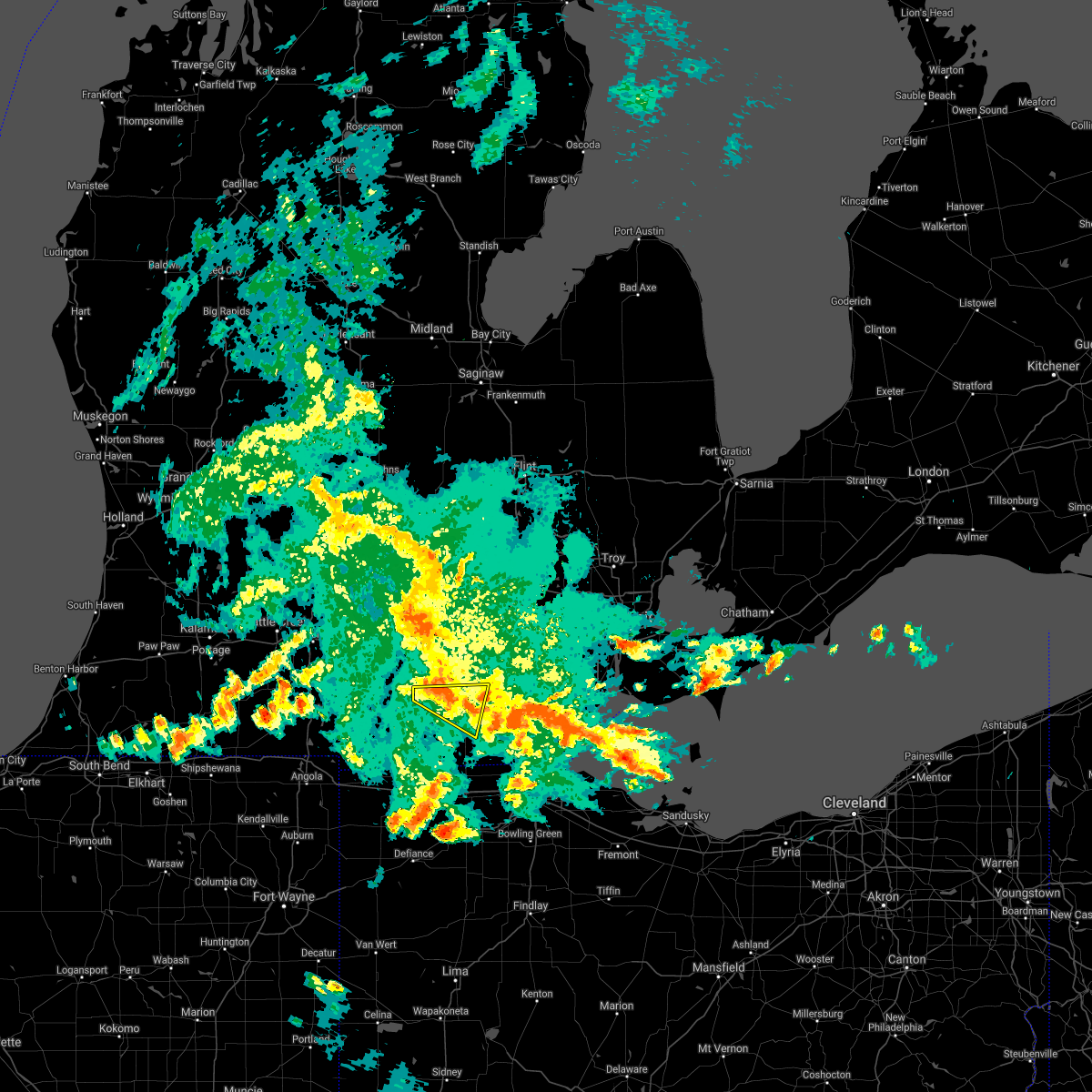 At 933 pm edt, severe thunderstorms were located along a line extending from near cement city to near onsted to near adrian, moving northeast at 50 mph (radar indicated). Hazards include 60 mph wind gusts. Expect damage to roofs, siding, and trees. these severe storms will be near, tecumseh around 945 pm edt. Other locations impacted by these severe thunderstorms include springville, cambridge junction, rome center, manitou beach-devils lake and tipton. At 933 pm edt, severe thunderstorms were located along a line extending from near cement city to near onsted to near adrian, moving northeast at 50 mph (radar indicated). Hazards include 60 mph wind gusts. Expect damage to roofs, siding, and trees. these severe storms will be near, tecumseh around 945 pm edt. Other locations impacted by these severe thunderstorms include springville, cambridge junction, rome center, manitou beach-devils lake and tipton.
|
| 6/20/2021 9:22 PM EDT |
 At 922 pm edt, a severe thunderstorm was located over addison, or 7 miles north of hudson, moving northeast at 55 mph (radar indicated). Hazards include 60 mph wind gusts. Expect damage to roofs, siding, and trees. this severe storm will be near, tecumseh around 945 pm edt. Other locations impacted by this severe thunderstorm include seneca, rome center, jasper, manitou beach-devils lake, weston, springville, cambridge junction, fairfield, tipton and sand creek. At 922 pm edt, a severe thunderstorm was located over addison, or 7 miles north of hudson, moving northeast at 55 mph (radar indicated). Hazards include 60 mph wind gusts. Expect damage to roofs, siding, and trees. this severe storm will be near, tecumseh around 945 pm edt. Other locations impacted by this severe thunderstorm include seneca, rome center, jasper, manitou beach-devils lake, weston, springville, cambridge junction, fairfield, tipton and sand creek.
|
| 6/20/2021 9:13 PM EDT |
 At 913 pm edt, severe thunderstorms were located along a line extending from near potterville to near leslie to near jackson, moving northeast at 45 mph (radar indicated). Hazards include 60 mph wind gusts and penny size hail. Expect damage to roofs, siding, and trees. Locations impacted include, lansing, jackson, mason, eaton rapids, east lansing, grand ledge, williamston, potterville, leslie, stockbridge, brooklyn, grass lake, edgemont park, vandercook lake, leoni, spring arbor, napoleon, sandstone, aurelius, onondaga,. At 913 pm edt, severe thunderstorms were located along a line extending from near potterville to near leslie to near jackson, moving northeast at 45 mph (radar indicated). Hazards include 60 mph wind gusts and penny size hail. Expect damage to roofs, siding, and trees. Locations impacted include, lansing, jackson, mason, eaton rapids, east lansing, grand ledge, williamston, potterville, leslie, stockbridge, brooklyn, grass lake, edgemont park, vandercook lake, leoni, spring arbor, napoleon, sandstone, aurelius, onondaga,.
|
| 6/20/2021 9:09 PM EDT |
 At 908 pm edt, a severe thunderstorm was located near morenci, moving north at 35 mph (radar indicated). Hazards include 60 mph wind gusts. Expect damage to roofs, siding, and trees. this severe storm will be near, clayton around 920 pm edt. adrian around 930 pm edt. onsted around 935 pm edt. tecumseh around 945 pm edt. Other locations impacted by this severe thunderstorm include seneca, manitou beach-devils lake, lime creek, munson, canandaigua, tipton, sand creek, rome center, jasper and medina. At 908 pm edt, a severe thunderstorm was located near morenci, moving north at 35 mph (radar indicated). Hazards include 60 mph wind gusts. Expect damage to roofs, siding, and trees. this severe storm will be near, clayton around 920 pm edt. adrian around 930 pm edt. onsted around 935 pm edt. tecumseh around 945 pm edt. Other locations impacted by this severe thunderstorm include seneca, manitou beach-devils lake, lime creek, munson, canandaigua, tipton, sand creek, rome center, jasper and medina.
|
| 6/20/2021 8:53 PM EDT |
 At 852 pm edt, a severe thunderstorm was located near fayette, or near morenci, moving north at 35 mph (radar indicated). Hazards include 60 mph wind gusts. Expect damage to roofs, siding, and trees. this severe thunderstorm will be near, morenci around 905 pm edt. Other locations in the path of this severe thunderstorm include clayton, adrian, onsted and tecumseh. At 852 pm edt, a severe thunderstorm was located near fayette, or near morenci, moving north at 35 mph (radar indicated). Hazards include 60 mph wind gusts. Expect damage to roofs, siding, and trees. this severe thunderstorm will be near, morenci around 905 pm edt. Other locations in the path of this severe thunderstorm include clayton, adrian, onsted and tecumseh.
|
| 6/20/2021 8:42 PM EDT |
 At 841 pm edt, severe thunderstorms were located along a line extending from near brownlee park to 5 miles east of marshall to near litchfield, moving northeast at 45 mph (radar indicated). Hazards include 60 mph wind gusts and penny size hail. expect damage to roofs, siding, and trees At 841 pm edt, severe thunderstorms were located along a line extending from near brownlee park to 5 miles east of marshall to near litchfield, moving northeast at 45 mph (radar indicated). Hazards include 60 mph wind gusts and penny size hail. expect damage to roofs, siding, and trees
|
| 6/19/2021 10:56 PM EDT |
 The severe thunderstorm warning for northern lenawee county will expire at 1100 pm edt, the storm which prompted the warning has weakened below severe limits, and no longer poses an immediate threat to life or property. therefore, the warning will be allowed to expire. however, gusty winds are still possible with this thunderstorm as well as with additional storms that are moving east back into the region. The severe thunderstorm warning for northern lenawee county will expire at 1100 pm edt, the storm which prompted the warning has weakened below severe limits, and no longer poses an immediate threat to life or property. therefore, the warning will be allowed to expire. however, gusty winds are still possible with this thunderstorm as well as with additional storms that are moving east back into the region.
|
| 6/19/2021 10:49 PM EDT |
 At 1048 pm edt, a severe thunderstorm was located near blissfield, moving east at 35 mph (radar indicated). Hazards include 60 mph wind gusts. Expect damage to roofs, siding, and trees. this severe storm will be near, deerfield and britton around 1100 pm edt. other locations impacted by this severe thunderstorm include macon, riga, springville, cambridge junction, ridgeway, palmyra and holloway. Another strong thunderstorm will bring gusty winds to the cement city area. At 1048 pm edt, a severe thunderstorm was located near blissfield, moving east at 35 mph (radar indicated). Hazards include 60 mph wind gusts. Expect damage to roofs, siding, and trees. this severe storm will be near, deerfield and britton around 1100 pm edt. other locations impacted by this severe thunderstorm include macon, riga, springville, cambridge junction, ridgeway, palmyra and holloway. Another strong thunderstorm will bring gusty winds to the cement city area.
|
| 6/19/2021 10:32 PM EDT |
 At 1031 pm edt, a severe thunderstorm was located near adrian, moving east at 35 mph (radar indicated). Hazards include 60 mph wind gusts and penny size hail. Expect damage to roofs, siding, and trees. this severe storm will be near, adrian around 1040 pm edt. blissfield around 1055 pm edt. deerfield and britton around 1100 pm edt. other locations impacted by this severe thunderstorm include manitou beach-devils lake, macon, ridgeway, palmyra, tipton, sand creek, rome center, jasper, weston and riga. A second strong thunderstorm will also track into the addison and cement city area by around 1045 pm and bring the potential of gusty winds and hail. At 1031 pm edt, a severe thunderstorm was located near adrian, moving east at 35 mph (radar indicated). Hazards include 60 mph wind gusts and penny size hail. Expect damage to roofs, siding, and trees. this severe storm will be near, adrian around 1040 pm edt. blissfield around 1055 pm edt. deerfield and britton around 1100 pm edt. other locations impacted by this severe thunderstorm include manitou beach-devils lake, macon, ridgeway, palmyra, tipton, sand creek, rome center, jasper, weston and riga. A second strong thunderstorm will also track into the addison and cement city area by around 1045 pm and bring the potential of gusty winds and hail.
|
| 6/19/2021 10:16 PM EDT |
 At 1016 pm edt, a severe thunderstorm was located over clayton, or near hudson, moving east at 30 mph (radar indicated). Hazards include 60 mph wind gusts and quarter size hail. Hail damage to vehicles is expected. expect wind damage to roofs, siding, and trees. this severe storm will be near, adrian around 1040 pm edt. tecumseh around 1050 pm edt. blissfield around 1055 pm edt. deerfield and britton around 1100 pm edt. Other locations impacted by this severe thunderstorm include seneca, manitou beach-devils lake, macon, canandaigua, ridgeway, palmyra, tipton, sand creek, rome center and jasper. At 1016 pm edt, a severe thunderstorm was located over clayton, or near hudson, moving east at 30 mph (radar indicated). Hazards include 60 mph wind gusts and quarter size hail. Hail damage to vehicles is expected. expect wind damage to roofs, siding, and trees. this severe storm will be near, adrian around 1040 pm edt. tecumseh around 1050 pm edt. blissfield around 1055 pm edt. deerfield and britton around 1100 pm edt. Other locations impacted by this severe thunderstorm include seneca, manitou beach-devils lake, macon, canandaigua, ridgeway, palmyra, tipton, sand creek, rome center and jasper.
|
| 6/19/2021 10:02 PM EDT |
 At 1001 pm edt, a severe thunderstorm was located near hudson, moving east at 35 mph (radar indicated). Hazards include 60 mph wind gusts and quarter size hail. Hail damage to vehicles is expected. expect wind damage to roofs, siding, and trees. this severe thunderstorm will be near, hudson around 1010 pm edt. clayton around 1020 pm edt. adrian around 1040 pm edt. tecumseh around 1050 pm edt. deerfield and britton around 1100 pm edt. Other locations impacted by this severe thunderstorm include seneca, manitou beach-devils lake, macon, lime creek, canandaigua, ridgeway, palmyra, tipton, sand creek and rome center. At 1001 pm edt, a severe thunderstorm was located near hudson, moving east at 35 mph (radar indicated). Hazards include 60 mph wind gusts and quarter size hail. Hail damage to vehicles is expected. expect wind damage to roofs, siding, and trees. this severe thunderstorm will be near, hudson around 1010 pm edt. clayton around 1020 pm edt. adrian around 1040 pm edt. tecumseh around 1050 pm edt. deerfield and britton around 1100 pm edt. Other locations impacted by this severe thunderstorm include seneca, manitou beach-devils lake, macon, lime creek, canandaigua, ridgeway, palmyra, tipton, sand creek and rome center.
|
| 10/23/2020 3:25 PM EDT |
 At 325 pm edt, severe thunderstorms were located along a line extending from near clinton to near morenci, moving east at 40 mph (radar indicated). Hazards include 60 mph wind gusts and quarter size hail. Hail damage to vehicles is expected. expect wind damage to roofs, siding, and trees. these severe storms will be near, tecumseh around 330 pm edt. adrian around 345 pm edt. blissfield around 355 pm edt. deerfield and britton around 405 pm edt. Other locations impacted by these severe thunderstorms include seneca, manitou beach-devils lake, macon, lime creek, munson, ogden center, canandaigua, ridgeway, palmyra and tipton. At 325 pm edt, severe thunderstorms were located along a line extending from near clinton to near morenci, moving east at 40 mph (radar indicated). Hazards include 60 mph wind gusts and quarter size hail. Hail damage to vehicles is expected. expect wind damage to roofs, siding, and trees. these severe storms will be near, tecumseh around 330 pm edt. adrian around 345 pm edt. blissfield around 355 pm edt. deerfield and britton around 405 pm edt. Other locations impacted by these severe thunderstorms include seneca, manitou beach-devils lake, macon, lime creek, munson, ogden center, canandaigua, ridgeway, palmyra and tipton.
|
| 10/23/2020 3:11 PM EDT |
 The severe thunderstorm warning for jackson county will expire at 315 pm edt, the storms which prompted the warning have weakened below severe limits, and have exited the warned area. therefore, the warning will be allowed to expire. The severe thunderstorm warning for jackson county will expire at 315 pm edt, the storms which prompted the warning have weakened below severe limits, and have exited the warned area. therefore, the warning will be allowed to expire.
|
| 10/23/2020 3:09 PM EDT |
 At 309 pm edt, severe thunderstorms were located along a line extending from near onsted to near fayette, moving northeast at 35 mph (radar indicated). Hazards include 60 mph wind gusts and quarter size hail. Hail damage to vehicles is expected. expect wind damage to roofs, siding, and trees. severe thunderstorms will be near, onsted around 315 pm edt. clayton around 330 pm edt. adrian around 350 pm edt. tecumseh around 400 pm edt. britton around 405 pm edt. Other locations impacted by these severe thunderstorms include seneca, manitou beach-devils lake, macon, lime creek, munson, ogden center, canandaigua, ridgeway, palmyra and tipton. At 309 pm edt, severe thunderstorms were located along a line extending from near onsted to near fayette, moving northeast at 35 mph (radar indicated). Hazards include 60 mph wind gusts and quarter size hail. Hail damage to vehicles is expected. expect wind damage to roofs, siding, and trees. severe thunderstorms will be near, onsted around 315 pm edt. clayton around 330 pm edt. adrian around 350 pm edt. tecumseh around 400 pm edt. britton around 405 pm edt. Other locations impacted by these severe thunderstorms include seneca, manitou beach-devils lake, macon, lime creek, munson, ogden center, canandaigua, ridgeway, palmyra and tipton.
|
| 10/23/2020 2:32 PM EDT |
 At 232 pm edt, severe thunderstorms were located along a line extending from 5 miles east of albion to 10 miles southwest of vandercook lake to near jonesville, moving northeast at 45 mph (radar indicated). Hazards include 60 mph wind gusts and penny size hail. Expect damage to roofs, siding, and trees. Locations impacted include, jackson, brooklyn, grass lake, vandercook lake, leoni, spring arbor, napoleon, sandstone, norvell, pulaski, concord, horton, parma, hanover, oak point, tompkins, rives junction, sunset beach, michigan center, munith,. At 232 pm edt, severe thunderstorms were located along a line extending from 5 miles east of albion to 10 miles southwest of vandercook lake to near jonesville, moving northeast at 45 mph (radar indicated). Hazards include 60 mph wind gusts and penny size hail. Expect damage to roofs, siding, and trees. Locations impacted include, jackson, brooklyn, grass lake, vandercook lake, leoni, spring arbor, napoleon, sandstone, norvell, pulaski, concord, horton, parma, hanover, oak point, tompkins, rives junction, sunset beach, michigan center, munith,.
|
| 10/23/2020 2:20 PM EDT |
 At 219 pm edt, severe thunderstorms were located along a line extending from homer to near litchfield to near quincy, moving northeast at 45 mph (radar indicated). Hazards include 60 mph wind gusts and penny size hail. expect damage to roofs, siding, and trees At 219 pm edt, severe thunderstorms were located along a line extending from homer to near litchfield to near quincy, moving northeast at 45 mph (radar indicated). Hazards include 60 mph wind gusts and penny size hail. expect damage to roofs, siding, and trees
|
| 8/29/2020 12:37 AM EDT |
 At 1237 am edt, severe thunderstorms were located along a line extending from 5 miles south of gregory to near grass lake to 8 miles west of cement city, moving east at 30 mph (radar indicated). Hazards include 60 mph wind gusts and penny size hail. Expect damage to roofs, siding, and trees. Locations impacted include, jackson, brooklyn, grass lake, vandercook lake, leoni, spring arbor, napoleon, norvell, pulaski, horton, hanover, oak point, sunset beach, michigan center, munith,. At 1237 am edt, severe thunderstorms were located along a line extending from 5 miles south of gregory to near grass lake to 8 miles west of cement city, moving east at 30 mph (radar indicated). Hazards include 60 mph wind gusts and penny size hail. Expect damage to roofs, siding, and trees. Locations impacted include, jackson, brooklyn, grass lake, vandercook lake, leoni, spring arbor, napoleon, norvell, pulaski, horton, hanover, oak point, sunset beach, michigan center, munith,.
|
| 8/28/2020 11:47 PM EDT |
 At 1147 pm edt, severe thunderstorms were located along a line extending from 9 miles southwest of eaton rapids to near marshall to near burlington, moving east at 40 mph (radar indicated). Hazards include 60 mph wind gusts and penny size hail. expect damage to roofs, siding, and trees At 1147 pm edt, severe thunderstorms were located along a line extending from 9 miles southwest of eaton rapids to near marshall to near burlington, moving east at 40 mph (radar indicated). Hazards include 60 mph wind gusts and penny size hail. expect damage to roofs, siding, and trees
|
| 8/28/2020 2:19 PM EDT |
 At 217 pm edt, severe thunderstorms were located along a line extending from near jackson to near grass lake to near cement city, moving east at 30 mph (official observations. at 205 pm 60+ mph was reported at the jackson county-reynolds airport). Hazards include 60 mph wind gusts. Expect damage to roofs, siding, and trees. these severe storms will be near, brooklyn around 230 pm edt. grass lake around 235 pm edt. Other locations impacted by these severe thunderstorms include oak point, sunset beach, michigan center, norvell, munith, leoni and napoleon. At 217 pm edt, severe thunderstorms were located along a line extending from near jackson to near grass lake to near cement city, moving east at 30 mph (official observations. at 205 pm 60+ mph was reported at the jackson county-reynolds airport). Hazards include 60 mph wind gusts. Expect damage to roofs, siding, and trees. these severe storms will be near, brooklyn around 230 pm edt. grass lake around 235 pm edt. Other locations impacted by these severe thunderstorms include oak point, sunset beach, michigan center, norvell, munith, leoni and napoleon.
|
| 8/28/2020 2:09 PM EDT |
 At 209 pm edt, a severe thunderstorm was located near vandercook lake, or near jackson, moving east at 25 mph (radar indicated). Hazards include 60 mph wind gusts. expect damage to roofs, siding, and trees At 209 pm edt, a severe thunderstorm was located near vandercook lake, or near jackson, moving east at 25 mph (radar indicated). Hazards include 60 mph wind gusts. expect damage to roofs, siding, and trees
|
| 8/14/2020 4:29 PM EDT |
 At 429 pm edt, severe thunderstorms were located along a line extending from near onsted to near clayton to morenci, moving east at 5 mph (radar indicated). Hazards include 60 mph wind gusts. Expect damage to roofs, siding, and trees. these severe storms will be near, morenci around 435 pm edt. adrian around 530 pm edt. Other locations impacted by these severe thunderstorms include seneca, manitou beach-devils lake, lime creek, munson, canandaigua, sand creek, rome center, medina, weston and springville. At 429 pm edt, severe thunderstorms were located along a line extending from near onsted to near clayton to morenci, moving east at 5 mph (radar indicated). Hazards include 60 mph wind gusts. Expect damage to roofs, siding, and trees. these severe storms will be near, morenci around 435 pm edt. adrian around 530 pm edt. Other locations impacted by these severe thunderstorms include seneca, manitou beach-devils lake, lime creek, munson, canandaigua, sand creek, rome center, medina, weston and springville.
|
| 8/14/2020 4:14 PM EDT |
 At 414 pm edt, severe thunderstorms were located along a line extending from near brooklyn to near clayton to morenci, moving northeast at 5 mph (radar indicated). Hazards include 60 mph wind gusts and quarter size hail. Hail damage to vehicles is expected. expect wind damage to roofs, siding, and trees. severe thunderstorms will be near, onsted around 420 pm edt. adrian around 515 pm edt. Other locations impacted by these severe thunderstorms include seneca, manitou beach-devils lake, lime creek, munson, canandaigua, sand creek, rome center, medina, weston and springville. At 414 pm edt, severe thunderstorms were located along a line extending from near brooklyn to near clayton to morenci, moving northeast at 5 mph (radar indicated). Hazards include 60 mph wind gusts and quarter size hail. Hail damage to vehicles is expected. expect wind damage to roofs, siding, and trees. severe thunderstorms will be near, onsted around 420 pm edt. adrian around 515 pm edt. Other locations impacted by these severe thunderstorms include seneca, manitou beach-devils lake, lime creek, munson, canandaigua, sand creek, rome center, medina, weston and springville.
|
| 7/10/2020 10:53 AM EDT |
 At 1050 am edt, a severe thunderstorms was located over onsted, or 11 miles northwest of adrian, moving northeast at 30 mph (radar indicated). Hazards include 60 mph wind gusts and penny size hail. Expect damage to roofs, siding, and trees. This severe thunderstorm will remain over mainly rural areas of lenawee county, including the following locations, seneca, manitou beach-devils lake, lime creek, munson, canandaigua, tipton, sand creek, rome center, jasper and medina. At 1050 am edt, a severe thunderstorms was located over onsted, or 11 miles northwest of adrian, moving northeast at 30 mph (radar indicated). Hazards include 60 mph wind gusts and penny size hail. Expect damage to roofs, siding, and trees. This severe thunderstorm will remain over mainly rural areas of lenawee county, including the following locations, seneca, manitou beach-devils lake, lime creek, munson, canandaigua, tipton, sand creek, rome center, jasper and medina.
|
| 6/26/2020 11:27 PM EDT |
 At 1126 pm edt, severe thunderstorms were located along a line extending from near clinton to near adrian to near pioneer, moving east at 55 mph (radar indicated). Hazards include 60 mph wind gusts and nickel size hail. Expect damage to roofs, siding, and trees. these severe storms will be near, tecumseh and manchester around 1130 pm edt. adrian around 1135 pm edt. morenci around 1140 pm edt. milan, deerfield and britton around 1145 pm edt. petersburg around 1150 pm edt. dundee around 1155 pm edt. blissfield, carleton, ida and maybee around 1200 am edt. monroe, luna pier and ottawa lake around 1205 am edt. Other locations impacted by these severe thunderstorms include newport, manitou beach-devils lake, whittaker, gibraltar, ogden center, canandaigua, erie, woodland beach, ridgeway and stony point. At 1126 pm edt, severe thunderstorms were located along a line extending from near clinton to near adrian to near pioneer, moving east at 55 mph (radar indicated). Hazards include 60 mph wind gusts and nickel size hail. Expect damage to roofs, siding, and trees. these severe storms will be near, tecumseh and manchester around 1130 pm edt. adrian around 1135 pm edt. morenci around 1140 pm edt. milan, deerfield and britton around 1145 pm edt. petersburg around 1150 pm edt. dundee around 1155 pm edt. blissfield, carleton, ida and maybee around 1200 am edt. monroe, luna pier and ottawa lake around 1205 am edt. Other locations impacted by these severe thunderstorms include newport, manitou beach-devils lake, whittaker, gibraltar, ogden center, canandaigua, erie, woodland beach, ridgeway and stony point.
|
| 6/26/2020 11:09 PM EDT |
 The national weather service in detroit/pontiac has issued a * severe thunderstorm warning for. monroe county in southeastern michigan. southwestern wayne county in southeastern michigan. lenawee county in southeastern michigan. Southern washtenaw county in southeastern michigan. The national weather service in detroit/pontiac has issued a * severe thunderstorm warning for. monroe county in southeastern michigan. southwestern wayne county in southeastern michigan. lenawee county in southeastern michigan. Southern washtenaw county in southeastern michigan.
|
| 6/26/2020 10:31 PM EDT |
 At 1030 pm edt, a severe thunderstorm was located near albion, moving east at 50 mph (radar indicated). Hazards include 60 mph wind gusts. expect damage to roofs, siding, and trees At 1030 pm edt, a severe thunderstorm was located near albion, moving east at 50 mph (radar indicated). Hazards include 60 mph wind gusts. expect damage to roofs, siding, and trees
|
| 6/10/2020 4:32 PM EDT |
 At 431 pm edt, severe thunderstorms were located along a line extending from near brooklyn to near fayette, moving northeast at 65 mph (radar indicated). Hazards include 70 mph wind gusts and quarter size hail. Hail damage to vehicles is expected. expect considerable tree damage. wind damage is also likely to mobile homes, roofs, and outbuildings. these severe storms will be near, addison around 445 pm edt. onsted around 450 pm edt. Other locations impacted by these severe thunderstorms include seneca, manitou beach-devils lake, macon, lime creek, munson, canandaigua, ridgeway, palmyra, tipton and sand creek. At 431 pm edt, severe thunderstorms were located along a line extending from near brooklyn to near fayette, moving northeast at 65 mph (radar indicated). Hazards include 70 mph wind gusts and quarter size hail. Hail damage to vehicles is expected. expect considerable tree damage. wind damage is also likely to mobile homes, roofs, and outbuildings. these severe storms will be near, addison around 445 pm edt. onsted around 450 pm edt. Other locations impacted by these severe thunderstorms include seneca, manitou beach-devils lake, macon, lime creek, munson, canandaigua, ridgeway, palmyra, tipton and sand creek.
|
| 6/10/2020 4:15 PM EDT |
 At 415 pm edt, severe thunderstorms were located along a line extending from near brooklyn to near pioneer, moving northeast at 35 mph (radar indicated). Hazards include 70 mph wind gusts and quarter size hail. Hail damage to vehicles is expected. expect considerable tree damage. wind damage is also likely to mobile homes, roofs, and outbuildings. these severe storms will be near, cement city around 420 pm edt. hudson around 435 pm edt. clayton around 440 pm edt. adrian and onsted around 455 pm edt. tecumseh around 510 pm edt. Other locations impacted by these severe thunderstorms include seneca, manitou beach-devils lake, macon, lime creek, munson, canandaigua, ridgeway, palmyra, tipton and sand creek. At 415 pm edt, severe thunderstorms were located along a line extending from near brooklyn to near pioneer, moving northeast at 35 mph (radar indicated). Hazards include 70 mph wind gusts and quarter size hail. Hail damage to vehicles is expected. expect considerable tree damage. wind damage is also likely to mobile homes, roofs, and outbuildings. these severe storms will be near, cement city around 420 pm edt. hudson around 435 pm edt. clayton around 440 pm edt. adrian and onsted around 455 pm edt. tecumseh around 510 pm edt. Other locations impacted by these severe thunderstorms include seneca, manitou beach-devils lake, macon, lime creek, munson, canandaigua, ridgeway, palmyra, tipton and sand creek.
|
| 6/10/2020 3:57 PM EDT |
 At 356 pm edt, severe thunderstorms were located along a line extending from near onsted to near hudson, moving northeast at 35 mph (radar indicated). Hazards include 70 mph wind gusts and quarter size hail. Hail damage to vehicles is expected. expect considerable tree damage. wind damage is also likely to mobile homes, roofs, and outbuildings. these severe storms will be near, onsted around 400 pm edt. adrian around 430 pm edt. tecumseh around 445 pm edt. britton around 450 pm edt. Other locations impacted by these severe thunderstorms include seneca, manitou beach-devils lake, macon, lime creek, munson, ogden center, canandaigua, ridgeway, palmyra and tipton. At 356 pm edt, severe thunderstorms were located along a line extending from near onsted to near hudson, moving northeast at 35 mph (radar indicated). Hazards include 70 mph wind gusts and quarter size hail. Hail damage to vehicles is expected. expect considerable tree damage. wind damage is also likely to mobile homes, roofs, and outbuildings. these severe storms will be near, onsted around 400 pm edt. adrian around 430 pm edt. tecumseh around 445 pm edt. britton around 450 pm edt. Other locations impacted by these severe thunderstorms include seneca, manitou beach-devils lake, macon, lime creek, munson, ogden center, canandaigua, ridgeway, palmyra and tipton.
|
| 6/10/2020 3:41 PM EDT |
 At 340 pm edt, severe thunderstorms were located along a line extending from brooklyn to near hudson to holiday city, moving east at 35 mph (radar indicated). Hazards include 70 mph wind gusts and quarter size hail. Hail damage to vehicles is expected. expect considerable tree damage. wind damage is also likely to mobile homes, roofs, and outbuildings. these severe storms will be near, hudson and cement city around 345 pm edt. addison around 350 pm edt. clayton around 355 pm edt. onsted around 405 pm edt. morenci around 410 pm edt. adrian around 415 pm edt. tecumseh around 425 pm edt. britton around 430 pm edt. Other locations impacted by these severe thunderstorms include seneca, manitou beach-devils lake, macon, lime creek, munson, ogden center, canandaigua, ridgeway, palmyra and tipton. At 340 pm edt, severe thunderstorms were located along a line extending from brooklyn to near hudson to holiday city, moving east at 35 mph (radar indicated). Hazards include 70 mph wind gusts and quarter size hail. Hail damage to vehicles is expected. expect considerable tree damage. wind damage is also likely to mobile homes, roofs, and outbuildings. these severe storms will be near, hudson and cement city around 345 pm edt. addison around 350 pm edt. clayton around 355 pm edt. onsted around 405 pm edt. morenci around 410 pm edt. adrian around 415 pm edt. tecumseh around 425 pm edt. britton around 430 pm edt. Other locations impacted by these severe thunderstorms include seneca, manitou beach-devils lake, macon, lime creek, munson, ogden center, canandaigua, ridgeway, palmyra and tipton.
|
| 6/10/2020 3:27 PM EDT |
 At 326 pm edt, severe thunderstorms were located along a line extending from near cement city to 6 miles southeast of hillsdale to near edon, moving east at 35 mph (radar indicated). Hazards include 70 mph wind gusts. Expect considerable tree damage. damage is likely to mobile homes, roofs, and outbuildings. severe thunderstorms will be near, cement city around 335 pm edt. hudson around 345 pm edt. addison around 350 pm edt. clayton around 355 pm edt. onsted around 400 pm edt. adrian and morenci around 410 pm edt. tecumseh around 420 pm edt. britton around 430 pm edt. Other locations impacted by these severe thunderstorms include seneca, manitou beach-devils lake, macon, lime creek, munson, ogden center, canandaigua, ridgeway, palmyra and tipton. At 326 pm edt, severe thunderstorms were located along a line extending from near cement city to 6 miles southeast of hillsdale to near edon, moving east at 35 mph (radar indicated). Hazards include 70 mph wind gusts. Expect considerable tree damage. damage is likely to mobile homes, roofs, and outbuildings. severe thunderstorms will be near, cement city around 335 pm edt. hudson around 345 pm edt. addison around 350 pm edt. clayton around 355 pm edt. onsted around 400 pm edt. adrian and morenci around 410 pm edt. tecumseh around 420 pm edt. britton around 430 pm edt. Other locations impacted by these severe thunderstorms include seneca, manitou beach-devils lake, macon, lime creek, munson, ogden center, canandaigua, ridgeway, palmyra and tipton.
|
| 6/10/2020 3:05 PM EDT |
 At 305 pm edt, severe thunderstorms were located along a line extending from 5 miles west of jackson to near hanover, moving east at 55 mph (radar indicated). Hazards include 60 mph wind gusts. expect damage to roofs, siding, and trees At 305 pm edt, severe thunderstorms were located along a line extending from 5 miles west of jackson to near hanover, moving east at 55 mph (radar indicated). Hazards include 60 mph wind gusts. expect damage to roofs, siding, and trees
|
| 4/7/2020 10:11 PM EDT |
 At 1010 pm edt, severe thunderstorms were located along a line extending from near brooklyn to near concord, moving east at 55 mph (radar indicated). Hazards include 60 mph wind gusts and quarter size hail. Hail damage to vehicles is expected. expect wind damage to roofs, siding, and trees. Locations impacted include, vandercook lake, brooklyn, spring arbor, napoleon, norvell, pulaski, concord, horton, hanover, oak point, sunset beach,. At 1010 pm edt, severe thunderstorms were located along a line extending from near brooklyn to near concord, moving east at 55 mph (radar indicated). Hazards include 60 mph wind gusts and quarter size hail. Hail damage to vehicles is expected. expect wind damage to roofs, siding, and trees. Locations impacted include, vandercook lake, brooklyn, spring arbor, napoleon, norvell, pulaski, concord, horton, hanover, oak point, sunset beach,.
|
| 4/7/2020 9:54 PM EDT |
 At 954 pm edt, severe thunderstorms were located along a line extending from near albion to 5 miles southwest of homer, moving east at 50 mph (radar indicated). Hazards include 60 mph wind gusts and quarter size hail. Hail damage to vehicles is expected. Expect wind damage to roofs, siding, and trees. At 954 pm edt, severe thunderstorms were located along a line extending from near albion to 5 miles southwest of homer, moving east at 50 mph (radar indicated). Hazards include 60 mph wind gusts and quarter size hail. Hail damage to vehicles is expected. Expect wind damage to roofs, siding, and trees.
|
| 4/7/2020 8:35 PM EDT |
 At 835 pm edt, severe thunderstorms were located along a line extending from near gregory to 5 miles southeast of mason to near leslie, moving southeast at 30 mph (radar indicated). Hazards include golf ball size hail and 60 mph wind gusts. People and animals outdoors will be injured. expect hail damage to roofs, siding, windows, and vehicles. Expect wind damage to roofs, siding, and trees. At 835 pm edt, severe thunderstorms were located along a line extending from near gregory to 5 miles southeast of mason to near leslie, moving southeast at 30 mph (radar indicated). Hazards include golf ball size hail and 60 mph wind gusts. People and animals outdoors will be injured. expect hail damage to roofs, siding, windows, and vehicles. Expect wind damage to roofs, siding, and trees.
|
| 5/23/2019 5:47 AM EDT |
 At 547 am edt, severe thunderstorms were located along a line extending from near jackson to near hudson, moving east at 70 mph (radar indicated). Hazards include 60 mph wind gusts. Expect damage to roofs, siding, and trees. Locations impacted include, jackson, vandercook lake, brooklyn, grass lake, leoni, spring arbor, napoleon, sandstone, norvell, pulaski, concord, horton, hanover, oak point, sunset beach, michigan center, munith,. At 547 am edt, severe thunderstorms were located along a line extending from near jackson to near hudson, moving east at 70 mph (radar indicated). Hazards include 60 mph wind gusts. Expect damage to roofs, siding, and trees. Locations impacted include, jackson, vandercook lake, brooklyn, grass lake, leoni, spring arbor, napoleon, sandstone, norvell, pulaski, concord, horton, hanover, oak point, sunset beach, michigan center, munith,.
|
| 5/23/2019 5:33 AM EDT |
 At 532 am edt, severe thunderstorms were located along a line extending from 5 miles northeast of litchfield to 7 miles northwest of pioneer, moving northeast at 70 mph (radar indicated). Hazards include 60 mph wind gusts. expect damage to roofs, siding, and trees At 532 am edt, severe thunderstorms were located along a line extending from 5 miles northeast of litchfield to 7 miles northwest of pioneer, moving northeast at 70 mph (radar indicated). Hazards include 60 mph wind gusts. expect damage to roofs, siding, and trees
|
| 3/14/2019 7:15 PM EDT |
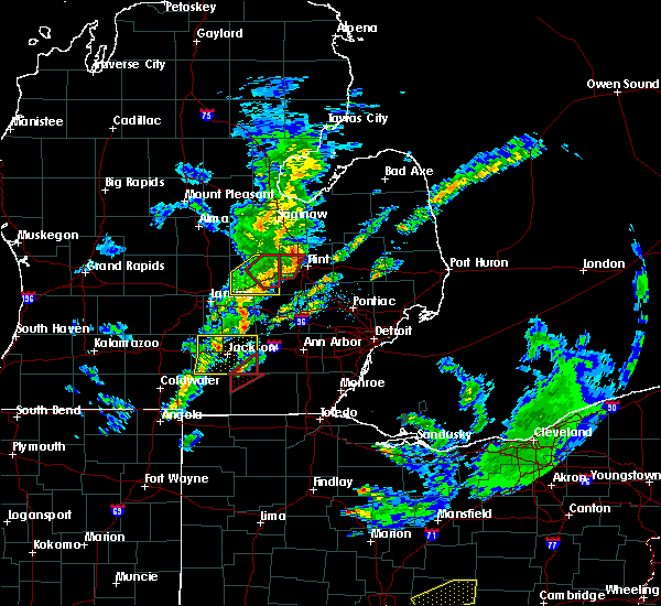 At 714 pm edt, a severe thunderstorm capable of producing a tornado was located over cement city, or 9 miles southeast of vandercook lake, moving northeast at 60 mph (radar indicated rotation). Hazards include tornado. Flying debris will be dangerous to those caught without shelter. mobile homes will be damaged or destroyed. damage to roofs, windows, and vehicles will occur. tree damage is likely. This tornadic thunderstorm will remain over mainly rural areas of northwestern lenawee county, including the following locations, cambridge junction. At 714 pm edt, a severe thunderstorm capable of producing a tornado was located over cement city, or 9 miles southeast of vandercook lake, moving northeast at 60 mph (radar indicated rotation). Hazards include tornado. Flying debris will be dangerous to those caught without shelter. mobile homes will be damaged or destroyed. damage to roofs, windows, and vehicles will occur. tree damage is likely. This tornadic thunderstorm will remain over mainly rural areas of northwestern lenawee county, including the following locations, cambridge junction.
|
| 3/14/2019 7:10 PM EDT |
 At 710 pm edt, a severe thunderstorm capable of producing a tornado was located over cement city, or 9 miles south of vandercook lake, moving northeast at 55 mph (radar indicated rotation). Hazards include tornado and quarter size hail. Flying debris will be dangerous to those caught without shelter. mobile homes will be damaged or destroyed. damage to roofs, windows, and vehicles will occur. tree damage is likely. this dangerous storm will be near, brooklyn and sunset beach around 715 pm edt. Napoleon and norvell around 720 pm edt. At 710 pm edt, a severe thunderstorm capable of producing a tornado was located over cement city, or 9 miles south of vandercook lake, moving northeast at 55 mph (radar indicated rotation). Hazards include tornado and quarter size hail. Flying debris will be dangerous to those caught without shelter. mobile homes will be damaged or destroyed. damage to roofs, windows, and vehicles will occur. tree damage is likely. this dangerous storm will be near, brooklyn and sunset beach around 715 pm edt. Napoleon and norvell around 720 pm edt.
|
| 3/14/2019 7:08 PM EDT |
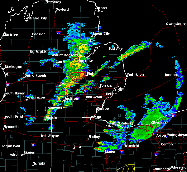 At 708 pm edt, a severe thunderstorm capable of producing a tornado was located over cement city, or 11 miles south of vandercook lake, moving northeast at 65 mph (radar indicated rotation). Hazards include tornado. Flying debris will be dangerous to those caught without shelter. mobile homes will be damaged or destroyed. damage to roofs, windows, and vehicles will occur. tree damage is likely. this dangerous storm will be near, onsted around 715 pm edt. Other locations impacted by this tornadic thunderstorm include springville, cambridge junction and manitou beach-devils lake. At 708 pm edt, a severe thunderstorm capable of producing a tornado was located over cement city, or 11 miles south of vandercook lake, moving northeast at 65 mph (radar indicated rotation). Hazards include tornado. Flying debris will be dangerous to those caught without shelter. mobile homes will be damaged or destroyed. damage to roofs, windows, and vehicles will occur. tree damage is likely. this dangerous storm will be near, onsted around 715 pm edt. Other locations impacted by this tornadic thunderstorm include springville, cambridge junction and manitou beach-devils lake.
|
| 3/14/2019 6:59 PM EDT |
 At 657 pm edt, severe thunderstorms were located along a line extending from near leslie to 6 miles west of jackson, moving east at 45 mph. another strong thunderstorm was moving out of hillsdale county towards clark lake and brooklyn (radar indicated). Hazards include 60 mph wind gusts and penny size hail. Expect damage to roofs, siding, and trees. Locations impacted include, jackson, vandercook lake, brooklyn, grass lake, leoni, spring arbor, napoleon, sandstone, norvell, pulaski, concord, horton, parma, hanover, oak point, topkins, rives junction, sunset beach, michigan center, munith,. At 657 pm edt, severe thunderstorms were located along a line extending from near leslie to 6 miles west of jackson, moving east at 45 mph. another strong thunderstorm was moving out of hillsdale county towards clark lake and brooklyn (radar indicated). Hazards include 60 mph wind gusts and penny size hail. Expect damage to roofs, siding, and trees. Locations impacted include, jackson, vandercook lake, brooklyn, grass lake, leoni, spring arbor, napoleon, sandstone, norvell, pulaski, concord, horton, parma, hanover, oak point, topkins, rives junction, sunset beach, michigan center, munith,.
|
| 3/14/2019 6:36 PM EDT |
 At 635 pm edt, severe thunderstorms were located along a line extending from 9 miles southwest of eaton rapids to near albion to near homer, moving east at 45 mph (radar indicated). Hazards include 60 mph wind gusts and penny size hail. expect damage to roofs, siding, and trees At 635 pm edt, severe thunderstorms were located along a line extending from 9 miles southwest of eaton rapids to near albion to near homer, moving east at 45 mph (radar indicated). Hazards include 60 mph wind gusts and penny size hail. expect damage to roofs, siding, and trees
|
| 3/14/2019 4:42 PM EDT |
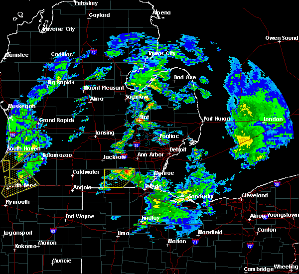 At 441 pm edt, a severe thunderstorm was located over tecumseh, moving northeast at 100 mph (radar indicated). Hazards include 60 mph wind gusts and half dollar size hail. Hail damage to vehicles is expected. expect wind damage to roofs, siding, and trees. This severe thunderstorm will remain over mainly rural areas of northern lenawee county, including the following locations, rome center, manitou beach-devils lake, macon, springville, cambridge junction, ridgeway, tipton, holloway and rollin. At 441 pm edt, a severe thunderstorm was located over tecumseh, moving northeast at 100 mph (radar indicated). Hazards include 60 mph wind gusts and half dollar size hail. Hail damage to vehicles is expected. expect wind damage to roofs, siding, and trees. This severe thunderstorm will remain over mainly rural areas of northern lenawee county, including the following locations, rome center, manitou beach-devils lake, macon, springville, cambridge junction, ridgeway, tipton, holloway and rollin.
|
| 3/14/2019 4:27 PM EDT |
 At 426 pm edt, a severe thunderstorm was located over morenci, moving northeast at 80 mph (radar indicated). Hazards include 60 mph wind gusts and half dollar size hail. Hail damage to vehicles is expected. expect wind damage to roofs, siding, and trees. this severe thunderstorm will be near, clayton around 435 pm edt. adrian around 440 pm edt. tecumseh around 445 pm edt. Other locations impacted by this severe thunderstorm include seneca, manitou beach-devils lake, macon, lime creek, munson, ogden center, canandaigua, ridgeway, palmyra and tipton. At 426 pm edt, a severe thunderstorm was located over morenci, moving northeast at 80 mph (radar indicated). Hazards include 60 mph wind gusts and half dollar size hail. Hail damage to vehicles is expected. expect wind damage to roofs, siding, and trees. this severe thunderstorm will be near, clayton around 435 pm edt. adrian around 440 pm edt. tecumseh around 445 pm edt. Other locations impacted by this severe thunderstorm include seneca, manitou beach-devils lake, macon, lime creek, munson, ogden center, canandaigua, ridgeway, palmyra and tipton.
|
| 2/24/2019 4:22 AM EST |
 The severe thunderstorm warning for jackson and ingham counties will expire at 430 am est, the storms which prompted the warning have weakened below severe limits, and have exited the warned area. therefore, the warning will be allowed to expire. The severe thunderstorm warning for jackson and ingham counties will expire at 430 am est, the storms which prompted the warning have weakened below severe limits, and have exited the warned area. therefore, the warning will be allowed to expire.
|
| 2/24/2019 3:58 AM EST |
 At 356 am est, a line of showers and embedded thunderstorms located along a line extending from near haslett to 9 miles southwest of vandercook lake, moving east at 50 mph (battle creek airport observation). Hazards include 60 mph wind gusts. Expect damage to roofs, siding, and trees. Locations impacted include, lansing, jackson, mason, vandercook lake, haslett, east lansing, williamston, leslie, stockbridge, brooklyn, grass lake, edgemont park, leoni, spring arbor, napoleon, sandstone, aurelius, onondaga, norvell, bunker hill,. At 356 am est, a line of showers and embedded thunderstorms located along a line extending from near haslett to 9 miles southwest of vandercook lake, moving east at 50 mph (battle creek airport observation). Hazards include 60 mph wind gusts. Expect damage to roofs, siding, and trees. Locations impacted include, lansing, jackson, mason, vandercook lake, haslett, east lansing, williamston, leslie, stockbridge, brooklyn, grass lake, edgemont park, leoni, spring arbor, napoleon, sandstone, aurelius, onondaga, norvell, bunker hill,.
|
| 2/24/2019 3:28 AM EST |
 At 327 am est, a line of showers with embedded thunderstorms were located along a line extending from 9 miles west of grand ledge to near litchfield, moving east at 50 mph (official observations). Hazards include 60 mph wind gusts. expect damage to roofs, siding, and trees At 327 am est, a line of showers with embedded thunderstorms were located along a line extending from 9 miles west of grand ledge to near litchfield, moving east at 50 mph (official observations). Hazards include 60 mph wind gusts. expect damage to roofs, siding, and trees
|
| 8/12/2018 1:52 AM EDT |
 At 151 am edt, a severe thunderstorm was located near brooklyn, or 6 miles west of manchester, moving south at 15 mph (radar indicated). Hazards include 60 mph wind gusts and penny size hail. Expect damage to roofs, siding, and trees. Locations impacted include, brooklyn, grass lake, leoni, napoleon, norvell, oak point, sunset beach, michigan center,. At 151 am edt, a severe thunderstorm was located near brooklyn, or 6 miles west of manchester, moving south at 15 mph (radar indicated). Hazards include 60 mph wind gusts and penny size hail. Expect damage to roofs, siding, and trees. Locations impacted include, brooklyn, grass lake, leoni, napoleon, norvell, oak point, sunset beach, michigan center,.
|
| 8/12/2018 1:35 AM EDT |
 At 134 am edt, a severe thunderstorm was located near brooklyn, or 9 miles east of vandercook lake, moving south at 30 mph (radar indicated). Hazards include 60 mph wind gusts and penny size hail. Expect damage to roofs, siding, and trees. Locations impacted include, brooklyn, grass lake, leoni, napoleon, norvell, oak point, sunset beach, michigan center,. At 134 am edt, a severe thunderstorm was located near brooklyn, or 9 miles east of vandercook lake, moving south at 30 mph (radar indicated). Hazards include 60 mph wind gusts and penny size hail. Expect damage to roofs, siding, and trees. Locations impacted include, brooklyn, grass lake, leoni, napoleon, norvell, oak point, sunset beach, michigan center,.
|
| 8/12/2018 1:18 AM EDT |
 At 117 am edt, a severe thunderstorm was located over grass lake, or 9 miles southwest of chelsea, moving south at 30 mph (radar indicated). Hazards include 60 mph wind gusts and quarter size hail. Hail damage to vehicles is expected. expect wind damage to roofs, siding, and trees. Locations impacted include, jackson, vandercook lake, brooklyn, grass lake, leoni, napoleon, norvell, oak point, sunset beach, michigan center, munith,. At 117 am edt, a severe thunderstorm was located over grass lake, or 9 miles southwest of chelsea, moving south at 30 mph (radar indicated). Hazards include 60 mph wind gusts and quarter size hail. Hail damage to vehicles is expected. expect wind damage to roofs, siding, and trees. Locations impacted include, jackson, vandercook lake, brooklyn, grass lake, leoni, napoleon, norvell, oak point, sunset beach, michigan center, munith,.
|
| 8/12/2018 12:54 AM EDT |
 At 1254 am edt, a severe thunderstorm was located near stockbridge, or 9 miles northwest of chelsea, moving southwest at 25 mph (radar indicated). Hazards include 60 mph wind gusts and quarter size hail. Hail damage to vehicles is expected. Expect wind damage to roofs, siding, and trees. At 1254 am edt, a severe thunderstorm was located near stockbridge, or 9 miles northwest of chelsea, moving southwest at 25 mph (radar indicated). Hazards include 60 mph wind gusts and quarter size hail. Hail damage to vehicles is expected. Expect wind damage to roofs, siding, and trees.
|
| 8/6/2018 3:44 PM EDT |
 At 344 pm edt, severe thunderstorms were located along a line extending from near onsted to near clayton, moving east at 35 mph (radar indicated). Hazards include 60 mph wind gusts. Expect damage to roofs, siding, and trees. these severe storms will be near, adrian and tecumseh around 400 pm edt. blissfield around 415 pm edt. britton around 420 pm edt. deerfield around 425 pm edt. Other locations impacted by these severe thunderstorms include seneca, manitou beach-devils lake, macon, lime creek, munson, ogden center, canandaigua, ridgeway, palmyra and tipton. At 344 pm edt, severe thunderstorms were located along a line extending from near onsted to near clayton, moving east at 35 mph (radar indicated). Hazards include 60 mph wind gusts. Expect damage to roofs, siding, and trees. these severe storms will be near, adrian and tecumseh around 400 pm edt. blissfield around 415 pm edt. britton around 420 pm edt. deerfield around 425 pm edt. Other locations impacted by these severe thunderstorms include seneca, manitou beach-devils lake, macon, lime creek, munson, ogden center, canandaigua, ridgeway, palmyra and tipton.
|
| 8/6/2018 3:25 PM EDT |
 At 325 pm edt, a severe thunderstorm was located over addison, or 9 miles north of hudson, moving east at 45 mph (radar indicated). Hazards include 60 mph wind gusts. Expect damage to roofs, siding, and trees. this severe thunderstorm will be near, onsted and clayton around 335 pm edt. adrian and tecumseh around 350 pm edt. britton around 400 pm edt. blissfield around 405 pm edt. deerfield around 410 pm edt. Other locations impacted by this severe thunderstorm include seneca, manitou beach-devils lake, macon, lime creek, munson, ogden center, canandaigua, ridgeway, palmyra and tipton. At 325 pm edt, a severe thunderstorm was located over addison, or 9 miles north of hudson, moving east at 45 mph (radar indicated). Hazards include 60 mph wind gusts. Expect damage to roofs, siding, and trees. this severe thunderstorm will be near, onsted and clayton around 335 pm edt. adrian and tecumseh around 350 pm edt. britton around 400 pm edt. blissfield around 405 pm edt. deerfield around 410 pm edt. Other locations impacted by this severe thunderstorm include seneca, manitou beach-devils lake, macon, lime creek, munson, ogden center, canandaigua, ridgeway, palmyra and tipton.
|
| 8/6/2018 2:54 PM EDT |
 At 253 pm edt, severe thunderstorms were located along a line extending from near jackson, to 5 miles southwest of vandercook lake, to 5 miles northeast of litchfield, moving east at 25 mph (radar indicated). Hazards include 60 mph wind gusts and penny size hail. Expect damage to roofs, siding, and trees. Locations impacted include, jackson, vandercook lake, brooklyn, grass lake, leoni, spring arbor, napoleon, sandstone, norvell, pulaski, horton, hanover, oak point, sunset beach, michigan center,. At 253 pm edt, severe thunderstorms were located along a line extending from near jackson, to 5 miles southwest of vandercook lake, to 5 miles northeast of litchfield, moving east at 25 mph (radar indicated). Hazards include 60 mph wind gusts and penny size hail. Expect damage to roofs, siding, and trees. Locations impacted include, jackson, vandercook lake, brooklyn, grass lake, leoni, spring arbor, napoleon, sandstone, norvell, pulaski, horton, hanover, oak point, sunset beach, michigan center,.
|
| 8/6/2018 2:36 PM EDT |
 At 235 pm edt, severe thunderstorms were located along a line extending from 8 miles west of jackson to near pulaski, moving east at 30 mph (radar indicated). Hazards include 60 mph wind gusts and penny size hail. Expect damage to roofs, siding, and trees. Locations impacted include, jackson, vandercook lake, brooklyn, grass lake, leoni, spring arbor, napoleon, sandstone, norvell, pulaski, concord, horton, parma, hanover, oak point, sunset beach, michigan center,. At 235 pm edt, severe thunderstorms were located along a line extending from 8 miles west of jackson to near pulaski, moving east at 30 mph (radar indicated). Hazards include 60 mph wind gusts and penny size hail. Expect damage to roofs, siding, and trees. Locations impacted include, jackson, vandercook lake, brooklyn, grass lake, leoni, spring arbor, napoleon, sandstone, norvell, pulaski, concord, horton, parma, hanover, oak point, sunset beach, michigan center,.
|
| 8/6/2018 2:12 PM EDT |
 At 211 pm edt, severe thunderstorms were located along a line extending from near albion to 6 miles east of burlington, moving east at 35 mph (radar indicated). Hazards include 60 mph wind gusts and penny size hail. expect damage to roofs, siding, and trees At 211 pm edt, severe thunderstorms were located along a line extending from near albion to 6 miles east of burlington, moving east at 35 mph (radar indicated). Hazards include 60 mph wind gusts and penny size hail. expect damage to roofs, siding, and trees
|
| 5/30/2018 6:33 PM EDT |
 At 633 pm edt, severe thunderstorms were located along a line extending from near cement city to near blissfield, moving north at 30 mph (radar indicated). Hazards include 60 mph wind gusts. Expect damage to roofs, siding, and trees. these severe storms will be near, onsted, addison and cement city around 640 pm edt. britton around 655 pm edt. tecumseh around 700 pm edt. Other locations impacted by these severe thunderstorms include manitou beach-devils lake, macon, ogden center, ridgeway, palmyra, tipton, sand creek, rome center, jasper and weston. At 633 pm edt, severe thunderstorms were located along a line extending from near cement city to near blissfield, moving north at 30 mph (radar indicated). Hazards include 60 mph wind gusts. Expect damage to roofs, siding, and trees. these severe storms will be near, onsted, addison and cement city around 640 pm edt. britton around 655 pm edt. tecumseh around 700 pm edt. Other locations impacted by these severe thunderstorms include manitou beach-devils lake, macon, ogden center, ridgeway, palmyra, tipton, sand creek, rome center, jasper and weston.
|
| 5/30/2018 6:17 PM EDT |
 At 617 pm edt, severe thunderstorms were located along a line extending from near addison to near blissfield, moving north at 40 mph (radar indicated). Hazards include 60 mph wind gusts. Expect damage to roofs, siding, and trees. these severe storms will be near, addison around 625 pm edt. adrian and deerfield around 630 pm edt. cement city around 635 pm edt. britton around 640 pm edt. tecumseh around 645 pm edt. Other locations impacted by these severe thunderstorms include seneca, manitou beach-devils lake, macon, lime creek, munson, ogden center, canandaigua, ridgeway, palmyra and tipton. At 617 pm edt, severe thunderstorms were located along a line extending from near addison to near blissfield, moving north at 40 mph (radar indicated). Hazards include 60 mph wind gusts. Expect damage to roofs, siding, and trees. these severe storms will be near, addison around 625 pm edt. adrian and deerfield around 630 pm edt. cement city around 635 pm edt. britton around 640 pm edt. tecumseh around 645 pm edt. Other locations impacted by these severe thunderstorms include seneca, manitou beach-devils lake, macon, lime creek, munson, ogden center, canandaigua, ridgeway, palmyra and tipton.
|
| 5/30/2018 6:03 PM EDT |
 The national weather service in detroit/pontiac has issued a * severe thunderstorm warning for. lenawee county in southeastern michigan. until 700 pm edt. At 603 pm edt, severe thunderstorms were located along a line extending from near hudson to 7 miles southwest of ottawa lake,. The national weather service in detroit/pontiac has issued a * severe thunderstorm warning for. lenawee county in southeastern michigan. until 700 pm edt. At 603 pm edt, severe thunderstorms were located along a line extending from near hudson to 7 miles southwest of ottawa lake,.
|
| 5/2/2018 10:13 PM EDT |
 At 1012 pm edt, severe thunderstorms were located along a line extending from near milford to near saline to near morenci, moving east at 60 mph (radar indicated). Hazards include 60 mph wind gusts. Expect damage to roofs, siding, and trees. these severe storms will be near, ann arbor around 1020 pm edt. ypsilanti, blissfield and willis around 1030 pm edt. deerfield around 1035 pm edt. Other locations impacted by these severe thunderstorms include chelsea, dexter, morenci, ypsilanti, hudson, milan, pinckney, ann arbor, adrian and tecumseh. At 1012 pm edt, severe thunderstorms were located along a line extending from near milford to near saline to near morenci, moving east at 60 mph (radar indicated). Hazards include 60 mph wind gusts. Expect damage to roofs, siding, and trees. these severe storms will be near, ann arbor around 1020 pm edt. ypsilanti, blissfield and willis around 1030 pm edt. deerfield around 1035 pm edt. Other locations impacted by these severe thunderstorms include chelsea, dexter, morenci, ypsilanti, hudson, milan, pinckney, ann arbor, adrian and tecumseh.
|
| 5/2/2018 10:09 PM EDT |
 The severe thunderstorm warning for jackson county will expire at 1015 pm edt, the storms which prompted the warning have moved out of the area. therefore the warning will be allowed to expire. The severe thunderstorm warning for jackson county will expire at 1015 pm edt, the storms which prompted the warning have moved out of the area. therefore the warning will be allowed to expire.
|
| 5/2/2018 10:06 PM EDT |
 At 1006 pm edt, severe thunderstorms were located along a line extending from brighton to near manchester to near morenci, moving east at 60 mph (radar indicated). Hazards include 60 mph wind gusts. Expect damage to roofs, siding, and trees. these severe storms will be near, brighton around 1010 pm edt. south lyon around 1015 pm edt. saline around 1020 pm edt. ypsilanti, blissfield and willis around 1030 pm edt. deerfield around 1035 pm edt. clinton around 1045 pm edt. Other locations impacted by these severe thunderstorms include chelsea, dexter, morenci, ypsilanti, hudson, milan, pinckney, ann arbor, adrian and tecumseh. At 1006 pm edt, severe thunderstorms were located along a line extending from brighton to near manchester to near morenci, moving east at 60 mph (radar indicated). Hazards include 60 mph wind gusts. Expect damage to roofs, siding, and trees. these severe storms will be near, brighton around 1010 pm edt. south lyon around 1015 pm edt. saline around 1020 pm edt. ypsilanti, blissfield and willis around 1030 pm edt. deerfield around 1035 pm edt. clinton around 1045 pm edt. Other locations impacted by these severe thunderstorms include chelsea, dexter, morenci, ypsilanti, hudson, milan, pinckney, ann arbor, adrian and tecumseh.
|
| 5/2/2018 9:57 PM EDT |
 At 944 pm edt, severe thunderstorms were located along a line extending from gregory to near cement city to near pioneer, moving east at 55 mph (radar indicated). Hazards include 60 mph wind gusts and penny size hail. Expect damage to roofs, siding, and trees. severe thunderstorms will be near, pinckney and gregory around 950 pm edt. brighton, manchester and hamburg around 1000 pm edt. morenci and whitmore lake around 1005 pm edt. south lyon around 1010 pm edt. saline around 1015 pm edt. milan around 1020 pm edt. ypsilanti, blissfield and willis around 1025 pm edt. deerfield around 1030 pm edt. Other locations impacted by these severe thunderstorms include chelsea, dexter, morenci, ypsilanti, hudson, milan, pinckney, ann arbor, adrian and tecumseh. At 944 pm edt, severe thunderstorms were located along a line extending from gregory to near cement city to near pioneer, moving east at 55 mph (radar indicated). Hazards include 60 mph wind gusts and penny size hail. Expect damage to roofs, siding, and trees. severe thunderstorms will be near, pinckney and gregory around 950 pm edt. brighton, manchester and hamburg around 1000 pm edt. morenci and whitmore lake around 1005 pm edt. south lyon around 1010 pm edt. saline around 1015 pm edt. milan around 1020 pm edt. ypsilanti, blissfield and willis around 1025 pm edt. deerfield around 1030 pm edt. Other locations impacted by these severe thunderstorms include chelsea, dexter, morenci, ypsilanti, hudson, milan, pinckney, ann arbor, adrian and tecumseh.
|
| 5/2/2018 9:44 PM EDT |
 At 944 pm edt, severe thunderstorms were located along a line extending from gregory to near cement city to near pioneer, moving east at 55 mph (radar indicated). Hazards include 60 mph wind gusts and penny size hail. Expect damage to roofs, siding, and trees. severe thunderstorms will be near, pinckney and gregory around 950 pm edt. brighton, manchester and hamburg around 1000 pm edt. morenci and whitmore lake around 1005 pm edt. south lyon around 1010 pm edt. saline around 1015 pm edt. milan around 1020 pm edt. ypsilanti, blissfield and willis around 1025 pm edt. deerfield around 1030 pm edt. Other locations impacted by these severe thunderstorms include chelsea, dexter, morenci, ypsilanti, hudson, milan, pinckney, ann arbor, adrian and tecumseh. At 944 pm edt, severe thunderstorms were located along a line extending from gregory to near cement city to near pioneer, moving east at 55 mph (radar indicated). Hazards include 60 mph wind gusts and penny size hail. Expect damage to roofs, siding, and trees. severe thunderstorms will be near, pinckney and gregory around 950 pm edt. brighton, manchester and hamburg around 1000 pm edt. morenci and whitmore lake around 1005 pm edt. south lyon around 1010 pm edt. saline around 1015 pm edt. milan around 1020 pm edt. ypsilanti, blissfield and willis around 1025 pm edt. deerfield around 1030 pm edt. Other locations impacted by these severe thunderstorms include chelsea, dexter, morenci, ypsilanti, hudson, milan, pinckney, ann arbor, adrian and tecumseh.
|
| 5/2/2018 9:42 PM EDT |
 At 940 pm edt, severe thunderstorms were located along a line extending from near stockbridge to jonesville, moving east at 50 mph. wind gusts to 60 mph are possible but 70 mph gusts may occur from brooklyn to sunset beach (radar indicated). Hazards include 60 mph wind gusts and penny size hail. Expect damage to roofs, siding, and trees. Locations impacted include, jackson, vandercook lake, brooklyn, grass lake, leoni, spring arbor, napoleon, sandstone, norvell, pulaski, concord, horton, hanover, oak point, rives junction, sunset beach, michigan center, munith,. At 940 pm edt, severe thunderstorms were located along a line extending from near stockbridge to jonesville, moving east at 50 mph. wind gusts to 60 mph are possible but 70 mph gusts may occur from brooklyn to sunset beach (radar indicated). Hazards include 60 mph wind gusts and penny size hail. Expect damage to roofs, siding, and trees. Locations impacted include, jackson, vandercook lake, brooklyn, grass lake, leoni, spring arbor, napoleon, sandstone, norvell, pulaski, concord, horton, hanover, oak point, rives junction, sunset beach, michigan center, munith,.
|
| 5/2/2018 9:18 PM EDT |
 At 918 pm edt, severe thunderstorms were located along a line extending from near leslie to near coldwater, moving east at 50 mph (radar indicated). Hazards include 60 mph wind gusts and penny size hail. expect damage to roofs, siding, and trees At 918 pm edt, severe thunderstorms were located along a line extending from near leslie to near coldwater, moving east at 50 mph (radar indicated). Hazards include 60 mph wind gusts and penny size hail. expect damage to roofs, siding, and trees
|
| 9/4/2017 6:10 PM EDT |
 At 610 pm edt, a severe thunderstorm was located over clayton, or 7 miles east of hudson, moving east at 60 mph (radar indicated). Hazards include 60 mph wind gusts and half dollar size hail. Hail damage to vehicles is expected. expect wind damage to roofs, siding, and trees. this severe storm will be near, adrian around 620 pm edt. blissfield around 630 pm edt. deerfield around 635 pm edt. Other locations impacted by this severe thunderstorm include adrian, tecumseh, blissfield, morenci, hudson, addison, deerfield, onsted, clinton and clayton. At 610 pm edt, a severe thunderstorm was located over clayton, or 7 miles east of hudson, moving east at 60 mph (radar indicated). Hazards include 60 mph wind gusts and half dollar size hail. Hail damage to vehicles is expected. expect wind damage to roofs, siding, and trees. this severe storm will be near, adrian around 620 pm edt. blissfield around 630 pm edt. deerfield around 635 pm edt. Other locations impacted by this severe thunderstorm include adrian, tecumseh, blissfield, morenci, hudson, addison, deerfield, onsted, clinton and clayton.
|
| 9/4/2017 5:59 PM EDT |
 At 558 pm edt, a severe thunderstorm was located near hudson, moving east at 55 mph (radar indicated). Hazards include 60 mph wind gusts and quarter size hail. Hail damage to vehicles is expected. expect wind damage to roofs, siding, and trees. this severe thunderstorm will be near, clayton around 610 pm edt. adrian around 620 pm edt. blissfield around 630 pm edt. deerfield around 635 pm edt. Other locations impacted by this severe thunderstorm include adrian, tecumseh, blissfield, morenci, hudson, addison, deerfield, onsted, clinton and clayton. At 558 pm edt, a severe thunderstorm was located near hudson, moving east at 55 mph (radar indicated). Hazards include 60 mph wind gusts and quarter size hail. Hail damage to vehicles is expected. expect wind damage to roofs, siding, and trees. this severe thunderstorm will be near, clayton around 610 pm edt. adrian around 620 pm edt. blissfield around 630 pm edt. deerfield around 635 pm edt. Other locations impacted by this severe thunderstorm include adrian, tecumseh, blissfield, morenci, hudson, addison, deerfield, onsted, clinton and clayton.
|
| 7/7/2017 4:55 AM EDT |
 The severe thunderstorm warning for jackson and southeastern ingham counties will expire at 500 am edt, the storms which prompted the warning have weakened below severe limits, and no longer pose an immediate threat to life or property. therefore the warning will be allowed to expire. to report severe weather, contact your nearest law enforcement agency. they will relay your report to the national weather service grand rapids. The severe thunderstorm warning for jackson and southeastern ingham counties will expire at 500 am edt, the storms which prompted the warning have weakened below severe limits, and no longer pose an immediate threat to life or property. therefore the warning will be allowed to expire. to report severe weather, contact your nearest law enforcement agency. they will relay your report to the national weather service grand rapids.
|
| 7/7/2017 4:48 AM EDT |
 At 447 am edt, severe thunderstorms were located along a line extending from 5 miles south of stockbridge to 8 miles northeast of jonesville, moving southeast at 45 mph (radar indicated). Hazards include 60 mph wind gusts and penny size hail. Expect damage to roofs, siding, and trees. Locations impacted include, jackson, vandercook lake, leslie, stockbridge, brooklyn, grass lake, leoni, spring arbor, napoleon, sandstone, norvell, bunker hill, pulaski, concord, horton, parma, hanover, fitchburg, oak point, rives junction,. At 447 am edt, severe thunderstorms were located along a line extending from 5 miles south of stockbridge to 8 miles northeast of jonesville, moving southeast at 45 mph (radar indicated). Hazards include 60 mph wind gusts and penny size hail. Expect damage to roofs, siding, and trees. Locations impacted include, jackson, vandercook lake, leslie, stockbridge, brooklyn, grass lake, leoni, spring arbor, napoleon, sandstone, norvell, bunker hill, pulaski, concord, horton, parma, hanover, fitchburg, oak point, rives junction,.
|
| 7/7/2017 4:35 AM EDT |
 At 434 am edt, severe thunderstorms were located along a line extending from 7 miles northwest of stockbridge to 8 miles east of albion, moving east at 55 mph (law enforcement). Hazards include 60 mph wind gusts and penny size hail. Expect damage to roofs, siding, and trees. Locations impacted include, jackson, albion, mason, marshall, vandercook lake, leslie, homer, stockbridge, brooklyn, grass lake, leoni, spring arbor, napoleon, sandstone, aurelius, onondaga, norvell, marengo, bunker hill, pulaski,. At 434 am edt, severe thunderstorms were located along a line extending from 7 miles northwest of stockbridge to 8 miles east of albion, moving east at 55 mph (law enforcement). Hazards include 60 mph wind gusts and penny size hail. Expect damage to roofs, siding, and trees. Locations impacted include, jackson, albion, mason, marshall, vandercook lake, leslie, homer, stockbridge, brooklyn, grass lake, leoni, spring arbor, napoleon, sandstone, aurelius, onondaga, norvell, marengo, bunker hill, pulaski,.
|
| 7/7/2017 4:10 AM EDT |
 At 410 am edt, severe thunderstorms were located along a line extending from near potterville to near brownlee park, moving east at 55 mph (law enforcement). Hazards include 60 mph wind gusts and penny size hail. expect damage to roofs, siding, and trees At 410 am edt, severe thunderstorms were located along a line extending from near potterville to near brownlee park, moving east at 55 mph (law enforcement). Hazards include 60 mph wind gusts and penny size hail. expect damage to roofs, siding, and trees
|
| 5/28/2017 3:43 PM EDT |
 At 342 pm edt, a severe thunderstorm was located near hudson, moving east at 25 mph (radar indicated). Hazards include 60 mph wind gusts and quarter size hail. Hail damage to vehicles is expected. expect wind damage to roofs, siding, and trees. this severe thunderstorm will be near, hudson and hudson around 355 pm edt. clayton around 410 pm edt. adrian around 430 pm edt. blissfield around 455 pm edt. deerfield around 500 pm edt. Other locations impacted by this severe thunderstorm include adrian, tecumseh, blissfield, morenci, addison, cement city, deerfield, hudson, onsted and clinton. At 342 pm edt, a severe thunderstorm was located near hudson, moving east at 25 mph (radar indicated). Hazards include 60 mph wind gusts and quarter size hail. Hail damage to vehicles is expected. expect wind damage to roofs, siding, and trees. this severe thunderstorm will be near, hudson and hudson around 355 pm edt. clayton around 410 pm edt. adrian around 430 pm edt. blissfield around 455 pm edt. deerfield around 500 pm edt. Other locations impacted by this severe thunderstorm include adrian, tecumseh, blissfield, morenci, addison, cement city, deerfield, hudson, onsted and clinton.
|
| 2/24/2017 2:44 PM EST |
 At 244 pm est, a severe thunderstorm was located near clayton, or 7 miles west of adrian, moving northeast at 60 mph (radar indicated). Hazards include 60 mph wind gusts and quarter size hail. Hail damage to vehicles is expected. expect wind damage to roofs, siding, and trees. this severe storm will be near, adrian around 250 pm est. tecumseh around 300 pm est. britton around 305 pm est. Other locations impacted by this severe thunderstorm include adrian, tecumseh, blissfield, addison, cement city, deerfield, hudson, onsted, clinton and clayton. At 244 pm est, a severe thunderstorm was located near clayton, or 7 miles west of adrian, moving northeast at 60 mph (radar indicated). Hazards include 60 mph wind gusts and quarter size hail. Hail damage to vehicles is expected. expect wind damage to roofs, siding, and trees. this severe storm will be near, adrian around 250 pm est. tecumseh around 300 pm est. britton around 305 pm est. Other locations impacted by this severe thunderstorm include adrian, tecumseh, blissfield, addison, cement city, deerfield, hudson, onsted, clinton and clayton.
|
| 2/24/2017 2:35 PM EST |
 At 235 pm est, a severe thunderstorm was located over hudson, moving northeast at 60 mph (radar indicated). Hazards include 60 mph wind gusts and quarter size hail. Hail damage to vehicles is expected. expect wind damage to roofs, siding, and trees. this severe thunderstorm will be near, clayton around 240 pm est. adrian and onsted around 250 pm est. tecumseh around 300 pm est. britton around 305 pm est. Other locations impacted by this severe thunderstorm include adrian, tecumseh, blissfield, addison, cement city, deerfield, hudson, onsted, clinton and clayton. At 235 pm est, a severe thunderstorm was located over hudson, moving northeast at 60 mph (radar indicated). Hazards include 60 mph wind gusts and quarter size hail. Hail damage to vehicles is expected. expect wind damage to roofs, siding, and trees. this severe thunderstorm will be near, clayton around 240 pm est. adrian and onsted around 250 pm est. tecumseh around 300 pm est. britton around 305 pm est. Other locations impacted by this severe thunderstorm include adrian, tecumseh, blissfield, addison, cement city, deerfield, hudson, onsted, clinton and clayton.
|
| 11/18/2016 7:24 PM EST |
 At 723 pm est, severe thunderstorms were located along a line extending from near leslie to near addison, moving northeast at 80 mph (radar indicated). Hazards include 60 mph wind gusts. Expect damage to roofs. siding. and trees. severe thunderstorms will be near, chelsea, perry and morrice around 745 pm est. dexter and bancroft around 750 pm est. pinckney and hamburg around 755 pm est. brighton around 800 pm est. hartland around 805 pm est. Other locations impacted by these severe thunderstorms include brighton, pinckney, perry, hartland, laingsburg, tecumseh, ypsilanti, ann arbor, dexter and saline. At 723 pm est, severe thunderstorms were located along a line extending from near leslie to near addison, moving northeast at 80 mph (radar indicated). Hazards include 60 mph wind gusts. Expect damage to roofs. siding. and trees. severe thunderstorms will be near, chelsea, perry and morrice around 745 pm est. dexter and bancroft around 750 pm est. pinckney and hamburg around 755 pm est. brighton around 800 pm est. hartland around 805 pm est. Other locations impacted by these severe thunderstorms include brighton, pinckney, perry, hartland, laingsburg, tecumseh, ypsilanti, ann arbor, dexter and saline.
|
| 8/14/2015 10:10 PM EDT |
 At 1009 pm edt, severe thunderstorms were located along a line extending from britton to near hudson, moving southeast at 30 mph (radar indicated). Hazards include 60 mph wind gusts and penny size hail. Expect damage to roofs. siding and trees. these severe storms will be near, britton around 1015 pm edt. deerfield around 1025 pm edt. Other locations impacted by these severe thunderstorms include cadmus, manitou beach-devils lake, ridgeway, macon, seneca, springville, rollin, fairfield, cambridge junction and tipton. At 1009 pm edt, severe thunderstorms were located along a line extending from britton to near hudson, moving southeast at 30 mph (radar indicated). Hazards include 60 mph wind gusts and penny size hail. Expect damage to roofs. siding and trees. these severe storms will be near, britton around 1015 pm edt. deerfield around 1025 pm edt. Other locations impacted by these severe thunderstorms include cadmus, manitou beach-devils lake, ridgeway, macon, seneca, springville, rollin, fairfield, cambridge junction and tipton.
|
| 8/14/2015 9:50 PM EDT |
 The severe thunderstorm warning for jackson county will expire at 1000 pm edt, the storm which prompted the warning has moved out of the area. therefore the warning will be allowed to expire. The severe thunderstorm warning for jackson county will expire at 1000 pm edt, the storm which prompted the warning has moved out of the area. therefore the warning will be allowed to expire.
|
| 8/14/2015 9:42 PM EDT |
 At 941 pm edt, severe thunderstorms were located along a line extending from near manchester to 6 miles west of addison, moving southeast at 30 mph (radar indicated). Hazards include 60 mph wind gusts and penny size hail. Expect damage to roofs. siding and trees. these severe storms will be near, tecumseh around 955 pm edt. hudson and hudson around 1005 pm edt. britton and clayton around 1010 pm edt. deerfield around 1020 pm edt. Other locations impacted by these severe thunderstorms include cadmus, manitou beach-devils lake, ridgeway, macon, seneca, springville, rollin, fairfield, cambridge junction and tipton. At 941 pm edt, severe thunderstorms were located along a line extending from near manchester to 6 miles west of addison, moving southeast at 30 mph (radar indicated). Hazards include 60 mph wind gusts and penny size hail. Expect damage to roofs. siding and trees. these severe storms will be near, tecumseh around 955 pm edt. hudson and hudson around 1005 pm edt. britton and clayton around 1010 pm edt. deerfield around 1020 pm edt. Other locations impacted by these severe thunderstorms include cadmus, manitou beach-devils lake, ridgeway, macon, seneca, springville, rollin, fairfield, cambridge junction and tipton.
|
| 8/14/2015 9:27 PM EDT |
 At 926 pm edt, severe thunderstorms were located along a line extending from near brooklyn to 7 miles northeast of jonesville, moving southeast at 30 mph (radar indicated). Hazards include 60 mph wind gusts and penny size hail. Expect damage to roofs. siding and trees. severe thunderstorms will be near, addison around 955 pm edt. tecumseh around 1000 pm edt. hudson, hudson and britton around 1010 pm edt. clayton around 1015 pm edt. deerfield around 1025 pm edt. Other locations impacted by these severe thunderstorms include cadmus, manitou beach-devils lake, ridgeway, macon, seneca, springville, rollin, fairfield, cambridge junction and tipton. At 926 pm edt, severe thunderstorms were located along a line extending from near brooklyn to 7 miles northeast of jonesville, moving southeast at 30 mph (radar indicated). Hazards include 60 mph wind gusts and penny size hail. Expect damage to roofs. siding and trees. severe thunderstorms will be near, addison around 955 pm edt. tecumseh around 1000 pm edt. hudson, hudson and britton around 1010 pm edt. clayton around 1015 pm edt. deerfield around 1025 pm edt. Other locations impacted by these severe thunderstorms include cadmus, manitou beach-devils lake, ridgeway, macon, seneca, springville, rollin, fairfield, cambridge junction and tipton.
|
| 8/14/2015 9:05 PM EDT |
 At 905 pm edt, a severe thunderstorm was located near vandercook lake, and is nearly stationary (radar indicated). Hazards include 60 mph wind gusts and quarter size hail. Hail damage to vehicles is expected. expect wind damage to roofs, siding and trees. Locations impacted include, jackson, vandercook lake, brooklyn, grass lake, leoni, spring arbor, napoleon, sandstone, norvell, pulaski, concord, horton, springport, parma, hanover, rives junction, sunset beach, clark lake, topkins, oak point,. At 905 pm edt, a severe thunderstorm was located near vandercook lake, and is nearly stationary (radar indicated). Hazards include 60 mph wind gusts and quarter size hail. Hail damage to vehicles is expected. expect wind damage to roofs, siding and trees. Locations impacted include, jackson, vandercook lake, brooklyn, grass lake, leoni, spring arbor, napoleon, sandstone, norvell, pulaski, concord, horton, springport, parma, hanover, rives junction, sunset beach, clark lake, topkins, oak point,.
|
| 8/14/2015 8:37 PM EDT |
 At 836 pm edt, a severe thunderstorm was located 8 miles west of jackson, moving southeast at 10 mph (radar indicated). Hazards include 60 mph wind gusts and quarter size hail. Hail damage to vehicles is expected. Expect wind damage to roofs, siding and trees. At 836 pm edt, a severe thunderstorm was located 8 miles west of jackson, moving southeast at 10 mph (radar indicated). Hazards include 60 mph wind gusts and quarter size hail. Hail damage to vehicles is expected. Expect wind damage to roofs, siding and trees.
|
| 8/3/2015 12:03 AM EDT |
 At 1203 am edt, severe thunderstorms were located along a line extending from 10 miles east of grosse ile to near hudson, moving south at 40 mph (radar indicated). Hazards include 60 mph wind gusts and nickel size hail. Expect damage to roofs. siding and trees. These severe thunderstorms will remain over mainly rural areas of monroe and lenawee counties, including the following locations, manitou beach-devils lake, ridgeway, samaria, springville, azalia, tipton, munson, palmyra, riga and estral beach. At 1203 am edt, severe thunderstorms were located along a line extending from 10 miles east of grosse ile to near hudson, moving south at 40 mph (radar indicated). Hazards include 60 mph wind gusts and nickel size hail. Expect damage to roofs. siding and trees. These severe thunderstorms will remain over mainly rural areas of monroe and lenawee counties, including the following locations, manitou beach-devils lake, ridgeway, samaria, springville, azalia, tipton, munson, palmyra, riga and estral beach.
|
| 8/2/2015 11:45 PM EDT |
 At 1145 pm edt, severe thunderstorms were located along a line extending from 8 miles southeast of downtown detroit to 8 miles west of addison, moving southeast at 35 mph (radar indicated). Hazards include 60 mph wind gusts and nickel size hail. Expect damage to roofs. siding and trees. these severe storms will be near, addison around 1200 am edt. hudson and hudson around 1205 am edt. clayton around 1215 am edt. blissfield around 1245 am edt. Other locations impacted by these severe thunderstorms include manitou beach-devils lake, ridgeway, samaria, springville, azalia, tipton, munson, palmyra, riga and estral beach. At 1145 pm edt, severe thunderstorms were located along a line extending from 8 miles southeast of downtown detroit to 8 miles west of addison, moving southeast at 35 mph (radar indicated). Hazards include 60 mph wind gusts and nickel size hail. Expect damage to roofs. siding and trees. these severe storms will be near, addison around 1200 am edt. hudson and hudson around 1205 am edt. clayton around 1215 am edt. blissfield around 1245 am edt. Other locations impacted by these severe thunderstorms include manitou beach-devils lake, ridgeway, samaria, springville, azalia, tipton, munson, palmyra, riga and estral beach.
|
| 8/2/2015 11:29 PM EDT |
 At 1128 pm edt, severe thunderstorms were located along a line extending from near grosse pointe to 8 miles west of cement city, moving south at 40 mph (radar indicated). Hazards include 60 mph wind gusts. Expect damage to roofs. siding and trees. severe thunderstorms will be near, hudson around 1155 pm edt. Other locations impacted by these severe thunderstorms include manitou beach-devils lake, ridgeway, samaria, springville, azalia, tipton, munson, palmyra, riga and estral beach. At 1128 pm edt, severe thunderstorms were located along a line extending from near grosse pointe to 8 miles west of cement city, moving south at 40 mph (radar indicated). Hazards include 60 mph wind gusts. Expect damage to roofs. siding and trees. severe thunderstorms will be near, hudson around 1155 pm edt. Other locations impacted by these severe thunderstorms include manitou beach-devils lake, ridgeway, samaria, springville, azalia, tipton, munson, palmyra, riga and estral beach.
|
| 6/23/2015 2:51 AM EDT |
 At 251 am edt, severe thunderstorms were located along a line extending from 7 miles southeast of monroe to near temperance to 6 miles southwest of adrian, moving southeast at 50 mph (radar indicated). Hazards include 60 mph wind gusts. Expect damage to roofs. siding and trees. these severe storms will be near, temperance and lambertville around 255 am edt. luna pier around 300 am edt. blissfield around 305 am edt. ottawa lake around 315 am edt. other locations impacted by these severe thunderstorms include manitou beach-devils lake, ridgeway, samaria, springville, azalia, tipton, munson, palmyra, riga and estral beach. A tornado watch remains in effect until 300 am edt for southeastern michigan. At 251 am edt, severe thunderstorms were located along a line extending from 7 miles southeast of monroe to near temperance to 6 miles southwest of adrian, moving southeast at 50 mph (radar indicated). Hazards include 60 mph wind gusts. Expect damage to roofs. siding and trees. these severe storms will be near, temperance and lambertville around 255 am edt. luna pier around 300 am edt. blissfield around 305 am edt. ottawa lake around 315 am edt. other locations impacted by these severe thunderstorms include manitou beach-devils lake, ridgeway, samaria, springville, azalia, tipton, munson, palmyra, riga and estral beach. A tornado watch remains in effect until 300 am edt for southeastern michigan.
|
| 6/23/2015 2:34 AM EDT |
 At 234 am edt, severe thunderstorms were located along a line extending from near monroe to near adrian, moving southeast at 30 mph (radar indicated). Hazards include 60 mph wind gusts. Expect damage to roofs. siding and trees. these severe storms will be near, monroe around 240 am edt. blissfield around 300 am edt. ottawa lake around 310 am edt. other locations impacted by these severe thunderstorms include manitou beach-devils lake, ridgeway, samaria, springville, azalia, tipton, munson, palmyra, riga and estral beach. A tornado watch remains in effect until 300 am edt for southeastern michigan. At 234 am edt, severe thunderstorms were located along a line extending from near monroe to near adrian, moving southeast at 30 mph (radar indicated). Hazards include 60 mph wind gusts. Expect damage to roofs. siding and trees. these severe storms will be near, monroe around 240 am edt. blissfield around 300 am edt. ottawa lake around 310 am edt. other locations impacted by these severe thunderstorms include manitou beach-devils lake, ridgeway, samaria, springville, azalia, tipton, munson, palmyra, riga and estral beach. A tornado watch remains in effect until 300 am edt for southeastern michigan.
|
| 6/23/2015 2:19 AM EDT |
 At 218 am edt, severe thunderstorms were located along a line extending from 7 miles south of flat rock to near clayton, moving southeast at 30 mph (radar indicated). Hazards include 60 mph wind gusts. Expect damage to roofs. siding and trees. these severe storms will be near, blissfield around 300 am edt. deerfield around 305 am edt. ottawa lake and lambertville around 315 am edt. other locations impacted by these severe thunderstorms include manitou beach-devils lake, ridgeway, samaria, springville, azalia, tipton, munson, palmyra, riga and estral beach. A tornado watch remains in effect until 300 am edt for southeastern michigan. At 218 am edt, severe thunderstorms were located along a line extending from 7 miles south of flat rock to near clayton, moving southeast at 30 mph (radar indicated). Hazards include 60 mph wind gusts. Expect damage to roofs. siding and trees. these severe storms will be near, blissfield around 300 am edt. deerfield around 305 am edt. ottawa lake and lambertville around 315 am edt. other locations impacted by these severe thunderstorms include manitou beach-devils lake, ridgeway, samaria, springville, azalia, tipton, munson, palmyra, riga and estral beach. A tornado watch remains in effect until 300 am edt for southeastern michigan.
|
| 6/23/2015 2:02 AM EDT |
 At 202 am edt, severe thunderstorms were located along a line extending from near wyandotte to near hudson, moving east at 35 mph (radar indicated). Hazards include 60 mph wind gusts. Expect damage to roofs. siding and trees. severe thunderstorms will be near, morenci around 220 am edt. adrian around 230 am edt. blissfield around 250 am edt. ottawa lake around 300 am edt. lambertville around 310 am edt. temperance around 315 am edt. other locations impacted by these severe thunderstorms include manitou beach-devils lake, ridgeway, samaria, springville, azalia, tipton, munson, palmyra, riga and estral beach. A tornado watch remains in effect until 300 am edt for southeastern michigan. At 202 am edt, severe thunderstorms were located along a line extending from near wyandotte to near hudson, moving east at 35 mph (radar indicated). Hazards include 60 mph wind gusts. Expect damage to roofs. siding and trees. severe thunderstorms will be near, morenci around 220 am edt. adrian around 230 am edt. blissfield around 250 am edt. ottawa lake around 300 am edt. lambertville around 310 am edt. temperance around 315 am edt. other locations impacted by these severe thunderstorms include manitou beach-devils lake, ridgeway, samaria, springville, azalia, tipton, munson, palmyra, riga and estral beach. A tornado watch remains in effect until 300 am edt for southeastern michigan.
|
| 6/22/2015 11:31 PM EDT |
 At 1130 pm edt, a severe thunderstorm was located near albion, moving east at 30 mph (radar indicated). Hazards include 60 mph wind gusts. Expect damage to roofs. Siding and trees. At 1130 pm edt, a severe thunderstorm was located near albion, moving east at 30 mph (radar indicated). Hazards include 60 mph wind gusts. Expect damage to roofs. Siding and trees.
|
| 6/22/2015 4:08 PM EDT |
 The severe thunderstorm warning for southeastern jackson county will expire at 415 pm edt, the storms which prompted the warning have moved out of the area. therefore the warning will be allowed to expire. a severe thunderstorm watch remains in effect until 900 pm edt for south central michigan. to report severe weather, contact your nearest law enforcement agency. they will relay your report to the national weather service grand rapids. The severe thunderstorm warning for southeastern jackson county will expire at 415 pm edt, the storms which prompted the warning have moved out of the area. therefore the warning will be allowed to expire. a severe thunderstorm watch remains in effect until 900 pm edt for south central michigan. to report severe weather, contact your nearest law enforcement agency. they will relay your report to the national weather service grand rapids.
|
| 6/22/2015 3:57 PM EDT |
 At 356 pm edt, severe thunderstorms were located along a line extending from near dexter to near cement city, moving east at 45 mph (radar indicated). Hazards include 60 mph wind gusts and quarter size hail. Hail damage to vehicles is expected. expect wind damage to roofs, siding and trees. Locations impacted include, southern jackson, vandercook lake, brooklyn, grass lake, leoni, napoleon, norvell, sunset beach, clark lake, oak point, michigan center,. At 356 pm edt, severe thunderstorms were located along a line extending from near dexter to near cement city, moving east at 45 mph (radar indicated). Hazards include 60 mph wind gusts and quarter size hail. Hail damage to vehicles is expected. expect wind damage to roofs, siding and trees. Locations impacted include, southern jackson, vandercook lake, brooklyn, grass lake, leoni, napoleon, norvell, sunset beach, clark lake, oak point, michigan center,.
|
| 6/22/2015 3:39 PM EDT |
 At 338 pm edt, severe thunderstorms were located along a line extending from near stockbridge to 10 miles northeast of litchfield, moving east at 45 mph (radar indicated). Hazards include 60 mph wind gusts and quarter size hail. Hail damage to vehicles is expected. expect wind damage to roofs, siding and trees. Locations impacted include, jackson, vandercook lake, brooklyn, grass lake, leoni, spring arbor, napoleon, sandstone, norvell, pulaski, concord, horton, parma, hanover, rives junction, sunset beach, clark lake, oak point, michigan center, munith,. At 338 pm edt, severe thunderstorms were located along a line extending from near stockbridge to 10 miles northeast of litchfield, moving east at 45 mph (radar indicated). Hazards include 60 mph wind gusts and quarter size hail. Hail damage to vehicles is expected. expect wind damage to roofs, siding and trees. Locations impacted include, jackson, vandercook lake, brooklyn, grass lake, leoni, spring arbor, napoleon, sandstone, norvell, pulaski, concord, horton, parma, hanover, rives junction, sunset beach, clark lake, oak point, michigan center, munith,.
|
| 6/22/2015 3:15 PM EDT |
 At 315 pm edt, severe thunderstorms were located along a line extending from 9 miles northeast of albion to near burlington, moving east at 45 mph (radar indicated). Hazards include 60 mph wind gusts. Expect damage to roofs. Siding and trees. At 315 pm edt, severe thunderstorms were located along a line extending from 9 miles northeast of albion to near burlington, moving east at 45 mph (radar indicated). Hazards include 60 mph wind gusts. Expect damage to roofs. Siding and trees.
|
| 5/27/2015 1:44 PM EDT | At 144 pm edt, a severe thunderstorm was located over marshall, moving east at 35 mph (radar indicated). Hazards include 60 mph wind gusts and quarter size hail. Hail damage to vehicles is expected. Expect wind damage to roofs, siding and trees. |
| 4/9/2015 6:50 PM EDT | The national weather service in detroit/pontiac has issued a * tornado warning for. northwestern lenawee county in southeastern michigan. until 730 pm edt * at 649 pm edt. a severe thunderstorm capable of producing a tornado was located over addison. Or 9 miles north of hudson. |
| 7/1/2014 2:20 AM EDT | Trees down in hillsdale county MI, 5.3 miles ENE of Cement City, MI |
| 6/18/2012 12:38 PM EDT | Trees and powerlines downed in lenawee county MI, 2.7 miles WNW of Cement City, MI |
| 1/1/0001 12:00 AM | 4 to 6 inch diameter tree limb down. estimated 60 mph wind on columbia lak in jackson county MI, 3.2 miles SSW of Cement City, MI |
| 1/1/0001 12:00 AM | Debris and tree limbs down at hwy 127 and 22 in lenawee county MI, 2.1 miles NNE of Cement City, MI |
Hail Maps for Cement City, MI
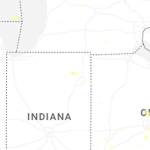


Connect with Interactive Hail Maps