

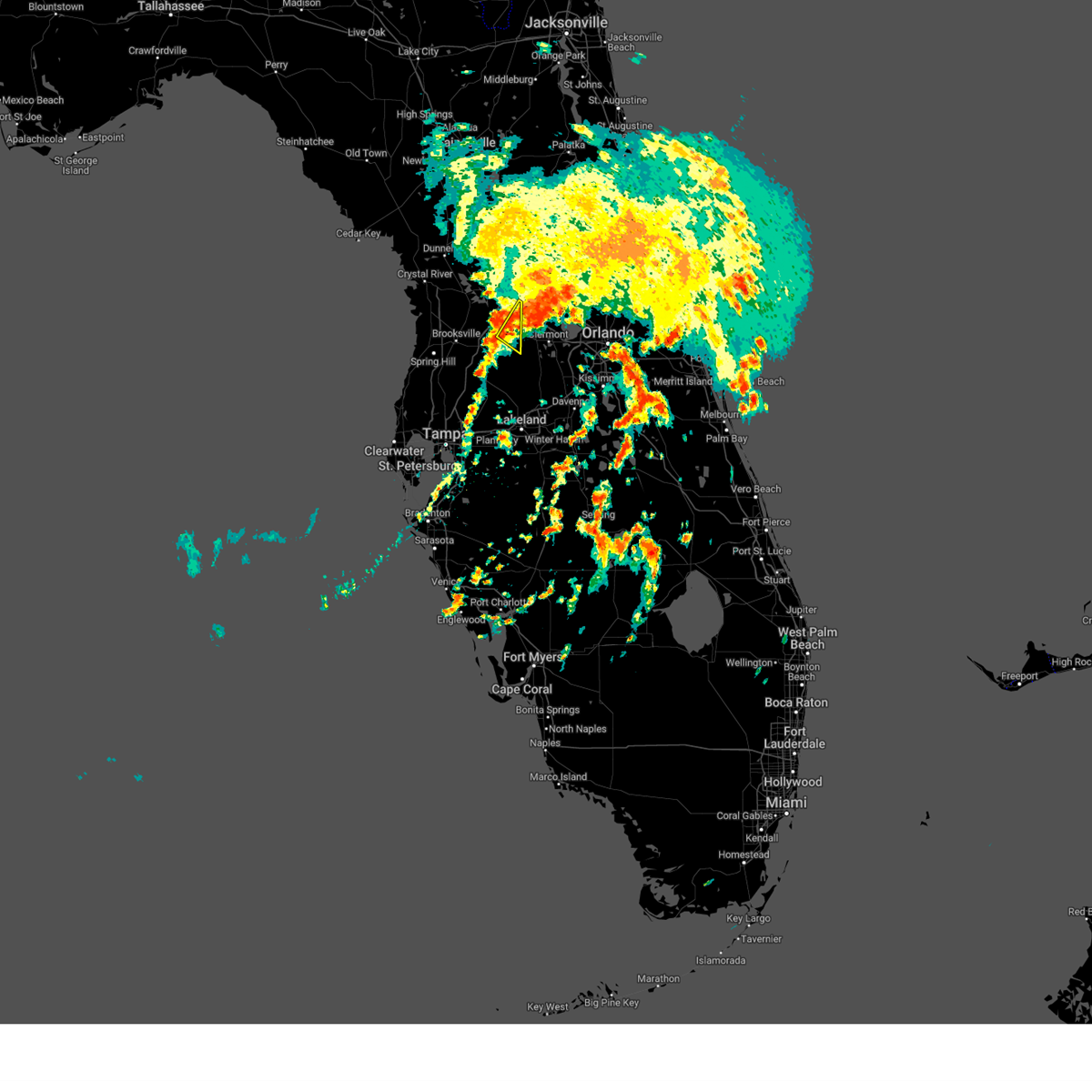
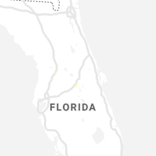
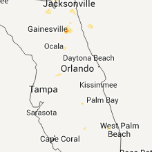
Hail Map for Center Hill, FL
The Center Hill, FL area has had 0 reports of on-the-ground hail by trained spotters, and has been under severe weather warnings 0 times during the past 12 months. Doppler radar has detected hail at or near Center Hill, FL on 51 occasions, including 3 occasions during the past year.
| Name: | Center Hill, FL |
| Where Located: | 38.2 miles W of Orlando, FL |
| Map: | Google Map for Center Hill, FL |
| Population: | 988 |
| Housing Units: | 486 |
| More Info: | Search Google for Center Hill, FL |
0
The Top Recent Hail Date for Center Hill, FL is Thursday, May 29, 2025 (24th out of 51)

Hail and Wind Damage Spotted near Center Hill, FL
| Date / Time | Report Details |
|---|---|
| 4/11/2024 1:04 PM EDT |
 At 104 pm edt, severe thunderstorms were located along a line extending from 7 miles southwest of bushnell to near pebble creek to near fort desoto park, moving east at 45 mph (radar indicated). Hazards include 60 mph wind gusts. Expect damage to roofs, siding, and trees. locations impacted include, tampa, st. petersburg, bradenton, plant city, temple terrace, zephyrhills, palmetto, gulfport, st. Pete beach, and wildwood. At 104 pm edt, severe thunderstorms were located along a line extending from 7 miles southwest of bushnell to near pebble creek to near fort desoto park, moving east at 45 mph (radar indicated). Hazards include 60 mph wind gusts. Expect damage to roofs, siding, and trees. locations impacted include, tampa, st. petersburg, bradenton, plant city, temple terrace, zephyrhills, palmetto, gulfport, st. Pete beach, and wildwood.
|
| 4/11/2024 12:30 PM EDT |
 Svrtbw the national weather service in ruskin has issued a * severe thunderstorm warning for, southeastern citrus county in west central florida, sumter county in central florida, pasco county in west central florida, hernando county in west central florida, northwestern manatee county in west central florida, pinellas county in west central florida, northwestern polk county in central florida, hillsborough county in west central florida, * until 115 pm edt. * at 1229 pm edt, severe thunderstorms were located along a line extending from near spring hill to 6 miles southwest of citrus park to 17 miles west of anna maria, moving east at 45 mph (radar indicated). Hazards include 60 mph wind gusts. expect damage to roofs, siding, and trees Svrtbw the national weather service in ruskin has issued a * severe thunderstorm warning for, southeastern citrus county in west central florida, sumter county in central florida, pasco county in west central florida, hernando county in west central florida, northwestern manatee county in west central florida, pinellas county in west central florida, northwestern polk county in central florida, hillsborough county in west central florida, * until 115 pm edt. * at 1229 pm edt, severe thunderstorms were located along a line extending from near spring hill to 6 miles southwest of citrus park to 17 miles west of anna maria, moving east at 45 mph (radar indicated). Hazards include 60 mph wind gusts. expect damage to roofs, siding, and trees
|
| 10/12/2023 4:01 AM EDT |
 At 401 am edt, a severe thunderstorm was located near bushnell, moving northeast at 40 mph (radar indicated). Hazards include 60 mph wind gusts. expect damage to roofs, siding, and trees At 401 am edt, a severe thunderstorm was located near bushnell, moving northeast at 40 mph (radar indicated). Hazards include 60 mph wind gusts. expect damage to roofs, siding, and trees
|
| 10/12/2023 3:12 AM EDT |
 At 312 am edt, a severe thunderstorm capable of producing a tornado was located near hill n dale, or 10 miles east of brooksville, moving northeast at 35 mph (radar indicated rotation). Hazards include tornado. Flying debris will be dangerous to those caught without shelter. mobile homes will be damaged or destroyed. damage to roofs, windows, and vehicles will occur. tree damage is likely. this dangerous storm will be near, bushnell around 315 am edt. Other locations impacted by this tornadic thunderstorm include webster, ridge manor, tarrytown, croom, center hill, sumterville, adamsville, and spring lake. At 312 am edt, a severe thunderstorm capable of producing a tornado was located near hill n dale, or 10 miles east of brooksville, moving northeast at 35 mph (radar indicated rotation). Hazards include tornado. Flying debris will be dangerous to those caught without shelter. mobile homes will be damaged or destroyed. damage to roofs, windows, and vehicles will occur. tree damage is likely. this dangerous storm will be near, bushnell around 315 am edt. Other locations impacted by this tornadic thunderstorm include webster, ridge manor, tarrytown, croom, center hill, sumterville, adamsville, and spring lake.
|
| 6/17/2023 10:59 AM EDT |
 At 1059 am edt, a severe thunderstorm was located 7 miles east of bushnell, moving southeast at 20 mph (radar indicated). Hazards include 60 mph wind gusts. expect damage to roofs, siding, and trees At 1059 am edt, a severe thunderstorm was located 7 miles east of bushnell, moving southeast at 20 mph (radar indicated). Hazards include 60 mph wind gusts. expect damage to roofs, siding, and trees
|
| 6/17/2023 10:46 AM EDT |
 At 1046 am edt, a severe thunderstorm was located 8 miles southwest of leesburg, moving southeast at 55 mph (radar indicated). Hazards include 60 mph wind gusts. expect damage to roofs, siding, and trees At 1046 am edt, a severe thunderstorm was located 8 miles southwest of leesburg, moving southeast at 55 mph (radar indicated). Hazards include 60 mph wind gusts. expect damage to roofs, siding, and trees
|
| 4/27/2023 9:20 PM EDT |
 At 920 pm edt, severe thunderstorms were located along a line extending from 6 miles south of inverness airport to near wesley chapel south, moving east at 40 mph (radar indicated). Hazards include 60 mph wind gusts. expect damage to roofs, siding, and trees At 920 pm edt, severe thunderstorms were located along a line extending from 6 miles south of inverness airport to near wesley chapel south, moving east at 40 mph (radar indicated). Hazards include 60 mph wind gusts. expect damage to roofs, siding, and trees
|
| 4/26/2023 7:46 PM EDT |
 At 745 pm edt, a severe thunderstorm was located 7 miles southwest of mascotte, moving southeast at 10 mph (radar indicated). Hazards include quarter size hail. damage to vehicles is expected At 745 pm edt, a severe thunderstorm was located 7 miles southwest of mascotte, moving southeast at 10 mph (radar indicated). Hazards include quarter size hail. damage to vehicles is expected
|
| 4/26/2023 7:25 PM EDT |
 At 725 pm edt, a severe thunderstorm was located near bushnell, moving southeast at 20 mph (radar indicated). Hazards include quarter size hail. damage to vehicles is expected At 725 pm edt, a severe thunderstorm was located near bushnell, moving southeast at 20 mph (radar indicated). Hazards include quarter size hail. damage to vehicles is expected
|
| 4/25/2023 4:09 PM EDT |
 At 409 pm edt, a severe thunderstorm was located 8 miles east of bushnell, moving southeast at 25 mph (radar indicated). Hazards include quarter size hail. damage to vehicles is expected At 409 pm edt, a severe thunderstorm was located 8 miles east of bushnell, moving southeast at 25 mph (radar indicated). Hazards include quarter size hail. damage to vehicles is expected
|
| 4/24/2023 5:17 PM EDT |
 At 517 pm edt, a severe thunderstorm was located near wildwood, moving east at 10 mph (radar indicated). Hazards include 60 mph wind gusts and quarter size hail. Hail damage to vehicles is expected. Expect wind damage to roofs, siding, and trees. At 517 pm edt, a severe thunderstorm was located near wildwood, moving east at 10 mph (radar indicated). Hazards include 60 mph wind gusts and quarter size hail. Hail damage to vehicles is expected. Expect wind damage to roofs, siding, and trees.
|
| 6/19/2022 3:50 PM EDT |
 At 350 pm edt, a severe thunderstorm was located near mascotte, moving east at 10 mph (radar indicated). Hazards include 60 mph wind gusts and quarter size hail. Hail damage to vehicles is expected. expect wind damage to roofs, siding, and trees. locations impacted include, ridge manor, center hill, webster, lacoochee, tarrytown, the green swamp and dade city north. hail threat, radar indicated max hail size, 1. 00 in wind threat, radar indicated max wind gust, 60 mph. At 350 pm edt, a severe thunderstorm was located near mascotte, moving east at 10 mph (radar indicated). Hazards include 60 mph wind gusts and quarter size hail. Hail damage to vehicles is expected. expect wind damage to roofs, siding, and trees. locations impacted include, ridge manor, center hill, webster, lacoochee, tarrytown, the green swamp and dade city north. hail threat, radar indicated max hail size, 1. 00 in wind threat, radar indicated max wind gust, 60 mph.
|
| 6/19/2022 3:26 PM EDT |
 At 325 pm edt, a severe thunderstorm was located near bushnell, moving east at 10 mph (radar indicated). Hazards include 60 mph wind gusts and quarter size hail. Hail damage to vehicles is expected. Expect wind damage to roofs, siding, and trees. At 325 pm edt, a severe thunderstorm was located near bushnell, moving east at 10 mph (radar indicated). Hazards include 60 mph wind gusts and quarter size hail. Hail damage to vehicles is expected. Expect wind damage to roofs, siding, and trees.
|
| 6/19/2022 3:21 PM EDT |
 At 320 pm edt, a severe thunderstorm was located over bushnell, and is nearly stationary (radar indicated). Hazards include 60 mph wind gusts and quarter size hail. Hail damage to vehicles is expected. expect wind damage to roofs, siding, and trees. locations impacted include, bushnell, center hill, webster, wahoo, tarrytown and croom. hail threat, radar indicated max hail size, 1. 00 in wind threat, radar indicated max wind gust, 60 mph. At 320 pm edt, a severe thunderstorm was located over bushnell, and is nearly stationary (radar indicated). Hazards include 60 mph wind gusts and quarter size hail. Hail damage to vehicles is expected. expect wind damage to roofs, siding, and trees. locations impacted include, bushnell, center hill, webster, wahoo, tarrytown and croom. hail threat, radar indicated max hail size, 1. 00 in wind threat, radar indicated max wind gust, 60 mph.
|
| 6/19/2022 2:58 PM EDT |
 At 258 pm edt, a severe thunderstorm was located over bushnell, and is nearly stationary (radar indicated). Hazards include 60 mph wind gusts and quarter size hail. Hail damage to vehicles is expected. Expect wind damage to roofs, siding, and trees. At 258 pm edt, a severe thunderstorm was located over bushnell, and is nearly stationary (radar indicated). Hazards include 60 mph wind gusts and quarter size hail. Hail damage to vehicles is expected. Expect wind damage to roofs, siding, and trees.
|
| 3/12/2022 8:45 AM EST |
 At 843 am est, severe thunderstorms were located along a line extending from near the villages to near hill n dale to near new port richey to 30 miles west of bay pines, moving east at 45 mph (radar indicated). Hazards include 60 mph wind gusts. expect damage to roofs, siding, and trees At 843 am est, severe thunderstorms were located along a line extending from near the villages to near hill n dale to near new port richey to 30 miles west of bay pines, moving east at 45 mph (radar indicated). Hazards include 60 mph wind gusts. expect damage to roofs, siding, and trees
|
| 6/6/2020 6:04 PM EDT |
 At 603 pm edt, a severe thunderstorm capable of producing a tornado was located near bushnell, moving north at 25 mph (radar indicated rotation). Hazards include tornado. Flying debris will be dangerous to those caught without shelter. mobile homes will be damaged or destroyed. damage to roofs, windows, and vehicles will occur. tree damage is likely. This tornadic thunderstorm will remain over mainly rural areas of northeastern sumter county, including the following locations, webster, adamsville, coleman, center hill, sumterville and lake panasoffkee. At 603 pm edt, a severe thunderstorm capable of producing a tornado was located near bushnell, moving north at 25 mph (radar indicated rotation). Hazards include tornado. Flying debris will be dangerous to those caught without shelter. mobile homes will be damaged or destroyed. damage to roofs, windows, and vehicles will occur. tree damage is likely. This tornadic thunderstorm will remain over mainly rural areas of northeastern sumter county, including the following locations, webster, adamsville, coleman, center hill, sumterville and lake panasoffkee.
|
| 5/21/2020 4:26 PM EDT |
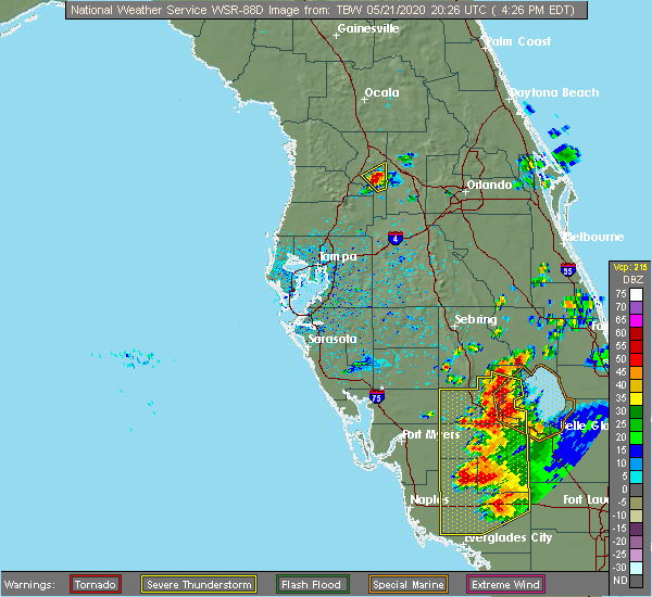 At 425 pm edt, a severe thunderstorm was located near bushnell, moving northeast at 10 mph (radar indicated). Hazards include 60 mph wind gusts and quarter size hail. Hail damage to vehicles is expected. Expect wind damage to roofs, siding, and trees. At 425 pm edt, a severe thunderstorm was located near bushnell, moving northeast at 10 mph (radar indicated). Hazards include 60 mph wind gusts and quarter size hail. Hail damage to vehicles is expected. Expect wind damage to roofs, siding, and trees.
|
| 4/24/2020 5:25 AM EDT |
 At 525 am edt, severe thunderstorms were located along a line extending from near wildwood to 15 miles southwest of harbor bluffs, moving east at 30 mph (radar indicated). Hazards include 60 mph wind gusts. Expect damage to roofs, siding, and trees. locations impacted include, tampa, spring hill, clearwater, largo, pinellas park, seminole, new port richey, brooksville, wildwood, dade city, bushnell, hudson, holiday, lutz, st. petersburg, st. pete beach, st. Leo, weeki wachee, palm harbor and new port richey east. At 525 am edt, severe thunderstorms were located along a line extending from near wildwood to 15 miles southwest of harbor bluffs, moving east at 30 mph (radar indicated). Hazards include 60 mph wind gusts. Expect damage to roofs, siding, and trees. locations impacted include, tampa, spring hill, clearwater, largo, pinellas park, seminole, new port richey, brooksville, wildwood, dade city, bushnell, hudson, holiday, lutz, st. petersburg, st. pete beach, st. Leo, weeki wachee, palm harbor and new port richey east.
|
| 4/24/2020 4:59 AM EDT |
 At 458 am edt, severe thunderstorms were located along a line extending from near inverness highlands north to 27 miles west of harbor bluffs, moving east at 30 mph (radar indicated). Hazards include 60 mph wind gusts. expect damage to roofs, siding, and trees At 458 am edt, severe thunderstorms were located along a line extending from near inverness highlands north to 27 miles west of harbor bluffs, moving east at 30 mph (radar indicated). Hazards include 60 mph wind gusts. expect damage to roofs, siding, and trees
|
| 2/6/2020 10:50 PM EST |
 At 1049 pm est, severe thunderstorms were located along a line extending from 9 miles northeast of inverness to near land o lakes to 25 miles southwest of anna maria, moving east at 35 mph (radar indicated). Hazards include 60 mph wind gusts. expect damage to roofs, siding, and trees At 1049 pm est, severe thunderstorms were located along a line extending from 9 miles northeast of inverness to near land o lakes to 25 miles southwest of anna maria, moving east at 35 mph (radar indicated). Hazards include 60 mph wind gusts. expect damage to roofs, siding, and trees
|
| 5/5/2019 1:55 PM EDT | Several trees and powerlines reported down around cr 702 near the sumter/lake county border. time estimated from rada in sumter county FL, 2.3 miles WSW of Center Hill, FL |
| 5/5/2019 1:46 PM EDT |
 At 146 pm edt, a severe thunderstorm was located near bushnell, moving northeast at 55 mph (radar indicated). Hazards include 60 mph wind gusts. expect damage to roofs, siding, and trees At 146 pm edt, a severe thunderstorm was located near bushnell, moving northeast at 55 mph (radar indicated). Hazards include 60 mph wind gusts. expect damage to roofs, siding, and trees
|
| 4/19/2019 1:52 PM EDT |
 At 151 pm edt, severe thunderstorms were located along a line extending from moss bluff to near hill n dale to downtown saint petersburg, moving northeast at 65 mph (radar indicated). Hazards include 60 mph wind gusts. Expect damage to roofs, siding, and trees. locations impacted include, tampa, clearwater, largo, bradenton, pinellas park, plant city, temple terrace, seminole, zephyrhills, palmetto, wildwood, dade city, bushnell, downtown saint petersburg, fort desoto park, fish hawk, saint petersburg, lutz, brandon and st. Petersburg. At 151 pm edt, severe thunderstorms were located along a line extending from moss bluff to near hill n dale to downtown saint petersburg, moving northeast at 65 mph (radar indicated). Hazards include 60 mph wind gusts. Expect damage to roofs, siding, and trees. locations impacted include, tampa, clearwater, largo, bradenton, pinellas park, plant city, temple terrace, seminole, zephyrhills, palmetto, wildwood, dade city, bushnell, downtown saint petersburg, fort desoto park, fish hawk, saint petersburg, lutz, brandon and st. Petersburg.
|
| 4/19/2019 1:18 PM EDT |
 At 118 pm edt, severe thunderstorms were located along a line extending from 6 miles west of bushnell to keystone to 18 miles southwest of anna maria, moving northeast at 65 mph (radar indicated). Hazards include 60 mph wind gusts. expect damage to roofs, siding, and trees At 118 pm edt, severe thunderstorms were located along a line extending from 6 miles west of bushnell to keystone to 18 miles southwest of anna maria, moving northeast at 65 mph (radar indicated). Hazards include 60 mph wind gusts. expect damage to roofs, siding, and trees
|
| 11/2/2018 4:25 PM EDT |
 The tornado warning for sumter county will expire at 430 pm edt, the tornadic thunderstorm which prompted the warning has weakened. therefore, the warning will be allowed to expire. The tornado warning for sumter county will expire at 430 pm edt, the tornadic thunderstorm which prompted the warning has weakened. therefore, the warning will be allowed to expire.
|
| 11/2/2018 4:06 PM EDT |
 At 406 pm edt, a severe thunderstorm capable of producing a tornado was located over bushnell, moving northeast at 40 mph (radar indicated rotation). Hazards include tornado. Flying debris will be dangerous to those caught without shelter. mobile homes will be damaged or destroyed. damage to roofs, windows, and vehicles will occur. tree damage is likely. This tornadic thunderstorm will remain over mainly rural areas of sumter county, including the following locations, webster, wahoo, lake panasoffkee, adamsville, coleman, center hill, sumterville, oxford and nobleton. At 406 pm edt, a severe thunderstorm capable of producing a tornado was located over bushnell, moving northeast at 40 mph (radar indicated rotation). Hazards include tornado. Flying debris will be dangerous to those caught without shelter. mobile homes will be damaged or destroyed. damage to roofs, windows, and vehicles will occur. tree damage is likely. This tornadic thunderstorm will remain over mainly rural areas of sumter county, including the following locations, webster, wahoo, lake panasoffkee, adamsville, coleman, center hill, sumterville, oxford and nobleton.
|
| 11/2/2018 3:47 PM EDT |
 At 347 pm edt, severe thunderstorms were located along a line extending from near hill n dale to dade city to near hillsborough river state park, moving northeast at 50 mph (radar indicated). Hazards include 60 mph wind gusts and quarter size hail. Hail damage to vehicles is expected. Expect wind damage to roofs, siding, and trees. At 347 pm edt, severe thunderstorms were located along a line extending from near hill n dale to dade city to near hillsborough river state park, moving northeast at 50 mph (radar indicated). Hazards include 60 mph wind gusts and quarter size hail. Hail damage to vehicles is expected. Expect wind damage to roofs, siding, and trees.
|
| 3/20/2018 2:27 PM EDT |
 The tornado warning for southeastern sumter. northeastern pasco and east central hernando counties will expire at 230 pm edt. the storm which prompted the warning has moved out of the area. therefore the warning will be allowed to expire. A tornado watch remains in effect until 700 pm edt for central and west central florida. The tornado warning for southeastern sumter. northeastern pasco and east central hernando counties will expire at 230 pm edt. the storm which prompted the warning has moved out of the area. therefore the warning will be allowed to expire. A tornado watch remains in effect until 700 pm edt for central and west central florida.
|
| 3/20/2018 2:14 PM EDT |
 At 214 pm edt, a severe thunderstorm capable of producing a tornado was located 10 miles northeast of dade city, moving northeast at 50 mph (radar indicated rotation). Hazards include tornado and quarter size hail. Flying debris will be dangerous to those caught without shelter. mobile homes will be damaged or destroyed. damage to roofs, windows, and vehicles will occur. tree damage is likely. Locations impacted include, ridge manor and tarrytown. At 214 pm edt, a severe thunderstorm capable of producing a tornado was located 10 miles northeast of dade city, moving northeast at 50 mph (radar indicated rotation). Hazards include tornado and quarter size hail. Flying debris will be dangerous to those caught without shelter. mobile homes will be damaged or destroyed. damage to roofs, windows, and vehicles will occur. tree damage is likely. Locations impacted include, ridge manor and tarrytown.
|
| 3/20/2018 2:05 PM EDT |
 At 205 pm edt, a severe thunderstorm capable of producing a tornado was located near dade city, moving northeast at 55 mph (radar indicated rotation). Hazards include tornado and quarter size hail. Flying debris will be dangerous to those caught without shelter. mobile homes will be damaged or destroyed. damage to roofs, windows, and vehicles will occur. Tree damage is likely. At 205 pm edt, a severe thunderstorm capable of producing a tornado was located near dade city, moving northeast at 55 mph (radar indicated rotation). Hazards include tornado and quarter size hail. Flying debris will be dangerous to those caught without shelter. mobile homes will be damaged or destroyed. damage to roofs, windows, and vehicles will occur. Tree damage is likely.
|
| 3/20/2018 2:04 PM EDT |
 At 202 pm edt, multiple severe thunderstorms was located in hernando and pasco counties moving northeast at 55 mph (radar indicated). Hazards include 60 mph wind gusts and quarter size hail. Hail damage to vehicles is expected. Expect wind damage to roofs, siding, and trees. At 202 pm edt, multiple severe thunderstorms was located in hernando and pasco counties moving northeast at 55 mph (radar indicated). Hazards include 60 mph wind gusts and quarter size hail. Hail damage to vehicles is expected. Expect wind damage to roofs, siding, and trees.
|
| 1/22/2017 7:25 PM EST |
 At 725 pm est, severe thunderstorms were located along a line extending from near moss bluff to fruitland park to near bushnell to 7 miles southeast of hernando county airport, moving east at 45 mph (radar indicated). Hazards include 70 mph wind gusts. Expect considerable tree damage. damage is likely to mobile homes, roofs, and outbuildings. locations impacted include, spring hill, new port richey, zephyrhills, brooksville, wildwood, dade city, bushnell, hudson, holiday, st. leo, new port richey east, hill `n dale, zephyrhills west, land o lakes, hernando county airport, wesley chapel south, beacon square, jasmine estates, land o` lakes and south brooksville. A tornado watch remains in effect until 1000 pm est for central and west central florida. At 725 pm est, severe thunderstorms were located along a line extending from near moss bluff to fruitland park to near bushnell to 7 miles southeast of hernando county airport, moving east at 45 mph (radar indicated). Hazards include 70 mph wind gusts. Expect considerable tree damage. damage is likely to mobile homes, roofs, and outbuildings. locations impacted include, spring hill, new port richey, zephyrhills, brooksville, wildwood, dade city, bushnell, hudson, holiday, st. leo, new port richey east, hill `n dale, zephyrhills west, land o lakes, hernando county airport, wesley chapel south, beacon square, jasmine estates, land o` lakes and south brooksville. A tornado watch remains in effect until 1000 pm est for central and west central florida.
|
| 1/22/2017 6:42 PM EST |
 At 641 pm est, severe thunderstorms were located along a line extending from 6 miles northeast of inverness highlands north to 6 miles southwest of inverness highlands south to timber pines to 7 miles northwest of beacon square, moving east at 45 mph (radar indicated). Hazards include 60 to 70 mph wind gusts. Expect considerable tree damage. Damage is likely to mobile homes, roofs, and outbuildings. At 641 pm est, severe thunderstorms were located along a line extending from 6 miles northeast of inverness highlands north to 6 miles southwest of inverness highlands south to timber pines to 7 miles northwest of beacon square, moving east at 45 mph (radar indicated). Hazards include 60 to 70 mph wind gusts. Expect considerable tree damage. Damage is likely to mobile homes, roofs, and outbuildings.
|
| 1/22/2017 6:35 PM EST |
 At 634 pm est, a severe thunderstorm capable of producing a tornado was located over bushnell, moving northeast at 60 mph (radar indicated rotation). Hazards include tornado. Flying debris will be dangerous to those caught without shelter. mobile homes will be damaged or destroyed. damage to roofs, windows, and vehicles will occur. tree damage is likely. This tornadic thunderstorm will remain over mainly rural areas of central sumter county, including the following locations: webster, tarrytown, center hill and sumterville. At 634 pm est, a severe thunderstorm capable of producing a tornado was located over bushnell, moving northeast at 60 mph (radar indicated rotation). Hazards include tornado. Flying debris will be dangerous to those caught without shelter. mobile homes will be damaged or destroyed. damage to roofs, windows, and vehicles will occur. tree damage is likely. This tornadic thunderstorm will remain over mainly rural areas of central sumter county, including the following locations: webster, tarrytown, center hill and sumterville.
|
| 1/22/2017 6:20 PM EST |
 At 620 pm est, a severe thunderstorm capable of producing a tornado was located over hill `n dale, or near brooksville, moving northeast at 60 mph (radar indicated rotation). Hazards include tornado. Flying debris will be dangerous to those caught without shelter. mobile homes will be damaged or destroyed. damage to roofs, windows, and vehicles will occur. tree damage is likely. this dangerous storm will be near, bushnell around 635 pm est. Other locations impacted by this tornadic thunderstorm include webster, ridge manor, tarrytown, croom, center hill and sumterville. At 620 pm est, a severe thunderstorm capable of producing a tornado was located over hill `n dale, or near brooksville, moving northeast at 60 mph (radar indicated rotation). Hazards include tornado. Flying debris will be dangerous to those caught without shelter. mobile homes will be damaged or destroyed. damage to roofs, windows, and vehicles will occur. tree damage is likely. this dangerous storm will be near, bushnell around 635 pm est. Other locations impacted by this tornadic thunderstorm include webster, ridge manor, tarrytown, croom, center hill and sumterville.
|
| 1/22/2017 5:59 PM EST |
 At 559 pm est, a severe thunderstorm capable of producing a tornado was located 7 miles west of mascotte, moving northeast at 60 mph (radar indicated rotation). Hazards include tornado. Flying debris will be dangerous to those caught without shelter. mobile homes will be damaged or destroyed. damage to roofs, windows, and vehicles will occur. tree damage is likely. This tornadic thunderstorm will remain over mainly rural areas of east central sumter county, including the following locations: webster, tarrytown and center hill. At 559 pm est, a severe thunderstorm capable of producing a tornado was located 7 miles west of mascotte, moving northeast at 60 mph (radar indicated rotation). Hazards include tornado. Flying debris will be dangerous to those caught without shelter. mobile homes will be damaged or destroyed. damage to roofs, windows, and vehicles will occur. tree damage is likely. This tornadic thunderstorm will remain over mainly rural areas of east central sumter county, including the following locations: webster, tarrytown and center hill.
|
| 7/12/2016 6:45 PM EDT | Power pole snapped at intersection of cr 476 and sr 471. barn roof torn of in sumter county FL, 3.6 miles ESE of Center Hill, FL |
| 7/7/2016 4:31 PM EDT |
 At 430 pm edt, a severe thunderstorm was located near bushnell, moving east at 10 mph (radar indicated). Hazards include 60 mph wind gusts and penny size hail. Expect damage to roofs. siding. and trees. Locations impacted include, bushnell, hill `n dale, ridge manor, center hill, webster, tarrytown, istachatta, croom and nobleton. At 430 pm edt, a severe thunderstorm was located near bushnell, moving east at 10 mph (radar indicated). Hazards include 60 mph wind gusts and penny size hail. Expect damage to roofs. siding. and trees. Locations impacted include, bushnell, hill `n dale, ridge manor, center hill, webster, tarrytown, istachatta, croom and nobleton.
|
| 7/7/2016 4:19 PM EDT |
 At 418 pm edt, a severe thunderstorm was located near hill `n dale, or 9 miles southwest of bushnell, moving east at 5 mph (radar indicated). Hazards include 60 mph wind gusts and penny size hail. Expect damage to roofs. siding. And trees. At 418 pm edt, a severe thunderstorm was located near hill `n dale, or 9 miles southwest of bushnell, moving east at 5 mph (radar indicated). Hazards include 60 mph wind gusts and penny size hail. Expect damage to roofs. siding. And trees.
|
| 5/12/2015 7:39 PM EDT | At 738 pm edt, doppler radar indicated a severe thunderstorm capable of producing quarter size hail and damaging winds in excess of 60 mph. this storm was located near bushnell. this storm was nearly stationary. |
Hail Maps for Center Hill, FL


Connect with Interactive Hail Maps