

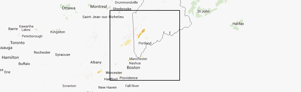
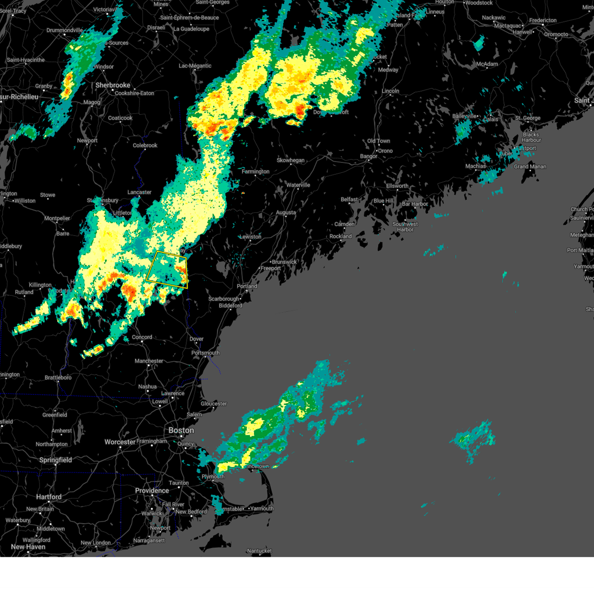
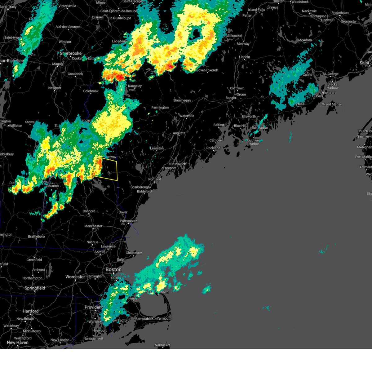
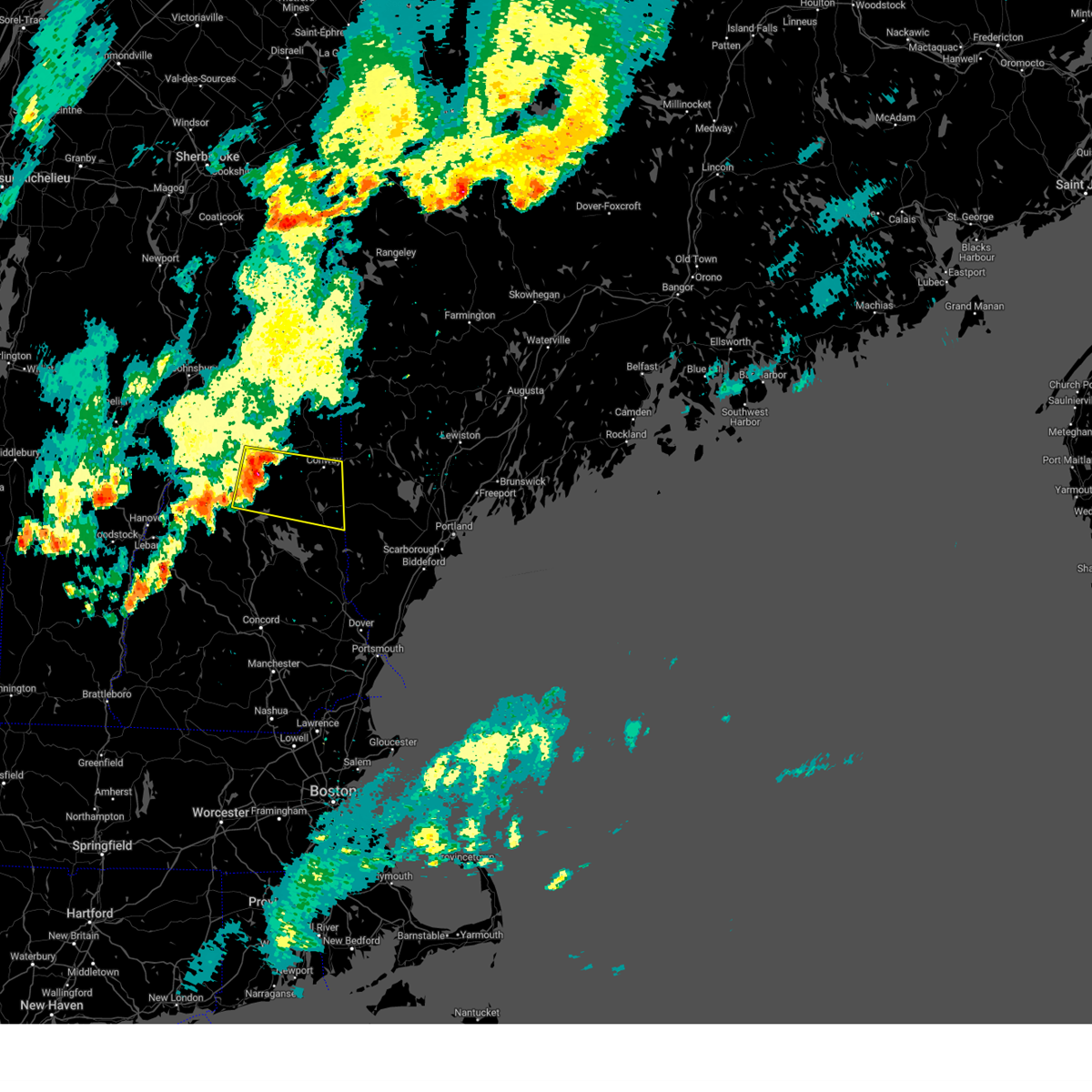
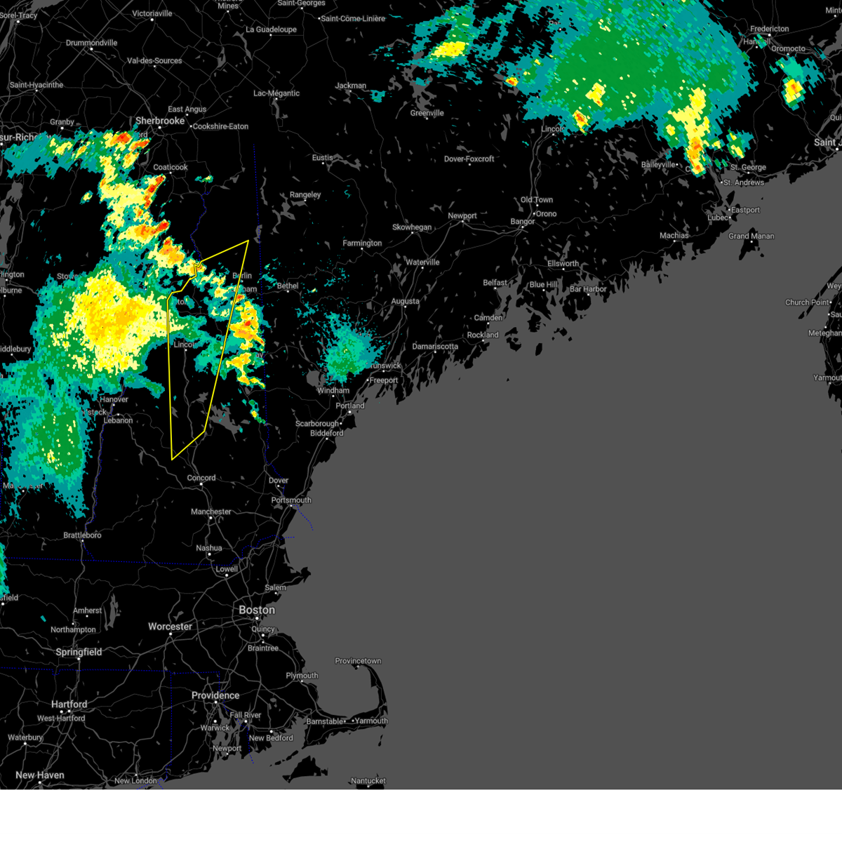
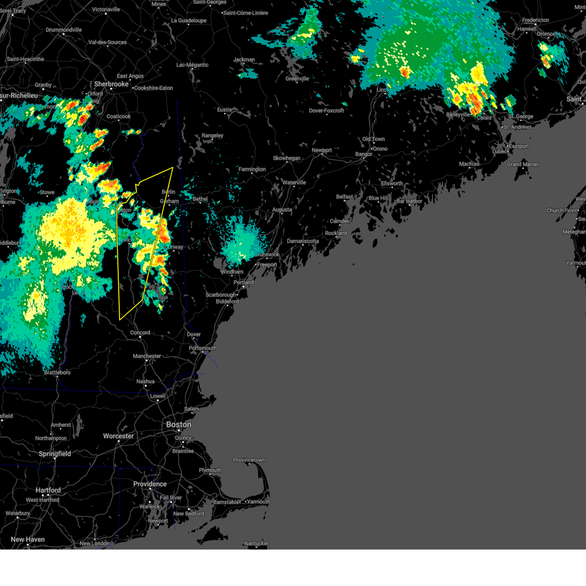
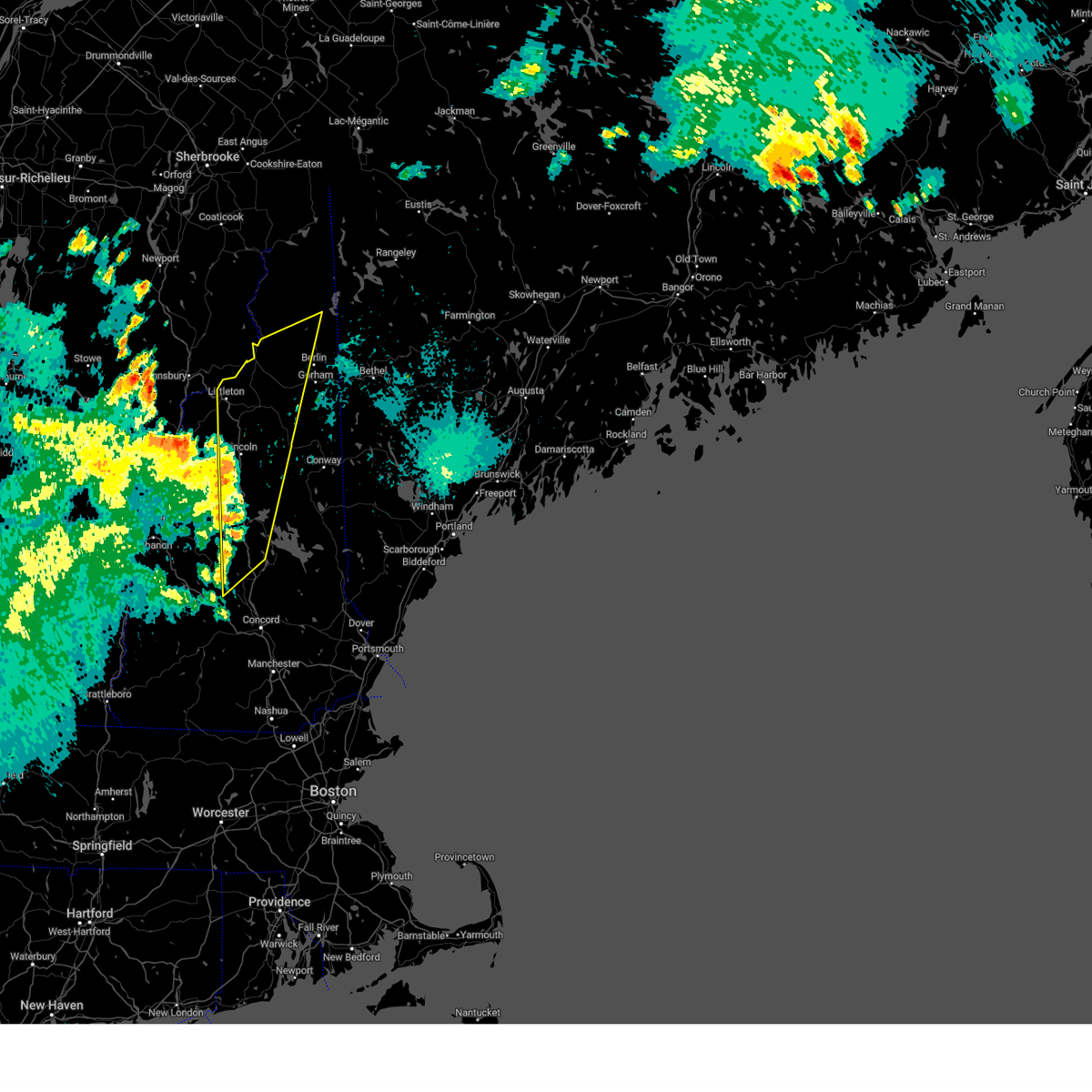
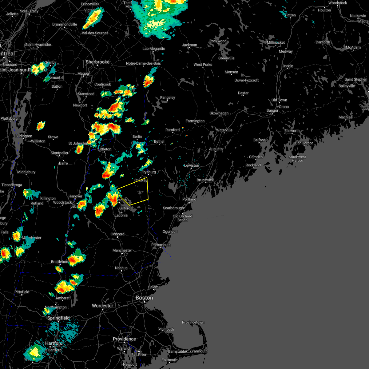
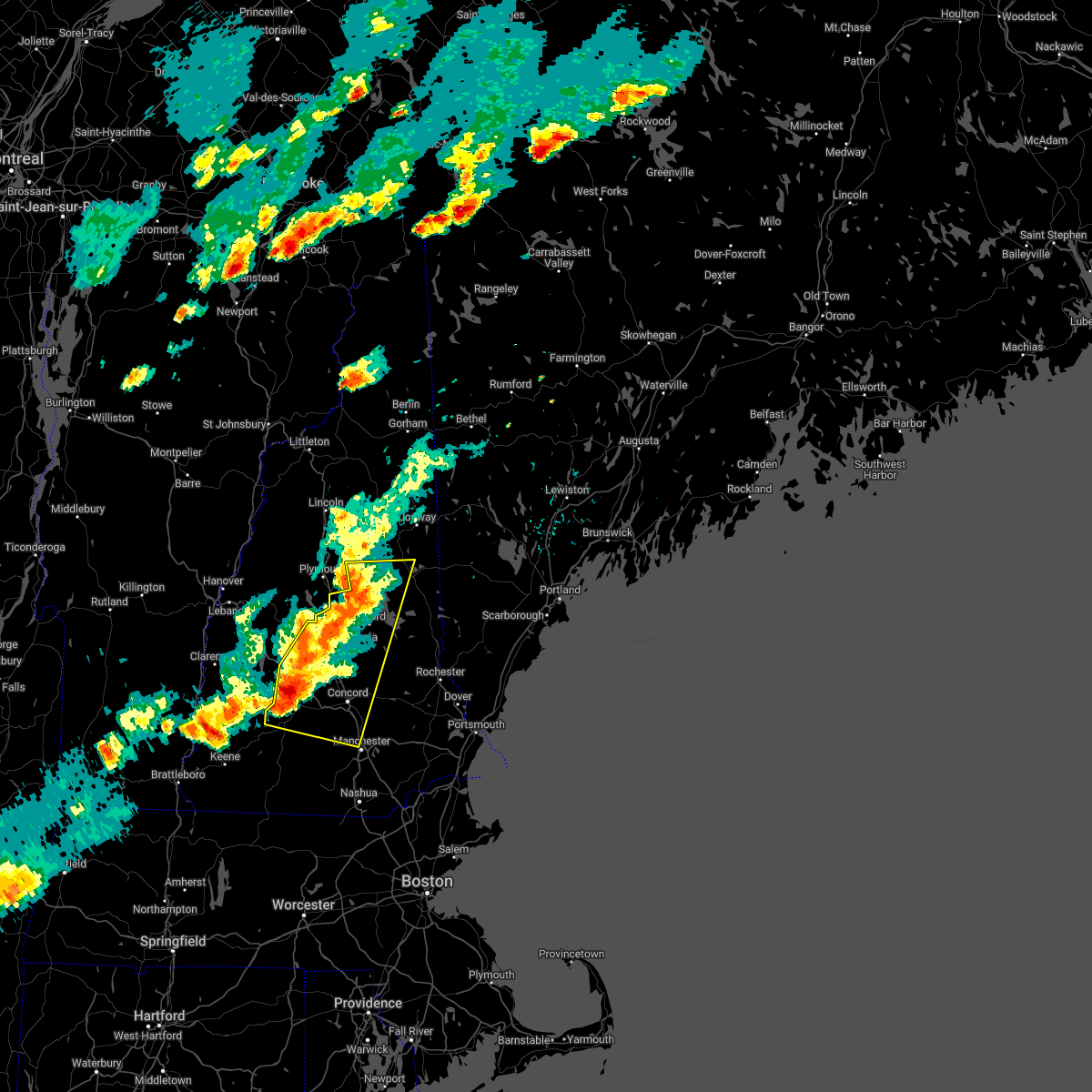
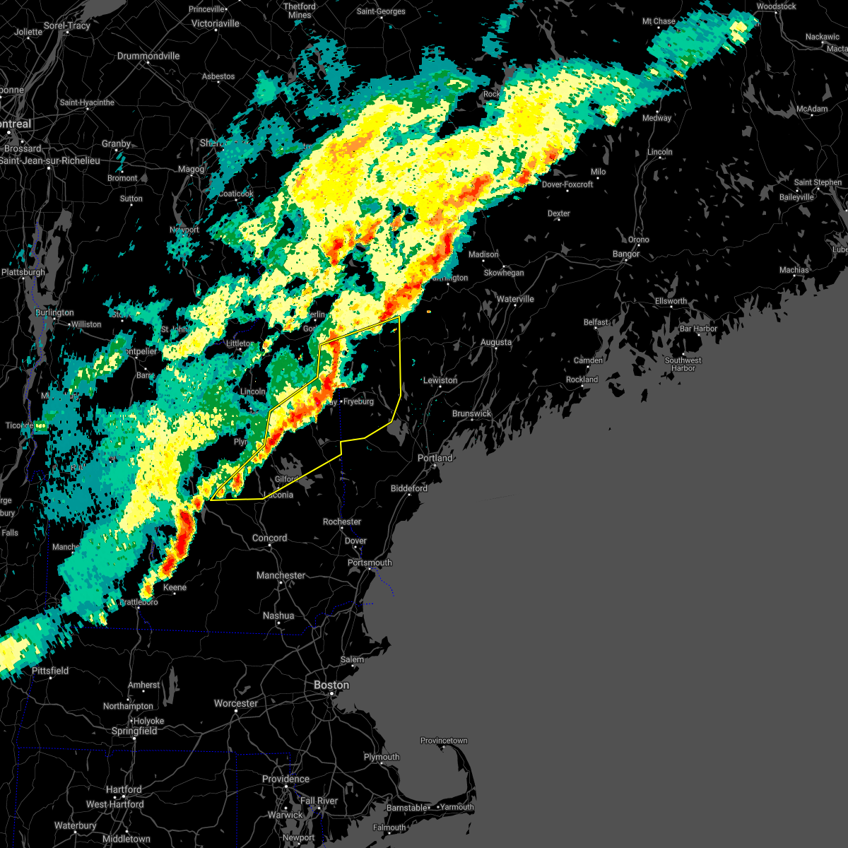
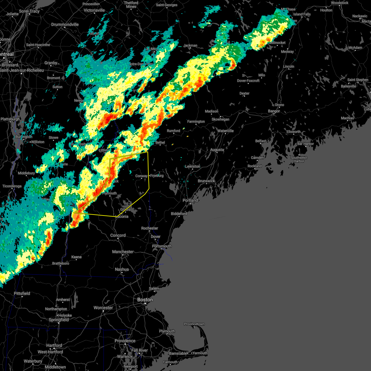
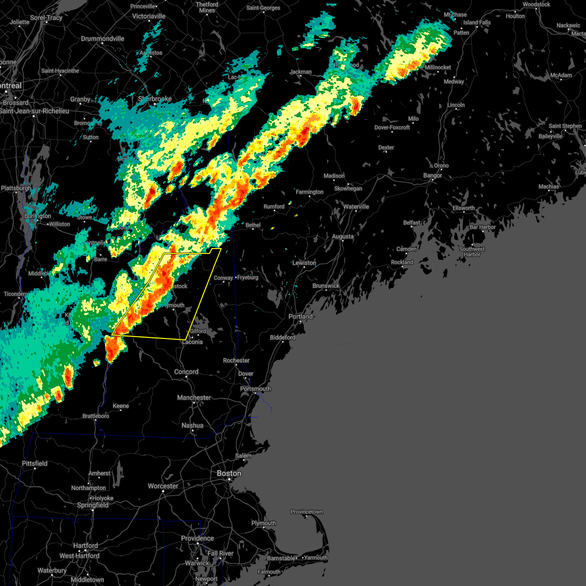
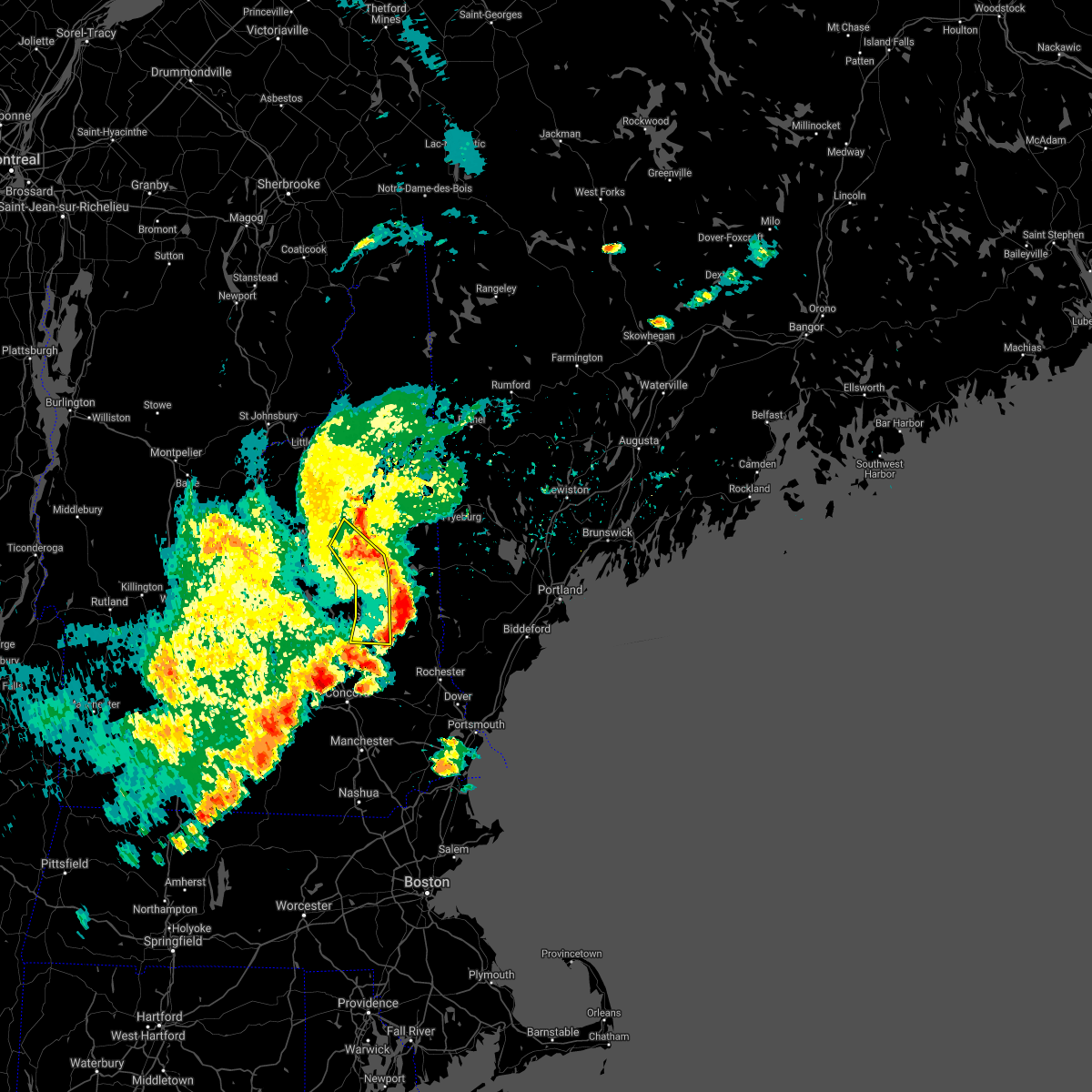
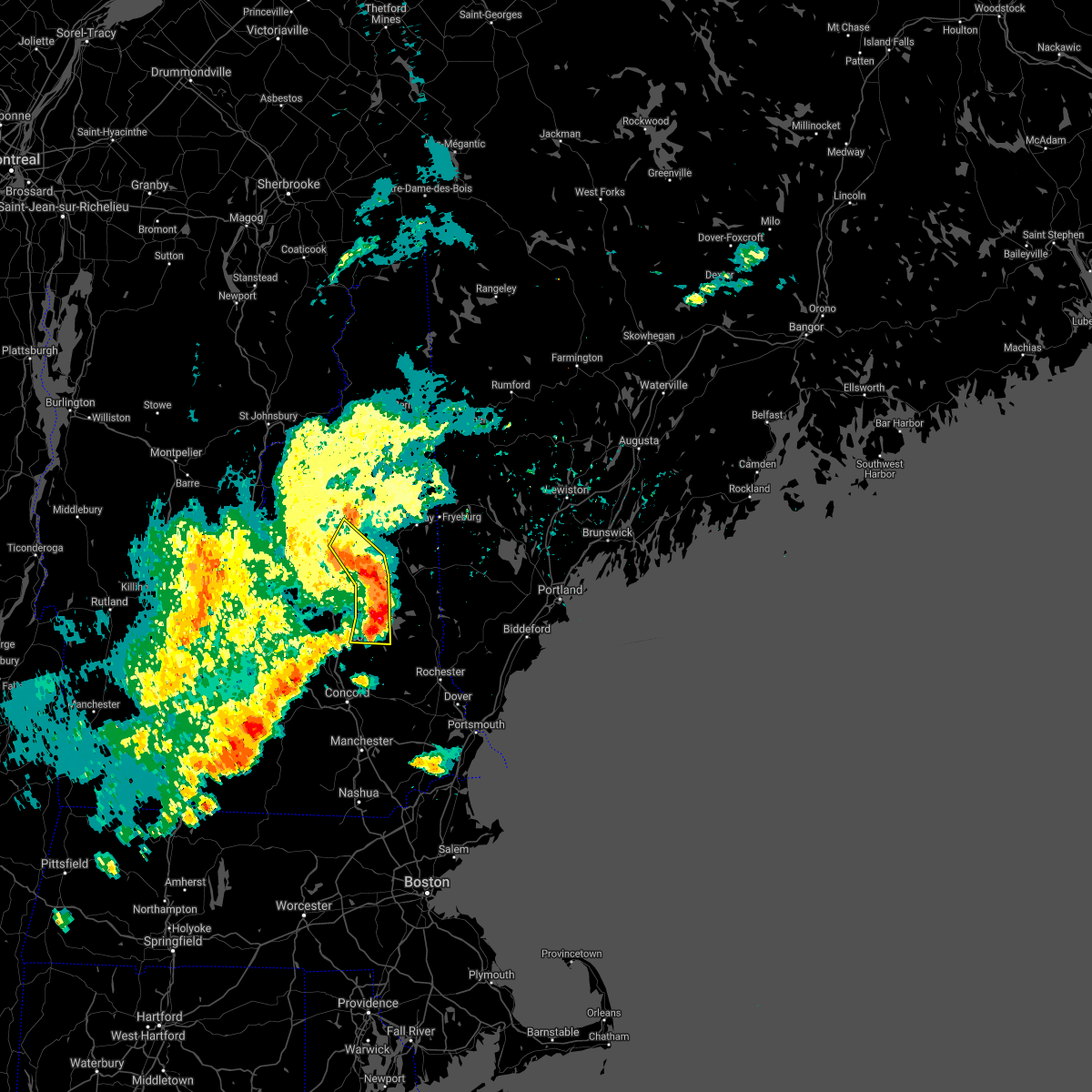
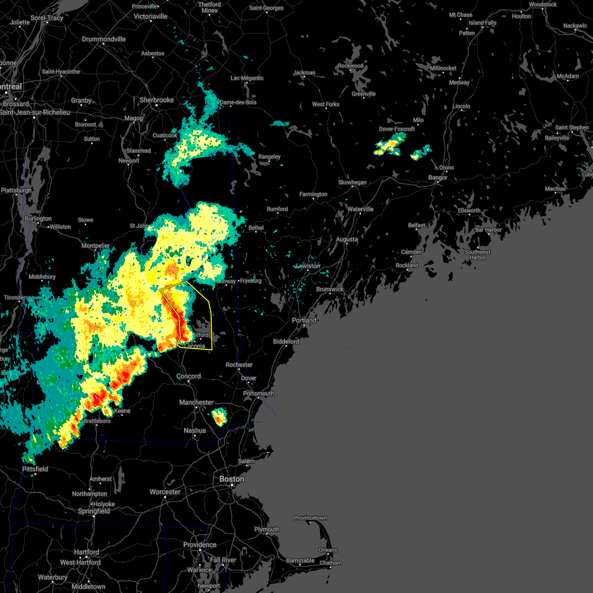
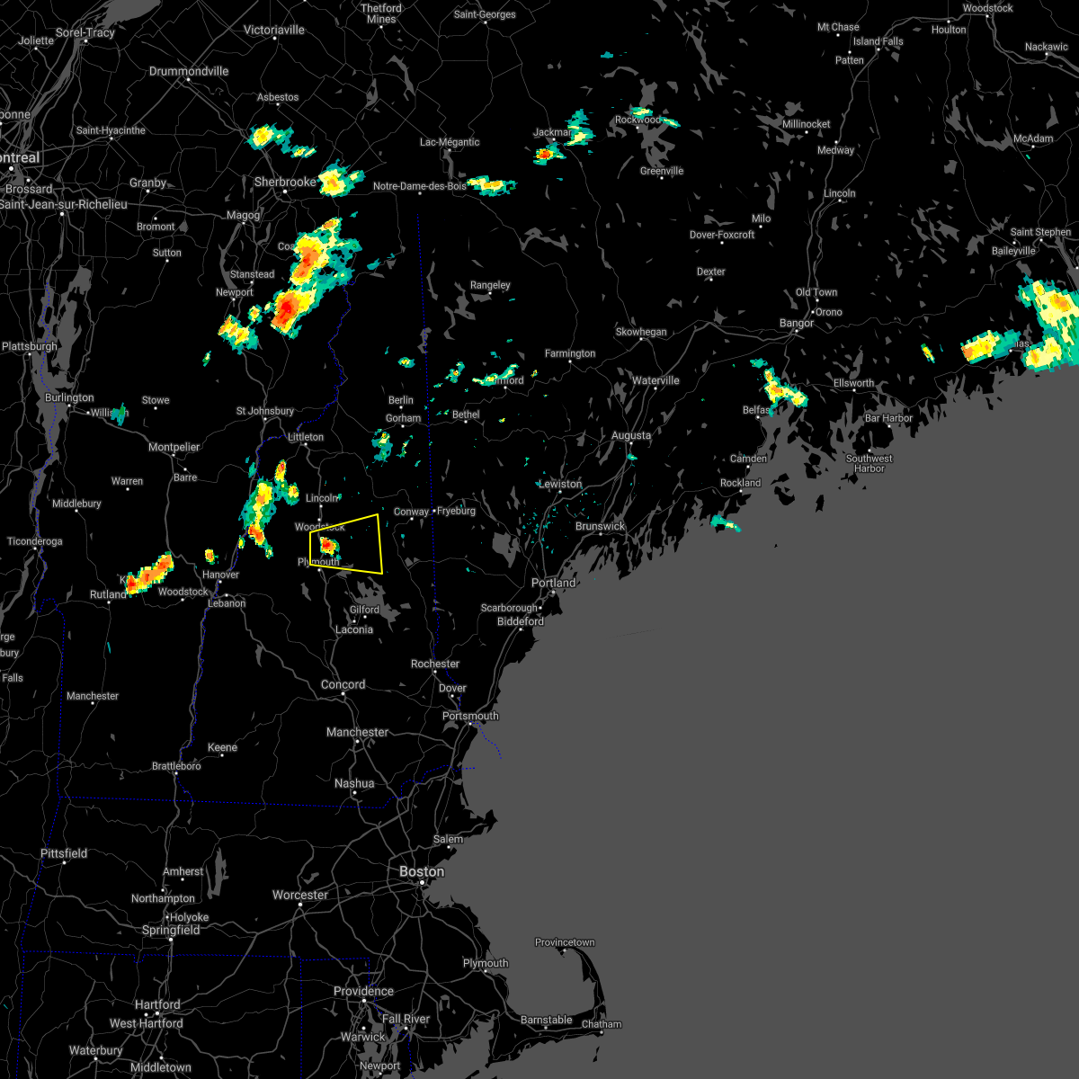
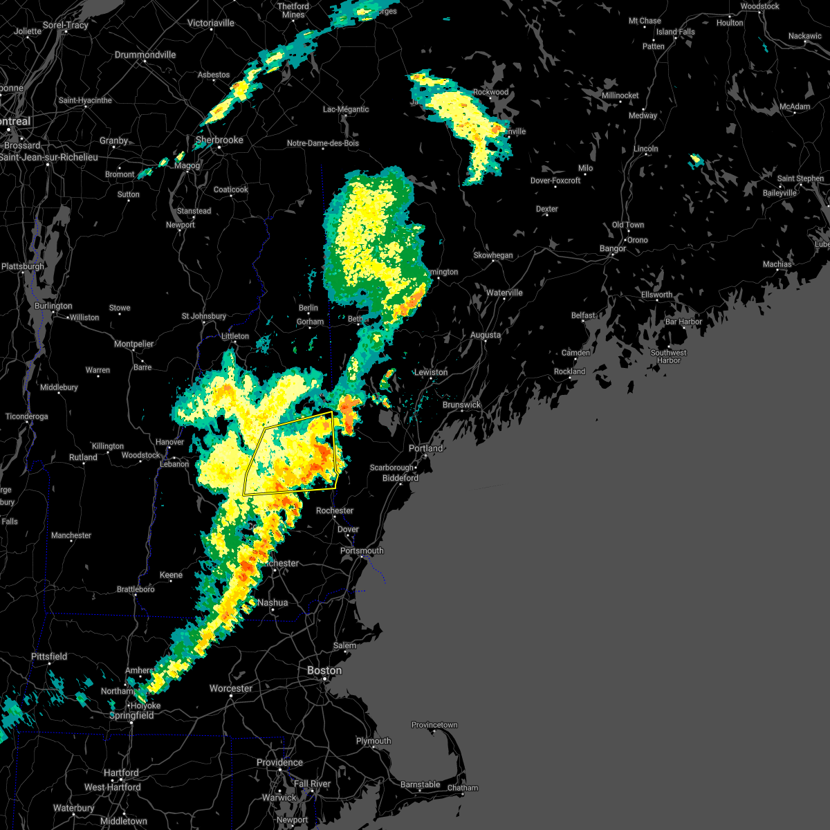
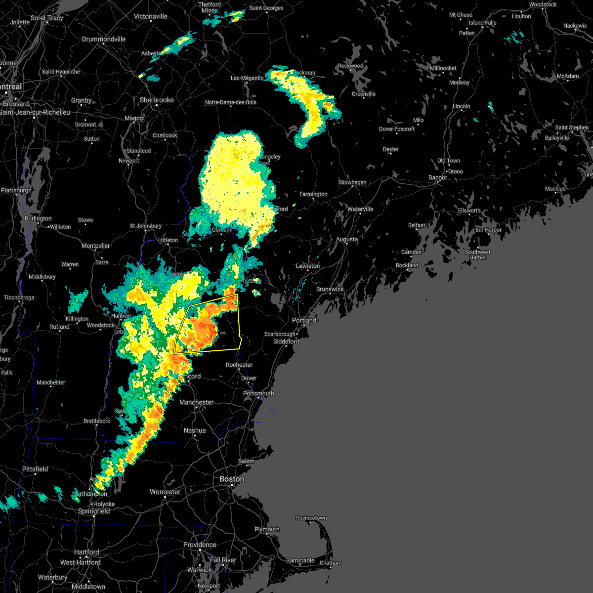
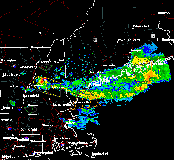
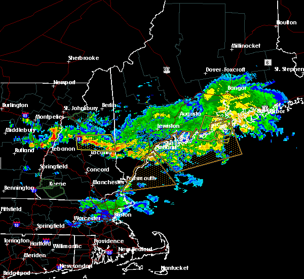
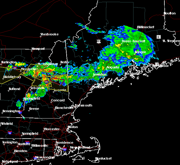
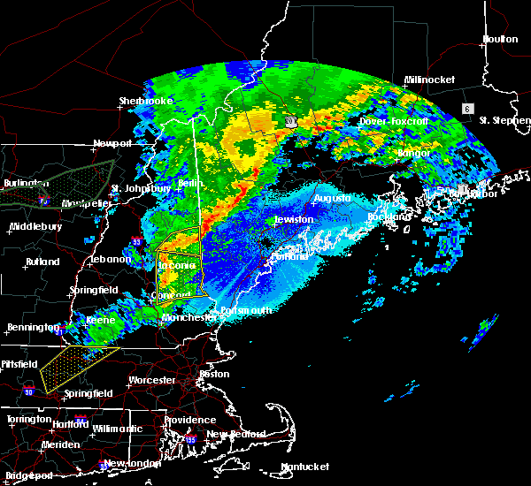
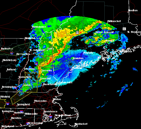
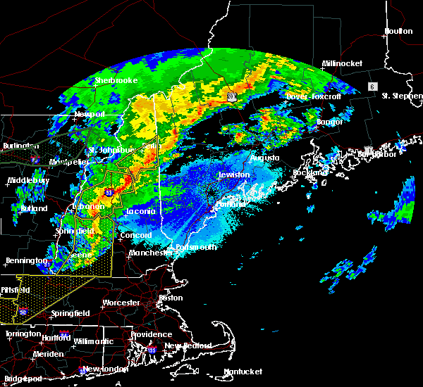
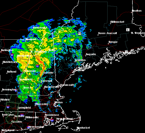
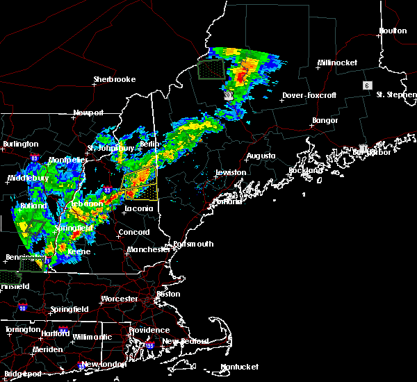
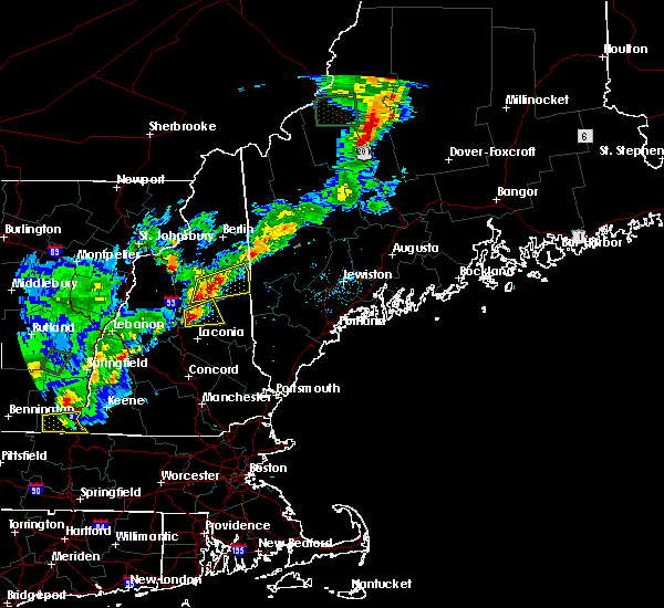
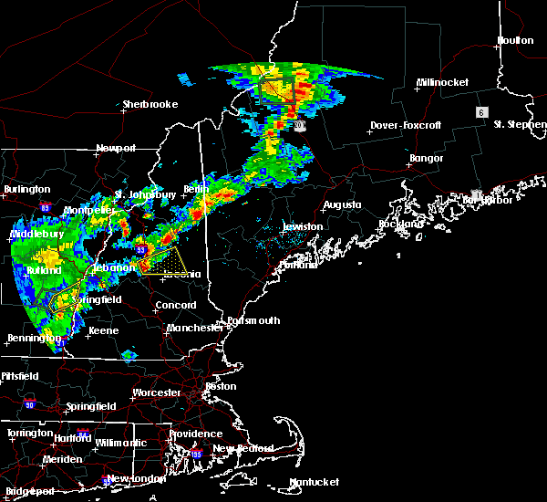
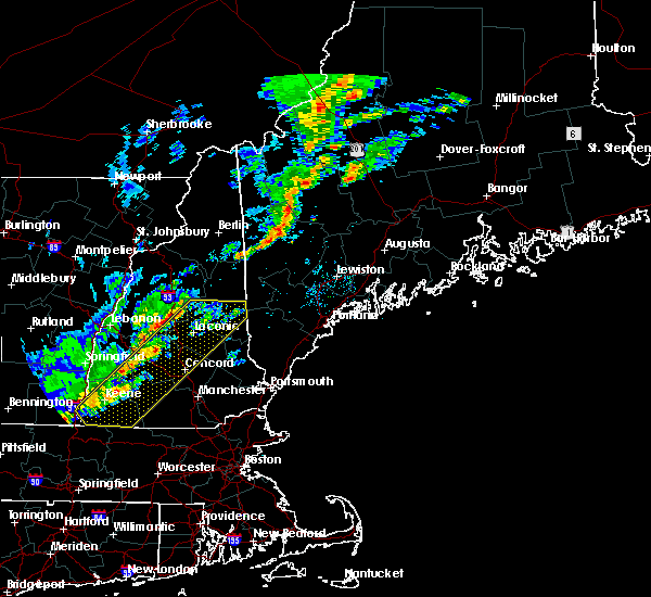
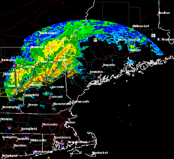
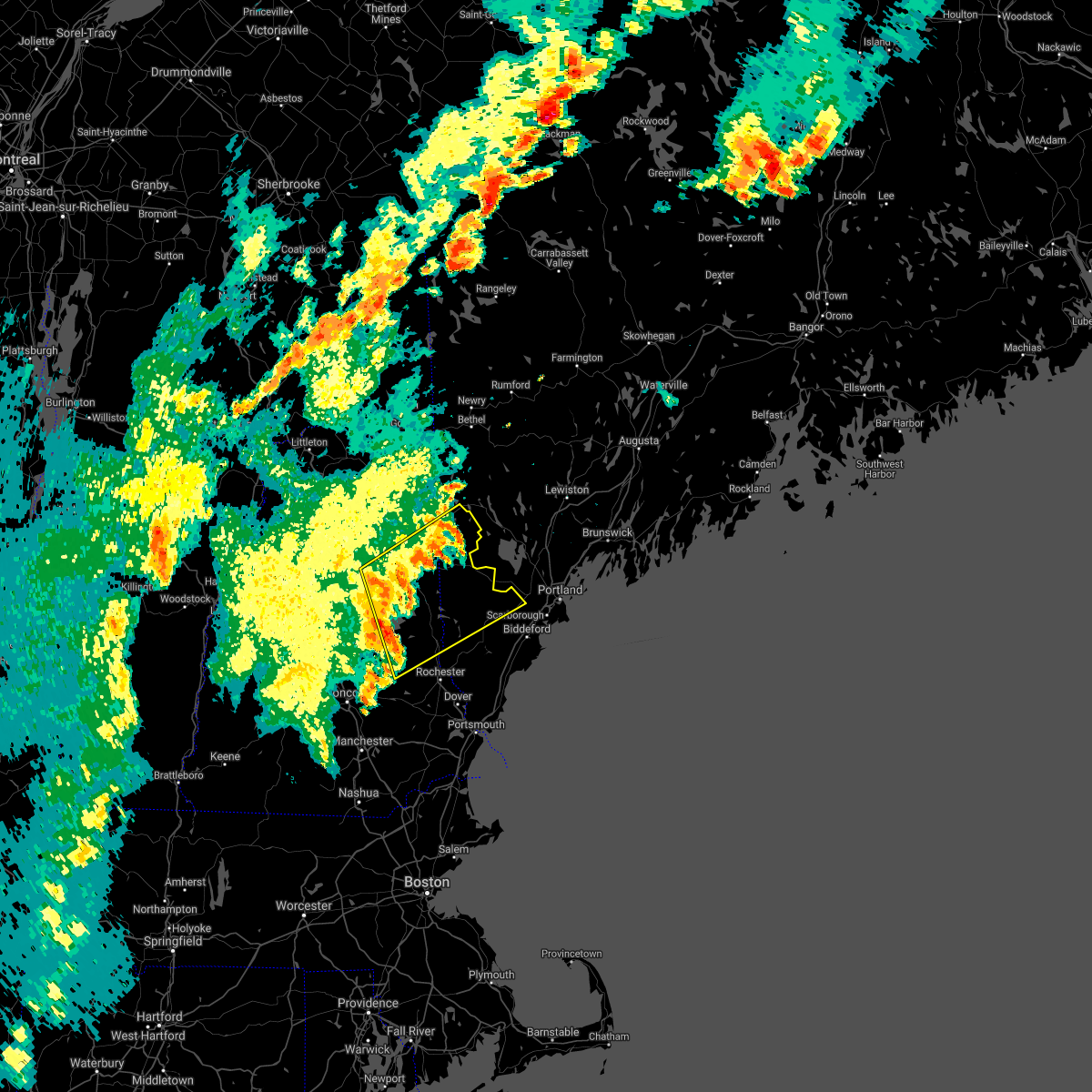
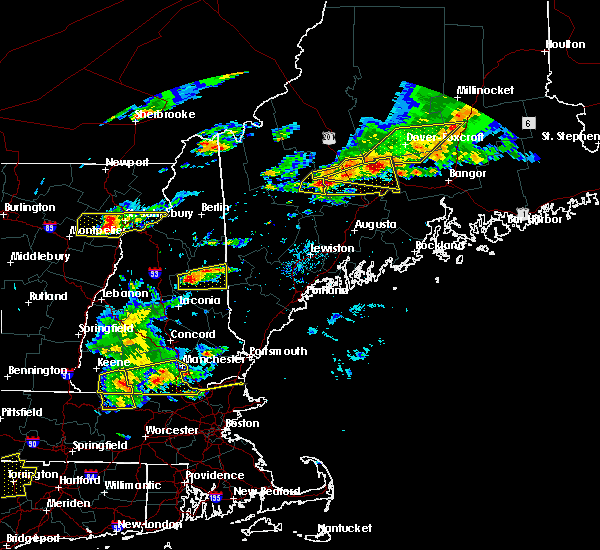
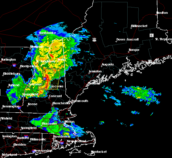
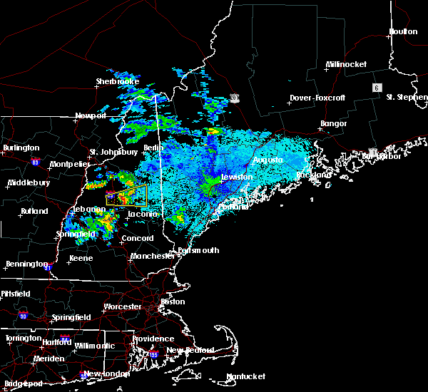
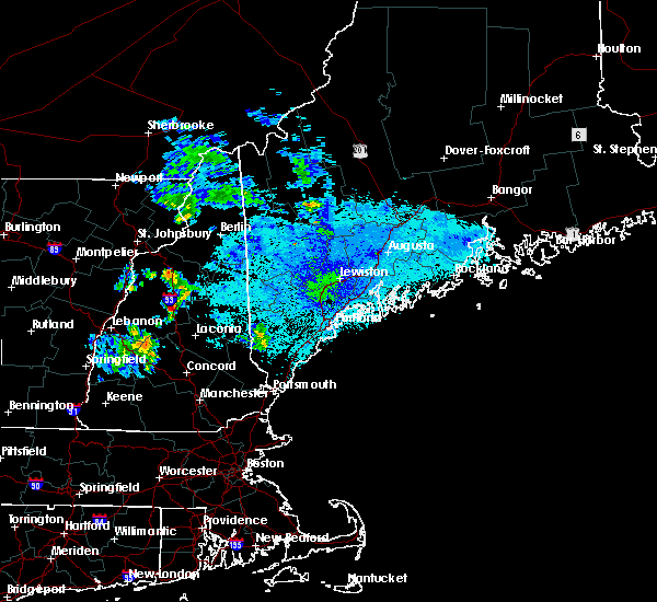
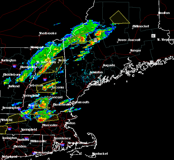
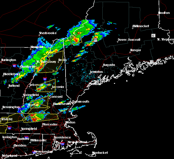
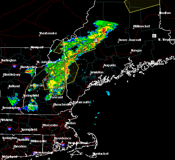
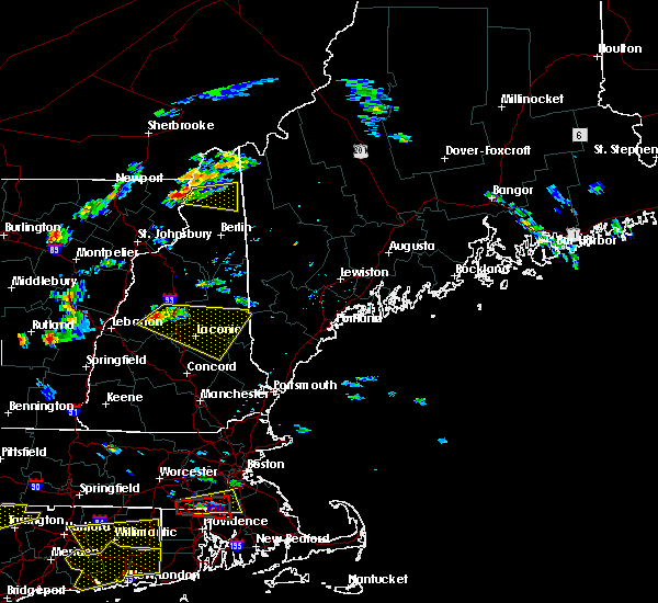
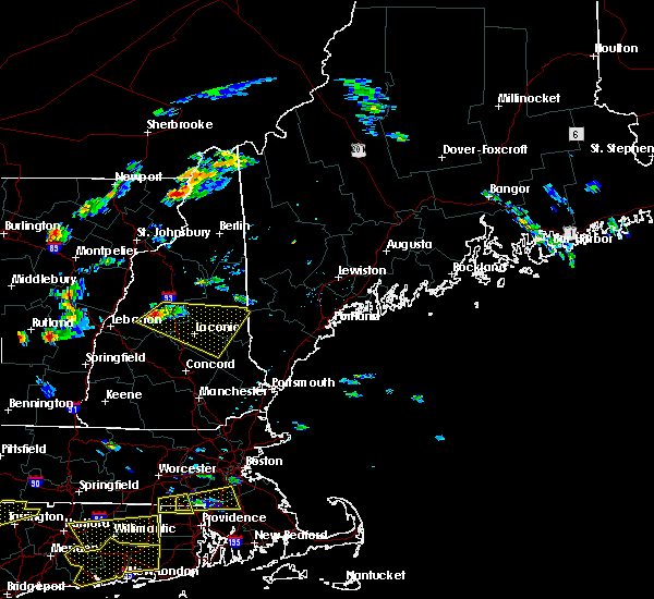
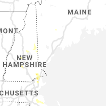
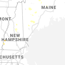
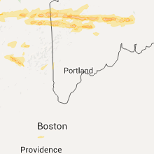
Hail Map for Center Sandwich, NH
The Center Sandwich, NH area has had 4 reports of on-the-ground hail by trained spotters, and has been under severe weather warnings 4 times during the past 12 months. Doppler radar has detected hail at or near Center Sandwich, NH on 13 occasions.
| Name: | Center Sandwich, NH |
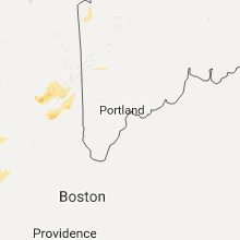
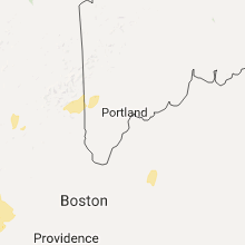
| Where Located: | 60 miles W of Portland, ME |
| Map: | Google Map for Center Sandwich, NH |
| Population: | 123 |
| Housing Units: | 89 |
| More Info: | Search Google for Center Sandwich, NH |
5
The Top Recent Hail Date for Center Sandwich, NH is Monday, July 28, 2014 (1st out of 13)
Hail and Wind Damage Spotted near Center Sandwich, NH
| Date / Time | Report Details |
|---|---|
| 8/4/2024 9:14 PM EDT |
 The storm which prompted the warning has weakened below severe limits, and has exited the warned area. therefore, the warning will be allowed to expire. The storm which prompted the warning has weakened below severe limits, and has exited the warned area. therefore, the warning will be allowed to expire.
|
| 8/4/2024 8:37 PM EDT |
 the severe thunderstorm warning has been cancelled and is no longer in effect the severe thunderstorm warning has been cancelled and is no longer in effect
|
| 8/4/2024 8:37 PM EDT |
 At 837 pm edt, a severe thunderstorm was located near tamworth, or 11 miles southwest of conway, moving east at 30 mph (radar indicated). Hazards include 60 mph wind gusts. Expect damage to roofs, siding, and trees. locations impacted include, conway, ossipee, moultonborough, effingham, tamworth, sandwich, madison, freedom, albany, eaton, tuftonboro, waterville valley, and wakefield. This also includes, mount chocorua, mount passaconaway, and champney falls. At 837 pm edt, a severe thunderstorm was located near tamworth, or 11 miles southwest of conway, moving east at 30 mph (radar indicated). Hazards include 60 mph wind gusts. Expect damage to roofs, siding, and trees. locations impacted include, conway, ossipee, moultonborough, effingham, tamworth, sandwich, madison, freedom, albany, eaton, tuftonboro, waterville valley, and wakefield. This also includes, mount chocorua, mount passaconaway, and champney falls.
|
| 8/4/2024 8:11 PM EDT |
 Svrgyx the national weather service in gray maine has issued a * severe thunderstorm warning for, east central grafton county in northern new hampshire, northwestern belknap county in central new hampshire, central carroll county in northern new hampshire, * until 915 pm edt. * at 810 pm edt, a severe thunderstorm was located 9 miles northwest of sandwich, or 9 miles south of lincoln, moving east at 30 mph (radar indicated). Hazards include 60 mph wind gusts and penny size hail. expect damage to roofs, siding, and trees Svrgyx the national weather service in gray maine has issued a * severe thunderstorm warning for, east central grafton county in northern new hampshire, northwestern belknap county in central new hampshire, central carroll county in northern new hampshire, * until 915 pm edt. * at 810 pm edt, a severe thunderstorm was located 9 miles northwest of sandwich, or 9 miles south of lincoln, moving east at 30 mph (radar indicated). Hazards include 60 mph wind gusts and penny size hail. expect damage to roofs, siding, and trees
|
| 6/23/2024 6:32 PM EDT | Ne511 reported a tree down... reducing nh 113 to one lane. time estimated by rada in grafton county NH, 6 miles ENE of Center Sandwich, NH |
| 6/19/2024 5:22 PM EDT | Tree down in the road blocking traffic with arching wires on jackson pond rd. time estimated from rada in carroll county NH, 5.6 miles WSW of Center Sandwich, NH |
| 9/7/2023 11:57 PM EDT |
 The severe thunderstorm warning for southern coos, eastern grafton, northwestern belknap, north central merrimack and northwestern carroll counties will expire at midnight edt, the storms which prompted the warning have weakened below severe limits, and have exited the warned area. therefore, the warning will be allowed to expire. The severe thunderstorm warning for southern coos, eastern grafton, northwestern belknap, north central merrimack and northwestern carroll counties will expire at midnight edt, the storms which prompted the warning have weakened below severe limits, and have exited the warned area. therefore, the warning will be allowed to expire.
|
| 9/7/2023 11:43 PM EDT |
 At 1140 pm edt, severe thunderstorms were located along a line extending from near lancaster to near holderness, moving northeast at 50 mph (radar indicated). Hazards include 60 mph wind gusts and quarter size hail. Expect wind damage to trees and power lines. Minor hail damage to vehicles is possible. At 1140 pm edt, severe thunderstorms were located along a line extending from near lancaster to near holderness, moving northeast at 50 mph (radar indicated). Hazards include 60 mph wind gusts and quarter size hail. Expect wind damage to trees and power lines. Minor hail damage to vehicles is possible.
|
| 9/7/2023 11:09 PM EDT |
 At 1108 pm edt, severe thunderstorms were located along a line extending from 6 miles east of haverhill to 7 miles north of warner, moving northeast at 40 mph (radar indicated). Hazards include 60 mph wind gusts and quarter size hail. Expect wind damage to trees and power lines. Minor hail damage to vehicles is possible. At 1108 pm edt, severe thunderstorms were located along a line extending from 6 miles east of haverhill to 7 miles north of warner, moving northeast at 40 mph (radar indicated). Hazards include 60 mph wind gusts and quarter size hail. Expect wind damage to trees and power lines. Minor hail damage to vehicles is possible.
|
| 12/23/2022 6:07 PM EST |
 The severe thunderstorm warning for york, northeastern rockingham, central strafford, east central grafton, northeastern belknap and carroll counties will expire at 615 pm est, the storms which prompted the warning have moved out of the area. therefore, the warning will be allowed to expire. however gusty winds are still possible with these thunderstorms. The severe thunderstorm warning for york, northeastern rockingham, central strafford, east central grafton, northeastern belknap and carroll counties will expire at 615 pm est, the storms which prompted the warning have moved out of the area. therefore, the warning will be allowed to expire. however gusty winds are still possible with these thunderstorms.
|
| 12/23/2022 5:52 PM EST |
 At 551 pm est, severe thunderstorms were located along a line extending from 11 miles north of haverhill to near wolfeboro to near kittery, moving northeast at 45 mph (radar indicated). Hazards include 60 mph wind gusts. Expect damage to roofs, siding, and trees. locations impacted include, rochester, portsmouth, kittery, alfred, sanford, moultonborough, ossipee, meredith, dover, somersworth, kennebunk, berwick, farmington, lebanon, alton, holderness, effingham, wolfeboro, wells and south berwick. this includes the following highways, interstate 93 between mile markers 85 and 88. interstate 95 between mile markers 1 and 24. interstate 95 in new hampshire near mile marker 16. hail threat, radar indicated max hail size, <. 75 in wind threat, radar indicated max wind gust, 60 mph. At 551 pm est, severe thunderstorms were located along a line extending from 11 miles north of haverhill to near wolfeboro to near kittery, moving northeast at 45 mph (radar indicated). Hazards include 60 mph wind gusts. Expect damage to roofs, siding, and trees. locations impacted include, rochester, portsmouth, kittery, alfred, sanford, moultonborough, ossipee, meredith, dover, somersworth, kennebunk, berwick, farmington, lebanon, alton, holderness, effingham, wolfeboro, wells and south berwick. this includes the following highways, interstate 93 between mile markers 85 and 88. interstate 95 between mile markers 1 and 24. interstate 95 in new hampshire near mile marker 16. hail threat, radar indicated max hail size, <. 75 in wind threat, radar indicated max wind gust, 60 mph.
|
| 12/23/2022 5:18 PM EST |
 At 518 pm est, severe thunderstorms were located along a line extending from 11 miles west of piermont to near canterbury to 7 miles southwest of seabrook, moving northeast at 45 mph (radar indicated). Hazards include 70 mph wind gusts. Expect considerable tree damage. Damage is likely to mobile homes, roofs, and outbuildings. At 518 pm est, severe thunderstorms were located along a line extending from 11 miles west of piermont to near canterbury to 7 miles southwest of seabrook, moving northeast at 45 mph (radar indicated). Hazards include 70 mph wind gusts. Expect considerable tree damage. Damage is likely to mobile homes, roofs, and outbuildings.
|
| 8/26/2022 2:13 PM EDT | The severe thunderstorm warning for southeastern grafton, northwestern belknap and northwestern carroll counties will expire at 215 pm edt, the storms which prompted the warning have moved out of the area. therefore, the warning will be allowed to expire. however heavy rain is still possible with these thunderstorms. a severe thunderstorm watch remains in effect until 800 pm edt for central and northern new hampshire. |
| 8/26/2022 1:38 PM EDT | At 138 pm edt, severe thunderstorms were located along a line extending from near woodstock to near groton, moving east at 30 mph (radar indicated). Hazards include 60 mph wind gusts and quarter size hail. Hail damage to vehicles is expected. expect wind damage to roofs, siding, and trees. locations impacted include, lincoln, plymouth, meredith, moultonborough, grafton, holderness, ashland, groton, woodstock, sandwich, bristol, center harber, hebron, benton, dorchester, ellsworth, thornton, livermore, rumney and campton. This includes interstate 93 between mile markers 68 and 102. |
| 8/26/2022 1:24 PM EDT | At 123 pm edt, severe thunderstorms were located along a line extending from 10 miles southeast of piermont to canaan, moving east at 25 mph (radar indicated). Hazards include 60 mph wind gusts and nickel size hail. expect damage to roofs, siding, and trees |
| 7/21/2022 4:50 PM EDT | Wires down. time estimated by rada in carroll county NH, 3.2 miles SW of Center Sandwich, NH |
| 7/21/2022 2:51 PM EDT |
 At 251 pm edt, a severe thunderstorm was located near meredith, moving east at 45 mph (radar indicated). Hazards include 60 mph wind gusts and half dollar size hail. Hail damage to vehicles is expected. Expect wind damage to roofs, siding, and trees. At 251 pm edt, a severe thunderstorm was located near meredith, moving east at 45 mph (radar indicated). Hazards include 60 mph wind gusts and half dollar size hail. Hail damage to vehicles is expected. Expect wind damage to roofs, siding, and trees.
|
| 7/12/2022 4:42 PM EDT |
 At 441 pm edt, severe thunderstorms were located along a line extending from near sandwich to near henniker, moving east at 35 mph (trained weather spotters. these storms have a history of producing damaging winds and hail over one inch in diameter). Hazards include 60 mph wind gusts and quarter size hail. Hail damage to vehicles is expected. expect wind damage to roofs, siding, and trees. locations impacted include, manchester, concord, laconia, franklin, henniker, moultonborough, meredith, ossipee, hooksett, hopkinton, loudon, alton, barnstead, epsom, gilmanton, antrim, canterbury, holderness, bradford and danbury. this includes the following highways, interstate 293 between mile markers 9 and 11. interstate 89 between mile markers 0 and 29. interstate 93 between mile markers 26 and 74. hail threat, radar indicated max hail size, 1. 00 in wind threat, radar indicated max wind gust, 60 mph. At 441 pm edt, severe thunderstorms were located along a line extending from near sandwich to near henniker, moving east at 35 mph (trained weather spotters. these storms have a history of producing damaging winds and hail over one inch in diameter). Hazards include 60 mph wind gusts and quarter size hail. Hail damage to vehicles is expected. expect wind damage to roofs, siding, and trees. locations impacted include, manchester, concord, laconia, franklin, henniker, moultonborough, meredith, ossipee, hooksett, hopkinton, loudon, alton, barnstead, epsom, gilmanton, antrim, canterbury, holderness, bradford and danbury. this includes the following highways, interstate 293 between mile markers 9 and 11. interstate 89 between mile markers 0 and 29. interstate 93 between mile markers 26 and 74. hail threat, radar indicated max hail size, 1. 00 in wind threat, radar indicated max wind gust, 60 mph.
|
| 7/12/2022 4:24 PM EDT |
 At 422 pm edt, severe thunderstorms were located along a line extending from plymouth to near hillsborough, moving east at 40 mph (trained weather spotters. these storms have a history of producing damaging winds). Hazards include 60 mph wind gusts and quarter size hail. Hail damage to vehicles is expected. Expect wind damage to roofs, siding, and trees. At 422 pm edt, severe thunderstorms were located along a line extending from plymouth to near hillsborough, moving east at 40 mph (trained weather spotters. these storms have a history of producing damaging winds). Hazards include 60 mph wind gusts and quarter size hail. Hail damage to vehicles is expected. Expect wind damage to roofs, siding, and trees.
|
| 9/15/2021 4:18 PM EDT | Quarter sized hail reported 4.1 miles SSW of Center Sandwich, NH |
| 9/15/2021 4:09 PM EDT |
 At 409 pm edt, severe thunderstorms were located along a line extending from near bethel to near conway to near moultonborough to near franklin, moving east at 40 mph (radar indicated). Hazards include 60 mph wind gusts. expect damage to roofs, siding, and trees At 409 pm edt, severe thunderstorms were located along a line extending from near bethel to near conway to near moultonborough to near franklin, moving east at 40 mph (radar indicated). Hazards include 60 mph wind gusts. expect damage to roofs, siding, and trees
|
| 9/15/2021 3:22 PM EDT |
 At 322 pm edt, severe thunderstorms were located along a line extending from 7 miles southeast of bethlehem to near lincoln to near plymouth to 8 miles south of enfield, moving east at 25 mph (radar indicated). Hazards include 60 mph wind gusts and penny size hail. expect damage to roofs, siding, and trees At 322 pm edt, severe thunderstorms were located along a line extending from 7 miles southeast of bethlehem to near lincoln to near plymouth to 8 miles south of enfield, moving east at 25 mph (radar indicated). Hazards include 60 mph wind gusts and penny size hail. expect damage to roofs, siding, and trees
|
| 9/15/2021 3:14 PM EDT |
 At 313 pm edt, severe thunderstorms were located along a line extending from 6 miles south of lancaster to near canaan, moving east at 30 mph. the greatest wind threat appears to be near warren through lincoln, including i-93 (radar indicated). Hazards include 70 mph wind gusts and penny size hail. Expect considerable tree damage. damage is likely to mobile homes, roofs, and outbuildings. Locations impacted include, laconia, lebanon, bethlehem, lincoln, plymouth, meredith, moultonborough, grafton, hanover, enfield, canaan, holderness, ashland, danbury, franconia, groton, woodstock, sandwich, piermont and tamworth. At 313 pm edt, severe thunderstorms were located along a line extending from 6 miles south of lancaster to near canaan, moving east at 30 mph. the greatest wind threat appears to be near warren through lincoln, including i-93 (radar indicated). Hazards include 70 mph wind gusts and penny size hail. Expect considerable tree damage. damage is likely to mobile homes, roofs, and outbuildings. Locations impacted include, laconia, lebanon, bethlehem, lincoln, plymouth, meredith, moultonborough, grafton, hanover, enfield, canaan, holderness, ashland, danbury, franconia, groton, woodstock, sandwich, piermont and tamworth.
|
| 9/15/2021 2:31 PM EDT |
 At 231 pm edt, severe thunderstorms were located along a line extending from 8 miles west of littleton to near lebanon, moving east at 30 mph (radar indicated). Hazards include 60 mph wind gusts and nickel size hail. expect damage to roofs, siding, and trees At 231 pm edt, severe thunderstorms were located along a line extending from 8 miles west of littleton to near lebanon, moving east at 30 mph (radar indicated). Hazards include 60 mph wind gusts and nickel size hail. expect damage to roofs, siding, and trees
|
| 7/20/2021 10:58 PM EDT |
 The severe thunderstorm warning for east central grafton, central belknap and southwestern carroll counties will expire at 1100 pm edt, the storms which prompted the warning have moved out of the area. therefore, the warning will be allowed to expire. however heavy rain is still possible with these thunderstorms. The severe thunderstorm warning for east central grafton, central belknap and southwestern carroll counties will expire at 1100 pm edt, the storms which prompted the warning have moved out of the area. therefore, the warning will be allowed to expire. however heavy rain is still possible with these thunderstorms.
|
| 7/20/2021 10:41 PM EDT |
 At 1040 pm edt, severe thunderstorms were located along a line extending from near woodstock to sandwich to near meredith to laconia, moving east at 25 mph (radar indicated). Hazards include 60 mph wind gusts and quarter size hail. Hail damage to vehicles is expected. expect wind damage to roofs, siding, and trees. locations impacted include, laconia, moultonborough, meredith, alton, gilmanton, holderness, sandwich, tamworth, belmont, gilford, center harber, waterville valley, thornton, campton, tuftonboro and livermore. This also includes, lake winnipesaukee, squam lake, mount tecumseh, welch mountain, and dickey mountain. At 1040 pm edt, severe thunderstorms were located along a line extending from near woodstock to sandwich to near meredith to laconia, moving east at 25 mph (radar indicated). Hazards include 60 mph wind gusts and quarter size hail. Hail damage to vehicles is expected. expect wind damage to roofs, siding, and trees. locations impacted include, laconia, moultonborough, meredith, alton, gilmanton, holderness, sandwich, tamworth, belmont, gilford, center harber, waterville valley, thornton, campton, tuftonboro and livermore. This also includes, lake winnipesaukee, squam lake, mount tecumseh, welch mountain, and dickey mountain.
|
| 7/20/2021 10:10 PM EDT |
 At 1010 pm edt, severe thunderstorms were located along a line extending from 10 miles southwest of woodstock to plymouth to 9 miles south of ashland to near franklin, moving east at 25 mph (radar indicated). Hazards include 60 mph wind gusts and quarter size hail. Hail damage to vehicles is expected. Expect wind damage to roofs, siding, and trees. At 1010 pm edt, severe thunderstorms were located along a line extending from 10 miles southwest of woodstock to plymouth to 9 miles south of ashland to near franklin, moving east at 25 mph (radar indicated). Hazards include 60 mph wind gusts and quarter size hail. Hail damage to vehicles is expected. Expect wind damage to roofs, siding, and trees.
|
| 6/28/2021 6:15 PM EDT |
 At 614 pm edt, a severe thunderstorm was located 7 miles south of woodstock, or 7 miles north of plymouth, moving east at 20 mph (radar indicated). Hazards include 60 mph wind gusts. expect damage to roofs, siding, and trees At 614 pm edt, a severe thunderstorm was located 7 miles south of woodstock, or 7 miles north of plymouth, moving east at 20 mph (radar indicated). Hazards include 60 mph wind gusts. expect damage to roofs, siding, and trees
|
| 5/26/2021 6:43 PM EDT |
 The severe thunderstorm warning for northwestern strafford, southeastern grafton, belknap, north central merrimack and southern carroll counties will expire at 645 pm edt, the storms which prompted the warning have moved out of the area. therefore, the warning will be allowed to expire. however gusty winds and heavy rain are still possible with these thunderstorms. a severe thunderstorm watch remains in effect until 1100 pm edt for southwestern maine, and central and northern new hampshire. The severe thunderstorm warning for northwestern strafford, southeastern grafton, belknap, north central merrimack and southern carroll counties will expire at 645 pm edt, the storms which prompted the warning have moved out of the area. therefore, the warning will be allowed to expire. however gusty winds and heavy rain are still possible with these thunderstorms. a severe thunderstorm watch remains in effect until 1100 pm edt for southwestern maine, and central and northern new hampshire.
|
| 5/26/2021 6:25 PM EDT |
 At 624 pm edt, severe thunderstorms were located along a line extending from 6 miles north of effingham to near wolfeboro to laconia to near gilmanton, moving east at 55 mph (radar indicated). Hazards include 60 mph wind gusts. this storm has produced 60 mph wind gusts near wolfeboro. Expect damage to roofs, siding, and trees. locations impacted include, laconia, franklin, moultonborough, meredith, ossipee, alton, gilmanton, holderness, ashland, effingham, wolfeboro, tamworth, sandwich, belmont, gilford, madison, acton, freedom, center harber and brookfield. this also includes, lake winnipesaukee and squam lake. This includes interstate 93 between mile markers 56 and 69. At 624 pm edt, severe thunderstorms were located along a line extending from 6 miles north of effingham to near wolfeboro to laconia to near gilmanton, moving east at 55 mph (radar indicated). Hazards include 60 mph wind gusts. this storm has produced 60 mph wind gusts near wolfeboro. Expect damage to roofs, siding, and trees. locations impacted include, laconia, franklin, moultonborough, meredith, ossipee, alton, gilmanton, holderness, ashland, effingham, wolfeboro, tamworth, sandwich, belmont, gilford, madison, acton, freedom, center harber and brookfield. this also includes, lake winnipesaukee and squam lake. This includes interstate 93 between mile markers 56 and 69.
|
| 5/26/2021 6:06 PM EDT | Trees and branches down east of sandwich and moultonboroug in carroll county NH, 3.9 miles W of Center Sandwich, NH |
| 5/26/2021 5:52 PM EDT |
 At 550 pm edt, severe thunderstorms were located along a line extending from near sandwich to near danbury to near new london to near bradford, moving east at 55 mph (radar indicated). Hazards include 60 mph wind gusts. this storm has already produced damaging winds in several towns. expect damage to roofs, siding, and trees At 550 pm edt, severe thunderstorms were located along a line extending from near sandwich to near danbury to near new london to near bradford, moving east at 55 mph (radar indicated). Hazards include 60 mph wind gusts. this storm has already produced damaging winds in several towns. expect damage to roofs, siding, and trees
|
| 7/13/2020 8:01 PM EDT |
 At 801 pm edt, a severe thunderstorm was located near sandwich, or near moultonborough, moving southeast at 15 mph (radar indicated). Hazards include 60 mph wind gusts and quarter size hail. Hail damage to vehicles is expected. Expect wind damage to roofs, siding, and trees. At 801 pm edt, a severe thunderstorm was located near sandwich, or near moultonborough, moving southeast at 15 mph (radar indicated). Hazards include 60 mph wind gusts and quarter size hail. Hail damage to vehicles is expected. Expect wind damage to roofs, siding, and trees.
|
| 7/8/2020 7:54 PM EDT |
 At 753 pm edt, a severe thunderstorm was located near rumney, moving southeast at 35 mph (radar indicated). Hazards include 60 mph wind gusts and quarter size hail. Hail damage to vehicles is expected. expect wind damage to roofs, siding, and trees. locations impacted include, laconia, moultonborough, plymouth, meredith, alton, canaan, holderness, ashland, groton, sandwich, woodstock, belmont, gilford, bristol, alexandria, center harber, bridgewater, hebron, benton and dorchester. this also includes, lake winnipesaukee, rumney rocks, squam lake, carr mountain, and stinson mountain. This includes interstate 93 between mile markers 66 and 96. At 753 pm edt, a severe thunderstorm was located near rumney, moving southeast at 35 mph (radar indicated). Hazards include 60 mph wind gusts and quarter size hail. Hail damage to vehicles is expected. expect wind damage to roofs, siding, and trees. locations impacted include, laconia, moultonborough, plymouth, meredith, alton, canaan, holderness, ashland, groton, sandwich, woodstock, belmont, gilford, bristol, alexandria, center harber, bridgewater, hebron, benton and dorchester. this also includes, lake winnipesaukee, rumney rocks, squam lake, carr mountain, and stinson mountain. This includes interstate 93 between mile markers 66 and 96.
|
| 7/8/2020 7:35 PM EDT |
 At 735 pm edt, a severe thunderstorm was located near meredith, moving southeast at 15 mph. another severe thunderstorm was located near wentworth, also moving southeast at 15 mph (radar indicated). Hazards include 60 mph wind gusts and quarter size hail. Hail damage to vehicles is expected. expect wind damage to roofs, siding, and trees. locations impacted include, laconia, franklin, moultonborough, plymouth, meredith, ossipee, grafton, hanover, loudon, alton, haverhill, barnstead, canaan, gilmanton, canterbury, holderness, ashland, danbury, groton and wolfeboro. this also includes, lake winnipesaukee, rumney rocks, squam lake, carr mountain, and stinson mountain. This includes interstate 93 between mile markers 55 and 96. At 735 pm edt, a severe thunderstorm was located near meredith, moving southeast at 15 mph. another severe thunderstorm was located near wentworth, also moving southeast at 15 mph (radar indicated). Hazards include 60 mph wind gusts and quarter size hail. Hail damage to vehicles is expected. expect wind damage to roofs, siding, and trees. locations impacted include, laconia, franklin, moultonborough, plymouth, meredith, ossipee, grafton, hanover, loudon, alton, haverhill, barnstead, canaan, gilmanton, canterbury, holderness, ashland, danbury, groton and wolfeboro. this also includes, lake winnipesaukee, rumney rocks, squam lake, carr mountain, and stinson mountain. This includes interstate 93 between mile markers 55 and 96.
|
| 7/8/2020 7:14 PM EDT |
 At 714 pm edt, severe thunderstorms were located along a line extending from near haverhill to 7 miles southeast of piermont to near hanover, moving southeast at 60 mph (radar indicated). Hazards include 60 mph wind gusts and quarter size hail. Hail damage to vehicles is expected. Expect wind damage to roofs, siding, and trees. At 714 pm edt, severe thunderstorms were located along a line extending from near haverhill to 7 miles southeast of piermont to near hanover, moving southeast at 60 mph (radar indicated). Hazards include 60 mph wind gusts and quarter size hail. Hail damage to vehicles is expected. Expect wind damage to roofs, siding, and trees.
|
| 7/8/2020 7:05 PM EDT |
 At 705 pm edt, severe thunderstorms were located along a line extending from near effingham to 6 miles north of holderness, moving southeast at 20 mph (radar indicated). Hazards include 60 mph wind gusts and quarter size hail. Hail damage to vehicles is expected. expect wind damage to roofs, siding, and trees. locations impacted include, plymouth, ossipee, moultonborough, meredith, holderness, ashland, effingham, tamworth, sandwich, wolfeboro, madison, freedom, center harber, bridgewater, eaton, ellsworth, tuftonboro, campton, thornton and rumney. this also includes, squam lake. This includes interstate 93 between mile markers 76 and 91. At 705 pm edt, severe thunderstorms were located along a line extending from near effingham to 6 miles north of holderness, moving southeast at 20 mph (radar indicated). Hazards include 60 mph wind gusts and quarter size hail. Hail damage to vehicles is expected. expect wind damage to roofs, siding, and trees. locations impacted include, plymouth, ossipee, moultonborough, meredith, holderness, ashland, effingham, tamworth, sandwich, wolfeboro, madison, freedom, center harber, bridgewater, eaton, ellsworth, tuftonboro, campton, thornton and rumney. this also includes, squam lake. This includes interstate 93 between mile markers 76 and 91.
|
| 7/8/2020 6:35 PM EDT |
 At 635 pm edt, severe thunderstorms were located along a line extending from near conway to near woodstock, moving south at 15 mph (radar indicated). Hazards include 60 mph wind gusts and quarter size hail. Hail damage to vehicles is expected. Expect wind damage to roofs, siding, and trees. At 635 pm edt, severe thunderstorms were located along a line extending from near conway to near woodstock, moving south at 15 mph (radar indicated). Hazards include 60 mph wind gusts and quarter size hail. Hail damage to vehicles is expected. Expect wind damage to roofs, siding, and trees.
|
| 5/15/2020 7:43 PM EDT |
 At 743 pm edt, severe thunderstorms were located along a line extending from 8 miles north of groton to 7 miles west of grafton to near claremont, moving east at 60 mph (radar indicated). Hazards include 60 mph wind gusts. expect damage to roofs, siding, and trees At 743 pm edt, severe thunderstorms were located along a line extending from 8 miles north of groton to 7 miles west of grafton to near claremont, moving east at 60 mph (radar indicated). Hazards include 60 mph wind gusts. expect damage to roofs, siding, and trees
|
| 7/6/2019 3:55 PM EDT | Tree down on mason rd in carroll county NH, 1.8 miles NW of Center Sandwich, NH |
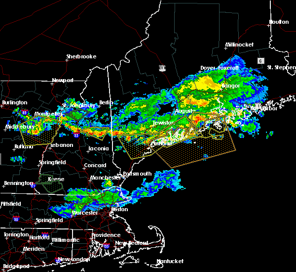
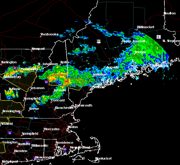
| 6/26/2019 10:57 PM EDT |
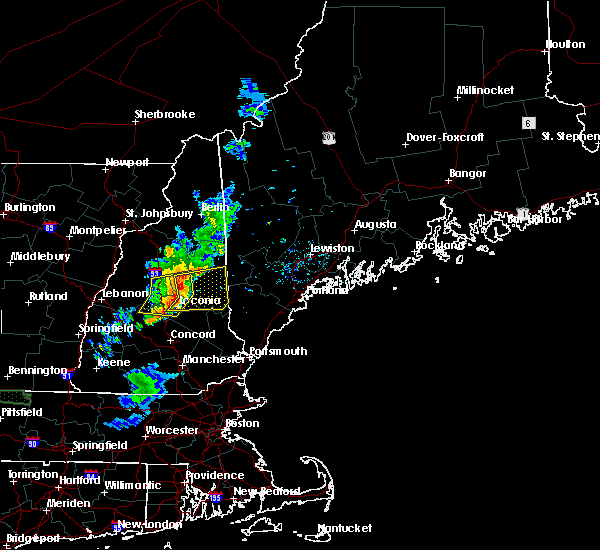 At 1057 pm edt, severe thunderstorms were located along a line extending from near sandwich to 6 miles south of moultonborough to near laconia, moving east at 25 mph (radar indicated). Hazards include 60 mph wind gusts. expect damage to roofs, siding, and trees At 1057 pm edt, severe thunderstorms were located along a line extending from near sandwich to 6 miles south of moultonborough to near laconia, moving east at 25 mph (radar indicated). Hazards include 60 mph wind gusts. expect damage to roofs, siding, and trees
|
| 6/26/2019 10:26 PM EDT |
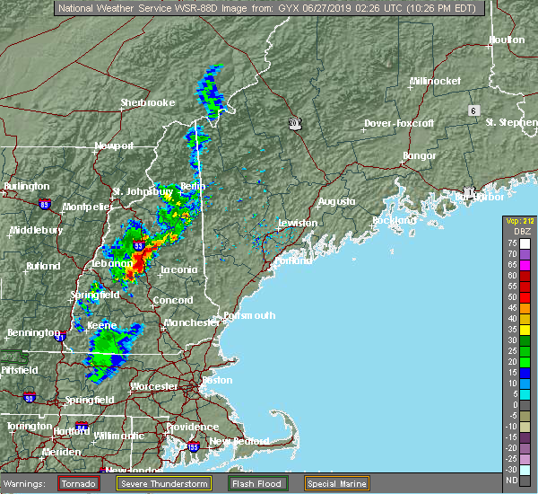 At 1026 pm edt, severe thunderstorms were located along a line extending from 6 miles north of plymouth to near ashland to near danbury, moving east at 15 mph (radar indicated). Hazards include 60 mph wind gusts. expect damage to roofs, siding, and trees At 1026 pm edt, severe thunderstorms were located along a line extending from 6 miles north of plymouth to near ashland to near danbury, moving east at 15 mph (radar indicated). Hazards include 60 mph wind gusts. expect damage to roofs, siding, and trees
|
| 6/18/2018 4:32 PM EDT |
 At 432 pm edt, a severe thunderstorm was located 11 miles east of woodstock, or 12 miles southeast of lincoln, moving east at 60 mph (radar indicated). Hazards include 60 mph wind gusts. Expect damage to roofs, siding, and trees. locations impacted include, conway, lincoln, ossipee, effingham, tamworth, sandwich, bartlett, madison, freedom, jackson, albany, eaton, chatham, livermore, waterville valley, hart`s location, campton and thornton. This also includes, mount chocorua, kearsarge north , mount whiteface, mount flume, and mount carrigan. At 432 pm edt, a severe thunderstorm was located 11 miles east of woodstock, or 12 miles southeast of lincoln, moving east at 60 mph (radar indicated). Hazards include 60 mph wind gusts. Expect damage to roofs, siding, and trees. locations impacted include, conway, lincoln, ossipee, effingham, tamworth, sandwich, bartlett, madison, freedom, jackson, albany, eaton, chatham, livermore, waterville valley, hart`s location, campton and thornton. This also includes, mount chocorua, kearsarge north , mount whiteface, mount flume, and mount carrigan.
|
| 6/18/2018 3:58 PM EDT |
 At 358 pm edt, severe thunderstorms were located along a line extending from near lincoln to 7 miles northwest of sandwich to holderness, moving east at 55 mph (radar indicated). Hazards include 60 mph wind gusts. expect damage to roofs, siding, and trees At 358 pm edt, severe thunderstorms were located along a line extending from near lincoln to 7 miles northwest of sandwich to holderness, moving east at 55 mph (radar indicated). Hazards include 60 mph wind gusts. expect damage to roofs, siding, and trees
|
| 5/4/2018 10:37 PM EDT |
 The severe thunderstorm warning for eastern grafton and central carroll counties will expire at 1045 pm edt, the storms which prompted the warning have moved out of the area. therefore, the warning will be allowed to expire. however gusty winds are still possible with these thunderstorms. The severe thunderstorm warning for eastern grafton and central carroll counties will expire at 1045 pm edt, the storms which prompted the warning have moved out of the area. therefore, the warning will be allowed to expire. however gusty winds are still possible with these thunderstorms.
|
| 5/4/2018 10:16 PM EDT |
 At 1016 pm edt, severe thunderstorms were located along a line extending from near sandwich to near wolfeboro to epsom, moving east at 55 mph (radar indicated). Hazards include 60 mph wind gusts. Expect damage to roofs, siding, and trees. locations impacted include, concord, rochester, laconia, moultonborough, ossipee, meredith, farmington, lebanon, loudon, alton, barnstead, epsom, gilmanton, canterbury, effingham, wolfeboro, sandwich, tamworth, belmont and gilford. this also includes, lake winnipesaukee. This includes interstate 393 between mile markers and. At 1016 pm edt, severe thunderstorms were located along a line extending from near sandwich to near wolfeboro to epsom, moving east at 55 mph (radar indicated). Hazards include 60 mph wind gusts. Expect damage to roofs, siding, and trees. locations impacted include, concord, rochester, laconia, moultonborough, ossipee, meredith, farmington, lebanon, loudon, alton, barnstead, epsom, gilmanton, canterbury, effingham, wolfeboro, sandwich, tamworth, belmont and gilford. this also includes, lake winnipesaukee. This includes interstate 393 between mile markers and.
|
| 5/4/2018 10:15 PM EDT |
 At 1015 pm edt, severe thunderstorms were located along a line extending from 10 miles southwest of dixfield to near bridgton to 6 miles southeast of tamworth, moving east at 65 mph (radar indicated). Hazards include 60 mph wind gusts. Expect damage to roofs, siding, and trees. locations impacted include, conway, ossipee, effingham, tamworth, sandwich, bartlett, madison, freedom, albany, eaton and waterville valley. this also includes, mount chocorua, champney falls, rocky gorge scenic area, and lower falls recreation area. At 1015 pm edt, severe thunderstorms were located along a line extending from 10 miles southwest of dixfield to near bridgton to 6 miles southeast of tamworth, moving east at 65 mph (radar indicated). Hazards include 60 mph wind gusts. Expect damage to roofs, siding, and trees. locations impacted include, conway, ossipee, effingham, tamworth, sandwich, bartlett, madison, freedom, albany, eaton and waterville valley. this also includes, mount chocorua, champney falls, rocky gorge scenic area, and lower falls recreation area.
|
| 5/4/2018 10:06 PM EDT |
 At 1005 pm edt, severe thunderstorms were located along a line extending from 7 miles northwest of sandwich to laconia to near concord, moving east at 55 mph (radar indicated). Hazards include 60 mph wind gusts. expect damage to roofs, siding, and trees At 1005 pm edt, severe thunderstorms were located along a line extending from 7 miles northwest of sandwich to laconia to near concord, moving east at 55 mph (radar indicated). Hazards include 60 mph wind gusts. expect damage to roofs, siding, and trees
|
| 5/4/2018 9:48 PM EDT |
 At 948 pm edt, severe thunderstorms were located along a line extending from 9 miles northeast of pinkham notch to 11 miles west of conway to near plymouth, moving east at 65 mph (radar indicated). Hazards include 60 mph wind gusts. expect damage to roofs, siding, and trees At 948 pm edt, severe thunderstorms were located along a line extending from 9 miles northeast of pinkham notch to 11 miles west of conway to near plymouth, moving east at 65 mph (radar indicated). Hazards include 60 mph wind gusts. expect damage to roofs, siding, and trees
|
| 10/25/2017 12:51 AM EDT |
 At 1251 am edt, severe thunderstorms were located along a line extending from near mount washington to near pinkham notch to near conway to near tamworth to near moultonborough, moving northeast at 45 mph (radar indicated). Hazards include 60 mph wind gusts. Expect damage to trees, and power lines. locations impacted include, conway, berlin, bethlehem, moultonborough, ossipee, errol, tamworth, sandwich, pinkham notch, mount washington, carroll, gorham, bartlett, madison, freedom, jefferson, center harber, jackson, albany and eaton. This also includes, crawford notch state park, umbagog lake state park, mount jefferson, mount madison, and mount eisenhower. At 1251 am edt, severe thunderstorms were located along a line extending from near mount washington to near pinkham notch to near conway to near tamworth to near moultonborough, moving northeast at 45 mph (radar indicated). Hazards include 60 mph wind gusts. Expect damage to trees, and power lines. locations impacted include, conway, berlin, bethlehem, moultonborough, ossipee, errol, tamworth, sandwich, pinkham notch, mount washington, carroll, gorham, bartlett, madison, freedom, jefferson, center harber, jackson, albany and eaton. This also includes, crawford notch state park, umbagog lake state park, mount jefferson, mount madison, and mount eisenhower.
|
| 10/25/2017 12:33 AM EDT |
 At 1233 am edt, severe thunderstorms were located along a line extending from 8 miles southeast of bethlehem to 12 miles east of lincoln to near tamworth to moultonborough to near laconia, moving northeast at 45 mph (radar indicated). Hazards include 60 mph wind gusts. expect damage to trees, and power lines At 1233 am edt, severe thunderstorms were located along a line extending from 8 miles southeast of bethlehem to 12 miles east of lincoln to near tamworth to moultonborough to near laconia, moving northeast at 45 mph (radar indicated). Hazards include 60 mph wind gusts. expect damage to trees, and power lines
|
| 8/22/2017 10:28 PM EDT | Trees down rt 113a at town line in carroll county NH, 5.8 miles SSW of Center Sandwich, NH |
| 8/22/2017 10:27 PM EDT |
 At 1027 pm edt, severe thunderstorms were located along a line extending from 9 miles east of woodstock to moultonborough to near meredith to near laconia to near canterbury, moving east at 40 mph (radar indicated). Hazards include 60 mph wind gusts. Expect damage to trees, and power lines. locations impacted include, concord, laconia, franklin, moultonborough, meredith, loudon, gilmanton, canterbury, holderness, bradford, warner, sandwich, tamworth, belmont, gilford, boscawen, andover, center harber, albany and salisbury. this also includes, lake winnipesaukee, squam lake, mount kearsage, mount whiteface, and mount tecumseh. this includes the following highways, interstate 89 between mile markers 20 and 28. Interstate 93 between mile markers 45 and 66. At 1027 pm edt, severe thunderstorms were located along a line extending from 9 miles east of woodstock to moultonborough to near meredith to near laconia to near canterbury, moving east at 40 mph (radar indicated). Hazards include 60 mph wind gusts. Expect damage to trees, and power lines. locations impacted include, concord, laconia, franklin, moultonborough, meredith, loudon, gilmanton, canterbury, holderness, bradford, warner, sandwich, tamworth, belmont, gilford, boscawen, andover, center harber, albany and salisbury. this also includes, lake winnipesaukee, squam lake, mount kearsage, mount whiteface, and mount tecumseh. this includes the following highways, interstate 89 between mile markers 20 and 28. Interstate 93 between mile markers 45 and 66.
|
| 8/22/2017 10:25 PM EDT |
 At 1025 pm edt, severe thunderstorms were located along a line extending from 13 miles northwest of tamworth to near moultonborough to near laconia to near warner, moving east at 45 mph (radar indicated). Hazards include 60 mph wind gusts. expect damage to trees, and power lines At 1025 pm edt, severe thunderstorms were located along a line extending from 13 miles northwest of tamworth to near moultonborough to near laconia to near warner, moving east at 45 mph (radar indicated). Hazards include 60 mph wind gusts. expect damage to trees, and power lines
|
| 8/22/2017 9:52 PM EDT |
 At 952 pm edt, severe thunderstorms were located along a line extending from 10 miles southeast of piermont to groton to near danbury to near new london to 6 miles southeast of newport, moving east at 40 mph (radar indicated). Hazards include 60 mph wind gusts. expect damage to trees, and power lines At 952 pm edt, severe thunderstorms were located along a line extending from 10 miles southeast of piermont to groton to near danbury to near new london to 6 miles southeast of newport, moving east at 40 mph (radar indicated). Hazards include 60 mph wind gusts. expect damage to trees, and power lines
|
| 8/4/2017 6:16 PM EDT |
 At 616 pm edt, a severe thunderstorm was located over tamworth, or 8 miles northeast of moultonborough, moving northeast at 30 mph (radar indicated). Hazards include 60 mph wind gusts and penny size hail. Expect damage to trees, and power lines. locations impacted include, conway, ossipee, moultonborough, effingham, tamworth, sandwich, wolfeboro, bartlett, madison, brownfield, freedom, jackson, albany, eaton and tuftonboro. This also includes, mount chocorua, champney falls, rocky gorge scenic area, and lower falls recreation area. At 616 pm edt, a severe thunderstorm was located over tamworth, or 8 miles northeast of moultonborough, moving northeast at 30 mph (radar indicated). Hazards include 60 mph wind gusts and penny size hail. Expect damage to trees, and power lines. locations impacted include, conway, ossipee, moultonborough, effingham, tamworth, sandwich, wolfeboro, bartlett, madison, brownfield, freedom, jackson, albany, eaton and tuftonboro. This also includes, mount chocorua, champney falls, rocky gorge scenic area, and lower falls recreation area.
|
| 8/4/2017 6:05 PM EDT |
 The national weather service in gray maine has issued a * severe thunderstorm warning for. carroll county in northern new hampshire. Until 700 pm edt * at 605 pm edt, a severe thunderstorm was located near moultonborough, moving northeast at 30 mph. The national weather service in gray maine has issued a * severe thunderstorm warning for. carroll county in northern new hampshire. Until 700 pm edt * at 605 pm edt, a severe thunderstorm was located near moultonborough, moving northeast at 30 mph.
|
| 7/17/2017 8:05 PM EDT | Quarter sized hail reported 6.5 miles WSW of Center Sandwich, NH |
| 7/17/2017 7:58 PM EDT |
 At 758 pm edt, a severe thunderstorm was located over tamworth, or 7 miles northeast of moultonborough, moving northeast at 15 mph (radar indicated). Hazards include 60 mph wind gusts and quarter size hail. Minor hail damage to vehicles is possible. Expect wind damage to roofs, siding, and trees. At 758 pm edt, a severe thunderstorm was located over tamworth, or 7 miles northeast of moultonborough, moving northeast at 15 mph (radar indicated). Hazards include 60 mph wind gusts and quarter size hail. Minor hail damage to vehicles is possible. Expect wind damage to roofs, siding, and trees.
|
| 7/17/2017 7:35 PM EDT |
 At 735 pm edt, a severe thunderstorm was located over moultonborough, moving northeast at 20 mph (radar indicated). Hazards include 60 mph wind gusts and quarter size hail. Minor hail damage to vehicles is possible. expect wind damage to roofs, siding, and trees. locations impacted include, moultonborough, ossipee, holderness, sandwich, tamworth, center harber, albany, tuftonboro, campton and waterville valley. This also includes, squam lake. At 735 pm edt, a severe thunderstorm was located over moultonborough, moving northeast at 20 mph (radar indicated). Hazards include 60 mph wind gusts and quarter size hail. Minor hail damage to vehicles is possible. expect wind damage to roofs, siding, and trees. locations impacted include, moultonborough, ossipee, holderness, sandwich, tamworth, center harber, albany, tuftonboro, campton and waterville valley. This also includes, squam lake.
|
| 7/17/2017 7:06 PM EDT |
 At 706 pm edt, a severe thunderstorm was located over ashland, or near plymouth, moving northeast at 20 mph (radar indicated). Hazards include 60 mph wind gusts and quarter size hail. Minor hail damage to vehicles is possible. Expect wind damage to roofs, siding, and trees. At 706 pm edt, a severe thunderstorm was located over ashland, or near plymouth, moving northeast at 20 mph (radar indicated). Hazards include 60 mph wind gusts and quarter size hail. Minor hail damage to vehicles is possible. Expect wind damage to roofs, siding, and trees.
|
| 7/8/2017 12:41 PM EDT |
 At 1241 pm edt, severe thunderstorms were located along a line extending from near sandwich to 6 miles south of hinsdale, moving east at 25 mph (public). Hazards include 60 mph wind gusts. Expect damage to trees, and power lines. locations impacted include, concord, keene, laconia, franklin, jaffrey, henniker, moultonborough, ossipee, meredith, plymouth, peterborough, hopkinton, new boston, loudon, alton, winchester, gilmanton, antrim, canterbury and holderness. this also includes, lake winnipesaukee, squam lake, mount monadnock, north pack monadnock, and mount kearsage. this includes the following highways, interstate 89 between mile markers 2 and 27. Interstate 93 between mile markers 38 and 77. At 1241 pm edt, severe thunderstorms were located along a line extending from near sandwich to 6 miles south of hinsdale, moving east at 25 mph (public). Hazards include 60 mph wind gusts. Expect damage to trees, and power lines. locations impacted include, concord, keene, laconia, franklin, jaffrey, henniker, moultonborough, ossipee, meredith, plymouth, peterborough, hopkinton, new boston, loudon, alton, winchester, gilmanton, antrim, canterbury and holderness. this also includes, lake winnipesaukee, squam lake, mount monadnock, north pack monadnock, and mount kearsage. this includes the following highways, interstate 89 between mile markers 2 and 27. Interstate 93 between mile markers 38 and 77.
|
| 7/8/2017 12:16 PM EDT |
 At 1216 pm edt, severe thunderstorms were located along a line extending from near sandwich to 9 miles southwest of hinsdale, moving east at 25 mph (public). Hazards include 60 mph wind gusts. expect damage to trees, and power lines At 1216 pm edt, severe thunderstorms were located along a line extending from near sandwich to 9 miles southwest of hinsdale, moving east at 25 mph (public). Hazards include 60 mph wind gusts. expect damage to trees, and power lines
|
| 7/1/2017 6:08 PM EDT |
 At 608 pm edt, severe thunderstorms were located along a line extending from near conway to near danbury, moving east at 30 mph (radar indicated). Hazards include 60 mph wind gusts and quarter size hail. Minor hail damage to vehicles is possible. expect wind damage to roofs, siding, and trees. locations impacted include, laconia, conway, franklin, fryeburg, moultonborough, meredith, ossipee, alton, gilmanton, holderness, ashland, hiram, effingham, danbury, wolfeboro, tamworth, sandwich, belmont, gilford and bristol. this also includes, lake winnipesaukee, burnt meadow mountains, peary mountain, and mount cutler. This includes interstate 93 between mile markers 57 and 72. At 608 pm edt, severe thunderstorms were located along a line extending from near conway to near danbury, moving east at 30 mph (radar indicated). Hazards include 60 mph wind gusts and quarter size hail. Minor hail damage to vehicles is possible. expect wind damage to roofs, siding, and trees. locations impacted include, laconia, conway, franklin, fryeburg, moultonborough, meredith, ossipee, alton, gilmanton, holderness, ashland, hiram, effingham, danbury, wolfeboro, tamworth, sandwich, belmont, gilford and bristol. this also includes, lake winnipesaukee, burnt meadow mountains, peary mountain, and mount cutler. This includes interstate 93 between mile markers 57 and 72.
|
| 7/1/2017 5:50 PM EDT |
 At 550 pm edt, severe thunderstorms were located along a line extending from 7 miles north of tamworth to near new london, moving east at 30 mph (radar indicated). Hazards include 60 mph wind gusts and quarter size hail. Minor hail damage to vehicles is possible. Expect wind damage to roofs, siding, and trees. At 550 pm edt, severe thunderstorms were located along a line extending from 7 miles north of tamworth to near new london, moving east at 30 mph (radar indicated). Hazards include 60 mph wind gusts and quarter size hail. Minor hail damage to vehicles is possible. Expect wind damage to roofs, siding, and trees.
|
| 7/1/2017 5:35 PM EDT |
 At 535 pm edt, severe thunderstorms were located along a line extending from 7 miles north of holderness to 12 miles east of pinkham notch, moving northeast at 40 mph (radar indicated). Hazards include 60 mph wind gusts and quarter size hail. Minor hail damage to vehicles is possible. expect wind damage to roofs, siding, and trees. locations impacted include, conway, lincoln, holderness, pinkham notch, sandwich, tamworth, bartlett, center harber, jackson, albany, chatham, livermore, hart`s location, campton, thornton, waterville valley and shelburne. this also includes, squam lake, mount chocorua, wildcat mountain, carter notch, and kearsarge north. This includes interstate 93 between mile markers 85 and 91. At 535 pm edt, severe thunderstorms were located along a line extending from 7 miles north of holderness to 12 miles east of pinkham notch, moving northeast at 40 mph (radar indicated). Hazards include 60 mph wind gusts and quarter size hail. Minor hail damage to vehicles is possible. expect wind damage to roofs, siding, and trees. locations impacted include, conway, lincoln, holderness, pinkham notch, sandwich, tamworth, bartlett, center harber, jackson, albany, chatham, livermore, hart`s location, campton, thornton, waterville valley and shelburne. this also includes, squam lake, mount chocorua, wildcat mountain, carter notch, and kearsarge north. This includes interstate 93 between mile markers 85 and 91.
|
| 7/1/2017 4:40 PM EDT |
 At 439 pm edt, a severe thunderstorm was located 8 miles southeast of woodstock, or 10 miles northeast of plymouth, moving northeast at 45 mph (radar indicated). Hazards include 60 mph wind gusts and quarter size hail. Minor hail damage to vehicles is possible. Expect wind damage to roofs, siding, and trees. At 439 pm edt, a severe thunderstorm was located 8 miles southeast of woodstock, or 10 miles northeast of plymouth, moving northeast at 45 mph (radar indicated). Hazards include 60 mph wind gusts and quarter size hail. Minor hail damage to vehicles is possible. Expect wind damage to roofs, siding, and trees.
|
| 6/19/2017 4:29 PM EDT |
 At 429 pm edt, severe thunderstorms were located along a line extending from near moultonborough to near farmington, moving northeast at 45 mph (radar indicated). Hazards include 60 mph wind gusts. expect damage to trees, and power lines At 429 pm edt, severe thunderstorms were located along a line extending from near moultonborough to near farmington, moving northeast at 45 mph (radar indicated). Hazards include 60 mph wind gusts. expect damage to trees, and power lines
|
| 9/11/2016 8:59 AM EDT |
 At 859 am edt, a severe thunderstorm was located near holderness, or near plymouth, moving northeast at 55 mph (radar indicated). Hazards include 60 mph wind gusts. Expect damage to roofs. siding. And trees. At 859 am edt, a severe thunderstorm was located near holderness, or near plymouth, moving northeast at 55 mph (radar indicated). Hazards include 60 mph wind gusts. Expect damage to roofs. siding. And trees.
|
| 7/23/2016 4:10 PM EDT | Large branches down in carroll county NH, 6.9 miles W of Center Sandwich, NH |
| 7/23/2016 4:03 PM EDT |
 At 401 pm edt, a severe thunderstorm was located over moultonborough, moving east at 25 mph. another strong storm was located northwest of sandwich (radar indicated). Hazards include 60 mph wind gusts and quarter size hail. Hail damage to vehicles is expected. Expect wind damage to roofs, siding, and trees. At 401 pm edt, a severe thunderstorm was located over moultonborough, moving east at 25 mph. another strong storm was located northwest of sandwich (radar indicated). Hazards include 60 mph wind gusts and quarter size hail. Hail damage to vehicles is expected. Expect wind damage to roofs, siding, and trees.
|
| 7/18/2016 2:54 PM EDT |
 At 253 pm edt, a severe thunderstorm was located near tamworth, or near moultonborough, moving east at 30 mph (radar indicated). Hazards include 60 mph wind gusts and quarter size hail. Hail damage to vehicles is expected. Expect wind damage to roofs, siding, and trees. At 253 pm edt, a severe thunderstorm was located near tamworth, or near moultonborough, moving east at 30 mph (radar indicated). Hazards include 60 mph wind gusts and quarter size hail. Hail damage to vehicles is expected. Expect wind damage to roofs, siding, and trees.
|
| 7/1/2016 8:50 PM EDT |
 At 849 pm edt, severe thunderstorms were located along a line extending from 7 miles east of lancaster to near mount washington to 6 miles northwest of tamworth to near moultonborough, moving northeast at 45 mph (radar indicated). Hazards include 60 mph wind gusts. Expect damage to roofs. siding. and trees. Locations impacted include, laconia, bethlehem, lincoln, moultonborough, meredith, ossipee, alton, holderness, ashland, franconia, tamworth, sandwich, wolfeboro, carroll, gilford, bristol, bartlett, madison, center harber and hill. At 849 pm edt, severe thunderstorms were located along a line extending from 7 miles east of lancaster to near mount washington to 6 miles northwest of tamworth to near moultonborough, moving northeast at 45 mph (radar indicated). Hazards include 60 mph wind gusts. Expect damage to roofs. siding. and trees. Locations impacted include, laconia, bethlehem, lincoln, moultonborough, meredith, ossipee, alton, holderness, ashland, franconia, tamworth, sandwich, wolfeboro, carroll, gilford, bristol, bartlett, madison, center harber and hill.
|
| 7/1/2016 8:33 PM EDT |
 At 832 pm edt, severe thunderstorms were located along a line extending from 6 miles northeast of bethlehem to 10 miles northeast of lincoln to near sandwich to near ashland, moving northeast at 45 mph (radar indicated). Hazards include 60 mph wind gusts. Expect damage to roofs. siding. and trees. Locations impacted include, laconia, bethlehem, lincoln, moultonborough, plymouth, meredith, ossipee, grafton, alton, holderness, ashland, danbury, franconia, tamworth, woodstock, sandwich, wolfeboro, carroll, gilford and bristol. At 832 pm edt, severe thunderstorms were located along a line extending from 6 miles northeast of bethlehem to 10 miles northeast of lincoln to near sandwich to near ashland, moving northeast at 45 mph (radar indicated). Hazards include 60 mph wind gusts. Expect damage to roofs. siding. and trees. Locations impacted include, laconia, bethlehem, lincoln, moultonborough, plymouth, meredith, ossipee, grafton, alton, holderness, ashland, danbury, franconia, tamworth, woodstock, sandwich, wolfeboro, carroll, gilford and bristol.
|
| 7/1/2016 8:08 PM EDT |
 At 808 pm edt, severe thunderstorms were located along a line extending from near franconia to near woodstock to near groton to near danbury, moving northeast at 45 mph (radar indicated). Hazards include 60 mph wind gusts. Expect damage to roofs. siding. And trees. At 808 pm edt, severe thunderstorms were located along a line extending from near franconia to near woodstock to near groton to near danbury, moving northeast at 45 mph (radar indicated). Hazards include 60 mph wind gusts. Expect damage to roofs. siding. And trees.
|
| 9/8/2015 10:23 PM EDT |
 At 1022 pm edt, doppler radar indicated a severe thunderstorm capable of producing damaging winds in excess of 60 mph. this storm was located 6 miles northwest of sandwich, moving east at 25 mph. locations impacted include, moultonborough, ossipee, holderness, sandwich, tamworth, bartlett, madison, albany, waterville valley, campton, livermore, thornton and tuftonboro. At 1022 pm edt, doppler radar indicated a severe thunderstorm capable of producing damaging winds in excess of 60 mph. this storm was located 6 miles northwest of sandwich, moving east at 25 mph. locations impacted include, moultonborough, ossipee, holderness, sandwich, tamworth, bartlett, madison, albany, waterville valley, campton, livermore, thornton and tuftonboro.
|
| 9/8/2015 10:04 PM EDT |
 At 1003 pm edt, doppler radar indicated a severe thunderstorm capable of producing quarter size hail and damaging winds in excess of 60 mph. this storm was located near plymouth, and moving east at 25 mph. it will impact portions of interstate 93 in grafton county. At 1003 pm edt, doppler radar indicated a severe thunderstorm capable of producing quarter size hail and damaging winds in excess of 60 mph. this storm was located near plymouth, and moving east at 25 mph. it will impact portions of interstate 93 in grafton county.
|
| 8/4/2015 1:55 PM EDT |
 At 155 pm edt, doppler radar indicated a severe thunderstorm capable of producing quarter size hail and damaging winds in excess of 60 mph. this storm was located 8 miles northeast of danbury, or 10 miles north of franklin, moving east at 35 mph. locations impacted include, laconia, meredith, moultonborough, plymouth, holderness, ashland, sandwich, gilford, bristol, alexandria, center harber, hill, bridgewater, hebron, ellacoya state park, wellington state park, ahern state park, new hampton and sanbornton. lake winnepesaukee is also in this warning. At 155 pm edt, doppler radar indicated a severe thunderstorm capable of producing quarter size hail and damaging winds in excess of 60 mph. this storm was located 8 miles northeast of danbury, or 10 miles north of franklin, moving east at 35 mph. locations impacted include, laconia, meredith, moultonborough, plymouth, holderness, ashland, sandwich, gilford, bristol, alexandria, center harber, hill, bridgewater, hebron, ellacoya state park, wellington state park, ahern state park, new hampton and sanbornton. lake winnepesaukee is also in this warning.
|
| 8/4/2015 1:38 PM EDT |
 At 138 pm edt, doppler radar indicated a severe thunderstorm capable of producing quarter size hail and damaging winds in excess of 60 mph. this storm was located near danbury, or 11 miles northwest of franklin, and moving east at 35 mph. At 138 pm edt, doppler radar indicated a severe thunderstorm capable of producing quarter size hail and damaging winds in excess of 60 mph. this storm was located near danbury, or 11 miles northwest of franklin, and moving east at 35 mph.
|
| 8/3/2015 7:10 PM EDT |
 The severe thunderstorm warning for carroll, southeastern coos, southeastern grafton and northwestern belknap counties will expire at 715 pm edt, the storms which prompted the warning have moved out of the area. therefore the warning will be allowed to expire. The severe thunderstorm warning for carroll, southeastern coos, southeastern grafton and northwestern belknap counties will expire at 715 pm edt, the storms which prompted the warning have moved out of the area. therefore the warning will be allowed to expire.
|
| 8/3/2015 6:30 PM EDT | Trees and wires down in grafton county NH, 10.3 miles SSE of Center Sandwich, NH |
| 8/3/2015 6:13 PM EDT |
 At 612 pm edt, doppler radar indicated a line of severe thunderstorms capable of producing quarter size hail and destructive winds in excess of 70 mph. these storms were located along a line extending from mount washington to near woodstock to near ashland, and moving east at 40 mph. At 612 pm edt, doppler radar indicated a line of severe thunderstorms capable of producing quarter size hail and destructive winds in excess of 70 mph. these storms were located along a line extending from mount washington to near woodstock to near ashland, and moving east at 40 mph.
|
| 7/20/2015 3:18 AM EDT |
 At 317 am edt, doppler radar indicated a severe thunderstorm capable of producing quarter size hail and damaging winds in excess of 60 mph. this storm was located near woodstock, or 9 miles south of lincoln, and moving east at 55 mph. At 317 am edt, doppler radar indicated a severe thunderstorm capable of producing quarter size hail and damaging winds in excess of 60 mph. this storm was located near woodstock, or 9 miles south of lincoln, and moving east at 55 mph.
|
| 6/23/2015 5:17 PM EDT |
 At 516 pm edt, doppler radar indicated a severe thunderstorm capable of producing quarter size hail and damaging winds in excess of 60 mph. this storm was located over ashland, or near meredith, moving east at 45 mph. locations impacted include, laconia, plymouth, meredith, ossipee, moultonborough, alton, barnstead, canaan, gilmanton, holderness, ashland, effingham, groton, sandwich, wolfeboro, tamworth, belmont, gilford, bristol and alexandria. a tornado watch remains in effect until 1100 pm edt for southwestern maine and northern new hampshire. At 516 pm edt, doppler radar indicated a severe thunderstorm capable of producing quarter size hail and damaging winds in excess of 60 mph. this storm was located over ashland, or near meredith, moving east at 45 mph. locations impacted include, laconia, plymouth, meredith, ossipee, moultonborough, alton, barnstead, canaan, gilmanton, holderness, ashland, effingham, groton, sandwich, wolfeboro, tamworth, belmont, gilford, bristol and alexandria. a tornado watch remains in effect until 1100 pm edt for southwestern maine and northern new hampshire.
|
| 6/23/2015 5:09 PM EDT |
 At 508 pm edt, doppler radar indicated a severe thunderstorm capable of producing quarter size hail and damaging winds in excess of 60 mph. this storm was located near plymouth, and moving east at 45 mph. At 508 pm edt, doppler radar indicated a severe thunderstorm capable of producing quarter size hail and damaging winds in excess of 60 mph. this storm was located near plymouth, and moving east at 45 mph.
|
| 5/27/2015 6:03 PM EDT | At 603 pm edt, doppler radar indicated a line of severe thunderstorms capable of producing damaging winds in excess of 60 mph. these storms were located along a line extending from 6 miles northeast of berlin to 10 miles northeast of pinkham notch to near echo lake state park to near sandwich, moving northeast at 50 mph. locations impacted include, conway, berlin, eastern lancaster, southwestern fryeburg, errol, mount washington, white lake state park, sandwich, pinkham notch, echo lake state park, tamworth, gorham, bartlett, madison, jefferson, jackson, albany, eaton, chatham and dummer. |
| 5/27/2015 5:45 PM EDT | Trees and power lines down in grafton county NH, 10.3 miles SSE of Center Sandwich, NH |
| 5/27/2015 5:31 PM EDT | At 531 pm edt, doppler radar indicated a line of severe thunderstorms capable of producing damaging winds in excess of 60 mph. these storms were located along a line extending from 8 miles south of lancaster to 8 miles east of franconia notch state park to near plymouth to near groton, and moving northeast at 50 mph. |
| 7/28/2014 5:30 PM EDT | Trees blocking rt 113a in carroll county NH, 8.9 miles SW of Center Sandwich, NH |
| 7/28/2014 5:19 PM EDT | Quarter sized hail reported 1.8 miles NW of Center Sandwich, NH |
| 9/11/2013 9:20 PM EDT | Lakes region dispatch. trees and wires down in sandwic in carroll county NH, 1.8 miles NW of Center Sandwich, NH |
| 8/5/2012 4:20 PM EDT | Trees and wires down in sandwich in carroll county NH, 1.8 miles NW of Center Sandwich, NH |
| 1/1/0001 12:00 AM | Trees on wires at groves near israel road in carroll county NH, 1.8 miles NW of Center Sandwich, NH |
| 1/1/0001 12:00 AM | Trees down on wires in carroll county NH, 1.8 miles NW of Center Sandwich, NH |
| 1/1/0001 12:00 AM | Quarter sized hail reported 3.2 miles SW of Center Sandwich, NH |
Hail Maps for Center Sandwich, NH


Connect with Interactive Hail Maps