

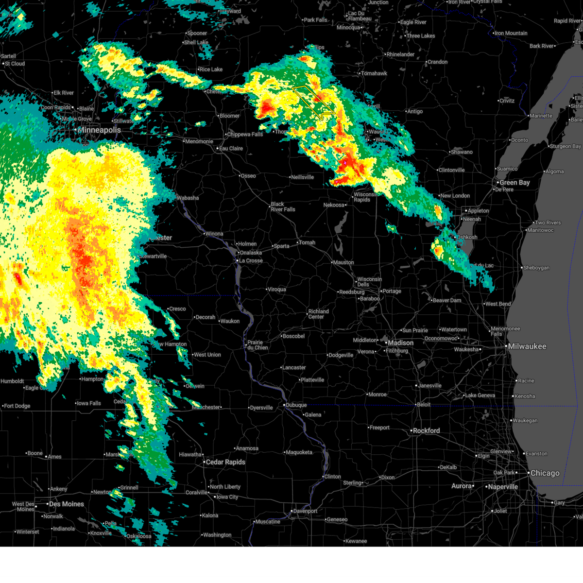
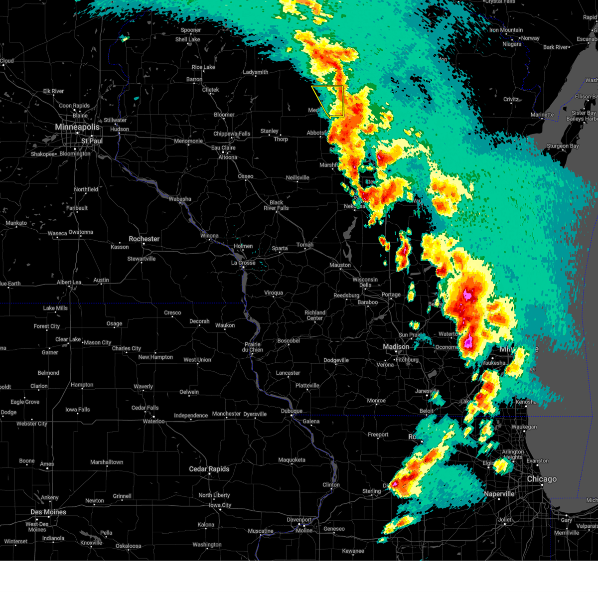
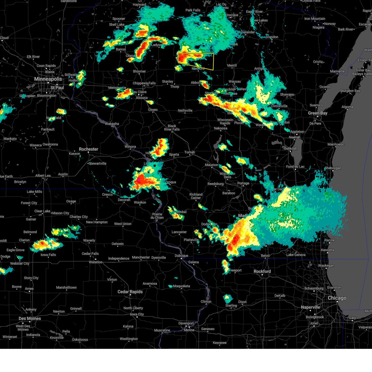
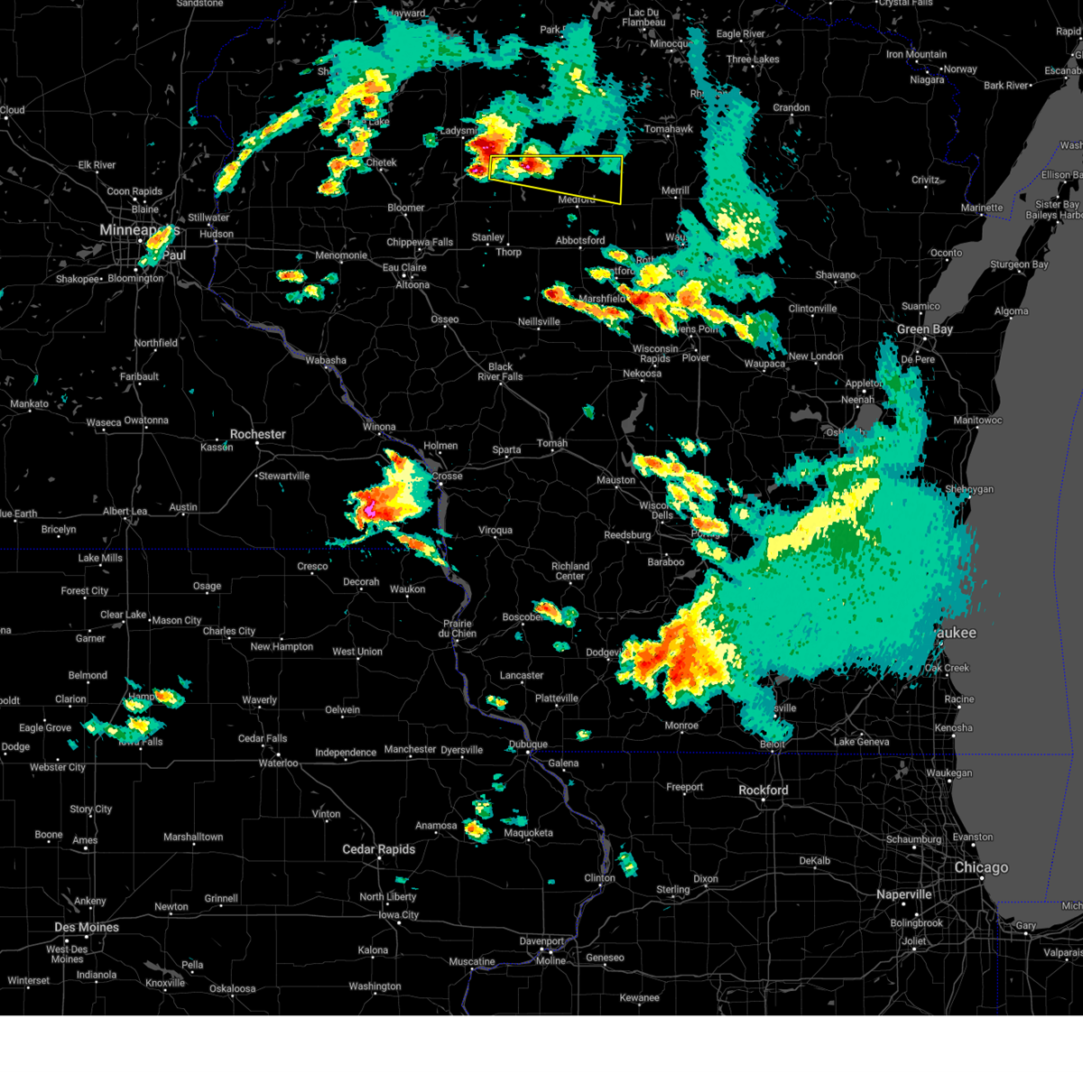
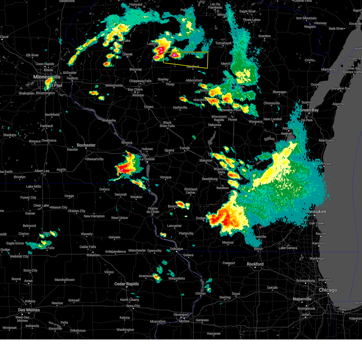
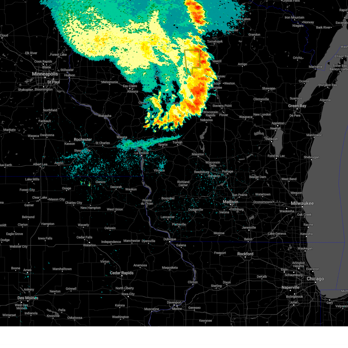
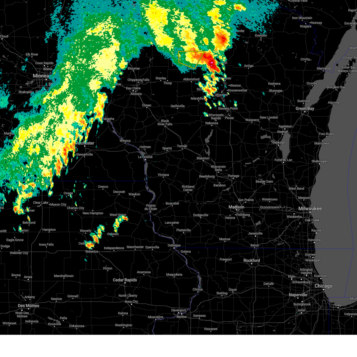
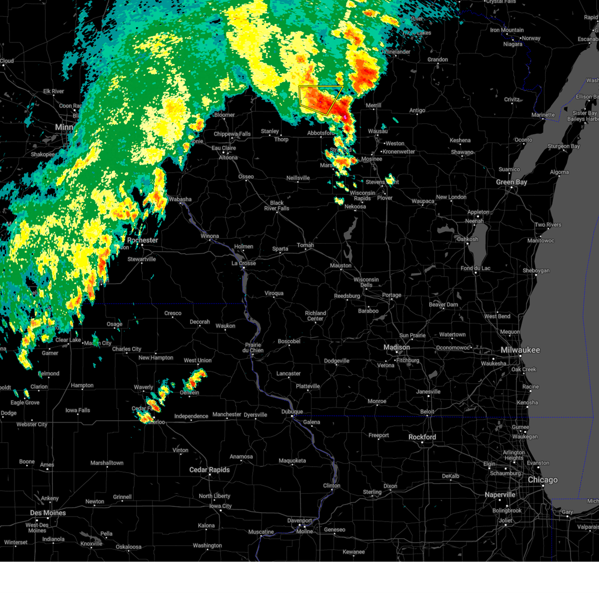
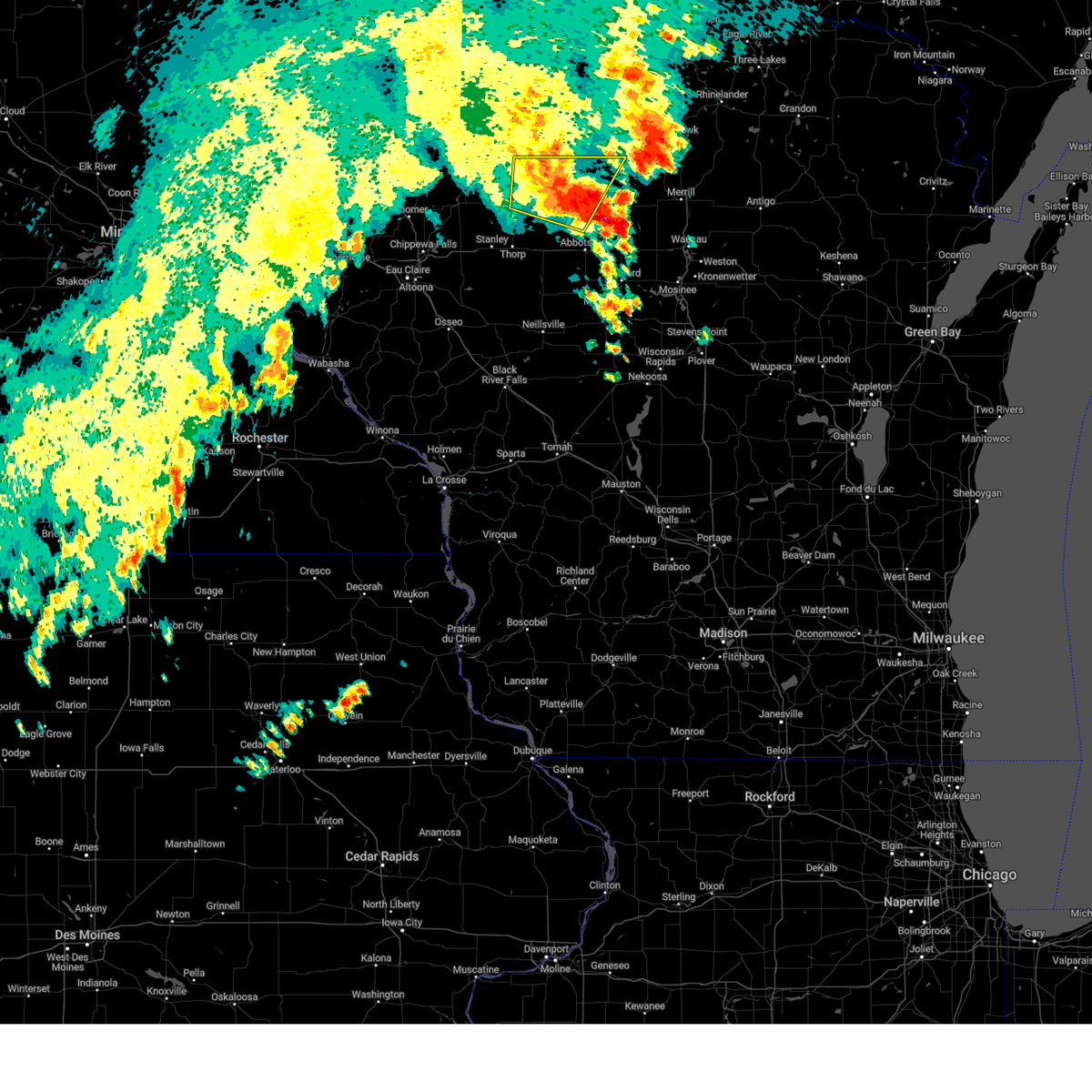
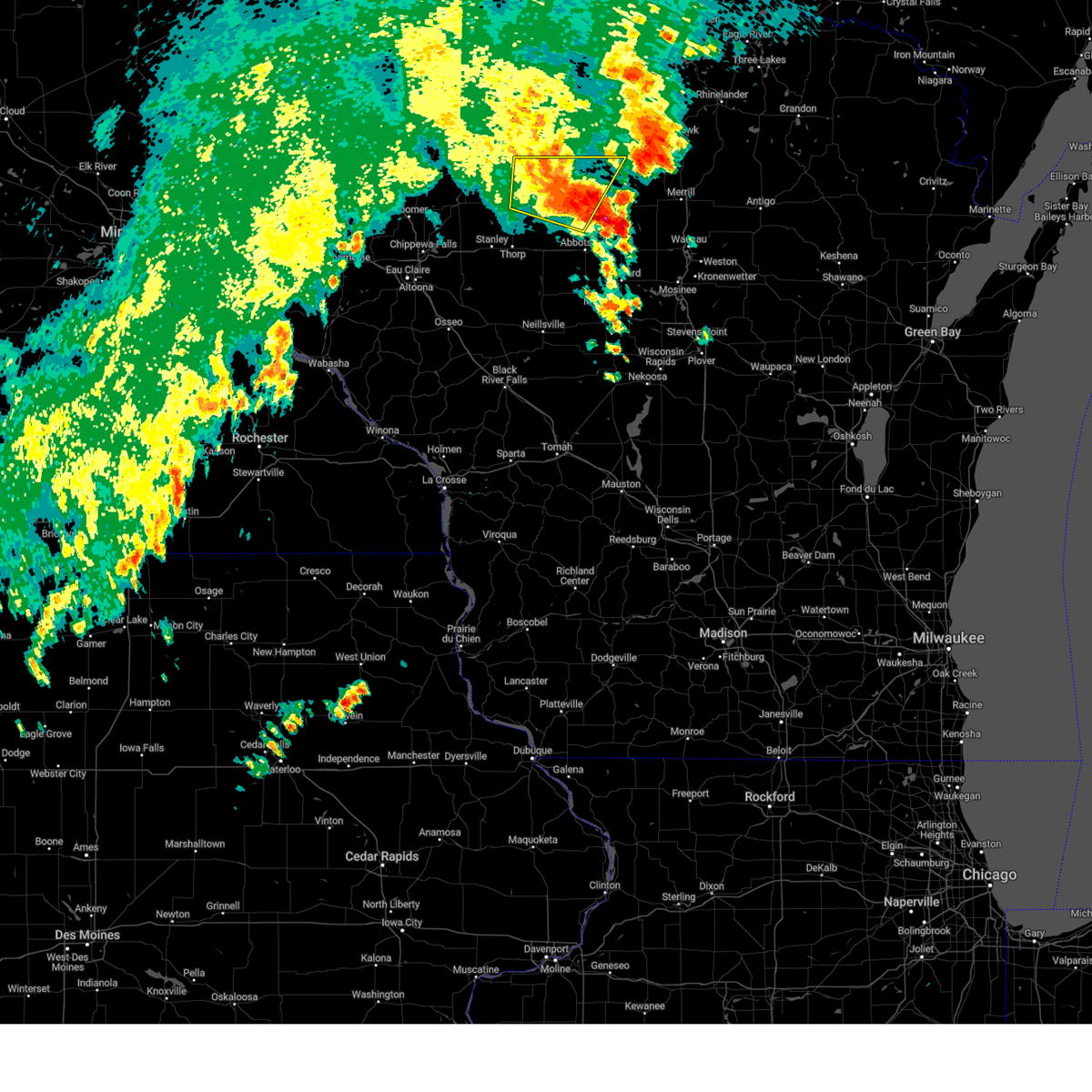
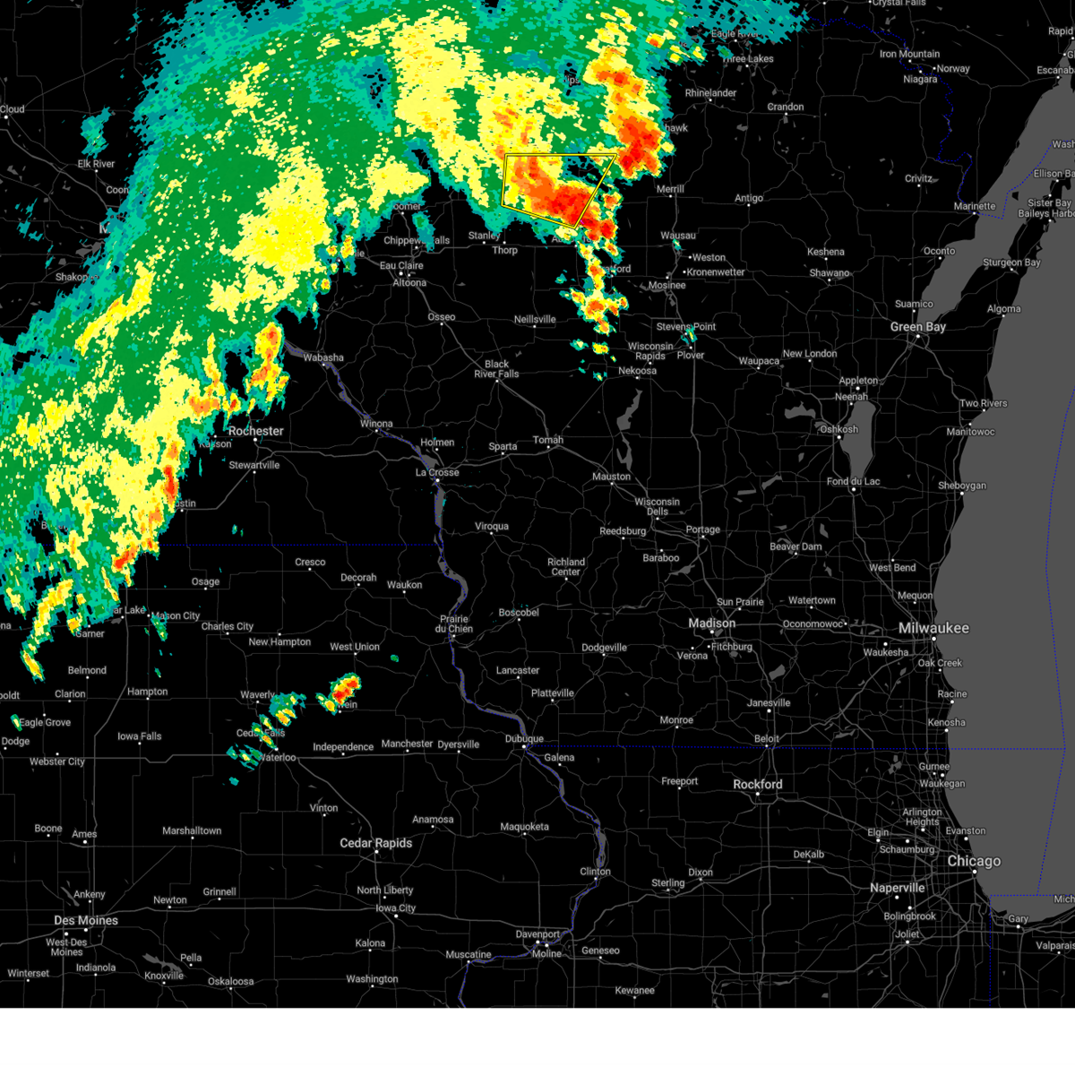
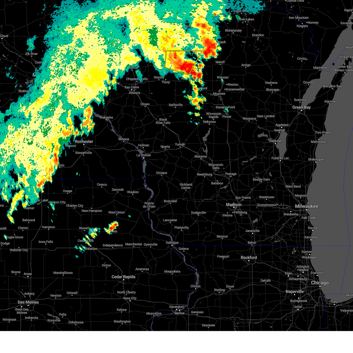
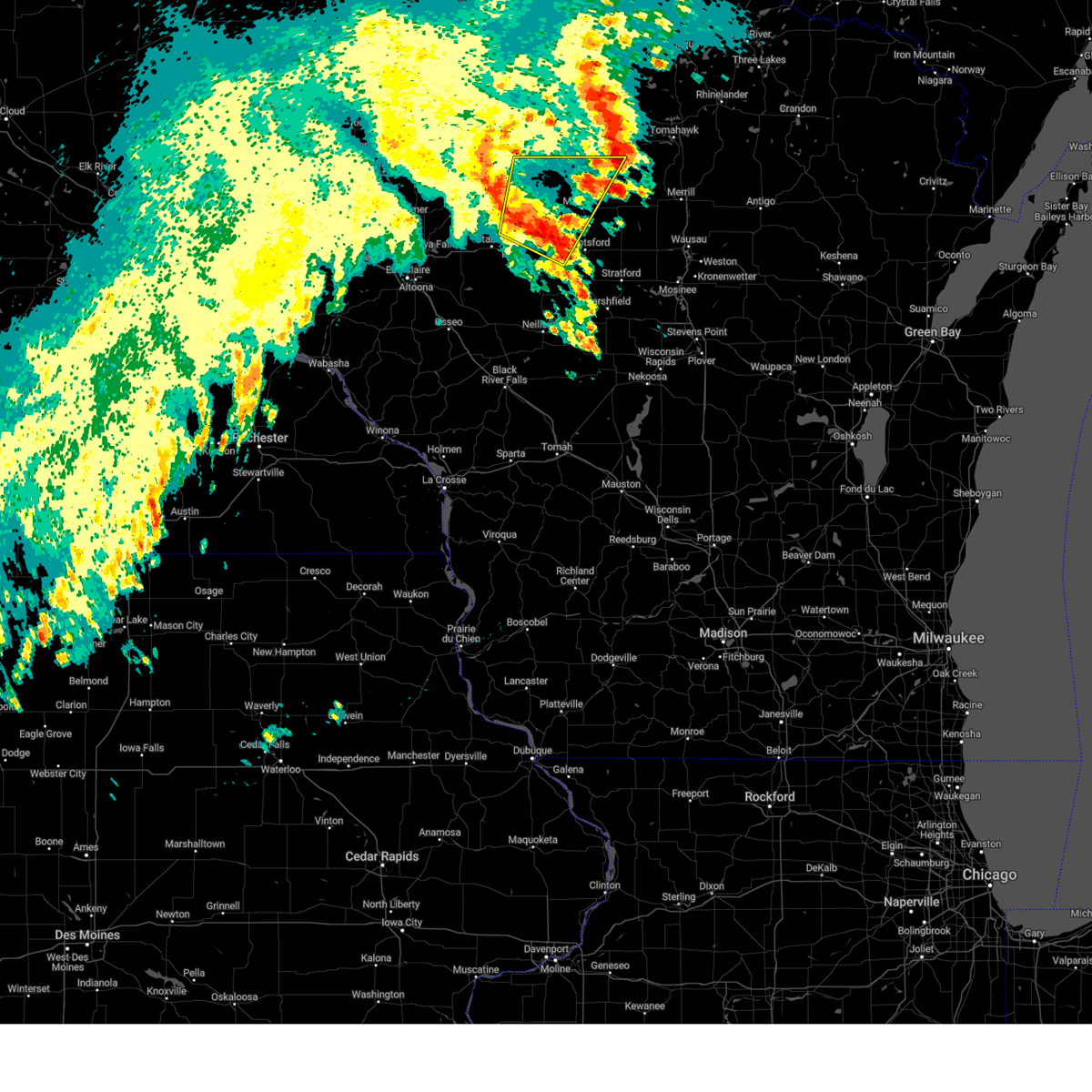
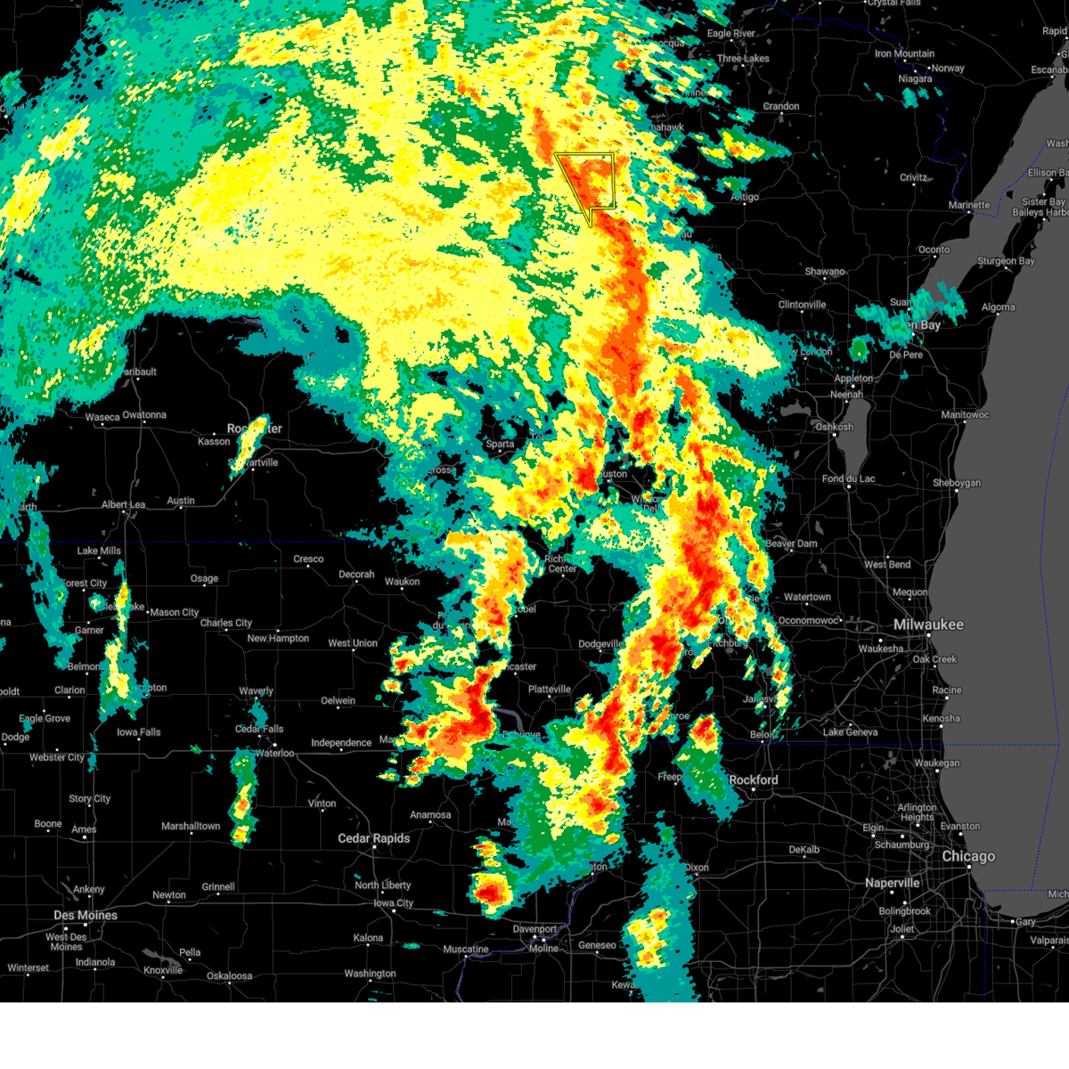
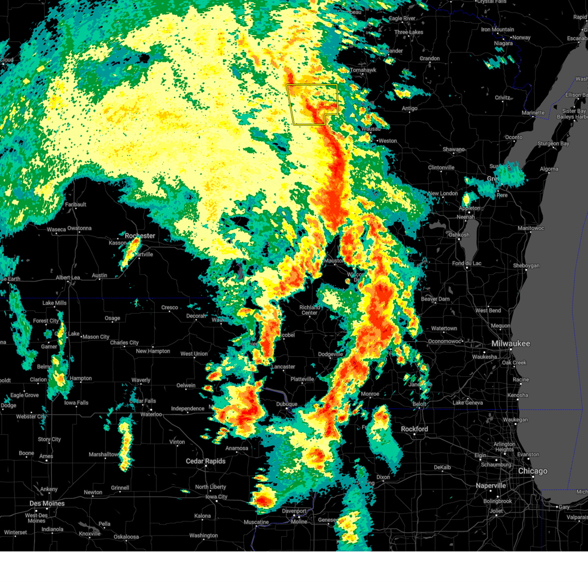
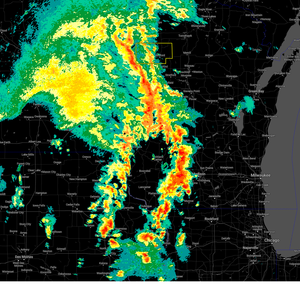
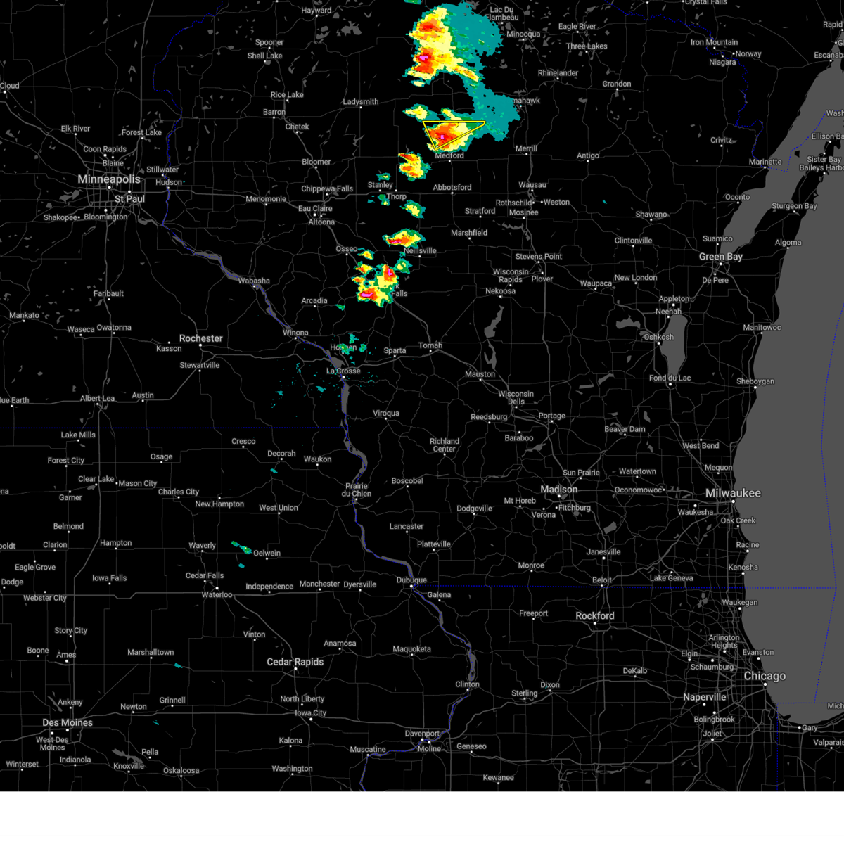
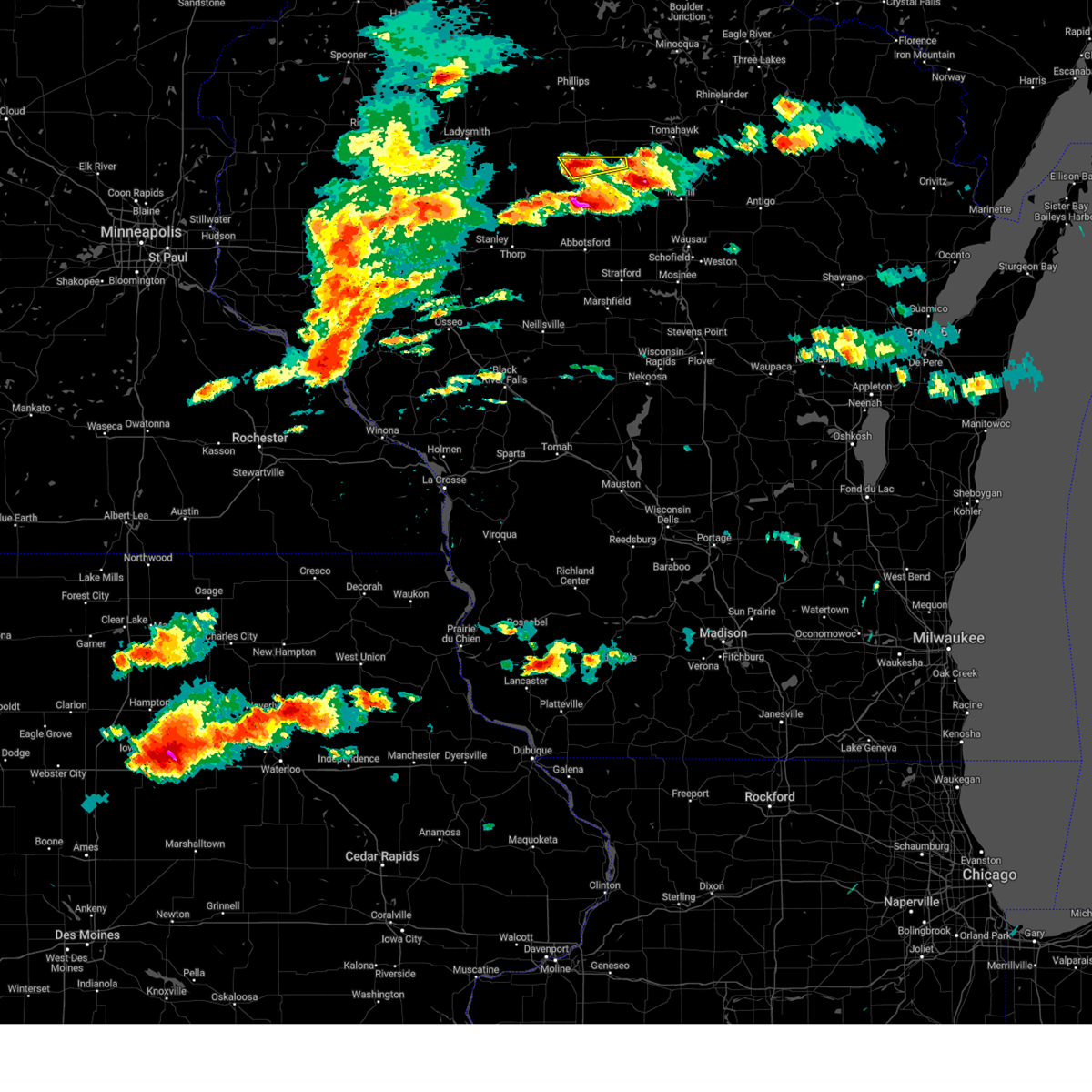
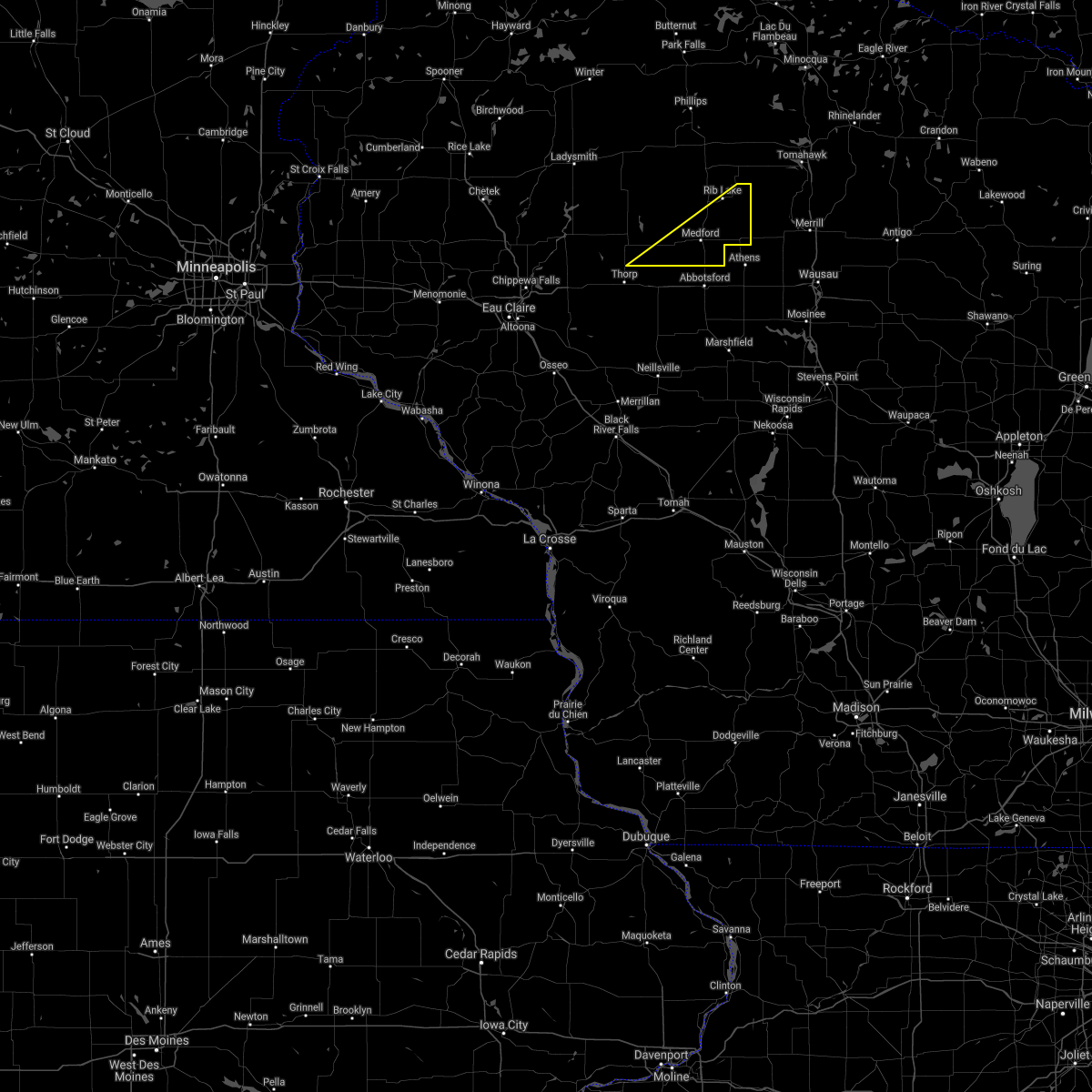
Hail Map for Chelsea, WI
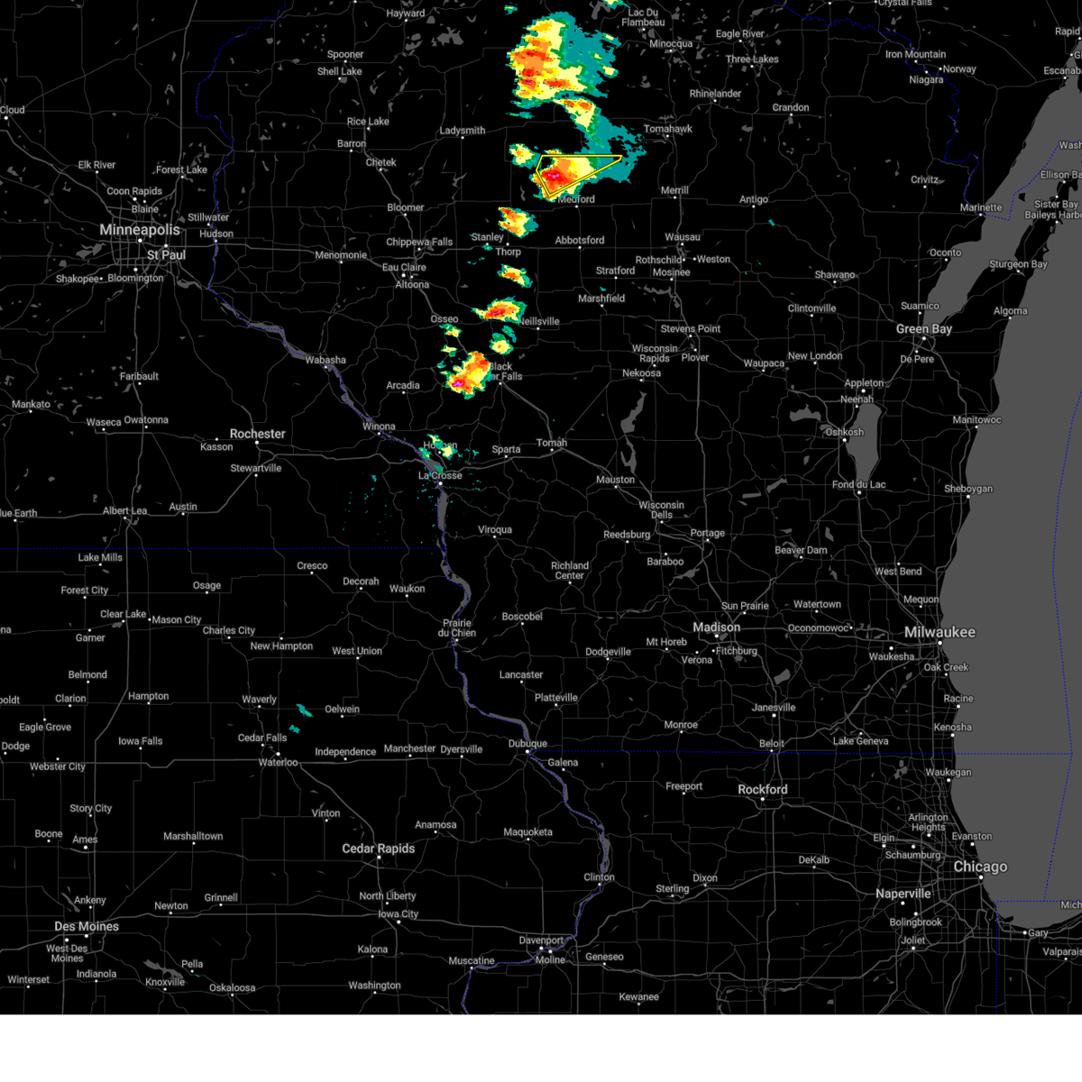
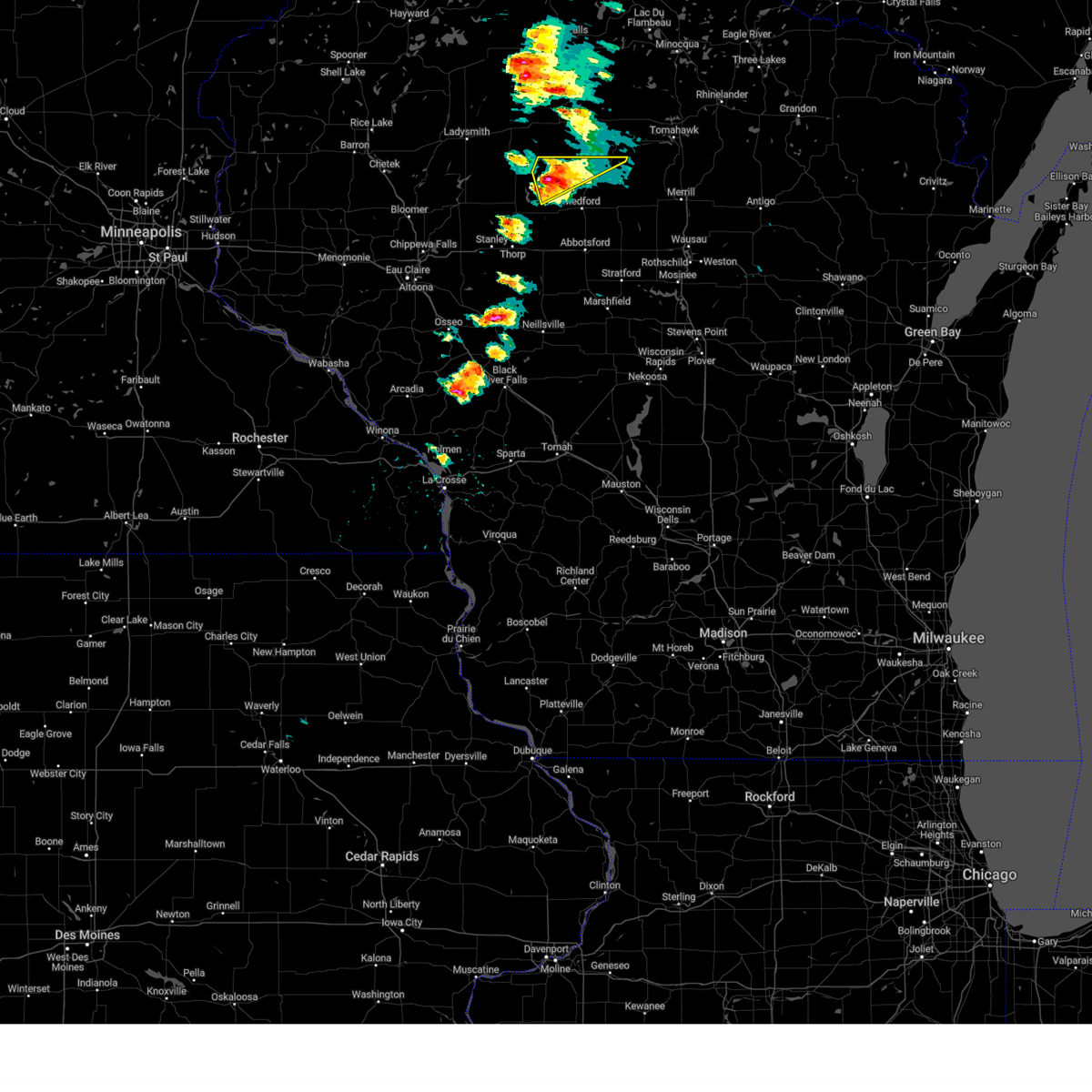
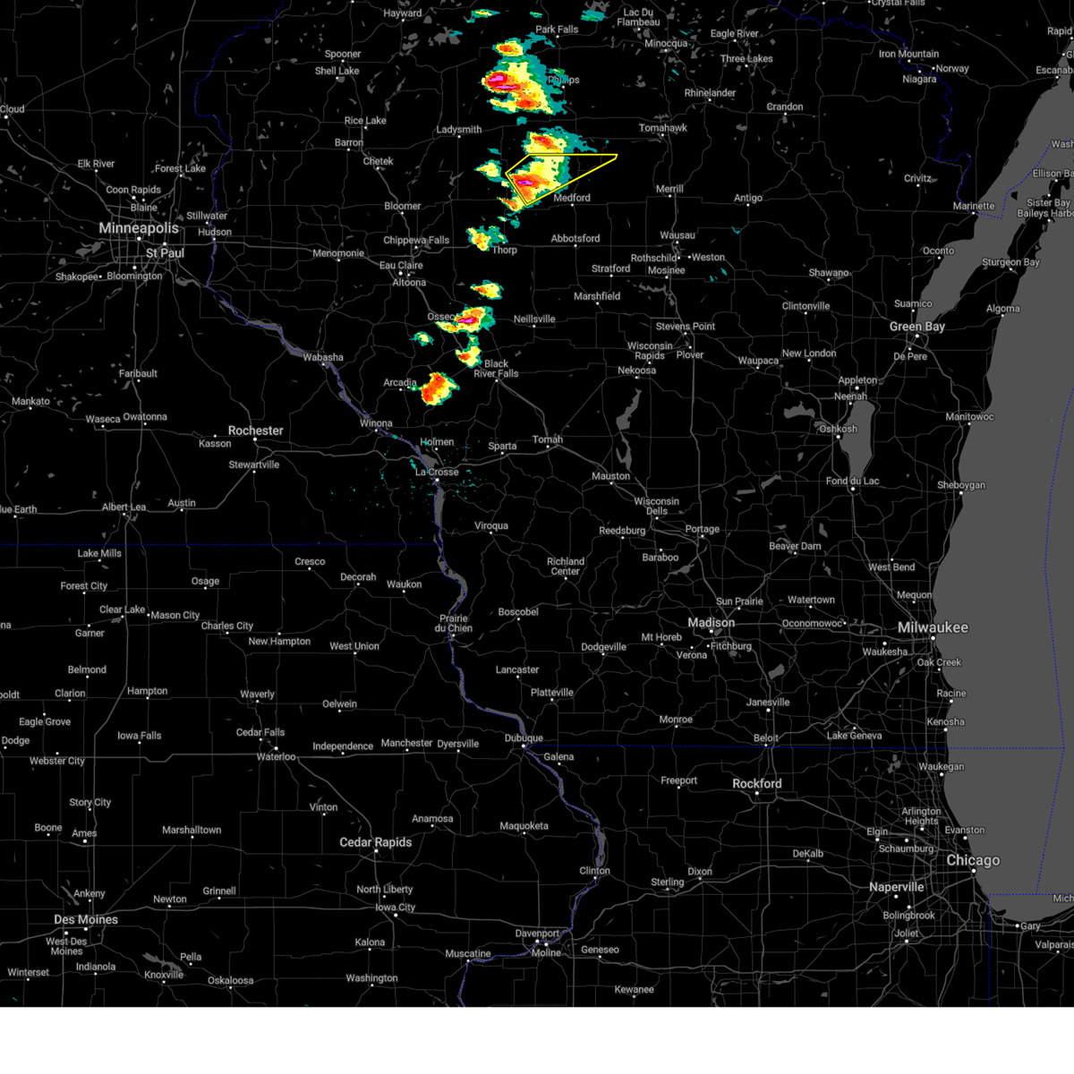
The Chelsea, WI area has had 0 reports of on-the-ground hail by trained spotters, and has been under severe weather warnings 24 times during the past 12 months. Doppler radar has detected hail at or near Chelsea, WI on 32 occasions, including 2 occasions during the past year.
| Name: | Chelsea, WI |
| Where Located: | 49.5 miles WSW of Rhinelander, WI |
| Map: | Google Map for Chelsea, WI |
| Population: | 113 |
| Housing Units: | 51 |
| More Info: | Search Google for Chelsea, WI |
4
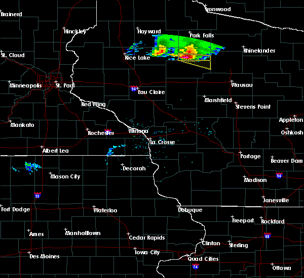
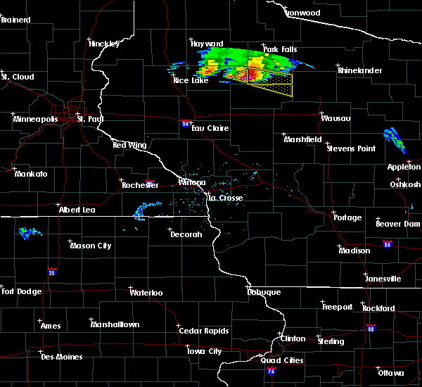
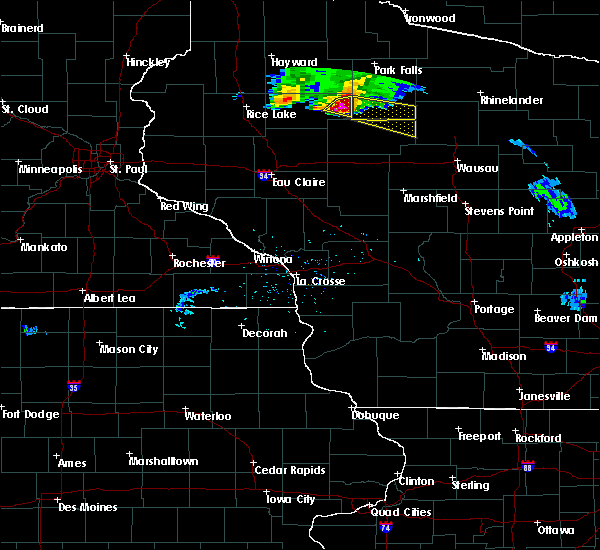
The Top Recent Hail Date for Chelsea, WI is Saturday, September 21, 2024 (8th out of 32)

Hail and Wind Damage Spotted near Chelsea, WI
| Date / Time | Report Details |
|---|---|
| 6/20/2025 2:37 AM CDT |
 The storm which prompted the warning has weakened below severe limits, and no longer poses an immediate threat to life or property. therefore, the warning will be allowed to expire. The storm which prompted the warning has weakened below severe limits, and no longer poses an immediate threat to life or property. therefore, the warning will be allowed to expire.
|
| 6/20/2025 2:15 AM CDT |
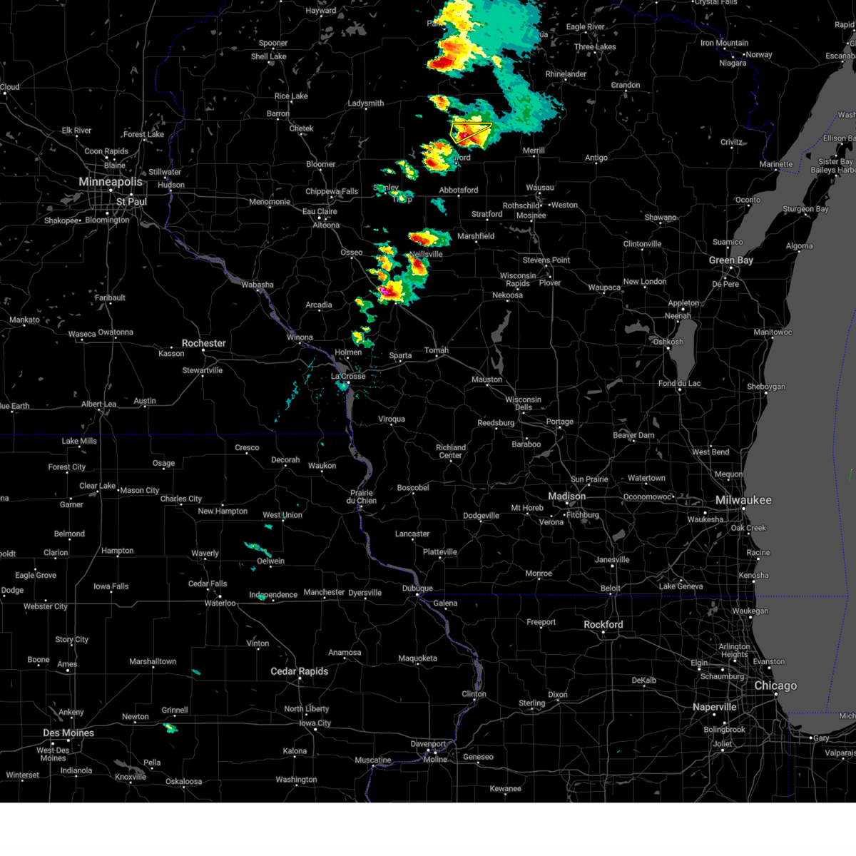
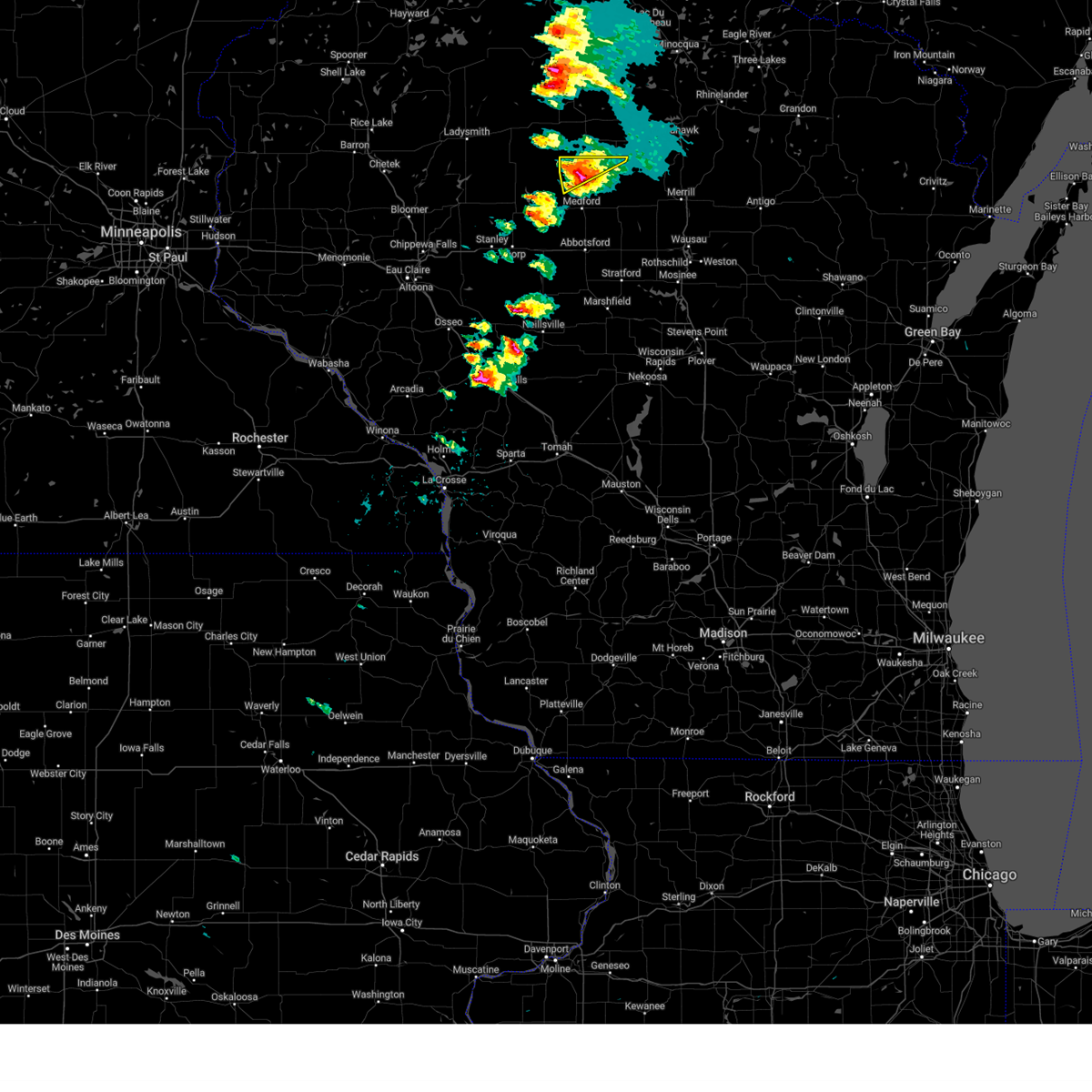
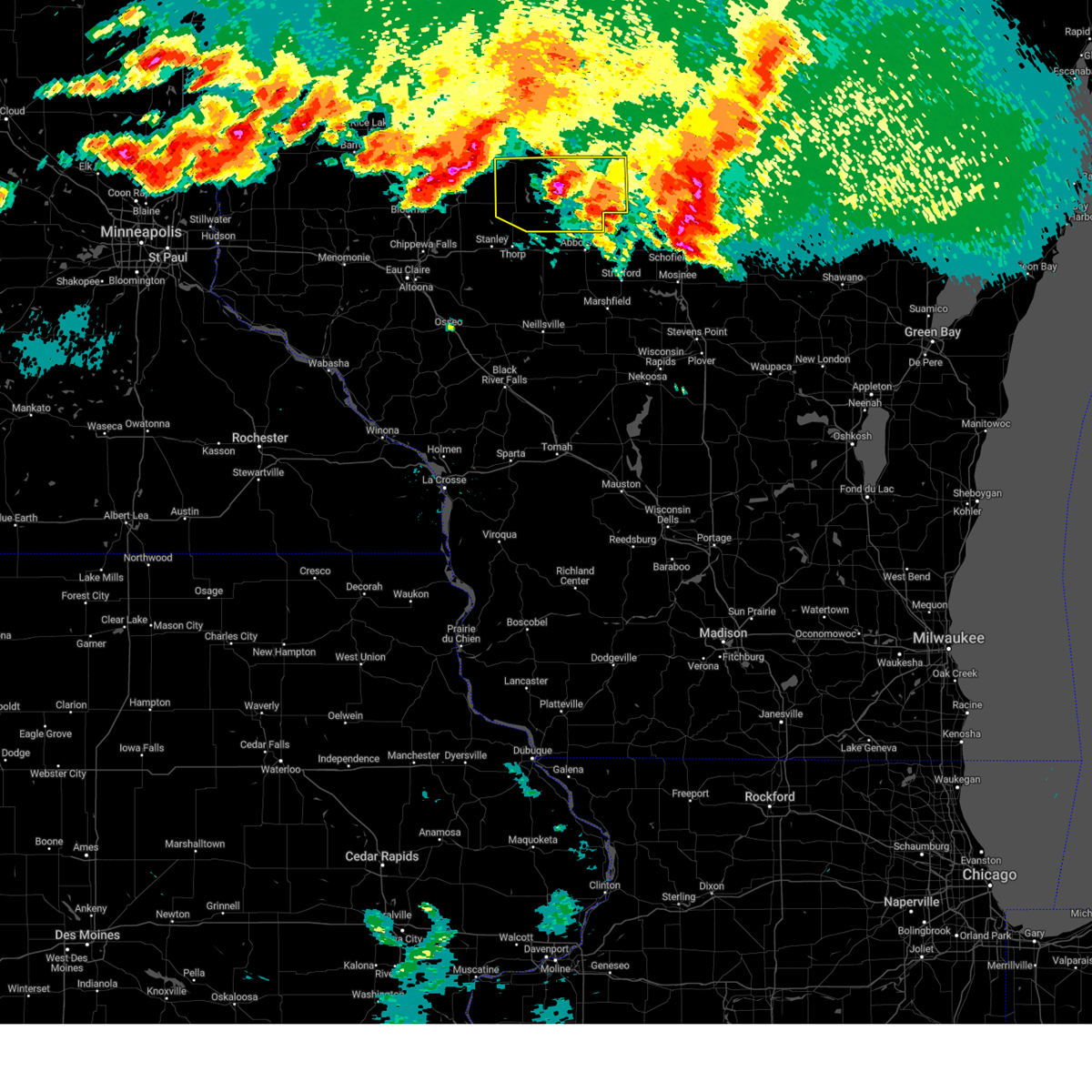
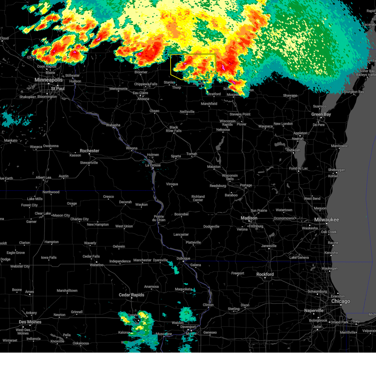
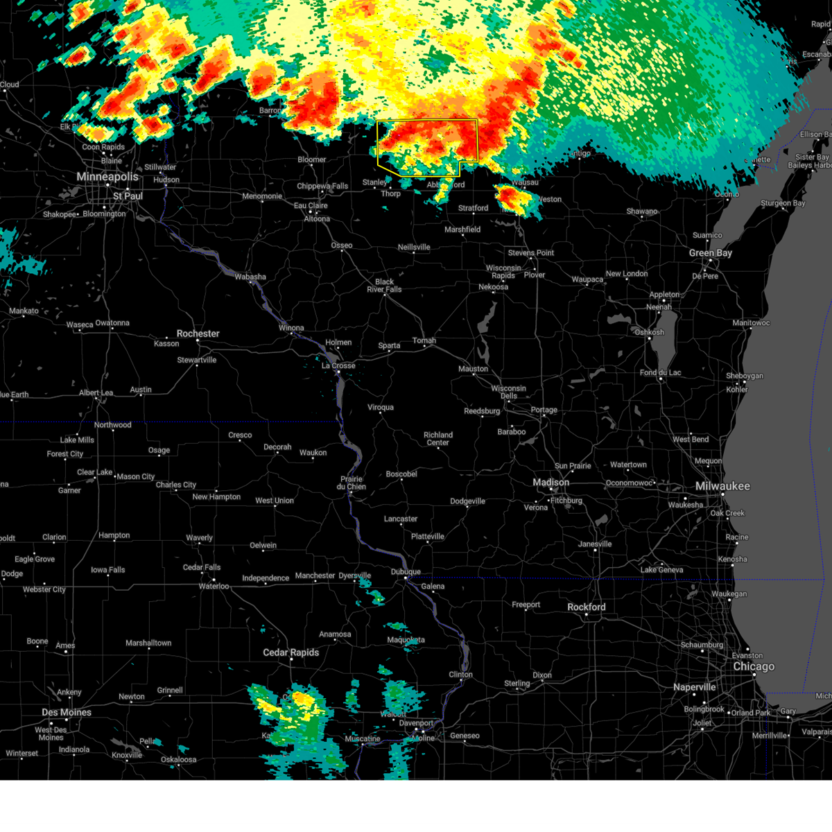
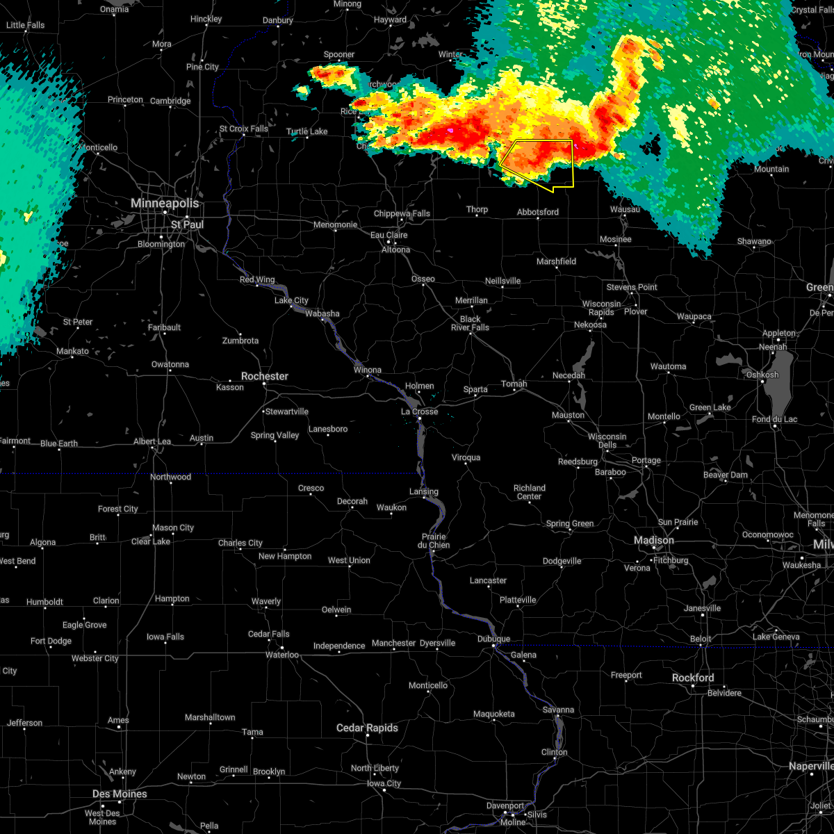
 At 215 am cdt, a severe thunderstorm was located near chelsea, or 11 miles north of medford, moving southeast at 25 mph (radar indicated). Hazards include 60 mph wind gusts and quarter size hail. Hail damage to vehicles is expected. expect wind damage to roofs, siding, and trees. this severe storm will be near, chelsea around 220 am cdt. Other locations impacted by this severe thunderstorm include north twin lake, the mondeaux flowage, highway 13 and county road m, and gad. At 215 am cdt, a severe thunderstorm was located near chelsea, or 11 miles north of medford, moving southeast at 25 mph (radar indicated). Hazards include 60 mph wind gusts and quarter size hail. Hail damage to vehicles is expected. expect wind damage to roofs, siding, and trees. this severe storm will be near, chelsea around 220 am cdt. Other locations impacted by this severe thunderstorm include north twin lake, the mondeaux flowage, highway 13 and county road m, and gad.
|
| 6/20/2025 2:04 AM CDT |
 At 204 am cdt, a severe thunderstorm was located 8 miles west of chelsea, or 13 miles northwest of medford, moving southeast at 30 mph (radar indicated). Hazards include 60 mph wind gusts and quarter size hail. Hail damage to vehicles is expected. expect wind damage to roofs, siding, and trees. this severe storm will be near, chelsea around 215 am cdt. medford around 225 am cdt. Other locations impacted by this severe thunderstorm include north twin lake, the mondeaux flowage, highway 13 and county road m, the taylor county airport, stetsonville, county roads d and n, and esadore lake. At 204 am cdt, a severe thunderstorm was located 8 miles west of chelsea, or 13 miles northwest of medford, moving southeast at 30 mph (radar indicated). Hazards include 60 mph wind gusts and quarter size hail. Hail damage to vehicles is expected. expect wind damage to roofs, siding, and trees. this severe storm will be near, chelsea around 215 am cdt. medford around 225 am cdt. Other locations impacted by this severe thunderstorm include north twin lake, the mondeaux flowage, highway 13 and county road m, the taylor county airport, stetsonville, county roads d and n, and esadore lake.
|
| 6/20/2025 1:51 AM CDT |
 Svrarx the national weather service in la crosse has issued a * severe thunderstorm warning for, central taylor county in north central wisconsin, * until 245 am cdt. * at 150 am cdt, a severe thunderstorm was located 10 miles east of jump river, or 17 miles northwest of medford, moving southeast at 40 mph (radar indicated). Hazards include 60 mph wind gusts and quarter size hail. Hail damage to vehicles is expected. expect wind damage to roofs, siding, and trees. this severe thunderstorm will be near, medford around 210 am cdt. Other locations impacted by this severe thunderstorm include north twin lake, the mondeaux flowage, highway 13 and county road m, the taylor county airport, stetsonville, county roads d and n, and county roads a and e. Svrarx the national weather service in la crosse has issued a * severe thunderstorm warning for, central taylor county in north central wisconsin, * until 245 am cdt. * at 150 am cdt, a severe thunderstorm was located 10 miles east of jump river, or 17 miles northwest of medford, moving southeast at 40 mph (radar indicated). Hazards include 60 mph wind gusts and quarter size hail. Hail damage to vehicles is expected. expect wind damage to roofs, siding, and trees. this severe thunderstorm will be near, medford around 210 am cdt. Other locations impacted by this severe thunderstorm include north twin lake, the mondeaux flowage, highway 13 and county road m, the taylor county airport, stetsonville, county roads d and n, and county roads a and e.
|
| 5/15/2025 6:11 PM CDT |
 The storm which prompted the warning has weakened below severe limits, and has exited the warned area. therefore, the warning will be allowed to expire. a tornado watch remains in effect until 800 pm cdt for north central wisconsin. The storm which prompted the warning has weakened below severe limits, and has exited the warned area. therefore, the warning will be allowed to expire. a tornado watch remains in effect until 800 pm cdt for north central wisconsin.
|
| 5/15/2025 6:10 PM CDT |
 The storm which prompted the warning has weakened below severe limits, and has exited the warned area. therefore, the warning will be allowed to expire. a tornado watch remains in effect until 800 pm cdt for north central wisconsin. The storm which prompted the warning has weakened below severe limits, and has exited the warned area. therefore, the warning will be allowed to expire. a tornado watch remains in effect until 800 pm cdt for north central wisconsin.
|
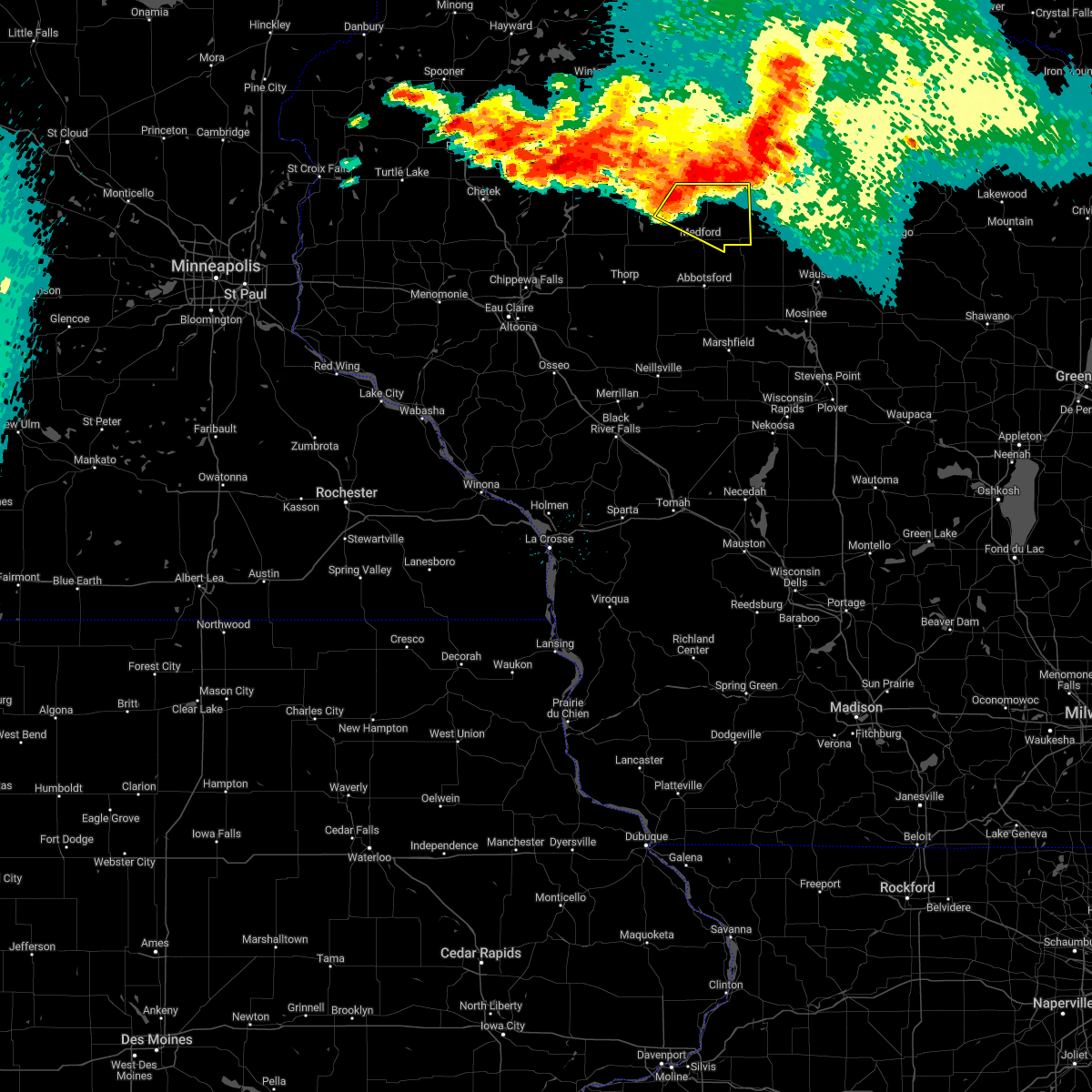
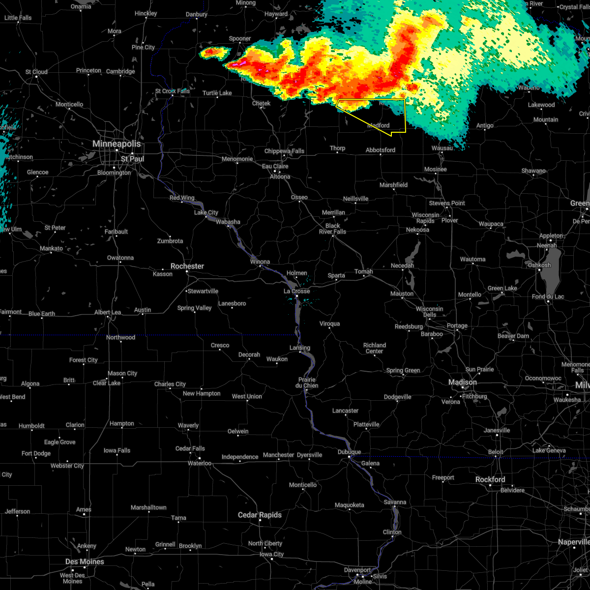
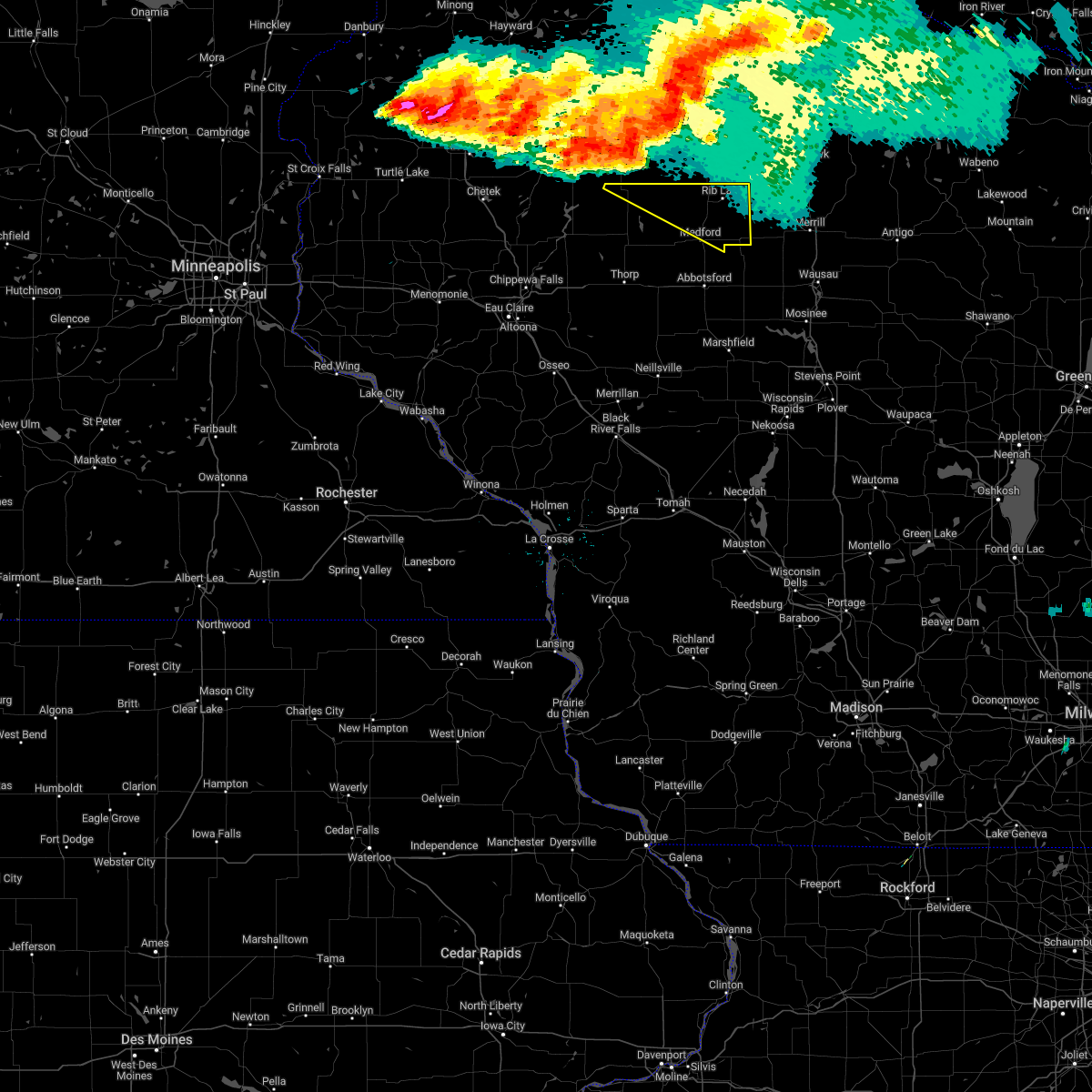
| 5/15/2025 6:01 PM CDT | At 601 pm cdt, a severe thunderstorm was located near rib lake, or 14 miles northeast of medford, moving northeast at 50 mph (radar indicated). Hazards include 60 mph wind gusts and quarter size hail. Hail damage to vehicles is expected. expect wind damage to roofs, siding, and trees. This severe thunderstorm will remain over mainly rural areas of northeastern taylor county, including the following locations, highway m and joe martin road, camp forest spring, wood lake, gad, and goodrich. |
| 5/15/2025 6:00 PM CDT | At 559 pm cdt, a severe thunderstorm capable of producing a tornado was located near new wood wildlife area, or 16 miles northeast of medford, moving northeast at 60 mph (radar indicated rotation). Hazards include tornado and quarter size hail. Flying debris will be dangerous to those caught without shelter. mobile homes will be damaged or destroyed. damage to roofs, windows, and vehicles will occur. tree damage is likely. Locations impacted include, rib lake, westboro, goodrich, highway m and joe martin road, camp forest spring, and wood lake. |
| 5/15/2025 5:45 PM CDT | Torarx the national weather service in la crosse has issued a * tornado warning for, eastern taylor county in north central wisconsin, * until 615 pm cdt. * at 545 pm cdt, a severe thunderstorm capable of producing a tornado was located near dorchester, or near medford, moving northeast at 60 mph (radar indicated rotation). Hazards include tornado and quarter size hail. Flying debris will be dangerous to those caught without shelter. mobile homes will be damaged or destroyed. damage to roofs, windows, and vehicles will occur. tree damage is likely. This tornadic thunderstorm will remain over mainly rural areas of eastern taylor county, including the following locations, wood lake, highway 13 and county road m, the taylor county airport, stetsonville, highway m and joe martin road, camp forest spring, and gad. |
| 5/15/2025 5:42 PM CDT | Svrarx the national weather service in la crosse has issued a * severe thunderstorm warning for, eastern taylor county in north central wisconsin, * until 615 pm cdt. * at 542 pm cdt, a severe thunderstorm was located near medford, moving northeast at 35 mph (radar indicated). Hazards include 60 mph wind gusts and quarter size hail. Hail damage to vehicles is expected. expect wind damage to roofs, siding, and trees. this severe thunderstorm will be near, medford around 545 pm cdt. Other locations impacted by this severe thunderstorm include wood lake, north twin lake, the mondeaux flowage, highway 13 and county road m, the taylor county airport, stetsonville, and highway m and joe martin road. |
| 5/15/2025 5:30 PM CDT | At 529 pm cdt, severe thunderstorms were located along a line extending from hawkins to 13 miles east of abbotsford, moving northeast at 60 mph (radar indicated). Hazards include 60 mph wind gusts and quarter size hail. Hail damage to vehicles is expected. expect wind damage to roofs, siding, and trees. these severe storms will be near, rib lake, chelsea, and westboro around 535 pm cdt. Other locations impacted by these severe thunderstorms include wood lake, the mondeaux flowage, highway 13 and county road m, stetsonville, perkinstown, county roads a and e, and highway m and joe martin road. |
| 5/15/2025 5:30 PM CDT | the severe thunderstorm warning has been cancelled and is no longer in effect |
| 5/15/2025 5:18 PM CDT |
 At 518 pm cdt, severe thunderstorms were located along a line extending from near jump river to 8 miles northeast of spencer, moving north at 60 mph (radar indicated). Hazards include 60 mph wind gusts and quarter size hail. Hail damage to vehicles is expected. expect wind damage to roofs, siding, and trees. these severe storms will be near, medford, dorchester, and jump river around 525 pm cdt. chelsea around 535 pm cdt. westboro around 540 pm cdt. rib lake around 545 pm cdt. Other locations impacted by these severe thunderstorms include polley, the mondeaux flowage, atwood, perkinstown, highway m and joe martin road, esadore lake, and longwood. At 518 pm cdt, severe thunderstorms were located along a line extending from near jump river to 8 miles northeast of spencer, moving north at 60 mph (radar indicated). Hazards include 60 mph wind gusts and quarter size hail. Hail damage to vehicles is expected. expect wind damage to roofs, siding, and trees. these severe storms will be near, medford, dorchester, and jump river around 525 pm cdt. chelsea around 535 pm cdt. westboro around 540 pm cdt. rib lake around 545 pm cdt. Other locations impacted by these severe thunderstorms include polley, the mondeaux flowage, atwood, perkinstown, highway m and joe martin road, esadore lake, and longwood.
|
| 5/15/2025 4:57 PM CDT |
 Svrarx the national weather service in la crosse has issued a * severe thunderstorm warning for, northern clark county in central wisconsin, taylor county in north central wisconsin, * until 545 pm cdt. * at 457 pm cdt, severe thunderstorms were located along a line extending from 6 miles southeast of cornell to 9 miles southwest of marshfield, moving northeast at 60 mph (radar indicated). Hazards include 60 mph wind gusts and quarter size hail. Hail damage to vehicles is expected. expect wind damage to roofs, siding, and trees. severe thunderstorms will be near, thorp, greenwood, and owen around 500 pm cdt. abbotsford around 510 pm cdt. dorchester and jump river around 515 pm cdt. medford around 520 pm cdt. chelsea and westboro around 530 pm cdt. rib lake around 535 pm cdt. Other locations impacted by these severe thunderstorms include polley, the mondeaux flowage, atwood, perkinstown, highway m and joe martin road, esadore lake, and eidsvold. Svrarx the national weather service in la crosse has issued a * severe thunderstorm warning for, northern clark county in central wisconsin, taylor county in north central wisconsin, * until 545 pm cdt. * at 457 pm cdt, severe thunderstorms were located along a line extending from 6 miles southeast of cornell to 9 miles southwest of marshfield, moving northeast at 60 mph (radar indicated). Hazards include 60 mph wind gusts and quarter size hail. Hail damage to vehicles is expected. expect wind damage to roofs, siding, and trees. severe thunderstorms will be near, thorp, greenwood, and owen around 500 pm cdt. abbotsford around 510 pm cdt. dorchester and jump river around 515 pm cdt. medford around 520 pm cdt. chelsea and westboro around 530 pm cdt. rib lake around 535 pm cdt. Other locations impacted by these severe thunderstorms include polley, the mondeaux flowage, atwood, perkinstown, highway m and joe martin road, esadore lake, and eidsvold.
|
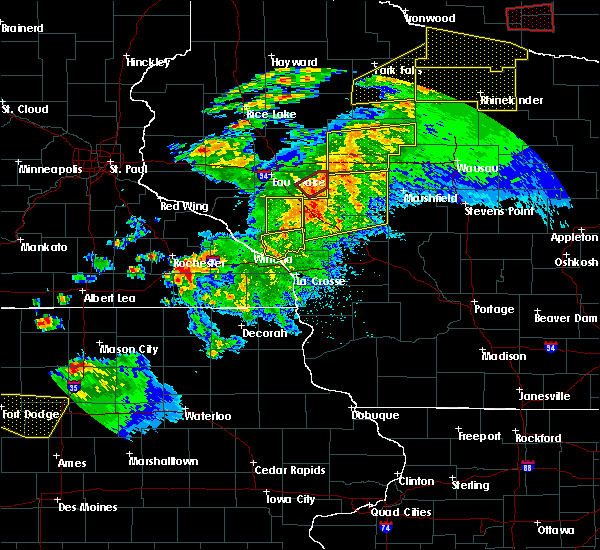
| 9/21/2024 4:41 PM CDT |
 The storm which prompted the warning has weakened below severe limits, and no longer poses an immediate threat to life or property. therefore, the warning will be allowed to expire. however, small hail and heavy rain are still possible with this thunderstorm. to report severe weather, contact your nearest law enforcement agency. they will relay your report to the national weather service la crosse. The storm which prompted the warning has weakened below severe limits, and no longer poses an immediate threat to life or property. therefore, the warning will be allowed to expire. however, small hail and heavy rain are still possible with this thunderstorm. to report severe weather, contact your nearest law enforcement agency. they will relay your report to the national weather service la crosse.
|
| 9/21/2024 4:31 PM CDT |
 At 431 pm cdt, a severe thunderstorm was located 9 miles east of jump river, or 18 miles northwest of medford, moving east at 40 mph (radar indicated). Hazards include quarter size hail. Damage to vehicles is expected. this severe storm will be near, chelsea around 450 pm cdt. rib lake around 455 pm cdt. Other locations impacted by this severe thunderstorm include wood lake, north twin lake, the mondeaux flowage, and camp forest spring. At 431 pm cdt, a severe thunderstorm was located 9 miles east of jump river, or 18 miles northwest of medford, moving east at 40 mph (radar indicated). Hazards include quarter size hail. Damage to vehicles is expected. this severe storm will be near, chelsea around 450 pm cdt. rib lake around 455 pm cdt. Other locations impacted by this severe thunderstorm include wood lake, north twin lake, the mondeaux flowage, and camp forest spring.
|
| 9/21/2024 4:08 PM CDT |
 At 408 pm cdt, severe thunderstorms were located along a line extending from 12 miles west of chelsea to near jump river, moving east at 40 mph (radar indicated). Hazards include quarter size hail. Damage to vehicles is expected. these severe storms will be near, chelsea and westboro around 420 pm cdt. rib lake around 425 pm cdt. Other locations impacted by these severe thunderstorms include wood lake, north twin lake, the mondeaux flowage, and camp forest spring. At 408 pm cdt, severe thunderstorms were located along a line extending from 12 miles west of chelsea to near jump river, moving east at 40 mph (radar indicated). Hazards include quarter size hail. Damage to vehicles is expected. these severe storms will be near, chelsea and westboro around 420 pm cdt. rib lake around 425 pm cdt. Other locations impacted by these severe thunderstorms include wood lake, north twin lake, the mondeaux flowage, and camp forest spring.
|
| 9/21/2024 3:50 PM CDT |
 Svrarx the national weather service in la crosse has issued a * severe thunderstorm warning for, northern taylor county in north central wisconsin, * until 445 pm cdt. * at 350 pm cdt, a severe thunderstorm was located near jump river, or 20 miles southeast of ladysmith, moving east at 25 mph (radar indicated). Hazards include half dollar size hail. Damage to vehicles is expected. this severe thunderstorm will be near, chelsea around 430 pm cdt. Other locations impacted by this severe thunderstorm include wood lake, north twin lake, the mondeaux flowage, and hannibal. Svrarx the national weather service in la crosse has issued a * severe thunderstorm warning for, northern taylor county in north central wisconsin, * until 445 pm cdt. * at 350 pm cdt, a severe thunderstorm was located near jump river, or 20 miles southeast of ladysmith, moving east at 25 mph (radar indicated). Hazards include half dollar size hail. Damage to vehicles is expected. this severe thunderstorm will be near, chelsea around 430 pm cdt. Other locations impacted by this severe thunderstorm include wood lake, north twin lake, the mondeaux flowage, and hannibal.
|
| 8/26/2024 11:00 PM CDT |
 The storms which prompted the warning have moved out of the area. therefore, the warning has been allowed to expire. a severe thunderstorm watch remains in effect until 400 am cdt for north central wisconsin. to report severe weather, contact your nearest law enforcement agency. they will relay your report to the national weather service la crosse. The storms which prompted the warning have moved out of the area. therefore, the warning has been allowed to expire. a severe thunderstorm watch remains in effect until 400 am cdt for north central wisconsin. to report severe weather, contact your nearest law enforcement agency. they will relay your report to the national weather service la crosse.
|
| 8/26/2024 10:51 PM CDT |
 At 1050 pm cdt, severe thunderstorms were located along a line extending from near rib lake to 11 miles east of dorchester, moving east at 45 mph (radar indicated). Hazards include 60 mph wind gusts. Expect damage to roofs, siding, and trees. Locations impacted include, rib lake, chelsea, westboro, stetsonville, goodrich, wood lake, highway 13 and county road m, the taylor county airport, highway m and joe martin road, camp forest spring, and gad. At 1050 pm cdt, severe thunderstorms were located along a line extending from near rib lake to 11 miles east of dorchester, moving east at 45 mph (radar indicated). Hazards include 60 mph wind gusts. Expect damage to roofs, siding, and trees. Locations impacted include, rib lake, chelsea, westboro, stetsonville, goodrich, wood lake, highway 13 and county road m, the taylor county airport, highway m and joe martin road, camp forest spring, and gad.
|
| 8/26/2024 10:51 PM CDT |
 the severe thunderstorm warning has been cancelled and is no longer in effect the severe thunderstorm warning has been cancelled and is no longer in effect
|
| 8/26/2024 10:25 PM CDT |
 Svrarx the national weather service in la crosse has issued a * severe thunderstorm warning for, northern clark county in central wisconsin, taylor county in north central wisconsin, * until 1100 pm cdt. * at 1025 pm cdt, severe thunderstorms were located along a line extending from near westboro to near dorchester to near spencer, moving east at 55 mph (radar indicated). Hazards include 60 mph wind gusts. expect damage to roofs, siding, and trees Svrarx the national weather service in la crosse has issued a * severe thunderstorm warning for, northern clark county in central wisconsin, taylor county in north central wisconsin, * until 1100 pm cdt. * at 1025 pm cdt, severe thunderstorms were located along a line extending from near westboro to near dorchester to near spencer, moving east at 55 mph (radar indicated). Hazards include 60 mph wind gusts. expect damage to roofs, siding, and trees
|
| 8/26/2024 10:08 PM CDT |
 At 1007 pm cdt, severe thunderstorms were located along a line extending from 10 miles west of westboro to 6 miles northeast of owen to near greenwood, moving east at 40 mph (radar indicated). Hazards include 70 mph wind gusts. Expect considerable tree damage. damage is likely to mobile homes, roofs, and outbuildings. Locations impacted include, medford, abbotsford, thorp, owen, rib lake, dorchester, chelsea, westboro, jump river, colby, longwood, reseburg, stetsonville, goodrich, withee, gilman, unity, curtiss, lublin, and polley. At 1007 pm cdt, severe thunderstorms were located along a line extending from 10 miles west of westboro to 6 miles northeast of owen to near greenwood, moving east at 40 mph (radar indicated). Hazards include 70 mph wind gusts. Expect considerable tree damage. damage is likely to mobile homes, roofs, and outbuildings. Locations impacted include, medford, abbotsford, thorp, owen, rib lake, dorchester, chelsea, westboro, jump river, colby, longwood, reseburg, stetsonville, goodrich, withee, gilman, unity, curtiss, lublin, and polley.
|
| 8/26/2024 9:33 PM CDT |
 Svrarx the national weather service in la crosse has issued a * severe thunderstorm warning for, northern clark county in central wisconsin, taylor county in north central wisconsin, * until 1030 pm cdt. * at 933 pm cdt, severe thunderstorms were located along a line extending from near ladysmith to near cornell to near cadott, moving east at 40 mph (radar indicated). Hazards include 70 mph wind gusts. Expect considerable tree damage. Damage is likely to mobile homes, roofs, and outbuildings. Svrarx the national weather service in la crosse has issued a * severe thunderstorm warning for, northern clark county in central wisconsin, taylor county in north central wisconsin, * until 1030 pm cdt. * at 933 pm cdt, severe thunderstorms were located along a line extending from near ladysmith to near cornell to near cadott, moving east at 40 mph (radar indicated). Hazards include 70 mph wind gusts. Expect considerable tree damage. Damage is likely to mobile homes, roofs, and outbuildings.
|
| 6/17/2024 9:35 AM CDT |
 The storms which prompted the warning have moved out of the area. therefore, the warning will be allowed to expire. to report severe weather, contact your nearest law enforcement agency. they will relay your report to the national weather service la crosse. The storms which prompted the warning have moved out of the area. therefore, the warning will be allowed to expire. to report severe weather, contact your nearest law enforcement agency. they will relay your report to the national weather service la crosse.
|
| 6/17/2024 9:22 AM CDT |
 At 921 am cdt, severe thunderstorms were located along a line extending from near jump river to near rib lake, moving northeast at 45 mph (radar indicated). Hazards include 60 mph wind gusts. Expect damage to roofs, siding, and trees. Locations impacted include, rib lake, chelsea, westboro, north twin lake, the mondeaux flowage, highway 13 and county road m, esadore lake, and camp forest spring. At 921 am cdt, severe thunderstorms were located along a line extending from near jump river to near rib lake, moving northeast at 45 mph (radar indicated). Hazards include 60 mph wind gusts. Expect damage to roofs, siding, and trees. Locations impacted include, rib lake, chelsea, westboro, north twin lake, the mondeaux flowage, highway 13 and county road m, esadore lake, and camp forest spring.
|
| 6/17/2024 9:14 AM CDT |
 At 913 am cdt, severe thunderstorms were located along a line extending from near jump river to near medford, moving northeast at 45 mph (law enforcement reported power lines down in thorp). Hazards include 60 mph wind gusts. Expect damage to roofs, siding, and trees. Locations impacted include, medford, rib lake, chelsea, westboro, stetsonville, gilman, polley, the mondeaux flowage, highway 13 and county road m, perkinstown, county roads a and e, esadore lake, camp forest spring, kathryn lake, north twin lake, the taylor county airport, the miller dam flowage, county roads d and n, hannibal, and highway 64 and county d d. At 913 am cdt, severe thunderstorms were located along a line extending from near jump river to near medford, moving northeast at 45 mph (law enforcement reported power lines down in thorp). Hazards include 60 mph wind gusts. Expect damage to roofs, siding, and trees. Locations impacted include, medford, rib lake, chelsea, westboro, stetsonville, gilman, polley, the mondeaux flowage, highway 13 and county road m, perkinstown, county roads a and e, esadore lake, camp forest spring, kathryn lake, north twin lake, the taylor county airport, the miller dam flowage, county roads d and n, hannibal, and highway 64 and county d d.
|
| 6/17/2024 9:14 AM CDT |
 The storms which prompted the warning have moved out of the warned area. therefore, the warning has been cancelled. a severe thunderstorm watch remains in effect until 1000 am cdt for central wisconsin. The storms which prompted the warning have moved out of the warned area. therefore, the warning has been cancelled. a severe thunderstorm watch remains in effect until 1000 am cdt for central wisconsin.
|
| 6/17/2024 9:12 AM CDT |
 At 911 am cdt, severe thunderstorms were located along a line extending from near jump river to near medford, moving northeast at 45 mph (law enforcement reported power lines down in thorp). Hazards include 60 mph wind gusts. Expect damage to roofs, siding, and trees. Locations impacted include, medford, rib lake, chelsea, westboro, stetsonville, gilman, polley, the mondeaux flowage, highway 13 and county road m, perkinstown, county roads a and e, esadore lake, camp forest spring, kathryn lake, north twin lake, the taylor county airport, the miller dam flowage, county roads d and n, hannibal, and highway 64 and county d d. At 911 am cdt, severe thunderstorms were located along a line extending from near jump river to near medford, moving northeast at 45 mph (law enforcement reported power lines down in thorp). Hazards include 60 mph wind gusts. Expect damage to roofs, siding, and trees. Locations impacted include, medford, rib lake, chelsea, westboro, stetsonville, gilman, polley, the mondeaux flowage, highway 13 and county road m, perkinstown, county roads a and e, esadore lake, camp forest spring, kathryn lake, north twin lake, the taylor county airport, the miller dam flowage, county roads d and n, hannibal, and highway 64 and county d d.
|
| 6/17/2024 9:12 AM CDT |
 the severe thunderstorm warning has been cancelled and is no longer in effect the severe thunderstorm warning has been cancelled and is no longer in effect
|
| 6/17/2024 8:55 AM CDT |
 Svrarx the national weather service in la crosse has issued a * severe thunderstorm warning for, northeastern clark county in central wisconsin, taylor county in north central wisconsin, * until 945 am cdt. * at 855 am cdt, a severe thunderstorm was located 11 miles north of owen, or 14 miles west of medford, moving northeast at 55 mph (law enforcement reported power lines down in thorp). Hazards include 60 mph wind gusts. Expect damage to roofs, siding, and trees. This severe thunderstorm will remain over mainly rural areas of northeastern clark and taylor counties, including the following locations, polley, the mondeaux flowage, highway 13 and county road m, stetsonville, atwood, perkinstown, and county roads a and e. Svrarx the national weather service in la crosse has issued a * severe thunderstorm warning for, northeastern clark county in central wisconsin, taylor county in north central wisconsin, * until 945 am cdt. * at 855 am cdt, a severe thunderstorm was located 11 miles north of owen, or 14 miles west of medford, moving northeast at 55 mph (law enforcement reported power lines down in thorp). Hazards include 60 mph wind gusts. Expect damage to roofs, siding, and trees. This severe thunderstorm will remain over mainly rural areas of northeastern clark and taylor counties, including the following locations, polley, the mondeaux flowage, highway 13 and county road m, stetsonville, atwood, perkinstown, and county roads a and e.
|
| 5/21/2024 8:07 PM CDT |
 The storms which prompted the warning have moved out of the area. therefore, the warning will be allowed to expire. a tornado watch remains in effect until midnight cdt for north central wisconsin. The storms which prompted the warning have moved out of the area. therefore, the warning will be allowed to expire. a tornado watch remains in effect until midnight cdt for north central wisconsin.
|
| 5/21/2024 7:56 PM CDT |
 At 756 pm cdt, severe thunderstorms were located along a line extending from near catawba to near rib lake to 13 miles east of abbotsford, moving northeast at 60 mph (radar indicated). Hazards include 70 mph wind gusts. Expect considerable tree damage. damage is likely to mobile homes, roofs, and outbuildings. these severe storms will be near, rib lake around 800 pm cdt. Other locations impacted by these severe thunderstorms include highway m and joe martin road, camp forest spring, wood lake, highway 13 and county road m, gad, and goodrich. At 756 pm cdt, severe thunderstorms were located along a line extending from near catawba to near rib lake to 13 miles east of abbotsford, moving northeast at 60 mph (radar indicated). Hazards include 70 mph wind gusts. Expect considerable tree damage. damage is likely to mobile homes, roofs, and outbuildings. these severe storms will be near, rib lake around 800 pm cdt. Other locations impacted by these severe thunderstorms include highway m and joe martin road, camp forest spring, wood lake, highway 13 and county road m, gad, and goodrich.
|
| 5/21/2024 7:49 PM CDT |
 At 749 pm cdt, severe thunderstorms were located along a line extending from near catawba to near medford to 8 miles east of colby, moving east at 60 mph (radar indicated). Hazards include 70 mph wind gusts. Expect considerable tree damage. damage is likely to mobile homes, roofs, and outbuildings. these severe storms will be near, rib lake, chelsea, and westboro around 755 pm cdt. Other locations impacted by these severe thunderstorms include wood lake, the mondeaux flowage, highway 13 and county road m, stetsonville, county roads a and e, highway m and joe martin road, and esadore lake. At 749 pm cdt, severe thunderstorms were located along a line extending from near catawba to near medford to 8 miles east of colby, moving east at 60 mph (radar indicated). Hazards include 70 mph wind gusts. Expect considerable tree damage. damage is likely to mobile homes, roofs, and outbuildings. these severe storms will be near, rib lake, chelsea, and westboro around 755 pm cdt. Other locations impacted by these severe thunderstorms include wood lake, the mondeaux flowage, highway 13 and county road m, stetsonville, county roads a and e, highway m and joe martin road, and esadore lake.
|
| 5/21/2024 7:20 PM CDT |
 Svrarx the national weather service in la crosse has issued a * severe thunderstorm warning for, taylor county in north central wisconsin, * until 815 pm cdt. * at 720 pm cdt, severe thunderstorms were located along a line extending from 6 miles west of sheldon to near thorp to near greenwood, moving northeast at 60 mph (radar indicated). Hazards include 70 mph wind gusts. Expect considerable tree damage. damage is likely to mobile homes, roofs, and outbuildings. severe thunderstorms will be near, jump river around 730 pm cdt. medford around 740 pm cdt. chelsea around 745 pm cdt. rib lake and westboro around 750 pm cdt. Other locations impacted by these severe thunderstorms include wood lake, polley, the mondeaux flowage, highway 13 and county road m, stetsonville, perkinstown, and county roads a and e. Svrarx the national weather service in la crosse has issued a * severe thunderstorm warning for, taylor county in north central wisconsin, * until 815 pm cdt. * at 720 pm cdt, severe thunderstorms were located along a line extending from 6 miles west of sheldon to near thorp to near greenwood, moving northeast at 60 mph (radar indicated). Hazards include 70 mph wind gusts. Expect considerable tree damage. damage is likely to mobile homes, roofs, and outbuildings. severe thunderstorms will be near, jump river around 730 pm cdt. medford around 740 pm cdt. chelsea around 745 pm cdt. rib lake and westboro around 750 pm cdt. Other locations impacted by these severe thunderstorms include wood lake, polley, the mondeaux flowage, highway 13 and county road m, stetsonville, perkinstown, and county roads a and e.
|
| 5/18/2024 4:35 PM CDT |
 At 434 pm cdt, a severe thunderstorm was located over rib lake, or 15 miles north of medford, moving northeast at 30 mph (radar indicated). Hazards include 60 mph wind gusts and quarter size hail. Hail damage to vehicles is expected. expect wind damage to roofs, siding, and trees. This severe thunderstorm will remain over mainly rural areas of northeastern taylor county, including the following locations, camp forest spring. At 434 pm cdt, a severe thunderstorm was located over rib lake, or 15 miles north of medford, moving northeast at 30 mph (radar indicated). Hazards include 60 mph wind gusts and quarter size hail. Hail damage to vehicles is expected. expect wind damage to roofs, siding, and trees. This severe thunderstorm will remain over mainly rural areas of northeastern taylor county, including the following locations, camp forest spring.
|
| 5/18/2024 4:26 PM CDT |
 At 426 pm cdt, a severe thunderstorm was located over westboro, or 12 miles north of medford, moving northeast at 30 mph (radar indicated). Hazards include 60 mph wind gusts and half dollar size hail. Hail damage to vehicles is expected. expect wind damage to roofs, siding, and trees. this severe storm will be near, rib lake and westboro around 430 pm cdt. Other locations impacted by this severe thunderstorm include camp forest spring, north twin lake, and the mondeaux flowage. At 426 pm cdt, a severe thunderstorm was located over westboro, or 12 miles north of medford, moving northeast at 30 mph (radar indicated). Hazards include 60 mph wind gusts and half dollar size hail. Hail damage to vehicles is expected. expect wind damage to roofs, siding, and trees. this severe storm will be near, rib lake and westboro around 430 pm cdt. Other locations impacted by this severe thunderstorm include camp forest spring, north twin lake, and the mondeaux flowage.
|
| 5/18/2024 4:22 PM CDT |
 At 421 pm cdt, a severe thunderstorm was located over chelsea, or 11 miles north of medford, moving east at 30 mph (radar indicated). Hazards include ping pong ball size hail and 60 mph wind gusts. People and animals outdoors will be injured. expect hail damage to roofs, siding, windows, and vehicles. expect wind damage to roofs, siding, and trees. this severe storm will be near, chelsea and westboro around 425 pm cdt. rib lake around 430 pm cdt. Other locations impacted by this severe thunderstorm include camp forest spring, north twin lake, and the mondeaux flowage. At 421 pm cdt, a severe thunderstorm was located over chelsea, or 11 miles north of medford, moving east at 30 mph (radar indicated). Hazards include ping pong ball size hail and 60 mph wind gusts. People and animals outdoors will be injured. expect hail damage to roofs, siding, windows, and vehicles. expect wind damage to roofs, siding, and trees. this severe storm will be near, chelsea and westboro around 425 pm cdt. rib lake around 430 pm cdt. Other locations impacted by this severe thunderstorm include camp forest spring, north twin lake, and the mondeaux flowage.
|
| 5/18/2024 4:13 PM CDT |
 At 413 pm cdt, a severe thunderstorm was located 8 miles west of chelsea, or 13 miles northwest of medford, moving northeast at 30 mph (radar indicated). Hazards include 60 mph wind gusts and quarter size hail. Hail damage to vehicles is expected. expect wind damage to roofs, siding, and trees. this severe storm will be near, westboro around 425 pm cdt. Other locations impacted by this severe thunderstorm include camp forest spring, north twin lake, the mondeaux flowage, and county roads d and n. At 413 pm cdt, a severe thunderstorm was located 8 miles west of chelsea, or 13 miles northwest of medford, moving northeast at 30 mph (radar indicated). Hazards include 60 mph wind gusts and quarter size hail. Hail damage to vehicles is expected. expect wind damage to roofs, siding, and trees. this severe storm will be near, westboro around 425 pm cdt. Other locations impacted by this severe thunderstorm include camp forest spring, north twin lake, the mondeaux flowage, and county roads d and n.
|
| 5/18/2024 4:08 PM CDT |
 At 407 pm cdt, a severe thunderstorm was located 10 miles west of chelsea, or 13 miles northwest of medford, moving northeast at 30 mph (radar indicated). Hazards include ping pong ball size hail and 60 mph wind gusts. People and animals outdoors will be injured. expect hail damage to roofs, siding, windows, and vehicles. expect wind damage to roofs, siding, and trees. this severe storm will be near, westboro around 425 pm cdt. Other locations impacted by this severe thunderstorm include camp forest spring, kathryn lake, north twin lake, the mondeaux flowage, and county roads d and n. At 407 pm cdt, a severe thunderstorm was located 10 miles west of chelsea, or 13 miles northwest of medford, moving northeast at 30 mph (radar indicated). Hazards include ping pong ball size hail and 60 mph wind gusts. People and animals outdoors will be injured. expect hail damage to roofs, siding, windows, and vehicles. expect wind damage to roofs, siding, and trees. this severe storm will be near, westboro around 425 pm cdt. Other locations impacted by this severe thunderstorm include camp forest spring, kathryn lake, north twin lake, the mondeaux flowage, and county roads d and n.
|
| 5/18/2024 3:56 PM CDT |
 Svrarx the national weather service in la crosse has issued a * severe thunderstorm warning for, northern taylor county in north central wisconsin, * until 445 pm cdt. * at 356 pm cdt, a severe thunderstorm was located 10 miles southeast of jump river, or 16 miles northwest of medford, moving northeast at 30 mph (radar indicated). Hazards include 60 mph wind gusts and quarter size hail. Hail damage to vehicles is expected. expect wind damage to roofs, siding, and trees. this severe thunderstorm will be near, westboro around 425 pm cdt. Other locations impacted by this severe thunderstorm include north twin lake, the mondeaux flowage, perkinstown, the miller dam flowage, county roads d and n, camp forest spring, and kathryn lake. Svrarx the national weather service in la crosse has issued a * severe thunderstorm warning for, northern taylor county in north central wisconsin, * until 445 pm cdt. * at 356 pm cdt, a severe thunderstorm was located 10 miles southeast of jump river, or 16 miles northwest of medford, moving northeast at 30 mph (radar indicated). Hazards include 60 mph wind gusts and quarter size hail. Hail damage to vehicles is expected. expect wind damage to roofs, siding, and trees. this severe thunderstorm will be near, westboro around 425 pm cdt. Other locations impacted by this severe thunderstorm include north twin lake, the mondeaux flowage, perkinstown, the miller dam flowage, county roads d and n, camp forest spring, and kathryn lake.
|
| 7/28/2023 6:29 PM CDT |
 At 629 pm cdt, a severe thunderstorm was located over westboro, or 14 miles north of medford, moving east at 15 mph (radar indicated). Hazards include ping pong ball size hail and 60 mph wind gusts. People and animals outdoors will be injured. expect hail damage to roofs, siding, windows, and vehicles. expect wind damage to roofs, siding, and trees. this severe thunderstorm will be near, westboro around 640 pm cdt. rib lake around 655 pm cdt. other locations impacted by this severe thunderstorm include camp forest spring and wood lake. hail threat, radar indicated max hail size, 1. 50 in wind threat, radar indicated max wind gust, 60 mph. At 629 pm cdt, a severe thunderstorm was located over westboro, or 14 miles north of medford, moving east at 15 mph (radar indicated). Hazards include ping pong ball size hail and 60 mph wind gusts. People and animals outdoors will be injured. expect hail damage to roofs, siding, windows, and vehicles. expect wind damage to roofs, siding, and trees. this severe thunderstorm will be near, westboro around 640 pm cdt. rib lake around 655 pm cdt. other locations impacted by this severe thunderstorm include camp forest spring and wood lake. hail threat, radar indicated max hail size, 1. 50 in wind threat, radar indicated max wind gust, 60 mph.
|
| 7/27/2023 8:40 PM CDT |
 At 839 pm cdt, severe thunderstorms were located along a line extending from 10 miles south of new wood wildlife area to 9 miles southeast of colby to 7 miles southeast of loyal, moving southeast at 35 mph (radar indicated). Hazards include 60 mph wind gusts and quarter size hail. Hail damage to vehicles is expected. expect wind damage to roofs, siding, and trees. hail threat, radar indicated max hail size, 1. 00 in wind threat, radar indicated max wind gust, 60 mph. At 839 pm cdt, severe thunderstorms were located along a line extending from 10 miles south of new wood wildlife area to 9 miles southeast of colby to 7 miles southeast of loyal, moving southeast at 35 mph (radar indicated). Hazards include 60 mph wind gusts and quarter size hail. Hail damage to vehicles is expected. expect wind damage to roofs, siding, and trees. hail threat, radar indicated max hail size, 1. 00 in wind threat, radar indicated max wind gust, 60 mph.
|
| 7/27/2023 8:32 PM CDT |
 At 830 pm cdt, severe thunderstorms were located along a line extending from 9 miles southwest of new wood wildlife area to 6 miles east of colby to near loyal, moving southeast at 50 mph (trained weather spotters). Hazards include 60 mph wind gusts and quarter size hail. Hail damage to vehicles is expected. expect wind damage to roofs, siding, and trees. locations impacted include, medford, abbotsford, thorp, loyal, greenwood, owen, rib lake, dorchester, chelsea, westboro, jump river, colby, longwood, reseburg, stetsonville, goodrich, withee, gilman, unity and curtiss. People attending the taylor county fair should seek safe shelter immediately!. At 830 pm cdt, severe thunderstorms were located along a line extending from 9 miles southwest of new wood wildlife area to 6 miles east of colby to near loyal, moving southeast at 50 mph (trained weather spotters). Hazards include 60 mph wind gusts and quarter size hail. Hail damage to vehicles is expected. expect wind damage to roofs, siding, and trees. locations impacted include, medford, abbotsford, thorp, loyal, greenwood, owen, rib lake, dorchester, chelsea, westboro, jump river, colby, longwood, reseburg, stetsonville, goodrich, withee, gilman, unity and curtiss. People attending the taylor county fair should seek safe shelter immediately!.
|
| 7/27/2023 8:25 PM CDT |
 At 824 pm cdt, severe thunderstorms were located along a line extending from 6 miles southeast of rib lake to near colby to loyal, moving southeast at 50 mph (trained weather spotters). Hazards include 60 mph wind gusts and quarter size hail. Hail damage to vehicles is expected. expect wind damage to roofs, siding, and trees. People attending the taylor county fair should seek safe shelter immediately!. At 824 pm cdt, severe thunderstorms were located along a line extending from 6 miles southeast of rib lake to near colby to loyal, moving southeast at 50 mph (trained weather spotters). Hazards include 60 mph wind gusts and quarter size hail. Hail damage to vehicles is expected. expect wind damage to roofs, siding, and trees. People attending the taylor county fair should seek safe shelter immediately!.
|
| 7/27/2023 8:20 PM CDT |
 At 820 pm cdt, severe thunderstorms were located along a line extending from near rib lake to abbotsford to greenwood, moving southeast at 55 mph (trained weather spotters). Hazards include 70 mph wind gusts and quarter size hail. Hail damage to vehicles is expected. expect considerable tree damage. wind damage is also likely to mobile homes, roofs, and outbuildings. People attending the taylor county fair should seek safe shelter immediately!. At 820 pm cdt, severe thunderstorms were located along a line extending from near rib lake to abbotsford to greenwood, moving southeast at 55 mph (trained weather spotters). Hazards include 70 mph wind gusts and quarter size hail. Hail damage to vehicles is expected. expect considerable tree damage. wind damage is also likely to mobile homes, roofs, and outbuildings. People attending the taylor county fair should seek safe shelter immediately!.
|
| 7/27/2023 8:08 PM CDT |
 At 807 pm cdt, severe thunderstorms were located along a line extending from near chelsea to 6 miles northeast of owen to near stanley, moving southeast at 60 mph (trained weather spotters). Hazards include 70 mph wind gusts and quarter size hail. Hail damage to vehicles is expected. expect considerable tree damage. wind damage is also likely to mobile homes, roofs, and outbuildings. locations impacted include, medford, abbotsford, thorp, loyal, greenwood, owen, rib lake, dorchester, chelsea, westboro, jump river, colby, longwood, reseburg, stetsonville, goodrich, withee, gilman, unity and curtiss. People attending the taylor county fair should seek safe shelter immediately!. At 807 pm cdt, severe thunderstorms were located along a line extending from near chelsea to 6 miles northeast of owen to near stanley, moving southeast at 60 mph (trained weather spotters). Hazards include 70 mph wind gusts and quarter size hail. Hail damage to vehicles is expected. expect considerable tree damage. wind damage is also likely to mobile homes, roofs, and outbuildings. locations impacted include, medford, abbotsford, thorp, loyal, greenwood, owen, rib lake, dorchester, chelsea, westboro, jump river, colby, longwood, reseburg, stetsonville, goodrich, withee, gilman, unity and curtiss. People attending the taylor county fair should seek safe shelter immediately!.
|
| 7/27/2023 7:54 PM CDT |
 At 753 pm cdt, severe thunderstorms were located along a line extending from 8 miles west of chelsea to near boyd, moving east at 50 mph. radar is indicating stronger rotation near polley. this area is being watched for the potential of tornado development. trained weather spotters reported quarter size hail in gilman at 745 pm (trained weather spotters). Hazards include 60 mph wind gusts and quarter size hail. Hail damage to vehicles is expected. expect wind damage to roofs, siding, and trees. locations impacted include, chelsea, westboro, rib lake, owen, colby, dorchester and abbotsford. People attending the taylor county fair should seek safe shelter immediately!. At 753 pm cdt, severe thunderstorms were located along a line extending from 8 miles west of chelsea to near boyd, moving east at 50 mph. radar is indicating stronger rotation near polley. this area is being watched for the potential of tornado development. trained weather spotters reported quarter size hail in gilman at 745 pm (trained weather spotters). Hazards include 60 mph wind gusts and quarter size hail. Hail damage to vehicles is expected. expect wind damage to roofs, siding, and trees. locations impacted include, chelsea, westboro, rib lake, owen, colby, dorchester and abbotsford. People attending the taylor county fair should seek safe shelter immediately!.
|
| 7/27/2023 7:44 PM CDT |
 At 743 pm cdt, severe thunderstorms were located along a line extending from 6 miles southeast of jump river to near cadott, moving southeast at 40 mph. radar is indicating stronger rotations near donald and jump river. these areas are being watched for the potential of tornado development (radar indicated). Hazards include 60 mph wind gusts and quarter size hail. Hail damage to vehicles is expected. expect wind damage to roofs, siding, and trees. locations impacted include, thorp, medford, dorchester, greenwood and loyal. People attending the taylor county fair should seek safe shelter immediately!. At 743 pm cdt, severe thunderstorms were located along a line extending from 6 miles southeast of jump river to near cadott, moving southeast at 40 mph. radar is indicating stronger rotations near donald and jump river. these areas are being watched for the potential of tornado development (radar indicated). Hazards include 60 mph wind gusts and quarter size hail. Hail damage to vehicles is expected. expect wind damage to roofs, siding, and trees. locations impacted include, thorp, medford, dorchester, greenwood and loyal. People attending the taylor county fair should seek safe shelter immediately!.
|
| 7/27/2023 7:28 PM CDT |
 At 727 pm cdt, severe thunderstorms were located along a line extending from near jump river to 7 miles east of bloomer, moving southeast at 40 mph (radar indicated). Hazards include 60 mph wind gusts and quarter size hail. Hail damage to vehicles is expected. expect wind damage to roofs, siding, and trees. severe thunderstorms will be near, jump river around 735 pm cdt. thorp around 810 pm cdt. medford around 815 pm cdt. dorchester around 825 pm cdt. greenwood around 835 pm cdt. loyal around 840 pm cdt. people attending the taylor county fair should seek safe shelter immediately! hail threat, radar indicated max hail size, 1. 00 in wind threat, radar indicated max wind gust, 60 mph. At 727 pm cdt, severe thunderstorms were located along a line extending from near jump river to 7 miles east of bloomer, moving southeast at 40 mph (radar indicated). Hazards include 60 mph wind gusts and quarter size hail. Hail damage to vehicles is expected. expect wind damage to roofs, siding, and trees. severe thunderstorms will be near, jump river around 735 pm cdt. thorp around 810 pm cdt. medford around 815 pm cdt. dorchester around 825 pm cdt. greenwood around 835 pm cdt. loyal around 840 pm cdt. people attending the taylor county fair should seek safe shelter immediately! hail threat, radar indicated max hail size, 1. 00 in wind threat, radar indicated max wind gust, 60 mph.
|
| 7/27/2023 7:23 PM CDT |
 At 722 pm cdt, a severe thunderstorm was located near medford, moving east at 35 mph (radar indicated). Hazards include 60 mph wind gusts and quarter size hail. Hail damage to vehicles is expected. expect wind damage to roofs, siding, and trees. this severe storm will be near, medford around 730 pm cdt. people attending the taylor county fair should seek safe shelter immediately! hail threat, radar indicated max hail size, 1. 00 in wind threat, radar indicated max wind gust, 60 mph. At 722 pm cdt, a severe thunderstorm was located near medford, moving east at 35 mph (radar indicated). Hazards include 60 mph wind gusts and quarter size hail. Hail damage to vehicles is expected. expect wind damage to roofs, siding, and trees. this severe storm will be near, medford around 730 pm cdt. people attending the taylor county fair should seek safe shelter immediately! hail threat, radar indicated max hail size, 1. 00 in wind threat, radar indicated max wind gust, 60 mph.
|
| 7/27/2023 7:11 PM CDT |
 At 711 pm cdt, severe thunderstorms were located along a line extending from near rib lake to 11 miles north of thorp, moving east at 30 mph (radar indicated). Hazards include 60 mph wind gusts and quarter size hail. Hail damage to vehicles is expected. expect wind damage to roofs, siding, and trees. these severe storms will be near, rib lake and westboro around 715 pm cdt. medford around 755 pm cdt. people attending the taylor county fair should seek safe shelter immediately! hail threat, radar indicated max hail size, 1. 00 in wind threat, radar indicated max wind gust, 60 mph. At 711 pm cdt, severe thunderstorms were located along a line extending from near rib lake to 11 miles north of thorp, moving east at 30 mph (radar indicated). Hazards include 60 mph wind gusts and quarter size hail. Hail damage to vehicles is expected. expect wind damage to roofs, siding, and trees. these severe storms will be near, rib lake and westboro around 715 pm cdt. medford around 755 pm cdt. people attending the taylor county fair should seek safe shelter immediately! hail threat, radar indicated max hail size, 1. 00 in wind threat, radar indicated max wind gust, 60 mph.
|
| 7/27/2023 7:00 PM CDT |
 At 658 pm cdt, severe thunderstorms were located along a line extending from near westboro to 11 miles southeast of sheldon, moving east at 35 mph (radar indicated). Hazards include 60 mph wind gusts and quarter size hail. Hail damage to vehicles is expected. expect wind damage to roofs, siding, and trees. these severe storms will be near, chelsea and westboro around 705 pm cdt. rib lake around 710 pm cdt. medford around 735 pm cdt. people attending the taylor county fair should seek safe shelter immediately! hail threat, radar indicated max hail size, 1. 00 in wind threat, radar indicated max wind gust, 60 mph. At 658 pm cdt, severe thunderstorms were located along a line extending from near westboro to 11 miles southeast of sheldon, moving east at 35 mph (radar indicated). Hazards include 60 mph wind gusts and quarter size hail. Hail damage to vehicles is expected. expect wind damage to roofs, siding, and trees. these severe storms will be near, chelsea and westboro around 705 pm cdt. rib lake around 710 pm cdt. medford around 735 pm cdt. people attending the taylor county fair should seek safe shelter immediately! hail threat, radar indicated max hail size, 1. 00 in wind threat, radar indicated max wind gust, 60 mph.
|
| 7/27/2023 6:50 PM CDT |
 At 649 pm cdt, severe thunderstorms were located along a line extending from 9 miles west of westboro to 10 miles southeast of sheldon, moving east at 40 mph (radar indicated). Hazards include 60 mph wind gusts and quarter size hail. Hail damage to vehicles is expected. expect wind damage to roofs, siding, and trees. these severe storms will be near, chelsea and westboro around 705 pm cdt. rib lake around 715 pm cdt. medford around 730 pm cdt. people attending the taylor county fair should seek safe shelter immediately! hail threat, radar indicated max hail size, 1. 00 in wind threat, radar indicated max wind gust, 60 mph. At 649 pm cdt, severe thunderstorms were located along a line extending from 9 miles west of westboro to 10 miles southeast of sheldon, moving east at 40 mph (radar indicated). Hazards include 60 mph wind gusts and quarter size hail. Hail damage to vehicles is expected. expect wind damage to roofs, siding, and trees. these severe storms will be near, chelsea and westboro around 705 pm cdt. rib lake around 715 pm cdt. medford around 730 pm cdt. people attending the taylor county fair should seek safe shelter immediately! hail threat, radar indicated max hail size, 1. 00 in wind threat, radar indicated max wind gust, 60 mph.
|
| 7/27/2023 6:45 PM CDT |
 At 644 pm cdt, severe thunderstorms were located along a line extending from 10 miles east of jump river to 7 miles southeast of sheldon, moving east at 35 mph (radar indicated). Hazards include golf ball size hail and 60 mph wind gusts. People and animals outdoors will be injured. expect hail damage to roofs, siding, windows, and vehicles. expect wind damage to roofs, siding, and trees. these severe storms will be near, westboro around 705 pm cdt. chelsea around 710 pm cdt. rib lake around 715 pm cdt. medford around 730 pm cdt. people attending the taylor county fair should seek safe shelter immediately! thunderstorm damage threat, considerable hail threat, radar indicated max hail size, 1. 75 in wind threat, radar indicated max wind gust, 60 mph. At 644 pm cdt, severe thunderstorms were located along a line extending from 10 miles east of jump river to 7 miles southeast of sheldon, moving east at 35 mph (radar indicated). Hazards include golf ball size hail and 60 mph wind gusts. People and animals outdoors will be injured. expect hail damage to roofs, siding, windows, and vehicles. expect wind damage to roofs, siding, and trees. these severe storms will be near, westboro around 705 pm cdt. chelsea around 710 pm cdt. rib lake around 715 pm cdt. medford around 730 pm cdt. people attending the taylor county fair should seek safe shelter immediately! thunderstorm damage threat, considerable hail threat, radar indicated max hail size, 1. 75 in wind threat, radar indicated max wind gust, 60 mph.
|
| 7/27/2023 6:39 PM CDT |
 At 638 pm cdt, severe thunderstorms were located along a line extending from 6 miles east of jump river to 7 miles south of sheldon, moving east at 45 mph (radar indicated). Hazards include two inch hail and 60 mph wind gusts. the greatest risk of the large hail is the chelsea area. People and animals outdoors will be injured. expect hail damage to roofs, siding, windows, and vehicles. expect wind damage to roofs, siding, and trees. these severe storms will be near, chelsea and westboro around 705 pm cdt. rib lake around 710 pm cdt. medford around 715 pm cdt. people attending the taylor county fair should seek safe shelter immediately! thunderstorm damage threat, considerable hail threat, radar indicated max hail size, 2. 00 in wind threat, radar indicated max wind gust, 60 mph. At 638 pm cdt, severe thunderstorms were located along a line extending from 6 miles east of jump river to 7 miles south of sheldon, moving east at 45 mph (radar indicated). Hazards include two inch hail and 60 mph wind gusts. the greatest risk of the large hail is the chelsea area. People and animals outdoors will be injured. expect hail damage to roofs, siding, windows, and vehicles. expect wind damage to roofs, siding, and trees. these severe storms will be near, chelsea and westboro around 705 pm cdt. rib lake around 710 pm cdt. medford around 715 pm cdt. people attending the taylor county fair should seek safe shelter immediately! thunderstorm damage threat, considerable hail threat, radar indicated max hail size, 2. 00 in wind threat, radar indicated max wind gust, 60 mph.
|
| 7/27/2023 6:30 PM CDT |
 At 629 pm cdt, severe thunderstorms were located along a line extending from near jump river to 6 miles northeast of cornell, moving east at 45 mph (radar indicated). Hazards include golf ball size hail and 60 mph wind gusts. People and animals outdoors will be injured. expect hail damage to roofs, siding, windows, and vehicles. expect wind damage to roofs, siding, and trees. severe thunderstorms will be near, jump river around 635 pm cdt. westboro around 700 pm cdt. chelsea around 705 pm cdt. rib lake around 710 pm cdt. medford around 715 pm cdt. people attending the taylor county fair should seek safe shelter immediately! thunderstorm damage threat, considerable hail threat, radar indicated max hail size, 1. 75 in wind threat, radar indicated max wind gust, 60 mph. At 629 pm cdt, severe thunderstorms were located along a line extending from near jump river to 6 miles northeast of cornell, moving east at 45 mph (radar indicated). Hazards include golf ball size hail and 60 mph wind gusts. People and animals outdoors will be injured. expect hail damage to roofs, siding, windows, and vehicles. expect wind damage to roofs, siding, and trees. severe thunderstorms will be near, jump river around 635 pm cdt. westboro around 700 pm cdt. chelsea around 705 pm cdt. rib lake around 710 pm cdt. medford around 715 pm cdt. people attending the taylor county fair should seek safe shelter immediately! thunderstorm damage threat, considerable hail threat, radar indicated max hail size, 1. 75 in wind threat, radar indicated max wind gust, 60 mph.
|
| 8/3/2022 2:47 AM CDT |
 At 247 am cdt, severe thunderstorms were located along a line extending from 11 miles southeast of jump river to colby, moving east at 50 mph (radar indicated). Hazards include 60 mph wind gusts. Expect damage to roofs, siding, and trees. these severe storms will be near, abbotsford, colby and dorchester around 250 am cdt. chelsea and westboro around 305 am cdt. rib lake around 315 am cdt. other locations impacted by these severe thunderstorms include wood lake, the mondeaux flowage, highway 13 and county road m, stetsonville, atwood, and perkinstown. hail threat, radar indicated max hail size, <. 75 in wind threat, radar indicated max wind gust, 60 mph. At 247 am cdt, severe thunderstorms were located along a line extending from 11 miles southeast of jump river to colby, moving east at 50 mph (radar indicated). Hazards include 60 mph wind gusts. Expect damage to roofs, siding, and trees. these severe storms will be near, abbotsford, colby and dorchester around 250 am cdt. chelsea and westboro around 305 am cdt. rib lake around 315 am cdt. other locations impacted by these severe thunderstorms include wood lake, the mondeaux flowage, highway 13 and county road m, stetsonville, atwood, and perkinstown. hail threat, radar indicated max hail size, <. 75 in wind threat, radar indicated max wind gust, 60 mph.
|
| 8/3/2022 2:03 AM CDT |
 At 201 am cdt, severe thunderstorms were located along a line extending from near cornell to near fall creek, moving east at 60 mph (radar indicated). Hazards include 60 mph wind gusts. Expect damage to roofs, siding, and trees. severe thunderstorms will be near, thorp and jump river around 220 am cdt. owen around 235 am cdt. abbotsford, colby, dorchester and westboro around 245 am cdt. other locations impacted by these severe thunderstorms include polley, atwood, tioga, perkinstown, esadore lake and eidsvold. hail threat, radar indicated max hail size, <. 75 in wind threat, radar indicated max wind gust, 60 mph. At 201 am cdt, severe thunderstorms were located along a line extending from near cornell to near fall creek, moving east at 60 mph (radar indicated). Hazards include 60 mph wind gusts. Expect damage to roofs, siding, and trees. severe thunderstorms will be near, thorp and jump river around 220 am cdt. owen around 235 am cdt. abbotsford, colby, dorchester and westboro around 245 am cdt. other locations impacted by these severe thunderstorms include polley, atwood, tioga, perkinstown, esadore lake and eidsvold. hail threat, radar indicated max hail size, <. 75 in wind threat, radar indicated max wind gust, 60 mph.
|
| 8/2/2022 11:13 PM CDT |
 The severe thunderstorm warning for northeastern taylor county will expire at 1115 pm cdt, the storms which prompted the warning have weakened below severe limits, and no longer pose an immediate threat to life or property. therefore, the warning will be allowed to expire. however heavy rain is still possible with these thunderstorms. a severe thunderstorm watch remains in effect until 200 am cdt for north central wisconsin. The severe thunderstorm warning for northeastern taylor county will expire at 1115 pm cdt, the storms which prompted the warning have weakened below severe limits, and no longer pose an immediate threat to life or property. therefore, the warning will be allowed to expire. however heavy rain is still possible with these thunderstorms. a severe thunderstorm watch remains in effect until 200 am cdt for north central wisconsin.
|
| 8/2/2022 11:00 PM CDT |
 At 1100 pm cdt, severe thunderstorms were located along a line extending from 7 miles east of spirit to near rib lake to 8 miles southwest of chelsea, moving southeast at 40 mph (radar indicated). Hazards include 60 mph wind gusts. Expect damage to roofs, siding, and trees. these severe thunderstorms will remain over mainly rural areas of northeastern taylor county, including the following locations, wood lake, north twin lake, the mondeaux flowage, highway 13 and county road m, highway m and joe martin road, esadore lake and camp forest spring. hail threat, radar indicated max hail size, <. 75 in wind threat, radar indicated max wind gust, 60 mph. At 1100 pm cdt, severe thunderstorms were located along a line extending from 7 miles east of spirit to near rib lake to 8 miles southwest of chelsea, moving southeast at 40 mph (radar indicated). Hazards include 60 mph wind gusts. Expect damage to roofs, siding, and trees. these severe thunderstorms will remain over mainly rural areas of northeastern taylor county, including the following locations, wood lake, north twin lake, the mondeaux flowage, highway 13 and county road m, highway m and joe martin road, esadore lake and camp forest spring. hail threat, radar indicated max hail size, <. 75 in wind threat, radar indicated max wind gust, 60 mph.
|
| 8/2/2022 10:43 PM CDT |
 At 1042 pm cdt, severe thunderstorms were located along a line extending from near spirit to 6 miles west of westboro to near jump river, moving east at 40 mph (radar indicated). Hazards include 60 mph wind gusts. Expect damage to roofs, siding, and trees. these severe storms will be near, westboro around 1050 pm cdt. chelsea around 1110 pm cdt. rib lake around 1120 pm cdt. other locations impacted by these severe thunderstorms include wood lake, north twin lake, the mondeaux flowage, highway 13 and county road m, county roads d and n, highway m and joe martin road and esadore lake. hail threat, radar indicated max hail size, <. 75 in wind threat, radar indicated max wind gust, 60 mph. At 1042 pm cdt, severe thunderstorms were located along a line extending from near spirit to 6 miles west of westboro to near jump river, moving east at 40 mph (radar indicated). Hazards include 60 mph wind gusts. Expect damage to roofs, siding, and trees. these severe storms will be near, westboro around 1050 pm cdt. chelsea around 1110 pm cdt. rib lake around 1120 pm cdt. other locations impacted by these severe thunderstorms include wood lake, north twin lake, the mondeaux flowage, highway 13 and county road m, county roads d and n, highway m and joe martin road and esadore lake. hail threat, radar indicated max hail size, <. 75 in wind threat, radar indicated max wind gust, 60 mph.
|
| 8/2/2022 10:20 PM CDT |
 At 1020 pm cdt, severe thunderstorms were located along a line extending from near phillips to near hawkins to 7 miles east of ladysmith, moving southeast at 40 mph (radar indicated). Hazards include 60 mph wind gusts. Expect damage to roofs, siding, and trees. severe thunderstorms will be near, chelsea and westboro around 1050 pm cdt. rib lake around 1100 pm cdt. medford around 1115 pm cdt. other locations impacted by these severe thunderstorms include wood lake, north twin lake, the mondeaux flowage, highway 13 and county road m, county roads d and n, highway m and joe martin road and esadore lake. hail threat, radar indicated max hail size, <. 75 in wind threat, radar indicated max wind gust, 60 mph. At 1020 pm cdt, severe thunderstorms were located along a line extending from near phillips to near hawkins to 7 miles east of ladysmith, moving southeast at 40 mph (radar indicated). Hazards include 60 mph wind gusts. Expect damage to roofs, siding, and trees. severe thunderstorms will be near, chelsea and westboro around 1050 pm cdt. rib lake around 1100 pm cdt. medford around 1115 pm cdt. other locations impacted by these severe thunderstorms include wood lake, north twin lake, the mondeaux flowage, highway 13 and county road m, county roads d and n, highway m and joe martin road and esadore lake. hail threat, radar indicated max hail size, <. 75 in wind threat, radar indicated max wind gust, 60 mph.
|
| 8/11/2021 12:29 PM CDT |
 At 1228 pm cdt, severe thunderstorms were located along a line extending from 8 miles west of tomahawk to 10 miles west of medford, moving east at 60 mph (radar indicated). Hazards include 60 mph wind gusts and quarter size hail. Hail damage to vehicles is expected. expect wind damage to roofs, siding, and trees. hail threat, radar indicated max hail size, 1. 00 in wind threat, radar indicated max wind gust, 60 mph. At 1228 pm cdt, severe thunderstorms were located along a line extending from 8 miles west of tomahawk to 10 miles west of medford, moving east at 60 mph (radar indicated). Hazards include 60 mph wind gusts and quarter size hail. Hail damage to vehicles is expected. expect wind damage to roofs, siding, and trees. hail threat, radar indicated max hail size, 1. 00 in wind threat, radar indicated max wind gust, 60 mph.
|
| 8/11/2021 12:18 PM CDT |
 At 1217 pm cdt, severe thunderstorms were located along a line extending from near spirit to 8 miles northeast of thorp, moving east at 55 mph (radar indicated). Hazards include 60 mph wind gusts and quarter size hail. Hail damage to vehicles is expected. expect wind damage to roofs, siding, and trees. severe thunderstorms will be near, medford around 1235 pm cdt. other locations impacted by these severe thunderstorms include wood lake, highway 13 and county road m, the taylor county airport, stetsonville, county roads a and e, highway m and joe martin road and esadore lake. hail threat, radar indicated max hail size, 1. 00 in wind threat, radar indicated max wind gust, 60 mph. At 1217 pm cdt, severe thunderstorms were located along a line extending from near spirit to 8 miles northeast of thorp, moving east at 55 mph (radar indicated). Hazards include 60 mph wind gusts and quarter size hail. Hail damage to vehicles is expected. expect wind damage to roofs, siding, and trees. severe thunderstorms will be near, medford around 1235 pm cdt. other locations impacted by these severe thunderstorms include wood lake, highway 13 and county road m, the taylor county airport, stetsonville, county roads a and e, highway m and joe martin road and esadore lake. hail threat, radar indicated max hail size, 1. 00 in wind threat, radar indicated max wind gust, 60 mph.
|
| 5/25/2021 5:22 PM CDT |
 At 521 pm cdt, a severe thunderstorm was located near rib lake, or 19 miles northeast of medford, moving east at 15 mph. additional strong to possibly severe thunderstorms were moving across north- central taylor county (radar indicated). Hazards include 60 mph wind gusts and quarter size hail. Hail damage to vehicles is expected. expect wind damage to roofs, siding, and trees. This severe thunderstorm will remain over mainly rural areas of northern taylor county, including the following locations, wood lake, north twin lake, the mondeaux flowage, highway 13 and county road m, the miller dam flowage, county roads d and n and highway m and joe martin road. At 521 pm cdt, a severe thunderstorm was located near rib lake, or 19 miles northeast of medford, moving east at 15 mph. additional strong to possibly severe thunderstorms were moving across north- central taylor county (radar indicated). Hazards include 60 mph wind gusts and quarter size hail. Hail damage to vehicles is expected. expect wind damage to roofs, siding, and trees. This severe thunderstorm will remain over mainly rural areas of northern taylor county, including the following locations, wood lake, north twin lake, the mondeaux flowage, highway 13 and county road m, the miller dam flowage, county roads d and n and highway m and joe martin road.
|
| 5/25/2021 5:01 PM CDT |
 At 500 pm cdt, a severe thunderstorm was located over rib lake, or 16 miles north of medford, moving east at 40 mph (radar indicated). Hazards include 60 mph wind gusts and quarter size hail. Hail damage to vehicles is expected. expect wind damage to roofs, siding, and trees. This severe thunderstorm will remain over mainly rural areas of northern taylor county, including the following locations, wood lake, north twin lake, the mondeaux flowage, highway 13 and county road m, the miller dam flowage, county roads d and n and highway m and joe martin road. At 500 pm cdt, a severe thunderstorm was located over rib lake, or 16 miles north of medford, moving east at 40 mph (radar indicated). Hazards include 60 mph wind gusts and quarter size hail. Hail damage to vehicles is expected. expect wind damage to roofs, siding, and trees. This severe thunderstorm will remain over mainly rural areas of northern taylor county, including the following locations, wood lake, north twin lake, the mondeaux flowage, highway 13 and county road m, the miller dam flowage, county roads d and n and highway m and joe martin road.
|
| 5/25/2021 4:41 PM CDT |
 At 441 pm cdt, a severe thunderstorm was located 7 miles west of westboro, or 15 miles north of medford, moving east at 40 mph (radar indicated). Hazards include 60 mph wind gusts and half dollar size hail. Hail damage to vehicles is expected. expect wind damage to roofs, siding, and trees. this severe storm will be near, chelsea and westboro around 450 pm cdt. rib lake around 500 pm cdt. Other locations impacted by this severe thunderstorm include wood lake, north twin lake, the mondeaux flowage, county roads d and n, hannibal, camp forest spring and donald. At 441 pm cdt, a severe thunderstorm was located 7 miles west of westboro, or 15 miles north of medford, moving east at 40 mph (radar indicated). Hazards include 60 mph wind gusts and half dollar size hail. Hail damage to vehicles is expected. expect wind damage to roofs, siding, and trees. this severe storm will be near, chelsea and westboro around 450 pm cdt. rib lake around 500 pm cdt. Other locations impacted by this severe thunderstorm include wood lake, north twin lake, the mondeaux flowage, county roads d and n, hannibal, camp forest spring and donald.
|
| 5/25/2021 4:06 PM CDT |
 At 405 pm cdt, a severe thunderstorm was located over sheldon, or 11 miles southeast of ladysmith, moving east at 45 mph (radar indicated). Hazards include 60 mph wind gusts and quarter size hail. Hail damage to vehicles is expected. expect wind damage to roofs, siding, and trees. this severe thunderstorm will be near, jump river around 415 pm cdt. chelsea around 445 pm cdt. westboro around 450 pm cdt. rib lake around 455 pm cdt. Other locations impacted by this severe thunderstorm include wood lake, north twin lake, the mondeaux flowage, county roads d and n, hannibal, camp forest spring and donald. At 405 pm cdt, a severe thunderstorm was located over sheldon, or 11 miles southeast of ladysmith, moving east at 45 mph (radar indicated). Hazards include 60 mph wind gusts and quarter size hail. Hail damage to vehicles is expected. expect wind damage to roofs, siding, and trees. this severe thunderstorm will be near, jump river around 415 pm cdt. chelsea around 445 pm cdt. westboro around 450 pm cdt. rib lake around 455 pm cdt. Other locations impacted by this severe thunderstorm include wood lake, north twin lake, the mondeaux flowage, county roads d and n, hannibal, camp forest spring and donald.
|
| 4/7/2020 10:02 AM CDT |
 At 1002 am cdt, a severe thunderstorm was located 7 miles northwest of westboro, or 17 miles north of medford, moving east at 55 mph (radar indicated). Hazards include golf ball size hail. People and animals outdoors will be injured. expect damage to roofs, siding, windows, and vehicles. Locations impacted include, rib lake, chelsea, westboro, camp forest spring and wood lake. At 1002 am cdt, a severe thunderstorm was located 7 miles northwest of westboro, or 17 miles north of medford, moving east at 55 mph (radar indicated). Hazards include golf ball size hail. People and animals outdoors will be injured. expect damage to roofs, siding, windows, and vehicles. Locations impacted include, rib lake, chelsea, westboro, camp forest spring and wood lake.
|
| 4/7/2020 9:50 AM CDT |
 At 950 am cdt, a severe thunderstorm was located near hawkins, or 23 miles east of ladysmith, moving east at 60 mph (radar indicated). Hazards include golf ball size hail. People and animals outdoors will be injured. expect damage to roofs, siding, windows, and vehicles. Locations impacted include, rib lake, chelsea, westboro, camp forest spring and wood lake. At 950 am cdt, a severe thunderstorm was located near hawkins, or 23 miles east of ladysmith, moving east at 60 mph (radar indicated). Hazards include golf ball size hail. People and animals outdoors will be injured. expect damage to roofs, siding, windows, and vehicles. Locations impacted include, rib lake, chelsea, westboro, camp forest spring and wood lake.
|
| 4/7/2020 9:43 AM CDT |
 At 942 am cdt, a severe thunderstorm was located near hawkins, or 17 miles east of ladysmith, moving southeast at 60 mph (radar indicated). Hazards include ping pong ball size hail. People and animals outdoors will be injured. Expect damage to roofs, siding, windows, and vehicles. At 942 am cdt, a severe thunderstorm was located near hawkins, or 17 miles east of ladysmith, moving southeast at 60 mph (radar indicated). Hazards include ping pong ball size hail. People and animals outdoors will be injured. Expect damage to roofs, siding, windows, and vehicles.
|
| 9/24/2019 9:12 PM CDT |
 At 911 pm cdt, severe thunderstorms were located along a line extending from 11 miles west of chelsea to near owen, moving east at 45 mph (radar indicated). Hazards include 60 mph wind gusts. Expect damage to roofs, siding, and trees. these severe storms will be near, chelsea around 925 pm cdt. abbotsford, colby, rib lake and dorchester around 930 pm cdt. Other locations impacted by these severe thunderstorms include highway 13 and county road m, stetsonville, atwood, perkinstown, county roads a and e, highway m and joe martin road and esadore lake. At 911 pm cdt, severe thunderstorms were located along a line extending from 11 miles west of chelsea to near owen, moving east at 45 mph (radar indicated). Hazards include 60 mph wind gusts. Expect damage to roofs, siding, and trees. these severe storms will be near, chelsea around 925 pm cdt. abbotsford, colby, rib lake and dorchester around 930 pm cdt. Other locations impacted by these severe thunderstorms include highway 13 and county road m, stetsonville, atwood, perkinstown, county roads a and e, highway m and joe martin road and esadore lake.
|
| 9/24/2019 8:47 PM CDT |
 At 847 pm cdt, a severe thunderstorm was located 7 miles northeast of stanley, or 26 miles west of medford, moving east at 55 mph (radar indicated). Hazards include 60 mph wind gusts. Expect damage to roofs, siding, and trees. this severe thunderstorm will be near, thorp around 850 pm cdt. medford around 915 pm cdt. Other locations impacted by this severe thunderstorm include polley, atwood, perkinstown, highway m and joe martin road, esadore lake, eidsvold and longwood. At 847 pm cdt, a severe thunderstorm was located 7 miles northeast of stanley, or 26 miles west of medford, moving east at 55 mph (radar indicated). Hazards include 60 mph wind gusts. Expect damage to roofs, siding, and trees. this severe thunderstorm will be near, thorp around 850 pm cdt. medford around 915 pm cdt. Other locations impacted by this severe thunderstorm include polley, atwood, perkinstown, highway m and joe martin road, esadore lake, eidsvold and longwood.
|
| 8/5/2019 4:53 PM CDT |
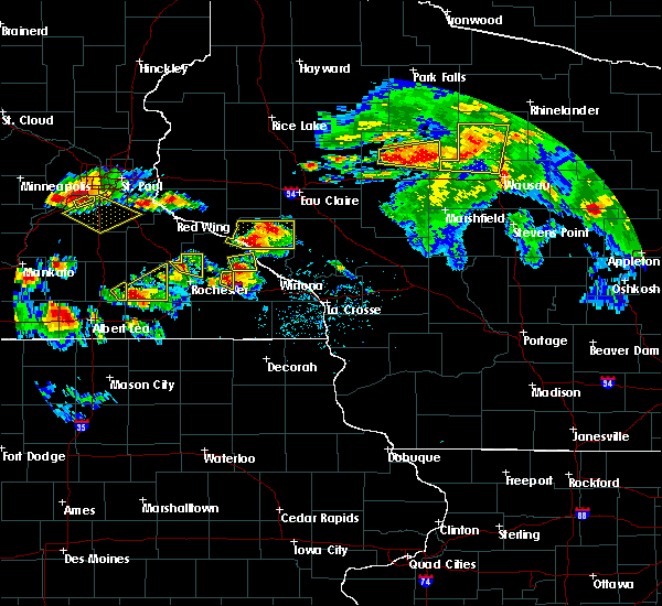 At 452 pm cdt, a severe thunderstorm was located 12 miles west of medford, moving east at 25 mph (radar indicated). Hazards include 60 mph wind gusts and quarter size hail. Hail damage to vehicles is expected. expect wind damage to roofs, siding, and trees. this severe storm will be near, medford around 520 pm cdt. Other locations impacted by this severe thunderstorm include highway 13 and county road m, the taylor county airport, stetsonville, perkinstown, the miller dam flowage, county roads a and e and esadore lake. At 452 pm cdt, a severe thunderstorm was located 12 miles west of medford, moving east at 25 mph (radar indicated). Hazards include 60 mph wind gusts and quarter size hail. Hail damage to vehicles is expected. expect wind damage to roofs, siding, and trees. this severe storm will be near, medford around 520 pm cdt. Other locations impacted by this severe thunderstorm include highway 13 and county road m, the taylor county airport, stetsonville, perkinstown, the miller dam flowage, county roads a and e and esadore lake.
|
| 8/5/2019 4:43 PM CDT |
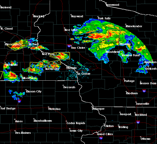 At 443 pm cdt, a severe thunderstorm was located 13 miles south of jump river, or 17 miles west of medford, moving east at 25 mph (radar indicated). Hazards include 60 mph wind gusts and quarter size hail. Hail damage to vehicles is expected. expect wind damage to roofs, siding, and trees. this severe thunderstorm will be near, medford and chelsea around 525 pm cdt. Other locations impacted by this severe thunderstorm include polley, gilman, highway 13 and county road m, the taylor county airport, stetsonville, perkinstown and the miller dam flowage. At 443 pm cdt, a severe thunderstorm was located 13 miles south of jump river, or 17 miles west of medford, moving east at 25 mph (radar indicated). Hazards include 60 mph wind gusts and quarter size hail. Hail damage to vehicles is expected. expect wind damage to roofs, siding, and trees. this severe thunderstorm will be near, medford and chelsea around 525 pm cdt. Other locations impacted by this severe thunderstorm include polley, gilman, highway 13 and county road m, the taylor county airport, stetsonville, perkinstown and the miller dam flowage.
|
| 8/5/2019 4:27 PM CDT |
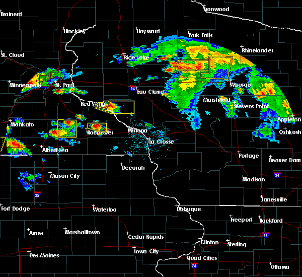 At 427 pm cdt, a severe thunderstorm was located over chelsea, or 10 miles north of medford, moving east at 25 mph (radar indicated). Hazards include 60 mph wind gusts. Expect damage to roofs, siding, and trees. this severe storm will be near, rib lake around 435 pm cdt. Other locations impacted by this severe thunderstorm include wood lake, north twin lake, the mondeaux flowage, highway 13 and county road m, perkinstown, county roads d and n and highway m and joe martin road. At 427 pm cdt, a severe thunderstorm was located over chelsea, or 10 miles north of medford, moving east at 25 mph (radar indicated). Hazards include 60 mph wind gusts. Expect damage to roofs, siding, and trees. this severe storm will be near, rib lake around 435 pm cdt. Other locations impacted by this severe thunderstorm include wood lake, north twin lake, the mondeaux flowage, highway 13 and county road m, perkinstown, county roads d and n and highway m and joe martin road.
|
| 8/5/2019 4:18 PM CDT |
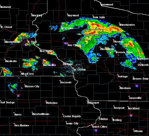 At 417 pm cdt, a severe thunderstorm was located over chelsea, or 9 miles north of medford, moving east at 45 mph (radar indicated). Hazards include 60 mph wind gusts and quarter size hail. Hail damage to vehicles is expected. expect wind damage to roofs, siding, and trees. this severe storm will be near, rib lake around 430 pm cdt. Other locations impacted by this severe thunderstorm include wood lake, north twin lake, the mondeaux flowage, highway 13 and county road m, perkinstown, county roads d and n and highway m and joe martin road. At 417 pm cdt, a severe thunderstorm was located over chelsea, or 9 miles north of medford, moving east at 45 mph (radar indicated). Hazards include 60 mph wind gusts and quarter size hail. Hail damage to vehicles is expected. expect wind damage to roofs, siding, and trees. this severe storm will be near, rib lake around 430 pm cdt. Other locations impacted by this severe thunderstorm include wood lake, north twin lake, the mondeaux flowage, highway 13 and county road m, perkinstown, county roads d and n and highway m and joe martin road.
|
| 8/5/2019 4:10 PM CDT |
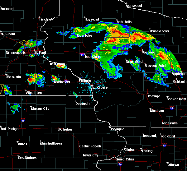 At 409 pm cdt, a severe thunderstorm was located 9 miles west of chelsea, or 12 miles northwest of medford, moving east at 30 mph (radar indicated). Hazards include 60 mph wind gusts and quarter size hail. Hail damage to vehicles is expected. expect wind damage to roofs, siding, and trees. this severe storm will be near, chelsea and westboro around 430 pm cdt. rib lake around 440 pm cdt. Other locations impacted by this severe thunderstorm include wood lake, north twin lake, the mondeaux flowage, highway 13 and county road m, perkinstown, the miller dam flowage and county roads d and n. At 409 pm cdt, a severe thunderstorm was located 9 miles west of chelsea, or 12 miles northwest of medford, moving east at 30 mph (radar indicated). Hazards include 60 mph wind gusts and quarter size hail. Hail damage to vehicles is expected. expect wind damage to roofs, siding, and trees. this severe storm will be near, chelsea and westboro around 430 pm cdt. rib lake around 440 pm cdt. Other locations impacted by this severe thunderstorm include wood lake, north twin lake, the mondeaux flowage, highway 13 and county road m, perkinstown, the miller dam flowage and county roads d and n.
|
| 8/5/2019 4:03 PM CDT |
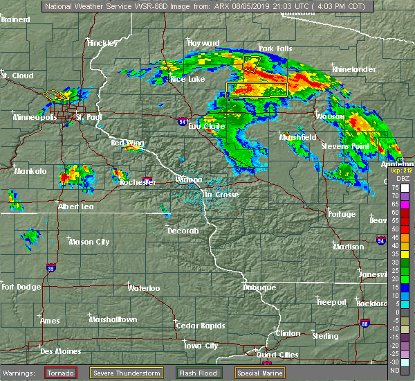 At 403 pm cdt, a severe thunderstorm was located 10 miles southeast of jump river, or 15 miles northwest of medford, moving east at 30 mph (radar indicated). Hazards include 60 mph wind gusts and quarter size hail. Hail damage to vehicles is expected. expect wind damage to roofs, siding, and trees. this severe storm will be near, chelsea around 430 pm cdt. westboro around 435 pm cdt. rib lake around 445 pm cdt. Other locations impacted by this severe thunderstorm include wood lake, the mondeaux flowage, highway 13 and county road m, perkinstown, highway m and joe martin road, esadore lake and camp forest spring. At 403 pm cdt, a severe thunderstorm was located 10 miles southeast of jump river, or 15 miles northwest of medford, moving east at 30 mph (radar indicated). Hazards include 60 mph wind gusts and quarter size hail. Hail damage to vehicles is expected. expect wind damage to roofs, siding, and trees. this severe storm will be near, chelsea around 430 pm cdt. westboro around 435 pm cdt. rib lake around 445 pm cdt. Other locations impacted by this severe thunderstorm include wood lake, the mondeaux flowage, highway 13 and county road m, perkinstown, highway m and joe martin road, esadore lake and camp forest spring.
|
| 8/5/2019 3:53 PM CDT |
 At 353 pm cdt, a severe thunderstorm was located 8 miles southeast of jump river, or 19 miles northwest of medford, moving east at 25 mph (radar indicated). Hazards include 60 mph wind gusts and quarter size hail. Hail damage to vehicles is expected. expect wind damage to roofs, siding, and trees. this severe storm will be near, chelsea and westboro around 445 pm cdt. rib lake around 500 pm cdt. Other locations impacted by this severe thunderstorm include wood lake, the mondeaux flowage, highway 13 and county road m, perkinstown, highway m and joe martin road, esadore lake and camp forest spring. At 353 pm cdt, a severe thunderstorm was located 8 miles southeast of jump river, or 19 miles northwest of medford, moving east at 25 mph (radar indicated). Hazards include 60 mph wind gusts and quarter size hail. Hail damage to vehicles is expected. expect wind damage to roofs, siding, and trees. this severe storm will be near, chelsea and westboro around 445 pm cdt. rib lake around 500 pm cdt. Other locations impacted by this severe thunderstorm include wood lake, the mondeaux flowage, highway 13 and county road m, perkinstown, highway m and joe martin road, esadore lake and camp forest spring.
|
| 8/5/2019 3:49 PM CDT |
 At 349 pm cdt, a severe thunderstorm was located 7 miles south of jump river, or 21 miles west of medford, moving east at 25 mph (radar indicated). Hazards include 60 mph wind gusts and quarter size hail. Hail damage to vehicles is expected. expect wind damage to roofs, siding, and trees. this severe storm will be near, chelsea and westboro around 445 pm cdt. rib lake around 500 pm cdt. Other locations impacted by this severe thunderstorm include wood lake, the mondeaux flowage, highway 13 and county road m, perkinstown, highway m and joe martin road, esadore lake and camp forest spring. At 349 pm cdt, a severe thunderstorm was located 7 miles south of jump river, or 21 miles west of medford, moving east at 25 mph (radar indicated). Hazards include 60 mph wind gusts and quarter size hail. Hail damage to vehicles is expected. expect wind damage to roofs, siding, and trees. this severe storm will be near, chelsea and westboro around 445 pm cdt. rib lake around 500 pm cdt. Other locations impacted by this severe thunderstorm include wood lake, the mondeaux flowage, highway 13 and county road m, perkinstown, highway m and joe martin road, esadore lake and camp forest spring.
|
| 8/5/2019 3:44 PM CDT |
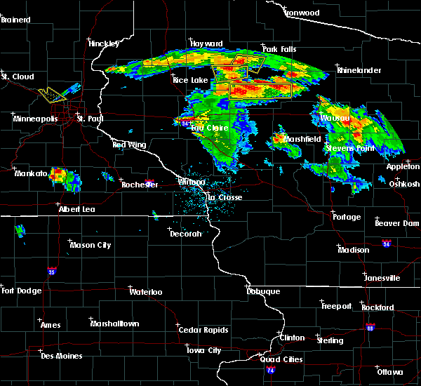 At 343 pm cdt, a severe thunderstorm was located 7 miles south of jump river, or 20 miles southeast of ladysmith, moving east at 25 mph (radar indicated). Hazards include 60 mph wind gusts and quarter size hail. Hail damage to vehicles is expected. expect wind damage to roofs, siding, and trees. this severe thunderstorm will be near, chelsea around 440 pm cdt. westboro around 445 pm cdt. rib lake around 500 pm cdt. Other locations impacted by this severe thunderstorm include wood lake, the mondeaux flowage, highway 13 and county road m, perkinstown, highway m and joe martin road, esadore lake and camp forest spring. At 343 pm cdt, a severe thunderstorm was located 7 miles south of jump river, or 20 miles southeast of ladysmith, moving east at 25 mph (radar indicated). Hazards include 60 mph wind gusts and quarter size hail. Hail damage to vehicles is expected. expect wind damage to roofs, siding, and trees. this severe thunderstorm will be near, chelsea around 440 pm cdt. westboro around 445 pm cdt. rib lake around 500 pm cdt. Other locations impacted by this severe thunderstorm include wood lake, the mondeaux flowage, highway 13 and county road m, perkinstown, highway m and joe martin road, esadore lake and camp forest spring.
|
| 7/19/2019 7:51 PM CDT |
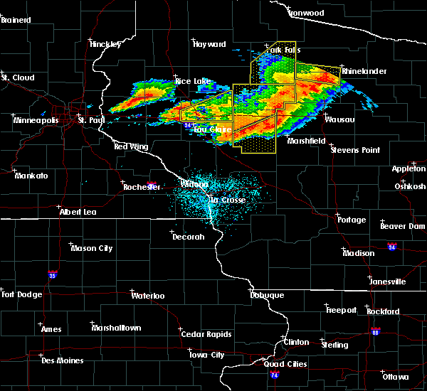 At 750 pm cdt, severe thunderstorms were located along a line extending from 8 miles southwest of new wood wildlife area to 7 miles northeast of spencer to 6 miles north of neillsville, moving southeast at 45 mph. these are very dangerous storms (public. at 737 pm, numerous downed tree limbs were reported in owen). Hazards include 80 mph wind gusts and quarter size hail. Flying debris will be dangerous to those caught without shelter. mobile homes will be heavily damaged. expect considerable damage to roofs, windows, and vehicles. extensive tree damage and power outages are likely. These severe thunderstorms will remain over mainly rural areas of northern clark and eastern taylor counties, including the following locations, mead lake, wood lake, highway 13 and county road m, stetsonville, county roads a and e, highway m and joe martin road and esadore lake. At 750 pm cdt, severe thunderstorms were located along a line extending from 8 miles southwest of new wood wildlife area to 7 miles northeast of spencer to 6 miles north of neillsville, moving southeast at 45 mph. these are very dangerous storms (public. at 737 pm, numerous downed tree limbs were reported in owen). Hazards include 80 mph wind gusts and quarter size hail. Flying debris will be dangerous to those caught without shelter. mobile homes will be heavily damaged. expect considerable damage to roofs, windows, and vehicles. extensive tree damage and power outages are likely. These severe thunderstorms will remain over mainly rural areas of northern clark and eastern taylor counties, including the following locations, mead lake, wood lake, highway 13 and county road m, stetsonville, county roads a and e, highway m and joe martin road and esadore lake.
|
| 7/19/2019 7:40 PM CDT |
 At 657 pm cdt, severe thunderstorms were located along a line extending from 13 miles southeast of jump river to near eau claire, moving east at 50 mph. these are very dangerous storms (trained weather spotters. these storms are causing widespread damage to trees and power lines). Hazards include 80 mph wind gusts and ping pong ball size hail. Flying debris will be dangerous to those caught without shelter. mobile homes will be heavily damaged. expect considerable damage to roofs, windows, and vehicles. extensive tree damage and power outages are likely. these severe storms will be near, thorp and chelsea around 710 pm cdt. medford around 715 pm cdt. owen around 720 pm cdt. abbotsford around 735 pm cdt. Other locations impacted by these severe thunderstorms include polley, the mondeaux flowage, perkinstown, highway m and joe martin road, esadore lake, eidsvold and longwood. At 657 pm cdt, severe thunderstorms were located along a line extending from 13 miles southeast of jump river to near eau claire, moving east at 50 mph. these are very dangerous storms (trained weather spotters. these storms are causing widespread damage to trees and power lines). Hazards include 80 mph wind gusts and ping pong ball size hail. Flying debris will be dangerous to those caught without shelter. mobile homes will be heavily damaged. expect considerable damage to roofs, windows, and vehicles. extensive tree damage and power outages are likely. these severe storms will be near, thorp and chelsea around 710 pm cdt. medford around 715 pm cdt. owen around 720 pm cdt. abbotsford around 735 pm cdt. Other locations impacted by these severe thunderstorms include polley, the mondeaux flowage, perkinstown, highway m and joe martin road, esadore lake, eidsvold and longwood.
|
| 7/19/2019 7:18 PM CDT |
 At 717 pm cdt, severe thunderstorms were located along a line extending from 7 miles west of chelsea to near owen to 8 miles northeast of augusta, moving east at 60 mph. these are very dangerous storms (trained weather spotters. these storms have a history of producing widespread damage to trees and power lines). Hazards include 80 mph wind gusts and ping pong ball size hail. Flying debris will be dangerous to those caught without shelter. mobile homes will be heavily damaged. expect considerable damage to roofs, windows, and vehicles. extensive tree damage and power outages are likely. these severe storms will be near, chelsea and westboro around 725 pm cdt. rib lake and dorchester around 730 pm cdt. abbotsford around 735 pm cdt. Other locations impacted by these severe thunderstorms include polley, the mondeaux flowage, perkinstown, highway m and joe martin road, esadore lake, eidsvold and longwood. At 717 pm cdt, severe thunderstorms were located along a line extending from 7 miles west of chelsea to near owen to 8 miles northeast of augusta, moving east at 60 mph. these are very dangerous storms (trained weather spotters. these storms have a history of producing widespread damage to trees and power lines). Hazards include 80 mph wind gusts and ping pong ball size hail. Flying debris will be dangerous to those caught without shelter. mobile homes will be heavily damaged. expect considerable damage to roofs, windows, and vehicles. extensive tree damage and power outages are likely. these severe storms will be near, chelsea and westboro around 725 pm cdt. rib lake and dorchester around 730 pm cdt. abbotsford around 735 pm cdt. Other locations impacted by these severe thunderstorms include polley, the mondeaux flowage, perkinstown, highway m and joe martin road, esadore lake, eidsvold and longwood.
|
| 7/19/2019 6:58 PM CDT |
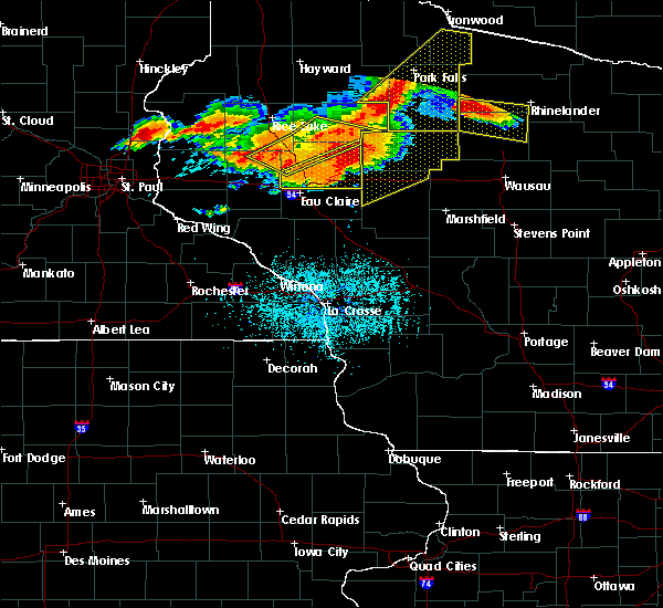 At 657 pm cdt, severe thunderstorms were located along a line extending from 13 miles southeast of jump river to near eau claire, moving east at 50 mph. these are very dangerous storms (trained weather spotters. these storms are causing widespread damage to trees and power lines). Hazards include 80 mph wind gusts and ping pong ball size hail. Flying debris will be dangerous to those caught without shelter. mobile homes will be heavily damaged. expect considerable damage to roofs, windows, and vehicles. extensive tree damage and power outages are likely. these severe storms will be near, thorp and chelsea around 710 pm cdt. medford around 715 pm cdt. owen around 720 pm cdt. abbotsford around 735 pm cdt. Other locations impacted by these severe thunderstorms include polley, the mondeaux flowage, perkinstown, highway m and joe martin road, esadore lake, eidsvold and longwood. At 657 pm cdt, severe thunderstorms were located along a line extending from 13 miles southeast of jump river to near eau claire, moving east at 50 mph. these are very dangerous storms (trained weather spotters. these storms are causing widespread damage to trees and power lines). Hazards include 80 mph wind gusts and ping pong ball size hail. Flying debris will be dangerous to those caught without shelter. mobile homes will be heavily damaged. expect considerable damage to roofs, windows, and vehicles. extensive tree damage and power outages are likely. these severe storms will be near, thorp and chelsea around 710 pm cdt. medford around 715 pm cdt. owen around 720 pm cdt. abbotsford around 735 pm cdt. Other locations impacted by these severe thunderstorms include polley, the mondeaux flowage, perkinstown, highway m and joe martin road, esadore lake, eidsvold and longwood.
|
| 7/19/2019 6:37 PM CDT |
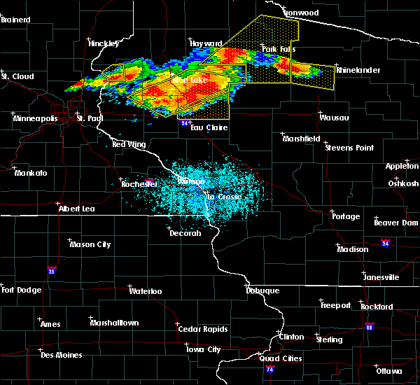 At 636 pm cdt, severe thunderstorms were located along a line extending from sheldon to near colfax, moving southeast at 45 mph. these are very dangerous storms (trained weather spotters. these storms have a history of blowing down large trees). Hazards include 80 mph wind gusts and ping pong ball size hail. Flying debris will be dangerous to those caught without shelter. mobile homes will be heavily damaged. expect considerable damage to roofs, windows, and vehicles. extensive tree damage and power outages are likely. severe thunderstorms will be near, jump river around 645 pm cdt. medford around 720 pm cdt. Other locations impacted by these severe thunderstorms include polley, the mondeaux flowage, perkinstown, highway m and joe martin road, esadore lake, eidsvold and longwood. At 636 pm cdt, severe thunderstorms were located along a line extending from sheldon to near colfax, moving southeast at 45 mph. these are very dangerous storms (trained weather spotters. these storms have a history of blowing down large trees). Hazards include 80 mph wind gusts and ping pong ball size hail. Flying debris will be dangerous to those caught without shelter. mobile homes will be heavily damaged. expect considerable damage to roofs, windows, and vehicles. extensive tree damage and power outages are likely. severe thunderstorms will be near, jump river around 645 pm cdt. medford around 720 pm cdt. Other locations impacted by these severe thunderstorms include polley, the mondeaux flowage, perkinstown, highway m and joe martin road, esadore lake, eidsvold and longwood.
|
| 7/15/2019 8:20 PM CDT |
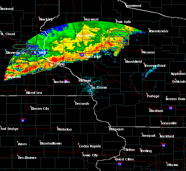 At 820 pm cdt, a severe thunderstorm was located over rib lake, or 11 miles northeast of medford, moving east at 50 mph (radar indicated). Hazards include 60 mph wind gusts and penny size hail. Expect damage to roofs, siding, and trees. This severe thunderstorm will remain over mainly rural areas of northeastern taylor county, including the following locations, wood lake, north twin lake, the mondeaux flowage, highway 13 and county road m, county roads d and n, highway m and joe martin road and camp forest spring. At 820 pm cdt, a severe thunderstorm was located over rib lake, or 11 miles northeast of medford, moving east at 50 mph (radar indicated). Hazards include 60 mph wind gusts and penny size hail. Expect damage to roofs, siding, and trees. This severe thunderstorm will remain over mainly rural areas of northeastern taylor county, including the following locations, wood lake, north twin lake, the mondeaux flowage, highway 13 and county road m, county roads d and n, highway m and joe martin road and camp forest spring.
|
| 7/15/2019 8:02 PM CDT |
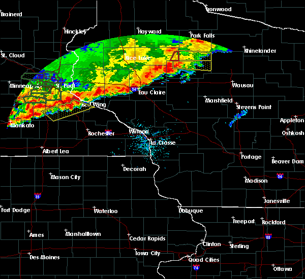 At 802 pm cdt, a severe thunderstorm was located 9 miles west of chelsea, or 15 miles northwest of medford, moving east at 55 mph (radar indicated). Hazards include 60 mph wind gusts and penny size hail. Expect damage to roofs, siding, and trees. this severe storm will be near, chelsea and westboro around 815 pm cdt. rib lake around 820 pm cdt. Other locations impacted by this severe thunderstorm include wood lake, north twin lake, the mondeaux flowage, highway 13 and county road m, county roads d and n, highway m and joe martin road and hannibal. At 802 pm cdt, a severe thunderstorm was located 9 miles west of chelsea, or 15 miles northwest of medford, moving east at 55 mph (radar indicated). Hazards include 60 mph wind gusts and penny size hail. Expect damage to roofs, siding, and trees. this severe storm will be near, chelsea and westboro around 815 pm cdt. rib lake around 820 pm cdt. Other locations impacted by this severe thunderstorm include wood lake, north twin lake, the mondeaux flowage, highway 13 and county road m, county roads d and n, highway m and joe martin road and hannibal.
|
| 7/15/2019 7:46 PM CDT |
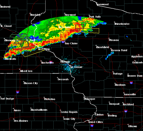 At 746 pm cdt, a severe thunderstorm was located over jump river, or 18 miles southeast of ladysmith, moving east at 55 mph (radar indicated). Hazards include 60 mph wind gusts and penny size hail. Expect damage to roofs, siding, and trees. this severe thunderstorm will be near, chelsea and westboro around 810 pm cdt. rib lake around 815 pm cdt. Other locations impacted by this severe thunderstorm include wood lake, north twin lake, the mondeaux flowage, highway 13 and county road m, county roads d and n, highway m and joe martin road and hannibal. At 746 pm cdt, a severe thunderstorm was located over jump river, or 18 miles southeast of ladysmith, moving east at 55 mph (radar indicated). Hazards include 60 mph wind gusts and penny size hail. Expect damage to roofs, siding, and trees. this severe thunderstorm will be near, chelsea and westboro around 810 pm cdt. rib lake around 815 pm cdt. Other locations impacted by this severe thunderstorm include wood lake, north twin lake, the mondeaux flowage, highway 13 and county road m, county roads d and n, highway m and joe martin road and hannibal.
|
| 7/12/2018 8:51 PM CDT |
 At 851 pm cdt, severe thunderstorms were located along a line extending from near rib lake to near shortville, moving east at 35 mph (law enforcement). Hazards include 60 mph wind gusts. Expect damage to roofs, siding, and trees. these severe storms will be near, rib lake around 855 pm cdt. Other locations impacted by these severe thunderstorms include lynn, longwood, stetsonville, goodrich and withee. At 851 pm cdt, severe thunderstorms were located along a line extending from near rib lake to near shortville, moving east at 35 mph (law enforcement). Hazards include 60 mph wind gusts. Expect damage to roofs, siding, and trees. these severe storms will be near, rib lake around 855 pm cdt. Other locations impacted by these severe thunderstorms include lynn, longwood, stetsonville, goodrich and withee.
|
| 7/12/2018 8:39 PM CDT |
 At 839 pm cdt, severe thunderstorms were located along a line extending from near rib lake to near neillsville, moving east at 35 mph (law enforcement). Hazards include 60 mph wind gusts. Expect damage to roofs, siding, and trees. severe thunderstorms will be near, rib lake, westboro and chelsea around 845 pm cdt. Other locations impacted by these severe thunderstorms include lynn, longwood, stetsonville, goodrich and willard. At 839 pm cdt, severe thunderstorms were located along a line extending from near rib lake to near neillsville, moving east at 35 mph (law enforcement). Hazards include 60 mph wind gusts. Expect damage to roofs, siding, and trees. severe thunderstorms will be near, rib lake, westboro and chelsea around 845 pm cdt. Other locations impacted by these severe thunderstorms include lynn, longwood, stetsonville, goodrich and willard.
|
| 7/12/2018 8:15 PM CDT |
 At 813 pm cdt, severe thunderstorms were located along a line extending from 11 miles south of catawba to near fairchild, moving east at 35 mph (trained weather spotters). Hazards include 65 mph wind gusts. Expect damage to roofs, siding, and trees. these severe storms will be near, chelsea around 830 pm cdt. westboro around 835 pm cdt. neillsville and rib lake around 840 pm cdt. trees and powerlines were reported blown down in chippewa county. Other locations impacted by these severe thunderstorms include lynn, longwood, reseburg, stetsonville and goodrich. At 813 pm cdt, severe thunderstorms were located along a line extending from 11 miles south of catawba to near fairchild, moving east at 35 mph (trained weather spotters). Hazards include 65 mph wind gusts. Expect damage to roofs, siding, and trees. these severe storms will be near, chelsea around 830 pm cdt. westboro around 835 pm cdt. neillsville and rib lake around 840 pm cdt. trees and powerlines were reported blown down in chippewa county. Other locations impacted by these severe thunderstorms include lynn, longwood, reseburg, stetsonville and goodrich.
|
| 7/12/2018 8:02 PM CDT |
 At 802 pm cdt, severe thunderstorms were located along a line extending from 7 miles east of jump river to price, moving east at 35 mph (trained weather spotters). Hazards include 60 mph wind gusts. Expect damage to roofs, siding, and trees. these severe storms will be near, westboro and chelsea around 830 pm cdt. neillsville and rib lake around 840 pm cdt. Other locations impacted by these severe thunderstorms include lynn, longwood, reseburg, stetsonville and goodrich. At 802 pm cdt, severe thunderstorms were located along a line extending from 7 miles east of jump river to price, moving east at 35 mph (trained weather spotters). Hazards include 60 mph wind gusts. Expect damage to roofs, siding, and trees. these severe storms will be near, westboro and chelsea around 830 pm cdt. neillsville and rib lake around 840 pm cdt. Other locations impacted by these severe thunderstorms include lynn, longwood, reseburg, stetsonville and goodrich.
|
| 7/12/2018 7:55 PM CDT |
 At 752 pm cdt, severe thunderstorms were located along a line extending from near jump river to near osseo, moving east at 35 mph (a trained weather spotter 5 west of gilman reported a measured wind gust of 65 mph at 751 pm). Hazards include 60 mph wind gusts. Expect damage to roofs, siding, and trees. these severe storms will be near, jump river around 800 pm cdt. westboro and chelsea around 830 pm cdt. neillsville and rib lake around 840 pm cdt. Other locations impacted by these severe thunderstorms include lynn, longwood, reseburg, stetsonville and goodrich. At 752 pm cdt, severe thunderstorms were located along a line extending from near jump river to near osseo, moving east at 35 mph (a trained weather spotter 5 west of gilman reported a measured wind gust of 65 mph at 751 pm). Hazards include 60 mph wind gusts. Expect damage to roofs, siding, and trees. these severe storms will be near, jump river around 800 pm cdt. westboro and chelsea around 830 pm cdt. neillsville and rib lake around 840 pm cdt. Other locations impacted by these severe thunderstorms include lynn, longwood, reseburg, stetsonville and goodrich.
|
| 7/12/2018 7:43 PM CDT |
 At 741 pm cdt, severe thunderstorms were located along a line extending from 6 miles northwest of jump river to near osseo, moving east at 35 mph (radar indicated). Hazards include 60 mph wind gusts. Expect damage to roofs, siding, and trees. severe thunderstorms will be near, jump river around 750 pm cdt. westboro and chelsea around 830 pm cdt. neillsville and rib lake around 840 pm cdt. Other locations impacted by these severe thunderstorms include lynn, longwood, reseburg, stetsonville and goodrich. At 741 pm cdt, severe thunderstorms were located along a line extending from 6 miles northwest of jump river to near osseo, moving east at 35 mph (radar indicated). Hazards include 60 mph wind gusts. Expect damage to roofs, siding, and trees. severe thunderstorms will be near, jump river around 750 pm cdt. westboro and chelsea around 830 pm cdt. neillsville and rib lake around 840 pm cdt. Other locations impacted by these severe thunderstorms include lynn, longwood, reseburg, stetsonville and goodrich.
|
| 6/17/2018 7:41 PM CDT |
 At 740 pm cdt, severe thunderstorms were located along a line extending from chelsea to near medford to 10 miles northwest of dorchester, moving east at 35 mph (radar indicated). Hazards include 70 mph wind gusts. Expect considerable tree damage. damage is likely to mobile homes, roofs, and outbuildings. these severe storms will be near, chelsea and westboro around 745 pm cdt. rib lake around 750 pm cdt. Other locations impacted by these severe thunderstorms include stetsonville, goodrich, wood lake, highway 13 and county road m and the taylor county airport. At 740 pm cdt, severe thunderstorms were located along a line extending from chelsea to near medford to 10 miles northwest of dorchester, moving east at 35 mph (radar indicated). Hazards include 70 mph wind gusts. Expect considerable tree damage. damage is likely to mobile homes, roofs, and outbuildings. these severe storms will be near, chelsea and westboro around 745 pm cdt. rib lake around 750 pm cdt. Other locations impacted by these severe thunderstorms include stetsonville, goodrich, wood lake, highway 13 and county road m and the taylor county airport.
|
| 6/17/2018 7:19 PM CDT |
 At 719 pm cdt, severe thunderstorms were located along a line extending from 11 miles southeast of jump river to 13 miles west of medford to 12 miles northeast of thorp, moving east at 35 mph (radar indicated). Hazards include 70 mph wind gusts. Expect considerable tree damage. damage is likely to mobile homes, roofs, and outbuildings. these severe storms will be near, chelsea and westboro around 740 pm cdt. medford around 745 pm cdt. rib lake around 750 pm cdt. Other locations impacted by these severe thunderstorms include stetsonville, goodrich, gilman, lublin and wood lake. At 719 pm cdt, severe thunderstorms were located along a line extending from 11 miles southeast of jump river to 13 miles west of medford to 12 miles northeast of thorp, moving east at 35 mph (radar indicated). Hazards include 70 mph wind gusts. Expect considerable tree damage. damage is likely to mobile homes, roofs, and outbuildings. these severe storms will be near, chelsea and westboro around 740 pm cdt. medford around 745 pm cdt. rib lake around 750 pm cdt. Other locations impacted by these severe thunderstorms include stetsonville, goodrich, gilman, lublin and wood lake.
|
| 6/17/2018 7:01 PM CDT |
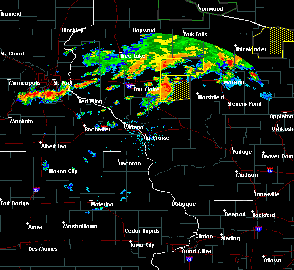 At 701 pm cdt, severe thunderstorms were located along a line extending from near jump river to 10 miles southeast of sheldon to 10 miles north of stanley, moving east at 35 mph (radar indicated). Hazards include 70 mph wind gusts. Expect considerable tree damage. damage is likely to mobile homes, roofs, and outbuildings. severe thunderstorms will be near, chelsea and westboro around 740 pm cdt. medford around 745 pm cdt. rib lake around 750 pm cdt. Other locations impacted by these severe thunderstorms include stetsonville, goodrich, gilman, lublin and wood lake. At 701 pm cdt, severe thunderstorms were located along a line extending from near jump river to 10 miles southeast of sheldon to 10 miles north of stanley, moving east at 35 mph (radar indicated). Hazards include 70 mph wind gusts. Expect considerable tree damage. damage is likely to mobile homes, roofs, and outbuildings. severe thunderstorms will be near, chelsea and westboro around 740 pm cdt. medford around 745 pm cdt. rib lake around 750 pm cdt. Other locations impacted by these severe thunderstorms include stetsonville, goodrich, gilman, lublin and wood lake.
|
| 5/25/2018 5:56 PM CDT |
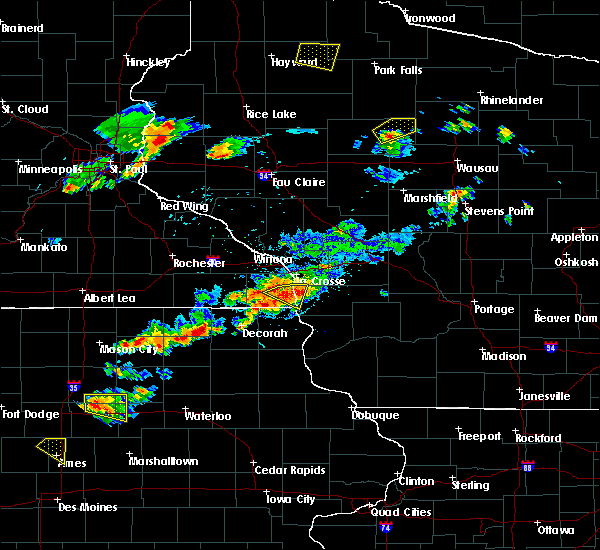 At 555 pm cdt, a severe thunderstorm was located near chelsea, or near medford, moving northeast at 30 mph (radar indicated). Hazards include quarter size hail. Damage to vehicles is expected. this severe storm will be near, chelsea around 605 pm cdt. westboro around 610 pm cdt. rib lake around 615 pm cdt. other locations impacted by this severe thunderstorm include highway m and joe martin road, camp forest spring, wood lake, highway 13 and county road m and north twin lake. This storm has recently weakened but another storm is rapidly developing across central taylor county which may become capable of producing quarter sized hail. At 555 pm cdt, a severe thunderstorm was located near chelsea, or near medford, moving northeast at 30 mph (radar indicated). Hazards include quarter size hail. Damage to vehicles is expected. this severe storm will be near, chelsea around 605 pm cdt. westboro around 610 pm cdt. rib lake around 615 pm cdt. other locations impacted by this severe thunderstorm include highway m and joe martin road, camp forest spring, wood lake, highway 13 and county road m and north twin lake. This storm has recently weakened but another storm is rapidly developing across central taylor county which may become capable of producing quarter sized hail.
|
| 5/25/2018 5:37 PM CDT |
 At 537 pm cdt, a severe thunderstorm was located 7 miles west of medford, moving northeast at 30 mph (radar indicated). Hazards include half dollar size hail. Damage to vehicles is expected. this severe thunderstorm will be near, medford around 550 pm cdt. chelsea around 605 pm cdt. westboro around 610 pm cdt. rib lake around 620 pm cdt. Other locations impacted by this severe thunderstorm include wood lake, north twin lake, highway 13 and county road m, the taylor county airport and county roads a and e. At 537 pm cdt, a severe thunderstorm was located 7 miles west of medford, moving northeast at 30 mph (radar indicated). Hazards include half dollar size hail. Damage to vehicles is expected. this severe thunderstorm will be near, medford around 550 pm cdt. chelsea around 605 pm cdt. westboro around 610 pm cdt. rib lake around 620 pm cdt. Other locations impacted by this severe thunderstorm include wood lake, north twin lake, highway 13 and county road m, the taylor county airport and county roads a and e.
|
| 6/11/2017 8:40 PM CDT |
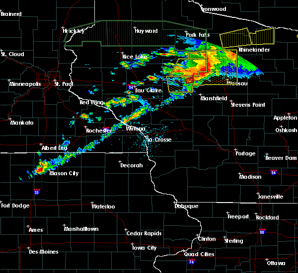 The severe thunderstorm warning for northeastern clark and taylor counties will expire at 845 pm cdt, the storms which prompted the warning have moved out of the area. therefore the warning will be allowed to expire. a severe thunderstorm watch remains in effect until 300 am cdt for central and north central wisconsin. The severe thunderstorm warning for northeastern clark and taylor counties will expire at 845 pm cdt, the storms which prompted the warning have moved out of the area. therefore the warning will be allowed to expire. a severe thunderstorm watch remains in effect until 300 am cdt for central and north central wisconsin.
|
| 6/11/2017 8:30 PM CDT |
 At 829 pm cdt, severe thunderstorms were located along a line extending from near new wood wildlife area to 7 miles east of dorchester, moving east at 50 mph. these storms have a history of producing tree damage (law enforcement). Hazards include 60 mph wind gusts and penny size hail. Expect damage to roofs, siding, and trees. These severe thunderstorms will remain over mainly rural areas of northeastern clark and taylor counties, including the following locations: stetsonville, goodrich, lublin, perkinstown and esadore lake. At 829 pm cdt, severe thunderstorms were located along a line extending from near new wood wildlife area to 7 miles east of dorchester, moving east at 50 mph. these storms have a history of producing tree damage (law enforcement). Hazards include 60 mph wind gusts and penny size hail. Expect damage to roofs, siding, and trees. These severe thunderstorms will remain over mainly rural areas of northeastern clark and taylor counties, including the following locations: stetsonville, goodrich, lublin, perkinstown and esadore lake.
|
| 6/11/2017 7:51 PM CDT |
 At 750 pm cdt, severe thunderstorms were located along a line extending from 11 miles east of jump river to 6 miles north of thorp, moving east at 40 mph (law enforcement. at 745 pm cdt, an estimated 60 mph wind gust was reported in gilman). Hazards include 60 mph wind gusts and penny size hail. Expect damage to roofs, siding, and trees. these severe storms will be near, westboro and chelsea around 810 pm cdt. rib lake around 820 pm cdt. medford around 825 pm cdt. Other locations impacted by these severe thunderstorms include stetsonville, goodrich, gilman, lublin and polley. At 750 pm cdt, severe thunderstorms were located along a line extending from 11 miles east of jump river to 6 miles north of thorp, moving east at 40 mph (law enforcement. at 745 pm cdt, an estimated 60 mph wind gust was reported in gilman). Hazards include 60 mph wind gusts and penny size hail. Expect damage to roofs, siding, and trees. these severe storms will be near, westboro and chelsea around 810 pm cdt. rib lake around 820 pm cdt. medford around 825 pm cdt. Other locations impacted by these severe thunderstorms include stetsonville, goodrich, gilman, lublin and polley.
|
| 6/11/2017 7:40 PM CDT |
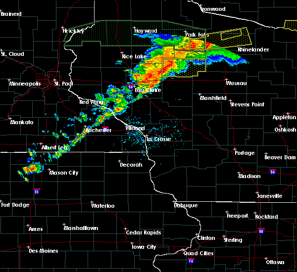 At 740 pm cdt, severe thunderstorms were located along a line extending from 6 miles east of jump river to near stanley, moving east at 40 mph (radar indicated). Hazards include 60 mph wind gusts and penny size hail. Expect damage to roofs, siding, and trees. severe thunderstorms will be near, chelsea around 805 pm cdt. westboro around 810 pm cdt. rib lake around 815 pm cdt. medford around 825 pm cdt. Other locations impacted by these severe thunderstorms include stetsonville, goodrich, gilman, lublin and polley. At 740 pm cdt, severe thunderstorms were located along a line extending from 6 miles east of jump river to near stanley, moving east at 40 mph (radar indicated). Hazards include 60 mph wind gusts and penny size hail. Expect damage to roofs, siding, and trees. severe thunderstorms will be near, chelsea around 805 pm cdt. westboro around 810 pm cdt. rib lake around 815 pm cdt. medford around 825 pm cdt. Other locations impacted by these severe thunderstorms include stetsonville, goodrich, gilman, lublin and polley.
|
| 6/11/2017 11:21 AM CDT |
 At 1120 am cdt, severe thunderstorms were located along a line extending from 7 miles southeast of catawba to rib lake to near medford to near owen, moving east at 55 mph (law enforcement. tree damage has been reported near thorp in northern clark county). Hazards include 60 mph wind gusts and quarter size hail. Hail damage to vehicles is expected. expect wind damage to roofs, siding, and trees. these severe storms will be near, rib lake around 1125 am cdt. Other locations impacted by these severe thunderstorms include colby, longwood, reseburg, stetsonville and goodrich. At 1120 am cdt, severe thunderstorms were located along a line extending from 7 miles southeast of catawba to rib lake to near medford to near owen, moving east at 55 mph (law enforcement. tree damage has been reported near thorp in northern clark county). Hazards include 60 mph wind gusts and quarter size hail. Hail damage to vehicles is expected. expect wind damage to roofs, siding, and trees. these severe storms will be near, rib lake around 1125 am cdt. Other locations impacted by these severe thunderstorms include colby, longwood, reseburg, stetsonville and goodrich.
|
| 6/11/2017 11:11 AM CDT |
 At 1110 am cdt, severe thunderstorms were located along a line extending from near hawkins to near chelsea to 7 miles west of medford to 6 miles southeast of thorp, moving east at 55 mph (radar indicated). Hazards include 70 mph wind gusts and half dollar size hail. Hail damage to vehicles is expected. expect considerable tree damage. wind damage is also likely to mobile homes, roofs, and outbuildings. these severe storms will be near, westboro and chelsea around 1115 am cdt. medford around 1120 am cdt. rib lake around 1125 am cdt. colby, abbotsford, abbotsford and dorchester around 1130 am cdt. Other locations impacted by these severe thunderstorms include colby, longwood, reseburg, stetsonville and goodrich. At 1110 am cdt, severe thunderstorms were located along a line extending from near hawkins to near chelsea to 7 miles west of medford to 6 miles southeast of thorp, moving east at 55 mph (radar indicated). Hazards include 70 mph wind gusts and half dollar size hail. Hail damage to vehicles is expected. expect considerable tree damage. wind damage is also likely to mobile homes, roofs, and outbuildings. these severe storms will be near, westboro and chelsea around 1115 am cdt. medford around 1120 am cdt. rib lake around 1125 am cdt. colby, abbotsford, abbotsford and dorchester around 1130 am cdt. Other locations impacted by these severe thunderstorms include colby, longwood, reseburg, stetsonville and goodrich.
|
| 6/11/2017 10:40 AM CDT |
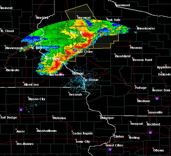 At 1039 am cdt, severe thunderstorms were located along a line extending from near bruce to near sheldon to near lake wissota, moving east at 60 mph (trained weather spotters. this line of storms has a history of producing damaging winds and large hail across western wisconsin). Hazards include 70 mph wind gusts and half dollar size hail. Hail damage to vehicles is expected. expect considerable tree damage. wind damage is also likely to mobile homes, roofs, and outbuildings. these severe storms will be near, jump river around 1050 am cdt. thorp around 1100 am cdt. westboro, owen and chelsea around 1110 am cdt. rib lake around 1115 am cdt. medford, dorchester, dorchester, abbotsford and abbotsford around 1125 am cdt. Other locations impacted by these severe thunderstorms include colby, longwood, reseburg, stetsonville and goodrich. At 1039 am cdt, severe thunderstorms were located along a line extending from near bruce to near sheldon to near lake wissota, moving east at 60 mph (trained weather spotters. this line of storms has a history of producing damaging winds and large hail across western wisconsin). Hazards include 70 mph wind gusts and half dollar size hail. Hail damage to vehicles is expected. expect considerable tree damage. wind damage is also likely to mobile homes, roofs, and outbuildings. these severe storms will be near, jump river around 1050 am cdt. thorp around 1100 am cdt. westboro, owen and chelsea around 1110 am cdt. rib lake around 1115 am cdt. medford, dorchester, dorchester, abbotsford and abbotsford around 1125 am cdt. Other locations impacted by these severe thunderstorms include colby, longwood, reseburg, stetsonville and goodrich.
|
| 6/11/2017 10:22 AM CDT |
 At 1019 am cdt, severe thunderstorms were located along a line extending from 6 miles west of weyerhaeuser to 9 miles northwest of cornell to near elk mound, moving east at 55 mph (trained weather spotters. this line of storms has a history of producing large hail and damaging winds). Hazards include golf ball size hail and 70 mph wind gusts. People and animals outdoors will be injured. expect hail damage to roofs, siding, windows, and vehicles. expect considerable tree damage. wind damage is also likely to mobile homes, roofs, and outbuildings. severe thunderstorms will be near, jump river around 1045 am cdt. thorp around 1100 am cdt. westboro, owen and chelsea around 1110 am cdt. rib lake around 1120 am cdt. medford, dorchester, dorchester and abbotsford around 1125 am cdt. Other locations impacted by these severe thunderstorms include colby, longwood, reseburg, stetsonville and goodrich. At 1019 am cdt, severe thunderstorms were located along a line extending from 6 miles west of weyerhaeuser to 9 miles northwest of cornell to near elk mound, moving east at 55 mph (trained weather spotters. this line of storms has a history of producing large hail and damaging winds). Hazards include golf ball size hail and 70 mph wind gusts. People and animals outdoors will be injured. expect hail damage to roofs, siding, windows, and vehicles. expect considerable tree damage. wind damage is also likely to mobile homes, roofs, and outbuildings. severe thunderstorms will be near, jump river around 1045 am cdt. thorp around 1100 am cdt. westboro, owen and chelsea around 1110 am cdt. rib lake around 1120 am cdt. medford, dorchester, dorchester and abbotsford around 1125 am cdt. Other locations impacted by these severe thunderstorms include colby, longwood, reseburg, stetsonville and goodrich.
|
| 5/17/2017 7:25 PM CDT |
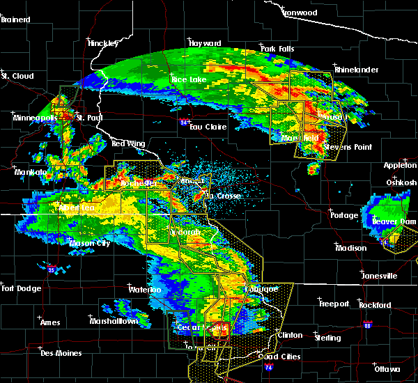 At 725 pm cdt, severe thunderstorms were located along a line extending from near catawba to near rib lake to 8 miles southwest of new wood wildlife area, moving northeast at 55 mph (trained weather spotters). Hazards include 60 mph wind gusts. Expect damage to roofs, siding, and trees. these severe thunderstorms will remain over mainly rural areas of northeastern taylor county, including the following locations: goodrich, wood lake, the mondeaux flowage, highway 13 and county road m and highway m and joe martin road. A tornado watch remains in effect until 1100 pm cdt for north central wisconsin. At 725 pm cdt, severe thunderstorms were located along a line extending from near catawba to near rib lake to 8 miles southwest of new wood wildlife area, moving northeast at 55 mph (trained weather spotters). Hazards include 60 mph wind gusts. Expect damage to roofs, siding, and trees. these severe thunderstorms will remain over mainly rural areas of northeastern taylor county, including the following locations: goodrich, wood lake, the mondeaux flowage, highway 13 and county road m and highway m and joe martin road. A tornado watch remains in effect until 1100 pm cdt for north central wisconsin.
|
| 5/17/2017 7:17 PM CDT |
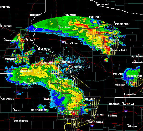 At 717 pm cdt, severe thunderstorms were located along a line extending from 6 miles southeast of hawkins to near chelsea to 13 miles east of medford, moving northeast at 55 mph (trained weather spotters). Hazards include 60 mph wind gusts. Expect damage to roofs, siding, and trees. these severe storms will be near, rib lake and westboro around 725 pm cdt. other locations impacted by these severe thunderstorms include goodrich, the mondeaux flowage, highway m and joe martin road, esadore lake and north twin lake. A tornado watch remains in effect until 1100 pm cdt for north central wisconsin. At 717 pm cdt, severe thunderstorms were located along a line extending from 6 miles southeast of hawkins to near chelsea to 13 miles east of medford, moving northeast at 55 mph (trained weather spotters). Hazards include 60 mph wind gusts. Expect damage to roofs, siding, and trees. these severe storms will be near, rib lake and westboro around 725 pm cdt. other locations impacted by these severe thunderstorms include goodrich, the mondeaux flowage, highway m and joe martin road, esadore lake and north twin lake. A tornado watch remains in effect until 1100 pm cdt for north central wisconsin.
|
| 5/17/2017 7:12 PM CDT |
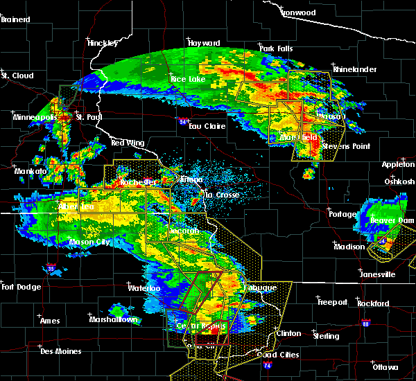 At 712 pm cdt, severe thunderstorms were located along a line extending from 6 miles east of jump river to near medford to 11 miles east of dorchester, moving northeast at 45 mph (trained weather spotters). Hazards include 60 mph wind gusts. Expect damage to roofs, siding, and trees. these severe storms will be near, chelsea around 720 pm cdt. rib lake and westboro around 730 pm cdt. other locations impacted by these severe thunderstorms include stetsonville, goodrich, perkinstown, esadore lake and county roads d and n. A tornado watch remains in effect until 1100 pm cdt for central and north central wisconsin. At 712 pm cdt, severe thunderstorms were located along a line extending from 6 miles east of jump river to near medford to 11 miles east of dorchester, moving northeast at 45 mph (trained weather spotters). Hazards include 60 mph wind gusts. Expect damage to roofs, siding, and trees. these severe storms will be near, chelsea around 720 pm cdt. rib lake and westboro around 730 pm cdt. other locations impacted by these severe thunderstorms include stetsonville, goodrich, perkinstown, esadore lake and county roads d and n. A tornado watch remains in effect until 1100 pm cdt for central and north central wisconsin.
|
| 5/17/2017 7:04 PM CDT |
 At 702 pm cdt, severe thunderstorms were located along a line extending from near jump river to near medford to 7 miles east of abbotsford, moving northeast at 55 mph (trained weather spotters. at 7 pm, the abbottsford fire department reported 60 mph). Hazards include 60 mph wind gusts. Expect damage to roofs, siding, and trees. these severe storms will be near, chelsea around 715 pm cdt. rib lake and westboro around 720 pm cdt. other locations impacted by these severe thunderstorms include colby, stetsonville, goodrich, withee and unity. A tornado watch remains in effect until 1100 pm cdt for central and north central wisconsin. At 702 pm cdt, severe thunderstorms were located along a line extending from near jump river to near medford to 7 miles east of abbotsford, moving northeast at 55 mph (trained weather spotters. at 7 pm, the abbottsford fire department reported 60 mph). Hazards include 60 mph wind gusts. Expect damage to roofs, siding, and trees. these severe storms will be near, chelsea around 715 pm cdt. rib lake and westboro around 720 pm cdt. other locations impacted by these severe thunderstorms include colby, stetsonville, goodrich, withee and unity. A tornado watch remains in effect until 1100 pm cdt for central and north central wisconsin.
|
| 5/17/2017 6:57 PM CDT |
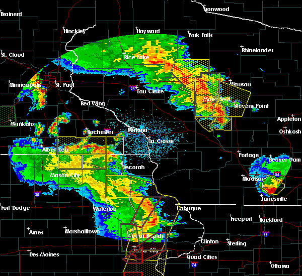 At 657 pm cdt, severe thunderstorms were located along a line extending from 7 miles south of jump river to near dorchester to near abbotsford, moving north at 45 mph (radar indicated). Hazards include 60 mph wind gusts. Expect damage to roofs, siding, and trees. these severe storms will be near, chelsea around 715 pm cdt. westboro and rib lake around 725 pm cdt. other locations impacted by these severe thunderstorms include colby, stetsonville, goodrich, withee and unity. A tornado watch remains in effect until 1100 pm cdt for central and north central wisconsin. At 657 pm cdt, severe thunderstorms were located along a line extending from 7 miles south of jump river to near dorchester to near abbotsford, moving north at 45 mph (radar indicated). Hazards include 60 mph wind gusts. Expect damage to roofs, siding, and trees. these severe storms will be near, chelsea around 715 pm cdt. westboro and rib lake around 725 pm cdt. other locations impacted by these severe thunderstorms include colby, stetsonville, goodrich, withee and unity. A tornado watch remains in effect until 1100 pm cdt for central and north central wisconsin.
|
| 5/17/2017 6:39 PM CDT |
 At 639 pm cdt, severe thunderstorms were located along a line extending from 8 miles west of greenwood to 6 miles southeast of owen to near spencer, moving northeast at 55 mph (radar indicated). Hazards include 60 mph wind gusts. Expect damage to roofs, siding, and trees. severe thunderstorms will be near, colby around 645 pm cdt. dorchester, dorchester, abbotsford and abbotsford around 650 pm cdt. medford around 700 pm cdt. chelsea around 710 pm cdt. rib lake around 715 pm cdt. westboro around 730 pm cdt. other locations impacted by these severe thunderstorms include colby, longwood, reseburg, stetsonville and goodrich. A tornado watch remains in effect until 1100 pm cdt for central and north central wisconsin. At 639 pm cdt, severe thunderstorms were located along a line extending from 8 miles west of greenwood to 6 miles southeast of owen to near spencer, moving northeast at 55 mph (radar indicated). Hazards include 60 mph wind gusts. Expect damage to roofs, siding, and trees. severe thunderstorms will be near, colby around 645 pm cdt. dorchester, dorchester, abbotsford and abbotsford around 650 pm cdt. medford around 700 pm cdt. chelsea around 710 pm cdt. rib lake around 715 pm cdt. westboro around 730 pm cdt. other locations impacted by these severe thunderstorms include colby, longwood, reseburg, stetsonville and goodrich. A tornado watch remains in effect until 1100 pm cdt for central and north central wisconsin.
|
| 5/16/2017 7:41 PM CDT |
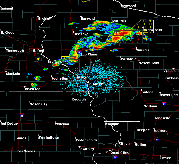 At 740 pm cdt, severe thunderstorms were located along a line extending from near tomahawk to 6 miles west of medford, moving east at 40 mph (trained weather spotters reported large hail with this storm as it moved through jump river). Hazards include 60 mph wind gusts and quarter size hail. Hail damage to vehicles is expected. expect wind damage to roofs, siding, and trees. these severe storms will be near, rib lake around 800 pm cdt. other locations impacted by these severe thunderstorms include goodrich, the mondeaux flowage, highway m and joe martin road, esadore lake and north twin lake. A tornado watch remains in effect until 1000 pm cdt for north central wisconsin. At 740 pm cdt, severe thunderstorms were located along a line extending from near tomahawk to 6 miles west of medford, moving east at 40 mph (trained weather spotters reported large hail with this storm as it moved through jump river). Hazards include 60 mph wind gusts and quarter size hail. Hail damage to vehicles is expected. expect wind damage to roofs, siding, and trees. these severe storms will be near, rib lake around 800 pm cdt. other locations impacted by these severe thunderstorms include goodrich, the mondeaux flowage, highway m and joe martin road, esadore lake and north twin lake. A tornado watch remains in effect until 1000 pm cdt for north central wisconsin.
|
| 5/16/2017 7:29 PM CDT |
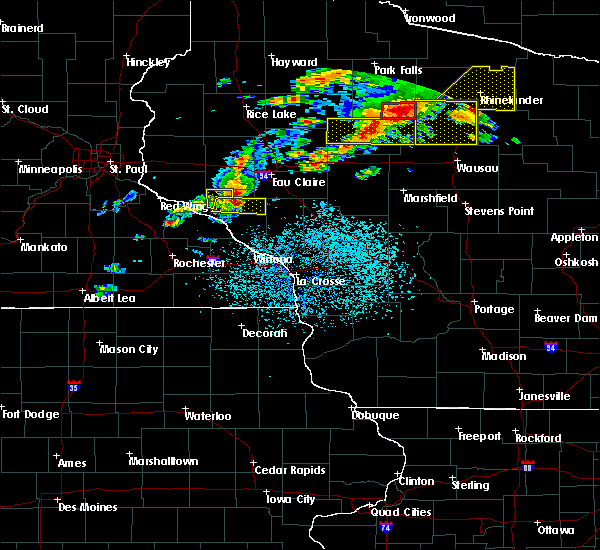 At 728 pm cdt, severe thunderstorms were located along a line extending from near tripoli to 13 miles west of medford, moving east at 40 mph (trained weather spotters. at 709 pm, quarter size hail was reported in jump river). Hazards include 60 mph wind gusts and half dollar size hail. Hail damage to vehicles is expected. expect wind damage to roofs, siding, and trees. these severe storms will be near, chelsea around 750 pm cdt. rib lake around 800 pm cdt. other locations impacted by these severe thunderstorms include goodrich, gilman, polley, the mondeaux flowage and perkinstown. A tornado watch remains in effect until 1000 pm cdt for north central wisconsin. At 728 pm cdt, severe thunderstorms were located along a line extending from near tripoli to 13 miles west of medford, moving east at 40 mph (trained weather spotters. at 709 pm, quarter size hail was reported in jump river). Hazards include 60 mph wind gusts and half dollar size hail. Hail damage to vehicles is expected. expect wind damage to roofs, siding, and trees. these severe storms will be near, chelsea around 750 pm cdt. rib lake around 800 pm cdt. other locations impacted by these severe thunderstorms include goodrich, gilman, polley, the mondeaux flowage and perkinstown. A tornado watch remains in effect until 1000 pm cdt for north central wisconsin.
|
| 5/16/2017 7:09 PM CDT |
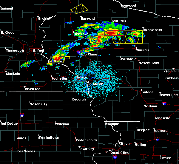 At 708 pm cdt, severe thunderstorms were located along a line extending from near prentice to 12 miles north of stanley, moving east at 30 mph (radar indicated). Hazards include 60 mph wind gusts and half dollar size hail. Hail damage to vehicles is expected. expect wind damage to roofs, siding, and trees. these severe storms will be near, medford around 755 pm cdt. chelsea around 800 pm cdt. other locations impacted by these severe thunderstorms include goodrich, gilman, polley, the mondeaux flowage and perkinstown. A tornado watch remains in effect until 1000 pm cdt for north central wisconsin. At 708 pm cdt, severe thunderstorms were located along a line extending from near prentice to 12 miles north of stanley, moving east at 30 mph (radar indicated). Hazards include 60 mph wind gusts and half dollar size hail. Hail damage to vehicles is expected. expect wind damage to roofs, siding, and trees. these severe storms will be near, medford around 755 pm cdt. chelsea around 800 pm cdt. other locations impacted by these severe thunderstorms include goodrich, gilman, polley, the mondeaux flowage and perkinstown. A tornado watch remains in effect until 1000 pm cdt for north central wisconsin.
|
| 5/16/2017 6:42 PM CDT |
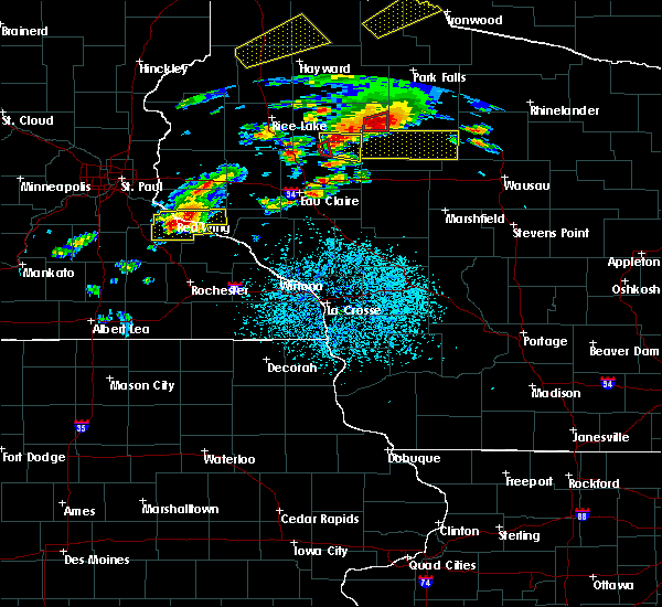 At 641 pm cdt, severe thunderstorms were located along a line extending from catawba to near cornell, moving east at 40 mph. these storms have a history of producing tornadoes (radar indicated). Hazards include 60 mph wind gusts and half dollar size hail. Hail damage to vehicles is expected. expect wind damage to roofs, siding, and trees. severe thunderstorms will be near, westboro around 700 pm cdt. jump river around 710 pm cdt. medford and chelsea around 745 pm cdt. rib lake around 755 pm cdt. other locations impacted by these severe thunderstorms include goodrich, gilman, polley, the mondeaux flowage and perkinstown. A tornado watch remains in effect until 1000 pm cdt for north central wisconsin. At 641 pm cdt, severe thunderstorms were located along a line extending from catawba to near cornell, moving east at 40 mph. these storms have a history of producing tornadoes (radar indicated). Hazards include 60 mph wind gusts and half dollar size hail. Hail damage to vehicles is expected. expect wind damage to roofs, siding, and trees. severe thunderstorms will be near, westboro around 700 pm cdt. jump river around 710 pm cdt. medford and chelsea around 745 pm cdt. rib lake around 755 pm cdt. other locations impacted by these severe thunderstorms include goodrich, gilman, polley, the mondeaux flowage and perkinstown. A tornado watch remains in effect until 1000 pm cdt for north central wisconsin.
|
| 4/9/2017 11:38 PM CDT |
 At 1138 pm cdt, severe thunderstorms were located along a line extending from near spirit to 11 miles east of medford, moving east at 45 mph (radar indicated). Hazards include quarter size hail. Damage to vehicles is expected. These severe thunderstorms will remain over mainly rural areas of northeastern taylor county, including the following locations: goodrich, wood lake, highway 13 and county road m, highway m and joe martin road and camp forest spring. At 1138 pm cdt, severe thunderstorms were located along a line extending from near spirit to 11 miles east of medford, moving east at 45 mph (radar indicated). Hazards include quarter size hail. Damage to vehicles is expected. These severe thunderstorms will remain over mainly rural areas of northeastern taylor county, including the following locations: goodrich, wood lake, highway 13 and county road m, highway m and joe martin road and camp forest spring.
|
| 4/9/2017 11:09 PM CDT |
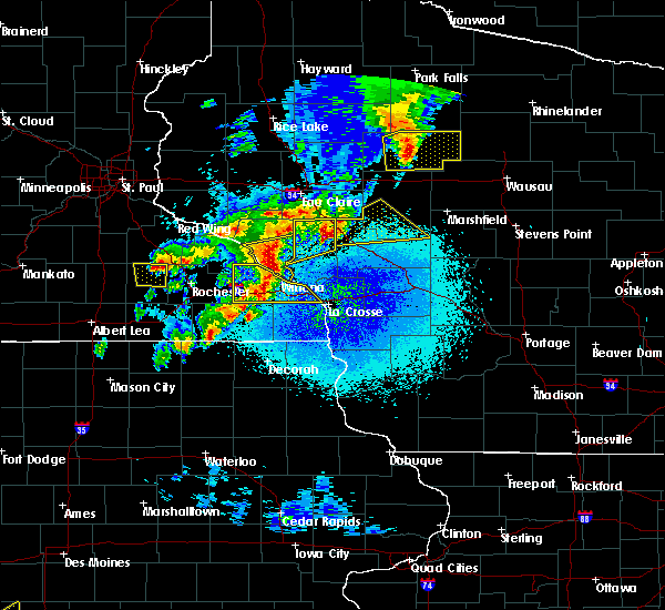 At 1109 pm cdt, severe thunderstorms were located along a line extending from 8 miles west of westboro to 8 miles north of owen, moving east at 50 mph (radar indicated). Hazards include 60 mph wind gusts and nickel size hail. Expect damage to roofs, siding, and trees. these severe storms will be near, chelsea around 1115 pm cdt. medford and westboro around 1120 pm cdt. rib lake around 1125 pm cdt. Other locations impacted by these severe thunderstorms include stetsonville, goodrich, lublin, perkinstown and esadore lake. At 1109 pm cdt, severe thunderstorms were located along a line extending from 8 miles west of westboro to 8 miles north of owen, moving east at 50 mph (radar indicated). Hazards include 60 mph wind gusts and nickel size hail. Expect damage to roofs, siding, and trees. these severe storms will be near, chelsea around 1115 pm cdt. medford and westboro around 1120 pm cdt. rib lake around 1125 pm cdt. Other locations impacted by these severe thunderstorms include stetsonville, goodrich, lublin, perkinstown and esadore lake.
|
| 4/9/2017 10:55 PM CDT |
 At 1052 pm cdt, severe thunderstorms were located along a line extending from near jump river to 6 miles northeast of thorp, moving east at 50 mph (radar indicated. trained weather spotters reported nickel size hail 5 miles west of gilman at 1042 pm). Hazards include 60 mph wind gusts and quarter size hail. Hail damage to vehicles is expected. expect wind damage to roofs, siding, and trees. these severe storms will be near, medford and chelsea around 1115 pm cdt. westboro around 1120 pm cdt. rib lake around 1125 pm cdt. Other locations impacted by these severe thunderstorms include stetsonville, goodrich, gilman, lublin and polley. At 1052 pm cdt, severe thunderstorms were located along a line extending from near jump river to 6 miles northeast of thorp, moving east at 50 mph (radar indicated. trained weather spotters reported nickel size hail 5 miles west of gilman at 1042 pm). Hazards include 60 mph wind gusts and quarter size hail. Hail damage to vehicles is expected. expect wind damage to roofs, siding, and trees. these severe storms will be near, medford and chelsea around 1115 pm cdt. westboro around 1120 pm cdt. rib lake around 1125 pm cdt. Other locations impacted by these severe thunderstorms include stetsonville, goodrich, gilman, lublin and polley.
|
| 4/9/2017 10:48 PM CDT |
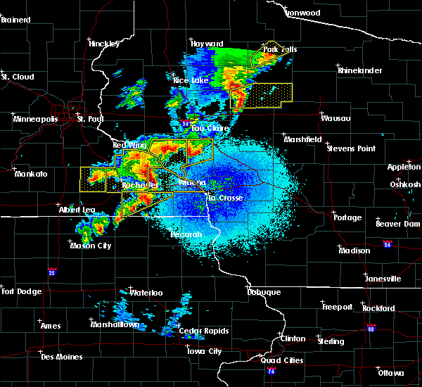 At 1048 pm cdt, a severe thunderstorm was located 14 miles north of thorp, or 17 miles west of medford, moving east at 50 mph (radar indicated). Hazards include 60 mph wind gusts and quarter size hail. Hail damage to vehicles is expected. expect wind damage to roofs, siding, and trees. this severe storm will be near, medford around 1110 pm cdt. chelsea and westboro around 1115 pm cdt. rib lake around 1120 pm cdt. Other locations impacted by this severe thunderstorm include stetsonville, goodrich, gilman, lublin and polley. At 1048 pm cdt, a severe thunderstorm was located 14 miles north of thorp, or 17 miles west of medford, moving east at 50 mph (radar indicated). Hazards include 60 mph wind gusts and quarter size hail. Hail damage to vehicles is expected. expect wind damage to roofs, siding, and trees. this severe storm will be near, medford around 1110 pm cdt. chelsea and westboro around 1115 pm cdt. rib lake around 1120 pm cdt. Other locations impacted by this severe thunderstorm include stetsonville, goodrich, gilman, lublin and polley.
|
| 4/9/2017 10:41 PM CDT |
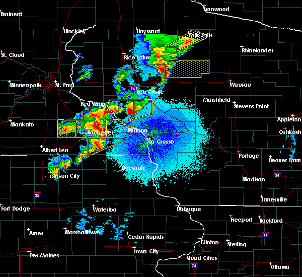 At 1040 pm cdt, a severe thunderstorm was located 12 miles north of thorp, or 24 miles west of medford, moving east at 50 mph (radar indicated). Hazards include quarter size hail. Damage to vehicles is expected. this severe thunderstorm will be near, medford around 1110 pm cdt. chelsea and westboro around 1115 pm cdt. rib lake around 1120 pm cdt. Other locations impacted by this severe thunderstorm include stetsonville, goodrich, gilman, lublin and polley. At 1040 pm cdt, a severe thunderstorm was located 12 miles north of thorp, or 24 miles west of medford, moving east at 50 mph (radar indicated). Hazards include quarter size hail. Damage to vehicles is expected. this severe thunderstorm will be near, medford around 1110 pm cdt. chelsea and westboro around 1115 pm cdt. rib lake around 1120 pm cdt. Other locations impacted by this severe thunderstorm include stetsonville, goodrich, gilman, lublin and polley.
|
| 7/21/2016 6:26 AM CDT |
 At 626 am cdt, severe thunderstorms were located along a line extending from 7 miles southeast of rib lake to 6 miles northwest of greenwood, moving southeast at 55 mph (radar indicated). Hazards include 60 mph wind gusts. Expect damage to roofs. siding. and trees. Locations impacted include, medford, abbotsford, colby, thorp, owen, rib lake, dorchester, chelsea, longwood, reseburg, stetsonville, goodrich, withee. At 626 am cdt, severe thunderstorms were located along a line extending from 7 miles southeast of rib lake to 6 miles northwest of greenwood, moving southeast at 55 mph (radar indicated). Hazards include 60 mph wind gusts. Expect damage to roofs. siding. and trees. Locations impacted include, medford, abbotsford, colby, thorp, owen, rib lake, dorchester, chelsea, longwood, reseburg, stetsonville, goodrich, withee.
|
| 7/21/2016 6:08 AM CDT |
 At 608 am cdt, severe thunderstorms were located along a line extending from 9 miles west of westboro to near stanley, moving southeast at 50 mph (radar indicated). Hazards include 60 mph wind gusts. Expect damage to roofs. siding. and trees. these severe storms will be near, westboro around 615 am cdt. chelsea around 620 am cdt. medford and rib lake around 625 am cdt. Other locations impacted by these severe thunderstorms include colby, longwood, reseburg, stetsonville and goodrich. At 608 am cdt, severe thunderstorms were located along a line extending from 9 miles west of westboro to near stanley, moving southeast at 50 mph (radar indicated). Hazards include 60 mph wind gusts. Expect damage to roofs. siding. and trees. these severe storms will be near, westboro around 615 am cdt. chelsea around 620 am cdt. medford and rib lake around 625 am cdt. Other locations impacted by these severe thunderstorms include colby, longwood, reseburg, stetsonville and goodrich.
|
| 7/21/2016 5:51 AM CDT |
 At 549 am cdt, severe thunderstorms were located along a line extending from 6 miles southwest of catawba to 6 miles southwest of cornell, moving southeast at 40 mph (radar indicated). Hazards include 60 mph wind gusts. Expect damage to roofs. siding. and trees. these severe storms will be near, westboro around 615 am cdt. chelsea around 620 am cdt. medford, rib lake and thorp around 625 am cdt. owen around 640 am cdt. Other locations impacted by these severe thunderstorms include jump river, colby, longwood, reseburg, stetsonville and goodrich. At 549 am cdt, severe thunderstorms were located along a line extending from 6 miles southwest of catawba to 6 miles southwest of cornell, moving southeast at 40 mph (radar indicated). Hazards include 60 mph wind gusts. Expect damage to roofs. siding. and trees. these severe storms will be near, westboro around 615 am cdt. chelsea around 620 am cdt. medford, rib lake and thorp around 625 am cdt. owen around 640 am cdt. Other locations impacted by these severe thunderstorms include jump river, colby, longwood, reseburg, stetsonville and goodrich.
|
| 7/21/2016 5:31 AM CDT |
 At 531 am cdt, severe thunderstorms were located along a line extending from 9 miles west of phillips to 6 miles northeast of bloomer, moving southeast at 45 mph (radar indicated). Hazards include 60 mph wind gusts. Expect damage to roofs. siding. and trees. severe thunderstorms will be near, westboro around 605 am cdt. rib lake around 610 am cdt. thorp around 615 am cdt. owen around 630 am cdt. Other locations impacted by these severe thunderstorms include colby, longwood, reseburg, stetsonville and goodrich. At 531 am cdt, severe thunderstorms were located along a line extending from 9 miles west of phillips to 6 miles northeast of bloomer, moving southeast at 45 mph (radar indicated). Hazards include 60 mph wind gusts. Expect damage to roofs. siding. and trees. severe thunderstorms will be near, westboro around 605 am cdt. rib lake around 610 am cdt. thorp around 615 am cdt. owen around 630 am cdt. Other locations impacted by these severe thunderstorms include colby, longwood, reseburg, stetsonville and goodrich.
|
| 6/5/2016 3:44 PM CDT |
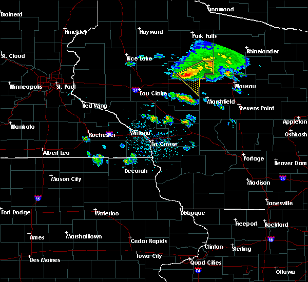 At 342 pm cdt, severe thunderstorms were located along a line extending from near rib lake to 6 miles north of owen, moving southeast at 50 mph (a trained weather spotter reported winds around 50 mph and some branches down in the rib lake area). Hazards include 60 mph wind gusts and penny size hail. Expect damage to roofs. siding. and trees. these severe storms will be near, dorchester and dorchester around 355 pm cdt. colby, abbotsford and abbotsford around 400 pm cdt. Other locations impacted by these severe thunderstorms include colby, stetsonville, goodrich, unity and curtiss. At 342 pm cdt, severe thunderstorms were located along a line extending from near rib lake to 6 miles north of owen, moving southeast at 50 mph (a trained weather spotter reported winds around 50 mph and some branches down in the rib lake area). Hazards include 60 mph wind gusts and penny size hail. Expect damage to roofs. siding. and trees. these severe storms will be near, dorchester and dorchester around 355 pm cdt. colby, abbotsford and abbotsford around 400 pm cdt. Other locations impacted by these severe thunderstorms include colby, stetsonville, goodrich, unity and curtiss.
|
| 6/5/2016 3:32 PM CDT |
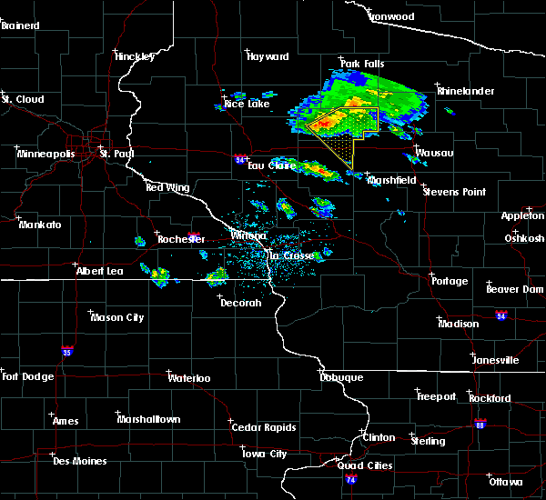 At 331 pm cdt, severe thunderstorms were located along a line extending from near westboro to 13 miles northeast of thorp, moving southeast at 50 mph (radar indicated). Hazards include 60 mph wind gusts and penny size hail. Expect damage to roofs. siding. and trees. severe thunderstorms will be near, rib lake and chelsea around 340 pm cdt. owen around 350 pm cdt. dorchester and dorchester around 355 pm cdt. colby, abbotsford and abbotsford around 400 pm cdt. Other locations impacted by these severe thunderstorms include colby, stetsonville, goodrich, withee and gilman. At 331 pm cdt, severe thunderstorms were located along a line extending from near westboro to 13 miles northeast of thorp, moving southeast at 50 mph (radar indicated). Hazards include 60 mph wind gusts and penny size hail. Expect damage to roofs. siding. and trees. severe thunderstorms will be near, rib lake and chelsea around 340 pm cdt. owen around 350 pm cdt. dorchester and dorchester around 355 pm cdt. colby, abbotsford and abbotsford around 400 pm cdt. Other locations impacted by these severe thunderstorms include colby, stetsonville, goodrich, withee and gilman.
|
| 8/2/2015 12:30 AM CDT |
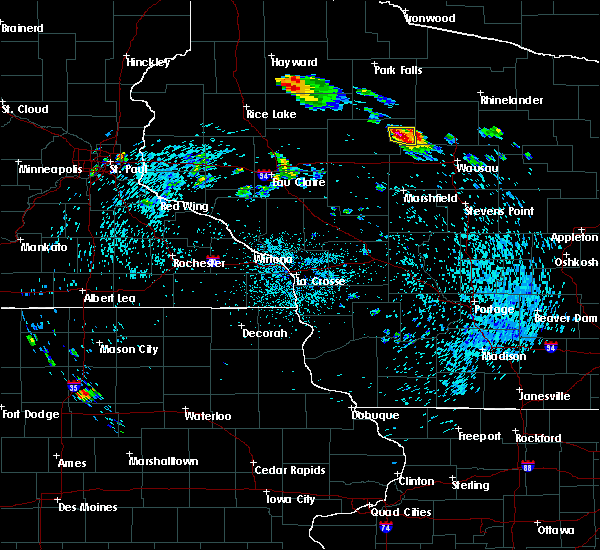 At 1229 am cdt, a severe thunderstorm was located 11 miles southeast of rib lake, or 12 miles east of medford, moving east at 35 mph (radar indicated). Hazards include 60 mph wind gusts and quarter size hail. Hail damage to vehicles is expected. expect wind damage to roofs, siding and trees. This severe thunderstorm will remain over mainly rural areas of east central taylor county, including the following locations, goodrich and highway m and joe martin road. At 1229 am cdt, a severe thunderstorm was located 11 miles southeast of rib lake, or 12 miles east of medford, moving east at 35 mph (radar indicated). Hazards include 60 mph wind gusts and quarter size hail. Hail damage to vehicles is expected. expect wind damage to roofs, siding and trees. This severe thunderstorm will remain over mainly rural areas of east central taylor county, including the following locations, goodrich and highway m and joe martin road.
|
| 7/18/2015 3:32 AM CDT |
 At 331 am cdt, severe thunderstorms were located along a line extending from near chelsea to near shortville, moving east at 60 mph (law enforcement. a power pole was reported down in thorp). Hazards include 60 mph wind gusts. Expect damage to roofs. siding and trees. these severe storms will be near, rib lake around 340 am cdt. Other locations impacted by these severe thunderstorms include sherwood, colby, lynn, longwood and stetsonville. At 331 am cdt, severe thunderstorms were located along a line extending from near chelsea to near shortville, moving east at 60 mph (law enforcement. a power pole was reported down in thorp). Hazards include 60 mph wind gusts. Expect damage to roofs. siding and trees. these severe storms will be near, rib lake around 340 am cdt. Other locations impacted by these severe thunderstorms include sherwood, colby, lynn, longwood and stetsonville.
|
| 7/18/2015 2:59 AM CDT |
 At 259 am cdt, severe thunderstorms were located along a line extending from near jump river to humbird, moving east at 55 mph (radar indicated). Hazards include 60 mph wind gusts. Expect damage to roofs. siding and trees. these severe storms will be near, jump river around 305 am cdt. neillsville and shortville around 315 am cdt. chelsea and loyal around 320 am cdt. westboro around 325 am cdt. rib lake around 330 am cdt. spencer around 335 am cdt. Other locations impacted by these severe thunderstorms include sherwood, colby, lynn, longwood and reseburg. At 259 am cdt, severe thunderstorms were located along a line extending from near jump river to humbird, moving east at 55 mph (radar indicated). Hazards include 60 mph wind gusts. Expect damage to roofs. siding and trees. these severe storms will be near, jump river around 305 am cdt. neillsville and shortville around 315 am cdt. chelsea and loyal around 320 am cdt. westboro around 325 am cdt. rib lake around 330 am cdt. spencer around 335 am cdt. Other locations impacted by these severe thunderstorms include sherwood, colby, lynn, longwood and reseburg.
|
| 7/18/2015 2:32 AM CDT |
 At 231 am cdt, severe thunderstorms were located along a line extending from 9 miles northwest of cornell to strum, moving east at 50 mph (radar indicated). Hazards include 60 mph wind gusts. Expect damage to roofs. siding and trees. severe thunderstorms will be near, jump river around 255 am cdt. humbird around 300 am cdt. neillsville around 315 am cdt. shortville around 320 am cdt. medford and chelsea around 325 am cdt. Other locations impacted by these severe thunderstorms include sherwood, colby, lynn, longwood and reseburg. At 231 am cdt, severe thunderstorms were located along a line extending from 9 miles northwest of cornell to strum, moving east at 50 mph (radar indicated). Hazards include 60 mph wind gusts. Expect damage to roofs. siding and trees. severe thunderstorms will be near, jump river around 255 am cdt. humbird around 300 am cdt. neillsville around 315 am cdt. shortville around 320 am cdt. medford and chelsea around 325 am cdt. Other locations impacted by these severe thunderstorms include sherwood, colby, lynn, longwood and reseburg.
|
Hail Maps for Chelsea, WI


Connect with Interactive Hail Maps