

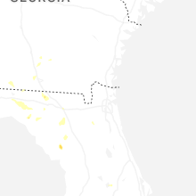
Hail Map for Chiefland, FL
The Chiefland, FL area has had 1 report of on-the-ground hail by trained spotters, and has been under severe weather warnings 0 times during the past 12 months. Doppler radar has detected hail at or near Chiefland, FL on 49 occasions, including 2 occasions during the past year.
| Name: | Chiefland, FL |
| Where Located: | 93.1 miles SW of Jacksonville, FL |
| Map: | Google Map for Chiefland, FL |
| Population: | 2245 |
| Housing Units: | 1047 |
| More Info: | Search Google for Chiefland, FL |
0
The Top Recent Hail Date for Chiefland, FL is Thursday, June 26, 2025 (46th out of 49)

Hail and Wind Damage Spotted near Chiefland, FL
| Date / Time | Report Details |
|---|---|
| 5/17/2024 9:08 AM EDT |
 The storm which prompted the warning has weakened below severe limits, and no longer poses an immediate threat to life or property. therefore, the warning will be allowed to expire. however, gusty winds are still possible with this thunderstorm. The storm which prompted the warning has weakened below severe limits, and no longer poses an immediate threat to life or property. therefore, the warning will be allowed to expire. however, gusty winds are still possible with this thunderstorm.
|
| 5/17/2024 8:09 AM EDT |
 Svrtbw the national weather service in ruskin has issued a * severe thunderstorm warning for, northwestern citrus county in west central florida, levy county in northern florida, * until 915 am edt. * at 809 am edt, a severe thunderstorm was located 15 miles south of fowlers bluff, or 25 miles southwest of chiefland, moving northeast at 25 mph (radar indicated). Hazards include 70 mph wind gusts. Expect considerable tree damage. Damage is likely to mobile homes, roofs, and outbuildings. Svrtbw the national weather service in ruskin has issued a * severe thunderstorm warning for, northwestern citrus county in west central florida, levy county in northern florida, * until 915 am edt. * at 809 am edt, a severe thunderstorm was located 15 miles south of fowlers bluff, or 25 miles southwest of chiefland, moving northeast at 25 mph (radar indicated). Hazards include 70 mph wind gusts. Expect considerable tree damage. Damage is likely to mobile homes, roofs, and outbuildings.
|
| 5/10/2024 8:38 AM EDT | Several trees down across chiefland and fanning springs. one of those trees feel on a powerlin in levy county FL, 4.6 miles S of Chiefland, FL |
| 5/10/2024 8:23 AM EDT |
 Svrtbw the national weather service in ruskin has issued a * severe thunderstorm warning for, northern levy county in northern florida, * until 900 am edt. * at 823 am edt, severe thunderstorms were located along a line extending from near belmont to fort white to near cross city, moving east at 40 mph (radar indicated). Hazards include 60 mph wind gusts. expect damage to roofs, siding, and trees Svrtbw the national weather service in ruskin has issued a * severe thunderstorm warning for, northern levy county in northern florida, * until 900 am edt. * at 823 am edt, severe thunderstorms were located along a line extending from near belmont to fort white to near cross city, moving east at 40 mph (radar indicated). Hazards include 60 mph wind gusts. expect damage to roofs, siding, and trees
|
| 4/11/2024 9:53 AM EDT |
 Svrtbw the national weather service in ruskin has issued a * severe thunderstorm warning for, levy county in northern florida, * until 1015 am edt. * at 951 am edt, severe thunderstorms were located along a line extending from fowlers bluff to 10 miles south of chiefland to 18 miles southwest of williston highlands, moving northeast at 30 mph (radar indicated). Hazards include 60 mph wind gusts. expect damage to roofs, siding, and trees Svrtbw the national weather service in ruskin has issued a * severe thunderstorm warning for, levy county in northern florida, * until 1015 am edt. * at 951 am edt, severe thunderstorms were located along a line extending from fowlers bluff to 10 miles south of chiefland to 18 miles southwest of williston highlands, moving northeast at 30 mph (radar indicated). Hazards include 60 mph wind gusts. expect damage to roofs, siding, and trees
|
| 4/3/2024 12:20 PM EDT | Levy county sheriff office reported a tree down across eastbound lane of fl hwy 500 east of chiefland. time estimated from rada in levy county FL, 3.4 miles WNW of Chiefland, FL |
| 3/27/2024 9:12 AM EDT |
 The storms which prompted the warning have weakened below severe limits, and no longer pose an immediate threat to life or property. therefore, the warning will be allowed to expire. however, small hail and gusty winds are still possible with these thunderstorms. The storms which prompted the warning have weakened below severe limits, and no longer pose an immediate threat to life or property. therefore, the warning will be allowed to expire. however, small hail and gusty winds are still possible with these thunderstorms.
|
| 3/27/2024 8:23 AM EDT |
 Svrtbw the national weather service in ruskin has issued a * severe thunderstorm warning for, levy county in northern florida, * until 915 am edt. * at 823 am edt, severe thunderstorms were located along a line extending from near horseshoe point to 22 miles southwest of fowlers bluff to 49 miles south of steinhatchee, moving east at 50 mph (radar indicated). Hazards include 60 mph wind gusts and quarter size hail. Hail damage to vehicles is expected. Expect wind damage to roofs, siding, and trees. Svrtbw the national weather service in ruskin has issued a * severe thunderstorm warning for, levy county in northern florida, * until 915 am edt. * at 823 am edt, severe thunderstorms were located along a line extending from near horseshoe point to 22 miles southwest of fowlers bluff to 49 miles south of steinhatchee, moving east at 50 mph (radar indicated). Hazards include 60 mph wind gusts and quarter size hail. Hail damage to vehicles is expected. Expect wind damage to roofs, siding, and trees.
|
| 1/9/2024 1:48 PM EST |
 At 147 pm est, severe thunderstorms were located along a line extending from manattee road to 38 miles south of horseshoe point, moving east at 40 mph (radar indicated). Hazards include 60 mph wind gusts. expect damage to roofs, siding, and trees At 147 pm est, severe thunderstorms were located along a line extending from manattee road to 38 miles south of horseshoe point, moving east at 40 mph (radar indicated). Hazards include 60 mph wind gusts. expect damage to roofs, siding, and trees
|
| 10/12/2023 1:01 AM EDT |
 At 101 am edt, a severe thunderstorm was located 16 miles south of fowlers bluff, or 22 miles south of chiefland, moving northeast at 45 mph (radar indicated). Hazards include 60 mph wind gusts. expect damage to roofs, siding, and trees At 101 am edt, a severe thunderstorm was located 16 miles south of fowlers bluff, or 22 miles south of chiefland, moving northeast at 45 mph (radar indicated). Hazards include 60 mph wind gusts. expect damage to roofs, siding, and trees
|
| 2/11/2023 5:04 PM EST |
 At 504 pm est, severe thunderstorms were located along a line extending from 7 miles southeast of fowlers bluff to 13 miles south of chiefland to 17 miles southwest of williston highlands, moving northeast at 50 mph (radar indicated). Hazards include 60 mph wind gusts. expect damage to roofs, siding, and trees At 504 pm est, severe thunderstorms were located along a line extending from 7 miles southeast of fowlers bluff to 13 miles south of chiefland to 17 miles southwest of williston highlands, moving northeast at 50 mph (radar indicated). Hazards include 60 mph wind gusts. expect damage to roofs, siding, and trees
|
| 8/18/2022 1:42 PM EDT |
 At 141 pm edt, a severe thunderstorm was located near chiefland, moving east at 10 mph (radar indicated). Hazards include 60 mph wind gusts. expect damage to roofs, siding, and trees At 141 pm edt, a severe thunderstorm was located near chiefland, moving east at 10 mph (radar indicated). Hazards include 60 mph wind gusts. expect damage to roofs, siding, and trees
|
| 5/30/2022 7:37 PM EDT |
 At 737 pm edt, a severe thunderstorm was located over andrews, or near chiefland, moving south at 25 mph (radar indicated). Hazards include 60 mph wind gusts and quarter size hail. Hail damage to vehicles is expected. Expect wind damage to roofs, siding, and trees. At 737 pm edt, a severe thunderstorm was located over andrews, or near chiefland, moving south at 25 mph (radar indicated). Hazards include 60 mph wind gusts and quarter size hail. Hail damage to vehicles is expected. Expect wind damage to roofs, siding, and trees.
|
| 3/12/2022 7:25 AM EST | Several trees in the chiefland area were down... some on power lines. these were public reports to emergency managemen in levy county FL, 0.4 miles NW of Chiefland, FL |
| 4/18/2021 9:11 AM EDT |
 The severe thunderstorm warning for northeastern levy county will expire at 915 am edt, the storm which prompted the warning has weakened below severe limits, and has exited the warned area. therefore, the warning will be allowed to expire. The severe thunderstorm warning for northeastern levy county will expire at 915 am edt, the storm which prompted the warning has weakened below severe limits, and has exited the warned area. therefore, the warning will be allowed to expire.
|
| 4/18/2021 8:51 AM EDT |
 At 851 am edt, a severe thunderstorm was located near bronson, moving east at 45 mph (radar indicated). Hazards include 60 mph wind gusts and penny size hail. expect damage to roofs, siding, and trees At 851 am edt, a severe thunderstorm was located near bronson, moving east at 45 mph (radar indicated). Hazards include 60 mph wind gusts and penny size hail. expect damage to roofs, siding, and trees
|
| 2/6/2021 4:20 PM EST | Two homes received minor to moderate roof damage. multiple trees and powerlines down between chiefland and fanning spring in levy county FL, 3.9 miles S of Chiefland, FL |
| 12/24/2020 5:35 PM EST | Report received of tree downed along cr 345 near cr 347. time estimated from rada in levy county FL, 4.7 miles NNE of Chiefland, FL |
| 8/24/2020 5:07 PM EDT |
 At 507 pm edt, a severe thunderstorm was located 12 miles southeast of fowlers bluff, or 14 miles south of chiefland, moving northwest at 25 mph (radar indicated). Hazards include 60 mph wind gusts. Expect damage to roofs, siding, and trees. Locations impacted include, chiefland, fowlers bluff, manattee road and otter creek. At 507 pm edt, a severe thunderstorm was located 12 miles southeast of fowlers bluff, or 14 miles south of chiefland, moving northwest at 25 mph (radar indicated). Hazards include 60 mph wind gusts. Expect damage to roofs, siding, and trees. Locations impacted include, chiefland, fowlers bluff, manattee road and otter creek.
|
| 8/24/2020 4:53 PM EDT |
 At 452 pm edt, a severe thunderstorm was located 19 miles west of rainbow lakes estates, moving northwest at 30 mph (radar indicated). Hazards include 60 mph wind gusts. expect damage to roofs, siding, and trees At 452 pm edt, a severe thunderstorm was located 19 miles west of rainbow lakes estates, moving northwest at 30 mph (radar indicated). Hazards include 60 mph wind gusts. expect damage to roofs, siding, and trees
|
| 4/20/2020 8:00 AM EDT |
 At 800 am edt, severe thunderstorms were located along a line extending from 8 miles southwest of horseshoe point to 22 miles southwest of fowlers bluff, moving east at 40 mph (radar indicated). Hazards include 60 mph wind gusts and nickel size hail. expect damage to roofs, siding, and trees At 800 am edt, severe thunderstorms were located along a line extending from 8 miles southwest of horseshoe point to 22 miles southwest of fowlers bluff, moving east at 40 mph (radar indicated). Hazards include 60 mph wind gusts and nickel size hail. expect damage to roofs, siding, and trees
|
| 2/6/2020 8:33 PM EST |
 At 831 pm est, severe thunderstorms were located along a line extending from near cross city to 59 miles west of hudson, moving east at 35 mph (radar indicated). Hazards include 60 mph wind gusts. expect damage to roofs, siding, and trees At 831 pm est, severe thunderstorms were located along a line extending from near cross city to 59 miles west of hudson, moving east at 35 mph (radar indicated). Hazards include 60 mph wind gusts. expect damage to roofs, siding, and trees
|
| 6/19/2019 12:35 PM EDT | Few reports of trees down... including on a car and on power lines. time estimated from rada in levy county FL, 5.8 miles E of Chiefland, FL |
| 4/19/2019 11:00 AM EDT | Fire department reports multiple trees down and on powerlines around the chiefland are in levy county FL, 5.1 miles WSW of Chiefland, FL |
| 4/19/2019 10:56 AM EDT |
 At 1055 am edt, severe thunderstorms were located along a line extending from andrews to 9 miles south of chiefland to 13 miles southeast of fowlers bluff, moving northeast at 65 mph (radar indicated). Hazards include 60 mph wind gusts. Expect damage to roofs, siding, and trees. Locations impacted include, chiefland, bronson, east bronson, andrews, manattee road, fowlers bluff, williston highlands, fanning springs, otter creek and manatee springs state park. At 1055 am edt, severe thunderstorms were located along a line extending from andrews to 9 miles south of chiefland to 13 miles southeast of fowlers bluff, moving northeast at 65 mph (radar indicated). Hazards include 60 mph wind gusts. Expect damage to roofs, siding, and trees. Locations impacted include, chiefland, bronson, east bronson, andrews, manattee road, fowlers bluff, williston highlands, fanning springs, otter creek and manatee springs state park.
|
| 4/19/2019 10:36 AM EDT |
 At 1036 am edt, severe thunderstorms were located along a line extending from 8 miles southwest of fowlers bluff to 20 miles southeast of horseshoe point to 38 miles west of homosassa, moving northeast at 65 mph (radar indicated). Hazards include 60 mph wind gusts. expect damage to roofs, siding, and trees At 1036 am edt, severe thunderstorms were located along a line extending from 8 miles southwest of fowlers bluff to 20 miles southeast of horseshoe point to 38 miles west of homosassa, moving northeast at 65 mph (radar indicated). Hazards include 60 mph wind gusts. expect damage to roofs, siding, and trees
|
| 4/7/2018 4:26 PM EDT |
 At 425 pm edt, severe thunderstorms were located along a line extending from fanning springs to 30 miles west of homosassa, moving east at 40 mph (radar indicated). Hazards include 60 mph wind gusts and penny size hail. Expect damage to roofs, siding, and trees. Locations impacted include, chiefland, bronson, inglis, fanning springs, otter creek, lebanon and manatee springs state park. At 425 pm edt, severe thunderstorms were located along a line extending from fanning springs to 30 miles west of homosassa, moving east at 40 mph (radar indicated). Hazards include 60 mph wind gusts and penny size hail. Expect damage to roofs, siding, and trees. Locations impacted include, chiefland, bronson, inglis, fanning springs, otter creek, lebanon and manatee springs state park.
|
| 4/7/2018 4:01 PM EDT |
 At 400 pm edt, severe thunderstorms were located along a line extending from 7 miles east of horseshoe point to 35 miles southwest of fowlers bluff, moving east at 40 mph (radar indicated). Hazards include 60 mph wind gusts and penny size hail. expect damage to roofs, siding, and trees At 400 pm edt, severe thunderstorms were located along a line extending from 7 miles east of horseshoe point to 35 miles southwest of fowlers bluff, moving east at 40 mph (radar indicated). Hazards include 60 mph wind gusts and penny size hail. expect damage to roofs, siding, and trees
|
| 3/20/2018 1:37 PM EDT |
 The severe thunderstorm warning for north central levy county will expire at 145 pm edt, the storm which prompted the warning has weakened below severe limits, and no longer poses an immediate threat to life or property. therefore the warning will be allowed to expire. a tornado watch remains in effect until 700 pm edt for northern florida. The severe thunderstorm warning for north central levy county will expire at 145 pm edt, the storm which prompted the warning has weakened below severe limits, and no longer poses an immediate threat to life or property. therefore the warning will be allowed to expire. a tornado watch remains in effect until 700 pm edt for northern florida.
|
| 3/20/2018 1:25 PM EDT | Half Dollar sized hail reported 0.4 miles NW of Chiefland, FL, levy county public works reported half dollar size hail in chiefland. also received a report of quarter size hail from a trained spotter in chiefland. |
| 3/20/2018 1:25 PM EDT |
 At 124 pm edt, a severe thunderstorm was located over chiefland, moving northeast at 45 mph (radar indicated). Hazards include 60 mph wind gusts and quarter size hail. Hail damage to vehicles is expected. expect wind damage to roofs, siding, and trees. locations impacted include, chiefland, manattee road, andrews and manatee springs state park. A tornado watch remains in effect until 700 pm edt for northern florida. At 124 pm edt, a severe thunderstorm was located over chiefland, moving northeast at 45 mph (radar indicated). Hazards include 60 mph wind gusts and quarter size hail. Hail damage to vehicles is expected. expect wind damage to roofs, siding, and trees. locations impacted include, chiefland, manattee road, andrews and manatee springs state park. A tornado watch remains in effect until 700 pm edt for northern florida.
|
| 3/20/2018 1:06 PM EDT |
 At 105 pm edt, a severe thunderstorm was located over fowlers bluff, or 12 miles southwest of chiefland, moving east at 55 mph (radar indicated). Hazards include 60 mph wind gusts and quarter size hail. Hail damage to vehicles is expected. expect wind damage to roofs, siding, and trees. locations impacted include, chiefland, fowlers bluff, manattee road, andrews and manatee springs state park. A tornado watch remains in effect until 700 pm edt for northern florida. At 105 pm edt, a severe thunderstorm was located over fowlers bluff, or 12 miles southwest of chiefland, moving east at 55 mph (radar indicated). Hazards include 60 mph wind gusts and quarter size hail. Hail damage to vehicles is expected. expect wind damage to roofs, siding, and trees. locations impacted include, chiefland, fowlers bluff, manattee road, andrews and manatee springs state park. A tornado watch remains in effect until 700 pm edt for northern florida.
|
| 3/20/2018 12:53 PM EDT |
 At 1252 pm edt, a severe thunderstorm was located 5 miles southeast of horseshoe point, or 20 miles south of cross city, moving east at 60 mph (radar indicated). Hazards include 60 mph wind gusts and quarter size hail. Hail damage to vehicles is expected. Expect wind damage to roofs, siding, and trees. At 1252 pm edt, a severe thunderstorm was located 5 miles southeast of horseshoe point, or 20 miles south of cross city, moving east at 60 mph (radar indicated). Hazards include 60 mph wind gusts and quarter size hail. Hail damage to vehicles is expected. Expect wind damage to roofs, siding, and trees.
|
| 7/5/2017 3:28 PM EDT |
 At 320 pm edt, a severe thunderstorm was located near chiefland, moving north at 15 mph (radar indicated). Hazards include 60 mph wind gusts and quarter size hail. Hail damage to vehicles is expected. Expect wind damage to roofs, siding, and trees. At 320 pm edt, a severe thunderstorm was located near chiefland, moving north at 15 mph (radar indicated). Hazards include 60 mph wind gusts and quarter size hail. Hail damage to vehicles is expected. Expect wind damage to roofs, siding, and trees.
|
| 7/5/2017 3:20 PM EDT |
 At 320 pm edt, a severe thunderstorm was located near chiefland, moving north at 15 mph (radar indicated). Hazards include 60 mph wind gusts and quarter size hail. Hail damage to vehicles is expected. Expect wind damage to roofs, siding, and trees. At 320 pm edt, a severe thunderstorm was located near chiefland, moving north at 15 mph (radar indicated). Hazards include 60 mph wind gusts and quarter size hail. Hail damage to vehicles is expected. Expect wind damage to roofs, siding, and trees.
|
| 5/24/2017 11:51 AM EDT |
 At 1150 am edt, severe thunderstorms were located along a line extending from near trenton to 20 miles west of homosassa, moving northeast at 35 mph (radar indicated). Hazards include 60 mph wind gusts. expect damage to roofs, siding, and trees At 1150 am edt, severe thunderstorms were located along a line extending from near trenton to 20 miles west of homosassa, moving northeast at 35 mph (radar indicated). Hazards include 60 mph wind gusts. expect damage to roofs, siding, and trees
|
| 2/7/2017 9:40 PM EST |
 At 939 pm est, severe thunderstorms were located along a line extending from near trenton to 21 miles south of fowlers bluff to 38 miles west of homosassa, moving east at 45 mph (radar indicated). Hazards include 60 mph wind gusts and penny size hail. expect damage to roofs, siding, and trees At 939 pm est, severe thunderstorms were located along a line extending from near trenton to 21 miles south of fowlers bluff to 38 miles west of homosassa, moving east at 45 mph (radar indicated). Hazards include 60 mph wind gusts and penny size hail. expect damage to roofs, siding, and trees
|
| 2/7/2017 9:08 PM EST |
 At 907 pm est, severe thunderstorms were located along a line extending from near horseshoe point to 28 miles southwest of fowlers bluff to 62 miles south of steinhatchee, moving east at 60 mph (radar indicated). Hazards include 60 mph wind gusts and penny size hail. expect damage to roofs, siding, and trees At 907 pm est, severe thunderstorms were located along a line extending from near horseshoe point to 28 miles southwest of fowlers bluff to 62 miles south of steinhatchee, moving east at 60 mph (radar indicated). Hazards include 60 mph wind gusts and penny size hail. expect damage to roofs, siding, and trees
|
| 1/22/2017 5:23 PM EST |
 At 522 pm est, a severe thunderstorm was located 20 miles south of fowlers bluff, or 30 miles southwest of chiefland, moving northeast at 60 mph (radar indicated). Hazards include 60 mph wind gusts. expect damage to roofs, siding, and trees At 522 pm est, a severe thunderstorm was located 20 miles south of fowlers bluff, or 30 miles southwest of chiefland, moving northeast at 60 mph (radar indicated). Hazards include 60 mph wind gusts. expect damage to roofs, siding, and trees
|
| 1/15/2016 7:47 AM EST |
 At 746 am est, severe thunderstorms were located along a line extending from 12 miles south of horseshoe point to 32 miles southwest of fowlers bluff to 63 miles west of beacon square, moving east at 60 mph (radar indicated). Hazards include 60 mph wind gusts and penny size hail. Expect damage to roofs. Siding and trees. At 746 am est, severe thunderstorms were located along a line extending from 12 miles south of horseshoe point to 32 miles southwest of fowlers bluff to 63 miles west of beacon square, moving east at 60 mph (radar indicated). Hazards include 60 mph wind gusts and penny size hail. Expect damage to roofs. Siding and trees.
|
| 5/26/2015 4:59 PM EDT | At 458 pm edt, doppler radar continued to indicated a severe thunderstorm capable of producing damaging winds in excess of 60 mph. this storm was located between fanning springs and chiefland, or near manatee springs state park, moving northwest at 15 mph. penny size hail may also accompany the damaging winds. locations impacted include, chiefland, andrews, manattee road, fanning springs and manatee springs state park. |
| 5/26/2015 4:42 PM EDT | At 441 pm edt, doppler radar indicated a severe thunderstorm capable of producing quarter size hail and damaging winds in excess of 60 mph. this storm was located over manattee road, or near chiefland, and moving northwest at 25 mph. |
| 11/17/2014 12:56 PM EST | Levy county dispatch reported a tree down on u.s. 19 outside of chiefland. also a report of a tree that fell on a house in chieflan in levy county FL, 2.5 miles NNW of Chiefland, FL |
| 4/14/2013 7:30 PM EDT | Trees and power lines down near chiefland and also near gulf hammoc in levy county FL, 5.4 miles NW of Chiefland, FL |
| 3/24/2012 7:00 PM EDT | Several trees down just north of the nw 130th street and nw 20th avenue intersectio in levy county FL, 4.1 miles SW of Chiefland, FL |
| 3/24/2012 6:31 PM EDT | Several oak trees...branches and power lines down at restaurant near u.s. 19 and cr 320. no injurie in levy county FL, 1.2 miles SSE of Chiefland, FL |
| 1/1/0001 12:00 AM | Roof damage to a mobile home along with some trees knocked down/damaged in the vicinity. time estimated by rada in levy county FL, 2.6 miles SSW of Chiefland, FL |
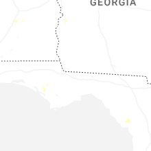
Hail Maps for Chiefland, FL


Connect with Interactive Hail Maps