

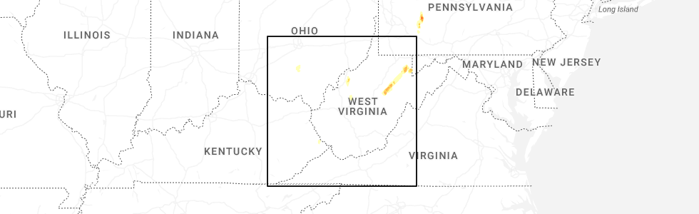
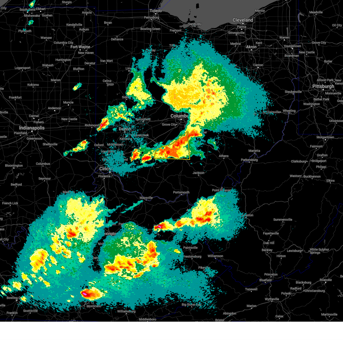
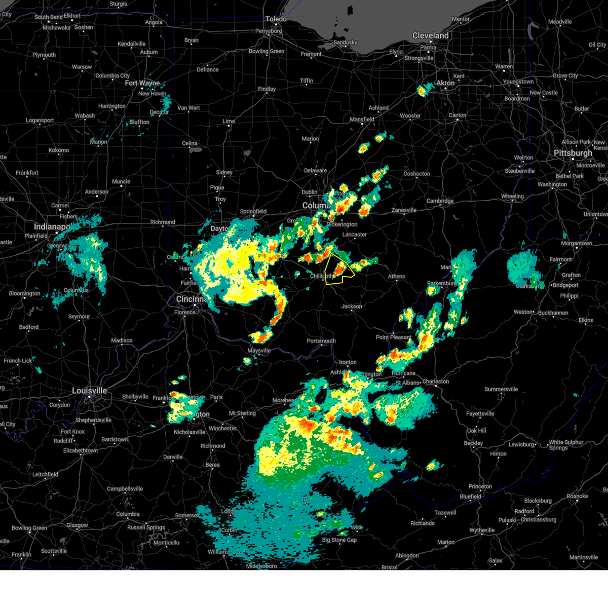
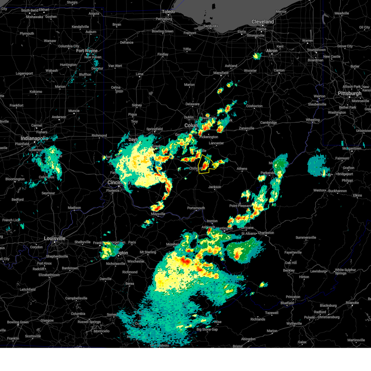
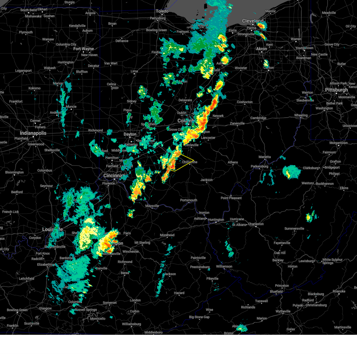
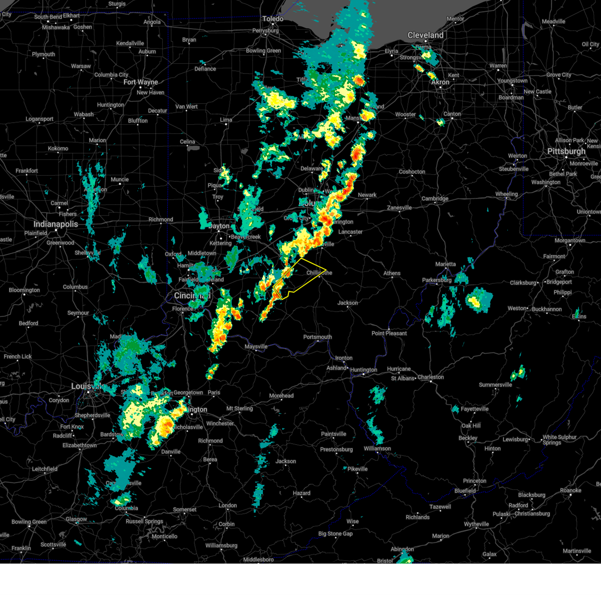
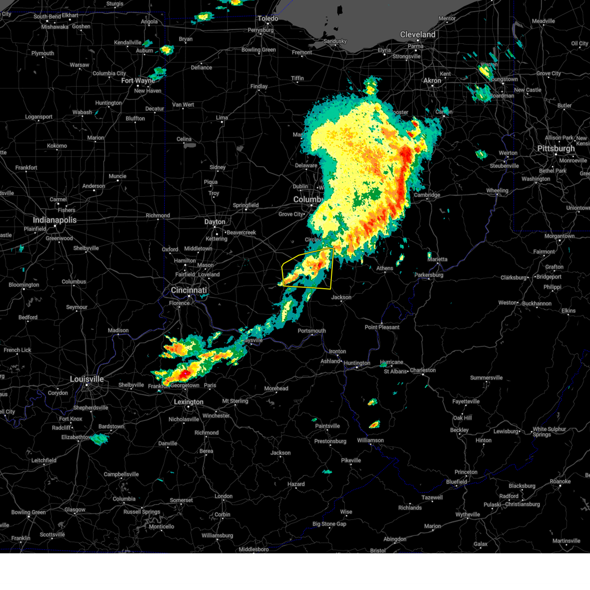
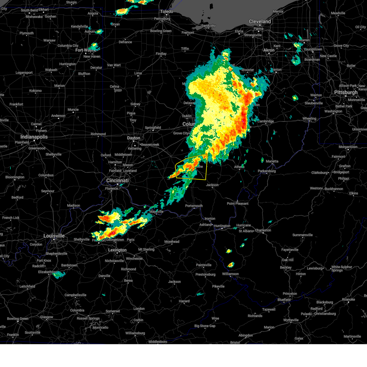
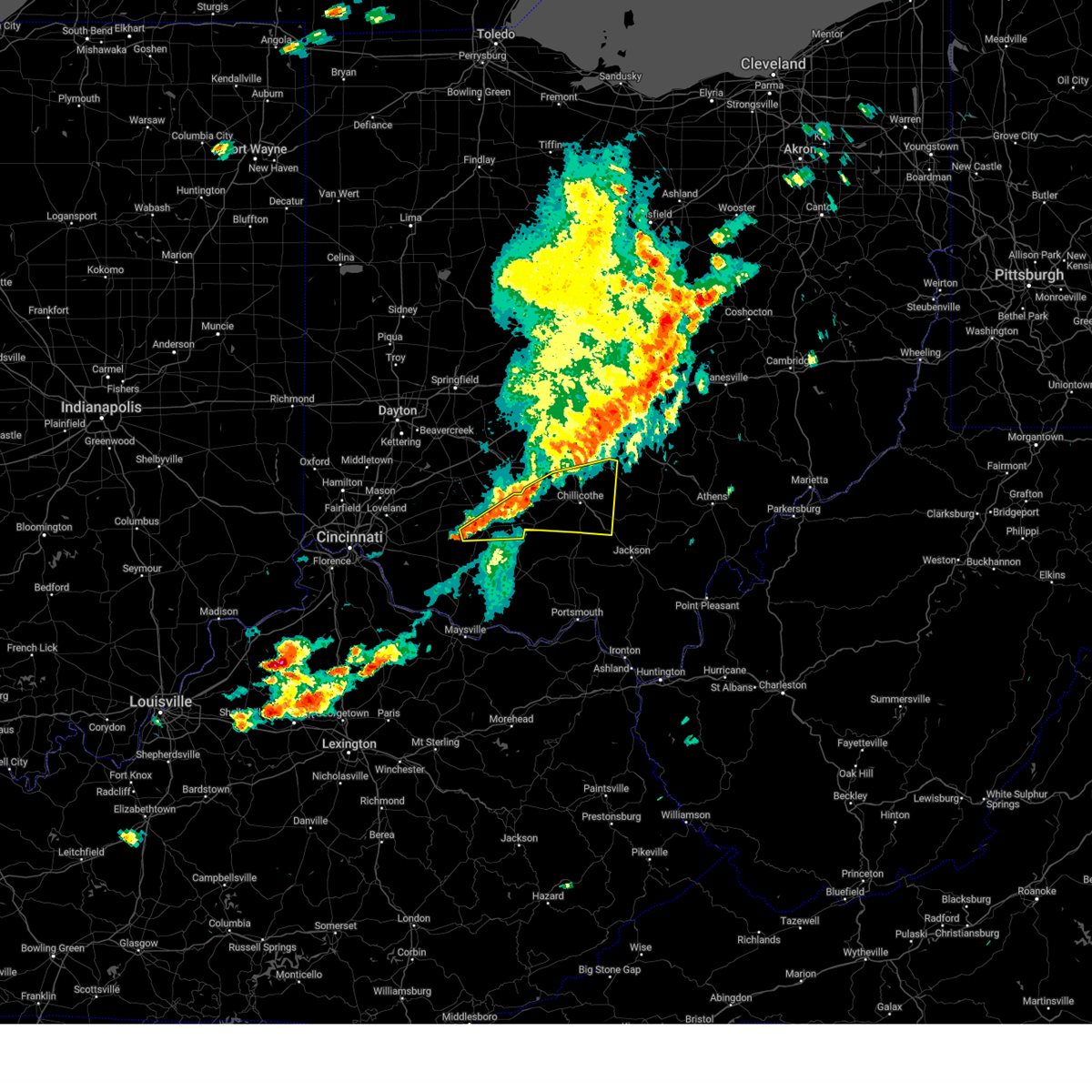
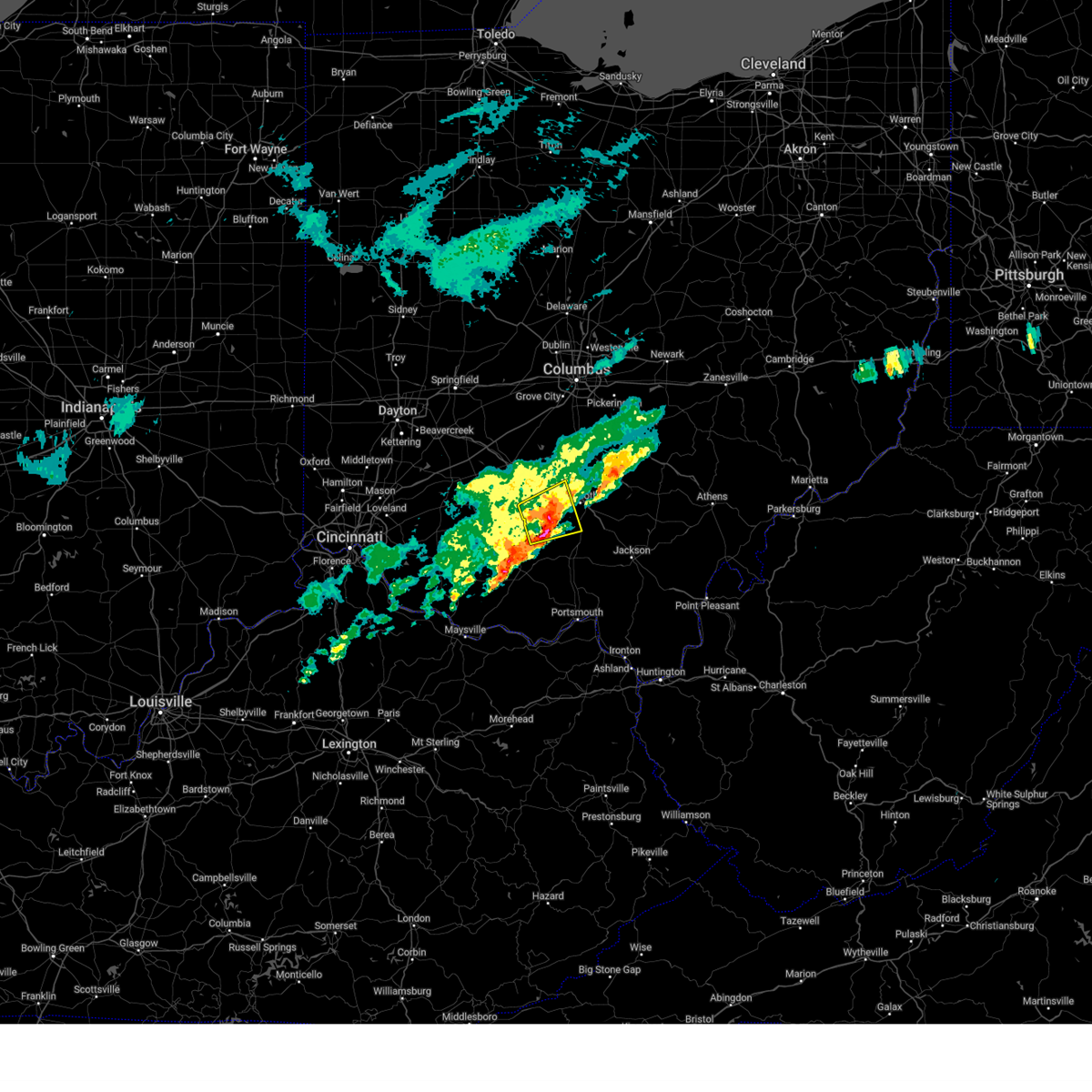
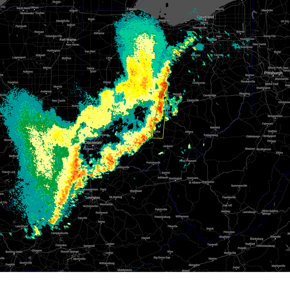
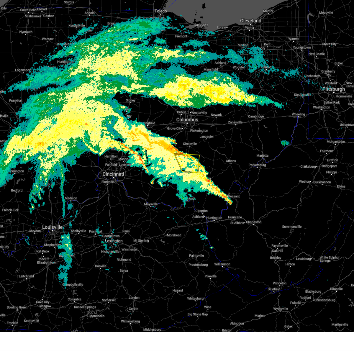
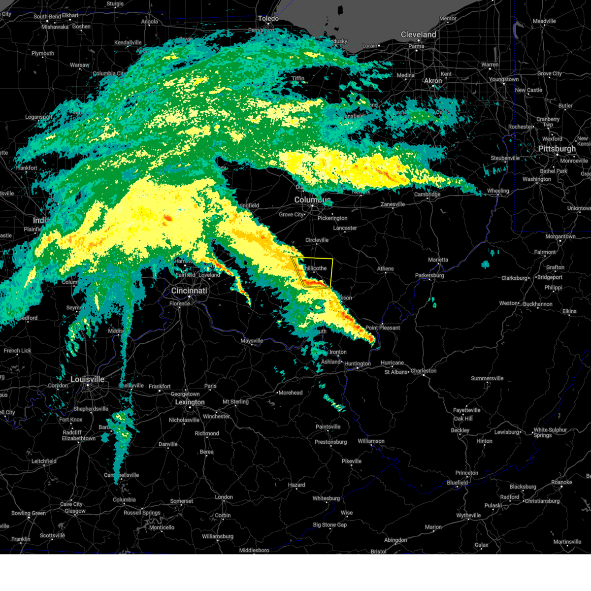
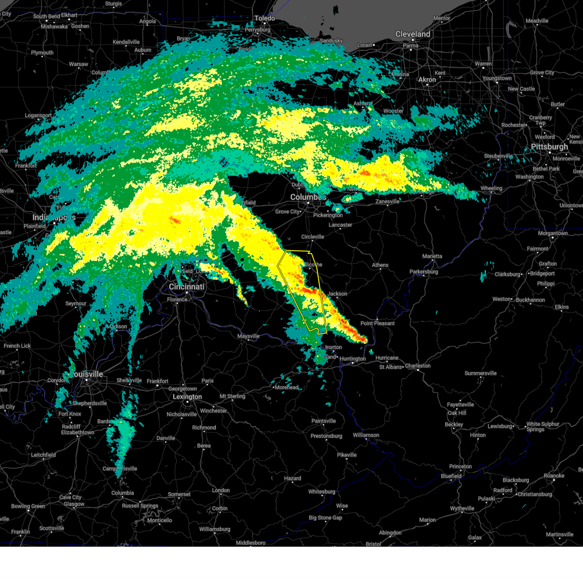
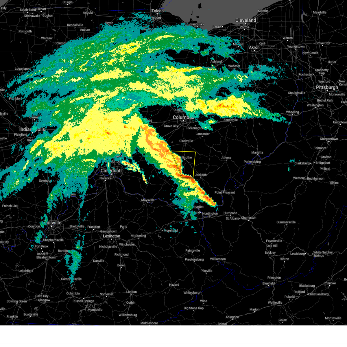
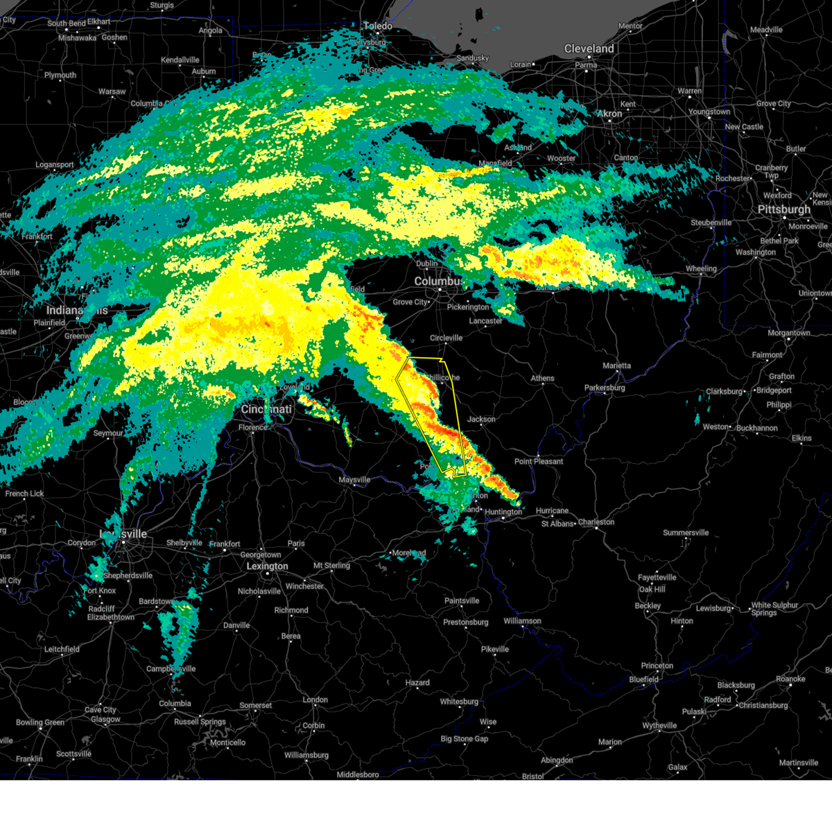
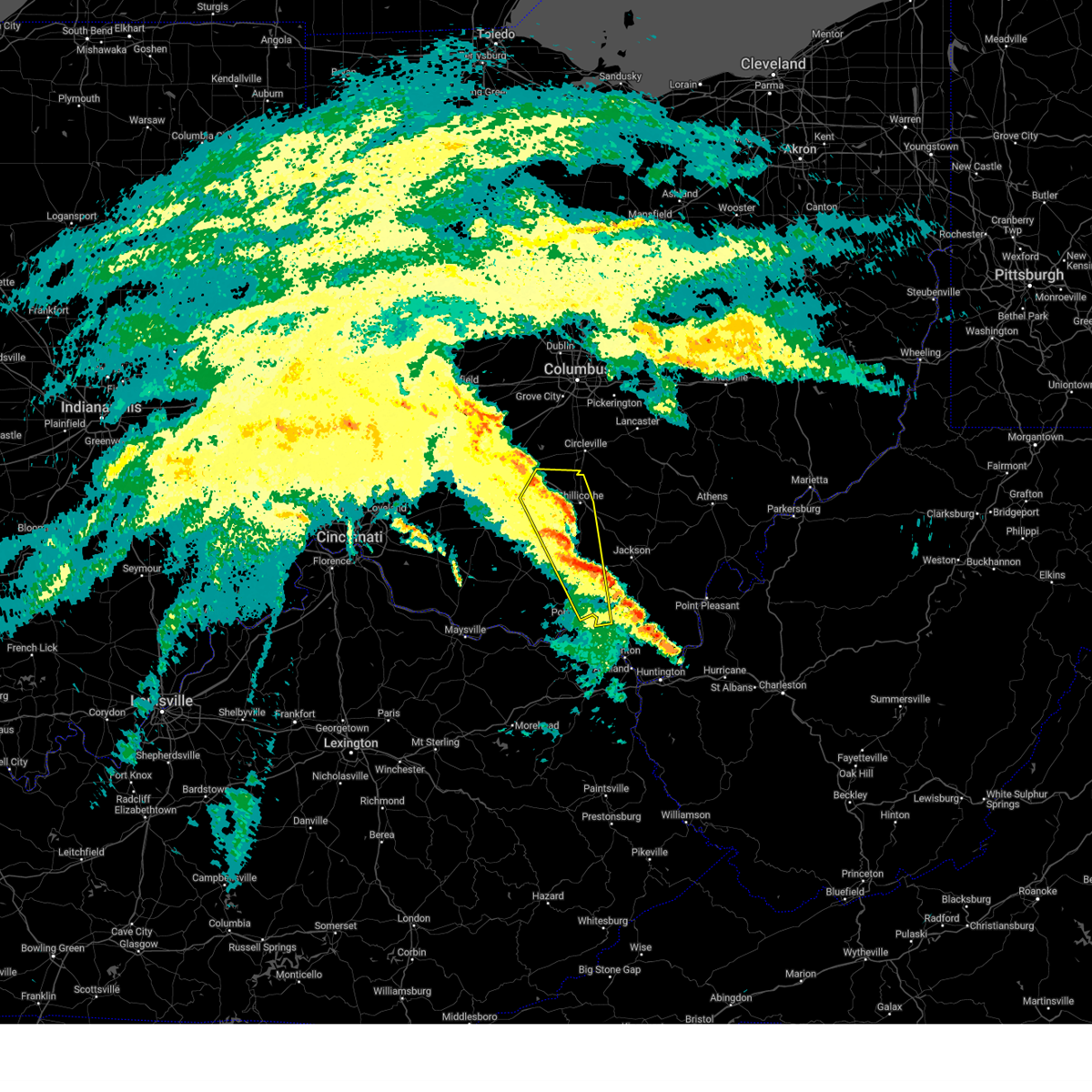
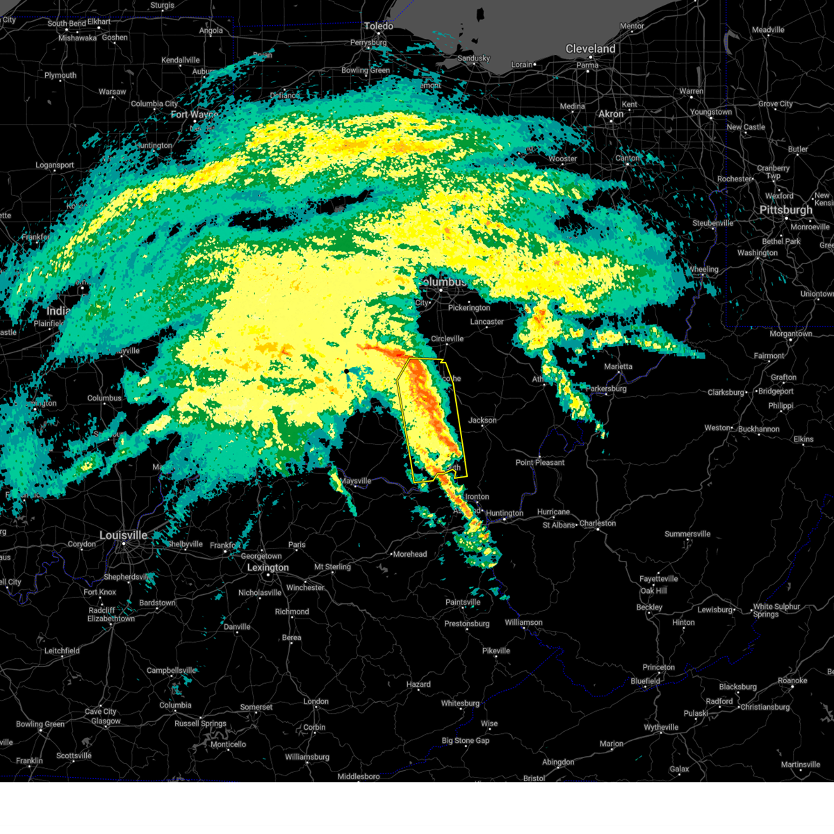
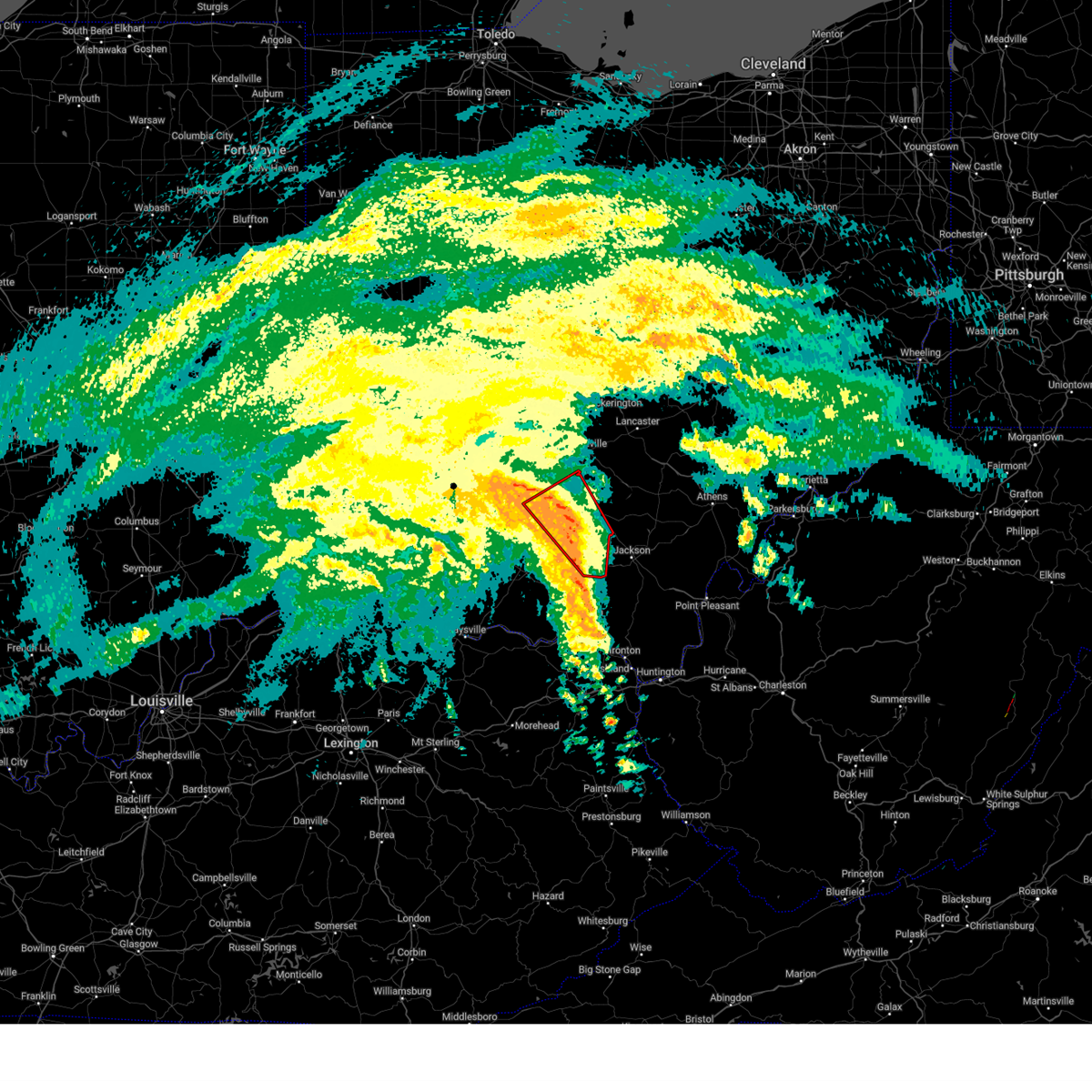
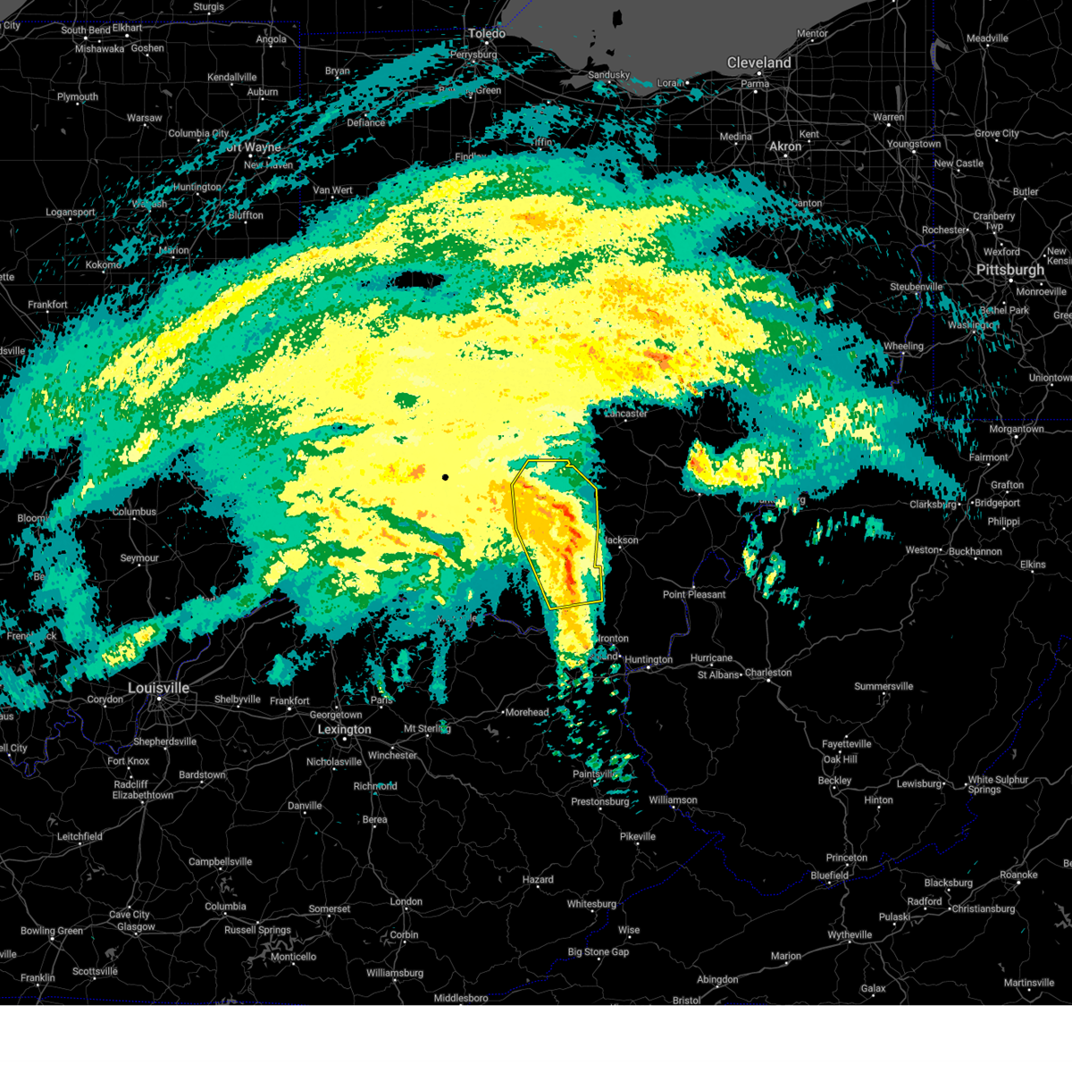
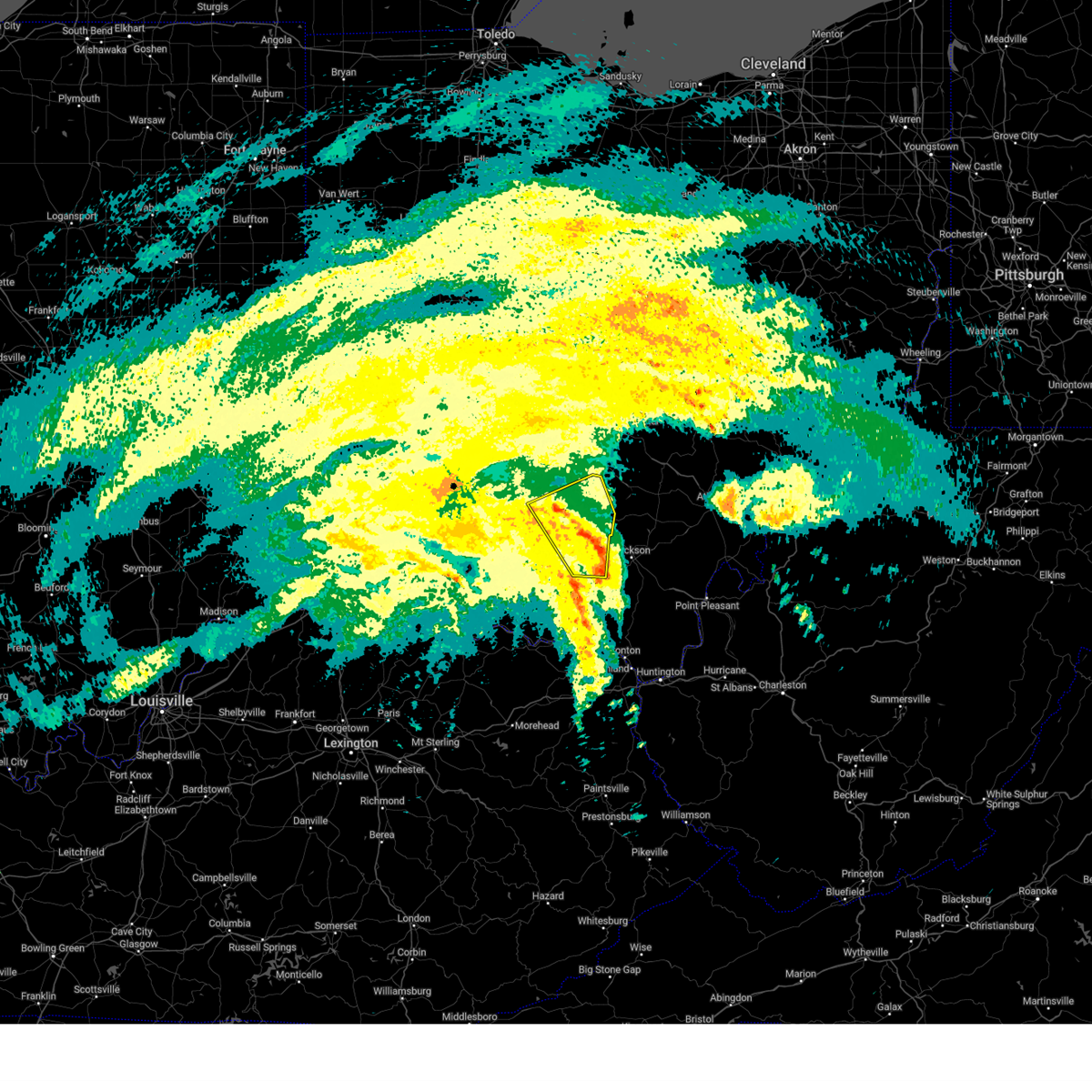
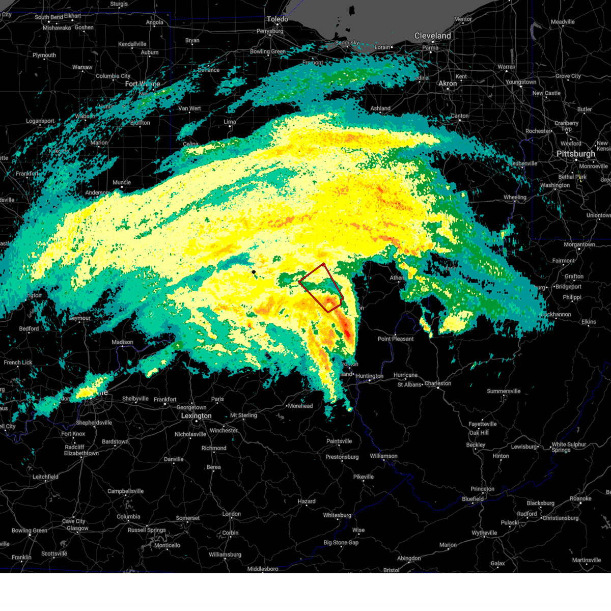
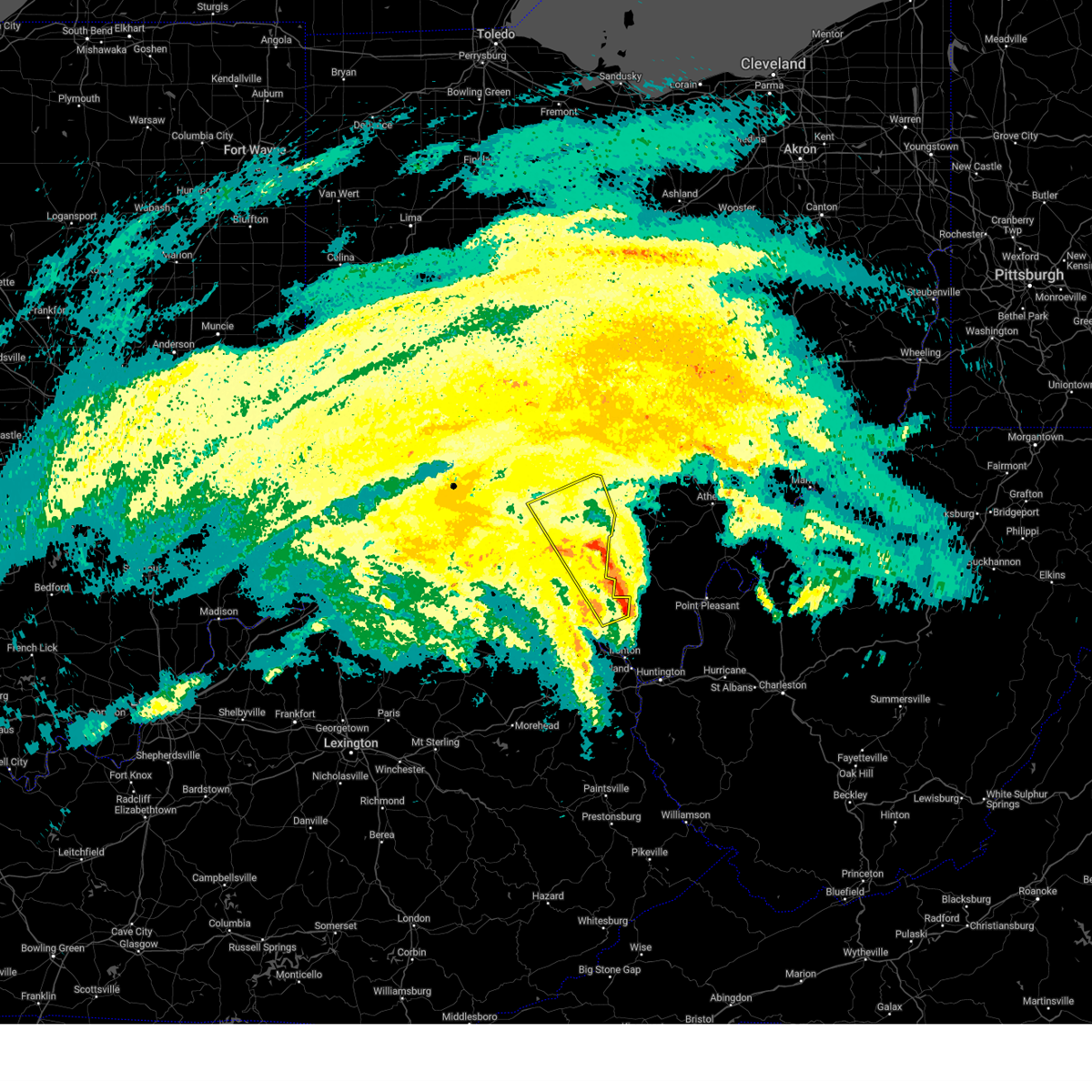
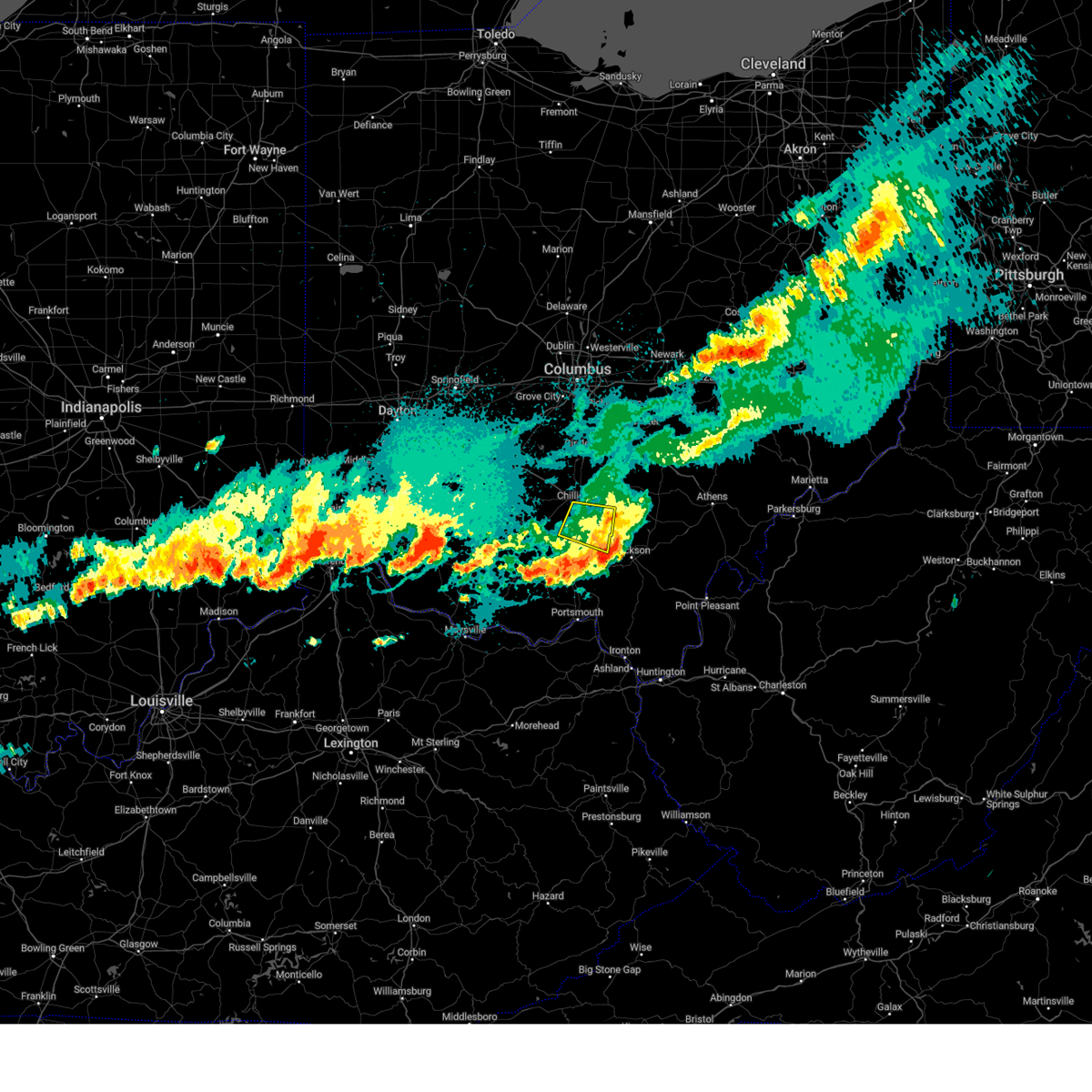
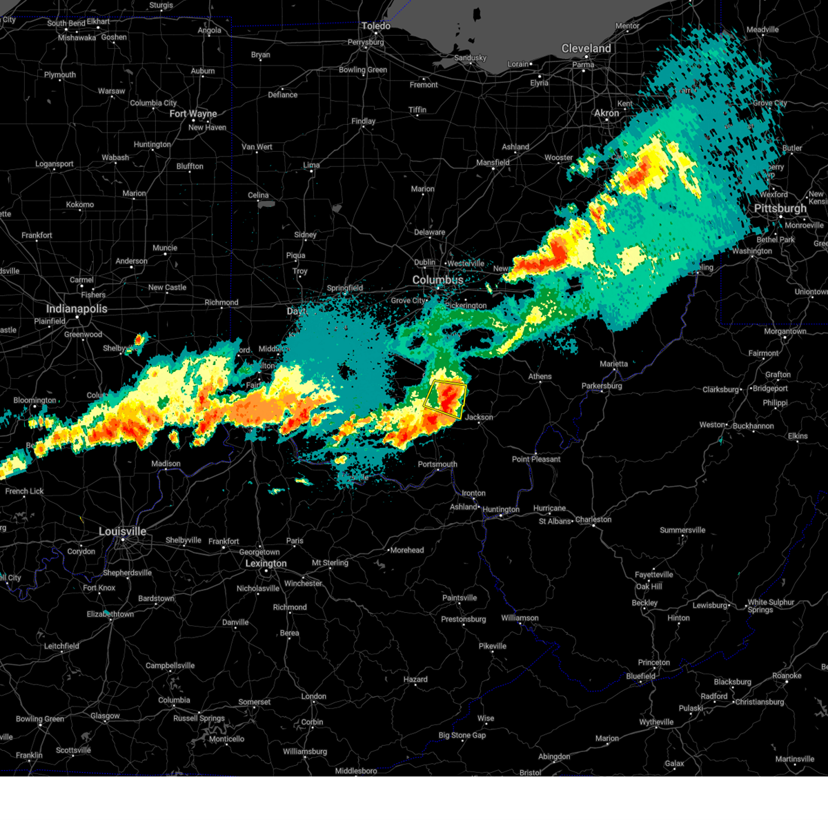
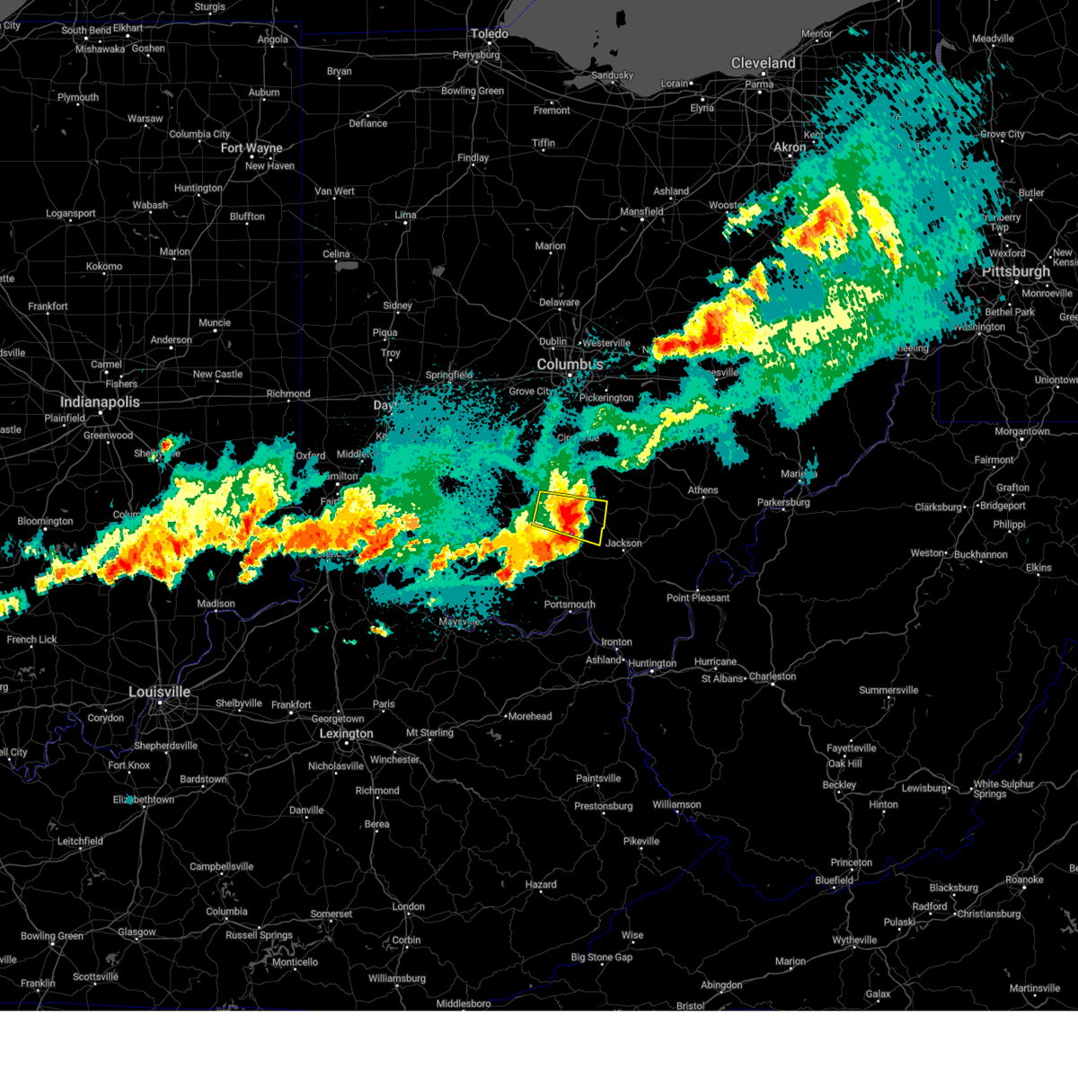
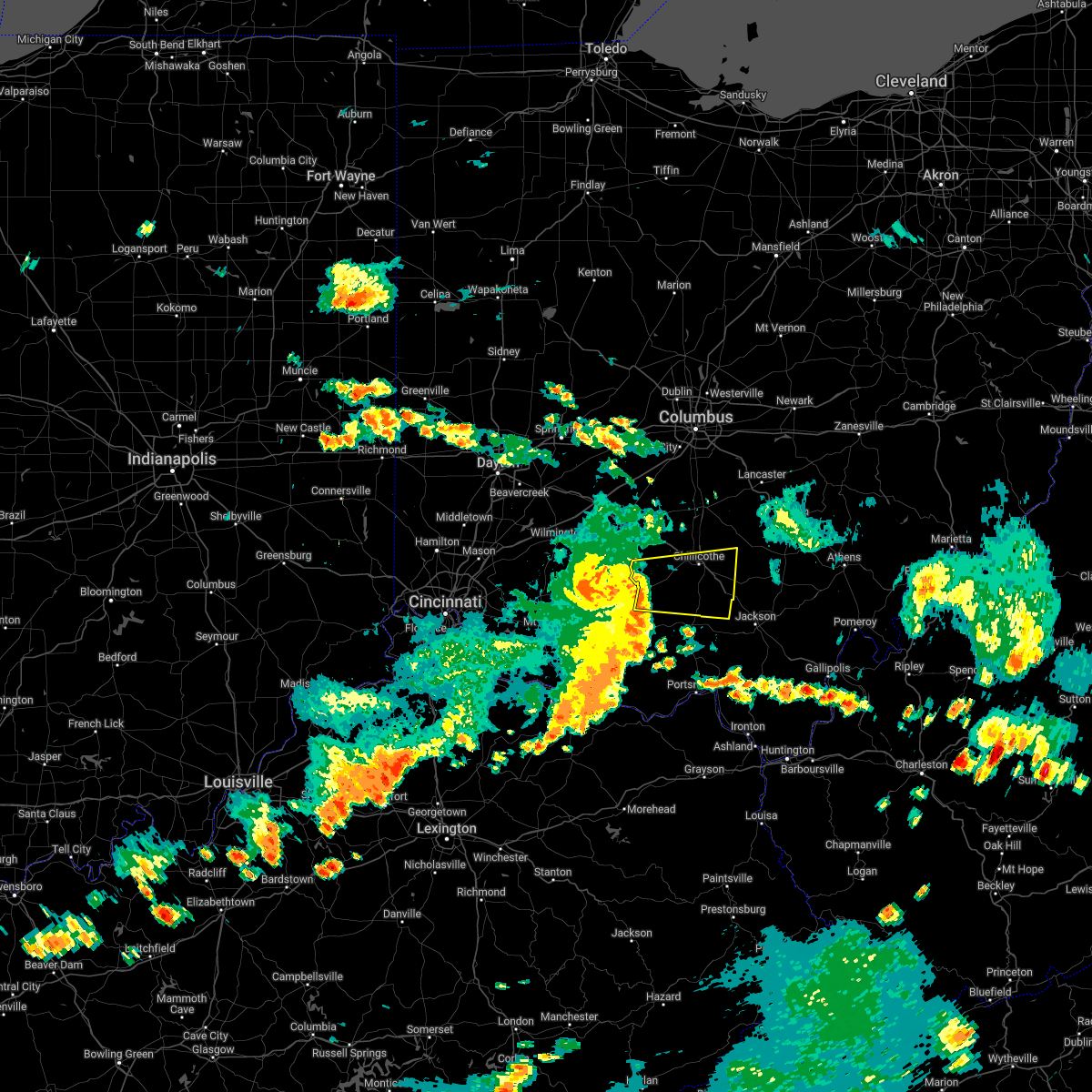
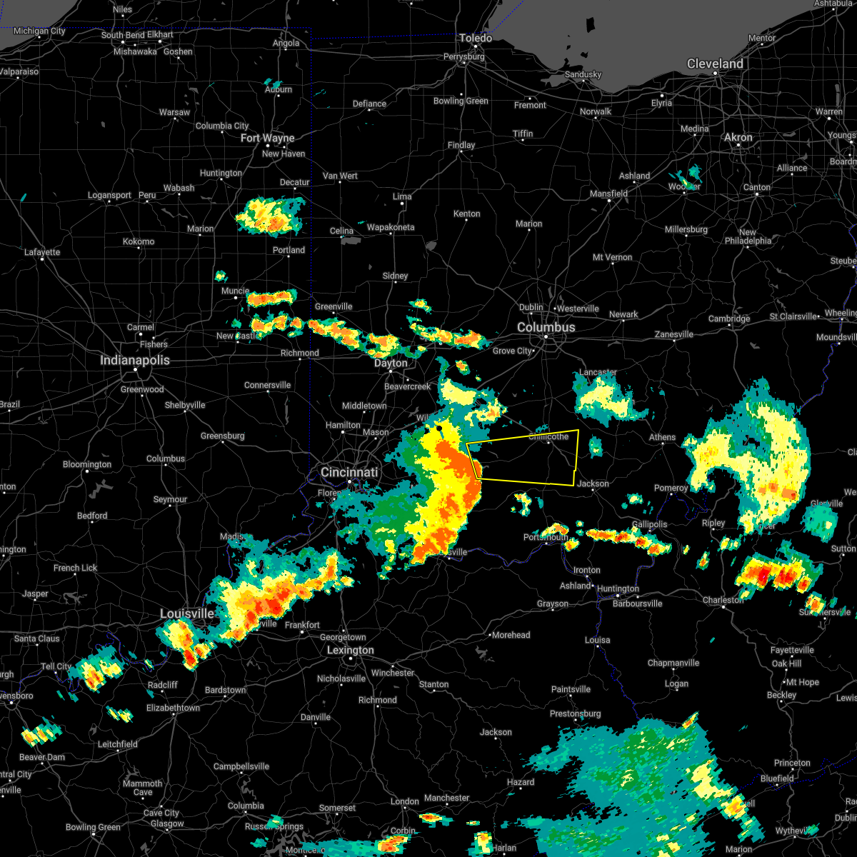
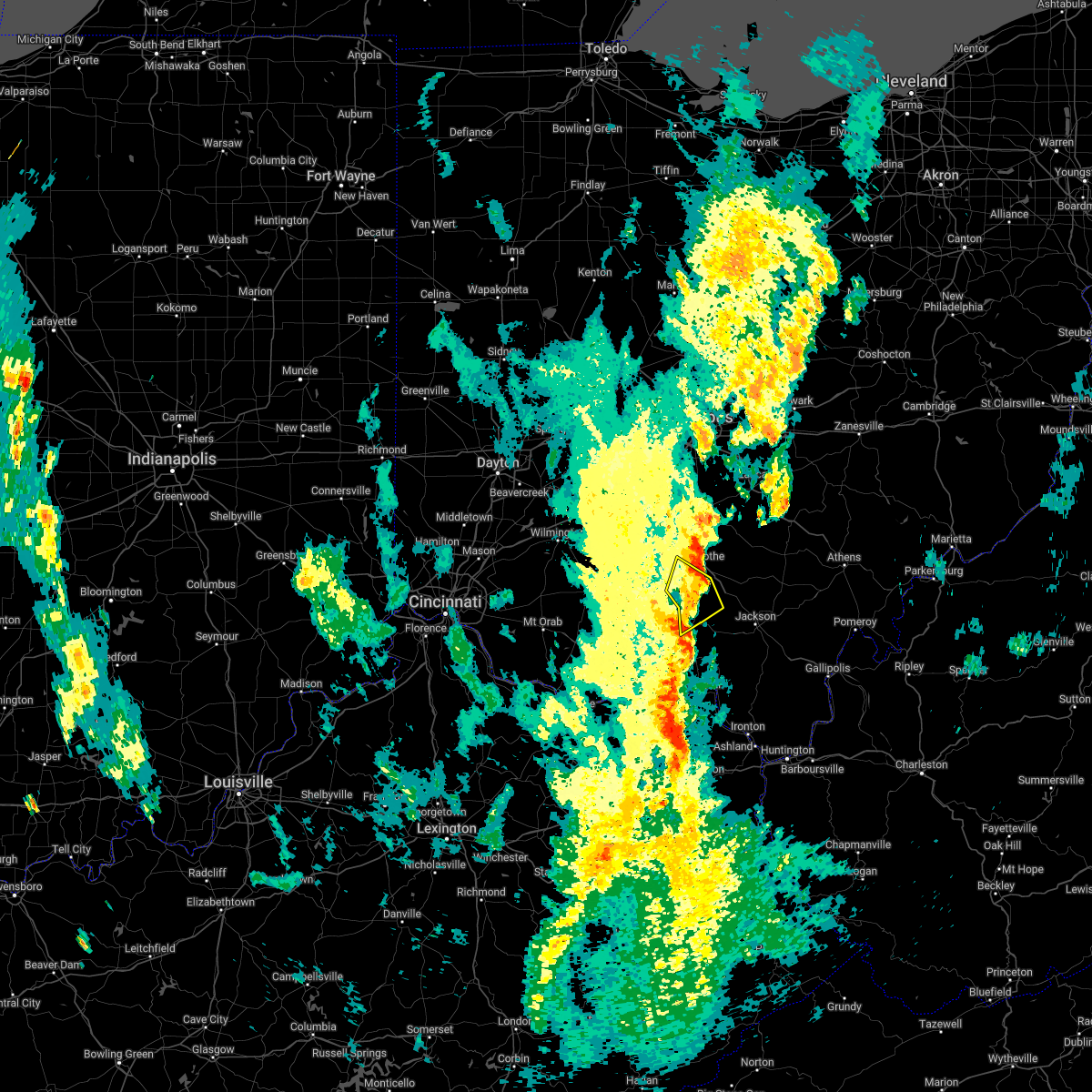
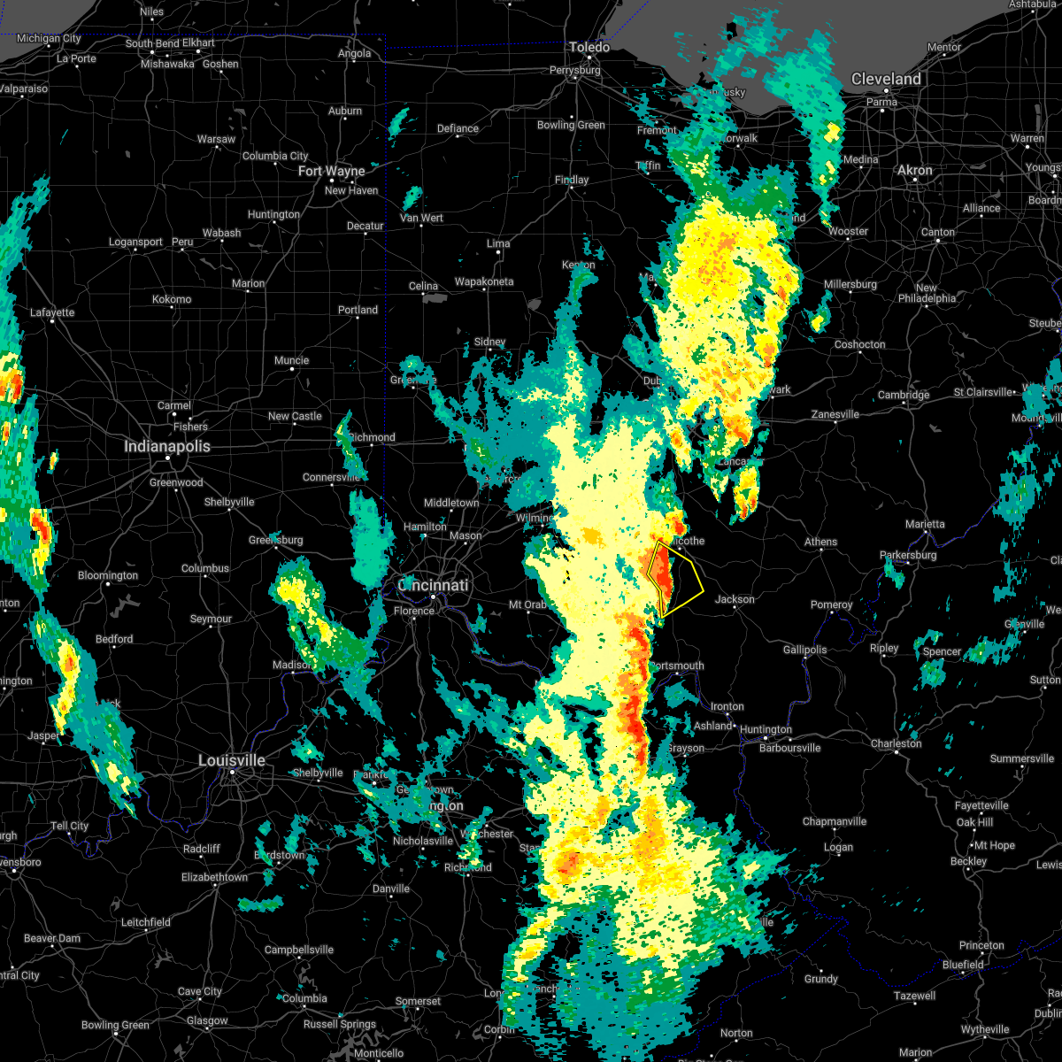
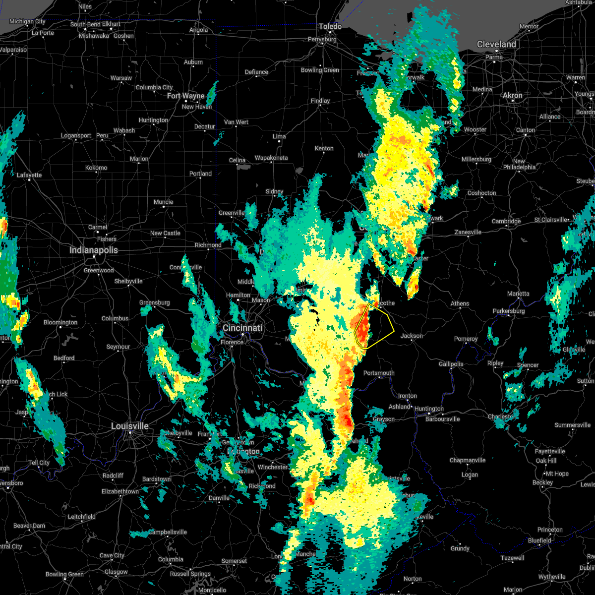
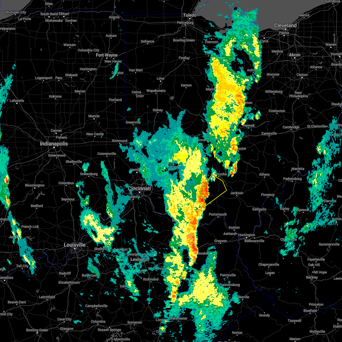
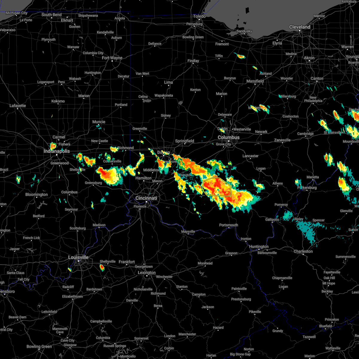
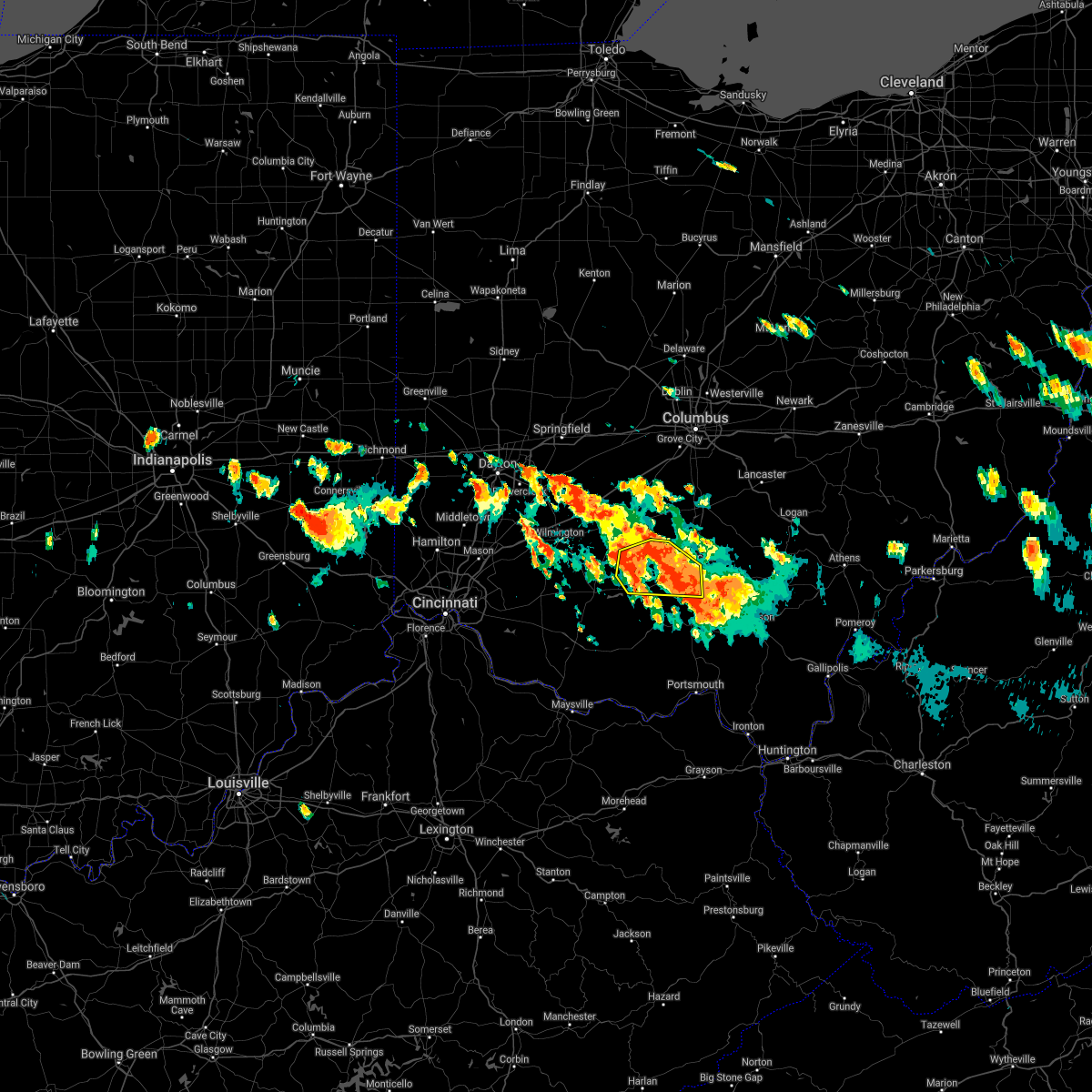
Hail Map for Chillicothe, OH
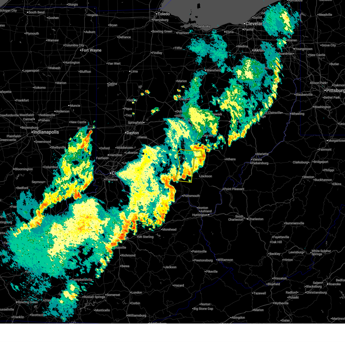
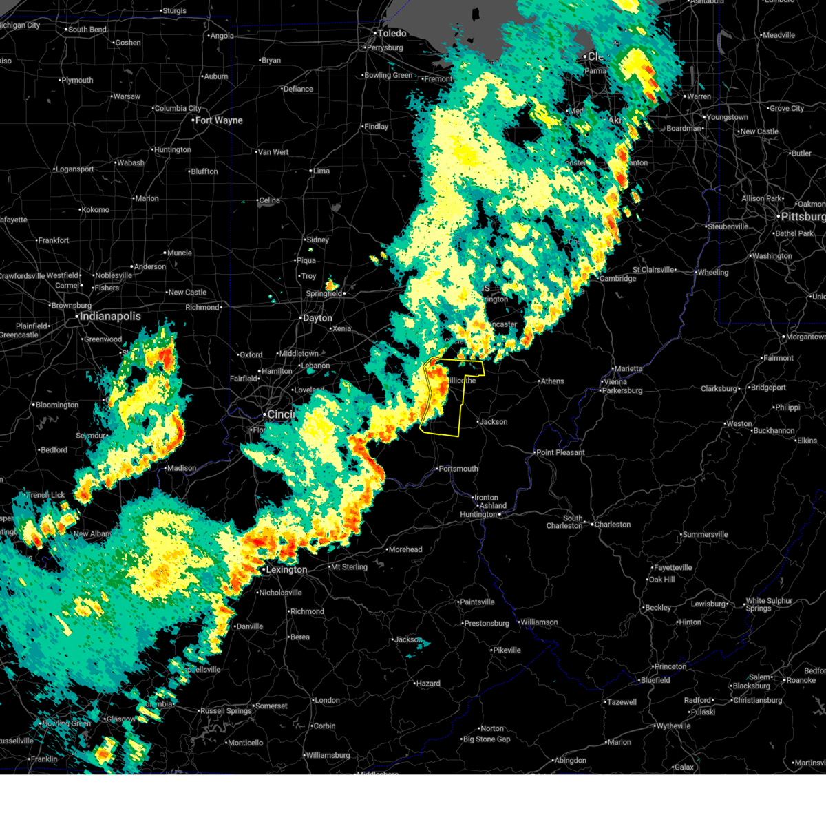
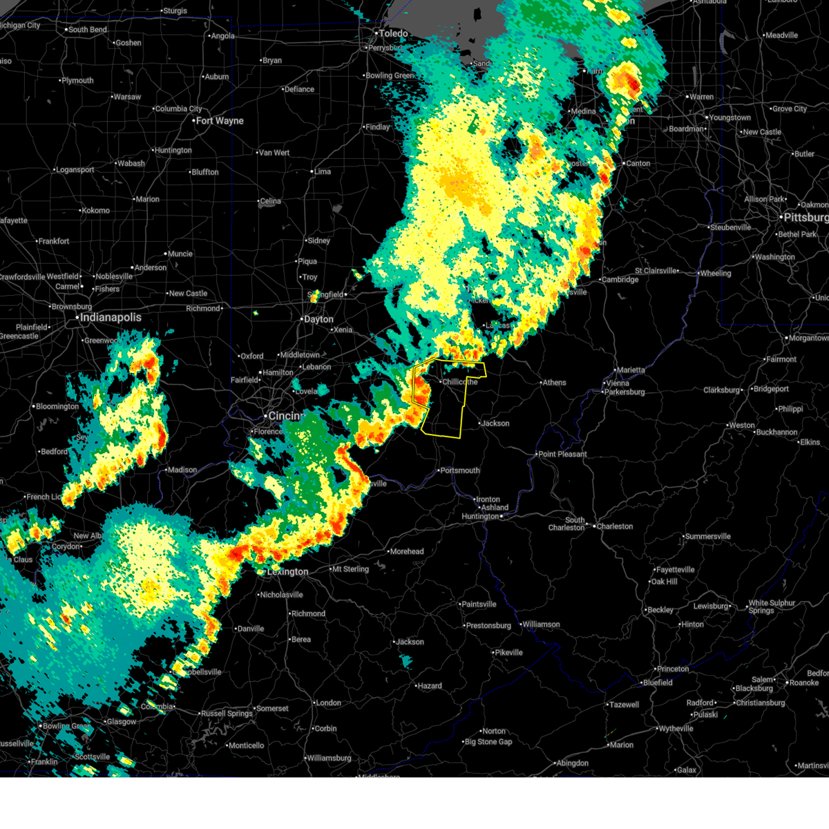
The Chillicothe, OH area has had 20 reports of on-the-ground hail by trained spotters, and has been under severe weather warnings 61 times during the past 12 months. Doppler radar has detected hail at or near Chillicothe, OH on 48 occasions, including 4 occasions during the past year.
| Name: | Chillicothe, OH |
| Where Located: | 43 miles S of Columbus, OH |
| Map: | Google Map for Chillicothe, OH |
| Population: | 21901 |
| Housing Units: | 10600 |
| More Info: | Search Google for Chillicothe, OH |
2
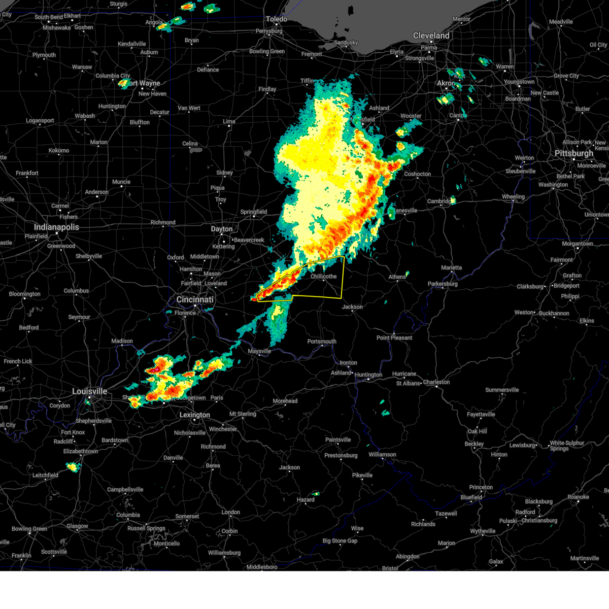
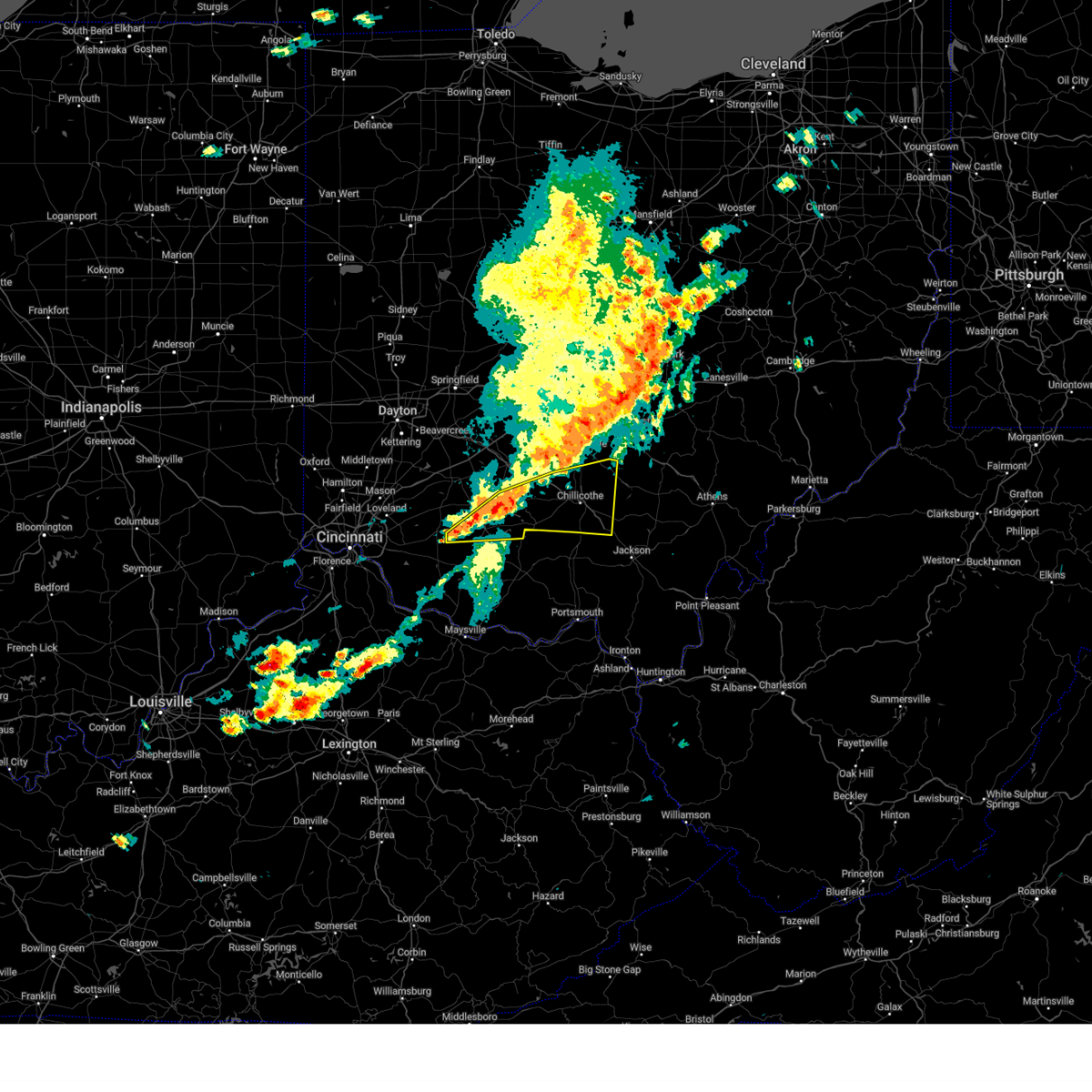
The Top Recent Hail Date for Chillicothe, OH is Sunday, May 4, 2025 (7th out of 48)
Hail and Wind Damage Spotted near Chillicothe, OH
| Date / Time | Report Details |
|---|---|
| 6/18/2025 10:22 PM EDT |
 The storm which prompted the warning has moved out of the area. therefore, the warning will be allowed to expire. an additional severe thunderstorm warning remains in effect for hocking county until 11 pm. a severe thunderstorm watch remains in effect until 1100 pm edt for south central ohio. please report previous wind damage or hail to the national weather service by going to our website at weather.gov/iln and submitting your report via social media. The storm which prompted the warning has moved out of the area. therefore, the warning will be allowed to expire. an additional severe thunderstorm warning remains in effect for hocking county until 11 pm. a severe thunderstorm watch remains in effect until 1100 pm edt for south central ohio. please report previous wind damage or hail to the national weather service by going to our website at weather.gov/iln and submitting your report via social media.
|
| 6/18/2025 9:55 PM EDT |
 At 954 pm edt, a severe thunderstorm was located near chillicothe, moving northeast at 50 mph (radar indicated). Hazards include 60 mph wind gusts. Expect damage to trees and power lines. Locations impacted include, chillicothe, waverly, piketon, kingston, north folk village, londonderry, beaver, adelphi, stockdale, pike county airport, andersonville, mooresville, omega, givens, south bloomingville, richmond dale, massieville, linn, hallsville, and lake white. At 954 pm edt, a severe thunderstorm was located near chillicothe, moving northeast at 50 mph (radar indicated). Hazards include 60 mph wind gusts. Expect damage to trees and power lines. Locations impacted include, chillicothe, waverly, piketon, kingston, north folk village, londonderry, beaver, adelphi, stockdale, pike county airport, andersonville, mooresville, omega, givens, south bloomingville, richmond dale, massieville, linn, hallsville, and lake white.
|
| 6/18/2025 9:40 PM EDT |
 Svriln the national weather service in wilmington has issued a * severe thunderstorm warning for, southwestern hocking county in central ohio, eastern pike county in south central ohio, ross county in south central ohio, * until 1030 pm edt. * at 940 pm edt, a severe thunderstorm was located near pike lake, moving east at 50 mph (radar indicated). Hazards include 60 mph wind gusts. expect damage to trees and power lines Svriln the national weather service in wilmington has issued a * severe thunderstorm warning for, southwestern hocking county in central ohio, eastern pike county in south central ohio, ross county in south central ohio, * until 1030 pm edt. * at 940 pm edt, a severe thunderstorm was located near pike lake, moving east at 50 mph (radar indicated). Hazards include 60 mph wind gusts. expect damage to trees and power lines
|
| 5/16/2025 11:37 PM EDT | The storm which prompted the warning has moved out of the area. therefore, the warning will be allowed to expire. a tornado watch remains in effect until 300 am edt for central and south central ohio. please report previous wind damage or hail to the national weather service by going to our website at weather.gov/iln and submitting your report via social media. |
| 5/16/2025 11:26 PM EDT | At 1125 pm edt, a severe thunderstorm was located near kingston, moving east at 60 mph (radar indicated). Hazards include 60 mph wind gusts and quarter size hail. Minor hail damage to vehicles is possible. expect wind damage to trees and power lines. Locations impacted include, mooresville, kingston, hallsville, adelphi, laurelville, and chillicothe. |
| 5/16/2025 11:26 PM EDT | the severe thunderstorm warning has been cancelled and is no longer in effect |
| 5/16/2025 11:17 PM EDT | At 1117 pm edt, a severe thunderstorm was located near north folk village, moving east at 45 mph (radar indicated). Hazards include 60 mph wind gusts and quarter size hail. Minor hail damage to vehicles is possible. expect wind damage to trees and power lines. Locations impacted include, andersonville, tarlton, mooresville, kingston, austin, lattaville, whisler, pickaway county airport, chillicothe, north folk village, hallsville, adelphi, frankfort, and laurelville. |
| 5/16/2025 11:17 PM EDT | the severe thunderstorm warning has been cancelled and is no longer in effect |
| 5/16/2025 10:57 PM EDT | Svriln the national weather service in wilmington has issued a * severe thunderstorm warning for, southeastern fayette county in central ohio, southeastern pickaway county in central ohio, northeastern highland county in south central ohio, ross county in south central ohio, * until 1145 pm edt. * at 1057 pm edt, a severe thunderstorm was located over greenfield, moving east at 45 mph (radar indicated). Hazards include two inch hail and 60 mph wind gusts. People and animals outdoors will be injured. expect hail damage to roofs, siding, windows, and vehicles. Expect wind damage to trees and power lines. |
| 5/16/2025 10:33 PM EDT |
 At 1032 pm edt, a severe thunderstorm was located near kingston, moving east at 55 mph (radar indicated). Hazards include 60 mph wind gusts and quarter size hail. Minor hail damage to vehicles is possible. expect wind damage to trees and power lines. Locations impacted include, leesburg, good hope, east monroe, mooresville, kingston, austin, circleville, rock mills, williamsport, south salem, new martinsburg, plano, aw marion state park, clarksburg, staunton, andersonville, lattaville, fox, greenfield, and logan elm village. At 1032 pm edt, a severe thunderstorm was located near kingston, moving east at 55 mph (radar indicated). Hazards include 60 mph wind gusts and quarter size hail. Minor hail damage to vehicles is possible. expect wind damage to trees and power lines. Locations impacted include, leesburg, good hope, east monroe, mooresville, kingston, austin, circleville, rock mills, williamsport, south salem, new martinsburg, plano, aw marion state park, clarksburg, staunton, andersonville, lattaville, fox, greenfield, and logan elm village.
|
| 5/16/2025 10:14 PM EDT | the severe thunderstorm warning has been cancelled and is no longer in effect |
| 5/16/2025 10:14 PM EDT | At 1014 pm edt, a severe thunderstorm was located near new holland, moving east at 55 mph (radar indicated). Hazards include 60 mph wind gusts and quarter size hail. Minor hail damage to vehicles is possible. expect wind damage to trees and power lines. Locations impacted include, deer creek lake, leesburg, darbyville, good hope, east monroe, mooresville, kingston, austin, circleville, rock mills, williamsport, south salem, new holland, washington court house, new martinsburg, pancoastburg, plano, aw marion state park, clarksburg, and staunton. |
| 5/16/2025 10:05 PM EDT | the severe thunderstorm warning has been cancelled and is no longer in effect |
| 5/16/2025 10:05 PM EDT | At 1004 pm edt, a severe thunderstorm was located 7 miles northwest of greenfield, moving east at 55 mph (radar indicated). Hazards include 70 mph wind gusts and quarter size hail. Minor hail damage to vehicles is possible. expect considerable tree damage. wind damage is also likely to mobile homes, roofs, and outbuildings. locations impacted include, deer creek lake, chenoweth, interstate 71 at state route 38, leesburg, new vienna, darbyville, good hope, east monroe, mooresville, kingston, austin, bloomingburg, circleville, lees creek, madison mills, rock mills, williamsport, south salem, new holland, and mount sterling. This includes i-71 in ohio between mile markers 73 and 84. |
| 5/16/2025 9:57 PM EDT | Svriln the national weather service in wilmington has issued a * severe thunderstorm warning for, fayette county in central ohio, northeastern clinton county in southwestern ohio, pickaway county in central ohio, southeastern greene county in west central ohio, northeastern highland county in south central ohio, southern madison county in central ohio, northern ross county in south central ohio, * until 1045 pm edt. * at 957 pm edt, a severe thunderstorm was located near sabina, moving east at 55 mph (radar indicated). Hazards include 70 mph wind gusts and quarter size hail. Minor hail damage to vehicles is possible. expect considerable tree damage. Wind damage is also likely to mobile homes, roofs, and outbuildings. |
| 5/4/2025 5:14 PM EDT | Quarter sized hail reported 1 miles SW of Chillicothe, OH, numerous reports of pea to dime sized hail covering the ground in chillicothe. largest hail measured at 1 inch. |
| 5/2/2025 7:27 PM EDT |
 the severe thunderstorm warning has been cancelled and is no longer in effect the severe thunderstorm warning has been cancelled and is no longer in effect
|
| 5/2/2025 7:20 PM EDT |
 At 719 pm edt, a severe thunderstorm was located near kingston, moving northeast at 25 mph (trained weather spotters reported one inch hail with this storm). Hazards include 60 mph wind gusts and quarter size hail. Minor hail damage to vehicles is possible. expect wind damage to trees and power lines. Locations impacted include, mooresville, kingston, hallsville, adelphi, whisler, and laurelville. At 719 pm edt, a severe thunderstorm was located near kingston, moving northeast at 25 mph (trained weather spotters reported one inch hail with this storm). Hazards include 60 mph wind gusts and quarter size hail. Minor hail damage to vehicles is possible. expect wind damage to trees and power lines. Locations impacted include, mooresville, kingston, hallsville, adelphi, whisler, and laurelville.
|
| 5/2/2025 7:08 PM EDT | Quarter sized hail reported 7.2 miles W of Chillicothe, OH |
| 5/2/2025 7:08 PM EDT | Half Dollar sized hail reported 3.6 miles WSW of Chillicothe, OH, photo verified. |
| 5/2/2025 7:08 PM EDT | Svriln the national weather service in wilmington has issued a * severe thunderstorm warning for, southwestern hocking county in central ohio, southeastern pickaway county in central ohio, eastern ross county in south central ohio, * until 745 pm edt. * at 708 pm edt, a severe thunderstorm was located near chillicothe, moving northeast at 25 mph (radar indicated). Hazards include 60 mph wind gusts and quarter size hail. Minor hail damage to vehicles is possible. Expect wind damage to trees and power lines. |
| 5/1/2025 3:12 PM EDT |
 At 312 pm edt, a severe thunderstorm was located near bainbridge, moving northeast at 45 mph (radar indicated). Hazards include 60 mph wind gusts and quarter size hail. Minor hail damage to vehicles is possible. expect wind damage to trees and power lines. Locations impacted include, greenfield, andersonville, austin, lattaville, south salem, frankfort, bourneville, and chillicothe. At 312 pm edt, a severe thunderstorm was located near bainbridge, moving northeast at 45 mph (radar indicated). Hazards include 60 mph wind gusts and quarter size hail. Minor hail damage to vehicles is possible. expect wind damage to trees and power lines. Locations impacted include, greenfield, andersonville, austin, lattaville, south salem, frankfort, bourneville, and chillicothe.
|
| 5/1/2025 3:03 PM EDT |
 Svriln the national weather service in wilmington has issued a * severe thunderstorm warning for, northeastern highland county in south central ohio, western ross county in south central ohio, * until 330 pm edt. * at 303 pm edt, a severe thunderstorm was located near cynthiana, moving northeast at 45 mph (radar indicated). Hazards include 60 mph wind gusts and quarter size hail. Minor hail damage to vehicles is possible. Expect wind damage to trees and power lines. Svriln the national weather service in wilmington has issued a * severe thunderstorm warning for, northeastern highland county in south central ohio, western ross county in south central ohio, * until 330 pm edt. * at 303 pm edt, a severe thunderstorm was located near cynthiana, moving northeast at 45 mph (radar indicated). Hazards include 60 mph wind gusts and quarter size hail. Minor hail damage to vehicles is possible. Expect wind damage to trees and power lines.
|
| 4/29/2025 3:43 PM EDT |
 The storm which prompted the warning has weakened below severe limits and no longer poses an immediate threat to life or property. therefore, the warning will be allowed to expire. a severe thunderstorm watch remains in effect until 700 pm edt for central and south central ohio. please report previous wind damage or hail to the national weather service by going to our website at weather.gov/iln and submitting your report via social media. The storm which prompted the warning has weakened below severe limits and no longer poses an immediate threat to life or property. therefore, the warning will be allowed to expire. a severe thunderstorm watch remains in effect until 700 pm edt for central and south central ohio. please report previous wind damage or hail to the national weather service by going to our website at weather.gov/iln and submitting your report via social media.
|
| 4/29/2025 3:37 PM EDT |
 At 337 pm edt, a severe thunderstorm was located near chillicothe, moving east at 55 mph (radar indicated). Hazards include 60 mph wind gusts and penny size hail. Expect damage to trees and power lines. Locations impacted include, bourneville, andersonville, tarlton, mooresville, kingston, austin, lattaville, whisler, summithill, knockemstiff, londonderry, pickaway county airport, bainbridge, richmond dale, chillicothe, north folk village, massieville, hallsville, adelphi, and south salem. At 337 pm edt, a severe thunderstorm was located near chillicothe, moving east at 55 mph (radar indicated). Hazards include 60 mph wind gusts and penny size hail. Expect damage to trees and power lines. Locations impacted include, bourneville, andersonville, tarlton, mooresville, kingston, austin, lattaville, whisler, summithill, knockemstiff, londonderry, pickaway county airport, bainbridge, richmond dale, chillicothe, north folk village, massieville, hallsville, adelphi, and south salem.
|
| 4/29/2025 3:37 PM EDT |
 the severe thunderstorm warning has been cancelled and is no longer in effect the severe thunderstorm warning has been cancelled and is no longer in effect
|
| 4/29/2025 3:35 PM EDT | Mesonet station cheo1 chillicothe. time also estimated from rada in ross county OH, 3.5 miles S of Chillicothe, OH |
| 4/29/2025 3:16 PM EDT |
 At 316 pm edt, a severe thunderstorm was located near greenfield, moving east at 55 mph (radar indicated). Hazards include 60 mph wind gusts and penny size hail. Expect damage to trees and power lines. Locations impacted include, danville in highland county, mooresville, samantha, kingston, austin, knockemstiff, rocky fork point, bainbridge, highland holiday, massieville, adelphi, south salem, highland county airport, rocky fork lake, bourneville, andersonville, tarlton, marshall, rainsboro, and lattaville. At 316 pm edt, a severe thunderstorm was located near greenfield, moving east at 55 mph (radar indicated). Hazards include 60 mph wind gusts and penny size hail. Expect damage to trees and power lines. Locations impacted include, danville in highland county, mooresville, samantha, kingston, austin, knockemstiff, rocky fork point, bainbridge, highland holiday, massieville, adelphi, south salem, highland county airport, rocky fork lake, bourneville, andersonville, tarlton, marshall, rainsboro, and lattaville.
|
| 4/29/2025 3:16 PM EDT |
 the severe thunderstorm warning has been cancelled and is no longer in effect the severe thunderstorm warning has been cancelled and is no longer in effect
|
| 4/29/2025 3:03 PM EDT |
 Svriln the national weather service in wilmington has issued a * severe thunderstorm warning for, southeastern fayette county in central ohio, southeastern pickaway county in central ohio, central highland county in south central ohio, ross county in south central ohio, * until 345 pm edt. * at 303 pm edt, a severe thunderstorm was located near leesburg, moving east at 55 mph (radar indicated). Hazards include 60 mph wind gusts and penny size hail. expect damage to trees and power lines Svriln the national weather service in wilmington has issued a * severe thunderstorm warning for, southeastern fayette county in central ohio, southeastern pickaway county in central ohio, central highland county in south central ohio, ross county in south central ohio, * until 345 pm edt. * at 303 pm edt, a severe thunderstorm was located near leesburg, moving east at 55 mph (radar indicated). Hazards include 60 mph wind gusts and penny size hail. expect damage to trees and power lines
|
| 4/19/2025 5:56 PM EDT | Trees down throughout the county. time and location estimate in ross county OH, 3.8 miles NNW of Chillicothe, OH |
| 4/19/2025 5:55 PM EDT |
 The storm which prompted the warning has moved out of the area. therefore, the warning will be allowed to expire. please report previous wind damage or hail to the national weather service by going to our website at weather.gov/iln and submitting your report via social media. remember, a severe thunderstorm warning still remains in effect for eastern ross county and pike county. The storm which prompted the warning has moved out of the area. therefore, the warning will be allowed to expire. please report previous wind damage or hail to the national weather service by going to our website at weather.gov/iln and submitting your report via social media. remember, a severe thunderstorm warning still remains in effect for eastern ross county and pike county.
|
| 4/19/2025 5:54 PM EDT | Trees uproote in ross county OH, 6.2 miles N of Chillicothe, OH |
| 4/19/2025 5:54 PM EDT | Multiple large trees uprooted and some shingle damage reporte in ross county OH, 3.5 miles N of Chillicothe, OH |
| 4/19/2025 5:49 PM EDT |
 Svriln the national weather service in wilmington has issued a * severe thunderstorm warning for, hocking county in central ohio, north central pike county in south central ohio, southern ross county in south central ohio, * until 645 pm edt. * at 548 pm edt, a severe thunderstorm was located near north folk village, moving east at 60 mph (radar indicated). Hazards include 60 mph wind gusts and quarter size hail. Minor hail damage to vehicles is possible. Expect wind damage to trees and power lines. Svriln the national weather service in wilmington has issued a * severe thunderstorm warning for, hocking county in central ohio, north central pike county in south central ohio, southern ross county in south central ohio, * until 645 pm edt. * at 548 pm edt, a severe thunderstorm was located near north folk village, moving east at 60 mph (radar indicated). Hazards include 60 mph wind gusts and quarter size hail. Minor hail damage to vehicles is possible. Expect wind damage to trees and power lines.
|
| 4/19/2025 5:44 PM EDT |
 At 542 pm edt, a severe thunderstorm was located over bainbridge, moving east at 50 mph (radar indicated). Hazards include 60 mph wind gusts and half dollar size hail. Minor hail damage to vehicles is possible. expect wind damage to trees and power lines. Locations impacted include, summithill, bourneville, knockemstiff, bainbridge, lattaville, south salem, frankfort, and chillicothe. At 542 pm edt, a severe thunderstorm was located over bainbridge, moving east at 50 mph (radar indicated). Hazards include 60 mph wind gusts and half dollar size hail. Minor hail damage to vehicles is possible. expect wind damage to trees and power lines. Locations impacted include, summithill, bourneville, knockemstiff, bainbridge, lattaville, south salem, frankfort, and chillicothe.
|
| 4/19/2025 5:44 PM EDT |
 the severe thunderstorm warning has been cancelled and is no longer in effect the severe thunderstorm warning has been cancelled and is no longer in effect
|
| 4/19/2025 5:30 PM EDT |
 At 530 pm edt, a severe thunderstorm was located over highland holiday, moving east at 60 mph (radar indicated). Hazards include 60 mph wind gusts and quarter size hail. Minor hail damage to vehicles is possible. expect wind damage to trees and power lines. Locations impacted include, rocky fork lake, bourneville, marshall, rainsboro, lattaville, paint creek state park, summithill, knockemstiff, rocky fork point, bainbridge, cynthiana, highland holiday, south salem, frankfort, highland county airport, hillsboro, and chillicothe. At 530 pm edt, a severe thunderstorm was located over highland holiday, moving east at 60 mph (radar indicated). Hazards include 60 mph wind gusts and quarter size hail. Minor hail damage to vehicles is possible. expect wind damage to trees and power lines. Locations impacted include, rocky fork lake, bourneville, marshall, rainsboro, lattaville, paint creek state park, summithill, knockemstiff, rocky fork point, bainbridge, cynthiana, highland holiday, south salem, frankfort, highland county airport, hillsboro, and chillicothe.
|
| 4/19/2025 5:21 PM EDT |
 Svriln the national weather service in wilmington has issued a * severe thunderstorm warning for, northwestern pike county in south central ohio, highland county in south central ohio, western ross county in south central ohio, * until 600 pm edt. * at 520 pm edt, a severe thunderstorm was located 7 miles southwest of hillsboro, moving east at 50 mph (radar indicated). Hazards include 60 mph wind gusts. expect damage to trees and power lines Svriln the national weather service in wilmington has issued a * severe thunderstorm warning for, northwestern pike county in south central ohio, highland county in south central ohio, western ross county in south central ohio, * until 600 pm edt. * at 520 pm edt, a severe thunderstorm was located 7 miles southwest of hillsboro, moving east at 50 mph (radar indicated). Hazards include 60 mph wind gusts. expect damage to trees and power lines
|
| 4/3/2025 2:28 AM EDT |
 The storm which prompted the warning has moved out of the area. therefore, the warning will be allowed to expire. a tornado watch remains in effect until 400 am edt for central and south central ohio. please report previous wind damage or hail to the national weather service by going to our website at weather.gov/iln and submitting your report via social media. The storm which prompted the warning has moved out of the area. therefore, the warning will be allowed to expire. a tornado watch remains in effect until 400 am edt for central and south central ohio. please report previous wind damage or hail to the national weather service by going to our website at weather.gov/iln and submitting your report via social media.
|
| 4/3/2025 2:20 AM EDT | At 219 am edt, a severe thunderstorm was located over granville south, moving northeast at 65 mph (radar indicated). Hazards include 60 mph wind gusts. Expect damage to trees and power lines. locations impacted include, fairfield county airport, east ringgold, us route 22 at state route 159, pickerington, johnstown, mooresville, kingston, slate run metro park, lithopolis, canal winchester, circleville, knockemstiff, pataskala, bainbridge, massieville, alexandria, jersey, adelphi, aw marion state park, and bourneville. This includes i-70 in ohio between mile markers 111 and 122. |
| 4/3/2025 2:20 AM EDT | the severe thunderstorm warning has been cancelled and is no longer in effect |
| 4/3/2025 2:07 AM EDT | At 207 am edt, a severe thunderstorm was located over reynoldsburg, moving northeast at 65 mph (radar indicated). Hazards include 60 mph wind gusts. Expect damage to trees and power lines. locations impacted include, port columbus airport, east ringgold, us route 22 at state route 159, johnstown, gahanna, austin, lithopolis, clintonville, westerville, knockemstiff, center village, bainbridge, highland holiday, williamsport, alexandria, jersey, south salem, whitehall, rocky fork lake, and bourneville. this includes the following interstates, i-70 in ohio between mile markers 98 and 122. I-71 in ohio between mile markers 99 and 120. |
| 4/3/2025 2:07 AM EDT | the severe thunderstorm warning has been cancelled and is no longer in effect |
| 4/3/2025 1:40 AM EDT | Svriln the national weather service in wilmington has issued a * severe thunderstorm warning for, franklin county in central ohio, western fairfield county in central ohio, eastern fayette county in central ohio, pickaway county in central ohio, southeastern delaware county in central ohio, western licking county in central ohio, eastern highland county in south central ohio, eastern madison county in central ohio, ross county in south central ohio, * until 230 am edt. * at 140 am edt, a severe thunderstorm was located over mount sterling, moving northeast at 65 mph (radar indicated). Hazards include 60 mph wind gusts. expect damage to trees and power lines |
| 3/30/2025 10:40 PM EDT | The storms which prompted the warning have weakened below severe limits and no longer pose an immediate threat to life or property. therefore, the warning will be allowed to expire. however, gusty winds are still possible with these thunderstorms. a tornado watch remains in effect until 100 am edt for central and south central ohio. please report previous wind damage or hail to the national weather service by going to our website at weather.gov/iln and submitting your report via social media. |
| 3/30/2025 10:30 PM EDT |
 At 1029 pm edt, severe thunderstorms were located along a line extending from near centerburg to near kingston, moving east at 65 mph (radar indicated). Hazards include 60 mph wind gusts and quarter size hail. Minor hail damage to vehicles is possible. expect wind damage to trees and power lines. locations impacted include, east ringgold, pickerington, johnstown, mooresville, kingston, brice, slate run metro park, lithopolis, canal winchester, laurelville, circleville, pataskala, massieville, jersey, adelphi, aw marion state park, etna, tarlton, blacklick estates, and new albany. This includes i-70 in ohio between mile markers 109 and 118. At 1029 pm edt, severe thunderstorms were located along a line extending from near centerburg to near kingston, moving east at 65 mph (radar indicated). Hazards include 60 mph wind gusts and quarter size hail. Minor hail damage to vehicles is possible. expect wind damage to trees and power lines. locations impacted include, east ringgold, pickerington, johnstown, mooresville, kingston, brice, slate run metro park, lithopolis, canal winchester, laurelville, circleville, pataskala, massieville, jersey, adelphi, aw marion state park, etna, tarlton, blacklick estates, and new albany. This includes i-70 in ohio between mile markers 109 and 118.
|
| 3/30/2025 10:30 PM EDT |
 the severe thunderstorm warning has been cancelled and is no longer in effect the severe thunderstorm warning has been cancelled and is no longer in effect
|
| 3/30/2025 10:06 PM EDT | the severe thunderstorm warning has been cancelled and is no longer in effect |
| 3/30/2025 10:06 PM EDT | At 1005 pm edt, severe thunderstorms were located along a line extending from near powell to 7 miles east of greenfield, moving east at 55 mph (radar indicated). Hazards include 60 mph wind gusts and penny size hail. Expect damage to trees and power lines. locations impacted include, port columbus airport, east ringgold, johnstown, gahanna, austin, lithopolis, knockemstiff, center village, williamsport, worthington, hilliard, grandview heights, whitehall, orient, clarksburg, duvall, riverlea, state route 138 at us route 22, columbus, and frankfort. this includes the following interstates, i-70 in ohio between mile markers 88 and 118. I-71 in ohio between mile markers 89 and 133. |
| 3/30/2025 9:46 PM EDT | Svriln the national weather service in wilmington has issued a * severe thunderstorm warning for, franklin county in central ohio, western fairfield county in central ohio, eastern fayette county in central ohio, pickaway county in central ohio, southern delaware county in central ohio, western licking county in central ohio, northeastern highland county in south central ohio, southeastern union county in central ohio, madison county in central ohio, ross county in south central ohio, * until 1045 pm edt. * at 945 pm edt, severe thunderstorms were located along a line extending from near mechanicsburg to near lynchburg, moving east at 65 mph (radar indicated). Hazards include 60 mph wind gusts and quarter size hail. Minor hail damage to vehicles is possible. Expect wind damage to trees and power lines. |
| 3/16/2025 10:35 AM EDT | Numerous trees downed throughout the area. time estimated by rada in ross county OH, 6.2 miles N of Chillicothe, OH |
| 9/27/2024 7:16 PM EDT |
 The storm which prompted the warning has weakened below severe limits and no longer poses an immediate threat to life or property. therefore, the warning has been allowed to expire. however, gusty winds and heavy rain are still possible with this thunderstorm. please report previous wind damage or hail to the national weather service by going to our website at weather.gov/iln and submitting your report via social media. The storm which prompted the warning has weakened below severe limits and no longer poses an immediate threat to life or property. therefore, the warning has been allowed to expire. however, gusty winds and heavy rain are still possible with this thunderstorm. please report previous wind damage or hail to the national weather service by going to our website at weather.gov/iln and submitting your report via social media.
|
| 9/27/2024 6:53 PM EDT |
 At 652 pm edt, a severe thunderstorm was located near chillicothe, moving north at 35 mph (radar indicated). Hazards include 60 mph wind gusts. Expect damage to trees and power lines. Locations impacted include, chillicothe, north folk village, frankfort, londonderry, knockemstiff, richmond dale, andersonville, massieville, mooresville, hallsville, austin, and scioto trail state park. At 652 pm edt, a severe thunderstorm was located near chillicothe, moving north at 35 mph (radar indicated). Hazards include 60 mph wind gusts. Expect damage to trees and power lines. Locations impacted include, chillicothe, north folk village, frankfort, londonderry, knockemstiff, richmond dale, andersonville, massieville, mooresville, hallsville, austin, and scioto trail state park.
|
| 9/27/2024 6:53 PM EDT |
 the severe thunderstorm warning has been cancelled and is no longer in effect the severe thunderstorm warning has been cancelled and is no longer in effect
|
| 9/27/2024 6:34 PM EDT |
 The severe thunderstorm warning has expired and has been replaced with a new severe thunderstorm warning which is in effect until 715 pm. please report previous wind damage or hail to the national weather service by going to our website at weather.gov/iln and submitting your report via social media. remember, a severe thunderstorm warning still remains in effect until 715 pm. The severe thunderstorm warning has expired and has been replaced with a new severe thunderstorm warning which is in effect until 715 pm. please report previous wind damage or hail to the national weather service by going to our website at weather.gov/iln and submitting your report via social media. remember, a severe thunderstorm warning still remains in effect until 715 pm.
|
| 9/27/2024 6:30 PM EDT |
 Svriln the national weather service in wilmington has issued a * severe thunderstorm warning for, northeastern pike county in south central ohio, ross county in south central ohio, * until 715 pm edt. * at 630 pm edt, a severe thunderstorm was located near waverly, moving north at 35 mph (radar indicated). Hazards include 60 mph wind gusts. expect damage to trees and power lines Svriln the national weather service in wilmington has issued a * severe thunderstorm warning for, northeastern pike county in south central ohio, ross county in south central ohio, * until 715 pm edt. * at 630 pm edt, a severe thunderstorm was located near waverly, moving north at 35 mph (radar indicated). Hazards include 60 mph wind gusts. expect damage to trees and power lines
|
| 9/27/2024 6:21 PM EDT |
 the severe thunderstorm warning has been cancelled and is no longer in effect the severe thunderstorm warning has been cancelled and is no longer in effect
|
| 9/27/2024 6:21 PM EDT |
 At 620 pm edt, a severe thunderstorm was located near new holland, moving north at 45 mph (radar indicated). Hazards include 60 mph wind gusts. Expect damage to trees and power lines. Locations impacted include, chillicothe, portsmouth, wheelersburg, waverly, new boston, piketon, bainbridge, rosemount, clarktown, pike lake, lucasville, sciotodale, north folk village, frankfort, clarksburg, south salem, wakefield, pike county airport, minford, and austin. At 620 pm edt, a severe thunderstorm was located near new holland, moving north at 45 mph (radar indicated). Hazards include 60 mph wind gusts. Expect damage to trees and power lines. Locations impacted include, chillicothe, portsmouth, wheelersburg, waverly, new boston, piketon, bainbridge, rosemount, clarktown, pike lake, lucasville, sciotodale, north folk village, frankfort, clarksburg, south salem, wakefield, pike county airport, minford, and austin.
|
| 9/27/2024 5:28 PM EDT |
 Svriln the national weather service in wilmington has issued a * severe thunderstorm warning for, northeastern adams county in south central ohio, pike county in south central ohio, scioto county in south central ohio, ross county in south central ohio, * until 630 pm edt. * at 527 pm edt, a severe thunderstorm was located near lucasville, moving north at 45 mph (radar indicated). Hazards include 60 mph wind gusts. expect damage to trees and power lines Svriln the national weather service in wilmington has issued a * severe thunderstorm warning for, northeastern adams county in south central ohio, pike county in south central ohio, scioto county in south central ohio, ross county in south central ohio, * until 630 pm edt. * at 527 pm edt, a severe thunderstorm was located near lucasville, moving north at 45 mph (radar indicated). Hazards include 60 mph wind gusts. expect damage to trees and power lines
|
| 9/27/2024 5:00 PM EDT |
 The tornado threat has diminished and the tornado warning has been cancelled. however, damaging winds remain likely and a severe thunderstorm warning remains in effect for the area. please report previous tornadoes, wind damage or hail to the national weather service by going to our website at weather.gov/iln and submitting your report via social media. remember, a severe thunderstorm warning still remains in effect until 530 pm. The tornado threat has diminished and the tornado warning has been cancelled. however, damaging winds remain likely and a severe thunderstorm warning remains in effect for the area. please report previous tornadoes, wind damage or hail to the national weather service by going to our website at weather.gov/iln and submitting your report via social media. remember, a severe thunderstorm warning still remains in effect until 530 pm.
|
| 9/27/2024 4:42 PM EDT |
 Svriln the national weather service in wilmington has issued a * severe thunderstorm warning for, pike county in south central ohio, northern scioto county in south central ohio, ross county in south central ohio, * until 530 pm edt. * at 442 pm edt, a severe thunderstorm was located near piketon, moving north at 45 mph (radar indicated). Hazards include 70 mph wind gusts. Expect considerable tree damage. Damage is likely to mobile homes, roofs, and outbuildings. Svriln the national weather service in wilmington has issued a * severe thunderstorm warning for, pike county in south central ohio, northern scioto county in south central ohio, ross county in south central ohio, * until 530 pm edt. * at 442 pm edt, a severe thunderstorm was located near piketon, moving north at 45 mph (radar indicated). Hazards include 70 mph wind gusts. Expect considerable tree damage. Damage is likely to mobile homes, roofs, and outbuildings.
|
| 9/27/2024 4:42 PM EDT |
 The severe thunderstorm warning will be allowed to expire, but another severe thunderstorm warning has been issued for the same areas as gusty winds and heavy rain are still possible with this thunderstorm. please report previous wind damage or hail to the national weather service by going to our website at weather.gov/iln and submitting your report via social media. remember, a severe thunderstorm warning still remains in effect for portions of scioto, pike, and ross counties. The severe thunderstorm warning will be allowed to expire, but another severe thunderstorm warning has been issued for the same areas as gusty winds and heavy rain are still possible with this thunderstorm. please report previous wind damage or hail to the national weather service by going to our website at weather.gov/iln and submitting your report via social media. remember, a severe thunderstorm warning still remains in effect for portions of scioto, pike, and ross counties.
|
| 9/27/2024 4:30 PM EDT |
 The tornado warning that was previously in effect has been reissued and is in effect until 4 pm. please refer to that bulletin for the latest severe weather information. please report previous tornadoes, wind damage or hail to the national weather service by going to our website at weather.gov/iln and submitting your report via social media. remember, a tornado warning still remains in effect until 4 pm. The tornado warning that was previously in effect has been reissued and is in effect until 4 pm. please refer to that bulletin for the latest severe weather information. please report previous tornadoes, wind damage or hail to the national weather service by going to our website at weather.gov/iln and submitting your report via social media. remember, a tornado warning still remains in effect until 4 pm.
|
| 9/27/2024 4:26 PM EDT |
 At 425 pm edt, a severe thunderstorm was located over waverly, moving northwest at 30 mph (radar indicated). Hazards include 70 mph wind gusts. Expect considerable tree damage. damage is likely to mobile homes, roofs, and outbuildings. Locations impacted include, chillicothe, waverly, piketon, kingston, pike lake, north folk village, londonderry, beaver, south salem, wakefield, pike county airport, mooresville, omega, givens, knockemstiff, massieville, lake white, bourneville, stockdale, and andersonville. At 425 pm edt, a severe thunderstorm was located over waverly, moving northwest at 30 mph (radar indicated). Hazards include 70 mph wind gusts. Expect considerable tree damage. damage is likely to mobile homes, roofs, and outbuildings. Locations impacted include, chillicothe, waverly, piketon, kingston, pike lake, north folk village, londonderry, beaver, south salem, wakefield, pike county airport, mooresville, omega, givens, knockemstiff, massieville, lake white, bourneville, stockdale, and andersonville.
|
| 9/27/2024 4:26 PM EDT |
 Toriln the national weather service in wilmington has issued a * tornado warning for, eastern pike county in south central ohio, central ross county in south central ohio, * until 500 pm edt. * at 426 pm edt, a severe thunderstorm capable of producing a tornado was located near waverly, moving northwest at 35 mph (radar indicated rotation). Hazards include tornado. Flying debris will be dangerous to those caught without shelter. mobile homes will be damaged or destroyed. damage to roofs, windows, and vehicles will occur. Tree damage is likely. Toriln the national weather service in wilmington has issued a * tornado warning for, eastern pike county in south central ohio, central ross county in south central ohio, * until 500 pm edt. * at 426 pm edt, a severe thunderstorm capable of producing a tornado was located near waverly, moving northwest at 35 mph (radar indicated rotation). Hazards include tornado. Flying debris will be dangerous to those caught without shelter. mobile homes will be damaged or destroyed. damage to roofs, windows, and vehicles will occur. Tree damage is likely.
|
| 9/27/2024 4:26 PM EDT |
 the severe thunderstorm warning has been cancelled and is no longer in effect the severe thunderstorm warning has been cancelled and is no longer in effect
|
| 9/27/2024 4:01 PM EDT |
 Toriln the national weather service in wilmington has issued a * tornado warning for, northeastern pike county in south central ohio, central ross county in south central ohio, * until 430 pm edt. * at 401 pm edt, a severe thunderstorm capable of producing a tornado was located near waverly, moving northwest at 30 mph (radar indicated rotation). Hazards include tornado. Flying debris will be dangerous to those caught without shelter. mobile homes will be damaged or destroyed. damage to roofs, windows, and vehicles will occur. Tree damage is likely. Toriln the national weather service in wilmington has issued a * tornado warning for, northeastern pike county in south central ohio, central ross county in south central ohio, * until 430 pm edt. * at 401 pm edt, a severe thunderstorm capable of producing a tornado was located near waverly, moving northwest at 30 mph (radar indicated rotation). Hazards include tornado. Flying debris will be dangerous to those caught without shelter. mobile homes will be damaged or destroyed. damage to roofs, windows, and vehicles will occur. Tree damage is likely.
|
| 9/27/2024 3:57 PM EDT |
 Svriln the national weather service in wilmington has issued a * severe thunderstorm warning for, pike county in south central ohio, northeastern scioto county in south central ohio, ross county in south central ohio, * until 445 pm edt. * at 357 pm edt, a severe thunderstorm was located 9 miles north of south webster, moving northwest at 30 mph (radar indicated). Hazards include 70 mph wind gusts. Expect considerable tree damage. Damage is likely to mobile homes, roofs, and outbuildings. Svriln the national weather service in wilmington has issued a * severe thunderstorm warning for, pike county in south central ohio, northeastern scioto county in south central ohio, ross county in south central ohio, * until 445 pm edt. * at 357 pm edt, a severe thunderstorm was located 9 miles north of south webster, moving northwest at 30 mph (radar indicated). Hazards include 70 mph wind gusts. Expect considerable tree damage. Damage is likely to mobile homes, roofs, and outbuildings.
|
| 6/17/2024 4:15 PM EDT | Several trees were downed along hough roa in ross county OH, 9.1 miles WSW of Chillicothe, OH |
| 5/26/2024 3:24 PM EDT |
 The storms which prompted the warning have moved out of the area. therefore, the warning will be allowed to expire. a severe thunderstorm watch remains in effect until 800 pm edt for central, south central, southwestern and west central ohio. please report previous wind damage or hail to the national weather service by going to our website at weather.gov/iln and submitting your report via social media. remember, a severe thunderstorm warning still remains in effect for northeast ross county!. The storms which prompted the warning have moved out of the area. therefore, the warning will be allowed to expire. a severe thunderstorm watch remains in effect until 800 pm edt for central, south central, southwestern and west central ohio. please report previous wind damage or hail to the national weather service by going to our website at weather.gov/iln and submitting your report via social media. remember, a severe thunderstorm warning still remains in effect for northeast ross county!.
|
| 5/26/2024 3:19 PM EDT | Several trees down in the area southeast of chillicoth in ross county OH, 5.1 miles WNW of Chillicothe, OH |
| 5/26/2024 3:13 PM EDT |
 Svriln the national weather service in wilmington has issued a * severe thunderstorm warning for, southern fairfield county in central ohio, hocking county in central ohio, southeastern pickaway county in central ohio, eastern ross county in south central ohio, * until 415 pm edt. * at 313 pm edt, severe thunderstorms were located along a line extending from 6 miles south of new holland to 7 miles southeast of chillicothe to near clarktown, moving northeast at 50 mph (radar indicated). Hazards include 60 mph wind gusts. expect damage to trees and power lines Svriln the national weather service in wilmington has issued a * severe thunderstorm warning for, southern fairfield county in central ohio, hocking county in central ohio, southeastern pickaway county in central ohio, eastern ross county in south central ohio, * until 415 pm edt. * at 313 pm edt, severe thunderstorms were located along a line extending from 6 miles south of new holland to 7 miles southeast of chillicothe to near clarktown, moving northeast at 50 mph (radar indicated). Hazards include 60 mph wind gusts. expect damage to trees and power lines
|
| 5/26/2024 2:45 PM EDT |
 Svriln the national weather service in wilmington has issued a * severe thunderstorm warning for, fayette county in central ohio, northeastern clinton county in southwestern ohio, northwestern pike county in south central ohio, southeastern greene county in west central ohio, northeastern highland county in south central ohio, ross county in south central ohio, * until 330 pm edt. * at 244 pm edt, severe thunderstorms were located along a line extending from 7 miles northeast of morrow to near kincaid springs, moving north at 40 mph (radar indicated). Hazards include 60 mph wind gusts. expect damage to trees and power lines Svriln the national weather service in wilmington has issued a * severe thunderstorm warning for, fayette county in central ohio, northeastern clinton county in southwestern ohio, northwestern pike county in south central ohio, southeastern greene county in west central ohio, northeastern highland county in south central ohio, ross county in south central ohio, * until 330 pm edt. * at 244 pm edt, severe thunderstorms were located along a line extending from 7 miles northeast of morrow to near kincaid springs, moving north at 40 mph (radar indicated). Hazards include 60 mph wind gusts. expect damage to trees and power lines
|
| 5/9/2024 7:07 PM EDT | Time estimated based on radar. trees down on church street and carlisle place in chillicoth in ross county OH, 0.1 miles WSW of Chillicothe, OH |
| 5/8/2024 12:36 AM EDT |
 The storm which prompted the warning has moved out of the area. therefore, the warning will be allowed to expire. however, heavy rain is still possible with this thunderstorm. a tornado watch remains in effect until 200 am edt for south central ohio. please report previous wind damage or hail to the national weather service by going to our website at weather.gov/iln and submitting your report via social media. The storm which prompted the warning has moved out of the area. therefore, the warning will be allowed to expire. however, heavy rain is still possible with this thunderstorm. a tornado watch remains in effect until 200 am edt for south central ohio. please report previous wind damage or hail to the national weather service by going to our website at weather.gov/iln and submitting your report via social media.
|
| 5/8/2024 12:21 AM EDT |
 At 1221 am edt, a severe thunderstorm was located 9 miles northeast of waverly, moving east at 50 mph (radar indicated). Hazards include 60 mph wind gusts and penny size hail. Expect damage to trees and power lines. Locations impacted include, chillicothe, waverly, north folk village, londonderry, pike county airport, richmond dale, massieville, linn, omega, and scioto trail state park. At 1221 am edt, a severe thunderstorm was located 9 miles northeast of waverly, moving east at 50 mph (radar indicated). Hazards include 60 mph wind gusts and penny size hail. Expect damage to trees and power lines. Locations impacted include, chillicothe, waverly, north folk village, londonderry, pike county airport, richmond dale, massieville, linn, omega, and scioto trail state park.
|
| 5/8/2024 12:10 AM EDT |
 Svriln the national weather service in wilmington has issued a * severe thunderstorm warning for, northeastern pike county in south central ohio, southeastern ross county in south central ohio, * until 1245 am edt. * at 1210 am edt, a severe thunderstorm was located near waverly, moving east at 50 mph (radar indicated). Hazards include 60 mph wind gusts and penny size hail. expect damage to trees and power lines Svriln the national weather service in wilmington has issued a * severe thunderstorm warning for, northeastern pike county in south central ohio, southeastern ross county in south central ohio, * until 1245 am edt. * at 1210 am edt, a severe thunderstorm was located near waverly, moving east at 50 mph (radar indicated). Hazards include 60 mph wind gusts and penny size hail. expect damage to trees and power lines
|
| 7/28/2023 1:03 PM EDT | Several trees... large limbs of 6-12 inch in diameter... downed in chillicothe. time estimated by rada in ross county OH, 0.7 miles W of Chillicothe, OH |
| 4/5/2023 4:50 PM EDT |
 At 449 pm edt, a severe thunderstorm was located near washington court house, moving east at 55 mph (radar indicated). Hazards include 60 mph wind gusts and penny size hail. Expect damage to trees and power lines. locations impacted include, chillicothe, washington court house, circleville, greenfield, south bloomfield, leesburg, jeffersonville, kingston, williamsport, bloomingburg, new holland, logan elm village, staunton, good hope, frankfort, fox, clarksburg, highland, south salem and east ringgold. hail threat, radar indicated max hail size, 0. 75 in wind threat, radar indicated max wind gust, 60 mph. At 449 pm edt, a severe thunderstorm was located near washington court house, moving east at 55 mph (radar indicated). Hazards include 60 mph wind gusts and penny size hail. Expect damage to trees and power lines. locations impacted include, chillicothe, washington court house, circleville, greenfield, south bloomfield, leesburg, jeffersonville, kingston, williamsport, bloomingburg, new holland, logan elm village, staunton, good hope, frankfort, fox, clarksburg, highland, south salem and east ringgold. hail threat, radar indicated max hail size, 0. 75 in wind threat, radar indicated max wind gust, 60 mph.
|
| 4/5/2023 4:39 PM EDT |
 At 439 pm edt, a severe thunderstorm was located near sabina, moving east at 55 mph (radar indicated). Hazards include 60 mph wind gusts and penny size hail. expect damage to trees and power lines At 439 pm edt, a severe thunderstorm was located near sabina, moving east at 55 mph (radar indicated). Hazards include 60 mph wind gusts and penny size hail. expect damage to trees and power lines
|
| 3/3/2023 6:51 PM EST |
 The severe thunderstorm warning for southeastern pickaway and eastern ross counties will expire at 700 pm est, the storm which prompted the warning has moved out of the area. therefore, the warning will be allowed to expire. however gusty winds are still likely after the storms pass. please report previous wind damage or hail to the national weather service by going to our website at weather.gov/iln and submitting your report via social media. The severe thunderstorm warning for southeastern pickaway and eastern ross counties will expire at 700 pm est, the storm which prompted the warning has moved out of the area. therefore, the warning will be allowed to expire. however gusty winds are still likely after the storms pass. please report previous wind damage or hail to the national weather service by going to our website at weather.gov/iln and submitting your report via social media.
|
| 3/3/2023 6:35 PM EST |
 At 635 pm est, a severe thunderstorm was located near circleville, moving northeast at 50 mph (radar indicated). Hazards include 60 mph wind gusts. Expect damage to trees and power lines. Locations impacted include, chillicothe, circleville, kingston, logan elm village, londonderry, laurelville, adelphi, aw marion state park, andersonville, mooresville, whisler, pickaway county airport, state route 138 at us route 22, massieville, hallsville and scioto trail state park. At 635 pm est, a severe thunderstorm was located near circleville, moving northeast at 50 mph (radar indicated). Hazards include 60 mph wind gusts. Expect damage to trees and power lines. Locations impacted include, chillicothe, circleville, kingston, logan elm village, londonderry, laurelville, adelphi, aw marion state park, andersonville, mooresville, whisler, pickaway county airport, state route 138 at us route 22, massieville, hallsville and scioto trail state park.
|
| 3/3/2023 6:30 PM EST | Semi blown over on us-3 in ross county OH, 2.2 miles NW of Chillicothe, OH |
| 3/3/2023 6:30 PM EST | Spotter reported widespread damage from 6 se of chillicothe all the way into town. trees... wires down... and shingles off businesse in ross county OH, 6.5 miles NW of Chillicothe, OH |
| 3/3/2023 6:25 PM EST |
 At 625 pm est, a severe thunderstorm was located near logan elm village, moving northeast at 50 mph (radar indicated). Hazards include 60 mph wind gusts. Expect damage to trees and power lines. Locations impacted include, chillicothe, circleville, kingston, bainbridge, logan elm village, north folk village, frankfort, londonderry, laurelville, clarksburg, adelphi, mooresville, austin, knockemstiff, massieville, aw marion state park, bourneville, andersonville, lattaville and whisler. At 625 pm est, a severe thunderstorm was located near logan elm village, moving northeast at 50 mph (radar indicated). Hazards include 60 mph wind gusts. Expect damage to trees and power lines. Locations impacted include, chillicothe, circleville, kingston, bainbridge, logan elm village, north folk village, frankfort, londonderry, laurelville, clarksburg, adelphi, mooresville, austin, knockemstiff, massieville, aw marion state park, bourneville, andersonville, lattaville and whisler.
|
| 3/3/2023 6:10 PM EST |
 At 609 pm est, a severe thunderstorm was located 9 miles east of greenfield, moving northeast at 50 mph (radar indicated). Hazards include 70 mph wind gusts. Expect considerable tree damage. Damage is likely to mobile homes, roofs, and outbuildings. At 609 pm est, a severe thunderstorm was located 9 miles east of greenfield, moving northeast at 50 mph (radar indicated). Hazards include 70 mph wind gusts. Expect considerable tree damage. Damage is likely to mobile homes, roofs, and outbuildings.
|
| 7/23/2022 1:00 PM EDT | Large tree fell in house... knocking down power lines. photo verified. time estimated from rada in ross county OH, 1.4 miles WNW of Chillicothe, OH |
| 7/6/2022 4:17 PM EDT |
 At 417 pm edt, a severe thunderstorm was located over bainbridge, moving east at 45 mph (radar indicated). Hazards include 60 mph wind gusts. Expect damage to trees and power lines. locations impacted include, chillicothe, greenfield, waverly, bainbridge, pike lake, cynthiana, north folk village, londonderry, south salem, bourneville, pike county airport, mooresville, lattaville, omega, buchanan, summithill, knockemstiff, richmond dale, massieville and linn. hail threat, radar indicated max hail size, <. 75 in wind threat, radar indicated max wind gust, 60 mph. At 417 pm edt, a severe thunderstorm was located over bainbridge, moving east at 45 mph (radar indicated). Hazards include 60 mph wind gusts. Expect damage to trees and power lines. locations impacted include, chillicothe, greenfield, waverly, bainbridge, pike lake, cynthiana, north folk village, londonderry, south salem, bourneville, pike county airport, mooresville, lattaville, omega, buchanan, summithill, knockemstiff, richmond dale, massieville and linn. hail threat, radar indicated max hail size, <. 75 in wind threat, radar indicated max wind gust, 60 mph.
|
| 7/6/2022 3:59 PM EDT |
 At 358 pm edt, a severe thunderstorm was located over highland holiday, moving east at 45 mph (radar indicated). Hazards include 70 mph wind gusts. Expect considerable tree damage. Damage is likely to mobile homes, roofs, and outbuildings. At 358 pm edt, a severe thunderstorm was located over highland holiday, moving east at 45 mph (radar indicated). Hazards include 70 mph wind gusts. Expect considerable tree damage. Damage is likely to mobile homes, roofs, and outbuildings.
|
| 6/13/2022 7:24 PM EDT | Numerous large branches down and a tree snapped. time est from rada in ross county OH, 1.4 miles WNW of Chillicothe, OH |
| 6/13/2022 6:47 PM EDT |
 At 647 pm edt, severe thunderstorms were located along a line extending from 6 miles north of bloomingburg to near leesburg, moving east at 40 mph (radar indicated). Hazards include 60 mph wind gusts. expect damage to trees and power lines At 647 pm edt, severe thunderstorms were located along a line extending from 6 miles north of bloomingburg to near leesburg, moving east at 40 mph (radar indicated). Hazards include 60 mph wind gusts. expect damage to trees and power lines
|
| 6/8/2022 8:12 PM EDT |
 The severe thunderstorm warning for southwestern hocking and eastern ross counties will expire at 815 pm edt, the storm which prompted the warning has moved out of the area. therefore, the warning will be allowed to expire. a tornado watch remains in effect until 1000 pm edt for central and southwestern ohio. please report previous wind damage or hail to the national weather service by going to our website at weather.gov/iln and submitting your report via social media. The severe thunderstorm warning for southwestern hocking and eastern ross counties will expire at 815 pm edt, the storm which prompted the warning has moved out of the area. therefore, the warning will be allowed to expire. a tornado watch remains in effect until 1000 pm edt for central and southwestern ohio. please report previous wind damage or hail to the national weather service by going to our website at weather.gov/iln and submitting your report via social media.
|
| 6/8/2022 7:55 PM EDT | Fields flattened and tree limbs everywher in ross county OH, 8.9 miles N of Chillicothe, OH |
| 6/8/2022 7:53 PM EDT |
 At 752 pm edt, a severe thunderstorm was located over chillicothe, moving east at 45 mph (radar indicated). Hazards include 60 mph wind gusts and penny size hail. Expect damage to trees and power lines. locations impacted include, chillicothe, kingston, north folk village, londonderry, laurelville, adelphi, andersonville, mooresville, south bloomingville, summithill, knockemstiff, richmond dale, massieville, hallsville, scioto trail state park and bourneville. hail threat, radar indicated max hail size, 0. 75 in wind threat, radar indicated max wind gust, 60 mph. At 752 pm edt, a severe thunderstorm was located over chillicothe, moving east at 45 mph (radar indicated). Hazards include 60 mph wind gusts and penny size hail. Expect damage to trees and power lines. locations impacted include, chillicothe, kingston, north folk village, londonderry, laurelville, adelphi, andersonville, mooresville, south bloomingville, summithill, knockemstiff, richmond dale, massieville, hallsville, scioto trail state park and bourneville. hail threat, radar indicated max hail size, 0. 75 in wind threat, radar indicated max wind gust, 60 mph.
|
| 6/8/2022 7:36 PM EDT |
 At 735 pm edt, a severe thunderstorm was located 8 miles north of bainbridge, moving east at 45 mph (radar indicated). Hazards include 60 mph wind gusts and quarter size hail. Minor hail damage to vehicles is possible. Expect wind damage to trees and power lines. At 735 pm edt, a severe thunderstorm was located 8 miles north of bainbridge, moving east at 45 mph (radar indicated). Hazards include 60 mph wind gusts and quarter size hail. Minor hail damage to vehicles is possible. Expect wind damage to trees and power lines.
|
| 6/8/2022 6:43 PM EDT |
 At 643 pm edt, a severe thunderstorm was located 7 miles west of kingston, moving east at 40 mph (radar indicated). Hazards include 60 mph wind gusts and quarter size hail. Minor hail damage to vehicles is possible. expect wind damage to trees and power lines. Locations impacted include, chillicothe, kingston, logan elm village, stoutsville, laurelville, clarksburg, adelphi, tarlton, buena vista in hocking county, andersonville, whisler, pickaway county airport and hallsville. At 643 pm edt, a severe thunderstorm was located 7 miles west of kingston, moving east at 40 mph (radar indicated). Hazards include 60 mph wind gusts and quarter size hail. Minor hail damage to vehicles is possible. expect wind damage to trees and power lines. Locations impacted include, chillicothe, kingston, logan elm village, stoutsville, laurelville, clarksburg, adelphi, tarlton, buena vista in hocking county, andersonville, whisler, pickaway county airport and hallsville.
|
| 6/8/2022 6:34 PM EDT |
 At 634 pm edt, a severe thunderstorm was located 8 miles southeast of new holland, moving east at 40 mph (radar indicated). Hazards include 60 mph wind gusts and quarter size hail. Minor hail damage to vehicles is possible. Expect wind damage to trees and power lines. At 634 pm edt, a severe thunderstorm was located 8 miles southeast of new holland, moving east at 40 mph (radar indicated). Hazards include 60 mph wind gusts and quarter size hail. Minor hail damage to vehicles is possible. Expect wind damage to trees and power lines.
|
| 5/26/2022 7:38 PM EDT |
 The severe thunderstorm warning for eastern pike and south central ross counties will expire at 745 pm edt, the storm which prompted the warning has weakened below severe limits, and has exited the warned area. therefore, the warning will be allowed to expire. however gusty winds and heavy rain are still possible with this thunderstorm. please report previous wind damage or hail to the national weather service by going to our website at weather.gov/iln and submitting your report via social media. The severe thunderstorm warning for eastern pike and south central ross counties will expire at 745 pm edt, the storm which prompted the warning has weakened below severe limits, and has exited the warned area. therefore, the warning will be allowed to expire. however gusty winds and heavy rain are still possible with this thunderstorm. please report previous wind damage or hail to the national weather service by going to our website at weather.gov/iln and submitting your report via social media.
|
| 5/26/2022 7:37 PM EDT | Report of twisted trees along eastern avenue near us-23. time estimated from rada in ross county OH, 3.5 miles NW of Chillicothe, OH |
| 5/26/2022 7:28 PM EDT | Emergency manager reports about 75 trees blow down. time estimated by rada in ross county OH, 4.9 miles NNE of Chillicothe, OH |
| 5/26/2022 7:23 PM EDT |
 At 723 pm edt, a severe thunderstorm was located near waverly, moving northeast at 45 mph (radar indicated). Hazards include 60 mph wind gusts. Expect damage to trees and power lines. Locations impacted include, chillicothe, waverly, piketon, summithill, knockemstiff, pike county airport, massieville, lake white, omega and scioto trail state park. At 723 pm edt, a severe thunderstorm was located near waverly, moving northeast at 45 mph (radar indicated). Hazards include 60 mph wind gusts. Expect damage to trees and power lines. Locations impacted include, chillicothe, waverly, piketon, summithill, knockemstiff, pike county airport, massieville, lake white, omega and scioto trail state park.
|
| 5/26/2022 7:10 PM EDT |
 At 710 pm edt, a severe thunderstorm was located near pike lake, moving northeast at 40 mph (radar indicated). Hazards include 60 mph wind gusts and penny size hail. Expect damage to trees and power lines. Locations impacted include, chillicothe, waverly, piketon, pike lake, bourneville, pike county airport, elm grove, omega, buchanan, summithill, knockemstiff, ladd, massieville, lake white, scioto trail state park and idaho. At 710 pm edt, a severe thunderstorm was located near pike lake, moving northeast at 40 mph (radar indicated). Hazards include 60 mph wind gusts and penny size hail. Expect damage to trees and power lines. Locations impacted include, chillicothe, waverly, piketon, pike lake, bourneville, pike county airport, elm grove, omega, buchanan, summithill, knockemstiff, ladd, massieville, lake white, scioto trail state park and idaho.
|
| 5/26/2022 6:58 PM EDT |
 At 657 pm edt, a severe thunderstorm was located 7 miles east of peebles, moving northeast at 40 mph (radar indicated). Hazards include 60 mph wind gusts and penny size hail. expect damage to trees and power lines At 657 pm edt, a severe thunderstorm was located 7 miles east of peebles, moving northeast at 40 mph (radar indicated). Hazards include 60 mph wind gusts and penny size hail. expect damage to trees and power lines
|
| 5/21/2022 4:24 PM EDT |
 At 424 pm edt, a severe thunderstorm was located 7 miles south of new holland, moving northeast at 20 mph (radar indicated). Hazards include 60 mph wind gusts and quarter size hail. Minor hail damage to vehicles is possible. expect wind damage to trees and power lines. locations impacted include, chillicothe, greenfield, frankfort, clarksburg, south salem, andersonville, lattaville, austin and plano. hail threat, radar indicated max hail size, 1. 00 in wind threat, radar indicated max wind gust, 60 mph. At 424 pm edt, a severe thunderstorm was located 7 miles south of new holland, moving northeast at 20 mph (radar indicated). Hazards include 60 mph wind gusts and quarter size hail. Minor hail damage to vehicles is possible. expect wind damage to trees and power lines. locations impacted include, chillicothe, greenfield, frankfort, clarksburg, south salem, andersonville, lattaville, austin and plano. hail threat, radar indicated max hail size, 1. 00 in wind threat, radar indicated max wind gust, 60 mph.
|
| 5/21/2022 4:23 PM EDT | Tree downed along stone road near rte 207. time estimated by rada in ross county OH, 6.1 miles SSE of Chillicothe, OH |
| 5/21/2022 3:59 PM EDT |
 At 359 pm edt, a severe thunderstorm was located near greenfield, moving northeast at 20 mph (radar indicated). Hazards include 60 mph wind gusts and quarter size hail. Minor hail damage to vehicles is possible. Expect wind damage to trees and power lines. At 359 pm edt, a severe thunderstorm was located near greenfield, moving northeast at 20 mph (radar indicated). Hazards include 60 mph wind gusts and quarter size hail. Minor hail damage to vehicles is possible. Expect wind damage to trees and power lines.
|
| 5/3/2022 5:16 PM EDT |
 At 516 pm edt, a severe thunderstorm was located 9 miles west of hocking hills state park, moving east at 45 mph (radar indicated). Hazards include 60 mph wind gusts and penny size hail. Expect damage to trees and power lines. locations impacted include, chillicothe, londonderry, stoutsville, laurelville, adelphi, tarlton, buena vista in hocking county, gibisonville, mooresville, whisler, south bloomingville, summithill, clearport, richmond dale, massieville, hallsville and scioto trail state park. hail threat, radar indicated max hail size, 0. 75 in wind threat, radar indicated max wind gust, 60 mph. At 516 pm edt, a severe thunderstorm was located 9 miles west of hocking hills state park, moving east at 45 mph (radar indicated). Hazards include 60 mph wind gusts and penny size hail. Expect damage to trees and power lines. locations impacted include, chillicothe, londonderry, stoutsville, laurelville, adelphi, tarlton, buena vista in hocking county, gibisonville, mooresville, whisler, south bloomingville, summithill, clearport, richmond dale, massieville, hallsville and scioto trail state park. hail threat, radar indicated max hail size, 0. 75 in wind threat, radar indicated max wind gust, 60 mph.
|
| 5/3/2022 5:13 PM EDT |
 The severe thunderstorm warning for northwestern pike and central ross counties will expire at 515 pm edt, an additional severe thunderstorm warning remains in effect for portions of ross county until 545 pm. a tornado watch remains in effect until 900 pm edt for southwestern ohio. please report previous wind damage or hail to the national weather service by going to our website at weather.gov/iln and submitting your report via social media. The severe thunderstorm warning for northwestern pike and central ross counties will expire at 515 pm edt, an additional severe thunderstorm warning remains in effect for portions of ross county until 545 pm. a tornado watch remains in effect until 900 pm edt for southwestern ohio. please report previous wind damage or hail to the national weather service by going to our website at weather.gov/iln and submitting your report via social media.
|
| 5/3/2022 5:00 PM EDT | Several large branches as well as a large tree down along east main street. time estimated from rada in ross county OH, 0.1 miles WSW of Chillicothe, OH |
| 5/3/2022 4:59 PM EDT |
 At 459 pm edt, a severe thunderstorm was located near chillicothe, moving northeast at 45 mph (radar indicated). Hazards include 60 mph wind gusts and penny size hail. expect damage to trees and power lines At 459 pm edt, a severe thunderstorm was located near chillicothe, moving northeast at 45 mph (radar indicated). Hazards include 60 mph wind gusts and penny size hail. expect damage to trees and power lines
|
| 5/3/2022 4:57 PM EDT | Storm damage reported in ross county OH, 7.1 miles SSE of Chillicothe, OH |
| 5/3/2022 4:55 PM EDT |
 At 455 pm edt, a severe thunderstorm was located over north folk village, moving northeast at 45 mph (radar indicated). Hazards include 60 mph wind gusts and penny size hail. Expect damage to trees and power lines. locations impacted include, chillicothe, bainbridge, cynthiana, north folk village, summithill, bourneville, knockemstiff, andersonville, massieville, scioto trail state park and buchanan. hail threat, radar indicated max hail size, 0. 75 in wind threat, radar indicated max wind gust, 60 mph. At 455 pm edt, a severe thunderstorm was located over north folk village, moving northeast at 45 mph (radar indicated). Hazards include 60 mph wind gusts and penny size hail. Expect damage to trees and power lines. locations impacted include, chillicothe, bainbridge, cynthiana, north folk village, summithill, bourneville, knockemstiff, andersonville, massieville, scioto trail state park and buchanan. hail threat, radar indicated max hail size, 0. 75 in wind threat, radar indicated max wind gust, 60 mph.
|
| 5/3/2022 4:46 PM EDT |
 At 446 pm edt, a severe thunderstorm was located 7 miles north of bainbridge, moving northeast at 45 mph (radar indicated). Hazards include 60 mph wind gusts and penny size hail. Expect damage to trees and power lines. locations impacted include, chillicothe, bainbridge, cynthiana, north folk village, frankfort, south salem, bourneville, andersonville, lattaville, buchanan, summithill, knockemstiff, massieville and scioto trail state park. hail threat, radar indicated max hail size, 0. 75 in wind threat, radar indicated max wind gust, 60 mph. At 446 pm edt, a severe thunderstorm was located 7 miles north of bainbridge, moving northeast at 45 mph (radar indicated). Hazards include 60 mph wind gusts and penny size hail. Expect damage to trees and power lines. locations impacted include, chillicothe, bainbridge, cynthiana, north folk village, frankfort, south salem, bourneville, andersonville, lattaville, buchanan, summithill, knockemstiff, massieville and scioto trail state park. hail threat, radar indicated max hail size, 0. 75 in wind threat, radar indicated max wind gust, 60 mph.
|
| 5/3/2022 4:31 PM EDT |
 At 431 pm edt, a severe thunderstorm was located near greenfield, moving east at 40 mph (radar indicated). Hazards include 60 mph wind gusts and penny size hail. expect damage to trees and power lines At 431 pm edt, a severe thunderstorm was located near greenfield, moving east at 40 mph (radar indicated). Hazards include 60 mph wind gusts and penny size hail. expect damage to trees and power lines
|
| 10/16/2021 1:34 AM EDT |
 At 134 am edt, a severe thunderstorm capable of producing a tornado was located 9 miles north of bainbridge, moving east at 40 mph (radar indicated rotation). Hazards include tornado. Flying debris will be dangerous to those caught without shelter. mobile homes will be damaged or destroyed. damage to roofs, windows, and vehicles will occur. tree damage is likely. Locations impacted include, chillicothe, north folk village, frankfort, south salem, andersonville, lattaville and austin. At 134 am edt, a severe thunderstorm capable of producing a tornado was located 9 miles north of bainbridge, moving east at 40 mph (radar indicated rotation). Hazards include tornado. Flying debris will be dangerous to those caught without shelter. mobile homes will be damaged or destroyed. damage to roofs, windows, and vehicles will occur. tree damage is likely. Locations impacted include, chillicothe, north folk village, frankfort, south salem, andersonville, lattaville and austin.
|
| 10/16/2021 1:29 AM EDT |
 At 129 am edt, a severe thunderstorm capable of producing a tornado was located near greenfield, moving east at 35 mph (radar indicated rotation). Hazards include tornado. Flying debris will be dangerous to those caught without shelter. mobile homes will be damaged or destroyed. damage to roofs, windows, and vehicles will occur. Tree damage is likely. At 129 am edt, a severe thunderstorm capable of producing a tornado was located near greenfield, moving east at 35 mph (radar indicated rotation). Hazards include tornado. Flying debris will be dangerous to those caught without shelter. mobile homes will be damaged or destroyed. damage to roofs, windows, and vehicles will occur. Tree damage is likely.
|
| 8/13/2021 3:54 PM EDT |
 At 354 pm edt, severe thunderstorms were located along a line extending from near new holland to near hillsboro, moving east at 25 mph (radar indicated). Hazards include 60 mph wind gusts. expect damage to trees and power lines At 354 pm edt, severe thunderstorms were located along a line extending from near new holland to near hillsboro, moving east at 25 mph (radar indicated). Hazards include 60 mph wind gusts. expect damage to trees and power lines
|
| 7/29/2021 6:26 PM EDT |
 The severe thunderstorm warning for south central fayette, northeastern highland and western ross counties will expire at 630 pm edt, the storm which prompted the warning is moving out of the warned area. an additional severe thunderstorm warning remains in effect for southern ross county until 7 pm. a severe thunderstorm watch remains in effect until 1000 pm edt for central and southwestern ohio. please report previous wind damage or hail to the national weather service by going to our website at weather.gov/iln and submitting your report via social media. The severe thunderstorm warning for south central fayette, northeastern highland and western ross counties will expire at 630 pm edt, the storm which prompted the warning is moving out of the warned area. an additional severe thunderstorm warning remains in effect for southern ross county until 7 pm. a severe thunderstorm watch remains in effect until 1000 pm edt for central and southwestern ohio. please report previous wind damage or hail to the national weather service by going to our website at weather.gov/iln and submitting your report via social media.
|
| 7/29/2021 6:15 PM EDT |
 At 615 pm edt, a severe thunderstorm was located near bainbridge, moving southeast at 30 mph (radar indicated). Hazards include 60 mph wind gusts and quarter size hail. Minor hail damage to vehicles is possible. expect wind damage to trees and power lines. Locations impacted include, chillicothe, greenfield, bainbridge, north folk village, frankfort, south salem, bourneville, rainsboro, lattaville, austin, paint creek state park, summithill, knockemstiff and massieville. At 615 pm edt, a severe thunderstorm was located near bainbridge, moving southeast at 30 mph (radar indicated). Hazards include 60 mph wind gusts and quarter size hail. Minor hail damage to vehicles is possible. expect wind damage to trees and power lines. Locations impacted include, chillicothe, greenfield, bainbridge, north folk village, frankfort, south salem, bourneville, rainsboro, lattaville, austin, paint creek state park, summithill, knockemstiff and massieville.
|
| 7/29/2021 6:14 PM EDT | Trees and power lines reported dow in pike county OH, 13.1 miles NNW of Chillicothe, OH |
| 7/29/2021 6:11 PM EDT |
 At 611 pm edt, a severe thunderstorm was located over waverly, moving southeast at 35 mph (radar indicated). Hazards include 60 mph wind gusts and quarter size hail. Minor hail damage to vehicles is possible. expect wind damage to trees and power lines. Locations impacted include, chillicothe, waverly, piketon, bainbridge, pike lake, kincaid springs, lucasville, londonderry, beaver, south salem, rarden, wakefield, pike county airport, mooresville, omega, givens, knockemstiff, mount joy, bear creek and massieville. At 611 pm edt, a severe thunderstorm was located over waverly, moving southeast at 35 mph (radar indicated). Hazards include 60 mph wind gusts and quarter size hail. Minor hail damage to vehicles is possible. expect wind damage to trees and power lines. Locations impacted include, chillicothe, waverly, piketon, bainbridge, pike lake, kincaid springs, lucasville, londonderry, beaver, south salem, rarden, wakefield, pike county airport, mooresville, omega, givens, knockemstiff, mount joy, bear creek and massieville.
|
| 7/29/2021 6:07 PM EDT |
 At 607 pm edt, a severe thunderstorm was located near waverly, moving southeast at 35 mph (radar indicated). Hazards include 70 mph wind gusts and quarter size hail. Minor hail damage to vehicles is possible. expect considerable tree damage. wind damage is also likely to mobile homes, roofs, and outbuildings. Locations impacted include, chillicothe, greenfield, bainbridge, north folk village, good hope, frankfort, south salem, bourneville, rainsboro, lattaville, austin, paint creek state park, summithill, knockemstiff, rock mills, massieville, new martinsburg, scioto trail state park and andersonville. At 607 pm edt, a severe thunderstorm was located near waverly, moving southeast at 35 mph (radar indicated). Hazards include 70 mph wind gusts and quarter size hail. Minor hail damage to vehicles is possible. expect considerable tree damage. wind damage is also likely to mobile homes, roofs, and outbuildings. Locations impacted include, chillicothe, greenfield, bainbridge, north folk village, good hope, frankfort, south salem, bourneville, rainsboro, lattaville, austin, paint creek state park, summithill, knockemstiff, rock mills, massieville, new martinsburg, scioto trail state park and andersonville.
|
| 7/29/2021 5:58 PM EDT |
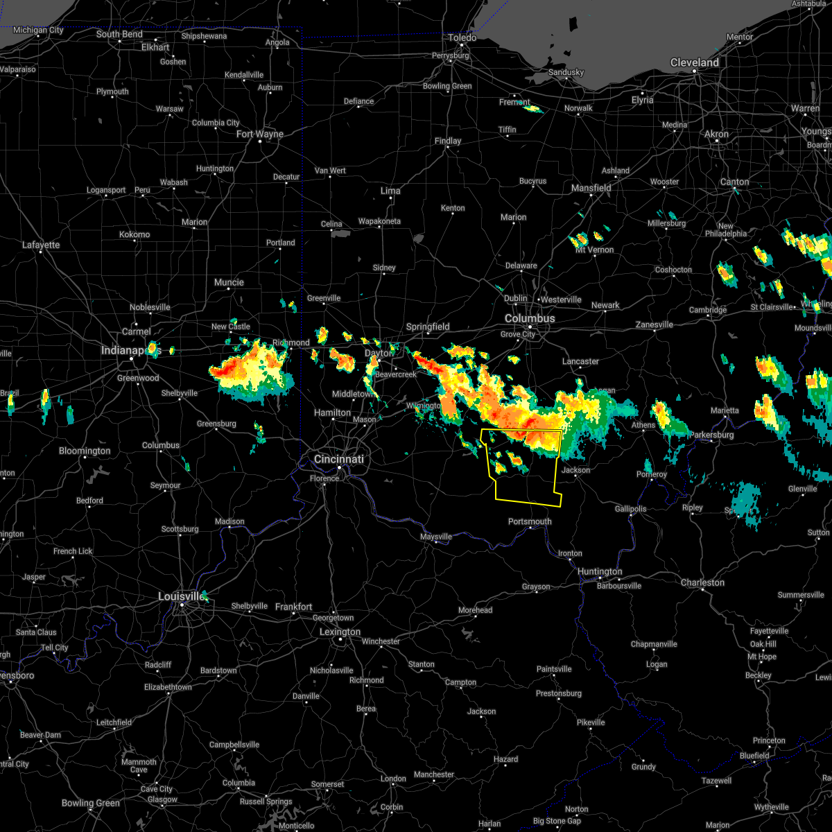 At 557 pm edt, a severe thunderstorm was located near chillicothe, moving southeast at 35 mph (radar indicated). Hazards include 70 mph wind gusts and quarter size hail. Minor hail damage to vehicles is possible. expect considerable tree damage. Wind damage is also likely to mobile homes, roofs, and outbuildings. At 557 pm edt, a severe thunderstorm was located near chillicothe, moving southeast at 35 mph (radar indicated). Hazards include 70 mph wind gusts and quarter size hail. Minor hail damage to vehicles is possible. expect considerable tree damage. Wind damage is also likely to mobile homes, roofs, and outbuildings.
|
| 7/29/2021 5:47 PM EDT |
 At 547 pm edt, a severe thunderstorm was located near north folk village, moving southeast at 35 mph (radar indicated). Hazards include 70 mph wind gusts and quarter size hail. Minor hail damage to vehicles is possible. expect considerable tree damage. wind damage is also likely to mobile homes, roofs, and outbuildings. Locations impacted include, chillicothe, greenfield, kingston, bainbridge, north folk village, good hope, frankfort, clarksburg, south salem, bourneville, andersonville, mooresville, rainsboro, lattaville, austin, paint creek state park, summithill, knockemstiff, rock mills and massieville. At 547 pm edt, a severe thunderstorm was located near north folk village, moving southeast at 35 mph (radar indicated). Hazards include 70 mph wind gusts and quarter size hail. Minor hail damage to vehicles is possible. expect considerable tree damage. wind damage is also likely to mobile homes, roofs, and outbuildings. Locations impacted include, chillicothe, greenfield, kingston, bainbridge, north folk village, good hope, frankfort, clarksburg, south salem, bourneville, andersonville, mooresville, rainsboro, lattaville, austin, paint creek state park, summithill, knockemstiff, rock mills and massieville.
|
| 7/29/2021 5:37 PM EDT |
 At 536 pm edt, a severe thunderstorm was located 9 miles south of new holland, moving southeast at 35 mph (radar indicated). Hazards include 70 mph wind gusts and quarter size hail. Minor hail damage to vehicles is possible. expect considerable tree damage. wind damage is also likely to mobile homes, roofs, and outbuildings. Locations impacted include, chillicothe, washington court house, greenfield, leesburg, kingston, bainbridge, new holland, north folk village, staunton, good hope, frankfort, clarksburg, south salem, east monroe, mooresville, austin, knockemstiff, rock mills, massieville and new martinsburg. At 536 pm edt, a severe thunderstorm was located 9 miles south of new holland, moving southeast at 35 mph (radar indicated). Hazards include 70 mph wind gusts and quarter size hail. Minor hail damage to vehicles is possible. expect considerable tree damage. wind damage is also likely to mobile homes, roofs, and outbuildings. Locations impacted include, chillicothe, washington court house, greenfield, leesburg, kingston, bainbridge, new holland, north folk village, staunton, good hope, frankfort, clarksburg, south salem, east monroe, mooresville, austin, knockemstiff, rock mills, massieville and new martinsburg.
|
| 7/29/2021 5:24 PM EDT |
 At 524 pm edt, a severe thunderstorm was located near new holland, moving southeast at 35 mph (radar indicated). Hazards include 70 mph wind gusts and quarter size hail. Minor hail damage to vehicles is possible. expect considerable tree damage. Wind damage is also likely to mobile homes, roofs, and outbuildings. At 524 pm edt, a severe thunderstorm was located near new holland, moving southeast at 35 mph (radar indicated). Hazards include 70 mph wind gusts and quarter size hail. Minor hail damage to vehicles is possible. expect considerable tree damage. Wind damage is also likely to mobile homes, roofs, and outbuildings.
|
| 7/15/2021 6:13 PM EDT |
 At 613 pm edt, a severe thunderstorm was located near greenfield, moving east at 30 mph (radar indicated). Hazards include 60 mph wind gusts. expect damage to trees and power lines At 613 pm edt, a severe thunderstorm was located near greenfield, moving east at 30 mph (radar indicated). Hazards include 60 mph wind gusts. expect damage to trees and power lines
|
| 11/15/2020 12:32 PM EST |
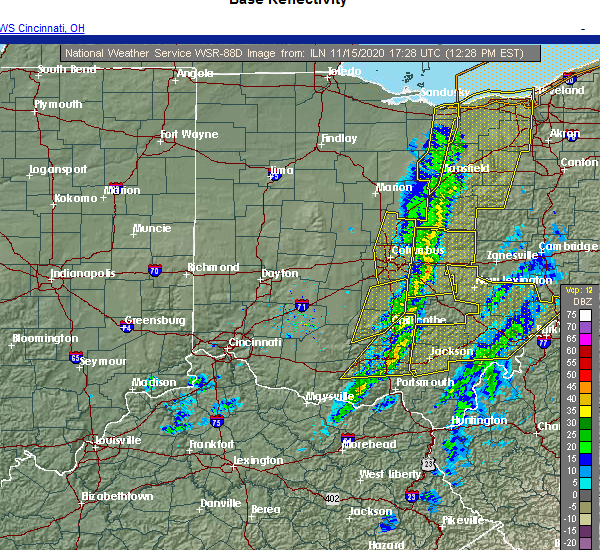 At 1232 pm est, severe thunderstorms were located along a line extending from 8 miles southwest of hocking hills state park to near piketon, moving east at 60 mph (radar indicated). Hazards include 60 mph wind gusts. Expect damage to trees and power lines. Locations impacted include, chillicothe, waverly, piketon, londonderry, beaver, adelphi, rarden, wakefield, pike county airport, mooresville, omega, givens, mount joy, bear creek, massieville, lake white, stockdale, elm grove, buchanan and state route 335 at state route 776. At 1232 pm est, severe thunderstorms were located along a line extending from 8 miles southwest of hocking hills state park to near piketon, moving east at 60 mph (radar indicated). Hazards include 60 mph wind gusts. Expect damage to trees and power lines. Locations impacted include, chillicothe, waverly, piketon, londonderry, beaver, adelphi, rarden, wakefield, pike county airport, mooresville, omega, givens, mount joy, bear creek, massieville, lake white, stockdale, elm grove, buchanan and state route 335 at state route 776.
|
| 11/15/2020 12:23 PM EST | Trees down in ross county OH, 0.1 miles WSW of Chillicothe, OH |
| 11/15/2020 12:12 PM EST |
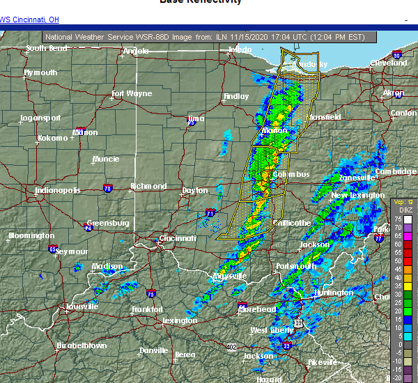 At 1211 pm est, severe thunderstorms were located along a line extending from near north folk village to near peebles, moving east at 60 mph (radar indicated). Hazards include 60 mph wind gusts. expect damage to trees and power lines At 1211 pm est, severe thunderstorms were located along a line extending from near north folk village to near peebles, moving east at 60 mph (radar indicated). Hazards include 60 mph wind gusts. expect damage to trees and power lines
|
| 11/15/2020 12:12 PM EST |
 At 1211 pm est, severe thunderstorms were located along a line extending from south bloomfield to 6 miles north of bainbridge, moving east at 65 mph (radar indicated). Hazards include 60 mph wind gusts. Expect damage to trees and power lines. Locations impacted include, chillicothe, circleville, ashville, south bloomfield, kingston, williamsport, bainbridge, logan elm village, north folk village, frankfort, fox, stoutsville, clarksburg, darbyville, south salem, east ringgold, austin, slate run metro park, aw marion state park and bourneville. At 1211 pm est, severe thunderstorms were located along a line extending from south bloomfield to 6 miles north of bainbridge, moving east at 65 mph (radar indicated). Hazards include 60 mph wind gusts. Expect damage to trees and power lines. Locations impacted include, chillicothe, circleville, ashville, south bloomfield, kingston, williamsport, bainbridge, logan elm village, north folk village, frankfort, fox, stoutsville, clarksburg, darbyville, south salem, east ringgold, austin, slate run metro park, aw marion state park and bourneville.
|
| 11/15/2020 11:43 AM EST |
 At 1142 am est, severe thunderstorms were located along a line extending from near jeffersonville to near new vienna, moving east at 45 mph (radar indicated). Hazards include 60 mph wind gusts. expect damage to trees and power lines At 1142 am est, severe thunderstorms were located along a line extending from near jeffersonville to near new vienna, moving east at 45 mph (radar indicated). Hazards include 60 mph wind gusts. expect damage to trees and power lines
|
| 8/28/2020 7:06 PM EDT | Trees reported down near the intersection of three locks rd and u.s. 23. time estimated from rada in ross county OH, 4.4 miles NW of Chillicothe, OH |
| 8/28/2020 7:03 PM EDT | Trees reported down near the intersection of liberty hill rd and oh-77 in ross county OH, 2.8 miles N of Chillicothe, OH |
| 8/28/2020 7:03 PM EDT | Trees reported down near the intersection of liberty hill rd and oh-77 in ross county OH, 2.8 miles N of Chillicothe, OH |
| 6/10/2020 7:06 PM EDT |
 At 706 pm edt, severe thunderstorms were located along a line extending from pleasantville to near shawnee to 9 miles northwest of wellston, moving east at 60 mph (trained weather spotters). Hazards include 70 mph wind gusts. Expect considerable tree damage. damage is likely to mobile homes, roofs, and outbuildings. Locations impacted include, chillicothe, logan, waverly, nelsonville, piketon, kingston, hide-a-way hills, hocking hills state park, starr, amanda, londonderry, stoutsville, laurelville, murray city, beaver, sugar grove, adelphi, tarlton, east ringgold and us route 22 at state route 159. At 706 pm edt, severe thunderstorms were located along a line extending from pleasantville to near shawnee to 9 miles northwest of wellston, moving east at 60 mph (trained weather spotters). Hazards include 70 mph wind gusts. Expect considerable tree damage. damage is likely to mobile homes, roofs, and outbuildings. Locations impacted include, chillicothe, logan, waverly, nelsonville, piketon, kingston, hide-a-way hills, hocking hills state park, starr, amanda, londonderry, stoutsville, laurelville, murray city, beaver, sugar grove, adelphi, tarlton, east ringgold and us route 22 at state route 159.
|
| 6/10/2020 6:52 PM EDT |
 At 651 pm edt, severe thunderstorms were located along a line extending from 7 miles south of canal winchester to 8 miles north of hocking hills state park to near waverly, moving east at 60 mph (radar indicated). Hazards include 70 mph wind gusts. Expect considerable tree damage. damage is likely to mobile homes, roofs, and outbuildings. Locations impacted include, chillicothe, circleville, logan, waverly, nelsonville, piketon, south bloomfield, kingston, hide-a-way hills, logan elm village, hocking hills state park, pike lake, north folk village, starr, fox, amanda, londonderry, stoutsville, laurelville and murray city. At 651 pm edt, severe thunderstorms were located along a line extending from 7 miles south of canal winchester to 8 miles north of hocking hills state park to near waverly, moving east at 60 mph (radar indicated). Hazards include 70 mph wind gusts. Expect considerable tree damage. damage is likely to mobile homes, roofs, and outbuildings. Locations impacted include, chillicothe, circleville, logan, waverly, nelsonville, piketon, south bloomfield, kingston, hide-a-way hills, logan elm village, hocking hills state park, pike lake, north folk village, starr, fox, amanda, londonderry, stoutsville, laurelville and murray city.
|
| 6/10/2020 6:35 PM EDT |
 At 635 pm edt, severe thunderstorms were located along a line extending from near south bloomfield to near kingston to 6 miles south of kincaid springs, moving east at 60 mph (radar indicated). Hazards include 70 mph wind gusts. Expect considerable tree damage. Damage is likely to mobile homes, roofs, and outbuildings. At 635 pm edt, severe thunderstorms were located along a line extending from near south bloomfield to near kingston to 6 miles south of kincaid springs, moving east at 60 mph (radar indicated). Hazards include 70 mph wind gusts. Expect considerable tree damage. Damage is likely to mobile homes, roofs, and outbuildings.
|
| 6/10/2020 6:27 PM EDT |
 At 627 pm edt, severe thunderstorms were located along a line extending from near mount sterling to near williamsport, moving northeast at 70 mph (radar indicated). Hazards include 70 mph wind gusts. Expect considerable tree damage. damage is likely to mobile homes, roofs, and outbuildings. Locations impacted include, chillicothe, circleville, greenfield, waverly, piketon, south bloomfield, kingston, marshall, williamsport, bainbridge, new holland, logan elm village, pike lake, kincaid springs, cynthiana, north folk village, good hope, frankfort, fox and clarksburg. At 627 pm edt, severe thunderstorms were located along a line extending from near mount sterling to near williamsport, moving northeast at 70 mph (radar indicated). Hazards include 70 mph wind gusts. Expect considerable tree damage. damage is likely to mobile homes, roofs, and outbuildings. Locations impacted include, chillicothe, circleville, greenfield, waverly, piketon, south bloomfield, kingston, marshall, williamsport, bainbridge, new holland, logan elm village, pike lake, kincaid springs, cynthiana, north folk village, good hope, frankfort, fox and clarksburg.
|
| 6/10/2020 6:26 PM EDT | Large trees downed north of chillicothe. time estimated by rada in ross county OH, 3.5 miles S of Chillicothe, OH |
| 6/10/2020 6:26 PM EDT | Barn damaged. time estimated from rada in ross county OH, 8 miles SSW of Chillicothe, OH |
| 6/10/2020 6:23 PM EDT |
 At 623 pm edt, a severe thunderstorm capable of producing a tornado was located near north folk village, moving northeast at 55 mph (radar indicated rotation). Hazards include tornado. Flying debris will be dangerous to those caught without shelter. mobile homes will be damaged or destroyed. damage to roofs, windows, and vehicles will occur. Tree damage is likely. At 623 pm edt, a severe thunderstorm capable of producing a tornado was located near north folk village, moving northeast at 55 mph (radar indicated rotation). Hazards include tornado. Flying debris will be dangerous to those caught without shelter. mobile homes will be damaged or destroyed. damage to roofs, windows, and vehicles will occur. Tree damage is likely.
|
| 6/10/2020 6:22 PM EDT | Numerous trees down near brookside church. time estimated from rada in ross county OH, 3.5 miles S of Chillicothe, OH |
| 6/10/2020 6:20 PM EDT | Tops of trees snapped... outdoor furniture blown hundreds of feet. 72 mph wind gust recorded on personal weather station. report of more damage at 102 cattail road on o in ross county OH, 5.9 miles SE of Chillicothe, OH |
| 6/10/2020 6:14 PM EDT |
 At 614 pm edt, severe thunderstorms were located along a line extending from near bloomingburg to 6 miles north of bainbridge, moving northeast at 60 mph (radar indicated). Hazards include 70 mph wind gusts. Expect considerable tree damage. damage is likely to mobile homes, roofs, and outbuildings. Locations impacted include, chillicothe, washington court house, circleville, greenfield, waverly, piketon, south bloomfield, leesburg, kingston, marshall, williamsport, bloomingburg, bainbridge, new holland, highland holiday, logan elm village, pike lake, kincaid springs, rocky fork point and cynthiana. At 614 pm edt, severe thunderstorms were located along a line extending from near bloomingburg to 6 miles north of bainbridge, moving northeast at 60 mph (radar indicated). Hazards include 70 mph wind gusts. Expect considerable tree damage. damage is likely to mobile homes, roofs, and outbuildings. Locations impacted include, chillicothe, washington court house, circleville, greenfield, waverly, piketon, south bloomfield, leesburg, kingston, marshall, williamsport, bloomingburg, bainbridge, new holland, highland holiday, logan elm village, pike lake, kincaid springs, rocky fork point and cynthiana.
|
| 6/10/2020 5:58 PM EDT |
 At 557 pm edt, severe thunderstorms were located along a line extending from near leesburg to near marshall, moving northeast at 60 mph (radar indicated). Hazards include 70 mph wind gusts. Expect considerable tree damage. Damage is likely to mobile homes, roofs, and outbuildings. At 557 pm edt, severe thunderstorms were located along a line extending from near leesburg to near marshall, moving northeast at 60 mph (radar indicated). Hazards include 70 mph wind gusts. Expect considerable tree damage. Damage is likely to mobile homes, roofs, and outbuildings.
|
| 4/9/2020 12:07 AM EDT |
 The severe thunderstorm warning for northern pike and ross counties will expire at 1215 am edt, the storm which prompted the warning has moved out of the area. therefore, the warning will be allowed to expire. however gusty winds are still possible with this thunderstorm. a tornado watch remains in effect until 200 am edt for central and southwestern ohio. please report previous wind damage or hail to the national weather service by going to our website at weather.gov/iln and submitting your report via social media. The severe thunderstorm warning for northern pike and ross counties will expire at 1215 am edt, the storm which prompted the warning has moved out of the area. therefore, the warning will be allowed to expire. however gusty winds are still possible with this thunderstorm. a tornado watch remains in effect until 200 am edt for central and southwestern ohio. please report previous wind damage or hail to the national weather service by going to our website at weather.gov/iln and submitting your report via social media.
|
| 4/8/2020 11:39 PM EDT |
 At 1139 pm edt, a severe thunderstorm was located over pike lake, moving northeast at 30 mph (radar indicated). Hazards include 60 mph wind gusts and quarter size hail. Minor hail damage to vehicles is possible. expect wind damage to trees and power lines. locations impacted include, chillicothe, greenfield, waverly, piketon, kingston, bainbridge, pike lake, kincaid springs, cynthiana, north folk village, frankfort, londonderry, laurelville, clarksburg, adelphi, south salem, pike county airport, mooresville, austin and omega. A tornado watch remains in effect until 200 am edt for central and southwestern ohio. At 1139 pm edt, a severe thunderstorm was located over pike lake, moving northeast at 30 mph (radar indicated). Hazards include 60 mph wind gusts and quarter size hail. Minor hail damage to vehicles is possible. expect wind damage to trees and power lines. locations impacted include, chillicothe, greenfield, waverly, piketon, kingston, bainbridge, pike lake, kincaid springs, cynthiana, north folk village, frankfort, londonderry, laurelville, clarksburg, adelphi, south salem, pike county airport, mooresville, austin and omega. A tornado watch remains in effect until 200 am edt for central and southwestern ohio.
|
| 4/8/2020 11:13 PM EDT |
 At 1113 pm edt, a severe thunderstorm was located near cynthiana, moving east at 25 mph (radar indicated). Hazards include 60 mph wind gusts and quarter size hail. Minor hail damage to vehicles is possible. Expect wind damage to trees and power lines. At 1113 pm edt, a severe thunderstorm was located near cynthiana, moving east at 25 mph (radar indicated). Hazards include 60 mph wind gusts and quarter size hail. Minor hail damage to vehicles is possible. Expect wind damage to trees and power lines.
|
| 4/8/2020 5:06 AM EDT |
 The severe thunderstorm warning for southwestern fairfield, southwestern hocking, pickaway and northern ross counties will expire at 515 am edt, the storm which prompted the warning has weakened below severe limits, and no longer poses an immediate threat to life or property. therefore, the warning will be allowed to expire. a severe thunderstorm watch remains in effect until 600 am edt for central and southwestern ohio. please report previous wind damage or hail to the national weather service by going to our website at weather.gov/iln and submitting your report via social media. The severe thunderstorm warning for southwestern fairfield, southwestern hocking, pickaway and northern ross counties will expire at 515 am edt, the storm which prompted the warning has weakened below severe limits, and no longer poses an immediate threat to life or property. therefore, the warning will be allowed to expire. a severe thunderstorm watch remains in effect until 600 am edt for central and southwestern ohio. please report previous wind damage or hail to the national weather service by going to our website at weather.gov/iln and submitting your report via social media.
|
| 4/8/2020 4:56 AM EDT |
 At 455 am edt, a severe thunderstorm was located near kingston, moving southeast at 50 mph (radar indicated). Hazards include 60 mph wind gusts and quarter size hail. Minor hail damage to vehicles is possible. expect wind damage to trees and power lines. Locations impacted include, chillicothe, circleville, south bloomfield, kingston, williamsport, new holland, logan elm village, frankfort, fox, amanda, stoutsville, laurelville, clarksburg, adelphi, tarlton, darbyville, east ringgold, deer creek lake, mooresville and austin. At 455 am edt, a severe thunderstorm was located near kingston, moving southeast at 50 mph (radar indicated). Hazards include 60 mph wind gusts and quarter size hail. Minor hail damage to vehicles is possible. expect wind damage to trees and power lines. Locations impacted include, chillicothe, circleville, south bloomfield, kingston, williamsport, new holland, logan elm village, frankfort, fox, amanda, stoutsville, laurelville, clarksburg, adelphi, tarlton, darbyville, east ringgold, deer creek lake, mooresville and austin.
|
| 4/8/2020 4:36 AM EDT |
 At 436 am edt, a severe thunderstorm was located near new holland, moving east at 45 mph (radar indicated). Hazards include 60 mph wind gusts and half dollar size hail. Minor hail damage to vehicles is possible. Expect wind damage to trees and power lines. At 436 am edt, a severe thunderstorm was located near new holland, moving east at 45 mph (radar indicated). Hazards include 60 mph wind gusts and half dollar size hail. Minor hail damage to vehicles is possible. Expect wind damage to trees and power lines.
|
| 8/30/2019 5:17 PM EDT | Tree branch down. photo posted on social media. time estimated from rada in ross county OH, 4.9 miles NNW of Chillicothe, OH |
| 8/30/2019 5:15 PM EDT | Numerous trees reported down in huntington township. time estimated from rada in ross county OH, 7.8 miles NNE of Chillicothe, OH |
| 8/1/2019 6:00 PM EDT | Golf Ball sized hail reported 13.6 miles NW of Chillicothe, OH, time estimated from radar. |
| 8/1/2019 5:55 PM EDT | Trees down on musgrave and vigo. time estimated from rada in ross county OH, 12.5 miles WNW of Chillicothe, OH |
| 7/30/2019 4:06 PM EDT |
 At 406 pm edt, a severe thunderstorm was located 9 miles southeast of new holland, moving southeast at 10 mph (radar indicated). Hazards include 60 mph wind gusts and quarter size hail. Minor hail damage to vehicles is possible. expect wind damage to trees and power lines. Locations impacted include, chillicothe, frankfort, clarksburg, bourneville, andersonville, lattaville, austin and plano. At 406 pm edt, a severe thunderstorm was located 9 miles southeast of new holland, moving southeast at 10 mph (radar indicated). Hazards include 60 mph wind gusts and quarter size hail. Minor hail damage to vehicles is possible. expect wind damage to trees and power lines. Locations impacted include, chillicothe, frankfort, clarksburg, bourneville, andersonville, lattaville, austin and plano.
|
| 7/30/2019 3:53 PM EDT |
 At 353 pm edt, a severe thunderstorm was located 7 miles southeast of new holland, moving southeast at 10 mph (radar indicated). Hazards include 60 mph wind gusts and quarter size hail. Minor hail damage to vehicles is possible. Expect wind damage to trees and power lines. At 353 pm edt, a severe thunderstorm was located 7 miles southeast of new holland, moving southeast at 10 mph (radar indicated). Hazards include 60 mph wind gusts and quarter size hail. Minor hail damage to vehicles is possible. Expect wind damage to trees and power lines.
|
| 6/24/2019 6:50 PM EDT |
 The severe thunderstorm warning for northeastern pike and southeastern ross counties will expire at 700 pm edt, the storm which prompted the warning has moved out of the area. therefore, the warning will be allowed to expire. a severe thunderstorm watch remains in effect until 900 pm edt for southwestern ohio. please report previous wind damage or hail to the national weather service by going to our website at weather.gov/iln and submitting your report via social media. The severe thunderstorm warning for northeastern pike and southeastern ross counties will expire at 700 pm edt, the storm which prompted the warning has moved out of the area. therefore, the warning will be allowed to expire. a severe thunderstorm watch remains in effect until 900 pm edt for southwestern ohio. please report previous wind damage or hail to the national weather service by going to our website at weather.gov/iln and submitting your report via social media.
|
| 6/24/2019 6:45 PM EDT | Two trees down and a power line down reported along limerick road. time estimated from rada in jackson county OH, 18.6 miles NW of Chillicothe, OH |
| 6/24/2019 6:39 PM EDT |
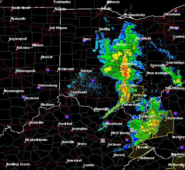 At 639 pm edt, a severe thunderstorm was located 8 miles southeast of chillicothe, moving northeast at 40 mph (radar indicated). Hazards include 60 mph wind gusts. Expect damage to trees and power lines. Locations impacted include, chillicothe, londonderry, beaver, richmond dale, linn, mooresville and massieville. At 639 pm edt, a severe thunderstorm was located 8 miles southeast of chillicothe, moving northeast at 40 mph (radar indicated). Hazards include 60 mph wind gusts. Expect damage to trees and power lines. Locations impacted include, chillicothe, londonderry, beaver, richmond dale, linn, mooresville and massieville.
|
| 6/24/2019 6:30 PM EDT | Trees were reported down throughout the count in ross county OH, 4.9 miles NNW of Chillicothe, OH |
| 6/24/2019 6:17 PM EDT |
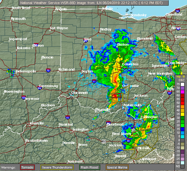 At 617 pm edt, a severe thunderstorm was located near pike lake, moving northeast at 40 mph (radar indicated). Hazards include 60 mph wind gusts. expect damage to trees and power lines At 617 pm edt, a severe thunderstorm was located near pike lake, moving northeast at 40 mph (radar indicated). Hazards include 60 mph wind gusts. expect damage to trees and power lines
|
| 6/24/2019 3:25 PM EDT | Tree down on limerick road. time estimate in ross county OH, 16.7 miles NW of Chillicothe, OH |
| 6/24/2019 3:23 PM EDT | Tree down across vigo road. time estimate in ross county OH, 12.8 miles NW of Chillicothe, OH |
| 6/24/2019 3:20 PM EDT |
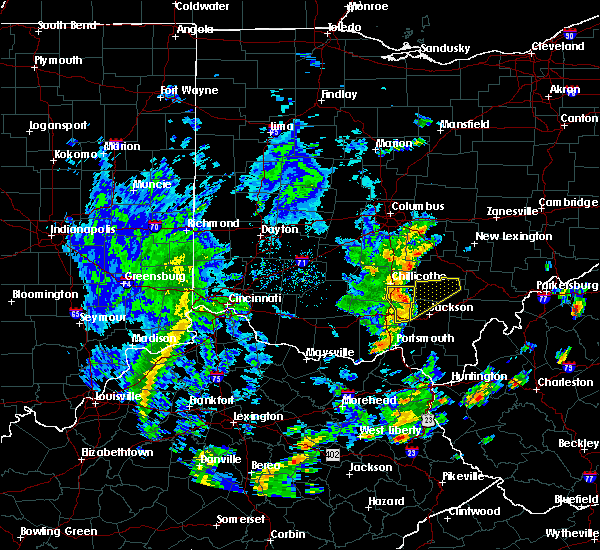 At 319 pm edt, a severe thunderstorm was located 9 miles northeast of waverly, moving northeast at 45 mph (radar indicated). Hazards include 60 mph wind gusts. Expect damage to trees and power lines. Locations impacted include, chillicothe, waverly, londonderry, beaver, givens, pike county airport, richmond dale, massieville, linn, omega, scioto trail state park and germany. At 319 pm edt, a severe thunderstorm was located 9 miles northeast of waverly, moving northeast at 45 mph (radar indicated). Hazards include 60 mph wind gusts. Expect damage to trees and power lines. Locations impacted include, chillicothe, waverly, londonderry, beaver, givens, pike county airport, richmond dale, massieville, linn, omega, scioto trail state park and germany.
|
| 6/24/2019 3:12 PM EDT |
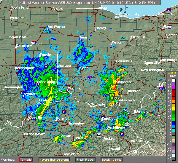 At 312 pm edt, a severe thunderstorm was located near waverly, moving northeast at 45 mph (radar indicated). Hazards include 60 mph wind gusts. Expect damage to trees and power lines. Locations impacted include, chillicothe, waverly, piketon, londonderry, beaver, wakefield, stockdale, pike county airport, omega, givens, richmond dale, massieville, linn, lake white, scioto trail state park and germany. At 312 pm edt, a severe thunderstorm was located near waverly, moving northeast at 45 mph (radar indicated). Hazards include 60 mph wind gusts. Expect damage to trees and power lines. Locations impacted include, chillicothe, waverly, piketon, londonderry, beaver, wakefield, stockdale, pike county airport, omega, givens, richmond dale, massieville, linn, lake white, scioto trail state park and germany.
|
| 6/24/2019 3:02 PM EDT |
 At 301 pm edt, a severe thunderstorm was located near lake white, moving northeast at 45 mph (radar indicated). Hazards include 60 mph wind gusts. Expect damage to trees and power lines. Locations impacted include, waverly, piketon, pike lake, omega, lucasville, londonderry, beaver, wakefield, pike county airport, chillicothe, givens, knockemstiff, bear creek, massieville, lake white, bourneville, stockdale, elm grove and buchanan. At 301 pm edt, a severe thunderstorm was located near lake white, moving northeast at 45 mph (radar indicated). Hazards include 60 mph wind gusts. Expect damage to trees and power lines. Locations impacted include, waverly, piketon, pike lake, omega, lucasville, londonderry, beaver, wakefield, pike county airport, chillicothe, givens, knockemstiff, bear creek, massieville, lake white, bourneville, stockdale, elm grove and buchanan.
|
| 6/24/2019 2:51 PM EDT |
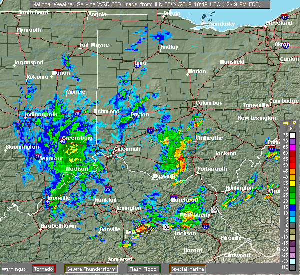 At 251 pm edt, a severe thunderstorm was located near kincaid springs, moving northeast at 45 mph (radar indicated). Hazards include 60 mph wind gusts. expect damage to trees and power lines At 251 pm edt, a severe thunderstorm was located near kincaid springs, moving northeast at 45 mph (radar indicated). Hazards include 60 mph wind gusts. expect damage to trees and power lines
|
| 6/17/2019 10:20 PM EDT | Tree downed along watson road. time estimated based on rada in pike county OH, 15.5 miles NNW of Chillicothe, OH |
| 6/17/2019 10:02 PM EDT |
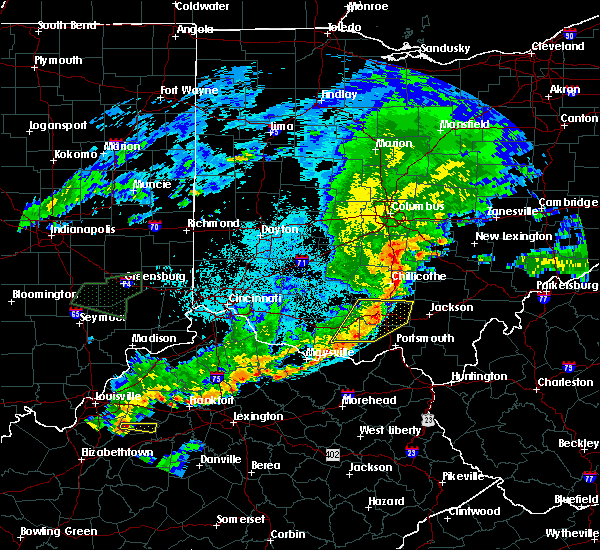 At 1002 pm edt, a severe thunderstorm was located near chillicothe, moving east at 35 mph (radar indicated). Hazards include 60 mph wind gusts. expect damage to trees and power lines At 1002 pm edt, a severe thunderstorm was located near chillicothe, moving east at 35 mph (radar indicated). Hazards include 60 mph wind gusts. expect damage to trees and power lines
|
| 6/17/2019 9:55 PM EDT | Numerous trees downed throughout the county... including in the chillicothe area. time of event based on rada in ross county OH, 0.1 miles WSW of Chillicothe, OH |
| 6/17/2019 9:50 PM EDT |
 At 950 pm edt, a severe thunderstorm was located over north folk village, moving east at 35 mph (radar indicated). Hazards include 60 mph wind gusts. Expect damage to trees and power lines. Locations impacted include, chillicothe, north folk village, frankfort, londonderry, laurelville, adelphi, bourneville, andersonville, mooresville, summithill, knockemstiff, richmond dale, massieville, hallsville and scioto trail state park. At 950 pm edt, a severe thunderstorm was located over north folk village, moving east at 35 mph (radar indicated). Hazards include 60 mph wind gusts. Expect damage to trees and power lines. Locations impacted include, chillicothe, north folk village, frankfort, londonderry, laurelville, adelphi, bourneville, andersonville, mooresville, summithill, knockemstiff, richmond dale, massieville, hallsville and scioto trail state park.
|
| 6/17/2019 9:35 PM EDT |
 At 935 pm edt, a severe thunderstorm was located near bainbridge, moving east at 35 mph (radar indicated). Hazards include 60 mph wind gusts. expect damage to trees and power lines At 935 pm edt, a severe thunderstorm was located near bainbridge, moving east at 35 mph (radar indicated). Hazards include 60 mph wind gusts. expect damage to trees and power lines
|
| 5/23/2019 6:57 PM EDT |
 The severe thunderstorm warning for southeastern pickaway and eastern ross counties will expire at 700 pm edt, the storm which prompted the warning has weakened below severe limits, and no longer poses an immediate threat to life or property. therefore, the warning will be allowed to expire. a severe thunderstorm watch remains in effect until midnight edt for central and southwestern ohio. please report previous wind damage or hail to the national weather service by going to our website at weather.gov/iln and submitting your report via social media. The severe thunderstorm warning for southeastern pickaway and eastern ross counties will expire at 700 pm edt, the storm which prompted the warning has weakened below severe limits, and no longer poses an immediate threat to life or property. therefore, the warning will be allowed to expire. a severe thunderstorm watch remains in effect until midnight edt for central and southwestern ohio. please report previous wind damage or hail to the national weather service by going to our website at weather.gov/iln and submitting your report via social media.
|
| 5/23/2019 6:42 PM EDT | A tree was knocked down on england hollow r in ross county OH, 3 miles NNW of Chillicothe, OH |
| 5/23/2019 6:41 PM EDT |
 At 641 pm edt, a severe thunderstorm was located over chillicothe, moving east at 40 mph (radar indicated). Hazards include 60 mph wind gusts. Expect damage to trees and power lines. Locations impacted include, chillicothe, kingston, north folk village, londonderry, pickaway county airport, richmond dale, andersonville, massieville, mooresville, hallsville, whisler and scioto trail state park. At 641 pm edt, a severe thunderstorm was located over chillicothe, moving east at 40 mph (radar indicated). Hazards include 60 mph wind gusts. Expect damage to trees and power lines. Locations impacted include, chillicothe, kingston, north folk village, londonderry, pickaway county airport, richmond dale, andersonville, massieville, mooresville, hallsville, whisler and scioto trail state park.
|
| 5/23/2019 6:31 PM EDT |
 At 631 pm edt, a severe thunderstorm was located near north folk village, moving east at 45 mph (radar indicated). Hazards include 60 mph wind gusts and quarter size hail. Minor hail damage to vehicles is possible. expect wind damage to trees and power lines. Locations impacted include, chillicothe, kingston, north folk village, frankfort, londonderry, clarksburg, bourneville, andersonville, mooresville, lattaville, austin, whisler, summithill, knockemstiff, pickaway county airport, richmond dale, massieville, hallsville and scioto trail state park. At 631 pm edt, a severe thunderstorm was located near north folk village, moving east at 45 mph (radar indicated). Hazards include 60 mph wind gusts and quarter size hail. Minor hail damage to vehicles is possible. expect wind damage to trees and power lines. Locations impacted include, chillicothe, kingston, north folk village, frankfort, londonderry, clarksburg, bourneville, andersonville, mooresville, lattaville, austin, whisler, summithill, knockemstiff, pickaway county airport, richmond dale, massieville, hallsville and scioto trail state park.
|
| 5/23/2019 6:21 PM EDT |
 At 621 pm edt, a severe thunderstorm was located near bainbridge, moving east at 40 mph (radar indicated). Hazards include 60 mph wind gusts and quarter size hail. Minor hail damage to vehicles is possible. Expect wind damage to trees and power lines. At 621 pm edt, a severe thunderstorm was located near bainbridge, moving east at 40 mph (radar indicated). Hazards include 60 mph wind gusts and quarter size hail. Minor hail damage to vehicles is possible. Expect wind damage to trees and power lines.
|
| 3/14/2019 10:36 PM EDT |
 At 1036 pm edt, severe thunderstorms were located along a line extending from north folk village to near ripley, moving east at 65 mph (radar indicated). Hazards include 60 mph wind gusts. Expect damage to trees and power lines. Locations impacted include, chillicothe, west union, peebles, ripley, winchester, marshall, seaman, bainbridge, kincaid springs, belfast, cynthiana, north folk village, decatur, russellville, dover, cherry fork, sinking spring, may hill, locust grove and knockemstiff. At 1036 pm edt, severe thunderstorms were located along a line extending from north folk village to near ripley, moving east at 65 mph (radar indicated). Hazards include 60 mph wind gusts. Expect damage to trees and power lines. Locations impacted include, chillicothe, west union, peebles, ripley, winchester, marshall, seaman, bainbridge, kincaid springs, belfast, cynthiana, north folk village, decatur, russellville, dover, cherry fork, sinking spring, may hill, locust grove and knockemstiff.
|
| 3/14/2019 10:24 PM EDT |
 At 1024 pm edt, severe thunderstorms were located along a line extending from near bainbridge to near brooksville, moving east at 65 mph (radar indicated). Hazards include 60 mph wind gusts. Expect damage to trees and power lines. Locations impacted include, chillicothe, maysville, georgetown, west union, peebles, ripley, aberdeen, augusta, winchester, marshall, seaman, bainbridge, brooksville, belfast, highland holiday, kincaid springs, rocky fork point, cynthiana, north folk village and emerald. At 1024 pm edt, severe thunderstorms were located along a line extending from near bainbridge to near brooksville, moving east at 65 mph (radar indicated). Hazards include 60 mph wind gusts. Expect damage to trees and power lines. Locations impacted include, chillicothe, maysville, georgetown, west union, peebles, ripley, aberdeen, augusta, winchester, marshall, seaman, bainbridge, brooksville, belfast, highland holiday, kincaid springs, rocky fork point, cynthiana, north folk village and emerald.
|
| 3/14/2019 10:15 PM EDT |
 At 1015 pm edt, severe thunderstorms were located along a line extending from near highland holiday to 6 miles southeast of falmouth, moving east at 65 mph (radar indicated). Hazards include 60 mph wind gusts. expect damage to trees and power lines At 1015 pm edt, severe thunderstorms were located along a line extending from near highland holiday to 6 miles southeast of falmouth, moving east at 65 mph (radar indicated). Hazards include 60 mph wind gusts. expect damage to trees and power lines
|
| 3/14/2019 9:40 PM EDT |
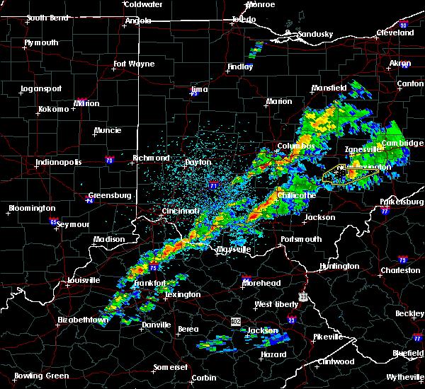 At 940 pm edt, a severe thunderstorm was located over kincaid springs, moving northeast at 65 mph (radar indicated). Hazards include 60 mph wind gusts and penny size hail. expect damage to trees and power lines At 940 pm edt, a severe thunderstorm was located over kincaid springs, moving northeast at 65 mph (radar indicated). Hazards include 60 mph wind gusts and penny size hail. expect damage to trees and power lines
|
| 3/14/2019 8:24 PM EDT |
 At 824 pm edt, severe thunderstorms were located along a line extending from near logan elm village to cynthiana, moving east at 45 mph (radar indicated). Hazards include 60 mph wind gusts and penny size hail. Expect damage to trees and power lines. Locations impacted include, chillicothe, kingston, bainbridge, cynthiana, north folk village, frankfort, clarksburg, tarlton, bourneville, andersonville, lattaville, whisler, summithill, knockemstiff and pickaway county airport. At 824 pm edt, severe thunderstorms were located along a line extending from near logan elm village to cynthiana, moving east at 45 mph (radar indicated). Hazards include 60 mph wind gusts and penny size hail. Expect damage to trees and power lines. Locations impacted include, chillicothe, kingston, bainbridge, cynthiana, north folk village, frankfort, clarksburg, tarlton, bourneville, andersonville, lattaville, whisler, summithill, knockemstiff and pickaway county airport.
|
| 3/14/2019 8:15 PM EDT |
 At 815 pm edt, severe thunderstorms were located along a line extending from near logan elm village to near marshall, moving east at 60 mph (radar indicated). Hazards include 60 mph wind gusts and penny size hail. Expect damage to trees and power lines. Locations impacted include, chillicothe, kingston, marshall, bainbridge, pike lake, cynthiana, north folk village, highland holiday, frankfort, clarksburg, tarlton, south salem, bourneville, andersonville, rainsboro, lattaville, austin, whisler, buchanan and paint creek state park. At 815 pm edt, severe thunderstorms were located along a line extending from near logan elm village to near marshall, moving east at 60 mph (radar indicated). Hazards include 60 mph wind gusts and penny size hail. Expect damage to trees and power lines. Locations impacted include, chillicothe, kingston, marshall, bainbridge, pike lake, cynthiana, north folk village, highland holiday, frankfort, clarksburg, tarlton, south salem, bourneville, andersonville, rainsboro, lattaville, austin, whisler, buchanan and paint creek state park.
|
| 3/14/2019 7:56 PM EDT |
 At 756 pm edt, severe thunderstorms were located along a line extending from near new holland to near sardinia, moving east at 45 mph (radar indicated). Hazards include 60 mph wind gusts and penny size hail. expect damage to trees and power lines At 756 pm edt, severe thunderstorms were located along a line extending from near new holland to near sardinia, moving east at 45 mph (radar indicated). Hazards include 60 mph wind gusts and penny size hail. expect damage to trees and power lines
|
| 9/6/2018 4:10 PM EDT |
 At 409 pm edt, a severe thunderstorm was located 7 miles southeast of chillicothe, moving east at 20 mph (radar indicated). Hazards include 60 mph wind gusts and quarter size hail. Minor hail damage to vehicles is possible. expect wind damage to trees and power lines. Locations impacted include, chillicothe, londonderry, massieville, mooresville, scioto trail state park and richmond dale. At 409 pm edt, a severe thunderstorm was located 7 miles southeast of chillicothe, moving east at 20 mph (radar indicated). Hazards include 60 mph wind gusts and quarter size hail. Minor hail damage to vehicles is possible. expect wind damage to trees and power lines. Locations impacted include, chillicothe, londonderry, massieville, mooresville, scioto trail state park and richmond dale.
|
| 9/6/2018 3:59 PM EDT | Multiple trees down. time estimated from radar dat in ross county OH, 3.6 miles NNW of Chillicothe, OH |
| 9/6/2018 3:59 PM EDT |
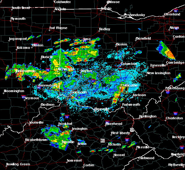 At 358 pm edt, a severe thunderstorm was located near chillicothe, moving east at 20 mph (radar indicated). Hazards include 60 mph wind gusts and quarter size hail. Minor hail damage to vehicles is possible. Expect wind damage to trees and power lines. At 358 pm edt, a severe thunderstorm was located near chillicothe, moving east at 20 mph (radar indicated). Hazards include 60 mph wind gusts and quarter size hail. Minor hail damage to vehicles is possible. Expect wind damage to trees and power lines.
|
| 6/8/2018 2:52 PM EDT |
 The severe thunderstorm warning for southwestern hocking, southeastern pickaway and northeastern ross counties will expire at 300 pm edt, the storm which prompted the warning has weakened below severe limits, and no longer poses an immediate threat to life or property. therefore, the warning will be allowed to expire. however gusty winds and heavy rain are still possible with this thunderstorm. please report previous wind damage or hail to the national weather service by going to our website at weather.gov/iln and submitting your report via social media. The severe thunderstorm warning for southwestern hocking, southeastern pickaway and northeastern ross counties will expire at 300 pm edt, the storm which prompted the warning has weakened below severe limits, and no longer poses an immediate threat to life or property. therefore, the warning will be allowed to expire. however gusty winds and heavy rain are still possible with this thunderstorm. please report previous wind damage or hail to the national weather service by going to our website at weather.gov/iln and submitting your report via social media.
|
| 6/8/2018 2:26 PM EDT |
 At 226 pm edt, a severe thunderstorm was located near kingston, moving southeast at 25 mph (radar indicated). Hazards include 60 mph wind gusts and quarter size hail. Minor hail damage to vehicles is possible. expect wind damage to trees and power lines. Locations impacted include, kingston, hocking hills state park, londonderry, laurelville, adelphi, south bloomingville, mooresville, hallsville and whisler. At 226 pm edt, a severe thunderstorm was located near kingston, moving southeast at 25 mph (radar indicated). Hazards include 60 mph wind gusts and quarter size hail. Minor hail damage to vehicles is possible. expect wind damage to trees and power lines. Locations impacted include, kingston, hocking hills state park, londonderry, laurelville, adelphi, south bloomingville, mooresville, hallsville and whisler.
|
| 6/8/2018 2:07 PM EDT |
 At 207 pm edt, a severe thunderstorm was located over kingston, moving southeast at 25 mph (radar indicated). Hazards include 60 mph wind gusts and quarter size hail. Minor hail damage to vehicles is possible. Expect wind damage to trees and power lines. At 207 pm edt, a severe thunderstorm was located over kingston, moving southeast at 25 mph (radar indicated). Hazards include 60 mph wind gusts and quarter size hail. Minor hail damage to vehicles is possible. Expect wind damage to trees and power lines.
|
| 5/13/2018 7:53 PM EDT |
 At 752 pm edt, a severe thunderstorm was located near kingston, moving east at 30 mph (radar indicated). Hazards include 60 mph wind gusts and quarter size hail. Minor hail damage to vehicles is possible. expect wind damage to trees and power lines. Locations impacted include, chillicothe, kingston, north folk village, londonderry, laurelville, adelphi, pickaway county airport, andersonville, mooresville, hallsville and whisler. At 752 pm edt, a severe thunderstorm was located near kingston, moving east at 30 mph (radar indicated). Hazards include 60 mph wind gusts and quarter size hail. Minor hail damage to vehicles is possible. expect wind damage to trees and power lines. Locations impacted include, chillicothe, kingston, north folk village, londonderry, laurelville, adelphi, pickaway county airport, andersonville, mooresville, hallsville and whisler.
|
| 5/13/2018 7:41 PM EDT |
 At 740 pm edt, a severe thunderstorm was located 7 miles south of williamsport, moving east at 30 mph (radar indicated). Hazards include ping pong ball size hail and 60 mph wind gusts. People and animals outdoors will be injured. expect hail damage to roofs, siding, windows, and vehicles. Expect wind damage to trees and power lines. At 740 pm edt, a severe thunderstorm was located 7 miles south of williamsport, moving east at 30 mph (radar indicated). Hazards include ping pong ball size hail and 60 mph wind gusts. People and animals outdoors will be injured. expect hail damage to roofs, siding, windows, and vehicles. Expect wind damage to trees and power lines.
|
| 5/4/2018 6:55 PM EDT |
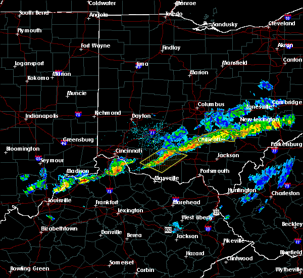 The severe thunderstorm warning for hocking, southeastern pickaway and northeastern ross counties will expire at 700 pm edt, the storm which prompted the warning has weakened below severe limits, and no longer poses an immediate threat to life or property. therefore, the warning will be allowed to expire. please report previous wind damage or hail to the national weather service by going to our website at weather.gov/iln and submitting your report via social media. The severe thunderstorm warning for hocking, southeastern pickaway and northeastern ross counties will expire at 700 pm edt, the storm which prompted the warning has weakened below severe limits, and no longer poses an immediate threat to life or property. therefore, the warning will be allowed to expire. please report previous wind damage or hail to the national weather service by going to our website at weather.gov/iln and submitting your report via social media.
|
| 5/4/2018 6:44 PM EDT |
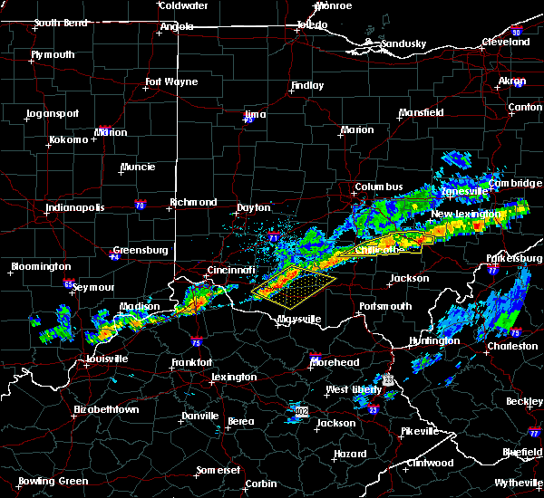 At 644 pm edt, a severe thunderstorm was located over hocking hills state park, moving east at 55 mph (radar indicated). Hazards include 60 mph wind gusts. Expect damage to trees and power lines. Locations impacted include, chillicothe, logan, nelsonville, kingston, hocking hills state park, starr, laurelville, murray city, adelphi, gibisonville, ilesboro, haydenville, lake logan state park, whisler, south bloomingville, enterprise, union furnace, rockbridge, hallsville and oreville. At 644 pm edt, a severe thunderstorm was located over hocking hills state park, moving east at 55 mph (radar indicated). Hazards include 60 mph wind gusts. Expect damage to trees and power lines. Locations impacted include, chillicothe, logan, nelsonville, kingston, hocking hills state park, starr, laurelville, murray city, adelphi, gibisonville, ilesboro, haydenville, lake logan state park, whisler, south bloomingville, enterprise, union furnace, rockbridge, hallsville and oreville.
|
| 5/4/2018 6:22 PM EDT |
 At 622 pm edt, a severe thunderstorm was located near kingston, moving east at 55 mph (radar indicated). Hazards include 60 mph wind gusts. expect damage to trees and power lines At 622 pm edt, a severe thunderstorm was located near kingston, moving east at 55 mph (radar indicated). Hazards include 60 mph wind gusts. expect damage to trees and power lines
|
| 2/15/2018 11:23 PM EST | Time estimated by rada in ross county OH, 7.1 miles SSE of Chillicothe, OH |
| 7/7/2017 7:11 PM EDT |
 At 710 pm edt, severe thunderstorms were located along a line extending from near north folk village to near peebles to near seaman, moving east at 45 mph (radar indicated). Hazards include 70 mph wind gusts and nickel size hail. Expect considerable tree damage. Damage is likely to mobile homes, roofs, and outbuildings. At 710 pm edt, severe thunderstorms were located along a line extending from near north folk village to near peebles to near seaman, moving east at 45 mph (radar indicated). Hazards include 70 mph wind gusts and nickel size hail. Expect considerable tree damage. Damage is likely to mobile homes, roofs, and outbuildings.
|
| 7/7/2017 7:03 PM EDT |
 At 703 pm edt, a severe thunderstorm was located near cynthiana, moving east at 30 mph (radar indicated). Hazards include 70 mph wind gusts and quarter size hail. Minor hail damage to vehicles is possible. expect considerable tree damage. wind damage is also likely to mobile homes, roofs, and outbuildings. Locations impacted include, chillicothe, hillsboro, peebles, winchester, marshall, sardinia, seaman, bainbridge, pike lake, kincaid springs, belfast, rocky fork point, highland holiday, cynthiana, north folk village, new market, emerald, mowrystown, south salem and sinking spring. At 703 pm edt, a severe thunderstorm was located near cynthiana, moving east at 30 mph (radar indicated). Hazards include 70 mph wind gusts and quarter size hail. Minor hail damage to vehicles is possible. expect considerable tree damage. wind damage is also likely to mobile homes, roofs, and outbuildings. Locations impacted include, chillicothe, hillsboro, peebles, winchester, marshall, sardinia, seaman, bainbridge, pike lake, kincaid springs, belfast, rocky fork point, highland holiday, cynthiana, north folk village, new market, emerald, mowrystown, south salem and sinking spring.
|
| 7/7/2017 6:35 PM EDT |
 At 635 pm edt, a severe thunderstorm was located near hillsboro, moving east at 30 mph (radar indicated). Hazards include 70 mph wind gusts and quarter size hail. Minor hail damage to vehicles is possible. expect considerable tree damage. Wind damage is also likely to mobile homes, roofs, and outbuildings. At 635 pm edt, a severe thunderstorm was located near hillsboro, moving east at 30 mph (radar indicated). Hazards include 70 mph wind gusts and quarter size hail. Minor hail damage to vehicles is possible. expect considerable tree damage. Wind damage is also likely to mobile homes, roofs, and outbuildings.
|
| 5/19/2017 6:40 PM EDT |
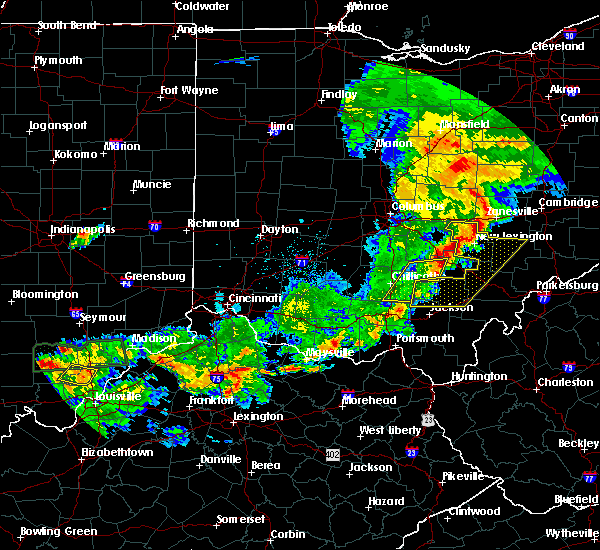 The severe thunderstorm warning for southwestern hocking, southeastern pickaway and eastern ross counties will expire at 645 pm edt, the storm which prompted the warning has weakened below severe limits, and no longer poses an immediate threat to life or property. therefore, the warning will be allowed to expire. a severe thunderstorm watch remains in effect until 1100 pm edt for central and southwestern ohio. please report previous wind damage or hail to the national weather service by going to our website at weather.gov/iln and submitting your report via social media. The severe thunderstorm warning for southwestern hocking, southeastern pickaway and eastern ross counties will expire at 645 pm edt, the storm which prompted the warning has weakened below severe limits, and no longer poses an immediate threat to life or property. therefore, the warning will be allowed to expire. a severe thunderstorm watch remains in effect until 1100 pm edt for central and southwestern ohio. please report previous wind damage or hail to the national weather service by going to our website at weather.gov/iln and submitting your report via social media.
|
| 5/19/2017 6:32 PM EDT |
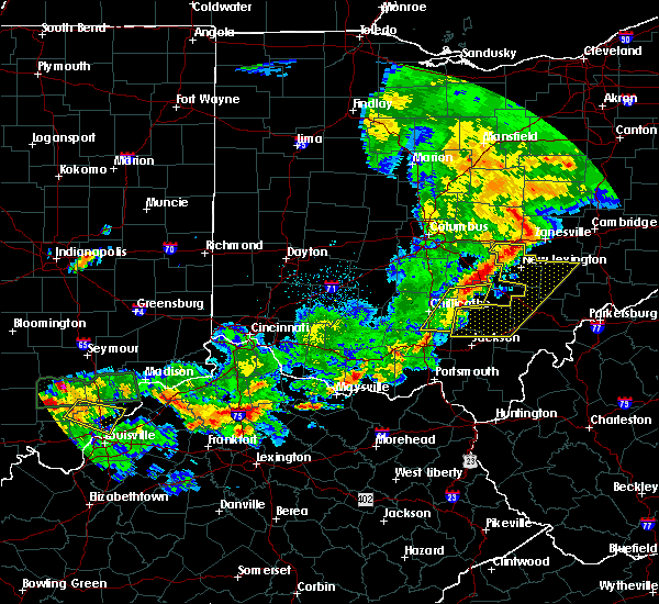 At 632 pm edt, a severe thunderstorm was located 11 miles southeast of kingston, moving east at 35 mph (radar indicated). Hazards include 60 mph wind gusts. Expect damage to roofs, siding, and trees. Locations impacted include, logan, hocking hills state park, londonderry, laurelville, adelphi, buena vista in hocking county, gibisonville, mooresville, whisler, south bloomingville, richmond dale, enterprise, massieville, hallsville and scioto trail state park. At 632 pm edt, a severe thunderstorm was located 11 miles southeast of kingston, moving east at 35 mph (radar indicated). Hazards include 60 mph wind gusts. Expect damage to roofs, siding, and trees. Locations impacted include, logan, hocking hills state park, londonderry, laurelville, adelphi, buena vista in hocking county, gibisonville, mooresville, whisler, south bloomingville, richmond dale, enterprise, massieville, hallsville and scioto trail state park.
|
| 5/19/2017 6:12 PM EDT |
 The severe thunderstorm warning for southwestern fairfield, northeastern adams, southeastern pickaway, western pike, southeastern highland and ross counties will expire at 615 pm edt, the storms which prompted the warning have moved out of the area. therefore, the warning will be allowed to expire. a severe thunderstorm watch remains in effect until 1100 pm edt for central and southwestern ohio. please report previous wind damage or hail to the national weather service by going to our website at weather.gov/iln and submitting your report via social media. The severe thunderstorm warning for southwestern fairfield, northeastern adams, southeastern pickaway, western pike, southeastern highland and ross counties will expire at 615 pm edt, the storms which prompted the warning have moved out of the area. therefore, the warning will be allowed to expire. a severe thunderstorm watch remains in effect until 1100 pm edt for central and southwestern ohio. please report previous wind damage or hail to the national weather service by going to our website at weather.gov/iln and submitting your report via social media.
|
| 5/19/2017 6:11 PM EDT |
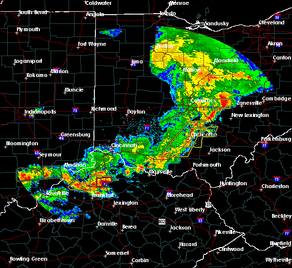 At 611 pm edt, a severe thunderstorm was located over chillicothe, moving east at 35 mph (radar indicated). Hazards include 60 mph wind gusts. expect damage to roofs, siding, and trees At 611 pm edt, a severe thunderstorm was located over chillicothe, moving east at 35 mph (radar indicated). Hazards include 60 mph wind gusts. expect damage to roofs, siding, and trees
|
| 5/19/2017 6:05 PM EDT |
 At 605 pm edt, severe thunderstorms were located along a line extending from near williamsport to 6 miles south of marshall, moving east at 35 mph (radar indicated). Hazards include 60 mph wind gusts. Expect damage to roofs, siding, and trees. Locations impacted include, chillicothe, circleville, waverly, piketon, kingston, bainbridge, pike lake, kincaid springs, logan elm village, cynthiana, north folk village, frankfort, fox, amanda, stoutsville, tarlton, sinking spring, east ringgold, may hill and knockemstiff. At 605 pm edt, severe thunderstorms were located along a line extending from near williamsport to 6 miles south of marshall, moving east at 35 mph (radar indicated). Hazards include 60 mph wind gusts. Expect damage to roofs, siding, and trees. Locations impacted include, chillicothe, circleville, waverly, piketon, kingston, bainbridge, pike lake, kincaid springs, logan elm village, cynthiana, north folk village, frankfort, fox, amanda, stoutsville, tarlton, sinking spring, east ringgold, may hill and knockemstiff.
|
| 5/19/2017 5:59 PM EDT |
 At 559 pm edt, severe thunderstorms were located along a line extending from williamsport to near belfast, moving east at 35 mph (radar indicated). Hazards include 60 mph wind gusts. Expect damage to roofs, siding, and trees. Locations impacted include, chillicothe, circleville, waverly, piketon, kingston, marshall, williamsport, bainbridge, pike lake, kincaid springs, logan elm village, cynthiana, north folk village, frankfort, fox, amanda, stoutsville, clarksburg, tarlton and south salem. At 559 pm edt, severe thunderstorms were located along a line extending from williamsport to near belfast, moving east at 35 mph (radar indicated). Hazards include 60 mph wind gusts. Expect damage to roofs, siding, and trees. Locations impacted include, chillicothe, circleville, waverly, piketon, kingston, marshall, williamsport, bainbridge, pike lake, kincaid springs, logan elm village, cynthiana, north folk village, frankfort, fox, amanda, stoutsville, clarksburg, tarlton and south salem.
|
| 5/19/2017 5:50 PM EDT |
 At 549 pm edt, severe thunderstorms were located along a line extending from near new holland to belfast, moving east at 35 mph (radar indicated). Hazards include 60 mph wind gusts. expect damage to roofs, siding, and trees At 549 pm edt, severe thunderstorms were located along a line extending from near new holland to belfast, moving east at 35 mph (radar indicated). Hazards include 60 mph wind gusts. expect damage to roofs, siding, and trees
|
| 4/20/2017 6:56 PM EDT |
 The severe thunderstorm warning for southern pickaway and northern ross counties will expire at 700 pm edt, the storm which prompted the warning has weakened below severe limits, and has exited the warned area. therefore, the warning will be allowed to expire. however small hail, gusty winds and heavy rain are still possible with this thunderstorm. please report previous wind damage or hail to the national weather service by going to our website at weather.gov/iln and submitting your report via social media. The severe thunderstorm warning for southern pickaway and northern ross counties will expire at 700 pm edt, the storm which prompted the warning has weakened below severe limits, and has exited the warned area. therefore, the warning will be allowed to expire. however small hail, gusty winds and heavy rain are still possible with this thunderstorm. please report previous wind damage or hail to the national weather service by going to our website at weather.gov/iln and submitting your report via social media.
|
| 4/20/2017 6:44 PM EDT |
 At 644 pm edt, a severe thunderstorm was located 8 miles southeast of new holland, moving east at 45 mph (radar indicated). Hazards include 60 mph wind gusts and quarter size hail. Hail damage to vehicles is expected. expect wind damage to roofs, siding, and trees. Locations impacted include, chillicothe, circleville, kingston, logan elm village, north folk village, frankfort, clarksburg, south salem, andersonville, lattaville, austin, whisler, pickaway county airport and hallsville. At 644 pm edt, a severe thunderstorm was located 8 miles southeast of new holland, moving east at 45 mph (radar indicated). Hazards include 60 mph wind gusts and quarter size hail. Hail damage to vehicles is expected. expect wind damage to roofs, siding, and trees. Locations impacted include, chillicothe, circleville, kingston, logan elm village, north folk village, frankfort, clarksburg, south salem, andersonville, lattaville, austin, whisler, pickaway county airport and hallsville.
|
| 4/20/2017 6:34 PM EDT |
 At 633 pm edt, a severe thunderstorm was located 7 miles northeast of greenfield, moving east at 45 mph (radar indicated). Hazards include 60 mph wind gusts and quarter size hail. Hail damage to vehicles is expected. expect wind damage to roofs, siding, and trees. Locations impacted include, chillicothe, washington court house, circleville, greenfield, kingston, new holland, logan elm village, north folk village, good hope, frankfort, clarksburg, south salem, andersonville, lattaville, austin, whisler, pickaway county airport, rock mills, hallsville and plano. At 633 pm edt, a severe thunderstorm was located 7 miles northeast of greenfield, moving east at 45 mph (radar indicated). Hazards include 60 mph wind gusts and quarter size hail. Hail damage to vehicles is expected. expect wind damage to roofs, siding, and trees. Locations impacted include, chillicothe, washington court house, circleville, greenfield, kingston, new holland, logan elm village, north folk village, good hope, frankfort, clarksburg, south salem, andersonville, lattaville, austin, whisler, pickaway county airport, rock mills, hallsville and plano.
|
| 4/20/2017 6:17 PM EDT |
 At 616 pm edt, a severe thunderstorm was located near leesburg, moving east at 45 mph (radar indicated). Hazards include 60 mph wind gusts and quarter size hail. Hail damage to vehicles is expected. Expect wind damage to roofs, siding, and trees. At 616 pm edt, a severe thunderstorm was located near leesburg, moving east at 45 mph (radar indicated). Hazards include 60 mph wind gusts and quarter size hail. Hail damage to vehicles is expected. Expect wind damage to roofs, siding, and trees.
|
| 4/5/2017 8:25 PM EDT |
 The severe thunderstorm warning for ross county will expire at 830 pm edt, the severe thunderstorm which prompted the warning has moved out of the warned area. therefore, the warning will be allowed to expire. a severe thunderstorm watch remains in effect until 900 pm edt for central and southwestern ohio. please report previous wind damage or hail to the national weather service by going to our website at weather.gov/iln and submitting your report via social media. remember, a severe thunderstorm warning still remains in effect for northeast ross county. The severe thunderstorm warning for ross county will expire at 830 pm edt, the severe thunderstorm which prompted the warning has moved out of the warned area. therefore, the warning will be allowed to expire. a severe thunderstorm watch remains in effect until 900 pm edt for central and southwestern ohio. please report previous wind damage or hail to the national weather service by going to our website at weather.gov/iln and submitting your report via social media. remember, a severe thunderstorm warning still remains in effect for northeast ross county.
|
| 4/5/2017 8:15 PM EDT |
 At 815 pm edt, a severe thunderstorm was located near north folk village, moving northeast at 30 mph (radar indicated). Hazards include 60 mph wind gusts and quarter size hail. Hail damage to vehicles is expected. Expect wind damage to roofs, siding, and trees. At 815 pm edt, a severe thunderstorm was located near north folk village, moving northeast at 30 mph (radar indicated). Hazards include 60 mph wind gusts and quarter size hail. Hail damage to vehicles is expected. Expect wind damage to roofs, siding, and trees.
|
| 4/5/2017 8:08 PM EDT |
 At 808 pm edt, a severe thunderstorm was located 8 miles north of bainbridge, moving northeast at 30 mph (radar indicated). Hazards include 60 mph wind gusts and quarter size hail. Hail damage to vehicles is expected. expect wind damage to roofs, siding, and trees. Locations impacted include, chillicothe, greenfield, kingston, bainbridge, north folk village, frankfort, clarksburg, south salem, bourneville, andersonville, lattaville, austin and knockemstiff. At 808 pm edt, a severe thunderstorm was located 8 miles north of bainbridge, moving northeast at 30 mph (radar indicated). Hazards include 60 mph wind gusts and quarter size hail. Hail damage to vehicles is expected. expect wind damage to roofs, siding, and trees. Locations impacted include, chillicothe, greenfield, kingston, bainbridge, north folk village, frankfort, clarksburg, south salem, bourneville, andersonville, lattaville, austin and knockemstiff.
|
| 4/5/2017 7:48 PM EDT |
 At 748 pm edt, a severe thunderstorm was located near greenfield, moving northeast at 30 mph (radar indicated). Hazards include 60 mph wind gusts and quarter size hail. Hail damage to vehicles is expected. Expect wind damage to roofs, siding, and trees. At 748 pm edt, a severe thunderstorm was located near greenfield, moving northeast at 30 mph (radar indicated). Hazards include 60 mph wind gusts and quarter size hail. Hail damage to vehicles is expected. Expect wind damage to roofs, siding, and trees.
|
| 3/1/2017 8:18 AM EST |
 At 818 am est, severe thunderstorms were located along a line extending from near kingston to near piketon, moving east at 65 mph (radar indicated). Hazards include 70 mph wind gusts. Expect considerable tree damage. damage is likely to mobile homes, roofs, and outbuildings. locations impacted include, chillicothe, waverly, piketon, north folk village, londonderry, beaver, pike county airport, elm grove, mooresville, omega, buchanan, givens, summithill, richmond dale, massieville, linn, hallsville, lake white, scioto trail state park and idaho. A tornado watch remains in effect until 1100 am est for central and southwestern ohio. At 818 am est, severe thunderstorms were located along a line extending from near kingston to near piketon, moving east at 65 mph (radar indicated). Hazards include 70 mph wind gusts. Expect considerable tree damage. damage is likely to mobile homes, roofs, and outbuildings. locations impacted include, chillicothe, waverly, piketon, north folk village, londonderry, beaver, pike county airport, elm grove, mooresville, omega, buchanan, givens, summithill, richmond dale, massieville, linn, hallsville, lake white, scioto trail state park and idaho. A tornado watch remains in effect until 1100 am est for central and southwestern ohio.
|
| 3/1/2017 8:09 AM EST |
 At 808 am est, severe thunderstorms were located along a line extending from near chillicothe to near kincaid springs, moving east at 65 mph (radar indicated). Hazards include 70 mph wind gusts. Expect considerable tree damage. damage is likely to mobile homes, roofs, and outbuildings. locations impacted include, chillicothe, waverly, piketon, pike lake, kincaid springs, north folk village, londonderry, beaver, pike county airport, mooresville, omega, givens, knockemstiff, massieville, lake white, bourneville, poplar grove, elm grove, buchanan and summithill. A tornado watch remains in effect until 1100 am est for central and southwestern ohio. At 808 am est, severe thunderstorms were located along a line extending from near chillicothe to near kincaid springs, moving east at 65 mph (radar indicated). Hazards include 70 mph wind gusts. Expect considerable tree damage. damage is likely to mobile homes, roofs, and outbuildings. locations impacted include, chillicothe, waverly, piketon, pike lake, kincaid springs, north folk village, londonderry, beaver, pike county airport, mooresville, omega, givens, knockemstiff, massieville, lake white, bourneville, poplar grove, elm grove, buchanan and summithill. A tornado watch remains in effect until 1100 am est for central and southwestern ohio.
|
| 3/1/2017 7:56 AM EST |
 At 756 am est, severe thunderstorms were located along a line extending from 9 miles west of north folk village to 7 miles southeast of marshall, moving east at 75 mph (radar indicated). Hazards include 70 mph wind gusts. Expect considerable tree damage. damage is likely to mobile homes, roofs, and outbuildings. locations impacted include, chillicothe, waverly, piketon, marshall, bainbridge, pike lake, kincaid springs, cynthiana, north folk village, frankfort, londonderry, beaver, south salem, sinking spring, pike county airport, mooresville, omega, givens, knockemstiff and massieville. A tornado watch remains in effect until 1100 am est for central and southwestern ohio. At 756 am est, severe thunderstorms were located along a line extending from 9 miles west of north folk village to 7 miles southeast of marshall, moving east at 75 mph (radar indicated). Hazards include 70 mph wind gusts. Expect considerable tree damage. damage is likely to mobile homes, roofs, and outbuildings. locations impacted include, chillicothe, waverly, piketon, marshall, bainbridge, pike lake, kincaid springs, cynthiana, north folk village, frankfort, londonderry, beaver, south salem, sinking spring, pike county airport, mooresville, omega, givens, knockemstiff and massieville. A tornado watch remains in effect until 1100 am est for central and southwestern ohio.
|
| 3/1/2017 7:43 AM EST |
 At 743 am est, severe thunderstorms were located along a line extending from near lynchburg to near mount orab, moving east at 70 mph (radar indicated). Hazards include 60 mph wind gusts. expect damage to roofs, siding, and trees At 743 am est, severe thunderstorms were located along a line extending from near lynchburg to near mount orab, moving east at 70 mph (radar indicated). Hazards include 60 mph wind gusts. expect damage to roofs, siding, and trees
|
| 3/1/2017 3:04 AM EST | Storm damage reported in ross county OH, 7.1 miles SSE of Chillicothe, OH |
| 3/1/2017 3:04 AM EST |
 At 304 am est, severe thunderstorms were located along a line extending from near ashville to 6 miles northeast of pike lake, moving east at 50 mph (radar indicated). Hazards include 60 mph wind gusts and penny size hail. expect damage to roofs, siding, and trees At 304 am est, severe thunderstorms were located along a line extending from near ashville to 6 miles northeast of pike lake, moving east at 50 mph (radar indicated). Hazards include 60 mph wind gusts and penny size hail. expect damage to roofs, siding, and trees
|
| 2/24/2017 11:45 PM EST |
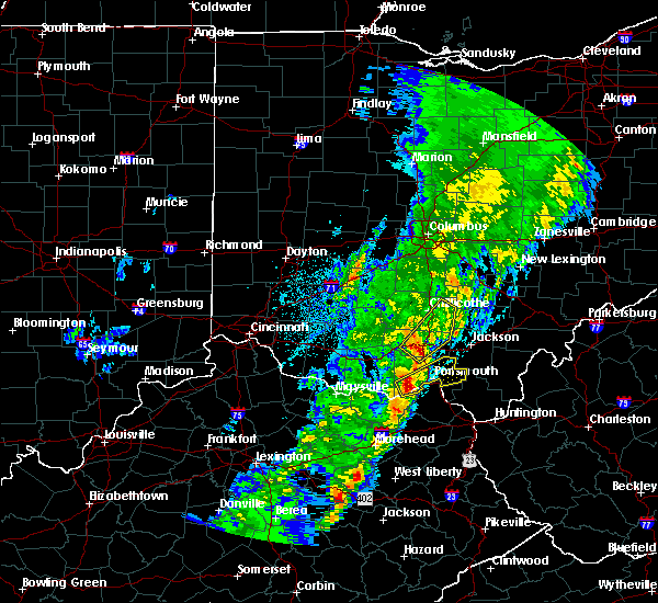 At 1145 pm est, a severe thunderstorm was located near piketon, moving northeast at 65 mph (radar indicated). Hazards include 60 mph wind gusts. expect damage to roofs, siding, and trees At 1145 pm est, a severe thunderstorm was located near piketon, moving northeast at 65 mph (radar indicated). Hazards include 60 mph wind gusts. expect damage to roofs, siding, and trees
|
| 9/30/2016 9:11 AM EDT |
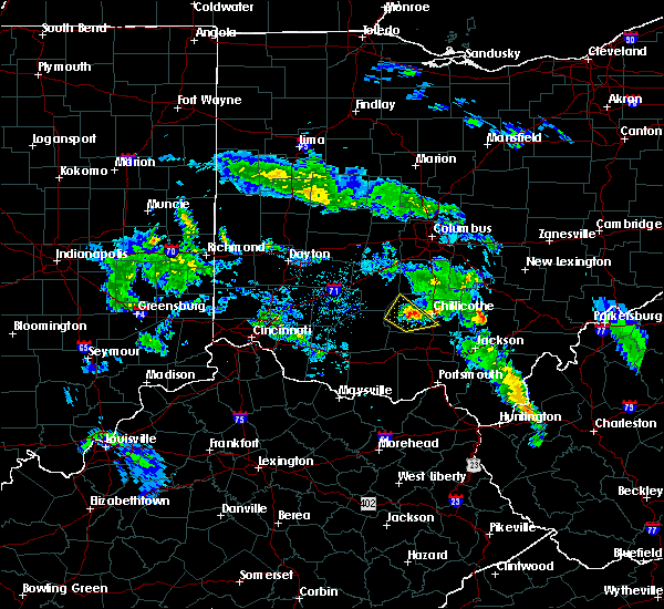 The severe thunderstorm warning for western ross county will expire at 915 am edt, the storm which prompted the warning has weakened below severe limits, and no longer poses an immediate threat to life or property. therefore, the warning will be allowed to expire. however small hail is still possible with this thunderstorm. please report previous wind damage or hail to the national weather service by going to our website at weather.gov/iln and submitting your report via social media. The severe thunderstorm warning for western ross county will expire at 915 am edt, the storm which prompted the warning has weakened below severe limits, and no longer poses an immediate threat to life or property. therefore, the warning will be allowed to expire. however small hail is still possible with this thunderstorm. please report previous wind damage or hail to the national weather service by going to our website at weather.gov/iln and submitting your report via social media.
|
| 9/30/2016 9:03 AM EDT |
 At 902 am edt, a severe thunderstorm was located near bainbridge, moving northwest at 55 mph (radar indicated). Hazards include quarter size hail. Damage to vehicles is expected. Locations impacted include, chillicothe, bainbridge, north folk village, frankfort, south salem, bourneville, austin, knockemstiff, summithill, massieville and lattaville. At 902 am edt, a severe thunderstorm was located near bainbridge, moving northwest at 55 mph (radar indicated). Hazards include quarter size hail. Damage to vehicles is expected. Locations impacted include, chillicothe, bainbridge, north folk village, frankfort, south salem, bourneville, austin, knockemstiff, summithill, massieville and lattaville.
|
| 9/30/2016 8:48 AM EDT |
 At 848 am edt, a severe thunderstorm was located near waverly, moving northwest at 55 mph (radar indicated). Hazards include quarter size hail. damage to vehicles is expected At 848 am edt, a severe thunderstorm was located near waverly, moving northwest at 55 mph (radar indicated). Hazards include quarter size hail. damage to vehicles is expected
|
| 6/23/2016 4:09 AM EDT |
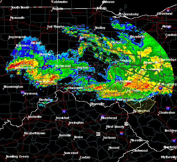 The severe thunderstorm warning for southeastern ross, pike, northeastern adams and southeastern highland counties will expire at 415 am edt, the storms which prompted the warning have weakened below severe limits, and no longer pose an immediate threat to life or property. therefore the warning will be allowed to expire. however gusty winds are still possible with these thunderstorms. a tornado watch remains in effect until 500 am edt for southwestern ohio. please report previous wind damage or hail to the national weather service by going to our website at weather.gov/iln and submitting your report via social media. The severe thunderstorm warning for southeastern ross, pike, northeastern adams and southeastern highland counties will expire at 415 am edt, the storms which prompted the warning have weakened below severe limits, and no longer pose an immediate threat to life or property. therefore the warning will be allowed to expire. however gusty winds are still possible with these thunderstorms. a tornado watch remains in effect until 500 am edt for southwestern ohio. please report previous wind damage or hail to the national weather service by going to our website at weather.gov/iln and submitting your report via social media.
|
| 6/23/2016 3:58 AM EDT |
 At 358 am edt, severe thunderstorms were located along a line extending from 9 miles southeast of kingston to waverly city to near peebles, moving southeast at 75 mph (radar indicated). Hazards include 60 mph wind gusts. Expect damage to roofs. siding. and trees. locations impacted include, chillicothe, waverly, waverly city, piketon, north fork village, belfast, kincaid springs, north folk village, pike lake, londonderry, sinking spring, knockemstiff, scioto trail state park, mooresville, richmond dale, lake white, massieville, pike county airport, may hill and idaho. A tornado watch remains in effect until 500 am edt for southwestern ohio. At 358 am edt, severe thunderstorms were located along a line extending from 9 miles southeast of kingston to waverly city to near peebles, moving southeast at 75 mph (radar indicated). Hazards include 60 mph wind gusts. Expect damage to roofs. siding. and trees. locations impacted include, chillicothe, waverly, waverly city, piketon, north fork village, belfast, kincaid springs, north folk village, pike lake, londonderry, sinking spring, knockemstiff, scioto trail state park, mooresville, richmond dale, lake white, massieville, pike county airport, may hill and idaho. A tornado watch remains in effect until 500 am edt for southwestern ohio.
|
| 6/23/2016 3:49 AM EDT |
 At 349 am edt, severe thunderstorms were located along a line extending from near kingston to near bainbridge to belfast, moving east at 85 mph (radar indicated). Hazards include 70 mph wind gusts. Expect considerable tree damage. damage is likely to mobile homes, roofs, and outbuildings. locations impacted include, chillicothe, hillsboro, waverly, waverly city, piketon, marshall, bainbridge, north fork village, belfast, kincaid springs, north folk village, cynthiana, pike lake, new market, frankfort, londonderry, sinking spring, danville in highland county, andersonville and knockemstiff. A tornado watch remains in effect until 500 am edt for southwestern ohio. At 349 am edt, severe thunderstorms were located along a line extending from near kingston to near bainbridge to belfast, moving east at 85 mph (radar indicated). Hazards include 70 mph wind gusts. Expect considerable tree damage. damage is likely to mobile homes, roofs, and outbuildings. locations impacted include, chillicothe, hillsboro, waverly, waverly city, piketon, marshall, bainbridge, north fork village, belfast, kincaid springs, north folk village, cynthiana, pike lake, new market, frankfort, londonderry, sinking spring, danville in highland county, andersonville and knockemstiff. A tornado watch remains in effect until 500 am edt for southwestern ohio.
|
| 6/23/2016 3:39 AM EDT |
 At 339 am edt, severe thunderstorms were located along a line extending from 9 miles northwest of north folk village to 6 miles north of marshall to near lynchburg, moving southeast at 75 mph (radar indicated). Hazards include 70 mph wind gusts. Expect considerable tree damage. damage is likely to mobile homes, roofs, and outbuildings. locations impacted include, chillicothe, hillsboro, greenfield, waverly, waverly city, piketon, lynchburg, leesburg, marshall, bainbridge, north fork village, pike lake, belfast, kincaid springs, north folk village, cynthiana, russell, new market, frankfort and londonderry. A tornado watch remains in effect until 500 am edt for central and southwestern ohio. At 339 am edt, severe thunderstorms were located along a line extending from 9 miles northwest of north folk village to 6 miles north of marshall to near lynchburg, moving southeast at 75 mph (radar indicated). Hazards include 70 mph wind gusts. Expect considerable tree damage. damage is likely to mobile homes, roofs, and outbuildings. locations impacted include, chillicothe, hillsboro, greenfield, waverly, waverly city, piketon, lynchburg, leesburg, marshall, bainbridge, north fork village, pike lake, belfast, kincaid springs, north folk village, cynthiana, russell, new market, frankfort and londonderry. A tornado watch remains in effect until 500 am edt for central and southwestern ohio.
|
| 6/23/2016 3:25 AM EDT |
 At 324 am edt, severe thunderstorms were located along a line extending from near washington court house to near new vienna to near morrow, moving southeast at 75 mph (radar indicated). Hazards include 70 mph wind gusts. Expect considerable tree damage. Damage is likely to mobile homes, roofs, and outbuildings. At 324 am edt, severe thunderstorms were located along a line extending from near washington court house to near new vienna to near morrow, moving southeast at 75 mph (radar indicated). Hazards include 70 mph wind gusts. Expect considerable tree damage. Damage is likely to mobile homes, roofs, and outbuildings.
|
| 4/28/2016 7:08 PM EDT |
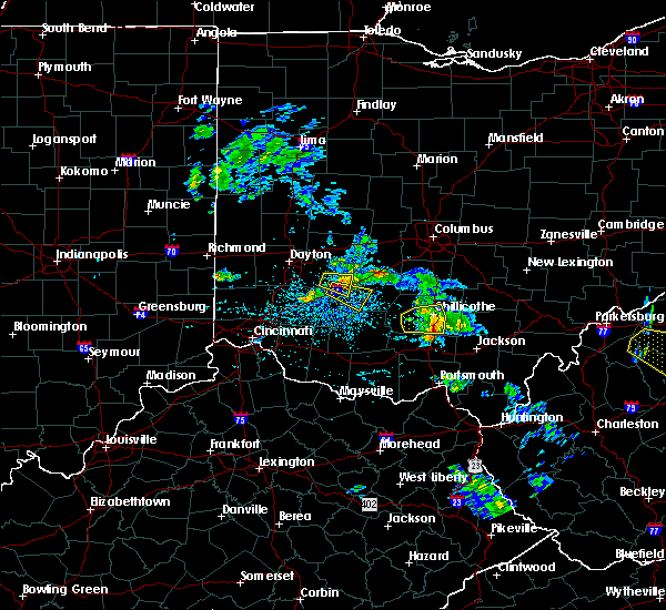 The severe thunderstorm warning for southern ross county will expire at 715 pm edt, the severe thunderstorm which prompted the warning has weakened. therefore the warning will be allowed to expire. please report previous wind damage or hail to the national weather service by going to our website at weather.gov/iln and submitting your report via social media. The severe thunderstorm warning for southern ross county will expire at 715 pm edt, the severe thunderstorm which prompted the warning has weakened. therefore the warning will be allowed to expire. please report previous wind damage or hail to the national weather service by going to our website at weather.gov/iln and submitting your report via social media.
|
| 4/28/2016 6:51 PM EDT |
 At 650 pm edt, a severe thunderstorm was located near bainbridge, moving east at 30 mph (radar indicated). Hazards include 60 mph wind gusts and quarter size hail. Hail damage to vehicles is expected. expect wind damage to roofs, siding, and trees. Locations impacted include, chillicothe, north fork village, north folk village, bourneville, knockemstiff, summithill, massieville, lattaville and scioto trail state park. At 650 pm edt, a severe thunderstorm was located near bainbridge, moving east at 30 mph (radar indicated). Hazards include 60 mph wind gusts and quarter size hail. Hail damage to vehicles is expected. expect wind damage to roofs, siding, and trees. Locations impacted include, chillicothe, north fork village, north folk village, bourneville, knockemstiff, summithill, massieville, lattaville and scioto trail state park.
|
| 4/28/2016 6:39 PM EDT |
 At 639 pm edt, a severe thunderstorm was located near bainbridge, moving east at 30 mph (radar indicated). Hazards include 60 mph wind gusts and quarter size hail. Hail damage to vehicles is expected. Expect wind damage to roofs, siding, and trees. At 639 pm edt, a severe thunderstorm was located near bainbridge, moving east at 30 mph (radar indicated). Hazards include 60 mph wind gusts and quarter size hail. Hail damage to vehicles is expected. Expect wind damage to roofs, siding, and trees.
|
| 4/26/2016 4:57 PM EDT |
 At 457 pm edt, a severe thunderstorm was located near kingston, moving southeast at 30 mph (radar indicated). Hazards include 60 mph wind gusts and quarter size hail. Hail damage to vehicles is expected. Expect wind damage to roofs, siding, and trees. At 457 pm edt, a severe thunderstorm was located near kingston, moving southeast at 30 mph (radar indicated). Hazards include 60 mph wind gusts and quarter size hail. Hail damage to vehicles is expected. Expect wind damage to roofs, siding, and trees.
|
| 7/14/2015 4:08 PM EDT |
 The severe thunderstorm warning for central ross county will expire at 415 pm edt, the storms which prompted the warning have moved out of the area. therefore the warning will be allowed to expire. please report previous wind damage or hail to the national weather service by going to our website at weather.gov/iln and submit your report via social media. The severe thunderstorm warning for central ross county will expire at 415 pm edt, the storms which prompted the warning have moved out of the area. therefore the warning will be allowed to expire. please report previous wind damage or hail to the national weather service by going to our website at weather.gov/iln and submit your report via social media.
|
| 7/14/2015 3:55 PM EDT |
 At 355 pm edt, radar indicated severe thunderstorms located along a line extending from 12 miles east of chillicothe to near bainbridge, moving southeast at 45 mph. storm hazards include, winds to 60 mph, penny size hail, locations impacted include, chillicothe, north fork village, north folk village, londonderry, south salem, mooresville, bourneville, knockemstiff, massieville and lattaville. At 355 pm edt, radar indicated severe thunderstorms located along a line extending from 12 miles east of chillicothe to near bainbridge, moving southeast at 45 mph. storm hazards include, winds to 60 mph, penny size hail, locations impacted include, chillicothe, north fork village, north folk village, londonderry, south salem, mooresville, bourneville, knockemstiff, massieville and lattaville.
|
| 7/14/2015 3:43 PM EDT |
 At 342 pm edt, radar indicated severe thunderstorms located along a line extending from near chillicothe to near greenfield, moving southeast at 50 mph. storm hazards include, winds to 60 mph, quarter size hail, locations impacted include, chillicothe, greenfield, north fork village, north folk village, frankfort, londonderry, south salem, andersonville, knockemstiff, lattaville, mooresville, bourneville, new martinsburg and massieville. At 342 pm edt, radar indicated severe thunderstorms located along a line extending from near chillicothe to near greenfield, moving southeast at 50 mph. storm hazards include, winds to 60 mph, quarter size hail, locations impacted include, chillicothe, greenfield, north fork village, north folk village, frankfort, londonderry, south salem, andersonville, knockemstiff, lattaville, mooresville, bourneville, new martinsburg and massieville.
|
| 7/14/2015 3:26 PM EDT |
 At 326 pm edt, radar indicated severe thunderstorms located along a line extending from near williamsport to near washington court house, moving southeast at 40 mph. storm hazards include, winds to 60 mph, quarter size hail,. At 326 pm edt, radar indicated severe thunderstorms located along a line extending from near williamsport to near washington court house, moving southeast at 40 mph. storm hazards include, winds to 60 mph, quarter size hail,.
|
| 7/14/2015 1:25 AM EDT |
 At 124 am edt, radar indicated a severe thunderstorm located near chillicothe, moving east at 40 mph. storm hazards include, winds to 60 mph, locations impacted include, chillicothe, north fork village, londonderry, mooresville, richmond dale, omega, massieville, pike county airport and scioto trail state park. At 124 am edt, radar indicated a severe thunderstorm located near chillicothe, moving east at 40 mph. storm hazards include, winds to 60 mph, locations impacted include, chillicothe, north fork village, londonderry, mooresville, richmond dale, omega, massieville, pike county airport and scioto trail state park.
|
| 7/14/2015 1:12 AM EDT |
 At 112 am edt, radar indicated a severe thunderstorm located 7 miles northwest of north fork village, moving east at 25 mph. storm hazards include, winds to 60 mph, quarter size hail,. At 112 am edt, radar indicated a severe thunderstorm located 7 miles northwest of north fork village, moving east at 25 mph. storm hazards include, winds to 60 mph, quarter size hail,.
|
| 7/13/2015 2:04 PM EDT | One large tree down in front of mt logan elementary school. time estimated from rada in ross county OH, 1.7 miles W of Chillicothe, OH |
| 6/26/2015 4:35 PM EDT | At 431 pm edt, radar continued to indicate a severe thunderstorm located near lake white, moving east at 30 mph. numerous reports of down trees in highland county. storm hazards include, winds to 60 mph, quarter size hail, frequent cloud to ground lightning, very heavy rain which may cause minor flooding, locations impacted include, waverly and piketon. in addition, scioto trail state park, wakefield, pike county airport, mooresville, omega, givens, londonderry and germany are near the path of this storm. |
| 6/26/2015 4:15 PM EDT | At 412 pm edt, radar indicated a severe thunderstorm located near pike lake, moving east at 30 mph. storm hazards include, damaging winds to 70 mph, half dollar size hail,. |
| 6/18/2015 6:48 PM EDT | Storm damage reported in ross county OH, 2 miles E of Chillicothe, OH |
| 5/26/2015 9:02 PM EDT | At 901 pm edt, radar continued to indicate a severe thunderstorm located near waverly, moving northeast at 40 mph. storm hazards include, winds to 60 mph, quarter size hail, this storm will affect mainly rural areas of eastern ross and northeastern pike counties, including omega, linn, pike county airport, scioto trail state park, massieville, richmond dale, londonderry and mooresville. |
| 5/26/2015 8:46 PM EDT | At 845 pm edt, radar indicated a severe thunderstorm located near wakefield, moving northeast at 40 mph. storm hazards include, winds to 60 mph, quarter size hail,. |
| 5/11/2015 9:30 PM EDT | At 929 pm edt, radar continued to indicate a severe thunderstorm located near whisler, moving northeast at 60 mph. storm hazards include, winds to 60 mph, quarter size hail, locations impacted include, lancaster. in addition, tarlton, stoutsville, east ringgold, state route 674 at state route 188, buena vista, amanda, clearport and royalton are near the path of this storm. , 1.00in. |
| 5/11/2015 9:22 PM EDT | At 921 pm edt, radar indicated a severe thunderstorm located near andersonville, moving northeast at 60 mph. storm hazards include, winds to 60 mph,. |
| 5/11/2015 7:48 PM EDT | Numerous trees and power poles knocked down in the east side of chillicoth in ross county OH, 0.1 miles WSW of Chillicothe, OH |
| 5/11/2015 5:05 PM EDT | Numerous trees and power poles knocked down in the east side of chillicoth in ross county OH, 0.1 miles WSW of Chillicothe, OH |
| 5/11/2015 5:01 PM EDT | At 458 pm edt, radar indicated that the severe thunderstorms had strengthened. these storms were located along a line extending from ashville to kingston to pike county airport, moving east at 40 mph. storm hazards include, winds to 60 mph, quarter size hail, frequent cloud to ground lightning, locations impacted include, baltimore, lancaster and hocking hills state park. in addition, scioto trail state park, aw marion state park, slate run metro park, omega, pike county airport, east ringgold, state route 674 at state route 188 and lithopolis are near the path of these storms. , 1.00in. |
| 5/11/2015 4:51 PM EDT | At 448 pm edt, radar indicated severe thunderstorms located along a line extending from darbyville to pickaway county airport to buchanan, moving east at 40 mph. storm hazards include, winds to 60 mph, penny size hail, frequent cloud to ground lightning,. |
| 4/9/2015 3:23 PM EDT | The severe thunderstorm warning for central ross and central pickaway counties will expire at 330 pm edt. the storms have weakened below severe limits. therefore the severe thunderstorm warning will be allowed to expire. Additional thunderstorm development is possible and a severe thunderstorm watch remains in effect until 10 pm edt. |
| 4/9/2015 3:16 PM EDT | A severe thunderstorm warning remains in effect until 330 pm edt for central ross and central pickaway counties. at 315 pm edt. radar continued to indicate severe thunderstorms located along a line extending from ashville to logan elm village to north fork village. moving east at 45 mph. Storm hazards include. |
| 4/9/2015 2:58 PM EDT | The national weather service in wilmington has issued a * severe thunderstorm warning for. ross county in southwest ohio. pickaway county in central ohio. northeastern fayette county in central ohio. Until 330 pm edt. |
| 4/8/2015 8:27 PM EDT | Quarter sized hail reported 2 miles N of Chillicothe, OH |
| 4/8/2015 12:10 PM EDT | The severe thunderstorm warning for southern highland. southeastern clermont. ross. northwestern pike. southern pickaway. central brown and northern adams counties will expire at 1215 pm edt. the storms have moved out of the warned area. Therefore the severe thunderstorm warning will be allowed to expire. |
| 4/8/2015 12:06 PM EDT | The national weather service in wilmington has issued a * severe thunderstorm warning for. scioto county in southwest ohio. eastern ross county in southwest ohio. eastern pike county in southwest ohio. Southeastern pickaway county in central ohio. |
| 4/8/2015 12:06 PM EDT | The national weather service in wilmington has issued a * severe thunderstorm warning for. scioto county in southwest ohio. eastern ross county in southwest ohio. eastern pike county in southwest ohio. Southeastern pickaway county in central ohio. |
| 4/8/2015 11:51 AM EDT | A severe thunderstorm warning remains in effect until 1215 pm edt for southern highland. southeastern clermont. ross. northwestern pike. southern pickaway. central brown and northern adams counties. at 1150 am edt. Radar continued to indicate severe thunderstorms located along a line extending from clarksburg to cynthiana to lake. |
| 4/8/2015 11:34 AM EDT | A severe thunderstorm warning remains in effect until 1215 pm edt for southern pickaway and southern fayette counties in central ohio. and highland. southeastern clermont. ross. northwestern pike. central brown and northern adams counties in southwest ohio. at 1133 am edt. Radar continued to indicate severe thunderstorms located along a line extending from washington court house to. |
| 4/8/2015 11:26 AM EDT | The national weather service in wilmington has issued a * severe thunderstorm warning for. highland county in southwest ohio. southeastern clermont county in southwest ohio. ross county in southwest ohio. Northwestern pike county in southwest ohio. |
| 8/2/2014 1:59 PM EDT | Quarter sized hail reported 2.9 miles NNE of Chillicothe, OH |
| 7/1/2014 10:54 PM EDT | One tree down on charleston pike in ross county OH, 8.2 miles W of Chillicothe, OH |
| 6/10/2014 8:33 PM EDT | One tree downed on biers run road. time estimate in ross county OH, 5.9 miles SE of Chillicothe, OH |
| 5/14/2014 5:45 PM EDT | Quarter sized hail reported 4.4 miles NNW of Chillicothe, OH |
| 5/14/2014 5:45 PM EDT | Several telephone poles down near 3 locks rd and sugar tree r in ross county OH, 7.6 miles NW of Chillicothe, OH |
| 5/14/2014 5:41 PM EDT | Tennis Ball sized hail reported 6.8 miles NNW of Chillicothe, OH, time estimated from radar. |
| 5/14/2014 5:37 PM EDT | Numerous trees and power lines down in franklin township in ross county OH, 10.7 miles NNW of Chillicothe, OH |
| 5/14/2014 2:55 PM EDT | Half Dollar sized hail reported 2.7 miles ESE of Chillicothe, OH |
| 12/22/2013 12:30 AM EST | A few trees down across the county in ross county OH, 0.1 miles WSW of Chillicothe, OH |
| 11/17/2013 7:30 PM EST | Several reports of large branches down across roadways in huntington township in ross county OH, 7.2 miles NNE of Chillicothe, OH |
| 6/26/2013 2:55 AM EDT | Scattered trees snapped off in clayburne heights neighborhood. one empty truck trailer tipped over in parking lot adjacent to sr-15 in ross county OH, 4.3 miles SSW of Chillicothe, OH |
| 7/1/2012 7:10 PM EDT | Numerous trees reported down across the county including on blacksmith hill road...massieville road...3 locks road...and charleston pike. time estimated from rada in ross county OH, 3.3 miles W of Chillicothe, OH |
| 7/1/2012 6:58 PM EDT | Golf Ball sized hail reported 0.1 miles WSW of Chillicothe, OH |
| 7/1/2012 6:38 PM EDT | Hen Egg sized hail reported 0.1 miles WSW of Chillicothe, OH |
| 7/1/2012 6:37 PM EDT | Golf Ball sized hail reported 0.1 miles WSW of Chillicothe, OH |
| 7/1/2012 6:36 PM EDT | Quarter sized hail reported 0.1 miles WSW of Chillicothe, OH |
| 6/29/2012 5:38 PM EDT | Numerous trees and power lines down in massieville and elsewhere around ross county in ross county OH, 4.9 miles NNW of Chillicothe, OH |
| 6/29/2012 5:33 PM EDT | A metal roof was removed from a building on race stree in ross county OH, 0.7 miles W of Chillicothe, OH |
| 5/1/2012 7:00 PM EDT | Quarter sized hail reported 0.1 miles WSW of Chillicothe, OH |
| 5/1/2012 6:49 PM EDT | Golf Ball sized hail reported 0.1 miles WSW of Chillicothe, OH |
| 1/1/0001 12:00 AM | Numerous trees dow in ross county OH, 0.1 miles WSW of Chillicothe, OH |
| 1/1/0001 12:00 AM | Utility poles down on cr 550 in ross county OH, 4.6 miles SE of Chillicothe, OH |
| 1/1/0001 12:00 AM | Numerous reports of trees and power lines down...mainly on the east side of chillicoth in ross county OH, 0.1 miles WSW of Chillicothe, OH |
| 1/1/0001 12:00 AM | A few trees down on rocky rd...marietta rd...and chapel creek r in ross county OH, 4.8 miles SW of Chillicothe, OH |
| 1/1/0001 12:00 AM | Hen Egg sized hail reported 0.4 miles E of Chillicothe, OH, hail ranging in size from 1/2 inch to 2 inches at central center. |
| 1/1/0001 12:00 AM | Half Dollar sized hail reported 2 miles E of Chillicothe, OH |
| 1/1/0001 12:00 AM | Golf Ball sized hail reported 3.4 miles ESE of Chillicothe, OH, marble to golf ball size hail nr intersection sr 50 and sr 28 |
| 1/1/0001 12:00 AM | Ping Pong Ball sized hail reported 6.2 miles NE of Chillicothe, OH |
| 1/1/0001 12:00 AM | Damage to building in ross county OH, 0.1 miles WSW of Chillicothe, OH |
| 1/1/0001 12:00 AM | Golf Ball sized hail reported 1.8 miles SW of Chillicothe, OH |
| 1/1/0001 12:00 AM | At the raws station north of chillicothe in ross county OH, 3.5 miles S of Chillicothe, OH |
| 1/1/0001 12:00 AM | Five trees down in ross county OH, 5.6 miles NNW of Chillicothe, OH |
| 1/1/0001 12:00 AM | Trees and powerlines down in ross county OH, 0.1 miles WSW of Chillicothe, OH |
| 1/1/0001 12:00 AM | At the raws station north of chillicothe in ross county OH, 3.5 miles S of Chillicothe, OH |
| 1/1/0001 12:00 AM | Small metal shed blown 25-30 feet to the east into neighbors yard in ross county OH, 0.1 miles WSW of Chillicothe, OH |
Hail Maps for Chillicothe, OH

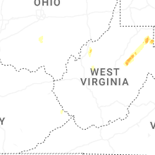

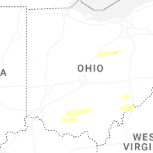


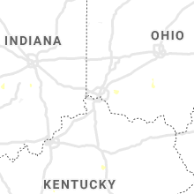
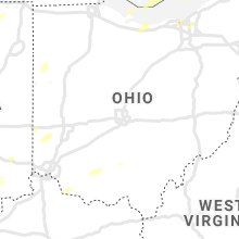


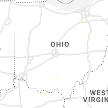
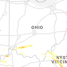


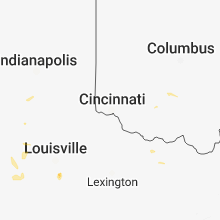


Connect with Interactive Hail Maps