

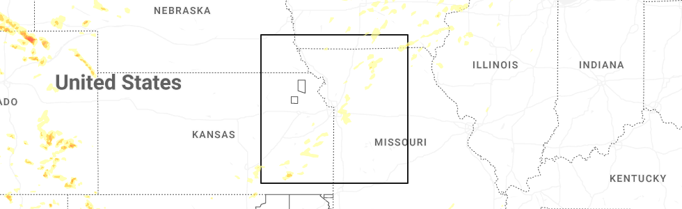
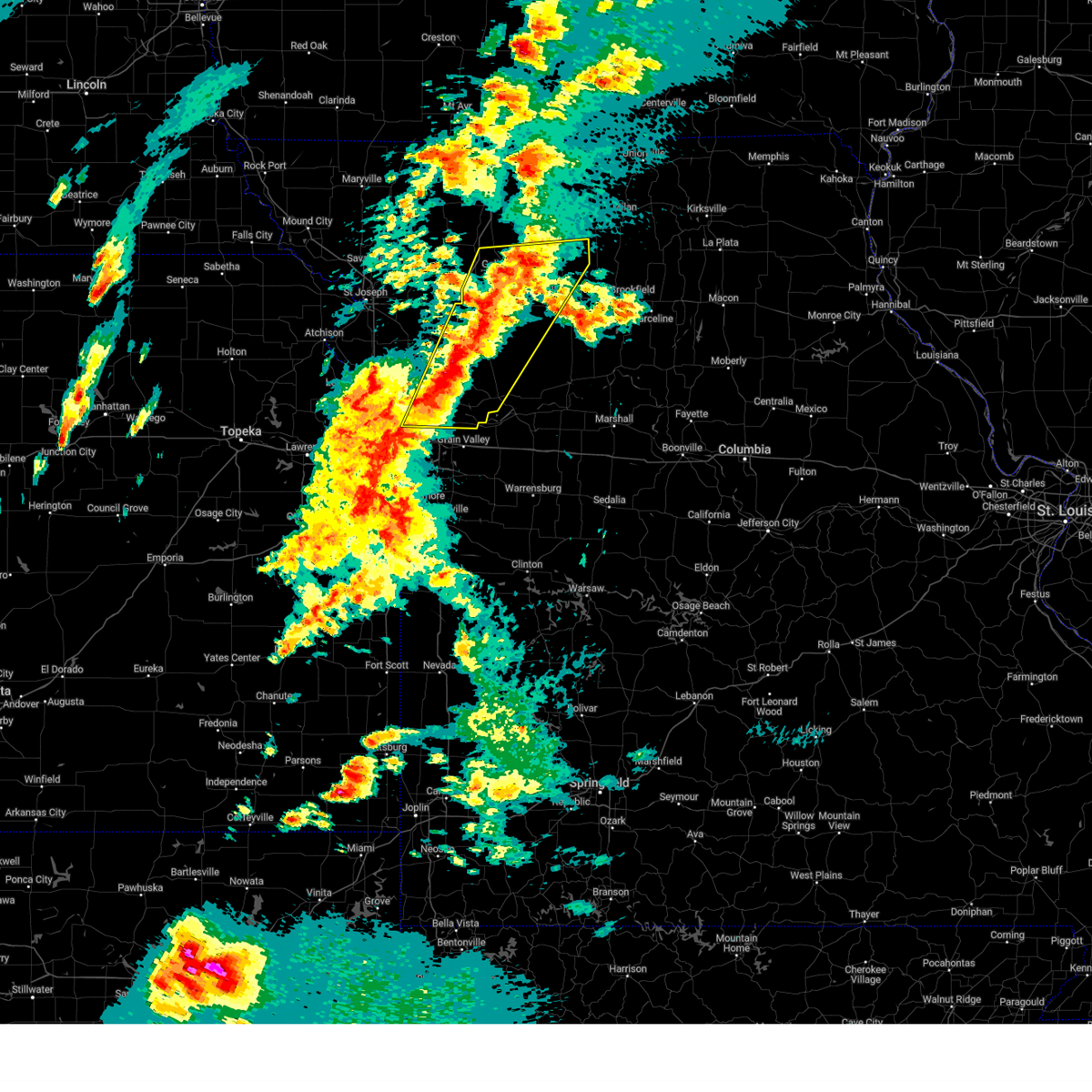
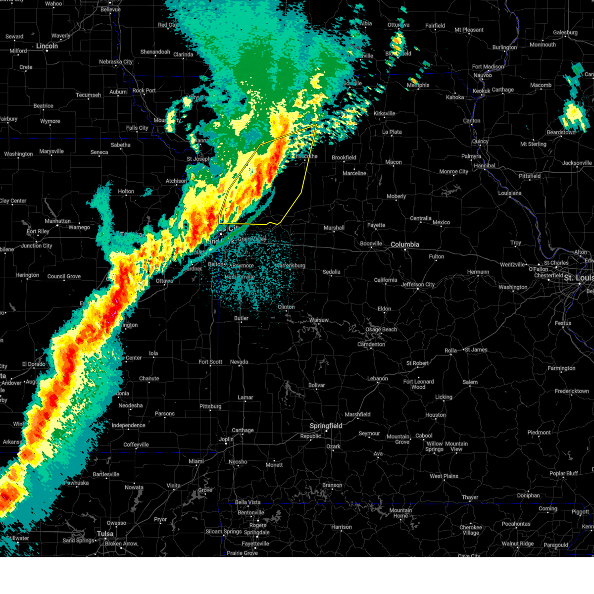
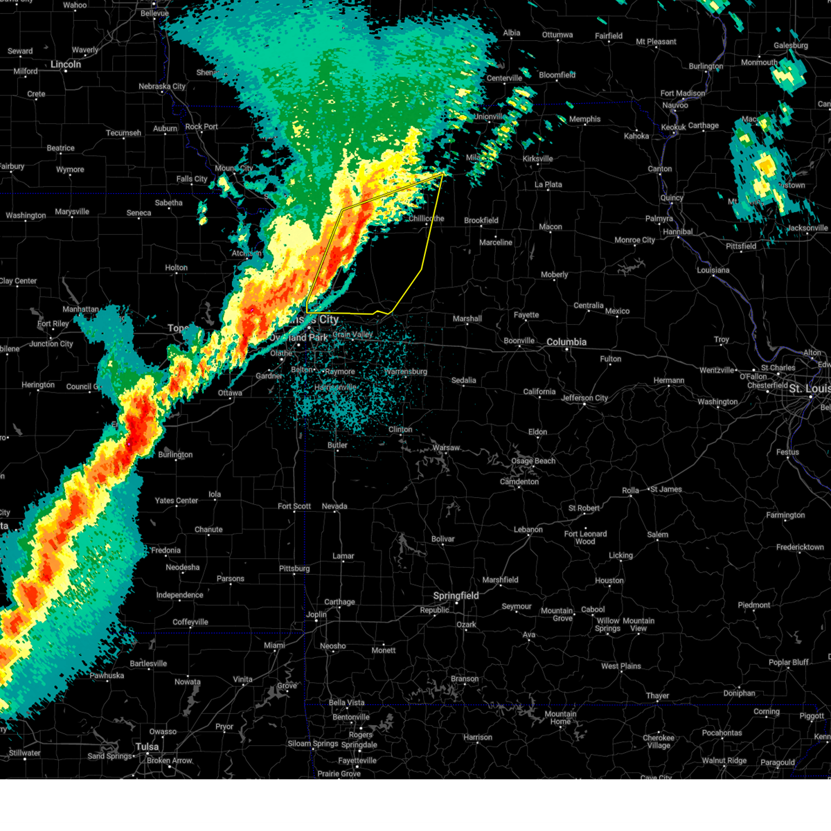
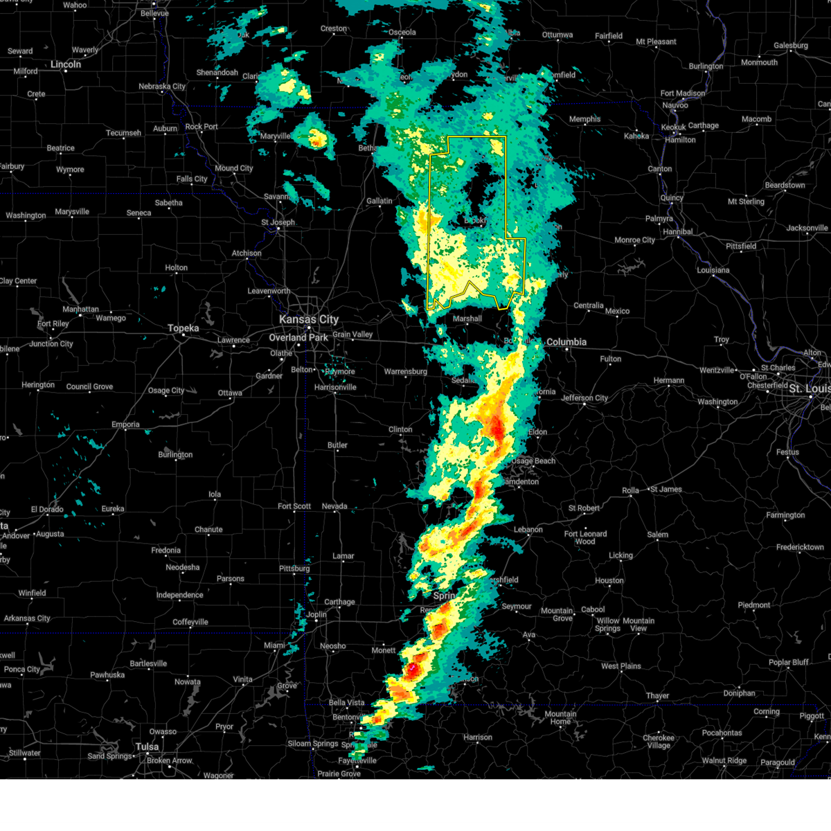
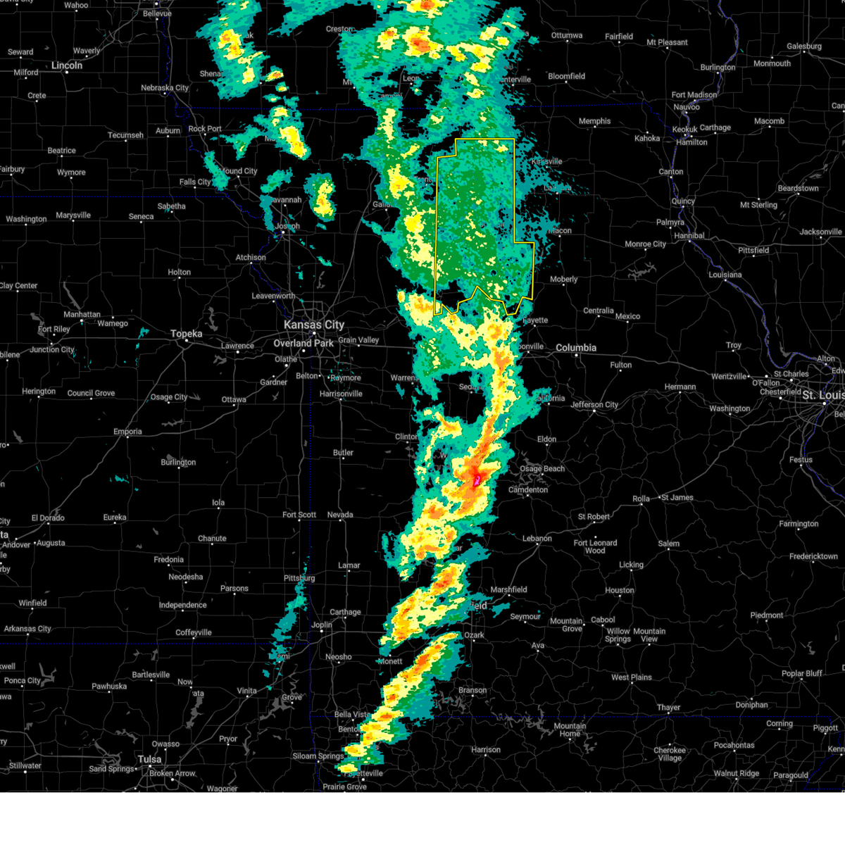
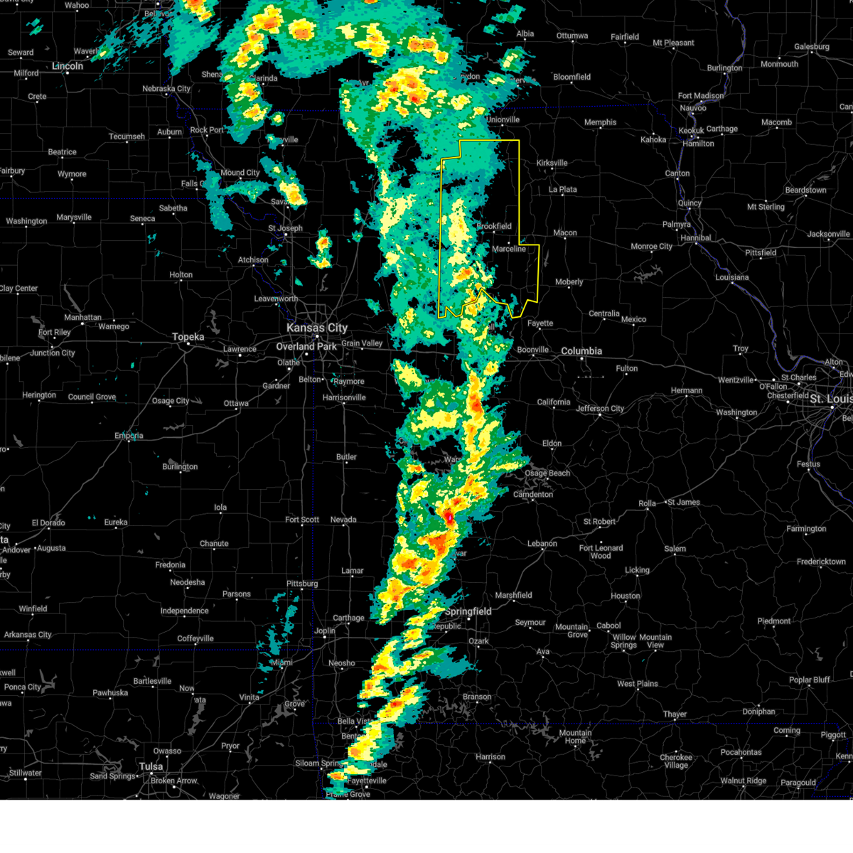
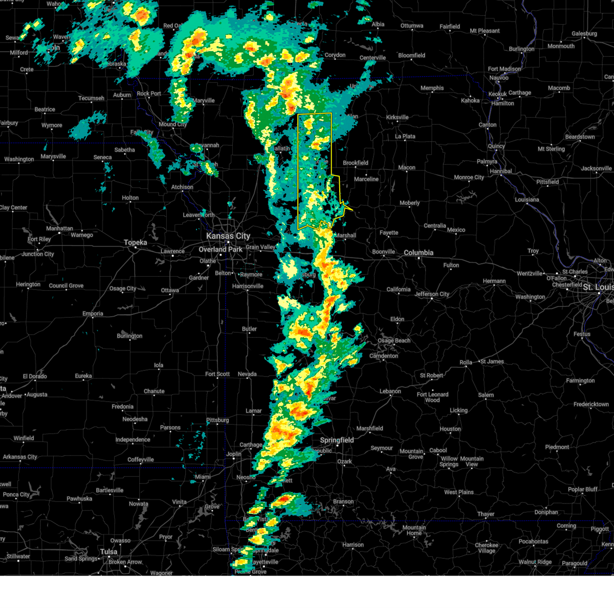
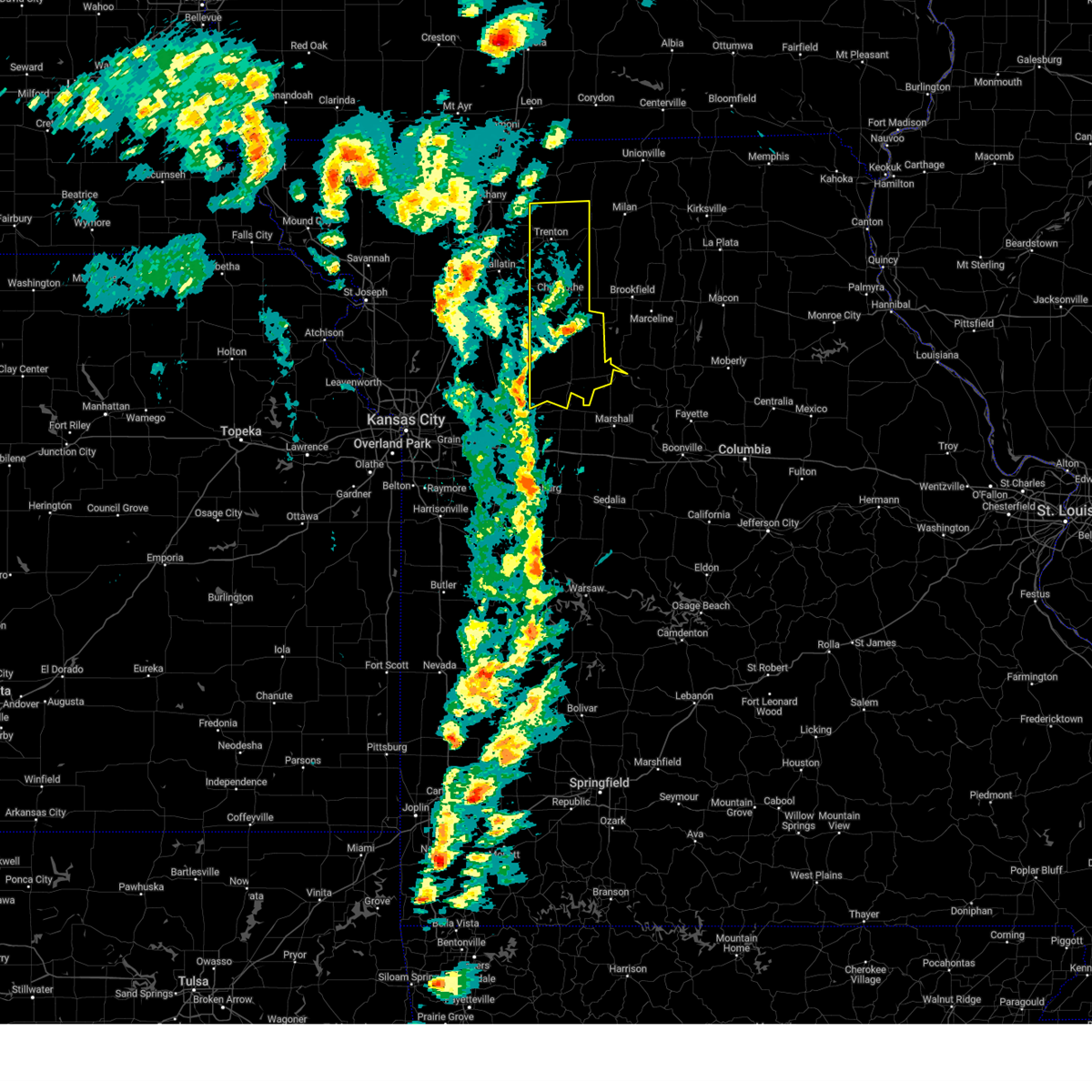
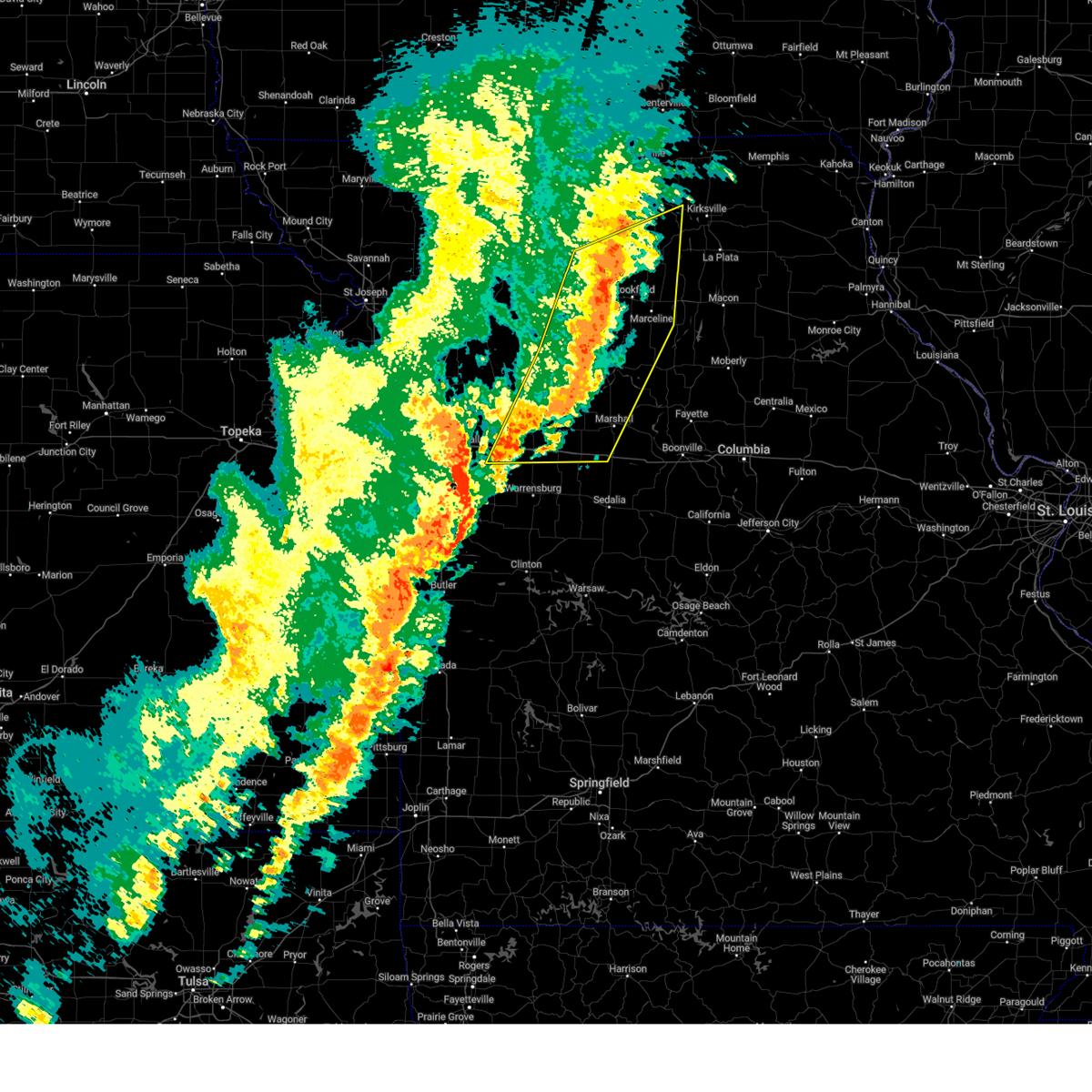
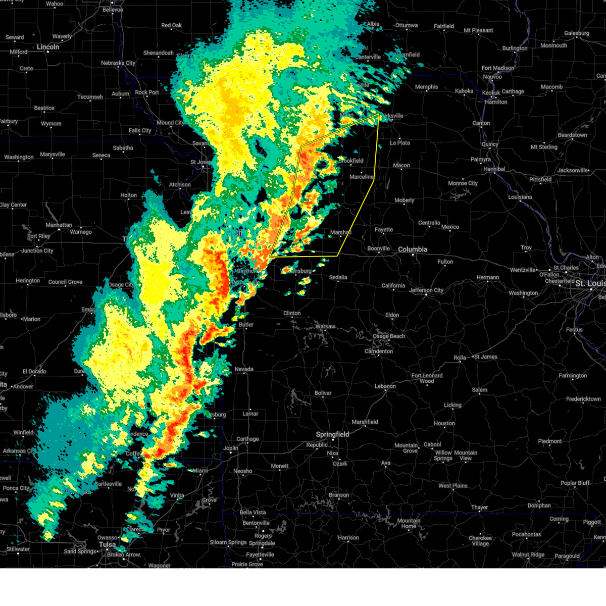
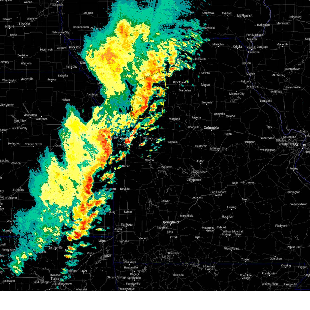
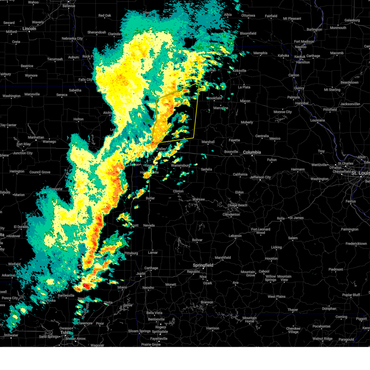
Hail Map for Chula, MO
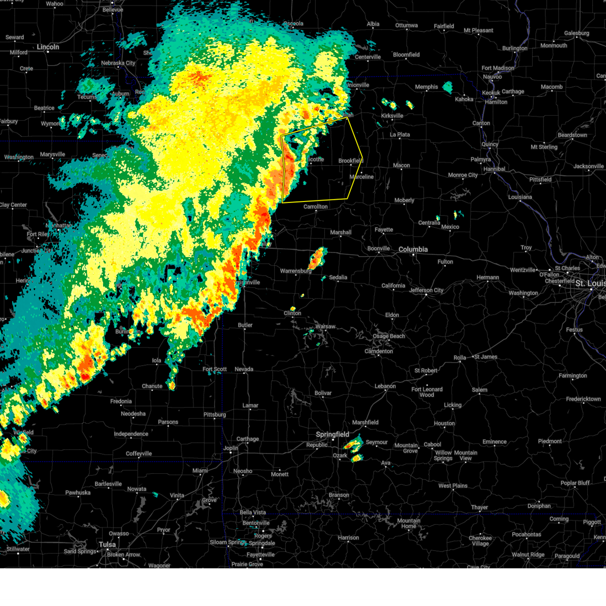
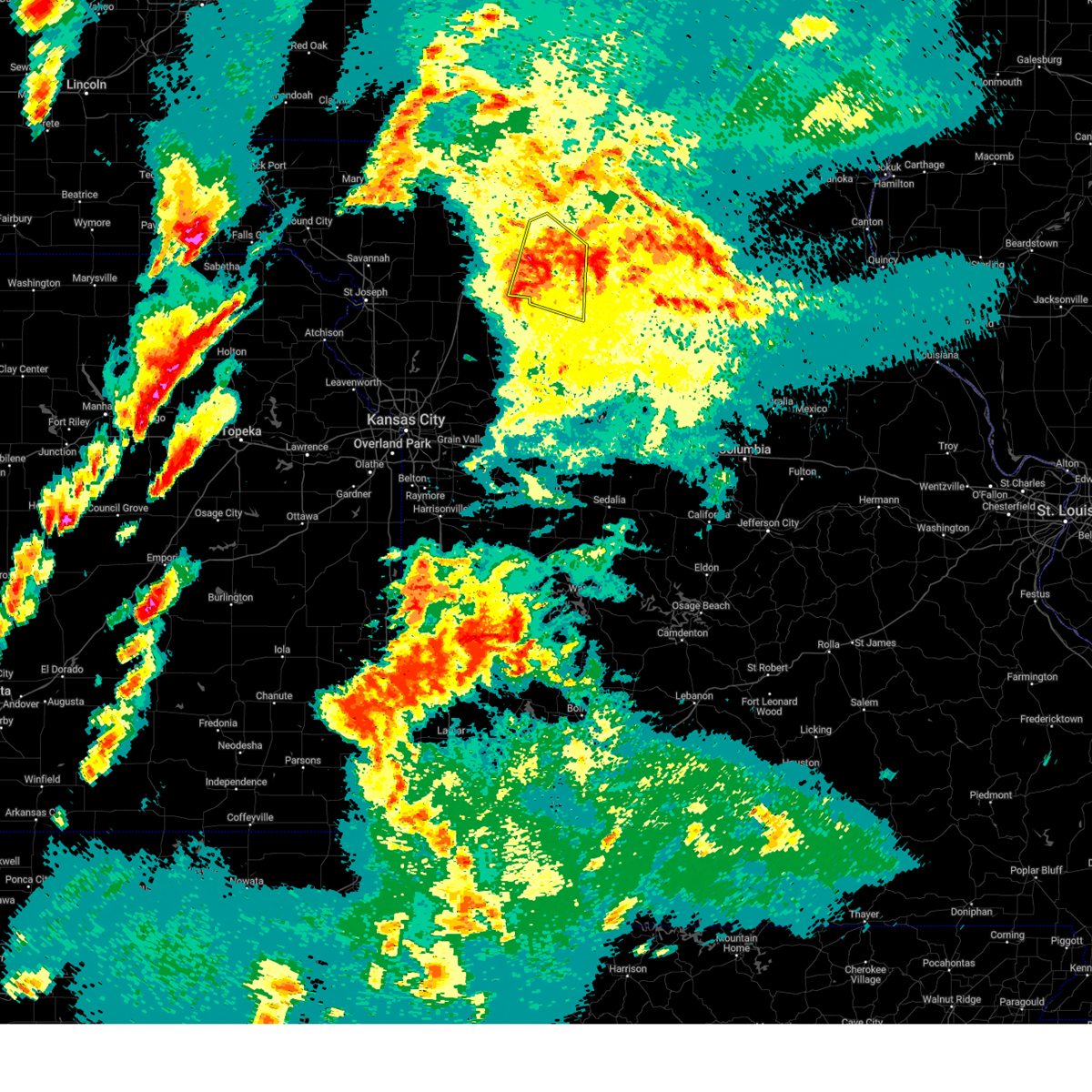
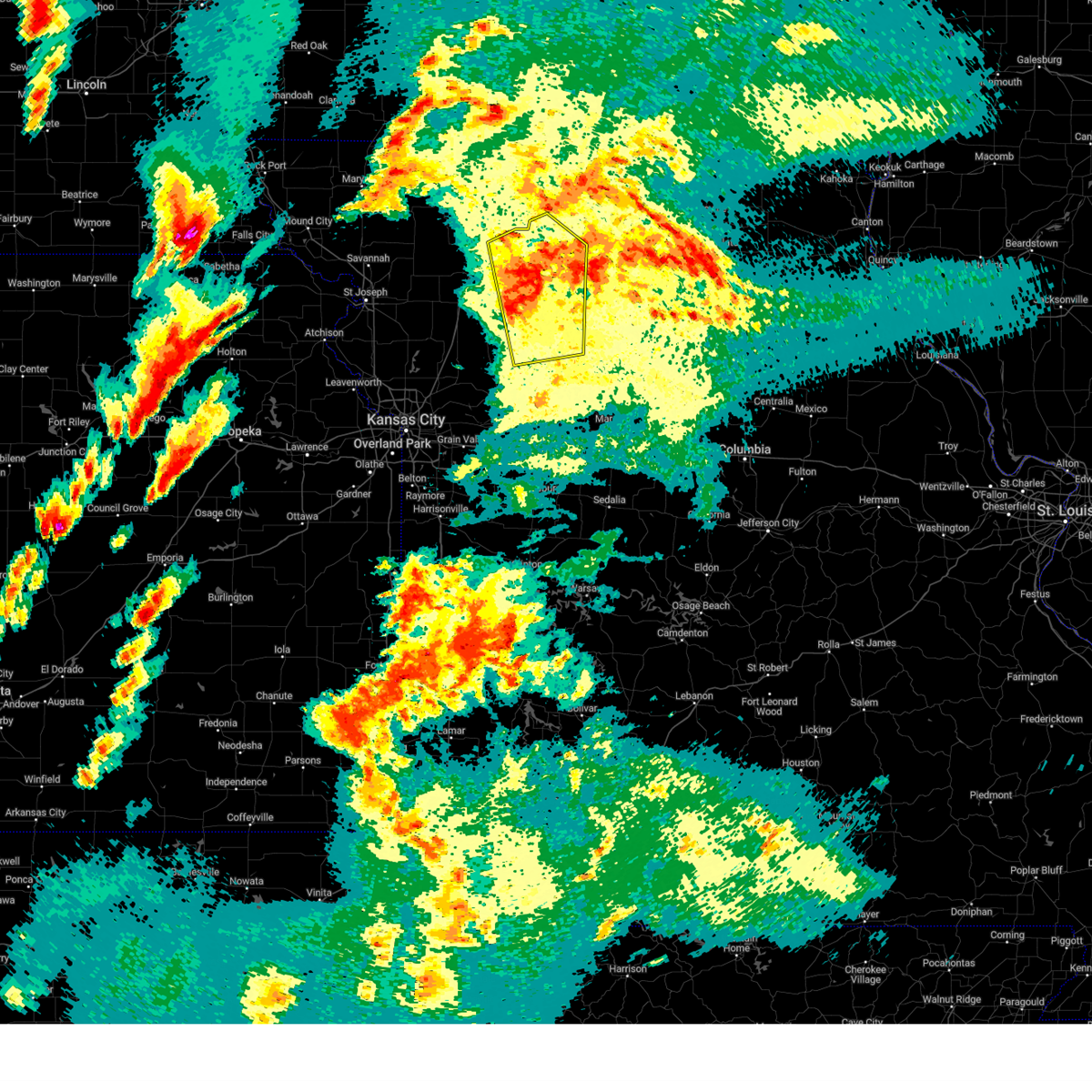
The Chula, MO area has had 3 reports of on-the-ground hail by trained spotters, and has been under severe weather warnings 26 times during the past 12 months. Doppler radar has detected hail at or near Chula, MO on 41 occasions, including 1 occasion during the past year.
| Name: | Chula, MO |
| Where Located: | 81.8 miles NE of Kansas City, MO |
| Map: | Google Map for Chula, MO |
| Population: | 210 |
| Housing Units: | 91 |
| More Info: | Search Google for Chula, MO |
0
The Top Recent Hail Date for Chula, MO is Friday, July 11, 2025 (28th out of 41)
Hail and Wind Damage Spotted near Chula, MO
| Date / Time | Report Details |
|---|---|
| 6/3/2025 4:00 PM CDT | the severe thunderstorm warning has been cancelled and is no longer in effect |
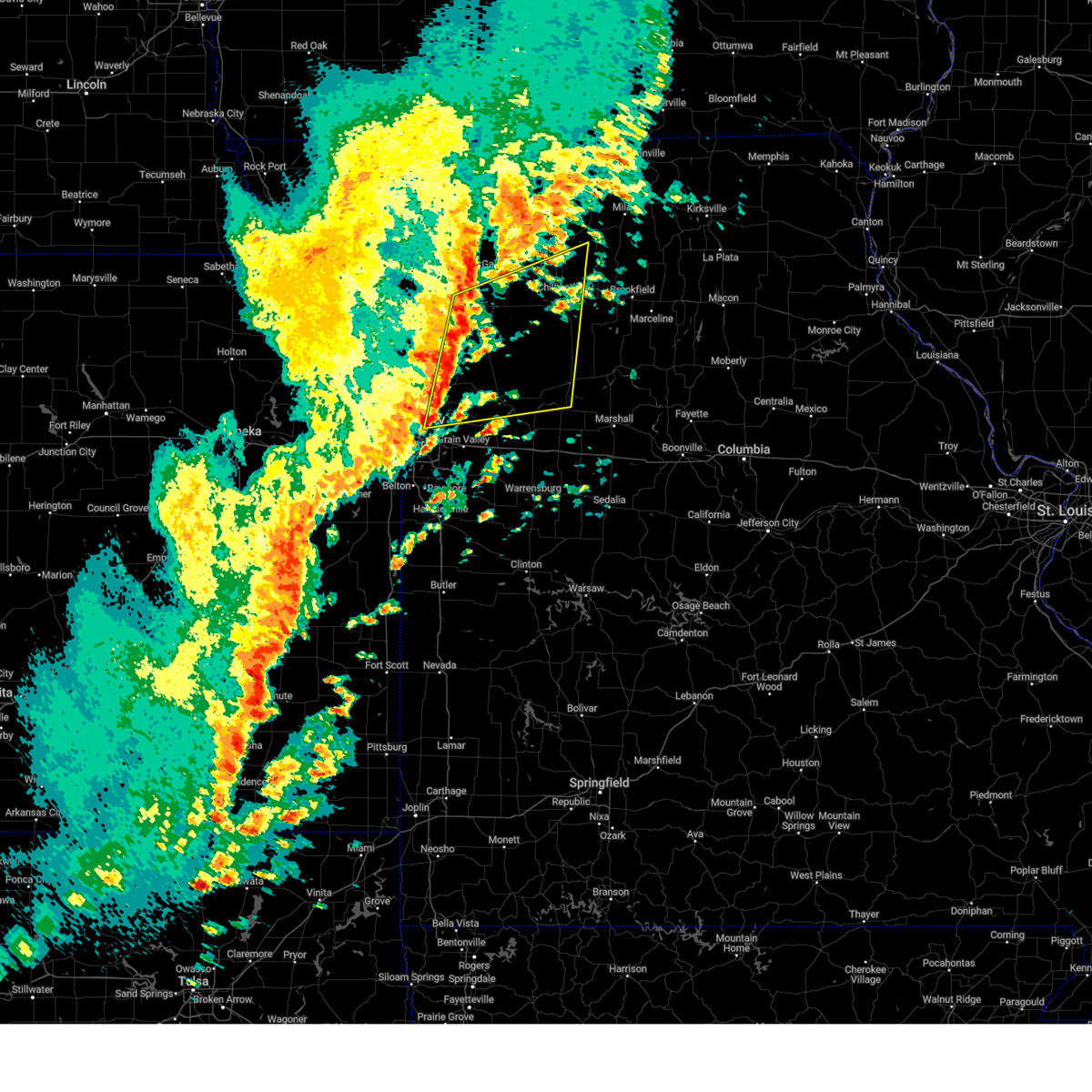
| 6/3/2025 4:00 PM CDT | At 359 pm cdt, severe thunderstorms were located along a line extending from 10 miles northwest of milan to 9 miles northeast of browning to 7 miles east of hale, moving east at 40 mph (radar indicated). Hazards include 60 mph wind gusts and penny size hail. Expect damage to roofs, siding, and trees. Locations impacted include, chillicothe, brookfield, milan, meadville, hale, laclede, bosworth, linneus, wheeling, browning, galt, chula, laredo, purdin, mendon, bogard, tina, humphreys, sumner, and rothville. |
| 6/3/2025 3:13 PM CDT |
 Svreax the national weather service in pleasant hill has issued a * severe thunderstorm warning for, northwestern chariton county in north central missouri, eastern daviess county in north central missouri, linn county in north central missouri, southern grundy county in north central missouri, southwestern sullivan county in north central missouri, northeastern ray county in west central missouri, northern carroll county in north central missouri, eastern caldwell county in north central missouri, livingston county in north central missouri, * until 415 pm cdt. * at 312 pm cdt, severe thunderstorms were located along a line extending from jamesport to near utica to near braymer, moving east at 40 mph (radar indicated). Hazards include 60 mph wind gusts and penny size hail. expect damage to roofs, siding, and trees Svreax the national weather service in pleasant hill has issued a * severe thunderstorm warning for, northwestern chariton county in north central missouri, eastern daviess county in north central missouri, linn county in north central missouri, southern grundy county in north central missouri, southwestern sullivan county in north central missouri, northeastern ray county in west central missouri, northern carroll county in north central missouri, eastern caldwell county in north central missouri, livingston county in north central missouri, * until 415 pm cdt. * at 312 pm cdt, severe thunderstorms were located along a line extending from jamesport to near utica to near braymer, moving east at 40 mph (radar indicated). Hazards include 60 mph wind gusts and penny size hail. expect damage to roofs, siding, and trees
|
| 5/19/2025 6:20 PM CDT | The storms which prompted the warning have weakened below severe limits, and no longer pose an immediate threat to life or property. therefore, the warning will be allowed to expire. however, gusty winds and heavy rain are still possible with these thunderstorms. a tornado watch remains in effect until 900 pm cdt for north central missouri. a severe thunderstorm watch remains in effect until 1000 pm cdt for north central missouri. |
| 5/19/2025 6:10 PM CDT |
 the severe thunderstorm warning has been cancelled and is no longer in effect the severe thunderstorm warning has been cancelled and is no longer in effect
|
| 5/19/2025 6:10 PM CDT |
 At 609 pm cdt, severe thunderstorms were located along a line extending from near jamesport to near chillicothe to 8 miles southeast of braymer, moving northeast at 35 mph (radar indicated). Hazards include 60 mph wind gusts and penny size hail. Expect damage to roofs, siding, and trees. Locations impacted include, chillicothe, trenton, jamesport, utica, chula, laredo, mooresville, tindall, brimson, lock springs, and spring hill. At 609 pm cdt, severe thunderstorms were located along a line extending from near jamesport to near chillicothe to 8 miles southeast of braymer, moving northeast at 35 mph (radar indicated). Hazards include 60 mph wind gusts and penny size hail. Expect damage to roofs, siding, and trees. Locations impacted include, chillicothe, trenton, jamesport, utica, chula, laredo, mooresville, tindall, brimson, lock springs, and spring hill.
|
| 5/19/2025 5:53 PM CDT |
 At 553 pm cdt, severe thunderstorms were located along a line extending from near gallatin to near breckenridge to 9 miles southeast of cowgill, moving northeast at 35 mph (radar indicated). Hazards include 60 mph wind gusts and penny size hail. Expect damage to roofs, siding, and trees. Locations impacted include, chillicothe, trenton, gallatin, braymer, jamesport, breckenridge, gilman city, wheeling, utica, chula, laredo, tina, ludlow, jameson, mooresville, tindall, brimson, lock springs, spring hill, and avalon. At 553 pm cdt, severe thunderstorms were located along a line extending from near gallatin to near breckenridge to 9 miles southeast of cowgill, moving northeast at 35 mph (radar indicated). Hazards include 60 mph wind gusts and penny size hail. Expect damage to roofs, siding, and trees. Locations impacted include, chillicothe, trenton, gallatin, braymer, jamesport, breckenridge, gilman city, wheeling, utica, chula, laredo, tina, ludlow, jameson, mooresville, tindall, brimson, lock springs, spring hill, and avalon.
|
| 5/19/2025 5:38 PM CDT | Svreax the national weather service in pleasant hill has issued a * severe thunderstorm warning for, daviess county in north central missouri, southwestern grundy county in north central missouri, northeastern ray county in west central missouri, northwestern carroll county in north central missouri, eastern caldwell county in north central missouri, livingston county in north central missouri, * until 630 pm cdt. * at 538 pm cdt, severe thunderstorms were located along a line extending from near gallatin to near breckenridge to near richmond, moving northeast at 35 mph (radar indicated). Hazards include 60 mph wind gusts and penny size hail. expect damage to roofs, siding, and trees |
| 5/19/2025 4:34 PM CDT | At 433 pm cdt, severe thunderstorms were located along a line extending from near trenton to pleasant valley, moving northeast at 35 mph (public). Hazards include 60 mph wind gusts and quarter size hail. Hail damage to vehicles is expected. expect wind damage to roofs, siding, and trees. locations impacted include, kansas city, independence, liberty, gladstone, excelsior springs, cameron, chillicothe, kearney, trenton, richmond, north kansas city, sugar creek, buckner, lawson, lathrop, hamilton, gallatin, claycomo, courtney, and pleasant valley. this includes the following highways, interstate 35 in missouri between mile markers 5 and 53, and between mile markers 56 and 73. interstate 29 between mile markers 0 and 1. Interstate 435 between mile markers 46 and 57. |
| 5/19/2025 4:10 PM CDT |
 Svreax the national weather service in pleasant hill has issued a * severe thunderstorm warning for, daviess county in north central missouri, southern grundy county in north central missouri, eastern clinton county in northwestern missouri, clay county in west central missouri, ray county in west central missouri, northwestern carroll county in north central missouri, caldwell county in north central missouri, northern jackson county in west central missouri, livingston county in north central missouri, * until 500 pm cdt. * at 409 pm cdt, severe thunderstorms were located along a line extending from near jamesport to liberty, moving northeast at 35 mph (public. several reports of quarter to half dollar size hail have been received from kearney and holt with these storms). Hazards include ping pong ball size hail and 60 mph wind gusts. People and animals outdoors will be injured. expect hail damage to roofs, siding, windows, and vehicles. Expect wind damage to roofs, siding, and trees. Svreax the national weather service in pleasant hill has issued a * severe thunderstorm warning for, daviess county in north central missouri, southern grundy county in north central missouri, eastern clinton county in northwestern missouri, clay county in west central missouri, ray county in west central missouri, northwestern carroll county in north central missouri, caldwell county in north central missouri, northern jackson county in west central missouri, livingston county in north central missouri, * until 500 pm cdt. * at 409 pm cdt, severe thunderstorms were located along a line extending from near jamesport to liberty, moving northeast at 35 mph (public. several reports of quarter to half dollar size hail have been received from kearney and holt with these storms). Hazards include ping pong ball size hail and 60 mph wind gusts. People and animals outdoors will be injured. expect hail damage to roofs, siding, windows, and vehicles. Expect wind damage to roofs, siding, and trees.
|
| 4/2/2025 4:23 AM CDT |
 At 423 am cdt, severe thunderstorms were located along a line extending from hamilton to near excelsior estates to near missouri city, moving east at 45 mph (radar indicated). Hazards include 60 mph wind gusts. Expect damage to roofs, siding, and trees. locations impacted include, excelsior estates, excelsior springs, gallatin, cameron, utica, rayville, winston, dawn, fleming, gladstone, lathrop, hardin, camden, cowgill, jamesport, orrick, altamont, laredo, knoxville, and missouri city. this includes the following highways, interstate 35 in missouri between mile markers 12 and 61. Interstate 435 between mile markers 41 and 52. At 423 am cdt, severe thunderstorms were located along a line extending from hamilton to near excelsior estates to near missouri city, moving east at 45 mph (radar indicated). Hazards include 60 mph wind gusts. Expect damage to roofs, siding, and trees. locations impacted include, excelsior estates, excelsior springs, gallatin, cameron, utica, rayville, winston, dawn, fleming, gladstone, lathrop, hardin, camden, cowgill, jamesport, orrick, altamont, laredo, knoxville, and missouri city. this includes the following highways, interstate 35 in missouri between mile markers 12 and 61. Interstate 435 between mile markers 41 and 52.
|
| 4/2/2025 4:04 AM CDT |
 Svreax the national weather service in pleasant hill has issued a * severe thunderstorm warning for, southern daviess county in north central missouri, southern grundy county in north central missouri, eastern clinton county in northwestern missouri, clay county in west central missouri, ray county in west central missouri, northwestern carroll county in north central missouri, caldwell county in north central missouri, southeastern dekalb county in northwestern missouri, north central jackson county in west central missouri, western livingston county in north central missouri, * until 445 am cdt. * at 404 am cdt, severe thunderstorms were located along a line extending from cameron to kearney to gladstone, moving east at 50 mph (radar indicated). Hazards include 60 mph wind gusts. expect damage to roofs, siding, and trees Svreax the national weather service in pleasant hill has issued a * severe thunderstorm warning for, southern daviess county in north central missouri, southern grundy county in north central missouri, eastern clinton county in northwestern missouri, clay county in west central missouri, ray county in west central missouri, northwestern carroll county in north central missouri, caldwell county in north central missouri, southeastern dekalb county in northwestern missouri, north central jackson county in west central missouri, western livingston county in north central missouri, * until 445 am cdt. * at 404 am cdt, severe thunderstorms were located along a line extending from cameron to kearney to gladstone, moving east at 50 mph (radar indicated). Hazards include 60 mph wind gusts. expect damage to roofs, siding, and trees
|
| 3/14/2025 5:43 PM CDT |
 The storm which prompted the warning has weakened below severe limits, and has exited the warned area. therefore, the warning will be allowed to expire. however, non-thunderstorm wind gusts up to 60 mph are still expected. a tornado watch remains in effect until 1100 pm cdt for central and north central missouri. a severe thunderstorm watch remains in effect until 700 pm cdt for west central missouri. The storm which prompted the warning has weakened below severe limits, and has exited the warned area. therefore, the warning will be allowed to expire. however, non-thunderstorm wind gusts up to 60 mph are still expected. a tornado watch remains in effect until 1100 pm cdt for central and north central missouri. a severe thunderstorm watch remains in effect until 700 pm cdt for west central missouri.
|
| 3/14/2025 5:19 PM CDT |
 At 518 pm cdt, showers with embedded thunderstorms were located 7 miles west of browning, or 15 miles southwest of milan, moving north at 60 mph (radar indicated). Hazards include 60 mph wind gusts. Expect damage to roofs, siding, and trees. Locations impacted include, carrollton, avalon, marceline, triplett, prairie hill, linneus, newtown, salisbury, reger, osgood, purdin, bogard, sumner, dalton, humphreys, pollock, saint catherine, brunswick, galt, and chula. At 518 pm cdt, showers with embedded thunderstorms were located 7 miles west of browning, or 15 miles southwest of milan, moving north at 60 mph (radar indicated). Hazards include 60 mph wind gusts. Expect damage to roofs, siding, and trees. Locations impacted include, carrollton, avalon, marceline, triplett, prairie hill, linneus, newtown, salisbury, reger, osgood, purdin, bogard, sumner, dalton, humphreys, pollock, saint catherine, brunswick, galt, and chula.
|
| 3/14/2025 4:57 PM CDT |
 Svreax the national weather service in pleasant hill has issued a * severe thunderstorm warning for, chariton county in north central missouri, linn county in north central missouri, eastern grundy county in north central missouri, sullivan county in north central missouri, central carroll county in north central missouri, eastern livingston county in north central missouri, * until 545 pm cdt. * at 456 pm cdt, a cluster of severe thunderstorms were located near wheeling, or 10 miles southeast of chillicothe, moving north at 60 mph (radar indicated). Hazards include 70 mph wind gusts and penny size hail. Expect considerable tree damage. Damage is likely to mobile homes, roofs, and outbuildings. Svreax the national weather service in pleasant hill has issued a * severe thunderstorm warning for, chariton county in north central missouri, linn county in north central missouri, eastern grundy county in north central missouri, sullivan county in north central missouri, central carroll county in north central missouri, eastern livingston county in north central missouri, * until 545 pm cdt. * at 456 pm cdt, a cluster of severe thunderstorms were located near wheeling, or 10 miles southeast of chillicothe, moving north at 60 mph (radar indicated). Hazards include 70 mph wind gusts and penny size hail. Expect considerable tree damage. Damage is likely to mobile homes, roofs, and outbuildings.
|
| 3/14/2025 4:43 PM CDT |
 At 443 pm cdt, a severe thunderstorm was located near galt, or 9 miles east of trenton, moving north at 65 mph (radio station in trenton reported a 70 mph wind gust). Hazards include 70 mph wind gusts and penny size hail. Expect considerable tree damage. damage is likely to mobile homes, roofs, and outbuildings. Locations impacted include, carrollton, tindall, spring hill, avalon, mooresville, ludlow, utica, spickard, dawn, bogard, stet, brimson, galt, chula, wheeling, laredo, tina, wakenda, hale, and chillicothe. At 443 pm cdt, a severe thunderstorm was located near galt, or 9 miles east of trenton, moving north at 65 mph (radio station in trenton reported a 70 mph wind gust). Hazards include 70 mph wind gusts and penny size hail. Expect considerable tree damage. damage is likely to mobile homes, roofs, and outbuildings. Locations impacted include, carrollton, tindall, spring hill, avalon, mooresville, ludlow, utica, spickard, dawn, bogard, stet, brimson, galt, chula, wheeling, laredo, tina, wakenda, hale, and chillicothe.
|
| 3/14/2025 4:19 PM CDT |
 Svreax the national weather service in pleasant hill has issued a * severe thunderstorm warning for, grundy county in north central missouri, carroll county in north central missouri, livingston county in north central missouri, * until 500 pm cdt. * at 419 pm cdt, a cluster of severe thunderstorms were located 8 miles west of hale, or 10 miles south of chillicothe, moving north at 65 mph (radar indicated). Hazards include 70 mph wind gusts and penny size hail. Expect considerable tree damage. Damage is likely to mobile homes, roofs, and outbuildings. Svreax the national weather service in pleasant hill has issued a * severe thunderstorm warning for, grundy county in north central missouri, carroll county in north central missouri, livingston county in north central missouri, * until 500 pm cdt. * at 419 pm cdt, a cluster of severe thunderstorms were located 8 miles west of hale, or 10 miles south of chillicothe, moving north at 65 mph (radar indicated). Hazards include 70 mph wind gusts and penny size hail. Expect considerable tree damage. Damage is likely to mobile homes, roofs, and outbuildings.
|
| 10/30/2024 8:58 PM CDT |
 At 858 pm cdt, severe thunderstorms were located along a line extending from near browning to 6 miles northeast of bosworth to near oak grove, moving east at 55 mph (radar indicated). Hazards include 60 mph wind gusts. Expect damage to roofs, siding, and trees. locations impacted include, marshall, chillicothe, odessa, higginsville, lexington, brookfield, carrollton, concordia, marceline, slater, sweet springs, brunswick, waverly, norborne, hardin, keytesville, bucklin, meadville, hale, and corder. This includes interstate 70 in missouri between mile markers 36 and 76. At 858 pm cdt, severe thunderstorms were located along a line extending from near browning to 6 miles northeast of bosworth to near oak grove, moving east at 55 mph (radar indicated). Hazards include 60 mph wind gusts. Expect damage to roofs, siding, and trees. locations impacted include, marshall, chillicothe, odessa, higginsville, lexington, brookfield, carrollton, concordia, marceline, slater, sweet springs, brunswick, waverly, norborne, hardin, keytesville, bucklin, meadville, hale, and corder. This includes interstate 70 in missouri between mile markers 36 and 76.
|
| 10/30/2024 8:41 PM CDT |
 Svreax the national weather service in pleasant hill has issued a * severe thunderstorm warning for, southwestern adair county in northeastern missouri, chariton county in north central missouri, linn county in north central missouri, southeastern grundy county in north central missouri, southern sullivan county in north central missouri, eastern ray county in west central missouri, carroll county in north central missouri, saline county in central missouri, northwestern macon county in north central missouri, lafayette county in west central missouri, livingston county in north central missouri, * until 930 pm cdt. * at 840 pm cdt, severe thunderstorms were located along a line extending from 9 miles north of wheeling to near carrollton to near mayview, moving east at 55 mph (radar indicated). Hazards include 60 mph wind gusts. expect damage to roofs, siding, and trees Svreax the national weather service in pleasant hill has issued a * severe thunderstorm warning for, southwestern adair county in northeastern missouri, chariton county in north central missouri, linn county in north central missouri, southeastern grundy county in north central missouri, southern sullivan county in north central missouri, eastern ray county in west central missouri, carroll county in north central missouri, saline county in central missouri, northwestern macon county in north central missouri, lafayette county in west central missouri, livingston county in north central missouri, * until 930 pm cdt. * at 840 pm cdt, severe thunderstorms were located along a line extending from 9 miles north of wheeling to near carrollton to near mayview, moving east at 55 mph (radar indicated). Hazards include 60 mph wind gusts. expect damage to roofs, siding, and trees
|
| 10/30/2024 8:27 PM CDT |
 At 827 pm cdt, severe thunderstorms were located along a line extending from 9 miles south of trenton to near utica to hardin, moving east at 60 mph (radar indicated). Hazards include 60 mph wind gusts and penny size hail. Expect damage to roofs, siding, and trees. Locations impacted include, excelsior springs, chillicothe, richmond, lexington, carrollton, hamilton, braymer, orrick, norborne, polo, hardin, breckenridge, henrietta, crystal lakes, kingston, utica, cowgill, woods heights, rayville, and chula. At 827 pm cdt, severe thunderstorms were located along a line extending from 9 miles south of trenton to near utica to hardin, moving east at 60 mph (radar indicated). Hazards include 60 mph wind gusts and penny size hail. Expect damage to roofs, siding, and trees. Locations impacted include, excelsior springs, chillicothe, richmond, lexington, carrollton, hamilton, braymer, orrick, norborne, polo, hardin, breckenridge, henrietta, crystal lakes, kingston, utica, cowgill, woods heights, rayville, and chula.
|
| 10/30/2024 8:27 PM CDT |
 the severe thunderstorm warning has been cancelled and is no longer in effect the severe thunderstorm warning has been cancelled and is no longer in effect
|
| 10/30/2024 8:16 PM CDT |
 the severe thunderstorm warning has been cancelled and is no longer in effect the severe thunderstorm warning has been cancelled and is no longer in effect
|
| 10/30/2024 8:16 PM CDT |
 At 815 pm cdt, severe thunderstorms were located along a line extending from 6 miles northwest of breckenridge to near cowgill to 6 miles northeast of woods heights, moving east at 45 mph (radar indicated). Hazards include 60 mph wind gusts and penny size hail. Expect damage to roofs, siding, and trees. locations impacted include, independence, excelsior springs, cameron, chillicothe, richmond, lexington, carrollton, buckner, lawson, hamilton, braymer, orrick, norborne, polo, hardin, breckenridge, henrietta, crystal lakes, sibley, and kingston. This includes interstate 35 in missouri between mile markers 56 and 57. At 815 pm cdt, severe thunderstorms were located along a line extending from 6 miles northwest of breckenridge to near cowgill to 6 miles northeast of woods heights, moving east at 45 mph (radar indicated). Hazards include 60 mph wind gusts and penny size hail. Expect damage to roofs, siding, and trees. locations impacted include, independence, excelsior springs, cameron, chillicothe, richmond, lexington, carrollton, buckner, lawson, hamilton, braymer, orrick, norborne, polo, hardin, breckenridge, henrietta, crystal lakes, sibley, and kingston. This includes interstate 35 in missouri between mile markers 56 and 57.
|
| 10/30/2024 7:55 PM CDT |
 Svreax the national weather service in pleasant hill has issued a * severe thunderstorm warning for, southern daviess county in north central missouri, southeastern grundy county in north central missouri, eastern clinton county in northwestern missouri, eastern clay county in west central missouri, ray county in west central missouri, carroll county in north central missouri, caldwell county in north central missouri, northern lafayette county in west central missouri, southeastern dekalb county in northwestern missouri, northeastern jackson county in west central missouri, livingston county in north central missouri, * until 845 pm cdt. * at 755 pm cdt, severe thunderstorms were located along a line extending from near hamilton to near lawson to near excelsior springs, moving east at 45 mph (radar indicated). Hazards include 60 mph wind gusts and penny size hail. expect damage to roofs, siding, and trees Svreax the national weather service in pleasant hill has issued a * severe thunderstorm warning for, southern daviess county in north central missouri, southeastern grundy county in north central missouri, eastern clinton county in northwestern missouri, eastern clay county in west central missouri, ray county in west central missouri, carroll county in north central missouri, caldwell county in north central missouri, northern lafayette county in west central missouri, southeastern dekalb county in northwestern missouri, northeastern jackson county in west central missouri, livingston county in north central missouri, * until 845 pm cdt. * at 755 pm cdt, severe thunderstorms were located along a line extending from near hamilton to near lawson to near excelsior springs, moving east at 45 mph (radar indicated). Hazards include 60 mph wind gusts and penny size hail. expect damage to roofs, siding, and trees
|
| 10/24/2024 9:55 PM CDT |
 The storms which prompted the warning have weakened below severe limits, and no longer pose an immediate threat to life or property. therefore, the warning will be allowed to expire. however, gusty winds are still possible with these thunderstorms. The storms which prompted the warning have weakened below severe limits, and no longer pose an immediate threat to life or property. therefore, the warning will be allowed to expire. however, gusty winds are still possible with these thunderstorms.
|
| 10/24/2024 9:21 PM CDT |
 Svreax the national weather service in pleasant hill has issued a * severe thunderstorm warning for, southeastern daviess county in north central missouri, southern grundy county in north central missouri, northeastern caldwell county in north central missouri, livingston county in north central missouri, * until 1000 pm cdt. * at 920 pm cdt, severe thunderstorms were located along a line extending from near jamesport to near hamilton to near cowgill, moving east at 40 mph (radar indicated). Hazards include 60 mph wind gusts and nickel size hail. expect damage to roofs, siding, and trees Svreax the national weather service in pleasant hill has issued a * severe thunderstorm warning for, southeastern daviess county in north central missouri, southern grundy county in north central missouri, northeastern caldwell county in north central missouri, livingston county in north central missouri, * until 1000 pm cdt. * at 920 pm cdt, severe thunderstorms were located along a line extending from near jamesport to near hamilton to near cowgill, moving east at 40 mph (radar indicated). Hazards include 60 mph wind gusts and nickel size hail. expect damage to roofs, siding, and trees
|
| 7/2/2024 7:18 PM CDT |
 Svreax the national weather service in pleasant hill has issued a * severe thunderstorm warning for, west central adair county in northeastern missouri, northwestern chariton county in north central missouri, linn county in north central missouri, southeastern grundy county in north central missouri, southern sullivan county in north central missouri, east central caldwell county in north central missouri, livingston county in north central missouri, * until 800 pm cdt. * at 718 pm cdt, severe thunderstorms were located along a line extending from near galt to 6 miles southeast of breckenridge, moving east at 25 mph (radar indicated). Hazards include 60 mph wind gusts and penny size hail. expect damage to roofs, siding, and trees Svreax the national weather service in pleasant hill has issued a * severe thunderstorm warning for, west central adair county in northeastern missouri, northwestern chariton county in north central missouri, linn county in north central missouri, southeastern grundy county in north central missouri, southern sullivan county in north central missouri, east central caldwell county in north central missouri, livingston county in north central missouri, * until 800 pm cdt. * at 718 pm cdt, severe thunderstorms were located along a line extending from near galt to 6 miles southeast of breckenridge, moving east at 25 mph (radar indicated). Hazards include 60 mph wind gusts and penny size hail. expect damage to roofs, siding, and trees
|
| 6/26/2024 1:12 AM CDT |
 At 111 am cdt, severe thunderstorms were located along a line extending from 14 miles east of browning to near brookfield to 7 miles west of hale, moving southeast at 45 mph (radar indicated). Hazards include 60 mph wind gusts and nickel size hail. Expect damage to roofs, siding, and trees. Locations impacted include, chillicothe, brookfield, carrollton, marceline, bucklin, meadville, hale, atlanta, laclede, bosworth, callao, linneus, wheeling, utica, browning, chula, new cambria, purdin, mendon, and bogard. At 111 am cdt, severe thunderstorms were located along a line extending from 14 miles east of browning to near brookfield to 7 miles west of hale, moving southeast at 45 mph (radar indicated). Hazards include 60 mph wind gusts and nickel size hail. Expect damage to roofs, siding, and trees. Locations impacted include, chillicothe, brookfield, carrollton, marceline, bucklin, meadville, hale, atlanta, laclede, bosworth, callao, linneus, wheeling, utica, browning, chula, new cambria, purdin, mendon, and bogard.
|
| 6/26/2024 1:12 AM CDT |
 the severe thunderstorm warning has been cancelled and is no longer in effect the severe thunderstorm warning has been cancelled and is no longer in effect
|
| 6/26/2024 1:03 AM CDT |
 At 101 am cdt, severe thunderstorms were located along a line extending from 8 miles south of green city to near linneus to near utica, moving southeast at 45 mph. emergency management reported several large tree limbs down in trenton when these storms moved through that area (emergency management). Hazards include 70 mph wind gusts and nickel size hail. Expect considerable tree damage. damage is likely to mobile homes, roofs, and outbuildings. Locations impacted include, chillicothe, brookfield, carrollton, marceline, bucklin, meadville, hale, atlanta, laclede, bosworth, callao, linneus, wheeling, utica, browning, chula, new cambria, purdin, mendon, and bogard. At 101 am cdt, severe thunderstorms were located along a line extending from 8 miles south of green city to near linneus to near utica, moving southeast at 45 mph. emergency management reported several large tree limbs down in trenton when these storms moved through that area (emergency management). Hazards include 70 mph wind gusts and nickel size hail. Expect considerable tree damage. damage is likely to mobile homes, roofs, and outbuildings. Locations impacted include, chillicothe, brookfield, carrollton, marceline, bucklin, meadville, hale, atlanta, laclede, bosworth, callao, linneus, wheeling, utica, browning, chula, new cambria, purdin, mendon, and bogard.
|
| 6/26/2024 12:46 AM CDT |
 Svreax the national weather service in pleasant hill has issued a * severe thunderstorm warning for, southwestern adair county in northeastern missouri, northwestern chariton county in north central missouri, linn county in north central missouri, southeastern sullivan county in north central missouri, northern carroll county in north central missouri, northwestern macon county in north central missouri, livingston county in north central missouri, * until 130 am cdt. * at 1246 am cdt, severe thunderstorms were located along a line extending from near milan to 10 miles north of wheeling to breckenridge, moving southeast at 50 mph (radar indicated). Hazards include 70 mph wind gusts and nickel size hail. Expect considerable tree damage. Damage is likely to mobile homes, roofs, and outbuildings. Svreax the national weather service in pleasant hill has issued a * severe thunderstorm warning for, southwestern adair county in northeastern missouri, northwestern chariton county in north central missouri, linn county in north central missouri, southeastern sullivan county in north central missouri, northern carroll county in north central missouri, northwestern macon county in north central missouri, livingston county in north central missouri, * until 130 am cdt. * at 1246 am cdt, severe thunderstorms were located along a line extending from near milan to 10 miles north of wheeling to breckenridge, moving southeast at 50 mph (radar indicated). Hazards include 70 mph wind gusts and nickel size hail. Expect considerable tree damage. Damage is likely to mobile homes, roofs, and outbuildings.
|
| 6/26/2024 12:18 AM CDT |
 Svreax the national weather service in pleasant hill has issued a * severe thunderstorm warning for, northwestern linn county in north central missouri, grundy county in north central missouri, southern sullivan county in north central missouri, northern livingston county in north central missouri, * until 100 am cdt. * at 1218 am cdt, severe thunderstorms were located along a line extending from near princeton to near gilman city, moving southeast at 35 mph (radar indicated). Hazards include 70 mph wind gusts and nickel size hail. Expect considerable tree damage. Damage is likely to mobile homes, roofs, and outbuildings. Svreax the national weather service in pleasant hill has issued a * severe thunderstorm warning for, northwestern linn county in north central missouri, grundy county in north central missouri, southern sullivan county in north central missouri, northern livingston county in north central missouri, * until 100 am cdt. * at 1218 am cdt, severe thunderstorms were located along a line extending from near princeton to near gilman city, moving southeast at 35 mph (radar indicated). Hazards include 70 mph wind gusts and nickel size hail. Expect considerable tree damage. Damage is likely to mobile homes, roofs, and outbuildings.
|
| 5/24/2024 1:08 AM CDT |
 At 108 am cdt, a severe thunderstorm was located near jamesport, or 9 miles east of gallatin, moving northeast at 35 mph (radar indicated). Hazards include 60 mph wind gusts and half dollar size hail. Hail damage to vehicles is expected. expect wind damage to roofs, siding, and trees. Locations impacted include, trenton, gallatin, jamesport, gilman city, chula, laredo, lock springs, and spring hill. At 108 am cdt, a severe thunderstorm was located near jamesport, or 9 miles east of gallatin, moving northeast at 35 mph (radar indicated). Hazards include 60 mph wind gusts and half dollar size hail. Hail damage to vehicles is expected. expect wind damage to roofs, siding, and trees. Locations impacted include, trenton, gallatin, jamesport, gilman city, chula, laredo, lock springs, and spring hill.
|
| 5/24/2024 12:55 AM CDT |
 Svreax the national weather service in pleasant hill has issued a * severe thunderstorm warning for, eastern daviess county in north central missouri, southern grundy county in north central missouri, northwestern livingston county in north central missouri, * until 145 am cdt. * at 1255 am cdt, a severe thunderstorm was located near breckenridge, or 7 miles southeast of gallatin, moving northeast at 35 mph (radar indicated). Hazards include quarter size hail. damage to vehicles is expected Svreax the national weather service in pleasant hill has issued a * severe thunderstorm warning for, eastern daviess county in north central missouri, southern grundy county in north central missouri, northwestern livingston county in north central missouri, * until 145 am cdt. * at 1255 am cdt, a severe thunderstorm was located near breckenridge, or 7 miles southeast of gallatin, moving northeast at 35 mph (radar indicated). Hazards include quarter size hail. damage to vehicles is expected
|
| 5/21/2024 4:58 PM CDT |
 Svreax the national weather service in pleasant hill has issued a * severe thunderstorm warning for, northwestern linn county in north central missouri, grundy county in north central missouri, sullivan county in north central missouri, southeastern mercer county in north central missouri, western putnam county in north central missouri, north central livingston county in north central missouri, * until 530 pm cdt. * at 458 pm cdt, a severe thunderstorm was located near galt, or 8 miles northeast of trenton, moving northeast at 60 mph (radar indicated). Hazards include 60 mph wind gusts and quarter size hail. Hail damage to vehicles is expected. Expect wind damage to roofs, siding, and trees. Svreax the national weather service in pleasant hill has issued a * severe thunderstorm warning for, northwestern linn county in north central missouri, grundy county in north central missouri, sullivan county in north central missouri, southeastern mercer county in north central missouri, western putnam county in north central missouri, north central livingston county in north central missouri, * until 530 pm cdt. * at 458 pm cdt, a severe thunderstorm was located near galt, or 8 miles northeast of trenton, moving northeast at 60 mph (radar indicated). Hazards include 60 mph wind gusts and quarter size hail. Hail damage to vehicles is expected. Expect wind damage to roofs, siding, and trees.
|
| 5/21/2024 4:19 PM CDT |
 Svreax the national weather service in pleasant hill has issued a * severe thunderstorm warning for, west central linn county in north central missouri, southeastern grundy county in north central missouri, northeastern ray county in west central missouri, northwestern carroll county in north central missouri, eastern caldwell county in north central missouri, livingston county in north central missouri, * until 500 pm cdt. * at 419 pm cdt, a severe thunderstorm was located over cowgill, or 14 miles south of hamilton, moving northeast at 75 mph (radar indicated). Hazards include 60 mph wind gusts and quarter size hail. Hail damage to vehicles is expected. Expect wind damage to roofs, siding, and trees. Svreax the national weather service in pleasant hill has issued a * severe thunderstorm warning for, west central linn county in north central missouri, southeastern grundy county in north central missouri, northeastern ray county in west central missouri, northwestern carroll county in north central missouri, eastern caldwell county in north central missouri, livingston county in north central missouri, * until 500 pm cdt. * at 419 pm cdt, a severe thunderstorm was located over cowgill, or 14 miles south of hamilton, moving northeast at 75 mph (radar indicated). Hazards include 60 mph wind gusts and quarter size hail. Hail damage to vehicles is expected. Expect wind damage to roofs, siding, and trees.
|
| 5/7/2024 12:51 AM CDT |
 At 1250 am cdt, severe thunderstorms were located along a line extending from 6 miles north of mercer to near wheeling, moving northeast at 45 mph (emergency management. a 57 mph wind gust was reported in trenton. numerous power outages have been reported in harrison county). Hazards include 60 mph wind gusts. Expect damage to roofs, siding, and trees. Locations impacted include, chillicothe, trenton, brookfield, marceline, milan, unionville, princeton, meadville, laclede, mercer, cainsville, linneus, wheeling, utica, browning, spickard, galt, chula, laredo, and purdin. At 1250 am cdt, severe thunderstorms were located along a line extending from 6 miles north of mercer to near wheeling, moving northeast at 45 mph (emergency management. a 57 mph wind gust was reported in trenton. numerous power outages have been reported in harrison county). Hazards include 60 mph wind gusts. Expect damage to roofs, siding, and trees. Locations impacted include, chillicothe, trenton, brookfield, marceline, milan, unionville, princeton, meadville, laclede, mercer, cainsville, linneus, wheeling, utica, browning, spickard, galt, chula, laredo, and purdin.
|
| 5/7/2024 12:51 AM CDT |
 the severe thunderstorm warning has been cancelled and is no longer in effect the severe thunderstorm warning has been cancelled and is no longer in effect
|
| 5/7/2024 12:21 AM CDT |
 Svreax the national weather service in pleasant hill has issued a * severe thunderstorm warning for, northwestern chariton county in north central missouri, eastern daviess county in north central missouri, linn county in north central missouri, grundy county in north central missouri, sullivan county in north central missouri, mercer county in north central missouri, western putnam county in north central missouri, harrison county in north central missouri, northeastern caldwell county in north central missouri, livingston county in north central missouri, * until 115 am cdt. * at 1220 am cdt, severe thunderstorms were located along a line extending from near eagleville to near braymer, moving northeast at 45 mph (radar indicated). Hazards include 60 mph wind gusts. expect damage to roofs, siding, and trees Svreax the national weather service in pleasant hill has issued a * severe thunderstorm warning for, northwestern chariton county in north central missouri, eastern daviess county in north central missouri, linn county in north central missouri, grundy county in north central missouri, sullivan county in north central missouri, mercer county in north central missouri, western putnam county in north central missouri, harrison county in north central missouri, northeastern caldwell county in north central missouri, livingston county in north central missouri, * until 115 am cdt. * at 1220 am cdt, severe thunderstorms were located along a line extending from near eagleville to near braymer, moving northeast at 45 mph (radar indicated). Hazards include 60 mph wind gusts. expect damage to roofs, siding, and trees
|
| 4/27/2024 6:27 PM CDT |
 Svreax the national weather service in pleasant hill has issued a * severe thunderstorm warning for, southeastern daviess county in north central missouri, northwestern linn county in north central missouri, grundy county in north central missouri, western sullivan county in north central missouri, southeastern mercer county in north central missouri, northern livingston county in north central missouri, * until 715 pm cdt. * at 627 pm cdt, severe thunderstorms were located along a line extending from 7 miles northeast of galt to 8 miles southeast of jamesport, moving northeast at 30 mph (radar indicated). Hazards include 60 mph wind gusts and quarter size hail. Hail damage to vehicles is expected. Expect wind damage to roofs, siding, and trees. Svreax the national weather service in pleasant hill has issued a * severe thunderstorm warning for, southeastern daviess county in north central missouri, northwestern linn county in north central missouri, grundy county in north central missouri, western sullivan county in north central missouri, southeastern mercer county in north central missouri, northern livingston county in north central missouri, * until 715 pm cdt. * at 627 pm cdt, severe thunderstorms were located along a line extending from 7 miles northeast of galt to 8 miles southeast of jamesport, moving northeast at 30 mph (radar indicated). Hazards include 60 mph wind gusts and quarter size hail. Hail damage to vehicles is expected. Expect wind damage to roofs, siding, and trees.
|
| 4/16/2024 1:46 PM CDT |
 Svreax the national weather service in pleasant hill has issued a * severe thunderstorm warning for, northwestern chariton county in north central missouri, western linn county in north central missouri, eastern grundy county in north central missouri, sullivan county in north central missouri, east central ray county in west central missouri, carroll county in north central missouri, northwestern saline county in central missouri, northeastern lafayette county in west central missouri, central livingston county in north central missouri, * until 215 pm cdt. * at 145 pm cdt, a severe thunderstorm was located near hardin, or 8 miles east of lexington, moving northeast at 65 mph (radar indicated). Hazards include 60 mph wind gusts and penny size hail. expect damage to roofs, siding, and trees Svreax the national weather service in pleasant hill has issued a * severe thunderstorm warning for, northwestern chariton county in north central missouri, western linn county in north central missouri, eastern grundy county in north central missouri, sullivan county in north central missouri, east central ray county in west central missouri, carroll county in north central missouri, northwestern saline county in central missouri, northeastern lafayette county in west central missouri, central livingston county in north central missouri, * until 215 pm cdt. * at 145 pm cdt, a severe thunderstorm was located near hardin, or 8 miles east of lexington, moving northeast at 65 mph (radar indicated). Hazards include 60 mph wind gusts and penny size hail. expect damage to roofs, siding, and trees
|
| 3/14/2024 12:50 AM CDT |
 Svreax the national weather service in pleasant hill has issued a * severe thunderstorm warning for, western adair county in northeastern missouri, chariton county in north central missouri, linn county in north central missouri, southeastern grundy county in north central missouri, southern sullivan county in north central missouri, northeastern carroll county in north central missouri, western macon county in north central missouri, eastern livingston county in north central missouri, * until 130 am cdt. * at 1250 am cdt, severe thunderstorms were located along a line extending from 9 miles south of galt to near wheeling to near bosworth, moving east at 55 mph (radar indicated). Hazards include 60 mph wind gusts and quarter size hail. Hail damage to vehicles is expected. Expect wind damage to roofs, siding, and trees. Svreax the national weather service in pleasant hill has issued a * severe thunderstorm warning for, western adair county in northeastern missouri, chariton county in north central missouri, linn county in north central missouri, southeastern grundy county in north central missouri, southern sullivan county in north central missouri, northeastern carroll county in north central missouri, western macon county in north central missouri, eastern livingston county in north central missouri, * until 130 am cdt. * at 1250 am cdt, severe thunderstorms were located along a line extending from 9 miles south of galt to near wheeling to near bosworth, moving east at 55 mph (radar indicated). Hazards include 60 mph wind gusts and quarter size hail. Hail damage to vehicles is expected. Expect wind damage to roofs, siding, and trees.
|
| 3/14/2024 12:45 AM CDT |
 the severe thunderstorm warning has been cancelled and is no longer in effect the severe thunderstorm warning has been cancelled and is no longer in effect
|
| 3/14/2024 12:45 AM CDT |
 At 1245 am cdt, a severe thunderstorm was located near chillicothe, moving northeast at 45 mph (radar indicated). Hazards include 60 mph wind gusts and quarter size hail. Hail damage to vehicles is expected. expect wind damage to roofs, siding, and trees. Locations impacted include, chillicothe, wheeling, utica, chula, laredo, mooresville, and spring hill. At 1245 am cdt, a severe thunderstorm was located near chillicothe, moving northeast at 45 mph (radar indicated). Hazards include 60 mph wind gusts and quarter size hail. Hail damage to vehicles is expected. expect wind damage to roofs, siding, and trees. Locations impacted include, chillicothe, wheeling, utica, chula, laredo, mooresville, and spring hill.
|
| 3/14/2024 12:38 AM CDT |
 the severe thunderstorm warning has been cancelled and is no longer in effect the severe thunderstorm warning has been cancelled and is no longer in effect
|
| 3/14/2024 12:38 AM CDT |
 At 1238 am cdt, a severe thunderstorm was located near chillicothe, moving northeast at 50 mph (radar indicated). Hazards include 60 mph wind gusts and quarter size hail. Hail damage to vehicles is expected. expect wind damage to roofs, siding, and trees. Locations impacted include, chillicothe, wheeling, utica, chula, laredo, mooresville, lock springs, and spring hill. At 1238 am cdt, a severe thunderstorm was located near chillicothe, moving northeast at 50 mph (radar indicated). Hazards include 60 mph wind gusts and quarter size hail. Hail damage to vehicles is expected. expect wind damage to roofs, siding, and trees. Locations impacted include, chillicothe, wheeling, utica, chula, laredo, mooresville, lock springs, and spring hill.
|
| 3/14/2024 12:28 AM CDT |
 Svreax the national weather service in pleasant hill has issued a * severe thunderstorm warning for, southeastern daviess county in north central missouri, southeastern grundy county in north central missouri, northeastern caldwell county in north central missouri, livingston county in north central missouri, * until 100 am cdt. * at 1228 am cdt, a severe thunderstorm was located over breckenridge, or 12 miles east of hamilton, moving east at 45 mph (radar indicated). Hazards include 60 mph wind gusts and quarter size hail. Hail damage to vehicles is expected. Expect wind damage to roofs, siding, and trees. Svreax the national weather service in pleasant hill has issued a * severe thunderstorm warning for, southeastern daviess county in north central missouri, southeastern grundy county in north central missouri, northeastern caldwell county in north central missouri, livingston county in north central missouri, * until 100 am cdt. * at 1228 am cdt, a severe thunderstorm was located over breckenridge, or 12 miles east of hamilton, moving east at 45 mph (radar indicated). Hazards include 60 mph wind gusts and quarter size hail. Hail damage to vehicles is expected. Expect wind damage to roofs, siding, and trees.
|
| 9/23/2023 4:39 PM CDT |
 At 439 pm cdt, severe thunderstorms were located along a line extending from near gallatin to near bosworth, moving northeast at 30 mph (radar indicated). Hazards include 60 mph wind gusts and quarter size hail. Hail damage to vehicles is expected. Expect wind damage to roofs, siding, and trees. At 439 pm cdt, severe thunderstorms were located along a line extending from near gallatin to near bosworth, moving northeast at 30 mph (radar indicated). Hazards include 60 mph wind gusts and quarter size hail. Hail damage to vehicles is expected. Expect wind damage to roofs, siding, and trees.
|
| 8/11/2023 11:13 PM CDT |
 At 1112 pm cdt, a severe thunderstorm was located 8 miles north of wheeling, or 11 miles northeast of chillicothe, moving east at 25 mph (radar indicated). Hazards include ping pong ball size hail and 60 mph wind gusts. People and animals outdoors will be injured. expect hail damage to roofs, siding, windows, and vehicles. Expect wind damage to roofs, siding, and trees. At 1112 pm cdt, a severe thunderstorm was located 8 miles north of wheeling, or 11 miles northeast of chillicothe, moving east at 25 mph (radar indicated). Hazards include ping pong ball size hail and 60 mph wind gusts. People and animals outdoors will be injured. expect hail damage to roofs, siding, windows, and vehicles. Expect wind damage to roofs, siding, and trees.
|
| 8/11/2023 10:53 PM CDT |
 At 1053 pm cdt, a severe thunderstorm was located 8 miles northwest of wheeling, or 9 miles northeast of chillicothe, moving southeast at 30 mph (radar indicated). Hazards include ping pong ball size hail and 60 mph wind gusts. People and animals outdoors will be injured. expect hail damage to roofs, siding, windows, and vehicles. expect wind damage to roofs, siding, and trees. Locations impacted include, chillicothe, meadville, wheeling and chula. At 1053 pm cdt, a severe thunderstorm was located 8 miles northwest of wheeling, or 9 miles northeast of chillicothe, moving southeast at 30 mph (radar indicated). Hazards include ping pong ball size hail and 60 mph wind gusts. People and animals outdoors will be injured. expect hail damage to roofs, siding, windows, and vehicles. expect wind damage to roofs, siding, and trees. Locations impacted include, chillicothe, meadville, wheeling and chula.
|
| 8/11/2023 10:41 PM CDT |
 At 1041 pm cdt, a severe thunderstorm was located 8 miles north of chillicothe, moving southeast at 25 mph (radar indicated). Hazards include ping pong ball size hail and 60 mph wind gusts. People and animals outdoors will be injured. expect hail damage to roofs, siding, windows, and vehicles. expect wind damage to roofs, siding, and trees. Locations impacted include, chillicothe, meadville, wheeling, chula and spring hill. At 1041 pm cdt, a severe thunderstorm was located 8 miles north of chillicothe, moving southeast at 25 mph (radar indicated). Hazards include ping pong ball size hail and 60 mph wind gusts. People and animals outdoors will be injured. expect hail damage to roofs, siding, windows, and vehicles. expect wind damage to roofs, siding, and trees. Locations impacted include, chillicothe, meadville, wheeling, chula and spring hill.
|
| 8/11/2023 10:25 PM CDT |
 At 1025 pm cdt, a severe thunderstorm was located 7 miles east of jamesport, or 9 miles south of trenton, moving southeast at 30 mph (radar indicated). Hazards include ping pong ball size hail and 60 mph wind gusts. People and animals outdoors will be injured. expect hail damage to roofs, siding, windows, and vehicles. Expect wind damage to roofs, siding, and trees. At 1025 pm cdt, a severe thunderstorm was located 7 miles east of jamesport, or 9 miles south of trenton, moving southeast at 30 mph (radar indicated). Hazards include ping pong ball size hail and 60 mph wind gusts. People and animals outdoors will be injured. expect hail damage to roofs, siding, windows, and vehicles. Expect wind damage to roofs, siding, and trees.
|
| 7/29/2023 12:26 PM CDT |
 At 1226 pm cdt, severe thunderstorms were located along a line extending from near princeton to near linneus to keytesville, moving east at 30 mph (trained weather spotters). Hazards include 60 mph wind gusts. Expect damage to roofs, siding, and trees. locations impacted include, trenton, brookfield, fayette, marceline, milan, slater, salisbury, glasgow, princeton, brunswick, keytesville, bucklin, meadville, laclede, armstrong, linneus, wheeling, browning, spickard and galt. hail threat, radar indicated max hail size, <. 75 in wind threat, observed max wind gust, 60 mph. At 1226 pm cdt, severe thunderstorms were located along a line extending from near princeton to near linneus to keytesville, moving east at 30 mph (trained weather spotters). Hazards include 60 mph wind gusts. Expect damage to roofs, siding, and trees. locations impacted include, trenton, brookfield, fayette, marceline, milan, slater, salisbury, glasgow, princeton, brunswick, keytesville, bucklin, meadville, laclede, armstrong, linneus, wheeling, browning, spickard and galt. hail threat, radar indicated max hail size, <. 75 in wind threat, observed max wind gust, 60 mph.
|
| 7/29/2023 12:16 PM CDT |
 At 1215 pm cdt, severe thunderstorms were located along a line extending from near cainsville to near linneus to near keytesville, moving east at 30 mph (trained weather spotters). Hazards include 60 mph wind gusts. Expect damage to roofs, siding, and trees. locations impacted include, trenton, brookfield, fayette, marceline, milan, slater, salisbury, glasgow, princeton, brunswick, keytesville, bucklin, ridgeway, meadville, gilman city, laclede, armstrong, linneus, wheeling and browning. hail threat, radar indicated max hail size, <. 75 in wind threat, observed max wind gust, 60 mph. At 1215 pm cdt, severe thunderstorms were located along a line extending from near cainsville to near linneus to near keytesville, moving east at 30 mph (trained weather spotters). Hazards include 60 mph wind gusts. Expect damage to roofs, siding, and trees. locations impacted include, trenton, brookfield, fayette, marceline, milan, slater, salisbury, glasgow, princeton, brunswick, keytesville, bucklin, ridgeway, meadville, gilman city, laclede, armstrong, linneus, wheeling and browning. hail threat, radar indicated max hail size, <. 75 in wind threat, observed max wind gust, 60 mph.
|
| 7/29/2023 12:15 PM CDT |
 At 1214 pm cdt, severe thunderstorms were located along a line extending from 7 miles south of trenton to 8 miles north of brunswick to 6 miles east of malta bend, moving east at 50 mph (trained weather spotters). Hazards include 60 mph wind gusts. Expect damage to roofs, siding, and trees. locations impacted include, chillicothe, trenton, carrollton, slater, brunswick, keytesville, meadville, hale, laclede, bosworth, linneus, wheeling, utica, wakenda, chula, laredo, gilliam, miami, mendon and bogard. hail threat, radar indicated max hail size, <. 75 in wind threat, observed max wind gust, 60 mph. At 1214 pm cdt, severe thunderstorms were located along a line extending from 7 miles south of trenton to 8 miles north of brunswick to 6 miles east of malta bend, moving east at 50 mph (trained weather spotters). Hazards include 60 mph wind gusts. Expect damage to roofs, siding, and trees. locations impacted include, chillicothe, trenton, carrollton, slater, brunswick, keytesville, meadville, hale, laclede, bosworth, linneus, wheeling, utica, wakenda, chula, laredo, gilliam, miami, mendon and bogard. hail threat, radar indicated max hail size, <. 75 in wind threat, observed max wind gust, 60 mph.
|
| 7/29/2023 12:14 PM CDT | 60 mph wind and a few small tree limbs broke in livingston county MO, 2.5 miles NNE of Chula, MO |
| 7/29/2023 12:09 PM CDT |
 At 1209 pm cdt, severe thunderstorms were located along a line extending from near cainsville to near linneus to brunswick, moving east at 35 mph (trained weather spotters). Hazards include 60 mph wind gusts. expect damage to roofs, siding, and trees At 1209 pm cdt, severe thunderstorms were located along a line extending from near cainsville to near linneus to brunswick, moving east at 35 mph (trained weather spotters). Hazards include 60 mph wind gusts. expect damage to roofs, siding, and trees
|
| 7/29/2023 11:42 AM CDT |
 At 1142 am cdt, severe thunderstorms were located along a line extending from near gilman city to near utica to near norborne, moving east at 50 mph (trained weather spotters). Hazards include 70 mph wind gusts. Expect considerable tree damage. Damage is likely to mobile homes, roofs, and outbuildings. At 1142 am cdt, severe thunderstorms were located along a line extending from near gilman city to near utica to near norborne, moving east at 50 mph (trained weather spotters). Hazards include 70 mph wind gusts. Expect considerable tree damage. Damage is likely to mobile homes, roofs, and outbuildings.
|
| 7/17/2023 8:25 AM CDT |
 At 824 am cdt, a severe thunderstorm was located 7 miles north of chillicothe, moving southeast at 40 mph (radar indicated). Hazards include quarter size hail. Damage to vehicles is expected. locations impacted include, chillicothe, chula and spring hill. hail threat, radar indicated max hail size, 1. 00 in wind threat, radar indicated max wind gust, <50 mph. At 824 am cdt, a severe thunderstorm was located 7 miles north of chillicothe, moving southeast at 40 mph (radar indicated). Hazards include quarter size hail. Damage to vehicles is expected. locations impacted include, chillicothe, chula and spring hill. hail threat, radar indicated max hail size, 1. 00 in wind threat, radar indicated max wind gust, <50 mph.
|
| 7/17/2023 8:17 AM CDT |
 At 816 am cdt, a severe thunderstorm was located 7 miles south of trenton, moving southeast at 40 mph (radar indicated). Hazards include quarter size hail. Damage to vehicles is expected. locations impacted include, chillicothe, trenton, chula, laredo and spring hill. hail threat, radar indicated max hail size, 1. 00 in wind threat, radar indicated max wind gust, <50 mph. At 816 am cdt, a severe thunderstorm was located 7 miles south of trenton, moving southeast at 40 mph (radar indicated). Hazards include quarter size hail. Damage to vehicles is expected. locations impacted include, chillicothe, trenton, chula, laredo and spring hill. hail threat, radar indicated max hail size, 1. 00 in wind threat, radar indicated max wind gust, <50 mph.
|
| 7/17/2023 7:56 AM CDT |
 At 755 am cdt, a severe thunderstorm was located near gilman city, or 8 miles northwest of trenton, moving southeast at 40 mph (radar indicated). Hazards include quarter size hail. damage to vehicles is expected At 755 am cdt, a severe thunderstorm was located near gilman city, or 8 miles northwest of trenton, moving southeast at 40 mph (radar indicated). Hazards include quarter size hail. damage to vehicles is expected
|
| 6/30/2023 11:45 PM CDT |
 At 1145 pm cdt, severe thunderstorms were located along a line extending from near spickard to 11 miles southeast of trenton to near chillicothe, moving east at 35 mph (emergency management). Hazards include 60 mph wind gusts. Expect damage to roofs, siding, and trees. locations impacted include, chillicothe, trenton, bethany, gilman city, wheeling, utica, spickard, galt, chula, laredo, ludlow, mooresville, mount moriah, tindall, brimson, spring hill, modena, avalon, mill grove and dawn. this includes interstate 35 in missouri between mile markers 86 and 93. hail threat, radar indicated max hail size, <. 75 in wind threat, observed max wind gust, 60 mph. At 1145 pm cdt, severe thunderstorms were located along a line extending from near spickard to 11 miles southeast of trenton to near chillicothe, moving east at 35 mph (emergency management). Hazards include 60 mph wind gusts. Expect damage to roofs, siding, and trees. locations impacted include, chillicothe, trenton, bethany, gilman city, wheeling, utica, spickard, galt, chula, laredo, ludlow, mooresville, mount moriah, tindall, brimson, spring hill, modena, avalon, mill grove and dawn. this includes interstate 35 in missouri between mile markers 86 and 93. hail threat, radar indicated max hail size, <. 75 in wind threat, observed max wind gust, 60 mph.
|
| 6/30/2023 11:13 PM CDT |
 At 1113 pm cdt, severe thunderstorms were located along a line extending from 7 miles west of gilman city to near breckenridge to near braymer, moving east at 35 mph (radar indicated). Hazards include 60 mph wind gusts. expect damage to roofs, siding, and trees At 1113 pm cdt, severe thunderstorms were located along a line extending from 7 miles west of gilman city to near breckenridge to near braymer, moving east at 35 mph (radar indicated). Hazards include 60 mph wind gusts. expect damage to roofs, siding, and trees
|
| 6/29/2023 9:58 AM CDT |
 At 958 am cdt, severe thunderstorms were located along a line extending from browning to near brookfield to 9 miles north of brunswick, moving east at 65 mph (radar indicated). Hazards include 70 mph wind gusts. Expect considerable tree damage. damage is likely to mobile homes, roofs, and outbuildings. locations impacted include, chillicothe, brookfield, marceline, bucklin, meadville, hale, laclede, linneus, wheeling, utica, browning, chula, laredo, purdin, mendon, tina, ludlow, sumner, rothville and mooresville. thunderstorm damage threat, considerable hail threat, radar indicated max hail size, <. 75 in wind threat, radar indicated max wind gust, 70 mph. At 958 am cdt, severe thunderstorms were located along a line extending from browning to near brookfield to 9 miles north of brunswick, moving east at 65 mph (radar indicated). Hazards include 70 mph wind gusts. Expect considerable tree damage. damage is likely to mobile homes, roofs, and outbuildings. locations impacted include, chillicothe, brookfield, marceline, bucklin, meadville, hale, laclede, linneus, wheeling, utica, browning, chula, laredo, purdin, mendon, tina, ludlow, sumner, rothville and mooresville. thunderstorm damage threat, considerable hail threat, radar indicated max hail size, <. 75 in wind threat, radar indicated max wind gust, 70 mph.
|
| 6/29/2023 9:37 AM CDT |
 At 937 am cdt, severe thunderstorms were located along a line extending from near trenton to near wheeling to 8 miles west of hale, moving east at 65 mph (radar indicated). Hazards include 70 mph wind gusts. Expect considerable tree damage. damage is likely to mobile homes, roofs, and outbuildings. locations impacted include, chillicothe, trenton, brookfield, marceline, braymer, polo, jamesport, bucklin, meadville, hale, breckenridge, gilman city, laclede, linneus, wheeling, utica, browning, galt, cowgill and chula. thunderstorm damage threat, considerable hail threat, radar indicated max hail size, <. 75 in wind threat, radar indicated max wind gust, 70 mph. At 937 am cdt, severe thunderstorms were located along a line extending from near trenton to near wheeling to 8 miles west of hale, moving east at 65 mph (radar indicated). Hazards include 70 mph wind gusts. Expect considerable tree damage. damage is likely to mobile homes, roofs, and outbuildings. locations impacted include, chillicothe, trenton, brookfield, marceline, braymer, polo, jamesport, bucklin, meadville, hale, breckenridge, gilman city, laclede, linneus, wheeling, utica, browning, galt, cowgill and chula. thunderstorm damage threat, considerable hail threat, radar indicated max hail size, <. 75 in wind threat, radar indicated max wind gust, 70 mph.
|
| 6/29/2023 9:20 AM CDT |
 At 919 am cdt, severe thunderstorms were located along a line extending from 7 miles southwest of gilman city to near breckenridge to near cowgill, moving east at 65 mph (radar indicated). Hazards include 70 mph wind gusts. Expect considerable tree damage. Damage is likely to mobile homes, roofs, and outbuildings. At 919 am cdt, severe thunderstorms were located along a line extending from 7 miles southwest of gilman city to near breckenridge to near cowgill, moving east at 65 mph (radar indicated). Hazards include 70 mph wind gusts. Expect considerable tree damage. Damage is likely to mobile homes, roofs, and outbuildings.
|
| 5/6/2023 8:20 PM CDT |
 At 819 pm cdt, a severe thunderstorm was located near browning, or 16 miles southwest of milan, moving east at 35 mph. this is a destructive storm! (radar indicated). Hazards include three inch hail and 60 mph wind gusts. People and animals outdoors will be severely injured. expect shattered windows, extensive damage to roofs, siding, and vehicles. Locations impacted include, brookfield, laclede, linneus, browning, galt, chula, laredo, purdin and humphreys. At 819 pm cdt, a severe thunderstorm was located near browning, or 16 miles southwest of milan, moving east at 35 mph. this is a destructive storm! (radar indicated). Hazards include three inch hail and 60 mph wind gusts. People and animals outdoors will be severely injured. expect shattered windows, extensive damage to roofs, siding, and vehicles. Locations impacted include, brookfield, laclede, linneus, browning, galt, chula, laredo, purdin and humphreys.
|
| 5/6/2023 8:09 PM CDT |
 At 808 pm cdt, a severe thunderstorm was located 7 miles south of galt, or 12 miles east of trenton, moving east at 35 mph. this is a destructive storm! (radar indicated). Hazards include baseball size hail and 60 mph wind gusts. People and animals outdoors will be severely injured. expect shattered windows, extensive damage to roofs, siding, and vehicles. Locations impacted include, trenton, brookfield, laclede, linneus, browning, galt, chula, laredo, purdin, humphreys and reger. At 808 pm cdt, a severe thunderstorm was located 7 miles south of galt, or 12 miles east of trenton, moving east at 35 mph. this is a destructive storm! (radar indicated). Hazards include baseball size hail and 60 mph wind gusts. People and animals outdoors will be severely injured. expect shattered windows, extensive damage to roofs, siding, and vehicles. Locations impacted include, trenton, brookfield, laclede, linneus, browning, galt, chula, laredo, purdin, humphreys and reger.
|
| 5/6/2023 7:53 PM CDT |
 At 753 pm cdt, a severe thunderstorm was located near trenton, moving east at 40 mph. this is a destructive storm! (radar indicated). Hazards include baseball size hail and 60 mph wind gusts. People and animals outdoors will be severely injured. Expect shattered windows, extensive damage to roofs, siding, and vehicles. At 753 pm cdt, a severe thunderstorm was located near trenton, moving east at 40 mph. this is a destructive storm! (radar indicated). Hazards include baseball size hail and 60 mph wind gusts. People and animals outdoors will be severely injured. Expect shattered windows, extensive damage to roofs, siding, and vehicles.
|
| 7/8/2022 1:27 AM CDT |
 The severe thunderstorm warning for daviess, southern grundy, northern caldwell and livingston counties will expire at 130 am cdt, the storms which prompted the warning have weakened below severe limits, and no longer pose an immediate threat to life or property. therefore, the warning will be allowed to expire. however gusty winds are still possible with these thunderstorms. The severe thunderstorm warning for daviess, southern grundy, northern caldwell and livingston counties will expire at 130 am cdt, the storms which prompted the warning have weakened below severe limits, and no longer pose an immediate threat to life or property. therefore, the warning will be allowed to expire. however gusty winds are still possible with these thunderstorms.
|
| 7/8/2022 1:08 AM CDT |
 At 107 am cdt, severe thunderstorms were located along a line extending from jamesport to 7 miles northwest of utica to near breckenridge, moving east at 45 mph (radar indicated). Hazards include 60 mph wind gusts and penny size hail. Expect damage to roofs, siding, and trees. locations impacted include, chillicothe, trenton, hamilton, gallatin, jamesport, breckenridge, kingston, pattonsburg, wheeling, utica, kidder, winston, chula, altamont, laredo, ludlow, jameson, mooresville, lock springs and spring hill. this includes interstate 35 in missouri between mile markers 56 and 76. hail threat, radar indicated max hail size, 0. 75 in wind threat, observed max wind gust, 60 mph. At 107 am cdt, severe thunderstorms were located along a line extending from jamesport to 7 miles northwest of utica to near breckenridge, moving east at 45 mph (radar indicated). Hazards include 60 mph wind gusts and penny size hail. Expect damage to roofs, siding, and trees. locations impacted include, chillicothe, trenton, hamilton, gallatin, jamesport, breckenridge, kingston, pattonsburg, wheeling, utica, kidder, winston, chula, altamont, laredo, ludlow, jameson, mooresville, lock springs and spring hill. this includes interstate 35 in missouri between mile markers 56 and 76. hail threat, radar indicated max hail size, 0. 75 in wind threat, observed max wind gust, 60 mph.
|
| 7/8/2022 12:38 AM CDT |
 At 1238 am cdt, severe thunderstorms were located along a line extending from 6 miles south of pattonsburg to 7 miles southwest of gallatin to near cameron, moving east at 45 mph (law enforcement). Hazards include 60 mph wind gusts and nickel size hail. expect damage to roofs, siding, and trees At 1238 am cdt, severe thunderstorms were located along a line extending from 6 miles south of pattonsburg to 7 miles southwest of gallatin to near cameron, moving east at 45 mph (law enforcement). Hazards include 60 mph wind gusts and nickel size hail. expect damage to roofs, siding, and trees
|
| 4/23/2022 9:16 PM CDT |
 At 916 pm cdt, a severe thunderstorm was located near trenton, moving northeast at 55 mph (radar indicated). Hazards include 60 mph wind gusts and penny size hail. Expect damage to roofs, siding, and trees. locations impacted include, trenton, galt, chula, laredo, tindall and brimson. hail threat, radar indicated max hail size, 0. 75 in wind threat, radar indicated max wind gust, 60 mph. At 916 pm cdt, a severe thunderstorm was located near trenton, moving northeast at 55 mph (radar indicated). Hazards include 60 mph wind gusts and penny size hail. Expect damage to roofs, siding, and trees. locations impacted include, trenton, galt, chula, laredo, tindall and brimson. hail threat, radar indicated max hail size, 0. 75 in wind threat, radar indicated max wind gust, 60 mph.
|
| 4/23/2022 9:05 PM CDT |
 At 904 pm cdt, a severe thunderstorm was located over jamesport, or near gallatin, moving northeast at 55 mph (radar indicated). Hazards include 60 mph wind gusts and penny size hail. expect damage to roofs, siding, and trees At 904 pm cdt, a severe thunderstorm was located over jamesport, or near gallatin, moving northeast at 55 mph (radar indicated). Hazards include 60 mph wind gusts and penny size hail. expect damage to roofs, siding, and trees
|
| 3/29/2022 10:24 PM CDT |
 The severe thunderstorm warning for daviess, grundy, southeastern harrison and northern livingston counties will expire at 1030 pm cdt, the storm which prompted the warning has weakened below severe limits, and no longer poses an immediate threat to life or property. therefore, the warning will be allowed to expire. however small hail and gusty winds are still possible with this thunderstorm. a severe thunderstorm watch remains in effect until midnight cdt for north central and northwestern missouri. The severe thunderstorm warning for daviess, grundy, southeastern harrison and northern livingston counties will expire at 1030 pm cdt, the storm which prompted the warning has weakened below severe limits, and no longer poses an immediate threat to life or property. therefore, the warning will be allowed to expire. however small hail and gusty winds are still possible with this thunderstorm. a severe thunderstorm watch remains in effect until midnight cdt for north central and northwestern missouri.
|
| 3/29/2022 9:47 PM CDT |
 At 947 pm cdt, a severe thunderstorm was located over gallatin, moving northeast at 55 mph (radar indicated). Hazards include 60 mph wind gusts and penny size hail. expect damage to roofs, siding, and trees At 947 pm cdt, a severe thunderstorm was located over gallatin, moving northeast at 55 mph (radar indicated). Hazards include 60 mph wind gusts and penny size hail. expect damage to roofs, siding, and trees
|
| 3/5/2022 6:42 PM CST |
 At 642 pm cst, severe thunderstorms were located along a line extending from near galt to 6 miles south of chillicothe to 11 miles southeast of braymer to near norborne, moving east at 40 mph (radar indicated). Hazards include 60 mph wind gusts and quarter size hail. Hail damage to vehicles is expected. expect wind damage to roofs, siding, and trees. locations impacted include, chillicothe, carrollton, waverly, norborne, wheeling, galt, chula, laredo, bogard, tina and avalon. hail threat, radar indicated max hail size, 1. 00 in wind threat, radar indicated max wind gust, 60 mph. At 642 pm cst, severe thunderstorms were located along a line extending from near galt to 6 miles south of chillicothe to 11 miles southeast of braymer to near norborne, moving east at 40 mph (radar indicated). Hazards include 60 mph wind gusts and quarter size hail. Hail damage to vehicles is expected. expect wind damage to roofs, siding, and trees. locations impacted include, chillicothe, carrollton, waverly, norborne, wheeling, galt, chula, laredo, bogard, tina and avalon. hail threat, radar indicated max hail size, 1. 00 in wind threat, radar indicated max wind gust, 60 mph.
|
| 3/5/2022 6:26 PM CST |
 At 626 pm cst, severe thunderstorms were located along a line extending from trenton to near utica to near braymer to 6 miles north of hardin, moving east at 40 mph (radar indicated). Hazards include 60 mph wind gusts and quarter size hail. Hail damage to vehicles is expected. Expect wind damage to roofs, siding, and trees. At 626 pm cst, severe thunderstorms were located along a line extending from trenton to near utica to near braymer to 6 miles north of hardin, moving east at 40 mph (radar indicated). Hazards include 60 mph wind gusts and quarter size hail. Hail damage to vehicles is expected. Expect wind damage to roofs, siding, and trees.
|
| 10/24/2021 4:10 PM CDT |
 At 410 pm cdt, a severe thunderstorm capable of producing a tornado was located near breckenridge, or 8 miles west of chillicothe, moving east at 40 mph (radar indicated rotation). Hazards include tornado and quarter size hail. Flying debris will be dangerous to those caught without shelter. mobile homes will be damaged or destroyed. damage to roofs, windows, and vehicles will occur. Tree damage is likely. At 410 pm cdt, a severe thunderstorm capable of producing a tornado was located near breckenridge, or 8 miles west of chillicothe, moving east at 40 mph (radar indicated rotation). Hazards include tornado and quarter size hail. Flying debris will be dangerous to those caught without shelter. mobile homes will be damaged or destroyed. damage to roofs, windows, and vehicles will occur. Tree damage is likely.
|
| 8/12/2021 2:18 PM CDT |
 At 218 pm cdt, a severe thunderstorm was located 8 miles north of chillicothe, moving east at 45 mph (radar indicated). Hazards include 60 mph wind gusts and quarter size hail. Hail damage to vehicles is expected. Expect wind damage to roofs, siding, and trees. At 218 pm cdt, a severe thunderstorm was located 8 miles north of chillicothe, moving east at 45 mph (radar indicated). Hazards include 60 mph wind gusts and quarter size hail. Hail damage to vehicles is expected. Expect wind damage to roofs, siding, and trees.
|
| 7/31/2021 12:13 AM CDT |
 At 1213 am cdt, severe thunderstorms were located along a line extending from near jamesport to 8 miles west of gallatin to 6 miles northwest of maysville, moving southeast at 30 mph (radar indicated). Hazards include 60 mph wind gusts and quarter size hail. Hail damage to vehicles is expected. expect wind damage to roofs, siding, and trees. Locations impacted include, trenton, gallatin, maysville, jamesport, union star, clarksdale, winston, chula, altamont, jameson, weatherby, lock springs, amity, spring hill, fairport and santa rosa. At 1213 am cdt, severe thunderstorms were located along a line extending from near jamesport to 8 miles west of gallatin to 6 miles northwest of maysville, moving southeast at 30 mph (radar indicated). Hazards include 60 mph wind gusts and quarter size hail. Hail damage to vehicles is expected. expect wind damage to roofs, siding, and trees. Locations impacted include, trenton, gallatin, maysville, jamesport, union star, clarksdale, winston, chula, altamont, jameson, weatherby, lock springs, amity, spring hill, fairport and santa rosa.
|
| 7/31/2021 12:04 AM CDT |
 At 1203 am cdt, severe thunderstorms were located along a line extending from near gilman city to 6 miles south of pattonsburg to near union star, moving southeast at 30 mph (radar indicated). Hazards include 60 mph wind gusts and quarter size hail. Hail damage to vehicles is expected. expect wind damage to roofs, siding, and trees. Locations impacted include, trenton, gallatin, maysville, jamesport, union star, gilman city, pattonsburg, clarksdale, winston, chula, altamont, coffey, jameson, weatherby, brimson, lock springs, amity, spring hill, fairport and santa rosa. At 1203 am cdt, severe thunderstorms were located along a line extending from near gilman city to 6 miles south of pattonsburg to near union star, moving southeast at 30 mph (radar indicated). Hazards include 60 mph wind gusts and quarter size hail. Hail damage to vehicles is expected. expect wind damage to roofs, siding, and trees. Locations impacted include, trenton, gallatin, maysville, jamesport, union star, gilman city, pattonsburg, clarksdale, winston, chula, altamont, coffey, jameson, weatherby, brimson, lock springs, amity, spring hill, fairport and santa rosa.
|
| 7/30/2021 11:45 PM CDT |
 At 1145 pm cdt, severe thunderstorms were located along a line extending from near bethany to 7 miles west of pattonsburg to 11 miles north of savannah, moving southeast at 30 mph (radar indicated). Hazards include 60 mph wind gusts and quarter size hail. Hail damage to vehicles is expected. expect wind damage to roofs, siding, and trees. severe thunderstorms will be near, bethany around 1150 pm cdt. pattonsburg around 1155 pm cdt. king city and gilman city around 1205 am cdt. other locations in the path of these severe thunderstorms include union star, gallatin, trenton, jamesport and clarksdale. This includes interstate 35 in missouri between mile markers 58 and 95. At 1145 pm cdt, severe thunderstorms were located along a line extending from near bethany to 7 miles west of pattonsburg to 11 miles north of savannah, moving southeast at 30 mph (radar indicated). Hazards include 60 mph wind gusts and quarter size hail. Hail damage to vehicles is expected. expect wind damage to roofs, siding, and trees. severe thunderstorms will be near, bethany around 1150 pm cdt. pattonsburg around 1155 pm cdt. king city and gilman city around 1205 am cdt. other locations in the path of these severe thunderstorms include union star, gallatin, trenton, jamesport and clarksdale. This includes interstate 35 in missouri between mile markers 58 and 95.
|
| 6/24/2021 9:45 PM CDT |
 At 945 pm cdt, severe thunderstorms were located along a line extending from 8 miles west of unionville to milan to near browning to near linneus to near chillicothe to near breckenridge, moving east at 45 mph (radar indicated). Hazards include 70 mph wind gusts and penny size hail. Expect considerable tree damage. damage is likely to mobile homes, roofs, and outbuildings. Locations impacted include, kirksville, chillicothe, brookfield, marceline, milan, unionville, hamilton, la plata, lancaster, braymer, green city, queen city, bucklin, meadville, novinger, greentop, hale, atlanta, breckenridge and laclede. At 945 pm cdt, severe thunderstorms were located along a line extending from 8 miles west of unionville to milan to near browning to near linneus to near chillicothe to near breckenridge, moving east at 45 mph (radar indicated). Hazards include 70 mph wind gusts and penny size hail. Expect considerable tree damage. damage is likely to mobile homes, roofs, and outbuildings. Locations impacted include, kirksville, chillicothe, brookfield, marceline, milan, unionville, hamilton, la plata, lancaster, braymer, green city, queen city, bucklin, meadville, novinger, greentop, hale, atlanta, breckenridge and laclede.
|
| 6/24/2021 9:29 PM CDT |
 At 929 pm cdt, severe thunderstorms were located along a line extending from 10 miles southeast of mercer to 6 miles northeast of galt to 7 miles west of browning to 6 miles north of wheeling to near utica to near hamilton, moving east at 45 mph (radar indicated). Hazards include 70 mph wind gusts and penny size hail. Expect considerable tree damage. Damage is likely to mobile homes, roofs, and outbuildings. At 929 pm cdt, severe thunderstorms were located along a line extending from 10 miles southeast of mercer to 6 miles northeast of galt to 7 miles west of browning to 6 miles north of wheeling to near utica to near hamilton, moving east at 45 mph (radar indicated). Hazards include 70 mph wind gusts and penny size hail. Expect considerable tree damage. Damage is likely to mobile homes, roofs, and outbuildings.
|
| 6/24/2021 9:22 PM CDT |
 At 921 pm cdt, severe thunderstorms were located along a line extending from 8 miles southeast of princeton to galt to 12 miles southeast of trenton to 8 miles north of chillicothe to near breckenridge, moving east at 45 mph (radar indicated). Hazards include 70 mph wind gusts and penny size hail. Expect considerable tree damage. damage is likely to mobile homes, roofs, and outbuildings. Locations impacted include, cameron, chillicothe, trenton, milan, hamilton, gallatin, maysville, princeton, jamesport, breckenridge, kingston, mercer, linneus, wheeling, utica, browning, spickard, galt, kidder and winston. At 921 pm cdt, severe thunderstorms were located along a line extending from 8 miles southeast of princeton to galt to 12 miles southeast of trenton to 8 miles north of chillicothe to near breckenridge, moving east at 45 mph (radar indicated). Hazards include 70 mph wind gusts and penny size hail. Expect considerable tree damage. damage is likely to mobile homes, roofs, and outbuildings. Locations impacted include, cameron, chillicothe, trenton, milan, hamilton, gallatin, maysville, princeton, jamesport, breckenridge, kingston, mercer, linneus, wheeling, utica, browning, spickard, galt, kidder and winston.
|
| 6/24/2021 9:02 PM CDT |
 At 902 pm cdt, severe thunderstorms were located along a line extending from 6 miles south of cainsville to near trenton to near jamesport to 7 miles northeast of cameron, moving east at 50 mph (law enforcement). Hazards include 70 mph wind gusts and penny size hail. Expect considerable tree damage. damage is likely to mobile homes, roofs, and outbuildings. Locations impacted include, cameron, chillicothe, trenton, milan, hamilton, gallatin, maysville, princeton, jamesport, ridgeway, gilman city, breckenridge, kingston, mercer, cainsville, linneus, wheeling, utica, browning and spickard. At 902 pm cdt, severe thunderstorms were located along a line extending from 6 miles south of cainsville to near trenton to near jamesport to 7 miles northeast of cameron, moving east at 50 mph (law enforcement). Hazards include 70 mph wind gusts and penny size hail. Expect considerable tree damage. damage is likely to mobile homes, roofs, and outbuildings. Locations impacted include, cameron, chillicothe, trenton, milan, hamilton, gallatin, maysville, princeton, jamesport, ridgeway, gilman city, breckenridge, kingston, mercer, cainsville, linneus, wheeling, utica, browning and spickard.
|
| 6/24/2021 8:51 PM CDT |
 At 850 pm cdt, severe thunderstorms were located along a line extending from near ridgeway to gilman city to near jamesport to gallatin to near maysville, moving east at 45 mph (law enforcement). Hazards include 70 mph wind gusts and penny size hail. Expect considerable tree damage. damage is likely to mobile homes, roofs, and outbuildings. severe thunderstorms will be near, jamesport and gilman city around 855 pm cdt. cainsville around 900 pm cdt. trenton around 905 pm cdt. hamilton, princeton and spickard around 910 pm cdt. other locations in the path of these severe thunderstorms include galt, breckenridge, utica, browning, chillicothe and milan. This includes interstate 35 in missouri between mile markers 53 and 106. At 850 pm cdt, severe thunderstorms were located along a line extending from near ridgeway to gilman city to near jamesport to gallatin to near maysville, moving east at 45 mph (law enforcement). Hazards include 70 mph wind gusts and penny size hail. Expect considerable tree damage. damage is likely to mobile homes, roofs, and outbuildings. severe thunderstorms will be near, jamesport and gilman city around 855 pm cdt. cainsville around 900 pm cdt. trenton around 905 pm cdt. hamilton, princeton and spickard around 910 pm cdt. other locations in the path of these severe thunderstorms include galt, breckenridge, utica, browning, chillicothe and milan. This includes interstate 35 in missouri between mile markers 53 and 106.
|
| 8/10/2020 1:32 PM CDT |
 At 131 pm cdt, severe thunderstorms were located along a line extending from near gilman city to 8 miles southwest of spickard to near trenton to 7 miles southwest of galt to 8 miles northwest of linneus, moving northeast at 30 mph (radar indicated). Hazards include 60 mph wind gusts and penny size hail. Expect damage to roofs, siding, and trees. Locations impacted include, trenton, princeton, gilman city, cainsville, browning, spickard, galt, chula, laredo, purdin, humphreys, mount moriah, tindall, brimson, harris, osgood, modena, mill grove and reger. At 131 pm cdt, severe thunderstorms were located along a line extending from near gilman city to 8 miles southwest of spickard to near trenton to 7 miles southwest of galt to 8 miles northwest of linneus, moving northeast at 30 mph (radar indicated). Hazards include 60 mph wind gusts and penny size hail. Expect damage to roofs, siding, and trees. Locations impacted include, trenton, princeton, gilman city, cainsville, browning, spickard, galt, chula, laredo, purdin, humphreys, mount moriah, tindall, brimson, harris, osgood, modena, mill grove and reger.
|
| 8/10/2020 1:20 PM CDT |
 At 120 pm cdt, severe thunderstorms were located along a line extending from 7 miles south of bethany to near gilman city to near trenton to 12 miles east of jamesport to 7 miles north of wheeling, moving northeast at 30 mph (radar indicated). Hazards include 60 mph wind gusts and penny size hail. Expect damage to roofs, siding, and trees. Locations impacted include, trenton, bethany, princeton, jamesport, ridgeway, gilman city, pattonsburg, eagleville, cainsville, linneus, wheeling, browning, spickard, galt, chula, laredo, blythedale, purdin, coffey and jameson. At 120 pm cdt, severe thunderstorms were located along a line extending from 7 miles south of bethany to near gilman city to near trenton to 12 miles east of jamesport to 7 miles north of wheeling, moving northeast at 30 mph (radar indicated). Hazards include 60 mph wind gusts and penny size hail. Expect damage to roofs, siding, and trees. Locations impacted include, trenton, bethany, princeton, jamesport, ridgeway, gilman city, pattonsburg, eagleville, cainsville, linneus, wheeling, browning, spickard, galt, chula, laredo, blythedale, purdin, coffey and jameson.
|
| 8/10/2020 12:58 PM CDT |
 At 1258 pm cdt, severe thunderstorms were located along a line extending from near pattonsburg to 8 miles northeast of gallatin to jamesport to 11 miles south of trenton to near chillicothe, moving northeast at 25 mph (emergency management). Hazards include 60 mph wind gusts and penny size hail. expect damage to roofs, siding, and trees At 1258 pm cdt, severe thunderstorms were located along a line extending from near pattonsburg to 8 miles northeast of gallatin to jamesport to 11 miles south of trenton to near chillicothe, moving northeast at 25 mph (emergency management). Hazards include 60 mph wind gusts and penny size hail. expect damage to roofs, siding, and trees
|
| 6/5/2020 4:20 AM CDT |
 At 420 am cdt, severe thunderstorms were located along a line extending from 9 miles north of chillicothe to near norborne to near henrietta, moving southeast at 50 mph (radar indicated). Hazards include 60 mph wind gusts and nickel size hail. expect damage to roofs, siding, and trees At 420 am cdt, severe thunderstorms were located along a line extending from 9 miles north of chillicothe to near norborne to near henrietta, moving southeast at 50 mph (radar indicated). Hazards include 60 mph wind gusts and nickel size hail. expect damage to roofs, siding, and trees
|
| 6/5/2020 4:15 AM CDT |
 At 415 am cdt, severe thunderstorms were located along a line extending from 9 miles north of chillicothe to 9 miles north of hardin to near orrick, moving southeast at 40 mph (radar indicated). Hazards include 60 mph wind gusts and nickel size hail. Expect damage to roofs, siding, and trees. Locations impacted include, excelsior springs, chillicothe, richmond, braymer, polo, jamesport, breckenridge, henrietta, crystal lakes, utica, cowgill, excelsior estates, woods heights, rayville, chula, laredo, homestead, ludlow, mooresville and lock springs. At 415 am cdt, severe thunderstorms were located along a line extending from 9 miles north of chillicothe to 9 miles north of hardin to near orrick, moving southeast at 40 mph (radar indicated). Hazards include 60 mph wind gusts and nickel size hail. Expect damage to roofs, siding, and trees. Locations impacted include, excelsior springs, chillicothe, richmond, braymer, polo, jamesport, breckenridge, henrietta, crystal lakes, utica, cowgill, excelsior estates, woods heights, rayville, chula, laredo, homestead, ludlow, mooresville and lock springs.
|
| 6/5/2020 3:40 AM CDT |
 At 340 am cdt, severe thunderstorms were located along a line extending from 6 miles west of gilman city to 7 miles northeast of lathrop to near trimble, moving southeast at 45 mph (radar indicated). Hazards include 60 mph wind gusts and nickel size hail. expect damage to roofs, siding, and trees At 340 am cdt, severe thunderstorms were located along a line extending from 6 miles west of gilman city to 7 miles northeast of lathrop to near trimble, moving southeast at 45 mph (radar indicated). Hazards include 60 mph wind gusts and nickel size hail. expect damage to roofs, siding, and trees
|
| 6/5/2020 3:05 AM CDT |
 At 305 am cdt, severe thunderstorms were located along a line extending from near new hampton to near clarksdale to 7 miles east of rushville, moving east at 65 mph (radar indicated). Hazards include 70 mph wind gusts and quarter size hail. Hail damage to vehicles is expected. expect considerable tree damage. Wind damage is also likely to mobile homes, roofs, and outbuildings. At 305 am cdt, severe thunderstorms were located along a line extending from near new hampton to near clarksdale to 7 miles east of rushville, moving east at 65 mph (radar indicated). Hazards include 70 mph wind gusts and quarter size hail. Hail damage to vehicles is expected. expect considerable tree damage. Wind damage is also likely to mobile homes, roofs, and outbuildings.
|
| 10/2/2019 5:42 PM CDT |
 At 541 pm cdt, a severe thunderstorm was located over breckenridge, or 11 miles west of chillicothe, moving east at 30 mph (radar indicated). Hazards include 60 mph wind gusts. Expect damage to roofs, siding, and trees. Locations impacted include, chillicothe, breckenridge, utica, chula, mooresville and spring hill. At 541 pm cdt, a severe thunderstorm was located over breckenridge, or 11 miles west of chillicothe, moving east at 30 mph (radar indicated). Hazards include 60 mph wind gusts. Expect damage to roofs, siding, and trees. Locations impacted include, chillicothe, breckenridge, utica, chula, mooresville and spring hill.
|
| 10/2/2019 5:39 PM CDT |
 At 539 pm cdt, a severe thunderstorm was located over breckenridge, or 11 miles east of hamilton, moving east at 35 mph (radar indicated). Hazards include 60 mph wind gusts. expect damage to roofs, siding, and trees At 539 pm cdt, a severe thunderstorm was located over breckenridge, or 11 miles east of hamilton, moving east at 35 mph (radar indicated). Hazards include 60 mph wind gusts. expect damage to roofs, siding, and trees
|
| 9/27/2019 7:38 PM CDT |
 At 738 pm cdt, a severe thunderstorm was located 7 miles southeast of jamesport, or 10 miles northwest of chillicothe, moving northeast at 40 mph (radar indicated). Hazards include 60 mph wind gusts and half dollar size hail. Hail damage to vehicles is expected. Expect wind damage to roofs, siding, and trees. At 738 pm cdt, a severe thunderstorm was located 7 miles southeast of jamesport, or 10 miles northwest of chillicothe, moving northeast at 40 mph (radar indicated). Hazards include 60 mph wind gusts and half dollar size hail. Hail damage to vehicles is expected. Expect wind damage to roofs, siding, and trees.
|
| 9/27/2019 7:06 PM CDT |
 At 706 pm cdt, a severe thunderstorm was located near kingston, or 7 miles southeast of hamilton, moving northeast at 20 mph (radar indicated). Hazards include 60 mph wind gusts and half dollar size hail. Hail damage to vehicles is expected. Expect wind damage to roofs, siding, and trees. At 706 pm cdt, a severe thunderstorm was located near kingston, or 7 miles southeast of hamilton, moving northeast at 20 mph (radar indicated). Hazards include 60 mph wind gusts and half dollar size hail. Hail damage to vehicles is expected. Expect wind damage to roofs, siding, and trees.
|
| 9/8/2019 1:29 AM CDT |
 At 128 am cdt, severe thunderstorms were located along a line extending from 7 miles northeast of mercer to near spickard to near trenton, moving east at 55 mph (emergency management). Hazards include 60 mph wind gusts. Expect damage to roofs, siding, and trees. Locations impacted include, chillicothe, trenton, brookfield, milan, unionville, green city, meadville, laclede, linneus, greencastle, wheeling, browning, galt, chula, laredo, purdin, newtown, humphreys, pollock and lucerne. At 128 am cdt, severe thunderstorms were located along a line extending from 7 miles northeast of mercer to near spickard to near trenton, moving east at 55 mph (emergency management). Hazards include 60 mph wind gusts. Expect damage to roofs, siding, and trees. Locations impacted include, chillicothe, trenton, brookfield, milan, unionville, green city, meadville, laclede, linneus, greencastle, wheeling, browning, galt, chula, laredo, purdin, newtown, humphreys, pollock and lucerne.
|
| 9/8/2019 1:15 AM CDT |
 At 115 am cdt, severe thunderstorms were located along a line extending from near mercer to spickard to near jamesport, moving east at 55 mph (emergency management). Hazards include 60 mph wind gusts. Expect damage to roofs, siding, and trees. Locations impacted include, chillicothe, trenton, brookfield, milan, unionville, gallatin, princeton, green city, jamesport, meadville, gilman city, laclede, mercer, cainsville, linneus, greencastle, wheeling, browning, spickard and galt. At 115 am cdt, severe thunderstorms were located along a line extending from near mercer to spickard to near jamesport, moving east at 55 mph (emergency management). Hazards include 60 mph wind gusts. Expect damage to roofs, siding, and trees. Locations impacted include, chillicothe, trenton, brookfield, milan, unionville, gallatin, princeton, green city, jamesport, meadville, gilman city, laclede, mercer, cainsville, linneus, greencastle, wheeling, browning, spickard and galt.
|
| 9/8/2019 12:59 AM CDT |
 The national weather service in pleasant hill has issued a * severe thunderstorm warning for. eastern daviess county in north central missouri. linn county in north central missouri. grundy county in north central missouri. Southwestern putnam county in north central missouri. The national weather service in pleasant hill has issued a * severe thunderstorm warning for. eastern daviess county in north central missouri. linn county in north central missouri. grundy county in north central missouri. Southwestern putnam county in north central missouri.
|
| 8/29/2019 5:58 PM CDT |
 The severe thunderstorm warning for northwestern linn, southeastern grundy and northeastern livingston counties will expire at 600 pm cdt, the storm which prompted the warning has weakened below severe limits, and no longer poses an immediate threat to life or property. therefore, the warning will be allowed to expire. however gusty winds and heavy rain are still possible with this thunderstorm. a severe thunderstorm watch remains in effect until 1100 pm cdt for north central missouri. The severe thunderstorm warning for northwestern linn, southeastern grundy and northeastern livingston counties will expire at 600 pm cdt, the storm which prompted the warning has weakened below severe limits, and no longer poses an immediate threat to life or property. therefore, the warning will be allowed to expire. however gusty winds and heavy rain are still possible with this thunderstorm. a severe thunderstorm watch remains in effect until 1100 pm cdt for north central missouri.
|
| 8/29/2019 5:39 PM CDT |
 At 538 pm cdt, a severe thunderstorm was located 10 miles southeast of trenton, moving east at 35 mph (radar indicated). Hazards include 60 mph wind gusts and quarter size hail. Hail damage to vehicles is expected. expect wind damage to roofs, siding, and trees. Locations impacted include, meadville, chula, laredo and purdin. At 538 pm cdt, a severe thunderstorm was located 10 miles southeast of trenton, moving east at 35 mph (radar indicated). Hazards include 60 mph wind gusts and quarter size hail. Hail damage to vehicles is expected. expect wind damage to roofs, siding, and trees. Locations impacted include, meadville, chula, laredo and purdin.
|
| 8/29/2019 5:28 PM CDT |
 At 527 pm cdt, a severe thunderstorm was located 10 miles north of wheeling, or 11 miles northeast of chillicothe, moving southeast at 15 mph (radar indicated). Hazards include 60 mph wind gusts and quarter size hail. Hail damage to vehicles is expected. Expect wind damage to roofs, siding, and trees. At 527 pm cdt, a severe thunderstorm was located 10 miles north of wheeling, or 11 miles northeast of chillicothe, moving southeast at 15 mph (radar indicated). Hazards include 60 mph wind gusts and quarter size hail. Hail damage to vehicles is expected. Expect wind damage to roofs, siding, and trees.
|
| 8/21/2019 6:02 AM CDT |
 The national weather service in pleasant hill has issued a * severe thunderstorm warning for. northwestern chariton county in north central missouri. southwestern linn county in north central missouri. livingston county in north central missouri. Until 645 am cdt. The national weather service in pleasant hill has issued a * severe thunderstorm warning for. northwestern chariton county in north central missouri. southwestern linn county in north central missouri. livingston county in north central missouri. Until 645 am cdt.
|
| 6/22/2019 8:13 PM CDT |
 At 812 pm cdt, severe thunderstorms were located along a line extending from 11 miles east of mercer to 7 miles north of carrollton, moving east at 45 mph (radar indicated). Hazards include 70 mph wind gusts and quarter size hail. Hail damage to vehicles is expected. expect considerable tree damage. Wind damage is also likely to mobile homes, roofs, and outbuildings. At 812 pm cdt, severe thunderstorms were located along a line extending from 11 miles east of mercer to 7 miles north of carrollton, moving east at 45 mph (radar indicated). Hazards include 70 mph wind gusts and quarter size hail. Hail damage to vehicles is expected. expect considerable tree damage. Wind damage is also likely to mobile homes, roofs, and outbuildings.
|
| 6/22/2019 7:43 PM CDT |
 At 742 pm cdt, severe thunderstorms were located along a line extending from 8 miles northwest of mercer to near braymer, moving east at 40 mph (radar indicated). Hazards include 70 mph wind gusts and quarter size hail. Hail damage to vehicles is expected. expect considerable tree damage. Wind damage is also likely to mobile homes, roofs, and outbuildings. At 742 pm cdt, severe thunderstorms were located along a line extending from 8 miles northwest of mercer to near braymer, moving east at 40 mph (radar indicated). Hazards include 70 mph wind gusts and quarter size hail. Hail damage to vehicles is expected. expect considerable tree damage. Wind damage is also likely to mobile homes, roofs, and outbuildings.
|
| 6/21/2019 8:08 AM CDT |
 At 808 am cdt, a severe thunderstorm was located 10 miles northwest of linneus, or 14 miles northeast of chillicothe, moving east at 45 mph (radar indicated). Hazards include 60 mph wind gusts and quarter size hail. Hail damage to vehicles is expected. expect wind damage to roofs, siding, and trees. Locations impacted include, chillicothe, brookfield, meadville, laclede, linneus, wheeling, browning, chula, laredo, purdin, humphreys and reger. At 808 am cdt, a severe thunderstorm was located 10 miles northwest of linneus, or 14 miles northeast of chillicothe, moving east at 45 mph (radar indicated). Hazards include 60 mph wind gusts and quarter size hail. Hail damage to vehicles is expected. expect wind damage to roofs, siding, and trees. Locations impacted include, chillicothe, brookfield, meadville, laclede, linneus, wheeling, browning, chula, laredo, purdin, humphreys and reger.
|
| 6/21/2019 7:46 AM CDT |
 At 746 am cdt, a severe thunderstorm was located 7 miles northwest of chillicothe, moving east at 45 mph (radar indicated). Hazards include 60 mph wind gusts and quarter size hail. Hail damage to vehicles is expected. Expect wind damage to roofs, siding, and trees. At 746 am cdt, a severe thunderstorm was located 7 miles northwest of chillicothe, moving east at 45 mph (radar indicated). Hazards include 60 mph wind gusts and quarter size hail. Hail damage to vehicles is expected. Expect wind damage to roofs, siding, and trees.
|
| 6/15/2019 7:53 PM CDT |
 The severe thunderstorm warning for northwestern linn, southeastern grundy, southwestern sullivan and northeastern livingston counties will expire at 800 pm cdt, the storm which prompted the warning has moved out of the area. therefore, the warning will be allowed to expire. however gusty winds are still possible with this thunderstorm. a severe thunderstorm watch remains in effect until 200 am cdt for north central missouri. The severe thunderstorm warning for northwestern linn, southeastern grundy, southwestern sullivan and northeastern livingston counties will expire at 800 pm cdt, the storm which prompted the warning has moved out of the area. therefore, the warning will be allowed to expire. however gusty winds are still possible with this thunderstorm. a severe thunderstorm watch remains in effect until 200 am cdt for north central missouri.
|
| 6/15/2019 7:33 PM CDT |
 At 733 pm cdt, a severe thunderstorm was located near galt, or 11 miles east of trenton, moving east at 45 mph (radar indicated). Hazards include 60 mph wind gusts and quarter size hail. Hail damage to vehicles is expected. expect wind damage to roofs, siding, and trees. Locations impacted include, milan, browning, galt, chula, laredo, purdin, humphreys, osgood and reger. At 733 pm cdt, a severe thunderstorm was located near galt, or 11 miles east of trenton, moving east at 45 mph (radar indicated). Hazards include 60 mph wind gusts and quarter size hail. Hail damage to vehicles is expected. expect wind damage to roofs, siding, and trees. Locations impacted include, milan, browning, galt, chula, laredo, purdin, humphreys, osgood and reger.
|
| 6/15/2019 7:16 PM CDT |
 At 716 pm cdt, a severe thunderstorm was located near trenton, moving east at 45 mph (radar indicated). Hazards include 60 mph wind gusts and quarter size hail. Hail damage to vehicles is expected. Expect wind damage to roofs, siding, and trees. At 716 pm cdt, a severe thunderstorm was located near trenton, moving east at 45 mph (radar indicated). Hazards include 60 mph wind gusts and quarter size hail. Hail damage to vehicles is expected. Expect wind damage to roofs, siding, and trees.
|
| 6/5/2019 5:24 PM CDT |
 At 524 pm cdt, a severe thunderstorm was located over trenton, moving east at 20 mph (radar indicated). Hazards include 60 mph wind gusts and half dollar size hail. Hail damage to vehicles is expected. Expect wind damage to roofs, siding, and trees. At 524 pm cdt, a severe thunderstorm was located over trenton, moving east at 20 mph (radar indicated). Hazards include 60 mph wind gusts and half dollar size hail. Hail damage to vehicles is expected. Expect wind damage to roofs, siding, and trees.
|
| 5/14/2019 8:23 PM CDT |
 At 823 pm cdt, a severe thunderstorm was located 8 miles northwest of chillicothe, moving southeast at 15 mph (radar indicated). Hazards include 60 mph wind gusts and quarter size hail. Hail damage to vehicles is expected. Expect wind damage to roofs, siding, and trees. At 823 pm cdt, a severe thunderstorm was located 8 miles northwest of chillicothe, moving southeast at 15 mph (radar indicated). Hazards include 60 mph wind gusts and quarter size hail. Hail damage to vehicles is expected. Expect wind damage to roofs, siding, and trees.
|
| 8/28/2018 6:41 PM CDT |
 At 640 pm cdt, a severe thunderstorm was located near trenton, moving northeast at 30 mph (radar indicated). Hazards include 60 mph wind gusts and quarter size hail. Hail damage to vehicles is expected. expect wind damage to roofs, siding, and trees. Locations impacted include, trenton, chula, laredo, tindall, lock springs and spring hill. At 640 pm cdt, a severe thunderstorm was located near trenton, moving northeast at 30 mph (radar indicated). Hazards include 60 mph wind gusts and quarter size hail. Hail damage to vehicles is expected. expect wind damage to roofs, siding, and trees. Locations impacted include, trenton, chula, laredo, tindall, lock springs and spring hill.
|
| 8/28/2018 6:14 PM CDT |
 At 614 pm cdt, a severe thunderstorm was located near jamesport, or 8 miles east of gallatin, moving northeast at 30 mph (radar indicated). Hazards include 60 mph wind gusts and quarter size hail. Hail damage to vehicles is expected. Expect wind damage to roofs, siding, and trees. At 614 pm cdt, a severe thunderstorm was located near jamesport, or 8 miles east of gallatin, moving northeast at 30 mph (radar indicated). Hazards include 60 mph wind gusts and quarter size hail. Hail damage to vehicles is expected. Expect wind damage to roofs, siding, and trees.
|
| 7/12/2017 8:57 PM CDT |
 The severe thunderstorm warning for south central grundy and livingston counties will expire at 900 pm cdt. the storm which prompted the warning has weakened below severe limits, and no longer poses an immediate threat to life or property. therefore the warning will be allowed to expire. However small hail and gusty winds are still possible with this thunderstorm. The severe thunderstorm warning for south central grundy and livingston counties will expire at 900 pm cdt. the storm which prompted the warning has weakened below severe limits, and no longer poses an immediate threat to life or property. therefore the warning will be allowed to expire. However small hail and gusty winds are still possible with this thunderstorm.
|
| 7/12/2017 8:46 PM CDT |
 At 846 pm cdt, a severe thunderstorm was located over chillicothe, moving east at 30 mph (radar indicated). Hazards include 60 mph wind gusts and quarter size hail. Hail damage to vehicles is expected. expect wind damage to roofs, siding, and trees. Locations impacted include, chillicothe, utica, chula, ludlow, mooresville, dawn and spring hill. At 846 pm cdt, a severe thunderstorm was located over chillicothe, moving east at 30 mph (radar indicated). Hazards include 60 mph wind gusts and quarter size hail. Hail damage to vehicles is expected. expect wind damage to roofs, siding, and trees. Locations impacted include, chillicothe, utica, chula, ludlow, mooresville, dawn and spring hill.
|
| 7/12/2017 8:29 PM CDT |
 At 828 pm cdt, a severe thunderstorm was located 7 miles northwest of utica, or 8 miles northwest of chillicothe, moving southeast at 30 mph (radar indicated). Hazards include 60 mph wind gusts and quarter size hail. Hail damage to vehicles is expected. Expect wind damage to roofs, siding, and trees. At 828 pm cdt, a severe thunderstorm was located 7 miles northwest of utica, or 8 miles northwest of chillicothe, moving southeast at 30 mph (radar indicated). Hazards include 60 mph wind gusts and quarter size hail. Hail damage to vehicles is expected. Expect wind damage to roofs, siding, and trees.
|
| 6/28/2017 6:02 PM CDT |
 At 1102 pm cdt, a severe thunderstorm was located 11 miles north of wheeling, or 12 miles northeast of chillicothe, moving east at 25 mph (radar indicated). Hazards include 60 mph wind gusts and quarter size hail. Hail damage to vehicles is expected. expect wind damage to roofs, siding, and trees. locations impacted include, chillicothe, wheeling, chula and spring hill. A tornado watch remains in effect until midnight cdt for north central missouri. At 1102 pm cdt, a severe thunderstorm was located 11 miles north of wheeling, or 12 miles northeast of chillicothe, moving east at 25 mph (radar indicated). Hazards include 60 mph wind gusts and quarter size hail. Hail damage to vehicles is expected. expect wind damage to roofs, siding, and trees. locations impacted include, chillicothe, wheeling, chula and spring hill. A tornado watch remains in effect until midnight cdt for north central missouri.
|
| 6/28/2017 5:39 PM CDT |
 At 1038 pm cdt, a severe thunderstorm was located near trenton, moving east at 25 mph (radar indicated). Hazards include 60 mph wind gusts and quarter size hail. Hail damage to vehicles is expected. expect wind damage to roofs, siding, and trees. locations impacted include, chillicothe, trenton, wheeling, chula, laredo and spring hill. A tornado watch remains in effect until midnight cdt for north central missouri. At 1038 pm cdt, a severe thunderstorm was located near trenton, moving east at 25 mph (radar indicated). Hazards include 60 mph wind gusts and quarter size hail. Hail damage to vehicles is expected. expect wind damage to roofs, siding, and trees. locations impacted include, chillicothe, trenton, wheeling, chula, laredo and spring hill. A tornado watch remains in effect until midnight cdt for north central missouri.
|
| 6/28/2017 5:24 PM CDT |
 At 1024 pm cdt, a severe thunderstorm was located near jamesport, or 8 miles southwest of trenton, moving east at 25 mph (radar indicated). Hazards include ping pong ball size hail and 60 mph wind gusts. People and animals outdoors will be injured. expect hail damage to roofs, siding, windows, and vehicles. Expect wind damage to roofs, siding, and trees. At 1024 pm cdt, a severe thunderstorm was located near jamesport, or 8 miles southwest of trenton, moving east at 25 mph (radar indicated). Hazards include ping pong ball size hail and 60 mph wind gusts. People and animals outdoors will be injured. expect hail damage to roofs, siding, windows, and vehicles. Expect wind damage to roofs, siding, and trees.
|
| 6/16/2017 11:41 PM CDT |
 The severe thunderstorm warning for southern daviess, northwestern linn, grundy, western sullivan and northern livingston counties will expire at 1145 pm cdt, the storms which prompted the warning have moved out of the area. therefore the warning will be allowed to expire. however gusty winds to 50 mph and heavy rain are still possible with these thunderstorms. The severe thunderstorm warning for southern daviess, northwestern linn, grundy, western sullivan and northern livingston counties will expire at 1145 pm cdt, the storms which prompted the warning have moved out of the area. therefore the warning will be allowed to expire. however gusty winds to 50 mph and heavy rain are still possible with these thunderstorms.
|
| 6/16/2017 11:28 PM CDT |
 At 1128 pm cdt, severe thunderstorms were located along a line extending from 7 miles northwest of green city to near browning to near chillicothe, moving southeast at 50 mph (radar indicated). Hazards include 60 mph wind gusts. Expect damage to roofs, siding, and trees. locations impacted include, trenton, milan, gallatin, jamesport, browning, galt, chula, laredo, newtown, jameson, humphreys, pollock, harris, lock springs, osgood, spring hill and reger. This includes interstate 35 in missouri between mile markers 67 and 71. At 1128 pm cdt, severe thunderstorms were located along a line extending from 7 miles northwest of green city to near browning to near chillicothe, moving southeast at 50 mph (radar indicated). Hazards include 60 mph wind gusts. Expect damage to roofs, siding, and trees. locations impacted include, trenton, milan, gallatin, jamesport, browning, galt, chula, laredo, newtown, jameson, humphreys, pollock, harris, lock springs, osgood, spring hill and reger. This includes interstate 35 in missouri between mile markers 67 and 71.
|
| 6/16/2017 11:18 PM CDT |
 At 1118 pm cdt, severe thunderstorms were located along a line extending from 6 miles southeast of galt to 9 miles north of wheeling to near breckenridge, moving east at 50 mph (radar indicated). Hazards include 60 mph wind gusts. expect damage to roofs, siding, and trees At 1118 pm cdt, severe thunderstorms were located along a line extending from 6 miles southeast of galt to 9 miles north of wheeling to near breckenridge, moving east at 50 mph (radar indicated). Hazards include 60 mph wind gusts. expect damage to roofs, siding, and trees
|
| 6/16/2017 11:15 PM CDT |
 At 1115 pm cdt, severe thunderstorms were located along a line extending from 13 miles west of unionville to near galt to 10 miles north of chillicothe, moving east at 55 mph (radar indicated). Hazards include 60 mph wind gusts. Expect damage to roofs, siding, and trees. locations impacted include, trenton, milan, gallatin, princeton, jamesport, pattonsburg, mercer, browning, spickard, galt, chula, laredo, newtown, jameson, humphreys, pollock, lucerne, tindall, brimson and harris. This includes interstate 35 in missouri between mile markers 67 and 77. At 1115 pm cdt, severe thunderstorms were located along a line extending from 13 miles west of unionville to near galt to 10 miles north of chillicothe, moving east at 55 mph (radar indicated). Hazards include 60 mph wind gusts. Expect damage to roofs, siding, and trees. locations impacted include, trenton, milan, gallatin, princeton, jamesport, pattonsburg, mercer, browning, spickard, galt, chula, laredo, newtown, jameson, humphreys, pollock, lucerne, tindall, brimson and harris. This includes interstate 35 in missouri between mile markers 67 and 77.
|
| 6/16/2017 11:00 PM CDT |
 At 1059 pm cdt, severe thunderstorms were located along a line extending from near mercer to near spickard to near jamesport, moving east at 40 mph (radar indicated). Hazards include 70 mph wind gusts. Expect considerable tree damage. damage is likely to mobile homes, roofs, and outbuildings. locations impacted include, trenton, milan, gallatin, princeton, jamesport, gilman city, pattonsburg, mercer, cainsville, browning, spickard, galt, chula, laredo, newtown, coffey, jameson, humphreys, mcfall and pollock. This includes interstate 35 in missouri between mile markers 67 and 91. At 1059 pm cdt, severe thunderstorms were located along a line extending from near mercer to near spickard to near jamesport, moving east at 40 mph (radar indicated). Hazards include 70 mph wind gusts. Expect considerable tree damage. damage is likely to mobile homes, roofs, and outbuildings. locations impacted include, trenton, milan, gallatin, princeton, jamesport, gilman city, pattonsburg, mercer, cainsville, browning, spickard, galt, chula, laredo, newtown, coffey, jameson, humphreys, mcfall and pollock. This includes interstate 35 in missouri between mile markers 67 and 91.
|
| 6/16/2017 10:44 PM CDT |
 At 1043 pm cdt, severe thunderstorms were located along a line extending from near cainsville to 7 miles west of spickard to near pattonsburg, moving southeast at 40 mph (radar indicated). Hazards include 70 mph wind gusts. Expect considerable tree damage. Damage is likely to mobile homes, roofs, and outbuildings. At 1043 pm cdt, severe thunderstorms were located along a line extending from near cainsville to 7 miles west of spickard to near pattonsburg, moving southeast at 40 mph (radar indicated). Hazards include 70 mph wind gusts. Expect considerable tree damage. Damage is likely to mobile homes, roofs, and outbuildings.
|
| 3/6/2017 8:35 PM CST | Quarter sized hail reported 1.2 miles E of Chula, MO, fire chief reported quarter size hail. |
| 3/6/2017 8:32 PM CST |
 At 832 pm cst, severe thunderstorms were located along a line extending from near unionville to near lexington, moving east at 50 mph (radar indicated). Hazards include 60 mph wind gusts and quarter size hail. Hail damage to vehicles is expected. Expect wind damage to roofs, siding, and trees. At 832 pm cst, severe thunderstorms were located along a line extending from near unionville to near lexington, moving east at 50 mph (radar indicated). Hazards include 60 mph wind gusts and quarter size hail. Hail damage to vehicles is expected. Expect wind damage to roofs, siding, and trees.
|
| 3/6/2017 8:27 PM CST |
 At 827 pm cst, a severe thunderstorm capable of producing a tornado was located over chillicothe, moving east at 60 mph (radar indicated rotation). Hazards include tornado. Flying debris will be dangerous to those caught without shelter. mobile homes will be damaged or destroyed. damage to roofs, windows, and vehicles will occur. tree damage is likely. Locations impacted include, chillicothe, wheeling, utica, chula, avalon and spring hill. At 827 pm cst, a severe thunderstorm capable of producing a tornado was located over chillicothe, moving east at 60 mph (radar indicated rotation). Hazards include tornado. Flying debris will be dangerous to those caught without shelter. mobile homes will be damaged or destroyed. damage to roofs, windows, and vehicles will occur. tree damage is likely. Locations impacted include, chillicothe, wheeling, utica, chula, avalon and spring hill.
|
| 3/6/2017 8:11 PM CST |
 At 810 pm cst, a severe thunderstorm capable of producing a tornado was located near breckenridge, or 10 miles southeast of hamilton, moving east at 50 mph (radar indicated rotation). Hazards include tornado. Flying debris will be dangerous to those caught without shelter. mobile homes will be damaged or destroyed. damage to roofs, windows, and vehicles will occur. Tree damage is likely. At 810 pm cst, a severe thunderstorm capable of producing a tornado was located near breckenridge, or 10 miles southeast of hamilton, moving east at 50 mph (radar indicated rotation). Hazards include tornado. Flying debris will be dangerous to those caught without shelter. mobile homes will be damaged or destroyed. damage to roofs, windows, and vehicles will occur. Tree damage is likely.
|
| 3/6/2017 8:06 PM CST |
 At 806 pm cst, severe thunderstorms were located along a line extending from 12 miles south of corydon to near missouri city, moving east at 105 mph (radar indicated). Hazards include 60 mph wind gusts and quarter size hail. Hail damage to vehicles is expected. Expect wind damage to roofs, siding, and trees. At 806 pm cst, severe thunderstorms were located along a line extending from 12 miles south of corydon to near missouri city, moving east at 105 mph (radar indicated). Hazards include 60 mph wind gusts and quarter size hail. Hail damage to vehicles is expected. Expect wind damage to roofs, siding, and trees.
|
| 9/19/2016 9:05 PM CDT |
 At 905 pm cdt, severe thunderstorms were located along a line extending from near utica to 6 miles north of breckenridge to near gallatin, moving southwest at 15 mph (radar indicated). Hazards include ping pong ball size hail and 60 mph wind gusts. People and animals outdoors will be injured. expect hail damage to roofs, siding, windows, and vehicles. expect wind damage to roofs, siding, and trees. locations impacted include, chillicothe, hamilton, gallatin, breckenridge, utica, kidder, chula, altamont, mooresville, lock springs and spring hill. A tornado watch remains in effect until midnight cdt for north central missouri. At 905 pm cdt, severe thunderstorms were located along a line extending from near utica to 6 miles north of breckenridge to near gallatin, moving southwest at 15 mph (radar indicated). Hazards include ping pong ball size hail and 60 mph wind gusts. People and animals outdoors will be injured. expect hail damage to roofs, siding, windows, and vehicles. expect wind damage to roofs, siding, and trees. locations impacted include, chillicothe, hamilton, gallatin, breckenridge, utica, kidder, chula, altamont, mooresville, lock springs and spring hill. A tornado watch remains in effect until midnight cdt for north central missouri.
|
| 9/19/2016 8:42 PM CDT |
 At 841 pm cdt, severe thunderstorms were located along a line extending from 9 miles south of trenton to near jamesport to gallatin, moving southwest at 25 mph (radar indicated). Hazards include ping pong ball size hail and 60 mph wind gusts. People and animals outdoors will be injured. expect hail damage to roofs, siding, windows, and vehicles. Expect wind damage to roofs, siding, and trees. At 841 pm cdt, severe thunderstorms were located along a line extending from 9 miles south of trenton to near jamesport to gallatin, moving southwest at 25 mph (radar indicated). Hazards include ping pong ball size hail and 60 mph wind gusts. People and animals outdoors will be injured. expect hail damage to roofs, siding, windows, and vehicles. Expect wind damage to roofs, siding, and trees.
|
| 9/19/2016 8:22 PM CDT |
 At 821 pm cdt, severe thunderstorms were located along a line extending from near galt to near trenton to near gilman city, moving south at 15 mph (radar indicated). Hazards include golf ball size hail and 60 mph wind gusts. People and animals outdoors will be injured. expect hail damage to roofs, siding, windows, and vehicles. expect wind damage to roofs, siding, and trees. locations impacted include, trenton, jamesport, gilman city, linneus, browning, galt, chula, laredo, purdin, humphreys, tindall, brimson, reger and spring hill. A tornado watch remains in effect until midnight cdt for north central missouri. At 821 pm cdt, severe thunderstorms were located along a line extending from near galt to near trenton to near gilman city, moving south at 15 mph (radar indicated). Hazards include golf ball size hail and 60 mph wind gusts. People and animals outdoors will be injured. expect hail damage to roofs, siding, windows, and vehicles. expect wind damage to roofs, siding, and trees. locations impacted include, trenton, jamesport, gilman city, linneus, browning, galt, chula, laredo, purdin, humphreys, tindall, brimson, reger and spring hill. A tornado watch remains in effect until midnight cdt for north central missouri.
|
| 9/19/2016 8:05 PM CDT |
 At 804 pm cdt, severe thunderstorms were located along a line extending from 6 miles southwest of green city to near galt to near gilman city, moving southeast at 25 mph (radar indicated). Hazards include 60 mph wind gusts and quarter size hail. Hail damage to vehicles is expected. Expect wind damage to roofs, siding, and trees. At 804 pm cdt, severe thunderstorms were located along a line extending from 6 miles southwest of green city to near galt to near gilman city, moving southeast at 25 mph (radar indicated). Hazards include 60 mph wind gusts and quarter size hail. Hail damage to vehicles is expected. Expect wind damage to roofs, siding, and trees.
|
| 8/26/2016 9:07 PM CDT |
 The severe thunderstorm warning for livingston, southwestern grundy, eastern daviess and caldwell counties will expire at 915 pm cdt, the storms which prompted the warning have weakened below severe limits, and no longer pose an immediate threat to life or property. therefore the warning will be allowed to expire. however gusty winds are still possible with these thunderstorms. a tornado watch remains in effect until 1000 pm cdt for north central missouri. The severe thunderstorm warning for livingston, southwestern grundy, eastern daviess and caldwell counties will expire at 915 pm cdt, the storms which prompted the warning have weakened below severe limits, and no longer pose an immediate threat to life or property. therefore the warning will be allowed to expire. however gusty winds are still possible with these thunderstorms. a tornado watch remains in effect until 1000 pm cdt for north central missouri.
|
| 8/26/2016 8:54 PM CDT |
 At 854 pm cdt, severe thunderstorms were located along a line extending from 7 miles north of gallatin to 7 miles southeast of jamesport to near utica to 7 miles south of braymer, moving east at 20 mph (radar indicated). Hazards include 60 mph wind gusts and nickel size hail. Expect damage to roofs. siding. and trees. locations impacted include, chillicothe, hamilton, gallatin, braymer, polo, jamesport, breckenridge, kingston, utica, cowgill, chula, ludlow, jameson, mooresville, lock springs, spring hill and dawn. A tornado watch remains in effect until 1000 pm cdt for north central missouri. At 854 pm cdt, severe thunderstorms were located along a line extending from 7 miles north of gallatin to 7 miles southeast of jamesport to near utica to 7 miles south of braymer, moving east at 20 mph (radar indicated). Hazards include 60 mph wind gusts and nickel size hail. Expect damage to roofs. siding. and trees. locations impacted include, chillicothe, hamilton, gallatin, braymer, polo, jamesport, breckenridge, kingston, utica, cowgill, chula, ludlow, jameson, mooresville, lock springs, spring hill and dawn. A tornado watch remains in effect until 1000 pm cdt for north central missouri.
|
| 8/26/2016 8:33 PM CDT |
 At 833 pm cdt, severe thunderstorms were located along a line extending from near pattonsburg to near gallatin to near breckenridge to near cowgill, moving east at 20 mph (radar indicated). Hazards include 60 mph wind gusts and nickel size hail. Expect damage to roofs. siding. And trees. At 833 pm cdt, severe thunderstorms were located along a line extending from near pattonsburg to near gallatin to near breckenridge to near cowgill, moving east at 20 mph (radar indicated). Hazards include 60 mph wind gusts and nickel size hail. Expect damage to roofs. siding. And trees.
|
| 7/7/2016 5:17 AM CDT |
 At 517 am cdt, severe thunderstorms were located along a line extending from 8 miles southeast of lamoni to near cainsville to 6 miles west of spickard to 7 miles east of jamesport, moving east at 60 mph (radar indicated). Hazards include 60 mph wind gusts. Expect damage to roofs. siding. and trees. locations impacted include, trenton, princeton, jamesport, ridgeway, gilman city, mercer, cainsville, spickard, galt, chula, laredo, blythedale, mount moriah, tindall, brimson, south lineville, mill grove, modena and spring hill. This includes interstate 35 in missouri between mile markers 111 and 113. At 517 am cdt, severe thunderstorms were located along a line extending from 8 miles southeast of lamoni to near cainsville to 6 miles west of spickard to 7 miles east of jamesport, moving east at 60 mph (radar indicated). Hazards include 60 mph wind gusts. Expect damage to roofs. siding. and trees. locations impacted include, trenton, princeton, jamesport, ridgeway, gilman city, mercer, cainsville, spickard, galt, chula, laredo, blythedale, mount moriah, tindall, brimson, south lineville, mill grove, modena and spring hill. This includes interstate 35 in missouri between mile markers 111 and 113.
|
| 7/7/2016 4:26 AM CDT |
 At 426 am cdt, severe thunderstorms were located along a line extending from near irena to 8 miles south of grant city to near albany to near maysville, moving east at 50 mph (radar indicated). Hazards include 60 mph wind gusts. Expect damage to roofs. siding. And trees. At 426 am cdt, severe thunderstorms were located along a line extending from near irena to 8 miles south of grant city to near albany to near maysville, moving east at 50 mph (radar indicated). Hazards include 60 mph wind gusts. Expect damage to roofs. siding. And trees.
|
| 4/27/2016 6:20 PM CDT |
 At 620 pm cdt, severe thunderstorms were located along a line extending from near wheeling to hale to near carrollton, moving east at 35 mph (radar indicated). Hazards include 60 mph wind gusts and half dollar size hail. Hail damage to vehicles is expected. expect wind damage to roofs, siding, and trees. locations impacted include, chillicothe, brookfield, carrollton, brunswick, meadville, hale, laclede, bosworth, linneus, wheeling, wakenda, chula, purdin, miami, mendon, bogard, tina, de witt, sumner and rothville. A tornado watch remains in effect until 900 pm cdt for north central missouri. At 620 pm cdt, severe thunderstorms were located along a line extending from near wheeling to hale to near carrollton, moving east at 35 mph (radar indicated). Hazards include 60 mph wind gusts and half dollar size hail. Hail damage to vehicles is expected. expect wind damage to roofs, siding, and trees. locations impacted include, chillicothe, brookfield, carrollton, brunswick, meadville, hale, laclede, bosworth, linneus, wheeling, wakenda, chula, purdin, miami, mendon, bogard, tina, de witt, sumner and rothville. A tornado watch remains in effect until 900 pm cdt for north central missouri.
|
| 4/27/2016 5:53 PM CDT |
 At 553 pm cdt, severe thunderstorms were located along a line extending from 6 miles east of jamesport to 9 miles east of braymer to near norborne, moving east at 35 mph (radar indicated). Hazards include 60 mph wind gusts and half dollar size hail. Hail damage to vehicles is expected. Expect wind damage to roofs, siding, and trees. At 553 pm cdt, severe thunderstorms were located along a line extending from 6 miles east of jamesport to 9 miles east of braymer to near norborne, moving east at 35 mph (radar indicated). Hazards include 60 mph wind gusts and half dollar size hail. Hail damage to vehicles is expected. Expect wind damage to roofs, siding, and trees.
|
| 3/23/2016 8:27 PM CDT |
 At 826 pm cdt, severe thunderstorms were located along a line extending from 7 miles southeast of princeton to near utica, moving east at 40 mph. at 802 pm law enforcement reported tree damage on hwy 146 near brimson (law enforcement). Hazards include 60 mph wind gusts and quarter size hail. Hail damage to vehicles is expected. expect wind damage to roofs, siding, and trees. locations impacted include, chillicothe, trenton, wheeling, utica, spickard, galt, chula, laredo, mooresville, tindall, brimson, mill grove, modena and spring hill. A tornado watch remains in effect until 1000 pm cdt for north central missouri. At 826 pm cdt, severe thunderstorms were located along a line extending from 7 miles southeast of princeton to near utica, moving east at 40 mph. at 802 pm law enforcement reported tree damage on hwy 146 near brimson (law enforcement). Hazards include 60 mph wind gusts and quarter size hail. Hail damage to vehicles is expected. expect wind damage to roofs, siding, and trees. locations impacted include, chillicothe, trenton, wheeling, utica, spickard, galt, chula, laredo, mooresville, tindall, brimson, mill grove, modena and spring hill. A tornado watch remains in effect until 1000 pm cdt for north central missouri.
|
| 3/23/2016 8:02 PM CDT |
 At 801 pm cdt, a severe thunderstorm was located near gilman city, or 10 miles northwest of trenton, moving northeast at 55 mph (radar indicated). Hazards include 60 mph wind gusts and quarter size hail. Hail damage to vehicles is expected. Expect wind damage to roofs, siding, and trees. At 801 pm cdt, a severe thunderstorm was located near gilman city, or 10 miles northwest of trenton, moving northeast at 55 mph (radar indicated). Hazards include 60 mph wind gusts and quarter size hail. Hail damage to vehicles is expected. Expect wind damage to roofs, siding, and trees.
|
| 11/11/2015 3:03 PM CST |
 At 302 pm cst, severe thunderstorms were located along a line extending from 10 miles east of mercer to near browning to near bosworth, moving northeast at 55 mph (radar indicated). Hazards include 70 mph wind gusts. Expect considerable tree damage. damage is likely to mobile homes, roofs and outbuildings. locations impacted include, chillicothe, trenton, brookfield, carrollton, marceline, milan, unionville, princeton, brunswick, green city, meadville, hale, laclede, mercer, bosworth, linneus, wheeling, browning, spickard and galt. A tornado watch remains in effect until 600 pm cst for north central missouri. At 302 pm cst, severe thunderstorms were located along a line extending from 10 miles east of mercer to near browning to near bosworth, moving northeast at 55 mph (radar indicated). Hazards include 70 mph wind gusts. Expect considerable tree damage. damage is likely to mobile homes, roofs and outbuildings. locations impacted include, chillicothe, trenton, brookfield, carrollton, marceline, milan, unionville, princeton, brunswick, green city, meadville, hale, laclede, mercer, bosworth, linneus, wheeling, browning, spickard and galt. A tornado watch remains in effect until 600 pm cst for north central missouri.
|
| 11/11/2015 2:43 PM CST |
 At 242 pm cst, severe thunderstorms were located along a line extending from near mercer to 9 miles northwest of norborne, moving northeast at 55 mph (radar indicated). Hazards include 60 mph wind gusts. Expect damage to roofs. Siding and trees. At 242 pm cst, severe thunderstorms were located along a line extending from near mercer to 9 miles northwest of norborne, moving northeast at 55 mph (radar indicated). Hazards include 60 mph wind gusts. Expect damage to roofs. Siding and trees.
|
| 11/11/2015 2:18 PM CST |
 At 217 pm cst, severe thunderstorms were located along a line extending from 6 miles southwest of spickard to near hamilton, moving northeast at 55 mph (radar indicated). Hazards include 60 mph wind gusts. Expect damage to roofs. siding and trees. locations impacted include, chillicothe, trenton, hamilton, gallatin, princeton, jamesport, gilman city, breckenridge, utica, spickard, galt, chula, laredo, newtown, mooresville, mount moriah, lucerne, tindall, brimson and harris. A tornado watch remains in effect until 600 pm cst for north central missouri. At 217 pm cst, severe thunderstorms were located along a line extending from 6 miles southwest of spickard to near hamilton, moving northeast at 55 mph (radar indicated). Hazards include 60 mph wind gusts. Expect damage to roofs. siding and trees. locations impacted include, chillicothe, trenton, hamilton, gallatin, princeton, jamesport, gilman city, breckenridge, utica, spickard, galt, chula, laredo, newtown, mooresville, mount moriah, lucerne, tindall, brimson and harris. A tornado watch remains in effect until 600 pm cst for north central missouri.
|
| 11/11/2015 2:02 PM CST |
 At 202 pm cst, severe thunderstorms were located along a line extending from near gilman city to near hamilton, moving northeast at 65 mph (radar indicated). Hazards include 60 mph wind gusts. Expect damage to roofs. Siding and trees. At 202 pm cst, severe thunderstorms were located along a line extending from near gilman city to near hamilton, moving northeast at 65 mph (radar indicated). Hazards include 60 mph wind gusts. Expect damage to roofs. Siding and trees.
|
| 8/2/2015 9:54 PM CDT |
 At 952 pm cdt, a severe thunderstorm was located 8 miles north of chillicothe, moving southeast at 45 mph (emergency management. at 947 pm...60 mph estimated wind gusts were reported near jamesport). Hazards include 60 mph wind gusts and nickel size hail. Expect damage to roofs. siding and trees. Locations impacted include, chillicothe, trenton, gallatin, braymer, jamesport, meadville, breckenridge, laclede, linneus, wheeling, utica, chula, laredo, ludlow, mooresville, lock springs, avalon, spring hill and dawn. At 952 pm cdt, a severe thunderstorm was located 8 miles north of chillicothe, moving southeast at 45 mph (emergency management. at 947 pm...60 mph estimated wind gusts were reported near jamesport). Hazards include 60 mph wind gusts and nickel size hail. Expect damage to roofs. siding and trees. Locations impacted include, chillicothe, trenton, gallatin, braymer, jamesport, meadville, breckenridge, laclede, linneus, wheeling, utica, chula, laredo, ludlow, mooresville, lock springs, avalon, spring hill and dawn.
|
| 8/2/2015 9:32 PM CDT |
 At 932 pm cdt, a severe thunderstorm was located near trenton, moving southeast at 45 mph (radar indicated). Hazards include 70 mph wind gusts and nickel size hail. Expect considerable tree damage. Damage is likely to mobile homes, roofs and outbuildings. At 932 pm cdt, a severe thunderstorm was located near trenton, moving southeast at 45 mph (radar indicated). Hazards include 70 mph wind gusts and nickel size hail. Expect considerable tree damage. Damage is likely to mobile homes, roofs and outbuildings.
|
| 6/25/2015 5:30 PM CDT | Golf Ball sized hail reported 0.2 miles NE of Chula, MO |
| 6/25/2015 5:28 PM CDT | Quarter sized hail reported 1.8 miles E of Chula, MO |
| 6/25/2015 5:21 PM CDT |
 At 516 pm cdt, a severe thunderstorm was located 11 miles north of chillicothe, and moving east at 25 mph (radar indicated). Hazards include 60 mph wind gusts and quarter size hail. Hail damage to vehicles is expected. Expect wind damage to roofs, siding and trees. At 516 pm cdt, a severe thunderstorm was located 11 miles north of chillicothe, and moving east at 25 mph (radar indicated). Hazards include 60 mph wind gusts and quarter size hail. Hail damage to vehicles is expected. Expect wind damage to roofs, siding and trees.
|
| 6/11/2015 9:56 PM CDT |
 The severe thunderstorm warning for livingston, southern grundy, southeastern daviess and northeastern caldwell counties will expire at 1000 pm cdt, the storm which prompted the warning has moved out of the warned area. however, severe thunderstorm warnings remain in effect for extreme southern and eastern portions of livingston county. The severe thunderstorm warning for livingston, southern grundy, southeastern daviess and northeastern caldwell counties will expire at 1000 pm cdt, the storm which prompted the warning has moved out of the warned area. however, severe thunderstorm warnings remain in effect for extreme southern and eastern portions of livingston county.
|
| 6/11/2015 9:55 PM CDT |
 At 952 pm cdt, a severe thunderstorm was located 7 miles north of wheeling, and moving east at 50 mph (radar indicated). Hazards include 60 mph wind gusts and nickel size hail. Expect damage to roofs. Siding and trees. At 952 pm cdt, a severe thunderstorm was located 7 miles north of wheeling, and moving east at 50 mph (radar indicated). Hazards include 60 mph wind gusts and nickel size hail. Expect damage to roofs. Siding and trees.
|
| 6/11/2015 9:22 PM CDT |
 At 920 pm cdt, a severe thunderstorm was located near breckenridge, and moving east at 35 mph (radar indicated). Hazards include 60 mph wind gusts and half dollar size hail. Hail damage to vehicles is expected. Expect wind damage to roofs, siding and trees. At 920 pm cdt, a severe thunderstorm was located near breckenridge, and moving east at 35 mph (radar indicated). Hazards include 60 mph wind gusts and half dollar size hail. Hail damage to vehicles is expected. Expect wind damage to roofs, siding and trees.
|
| 6/11/2015 8:57 PM CDT | The severe thunderstorm warning for southern sullivan, central livingston, linn and southeastern grundy counties in north central missouri will expire at 900 pm cdt, the storm which prompted the warning has moved out of the warned area. however, gusty winds are still possible with this thunderstorm. |
| 6/11/2015 8:22 PM CDT |
 At 820 pm cdt, a severe thunderstorm was located 9 miles east of jamesport, and moving east at 65 mph (radar indicated). Hazards include 60 mph wind gusts and penny size hail. Expect damage to roofs. Siding and trees. At 820 pm cdt, a severe thunderstorm was located 9 miles east of jamesport, and moving east at 65 mph (radar indicated). Hazards include 60 mph wind gusts and penny size hail. Expect damage to roofs. Siding and trees.
|
| 5/17/2015 1:15 AM CDT | At 1244 am, the public reported a 60 mph wind gust in jamesport. at 1250 am, amateur radio operators reported a 60 mph wind gust 1 mile southwest of gilman city. at 112 am cdt, severe thunderstorms were located along a line extending from 9 miles southeast of trenton to alma, and moving east at 30 mph (trained weather spotters). Hazards include 60 mph wind gusts. Expect damage to roofs. siding and trees. locations impacted include, carrollton, waverly, wheeling, galt, chula, laredo, avalon and tina. 75in. |
| 5/17/2015 1:12 AM CDT | At 109 am cdt, severe thunderstorms were located along a line extending from trenton to waverly, and moving east at 40 mph. at 1244 am, the public reported a 60 mph wind gust in jamesport. at 1250 am, amateur radio operators reported a 60 mph wind gust 1 mile southwest of gilman city (radar indicated). Hazards include 60 mph wind gusts. Expect damage to roofs. Siding and trees. |
| 5/17/2015 12:59 AM CDT | At 1234 am, trained weather spotters reported a 70 mph wind gust 1 mile south of hamilton. at 1244 am, the public reported a 60 mph wind gust in jamesport. at 1255 am cdt, severe thunderstorms were located along a line extending from 7 miles east of jamesport to higginsville, and moving east at 30 mph (radar indicated). Hazards include 60 mph wind gusts. Expect damage to roofs. siding and trees. locations impacted include, trenton, chillicothe, carrollton, utica, corder, alma, waverly, wheeling, galt, dawn, bogard, chula, avalon, laredo and tina. winds up to 80 mph are possible in aullville and higginsville. 75in. |
| 5/17/2015 12:39 AM CDT | At 1237 am cdt, severe thunderstorms were located along a line extending from jamesport to mayview, and moving east at 30 mph (radar indicated). Hazards include 60 mph wind gusts. Expect damage to roofs. Siding and trees. |
| 5/10/2015 2:09 PM CDT | At 206 pm cdt, a severe thunderstorm was located 9 miles north of wheeling, and moving northeast at 45 mph (radar indicated). Hazards include 60 mph wind gusts and quarter size hail. Hail damage to vehicles is expected. Expect wind damage to roofs, siding and trees. |
Hail Maps for Chula, MO
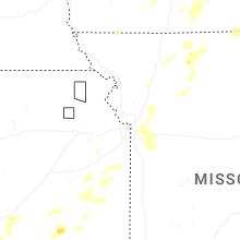


Connect with Interactive Hail Maps