

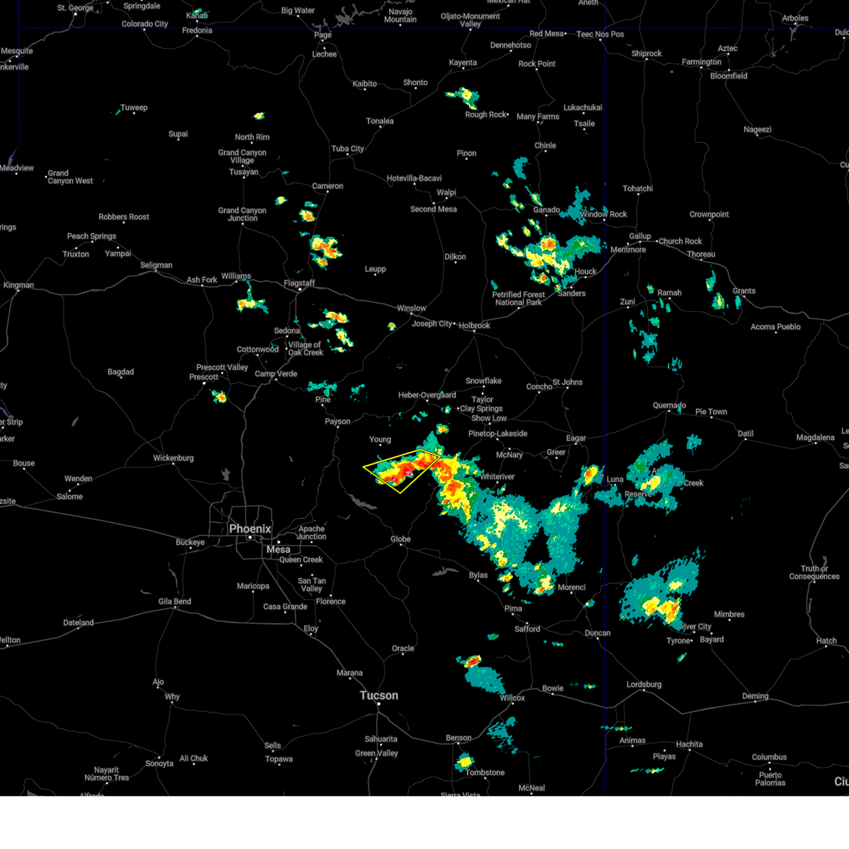
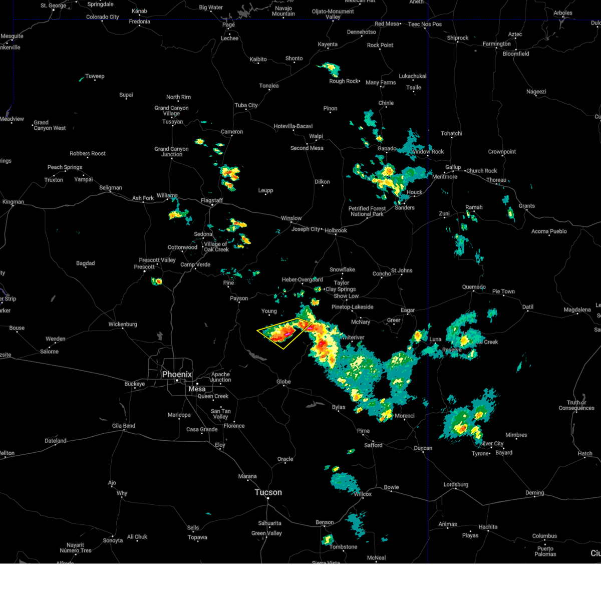
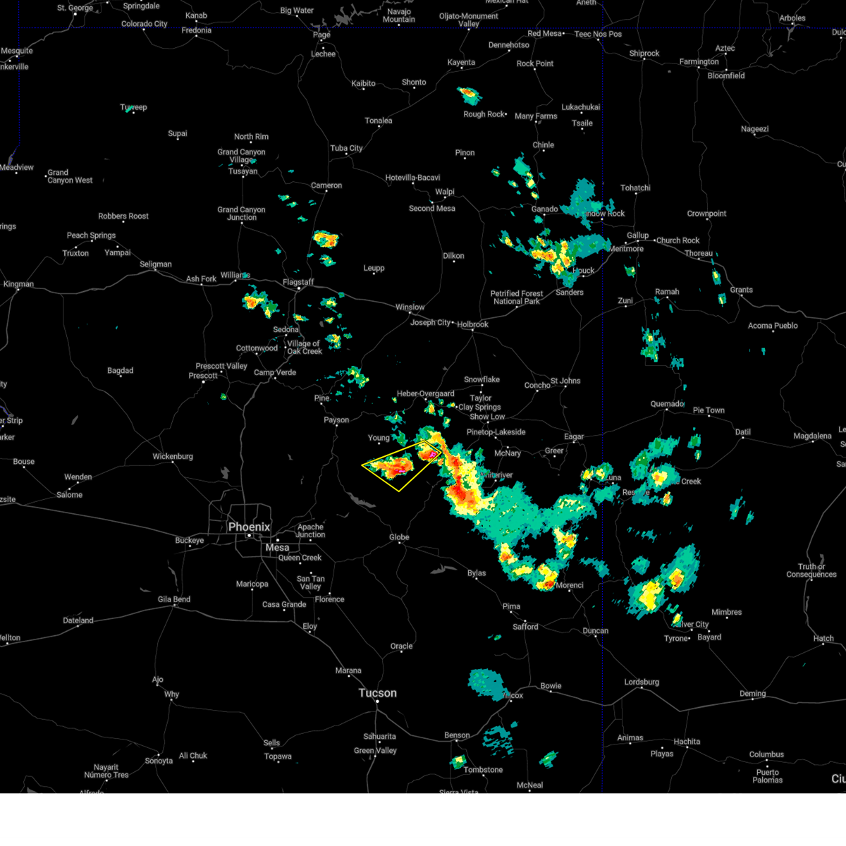
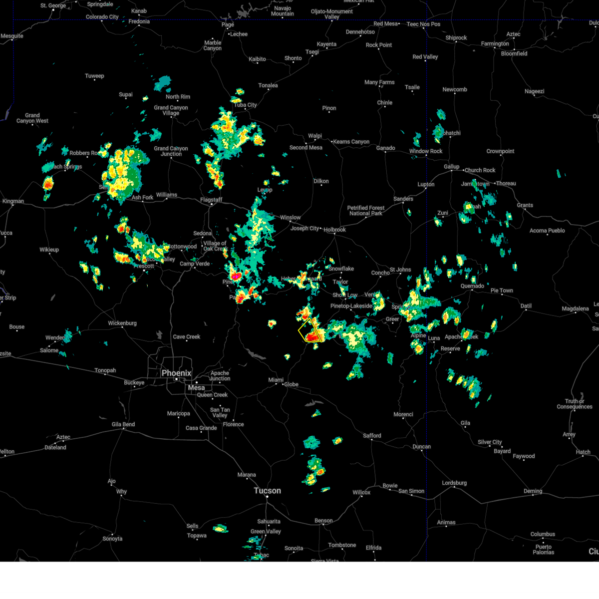
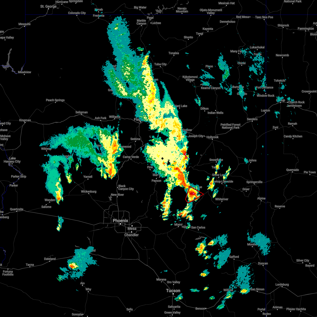
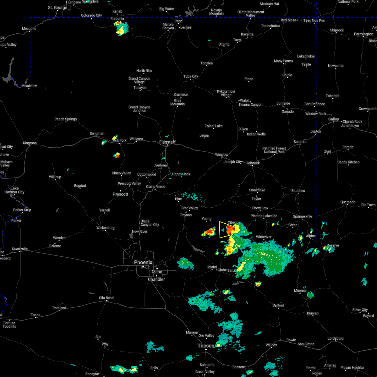
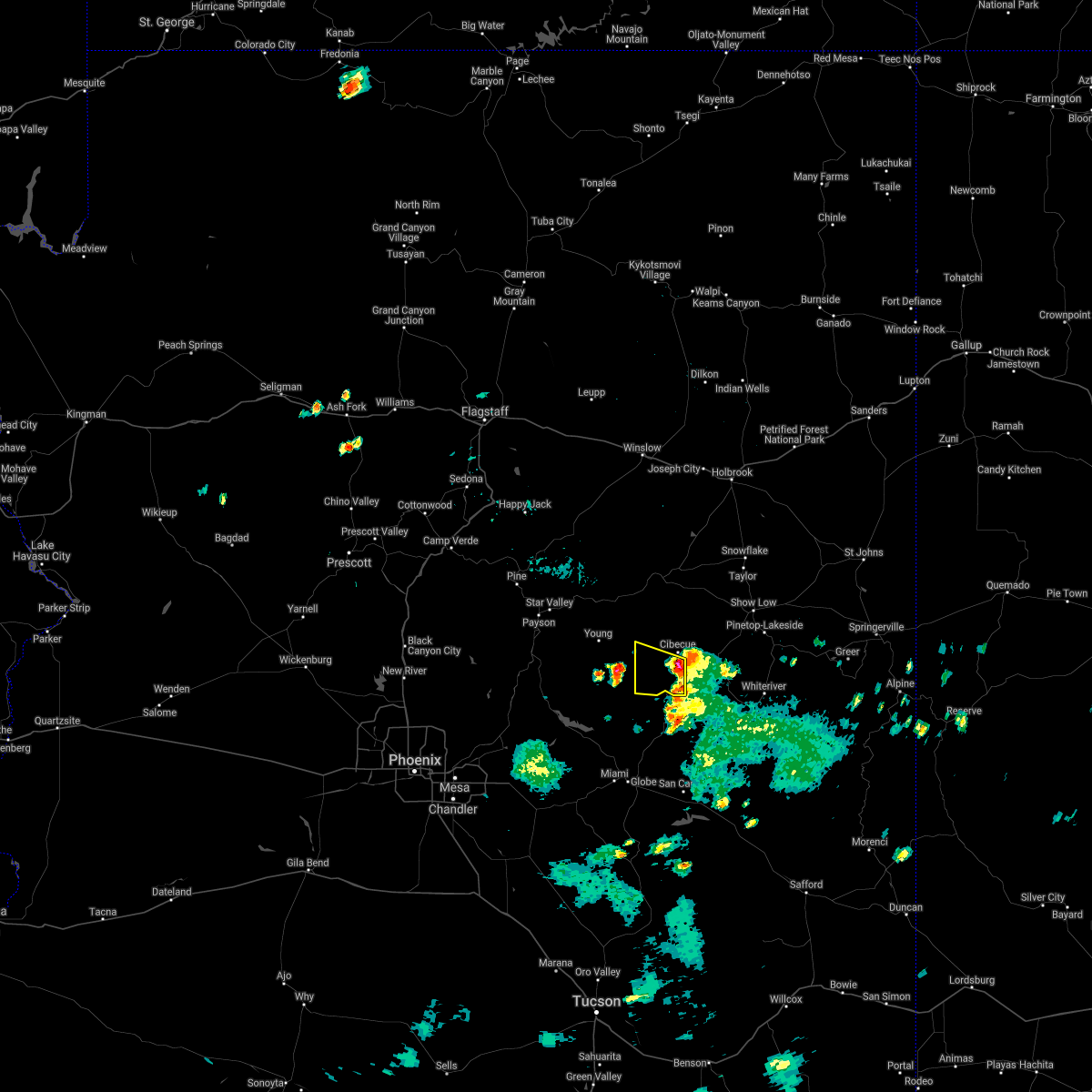
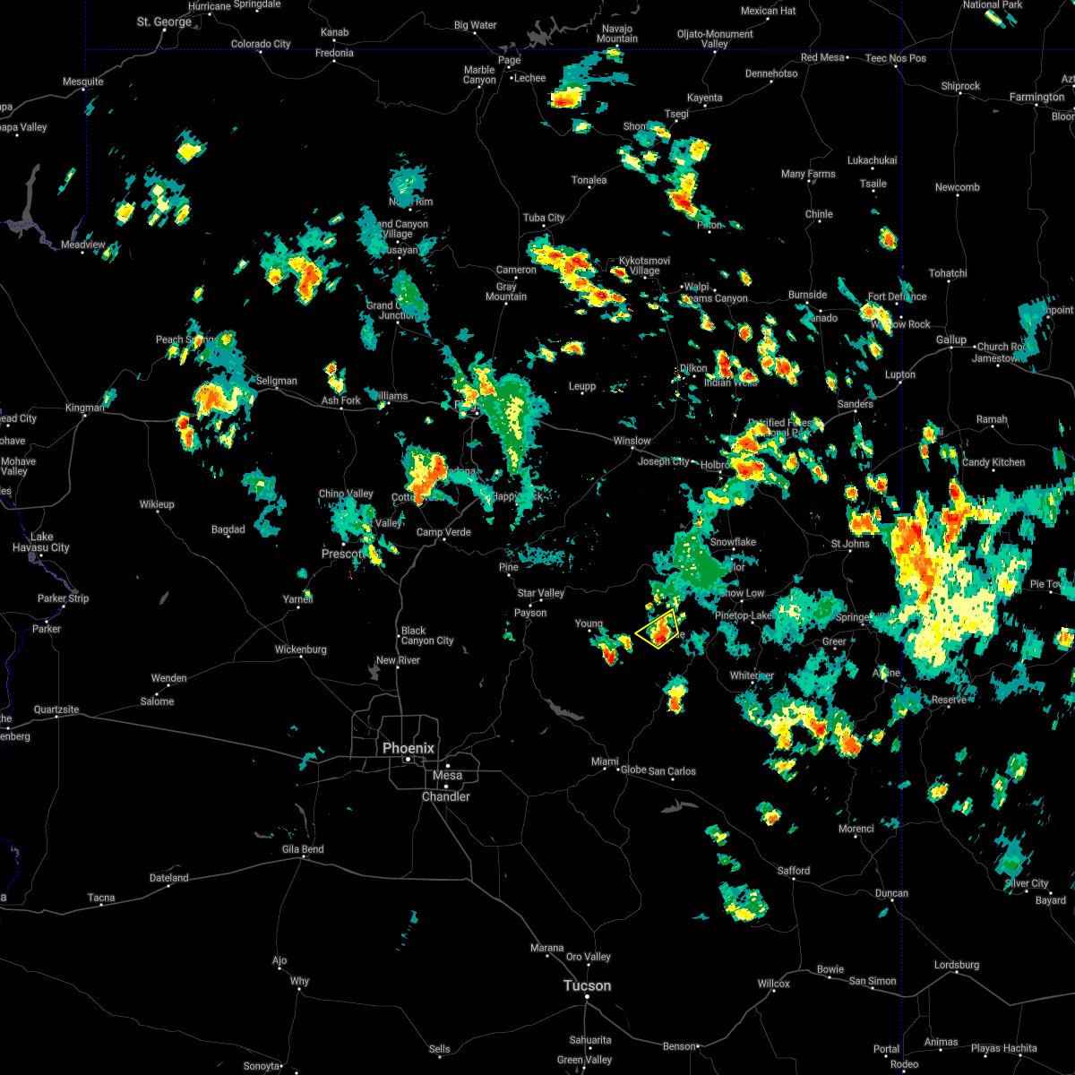
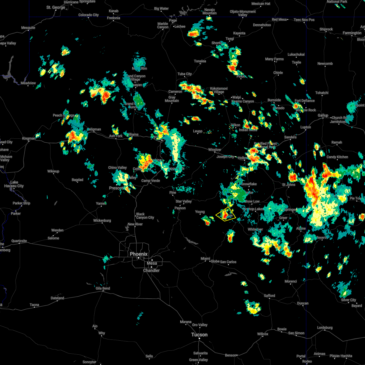
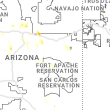
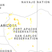
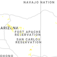
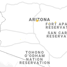
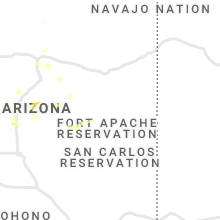
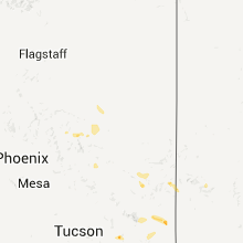
Hail Map for Cibecue, AZ
The Cibecue, AZ area has had 0 reports of on-the-ground hail by trained spotters, and has been under severe weather warnings 5 times during the past 12 months. Doppler radar has detected hail at or near Cibecue, AZ on 46 occasions, including 2 occasions during the past year.
| Name: | Cibecue, AZ |
| Where Located: | 28.7 miles WSW of Show Low, AZ |
| Map: | Google Map for Cibecue, AZ |
| Population: | 1713 |
| Housing Units: | 455 |
| More Info: | Search Google for Cibecue, AZ |
3
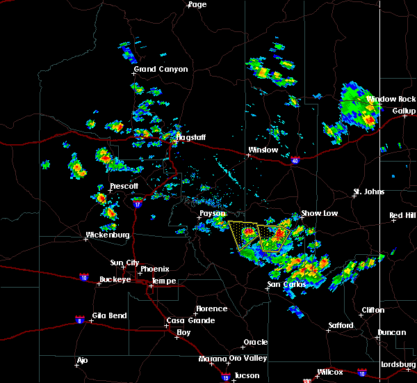
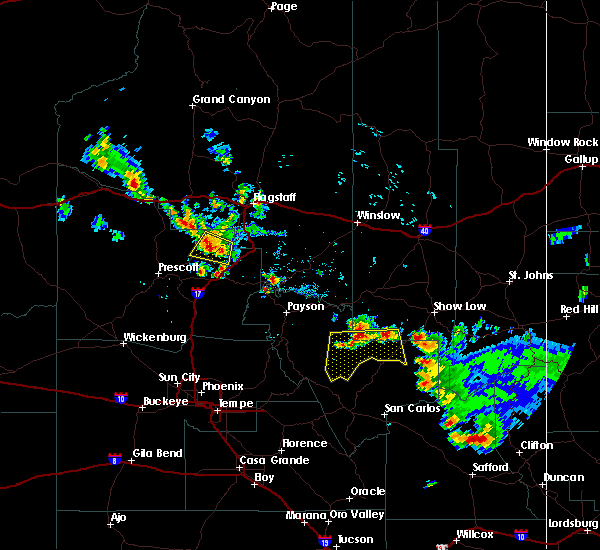
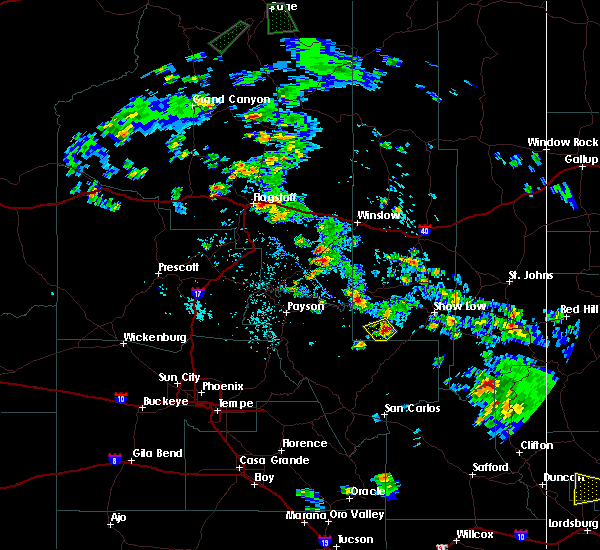
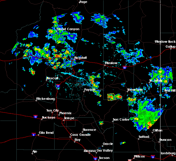
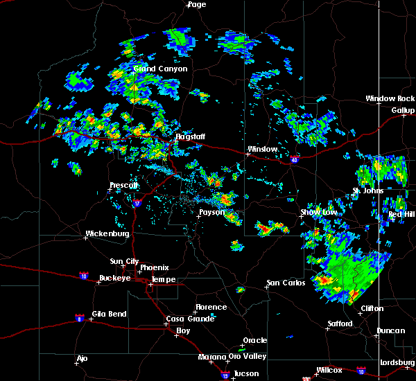
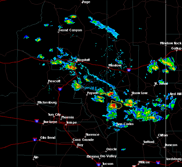
The Top Recent Hail Date for Cibecue, AZ is Wednesday, August 7, 2024 (8th out of 46)

Hail and Wind Damage Spotted near Cibecue, AZ
| Date / Time | Report Details |
|---|---|
| 8/7/2024 3:00 PM MST |
 The storm which prompted the warning has moved out of the area. therefore, the warning will be allowed to expire. however, gusty winds are still possible with this thunderstorm. The storm which prompted the warning has moved out of the area. therefore, the warning will be allowed to expire. however, gusty winds are still possible with this thunderstorm.
|
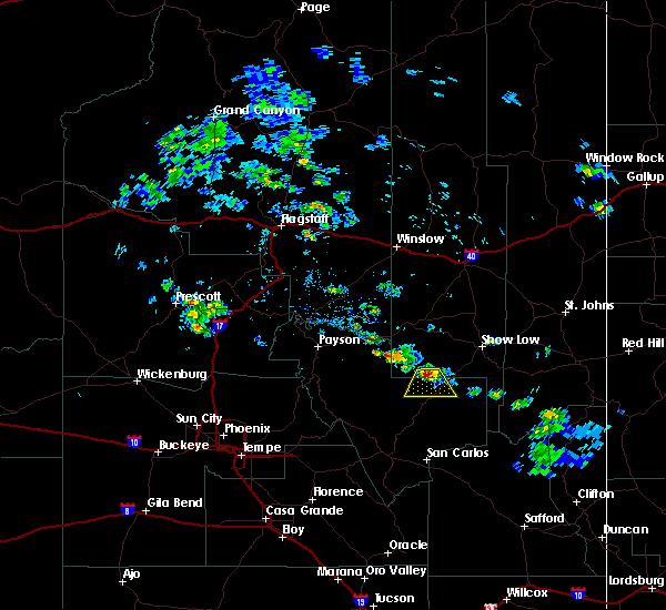
| 8/7/2024 2:48 PM MST |
 At 247 pm mst, a pair severe thunderstorm are located from cibecue southwestward, or 24 miles northeast of roosevelt, moving southwest at 5 mph (radar indicated). Hazards include 60 mph wind gusts and quarter size hail. Hail damage to vehicles is expected. expect wind damage to roofs, siding, and trees. locations impacted include, lookout point, pendleton mesa, brushy top mountain, sierra ancha wilderness, and cibecue. This includes state route 288 between mile markers 286 and 296. At 247 pm mst, a pair severe thunderstorm are located from cibecue southwestward, or 24 miles northeast of roosevelt, moving southwest at 5 mph (radar indicated). Hazards include 60 mph wind gusts and quarter size hail. Hail damage to vehicles is expected. expect wind damage to roofs, siding, and trees. locations impacted include, lookout point, pendleton mesa, brushy top mountain, sierra ancha wilderness, and cibecue. This includes state route 288 between mile markers 286 and 296.
|
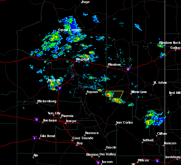
| 8/7/2024 2:36 PM MST |
 Svrfgz the national weather service in flagstaff has issued a * severe thunderstorm warning for, gila county in east central arizona, navajo county in north central arizona, * until 300 pm mst. * at 234 pm mst, a pair severe thunderstorm are located from cibecue southwestward, or 26 miles northeast of roosevelt, moving southwest at 5 mph (radar indicated). Hazards include 60 mph wind gusts and quarter size hail. Hail damage to vehicles is expected. Expect wind damage to roofs, siding, and trees. Svrfgz the national weather service in flagstaff has issued a * severe thunderstorm warning for, gila county in east central arizona, navajo county in north central arizona, * until 300 pm mst. * at 234 pm mst, a pair severe thunderstorm are located from cibecue southwestward, or 26 miles northeast of roosevelt, moving southwest at 5 mph (radar indicated). Hazards include 60 mph wind gusts and quarter size hail. Hail damage to vehicles is expected. Expect wind damage to roofs, siding, and trees.
|
| 7/14/2024 3:50 PM MST |
 The storm which prompted the warning has weakened below severe limits, and has exited the warned area. therefore, the warning will be allowed to expire. however, gusty winds are still possible with this thunderstorm. The storm which prompted the warning has weakened below severe limits, and has exited the warned area. therefore, the warning will be allowed to expire. however, gusty winds are still possible with this thunderstorm.
|
| 7/14/2024 3:15 PM MST |
 Svrfgz the national weather service in flagstaff has issued a * severe thunderstorm warning for, gila county in east central arizona, navajo county in north central arizona, * until 400 pm mst. * at 315 pm mst, a severe thunderstorm was located near cedar creek, or 21 miles southwest of show low, moving northwest at 25 mph (radar indicated). Hazards include 60 mph wind gusts and quarter size hail. Hail damage to vehicles is expected. Expect wind damage to roofs, siding, and trees. Svrfgz the national weather service in flagstaff has issued a * severe thunderstorm warning for, gila county in east central arizona, navajo county in north central arizona, * until 400 pm mst. * at 315 pm mst, a severe thunderstorm was located near cedar creek, or 21 miles southwest of show low, moving northwest at 25 mph (radar indicated). Hazards include 60 mph wind gusts and quarter size hail. Hail damage to vehicles is expected. Expect wind damage to roofs, siding, and trees.
|
| 8/31/2023 3:50 PM MST |
 At 349 pm mst, a severe thunderstorm was located near cibeque falls, moving northwest at 25 mph (radar indicated). Hazards include 60 mph wind gusts and quarter size hail. Hail damage to vehicles is expected. expect wind damage to roofs, siding, and trees. locations impacted include, cibecue airport, cow pasture butte, and cibeque falls. this includes highway 60 between mile markers 298 and 305. hail threat, radar indicated max hail size, 1. 00 in wind threat, radar indicated max wind gust, 60 mph. At 349 pm mst, a severe thunderstorm was located near cibeque falls, moving northwest at 25 mph (radar indicated). Hazards include 60 mph wind gusts and quarter size hail. Hail damage to vehicles is expected. expect wind damage to roofs, siding, and trees. locations impacted include, cibecue airport, cow pasture butte, and cibeque falls. this includes highway 60 between mile markers 298 and 305. hail threat, radar indicated max hail size, 1. 00 in wind threat, radar indicated max wind gust, 60 mph.
|
| 8/31/2023 3:18 PM MST |
 At 318 pm mst, a severe thunderstorm was located over cow pasture butte, or 31 miles southwest of show low, moving northwest at 15 mph (radar indicated). Hazards include 60 mph wind gusts and quarter size hail. Hail damage to vehicles is expected. Expect wind damage to roofs, siding, and trees. At 318 pm mst, a severe thunderstorm was located over cow pasture butte, or 31 miles southwest of show low, moving northwest at 15 mph (radar indicated). Hazards include 60 mph wind gusts and quarter size hail. Hail damage to vehicles is expected. Expect wind damage to roofs, siding, and trees.
|
| 10/5/2021 3:58 PM MST |
 The severe thunderstorm warning for gila and navajo counties will expire at 400 pm mst, the storm now north of cibeque which prompted the warning has weakened. therefore, the warning will be allowed to expire. however small hail and heavy rain are still possible with this thunderstorm. a severe thunderstorm watch remains in effect until 800 pm mst for north central and east central arizona, including navajo county. to report severe weather, contact your nearest law enforcement agency. they will relay your report to the national weather service flagstaff. The severe thunderstorm warning for gila and navajo counties will expire at 400 pm mst, the storm now north of cibeque which prompted the warning has weakened. therefore, the warning will be allowed to expire. however small hail and heavy rain are still possible with this thunderstorm. a severe thunderstorm watch remains in effect until 800 pm mst for north central and east central arizona, including navajo county. to report severe weather, contact your nearest law enforcement agency. they will relay your report to the national weather service flagstaff.
|
| 10/5/2021 3:40 PM MST |
 At 339 pm mst, a severe thunderstorm was located 13 miles northwest of carrizo, or 24 miles southeast of forest lakes, moving northeast at 35 mph (radar indicated). Hazards include 60 mph wind gusts and quarter size hail. Hail damage to vehicles is expected. expect wind damage to roofs, siding, and trees. Locations impacted include, cibecue. At 339 pm mst, a severe thunderstorm was located 13 miles northwest of carrizo, or 24 miles southeast of forest lakes, moving northeast at 35 mph (radar indicated). Hazards include 60 mph wind gusts and quarter size hail. Hail damage to vehicles is expected. expect wind damage to roofs, siding, and trees. Locations impacted include, cibecue.
|
| 10/5/2021 3:30 PM MST |
 At 330 pm mst, a severe thunderstorm was located 14 miles west of carrizo, or 25 miles southeast of forest lakes, moving northeast at 35 mph (radar indicated). Hazards include two inch hail and 60 mph wind gusts. People and animals outdoors will be injured. expect hail damage to roofs, siding, windows, and vehicles. Expect wind damage to roofs, siding, and trees. At 330 pm mst, a severe thunderstorm was located 14 miles west of carrizo, or 25 miles southeast of forest lakes, moving northeast at 35 mph (radar indicated). Hazards include two inch hail and 60 mph wind gusts. People and animals outdoors will be injured. expect hail damage to roofs, siding, windows, and vehicles. Expect wind damage to roofs, siding, and trees.
|
| 10/5/2021 3:28 PM MST |
 The tornado warning for gila and navajo counties will expire at 330 pm mst, the tornado threat has diminished and the tornado warning has been cancelled for the storm south of cibeque. however, large hail and damaging winds remain likely and a severe thunderstorm warning remains in effect for the area. however large hail and gusty winds are still possible with this thunderstorm. a severe thunderstorm watch remains in effect until 800 pm mst for north central and east central arizona. The tornado warning for gila and navajo counties will expire at 330 pm mst, the tornado threat has diminished and the tornado warning has been cancelled for the storm south of cibeque. however, large hail and damaging winds remain likely and a severe thunderstorm warning remains in effect for the area. however large hail and gusty winds are still possible with this thunderstorm. a severe thunderstorm watch remains in effect until 800 pm mst for north central and east central arizona.
|
| 10/5/2021 3:22 PM MST |
 At 321 pm mst, a severe thunderstorm capable of producing a tornado was located 16 miles west of carrizo, or 29 miles southeast of forest lakes, moving northeast at 40 mph (radar indicated rotation). Hazards include tornado and two inch hail. Flying debris will be dangerous to those caught without shelter. mobile homes will be damaged or destroyed. damage to roofs, windows, and vehicles will occur. tree damage is likely. This tornadic thunderstorm will remain over mainly rural areas of gila and navajo counties. At 321 pm mst, a severe thunderstorm capable of producing a tornado was located 16 miles west of carrizo, or 29 miles southeast of forest lakes, moving northeast at 40 mph (radar indicated rotation). Hazards include tornado and two inch hail. Flying debris will be dangerous to those caught without shelter. mobile homes will be damaged or destroyed. damage to roofs, windows, and vehicles will occur. tree damage is likely. This tornadic thunderstorm will remain over mainly rural areas of gila and navajo counties.
|
| 10/5/2021 3:09 PM MST |
 At 308 pm mst, a severe thunderstorm capable of producing a tornado was located 19 miles northwest of hilltop, or 30 miles northeast of roosevelt, moving northeast at 30 mph (radar indicated rotation). Hazards include tornado and hail up to two inches in diameter. Flying debris will be dangerous to those caught without shelter. mobile homes will be damaged or destroyed. damage to roofs, windows, and vehicles will occur. tree damage is likely. This tornadic thunderstorm will remain over mainly rural areas of gila and navajo counties. At 308 pm mst, a severe thunderstorm capable of producing a tornado was located 19 miles northwest of hilltop, or 30 miles northeast of roosevelt, moving northeast at 30 mph (radar indicated rotation). Hazards include tornado and hail up to two inches in diameter. Flying debris will be dangerous to those caught without shelter. mobile homes will be damaged or destroyed. damage to roofs, windows, and vehicles will occur. tree damage is likely. This tornadic thunderstorm will remain over mainly rural areas of gila and navajo counties.
|
| 9/30/2021 12:02 AM MST |
 At 1201 am mst, a severe thunderstorm was located near cibecue and moving north at 10 mph (radar indicated). Hazards include 60 mph wind gusts and half dollar size hail. Hail damage to vehicles is expected. Expect wind damage to roofs, siding, and trees. At 1201 am mst, a severe thunderstorm was located near cibecue and moving north at 10 mph (radar indicated). Hazards include 60 mph wind gusts and half dollar size hail. Hail damage to vehicles is expected. Expect wind damage to roofs, siding, and trees.
|
| 8/14/2021 3:59 PM MST |
 At 359 pm mst, a severe thunderstorm was located 18 miles west of carrizo, or 27 miles southeast of forest lakes, moving west at 20 mph (radar indicated). Hazards include 60 mph wind gusts and quarter size hail. Hail damage to vehicles is expected. expect wind damage to roofs, siding, and trees. this severe thunderstorm will remain over mainly rural areas of gila and navajo counties. hail threat, radar indicated max hail size, 1. 00 in wind threat, radar indicated max wind gust, 60 mph. At 359 pm mst, a severe thunderstorm was located 18 miles west of carrizo, or 27 miles southeast of forest lakes, moving west at 20 mph (radar indicated). Hazards include 60 mph wind gusts and quarter size hail. Hail damage to vehicles is expected. expect wind damage to roofs, siding, and trees. this severe thunderstorm will remain over mainly rural areas of gila and navajo counties. hail threat, radar indicated max hail size, 1. 00 in wind threat, radar indicated max wind gust, 60 mph.
|
| 8/14/2021 3:42 PM MST |
 At 341 pm mst, a severe thunderstorm was located 12 miles west of carrizo, or 30 miles southeast of forest lakes, moving west at 15 mph (radar indicated). Hazards include 60 mph wind gusts and quarter size hail. Hail damage to vehicles is expected. expect wind damage to roofs, siding, and trees. this severe thunderstorm will remain over mainly rural areas of gila and navajo counties. hail threat, radar indicated max hail size, 1. 00 in wind threat, radar indicated max wind gust, 60 mph. At 341 pm mst, a severe thunderstorm was located 12 miles west of carrizo, or 30 miles southeast of forest lakes, moving west at 15 mph (radar indicated). Hazards include 60 mph wind gusts and quarter size hail. Hail damage to vehicles is expected. expect wind damage to roofs, siding, and trees. this severe thunderstorm will remain over mainly rural areas of gila and navajo counties. hail threat, radar indicated max hail size, 1. 00 in wind threat, radar indicated max wind gust, 60 mph.
|
| 7/18/2021 2:36 PM MST |
 The severe thunderstorm warning for navajo county will expire at 245 pm mst, the severe thunderstorm which prompted the warning has moved northward. therefore, the warning will be allowed to expire. a new severe thunderstorm warning has been reissued for the north portion of this warning. large hail and heavy rain are still possible with this thunderstorm. The severe thunderstorm warning for navajo county will expire at 245 pm mst, the severe thunderstorm which prompted the warning has moved northward. therefore, the warning will be allowed to expire. a new severe thunderstorm warning has been reissued for the north portion of this warning. large hail and heavy rain are still possible with this thunderstorm.
|
| 7/18/2021 2:33 PM MST |
 At 232 pm mst, a severe thunderstorm was located 18 miles northwest of carrizo moving northwest at 10 mph (radar indicated). Hazards include 60 mph wind gusts and quarter size hail. Hail damage to vehicles is expected. expect wind damage to roofs, siding, and trees. This severe thunderstorm will remain over mainly rural areas of navajo county. At 232 pm mst, a severe thunderstorm was located 18 miles northwest of carrizo moving northwest at 10 mph (radar indicated). Hazards include 60 mph wind gusts and quarter size hail. Hail damage to vehicles is expected. expect wind damage to roofs, siding, and trees. This severe thunderstorm will remain over mainly rural areas of navajo county.
|
| 7/18/2021 2:22 PM MST |
 At 221 pm mst, a severe thunderstorm was located 16 miles northwest of carrizo, or 21 miles southeast of forest lakes, moving northwest at 10 mph (radar indicated). Hazards include 60 mph wind gusts and half dollar size hail. Hail damage to vehicles is expected. expect wind damage to roofs, siding, and trees. This severe thunderstorm will remain over mainly rural areas of navajo county. At 221 pm mst, a severe thunderstorm was located 16 miles northwest of carrizo, or 21 miles southeast of forest lakes, moving northwest at 10 mph (radar indicated). Hazards include 60 mph wind gusts and half dollar size hail. Hail damage to vehicles is expected. expect wind damage to roofs, siding, and trees. This severe thunderstorm will remain over mainly rural areas of navajo county.
|
| 7/18/2021 2:12 PM MST |
 At 211 pm mst, a severe thunderstorm was located 14 miles northwest of carrizo, or 23 miles southeast of forest lakes, moving northwest at 10 mph (radar indicated). Hazards include 60 mph wind gusts and half dollar size hail. Hail damage to vehicles is expected. Expect wind damage to roofs, siding, and trees. At 211 pm mst, a severe thunderstorm was located 14 miles northwest of carrizo, or 23 miles southeast of forest lakes, moving northwest at 10 mph (radar indicated). Hazards include 60 mph wind gusts and half dollar size hail. Hail damage to vehicles is expected. Expect wind damage to roofs, siding, and trees.
|
| 7/10/2021 5:16 PM MST |
 At 515 pm mst, severe thunderstorms were located along a line extending from 8 miles southeast of forest lakes to near north fork, moving southwest at 15 mph (radar indicated). Hazards include 70 mph wind gusts and half dollar size hail. Hail damage to vehicles is expected. expect considerable tree damage. Wind damage is also likely to mobile homes, roofs, and outbuildings. At 515 pm mst, severe thunderstorms were located along a line extending from 8 miles southeast of forest lakes to near north fork, moving southwest at 15 mph (radar indicated). Hazards include 70 mph wind gusts and half dollar size hail. Hail damage to vehicles is expected. expect considerable tree damage. Wind damage is also likely to mobile homes, roofs, and outbuildings.
|
| 8/28/2019 4:52 PM MST |
 The severe thunderstorm warning for gila and navajo counties will expire at 500 pm mst, the storm which prompted the warning has weakened below severe limits, and no longer poses an immediate threat to life or property. therefore, the warning will be allowed to expire. however heavy rain is still possible with this thunderstorm. The severe thunderstorm warning for gila and navajo counties will expire at 500 pm mst, the storm which prompted the warning has weakened below severe limits, and no longer poses an immediate threat to life or property. therefore, the warning will be allowed to expire. however heavy rain is still possible with this thunderstorm.
|
| 8/28/2019 4:19 PM MST |
 At 419 pm mst, a severe thunderstorm was located 13 miles west of carrizo, or 29 miles southeast of forest lakes, moving southeast at 15 mph (radar indicated). Hazards include 60 mph wind gusts and quarter size hail. Hail damage to vehicles is expected. Expect wind damage to roofs, siding, and trees. At 419 pm mst, a severe thunderstorm was located 13 miles west of carrizo, or 29 miles southeast of forest lakes, moving southeast at 15 mph (radar indicated). Hazards include 60 mph wind gusts and quarter size hail. Hail damage to vehicles is expected. Expect wind damage to roofs, siding, and trees.
|
| 8/12/2018 2:44 PM MST |
 At 244 pm mst, a severe thunderstorm was located near carrizo, or 19 miles southwest of show low, moving southwest at 15 mph (radar indicated). Hazards include ping pong ball size hail and 60 mph wind gusts. People and animals outdoors will be injured. expect hail damage to roofs, siding, windows, and vehicles. Expect wind damage to roofs, siding, and trees. At 244 pm mst, a severe thunderstorm was located near carrizo, or 19 miles southwest of show low, moving southwest at 15 mph (radar indicated). Hazards include ping pong ball size hail and 60 mph wind gusts. People and animals outdoors will be injured. expect hail damage to roofs, siding, windows, and vehicles. Expect wind damage to roofs, siding, and trees.
|
| 8/12/2018 2:17 PM MST |
 At 216 pm mst, severe thunderstorms were located along a line extending from 8 miles northeast of carrizo to 20 miles southeast of forest lakes, moving southwest at 15 mph (radar indicated). Hazards include ping pong ball size hail and 60 mph wind gusts. People and animals outdoors will be injured. expect hail damage to roofs, siding, windows, and vehicles. expect wind damage to roofs, siding, and trees. locations impacted include, fort apache reservation, carrizo, cedar creek, cibecue and white mountain apache reservation. this includes the following highways, state route 73 between mile markers 311 and 321. Highway 60 between mile markers 307 and 333. At 216 pm mst, severe thunderstorms were located along a line extending from 8 miles northeast of carrizo to 20 miles southeast of forest lakes, moving southwest at 15 mph (radar indicated). Hazards include ping pong ball size hail and 60 mph wind gusts. People and animals outdoors will be injured. expect hail damage to roofs, siding, windows, and vehicles. expect wind damage to roofs, siding, and trees. locations impacted include, fort apache reservation, carrizo, cedar creek, cibecue and white mountain apache reservation. this includes the following highways, state route 73 between mile markers 311 and 321. Highway 60 between mile markers 307 and 333.
|
| 8/12/2018 2:00 PM MST |
 At 159 pm mst, a severe thunderstorm was located 17 miles northwest of carrizo, or 20 miles southeast of forest lakes, moving southwest at 15 mph (radar indicated). Hazards include ping pong ball size hail and 60 mph wind gusts. People and animals outdoors will be injured. expect hail damage to roofs, siding, windows, and vehicles. Expect wind damage to roofs, siding, and trees. At 159 pm mst, a severe thunderstorm was located 17 miles northwest of carrizo, or 20 miles southeast of forest lakes, moving southwest at 15 mph (radar indicated). Hazards include ping pong ball size hail and 60 mph wind gusts. People and animals outdoors will be injured. expect hail damage to roofs, siding, windows, and vehicles. Expect wind damage to roofs, siding, and trees.
|
| 8/12/2018 1:43 PM MST |
 At 142 pm mst, a severe thunderstorm was located 13 miles southwest of pinedale, or 21 miles west of show low, moving southwest at 10 mph (radar indicated). Hazards include 60 mph wind gusts and half dollar size hail. Hail damage to vehicles is expected. expect wind damage to roofs, siding, and trees. locations impacted include, fort apache reservation and cibecue. This includes highway 60 between mile markers 317 and 325. At 142 pm mst, a severe thunderstorm was located 13 miles southwest of pinedale, or 21 miles west of show low, moving southwest at 10 mph (radar indicated). Hazards include 60 mph wind gusts and half dollar size hail. Hail damage to vehicles is expected. expect wind damage to roofs, siding, and trees. locations impacted include, fort apache reservation and cibecue. This includes highway 60 between mile markers 317 and 325.
|
| 8/12/2018 1:17 PM MST |
 At 117 pm mst, a severe thunderstorm was located 13 miles southeast of forest lakes, moving southwest at 5 mph (radar indicated). Hazards include 60 mph wind gusts and quarter size hail. Hail damage to vehicles is expected. Expect wind damage to roofs, siding, and trees. At 117 pm mst, a severe thunderstorm was located 13 miles southeast of forest lakes, moving southwest at 5 mph (radar indicated). Hazards include 60 mph wind gusts and quarter size hail. Hail damage to vehicles is expected. Expect wind damage to roofs, siding, and trees.
|
| 8/8/2018 3:31 PM MST |
 At 331 pm mst, severe thunderstorms were located along a line extending from 13 miles southeast of young to 9 miles west of carrizo, moving south at 10 mph (radar indicated). Hazards include 60 mph wind gusts and quarter size hail. Hail damage to vehicles is expected. Expect wind damage to roofs, siding, and trees. At 331 pm mst, severe thunderstorms were located along a line extending from 13 miles southeast of young to 9 miles west of carrizo, moving south at 10 mph (radar indicated). Hazards include 60 mph wind gusts and quarter size hail. Hail damage to vehicles is expected. Expect wind damage to roofs, siding, and trees.
|
| 8/1/2018 2:35 PM MST |
 At 234 pm mst, a severe thunderstorm was located 12 miles northwest of carrizo, or 2 miles noth of cibecue, and is nearly stationary (radar indicated). Hazards include quarter size hail. damage to vehicles is expected At 234 pm mst, a severe thunderstorm was located 12 miles northwest of carrizo, or 2 miles noth of cibecue, and is nearly stationary (radar indicated). Hazards include quarter size hail. damage to vehicles is expected
|
| 8/29/2017 4:49 PM MST |
 At 448 pm mst, a severe thunderstorm was located near carrizo, or 15 miles southwest of show low, moving southwest at 25 mph (radar indicated). Hazards include 60 mph wind gusts and quarter size hail. Hail damage to vehicles is expected. Expect wind damage to roofs, siding, and trees. At 448 pm mst, a severe thunderstorm was located near carrizo, or 15 miles southwest of show low, moving southwest at 25 mph (radar indicated). Hazards include 60 mph wind gusts and quarter size hail. Hail damage to vehicles is expected. Expect wind damage to roofs, siding, and trees.
|
| 8/15/2016 2:53 PM MST |
 At 252 pm mst, doppler radar indicated a severe thunderstorm capable of producing quarter size hail and damaging winds in excess of 60 mph. this storm was located over cibecue, or 29 miles southwest of show low, moving south at 10 mph. locations impacted include, fort apache reservation and cibecue. At 252 pm mst, doppler radar indicated a severe thunderstorm capable of producing quarter size hail and damaging winds in excess of 60 mph. this storm was located over cibecue, or 29 miles southwest of show low, moving south at 10 mph. locations impacted include, fort apache reservation and cibecue.
|
| 8/15/2016 2:45 PM MST |
 At 245 pm mst, doppler radar indicated a severe thunderstorm capable of producing quarter size hail and damaging winds in excess of 60 mph. this storm was located over cibeque, or 27 miles southwest of show low, and moving south at 10 mph. At 245 pm mst, doppler radar indicated a severe thunderstorm capable of producing quarter size hail and damaging winds in excess of 60 mph. this storm was located over cibeque, or 27 miles southwest of show low, and moving south at 10 mph.
|
| 8/15/2016 2:32 PM MST |
 At 231 pm mst, doppler radar indicated a severe thunderstorm capable of producing quarter size hail and damaging winds in excess of 60 mph. this storm was located 14 miles southwest of pinedale, or 20 miles southeast of forest lakes, moving southeast at 10 mph. locations impacted include, black canyon rim campground, gentry campground and cibecue. At 231 pm mst, doppler radar indicated a severe thunderstorm capable of producing quarter size hail and damaging winds in excess of 60 mph. this storm was located 14 miles southwest of pinedale, or 20 miles southeast of forest lakes, moving southeast at 10 mph. locations impacted include, black canyon rim campground, gentry campground and cibecue.
|
| 8/15/2016 2:14 PM MST |
 At 214 pm mst, doppler radar indicated a severe thunderstorm capable of producing quarter size hail and damaging winds in excess of 60 mph. this storm was located 8 miles southeast of forest lakes, and moving southeast at 10 mph. At 214 pm mst, doppler radar indicated a severe thunderstorm capable of producing quarter size hail and damaging winds in excess of 60 mph. this storm was located 8 miles southeast of forest lakes, and moving southeast at 10 mph.
|
| 7/29/2016 3:19 PM MST |
 At 318 pm mst, doppler radar indicated a severe thunderstorm capable of producing quarter size hail and damaging winds in excess of 60 mph. this storm was located 11 miles west of carrizo, or 27 miles southeast of forest lakes, moving south at 10 mph. locations impacted include, cibecue. At 318 pm mst, doppler radar indicated a severe thunderstorm capable of producing quarter size hail and damaging winds in excess of 60 mph. this storm was located 11 miles west of carrizo, or 27 miles southeast of forest lakes, moving south at 10 mph. locations impacted include, cibecue.
|
| 7/29/2016 3:05 PM MST |
 At 305 pm mst, doppler radar indicated a severe thunderstorm capable of producing quarter size hail and damaging winds in excess of 60 mph. this storm was located 13 miles northwest of carrizo, or 24 miles southeast of forest lakes, and moving south at 10 mph. At 305 pm mst, doppler radar indicated a severe thunderstorm capable of producing quarter size hail and damaging winds in excess of 60 mph. this storm was located 13 miles northwest of carrizo, or 24 miles southeast of forest lakes, and moving south at 10 mph.
|
| 6/30/2015 3:31 PM MST |
 At 329 pm mst, doppler radar indicated a severe thunderstorm capable of producing large hail up to ping pong ball size and destructive winds in excess of 70 mph. this storm was located 17 miles west of carrizo, moving west at 25 mph. locations impacted include, areas just south of cibecue. At 329 pm mst, doppler radar indicated a severe thunderstorm capable of producing large hail up to ping pong ball size and destructive winds in excess of 70 mph. this storm was located 17 miles west of carrizo, moving west at 25 mph. locations impacted include, areas just south of cibecue.
|
| 6/30/2015 3:14 PM MST |
 At 312 pm mst, doppler radar indicated a severe thunderstorm capable of producing large hail up to ping pong ball size and destructive winds in excess of 70 mph. this storm was located 10 miles southwest of carrizo and moving west at 25 mph. At 312 pm mst, doppler radar indicated a severe thunderstorm capable of producing large hail up to ping pong ball size and destructive winds in excess of 70 mph. this storm was located 10 miles southwest of carrizo and moving west at 25 mph.
|
| 6/5/2015 5:10 PM MST | At 507 pm mst, doppler radar indicated a severe thunderstorm capable of producing half dollar size hail and destructive winds in excess of 70 mph. this storm was located 7 miles northwest of milepost 305 on hwy 60, or 30 miles southwest of show low, and moving northeast at 50 mph. |
Hail Maps for Cibecue, AZ


Connect with Interactive Hail Maps