

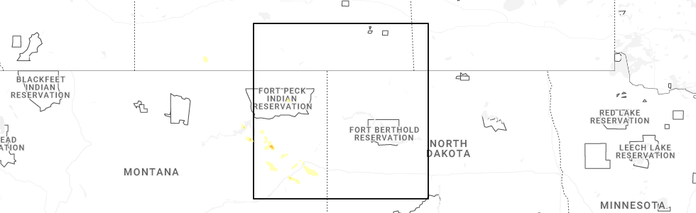
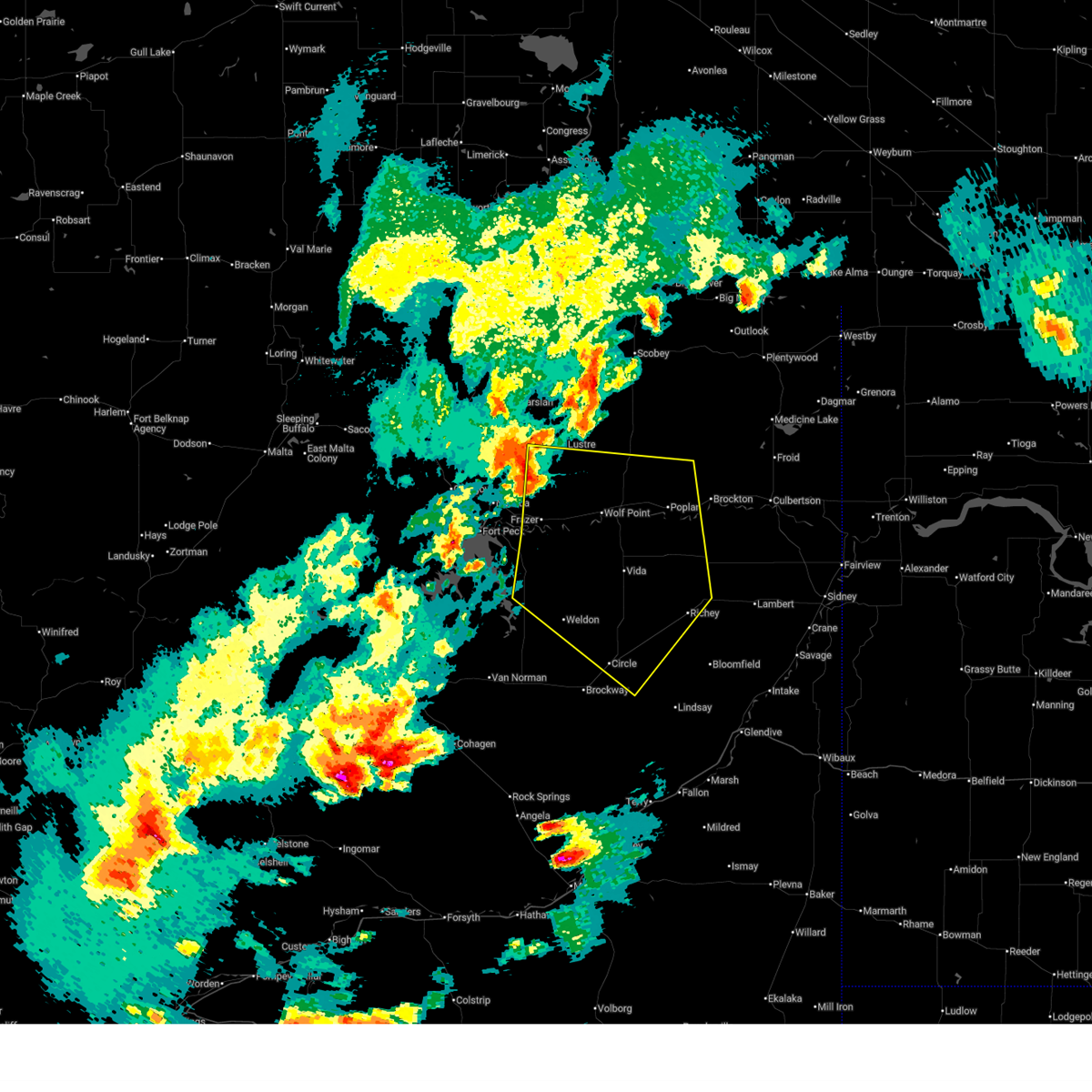
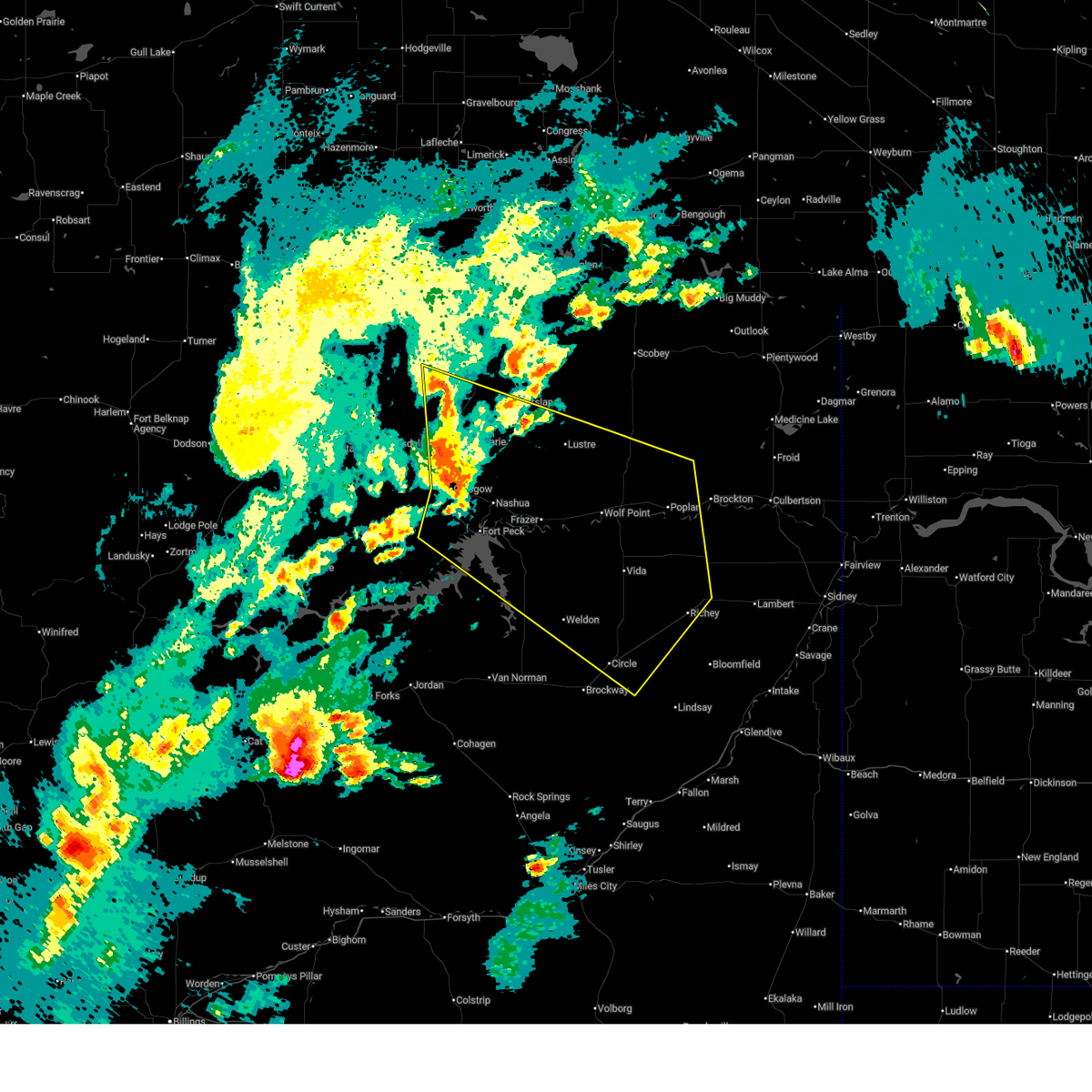
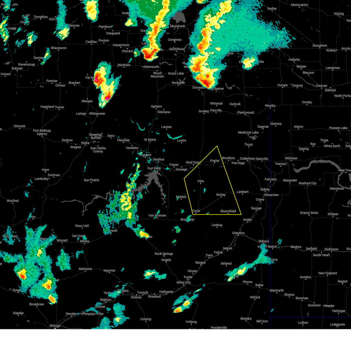
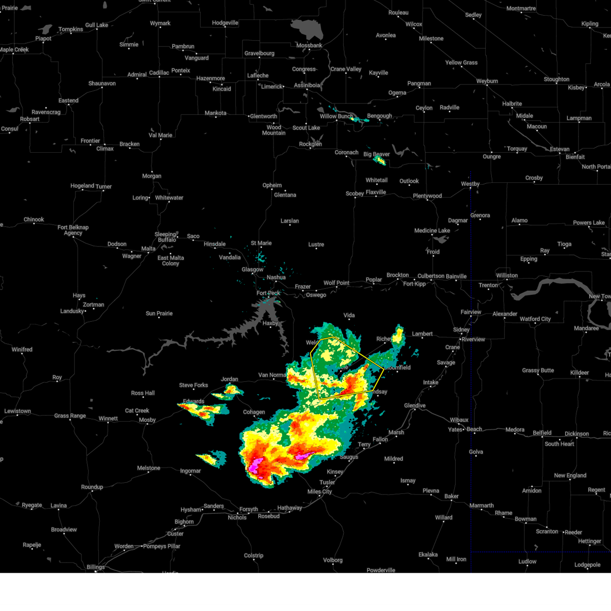
Hail Map for Circle, MT
The Circle, MT area has had 50 reports of on-the-ground hail by trained spotters, and has been under severe weather warnings 9 times during the past 12 months. Doppler radar has detected hail at or near Circle, MT on 33 occasions, including 1 occasion during the past year.
| Name: | Circle, MT |
| Where Located: | 70.9 miles N of Miles City, MT |
| Map: | Google Map for Circle, MT |
| Population: | 615 |
| Housing Units: | 343 |
| More Info: | Search Google for Circle, MT |
0
The Top Recent Hail Date for Circle, MT is Wednesday, June 25, 2025 (28th out of 33)
Hail and Wind Damage Spotted near Circle, MT
| Date / Time | Report Details |
|---|---|
| 7/9/2025 9:15 PM MDT | Lindsay divide mt-200 mp 296.5... mt (mt dot - ggw) minor heat burs in dawson county MT, 15.8 miles WNW of Circle, MT |
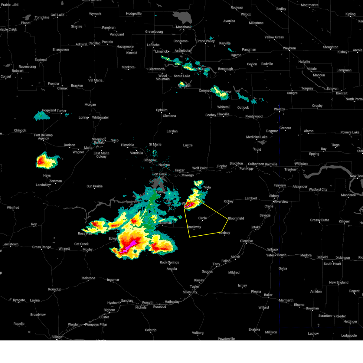
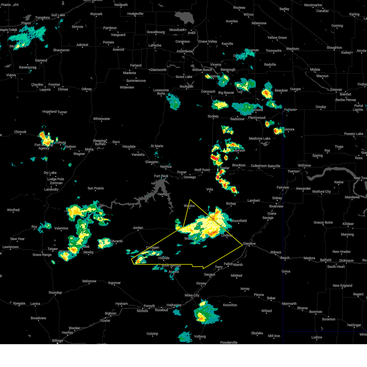
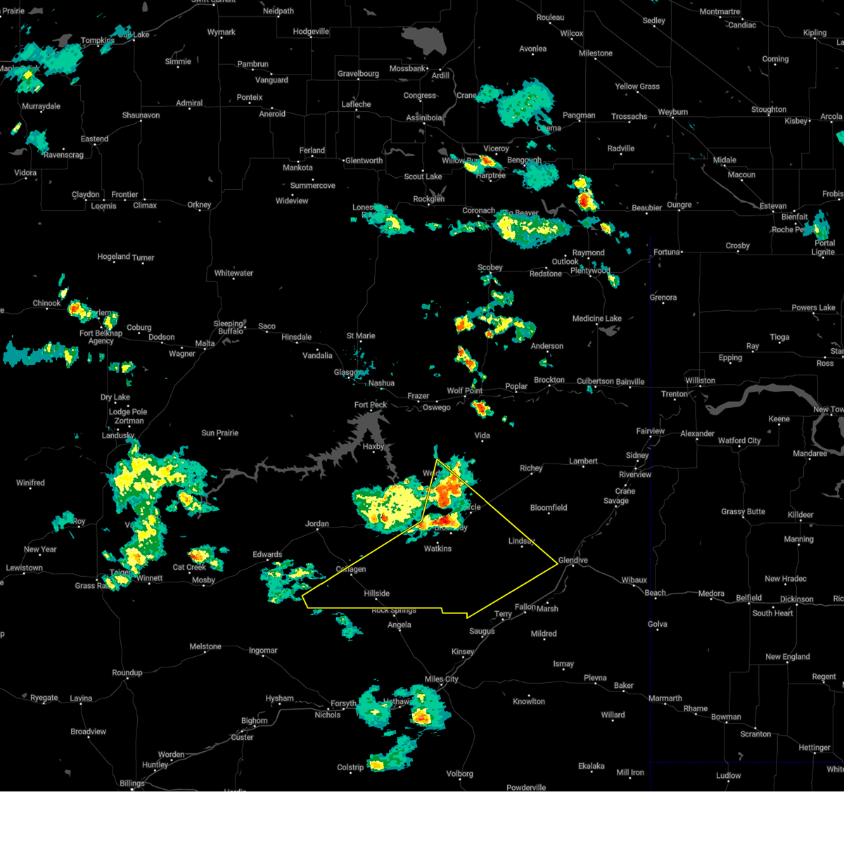
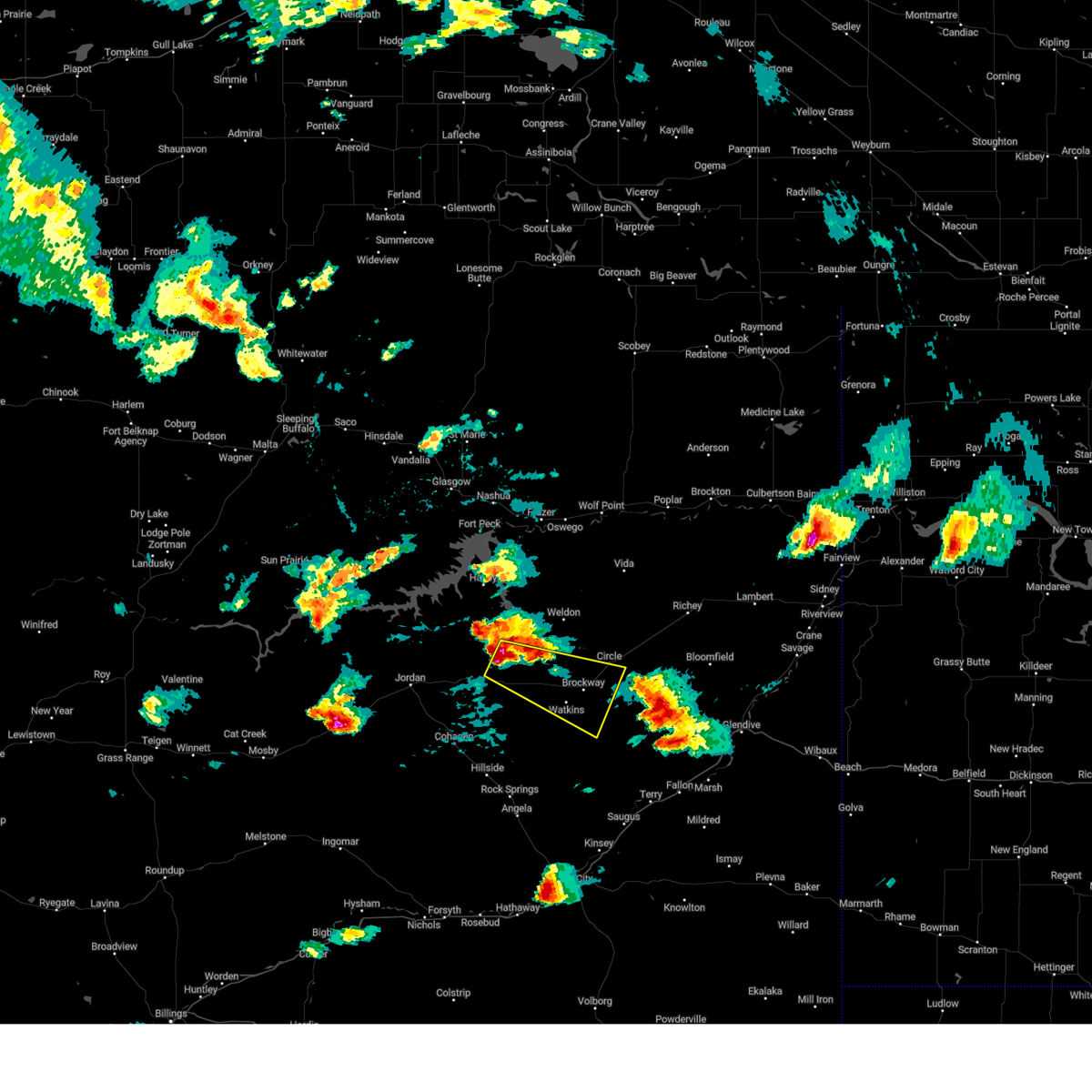
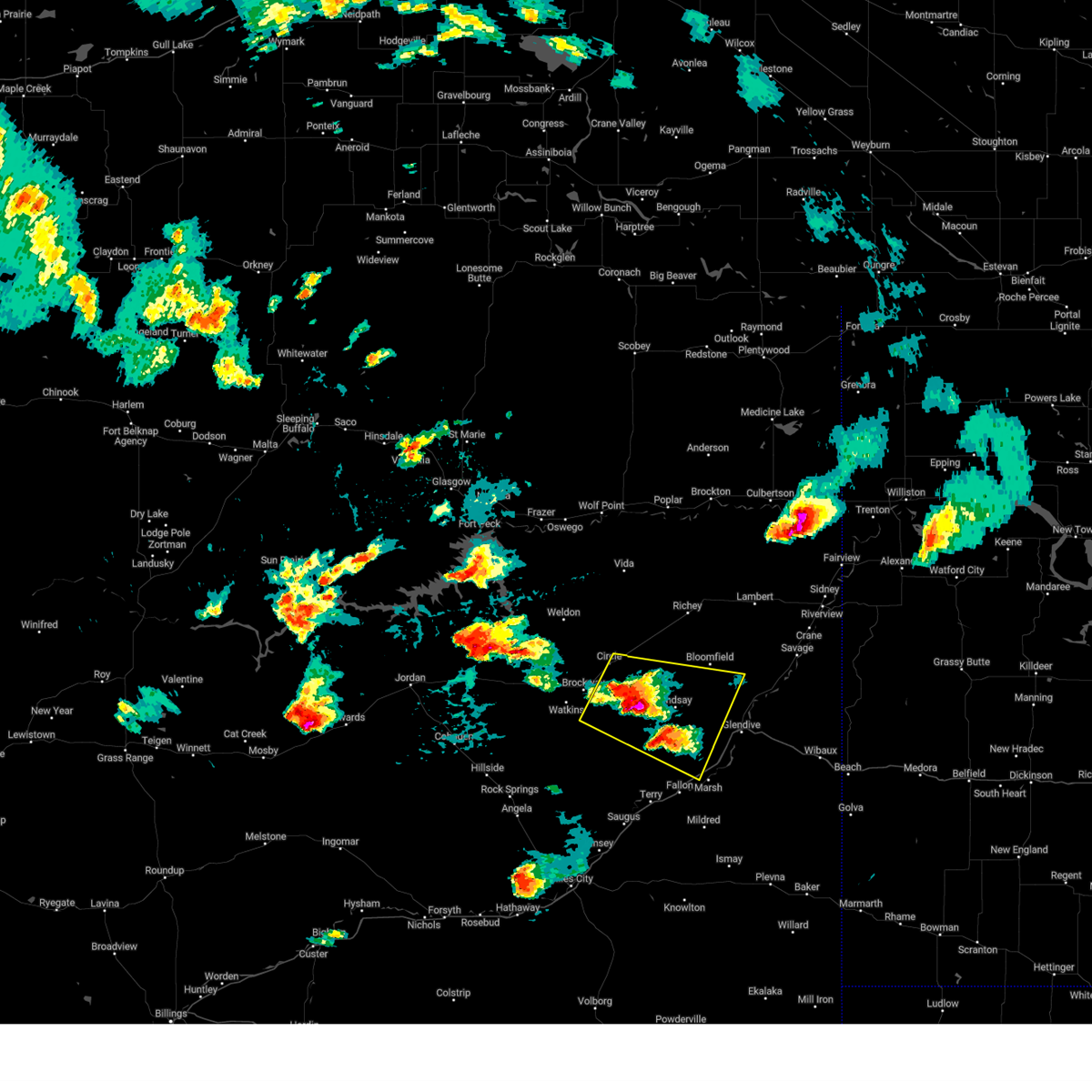
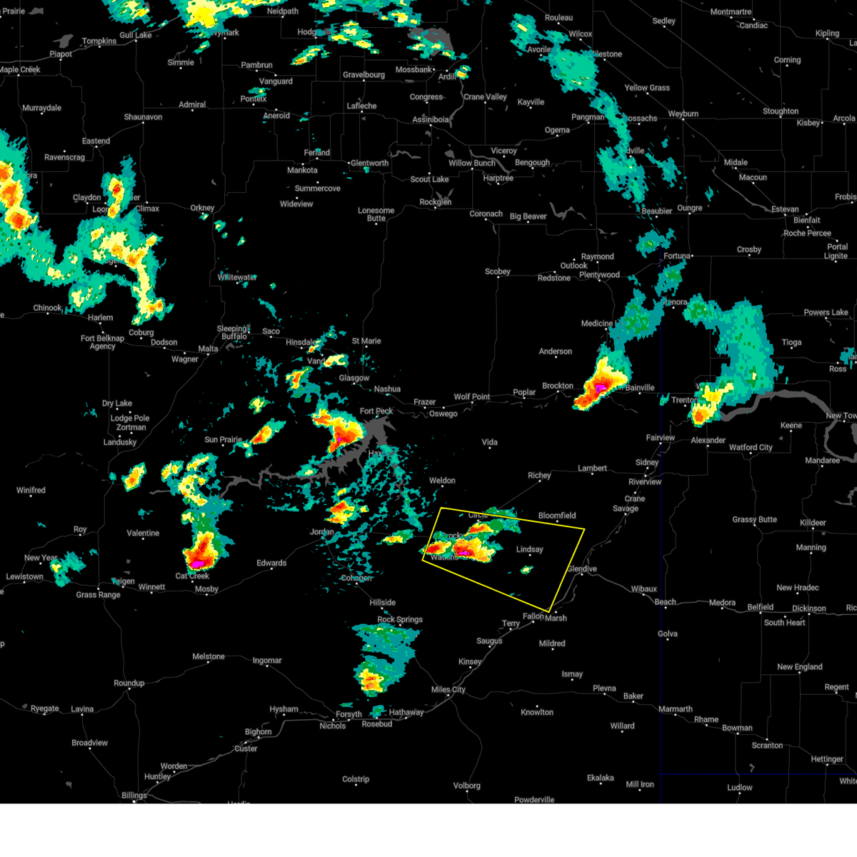
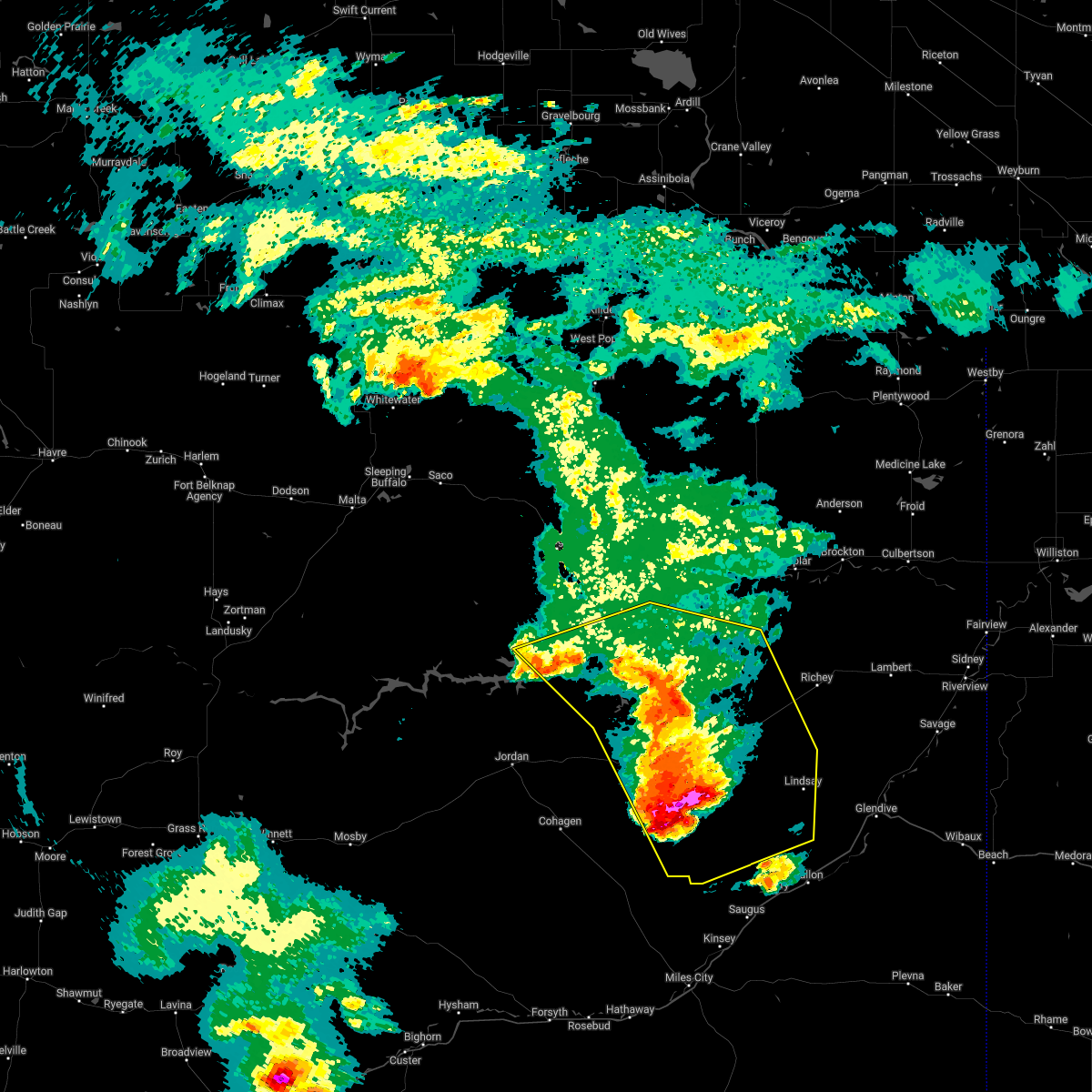
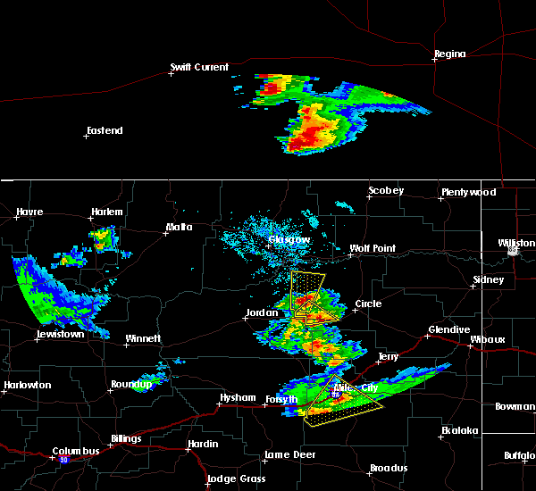
| 6/25/2025 3:00 PM MDT | At 300 pm mdt, a severe thunderstorm was located 10 miles north of brockway, or 11 miles west of circle, moving southeast at 5 mph (radar indicated). Hazards include 60 mph wind gusts and quarter size hail. Hail damage to vehicles is expected. expect wind damage to roofs, siding, and trees. Locations impacted include, circle, brockway, and weldon. |
| 6/25/2025 3:00 PM MDT | the severe thunderstorm warning has been cancelled and is no longer in effect |
| 6/25/2025 2:45 PM MDT | Quarter sized hail reported 7.6 miles E of Circle, MT, hail up to the size of quarters and wind gusts up to 30 mph. |
| 6/25/2025 2:31 PM MDT |
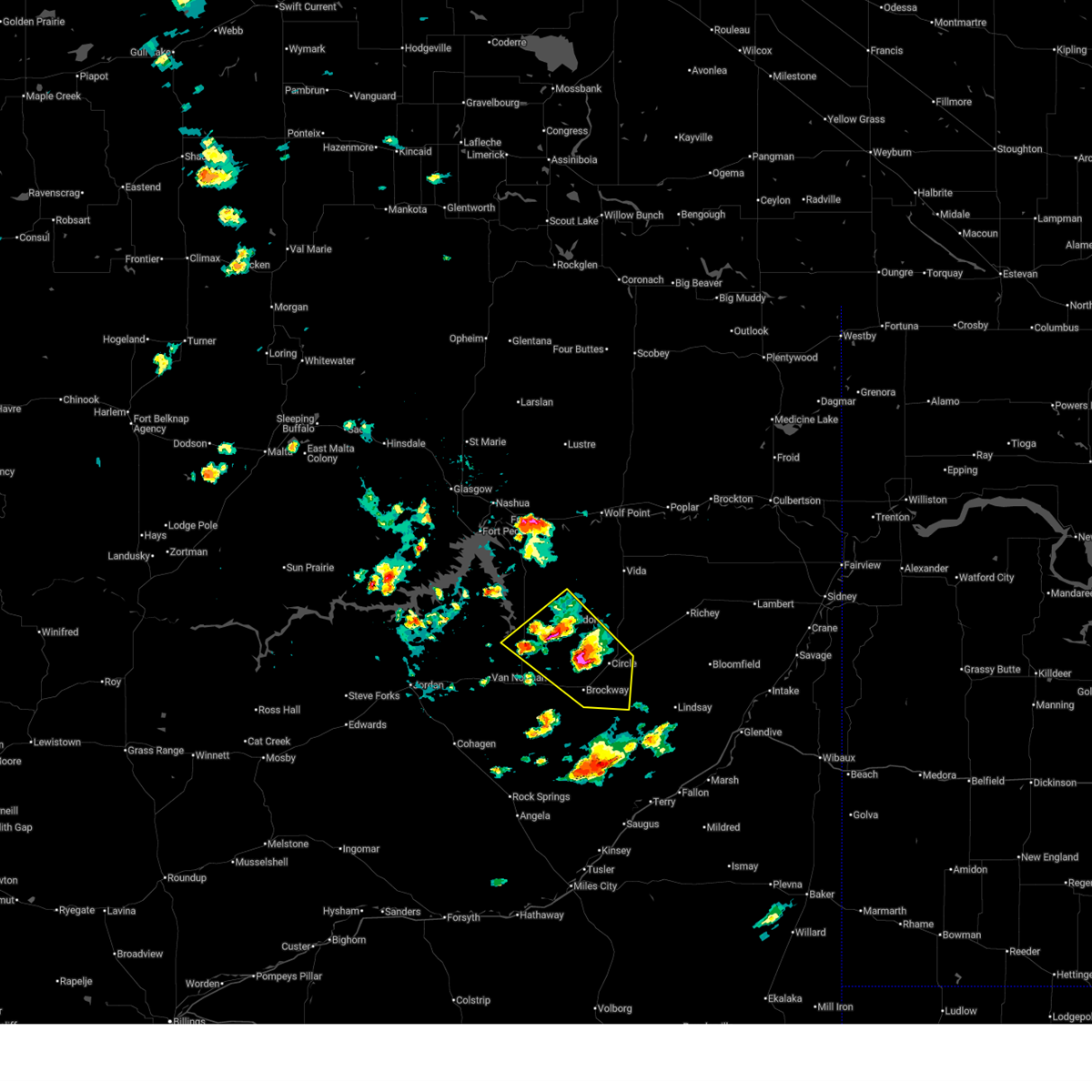 Svrggw the national weather service in glasgow has issued a * severe thunderstorm warning for, northeastern garfield county in northeastern montana, southern mccone county in northeastern montana, * until 330 pm mdt. * at 231 pm mdt, a severe thunderstorm was located 13 miles north of brockway, or 13 miles west of circle, moving southeast at 5 mph (radar indicated). Hazards include 60 mph wind gusts and quarter size hail. Hail damage to vehicles is expected. Expect wind damage to roofs, siding, and trees. Svrggw the national weather service in glasgow has issued a * severe thunderstorm warning for, northeastern garfield county in northeastern montana, southern mccone county in northeastern montana, * until 330 pm mdt. * at 231 pm mdt, a severe thunderstorm was located 13 miles north of brockway, or 13 miles west of circle, moving southeast at 5 mph (radar indicated). Hazards include 60 mph wind gusts and quarter size hail. Hail damage to vehicles is expected. Expect wind damage to roofs, siding, and trees.
|
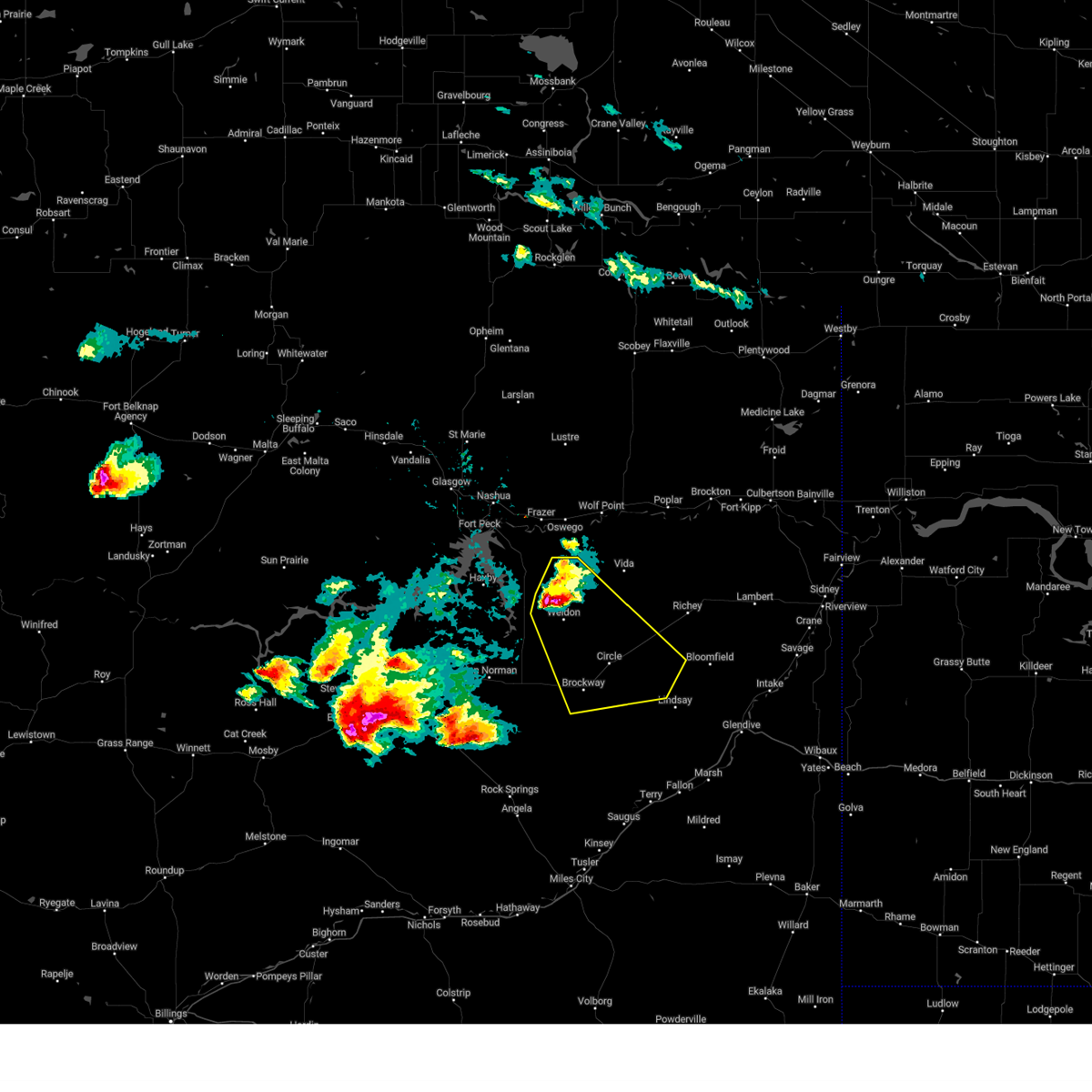
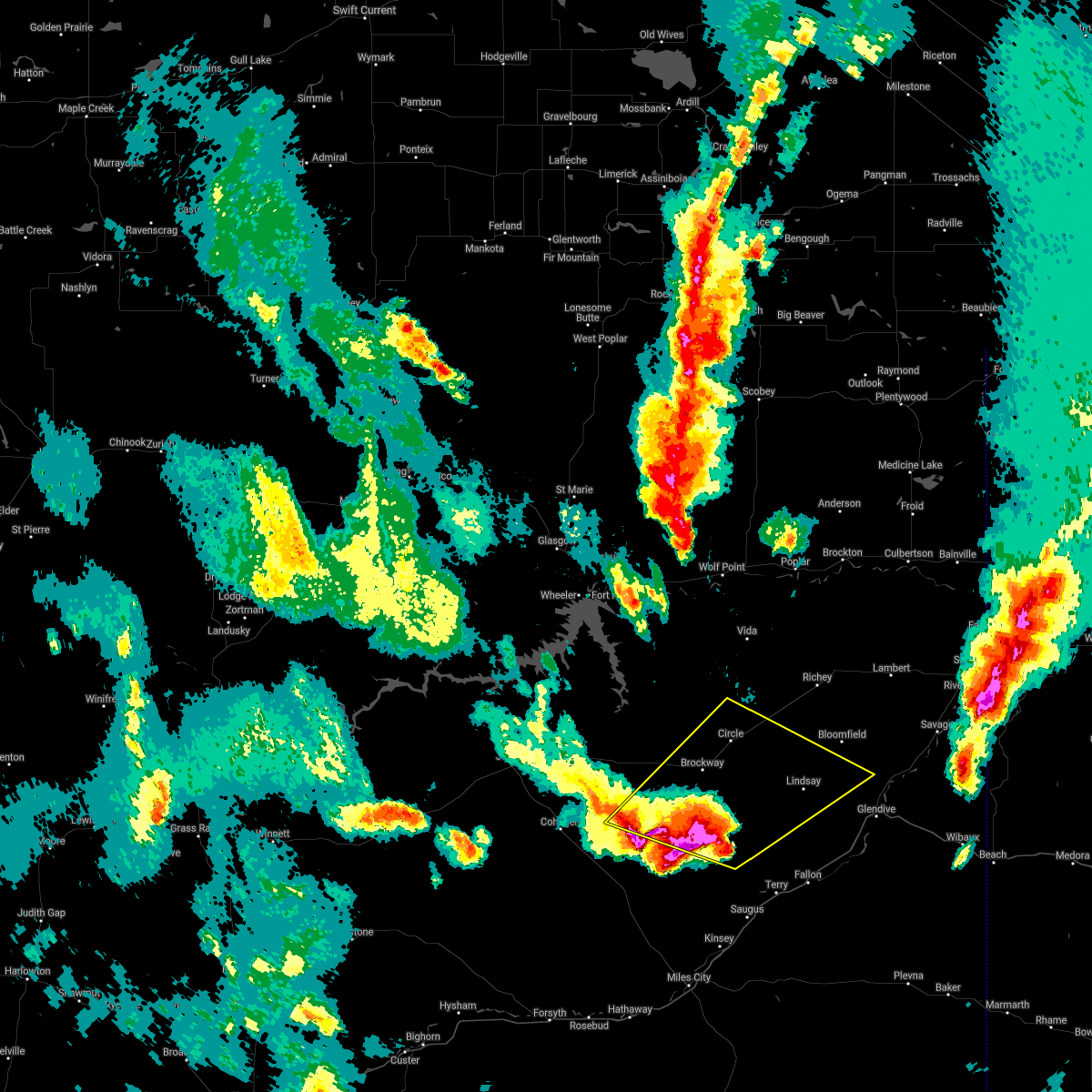
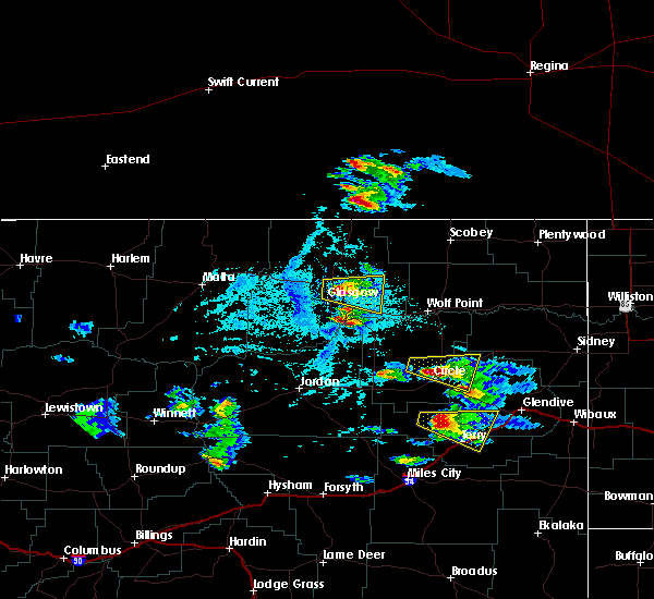
| 6/15/2025 9:31 PM MDT |
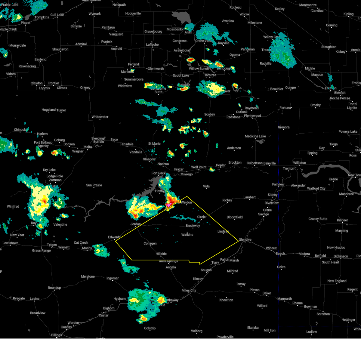
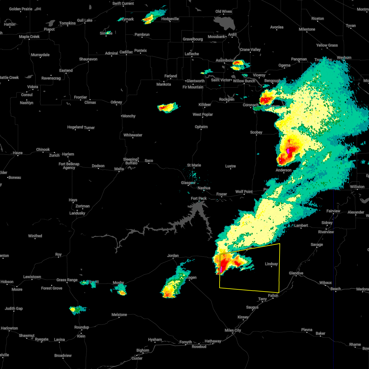
 At 930 pm mdt, a severe thunderstorm was located 22 miles east of hillside, or 29 miles west of terry, moving east at 45 mph (radar indicated). Hazards include 60 mph wind gusts and quarter size hail. Hail damage to vehicles is expected. expect wind damage to roofs, siding, and trees. Locations impacted include, crow rock, watkins, flowing wells rest area, van norman, cohagen, mccloud, brockway, hillside, and circle. At 930 pm mdt, a severe thunderstorm was located 22 miles east of hillside, or 29 miles west of terry, moving east at 45 mph (radar indicated). Hazards include 60 mph wind gusts and quarter size hail. Hail damage to vehicles is expected. expect wind damage to roofs, siding, and trees. Locations impacted include, crow rock, watkins, flowing wells rest area, van norman, cohagen, mccloud, brockway, hillside, and circle.
|
| 6/15/2025 8:55 PM MDT |
 Svrggw the national weather service in glasgow has issued a * severe thunderstorm warning for, southeastern garfield county in northeastern montana, southwestern mccone county in northeastern montana, northwestern prairie county in northeastern montana, * until 1000 pm mdt. * at 854 pm mdt, a severe thunderstorm was located near hillside, or 34 miles southeast of jordan, moving east at 45 mph (radar indicated). Hazards include 60 mph wind gusts and quarter size hail. Hail damage to vehicles is expected. Expect wind damage to roofs, siding, and trees. Svrggw the national weather service in glasgow has issued a * severe thunderstorm warning for, southeastern garfield county in northeastern montana, southwestern mccone county in northeastern montana, northwestern prairie county in northeastern montana, * until 1000 pm mdt. * at 854 pm mdt, a severe thunderstorm was located near hillside, or 34 miles southeast of jordan, moving east at 45 mph (radar indicated). Hazards include 60 mph wind gusts and quarter size hail. Hail damage to vehicles is expected. Expect wind damage to roofs, siding, and trees.
|
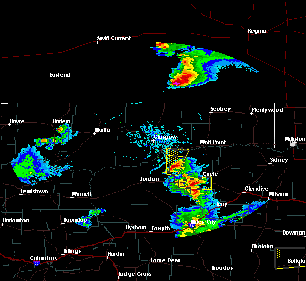
| 6/15/2025 8:20 PM MDT |
 At 818 pm mdt, severe thunderstorms were located along a line extending from 6 miles soutt of lustre to the nelson creek recreation area, moving southeast at 45 mph (trained weather spotters). Hazards include 70 mph wind gusts and half dollar size hail. Hail damage to vehicles is expected. expect considerable tree damage. wind damage is also likely to mobile homes, roofs, and outbuildings. Locations impacted include, wolf point, sprole, circle, oswego, weldon, richey, frazer, poplar, vida, and rock creek rec area. At 818 pm mdt, severe thunderstorms were located along a line extending from 6 miles soutt of lustre to the nelson creek recreation area, moving southeast at 45 mph (trained weather spotters). Hazards include 70 mph wind gusts and half dollar size hail. Hail damage to vehicles is expected. expect considerable tree damage. wind damage is also likely to mobile homes, roofs, and outbuildings. Locations impacted include, wolf point, sprole, circle, oswego, weldon, richey, frazer, poplar, vida, and rock creek rec area.
|
| 6/15/2025 8:20 PM MDT |
 the severe thunderstorm warning has been cancelled and is no longer in effect the severe thunderstorm warning has been cancelled and is no longer in effect
|
| 6/15/2025 7:48 PM MDT |
 Svrggw the national weather service in glasgow has issued a * severe thunderstorm warning for, northeastern garfield county in northeastern montana, southwestern roosevelt county in northeastern montana, eastern valley county in northeastern montana, mccone county in northeastern montana, northwestern dawson county in northeastern montana, northwestern richland county in northeastern montana, * until 845 pm mdt. * at 747 pm mdt, severe thunderstorms were located along a line extending from 15 miles north of st. marie to near nashua to 6 miles south of fort peck, moving southeast at 85 mph (trained weather spotters). Hazards include 70 mph wind gusts and half dollar size hail. Hail damage to vehicles is expected. expect considerable tree damage. Wind damage is also likely to mobile homes, roofs, and outbuildings. Svrggw the national weather service in glasgow has issued a * severe thunderstorm warning for, northeastern garfield county in northeastern montana, southwestern roosevelt county in northeastern montana, eastern valley county in northeastern montana, mccone county in northeastern montana, northwestern dawson county in northeastern montana, northwestern richland county in northeastern montana, * until 845 pm mdt. * at 747 pm mdt, severe thunderstorms were located along a line extending from 15 miles north of st. marie to near nashua to 6 miles south of fort peck, moving southeast at 85 mph (trained weather spotters). Hazards include 70 mph wind gusts and half dollar size hail. Hail damage to vehicles is expected. expect considerable tree damage. Wind damage is also likely to mobile homes, roofs, and outbuildings.
|
| 5/12/2025 8:00 PM MDT | Mesonet station mtm87 fort peck in mccone county MT, 34.5 miles SE of Circle, MT |
| 8/24/2024 11:30 PM MDT | Mesonet station mtm87 fort peck in mccone county MT, 34.5 miles SE of Circle, MT |
| 8/24/2024 11:15 PM MDT | Mesonet station mtmcg mcguire creek mt-24 mp 2. in mccone county MT, 30.8 miles ESE of Circle, MT |
| 8/21/2024 7:25 PM MDT | Quarter sized hail reported 9.7 miles SSW of Circle, MT, e60 mph wind. |
| 8/21/2024 7:20 PM MDT |
 Svrggw the national weather service in glasgow has issued a * severe thunderstorm warning for, southwestern roosevelt county in northeastern montana, northeastern mccone county in northeastern montana, northwestern dawson county in northeastern montana, northwestern richland county in northeastern montana, * until 815 pm mdt. * at 719 pm mdt, severe thunderstorms were located along a line extending from 7 miles southeast of wolf point to 12 miles southwest of richey, moving northeast at 25 mph (radar indicated). Hazards include 60 mph wind gusts and quarter size hail. Hail damage to vehicles is expected. Expect wind damage to roofs, siding, and trees. Svrggw the national weather service in glasgow has issued a * severe thunderstorm warning for, southwestern roosevelt county in northeastern montana, northeastern mccone county in northeastern montana, northwestern dawson county in northeastern montana, northwestern richland county in northeastern montana, * until 815 pm mdt. * at 719 pm mdt, severe thunderstorms were located along a line extending from 7 miles southeast of wolf point to 12 miles southwest of richey, moving northeast at 25 mph (radar indicated). Hazards include 60 mph wind gusts and quarter size hail. Hail damage to vehicles is expected. Expect wind damage to roofs, siding, and trees.
|
| 8/21/2024 7:10 PM MDT | Quarter sized hail reported 19.4 miles SSW of Circle, MT |
| 8/20/2024 10:15 PM MDT | Mesonet station mtlnd 7.9 nw lindsay (mt dot in dawson county MT, 16.9 miles NW of Circle, MT |
| 7/13/2024 6:42 PM MDT |
 The storm which prompted the warning has weakened below severe limits, and no longer poses an immediate threat to life or property. therefore, the warning will be allowed to expire. however, small hail and gusty winds are still possible with this thunderstorm. a severe thunderstorm watch remains in effect until 900 pm mdt for northeastern montana. The storm which prompted the warning has weakened below severe limits, and no longer poses an immediate threat to life or property. therefore, the warning will be allowed to expire. however, small hail and gusty winds are still possible with this thunderstorm. a severe thunderstorm watch remains in effect until 900 pm mdt for northeastern montana.
|
| 7/13/2024 5:58 PM MDT |
 At 558 pm mdt, a severe thunderstorm was located 15 miles northwest of circle, moving southeast at 40 mph (radar indicated). Hazards include 70 mph wind gusts and ping pong ball size hail. People and animals outdoors will be injured. expect hail damage to roofs, siding, windows, and vehicles. expect considerable tree damage. wind damage is also likely to mobile homes, roofs, and outbuildings. Locations impacted include, circle, brockway, and weldon. At 558 pm mdt, a severe thunderstorm was located 15 miles northwest of circle, moving southeast at 40 mph (radar indicated). Hazards include 70 mph wind gusts and ping pong ball size hail. People and animals outdoors will be injured. expect hail damage to roofs, siding, windows, and vehicles. expect considerable tree damage. wind damage is also likely to mobile homes, roofs, and outbuildings. Locations impacted include, circle, brockway, and weldon.
|
| 7/13/2024 5:50 PM MDT | Mesonet station dw0807 circl in mccone county MT, 21.9 miles SE of Circle, MT |
| 7/13/2024 5:41 PM MDT |
 Svrggw the national weather service in glasgow has issued a * severe thunderstorm warning for, central mccone county in northeastern montana, west central dawson county in northeastern montana, * until 645 pm mdt. * at 541 pm mdt, a severe thunderstorm was located 11 miles southeast of rock creek rec area, or 27 miles northwest of circle, moving southeast at 40 mph (radar indicated). Hazards include 70 mph wind gusts and quarter size hail. Hail damage to vehicles is expected. expect considerable tree damage. Wind damage is also likely to mobile homes, roofs, and outbuildings. Svrggw the national weather service in glasgow has issued a * severe thunderstorm warning for, central mccone county in northeastern montana, west central dawson county in northeastern montana, * until 645 pm mdt. * at 541 pm mdt, a severe thunderstorm was located 11 miles southeast of rock creek rec area, or 27 miles northwest of circle, moving southeast at 40 mph (radar indicated). Hazards include 70 mph wind gusts and quarter size hail. Hail damage to vehicles is expected. expect considerable tree damage. Wind damage is also likely to mobile homes, roofs, and outbuildings.
|
| 6/27/2024 4:24 PM MDT | Submitted via fb. an image was sent showing a sheet metal coming off a structure at the mccone county fairground in mccone county MT, 0.5 miles N of Circle, MT |
| 6/15/2024 7:30 PM MDT | Meso net site recorded a thunderstorm wind gust of 61 mp in mccone county MT, 19.4 miles SSW of Circle, MT |
| 6/15/2024 7:27 PM MDT |
 Svrggw the national weather service in glasgow has issued a * severe thunderstorm warning for, southern daniels county in northeastern montana, roosevelt county in northeastern montana, east central valley county in northeastern montana, western sheridan county in northeastern montana, northeastern mccone county in northeastern montana, richland county in northeastern montana, northern dawson county in northeastern montana, * until 830 pm mdt. * at 726 pm mdt, severe thunderstorms were located along a line extending from 12 miles south of peerless to 6 miles west of poplar to 6 miles south of circle, moving east at 45 mph (radar indicated). Hazards include 70 mph wind gusts and quarter size hail. Hail damage to vehicles is expected. expect considerable tree damage. Wind damage is also likely to mobile homes, roofs, and outbuildings. Svrggw the national weather service in glasgow has issued a * severe thunderstorm warning for, southern daniels county in northeastern montana, roosevelt county in northeastern montana, east central valley county in northeastern montana, western sheridan county in northeastern montana, northeastern mccone county in northeastern montana, richland county in northeastern montana, northern dawson county in northeastern montana, * until 830 pm mdt. * at 726 pm mdt, severe thunderstorms were located along a line extending from 12 miles south of peerless to 6 miles west of poplar to 6 miles south of circle, moving east at 45 mph (radar indicated). Hazards include 70 mph wind gusts and quarter size hail. Hail damage to vehicles is expected. expect considerable tree damage. Wind damage is also likely to mobile homes, roofs, and outbuildings.
|
| 6/15/2024 7:25 PM MDT | Meso net observation reported a thunderstorm 61 mph gus in mccone county MT, 1.4 miles W of Circle, MT |
| 5/17/2024 5:12 PM MDT |
 The storm which prompted the warning has weakened below severe limits, and has exited the warned area. therefore, the warning will be allowed to expire. a severe thunderstorm watch remains in effect until 800 pm mdt for northeastern montana. The storm which prompted the warning has weakened below severe limits, and has exited the warned area. therefore, the warning will be allowed to expire. a severe thunderstorm watch remains in effect until 800 pm mdt for northeastern montana.
|
| 5/17/2024 4:39 PM MDT |
 At 438 pm mdt, a severe thunderstorm was located 7 miles northwest of flowing wells rest area, or 30 miles west of circle, moving east at 55 mph (radar indicated). Hazards include 60 mph wind gusts and nickel size hail. Expect damage to roofs, siding, and trees. Locations impacted include, circle, flowing wells rest area, cohagen, nelson creek rec area, brockway, hillside, weldon, crow rock, watkins, van norman, and mccloud. At 438 pm mdt, a severe thunderstorm was located 7 miles northwest of flowing wells rest area, or 30 miles west of circle, moving east at 55 mph (radar indicated). Hazards include 60 mph wind gusts and nickel size hail. Expect damage to roofs, siding, and trees. Locations impacted include, circle, flowing wells rest area, cohagen, nelson creek rec area, brockway, hillside, weldon, crow rock, watkins, van norman, and mccloud.
|
| 5/17/2024 4:10 PM MDT |
 Svrggw the national weather service in glasgow has issued a * severe thunderstorm warning for, southeastern garfield county in northeastern montana, southwestern mccone county in northeastern montana, western prairie county in northeastern montana, * until 515 pm mdt. * at 409 pm mdt, a severe thunderstorm was located near jordan, moving east at 55 mph (radar indicated). Hazards include 70 mph wind gusts and nickel size hail. Expect considerable tree damage. Damage is likely to mobile homes, roofs, and outbuildings. Svrggw the national weather service in glasgow has issued a * severe thunderstorm warning for, southeastern garfield county in northeastern montana, southwestern mccone county in northeastern montana, western prairie county in northeastern montana, * until 515 pm mdt. * at 409 pm mdt, a severe thunderstorm was located near jordan, moving east at 55 mph (radar indicated). Hazards include 70 mph wind gusts and nickel size hail. Expect considerable tree damage. Damage is likely to mobile homes, roofs, and outbuildings.
|
| 5/5/2024 9:45 PM MDT | Mesonet station mtm87 fort peck in mccone county MT, 34.5 miles SE of Circle, MT |
| 5/5/2024 9:38 PM MDT |
 The storm which prompted the warning has weakened below severe limits, and no longer poses an immediate threat to life or property. therefore, the warning will be allowed to expire. however, gusty winds are still possible with this thunderstorm. The storm which prompted the warning has weakened below severe limits, and no longer poses an immediate threat to life or property. therefore, the warning will be allowed to expire. however, gusty winds are still possible with this thunderstorm.
|
| 5/5/2024 9:16 PM MDT |
 At 914 pm mdt, a severe thunderstorm was located 14 miles east of rock creek rec area, or 24 miles northwest of circle, moving northeast at 35 mph (radar indicated). Hazards include 60 mph wind gusts. wind gusts as high as 59 mph have been observed with this storm near cow creek at 900 pm mdt. Expect damage to roofs, siding, and trees. Locations impacted include, circle, richey, vida, nelson creek rec area, lindsay, rock creek rec area, brockway, weldon, and enid. At 914 pm mdt, a severe thunderstorm was located 14 miles east of rock creek rec area, or 24 miles northwest of circle, moving northeast at 35 mph (radar indicated). Hazards include 60 mph wind gusts. wind gusts as high as 59 mph have been observed with this storm near cow creek at 900 pm mdt. Expect damage to roofs, siding, and trees. Locations impacted include, circle, richey, vida, nelson creek rec area, lindsay, rock creek rec area, brockway, weldon, and enid.
|
| 5/5/2024 9:16 PM MDT |
 the severe thunderstorm warning has been cancelled and is no longer in effect the severe thunderstorm warning has been cancelled and is no longer in effect
|
| 5/5/2024 9:00 PM MDT | Corrects previous non-tstm wnd gst report from 10 s vida to reflect that it is indeed a tstorm gust. mesonet station mtcow 9.9 s vida (mt dot in mccone county MT, 19.4 miles SSW of Circle, MT |
| 5/5/2024 8:43 PM MDT |
 Svrggw the national weather service in glasgow has issued a * severe thunderstorm warning for, east central garfield county in northeastern montana, mccone county in northeastern montana, northwestern prairie county in northeastern montana, west central richland county in northeastern montana, northwestern dawson county in northeastern montana, * until 945 pm mdt. * at 842 pm mdt, a severe thunderstorm was located 7 miles north of flowing wells rest area, or 27 miles west of circle, moving northeast at 35 mph (radar indicated). Hazards include 60 mph wind gusts. wind gusts to 60 mph were observed at circle airport at 825 pm mdt. expect damage to roofs, siding, and trees Svrggw the national weather service in glasgow has issued a * severe thunderstorm warning for, east central garfield county in northeastern montana, mccone county in northeastern montana, northwestern prairie county in northeastern montana, west central richland county in northeastern montana, northwestern dawson county in northeastern montana, * until 945 pm mdt. * at 842 pm mdt, a severe thunderstorm was located 7 miles north of flowing wells rest area, or 27 miles west of circle, moving northeast at 35 mph (radar indicated). Hazards include 60 mph wind gusts. wind gusts to 60 mph were observed at circle airport at 825 pm mdt. expect damage to roofs, siding, and trees
|
| 5/5/2024 8:25 PM MDT | Awos station k4u6 1 e circl in mccone county MT, 0.9 miles WSW of Circle, MT |
| 4/22/2024 5:47 PM MDT |
 The storm which prompted the warning has weakened below severe limits, and no longer poses an immediate threat to life or property. therefore, the warning has been allowed to expire. The storm which prompted the warning has weakened below severe limits, and no longer poses an immediate threat to life or property. therefore, the warning has been allowed to expire.
|
| 4/22/2024 4:46 PM MDT |
 Svrggw the national weather service in glasgow has issued a * severe thunderstorm warning for, northeastern garfield county in northeastern montana, southeastern valley county in northeastern montana, mccone county in northeastern montana, northwestern prairie county in northeastern montana, northwestern dawson county in northeastern montana, * until 545 pm mdt. * at 445 pm mdt, showers with damaging wind gusts were located near glasgow, moving southeast at 60 mph (glasgow airport asos observation). Hazards include 60 mph wind gusts. expect damage to roofs, siding, and trees Svrggw the national weather service in glasgow has issued a * severe thunderstorm warning for, northeastern garfield county in northeastern montana, southeastern valley county in northeastern montana, mccone county in northeastern montana, northwestern prairie county in northeastern montana, northwestern dawson county in northeastern montana, * until 545 pm mdt. * at 445 pm mdt, showers with damaging wind gusts were located near glasgow, moving southeast at 60 mph (glasgow airport asos observation). Hazards include 60 mph wind gusts. expect damage to roofs, siding, and trees
|
| 4/22/2024 4:45 PM MDT | Cow creek mdo in mccone county MT, 19.3 miles SSW of Circle, MT |
| 8/30/2023 7:00 PM MDT | Tree branches knocked down. estimated the wind was still gusting up to 50 mph at the time of the repor in mccone county MT, 0.5 miles N of Circle, MT |
| 8/30/2023 6:33 PM MDT |
 At 632 pm mdt, severe thunderstorms were located along a line extending from 9 miles north of rock creek rec area to 17 miles east of hillside, moving east at 45 mph (radar indicated). Hazards include 60 mph wind gusts. expect damage to roofs, siding, and trees At 632 pm mdt, severe thunderstorms were located along a line extending from 9 miles north of rock creek rec area to 17 miles east of hillside, moving east at 45 mph (radar indicated). Hazards include 60 mph wind gusts. expect damage to roofs, siding, and trees
|
| 7/13/2023 6:13 PM MDT |
 The severe thunderstorm warning for southeastern garfield. southern mccone. northwestern prairie and southwestern dawson counties will expire at 615 pm mdt. the storms which prompted the warning have weakened below severe limits, and no longer pose an immediate threat to life or property. therefore, the warning will be allowed to expire. However small hail. The severe thunderstorm warning for southeastern garfield. southern mccone. northwestern prairie and southwestern dawson counties will expire at 615 pm mdt. the storms which prompted the warning have weakened below severe limits, and no longer pose an immediate threat to life or property. therefore, the warning will be allowed to expire. However small hail.
|
| 7/13/2023 5:44 PM MDT |
 At 543 pm mdt, severe thunderstorms were located along a line extending from near circle to 14 miles southwest of cohagen, moving southeast at 50 mph (radar indicated). Hazards include 60 mph wind gusts and penny size hail. Expect damage to roofs, siding, and trees. locations impacted include, circle, cohagen, lindsay, brockway, hillside, weldon, crow rock, watkins and mccloud. hail threat, radar indicated max hail size, 0. 75 in wind threat, observed max wind gust, 60 mph. At 543 pm mdt, severe thunderstorms were located along a line extending from near circle to 14 miles southwest of cohagen, moving southeast at 50 mph (radar indicated). Hazards include 60 mph wind gusts and penny size hail. Expect damage to roofs, siding, and trees. locations impacted include, circle, cohagen, lindsay, brockway, hillside, weldon, crow rock, watkins and mccloud. hail threat, radar indicated max hail size, 0. 75 in wind threat, observed max wind gust, 60 mph.
|
| 7/13/2023 5:16 PM MDT |
 At 516 pm mdt, severe thunderstorms were located along a line extending from 15 miles northeast of nelson creek rec area to 7 miles east of edwards, moving southeast at 50 mph (radar indicated). Hazards include 60 mph wind gusts and penny size hail. expect damage to roofs, siding, and trees At 516 pm mdt, severe thunderstorms were located along a line extending from 15 miles northeast of nelson creek rec area to 7 miles east of edwards, moving southeast at 50 mph (radar indicated). Hazards include 60 mph wind gusts and penny size hail. expect damage to roofs, siding, and trees
|
| 7/11/2023 4:40 PM MDT | Quarter sized hail reported 0.6 miles ESE of Circle, MT |
| 7/11/2023 4:25 PM MDT | Quarter sized hail reported 13.7 miles E of Circle, MT, spotter reported heavy locally heavy rainfall with 1 inch hail stones bouncing off the ground. |
| 7/11/2023 4:20 PM MDT |
 At 419 pm mdt, a severe thunderstorm was located near flowing wells rest area, or 23 miles west of circle, moving southeast at 30 mph (radar indicated). Hazards include two inch hail and 60 mph wind gusts. People and animals outdoors will be injured. expect hail damage to roofs, siding, windows, and vehicles. expect wind damage to roofs, siding, and trees. locations impacted include, circle, brockway, flowing wells rest area and watkins. thunderstorm damage threat, considerable hail threat, radar indicated max hail size, 2. 00 in wind threat, radar indicated max wind gust, 60 mph. At 419 pm mdt, a severe thunderstorm was located near flowing wells rest area, or 23 miles west of circle, moving southeast at 30 mph (radar indicated). Hazards include two inch hail and 60 mph wind gusts. People and animals outdoors will be injured. expect hail damage to roofs, siding, windows, and vehicles. expect wind damage to roofs, siding, and trees. locations impacted include, circle, brockway, flowing wells rest area and watkins. thunderstorm damage threat, considerable hail threat, radar indicated max hail size, 2. 00 in wind threat, radar indicated max wind gust, 60 mph.
|
| 7/11/2023 4:00 PM MDT |
 At 359 pm mdt, a severe thunderstorm was located 7 miles northwest of flowing wells rest area, or 30 miles east of jordan, moving southeast at 30 mph (radar indicated). Hazards include 60 mph wind gusts and quarter size hail. Hail damage to vehicles is expected. Expect wind damage to roofs, siding, and trees. At 359 pm mdt, a severe thunderstorm was located 7 miles northwest of flowing wells rest area, or 30 miles east of jordan, moving southeast at 30 mph (radar indicated). Hazards include 60 mph wind gusts and quarter size hail. Hail damage to vehicles is expected. Expect wind damage to roofs, siding, and trees.
|
| 7/11/2023 3:45 PM MDT |
 At 345 pm mdt, a severe thunderstorm was located near lindsay, or 24 miles north of terry, moving east at 40 mph (radar indicated). Hazards include 60 mph wind gusts and quarter size hail. Hail damage to vehicles is expected. expect wind damage to roofs, siding, and trees. locations impacted include, circle and lindsay. hail threat, radar indicated max hail size, 1. 00 in wind threat, radar indicated max wind gust, 60 mph. At 345 pm mdt, a severe thunderstorm was located near lindsay, or 24 miles north of terry, moving east at 40 mph (radar indicated). Hazards include 60 mph wind gusts and quarter size hail. Hail damage to vehicles is expected. expect wind damage to roofs, siding, and trees. locations impacted include, circle and lindsay. hail threat, radar indicated max hail size, 1. 00 in wind threat, radar indicated max wind gust, 60 mph.
|
| 7/11/2023 3:20 PM MDT |
 At 319 pm mdt, a severe thunderstorm was located 10 miles southeast of brockway, or 14 miles south of circle, moving east at 40 mph (radar indicated). Hazards include 60 mph wind gusts and quarter size hail. Hail damage to vehicles is expected. Expect wind damage to roofs, siding, and trees. At 319 pm mdt, a severe thunderstorm was located 10 miles southeast of brockway, or 14 miles south of circle, moving east at 40 mph (radar indicated). Hazards include 60 mph wind gusts and quarter size hail. Hail damage to vehicles is expected. Expect wind damage to roofs, siding, and trees.
|
| 8/4/2022 6:45 PM MDT | Storm damage reported in mccone county MT, 35 miles SE of Circle, MT |
| 7/18/2022 4:45 PM MDT | Relayed via faceboo in mccone county MT, 18.2 miles S of Circle, MT |
| 7/13/2022 9:56 PM MDT |
 The severe thunderstorm warning for eastern garfield, southwestern roosevelt, southeastern valley, mccone, northwestern prairie, northwestern dawson and northwestern richland counties will expire at 1000 pm mdt, the storms which prompted the warning have weakened below severe limits, and no longer pose an immediate threat to life or property. therefore, the warning will be allowed to expire. however gusty winds are still possible with these thunderstorms. a severe thunderstorm watch remains in effect until 1100 pm mdt for northeastern montana. The severe thunderstorm warning for eastern garfield, southwestern roosevelt, southeastern valley, mccone, northwestern prairie, northwestern dawson and northwestern richland counties will expire at 1000 pm mdt, the storms which prompted the warning have weakened below severe limits, and no longer pose an immediate threat to life or property. therefore, the warning will be allowed to expire. however gusty winds are still possible with these thunderstorms. a severe thunderstorm watch remains in effect until 1100 pm mdt for northeastern montana.
|
| 7/13/2022 9:42 PM MDT |
 At 941 pm mdt, severe thunderstorms were located along a line extending from near nashua to 10 miles northwest of vida to 15 miles south of brockway, moving northeast at 45 mph (trained weather spotters). Hazards include 70 mph wind gusts and penny size hail. Expect considerable tree damage. damage is likely to mobile homes, roofs, and outbuildings. locations impacted include, glasgow, wolf point, poplar, circle, nashua, brockton, fort peck, richey, duck creek rec area, brockway, flowing wells rest area, lustre, fort peck marina, frazer, vida, nelson creek rec area, lindsay, rock creek rec area, park grove and volt. thunderstorm damage threat, considerable hail threat, radar indicated max hail size, 0. 75 in wind threat, radar indicated max wind gust, 70 mph. At 941 pm mdt, severe thunderstorms were located along a line extending from near nashua to 10 miles northwest of vida to 15 miles south of brockway, moving northeast at 45 mph (trained weather spotters). Hazards include 70 mph wind gusts and penny size hail. Expect considerable tree damage. damage is likely to mobile homes, roofs, and outbuildings. locations impacted include, glasgow, wolf point, poplar, circle, nashua, brockton, fort peck, richey, duck creek rec area, brockway, flowing wells rest area, lustre, fort peck marina, frazer, vida, nelson creek rec area, lindsay, rock creek rec area, park grove and volt. thunderstorm damage threat, considerable hail threat, radar indicated max hail size, 0. 75 in wind threat, radar indicated max wind gust, 70 mph.
|
| 7/13/2022 9:15 PM MDT | Storm damage reported in mccone county MT, 34.5 miles SE of Circle, MT |
| 7/13/2022 9:15 PM MDT | Storm damage reported in mccone county MT, 33.2 miles SE of Circle, MT |
| 7/13/2022 9:11 PM MDT | Storm damage reported in mccone county MT, 33.5 miles SE of Circle, MT |
| 7/13/2022 9:07 PM MDT |
 At 905 pm mdt, severe thunderstorms were located along a line extending from 13 miles west of duck creek rec area to 8 miles east of rock creek rec area to 11 miles east of hillside, moving northeast at 40 mph (trained weather spotters). Hazards include 70 mph wind gusts and penny size hail. Expect considerable tree damage. Damage is likely to mobile homes, roofs, and outbuildings. At 905 pm mdt, severe thunderstorms were located along a line extending from 13 miles west of duck creek rec area to 8 miles east of rock creek rec area to 11 miles east of hillside, moving northeast at 40 mph (trained weather spotters). Hazards include 70 mph wind gusts and penny size hail. Expect considerable tree damage. Damage is likely to mobile homes, roofs, and outbuildings.
|
| 7/9/2022 11:27 PM MDT |
 At 1126 pm mdt, severe thunderstorms were located along a line extending from 10 miles northwest of circle to 15 miles north of miles city, moving east at 60 mph (radar indicated). Hazards include 70 mph wind gusts and half dollar size hail. Hail damage to vehicles is expected. expect considerable tree damage. Wind damage is also likely to mobile homes, roofs, and outbuildings. At 1126 pm mdt, severe thunderstorms were located along a line extending from 10 miles northwest of circle to 15 miles north of miles city, moving east at 60 mph (radar indicated). Hazards include 70 mph wind gusts and half dollar size hail. Hail damage to vehicles is expected. expect considerable tree damage. Wind damage is also likely to mobile homes, roofs, and outbuildings.
|
| 7/9/2022 10:30 PM MDT |
 At 1030 pm mdt, severe thunderstorms were located along a line extending from 11 miles southwest of vida to 14 miles west of terry, moving east at 60 mph (radar indicated). Hazards include 70 mph wind gusts and half dollar size hail. Hail damage to vehicles is expected. expect considerable tree damage. Wind damage is also likely to mobile homes, roofs, and outbuildings. At 1030 pm mdt, severe thunderstorms were located along a line extending from 11 miles southwest of vida to 14 miles west of terry, moving east at 60 mph (radar indicated). Hazards include 70 mph wind gusts and half dollar size hail. Hail damage to vehicles is expected. expect considerable tree damage. Wind damage is also likely to mobile homes, roofs, and outbuildings.
|
| 7/9/2022 9:54 PM MDT |
 At 954 pm mdt, severe thunderstorms were located along a line extending from 10 miles south of jordan to 12 miles south of cohagen, moving northeast at 45 mph (radar indicated). Hazards include 70 mph wind gusts and quarter size hail. Hail damage to vehicles is expected. expect considerable tree damage. Wind damage is also likely to mobile homes, roofs, and outbuildings. At 954 pm mdt, severe thunderstorms were located along a line extending from 10 miles south of jordan to 12 miles south of cohagen, moving northeast at 45 mph (radar indicated). Hazards include 70 mph wind gusts and quarter size hail. Hail damage to vehicles is expected. expect considerable tree damage. Wind damage is also likely to mobile homes, roofs, and outbuildings.
|
| 7/9/2022 2:48 AM MDT | At 247 am mdt, a severe thunderstorm was located 12 miles south of brockway, or 21 miles south of circle, moving east at 40 mph (doppler radar indicated). Hazards include 60 mph wind gusts and quarter size hail. Hail damage to vehicles is expected. Expect wind damage to roofs, siding, and trees. |
| 7/8/2022 11:37 PM MDT | The severe thunderstorm warning for eastern garfield, southern valley, mccone, northwestern prairie and western dawson counties will expire at 1145 pm mdt, the storms which prompted the warning have weakened below severe limits, and no longer pose an immediate threat to life or property. therefore, the warning will be allowed to expire. however gusty winds are still possible with these thunderstorms. a severe thunderstorm watch remains in effect until 300 am mdt for northeastern montana. |
| 7/8/2022 11:20 PM MDT | At 1120 pm mdt, severe thunderstorms were located along a line extending from 16 miles east of rock creek rec area to 11 miles south of brockway, moving east at 55 mph (radar indicated). Hazards include 60 mph wind gusts and penny size hail. Expect damage to roofs, siding, and trees. locations impacted include, circle, brockway, hillside, flowing wells rest area, vida, cohagen, nelson creek rec area, rock creek rec area, van norman, mccloud, haxby, weldon, crow rock and watkins. hail threat, radar indicated max hail size, 0. 75 in wind threat, observed max wind gust, 60 mph. |
| 7/8/2022 10:41 PM MDT |
 At 1040 pm mdt, severe thunderstorms were located along a line extending from 12 miles east of hell creek rec area to 6 miles southeast of cohagen, moving east at 55 mph (radar indicated). Hazards include 70 mph wind gusts and penny size hail. Expect considerable tree damage. Damage is likely to mobile homes, roofs, and outbuildings. At 1040 pm mdt, severe thunderstorms were located along a line extending from 12 miles east of hell creek rec area to 6 miles southeast of cohagen, moving east at 55 mph (radar indicated). Hazards include 70 mph wind gusts and penny size hail. Expect considerable tree damage. Damage is likely to mobile homes, roofs, and outbuildings.
|
| 7/5/2022 7:59 PM MDT |
 At 759 pm mdt, a severe thunderstorm was located 10 miles southwest of brockway, or 21 miles southwest of circle, moving east at 45 mph (radar indicated). Hazards include 60 mph wind gusts and half dollar size hail. Hail damage to vehicles is expected. Expect wind damage to roofs, siding, and trees. At 759 pm mdt, a severe thunderstorm was located 10 miles southwest of brockway, or 21 miles southwest of circle, moving east at 45 mph (radar indicated). Hazards include 60 mph wind gusts and half dollar size hail. Hail damage to vehicles is expected. Expect wind damage to roofs, siding, and trees.
|
| 7/3/2022 7:07 PM MDT |
 The severe thunderstorm warning for central mccone, northwestern prairie and western dawson counties will expire at 715 pm mdt, the storms which prompted the warning have moved out of the area. therefore, the warning will be allowed to expire. a severe thunderstorm watch remains in effect until 1100 pm mdt for northeastern montana. remember, a severe thunderstorm warning still remains in effect for southeastern mccone, eastern prairie, and western dawson county until 8 pm mdt. The severe thunderstorm warning for central mccone, northwestern prairie and western dawson counties will expire at 715 pm mdt, the storms which prompted the warning have moved out of the area. therefore, the warning will be allowed to expire. a severe thunderstorm watch remains in effect until 1100 pm mdt for northeastern montana. remember, a severe thunderstorm warning still remains in effect for southeastern mccone, eastern prairie, and western dawson county until 8 pm mdt.
|
| 7/3/2022 7:01 PM MDT |
 At 701 pm mdt, severe thunderstorms were located along a line extending from near vida to 6 miles northeast of lindsay to 13 miles west of west glendive, moving northeast at 45 mph (radar indicated). Hazards include 60 mph wind gusts and quarter size hail. Hail damage to vehicles is expected. Expect wind damage to roofs, siding, and trees. At 701 pm mdt, severe thunderstorms were located along a line extending from near vida to 6 miles northeast of lindsay to 13 miles west of west glendive, moving northeast at 45 mph (radar indicated). Hazards include 60 mph wind gusts and quarter size hail. Hail damage to vehicles is expected. Expect wind damage to roofs, siding, and trees.
|
| 7/3/2022 6:45 PM MDT |
 At 645 pm mdt, severe thunderstorms were located along a line extending from 6 miles east of the pines rec area to 15 miles southwest of vida to near brockway, moving east at 30 mph (radar indicated). Hazards include 60 mph wind gusts and quarter size hail. Hail damage to vehicles is expected. expect wind damage to roofs, siding, and trees. Locations impacted include, circle, vida, lindsay, brockway, weldon, watkins and mccloud. At 645 pm mdt, severe thunderstorms were located along a line extending from 6 miles east of the pines rec area to 15 miles southwest of vida to near brockway, moving east at 30 mph (radar indicated). Hazards include 60 mph wind gusts and quarter size hail. Hail damage to vehicles is expected. expect wind damage to roofs, siding, and trees. Locations impacted include, circle, vida, lindsay, brockway, weldon, watkins and mccloud.
|
| 7/3/2022 6:27 PM MDT |
 At 626 pm mdt, severe thunderstorms were located along a line extending from near the pines rec area to 14 miles east of rock creek rec area to 10 miles southwest of brockway, moving east at 30 mph (radar indicated). Hazards include 60 mph wind gusts and quarter size hail. Hail damage to vehicles is expected. expect wind damage to roofs, siding, and trees. Locations impacted include, circle, the pines rec area, flowing wells rest area, vida, nelson creek rec area, lindsay, rock creek rec area, brockway, haxby, weldon, watkins and mccloud. At 626 pm mdt, severe thunderstorms were located along a line extending from near the pines rec area to 14 miles east of rock creek rec area to 10 miles southwest of brockway, moving east at 30 mph (radar indicated). Hazards include 60 mph wind gusts and quarter size hail. Hail damage to vehicles is expected. expect wind damage to roofs, siding, and trees. Locations impacted include, circle, the pines rec area, flowing wells rest area, vida, nelson creek rec area, lindsay, rock creek rec area, brockway, haxby, weldon, watkins and mccloud.
|
| 7/3/2022 6:09 PM MDT |
 At 608 pm mdt, severe thunderstorms were located along a line extending from 9 miles southwest of the pines rec area to 8 miles northeast of nelson creek rec area to 15 miles southeast of flowing wells rest area, moving northeast at 30 mph (radar indicated). Hazards include 60 mph wind gusts and quarter size hail. Hail damage to vehicles is expected. Expect wind damage to roofs, siding, and trees. At 608 pm mdt, severe thunderstorms were located along a line extending from 9 miles southwest of the pines rec area to 8 miles northeast of nelson creek rec area to 15 miles southeast of flowing wells rest area, moving northeast at 30 mph (radar indicated). Hazards include 60 mph wind gusts and quarter size hail. Hail damage to vehicles is expected. Expect wind damage to roofs, siding, and trees.
|
| 5/19/2022 4:00 PM MDT | Mesonet station mtm87 fort peck in mccone county MT, 34.5 miles SE of Circle, MT |
| 7/8/2021 3:36 PM MDT |
 At 336 pm mdt, severe thunderstorms were located along a line extending from 11 miles northeast of nashua to 6 miles west of frazer to 9 miles east of the pines rec area, moving southeast at 45 mph (radar indicated). Hazards include 70 mph wind gusts. Expect considerable tree damage. Damage is likely to mobile homes, roofs, and outbuildings. At 336 pm mdt, severe thunderstorms were located along a line extending from 11 miles northeast of nashua to 6 miles west of frazer to 9 miles east of the pines rec area, moving southeast at 45 mph (radar indicated). Hazards include 70 mph wind gusts. Expect considerable tree damage. Damage is likely to mobile homes, roofs, and outbuildings.
|
| 6/10/2021 8:38 PM MDT | This gust is likely enhanced by the cold front coming through as well... the storm is mostly south of this are in mccone county MT, 7.8 miles SSW of Circle, MT |
| 6/10/2021 8:23 PM MDT |
 At 822 pm mdt, severe thunderstorms were located along a line extending from near circle to near lindsay, moving northeast at 50 mph (radar indicated). Hazards include tennis ball size hail and 70 mph wind gusts. People and animals outdoors will be injured. expect hail damage to roofs, siding, windows, and vehicles. expect considerable tree damage. Wind damage is also likely to mobile homes, roofs, and outbuildings. At 822 pm mdt, severe thunderstorms were located along a line extending from near circle to near lindsay, moving northeast at 50 mph (radar indicated). Hazards include tennis ball size hail and 70 mph wind gusts. People and animals outdoors will be injured. expect hail damage to roofs, siding, windows, and vehicles. expect considerable tree damage. Wind damage is also likely to mobile homes, roofs, and outbuildings.
|
| 6/10/2021 8:15 PM MDT | Hen Egg sized hail reported 15.4 miles NW of Circle, MT, twitter photo of hail measurement with hail covering the ground. |
| 6/10/2021 7:53 PM MDT |
 At 752 pm mdt, severe thunderstorms were located along a line extending from 13 miles south of flowing wells rest area to 18 miles northwest of terry, moving east at 70 mph (radar indicated). Hazards include two inch hail and 60 mph wind gusts. People and animals outdoors will be injured. expect hail damage to roofs, siding, windows, and vehicles. expect wind damage to roofs, siding, and trees. Locations impacted include, circle, lindsay, brockway, mccloud and watkins. At 752 pm mdt, severe thunderstorms were located along a line extending from 13 miles south of flowing wells rest area to 18 miles northwest of terry, moving east at 70 mph (radar indicated). Hazards include two inch hail and 60 mph wind gusts. People and animals outdoors will be injured. expect hail damage to roofs, siding, windows, and vehicles. expect wind damage to roofs, siding, and trees. Locations impacted include, circle, lindsay, brockway, mccloud and watkins.
|
| 6/10/2021 7:30 PM MDT |
 At 729 pm mdt, severe thunderstorms were located along a line extending from cohagen to 24 miles east of hillside, moving northeast at 55 mph (radar indicated). Hazards include 60 mph wind gusts and quarter size hail. Hail damage to vehicles is expected. Expect wind damage to roofs, siding, and trees. At 729 pm mdt, severe thunderstorms were located along a line extending from cohagen to 24 miles east of hillside, moving northeast at 55 mph (radar indicated). Hazards include 60 mph wind gusts and quarter size hail. Hail damage to vehicles is expected. Expect wind damage to roofs, siding, and trees.
|
| 6/8/2021 9:12 PM MDT |
 The severe thunderstorm warning for northwestern wibaux, eastern mccone, northern prairie, dawson and richland counties will expire at 915 pm mdt, the storms which prompted the warning have weakened below severe limits, and no longer pose an immediate threat to life or property. therefore, the warning will be allowed to expire. however gusty winds and heavy rain are still possible with these thunderstorms. a severe thunderstorm watch remains in effect until 1100 pm mdt for northeastern montana. to report severe weather, contact your nearest law enforcement agency. they will relay your report to the national weather service glasgow. The severe thunderstorm warning for northwestern wibaux, eastern mccone, northern prairie, dawson and richland counties will expire at 915 pm mdt, the storms which prompted the warning have weakened below severe limits, and no longer pose an immediate threat to life or property. therefore, the warning will be allowed to expire. however gusty winds and heavy rain are still possible with these thunderstorms. a severe thunderstorm watch remains in effect until 1100 pm mdt for northeastern montana. to report severe weather, contact your nearest law enforcement agency. they will relay your report to the national weather service glasgow.
|
| 6/8/2021 9:02 PM MDT |
 At 900 pm mdt, severe thunderstorms were located along a line extending from 6 miles east of wolf point to 12 miles north of richey to near circle to 14 miles northwest of terry, moving east at 25 mph (radar indicated). Hazards include 60 mph wind gusts and quarter size hail. Hail damage to vehicles is expected. expect wind damage to roofs, siding, and trees. Locations impacted include, glendive, circle, fallon, richey, bloomfield, savage, west glendive, brockway, lambert, vida, intake, lindsay, hoyt, enid, mccloud, crane, hodges, watkins, forest park and stipek. At 900 pm mdt, severe thunderstorms were located along a line extending from 6 miles east of wolf point to 12 miles north of richey to near circle to 14 miles northwest of terry, moving east at 25 mph (radar indicated). Hazards include 60 mph wind gusts and quarter size hail. Hail damage to vehicles is expected. expect wind damage to roofs, siding, and trees. Locations impacted include, glendive, circle, fallon, richey, bloomfield, savage, west glendive, brockway, lambert, vida, intake, lindsay, hoyt, enid, mccloud, crane, hodges, watkins, forest park and stipek.
|
| 6/8/2021 8:23 PM MDT |
 The severe thunderstorm warning for northeastern garfield, southwestern roosevelt, southeastern valley and mccone counties will expire at 830 pm mdt, the storms which prompted the warning have moved out of the area. therefore, the warning will be allowed to expire. however small hail, gusty winds and heavy rain are still possible with these thunderstorms. a severe thunderstorm watch remains in effect until 1100 pm mdt for northeastern montana. to report severe weather, contact your nearest law enforcement agency. they will relay your report to the national weather service glasgow. remember, a severe thunderstorm warning still remains in effect for parts of roosevelt, valley, garfield, and mccone counties. The severe thunderstorm warning for northeastern garfield, southwestern roosevelt, southeastern valley and mccone counties will expire at 830 pm mdt, the storms which prompted the warning have moved out of the area. therefore, the warning will be allowed to expire. however small hail, gusty winds and heavy rain are still possible with these thunderstorms. a severe thunderstorm watch remains in effect until 1100 pm mdt for northeastern montana. to report severe weather, contact your nearest law enforcement agency. they will relay your report to the national weather service glasgow. remember, a severe thunderstorm warning still remains in effect for parts of roosevelt, valley, garfield, and mccone counties.
|
| 6/8/2021 8:20 PM MDT |
 At 819 pm mdt, severe thunderstorms were located along a line extending from 10 miles southeast of frazer to near vida to 8 miles north of brockway to 12 miles north of miles city, moving east at 70 mph (radar indicated). Hazards include 60 mph wind gusts and quarter size hail. Hail damage to vehicles is expected. Expect wind damage to roofs, siding, and trees. At 819 pm mdt, severe thunderstorms were located along a line extending from 10 miles southeast of frazer to near vida to 8 miles north of brockway to 12 miles north of miles city, moving east at 70 mph (radar indicated). Hazards include 60 mph wind gusts and quarter size hail. Hail damage to vehicles is expected. Expect wind damage to roofs, siding, and trees.
|
| 6/8/2021 8:15 PM MDT | With nickle-sized hai in mccone county MT, 20.7 miles E of Circle, MT |
| 6/8/2021 7:31 PM MDT |
 At 731 pm mdt, severe thunderstorms were located along a line extending from st. marie to near nashua to near fort peck to 6 miles northeast of nelson creek rec area to 6 miles southwest of flowing wells rest area, moving east at 25 mph (radar indicated). Hazards include 60 mph wind gusts and quarter size hail. Hail damage to vehicles is expected. Expect wind damage to roofs, siding, and trees. At 731 pm mdt, severe thunderstorms were located along a line extending from st. marie to near nashua to near fort peck to 6 miles northeast of nelson creek rec area to 6 miles southwest of flowing wells rest area, moving east at 25 mph (radar indicated). Hazards include 60 mph wind gusts and quarter size hail. Hail damage to vehicles is expected. Expect wind damage to roofs, siding, and trees.
|
| 6/4/2021 9:34 PM MDT |
 At 933 pm mdt, a severe thunderstorm was located 9 miles north of circle, moving southeast at 45 mph this storm has a history of producing winds in excess of 65 mph (trained weather spotters). Hazards include 70 mph wind gusts and penny size hail. Expect considerable tree damage. Damage is likely to mobile homes, roofs, and outbuildings. At 933 pm mdt, a severe thunderstorm was located 9 miles north of circle, moving southeast at 45 mph this storm has a history of producing winds in excess of 65 mph (trained weather spotters). Hazards include 70 mph wind gusts and penny size hail. Expect considerable tree damage. Damage is likely to mobile homes, roofs, and outbuildings.
|
| 6/4/2021 9:08 PM MDT | Estimated 60-65 mph. power is ou in mccone county MT, 25 miles SSE of Circle, MT |
| 6/4/2021 8:54 PM MDT | Wind lasted about 10 minutes with heavy rai in mccone county MT, 33.5 miles SE of Circle, MT |
| 8/20/2020 11:05 PM MDT |
 At 1104 pm mdt, severe thunderstorms were located along a line extending from 9 miles north of bredette to 6 miles north of brockton to 10 miles north of bloomfield to 20 miles south of terry, moving east at 45 mph (radar indicated). Hazards include 60 mph wind gusts. Expect damage to roofs, siding, and trees. Locations impacted include, glendive, wolf point, poplar, culbertson, circle, terry, fallon, brockton, medicine lake, froid, richey, savage, west glendive, brockway, intake, bloomfield, lambert, bredette, vida and lindsay. At 1104 pm mdt, severe thunderstorms were located along a line extending from 9 miles north of bredette to 6 miles north of brockton to 10 miles north of bloomfield to 20 miles south of terry, moving east at 45 mph (radar indicated). Hazards include 60 mph wind gusts. Expect damage to roofs, siding, and trees. Locations impacted include, glendive, wolf point, poplar, culbertson, circle, terry, fallon, brockton, medicine lake, froid, richey, savage, west glendive, brockway, intake, bloomfield, lambert, bredette, vida and lindsay.
|
| 8/20/2020 10:43 PM MDT |
 At 1039 pm mdt, severe thunderstorms were located along a line extending from 11 miles southeast of peerless to 11 miles northwest of poplar to 8 miles southwest of richey to 15 miles northeast of miles city, moving east at 45 mph (radar indicated). Hazards include 60 mph wind gusts. expect damage to roofs, siding, and trees At 1039 pm mdt, severe thunderstorms were located along a line extending from 11 miles southeast of peerless to 11 miles northwest of poplar to 8 miles southwest of richey to 15 miles northeast of miles city, moving east at 45 mph (radar indicated). Hazards include 60 mph wind gusts. expect damage to roofs, siding, and trees
|
| 8/20/2020 10:40 PM MDT | Mesonet station k4u6 1.7 e circle (gtfwfo in mccone county MT, 1.4 miles W of Circle, MT |
| 8/20/2020 10:23 PM MDT |
 At 1022 pm mdt, severe thunderstorms were located along a line extending from 11 miles southwest of peerless to 11 miles north of wolf point to 11 miles northeast of circle to 14 miles north of miles city, moving east at 40 mph (radar indicated). Hazards include 60 mph wind gusts. Expect damage to roofs, siding, and trees. locations impacted include, wolf point, poplar, circle, terry, nashua, fort peck, richey, brockway, hillside, flowing wells rest area, st. Marie, lustre, frazer, vida, nelson creek rec area, lindsay, rock creek rec area, park grove, van norman and volt. At 1022 pm mdt, severe thunderstorms were located along a line extending from 11 miles southwest of peerless to 11 miles north of wolf point to 11 miles northeast of circle to 14 miles north of miles city, moving east at 40 mph (radar indicated). Hazards include 60 mph wind gusts. Expect damage to roofs, siding, and trees. locations impacted include, wolf point, poplar, circle, terry, nashua, fort peck, richey, brockway, hillside, flowing wells rest area, st. Marie, lustre, frazer, vida, nelson creek rec area, lindsay, rock creek rec area, park grove, van norman and volt.
|
| 8/20/2020 9:43 PM MDT |
 At 942 pm mdt, severe thunderstorms were located along a line extending from 14 miles north of st. marie to 13 miles northeast of nashua to 8 miles east of nelson creek rec area to 13 miles south of hillside, moving east at 50 mph (radar indicated). Hazards include 70 mph wind gusts. Expect considerable tree damage. Damage is likely to mobile homes, roofs, and outbuildings. At 942 pm mdt, severe thunderstorms were located along a line extending from 14 miles north of st. marie to 13 miles northeast of nashua to 8 miles east of nelson creek rec area to 13 miles south of hillside, moving east at 50 mph (radar indicated). Hazards include 70 mph wind gusts. Expect considerable tree damage. Damage is likely to mobile homes, roofs, and outbuildings.
|
| 7/7/2020 7:11 PM MDT |
 At 710 pm mdt, severe thunderstorms were located along a line extending from 6 miles east of froid to 10 miles northeast of lambert to 11 miles south of lindsay, moving east at 90 mph (radar indicated). Hazards include 60 mph wind gusts. Expect damage to roofs, siding, and trees. Locations impacted include, sidney, glendive, wolf point, poplar, culbertson, circle, fairview, brockton, bainville, froid, richey, savage, west glendive, brockway, skaar, intake, bloomfield, lambert, vida and lindsay. At 710 pm mdt, severe thunderstorms were located along a line extending from 6 miles east of froid to 10 miles northeast of lambert to 11 miles south of lindsay, moving east at 90 mph (radar indicated). Hazards include 60 mph wind gusts. Expect damage to roofs, siding, and trees. Locations impacted include, sidney, glendive, wolf point, poplar, culbertson, circle, fairview, brockton, bainville, froid, richey, savage, west glendive, brockway, skaar, intake, bloomfield, lambert, vida and lindsay.
|
| 7/7/2020 6:51 PM MDT | Mesonet station mtcow 9.9 s vida (mt dot in mccone county MT, 19.4 miles SSW of Circle, MT |
| 7/7/2020 6:27 PM MDT |
 At 627 pm mdt, severe thunderstorms were located along a line extending from 12 miles north of wolf point to 14 miles southwest of vida to near hillside, moving east at 70 mph (radar indicated). Hazards include 70 mph wind gusts and quarter size hail. Hail damage to vehicles is expected. expect considerable tree damage. Wind damage is also likely to mobile homes, roofs, and outbuildings. At 627 pm mdt, severe thunderstorms were located along a line extending from 12 miles north of wolf point to 14 miles southwest of vida to near hillside, moving east at 70 mph (radar indicated). Hazards include 70 mph wind gusts and quarter size hail. Hail damage to vehicles is expected. expect considerable tree damage. Wind damage is also likely to mobile homes, roofs, and outbuildings.
|
| 7/7/2020 6:05 PM MDT |
 At 604 pm mdt, severe thunderstorms were located along a line extending from 7 miles northeast of nashua to 11 miles southeast of fort peck to 11 miles southwest of cohagen, moving east at 70 mph (radar indicated). Hazards include 70 mph wind gusts and quarter size hail. Hail damage to vehicles is expected. expect considerable tree damage. wind damage is also likely to mobile homes, roofs, and outbuildings. Locations impacted include, glasgow, wolf point, circle, jordan, nashua, fort peck, duck creek rec area, brockway, hillside, hell creek rec area, flowing wells rest area, the pines rec area, fort peck marina, frazer, vida, cohagen, nelson creek rec area, rock creek rec area, park grove and van norman. At 604 pm mdt, severe thunderstorms were located along a line extending from 7 miles northeast of nashua to 11 miles southeast of fort peck to 11 miles southwest of cohagen, moving east at 70 mph (radar indicated). Hazards include 70 mph wind gusts and quarter size hail. Hail damage to vehicles is expected. expect considerable tree damage. wind damage is also likely to mobile homes, roofs, and outbuildings. Locations impacted include, glasgow, wolf point, circle, jordan, nashua, fort peck, duck creek rec area, brockway, hillside, hell creek rec area, flowing wells rest area, the pines rec area, fort peck marina, frazer, vida, cohagen, nelson creek rec area, rock creek rec area, park grove and van norman.
|
| 7/7/2020 5:25 PM MDT |
 At 524 pm mdt, severe thunderstorms were located along a line extending from 23 miles south of hinsdale to 17 miles northwest of hell creek rec area to 14 miles northeast of melstone, moving east at 60 mph. these are very dangerous storms (mesonet reported wind gust). Hazards include 85 mph wind gusts and quarter size hail. Flying debris will be dangerous to those caught without shelter. mobile homes will be heavily damaged. expect considerable damage to roofs, windows, and vehicles. Extensive tree damage and power outages are likely. At 524 pm mdt, severe thunderstorms were located along a line extending from 23 miles south of hinsdale to 17 miles northwest of hell creek rec area to 14 miles northeast of melstone, moving east at 60 mph. these are very dangerous storms (mesonet reported wind gust). Hazards include 85 mph wind gusts and quarter size hail. Flying debris will be dangerous to those caught without shelter. mobile homes will be heavily damaged. expect considerable damage to roofs, windows, and vehicles. Extensive tree damage and power outages are likely.
|
| 7/6/2020 1:38 PM MDT | Quarter sized hail reported 7 miles NNW of Circle, MT, ground covered with a lot of smaller hail with some pieces slight larger than a quarter. |
| 7/6/2020 1:38 PM MDT | Quarter sized hail reported 7 miles NW of Circle, MT, ground covered with a lot of pea sized hail with a few pieces slightly larger than a quarter. |
| 7/6/2020 1:34 PM MDT |
 At 134 pm mdt, a severe thunderstorm was located 7 miles southeast of circle, moving north at 5 mph (radar indicated). Hazards include 60 mph wind gusts and half dollar size hail. Hail damage to vehicles is expected. Expect wind damage to roofs, siding, and trees. At 134 pm mdt, a severe thunderstorm was located 7 miles southeast of circle, moving north at 5 mph (radar indicated). Hazards include 60 mph wind gusts and half dollar size hail. Hail damage to vehicles is expected. Expect wind damage to roofs, siding, and trees.
|
| 7/3/2020 7:55 PM MDT |
 The severe thunderstorm warning for southeastern mccone county will expire at 800 pm mdt, the storm which prompted the warning has weakened below severe limits, and no longer poses an immediate threat to life or property. therefore, the warning will be allowed to expire. however gusty winds and heavy rain are still possible with this thunderstorm. a severe thunderstorm watch remains in effect until 100 am mdt for northeastern montana. to report severe weather, contact your nearest law enforcement agency. they will relay your report to the national weather service glasgow. The severe thunderstorm warning for southeastern mccone county will expire at 800 pm mdt, the storm which prompted the warning has weakened below severe limits, and no longer poses an immediate threat to life or property. therefore, the warning will be allowed to expire. however gusty winds and heavy rain are still possible with this thunderstorm. a severe thunderstorm watch remains in effect until 100 am mdt for northeastern montana. to report severe weather, contact your nearest law enforcement agency. they will relay your report to the national weather service glasgow.
|
| 7/3/2020 7:26 PM MDT |
 At 726 pm mdt, a severe thunderstorm was located over brockway, or 11 miles southwest of circle, moving east at 25 mph (radar indicated). Hazards include 60 mph wind gusts and half dollar size hail. Hail damage to vehicles is expected. expect wind damage to roofs, siding, and trees. Locations impacted include, circle, brockway and watkins. At 726 pm mdt, a severe thunderstorm was located over brockway, or 11 miles southwest of circle, moving east at 25 mph (radar indicated). Hazards include 60 mph wind gusts and half dollar size hail. Hail damage to vehicles is expected. expect wind damage to roofs, siding, and trees. Locations impacted include, circle, brockway and watkins.
|
| 7/3/2020 7:15 PM MDT | Quarter sized hail reported 15.5 miles NE of Circle, MT, lots of hail the size of quarters at largest. |
| 7/3/2020 7:04 PM MDT |
 At 703 pm mdt, a severe thunderstorm was located 9 miles west of brockway, or 19 miles southwest of circle, moving east at 25 mph (radar indicated). Hazards include 60 mph wind gusts and half dollar size hail. Hail damage to vehicles is expected. Expect wind damage to roofs, siding, and trees. At 703 pm mdt, a severe thunderstorm was located 9 miles west of brockway, or 19 miles southwest of circle, moving east at 25 mph (radar indicated). Hazards include 60 mph wind gusts and half dollar size hail. Hail damage to vehicles is expected. Expect wind damage to roofs, siding, and trees.
|
| 5/20/2020 9:15 PM MDT | Several power poles down along highway 20 in mccone county MT, 20 miles ENE of Circle, MT |
| 5/20/2020 8:57 PM MDT | Wind gust estimated to 60 mph. many areas surrounding have power poles blown ove in mccone county MT, 28.3 miles ESE of Circle, MT |
| 5/20/2020 8:45 PM MDT | Several power poles blown down near flowing wells rest are in garfield county MT, 27.9 miles ENE of Circle, MT |
| 5/20/2020 8:37 PM MDT | Storm damage reported in mccone county MT, 21.9 miles SE of Circle, MT |
| 5/20/2020 8:32 PM MDT |
 At 832 pm mdt, severe thunderstorms were located along a line extending from 14 miles south of devils creek rec area to near jordan to 8 miles west of brockway to near circle, moving north at 45 mph. these are very dangerous storms (trained weather spotters). Hazards include 80 mph wind gusts and quarter size hail. Flying debris will be dangerous to those caught without shelter. mobile homes will be heavily damaged. expect considerable damage to roofs, windows, and vehicles. extensive tree damage and power outages are likely. Locations impacted include, circle, jordan, the pines rec area, brockway, hell creek rec area, flowing wells rest area, vida, nelson creek rec area, rock creek rec area, brusett, van norman, steve fork, haxby, weldon and watkins. At 832 pm mdt, severe thunderstorms were located along a line extending from 14 miles south of devils creek rec area to near jordan to 8 miles west of brockway to near circle, moving north at 45 mph. these are very dangerous storms (trained weather spotters). Hazards include 80 mph wind gusts and quarter size hail. Flying debris will be dangerous to those caught without shelter. mobile homes will be heavily damaged. expect considerable damage to roofs, windows, and vehicles. extensive tree damage and power outages are likely. Locations impacted include, circle, jordan, the pines rec area, brockway, hell creek rec area, flowing wells rest area, vida, nelson creek rec area, rock creek rec area, brusett, van norman, steve fork, haxby, weldon and watkins.
|
| 5/20/2020 8:28 PM MDT | Corrects previous tstm wnd gst report from 13 e haxby. updated to correct time. measured on a pws and posted on f in mccone county MT, 35.4 miles SE of Circle, MT |
| 5/20/2020 8:25 PM MDT | Mesonet station k4u6 1.7 e circle (gtfwfo in mccone county MT, 1.4 miles W of Circle, MT |
| 5/20/2020 8:23 PM MDT |
 At 822 pm mdt, radar indicated a line of storms located along a line extending from 15 miles east of jordan to 8 miles southwest of brockway, moving north at 60 mph. these are very dangerous storms (radar indicated). Hazards include 80 mph wind gusts and nickel size hail. Flying debris will be dangerous to those caught without shelter. mobile homes will be heavily damaged. expect considerable damage to roofs, windows, and vehicles. extensive tree damage and power outages are likely. Locations impacted include, circle, cohagen, brockway, flowing wells rest area, van norman and watkins. At 822 pm mdt, radar indicated a line of storms located along a line extending from 15 miles east of jordan to 8 miles southwest of brockway, moving north at 60 mph. these are very dangerous storms (radar indicated). Hazards include 80 mph wind gusts and nickel size hail. Flying debris will be dangerous to those caught without shelter. mobile homes will be heavily damaged. expect considerable damage to roofs, windows, and vehicles. extensive tree damage and power outages are likely. Locations impacted include, circle, cohagen, brockway, flowing wells rest area, van norman and watkins.
|
| 5/20/2020 8:18 PM MDT |
 At 817 pm mdt, severe thunderstorms were located along a line extending from 14 miles northwest of sand springs to 13 miles south of jordan to 11 miles southwest of brockway to 7 miles south of circle, moving north at 45 mph (radar indicated). Hazards include 70 mph wind gusts and quarter size hail. Hail damage to vehicles is expected. expect considerable tree damage. Wind damage is also likely to mobile homes, roofs, and outbuildings. At 817 pm mdt, severe thunderstorms were located along a line extending from 14 miles northwest of sand springs to 13 miles south of jordan to 11 miles southwest of brockway to 7 miles south of circle, moving north at 45 mph (radar indicated). Hazards include 70 mph wind gusts and quarter size hail. Hail damage to vehicles is expected. expect considerable tree damage. Wind damage is also likely to mobile homes, roofs, and outbuildings.
|
| 5/20/2020 8:17 PM MDT | Measured on a pws and posted on f in mccone county MT, 35.4 miles SE of Circle, MT |
| 5/20/2020 8:08 PM MDT | Time of event estimated. wind damage reported just west of brockway... mt and south of us highway 200. half of house roof blown completely off. partial collapse of gara in mccone county MT, 14.7 miles NE of Circle, MT |
| 5/20/2020 7:55 PM MDT |
 At 754 pm mdt, severe thunderstorms were located along a line extending from 6 miles northwest of hillside to 24 miles west of terry, moving north at 60 mph. these are very dangerous storms (measured on a mesonet station). Hazards include 80 mph wind gusts and quarter size hail. Flying debris will be dangerous to those caught without shelter. mobile homes will be heavily damaged. expect considerable damage to roofs, windows, and vehicles. extensive tree damage and power outages are likely. Locations impacted include, circle, terry, flowing wells rest area, cohagen, brockway, hillside, zero, calypso, crow rock, watkins, van norman and mccloud. At 754 pm mdt, severe thunderstorms were located along a line extending from 6 miles northwest of hillside to 24 miles west of terry, moving north at 60 mph. these are very dangerous storms (measured on a mesonet station). Hazards include 80 mph wind gusts and quarter size hail. Flying debris will be dangerous to those caught without shelter. mobile homes will be heavily damaged. expect considerable damage to roofs, windows, and vehicles. extensive tree damage and power outages are likely. Locations impacted include, circle, terry, flowing wells rest area, cohagen, brockway, hillside, zero, calypso, crow rock, watkins, van norman and mccloud.
|
| 5/20/2020 7:28 PM MDT |
 At 728 pm mdt, severe thunderstorms were located along a line extending from 21 miles south of hillside to 7 miles northeast of miles city, moving north at 60 mph (radar indicated). Hazards include 70 mph wind gusts and quarter size hail. Hail damage to vehicles is expected. expect considerable tree damage. Wind damage is also likely to mobile homes, roofs, and outbuildings. At 728 pm mdt, severe thunderstorms were located along a line extending from 21 miles south of hillside to 7 miles northeast of miles city, moving north at 60 mph (radar indicated). Hazards include 70 mph wind gusts and quarter size hail. Hail damage to vehicles is expected. expect considerable tree damage. Wind damage is also likely to mobile homes, roofs, and outbuildings.
|
| 8/11/2019 10:23 PM MDT | Measured at lindsay divide mdt site mtlnd in dawson county MT, 16.9 miles NW of Circle, MT |
| 7/30/2019 8:02 PM MDT |
 At 801 pm mdt, a severe thunderstorm was located 17 miles southwest of vida, or 21 miles northwest of circle, moving southeast at 20 mph (trained weather spotters). Hazards include ping pong ball size hail and 60 mph wind gusts. People and animals outdoors will be injured. expect hail damage to roofs, siding, windows, and vehicles. expect wind damage to roofs, siding, and trees. Locations impacted include, circle and richey. At 801 pm mdt, a severe thunderstorm was located 17 miles southwest of vida, or 21 miles northwest of circle, moving southeast at 20 mph (trained weather spotters). Hazards include ping pong ball size hail and 60 mph wind gusts. People and animals outdoors will be injured. expect hail damage to roofs, siding, windows, and vehicles. expect wind damage to roofs, siding, and trees. Locations impacted include, circle and richey.
|
| 7/30/2019 7:49 PM MDT |
 The national weather service in glasgow has issued a * severe thunderstorm warning for. central mccone county in northeastern montana. northwestern dawson county in northeastern montana. until 845 pm mdt. At 748 pm mdt, a severe thunderstorm was located 18 miles east of. The national weather service in glasgow has issued a * severe thunderstorm warning for. central mccone county in northeastern montana. northwestern dawson county in northeastern montana. until 845 pm mdt. At 748 pm mdt, a severe thunderstorm was located 18 miles east of.
|
| 7/30/2019 7:45 PM MDT | Ping Pong Ball sized hail reported 25 miles SSE of Circle, MT |
| 7/30/2019 7:18 PM MDT |
 At 718 pm mdt, a severe thunderstorm was located near circle, moving southeast at 15 mph (radar indicated). Hazards include 60 mph wind gusts and half dollar size hail. Hail damage to vehicles is expected. Expect wind damage to roofs, siding, and trees. At 718 pm mdt, a severe thunderstorm was located near circle, moving southeast at 15 mph (radar indicated). Hazards include 60 mph wind gusts and half dollar size hail. Hail damage to vehicles is expected. Expect wind damage to roofs, siding, and trees.
|
| 7/30/2019 7:05 PM MDT | Half Dollar sized hail reported 11.8 miles NW of Circle, MT, hail larger than quarters. photo shared on social media. |
| 7/30/2019 6:23 PM MDT |
 At 623 pm mdt, a severe thunderstorm was located over circle, moving southeast at 15 mph (radar indicated). Hazards include 60 mph wind gusts and quarter size hail. Hail damage to vehicles is expected. Expect wind damage to roofs, siding, and trees. At 623 pm mdt, a severe thunderstorm was located over circle, moving southeast at 15 mph (radar indicated). Hazards include 60 mph wind gusts and quarter size hail. Hail damage to vehicles is expected. Expect wind damage to roofs, siding, and trees.
|
| 7/30/2019 6:00 PM MDT |
 At 600 pm mdt, a severe thunderstorm was located 7 miles north of circle, moving east at 15 mph (radar indicated). Hazards include quarter size hail. Damage to vehicles is expected. Locations impacted include, circle. At 600 pm mdt, a severe thunderstorm was located 7 miles north of circle, moving east at 15 mph (radar indicated). Hazards include quarter size hail. Damage to vehicles is expected. Locations impacted include, circle.
|
| 7/30/2019 5:34 PM MDT |
 At 534 pm mdt, a severe thunderstorm was located 11 miles northwest of circle, moving east at 15 mph (radar indicated). Hazards include 60 mph wind gusts and quarter size hail. Hail damage to vehicles is expected. Expect wind damage to roofs, siding, and trees. At 534 pm mdt, a severe thunderstorm was located 11 miles northwest of circle, moving east at 15 mph (radar indicated). Hazards include 60 mph wind gusts and quarter size hail. Hail damage to vehicles is expected. Expect wind damage to roofs, siding, and trees.
|
| 7/30/2019 4:45 PM MDT |
 At 445 pm mdt, a severe thunderstorm was located 12 miles east of nelson creek rec area, or 19 miles northwest of circle, moving east at 15 mph (radar indicated). Hazards include 60 mph wind gusts and quarter size hail. Hail damage to vehicles is expected. Expect wind damage to roofs, siding, and trees. At 445 pm mdt, a severe thunderstorm was located 12 miles east of nelson creek rec area, or 19 miles northwest of circle, moving east at 15 mph (radar indicated). Hazards include 60 mph wind gusts and quarter size hail. Hail damage to vehicles is expected. Expect wind damage to roofs, siding, and trees.
|
| 7/14/2019 9:53 PM MDT | Measured at lindsay divide mdt site mtlnd in dawson county MT, 16.9 miles NW of Circle, MT |
| 7/14/2019 9:28 PM MDT |
 The severe thunderstorm warning for eastern garfield, southwestern roosevelt, southeastern valley, mccone and northwestern prairie counties will expire at 930 pm mdt, the storms which prompted the warning have weakened below severe limits, and no longer pose an immediate threat to life or property. therefore, the warning will be allowed to expire. however gusty winds are still possible with these thunderstorms. The severe thunderstorm warning for eastern garfield, southwestern roosevelt, southeastern valley, mccone and northwestern prairie counties will expire at 930 pm mdt, the storms which prompted the warning have weakened below severe limits, and no longer pose an immediate threat to life or property. therefore, the warning will be allowed to expire. however gusty winds are still possible with these thunderstorms.
|
| 7/14/2019 8:59 PM MDT |
 At 859 pm mdt, severe thunderstorms were located along a line extending from 7 miles northwest of the pines rec area to 13 miles southwest of nelson creek rec area to 7 miles south of cohagen, moving east at 55 mph (trained weather spotters). Hazards include 60 mph wind gusts. Expect damage to roofs, siding, and trees. Locations impacted include, circle, fort peck, duck creek rec area, brockway, hillside, fort peck marina, frazer, flowing wells rest area, nelson creek rec area, rock creek rec area, oswego, park grove, van norman, haxby, weldon, crow rock and watkins. At 859 pm mdt, severe thunderstorms were located along a line extending from 7 miles northwest of the pines rec area to 13 miles southwest of nelson creek rec area to 7 miles south of cohagen, moving east at 55 mph (trained weather spotters). Hazards include 60 mph wind gusts. Expect damage to roofs, siding, and trees. Locations impacted include, circle, fort peck, duck creek rec area, brockway, hillside, fort peck marina, frazer, flowing wells rest area, nelson creek rec area, rock creek rec area, oswego, park grove, van norman, haxby, weldon, crow rock and watkins.
|
| 7/14/2019 8:24 PM MDT |
 At 823 pm mdt, severe thunderstorms were located along a line extending from 21 miles northeast of devils creek rec area to 8 miles east of brusett to 18 miles southeast of edwards, moving east at 55 mph (trained weather spotters). Hazards include 70 mph wind gusts and penny size hail. Expect considerable tree damage. Damage is likely to mobile homes, roofs, and outbuildings. At 823 pm mdt, severe thunderstorms were located along a line extending from 21 miles northeast of devils creek rec area to 8 miles east of brusett to 18 miles southeast of edwards, moving east at 55 mph (trained weather spotters). Hazards include 70 mph wind gusts and penny size hail. Expect considerable tree damage. Damage is likely to mobile homes, roofs, and outbuildings.
|
| 7/11/2019 9:13 PM MDT |
 At 913 pm mdt, a severe thunderstorm was located 8 miles north of hillside, or 30 miles southeast of jordan, moving east at 60 mph (trained weather spotters). Hazards include 60 mph wind gusts and quarter size hail. Hail damage to vehicles is expected. Expect wind damage to roofs, siding, and trees. At 913 pm mdt, a severe thunderstorm was located 8 miles north of hillside, or 30 miles southeast of jordan, moving east at 60 mph (trained weather spotters). Hazards include 60 mph wind gusts and quarter size hail. Hail damage to vehicles is expected. Expect wind damage to roofs, siding, and trees.
|
| 7/7/2019 7:45 PM MDT |
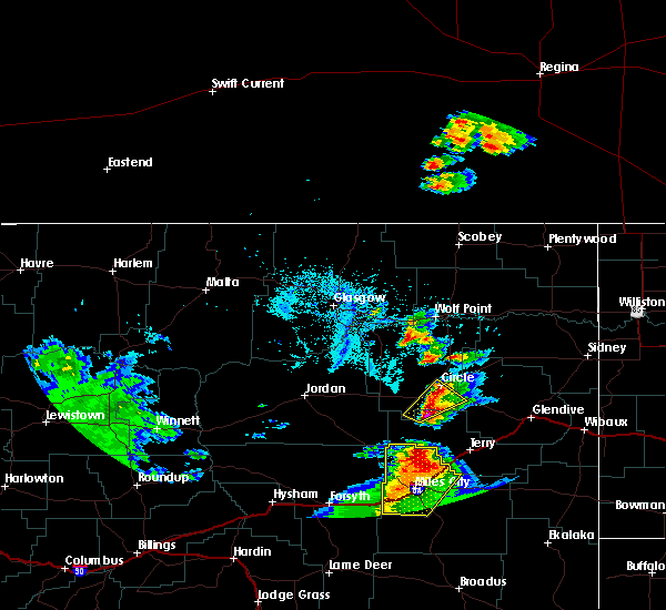 At 744 pm mdt, a severe thunderstorm with hail the size of quarters was located over brockway, or 8 miles southwest of circle, moving northeast at 15 mph (public). Hazards include 60 mph wind gusts and quarter size hail. Hail damage to vehicles is expected. expect wind damage to roofs, siding, and trees. Locations impacted include, circle and brockway. At 744 pm mdt, a severe thunderstorm with hail the size of quarters was located over brockway, or 8 miles southwest of circle, moving northeast at 15 mph (public). Hazards include 60 mph wind gusts and quarter size hail. Hail damage to vehicles is expected. expect wind damage to roofs, siding, and trees. Locations impacted include, circle and brockway.
|
| 7/7/2019 7:20 PM MDT | Quarter sized hail reported 11.4 miles NE of Circle, MT, quarter size hail was reported at brockway. report from social media. |
| 7/7/2019 7:18 PM MDT |
 At 718 pm mdt, a severe thunderstorm was located near brockway, or 16 miles southwest of circle, moving northeast at 15 mph (radar indicated). Hazards include 60 mph wind gusts and quarter size hail. Hail damage to vehicles is expected. Expect wind damage to roofs, siding, and trees. At 718 pm mdt, a severe thunderstorm was located near brockway, or 16 miles southwest of circle, moving northeast at 15 mph (radar indicated). Hazards include 60 mph wind gusts and quarter size hail. Hail damage to vehicles is expected. Expect wind damage to roofs, siding, and trees.
|
| 6/28/2019 12:10 AM MDT | Half Dollar sized hail reported 0.6 miles ESE of Circle, MT, estimated 60 mph wind gusts. heavy rain. |
| 6/28/2019 12:09 AM MDT |
 At 1209 am mdt, a severe thunderstorm was located near circle, moving east at 40 mph (radar indicated). Hazards include 70 mph wind gusts and ping pong ball size hail. People and animals outdoors will be injured. expect hail damage to roofs, siding, windows, and vehicles. expect considerable tree damage. Wind damage is also likely to mobile homes, roofs, and outbuildings. At 1209 am mdt, a severe thunderstorm was located near circle, moving east at 40 mph (radar indicated). Hazards include 70 mph wind gusts and ping pong ball size hail. People and animals outdoors will be injured. expect hail damage to roofs, siding, windows, and vehicles. expect considerable tree damage. Wind damage is also likely to mobile homes, roofs, and outbuildings.
|
| 6/28/2019 12:05 AM MDT | Hen Egg sized hail reported 0.6 miles ESE of Circle, MT, heavy rain |
| 6/27/2019 11:59 PM MDT |
 At 1159 pm mdt, a severe thunderstorm was located near circle, moving east at 35 mph (radar indicated). Hazards include golf ball size hail and 60 mph wind gusts. People and animals outdoors will be injured. expect hail damage to roofs, siding, windows, and vehicles. expect wind damage to roofs, siding, and trees. Locations impacted include, circle, brockway, flowing wells rest area and watkins. At 1159 pm mdt, a severe thunderstorm was located near circle, moving east at 35 mph (radar indicated). Hazards include golf ball size hail and 60 mph wind gusts. People and animals outdoors will be injured. expect hail damage to roofs, siding, windows, and vehicles. expect wind damage to roofs, siding, and trees. Locations impacted include, circle, brockway, flowing wells rest area and watkins.
|
| 6/27/2019 11:24 PM MDT |
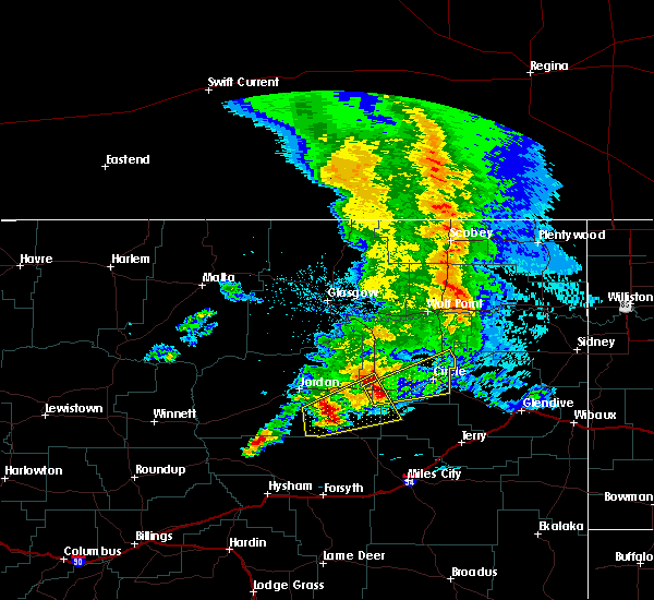 At 1124 pm mdt, a severe thunderstorm was located over flowing wells rest area, or 25 miles west of circle, moving east at 35 mph (radar indicated). Hazards include ping pong ball size hail and 60 mph wind gusts. People and animals outdoors will be injured. expect hail damage to roofs, siding, windows, and vehicles. Expect wind damage to roofs, siding, and trees. At 1124 pm mdt, a severe thunderstorm was located over flowing wells rest area, or 25 miles west of circle, moving east at 35 mph (radar indicated). Hazards include ping pong ball size hail and 60 mph wind gusts. People and animals outdoors will be injured. expect hail damage to roofs, siding, windows, and vehicles. Expect wind damage to roofs, siding, and trees.
|
| 7/3/2018 9:38 PM MDT | Lindsay divide dot site hit 66 mph at 938 pm... and 67 mph at 948 pm. down to 44 mph at 953 pm. (earlier lsr had a gust to 61 mph at 930 pm... this is additional inform in dawson county MT, 17 miles WNW of Circle, MT |
| 7/3/2018 9:30 PM MDT | Lindsay divide dot sit in dawson county MT, 16.5 miles WNW of Circle, MT |
| 6/28/2018 7:24 PM MDT |
 At 708 pm mdt, severe thunderstorms were located along a line extending from 11 miles southeast of vida to near circle, moving east at 40 mph (radar indicated). Hazards include 70 mph wind gusts and quarter size hail. Hail damage to vehicles is expected. expect considerable tree damage. wind damage is also likely to mobile homes, roofs, and outbuildings. locations impacted include, circle and vida. A tornado watch remains in effect until 1100 pm mdt for northeastern montana. At 708 pm mdt, severe thunderstorms were located along a line extending from 11 miles southeast of vida to near circle, moving east at 40 mph (radar indicated). Hazards include 70 mph wind gusts and quarter size hail. Hail damage to vehicles is expected. expect considerable tree damage. wind damage is also likely to mobile homes, roofs, and outbuildings. locations impacted include, circle and vida. A tornado watch remains in effect until 1100 pm mdt for northeastern montana.
|
| 6/28/2018 7:09 PM MDT |
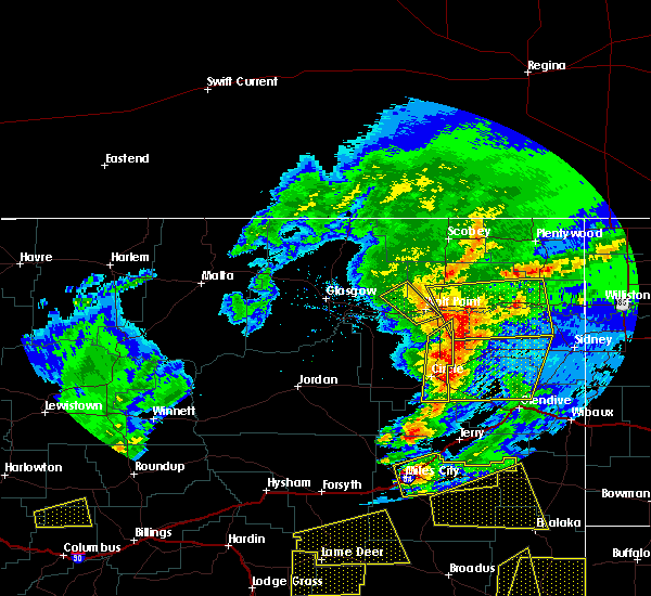 At 708 pm mdt, severe thunderstorms were located along a line extending from 11 miles southeast of vida to near circle, moving east at 40 mph (radar indicated). Hazards include 70 mph wind gusts and quarter size hail. Hail damage to vehicles is expected. expect considerable tree damage. wind damage is also likely to mobile homes, roofs, and outbuildings. locations impacted include, circle and vida. A tornado watch remains in effect until 1100 pm mdt for northeastern montana. At 708 pm mdt, severe thunderstorms were located along a line extending from 11 miles southeast of vida to near circle, moving east at 40 mph (radar indicated). Hazards include 70 mph wind gusts and quarter size hail. Hail damage to vehicles is expected. expect considerable tree damage. wind damage is also likely to mobile homes, roofs, and outbuildings. locations impacted include, circle and vida. A tornado watch remains in effect until 1100 pm mdt for northeastern montana.
|
| 6/28/2018 6:47 PM MDT | Five main transmission lines down around the circle... mt area. power expected to be out until at least tomorrow mornin in mccone county MT, 0.6 miles ESE of Circle, MT |
| 6/28/2018 6:31 PM MDT |
 At 631 pm mdt, severe thunderstorms were located along a line extending from 15 miles northwest of circle to 6 miles south of flowing wells rest area, moving east at 40 mph (radar indicated). Hazards include 70 mph wind gusts and ping pong ball size hail. People and animals outdoors will be injured. expect hail damage to roofs, siding, windows, and vehicles. expect considerable tree damage. Wind damage is also likely to mobile homes, roofs, and outbuildings. At 631 pm mdt, severe thunderstorms were located along a line extending from 15 miles northwest of circle to 6 miles south of flowing wells rest area, moving east at 40 mph (radar indicated). Hazards include 70 mph wind gusts and ping pong ball size hail. People and animals outdoors will be injured. expect hail damage to roofs, siding, windows, and vehicles. expect considerable tree damage. Wind damage is also likely to mobile homes, roofs, and outbuildings.
|
| 6/28/2018 6:08 PM MDT | Golf Ball sized hail reported 20.7 miles ESE of Circle, MT, mainly quarter sized hail with a few golf ball sized stones |
| 6/1/2018 2:35 PM MDT | Quarter sized hail reported 17 miles WNW of Circle, MT |
| 5/26/2018 10:30 PM MDT | Quarter sized hail reported 15.4 miles NW of Circle, MT, mostly pea size hail with a few quarters. heavy rain ongoing. |
| 5/26/2018 9:44 PM MDT |
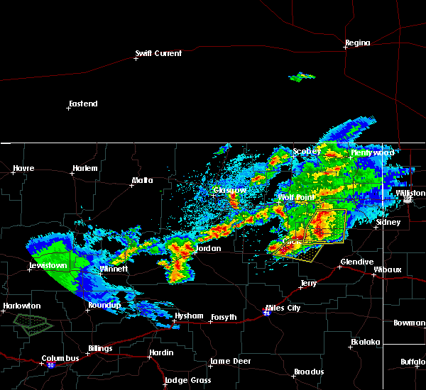 At 944 pm mdt, a severe thunderstorm was located near circle, moving east at 15 mph (radar indicated). Hazards include 60 mph wind gusts and quarter size hail. Hail damage to vehicles is expected. Expect wind damage to roofs, siding, and trees. At 944 pm mdt, a severe thunderstorm was located near circle, moving east at 15 mph (radar indicated). Hazards include 60 mph wind gusts and quarter size hail. Hail damage to vehicles is expected. Expect wind damage to roofs, siding, and trees.
|
| 5/26/2018 9:35 PM MDT | Ping Pong Ball sized hail reported 3.5 miles NNW of Circle, MT, most of the hail was between quarters and golf balls. enough rain to have standing water on the road and lawn around the house |
| 5/26/2018 9:25 PM MDT | Ping Pong Ball sized hail reported 0.6 miles ESE of Circle, MT |
| 5/26/2018 9:21 PM MDT |
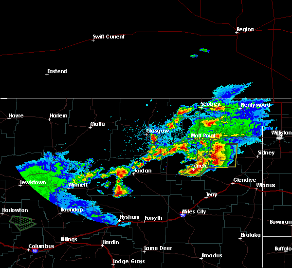 At 921 pm mdt, severe thunderstorms were located along a line extending from 12 miles north of richey to 11 miles northeast of circle, moving northeast at 15 mph (radar indicated). Hazards include 60 mph wind gusts and quarter size hail. Hail damage to vehicles is expected. expect wind damage to roofs, siding, and trees. Locations impacted include, circle and brockway. At 921 pm mdt, severe thunderstorms were located along a line extending from 12 miles north of richey to 11 miles northeast of circle, moving northeast at 15 mph (radar indicated). Hazards include 60 mph wind gusts and quarter size hail. Hail damage to vehicles is expected. expect wind damage to roofs, siding, and trees. Locations impacted include, circle and brockway.
|
| 5/26/2018 9:06 PM MDT | Quarter sized hail reported 0.5 miles N of Circle, MT, hail the size of quarters and increasing in size; still hailing. |
| 5/26/2018 8:57 PM MDT |
 At 857 pm mdt, severe thunderstorms were located along a line extending from 10 miles north of richey to over circle, moving northeast at 15 mph (radar indicated). Hazards include tennis ball size hail and 70 mph wind gusts. People and animals outdoors will be injured. expect hail damage to roofs, siding, windows, and vehicles. expect considerable tree damage. wind damage is also likely to mobile homes, roofs, and outbuildings. Locations impacted include, circle and brockway. At 857 pm mdt, severe thunderstorms were located along a line extending from 10 miles north of richey to over circle, moving northeast at 15 mph (radar indicated). Hazards include tennis ball size hail and 70 mph wind gusts. People and animals outdoors will be injured. expect hail damage to roofs, siding, windows, and vehicles. expect considerable tree damage. wind damage is also likely to mobile homes, roofs, and outbuildings. Locations impacted include, circle and brockway.
|
| 5/26/2018 8:38 PM MDT |
 At 837 pm mdt, severe thunderstorms were located along a line extending from 11 miles northwest of richey to circle, moving northeast at 15 mph (spotters reported ping pong ball sized hail). Hazards include golf ball size hail and 60 mph wind gusts. People and animals outdoors will be injured. expect hail damage to roofs, siding, windows, and vehicles. Expect wind damage to roofs, siding, and trees. At 837 pm mdt, severe thunderstorms were located along a line extending from 11 miles northwest of richey to circle, moving northeast at 15 mph (spotters reported ping pong ball sized hail). Hazards include golf ball size hail and 60 mph wind gusts. People and animals outdoors will be injured. expect hail damage to roofs, siding, windows, and vehicles. Expect wind damage to roofs, siding, and trees.
|
| 5/26/2018 8:36 PM MDT | Ping Pong Ball sized hail reported 6.3 miles NE of Circle, MT |
| 5/26/2018 7:09 PM MDT | Hen Egg sized hail reported 31 miles ESE of Circle, MT, report... with photos... via social media. |
| 7/16/2017 7:18 PM MDT | Cow creek dot site. delayed repor in mccone county MT, 19.4 miles SSW of Circle, MT |
| 7/11/2017 8:05 PM MDT | Quarter sized hail reported 3.8 miles SSW of Circle, MT, estimated 1 inch hail. |
| 7/11/2017 8:02 PM MDT |
 At 802 pm mdt, a severe thunderstorm was located 11 miles east of circle, moving southeast at 45 mph (radar indicated). Hazards include 60 mph wind gusts and half dollar size hail. Hail damage to vehicles is expected. Expect wind damage to roofs, siding, and trees. At 802 pm mdt, a severe thunderstorm was located 11 miles east of circle, moving southeast at 45 mph (radar indicated). Hazards include 60 mph wind gusts and half dollar size hail. Hail damage to vehicles is expected. Expect wind damage to roofs, siding, and trees.
|
| 7/11/2017 7:54 PM MDT |
 The severe thunderstorm warning for central mccone and northwestern dawson counties will expire at 800 pm mdt, the storm which prompted the warning has weakened below severe limits, and no longer poses an immediate threat to life or property. therefore the warning will be allowed to expire. however small hail and gusty winds are still possible with this thunderstorm. The severe thunderstorm warning for central mccone and northwestern dawson counties will expire at 800 pm mdt, the storm which prompted the warning has weakened below severe limits, and no longer poses an immediate threat to life or property. therefore the warning will be allowed to expire. however small hail and gusty winds are still possible with this thunderstorm.
|
| 7/11/2017 7:40 PM MDT |
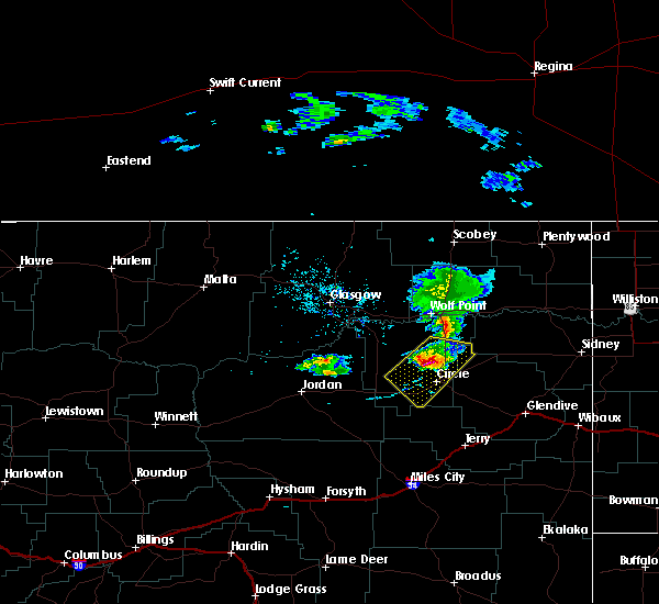 At 740 pm mdt, a severe thunderstorm was located 12 miles north of circle, moving southeast at 40 mph (radar indicated). Hazards include 60 mph wind gusts and half dollar size hail. Hail damage to vehicles is expected. expect wind damage to roofs, siding, and trees. Locations impacted include, circle, vida, brockway and weldon. At 740 pm mdt, a severe thunderstorm was located 12 miles north of circle, moving southeast at 40 mph (radar indicated). Hazards include 60 mph wind gusts and half dollar size hail. Hail damage to vehicles is expected. expect wind damage to roofs, siding, and trees. Locations impacted include, circle, vida, brockway and weldon.
|
| 7/11/2017 7:19 PM MDT |
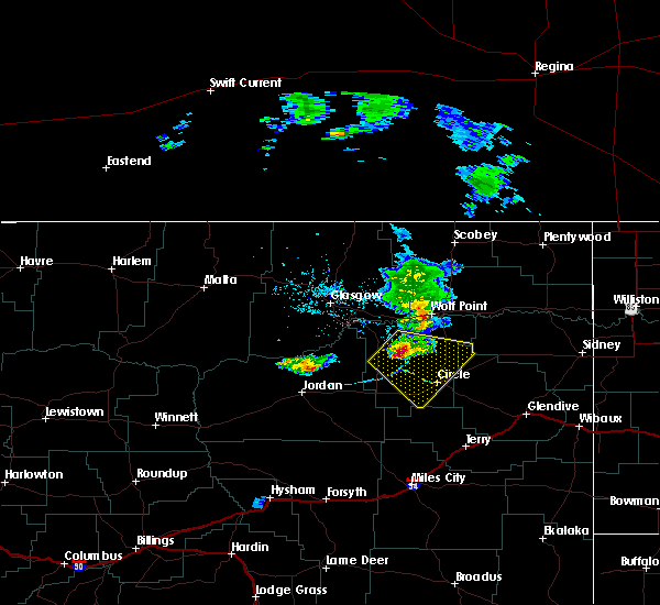 At 717 pm mdt, a severe thunderstorm was located 16 miles northeast of nelson creek rec area, or 25 miles northwest of circle, moving southeast at 40 mph (radar indicated). Hazards include 60 mph wind gusts and half dollar size hail. Hail damage to vehicles is expected. expect wind damage to roofs, siding, and trees. Locations impacted include, circle, vida, brockway and weldon. At 717 pm mdt, a severe thunderstorm was located 16 miles northeast of nelson creek rec area, or 25 miles northwest of circle, moving southeast at 40 mph (radar indicated). Hazards include 60 mph wind gusts and half dollar size hail. Hail damage to vehicles is expected. expect wind damage to roofs, siding, and trees. Locations impacted include, circle, vida, brockway and weldon.
|
| 7/11/2017 7:06 PM MDT |
 At 705 pm mdt, a severe thunderstorm was located 9 miles east of rock creek rec area, or 30 miles southwest of wolf point, moving southeast at 40 mph (radar indicated). Hazards include 60 mph wind gusts and nickel size hail. expect damage to roofs, siding, and trees At 705 pm mdt, a severe thunderstorm was located 9 miles east of rock creek rec area, or 30 miles southwest of wolf point, moving southeast at 40 mph (radar indicated). Hazards include 60 mph wind gusts and nickel size hail. expect damage to roofs, siding, and trees
|
| 7/10/2017 5:32 PM MDT |
 At 532 pm mdt, a gust front was located along a line extending from near st. marie to near frazer to 7 miles west of circle, moving northeast at 45 mph (radar indicated). Hazards include 60 mph wind gusts. expect damage to roofs, siding, and trees At 532 pm mdt, a gust front was located along a line extending from near st. marie to near frazer to 7 miles west of circle, moving northeast at 45 mph (radar indicated). Hazards include 60 mph wind gusts. expect damage to roofs, siding, and trees
|
| 7/10/2017 5:12 PM MDT |
 At 511 pm mdt, severe thunderstorms were located along a line extending from 20 miles north of tampico to 8 miles southeast of st. marie to 8 miles southeast of nashua to 11 miles east of rock creek rec area to 11 miles northwest of brockway, moving northeast at 60 mph (radar indicated). Hazards include 60 mph wind gusts. Expect damage to roofs, siding, and trees. locations impacted include, glasgow, wolf point, circle, opheim, nashua, fort peck, duck creek rec area, flowing wells rest area, st. Marie, the pines rec area, tampico, hinsdale, lustre, fort peck marina, frazer, nelson creek rec area, rock creek rec area, vandalia, park grove and larslan. At 511 pm mdt, severe thunderstorms were located along a line extending from 20 miles north of tampico to 8 miles southeast of st. marie to 8 miles southeast of nashua to 11 miles east of rock creek rec area to 11 miles northwest of brockway, moving northeast at 60 mph (radar indicated). Hazards include 60 mph wind gusts. Expect damage to roofs, siding, and trees. locations impacted include, glasgow, wolf point, circle, opheim, nashua, fort peck, duck creek rec area, flowing wells rest area, st. Marie, the pines rec area, tampico, hinsdale, lustre, fort peck marina, frazer, nelson creek rec area, rock creek rec area, vandalia, park grove and larslan.
|
| 7/10/2017 4:43 PM MDT |
 At 441 pm mdt, strong winds associated with a thunderstorm gust front were located along a line extending from 6 miles south of saco to 16 miles south of tampico to 7 miles west of the pines rec area to 12 miles east of hell creek rec area to 11 miles northeast of cohagen, moving northeast at 60 mph (radar indicated). Hazards include 70 mph wind gusts. Expect considerable tree damage. Damage is likely to mobile homes, roofs, and outbuildings. At 441 pm mdt, strong winds associated with a thunderstorm gust front were located along a line extending from 6 miles south of saco to 16 miles south of tampico to 7 miles west of the pines rec area to 12 miles east of hell creek rec area to 11 miles northeast of cohagen, moving northeast at 60 mph (radar indicated). Hazards include 70 mph wind gusts. Expect considerable tree damage. Damage is likely to mobile homes, roofs, and outbuildings.
|
| 6/28/2017 9:15 AM MDT |
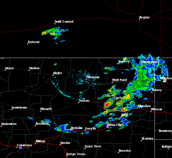 At 315 pm mdt, a severe thunderstorm was located near brockway, or 14 miles southwest of circle, moving east at 25 mph (radar indicated). Hazards include 60 mph wind gusts and quarter size hail. Hail damage to vehicles is expected. Expect wind damage to roofs, siding, and trees. At 315 pm mdt, a severe thunderstorm was located near brockway, or 14 miles southwest of circle, moving east at 25 mph (radar indicated). Hazards include 60 mph wind gusts and quarter size hail. Hail damage to vehicles is expected. Expect wind damage to roofs, siding, and trees.
|
| 6/16/2017 6:37 PM MDT | Mesonet station... montana dot weather station at cow creek recorded a gust to 60 mp in mccone county MT, 19.4 miles SSW of Circle, MT |
| 9/7/2016 5:42 AM MDT |
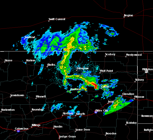 At 541 am mdt, a severe thunderstorm was located 12 miles northwest of circle, moving northeast at 40 mph (radar indicated). Hazards include quarter size hail. damage to vehicles is expected At 541 am mdt, a severe thunderstorm was located 12 miles northwest of circle, moving northeast at 40 mph (radar indicated). Hazards include quarter size hail. damage to vehicles is expected
|
| 8/14/2016 4:45 PM MDT | Quarter sized hail reported 27.8 miles E of Circle, MT, started as quarters... ended as pea size. covered ground... still white with hail. no winds. |
| 8/7/2016 9:22 PM MDT | Lindsay divide mt-dot mesonet station recorded a wind gust to 62 mp in dawson county MT, 17 miles WNW of Circle, MT |
| 7/30/2016 11:09 PM MDT |
 At 1108 pm mdt, a severe thunderstorm was located 12 miles east of circle, moving southeast at 35 mph (radar indicated). Hazards include 60 mph wind gusts and quarter size hail. Hail damage to vehicles is expected. Expect wind damage to roofs, siding, and trees. At 1108 pm mdt, a severe thunderstorm was located 12 miles east of circle, moving southeast at 35 mph (radar indicated). Hazards include 60 mph wind gusts and quarter size hail. Hail damage to vehicles is expected. Expect wind damage to roofs, siding, and trees.
|
| 7/22/2016 9:09 PM MDT |
 At 908 pm mdt, a severe thunderstorm was located over richey, or 29 miles northeast of circle, moving northeast at 50 mph (trained weather spotters. at 835 pm a 60 mph wind gust was reported 1 mile wsw of circle). Hazards include 60 mph wind gusts and quarter size hail. Hail damage to vehicles is expected. expect wind damage to roofs, siding, and trees. Locations impacted include, glendive, circle, richey, west glendive, bloomfield, lindsay, stipek, enid and forest park. At 908 pm mdt, a severe thunderstorm was located over richey, or 29 miles northeast of circle, moving northeast at 50 mph (trained weather spotters. at 835 pm a 60 mph wind gust was reported 1 mile wsw of circle). Hazards include 60 mph wind gusts and quarter size hail. Hail damage to vehicles is expected. expect wind damage to roofs, siding, and trees. Locations impacted include, glendive, circle, richey, west glendive, bloomfield, lindsay, stipek, enid and forest park.
|
| 7/22/2016 8:45 PM MDT | Quarter sized hail reported 18.4 miles NW of Circle, MT, also heavy rain about 1 inch or more |
| 7/22/2016 8:41 PM MDT | Gust estimated by nws employee. a few larger branches down as well. storm also knocked out powe in mccone county MT, 0.6 miles ESE of Circle, MT |
| 7/22/2016 8:35 PM MDT | Also received pea sized hail with this stor in mccone county MT, 1.5 miles ENE of Circle, MT |
| 7/22/2016 8:30 PM MDT |
 At 829 pm mdt, a severe thunderstorm was located near circle, moving northeast at 50 mph (radar indicated). Hazards include 60 mph wind gusts and quarter size hail. Hail damage to vehicles is expected. Expect wind damage to roofs, siding, and trees. At 829 pm mdt, a severe thunderstorm was located near circle, moving northeast at 50 mph (radar indicated). Hazards include 60 mph wind gusts and quarter size hail. Hail damage to vehicles is expected. Expect wind damage to roofs, siding, and trees.
|
| 7/14/2016 4:05 PM MDT |
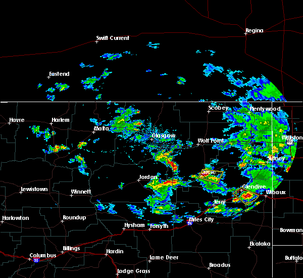 At 405 pm mdt, a severe thunderstorm was located near circle, moving east at 20 mph (radar indicated). Hazards include quarter size hail. damage to vehicles is expected At 405 pm mdt, a severe thunderstorm was located near circle, moving east at 20 mph (radar indicated). Hazards include quarter size hail. damage to vehicles is expected
|
| 6/24/2016 8:15 PM MDT | Highway 13 closed by mile marker 17 for approximately 20 power poles broken in mccone county MT, 16.8 miles S of Circle, MT |
| 6/24/2016 7:24 PM MDT | Storm damage reported in mccone county MT, 0.6 miles ESE of Circle, MT |
| 6/24/2016 7:22 PM MDT |
 At 722 pm mdt, severe thunderstorms were located along a line extending from near circle to 17 miles southwest of lindsay, moving east at 35 mph (radar indicated). Hazards include 70 mph wind gusts and quarter size hail. Hail damage to vehicles is expected. expect considerable tree damage. wind damage is also likely to mobile homes, roofs, and outbuildings. Locations impacted include, circle, lindsay and bloomfield. At 722 pm mdt, severe thunderstorms were located along a line extending from near circle to 17 miles southwest of lindsay, moving east at 35 mph (radar indicated). Hazards include 70 mph wind gusts and quarter size hail. Hail damage to vehicles is expected. expect considerable tree damage. wind damage is also likely to mobile homes, roofs, and outbuildings. Locations impacted include, circle, lindsay and bloomfield.
|
| 6/24/2016 6:48 PM MDT |
 At 648 pm mdt, severe thunderstorms were located along a line extending from 8 miles north of flowing wells rest area to 19 miles northeast of hillside, moving east at 60 mph (radar indicated). Hazards include 70 mph wind gusts and quarter size hail. Hail damage to vehicles is expected. expect considerable tree damage. Wind damage is also likely to mobile homes, roofs, and outbuildings. At 648 pm mdt, severe thunderstorms were located along a line extending from 8 miles north of flowing wells rest area to 19 miles northeast of hillside, moving east at 60 mph (radar indicated). Hazards include 70 mph wind gusts and quarter size hail. Hail damage to vehicles is expected. expect considerable tree damage. Wind damage is also likely to mobile homes, roofs, and outbuildings.
|
| 6/18/2016 10:41 PM MDT |
 The severe thunderstorm warning for southeastern mccone. north central prairie and western dawson counties will expire at 1045 pm mdt. the storm which prompted the warning has weakened below severe limits. and no longer pose an immediate threat to life or property. Therefore the warning will be allowed to expire. The severe thunderstorm warning for southeastern mccone. north central prairie and western dawson counties will expire at 1045 pm mdt. the storm which prompted the warning has weakened below severe limits. and no longer pose an immediate threat to life or property. Therefore the warning will be allowed to expire.
|
| 6/18/2016 10:23 PM MDT |
 At 1023 pm mdt, a severe thunderstorm was located 7 miles south of brockway, or 15 miles south of circle, moving east at 45 mph (radar indicated). Hazards include 60 mph wind gusts and quarter size hail. Hail damage to vehicles is expected. expect wind damage to roofs, siding, and trees. Locations impacted include, circle and lindsay. At 1023 pm mdt, a severe thunderstorm was located 7 miles south of brockway, or 15 miles south of circle, moving east at 45 mph (radar indicated). Hazards include 60 mph wind gusts and quarter size hail. Hail damage to vehicles is expected. expect wind damage to roofs, siding, and trees. Locations impacted include, circle and lindsay.
|
| 6/18/2016 9:45 PM MDT |
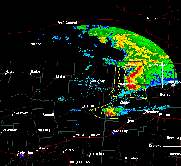 At 945 pm mdt, a severe thunderstorm was located 14 miles southeast of flowing wells rest area, or 28 miles southwest of circle, moving east at 45 mph (radar indicated). Hazards include 60 mph wind gusts and quarter size hail. Hail damage to vehicles is expected. Expect wind damage to roofs, siding, and trees. At 945 pm mdt, a severe thunderstorm was located 14 miles southeast of flowing wells rest area, or 28 miles southwest of circle, moving east at 45 mph (radar indicated). Hazards include 60 mph wind gusts and quarter size hail. Hail damage to vehicles is expected. Expect wind damage to roofs, siding, and trees.
|
| 6/15/2016 10:42 PM MDT |
 At 1041 pm mdt, a severe thunderstorm was located 14 miles northwest of circle, moving northeast at 45 mph (radar indicated). Hazards include 60 mph wind gusts and quarter size hail. Hail damage to vehicles is expected. Expect wind damage to roofs, siding, and trees. At 1041 pm mdt, a severe thunderstorm was located 14 miles northwest of circle, moving northeast at 45 mph (radar indicated). Hazards include 60 mph wind gusts and quarter size hail. Hail damage to vehicles is expected. Expect wind damage to roofs, siding, and trees.
|
| 6/14/2016 6:55 PM MDT |
 At 653 pm mdt, severe thunderstorms were located along a line extending from 15 miles northwest of st. marie to 7 miles south of glasgow to 11 miles east of jordan, moving northeast at 40 mph (radar indicated). Hazards include 60 mph wind gusts and quarter size hail. Hail damage to vehicles is expected. Expect wind damage to roofs, siding, and trees. At 653 pm mdt, severe thunderstorms were located along a line extending from 15 miles northwest of st. marie to 7 miles south of glasgow to 11 miles east of jordan, moving northeast at 40 mph (radar indicated). Hazards include 60 mph wind gusts and quarter size hail. Hail damage to vehicles is expected. Expect wind damage to roofs, siding, and trees.
|
| 6/10/2016 11:26 PM MDT | The severe thunderstorm warning for mccone, east central garfield and northwestern prairie counties will expire at 1130 pm mdt, the storms which prompted the warning have weakened below severe limits, and no longer pose an immediate threat to life or property. therefore the warning will be allowed to expire. however gusty winds are still possible with these thunderstorms. a severe thunderstorm watch remains in effect until midnight mdt for northeastern montana. remember, a severe thunderstorm warning still remains in effect for southeast mccone and northern prairie counties until 1145 pm. |
| 6/10/2016 10:59 PM MDT |
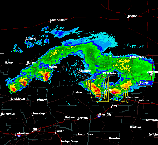 At 1058 pm mdt, severe thunderstorms were located along a line extending from 8 miles northeast of rock creek rec area to near brockway, moving east at 60 mph. these are very dangerous storms (trained weather spotters). Hazards include 90 mph wind gusts and quarter size hail. You are in a life-threatening situation. flying debris may be deadly to those caught without shelter. mobile homes will be heavily damaged or destroyed. homes and businesses will have substantial roof and window damage. expect extensive tree damage and power outages. Locations impacted include, circle, vida, brockway, rock creek rec area, weldon and watkins. At 1058 pm mdt, severe thunderstorms were located along a line extending from 8 miles northeast of rock creek rec area to near brockway, moving east at 60 mph. these are very dangerous storms (trained weather spotters). Hazards include 90 mph wind gusts and quarter size hail. You are in a life-threatening situation. flying debris may be deadly to those caught without shelter. mobile homes will be heavily damaged or destroyed. homes and businesses will have substantial roof and window damage. expect extensive tree damage and power outages. Locations impacted include, circle, vida, brockway, rock creek rec area, weldon and watkins.
|
| 6/10/2016 10:26 PM MDT |
 At 1025 pm mdt, severe thunderstorms were located along a line extending from near fort peck marina to 8 miles southwest of flowing wells rest area, moving east at 55 mph. these are very dangerous storms (trained weather spotters). Hazards include 90 mph wind gusts and quarter size hail. You are in a life-threatening situation. flying debris may be deadly to those caught without shelter. mobile homes will be heavily damaged or destroyed. homes and businesses will have substantial roof and window damage. Expect extensive tree damage and power outages. At 1025 pm mdt, severe thunderstorms were located along a line extending from near fort peck marina to 8 miles southwest of flowing wells rest area, moving east at 55 mph. these are very dangerous storms (trained weather spotters). Hazards include 90 mph wind gusts and quarter size hail. You are in a life-threatening situation. flying debris may be deadly to those caught without shelter. mobile homes will be heavily damaged or destroyed. homes and businesses will have substantial roof and window damage. Expect extensive tree damage and power outages.
|
| 6/10/2016 10:20 PM MDT |
 At 1020 pm mdt, a severe thunderstorm was located 14 miles east of circle, moving east at 40 mph (radar indicated). Hazards include 60 mph wind gusts and quarter size hail. Hail damage to vehicles is expected. expect wind damage to roofs, siding, and trees. Locations impacted include, glendive, circle, richey, west glendive, vida, brockway, intake, bloomfield, lambert, lindsay, stipek, enid, forest park, weldon and watkins. At 1020 pm mdt, a severe thunderstorm was located 14 miles east of circle, moving east at 40 mph (radar indicated). Hazards include 60 mph wind gusts and quarter size hail. Hail damage to vehicles is expected. expect wind damage to roofs, siding, and trees. Locations impacted include, glendive, circle, richey, west glendive, vida, brockway, intake, bloomfield, lambert, lindsay, stipek, enid, forest park, weldon and watkins.
|
| 6/10/2016 9:50 PM MDT |
 At 950 pm mdt, a severe thunderstorm was located 16 miles northwest of circle, moving east at 70 mph (radar indicated). Hazards include 60 mph wind gusts and quarter size hail. Hail damage to vehicles is expected. Expect wind damage to roofs, siding, and trees. At 950 pm mdt, a severe thunderstorm was located 16 miles northwest of circle, moving east at 70 mph (radar indicated). Hazards include 60 mph wind gusts and quarter size hail. Hail damage to vehicles is expected. Expect wind damage to roofs, siding, and trees.
|
| 7/27/2015 8:56 PM MDT |
 The severe thunderstorm warning for mccone and northeastern garfield counties will expire at 900 pm mdt, the line of storms which prompted the warning has weakened below severe limits, and no longer poses an immediate threat to life or property. additional strong thunderstorms are still possible, and a severe thunderstorm watch remains in effect until 10 pm mdt. The severe thunderstorm warning for mccone and northeastern garfield counties will expire at 900 pm mdt, the line of storms which prompted the warning has weakened below severe limits, and no longer poses an immediate threat to life or property. additional strong thunderstorms are still possible, and a severe thunderstorm watch remains in effect until 10 pm mdt.
|
| 7/27/2015 8:22 PM MDT |
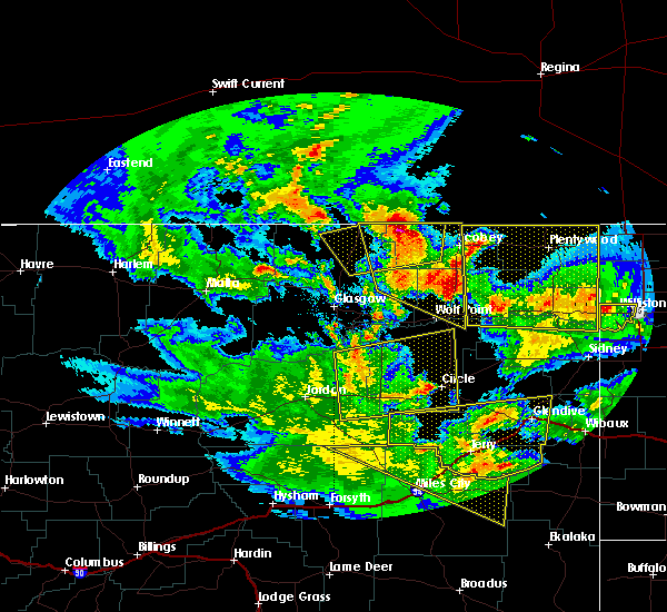 At 820 pm mdt, severe thunderstorms were located along a line extending from 9 miles west of flowing wells rest area to circle, and moving north at 30 mph (radar indicated). Hazards include 60 mph wind gusts. Expect damage to roofs. siding and trees. severe thunderstorms will be near, nelson creek rec area around 855 pm mdt. Other locations in the warning include van norman and weldon. At 820 pm mdt, severe thunderstorms were located along a line extending from 9 miles west of flowing wells rest area to circle, and moving north at 30 mph (radar indicated). Hazards include 60 mph wind gusts. Expect damage to roofs. siding and trees. severe thunderstorms will be near, nelson creek rec area around 855 pm mdt. Other locations in the warning include van norman and weldon.
|
| 7/27/2015 7:59 PM MDT |
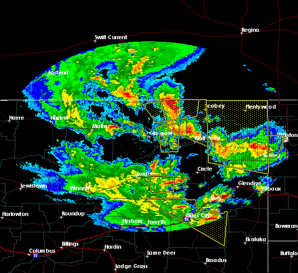 At 756 pm mdt, severe thunderstorms were located along a line extending from 12 miles northeast of cohagen to brockway, and moving north at 30 mph (radar indicated). Hazards include 60 mph wind gusts and quarter size hail. Hail damage to crops and plants is expected. some damage to vehicles is possible. expect wind damage to roofs, siding and trees. severe thunderstorms will be near, flowing wells rest area and circle around 815 pm mdt. nelson creek rec area around 855 pm mdt. Other locations in the warning include van norman and weldon. At 756 pm mdt, severe thunderstorms were located along a line extending from 12 miles northeast of cohagen to brockway, and moving north at 30 mph (radar indicated). Hazards include 60 mph wind gusts and quarter size hail. Hail damage to crops and plants is expected. some damage to vehicles is possible. expect wind damage to roofs, siding and trees. severe thunderstorms will be near, flowing wells rest area and circle around 815 pm mdt. nelson creek rec area around 855 pm mdt. Other locations in the warning include van norman and weldon.
|
| 6/19/2015 3:35 PM MDT |
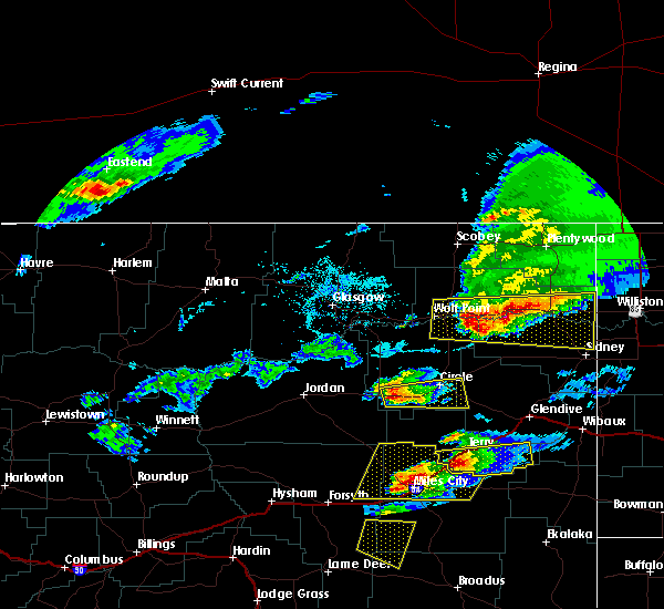 At 330 pm mdt, a severe thunderstorm was located 7 miles east of flowing wells rest area, and moving east at 25 mph (radar indicated). Hazards include 60 mph wind gusts and quarter size hail. Hail damage to crops and plants is expected. some damage to vehicles is possible. expect wind damage to roofs, siding and trees. the severe thunderstorm will be near, brockway around 355 pm mdt. Other locations in the warning include watkins. At 330 pm mdt, a severe thunderstorm was located 7 miles east of flowing wells rest area, and moving east at 25 mph (radar indicated). Hazards include 60 mph wind gusts and quarter size hail. Hail damage to crops and plants is expected. some damage to vehicles is possible. expect wind damage to roofs, siding and trees. the severe thunderstorm will be near, brockway around 355 pm mdt. Other locations in the warning include watkins.
|
| 6/19/2015 2:59 PM MDT |
 At 257 pm mdt, a severe thunderstorm was located 12 miles west of flowing wells rest area, and moving east at 40 mph (radar indicated). Hazards include 60 mph wind gusts and quarter size hail. Hail damage to crops and plants is expected. some damage to vehicles is possible. expect wind damage to roofs, siding and trees. the severe thunderstorm will be near, flowing wells rest area around 315 pm mdt. brockway around 340 pm mdt. circle around 355 pm mdt. Other locations in the warning include watkins. At 257 pm mdt, a severe thunderstorm was located 12 miles west of flowing wells rest area, and moving east at 40 mph (radar indicated). Hazards include 60 mph wind gusts and quarter size hail. Hail damage to crops and plants is expected. some damage to vehicles is possible. expect wind damage to roofs, siding and trees. the severe thunderstorm will be near, flowing wells rest area around 315 pm mdt. brockway around 340 pm mdt. circle around 355 pm mdt. Other locations in the warning include watkins.
|
| 6/19/2015 2:59 PM MDT |
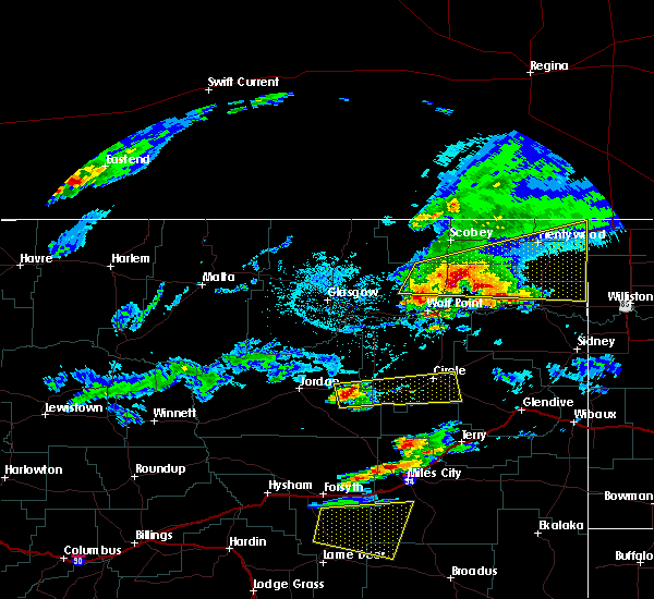 At 257 pm mdt, a severe thunderstorm was located 12 miles west of flowing wells rest area, and moving east at 40 mph (radar indicated). Hazards include 60 mph wind gusts and quarter size hail. Hail damage to crops and plants is expected. some damage to vehicles is possible. expect wind damage to roofs, siding and trees. the severe thunderstorm will be near, flowing wells rest area around 315 pm mdt. brockway around 340 pm mdt. circle around 355 pm mdt. Other locations in the warning include watkins. At 257 pm mdt, a severe thunderstorm was located 12 miles west of flowing wells rest area, and moving east at 40 mph (radar indicated). Hazards include 60 mph wind gusts and quarter size hail. Hail damage to crops and plants is expected. some damage to vehicles is possible. expect wind damage to roofs, siding and trees. the severe thunderstorm will be near, flowing wells rest area around 315 pm mdt. brockway around 340 pm mdt. circle around 355 pm mdt. Other locations in the warning include watkins.
|
| 8/3/2014 8:00 PM MDT | Quarter sized hail reported 8.9 miles N of Circle, MT |
| 8/3/2014 7:35 PM MDT | Golf Ball sized hail reported 3 miles NE of Circle, MT, hail ranged from quarter to golfball sized. |
| 8/3/2014 7:30 PM MDT | Ping Pong Ball sized hail reported 2 miles ENE of Circle, MT |
| 8/3/2014 7:00 PM MDT | Quarter sized hail reported 15.5 miles SE of Circle, MT |
| 8/3/2014 6:55 PM MDT | Half Dollar sized hail reported 17.4 miles SE of Circle, MT |
| 8/3/2014 6:40 PM MDT | Golf Ball sized hail reported 19.4 miles SE of Circle, MT |
| 7/24/2014 6:03 PM MDT | Storm damage reported in mccone county MT, 19.4 miles SSW of Circle, MT |
| 7/24/2014 5:34 PM MDT | Penny sized hail with estimated winds 50 to 60 mph...tree limbs broke in mccone county MT, 0.5 miles N of Circle, MT |
| 7/24/2014 5:30 PM MDT | Trees blown dow in mccone county MT, 0.6 miles ESE of Circle, MT |
| 7/24/2014 5:30 PM MDT | Golf Ball sized hail reported 0.6 miles ESE of Circle, MT, windshields broken. |
| 7/24/2014 5:15 PM MDT | Quarter sized hail reported 13.2 miles NE of Circle, MT, hail covering the ground. |
| 6/17/2014 1:45 PM MDT | Quarter sized hail reported 9.6 miles NNE of Circle, MT |
| 6/17/2014 7:45 AM MDT | Half Dollar sized hail reported 13.7 miles E of Circle, MT, half dollar to pea size hail covering the ground. |
| 6/16/2014 6:15 PM MDT | Quarter sized hail reported 9.4 miles WNW of Circle, MT, quarter sized hail lasted up to 30 mins hail duration 30 minutes observer location 10se circle |
| 5/31/2014 6:25 PM MDT | Quarter sized hail reported 27.8 miles E of Circle, MT, quarter size hail with heavy rain. |
| 5/28/2014 8:15 PM MDT | Storm damage reported in dawson county MT, 19.1 miles NW of Circle, MT |
| 5/24/2014 2:45 PM MDT | Golf Ball sized hail reported 3.7 miles S of Circle, MT, quarter to golf ball sized hail lasted 10 to 15 minutes. pea size hail afterward for about 10 minutes. |
| 8/28/2013 8:58 PM MDT | Quarter sized hail reported 10.5 miles SSW of Circle, MT, quarter sized hail was the largest...but majority was dime sized |
| 8/28/2013 8:30 PM MDT | Storm damage reported in mccone county MT, 13.7 miles E of Circle, MT |
| 7/24/2013 8:08 PM MDT | Quarter sized hail reported 11.9 miles NE of Circle, MT, quarter sized hail lasted about 5 minutes. wind estimated 58 mph just ahead of hail. hail duration 5 minutes observer location in brockway |
| 7/24/2013 7:02 PM MDT | Golf Ball sized hail reported 33.2 miles SE of Circle, MT, golfball sized hail covering ground. |
| 7/24/2013 5:21 PM MDT | Golf Ball sized hail reported 7.8 miles SSW of Circle, MT, estimated golfball sized hail. 71 mph wind. |
| 7/20/2013 6:54 PM MDT | Baseball sized hail reported 10.5 miles SSW of Circle, MT, golf ball to base ball sized hail with heavy rain. |
| 7/20/2013 6:50 PM MDT | Storm damage reported in mccone county MT, 7.1 miles S of Circle, MT |
| 7/20/2013 6:50 PM MDT | Metal fencing twisted and blown different direction in mccone county MT, 7.1 miles S of Circle, MT |
| 7/20/2013 6:46 PM MDT | Cow creek dot weather station in mccone county MT, 19.4 miles SSW of Circle, MT |
| 7/8/2013 4:20 PM MDT | Quarter sized hail reported 11.4 miles NE of Circle, MT, hail lasted 10 minutes. |
| 7/8/2013 4:20 PM MDT | Golf Ball sized hail reported 15.5 miles NE of Circle, MT |
| 7/8/2013 4:15 PM MDT | Golf Ball sized hail reported 14.3 miles NE of Circle, MT |
| 7/5/2013 12:45 PM MDT | Quarter sized hail reported 27.8 miles E of Circle, MT, pea and quarter sized hail with 35 to 45 mph wind gust and heavy rain. |
| 7/5/2013 12:45 PM MDT | Ping Pong Ball sized hail reported 27.9 miles ENE of Circle, MT |
| 6/20/2013 1:00 AM MDT | Cow creek dot site on mt 13 at mile post 20 in mccone county MT, 19.4 miles SSW of Circle, MT |
| 6/20/2013 12:40 AM MDT | 6 to 8 inch diameter tree branch was broken off a large tree in the town of circl in mccone county MT, 0.6 miles ESE of Circle, MT |
| 6/14/2013 12:52 PM MDT | Storm damage reported in mccone county MT, 19.4 miles SSW of Circle, MT |
| 7/28/2012 8:40 PM MDT | Storm damage reported in mccone county MT, 20 miles ESE of Circle, MT |
| 7/3/2012 6:00 PM MDT | Quarter sized hail reported 6 miles WNW of Circle, MT |
| 7/3/2012 5:53 PM MDT | Quarter sized hail reported 2.6 miles NW of Circle, MT |
| 6/26/2012 6:44 PM MDT | 50 to 60 mph gusts when the storm initially hit...pea to dime size hail after in mccone county MT, 9.6 miles NNE of Circle, MT |
| 6/9/2012 1:15 AM MDT | Also received dime size hail in mccone county MT, 12.8 miles SW of Circle, MT |
| 6/9/2012 1:00 AM MDT | Also received dime size hail in mccone county MT, 12.8 miles SW of Circle, MT |
| 6/9/2012 12:30 AM MDT | Pea to marble size hail in mccone county MT, 18.8 miles ENE of Circle, MT |
| 6/2/2012 6:00 PM MDT | Lindsay divide automated station reported a 61 mph gust at 559 pm and 600 p in dawson county MT, 16.9 miles NW of Circle, MT |
| 1/1/0001 12:00 AM | Storm damage reported in mccone county MT, 0.6 miles ESE of Circle, MT |
Hail Maps for Circle, MT


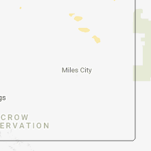


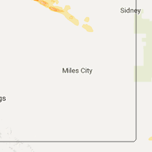


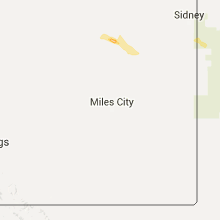


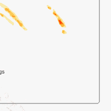


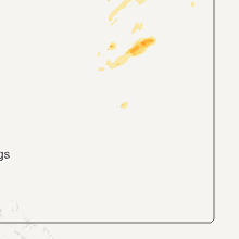
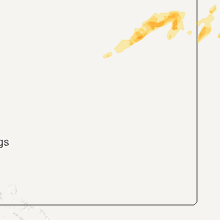


Connect with Interactive Hail Maps