

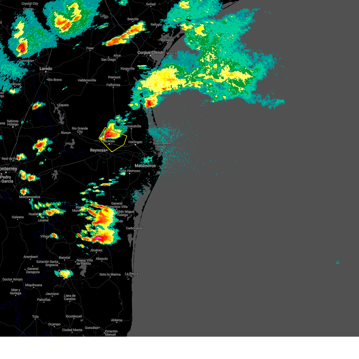
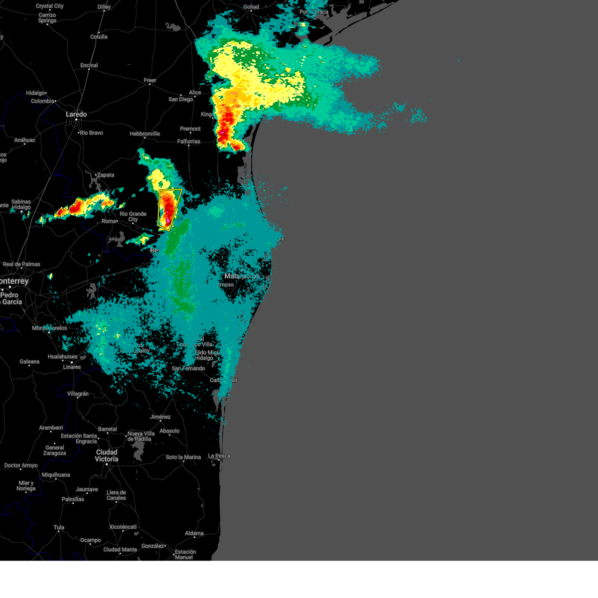
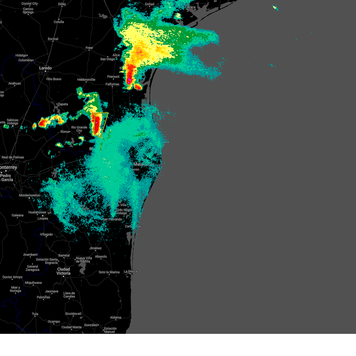
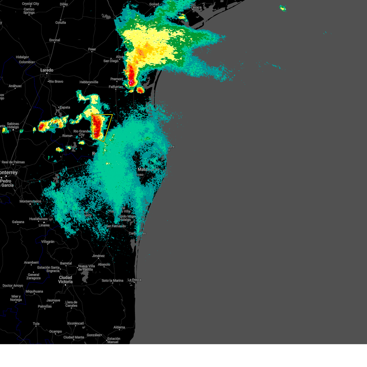
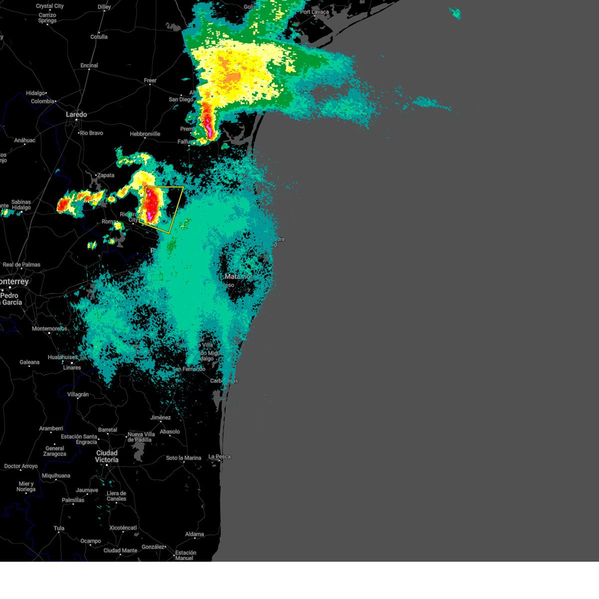
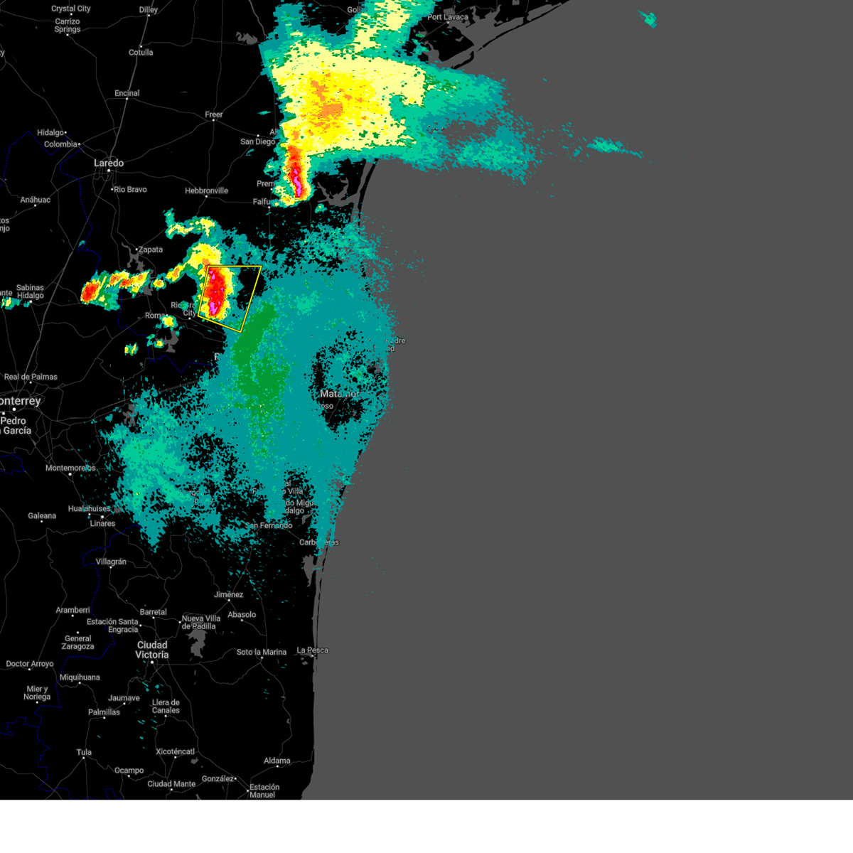
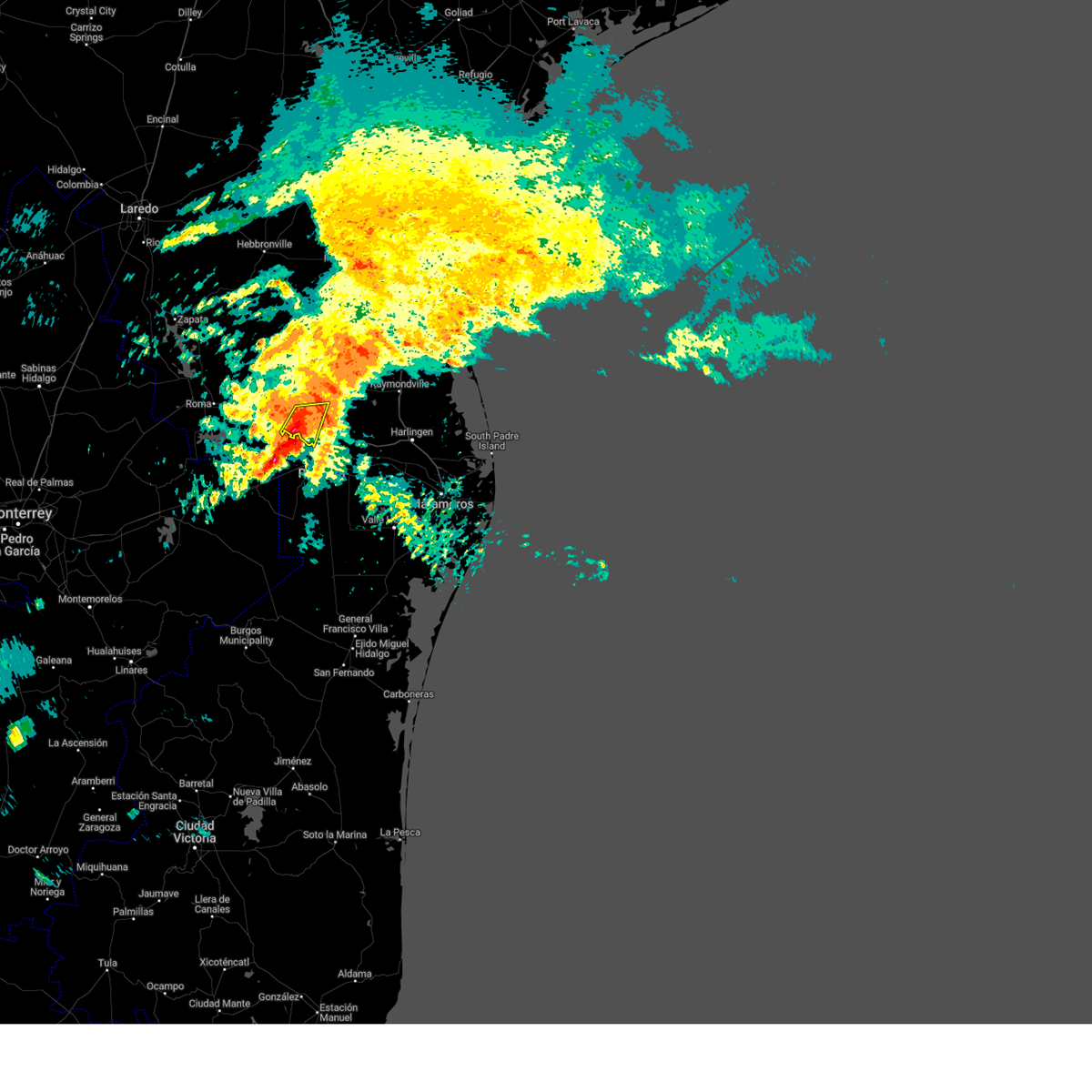
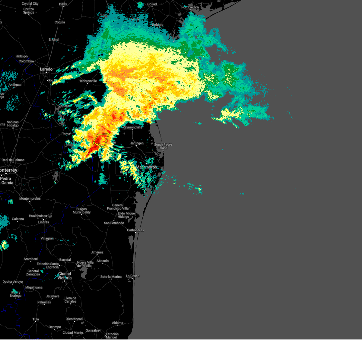
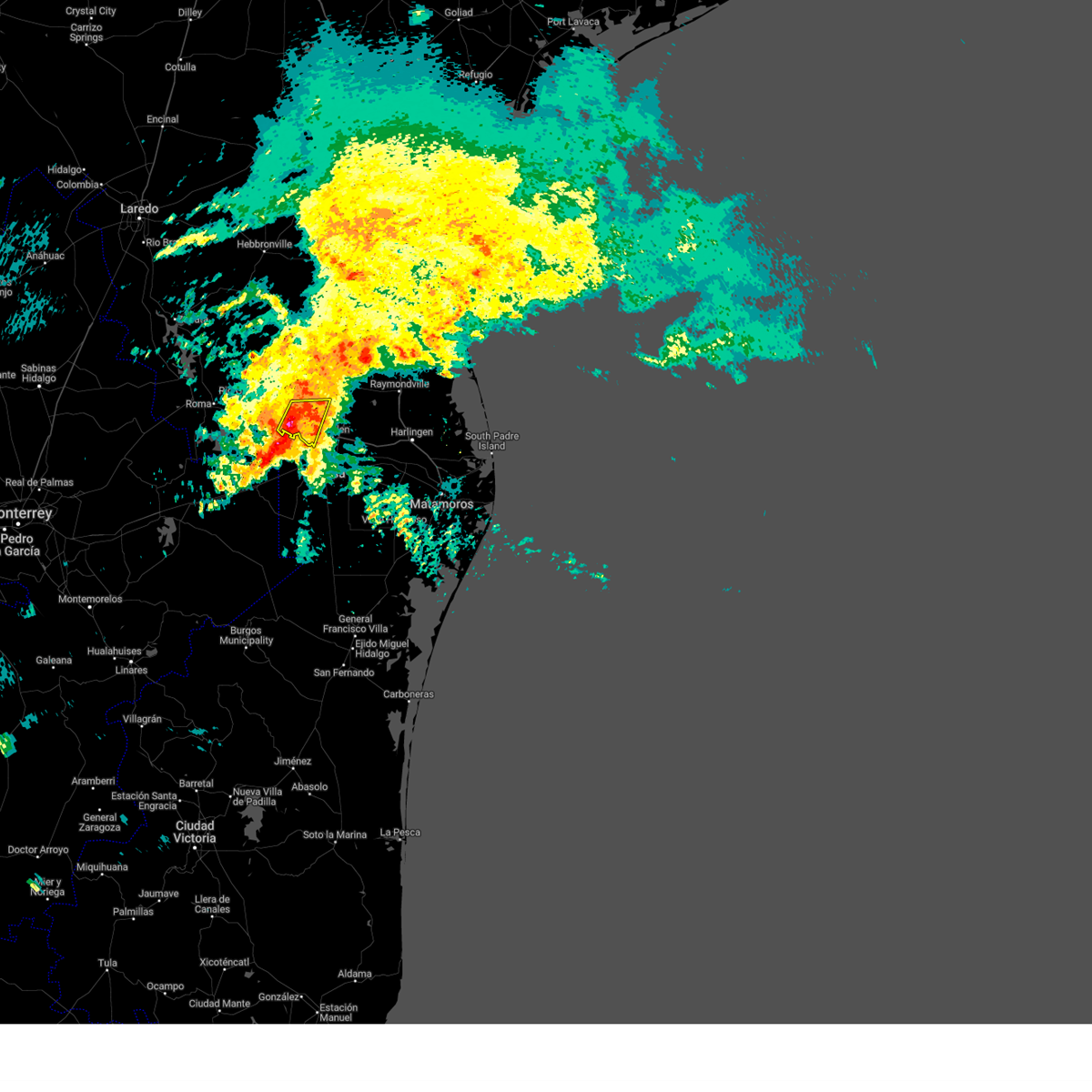
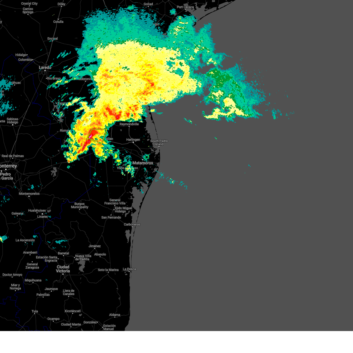
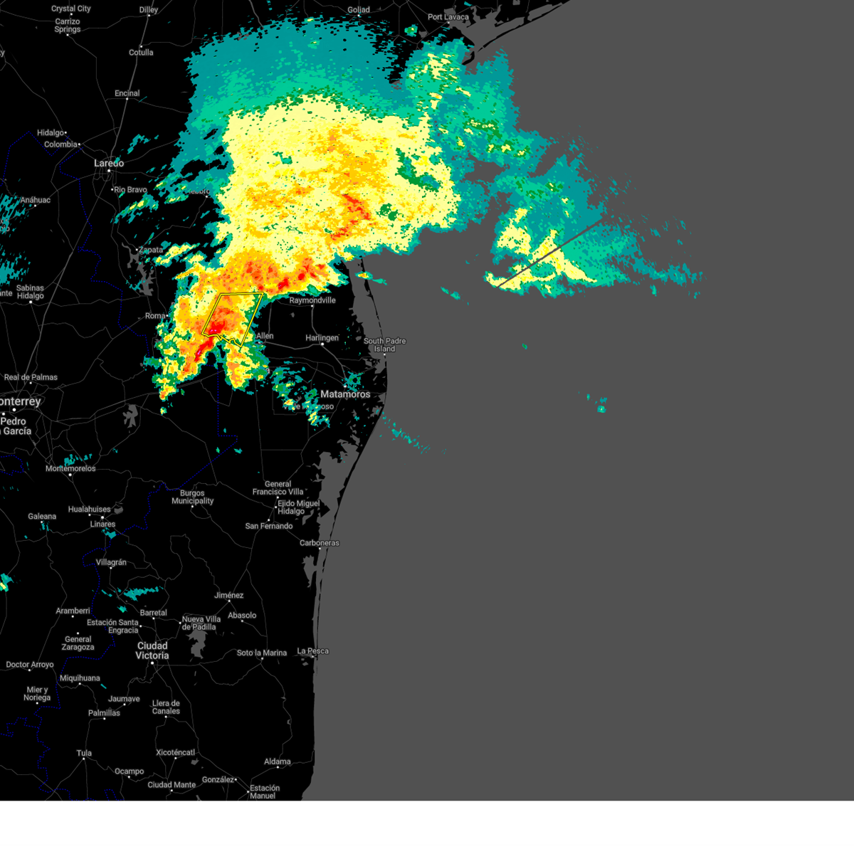
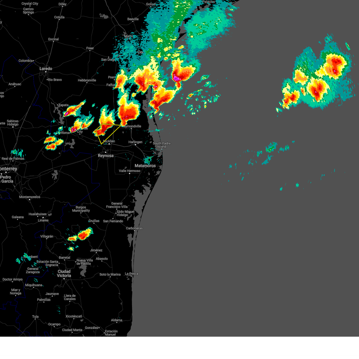
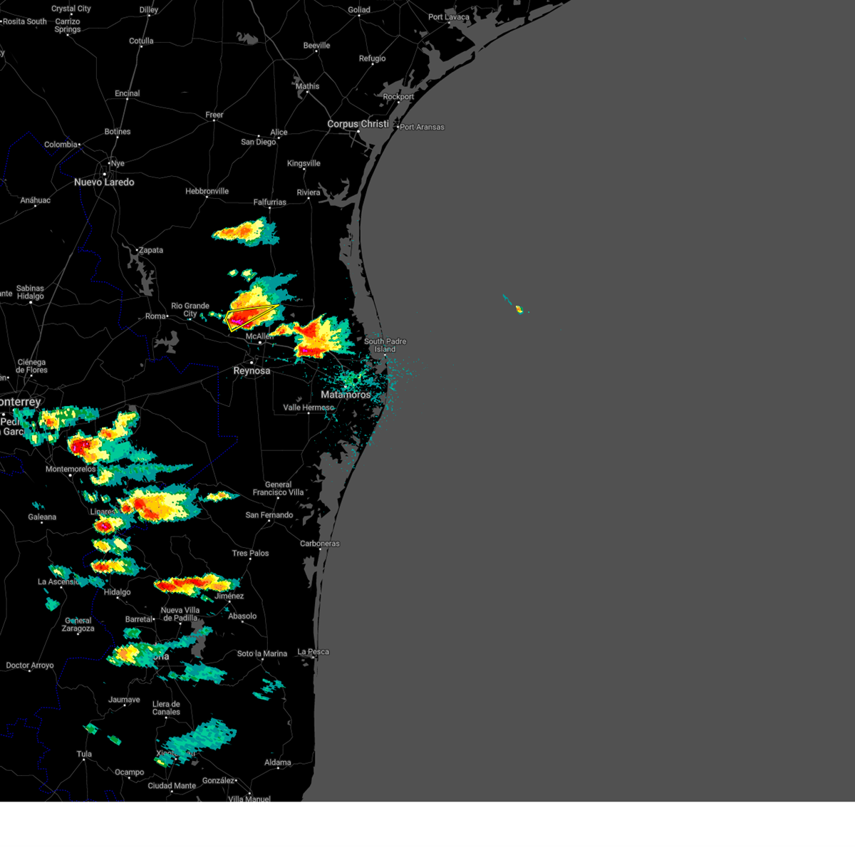
Hail Map for Citrus City, TX
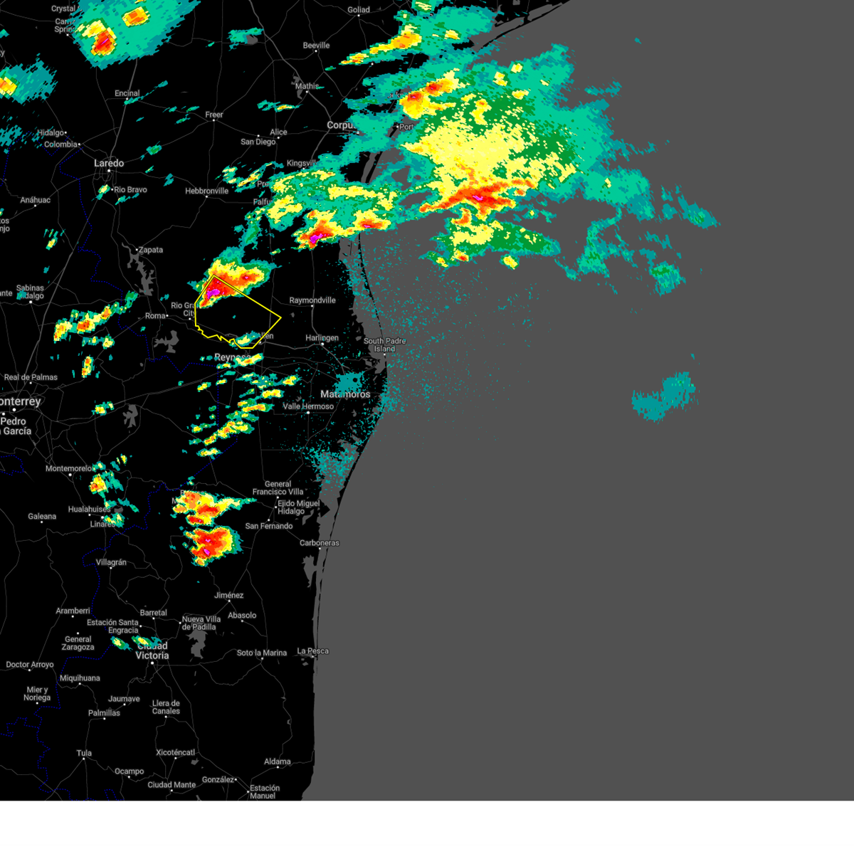
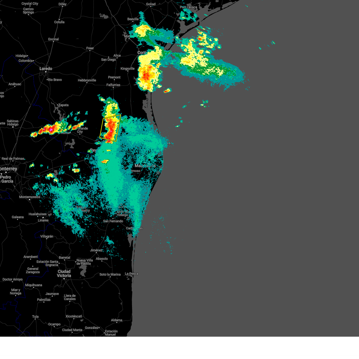
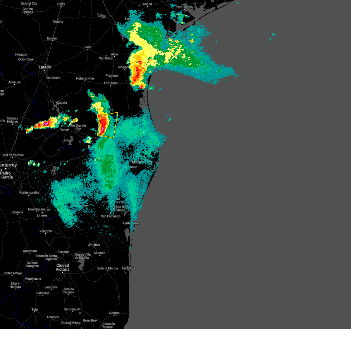
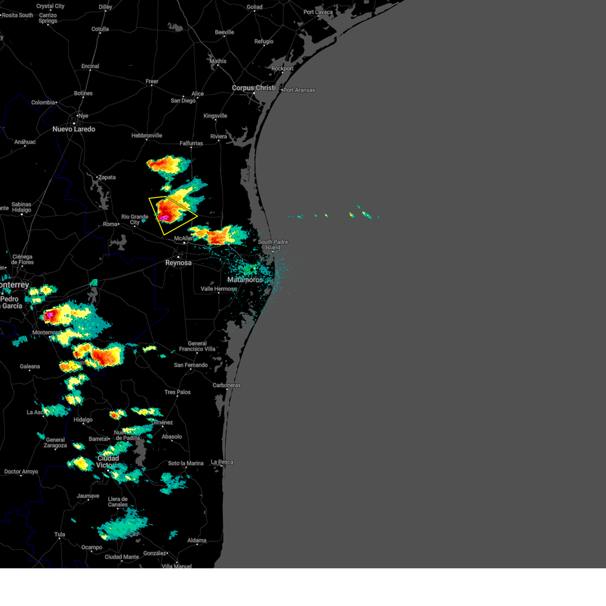
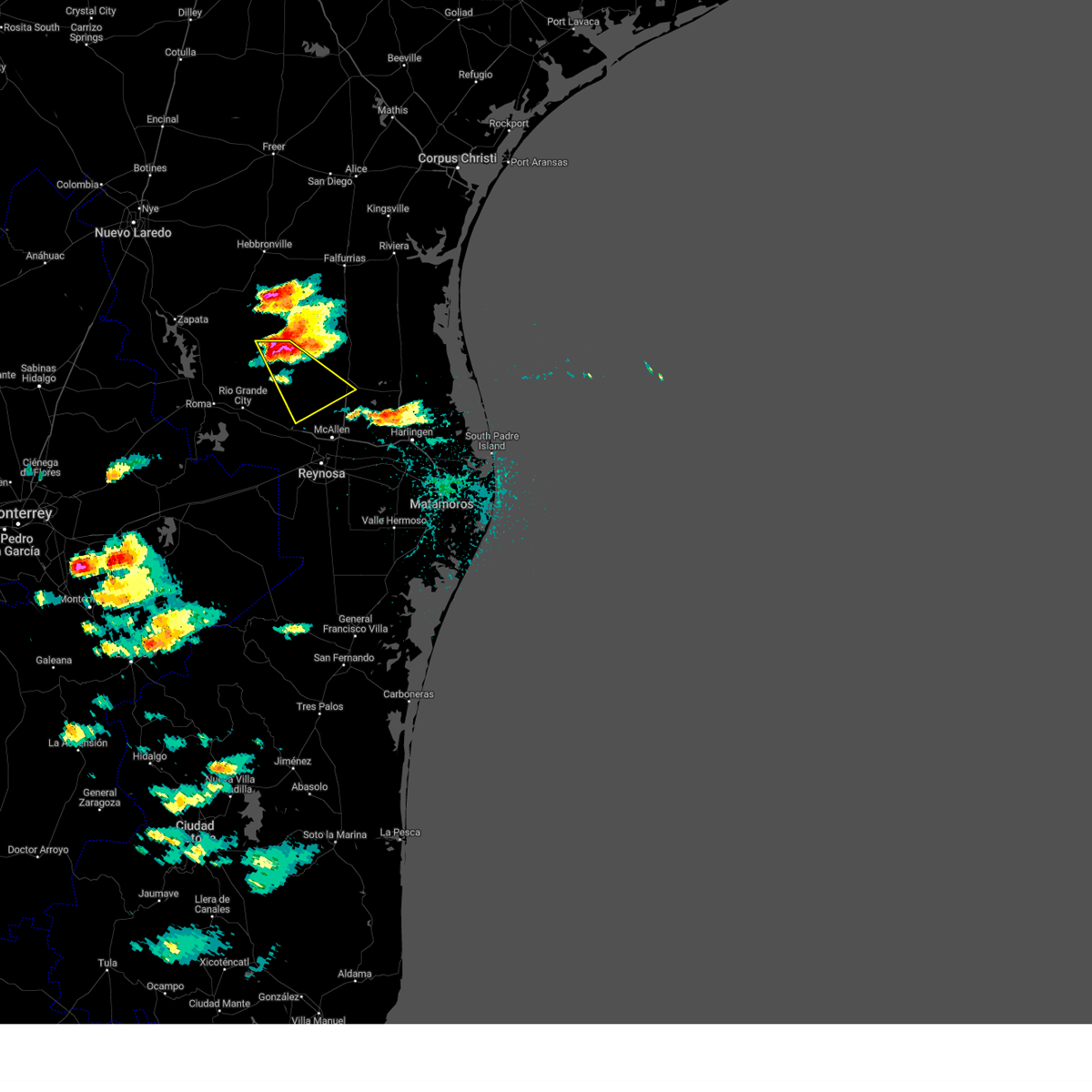
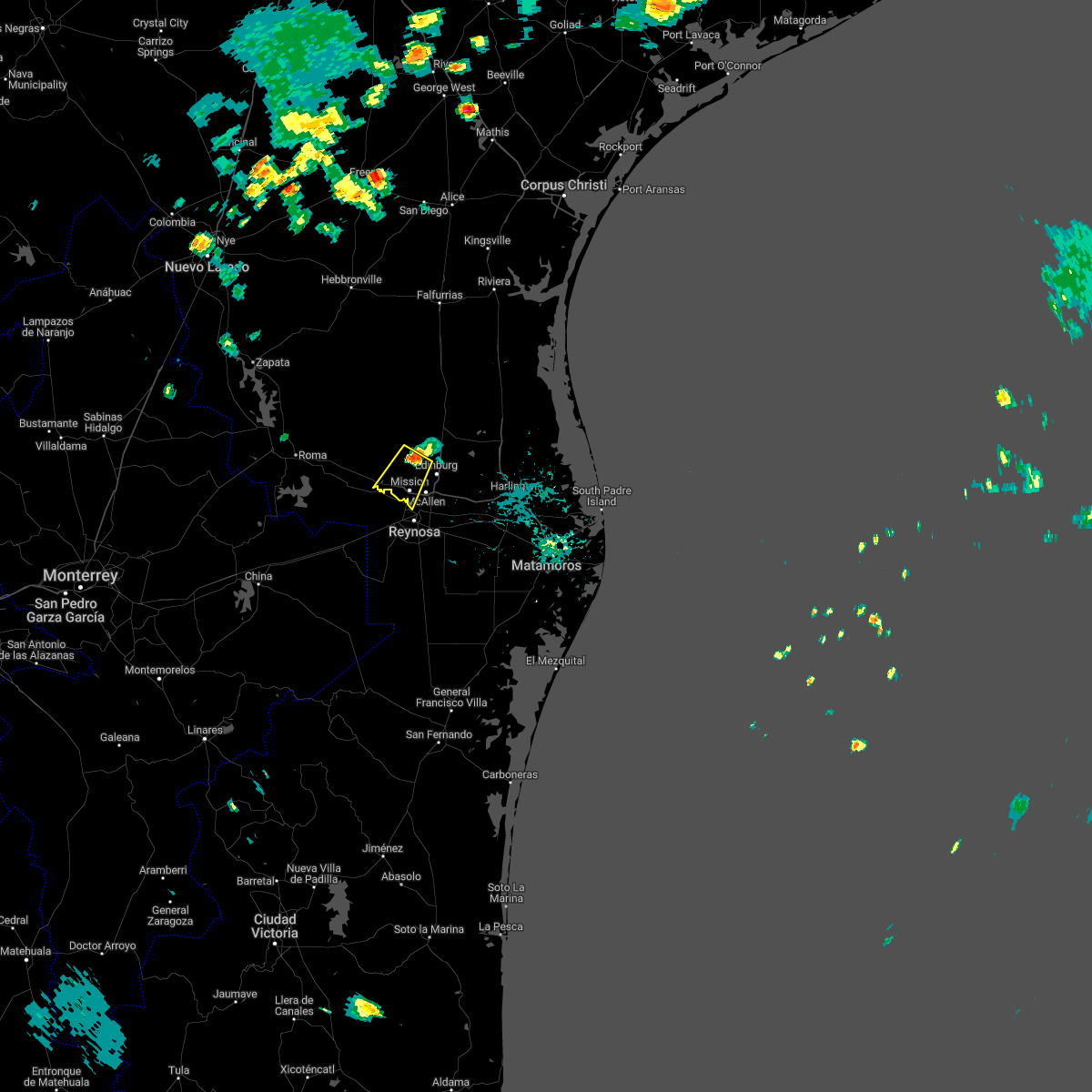
The Citrus City, TX area has had 0 reports of on-the-ground hail by trained spotters, and has been under severe weather warnings 24 times during the past 12 months. Doppler radar has detected hail at or near Citrus City, TX on 39 occasions, including 5 occasions during the past year.
| Name: | Citrus City, TX |
| Where Located: | 62.9 miles WNW of Brownsville, TX |
| Map: | Google Map for Citrus City, TX |
| Population: | 2321 |
| Housing Units: | 579 |
| More Info: | Search Google for Citrus City, TX |
1
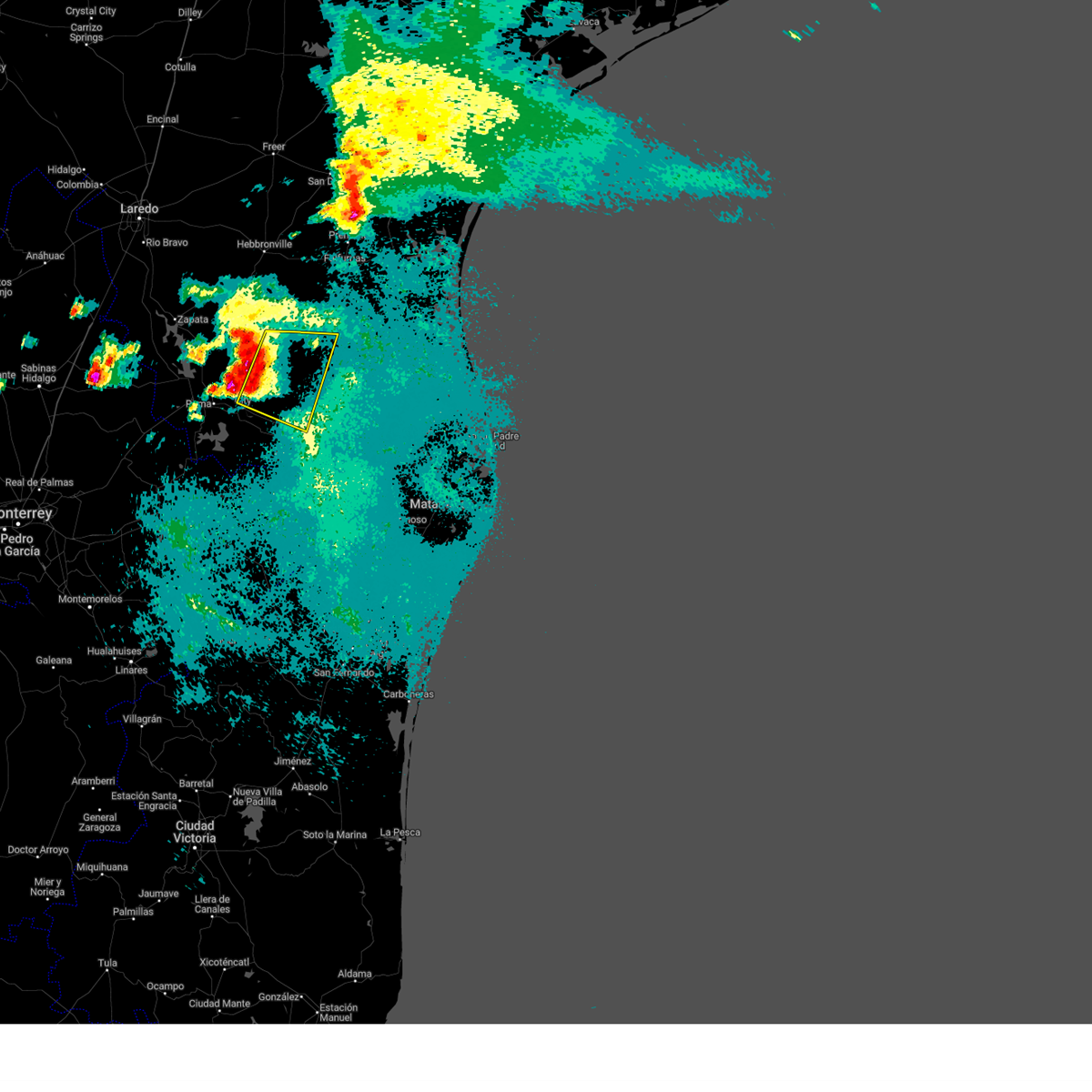
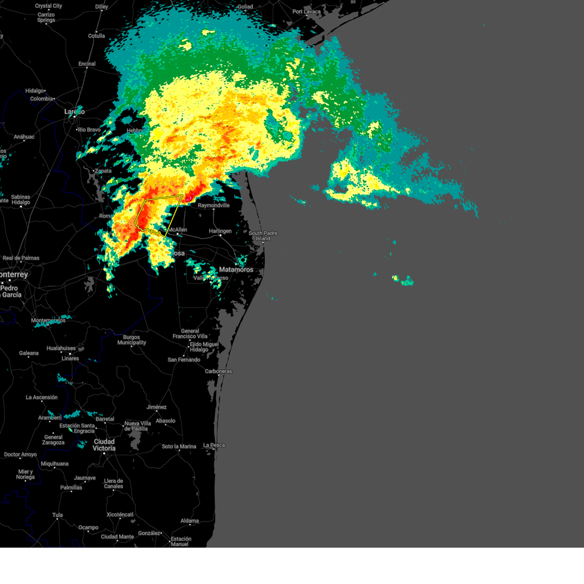
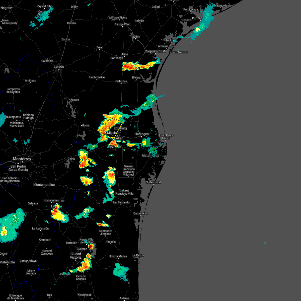
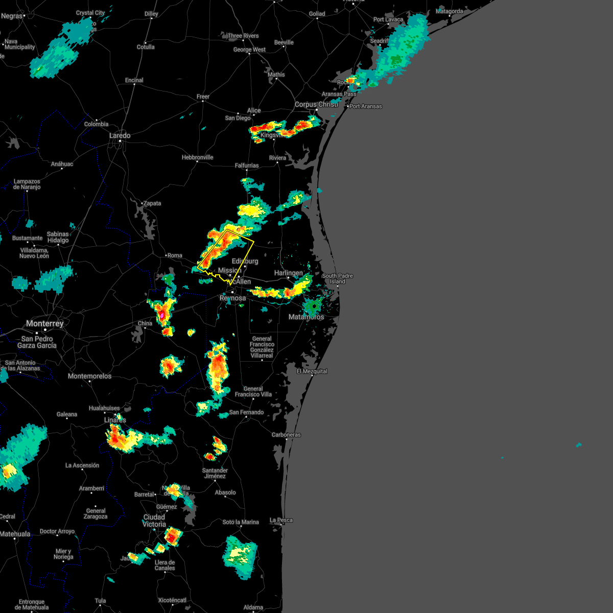
The Top Recent Hail Date for Citrus City, TX is Thursday, May 8, 2025 (5th out of 39)

Hail and Wind Damage Spotted near Citrus City, TX
| Date / Time | Report Details |
|---|---|
| 5/8/2025 6:53 PM CDT |
 Svrbro the national weather service in brownsville has issued a * severe thunderstorm warning for, southern hidalgo county in deep south texas, * until 745 pm cdt. * at 653 pm cdt, a severe thunderstorm was located near b.l. garza middle school, or 8 miles north of palmhurst, moving southeast at 35 mph (radar indicated). Hazards include two inch hail and 60 mph wind gusts. People and animals outdoors will be injured. expect hail damage to roofs, siding, windows, and vehicles. Expect wind damage to roofs, siding, and trees. Svrbro the national weather service in brownsville has issued a * severe thunderstorm warning for, southern hidalgo county in deep south texas, * until 745 pm cdt. * at 653 pm cdt, a severe thunderstorm was located near b.l. garza middle school, or 8 miles north of palmhurst, moving southeast at 35 mph (radar indicated). Hazards include two inch hail and 60 mph wind gusts. People and animals outdoors will be injured. expect hail damage to roofs, siding, windows, and vehicles. Expect wind damage to roofs, siding, and trees.
|
| 5/8/2025 6:50 PM CDT | the severe thunderstorm warning has been cancelled and is no longer in effect |
| 5/8/2025 6:50 PM CDT | At 650 pm cdt, a severe thunderstorm was located over lloyd & dolly bentsen elementary school, or over sharyland, moving southeast at 45 mph (radar indicated). Hazards include two inch hail and 60 mph wind gusts. People and animals outdoors will be injured. expect hail damage to roofs, siding, windows, and vehicles. expect wind damage to roofs, siding, and trees. locations impacted include, national butterfly center, mcallen high school, narciso g. Cavazos elementary school, abram-perezville, doffing, john f kennedy elementary school, guillermo flores elementary school, lee elementary school, bicentennial park, and las palmas community center. |
| 5/8/2025 6:32 PM CDT | At 632 pm cdt, a severe thunderstorm was located near citrus city, or near la joya, moving southeast at 45 mph (radar indicated). Hazards include two inch hail and 60 mph wind gusts. People and animals outdoors will be injured. expect hail damage to roofs, siding, windows, and vehicles. expect wind damage to roofs, siding, and trees. locations impacted include, mcallen high school, narciso g. Cavazos elementary school, doffing, la victoria, las palmas community center, enrique camarena elementary school, retama park, lincoln school, la joya, and mission regional medical center. |
| 5/8/2025 6:09 PM CDT |
 Svrbro the national weather service in brownsville has issued a * severe thunderstorm warning for, southwestern hidalgo county in deep south texas, eastern starr county in deep south texas, * until 700 pm cdt. * at 608 pm cdt, a severe thunderstorm was located 9 miles southwest of santa catarina, or 14 miles east of el sauz, moving southeast at 45 mph (radar indicated). Hazards include two inch hail and 60 mph wind gusts. People and animals outdoors will be injured. expect hail damage to roofs, siding, windows, and vehicles. Expect wind damage to roofs, siding, and trees. Svrbro the national weather service in brownsville has issued a * severe thunderstorm warning for, southwestern hidalgo county in deep south texas, eastern starr county in deep south texas, * until 700 pm cdt. * at 608 pm cdt, a severe thunderstorm was located 9 miles southwest of santa catarina, or 14 miles east of el sauz, moving southeast at 45 mph (radar indicated). Hazards include two inch hail and 60 mph wind gusts. People and animals outdoors will be injured. expect hail damage to roofs, siding, windows, and vehicles. Expect wind damage to roofs, siding, and trees.
|
| 5/3/2025 2:34 AM CDT |
 the severe thunderstorm warning has been cancelled and is no longer in effect the severe thunderstorm warning has been cancelled and is no longer in effect
|
| 5/3/2025 2:19 AM CDT |
 At 219 am cdt, severe thunderstorms were located along a line extending from near puerto rico to 6 miles west of red gate to near josefa garcia park, moving east at 30 mph (radar indicated). Hazards include 60 mph wind gusts and quarter size hail. Hail damage to vehicles is expected. expect wind damage to roofs, siding, and trees. Locations impacted include, puerto rico, cesar chavez, fountain center park, edinburg north high school, los lagos golf course, red gate, eisenhower elementary school, apollo park, lee elementary school, and bicentennial park. At 219 am cdt, severe thunderstorms were located along a line extending from near puerto rico to 6 miles west of red gate to near josefa garcia park, moving east at 30 mph (radar indicated). Hazards include 60 mph wind gusts and quarter size hail. Hail damage to vehicles is expected. expect wind damage to roofs, siding, and trees. Locations impacted include, puerto rico, cesar chavez, fountain center park, edinburg north high school, los lagos golf course, red gate, eisenhower elementary school, apollo park, lee elementary school, and bicentennial park.
|
| 5/3/2025 2:11 AM CDT |
 The storms which prompted the warning have moved out of the area. therefore, the warning will be allowed to expire. remember, a severe thunderstorm warning still remains in effect for northern hidalgo county until 245 am cdt. The storms which prompted the warning have moved out of the area. therefore, the warning will be allowed to expire. remember, a severe thunderstorm warning still remains in effect for northern hidalgo county until 245 am cdt.
|
| 5/3/2025 2:05 AM CDT |
 At 205 am cdt, severe thunderstorms were located along a line extending from la reforma to near mccook to near lorenzo de zavala middle school, moving east at 40 mph (radar indicated). Hazards include 60 mph wind gusts and quarter size hail. Hail damage to vehicles is expected. expect wind damage to roofs, siding, and trees. locations impacted include, puerto rico, delmita, citrus city, la reforma, juan n. Seguin elementary school, mccook, and san isidro. At 205 am cdt, severe thunderstorms were located along a line extending from la reforma to near mccook to near lorenzo de zavala middle school, moving east at 40 mph (radar indicated). Hazards include 60 mph wind gusts and quarter size hail. Hail damage to vehicles is expected. expect wind damage to roofs, siding, and trees. locations impacted include, puerto rico, delmita, citrus city, la reforma, juan n. Seguin elementary school, mccook, and san isidro.
|
| 5/3/2025 2:03 AM CDT |
 Svrbro the national weather service in brownsville has issued a * severe thunderstorm warning for, central hidalgo county in deep south texas, * until 245 am cdt. * at 203 am cdt, severe thunderstorms were located along a line extending from near la reforma to near mccook to near citrus city, moving east at 30 mph (radar indicated). Hazards include 60 mph wind gusts and quarter size hail. Hail damage to vehicles is expected. Expect wind damage to roofs, siding, and trees. Svrbro the national weather service in brownsville has issued a * severe thunderstorm warning for, central hidalgo county in deep south texas, * until 245 am cdt. * at 203 am cdt, severe thunderstorms were located along a line extending from near la reforma to near mccook to near citrus city, moving east at 30 mph (radar indicated). Hazards include 60 mph wind gusts and quarter size hail. Hail damage to vehicles is expected. Expect wind damage to roofs, siding, and trees.
|
| 5/3/2025 1:52 AM CDT |
 At 152 am cdt, severe thunderstorms were located along a line extending from san isidro to near mccook to near sullivan city, moving east at 35 mph (radar indicated). Hazards include 60 mph wind gusts and quarter size hail. Hail damage to vehicles is expected. expect wind damage to roofs, siding, and trees. locations impacted include, puerto rico, delmita, citrus city, la gloria, la reforma, juan n. Seguin elementary school, santa catarina, mccook, diamond o ranch airport, and san isidro. At 152 am cdt, severe thunderstorms were located along a line extending from san isidro to near mccook to near sullivan city, moving east at 35 mph (radar indicated). Hazards include 60 mph wind gusts and quarter size hail. Hail damage to vehicles is expected. expect wind damage to roofs, siding, and trees. locations impacted include, puerto rico, delmita, citrus city, la gloria, la reforma, juan n. Seguin elementary school, santa catarina, mccook, diamond o ranch airport, and san isidro.
|
| 5/3/2025 1:44 AM CDT |
 At 143 am cdt, severe thunderstorms were located along a line extending from near la gloria to 6 miles west of mccook to near garciasville, moving east at 35 mph (radar indicated). Hazards include 60 mph wind gusts and quarter size hail. Hail damage to vehicles is expected. expect wind damage to roofs, siding, and trees. locations impacted include, puerto rico, delmita, citrus city, la gloria, la reforma, juan n. Seguin elementary school, santa catarina, mccook, diamond o ranch airport, and san isidro. At 143 am cdt, severe thunderstorms were located along a line extending from near la gloria to 6 miles west of mccook to near garciasville, moving east at 35 mph (radar indicated). Hazards include 60 mph wind gusts and quarter size hail. Hail damage to vehicles is expected. expect wind damage to roofs, siding, and trees. locations impacted include, puerto rico, delmita, citrus city, la gloria, la reforma, juan n. Seguin elementary school, santa catarina, mccook, diamond o ranch airport, and san isidro.
|
| 5/3/2025 1:44 AM CDT |
 the severe thunderstorm warning has been cancelled and is no longer in effect the severe thunderstorm warning has been cancelled and is no longer in effect
|
| 5/3/2025 1:24 AM CDT |
 Svrbro the national weather service in brownsville has issued a * severe thunderstorm warning for, southeastern jim hogg county in deep south texas, northwestern hidalgo county in deep south texas, eastern starr county in deep south texas, south central brooks county in deep south texas, * until 215 am cdt. * at 123 am cdt, severe thunderstorms were located along a line extending from 9 miles southwest of agua nueva to 8 miles southwest of santa catarina to los alvarez, moving southeast at 40 mph (radar indicated). Hazards include 60 mph wind gusts and quarter size hail. Hail damage to vehicles is expected. Expect wind damage to roofs, siding, and trees. Svrbro the national weather service in brownsville has issued a * severe thunderstorm warning for, southeastern jim hogg county in deep south texas, northwestern hidalgo county in deep south texas, eastern starr county in deep south texas, south central brooks county in deep south texas, * until 215 am cdt. * at 123 am cdt, severe thunderstorms were located along a line extending from 9 miles southwest of agua nueva to 8 miles southwest of santa catarina to los alvarez, moving southeast at 40 mph (radar indicated). Hazards include 60 mph wind gusts and quarter size hail. Hail damage to vehicles is expected. Expect wind damage to roofs, siding, and trees.
|
| 3/28/2025 12:20 AM CDT |
 Svrbro the national weather service in brownsville has issued a * severe thunderstorm warning for, central hidalgo county in deep south texas, * until 100 am cdt. * at 1219 am cdt, severe thunderstorms were located along a line extending from 6 miles southeast of puerto rico to near olivero garza sr elementary school to madero, moving east at 35 mph (radar indicated). Hazards include 60 mph wind gusts. expect damage to roofs, siding, and trees Svrbro the national weather service in brownsville has issued a * severe thunderstorm warning for, central hidalgo county in deep south texas, * until 100 am cdt. * at 1219 am cdt, severe thunderstorms were located along a line extending from 6 miles southeast of puerto rico to near olivero garza sr elementary school to madero, moving east at 35 mph (radar indicated). Hazards include 60 mph wind gusts. expect damage to roofs, siding, and trees
|
| 3/27/2025 2:45 PM CDT |
 The storms which prompted the warning have moved out of the area. therefore, the warning will be allowed to expire. remember, a severe thunderstorm warning still remains in effect for south central hidalgo county until 315 pm cdt. The storms which prompted the warning have moved out of the area. therefore, the warning will be allowed to expire. remember, a severe thunderstorm warning still remains in effect for south central hidalgo county until 315 pm cdt.
|
| 3/27/2025 2:21 PM CDT |
 At 218 pm cdt, severe thunderstorms were located along a line extending from near citrus city to ann richards middle school to 7 miles south of los ebanos, moving east at 15 mph (radar indicated). Hazards include 70 mph wind gusts and quarter size hail. Hail damage to vehicles is expected. expect considerable tree damage. wind damage is also likely to mobile homes, roofs, and outbuildings. locations impacted include, national butterfly center, narciso g. Cavazos elementary school, abram-perezville, los ebanos, cesar chavez middle school, doffing, john f kennedy elementary school, guillermo flores elementary school, lorenzo de zavala middle school, and enrique camarena elementary school. At 218 pm cdt, severe thunderstorms were located along a line extending from near citrus city to ann richards middle school to 7 miles south of los ebanos, moving east at 15 mph (radar indicated). Hazards include 70 mph wind gusts and quarter size hail. Hail damage to vehicles is expected. expect considerable tree damage. wind damage is also likely to mobile homes, roofs, and outbuildings. locations impacted include, national butterfly center, narciso g. Cavazos elementary school, abram-perezville, los ebanos, cesar chavez middle school, doffing, john f kennedy elementary school, guillermo flores elementary school, lorenzo de zavala middle school, and enrique camarena elementary school.
|
| 3/27/2025 2:18 PM CDT |
 At 217 pm cdt, severe thunderstorms were located along a line extending from near citrus city to ann richards middle school to 7 miles south of los ebanos, moving east at 15 mph (radar indicated). Hazards include 70 mph wind gusts and quarter size hail. Hail damage to vehicles is expected. expect considerable tree damage. wind damage is also likely to mobile homes, roofs, and outbuildings. locations impacted include, national butterfly center, narciso g. Cavazos elementary school, abram-perezville, los ebanos, cesar chavez middle school, doffing, john f kennedy elementary school, guillermo flores elementary school, lorenzo de zavala middle school, and enrique camarena elementary school. At 217 pm cdt, severe thunderstorms were located along a line extending from near citrus city to ann richards middle school to 7 miles south of los ebanos, moving east at 15 mph (radar indicated). Hazards include 70 mph wind gusts and quarter size hail. Hail damage to vehicles is expected. expect considerable tree damage. wind damage is also likely to mobile homes, roofs, and outbuildings. locations impacted include, national butterfly center, narciso g. Cavazos elementary school, abram-perezville, los ebanos, cesar chavez middle school, doffing, john f kennedy elementary school, guillermo flores elementary school, lorenzo de zavala middle school, and enrique camarena elementary school.
|
| 3/27/2025 2:10 PM CDT |
 At 209 pm cdt, severe thunderstorms were located along a line extending from near citrus city to lorenzo de zavala middle school to 8 miles south of los ebanos, moving east at 15 mph (radar indicated). Hazards include ping pong ball size hail and 60 mph wind gusts. People and animals outdoors will be injured. expect hail damage to roofs, siding, windows, and vehicles. expect wind damage to roofs, siding, and trees. locations impacted include, national butterfly center, narciso g. Cavazos elementary school, abram-perezville, los ebanos, cesar chavez middle school, doffing, john f kennedy elementary school, guillermo flores elementary school, lorenzo de zavala middle school, and enrique camarena elementary school. At 209 pm cdt, severe thunderstorms were located along a line extending from near citrus city to lorenzo de zavala middle school to 8 miles south of los ebanos, moving east at 15 mph (radar indicated). Hazards include ping pong ball size hail and 60 mph wind gusts. People and animals outdoors will be injured. expect hail damage to roofs, siding, windows, and vehicles. expect wind damage to roofs, siding, and trees. locations impacted include, national butterfly center, narciso g. Cavazos elementary school, abram-perezville, los ebanos, cesar chavez middle school, doffing, john f kennedy elementary school, guillermo flores elementary school, lorenzo de zavala middle school, and enrique camarena elementary school.
|
| 3/27/2025 2:10 PM CDT |
 the severe thunderstorm warning has been cancelled and is no longer in effect the severe thunderstorm warning has been cancelled and is no longer in effect
|
| 3/27/2025 1:53 PM CDT |
 Svrbro the national weather service in brownsville has issued a * severe thunderstorm warning for, southwestern hidalgo county in deep south texas, southeastern starr county in deep south texas, * until 245 pm cdt. * at 152 pm cdt, severe thunderstorms were located along a line extending from 6 miles northwest of citrus city to near la joya city hall to 8 miles southwest of los ebanos, moving east at 15 mph (radar indicated). Hazards include ping pong ball size hail and 60 mph wind gusts. People and animals outdoors will be injured. expect hail damage to roofs, siding, windows, and vehicles. Expect wind damage to roofs, siding, and trees. Svrbro the national weather service in brownsville has issued a * severe thunderstorm warning for, southwestern hidalgo county in deep south texas, southeastern starr county in deep south texas, * until 245 pm cdt. * at 152 pm cdt, severe thunderstorms were located along a line extending from 6 miles northwest of citrus city to near la joya city hall to 8 miles southwest of los ebanos, moving east at 15 mph (radar indicated). Hazards include ping pong ball size hail and 60 mph wind gusts. People and animals outdoors will be injured. expect hail damage to roofs, siding, windows, and vehicles. Expect wind damage to roofs, siding, and trees.
|
| 3/27/2025 1:45 PM CDT |
 At 145 pm cdt, severe thunderstorms were located along a line extending from near mccook to near sullivan city to 12 miles south of la grulla, moving east at 20 mph (radar indicated). Hazards include 60 mph wind gusts and quarter size hail. Hail damage to vehicles is expected. expect wind damage to roofs, siding, and trees. locations impacted include, narciso g. Cavazos elementary school, abram-perezville, los ebanos, cesar chavez middle school, doffing, john f kennedy elementary school, la victoria, guillermo flores elementary school, la grulla, and lorenzo de zavala middle school. At 145 pm cdt, severe thunderstorms were located along a line extending from near mccook to near sullivan city to 12 miles south of la grulla, moving east at 20 mph (radar indicated). Hazards include 60 mph wind gusts and quarter size hail. Hail damage to vehicles is expected. expect wind damage to roofs, siding, and trees. locations impacted include, narciso g. Cavazos elementary school, abram-perezville, los ebanos, cesar chavez middle school, doffing, john f kennedy elementary school, la victoria, guillermo flores elementary school, la grulla, and lorenzo de zavala middle school.
|
| 3/27/2025 1:24 PM CDT |
 At 124 pm cdt, severe thunderstorms were located along a line extending from 7 miles northwest of mccook to cuevitas to 14 miles southwest of la grulla, moving east at 25 mph (radar indicated). Hazards include 60 mph wind gusts. Expect damage to roofs, siding, and trees. locations impacted include, narciso g. Cavazos elementary school, abram-perezville, los ebanos, cesar chavez middle school, doffing, john f kennedy elementary school, la victoria, guillermo flores elementary school, la grulla, and lorenzo de zavala middle school. At 124 pm cdt, severe thunderstorms were located along a line extending from 7 miles northwest of mccook to cuevitas to 14 miles southwest of la grulla, moving east at 25 mph (radar indicated). Hazards include 60 mph wind gusts. Expect damage to roofs, siding, and trees. locations impacted include, narciso g. Cavazos elementary school, abram-perezville, los ebanos, cesar chavez middle school, doffing, john f kennedy elementary school, la victoria, guillermo flores elementary school, la grulla, and lorenzo de zavala middle school.
|
| 3/27/2025 1:16 PM CDT |
 Svrbro the national weather service in brownsville has issued a * severe thunderstorm warning for, western hidalgo county in deep south texas, southeastern starr county in deep south texas, * until 200 pm cdt. * at 115 pm cdt, severe thunderstorms were located along a line extending from 8 miles southeast of santa catarina to grulla middle school to 16 miles southwest of la grulla, moving east at 25 mph (radar indicated). Hazards include 60 mph wind gusts. expect damage to roofs, siding, and trees Svrbro the national weather service in brownsville has issued a * severe thunderstorm warning for, western hidalgo county in deep south texas, southeastern starr county in deep south texas, * until 200 pm cdt. * at 115 pm cdt, severe thunderstorms were located along a line extending from 8 miles southeast of santa catarina to grulla middle school to 16 miles southwest of la grulla, moving east at 25 mph (radar indicated). Hazards include 60 mph wind gusts. expect damage to roofs, siding, and trees
|
| 5/13/2024 8:18 PM CDT |
 the severe thunderstorm warning has been cancelled and is no longer in effect the severe thunderstorm warning has been cancelled and is no longer in effect
|
| 5/13/2024 8:03 PM CDT |
 Svrbro the national weather service in brownsville has issued a * severe thunderstorm warning for, central hidalgo county in deep south texas, * until 845 pm cdt. * at 802 pm cdt, a severe thunderstorm was located 7 miles northwest of citrus city, or 8 miles southwest of mccook, moving east at 40 mph (radar indicated). Hazards include 60 mph wind gusts and quarter size hail. Hail damage to vehicles is expected. Expect wind damage to roofs, siding, and trees. Svrbro the national weather service in brownsville has issued a * severe thunderstorm warning for, central hidalgo county in deep south texas, * until 845 pm cdt. * at 802 pm cdt, a severe thunderstorm was located 7 miles northwest of citrus city, or 8 miles southwest of mccook, moving east at 40 mph (radar indicated). Hazards include 60 mph wind gusts and quarter size hail. Hail damage to vehicles is expected. Expect wind damage to roofs, siding, and trees.
|
| 5/13/2024 7:38 PM CDT |
 The storm which prompted the warning has moved out of the area. therefore, the warning will be allowed to expire. however, small hail is still possible with this thunderstorm. a severe thunderstorm watch remains in effect until 1000 pm cdt for deep south texas. remember, a severe thunderstorm warning still remains in effect for hidalgo. The storm which prompted the warning has moved out of the area. therefore, the warning will be allowed to expire. however, small hail is still possible with this thunderstorm. a severe thunderstorm watch remains in effect until 1000 pm cdt for deep south texas. remember, a severe thunderstorm warning still remains in effect for hidalgo.
|
| 5/13/2024 7:15 PM CDT |
 At 715 pm cdt, a severe thunderstorm was located near faysville, moving southeast at 55 mph (radar indicated). Hazards include 60 mph wind gusts and quarter size hail. Hail damage to vehicles is expected. expect wind damage to roofs, siding, and trees. locations impacted include, palmview, mccook, alton, narciso g. Cavazos elementary school, red gate, abram-perezville, doffing, guillermo flores elementary school, palmview high school, and citrus city. At 715 pm cdt, a severe thunderstorm was located near faysville, moving southeast at 55 mph (radar indicated). Hazards include 60 mph wind gusts and quarter size hail. Hail damage to vehicles is expected. expect wind damage to roofs, siding, and trees. locations impacted include, palmview, mccook, alton, narciso g. Cavazos elementary school, red gate, abram-perezville, doffing, guillermo flores elementary school, palmview high school, and citrus city.
|
| 5/13/2024 7:15 PM CDT |
 the severe thunderstorm warning has been cancelled and is no longer in effect the severe thunderstorm warning has been cancelled and is no longer in effect
|
| 5/13/2024 7:08 PM CDT |
 At 708 pm cdt, a severe thunderstorm was located 7 miles southeast of mccook, moving southeast at 55 mph (radar indicated). Hazards include 60 mph wind gusts and quarter size hail. Hail damage to vehicles is expected. expect wind damage to roofs, siding, and trees. locations impacted include, palmview, san manuel, mccook, linn, alton, narciso g. Cavazos elementary school, red gate, abram-perezville, cesar chavez middle school, and doffing. At 708 pm cdt, a severe thunderstorm was located 7 miles southeast of mccook, moving southeast at 55 mph (radar indicated). Hazards include 60 mph wind gusts and quarter size hail. Hail damage to vehicles is expected. expect wind damage to roofs, siding, and trees. locations impacted include, palmview, san manuel, mccook, linn, alton, narciso g. Cavazos elementary school, red gate, abram-perezville, cesar chavez middle school, and doffing.
|
| 5/13/2024 7:00 PM CDT |
 Svrbro the national weather service in brownsville has issued a * severe thunderstorm warning for, central hidalgo county in deep south texas, east central starr county in deep south texas, * until 745 pm cdt. * at 659 pm cdt, a severe thunderstorm was located over mccook, moving southeast at 55 mph (radar indicated). Hazards include golf ball size hail and 60 mph wind gusts. People and animals outdoors will be injured. expect hail damage to roofs, siding, windows, and vehicles. Expect wind damage to roofs, siding, and trees. Svrbro the national weather service in brownsville has issued a * severe thunderstorm warning for, central hidalgo county in deep south texas, east central starr county in deep south texas, * until 745 pm cdt. * at 659 pm cdt, a severe thunderstorm was located over mccook, moving southeast at 55 mph (radar indicated). Hazards include golf ball size hail and 60 mph wind gusts. People and animals outdoors will be injured. expect hail damage to roofs, siding, windows, and vehicles. Expect wind damage to roofs, siding, and trees.
|
| 6/3/2023 9:35 PM CDT |
 At 935 pm cdt, a severe thunderstorm was located over apollo park, or over edinburg, moving east at 55 mph (radar indicated). Hazards include 70 mph wind gusts and penny size hail. Expect considerable tree damage. damage is likely to mobile homes, roofs, and outbuildings. locations impacted include, edinburg, mission, pharr, hidalgo, palmview, penitas, sullivan city, la joya, palmhurst and linn. thunderstorm damage threat, considerable hail threat, radar indicated max hail size, 0. 75 in wind threat, radar indicated max wind gust, 70 mph. At 935 pm cdt, a severe thunderstorm was located over apollo park, or over edinburg, moving east at 55 mph (radar indicated). Hazards include 70 mph wind gusts and penny size hail. Expect considerable tree damage. damage is likely to mobile homes, roofs, and outbuildings. locations impacted include, edinburg, mission, pharr, hidalgo, palmview, penitas, sullivan city, la joya, palmhurst and linn. thunderstorm damage threat, considerable hail threat, radar indicated max hail size, 0. 75 in wind threat, radar indicated max wind gust, 70 mph.
|
| 6/3/2023 9:30 PM CDT |
 At 929 pm cdt, severe thunderstorms were located along a line extending from 7 miles west of linn to near alton memorial junior high school to cesar chavez middle school, moving east at 45 mph (radar indicated). Hazards include 70 mph wind gusts and penny size hail. Expect considerable tree damage. Damage is likely to mobile homes, roofs, and outbuildings. At 929 pm cdt, severe thunderstorms were located along a line extending from 7 miles west of linn to near alton memorial junior high school to cesar chavez middle school, moving east at 45 mph (radar indicated). Hazards include 70 mph wind gusts and penny size hail. Expect considerable tree damage. Damage is likely to mobile homes, roofs, and outbuildings.
|
| 6/3/2023 9:16 PM CDT |
 At 915 pm cdt, a severe thunderstorm was located near citrus city, or 7 miles north of la joya, moving east at 55 mph (radar indicated). Hazards include 60 mph wind gusts and quarter size hail. Hail damage to vehicles is expected. expect wind damage to roofs, siding, and trees. locations impacted include, edinburg, mission, pharr, rio grande city, hidalgo, palmview, penitas, sullivan city, la joya and palmhurst. hail threat, radar indicated max hail size, 1. 00 in wind threat, radar indicated max wind gust, 60 mph. At 915 pm cdt, a severe thunderstorm was located near citrus city, or 7 miles north of la joya, moving east at 55 mph (radar indicated). Hazards include 60 mph wind gusts and quarter size hail. Hail damage to vehicles is expected. expect wind damage to roofs, siding, and trees. locations impacted include, edinburg, mission, pharr, rio grande city, hidalgo, palmview, penitas, sullivan city, la joya and palmhurst. hail threat, radar indicated max hail size, 1. 00 in wind threat, radar indicated max wind gust, 60 mph.
|
| 6/3/2023 8:54 PM CDT |
 At 853 pm cdt, a severe thunderstorm was located over las lomas, or near rio grande city, moving east at 55 mph (radar indicated). Hazards include 60 mph wind gusts and quarter size hail. Hail damage to vehicles is expected. Expect wind damage to roofs, siding, and trees. At 853 pm cdt, a severe thunderstorm was located over las lomas, or near rio grande city, moving east at 55 mph (radar indicated). Hazards include 60 mph wind gusts and quarter size hail. Hail damage to vehicles is expected. Expect wind damage to roofs, siding, and trees.
|
| 5/29/2023 9:51 PM CDT |
 At 951 pm cdt, severe thunderstorms were located along a line extending from 6 miles west of red gate to near b.l. garza middle school to narciso g. cavazos elementary school to near los ebanos to near ringgold middle school, moving southeast at 15 mph (radar indicated). Hazards include 60 mph wind gusts. Expect damage to roofs, siding, and trees. locations impacted include, palmview, penitas, sullivan city, la joya, palmhurst, los ebanos, alton, la grulla, narciso g. cavazos elementary school and abram-perezville. hail threat, radar indicated max hail size, <. 75 in wind threat, radar indicated max wind gust, 60 mph. At 951 pm cdt, severe thunderstorms were located along a line extending from 6 miles west of red gate to near b.l. garza middle school to narciso g. cavazos elementary school to near los ebanos to near ringgold middle school, moving southeast at 15 mph (radar indicated). Hazards include 60 mph wind gusts. Expect damage to roofs, siding, and trees. locations impacted include, palmview, penitas, sullivan city, la joya, palmhurst, los ebanos, alton, la grulla, narciso g. cavazos elementary school and abram-perezville. hail threat, radar indicated max hail size, <. 75 in wind threat, radar indicated max wind gust, 60 mph.
|
| 5/29/2023 9:42 PM CDT |
 At 941 pm cdt, severe thunderstorms were located along a line extending from 7 miles west of red gate to 6 miles northwest of b.l. garza middle school to doffing to near la grulla to rio grande city, moving southeast at 15 mph (radar indicated). Hazards include 60 mph wind gusts and penny size hail. Expect damage to roofs, siding, and trees. locations impacted include, mission, palmview, penitas, sullivan city, la joya, palmhurst, garciasville, north mcallen, los ebanos and sharyland. hail threat, radar indicated max hail size, 0. 75 in wind threat, radar indicated max wind gust, 60 mph. At 941 pm cdt, severe thunderstorms were located along a line extending from 7 miles west of red gate to 6 miles northwest of b.l. garza middle school to doffing to near la grulla to rio grande city, moving southeast at 15 mph (radar indicated). Hazards include 60 mph wind gusts and penny size hail. Expect damage to roofs, siding, and trees. locations impacted include, mission, palmview, penitas, sullivan city, la joya, palmhurst, garciasville, north mcallen, los ebanos and sharyland. hail threat, radar indicated max hail size, 0. 75 in wind threat, radar indicated max wind gust, 60 mph.
|
| 5/29/2023 9:27 PM CDT |
 At 926 pm cdt, severe thunderstorms were located along a line extending from near puerto rico to 6 miles southeast of mccook to near doffing to grulla middle school to los alvarez, moving southeast at 15 mph (radar indicated). Hazards include 60 mph wind gusts and quarter size hail. Hail damage to vehicles is expected. Expect wind damage to roofs, siding, and trees. At 926 pm cdt, severe thunderstorms were located along a line extending from near puerto rico to 6 miles southeast of mccook to near doffing to grulla middle school to los alvarez, moving southeast at 15 mph (radar indicated). Hazards include 60 mph wind gusts and quarter size hail. Hail damage to vehicles is expected. Expect wind damage to roofs, siding, and trees.
|
| 5/29/2023 9:09 PM CDT |
 At 909 pm cdt, severe thunderstorms were located along a line extending from puerto rico to near mccook to near citrus city to near garciasville to near el sauz, moving southeast at 20 mph (radar indicated). Hazards include ping pong ball size hail and 60 mph wind gusts. People and animals outdoors will be injured. expect hail damage to roofs, siding, windows, and vehicles. expect wind damage to roofs, siding, and trees. locations impacted include, rio grande city, sullivan city, la joya, los ebanos, el sauz, garciasville, mccook, la grulla, puerto rico and john f kennedy elementary school. hail threat, radar indicated max hail size, 1. 50 in wind threat, radar indicated max wind gust, 60 mph. At 909 pm cdt, severe thunderstorms were located along a line extending from puerto rico to near mccook to near citrus city to near garciasville to near el sauz, moving southeast at 20 mph (radar indicated). Hazards include ping pong ball size hail and 60 mph wind gusts. People and animals outdoors will be injured. expect hail damage to roofs, siding, windows, and vehicles. expect wind damage to roofs, siding, and trees. locations impacted include, rio grande city, sullivan city, la joya, los ebanos, el sauz, garciasville, mccook, la grulla, puerto rico and john f kennedy elementary school. hail threat, radar indicated max hail size, 1. 50 in wind threat, radar indicated max wind gust, 60 mph.
|
| 5/29/2023 8:57 PM CDT |
 At 856 pm cdt, severe thunderstorms were located along a line extending from near la reforma to near mccook to 8 miles northeast of sullivan city to near las lomas to near el sauz, moving southeast at 15 mph (radar indicated). Hazards include 60 mph wind gusts and nickel size hail. expect damage to roofs, siding, and trees At 856 pm cdt, severe thunderstorms were located along a line extending from near la reforma to near mccook to 8 miles northeast of sullivan city to near las lomas to near el sauz, moving southeast at 15 mph (radar indicated). Hazards include 60 mph wind gusts and nickel size hail. expect damage to roofs, siding, and trees
|
| 5/13/2023 1:16 AM CDT |
 At 116 am cdt, severe thunderstorms were located along a line extending from 6 miles northeast of las lomas to citrus city to near hidalgo high school, moving northeast at 35 mph (radar indicated). Hazards include 60 mph wind gusts and nickel size hail. Expect damage to roofs, siding, and trees. locations impacted include, edinburg, mission, pharr, san juan, alamo, donna, rio grande city, hidalgo, palmview and penitas. hail threat, radar indicated max hail size, 0. 88 in wind threat, radar indicated max wind gust, 60 mph. At 116 am cdt, severe thunderstorms were located along a line extending from 6 miles northeast of las lomas to citrus city to near hidalgo high school, moving northeast at 35 mph (radar indicated). Hazards include 60 mph wind gusts and nickel size hail. Expect damage to roofs, siding, and trees. locations impacted include, edinburg, mission, pharr, san juan, alamo, donna, rio grande city, hidalgo, palmview and penitas. hail threat, radar indicated max hail size, 0. 88 in wind threat, radar indicated max wind gust, 60 mph.
|
| 5/13/2023 12:50 AM CDT |
 At 1249 am cdt, severe thunderstorms were located along a line extending from near starr county memorial hospital to near los ebanos to 16 miles southwest of granjero, moving northeast at 35 mph (radar indicated). Hazards include 60 mph wind gusts and nickel size hail. expect damage to roofs, siding, and trees At 1249 am cdt, severe thunderstorms were located along a line extending from near starr county memorial hospital to near los ebanos to 16 miles southwest of granjero, moving northeast at 35 mph (radar indicated). Hazards include 60 mph wind gusts and nickel size hail. expect damage to roofs, siding, and trees
|
| 5/7/2023 10:42 PM CDT |
 The severe thunderstorm warning for southwestern hidalgo and south central starr counties will expire at 1045 pm cdt, the storm which prompted the warning has weakened below severe limits, and no longer poses an immediate threat to life or property. therefore, the warning will be allowed to expire. however heavy rain is still possible with this thunderstorm. The severe thunderstorm warning for southwestern hidalgo and south central starr counties will expire at 1045 pm cdt, the storm which prompted the warning has weakened below severe limits, and no longer poses an immediate threat to life or property. therefore, the warning will be allowed to expire. however heavy rain is still possible with this thunderstorm.
|
| 5/7/2023 10:35 PM CDT |
 At 1035 pm cdt, a severe thunderstorm was located near la joya high school, or near la joya, moving east at 30 mph (radar indicated). Hazards include 60 mph wind gusts and quarter size hail. Hail damage to vehicles is expected. expect wind damage to roofs, siding, and trees. locations impacted include, mission, palmview, penitas, sullivan city, la joya, palmhurst, garciasville, los ebanos, sharyland and south mcallen. hail threat, radar indicated max hail size, 1. 00 in wind threat, radar indicated max wind gust, 60 mph. At 1035 pm cdt, a severe thunderstorm was located near la joya high school, or near la joya, moving east at 30 mph (radar indicated). Hazards include 60 mph wind gusts and quarter size hail. Hail damage to vehicles is expected. expect wind damage to roofs, siding, and trees. locations impacted include, mission, palmview, penitas, sullivan city, la joya, palmhurst, garciasville, los ebanos, sharyland and south mcallen. hail threat, radar indicated max hail size, 1. 00 in wind threat, radar indicated max wind gust, 60 mph.
|
| 5/7/2023 10:22 PM CDT |
 At 1021 pm cdt, a severe thunderstorm was located over grulla middle school, or near sullivan city, moving east at 35 mph (radar indicated). Hazards include 60 mph wind gusts and quarter size hail. Hail damage to vehicles is expected. Expect wind damage to roofs, siding, and trees. At 1021 pm cdt, a severe thunderstorm was located over grulla middle school, or near sullivan city, moving east at 35 mph (radar indicated). Hazards include 60 mph wind gusts and quarter size hail. Hail damage to vehicles is expected. Expect wind damage to roofs, siding, and trees.
|
| 4/29/2023 12:23 AM CDT |
 At 1222 am cdt, a severe thunderstorm was located near la joya high school, or near la joya, moving southeast at 45 mph. this is a destructive storm for southeastern starr and southern hidalgo county (radar indicated). Hazards include 80 mph wind gusts. Flying debris will be dangerous to those caught without shelter. mobile homes will be heavily damaged. expect considerable damage to roofs, windows, and vehicles. Extensive tree damage and power outages are likely. At 1222 am cdt, a severe thunderstorm was located near la joya high school, or near la joya, moving southeast at 45 mph. this is a destructive storm for southeastern starr and southern hidalgo county (radar indicated). Hazards include 80 mph wind gusts. Flying debris will be dangerous to those caught without shelter. mobile homes will be heavily damaged. expect considerable damage to roofs, windows, and vehicles. Extensive tree damage and power outages are likely.
|
| 4/28/2023 11:59 PM CDT |
 At 1159 pm cdt, a severe thunderstorm was located over sullivan city, moving southeast at 45 mph. this is a destructive storm for southern hidalgo county (radar indicated). Hazards include 80 mph wind gusts and half dollar size hail. Flying debris will be dangerous to those caught without shelter. mobile homes will be heavily damaged. expect considerable damage to roofs, windows, and vehicles. extensive tree damage and power outages are likely. locations impacted include, penitas, sullivan city, la joya, los ebanos, garciasville, la grulla, narciso g. cavazos elementary school, abram-perezville, cesar chavez middle school and doffing. thunderstorm damage threat, destructive hail threat, radar indicated max hail size, 1. 25 in wind threat, radar indicated max wind gust, 80 mph. At 1159 pm cdt, a severe thunderstorm was located over sullivan city, moving southeast at 45 mph. this is a destructive storm for southern hidalgo county (radar indicated). Hazards include 80 mph wind gusts and half dollar size hail. Flying debris will be dangerous to those caught without shelter. mobile homes will be heavily damaged. expect considerable damage to roofs, windows, and vehicles. extensive tree damage and power outages are likely. locations impacted include, penitas, sullivan city, la joya, los ebanos, garciasville, la grulla, narciso g. cavazos elementary school, abram-perezville, cesar chavez middle school and doffing. thunderstorm damage threat, destructive hail threat, radar indicated max hail size, 1. 25 in wind threat, radar indicated max wind gust, 80 mph.
|
| 4/28/2023 11:51 PM CDT |
 At 1151 pm cdt, a severe thunderstorm was located over garciasville, moving southeast at 35 mph (radar indicated). Hazards include 70 mph wind gusts and half dollar size hail. Hail damage to vehicles is expected. expect considerable tree damage. Wind damage is also likely to mobile homes, roofs, and outbuildings. At 1151 pm cdt, a severe thunderstorm was located over garciasville, moving southeast at 35 mph (radar indicated). Hazards include 70 mph wind gusts and half dollar size hail. Hail damage to vehicles is expected. expect considerable tree damage. Wind damage is also likely to mobile homes, roofs, and outbuildings.
|
| 4/23/2023 1:42 PM CDT |
 The severe thunderstorm warning for southwestern hidalgo and southwestern starr counties will expire at 145 pm cdt, the storms which prompted the warning have moved out of the area. therefore, the warning will be allowed to expire. a severe thunderstorm watch remains in effect until 200 pm cdt for deep south texas. The severe thunderstorm warning for southwestern hidalgo and southwestern starr counties will expire at 145 pm cdt, the storms which prompted the warning have moved out of the area. therefore, the warning will be allowed to expire. a severe thunderstorm watch remains in effect until 200 pm cdt for deep south texas.
|
| 4/23/2023 1:21 PM CDT |
 At 121 pm cdt, severe thunderstorms were located along a line extending from north escobares to 7 miles south of los ebanos to near progreso city offices, moving southeast at 40 mph (radar indicated). Hazards include 70 mph wind gusts. Expect considerable tree damage. Damage is likely to mobile homes, roofs, and outbuildings. At 121 pm cdt, severe thunderstorms were located along a line extending from north escobares to 7 miles south of los ebanos to near progreso city offices, moving southeast at 40 mph (radar indicated). Hazards include 70 mph wind gusts. Expect considerable tree damage. Damage is likely to mobile homes, roofs, and outbuildings.
|
| 4/23/2023 12:46 PM CDT |
 At 1246 pm cdt, severe thunderstorms were located along a line extending from 45 miles northeast of beach access six to porfirio to 7 miles west of mccook to near fronton, moving southeast at 45 mph (radar indicated). Hazards include 70 mph wind gusts and penny size hail. Expect considerable tree damage. damage is likely to mobile homes, roofs, and outbuildings. locations impacted include, edinburg, harlingen, rio grande city, raymondville, roma, elsa, edcouch, santa rosa, lyford and la villa. thunderstorm damage threat, considerable hail threat, radar indicated max hail size, 0. 75 in wind threat, radar indicated max wind gust, 70 mph. At 1246 pm cdt, severe thunderstorms were located along a line extending from 45 miles northeast of beach access six to porfirio to 7 miles west of mccook to near fronton, moving southeast at 45 mph (radar indicated). Hazards include 70 mph wind gusts and penny size hail. Expect considerable tree damage. damage is likely to mobile homes, roofs, and outbuildings. locations impacted include, edinburg, harlingen, rio grande city, raymondville, roma, elsa, edcouch, santa rosa, lyford and la villa. thunderstorm damage threat, considerable hail threat, radar indicated max hail size, 0. 75 in wind threat, radar indicated max wind gust, 70 mph.
|
| 4/23/2023 12:17 PM CDT |
 At 1216 pm cdt, severe thunderstorms were located along a line extending from 38 miles east of kenedy county wind farms to near rudolph to 7 miles west of santa catarina to 7 miles west of falcon dam, moving southeast at 45 mph (radar indicated). Hazards include 70 mph wind gusts and penny size hail. Expect considerable tree damage. Damage is likely to mobile homes, roofs, and outbuildings. At 1216 pm cdt, severe thunderstorms were located along a line extending from 38 miles east of kenedy county wind farms to near rudolph to 7 miles west of santa catarina to 7 miles west of falcon dam, moving southeast at 45 mph (radar indicated). Hazards include 70 mph wind gusts and penny size hail. Expect considerable tree damage. Damage is likely to mobile homes, roofs, and outbuildings.
|
| 4/21/2023 4:49 PM CDT |
 At 447 pm cdt, a severe thunderstorm was located over santa ana national wildlife refuge, or 8 miles south of alamo, moving southeast at 35 mph (public. at 440 pm cdt, wind gust to 62 mph was reported mcallen miller airport). Hazards include two inch hail and 70 mph wind gusts. People and animals outdoors will be injured. expect hail damage to roofs, siding, windows, and vehicles. expect considerable tree damage. wind damage is also likely to mobile homes, roofs, and outbuildings. locations impacted include, mission, pharr, san juan, alamo, donna, hidalgo, progreso, palmview, penitas and palmhurst. thunderstorm damage threat, considerable hail threat, observed max hail size, 2. 00 in wind threat, radar indicated max wind gust, 70 mph. At 447 pm cdt, a severe thunderstorm was located over santa ana national wildlife refuge, or 8 miles south of alamo, moving southeast at 35 mph (public. at 440 pm cdt, wind gust to 62 mph was reported mcallen miller airport). Hazards include two inch hail and 70 mph wind gusts. People and animals outdoors will be injured. expect hail damage to roofs, siding, windows, and vehicles. expect considerable tree damage. wind damage is also likely to mobile homes, roofs, and outbuildings. locations impacted include, mission, pharr, san juan, alamo, donna, hidalgo, progreso, palmview, penitas and palmhurst. thunderstorm damage threat, considerable hail threat, observed max hail size, 2. 00 in wind threat, radar indicated max wind gust, 70 mph.
|
| 4/21/2023 4:30 PM CDT |
 At 429 pm cdt, a severe thunderstorm was located over mcallen police department, or over south mcallen, moving southeast at 35 mph (public. at 420 pm cdt 2 inch hail was reported penitas). Hazards include two inch hail and 60 mph wind gusts. People and animals outdoors will be injured. expect hail damage to roofs, siding, windows, and vehicles. expect wind damage to roofs, siding, and trees. locations impacted include, mission, pharr, san juan, alamo, donna, hidalgo, progreso, palmview, penitas and palmhurst. thunderstorm damage threat, considerable hail threat, observed max hail size, 2. 00 in wind threat, radar indicated max wind gust, 60 mph. At 429 pm cdt, a severe thunderstorm was located over mcallen police department, or over south mcallen, moving southeast at 35 mph (public. at 420 pm cdt 2 inch hail was reported penitas). Hazards include two inch hail and 60 mph wind gusts. People and animals outdoors will be injured. expect hail damage to roofs, siding, windows, and vehicles. expect wind damage to roofs, siding, and trees. locations impacted include, mission, pharr, san juan, alamo, donna, hidalgo, progreso, palmview, penitas and palmhurst. thunderstorm damage threat, considerable hail threat, observed max hail size, 2. 00 in wind threat, radar indicated max wind gust, 60 mph.
|
| 4/21/2023 4:14 PM CDT |
 At 413 pm cdt, a severe thunderstorm was located near b.l. garza middle school, or near edinburg, moving southeast at 45 mph (radar indicated). Hazards include golf ball size hail and 60 mph wind gusts. People and animals outdoors will be injured. expect hail damage to roofs, siding, windows, and vehicles. expect wind damage to roofs, siding, and trees. locations impacted include, juan n. seguin elementary school. thunderstorm damage threat, considerable hail threat, radar indicated max hail size, 1. 75 in wind threat, radar indicated max wind gust, 60 mph. At 413 pm cdt, a severe thunderstorm was located near b.l. garza middle school, or near edinburg, moving southeast at 45 mph (radar indicated). Hazards include golf ball size hail and 60 mph wind gusts. People and animals outdoors will be injured. expect hail damage to roofs, siding, windows, and vehicles. expect wind damage to roofs, siding, and trees. locations impacted include, juan n. seguin elementary school. thunderstorm damage threat, considerable hail threat, radar indicated max hail size, 1. 75 in wind threat, radar indicated max wind gust, 60 mph.
|
| 4/21/2023 4:11 PM CDT |
 At 410 pm cdt, a severe thunderstorm was located over citrus city, or near palmhurst, moving southeast at 35 mph (radar indicated). Hazards include two inch hail and 60 mph wind gusts. People and animals outdoors will be injured. expect hail damage to roofs, siding, windows, and vehicles. Expect wind damage to roofs, siding, and trees. At 410 pm cdt, a severe thunderstorm was located over citrus city, or near palmhurst, moving southeast at 35 mph (radar indicated). Hazards include two inch hail and 60 mph wind gusts. People and animals outdoors will be injured. expect hail damage to roofs, siding, windows, and vehicles. Expect wind damage to roofs, siding, and trees.
|
| 4/21/2023 4:02 PM CDT |
 At 401 pm cdt, a severe thunderstorm was located over mccook, moving southeast at 35 mph (radar indicated). Hazards include golf ball size hail and 60 mph wind gusts. People and animals outdoors will be injured. expect hail damage to roofs, siding, windows, and vehicles. expect wind damage to roofs, siding, and trees. locations impacted include, mccook, red gate, santa catarina, juan n. seguin elementary school and delmita. thunderstorm damage threat, considerable hail threat, radar indicated max hail size, 1. 75 in wind threat, radar indicated max wind gust, 60 mph. At 401 pm cdt, a severe thunderstorm was located over mccook, moving southeast at 35 mph (radar indicated). Hazards include golf ball size hail and 60 mph wind gusts. People and animals outdoors will be injured. expect hail damage to roofs, siding, windows, and vehicles. expect wind damage to roofs, siding, and trees. locations impacted include, mccook, red gate, santa catarina, juan n. seguin elementary school and delmita. thunderstorm damage threat, considerable hail threat, radar indicated max hail size, 1. 75 in wind threat, radar indicated max wind gust, 60 mph.
|
| 4/21/2023 3:41 PM CDT |
 At 340 pm cdt, a severe thunderstorm was located near santa catarina, or 13 miles northwest of mccook, moving southeast at 35 mph (radar indicated). Hazards include golf ball size hail and 60 mph wind gusts. People and animals outdoors will be injured. expect hail damage to roofs, siding, windows, and vehicles. Expect wind damage to roofs, siding, and trees. At 340 pm cdt, a severe thunderstorm was located near santa catarina, or 13 miles northwest of mccook, moving southeast at 35 mph (radar indicated). Hazards include golf ball size hail and 60 mph wind gusts. People and animals outdoors will be injured. expect hail damage to roofs, siding, windows, and vehicles. Expect wind damage to roofs, siding, and trees.
|
| 8/11/2022 7:02 PM CDT |
 At 659 pm cdt, a severe thunderstorm was located over citrus city or north of palmview and palmhurst moving southwest at 25 mph (radar indicated). Hazards include 60 mph wind gusts and quarter size hail. Hail damage to vehicles is expected. expect wind damage to roofs, siding, and trees. locations impacted include, mission, palmview, penitas, la joya, palmhurst, sharyland, alton, narciso g. cavazos elementary school, abram-perezville and doffing. hail threat, radar indicated max hail size, 1. 00 in wind threat, radar indicated max wind gust, 60 mph. At 659 pm cdt, a severe thunderstorm was located over citrus city or north of palmview and palmhurst moving southwest at 25 mph (radar indicated). Hazards include 60 mph wind gusts and quarter size hail. Hail damage to vehicles is expected. expect wind damage to roofs, siding, and trees. locations impacted include, mission, palmview, penitas, la joya, palmhurst, sharyland, alton, narciso g. cavazos elementary school, abram-perezville and doffing. hail threat, radar indicated max hail size, 1. 00 in wind threat, radar indicated max wind gust, 60 mph.
|
| 8/11/2022 6:44 PM CDT |
 At 644 pm cdt, a severe thunderstorm was located near citrus city, or near palmhurst, moving southwest at 25 mph (radar indicated). Hazards include 60 mph wind gusts and half dollar size hail. Hail damage to vehicles is expected. Expect wind damage to roofs, siding, and trees. At 644 pm cdt, a severe thunderstorm was located near citrus city, or near palmhurst, moving southwest at 25 mph (radar indicated). Hazards include 60 mph wind gusts and half dollar size hail. Hail damage to vehicles is expected. Expect wind damage to roofs, siding, and trees.
|
| 5/24/2022 4:35 AM CDT |
 At 435 am cdt, a severe thunderstorm was located over josefa garcia park, or near palmhurst, moving east at 30 mph (radar indicated). Hazards include quarter size hail. Damage to vehicles is expected. locations impacted include, edinburg, mission, elsa, palmview, edcouch, palmhurst, north mcallen, hargill, sharyland and faysville. hail threat, radar indicated max hail size, 1. 00 in wind threat, radar indicated max wind gust, <50 mph. At 435 am cdt, a severe thunderstorm was located over josefa garcia park, or near palmhurst, moving east at 30 mph (radar indicated). Hazards include quarter size hail. Damage to vehicles is expected. locations impacted include, edinburg, mission, elsa, palmview, edcouch, palmhurst, north mcallen, hargill, sharyland and faysville. hail threat, radar indicated max hail size, 1. 00 in wind threat, radar indicated max wind gust, <50 mph.
|
| 5/24/2022 4:19 AM CDT |
 At 418 am cdt, a severe thunderstorm was located over ann richards middle school, or over palmview, moving east at 30 mph (radar indicated). Hazards include half dollar size hail. damage to vehicles is expected At 418 am cdt, a severe thunderstorm was located over ann richards middle school, or over palmview, moving east at 30 mph (radar indicated). Hazards include half dollar size hail. damage to vehicles is expected
|
| 5/23/2022 11:10 PM CDT |
 The severe thunderstorm warning for southwestern hidalgo and southeastern starr counties will expire at 1115 pm cdt, the severe thunderstorm which prompted the warning continues to move east at 30 to 35 mph. a new warning has been issued for hidalgo county. hail and gusty winds are still possible with this thunderstorm. remember, a severe thunderstorm warning still remains in effect for hidalgo county until midnight. The severe thunderstorm warning for southwestern hidalgo and southeastern starr counties will expire at 1115 pm cdt, the severe thunderstorm which prompted the warning continues to move east at 30 to 35 mph. a new warning has been issued for hidalgo county. hail and gusty winds are still possible with this thunderstorm. remember, a severe thunderstorm warning still remains in effect for hidalgo county until midnight.
|
| 5/23/2022 11:09 PM CDT |
 At 1108 pm cdt, a severe thunderstorm was located near b.l. garza middle school, or near faysville, moving east at 35 mph (radar indicated). Hazards include two inch hail and 70 mph wind gusts. People and animals outdoors will be injured. expect hail damage to roofs, siding, windows, and vehicles. expect considerable tree damage. Wind damage is also likely to mobile homes, roofs, and outbuildings. At 1108 pm cdt, a severe thunderstorm was located near b.l. garza middle school, or near faysville, moving east at 35 mph (radar indicated). Hazards include two inch hail and 70 mph wind gusts. People and animals outdoors will be injured. expect hail damage to roofs, siding, windows, and vehicles. expect considerable tree damage. Wind damage is also likely to mobile homes, roofs, and outbuildings.
|
| 5/23/2022 10:55 PM CDT |
 At 1055 pm cdt, a severe thunderstorm was located near la joya high school, or near la joya, moving east at 35 mph (radar indicated). Hazards include 70 mph wind gusts and half dollar size hail. Hail damage to vehicles is expected. expect considerable tree damage. wind damage is also likely to mobile homes, roofs, and outbuildings. locations impacted include, mission, rio grande city, palmview, penitas, sullivan city, la joya, palmhurst, garciasville, los ebanos and sharyland. thunderstorm damage threat, considerable hail threat, radar indicated max hail size, 1. 25 in wind threat, radar indicated max wind gust, 70 mph. At 1055 pm cdt, a severe thunderstorm was located near la joya high school, or near la joya, moving east at 35 mph (radar indicated). Hazards include 70 mph wind gusts and half dollar size hail. Hail damage to vehicles is expected. expect considerable tree damage. wind damage is also likely to mobile homes, roofs, and outbuildings. locations impacted include, mission, rio grande city, palmview, penitas, sullivan city, la joya, palmhurst, garciasville, los ebanos and sharyland. thunderstorm damage threat, considerable hail threat, radar indicated max hail size, 1. 25 in wind threat, radar indicated max wind gust, 70 mph.
|
| 5/23/2022 10:40 PM CDT |
 At 1039 pm cdt, a severe thunderstorm was located over la victoria, or near sullivan city, moving east at 35 mph (radar indicated). Hazards include 60 mph wind gusts and half dollar size hail. Hail damage to vehicles is expected. expect wind damage to roofs, siding, and trees. locations impacted include, mission, rio grande city, palmview, penitas, sullivan city, la joya, palmhurst, garciasville, los ebanos and sharyland. hail threat, radar indicated max hail size, 1. 25 in wind threat, radar indicated max wind gust, 60 mph. At 1039 pm cdt, a severe thunderstorm was located over la victoria, or near sullivan city, moving east at 35 mph (radar indicated). Hazards include 60 mph wind gusts and half dollar size hail. Hail damage to vehicles is expected. expect wind damage to roofs, siding, and trees. locations impacted include, mission, rio grande city, palmview, penitas, sullivan city, la joya, palmhurst, garciasville, los ebanos and sharyland. hail threat, radar indicated max hail size, 1. 25 in wind threat, radar indicated max wind gust, 60 mph.
|
| 5/23/2022 10:25 PM CDT |
 At 1025 pm cdt, a severe thunderstorm was located near las lomas, or near garciasville, moving east at 35 mph (radar indicated). Hazards include 60 mph wind gusts and half dollar size hail. Hail damage to vehicles is expected. Expect wind damage to roofs, siding, and trees. At 1025 pm cdt, a severe thunderstorm was located near las lomas, or near garciasville, moving east at 35 mph (radar indicated). Hazards include 60 mph wind gusts and half dollar size hail. Hail damage to vehicles is expected. Expect wind damage to roofs, siding, and trees.
|
| 7/20/2021 7:56 PM CDT |
 The severe thunderstorm warning for southwestern hidalgo county will expire at 800 pm cdt, the storm which prompted the warning has moved out of the area. therefore, the warning will be allowed to expire. The severe thunderstorm warning for southwestern hidalgo county will expire at 800 pm cdt, the storm which prompted the warning has moved out of the area. therefore, the warning will be allowed to expire.
|
| 7/20/2021 7:26 PM CDT |
 At 725 pm cdt, a severe thunderstorm was located over palmview high school, or over palmhurst, moving south at 25 mph (radar indicated). Hazards include 60 mph wind gusts. expect damage to roofs, siding, and trees At 725 pm cdt, a severe thunderstorm was located over palmview high school, or over palmhurst, moving south at 25 mph (radar indicated). Hazards include 60 mph wind gusts. expect damage to roofs, siding, and trees
|
| 7/20/2021 7:05 PM CDT |
 At 705 pm cdt, a severe thunderstorm was located 7 miles southeast of mccook, moving southeast at 15 mph (radar indicated). Hazards include 60 mph wind gusts. Expect damage to roofs, siding, and trees. Locations impacted include, mission, palmview, penitas, sullivan city, la joya, palmhurst, los ebanos, sharyland, mccook and alton. At 705 pm cdt, a severe thunderstorm was located 7 miles southeast of mccook, moving southeast at 15 mph (radar indicated). Hazards include 60 mph wind gusts. Expect damage to roofs, siding, and trees. Locations impacted include, mission, palmview, penitas, sullivan city, la joya, palmhurst, los ebanos, sharyland, mccook and alton.
|
| 7/20/2021 6:44 PM CDT |
 At 644 pm cdt, a severe thunderstorm was located over mccook, moving southeast at 15 mph (radar indicated). Hazards include 60 mph wind gusts. expect damage to roofs, siding, and trees At 644 pm cdt, a severe thunderstorm was located over mccook, moving southeast at 15 mph (radar indicated). Hazards include 60 mph wind gusts. expect damage to roofs, siding, and trees
|
| 5/19/2021 8:37 AM CDT |
 At 836 am cdt, severe thunderstorms were located along a line extending from 7 miles north of encino to near south alamo, moving east at 50 mph (radar indicated). Hazards include 60 mph wind gusts. Expect damage to roofs, siding, and trees. Locations impacted include, edinburg, mission, pharr, harlingen, weslaco, san juan, alamo, donna, mercedes and raymondville. At 836 am cdt, severe thunderstorms were located along a line extending from 7 miles north of encino to near south alamo, moving east at 50 mph (radar indicated). Hazards include 60 mph wind gusts. Expect damage to roofs, siding, and trees. Locations impacted include, edinburg, mission, pharr, harlingen, weslaco, san juan, alamo, donna, mercedes and raymondville.
|
| 5/19/2021 8:21 AM CDT |
 The national weather service in brownsville has issued a * severe thunderstorm warning for. western kenedy county in deep south texas. central jim hogg county in deep south texas. hidalgo county in deep south texas. Eastern starr county in deep south texas. The national weather service in brownsville has issued a * severe thunderstorm warning for. western kenedy county in deep south texas. central jim hogg county in deep south texas. hidalgo county in deep south texas. Eastern starr county in deep south texas.
|
| 5/19/2021 7:47 AM CDT |
 At 747 am cdt, severe thunderstorms were located along a line extending from 12 miles southeast of south fork estates to near los ebanos, moving southeast at 35 mph (radar indicated). Hazards include 60 mph wind gusts. expect damage to roofs, siding, and trees At 747 am cdt, severe thunderstorms were located along a line extending from 12 miles southeast of south fork estates to near los ebanos, moving southeast at 35 mph (radar indicated). Hazards include 60 mph wind gusts. expect damage to roofs, siding, and trees
|
| 5/15/2021 12:28 PM CDT |
 At 1228 pm cdt, a severe thunderstorm capable of producing a tornado was located over mission regional medical center, or over mission, moving north at 15 mph (radar indicated rotation). Hazards include tornado. Flying debris will be dangerous to those caught without shelter. mobile homes will be damaged or destroyed. damage to roofs, windows, and vehicles will occur. tree damage is likely. this dangerous storm will be near, mission, palmview, airport park and mcallen miller international airport around 1235 pm cdt. sharyland, mission fire station number 3, sharyland high school, garcia middle school, mcallen convention center, zavala elementary school, mcallen fire department, archer park, mcallen police department and mcallen chamber of commerce around 1240 pm cdt. palmhurst, north mcallen, alton, veterans memorial high school, mcallen recycling center, sharyland north junior high school, sylvia vela park, west sharyland, donna wernecke elementary school and josefa garcia park around 1245 pm cdt. other locations impacted by this tornadic thunderstorm include boeye reservoir, national butterfly center, west park, juan n. seguin elementary school, astroland park, michael e fossum middle school, palmview south, barrientes middle school, enrique camarena elementary school and robin park. This includes interstate highway 69 c between mile markers 3 and 6. At 1228 pm cdt, a severe thunderstorm capable of producing a tornado was located over mission regional medical center, or over mission, moving north at 15 mph (radar indicated rotation). Hazards include tornado. Flying debris will be dangerous to those caught without shelter. mobile homes will be damaged or destroyed. damage to roofs, windows, and vehicles will occur. tree damage is likely. this dangerous storm will be near, mission, palmview, airport park and mcallen miller international airport around 1235 pm cdt. sharyland, mission fire station number 3, sharyland high school, garcia middle school, mcallen convention center, zavala elementary school, mcallen fire department, archer park, mcallen police department and mcallen chamber of commerce around 1240 pm cdt. palmhurst, north mcallen, alton, veterans memorial high school, mcallen recycling center, sharyland north junior high school, sylvia vela park, west sharyland, donna wernecke elementary school and josefa garcia park around 1245 pm cdt. other locations impacted by this tornadic thunderstorm include boeye reservoir, national butterfly center, west park, juan n. seguin elementary school, astroland park, michael e fossum middle school, palmview south, barrientes middle school, enrique camarena elementary school and robin park. This includes interstate highway 69 c between mile markers 3 and 6.
|
| 5/15/2021 12:22 PM CDT |
 At 1222 pm cdt, a severe thunderstorm capable of producing a tornado was located over madero, or near mission, moving north at 15 mph (radar indicated rotation). Hazards include tornado. Flying debris will be dangerous to those caught without shelter. mobile homes will be damaged or destroyed. damage to roofs, windows, and vehicles will occur. tree damage is likely. this dangerous storm will be near, mission, palmview, palmhurst, sharyland, south mcallen, north mcallen, alton, mission regional medical center, castro elementary school and lloyd & dolly bentsen elementary school around 1230 pm cdt. other locations impacted by this tornadic thunderstorm include boeye reservoir, national butterfly center, juan n. seguin elementary school, astroland park, michael e fossum middle school, palmview south, mcallen, enrique camarena elementary school, robin park and retama park. This includes interstate highway 69 c between mile markers 2 and 4. At 1222 pm cdt, a severe thunderstorm capable of producing a tornado was located over madero, or near mission, moving north at 15 mph (radar indicated rotation). Hazards include tornado. Flying debris will be dangerous to those caught without shelter. mobile homes will be damaged or destroyed. damage to roofs, windows, and vehicles will occur. tree damage is likely. this dangerous storm will be near, mission, palmview, palmhurst, sharyland, south mcallen, north mcallen, alton, mission regional medical center, castro elementary school and lloyd & dolly bentsen elementary school around 1230 pm cdt. other locations impacted by this tornadic thunderstorm include boeye reservoir, national butterfly center, juan n. seguin elementary school, astroland park, michael e fossum middle school, palmview south, mcallen, enrique camarena elementary school, robin park and retama park. This includes interstate highway 69 c between mile markers 2 and 4.
|
| 5/26/2020 3:26 AM CDT |
 The severe thunderstorm warning for southwestern hidalgo and southeastern starr counties will expire at 330 am cdt, the strongest storms which prompted the warning have moved out of the area. therefore, the warning will be allowed to expire. however gusty winds and heavy rain are still possible with these thunderstorms. a severe thunderstorm watch remains in effect until 400 am cdt for deep south texas. The severe thunderstorm warning for southwestern hidalgo and southeastern starr counties will expire at 330 am cdt, the strongest storms which prompted the warning have moved out of the area. therefore, the warning will be allowed to expire. however gusty winds and heavy rain are still possible with these thunderstorms. a severe thunderstorm watch remains in effect until 400 am cdt for deep south texas.
|
| 5/26/2020 3:13 AM CDT |
 At 312 am cdt, severe thunderstorms were located along a line extending from 7 miles southwest of mccook to near los ebanos to 21 miles southwest of la grulla, moving east at 20 to 25 mph (radar indicated). Hazards include 70 mph wind gusts and ping pong ball size hail. People and animals outdoors will be injured. expect hail damage to roofs, siding, windows, and vehicles. expect considerable tree damage. wind damage is also likely to mobile homes, roofs, and outbuildings. Locations impacted include, mission, palmview, penitas, sullivan city, la joya, palmhurst, garciasville, north mcallen, los ebanos and sharyland. At 312 am cdt, severe thunderstorms were located along a line extending from 7 miles southwest of mccook to near los ebanos to 21 miles southwest of la grulla, moving east at 20 to 25 mph (radar indicated). Hazards include 70 mph wind gusts and ping pong ball size hail. People and animals outdoors will be injured. expect hail damage to roofs, siding, windows, and vehicles. expect considerable tree damage. wind damage is also likely to mobile homes, roofs, and outbuildings. Locations impacted include, mission, palmview, penitas, sullivan city, la joya, palmhurst, garciasville, north mcallen, los ebanos and sharyland.
|
| 5/26/2020 2:25 AM CDT |
 At 224 am cdt, severe thunderstorms were located along a line extending from near santa catarina to near la victoria to 11 miles south of roma park, moving southeast at 25 mph (radar indicated). Hazards include 70 mph wind gusts and ping pong ball size hail. People and animals outdoors will be injured. expect hail damage to roofs, siding, windows, and vehicles. expect considerable tree damage. Wind damage is also likely to mobile homes, roofs, and outbuildings. At 224 am cdt, severe thunderstorms were located along a line extending from near santa catarina to near la victoria to 11 miles south of roma park, moving southeast at 25 mph (radar indicated). Hazards include 70 mph wind gusts and ping pong ball size hail. People and animals outdoors will be injured. expect hail damage to roofs, siding, windows, and vehicles. expect considerable tree damage. Wind damage is also likely to mobile homes, roofs, and outbuildings.
|
| 5/24/2020 11:44 PM CDT |
 At 1143 pm cdt, a severe thunderstorm was located over edinburg north high school, or over edinburg, moving east at 30 mph (radar indicated). Hazards include 60 mph wind gusts and quarter size hail. Hail damage to vehicles is expected. expect wind damage to roofs, siding, and trees. Locations impacted include, edinburg, mission, pharr, weslaco, san juan, alamo, donna, mercedes, hidalgo and elsa. At 1143 pm cdt, a severe thunderstorm was located over edinburg north high school, or over edinburg, moving east at 30 mph (radar indicated). Hazards include 60 mph wind gusts and quarter size hail. Hail damage to vehicles is expected. expect wind damage to roofs, siding, and trees. Locations impacted include, edinburg, mission, pharr, weslaco, san juan, alamo, donna, mercedes, hidalgo and elsa.
|
| 5/24/2020 11:29 PM CDT |
 At 1129 pm cdt, a severe thunderstorm was located over olivero garza sr elementary school, or near north mcallen, moving east at 30 mph (radar indicated). Hazards include 60 mph wind gusts and penny size hail. expect damage to roofs, siding, and trees At 1129 pm cdt, a severe thunderstorm was located over olivero garza sr elementary school, or near north mcallen, moving east at 30 mph (radar indicated). Hazards include 60 mph wind gusts and penny size hail. expect damage to roofs, siding, and trees
|
| 5/16/2020 7:55 AM CDT |
 At 755 am cdt, severe thunderstorms were located along a line extending from near mission to edinburg, moving east at 15 mph (radar indicated). Hazards include 70 mph wind gusts. Expect considerable tree damage. damage is likely to mobile homes, roofs, and outbuildings. Locations impacted include, edinburg, mission, pharr, san juan, hidalgo, palmview, penitas, la joya, palmhurst and north mcallen. At 755 am cdt, severe thunderstorms were located along a line extending from near mission to edinburg, moving east at 15 mph (radar indicated). Hazards include 70 mph wind gusts. Expect considerable tree damage. damage is likely to mobile homes, roofs, and outbuildings. Locations impacted include, edinburg, mission, pharr, san juan, hidalgo, palmview, penitas, la joya, palmhurst and north mcallen.
|
| 5/16/2020 7:35 AM CDT |
 At 734 am cdt, severe thunderstorms were located along a line extending from around la joya to san manuel, moving east at 15 mph (radar indicated). Hazards include 70 mph wind gusts. Expect considerable tree damage. damage is likely to mobile homes, roofs, and outbuildings. Locations impacted include, edinburg, mission, pharr, san juan, hidalgo, palmview, penitas, sullivan city, la joya and palmhurst. At 734 am cdt, severe thunderstorms were located along a line extending from around la joya to san manuel, moving east at 15 mph (radar indicated). Hazards include 70 mph wind gusts. Expect considerable tree damage. damage is likely to mobile homes, roofs, and outbuildings. Locations impacted include, edinburg, mission, pharr, san juan, hidalgo, palmview, penitas, sullivan city, la joya and palmhurst.
|
| 5/16/2020 7:24 AM CDT |
 At 724 am cdt, severe thunderstorms were located along a line extending from red gate to palmhurst to 12 miles south of penitas, moving east at 15 mph (radar indicated). Hazards include 60 mph wind gusts and penny size hail. expect damage to roofs, siding, and trees At 724 am cdt, severe thunderstorms were located along a line extending from red gate to palmhurst to 12 miles south of penitas, moving east at 15 mph (radar indicated). Hazards include 60 mph wind gusts and penny size hail. expect damage to roofs, siding, and trees
|
| 5/8/2020 11:06 PM CDT |
 At 1105 pm cdt, a severe thunderstorm was located over taylor elementary school, or over mercedes, moving east at 40 mph (radar indicated). Hazards include 60 mph wind gusts and quarter size hail. Hail damage to vehicles is expected. expect wind damage to roofs, siding, and trees. Locations impacted include, edinburg, mission, pharr, harlingen, weslaco, san juan, alamo, donna, mercedes and hidalgo. At 1105 pm cdt, a severe thunderstorm was located over taylor elementary school, or over mercedes, moving east at 40 mph (radar indicated). Hazards include 60 mph wind gusts and quarter size hail. Hail damage to vehicles is expected. expect wind damage to roofs, siding, and trees. Locations impacted include, edinburg, mission, pharr, harlingen, weslaco, san juan, alamo, donna, mercedes and hidalgo.
|
| 5/8/2020 10:49 PM CDT |
 At 1047 pm cdt, a severe thunderstorm was located over alamo, moving east at 40 mph (radar indicated). Hazards include 70 mph wind gusts and ping pong ball size hail. People and animals outdoors will be injured. expect hail damage to roofs, siding, windows, and vehicles. expect considerable tree damage. Wind damage is also likely to mobile homes, roofs, and outbuildings. At 1047 pm cdt, a severe thunderstorm was located over alamo, moving east at 40 mph (radar indicated). Hazards include 70 mph wind gusts and ping pong ball size hail. People and animals outdoors will be injured. expect hail damage to roofs, siding, windows, and vehicles. expect considerable tree damage. Wind damage is also likely to mobile homes, roofs, and outbuildings.
|
| 5/8/2020 10:23 PM CDT |
 At 1022 pm cdt, a severe thunderstorm was located over alton, or over palmhurst, moving east at 40 mph (radar indicated). Hazards include 70 mph wind gusts. Expect considerable tree damage. damage is likely to mobile homes, roofs, and outbuildings. Locations impacted include, edinburg, mission, pharr, san juan, alamo, hidalgo, palmview, penitas, sullivan city, mcallen, pharr, and la joya. At 1022 pm cdt, a severe thunderstorm was located over alton, or over palmhurst, moving east at 40 mph (radar indicated). Hazards include 70 mph wind gusts. Expect considerable tree damage. damage is likely to mobile homes, roofs, and outbuildings. Locations impacted include, edinburg, mission, pharr, san juan, alamo, hidalgo, palmview, penitas, sullivan city, mcallen, pharr, and la joya.
|
| 5/8/2020 10:12 PM CDT |
 At 1011 pm cdt, a severe thunderstorm was located over lorenzo de zavala middle school, or near la joya, moving east at 40 mph (radar indicated). Hazards include 60 mph wind gusts. expect damage to roofs, siding, and trees At 1011 pm cdt, a severe thunderstorm was located over lorenzo de zavala middle school, or near la joya, moving east at 40 mph (radar indicated). Hazards include 60 mph wind gusts. expect damage to roofs, siding, and trees
|
| 5/6/2020 5:10 PM CDT |
 At 509 pm cdt, a severe thunderstorm was located over lorenzo de zavala middle school, or over penitas, and is nearly stationary (radar indicated). Hazards include 60 mph wind gusts and quarter size hail. Hail damage to vehicles is expected. Expect wind damage to roofs, siding, and trees. At 509 pm cdt, a severe thunderstorm was located over lorenzo de zavala middle school, or over penitas, and is nearly stationary (radar indicated). Hazards include 60 mph wind gusts and quarter size hail. Hail damage to vehicles is expected. Expect wind damage to roofs, siding, and trees.
|
| 4/10/2020 2:27 AM CDT |
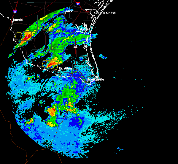 At 226 am cdt, a severe thunderstorm was located near citrus city, or 8 miles north of la joya, moving east at 20 mph (radar indicated). Hazards include quarter size hail. Damage to vehicles is expected. locations impacted include, sullivan city, palmhurst, alton, sylvia vela park, la homa, narciso g. Cavazos elementary school, doffing, citrus city, west sharyland and josefa garcia park. At 226 am cdt, a severe thunderstorm was located near citrus city, or 8 miles north of la joya, moving east at 20 mph (radar indicated). Hazards include quarter size hail. Damage to vehicles is expected. locations impacted include, sullivan city, palmhurst, alton, sylvia vela park, la homa, narciso g. Cavazos elementary school, doffing, citrus city, west sharyland and josefa garcia park.
|
| 4/10/2020 2:02 AM CDT |
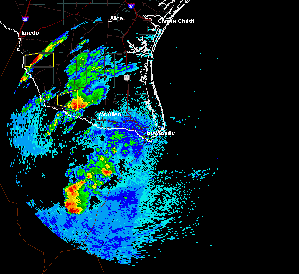 At 202 am cdt, a severe thunderstorm was located near la victoria, or 7 miles north of sullivan city, moving east at 20 mph (radar indicated). Hazards include quarter size hail. damage to vehicles is expected At 202 am cdt, a severe thunderstorm was located near la victoria, or 7 miles north of sullivan city, moving east at 20 mph (radar indicated). Hazards include quarter size hail. damage to vehicles is expected
|
| 6/7/2019 4:56 PM CDT |
 The severe thunderstorm warning for central hidalgo county will expire at 500 pm cdt, the storm which prompted the warning has weakened below severe limits, and has exited the warned area. therefore, the warning will be allowed to expire. however gusty winds are still possible with this thunderstorm. The severe thunderstorm warning for central hidalgo county will expire at 500 pm cdt, the storm which prompted the warning has weakened below severe limits, and has exited the warned area. therefore, the warning will be allowed to expire. however gusty winds are still possible with this thunderstorm.
|
| 6/7/2019 4:37 PM CDT |
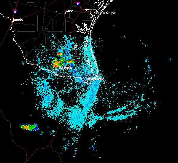 At 437 pm cdt, a severe thunderstorm was located near alton, or near palmhurst, moving southeast at 20 mph (radar indicated). Hazards include 60 mph wind gusts and quarter size hail. Hail damage to vehicles is expected. expect wind damage to roofs, siding, and trees. locations impacted include, palmhurst, alton, b. l. Garza middle school, sylvia vela park, la homa, citrus city, west sharyland, josefa garcia park, olivero garza sr elementary school and doctor americo paredes elementary school. At 437 pm cdt, a severe thunderstorm was located near alton, or near palmhurst, moving southeast at 20 mph (radar indicated). Hazards include 60 mph wind gusts and quarter size hail. Hail damage to vehicles is expected. expect wind damage to roofs, siding, and trees. locations impacted include, palmhurst, alton, b. l. Garza middle school, sylvia vela park, la homa, citrus city, west sharyland, josefa garcia park, olivero garza sr elementary school and doctor americo paredes elementary school.
|
| 6/7/2019 4:11 PM CDT |
 The national weather service in brownsville has issued a * severe thunderstorm warning for. central hidalgo county in deep south texas. until 500 pm cdt. At 410 pm cdt, a severe thunderstorm was located over mccook, moving southeast at 15 mph. The national weather service in brownsville has issued a * severe thunderstorm warning for. central hidalgo county in deep south texas. until 500 pm cdt. At 410 pm cdt, a severe thunderstorm was located over mccook, moving southeast at 15 mph.
|
| 4/7/2019 8:22 AM CDT |
 At 821 am cdt, severe thunderstorms were located along a line extending from 7 miles south of sarita to 13 miles northeast of san manuel to near citrus city, moving east at 35 mph (radar indicated). Hazards include 60 mph wind gusts and penny size hail. Expect damage to roofs, siding, and trees. locations impacted include, palmview, penitas, sullivan city, la joya, palmhurst, los ebanos, mccook, linn, alton and narciso g. Cavazos elementary school. At 821 am cdt, severe thunderstorms were located along a line extending from 7 miles south of sarita to 13 miles northeast of san manuel to near citrus city, moving east at 35 mph (radar indicated). Hazards include 60 mph wind gusts and penny size hail. Expect damage to roofs, siding, and trees. locations impacted include, palmview, penitas, sullivan city, la joya, palmhurst, los ebanos, mccook, linn, alton and narciso g. Cavazos elementary school.
|
| 4/7/2019 7:42 AM CDT |
 At 741 am cdt, severe thunderstorms were located along a line extending from near rio grande city to la gloria, moving east at 35 mph (radar indicated). Hazards include 60 mph wind gusts and quarter size hail. Hail damage to vehicles is expected. Expect wind damage to roofs, siding, and trees. At 741 am cdt, severe thunderstorms were located along a line extending from near rio grande city to la gloria, moving east at 35 mph (radar indicated). Hazards include 60 mph wind gusts and quarter size hail. Hail damage to vehicles is expected. Expect wind damage to roofs, siding, and trees.
|
| 5/29/2017 2:11 AM CDT |
 The severe thunderstorm warning for southwestern kenedy, hidalgo, southeastern starr, southeastern brooks and northwestern willacy counties will expire at 215 am cdt, the storms which prompted the warning have weakened below severe limits, and no longer pose an immediate threat to life or property. therefore the warning will be allowed to expire. a severe thunderstorm watch remains in effect until 300 am cdt for deep south texas. to report severe weather, contact your nearest law enforcement agency. they will relay your report to the national weather service brownsville. The severe thunderstorm warning for southwestern kenedy, hidalgo, southeastern starr, southeastern brooks and northwestern willacy counties will expire at 215 am cdt, the storms which prompted the warning have weakened below severe limits, and no longer pose an immediate threat to life or property. therefore the warning will be allowed to expire. a severe thunderstorm watch remains in effect until 300 am cdt for deep south texas. to report severe weather, contact your nearest law enforcement agency. they will relay your report to the national weather service brownsville.
|
| 5/29/2017 1:54 AM CDT |
 At 153 am cdt, severe thunderstorms were located along a line extending from 7 miles east of armstrong to near norias to 6 miles west of rudolph to 9 miles west of yturria to near faysville, moving east at 50 mph (radar indicated). Hazards include 60 mph wind gusts and nickel size hail. Expect minor damage to mobile homes. some roofs. siding and some fences. tree limbs will blow down and small trees will be uprooted. damage to power lines and some power poles is expected. Locations impacted include, edinburg, mission, pharr, san juan, alamo, donna, hidalgo, elsa, palmview and penitas. At 153 am cdt, severe thunderstorms were located along a line extending from 7 miles east of armstrong to near norias to 6 miles west of rudolph to 9 miles west of yturria to near faysville, moving east at 50 mph (radar indicated). Hazards include 60 mph wind gusts and nickel size hail. Expect minor damage to mobile homes. some roofs. siding and some fences. tree limbs will blow down and small trees will be uprooted. damage to power lines and some power poles is expected. Locations impacted include, edinburg, mission, pharr, san juan, alamo, donna, hidalgo, elsa, palmview and penitas.
|
| 5/29/2017 1:16 AM CDT |
 At 115 am cdt, severe thunderstorms were located along a line extending from near rachal to 6 miles south of el coyote ranch airport to near puerto rico to near mccook to near sullivan city, moving east at 50 mph (radar indicated). Hazards include 60 mph wind gusts and nickel size hail. Expect minor damage to mobile homes. some roofs. siding and some fences. tree limbs will blow down and small trees will be uprooted. Damage to power lines and some power poles is expected. At 115 am cdt, severe thunderstorms were located along a line extending from near rachal to 6 miles south of el coyote ranch airport to near puerto rico to near mccook to near sullivan city, moving east at 50 mph (radar indicated). Hazards include 60 mph wind gusts and nickel size hail. Expect minor damage to mobile homes. some roofs. siding and some fences. tree limbs will blow down and small trees will be uprooted. Damage to power lines and some power poles is expected.
|
| 5/29/2017 12:51 AM CDT |
 At 1251 am cdt, severe thunderstorms were located along a line extending from near san rafael ranch airport to near san isidro to 9 miles southwest of mccook to alto bonito, moving east at 40 mph (radar indicated). Hazards include 60 mph wind gusts and quarter size hail. Hail damage to vehicles. including cracked windshields and minor exterior dents can expected. some damage to crops and trees is expected. expect minor wind damage to mobile homes, some roofs, siding and some fences. tree limbs will blow down and small trees will be uprooted. damage to power lines and some power poles is expected. Locations impacted include, rio grande city, penitas, sullivan city, la joya, escobares, el sauz, garciasville, la rosita, mccook and los ebanos. At 1251 am cdt, severe thunderstorms were located along a line extending from near san rafael ranch airport to near san isidro to 9 miles southwest of mccook to alto bonito, moving east at 40 mph (radar indicated). Hazards include 60 mph wind gusts and quarter size hail. Hail damage to vehicles. including cracked windshields and minor exterior dents can expected. some damage to crops and trees is expected. expect minor wind damage to mobile homes, some roofs, siding and some fences. tree limbs will blow down and small trees will be uprooted. damage to power lines and some power poles is expected. Locations impacted include, rio grande city, penitas, sullivan city, la joya, escobares, el sauz, garciasville, la rosita, mccook and los ebanos.
|
| 5/29/2017 12:23 AM CDT |
 At 1221 am cdt, severe thunderstorms were located along a line extending from 7 miles southwest of aqua nuevo to 7 miles southeast of viboras to el saul to 7 miles southwest of , moving east at 45 mph (radar indicated). Hazards include 60 mph wind gusts and quarter size hail. Hail damage to vehicles. including cracked windshields and minor exterior dents can expected. some damage to crops and trees is expected. expect minor wind damage to mobile homes, some roofs, siding and some fences. tree limbs will blow down and small trees will be uprooted. Damage to power lines and some power poles is expected. At 1221 am cdt, severe thunderstorms were located along a line extending from 7 miles southwest of aqua nuevo to 7 miles southeast of viboras to el saul to 7 miles southwest of , moving east at 45 mph (radar indicated). Hazards include 60 mph wind gusts and quarter size hail. Hail damage to vehicles. including cracked windshields and minor exterior dents can expected. some damage to crops and trees is expected. expect minor wind damage to mobile homes, some roofs, siding and some fences. tree limbs will blow down and small trees will be uprooted. Damage to power lines and some power poles is expected.
|
| 12/3/2016 8:53 PM CST |
 At 852 pm cst, a severe thunderstorm was located near garciasville, moving northeast at 30 mph (radar indicated). Hazards include 60 mph wind gusts and quarter size hail. Hail damage to vehicles. including cracked windshields and minor exterior dents can expected. some damage to crops and trees is expected. expect minor wind damage to mobile homes, some roofs, siding and some fences. tree limbs will blow down and small trees will be uprooted. Damage to power lines and some power poles is expected. At 852 pm cst, a severe thunderstorm was located near garciasville, moving northeast at 30 mph (radar indicated). Hazards include 60 mph wind gusts and quarter size hail. Hail damage to vehicles. including cracked windshields and minor exterior dents can expected. some damage to crops and trees is expected. expect minor wind damage to mobile homes, some roofs, siding and some fences. tree limbs will blow down and small trees will be uprooted. Damage to power lines and some power poles is expected.
|
| 5/31/2016 11:30 PM CDT |
 At 1130 pm cdt, a severe thunderstorm was located over castro elementary school, or over mission, moving southeast at 25 mph (radar indicated). Hazards include two inch hail and 60 mph wind gusts. People and animals outdoors will be injured. expect hail damage to roofs, siding, windows and property. vehicle damage will include cracked or shattered windshields and major dents requiring significant repairs. expect minor wind damage to mobile homes, some roofs, siding and some fences. tree limbs will blow down and small trees will be uprooted. damage to power lines and some power poles is expected. Locations impacted include, mission, pharr, san juan, alamo, hidalgo, palmview, penitas, palmhurst, north mcallen and sharyland. At 1130 pm cdt, a severe thunderstorm was located over castro elementary school, or over mission, moving southeast at 25 mph (radar indicated). Hazards include two inch hail and 60 mph wind gusts. People and animals outdoors will be injured. expect hail damage to roofs, siding, windows and property. vehicle damage will include cracked or shattered windshields and major dents requiring significant repairs. expect minor wind damage to mobile homes, some roofs, siding and some fences. tree limbs will blow down and small trees will be uprooted. damage to power lines and some power poles is expected. Locations impacted include, mission, pharr, san juan, alamo, hidalgo, palmview, penitas, palmhurst, north mcallen and sharyland.
|
| 5/31/2016 11:19 PM CDT |
 At 1118 pm cdt, a severe thunderstorm was located over ann richards middle school, or over palmview, moving southeast at 25 mph (radar indicated). Hazards include 60 mph wind gusts and half dollar size hail. Hail damage to vehicles. including cracked windshields and minor exterior dents can expected. some damage to crops and trees is expected. expect minor wind damage to mobile homes, some roofs, siding and some fences. tree limbs will blow down and small trees will be uprooted. Damage to power lines and some power poles is expected. At 1118 pm cdt, a severe thunderstorm was located over ann richards middle school, or over palmview, moving southeast at 25 mph (radar indicated). Hazards include 60 mph wind gusts and half dollar size hail. Hail damage to vehicles. including cracked windshields and minor exterior dents can expected. some damage to crops and trees is expected. expect minor wind damage to mobile homes, some roofs, siding and some fences. tree limbs will blow down and small trees will be uprooted. Damage to power lines and some power poles is expected.
|
| 5/14/2016 5:58 PM CDT |
 At 557 pm cdt, a severe thunderstorm was located over garcia middle school, or over palmhurst, moving southeast at 15 mph (radar indicated). Hazards include 60 mph wind gusts and quarter size hail. Hail damage to vehicles. including cracked windshields and minor exterior dents can expected. some damage to crops and trees is expected. expect minor wind damage to mobile homes, some roofs, siding and some fences. tree limbs will blow down and small trees will be uprooted. Damage to power lines and some power poles is expected. At 557 pm cdt, a severe thunderstorm was located over garcia middle school, or over palmhurst, moving southeast at 15 mph (radar indicated). Hazards include 60 mph wind gusts and quarter size hail. Hail damage to vehicles. including cracked windshields and minor exterior dents can expected. some damage to crops and trees is expected. expect minor wind damage to mobile homes, some roofs, siding and some fences. tree limbs will blow down and small trees will be uprooted. Damage to power lines and some power poles is expected.
|
| 4/18/2016 8:21 PM CDT |
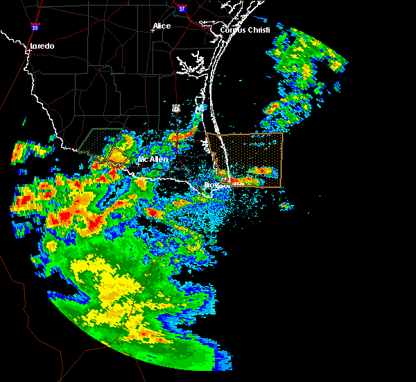 At 821 pm cdt, a severe thunderstorm was located over lorenzo de zavala middle school, or over la joya, moving southeast at 10 mph (radar indicated). Hazards include ping pong ball size hail and 60 mph wind gusts. People and animals outdoors will be injured. expect hail damage to roofs, siding, windows and property. vehicle damage will include cracked or shattered windshields and major dents requiring significant repairs. expect minor wind damage to mobile homes, some roofs, siding and some fences. tree limbs will blow down and small trees will be uprooted. damage to power lines and some power poles is expected. locations impacted include, penitas, sullivan city, la joya, los ebanos, narciso g. Cavazos elementary school, la homa, la joya city hall, doctor americo paredes elementary school, jimmy carter high school and doffing. At 821 pm cdt, a severe thunderstorm was located over lorenzo de zavala middle school, or over la joya, moving southeast at 10 mph (radar indicated). Hazards include ping pong ball size hail and 60 mph wind gusts. People and animals outdoors will be injured. expect hail damage to roofs, siding, windows and property. vehicle damage will include cracked or shattered windshields and major dents requiring significant repairs. expect minor wind damage to mobile homes, some roofs, siding and some fences. tree limbs will blow down and small trees will be uprooted. damage to power lines and some power poles is expected. locations impacted include, penitas, sullivan city, la joya, los ebanos, narciso g. Cavazos elementary school, la homa, la joya city hall, doctor americo paredes elementary school, jimmy carter high school and doffing.
|
| 4/18/2016 8:03 PM CDT |
 At 802 pm cdt, national weather service meteorologists detected a severe thunderstorm located over la joya, moving southeast at 20 mph (radar indicated). Hazards include 60 mph wind gusts and half dollar size hail. Hail damage to vehicles. including cracked windshields and minor exterior dents can expected. some damage to crops and trees is expected. expect minor wind damage to mobile homes, some roofs, siding and some fences. tree limbs will blow down and small trees will be uprooted. damage to power lines and some power poles is expected. locations impacted include, penitas, sullivan city, la joya, los ebanos, la grulla, narciso g. Cavazos elementary school, alto bonito, doffing, lorenzo de zavala middle school and citrus city. At 802 pm cdt, national weather service meteorologists detected a severe thunderstorm located over la joya, moving southeast at 20 mph (radar indicated). Hazards include 60 mph wind gusts and half dollar size hail. Hail damage to vehicles. including cracked windshields and minor exterior dents can expected. some damage to crops and trees is expected. expect minor wind damage to mobile homes, some roofs, siding and some fences. tree limbs will blow down and small trees will be uprooted. damage to power lines and some power poles is expected. locations impacted include, penitas, sullivan city, la joya, los ebanos, la grulla, narciso g. Cavazos elementary school, alto bonito, doffing, lorenzo de zavala middle school and citrus city.
|
| 4/18/2016 7:46 PM CDT |
 At 746 pm cdt, a severe thunderstorm was located over sullivan city, moving southeast at 10 mph (radar indicated). Hazards include 60 mph wind gusts and quarter size hail. Hail damage to vehicles. including cracked windshields and minor exterior dents can expected. some damage to crops and trees is expected. expect minor wind damage to mobile homes, some roofs, siding and some fences. tree limbs will blow down and small trees will be uprooted. Damage to power lines and some power poles is expected. At 746 pm cdt, a severe thunderstorm was located over sullivan city, moving southeast at 10 mph (radar indicated). Hazards include 60 mph wind gusts and quarter size hail. Hail damage to vehicles. including cracked windshields and minor exterior dents can expected. some damage to crops and trees is expected. expect minor wind damage to mobile homes, some roofs, siding and some fences. tree limbs will blow down and small trees will be uprooted. Damage to power lines and some power poles is expected.
|
| 8/20/2015 1:29 AM CDT |
 At 129 am cdt, doppler radar indicated a severe thunderstorm capable of producing quarter size hail and damaging winds in excess of 60 mph. this storm was located near b.l. garza middle school, or near north mcallen, moving northeast at 15 mph. locations impacted include, edinburg, mission, pharr, san juan, alamo, hidalgo, palmview, palmhurst, north mcallen and sharyland. At 129 am cdt, doppler radar indicated a severe thunderstorm capable of producing quarter size hail and damaging winds in excess of 60 mph. this storm was located near b.l. garza middle school, or near north mcallen, moving northeast at 15 mph. locations impacted include, edinburg, mission, pharr, san juan, alamo, hidalgo, palmview, palmhurst, north mcallen and sharyland.
|
| 8/20/2015 12:53 AM CDT |
 At 1252 am cdt, doppler radar indicated a severe thunderstorm capable of producing half dollar size hail and destructive winds in excess of 70 mph. this storm was located over rowe high school, or over sharyland, and moving northeast at 15 mph. At 1252 am cdt, doppler radar indicated a severe thunderstorm capable of producing half dollar size hail and destructive winds in excess of 70 mph. this storm was located over rowe high school, or over sharyland, and moving northeast at 15 mph.
|
| 8/20/2015 12:37 AM CDT |
 At 1235 am cdt, local law enforcement reported damaging hail up to golf ball size. these storms were located along a line extending from near las lomas to mcallen recycling center, moving east at 15 mph. locations impacted include, edinburg, mission, palmview, penitas, sullivan city, la joya, palmhurst, garciasville, los ebanos and north mcallen. At 1235 am cdt, local law enforcement reported damaging hail up to golf ball size. these storms were located along a line extending from near las lomas to mcallen recycling center, moving east at 15 mph. locations impacted include, edinburg, mission, palmview, penitas, sullivan city, la joya, palmhurst, garciasville, los ebanos and north mcallen.
|
| 8/20/2015 12:28 AM CDT |
 At 1227 am cdt, doppler radar indicated a line of severe thunderstorms capable of producing quarter size hail and damaging winds in excess of 60 mph. these storms were located along a line extending from near las lomas to mission fire station number 3, and moving northeast at 15 mph. At 1227 am cdt, doppler radar indicated a line of severe thunderstorms capable of producing quarter size hail and damaging winds in excess of 60 mph. these storms were located along a line extending from near las lomas to mission fire station number 3, and moving northeast at 15 mph.
|
| 8/20/2015 12:09 AM CDT |
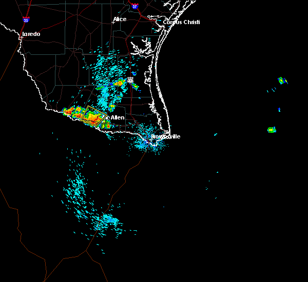 At 1208 am cdt, doppler radar indicated a severe thunderstorm capable of producing quarter size hail and damaging winds in excess of 60 mph. this storm was located over monte alto, or near hargill, moving northeast at 15 mph. locations impacted include, mission, palmview, penitas, la joya, palmhurst, north mcallen, sharyland, alton, doffing and lee elementary school. At 1208 am cdt, doppler radar indicated a severe thunderstorm capable of producing quarter size hail and damaging winds in excess of 60 mph. this storm was located over monte alto, or near hargill, moving northeast at 15 mph. locations impacted include, mission, palmview, penitas, la joya, palmhurst, north mcallen, sharyland, alton, doffing and lee elementary school.
|
| 8/19/2015 11:45 PM CDT |
 At 1144 pm cdt, doppler radar indicated a severe thunderstorm capable of producing quarter size hail and damaging winds in excess of 60 mph. this storm was located over mission, and moving northeast at 15 mph. At 1144 pm cdt, doppler radar indicated a severe thunderstorm capable of producing quarter size hail and damaging winds in excess of 60 mph. this storm was located over mission, and moving northeast at 15 mph.
|
| 5/23/2015 11:39 PM CDT | At 1138 pm cdt, doppler radar indicated a line of severe thunderstorms capable of producing damaging winds in excess of 60 mph. these storms were located along a line extending from near concepcion to 11 miles northwest of encino to 7 miles northeast of la reforma to 9 miles south of santa catarina, moving east at 45 mph. locations impacted include, mcallen, rio grande city, falfurrias..sullivan city, la joya and la grulla. |
| 5/23/2015 11:12 PM CDT | At 1110 pm cdt, doppler radar indicated a line of severe thunderstorms capable of producing damaging winds in excess of 60 mph. these storms were located along a line extending from hebbronville to near agua nueva to santa catarina to near rio grande city, moving east at 45 mph. |
| 4/13/2015 10:19 PM CDT | The national weather service in brownsville has issued a * severe thunderstorm warning for. southwestern hidalgo county in deep south texas. until 1100 pm cdt * at 1019 pm cdt. Doppler radar indicated a severe thunderstorm capable of producing quarter size hail and damaging winds in excess. |
| 4/12/2015 11:02 PM CDT | A severe thunderstorm warning remains in effect until 1130 pm cdt for hidalgo. kenedy. northwestern cameron. brooks and willacy counties. at 1100 pm cdt. doppler radar indicated a line of severe thunderstorms capable of producing quarter size hail and destructive winds in excess of 70 mph. These storms were located along a line. |
| 4/12/2015 10:52 PM CDT | A severe thunderstorm warning remains in effect until 1130 pm cdt for hidalgo. kenedy. northwestern cameron. brooks. eastern starr and willacy counties. at 1048 pm cdt. doppler radar indicated a line of severe thunderstorms capable of producing quarter size hail and damaging winds in excess of 60 mph. These storms were located along a line. |
| 4/12/2015 10:28 PM CDT | The national weather service in brownsville has issued a * severe thunderstorm warning for. hidalgo county in deep south texas. eastern jim hogg county in deep south texas. kenedy county in deep south texas. Northwestern cameron county in deep south texas. |
| 3/26/2015 1:19 PM CDT | A severe thunderstorm warning remains in effect until 130 pm cdt for southwestern hidalgo county. at 117 pm cdt. trained weather spotters reported a severe thunderstorm producing large damaging hail up to two inches in diameter and damaging winds in excess of 60 mph. This storm was located over edinburg municipal golf course and northern. |
| 3/26/2015 1:04 PM CDT | A severe thunderstorm warning remains in effect until 130 pm cdt for southwestern hidalgo county. at 103 pm cdt. doppler radar indicated a severe thunderstorm capable of producing large damaging hail up to two inches in diameter and destructive winds in excess of 70 mph. this storm was located over josefa garcia park. or near veterans memorial high school. Moving. |
| 3/26/2015 12:45 PM CDT | The national weather service in brownsville has issued a * severe thunderstorm warning for. southwestern hidalgo county in deep south texas. until 130 pm cdt * at 1245 pm cdt. Doppler radar indicated a severe thunderstorm capable of producing large damaging hail up to two inches in. |
Hail Maps for Citrus City, TX

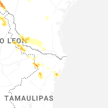
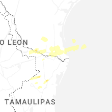


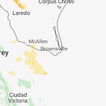

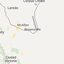


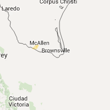
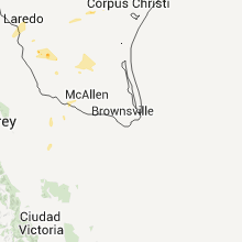


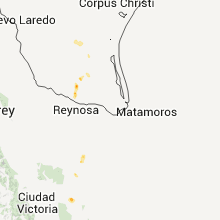


Connect with Interactive Hail Maps