

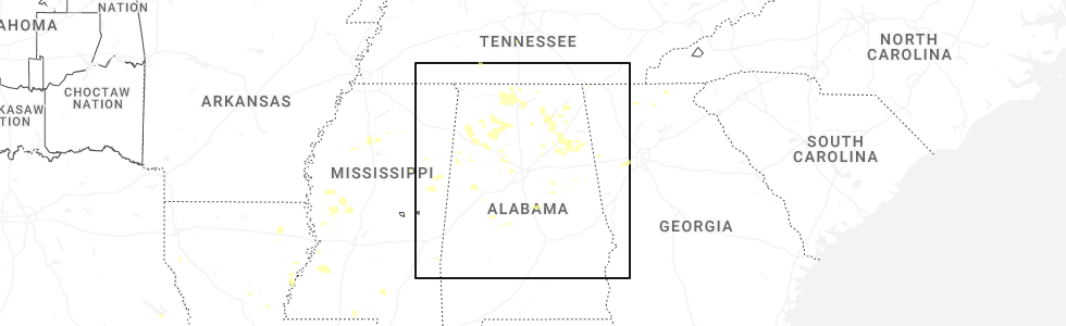
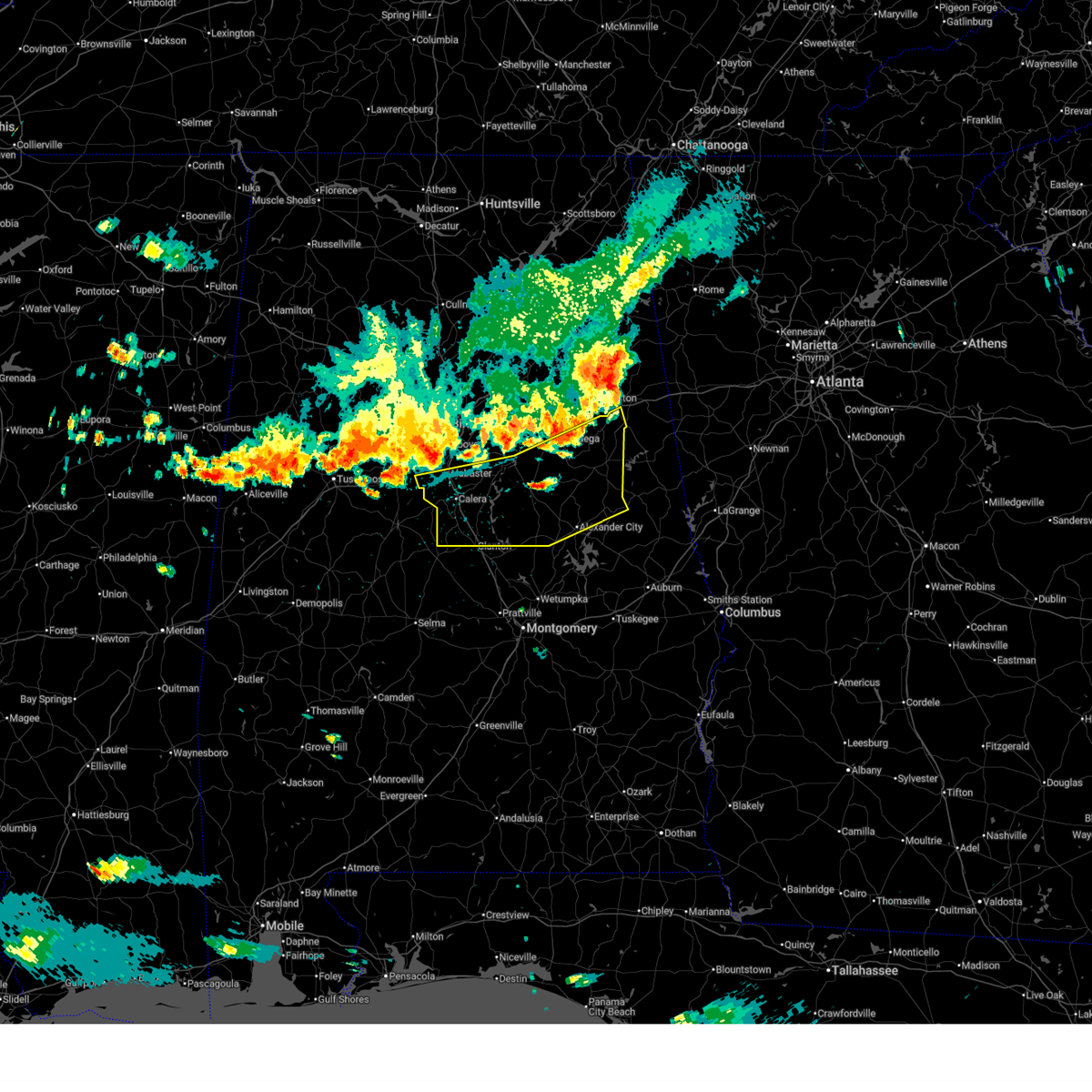
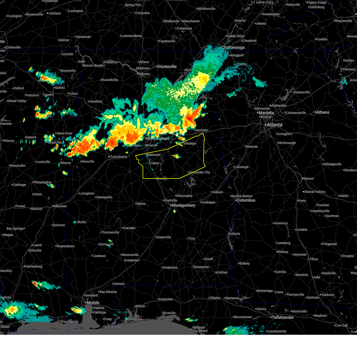
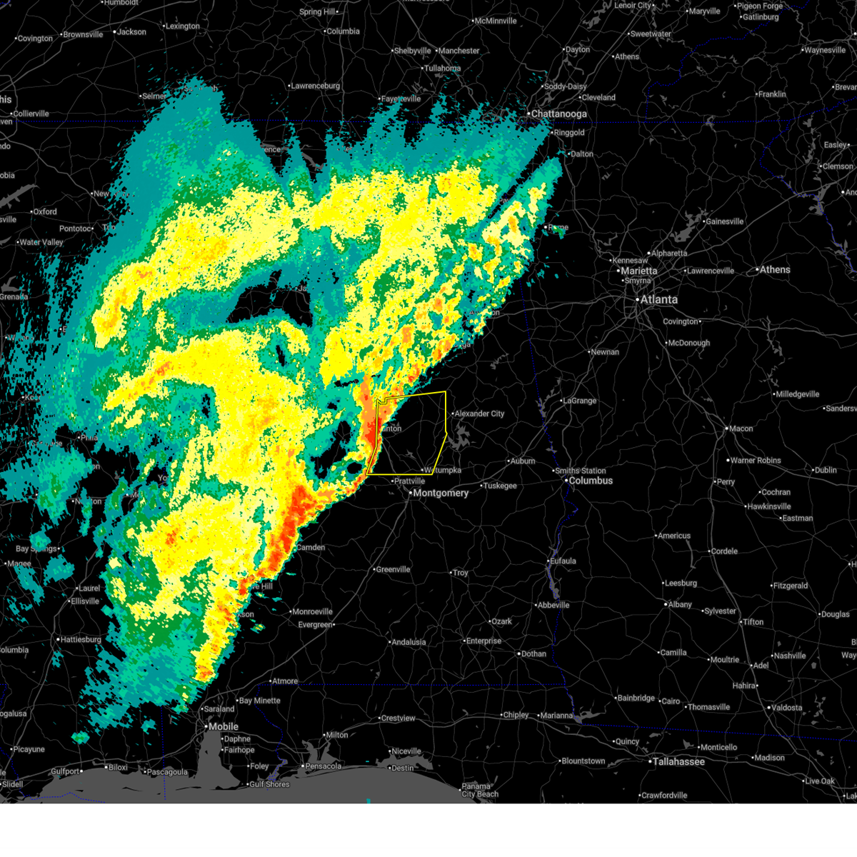
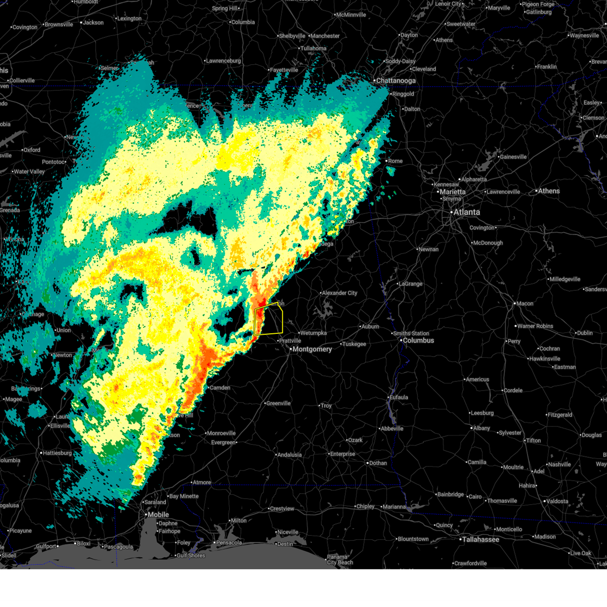
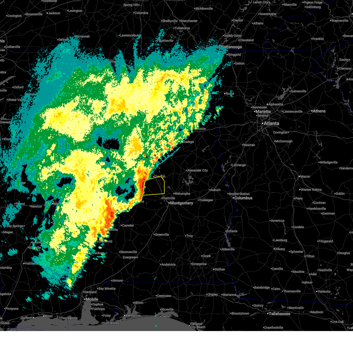
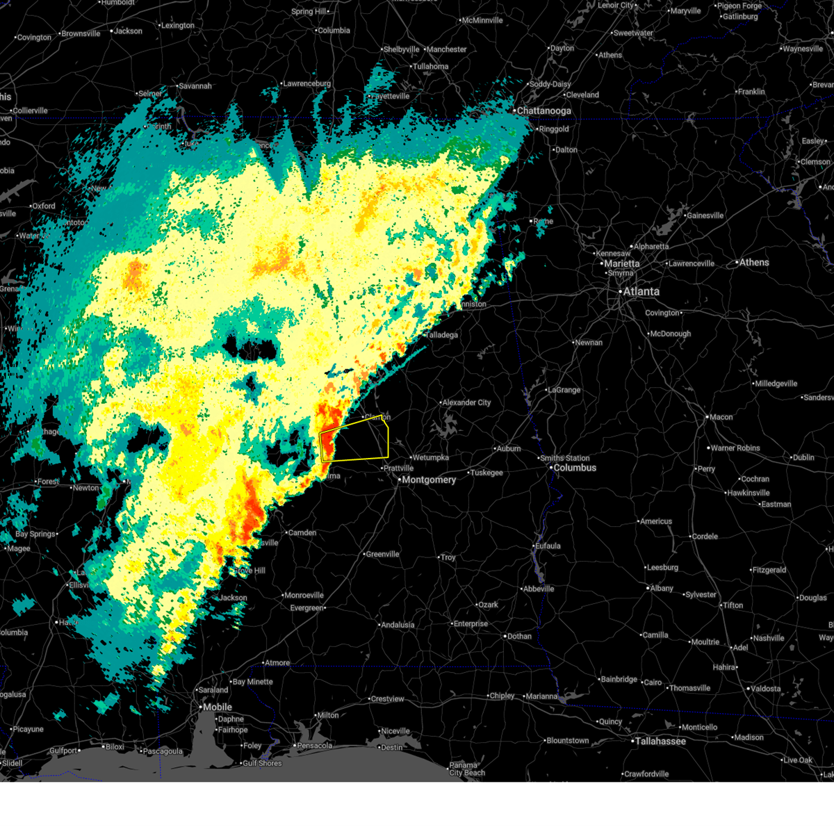
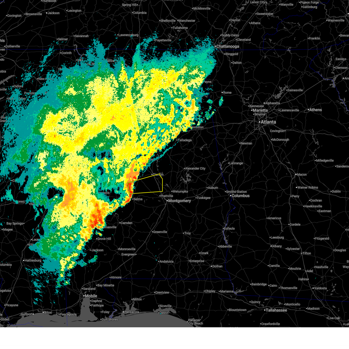
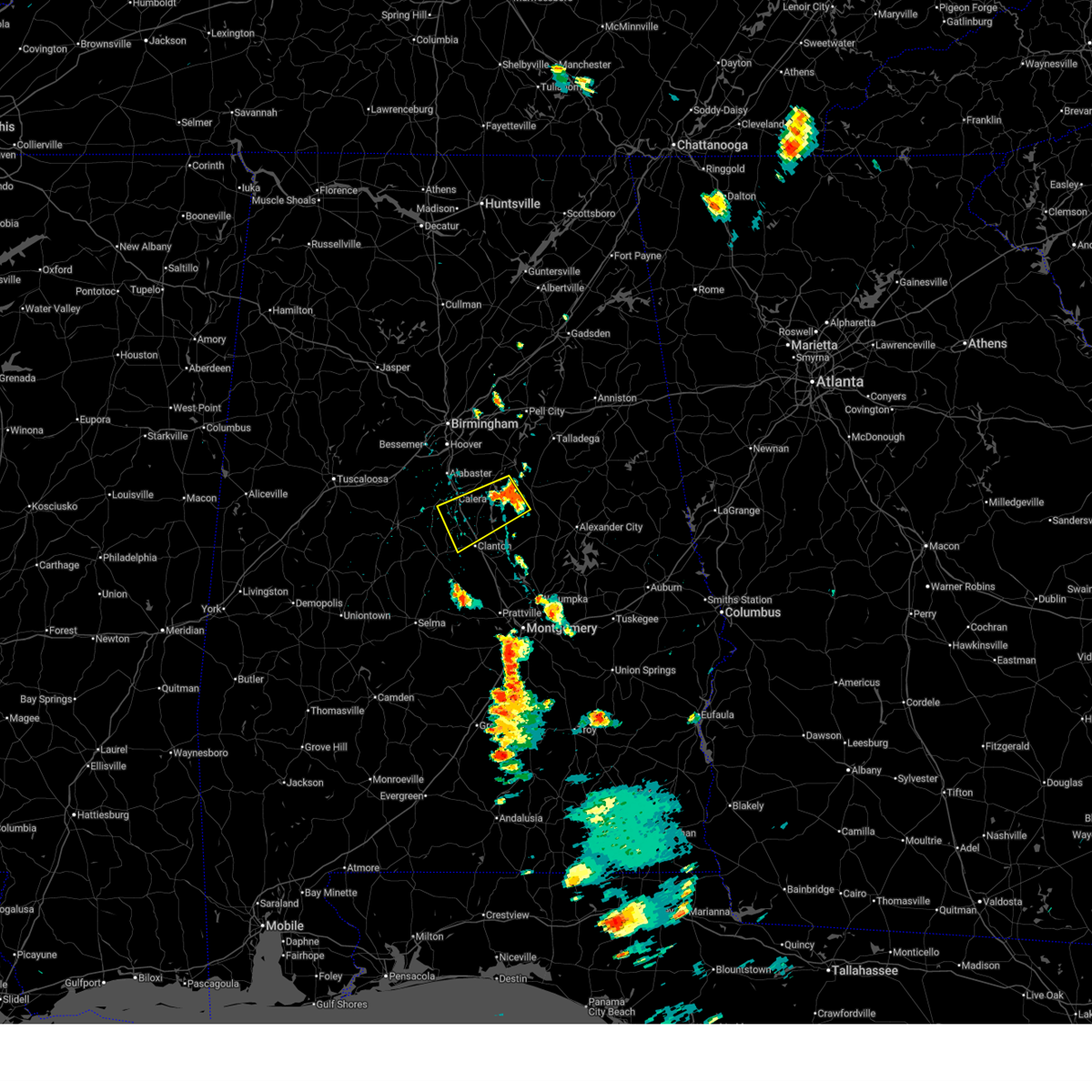
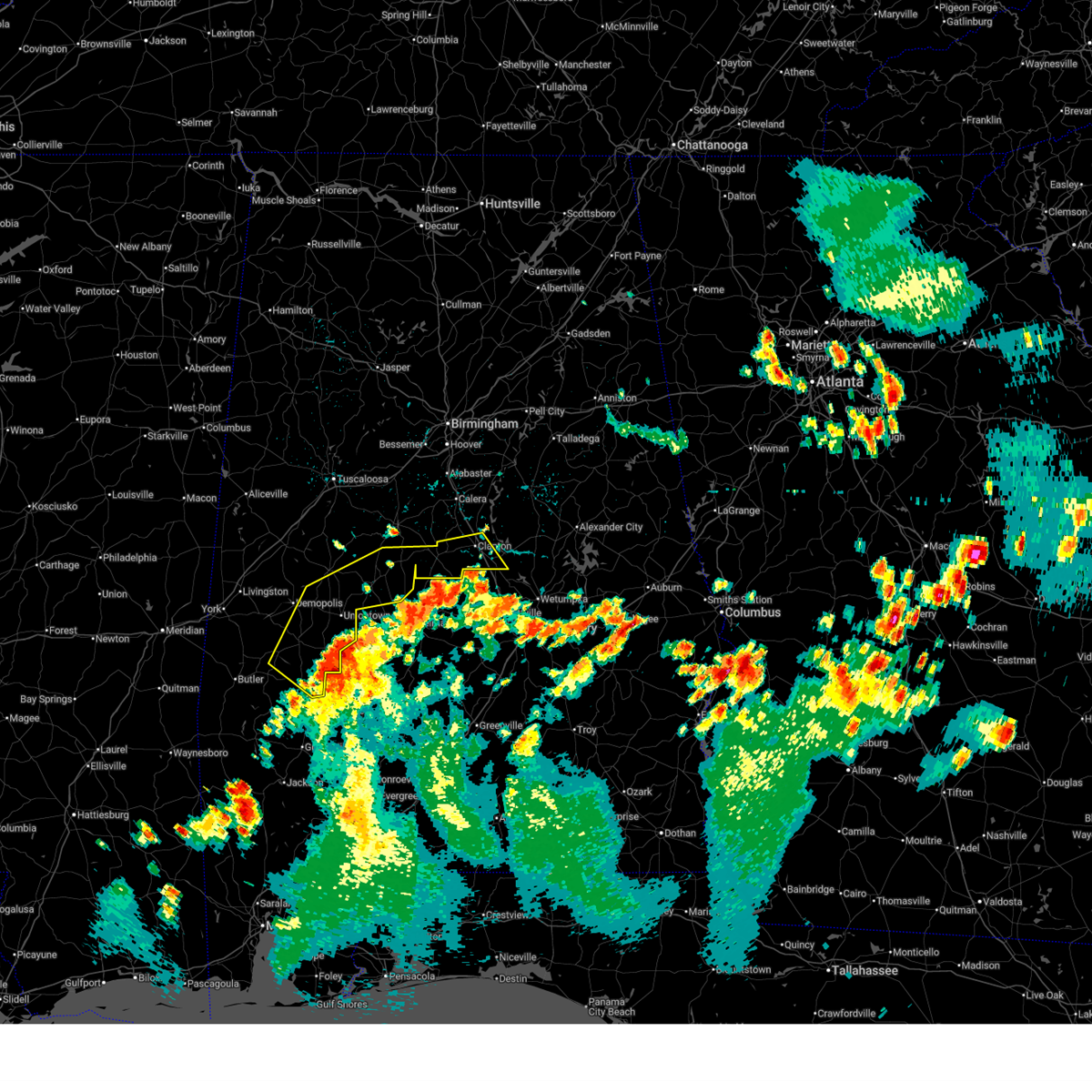
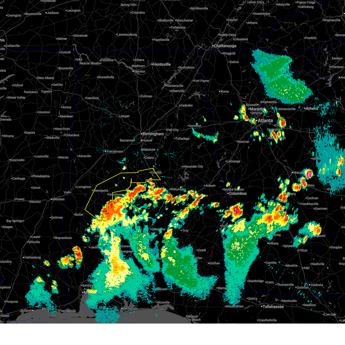
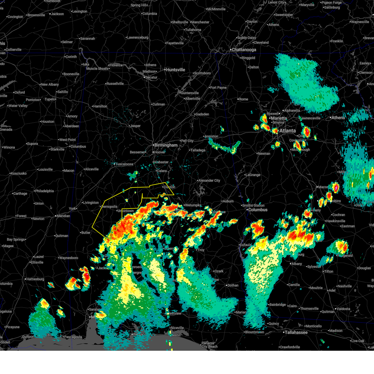
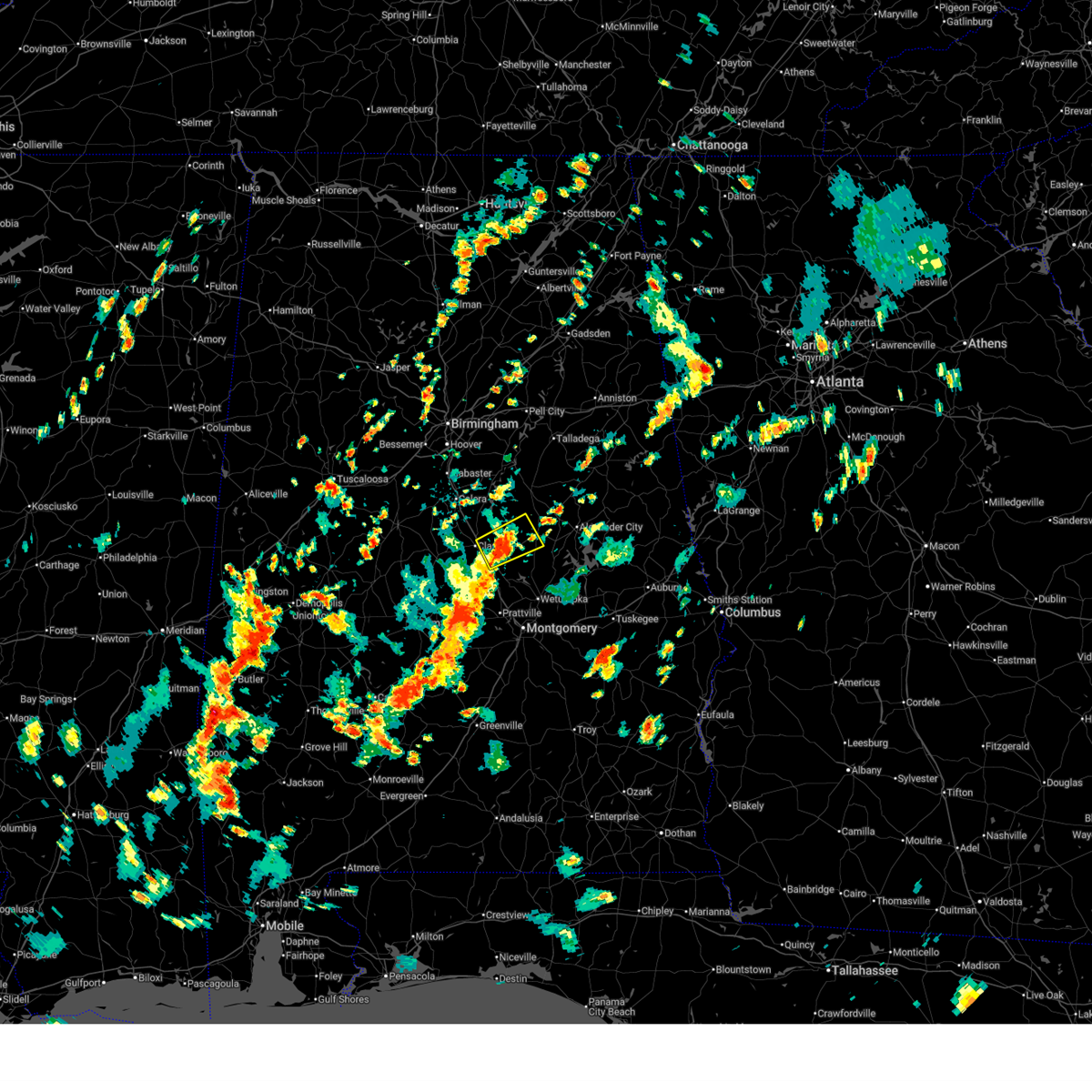
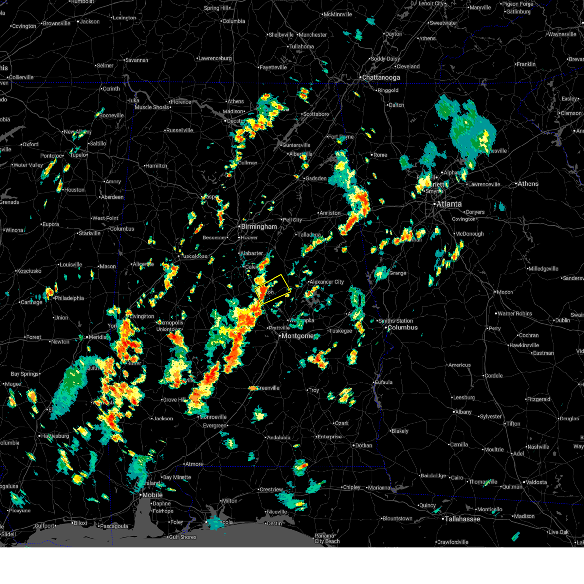
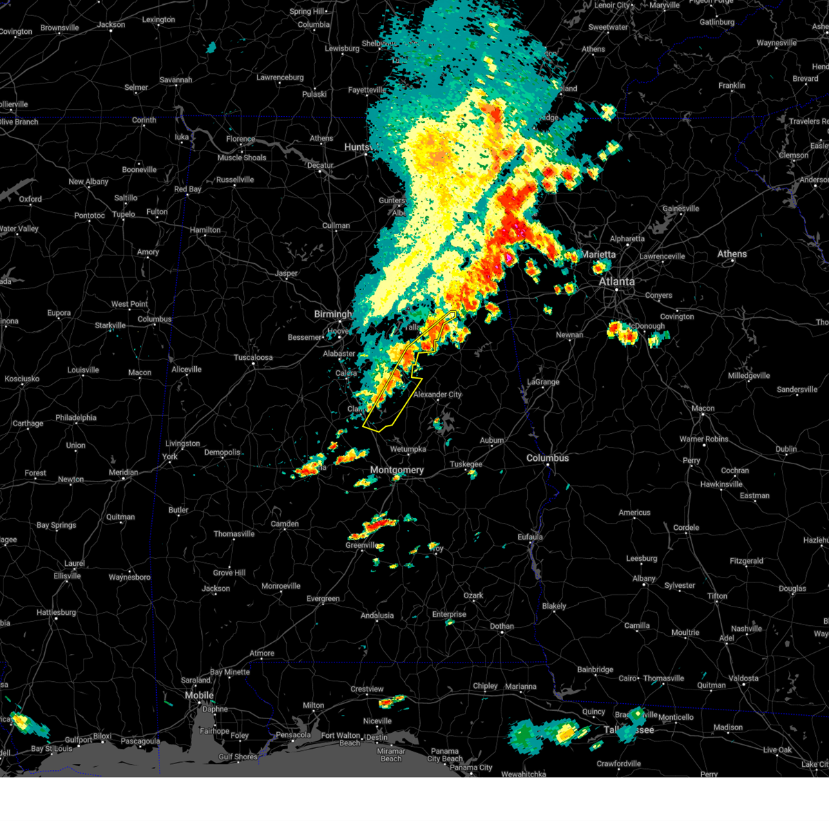
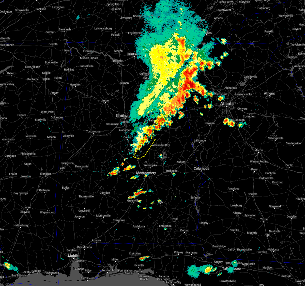
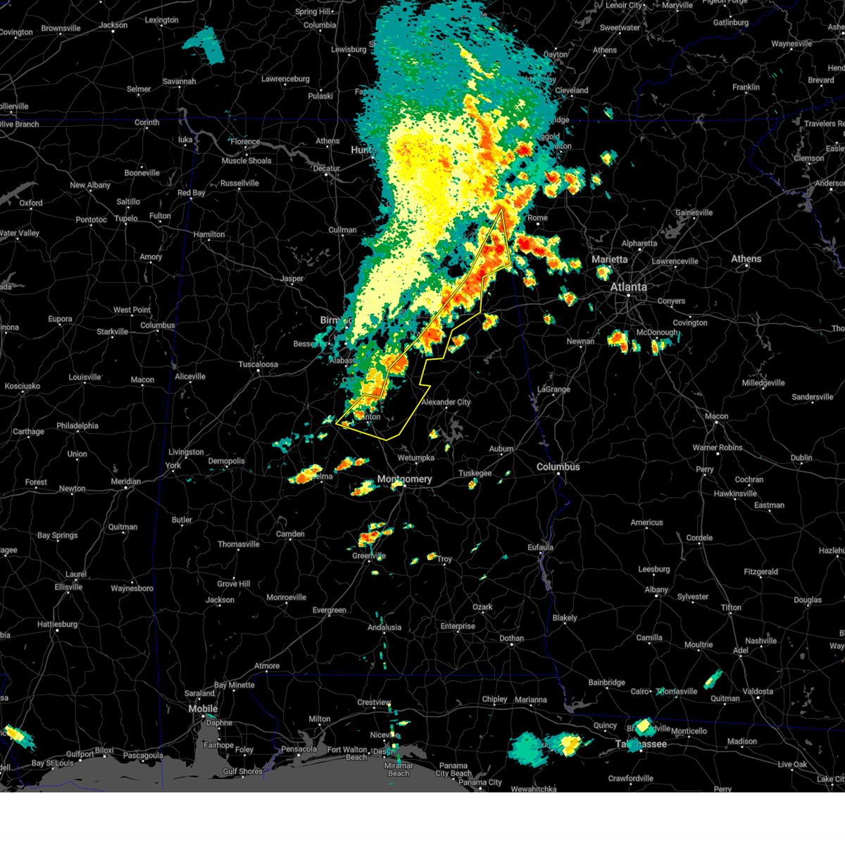
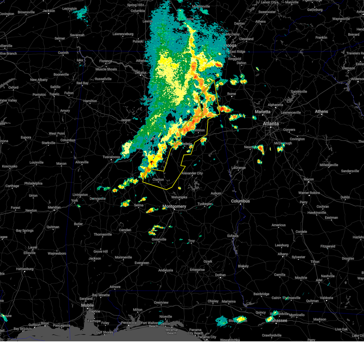
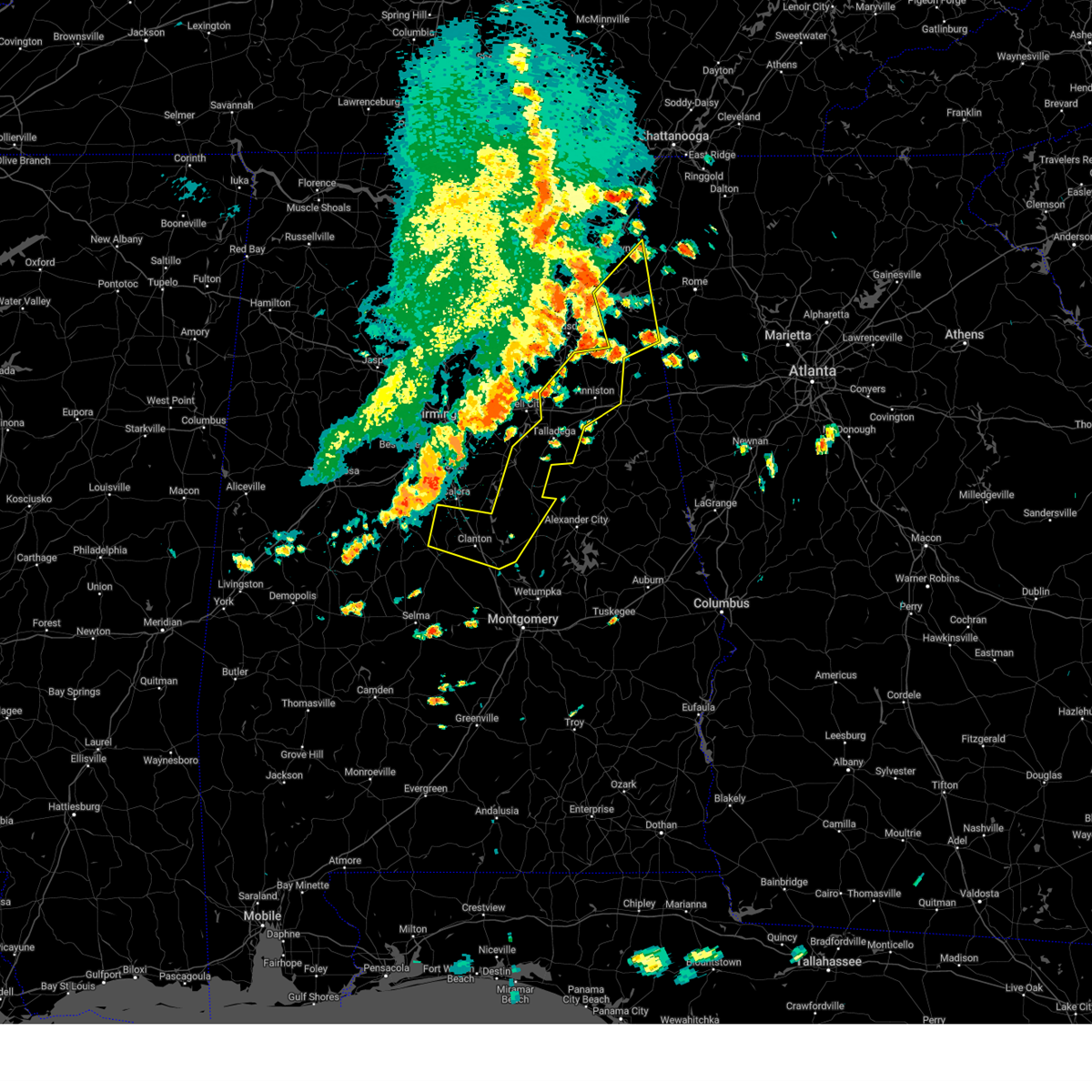
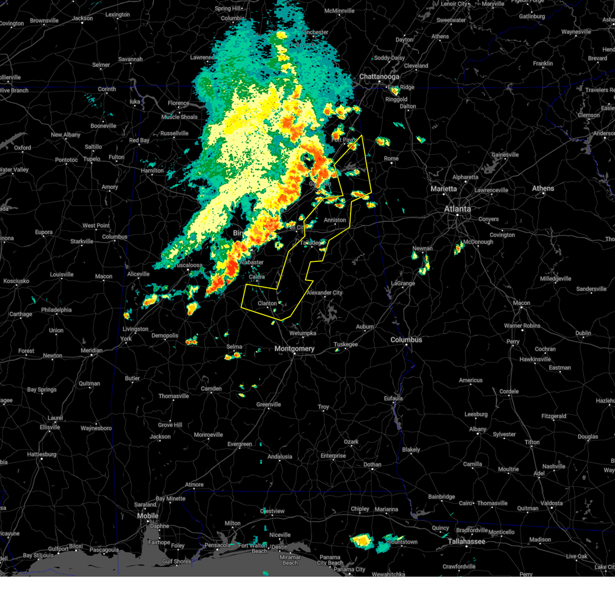
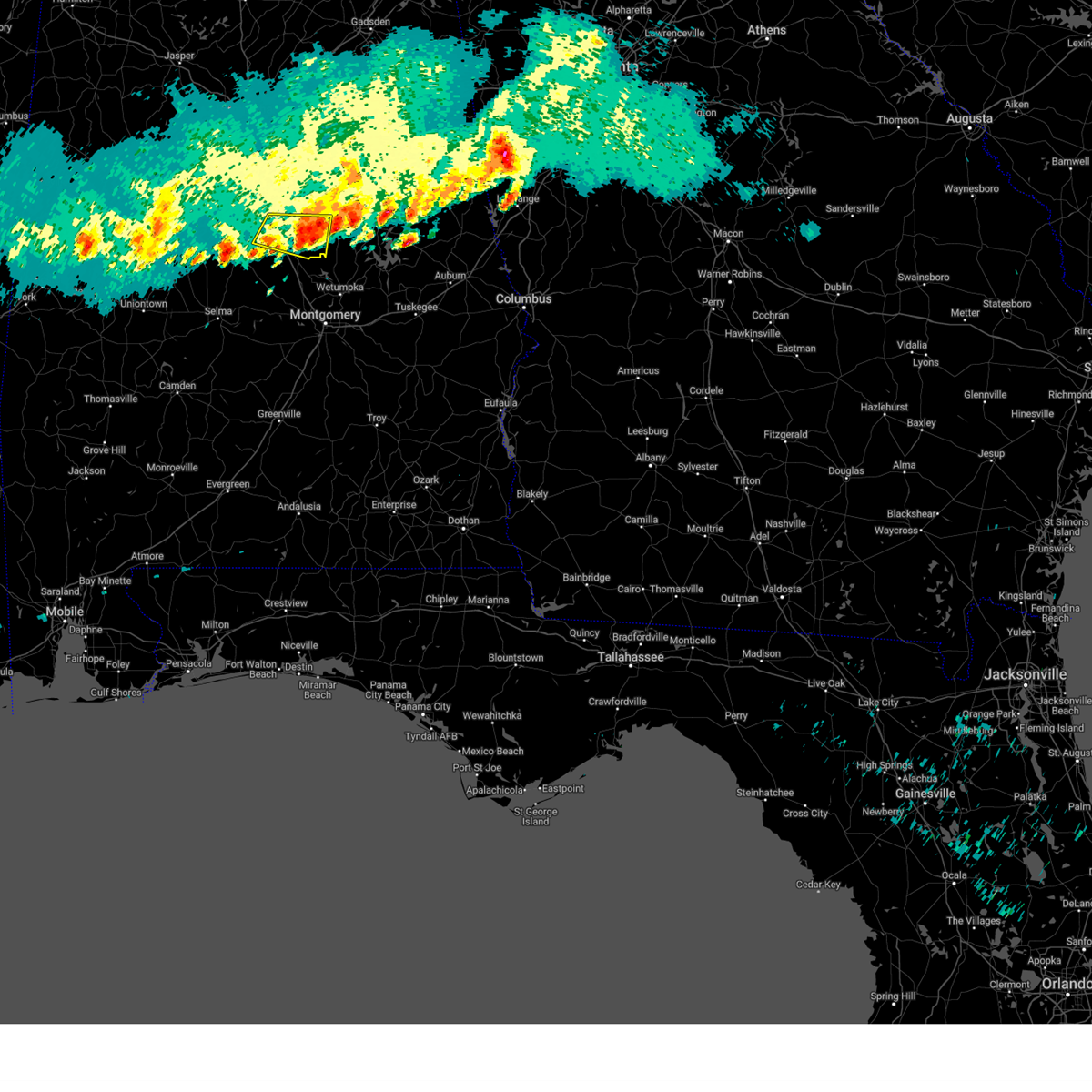
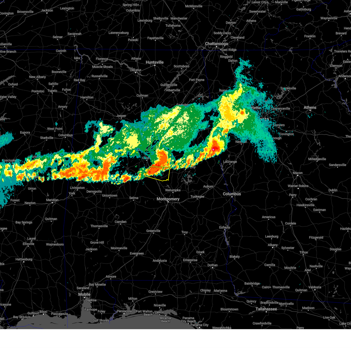
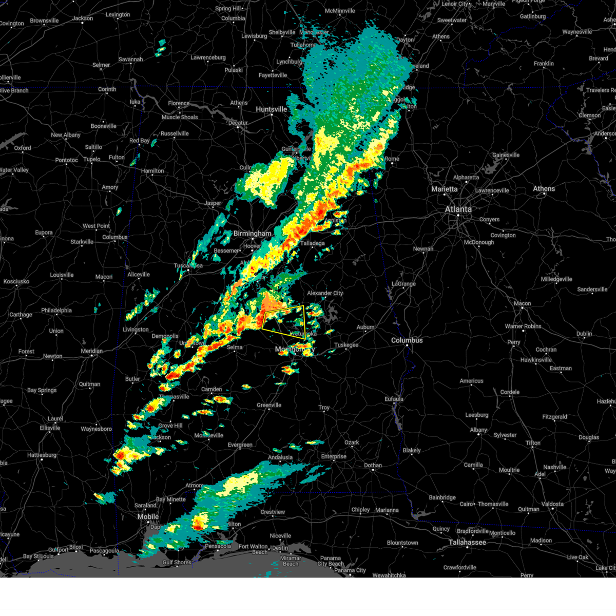
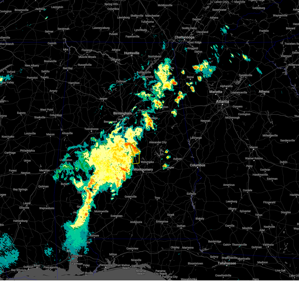
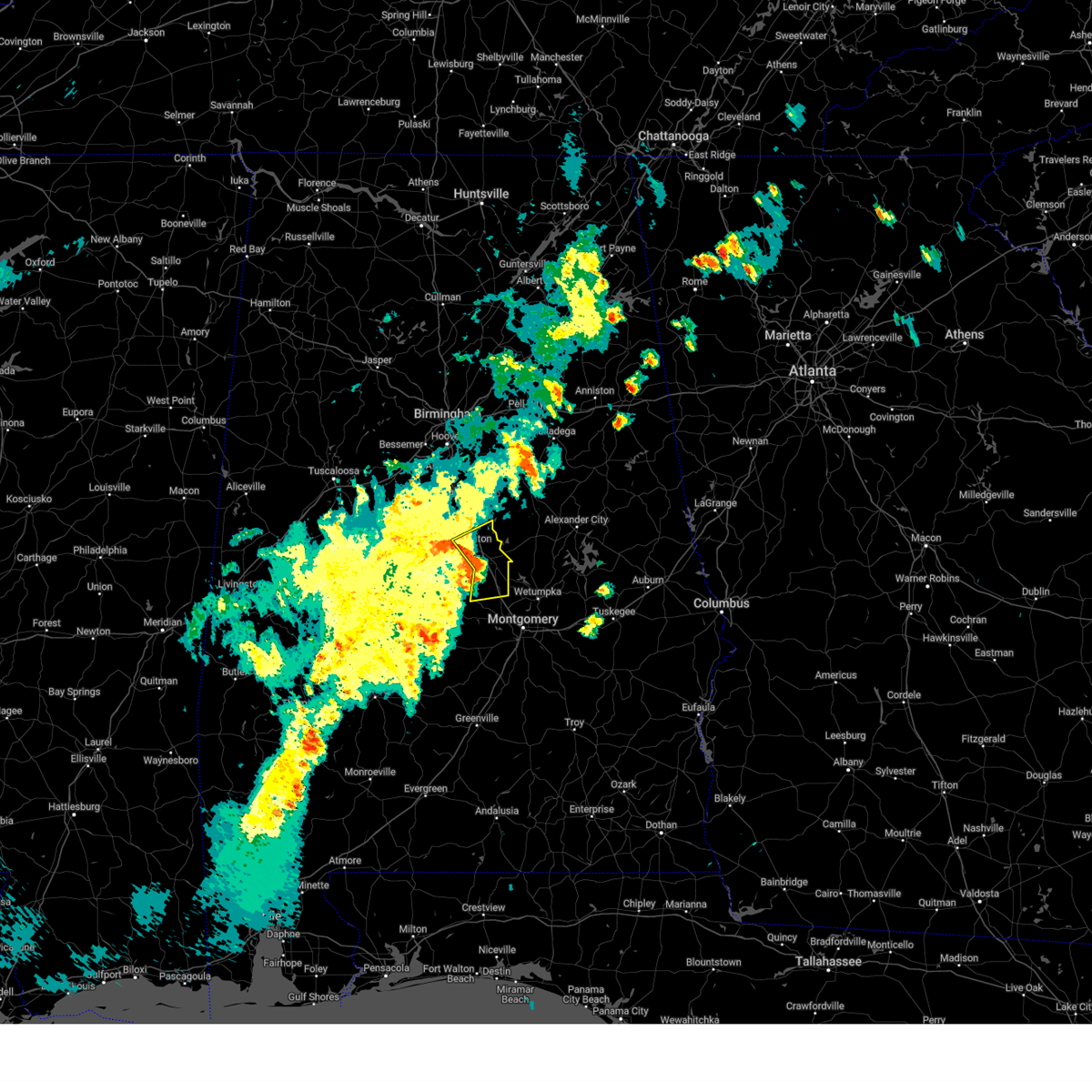
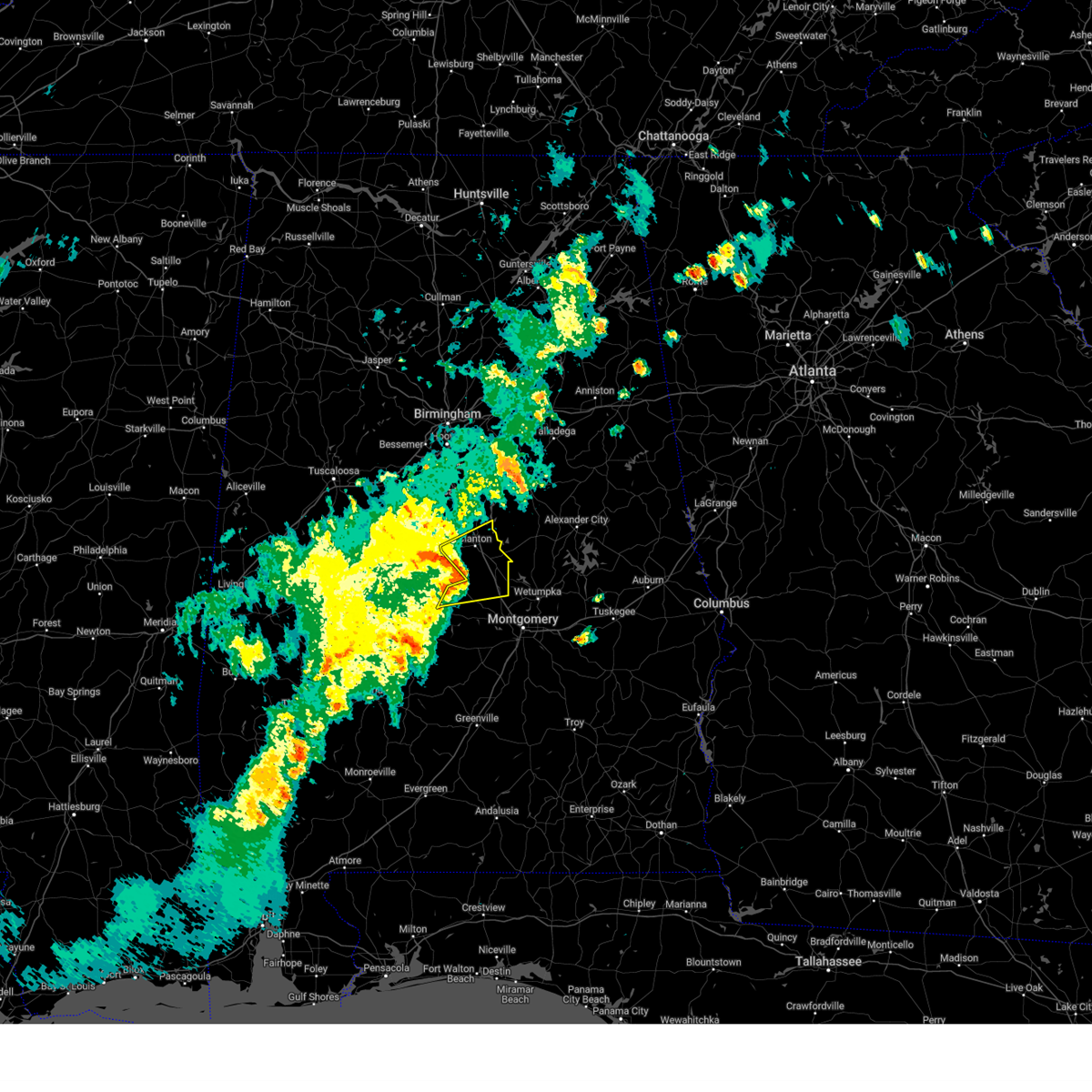
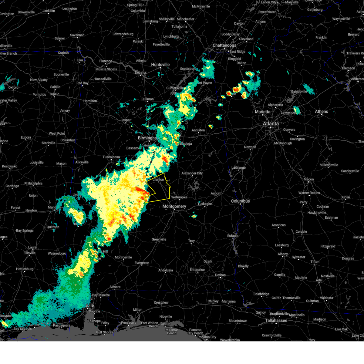
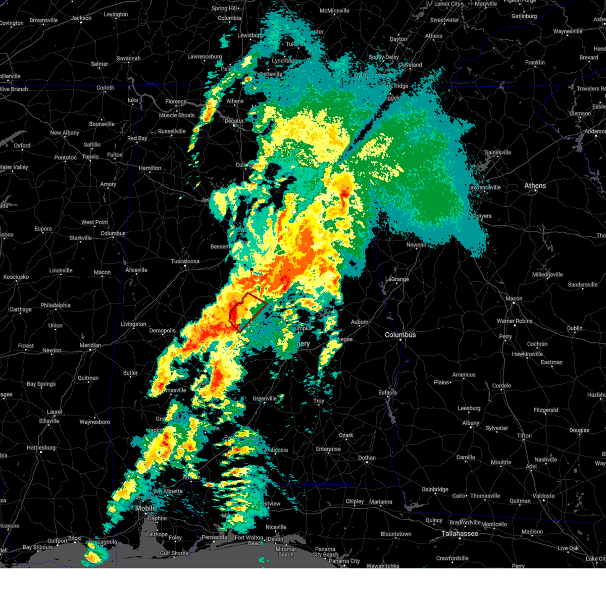
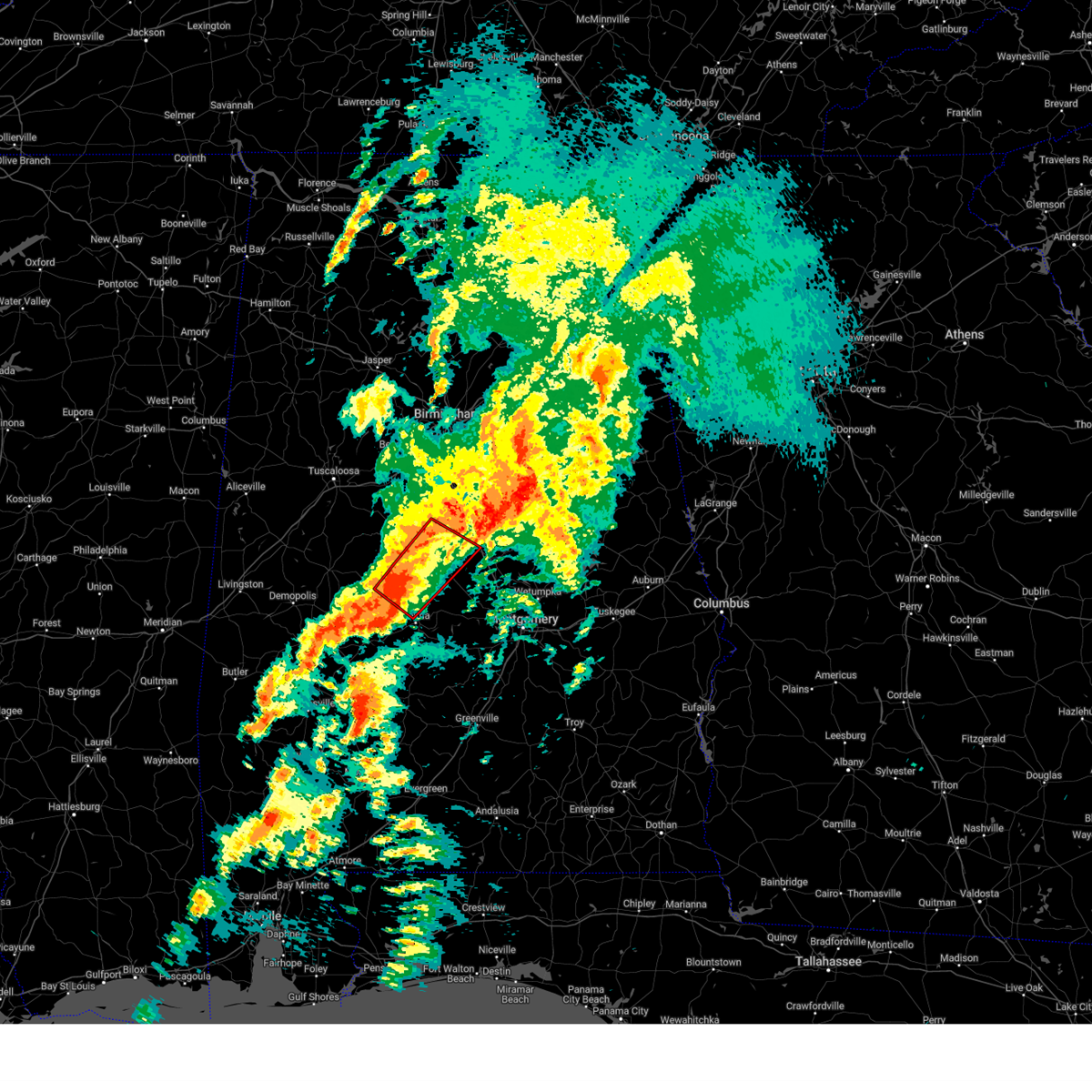
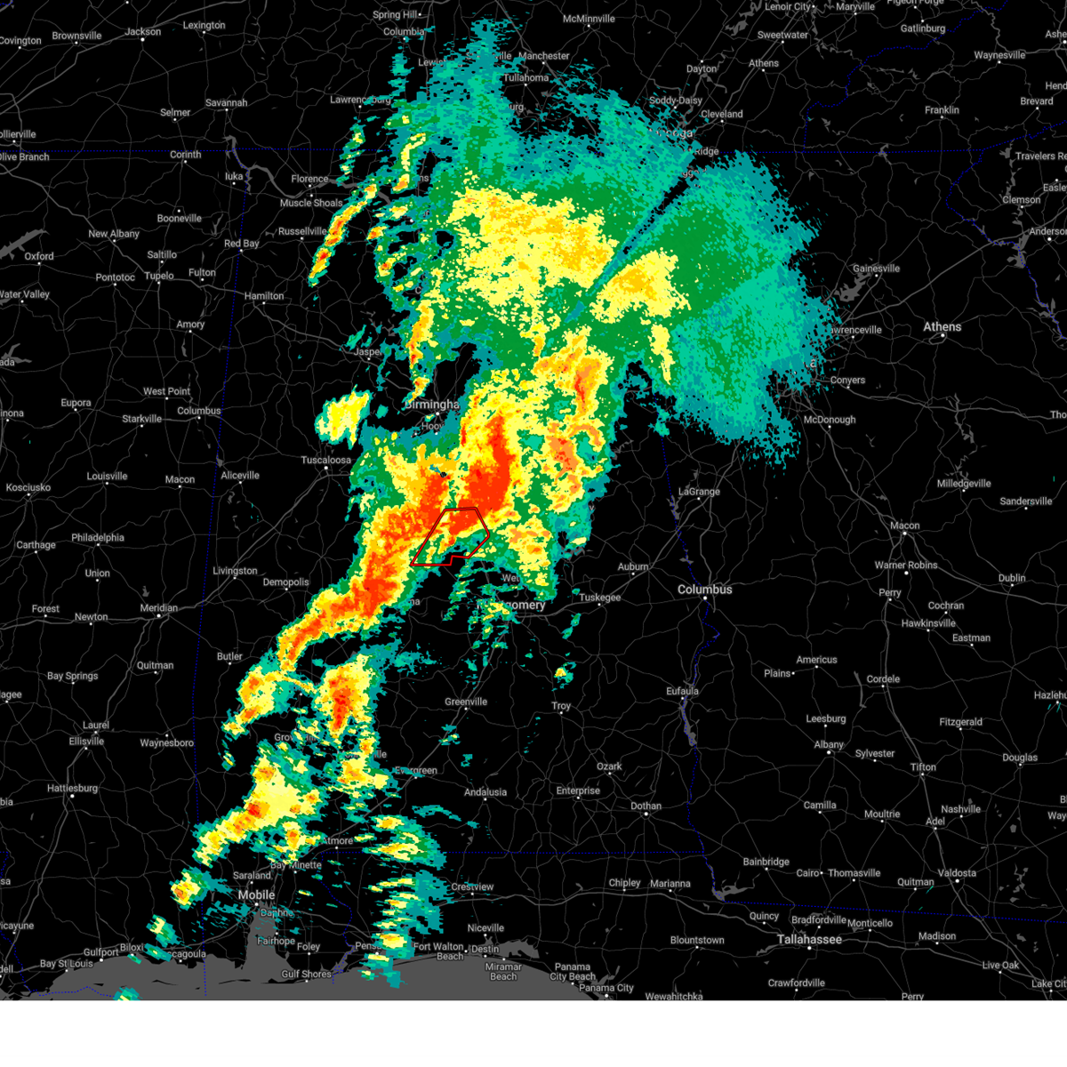
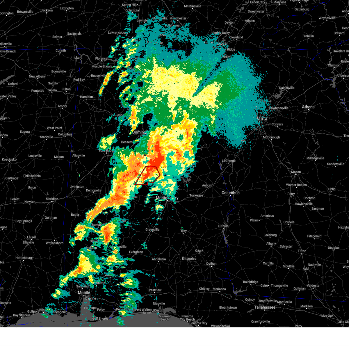
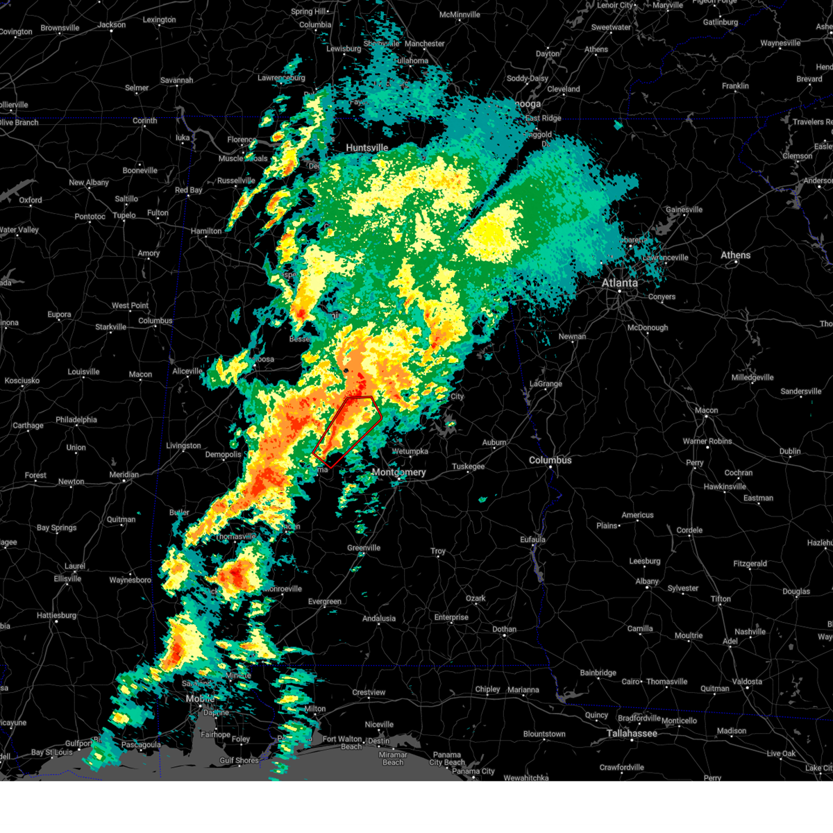
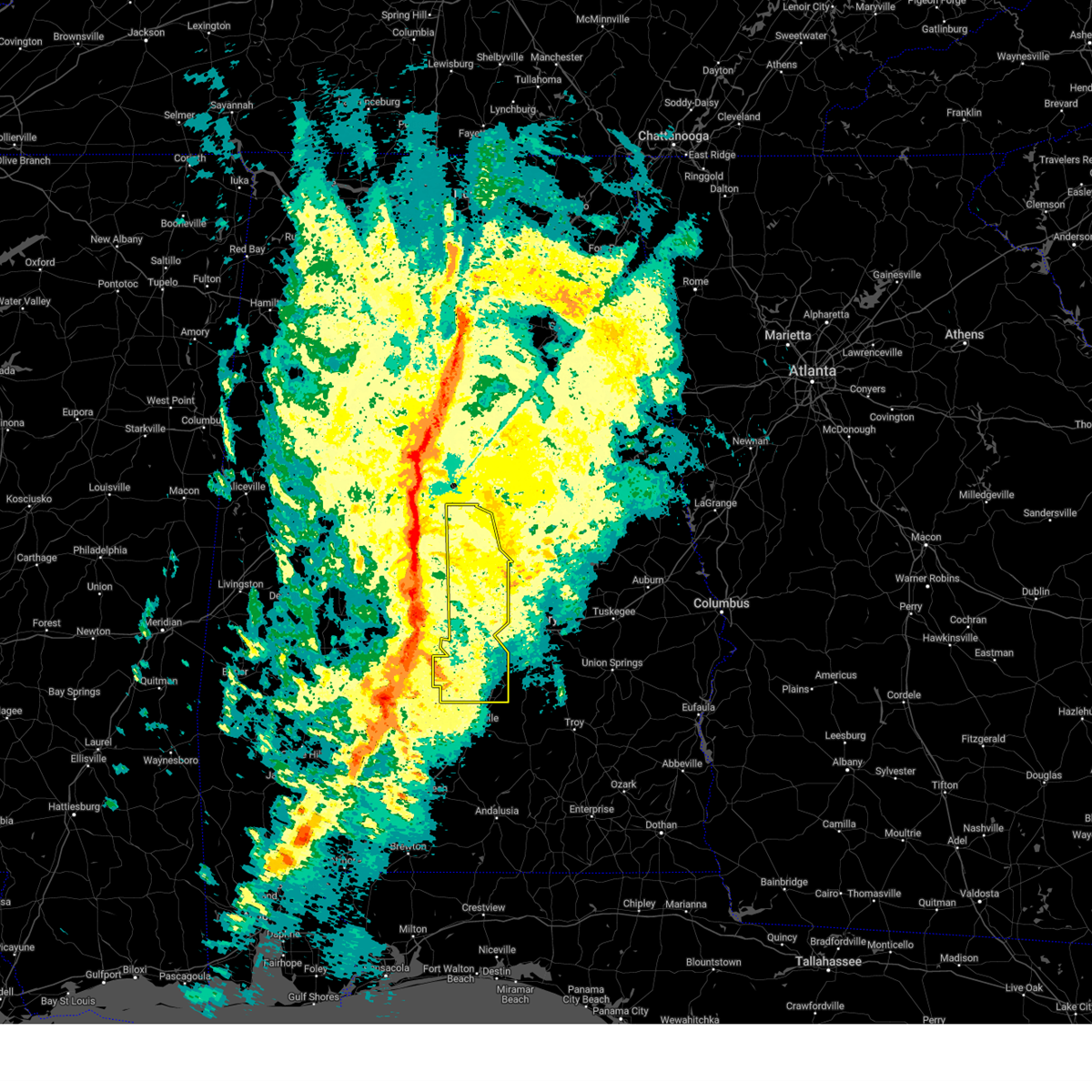
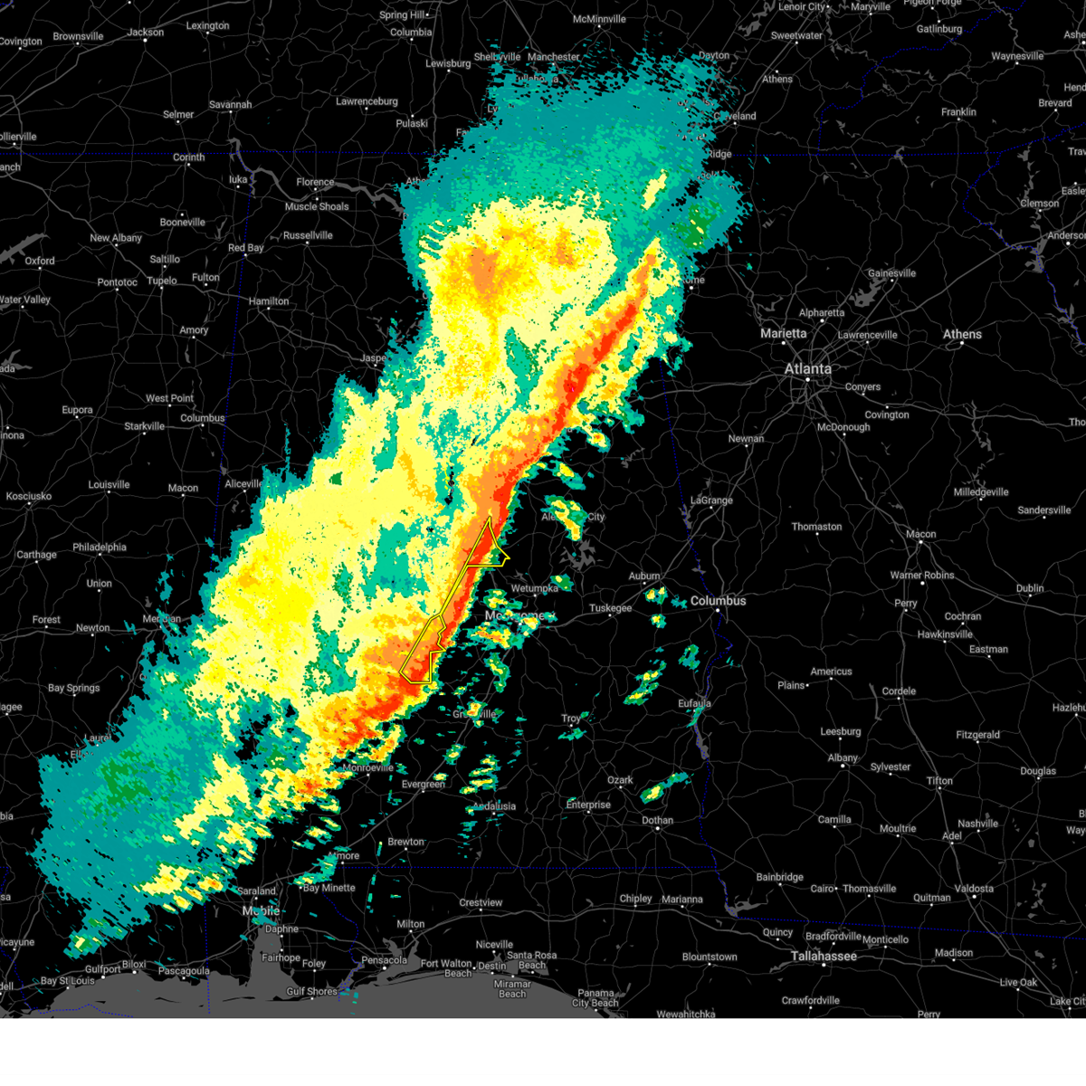
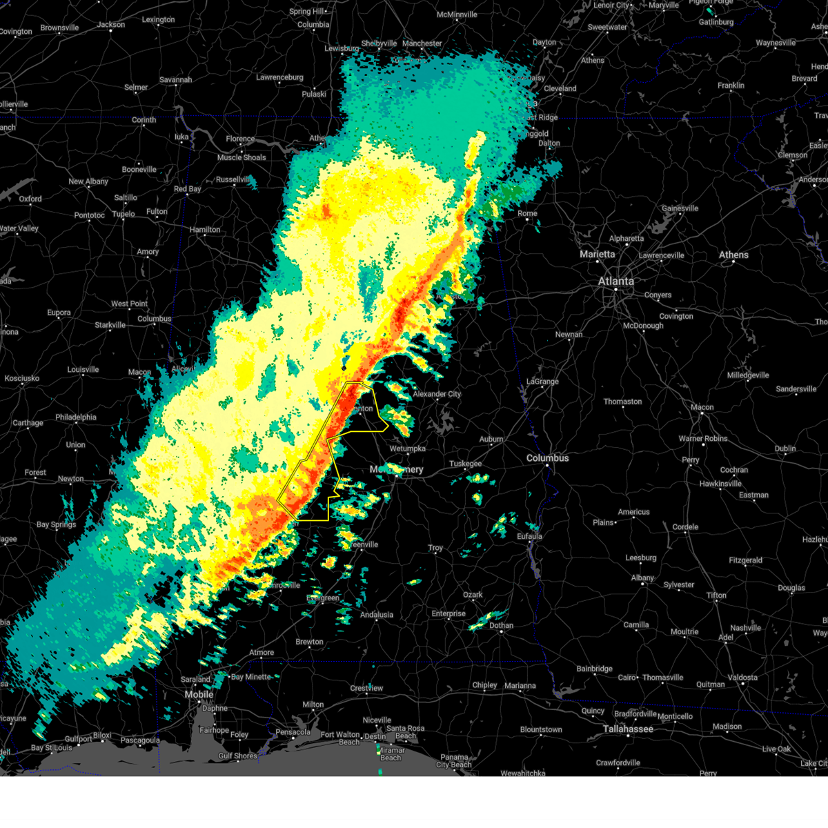
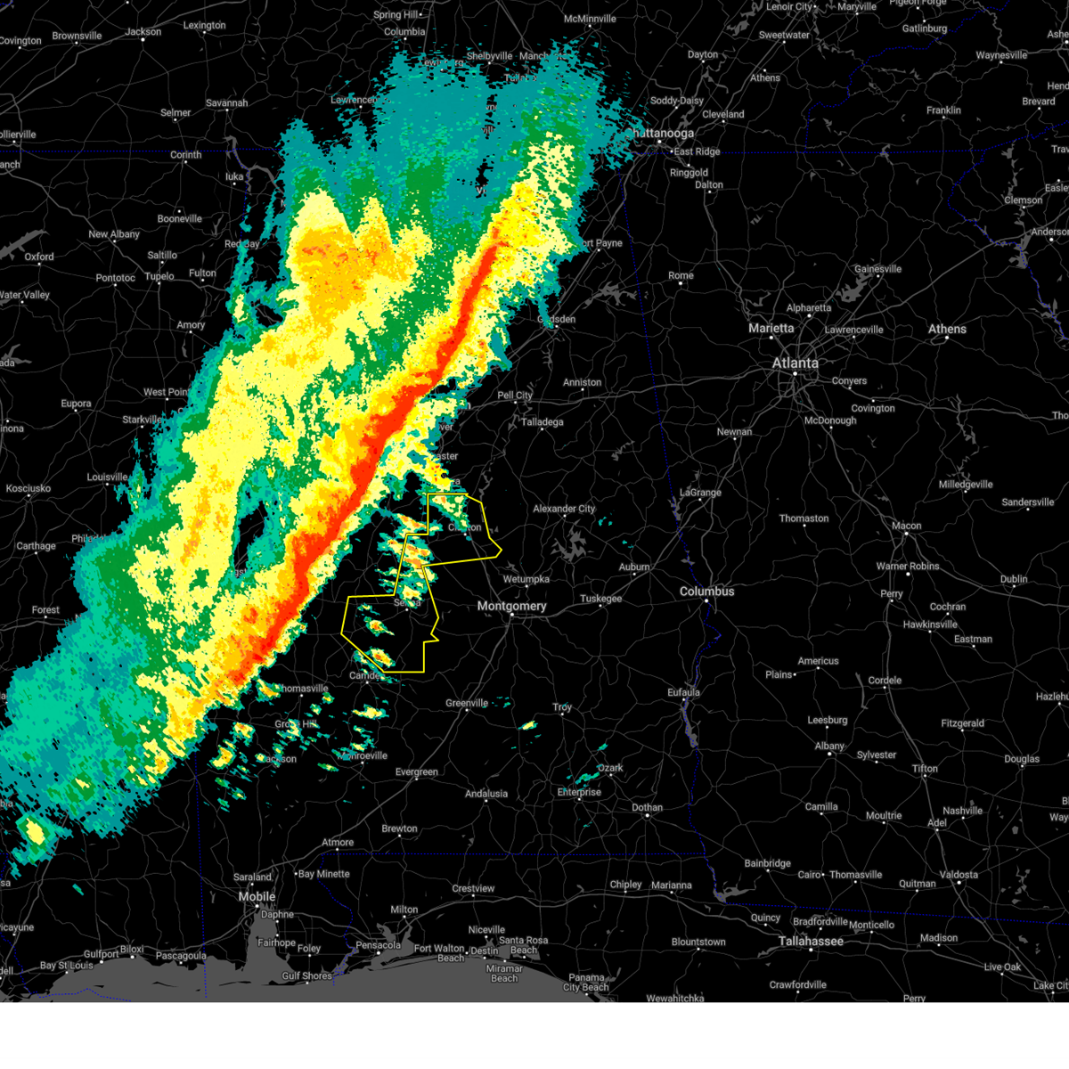
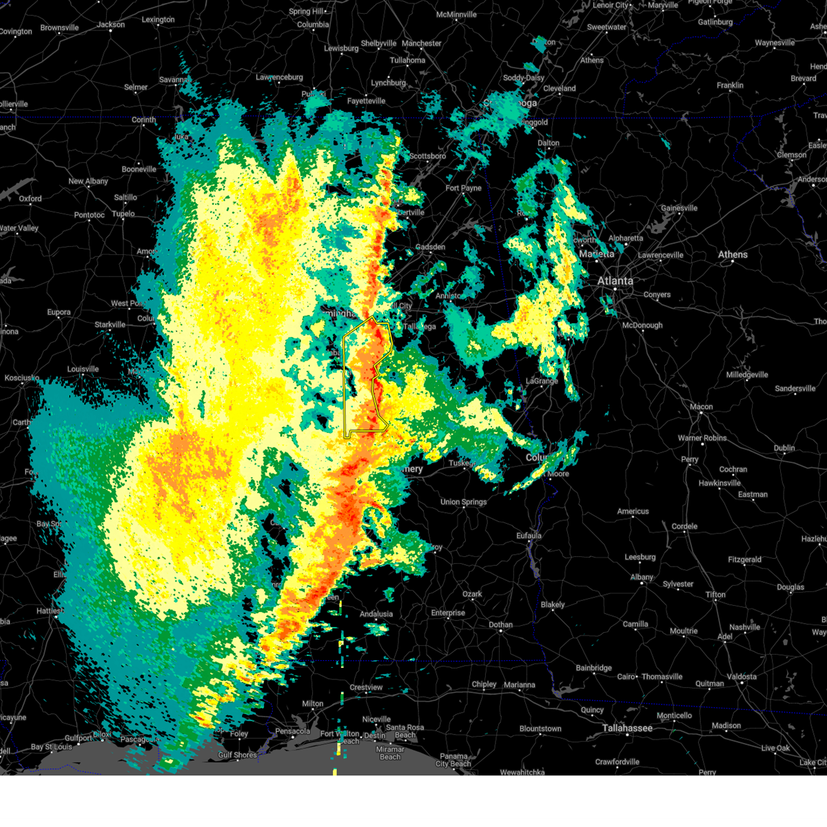
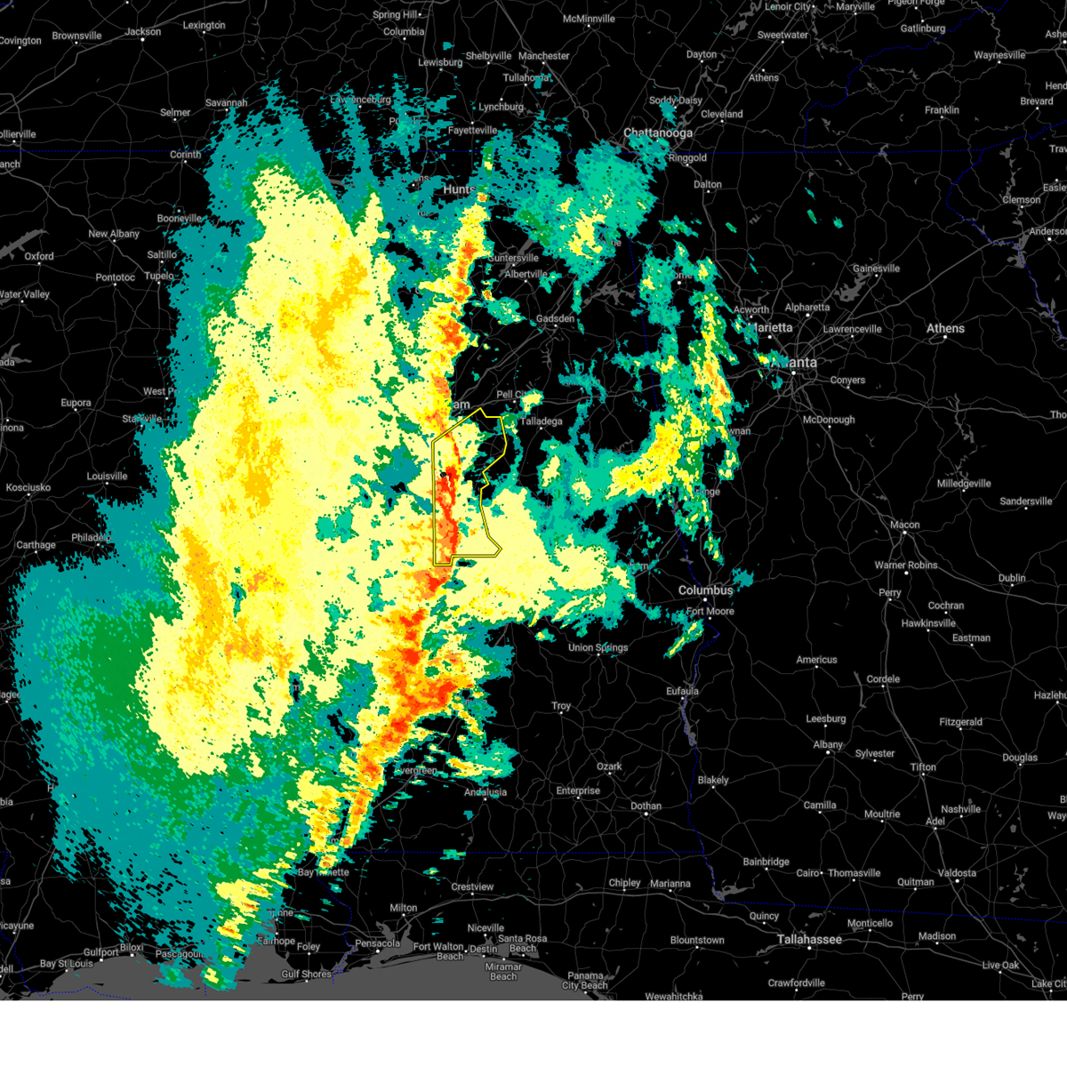
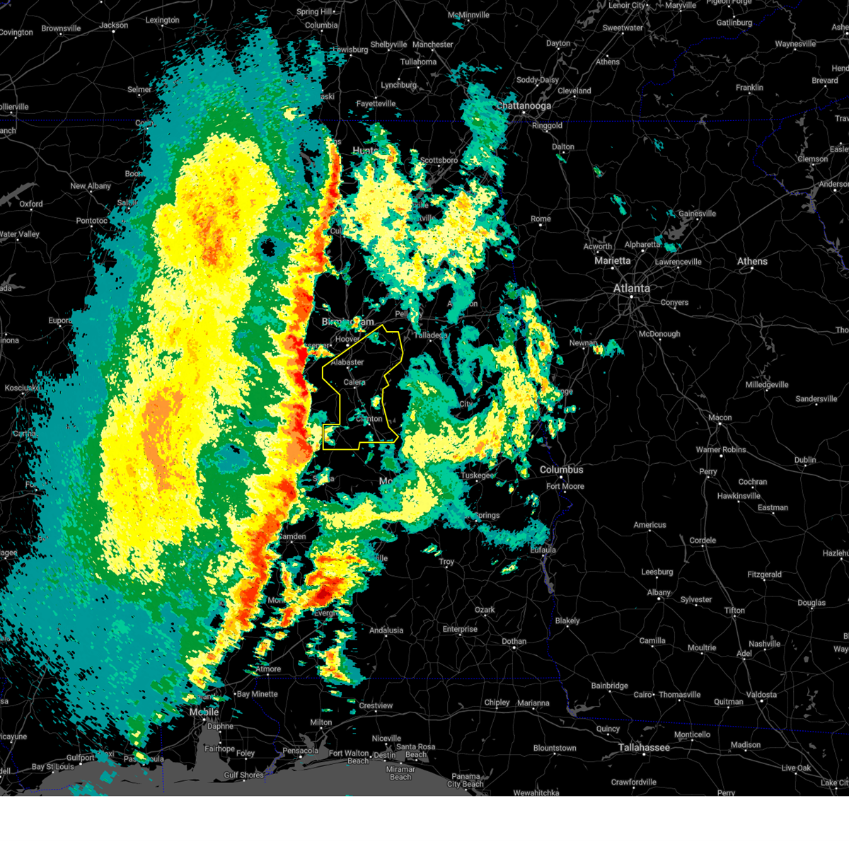
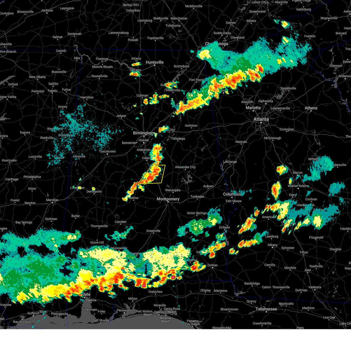
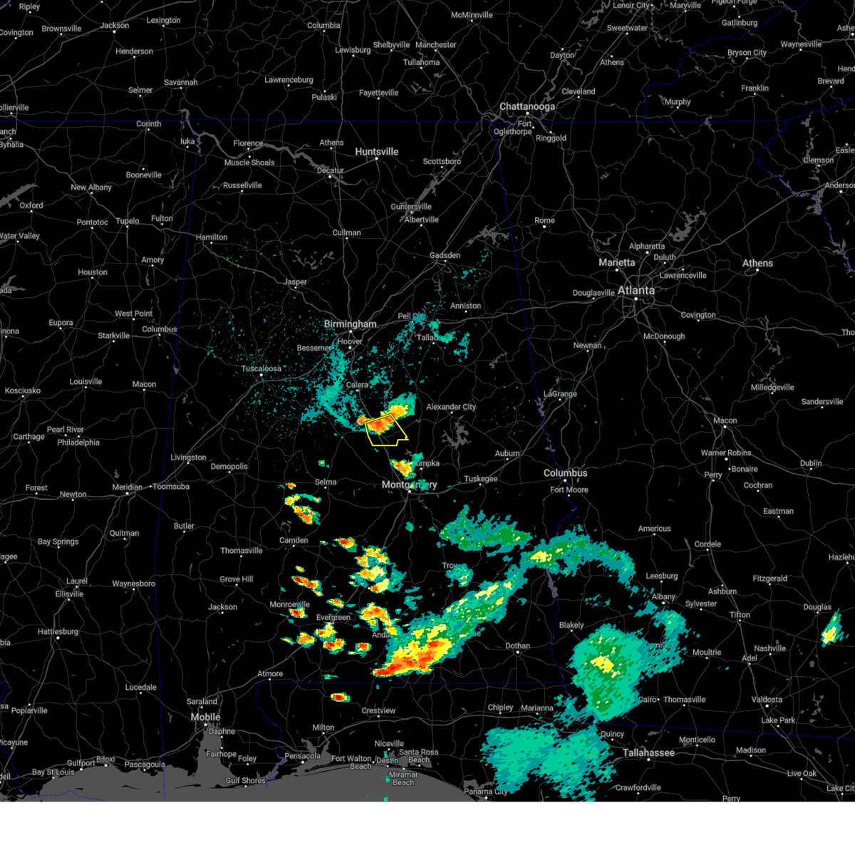
Hail Map for Clanton, AL
The Clanton, AL area has had 12 reports of on-the-ground hail by trained spotters, and has been under severe weather warnings 13 times during the past 12 months. Doppler radar has detected hail at or near Clanton, AL on 93 occasions, including 1 occasion during the past year.
| Name: | Clanton, AL |
| Where Located: | 48 miles SSE of Birmingham, AL |
| Map: | Google Map for Clanton, AL |
| Population: | 8619 |
| Housing Units: | 3833 |
| More Info: | Search Google for Clanton, AL |
0
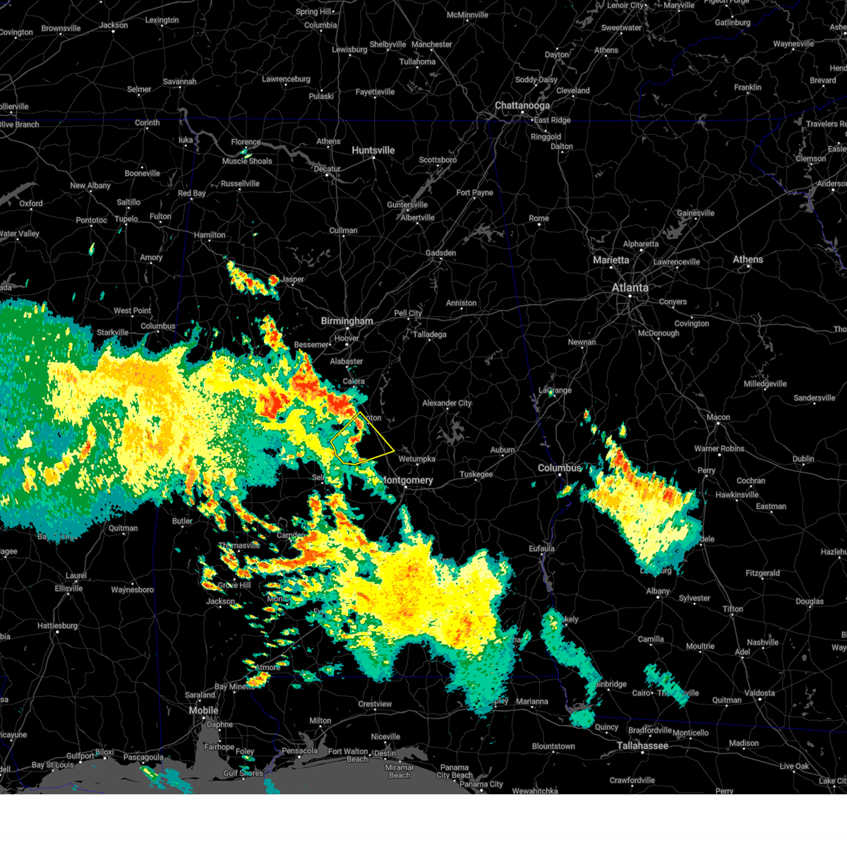
The Top Recent Hail Date for Clanton, AL is Wednesday, July 1, 2026 (93rd out of 93)
Hail and Wind Damage Spotted near Clanton, AL
| Date / Time | Report Details |
|---|---|
| 6/1/2026 4:06 PM CDT |
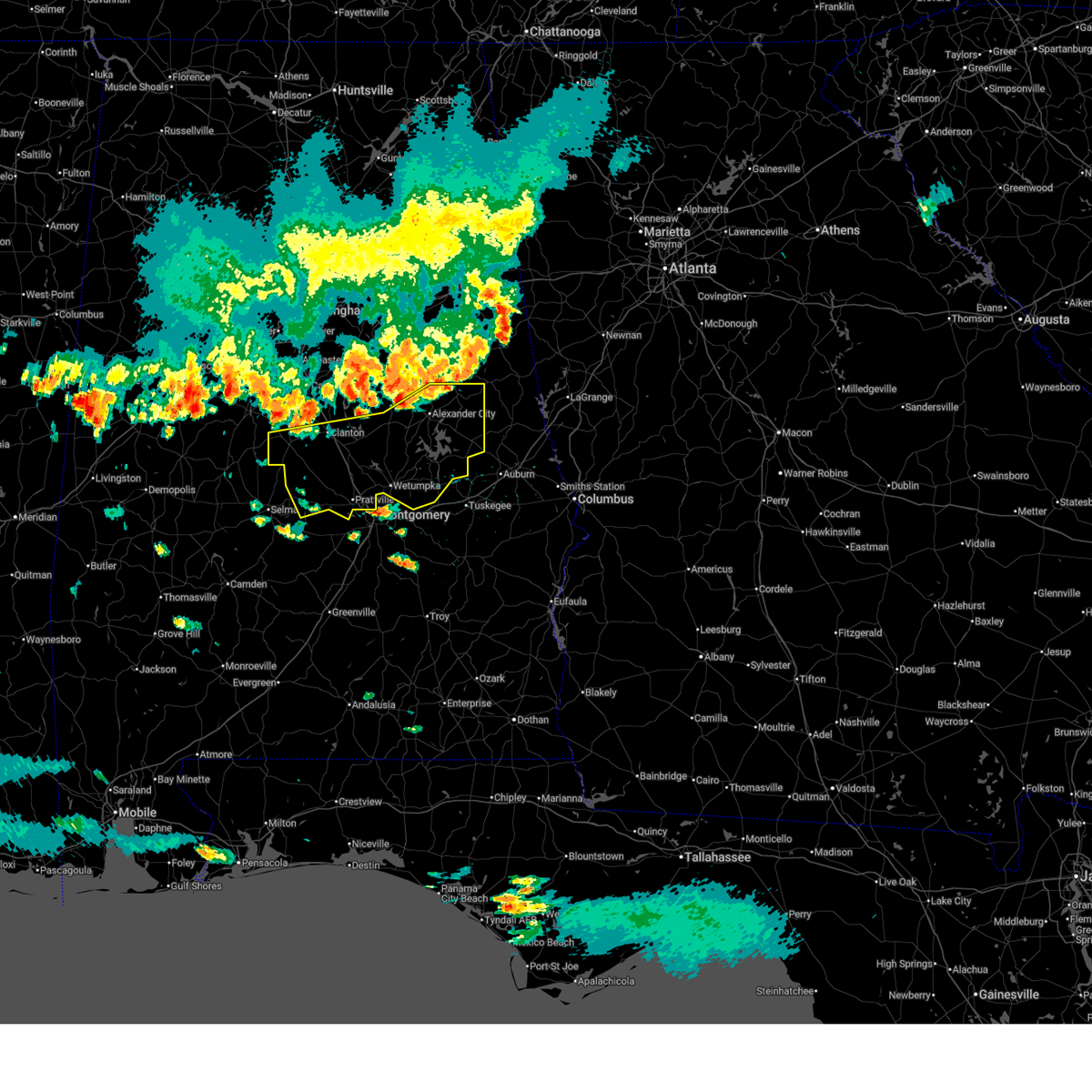 At 406 pm cdt, severe thunderstorms were located along a line extending from near sparkling springs to near lyle to near parnell, moving southeast at 40 mph (radar indicated). Hazards include 70 mph wind gusts and quarter size hail. Hail damage to vehicles is expected. expect considerable tree damage. wind damage is also likely to mobile homes, roofs, and outbuildings. Locations impacted include, prattville, alexander city, millbrook, clanton, wetumpka, tallassee, dadeville, goodwater, camp hill, rockford, kellyton, equality, elmore, coosada, deatsville, eclectic, autaugaville, jacksons' gap, new site, and maplesville. At 406 pm cdt, severe thunderstorms were located along a line extending from near sparkling springs to near lyle to near parnell, moving southeast at 40 mph (radar indicated). Hazards include 70 mph wind gusts and quarter size hail. Hail damage to vehicles is expected. expect considerable tree damage. wind damage is also likely to mobile homes, roofs, and outbuildings. Locations impacted include, prattville, alexander city, millbrook, clanton, wetumpka, tallassee, dadeville, goodwater, camp hill, rockford, kellyton, equality, elmore, coosada, deatsville, eclectic, autaugaville, jacksons' gap, new site, and maplesville.
|
| 6/1/2026 3:54 PM CDT | Multiple trees and power lines down countywid in chilton county AL, 1.3 miles E of Clanton, AL |
| 6/1/2026 3:41 PM CDT |
 At 341 pm cdt, severe thunderstorms were located along a line extending from barfield to stewartville to near ashby, moving south at 45 mph (radar indicated). Hazards include 70 mph wind gusts and ping pong ball size hail. People and animals outdoors will be injured. expect hail damage to roofs, siding, windows, and vehicles. expect considerable tree damage. wind damage is also likely to mobile homes, roofs, and outbuildings. Locations impacted include, alabaster, pelham, helena, talladega, alexander city, sylacauga, calera, clanton, montevallo, childersburg, columbiana, jemison, lineville, ashland, wilsonville, goodwater, rockford, kellyton, talladega springs, and weogufka. At 341 pm cdt, severe thunderstorms were located along a line extending from barfield to stewartville to near ashby, moving south at 45 mph (radar indicated). Hazards include 70 mph wind gusts and ping pong ball size hail. People and animals outdoors will be injured. expect hail damage to roofs, siding, windows, and vehicles. expect considerable tree damage. wind damage is also likely to mobile homes, roofs, and outbuildings. Locations impacted include, alabaster, pelham, helena, talladega, alexander city, sylacauga, calera, clanton, montevallo, childersburg, columbiana, jemison, lineville, ashland, wilsonville, goodwater, rockford, kellyton, talladega springs, and weogufka.
|
| 6/1/2026 3:38 PM CDT |
 Svrbmx the national weather service in birmingham has issued a * severe thunderstorm warning for, autauga county in central alabama, elmore county in east central alabama, chilton county in central alabama, tallapoosa county in east central alabama, coosa county in east central alabama, * until 500 pm cdt. * at 338 pm cdt, severe thunderstorms were located along a line extending from near ashland to near talladega springs to near west centreville, moving southeast at 40 mph (radar indicated). Hazards include 60 mph wind gusts and quarter size hail. Hail damage to vehicles is expected. Expect wind damage to roofs, siding, and trees. Svrbmx the national weather service in birmingham has issued a * severe thunderstorm warning for, autauga county in central alabama, elmore county in east central alabama, chilton county in central alabama, tallapoosa county in east central alabama, coosa county in east central alabama, * until 500 pm cdt. * at 338 pm cdt, severe thunderstorms were located along a line extending from near ashland to near talladega springs to near west centreville, moving southeast at 40 mph (radar indicated). Hazards include 60 mph wind gusts and quarter size hail. Hail damage to vehicles is expected. Expect wind damage to roofs, siding, and trees.
|
| 6/1/2026 3:12 PM CDT |
 At 311 pm cdt, severe thunderstorms were located along a line extending from oxford lake to near logan martin dam to tannehill ironworks state park, moving south at 45 mph (radar indicated). Hazards include 70 mph wind gusts and quarter size hail. Hail damage to vehicles is expected. expect considerable tree damage. wind damage is also likely to mobile homes, roofs, and outbuildings. Locations impacted include, alabaster, pelham, helena, talladega, alexander city, sylacauga, calera, clanton, montevallo, childersburg, columbiana, jemison, lineville, ashland, wilsonville, goodwater, rockford, kellyton, talladega springs, and weogufka. At 311 pm cdt, severe thunderstorms were located along a line extending from oxford lake to near logan martin dam to tannehill ironworks state park, moving south at 45 mph (radar indicated). Hazards include 70 mph wind gusts and quarter size hail. Hail damage to vehicles is expected. expect considerable tree damage. wind damage is also likely to mobile homes, roofs, and outbuildings. Locations impacted include, alabaster, pelham, helena, talladega, alexander city, sylacauga, calera, clanton, montevallo, childersburg, columbiana, jemison, lineville, ashland, wilsonville, goodwater, rockford, kellyton, talladega springs, and weogufka.
|
| 6/1/2026 3:06 PM CDT |
 Svrbmx the national weather service in birmingham has issued a * severe thunderstorm warning for, northern chilton county in central alabama, talladega county in east central alabama, southern shelby county in central alabama, northern tallapoosa county in east central alabama, southwestern cleburne county in east central alabama, coosa county in east central alabama, clay county in east central alabama, * until 400 pm cdt. * at 305 pm cdt, severe thunderstorms were located along a line extending from blue mountain to logan martin dam to near lake view, moving south at 45 mph (radar indicated). Hazards include 60 mph wind gusts and quarter size hail. Hail damage to vehicles is expected. Expect wind damage to roofs, siding, and trees. Svrbmx the national weather service in birmingham has issued a * severe thunderstorm warning for, northern chilton county in central alabama, talladega county in east central alabama, southern shelby county in central alabama, northern tallapoosa county in east central alabama, southwestern cleburne county in east central alabama, coosa county in east central alabama, clay county in east central alabama, * until 400 pm cdt. * at 305 pm cdt, severe thunderstorms were located along a line extending from blue mountain to logan martin dam to near lake view, moving south at 45 mph (radar indicated). Hazards include 60 mph wind gusts and quarter size hail. Hail damage to vehicles is expected. Expect wind damage to roofs, siding, and trees.
|
| 3/12/2026 12:18 AM CDT |
 the severe thunderstorm warning has been cancelled and is no longer in effect the severe thunderstorm warning has been cancelled and is no longer in effect
|
| 3/12/2026 12:16 AM CDT |
 Svrbmx the national weather service in birmingham has issued a * severe thunderstorm warning for, northeastern autauga county in central alabama, northwestern elmore county in east central alabama, eastern chilton county in central alabama, coosa county in east central alabama, * until 100 am cdt. * at 1216 am cdt, severe thunderstorms were located along a line extending from near mitchell lake to verbena to near vida junction, moving east at 40 mph (radar indicated). Hazards include 60 mph wind gusts and penny size hail. expect damage to roofs, siding, and trees Svrbmx the national weather service in birmingham has issued a * severe thunderstorm warning for, northeastern autauga county in central alabama, northwestern elmore county in east central alabama, eastern chilton county in central alabama, coosa county in east central alabama, * until 100 am cdt. * at 1216 am cdt, severe thunderstorms were located along a line extending from near mitchell lake to verbena to near vida junction, moving east at 40 mph (radar indicated). Hazards include 60 mph wind gusts and penny size hail. expect damage to roofs, siding, and trees
|
| 3/12/2026 12:11 AM CDT |
 At 1210 am cdt, a severe thunderstorm was located near verbena, or 10 miles south of clanton, moving east at 45 mph (radar indicated). Hazards include 60 mph wind gusts. Expect damage to roofs, siding, and trees. Locations impacted include, clanton, deatsville, billingsley, marbury, vida junction, verbena, pooles crossroads, mitchell lake, mitchell dam, cooper, and new prospect. At 1210 am cdt, a severe thunderstorm was located near verbena, or 10 miles south of clanton, moving east at 45 mph (radar indicated). Hazards include 60 mph wind gusts. Expect damage to roofs, siding, and trees. Locations impacted include, clanton, deatsville, billingsley, marbury, vida junction, verbena, pooles crossroads, mitchell lake, mitchell dam, cooper, and new prospect.
|
| 3/11/2026 11:52 PM CDT |
 the severe thunderstorm warning has been cancelled and is no longer in effect the severe thunderstorm warning has been cancelled and is no longer in effect
|
| 3/11/2026 11:52 PM CDT |
 At 1151 pm cdt, a severe thunderstorm was located near plecher, or 13 miles northeast of valley grande, moving east at 45 mph (radar indicated). Hazards include 60 mph wind gusts. Expect damage to roofs, siding, and trees. Locations impacted include, clanton, deatsville, billingsley, plecher, marbury, vida junction, verbena, pooles crossroads, mitchell lake, mitchell dam, new prospect, dawson mill, and cooper. At 1151 pm cdt, a severe thunderstorm was located near plecher, or 13 miles northeast of valley grande, moving east at 45 mph (radar indicated). Hazards include 60 mph wind gusts. Expect damage to roofs, siding, and trees. Locations impacted include, clanton, deatsville, billingsley, plecher, marbury, vida junction, verbena, pooles crossroads, mitchell lake, mitchell dam, new prospect, dawson mill, and cooper.
|
| 3/11/2026 11:45 PM CDT |
 At 1145 pm cdt, a severe thunderstorm was located near parnell, or 9 miles northeast of valley grande, moving east at 45 mph (radar indicated). Hazards include 60 mph wind gusts. Expect damage to roofs, siding, and trees. Locations impacted include, clanton, deatsville, billingsley, plecher, marbury, vida junction, parnell, verbena, pooles crossroads, mitchell lake, stanton, mitchell dam, new prospect, valley creek junction, plantersville, barrett creek, dawson mill, and cooper. At 1145 pm cdt, a severe thunderstorm was located near parnell, or 9 miles northeast of valley grande, moving east at 45 mph (radar indicated). Hazards include 60 mph wind gusts. Expect damage to roofs, siding, and trees. Locations impacted include, clanton, deatsville, billingsley, plecher, marbury, vida junction, parnell, verbena, pooles crossroads, mitchell lake, stanton, mitchell dam, new prospect, valley creek junction, plantersville, barrett creek, dawson mill, and cooper.
|
| 3/11/2026 11:45 PM CDT |
 the severe thunderstorm warning has been cancelled and is no longer in effect the severe thunderstorm warning has been cancelled and is no longer in effect
|
| 3/11/2026 11:36 PM CDT |
 Svrbmx the national weather service in birmingham has issued a * severe thunderstorm warning for, northern autauga county in central alabama, southern chilton county in central alabama, east central perry county in central alabama, northeastern dallas county in south central alabama, * until 1230 am cdt. * at 1136 pm cdt, a severe thunderstorm was located over paul m grist state park, or near valley grande, moving east at 45 mph (radar indicated). Hazards include 60 mph wind gusts. expect damage to roofs, siding, and trees Svrbmx the national weather service in birmingham has issued a * severe thunderstorm warning for, northern autauga county in central alabama, southern chilton county in central alabama, east central perry county in central alabama, northeastern dallas county in south central alabama, * until 1230 am cdt. * at 1136 pm cdt, a severe thunderstorm was located over paul m grist state park, or near valley grande, moving east at 45 mph (radar indicated). Hazards include 60 mph wind gusts. expect damage to roofs, siding, and trees
|
| 7/4/2025 3:06 PM CDT |
 Svrbmx the national weather service in birmingham has issued a * severe thunderstorm warning for, northeastern chilton county in central alabama, southwestern talladega county in east central alabama, southeastern shelby county in central alabama, northwestern coosa county in east central alabama, * until 345 pm cdt. * at 305 pm cdt, a severe thunderstorm was located over lay lake, or near talladega springs, moving southwest at 15 mph (radar indicated). Hazards include 60 mph wind gusts and quarter size hail. Hail damage to vehicles is expected. Expect wind damage to roofs, siding, and trees. Svrbmx the national weather service in birmingham has issued a * severe thunderstorm warning for, northeastern chilton county in central alabama, southwestern talladega county in east central alabama, southeastern shelby county in central alabama, northwestern coosa county in east central alabama, * until 345 pm cdt. * at 305 pm cdt, a severe thunderstorm was located over lay lake, or near talladega springs, moving southwest at 15 mph (radar indicated). Hazards include 60 mph wind gusts and quarter size hail. Hail damage to vehicles is expected. Expect wind damage to roofs, siding, and trees.
|
| 6/25/2025 10:37 PM CDT |
 At 1037 pm cdt, severe thunderstorms were located along a line extending from near clanton to 8 miles west of parnell to near faunsdale to miller, moving northwest at 35 mph (radar indicated). Hazards include 60 mph wind gusts. Expect damage to roofs, siding, and trees. Locations impacted include, clanton, demopolis, marion, linden, uniontown, maplesville, thomaston, sweet water, newbern, billingsley, myrtlewood, faunsdale, dayton, vaiden, parnell, consul, verbena, magnolia, wayne, and miller. At 1037 pm cdt, severe thunderstorms were located along a line extending from near clanton to 8 miles west of parnell to near faunsdale to miller, moving northwest at 35 mph (radar indicated). Hazards include 60 mph wind gusts. Expect damage to roofs, siding, and trees. Locations impacted include, clanton, demopolis, marion, linden, uniontown, maplesville, thomaston, sweet water, newbern, billingsley, myrtlewood, faunsdale, dayton, vaiden, parnell, consul, verbena, magnolia, wayne, and miller.
|
| 6/25/2025 10:26 PM CDT |
 At 1026 pm cdt, severe thunderstorms were located along a line extending from verbena to near paul m grist state park to uniontown to near surginer, moving northwest at 25 mph (radar indicated). Hazards include 60 mph wind gusts. Expect damage to roofs, siding, and trees. Locations impacted include, clanton, demopolis, marion, linden, uniontown, maplesville, thomaston, sweet water, newbern, billingsley, myrtlewood, faunsdale, dayton, vaiden, parnell, consul, verbena, magnolia, wayne, and miller. At 1026 pm cdt, severe thunderstorms were located along a line extending from verbena to near paul m grist state park to uniontown to near surginer, moving northwest at 25 mph (radar indicated). Hazards include 60 mph wind gusts. Expect damage to roofs, siding, and trees. Locations impacted include, clanton, demopolis, marion, linden, uniontown, maplesville, thomaston, sweet water, newbern, billingsley, myrtlewood, faunsdale, dayton, vaiden, parnell, consul, verbena, magnolia, wayne, and miller.
|
| 6/25/2025 10:13 PM CDT |
 Svrbmx the national weather service in birmingham has issued a * severe thunderstorm warning for, southern chilton county in central alabama, marengo county in southwestern alabama, perry county in central alabama, southeastern hale county in west central alabama, * until 1115 pm cdt. * at 1013 pm cdt, severe thunderstorms were located along a line extending from marbury to near paul m grist state park to near uniontown to near yellow bluff, moving northwest at 35 mph (radar indicated). Hazards include 60 mph wind gusts. expect damage to roofs, siding, and trees Svrbmx the national weather service in birmingham has issued a * severe thunderstorm warning for, southern chilton county in central alabama, marengo county in southwestern alabama, perry county in central alabama, southeastern hale county in west central alabama, * until 1115 pm cdt. * at 1013 pm cdt, severe thunderstorms were located along a line extending from marbury to near paul m grist state park to near uniontown to near yellow bluff, moving northwest at 35 mph (radar indicated). Hazards include 60 mph wind gusts. expect damage to roofs, siding, and trees
|
| 6/18/2025 1:47 PM CDT |
 At 147 pm cdt, a severe thunderstorm was located over dollar, or 9 miles west of rockford, moving northeast at 15 mph (radar indicated). Hazards include 60 mph wind gusts. Expect damage to roofs, siding, and trees. Locations impacted include, clanton, rockford, lyle, mitchell lake, dollar, moriah, higgins ferry park, verbena, bentleyville, mitchell dam, and cooper. At 147 pm cdt, a severe thunderstorm was located over dollar, or 9 miles west of rockford, moving northeast at 15 mph (radar indicated). Hazards include 60 mph wind gusts. Expect damage to roofs, siding, and trees. Locations impacted include, clanton, rockford, lyle, mitchell lake, dollar, moriah, higgins ferry park, verbena, bentleyville, mitchell dam, and cooper.
|
| 6/18/2025 1:30 PM CDT |
 Svrbmx the national weather service in birmingham has issued a * severe thunderstorm warning for, southeastern chilton county in central alabama, southwestern coosa county in east central alabama, * until 200 pm cdt. * at 130 pm cdt, a severe thunderstorm was located over higgins ferry park, or 9 miles east of clanton, moving northeast at 20 mph (radar indicated). Hazards include 60 mph wind gusts. expect damage to roofs, siding, and trees Svrbmx the national weather service in birmingham has issued a * severe thunderstorm warning for, southeastern chilton county in central alabama, southwestern coosa county in east central alabama, * until 200 pm cdt. * at 130 pm cdt, a severe thunderstorm was located over higgins ferry park, or 9 miles east of clanton, moving northeast at 20 mph (radar indicated). Hazards include 60 mph wind gusts. expect damage to roofs, siding, and trees
|
| 6/9/2025 7:32 AM CDT |
 the severe thunderstorm warning has been cancelled and is no longer in effect the severe thunderstorm warning has been cancelled and is no longer in effect
|
| 6/9/2025 7:13 AM CDT |
 At 713 am cdt, a severe thunderstorm was located over billingsley, or 14 miles southwest of clanton, moving northeast at 35 mph (radar indicated). Hazards include 60 mph wind gusts and penny size hail. Expect damage to roofs, siding, and trees. Locations impacted include, clanton, thorsby, maplesville, billingsley, plecher, vida junction, parnell, pooles crossroads, lomax, stanton, new prospect, isabella, and dawson mill. At 713 am cdt, a severe thunderstorm was located over billingsley, or 14 miles southwest of clanton, moving northeast at 35 mph (radar indicated). Hazards include 60 mph wind gusts and penny size hail. Expect damage to roofs, siding, and trees. Locations impacted include, clanton, thorsby, maplesville, billingsley, plecher, vida junction, parnell, pooles crossroads, lomax, stanton, new prospect, isabella, and dawson mill.
|
| 6/9/2025 7:13 AM CDT |
 the severe thunderstorm warning has been cancelled and is no longer in effect the severe thunderstorm warning has been cancelled and is no longer in effect
|
| 6/9/2025 6:58 AM CDT |
 Svrbmx the national weather service in birmingham has issued a * severe thunderstorm warning for, northern autauga county in central alabama, southwestern chilton county in central alabama, northeastern dallas county in south central alabama, * until 745 am cdt. * at 657 am cdt, a severe thunderstorm was located near paul m grist state park, or near valley grande, moving northeast at 35 mph (radar indicated). Hazards include 60 mph wind gusts and penny size hail. expect damage to roofs, siding, and trees Svrbmx the national weather service in birmingham has issued a * severe thunderstorm warning for, northern autauga county in central alabama, southwestern chilton county in central alabama, northeastern dallas county in south central alabama, * until 745 am cdt. * at 657 am cdt, a severe thunderstorm was located near paul m grist state park, or near valley grande, moving northeast at 35 mph (radar indicated). Hazards include 60 mph wind gusts and penny size hail. expect damage to roofs, siding, and trees
|
| 6/7/2025 3:45 PM CDT |
 At 344 pm cdt, severe thunderstorms were located along a line extending from rome to near edwardsville to near winterboro to near verbena, moving east at 45 mph (radar indicated). Hazards include 60 mph wind gusts and penny size hail. Expect damage to roofs, siding, and trees. Locations impacted include, oxford, talladega, sylacauga, clanton, weogufka, stewartville, munford, oak grove, waldo, hanover, lyle, dollar, winterboro, strickland crossroads, bentleyville, moriah, verbena, mitchell lake, unity, and sycamore. At 344 pm cdt, severe thunderstorms were located along a line extending from rome to near edwardsville to near winterboro to near verbena, moving east at 45 mph (radar indicated). Hazards include 60 mph wind gusts and penny size hail. Expect damage to roofs, siding, and trees. Locations impacted include, oxford, talladega, sylacauga, clanton, weogufka, stewartville, munford, oak grove, waldo, hanover, lyle, dollar, winterboro, strickland crossroads, bentleyville, moriah, verbena, mitchell lake, unity, and sycamore.
|
| 6/7/2025 3:45 PM CDT |
 the severe thunderstorm warning has been cancelled and is no longer in effect the severe thunderstorm warning has been cancelled and is no longer in effect
|
| 6/7/2025 3:30 PM CDT |
 At 330 pm cdt, severe thunderstorms were located along a line extending from 9 miles south of summerville to near jacksonville to near logan martin dam to near pooles crossroads, moving east at 40 mph (radar indicated). Hazards include 60 mph wind gusts and penny size hail. Expect damage to roofs, siding, and trees. Locations impacted include, anniston, oxford, talladega, sylacauga, jacksonville, clanton, childersburg, piedmont, jemison, cedar bluff, talladega springs, forney, west end-cobb town, stewartville, weogufka, cobb town, fort mcclellan, saks, weaver, and thorsby. At 330 pm cdt, severe thunderstorms were located along a line extending from 9 miles south of summerville to near jacksonville to near logan martin dam to near pooles crossroads, moving east at 40 mph (radar indicated). Hazards include 60 mph wind gusts and penny size hail. Expect damage to roofs, siding, and trees. Locations impacted include, anniston, oxford, talladega, sylacauga, jacksonville, clanton, childersburg, piedmont, jemison, cedar bluff, talladega springs, forney, west end-cobb town, stewartville, weogufka, cobb town, fort mcclellan, saks, weaver, and thorsby.
|
| 6/7/2025 3:15 PM CDT |
 At 315 pm cdt, severe thunderstorms were located along a line extending from near blanche to near alexandria to bon air to near lawley, moving east at 45 mph (radar indicated). Hazards include 60 mph wind gusts and penny size hail. Expect damage to roofs, siding, and trees. Locations impacted include, anniston, oxford, talladega, sylacauga, jacksonville, clanton, childersburg, piedmont, centre, jemison, cedar bluff, talladega springs, weogufka, cobb town, fort mcclellan, saks, little river canyon national preserve, forney, west end-cobb town, and centre municipal airport. At 315 pm cdt, severe thunderstorms were located along a line extending from near blanche to near alexandria to bon air to near lawley, moving east at 45 mph (radar indicated). Hazards include 60 mph wind gusts and penny size hail. Expect damage to roofs, siding, and trees. Locations impacted include, anniston, oxford, talladega, sylacauga, jacksonville, clanton, childersburg, piedmont, centre, jemison, cedar bluff, talladega springs, weogufka, cobb town, fort mcclellan, saks, little river canyon national preserve, forney, west end-cobb town, and centre municipal airport.
|
| 6/7/2025 3:03 PM CDT |
 At 303 pm cdt, severe thunderstorms were located along a line extending from near fort payne to near ohatchee to near harpersville to talladega national forest, moving east at 45 mph (radar indicated). Hazards include 60 mph wind gusts and penny size hail. Expect damage to roofs, siding, and trees. Locations impacted include, anniston, oxford, talladega, sylacauga, jacksonville, clanton, childersburg, piedmont, centre, jemison, cedar bluff, talladega springs, weogufka, cobb town, fort mcclellan, saks, little river canyon national preserve, forney, west end-cobb town, and centre municipal airport. At 303 pm cdt, severe thunderstorms were located along a line extending from near fort payne to near ohatchee to near harpersville to talladega national forest, moving east at 45 mph (radar indicated). Hazards include 60 mph wind gusts and penny size hail. Expect damage to roofs, siding, and trees. Locations impacted include, anniston, oxford, talladega, sylacauga, jacksonville, clanton, childersburg, piedmont, centre, jemison, cedar bluff, talladega springs, weogufka, cobb town, fort mcclellan, saks, little river canyon national preserve, forney, west end-cobb town, and centre municipal airport.
|
| 6/7/2025 2:46 PM CDT |
 Svrbmx the national weather service in birmingham has issued a * severe thunderstorm warning for, chilton county in central alabama, talladega county in east central alabama, calhoun county in east central alabama, western coosa county in east central alabama, cherokee county in northeastern alabama, * until 400 pm cdt. * at 245 pm cdt, severe thunderstorms were located along a line extending from 6 miles south of section to near ashville to brook highland to near brent, moving east at 45 mph (radar indicated). Hazards include 60 mph wind gusts and penny size hail. expect damage to roofs, siding, and trees Svrbmx the national weather service in birmingham has issued a * severe thunderstorm warning for, chilton county in central alabama, talladega county in east central alabama, calhoun county in east central alabama, western coosa county in east central alabama, cherokee county in northeastern alabama, * until 400 pm cdt. * at 245 pm cdt, severe thunderstorms were located along a line extending from 6 miles south of section to near ashville to brook highland to near brent, moving east at 45 mph (radar indicated). Hazards include 60 mph wind gusts and penny size hail. expect damage to roofs, siding, and trees
|
| 5/17/2025 7:06 AM CDT |
 The storm which prompted the warning has weakened below severe limits, and no longer poses an immediate threat to life or property. therefore, the warning will be allowed to expire. The storm which prompted the warning has weakened below severe limits, and no longer poses an immediate threat to life or property. therefore, the warning will be allowed to expire.
|
| 5/17/2025 6:51 AM CDT |
 Svrbmx the national weather service in birmingham has issued a * severe thunderstorm warning for, northeastern chilton county in central alabama, southwestern coosa county in east central alabama, * until 715 am cdt. * at 651 am cdt, a severe thunderstorm was located over gap of the mountain, or over clanton, moving east at 45 mph (radar indicated). Hazards include quarter size hail. damage to vehicles is expected Svrbmx the national weather service in birmingham has issued a * severe thunderstorm warning for, northeastern chilton county in central alabama, southwestern coosa county in east central alabama, * until 715 am cdt. * at 651 am cdt, a severe thunderstorm was located over gap of the mountain, or over clanton, moving east at 45 mph (radar indicated). Hazards include quarter size hail. damage to vehicles is expected
|
| 5/3/2025 5:04 PM CDT |
 At 504 pm cdt, a severe thunderstorm was located near marbury, or 11 miles south of clanton, moving east at 35 mph (radar indicated). Hazards include 60 mph wind gusts and quarter size hail. Hail damage to vehicles is expected. expect wind damage to roofs, siding, and trees. Locations impacted include, speed, marbury, pentonville, holtville, deatsville, jordan dam, titus, weoka mills, mitchell dam, new prospect, jordan lake, wallsboro, welona, speigner, ten cedar estates, wetumpka, verbena, cooper, clanton, and mitchell lake. At 504 pm cdt, a severe thunderstorm was located near marbury, or 11 miles south of clanton, moving east at 35 mph (radar indicated). Hazards include 60 mph wind gusts and quarter size hail. Hail damage to vehicles is expected. expect wind damage to roofs, siding, and trees. Locations impacted include, speed, marbury, pentonville, holtville, deatsville, jordan dam, titus, weoka mills, mitchell dam, new prospect, jordan lake, wallsboro, welona, speigner, ten cedar estates, wetumpka, verbena, cooper, clanton, and mitchell lake.
|
| 5/3/2025 4:53 PM CDT |
 Svrbmx the national weather service in birmingham has issued a * severe thunderstorm warning for, northeastern autauga county in central alabama, northwestern elmore county in east central alabama, southeastern chilton county in central alabama, southwestern coosa county in east central alabama, * until 600 pm cdt. * at 453 pm cdt, a severe thunderstorm was located near billingsley, or 9 miles south of clanton, moving east at 35 mph (radar indicated). Hazards include 60 mph wind gusts and quarter size hail. Hail damage to vehicles is expected. Expect wind damage to roofs, siding, and trees. Svrbmx the national weather service in birmingham has issued a * severe thunderstorm warning for, northeastern autauga county in central alabama, northwestern elmore county in east central alabama, southeastern chilton county in central alabama, southwestern coosa county in east central alabama, * until 600 pm cdt. * at 453 pm cdt, a severe thunderstorm was located near billingsley, or 9 miles south of clanton, moving east at 35 mph (radar indicated). Hazards include 60 mph wind gusts and quarter size hail. Hail damage to vehicles is expected. Expect wind damage to roofs, siding, and trees.
|
| 4/25/2025 6:02 PM CDT |
 At 602 pm cdt, severe thunderstorms were located along a line extending from near mitchell lake to near welona to near deatsville, moving east at 45 mph (radar indicated). Hazards include 60 mph wind gusts. Expect damage to roofs, siding, and trees. Locations impacted include, marbury, gap of the mountain, higgins ferry park, verbena, mitchell dam, cooper, lay lake dam, new prospect, mitchell lake, deatsville, clanton, and lay lake. At 602 pm cdt, severe thunderstorms were located along a line extending from near mitchell lake to near welona to near deatsville, moving east at 45 mph (radar indicated). Hazards include 60 mph wind gusts. Expect damage to roofs, siding, and trees. Locations impacted include, marbury, gap of the mountain, higgins ferry park, verbena, mitchell dam, cooper, lay lake dam, new prospect, mitchell lake, deatsville, clanton, and lay lake.
|
| 4/25/2025 5:52 PM CDT |
 At 552 pm cdt, severe thunderstorms were located along a line extending from clanton to verbena to 6 miles north of booth, moving east at 45 mph (radar indicated). Hazards include 60 mph wind gusts. Expect damage to roofs, siding, and trees. Locations impacted include, lomax, marbury, gap of the mountain, clanton, i 65 rest area, mitchell dam, lay lake dam, new prospect, higgins ferry park, verbena, cooper, mitchell lake, deatsville, thorsby, and lay lake. At 552 pm cdt, severe thunderstorms were located along a line extending from clanton to verbena to 6 miles north of booth, moving east at 45 mph (radar indicated). Hazards include 60 mph wind gusts. Expect damage to roofs, siding, and trees. Locations impacted include, lomax, marbury, gap of the mountain, clanton, i 65 rest area, mitchell dam, lay lake dam, new prospect, higgins ferry park, verbena, cooper, mitchell lake, deatsville, thorsby, and lay lake.
|
| 4/25/2025 5:40 PM CDT |
 At 540 pm cdt, severe thunderstorms were located along a line extending from near pooles crossroads to near billingsley to vida junction, moving east at 45 mph (radar indicated). Hazards include 70 mph wind gusts. Expect considerable tree damage. damage is likely to mobile homes, roofs, and outbuildings. Locations impacted include, lomax, marbury, vida junction, gap of the mountain, clanton, i 65 rest area, mitchell dam, lay lake dam, new prospect, isabella, higgins ferry park, verbena, dawson mill, cooper, pooles crossroads, mitchell lake, billingsley, deatsville, thorsby, and lay lake. At 540 pm cdt, severe thunderstorms were located along a line extending from near pooles crossroads to near billingsley to vida junction, moving east at 45 mph (radar indicated). Hazards include 70 mph wind gusts. Expect considerable tree damage. damage is likely to mobile homes, roofs, and outbuildings. Locations impacted include, lomax, marbury, vida junction, gap of the mountain, clanton, i 65 rest area, mitchell dam, lay lake dam, new prospect, isabella, higgins ferry park, verbena, dawson mill, cooper, pooles crossroads, mitchell lake, billingsley, deatsville, thorsby, and lay lake.
|
| 4/25/2025 5:28 PM CDT |
 Svrbmx the national weather service in birmingham has issued a * severe thunderstorm warning for, northern autauga county in central alabama, central chilton county in central alabama, * until 615 pm cdt. * at 528 pm cdt, severe thunderstorms were located along a line extending from near maplesville to near plecher to near mulberry, moving east at 45 mph (radar indicated). Hazards include 60 mph wind gusts. expect damage to roofs, siding, and trees Svrbmx the national weather service in birmingham has issued a * severe thunderstorm warning for, northern autauga county in central alabama, central chilton county in central alabama, * until 615 pm cdt. * at 528 pm cdt, severe thunderstorms were located along a line extending from near maplesville to near plecher to near mulberry, moving east at 45 mph (radar indicated). Hazards include 60 mph wind gusts. expect damage to roofs, siding, and trees
|
| 3/15/2025 9:14 PM CDT |
 At 914 pm cdt, a confirmed tornado was located near pooles crossroads, or near clanton, moving northeast at 45 mph (radar confirmed tornado). Hazards include damaging tornado. Flying debris will be dangerous to those caught without shelter. mobile homes will be damaged or destroyed. damage to roofs, windows, and vehicles will occur. tree damage is likely. Locations impacted include, lomax, jemison, gap of the mountain, thorsby, shelby shores, waxahatchee creek, highway 145 and cr 46, clanton, weogufka, paint creek, strickland crossroads, i 65 rest area, kelley branch, lay lake dam, unity, marble valley, shelby, spring creek, lay lake, and stewartville. At 914 pm cdt, a confirmed tornado was located near pooles crossroads, or near clanton, moving northeast at 45 mph (radar confirmed tornado). Hazards include damaging tornado. Flying debris will be dangerous to those caught without shelter. mobile homes will be damaged or destroyed. damage to roofs, windows, and vehicles will occur. tree damage is likely. Locations impacted include, lomax, jemison, gap of the mountain, thorsby, shelby shores, waxahatchee creek, highway 145 and cr 46, clanton, weogufka, paint creek, strickland crossroads, i 65 rest area, kelley branch, lay lake dam, unity, marble valley, shelby, spring creek, lay lake, and stewartville.
|
| 3/15/2025 9:07 PM CDT |
 At 907 pm cdt, a confirmed large and extremely dangerous tornado was located near pooles crossroads, or 10 miles southwest of clanton, moving northeast at 45 mph. this is a particularly dangerous situation. take cover now! (radar confirmed tornado). Hazards include damaging tornado. You are in a life-threatening situation. flying debris may be deadly to those caught without shelter. mobile homes will be destroyed. considerable damage to homes, businesses, and vehicles is likely and complete destruction is possible. Locations impacted include, isabella, clanton, maplesville, chilton county motor sports park, and pooles crossroads. At 907 pm cdt, a confirmed large and extremely dangerous tornado was located near pooles crossroads, or 10 miles southwest of clanton, moving northeast at 45 mph. this is a particularly dangerous situation. take cover now! (radar confirmed tornado). Hazards include damaging tornado. You are in a life-threatening situation. flying debris may be deadly to those caught without shelter. mobile homes will be destroyed. considerable damage to homes, businesses, and vehicles is likely and complete destruction is possible. Locations impacted include, isabella, clanton, maplesville, chilton county motor sports park, and pooles crossroads.
|
| 3/15/2025 9:01 PM CDT |
 Torbmx the national weather service in birmingham has issued a * tornado warning for, northeastern chilton county in central alabama, southeastern shelby county in central alabama, northwestern coosa county in east central alabama, * until 1000 pm cdt. * at 901 pm cdt, a confirmed large and extremely dangerous tornado was located over plecher, or 15 miles southwest of clanton, moving northeast at 55 mph. this is a particularly dangerous situation. take cover now! (radar confirmed tornado). Hazards include damaging tornado. You are in a life-threatening situation. flying debris may be deadly to those caught without shelter. mobile homes will be destroyed. Considerable damage to homes, businesses, and vehicles is likely and complete destruction is possible. Torbmx the national weather service in birmingham has issued a * tornado warning for, northeastern chilton county in central alabama, southeastern shelby county in central alabama, northwestern coosa county in east central alabama, * until 1000 pm cdt. * at 901 pm cdt, a confirmed large and extremely dangerous tornado was located over plecher, or 15 miles southwest of clanton, moving northeast at 55 mph. this is a particularly dangerous situation. take cover now! (radar confirmed tornado). Hazards include damaging tornado. You are in a life-threatening situation. flying debris may be deadly to those caught without shelter. mobile homes will be destroyed. Considerable damage to homes, businesses, and vehicles is likely and complete destruction is possible.
|
| 3/15/2025 9:00 PM CDT |
 At 859 pm cdt, a confirmed large and extremely dangerous tornado was located over parnell, or 13 miles northeast of valley grande, moving northeast at 50 mph. this is a particularly dangerous situation. take cover now! (radar confirmed tornado). Hazards include damaging tornado. You are in a life-threatening situation. flying debris may be deadly to those caught without shelter. mobile homes will be destroyed. considerable damage to homes, businesses, and vehicles is likely and complete destruction is possible. Locations impacted include, plecher, maplesville, chilton county motor sports park, stanton, isabella, parnell, clanton, and pooles crossroads. At 859 pm cdt, a confirmed large and extremely dangerous tornado was located over parnell, or 13 miles northeast of valley grande, moving northeast at 50 mph. this is a particularly dangerous situation. take cover now! (radar confirmed tornado). Hazards include damaging tornado. You are in a life-threatening situation. flying debris may be deadly to those caught without shelter. mobile homes will be destroyed. considerable damage to homes, businesses, and vehicles is likely and complete destruction is possible. Locations impacted include, plecher, maplesville, chilton county motor sports park, stanton, isabella, parnell, clanton, and pooles crossroads.
|
| 3/15/2025 9:00 PM CDT |
 the tornado warning has been cancelled and is no longer in effect the tornado warning has been cancelled and is no longer in effect
|
| 3/15/2025 8:55 PM CDT |
 the tornado warning has been cancelled and is no longer in effect the tornado warning has been cancelled and is no longer in effect
|
| 3/15/2025 8:55 PM CDT |
 At 855 pm cdt, a confirmed large and extremely dangerous tornado was located near parnell, or 9 miles northeast of valley grande, moving northeast at 60 mph. this is a particularly dangerous situation. take cover now! (radar confirmed tornado). Hazards include damaging tornado. You are in a life-threatening situation. flying debris may be deadly to those caught without shelter. mobile homes will be destroyed. considerable damage to homes, businesses, and vehicles is likely and complete destruction is possible. Locations impacted include, valley creek junction, plecher, plantersville, maplesville, chilton county motor sports park, stanton, isabella, parnell, clanton, and pooles crossroads. At 855 pm cdt, a confirmed large and extremely dangerous tornado was located near parnell, or 9 miles northeast of valley grande, moving northeast at 60 mph. this is a particularly dangerous situation. take cover now! (radar confirmed tornado). Hazards include damaging tornado. You are in a life-threatening situation. flying debris may be deadly to those caught without shelter. mobile homes will be destroyed. considerable damage to homes, businesses, and vehicles is likely and complete destruction is possible. Locations impacted include, valley creek junction, plecher, plantersville, maplesville, chilton county motor sports park, stanton, isabella, parnell, clanton, and pooles crossroads.
|
| 3/15/2025 8:38 PM CDT |
 Torbmx the national weather service in birmingham has issued a * tornado warning for, northwestern autauga county in central alabama, southwestern chilton county in central alabama, northeastern perry county in central alabama, southeastern bibb county in central alabama, northeastern dallas county in south central alabama, * until 930 pm cdt. * at 838 pm cdt, a severe thunderstorm capable of producing a tornado was located 8 miles west of paul m grist state park, or 9 miles northwest of valley grande, moving northeast at 50 mph (radar indicated rotation). Hazards include tornado. Flying debris will be dangerous to those caught without shelter. mobile homes will be damaged or destroyed. damage to roofs, windows, and vehicles will occur. Tree damage is likely. Torbmx the national weather service in birmingham has issued a * tornado warning for, northwestern autauga county in central alabama, southwestern chilton county in central alabama, northeastern perry county in central alabama, southeastern bibb county in central alabama, northeastern dallas county in south central alabama, * until 930 pm cdt. * at 838 pm cdt, a severe thunderstorm capable of producing a tornado was located 8 miles west of paul m grist state park, or 9 miles northwest of valley grande, moving northeast at 50 mph (radar indicated rotation). Hazards include tornado. Flying debris will be dangerous to those caught without shelter. mobile homes will be damaged or destroyed. damage to roofs, windows, and vehicles will occur. Tree damage is likely.
|
| 3/15/2025 8:34 PM CDT |
 the tornado warning has been cancelled and is no longer in effect the tornado warning has been cancelled and is no longer in effect
|
| 3/15/2025 8:24 PM CDT |
 the tornado warning has been cancelled and is no longer in effect the tornado warning has been cancelled and is no longer in effect
|
| 3/15/2025 8:24 PM CDT |
 At 823 pm cdt, a severe thunderstorm capable of producing a tornado was located over pooles crossroads, or 8 miles southwest of clanton, moving northeast at 60 mph (radar indicated rotation). Hazards include tornado. Flying debris will be dangerous to those caught without shelter. mobile homes will be damaged or destroyed. damage to roofs, windows, and vehicles will occur. tree damage is likely. Locations impacted include, plecher, lomax, jemison, maplesville, gap of the mountain, thorsby, stanton, parnell, clanton, i 65 rest area, chilton county motor sports park, isabella, cooper, pooles crossroads, mitchell lake, and billingsley. At 823 pm cdt, a severe thunderstorm capable of producing a tornado was located over pooles crossroads, or 8 miles southwest of clanton, moving northeast at 60 mph (radar indicated rotation). Hazards include tornado. Flying debris will be dangerous to those caught without shelter. mobile homes will be damaged or destroyed. damage to roofs, windows, and vehicles will occur. tree damage is likely. Locations impacted include, plecher, lomax, jemison, maplesville, gap of the mountain, thorsby, stanton, parnell, clanton, i 65 rest area, chilton county motor sports park, isabella, cooper, pooles crossroads, mitchell lake, and billingsley.
|
| 3/15/2025 8:11 PM CDT |
 Torbmx the national weather service in birmingham has issued a * tornado warning for, northwestern autauga county in central alabama, southeastern chilton county in central alabama, northeastern dallas county in south central alabama, * until 900 pm cdt. * at 811 pm cdt, a severe thunderstorm capable of producing a tornado was located near parnell, or 8 miles northeast of valley grande, moving northeast at 65 mph (radar indicated rotation). Hazards include tornado. Flying debris will be dangerous to those caught without shelter. mobile homes will be damaged or destroyed. damage to roofs, windows, and vehicles will occur. Tree damage is likely. Torbmx the national weather service in birmingham has issued a * tornado warning for, northwestern autauga county in central alabama, southeastern chilton county in central alabama, northeastern dallas county in south central alabama, * until 900 pm cdt. * at 811 pm cdt, a severe thunderstorm capable of producing a tornado was located near parnell, or 8 miles northeast of valley grande, moving northeast at 65 mph (radar indicated rotation). Hazards include tornado. Flying debris will be dangerous to those caught without shelter. mobile homes will be damaged or destroyed. damage to roofs, windows, and vehicles will occur. Tree damage is likely.
|
| 3/4/2025 9:02 PM CST |
 Svrbmx the national weather service in birmingham has issued a * severe thunderstorm warning for, autauga county in central alabama, chilton county in central alabama, lowndes county in south central alabama, * until 1000 pm cst. * at 902 pm cst, severe thunderstorms were located along a line extending from near brierfield ironworks park to 7 miles south of belknap, moving east at 35 mph (radar indicated). Hazards include 60 mph wind gusts. expect damage to roofs, siding, and trees Svrbmx the national weather service in birmingham has issued a * severe thunderstorm warning for, autauga county in central alabama, chilton county in central alabama, lowndes county in south central alabama, * until 1000 pm cst. * at 902 pm cst, severe thunderstorms were located along a line extending from near brierfield ironworks park to 7 miles south of belknap, moving east at 35 mph (radar indicated). Hazards include 60 mph wind gusts. expect damage to roofs, siding, and trees
|
| 2/16/2025 2:00 AM CST |
 At 200 am cst, severe thunderstorms were located along a line extending from parkdale to 7 miles southwest of gordonville, moving east at 65 mph (radar indicated). Hazards include 70 mph wind gusts. Expect considerable tree damage. damage is likely to mobile homes, roofs, and outbuildings. Locations impacted include, clanton, billingsley, belknap, tyler, lay lake dam, dallas lake, verbena, gardner island, mitchell lake, lay lake, carlowville, mitchell dam, minter, and cooper. At 200 am cst, severe thunderstorms were located along a line extending from parkdale to 7 miles southwest of gordonville, moving east at 65 mph (radar indicated). Hazards include 70 mph wind gusts. Expect considerable tree damage. damage is likely to mobile homes, roofs, and outbuildings. Locations impacted include, clanton, billingsley, belknap, tyler, lay lake dam, dallas lake, verbena, gardner island, mitchell lake, lay lake, carlowville, mitchell dam, minter, and cooper.
|
| 2/16/2025 1:44 AM CST |
 At 144 am cst, severe thunderstorms were located along a line extending from near strickland crossroads to 7 miles south of belknap, moving east at 65 mph (radar indicated). Hazards include 70 mph wind gusts. Expect considerable tree damage. damage is likely to mobile homes, roofs, and outbuildings. Locations impacted include, selma, calera, clanton, valley grande, jemison, selmont-west selmont, thorsby, maplesville, orrville, gap of the mountain, parnell, tyler, dannelly reservoir, verbena, mitchell lake, paul m grist state park, dallas lake, memorial stadium, burnsville, and potter station. At 144 am cst, severe thunderstorms were located along a line extending from near strickland crossroads to 7 miles south of belknap, moving east at 65 mph (radar indicated). Hazards include 70 mph wind gusts. Expect considerable tree damage. damage is likely to mobile homes, roofs, and outbuildings. Locations impacted include, selma, calera, clanton, valley grande, jemison, selmont-west selmont, thorsby, maplesville, orrville, gap of the mountain, parnell, tyler, dannelly reservoir, verbena, mitchell lake, paul m grist state park, dallas lake, memorial stadium, burnsville, and potter station.
|
| 2/16/2025 1:06 AM CST |
 Svrbmx the national weather service in birmingham has issued a * severe thunderstorm warning for, chilton county in central alabama, dallas county in south central alabama, * until 215 am cst. * at 106 am cst, severe thunderstorms were located along a line extending from near west blocton to near wayne, moving east at 65 mph (radar indicated). Hazards include 70 mph wind gusts. Expect considerable tree damage. Damage is likely to mobile homes, roofs, and outbuildings. Svrbmx the national weather service in birmingham has issued a * severe thunderstorm warning for, chilton county in central alabama, dallas county in south central alabama, * until 215 am cst. * at 106 am cst, severe thunderstorms were located along a line extending from near west blocton to near wayne, moving east at 65 mph (radar indicated). Hazards include 70 mph wind gusts. Expect considerable tree damage. Damage is likely to mobile homes, roofs, and outbuildings.
|
| 12/29/2024 12:20 AM CST |
 the severe thunderstorm warning has been cancelled and is no longer in effect the severe thunderstorm warning has been cancelled and is no longer in effect
|
| 12/29/2024 12:01 AM CST |
 At 1200 am cst, severe thunderstorms were located along a line extending from near lake purdy to near vida junction, moving east at 60 mph (radar indicated). Hazards include 60 mph wind gusts. Expect damage to roofs, siding, and trees. Locations impacted include, hoover, pelham, leeds, calera, chelsea, clanton, childersburg, columbiana, jemison, wilsonville, indian springs village, vincent, thorsby, harpersville, westover, billingsley, gap of the mountain, oak mountain state park, vandiver, and verbena. At 1200 am cst, severe thunderstorms were located along a line extending from near lake purdy to near vida junction, moving east at 60 mph (radar indicated). Hazards include 60 mph wind gusts. Expect damage to roofs, siding, and trees. Locations impacted include, hoover, pelham, leeds, calera, chelsea, clanton, childersburg, columbiana, jemison, wilsonville, indian springs village, vincent, thorsby, harpersville, westover, billingsley, gap of the mountain, oak mountain state park, vandiver, and verbena.
|
| 12/28/2024 11:52 PM CST |
 At 1152 pm cst, severe thunderstorms were located along a line extending from mountain brook to near vida junction, moving east at 35 mph (radar indicated). Hazards include 60 mph wind gusts. Expect damage to roofs, siding, and trees. Locations impacted include, hoover, alabaster, pelham, helena, leeds, calera, chelsea, clanton, montevallo, childersburg, columbiana, jemison, wilsonville, indian springs village, vincent, thorsby, harpersville, westover, billingsley, and gap of the mountain. At 1152 pm cst, severe thunderstorms were located along a line extending from mountain brook to near vida junction, moving east at 35 mph (radar indicated). Hazards include 60 mph wind gusts. Expect damage to roofs, siding, and trees. Locations impacted include, hoover, alabaster, pelham, helena, leeds, calera, chelsea, clanton, montevallo, childersburg, columbiana, jemison, wilsonville, indian springs village, vincent, thorsby, harpersville, westover, billingsley, and gap of the mountain.
|
| 12/28/2024 11:17 PM CST |
 Svrbmx the national weather service in birmingham has issued a * severe thunderstorm warning for, chilton county in central alabama, shelby county in central alabama, * until 1230 am cst. * at 1116 pm cst, severe thunderstorms were located along a line extending from near concord to 6 miles southwest of paul m grist state park, moving east at 35 mph (radar indicated). Hazards include 60 mph wind gusts. expect damage to roofs, siding, and trees Svrbmx the national weather service in birmingham has issued a * severe thunderstorm warning for, chilton county in central alabama, shelby county in central alabama, * until 1230 am cst. * at 1116 pm cst, severe thunderstorms were located along a line extending from near concord to 6 miles southwest of paul m grist state park, moving east at 35 mph (radar indicated). Hazards include 60 mph wind gusts. expect damage to roofs, siding, and trees
|
| 8/17/2024 4:35 PM CDT |
 At 435 pm cdt, severe thunderstorms were located along a line extending from near lay lake dam to near mitchell lake to pooles crossroads, moving east at 30 mph (radar indicated). Hazards include 60 mph wind gusts and penny size hail. Expect damage to roofs, siding, and trees. Locations impacted include, clanton, thorsby, plecher, mitchell lake, dollar, gap of the mountain, parnell, lay lake dam, higgins ferry park, verbena, pooles crossroads, lay lake, lomax, stanton, waxahatchee creek, paint creek, i 65 rest area, mitchell dam, isabella, and cooper. At 435 pm cdt, severe thunderstorms were located along a line extending from near lay lake dam to near mitchell lake to pooles crossroads, moving east at 30 mph (radar indicated). Hazards include 60 mph wind gusts and penny size hail. Expect damage to roofs, siding, and trees. Locations impacted include, clanton, thorsby, plecher, mitchell lake, dollar, gap of the mountain, parnell, lay lake dam, higgins ferry park, verbena, pooles crossroads, lay lake, lomax, stanton, waxahatchee creek, paint creek, i 65 rest area, mitchell dam, isabella, and cooper.
|
| 8/17/2024 4:22 PM CDT | Dispatch reports numerous trees and powerlines down across the count in chilton county AL, 3.2 miles S of Clanton, AL |
| 8/17/2024 4:19 PM CDT |
 Svrbmx the national weather service in birmingham has issued a * severe thunderstorm warning for, chilton county in central alabama, southwestern coosa county in east central alabama, * until 500 pm cdt. * at 419 pm cdt, severe thunderstorms were located along a line extending from 6 miles west of lay lake to near gap of the mountain to near pooles crossroads, moving east at 25 mph (radar indicated). Hazards include 60 mph wind gusts and penny size hail. expect damage to roofs, siding, and trees Svrbmx the national weather service in birmingham has issued a * severe thunderstorm warning for, chilton county in central alabama, southwestern coosa county in east central alabama, * until 500 pm cdt. * at 419 pm cdt, severe thunderstorms were located along a line extending from 6 miles west of lay lake to near gap of the mountain to near pooles crossroads, moving east at 25 mph (radar indicated). Hazards include 60 mph wind gusts and penny size hail. expect damage to roofs, siding, and trees
|
| 5/9/2024 9:23 PM CDT |
 At 922 pm cdt, severe thunderstorms were located along a line extending from crewsville to weoka mills to near parnell, moving southeast at 40 mph (radar indicated). Hazards include 60 mph wind gusts. Expect damage to roofs, siding, and trees. Locations impacted include, clanton, rockford, kellyton, equality, deatsville, eclectic, maplesville, billingsley, bradford, santuck, parnell, titus, bentleyville, ten cedar estates, hatchet, dexter, verbena, marbury, jordan lake, and highway 9 and highway 22. At 922 pm cdt, severe thunderstorms were located along a line extending from crewsville to weoka mills to near parnell, moving southeast at 40 mph (radar indicated). Hazards include 60 mph wind gusts. Expect damage to roofs, siding, and trees. Locations impacted include, clanton, rockford, kellyton, equality, deatsville, eclectic, maplesville, billingsley, bradford, santuck, parnell, titus, bentleyville, ten cedar estates, hatchet, dexter, verbena, marbury, jordan lake, and highway 9 and highway 22.
|
| 5/9/2024 9:19 PM CDT |
 the severe thunderstorm warning has been cancelled and is no longer in effect the severe thunderstorm warning has been cancelled and is no longer in effect
|
| 5/9/2024 9:19 PM CDT |
 At 918 pm cdt, severe thunderstorms were located along a line extending from crewsville to titus to near parnell, moving southeast at 35 mph (radar indicated). Hazards include 70 mph wind gusts. Expect considerable tree damage. damage is likely to mobile homes, roofs, and outbuildings. Locations impacted include, clanton, rockford, kellyton, equality, stewartville, weogufka, thorsby, deatsville, eclectic, maplesville, billingsley, dollar, bradford, gap of the mountain, santuck, parnell, titus, strickland crossroads, bentleyville, and ten cedar estates. At 918 pm cdt, severe thunderstorms were located along a line extending from crewsville to titus to near parnell, moving southeast at 35 mph (radar indicated). Hazards include 70 mph wind gusts. Expect considerable tree damage. damage is likely to mobile homes, roofs, and outbuildings. Locations impacted include, clanton, rockford, kellyton, equality, stewartville, weogufka, thorsby, deatsville, eclectic, maplesville, billingsley, dollar, bradford, gap of the mountain, santuck, parnell, titus, strickland crossroads, bentleyville, and ten cedar estates.
|
| 5/9/2024 9:11 PM CDT |
 At 911 pm cdt, severe thunderstorms were located along a line extending from near bentleyville to near marbury to near parnell, moving southeast at 45 mph (radar indicated). Hazards include 70 mph wind gusts. Expect considerable tree damage. damage is likely to mobile homes, roofs, and outbuildings. Locations impacted include, clanton, rockford, kellyton, equality, stewartville, weogufka, thorsby, deatsville, eclectic, maplesville, billingsley, dollar, bradford, gap of the mountain, santuck, parnell, titus, strickland crossroads, bentleyville, and ten cedar estates. At 911 pm cdt, severe thunderstorms were located along a line extending from near bentleyville to near marbury to near parnell, moving southeast at 45 mph (radar indicated). Hazards include 70 mph wind gusts. Expect considerable tree damage. damage is likely to mobile homes, roofs, and outbuildings. Locations impacted include, clanton, rockford, kellyton, equality, stewartville, weogufka, thorsby, deatsville, eclectic, maplesville, billingsley, dollar, bradford, gap of the mountain, santuck, parnell, titus, strickland crossroads, bentleyville, and ten cedar estates.
|
| 5/9/2024 9:04 PM CDT |
 At 904 pm cdt, severe thunderstorms were located along a line extending from near weogufka to near higgins ferry park to 9 miles southwest of talladega national forest, moving southeast at 40 mph (radar indicated). Hazards include 70 mph wind gusts. Expect considerable tree damage. damage is likely to mobile homes, roofs, and outbuildings. Locations impacted include, clanton, jemison, rockford, kellyton, equality, stewartville, weogufka, thorsby, deatsville, eclectic, maplesville, billingsley, dollar, bradford, gap of the mountain, santuck, parnell, titus, strickland crossroads, and bentleyville. At 904 pm cdt, severe thunderstorms were located along a line extending from near weogufka to near higgins ferry park to 9 miles southwest of talladega national forest, moving southeast at 40 mph (radar indicated). Hazards include 70 mph wind gusts. Expect considerable tree damage. damage is likely to mobile homes, roofs, and outbuildings. Locations impacted include, clanton, jemison, rockford, kellyton, equality, stewartville, weogufka, thorsby, deatsville, eclectic, maplesville, billingsley, dollar, bradford, gap of the mountain, santuck, parnell, titus, strickland crossroads, and bentleyville.
|
| 5/9/2024 9:01 PM CDT |
 At 901 pm cdt, severe thunderstorms were located along a line extending from near strickland crossroads to near mitchell lake to 9 miles southwest of talladega national forest, moving southeast at 40 mph (radar indicated). Hazards include 60 mph wind gusts. Expect damage to roofs, siding, and trees. Locations impacted include, clanton, jemison, rockford, kellyton, equality, stewartville, weogufka, thorsby, deatsville, eclectic, maplesville, billingsley, dollar, bradford, gap of the mountain, santuck, parnell, titus, strickland crossroads, and bentleyville. At 901 pm cdt, severe thunderstorms were located along a line extending from near strickland crossroads to near mitchell lake to 9 miles southwest of talladega national forest, moving southeast at 40 mph (radar indicated). Hazards include 60 mph wind gusts. Expect damage to roofs, siding, and trees. Locations impacted include, clanton, jemison, rockford, kellyton, equality, stewartville, weogufka, thorsby, deatsville, eclectic, maplesville, billingsley, dollar, bradford, gap of the mountain, santuck, parnell, titus, strickland crossroads, and bentleyville.
|
| 5/9/2024 8:47 PM CDT |
 Svrbmx the national weather service in birmingham has issued a * severe thunderstorm warning for, northern autauga county in central alabama, northwestern elmore county in east central alabama, chilton county in central alabama, northeastern perry county in central alabama, coosa county in east central alabama, * until 1000 pm cdt. * at 847 pm cdt, severe thunderstorms were located along a line extending from near strickland crossroads to gap of the mountain to 7 miles northeast of heiberger, moving southeast at 25 mph (radar indicated). Hazards include 60 mph wind gusts. expect damage to roofs, siding, and trees Svrbmx the national weather service in birmingham has issued a * severe thunderstorm warning for, northern autauga county in central alabama, northwestern elmore county in east central alabama, chilton county in central alabama, northeastern perry county in central alabama, coosa county in east central alabama, * until 1000 pm cdt. * at 847 pm cdt, severe thunderstorms were located along a line extending from near strickland crossroads to gap of the mountain to 7 miles northeast of heiberger, moving southeast at 25 mph (radar indicated). Hazards include 60 mph wind gusts. expect damage to roofs, siding, and trees
|
| 4/2/2024 11:11 PM CDT |
 The storm which prompted the warning has moved out of the area. therefore, the warning will be allowed to expire. a tornado watch remains in effect until 200 am cdt for central alabama. to report severe weather, contact your nearest law enforcement agency. they will relay your report to the national weather service birmingham. The storm which prompted the warning has moved out of the area. therefore, the warning will be allowed to expire. a tornado watch remains in effect until 200 am cdt for central alabama. to report severe weather, contact your nearest law enforcement agency. they will relay your report to the national weather service birmingham.
|
| 4/2/2024 11:00 PM CDT |
 At 1100 pm cdt, a severe thunderstorm was located near clanton, moving east at 50 mph (radar indicated). Hazards include 60 mph wind gusts. Expect damage to roofs, siding, and trees. Locations impacted include, clanton, billingsley, and pooles crossroads. At 1100 pm cdt, a severe thunderstorm was located near clanton, moving east at 50 mph (radar indicated). Hazards include 60 mph wind gusts. Expect damage to roofs, siding, and trees. Locations impacted include, clanton, billingsley, and pooles crossroads.
|
| 4/2/2024 10:58 PM CDT |
 the tornado warning has been cancelled and is no longer in effect the tornado warning has been cancelled and is no longer in effect
|
| 4/2/2024 10:58 PM CDT |
 At 1057 pm cdt, a confirmed tornado was located near pooles crossroads, or near clanton, moving east at 50 mph (radar confirmed tornado). Hazards include damaging tornado. Flying debris will be dangerous to those caught without shelter. mobile homes will be damaged or destroyed. damage to roofs, windows, and vehicles will occur. tree damage is likely. Locations impacted include, clanton, higgins ferry park, verbena, mitchell lake, cooper, and mitchell dam. At 1057 pm cdt, a confirmed tornado was located near pooles crossroads, or near clanton, moving east at 50 mph (radar confirmed tornado). Hazards include damaging tornado. Flying debris will be dangerous to those caught without shelter. mobile homes will be damaged or destroyed. damage to roofs, windows, and vehicles will occur. tree damage is likely. Locations impacted include, clanton, higgins ferry park, verbena, mitchell lake, cooper, and mitchell dam.
|
| 4/2/2024 10:52 PM CDT |
 At 1052 pm cdt, a confirmed tornado was located over pooles crossroads, or 8 miles southwest of clanton, moving east at 50 mph (radar confirmed tornado). Hazards include damaging tornado. Flying debris will be dangerous to those caught without shelter. mobile homes will be damaged or destroyed. damage to roofs, windows, and vehicles will occur. tree damage is likely. Locations impacted include, clanton, marbury, higgins ferry park, verbena, pooles crossroads, mitchell lake, cooper, and mitchell dam. At 1052 pm cdt, a confirmed tornado was located over pooles crossroads, or 8 miles southwest of clanton, moving east at 50 mph (radar confirmed tornado). Hazards include damaging tornado. Flying debris will be dangerous to those caught without shelter. mobile homes will be damaged or destroyed. damage to roofs, windows, and vehicles will occur. tree damage is likely. Locations impacted include, clanton, marbury, higgins ferry park, verbena, pooles crossroads, mitchell lake, cooper, and mitchell dam.
|
| 4/2/2024 10:49 PM CDT |
 Torbmx the national weather service in birmingham has issued a * tornado warning for, northeastern autauga county in central alabama, southeastern chilton county in central alabama, * until 1130 pm cdt. * at 1049 pm cdt, a severe thunderstorm capable of producing a tornado was located over pooles crossroads, or 10 miles southwest of clanton, moving east at 50 mph (radar indicated rotation). Hazards include tornado. Flying debris will be dangerous to those caught without shelter. mobile homes will be damaged or destroyed. damage to roofs, windows, and vehicles will occur. Tree damage is likely. Torbmx the national weather service in birmingham has issued a * tornado warning for, northeastern autauga county in central alabama, southeastern chilton county in central alabama, * until 1130 pm cdt. * at 1049 pm cdt, a severe thunderstorm capable of producing a tornado was located over pooles crossroads, or 10 miles southwest of clanton, moving east at 50 mph (radar indicated rotation). Hazards include tornado. Flying debris will be dangerous to those caught without shelter. mobile homes will be damaged or destroyed. damage to roofs, windows, and vehicles will occur. Tree damage is likely.
|
| 4/2/2024 10:37 PM CDT |
 Svrbmx the national weather service in birmingham has issued a * severe thunderstorm warning for, northwestern autauga county in central alabama, southwestern chilton county in central alabama, * until 1115 pm cdt. * at 1037 pm cdt, a severe thunderstorm was located over parnell, or 11 miles north of valley grande, moving east at 50 mph (radar indicated). Hazards include 60 mph wind gusts. expect damage to roofs, siding, and trees Svrbmx the national weather service in birmingham has issued a * severe thunderstorm warning for, northwestern autauga county in central alabama, southwestern chilton county in central alabama, * until 1115 pm cdt. * at 1037 pm cdt, a severe thunderstorm was located over parnell, or 11 miles north of valley grande, moving east at 50 mph (radar indicated). Hazards include 60 mph wind gusts. expect damage to roofs, siding, and trees
|
| 12/10/2023 1:03 AM CST |
 At 102 am cst, severe thunderstorms were located along a line extending from near westover to near talladega springs to near gap of the mountain, moving northeast at 65 mph (radar indicated). Hazards include 60 mph wind gusts and penny size hail. expect damage to roofs, siding, and trees At 102 am cst, severe thunderstorms were located along a line extending from near westover to near talladega springs to near gap of the mountain, moving northeast at 65 mph (radar indicated). Hazards include 60 mph wind gusts and penny size hail. expect damage to roofs, siding, and trees
|
| 8/11/2023 9:04 PM CDT |
 At 903 pm cdt, a severe thunderstorm was located over verbena, or near clanton, moving southeast at 30 mph (radar indicated). Hazards include 60 mph wind gusts. Expect damage to roofs, siding, and trees. locations impacted include, clanton, mitchell lake, higgins ferry park, verbena, dollar, mitchell dam, cooper and lomax. hail threat, radar indicated max hail size, <. 75 in wind threat, radar indicated max wind gust, 60 mph. At 903 pm cdt, a severe thunderstorm was located over verbena, or near clanton, moving southeast at 30 mph (radar indicated). Hazards include 60 mph wind gusts. Expect damage to roofs, siding, and trees. locations impacted include, clanton, mitchell lake, higgins ferry park, verbena, dollar, mitchell dam, cooper and lomax. hail threat, radar indicated max hail size, <. 75 in wind threat, radar indicated max wind gust, 60 mph.
|
| 8/11/2023 8:41 PM CDT |
 At 841 pm cdt, severe thunderstorms were located along a line extending from near marble valley to near thorsby, moving southeast at 30 mph (radar indicated). Hazards include 60 mph wind gusts. expect damage to roofs, siding, and trees At 841 pm cdt, severe thunderstorms were located along a line extending from near marble valley to near thorsby, moving southeast at 30 mph (radar indicated). Hazards include 60 mph wind gusts. expect damage to roofs, siding, and trees
|
| 8/6/2023 4:58 PM CDT |
 At 458 pm cdt, severe thunderstorms were located along a line extending from parkdale to near rockford to near higgins ferry park, moving east at 40 mph (radar indicated). Hazards include 60 mph wind gusts. Expect damage to roofs, siding, and trees. locations impacted include, clanton, goodwater, rockford, kellyton, equality, stewartville, hanover, lyle, pentonville, dollar, bradford, cottage grove, bentleyville, moriah, hatchet, nixburg, speed, mitchell lake, highway 9 and highway 22 and parkdale. hail threat, radar indicated max hail size, <. 75 in wind threat, radar indicated max wind gust, 60 mph. At 458 pm cdt, severe thunderstorms were located along a line extending from parkdale to near rockford to near higgins ferry park, moving east at 40 mph (radar indicated). Hazards include 60 mph wind gusts. Expect damage to roofs, siding, and trees. locations impacted include, clanton, goodwater, rockford, kellyton, equality, stewartville, hanover, lyle, pentonville, dollar, bradford, cottage grove, bentleyville, moriah, hatchet, nixburg, speed, mitchell lake, highway 9 and highway 22 and parkdale. hail threat, radar indicated max hail size, <. 75 in wind threat, radar indicated max wind gust, 60 mph.
|
| 8/6/2023 4:47 PM CDT |
 At 447 pm cdt, severe thunderstorms were located along a line extending from near sylacauga to near moriah to near clanton, moving southeast at 50 mph (radar indicated). Hazards include 60 mph wind gusts. Expect damage to roofs, siding, and trees. locations impacted include, sylacauga, clanton, goodwater, rockford, kellyton, talladega springs, weogufka, equality, stewartville, thorsby, hanover, lyle, pentonville, dollar, bradford, gap of the mountain, cottage grove, strickland crossroads, bentleyville and marble valley. hail threat, radar indicated max hail size, <. 75 in wind threat, radar indicated max wind gust, 60 mph. At 447 pm cdt, severe thunderstorms were located along a line extending from near sylacauga to near moriah to near clanton, moving southeast at 50 mph (radar indicated). Hazards include 60 mph wind gusts. Expect damage to roofs, siding, and trees. locations impacted include, sylacauga, clanton, goodwater, rockford, kellyton, talladega springs, weogufka, equality, stewartville, thorsby, hanover, lyle, pentonville, dollar, bradford, gap of the mountain, cottage grove, strickland crossroads, bentleyville and marble valley. hail threat, radar indicated max hail size, <. 75 in wind threat, radar indicated max wind gust, 60 mph.
|
| 8/6/2023 4:43 PM CDT |
 At 443 pm cdt, severe thunderstorms were located along a line extending from near stewartville to near gap of the mountain, moving southeast at 45 mph (radar indicated). Hazards include 60 mph wind gusts. Expect damage to roofs, siding, and trees. locations impacted include, sylacauga, clanton, goodwater, rockford, kellyton, talladega springs, weogufka, equality, stewartville, thorsby, hanover, lyle, pentonville, dollar, bradford, gap of the mountain, cottage grove, strickland crossroads, bentleyville and marble valley. hail threat, radar indicated max hail size, <. 75 in wind threat, radar indicated max wind gust, 60 mph. At 443 pm cdt, severe thunderstorms were located along a line extending from near stewartville to near gap of the mountain, moving southeast at 45 mph (radar indicated). Hazards include 60 mph wind gusts. Expect damage to roofs, siding, and trees. locations impacted include, sylacauga, clanton, goodwater, rockford, kellyton, talladega springs, weogufka, equality, stewartville, thorsby, hanover, lyle, pentonville, dollar, bradford, gap of the mountain, cottage grove, strickland crossroads, bentleyville and marble valley. hail threat, radar indicated max hail size, <. 75 in wind threat, radar indicated max wind gust, 60 mph.
|
| 8/6/2023 4:25 PM CDT |
 At 425 pm cdt, severe thunderstorms were located along a line extending from near wilsonville to near jemison, moving southeast at 40 mph (radar indicated). Hazards include 60 mph wind gusts. expect damage to roofs, siding, and trees At 425 pm cdt, severe thunderstorms were located along a line extending from near wilsonville to near jemison, moving southeast at 40 mph (radar indicated). Hazards include 60 mph wind gusts. expect damage to roofs, siding, and trees
|
| 8/3/2023 4:54 PM CDT |
 At 453 pm cdt, severe thunderstorms were located along a line extending from near low gap to near verbena to near new site, moving southeast at 30 mph (radar indicated). Hazards include 60 mph wind gusts. Expect damage to roofs, siding, and trees. locations impacted include, alexander city, clanton, dadeville, goodwater, rockford, kellyton, equality, jacksons` gap, new site, maplesville, goldville, lyle, pentonville, bradford, cottage grove, nixburg, verbena, plecher, hillabee creek and speed. hail threat, radar indicated max hail size, <. 75 in wind threat, radar indicated max wind gust, 60 mph. At 453 pm cdt, severe thunderstorms were located along a line extending from near low gap to near verbena to near new site, moving southeast at 30 mph (radar indicated). Hazards include 60 mph wind gusts. Expect damage to roofs, siding, and trees. locations impacted include, alexander city, clanton, dadeville, goodwater, rockford, kellyton, equality, jacksons` gap, new site, maplesville, goldville, lyle, pentonville, bradford, cottage grove, nixburg, verbena, plecher, hillabee creek and speed. hail threat, radar indicated max hail size, <. 75 in wind threat, radar indicated max wind gust, 60 mph.
|
| 8/3/2023 4:37 PM CDT |
 At 437 pm cdt, severe thunderstorms were located along a line extending from near moundville to near clanton to near goldville, moving southeast at 25 mph (radar indicated). Hazards include 60 mph wind gusts. Expect damage to roofs, siding, and trees. locations impacted include, alexander city, clanton, brent, dadeville, centreville, jemison, goodwater, rockford, kellyton, equality, weogufka, thorsby, jacksons` gap, new site, maplesville, goldville, dollar, bradford, gap of the mountain and bentleyville. hail threat, radar indicated max hail size, <. 75 in wind threat, radar indicated max wind gust, 60 mph. At 437 pm cdt, severe thunderstorms were located along a line extending from near moundville to near clanton to near goldville, moving southeast at 25 mph (radar indicated). Hazards include 60 mph wind gusts. Expect damage to roofs, siding, and trees. locations impacted include, alexander city, clanton, brent, dadeville, centreville, jemison, goodwater, rockford, kellyton, equality, weogufka, thorsby, jacksons` gap, new site, maplesville, goldville, dollar, bradford, gap of the mountain and bentleyville. hail threat, radar indicated max hail size, <. 75 in wind threat, radar indicated max wind gust, 60 mph.
|
| 8/3/2023 4:20 PM CDT |
 At 420 pm cdt, severe thunderstorms were located along a line extending from near shelton state community college to near gap of the mountain to 8 miles northwest of goldville, moving southeast at 30 mph (radar indicated). Hazards include 60 mph wind gusts. Expect damage to roofs, siding, and trees. locations impacted include, southern tuscaloosa, alexander city, sylacauga, calera, clanton, montevallo, brent, dadeville, centreville, jemison, goodwater, rockford, kellyton, talladega springs, weogufka, stewartville, equality, thorsby, coaling and vance. hail threat, radar indicated max hail size, <. 75 in wind threat, radar indicated max wind gust, 60 mph. At 420 pm cdt, severe thunderstorms were located along a line extending from near shelton state community college to near gap of the mountain to 8 miles northwest of goldville, moving southeast at 30 mph (radar indicated). Hazards include 60 mph wind gusts. Expect damage to roofs, siding, and trees. locations impacted include, southern tuscaloosa, alexander city, sylacauga, calera, clanton, montevallo, brent, dadeville, centreville, jemison, goodwater, rockford, kellyton, talladega springs, weogufka, stewartville, equality, thorsby, coaling and vance. hail threat, radar indicated max hail size, <. 75 in wind threat, radar indicated max wind gust, 60 mph.
|
| 8/3/2023 4:14 PM CDT |
 At 414 pm cdt, severe thunderstorms were located along a line extending from 6 miles southwest of tuscaloosa regional airport to near jemison to near goodwater, moving southeast at 30 mph (radar indicated). Hazards include 60 mph wind gusts. Expect damage to roofs, siding, and trees. locations impacted include, tuscaloosa, northport, alexander city, sylacauga, calera, clanton, montevallo, brent, columbiana, dadeville, centreville, jemison, wilsonville, goodwater, rockford, kellyton, talladega springs, weogufka, stewartville and holt. hail threat, radar indicated max hail size, <. 75 in wind threat, radar indicated max wind gust, 60 mph. At 414 pm cdt, severe thunderstorms were located along a line extending from 6 miles southwest of tuscaloosa regional airport to near jemison to near goodwater, moving southeast at 30 mph (radar indicated). Hazards include 60 mph wind gusts. Expect damage to roofs, siding, and trees. locations impacted include, tuscaloosa, northport, alexander city, sylacauga, calera, clanton, montevallo, brent, columbiana, dadeville, centreville, jemison, wilsonville, goodwater, rockford, kellyton, talladega springs, weogufka, stewartville and holt. hail threat, radar indicated max hail size, <. 75 in wind threat, radar indicated max wind gust, 60 mph.
|
| 8/3/2023 3:52 PM CDT |
 At 352 pm cdt, severe thunderstorms were located along a line extending from 6 miles west of coker to calera to near sycamore, moving southeast at 30 mph (radar indicated). Hazards include 60 mph wind gusts. expect damage to roofs, siding, and trees At 352 pm cdt, severe thunderstorms were located along a line extending from 6 miles west of coker to calera to near sycamore, moving southeast at 30 mph (radar indicated). Hazards include 60 mph wind gusts. expect damage to roofs, siding, and trees
|
| 7/29/2023 4:23 PM CDT |
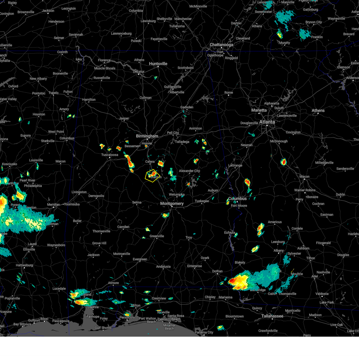 At 423 pm cdt, a severe thunderstorm was located over thorsby, or near jemison, and is nearly stationary (radar indicated). Hazards include 60 mph wind gusts and quarter size hail. Hail damage to vehicles is expected. Expect wind damage to roofs, siding, and trees. At 423 pm cdt, a severe thunderstorm was located over thorsby, or near jemison, and is nearly stationary (radar indicated). Hazards include 60 mph wind gusts and quarter size hail. Hail damage to vehicles is expected. Expect wind damage to roofs, siding, and trees.
|
| 7/21/2023 7:29 PM CDT |
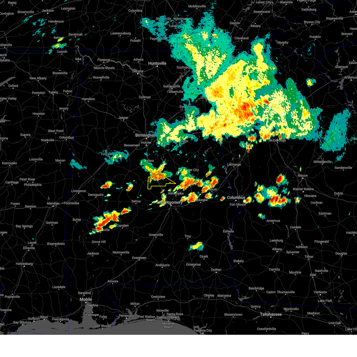 At 729 pm cdt, severe thunderstorms were located along a line extending from near pooles crossroads to near higgins ferry park, moving southeast at 35 mph (radar indicated). Hazards include 60 mph wind gusts and penny size hail. Expect damage to roofs, siding, and trees. locations impacted include, clanton, billingsley, mitchell lake, higgins ferry park, verbena, pooles crossroads, lomax, mitchell dam and cooper. hail threat, radar indicated max hail size, 0. 75 in wind threat, radar indicated max wind gust, 60 mph. At 729 pm cdt, severe thunderstorms were located along a line extending from near pooles crossroads to near higgins ferry park, moving southeast at 35 mph (radar indicated). Hazards include 60 mph wind gusts and penny size hail. Expect damage to roofs, siding, and trees. locations impacted include, clanton, billingsley, mitchell lake, higgins ferry park, verbena, pooles crossroads, lomax, mitchell dam and cooper. hail threat, radar indicated max hail size, 0. 75 in wind threat, radar indicated max wind gust, 60 mph.
|
| 7/21/2023 7:13 PM CDT |
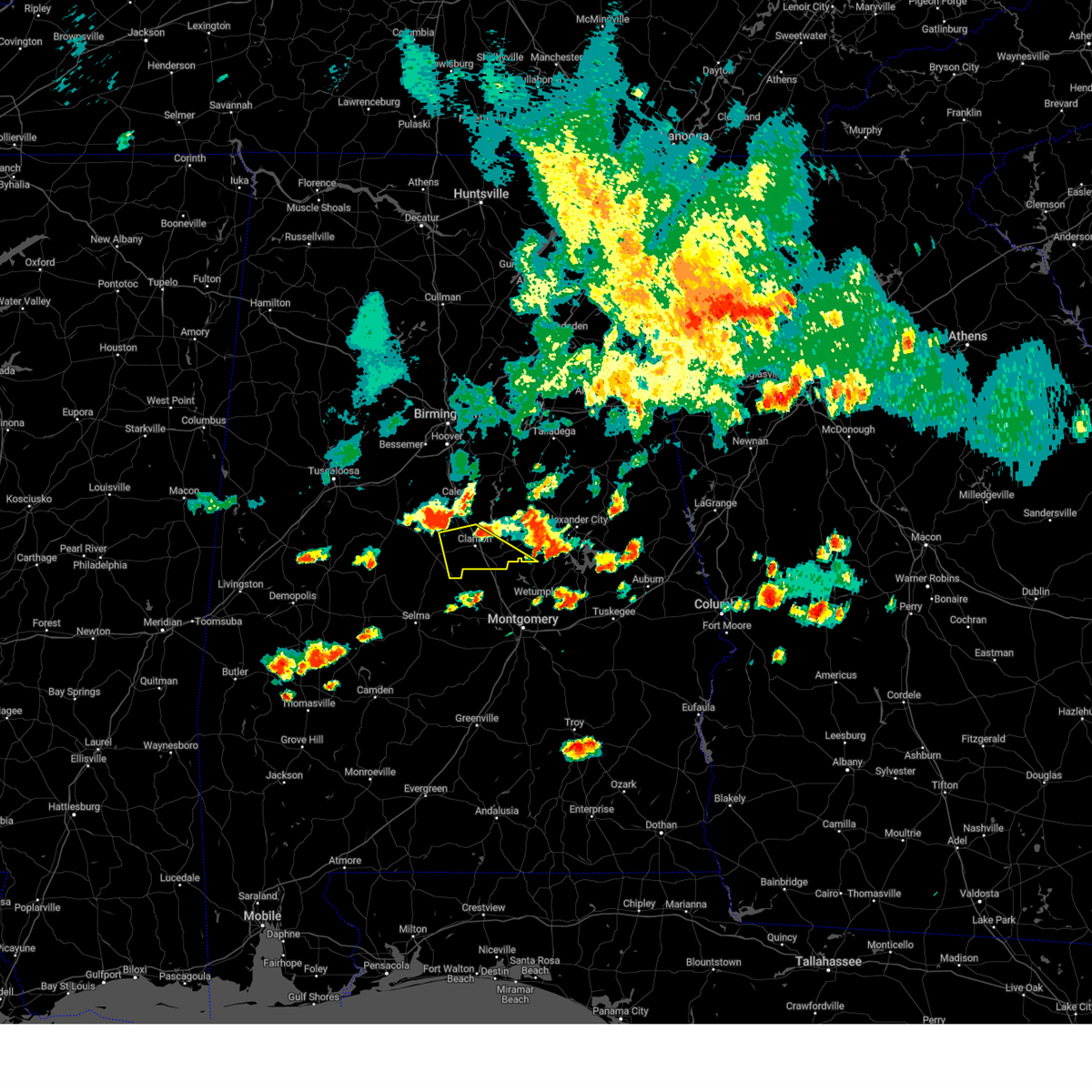 At 713 pm cdt, severe thunderstorms were located along a line extending from chilton county motor sports park to near gap of the mountain, moving southeast at 35 mph (radar indicated). Hazards include 60 mph wind gusts and penny size hail. expect damage to roofs, siding, and trees At 713 pm cdt, severe thunderstorms were located along a line extending from chilton county motor sports park to near gap of the mountain, moving southeast at 35 mph (radar indicated). Hazards include 60 mph wind gusts and penny size hail. expect damage to roofs, siding, and trees
|
| 7/21/2023 6:29 PM CDT |
 At 629 pm cdt, a severe thunderstorm was located near gap of the mountain, or near jemison, moving east at 20 mph (radar indicated). Hazards include 60 mph wind gusts and penny size hail. expect damage to roofs, siding, and trees At 629 pm cdt, a severe thunderstorm was located near gap of the mountain, or near jemison, moving east at 20 mph (radar indicated). Hazards include 60 mph wind gusts and penny size hail. expect damage to roofs, siding, and trees
|
| 6/14/2023 4:36 AM CDT |
 At 435 am cdt, severe thunderstorms were located along a line extending from bentleyville to near welona to near verbena, moving east at 40 mph (radar indicated). Hazards include 60 mph wind gusts and quarter size hail. Hail damage to vehicles is expected. expect wind damage to roofs, siding, and trees. locations impacted include, clanton, rockford, equality, deatsville, eclectic, lyle, pentonville, dollar, santuck, cottage grove, titus, bentleyville, welona, moriah, ten cedar estates, nixburg, dexter, verbena, speed and marbury. hail threat, radar indicated max hail size, 1. 00 in wind threat, radar indicated max wind gust, 60 mph. At 435 am cdt, severe thunderstorms were located along a line extending from bentleyville to near welona to near verbena, moving east at 40 mph (radar indicated). Hazards include 60 mph wind gusts and quarter size hail. Hail damage to vehicles is expected. expect wind damage to roofs, siding, and trees. locations impacted include, clanton, rockford, equality, deatsville, eclectic, lyle, pentonville, dollar, santuck, cottage grove, titus, bentleyville, welona, moriah, ten cedar estates, nixburg, dexter, verbena, speed and marbury. hail threat, radar indicated max hail size, 1. 00 in wind threat, radar indicated max wind gust, 60 mph.
|
| 6/14/2023 4:25 AM CDT |
 At 425 am cdt, severe thunderstorms were located along a line extending from near weogufka to near dollar to near clanton, moving east at 40 mph (radar indicated). Hazards include 60 mph wind gusts and quarter size hail. Hail damage to vehicles is expected. Expect wind damage to roofs, siding, and trees. At 425 am cdt, severe thunderstorms were located along a line extending from near weogufka to near dollar to near clanton, moving east at 40 mph (radar indicated). Hazards include 60 mph wind gusts and quarter size hail. Hail damage to vehicles is expected. Expect wind damage to roofs, siding, and trees.
|
| 3/26/2023 6:16 AM CDT |
 At 616 am cdt, a severe thunderstorm was located near mitchell lake, or near clanton, moving east at 45 mph (radar indicated). Hazards include tennis ball size hail and 60 mph wind gusts. People and animals outdoors will be injured. expect hail damage to roofs, siding, windows, and vehicles. expect wind damage to roofs, siding, and trees. locations impacted include, clanton, rockford, weogufka, equality, lyle, pentonville, dollar, gap of the mountain, cottage grove, titus, strickland crossroads, bentleyville, welona, marble valley, moriah, nixburg, verbena, speed, mitchell lake and lay lake dam. thunderstorm damage threat, considerable hail threat, radar indicated max hail size, 2. 50 in wind threat, radar indicated max wind gust, 60 mph. At 616 am cdt, a severe thunderstorm was located near mitchell lake, or near clanton, moving east at 45 mph (radar indicated). Hazards include tennis ball size hail and 60 mph wind gusts. People and animals outdoors will be injured. expect hail damage to roofs, siding, windows, and vehicles. expect wind damage to roofs, siding, and trees. locations impacted include, clanton, rockford, weogufka, equality, lyle, pentonville, dollar, gap of the mountain, cottage grove, titus, strickland crossroads, bentleyville, welona, marble valley, moriah, nixburg, verbena, speed, mitchell lake and lay lake dam. thunderstorm damage threat, considerable hail threat, radar indicated max hail size, 2. 50 in wind threat, radar indicated max wind gust, 60 mph.
|
| 3/26/2023 6:10 AM CDT |
 At 610 am cdt, a severe thunderstorm was located over clanton, moving east at 40 mph (radar indicated). Hazards include ping pong ball size hail and 60 mph wind gusts. People and animals outdoors will be injured. expect hail damage to roofs, siding, windows, and vehicles. Expect wind damage to roofs, siding, and trees. At 610 am cdt, a severe thunderstorm was located over clanton, moving east at 40 mph (radar indicated). Hazards include ping pong ball size hail and 60 mph wind gusts. People and animals outdoors will be injured. expect hail damage to roofs, siding, windows, and vehicles. Expect wind damage to roofs, siding, and trees.
|
| 3/26/2023 6:02 AM CDT |
 At 602 am cdt, a severe thunderstorm was located over pooles crossroads, or 9 miles southwest of clanton, moving east at 35 mph (radar indicated). Hazards include 60 mph wind gusts and quarter size hail. Hail damage to vehicles is expected. expect wind damage to roofs, siding, and trees. locations impacted include, clanton, maplesville, billingsley, plecher, marbury, higgins ferry park, verbena, pooles crossroads, mitchell lake, mitchell dam, cooper and new prospect. hail threat, radar indicated max hail size, 1. 00 in wind threat, radar indicated max wind gust, 60 mph. At 602 am cdt, a severe thunderstorm was located over pooles crossroads, or 9 miles southwest of clanton, moving east at 35 mph (radar indicated). Hazards include 60 mph wind gusts and quarter size hail. Hail damage to vehicles is expected. expect wind damage to roofs, siding, and trees. locations impacted include, clanton, maplesville, billingsley, plecher, marbury, higgins ferry park, verbena, pooles crossroads, mitchell lake, mitchell dam, cooper and new prospect. hail threat, radar indicated max hail size, 1. 00 in wind threat, radar indicated max wind gust, 60 mph.
|
| 3/26/2023 5:34 AM CDT |
 At 534 am cdt, a severe thunderstorm was located over parnell, or 11 miles north of valley grande, moving east at 35 mph (radar indicated). Hazards include 60 mph wind gusts and quarter size hail. Hail damage to vehicles is expected. Expect wind damage to roofs, siding, and trees. At 534 am cdt, a severe thunderstorm was located over parnell, or 11 miles north of valley grande, moving east at 35 mph (radar indicated). Hazards include 60 mph wind gusts and quarter size hail. Hail damage to vehicles is expected. Expect wind damage to roofs, siding, and trees.
|
| 3/26/2023 3:46 AM CDT |
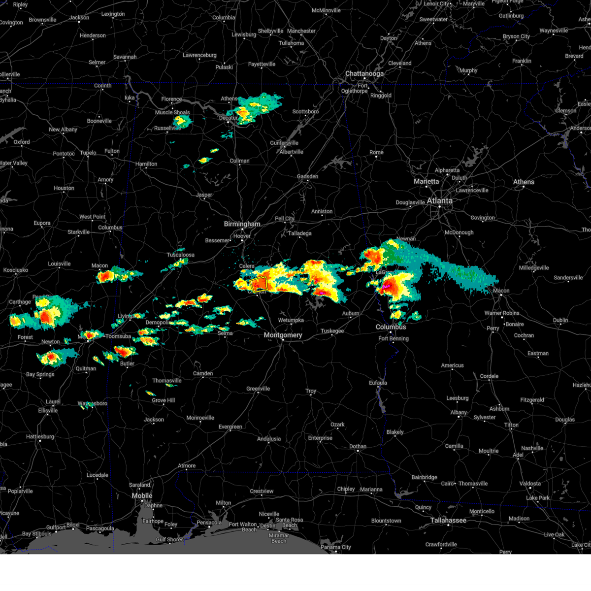 At 346 am cdt, a severe thunderstorm was located over gap of the mountain, or 7 miles north of clanton, moving northeast at 45 mph (radar indicated). Hazards include 60 mph wind gusts and quarter size hail. Hail damage to vehicles is expected. expect wind damage to roofs, siding, and trees. locations impacted include, clanton, gap of the mountain, lay lake dam, lay lake, mitchell lake, lomax, waxahatchee creek and i 65 rest area. hail threat, radar indicated max hail size, 1. 00 in wind threat, radar indicated max wind gust, 60 mph. At 346 am cdt, a severe thunderstorm was located over gap of the mountain, or 7 miles north of clanton, moving northeast at 45 mph (radar indicated). Hazards include 60 mph wind gusts and quarter size hail. Hail damage to vehicles is expected. expect wind damage to roofs, siding, and trees. locations impacted include, clanton, gap of the mountain, lay lake dam, lay lake, mitchell lake, lomax, waxahatchee creek and i 65 rest area. hail threat, radar indicated max hail size, 1. 00 in wind threat, radar indicated max wind gust, 60 mph.
|
| 3/26/2023 3:25 AM CDT |
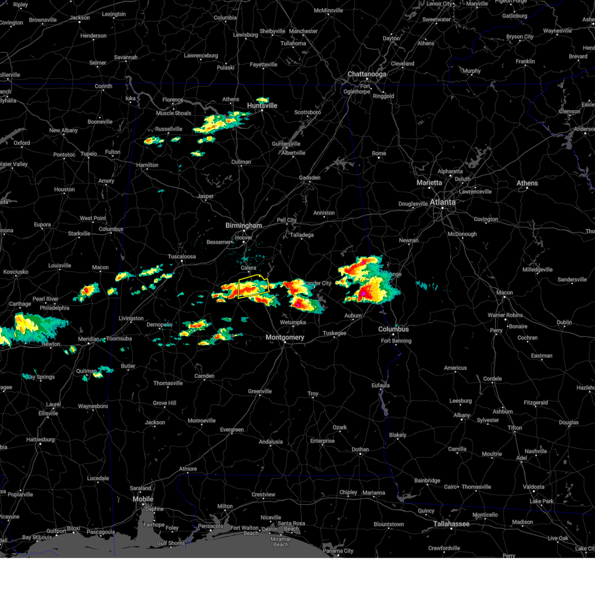 At 324 am cdt, a severe thunderstorm was located over chilton county motor sports park, or 8 miles southwest of jemison, moving northeast at 45 mph (radar indicated). Hazards include 60 mph wind gusts and half dollar size hail. Hail damage to vehicles is expected. Expect wind damage to roofs, siding, and trees. At 324 am cdt, a severe thunderstorm was located over chilton county motor sports park, or 8 miles southwest of jemison, moving northeast at 45 mph (radar indicated). Hazards include 60 mph wind gusts and half dollar size hail. Hail damage to vehicles is expected. Expect wind damage to roofs, siding, and trees.
|
| 3/26/2023 2:22 AM CDT |
 At 222 am cdt, a severe thunderstorm was located 8 miles northeast of burnsville, or 9 miles northeast of valley grande, moving northeast at 50 mph (radar indicated). Hazards include ping pong ball size hail and 60 mph wind gusts. People and animals outdoors will be injured. expect hail damage to roofs, siding, windows, and vehicles. Expect wind damage to roofs, siding, and trees. At 222 am cdt, a severe thunderstorm was located 8 miles northeast of burnsville, or 9 miles northeast of valley grande, moving northeast at 50 mph (radar indicated). Hazards include ping pong ball size hail and 60 mph wind gusts. People and animals outdoors will be injured. expect hail damage to roofs, siding, windows, and vehicles. Expect wind damage to roofs, siding, and trees.
|
| 1/12/2023 11:36 AM CST |
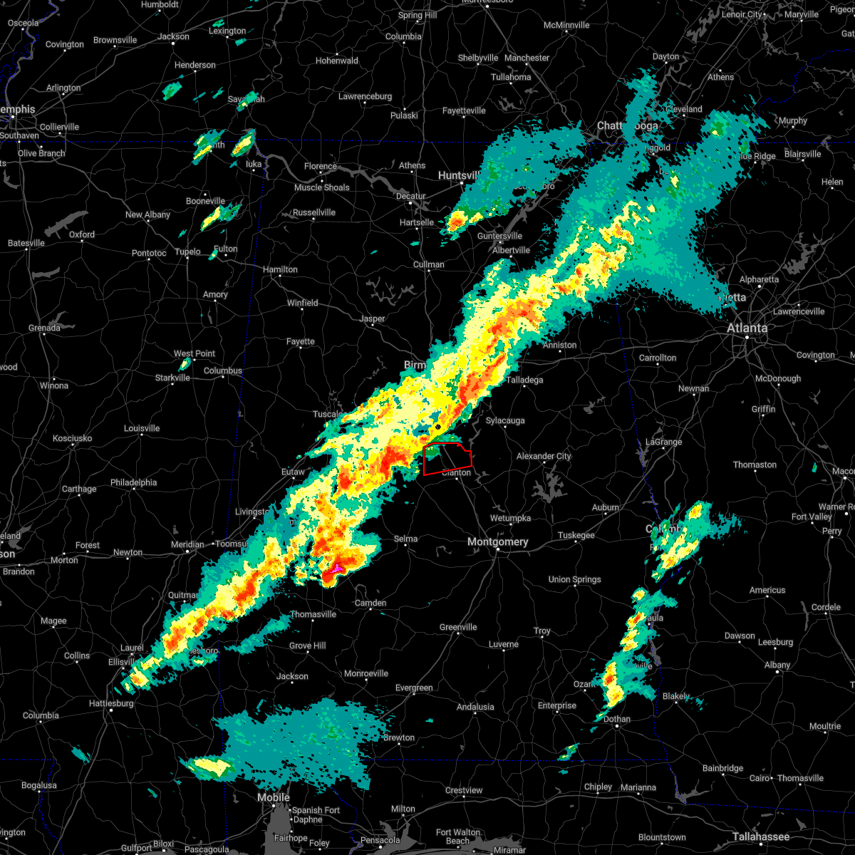 At 1136 am cst, a tornado producing storm was located near west centreville, or near brent, moving east at 50 mph (radar confirmed tornado). Hazards include damaging tornado. Flying debris will be dangerous to those caught without shelter. mobile homes will be damaged or destroyed. damage to roofs, windows, and vehicles will occur. Tree damage is likely. At 1136 am cst, a tornado producing storm was located near west centreville, or near brent, moving east at 50 mph (radar confirmed tornado). Hazards include damaging tornado. Flying debris will be dangerous to those caught without shelter. mobile homes will be damaged or destroyed. damage to roofs, windows, and vehicles will occur. Tree damage is likely.
|
| 1/4/2023 2:09 AM CST |
 At 209 am cst, a severe thunderstorm was located near verbena, or near clanton, moving east at 50 mph (radar indicated). Hazards include 60 mph wind gusts and penny size hail. Expect damage to roofs, siding, and trees. locations impacted include, clanton, thorsby, deatsville, billingsley, plecher, marbury, vida junction, gap of the mountain, lay lake dam, higgins ferry park, verbena, pooles crossroads, mitchell lake, lay lake, lomax, i 65 rest area, mitchell dam, new prospect, isabella and dawson mill. hail threat, radar indicated max hail size, 0. 75 in wind threat, radar indicated max wind gust, 60 mph. At 209 am cst, a severe thunderstorm was located near verbena, or near clanton, moving east at 50 mph (radar indicated). Hazards include 60 mph wind gusts and penny size hail. Expect damage to roofs, siding, and trees. locations impacted include, clanton, thorsby, deatsville, billingsley, plecher, marbury, vida junction, gap of the mountain, lay lake dam, higgins ferry park, verbena, pooles crossroads, mitchell lake, lay lake, lomax, i 65 rest area, mitchell dam, new prospect, isabella and dawson mill. hail threat, radar indicated max hail size, 0. 75 in wind threat, radar indicated max wind gust, 60 mph.
|
| 1/4/2023 1:55 AM CST |
 At 155 am cst, a severe thunderstorm was located over plecher, or 11 miles southwest of clanton, moving east at 55 mph (radar indicated). Hazards include 60 mph wind gusts and penny size hail. Expect damage to roofs, siding, and trees. locations impacted include, clanton, jemison, thorsby, deatsville, maplesville, billingsley, vida junction, gap of the mountain, parnell, verbena, plecher, marbury, lay lake dam, chilton county motor sports park, higgins ferry park, pooles crossroads, mitchell lake, lay lake, lomax and stanton. hail threat, radar indicated max hail size, 0. 75 in wind threat, radar indicated max wind gust, 60 mph. At 155 am cst, a severe thunderstorm was located over plecher, or 11 miles southwest of clanton, moving east at 55 mph (radar indicated). Hazards include 60 mph wind gusts and penny size hail. Expect damage to roofs, siding, and trees. locations impacted include, clanton, jemison, thorsby, deatsville, maplesville, billingsley, vida junction, gap of the mountain, parnell, verbena, plecher, marbury, lay lake dam, chilton county motor sports park, higgins ferry park, pooles crossroads, mitchell lake, lay lake, lomax and stanton. hail threat, radar indicated max hail size, 0. 75 in wind threat, radar indicated max wind gust, 60 mph.
|
| 1/4/2023 1:38 AM CST |
 At 138 am cst, a severe thunderstorm was located near paul m grist state park, or 9 miles north of valley grande, moving east at 50 mph (radar indicated). Hazards include 60 mph wind gusts and penny size hail. expect damage to roofs, siding, and trees At 138 am cst, a severe thunderstorm was located near paul m grist state park, or 9 miles north of valley grande, moving east at 50 mph (radar indicated). Hazards include 60 mph wind gusts and penny size hail. expect damage to roofs, siding, and trees
|
| 1/3/2023 1:40 PM CST | Tree and structural damage at lay lake near lay dam. possible tornad in chilton county AL, 10.4 miles SSW of Clanton, AL |
| 1/3/2023 1:26 PM CST |
 At 126 pm cst, a severe thunderstorm capable of producing a tornado was located over gap of the mountain, or near clanton, moving northeast at 35 mph (radar indicated rotation). Hazards include tornado. Flying debris will be dangerous to those caught without shelter. mobile homes will be damaged or destroyed. damage to roofs, windows, and vehicles will occur. tree damage is likely. Locations impacted include, clanton, gap of the mountain, lay lake dam, lay lake, mitchell lake, lomax, waxahatchee creek and i 65 rest area. At 126 pm cst, a severe thunderstorm capable of producing a tornado was located over gap of the mountain, or near clanton, moving northeast at 35 mph (radar indicated rotation). Hazards include tornado. Flying debris will be dangerous to those caught without shelter. mobile homes will be damaged or destroyed. damage to roofs, windows, and vehicles will occur. tree damage is likely. Locations impacted include, clanton, gap of the mountain, lay lake dam, lay lake, mitchell lake, lomax, waxahatchee creek and i 65 rest area.
|
| 1/3/2023 1:14 PM CST |
 At 114 pm cst, a severe thunderstorm capable of producing a tornado was located over thorsby, or near jemison, moving northeast at 35 mph (radar indicated rotation). Hazards include tornado. Flying debris will be dangerous to those caught without shelter. mobile homes will be damaged or destroyed. damage to roofs, windows, and vehicles will occur. tree damage is likely. Locations impacted include, clanton, jemison, thorsby, gap of the mountain, lay lake dam, lay lake, mitchell lake, lomax, waxahatchee creek and i 65 rest area. At 114 pm cst, a severe thunderstorm capable of producing a tornado was located over thorsby, or near jemison, moving northeast at 35 mph (radar indicated rotation). Hazards include tornado. Flying debris will be dangerous to those caught without shelter. mobile homes will be damaged or destroyed. damage to roofs, windows, and vehicles will occur. tree damage is likely. Locations impacted include, clanton, jemison, thorsby, gap of the mountain, lay lake dam, lay lake, mitchell lake, lomax, waxahatchee creek and i 65 rest area.
|
| 1/3/2023 1:00 PM CST |
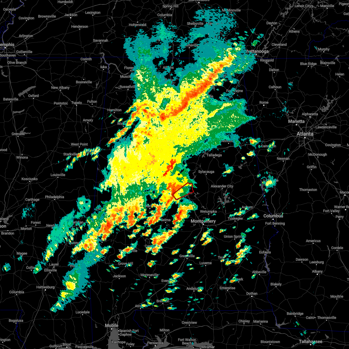 At 100 pm cst, a severe thunderstorm capable of producing a tornado was located near maplesville, or 11 miles southwest of jemison, moving northeast at 30 mph (radar indicated rotation). Hazards include tornado. Flying debris will be dangerous to those caught without shelter. mobile homes will be damaged or destroyed. damage to roofs, windows, and vehicles will occur. Tree damage is likely. At 100 pm cst, a severe thunderstorm capable of producing a tornado was located near maplesville, or 11 miles southwest of jemison, moving northeast at 30 mph (radar indicated rotation). Hazards include tornado. Flying debris will be dangerous to those caught without shelter. mobile homes will be damaged or destroyed. damage to roofs, windows, and vehicles will occur. Tree damage is likely.
|
| 7/21/2022 7:13 PM CDT |
 At 713 pm cdt, severe thunderstorms were located along a line extending from northern lake martin to welona to near talladega national forest, moving south at 40 mph (radar indicated). Hazards include 60 mph wind gusts and penny size hail. Expect damage to roofs, siding, and trees. locations impacted include, clanton, rockford, equality, maplesville, plecher, speed, pentonville, cottage grove, highway 9 and highway 22, nixburg, verbena, pooles crossroads, western lake martin, mitchell lake, fishpond, stanton, ray, mitchell dam, hissop and isabella. hail threat, radar indicated max hail size, 0. 75 in wind threat, radar indicated max wind gust, 60 mph. At 713 pm cdt, severe thunderstorms were located along a line extending from northern lake martin to welona to near talladega national forest, moving south at 40 mph (radar indicated). Hazards include 60 mph wind gusts and penny size hail. Expect damage to roofs, siding, and trees. locations impacted include, clanton, rockford, equality, maplesville, plecher, speed, pentonville, cottage grove, highway 9 and highway 22, nixburg, verbena, pooles crossroads, western lake martin, mitchell lake, fishpond, stanton, ray, mitchell dam, hissop and isabella. hail threat, radar indicated max hail size, 0. 75 in wind threat, radar indicated max wind gust, 60 mph.
|
| 7/21/2022 6:57 PM CDT |
 At 657 pm cdt, severe thunderstorms were located along a line extending from 6 miles east of goodwater to near dollar to near lawley, moving south at 35 mph (radar indicated). Hazards include 60 mph wind gusts and penny size hail. Expect damage to roofs, siding, and trees. locations impacted include, calera, clanton, jemison, goodwater, rockford, kellyton, equality, stewartville, weogufka, thorsby, maplesville, dollar, bradford, gap of the mountain, strickland crossroads, bentleyville, hatchet, verbena, mitchell lake and brierfield ironworks park. hail threat, radar indicated max hail size, 0. 75 in wind threat, radar indicated max wind gust, 60 mph. At 657 pm cdt, severe thunderstorms were located along a line extending from 6 miles east of goodwater to near dollar to near lawley, moving south at 35 mph (radar indicated). Hazards include 60 mph wind gusts and penny size hail. Expect damage to roofs, siding, and trees. locations impacted include, calera, clanton, jemison, goodwater, rockford, kellyton, equality, stewartville, weogufka, thorsby, maplesville, dollar, bradford, gap of the mountain, strickland crossroads, bentleyville, hatchet, verbena, mitchell lake and brierfield ironworks park. hail threat, radar indicated max hail size, 0. 75 in wind threat, radar indicated max wind gust, 60 mph.
|
| 7/21/2022 6:51 PM CDT | Multiple trees down around clanto in chilton county AL, 0.7 miles ENE of Clanton, AL |
| 7/21/2022 6:50 PM CDT | Multiple trees down blocking county road 55. location approximat in chilton county AL, 7.8 miles SSW of Clanton, AL |
| 7/21/2022 6:36 PM CDT |
 At 636 pm cdt, severe thunderstorms were located along a line extending from 10 miles west of ashland to marble valley to 6 miles east of centreville, moving south at 35 mph (radar indicated). Hazards include 60 mph wind gusts and penny size hail. Expect damage to roofs, siding, and trees. locations impacted include, sylacauga, calera, clanton, montevallo, columbiana, jemison, wilsonville, goodwater, rockford, kellyton, talladega springs, equality, stewartville, weogufka, thorsby, maplesville, wilton, oak grove, dollar and bradford. hail threat, radar indicated max hail size, 0. 75 in wind threat, radar indicated max wind gust, 60 mph. At 636 pm cdt, severe thunderstorms were located along a line extending from 10 miles west of ashland to marble valley to 6 miles east of centreville, moving south at 35 mph (radar indicated). Hazards include 60 mph wind gusts and penny size hail. Expect damage to roofs, siding, and trees. locations impacted include, sylacauga, calera, clanton, montevallo, columbiana, jemison, wilsonville, goodwater, rockford, kellyton, talladega springs, equality, stewartville, weogufka, thorsby, maplesville, wilton, oak grove, dollar and bradford. hail threat, radar indicated max hail size, 0. 75 in wind threat, radar indicated max wind gust, 60 mph.
|
| 7/21/2022 6:24 PM CDT |
 At 624 pm cdt, severe thunderstorms were located along a line extending from 6 miles south of waldo to near talladega springs to 6 miles southeast of west blocton, moving south at 35 mph (radar indicated). Hazards include 60 mph wind gusts and quarter size hail. Hail damage to vehicles is expected. Expect wind damage to roofs, siding, and trees. At 624 pm cdt, severe thunderstorms were located along a line extending from 6 miles south of waldo to near talladega springs to 6 miles southeast of west blocton, moving south at 35 mph (radar indicated). Hazards include 60 mph wind gusts and quarter size hail. Hail damage to vehicles is expected. Expect wind damage to roofs, siding, and trees.
|
| 6/17/2022 5:12 PM CDT |
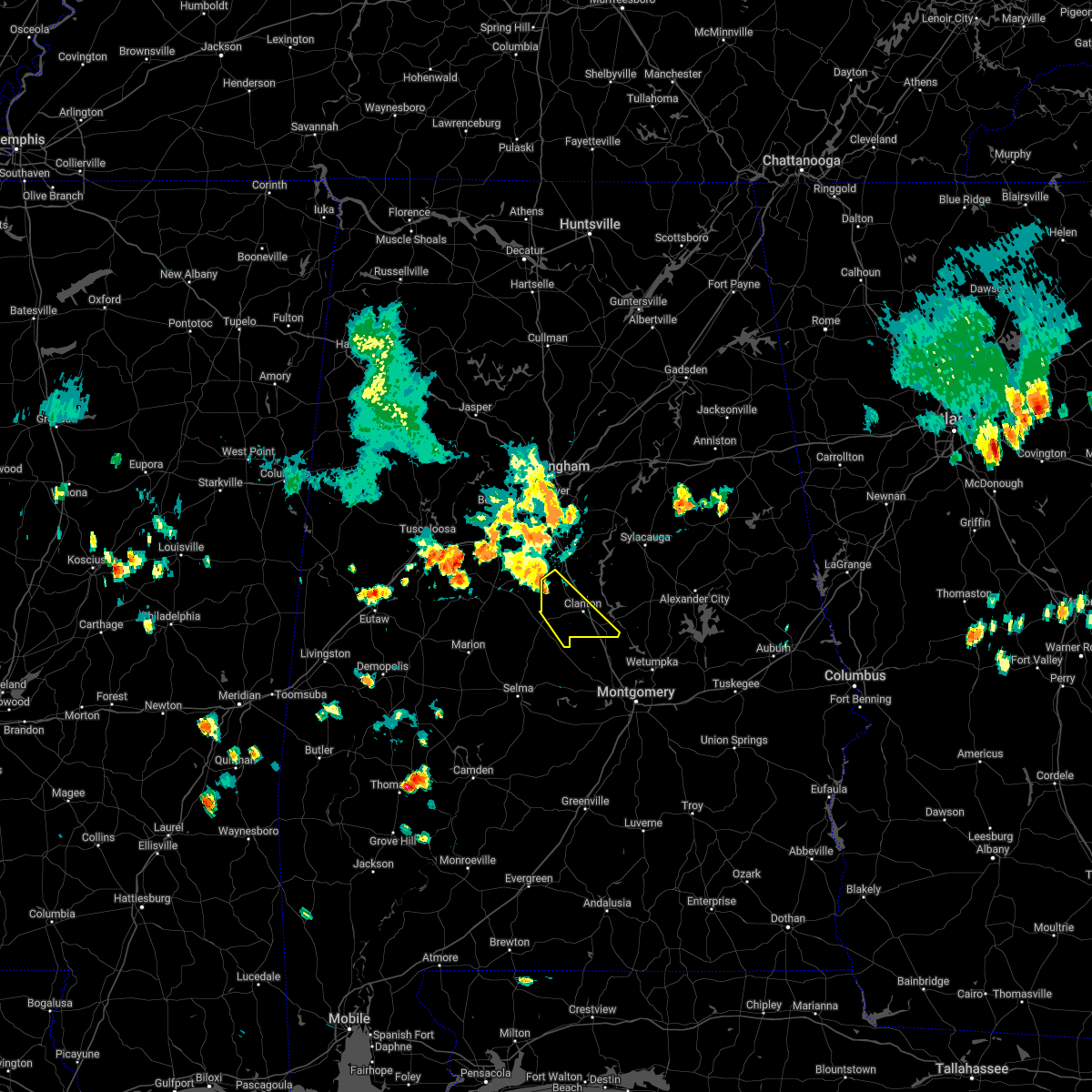 At 512 pm cdt, a severe thunderstorm was located near chilton county motor sports park, or near jemison, moving southeast at 30 mph (radar indicated). Hazards include 60 mph wind gusts and quarter size hail. Hail damage to vehicles is expected. Expect wind damage to roofs, siding, and trees. At 512 pm cdt, a severe thunderstorm was located near chilton county motor sports park, or near jemison, moving southeast at 30 mph (radar indicated). Hazards include 60 mph wind gusts and quarter size hail. Hail damage to vehicles is expected. Expect wind damage to roofs, siding, and trees.
|
| 6/15/2022 10:06 PM CDT | Corrects previous tstm wnd dmg report from clanton. a few trees blown down around clanto in chilton county AL, 0.7 miles ENE of Clanton, AL |
| 6/15/2022 10:00 PM CDT |
 At 959 pm cdt, severe thunderstorms were located along a line extending from near thorsby to near white hall to near logan, moving west at 40 mph (radar indicated). Hazards include 60 mph wind gusts. expect damage to roofs, siding, and trees At 959 pm cdt, severe thunderstorms were located along a line extending from near thorsby to near white hall to near logan, moving west at 40 mph (radar indicated). Hazards include 60 mph wind gusts. expect damage to roofs, siding, and trees
|
| 6/15/2022 10:06 AM CDT | A few trees blown down around clanto in chilton county AL, 0.7 miles ENE of Clanton, AL |
| 6/8/2022 5:50 AM CDT |
 The severe thunderstorm warning for central chilton county will expire at 600 am cdt, the storm which prompted the warning has weakened below severe limits, and no longer poses an immediate threat to life or property. therefore, the warning will be allowed to expire. The severe thunderstorm warning for central chilton county will expire at 600 am cdt, the storm which prompted the warning has weakened below severe limits, and no longer poses an immediate threat to life or property. therefore, the warning will be allowed to expire.
|
| 6/8/2022 5:31 AM CDT |
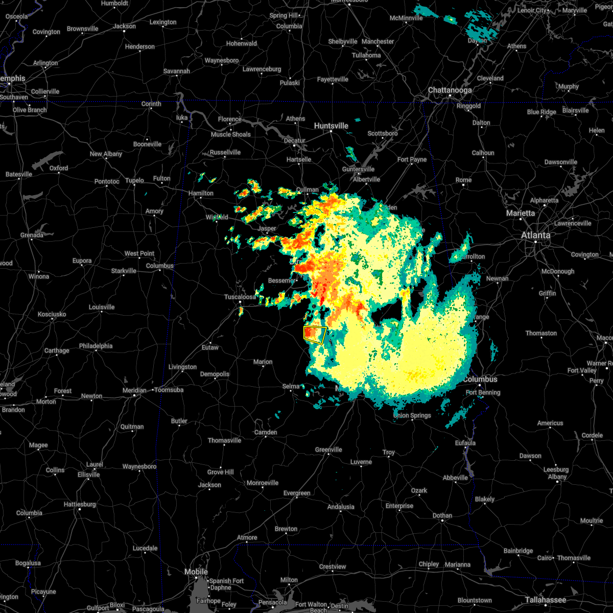 At 531 am cdt, a severe thunderstorm was located near jemison, moving east at 20 mph (radar indicated). Hazards include 60 mph wind gusts and quarter size hail. Hail damage to vehicles is expected. expect wind damage to roofs, siding, and trees. locations impacted include, jemison, thorsby and chilton county motor sports park. hail threat, radar indicated max hail size, 1. 00 in wind threat, radar indicated max wind gust, 60 mph. At 531 am cdt, a severe thunderstorm was located near jemison, moving east at 20 mph (radar indicated). Hazards include 60 mph wind gusts and quarter size hail. Hail damage to vehicles is expected. expect wind damage to roofs, siding, and trees. locations impacted include, jemison, thorsby and chilton county motor sports park. hail threat, radar indicated max hail size, 1. 00 in wind threat, radar indicated max wind gust, 60 mph.
|
| 6/8/2022 5:13 AM CDT |
 At 513 am cdt, a severe thunderstorm was located near ashby, or 9 miles west of jemison, moving east at 20 mph (radar indicated). Hazards include 60 mph wind gusts and quarter size hail. Hail damage to vehicles is expected. Expect wind damage to roofs, siding, and trees. At 513 am cdt, a severe thunderstorm was located near ashby, or 9 miles west of jemison, moving east at 20 mph (radar indicated). Hazards include 60 mph wind gusts and quarter size hail. Hail damage to vehicles is expected. Expect wind damage to roofs, siding, and trees.
|
| 4/17/2022 8:48 PM CDT | Quarter sized hail reported 1.6 miles N of Clanton, AL, a few reports of quarter size hail in clanton. |
| 4/13/2022 11:21 PM CDT |
 At 1121 pm cdt, severe thunderstorms were located along a line extending from near lay lake to higgins ferry park to beechwood, moving east at 50 mph (radar indicated). Hazards include 60 mph wind gusts. Expect damage to roofs, siding, and trees. locations impacted include, prattville, millbrook, calera, clanton, fort deposit, mosses, hayneville, deatsville, autaugaville, white hall, gordonville, lowndesboro, booth, vida junction, beechwood, gap of the mountain, autauga county airport, verbena, marbury and lowndes county airport. hail threat, radar indicated max hail size, <. 75 in wind threat, radar indicated max wind gust, 60 mph. At 1121 pm cdt, severe thunderstorms were located along a line extending from near lay lake to higgins ferry park to beechwood, moving east at 50 mph (radar indicated). Hazards include 60 mph wind gusts. Expect damage to roofs, siding, and trees. locations impacted include, prattville, millbrook, calera, clanton, fort deposit, mosses, hayneville, deatsville, autaugaville, white hall, gordonville, lowndesboro, booth, vida junction, beechwood, gap of the mountain, autauga county airport, verbena, marbury and lowndes county airport. hail threat, radar indicated max hail size, <. 75 in wind threat, radar indicated max wind gust, 60 mph.
|
| 4/13/2022 11:05 PM CDT |
 At 1105 pm cdt, severe thunderstorms were located along a line extending from near calera to clanton to 9 miles southeast of belknap, moving east at 50 mph (radar indicated). Hazards include 70 mph wind gusts. Expect considerable tree damage. damage is likely to mobile homes, roofs, and outbuildings. Locations impacted include, prattville, millbrook, calera, clanton, jemison, fort deposit, mosses, hayneville, thorsby, deatsville, autaugaville, white hall, gordonville, billingsley, lowndesboro, benton, gap of the mountain, autauga county airport, verbena and mulberry. At 1105 pm cdt, severe thunderstorms were located along a line extending from near calera to clanton to 9 miles southeast of belknap, moving east at 50 mph (radar indicated). Hazards include 70 mph wind gusts. Expect considerable tree damage. damage is likely to mobile homes, roofs, and outbuildings. Locations impacted include, prattville, millbrook, calera, clanton, jemison, fort deposit, mosses, hayneville, thorsby, deatsville, autaugaville, white hall, gordonville, billingsley, lowndesboro, benton, gap of the mountain, autauga county airport, verbena and mulberry.
|
| 4/13/2022 10:34 PM CDT |
 At 1034 pm cdt, severe thunderstorms were located along a line extending from near centreville to 6 miles north of camden, moving east at 50 mph (radar indicated). Hazards include 60 mph wind gusts. expect damage to roofs, siding, and trees At 1034 pm cdt, severe thunderstorms were located along a line extending from near centreville to 6 miles north of camden, moving east at 50 mph (radar indicated). Hazards include 60 mph wind gusts. expect damage to roofs, siding, and trees
|
| 3/30/2022 11:44 PM CDT |
 At 1144 pm cdt, severe thunderstorms were located along a line extending from near maylene to near calera to near clanton, moving northeast at 55 mph (radar indicated). Hazards include 60 mph wind gusts. Expect damage to roofs, siding, and trees. locations impacted include, hoover, alabaster, pelham, helena, leeds, calera, chelsea, clanton, montevallo, columbiana, jemison, wilsonville, indian springs village, vincent, thorsby, harpersville, westover, wilton, gap of the mountain and american village. hail threat, radar indicated max hail size, <. 75 in wind threat, radar indicated max wind gust, 60 mph. At 1144 pm cdt, severe thunderstorms were located along a line extending from near maylene to near calera to near clanton, moving northeast at 55 mph (radar indicated). Hazards include 60 mph wind gusts. Expect damage to roofs, siding, and trees. locations impacted include, hoover, alabaster, pelham, helena, leeds, calera, chelsea, clanton, montevallo, columbiana, jemison, wilsonville, indian springs village, vincent, thorsby, harpersville, westover, wilton, gap of the mountain and american village. hail threat, radar indicated max hail size, <. 75 in wind threat, radar indicated max wind gust, 60 mph.
|
| 3/30/2022 11:39 PM CDT |
 At 1138 pm cdt, severe thunderstorms were located along a line extending from near maylene to near jemison to near pooles crossroads, moving northeast at 55 mph (radar indicated). Hazards include 60 mph wind gusts. expect damage to roofs, siding, and trees At 1138 pm cdt, severe thunderstorms were located along a line extending from near maylene to near jemison to near pooles crossroads, moving northeast at 55 mph (radar indicated). Hazards include 60 mph wind gusts. expect damage to roofs, siding, and trees
|
| 3/18/2022 7:52 AM CDT |
 At 752 am cdt, severe thunderstorms were located along a line extending from near lay lake dam to near white hall, moving east at 60 mph (radar indicated). Hazards include 60 mph wind gusts and penny size hail. expect damage to roofs, siding, and trees At 752 am cdt, severe thunderstorms were located along a line extending from near lay lake dam to near white hall, moving east at 60 mph (radar indicated). Hazards include 60 mph wind gusts and penny size hail. expect damage to roofs, siding, and trees
|
| 3/18/2022 7:31 AM CDT |
 At 731 am cdt, a severe thunderstorm was located over parnell, or 10 miles north of valley grande, moving northeast at 60 mph (radar indicated). Hazards include 60 mph wind gusts and nickel size hail. Expect damage to roofs, siding, and trees. locations impacted include, clanton, valley grande, maplesville, billingsley, plecher, vida junction, parnell, paul m grist state park, pooles crossroads, stanton, summerfield, valley creek junction, plantersville, isabella, barrett creek and dawson mill. hail threat, radar indicated max hail size, 0. 88 in wind threat, radar indicated max wind gust, 60 mph. At 731 am cdt, a severe thunderstorm was located over parnell, or 10 miles north of valley grande, moving northeast at 60 mph (radar indicated). Hazards include 60 mph wind gusts and nickel size hail. Expect damage to roofs, siding, and trees. locations impacted include, clanton, valley grande, maplesville, billingsley, plecher, vida junction, parnell, paul m grist state park, pooles crossroads, stanton, summerfield, valley creek junction, plantersville, isabella, barrett creek and dawson mill. hail threat, radar indicated max hail size, 0. 88 in wind threat, radar indicated max wind gust, 60 mph.
|
| 3/18/2022 7:10 AM CDT |
 At 710 am cdt, a severe thunderstorm was located near marion, moving northeast at 60 mph (radar indicated). Hazards include 60 mph wind gusts and nickel size hail. expect damage to roofs, siding, and trees At 710 am cdt, a severe thunderstorm was located near marion, moving northeast at 60 mph (radar indicated). Hazards include 60 mph wind gusts and nickel size hail. expect damage to roofs, siding, and trees
|
| 12/30/2021 10:08 AM CST |
 At 1007 am cst, a severe thunderstorm was located near gap of the mountain, or near jemison, moving east at 40 mph (radar indicated). Hazards include 60 mph wind gusts and penny size hail. Expect damage to roofs, siding, and trees. Locations impacted include, clanton, weogufka, thorsby, gap of the mountain, strickland crossroads, lay lake dam, unity, marble valley, moriah, lay lake, mitchell lake, waxahatchee creek, highway 145 and cr 46, paint creek, i 65 rest area and spring creek. At 1007 am cst, a severe thunderstorm was located near gap of the mountain, or near jemison, moving east at 40 mph (radar indicated). Hazards include 60 mph wind gusts and penny size hail. Expect damage to roofs, siding, and trees. Locations impacted include, clanton, weogufka, thorsby, gap of the mountain, strickland crossroads, lay lake dam, unity, marble valley, moriah, lay lake, mitchell lake, waxahatchee creek, highway 145 and cr 46, paint creek, i 65 rest area and spring creek.
|
| 12/30/2021 9:57 AM CST |
 At 957 am cst, a severe thunderstorm was located over jemison, moving east at 40 mph (radar indicated). Hazards include 60 mph wind gusts and penny size hail. expect damage to roofs, siding, and trees At 957 am cst, a severe thunderstorm was located over jemison, moving east at 40 mph (radar indicated). Hazards include 60 mph wind gusts and penny size hail. expect damage to roofs, siding, and trees
|
| 5/4/2021 5:54 PM CDT |
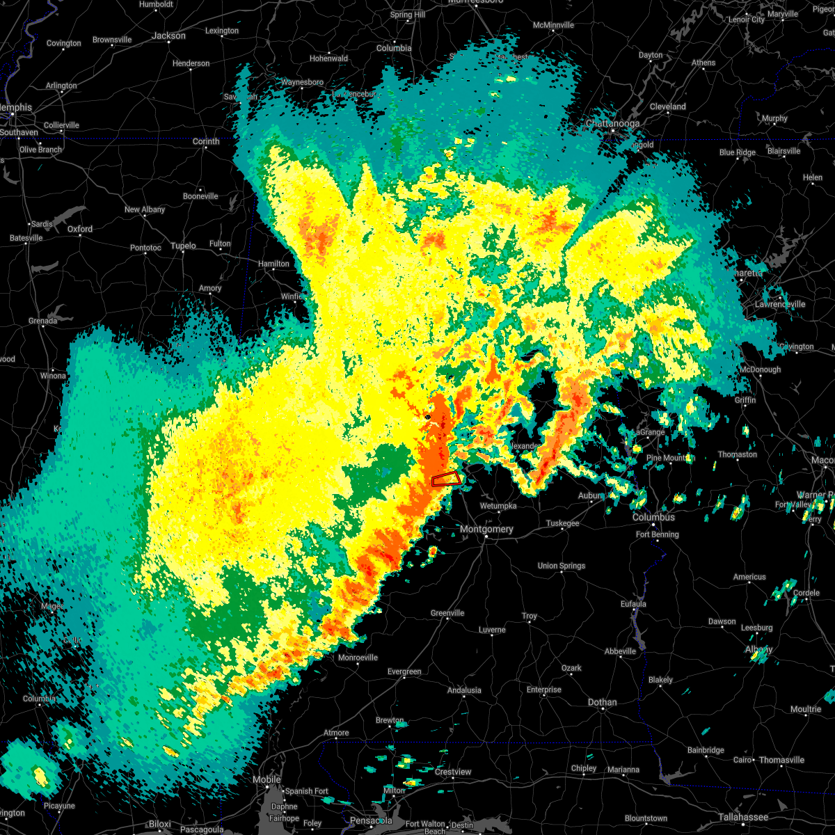 At 554 pm cdt, a severe thunderstorm capable of producing a tornado was located near pooles crossroads, or near clanton, moving east at 55 mph (radar indicated rotation). Hazards include tornado. Flying debris will be dangerous to those caught without shelter. mobile homes will be damaged or destroyed. damage to roofs, windows, and vehicles will occur. tree damage is likely. Locations impacted include, clanton, pooles crossroads and cooper. At 554 pm cdt, a severe thunderstorm capable of producing a tornado was located near pooles crossroads, or near clanton, moving east at 55 mph (radar indicated rotation). Hazards include tornado. Flying debris will be dangerous to those caught without shelter. mobile homes will be damaged or destroyed. damage to roofs, windows, and vehicles will occur. tree damage is likely. Locations impacted include, clanton, pooles crossroads and cooper.
|
| 5/4/2021 5:49 PM CDT |
 At 549 pm cdt, severe thunderstorms were located along a line extending from lay lake to 8 miles southwest of belknap, moving east at 50 mph (radar indicated). Hazards include 60 mph wind gusts. Expect damage to roofs, siding, and trees. Locations impacted include, prattville, millbrook, calera, clanton, jemison, fort deposit, mosses, hayneville, thorsby, deatsville, autaugaville, white hall, maplesville, gordonville, billingsley, lowndesboro, benton, gap of the mountain, autauga county airport and verbena. At 549 pm cdt, severe thunderstorms were located along a line extending from lay lake to 8 miles southwest of belknap, moving east at 50 mph (radar indicated). Hazards include 60 mph wind gusts. Expect damage to roofs, siding, and trees. Locations impacted include, prattville, millbrook, calera, clanton, jemison, fort deposit, mosses, hayneville, thorsby, deatsville, autaugaville, white hall, maplesville, gordonville, billingsley, lowndesboro, benton, gap of the mountain, autauga county airport and verbena.
|
| 5/4/2021 5:47 PM CDT |
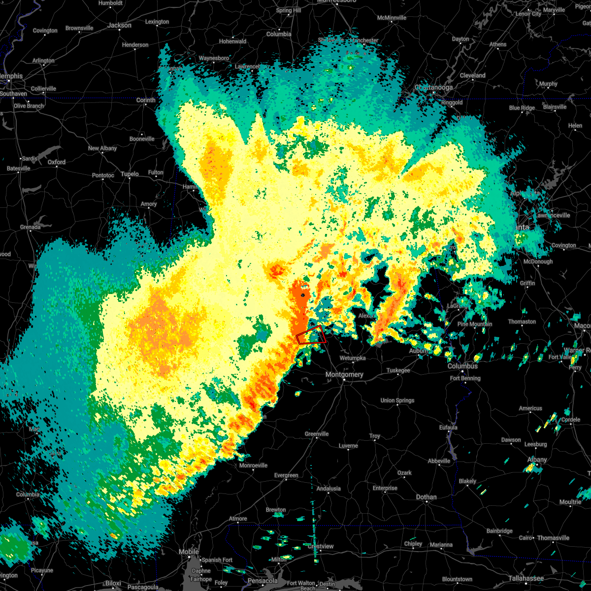 At 547 pm cdt, a severe thunderstorm capable of producing a tornado was located over pooles crossroads, or 8 miles southwest of clanton, moving east at 60 mph (radar indicated rotation). Hazards include tornado. Flying debris will be dangerous to those caught without shelter. mobile homes will be damaged or destroyed. damage to roofs, windows, and vehicles will occur. tree damage is likely. Locations impacted include, clanton, pooles crossroads and cooper. At 547 pm cdt, a severe thunderstorm capable of producing a tornado was located over pooles crossroads, or 8 miles southwest of clanton, moving east at 60 mph (radar indicated rotation). Hazards include tornado. Flying debris will be dangerous to those caught without shelter. mobile homes will be damaged or destroyed. damage to roofs, windows, and vehicles will occur. tree damage is likely. Locations impacted include, clanton, pooles crossroads and cooper.
|
| 5/4/2021 5:36 PM CDT |
 At 536 pm cdt, a confirmed tornado was located near maplesville, or 16 miles north of valley grande, moving east at 65 mph (radar confirmed tornado). Hazards include damaging tornado. Flying debris will be dangerous to those caught without shelter. mobile homes will be damaged or destroyed. damage to roofs, windows, and vehicles will occur. tree damage is likely. Locations impacted include, clanton, thorsby, maplesville, chilton county motor sports park, gap of the mountain, pooles crossroads, lomax, stanton, isabella, i 65 rest area and cooper. At 536 pm cdt, a confirmed tornado was located near maplesville, or 16 miles north of valley grande, moving east at 65 mph (radar confirmed tornado). Hazards include damaging tornado. Flying debris will be dangerous to those caught without shelter. mobile homes will be damaged or destroyed. damage to roofs, windows, and vehicles will occur. tree damage is likely. Locations impacted include, clanton, thorsby, maplesville, chilton county motor sports park, gap of the mountain, pooles crossroads, lomax, stanton, isabella, i 65 rest area and cooper.
|
| 5/4/2021 5:32 PM CDT |
 At 532 pm cdt, a confirmed tornado was located near parnell, or 15 miles southeast of brent, moving east at 65 mph (radar confirmed tornado). Hazards include damaging tornado. Flying debris will be dangerous to those caught without shelter. mobile homes will be damaged or destroyed. damage to roofs, windows, and vehicles will occur. tree damage is likely. Locations impacted include, clanton, thorsby, maplesville, chilton county motor sports park, gap of the mountain, pooles crossroads, lomax, oakmulgee, stanton, isabella, i 65 rest area and cooper. At 532 pm cdt, a confirmed tornado was located near parnell, or 15 miles southeast of brent, moving east at 65 mph (radar confirmed tornado). Hazards include damaging tornado. Flying debris will be dangerous to those caught without shelter. mobile homes will be damaged or destroyed. damage to roofs, windows, and vehicles will occur. tree damage is likely. Locations impacted include, clanton, thorsby, maplesville, chilton county motor sports park, gap of the mountain, pooles crossroads, lomax, oakmulgee, stanton, isabella, i 65 rest area and cooper.
|
| 5/4/2021 5:29 PM CDT |
 At 528 pm cdt, severe thunderstorms were located along a line extending from brierfield ironworks park to 6 miles west of dannelly reservoir, moving east at 60 mph (radar indicated). Hazards include 60 mph wind gusts. this line of storms has a history of producing wind damage. expect damage to roofs, siding, and trees At 528 pm cdt, severe thunderstorms were located along a line extending from brierfield ironworks park to 6 miles west of dannelly reservoir, moving east at 60 mph (radar indicated). Hazards include 60 mph wind gusts. this line of storms has a history of producing wind damage. expect damage to roofs, siding, and trees
|
| 3/25/2021 9:07 PM CDT |
 At 906 pm cdt, a confirmed tornado was located over higgins ferry park, or 10 miles east of clanton, moving east at 70 mph (radar confirmed tornado). Hazards include damaging tornado. Flying debris will be dangerous to those caught without shelter. mobile homes will be damaged or destroyed. damage to roofs, windows, and vehicles will occur. tree damage is likely. Locations impacted include, clanton, goodwater, rockford, kellyton, hanover, lyle, mitchell lake, dollar, bradford, cottage grove, bentleyville, highway 9 and highway 22, moriah, hatchet, higgins ferry park, crewsville, verbena, ray, mitchell dam and hissop. At 906 pm cdt, a confirmed tornado was located over higgins ferry park, or 10 miles east of clanton, moving east at 70 mph (radar confirmed tornado). Hazards include damaging tornado. Flying debris will be dangerous to those caught without shelter. mobile homes will be damaged or destroyed. damage to roofs, windows, and vehicles will occur. tree damage is likely. Locations impacted include, clanton, goodwater, rockford, kellyton, hanover, lyle, mitchell lake, dollar, bradford, cottage grove, bentleyville, highway 9 and highway 22, moriah, hatchet, higgins ferry park, crewsville, verbena, ray, mitchell dam and hissop.
|
| 3/25/2021 9:04 PM CDT |
 At 903 pm cdt, a severe thunderstorm capable of producing a tornado was located near verbena, or near clanton, moving east at 70 mph (radar indicated rotation). Hazards include tornado. Flying debris will be dangerous to those caught without shelter. mobile homes will be damaged or destroyed. damage to roofs, windows, and vehicles will occur. Tree damage is likely. At 903 pm cdt, a severe thunderstorm capable of producing a tornado was located near verbena, or near clanton, moving east at 70 mph (radar indicated rotation). Hazards include tornado. Flying debris will be dangerous to those caught without shelter. mobile homes will be damaged or destroyed. damage to roofs, windows, and vehicles will occur. Tree damage is likely.
|
| 3/25/2021 9:03 PM CDT |
 At 903 pm cdt, a severe thunderstorm was located near mitchell lake, or near clanton, moving east at 55 mph (radar indicated). Hazards include golf ball size hail and 60 mph wind gusts. People and animals outdoors will be injured. expect hail damage to roofs, siding, windows, and vehicles. expect wind damage to roofs, siding, and trees. Locations impacted include, clanton, gap of the mountain, higgins ferry park, lay lake dam, mitchell lake, lay lake, i 65 rest area, mitchell dam and cooper. At 903 pm cdt, a severe thunderstorm was located near mitchell lake, or near clanton, moving east at 55 mph (radar indicated). Hazards include golf ball size hail and 60 mph wind gusts. People and animals outdoors will be injured. expect hail damage to roofs, siding, windows, and vehicles. expect wind damage to roofs, siding, and trees. Locations impacted include, clanton, gap of the mountain, higgins ferry park, lay lake dam, mitchell lake, lay lake, i 65 rest area, mitchell dam and cooper.
|
| 3/25/2021 8:46 PM CDT |
 At 846 pm cdt, a severe thunderstorm was located near pooles crossroads, or near clanton, moving northeast at 65 mph (radar indicated). Hazards include two inch hail and 60 mph wind gusts. People and animals outdoors will be injured. expect hail damage to roofs, siding, windows, and vehicles. expect wind damage to roofs, siding, and trees. Locations impacted include, clanton, thorsby, plecher, gap of the mountain, lay lake dam, higgins ferry park, pooles crossroads, mitchell lake, lay lake, lomax, i 65 rest area, mitchell dam, isabella and cooper. At 846 pm cdt, a severe thunderstorm was located near pooles crossroads, or near clanton, moving northeast at 65 mph (radar indicated). Hazards include two inch hail and 60 mph wind gusts. People and animals outdoors will be injured. expect hail damage to roofs, siding, windows, and vehicles. expect wind damage to roofs, siding, and trees. Locations impacted include, clanton, thorsby, plecher, gap of the mountain, lay lake dam, higgins ferry park, pooles crossroads, mitchell lake, lay lake, lomax, i 65 rest area, mitchell dam, isabella and cooper.
|
| 3/25/2021 8:38 PM CDT |
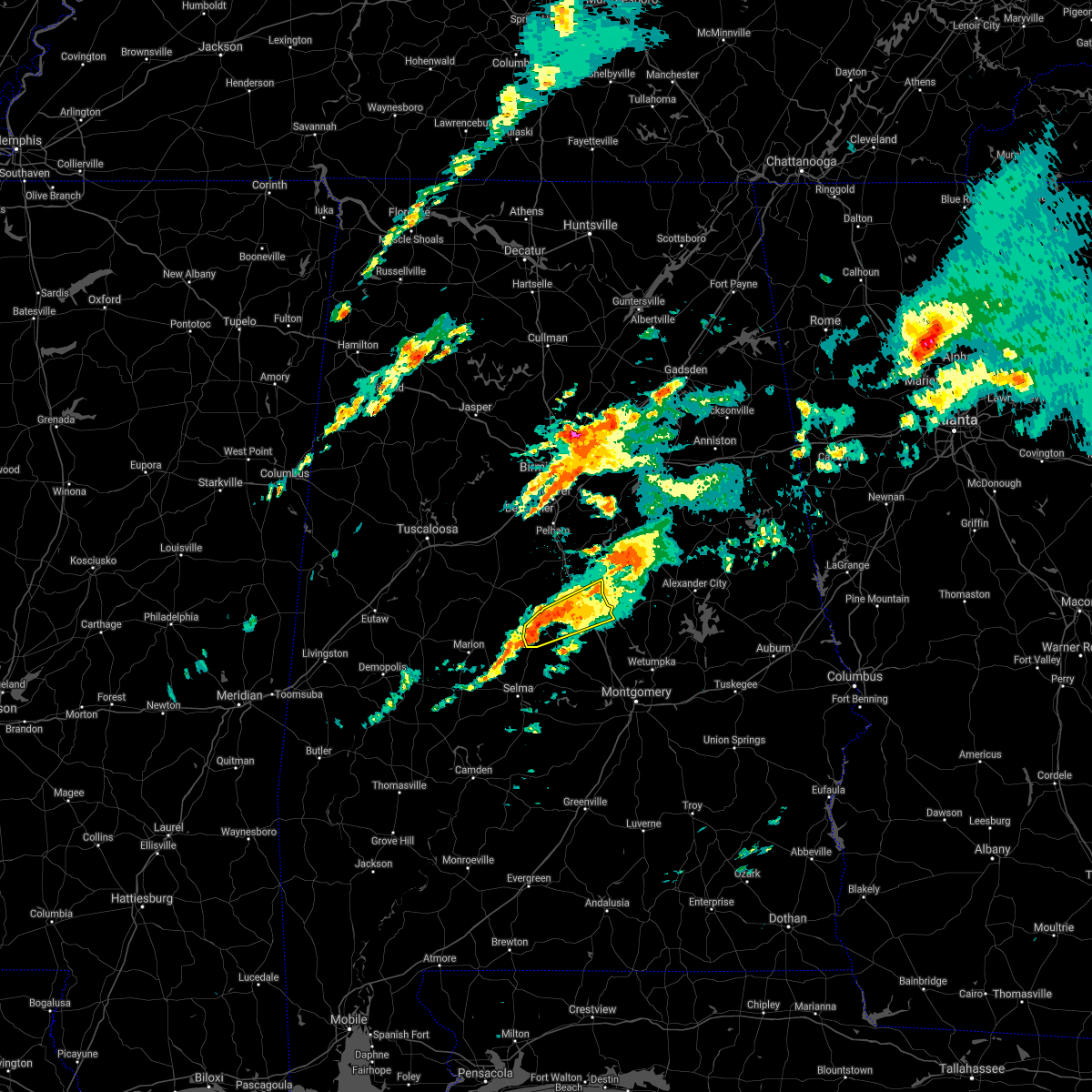 At 838 pm cdt, a severe thunderstorm was located over maplesville, or 15 miles southwest of clanton, moving northeast at 60 mph (radar indicated). Hazards include golf ball size hail and 60 mph wind gusts. People and animals outdoors will be injured. expect hail damage to roofs, siding, windows, and vehicles. expect wind damage to roofs, siding, and trees. Locations impacted include, clanton, thorsby, maplesville, plecher, gap of the mountain, parnell, lay lake dam, higgins ferry park, pooles crossroads, mitchell lake, lay lake, lomax, stanton, i 65 rest area, mitchell dam, isabella and cooper. At 838 pm cdt, a severe thunderstorm was located over maplesville, or 15 miles southwest of clanton, moving northeast at 60 mph (radar indicated). Hazards include golf ball size hail and 60 mph wind gusts. People and animals outdoors will be injured. expect hail damage to roofs, siding, windows, and vehicles. expect wind damage to roofs, siding, and trees. Locations impacted include, clanton, thorsby, maplesville, plecher, gap of the mountain, parnell, lay lake dam, higgins ferry park, pooles crossroads, mitchell lake, lay lake, lomax, stanton, i 65 rest area, mitchell dam, isabella and cooper.
|
| 3/25/2021 8:33 PM CDT |
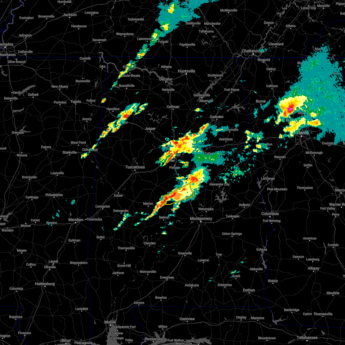 At 833 pm cdt, a severe thunderstorm was located over parnell, or 14 miles north of valley grande, moving northeast at 65 mph (radar indicated). Hazards include 60 mph wind gusts and quarter size hail. Hail damage to vehicles is expected. Expect wind damage to roofs, siding, and trees. At 833 pm cdt, a severe thunderstorm was located over parnell, or 14 miles north of valley grande, moving northeast at 65 mph (radar indicated). Hazards include 60 mph wind gusts and quarter size hail. Hail damage to vehicles is expected. Expect wind damage to roofs, siding, and trees.
|
| 3/17/2021 10:07 PM CDT |
 At 1007 pm cdt, severe thunderstorms were located along a line extending from 7 miles northeast of jemison to near booth to near lowndes county airport, moving east at 50 mph (radar indicated). Hazards include 60 mph wind gusts. Expect damage to roofs, siding, and trees. Locations impacted include, montgomery, prattville, millbrook, clanton, wetumpka, tallassee, jemison, goodwater, fort deposit, mosses, hayneville, rockford, kellyton, weogufka, equality, meadville, stewartville, pike road, thorsby and elmore. At 1007 pm cdt, severe thunderstorms were located along a line extending from 7 miles northeast of jemison to near booth to near lowndes county airport, moving east at 50 mph (radar indicated). Hazards include 60 mph wind gusts. Expect damage to roofs, siding, and trees. Locations impacted include, montgomery, prattville, millbrook, clanton, wetumpka, tallassee, jemison, goodwater, fort deposit, mosses, hayneville, rockford, kellyton, weogufka, equality, meadville, stewartville, pike road, thorsby and elmore.
|
| 3/17/2021 9:51 PM CDT |
 At 951 pm cdt, severe thunderstorms were located along a line extending from near ashby to near vida junction to 9 miles northwest of greenville, moving east at 50 mph (radar indicated). Hazards include 60 mph wind gusts. expect damage to roofs, siding, and trees At 951 pm cdt, severe thunderstorms were located along a line extending from near ashby to near vida junction to 9 miles northwest of greenville, moving east at 50 mph (radar indicated). Hazards include 60 mph wind gusts. expect damage to roofs, siding, and trees
|
| 3/17/2021 8:32 PM CDT |
 At 832 pm cdt, a severe thunderstorm capable of producing a tornado was located over vida junction, or 15 miles northwest of prattville, moving northeast at 30 mph (radar indicated rotation). Hazards include tornado and half dollar size hail. Flying debris will be dangerous to those caught without shelter. mobile homes will be damaged or destroyed. damage to roofs, windows, and vehicles will occur. Tree damage is likely. At 832 pm cdt, a severe thunderstorm capable of producing a tornado was located over vida junction, or 15 miles northwest of prattville, moving northeast at 30 mph (radar indicated rotation). Hazards include tornado and half dollar size hail. Flying debris will be dangerous to those caught without shelter. mobile homes will be damaged or destroyed. damage to roofs, windows, and vehicles will occur. Tree damage is likely.
|
| 3/17/2021 6:04 PM CDT |
 At 604 pm cdt, a severe thunderstorm capable of producing a tornado was located over thorsby, or near jemison, moving northeast at 30 mph (radar indicated rotation). Hazards include tornado. Flying debris will be dangerous to those caught without shelter. mobile homes will be damaged or destroyed. damage to roofs, windows, and vehicles will occur. tree damage is likely. Locations impacted include, clanton, jemison, thorsby, gap of the mountain, lomax and i 65 rest area. At 604 pm cdt, a severe thunderstorm capable of producing a tornado was located over thorsby, or near jemison, moving northeast at 30 mph (radar indicated rotation). Hazards include tornado. Flying debris will be dangerous to those caught without shelter. mobile homes will be damaged or destroyed. damage to roofs, windows, and vehicles will occur. tree damage is likely. Locations impacted include, clanton, jemison, thorsby, gap of the mountain, lomax and i 65 rest area.
|
| 3/17/2021 5:54 PM CDT |
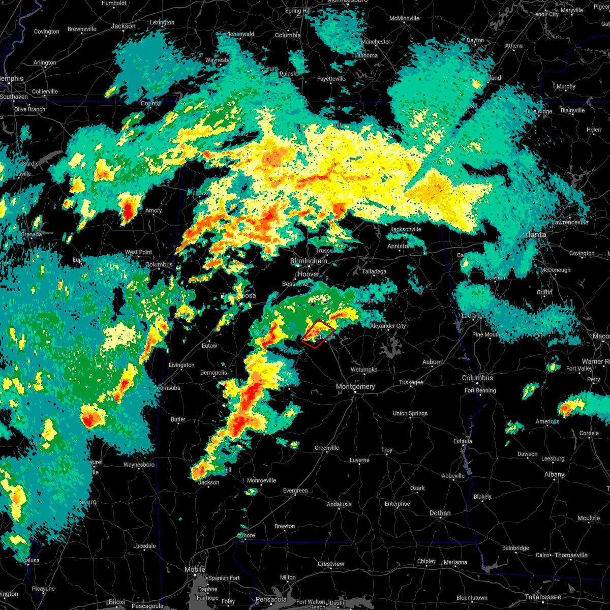 At 554 pm cdt, a severe thunderstorm capable of producing a tornado was located near chilton county motor sports park, or 7 miles south of jemison, moving northeast at 30 mph (radar indicated rotation). Hazards include tornado. Flying debris will be dangerous to those caught without shelter. mobile homes will be damaged or destroyed. damage to roofs, windows, and vehicles will occur. tree damage is likely. Locations impacted include, clanton, jemison, thorsby, chilton county motor sports park, gap of the mountain, lomax, isabella and i 65 rest area. At 554 pm cdt, a severe thunderstorm capable of producing a tornado was located near chilton county motor sports park, or 7 miles south of jemison, moving northeast at 30 mph (radar indicated rotation). Hazards include tornado. Flying debris will be dangerous to those caught without shelter. mobile homes will be damaged or destroyed. damage to roofs, windows, and vehicles will occur. tree damage is likely. Locations impacted include, clanton, jemison, thorsby, chilton county motor sports park, gap of the mountain, lomax, isabella and i 65 rest area.
|
| 3/17/2021 5:42 PM CDT |
 At 542 pm cdt, a severe thunderstorm capable of producing a tornado was located over gap of the mountain, or near clanton, moving northeast at 40 mph (radar indicated rotation). Hazards include tornado. Flying debris will be dangerous to those caught without shelter. mobile homes will be damaged or destroyed. damage to roofs, windows, and vehicles will occur. Tree damage is likely. At 542 pm cdt, a severe thunderstorm capable of producing a tornado was located over gap of the mountain, or near clanton, moving northeast at 40 mph (radar indicated rotation). Hazards include tornado. Flying debris will be dangerous to those caught without shelter. mobile homes will be damaged or destroyed. damage to roofs, windows, and vehicles will occur. Tree damage is likely.
|
| 3/17/2021 5:39 PM CDT |
 At 539 pm cdt, a severe thunderstorm capable of producing a tornado was located over maplesville, or 13 miles west of clanton, moving northeast at 30 mph (radar indicated rotation). Hazards include tornado. Flying debris will be dangerous to those caught without shelter. mobile homes will be damaged or destroyed. damage to roofs, windows, and vehicles will occur. tree damage is likely. Locations impacted include, clanton, jemison, thorsby, maplesville, chilton county motor sports park, gap of the mountain, lomax, stanton, isabella and i 65 rest area. At 539 pm cdt, a severe thunderstorm capable of producing a tornado was located over maplesville, or 13 miles west of clanton, moving northeast at 30 mph (radar indicated rotation). Hazards include tornado. Flying debris will be dangerous to those caught without shelter. mobile homes will be damaged or destroyed. damage to roofs, windows, and vehicles will occur. tree damage is likely. Locations impacted include, clanton, jemison, thorsby, maplesville, chilton county motor sports park, gap of the mountain, lomax, stanton, isabella and i 65 rest area.
|
| 3/17/2021 5:38 PM CDT |
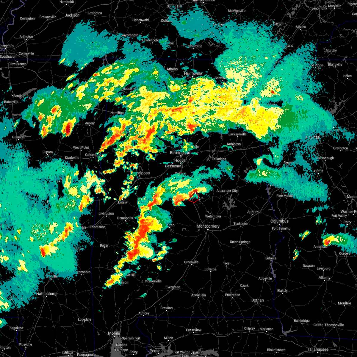 At 538 pm cdt, a severe thunderstorm capable of producing a tornado was located over gap of the mountain, or over clanton, moving northeast at 35 mph (radar indicated rotation). Hazards include tornado. Flying debris will be dangerous to those caught without shelter. mobile homes will be damaged or destroyed. damage to roofs, windows, and vehicles will occur. tree damage is likely. Locations impacted include, clanton, mitchell lake, lay lake dam and lay lake. At 538 pm cdt, a severe thunderstorm capable of producing a tornado was located over gap of the mountain, or over clanton, moving northeast at 35 mph (radar indicated rotation). Hazards include tornado. Flying debris will be dangerous to those caught without shelter. mobile homes will be damaged or destroyed. damage to roofs, windows, and vehicles will occur. tree damage is likely. Locations impacted include, clanton, mitchell lake, lay lake dam and lay lake.
|
| 3/17/2021 5:29 PM CDT |
 At 529 pm cdt, a severe thunderstorm capable of producing a tornado was located over parnell, or 13 miles north of valley grande, moving northeast at 30 mph (radar indicated rotation). Hazards include tornado. Flying debris will be dangerous to those caught without shelter. mobile homes will be damaged or destroyed. damage to roofs, windows, and vehicles will occur. tree damage is likely. Locations impacted include, clanton, jemison, thorsby, maplesville, plecher, chilton county motor sports park, gap of the mountain, parnell, lomax, stanton, isabella and i 65 rest area. At 529 pm cdt, a severe thunderstorm capable of producing a tornado was located over parnell, or 13 miles north of valley grande, moving northeast at 30 mph (radar indicated rotation). Hazards include tornado. Flying debris will be dangerous to those caught without shelter. mobile homes will be damaged or destroyed. damage to roofs, windows, and vehicles will occur. tree damage is likely. Locations impacted include, clanton, jemison, thorsby, maplesville, plecher, chilton county motor sports park, gap of the mountain, parnell, lomax, stanton, isabella and i 65 rest area.
|
| 3/17/2021 5:28 PM CDT |
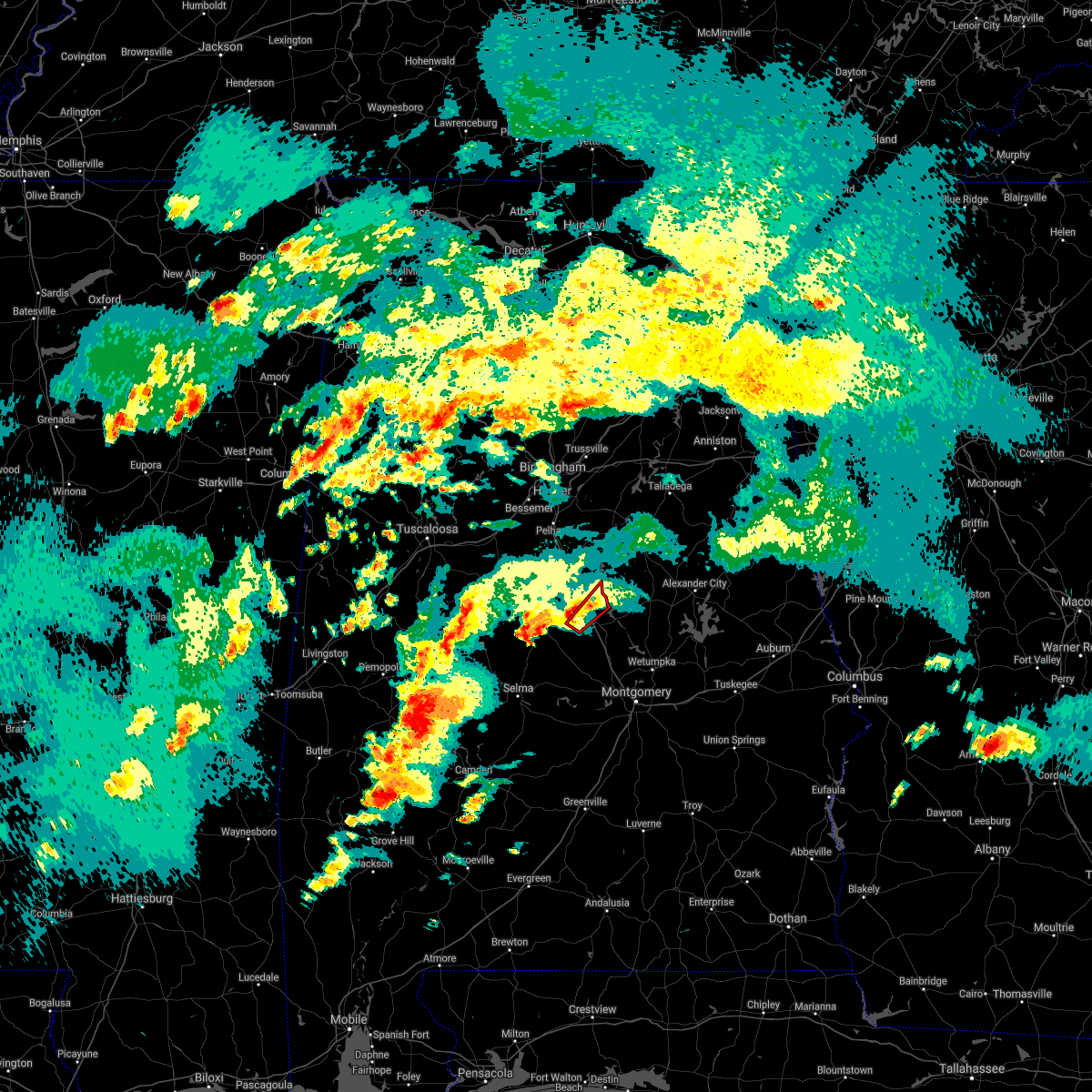 At 528 pm cdt, a confirmed tornado was located over clanton, moving northeast at 40 mph (radar confirmed tornado). Hazards include damaging tornado. Flying debris will be dangerous to those caught without shelter. mobile homes will be damaged or destroyed. damage to roofs, windows, and vehicles will occur. tree damage is likely. Locations impacted include, clanton, mitchell lake, lay lake dam and lay lake. At 528 pm cdt, a confirmed tornado was located over clanton, moving northeast at 40 mph (radar confirmed tornado). Hazards include damaging tornado. Flying debris will be dangerous to those caught without shelter. mobile homes will be damaged or destroyed. damage to roofs, windows, and vehicles will occur. tree damage is likely. Locations impacted include, clanton, mitchell lake, lay lake dam and lay lake.
|
| 3/17/2021 5:21 PM CDT |
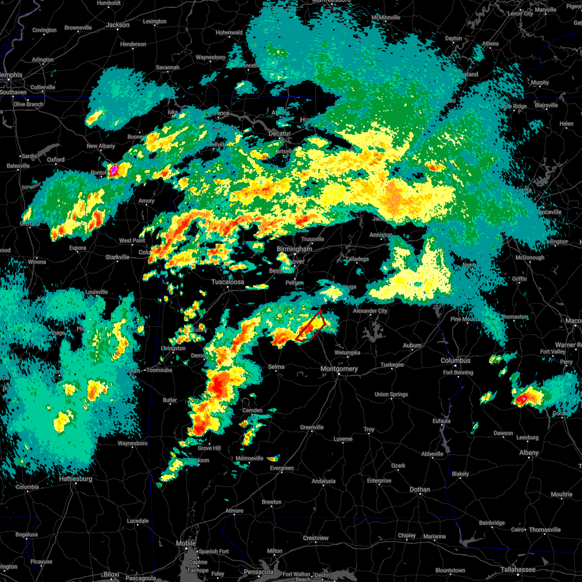 At 521 pm cdt, a confirmed large and extremely dangerous tornado was located over pooles crossroads, or 7 miles southwest of clanton, moving northeast at 35 mph. this is a particularly dangerous situation. take cover now! (radar confirmed tornado). Hazards include damaging tornado. You are in a life-threatening situation. flying debris may be deadly to those caught without shelter. mobile homes will be destroyed. considerable damage to homes, businesses, and vehicles is likely and complete destruction is possible. Locations impacted include, clanton, mitchell lake, lay lake dam, pooles crossroads and lay lake. At 521 pm cdt, a confirmed large and extremely dangerous tornado was located over pooles crossroads, or 7 miles southwest of clanton, moving northeast at 35 mph. this is a particularly dangerous situation. take cover now! (radar confirmed tornado). Hazards include damaging tornado. You are in a life-threatening situation. flying debris may be deadly to those caught without shelter. mobile homes will be destroyed. considerable damage to homes, businesses, and vehicles is likely and complete destruction is possible. Locations impacted include, clanton, mitchell lake, lay lake dam, pooles crossroads and lay lake.
|
| 3/17/2021 5:16 PM CDT |
 At 516 pm cdt, a confirmed tornado was located over pooles crossroads, or 9 miles southwest of clanton, moving northeast at 35 mph (radar confirmed tornado). Hazards include damaging tornado. Flying debris will be dangerous to those caught without shelter. mobile homes will be damaged or destroyed. damage to roofs, windows, and vehicles will occur. tree damage is likely. Locations impacted include, clanton, billingsley, plecher, mitchell lake, higgins ferry park, lay lake dam, pooles crossroads, lay lake, cooper and mitchell dam. At 516 pm cdt, a confirmed tornado was located over pooles crossroads, or 9 miles southwest of clanton, moving northeast at 35 mph (radar confirmed tornado). Hazards include damaging tornado. Flying debris will be dangerous to those caught without shelter. mobile homes will be damaged or destroyed. damage to roofs, windows, and vehicles will occur. tree damage is likely. Locations impacted include, clanton, billingsley, plecher, mitchell lake, higgins ferry park, lay lake dam, pooles crossroads, lay lake, cooper and mitchell dam.
|
| 3/17/2021 5:15 PM CDT |
 At 515 pm cdt, a severe thunderstorm capable of producing a tornado was located over paul m grist state park, or near valley grande, moving northeast at 30 mph (radar indicated rotation). Hazards include tornado. Flying debris will be dangerous to those caught without shelter. mobile homes will be damaged or destroyed. damage to roofs, windows, and vehicles will occur. Tree damage is likely. At 515 pm cdt, a severe thunderstorm capable of producing a tornado was located over paul m grist state park, or near valley grande, moving northeast at 30 mph (radar indicated rotation). Hazards include tornado. Flying debris will be dangerous to those caught without shelter. mobile homes will be damaged or destroyed. damage to roofs, windows, and vehicles will occur. Tree damage is likely.
|
| 3/17/2021 5:03 PM CDT |
 At 503 pm cdt, a confirmed tornado was located near billingsley, or 15 miles northeast of valley grande, moving northeast at 40 mph (weather spotters confirmed tornado). Hazards include damaging tornado. Flying debris will be dangerous to those caught without shelter. mobile homes will be damaged or destroyed. damage to roofs, windows, and vehicles will occur. tree damage is likely. Locations impacted include, clanton, billingsley, plecher, mitchell lake, higgins ferry park, verbena, lay lake dam, pooles crossroads, lay lake, mitchell dam and cooper. At 503 pm cdt, a confirmed tornado was located near billingsley, or 15 miles northeast of valley grande, moving northeast at 40 mph (weather spotters confirmed tornado). Hazards include damaging tornado. Flying debris will be dangerous to those caught without shelter. mobile homes will be damaged or destroyed. damage to roofs, windows, and vehicles will occur. tree damage is likely. Locations impacted include, clanton, billingsley, plecher, mitchell lake, higgins ferry park, verbena, lay lake dam, pooles crossroads, lay lake, mitchell dam and cooper.
|
| 3/17/2021 5:00 PM CDT |
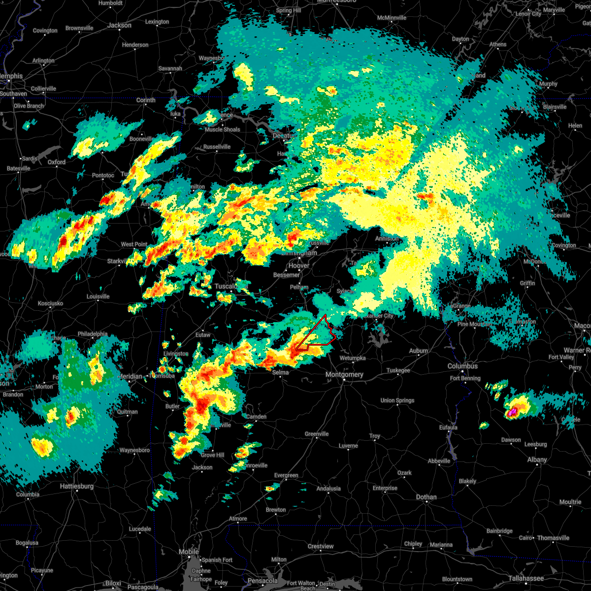 At 500 pm cdt, a severe thunderstorm capable of producing a tornado was located near billingsley, or 13 miles northeast of valley grande, moving northeast at 40 mph (radar indicated rotation). Hazards include tornado. Flying debris will be dangerous to those caught without shelter. mobile homes will be damaged or destroyed. damage to roofs, windows, and vehicles will occur. Tree damage is likely. At 500 pm cdt, a severe thunderstorm capable of producing a tornado was located near billingsley, or 13 miles northeast of valley grande, moving northeast at 40 mph (radar indicated rotation). Hazards include tornado. Flying debris will be dangerous to those caught without shelter. mobile homes will be damaged or destroyed. damage to roofs, windows, and vehicles will occur. Tree damage is likely.
|
| 3/17/2021 1:45 PM CDT |
 At 144 pm cdt, a confirmed tornado was located over verbena, or 7 miles southeast of clanton, moving northeast at 30 mph (weather spotters confirmed tornado). Hazards include damaging tornado. Flying debris will be dangerous to those caught without shelter. mobile homes will be damaged or destroyed. damage to roofs, windows, and vehicles will occur. tree damage is likely. Locations impacted include, clanton, higgins ferry park, verbena, mitchell lake, mitchell dam and cooper. At 144 pm cdt, a confirmed tornado was located over verbena, or 7 miles southeast of clanton, moving northeast at 30 mph (weather spotters confirmed tornado). Hazards include damaging tornado. Flying debris will be dangerous to those caught without shelter. mobile homes will be damaged or destroyed. damage to roofs, windows, and vehicles will occur. tree damage is likely. Locations impacted include, clanton, higgins ferry park, verbena, mitchell lake, mitchell dam and cooper.
|
| 3/17/2021 1:22 PM CDT |
 At 122 pm cdt, a confirmed tornado was located over billingsley, or 13 miles south of clanton, moving northeast at 30 mph (weather spotters confirmed tornado). Hazards include damaging tornado and quarter size hail. Flying debris will be dangerous to those caught without shelter. mobile homes will be damaged or destroyed. damage to roofs, windows, and vehicles will occur. tree damage is likely. Locations impacted include, clanton, billingsley, marbury, higgins ferry park, verbena, mitchell lake, jordan lake, mitchell dam, cooper and new prospect. At 122 pm cdt, a confirmed tornado was located over billingsley, or 13 miles south of clanton, moving northeast at 30 mph (weather spotters confirmed tornado). Hazards include damaging tornado and quarter size hail. Flying debris will be dangerous to those caught without shelter. mobile homes will be damaged or destroyed. damage to roofs, windows, and vehicles will occur. tree damage is likely. Locations impacted include, clanton, billingsley, marbury, higgins ferry park, verbena, mitchell lake, jordan lake, mitchell dam, cooper and new prospect.
|
| 3/17/2021 1:18 PM CDT |
 At 118 pm cdt, a severe thunderstorm capable of producing a tornado was located over billingsley, or 14 miles south of clanton, moving northeast at 30 mph (radar indicated rotation). Hazards include tornado and quarter size hail. Flying debris will be dangerous to those caught without shelter. mobile homes will be damaged or destroyed. damage to roofs, windows, and vehicles will occur. Tree damage is likely. At 118 pm cdt, a severe thunderstorm capable of producing a tornado was located over billingsley, or 14 miles south of clanton, moving northeast at 30 mph (radar indicated rotation). Hazards include tornado and quarter size hail. Flying debris will be dangerous to those caught without shelter. mobile homes will be damaged or destroyed. damage to roofs, windows, and vehicles will occur. Tree damage is likely.
|
| 7/12/2020 2:53 PM CDT | Trees down near county road 7 near clanton... al. time estimated by rada in chilton county AL, 2.3 miles NNW of Clanton, AL |
| 7/12/2020 2:49 PM CDT |
 At 249 pm cdt, severe thunderstorms were located along a line extending from near mitchell lake to heiberger, moving southeast at 35 mph (radar indicated). Hazards include 60 mph wind gusts. Expect damage to roofs, siding, and trees. Locations impacted include, clanton, jemison, thorsby, maplesville, billingsley, gap of the mountain, parnell, heiberger, verbena, plecher, lawley, mitchell lake, lay lake dam, talladega national forest, chilton county motor sports park, pooles crossroads, lay lake, randolph, lomax and radford. At 249 pm cdt, severe thunderstorms were located along a line extending from near mitchell lake to heiberger, moving southeast at 35 mph (radar indicated). Hazards include 60 mph wind gusts. Expect damage to roofs, siding, and trees. Locations impacted include, clanton, jemison, thorsby, maplesville, billingsley, gap of the mountain, parnell, heiberger, verbena, plecher, lawley, mitchell lake, lay lake dam, talladega national forest, chilton county motor sports park, pooles crossroads, lay lake, randolph, lomax and radford.
|
| 7/12/2020 2:32 PM CDT |
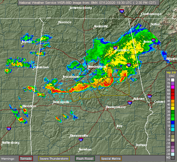 At 232 pm cdt, severe thunderstorms were located along a line extending from near lay lake to near heiberger, moving southeast at 50 mph (radar indicated). Hazards include 60 mph wind gusts. these storms have a history of producing wind damage. Expect damage to roofs, siding, and trees. Locations impacted include, calera, clanton, brent, centreville, jemison, thorsby, maplesville, billingsley, gap of the mountain, parnell, west centreville, heiberger, verbena, plecher, lawley, mitchell lake, ashby, brierfield ironworks park, mertz and lay lake dam. At 232 pm cdt, severe thunderstorms were located along a line extending from near lay lake to near heiberger, moving southeast at 50 mph (radar indicated). Hazards include 60 mph wind gusts. these storms have a history of producing wind damage. Expect damage to roofs, siding, and trees. Locations impacted include, calera, clanton, brent, centreville, jemison, thorsby, maplesville, billingsley, gap of the mountain, parnell, west centreville, heiberger, verbena, plecher, lawley, mitchell lake, ashby, brierfield ironworks park, mertz and lay lake dam.
|
| 7/12/2020 2:23 PM CDT |
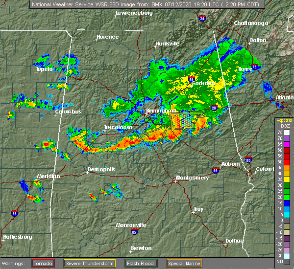 At 223 pm cdt, severe thunderstorms were located along a line extending from brierfield ironworks park to near mertz, moving southeast at 35 mph (radar indicated). Hazards include 60 mph wind gusts. expect damage to roofs, siding, and trees At 223 pm cdt, severe thunderstorms were located along a line extending from brierfield ironworks park to near mertz, moving southeast at 35 mph (radar indicated). Hazards include 60 mph wind gusts. expect damage to roofs, siding, and trees
|
| 6/25/2020 9:41 PM CDT | Trees down in and around clanto in chilton county AL, 0.7 miles ENE of Clanton, AL |
| 6/25/2020 9:40 PM CDT | Trees down along hwy 14 in chilton county AL, 7.4 miles S of Clanton, AL |
| 6/22/2020 1:38 PM CDT | Trees downed on pinedale road... at least one affecting a utility line. time of occurrence estimated from rada in chilton county AL, 0.5 miles S of Clanton, AL |
| 6/22/2020 1:24 PM CDT | Trees downed on cr 47. time of occurrence estimated from rada in chilton county AL, 5.5 miles NNW of Clanton, AL |
| 6/22/2020 1:19 PM CDT |
 At 119 pm cdt, a severe thunderstorm was located near pooles crossroads, or 7 miles south of clanton, moving north at 35 mph (radar indicated). Hazards include 60 mph wind gusts. expect damage to roofs, siding, and trees At 119 pm cdt, a severe thunderstorm was located near pooles crossroads, or 7 miles south of clanton, moving north at 35 mph (radar indicated). Hazards include 60 mph wind gusts. expect damage to roofs, siding, and trees
|
| 6/9/2020 2:20 PM CDT | Trees down near the 12000 block of hwy 59 blocking the roa in chilton county AL, 7 miles WNW of Clanton, AL |
| 4/23/2020 4:27 PM CDT |
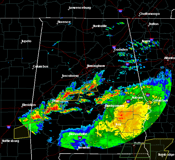 At 427 pm cdt, a severe thunderstorm was located near gap of the mountain, or 8 miles east of jemison, moving east at 45 mph (radar indicated). Hazards include 60 mph wind gusts and quarter size hail. Hail damage to vehicles is expected. expect wind damage to roofs, siding, and trees. Locations impacted include, clanton, thorsby, gap of the mountain, lay lake dam, mitchell lake, lay lake, lomax, waxahatchee creek and i 65 rest area. At 427 pm cdt, a severe thunderstorm was located near gap of the mountain, or 8 miles east of jemison, moving east at 45 mph (radar indicated). Hazards include 60 mph wind gusts and quarter size hail. Hail damage to vehicles is expected. expect wind damage to roofs, siding, and trees. Locations impacted include, clanton, thorsby, gap of the mountain, lay lake dam, mitchell lake, lay lake, lomax, waxahatchee creek and i 65 rest area.
|
| 4/23/2020 4:12 PM CDT |
 At 412 pm cdt, a severe thunderstorm was located over jemison, moving east at 50 mph (radar indicated). Hazards include 60 mph wind gusts and quarter size hail. Hail damage to vehicles is expected. expect wind damage to roofs, siding, and trees. Locations impacted include, clanton, jemison, thorsby, chilton county motor sports park, gap of the mountain, lay lake dam, mitchell lake, lay lake, minooka park, lomax, waxahatchee creek and i 65 rest area. At 412 pm cdt, a severe thunderstorm was located over jemison, moving east at 50 mph (radar indicated). Hazards include 60 mph wind gusts and quarter size hail. Hail damage to vehicles is expected. expect wind damage to roofs, siding, and trees. Locations impacted include, clanton, jemison, thorsby, chilton county motor sports park, gap of the mountain, lay lake dam, mitchell lake, lay lake, minooka park, lomax, waxahatchee creek and i 65 rest area.
|
| 4/23/2020 3:53 PM CDT |
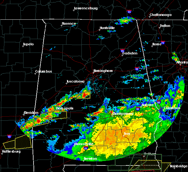 At 353 pm cdt, a severe thunderstorm was located over talladega national forest, or 8 miles southeast of centreville, moving east at 50 mph (radar indicated). Hazards include half dollar size hail. damage to vehicles is expected At 353 pm cdt, a severe thunderstorm was located over talladega national forest, or 8 miles southeast of centreville, moving east at 50 mph (radar indicated). Hazards include half dollar size hail. damage to vehicles is expected
|
| 4/19/2020 6:35 AM CDT |
 At 635 am cdt, a severe thunderstorm was located near lay lake dam, or 8 miles south of talladega springs, moving east at 55 mph (radar indicated). Hazards include ping pong ball size hail and 60 mph wind gusts. People and animals outdoors will be injured. expect hail damage to roofs, siding, windows, and vehicles. expect wind damage to roofs, siding, and trees. Locations impacted include, sylacauga, rockford, talladega springs, weogufka, stewartville, hanover, lyle, gap of the mountain, strickland crossroads, bentleyville, lay lake dam, unity, marble valley, moriah, lay lake, mitchell lake, shelby, shelby shores, waxahatchee creek and gantts quarry. At 635 am cdt, a severe thunderstorm was located near lay lake dam, or 8 miles south of talladega springs, moving east at 55 mph (radar indicated). Hazards include ping pong ball size hail and 60 mph wind gusts. People and animals outdoors will be injured. expect hail damage to roofs, siding, windows, and vehicles. expect wind damage to roofs, siding, and trees. Locations impacted include, sylacauga, rockford, talladega springs, weogufka, stewartville, hanover, lyle, gap of the mountain, strickland crossroads, bentleyville, lay lake dam, unity, marble valley, moriah, lay lake, mitchell lake, shelby, shelby shores, waxahatchee creek and gantts quarry.
|
| 4/12/2020 10:59 PM CDT |
 At 1059 pm cdt, severe thunderstorms were located along a line extending from near harpersville to near pooles crossroads, moving east at 30 mph (radar indicated). Hazards include 60 mph wind gusts. expect damage to roofs, siding, and trees At 1059 pm cdt, severe thunderstorms were located along a line extending from near harpersville to near pooles crossroads, moving east at 30 mph (radar indicated). Hazards include 60 mph wind gusts. expect damage to roofs, siding, and trees
|
| 1/11/2020 2:03 PM CST |
 At 203 pm cst, severe thunderstorms were located along a line extending from near strickland crossroads to 10 miles northwest of greenville, moving northeast at 55 mph (radar indicated). Hazards include 60 mph wind gusts. Expect damage to roofs, siding, and trees. Locations impacted include, prattville, millbrook, clanton, fort deposit, mosses, hayneville, deatsville, autaugaville, white hall, gordonville, billingsley, lowndesboro, booth, vida junction, beechwood, autauga county airport, davenport, verbena, marbury and lowndes county airport. At 203 pm cst, severe thunderstorms were located along a line extending from near strickland crossroads to 10 miles northwest of greenville, moving northeast at 55 mph (radar indicated). Hazards include 60 mph wind gusts. Expect damage to roofs, siding, and trees. Locations impacted include, prattville, millbrook, clanton, fort deposit, mosses, hayneville, deatsville, autaugaville, white hall, gordonville, billingsley, lowndesboro, booth, vida junction, beechwood, autauga county airport, davenport, verbena, marbury and lowndes county airport.
|
| 1/11/2020 1:55 PM CST |
 At 155 pm cst, severe thunderstorms were located along a line extending from lay lake dam to 6 miles east of pine apple, moving northeast at 50 mph (radar indicated). Hazards include 60 mph wind gusts. Expect damage to roofs, siding, and trees. Locations impacted include, prattville, millbrook, clanton, fort deposit, mosses, hayneville, deatsville, autaugaville, white hall, gordonville, billingsley, lowndesboro, benton, booth, vida junction, beechwood, autauga county airport, davenport, verbena and mulberry. At 155 pm cst, severe thunderstorms were located along a line extending from lay lake dam to 6 miles east of pine apple, moving northeast at 50 mph (radar indicated). Hazards include 60 mph wind gusts. Expect damage to roofs, siding, and trees. Locations impacted include, prattville, millbrook, clanton, fort deposit, mosses, hayneville, deatsville, autaugaville, white hall, gordonville, billingsley, lowndesboro, benton, booth, vida junction, beechwood, autauga county airport, davenport, verbena and mulberry.
|
| 1/11/2020 1:50 PM CST | Trees dow in chilton county AL, 1.7 miles WSW of Clanton, AL |
| 1/11/2020 1:48 PM CST | Several trees were blown down and damaged some home in chilton county AL, 1.3 miles E of Clanton, AL |
| 1/11/2020 1:48 PM CST | Trees and power lines dow in chilton county AL, 0.8 miles SE of Clanton, AL |
| 1/11/2020 1:47 PM CST |
 At 147 pm cst, severe thunderstorms were located along a line extending from near riverside to near pooles crossroads, moving northeast at 50 mph (radar indicated). Hazards include 70 mph wind gusts. Expect considerable tree damage. damage is likely to mobile homes, roofs, and outbuildings. Locations impacted include, pell city, clanton, columbiana, jemison, wilsonville, riverside, vincent, thorsby, harpersville, westover, billingsley, gap of the mountain, bald rock, plecher, lay lake dam, coosa island, lay lake, pooles crossroads, logan martin lake and mitchell lake. At 147 pm cst, severe thunderstorms were located along a line extending from near riverside to near pooles crossroads, moving northeast at 50 mph (radar indicated). Hazards include 70 mph wind gusts. Expect considerable tree damage. damage is likely to mobile homes, roofs, and outbuildings. Locations impacted include, pell city, clanton, columbiana, jemison, wilsonville, riverside, vincent, thorsby, harpersville, westover, billingsley, gap of the mountain, bald rock, plecher, lay lake dam, coosa island, lay lake, pooles crossroads, logan martin lake and mitchell lake.
|
| 1/11/2020 1:45 PM CST | Trees dow in chilton county AL, 0.8 miles SE of Clanton, AL |
| 1/11/2020 1:44 PM CST | Shed destoryed on cr 1 in chilton county AL, 0.2 miles NNE of Clanton, AL |
| 1/11/2020 1:41 PM CST |
 At 141 pm cst, severe thunderstorms were located along a line extending from near gap of the mountain to near pine apple, moving northeast at 55 mph (radar indicated). Hazards include 60 mph wind gusts. Expect damage to roofs, siding, and trees. Locations impacted include, prattville, millbrook, clanton, fort deposit, mosses, hayneville, deatsville, autaugaville, white hall, gordonville, billingsley, lowndesboro, benton, booth, vida junction, beechwood, autauga county airport, davenport, verbena and mulberry. At 141 pm cst, severe thunderstorms were located along a line extending from near gap of the mountain to near pine apple, moving northeast at 55 mph (radar indicated). Hazards include 60 mph wind gusts. Expect damage to roofs, siding, and trees. Locations impacted include, prattville, millbrook, clanton, fort deposit, mosses, hayneville, deatsville, autaugaville, white hall, gordonville, billingsley, lowndesboro, benton, booth, vida junction, beechwood, autauga county airport, davenport, verbena and mulberry.
|
| 1/11/2020 1:33 PM CST |
 At 133 pm cst, severe thunderstorms were located along a line extending from bald rock to near parnell, moving east at 70 mph (radar indicated). Hazards include 70 mph wind gusts. Expect considerable tree damage. damage is likely to mobile homes, roofs, and outbuildings. Locations impacted include, pell city, leeds, moody, calera, chelsea, clanton, columbiana, jemison, wilsonville, riverside, vincent, thorsby, harpersville, westover, maplesville, billingsley, gap of the mountain, parnell, vandiver and coosa island. At 133 pm cst, severe thunderstorms were located along a line extending from bald rock to near parnell, moving east at 70 mph (radar indicated). Hazards include 70 mph wind gusts. Expect considerable tree damage. damage is likely to mobile homes, roofs, and outbuildings. Locations impacted include, pell city, leeds, moody, calera, chelsea, clanton, columbiana, jemison, wilsonville, riverside, vincent, thorsby, harpersville, westover, maplesville, billingsley, gap of the mountain, parnell, vandiver and coosa island.
|
| 1/11/2020 1:29 PM CST | Trees dow in chilton county AL, 0.2 miles NNE of Clanton, AL |
| 1/11/2020 1:27 PM CST |
 At 126 pm cst, severe thunderstorms were located along a line extending from chilton county motor sports park to beatrice, moving northeast at 55 mph (radar indicated). Hazards include 60 mph wind gusts. expect damage to roofs, siding, and trees At 126 pm cst, severe thunderstorms were located along a line extending from chilton county motor sports park to beatrice, moving northeast at 55 mph (radar indicated). Hazards include 60 mph wind gusts. expect damage to roofs, siding, and trees
|
| 1/11/2020 1:12 PM CST |
 At 112 pm cst, severe thunderstorms were located along a line extending from near moody to near lawley, moving northeast at 50 mph (radar indicated). Hazards include 70 mph wind gusts. Expect considerable tree damage. damage is likely to mobile homes, roofs, and outbuildings. Locations impacted include, birmingham, hoover, vestavia hills, alabaster, homewood, pelham, mountain brook, helena, pell city, irondale, leeds, moody, calera, chelsea, clanton, montevallo, columbiana, jemison, wilsonville and indian springs village. At 112 pm cst, severe thunderstorms were located along a line extending from near moody to near lawley, moving northeast at 50 mph (radar indicated). Hazards include 70 mph wind gusts. Expect considerable tree damage. damage is likely to mobile homes, roofs, and outbuildings. Locations impacted include, birmingham, hoover, vestavia hills, alabaster, homewood, pelham, mountain brook, helena, pell city, irondale, leeds, moody, calera, chelsea, clanton, montevallo, columbiana, jemison, wilsonville and indian springs village.
|
| 1/11/2020 12:52 PM CST |
 At 1252 pm cst, severe thunderstorms were located along a line extending from birmingham to 6 miles southeast of heiberger, moving northeast at 50 mph (radar indicated). Hazards include 70 mph wind gusts. Expect considerable tree damage. Damage is likely to mobile homes, roofs, and outbuildings. At 1252 pm cst, severe thunderstorms were located along a line extending from birmingham to 6 miles southeast of heiberger, moving northeast at 50 mph (radar indicated). Hazards include 70 mph wind gusts. Expect considerable tree damage. Damage is likely to mobile homes, roofs, and outbuildings.
|
| 12/16/2019 10:00 PM CST |
 At 959 pm cst, severe thunderstorms were located along a line extending from near calera to valley grande, moving east at 45 mph (radar indicated). Hazards include 60 mph wind gusts and quarter size hail. Hail damage to vehicles is expected. expect wind damage to roofs, siding, and trees. Locations impacted include, calera, clanton, valley grande, jemison, thorsby, maplesville, billingsley, vida junction, gap of the mountain, parnell, verbena, plecher, marbury, paul m grist state park, lay lake dam, chilton county motor sports park, higgins ferry park, pooles crossroads, mitchell lake and lay lake. At 959 pm cst, severe thunderstorms were located along a line extending from near calera to valley grande, moving east at 45 mph (radar indicated). Hazards include 60 mph wind gusts and quarter size hail. Hail damage to vehicles is expected. expect wind damage to roofs, siding, and trees. Locations impacted include, calera, clanton, valley grande, jemison, thorsby, maplesville, billingsley, vida junction, gap of the mountain, parnell, verbena, plecher, marbury, paul m grist state park, lay lake dam, chilton county motor sports park, higgins ferry park, pooles crossroads, mitchell lake and lay lake.
|
| 12/16/2019 9:38 PM CST |
 At 938 pm cst, severe thunderstorms were located along a line extending from near ashby to 6 miles northwest of potter station, moving east at 45 mph (radar indicated). Hazards include 60 mph wind gusts. expect damage to roofs, siding, and trees At 938 pm cst, severe thunderstorms were located along a line extending from near ashby to 6 miles northwest of potter station, moving east at 45 mph (radar indicated). Hazards include 60 mph wind gusts. expect damage to roofs, siding, and trees
|
| 4/18/2019 7:58 PM CDT |
 At 757 pm cdt, severe thunderstorms were located along a line extending from near logan martin lake to marbury, moving east at 40 mph (radar indicated). Hazards include 60 mph wind gusts. Expect damage to roofs, siding, and trees. locations impacted include, clanton, childersburg, wilsonville, vincent, harpersville, mitchell lake, lay lake dam, verbena, lay lake, beeswax creek park, alabama 4h center, waxahatchee creek, kelley branch, mitchell dam, spring creek, gaston steam plant, cooper and shelby shores. A tornado watch remains in effect until 1100 pm cdt for central and east central alabama. At 757 pm cdt, severe thunderstorms were located along a line extending from near logan martin lake to marbury, moving east at 40 mph (radar indicated). Hazards include 60 mph wind gusts. Expect damage to roofs, siding, and trees. locations impacted include, clanton, childersburg, wilsonville, vincent, harpersville, mitchell lake, lay lake dam, verbena, lay lake, beeswax creek park, alabama 4h center, waxahatchee creek, kelley branch, mitchell dam, spring creek, gaston steam plant, cooper and shelby shores. A tornado watch remains in effect until 1100 pm cdt for central and east central alabama.
|
| 4/18/2019 7:44 PM CDT |
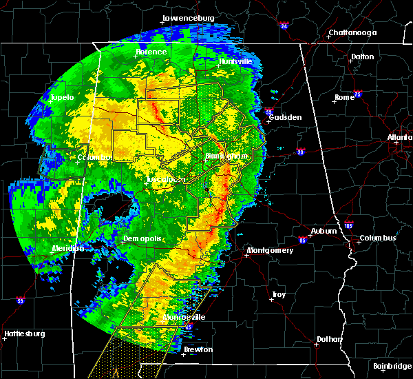 At 744 pm cdt, severe thunderstorms were located along a line extending from near vandiver to near verbena, moving east at 45 mph (radar indicated). Hazards include 60 mph wind gusts. Expect damage to roofs, siding, and trees. locations impacted include, leeds, calera, chelsea, clanton, childersburg, columbiana, jemison, wilsonville, vincent, thorsby, harpersville, westover, gap of the mountain, vandiver, verbena, greystone, plecher, highland lakes, mitchell lake and lay lake dam. A tornado watch remains in effect until 1100 pm cdt for central and east central alabama. At 744 pm cdt, severe thunderstorms were located along a line extending from near vandiver to near verbena, moving east at 45 mph (radar indicated). Hazards include 60 mph wind gusts. Expect damage to roofs, siding, and trees. locations impacted include, leeds, calera, chelsea, clanton, childersburg, columbiana, jemison, wilsonville, vincent, thorsby, harpersville, westover, gap of the mountain, vandiver, verbena, greystone, plecher, highland lakes, mitchell lake and lay lake dam. A tornado watch remains in effect until 1100 pm cdt for central and east central alabama.
|
| 4/18/2019 7:16 PM CDT |
 At 716 pm cdt, severe thunderstorms were located along a line extending from patton creek to near parnell, moving east at 45 mph (radar indicated). Hazards include 60 mph wind gusts. Expect damage to roofs, siding, and trees. locations impacted include, hoover, alabaster, pelham, helena, leeds, calera, chelsea, clanton, montevallo, childersburg, columbiana, jemison, wilsonville, indian springs village, vincent, thorsby, harpersville, westover, maplesville and wilton. A tornado watch remains in effect until 1100 pm cdt for central, south central and east central alabama. At 716 pm cdt, severe thunderstorms were located along a line extending from patton creek to near parnell, moving east at 45 mph (radar indicated). Hazards include 60 mph wind gusts. Expect damage to roofs, siding, and trees. locations impacted include, hoover, alabaster, pelham, helena, leeds, calera, chelsea, clanton, montevallo, childersburg, columbiana, jemison, wilsonville, indian springs village, vincent, thorsby, harpersville, westover, maplesville and wilton. A tornado watch remains in effect until 1100 pm cdt for central, south central and east central alabama.
|
| 4/18/2019 6:53 PM CDT |
 At 653 pm cdt, severe thunderstorms were located along a line extending from near tannehill ironworks state park to 9 miles west of paul m grist state park, moving east at 45 mph (radar indicated). Hazards include 60 mph wind gusts. expect damage to roofs, siding, and trees At 653 pm cdt, severe thunderstorms were located along a line extending from near tannehill ironworks state park to 9 miles west of paul m grist state park, moving east at 45 mph (radar indicated). Hazards include 60 mph wind gusts. expect damage to roofs, siding, and trees
|
| 3/25/2019 5:13 PM CDT |
 At 513 pm cdt, a severe thunderstorm was located over clanton, moving southeast at 35 mph (radar indicated). Hazards include 60 mph wind gusts and quarter size hail. Hail damage to vehicles is expected. expect wind damage to roofs, siding, and trees. Locations impacted include, clanton, gap of the mountain, verbena, higgins ferry park, mitchell lake, i 65 rest area, cooper and mitchell dam. At 513 pm cdt, a severe thunderstorm was located over clanton, moving southeast at 35 mph (radar indicated). Hazards include 60 mph wind gusts and quarter size hail. Hail damage to vehicles is expected. expect wind damage to roofs, siding, and trees. Locations impacted include, clanton, gap of the mountain, verbena, higgins ferry park, mitchell lake, i 65 rest area, cooper and mitchell dam.
|
| 3/25/2019 5:09 PM CDT | Several trees blown down and snapped off. downtown buildings had a large roof torn of in chilton county AL, 0.7 miles ENE of Clanton, AL |
| 3/25/2019 5:09 PM CDT | Trees downed with tree litter scattered about in the goosepond park are in chilton county AL, 0.8 miles SE of Clanton, AL |
| 3/25/2019 5:07 PM CDT |
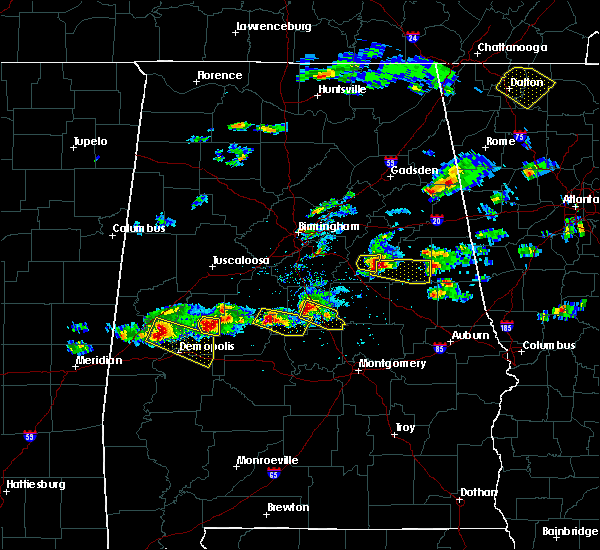 At 507 pm cdt, a severe thunderstorm was located near clanton, moving southeast at 35 mph (radar indicated). Hazards include 60 mph wind gusts and penny size hail. expect damage to roofs, siding, and trees At 507 pm cdt, a severe thunderstorm was located near clanton, moving southeast at 35 mph (radar indicated). Hazards include 60 mph wind gusts and penny size hail. expect damage to roofs, siding, and trees
|
| 3/14/2019 7:43 PM CDT |
 At 743 pm cdt, a confirmed tornado was located over gap of the mountain, or near clanton, moving east at 30 mph (radar confirmed tornado). Hazards include damaging tornado. Flying debris will be dangerous to those caught without shelter. mobile homes will be damaged or destroyed. damage to roofs, windows, and vehicles will occur. tree damage is likely. Locations impacted include, gap of the mountain, lay lake dam, mitchell lake and lay lake. At 743 pm cdt, a confirmed tornado was located over gap of the mountain, or near clanton, moving east at 30 mph (radar confirmed tornado). Hazards include damaging tornado. Flying debris will be dangerous to those caught without shelter. mobile homes will be damaged or destroyed. damage to roofs, windows, and vehicles will occur. tree damage is likely. Locations impacted include, gap of the mountain, lay lake dam, mitchell lake and lay lake.
|
| 3/14/2019 7:41 PM CDT | Numerous trees down and many structures were damaged. possible tornad in chilton county AL, 6.1 miles S of Clanton, AL |
| 3/14/2019 7:40 PM CDT |
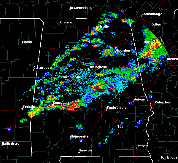 At 740 pm cdt, a severe thunderstorm capable of producing a tornado was located over gap of the mountain, or near clanton, moving east at 35 mph (radar indicated rotation). Hazards include tornado. Flying debris will be dangerous to those caught without shelter. mobile homes will be damaged or destroyed. damage to roofs, windows, and vehicles will occur. tree damage is likely. Locations impacted include, gap of the mountain, lay lake dam, mitchell lake, lay lake, i 65 rest area and waxahatchee creek. At 740 pm cdt, a severe thunderstorm capable of producing a tornado was located over gap of the mountain, or near clanton, moving east at 35 mph (radar indicated rotation). Hazards include tornado. Flying debris will be dangerous to those caught without shelter. mobile homes will be damaged or destroyed. damage to roofs, windows, and vehicles will occur. tree damage is likely. Locations impacted include, gap of the mountain, lay lake dam, mitchell lake, lay lake, i 65 rest area and waxahatchee creek.
|
| 3/14/2019 7:35 PM CDT |
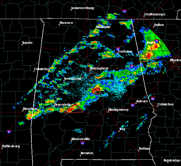 At 734 pm cdt, a severe thunderstorm capable of producing a tornado was located over thorsby, or near jemison, moving east at 30 mph (radar indicated rotation). Hazards include tornado. Flying debris will be dangerous to those caught without shelter. mobile homes will be damaged or destroyed. damage to roofs, windows, and vehicles will occur. tree damage is likely. Locations impacted include, clanton, jemison, thorsby, mitchell lake, gap of the mountain, lay lake dam, lay lake, lomax, waxahatchee creek and i 65 rest area. At 734 pm cdt, a severe thunderstorm capable of producing a tornado was located over thorsby, or near jemison, moving east at 30 mph (radar indicated rotation). Hazards include tornado. Flying debris will be dangerous to those caught without shelter. mobile homes will be damaged or destroyed. damage to roofs, windows, and vehicles will occur. tree damage is likely. Locations impacted include, clanton, jemison, thorsby, mitchell lake, gap of the mountain, lay lake dam, lay lake, lomax, waxahatchee creek and i 65 rest area.
|
| 3/14/2019 7:23 PM CDT |
 At 723 pm cdt, a severe thunderstorm capable of producing a tornado was located over thorsby, or near jemison, moving east at 30 mph (radar indicated rotation). Hazards include tornado. Flying debris will be dangerous to those caught without shelter. mobile homes will be damaged or destroyed. damage to roofs, windows, and vehicles will occur. tree damage is likely. Locations impacted include, clanton, jemison, thorsby, lomax and i 65 rest area. At 723 pm cdt, a severe thunderstorm capable of producing a tornado was located over thorsby, or near jemison, moving east at 30 mph (radar indicated rotation). Hazards include tornado. Flying debris will be dangerous to those caught without shelter. mobile homes will be damaged or destroyed. damage to roofs, windows, and vehicles will occur. tree damage is likely. Locations impacted include, clanton, jemison, thorsby, lomax and i 65 rest area.
|
| 3/14/2019 7:22 PM CDT |
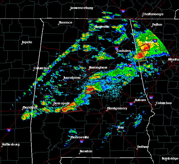 At 722 pm cdt, a severe thunderstorm capable of producing a tornado was located over chilton county motor sports park, or near jemison, moving east at 30 mph (radar indicated rotation). Hazards include tornado. Flying debris will be dangerous to those caught without shelter. mobile homes will be damaged or destroyed. damage to roofs, windows, and vehicles will occur. Tree damage is likely. At 722 pm cdt, a severe thunderstorm capable of producing a tornado was located over chilton county motor sports park, or near jemison, moving east at 30 mph (radar indicated rotation). Hazards include tornado. Flying debris will be dangerous to those caught without shelter. mobile homes will be damaged or destroyed. damage to roofs, windows, and vehicles will occur. Tree damage is likely.
|
| 3/14/2019 7:15 PM CDT |
 At 714 pm cdt, a severe thunderstorm capable of producing a tornado was located over chilton county motor sports park, or 7 miles southwest of jemison, moving east at 30 mph (radar indicated rotation). Hazards include tornado. Flying debris will be dangerous to those caught without shelter. mobile homes will be damaged or destroyed. damage to roofs, windows, and vehicles will occur. tree damage is likely. Locations impacted include, clanton, jemison, thorsby, chilton county motor sports park, lomax and i 65 rest area. At 714 pm cdt, a severe thunderstorm capable of producing a tornado was located over chilton county motor sports park, or 7 miles southwest of jemison, moving east at 30 mph (radar indicated rotation). Hazards include tornado. Flying debris will be dangerous to those caught without shelter. mobile homes will be damaged or destroyed. damage to roofs, windows, and vehicles will occur. tree damage is likely. Locations impacted include, clanton, jemison, thorsby, chilton county motor sports park, lomax and i 65 rest area.
|
| 3/14/2019 7:03 PM CDT |
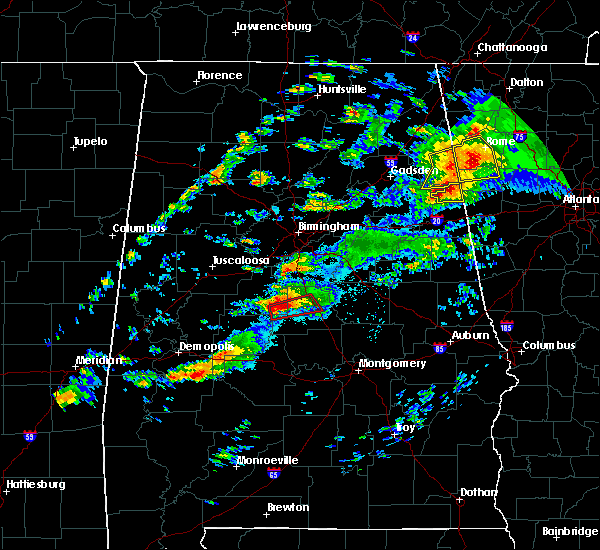 At 703 pm cdt, a severe thunderstorm capable of producing a tornado was located over lawley, or 13 miles southwest of jemison, moving east at 40 mph (radar indicated rotation). Hazards include tornado. Flying debris will be dangerous to those caught without shelter. mobile homes will be damaged or destroyed. damage to roofs, windows, and vehicles will occur. tree damage is likely. Locations impacted include, clanton, jemison, thorsby, lawley, talladega national forest, chilton county motor sports park, randolph, lomax and i 65 rest area. At 703 pm cdt, a severe thunderstorm capable of producing a tornado was located over lawley, or 13 miles southwest of jemison, moving east at 40 mph (radar indicated rotation). Hazards include tornado. Flying debris will be dangerous to those caught without shelter. mobile homes will be damaged or destroyed. damage to roofs, windows, and vehicles will occur. tree damage is likely. Locations impacted include, clanton, jemison, thorsby, lawley, talladega national forest, chilton county motor sports park, randolph, lomax and i 65 rest area.
|
| 3/14/2019 6:50 PM CDT | Several trees down in eastern chilton county. video indicated several power flashes in the same area. possible tornad in chilton county AL, 8.4 miles SW of Clanton, AL |
| 3/14/2019 6:50 PM CDT |
 At 650 pm cdt, a tornado producing storm was located near talladega national forest, or 8 miles southeast of brent, moving east at 30 mph (radar confirmed tornado). Hazards include damaging tornado. Flying debris will be dangerous to those caught without shelter. mobile homes will be damaged or destroyed. damage to roofs, windows, and vehicles will occur. Tree damage is likely. At 650 pm cdt, a tornado producing storm was located near talladega national forest, or 8 miles southeast of brent, moving east at 30 mph (radar confirmed tornado). Hazards include damaging tornado. Flying debris will be dangerous to those caught without shelter. mobile homes will be damaged or destroyed. damage to roofs, windows, and vehicles will occur. Tree damage is likely.
|
| 6/28/2018 3:44 PM CDT |
 At 344 pm cdt, severe thunderstorms were located along a line extending from near bankhead lock and dam to near university of montevallo to lay lake dam, moving south at 35 mph (emergency management). Hazards include 60 to 70 mph wind gusts. Expect considerable tree damage. damage is likely to mobile homes, roofs, and outbuildings. Locations impacted include, southeastern tuscaloosa, calera, clanton, brent, centreville, jemison, holt, thorsby, lake view, brookwood, coaling, vance, woodstock, west blocton, maplesville, gap of the mountain, parnell, verbena, mitchell lake and lake wildwood. At 344 pm cdt, severe thunderstorms were located along a line extending from near bankhead lock and dam to near university of montevallo to lay lake dam, moving south at 35 mph (emergency management). Hazards include 60 to 70 mph wind gusts. Expect considerable tree damage. damage is likely to mobile homes, roofs, and outbuildings. Locations impacted include, southeastern tuscaloosa, calera, clanton, brent, centreville, jemison, holt, thorsby, lake view, brookwood, coaling, vance, woodstock, west blocton, maplesville, gap of the mountain, parnell, verbena, mitchell lake and lake wildwood.
|
| 6/28/2018 3:36 PM CDT |
 At 336 pm cdt, severe thunderstorms were located along a line extending from 6 miles north of bankhead lock and dam to near maylene to near lay lake dam, moving south at 35 mph (emergency management). Hazards include 60 mph wind gusts. expect damage to roofs, siding, and trees At 336 pm cdt, severe thunderstorms were located along a line extending from 6 miles north of bankhead lock and dam to near maylene to near lay lake dam, moving south at 35 mph (emergency management). Hazards include 60 mph wind gusts. expect damage to roofs, siding, and trees
|
| 4/22/2018 8:41 PM CDT |
 At 818 pm cdt, severe thunderstorms were located along a line extending from near splash adventure to near brierfield ironworks park to near parnell, moving east at 35 mph (radar indicated). Hazards include 60 mph wind gusts. Expect damage to roofs, siding, and trees. Locations impacted include, birmingham, hoover, vestavia hills, alabaster, bessemer, homewood, pelham, mountain brook, trussville, helena, hueytown, gardendale, irondale, leeds, moody, calera, fairfield, chelsea, clanton and fultondale. At 818 pm cdt, severe thunderstorms were located along a line extending from near splash adventure to near brierfield ironworks park to near parnell, moving east at 35 mph (radar indicated). Hazards include 60 mph wind gusts. Expect damage to roofs, siding, and trees. Locations impacted include, birmingham, hoover, vestavia hills, alabaster, bessemer, homewood, pelham, mountain brook, trussville, helena, hueytown, gardendale, irondale, leeds, moody, calera, fairfield, chelsea, clanton and fultondale.
|
| 4/22/2018 8:19 PM CDT |
 At 756 pm cdt, severe thunderstorms were located along a line extending from lake view to near ashby to 6 miles southwest of paul m grist state park, moving northeast at 35 mph (emergency management). Hazards include 60 mph wind gusts. expect damage to roofs, siding, and trees At 756 pm cdt, severe thunderstorms were located along a line extending from lake view to near ashby to 6 miles southwest of paul m grist state park, moving northeast at 35 mph (emergency management). Hazards include 60 mph wind gusts. expect damage to roofs, siding, and trees
|
| 4/22/2018 7:57 PM CDT |
 At 756 pm cdt, severe thunderstorms were located along a line extending from lake view to near ashby to 6 miles southwest of paul m grist state park, moving northeast at 35 mph (emergency management). Hazards include 60 mph wind gusts. expect damage to roofs, siding, and trees At 756 pm cdt, severe thunderstorms were located along a line extending from lake view to near ashby to 6 miles southwest of paul m grist state park, moving northeast at 35 mph (emergency management). Hazards include 60 mph wind gusts. expect damage to roofs, siding, and trees
|
| 10/7/2017 8:21 PM CDT |
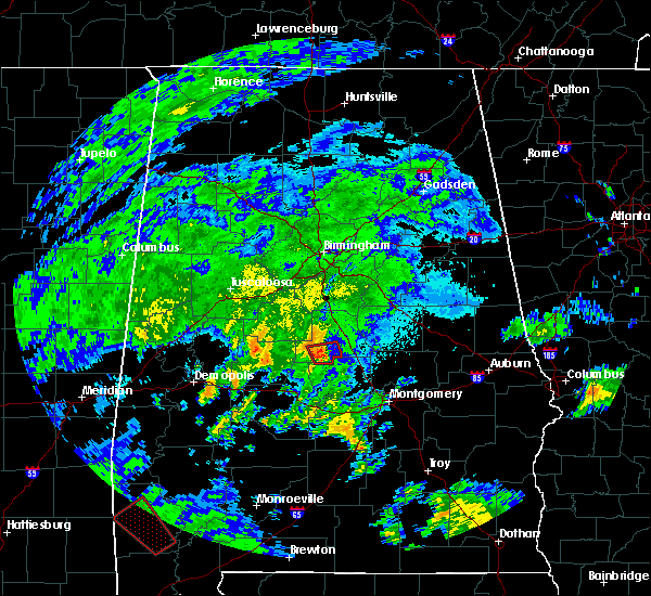 At 820 pm cdt, a severe thunderstorm capable of producing a tornado was located over plecher, or 10 miles southwest of clanton, moving north at 30 mph (radar indicated rotation). Hazards include tornado. Flying debris will be dangerous to those caught without shelter. mobile homes will be damaged or destroyed. damage to roofs, windows, and vehicles will occur. tree damage is likely. Locations impacted include, maplesville, billingsley, plecher and pooles crossroads. At 820 pm cdt, a severe thunderstorm capable of producing a tornado was located over plecher, or 10 miles southwest of clanton, moving north at 30 mph (radar indicated rotation). Hazards include tornado. Flying debris will be dangerous to those caught without shelter. mobile homes will be damaged or destroyed. damage to roofs, windows, and vehicles will occur. tree damage is likely. Locations impacted include, maplesville, billingsley, plecher and pooles crossroads.
|
| 10/7/2017 8:01 PM CDT |
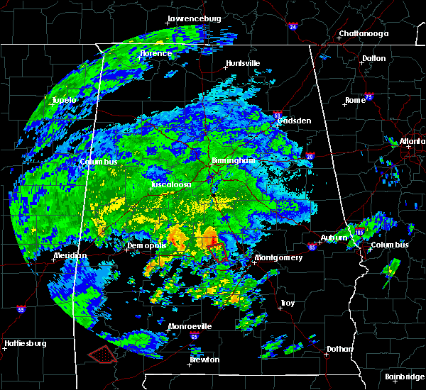 At 800 pm cdt, a severe thunderstorm capable of producing a tornado was located near vida junction, or 15 miles east of valley grande, moving north at 25 mph (radar indicated rotation). Hazards include tornado. Flying debris will be dangerous to those caught without shelter. mobile homes will be damaged or destroyed. damage to roofs, windows, and vehicles will occur. Tree damage is likely. At 800 pm cdt, a severe thunderstorm capable of producing a tornado was located near vida junction, or 15 miles east of valley grande, moving north at 25 mph (radar indicated rotation). Hazards include tornado. Flying debris will be dangerous to those caught without shelter. mobile homes will be damaged or destroyed. damage to roofs, windows, and vehicles will occur. Tree damage is likely.
|
| 6/15/2017 3:56 PM CDT |
 At 355 pm cdt, severe thunderstorms were located along a line extending from near pleasant gap to near columbiana to lawley, moving southeast at 40 mph (radar indicated). Hazards include 60 mph wind gusts and penny size hail. Expect damage to roofs, siding, and trees. Locations impacted include, alabaster, anniston, pelham, oxford, talladega, sylacauga, pell city, jacksonville, calera, chelsea, clanton, montevallo, childersburg, piedmont, columbiana, jemison, wilsonville, talladega springs, cobb town and fort mcclellan. At 355 pm cdt, severe thunderstorms were located along a line extending from near pleasant gap to near columbiana to lawley, moving southeast at 40 mph (radar indicated). Hazards include 60 mph wind gusts and penny size hail. Expect damage to roofs, siding, and trees. Locations impacted include, alabaster, anniston, pelham, oxford, talladega, sylacauga, pell city, jacksonville, calera, chelsea, clanton, montevallo, childersburg, piedmont, columbiana, jemison, wilsonville, talladega springs, cobb town and fort mcclellan.
|
| 6/15/2017 3:32 PM CDT |
 At 332 pm cdt, severe thunderstorms were located along a line extending from near alexandria to near maylene to near talladega national forest, moving south at 50 mph (radar indicated). Hazards include 60 mph wind gusts and quarter size hail. Hail damage to vehicles is expected. expect wind damage to roofs, siding, and trees. Locations impacted include, birmingham, hoover, gadsden, vestavia hills, alabaster, bessemer, homewood, anniston, pelham, oxford, mountain brook, trussville, helena, hueytown, talladega, gardendale, sylacauga, pell city, jacksonville and irondale. At 332 pm cdt, severe thunderstorms were located along a line extending from near alexandria to near maylene to near talladega national forest, moving south at 50 mph (radar indicated). Hazards include 60 mph wind gusts and quarter size hail. Hail damage to vehicles is expected. expect wind damage to roofs, siding, and trees. Locations impacted include, birmingham, hoover, gadsden, vestavia hills, alabaster, bessemer, homewood, anniston, pelham, oxford, mountain brook, trussville, helena, hueytown, talladega, gardendale, sylacauga, pell city, jacksonville and irondale.
|
| 6/15/2017 3:23 PM CDT |
 At 323 pm cdt, severe thunderstorms were located along a line extending from glencoe to near bessemer to near centreville, moving south at 50 mph (radar indicated). Hazards include 60 mph wind gusts. there have been several reports of trees downed by these storms. Expect damage to roofs, siding, and trees. Locations impacted include, birmingham, hoover, gadsden, vestavia hills, alabaster, bessemer, homewood, anniston, pelham, oxford, mountain brook, trussville, helena, hueytown, talladega, gardendale, sylacauga, pell city, jacksonville and irondale. At 323 pm cdt, severe thunderstorms were located along a line extending from glencoe to near bessemer to near centreville, moving south at 50 mph (radar indicated). Hazards include 60 mph wind gusts. there have been several reports of trees downed by these storms. Expect damage to roofs, siding, and trees. Locations impacted include, birmingham, hoover, gadsden, vestavia hills, alabaster, bessemer, homewood, anniston, pelham, oxford, mountain brook, trussville, helena, hueytown, talladega, gardendale, sylacauga, pell city, jacksonville and irondale.
|
| 6/15/2017 3:15 PM CDT |
 At 315 pm cdt, severe thunderstorms were located along a line extending from near reece city to hueytown to near west blocton, moving south at 50 mph (radar indicated). Hazards include 60 mph wind gusts. expect damage to roofs, siding, and trees At 315 pm cdt, severe thunderstorms were located along a line extending from near reece city to hueytown to near west blocton, moving south at 50 mph (radar indicated). Hazards include 60 mph wind gusts. expect damage to roofs, siding, and trees
|
| 4/3/2017 7:11 AM CDT | Large tree down blocking lake mitchell road between studdard drive and thrash road in clanton. time estimated by radar. estimated 40-50 mph wind in chilton county AL, 0.5 miles WNW of Clanton, AL |
| 3/10/2017 3:46 AM CST |
 At 346 am cst, severe thunderstorms were located along a line extending from near maplesville to near clanton to near lyle, moving south at 45 mph (radar indicated). Hazards include 60 mph wind gusts. Expect damage to roofs, siding, and trees. Locations impacted include, calera, clanton, jemison, thorsby, maplesville, billingsley, dollar, gap of the mountain, parnell, marble valley, verbena, plecher, lawley, mitchell lake, ashby, brierfield ironworks park, lay lake dam, talladega national forest, chilton county motor sports park and higgins ferry park. At 346 am cst, severe thunderstorms were located along a line extending from near maplesville to near clanton to near lyle, moving south at 45 mph (radar indicated). Hazards include 60 mph wind gusts. Expect damage to roofs, siding, and trees. Locations impacted include, calera, clanton, jemison, thorsby, maplesville, billingsley, dollar, gap of the mountain, parnell, marble valley, verbena, plecher, lawley, mitchell lake, ashby, brierfield ironworks park, lay lake dam, talladega national forest, chilton county motor sports park and higgins ferry park.
|
| 3/10/2017 3:15 AM CST |
 At 315 am cst, severe thunderstorms were located along a line extending from 6 miles east of west blocton to american village to near talladega springs, moving south at 45 mph (radar indicated). Hazards include 60 mph wind gusts. expect damage to roofs, siding, and trees At 315 am cst, severe thunderstorms were located along a line extending from 6 miles east of west blocton to american village to near talladega springs, moving south at 45 mph (radar indicated). Hazards include 60 mph wind gusts. expect damage to roofs, siding, and trees
|
| 3/1/2017 4:51 PM CST |
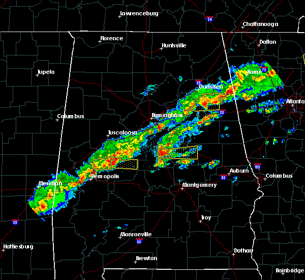 At 451 pm cst, a severe thunderstorm was located over gap of the mountain, or near clanton, moving east at 40 mph (radar indicated). Hazards include 70 mph wind gusts and ping pong ball size hail. People and animals outdoors will be injured. expect hail damage to roofs, siding, windows, and vehicles. expect considerable tree damage. wind damage is also likely to mobile homes, roofs, and outbuildings. Locations impacted include, clanton, mitchell lake, gap of the mountain, lay lake dam, lay lake, lomax, waxahatchee creek and i 65 rest area. At 451 pm cst, a severe thunderstorm was located over gap of the mountain, or near clanton, moving east at 40 mph (radar indicated). Hazards include 70 mph wind gusts and ping pong ball size hail. People and animals outdoors will be injured. expect hail damage to roofs, siding, windows, and vehicles. expect considerable tree damage. wind damage is also likely to mobile homes, roofs, and outbuildings. Locations impacted include, clanton, mitchell lake, gap of the mountain, lay lake dam, lay lake, lomax, waxahatchee creek and i 65 rest area.
|
| 3/1/2017 4:36 PM CST |
 At 436 pm cst, a severe thunderstorm was located near chilton county motor sports park, or near jemison, moving east at 40 mph (radar indicated). Hazards include 70 mph wind gusts and ping pong ball size hail. People and animals outdoors will be injured. expect hail damage to roofs, siding, windows, and vehicles. expect considerable tree damage. wind damage is also likely to mobile homes, roofs, and outbuildings. Locations impacted include, clanton, jemison, thorsby, mitchell lake, chilton county motor sports park, gap of the mountain, lay lake dam, lay lake, lomax, campbell, waxahatchee creek and i 65 rest area. At 436 pm cst, a severe thunderstorm was located near chilton county motor sports park, or near jemison, moving east at 40 mph (radar indicated). Hazards include 70 mph wind gusts and ping pong ball size hail. People and animals outdoors will be injured. expect hail damage to roofs, siding, windows, and vehicles. expect considerable tree damage. wind damage is also likely to mobile homes, roofs, and outbuildings. Locations impacted include, clanton, jemison, thorsby, mitchell lake, chilton county motor sports park, gap of the mountain, lay lake dam, lay lake, lomax, campbell, waxahatchee creek and i 65 rest area.
|
| 3/1/2017 4:21 PM CST |
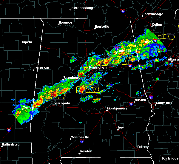 At 421 pm cst, a severe thunderstorm was located over talladega national forest, or 9 miles southeast of centreville, moving east at 40 mph (radar indicated). Hazards include 60 mph wind gusts and quarter size hail. Hail damage to vehicles is expected. Expect wind damage to roofs, siding, and trees. At 421 pm cst, a severe thunderstorm was located over talladega national forest, or 9 miles southeast of centreville, moving east at 40 mph (radar indicated). Hazards include 60 mph wind gusts and quarter size hail. Hail damage to vehicles is expected. Expect wind damage to roofs, siding, and trees.
|
| 1/22/2017 11:57 AM CST |
 At 1156 am cst, severe thunderstorms were located along a line extending from near parnell to mulberry to near tyler to 12 miles south of gordonville to 7 miles northwest of i65 and al 106, moving northeast at 60 mph (radar indicated). Hazards include 60 mph wind gusts and quarter size hail. Hail damage to vehicles is expected. Expect wind damage to roofs, siding, and trees. At 1156 am cst, severe thunderstorms were located along a line extending from near parnell to mulberry to near tyler to 12 miles south of gordonville to 7 miles northwest of i65 and al 106, moving northeast at 60 mph (radar indicated). Hazards include 60 mph wind gusts and quarter size hail. Hail damage to vehicles is expected. Expect wind damage to roofs, siding, and trees.
|
| 6/26/2016 6:01 PM CDT | Two small trees were blown down and a tractor barn was destroyed near clanton. winds were estimated around 50 mp in chilton county AL, 0.7 miles ENE of Clanton, AL |
| 6/17/2016 4:32 PM CDT |
 At 432 pm cdt, severe thunderstorms were located along a line extending from mitchell lake to near vida junction to near dayton, moving southeast at 35 mph (radar indicated). Hazards include 60 mph wind gusts. Expect damage to roofs. siding. and trees. Locations impacted include, clanton, uniontown, thorsby, maplesville, billingsley, higgins ferry park, pooles crossroads, vaiden, verbena, mitchell lake, lay lake dam, plecher, gap of the mountain, parnell, lay lake, vaiden field airport, isabella, radford, hamburg and suttle. At 432 pm cdt, severe thunderstorms were located along a line extending from mitchell lake to near vida junction to near dayton, moving southeast at 35 mph (radar indicated). Hazards include 60 mph wind gusts. Expect damage to roofs. siding. and trees. Locations impacted include, clanton, uniontown, thorsby, maplesville, billingsley, higgins ferry park, pooles crossroads, vaiden, verbena, mitchell lake, lay lake dam, plecher, gap of the mountain, parnell, lay lake, vaiden field airport, isabella, radford, hamburg and suttle.
|
| 6/17/2016 4:17 PM CDT |
 At 417 pm cdt, severe thunderstorms were located along a line extending from lay lake dam to near plecher to near duffys bend, moving southeast at 50 mph (radar indicated). Hazards include 60 mph wind gusts. Expect damage to roofs. siding. and trees. Locations impacted include, clanton, marion, jemison, greensboro, uniontown, thorsby, maplesville, newbern, billingsley, chilton county motor sports park, duffys bend, higgins ferry park, pooles crossroads, vaiden, verbena, mitchell lake, lay lake dam, greensboro municipal airport, heiberger and plecher. At 417 pm cdt, severe thunderstorms were located along a line extending from lay lake dam to near plecher to near duffys bend, moving southeast at 50 mph (radar indicated). Hazards include 60 mph wind gusts. Expect damage to roofs. siding. and trees. Locations impacted include, clanton, marion, jemison, greensboro, uniontown, thorsby, maplesville, newbern, billingsley, chilton county motor sports park, duffys bend, higgins ferry park, pooles crossroads, vaiden, verbena, mitchell lake, lay lake dam, greensboro municipal airport, heiberger and plecher.
|
| 6/17/2016 4:03 PM CDT |
 At 403 pm cdt, severe thunderstorms were located along a line extending from near lay lake to near lawley to near duffys bend, moving southeast at 40 mph (radar indicated). Hazards include 60 mph wind gusts. Expect damage to roofs. siding. and trees. Locations impacted include, clanton, marion, jemison, greensboro, uniontown, thorsby, maplesville, newbern, billingsley, chilton county motor sports park, duffys bend, higgins ferry park, pooles crossroads, vaiden, verbena, mitchell lake, lay lake dam, greensboro municipal airport, heiberger and plecher. At 403 pm cdt, severe thunderstorms were located along a line extending from near lay lake to near lawley to near duffys bend, moving southeast at 40 mph (radar indicated). Hazards include 60 mph wind gusts. Expect damage to roofs. siding. and trees. Locations impacted include, clanton, marion, jemison, greensboro, uniontown, thorsby, maplesville, newbern, billingsley, chilton county motor sports park, duffys bend, higgins ferry park, pooles crossroads, vaiden, verbena, mitchell lake, lay lake dam, greensboro municipal airport, heiberger and plecher.
|
| 6/17/2016 3:36 PM CDT |
 At 336 pm cdt, severe thunderstorms were located along a line extending from near calera to eoline to near akron, moving southeast at 35 mph (radar indicated). Hazards include 60 mph wind gusts. Expect damage to roofs. siding. And trees. At 336 pm cdt, severe thunderstorms were located along a line extending from near calera to eoline to near akron, moving southeast at 35 mph (radar indicated). Hazards include 60 mph wind gusts. Expect damage to roofs. siding. And trees.
|
| 4/29/2016 7:38 PM CDT | Quarter sized hail reported 0.7 miles ENE of Clanton, AL, photo of quarter-sized hail via social media. |
| 4/29/2016 7:35 PM CDT |
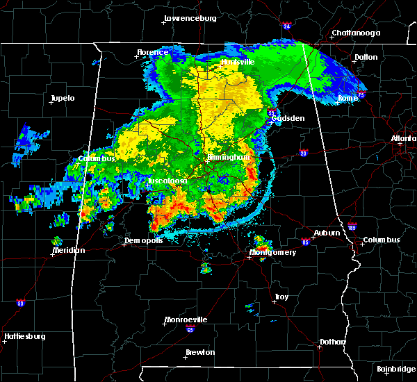 At 735 pm cdt, a severe thunderstorm was located near clanton, moving northeast at 10 mph (radar indicated). Hazards include 60 mph wind gusts and quarter size hail. Hail damage to vehicles is expected. Expect wind damage to roofs, siding, and trees. At 735 pm cdt, a severe thunderstorm was located near clanton, moving northeast at 10 mph (radar indicated). Hazards include 60 mph wind gusts and quarter size hail. Hail damage to vehicles is expected. Expect wind damage to roofs, siding, and trees.
|
| 8/10/2015 9:40 PM CDT |
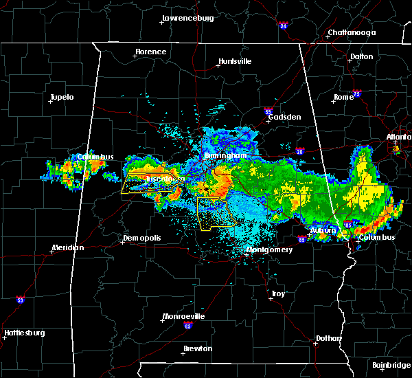 At 939 pm cdt, severe thunderstorms were located along a line extending from near lay lake dam to thorsby to near chilton county motor sports park, moving south at 35 mph (radar indicated). Hazards include 60 mph wind gusts. Expect damage to roofs. siding and trees. Locations impacted include, calera, clanton, jemison, thorsby, billingsley, plecher, gap of the mountain, chilton county motor sports park, higgins ferry park, pooles crossroads, verbena, mitchell lake, lay lake dam, lay lake, isabella, i 65 rest area, waxahatchee creek, campbell, minooka park and lomax. At 939 pm cdt, severe thunderstorms were located along a line extending from near lay lake dam to thorsby to near chilton county motor sports park, moving south at 35 mph (radar indicated). Hazards include 60 mph wind gusts. Expect damage to roofs. siding and trees. Locations impacted include, calera, clanton, jemison, thorsby, billingsley, plecher, gap of the mountain, chilton county motor sports park, higgins ferry park, pooles crossroads, verbena, mitchell lake, lay lake dam, lay lake, isabella, i 65 rest area, waxahatchee creek, campbell, minooka park and lomax.
|
| 8/10/2015 9:23 PM CDT |
 At 923 pm cdt, severe thunderstorms were located along a line extending from near talladega springs to near calera to near centreville, moving south at 35 mph (radar indicated). Hazards include 60 mph wind gusts. Expect damage to roofs. Siding and trees. At 923 pm cdt, severe thunderstorms were located along a line extending from near talladega springs to near calera to near centreville, moving south at 35 mph (radar indicated). Hazards include 60 mph wind gusts. Expect damage to roofs. Siding and trees.
|
| 7/15/2015 5:22 PM CDT |
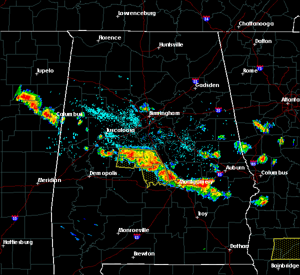 At 521 pm cdt, severe thunderstorms were located along a line extending from near west centreville to near pooles crossroads, moving south at 30 mph (radar indicated). Hazards include 60 mph wind gusts and quarter size hail. Hail damage to vehicles is expected. expect wind damage to roofs, siding and trees. Locations impacted include, clanton, brent, centreville, jemison, thorsby, maplesville, billingsley, chilton county motor sports park, talladega national forest, west centreville, pooles crossroads, heiberger, plecher, parnell, lawley, randolph, sprott, isabella, trio and campbell. At 521 pm cdt, severe thunderstorms were located along a line extending from near west centreville to near pooles crossroads, moving south at 30 mph (radar indicated). Hazards include 60 mph wind gusts and quarter size hail. Hail damage to vehicles is expected. expect wind damage to roofs, siding and trees. Locations impacted include, clanton, brent, centreville, jemison, thorsby, maplesville, billingsley, chilton county motor sports park, talladega national forest, west centreville, pooles crossroads, heiberger, plecher, parnell, lawley, randolph, sprott, isabella, trio and campbell.
|
| 7/15/2015 5:01 PM CDT |
 At 501 pm cdt, severe thunderstorms were located along a line extending from 6 miles northeast of centreville to thorsby, moving southeast at 30 mph (radar indicated). Hazards include 60 mph wind gusts and quarter size hail. Hail damage to vehicles is expected. expect wind damage to roofs, siding and trees. Locations impacted include, clanton, brent, centreville, jemison, thorsby, maplesville, billingsley, chilton county motor sports park, brierfield ironworks park, talladega national forest, west centreville, pooles crossroads, ashby, heiberger, plecher, eoline, parnell, lawley, randolph and sprott. At 501 pm cdt, severe thunderstorms were located along a line extending from 6 miles northeast of centreville to thorsby, moving southeast at 30 mph (radar indicated). Hazards include 60 mph wind gusts and quarter size hail. Hail damage to vehicles is expected. expect wind damage to roofs, siding and trees. Locations impacted include, clanton, brent, centreville, jemison, thorsby, maplesville, billingsley, chilton county motor sports park, brierfield ironworks park, talladega national forest, west centreville, pooles crossroads, ashby, heiberger, plecher, eoline, parnell, lawley, randolph and sprott.
|
| 7/15/2015 4:46 PM CDT |
 At 446 pm cdt, severe thunderstorms were located along a line extending from west blocton to near jemison, moving southeast at 30 mph (radar indicated). Hazards include 60 mph wind gusts and quarter size hail. Hail damage to vehicles is expected. Expect wind damage to roofs, siding and trees. At 446 pm cdt, severe thunderstorms were located along a line extending from west blocton to near jemison, moving southeast at 30 mph (radar indicated). Hazards include 60 mph wind gusts and quarter size hail. Hail damage to vehicles is expected. Expect wind damage to roofs, siding and trees.
|
| 7/14/2015 8:39 PM CDT |
 At 838 pm cdt, severe thunderstorms were located along a line extending from near lake wildwood to west blocton to 7 miles northwest of wilton to near calera to near wilsonville to logan martin dam, moving southeast at 65 mph (radar indicated). Hazards include 60 mph wind gusts. Expect damage to roofs. Siding and trees. At 838 pm cdt, severe thunderstorms were located along a line extending from near lake wildwood to west blocton to 7 miles northwest of wilton to near calera to near wilsonville to logan martin dam, moving southeast at 65 mph (radar indicated). Hazards include 60 mph wind gusts. Expect damage to roofs. Siding and trees.
|
| 7/3/2015 5:44 PM CDT |
 At 543 pm cdt, a severe thunderstorm was located over thorsby, or near jemison, moving east at 25 mph (law enforcement). Hazards include 60 mph wind gusts and quarter size hail. Hail damage to vehicles is expected. expect wind damage to roofs, siding and trees. Locations impacted include, clanton, jemison, thorsby, gap of the mountain, mitchell lake, lay lake dam, higgins ferry park, lay lake, i 65 rest area, lomax and waxahatchee creek. At 543 pm cdt, a severe thunderstorm was located over thorsby, or near jemison, moving east at 25 mph (law enforcement). Hazards include 60 mph wind gusts and quarter size hail. Hail damage to vehicles is expected. expect wind damage to roofs, siding and trees. Locations impacted include, clanton, jemison, thorsby, gap of the mountain, mitchell lake, lay lake dam, higgins ferry park, lay lake, i 65 rest area, lomax and waxahatchee creek.
|
| 7/3/2015 5:34 PM CDT |
 At 534 pm cdt, a severe thunderstorm was located over thorsby, or near jemison, moving east at 30 mph (law enforcement). Hazards include 60 mph wind gusts and quarter size hail. Hail damage to vehicles is expected. expect wind damage to roofs, siding and trees. Locations impacted include, clanton, jemison, thorsby, gap of the mountain, mitchell lake, lay lake dam, higgins ferry park, lay lake, i 65 rest area, lomax and waxahatchee creek. At 534 pm cdt, a severe thunderstorm was located over thorsby, or near jemison, moving east at 30 mph (law enforcement). Hazards include 60 mph wind gusts and quarter size hail. Hail damage to vehicles is expected. expect wind damage to roofs, siding and trees. Locations impacted include, clanton, jemison, thorsby, gap of the mountain, mitchell lake, lay lake dam, higgins ferry park, lay lake, i 65 rest area, lomax and waxahatchee creek.
|
| 7/3/2015 5:20 PM CDT |
 At 519 pm cdt, a severe thunderstorm was located near jemison, moving east at 30 mph (law enforcement). Hazards include ping pong ball size hail and 60 mph wind gusts. People and animals outdoors may be injured. expect hail damage to roofs, siding, windows and vehicles. expect wind damage to roofs, siding and trees. Locations impacted include, clanton, jemison, thorsby, gap of the mountain, mitchell lake, lay lake dam, higgins ferry park, lay lake, campbell, i 65 rest area, lomax and waxahatchee creek. At 519 pm cdt, a severe thunderstorm was located near jemison, moving east at 30 mph (law enforcement). Hazards include ping pong ball size hail and 60 mph wind gusts. People and animals outdoors may be injured. expect hail damage to roofs, siding, windows and vehicles. expect wind damage to roofs, siding and trees. Locations impacted include, clanton, jemison, thorsby, gap of the mountain, mitchell lake, lay lake dam, higgins ferry park, lay lake, campbell, i 65 rest area, lomax and waxahatchee creek.
|
| 7/3/2015 5:02 PM CDT |
 At 501 pm cdt, a severe thunderstorm was located near ashby, or 9 miles southwest of montevallo, moving east at 30 mph (law enforcement). Hazards include ping pong ball size hail and 60 mph wind gusts. People and animals outdoors may be injured. expect hail damage to roofs, siding, windows and vehicles. Expect wind damage to roofs, siding and trees. At 501 pm cdt, a severe thunderstorm was located near ashby, or 9 miles southwest of montevallo, moving east at 30 mph (law enforcement). Hazards include ping pong ball size hail and 60 mph wind gusts. People and animals outdoors may be injured. expect hail damage to roofs, siding, windows and vehicles. Expect wind damage to roofs, siding and trees.
|
| 3/31/2015 7:23 PM CDT | The severe thunderstorm warning for northeastern chilton county will expire at 730 pm cdt. the storm which prompted the warning has weakened below severe limits. and no longer pose an immediate threat to life or property. therefore the warning will be allowed to expire. However small hail is still possible with this thunderstorm. |
| 3/31/2015 7:13 PM CDT | A severe thunderstorm warning remains in effect until 730 pm cdt for northeastern chilton county. at 711 pm cdt. a severe thunderstorm was located near lay lake. or 9 miles southwest of talladega springs. moving east at 30 mph. hazard. 60 mph wind gusts and quarter size hail. source. Radar indicated. |
| 3/31/2015 6:55 PM CDT | A severe thunderstorm warning remains in effect until 730 pm cdt for southeastern bibb. southern shelby and northeastern chilton counties. at 650 pm cdt. a severe thunderstorm was located near calera. moving east at 30 mph. another storm across western bibb county will move into this same warning. And have additional hail and wind. |
| 3/31/2015 6:32 PM CDT | The national weather service in birmingham has issued a * severe thunderstorm warning for. southeastern bibb county in central alabama. southern shelby county in central alabama. northeastern chilton county in central alabama. Until 730 pm cdt. |
| 12/23/2014 6:35 PM CST | Trees and powerlines down along us31 between clanton and verben in chilton county AL, 0.7 miles ENE of Clanton, AL |
| 10/13/2014 2:28 PM CDT | Trees and powerlines down in the clanton area along county road 28 and 47 in chilton county AL, 1.1 miles WNW of Clanton, AL |
| 6/6/2014 5:52 PM CDT | Quarter sized hail reported 3.2 miles NW of Clanton, AL |
| 3/23/2013 11:32 PM CDT | Damage reported to campers and vehicles from falling trees at higgins ferry park on lake mitchell. reported from social media. time estimated from rada in chilton county AL, 9.9 miles W of Clanton, AL |
| 3/23/2013 11:30 PM CDT | Portions of a roof were torn off along with siding of a home near cargle creek on lake mitchell. reported by social media. time estimated from rada in chilton county AL, 7.5 miles W of Clanton, AL |
| 3/23/2013 11:21 PM CDT | Quarter sized hail reported 1.9 miles SSW of Clanton, AL, quarter size hail reported along interstate 65 just north of exit 208 near clanton. |
| 3/18/2013 3:57 PM CDT | Golf Ball sized hail reported 0.7 miles ENE of Clanton, AL, exit 212 |
| 3/18/2013 3:50 PM CDT | Golf Ball sized hail reported 1.1 miles WNW of Clanton, AL, just south of exit 212 on i65. corrected for location and time. |
| 3/5/2013 2:22 PM CST | Tree down on a house near the intersection of 7th street and county rd 24 in verben in chilton county AL, 6.3 miles NW of Clanton, AL |
| 3/5/2013 2:14 PM CST | Three large trees down blocking the road near the intersection of county roads 24 and 4 in chilton county AL, 7.1 miles N of Clanton, AL |
| 1/30/2013 7:55 AM CST | A few trees down along pinedale r in chilton county AL, 1.3 miles SSW of Clanton, AL |
| 1/30/2013 7:53 AM CST | A few trees down in chilton county AL, 1.3 miles SSW of Clanton, AL |
| 7/31/2012 3:10 AM CDT | Large tree blocking the roadway near the intersection of county roads 59 and 24. time estimated from rada in chilton county AL, 7.3 miles WNW of Clanton, AL |
| 7/10/2012 4:34 PM CDT | Several trees and power lines were blown down in and around clanto in chilton county AL, 0.7 miles ENE of Clanton, AL |
| 7/5/2012 7:25 PM CDT | Golf Ball sized hail reported 1.7 miles NNW of Clanton, AL, golf ball size hail at the walmart in clanton. |
| 1/1/0001 12:00 AM | Several trees reported down along pinedale rd and the surrounding area. hail of at least nickel size was also reported. corrected for tim in chilton county AL, 1.3 miles SSW of Clanton, AL |
| 1/1/0001 12:00 AM | Several trees reported down along pinedale rd and the surrounding area. hail of at least nickel size was also reporte in chilton county AL, 1.3 miles SSW of Clanton, AL |
| 1/1/0001 12:00 AM | Numerous trees down along several county roads in the southern part of the county...including in chilton county AL, 7.8 miles N of Clanton, AL |
| 1/1/0001 12:00 AM | Large limbs and several trees down in the city of clanton on the north end of town. winds estimated at 50 to 60 mph in chilton county AL, 0.7 miles ENE of Clanton, AL |
| 1/1/0001 12:00 AM | Multiple trees down in and around clanton in chilton county AL, 0.7 miles ENE of Clanton, AL |
| 1/1/0001 12:00 AM | Minor damage occured to a ranger residence in higgins ferry par in chilton county AL, 9.9 miles W of Clanton, AL |
| 1/1/0001 12:00 AM | Trees were blown down. at least two mobile homes destroyed. at least one roof damaged. near the intersection of cr-24 and cr-59. possible tornad in chilton county AL, 7.1 miles N of Clanton, AL |
| 1/1/0001 12:00 AM | Golf Ball sized hail reported 7.1 miles N of Clanton, AL |
| 1/1/0001 12:00 AM | Quarter sized hail reported 1.3 miles SSW of Clanton, AL, quarter size hail reported at exit 212 on i-65. |
| 1/1/0001 12:00 AM | Golf Ball sized hail reported 0.7 miles ENE of Clanton, AL, golf ball size hail reported on cherokee drive. |
| 1/1/0001 12:00 AM | Ping Pong Ball sized hail reported 1.7 miles NNE of Clanton, AL, ping pong ball size hail reported at the clanton country club. |
| 1/1/0001 12:00 AM | Half Dollar sized hail reported 0.7 miles ENE of Clanton, AL, public report of half dollar size hail in clanton. |
Hail Maps for Clanton, AL
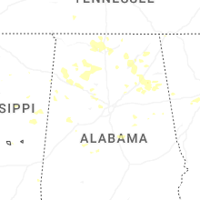
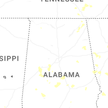
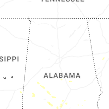
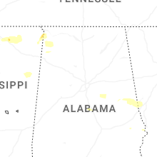
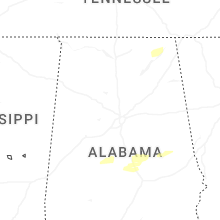


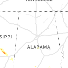


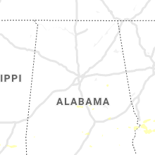


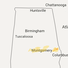


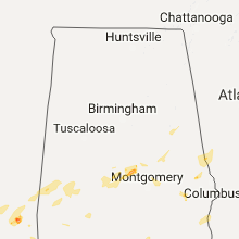


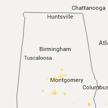

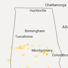


Connect with Interactive Hail Maps