

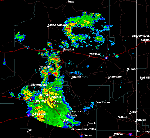
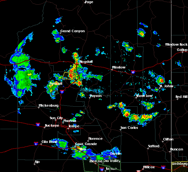
Hail Map for Clarkdale, AZ
The Clarkdale, AZ area has had 0 reports of on-the-ground hail by trained spotters, and has been under severe weather warnings 7 times during the past 12 months. Doppler radar has detected hail at or near Clarkdale, AZ on 54 occasions, including 4 occasions during the past year.
| Name: | Clarkdale, AZ |
| Where Located: | 38.4 miles SW of Flagstaff, AZ |
| Map: | Google Map for Clarkdale, AZ |
| Population: | 4097 |
| Housing Units: | 2059 |
| More Info: | Search Google for Clarkdale, AZ |
3
The Top Recent Hail Date for Clarkdale, AZ is Tuesday, June 3, 2025 (6th out of 54)
Hail and Wind Damage Spotted near Clarkdale, AZ
| Date / Time | Report Details |
|---|---|
| 7/3/2025 1:58 PM MST |
 The storm which prompted the warning has weakened below severe limits, and no longer poses an immediate threat to life or property. therefore, the warning will be allowed to expire. however, small hail, gusty winds, and heavy rain are still possible with this thunderstorm. The storm which prompted the warning has weakened below severe limits, and no longer poses an immediate threat to life or property. therefore, the warning will be allowed to expire. however, small hail, gusty winds, and heavy rain are still possible with this thunderstorm.
|
| 7/3/2025 1:35 PM MST |
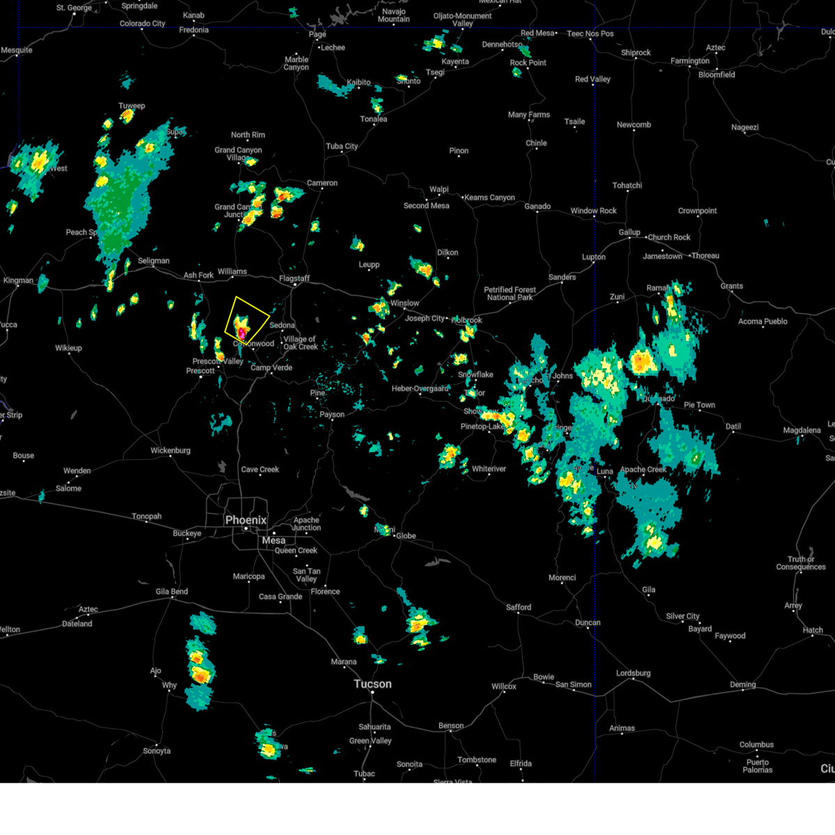
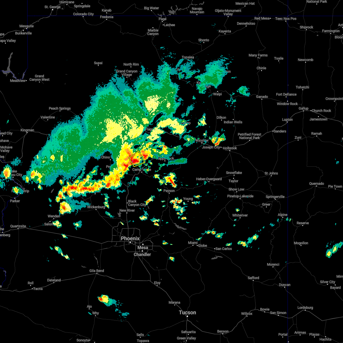
 At 135 pm mst, a severe thunderstorm was located near dewey-humboldt, or 8 miles east of prescott valley, moving northeast at 10 mph (radar indicated). Hazards include 60 mph wind gusts and quarter size hail. Hail damage to vehicles is expected. expect wind damage to roofs, siding, and trees. locations impacted include, prescott valley, clarkdale, dewey-humboldt, jerome state historic park, mayer, jerome, mingus mountain and cherry. this includes the following highways, state route 69 between mile markers 278 and 286. State route 89a between mile markers 329 and 347. At 135 pm mst, a severe thunderstorm was located near dewey-humboldt, or 8 miles east of prescott valley, moving northeast at 10 mph (radar indicated). Hazards include 60 mph wind gusts and quarter size hail. Hail damage to vehicles is expected. expect wind damage to roofs, siding, and trees. locations impacted include, prescott valley, clarkdale, dewey-humboldt, jerome state historic park, mayer, jerome, mingus mountain and cherry. this includes the following highways, state route 69 between mile markers 278 and 286. State route 89a between mile markers 329 and 347.
|
| 7/3/2025 1:09 PM MST |
 Svrfgz the national weather service in flagstaff has issued a * severe thunderstorm warning for, dewey-humboldt in yavapai county in west central arizona, * until 200 pm mst. * at 109 pm mst, a severe thunderstorm was located over dewey-humboldt, or 6 miles southeast of prescott valley, moving northeast at 10 mph (radar indicated). Hazards include 60 mph wind gusts and quarter size hail. Hail damage to vehicles is expected. Expect wind damage to roofs, siding, and trees. Svrfgz the national weather service in flagstaff has issued a * severe thunderstorm warning for, dewey-humboldt in yavapai county in west central arizona, * until 200 pm mst. * at 109 pm mst, a severe thunderstorm was located over dewey-humboldt, or 6 miles southeast of prescott valley, moving northeast at 10 mph (radar indicated). Hazards include 60 mph wind gusts and quarter size hail. Hail damage to vehicles is expected. Expect wind damage to roofs, siding, and trees.
|
| 6/9/2025 6:27 PM MST |
 The thunderstorm over the central verde valley that was capable of producing severe wind gusts has weakened. light showers and wind gusts to 40 mph will persist through 7 pm mst. the warning will be allowed to expire. The thunderstorm over the central verde valley that was capable of producing severe wind gusts has weakened. light showers and wind gusts to 40 mph will persist through 7 pm mst. the warning will be allowed to expire.
|
| 6/9/2025 6:00 PM MST |
 Svrfgz the national weather service in flagstaff has issued a * severe thunderstorm warning for, yavapai county in west central arizona, * until 630 pm mst. * at 558 pm mst, a severe thunderstorm was located over cornville, or 11 miles northwest of camp verde, moving north at 15 mph (radar indicated). Hazards include 60 mph wind gusts. expect damage to roofs, siding, and trees Svrfgz the national weather service in flagstaff has issued a * severe thunderstorm warning for, yavapai county in west central arizona, * until 630 pm mst. * at 558 pm mst, a severe thunderstorm was located over cornville, or 11 miles northwest of camp verde, moving north at 15 mph (radar indicated). Hazards include 60 mph wind gusts. expect damage to roofs, siding, and trees
|
| 6/3/2025 7:39 PM MST |
 the severe thunderstorm warning has been cancelled and is no longer in effect the severe thunderstorm warning has been cancelled and is no longer in effect
|
| 6/3/2025 7:10 PM MST |
 Svrfgz the national weather service in flagstaff has issued a * severe thunderstorm warning for, east central yavapai county in west central arizona, * until 800 pm mst. * at 709 pm mst, a severe thunderstorm was located over cottonwood, or 12 miles northwest of camp verde, moving northeast at 15 mph (radar indicated). Hazards include quarter size hail. damage to vehicles is expected Svrfgz the national weather service in flagstaff has issued a * severe thunderstorm warning for, east central yavapai county in west central arizona, * until 800 pm mst. * at 709 pm mst, a severe thunderstorm was located over cottonwood, or 12 miles northwest of camp verde, moving northeast at 15 mph (radar indicated). Hazards include quarter size hail. damage to vehicles is expected
|
| 7/25/2023 3:58 PM MST |
 At 358 pm mst, a severe thunderstorm was located 10 miles northeast of perkinsville, or 15 miles northwest of sedona, moving northeast at 15 mph (radar indicated). Hazards include ping pong ball size hail and 60 mph wind gusts. People and animals outdoors will be injured. expect hail damage to roofs, siding, windows, and vehicles. expect wind damage to roofs, siding, and trees. locations impacted include, perkinsville. hail threat, radar indicated max hail size, 1. 50 in wind threat, radar indicated max wind gust, 60 mph. At 358 pm mst, a severe thunderstorm was located 10 miles northeast of perkinsville, or 15 miles northwest of sedona, moving northeast at 15 mph (radar indicated). Hazards include ping pong ball size hail and 60 mph wind gusts. People and animals outdoors will be injured. expect hail damage to roofs, siding, windows, and vehicles. expect wind damage to roofs, siding, and trees. locations impacted include, perkinsville. hail threat, radar indicated max hail size, 1. 50 in wind threat, radar indicated max wind gust, 60 mph.
|
| 7/25/2023 3:43 PM MST |
 At 342 pm mst, a severe thunderstorm was located near perkinsville, or 16 miles west of sedona, moving northeast at 15 mph (radar indicated). Hazards include 60 mph wind gusts and quarter size hail. Hail damage to vehicles is expected. Expect wind damage to roofs, siding, and trees. At 342 pm mst, a severe thunderstorm was located near perkinsville, or 16 miles west of sedona, moving northeast at 15 mph (radar indicated). Hazards include 60 mph wind gusts and quarter size hail. Hail damage to vehicles is expected. Expect wind damage to roofs, siding, and trees.
|
| 5/19/2023 1:36 PM MST |
 At 136 pm mst, a severe thunderstorm was located over verde village, or 9 miles northwest of camp verde, and is nearly stationary (radar indicated). Hazards include 60 mph wind gusts and quarter size hail. Hail damage to vehicles is expected. Expect wind damage to roofs, siding, and trees. At 136 pm mst, a severe thunderstorm was located over verde village, or 9 miles northwest of camp verde, and is nearly stationary (radar indicated). Hazards include 60 mph wind gusts and quarter size hail. Hail damage to vehicles is expected. Expect wind damage to roofs, siding, and trees.
|
| 10/3/2022 2:45 PM MST |
 At 244 pm mst, a severe thunderstorm was located over bridgeport, or 12 miles northwest of camp verde, moving northeast at 10 mph (radar indicated). Hazards include 60 mph wind gusts and nickel size hail. expect damage to roofs, siding, and trees At 244 pm mst, a severe thunderstorm was located over bridgeport, or 12 miles northwest of camp verde, moving northeast at 10 mph (radar indicated). Hazards include 60 mph wind gusts and nickel size hail. expect damage to roofs, siding, and trees
|
| 10/3/2022 2:38 PM MST |
 The severe thunderstorm warning for coconino and yavapai counties will expire at 245 pm mst, the severe thunderstorm which prompted the warning has weakened. therefore, the warning will be allowed to expire. however heavy rain is still possible with this thunderstorm. The severe thunderstorm warning for coconino and yavapai counties will expire at 245 pm mst, the severe thunderstorm which prompted the warning has weakened. therefore, the warning will be allowed to expire. however heavy rain is still possible with this thunderstorm.
|
| 10/3/2022 2:07 PM MST |
 At 207 pm mst, a severe thunderstorm was located near perkinsville, or 14 miles east of chino valley, moving east at 20 mph (radar indicated). Hazards include 60 mph wind gusts and quarter size hail. Hail damage to vehicles is expected. Expect wind damage to roofs, siding, and trees. At 207 pm mst, a severe thunderstorm was located near perkinsville, or 14 miles east of chino valley, moving east at 20 mph (radar indicated). Hazards include 60 mph wind gusts and quarter size hail. Hail damage to vehicles is expected. Expect wind damage to roofs, siding, and trees.
|
| 8/23/2022 3:51 PM MST | The severe thunderstorm warning for yavapai county will expire at 400 pm mst, the storm which prompted the warning has weakened below severe limits, and no longer poses an immediate threat to life or property. therefore, the warning will be allowed to expire. however small hail is still possible with this thunderstorm. |
| 8/23/2022 3:40 PM MST | The severe thunderstorm warning for yavapai county will expire at 345 pm mst, the storm which prompted the warning has weakened below severe limits, and has exited the warned area. therefore, the warning will be allowed to expire. however small hail is still possible with this thunderstorm. remember, a severe thunderstorm warning still remains in effect for areas near cottonwood arizona. |
| 8/23/2022 3:36 PM MST | At 336 pm mst, a severe thunderstorm was located near verde village, or 11 miles northwest of camp verde, moving southwest at 10 mph (radar indicated). Hazards include 60 mph wind gusts and half dollar size hail. Hail damage to vehicles is expected. Expect wind damage to roofs, siding, and trees. |
| 8/23/2022 3:17 PM MST | At 317 pm mst, a severe thunderstorm was located over verde village, or 10 miles northwest of camp verde, moving southwest at 10 mph (radar indicated). Hazards include 60 mph wind gusts and half dollar size hail. Hail damage to vehicles is expected. Expect wind damage to roofs, siding, and trees. |
| 8/3/2022 3:57 PM MST |
 The severe thunderstorm warning for yavapai county will expire at 400 pm mst, the storm which prompted the warning has weakened below severe limits, and no longer poses an immediate threat to life or property. therefore, the warning will be allowed to expire. however, small hail and heavy rain are still possible with this thunderstorm. The severe thunderstorm warning for yavapai county will expire at 400 pm mst, the storm which prompted the warning has weakened below severe limits, and no longer poses an immediate threat to life or property. therefore, the warning will be allowed to expire. however, small hail and heavy rain are still possible with this thunderstorm.
|
| 8/3/2022 3:43 PM MST |
 At 343 pm mst, a severe thunderstorm was located near cherry, or 12 miles east of prescott valley, moving south at 5 mph (radar indicated). Hazards include 60 mph wind gusts and quarter size hail. Hail damage to vehicles is expected. expect wind damage to roofs, siding, and trees. locations impacted include, mingus mountain campground, potato patch campground and playground group campground. hail threat, radar indicated max hail size, 1. 00 in wind threat, radar indicated max wind gust, 60 mph. At 343 pm mst, a severe thunderstorm was located near cherry, or 12 miles east of prescott valley, moving south at 5 mph (radar indicated). Hazards include 60 mph wind gusts and quarter size hail. Hail damage to vehicles is expected. expect wind damage to roofs, siding, and trees. locations impacted include, mingus mountain campground, potato patch campground and playground group campground. hail threat, radar indicated max hail size, 1. 00 in wind threat, radar indicated max wind gust, 60 mph.
|
| 8/3/2022 3:11 PM MST |
 At 311 pm mst, a severe thunderstorm was located near jerome, or 12 miles northeast of prescott valley, moving southwest at 5 mph (radar indicated). Hazards include 60 mph wind gusts and quarter size hail. Hail damage to vehicles is expected. Expect wind damage to roofs, siding, and trees. At 311 pm mst, a severe thunderstorm was located near jerome, or 12 miles northeast of prescott valley, moving southwest at 5 mph (radar indicated). Hazards include 60 mph wind gusts and quarter size hail. Hail damage to vehicles is expected. Expect wind damage to roofs, siding, and trees.
|
| 8/5/2021 3:52 PM MST |
 The severe thunderstorm warning for yavapai county will expire at 400 pm mst, the storm near jerome which prompted the severe thunderstorm warning has weakened below severe limits. therefore, the warning will be allowed to expire at 400 pm mst. this storm produced over an inch of rainfall just south of jerome and minor flows may be observed in blowout creek and oak wash this afternoon. The severe thunderstorm warning for yavapai county will expire at 400 pm mst, the storm near jerome which prompted the severe thunderstorm warning has weakened below severe limits. therefore, the warning will be allowed to expire at 400 pm mst. this storm produced over an inch of rainfall just south of jerome and minor flows may be observed in blowout creek and oak wash this afternoon.
|
| 8/5/2021 3:36 PM MST |
 At 334 pm mst, a severe thunderstorm was located near jerome and is nearly stationary (radar indicated). Hazards include 60 mph wind gusts and quarter size hail. Hail damage to vehicles is expected. Expect wind damage to roofs, siding, and trees. At 334 pm mst, a severe thunderstorm was located near jerome and is nearly stationary (radar indicated). Hazards include 60 mph wind gusts and quarter size hail. Hail damage to vehicles is expected. Expect wind damage to roofs, siding, and trees.
|
| 7/9/2021 3:02 PM MST |
 At 300 pm mst, a severe thunderstorm was located near cherry, or 14 miles west of camp verde, and is nearly stationary (radar indicated). Hazards include 60 mph wind gusts and quarter size hail. Hail damage to vehicles is expected. Expect wind damage to roofs, siding, and trees. At 300 pm mst, a severe thunderstorm was located near cherry, or 14 miles west of camp verde, and is nearly stationary (radar indicated). Hazards include 60 mph wind gusts and quarter size hail. Hail damage to vehicles is expected. Expect wind damage to roofs, siding, and trees.
|
| 8/21/2020 5:22 PM MST |
 At 459 pm mst, a severe thunderstorm was located near cherry and cottonwood and is nearly stationary (radar indicated). Hazards include 60 mph wind gusts and quarter size hail. Hail damage to vehicles is expected. expect wind damage to roofs, siding, and trees. Locations impacted include, camp verde, prescott valley, clarkdale, verde village, cherry, bridgeport, cottonwood, middle verde, jerome, mingus mountain campground, playground group campground, potato patch campground and powell springs campground. At 459 pm mst, a severe thunderstorm was located near cherry and cottonwood and is nearly stationary (radar indicated). Hazards include 60 mph wind gusts and quarter size hail. Hail damage to vehicles is expected. expect wind damage to roofs, siding, and trees. Locations impacted include, camp verde, prescott valley, clarkdale, verde village, cherry, bridgeport, cottonwood, middle verde, jerome, mingus mountain campground, playground group campground, potato patch campground and powell springs campground.
|
| 8/21/2020 5:00 PM MST |
 At 459 pm mst, a severe thunderstorm was located near cherry and cottonwood and is nearly stationary (radar indicated). Hazards include 60 mph wind gusts and quarter size hail. Hail damage to vehicles is expected. expect wind damage to roofs, siding, and trees. Locations impacted include, camp verde, prescott valley, clarkdale, verde village, cherry, bridgeport, cottonwood, middle verde, jerome, mingus mountain campground, playground group campground, potato patch campground and powell springs campground. At 459 pm mst, a severe thunderstorm was located near cherry and cottonwood and is nearly stationary (radar indicated). Hazards include 60 mph wind gusts and quarter size hail. Hail damage to vehicles is expected. expect wind damage to roofs, siding, and trees. Locations impacted include, camp verde, prescott valley, clarkdale, verde village, cherry, bridgeport, cottonwood, middle verde, jerome, mingus mountain campground, playground group campground, potato patch campground and powell springs campground.
|
| 8/21/2020 4:46 PM MST |
 At 445 pm mst, a severe thunderstorm was located near cottonwood, or 15 miles northwest of camp verde, and is nearly stationary (radar indicated. this storm has a history of nickel size hail and strong winds). Hazards include 60 mph wind gusts and quarter size hail. Hail damage to vehicles is expected. Expect wind damage to roofs, siding, and trees. At 445 pm mst, a severe thunderstorm was located near cottonwood, or 15 miles northwest of camp verde, and is nearly stationary (radar indicated. this storm has a history of nickel size hail and strong winds). Hazards include 60 mph wind gusts and quarter size hail. Hail damage to vehicles is expected. Expect wind damage to roofs, siding, and trees.
|
| 8/21/2020 4:37 PM MST |
 At 437 pm mst, a severe thunderstorm was located near yavapai county fairgrounds, or 11 miles northeast of prescott valley, moving southwest at 10 mph (trained weather spotters reported nickel sized hail and estimated 60 mph winds). Hazards include 60 mph wind gusts and quarter size hail. Hail damage to vehicles is expected. expect wind damage to roofs, siding, and trees. Locations impacted include, clarkdale, verde village, cottonwood, jerome, mingus mountain campground, playground group campground and potato patch campground. At 437 pm mst, a severe thunderstorm was located near yavapai county fairgrounds, or 11 miles northeast of prescott valley, moving southwest at 10 mph (trained weather spotters reported nickel sized hail and estimated 60 mph winds). Hazards include 60 mph wind gusts and quarter size hail. Hail damage to vehicles is expected. expect wind damage to roofs, siding, and trees. Locations impacted include, clarkdale, verde village, cottonwood, jerome, mingus mountain campground, playground group campground and potato patch campground.
|
| 8/21/2020 4:19 PM MST |
 At 419 pm mst, a severe thunderstorm was located 7 miles east of yavapai county fairgrounds, or 14 miles northeast of prescott valley, moving southwest at 10 mph (radar indicated). Hazards include 60 mph wind gusts and quarter size hail. Hail damage to vehicles is expected. Expect wind damage to roofs, siding, and trees. At 419 pm mst, a severe thunderstorm was located 7 miles east of yavapai county fairgrounds, or 14 miles northeast of prescott valley, moving southwest at 10 mph (radar indicated). Hazards include 60 mph wind gusts and quarter size hail. Hail damage to vehicles is expected. Expect wind damage to roofs, siding, and trees.
|
| 8/3/2019 2:53 PM MST |
 At 252 pm mst, a severe thunderstorm was located over bridgeport, or 13 miles northwest of camp verde, moving northeast at 10 mph (radar indicated). Hazards include 60 mph wind gusts and quarter size hail. Hail damage to vehicles is expected. expect wind damage to roofs, siding, and trees. Locations impacted include, clarkdale, verde village, bridgeport, cottonwood, cornville, dead horse ranch state park and tuzigoot national monument. At 252 pm mst, a severe thunderstorm was located over bridgeport, or 13 miles northwest of camp verde, moving northeast at 10 mph (radar indicated). Hazards include 60 mph wind gusts and quarter size hail. Hail damage to vehicles is expected. expect wind damage to roofs, siding, and trees. Locations impacted include, clarkdale, verde village, bridgeport, cottonwood, cornville, dead horse ranch state park and tuzigoot national monument.
|
| 8/3/2019 2:30 PM MST |
 At 229 pm mst, a severe thunderstorm was located near verde village, or 12 miles northwest of camp verde, moving southeast at 10 mph (radar indicated). Hazards include 60 mph wind gusts and quarter size hail. Hail damage to vehicles is expected. Expect wind damage to roofs, siding, and trees. At 229 pm mst, a severe thunderstorm was located near verde village, or 12 miles northwest of camp verde, moving southeast at 10 mph (radar indicated). Hazards include 60 mph wind gusts and quarter size hail. Hail damage to vehicles is expected. Expect wind damage to roofs, siding, and trees.
|
| 8/2/2019 5:02 PM MST |
 At 502 pm mst, severe thunderstorms were located along a line extending from cornville to near strawberry, and are nearly stationary (radar indicated). Hazards include 60 mph wind gusts and quarter size hail. Hail damage to vehicles is expected. expect wind damage to roofs, siding, and trees. Locations impacted include, camp verde, verde village, mcguireville, montezuma well, montezuma castle national monument, rimrock, middle verde, lake montezuma, cornville, cottonwood and clear creek campgrounds. At 502 pm mst, severe thunderstorms were located along a line extending from cornville to near strawberry, and are nearly stationary (radar indicated). Hazards include 60 mph wind gusts and quarter size hail. Hail damage to vehicles is expected. expect wind damage to roofs, siding, and trees. Locations impacted include, camp verde, verde village, mcguireville, montezuma well, montezuma castle national monument, rimrock, middle verde, lake montezuma, cornville, cottonwood and clear creek campgrounds.
|
| 8/2/2019 4:50 PM MST |
 At 449 pm mst, severe thunderstorms were located along a line extending from cornville to 6 miles northeast of strawberry, moving east at 55 mph (radar indicated). Hazards include 60 mph wind gusts and quarter size hail. Hail damage to vehicles is expected. Expect wind damage to roofs, siding, and trees. At 449 pm mst, severe thunderstorms were located along a line extending from cornville to 6 miles northeast of strawberry, moving east at 55 mph (radar indicated). Hazards include 60 mph wind gusts and quarter size hail. Hail damage to vehicles is expected. Expect wind damage to roofs, siding, and trees.
|
| 8/26/2018 3:38 PM MST |
 The severe thunderstorm warning for yavapai county will expire at 345 pm mst, the storm which prompted the warning has weakened below severe limits, and no longer pose an immediate threat to life or property. therefore the warning will be allowed to expire. however small hail and heavy rain are still likely with this thunderstorm which could lead to areas of flash flooding. The severe thunderstorm warning for yavapai county will expire at 345 pm mst, the storm which prompted the warning has weakened below severe limits, and no longer pose an immediate threat to life or property. therefore the warning will be allowed to expire. however small hail and heavy rain are still likely with this thunderstorm which could lead to areas of flash flooding.
|
| 8/26/2018 3:30 PM MST |
 At 330 pm mst, a severe thunderstorm was located over verde village, or 12 miles northwest of camp verde, moving east at 10 mph (radar indicated). Hazards include 60 mph wind gusts and penny size hail. Expect damage to roofs, siding, and trees. locations impacted include, clarkdale, verde village, bridgeport, cottonwood, cornville, jerome, dead horse ranch state park, mingus mountain campground and playground group campground. this includes the following highways, state route 260 between mile markers 207 and 215. State route 89a near mile marker 340, and between mile markers 342 and 359. At 330 pm mst, a severe thunderstorm was located over verde village, or 12 miles northwest of camp verde, moving east at 10 mph (radar indicated). Hazards include 60 mph wind gusts and penny size hail. Expect damage to roofs, siding, and trees. locations impacted include, clarkdale, verde village, bridgeport, cottonwood, cornville, jerome, dead horse ranch state park, mingus mountain campground and playground group campground. this includes the following highways, state route 260 between mile markers 207 and 215. State route 89a near mile marker 340, and between mile markers 342 and 359.
|
| 8/26/2018 3:19 PM MST |
 At 319 pm mst, a severe thunderstorm was located near verde village, or 13 miles northwest of camp verde, moving east at 10 mph (radar indicated). Hazards include 60 mph wind gusts and quarter size hail. Hail damage to vehicles is expected. Expect wind damage to roofs, siding, and trees. At 319 pm mst, a severe thunderstorm was located near verde village, or 13 miles northwest of camp verde, moving east at 10 mph (radar indicated). Hazards include 60 mph wind gusts and quarter size hail. Hail damage to vehicles is expected. Expect wind damage to roofs, siding, and trees.
|
| 8/23/2018 2:39 PM MST |
 At 238 pm mst, a severe thunderstorm was located near jerome and was moving east at 20 mph (radar indicated). Hazards include quarter size hail. damage to vehicles is expected At 238 pm mst, a severe thunderstorm was located near jerome and was moving east at 20 mph (radar indicated). Hazards include quarter size hail. damage to vehicles is expected
|
| 8/20/2018 2:36 PM MST |
 At 235 pm mst, a severe thunderstorm was located near cherry, or 15 miles west of camp verde, moving north at 10 mph (radar indicated). Hazards include golf ball size hail and 60 mph wind gusts. People and animals outdoors will be injured. expect hail damage to roofs, siding, windows, and vehicles. Expect wind damage to roofs, siding, and trees. At 235 pm mst, a severe thunderstorm was located near cherry, or 15 miles west of camp verde, moving north at 10 mph (radar indicated). Hazards include golf ball size hail and 60 mph wind gusts. People and animals outdoors will be injured. expect hail damage to roofs, siding, windows, and vehicles. Expect wind damage to roofs, siding, and trees.
|
| 8/18/2018 4:08 PM MST |
 At 408 pm mst, a severe thunderstorm was located near clarkdale, or 12 miles west of sedona, moving southeast at 20 mph (radar indicated). Hazards include 60 mph wind gusts and penny size hail. expect damage to roofs, siding, and trees At 408 pm mst, a severe thunderstorm was located near clarkdale, or 12 miles west of sedona, moving southeast at 20 mph (radar indicated). Hazards include 60 mph wind gusts and penny size hail. expect damage to roofs, siding, and trees
|
| 8/13/2018 3:23 PM MST |
 At 321 pm mst, a severe thunderstorm was located near sedona, moving southwest at 15 mph (radar indicated). Hazards include 60 mph wind gusts and quarter size hail. Hail damage to vehicles is expected. Expect wind damage to roofs, siding, and trees. At 321 pm mst, a severe thunderstorm was located near sedona, moving southwest at 15 mph (radar indicated). Hazards include 60 mph wind gusts and quarter size hail. Hail damage to vehicles is expected. Expect wind damage to roofs, siding, and trees.
|
| 8/8/2018 3:07 PM MST |
 At 306 pm mst, a severe thunderstorm was located 7 miles northwest of page springs, or 8 miles west of sedona, moving southwest at 15 mph. this storm should be affecting the cottonwood area by 350 pm mst (radar indicated). Hazards include 70 mph wind gusts and quarter size hail. Hail damage to vehicles is expected. expect considerable tree damage. Wind damage is also likely to mobile homes, roofs, and outbuildings. At 306 pm mst, a severe thunderstorm was located 7 miles northwest of page springs, or 8 miles west of sedona, moving southwest at 15 mph. this storm should be affecting the cottonwood area by 350 pm mst (radar indicated). Hazards include 70 mph wind gusts and quarter size hail. Hail damage to vehicles is expected. expect considerable tree damage. Wind damage is also likely to mobile homes, roofs, and outbuildings.
|
| 8/8/2018 2:48 PM MST |
 At 248 pm mst, a severe thunderstorm was located 8 miles west of sedona, moving southwest at 15 mph (radar indicated). Hazards include 70 mph wind gusts and quarter size hail. Hail damage to vehicles is expected. expect considerable tree damage. Wind damage is also likely to mobile homes, roofs, and outbuildings. At 248 pm mst, a severe thunderstorm was located 8 miles west of sedona, moving southwest at 15 mph (radar indicated). Hazards include 70 mph wind gusts and quarter size hail. Hail damage to vehicles is expected. expect considerable tree damage. Wind damage is also likely to mobile homes, roofs, and outbuildings.
|
| 7/28/2018 5:10 PM MST |
 The severe thunderstorm warning for yavapai and coconino counties will expire at 515 pm mst, the storms which prompted the warning from jerome to near perkinsville have weakened below severe limits, and no longer pose an immediate threat to life or property. therefore the warning will be allowed to expire. however heavy rain is still occurring with these thunderstorms. The severe thunderstorm warning for yavapai and coconino counties will expire at 515 pm mst, the storms which prompted the warning from jerome to near perkinsville have weakened below severe limits, and no longer pose an immediate threat to life or property. therefore the warning will be allowed to expire. however heavy rain is still occurring with these thunderstorms.
|
| 7/28/2018 4:39 PM MST |
 At 437 pm mst, severe thunderstorms were located along a line extending from near perkinsville to jerome, moving southeast at 20 mph (radar indicated). Hazards include 60 mph wind gusts and half dollar size hail. Hail damage to vehicles is expected. Expect wind damage to roofs, siding, and trees. At 437 pm mst, severe thunderstorms were located along a line extending from near perkinsville to jerome, moving southeast at 20 mph (radar indicated). Hazards include 60 mph wind gusts and half dollar size hail. Hail damage to vehicles is expected. Expect wind damage to roofs, siding, and trees.
|
| 7/27/2018 6:25 PM MST |
 The severe thunderstorm warning for yavapai county will expire at 630 pm mst, the storms which prompted the warning have weakened below severe limits, and no longer pose an immediate threat to life or property. therefore the warning will be allowed to expire. however heavy rain is still possible with these thunderstorms. The severe thunderstorm warning for yavapai county will expire at 630 pm mst, the storms which prompted the warning have weakened below severe limits, and no longer pose an immediate threat to life or property. therefore the warning will be allowed to expire. however heavy rain is still possible with these thunderstorms.
|
| 7/27/2018 5:47 PM MST |
 At 546 pm mst, severe thunderstorms were located along a line extending from near stoneman lake to near cherry, moving south at 20 mph (radar indicated). Hazards include 60 mph wind gusts and quarter size hail. Hail damage to vehicles is expected. Expect wind damage to roofs, siding, and trees. At 546 pm mst, severe thunderstorms were located along a line extending from near stoneman lake to near cherry, moving south at 20 mph (radar indicated). Hazards include 60 mph wind gusts and quarter size hail. Hail damage to vehicles is expected. Expect wind damage to roofs, siding, and trees.
|
| 7/18/2018 2:58 PM MST |
 At 255 pm mst, a severe thunderstorm was located near cottonwood. this storm was nearly stationary or building slowly east and north (radar indicated). Hazards include 60 mph wind gusts and quarter size hail. Hail damage to vehicles is expected. Expect wind damage to roofs, siding, and trees. At 255 pm mst, a severe thunderstorm was located near cottonwood. this storm was nearly stationary or building slowly east and north (radar indicated). Hazards include 60 mph wind gusts and quarter size hail. Hail damage to vehicles is expected. Expect wind damage to roofs, siding, and trees.
|
| 7/9/2018 5:49 PM MST |
 At 548 pm mst, a severe thunderstorm was located near sedona, moving west at 25 mph (radar indicated). Hazards include 60 mph wind gusts and penny size hail. expect damage to roofs, siding, and trees At 548 pm mst, a severe thunderstorm was located near sedona, moving west at 25 mph (radar indicated). Hazards include 60 mph wind gusts and penny size hail. expect damage to roofs, siding, and trees
|
| 7/23/2017 3:43 PM MST |
 At 342 pm mst, a severe thunderstorm was located over verde village, or 12 miles northwest of camp verde, moving south at 10 mph (radar indicated). Hazards include 60 mph wind gusts and penny size hail. Expect damage to roofs, siding, and trees. locations impacted include, clarkdale, verde village, bridgeport, perkinsville, cottonwood, jerome, dead horse ranch state park, mingus mountain campground, playground group campground, potato patch campground and tuzigoot national monument. this includes the following highways, state route 260 between mile markers 207 and 209. State route 89a between mile markers 329 and 359. At 342 pm mst, a severe thunderstorm was located over verde village, or 12 miles northwest of camp verde, moving south at 10 mph (radar indicated). Hazards include 60 mph wind gusts and penny size hail. Expect damage to roofs, siding, and trees. locations impacted include, clarkdale, verde village, bridgeport, perkinsville, cottonwood, jerome, dead horse ranch state park, mingus mountain campground, playground group campground, potato patch campground and tuzigoot national monument. this includes the following highways, state route 260 between mile markers 207 and 209. State route 89a between mile markers 329 and 359.
|
| 7/23/2017 3:10 PM MST |
 At 309 pm mst, a severe thunderstorm was located near clarkdale, or 15 miles west of sedona, moving east at 10 mph (radar indicated). Hazards include 60 mph wind gusts and quarter size hail. Hail damage to vehicles is expected. Expect wind damage to roofs, siding, and trees. At 309 pm mst, a severe thunderstorm was located near clarkdale, or 15 miles west of sedona, moving east at 10 mph (radar indicated). Hazards include 60 mph wind gusts and quarter size hail. Hail damage to vehicles is expected. Expect wind damage to roofs, siding, and trees.
|
| 7/19/2017 5:26 PM MST |
 At 524 pm mst, a severe thunderstorm was located near page springs, or 8 miles west of sedona, moving west at 45 mph. this storm is exhibiting rotation along the gust front (radar indicated). Hazards include 60 mph wind gusts and nickel size hail. Expect damage to roofs, siding, and trees. locations impacted include, sedona, page springs. this includes the following highways, state route 179 between mile markers 305 and 313. State route 89a between mile markers 361 and 378. At 524 pm mst, a severe thunderstorm was located near page springs, or 8 miles west of sedona, moving west at 45 mph. this storm is exhibiting rotation along the gust front (radar indicated). Hazards include 60 mph wind gusts and nickel size hail. Expect damage to roofs, siding, and trees. locations impacted include, sedona, page springs. this includes the following highways, state route 179 between mile markers 305 and 313. State route 89a between mile markers 361 and 378.
|
| 7/19/2017 5:13 PM MST |
 The national weather service in flagstaff has issued a * severe thunderstorm warning for. yavapai county in west central arizona. coconino county in north central arizona. Until 545 pm mst * at 513 pm mst, a severe thunderstorm was located over sedona,. The national weather service in flagstaff has issued a * severe thunderstorm warning for. yavapai county in west central arizona. coconino county in north central arizona. Until 545 pm mst * at 513 pm mst, a severe thunderstorm was located over sedona,.
|
| 8/24/2016 3:23 PM MST |
 At 322 pm mst, doppler radar indicated a severe thunderstorm capable of producing quarter size hail. this storm was located near cherry, or 13 miles northwest of camp verde, and moving south at 10 mph. At 322 pm mst, doppler radar indicated a severe thunderstorm capable of producing quarter size hail. this storm was located near cherry, or 13 miles northwest of camp verde, and moving south at 10 mph.
|
| 7/29/2016 4:10 PM MST |
 At 409 pm mst, doppler radar indicated a severe thunderstorm capable of producing damaging winds in excess of 60 mph. this storm was located over cottonwood, or 13 miles northwest of camp verde. this storm was nearly stationary. nickel size hail may also accompany the damaging winds. At 409 pm mst, doppler radar indicated a severe thunderstorm capable of producing damaging winds in excess of 60 mph. this storm was located over cottonwood, or 13 miles northwest of camp verde. this storm was nearly stationary. nickel size hail may also accompany the damaging winds.
|
| 7/3/2015 6:57 PM MST | The severe thunderstorm warning for east central yavapai county will expire at 700 pm mst, the storm which prompted the warning near cornville has weakened below severe limits, and no longer poses an immediate threat to life or property. therefore the warning will be allowed to expire. however gusty winds and heavy rain are still possible with this thunderstorm. |
| 7/3/2015 6:36 PM MST |
 At 634 pm mst, doppler radar indicated a severe thunderstorm capable of producing damaging winds in excess of 60 mph. this storm was located over cornville, or near cottonwood-verde village, and moving southwest at 15 mph. At 634 pm mst, doppler radar indicated a severe thunderstorm capable of producing damaging winds in excess of 60 mph. this storm was located over cornville, or near cottonwood-verde village, and moving southwest at 15 mph.
|
| 6/26/2015 7:10 PM MST | The severe thunderstorm warning for central yavapai county will expire at 715 pm mst, the storm which prompted the warning has weakened below severe limits, and no longer poses an immediate threat to life or property. therefore the warning will be allowed to expire. however gusty winds are still possible with this thunderstorm south of the cottonwood area. |
| 6/26/2015 6:44 PM MST | At 643 pm mst, doppler radar indicated a severe thunderstorm capable of producing damaging winds in excess of 60 mph. this storm was located over cottonwood and clarkdale, moving south at 5 mph. penny size hail may also accompany the damaging winds. |
| 1/1/0001 12:00 AM | Wind gust from mesonet site in yavapai county AZ, 1 miles SSE of Clarkdale, AZ |
Hail Maps for Clarkdale, AZ


Connect with Interactive Hail Maps