

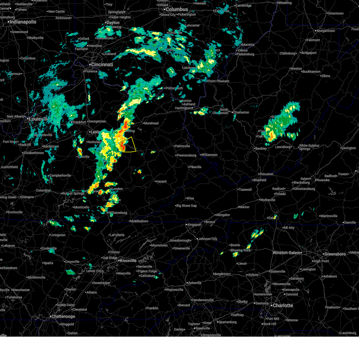
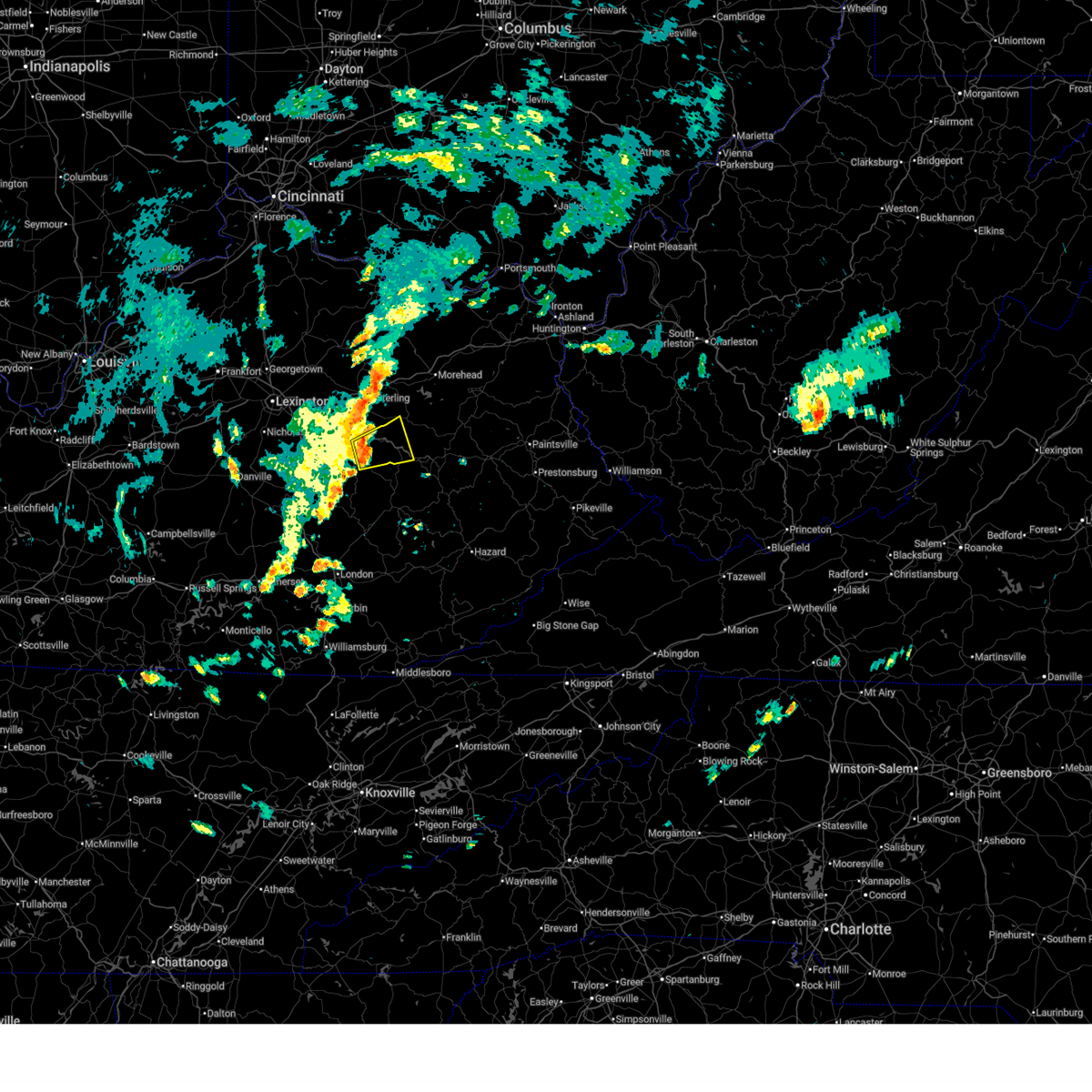
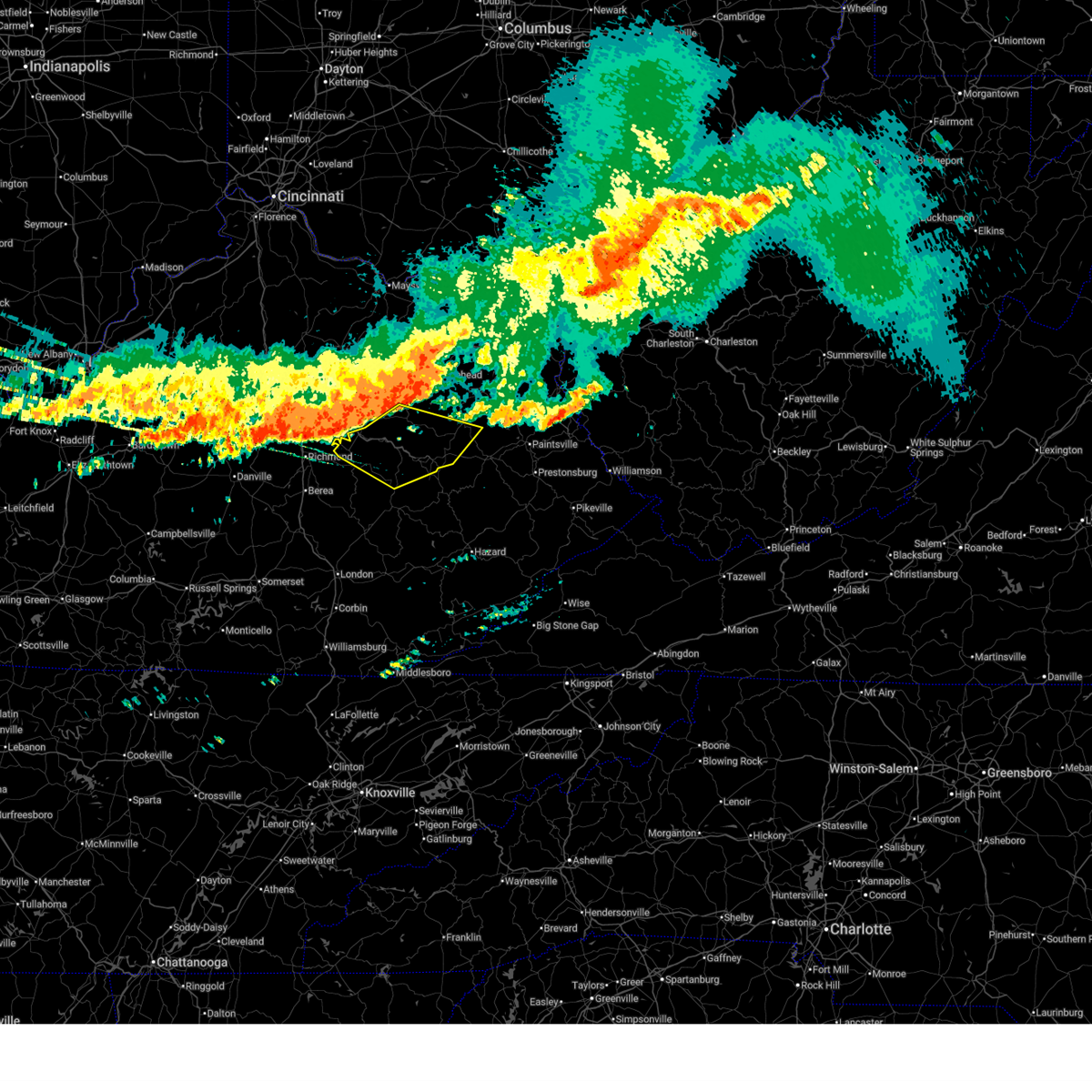
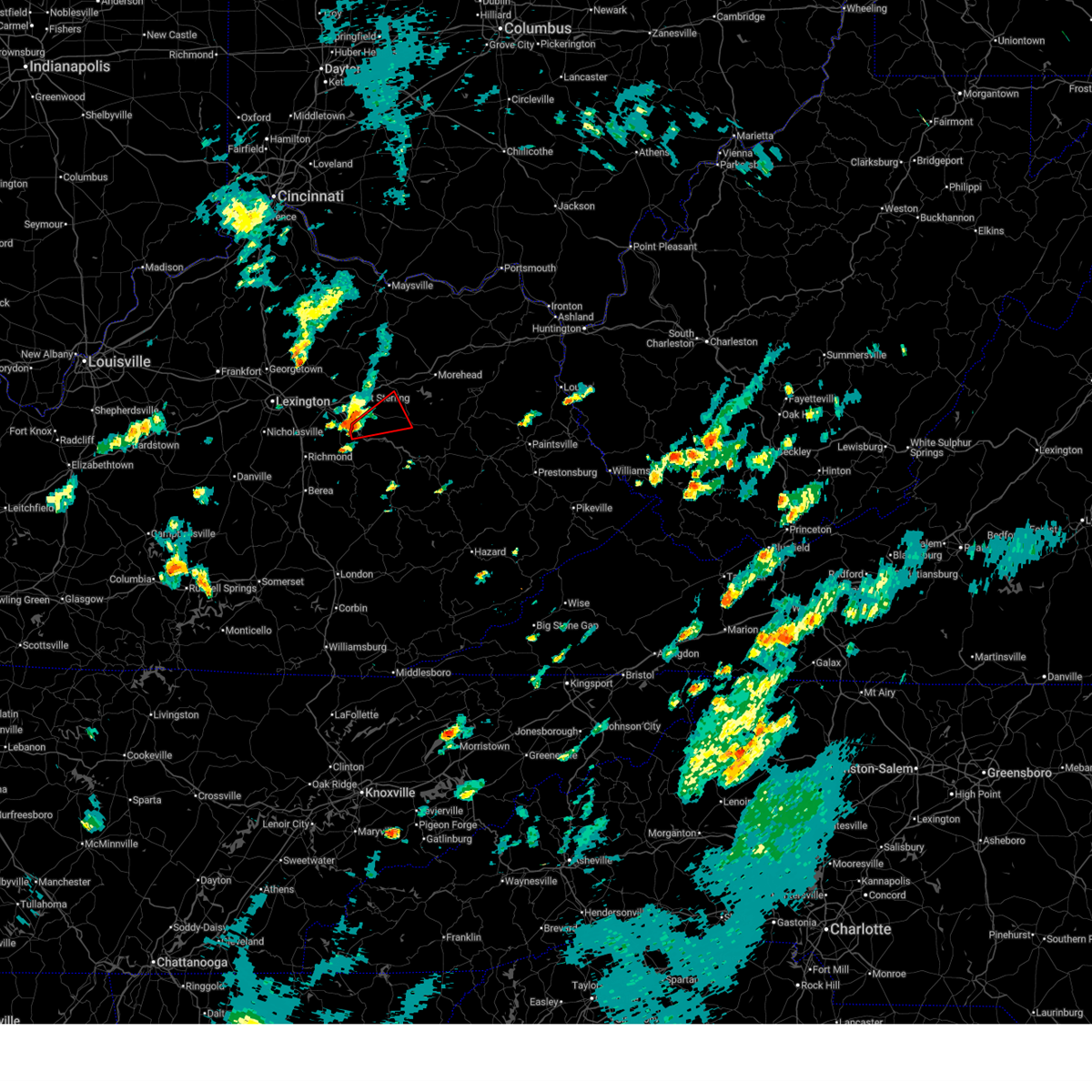
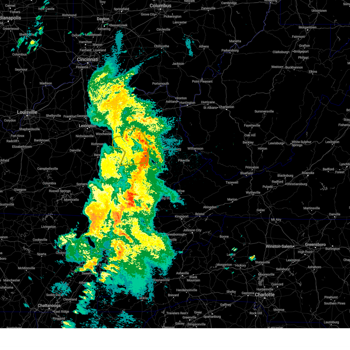
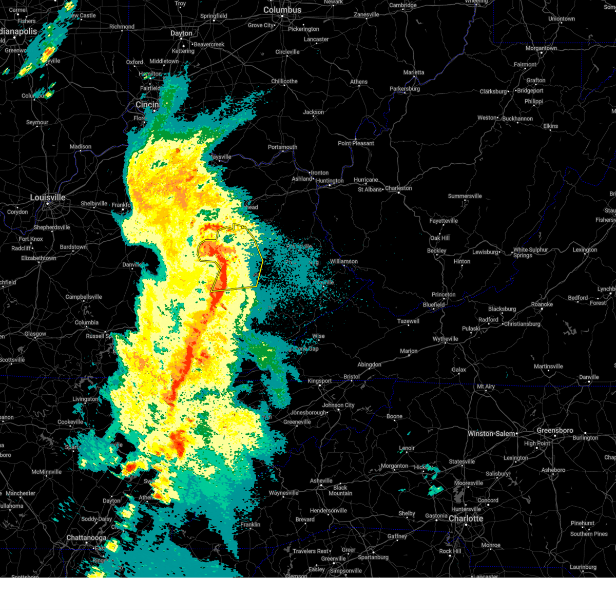
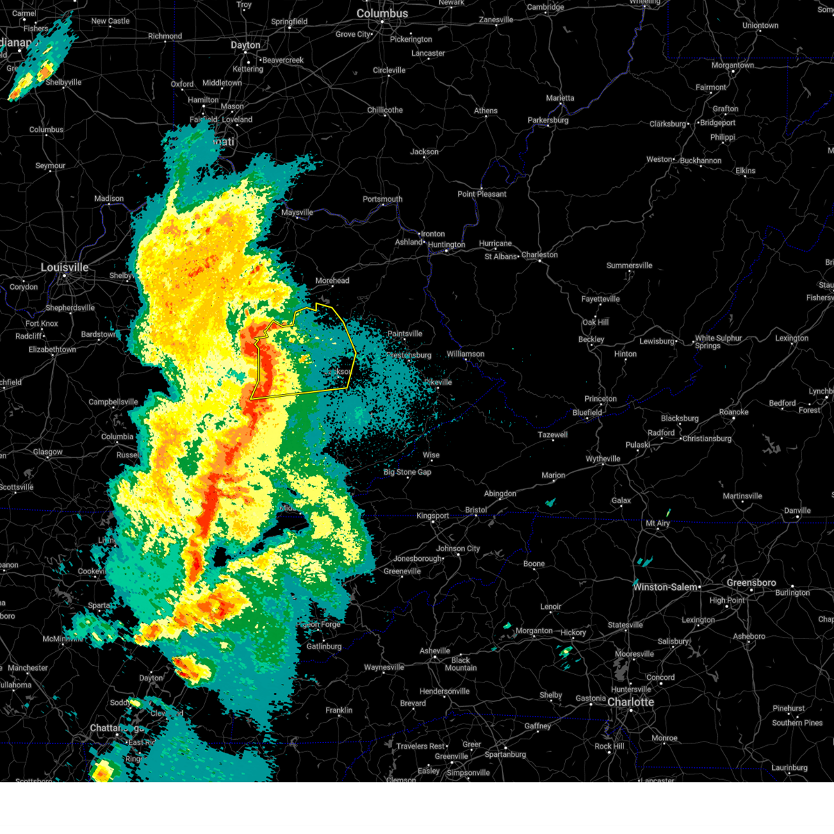
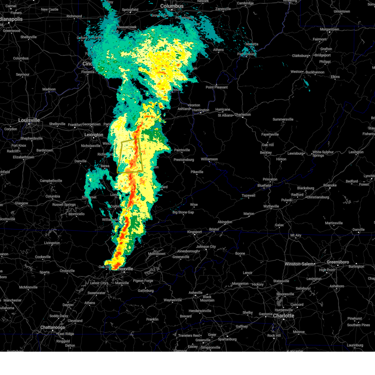
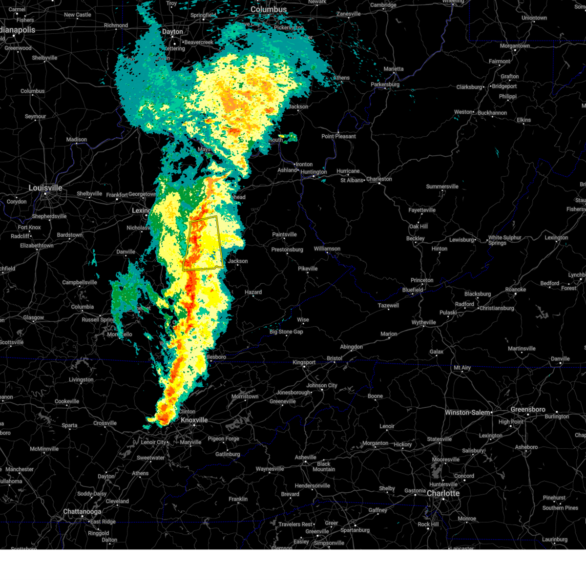
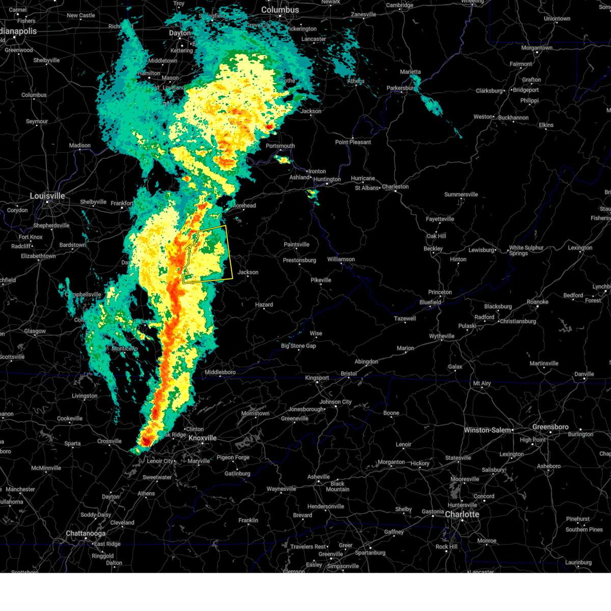
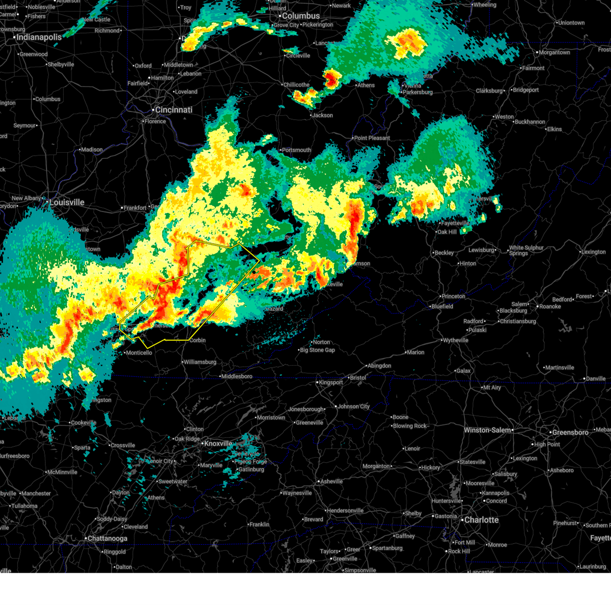
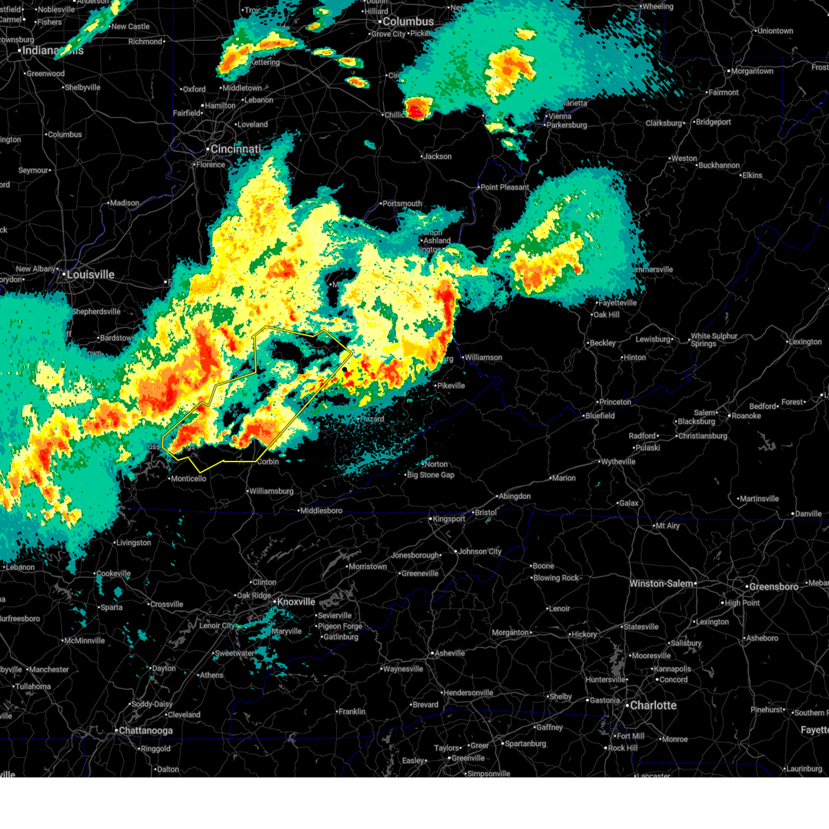
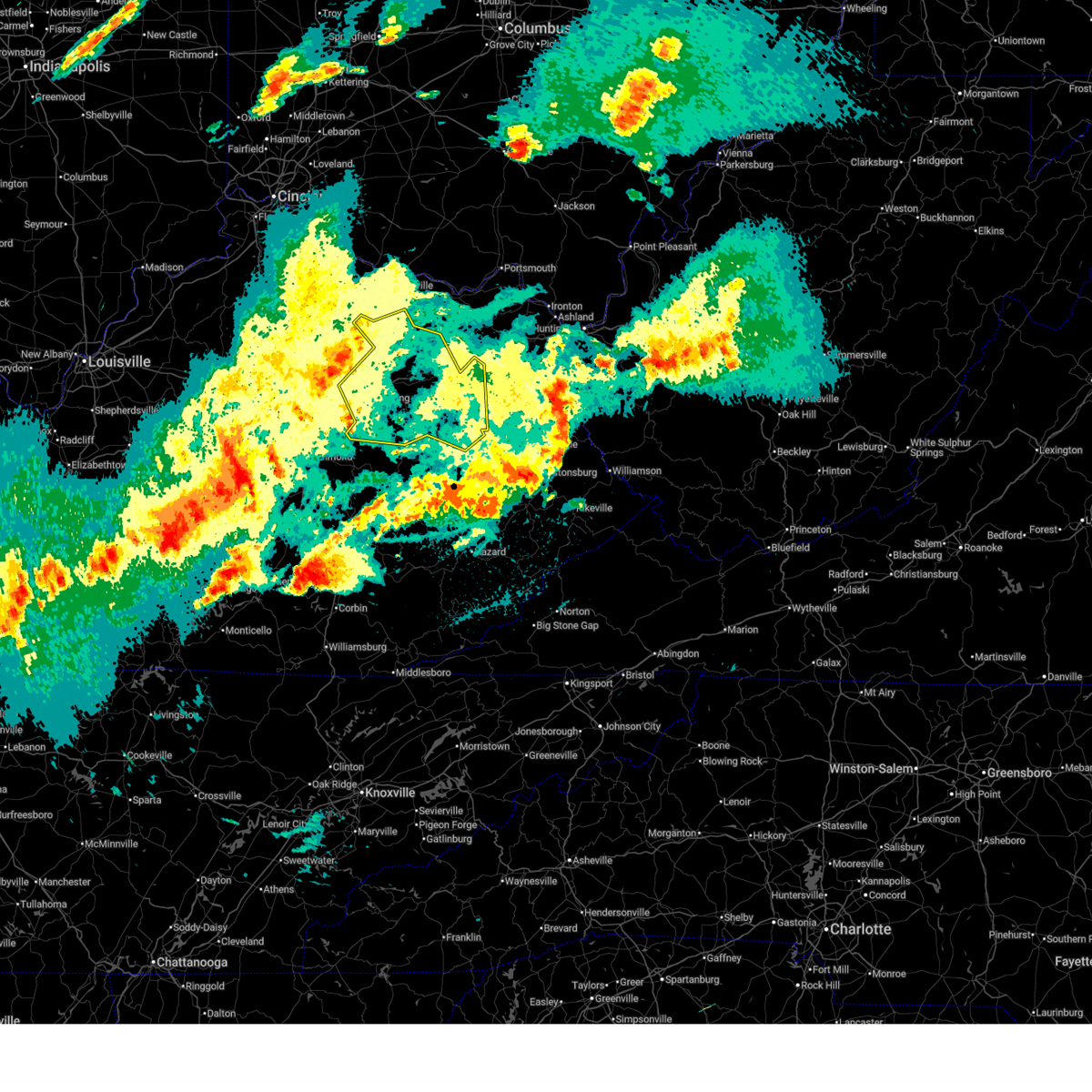
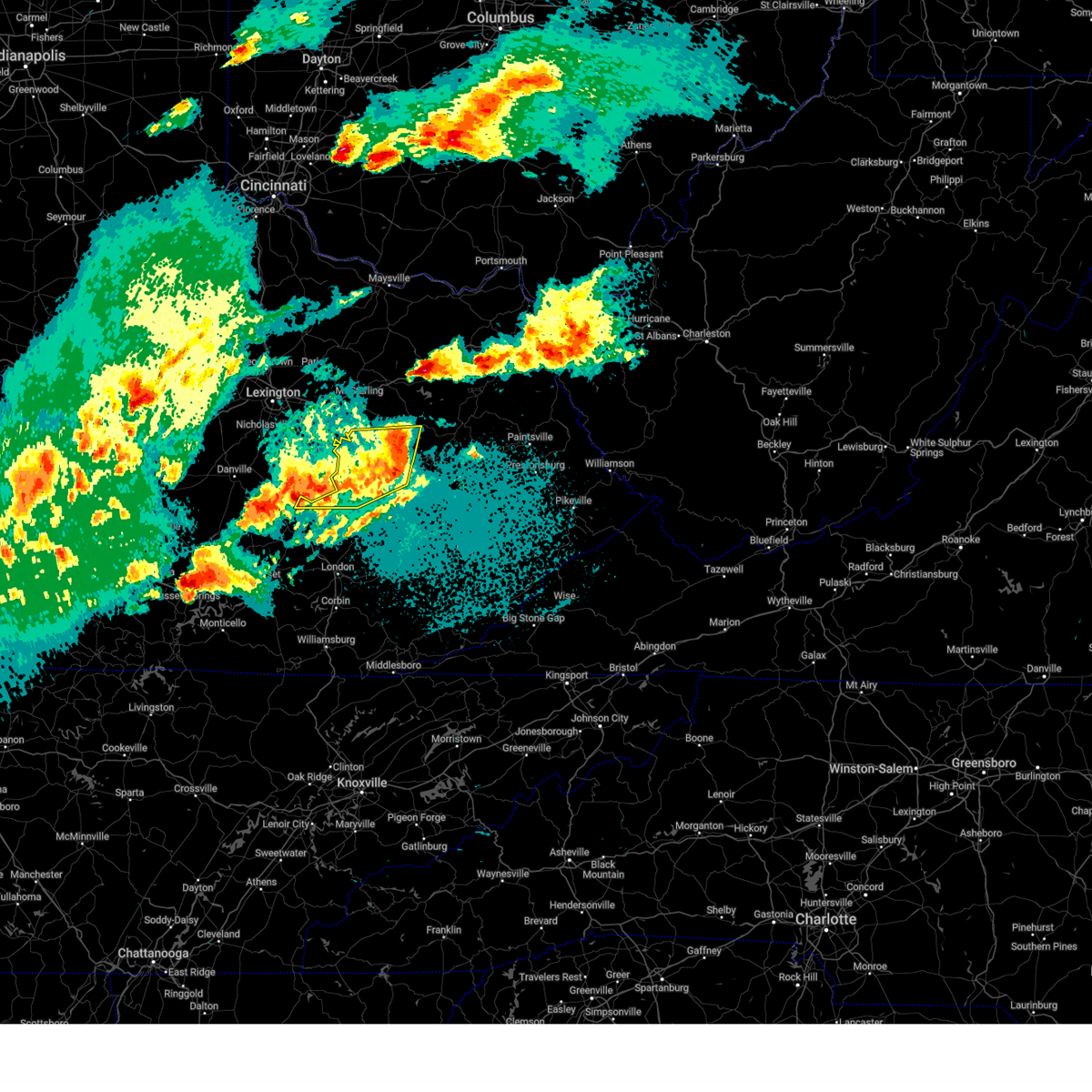
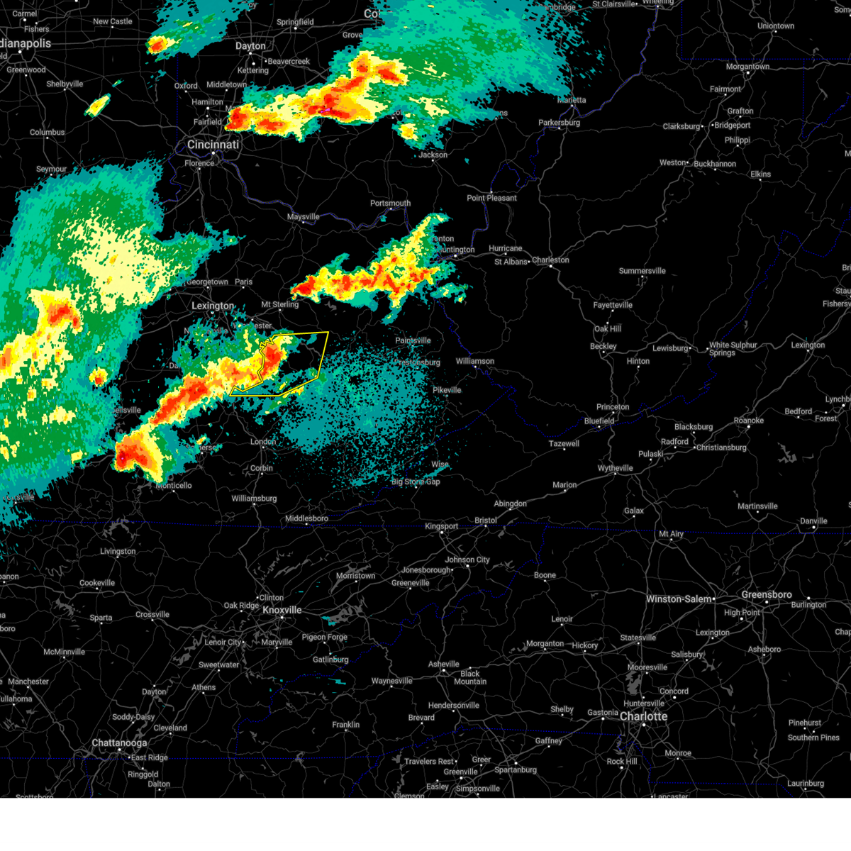
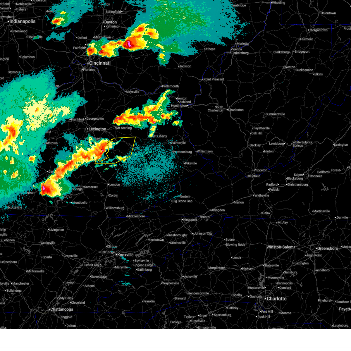
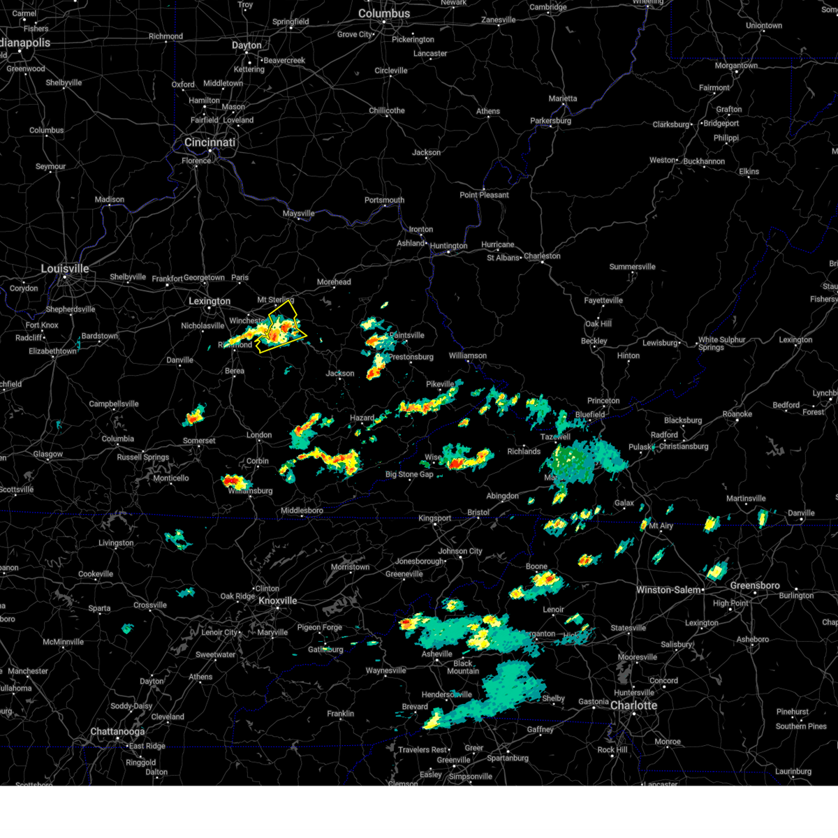
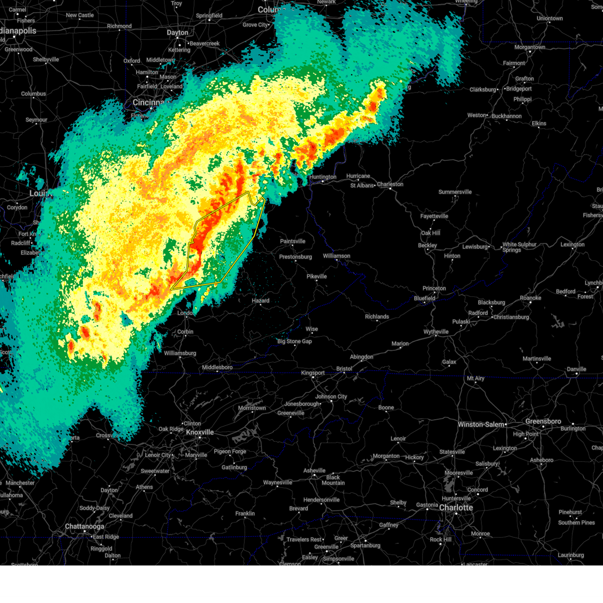
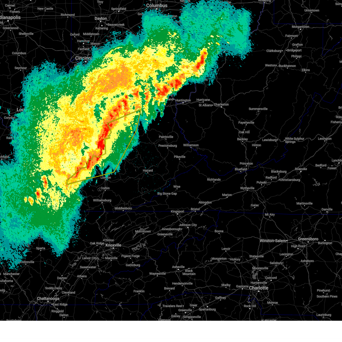
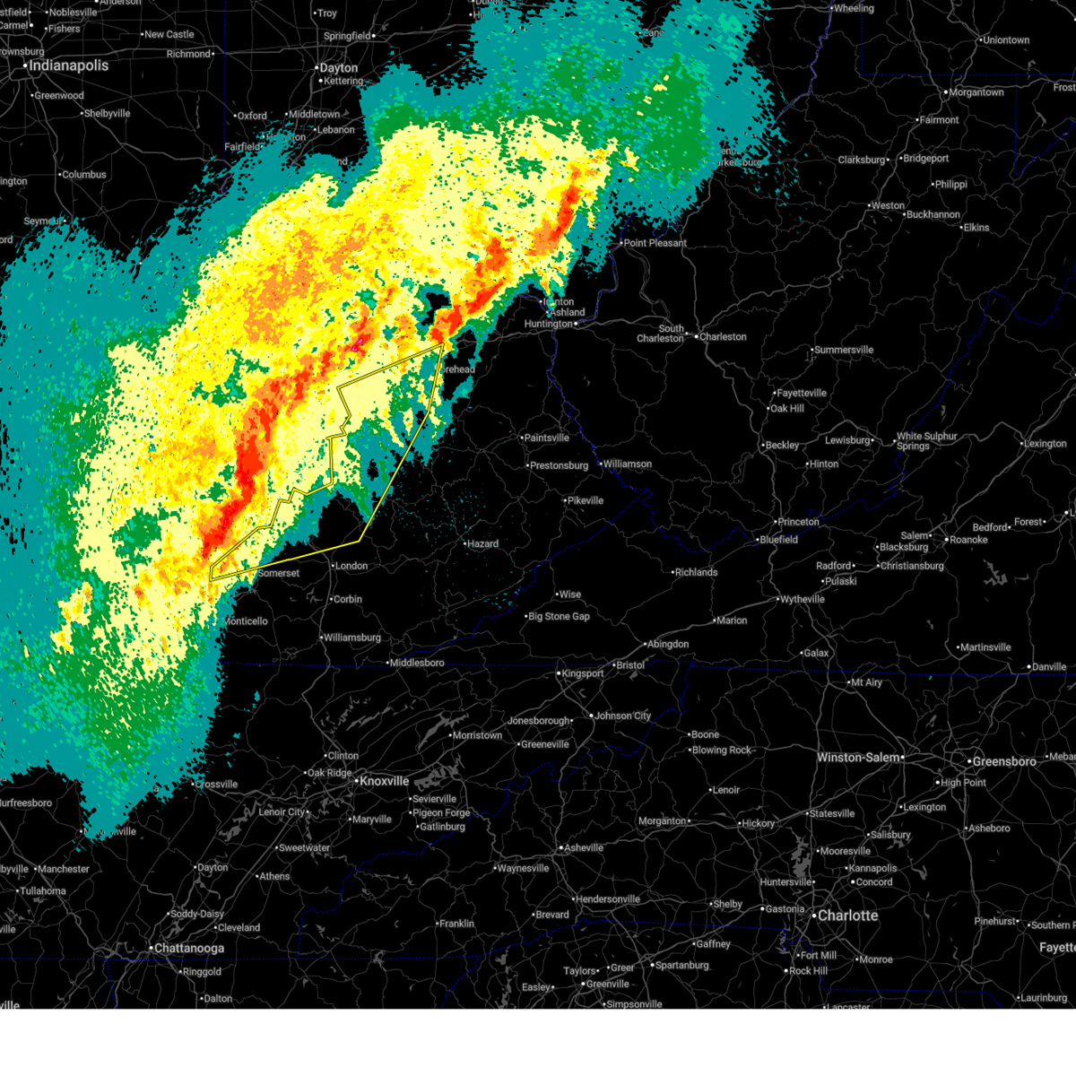
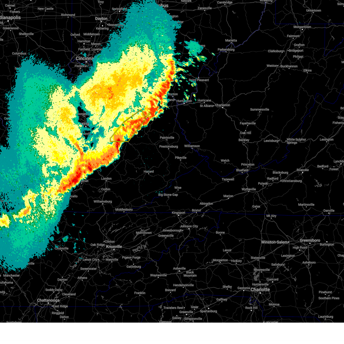
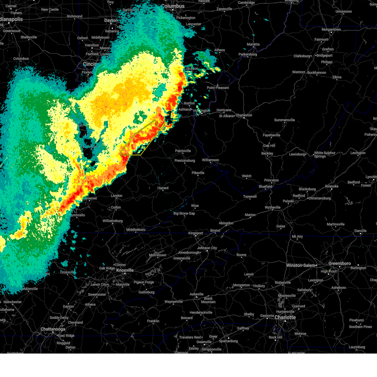
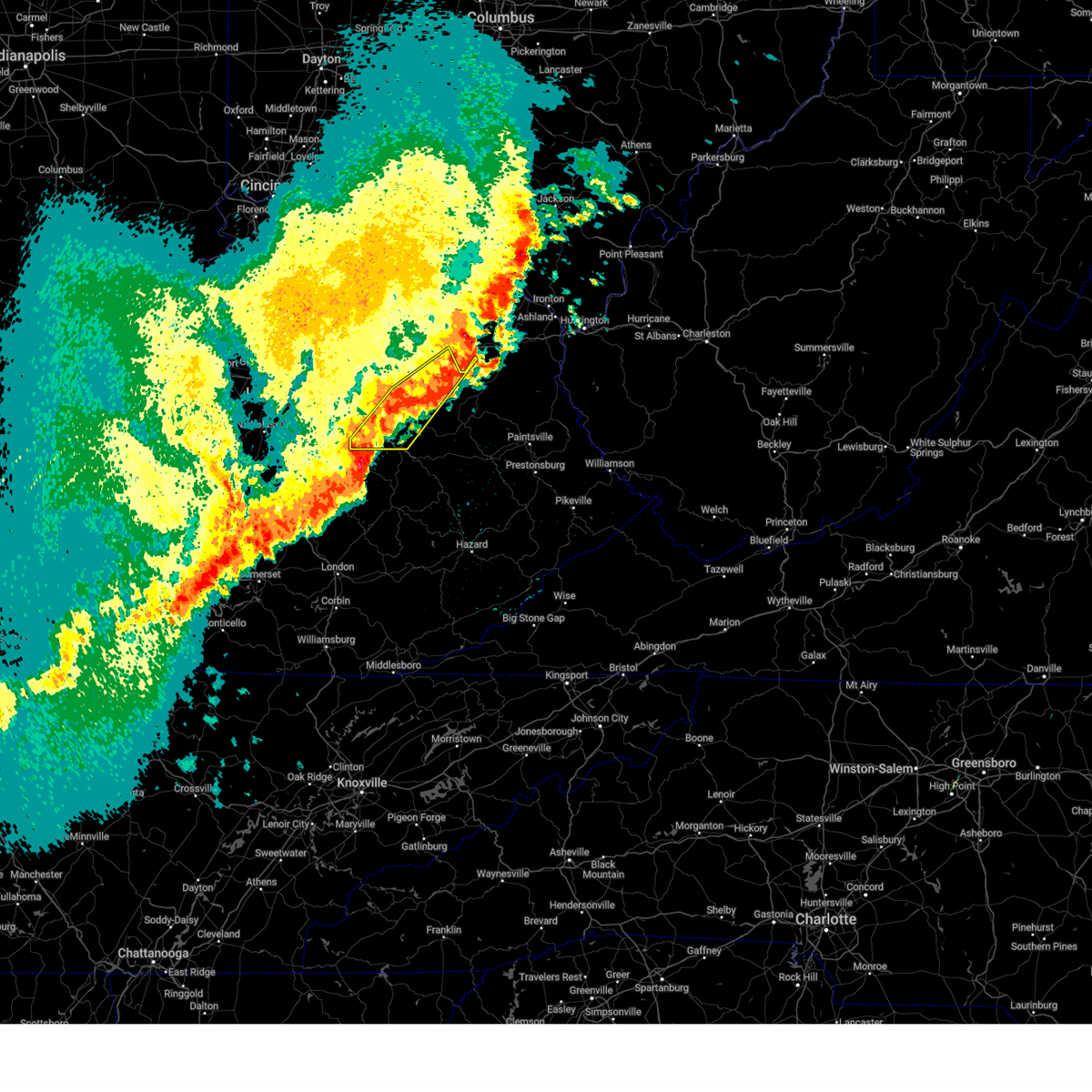
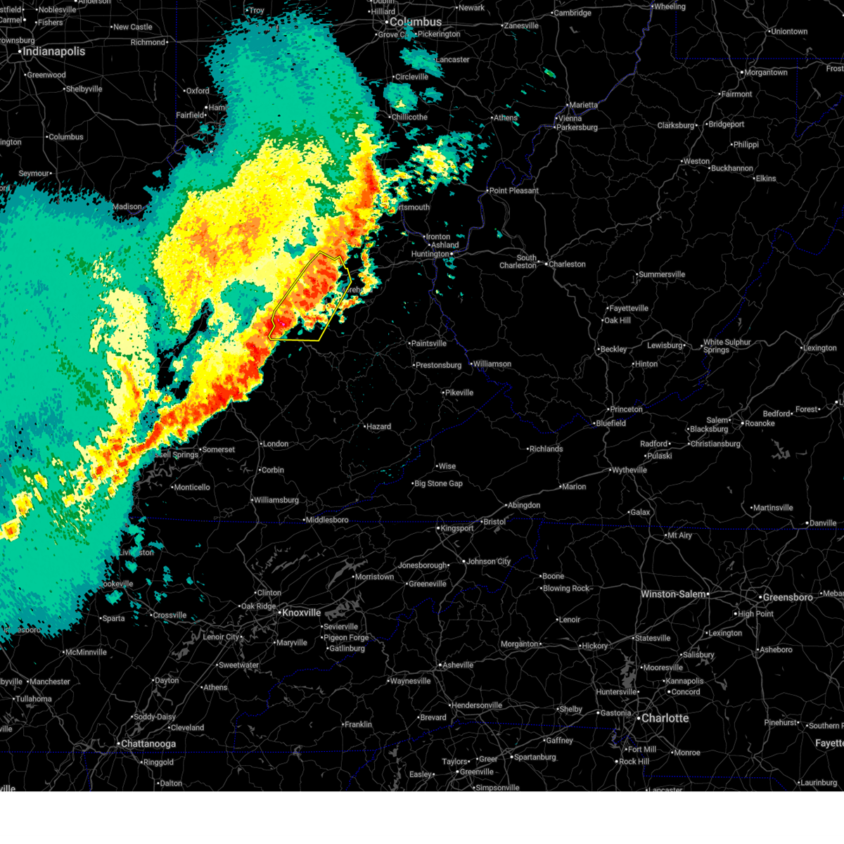
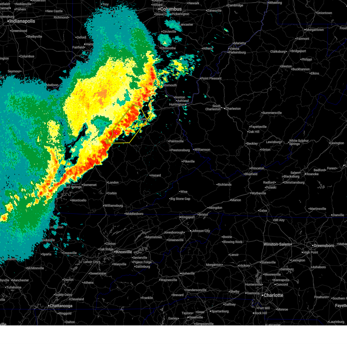
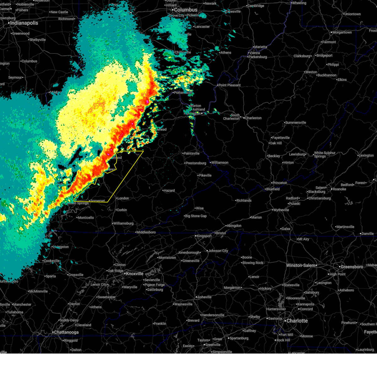
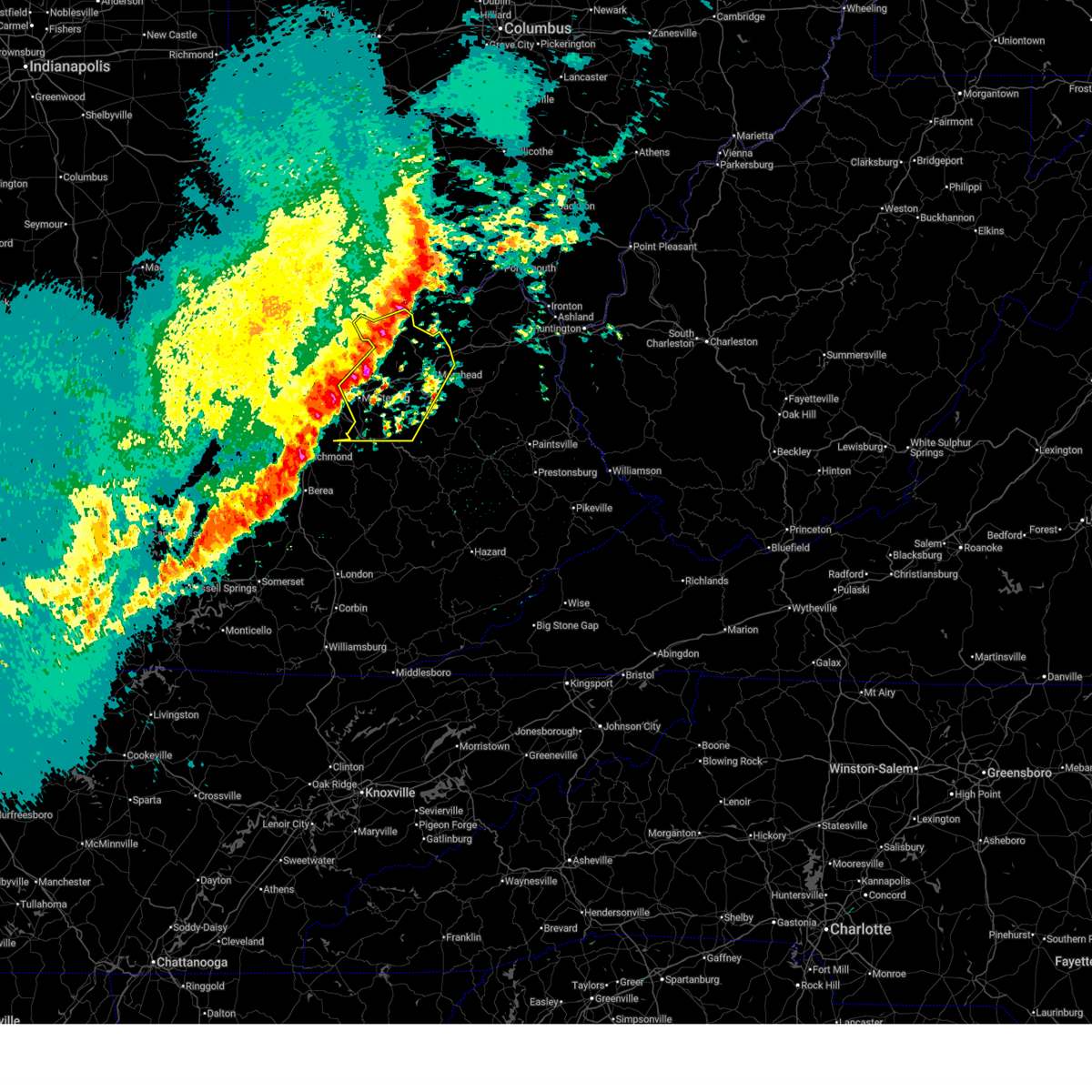
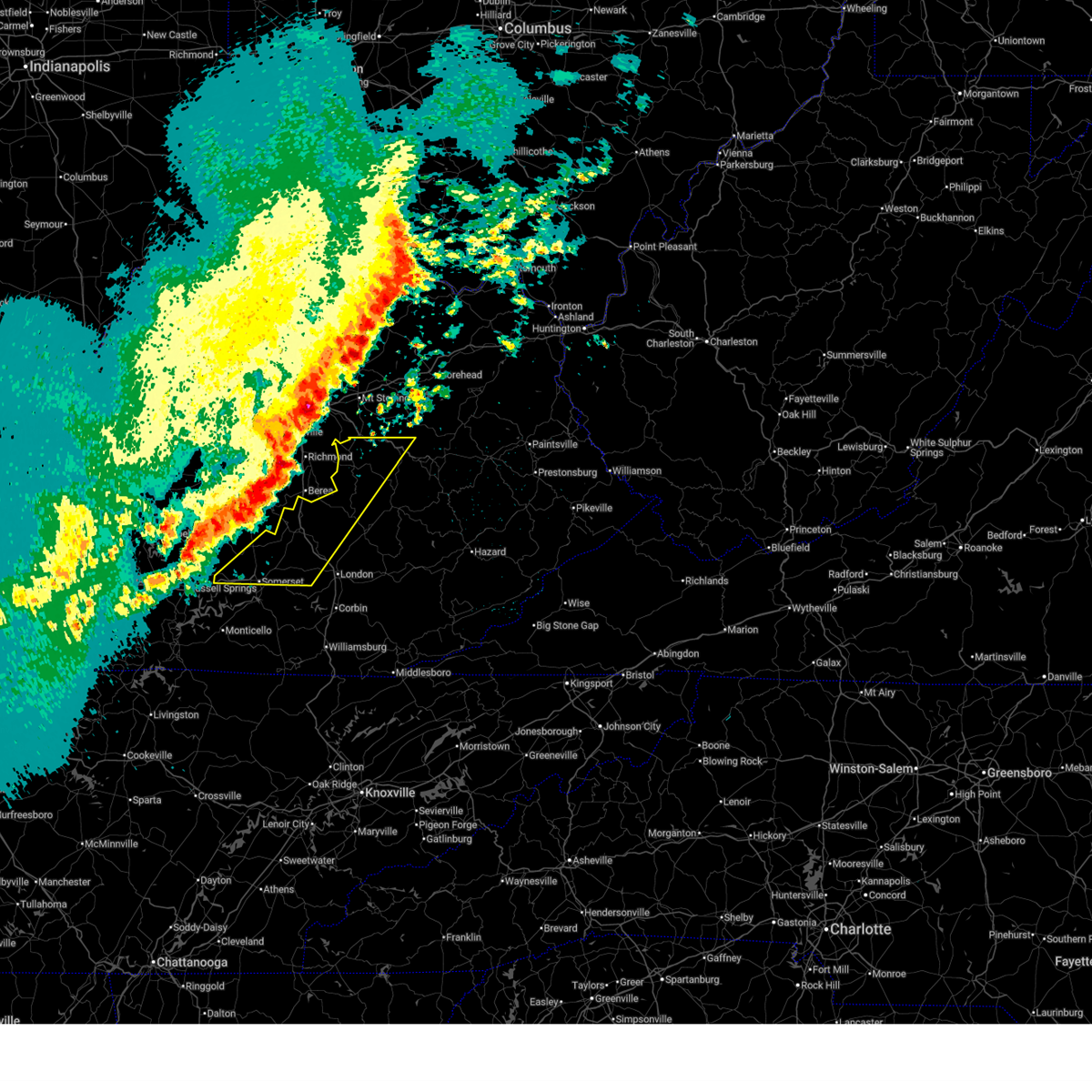
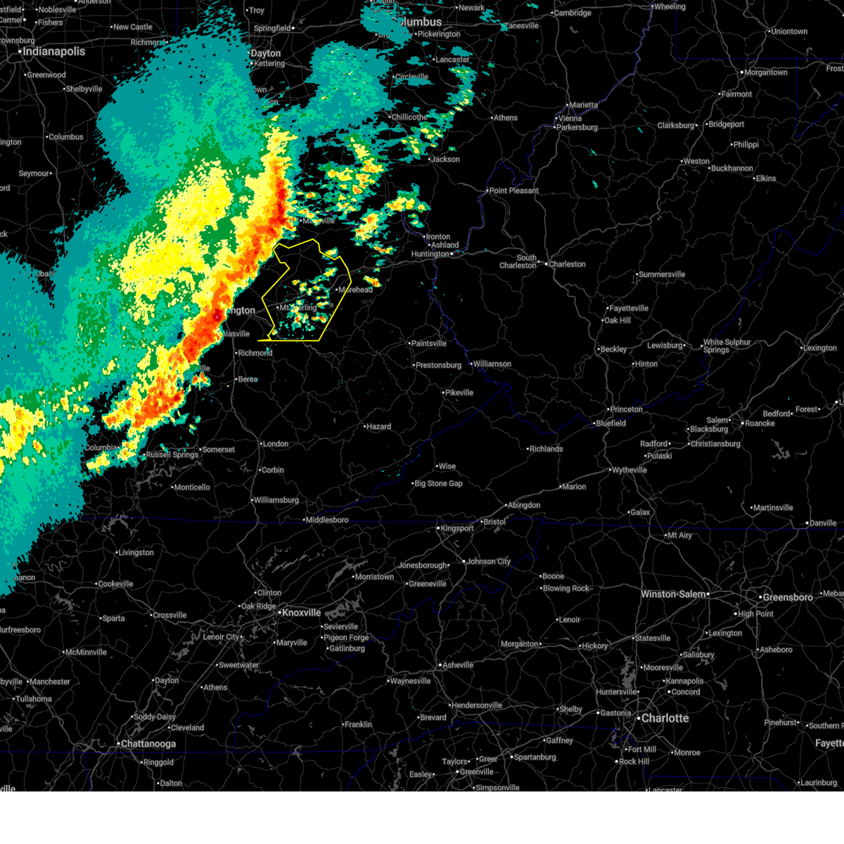
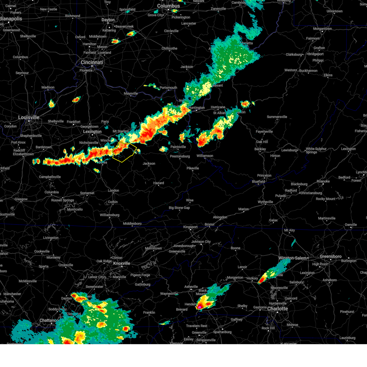
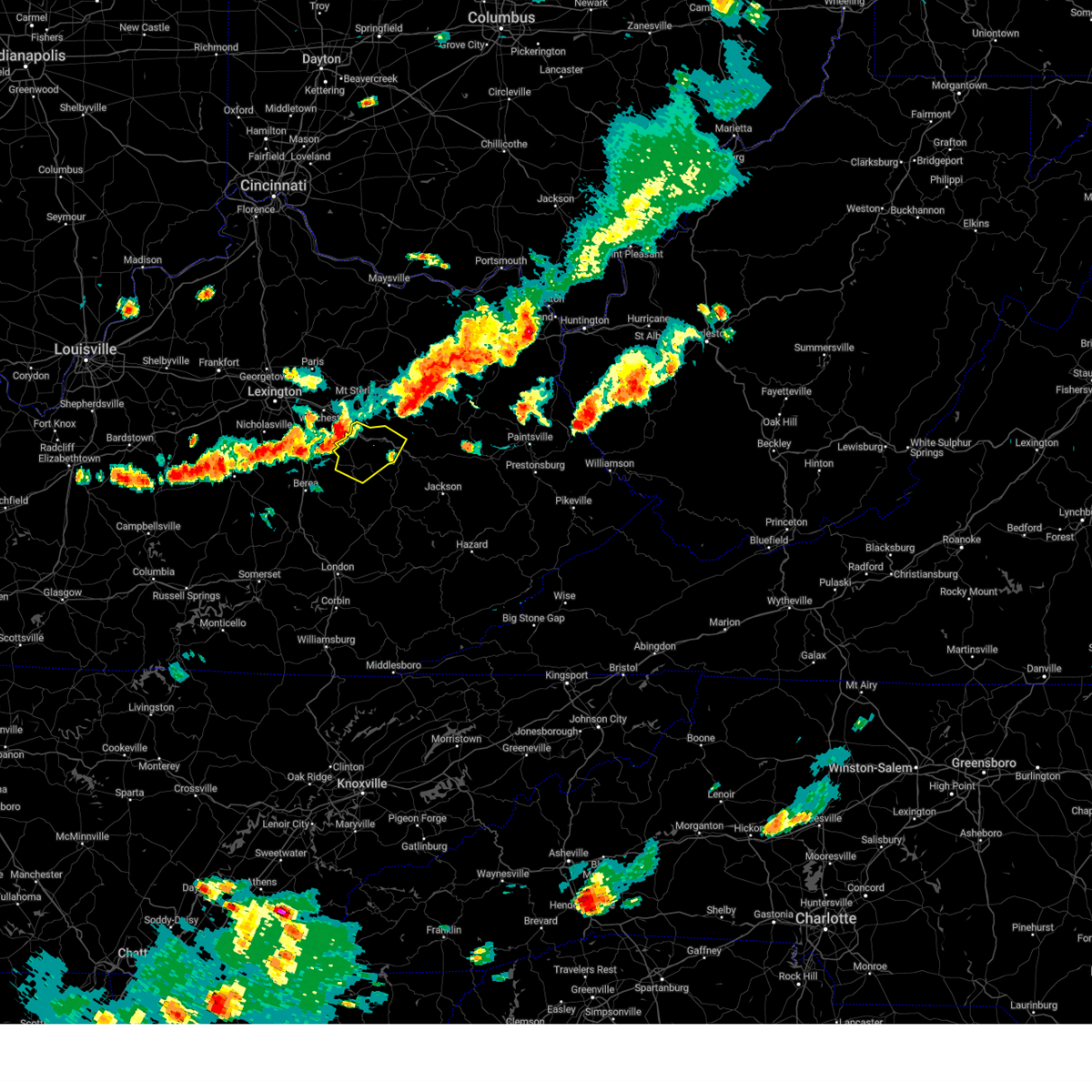
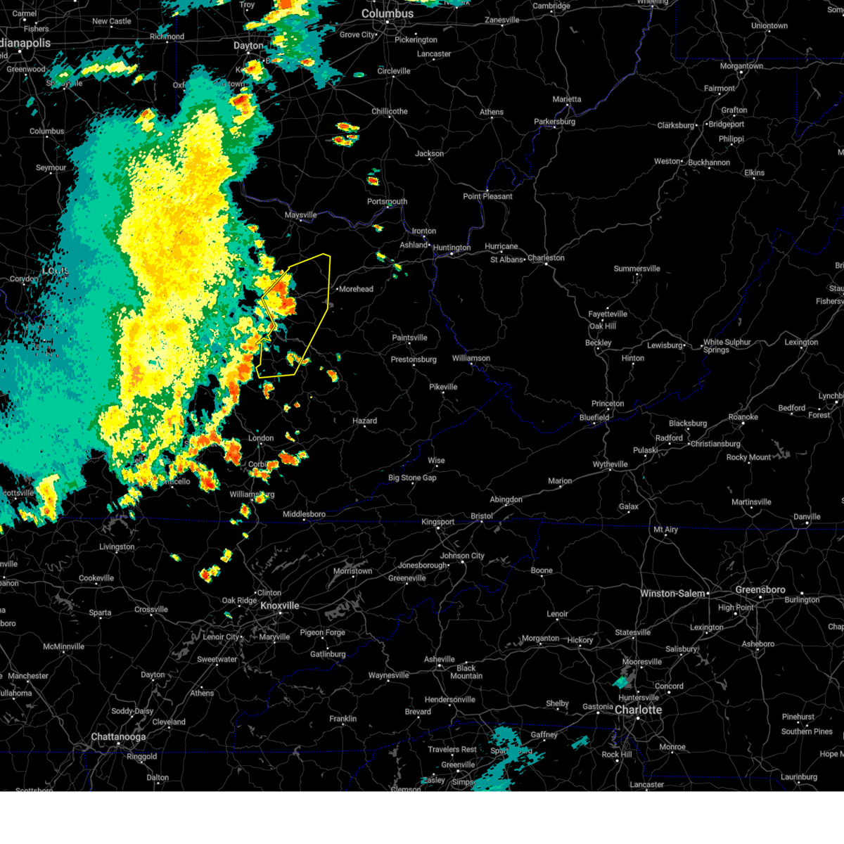
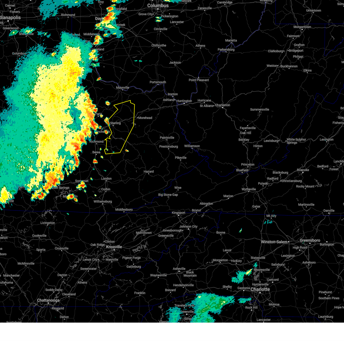
Hail Map for Clay City, KY
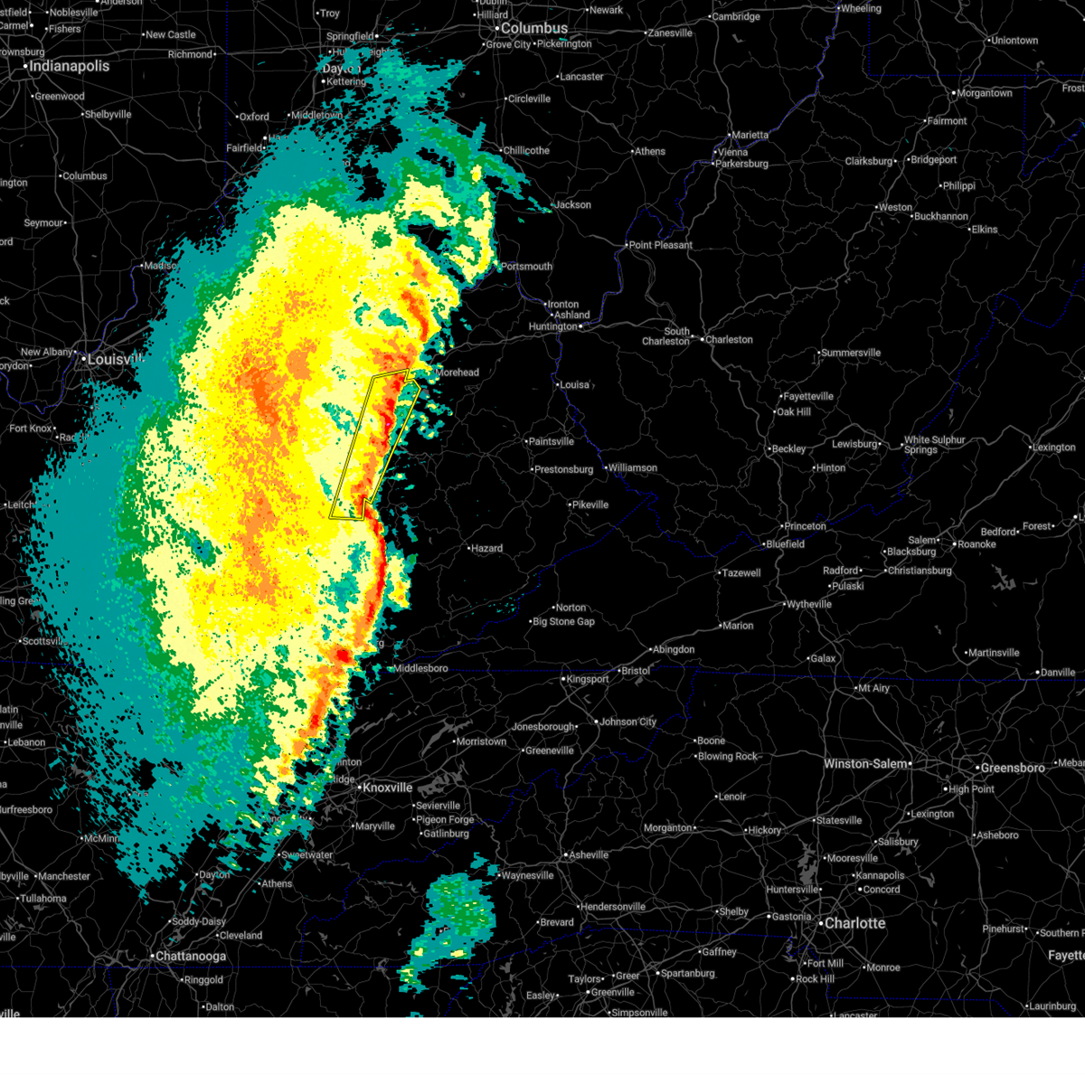
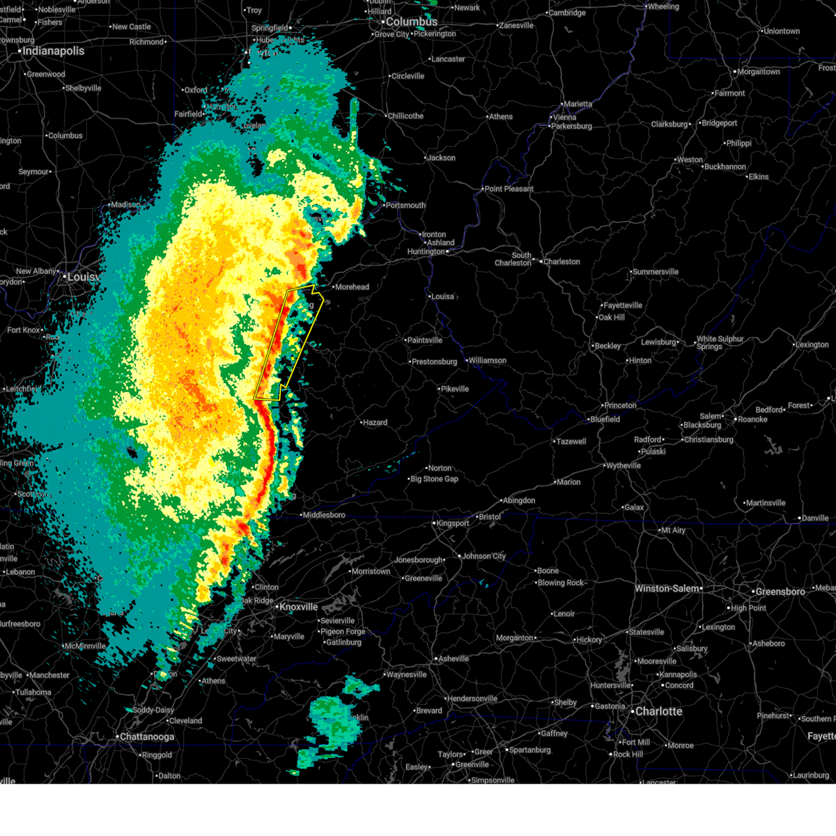
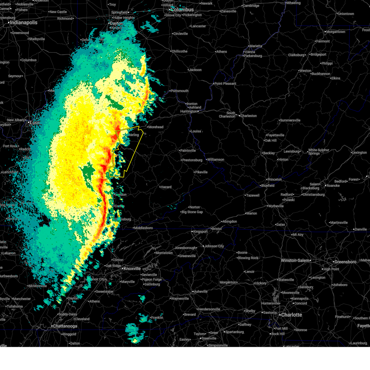
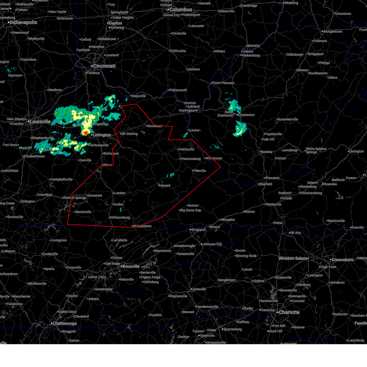
The Clay City, KY area has had 9 reports of on-the-ground hail by trained spotters, and has been under severe weather warnings 13 times during the past 12 months. Doppler radar has detected hail at or near Clay City, KY on 48 occasions.
| Name: | Clay City, KY |
| Where Located: | 11.5 miles NNE of Irvine, KY |
| Map: | Google Map for Clay City, KY |
| Population: | 1077 |
| Housing Units: | 513 |
| More Info: | Search Google for Clay City, KY |
0
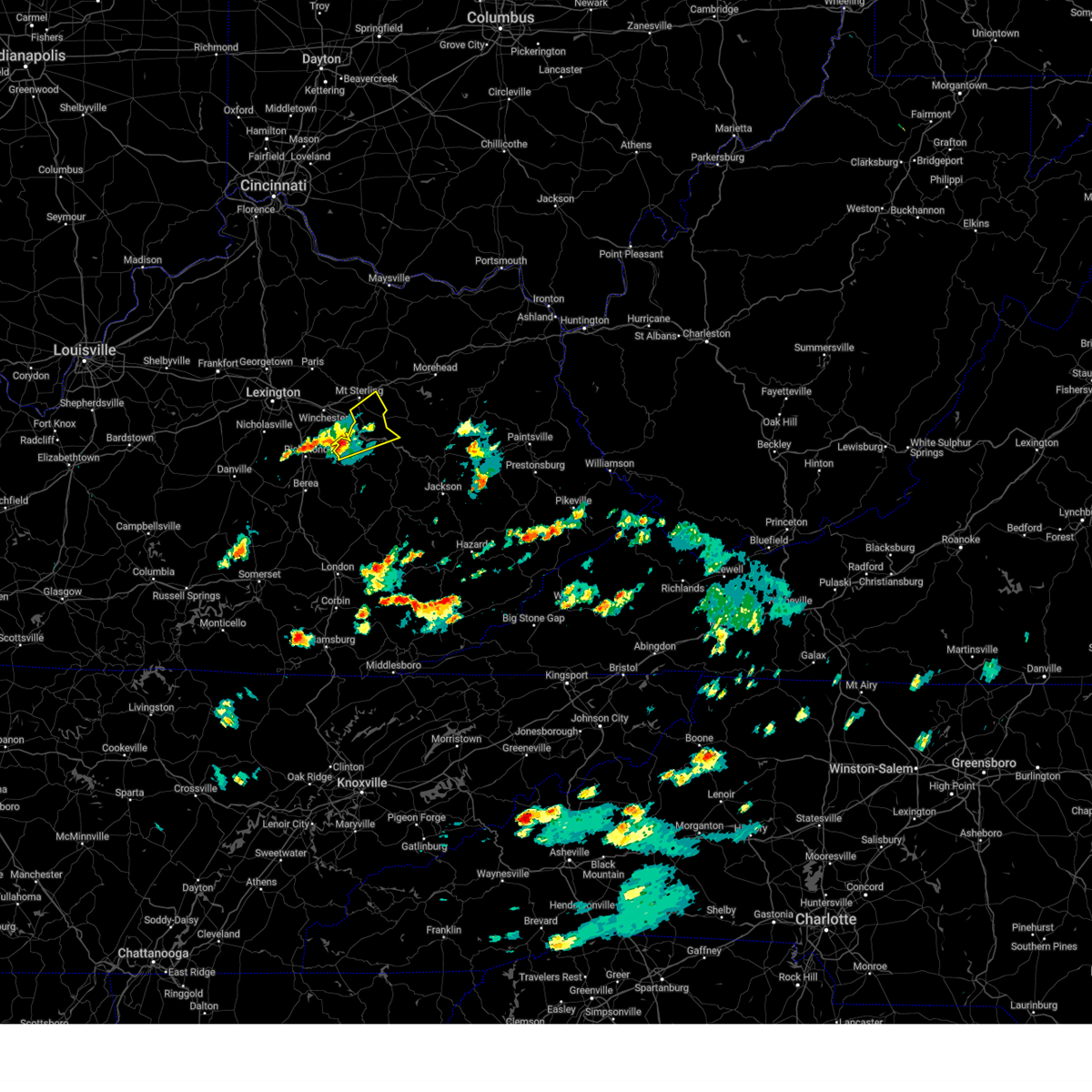
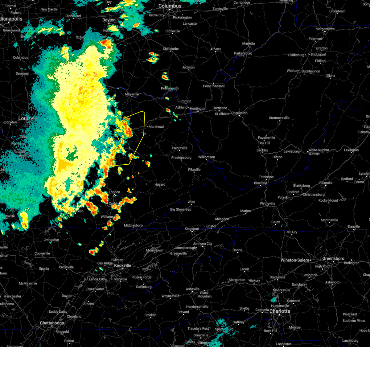
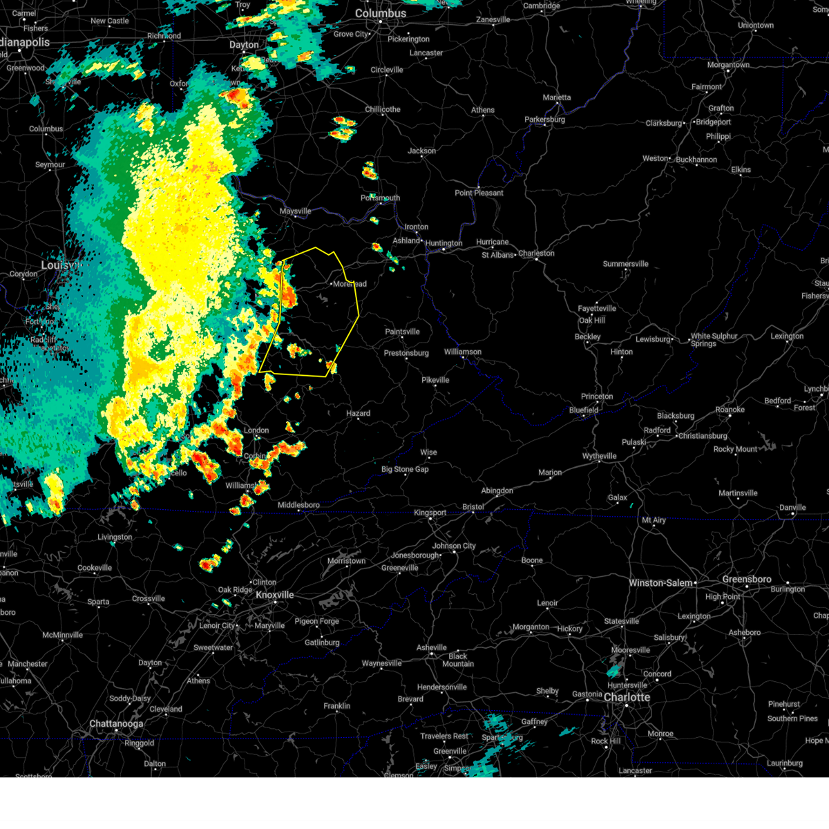
The Top Recent Hail Date for Clay City, KY is Friday, May 16, 2025 (22nd out of 48)

Hail and Wind Damage Spotted near Clay City, KY
| Date / Time | Report Details |
|---|---|
| 6/26/2026 2:47 PM EDT |
 At 247 pm edt, a severe thunderstorm was located over rogers chapel, or near stanton, moving east at 25 mph (radar indicated). Hazards include 60 mph wind gusts and nickel size hail. Expect damage to roofs, siding, and trees. this severe storm will be near, slade around 255 pm edt. Other locations in the path of this severe thunderstorm include jenson and rogers. At 247 pm edt, a severe thunderstorm was located over rogers chapel, or near stanton, moving east at 25 mph (radar indicated). Hazards include 60 mph wind gusts and nickel size hail. Expect damage to roofs, siding, and trees. this severe storm will be near, slade around 255 pm edt. Other locations in the path of this severe thunderstorm include jenson and rogers.
|
| 6/26/2026 2:35 PM EDT |
 Svrjkl the national weather service in jackson ky has issued a * severe thunderstorm warning for, powell county in east central kentucky, central estill county in east central kentucky, southwestern menifee county in east central kentucky, northwestern wolfe county in southeastern kentucky, * until 300 pm edt. * at 235 pm edt, a severe thunderstorm was located over knowlton, or near stanton, moving east at 25 mph (radar indicated). Hazards include 60 mph wind gusts. Expect damage to roofs, siding, and trees. this severe thunderstorm will be near, stanton around 240 pm edt. bowen around 245 pm edt. natural bridge s. p. Around 250 pm edt. Svrjkl the national weather service in jackson ky has issued a * severe thunderstorm warning for, powell county in east central kentucky, central estill county in east central kentucky, southwestern menifee county in east central kentucky, northwestern wolfe county in southeastern kentucky, * until 300 pm edt. * at 235 pm edt, a severe thunderstorm was located over knowlton, or near stanton, moving east at 25 mph (radar indicated). Hazards include 60 mph wind gusts. Expect damage to roofs, siding, and trees. this severe thunderstorm will be near, stanton around 240 pm edt. bowen around 245 pm edt. natural bridge s. p. Around 250 pm edt.
|
| 6/18/2026 6:25 AM EDT |
 Svrjkl the national weather service in jackson ky has issued a * severe thunderstorm warning for, powell county in east central kentucky, southeastern montgomery county in east central kentucky, southwestern morgan county in southeastern kentucky, northern estill county in east central kentucky, menifee county in east central kentucky, northern lee county in southeastern kentucky, wolfe county in southeastern kentucky, * until 715 am edt. * at 624 am edt, severe thunderstorms were located along a line extending from frenchburg to near cat creek to iron mound, moving southeast at 45 mph (radar indicated). Hazards include 60 mph wind gusts. Expect damage to roofs, siding, and trees. severe thunderstorms will be near, stanton around 630 am edt. ravenna around 635 am edt. campton around 640 am edt. Other locations in the path of these severe thunderstorms include west liberty, lewis and williams. Svrjkl the national weather service in jackson ky has issued a * severe thunderstorm warning for, powell county in east central kentucky, southeastern montgomery county in east central kentucky, southwestern morgan county in southeastern kentucky, northern estill county in east central kentucky, menifee county in east central kentucky, northern lee county in southeastern kentucky, wolfe county in southeastern kentucky, * until 715 am edt. * at 624 am edt, severe thunderstorms were located along a line extending from frenchburg to near cat creek to iron mound, moving southeast at 45 mph (radar indicated). Hazards include 60 mph wind gusts. Expect damage to roofs, siding, and trees. severe thunderstorms will be near, stanton around 630 am edt. ravenna around 635 am edt. campton around 640 am edt. Other locations in the path of these severe thunderstorms include west liberty, lewis and williams.
|
| 5/26/2026 7:00 PM EDT |
 Torjkl the national weather service in jackson ky has issued a * tornado warning for, northern powell county in east central kentucky, southeastern montgomery county in east central kentucky, south central bath county in east central kentucky, northwestern menifee county in east central kentucky, * until 745 pm edt. * at 700 pm edt, a severe thunderstorm capable of producing a tornado was located over virden, or near stanton, moving northeast at 20 mph (radar indicated rotation). Hazards include tornado. Flying debris will be dangerous to those caught without shelter. mobile homes will be damaged or destroyed. damage to roofs, windows, and vehicles will occur. tree damage is likely. this dangerous storm will be near, stanton around 705 pm edt. camargo around 710 pm edt. cedar groves around 715 pm edt. Can see anything other locations in the path of this tornadic thunderstorm include cornwell and rothwell. Torjkl the national weather service in jackson ky has issued a * tornado warning for, northern powell county in east central kentucky, southeastern montgomery county in east central kentucky, south central bath county in east central kentucky, northwestern menifee county in east central kentucky, * until 745 pm edt. * at 700 pm edt, a severe thunderstorm capable of producing a tornado was located over virden, or near stanton, moving northeast at 20 mph (radar indicated rotation). Hazards include tornado. Flying debris will be dangerous to those caught without shelter. mobile homes will be damaged or destroyed. damage to roofs, windows, and vehicles will occur. tree damage is likely. this dangerous storm will be near, stanton around 705 pm edt. camargo around 710 pm edt. cedar groves around 715 pm edt. Can see anything other locations in the path of this tornadic thunderstorm include cornwell and rothwell.
|
| 3/16/2026 3:10 AM EDT |
 The storms which prompted the warning have moved out of the area. therefore, the warning will be allowed to expire. however, gusty winds are still possible with these thunderstorms. a severe thunderstorm watch remains in effect until 700 am edt for southeastern and east central kentucky. to report severe weather, contact your nearest law enforcement agency. they will relay your report to the national weather service jackson ky. The storms which prompted the warning have moved out of the area. therefore, the warning will be allowed to expire. however, gusty winds are still possible with these thunderstorms. a severe thunderstorm watch remains in effect until 700 am edt for southeastern and east central kentucky. to report severe weather, contact your nearest law enforcement agency. they will relay your report to the national weather service jackson ky.
|
| 3/16/2026 2:55 AM EDT |
 At 255 am edt, severe thunderstorms were located along a line extending from ewington to morrill, moving east at 25 mph (radar indicated). Hazards include 60 mph wind gusts and penny size hail. Expect damage to roofs, siding, and trees. Locations impacted include, stanton, owingsville, alumbaugh and furnace. At 255 am edt, severe thunderstorms were located along a line extending from ewington to morrill, moving east at 25 mph (radar indicated). Hazards include 60 mph wind gusts and penny size hail. Expect damage to roofs, siding, and trees. Locations impacted include, stanton, owingsville, alumbaugh and furnace.
|
| 3/16/2026 2:34 AM EDT |
 Svrjkl the national weather service in jackson ky has issued a * severe thunderstorm warning for, powell county in east central kentucky, montgomery county in east central kentucky, southern bath county in east central kentucky, estill county in east central kentucky, northwestern jackson county in southeastern kentucky, western menifee county in east central kentucky, western lee county in southeastern kentucky, * until 315 am edt. * at 234 am edt, severe thunderstorms were located along a line extending from wades mill to snider, moving east at 25 mph (radar indicated). Hazards include 60 mph wind gusts. Expect damage to roofs, siding, and trees. severe thunderstorms will be near, mount sterling around 240 am edt. clay city around 245 am edt. jeffersonville around 250 am edt. Other locations in the path of these severe thunderstorms include stanton and ravenna. Svrjkl the national weather service in jackson ky has issued a * severe thunderstorm warning for, powell county in east central kentucky, montgomery county in east central kentucky, southern bath county in east central kentucky, estill county in east central kentucky, northwestern jackson county in southeastern kentucky, western menifee county in east central kentucky, western lee county in southeastern kentucky, * until 315 am edt. * at 234 am edt, severe thunderstorms were located along a line extending from wades mill to snider, moving east at 25 mph (radar indicated). Hazards include 60 mph wind gusts. Expect damage to roofs, siding, and trees. severe thunderstorms will be near, mount sterling around 240 am edt. clay city around 245 am edt. jeffersonville around 250 am edt. Other locations in the path of these severe thunderstorms include stanton and ravenna.
|
| 3/4/2026 10:08 AM EST |
 Torjkl the national weather service in jackson ky has issued a * tornado warning for, montgomery county in east central kentucky, mccreary county in south central kentucky, rowan county in east central kentucky, morgan county in southeastern kentucky, bath county in east central kentucky, leslie county in southeastern kentucky, estill county in east central kentucky, pulaski county in south central kentucky, rockcastle county in south central kentucky, clay county in southeastern kentucky, elliott county in east central kentucky, wayne county in south central kentucky, harlan county in southeastern kentucky, knox county in southeastern kentucky, owsley county in southeastern kentucky, jackson county in southeastern kentucky, knott county in southeastern kentucky, whitley county in south central kentucky, floyd county in southeastern kentucky, menifee county in east central kentucky, lee county in southeastern kentucky, fleming county in east central kentucky, wolfe county in southeastern kentucky, powell county in east central kentucky, laurel county in south central kentucky, martin county in northeastern kentucky, bell county in southeastern kentucky, letcher county in southeastern kentucky, johnson county in northeastern kentucky, perry county in southeastern kentucky, breathitt county in southeastern kentucky, pike county in southeastern kentucky, magoffin county in southeastern kentucky, * until 1030 am est. Torjkl the national weather service in jackson ky has issued a * tornado warning for, montgomery county in east central kentucky, mccreary county in south central kentucky, rowan county in east central kentucky, morgan county in southeastern kentucky, bath county in east central kentucky, leslie county in southeastern kentucky, estill county in east central kentucky, pulaski county in south central kentucky, rockcastle county in south central kentucky, clay county in southeastern kentucky, elliott county in east central kentucky, wayne county in south central kentucky, harlan county in southeastern kentucky, knox county in southeastern kentucky, owsley county in southeastern kentucky, jackson county in southeastern kentucky, knott county in southeastern kentucky, whitley county in south central kentucky, floyd county in southeastern kentucky, menifee county in east central kentucky, lee county in southeastern kentucky, fleming county in east central kentucky, wolfe county in southeastern kentucky, powell county in east central kentucky, laurel county in south central kentucky, martin county in northeastern kentucky, bell county in southeastern kentucky, letcher county in southeastern kentucky, johnson county in northeastern kentucky, perry county in southeastern kentucky, breathitt county in southeastern kentucky, pike county in southeastern kentucky, magoffin county in southeastern kentucky, * until 1030 am est.
|
| 9/22/2025 5:52 PM EDT | Svrjkl the national weather service in jackson ky has issued a * severe thunderstorm warning for, powell county in east central kentucky, western morgan county in southeastern kentucky, northern owsley county in southeastern kentucky, estill county in east central kentucky, jackson county in southeastern kentucky, southern menifee county in east central kentucky, northwestern breathitt county in southeastern kentucky, lee county in southeastern kentucky, wolfe county in southeastern kentucky, * until 645 pm edt. * at 551 pm edt, severe thunderstorms were located along a line extending from near stanton to herd, moving northeast at 50 mph (radar indicated). Hazards include 60 mph wind gusts and penny size hail. Expect damage to roofs, siding, and trees. severe thunderstorms will be near, stanton around 555 pm edt. frenchburg around 600 pm edt. campton around 605 pm edt. wellington around 610 pm edt. Other locations in the path of these severe thunderstorms include stillwater and jackson. |
| 9/22/2025 5:46 PM EDT | At 546 pm edt, a severe thunderstorm was located over moore's ferry, or near owingsville, moving northeast at 55 mph (radar indicated). Hazards include 60 mph wind gusts and penny size hail. Expect damage to roofs, siding, and trees. Locations impacted include, morehead, munson and waltz. |
| 9/22/2025 5:39 PM EDT | At 538 pm edt, severe thunderstorms were located along a line extending from fox to deese, moving east at 45 mph (radar indicated). Hazards include 60 mph wind gusts and penny size hail. Expect damage to roofs, siding, and trees. Locations impacted include, stanton, willow shoals, beattyville, torrent, fincastle and athol. |
| 9/22/2025 5:18 PM EDT | Svrjkl the national weather service in jackson ky has issued a * severe thunderstorm warning for, northwestern powell county in east central kentucky, montgomery county in east central kentucky, northwestern morgan county in southeastern kentucky, bath county in east central kentucky, northwestern estill county in east central kentucky, northern menifee county in east central kentucky, southeastern fleming county in east central kentucky, rowan county in east central kentucky, west central elliott county in east central kentucky, * until 600 pm edt. * at 518 pm edt, a severe thunderstorm was located near westbend, or 8 miles southwest of mount sterling, moving northeast at 70 mph (radar indicated). Hazards include 60 mph wind gusts and penny size hail. Expect damage to roofs, siding, and trees. this severe thunderstorm will be near, mount sterling around 525 pm edt. owingsville around 530 pm edt. marshall around 535 pm edt. Other locations in the path of this severe thunderstorm include midland, morehead and cranston. |
| 9/22/2025 5:16 PM EDT | Svrjkl the national weather service in jackson ky has issued a * severe thunderstorm warning for, powell county in east central kentucky, northwestern owsley county in southeastern kentucky, estill county in east central kentucky, northern jackson county in southeastern kentucky, rockcastle county in south central kentucky, southwestern menifee county in east central kentucky, lee county in southeastern kentucky, southwestern wolfe county in southeastern kentucky, * until 600 pm edt. * at 516 pm edt, severe thunderstorms were located along a line extending from richmond to pine hill, moving northeast at 45 mph (radar indicated). Hazards include 60 mph wind gusts and penny size hail. Expect damage to roofs, siding, and trees. severe thunderstorms will be near, goochland around 520 pm edt. mckee around 525 pm edt. irvine around 530 pm edt. stanton around 535 pm edt. Other locations in the path of these severe thunderstorms include beattyville and fincastle. |
| 5/20/2025 10:31 PM EDT |
 The storms which prompted the warning have moved out of the area. therefore, the warning has been allowed to expire. however, heavy rain is still possible with these thunderstorms. a tornado watch remains in effect until 200 am edt for southeastern and east central kentucky. The storms which prompted the warning have moved out of the area. therefore, the warning has been allowed to expire. however, heavy rain is still possible with these thunderstorms. a tornado watch remains in effect until 200 am edt for southeastern and east central kentucky.
|
| 5/20/2025 10:03 PM EDT |
 At 1002 pm edt, severe thunderstorms were located along a line extending from near cat creek to bowen to nada to pine ridge to grannie to canyon falls to cowcreek, moving east at 45 mph (radar indicated). Hazards include 60 mph wind gusts and penny size hail. Expect damage to roofs, siding, and trees. Locations impacted include, jackson, wellington, payton and henry. At 1002 pm edt, severe thunderstorms were located along a line extending from near cat creek to bowen to nada to pine ridge to grannie to canyon falls to cowcreek, moving east at 45 mph (radar indicated). Hazards include 60 mph wind gusts and penny size hail. Expect damage to roofs, siding, and trees. Locations impacted include, jackson, wellington, payton and henry.
|
| 5/20/2025 10:03 PM EDT |
 the severe thunderstorm warning has been cancelled and is no longer in effect the severe thunderstorm warning has been cancelled and is no longer in effect
|
| 5/20/2025 9:34 PM EDT |
 Svrjkl the national weather service in jackson ky has issued a * severe thunderstorm warning for, powell county in east central kentucky, southwestern morgan county in southeastern kentucky, northern owsley county in southeastern kentucky, estill county in east central kentucky, northern jackson county in southeastern kentucky, menifee county in east central kentucky, northwestern breathitt county in southeastern kentucky, west central magoffin county in southeastern kentucky, lee county in southeastern kentucky, wolfe county in southeastern kentucky, * until 1030 pm edt. * at 934 pm edt, severe thunderstorms were located along a line extending from near palmer to harris ferry to fox to north irvine to wagersville to wind cave to hurley, moving east at 40 mph (radar indicated). Hazards include 60 mph wind gusts and penny size hail. Expect damage to roofs, siding, and trees. severe thunderstorms will be near, irvine around 940 pm edt. stanton around 945 pm edt. booneville around 950 pm edt. Other locations in the path of these severe thunderstorms include fincastle, campton and fagan. Svrjkl the national weather service in jackson ky has issued a * severe thunderstorm warning for, powell county in east central kentucky, southwestern morgan county in southeastern kentucky, northern owsley county in southeastern kentucky, estill county in east central kentucky, northern jackson county in southeastern kentucky, menifee county in east central kentucky, northwestern breathitt county in southeastern kentucky, west central magoffin county in southeastern kentucky, lee county in southeastern kentucky, wolfe county in southeastern kentucky, * until 1030 pm edt. * at 934 pm edt, severe thunderstorms were located along a line extending from near palmer to harris ferry to fox to north irvine to wagersville to wind cave to hurley, moving east at 40 mph (radar indicated). Hazards include 60 mph wind gusts and penny size hail. Expect damage to roofs, siding, and trees. severe thunderstorms will be near, irvine around 940 pm edt. stanton around 945 pm edt. booneville around 950 pm edt. Other locations in the path of these severe thunderstorms include fincastle, campton and fagan.
|
| 5/20/2025 3:27 PM EDT |
 However, gusty winds and heavy rain are still possible with these thunderstorms. a tornado watch remains in effect until 800 pm edt for southeastern and east central kentucky. However, gusty winds and heavy rain are still possible with these thunderstorms. a tornado watch remains in effect until 800 pm edt for southeastern and east central kentucky.
|
| 5/20/2025 3:05 PM EDT |
 At 305 pm edt, severe thunderstorms were located along a line extending from levee to clay city to willow tree to foxtown, moving east at 35 mph (radar indicated). Hazards include 60 mph wind gusts and quarter size hail. Hail damage to vehicles is expected. expect wind damage to roofs, siding, and trees. Locations impacted include, stanton, slade, beattyville, frenchburg and vada. At 305 pm edt, severe thunderstorms were located along a line extending from levee to clay city to willow tree to foxtown, moving east at 35 mph (radar indicated). Hazards include 60 mph wind gusts and quarter size hail. Hail damage to vehicles is expected. expect wind damage to roofs, siding, and trees. Locations impacted include, stanton, slade, beattyville, frenchburg and vada.
|
| 5/20/2025 3:05 PM EDT |
 the severe thunderstorm warning has been cancelled and is no longer in effect the severe thunderstorm warning has been cancelled and is no longer in effect
|
| 5/20/2025 3:00 PM EDT | Tree blown down at the powell-estill county line... on the powell side. event time estimated from rada in powell county KY, 2.3 miles NE of Clay City, KY |
| 5/20/2025 2:43 PM EDT |
 Svrjkl the national weather service in jackson ky has issued a * severe thunderstorm warning for, powell county in east central kentucky, southeastern montgomery county in east central kentucky, south central bath county in east central kentucky, northwestern owsley county in southeastern kentucky, estill county in east central kentucky, northwestern jackson county in southeastern kentucky, western menifee county in east central kentucky, lee county in southeastern kentucky, western wolfe county in southeastern kentucky, * until 330 pm edt. * at 242 pm edt, severe thunderstorms were located along a line extending from near winchester to clover bottom, moving east at 40 mph (radar indicated). Hazards include 60 mph wind gusts and quarter size hail. Hail damage to vehicles is expected. expect wind damage to roofs, siding, and trees. severe thunderstorms will be near, irvine around 250 pm edt. clay city around 255 pm edt. vaughns mill around 300 pm edt. Other locations in the path of these severe thunderstorms include stanton, bowen and beattyville. Svrjkl the national weather service in jackson ky has issued a * severe thunderstorm warning for, powell county in east central kentucky, southeastern montgomery county in east central kentucky, south central bath county in east central kentucky, northwestern owsley county in southeastern kentucky, estill county in east central kentucky, northwestern jackson county in southeastern kentucky, western menifee county in east central kentucky, lee county in southeastern kentucky, western wolfe county in southeastern kentucky, * until 330 pm edt. * at 242 pm edt, severe thunderstorms were located along a line extending from near winchester to clover bottom, moving east at 40 mph (radar indicated). Hazards include 60 mph wind gusts and quarter size hail. Hail damage to vehicles is expected. expect wind damage to roofs, siding, and trees. severe thunderstorms will be near, irvine around 250 pm edt. clay city around 255 pm edt. vaughns mill around 300 pm edt. Other locations in the path of these severe thunderstorms include stanton, bowen and beattyville.
|
| 5/17/2025 12:00 AM EDT |
 At 1200 am edt, severe thunderstorms were located along a line extending from rosslyn to mill springs, moving east at 35 mph (radar indicated). Hazards include 60 mph wind gusts and penny size hail. Expect damage to roofs, siding, and trees. Locations impacted include, somerset, lakes, mckee, new zion, beattyville and london. At 1200 am edt, severe thunderstorms were located along a line extending from rosslyn to mill springs, moving east at 35 mph (radar indicated). Hazards include 60 mph wind gusts and penny size hail. Expect damage to roofs, siding, and trees. Locations impacted include, somerset, lakes, mckee, new zion, beattyville and london.
|
| 5/16/2025 11:35 PM EDT |
 Svrjkl the national weather service in jackson ky has issued a * severe thunderstorm warning for, powell county in east central kentucky, laurel county in south central kentucky, owsley county in southeastern kentucky, estill county in east central kentucky, pulaski county in south central kentucky, jackson county in southeastern kentucky, rockcastle county in south central kentucky, northwestern breathitt county in southeastern kentucky, lee county in southeastern kentucky, wolfe county in southeastern kentucky, northwestern clay county in southeastern kentucky, * until 1215 am edt. * at 1135 pm edt, severe thunderstorms were located along a line extending from palmer to near jamestown, moving east at 35 mph (radar indicated). Hazards include 60 mph wind gusts and penny size hail. Expect damage to roofs, siding, and trees. severe thunderstorms will be near, mount vernon around 1140 pm edt. somerset around 1145 pm edt. ravenna around 1150 pm edt. burnside around 1155 pm edt. Other locations in the path of these severe thunderstorms include jep hill and grade. Svrjkl the national weather service in jackson ky has issued a * severe thunderstorm warning for, powell county in east central kentucky, laurel county in south central kentucky, owsley county in southeastern kentucky, estill county in east central kentucky, pulaski county in south central kentucky, jackson county in southeastern kentucky, rockcastle county in south central kentucky, northwestern breathitt county in southeastern kentucky, lee county in southeastern kentucky, wolfe county in southeastern kentucky, northwestern clay county in southeastern kentucky, * until 1215 am edt. * at 1135 pm edt, severe thunderstorms were located along a line extending from palmer to near jamestown, moving east at 35 mph (radar indicated). Hazards include 60 mph wind gusts and penny size hail. Expect damage to roofs, siding, and trees. severe thunderstorms will be near, mount vernon around 1140 pm edt. somerset around 1145 pm edt. ravenna around 1150 pm edt. burnside around 1155 pm edt. Other locations in the path of these severe thunderstorms include jep hill and grade.
|
| 5/16/2025 11:25 PM EDT |
 Svrjkl the national weather service in jackson ky has issued a * severe thunderstorm warning for, northern powell county in east central kentucky, montgomery county in east central kentucky, bath county in east central kentucky, morgan county in southeastern kentucky, menifee county in east central kentucky, fleming county in east central kentucky, rowan county in east central kentucky, western elliott county in east central kentucky, * until 1215 am edt. * at 1125 pm edt, severe thunderstorms were located along a line extending from near washington to judy to 6 miles northwest of harris ferry, moving east at 65 mph (radar indicated). Hazards include 60 mph wind gusts and nickel size hail. Expect damage to roofs, siding, and trees. severe thunderstorms will be near, mount sterling around 1130 pm edt. stanton around 1135 pm edt. frenchburg around 1140 pm edt. morehead around 1145 pm edt. Other locations in the path of these severe thunderstorms include wellington and farley. Svrjkl the national weather service in jackson ky has issued a * severe thunderstorm warning for, northern powell county in east central kentucky, montgomery county in east central kentucky, bath county in east central kentucky, morgan county in southeastern kentucky, menifee county in east central kentucky, fleming county in east central kentucky, rowan county in east central kentucky, western elliott county in east central kentucky, * until 1215 am edt. * at 1125 pm edt, severe thunderstorms were located along a line extending from near washington to judy to 6 miles northwest of harris ferry, moving east at 65 mph (radar indicated). Hazards include 60 mph wind gusts and nickel size hail. Expect damage to roofs, siding, and trees. severe thunderstorms will be near, mount sterling around 1130 pm edt. stanton around 1135 pm edt. frenchburg around 1140 pm edt. morehead around 1145 pm edt. Other locations in the path of these severe thunderstorms include wellington and farley.
|
| 5/16/2025 10:26 PM EDT |
 The storms which prompted the warning have moved out of the area. therefore, the warning will be allowed to expire. a new warning has been issued. a tornado watch remains in effect until 300 am edt for south central, southeastern and east central kentucky. The storms which prompted the warning have moved out of the area. therefore, the warning will be allowed to expire. a new warning has been issued. a tornado watch remains in effect until 300 am edt for south central, southeastern and east central kentucky.
|
| 5/16/2025 10:11 PM EDT |
 At 1011 pm edt, severe thunderstorms were located along a line extending from clay city to jinks to rockford, moving east at 55 mph (radar indicated). Hazards include 70 mph wind gusts and quarter size hail. Hail damage to vehicles is expected. expect considerable tree damage. wind damage is also likely to mobile homes, roofs, and outbuildings. these severe storms will be near, stanton around 1015 pm edt. campsites in the indian creek area of the daniel boone national forrest around 1020 pm edt. Other locations in the path of these severe thunderstorms include beattyville and airedale. At 1011 pm edt, severe thunderstorms were located along a line extending from clay city to jinks to rockford, moving east at 55 mph (radar indicated). Hazards include 70 mph wind gusts and quarter size hail. Hail damage to vehicles is expected. expect considerable tree damage. wind damage is also likely to mobile homes, roofs, and outbuildings. these severe storms will be near, stanton around 1015 pm edt. campsites in the indian creek area of the daniel boone national forrest around 1020 pm edt. Other locations in the path of these severe thunderstorms include beattyville and airedale.
|
| 5/16/2025 10:03 PM EDT |
 Svrjkl the national weather service in jackson ky has issued a * severe thunderstorm warning for, powell county in east central kentucky, estill county in east central kentucky, northwestern jackson county in southeastern kentucky, north central rockcastle county in south central kentucky, southwestern menifee county in east central kentucky, lee county in southeastern kentucky, western wolfe county in southeastern kentucky, * until 1030 pm edt. * at 1003 pm edt, severe thunderstorms were located along a line extending from cressy to near locust branch to near snider, moving east at 55 mph (radar indicated). Hazards include 60 mph wind gusts and quarter size hail. Hail damage to vehicles is expected. expect wind damage to roofs, siding, and trees. severe thunderstorms will be near, stanton around 1010 pm edt. bowen around 1015 pm edt. Slade around 1020 pm edt. Svrjkl the national weather service in jackson ky has issued a * severe thunderstorm warning for, powell county in east central kentucky, estill county in east central kentucky, northwestern jackson county in southeastern kentucky, north central rockcastle county in south central kentucky, southwestern menifee county in east central kentucky, lee county in southeastern kentucky, western wolfe county in southeastern kentucky, * until 1030 pm edt. * at 1003 pm edt, severe thunderstorms were located along a line extending from cressy to near locust branch to near snider, moving east at 55 mph (radar indicated). Hazards include 60 mph wind gusts and quarter size hail. Hail damage to vehicles is expected. expect wind damage to roofs, siding, and trees. severe thunderstorms will be near, stanton around 1010 pm edt. bowen around 1015 pm edt. Slade around 1020 pm edt.
|
| 4/30/2025 4:13 PM EDT |
 The storm which prompted the warning has weakened below severe limits, and no longer poses an immediate threat to life or property. therefore, the warning will be allowed to expire. to report severe weather, contact your nearest law enforcement agency. they will relay your report to the national weather service jackson ky. The storm which prompted the warning has weakened below severe limits, and no longer poses an immediate threat to life or property. therefore, the warning will be allowed to expire. to report severe weather, contact your nearest law enforcement agency. they will relay your report to the national weather service jackson ky.
|
| 4/30/2025 4:02 PM EDT |
 At 402 pm edt, a severe thunderstorm was located over virden, or 7 miles west of stanton, moving northeast at 25 mph (radar indicated). Hazards include 60 mph wind gusts and quarter size hail. Hail damage to vehicles is expected. expect wind damage to roofs, siding, and trees. this severe storm will be near, waltersville around 405 pm edt. stanton around 410 pm edt. Other locations in the path of this severe thunderstorm include bean and lucky stop. At 402 pm edt, a severe thunderstorm was located over virden, or 7 miles west of stanton, moving northeast at 25 mph (radar indicated). Hazards include 60 mph wind gusts and quarter size hail. Hail damage to vehicles is expected. expect wind damage to roofs, siding, and trees. this severe storm will be near, waltersville around 405 pm edt. stanton around 410 pm edt. Other locations in the path of this severe thunderstorm include bean and lucky stop.
|
| 4/30/2025 3:50 PM EDT |
 Svrjkl the national weather service in jackson ky has issued a * severe thunderstorm warning for, powell county in east central kentucky, southeastern montgomery county in east central kentucky, northwestern estill county in east central kentucky, * until 415 pm edt. * at 350 pm edt, a severe thunderstorm was located over palmer, or 10 miles northwest of irvine, moving northeast at 25 mph (radar indicated). Hazards include 60 mph wind gusts and quarter size hail. Hail damage to vehicles is expected. expect wind damage to roofs, siding, and trees. this severe thunderstorm will be near, kimbrell around 355 pm edt. waltersville around 400 pm edt. Stanton around 410 pm edt. Svrjkl the national weather service in jackson ky has issued a * severe thunderstorm warning for, powell county in east central kentucky, southeastern montgomery county in east central kentucky, northwestern estill county in east central kentucky, * until 415 pm edt. * at 350 pm edt, a severe thunderstorm was located over palmer, or 10 miles northwest of irvine, moving northeast at 25 mph (radar indicated). Hazards include 60 mph wind gusts and quarter size hail. Hail damage to vehicles is expected. expect wind damage to roofs, siding, and trees. this severe thunderstorm will be near, kimbrell around 355 pm edt. waltersville around 400 pm edt. Stanton around 410 pm edt.
|
| 4/29/2025 8:01 PM EDT |
 The storms which prompted the warning have weakened below severe limits, and have exited the warned area. therefore, the warning has been allowed to expire. however, gusty winds are still possible with these thunderstorms. a severe thunderstorm watch remains in effect until 100 am edt for southeastern and east central kentucky. The storms which prompted the warning have weakened below severe limits, and have exited the warned area. therefore, the warning has been allowed to expire. however, gusty winds are still possible with these thunderstorms. a severe thunderstorm watch remains in effect until 100 am edt for southeastern and east central kentucky.
|
| 4/29/2025 7:45 PM EDT |
 At 745 pm edt, severe thunderstorms were located along a line extending from near tilton to near young springs to tabor to bowen, moving east at 60 mph (radar indicated). Hazards include 60 mph wind gusts. Expect damage to roofs, siding, and trees. These severe storms will be near, midland around 750 pm edt. At 745 pm edt, severe thunderstorms were located along a line extending from near tilton to near young springs to tabor to bowen, moving east at 60 mph (radar indicated). Hazards include 60 mph wind gusts. Expect damage to roofs, siding, and trees. These severe storms will be near, midland around 750 pm edt.
|
| 4/29/2025 7:45 PM EDT |
 the severe thunderstorm warning has been cancelled and is no longer in effect the severe thunderstorm warning has been cancelled and is no longer in effect
|
| 4/29/2025 7:31 PM EDT |
 At 730 pm edt, severe thunderstorms were located along a line extending from near bethel to coons station to waltersville, moving east at 55 mph (radar indicated). Hazards include 70 mph wind gusts and penny size hail. Expect considerable tree damage. damage is likely to mobile homes, roofs, and outbuildings. these severe storms will be near, odessa around 735 pm edt. Other locations in the path of these severe thunderstorms include fagan, midland and mariba. At 730 pm edt, severe thunderstorms were located along a line extending from near bethel to coons station to waltersville, moving east at 55 mph (radar indicated). Hazards include 70 mph wind gusts and penny size hail. Expect considerable tree damage. damage is likely to mobile homes, roofs, and outbuildings. these severe storms will be near, odessa around 735 pm edt. Other locations in the path of these severe thunderstorms include fagan, midland and mariba.
|
| 4/29/2025 7:16 PM EDT |
 Svrjkl the national weather service in jackson ky has issued a * severe thunderstorm warning for, powell county in east central kentucky, montgomery county in east central kentucky, bath county in east central kentucky, northwestern estill county in east central kentucky, menifee county in east central kentucky, southeastern fleming county in east central kentucky, southwestern rowan county in east central kentucky, * until 800 pm edt. * at 715 pm edt, severe thunderstorms were located along a line extending from near paris to near winchester to near harris ferry, moving east at 45 mph (radar indicated). Hazards include 60 mph wind gusts. Expect damage to roofs, siding, and trees. severe thunderstorms will be near, grassy lick around 720 pm edt. waltersville around 725 pm edt. upper spencer around 730 pm edt. crooks around 735 pm edt. Other locations in the path of these severe thunderstorms include odessa and fagan. Svrjkl the national weather service in jackson ky has issued a * severe thunderstorm warning for, powell county in east central kentucky, montgomery county in east central kentucky, bath county in east central kentucky, northwestern estill county in east central kentucky, menifee county in east central kentucky, southeastern fleming county in east central kentucky, southwestern rowan county in east central kentucky, * until 800 pm edt. * at 715 pm edt, severe thunderstorms were located along a line extending from near paris to near winchester to near harris ferry, moving east at 45 mph (radar indicated). Hazards include 60 mph wind gusts. Expect damage to roofs, siding, and trees. severe thunderstorms will be near, grassy lick around 720 pm edt. waltersville around 725 pm edt. upper spencer around 730 pm edt. crooks around 735 pm edt. Other locations in the path of these severe thunderstorms include odessa and fagan.
|
| 4/3/2025 3:46 AM EDT |
 Svrjkl the national weather service in jackson ky has issued a * severe thunderstorm warning for, southeastern montgomery county in east central kentucky, northwestern owsley county in southeastern kentucky, northern jackson county in southeastern kentucky, menifee county in east central kentucky, lee county in southeastern kentucky, rowan county in east central kentucky, wolfe county in southeastern kentucky, powell county in east central kentucky, southeastern bath county in east central kentucky, western morgan county in southeastern kentucky, estill county in east central kentucky, east central rockcastle county in south central kentucky, western elliott county in east central kentucky, * until 430 am edt. * at 346 am edt, severe thunderstorms were located along a line extending from cranston to near means to alumbaugh to dudley station, moving northeast at 90 mph (radar indicated). Hazards include 60 mph wind gusts. Expect damage to roofs, siding, and trees. severe thunderstorms will be near, midland around 350 am edt. pomeroyton around 355 am edt. new zion around 400 am edt. pekin around 405 am edt. Other locations in the path of these severe thunderstorms include pomp and vada. Svrjkl the national weather service in jackson ky has issued a * severe thunderstorm warning for, southeastern montgomery county in east central kentucky, northwestern owsley county in southeastern kentucky, northern jackson county in southeastern kentucky, menifee county in east central kentucky, lee county in southeastern kentucky, rowan county in east central kentucky, wolfe county in southeastern kentucky, powell county in east central kentucky, southeastern bath county in east central kentucky, western morgan county in southeastern kentucky, estill county in east central kentucky, east central rockcastle county in south central kentucky, western elliott county in east central kentucky, * until 430 am edt. * at 346 am edt, severe thunderstorms were located along a line extending from cranston to near means to alumbaugh to dudley station, moving northeast at 90 mph (radar indicated). Hazards include 60 mph wind gusts. Expect damage to roofs, siding, and trees. severe thunderstorms will be near, midland around 350 am edt. pomeroyton around 355 am edt. new zion around 400 am edt. pekin around 405 am edt. Other locations in the path of these severe thunderstorms include pomp and vada.
|
| 4/3/2025 3:35 AM EDT |
 At 335 am edt, severe thunderstorms were located along a line extending from reynoldsville to near wades mill to 6 miles west of blackburn to near bobtown, moving northeast at 85 mph (radar indicated). Hazards include 60 mph wind gusts and penny size hail. Expect damage to roofs, siding, and trees. Locations impacted include, upper spencer, pine hill, jep hill, midland, pomeroyton and white ash. At 335 am edt, severe thunderstorms were located along a line extending from reynoldsville to near wades mill to 6 miles west of blackburn to near bobtown, moving northeast at 85 mph (radar indicated). Hazards include 60 mph wind gusts and penny size hail. Expect damage to roofs, siding, and trees. Locations impacted include, upper spencer, pine hill, jep hill, midland, pomeroyton and white ash.
|
| 4/3/2025 3:12 AM EDT |
 Svrjkl the national weather service in jackson ky has issued a * severe thunderstorm warning for, montgomery county in east central kentucky, northwestern owsley county in southeastern kentucky, jackson county in southeastern kentucky, menifee county in east central kentucky, lee county in southeastern kentucky, southeastern fleming county in east central kentucky, central rowan county in east central kentucky, northwestern wolfe county in southeastern kentucky, powell county in east central kentucky, northern laurel county in south central kentucky, bath county in east central kentucky, west central morgan county in southeastern kentucky, estill county in east central kentucky, northern pulaski county in south central kentucky, rockcastle county in south central kentucky, * until 345 am edt. * at 312 am edt, severe thunderstorms were located along a line extending from near sideview to 8 miles southeast of veterans park to 7 miles southeast of lancaster to cains store, moving northeast at 85 mph (radar indicated). Hazards include 60 mph wind gusts and penny size hail. Expect damage to roofs, siding, and trees. severe thunderstorms will be near, grassy lick around 315 am edt. science hill around 320 am edt. slate valley around 325 am edt. upper spencer around 330 am edt. Other locations in the path of these severe thunderstorms include pine hill and jep hill. Svrjkl the national weather service in jackson ky has issued a * severe thunderstorm warning for, montgomery county in east central kentucky, northwestern owsley county in southeastern kentucky, jackson county in southeastern kentucky, menifee county in east central kentucky, lee county in southeastern kentucky, southeastern fleming county in east central kentucky, central rowan county in east central kentucky, northwestern wolfe county in southeastern kentucky, powell county in east central kentucky, northern laurel county in south central kentucky, bath county in east central kentucky, west central morgan county in southeastern kentucky, estill county in east central kentucky, northern pulaski county in south central kentucky, rockcastle county in south central kentucky, * until 345 am edt. * at 312 am edt, severe thunderstorms were located along a line extending from near sideview to 8 miles southeast of veterans park to 7 miles southeast of lancaster to cains store, moving northeast at 85 mph (radar indicated). Hazards include 60 mph wind gusts and penny size hail. Expect damage to roofs, siding, and trees. severe thunderstorms will be near, grassy lick around 315 am edt. science hill around 320 am edt. slate valley around 325 am edt. upper spencer around 330 am edt. Other locations in the path of these severe thunderstorms include pine hill and jep hill.
|
| 3/31/2025 12:37 AM EDT |
 The storms which prompted the warning have moved out of the area. therefore, the warning will be allowed to expire. however, small hail and gusty winds are still possible with these thunderstorms. a severe thunderstorm watch remains in effect until 600 am edt for southeastern and east central kentucky. The storms which prompted the warning have moved out of the area. therefore, the warning will be allowed to expire. however, small hail and gusty winds are still possible with these thunderstorms. a severe thunderstorm watch remains in effect until 600 am edt for southeastern and east central kentucky.
|
| 3/31/2025 12:29 AM EDT |
 the severe thunderstorm warning has been cancelled and is no longer in effect the severe thunderstorm warning has been cancelled and is no longer in effect
|
| 3/31/2025 12:29 AM EDT |
 At 1229 am edt, severe thunderstorms were located along a line extending from olive hill to blairs mills to paragon to knowlton, moving northeast at 60 mph (radar indicated). Hazards include 60 mph wind gusts and penny size hail. Expect damage to roofs, siding, and trees. Locations impacted include, bowen. At 1229 am edt, severe thunderstorms were located along a line extending from olive hill to blairs mills to paragon to knowlton, moving northeast at 60 mph (radar indicated). Hazards include 60 mph wind gusts and penny size hail. Expect damage to roofs, siding, and trees. Locations impacted include, bowen.
|
| 3/31/2025 12:24 AM EDT |
 The storms which prompted the warning have moved out of the area. therefore, the warning will be allowed to expire. however, small hail and gusty winds are still possible with these thunderstorms. a severe thunderstorm watch remains in effect until 600 am edt for south central, southeastern and east central kentucky. The storms which prompted the warning have moved out of the area. therefore, the warning will be allowed to expire. however, small hail and gusty winds are still possible with these thunderstorms. a severe thunderstorm watch remains in effect until 600 am edt for south central, southeastern and east central kentucky.
|
| 3/31/2025 12:08 AM EDT |
 The storms which prompted the warning have moved out of the area. therefore, the warning will be allowed to expire. however, gusty winds are still possible with these thunderstorms. a severe thunderstorm watch remains in effect until 600 am edt for southeastern and east central kentucky. The storms which prompted the warning have moved out of the area. therefore, the warning will be allowed to expire. however, gusty winds are still possible with these thunderstorms. a severe thunderstorm watch remains in effect until 600 am edt for southeastern and east central kentucky.
|
| 3/31/2025 12:07 AM EDT |
 the severe thunderstorm warning has been cancelled and is no longer in effect the severe thunderstorm warning has been cancelled and is no longer in effect
|
| 3/31/2025 12:07 AM EDT |
 At 1206 am edt, severe thunderstorms were located along a line extending from near vanceburg to hilda to means, moving east at 55 mph (radar indicated). Hazards include 60 mph wind gusts and penny size hail. Expect damage to roofs, siding, and trees. Locations impacted include, clay lick, owingsville, ramey, levee, morehead, bowen, wyoming, cornwell, stanton, peasticks, rothwell, and olympia springs. At 1206 am edt, severe thunderstorms were located along a line extending from near vanceburg to hilda to means, moving east at 55 mph (radar indicated). Hazards include 60 mph wind gusts and penny size hail. Expect damage to roofs, siding, and trees. Locations impacted include, clay lick, owingsville, ramey, levee, morehead, bowen, wyoming, cornwell, stanton, peasticks, rothwell, and olympia springs.
|
| 3/31/2025 12:07 AM EDT |
 Svrjkl the national weather service in jackson ky has issued a * severe thunderstorm warning for, powell county in east central kentucky, southeastern montgomery county in east central kentucky, bath county in east central kentucky, northwestern morgan county in southeastern kentucky, northwestern estill county in east central kentucky, menifee county in east central kentucky, southeastern fleming county in east central kentucky, rowan county in east central kentucky, northwestern wolfe county in southeastern kentucky, northwestern elliott county in east central kentucky, * until 1245 am edt. * at 1207 am edt, severe thunderstorms were located along a line extending from 6 miles northeast of muses mills to cressy, moving east at 40 mph (radar indicated). Hazards include 60 mph wind gusts and penny size hail. Expect damage to roofs, siding, and trees. severe thunderstorms will be near, upper spencer around 1210 am edt. midland around 1215 am edt. bowen around 1220 am edt. haldeman around 1225 am edt. Other locations in the path of these severe thunderstorms include nada and mariba. Svrjkl the national weather service in jackson ky has issued a * severe thunderstorm warning for, powell county in east central kentucky, southeastern montgomery county in east central kentucky, bath county in east central kentucky, northwestern morgan county in southeastern kentucky, northwestern estill county in east central kentucky, menifee county in east central kentucky, southeastern fleming county in east central kentucky, rowan county in east central kentucky, northwestern wolfe county in southeastern kentucky, northwestern elliott county in east central kentucky, * until 1245 am edt. * at 1207 am edt, severe thunderstorms were located along a line extending from 6 miles northeast of muses mills to cressy, moving east at 40 mph (radar indicated). Hazards include 60 mph wind gusts and penny size hail. Expect damage to roofs, siding, and trees. severe thunderstorms will be near, upper spencer around 1210 am edt. midland around 1215 am edt. bowen around 1220 am edt. haldeman around 1225 am edt. Other locations in the path of these severe thunderstorms include nada and mariba.
|
| 3/30/2025 11:56 PM EDT |
 At 1156 pm edt, severe thunderstorms were located along a line extending from palmer to near science hill, moving east at 35 mph (radar indicated). Hazards include 60 mph wind gusts and penny size hail. Expect damage to roofs, siding, and trees. these severe storms will be near, clover bottom around 1200 am edt. Other locations in the path of these severe thunderstorms include goochland, jep hill, alumbaugh, carico and slade. At 1156 pm edt, severe thunderstorms were located along a line extending from palmer to near science hill, moving east at 35 mph (radar indicated). Hazards include 60 mph wind gusts and penny size hail. Expect damage to roofs, siding, and trees. these severe storms will be near, clover bottom around 1200 am edt. Other locations in the path of these severe thunderstorms include goochland, jep hill, alumbaugh, carico and slade.
|
| 3/30/2025 11:48 PM EDT |
 At 1147 pm edt, severe thunderstorms were located along a line extending from near tollesboro to slate valley to near westbend, moving east at 55 mph (radar indicated). Hazards include 60 mph wind gusts and penny size hail. Expect damage to roofs, siding, and trees. Locations impacted include, midland, munson, haldeman and mariba. At 1147 pm edt, severe thunderstorms were located along a line extending from near tollesboro to slate valley to near westbend, moving east at 55 mph (radar indicated). Hazards include 60 mph wind gusts and penny size hail. Expect damage to roofs, siding, and trees. Locations impacted include, midland, munson, haldeman and mariba.
|
| 3/30/2025 11:40 PM EDT |
 Svrjkl the national weather service in jackson ky has issued a * severe thunderstorm warning for, powell county in east central kentucky, northwestern laurel county in south central kentucky, estill county in east central kentucky, central pulaski county in south central kentucky, jackson county in southeastern kentucky, rockcastle county in south central kentucky, south central menifee county in east central kentucky, northwestern lee county in southeastern kentucky, northwestern wolfe county in southeastern kentucky, * until 1230 am edt. * at 1140 pm edt, severe thunderstorms were located along a line extending from 6 miles west of harris ferry to 6 miles north of stab, moving east at 35 mph (radar indicated). Hazards include 60 mph wind gusts and penny size hail. Expect damage to roofs, siding, and trees. severe thunderstorms will be near, science hill around 1145 pm edt. bobtown around 1150 pm edt. maretburg around 1155 pm edt. clover bottom around 1200 am edt. Other locations in the path of these severe thunderstorms include goochland and jep hill. Svrjkl the national weather service in jackson ky has issued a * severe thunderstorm warning for, powell county in east central kentucky, northwestern laurel county in south central kentucky, estill county in east central kentucky, central pulaski county in south central kentucky, jackson county in southeastern kentucky, rockcastle county in south central kentucky, south central menifee county in east central kentucky, northwestern lee county in southeastern kentucky, northwestern wolfe county in southeastern kentucky, * until 1230 am edt. * at 1140 pm edt, severe thunderstorms were located along a line extending from 6 miles west of harris ferry to 6 miles north of stab, moving east at 35 mph (radar indicated). Hazards include 60 mph wind gusts and penny size hail. Expect damage to roofs, siding, and trees. severe thunderstorms will be near, science hill around 1145 pm edt. bobtown around 1150 pm edt. maretburg around 1155 pm edt. clover bottom around 1200 am edt. Other locations in the path of these severe thunderstorms include goochland and jep hill.
|
| 3/30/2025 11:23 PM EDT |
 Svrjkl the national weather service in jackson ky has issued a * severe thunderstorm warning for, northern powell county in east central kentucky, montgomery county in east central kentucky, bath county in east central kentucky, north central estill county in east central kentucky, menifee county in east central kentucky, fleming county in east central kentucky, rowan county in east central kentucky, * until 1215 am edt. * at 1122 pm edt, severe thunderstorms were located along a line extending from 6 miles north of fairview to 9 miles northwest of richmond, moving east at 55 mph (radar indicated). Hazards include 60 mph wind gusts and penny size hail. Expect damage to roofs, siding, and trees. severe thunderstorms will be near, cowan around 1130 pm edt. tilton around 1135 pm edt. odessa around 1140 pm edt. Other locations in the path of these severe thunderstorms include upper spencer, muses mills and sharkey. Svrjkl the national weather service in jackson ky has issued a * severe thunderstorm warning for, northern powell county in east central kentucky, montgomery county in east central kentucky, bath county in east central kentucky, north central estill county in east central kentucky, menifee county in east central kentucky, fleming county in east central kentucky, rowan county in east central kentucky, * until 1215 am edt. * at 1122 pm edt, severe thunderstorms were located along a line extending from 6 miles north of fairview to 9 miles northwest of richmond, moving east at 55 mph (radar indicated). Hazards include 60 mph wind gusts and penny size hail. Expect damage to roofs, siding, and trees. severe thunderstorms will be near, cowan around 1130 pm edt. tilton around 1135 pm edt. odessa around 1140 pm edt. Other locations in the path of these severe thunderstorms include upper spencer, muses mills and sharkey.
|
| 8/17/2024 4:55 PM EDT |
 At 454 pm edt, severe thunderstorms were located along a line extending from near bowen to furnace to south irvine, moving east at 35 mph (radar indicated). Hazards include 60 mph wind gusts and quarter size hail. Hail damage to vehicles is expected. expect wind damage to roofs, siding, and trees. Locations impacted include, ravenna. At 454 pm edt, severe thunderstorms were located along a line extending from near bowen to furnace to south irvine, moving east at 35 mph (radar indicated). Hazards include 60 mph wind gusts and quarter size hail. Hail damage to vehicles is expected. expect wind damage to roofs, siding, and trees. Locations impacted include, ravenna.
|
| 8/17/2024 4:38 PM EDT |
 Svrjkl the national weather service in jackson ky has issued a * severe thunderstorm warning for, powell county in east central kentucky, estill county in east central kentucky, southwestern menifee county in east central kentucky, * until 515 pm edt. * at 438 pm edt, severe thunderstorms were located along a line extending from near westbend to spout springs to near fox, moving east at 35 mph (radar indicated). Hazards include 60 mph wind gusts. Expect damage to roofs, siding, and trees. severe thunderstorms will be near, stanton around 445 pm edt. ravenna around 450 pm edt. pilot around 455 pm edt. Other locations in the path of these severe thunderstorms include slade. Svrjkl the national weather service in jackson ky has issued a * severe thunderstorm warning for, powell county in east central kentucky, estill county in east central kentucky, southwestern menifee county in east central kentucky, * until 515 pm edt. * at 438 pm edt, severe thunderstorms were located along a line extending from near westbend to spout springs to near fox, moving east at 35 mph (radar indicated). Hazards include 60 mph wind gusts. Expect damage to roofs, siding, and trees. severe thunderstorms will be near, stanton around 445 pm edt. ravenna around 450 pm edt. pilot around 455 pm edt. Other locations in the path of these severe thunderstorms include slade.
|
| 8/1/2024 7:40 PM EDT |
 The storms which prompted the warning have moved out of the area. therefore, the warning will be allowed to expire. however, a new warning has been issued. a severe thunderstorm watch remains in effect until midnight edt for southeastern and east central kentucky. The storms which prompted the warning have moved out of the area. therefore, the warning will be allowed to expire. however, a new warning has been issued. a severe thunderstorm watch remains in effect until midnight edt for southeastern and east central kentucky.
|
| 8/1/2024 7:39 PM EDT |
 Svrjkl the national weather service in jackson ky has issued a * severe thunderstorm warning for, powell county in east central kentucky, southeastern montgomery county in east central kentucky, western morgan county in southeastern kentucky, bath county in east central kentucky, central estill county in east central kentucky, menifee county in east central kentucky, northwestern breathitt county in southeastern kentucky, lee county in southeastern kentucky, southeastern fleming county in east central kentucky, rowan county in east central kentucky, wolfe county in southeastern kentucky, southwestern elliott county in east central kentucky, * until 815 pm edt. * at 739 pm edt, severe thunderstorms were located along a line extending from near tilton to tabor to near leighton, moving east at 50 mph (radar indicated). Hazards include 60 mph wind gusts. Expect damage to roofs, siding, and trees. severe thunderstorms will be near, morehead around 745 pm edt. campton around 750 pm edt. henry around 755 pm edt. Other locations in the path of these severe thunderstorms include west liberty and farley. Svrjkl the national weather service in jackson ky has issued a * severe thunderstorm warning for, powell county in east central kentucky, southeastern montgomery county in east central kentucky, western morgan county in southeastern kentucky, bath county in east central kentucky, central estill county in east central kentucky, menifee county in east central kentucky, northwestern breathitt county in southeastern kentucky, lee county in southeastern kentucky, southeastern fleming county in east central kentucky, rowan county in east central kentucky, wolfe county in southeastern kentucky, southwestern elliott county in east central kentucky, * until 815 pm edt. * at 739 pm edt, severe thunderstorms were located along a line extending from near tilton to tabor to near leighton, moving east at 50 mph (radar indicated). Hazards include 60 mph wind gusts. Expect damage to roofs, siding, and trees. severe thunderstorms will be near, morehead around 745 pm edt. campton around 750 pm edt. henry around 755 pm edt. Other locations in the path of these severe thunderstorms include west liberty and farley.
|
| 8/1/2024 7:32 PM EDT |
 At 732 pm edt, severe thunderstorms were located along a line extending from tilton to hope to irvine, moving east at 50 mph (radar indicated). Hazards include 60 mph wind gusts. Expect damage to roofs, siding, and trees. Locations impacted include, frenchburg and hilda. At 732 pm edt, severe thunderstorms were located along a line extending from tilton to hope to irvine, moving east at 50 mph (radar indicated). Hazards include 60 mph wind gusts. Expect damage to roofs, siding, and trees. Locations impacted include, frenchburg and hilda.
|
| 8/1/2024 7:21 PM EDT | County dispatch reported trees blown down near intersection of eddie ridge and happy top road in powell county KY, 1.9 miles NE of Clay City, KY |
| 8/1/2024 7:20 PM EDT | County dispatch reports tree blown down on wells lane. event time estimated from rada in powell county KY, 3.6 miles SSE of Clay City, KY |
| 8/1/2024 7:08 PM EDT |
 Svrjkl the national weather service in jackson ky has issued a * severe thunderstorm warning for, powell county in east central kentucky, montgomery county in east central kentucky, bath county in east central kentucky, estill county in east central kentucky, western menifee county in east central kentucky, northwestern lee county in southeastern kentucky, fleming county in east central kentucky, western rowan county in east central kentucky, * until 745 pm edt. * at 708 pm edt, severe thunderstorms were located along a line extending from near carlisle to near winchester to 6 miles south of richmond, moving east at 50 mph (radar indicated). Hazards include 60 mph wind gusts. Expect damage to roofs, siding, and trees. severe thunderstorms will be near, mount sterling around 715 pm edt. stanton around 720 pm edt. owingsville around 725 pm edt. Other locations in the path of these severe thunderstorms include marshall and frenchburg. Svrjkl the national weather service in jackson ky has issued a * severe thunderstorm warning for, powell county in east central kentucky, montgomery county in east central kentucky, bath county in east central kentucky, estill county in east central kentucky, western menifee county in east central kentucky, northwestern lee county in southeastern kentucky, fleming county in east central kentucky, western rowan county in east central kentucky, * until 745 pm edt. * at 708 pm edt, severe thunderstorms were located along a line extending from near carlisle to near winchester to 6 miles south of richmond, moving east at 50 mph (radar indicated). Hazards include 60 mph wind gusts. Expect damage to roofs, siding, and trees. severe thunderstorms will be near, mount sterling around 715 pm edt. stanton around 720 pm edt. owingsville around 725 pm edt. Other locations in the path of these severe thunderstorms include marshall and frenchburg.
|
| 6/25/2024 8:16 PM EDT |
 At 816 pm edt, a severe thunderstorm was located over bowen, or near stanton, moving southeast at 40 mph (radar indicated). Hazards include 60 mph wind gusts and penny size hail. Expect damage to roofs, siding, and trees. this severe storm will be near, campsites in the indian creek area of the daniel boone national forrest around 820 pm edt. jenson around 825 pm edt. Campton around 830 pm edt. At 816 pm edt, a severe thunderstorm was located over bowen, or near stanton, moving southeast at 40 mph (radar indicated). Hazards include 60 mph wind gusts and penny size hail. Expect damage to roofs, siding, and trees. this severe storm will be near, campsites in the indian creek area of the daniel boone national forrest around 820 pm edt. jenson around 825 pm edt. Campton around 830 pm edt.
|
| 6/25/2024 8:10 PM EDT | Tree down against a power pole between clay city and stanton. 2885 stanton road. time estimated from rada in powell county KY, 2.3 miles NW of Clay City, KY |
| 6/25/2024 8:08 PM EDT |
 Svrjkl the national weather service in jackson ky has issued a * severe thunderstorm warning for, powell county in east central kentucky, southeastern montgomery county in east central kentucky, southwestern morgan county in southeastern kentucky, southern menifee county in east central kentucky, western wolfe county in southeastern kentucky, * until 830 pm edt. * at 808 pm edt, a severe thunderstorm was located near cat creek, or near stanton, moving southeast at 40 mph (radar indicated). Hazards include 60 mph wind gusts and penny size hail. Expect damage to roofs, siding, and trees. this severe thunderstorm will be near, campsites in the indian creek area of the daniel boone national forrest around 815 pm edt. jenson around 820 pm edt. Pine ridge around 825 pm edt. Svrjkl the national weather service in jackson ky has issued a * severe thunderstorm warning for, powell county in east central kentucky, southeastern montgomery county in east central kentucky, southwestern morgan county in southeastern kentucky, southern menifee county in east central kentucky, western wolfe county in southeastern kentucky, * until 830 pm edt. * at 808 pm edt, a severe thunderstorm was located near cat creek, or near stanton, moving southeast at 40 mph (radar indicated). Hazards include 60 mph wind gusts and penny size hail. Expect damage to roofs, siding, and trees. this severe thunderstorm will be near, campsites in the indian creek area of the daniel boone national forrest around 815 pm edt. jenson around 820 pm edt. Pine ridge around 825 pm edt.
|
| 6/25/2024 7:55 PM EDT | Two trees down on a power line. time estimated from rada in powell county KY, 4.2 miles SE of Clay City, KY |
| 5/26/2024 2:14 PM EDT |
 A tornado watch remains in effect until 400 pm edt for southeastern and east central kentucky. a severe thunderstorm watch remains in effect until 800 pm edt for southeastern and east central kentucky. a severe thunderstorm watch also remains in effect until 900 pm edt for southeastern kentucky. A tornado watch remains in effect until 400 pm edt for southeastern and east central kentucky. a severe thunderstorm watch remains in effect until 800 pm edt for southeastern and east central kentucky. a severe thunderstorm watch also remains in effect until 900 pm edt for southeastern kentucky.
|
| 5/26/2024 1:56 PM EDT |
 At 156 pm edt, severe thunderstorms were located along a line extending from crooks to haystack to leighton, moving east at 50 mph (radar indicated). Hazards include 70 mph wind gusts and nickel size hail. Expect considerable tree damage. damage is likely to mobile homes, roofs, and outbuildings. Locations impacted include, beattyville, campton, stillwater, west liberty, payton and lewis. At 156 pm edt, severe thunderstorms were located along a line extending from crooks to haystack to leighton, moving east at 50 mph (radar indicated). Hazards include 70 mph wind gusts and nickel size hail. Expect considerable tree damage. damage is likely to mobile homes, roofs, and outbuildings. Locations impacted include, beattyville, campton, stillwater, west liberty, payton and lewis.
|
| 5/26/2024 1:56 PM EDT |
 the severe thunderstorm warning has been cancelled and is no longer in effect the severe thunderstorm warning has been cancelled and is no longer in effect
|
| 5/26/2024 1:15 PM EDT |
 Svrjkl the national weather service in jackson ky has issued a * severe thunderstorm warning for, powell county in east central kentucky, montgomery county in east central kentucky, western morgan county in southeastern kentucky, estill county in east central kentucky, north central rockcastle county in south central kentucky, menifee county in east central kentucky, west central magoffin county in southeastern kentucky, lee county in southeastern kentucky, wolfe county in southeastern kentucky, * until 215 pm edt. * at 114 pm edt, severe thunderstorms were located along a line extending from near winchester to climax, moving east at 60 mph (radar indicated). Hazards include 70 mph wind gusts and nickel size hail. Expect considerable tree damage. damage is likely to mobile homes, roofs, and outbuildings. severe thunderstorms will be near, station camp around 120 pm edt. mount sterling around 125 pm edt. stanton around 130 pm edt. Other locations in the path of these severe thunderstorms include beattyville, frenchburg and campton. Svrjkl the national weather service in jackson ky has issued a * severe thunderstorm warning for, powell county in east central kentucky, montgomery county in east central kentucky, western morgan county in southeastern kentucky, estill county in east central kentucky, north central rockcastle county in south central kentucky, menifee county in east central kentucky, west central magoffin county in southeastern kentucky, lee county in southeastern kentucky, wolfe county in southeastern kentucky, * until 215 pm edt. * at 114 pm edt, severe thunderstorms were located along a line extending from near winchester to climax, moving east at 60 mph (radar indicated). Hazards include 70 mph wind gusts and nickel size hail. Expect considerable tree damage. damage is likely to mobile homes, roofs, and outbuildings. severe thunderstorms will be near, station camp around 120 pm edt. mount sterling around 125 pm edt. stanton around 130 pm edt. Other locations in the path of these severe thunderstorms include beattyville, frenchburg and campton.
|
| 4/2/2024 10:12 AM EDT |
 The storms which prompted the warning are continuing to affect southeastern portions of the originally warned area and a downstream warning has been issued. please refer to that bulletin for further details. a tornado watch remains in effect until noon edt for southeastern and east central kentucky. remember, a severe thunderstorm warning still remains in effect for eastern powell county in east central kentucky, morgan county in southeastern kentucky, southeastern bath county in east central kentucky, east central estill county in east central kentucky, menifee county in east central kentucky, north central breathitt county in southeastern kentucky, northwestern magoffin county in southeastern kentucky, north central lee county in southeastern kentucky, southeastern rowan county in east central kentucky, wolfe county in southeastern kentucky, and elliott county in east central kentucky until 1045 am. The storms which prompted the warning are continuing to affect southeastern portions of the originally warned area and a downstream warning has been issued. please refer to that bulletin for further details. a tornado watch remains in effect until noon edt for southeastern and east central kentucky. remember, a severe thunderstorm warning still remains in effect for eastern powell county in east central kentucky, morgan county in southeastern kentucky, southeastern bath county in east central kentucky, east central estill county in east central kentucky, menifee county in east central kentucky, north central breathitt county in southeastern kentucky, northwestern magoffin county in southeastern kentucky, north central lee county in southeastern kentucky, southeastern rowan county in east central kentucky, wolfe county in southeastern kentucky, and elliott county in east central kentucky until 1045 am.
|
| 4/2/2024 9:56 AM EDT |
 At 956 am edt, severe thunderstorms were located along a line extending from near head of grassy to willow tree, moving east at 65 mph (radar indicated). Hazards include 70 mph wind gusts and penny size hail. Expect considerable tree damage. damage is likely to mobile homes, roofs, and outbuildings. these severe storms will be near, morehead around 1000 am edt. beattyville around 1005 am edt. airedale around 1010 am edt. Other locations impacted by these severe thunderstorms include fainville. At 956 am edt, severe thunderstorms were located along a line extending from near head of grassy to willow tree, moving east at 65 mph (radar indicated). Hazards include 70 mph wind gusts and penny size hail. Expect considerable tree damage. damage is likely to mobile homes, roofs, and outbuildings. these severe storms will be near, morehead around 1000 am edt. beattyville around 1005 am edt. airedale around 1010 am edt. Other locations impacted by these severe thunderstorms include fainville.
|
| 4/2/2024 9:50 AM EDT |
 At 950 am edt, severe thunderstorms were located along a line extending from near camp dix to kimbrell, moving east at 75 mph (radar indicated). Hazards include 70 mph wind gusts and penny size hail. Expect considerable tree damage. damage is likely to mobile homes, roofs, and outbuildings. these severe storms will be near, morehead around 955 am edt. wellington around 1000 am edt. campton around 1005 am edt. Other locations impacted by these severe thunderstorms include noland. At 950 am edt, severe thunderstorms were located along a line extending from near camp dix to kimbrell, moving east at 75 mph (radar indicated). Hazards include 70 mph wind gusts and penny size hail. Expect considerable tree damage. damage is likely to mobile homes, roofs, and outbuildings. these severe storms will be near, morehead around 955 am edt. wellington around 1000 am edt. campton around 1005 am edt. Other locations impacted by these severe thunderstorms include noland.
|
| 4/2/2024 9:43 AM EDT |
 At 942 am edt, severe thunderstorms were located along a line extending from near muses mills to near harris ferry, moving east at 60 mph (radar indicated). Hazards include 60 mph wind gusts and quarter size hail. Hail damage to vehicles is expected. expect wind damage to roofs, siding, and trees. these severe storms will be near, morehead around 950 am edt. campsites in the indian creek area of the daniel boone national forrest around 955 am edt. wellington around 1000 am edt. beattyville around 1005 am edt. airedale around 1010 am edt. Other locations impacted by these severe thunderstorms include noland. At 942 am edt, severe thunderstorms were located along a line extending from near muses mills to near harris ferry, moving east at 60 mph (radar indicated). Hazards include 60 mph wind gusts and quarter size hail. Hail damage to vehicles is expected. expect wind damage to roofs, siding, and trees. these severe storms will be near, morehead around 950 am edt. campsites in the indian creek area of the daniel boone national forrest around 955 am edt. wellington around 1000 am edt. beattyville around 1005 am edt. airedale around 1010 am edt. Other locations impacted by these severe thunderstorms include noland.
|
| 4/2/2024 9:31 AM EDT |
 Svrjkl the national weather service in jackson ky has issued a * severe thunderstorm warning for, powell county in east central kentucky, montgomery county in east central kentucky, northwestern morgan county in southeastern kentucky, bath county in east central kentucky, estill county in east central kentucky, menifee county in east central kentucky, northern lee county in southeastern kentucky, fleming county in east central kentucky, rowan county in east central kentucky, western wolfe county in southeastern kentucky, northwestern elliott county in east central kentucky, * until 1015 am edt. * at 930 am edt, severe thunderstorms were located along a line extending from cowan to 8 miles south of nicholasville, moving east at 85 mph (radar indicated). Hazards include 60 mph wind gusts and quarter size hail. Hail damage to vehicles is expected. expect wind damage to roofs, siding, and trees. severe thunderstorms will be near, mount sterling around 935 am edt. odessa around 940 am edt. owingsville around 945 am edt. marshall around 950 am edt. Other locations in the path of these severe thunderstorms include morehead and frenchburg. Svrjkl the national weather service in jackson ky has issued a * severe thunderstorm warning for, powell county in east central kentucky, montgomery county in east central kentucky, northwestern morgan county in southeastern kentucky, bath county in east central kentucky, estill county in east central kentucky, menifee county in east central kentucky, northern lee county in southeastern kentucky, fleming county in east central kentucky, rowan county in east central kentucky, western wolfe county in southeastern kentucky, northwestern elliott county in east central kentucky, * until 1015 am edt. * at 930 am edt, severe thunderstorms were located along a line extending from cowan to 8 miles south of nicholasville, moving east at 85 mph (radar indicated). Hazards include 60 mph wind gusts and quarter size hail. Hail damage to vehicles is expected. expect wind damage to roofs, siding, and trees. severe thunderstorms will be near, mount sterling around 935 am edt. odessa around 940 am edt. owingsville around 945 am edt. marshall around 950 am edt. Other locations in the path of these severe thunderstorms include morehead and frenchburg.
|
| 3/6/2024 10:07 AM EST |
 Torjkl the national weather service in jackson ky has issued a * this is a test message. tornado warning for, montgomery county in east central kentucky, mccreary county in south central kentucky, rowan county in east central kentucky, morgan county in southeastern kentucky, bath county in east central kentucky, leslie county in southeastern kentucky, estill county in east central kentucky, pulaski county in south central kentucky, rockcastle county in south central kentucky, clay county in southeastern kentucky, elliott county in east central kentucky, wayne county in south central kentucky, harlan county in southeastern kentucky, knox county in southeastern kentucky, owsley county in southeastern kentucky, jackson county in southeastern kentucky, knott county in southeastern kentucky, floyd county in southeastern kentucky, whitley county in south central kentucky, menifee county in east central kentucky, lee county in southeastern kentucky, fleming county in east central kentucky, wolfe county in southeastern kentucky, powell county in east central kentucky, laurel county in south central kentucky, martin county in northeastern kentucky, bell county in southeastern kentucky, johnson county in northeastern kentucky, letcher county in southeastern kentucky, perry county in southeastern kentucky, breathitt county in southeastern kentucky, pike county in southeastern kentucky, magoffin county in southeastern kentucky, * this is a test message. until 1030 am est. * this is a test message. repeat, this is a test tornado warning message. there is no severe weather occuring at this time. this test warning message is part of the annual kentucky tornado drill. if this were an actual severe weather event, you would be given information about the hazard. the national weather service, kentucky emergency management angency, and the kentucky weather preparedness committee, encourges the use of this time to activate and review your severe weather safety plans. repeating, this has been a test tornado warning message for the 2024 kentucky tornado drill. this concludes the test. * this is a test message. Torjkl the national weather service in jackson ky has issued a * this is a test message. tornado warning for, montgomery county in east central kentucky, mccreary county in south central kentucky, rowan county in east central kentucky, morgan county in southeastern kentucky, bath county in east central kentucky, leslie county in southeastern kentucky, estill county in east central kentucky, pulaski county in south central kentucky, rockcastle county in south central kentucky, clay county in southeastern kentucky, elliott county in east central kentucky, wayne county in south central kentucky, harlan county in southeastern kentucky, knox county in southeastern kentucky, owsley county in southeastern kentucky, jackson county in southeastern kentucky, knott county in southeastern kentucky, floyd county in southeastern kentucky, whitley county in south central kentucky, menifee county in east central kentucky, lee county in southeastern kentucky, fleming county in east central kentucky, wolfe county in southeastern kentucky, powell county in east central kentucky, laurel county in south central kentucky, martin county in northeastern kentucky, bell county in southeastern kentucky, johnson county in northeastern kentucky, letcher county in southeastern kentucky, perry county in southeastern kentucky, breathitt county in southeastern kentucky, pike county in southeastern kentucky, magoffin county in southeastern kentucky, * this is a test message. until 1030 am est. * this is a test message. repeat, this is a test tornado warning message. there is no severe weather occuring at this time. this test warning message is part of the annual kentucky tornado drill. if this were an actual severe weather event, you would be given information about the hazard. the national weather service, kentucky emergency management angency, and the kentucky weather preparedness committee, encourges the use of this time to activate and review your severe weather safety plans. repeating, this has been a test tornado warning message for the 2024 kentucky tornado drill. this concludes the test. * this is a test message.
|
| 2/28/2024 7:52 AM EST |
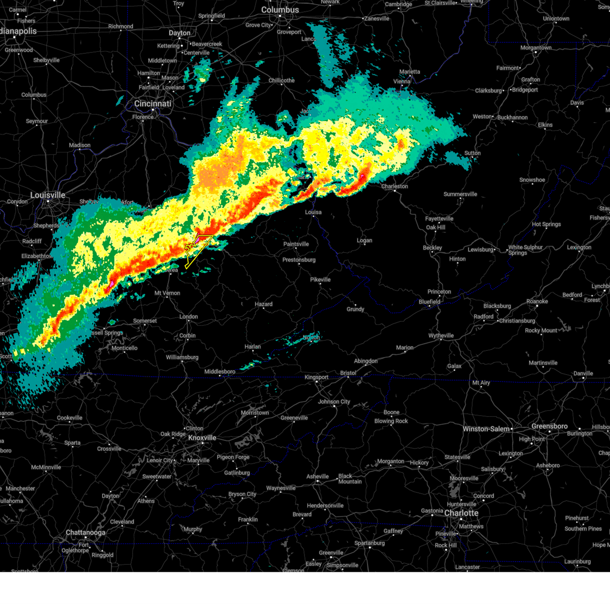 The storms which prompted the warning have moved out of the area. therefore, the warning will be allowed to expire. a tornado watch remains in effect until 900 am est for east central kentucky. The storms which prompted the warning have moved out of the area. therefore, the warning will be allowed to expire. a tornado watch remains in effect until 900 am est for east central kentucky.
|
| 2/28/2024 7:35 AM EST |
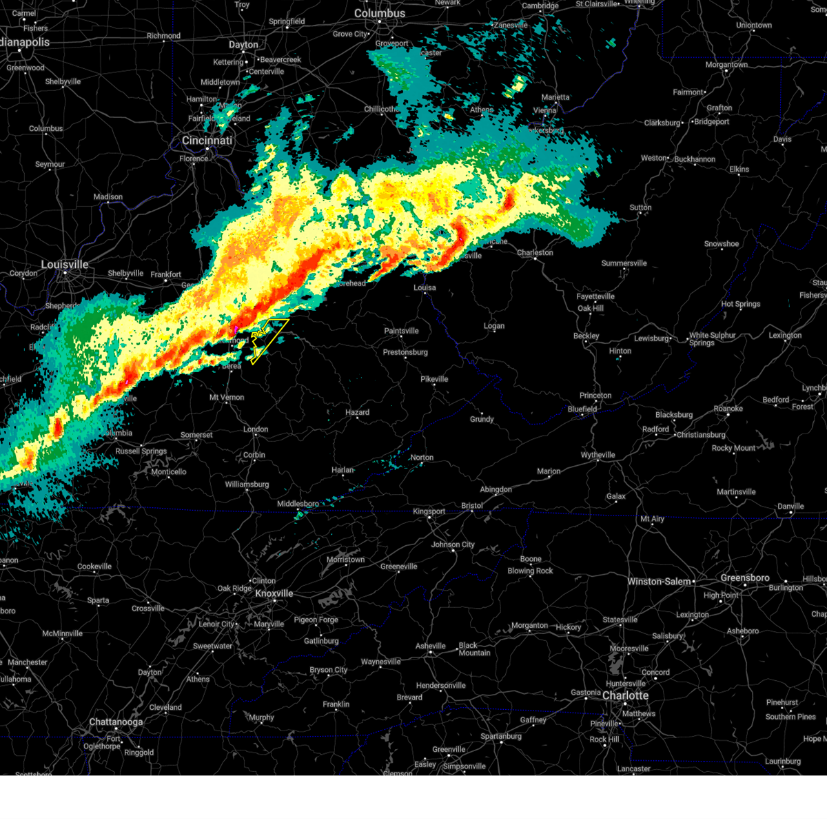 Svrjkl the national weather service in jackson ky has issued a * severe thunderstorm warning for, northwestern powell county in east central kentucky, south central montgomery county in east central kentucky, northwestern estill county in east central kentucky, * until 800 am est. * at 735 am est, severe thunderstorms were located along a line extending from near westbend to near richmond, moving east at 55 mph (radar indicated). Hazards include 60 mph wind gusts and penny size hail. Expect damage to roofs, siding, and trees. severe thunderstorms will be near, stanton around 740 am est. Vaughns mill around 745 am est. Svrjkl the national weather service in jackson ky has issued a * severe thunderstorm warning for, northwestern powell county in east central kentucky, south central montgomery county in east central kentucky, northwestern estill county in east central kentucky, * until 800 am est. * at 735 am est, severe thunderstorms were located along a line extending from near westbend to near richmond, moving east at 55 mph (radar indicated). Hazards include 60 mph wind gusts and penny size hail. Expect damage to roofs, siding, and trees. severe thunderstorms will be near, stanton around 740 am est. Vaughns mill around 745 am est.
|
| 8/25/2023 6:07 PM EDT |
 The severe thunderstorm warning for powell, southwestern morgan, estill, south central menifee, northern lee and wolfe counties will expire at 615 pm edt, the storms which prompted the warning have weakened below severe limits, and no longer pose an immediate threat to life or property. therefore, the warning will be allowed to expire. however gusty winds and heavy rain are still possible with these thunderstorms. The severe thunderstorm warning for powell, southwestern morgan, estill, south central menifee, northern lee and wolfe counties will expire at 615 pm edt, the storms which prompted the warning have weakened below severe limits, and no longer pose an immediate threat to life or property. therefore, the warning will be allowed to expire. however gusty winds and heavy rain are still possible with these thunderstorms.
|
| 8/25/2023 6:06 PM EDT |
 At 605 pm edt, severe thunderstorms were located along a line extending from fox to fixer to trent, moving south at 15 mph (radar indicated). Hazards include 60 mph wind gusts and penny size hail. Expect damage to roofs, siding, and trees. locations impacted include, fox, whynot, mount olive, winston and vortex. hail threat, radar indicated max hail size, 0. 75 in wind threat, radar indicated max wind gust, 60 mph. At 605 pm edt, severe thunderstorms were located along a line extending from fox to fixer to trent, moving south at 15 mph (radar indicated). Hazards include 60 mph wind gusts and penny size hail. Expect damage to roofs, siding, and trees. locations impacted include, fox, whynot, mount olive, winston and vortex. hail threat, radar indicated max hail size, 0. 75 in wind threat, radar indicated max wind gust, 60 mph.
|
| 8/25/2023 5:49 PM EDT |
 At 549 pm edt, severe thunderstorms were located along a line extending from palmer to standing rock to murphyfork, moving south at 15 mph (radar indicated). Hazards include 60 mph wind gusts and penny size hail. Expect damage to roofs, siding, and trees. severe thunderstorms will be near, palmer around 555 pm edt. fixer around 600 pm edt. fox around 605 pm edt. other locations in the path of these severe thunderstorms include stillwater and landsaw. hail threat, radar indicated max hail size, 0. 75 in wind threat, radar indicated max wind gust, 60 mph. At 549 pm edt, severe thunderstorms were located along a line extending from palmer to standing rock to murphyfork, moving south at 15 mph (radar indicated). Hazards include 60 mph wind gusts and penny size hail. Expect damage to roofs, siding, and trees. severe thunderstorms will be near, palmer around 555 pm edt. fixer around 600 pm edt. fox around 605 pm edt. other locations in the path of these severe thunderstorms include stillwater and landsaw. hail threat, radar indicated max hail size, 0. 75 in wind threat, radar indicated max wind gust, 60 mph.
|
| 7/18/2023 4:08 PM EDT |
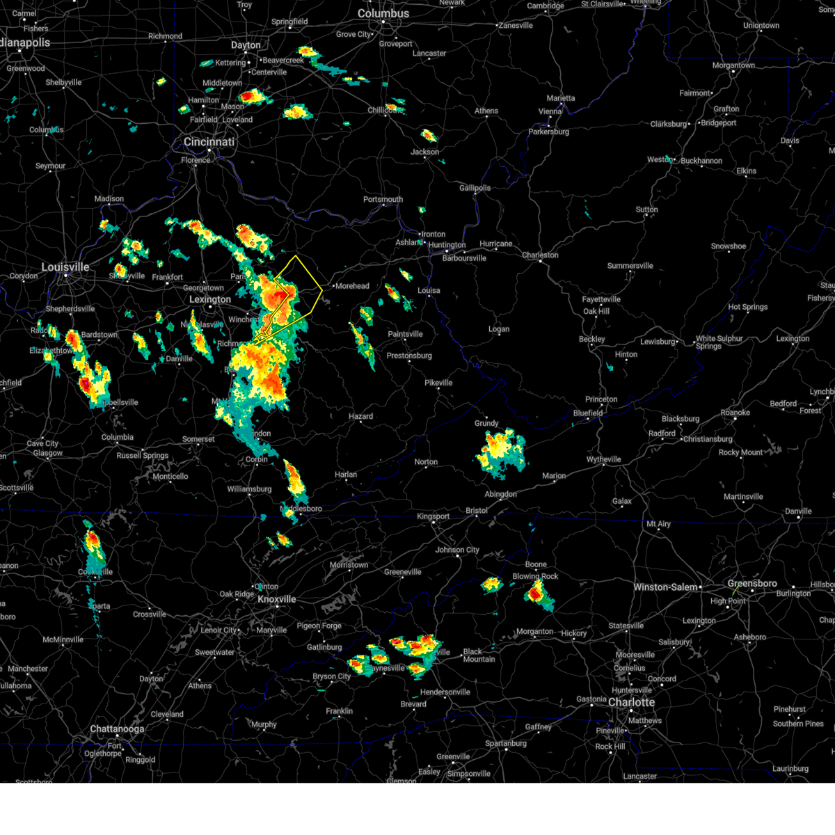 The severe thunderstorm warning for northwestern powell, southeastern montgomery, bath, northwestern estill, northwestern menifee, south central fleming and west central rowan counties will expire at 415 pm edt, the storms which prompted the warning have weakened below severe limits, and no longer pose an immediate threat to life or property. therefore, the warning will be allowed to expire. however small hail and gusty winds are still possible with these thunderstorms. The severe thunderstorm warning for northwestern powell, southeastern montgomery, bath, northwestern estill, northwestern menifee, south central fleming and west central rowan counties will expire at 415 pm edt, the storms which prompted the warning have weakened below severe limits, and no longer pose an immediate threat to life or property. therefore, the warning will be allowed to expire. however small hail and gusty winds are still possible with these thunderstorms.
|
| 7/18/2023 4:05 PM EDT |
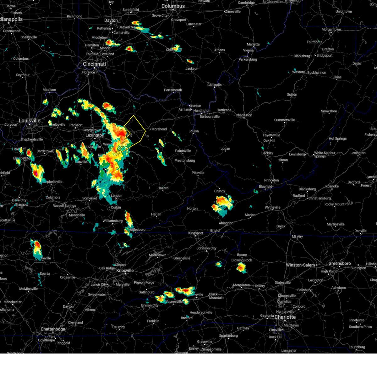 At 404 pm edt, severe thunderstorms were located along a line extending from near carlisle to owingsville to levee, moving east at 40 mph (radar indicated). Hazards include 60 mph wind gusts and quarter size hail. Hail damage to vehicles is expected. expect wind damage to roofs, siding, and trees. locations impacted include, marshall, moore`s ferry, ramey, olympia springs and young springs. hail threat, radar indicated max hail size, 1. 00 in wind threat, radar indicated max wind gust, 60 mph. At 404 pm edt, severe thunderstorms were located along a line extending from near carlisle to owingsville to levee, moving east at 40 mph (radar indicated). Hazards include 60 mph wind gusts and quarter size hail. Hail damage to vehicles is expected. expect wind damage to roofs, siding, and trees. locations impacted include, marshall, moore`s ferry, ramey, olympia springs and young springs. hail threat, radar indicated max hail size, 1. 00 in wind threat, radar indicated max wind gust, 60 mph.
|
| 7/18/2023 4:03 PM EDT |
 At 403 pm edt, severe thunderstorms were located along a line extending from near fox to weedon to wagersville to turkey foot, moving northeast at 45 mph (radar indicated). Hazards include 60 mph wind gusts. Expect damage to roofs, siding, and trees. severe thunderstorms will be near, pryse around 410 pm edt. ida may around 415 pm edt. stanton around 420 pm edt. other locations in the path of these severe thunderstorms include lombard, campsites in the indian creek area of the daniel boone national forrest and campton. hail threat, radar indicated max hail size, <. 75 in wind threat, radar indicated max wind gust, 60 mph. At 403 pm edt, severe thunderstorms were located along a line extending from near fox to weedon to wagersville to turkey foot, moving northeast at 45 mph (radar indicated). Hazards include 60 mph wind gusts. Expect damage to roofs, siding, and trees. severe thunderstorms will be near, pryse around 410 pm edt. ida may around 415 pm edt. stanton around 420 pm edt. other locations in the path of these severe thunderstorms include lombard, campsites in the indian creek area of the daniel boone national forrest and campton. hail threat, radar indicated max hail size, <. 75 in wind threat, radar indicated max wind gust, 60 mph.
|
| 7/18/2023 3:41 PM EDT |
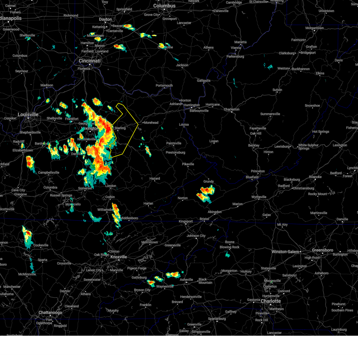 At 341 pm edt, severe thunderstorms were located along a line extending from near cynthiana to klondike to richmond, moving east at 40 mph (radar indicated). Hazards include 60 mph wind gusts and quarter size hail. Hail damage to vehicles is expected. expect wind damage to roofs, siding, and trees. severe thunderstorms will be near, mount sterling around 345 pm edt. gatewoods station around 350 pm edt. howards mill around 355 pm edt. kendall springs around 400 pm edt. other locations in the path of these severe thunderstorms include owingsville and marshall. hail threat, radar indicated max hail size, 1. 00 in wind threat, radar indicated max wind gust, 60 mph. At 341 pm edt, severe thunderstorms were located along a line extending from near cynthiana to klondike to richmond, moving east at 40 mph (radar indicated). Hazards include 60 mph wind gusts and quarter size hail. Hail damage to vehicles is expected. expect wind damage to roofs, siding, and trees. severe thunderstorms will be near, mount sterling around 345 pm edt. gatewoods station around 350 pm edt. howards mill around 355 pm edt. kendall springs around 400 pm edt. other locations in the path of these severe thunderstorms include owingsville and marshall. hail threat, radar indicated max hail size, 1. 00 in wind threat, radar indicated max wind gust, 60 mph.
|
| 7/2/2023 8:21 PM EDT |
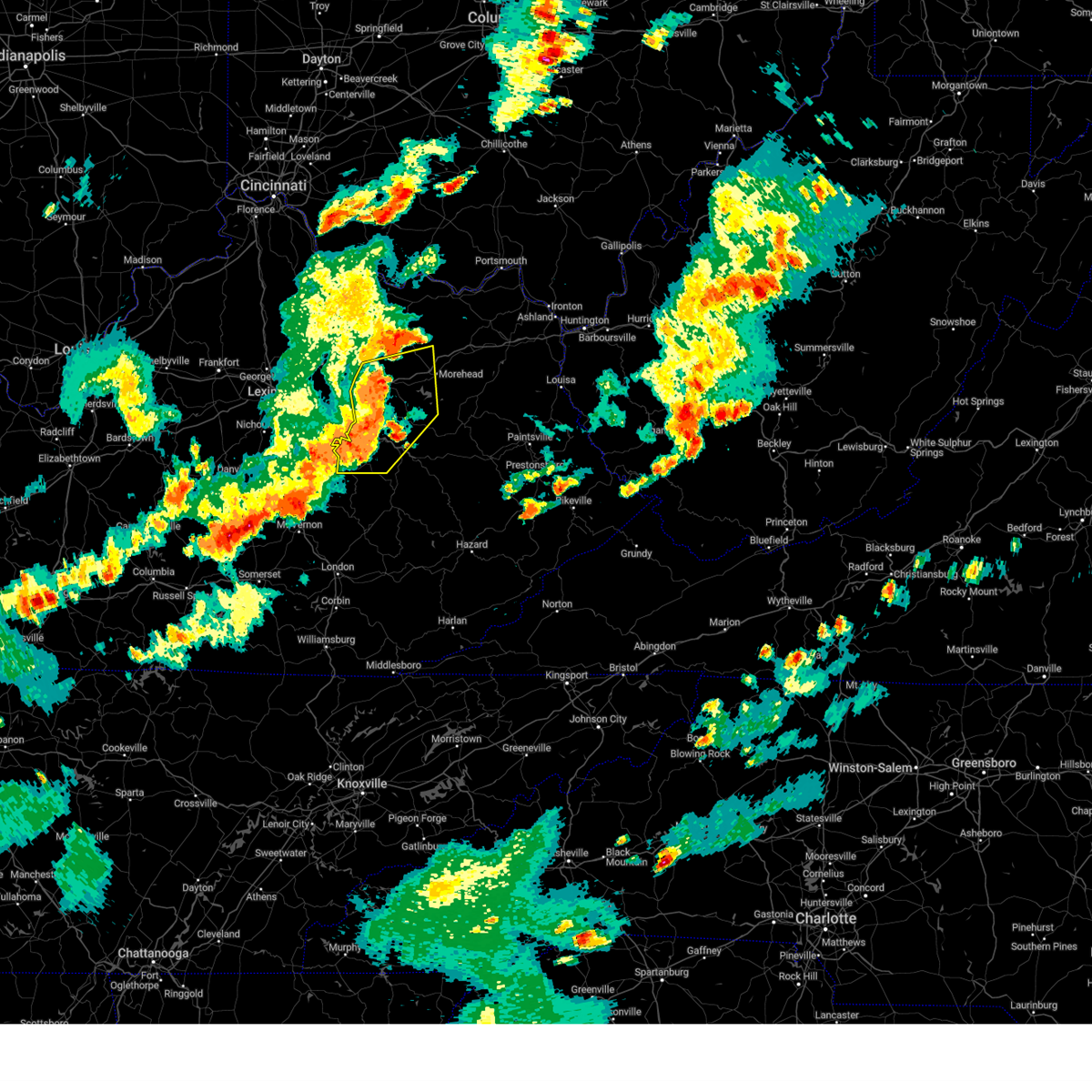 At 821 pm edt, severe thunderstorms were located along a line extending from craigs to near means to furnace to doe creek, moving southeast at 55 mph (radar indicated). Hazards include 60 mph wind gusts and nickel size hail. Expect damage to roofs, siding, and trees. locations impacted include, pilot, salt lick, cogswell and zilpo. hail threat, radar indicated max hail size, 0. 88 in wind threat, radar indicated max wind gust, 60 mph. At 821 pm edt, severe thunderstorms were located along a line extending from craigs to near means to furnace to doe creek, moving southeast at 55 mph (radar indicated). Hazards include 60 mph wind gusts and nickel size hail. Expect damage to roofs, siding, and trees. locations impacted include, pilot, salt lick, cogswell and zilpo. hail threat, radar indicated max hail size, 0. 88 in wind threat, radar indicated max wind gust, 60 mph.
|
| 7/2/2023 7:56 PM EDT |
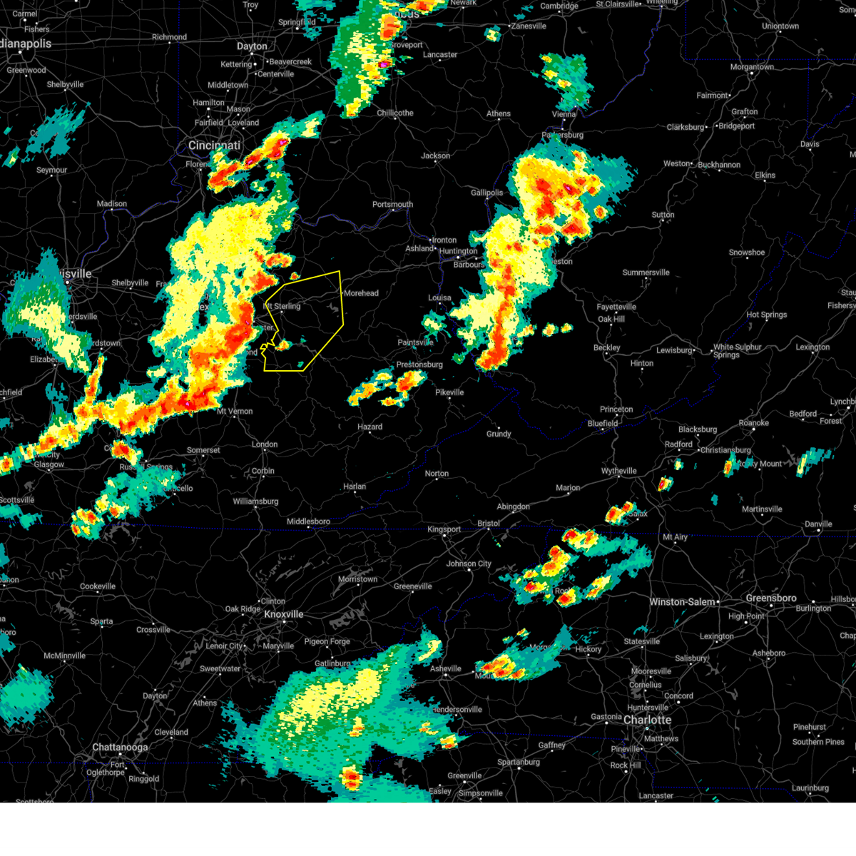 At 756 pm edt, severe thunderstorms were located along a line extending from 6 miles west of sideview to 6 miles north of harris ferry to near richmond, moving east at 50 mph (radar indicated). Hazards include 60 mph wind gusts and quarter size hail. Hail damage to vehicles is expected. expect wind damage to roofs, siding, and trees. severe thunderstorms will be near, westbend around 805 pm edt. sharpsburg around 810 pm edt. hargett around 815 pm edt. other locations in the path of these severe thunderstorms include owingsville, stanton and frenchburg. hail threat, radar indicated max hail size, 1. 00 in wind threat, radar indicated max wind gust, 60 mph. At 756 pm edt, severe thunderstorms were located along a line extending from 6 miles west of sideview to 6 miles north of harris ferry to near richmond, moving east at 50 mph (radar indicated). Hazards include 60 mph wind gusts and quarter size hail. Hail damage to vehicles is expected. expect wind damage to roofs, siding, and trees. severe thunderstorms will be near, westbend around 805 pm edt. sharpsburg around 810 pm edt. hargett around 815 pm edt. other locations in the path of these severe thunderstorms include owingsville, stanton and frenchburg. hail threat, radar indicated max hail size, 1. 00 in wind threat, radar indicated max wind gust, 60 mph.
|
| 7/2/2023 5:36 PM EDT |
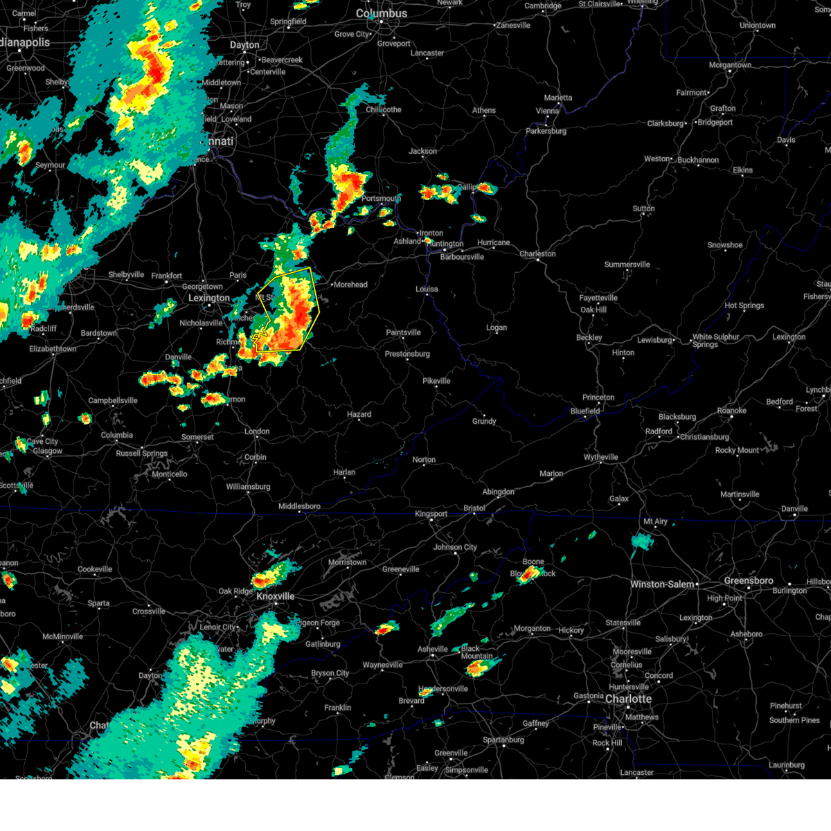 The severe thunderstorm warning for powell, montgomery, bath, northern estill, western menifee, south central fleming and western rowan counties will expire at 545 pm edt, the storms which prompted the warning have moved out of the area. therefore, the warning will be allowed to expire. a severe thunderstorm watch remains in effect until midnight edt for east central kentucky. remember, a tornado warning still remains in effect. The severe thunderstorm warning for powell, montgomery, bath, northern estill, western menifee, south central fleming and western rowan counties will expire at 545 pm edt, the storms which prompted the warning have moved out of the area. therefore, the warning will be allowed to expire. a severe thunderstorm watch remains in effect until midnight edt for east central kentucky. remember, a tornado warning still remains in effect.
|
| 7/2/2023 5:20 PM EDT |
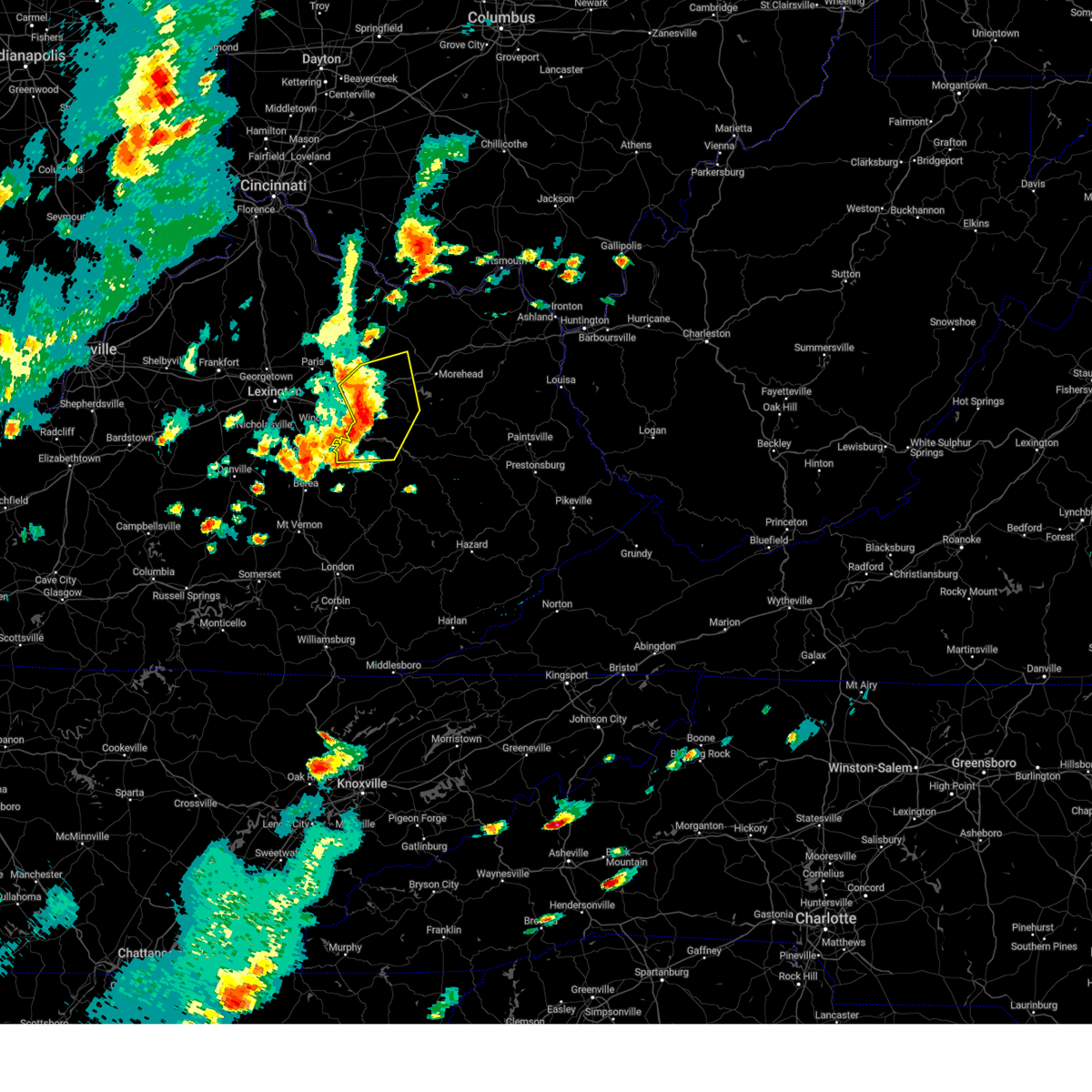 At 519 pm edt, severe thunderstorms were located along a line extending from flat creek to bean to stanton to north irvine, moving east at 55 mph (radar indicated). Hazards include 70 mph wind gusts and quarter size hail. Hail damage to vehicles is expected. expect considerable tree damage. wind damage is also likely to mobile homes, roofs, and outbuildings. locations impacted include, owingsville, frenchburg and natural bridge s. P At 519 pm edt, severe thunderstorms were located along a line extending from flat creek to bean to stanton to north irvine, moving east at 55 mph (radar indicated). Hazards include 70 mph wind gusts and quarter size hail. Hail damage to vehicles is expected. expect considerable tree damage. wind damage is also likely to mobile homes, roofs, and outbuildings. locations impacted include, owingsville, frenchburg and natural bridge s. P
|
| 7/2/2023 4:58 PM EDT |
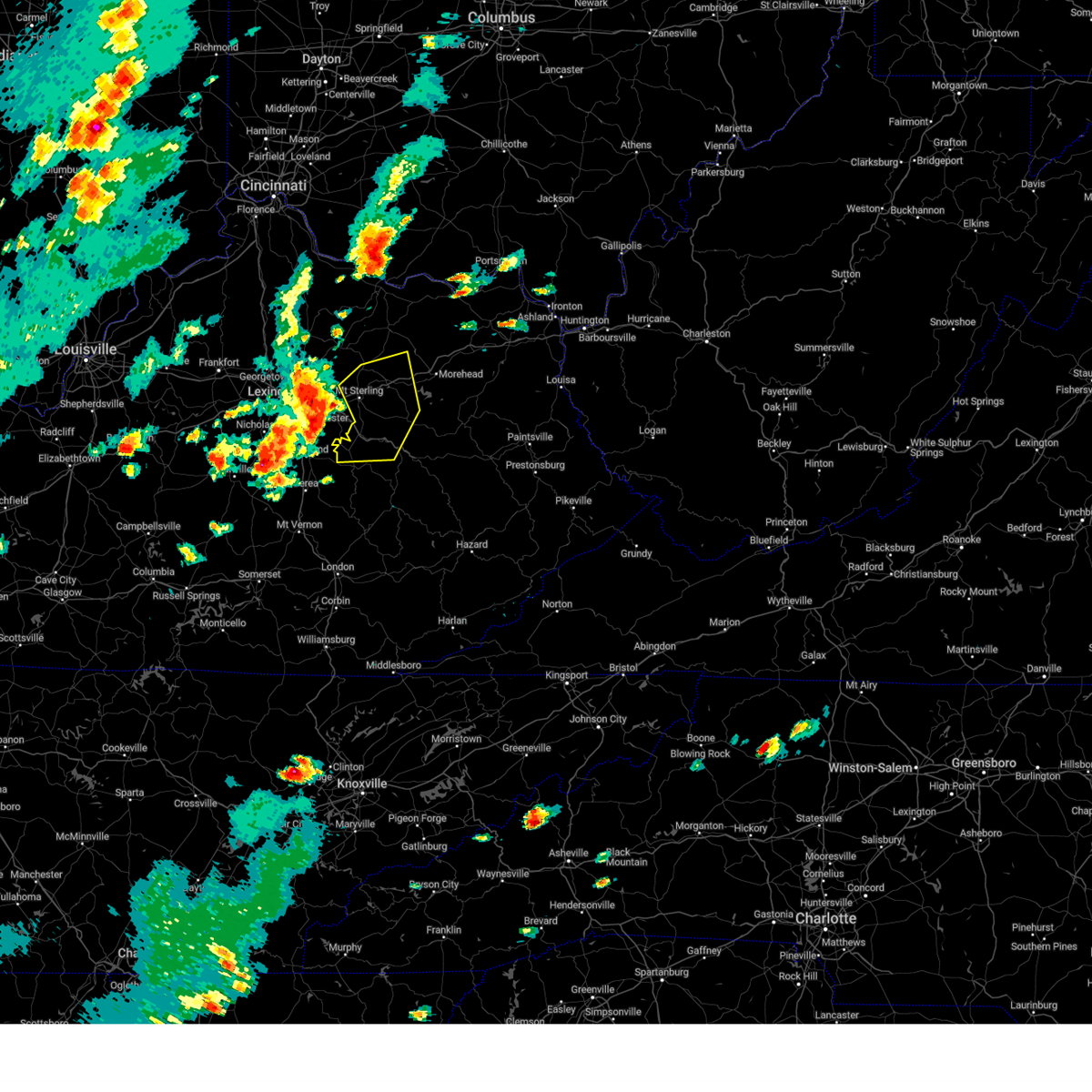 At 458 pm edt, severe thunderstorms were located along a line extending from 7 miles west of sideview to 7 miles northwest of cressy to near harris ferry, moving east at 40 mph (radar indicated). Hazards include 70 mph wind gusts and quarter size hail. Hail damage to vehicles is expected. expect considerable tree damage. wind damage is also likely to mobile homes, roofs, and outbuildings. severe thunderstorms will be near, iron mound around 510 pm edt. camargo around 515 pm edt. Other locations in the path of these severe thunderstorms include jeffersonville, stanton, owingsville and wyoming. At 458 pm edt, severe thunderstorms were located along a line extending from 7 miles west of sideview to 7 miles northwest of cressy to near harris ferry, moving east at 40 mph (radar indicated). Hazards include 70 mph wind gusts and quarter size hail. Hail damage to vehicles is expected. expect considerable tree damage. wind damage is also likely to mobile homes, roofs, and outbuildings. severe thunderstorms will be near, iron mound around 510 pm edt. camargo around 515 pm edt. Other locations in the path of these severe thunderstorms include jeffersonville, stanton, owingsville and wyoming.
|
| 7/1/2023 3:56 AM EDT |
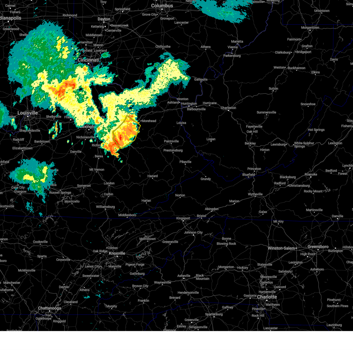 The severe thunderstorm warning for powell, montgomery, bath, east central estill, menifee, south central fleming and southwestern rowan counties will expire at 400 am edt, the storms which prompted the warning have weakened below severe limits, and no longer pose an immediate threat to life or property. therefore, the warning will be allowed to expire. however gusty winds are still possible with these thunderstorms. The severe thunderstorm warning for powell, montgomery, bath, east central estill, menifee, south central fleming and southwestern rowan counties will expire at 400 am edt, the storms which prompted the warning have weakened below severe limits, and no longer pose an immediate threat to life or property. therefore, the warning will be allowed to expire. however gusty winds are still possible with these thunderstorms.
|
| 7/1/2023 3:46 AM EDT |
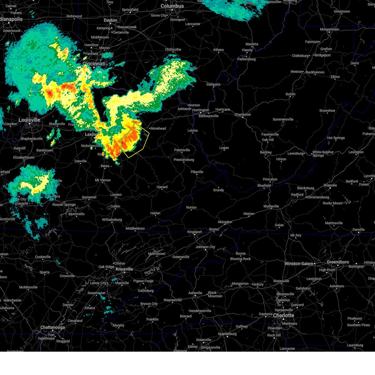 At 346 am edt, severe thunderstorms were located along a line extending from salt lick to rothwell to stanton, moving southeast at 40 mph (radar indicated). Hazards include 60 mph wind gusts and nickel size hail. Expect damage to roofs, siding, and trees. locations impacted include, frenchburg, rogers chapel and scranton. hail threat, radar indicated max hail size, 0. 88 in wind threat, radar indicated max wind gust, 60 mph. At 346 am edt, severe thunderstorms were located along a line extending from salt lick to rothwell to stanton, moving southeast at 40 mph (radar indicated). Hazards include 60 mph wind gusts and nickel size hail. Expect damage to roofs, siding, and trees. locations impacted include, frenchburg, rogers chapel and scranton. hail threat, radar indicated max hail size, 0. 88 in wind threat, radar indicated max wind gust, 60 mph.
|
| 7/1/2023 3:28 AM EDT |
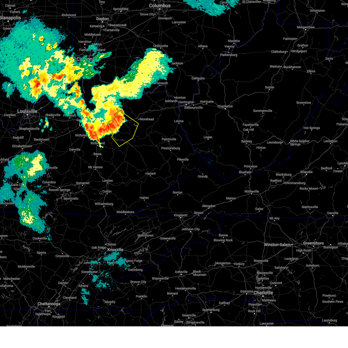 At 327 am edt, severe thunderstorms were located along a line extending from odessa to howards mill to near westbend, moving southeast at 40 mph (radar indicated). Hazards include 60 mph wind gusts and nickel size hail. Expect damage to roofs, siding, and trees. severe thunderstorms will be near, owingsville around 330 am edt. jeffersonville around 335 am edt. marshall around 340 am edt. stanton around 345 am edt. other locations in the path of these severe thunderstorms include campsites in the indian creek area of the daniel boone national forrest and rogers chapel. hail threat, radar indicated max hail size, 0. 88 in wind threat, radar indicated max wind gust, 60 mph. At 327 am edt, severe thunderstorms were located along a line extending from odessa to howards mill to near westbend, moving southeast at 40 mph (radar indicated). Hazards include 60 mph wind gusts and nickel size hail. Expect damage to roofs, siding, and trees. severe thunderstorms will be near, owingsville around 330 am edt. jeffersonville around 335 am edt. marshall around 340 am edt. stanton around 345 am edt. other locations in the path of these severe thunderstorms include campsites in the indian creek area of the daniel boone national forrest and rogers chapel. hail threat, radar indicated max hail size, 0. 88 in wind threat, radar indicated max wind gust, 60 mph.
|
| 6/25/2023 11:27 PM EDT |
 The severe thunderstorm warning for southern powell, northwestern owsley, estill, northern jackson, lee and west central wolfe counties will expire at 1130 pm edt, a new downstream warning has been issued. refer to that bulletin for further details. a severe thunderstorm watch remains in effect until 400 am edt for south central, southeastern and east central kentucky. The severe thunderstorm warning for southern powell, northwestern owsley, estill, northern jackson, lee and west central wolfe counties will expire at 1130 pm edt, a new downstream warning has been issued. refer to that bulletin for further details. a severe thunderstorm watch remains in effect until 400 am edt for south central, southeastern and east central kentucky.
|
| 6/25/2023 11:23 PM EDT |
 At 1123 pm edt, severe thunderstorms were located along a line extending from kimbrell to pinnacle to near old orchard to shop branch, moving southeast at 40 mph (radar indicated). Hazards include 70 mph wind gusts and half dollar size hail. Hail damage to vehicles is expected. expect considerable tree damage. wind damage is also likely to mobile homes, roofs, and outbuildings. locations impacted include, irvine, beattyville, mckee, fincastle, ravenna, pilot, white ash, leeco, kimbrell, tyner, privett and earnestville. thunderstorm damage threat, considerable hail threat, radar indicated max hail size, 1. 25 in wind threat, radar indicated max wind gust, 70 mph. At 1123 pm edt, severe thunderstorms were located along a line extending from kimbrell to pinnacle to near old orchard to shop branch, moving southeast at 40 mph (radar indicated). Hazards include 70 mph wind gusts and half dollar size hail. Hail damage to vehicles is expected. expect considerable tree damage. wind damage is also likely to mobile homes, roofs, and outbuildings. locations impacted include, irvine, beattyville, mckee, fincastle, ravenna, pilot, white ash, leeco, kimbrell, tyner, privett and earnestville. thunderstorm damage threat, considerable hail threat, radar indicated max hail size, 1. 25 in wind threat, radar indicated max wind gust, 70 mph.
|
| 6/25/2023 11:09 PM EDT |
 At 1107 pm edt, a severe thunderstorm was located over witt, or near irvine, moving southeast at 40 mph. this is a destructive storm for locations southern estill and northern jackson counties (radar indicated). Hazards include 80 mph wind gusts and two inch hail. Flying debris will be dangerous to those caught without shelter. mobile homes will be heavily damaged. expect considerable damage to roofs, windows, and vehicles. extensive tree damage and power outages are likely. locations impacted include, irvine, beattyville, mckee, fincastle, ravenna, pilot, white ash, leeco, kimbrell, tyner, privett and earnestville. thunderstorm damage threat, destructive hail threat, radar indicated max hail size, 2. 00 in wind threat, radar indicated max wind gust, 80 mph. At 1107 pm edt, a severe thunderstorm was located over witt, or near irvine, moving southeast at 40 mph. this is a destructive storm for locations southern estill and northern jackson counties (radar indicated). Hazards include 80 mph wind gusts and two inch hail. Flying debris will be dangerous to those caught without shelter. mobile homes will be heavily damaged. expect considerable damage to roofs, windows, and vehicles. extensive tree damage and power outages are likely. locations impacted include, irvine, beattyville, mckee, fincastle, ravenna, pilot, white ash, leeco, kimbrell, tyner, privett and earnestville. thunderstorm damage threat, destructive hail threat, radar indicated max hail size, 2. 00 in wind threat, radar indicated max wind gust, 80 mph.
|
| 6/25/2023 11:03 PM EDT |
 At 1103 pm edt, a severe thunderstorm was located over kings station, or near irvine, moving southeast at 30 mph (radar indicated). Hazards include tennis ball size hail and 70 mph wind gusts. People and animals outdoors will be injured. expect hail damage to roofs, siding, windows, and vehicles. expect considerable tree damage. wind damage is also likely to mobile homes, roofs, and outbuildings. locations impacted include, irvine, ravenna, pryse, evelyn, willow shoals and yellow rock. thunderstorm damage threat, considerable hail threat, radar indicated max hail size, 2. 50 in wind threat, radar indicated max wind gust, 70 mph. At 1103 pm edt, a severe thunderstorm was located over kings station, or near irvine, moving southeast at 30 mph (radar indicated). Hazards include tennis ball size hail and 70 mph wind gusts. People and animals outdoors will be injured. expect hail damage to roofs, siding, windows, and vehicles. expect considerable tree damage. wind damage is also likely to mobile homes, roofs, and outbuildings. locations impacted include, irvine, ravenna, pryse, evelyn, willow shoals and yellow rock. thunderstorm damage threat, considerable hail threat, radar indicated max hail size, 2. 50 in wind threat, radar indicated max wind gust, 70 mph.
|
| 6/25/2023 10:42 PM EDT |
 At 1041 pm edt, a severe thunderstorm was located 7 miles north of richmond, moving southeast at 40 mph (radar indicated). Hazards include tennis ball size hail and 70 mph wind gusts. People and animals outdoors will be injured. expect hail damage to roofs, siding, windows, and vehicles. expect considerable tree damage. wind damage is also likely to mobile homes, roofs, and outbuildings. this severe thunderstorm will be near, palmer around 1055 pm edt. fox around 1100 pm edt. other locations in the path of this severe thunderstorm include calloway crossing, irvine, pitts and cobhill. thunderstorm damage threat, considerable hail threat, radar indicated max hail size, 2. 50 in wind threat, radar indicated max wind gust, 70 mph. At 1041 pm edt, a severe thunderstorm was located 7 miles north of richmond, moving southeast at 40 mph (radar indicated). Hazards include tennis ball size hail and 70 mph wind gusts. People and animals outdoors will be injured. expect hail damage to roofs, siding, windows, and vehicles. expect considerable tree damage. wind damage is also likely to mobile homes, roofs, and outbuildings. this severe thunderstorm will be near, palmer around 1055 pm edt. fox around 1100 pm edt. other locations in the path of this severe thunderstorm include calloway crossing, irvine, pitts and cobhill. thunderstorm damage threat, considerable hail threat, radar indicated max hail size, 2. 50 in wind threat, radar indicated max wind gust, 70 mph.
|
| 5/16/2023 3:17 PM EDT |
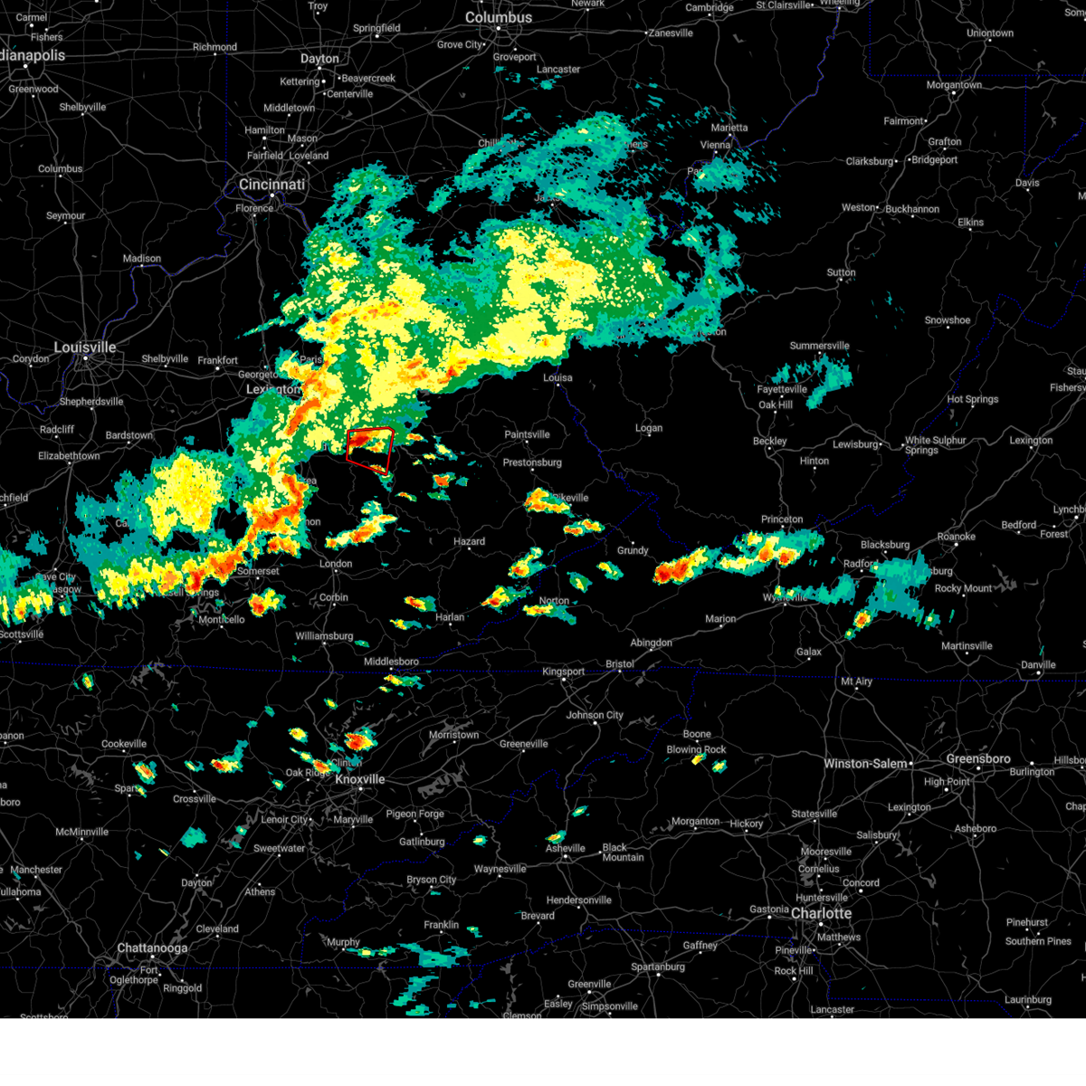 At 316 pm edt, a severe thunderstorm capable of producing a tornado was located over hardwick, or near irvine, moving east at 40 mph (radar indicated rotation). Hazards include tornado and ping pong ball size hail. Flying debris will be dangerous to those caught without shelter. mobile homes will be damaged or destroyed. damage to roofs, windows, and vehicles will occur. tree damage is likely. this dangerous storm will be near, furnace around 325 pm edt. rogers chapel around 330 pm edt. Nada around 335 pm edt. At 316 pm edt, a severe thunderstorm capable of producing a tornado was located over hardwick, or near irvine, moving east at 40 mph (radar indicated rotation). Hazards include tornado and ping pong ball size hail. Flying debris will be dangerous to those caught without shelter. mobile homes will be damaged or destroyed. damage to roofs, windows, and vehicles will occur. tree damage is likely. this dangerous storm will be near, furnace around 325 pm edt. rogers chapel around 330 pm edt. Nada around 335 pm edt.
|
| 5/16/2023 3:15 PM EDT | Quarter sized hail reported 3.2 miles NNW of Clay City, KY, nickel to quarter-sized hail covering the ground. |
| 5/16/2023 3:12 PM EDT | Golf Ball sized hail reported 3.7 miles N of Clay City, KY, picture on social media shows hail up golf-ball size near vaughn mill. |
| 5/16/2023 3:08 PM EDT |
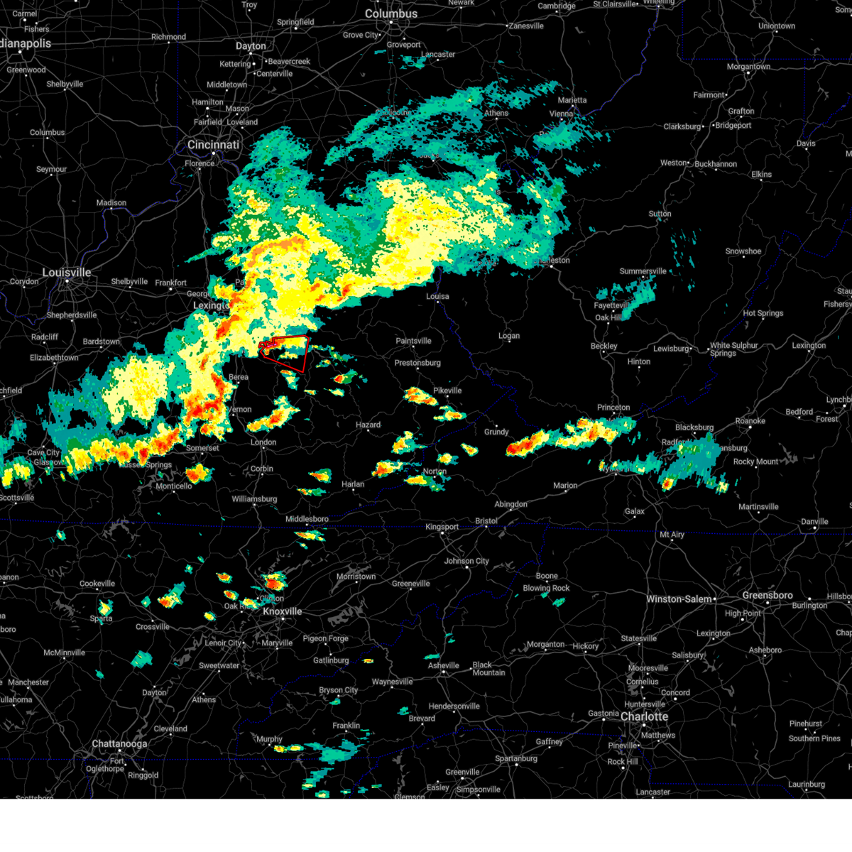 At 308 pm edt, a severe thunderstorm capable of producing a tornado was located over hargett, or near irvine, moving east at 35 mph (radar indicated rotation). Hazards include tornado and ping pong ball size hail. Flying debris will be dangerous to those caught without shelter. mobile homes will be damaged or destroyed. damage to roofs, windows, and vehicles will occur. tree damage is likely. this dangerous storm will be near, vaughns mill around 315 pm edt. knowlton around 325 pm edt. rogers chapel around 330 pm edt. nada around 335 pm edt. Other locations impacted by this tornadic thunderstorm include vianna. At 308 pm edt, a severe thunderstorm capable of producing a tornado was located over hargett, or near irvine, moving east at 35 mph (radar indicated rotation). Hazards include tornado and ping pong ball size hail. Flying debris will be dangerous to those caught without shelter. mobile homes will be damaged or destroyed. damage to roofs, windows, and vehicles will occur. tree damage is likely. this dangerous storm will be near, vaughns mill around 315 pm edt. knowlton around 325 pm edt. rogers chapel around 330 pm edt. nada around 335 pm edt. Other locations impacted by this tornadic thunderstorm include vianna.
|
| 5/16/2023 2:52 PM EDT |
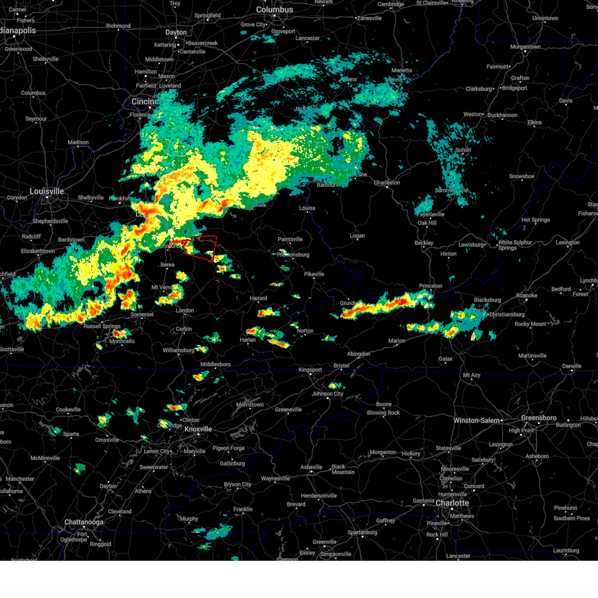 At 252 pm edt, a severe thunderstorm capable of producing a tornado was located near harris ferry, or 7 miles northeast of richmond, moving east at 35 mph (radar indicated rotation). Hazards include tornado and quarter size hail. Flying debris will be dangerous to those caught without shelter. mobile homes will be damaged or destroyed. damage to roofs, windows, and vehicles will occur. tree damage is likely. this dangerous storm will be near, harris ferry around 300 pm edt. iron mound around 305 pm edt. kimbrell around 310 pm edt. Other locations in the path of this tornadic thunderstorm include clay city, vaughns mill and stanton. At 252 pm edt, a severe thunderstorm capable of producing a tornado was located near harris ferry, or 7 miles northeast of richmond, moving east at 35 mph (radar indicated rotation). Hazards include tornado and quarter size hail. Flying debris will be dangerous to those caught without shelter. mobile homes will be damaged or destroyed. damage to roofs, windows, and vehicles will occur. tree damage is likely. this dangerous storm will be near, harris ferry around 300 pm edt. iron mound around 305 pm edt. kimbrell around 310 pm edt. Other locations in the path of this tornadic thunderstorm include clay city, vaughns mill and stanton.
|
| 5/7/2023 10:46 AM EDT |
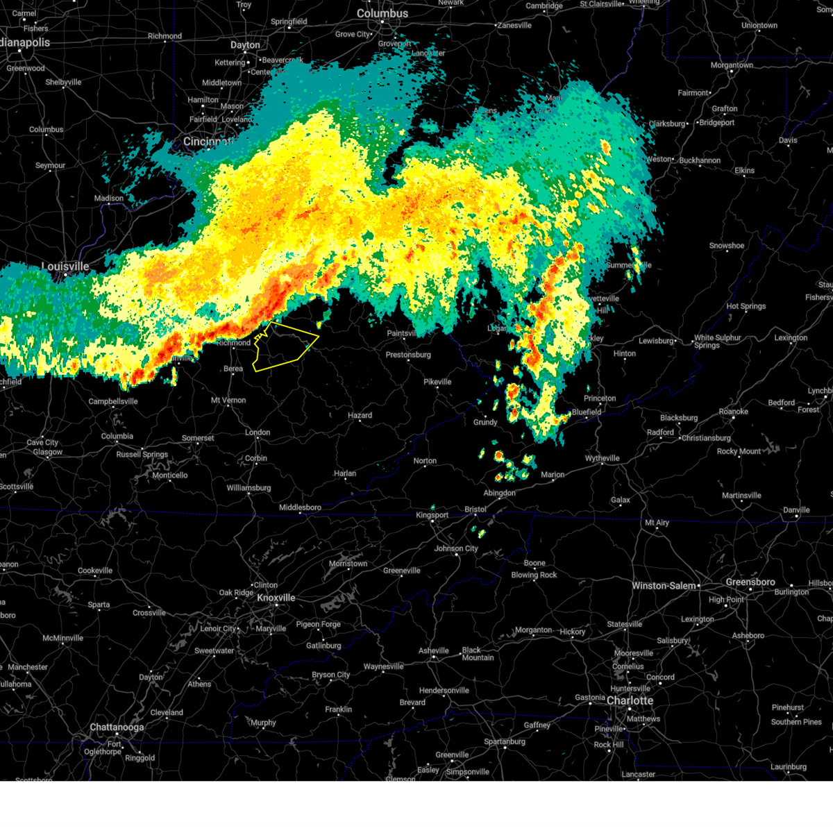 At 1046 am edt, severe thunderstorms were located along a line extending from near westbend to harris ferry to near richmond, moving southeast at 50 mph (radar indicated). Hazards include 60 mph wind gusts and penny size hail. Expect damage to roofs, siding, and trees. severe thunderstorms will be near, clay city around 1050 am edt. stanton around 1055 am edt. irvine around 1100 am edt. lombard around 1105 am edt. other locations in the path of these severe thunderstorms include red river gorge, ravenna and shade. hail threat, radar indicated max hail size, 0. 75 in wind threat, radar indicated max wind gust, 60 mph. At 1046 am edt, severe thunderstorms were located along a line extending from near westbend to harris ferry to near richmond, moving southeast at 50 mph (radar indicated). Hazards include 60 mph wind gusts and penny size hail. Expect damage to roofs, siding, and trees. severe thunderstorms will be near, clay city around 1050 am edt. stanton around 1055 am edt. irvine around 1100 am edt. lombard around 1105 am edt. other locations in the path of these severe thunderstorms include red river gorge, ravenna and shade. hail threat, radar indicated max hail size, 0. 75 in wind threat, radar indicated max wind gust, 60 mph.
|
| 3/3/2023 3:52 PM EST |
 The severe thunderstorm warning for powell, northeastern laurel, southeastern montgomery, south central bath, northwestern owsley, estill, jackson, west central menifee, western lee and northwestern clay counties will expire at 400 pm est, the storms which prompted the warning have moved out of the area. therefore, the warning will be allowed to expire. however gusty winds are still possible with these thunderstorms. a tornado watch remains in effect until 500 pm est for south central, southeastern and east central kentucky. a tornado watch also remains in effect until 700 pm est for southeastern kentucky. The severe thunderstorm warning for powell, northeastern laurel, southeastern montgomery, south central bath, northwestern owsley, estill, jackson, west central menifee, western lee and northwestern clay counties will expire at 400 pm est, the storms which prompted the warning have moved out of the area. therefore, the warning will be allowed to expire. however gusty winds are still possible with these thunderstorms. a tornado watch remains in effect until 500 pm est for south central, southeastern and east central kentucky. a tornado watch also remains in effect until 700 pm est for southeastern kentucky.
|
| 3/3/2023 3:23 PM EST |
 At 323 pm est, severe thunderstorms were located along a line extending from near palmer to hurley to pittsburg, moving northeast at 65 mph (radar indicated). Hazards include 70 mph wind gusts. Expect considerable tree damage. damage is likely to mobile homes, roofs, and outbuildings. severe thunderstorms will be near, westbend around 330 pm est. camargo around 335 pm est. evelyn around 340 pm est. other locations in the path of these severe thunderstorms include owingsville, ida may and slade. thunderstorm damage threat, considerable hail threat, radar indicated max hail size, <. 75 in wind threat, radar indicated max wind gust, 70 mph. At 323 pm est, severe thunderstorms were located along a line extending from near palmer to hurley to pittsburg, moving northeast at 65 mph (radar indicated). Hazards include 70 mph wind gusts. Expect considerable tree damage. damage is likely to mobile homes, roofs, and outbuildings. severe thunderstorms will be near, westbend around 330 pm est. camargo around 335 pm est. evelyn around 340 pm est. other locations in the path of these severe thunderstorms include owingsville, ida may and slade. thunderstorm damage threat, considerable hail threat, radar indicated max hail size, <. 75 in wind threat, radar indicated max wind gust, 70 mph.
|
| 1/12/2023 10:10 AM EST |
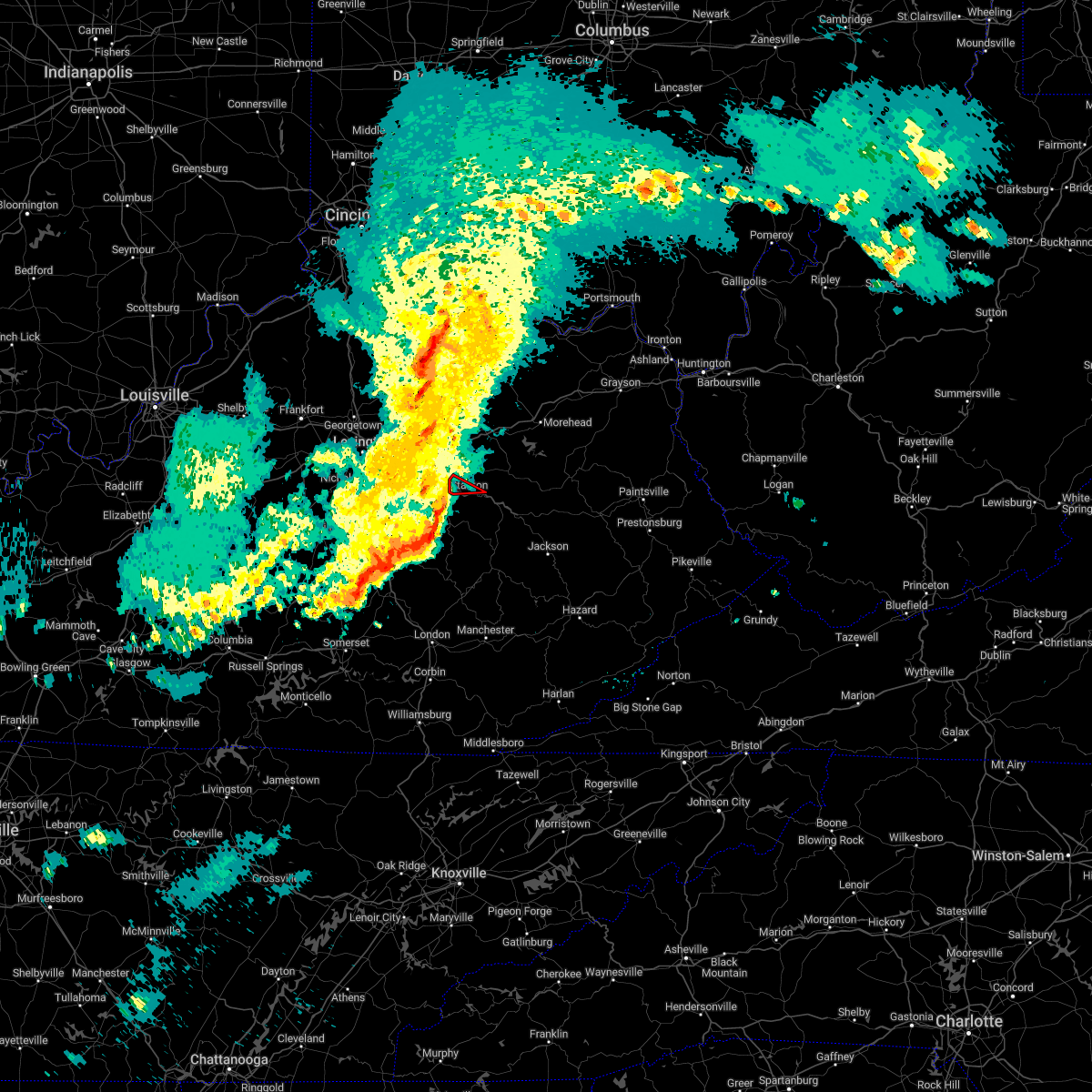 At 1009 am est, a severe thunderstorm capable of producing a tornado was located over clay city, or near stanton, moving east at 45 mph (radar indicated rotation). Hazards include tornado. Flying debris will be dangerous to those caught without shelter. mobile homes will be damaged or destroyed. damage to roofs, windows, and vehicles will occur. tree damage is likely. This tornadic thunderstorm will remain over mainly rural areas of northwestern powell county. At 1009 am est, a severe thunderstorm capable of producing a tornado was located over clay city, or near stanton, moving east at 45 mph (radar indicated rotation). Hazards include tornado. Flying debris will be dangerous to those caught without shelter. mobile homes will be damaged or destroyed. damage to roofs, windows, and vehicles will occur. tree damage is likely. This tornadic thunderstorm will remain over mainly rural areas of northwestern powell county.
|
| 1/12/2023 10:01 AM EST |
 At 1001 am est, a severe thunderstorm was located over wiseman crossing station, or near irvine, moving northeast at 60 mph (radar indicated). Hazards include 60 mph wind gusts. Expect damage to roofs, siding, and trees. Locations impacted include, cottage furnace and knowlton. At 1001 am est, a severe thunderstorm was located over wiseman crossing station, or near irvine, moving northeast at 60 mph (radar indicated). Hazards include 60 mph wind gusts. Expect damage to roofs, siding, and trees. Locations impacted include, cottage furnace and knowlton.
|
| 1/12/2023 9:56 AM EST |
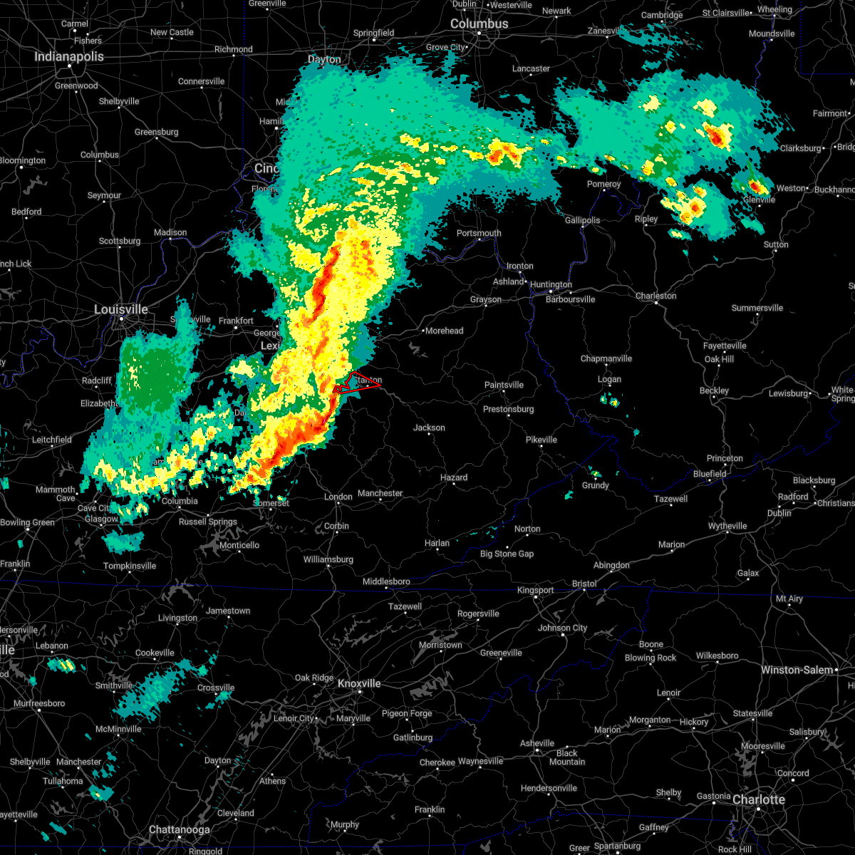 At 955 am est, a severe thunderstorm capable of producing a tornado was located over harris ferry, or 11 miles northeast of richmond, moving east at 45 mph (radar indicated rotation). Hazards include tornado. Flying debris will be dangerous to those caught without shelter. mobile homes will be damaged or destroyed. damage to roofs, windows, and vehicles will occur. tree damage is likely. this dangerous storm will be near, cressy around 1000 am est. spout springs around 1005 am est. clay city around 1010 am est. stanton around 1015 am est. Other locations in the path of this tornadic thunderstorm include cat creek. At 955 am est, a severe thunderstorm capable of producing a tornado was located over harris ferry, or 11 miles northeast of richmond, moving east at 45 mph (radar indicated rotation). Hazards include tornado. Flying debris will be dangerous to those caught without shelter. mobile homes will be damaged or destroyed. damage to roofs, windows, and vehicles will occur. tree damage is likely. this dangerous storm will be near, cressy around 1000 am est. spout springs around 1005 am est. clay city around 1010 am est. stanton around 1015 am est. Other locations in the path of this tornadic thunderstorm include cat creek.
|
| 1/12/2023 9:43 AM EST |
 At 943 am est, a severe thunderstorm was located near richmond, moving east at 50 mph (radar indicated). Hazards include 60 mph wind gusts. Expect damage to roofs, siding, and trees. this severe thunderstorm will be near, harris ferry around 950 am est. palmer around 955 am est. spout springs around 1000 am est. Other locations in the path of this severe thunderstorm include clay city and stanton. At 943 am est, a severe thunderstorm was located near richmond, moving east at 50 mph (radar indicated). Hazards include 60 mph wind gusts. Expect damage to roofs, siding, and trees. this severe thunderstorm will be near, harris ferry around 950 am est. palmer around 955 am est. spout springs around 1000 am est. Other locations in the path of this severe thunderstorm include clay city and stanton.
|
| 1/12/2023 9:43 AM EST |
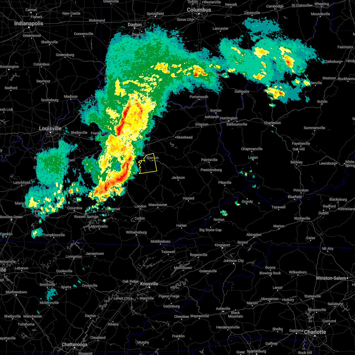 At 943 am est, a severe thunderstorm was located near richmond, moving east at 50 mph (radar indicated). Hazards include 60 mph wind gusts. Expect damage to roofs, siding, and trees. this severe thunderstorm will be near, harris ferry around 950 am est. palmer around 955 am est. spout springs around 1000 am est. Other locations in the path of this severe thunderstorm include clay city and stanton. At 943 am est, a severe thunderstorm was located near richmond, moving east at 50 mph (radar indicated). Hazards include 60 mph wind gusts. Expect damage to roofs, siding, and trees. this severe thunderstorm will be near, harris ferry around 950 am est. palmer around 955 am est. spout springs around 1000 am est. Other locations in the path of this severe thunderstorm include clay city and stanton.
|
| 7/27/2022 8:55 PM EDT |
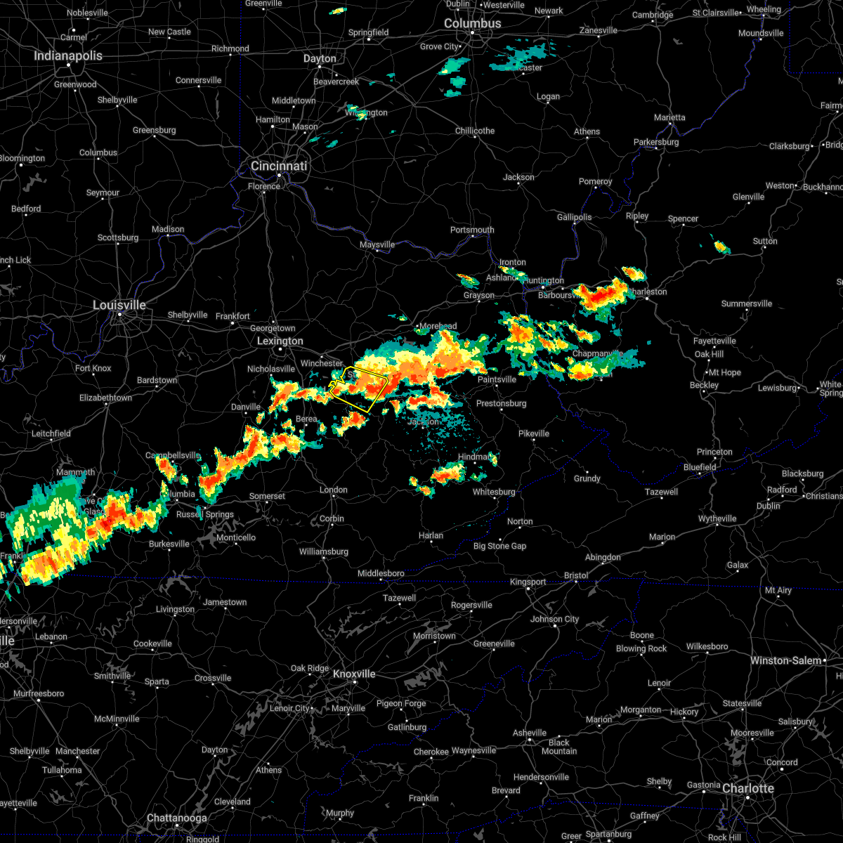 The severe thunderstorm warning for powell and northern estill counties will expire at 900 pm edt, the storm which prompted the warning has weakened below severe limits, and no longer poses an immediate threat to life or property. therefore, the warning will be allowed to expire. however gusty winds are still possible with this thunderstorm. The severe thunderstorm warning for powell and northern estill counties will expire at 900 pm edt, the storm which prompted the warning has weakened below severe limits, and no longer poses an immediate threat to life or property. therefore, the warning will be allowed to expire. however gusty winds are still possible with this thunderstorm.
|
| 7/27/2022 8:41 PM EDT |
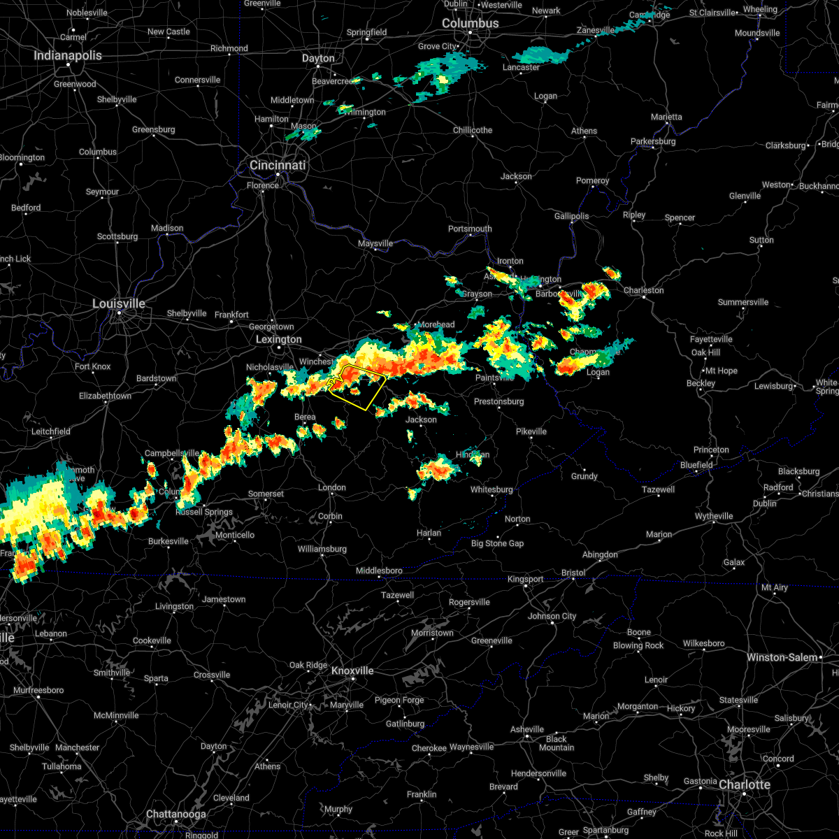 At 840 pm edt, a severe thunderstorm was located over stanton, moving east at 35 mph (radar indicated). Hazards include 60 mph wind gusts. Expect damage to roofs, siding, and trees. this severe storm will be near, knowlton around 845 pm edt. cat creek around 850 pm edt. other locations in the path of this severe thunderstorm include lombard and nada. hail threat, radar indicated max hail size, <. 75 in wind threat, radar indicated max wind gust, 60 mph. At 840 pm edt, a severe thunderstorm was located over stanton, moving east at 35 mph (radar indicated). Hazards include 60 mph wind gusts. Expect damage to roofs, siding, and trees. this severe storm will be near, knowlton around 845 pm edt. cat creek around 850 pm edt. other locations in the path of this severe thunderstorm include lombard and nada. hail threat, radar indicated max hail size, <. 75 in wind threat, radar indicated max wind gust, 60 mph.
|
| 7/27/2022 8:31 PM EDT |
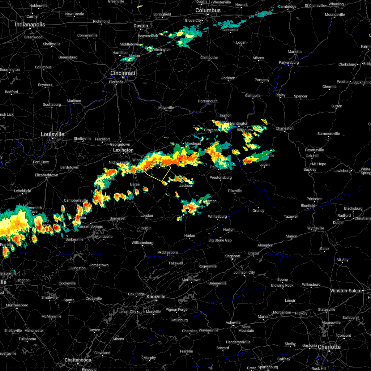 At 831 pm edt, a severe thunderstorm was located over spout springs, or 7 miles west of stanton, moving east at 35 mph (radar indicated). Hazards include 60 mph wind gusts. Expect damage to roofs, siding, and trees. this severe thunderstorm will be near, clay city around 835 pm edt. vaughns mill around 840 pm edt. stanton around 845 pm edt. cat creek around 850 pm edt. other locations in the path of this severe thunderstorm include lombard and nada. hail threat, radar indicated max hail size, <. 75 in wind threat, radar indicated max wind gust, 60 mph. At 831 pm edt, a severe thunderstorm was located over spout springs, or 7 miles west of stanton, moving east at 35 mph (radar indicated). Hazards include 60 mph wind gusts. Expect damage to roofs, siding, and trees. this severe thunderstorm will be near, clay city around 835 pm edt. vaughns mill around 840 pm edt. stanton around 845 pm edt. cat creek around 850 pm edt. other locations in the path of this severe thunderstorm include lombard and nada. hail threat, radar indicated max hail size, <. 75 in wind threat, radar indicated max wind gust, 60 mph.
|
| 7/17/2022 5:23 PM EDT |
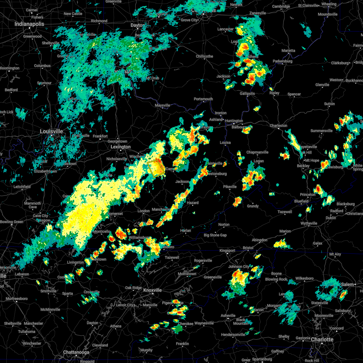 The severe thunderstorm warning for central powell and central estill counties will expire at 530 pm edt, the storm which prompted the warning has weakened below severe limits, and no longer poses an immediate threat to life or property. therefore, the warning will be allowed to expire. however gusty winds are still possible with this thunderstorm. The severe thunderstorm warning for central powell and central estill counties will expire at 530 pm edt, the storm which prompted the warning has weakened below severe limits, and no longer poses an immediate threat to life or property. therefore, the warning will be allowed to expire. however gusty winds are still possible with this thunderstorm.
|
| 7/17/2022 5:17 PM EDT |
 At 516 pm edt, a severe thunderstorm was located over knowlton, or near stanton, moving east at 35 mph (radar indicated). Hazards include 60 mph wind gusts. Expect damage to roofs, siding, and trees. this severe storm will be near, rosslyn around 520 pm edt. hail threat, radar indicated max hail size, <. 75 in wind threat, radar indicated max wind gust, 60 mph. At 516 pm edt, a severe thunderstorm was located over knowlton, or near stanton, moving east at 35 mph (radar indicated). Hazards include 60 mph wind gusts. Expect damage to roofs, siding, and trees. this severe storm will be near, rosslyn around 520 pm edt. hail threat, radar indicated max hail size, <. 75 in wind threat, radar indicated max wind gust, 60 mph.
|
| 7/17/2022 5:08 PM EDT |
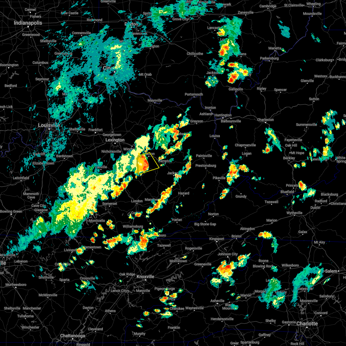 At 508 pm edt, a severe thunderstorm was located over hardwick, or near irvine, moving east at 35 mph (radar indicated). Hazards include 60 mph wind gusts. Expect damage to roofs, siding, and trees. this severe storm will be near, knowlton around 515 pm edt. other locations in the path of this severe thunderstorm include rosslyn. hail threat, radar indicated max hail size, <. 75 in wind threat, radar indicated max wind gust, 60 mph. At 508 pm edt, a severe thunderstorm was located over hardwick, or near irvine, moving east at 35 mph (radar indicated). Hazards include 60 mph wind gusts. Expect damage to roofs, siding, and trees. this severe storm will be near, knowlton around 515 pm edt. other locations in the path of this severe thunderstorm include rosslyn. hail threat, radar indicated max hail size, <. 75 in wind threat, radar indicated max wind gust, 60 mph.
|
| 7/17/2022 4:57 PM EDT |
 At 457 pm edt, a severe thunderstorm was located over sandhill, or near irvine, moving east at 35 mph (radar indicated). Hazards include 60 mph wind gusts. Expect damage to roofs, siding, and trees. this severe storm will be near, irvine around 500 pm edt. willow tree around 505 pm edt. other locations in the path of this severe thunderstorm include cottage furnace, knowlton and rogers chapel. hail threat, radar indicated max hail size, <. 75 in wind threat, radar indicated max wind gust, 60 mph. At 457 pm edt, a severe thunderstorm was located over sandhill, or near irvine, moving east at 35 mph (radar indicated). Hazards include 60 mph wind gusts. Expect damage to roofs, siding, and trees. this severe storm will be near, irvine around 500 pm edt. willow tree around 505 pm edt. other locations in the path of this severe thunderstorm include cottage furnace, knowlton and rogers chapel. hail threat, radar indicated max hail size, <. 75 in wind threat, radar indicated max wind gust, 60 mph.
|
| 7/17/2022 4:46 PM EDT |
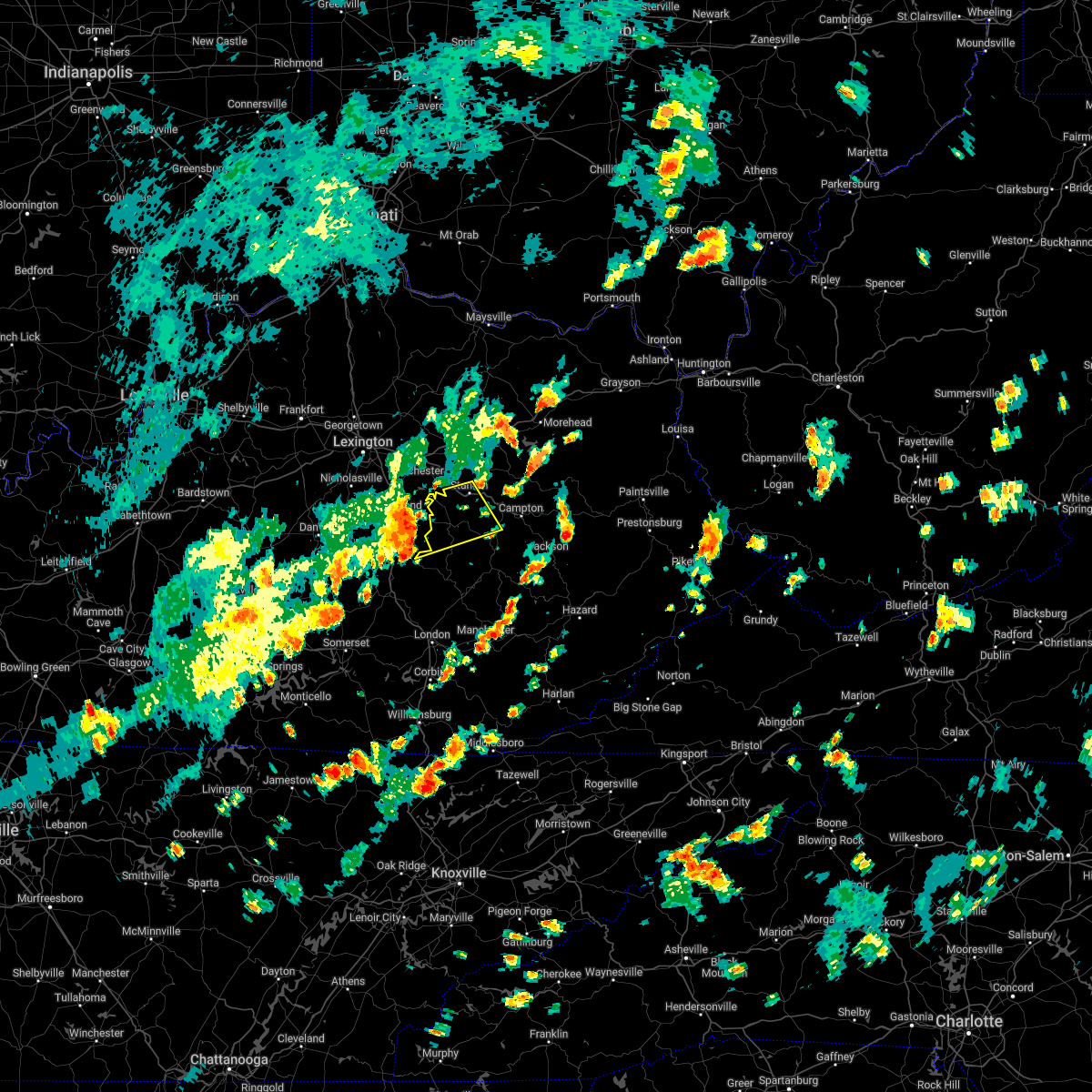 At 446 pm edt, a severe thunderstorm was located near winston, or 8 miles east of richmond, moving east at 35 mph (radar indicated). Hazards include 60 mph wind gusts. Expect damage to roofs, siding, and trees. this severe thunderstorm will be near, blackburn around 450 pm edt. winston around 455 pm edt. irvine around 500 pm edt. willow tree around 505 pm edt. other locations in the path of this severe thunderstorm include cottage furnace and knowlton. hail threat, radar indicated max hail size, <. 75 in wind threat, radar indicated max wind gust, 60 mph. At 446 pm edt, a severe thunderstorm was located near winston, or 8 miles east of richmond, moving east at 35 mph (radar indicated). Hazards include 60 mph wind gusts. Expect damage to roofs, siding, and trees. this severe thunderstorm will be near, blackburn around 450 pm edt. winston around 455 pm edt. irvine around 500 pm edt. willow tree around 505 pm edt. other locations in the path of this severe thunderstorm include cottage furnace and knowlton. hail threat, radar indicated max hail size, <. 75 in wind threat, radar indicated max wind gust, 60 mph.
|
| 7/6/2022 5:42 PM EDT |
 At 541 pm edt, severe thunderstorms were located along a line extending from elliottville to jinks, moving southeast at 30 mph (radar indicated). Hazards include 60 mph wind gusts and nickel size hail. Expect damage to roofs, siding, and trees. severe thunderstorms will be near, wagner store around 545 pm edt. fannin valley around 550 pm edt. lytten around 555 pm edt. sandy hook around 600 pm edt. Other locations in the path of these severe thunderstorms include new zion and wild dog. At 541 pm edt, severe thunderstorms were located along a line extending from elliottville to jinks, moving southeast at 30 mph (radar indicated). Hazards include 60 mph wind gusts and nickel size hail. Expect damage to roofs, siding, and trees. severe thunderstorms will be near, wagner store around 545 pm edt. fannin valley around 550 pm edt. lytten around 555 pm edt. sandy hook around 600 pm edt. Other locations in the path of these severe thunderstorms include new zion and wild dog.
|
| 7/6/2022 5:31 PM EDT |
 At 530 pm edt, a severe thunderstorm was located over gatewoods station, or near mount sterling, moving east at 25 mph (radar indicated). Hazards include 60 mph wind gusts and nickel size hail. Expect damage to roofs, siding, and trees. locations impacted include, ewington, upper spencer, jeffersonville, peeled oak and crooks. hail threat, radar indicated max hail size, 0. 88 in wind threat, radar indicated max wind gust, 60 mph. At 530 pm edt, a severe thunderstorm was located over gatewoods station, or near mount sterling, moving east at 25 mph (radar indicated). Hazards include 60 mph wind gusts and nickel size hail. Expect damage to roofs, siding, and trees. locations impacted include, ewington, upper spencer, jeffersonville, peeled oak and crooks. hail threat, radar indicated max hail size, 0. 88 in wind threat, radar indicated max wind gust, 60 mph.
|
| 7/6/2022 5:26 PM EDT |
 At 526 pm edt, a severe thunderstorm was located over hardwick, or near irvine, moving southeast at 30 mph (radar indicated). Hazards include 60 mph wind gusts and penny size hail. Expect damage to roofs, siding, and trees. this severe thunderstorm will be near, cottage furnace around 535 pm edt. fitchburg around 540 pm edt. hail threat, radar indicated max hail size, 0. 75 in wind threat, radar indicated max wind gust, 60 mph. At 526 pm edt, a severe thunderstorm was located over hardwick, or near irvine, moving southeast at 30 mph (radar indicated). Hazards include 60 mph wind gusts and penny size hail. Expect damage to roofs, siding, and trees. this severe thunderstorm will be near, cottage furnace around 535 pm edt. fitchburg around 540 pm edt. hail threat, radar indicated max hail size, 0. 75 in wind threat, radar indicated max wind gust, 60 mph.
|
| 7/6/2022 5:10 PM EDT |
 At 509 pm edt, a severe thunderstorm was located near wades mill, or 7 miles southwest of mount sterling, moving east at 25 mph (radar indicated). Hazards include 60 mph wind gusts and nickel size hail. Expect damage to roofs, siding, and trees. this severe thunderstorm will be near, klondike around 520 pm edt. levee around 525 pm edt. other locations in the path of this severe thunderstorm include mount sterling, gatewoods station, upper spencer and jeffersonville. hail threat, radar indicated max hail size, 0. 88 in wind threat, radar indicated max wind gust, 60 mph. At 509 pm edt, a severe thunderstorm was located near wades mill, or 7 miles southwest of mount sterling, moving east at 25 mph (radar indicated). Hazards include 60 mph wind gusts and nickel size hail. Expect damage to roofs, siding, and trees. this severe thunderstorm will be near, klondike around 520 pm edt. levee around 525 pm edt. other locations in the path of this severe thunderstorm include mount sterling, gatewoods station, upper spencer and jeffersonville. hail threat, radar indicated max hail size, 0. 88 in wind threat, radar indicated max wind gust, 60 mph.
|
| 7/6/2022 1:11 PM EDT |
 The severe thunderstorm warning for powell, southeastern montgomery, central estill and southwestern menifee counties will expire at 115 pm edt, the storm which prompted the warning has moved out of the area. therefore, the warning will be allowed to expire. a new warning has been issued for these areas. The severe thunderstorm warning for powell, southeastern montgomery, central estill and southwestern menifee counties will expire at 115 pm edt, the storm which prompted the warning has moved out of the area. therefore, the warning will be allowed to expire. a new warning has been issued for these areas.
|
| 7/6/2022 12:58 PM EDT | Tree reported down at the corner of spout springs road and hardwicks creek road. time estimated via rada in powell county KY, 3 miles N of Clay City, KY |
| 7/6/2022 12:54 PM EDT |
 At 1254 pm edt, a severe thunderstorm was located over clay city, or near stanton, moving southeast at 20 mph (radar indicated). Hazards include 60 mph wind gusts and penny size hail. Expect damage to roofs, siding, and trees. locations impacted include, stanton, vaughns mill, rosslyn, knowlton, furnace and rogers chapel. hail threat, radar indicated max hail size, 0. 75 in wind threat, radar indicated max wind gust, 60 mph. At 1254 pm edt, a severe thunderstorm was located over clay city, or near stanton, moving southeast at 20 mph (radar indicated). Hazards include 60 mph wind gusts and penny size hail. Expect damage to roofs, siding, and trees. locations impacted include, stanton, vaughns mill, rosslyn, knowlton, furnace and rogers chapel. hail threat, radar indicated max hail size, 0. 75 in wind threat, radar indicated max wind gust, 60 mph.
|
| 7/6/2022 12:38 PM EDT |
 At 1238 pm edt, a severe thunderstorm was located over westbend, or 7 miles northwest of stanton, moving southeast at 20 mph (radar indicated). Hazards include 60 mph wind gusts and penny size hail. Expect damage to roofs, siding, and trees. this severe thunderstorm will be near, virden around 1245 pm edt. clay city around 1250 pm edt. spout springs around 1255 pm edt. other locations in the path of this severe thunderstorm include stanton, rosslyn and cottage furnace. hail threat, radar indicated max hail size, 0. 75 in wind threat, radar indicated max wind gust, 60 mph. At 1238 pm edt, a severe thunderstorm was located over westbend, or 7 miles northwest of stanton, moving southeast at 20 mph (radar indicated). Hazards include 60 mph wind gusts and penny size hail. Expect damage to roofs, siding, and trees. this severe thunderstorm will be near, virden around 1245 pm edt. clay city around 1250 pm edt. spout springs around 1255 pm edt. other locations in the path of this severe thunderstorm include stanton, rosslyn and cottage furnace. hail threat, radar indicated max hail size, 0. 75 in wind threat, radar indicated max wind gust, 60 mph.
|
| 6/22/2022 6:59 PM EDT |
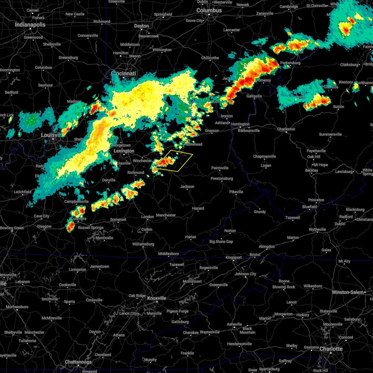 At 658 pm edt, a severe thunderstorm was located over fagan, or near frenchburg, moving east at 35 mph (radar indicated). Hazards include 60 mph wind gusts. Expect damage to roofs, siding, and trees. this severe thunderstorm will be near, frenchburg around 710 pm edt. denniston around 715 pm edt. other locations in the path of this severe thunderstorm include wellington, ebon and kellacey. hail threat, radar indicated max hail size, <. 75 in wind threat, radar indicated max wind gust, 60 mph. At 658 pm edt, a severe thunderstorm was located over fagan, or near frenchburg, moving east at 35 mph (radar indicated). Hazards include 60 mph wind gusts. Expect damage to roofs, siding, and trees. this severe thunderstorm will be near, frenchburg around 710 pm edt. denniston around 715 pm edt. other locations in the path of this severe thunderstorm include wellington, ebon and kellacey. hail threat, radar indicated max hail size, <. 75 in wind threat, radar indicated max wind gust, 60 mph.
|
| 6/17/2022 12:51 PM EDT |
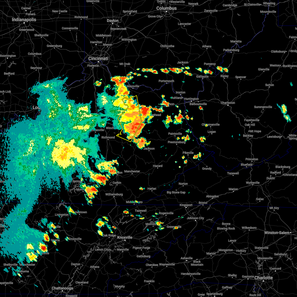 The severe thunderstorm warning for powell, montgomery, bath, northern estill, western menifee, fleming and western rowan counties will expire at 100 pm edt, the storms which prompted the warning have moved out of the area. therefore, the warning will be allowed to expire. a severe thunderstorm watch remains in effect until 300 pm edt for east central kentucky. remember, a severe thunderstorm warning still remains in effect for menifee county. The severe thunderstorm warning for powell, montgomery, bath, northern estill, western menifee, fleming and western rowan counties will expire at 100 pm edt, the storms which prompted the warning have moved out of the area. therefore, the warning will be allowed to expire. a severe thunderstorm watch remains in effect until 300 pm edt for east central kentucky. remember, a severe thunderstorm warning still remains in effect for menifee county.
|
| 6/17/2022 12:41 PM EDT | A tree reported down near 9000 winchester rd. in clay city... kentucky. time estimated from rada in powell county KY, 3.9 miles SSE of Clay City, KY |
| 6/17/2022 12:36 PM EDT |
 The severe thunderstorm warning for northwestern powell, montgomery, south central bath and west central menifee counties will expire at 1245 pm edt, the storm which prompted the warning has moved out of the area. therefore, the warning will be allowed to expire. however small hail and gusty winds are still possible with this thunderstorm. a severe thunderstorm watch remains in effect until 300 pm edt for east central kentucky. remember, a severe thunderstorm warning still remains in effect. The severe thunderstorm warning for northwestern powell, montgomery, south central bath and west central menifee counties will expire at 1245 pm edt, the storm which prompted the warning has moved out of the area. therefore, the warning will be allowed to expire. however small hail and gusty winds are still possible with this thunderstorm. a severe thunderstorm watch remains in effect until 300 pm edt for east central kentucky. remember, a severe thunderstorm warning still remains in effect.
|
| 6/17/2022 12:31 PM EDT | Tree reported down on beech fork road near clay city... ky. time estimated from rada in powell county KY, 1.1 miles W of Clay City, KY |
| 6/17/2022 12:16 PM EDT |
 At 1215 pm edt, severe thunderstorms were located along a line extending from 11 miles west of fairview to near sideview to near winchester, moving east at 40 mph (radar indicated). Hazards include 60 mph wind gusts and penny size hail. Expect damage to roofs, siding, and trees. severe thunderstorms will be near, sharpsburg around 1225 pm edt. flat creek around 1230 pm edt. fairview around 1235 pm edt. other locations in the path of these severe thunderstorms include owingsville, stanton and flemingsburg. hail threat, radar indicated max hail size, 0. 75 in wind threat, radar indicated max wind gust, 60 mph. At 1215 pm edt, severe thunderstorms were located along a line extending from 11 miles west of fairview to near sideview to near winchester, moving east at 40 mph (radar indicated). Hazards include 60 mph wind gusts and penny size hail. Expect damage to roofs, siding, and trees. severe thunderstorms will be near, sharpsburg around 1225 pm edt. flat creek around 1230 pm edt. fairview around 1235 pm edt. other locations in the path of these severe thunderstorms include owingsville, stanton and flemingsburg. hail threat, radar indicated max hail size, 0. 75 in wind threat, radar indicated max wind gust, 60 mph.
|
| 6/17/2022 12:10 PM EDT |
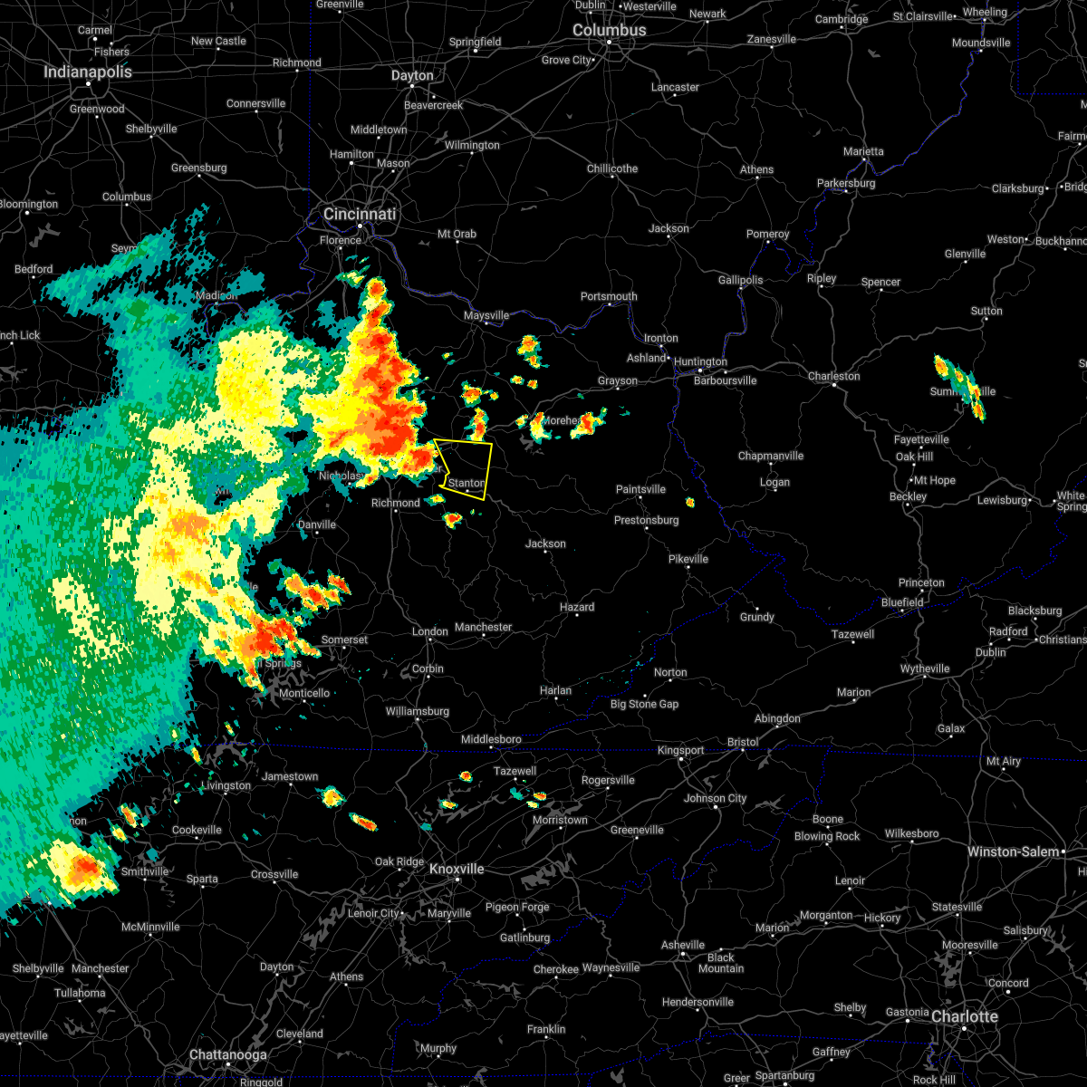 At 1210 pm edt, a severe thunderstorm was located near klondike, or 8 miles southwest of mount sterling, moving east at 40 mph (radar indicated). Hazards include 60 mph wind gusts and penny size hail. Expect damage to roofs, siding, and trees. this severe thunderstorm will be near, klondike around 1215 pm edt. prewitt around 1220 pm edt. camargo around 1225 pm edt. jeffersonville around 1230 pm edt. other locations in the path of this severe thunderstorm include lucky stop and cedar groves. hail threat, radar indicated max hail size, 0. 75 in wind threat, radar indicated max wind gust, 60 mph. At 1210 pm edt, a severe thunderstorm was located near klondike, or 8 miles southwest of mount sterling, moving east at 40 mph (radar indicated). Hazards include 60 mph wind gusts and penny size hail. Expect damage to roofs, siding, and trees. this severe thunderstorm will be near, klondike around 1215 pm edt. prewitt around 1220 pm edt. camargo around 1225 pm edt. jeffersonville around 1230 pm edt. other locations in the path of this severe thunderstorm include lucky stop and cedar groves. hail threat, radar indicated max hail size, 0. 75 in wind threat, radar indicated max wind gust, 60 mph.
|
| 5/26/2022 5:57 PM EDT |
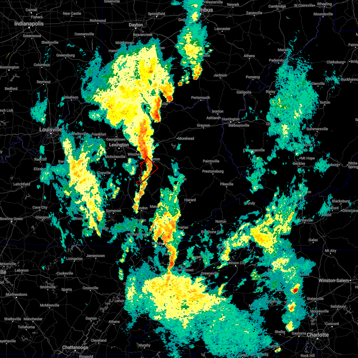 The tornado warning for western powell, estill and northwestern jackson counties will expire at 600 pm edt, the storm which prompted the warning has weakened below severe limits, and no longer appears capable of producing a tornado. therefore, the warning will be allowed to expire. The tornado warning for western powell, estill and northwestern jackson counties will expire at 600 pm edt, the storm which prompted the warning has weakened below severe limits, and no longer appears capable of producing a tornado. therefore, the warning will be allowed to expire.
|
| 5/26/2022 5:56 PM EDT |
 At 556 pm edt, severe thunderstorms were located along a line extending from sideview to near westbend to shade, moving east at 30 mph (radar indicated). Hazards include 60 mph wind gusts. Expect damage to roofs, siding, and trees. severe thunderstorms will be near, camargo around 605 pm edt. jeffersonville around 610 pm edt. zachariah around 615 pm edt. Other locations in the path of these severe thunderstorms include reynoldsville and pine ridge. At 556 pm edt, severe thunderstorms were located along a line extending from sideview to near westbend to shade, moving east at 30 mph (radar indicated). Hazards include 60 mph wind gusts. Expect damage to roofs, siding, and trees. severe thunderstorms will be near, camargo around 605 pm edt. jeffersonville around 610 pm edt. zachariah around 615 pm edt. Other locations in the path of these severe thunderstorms include reynoldsville and pine ridge.
|
| 5/26/2022 5:28 PM EDT |
 At 528 pm edt, a severe thunderstorm capable of producing a tornado was located near blackburn, or 9 miles southeast of richmond, moving northeast at 45 mph (radar indicated rotation). Hazards include tornado. Flying debris will be dangerous to those caught without shelter. mobile homes will be damaged or destroyed. damage to roofs, windows, and vehicles will occur. tree damage is likely. this dangerous storm will be near, winston around 535 pm edt. irvine around 540 pm edt. hargett around 545 pm edt. Other locations in the path of this tornadic thunderstorm include vaughns mill and clay city. At 528 pm edt, a severe thunderstorm capable of producing a tornado was located near blackburn, or 9 miles southeast of richmond, moving northeast at 45 mph (radar indicated rotation). Hazards include tornado. Flying debris will be dangerous to those caught without shelter. mobile homes will be damaged or destroyed. damage to roofs, windows, and vehicles will occur. tree damage is likely. this dangerous storm will be near, winston around 535 pm edt. irvine around 540 pm edt. hargett around 545 pm edt. Other locations in the path of this tornadic thunderstorm include vaughns mill and clay city.
|
| 5/3/2022 9:01 PM EDT |
 At 900 pm edt, a severe thunderstorm was located over knowlton, or near stanton, moving east at 55 mph (radar indicated). Hazards include 60 mph wind gusts. Expect damage to roofs, siding, and trees. this severe storm will be near, nada around 905 pm edt. other locations in the path of this severe thunderstorm include campsites in the indian creek area of the daniel boone national forrest, wellington and ezel. hail threat, radar indicated max hail size, <. 75 in wind threat, radar indicated max wind gust, 60 mph. At 900 pm edt, a severe thunderstorm was located over knowlton, or near stanton, moving east at 55 mph (radar indicated). Hazards include 60 mph wind gusts. Expect damage to roofs, siding, and trees. this severe storm will be near, nada around 905 pm edt. other locations in the path of this severe thunderstorm include campsites in the indian creek area of the daniel boone national forrest, wellington and ezel. hail threat, radar indicated max hail size, <. 75 in wind threat, radar indicated max wind gust, 60 mph.
|
| 5/3/2022 8:49 PM EDT |
 At 848 pm edt, a severe thunderstorm was located over sandhill, or near irvine, moving east at 55 mph (radar indicated). Hazards include 60 mph wind gusts. Expect damage to roofs, siding, and trees. this severe thunderstorm will be near, cottage furnace around 855 pm edt. knowlton around 900 pm edt. lombard around 905 pm edt. other locations in the path of this severe thunderstorm include campsites in the indian creek area of the daniel boone national forrest and red river gorge. hail threat, radar indicated max hail size, <. 75 in wind threat, radar indicated max wind gust, 60 mph. At 848 pm edt, a severe thunderstorm was located over sandhill, or near irvine, moving east at 55 mph (radar indicated). Hazards include 60 mph wind gusts. Expect damage to roofs, siding, and trees. this severe thunderstorm will be near, cottage furnace around 855 pm edt. knowlton around 900 pm edt. lombard around 905 pm edt. other locations in the path of this severe thunderstorm include campsites in the indian creek area of the daniel boone national forrest and red river gorge. hail threat, radar indicated max hail size, <. 75 in wind threat, radar indicated max wind gust, 60 mph.
|
| 4/13/2022 9:54 PM EDT |
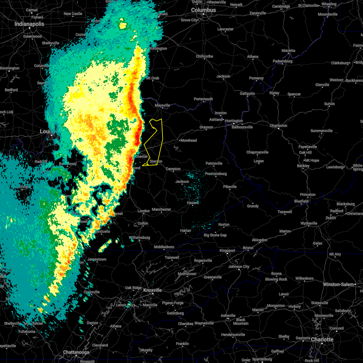 At 953 pm edt, severe thunderstorms were located along a line extending from 9 miles south of brooksville to 6 miles north of sideview to near harris ferry, moving east at 55 mph (radar indicated). Hazards include 60 mph wind gusts and penny size hail. Expect damage to roofs, siding, and trees. Locations impacted include, sharpsburg, clay city and stanton. At 953 pm edt, severe thunderstorms were located along a line extending from 9 miles south of brooksville to 6 miles north of sideview to near harris ferry, moving east at 55 mph (radar indicated). Hazards include 60 mph wind gusts and penny size hail. Expect damage to roofs, siding, and trees. Locations impacted include, sharpsburg, clay city and stanton.
|
| 4/13/2022 9:41 PM EDT |
 At 941 pm edt, severe thunderstorms were located along a line extending from 7 miles southeast of veterans park to near gum sulphur to pulaski county park, moving east at 50 mph (radar indicated). Hazards include 60 mph wind gusts. Expect damage to roofs, siding, and trees. locations impacted include, snider, boone, morrill, kerby knob, brazil and stanton. hail threat, radar indicated max hail size, <. 75 in wind threat, radar indicated max wind gust, 60 mph. At 941 pm edt, severe thunderstorms were located along a line extending from 7 miles southeast of veterans park to near gum sulphur to pulaski county park, moving east at 50 mph (radar indicated). Hazards include 60 mph wind gusts. Expect damage to roofs, siding, and trees. locations impacted include, snider, boone, morrill, kerby knob, brazil and stanton. hail threat, radar indicated max hail size, <. 75 in wind threat, radar indicated max wind gust, 60 mph.
|
| 4/13/2022 9:40 PM EDT |
 At 940 pm edt, severe thunderstorms were located along a line extending from 9 miles south of falmouth to paris to 8 miles east of nicholasville, moving east at 55 mph (radar indicated). Hazards include 60 mph wind gusts and penny size hail. Expect damage to roofs, siding, and trees. severe thunderstorms will be near, sharpsburg around 1000 pm edt. Other locations in the path of these severe thunderstorms include cressy, clay city and stanton. At 940 pm edt, severe thunderstorms were located along a line extending from 9 miles south of falmouth to paris to 8 miles east of nicholasville, moving east at 55 mph (radar indicated). Hazards include 60 mph wind gusts and penny size hail. Expect damage to roofs, siding, and trees. severe thunderstorms will be near, sharpsburg around 1000 pm edt. Other locations in the path of these severe thunderstorms include cressy, clay city and stanton.
|
| 4/13/2022 9:23 PM EDT |
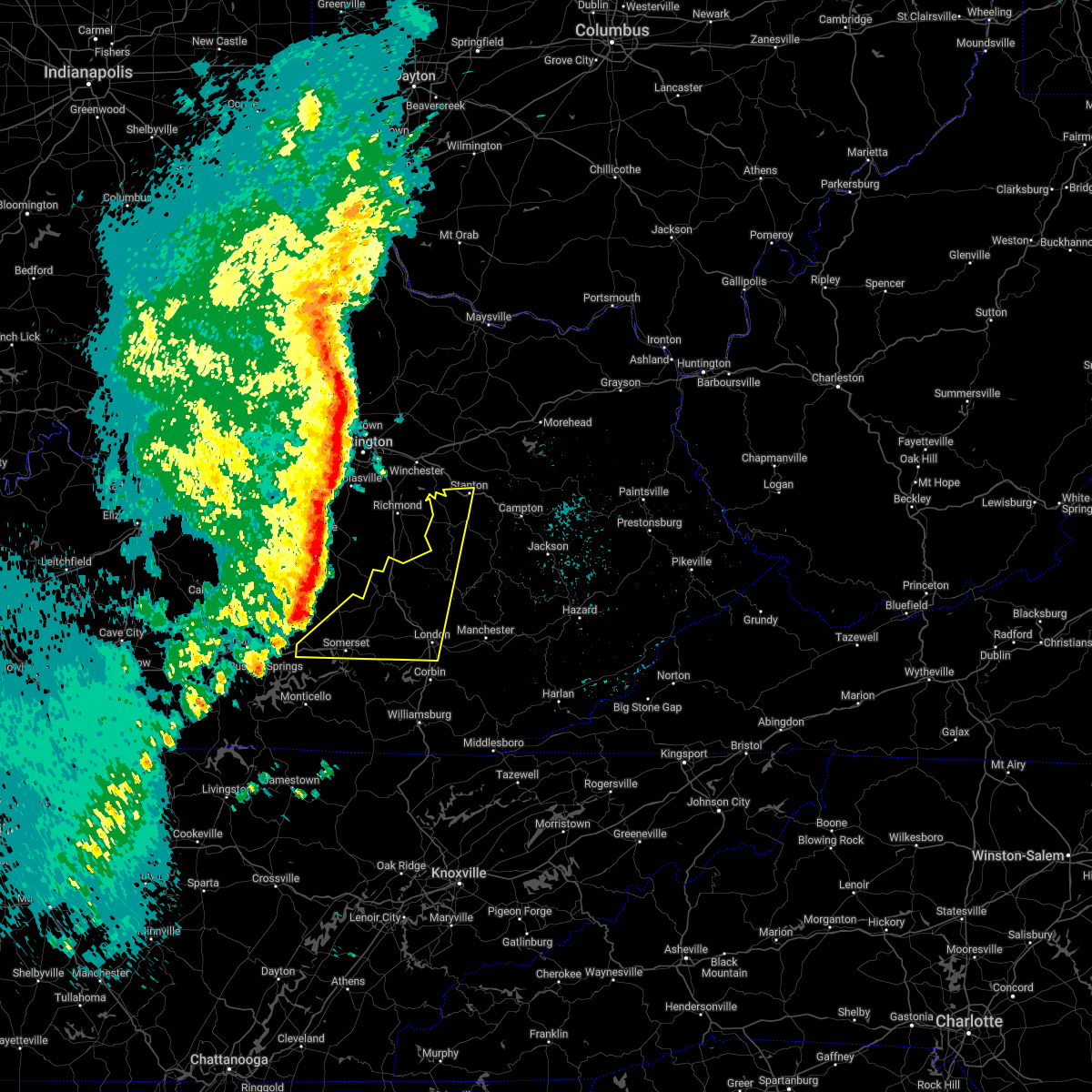 At 922 pm edt, severe thunderstorms were located along a line extending from near nicholasville to near stanford to near faubush, moving east at 65 mph (radar indicated). Hazards include 60 mph wind gusts and penny size hail. Expect damage to roofs, siding, and trees. severe thunderstorms will be near, nancy around 930 pm edt. gum sulphur around 935 pm edt. somerset around 940 pm edt. other locations in the path of these severe thunderstorms include bummer, harris ferry and hargett. hail threat, radar indicated max hail size, 0. 75 in wind threat, radar indicated max wind gust, 60 mph. At 922 pm edt, severe thunderstorms were located along a line extending from near nicholasville to near stanford to near faubush, moving east at 65 mph (radar indicated). Hazards include 60 mph wind gusts and penny size hail. Expect damage to roofs, siding, and trees. severe thunderstorms will be near, nancy around 930 pm edt. gum sulphur around 935 pm edt. somerset around 940 pm edt. other locations in the path of these severe thunderstorms include bummer, harris ferry and hargett. hail threat, radar indicated max hail size, 0. 75 in wind threat, radar indicated max wind gust, 60 mph.
|
| 2/17/2022 7:55 PM EST |
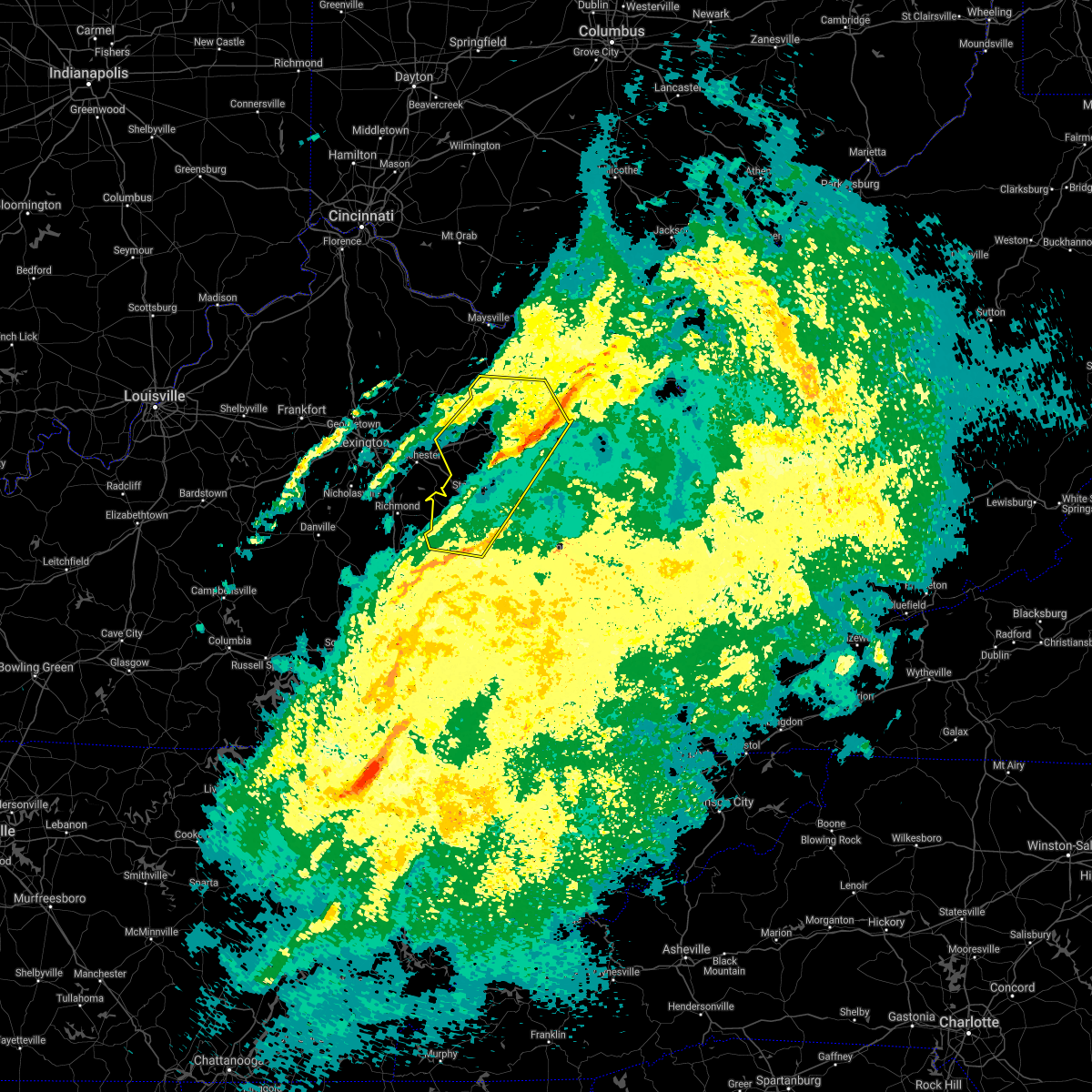 The severe thunderstorm warning for powell, montgomery, northwestern morgan, bath, estill, north central jackson, menifee, western lee, central fleming, rowan and northwestern wolfe counties will expire at 800 pm est, the storms which prompted the warning have weakened below severe limits, and no longer pose an immediate threat to life or property. therefore, the warning will be allowed to expire. however gusty winds are still possible with these thunderstorms. The severe thunderstorm warning for powell, montgomery, northwestern morgan, bath, estill, north central jackson, menifee, western lee, central fleming, rowan and northwestern wolfe counties will expire at 800 pm est, the storms which prompted the warning have weakened below severe limits, and no longer pose an immediate threat to life or property. therefore, the warning will be allowed to expire. however gusty winds are still possible with these thunderstorms.
|
| 2/17/2022 7:28 PM EST |
 At 727 pm est, severe thunderstorms were located along a line extending from cranston to near blackburn, moving east at 35 mph (radar indicated). Hazards include 60 mph wind gusts. Expect damage to roofs, siding, and trees. locations impacted include, triplett, haldeman, irvine, ravenna, pryse and crystal. hail threat, radar indicated max hail size, <. 75 in wind threat, radar indicated max wind gust, 60 mph. At 727 pm est, severe thunderstorms were located along a line extending from cranston to near blackburn, moving east at 35 mph (radar indicated). Hazards include 60 mph wind gusts. Expect damage to roofs, siding, and trees. locations impacted include, triplett, haldeman, irvine, ravenna, pryse and crystal. hail threat, radar indicated max hail size, <. 75 in wind threat, radar indicated max wind gust, 60 mph.
|
| 2/17/2022 7:24 PM EST | Tree down on hardwicks creek r in powell county KY, 2.3 miles NNW of Clay City, KY |
| 2/17/2022 7:09 PM EST |
 At 708 pm est, severe thunderstorms were located along a line extending from hillsboro to 6 miles southwest of richmond, moving east at 45 mph (radar indicated). Hazards include 60 mph wind gusts. Expect damage to roofs, siding, and trees. severe thunderstorms will be near, ringos mills around 715 pm est. hilda around 720 pm est. hays crossing around 725 pm est. other locations in the path of these severe thunderstorms include morehead, jinks and alumbaugh. hail threat, radar indicated max hail size, <. 75 in wind threat, radar indicated max wind gust, 60 mph. At 708 pm est, severe thunderstorms were located along a line extending from hillsboro to 6 miles southwest of richmond, moving east at 45 mph (radar indicated). Hazards include 60 mph wind gusts. Expect damage to roofs, siding, and trees. severe thunderstorms will be near, ringos mills around 715 pm est. hilda around 720 pm est. hays crossing around 725 pm est. other locations in the path of these severe thunderstorms include morehead, jinks and alumbaugh. hail threat, radar indicated max hail size, <. 75 in wind threat, radar indicated max wind gust, 60 mph.
|
| 12/11/2021 7:54 AM EST | Tree down on power line and blocking furnace junction roa in powell county KY, 8.1 miles NNW of Clay City, KY |
| 12/11/2021 7:05 AM EST | Corrects previous tstm wnd dmg report from 1 w furnace. tree down on power line and blocking furnace junction roa in powell county KY, 8.1 miles NNW of Clay City, KY |
| 12/11/2021 4:45 AM EST |
 At 444 am est, severe thunderstorms were located along a line extending from camargo to winston, moving northeast at 45 mph (radar indicated). Hazards include 60 mph wind gusts. Expect damage to roofs, siding, and trees. severe thunderstorms will be near, jeffersonville around 450 am est. hardwick around 455 am est. olympia springs around 500 am est. other locations in the path of these severe thunderstorms include salt lick, bowen and campsites in the indian creek area of the daniel boone national forrest. hail threat, radar indicated max hail size, <. 75 in wind threat, radar indicated max wind gust, 60 mph. At 444 am est, severe thunderstorms were located along a line extending from camargo to winston, moving northeast at 45 mph (radar indicated). Hazards include 60 mph wind gusts. Expect damage to roofs, siding, and trees. severe thunderstorms will be near, jeffersonville around 450 am est. hardwick around 455 am est. olympia springs around 500 am est. other locations in the path of these severe thunderstorms include salt lick, bowen and campsites in the indian creek area of the daniel boone national forrest. hail threat, radar indicated max hail size, <. 75 in wind threat, radar indicated max wind gust, 60 mph.
|
| 6/21/2021 3:00 PM EDT |
 At 300 pm edt, a severe thunderstorm was located over slade, or 7 miles southeast of stanton, moving east at 40 mph (radar indicated). Hazards include 60 mph wind gusts. Expect damage to roofs, siding, and trees. this severe thunderstorm will be near, koomer ridge campground around 305 pm edt. red river gorge around 310 pm edt. calaboose around 315 pm edt. Toliver around 320 pm edt. At 300 pm edt, a severe thunderstorm was located over slade, or 7 miles southeast of stanton, moving east at 40 mph (radar indicated). Hazards include 60 mph wind gusts. Expect damage to roofs, siding, and trees. this severe thunderstorm will be near, koomer ridge campground around 305 pm edt. red river gorge around 310 pm edt. calaboose around 315 pm edt. Toliver around 320 pm edt.
|
| 6/21/2021 2:51 PM EDT |
 At 250 pm edt, a severe thunderstorm was located over bowen, or near stanton, moving east at 50 mph (radar indicated). Hazards include 60 mph wind gusts and penny size hail. Expect damage to roofs, siding, and trees. Locations impacted include, tabor, mariba and denniston. At 250 pm edt, a severe thunderstorm was located over bowen, or near stanton, moving east at 50 mph (radar indicated). Hazards include 60 mph wind gusts and penny size hail. Expect damage to roofs, siding, and trees. Locations impacted include, tabor, mariba and denniston.
|
| 6/21/2021 2:26 PM EDT |
 At 226 pm edt, a severe thunderstorm was located over harris ferry, or 10 miles northeast of richmond, moving east at 50 mph (radar indicated). Hazards include 60 mph wind gusts and penny size hail. Expect damage to roofs, siding, and trees. this severe thunderstorm will be near, cressy around 230 pm edt. spout springs around 235 pm edt. stanton around 240 pm edt. rosslyn around 245 pm edt. Other locations in the path of this severe thunderstorm include bowen and campsites in the indian creek area of the daniel boone national forrest. At 226 pm edt, a severe thunderstorm was located over harris ferry, or 10 miles northeast of richmond, moving east at 50 mph (radar indicated). Hazards include 60 mph wind gusts and penny size hail. Expect damage to roofs, siding, and trees. this severe thunderstorm will be near, cressy around 230 pm edt. spout springs around 235 pm edt. stanton around 240 pm edt. rosslyn around 245 pm edt. Other locations in the path of this severe thunderstorm include bowen and campsites in the indian creek area of the daniel boone national forrest.
|
| 6/21/2021 2:04 PM EDT |
 At 204 pm edt, a severe thunderstorm was located over fagan, or near frenchburg, moving northeast at 25 mph (radar indicated). Hazards include 60 mph wind gusts and nickel size hail. Expect damage to roofs, siding, and trees. Locations impacted include, tabor and frenchburg. At 204 pm edt, a severe thunderstorm was located over fagan, or near frenchburg, moving northeast at 25 mph (radar indicated). Hazards include 60 mph wind gusts and nickel size hail. Expect damage to roofs, siding, and trees. Locations impacted include, tabor and frenchburg.
|
| 6/21/2021 1:48 PM EDT |
 At 147 pm edt, a severe thunderstorm was located over means, or 7 miles west of frenchburg, moving east at 25 mph (radar indicated). Hazards include 60 mph wind gusts and penny size hail. Expect damage to roofs, siding, and trees. Locations impacted include, rothwell, tabor and frenchburg. At 147 pm edt, a severe thunderstorm was located over means, or 7 miles west of frenchburg, moving east at 25 mph (radar indicated). Hazards include 60 mph wind gusts and penny size hail. Expect damage to roofs, siding, and trees. Locations impacted include, rothwell, tabor and frenchburg.
|
| 6/21/2021 1:38 PM EDT |
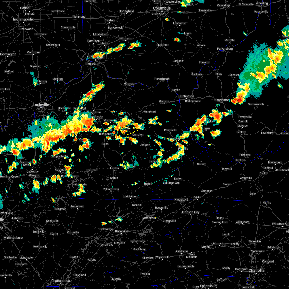 At 138 pm edt, a severe thunderstorm was located over vaughns mill, or over stanton, moving northeast at 25 mph (radar indicated). Hazards include 60 mph wind gusts and nickel size hail. Expect damage to roofs, siding, and trees. this severe thunderstorm will be near, cat creek around 150 pm edt. Other locations in the path of this severe thunderstorm include fagan, tabor and frenchburg. At 138 pm edt, a severe thunderstorm was located over vaughns mill, or over stanton, moving northeast at 25 mph (radar indicated). Hazards include 60 mph wind gusts and nickel size hail. Expect damage to roofs, siding, and trees. this severe thunderstorm will be near, cat creek around 150 pm edt. Other locations in the path of this severe thunderstorm include fagan, tabor and frenchburg.
|
| 6/21/2021 1:26 PM EDT |
 At 126 pm edt, a severe thunderstorm was located over levee, or 7 miles northwest of stanton, moving east at 30 mph (radar indicated). Hazards include 60 mph wind gusts and penny size hail. Expect damage to roofs, siding, and trees. this severe thunderstorm will be near, camargo around 130 pm edt. bean around 135 pm edt. jeffersonville around 140 pm edt. clay lick around 145 pm edt. Other locations in the path of this severe thunderstorm include cornwell and rothwell. At 126 pm edt, a severe thunderstorm was located over levee, or 7 miles northwest of stanton, moving east at 30 mph (radar indicated). Hazards include 60 mph wind gusts and penny size hail. Expect damage to roofs, siding, and trees. this severe thunderstorm will be near, camargo around 130 pm edt. bean around 135 pm edt. jeffersonville around 140 pm edt. clay lick around 145 pm edt. Other locations in the path of this severe thunderstorm include cornwell and rothwell.
|
| 6/12/2021 3:27 PM EDT | Tree knocked down near intersection of happy top and eddie ridge road in powell county KY, 1.9 miles NE of Clay City, KY |
| 7/20/2020 3:37 PM EDT |
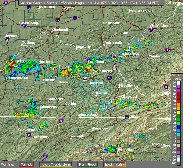 The severe thunderstorm warning for central powell county will expire at 345 pm edt, the storm which prompted the warning has weakened below severe limits, and no longer poses an immediate threat to life or property. therefore, the warning will be allowed to expire. The severe thunderstorm warning for central powell county will expire at 345 pm edt, the storm which prompted the warning has weakened below severe limits, and no longer poses an immediate threat to life or property. therefore, the warning will be allowed to expire.
|
| 7/20/2020 3:22 PM EDT |
 At 322 pm edt, a severe thunderstorm was located over rosslyn, or over stanton, moving east at 20 mph (radar indicated). Hazards include 60 mph wind gusts. expect damage to roofs, siding, and trees At 322 pm edt, a severe thunderstorm was located over rosslyn, or over stanton, moving east at 20 mph (radar indicated). Hazards include 60 mph wind gusts. expect damage to roofs, siding, and trees
|
| 7/6/2020 8:15 PM EDT | Trees down at 345 red bird dr... clay city. k in powell county KY, 3.5 miles ESE of Clay City, KY |
| 6/10/2020 6:47 PM EDT |
 At 646 pm edt, severe thunderstorms were located along a line extending from owingsville to near stanton, moving northeast at 60 mph (radar indicated). Hazards include 60 mph wind gusts and penny size hail. expect damage to roofs, siding, and trees At 646 pm edt, severe thunderstorms were located along a line extending from owingsville to near stanton, moving northeast at 60 mph (radar indicated). Hazards include 60 mph wind gusts and penny size hail. expect damage to roofs, siding, and trees
|
| 5/3/2020 6:52 PM EDT | Corrects previous tstm wnd dmg report from powell valley. car struck tree that had been downed over irvine rd. near intersection with snow creek rd. no fatalitie in powell county KY, 1.1 miles E of Clay City, KY |
| 5/3/2020 6:52 PM EDT |
 At 652 pm edt, a severe thunderstorm was located over cat creek, or over stanton, moving east at 35 mph (radar indicated). Hazards include 60 mph wind gusts and quarter size hail. Hail damage to vehicles is expected. expect wind damage to roofs, siding, and trees. this severe thunderstorm will be near, bowen around 655 pm edt. lombard around 700 pm edt. campsites in the indian creek area of the daniel boone national forrest around 705 pm edt. tabor around 710 pm edt. Mariba around 715 pm edt. At 652 pm edt, a severe thunderstorm was located over cat creek, or over stanton, moving east at 35 mph (radar indicated). Hazards include 60 mph wind gusts and quarter size hail. Hail damage to vehicles is expected. expect wind damage to roofs, siding, and trees. this severe thunderstorm will be near, bowen around 655 pm edt. lombard around 700 pm edt. campsites in the indian creek area of the daniel boone national forrest around 705 pm edt. tabor around 710 pm edt. Mariba around 715 pm edt.
|
| 5/3/2020 6:42 PM EDT | Car struck tree over irvine rd. near intersection with snow creek rd. no fatalitie in powell county KY, 1.1 miles E of Clay City, KY |
| 1/11/2020 1:56 PM EST | Trees down on power lines. meter pulled off house. time estimated from rada in powell county KY, 0.2 miles N of Clay City, KY |
| 1/11/2020 1:54 PM EST | Roof blown off home on stokley loop. time estimated off rada in powell county KY, 1.2 miles S of Clay City, KY |
| 1/11/2020 1:52 PM EST |
 At 152 pm est, severe thunderstorms were located along a line extending from near stoops to near blackburn, moving east at 50 mph (radar indicated). Hazards include 60 mph wind gusts. Expect damage to roofs, siding, and trees. Locations impacted include, mount sterling, stanton, irvine, jeffersonville, camargo, clay city, ravenna, clay lick, levee, kimbrell, rice station and kings station. At 152 pm est, severe thunderstorms were located along a line extending from near stoops to near blackburn, moving east at 50 mph (radar indicated). Hazards include 60 mph wind gusts. Expect damage to roofs, siding, and trees. Locations impacted include, mount sterling, stanton, irvine, jeffersonville, camargo, clay city, ravenna, clay lick, levee, kimbrell, rice station and kings station.
|
| 1/11/2020 1:49 PM EST | Trees down along mountain parkway near mm 12. radar estimate tim in powell county KY, 2.2 miles E of Clay City, KY |
| 1/11/2020 1:37 PM EST |
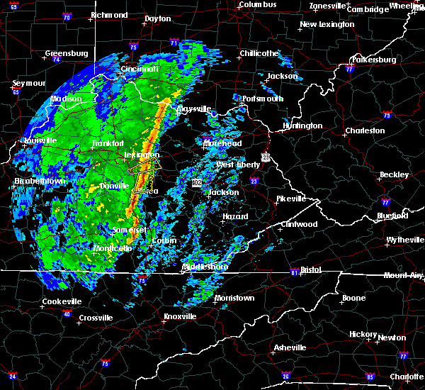 At 137 pm est, severe thunderstorms were located along a line extending from near sideview to 6 miles north of morrill, moving east at 50 mph (radar indicated). Hazards include 60 mph wind gusts. expect damage to roofs, siding, and trees At 137 pm est, severe thunderstorms were located along a line extending from near sideview to 6 miles north of morrill, moving east at 50 mph (radar indicated). Hazards include 60 mph wind gusts. expect damage to roofs, siding, and trees
|
| 8/20/2019 1:52 PM EDT | Numerous trees down on mountain parkway. clay city fire department and road department on the scen in powell county KY, 4.8 miles SE of Clay City, KY |
| 6/23/2019 7:21 PM EDT |
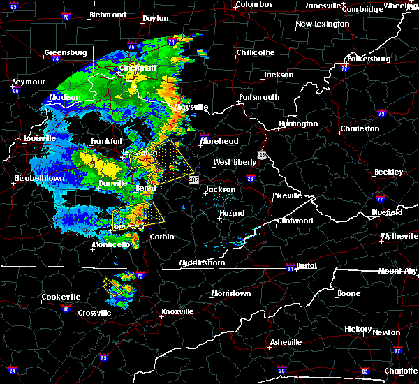 At 720 pm edt, a severe thunderstorm was located over westbend, or 9 miles south of mount sterling, moving east at 30 mph (radar indicated). Hazards include 60 mph wind gusts. expect damage to roofs, siding, and trees At 720 pm edt, a severe thunderstorm was located over westbend, or 9 miles south of mount sterling, moving east at 30 mph (radar indicated). Hazards include 60 mph wind gusts. expect damage to roofs, siding, and trees
|
| 6/16/2019 7:14 PM EDT | Tree down along mountain parkway. forced the closure of both lanes in the westbound directio in powell county KY, 2.5 miles SE of Clay City, KY |
| 7/30/2018 7:09 PM EDT | Three trees down on highway 15 near clay cit in powell county KY, 0.2 miles N of Clay City, KY |
| 7/30/2018 7:09 PM EDT | Report of a roof blown off a house on shuler r in powell county KY, 1.2 miles ESE of Clay City, KY |
| 7/30/2018 7:09 PM EDT |
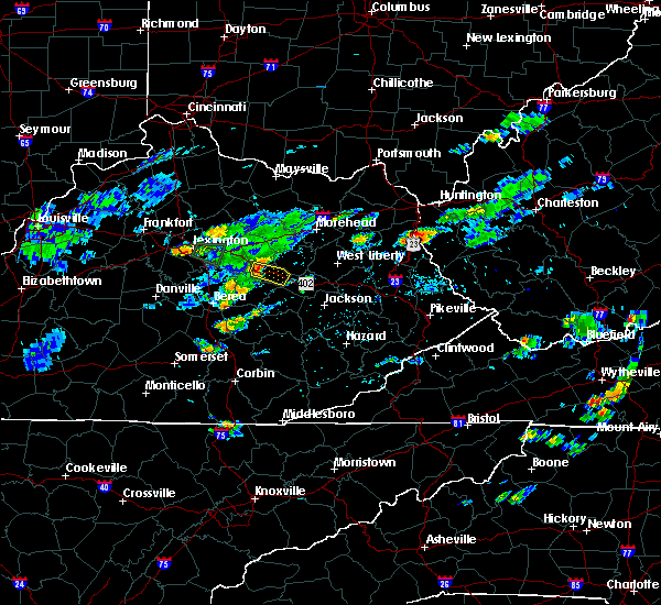 At 708 pm edt, a severe thunderstorm was located over stanton, moving east at 20 mph (radar indicated). Hazards include 60 mph wind gusts. expect damage to roofs, siding, and trees At 708 pm edt, a severe thunderstorm was located over stanton, moving east at 20 mph (radar indicated). Hazards include 60 mph wind gusts. expect damage to roofs, siding, and trees
|
| 7/20/2018 5:57 PM EDT |
 At 511 pm edt, a severe thunderstorm was located over westbend, or 9 miles west of stanton, moving east at 45 mph (radar indicated). Hazards include 60 mph wind gusts and penny size hail. expect damage to roofs, siding, and trees At 511 pm edt, a severe thunderstorm was located over westbend, or 9 miles west of stanton, moving east at 45 mph (radar indicated). Hazards include 60 mph wind gusts and penny size hail. expect damage to roofs, siding, and trees
|
| 7/20/2018 5:11 PM EDT |
 At 511 pm edt, a severe thunderstorm was located over westbend, or 9 miles west of stanton, moving east at 45 mph (radar indicated). Hazards include 60 mph wind gusts and penny size hail. expect damage to roofs, siding, and trees At 511 pm edt, a severe thunderstorm was located over westbend, or 9 miles west of stanton, moving east at 45 mph (radar indicated). Hazards include 60 mph wind gusts and penny size hail. expect damage to roofs, siding, and trees
|
| 7/20/2018 4:46 PM EDT |
 At 445 pm edt, severe thunderstorms were located along a line extending from near reynoldsville to bean, moving east at 60 mph (radar indicated). Hazards include 70 mph wind gusts and penny size hail. Expect considerable tree damage. damage is likely to mobile homes, roofs, and outbuildings. Locations impacted include, stanton, owingsville, frenchburg, marshall, jeffersonville, camargo, clay city, salt lick, campsites in the indian creek area of the daniel boone national forrest, clay lick, wyoming and cornwell. At 445 pm edt, severe thunderstorms were located along a line extending from near reynoldsville to bean, moving east at 60 mph (radar indicated). Hazards include 70 mph wind gusts and penny size hail. Expect considerable tree damage. damage is likely to mobile homes, roofs, and outbuildings. Locations impacted include, stanton, owingsville, frenchburg, marshall, jeffersonville, camargo, clay city, salt lick, campsites in the indian creek area of the daniel boone national forrest, clay lick, wyoming and cornwell.
|
| 7/20/2018 4:25 PM EDT |
 At 424 pm edt, severe thunderstorms were located along a line extending from near paris to near winchester, moving east at 55 mph (radar indicated). Hazards include 70 mph wind gusts and quarter size hail. Hail damage to vehicles is expected. expect considerable tree damage. Wind damage is also likely to mobile homes, roofs, and outbuildings. At 424 pm edt, severe thunderstorms were located along a line extending from near paris to near winchester, moving east at 55 mph (radar indicated). Hazards include 70 mph wind gusts and quarter size hail. Hail damage to vehicles is expected. expect considerable tree damage. Wind damage is also likely to mobile homes, roofs, and outbuildings.
|
| 7/5/2018 7:09 PM EDT |
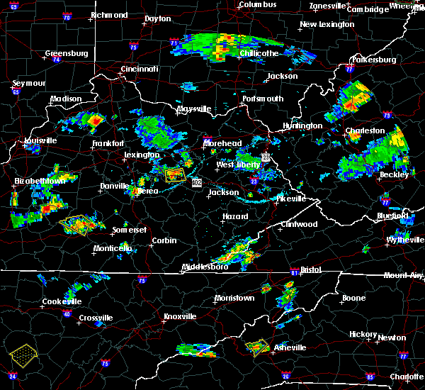 At 708 pm edt, a severe thunderstorm was located over cat creek, or over stanton, moving south at 15 mph (radar indicated). Hazards include 60 mph wind gusts. Expect damage to roofs, siding, and trees. Locations impacted include, stanton, clay city, fagan, nada, bowen, rosslyn, lombard, cat creek, slade, knowlton, haystack and rogers chapel. At 708 pm edt, a severe thunderstorm was located over cat creek, or over stanton, moving south at 15 mph (radar indicated). Hazards include 60 mph wind gusts. Expect damage to roofs, siding, and trees. Locations impacted include, stanton, clay city, fagan, nada, bowen, rosslyn, lombard, cat creek, slade, knowlton, haystack and rogers chapel.
|
| 7/5/2018 6:52 PM EDT |
 At 652 pm edt, a severe thunderstorm was located near cat creek, or near stanton, moving south at 10 mph (radar indicated). Hazards include 60 mph wind gusts. expect damage to roofs, siding, and trees At 652 pm edt, a severe thunderstorm was located near cat creek, or near stanton, moving south at 10 mph (radar indicated). Hazards include 60 mph wind gusts. expect damage to roofs, siding, and trees
|
| 5/31/2018 4:37 PM EDT |
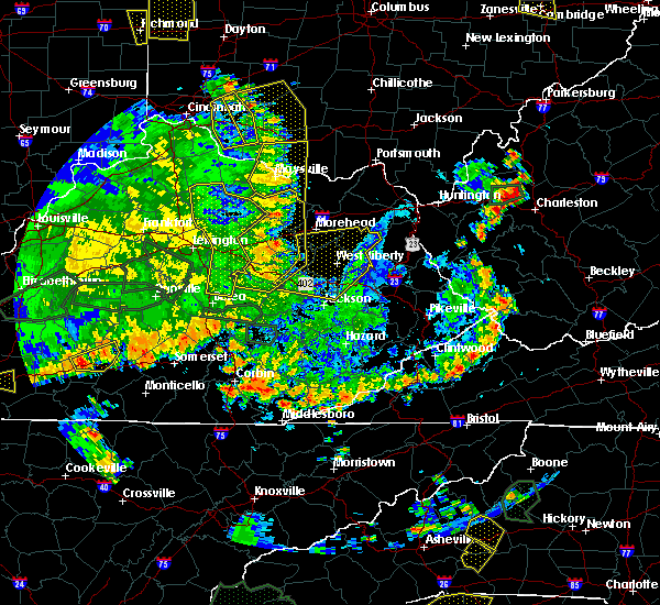 At 437 pm edt, severe thunderstorms were located along a line extending from near nepton to reynoldsville to bean to spout springs, moving east at 35 mph (radar indicated). Hazards include 60 mph wind gusts and penny size hail. Expect damage to roofs, siding, and trees. Locations impacted include, mount sterling, stanton, irvine, flemingsburg, owingsville, frenchburg, marshall, jeffersonville, camargo, clay city, sharpsburg, salt lick, campsites in the indian creek area of the daniel boone national forrest, fairview, pilot, pecks ridge, levee, bowen, cornwell and kimbrell. At 437 pm edt, severe thunderstorms were located along a line extending from near nepton to reynoldsville to bean to spout springs, moving east at 35 mph (radar indicated). Hazards include 60 mph wind gusts and penny size hail. Expect damage to roofs, siding, and trees. Locations impacted include, mount sterling, stanton, irvine, flemingsburg, owingsville, frenchburg, marshall, jeffersonville, camargo, clay city, sharpsburg, salt lick, campsites in the indian creek area of the daniel boone national forrest, fairview, pilot, pecks ridge, levee, bowen, cornwell and kimbrell.
|
| 5/31/2018 4:17 PM EDT |
 The national weather service in jackson ky has issued a * severe thunderstorm warning for. powell county in east central kentucky. montgomery county in east central kentucky. bath county in east central kentucky. Northern estill county in east central kentucky. The national weather service in jackson ky has issued a * severe thunderstorm warning for. powell county in east central kentucky. montgomery county in east central kentucky. bath county in east central kentucky. Northern estill county in east central kentucky.
|
| 5/31/2018 1:09 PM EDT |
 At 109 pm edt, severe thunderstorms were located along a line extending from near bean to north irvine, moving east at 30 mph (radar indicated). Hazards include 60 mph wind gusts and penny size hail. Expect damage to roofs, siding, and trees. Locations impacted include, stanton, irvine, frenchburg, jeffersonville, clay city, ravenna, campsites in the indian creek area of the daniel boone national forrest, pilot, levee, bowen, cornwell, kimbrell, rothwell, rice station, kings station, fagan, calloway crossing, wiseman crossing station, virden and winston. At 109 pm edt, severe thunderstorms were located along a line extending from near bean to north irvine, moving east at 30 mph (radar indicated). Hazards include 60 mph wind gusts and penny size hail. Expect damage to roofs, siding, and trees. Locations impacted include, stanton, irvine, frenchburg, jeffersonville, clay city, ravenna, campsites in the indian creek area of the daniel boone national forrest, pilot, levee, bowen, cornwell, kimbrell, rothwell, rice station, kings station, fagan, calloway crossing, wiseman crossing station, virden and winston.
|
| 5/31/2018 12:43 PM EDT |
 At 1242 pm edt, severe thunderstorms were located along a line extending from near winchester to near richmond, moving east at 30 mph (radar indicated). Hazards include 60 mph wind gusts and penny size hail. expect damage to roofs, siding, and trees At 1242 pm edt, severe thunderstorms were located along a line extending from near winchester to near richmond, moving east at 30 mph (radar indicated). Hazards include 60 mph wind gusts and penny size hail. expect damage to roofs, siding, and trees
|
| 4/3/2018 10:54 PM EDT |
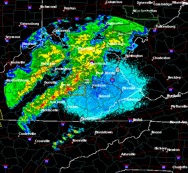 The severe thunderstorm warning for powell, southeastern montgomery, southeastern bath, estill, western menifee, northwestern lee and northwestern wolfe counties will expire at 1100 pm edt, a new warning has been issued for this storm. therefore, the warning will be allowed to expire. keep in mind that severe wind is still possible with these thunderstorms. a severe thunderstorm watch remains in effect until 300 am edt for southeastern and east central kentucky. The severe thunderstorm warning for powell, southeastern montgomery, southeastern bath, estill, western menifee, northwestern lee and northwestern wolfe counties will expire at 1100 pm edt, a new warning has been issued for this storm. therefore, the warning will be allowed to expire. keep in mind that severe wind is still possible with these thunderstorms. a severe thunderstorm watch remains in effect until 300 am edt for southeastern and east central kentucky.
|
| 4/3/2018 10:41 PM EDT |
 At 1041 pm edt, severe thunderstorms were located along a line extending from bean to willow tree, moving east at 50 mph (radar indicated). Hazards include 60 mph wind gusts. Expect damage to roofs, siding, and trees. Locations impacted include, stanton, irvine, frenchburg, jeffersonville, clay city, ravenna, campsites in the indian creek area of the daniel boone national forrest, pilot, torrent, clay lick, bowen, cornwell, leeco, rothwell, rice station, kings station, pinnacle, fagan, calloway crossing and wiseman crossing station. At 1041 pm edt, severe thunderstorms were located along a line extending from bean to willow tree, moving east at 50 mph (radar indicated). Hazards include 60 mph wind gusts. Expect damage to roofs, siding, and trees. Locations impacted include, stanton, irvine, frenchburg, jeffersonville, clay city, ravenna, campsites in the indian creek area of the daniel boone national forrest, pilot, torrent, clay lick, bowen, cornwell, leeco, rothwell, rice station, kings station, pinnacle, fagan, calloway crossing and wiseman crossing station.
|
| 4/3/2018 10:12 PM EDT |
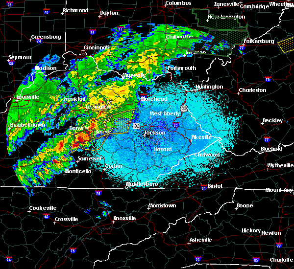 At 1011 pm edt, severe thunderstorms were located along a line extending from 7 miles west of harris ferry to near boone, moving east at 50 mph (radar indicated). Hazards include 60 mph wind gusts. expect damage to roofs, siding, and trees At 1011 pm edt, severe thunderstorms were located along a line extending from 7 miles west of harris ferry to near boone, moving east at 50 mph (radar indicated). Hazards include 60 mph wind gusts. expect damage to roofs, siding, and trees
|
| 8/22/2017 7:36 PM EDT |
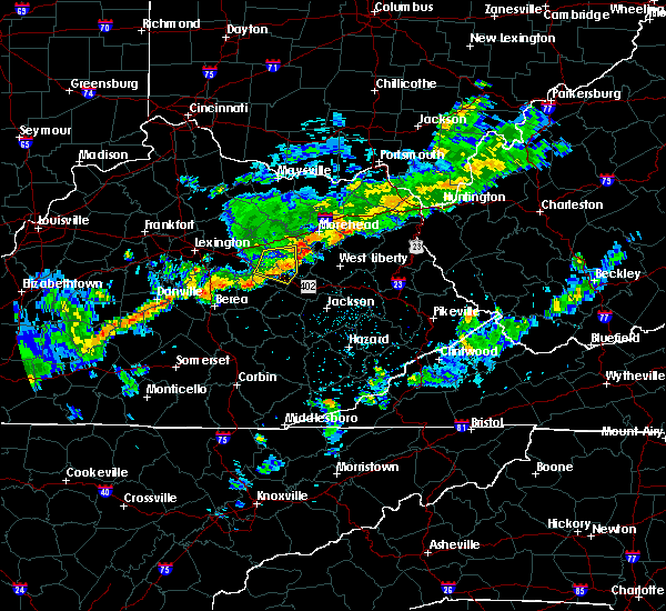 The severe thunderstorm warning for central powell, southeastern montgomery, south central bath and western menifee counties will expire at 745 pm edt, the storm which prompted the warning has weakened below severe limits, and has exited the warned area. therefore, the warning will be allowed to expire. however heavy rain is still possible with this thunderstorm. a severe thunderstorm watch remains in effect until 900 pm edt for east central kentucky. The severe thunderstorm warning for central powell, southeastern montgomery, south central bath and western menifee counties will expire at 745 pm edt, the storm which prompted the warning has weakened below severe limits, and has exited the warned area. therefore, the warning will be allowed to expire. however heavy rain is still possible with this thunderstorm. a severe thunderstorm watch remains in effect until 900 pm edt for east central kentucky.
|
| 8/22/2017 7:20 PM EDT |
 A severe thunderstorm warning remains in effect until 745 pm edt for central powell. southeastern montgomery. south central bath and western menifee counties. at 720 pm edt, a severe thunderstorm was located over lucky stop, or 8 miles north of stanton, moving east at 50 mph. hazard. 60 mph wind gusts. A severe thunderstorm warning remains in effect until 745 pm edt for central powell. southeastern montgomery. south central bath and western menifee counties. at 720 pm edt, a severe thunderstorm was located over lucky stop, or 8 miles north of stanton, moving east at 50 mph. hazard. 60 mph wind gusts.
|
| 8/22/2017 6:57 PM EDT |
 At 656 pm edt, a severe thunderstorm was located over winchester, or 12 miles southwest of mount sterling, moving east at 50 mph (radar indicated). Hazards include 60 mph wind gusts. expect damage to roofs, siding, and trees At 656 pm edt, a severe thunderstorm was located over winchester, or 12 miles southwest of mount sterling, moving east at 50 mph (radar indicated). Hazards include 60 mph wind gusts. expect damage to roofs, siding, and trees
|
| 8/22/2017 6:57 PM EDT |
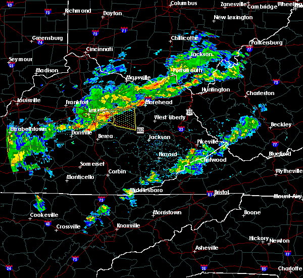 At 656 pm edt, a severe thunderstorm was located over winchester, or 12 miles southwest of mount sterling, moving east at 50 mph (radar indicated). Hazards include 60 mph wind gusts. expect damage to roofs, siding, and trees At 656 pm edt, a severe thunderstorm was located over winchester, or 12 miles southwest of mount sterling, moving east at 50 mph (radar indicated). Hazards include 60 mph wind gusts. expect damage to roofs, siding, and trees
|
| 5/27/2017 4:53 PM EDT |
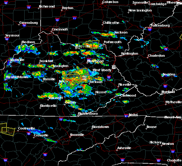 The severe thunderstorm warning for northern powell, southeastern montgomery, west central morgan and menifee counties will expire at 500 pm edt, the storm which prompted the warning has weakened below severe limits, and no longer poses an immediate threat to life or property. therefore the warning will be allowed to expire. however heavy rain and dangerous lightning is still possible with this thunderstorm. a severe thunderstorm watch remains in effect until 1000 pm edt for southeastern and east central kentucky. The severe thunderstorm warning for northern powell, southeastern montgomery, west central morgan and menifee counties will expire at 500 pm edt, the storm which prompted the warning has weakened below severe limits, and no longer poses an immediate threat to life or property. therefore the warning will be allowed to expire. however heavy rain and dangerous lightning is still possible with this thunderstorm. a severe thunderstorm watch remains in effect until 1000 pm edt for southeastern and east central kentucky.
|
| 5/27/2017 4:36 PM EDT |
 At 436 pm edt, a severe thunderstorm was located over mariba, or near frenchburg, moving east at 35 mph (radar indicated). Hazards include 60 mph wind gusts and quarter size hail. Hail damage to vehicles is expected. expect wind damage to roofs, siding, and trees. Locations impacted include, stanton, frenchburg, jeffersonville, clay city, wellington, campsites in the indian creek area of the daniel boone national forrest, means, bowen, stoll, cornwell, rothwell, denniston, waltersville, fagan, virden, tabor, rosslyn, ratlitt, scranton and mariba. At 436 pm edt, a severe thunderstorm was located over mariba, or near frenchburg, moving east at 35 mph (radar indicated). Hazards include 60 mph wind gusts and quarter size hail. Hail damage to vehicles is expected. expect wind damage to roofs, siding, and trees. Locations impacted include, stanton, frenchburg, jeffersonville, clay city, wellington, campsites in the indian creek area of the daniel boone national forrest, means, bowen, stoll, cornwell, rothwell, denniston, waltersville, fagan, virden, tabor, rosslyn, ratlitt, scranton and mariba.
|
| 5/27/2017 4:15 PM EDT | Quarter sized hail reported 0.2 miles N of Clay City, KY |
| 5/27/2017 4:12 PM EDT |
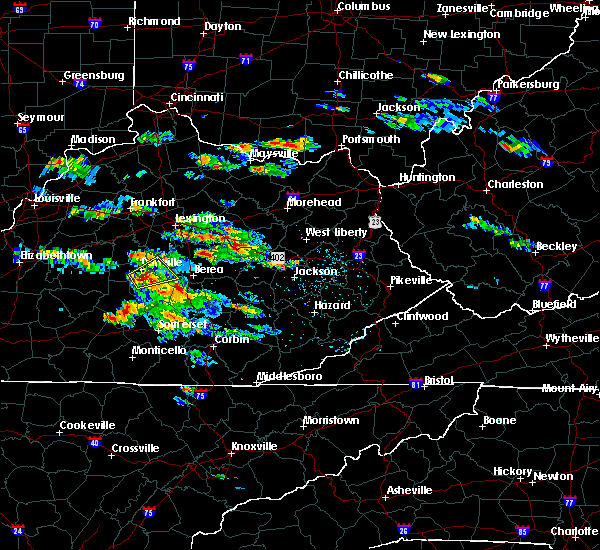 At 411 pm edt, a severe thunderstorm was located over stanton, moving east at 35 mph (radar indicated). Hazards include 60 mph wind gusts and quarter size hail. Hail damage to vehicles is expected. Expect wind damage to roofs, siding, and trees. At 411 pm edt, a severe thunderstorm was located over stanton, moving east at 35 mph (radar indicated). Hazards include 60 mph wind gusts and quarter size hail. Hail damage to vehicles is expected. Expect wind damage to roofs, siding, and trees.
|
| 4/5/2017 8:46 PM EDT |
 At 845 pm edt, severe thunderstorms were located along a line extending from flat creek to lower spencer to waltersville, moving northeast at 50 mph (radar indicated). Hazards include 70 mph wind gusts and half dollar size hail. Hail damage to vehicles is expected. expect considerable tree damage. wind damage is also likely to mobile homes, roofs, and outbuildings. locations impacted include, mount sterling, owingsville, jeffersonville, camargo, sharpsburg, clay lick, pecks ridge, levee, wyoming, peasticks, flat creek, odessa, bourbon furnace, pebble, virden, prewitt, crooks, bethel, oakley and westbend. A tornado watch remains in effect until 1000 pm edt for east central kentucky. At 845 pm edt, severe thunderstorms were located along a line extending from flat creek to lower spencer to waltersville, moving northeast at 50 mph (radar indicated). Hazards include 70 mph wind gusts and half dollar size hail. Hail damage to vehicles is expected. expect considerable tree damage. wind damage is also likely to mobile homes, roofs, and outbuildings. locations impacted include, mount sterling, owingsville, jeffersonville, camargo, sharpsburg, clay lick, pecks ridge, levee, wyoming, peasticks, flat creek, odessa, bourbon furnace, pebble, virden, prewitt, crooks, bethel, oakley and westbend. A tornado watch remains in effect until 1000 pm edt for east central kentucky.
|
| 4/5/2017 8:45 PM EDT |
 At 845 pm edt, a severe thunderstorm was located over vaughns mill, or near stanton, moving northeast at 50 mph (radar indicated). Hazards include 70 mph wind gusts and quarter size hail. Hail damage to vehicles is expected. expect considerable tree damage. wind damage is also likely to mobile homes, roofs, and outbuildings. locations impacted include, stanton, irvine, clay city, ravenna, campsites in the indian creek area of the daniel boone national forrest, pilot, bowen, kimbrell, rice station, kings station, calloway crossing, wiseman crossing station, winston, patsey, wisemantown, vaughns mill, hardwick, weedon, natural bridge s. p. and knowlton. A tornado watch remains in effect until 1000 pm edt for east central kentucky. At 845 pm edt, a severe thunderstorm was located over vaughns mill, or near stanton, moving northeast at 50 mph (radar indicated). Hazards include 70 mph wind gusts and quarter size hail. Hail damage to vehicles is expected. expect considerable tree damage. wind damage is also likely to mobile homes, roofs, and outbuildings. locations impacted include, stanton, irvine, clay city, ravenna, campsites in the indian creek area of the daniel boone national forrest, pilot, bowen, kimbrell, rice station, kings station, calloway crossing, wiseman crossing station, winston, patsey, wisemantown, vaughns mill, hardwick, weedon, natural bridge s. p. and knowlton. A tornado watch remains in effect until 1000 pm edt for east central kentucky.
|
| 4/5/2017 8:37 PM EDT | Trees down on highway 8 in powell county KY, 1.9 miles NE of Clay City, KY |
| 4/5/2017 8:31 PM EDT |
 At 831 pm edt, a severe thunderstorm was located over fox, or 8 miles northwest of irvine, moving northeast at 50 mph (radar indicated). Hazards include 70 mph wind gusts and quarter size hail. Hail damage to vehicles is expected. expect considerable tree damage. Wind damage is also likely to mobile homes, roofs, and outbuildings. At 831 pm edt, a severe thunderstorm was located over fox, or 8 miles northwest of irvine, moving northeast at 50 mph (radar indicated). Hazards include 70 mph wind gusts and quarter size hail. Hail damage to vehicles is expected. expect considerable tree damage. Wind damage is also likely to mobile homes, roofs, and outbuildings.
|
| 4/5/2017 8:29 PM EDT |
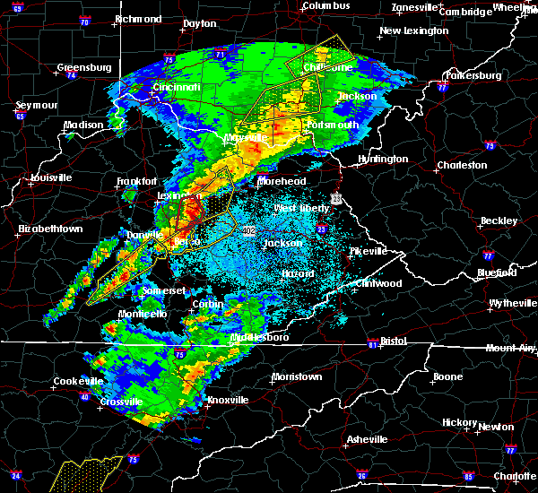 At 829 pm edt, severe thunderstorms were located along a line extending from near winchester to 8 miles northwest of cressy to near harris ferry, moving northeast at 45 mph (radar indicated). Hazards include 70 mph wind gusts and half dollar size hail. Hail damage to vehicles is expected. expect considerable tree damage. Wind damage is also likely to mobile homes, roofs, and outbuildings. At 829 pm edt, severe thunderstorms were located along a line extending from near winchester to 8 miles northwest of cressy to near harris ferry, moving northeast at 45 mph (radar indicated). Hazards include 70 mph wind gusts and half dollar size hail. Hail damage to vehicles is expected. expect considerable tree damage. Wind damage is also likely to mobile homes, roofs, and outbuildings.
|
| 3/27/2017 8:15 PM EDT |
 At 814 pm edt, severe thunderstorms were located along a line extending from mount sterling to ravenna to hurley, moving east at 45 mph (radar indicated). Hazards include 60 mph wind gusts and penny size hail. Expect damage to roofs, siding, and trees. Locations impacted include, mount sterling, stanton, irvine, mckee, jeffersonville, camargo, clay city, ravenna, pilot, levee, bowen, kimbrell, wiseman crossing station, virden, winston, patsey, vaughns mill, shirley, alumbaugh and evelyn. At 814 pm edt, severe thunderstorms were located along a line extending from mount sterling to ravenna to hurley, moving east at 45 mph (radar indicated). Hazards include 60 mph wind gusts and penny size hail. Expect damage to roofs, siding, and trees. Locations impacted include, mount sterling, stanton, irvine, mckee, jeffersonville, camargo, clay city, ravenna, pilot, levee, bowen, kimbrell, wiseman crossing station, virden, winston, patsey, vaughns mill, shirley, alumbaugh and evelyn.
|
| 3/27/2017 7:49 PM EDT |
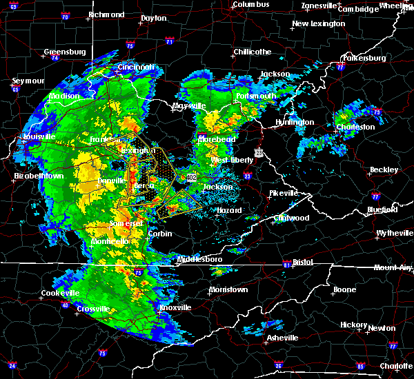 At 748 pm edt, severe thunderstorms were located along a line extending from near cadentown to near boone to ottowa, moving northeast at 40 mph (radar indicated). Hazards include 60 mph wind gusts and penny size hail. expect damage to roofs, siding, and trees At 748 pm edt, severe thunderstorms were located along a line extending from near cadentown to near boone to ottowa, moving northeast at 40 mph (radar indicated). Hazards include 60 mph wind gusts and penny size hail. expect damage to roofs, siding, and trees
|
| 3/1/2017 8:48 AM EST |
 At 848 am est, severe thunderstorms were located along a line extending from near denniston to crystal to spiro, moving east at 60 mph (radar indicated). Hazards include 70 mph wind gusts. Expect considerable tree damage. damage is likely to mobile homes, roofs, and outbuildings. Locations impacted include, stanton, irvine, mount vernon, beattyville, mckee, frenchburg, boone, jeffersonville, clay city, ravenna, wellington, campsites in the indian creek area of the daniel boone national forrest, pilot, donaro, bummer, white ash, bowen, cornwell, leeco and robinet. At 848 am est, severe thunderstorms were located along a line extending from near denniston to crystal to spiro, moving east at 60 mph (radar indicated). Hazards include 70 mph wind gusts. Expect considerable tree damage. damage is likely to mobile homes, roofs, and outbuildings. Locations impacted include, stanton, irvine, mount vernon, beattyville, mckee, frenchburg, boone, jeffersonville, clay city, ravenna, wellington, campsites in the indian creek area of the daniel boone national forrest, pilot, donaro, bummer, white ash, bowen, cornwell, leeco and robinet.
|
| 3/1/2017 8:35 AM EST |
 At 835 am est, severe thunderstorms were located along a line extending from oggs station to cressy to near blackburn to indian lakes park, moving east at 65 mph (radar indicated). Hazards include 70 mph wind gusts. Expect considerable tree damage. damage is likely to mobile homes, roofs, and outbuildings. Locations impacted include, mount sterling, stanton, irvine, mount vernon, beattyville, mckee, frenchburg, boone, jeffersonville, camargo, clay city, ravenna, wellington, campsites in the indian creek area of the daniel boone national forrest, pilot, donaro, bummer, bowen, cornwell and kimbrell. At 835 am est, severe thunderstorms were located along a line extending from oggs station to cressy to near blackburn to indian lakes park, moving east at 65 mph (radar indicated). Hazards include 70 mph wind gusts. Expect considerable tree damage. damage is likely to mobile homes, roofs, and outbuildings. Locations impacted include, mount sterling, stanton, irvine, mount vernon, beattyville, mckee, frenchburg, boone, jeffersonville, camargo, clay city, ravenna, wellington, campsites in the indian creek area of the daniel boone national forrest, pilot, donaro, bummer, bowen, cornwell and kimbrell.
|
| 3/1/2017 8:33 AM EST | A tree was blown down in the heartbreak ridge area. this is a public report via social media. the time of the event is estimated from radar dat in powell county KY, 1.7 miles W of Clay City, KY |
| 3/1/2017 8:23 AM EST |
 At 823 am est, severe thunderstorms were located along a line extending from prewitt to 6 miles northwest of harris ferry to 6 miles south of richmond to 6 miles south of stanford, moving east at 65 mph (radar indicated). Hazards include 70 mph wind gusts. Expect considerable tree damage. Damage is likely to mobile homes, roofs, and outbuildings. At 823 am est, severe thunderstorms were located along a line extending from prewitt to 6 miles northwest of harris ferry to 6 miles south of richmond to 6 miles south of stanford, moving east at 65 mph (radar indicated). Hazards include 70 mph wind gusts. Expect considerable tree damage. Damage is likely to mobile homes, roofs, and outbuildings.
|
| 12/18/2016 1:11 AM EST |
 At 110 am est, severe thunderstorms were located along a line extending from cornwell to wagersville to dudley station, moving northeast at 80 mph (radar indicated). Hazards include 60 mph wind gusts. Expect damage to roofs, siding, and trees. Locations impacted include, stanton, irvine, mount vernon, beattyville, mckee, frenchburg, campton, clay city, ravenna, wellington, campsites in the indian creek area of the daniel boone national forest, vaughns mill, waneta, willow shoals, cressmont, stoll, pitts, zachariah, johnetta and koomer ridge campground. At 110 am est, severe thunderstorms were located along a line extending from cornwell to wagersville to dudley station, moving northeast at 80 mph (radar indicated). Hazards include 60 mph wind gusts. Expect damage to roofs, siding, and trees. Locations impacted include, stanton, irvine, mount vernon, beattyville, mckee, frenchburg, campton, clay city, ravenna, wellington, campsites in the indian creek area of the daniel boone national forest, vaughns mill, waneta, willow shoals, cressmont, stoll, pitts, zachariah, johnetta and koomer ridge campground.
|
| 12/18/2016 12:55 AM EST |
 At 1255 am est, severe thunderstorms were located along a line extending from near cressy to near rockford to bandy, moving northeast at 75 mph (radar indicated). Hazards include 60 mph wind gusts. expect damage to roofs, siding, and trees At 1255 am est, severe thunderstorms were located along a line extending from near cressy to near rockford to bandy, moving northeast at 75 mph (radar indicated). Hazards include 60 mph wind gusts. expect damage to roofs, siding, and trees
|
| 7/8/2016 12:46 PM EDT |
 At 1245 pm edt, a severe thunderstorm was located over means, or 8 miles northeast of stanton, moving east at 55 mph (radar indicated). Hazards include 60 mph wind gusts. Expect damage to roofs. siding. and trees. this severe storm will be near, rothwell and fagan around 1250 pm edt. frenchburg, campsites in the indian creek area of the daniel boone national forest, tabor, ratlitt and sudith around 1255 pm edt. this includes the following highways, bert t. combs mountain parkway between mile markers 12 and 18. Interstate 64 in eastern kentucky between mile markers 107 and 121. At 1245 pm edt, a severe thunderstorm was located over means, or 8 miles northeast of stanton, moving east at 55 mph (radar indicated). Hazards include 60 mph wind gusts. Expect damage to roofs. siding. and trees. this severe storm will be near, rothwell and fagan around 1250 pm edt. frenchburg, campsites in the indian creek area of the daniel boone national forest, tabor, ratlitt and sudith around 1255 pm edt. this includes the following highways, bert t. combs mountain parkway between mile markers 12 and 18. Interstate 64 in eastern kentucky between mile markers 107 and 121.
|
| 7/8/2016 12:45 PM EDT | Tree down on adams ridge roa in powell county KY, 2.2 miles E of Clay City, KY |
| 7/8/2016 12:29 PM EDT |
 At 1226 pm edt, a severe thunderstorm was located near wades mill, or 8 miles west of mount sterling, moving east at 55 mph (radar indicated). Hazards include 60 mph wind gusts. Expect damage to roofs. siding. and trees. this severe thunderstorm will be near, grassy lick around 1230 pm edt. mount sterling and camargo around 1235 pm edt. jeffersonville and howards mill around 1240 pm edt. owingsville and cedar groves around 1245 pm edt. olympia springs and olympia around 1250 pm edt. frenchburg and moore`s ferry around 1255 pm edt and zilpo and farmers around 100 pm edt. other locations impacted by this severe thunderstorm include lakeview heights, sewell shop and bunker hill. this includes the following highways, bert t. combs mountain parkway between mile markers 12 and 18. Interstate 64 in eastern kentucky between mile markers 105 and 138. At 1226 pm edt, a severe thunderstorm was located near wades mill, or 8 miles west of mount sterling, moving east at 55 mph (radar indicated). Hazards include 60 mph wind gusts. Expect damage to roofs. siding. and trees. this severe thunderstorm will be near, grassy lick around 1230 pm edt. mount sterling and camargo around 1235 pm edt. jeffersonville and howards mill around 1240 pm edt. owingsville and cedar groves around 1245 pm edt. olympia springs and olympia around 1250 pm edt. frenchburg and moore`s ferry around 1255 pm edt and zilpo and farmers around 100 pm edt. other locations impacted by this severe thunderstorm include lakeview heights, sewell shop and bunker hill. this includes the following highways, bert t. combs mountain parkway between mile markers 12 and 18. Interstate 64 in eastern kentucky between mile markers 105 and 138.
|
| 6/21/2016 3:38 PM EDT |
 The severe thunderstorm warning for southern powell and estill counties will expire at 345 pm edt, the storm which prompted the warning has moved out of the area. therefore the warning will be allowed to expire. however gusty winds are still possible with this thunderstorm. a severe thunderstorm watch remains in effect until 1000 pm edt for southeastern and east central kentucky. The severe thunderstorm warning for southern powell and estill counties will expire at 345 pm edt, the storm which prompted the warning has moved out of the area. therefore the warning will be allowed to expire. however gusty winds are still possible with this thunderstorm. a severe thunderstorm watch remains in effect until 1000 pm edt for southeastern and east central kentucky.
|
| 6/21/2016 3:20 PM EDT |
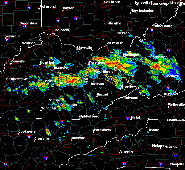 At 319 pm edt, a severe thunderstorm was located over pitts, or near irvine, moving southeast at 35 mph (radar indicated). Hazards include 60 mph wind gusts and nickel size hail. Expect damage to roofs. siding. and trees. locations impacted include, stanton, irvine, ravenna, vaughns mill, north irvine, pitts, patsey, spout springs, cressy, rice station, south irvine, wagersville, fitchburg, station camp, willow tree, leighton, cottage furnace, wiseman crossing station, lombard and iron mound. this includes bert t. Combs mountain parkway between mile markers 18 and 23, and between mile markers 29 and 36. At 319 pm edt, a severe thunderstorm was located over pitts, or near irvine, moving southeast at 35 mph (radar indicated). Hazards include 60 mph wind gusts and nickel size hail. Expect damage to roofs. siding. and trees. locations impacted include, stanton, irvine, ravenna, vaughns mill, north irvine, pitts, patsey, spout springs, cressy, rice station, south irvine, wagersville, fitchburg, station camp, willow tree, leighton, cottage furnace, wiseman crossing station, lombard and iron mound. this includes bert t. Combs mountain parkway between mile markers 18 and 23, and between mile markers 29 and 36.
|
| 6/21/2016 2:59 PM EDT |
 At 258 pm edt, a severe thunderstorm was located over cressy, or 9 miles west of stanton, moving southeast at 30 mph (radar indicated). Hazards include 60 mph wind gusts and nickel size hail. Expect damage to roofs. siding. and trees. locations impacted include, stanton, irvine, clay city, ravenna, vaughns mill, north irvine, pitts, patsey, cressy, spout springs, south irvine, rice station, wagersville, fitchburg, haystack, station camp, willow tree, powell valley, cottage furnace and leighton. this includes bert t. Combs mountain parkway between mile markers 13 and 36. At 258 pm edt, a severe thunderstorm was located over cressy, or 9 miles west of stanton, moving southeast at 30 mph (radar indicated). Hazards include 60 mph wind gusts and nickel size hail. Expect damage to roofs. siding. and trees. locations impacted include, stanton, irvine, clay city, ravenna, vaughns mill, north irvine, pitts, patsey, cressy, spout springs, south irvine, rice station, wagersville, fitchburg, haystack, station camp, willow tree, powell valley, cottage furnace and leighton. this includes bert t. Combs mountain parkway between mile markers 13 and 36.
|
| 6/21/2016 2:49 PM EDT |
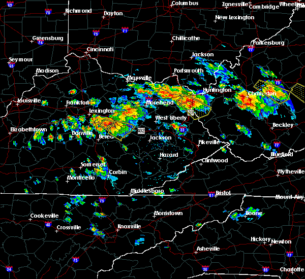 At 248 pm edt, a severe thunderstorm was located near harris ferry, or 13 miles northeast of richmond, moving southeast at 30 mph (radar indicated). Hazards include 60 mph wind gusts and nickel size hail. Expect damage to roofs. siding. And trees. At 248 pm edt, a severe thunderstorm was located near harris ferry, or 13 miles northeast of richmond, moving southeast at 30 mph (radar indicated). Hazards include 60 mph wind gusts and nickel size hail. Expect damage to roofs. siding. And trees.
|
| 5/10/2016 6:56 PM EDT |
 At 655 pm edt, a severe thunderstorm was located near richmond, moving east at 40 mph (radar indicated). Hazards include 60 mph wind gusts and quarter size hail. Hail damage to vehicles is expected. Expect wind damage to roofs, siding, and trees. At 655 pm edt, a severe thunderstorm was located near richmond, moving east at 40 mph (radar indicated). Hazards include 60 mph wind gusts and quarter size hail. Hail damage to vehicles is expected. Expect wind damage to roofs, siding, and trees.
|
| 5/1/2016 5:37 PM EDT |
 The severe thunderstorm warning for southern montgomery, western menifee, northern powell and south central bath counties will expire at 545 pm edt, the storm which prompted the warning has weakened below severe limits, and no longer pose an immediate threat to life or property. therefore the warning will be allowed to expire. however small hail and heavy rain are still possible with this thunderstorm. a severe thunderstorm watch remains in effect until 1100 pm edt for east central kentucky. to report severe weather, contact your nearest law enforcement agency. they will relay your report to the national weather service jackson ky. The severe thunderstorm warning for southern montgomery, western menifee, northern powell and south central bath counties will expire at 545 pm edt, the storm which prompted the warning has weakened below severe limits, and no longer pose an immediate threat to life or property. therefore the warning will be allowed to expire. however small hail and heavy rain are still possible with this thunderstorm. a severe thunderstorm watch remains in effect until 1100 pm edt for east central kentucky. to report severe weather, contact your nearest law enforcement agency. they will relay your report to the national weather service jackson ky.
|
| 5/1/2016 5:17 PM EDT |
 At 517 pm edt, a severe thunderstorm was located near westbend, or 10 miles west of stanton, moving east at 35 mph (radar indicated). Hazards include 60 mph wind gusts and quarter size hail. Hail damage to vehicles is expected. Expect wind damage to roofs, siding, and trees. At 517 pm edt, a severe thunderstorm was located near westbend, or 10 miles west of stanton, moving east at 35 mph (radar indicated). Hazards include 60 mph wind gusts and quarter size hail. Hail damage to vehicles is expected. Expect wind damage to roofs, siding, and trees.
|
| 4/26/2016 11:32 PM EDT |
 At 1132 pm edt, severe thunderstorms were located along a line extending from upper spencer to alcorn, moving east at 40 mph (radar indicated). Hazards include 60 mph wind gusts. Expect damage to roofs. siding. And trees. At 1132 pm edt, severe thunderstorms were located along a line extending from upper spencer to alcorn, moving east at 40 mph (radar indicated). Hazards include 60 mph wind gusts. Expect damage to roofs. siding. And trees.
|
| 7/14/2015 7:21 PM EDT | Hwy 89 road closed due to tree blocking both lane in estill county KY, 3.1 miles NE of Clay City, KY |
| 7/14/2015 5:45 PM EDT |
 At 545 pm edt, a severe thunderstorm was located over bethel, or 9 miles northwest of owingsville, moving southeast at 55 mph (radar indicated). Hazards include 60 mph wind gusts and nickel size hail. Expect damage to roofs. Siding and trees. At 545 pm edt, a severe thunderstorm was located over bethel, or 9 miles northwest of owingsville, moving southeast at 55 mph (radar indicated). Hazards include 60 mph wind gusts and nickel size hail. Expect damage to roofs. Siding and trees.
|
| 7/13/2015 3:52 PM EDT |
 At 352 pm edt, severe thunderstorms were located along a line extending from red river gorge to greeley to near harris ferry, moving southeast at 40 mph (radar indicated). Hazards include quarter size hail and 60 mph wind gusts. Hail damage to vehicles is expected. expect wind damage to roofs, siding and trees. locations impacted include, stanton, irvine, campton, clay city, ravenna, malaga, vaughns mill, kerby knob, north irvine, pitts, zachariah, patsey, fixer, cressy, spout springs, south irvine, rice station, wagersville, fitchburg and drip rock. this includes bert t. Combs mountain parkway between mile markers 13 and 24. At 352 pm edt, severe thunderstorms were located along a line extending from red river gorge to greeley to near harris ferry, moving southeast at 40 mph (radar indicated). Hazards include quarter size hail and 60 mph wind gusts. Hail damage to vehicles is expected. expect wind damage to roofs, siding and trees. locations impacted include, stanton, irvine, campton, clay city, ravenna, malaga, vaughns mill, kerby knob, north irvine, pitts, zachariah, patsey, fixer, cressy, spout springs, south irvine, rice station, wagersville, fitchburg and drip rock. this includes bert t. Combs mountain parkway between mile markers 13 and 24.
|
| 7/13/2015 3:28 PM EDT |
 At 327 pm edt, a severe thunderstorm was located over hardwick, or near irvine, moving southeast at 25 mph. in addition, a line of severe thunderstorms is approaching the warned area from the north (radar indicated). Hazards include quarter size hail and 60 mph wind gusts. Hail damage to vehicles is expected. Expect wind damage to roofs, siding and trees. At 327 pm edt, a severe thunderstorm was located over hardwick, or near irvine, moving southeast at 25 mph. in addition, a line of severe thunderstorms is approaching the warned area from the north (radar indicated). Hazards include quarter size hail and 60 mph wind gusts. Hail damage to vehicles is expected. Expect wind damage to roofs, siding and trees.
|
| 7/10/2015 1:17 PM EDT |
 At 115 pm edt, severe thunderstorms were located along a line extending from near pecks ridge to near hillsboro to midland to frenchburg to bowen, moving east at 45 mph (radar indicated). Hazards include 70 mph wind gusts. Expect considerable tree damage. damage is likely to mobile homes, roofs and outbuildings. locations impacted include, morehead, stanton, flemingsburg, frenchburg, marshall, clay city, wellington, salt lick, grange city, vaughns mill, elizaville, pecks ridge, stoll, odessa, blaze, vale, lombard, denniston, ezel and yale. this includes the following highways, bert t. combs mountain parkway between mile markers 17 and 32. Interstate 64 in eastern kentucky between mile markers 125 and 148. At 115 pm edt, severe thunderstorms were located along a line extending from near pecks ridge to near hillsboro to midland to frenchburg to bowen, moving east at 45 mph (radar indicated). Hazards include 70 mph wind gusts. Expect considerable tree damage. damage is likely to mobile homes, roofs and outbuildings. locations impacted include, morehead, stanton, flemingsburg, frenchburg, marshall, clay city, wellington, salt lick, grange city, vaughns mill, elizaville, pecks ridge, stoll, odessa, blaze, vale, lombard, denniston, ezel and yale. this includes the following highways, bert t. combs mountain parkway between mile markers 17 and 32. Interstate 64 in eastern kentucky between mile markers 125 and 148.
|
| 7/10/2015 12:54 PM EDT | Tree down on old winchester road and winchester roa in powell county KY, 3.9 miles SSE of Clay City, KY |
| 7/10/2015 12:52 PM EDT | Mountain parkway eastbound between mile markers 11 and 12 closed due to fallen tree in powell county KY, 4.8 miles SE of Clay City, KY |
| 7/10/2015 12:47 PM EDT |
 At 1246 pm edt, severe thunderstorms were located along a line extending from 8 miles southwest of cynthiana to near paris to judy to near klondike to near harris ferry, moving east at 50 mph (radar indicated). Hazards include 70 mph wind gusts. Expect considerable tree damage. damage is likely to mobile homes, roofs and outbuildings. locations impacted include, mount sterling, morehead, stanton, flemingsburg, owingsville, frenchburg, marshall, jeffersonville, camargo, clay city, wellington, sharpsburg, salt lick, grange city, vaughns mill, elizaville, pecks ridge, lower spencer, stoll and bethel. this includes the following highways, bert t. combs mountain parkway between mile markers 13 and 32. Interstate 64 in eastern kentucky between mile markers 105 and 148. At 1246 pm edt, severe thunderstorms were located along a line extending from 8 miles southwest of cynthiana to near paris to judy to near klondike to near harris ferry, moving east at 50 mph (radar indicated). Hazards include 70 mph wind gusts. Expect considerable tree damage. damage is likely to mobile homes, roofs and outbuildings. locations impacted include, mount sterling, morehead, stanton, flemingsburg, owingsville, frenchburg, marshall, jeffersonville, camargo, clay city, wellington, sharpsburg, salt lick, grange city, vaughns mill, elizaville, pecks ridge, lower spencer, stoll and bethel. this includes the following highways, bert t. combs mountain parkway between mile markers 13 and 32. Interstate 64 in eastern kentucky between mile markers 105 and 148.
|
| 7/10/2015 12:46 PM EDT | Ky hwy 15 at the powell/clark county line closed due to fallen trees and power lines. the road is expected to be closed for several hour in clark county KY, 5.7 miles SE of Clay City, KY |
| 7/10/2015 12:24 PM EDT |
 At 1223 pm edt, severe thunderstorms were located along a line extending from 13 miles northwest of georgetown to near paris to 6 miles west of winchester to near nicholasville, moving east at 45 mph (radar indicated). Hazards include 70 mph wind gusts. Expect considerable tree damage. Damage is likely to mobile homes, roofs and outbuildings. At 1223 pm edt, severe thunderstorms were located along a line extending from 13 miles northwest of georgetown to near paris to 6 miles west of winchester to near nicholasville, moving east at 45 mph (radar indicated). Hazards include 70 mph wind gusts. Expect considerable tree damage. Damage is likely to mobile homes, roofs and outbuildings.
|
| 7/7/2015 8:40 PM EDT |
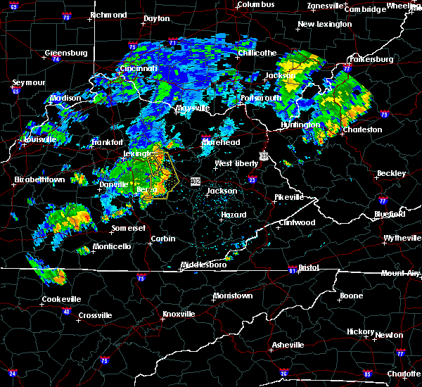 The severe thunderstorm warning for powell, northwestern jackson, montgomery and estill counties will expire at 845 pm edt, the line of storms which prompted the warning have weakened below severe limits, and no longer pose an immediate threat to life or property. therefore the warning will be allowed to expire. however gusty winds in excess of 30 mph are still possible with these thunderstorms. The severe thunderstorm warning for powell, northwestern jackson, montgomery and estill counties will expire at 845 pm edt, the line of storms which prompted the warning have weakened below severe limits, and no longer pose an immediate threat to life or property. therefore the warning will be allowed to expire. however gusty winds in excess of 30 mph are still possible with these thunderstorms.
|
| 7/7/2015 8:26 PM EDT |
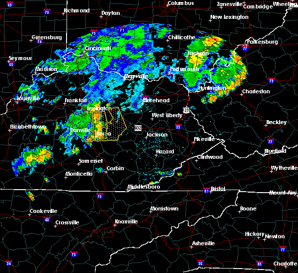 At 826 pm edt, severe thunderstorms were located along a line extending from wades mill to spout springs to drip rock, moving east at 40 mph (radar indicated). Hazards include 60 mph wind gusts. Expect damage to roofs. siding and trees. locations impacted include, mount sterling, stanton, irvine, jeffersonville, camargo, clay city, ravenna, vaughns mill, lower spencer, north irvine, pitts, patsey, cressy, spout springs, south irvine, rice station, wagersville, fitchburg, drip rock and ewington. this includes the following highways, bert t. combs mountain parkway between mile markers 13 and 27. Interstate 64 in eastern kentucky between mile markers 105 and 114. At 826 pm edt, severe thunderstorms were located along a line extending from wades mill to spout springs to drip rock, moving east at 40 mph (radar indicated). Hazards include 60 mph wind gusts. Expect damage to roofs. siding and trees. locations impacted include, mount sterling, stanton, irvine, jeffersonville, camargo, clay city, ravenna, vaughns mill, lower spencer, north irvine, pitts, patsey, cressy, spout springs, south irvine, rice station, wagersville, fitchburg, drip rock and ewington. this includes the following highways, bert t. combs mountain parkway between mile markers 13 and 27. Interstate 64 in eastern kentucky between mile markers 105 and 114.
|
| 7/7/2015 8:07 PM EDT |
 At 807 pm edt, severe thunderstorms were located along a line extending from near winchester to near harris ferry to morrill, moving east at 40 mph (radar indicated). Hazards include 60 mph wind gusts. Expect damage to roofs. Siding and trees. At 807 pm edt, severe thunderstorms were located along a line extending from near winchester to near harris ferry to morrill, moving east at 40 mph (radar indicated). Hazards include 60 mph wind gusts. Expect damage to roofs. Siding and trees.
|
| 6/29/2015 6:02 PM EDT |
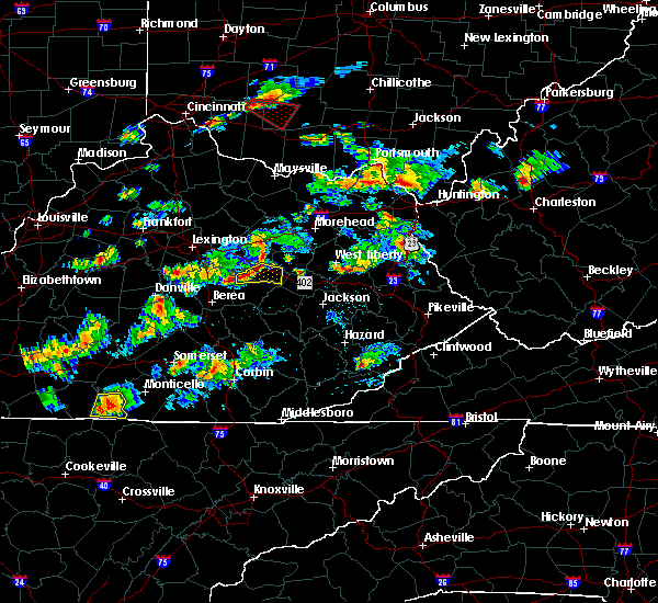 At 601 pm edt, a severe thunderstorm was located over rosslyn, or over stanton, moving east at 45 mph (radar indicated). Hazards include quarter size hail and 60 mph wind gusts. Hail damage to vehicles is expected. expect wind damage to roofs, siding and trees. locations impacted include, stanton, clay city, iron mound, palmer, vaughns mill, hardwick, bowen, hargett, rogers chapel, spout springs, knowlton, rosslyn, cat creek, furnace, slade, kimbrell, powell valley, cottage furnace, wiseman crossing station and fox. this includes bert t. combs mountain parkway between mile markers 17 and 32. A tornado watch remains in effect until 900 pm edt for east central kentucky. At 601 pm edt, a severe thunderstorm was located over rosslyn, or over stanton, moving east at 45 mph (radar indicated). Hazards include quarter size hail and 60 mph wind gusts. Hail damage to vehicles is expected. expect wind damage to roofs, siding and trees. locations impacted include, stanton, clay city, iron mound, palmer, vaughns mill, hardwick, bowen, hargett, rogers chapel, spout springs, knowlton, rosslyn, cat creek, furnace, slade, kimbrell, powell valley, cottage furnace, wiseman crossing station and fox. this includes bert t. combs mountain parkway between mile markers 17 and 32. A tornado watch remains in effect until 900 pm edt for east central kentucky.
|
| 6/29/2015 5:46 PM EDT |
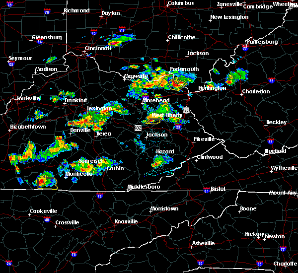 At 546 pm edt, a severe thunderstorm was located over fox, or 8 miles northwest of irvine, moving east at 30 mph (radar indicated). Hazards include quarter size hail and 60 mph wind gusts. Hail damage to vehicles is expected. Expect wind damage to roofs, siding and trees. At 546 pm edt, a severe thunderstorm was located over fox, or 8 miles northwest of irvine, moving east at 30 mph (radar indicated). Hazards include quarter size hail and 60 mph wind gusts. Hail damage to vehicles is expected. Expect wind damage to roofs, siding and trees.
|
| 6/23/2015 4:42 PM EDT |
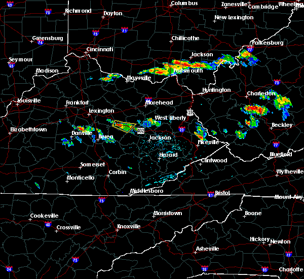 At 441 pm edt, a severe thunderstorm was located over stanton, moving southeast at 25 mph (radar indicated). Hazards include 60 mph wind gusts. Expect damage to roofs. siding and trees. locations impacted include, stanton, clay city, vaughns mill, bowen, rogers chapel, spout springs, see, knowlton, pilot, rosslyn, haystack, cat creek, furnace, slade, powell valley, virden, lombard, nada and waltersville. this includes bert t. Combs mountain parkway between mile markers 16 and 34. At 441 pm edt, a severe thunderstorm was located over stanton, moving southeast at 25 mph (radar indicated). Hazards include 60 mph wind gusts. Expect damage to roofs. siding and trees. locations impacted include, stanton, clay city, vaughns mill, bowen, rogers chapel, spout springs, see, knowlton, pilot, rosslyn, haystack, cat creek, furnace, slade, powell valley, virden, lombard, nada and waltersville. this includes bert t. Combs mountain parkway between mile markers 16 and 34.
|
| 6/23/2015 4:31 PM EDT |
 At 431 pm edt, a severe thunderstorm was located over clay city, or near stanton, moving southeast at 25 mph (radar indicated). Hazards include 60 mph wind gusts. Expect damage to roofs. Siding and trees. At 431 pm edt, a severe thunderstorm was located over clay city, or near stanton, moving southeast at 25 mph (radar indicated). Hazards include 60 mph wind gusts. Expect damage to roofs. Siding and trees.
|
| 6/8/2015 5:20 PM EDT | At 520 pm edt, a severe thunderstorm was located over fagan, or near frenchburg, moving east at 55 mph (radar indicated). Hazards include 60 mph wind gusts and penny size hail. Expect damage to roofs. siding and trees. locations impacted include, stanton, frenchburg, marshall, jeffersonville, camargo, clay city, salt lick, vaughns mill, lower spencer, bean, bowen, tabor, rogers chapel, rothwell, knowlton, preston, haystack, crooks, moore`s ferry and furnace. this includes the following highways, bert t. combs mountain parkway between mile markers 18 and 36. Interstate 64 in eastern kentucky near mile marker 128. |
| 6/8/2015 5:04 PM EDT | At 503 pm edt, a severe thunderstorm was located over spout springs, or 7 miles west of stanton, moving east at 55 mph (radar indicated). Hazards include 60 mph wind gusts and penny size hail. Expect damage to roofs. Siding and trees. |
| 4/7/2015 7:53 PM EDT | A severe thunderstorm warning remains in effect until 815 pm edt for northeastern lee. menifee. powell. montgomery. northwestern morgan. southern bath. western wolfe. central estill and southern rowan counties. at 752 pm edt. Severe thunderstorms were located along a line extending from near owingsville to olympia to near camargo to near. |
| 4/7/2015 7:23 PM EDT | The national weather service in jackson ky has issued a * severe thunderstorm warning for. northeastern lee county in southeastern kentucky. menifee county in east central kentucky. powell county in east central kentucky. Montgomery county in east central kentucky. |
| 9/2/2014 5:00 PM EDT | Tree down on kentucky highway 2001. time estimated from rada in powell county KY, 2.3 miles N of Clay City, KY |
| 4/3/2014 3:41 PM EDT | Power outages were reported by jackson energy along hwy 2001 in spout springs. fifty four customers were without powe in estill county KY, 3.1 miles NE of Clay City, KY |
| 11/1/2013 1:07 AM EDT | Mobile home at 2187 spout springs road had roof partially torn off in powell county KY, 1.9 miles NE of Clay City, KY |
| 6/10/2013 4:30 PM EDT | Several trees reported down across the area...including one 8 inch diameter tree that fell across the roof of a porch on a nearby house. no major damage. spotter also r in powell county KY, 0.2 miles N of Clay City, KY |
| 1/30/2013 7:08 AM EST | Trees down on winchester road in clay cit in powell county KY, 0.2 miles N of Clay City, KY |
| 7/1/2012 10:40 PM EDT | Trees down on woody ware road in clay city in powell county KY, 0.2 miles N of Clay City, KY |
| 7/1/2012 10:38 PM EDT | Trees down on winchester road between the 8000 and 9000 block in powell county KY, 0.7 miles SE of Clay City, KY |
| 7/1/2012 10:04 PM EDT | Trees down on woody ware road in clay city in powell county KY, 0.2 miles N of Clay City, KY |
| 7/1/2012 10:03 PM EDT | Trees down on winchester road between the 8000 and 9000 block in powell county KY, 0.7 miles SE of Clay City, KY |
| 1/1/0001 12:00 AM | Half Dollar sized hail reported 0.2 miles N of Clay City, KY, hail ranging from dime to half dollar size covering the ground,approximately 2.5 miles norht on route 11 towards mt sterling. |
| 1/1/0001 12:00 AM | Half Dollar sized hail reported 1.9 miles S of Clay City, KY |
| 1/1/0001 12:00 AM | Quarter sized hail reported 0.2 miles N of Clay City, KY, time estimated from radar. |
| 1/1/0001 12:00 AM | Large limbs down on snow creek. time estimated from rada in powell county KY, 0.2 miles N of Clay City, KY |
| 1/1/0001 12:00 AM | Tree fell across power line in powell county KY, 2 miles SE of Clay City, KY |
| 1/1/0001 12:00 AM | Golf Ball sized hail reported 1.9 miles NE of Clay City, KY, golf ball hail falling on happy top road. |
| 1/1/0001 12:00 AM | Quarter sized hail reported 0.2 miles N of Clay City, KY |
| 1/1/0001 12:00 AM | Half Dollar sized hail reported 0.2 miles N of Clay City, KY |
| 1/1/0001 12:00 AM | Trees were blown down on winchester road just north of the town of palmer on the estill clark county lin in estill county KY, 8.5 miles ENE of Clay City, KY |
Hail Maps for Clay City, KY


Connect with Interactive Hail Maps