

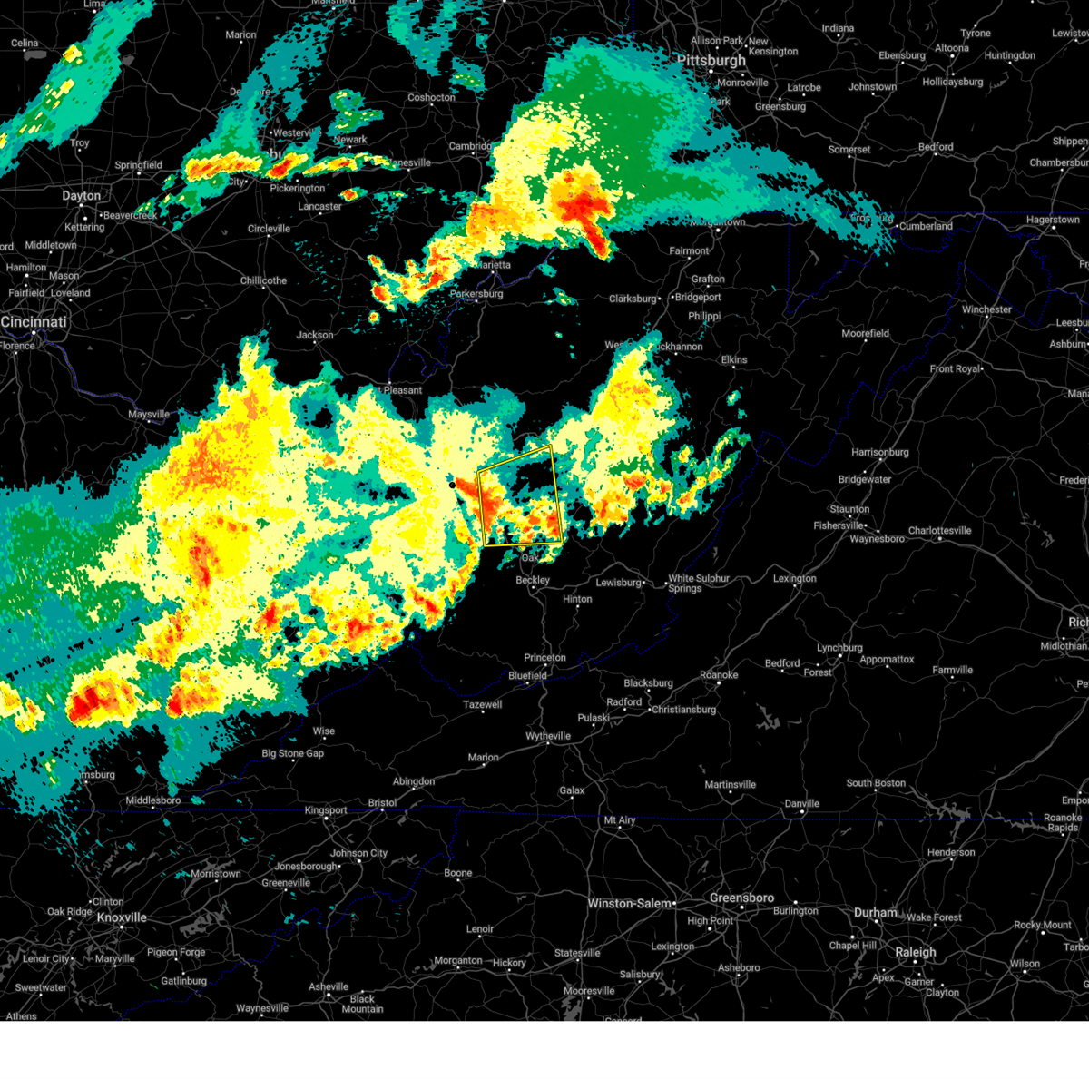
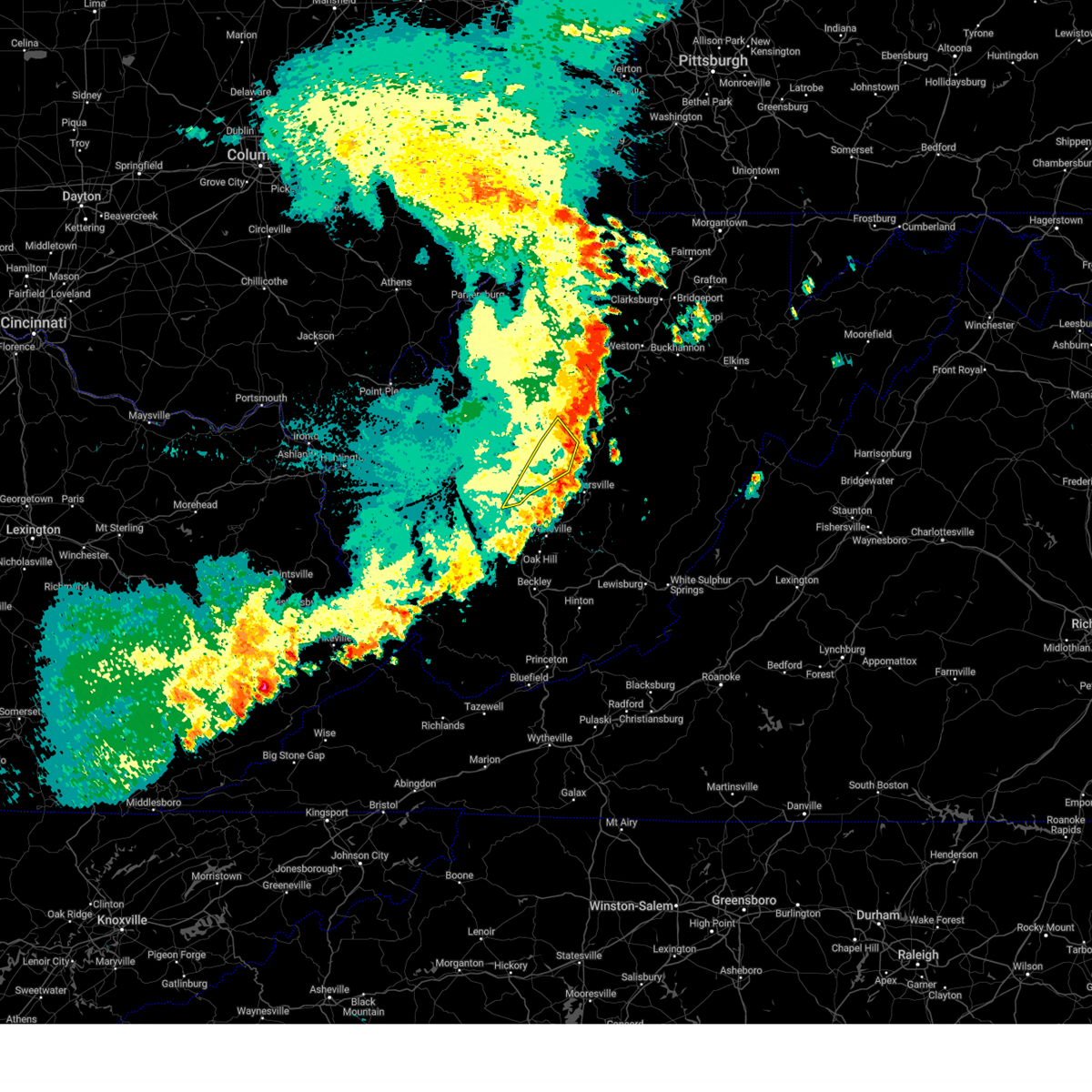
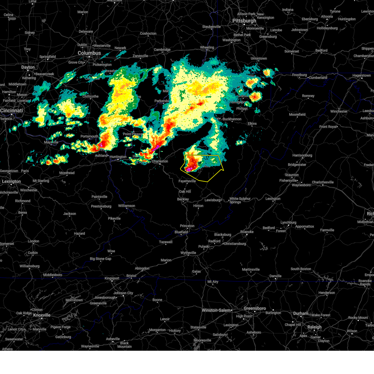
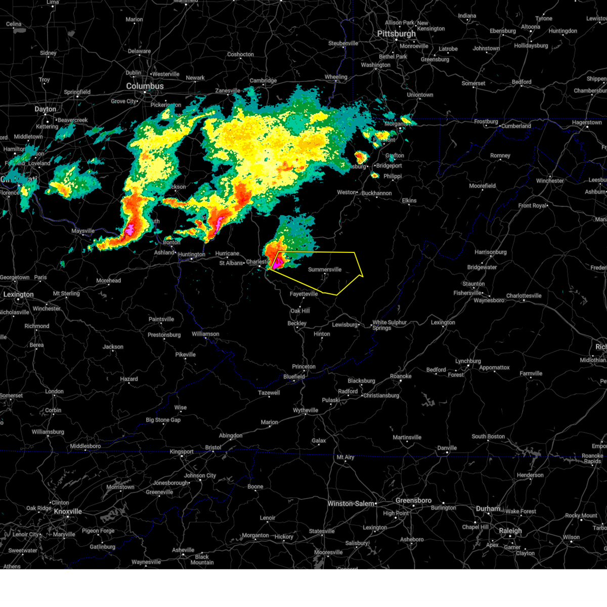
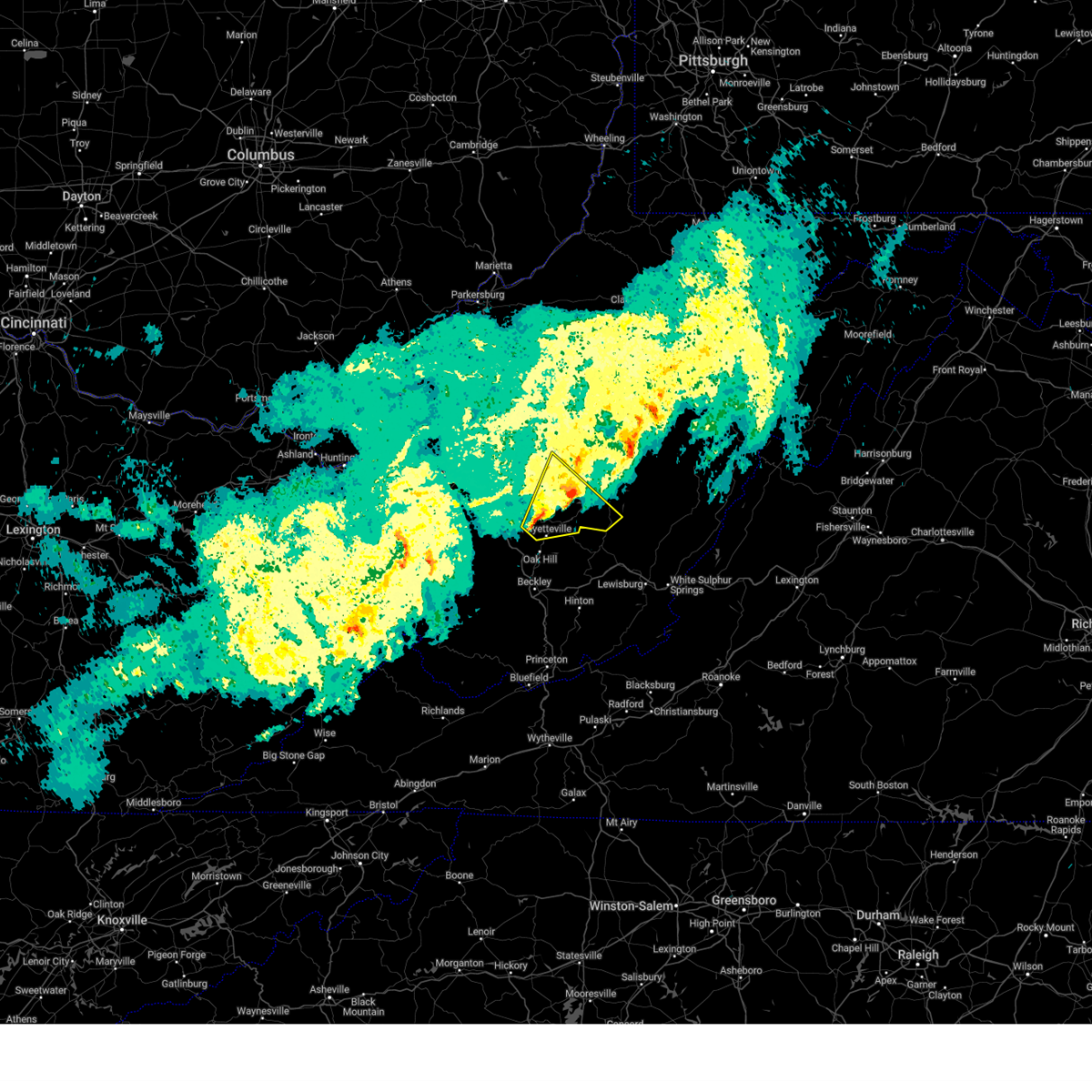
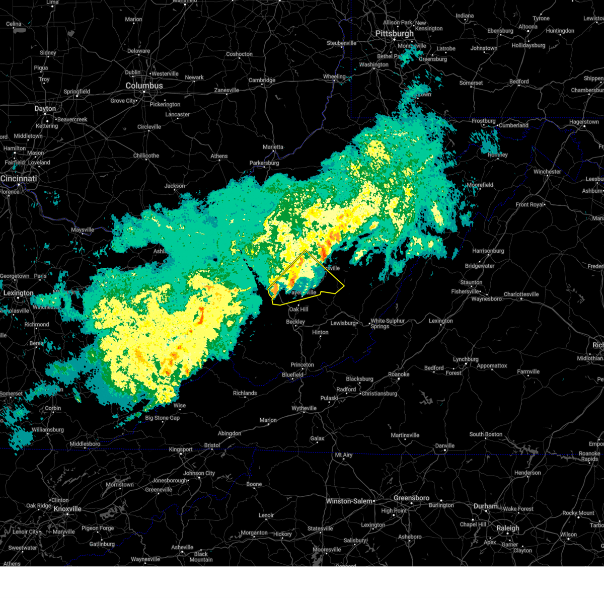
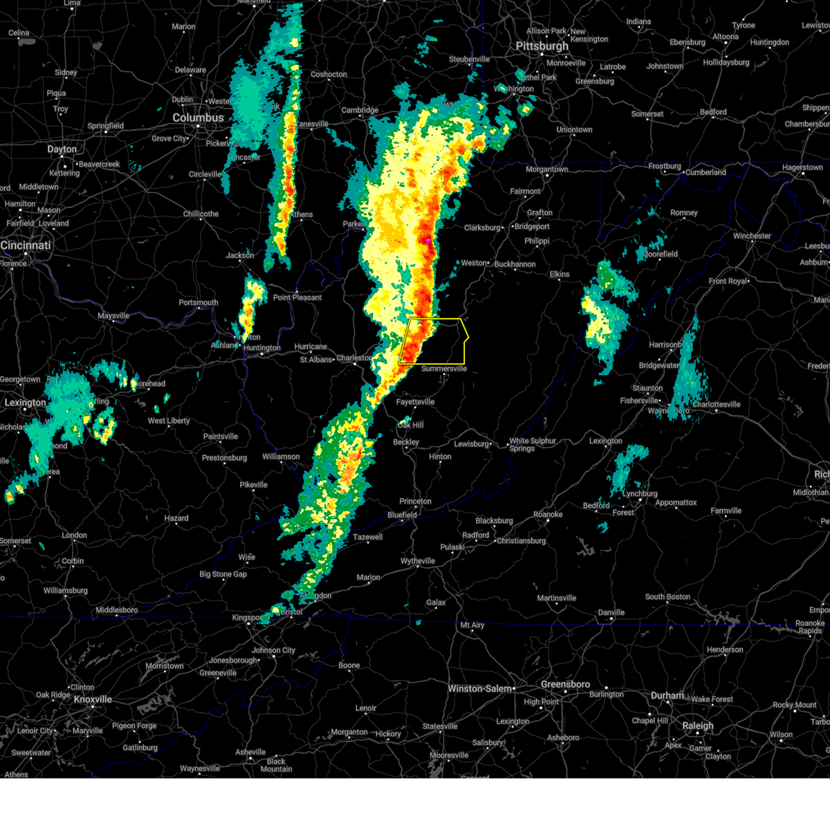
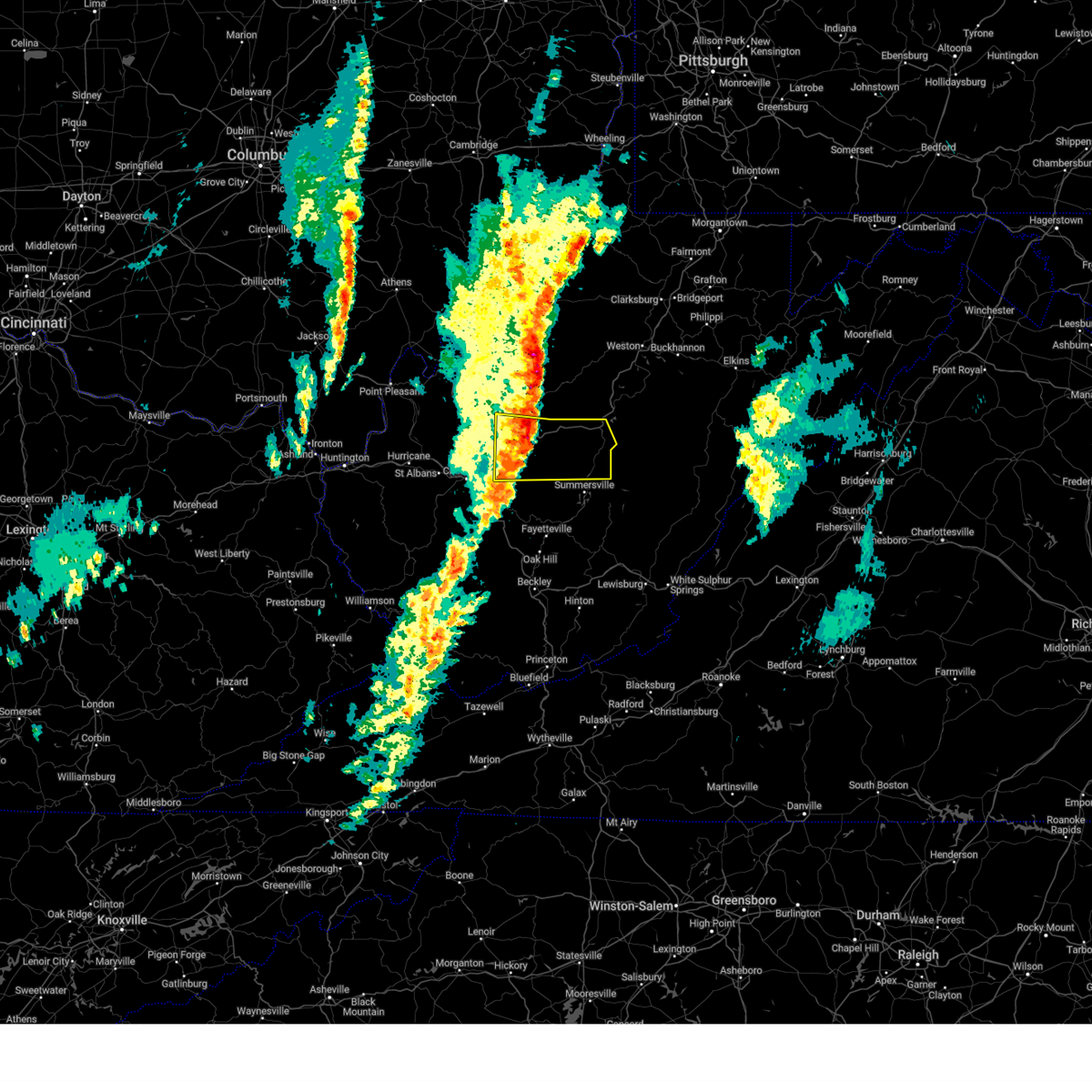
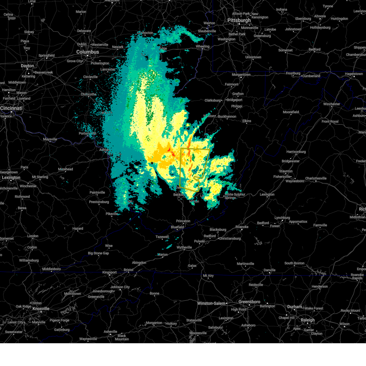
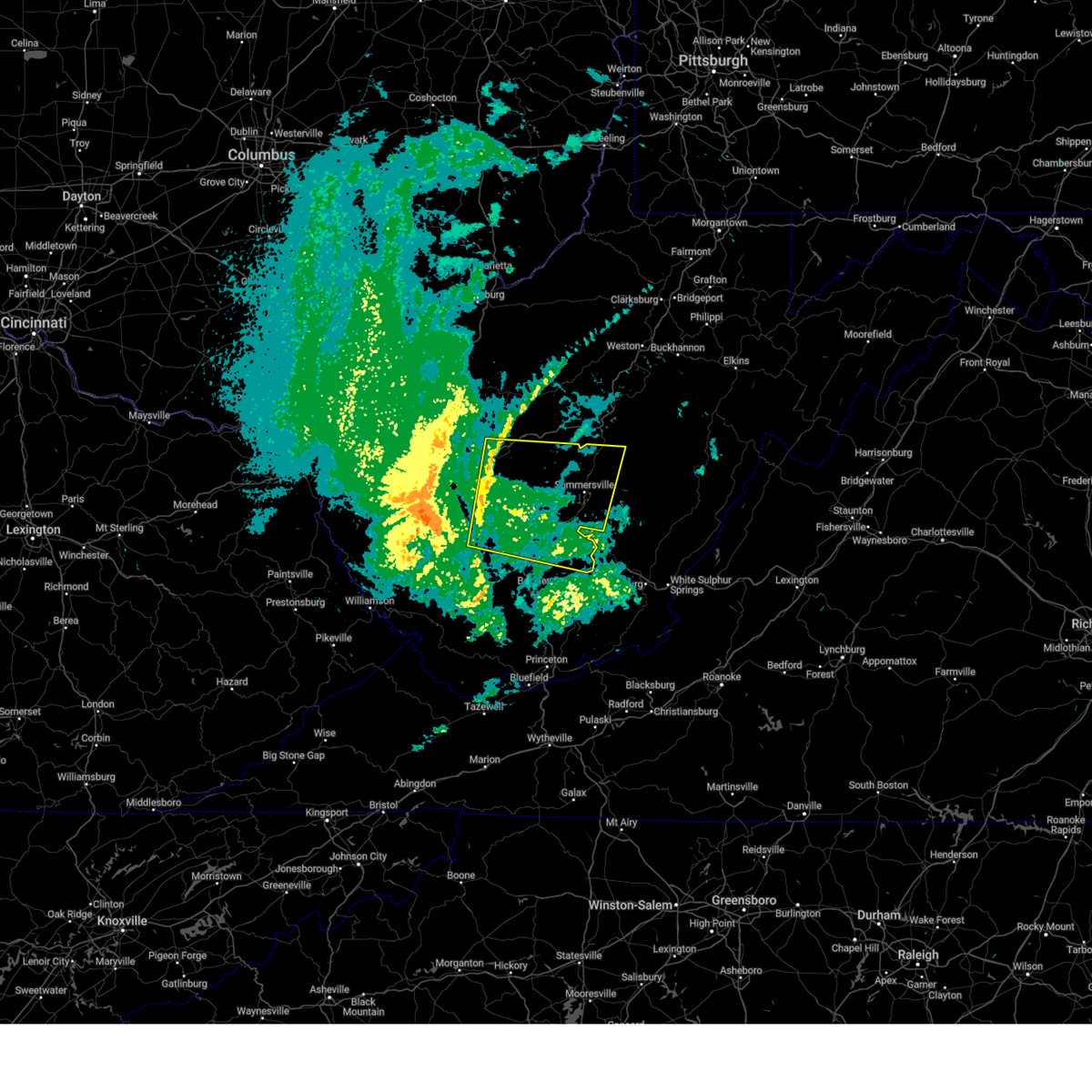
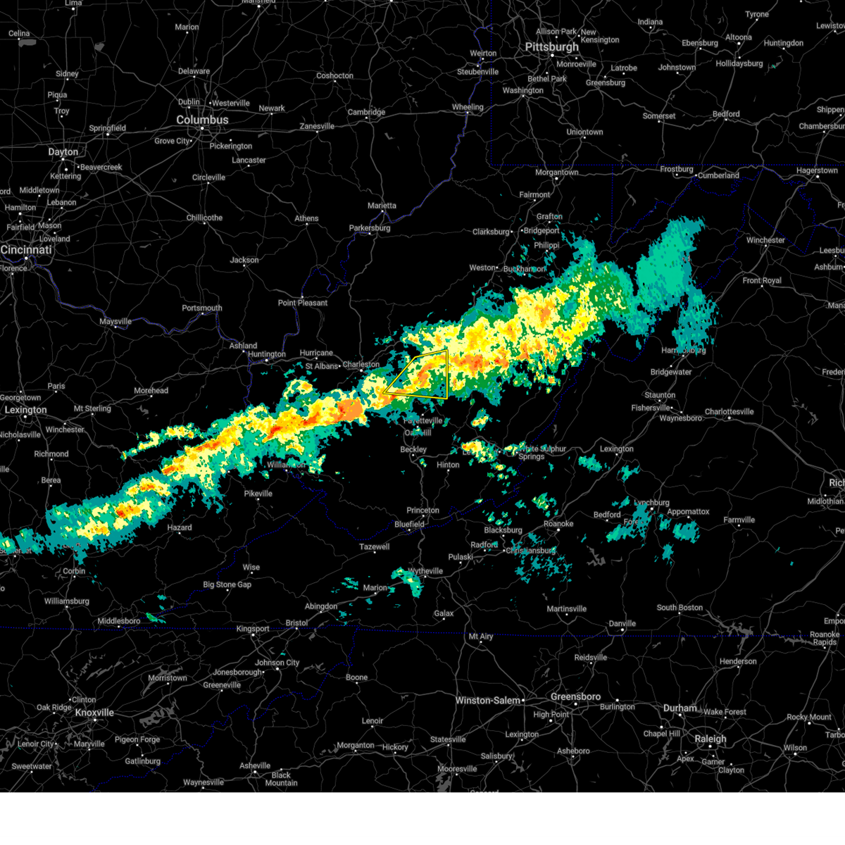
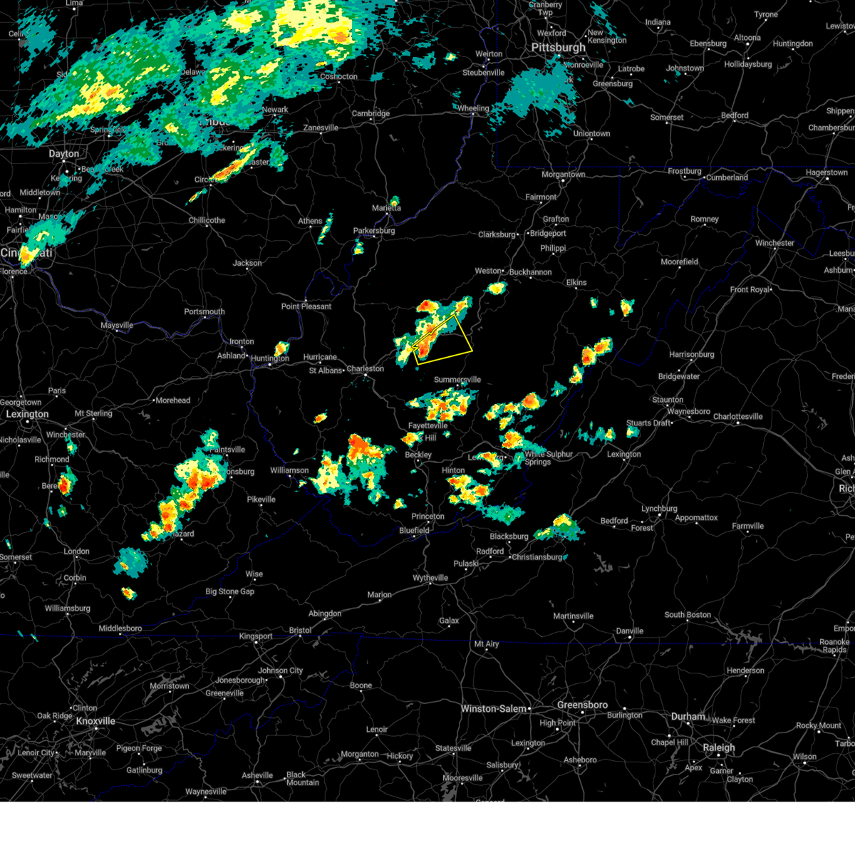
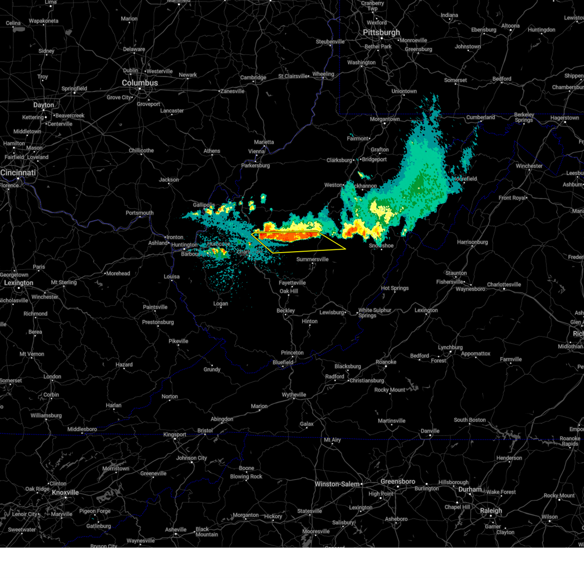
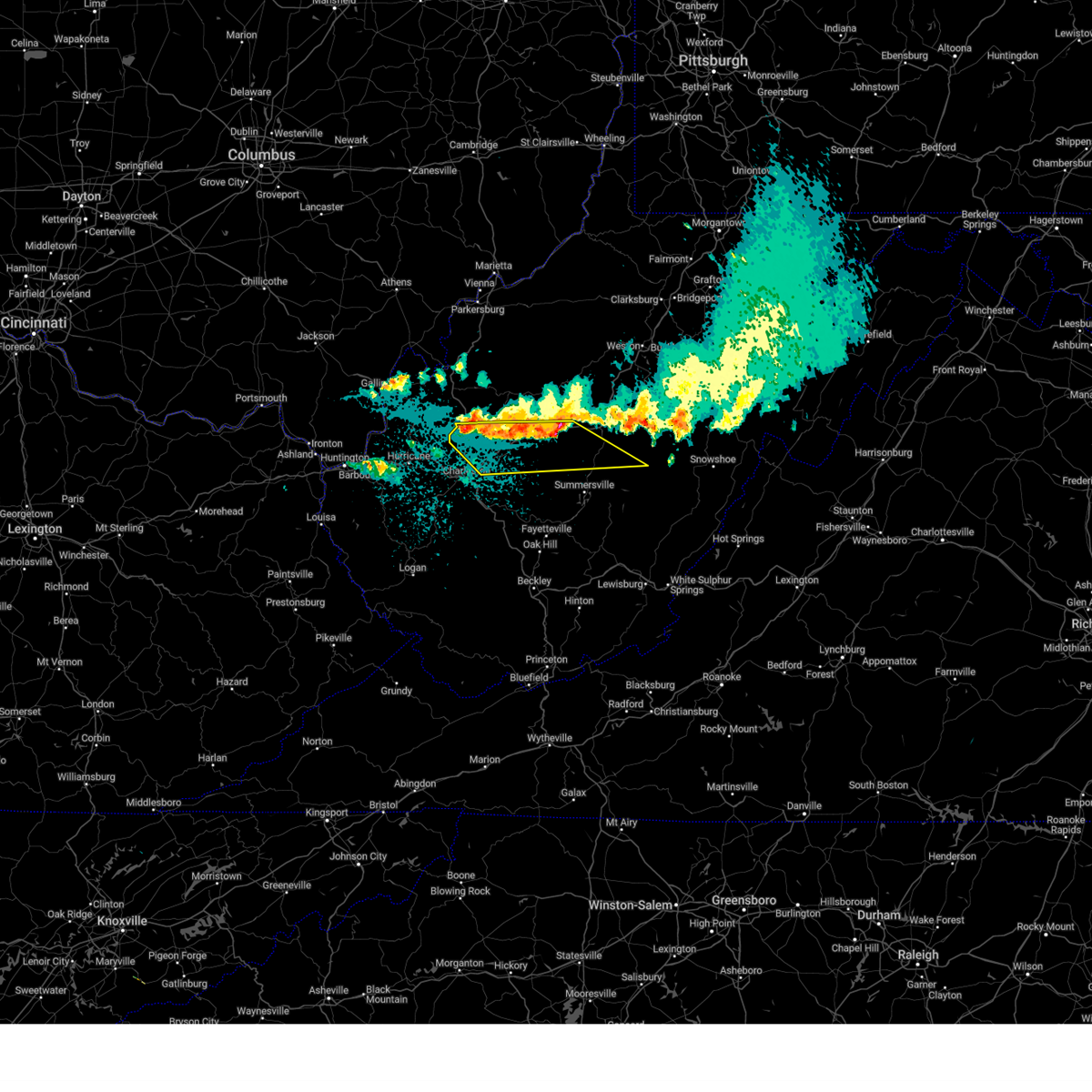
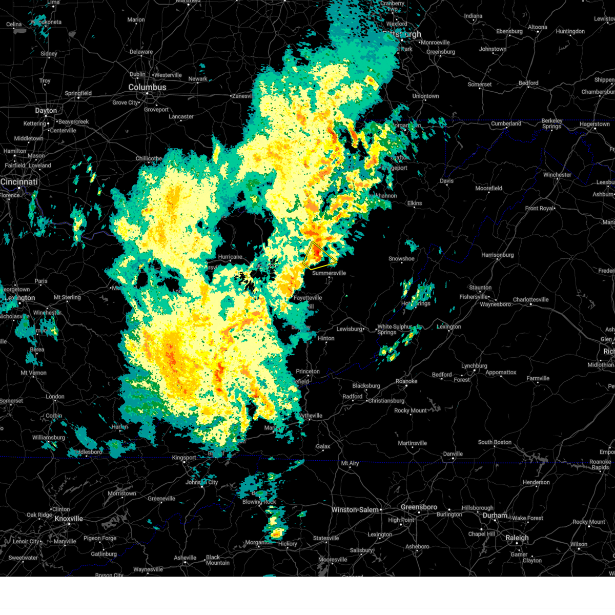
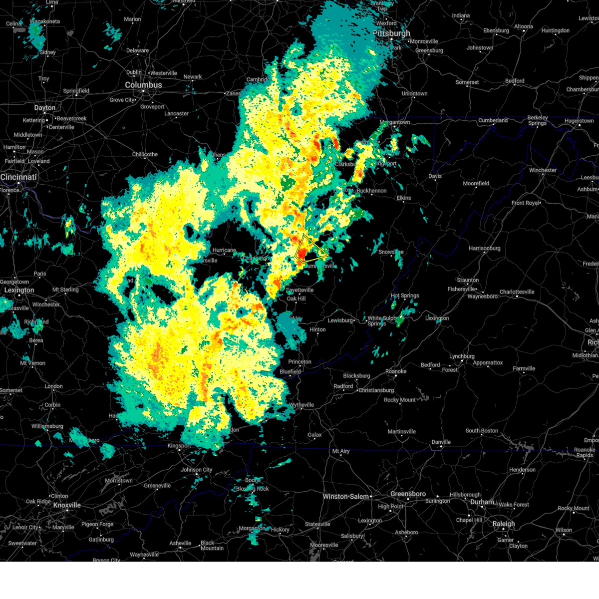
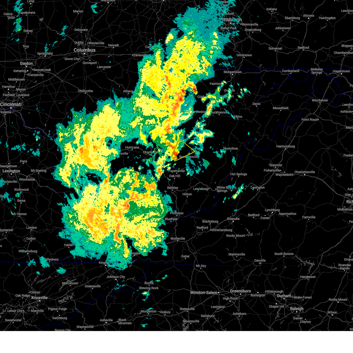
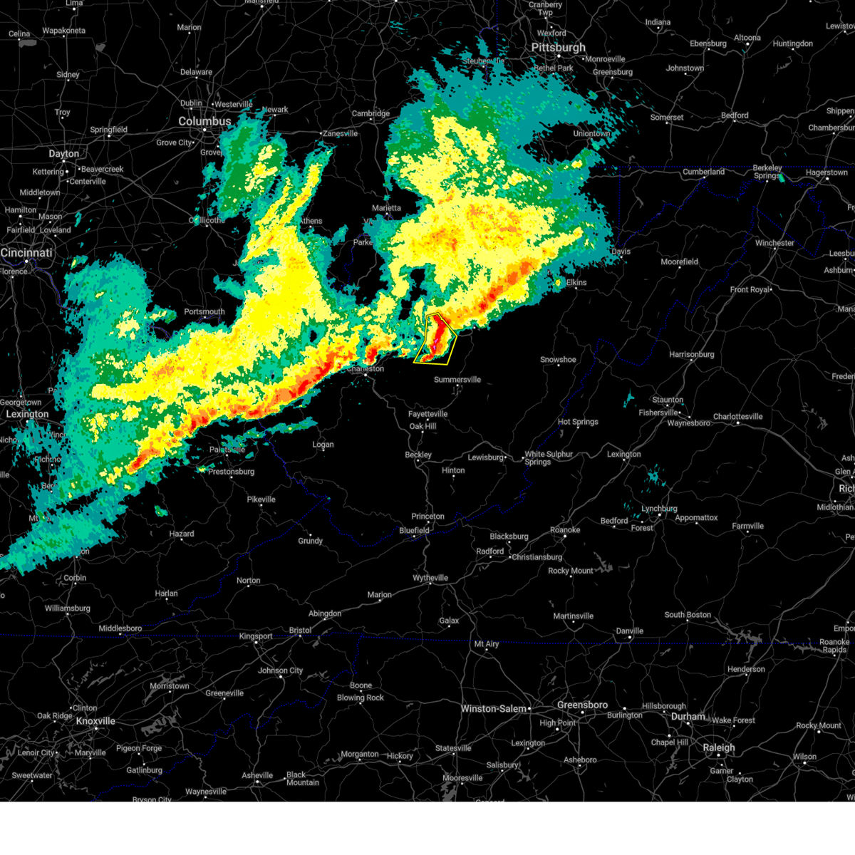
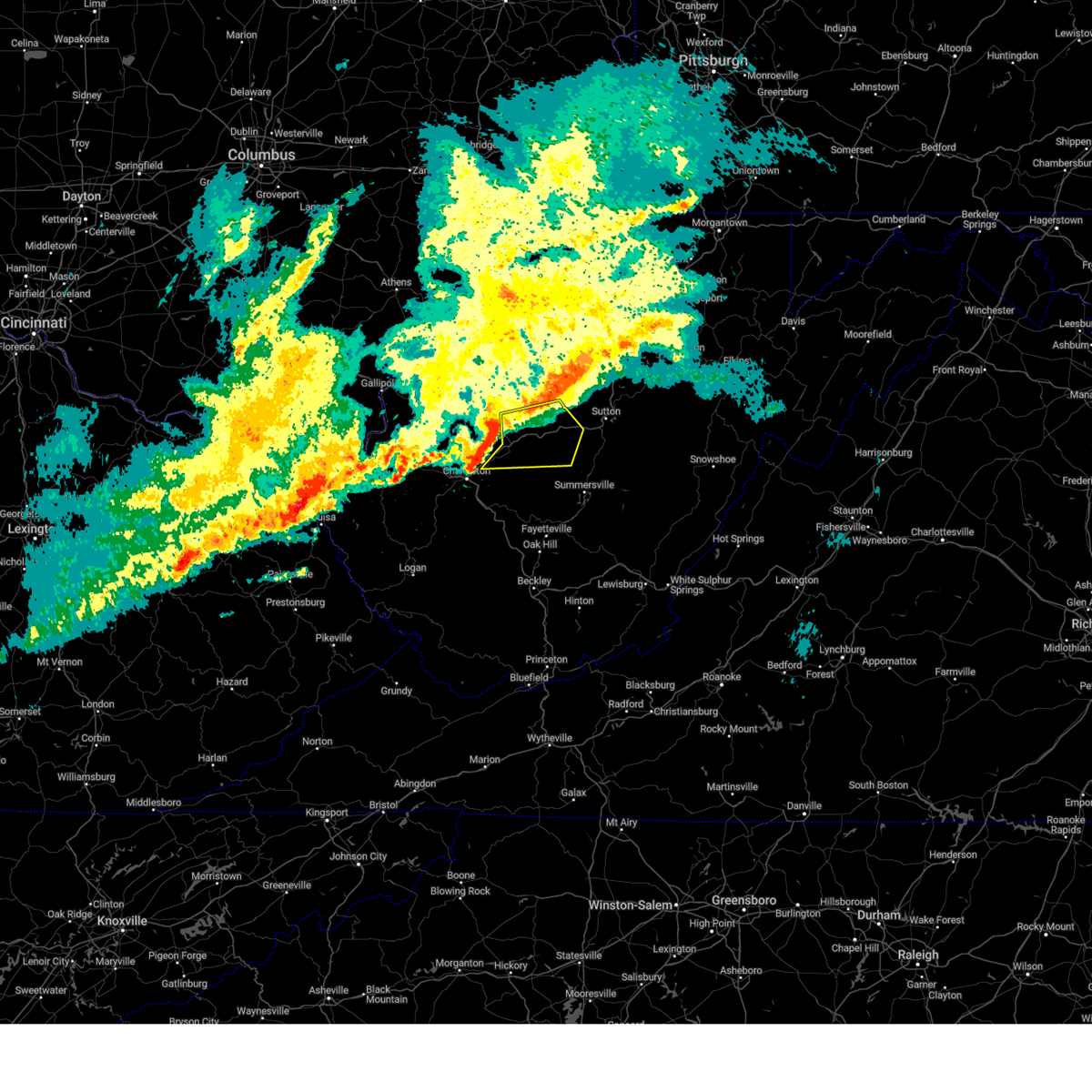
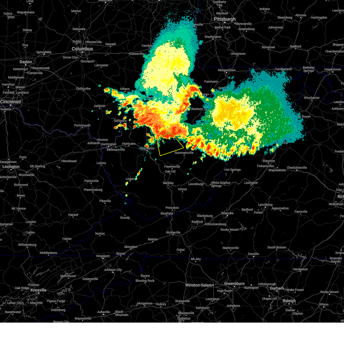
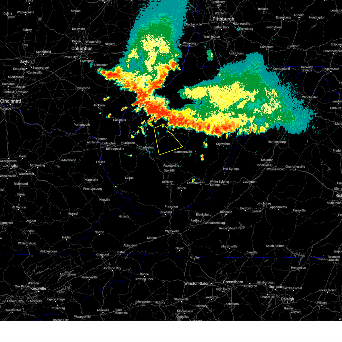
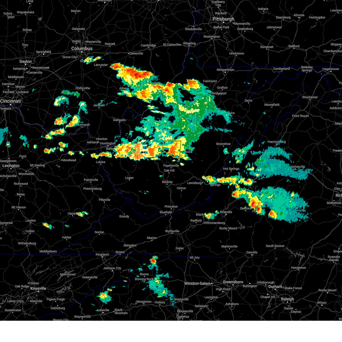
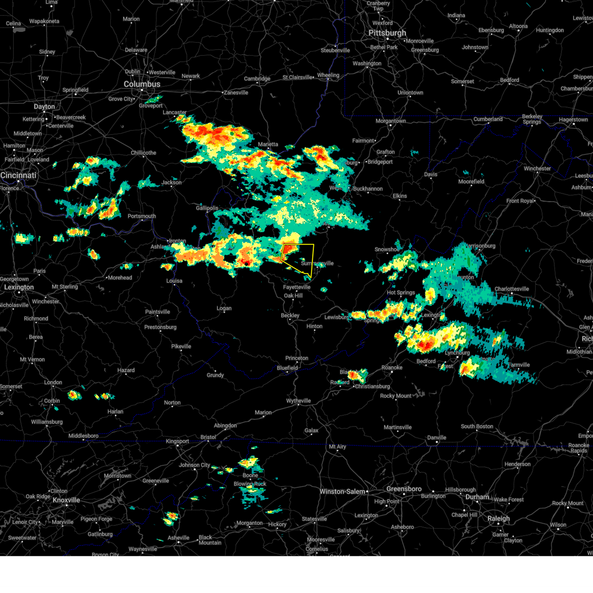
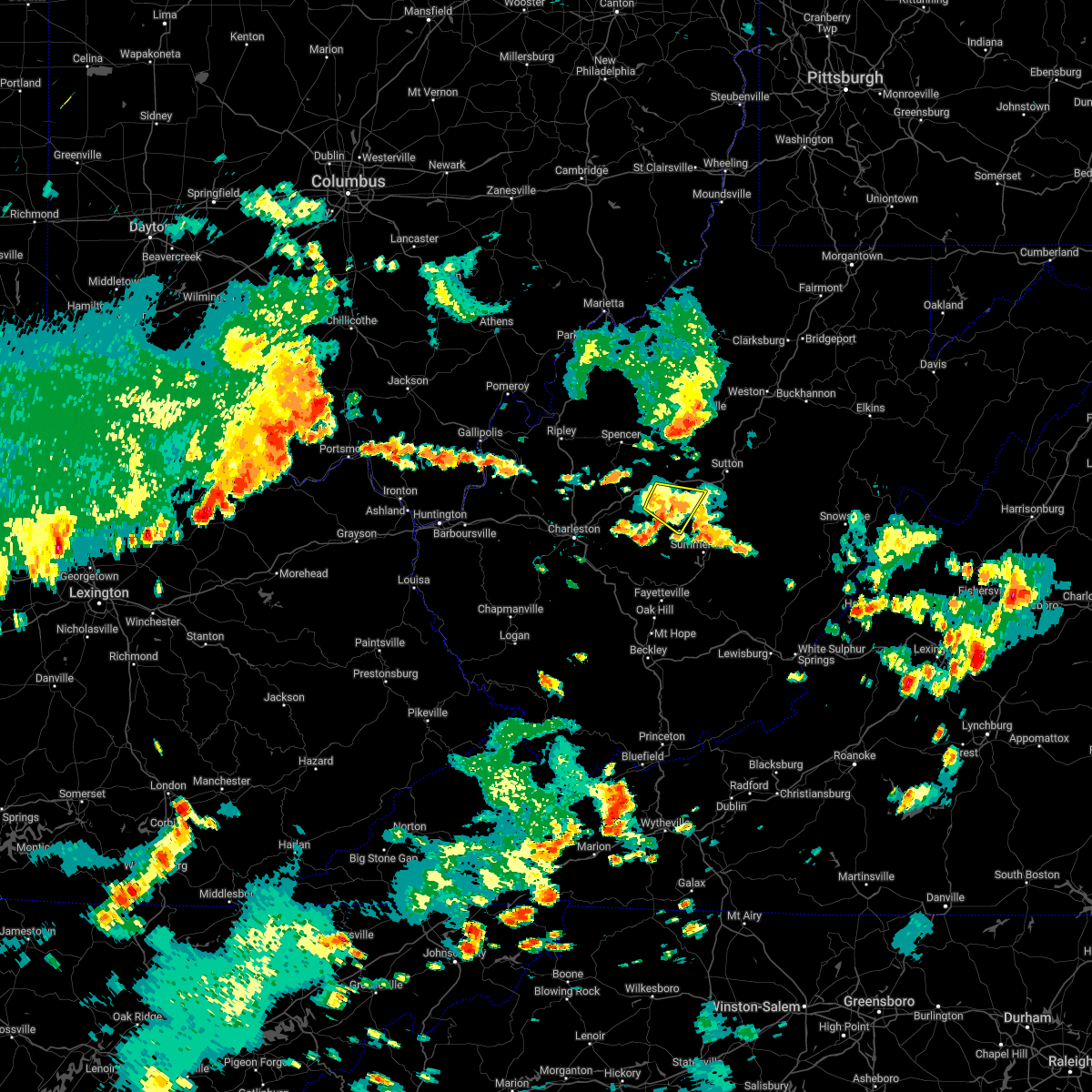
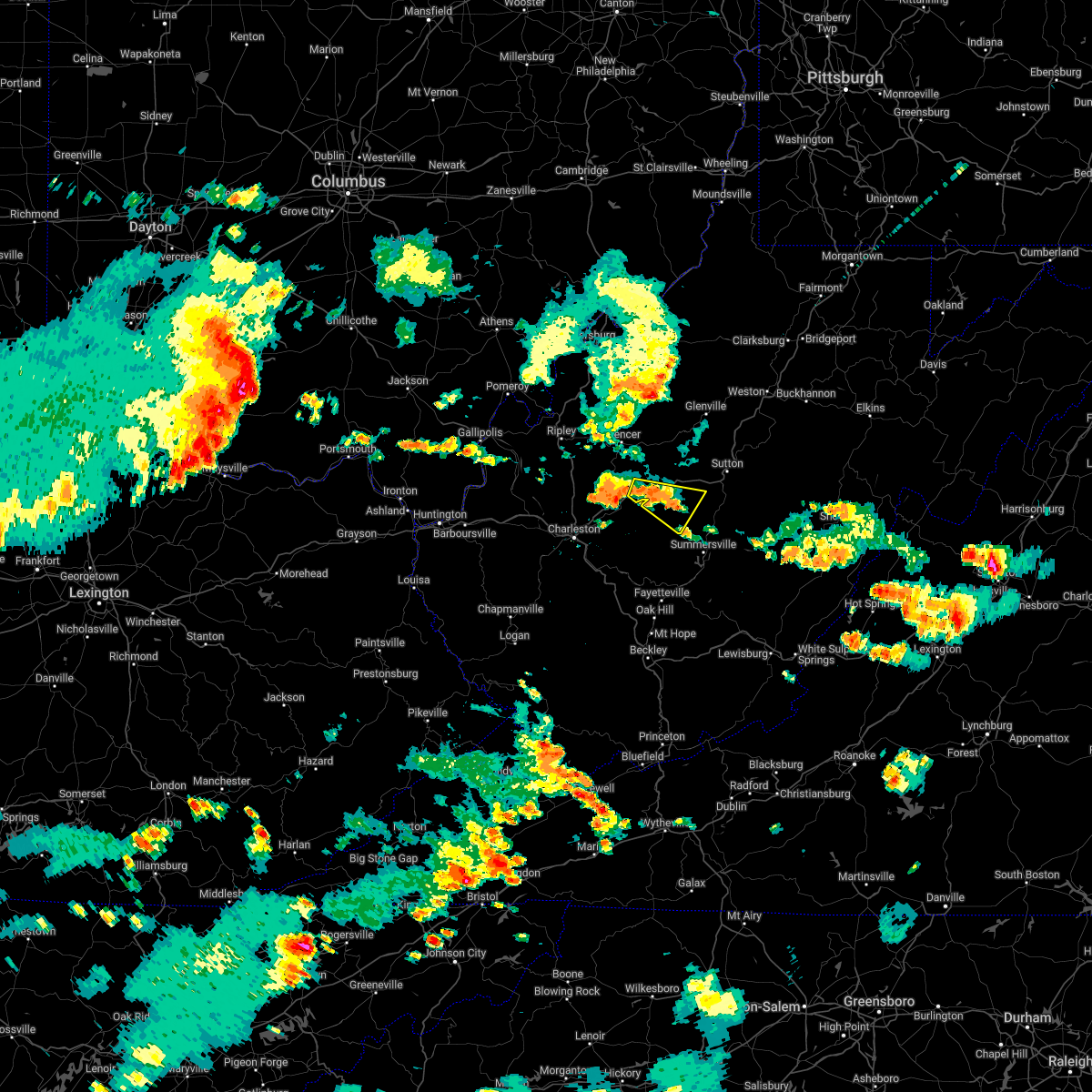
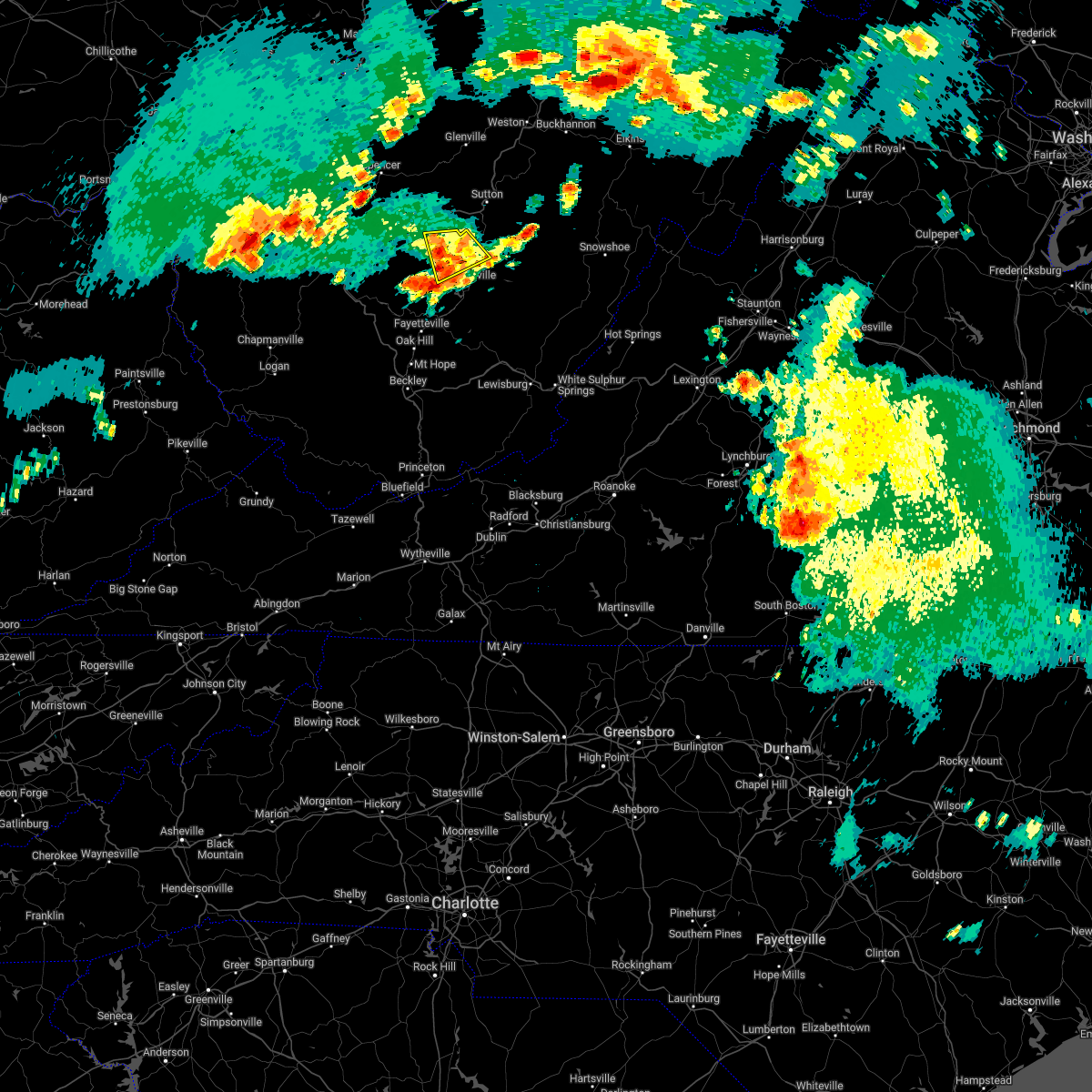
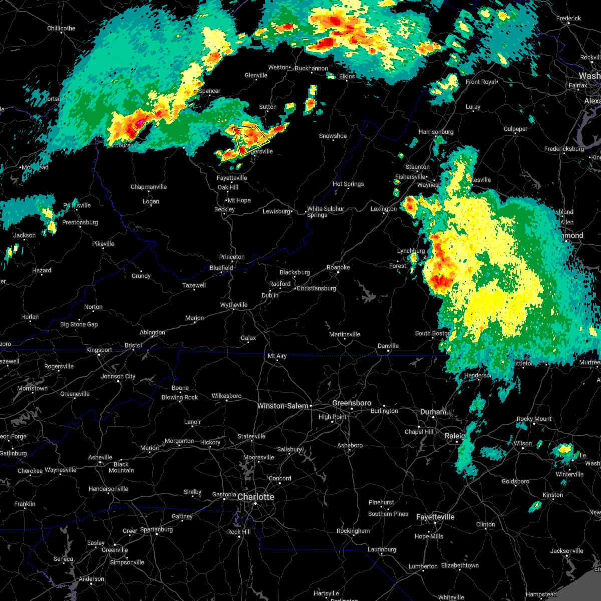
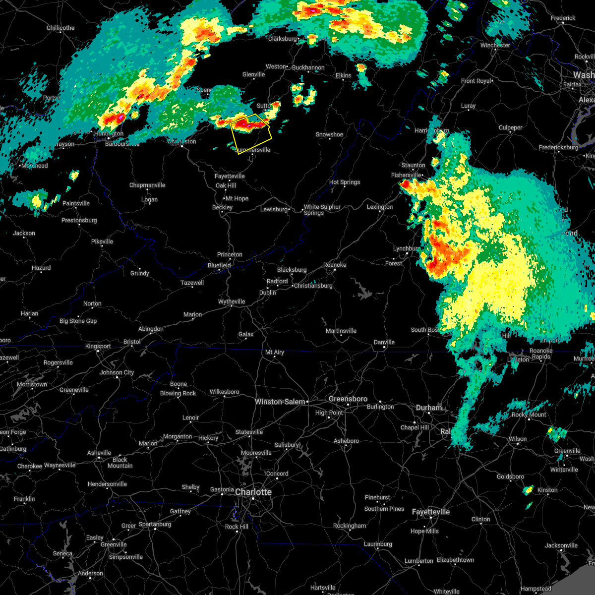
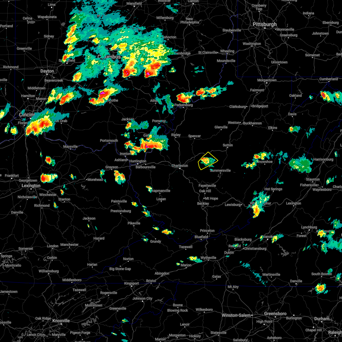
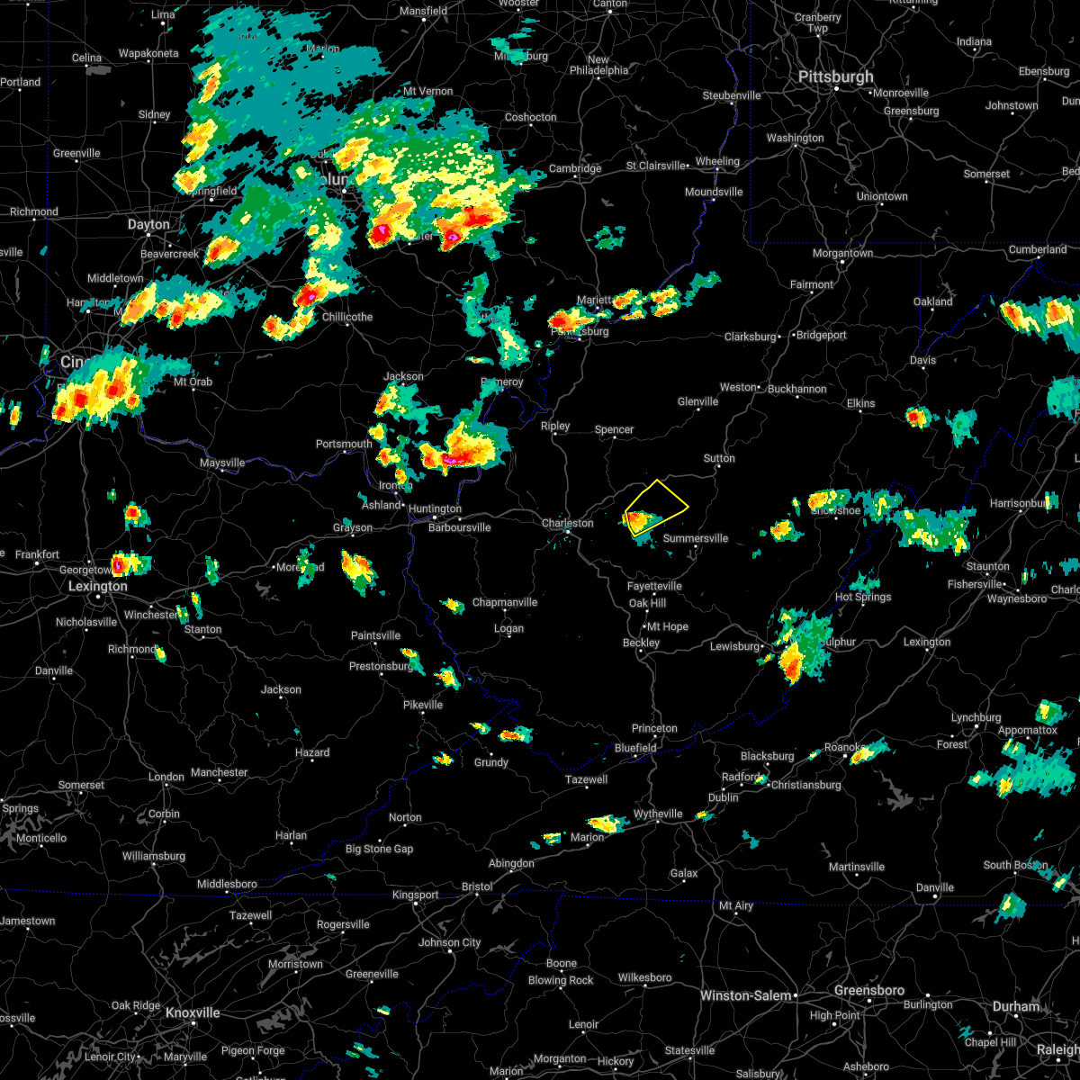
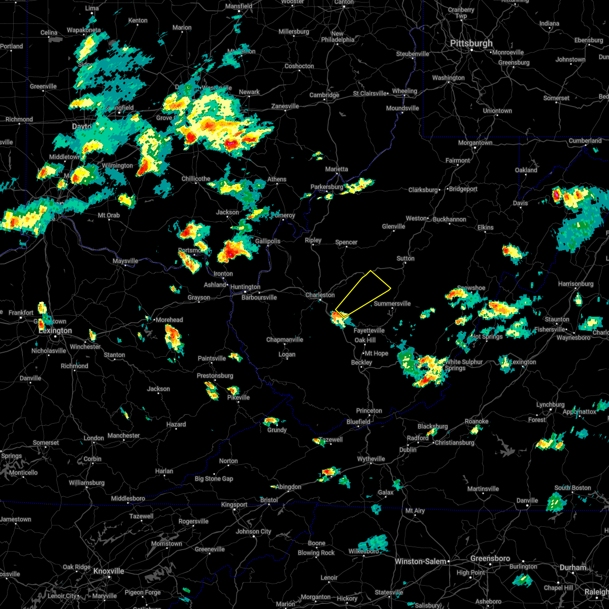
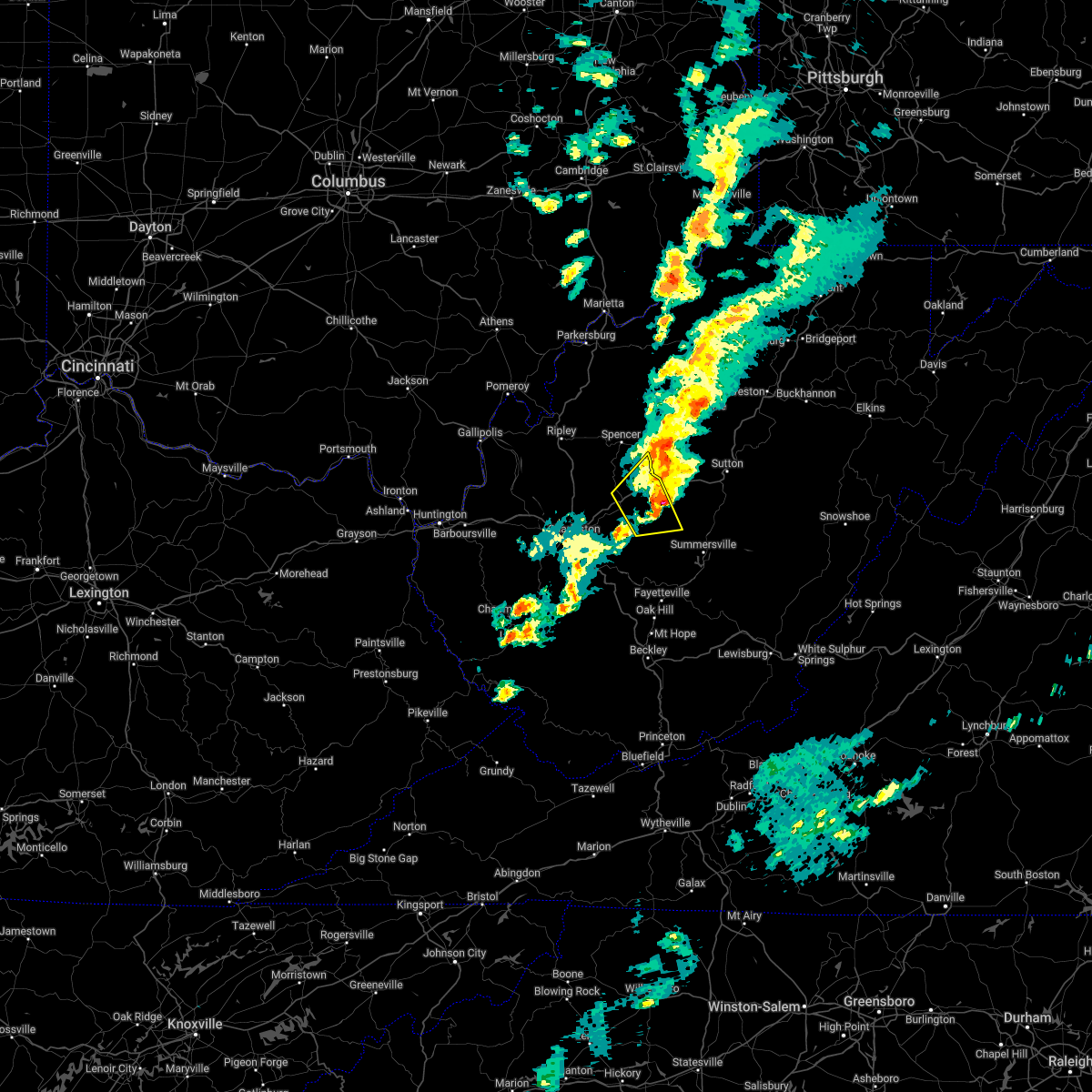
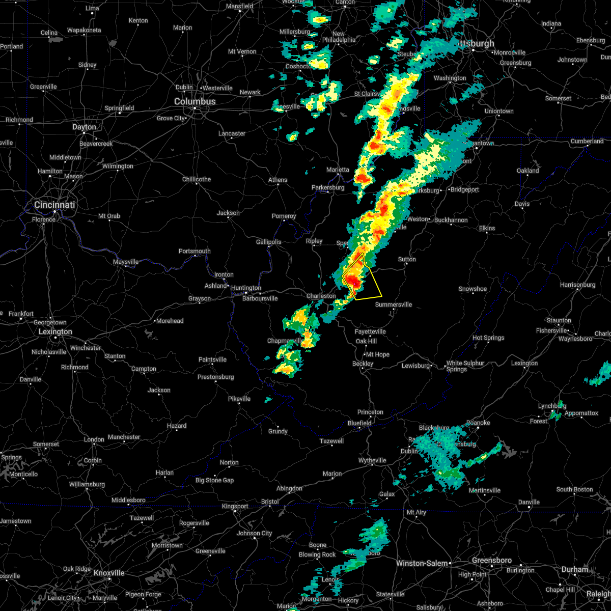
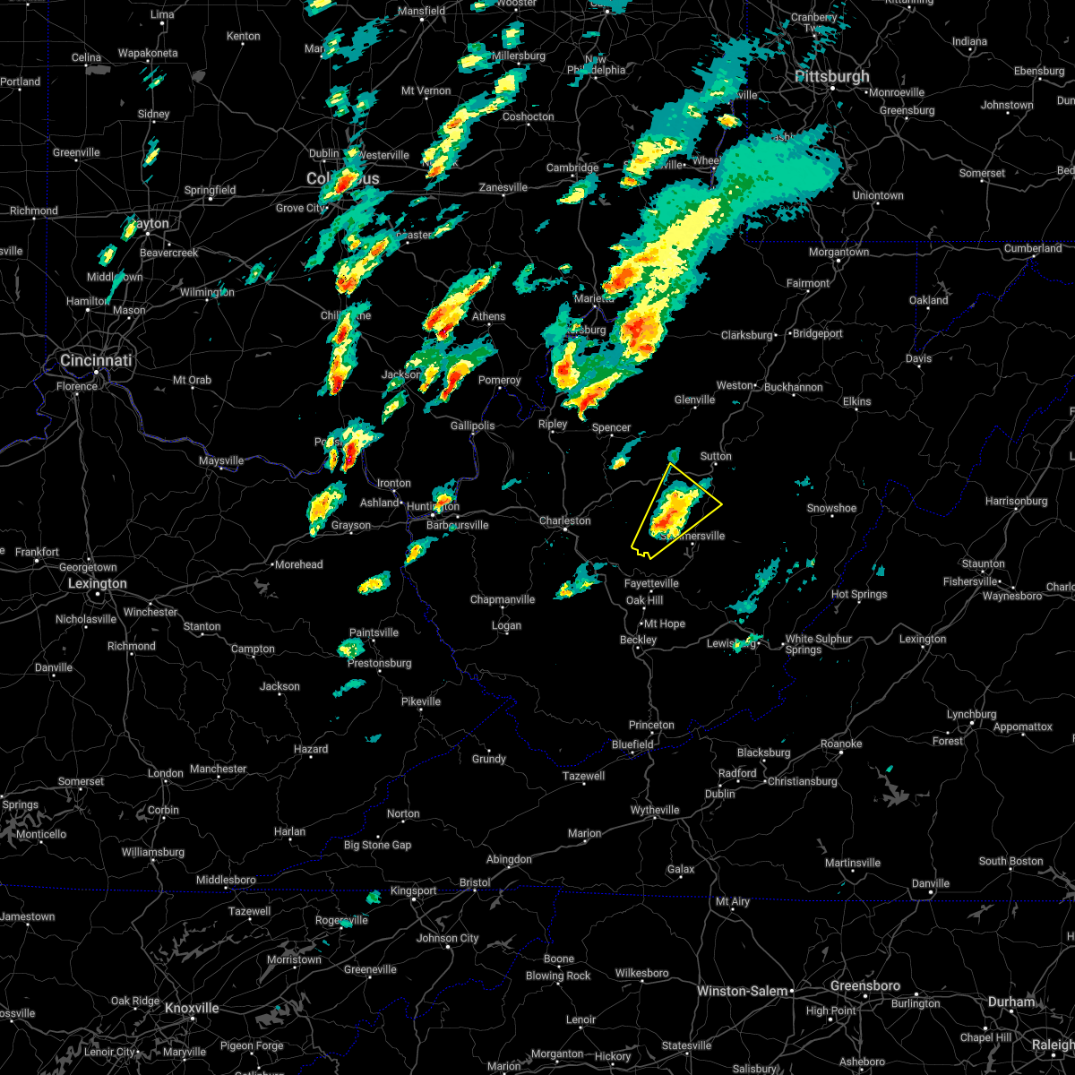
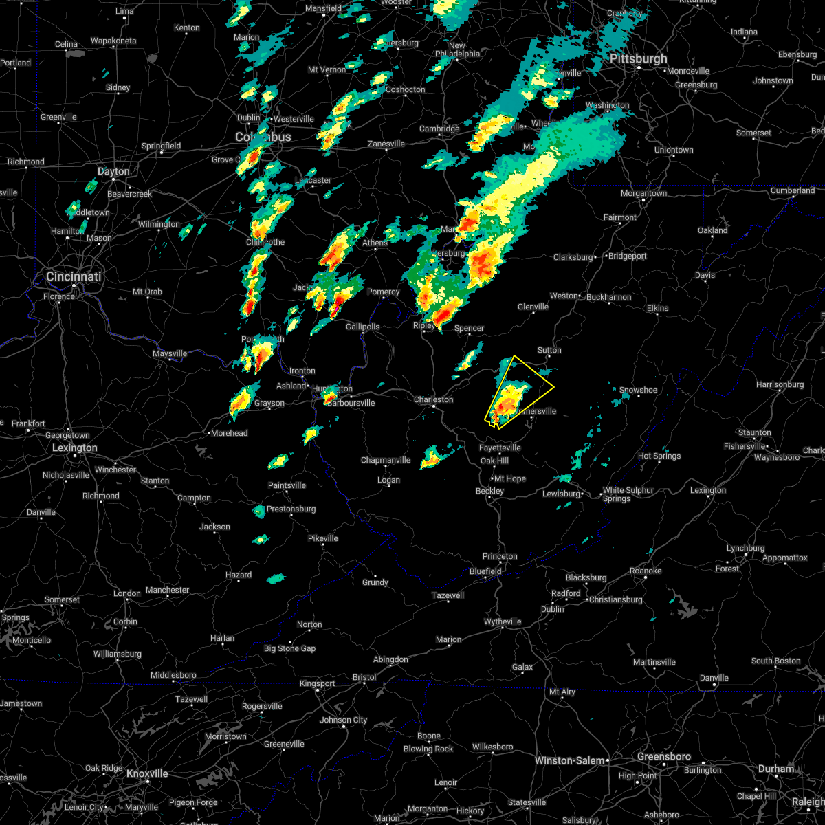
Hail Map for Clay, WV
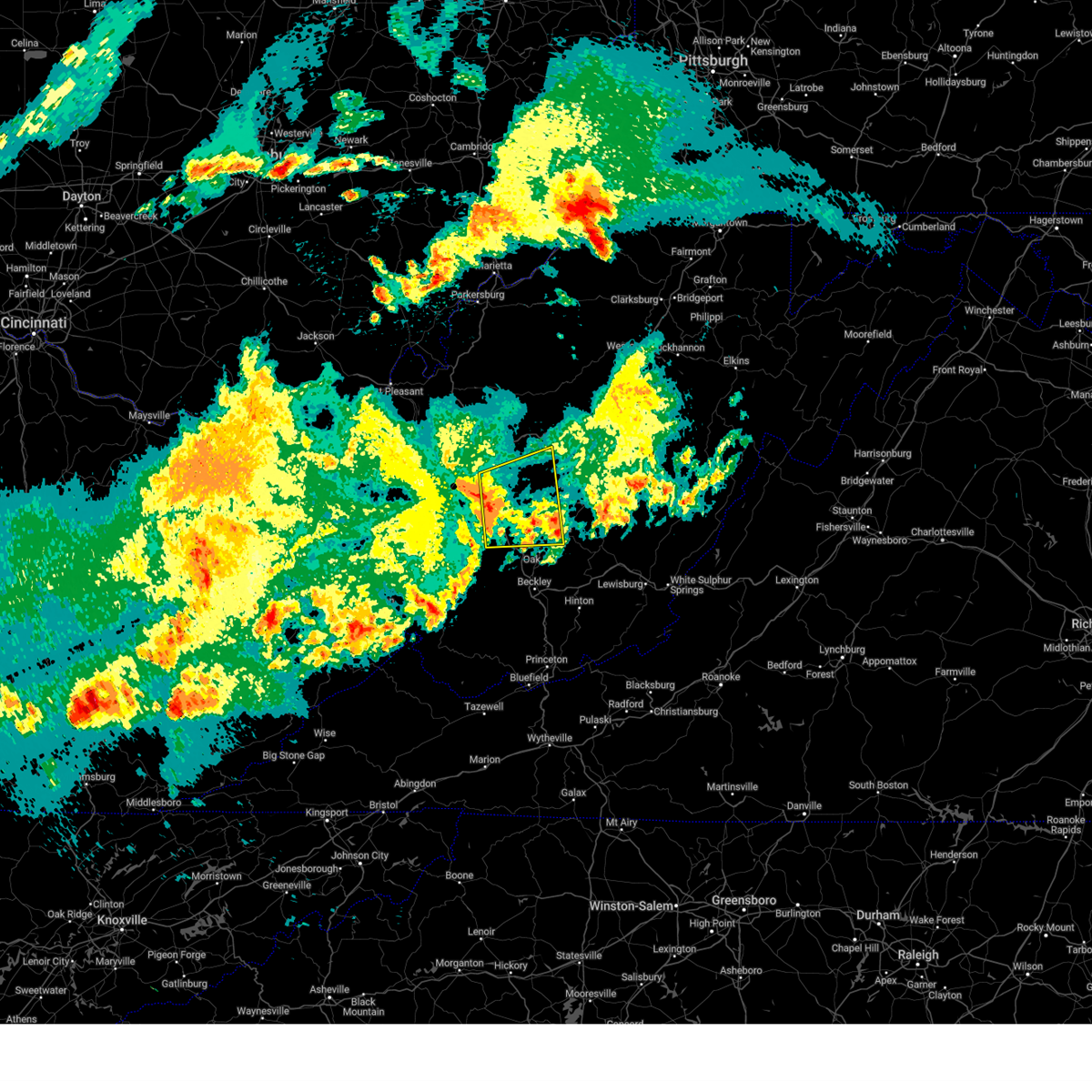
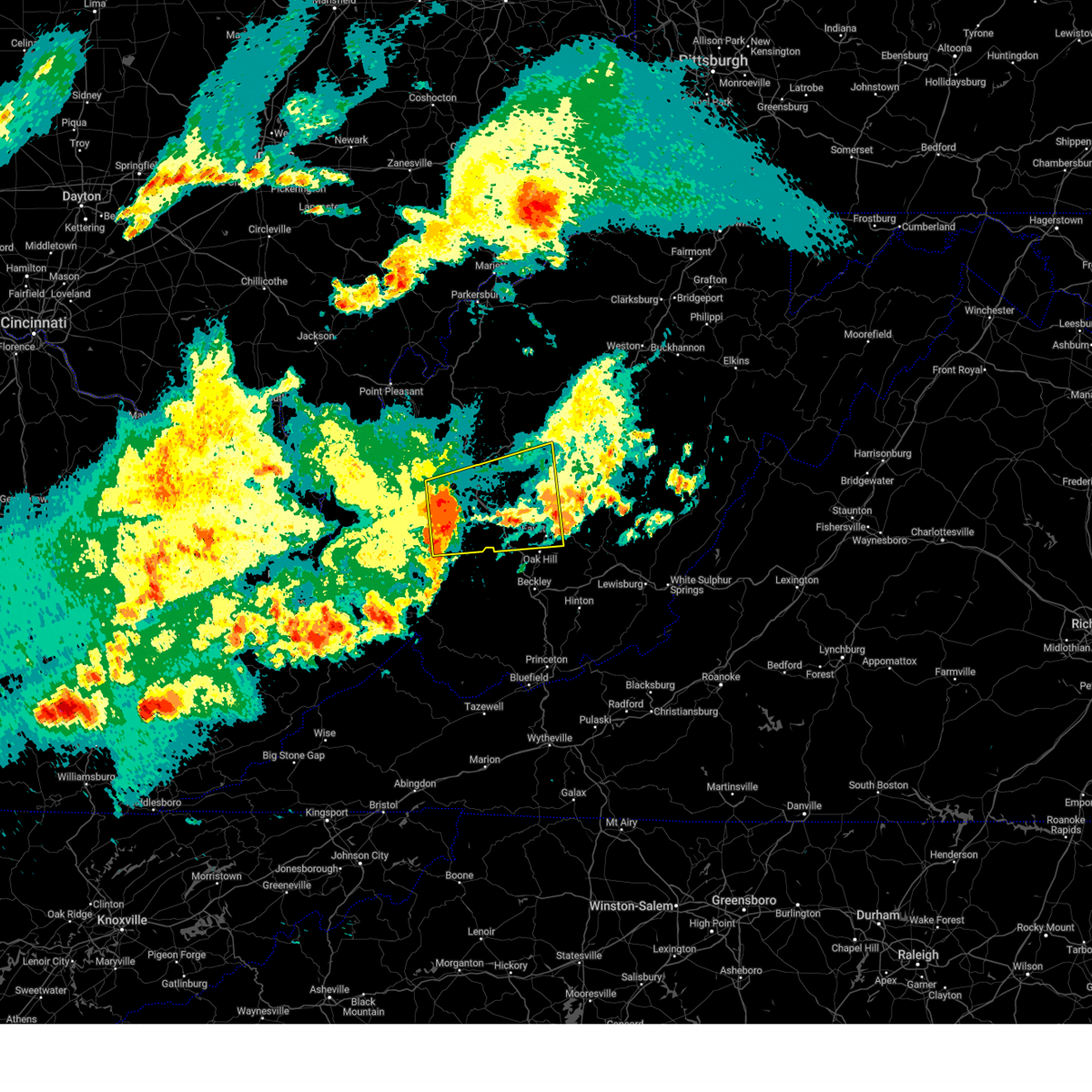
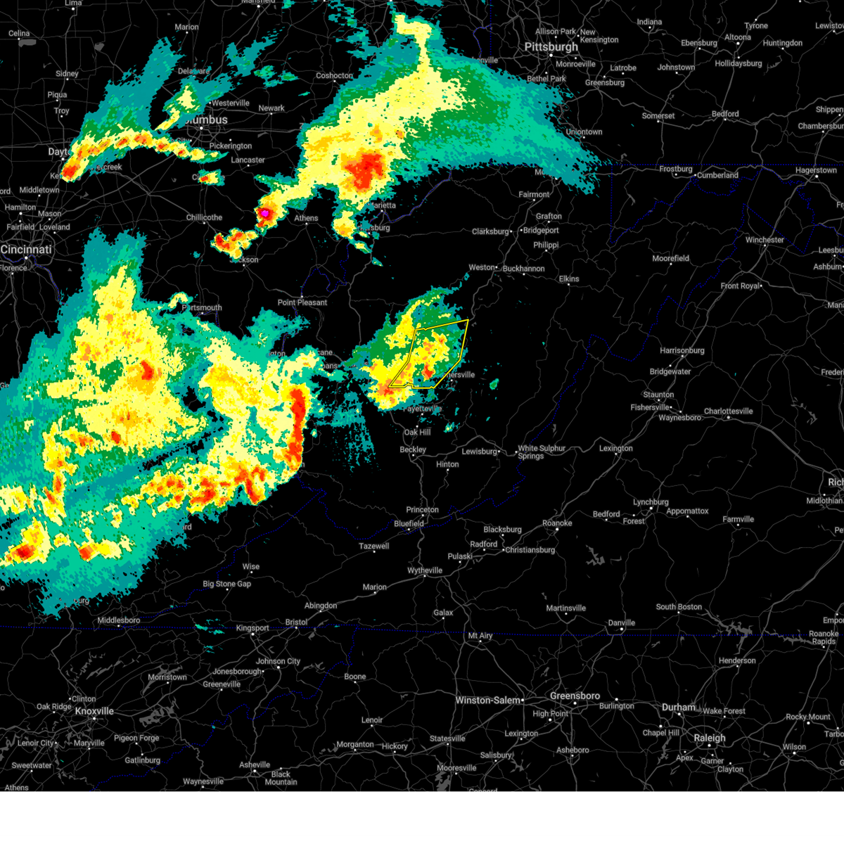
The Clay, WV area has had 5 reports of on-the-ground hail by trained spotters, and has been under severe weather warnings 35 times during the past 12 months. Doppler radar has detected hail at or near Clay, WV on 41 occasions, including 4 occasions during the past year.
| Name: | Clay, WV |
| Where Located: | 31 miles ENE of Charleston, WV |
| Map: | Google Map for Clay, WV |
| Population: | 491 |
| Housing Units: | 275 |
| More Info: | Search Google for Clay, WV |
5
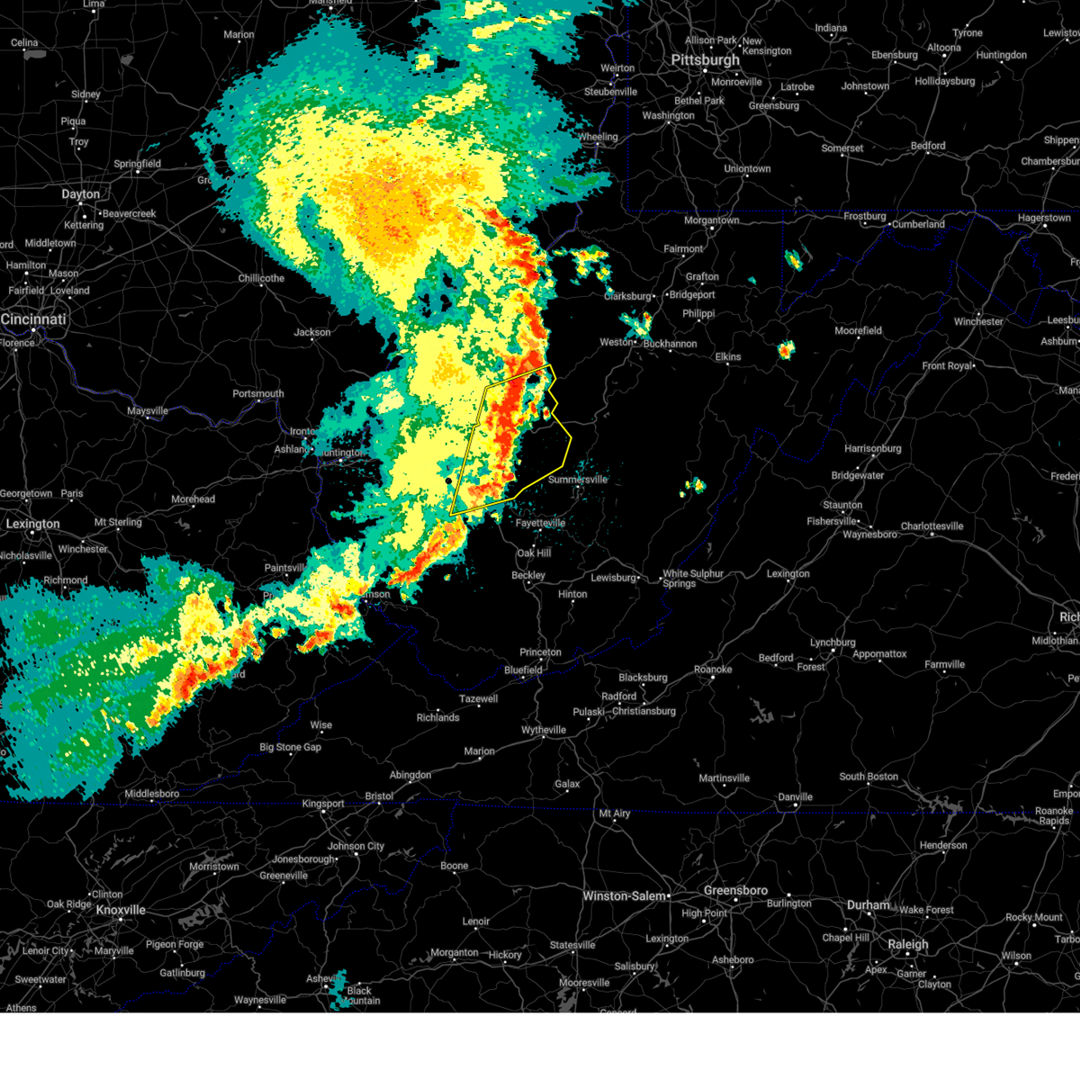
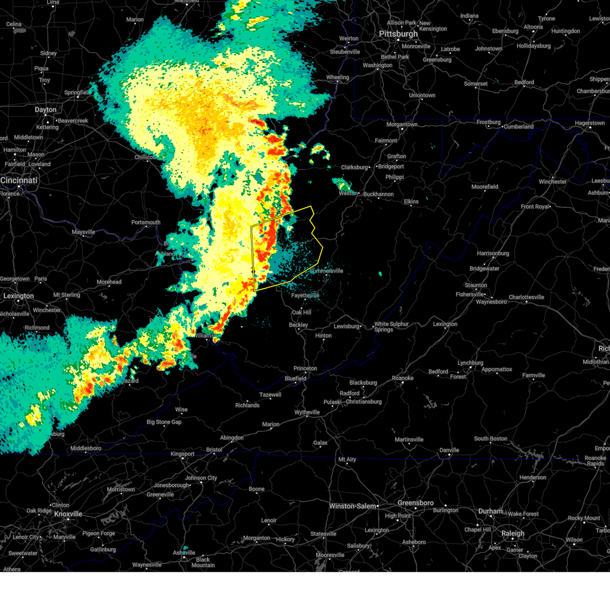
The Top Recent Hail Date for Clay, WV is Monday, April 14, 2025 (2nd out of 41)

Hail and Wind Damage Spotted near Clay, WV
| Date / Time | Report Details |
|---|---|
| 5/17/2025 12:30 AM EDT |
 the severe thunderstorm warning has been cancelled and is no longer in effect the severe thunderstorm warning has been cancelled and is no longer in effect
|
| 5/17/2025 12:30 AM EDT |
 At 1229 am edt, severe thunderstorms were located along a line extending from near coal fork to near burnwell, moving east at 60 mph (radar indicated). Hazards include 60 mph wind gusts. Expect damage to roofs, siding, and trees. Locations impacted include, fayetteville, clay, oak hill, montgomery, chesapeake, ansted, belle, cedar grove, east bank, glasgow, smithers, gauley bridge, pratt, powellton, glen, hawks nest state park, coal fork, burnwell, pinch, and handley. At 1229 am edt, severe thunderstorms were located along a line extending from near coal fork to near burnwell, moving east at 60 mph (radar indicated). Hazards include 60 mph wind gusts. Expect damage to roofs, siding, and trees. Locations impacted include, fayetteville, clay, oak hill, montgomery, chesapeake, ansted, belle, cedar grove, east bank, glasgow, smithers, gauley bridge, pratt, powellton, glen, hawks nest state park, coal fork, burnwell, pinch, and handley.
|
| 5/17/2025 12:13 AM EDT |
 Svrrlx the national weather service in charleston west virginia has issued a * severe thunderstorm warning for, west central nicholas county in southeastern west virginia, kanawha county in central west virginia, northeastern lincoln county in central west virginia, southwestern clay county in north central west virginia, northwestern fayette county in southeastern west virginia, boone county in central west virginia, * until 1245 am edt. * at 1212 am edt, severe thunderstorms were located along a line extending from near alum creek to near madison, moving east at 65 mph (radar indicated). Hazards include 60 mph wind gusts and penny size hail. expect damage to roofs, siding, and trees Svrrlx the national weather service in charleston west virginia has issued a * severe thunderstorm warning for, west central nicholas county in southeastern west virginia, kanawha county in central west virginia, northeastern lincoln county in central west virginia, southwestern clay county in north central west virginia, northwestern fayette county in southeastern west virginia, boone county in central west virginia, * until 1245 am edt. * at 1212 am edt, severe thunderstorms were located along a line extending from near alum creek to near madison, moving east at 65 mph (radar indicated). Hazards include 60 mph wind gusts and penny size hail. expect damage to roofs, siding, and trees
|
| 5/16/2025 11:58 PM EDT | Tree down in ivydale. time estimated by rada in clay county WV, 6 miles SSW of Clay, WV |
| 5/16/2025 11:53 PM EDT |
 At 1153 pm edt, severe thunderstorms were located along a line extending from near big otter to near clay to 6 miles south of glen, moving east at 55 mph (radar indicated). Hazards include 60 mph wind gusts. Expect damage to roofs, siding, and trees. Locations impacted include, sutton, clay, gassaway, glen, big otter, wallback, harrison, widen, nebo, frametown, strange creek, bickmore, servia, swiss, indore, bentree, drennan, ivydale, and pond gap. At 1153 pm edt, severe thunderstorms were located along a line extending from near big otter to near clay to 6 miles south of glen, moving east at 55 mph (radar indicated). Hazards include 60 mph wind gusts. Expect damage to roofs, siding, and trees. Locations impacted include, sutton, clay, gassaway, glen, big otter, wallback, harrison, widen, nebo, frametown, strange creek, bickmore, servia, swiss, indore, bentree, drennan, ivydale, and pond gap.
|
| 5/16/2025 11:53 PM EDT |
 the severe thunderstorm warning has been cancelled and is no longer in effect the severe thunderstorm warning has been cancelled and is no longer in effect
|
| 5/16/2025 11:30 PM EDT | Svrrlx the national weather service in charleston west virginia has issued a * severe thunderstorm warning for, southeastern calhoun county in north central west virginia, northwestern nicholas county in southeastern west virginia, northeastern kanawha county in central west virginia, southwestern braxton county in north central west virginia, southeastern roane county in central west virginia, clay county in north central west virginia, northwestern fayette county in southeastern west virginia, * until midnight edt. * at 1130 pm edt, severe thunderstorms were located along a line extending from near clendenin to near pinch to marmet, moving east at 55 mph (radar indicated). Hazards include 60 mph wind gusts. expect damage to roofs, siding, and trees |
| 4/29/2025 10:36 PM EDT |
 the severe thunderstorm warning has been cancelled and is no longer in effect the severe thunderstorm warning has been cancelled and is no longer in effect
|
| 4/29/2025 10:36 PM EDT |
 At 1035 pm edt, severe thunderstorms were located along a line extending from near glenville to 6 miles west of summersville, moving east at 50 mph (radar indicated). Hazards include 60 mph wind gusts. Expect damage to roofs, siding, and trees. Locations impacted include, nebo, bentree, big otter, clay, pratt, harrison, bickmore, ivydale, indore, pond gap, and glen. At 1035 pm edt, severe thunderstorms were located along a line extending from near glenville to 6 miles west of summersville, moving east at 50 mph (radar indicated). Hazards include 60 mph wind gusts. Expect damage to roofs, siding, and trees. Locations impacted include, nebo, bentree, big otter, clay, pratt, harrison, bickmore, ivydale, indore, pond gap, and glen.
|
| 4/29/2025 10:27 PM EDT |
 At 1027 pm edt, severe thunderstorms were located along a line extending from 6 miles northwest of cedar creek state park to 7 miles north of gauley bridge, moving east at 45 mph (radar indicated). Hazards include 60 mph wind gusts. Expect damage to roofs, siding, and trees. Locations impacted include, nebo, millstone, clay, pratt, bickmore, tariff, cedar grove, procious, arnoldsburg, glasgow, mount zion, indore, glen, bentree, big otter, orma, harrison, ivydale, east bank, and nicut. At 1027 pm edt, severe thunderstorms were located along a line extending from 6 miles northwest of cedar creek state park to 7 miles north of gauley bridge, moving east at 45 mph (radar indicated). Hazards include 60 mph wind gusts. Expect damage to roofs, siding, and trees. Locations impacted include, nebo, millstone, clay, pratt, bickmore, tariff, cedar grove, procious, arnoldsburg, glasgow, mount zion, indore, glen, bentree, big otter, orma, harrison, ivydale, east bank, and nicut.
|
| 4/29/2025 10:18 PM EDT |
 the severe thunderstorm warning has been cancelled and is no longer in effect the severe thunderstorm warning has been cancelled and is no longer in effect
|
| 4/29/2025 10:18 PM EDT |
 At 1017 pm edt, severe thunderstorms were located along a line extending from grantsville to near smithers, moving east at 45 mph (radar indicated). Hazards include 60 mph wind gusts. Expect damage to roofs, siding, and trees. Locations impacted include, nebo, millstone, cedar grove, procious, glasgow, mount zion, indore, glen, left hand, ivydale, pond gap, clay, clendenin, pratt, bickmore, tariff, arnoldsburg, bentree, chesapeake, and big otter. At 1017 pm edt, severe thunderstorms were located along a line extending from grantsville to near smithers, moving east at 45 mph (radar indicated). Hazards include 60 mph wind gusts. Expect damage to roofs, siding, and trees. Locations impacted include, nebo, millstone, cedar grove, procious, glasgow, mount zion, indore, glen, left hand, ivydale, pond gap, clay, clendenin, pratt, bickmore, tariff, arnoldsburg, bentree, chesapeake, and big otter.
|
| 4/29/2025 10:06 PM EDT |
 the severe thunderstorm warning has been cancelled and is no longer in effect the severe thunderstorm warning has been cancelled and is no longer in effect
|
| 4/29/2025 10:06 PM EDT |
 At 1006 pm edt, severe thunderstorms were located along a line extending from 6 miles northwest of arnoldsburg to glasgow, moving northeast at 60 mph (radar indicated). Hazards include 60 mph wind gusts. Expect damage to roofs, siding, and trees. Locations impacted include, nebo, millstone, charleston, pinch, cedar grove, procious, glasgow, mount zion, indore, glen, left hand, ivydale, coal fork, pond gap, elkview, racine, clay, clendenin, pratt, and harmony. At 1006 pm edt, severe thunderstorms were located along a line extending from 6 miles northwest of arnoldsburg to glasgow, moving northeast at 60 mph (radar indicated). Hazards include 60 mph wind gusts. Expect damage to roofs, siding, and trees. Locations impacted include, nebo, millstone, charleston, pinch, cedar grove, procious, glasgow, mount zion, indore, glen, left hand, ivydale, coal fork, pond gap, elkview, racine, clay, clendenin, pratt, and harmony.
|
| 4/29/2025 9:53 PM EDT |
 Svrrlx the national weather service in charleston west virginia has issued a * severe thunderstorm warning for, calhoun county in north central west virginia, northeastern putnam county in western west virginia, kanawha county in central west virginia, roane county in central west virginia, clay county in north central west virginia, southeastern jackson county in northwestern west virginia, northern boone county in central west virginia, * until 1100 pm edt. * at 952 pm edt, a severe thunderstorm was located over dunbar, or near charleston, moving east at 45 mph (radar indicated). Hazards include 60 mph wind gusts. expect damage to roofs, siding, and trees Svrrlx the national weather service in charleston west virginia has issued a * severe thunderstorm warning for, calhoun county in north central west virginia, northeastern putnam county in western west virginia, kanawha county in central west virginia, roane county in central west virginia, clay county in north central west virginia, southeastern jackson county in northwestern west virginia, northern boone county in central west virginia, * until 1100 pm edt. * at 952 pm edt, a severe thunderstorm was located over dunbar, or near charleston, moving east at 45 mph (radar indicated). Hazards include 60 mph wind gusts. expect damage to roofs, siding, and trees
|
| 4/14/2025 7:44 PM EDT |
 Svrrlx the national weather service in charleston west virginia has issued a * severe thunderstorm warning for, central nicholas county in southeastern west virginia, east central kanawha county in central west virginia, west central webster county in northeastern west virginia, southern clay county in north central west virginia, north central fayette county in southeastern west virginia, * until 815 pm edt. * at 744 pm edt, a severe thunderstorm was located near clay, moving east at 60 mph (radar indicated). Hazards include 60 mph wind gusts and quarter size hail. Hail damage to vehicles is expected. Expect wind damage to roofs, siding, and trees. Svrrlx the national weather service in charleston west virginia has issued a * severe thunderstorm warning for, central nicholas county in southeastern west virginia, east central kanawha county in central west virginia, west central webster county in northeastern west virginia, southern clay county in north central west virginia, north central fayette county in southeastern west virginia, * until 815 pm edt. * at 744 pm edt, a severe thunderstorm was located near clay, moving east at 60 mph (radar indicated). Hazards include 60 mph wind gusts and quarter size hail. Hail damage to vehicles is expected. Expect wind damage to roofs, siding, and trees.
|
| 4/14/2025 6:50 PM EDT |
 Svrrlx the national weather service in charleston west virginia has issued a * severe thunderstorm warning for, nicholas county in southeastern west virginia, east central kanawha county in central west virginia, west central webster county in northeastern west virginia, clay county in north central west virginia, north central fayette county in southeastern west virginia, * until 730 pm edt. * at 650 pm edt, a severe thunderstorm was located near clay, moving east at 60 mph (radar indicated). Hazards include golf ball size hail and 60 mph wind gusts. People and animals outdoors will be injured. expect hail damage to roofs, siding, windows, and vehicles. Expect wind damage to roofs, siding, and trees. Svrrlx the national weather service in charleston west virginia has issued a * severe thunderstorm warning for, nicholas county in southeastern west virginia, east central kanawha county in central west virginia, west central webster county in northeastern west virginia, clay county in north central west virginia, north central fayette county in southeastern west virginia, * until 730 pm edt. * at 650 pm edt, a severe thunderstorm was located near clay, moving east at 60 mph (radar indicated). Hazards include golf ball size hail and 60 mph wind gusts. People and animals outdoors will be injured. expect hail damage to roofs, siding, windows, and vehicles. Expect wind damage to roofs, siding, and trees.
|
| 4/14/2025 6:13 PM EDT |
 At 613 pm edt, a severe thunderstorm was located 9 miles west of summersville, moving east at 60 mph (radar indicated). Hazards include golf ball size hail and 60 mph wind gusts. People and animals outdoors will be injured. expect hail damage to roofs, siding, windows, and vehicles. expect wind damage to roofs, siding, and trees. Locations impacted include, widen, clay, bickmore, richwood, canvas, craigsville, muddlety, upper glade, swiss, indore, nettie, boggs, cowen, bentree, calvin, kesslers cross lanes, camden on gauley, drennan, camden-on-gauley, and mount nebo. At 613 pm edt, a severe thunderstorm was located 9 miles west of summersville, moving east at 60 mph (radar indicated). Hazards include golf ball size hail and 60 mph wind gusts. People and animals outdoors will be injured. expect hail damage to roofs, siding, windows, and vehicles. expect wind damage to roofs, siding, and trees. Locations impacted include, widen, clay, bickmore, richwood, canvas, craigsville, muddlety, upper glade, swiss, indore, nettie, boggs, cowen, bentree, calvin, kesslers cross lanes, camden on gauley, drennan, camden-on-gauley, and mount nebo.
|
| 4/14/2025 6:13 PM EDT |
 the severe thunderstorm warning has been cancelled and is no longer in effect the severe thunderstorm warning has been cancelled and is no longer in effect
|
| 4/14/2025 6:01 PM EDT |
 Svrrlx the national weather service in charleston west virginia has issued a * severe thunderstorm warning for, nicholas county in southeastern west virginia, northeastern kanawha county in central west virginia, southwestern webster county in northeastern west virginia, clay county in north central west virginia, northeastern fayette county in southeastern west virginia, * until 700 pm edt. * at 601 pm edt, a severe thunderstorm was located near glen, or 13 miles west of clay, moving east at 55 mph (radar indicated). Hazards include golf ball size hail and 60 mph wind gusts. People and animals outdoors will be injured. expect hail damage to roofs, siding, windows, and vehicles. Expect wind damage to roofs, siding, and trees. Svrrlx the national weather service in charleston west virginia has issued a * severe thunderstorm warning for, nicholas county in southeastern west virginia, northeastern kanawha county in central west virginia, southwestern webster county in northeastern west virginia, clay county in north central west virginia, northeastern fayette county in southeastern west virginia, * until 700 pm edt. * at 601 pm edt, a severe thunderstorm was located near glen, or 13 miles west of clay, moving east at 55 mph (radar indicated). Hazards include golf ball size hail and 60 mph wind gusts. People and animals outdoors will be injured. expect hail damage to roofs, siding, windows, and vehicles. Expect wind damage to roofs, siding, and trees.
|
| 4/3/2025 10:11 AM EDT |
 the severe thunderstorm warning has been cancelled and is no longer in effect the severe thunderstorm warning has been cancelled and is no longer in effect
|
| 4/3/2025 10:11 AM EDT |
 At 1010 am edt, a severe thunderstorm was located over hawks nest state park, or 7 miles northwest of fayetteville, moving east at 50 mph (radar indicated). Hazards include 60 mph wind gusts and quarter size hail. Hail damage to vehicles is expected. expect wind damage to roofs, siding, and trees. Locations impacted include, clay, ansted, fayetteville, bickmore, canvas, swiss, gauley bridge, kesslers cross lanes, hawks nest state park, drennan, mount nebo, summersville, and powellton. At 1010 am edt, a severe thunderstorm was located over hawks nest state park, or 7 miles northwest of fayetteville, moving east at 50 mph (radar indicated). Hazards include 60 mph wind gusts and quarter size hail. Hail damage to vehicles is expected. expect wind damage to roofs, siding, and trees. Locations impacted include, clay, ansted, fayetteville, bickmore, canvas, swiss, gauley bridge, kesslers cross lanes, hawks nest state park, drennan, mount nebo, summersville, and powellton.
|
| 4/3/2025 9:55 AM EDT |
 Svrrlx the national weather service in charleston west virginia has issued a * severe thunderstorm warning for, southwestern nicholas county in southeastern west virginia, southeastern kanawha county in central west virginia, southwestern clay county in north central west virginia, northern fayette county in southeastern west virginia, * until 1045 am edt. * at 954 am edt, a severe thunderstorm was located over burnwell, or 15 miles west of fayetteville, moving east at 50 mph (radar indicated). Hazards include 60 mph wind gusts and quarter size hail. Hail damage to vehicles is expected. Expect wind damage to roofs, siding, and trees. Svrrlx the national weather service in charleston west virginia has issued a * severe thunderstorm warning for, southwestern nicholas county in southeastern west virginia, southeastern kanawha county in central west virginia, southwestern clay county in north central west virginia, northern fayette county in southeastern west virginia, * until 1045 am edt. * at 954 am edt, a severe thunderstorm was located over burnwell, or 15 miles west of fayetteville, moving east at 50 mph (radar indicated). Hazards include 60 mph wind gusts and quarter size hail. Hail damage to vehicles is expected. Expect wind damage to roofs, siding, and trees.
|
| 4/3/2025 5:57 AM EDT | Svrrlx the national weather service in charleston west virginia has issued a * severe thunderstorm warning for, southeastern calhoun county in north central west virginia, northwestern randolph county in northeastern west virginia, northeastern kanawha county in central west virginia, upshur county in northeastern west virginia, southeastern roane county in central west virginia, northwestern webster county in northeastern west virginia, barbour county in northeastern west virginia, harrison county in northern west virginia, southeastern doddridge county in northern west virginia, taylor county in northern west virginia, north central nicholas county in southeastern west virginia, central gilmer county in north central west virginia, lewis county in northern west virginia, braxton county in north central west virginia, northern clay county in north central west virginia, * until 645 am edt. * at 557 am edt, severe thunderstorms were located along a line extending from near salem to 7 miles northwest of gassaway to near amma, moving east at 65 mph (radar indicated). Hazards include 60 mph wind gusts. expect damage to roofs, siding, and trees |
| 3/16/2025 11:31 AM EDT |
 At 1130 am edt, severe thunderstorms were located along a line extending from near big otter to near clay to 7 miles east of glen, moving east at 45 mph (radar indicated). Hazards include 60 mph wind gusts. Expect damage to roofs, siding, and trees. Locations impacted include, widen, nebo, clay, frametown, strange creek, bickmore, birch river, servia, muddlety, indore, big otter, little birch, harrison, ivydale, wallback, glen, procious, and gassaway. At 1130 am edt, severe thunderstorms were located along a line extending from near big otter to near clay to 7 miles east of glen, moving east at 45 mph (radar indicated). Hazards include 60 mph wind gusts. Expect damage to roofs, siding, and trees. Locations impacted include, widen, nebo, clay, frametown, strange creek, bickmore, birch river, servia, muddlety, indore, big otter, little birch, harrison, ivydale, wallback, glen, procious, and gassaway.
|
| 3/16/2025 11:31 AM EDT |
 the severe thunderstorm warning has been cancelled and is no longer in effect the severe thunderstorm warning has been cancelled and is no longer in effect
|
| 3/16/2025 11:20 AM EDT | Tree down in big otte in clay county WV, 11.1 miles S of Clay, WV |
| 3/16/2025 11:20 AM EDT | Tree down in bickmor in clay county WV, 5 miles NNE of Clay, WV |
| 3/16/2025 11:16 AM EDT |
 Svrrlx the national weather service in charleston west virginia has issued a * severe thunderstorm warning for, south central calhoun county in north central west virginia, northwestern nicholas county in southeastern west virginia, northeastern kanawha county in central west virginia, southwestern braxton county in north central west virginia, southern roane county in central west virginia, clay county in north central west virginia, * until 1145 am edt. * at 1116 am edt, a severe thunderstorm was located near wallback, or 7 miles northwest of clay, moving east at 40 mph (radar indicated). Hazards include 60 mph wind gusts. expect damage to roofs, siding, and trees Svrrlx the national weather service in charleston west virginia has issued a * severe thunderstorm warning for, south central calhoun county in north central west virginia, northwestern nicholas county in southeastern west virginia, northeastern kanawha county in central west virginia, southwestern braxton county in north central west virginia, southern roane county in central west virginia, clay county in north central west virginia, * until 1145 am edt. * at 1116 am edt, a severe thunderstorm was located near wallback, or 7 miles northwest of clay, moving east at 40 mph (radar indicated). Hazards include 60 mph wind gusts. expect damage to roofs, siding, and trees
|
| 2/16/2025 11:59 AM EST |
 The storms which prompted the warning have moved out of the area. therefore, the warning will be allowed to expire. however, gusty winds are still possible with lingering showers. The storms which prompted the warning have moved out of the area. therefore, the warning will be allowed to expire. however, gusty winds are still possible with lingering showers.
|
| 2/16/2025 11:40 AM EST |
 At 1138 am est, severe thunderstorms were located along a line extending from near clay to near oak hill, moving east at 60 mph (radar indicated). Hazards include 70 mph wind gusts. Expect considerable tree damage. damage is likely to mobile homes, roofs, and outbuildings. Locations impacted include, thurmond, muddlety, swiss, indore, boggs, hawks nest state park, drennan, ivydale, oak hill, mount nebo, erbacon, summersville, widen, clay, ansted, fayetteville, bickmore, canvas, birch river, and nettie. At 1138 am est, severe thunderstorms were located along a line extending from near clay to near oak hill, moving east at 60 mph (radar indicated). Hazards include 70 mph wind gusts. Expect considerable tree damage. damage is likely to mobile homes, roofs, and outbuildings. Locations impacted include, thurmond, muddlety, swiss, indore, boggs, hawks nest state park, drennan, ivydale, oak hill, mount nebo, erbacon, summersville, widen, clay, ansted, fayetteville, bickmore, canvas, birch river, and nettie.
|
| 2/16/2025 11:40 AM EST |
 the severe thunderstorm warning has been cancelled and is no longer in effect the severe thunderstorm warning has been cancelled and is no longer in effect
|
| 2/16/2025 11:13 AM EST |
 Svrrlx the national weather service in charleston west virginia has issued a * severe thunderstorm warning for, nicholas county in southeastern west virginia, eastern kanawha county in central west virginia, south central roane county in central west virginia, north central raleigh county in southeastern west virginia, west central webster county in northeastern west virginia, clay county in north central west virginia, fayette county in southeastern west virginia, northeastern boone county in central west virginia, * until noon est. * at 1112 am est, severe thunderstorms were located along a line extending from 8 miles northwest of clendenin to 8 miles northeast of van, moving east at 60 mph (radar indicated). Hazards include 60 mph wind gusts. expect damage to roofs, siding, and trees Svrrlx the national weather service in charleston west virginia has issued a * severe thunderstorm warning for, nicholas county in southeastern west virginia, eastern kanawha county in central west virginia, south central roane county in central west virginia, north central raleigh county in southeastern west virginia, west central webster county in northeastern west virginia, clay county in north central west virginia, fayette county in southeastern west virginia, northeastern boone county in central west virginia, * until noon est. * at 1112 am est, severe thunderstorms were located along a line extending from 8 miles northwest of clendenin to 8 miles northeast of van, moving east at 60 mph (radar indicated). Hazards include 60 mph wind gusts. expect damage to roofs, siding, and trees
|
| 2/6/2025 8:22 AM EST |
 The severe thunderstorm which prompted the warning has weakened. however, gusty winds and heavy rain are still possible with this thunderstorm. The severe thunderstorm which prompted the warning has weakened. however, gusty winds and heavy rain are still possible with this thunderstorm.
|
| 2/6/2025 8:17 AM EST |
 At 817 am est, a severe thunderstorm was located 7 miles south of glen, or 13 miles southwest of clay, moving east at 55 mph (radar indicated). Hazards include 60 mph wind gusts. Expect damage to roofs, siding, and trees. Locations impacted include, bentree, pratt, kesslers cross lanes, bickmore, drennan, glasgow, swiss, indore, pond gap, handley, and clay. At 817 am est, a severe thunderstorm was located 7 miles south of glen, or 13 miles southwest of clay, moving east at 55 mph (radar indicated). Hazards include 60 mph wind gusts. Expect damage to roofs, siding, and trees. Locations impacted include, bentree, pratt, kesslers cross lanes, bickmore, drennan, glasgow, swiss, indore, pond gap, handley, and clay.
|
| 2/6/2025 8:04 AM EST |
 Svrrlx the national weather service in charleston west virginia has issued a * severe thunderstorm warning for, southwestern nicholas county in southeastern west virginia, east central kanawha county in central west virginia, southern clay county in north central west virginia, northwestern fayette county in southeastern west virginia, * until 830 am est. * at 804 am est, a severe thunderstorm was located near coal fork, or 10 miles east of charleston, moving east at 45 mph (radar indicated). Hazards include 60 mph wind gusts and nickel size hail. expect damage to roofs, siding, and trees Svrrlx the national weather service in charleston west virginia has issued a * severe thunderstorm warning for, southwestern nicholas county in southeastern west virginia, east central kanawha county in central west virginia, southern clay county in north central west virginia, northwestern fayette county in southeastern west virginia, * until 830 am est. * at 804 am est, a severe thunderstorm was located near coal fork, or 10 miles east of charleston, moving east at 45 mph (radar indicated). Hazards include 60 mph wind gusts and nickel size hail. expect damage to roofs, siding, and trees
|
| 8/29/2024 6:16 PM EDT | the severe thunderstorm warning has been cancelled and is no longer in effect |
| 8/29/2024 5:53 PM EDT | Svrrlx the national weather service in charleston west virginia has issued a * severe thunderstorm warning for, north central nicholas county in southeastern west virginia, east central clay county in north central west virginia, * until 630 pm edt. * at 553 pm edt, a severe thunderstorm was located 7 miles east of clay, moving northeast at 10 mph (radar indicated). Hazards include 60 mph wind gusts and half dollar size hail. Hail damage to vehicles is expected. Expect wind damage to roofs, siding, and trees. |
| 6/26/2024 5:23 PM EDT |
 The storm which prompted the warning has moved out of the area. therefore, the warning will be allowed to expire. a severe thunderstorm watch remains in effect until 1000 pm edt for central, southeastern and north central west virginia. The storm which prompted the warning has moved out of the area. therefore, the warning will be allowed to expire. a severe thunderstorm watch remains in effect until 1000 pm edt for central, southeastern and north central west virginia.
|
| 6/26/2024 5:16 PM EDT |
 At 516 pm edt, a severe thunderstorm was located near clay, moving east at 35 mph (radar indicated). Hazards include 60 mph wind gusts and quarter size hail. Hail damage to vehicles is expected. expect wind damage to roofs, siding, and trees. Locations impacted include, clay, big otter, wallback, harrison, nebo, frametown, strange creek, wilsie, ivydale, and servia. At 516 pm edt, a severe thunderstorm was located near clay, moving east at 35 mph (radar indicated). Hazards include 60 mph wind gusts and quarter size hail. Hail damage to vehicles is expected. expect wind damage to roofs, siding, and trees. Locations impacted include, clay, big otter, wallback, harrison, nebo, frametown, strange creek, wilsie, ivydale, and servia.
|
| 6/26/2024 5:12 PM EDT | Quarter sized hail reported 3.7 miles SE of Clay, WV, also estimated 50mph winds. |
| 6/26/2024 5:06 PM EDT |
 Svrrlx the national weather service in charleston west virginia has issued a * severe thunderstorm warning for, north central nicholas county in southeastern west virginia, southwestern braxton county in north central west virginia, southeastern roane county in central west virginia, central clay county in north central west virginia, * until 530 pm edt. * at 506 pm edt, a severe thunderstorm was located near wallback, or near clay, moving northeast at 30 mph (radar indicated). Hazards include 60 mph wind gusts and quarter size hail. Hail damage to vehicles is expected. Expect wind damage to roofs, siding, and trees. Svrrlx the national weather service in charleston west virginia has issued a * severe thunderstorm warning for, north central nicholas county in southeastern west virginia, southwestern braxton county in north central west virginia, southeastern roane county in central west virginia, central clay county in north central west virginia, * until 530 pm edt. * at 506 pm edt, a severe thunderstorm was located near wallback, or near clay, moving northeast at 30 mph (radar indicated). Hazards include 60 mph wind gusts and quarter size hail. Hail damage to vehicles is expected. Expect wind damage to roofs, siding, and trees.
|
| 5/26/2024 5:51 PM EDT |
 The storm which prompted the warning has moved out of the area. therefore, the warning will be allowed to expire. however, gusty winds are still possible with this thunderstorm. a severe thunderstorm watch remains in effect until 900 pm edt for central, southern, southeastern and north central west virginia. The storm which prompted the warning has moved out of the area. therefore, the warning will be allowed to expire. however, gusty winds are still possible with this thunderstorm. a severe thunderstorm watch remains in effect until 900 pm edt for central, southern, southeastern and north central west virginia.
|
| 5/26/2024 5:46 PM EDT |
 At 545 pm edt, a severe thunderstorm was located near piney view, or 8 miles east of beckley, moving northeast at 35 mph (radar indicated). Hazards include 60 mph wind gusts and penny size hail. Expect damage to roofs, siding, and trees. Locations impacted include, beckley, summersville, fayetteville, clay, babcock state park, oak hill, montgomery, mullens, mount hope, mabscott, ansted, sophia, clendenin, cedar grove, east bank, glasgow, smithers, gauley bridge, pratt, and pinch. At 545 pm edt, a severe thunderstorm was located near piney view, or 8 miles east of beckley, moving northeast at 35 mph (radar indicated). Hazards include 60 mph wind gusts and penny size hail. Expect damage to roofs, siding, and trees. Locations impacted include, beckley, summersville, fayetteville, clay, babcock state park, oak hill, montgomery, mullens, mount hope, mabscott, ansted, sophia, clendenin, cedar grove, east bank, glasgow, smithers, gauley bridge, pratt, and pinch.
|
| 5/26/2024 5:25 PM EDT |
 The storm which prompted the warning has weakened below severe limits, and no longer poses an immediate threat to life or property. therefore, the warning will be allowed to expire. however, gusty winds are still possible with this thunderstorm. a severe thunderstorm watch remains in effect until 900 pm edt for central, southern, southeastern and north central west virginia. The storm which prompted the warning has weakened below severe limits, and no longer poses an immediate threat to life or property. therefore, the warning will be allowed to expire. however, gusty winds are still possible with this thunderstorm. a severe thunderstorm watch remains in effect until 900 pm edt for central, southern, southeastern and north central west virginia.
|
| 5/26/2024 5:24 PM EDT |
 Svrrlx the national weather service in charleston west virginia has issued a * severe thunderstorm warning for, southwestern nicholas county in southeastern west virginia, eastern kanawha county in central west virginia, southeastern roane county in central west virginia, raleigh county in southeastern west virginia, southeastern wyoming county in southern west virginia, clay county in north central west virginia, fayette county in southeastern west virginia, * until 600 pm edt. * at 524 pm edt, a severe thunderstorm was located over crab orchard, or near beckley, moving northeast at 35 mph (radar indicated). Hazards include 60 mph wind gusts and penny size hail. expect damage to roofs, siding, and trees Svrrlx the national weather service in charleston west virginia has issued a * severe thunderstorm warning for, southwestern nicholas county in southeastern west virginia, eastern kanawha county in central west virginia, southeastern roane county in central west virginia, raleigh county in southeastern west virginia, southeastern wyoming county in southern west virginia, clay county in north central west virginia, fayette county in southeastern west virginia, * until 600 pm edt. * at 524 pm edt, a severe thunderstorm was located over crab orchard, or near beckley, moving northeast at 35 mph (radar indicated). Hazards include 60 mph wind gusts and penny size hail. expect damage to roofs, siding, and trees
|
| 5/26/2024 4:36 PM EDT |
 Svrrlx the national weather service in charleston west virginia has issued a * severe thunderstorm warning for, southwestern nicholas county in southeastern west virginia, eastern kanawha county in central west virginia, southeastern roane county in central west virginia, raleigh county in southeastern west virginia, southeastern wyoming county in southern west virginia, clay county in north central west virginia, fayette county in southeastern west virginia, * until 530 pm edt. * at 436 pm edt, a severe thunderstorm was located near hanover, or 10 miles west of pineville, moving northeast at 35 mph (radar indicated). Hazards include 60 mph wind gusts and penny size hail. expect damage to roofs, siding, and trees Svrrlx the national weather service in charleston west virginia has issued a * severe thunderstorm warning for, southwestern nicholas county in southeastern west virginia, eastern kanawha county in central west virginia, southeastern roane county in central west virginia, raleigh county in southeastern west virginia, southeastern wyoming county in southern west virginia, clay county in north central west virginia, fayette county in southeastern west virginia, * until 530 pm edt. * at 436 pm edt, a severe thunderstorm was located near hanover, or 10 miles west of pineville, moving northeast at 35 mph (radar indicated). Hazards include 60 mph wind gusts and penny size hail. expect damage to roofs, siding, and trees
|
| 4/18/2024 12:16 AM EDT |
 Svrrlx the national weather service in charleston west virginia has issued a * severe thunderstorm warning for, west central pocahontas county in northeastern west virginia, central nicholas county in southeastern west virginia, northeastern kanawha county in central west virginia, southwestern webster county in northeastern west virginia, clay county in north central west virginia, * until 1245 am edt. * at 1214 am edt, severe thunderstorms were located along a line extending from near birch river to near elkview, moving southeast at 30 mph (radar indicated). Hazards include 60 mph wind gusts and penny size hail. expect damage to roofs, siding, and trees Svrrlx the national weather service in charleston west virginia has issued a * severe thunderstorm warning for, west central pocahontas county in northeastern west virginia, central nicholas county in southeastern west virginia, northeastern kanawha county in central west virginia, southwestern webster county in northeastern west virginia, clay county in north central west virginia, * until 1245 am edt. * at 1214 am edt, severe thunderstorms were located along a line extending from near birch river to near elkview, moving southeast at 30 mph (radar indicated). Hazards include 60 mph wind gusts and penny size hail. expect damage to roofs, siding, and trees
|
| 4/17/2024 11:59 PM EDT |
 At 1159 pm edt, severe thunderstorms were located along a line extending from near birch river to 6 miles east of sissonville, moving southeast at 40 mph (radar indicated). Hazards include 60 mph wind gusts and quarter size hail. Hail damage to vehicles is expected. expect wind damage to roofs, siding, and trees. Locations impacted include, clay, clendenin, birch river, glen, amma, wallback, harrison, cowen, widen, strange creek, procious, boggs, and ivydale. At 1159 pm edt, severe thunderstorms were located along a line extending from near birch river to 6 miles east of sissonville, moving southeast at 40 mph (radar indicated). Hazards include 60 mph wind gusts and quarter size hail. Hail damage to vehicles is expected. expect wind damage to roofs, siding, and trees. Locations impacted include, clay, clendenin, birch river, glen, amma, wallback, harrison, cowen, widen, strange creek, procious, boggs, and ivydale.
|
| 4/17/2024 11:59 PM EDT |
 the severe thunderstorm warning has been cancelled and is no longer in effect the severe thunderstorm warning has been cancelled and is no longer in effect
|
| 4/17/2024 11:43 PM EDT |
 Svrrlx the national weather service in charleston west virginia has issued a * severe thunderstorm warning for, south central calhoun county in north central west virginia, north central nicholas county in southeastern west virginia, northeastern kanawha county in central west virginia, southwestern braxton county in north central west virginia, southern roane county in central west virginia, west central webster county in northeastern west virginia, clay county in north central west virginia, southeastern jackson county in northwestern west virginia, * until 1215 am edt. * at 1142 pm edt, severe thunderstorms were located along a line extending from near big otter to 6 miles southwest of kenna, moving southeast at 25 mph (radar indicated). Hazards include 60 mph wind gusts and quarter size hail. Hail damage to vehicles is expected. Expect wind damage to roofs, siding, and trees. Svrrlx the national weather service in charleston west virginia has issued a * severe thunderstorm warning for, south central calhoun county in north central west virginia, north central nicholas county in southeastern west virginia, northeastern kanawha county in central west virginia, southwestern braxton county in north central west virginia, southern roane county in central west virginia, west central webster county in northeastern west virginia, clay county in north central west virginia, southeastern jackson county in northwestern west virginia, * until 1215 am edt. * at 1142 pm edt, severe thunderstorms were located along a line extending from near big otter to 6 miles southwest of kenna, moving southeast at 25 mph (radar indicated). Hazards include 60 mph wind gusts and quarter size hail. Hail damage to vehicles is expected. Expect wind damage to roofs, siding, and trees.
|
| 4/17/2024 11:33 PM EDT |
 At 1132 pm edt, severe thunderstorms were located along a line extending from 7 miles northeast of big otter to 7 miles east of buffalo, moving southeast at 20 mph (radar indicated). Hazards include 60 mph wind gusts and quarter size hail. Hail damage to vehicles is expected. expect wind damage to roofs, siding, and trees. Locations impacted include, nitro, winfield, clay, sissonville, clendenin, poca, cross lanes, birch river, big otter, kenna, amma, wallback, elkview, harrison, bancroft, nebo, procious, kentuck, liberty, and left hand. At 1132 pm edt, severe thunderstorms were located along a line extending from 7 miles northeast of big otter to 7 miles east of buffalo, moving southeast at 20 mph (radar indicated). Hazards include 60 mph wind gusts and quarter size hail. Hail damage to vehicles is expected. expect wind damage to roofs, siding, and trees. Locations impacted include, nitro, winfield, clay, sissonville, clendenin, poca, cross lanes, birch river, big otter, kenna, amma, wallback, elkview, harrison, bancroft, nebo, procious, kentuck, liberty, and left hand.
|
| 4/17/2024 11:33 PM EDT |
 the severe thunderstorm warning has been cancelled and is no longer in effect the severe thunderstorm warning has been cancelled and is no longer in effect
|
| 4/17/2024 11:17 PM EDT |
 Svrrlx the national weather service in charleston west virginia has issued a * severe thunderstorm warning for, southeastern calhoun county in north central west virginia, east central mason county in western west virginia, north central nicholas county in southeastern west virginia, northeastern putnam county in western west virginia, northern kanawha county in central west virginia, southwestern gilmer county in north central west virginia, southwestern braxton county in north central west virginia, roane county in central west virginia, west central webster county in northeastern west virginia, central clay county in north central west virginia, southeastern jackson county in northwestern west virginia, * until 1145 pm edt. * at 1116 pm edt, severe thunderstorms were located along a line extending from 8 miles southeast of arnoldsburg to 7 miles northeast of buffalo, moving southeast at 25 mph (radar indicated). Hazards include 60 mph wind gusts and quarter size hail. Hail damage to vehicles is expected. Expect wind damage to roofs, siding, and trees. Svrrlx the national weather service in charleston west virginia has issued a * severe thunderstorm warning for, southeastern calhoun county in north central west virginia, east central mason county in western west virginia, north central nicholas county in southeastern west virginia, northeastern putnam county in western west virginia, northern kanawha county in central west virginia, southwestern gilmer county in north central west virginia, southwestern braxton county in north central west virginia, roane county in central west virginia, west central webster county in northeastern west virginia, central clay county in north central west virginia, southeastern jackson county in northwestern west virginia, * until 1145 pm edt. * at 1116 pm edt, severe thunderstorms were located along a line extending from 8 miles southeast of arnoldsburg to 7 miles northeast of buffalo, moving southeast at 25 mph (radar indicated). Hazards include 60 mph wind gusts and quarter size hail. Hail damage to vehicles is expected. Expect wind damage to roofs, siding, and trees.
|
| 4/11/2024 6:23 PM EDT |
 The storm which prompted the warning has moved out of the area. therefore, the warning will be allowed to expire. a tornado watch remains in effect until 900 pm edt for southeastern and north central west virginia. remember, a severe thunderstorm warning still remains in effect for portions of clay and nicholas counties. The storm which prompted the warning has moved out of the area. therefore, the warning will be allowed to expire. a tornado watch remains in effect until 900 pm edt for southeastern and north central west virginia. remember, a severe thunderstorm warning still remains in effect for portions of clay and nicholas counties.
|
| 4/11/2024 6:21 PM EDT |
 Svrrlx the national weather service in charleston west virginia has issued a * severe thunderstorm warning for, southeastern calhoun county in north central west virginia, north central nicholas county in southeastern west virginia, southwestern gilmer county in north central west virginia, southwestern braxton county in north central west virginia, northeastern clay county in north central west virginia, * until 645 pm edt. * at 621 pm edt, a severe thunderstorm was located near clay, moving northeast at 30 mph (radar indicated). Hazards include 60 mph wind gusts and quarter size hail. Hail damage to vehicles is expected. Expect wind damage to roofs, siding, and trees. Svrrlx the national weather service in charleston west virginia has issued a * severe thunderstorm warning for, southeastern calhoun county in north central west virginia, north central nicholas county in southeastern west virginia, southwestern gilmer county in north central west virginia, southwestern braxton county in north central west virginia, northeastern clay county in north central west virginia, * until 645 pm edt. * at 621 pm edt, a severe thunderstorm was located near clay, moving northeast at 30 mph (radar indicated). Hazards include 60 mph wind gusts and quarter size hail. Hail damage to vehicles is expected. Expect wind damage to roofs, siding, and trees.
|
| 4/11/2024 6:13 PM EDT |
 At 613 pm edt, a severe thunderstorm was located over clay, moving northeast at 40 mph (radar indicated). Hazards include 60 mph wind gusts and quarter size hail. Hail damage to vehicles is expected. expect wind damage to roofs, siding, and trees. Locations impacted include, clay, big otter, harrison, widen, ivydale, and bickmore. At 613 pm edt, a severe thunderstorm was located over clay, moving northeast at 40 mph (radar indicated). Hazards include 60 mph wind gusts and quarter size hail. Hail damage to vehicles is expected. expect wind damage to roofs, siding, and trees. Locations impacted include, clay, big otter, harrison, widen, ivydale, and bickmore.
|
| 4/11/2024 6:12 PM EDT | Local utility company reported power outages from fallen trees on nicholas rd off of clay maysel rd just west of clay... wv. time estimated by rada in clay county WV, 1.3 miles E of Clay, WV |
| 4/11/2024 6:06 PM EDT | Local utility company reported power outages from fallen trees on pisgah ridge road in clay count in clay county WV, 1.6 miles NNW of Clay, WV |
| 4/11/2024 5:57 PM EDT |
 Svrrlx the national weather service in charleston west virginia has issued a * severe thunderstorm warning for, northwestern nicholas county in southeastern west virginia, central clay county in north central west virginia, * until 630 pm edt. * at 557 pm edt, a severe thunderstorm was located 8 miles southeast of glen, or 9 miles south of clay, moving northeast at 25 mph (radar indicated). Hazards include 60 mph wind gusts and quarter size hail. Hail damage to vehicles is expected. Expect wind damage to roofs, siding, and trees. Svrrlx the national weather service in charleston west virginia has issued a * severe thunderstorm warning for, northwestern nicholas county in southeastern west virginia, central clay county in north central west virginia, * until 630 pm edt. * at 557 pm edt, a severe thunderstorm was located 8 miles southeast of glen, or 9 miles south of clay, moving northeast at 25 mph (radar indicated). Hazards include 60 mph wind gusts and quarter size hail. Hail damage to vehicles is expected. Expect wind damage to roofs, siding, and trees.
|
| 4/2/2024 11:32 AM EDT | Widespread trees down in bickmore communit in clay county WV, 5 miles NNE of Clay, WV |
| 4/2/2024 11:31 AM EDT |
 At 1131 am edt, a severe squall line capable of producing both tornadoes and extensive straight line wind damage was located along a line extending from 6 miles north of amma to near glen to smithers, moving east at 70 mph (radar indicated rotation). Hazards include tornado. Flying debris will be dangerous to those caught without shelter. mobile homes will be damaged or destroyed. damage to roofs, windows, and vehicles will occur. tree damage is likely. these dangerous storms will be near, clay, gauley bridge, wallback, and big otter around 1135 am edt. summersville and birch river around 1145 am edt. Other locations impacted by these tornadic storms include widen, nebo, frametown, strange creek, wilsie, bickmore, tariff, procious, servia, and muddlety. At 1131 am edt, a severe squall line capable of producing both tornadoes and extensive straight line wind damage was located along a line extending from 6 miles north of amma to near glen to smithers, moving east at 70 mph (radar indicated rotation). Hazards include tornado. Flying debris will be dangerous to those caught without shelter. mobile homes will be damaged or destroyed. damage to roofs, windows, and vehicles will occur. tree damage is likely. these dangerous storms will be near, clay, gauley bridge, wallback, and big otter around 1135 am edt. summersville and birch river around 1145 am edt. Other locations impacted by these tornadic storms include widen, nebo, frametown, strange creek, wilsie, bickmore, tariff, procious, servia, and muddlety.
|
| 4/2/2024 11:15 AM EDT |
 Torrlx the national weather service in charleston west virginia has issued a * tornado warning for, southeastern calhoun county in north central west virginia, western nicholas county in southeastern west virginia, northeastern kanawha county in central west virginia, southwestern braxton county in north central west virginia, southern roane county in central west virginia, clay county in north central west virginia, northwestern fayette county in southeastern west virginia, * until 1145 am edt. * at 1115 am edt, severe thunderstorms capable of producing both tornadoes and extensive straight line wind damage were located along a line extending from 6 miles east of kenna to near coal fork to 7 miles southwest of marmet, moving east at 70 mph (radar indicated rotation). Hazards include tornado. Flying debris will be dangerous to those caught without shelter. mobile homes will be damaged or destroyed. damage to roofs, windows, and vehicles will occur. tree damage is likely. these dangerous storms will be near, chesapeake, marmet, belle, clendenin, cedar grove, east bank, glasgow, pratt, coal fork, and pinch around 1120 am edt. montgomery, smithers, powellton, amma, and glen around 1125 am edt. clay, gauley bridge, wallback, and big otter around 1130 am edt. Other locations impacted by these tornadic storms include widen, nebo, frametown, strange creek, wilsie, bickmore, tariff, procious, servia, and muddlety. Torrlx the national weather service in charleston west virginia has issued a * tornado warning for, southeastern calhoun county in north central west virginia, western nicholas county in southeastern west virginia, northeastern kanawha county in central west virginia, southwestern braxton county in north central west virginia, southern roane county in central west virginia, clay county in north central west virginia, northwestern fayette county in southeastern west virginia, * until 1145 am edt. * at 1115 am edt, severe thunderstorms capable of producing both tornadoes and extensive straight line wind damage were located along a line extending from 6 miles east of kenna to near coal fork to 7 miles southwest of marmet, moving east at 70 mph (radar indicated rotation). Hazards include tornado. Flying debris will be dangerous to those caught without shelter. mobile homes will be damaged or destroyed. damage to roofs, windows, and vehicles will occur. tree damage is likely. these dangerous storms will be near, chesapeake, marmet, belle, clendenin, cedar grove, east bank, glasgow, pratt, coal fork, and pinch around 1120 am edt. montgomery, smithers, powellton, amma, and glen around 1125 am edt. clay, gauley bridge, wallback, and big otter around 1130 am edt. Other locations impacted by these tornadic storms include widen, nebo, frametown, strange creek, wilsie, bickmore, tariff, procious, servia, and muddlety.
|
| 2/28/2024 8:50 AM EST |
 At 850 am est, a severe thunderstorm was located near big otter, or near clay, moving east at 45 mph (radar indicated). Hazards include 60 mph wind gusts and penny size hail. Expect damage to roofs, siding, and trees. Locations impacted include, clay, big otter, wallback, harrison, nebo, strange creek, ivydale, servia, nicut, and chloe. At 850 am est, a severe thunderstorm was located near big otter, or near clay, moving east at 45 mph (radar indicated). Hazards include 60 mph wind gusts and penny size hail. Expect damage to roofs, siding, and trees. Locations impacted include, clay, big otter, wallback, harrison, nebo, strange creek, ivydale, servia, nicut, and chloe.
|
| 2/28/2024 8:24 AM EST |
 Svrrlx the national weather service in charleston west virginia has issued a * severe thunderstorm warning for, southeastern calhoun county in north central west virginia, northeastern kanawha county in central west virginia, southwestern braxton county in north central west virginia, southeastern roane county in central west virginia, clay county in north central west virginia, * until 900 am est. * at 824 am est, a severe thunderstorm was located near clendenin, or 17 miles northeast of charleston, moving east at 45 mph (radar indicated). Hazards include 60 mph wind gusts and penny size hail. expect damage to roofs, siding, and trees Svrrlx the national weather service in charleston west virginia has issued a * severe thunderstorm warning for, southeastern calhoun county in north central west virginia, northeastern kanawha county in central west virginia, southwestern braxton county in north central west virginia, southeastern roane county in central west virginia, clay county in north central west virginia, * until 900 am est. * at 824 am est, a severe thunderstorm was located near clendenin, or 17 miles northeast of charleston, moving east at 45 mph (radar indicated). Hazards include 60 mph wind gusts and penny size hail. expect damage to roofs, siding, and trees
|
| 8/25/2023 6:27 AM EDT |
 At 627 am edt, severe thunderstorms were located along a line extending from birch river to 6 miles west of glen, moving southeast at 30 mph (radar indicated). Hazards include 60 mph wind gusts. expect damage to roofs, siding, and trees At 627 am edt, severe thunderstorms were located along a line extending from birch river to 6 miles west of glen, moving southeast at 30 mph (radar indicated). Hazards include 60 mph wind gusts. expect damage to roofs, siding, and trees
|
| 8/25/2023 6:13 AM EDT | Tree down across cemetery rd... time estimated from rada in clay county WV, 0.7 miles SSE of Clay, WV |
| 8/25/2023 6:06 AM EDT |
 At 606 am edt, a severe thunderstorm was located over amma, or 10 miles northwest of clay, moving south at 35 mph (radar indicated). Hazards include 60 mph wind gusts. Expect damage to roofs, siding, and trees. locations impacted include, clay, clendenin, amma, wallback, glen, left hand, bickmore, ivydale, procious, and indore. hail threat, radar indicated max hail size, <. 75 in wind threat, radar indicated max wind gust, 60 mph. At 606 am edt, a severe thunderstorm was located over amma, or 10 miles northwest of clay, moving south at 35 mph (radar indicated). Hazards include 60 mph wind gusts. Expect damage to roofs, siding, and trees. locations impacted include, clay, clendenin, amma, wallback, glen, left hand, bickmore, ivydale, procious, and indore. hail threat, radar indicated max hail size, <. 75 in wind threat, radar indicated max wind gust, 60 mph.
|
| 8/25/2023 5:48 AM EDT |
 At 547 am edt, a severe thunderstorm was located 8 miles south of spencer, moving south at 35 mph (radar indicated). Hazards include 60 mph wind gusts. expect damage to roofs, siding, and trees At 547 am edt, a severe thunderstorm was located 8 miles south of spencer, moving south at 35 mph (radar indicated). Hazards include 60 mph wind gusts. expect damage to roofs, siding, and trees
|
| 8/7/2023 3:35 PM EDT | Utility company reports power outages caused by tree damage along buck fork roa in clay county WV, 12.4 miles SSW of Clay, WV |
| 7/28/2023 4:08 PM EDT |
 The severe thunderstorm warning for southeastern calhoun, northwestern nicholas, east central kanawha, southeastern gilmer, western braxton and clay counties will expire at 415 pm edt, the storms which prompted the warning are moving out of the area. therefore, the warning will be allowed to expire. a severe thunderstorm watch remains in effect until 800 pm edt for central, northern, southeastern and north central west virginia. The severe thunderstorm warning for southeastern calhoun, northwestern nicholas, east central kanawha, southeastern gilmer, western braxton and clay counties will expire at 415 pm edt, the storms which prompted the warning are moving out of the area. therefore, the warning will be allowed to expire. a severe thunderstorm watch remains in effect until 800 pm edt for central, northern, southeastern and north central west virginia.
|
| 7/28/2023 4:00 PM EDT | Trees reported down county wid in clay county WV, 0.8 miles W of Clay, WV |
| 7/28/2023 3:54 PM EDT |
 At 354 pm edt, severe thunderstorms were located along a line extending from cedar creek state park to near smithers, moving east at 45 mph (radar indicated). Hazards include 60 mph wind gusts and nickel size hail. Expect damage to roofs, siding, and trees. locations impacted include, glenville, clay, gassaway, glen, big otter, cedar creek state park, wallback, harrison, burnsville, sand fork, nebo, shock, rosedale, indore, ivydale, pond gap, frametown, strange creek, wilsie, and bickmore. hail threat, radar indicated max hail size, 0. 88 in wind threat, radar indicated max wind gust, 60 mph. At 354 pm edt, severe thunderstorms were located along a line extending from cedar creek state park to near smithers, moving east at 45 mph (radar indicated). Hazards include 60 mph wind gusts and nickel size hail. Expect damage to roofs, siding, and trees. locations impacted include, glenville, clay, gassaway, glen, big otter, cedar creek state park, wallback, harrison, burnsville, sand fork, nebo, shock, rosedale, indore, ivydale, pond gap, frametown, strange creek, wilsie, and bickmore. hail threat, radar indicated max hail size, 0. 88 in wind threat, radar indicated max wind gust, 60 mph.
|
| 7/28/2023 3:37 PM EDT |
 At 337 pm edt, severe thunderstorms were located along a line extending from near grantsville to near belle, moving east at 45 mph (radar indicated). Hazards include 60 mph wind gusts and nickel size hail. expect damage to roofs, siding, and trees At 337 pm edt, severe thunderstorms were located along a line extending from near grantsville to near belle, moving east at 45 mph (radar indicated). Hazards include 60 mph wind gusts and nickel size hail. expect damage to roofs, siding, and trees
|
| 7/13/2023 5:50 PM EDT |
 At 550 pm edt, a severe thunderstorm was located 7 miles northwest of summersville, moving east at 35 mph (radar indicated). Hazards include quarter size hail. Damage to vehicles is expected. locations impacted include, clay, glen, kesslers cross lanes, bickmore, drennan, procious and indore. hail threat, radar indicated max hail size, 1. 00 in wind threat, radar indicated max wind gust, <50 mph. At 550 pm edt, a severe thunderstorm was located 7 miles northwest of summersville, moving east at 35 mph (radar indicated). Hazards include quarter size hail. Damage to vehicles is expected. locations impacted include, clay, glen, kesslers cross lanes, bickmore, drennan, procious and indore. hail threat, radar indicated max hail size, 1. 00 in wind threat, radar indicated max wind gust, <50 mph.
|
| 7/13/2023 5:27 PM EDT |
 At 526 pm edt, a severe thunderstorm was located over glen, or 7 miles southwest of clay, moving east at 35 mph (radar indicated). Hazards include 60 mph wind gusts and quarter size hail. Hail damage to vehicles is expected. Expect wind damage to roofs, siding, and trees. At 526 pm edt, a severe thunderstorm was located over glen, or 7 miles southwest of clay, moving east at 35 mph (radar indicated). Hazards include 60 mph wind gusts and quarter size hail. Hail damage to vehicles is expected. Expect wind damage to roofs, siding, and trees.
|
| 7/6/2022 4:20 PM EDT |
 At 420 pm edt, a severe thunderstorm was located near clay, moving southeast at 20 mph (radar indicated). Hazards include 60 mph wind gusts and quarter size hail. Hail damage to vehicles is expected. expect wind damage to roofs, siding, and trees. locations impacted include, clay, wallback, harrison, ivydale, strange creek and procious. hail threat, radar indicated max hail size, 1. 00 in wind threat, radar indicated max wind gust, 60 mph. At 420 pm edt, a severe thunderstorm was located near clay, moving southeast at 20 mph (radar indicated). Hazards include 60 mph wind gusts and quarter size hail. Hail damage to vehicles is expected. expect wind damage to roofs, siding, and trees. locations impacted include, clay, wallback, harrison, ivydale, strange creek and procious. hail threat, radar indicated max hail size, 1. 00 in wind threat, radar indicated max wind gust, 60 mph.
|
| 7/6/2022 3:55 PM EDT |
 At 354 pm edt, a severe thunderstorm was located over wallback, or near clay, moving southeast at 25 mph (radar indicated). Hazards include 60 mph wind gusts and quarter size hail. Hail damage to vehicles is expected. Expect wind damage to roofs, siding, and trees. At 354 pm edt, a severe thunderstorm was located over wallback, or near clay, moving southeast at 25 mph (radar indicated). Hazards include 60 mph wind gusts and quarter size hail. Hail damage to vehicles is expected. Expect wind damage to roofs, siding, and trees.
|
| 6/22/2022 8:05 PM EDT |
 The severe thunderstorm warning for north central nicholas and east central clay counties will expire at 815 pm edt, the storm which prompted the warning has weakened below severe limits, and no longer poses an immediate threat to life or property. therefore, the warning will be allowed to expire. a severe thunderstorm watch remains in effect until 1000 pm edt for north central west virginia. a severe thunderstorm watch also remains in effect until midnight edt for southeastern and north central west virginia. The severe thunderstorm warning for north central nicholas and east central clay counties will expire at 815 pm edt, the storm which prompted the warning has weakened below severe limits, and no longer poses an immediate threat to life or property. therefore, the warning will be allowed to expire. a severe thunderstorm watch remains in effect until 1000 pm edt for north central west virginia. a severe thunderstorm watch also remains in effect until midnight edt for southeastern and north central west virginia.
|
| 6/22/2022 8:02 PM EDT |
 At 801 pm edt, a severe thunderstorm was located near camden on gauley, or 13 miles northeast of summersville, moving southeast at 40 mph (radar indicated). Hazards include 60 mph wind gusts and quarter size hail. Hail damage to vehicles is expected. expect wind damage to roofs, siding, and trees. locations impacted include, clay, harrison, widen and muddlety. hail threat, radar indicated max hail size, 1. 00 in wind threat, radar indicated max wind gust, 60 mph. At 801 pm edt, a severe thunderstorm was located near camden on gauley, or 13 miles northeast of summersville, moving southeast at 40 mph (radar indicated). Hazards include 60 mph wind gusts and quarter size hail. Hail damage to vehicles is expected. expect wind damage to roofs, siding, and trees. locations impacted include, clay, harrison, widen and muddlety. hail threat, radar indicated max hail size, 1. 00 in wind threat, radar indicated max wind gust, 60 mph.
|
| 6/22/2022 7:50 PM EDT | Tree down along o brion roa in clay county WV, 10.7 miles SW of Clay, WV |
| 6/22/2022 7:38 PM EDT |
 At 737 pm edt, a severe thunderstorm was located 7 miles southeast of big otter, or 9 miles northeast of clay, moving southeast at 40 mph (radar indicated). Hazards include 60 mph wind gusts and quarter size hail. Hail damage to vehicles is expected. Expect wind damage to roofs, siding, and trees. At 737 pm edt, a severe thunderstorm was located 7 miles southeast of big otter, or 9 miles northeast of clay, moving southeast at 40 mph (radar indicated). Hazards include 60 mph wind gusts and quarter size hail. Hail damage to vehicles is expected. Expect wind damage to roofs, siding, and trees.
|
| 6/17/2022 3:24 PM EDT |
 The severe thunderstorm warning for southern mason, northeastern cabell, nicholas, kanawha, southern putnam, southwestern braxton, northeastern lincoln, southeastern roane, southwestern webster, clay, north central fayette and north central boone counties will expire at 330 pm edt, the storms which prompted the warning have moved out of the area. therefore, the warning will be allowed to expire. a severe thunderstorm watch remains in effect until 500 pm edt for southeastern ohio, and central, western, southeastern, north central and northeastern west virginia. The severe thunderstorm warning for southern mason, northeastern cabell, nicholas, kanawha, southern putnam, southwestern braxton, northeastern lincoln, southeastern roane, southwestern webster, clay, north central fayette and north central boone counties will expire at 330 pm edt, the storms which prompted the warning have moved out of the area. therefore, the warning will be allowed to expire. a severe thunderstorm watch remains in effect until 500 pm edt for southeastern ohio, and central, western, southeastern, north central and northeastern west virginia.
|
| 6/17/2022 2:33 PM EDT |
 At 233 pm edt, severe thunderstorms were located along a line extending from 6 miles southeast of big otter to near milton, moving southeast at 30 mph (radar indicated). Hazards include 60 mph wind gusts. expect damage to roofs, siding, and trees At 233 pm edt, severe thunderstorms were located along a line extending from 6 miles southeast of big otter to near milton, moving southeast at 30 mph (radar indicated). Hazards include 60 mph wind gusts. expect damage to roofs, siding, and trees
|
| 6/17/2022 2:11 PM EDT |
 At 210 pm edt, severe thunderstorms were located along a line extending from big otter to 10 miles north of proctorville, moving east at 75 mph (radar indicated). Hazards include 60 mph wind gusts. expect damage to roofs, siding, and trees At 210 pm edt, severe thunderstorms were located along a line extending from big otter to 10 miles north of proctorville, moving east at 75 mph (radar indicated). Hazards include 60 mph wind gusts. expect damage to roofs, siding, and trees
|
| 6/13/2022 9:51 PM EDT | Clay county cert reports two trees and power lines down on route 36 wallback roa in clay county WV, 4.2 miles SE of Clay, WV |
| 6/13/2022 9:20 PM EDT | Tree dow in clay county WV, 6 miles SSW of Clay, WV |
| 6/13/2022 9:20 PM EDT | 2 trees dow in clay county WV, 7.3 miles SSE of Clay, WV |
| 6/13/2022 9:12 PM EDT |
 At 911 pm edt, severe thunderstorms were located along a line extending from near arnoldsburg to 6 miles southeast of pinch to near alum creek, moving east at 45 mph (radar indicated). Hazards include 70 mph wind gusts and nickel size hail. Expect considerable tree damage. Damage is likely to mobile homes, roofs, and outbuildings. At 911 pm edt, severe thunderstorms were located along a line extending from near arnoldsburg to 6 miles southeast of pinch to near alum creek, moving east at 45 mph (radar indicated). Hazards include 70 mph wind gusts and nickel size hail. Expect considerable tree damage. Damage is likely to mobile homes, roofs, and outbuildings.
|
| 6/8/2022 6:38 PM EDT |
 The severe thunderstorm warning for northwestern clay county will expire at 645 pm edt, the storm which prompted the warning has weakened below severe limits, and no longer poses an immediate threat to life or property. therefore, the warning will be allowed to expire. however gusty winds are still possible with this thunderstorm. The severe thunderstorm warning for northwestern clay county will expire at 645 pm edt, the storm which prompted the warning has weakened below severe limits, and no longer poses an immediate threat to life or property. therefore, the warning will be allowed to expire. however gusty winds are still possible with this thunderstorm.
|
| 6/8/2022 6:29 PM EDT |
 At 628 pm edt, a severe thunderstorm was located over glen, or 7 miles southwest of clay, moving northeast at 35 mph (radar indicated). Hazards include 60 mph wind gusts and quarter size hail. Hail damage to vehicles is expected. expect wind damage to roofs, siding, and trees. locations impacted include, clay, wallback, glen, ivydale, procious and bickmore. hail threat, radar indicated max hail size, 1. 00 in wind threat, radar indicated max wind gust, 60 mph. At 628 pm edt, a severe thunderstorm was located over glen, or 7 miles southwest of clay, moving northeast at 35 mph (radar indicated). Hazards include 60 mph wind gusts and quarter size hail. Hail damage to vehicles is expected. expect wind damage to roofs, siding, and trees. locations impacted include, clay, wallback, glen, ivydale, procious and bickmore. hail threat, radar indicated max hail size, 1. 00 in wind threat, radar indicated max wind gust, 60 mph.
|
| 6/8/2022 6:07 PM EDT |
 At 606 pm edt, a severe thunderstorm was located near pratt, or 15 miles east of charleston, moving northeast at 35 mph (radar indicated). Hazards include 60 mph wind gusts and quarter size hail. Hail damage to vehicles is expected. Expect wind damage to roofs, siding, and trees. At 606 pm edt, a severe thunderstorm was located near pratt, or 15 miles east of charleston, moving northeast at 35 mph (radar indicated). Hazards include 60 mph wind gusts and quarter size hail. Hail damage to vehicles is expected. Expect wind damage to roofs, siding, and trees.
|
| 5/1/2022 9:45 PM EDT | Half Dollar sized hail reported 11.3 miles SW of Clay, WV, media passed along a viewer report of half dollar-sized hail in duck... wv. time estimated from radar. |
| 5/1/2022 8:45 PM EDT | Half Dollar sized hail reported 11.3 miles SW of Clay, WV, corrects time of previous hail report from 11 wnw birch river. media passed along a viewer report of half dollar-sized hail in duck... wv. time estimated from radar. |
| 3/23/2022 8:55 PM EDT |
 The severe thunderstorm warning for northeastern kanawha, southeastern roane and northwestern clay counties will expire at 900 pm edt, the storm which prompted the warning has weakened below severe limits, and no longer poses an immediate threat to life or property. therefore, the warning will be allowed to expire. however small hail and gusty winds are still possible with this thunderstorm. a tornado watch remains in effect until 1000 pm edt for central and north central west virginia. The severe thunderstorm warning for northeastern kanawha, southeastern roane and northwestern clay counties will expire at 900 pm edt, the storm which prompted the warning has weakened below severe limits, and no longer poses an immediate threat to life or property. therefore, the warning will be allowed to expire. however small hail and gusty winds are still possible with this thunderstorm. a tornado watch remains in effect until 1000 pm edt for central and north central west virginia.
|
| 3/23/2022 8:45 PM EDT |
 At 845 pm edt, a severe thunderstorm was located over wallback, or near clay, moving northeast at 65 mph (radar indicated). Hazards include 60 mph wind gusts and nickel size hail. Expect damage to roofs, siding, and trees. locations impacted include, clay, clendenin, wallback, amma, glen, left hand, bickmore, tariff and procious. hail threat, radar indicated max hail size, 0. 88 in wind threat, radar indicated max wind gust, 60 mph. At 845 pm edt, a severe thunderstorm was located over wallback, or near clay, moving northeast at 65 mph (radar indicated). Hazards include 60 mph wind gusts and nickel size hail. Expect damage to roofs, siding, and trees. locations impacted include, clay, clendenin, wallback, amma, glen, left hand, bickmore, tariff and procious. hail threat, radar indicated max hail size, 0. 88 in wind threat, radar indicated max wind gust, 60 mph.
|
| 3/23/2022 8:30 PM EDT |
 At 830 pm edt, a severe thunderstorm was located near elkview, or 13 miles east of charleston, moving northeast at 60 mph (radar indicated). Hazards include 60 mph wind gusts and nickel size hail. expect damage to roofs, siding, and trees At 830 pm edt, a severe thunderstorm was located near elkview, or 13 miles east of charleston, moving northeast at 60 mph (radar indicated). Hazards include 60 mph wind gusts and nickel size hail. expect damage to roofs, siding, and trees
|
| 3/23/2022 5:39 PM EDT |
 The severe thunderstorm warning for northwestern nicholas, southwestern braxton and clay counties will expire at 545 pm edt, the storm which prompted the warning has weakened below severe limits, and no longer poses an immediate threat to life or property. therefore, the warning will be allowed to expire. however small hail and gusty winds are still possible with this thunderstorm. The severe thunderstorm warning for northwestern nicholas, southwestern braxton and clay counties will expire at 545 pm edt, the storm which prompted the warning has weakened below severe limits, and no longer poses an immediate threat to life or property. therefore, the warning will be allowed to expire. however small hail and gusty winds are still possible with this thunderstorm.
|
| 3/23/2022 5:33 PM EDT |
 At 533 pm edt, a severe thunderstorm was located near big otter, or 13 miles northeast of clay, moving northeast at 70 mph (radar indicated). Hazards include 60 mph wind gusts and nickel size hail. Expect damage to roofs, siding, and trees. locations impacted include, clay, birch river, harrison, widen, bentree, strange creek, bickmore, ivydale, servia, swiss and indore. hail threat, radar indicated max hail size, 0. 88 in wind threat, radar indicated max wind gust, 60 mph. At 533 pm edt, a severe thunderstorm was located near big otter, or 13 miles northeast of clay, moving northeast at 70 mph (radar indicated). Hazards include 60 mph wind gusts and nickel size hail. Expect damage to roofs, siding, and trees. locations impacted include, clay, birch river, harrison, widen, bentree, strange creek, bickmore, ivydale, servia, swiss and indore. hail threat, radar indicated max hail size, 0. 88 in wind threat, radar indicated max wind gust, 60 mph.
|
| 3/23/2022 5:17 PM EDT |
 At 517 pm edt, a severe thunderstorm was located near glen, or near clay, moving northeast at 70 mph (radar indicated). Hazards include 70 mph wind gusts and quarter size hail. Hail damage to vehicles is expected. expect considerable tree damage. wind damage is also likely to mobile homes, roofs, and outbuildings. locations impacted include, clay, montgomery, glasgow, smithers, gauley bridge, pratt, glen, birch river, big otter, wallback, powellton, harrison, handley, nebo, procious, swiss, indore, ivydale, pond gap and widen. thunderstorm damage threat, considerable hail threat, radar indicated max hail size, 1. 00 in wind threat, radar indicated max wind gust, 70 mph. At 517 pm edt, a severe thunderstorm was located near glen, or near clay, moving northeast at 70 mph (radar indicated). Hazards include 70 mph wind gusts and quarter size hail. Hail damage to vehicles is expected. expect considerable tree damage. wind damage is also likely to mobile homes, roofs, and outbuildings. locations impacted include, clay, montgomery, glasgow, smithers, gauley bridge, pratt, glen, birch river, big otter, wallback, powellton, harrison, handley, nebo, procious, swiss, indore, ivydale, pond gap and widen. thunderstorm damage threat, considerable hail threat, radar indicated max hail size, 1. 00 in wind threat, radar indicated max wind gust, 70 mph.
|
| 3/23/2022 4:53 PM EDT |
 At 453 pm edt, a severe thunderstorm was located 7 miles south of chesapeake, or 16 miles east of madison, moving northeast at 70 mph (radar indicated). Hazards include 70 mph wind gusts and quarter size hail. Hail damage to vehicles is expected. expect considerable tree damage. Wind damage is also likely to mobile homes, roofs, and outbuildings. At 453 pm edt, a severe thunderstorm was located 7 miles south of chesapeake, or 16 miles east of madison, moving northeast at 70 mph (radar indicated). Hazards include 70 mph wind gusts and quarter size hail. Hail damage to vehicles is expected. expect considerable tree damage. Wind damage is also likely to mobile homes, roofs, and outbuildings.
|
| 6/28/2021 4:03 PM EDT |
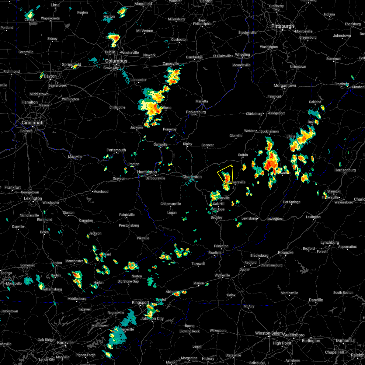 At 403 pm edt, a severe thunderstorm was located 8 miles southeast of clay, moving north at 10 mph (radar indicated). Hazards include 70 mph wind gusts and penny size hail. Expect considerable tree damage. Damage is likely to mobile homes, roofs, and outbuildings. At 403 pm edt, a severe thunderstorm was located 8 miles southeast of clay, moving north at 10 mph (radar indicated). Hazards include 70 mph wind gusts and penny size hail. Expect considerable tree damage. Damage is likely to mobile homes, roofs, and outbuildings.
|
| 6/21/2021 2:08 PM EDT |
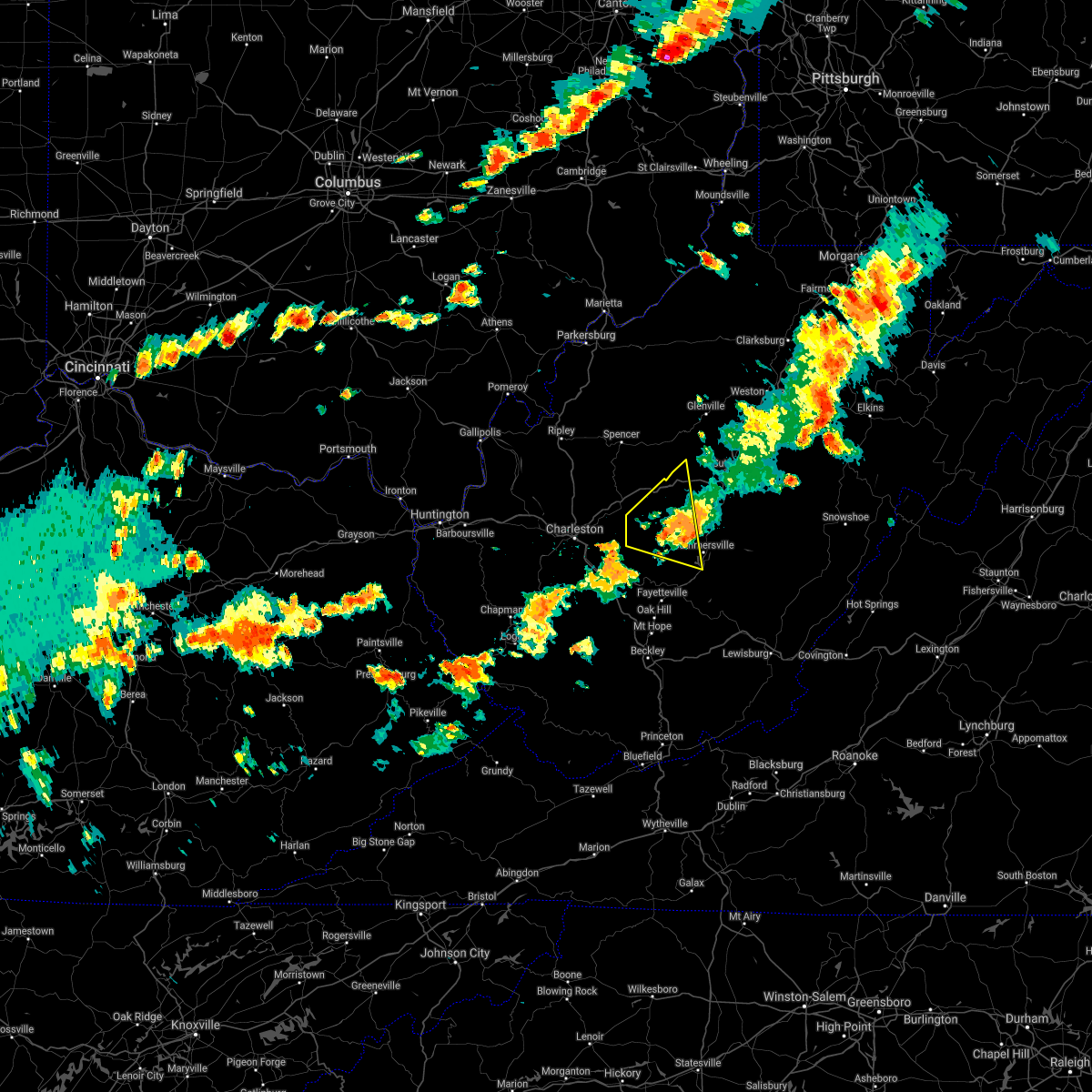 The severe thunderstorm warning for west central nicholas, northeastern kanawha, west central braxton, southeastern roane and clay counties will expire at 215 pm edt, the storm which prompted the warning has weakened below severe limits, and no longer poses an immediate threat to life or property. therefore, the warning will be allowed to expire. however gusty winds and heavy rain are still possible with this thunderstorm. a severe thunderstorm watch remains in effect until 800 pm edt for central, southeastern and north central west virginia. The severe thunderstorm warning for west central nicholas, northeastern kanawha, west central braxton, southeastern roane and clay counties will expire at 215 pm edt, the storm which prompted the warning has weakened below severe limits, and no longer poses an immediate threat to life or property. therefore, the warning will be allowed to expire. however gusty winds and heavy rain are still possible with this thunderstorm. a severe thunderstorm watch remains in effect until 800 pm edt for central, southeastern and north central west virginia.
|
| 6/21/2021 1:49 PM EDT |
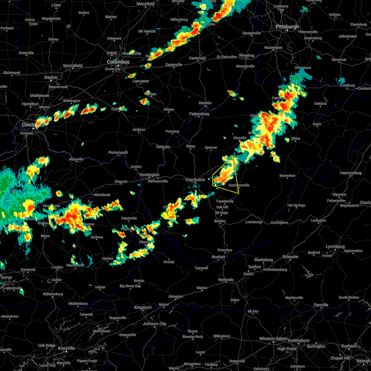 At 149 pm edt, a severe thunderstorm was located near clay, moving east at 35 mph (radar indicated). Hazards include 60 mph wind gusts and quarter size hail. Hail damage to vehicles is expected. expect wind damage to roofs, siding, and trees. Locations impacted include, clay, glen, big otter, wallback, harrison, nebo, bickmore, procious, servia, indore, bentree, kesslers cross lanes, drennan and ivydale. At 149 pm edt, a severe thunderstorm was located near clay, moving east at 35 mph (radar indicated). Hazards include 60 mph wind gusts and quarter size hail. Hail damage to vehicles is expected. expect wind damage to roofs, siding, and trees. Locations impacted include, clay, glen, big otter, wallback, harrison, nebo, bickmore, procious, servia, indore, bentree, kesslers cross lanes, drennan and ivydale.
|
| 6/21/2021 1:25 PM EDT |
 At 125 pm edt, a severe thunderstorm was located near pinch, or 13 miles east of charleston, moving east at 30 mph (radar indicated). Hazards include 60 mph wind gusts and quarter size hail. Hail damage to vehicles is expected. Expect wind damage to roofs, siding, and trees. At 125 pm edt, a severe thunderstorm was located near pinch, or 13 miles east of charleston, moving east at 30 mph (radar indicated). Hazards include 60 mph wind gusts and quarter size hail. Hail damage to vehicles is expected. Expect wind damage to roofs, siding, and trees.
|
| 6/14/2021 9:26 PM EDT |
 At 926 pm edt, a severe thunderstorm was located near clay, moving southeast at 50 mph (radar indicated). Hazards include 60 mph wind gusts and quarter size hail. Hail damage to vehicles is expected. Expect wind damage to roofs, siding, and trees. At 926 pm edt, a severe thunderstorm was located near clay, moving southeast at 50 mph (radar indicated). Hazards include 60 mph wind gusts and quarter size hail. Hail damage to vehicles is expected. Expect wind damage to roofs, siding, and trees.
|
| 6/13/2021 6:54 PM EDT |
 The severe thunderstorm warning for southwestern pocahontas, nicholas, east central kanawha, south central braxton, southeastern roane, webster, clay and northern fayette counties will expire at 700 pm edt, the storms which prompted the warning have moved out of the area. therefore, the warning will be allowed to expire. a severe thunderstorm watch remains in effect until 700 pm edt for central, southeastern, north central and northeastern west virginia. a severe thunderstorm watch also remains in effect until 1000 pm edt for southeastern west virginia. remember, a severe thunderstorm warning still remains in effect for portions of fayette, the southern half of nicholas, southern half of webster, and western pocahontas counties. The severe thunderstorm warning for southwestern pocahontas, nicholas, east central kanawha, south central braxton, southeastern roane, webster, clay and northern fayette counties will expire at 700 pm edt, the storms which prompted the warning have moved out of the area. therefore, the warning will be allowed to expire. a severe thunderstorm watch remains in effect until 700 pm edt for central, southeastern, north central and northeastern west virginia. a severe thunderstorm watch also remains in effect until 1000 pm edt for southeastern west virginia. remember, a severe thunderstorm warning still remains in effect for portions of fayette, the southern half of nicholas, southern half of webster, and western pocahontas counties.
|
| 6/13/2021 6:40 PM EDT |
 At 640 pm edt, severe thunderstorms were located along a line extending from 7 miles west of marlinton to 6 miles southeast of glen, moving southeast at 40 mph (radar indicated). Hazards include 60 mph wind gusts and quarter size hail. Hail damage to vehicles is expected. expect wind damage to roofs, siding, and trees. Locations impacted include, summersville, richwood, marlinton, clay, webster springs, ansted, smithers, addison (webster springs), gauley bridge, camden-on-gauley, glen, birch river, craigsville, big otter, camden on gauley, wallback, amma, harrison, cowen and hillsboro. At 640 pm edt, severe thunderstorms were located along a line extending from 7 miles west of marlinton to 6 miles southeast of glen, moving southeast at 40 mph (radar indicated). Hazards include 60 mph wind gusts and quarter size hail. Hail damage to vehicles is expected. expect wind damage to roofs, siding, and trees. Locations impacted include, summersville, richwood, marlinton, clay, webster springs, ansted, smithers, addison (webster springs), gauley bridge, camden-on-gauley, glen, birch river, craigsville, big otter, camden on gauley, wallback, amma, harrison, cowen and hillsboro.
|
| 6/13/2021 6:18 PM EDT |
 At 617 pm edt, severe thunderstorms were located along a line extending from 8 miles southeast of addison (webster springs) to near amma, moving southeast at 40 mph (radar indicated). Hazards include 60 mph wind gusts and quarter size hail. Hail damage to vehicles is expected. Expect wind damage to roofs, siding, and trees. At 617 pm edt, severe thunderstorms were located along a line extending from 8 miles southeast of addison (webster springs) to near amma, moving southeast at 40 mph (radar indicated). Hazards include 60 mph wind gusts and quarter size hail. Hail damage to vehicles is expected. Expect wind damage to roofs, siding, and trees.
|
| 6/13/2021 5:57 PM EDT | Quarter sized hail reported 15.9 miles S of Clay, WV |
| 8/27/2020 5:00 PM EDT | A few trees uprooted and large limbs blown dow in roane county WV, 8 miles SSE of Clay, WV |
| 8/25/2020 6:47 PM EDT |
 At 646 pm edt, a severe thunderstorm was located over glen, or 8 miles southwest of clay, moving southeast at 35 mph (radar indicated). Hazards include 60 mph wind gusts. Expect damage to roofs, siding, and trees. Locations impacted include, charleston, clay, south charleston, sissonville, clendenin, pinch, glen, coal fork, elkview, cross lanes, bickmore, procious, indore and pond gap. At 646 pm edt, a severe thunderstorm was located over glen, or 8 miles southwest of clay, moving southeast at 35 mph (radar indicated). Hazards include 60 mph wind gusts. Expect damage to roofs, siding, and trees. Locations impacted include, charleston, clay, south charleston, sissonville, clendenin, pinch, glen, coal fork, elkview, cross lanes, bickmore, procious, indore and pond gap.
|
| 8/25/2020 6:45 PM EDT | Several reports of a single tree down in various locations in and around clay... including a tree with power lines down at 819 dog run road and and a tree down between in clay county WV, 0.3 miles W of Clay, WV |
| 8/25/2020 6:35 PM EDT | Tree down blocking ivydale road and another down blocking ivydale ridge road. time estimated from caller information and rada in clay county WV, 0.3 miles W of Clay, WV |
| 8/25/2020 6:35 PM EDT | Tree down blocking ivydale road and another down blocking ivydale ridge road. time estimated from caller information and rada in clay county WV, 9.8 miles S of Clay, WV |
| 8/25/2020 6:30 PM EDT | Emergency services director from wallback called in a strong storm producing 60kt gusts which immediately dropped down to 20k in clay county WV, 7.3 miles SSE of Clay, WV |
| 8/25/2020 6:15 PM EDT |
 At 614 pm edt, a severe thunderstorm was located 9 miles northwest of clendenin, or 14 miles south of spencer, moving southeast at 35 mph (radar indicated). Hazards include 60 mph wind gusts. expect damage to roofs, siding, and trees At 614 pm edt, a severe thunderstorm was located 9 miles northwest of clendenin, or 14 miles south of spencer, moving southeast at 35 mph (radar indicated). Hazards include 60 mph wind gusts. expect damage to roofs, siding, and trees
|
| 7/20/2020 6:20 PM EDT |
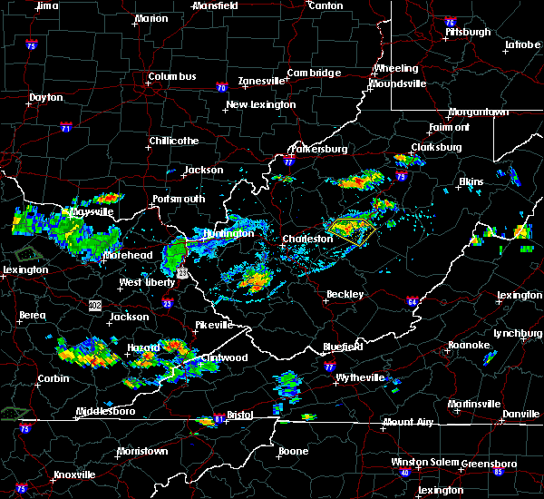 At 620 pm edt, a severe thunderstorm was located 8 miles west of birch river, or 9 miles east of clay, moving east at 20 mph (radar indicated). Hazards include 60 mph wind gusts and penny size hail. Expect damage to roofs, siding, and trees. Locations impacted include, clay, big otter, birch river, harrison, widen, strange creek, ivydale, muddlety and servia. At 620 pm edt, a severe thunderstorm was located 8 miles west of birch river, or 9 miles east of clay, moving east at 20 mph (radar indicated). Hazards include 60 mph wind gusts and penny size hail. Expect damage to roofs, siding, and trees. Locations impacted include, clay, big otter, birch river, harrison, widen, strange creek, ivydale, muddlety and servia.
|
| 7/20/2020 6:03 PM EDT |
 At 602 pm edt, a severe thunderstorm was located near glen, or near clay, moving east at 25 mph (radar indicated). Hazards include 60 mph wind gusts. Expect damage to roofs, siding, and trees. Locations impacted include, clay and procious. At 602 pm edt, a severe thunderstorm was located near glen, or near clay, moving east at 25 mph (radar indicated). Hazards include 60 mph wind gusts. Expect damage to roofs, siding, and trees. Locations impacted include, clay and procious.
|
| 7/20/2020 5:47 PM EDT |
 At 547 pm edt, a severe thunderstorm was located near glen, or 11 miles west of clay, moving east at 25 mph (radar indicated). Hazards include 60 mph wind gusts. Expect damage to roofs, siding, and trees. Locations impacted include, clay, clendenin, glen, bickmore, procious, indore and pond gap. At 547 pm edt, a severe thunderstorm was located near glen, or 11 miles west of clay, moving east at 25 mph (radar indicated). Hazards include 60 mph wind gusts. Expect damage to roofs, siding, and trees. Locations impacted include, clay, clendenin, glen, bickmore, procious, indore and pond gap.
|
| 7/20/2020 5:45 PM EDT |
 At 545 pm edt, a severe thunderstorm was located near wallback, or near clay, moving east at 20 mph (radar indicated). Hazards include 60 mph wind gusts and penny size hail. expect damage to roofs, siding, and trees At 545 pm edt, a severe thunderstorm was located near wallback, or near clay, moving east at 20 mph (radar indicated). Hazards include 60 mph wind gusts and penny size hail. expect damage to roofs, siding, and trees
|
| 7/20/2020 5:21 PM EDT |
 At 521 pm edt, a severe thunderstorm was located over elkview, or 10 miles northeast of charleston, moving east at 25 mph (radar indicated). Hazards include 60 mph wind gusts. expect damage to roofs, siding, and trees At 521 pm edt, a severe thunderstorm was located over elkview, or 10 miles northeast of charleston, moving east at 25 mph (radar indicated). Hazards include 60 mph wind gusts. expect damage to roofs, siding, and trees
|
| 6/14/2020 5:40 PM EDT | Route 16 closed near the hartland bridge due to a tree downing nearby power lines onto the roa in clay county WV, 2.5 miles NNE of Clay, WV |
| 6/6/2020 6:06 PM EDT |
 The severe thunderstorm warning for northeastern kanawha, southeastern roane and northwestern clay counties will expire at 615 pm edt, the storm which prompted the warning has weakened below severe limits, and no longer poses an immediate threat to life or property. therefore, the warning will be allowed to expire. to report severe weather, contact your nearest law enforcement agency. they will relay your report to the national weather service charleston west virginia. The severe thunderstorm warning for northeastern kanawha, southeastern roane and northwestern clay counties will expire at 615 pm edt, the storm which prompted the warning has weakened below severe limits, and no longer poses an immediate threat to life or property. therefore, the warning will be allowed to expire. to report severe weather, contact your nearest law enforcement agency. they will relay your report to the national weather service charleston west virginia.
|
| 6/6/2020 5:41 PM EDT |
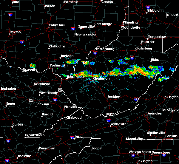 At 540 pm edt, a severe thunderstorm was located over amma, or 13 miles northwest of clay, moving southeast at 15 mph (radar indicated). Hazards include 60 mph wind gusts and quarter size hail. Hail damage to vehicles is expected. Expect wind damage to roofs, siding, and trees. At 540 pm edt, a severe thunderstorm was located over amma, or 13 miles northwest of clay, moving southeast at 15 mph (radar indicated). Hazards include 60 mph wind gusts and quarter size hail. Hail damage to vehicles is expected. Expect wind damage to roofs, siding, and trees.
|
| 4/13/2020 2:47 AM EDT |
 At 247 am edt, a line of heavy showers are extending from 6 miles southeast of big otter to mount hope, moving east at 35 mph (radar indicated). Hazards include 60 mph wind gusts. expect damage to roofs, siding, and trees At 247 am edt, a line of heavy showers are extending from 6 miles southeast of big otter to mount hope, moving east at 35 mph (radar indicated). Hazards include 60 mph wind gusts. expect damage to roofs, siding, and trees
|
| 4/9/2020 2:02 AM EDT |
 At 201 am edt, severe thunderstorms were located along a line extending from near gassaway to near summersville to 10 miles northeast of ansted to 7 miles northwest of bradley, moving east at 55 mph (radar indicated). Hazards include 70 mph wind gusts and quarter size hail. Hail damage to vehicles is expected. expect considerable tree damage. wind damage is also likely to mobile homes, roofs, and outbuildings. Locations impacted include, beckley, summersville, fayetteville, sutton, clay, babcock state park, oak hill, montgomery, mount hope, mabscott, ansted, sophia, gassaway, smithers, gauley bridge, piney view, coal city, birch river, prosperity and burnwell. At 201 am edt, severe thunderstorms were located along a line extending from near gassaway to near summersville to 10 miles northeast of ansted to 7 miles northwest of bradley, moving east at 55 mph (radar indicated). Hazards include 70 mph wind gusts and quarter size hail. Hail damage to vehicles is expected. expect considerable tree damage. wind damage is also likely to mobile homes, roofs, and outbuildings. Locations impacted include, beckley, summersville, fayetteville, sutton, clay, babcock state park, oak hill, montgomery, mount hope, mabscott, ansted, sophia, gassaway, smithers, gauley bridge, piney view, coal city, birch river, prosperity and burnwell.
|
| 4/9/2020 1:46 AM EDT |
 At 146 am edt, severe thunderstorms were located along a line extending from near arnoldsburg to near glen to 6 miles north of gauley bridge to 7 miles northeast of bald knob, moving east at 60 mph (radar indicated). Hazards include 70 mph wind gusts and quarter size hail. Hail damage to vehicles is expected. expect considerable tree damage. wind damage is also likely to mobile homes, roofs, and outbuildings. Locations impacted include, beckley, summersville, madison, fayetteville, sutton, clay, babcock state park, oak hill, montgomery, chesapeake, marmet, mount hope, mabscott, ansted, sophia, belle, clendenin, cedar grove, east bank and gassaway. At 146 am edt, severe thunderstorms were located along a line extending from near arnoldsburg to near glen to 6 miles north of gauley bridge to 7 miles northeast of bald knob, moving east at 60 mph (radar indicated). Hazards include 70 mph wind gusts and quarter size hail. Hail damage to vehicles is expected. expect considerable tree damage. wind damage is also likely to mobile homes, roofs, and outbuildings. Locations impacted include, beckley, summersville, madison, fayetteville, sutton, clay, babcock state park, oak hill, montgomery, chesapeake, marmet, mount hope, mabscott, ansted, sophia, belle, clendenin, cedar grove, east bank and gassaway.
|
| 4/9/2020 1:23 AM EDT |
 At 122 am edt, severe thunderstorms were located along a line extending from 6 miles south of spencer to marmet to near chesapeake to near logan, moving southeast at 85 mph (radar indicated). Hazards include 70 mph wind gusts and quarter size hail. Hail damage to vehicles is expected. expect considerable tree damage. Wind damage is also likely to mobile homes, roofs, and outbuildings. At 122 am edt, severe thunderstorms were located along a line extending from 6 miles south of spencer to marmet to near chesapeake to near logan, moving southeast at 85 mph (radar indicated). Hazards include 70 mph wind gusts and quarter size hail. Hail damage to vehicles is expected. expect considerable tree damage. Wind damage is also likely to mobile homes, roofs, and outbuildings.
|
| 10/31/2019 2:22 PM EDT |
 At 222 pm edt, severe thunderstorms were located along a line extending from near grantsville to 9 miles west of summersville, moving northeast at 65 mph (radar indicated). Hazards include 60 mph wind gusts. Expect damage to roofs, siding, and trees. Locations impacted include, weston, summersville, fayetteville, richwood, glenville, sutton, clay, webster springs, babcock state park, oak hill, ansted, gassaway, addison (webster springs), gauley bridge, camden-on-gauley, birch river, arnoldsburg, cedar creek state park, hawks nest state park and craigsville. At 222 pm edt, severe thunderstorms were located along a line extending from near grantsville to 9 miles west of summersville, moving northeast at 65 mph (radar indicated). Hazards include 60 mph wind gusts. Expect damage to roofs, siding, and trees. Locations impacted include, weston, summersville, fayetteville, richwood, glenville, sutton, clay, webster springs, babcock state park, oak hill, ansted, gassaway, addison (webster springs), gauley bridge, camden-on-gauley, birch river, arnoldsburg, cedar creek state park, hawks nest state park and craigsville.
|
| 10/31/2019 2:12 PM EDT |
 At 211 pm edt, severe thunderstorms were located along a line extending from near arnoldsburg to near gauley bridge, moving northeast at 65 mph (radar indicated). Hazards include 60 mph wind gusts. Expect damage to roofs, siding, and trees. Locations impacted include, weston, summersville, fayetteville, richwood, glenville, sutton, clay, webster springs, babcock state park, oak hill, ansted, gassaway, addison (webster springs), gauley bridge, camden-on-gauley, birch river, arnoldsburg, cedar creek state park, glen and hawks nest state park. At 211 pm edt, severe thunderstorms were located along a line extending from near arnoldsburg to near gauley bridge, moving northeast at 65 mph (radar indicated). Hazards include 60 mph wind gusts. Expect damage to roofs, siding, and trees. Locations impacted include, weston, summersville, fayetteville, richwood, glenville, sutton, clay, webster springs, babcock state park, oak hill, ansted, gassaway, addison (webster springs), gauley bridge, camden-on-gauley, birch river, arnoldsburg, cedar creek state park, glen and hawks nest state park.
|
| 10/31/2019 1:51 PM EDT |
 At 150 pm edt, severe thunderstorms were located along a line extending from 8 miles northwest of amma to near burnwell, moving northeast at 65 mph (radar indicated). Hazards include 60 mph wind gusts. expect damage to roofs, siding, and trees At 150 pm edt, severe thunderstorms were located along a line extending from 8 miles northwest of amma to near burnwell, moving northeast at 65 mph (radar indicated). Hazards include 60 mph wind gusts. expect damage to roofs, siding, and trees
|
| 6/24/2019 7:42 PM EDT |
 At 742 pm edt, severe thunderstorms were located along a line extending from 10 miles east of kenna to near clendenin to near pratt, moving northeast at 40 mph (radar indicated). Hazards include 60 mph wind gusts. expect damage to roofs, siding, and trees At 742 pm edt, severe thunderstorms were located along a line extending from 10 miles east of kenna to near clendenin to near pratt, moving northeast at 40 mph (radar indicated). Hazards include 60 mph wind gusts. expect damage to roofs, siding, and trees
|
| 6/24/2019 7:34 PM EDT |
 At 734 pm edt, severe thunderstorms were located along a line extending from near spencer to 7 miles northeast of cedar grove to 8 miles northwest of dry creek, moving east at 35 mph (radar indicated). Hazards include 60 mph wind gusts. Expect damage to roofs, siding, and trees. Locations impacted include, clay, clendenin, glen, elkview, wallback, amma, pinch, bickmore, tariff, procious, indore, walton, bentree, left hand, looneyville, ivydale, pond gap and gandeeville. At 734 pm edt, severe thunderstorms were located along a line extending from near spencer to 7 miles northeast of cedar grove to 8 miles northwest of dry creek, moving east at 35 mph (radar indicated). Hazards include 60 mph wind gusts. Expect damage to roofs, siding, and trees. Locations impacted include, clay, clendenin, glen, elkview, wallback, amma, pinch, bickmore, tariff, procious, indore, walton, bentree, left hand, looneyville, ivydale, pond gap and gandeeville.
|
| 6/24/2019 7:20 PM EDT | 911 reports multiple trees down and power lines down throughout the area. time estimated from rada in clay county WV, 6.3 miles SSW of Clay, WV |
| 6/24/2019 7:20 PM EDT |
 At 719 pm edt, severe thunderstorms were located along a line extending from 6 miles southwest of spencer to near coal fork to 10 miles east of bald knob, moving east at 35 mph (radar indicated). Hazards include 60 mph wind gusts. Expect damage to roofs, siding, and trees. Locations impacted include, charleston, clay, sissonville, chesapeake, marmet, belle, clendenin, cedar grove, east bank, glasgow, pratt, pinch, glen, coal fork, elkview, wallback, amma, procious, indore and left hand. At 719 pm edt, severe thunderstorms were located along a line extending from 6 miles southwest of spencer to near coal fork to 10 miles east of bald knob, moving east at 35 mph (radar indicated). Hazards include 60 mph wind gusts. Expect damage to roofs, siding, and trees. Locations impacted include, charleston, clay, sissonville, chesapeake, marmet, belle, clendenin, cedar grove, east bank, glasgow, pratt, pinch, glen, coal fork, elkview, wallback, amma, procious, indore and left hand.
|
| 6/24/2019 7:12 PM EDT |
 At 711 pm edt, severe thunderstorms were located along a line extending from 8 miles northeast of kenna to coal fork to 7 miles east of bald knob, moving east at 35 mph (radar indicated). Hazards include 60 mph wind gusts. expect damage to roofs, siding, and trees At 711 pm edt, severe thunderstorms were located along a line extending from 8 miles northeast of kenna to coal fork to 7 miles east of bald knob, moving east at 35 mph (radar indicated). Hazards include 60 mph wind gusts. expect damage to roofs, siding, and trees
|
| 5/23/2019 8:42 PM EDT |
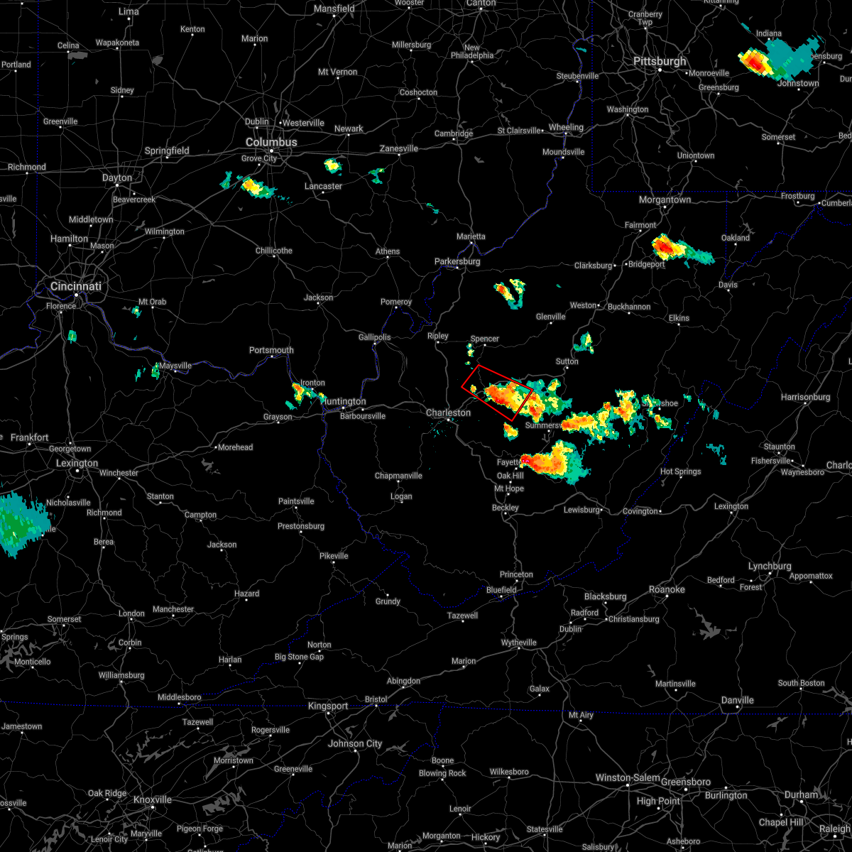 At 825 pm edt, a severe thunderstorm capable of producing a tornado was located near clendenin, or 17 miles south of spencer, moving southeast at 35 mph (radar indicated rotation). Hazards include tornado and two inch hail. Flying debris will be dangerous to those caught without shelter. mobile homes will be damaged or destroyed. damage to roofs, windows, and vehicles will occur. tree damage is likely. this dangerous storm will be near, amma around 835 pm edt. clendenin around 840 pm edt. glen around 845 pm edt. Other locations impacted by this tornadic thunderstorm include ivydale, procious, left hand, indore, bickmore and walton. At 825 pm edt, a severe thunderstorm capable of producing a tornado was located near clendenin, or 17 miles south of spencer, moving southeast at 35 mph (radar indicated rotation). Hazards include tornado and two inch hail. Flying debris will be dangerous to those caught without shelter. mobile homes will be damaged or destroyed. damage to roofs, windows, and vehicles will occur. tree damage is likely. this dangerous storm will be near, amma around 835 pm edt. clendenin around 840 pm edt. glen around 845 pm edt. Other locations impacted by this tornadic thunderstorm include ivydale, procious, left hand, indore, bickmore and walton.
|
| 5/23/2019 8:40 PM EDT | Tree down on a transformer. route 4 in ivydale in clay county WV, 6.3 miles SSW of Clay, WV |
| 5/23/2019 8:26 PM EDT |
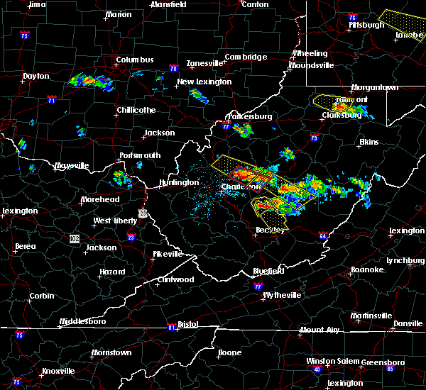 At 825 pm edt, a severe thunderstorm capable of producing a tornado was located near clendenin, or 17 miles south of spencer, moving southeast at 35 mph (radar indicated rotation). Hazards include tornado and two inch hail. Flying debris will be dangerous to those caught without shelter. mobile homes will be damaged or destroyed. damage to roofs, windows, and vehicles will occur. tree damage is likely. this dangerous storm will be near, amma around 835 pm edt. clendenin around 840 pm edt. glen around 845 pm edt. Other locations impacted by this tornadic thunderstorm include ivydale, procious, left hand, indore, bickmore and walton. At 825 pm edt, a severe thunderstorm capable of producing a tornado was located near clendenin, or 17 miles south of spencer, moving southeast at 35 mph (radar indicated rotation). Hazards include tornado and two inch hail. Flying debris will be dangerous to those caught without shelter. mobile homes will be damaged or destroyed. damage to roofs, windows, and vehicles will occur. tree damage is likely. this dangerous storm will be near, amma around 835 pm edt. clendenin around 840 pm edt. glen around 845 pm edt. Other locations impacted by this tornadic thunderstorm include ivydale, procious, left hand, indore, bickmore and walton.
|
| 5/23/2019 8:21 PM EDT |
 The severe thunderstorm warning for central nicholas, southwestern braxton, southwestern webster and northeastern clay counties will expire at 830 pm edt, the storm which prompted the warning has weakened below severe limits, and no longer poses an immediate threat to life or property. therefore, the warning will be allowed to expire. a severe thunderstorm watch remains in effect until midnight edt for north central west virginia. to report severe weather, contact your nearest law enforcement agency. they will relay your report to the national weather service charleston west virginia. The severe thunderstorm warning for central nicholas, southwestern braxton, southwestern webster and northeastern clay counties will expire at 830 pm edt, the storm which prompted the warning has weakened below severe limits, and no longer poses an immediate threat to life or property. therefore, the warning will be allowed to expire. a severe thunderstorm watch remains in effect until midnight edt for north central west virginia. to report severe weather, contact your nearest law enforcement agency. they will relay your report to the national weather service charleston west virginia.
|
| 5/23/2019 8:07 PM EDT |
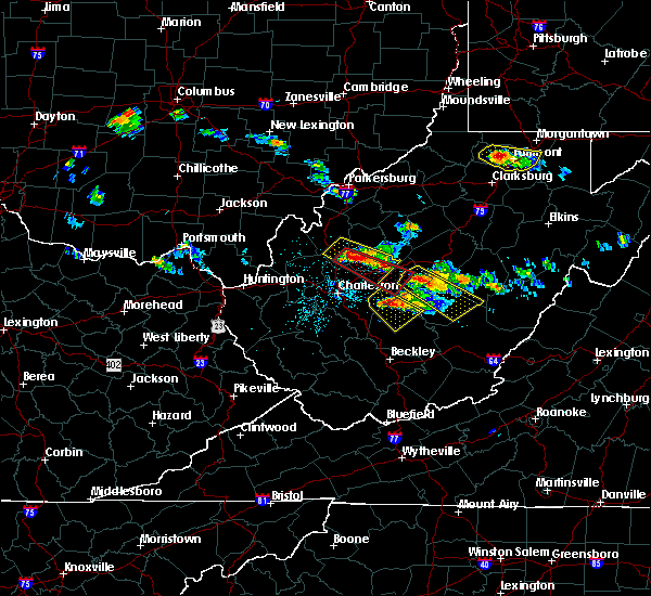 At 807 pm edt, a severe thunderstorm capable of producing a tornado was located near kenna, or 14 miles southeast of ripley, moving southeast at 45 mph (radar indicated rotation). Hazards include tornado and hail up to two inches in diameter. Flying debris will be dangerous to those caught without shelter. mobile homes will be damaged or destroyed. damage to roofs, windows, and vehicles will occur. tree damage is likely. this dangerous storm will be near, clendenin and amma around 830 pm edt. wallback and glen around 835 pm edt. clay around 845 pm edt. Other locations impacted by this tornadic thunderstorm include left hand, harmony, bickmore, ivydale, procious, indore, kentuck and walton. At 807 pm edt, a severe thunderstorm capable of producing a tornado was located near kenna, or 14 miles southeast of ripley, moving southeast at 45 mph (radar indicated rotation). Hazards include tornado and hail up to two inches in diameter. Flying debris will be dangerous to those caught without shelter. mobile homes will be damaged or destroyed. damage to roofs, windows, and vehicles will occur. tree damage is likely. this dangerous storm will be near, clendenin and amma around 830 pm edt. wallback and glen around 835 pm edt. clay around 845 pm edt. Other locations impacted by this tornadic thunderstorm include left hand, harmony, bickmore, ivydale, procious, indore, kentuck and walton.
|
| 5/23/2019 8:01 PM EDT |
 At 801 pm edt, a severe thunderstorm was located 8 miles east of clay, moving southeast at 45 mph (radar indicated). Hazards include golf ball size hail and 60 mph wind gusts. People and animals outdoors will be injured. expect hail damage to roofs, siding, windows, and vehicles. expect wind damage to roofs, siding, and trees. Locations impacted include, summersville, richwood, clay, camden-on-gauley, craigsville, camden on gauley, harrison, widen, canvas, muddlety, nettie, calvin and ivydale. At 801 pm edt, a severe thunderstorm was located 8 miles east of clay, moving southeast at 45 mph (radar indicated). Hazards include golf ball size hail and 60 mph wind gusts. People and animals outdoors will be injured. expect hail damage to roofs, siding, windows, and vehicles. expect wind damage to roofs, siding, and trees. Locations impacted include, summersville, richwood, clay, camden-on-gauley, craigsville, camden on gauley, harrison, widen, canvas, muddlety, nettie, calvin and ivydale.
|
| 5/23/2019 7:48 PM EDT |
 At 748 pm edt, a severe thunderstorm was located near wallback, or near clay, moving southeast at 45 mph (radar indicated). Hazards include golf ball size hail and 60 mph wind gusts. People and animals outdoors will be injured. expect hail damage to roofs, siding, windows, and vehicles. Expect wind damage to roofs, siding, and trees. At 748 pm edt, a severe thunderstorm was located near wallback, or near clay, moving southeast at 45 mph (radar indicated). Hazards include golf ball size hail and 60 mph wind gusts. People and animals outdoors will be injured. expect hail damage to roofs, siding, windows, and vehicles. Expect wind damage to roofs, siding, and trees.
|
| 5/17/2019 7:16 PM EDT |
 At 715 pm edt, a severe thunderstorm was located 7 miles north of ansted, or 12 miles west of summersville, moving southeast at 40 mph (radar indicated). Hazards include 60 mph wind gusts and penny size hail. Expect damage to roofs, siding, and trees. Locations impacted include, summersville, fayetteville, clay, babcock state park, ansted, smithers, gauley bridge, hawks nest state park, craigsville, bickmore, canvas, muddlety, swiss, indore, bentree, calvin, kesslers cross lanes, drennan, pond gap and mount nebo. At 715 pm edt, a severe thunderstorm was located 7 miles north of ansted, or 12 miles west of summersville, moving southeast at 40 mph (radar indicated). Hazards include 60 mph wind gusts and penny size hail. Expect damage to roofs, siding, and trees. Locations impacted include, summersville, fayetteville, clay, babcock state park, ansted, smithers, gauley bridge, hawks nest state park, craigsville, bickmore, canvas, muddlety, swiss, indore, bentree, calvin, kesslers cross lanes, drennan, pond gap and mount nebo.
|
| 5/17/2019 6:53 PM EDT |
 At 653 pm edt, a severe thunderstorm was located over glen, or 11 miles southwest of clay, moving east at 35 mph (radar indicated). Hazards include 60 mph wind gusts and quarter size hail. Hail damage to vehicles is expected. expect wind damage to roofs, siding, and trees. Locations impacted include, summersville, fayetteville, clay, babcock state park, ansted, clendenin, smithers, gauley bridge, pinch, glen, hawks nest state park, coal fork, amma, elkview, craigsville, procious, muddlety, swiss, indore and drennan. At 653 pm edt, a severe thunderstorm was located over glen, or 11 miles southwest of clay, moving east at 35 mph (radar indicated). Hazards include 60 mph wind gusts and quarter size hail. Hail damage to vehicles is expected. expect wind damage to roofs, siding, and trees. Locations impacted include, summersville, fayetteville, clay, babcock state park, ansted, clendenin, smithers, gauley bridge, pinch, glen, hawks nest state park, coal fork, amma, elkview, craigsville, procious, muddlety, swiss, indore and drennan.
|
| 5/17/2019 6:26 PM EDT |
 At 626 pm edt, a severe thunderstorm was located near sissonville, or 11 miles north of charleston, moving southeast at 40 mph (radar indicated). Hazards include 60 mph wind gusts and quarter size hail. Hail damage to vehicles is expected. Expect wind damage to roofs, siding, and trees. At 626 pm edt, a severe thunderstorm was located near sissonville, or 11 miles north of charleston, moving southeast at 40 mph (radar indicated). Hazards include 60 mph wind gusts and quarter size hail. Hail damage to vehicles is expected. Expect wind damage to roofs, siding, and trees.
|
| 5/3/2019 3:17 PM EDT |
 At 315 pm edt, severe thunderstorms were located along a line extending from spencer to 6 miles southwest of arnoldsburg to wallback to near clay, moving northeast at 30 mph (radar indicated). Hazards include 60 mph wind gusts. expect damage to roofs, siding, and trees At 315 pm edt, severe thunderstorms were located along a line extending from spencer to 6 miles southwest of arnoldsburg to wallback to near clay, moving northeast at 30 mph (radar indicated). Hazards include 60 mph wind gusts. expect damage to roofs, siding, and trees
|
| 5/3/2019 3:11 PM EDT |
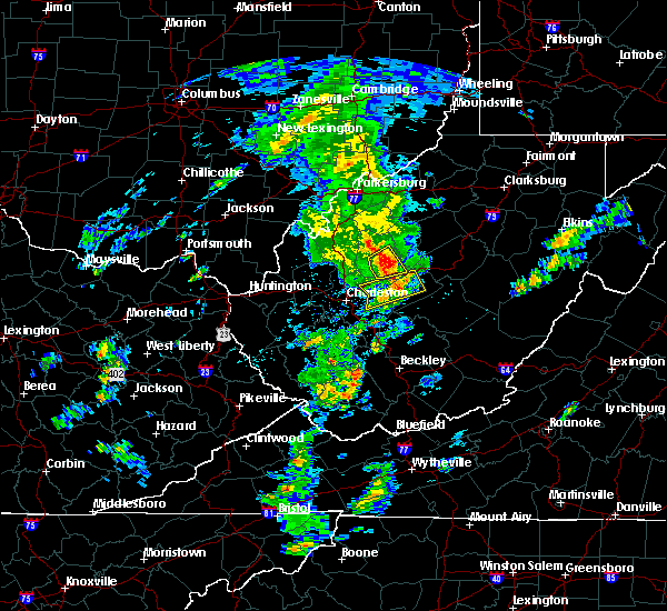 At 310 pm edt, a severe thunderstorm was located near glen, or near clay, moving northeast at 35 mph (radar indicated). Hazards include 60 mph wind gusts and penny size hail. Expect damage to roofs, siding, and trees. Locations impacted include, clay, wallback, ivydale and procious. At 310 pm edt, a severe thunderstorm was located near glen, or near clay, moving northeast at 35 mph (radar indicated). Hazards include 60 mph wind gusts and penny size hail. Expect damage to roofs, siding, and trees. Locations impacted include, clay, wallback, ivydale and procious.
|
| 5/3/2019 2:55 PM EDT |
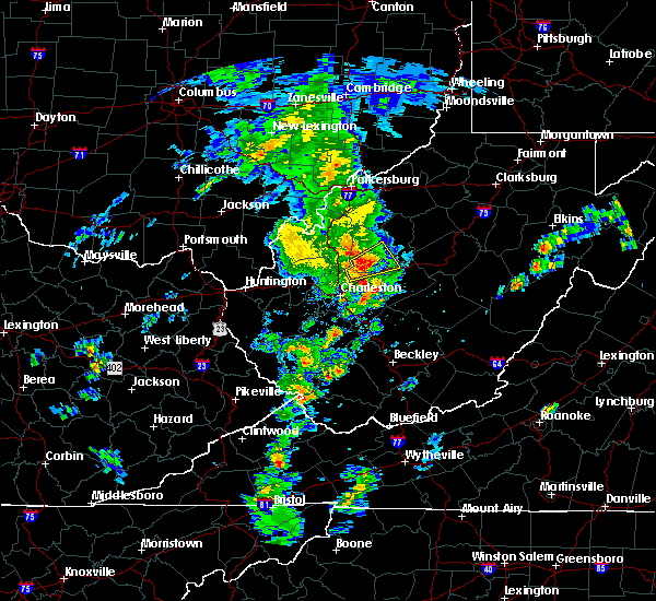 At 255 pm edt, a severe thunderstorm was located near clendenin, or 14 miles northeast of charleston, moving northeast at 35 mph (radar indicated). Hazards include 60 mph wind gusts and penny size hail. expect damage to roofs, siding, and trees At 255 pm edt, a severe thunderstorm was located near clendenin, or 14 miles northeast of charleston, moving northeast at 35 mph (radar indicated). Hazards include 60 mph wind gusts and penny size hail. expect damage to roofs, siding, and trees
|
| 4/14/2019 9:44 PM EDT |
 At 943 pm edt, a severe thunderstorm was located near clay, moving northeast at 65 mph (radar indicated). Hazards include 60 mph wind gusts. expect damage to roofs, siding, and trees At 943 pm edt, a severe thunderstorm was located near clay, moving northeast at 65 mph (radar indicated). Hazards include 60 mph wind gusts. expect damage to roofs, siding, and trees
|
| 4/14/2019 9:36 PM EDT |
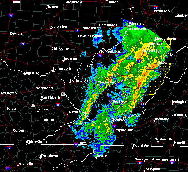 At 936 pm edt, a severe thunderstorm was located near glen, or 12 miles west of clay, moving northeast at 65 mph (radar indicated). Hazards include 60 mph wind gusts. Expect damage to roofs, siding, and trees. Locations impacted include, clay, clendenin, big otter, wallback, amma, glen, harrison, nebo, bickmore, ivydale and procious. At 936 pm edt, a severe thunderstorm was located near glen, or 12 miles west of clay, moving northeast at 65 mph (radar indicated). Hazards include 60 mph wind gusts. Expect damage to roofs, siding, and trees. Locations impacted include, clay, clendenin, big otter, wallback, amma, glen, harrison, nebo, bickmore, ivydale and procious.
|
| 4/14/2019 9:22 PM EDT |
 At 922 pm edt, a severe thunderstorm was located over coal fork, or near charleston, moving northeast at 65 mph (radar indicated). Hazards include 60 mph wind gusts. expect damage to roofs, siding, and trees At 922 pm edt, a severe thunderstorm was located over coal fork, or near charleston, moving northeast at 65 mph (radar indicated). Hazards include 60 mph wind gusts. expect damage to roofs, siding, and trees
|
| 4/14/2019 8:46 PM EDT |
 At 845 pm edt, severe thunderstorms were located along a line extending from near gassaway to 6 miles east of clay to near ansted, moving east at 30 mph (radar indicated). Hazards include 60 mph wind gusts and penny size hail. Expect damage to roofs, siding, and trees. Locations impacted include, summersville, richwood, sutton, clay, webster springs, ansted, gassaway, addison (webster springs), gauley bridge, camden-on-gauley, birch river, hawks nest state park, craigsville, big otter, camden on gauley, holly river state, wallback, harrison, cowen and flatwoods. At 845 pm edt, severe thunderstorms were located along a line extending from near gassaway to 6 miles east of clay to near ansted, moving east at 30 mph (radar indicated). Hazards include 60 mph wind gusts and penny size hail. Expect damage to roofs, siding, and trees. Locations impacted include, summersville, richwood, sutton, clay, webster springs, ansted, gassaway, addison (webster springs), gauley bridge, camden-on-gauley, birch river, hawks nest state park, craigsville, big otter, camden on gauley, holly river state, wallback, harrison, cowen and flatwoods.
|
| 4/14/2019 8:14 PM EDT |
 At 814 pm edt, severe thunderstorms were located along a line extending from 7 miles north of big otter to near glen to near powellton, moving east at 30 mph (radar indicated). Hazards include 60 mph wind gusts and penny size hail. expect damage to roofs, siding, and trees At 814 pm edt, severe thunderstorms were located along a line extending from 7 miles north of big otter to near glen to near powellton, moving east at 30 mph (radar indicated). Hazards include 60 mph wind gusts and penny size hail. expect damage to roofs, siding, and trees
|
| 4/14/2019 8:04 PM EDT | One tree down along route 1 in clay county WV, 5.7 miles NNE of Clay, WV |
| 4/14/2019 8:04 PM EDT |
 At 803 pm edt, severe thunderstorms were located along a line extending from near birch river to 7 miles south of summersville, moving east at 60 mph (radar indicated). Hazards include 60 mph wind gusts. Expect damage to roofs, siding, and trees. Locations impacted include, summersville, fayetteville, richwood, sutton, clay, montgomery, ansted, clendenin, gassaway, smithers, gauley bridge, camden-on-gauley, birch river, glen, hawks nest state park, craigsville, big otter, camden on gauley, wallback and amma. At 803 pm edt, severe thunderstorms were located along a line extending from near birch river to 7 miles south of summersville, moving east at 60 mph (radar indicated). Hazards include 60 mph wind gusts. Expect damage to roofs, siding, and trees. Locations impacted include, summersville, fayetteville, richwood, sutton, clay, montgomery, ansted, clendenin, gassaway, smithers, gauley bridge, camden-on-gauley, birch river, glen, hawks nest state park, craigsville, big otter, camden on gauley, wallback and amma.
|
| 4/14/2019 7:33 PM EDT |
 At 733 pm edt, severe thunderstorms were located along a line extending from near amma to pratt, moving east at 60 mph (radar indicated). Hazards include 60 mph wind gusts. expect damage to roofs, siding, and trees At 733 pm edt, severe thunderstorms were located along a line extending from near amma to pratt, moving east at 60 mph (radar indicated). Hazards include 60 mph wind gusts. expect damage to roofs, siding, and trees
|
| 8/13/2018 3:04 PM EDT |
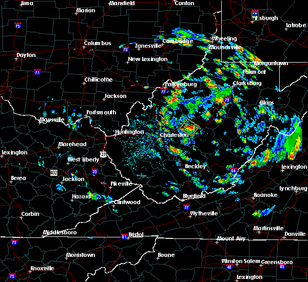 At 303 pm edt, a severe thunderstorm was located over wallback, or near clay, moving southeast at 10 mph (radar indicated). Hazards include 60 mph wind gusts and quarter size hail. Hail damage to vehicles is expected. expect wind damage to roofs, siding, and trees. Locations impacted include, clay, big otter, wallback, nebo, ivydale and procious. At 303 pm edt, a severe thunderstorm was located over wallback, or near clay, moving southeast at 10 mph (radar indicated). Hazards include 60 mph wind gusts and quarter size hail. Hail damage to vehicles is expected. expect wind damage to roofs, siding, and trees. Locations impacted include, clay, big otter, wallback, nebo, ivydale and procious.
|
| 8/13/2018 2:49 PM EDT |
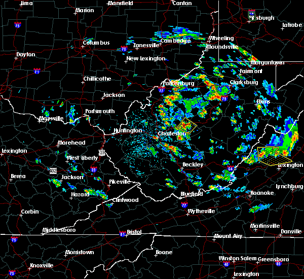 At 249 pm edt, a severe thunderstorm was located over wallback, or 7 miles northwest of clay, moving southeast at 10 mph (radar indicated). Hazards include 60 mph wind gusts and quarter size hail. Hail damage to vehicles is expected. Expect wind damage to roofs, siding, and trees. At 249 pm edt, a severe thunderstorm was located over wallback, or 7 miles northwest of clay, moving southeast at 10 mph (radar indicated). Hazards include 60 mph wind gusts and quarter size hail. Hail damage to vehicles is expected. Expect wind damage to roofs, siding, and trees.
|
| 3/1/2017 10:37 AM EST |
 At 1036 am est, severe thunderstorms were located along a line extending from 6 miles northeast of birch river to near summersville, moving east at 70 mph (radar indicated). Hazards include 70 mph wind gusts. Expect considerable tree damage. damage is likely to mobile homes, roofs, and outbuildings. locations impacted include, summersville, clay, webster springs, addison (webster springs), camden-on-gauley, glen, birch river, craigsville, big otter, camden on gauley, wallback, harrison, cowen, nebo, muddlety, upper glade, swiss, indore, boggs and little birch. This includes interstate 79 between mile markers 37 and 61. At 1036 am est, severe thunderstorms were located along a line extending from 6 miles northeast of birch river to near summersville, moving east at 70 mph (radar indicated). Hazards include 70 mph wind gusts. Expect considerable tree damage. damage is likely to mobile homes, roofs, and outbuildings. locations impacted include, summersville, clay, webster springs, addison (webster springs), camden-on-gauley, glen, birch river, craigsville, big otter, camden on gauley, wallback, harrison, cowen, nebo, muddlety, upper glade, swiss, indore, boggs and little birch. This includes interstate 79 between mile markers 37 and 61.
|
| 3/1/2017 10:16 AM EST |
 At 1016 am est, severe thunderstorms were located along a line extending from near big otter to 7 miles southwest of glen, moving east at 70 mph (radar indicated). Hazards include 70 mph wind gusts. Expect considerable tree damage. Damage is likely to mobile homes, roofs, and outbuildings. At 1016 am est, severe thunderstorms were located along a line extending from near big otter to 7 miles southwest of glen, moving east at 70 mph (radar indicated). Hazards include 70 mph wind gusts. Expect considerable tree damage. Damage is likely to mobile homes, roofs, and outbuildings.
|
| 7/14/2016 3:42 PM EDT | Multiple branches down and a few power outages in the town of cla in clay county WV, 0.3 miles W of Clay, WV |
| 7/4/2016 5:51 PM EDT |
 The severe thunderstorm warning for central nicholas, clay and southwestern braxton counties will expire at 600 pm edt, the storm which prompted the warning has weakened below severe limits, and no longer pose an immediate threat to life or property. therefore, the warning will be allowed to expire. a severe thunderstorm watch remains in effect until 900 pm edt for north central, southeastern and central west virginia. The severe thunderstorm warning for central nicholas, clay and southwestern braxton counties will expire at 600 pm edt, the storm which prompted the warning has weakened below severe limits, and no longer pose an immediate threat to life or property. therefore, the warning will be allowed to expire. a severe thunderstorm watch remains in effect until 900 pm edt for north central, southeastern and central west virginia.
|
| 7/4/2016 5:42 PM EDT |
 At 542 pm edt, a severe thunderstorm was located near clay, moving east at 60 mph (radar indicated). Hazards include 60 mph wind gusts. Expect damage to roofs. siding. and trees. Locations impacted include, summersville, clay, glen, wallback, craigsville, harrison, ivydale, calvin, bickmore, bentree, servia, strange creek, drennan, widen, swiss, frametown, indore, muddlety and procious. At 542 pm edt, a severe thunderstorm was located near clay, moving east at 60 mph (radar indicated). Hazards include 60 mph wind gusts. Expect damage to roofs. siding. and trees. Locations impacted include, summersville, clay, glen, wallback, craigsville, harrison, ivydale, calvin, bickmore, bentree, servia, strange creek, drennan, widen, swiss, frametown, indore, muddlety and procious.
|
| 7/4/2016 5:24 PM EDT |
 At 524 pm edt, a severe thunderstorm was located near glen, or 13 miles southwest of clay, moving east at 60 mph (radar indicated). Hazards include 60 mph wind gusts. Expect damage to roofs. siding. And trees. At 524 pm edt, a severe thunderstorm was located near glen, or 13 miles southwest of clay, moving east at 60 mph (radar indicated). Hazards include 60 mph wind gusts. Expect damage to roofs. siding. And trees.
|
| 6/23/2016 4:10 PM EDT |
 The severe thunderstorm warning for southern roane, clay and northeastern kanawha counties will expire at 415 pm edt, the storms which prompted the warning have weakened below severe limits, and no longer pose an immediate threat to life or property. therefore, the warning will be allowed to expire. however wind gusts of 40 to 50 mph are still possible with these thunderstorms. a tornado watch remains in effect until 1000 pm edt for north central, southeastern, central and northwestern west virginia. The severe thunderstorm warning for southern roane, clay and northeastern kanawha counties will expire at 415 pm edt, the storms which prompted the warning have weakened below severe limits, and no longer pose an immediate threat to life or property. therefore, the warning will be allowed to expire. however wind gusts of 40 to 50 mph are still possible with these thunderstorms. a tornado watch remains in effect until 1000 pm edt for north central, southeastern, central and northwestern west virginia.
|
| 6/23/2016 3:44 PM EDT |
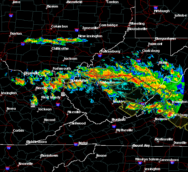 At 343 pm edt, severe thunderstorms were located along a line extending from near wallback to near clendenin to near sissonville, moving southeast at 35 mph (radar indicated). Hazards include 60 mph wind gusts and quarter size hail. Hail damage to vehicles is expected. Expect wind damage to roofs, siding, and trees. At 343 pm edt, severe thunderstorms were located along a line extending from near wallback to near clendenin to near sissonville, moving southeast at 35 mph (radar indicated). Hazards include 60 mph wind gusts and quarter size hail. Hail damage to vehicles is expected. Expect wind damage to roofs, siding, and trees.
|
| 6/23/2016 6:09 AM EDT |
 The severe thunderstorm warning for southeastern lawrence, southwestern putnam, southwestern nicholas, southwestern clay, northwestern fayette, northern boone, lincoln, cabell and kanawha counties will expire at 615 am edt, the storms which prompted the warning have weakened. therefore, the warning will be allowed to expire. a severe thunderstorm watch remains in effect until 800 am edt for southeastern ohio, and western, north central, southern, southeastern and central west virginia. The severe thunderstorm warning for southeastern lawrence, southwestern putnam, southwestern nicholas, southwestern clay, northwestern fayette, northern boone, lincoln, cabell and kanawha counties will expire at 615 am edt, the storms which prompted the warning have weakened. therefore, the warning will be allowed to expire. a severe thunderstorm watch remains in effect until 800 am edt for southeastern ohio, and western, north central, southern, southeastern and central west virginia.
|
| 6/23/2016 5:46 AM EDT |
 At 546 am edt, severe thunderstorms were located along a line extending from near hamlin to near glen, moving southeast at 40 mph (radar indicated). Hazards include 60 mph wind gusts. Expect damage to roofs. siding. and trees. locations impacted include, charleston, huntington, nitro, summersville, madison, hamlin, proctorville, clay, jefferson, south charleston, st. Albans, dunbar, hurricane, barboursville, milton, montgomery, chesapeake, marmet, ansted and belle. At 546 am edt, severe thunderstorms were located along a line extending from near hamlin to near glen, moving southeast at 40 mph (radar indicated). Hazards include 60 mph wind gusts. Expect damage to roofs. siding. and trees. locations impacted include, charleston, huntington, nitro, summersville, madison, hamlin, proctorville, clay, jefferson, south charleston, st. Albans, dunbar, hurricane, barboursville, milton, montgomery, chesapeake, marmet, ansted and belle.
|
| 6/23/2016 5:37 AM EDT |
 At 536 am edt, a severe thunderstorm was located near birch river, or 12 miles north of summersville, moving southeast at 55 mph (radar indicated). Hazards include 60 mph wind gusts. Expect damage to roofs. siding. And trees. At 536 am edt, a severe thunderstorm was located near birch river, or 12 miles north of summersville, moving southeast at 55 mph (radar indicated). Hazards include 60 mph wind gusts. Expect damage to roofs. siding. And trees.
|
| 6/23/2016 5:11 AM EDT |
 At 511 am edt, severe thunderstorms were located along a line extending from near chesapeake to 9 miles east of kenna, moving southeast at 40 mph (radar indicated). Hazards include 60 mph wind gusts. Expect damage to roofs. siding. And trees. At 511 am edt, severe thunderstorms were located along a line extending from near chesapeake to 9 miles east of kenna, moving southeast at 40 mph (radar indicated). Hazards include 60 mph wind gusts. Expect damage to roofs. siding. And trees.
|
| 6/21/2016 2:53 PM EDT |
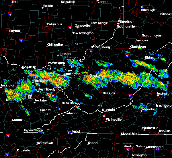 At 253 pm edt, a severe thunderstorm was located near glen, or near clay, moving southeast at 30 mph (radar indicated). Hazards include 60 mph wind gusts and quarter size hail. Hail damage to vehicles is expected. expect wind damage to roofs, siding, and trees. Locations impacted include, clay, glen, drennan, bickmore, indore and procious. At 253 pm edt, a severe thunderstorm was located near glen, or near clay, moving southeast at 30 mph (radar indicated). Hazards include 60 mph wind gusts and quarter size hail. Hail damage to vehicles is expected. expect wind damage to roofs, siding, and trees. Locations impacted include, clay, glen, drennan, bickmore, indore and procious.
|
| 6/21/2016 2:27 PM EDT |
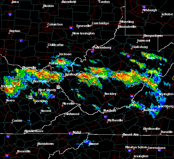 At 227 pm edt, a severe thunderstorm was located near clendenin, or 15 miles west of clay, moving southeast at 40 mph (radar indicated). Hazards include 60 mph wind gusts and quarter size hail. Hail damage to vehicles is expected. Expect wind damage to roofs, siding, and trees. At 227 pm edt, a severe thunderstorm was located near clendenin, or 15 miles west of clay, moving southeast at 40 mph (radar indicated). Hazards include 60 mph wind gusts and quarter size hail. Hail damage to vehicles is expected. Expect wind damage to roofs, siding, and trees.
|
| 7/14/2015 5:59 PM EDT |
 At 559 pm edt, doppler radar indicated a line of severe thunderstorms capable of producing damaging winds in excess of 60 mph. these storms were located along a line extending from 7 miles southeast of grantsville to near amma to near nitro, moving southeast at 50 mph. locations impacted include, charleston, nitro, clay, jefferson, south charleston, st. albans, dunbar, hurricane, sissonville, marmet, belle, clendenin, poca, glen, arnoldsburg, spurlockville, teays valley, institute, tornado and amma. At 559 pm edt, doppler radar indicated a line of severe thunderstorms capable of producing damaging winds in excess of 60 mph. these storms were located along a line extending from 7 miles southeast of grantsville to near amma to near nitro, moving southeast at 50 mph. locations impacted include, charleston, nitro, clay, jefferson, south charleston, st. albans, dunbar, hurricane, sissonville, marmet, belle, clendenin, poca, glen, arnoldsburg, spurlockville, teays valley, institute, tornado and amma.
|
| 7/14/2015 5:18 PM EDT |
 At 518 pm edt, doppler radar indicated a line of severe thunderstorms capable of producing damaging winds in excess of 60 mph. these storms were located along a line extending from sandyville to 6 miles northwest of kenna to near buffalo, and moving southeast at 50 mph. At 518 pm edt, doppler radar indicated a line of severe thunderstorms capable of producing damaging winds in excess of 60 mph. these storms were located along a line extending from sandyville to 6 miles northwest of kenna to near buffalo, and moving southeast at 50 mph.
|
| 7/13/2015 5:36 PM EDT | Trees down in the town of clay. time estimated from rada in clay county WV, 0.3 miles W of Clay, WV |
| 7/7/2015 5:47 PM EDT |
 At 546 pm edt, doppler radar indicated a line of severe thunderstorms capable of producing damaging winds in excess of 60 mph. these storms were located along a line extending from near big otter to near clay to 10 miles west of summersville, moving east at 20 mph. locations impacted include, clay, birch river, harrison, ivydale, frametown, servia, strange creek, muddlety and widen. At 546 pm edt, doppler radar indicated a line of severe thunderstorms capable of producing damaging winds in excess of 60 mph. these storms were located along a line extending from near big otter to near clay to 10 miles west of summersville, moving east at 20 mph. locations impacted include, clay, birch river, harrison, ivydale, frametown, servia, strange creek, muddlety and widen.
|
| 7/7/2015 5:17 PM EDT |
 At 517 pm edt, doppler radar indicated a line of severe thunderstorms capable of producing damaging winds in excess of 60 mph. these storms were located along a line extending from near clendenin to glen to 6 miles north of gauley bridge, and moving northeast at 35 mph. At 517 pm edt, doppler radar indicated a line of severe thunderstorms capable of producing damaging winds in excess of 60 mph. these storms were located along a line extending from near clendenin to glen to 6 miles north of gauley bridge, and moving northeast at 35 mph.
|
| 6/26/2015 8:29 PM EDT | At 829 pm edt, doppler radar indicated a severe thunderstorm capable of producing quarter size hail and damaging winds in excess of 60 mph. this storm was located near big otter, or 13 miles north of clay, moving east at 30 mph. locations impacted include, sutton, clay, gassaway, amma, wallback, arnoldsburg, birch river, big otter, harrison, flatwoods, wilsie, chloe, orma, servia, widen, exchange, nicut, left hand, millstone and tariff. |
| 6/26/2015 8:20 PM EDT | Reports of trees down through southern roane county...particularly along rt 3 in roane county WV, 9.5 miles SE of Clay, WV |
| 6/26/2015 7:54 PM EDT | At 753 pm edt, doppler radar indicated a severe thunderstorm capable of producing half dollar size hail and destructive winds in excess of 70 mph. this storm was located near spencer, and moving east at 35 mph. |
| 1/1/0001 12:00 AM | Ping Pong Ball sized hail reported 15.3 miles S of Clay, WV |
| 1/1/0001 12:00 AM | Numerous trees down on county route 22 near bickmore in clay county WV, 5.7 miles NNE of Clay, WV |
Hail Maps for Clay, WV

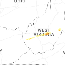


Connect with Interactive Hail Maps