

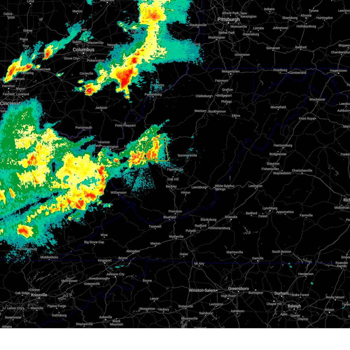
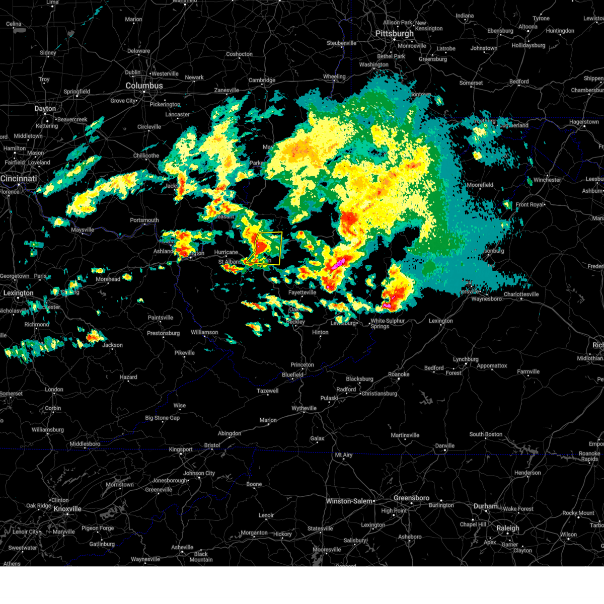
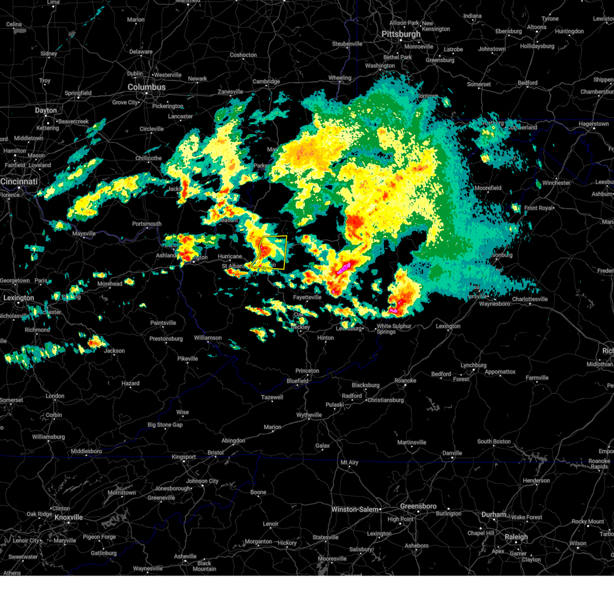
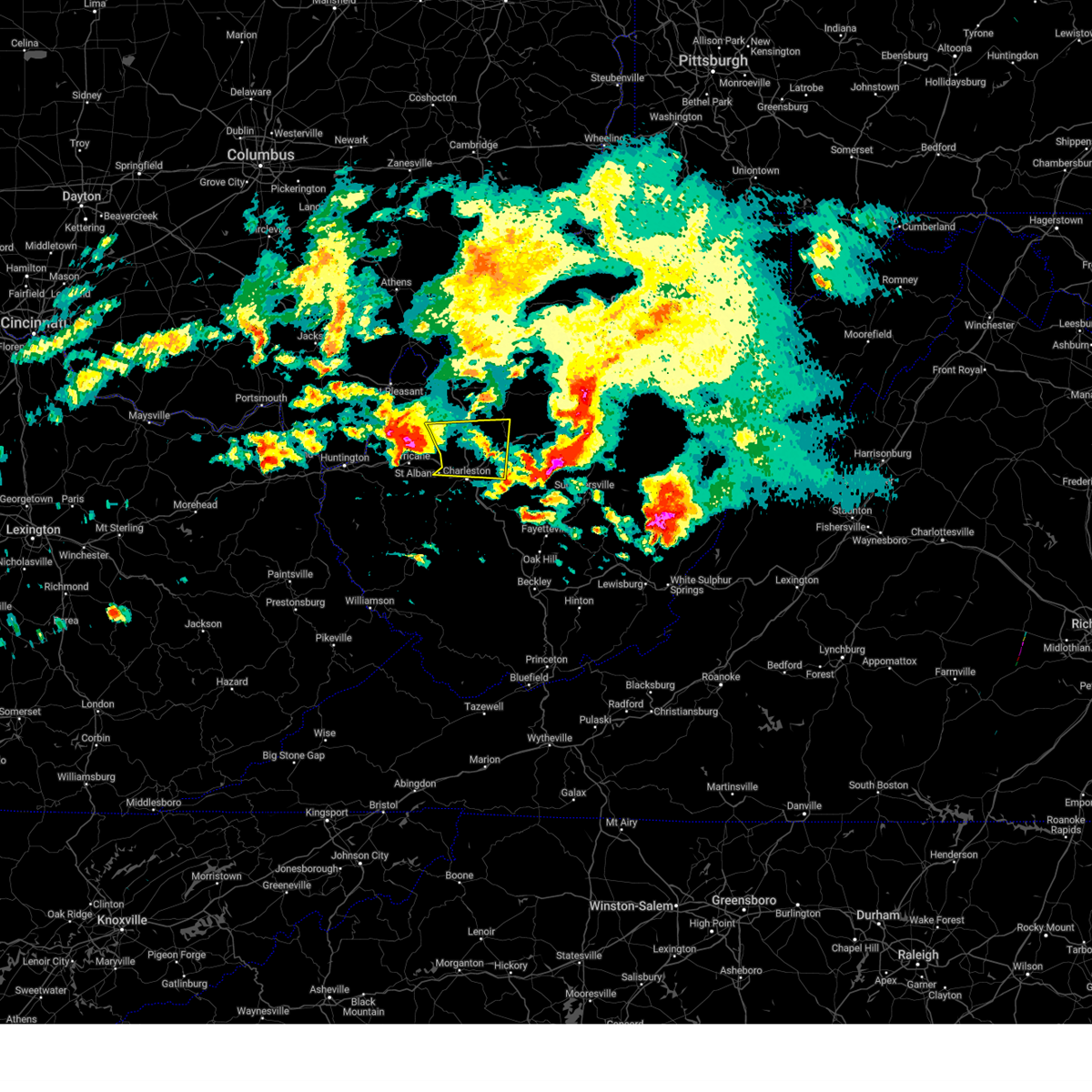
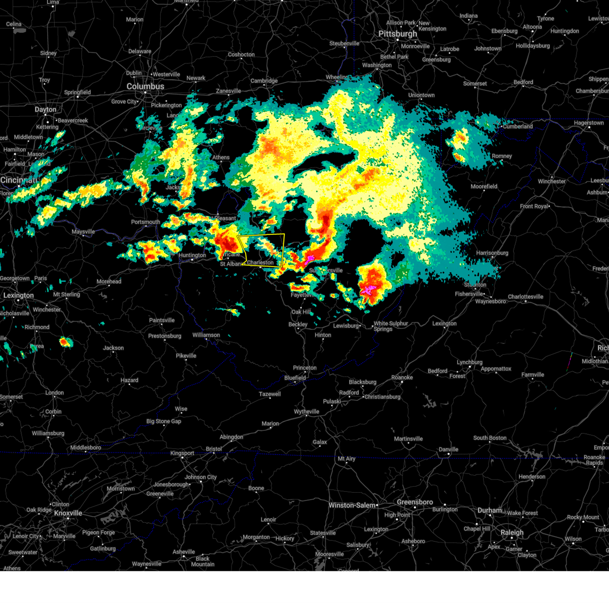
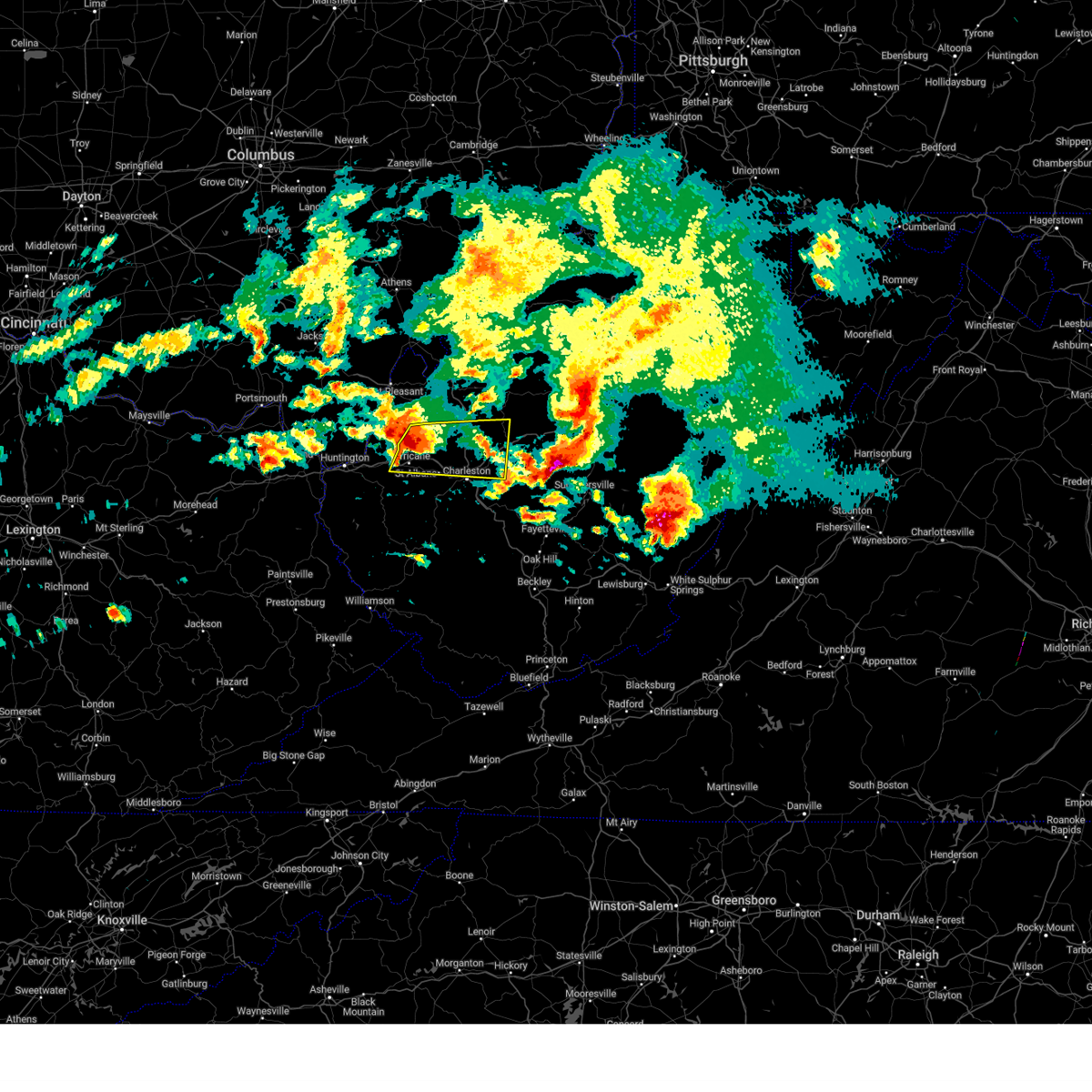
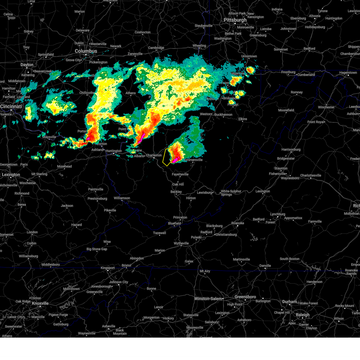
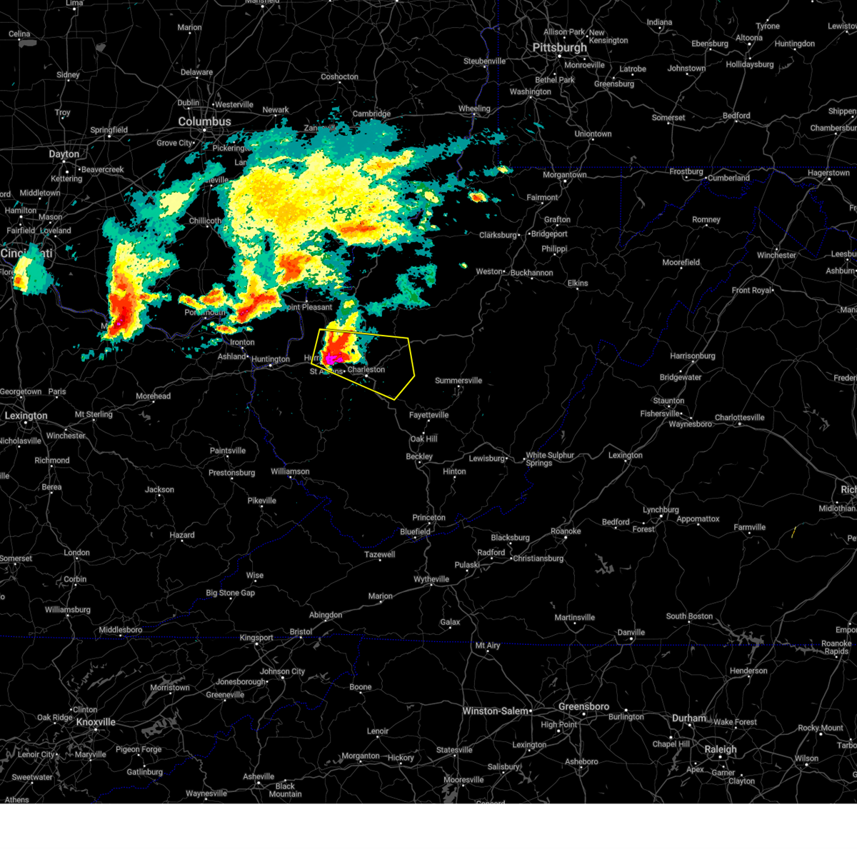
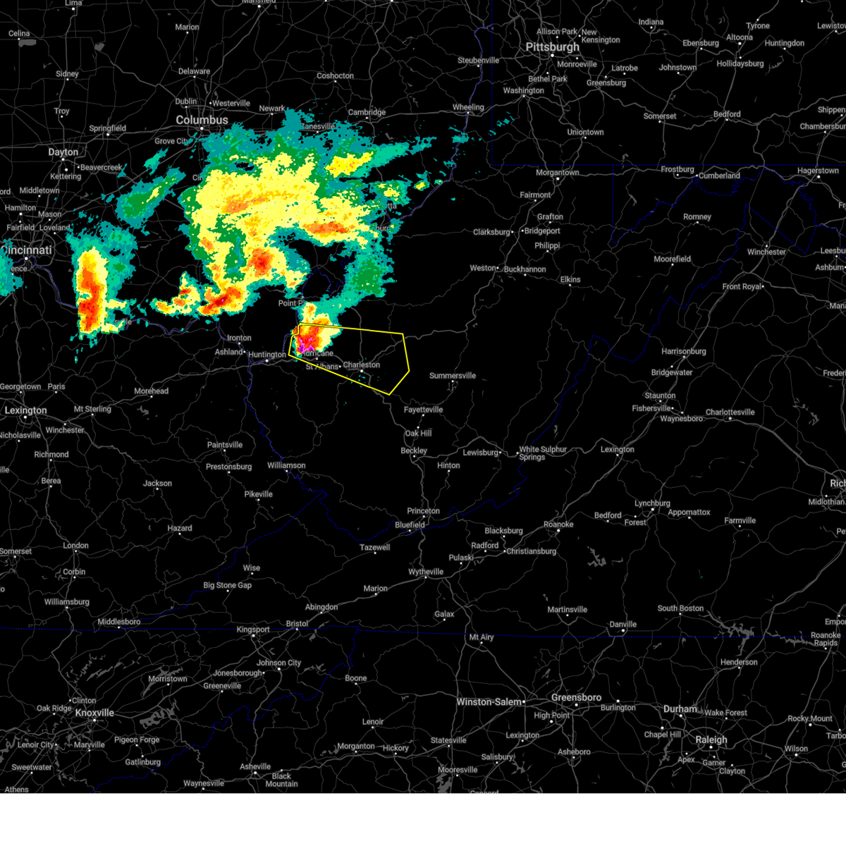
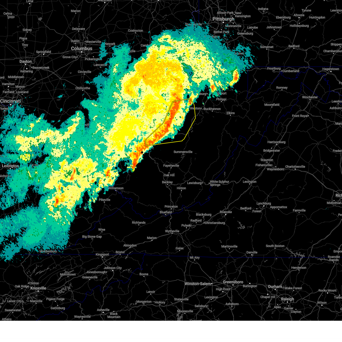
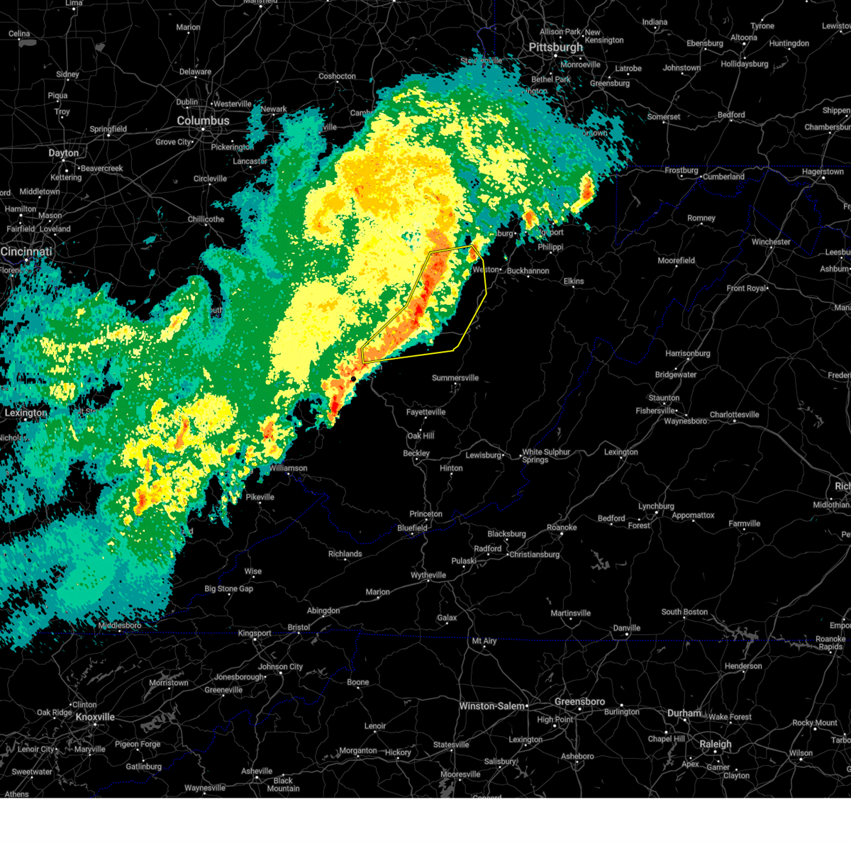
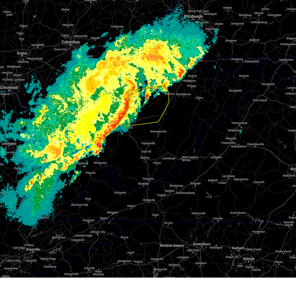
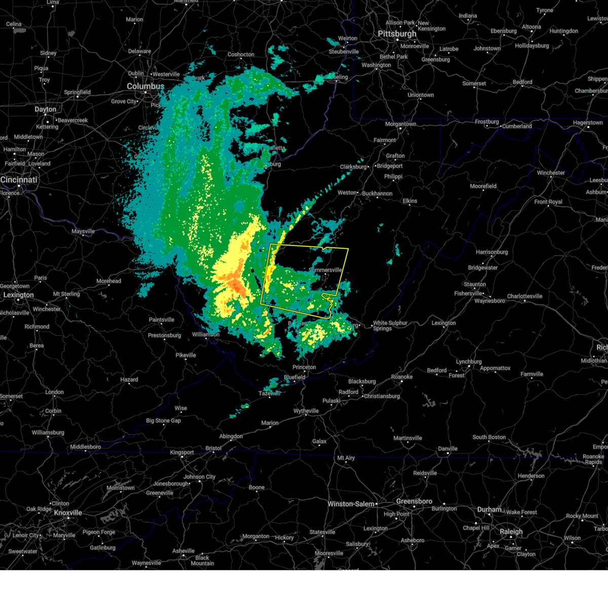
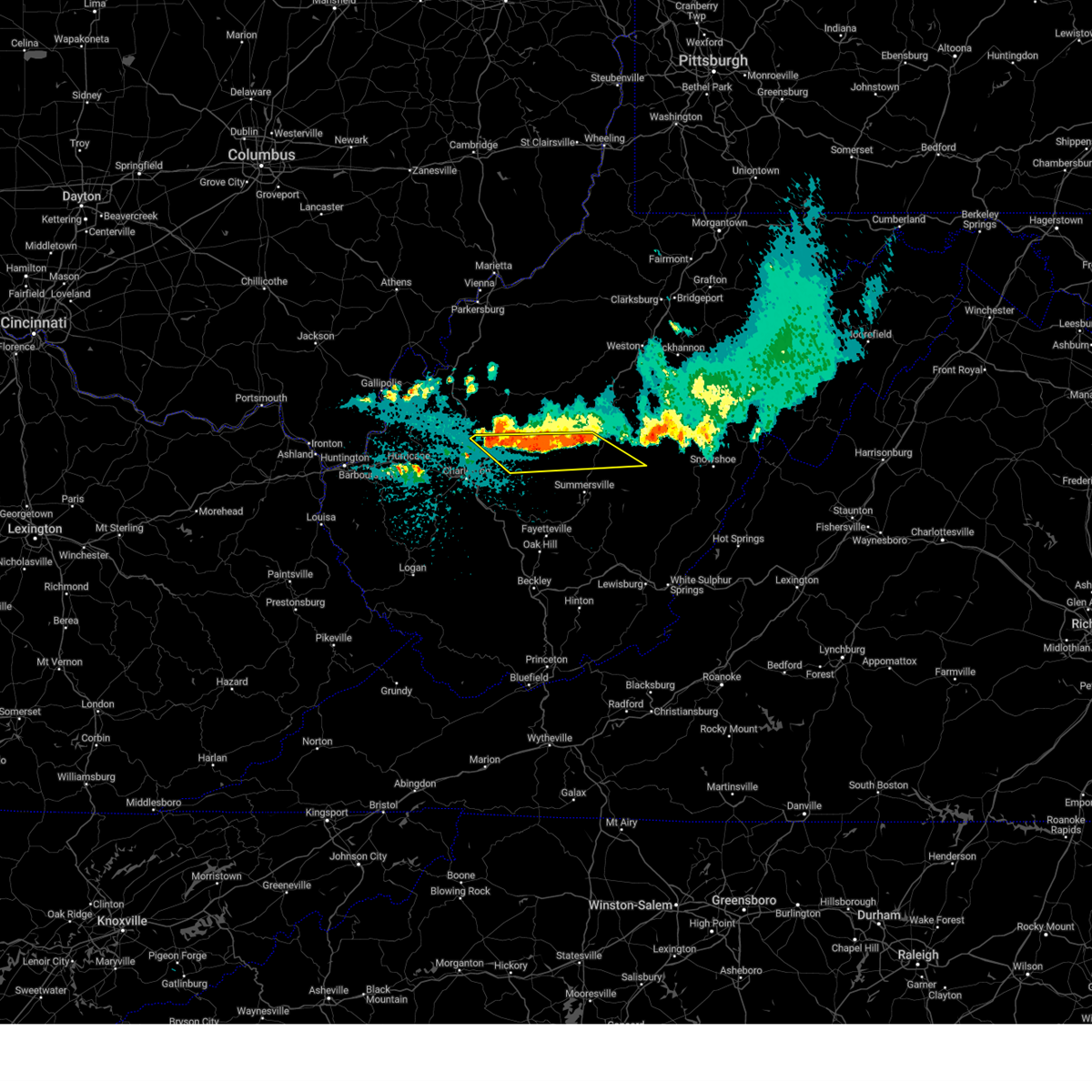
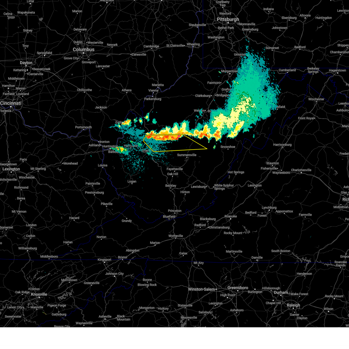
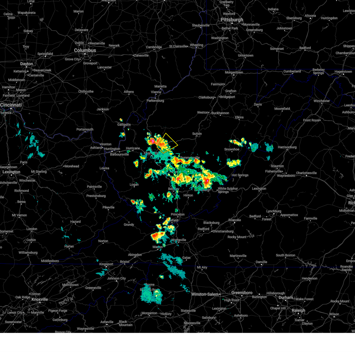
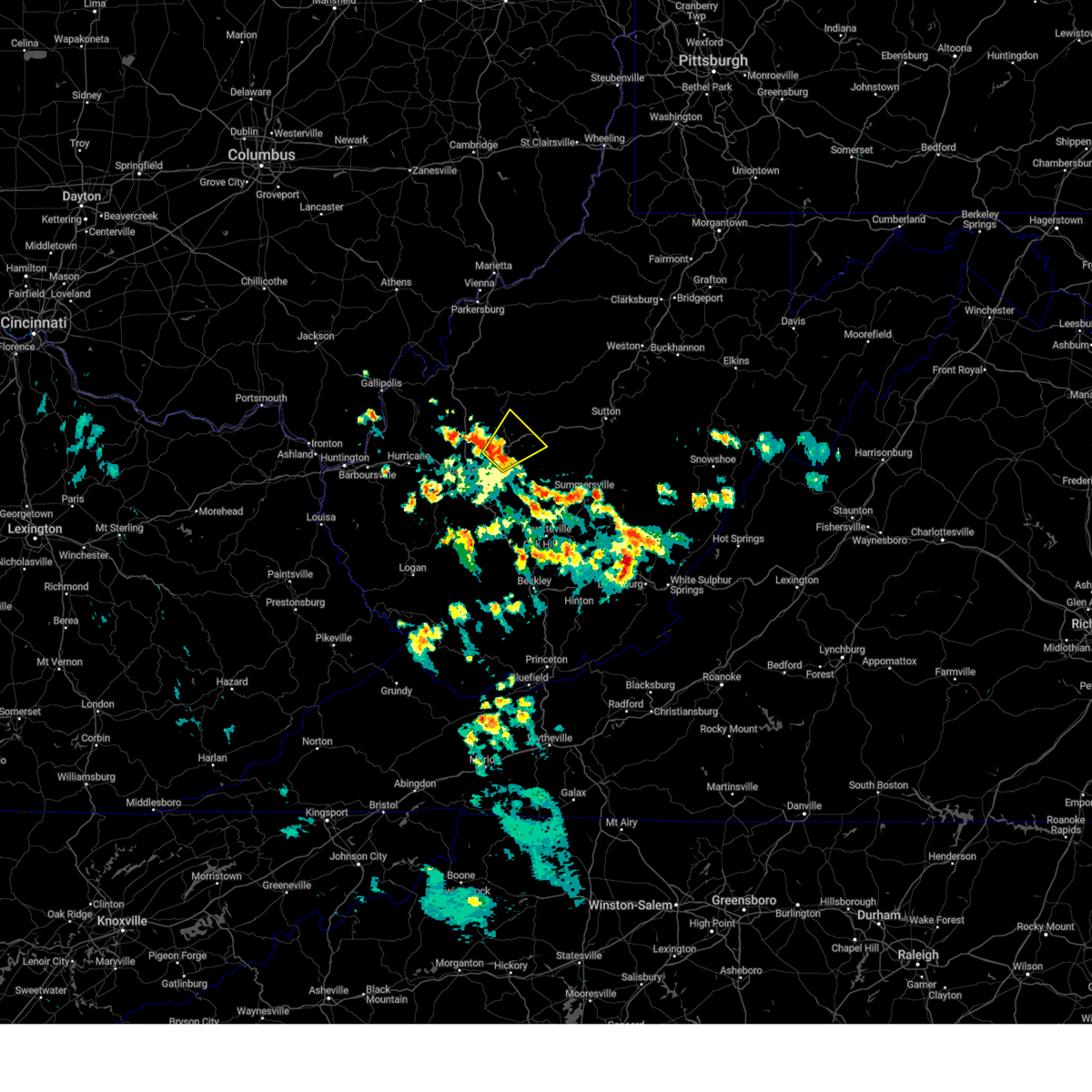
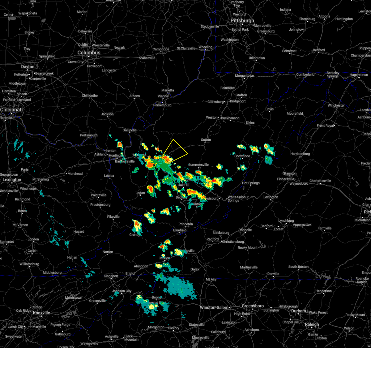
Hail Map for Clendenin, WV
The Clendenin, WV area has had 3 reports of on-the-ground hail by trained spotters, and has been under severe weather warnings 53 times during the past 12 months. Doppler radar has detected hail at or near Clendenin, WV on 34 occasions, including 3 occasions during the past year.
| Name: | Clendenin, WV |
| Where Located: | 18 miles ENE of Charleston, WV |
| Map: | Google Map for Clendenin, WV |
| Population: | 1227 |
| Housing Units: | 576 |
| More Info: | Search Google for Clendenin, WV |
3
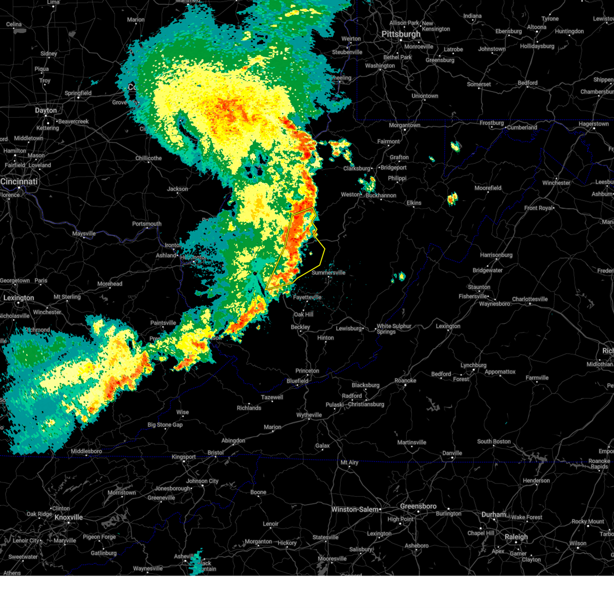
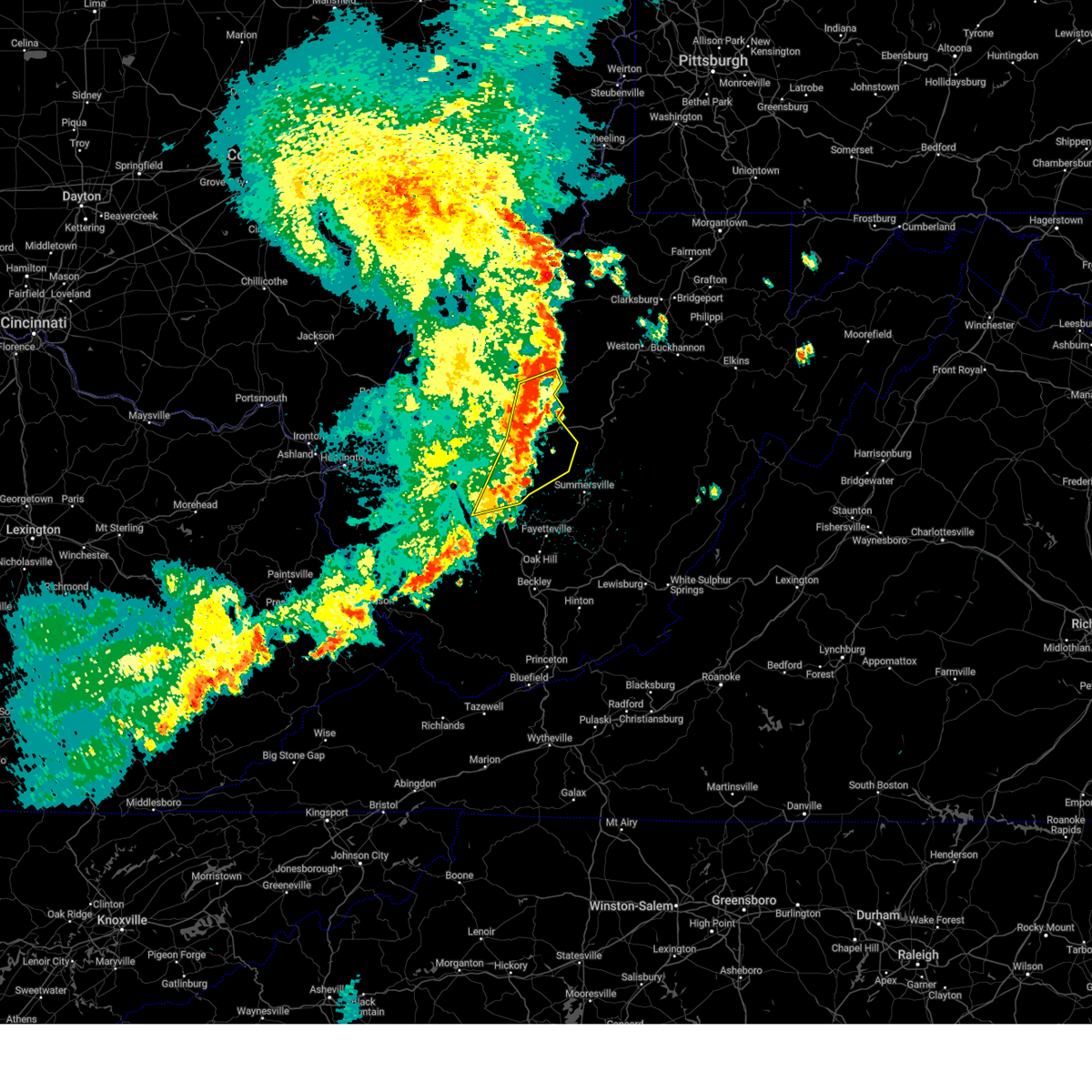
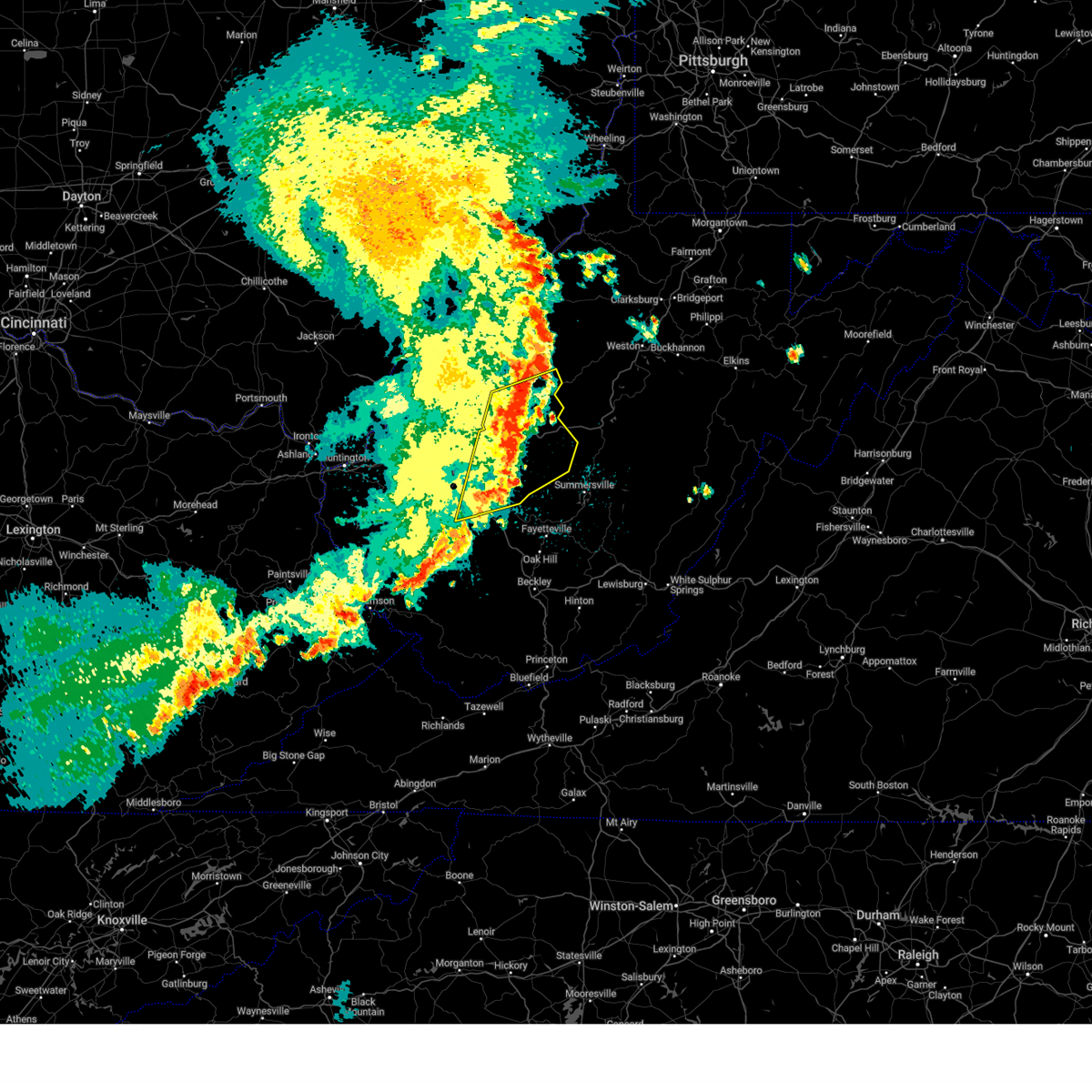
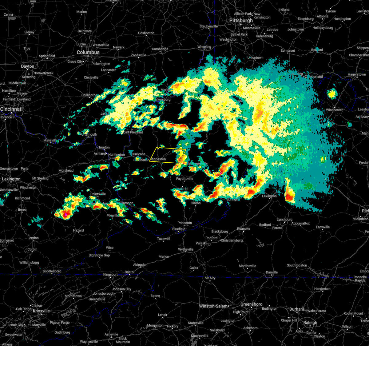
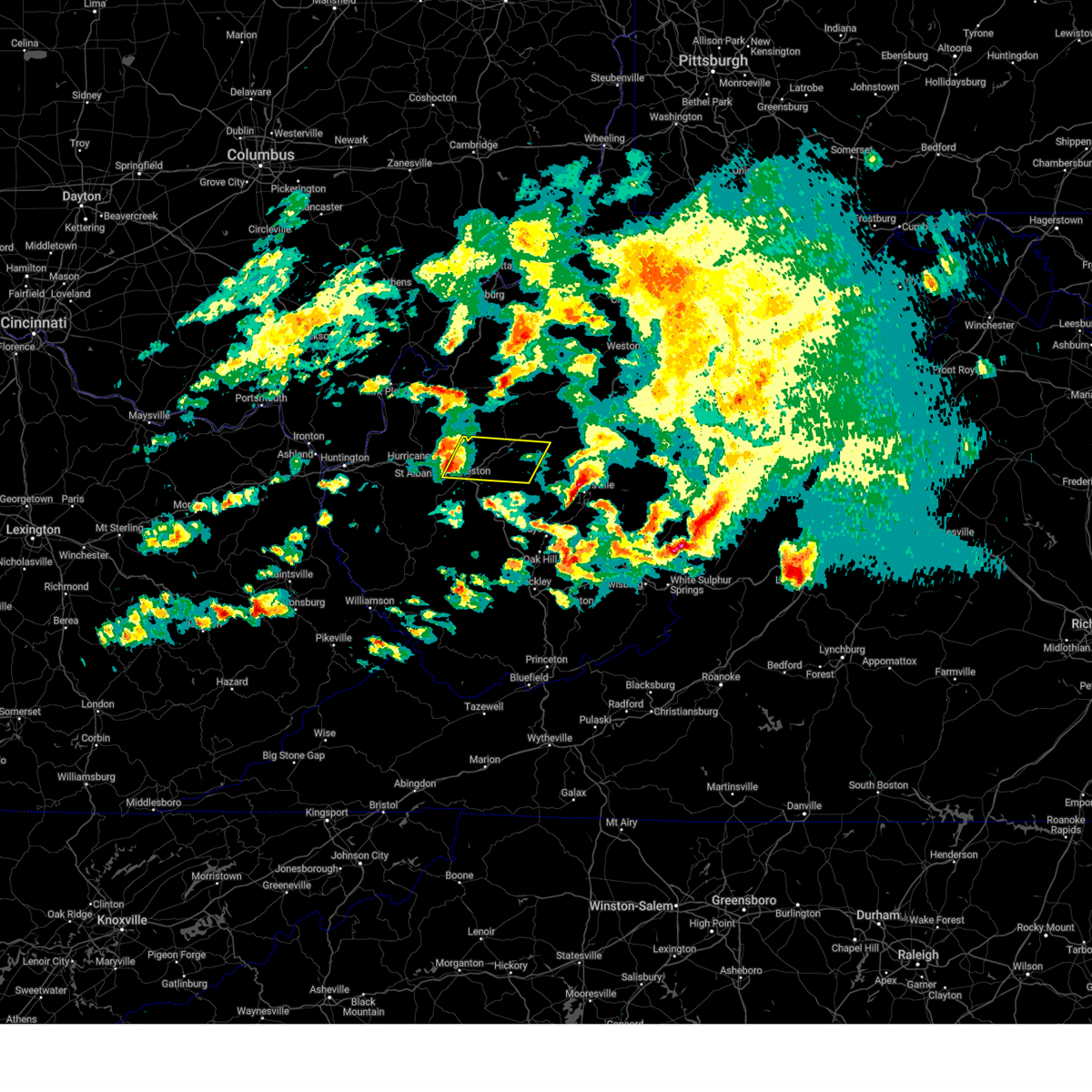
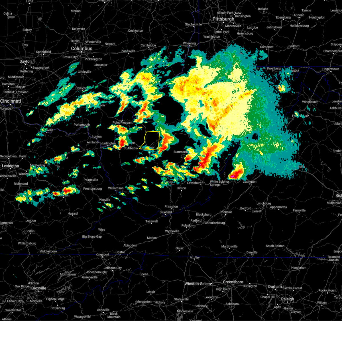
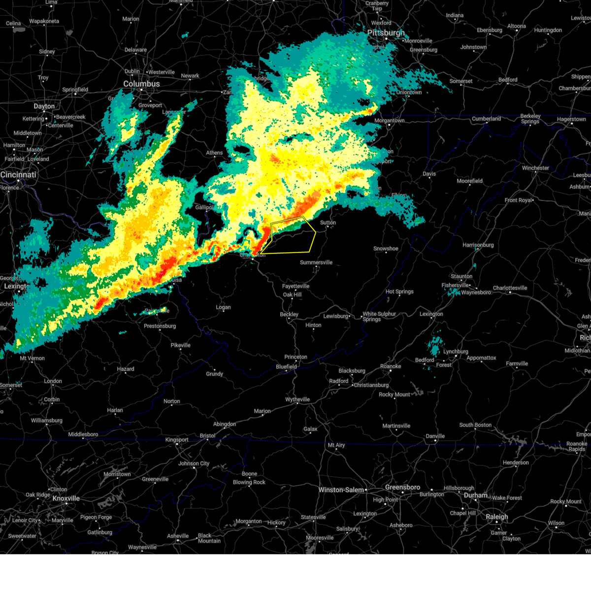
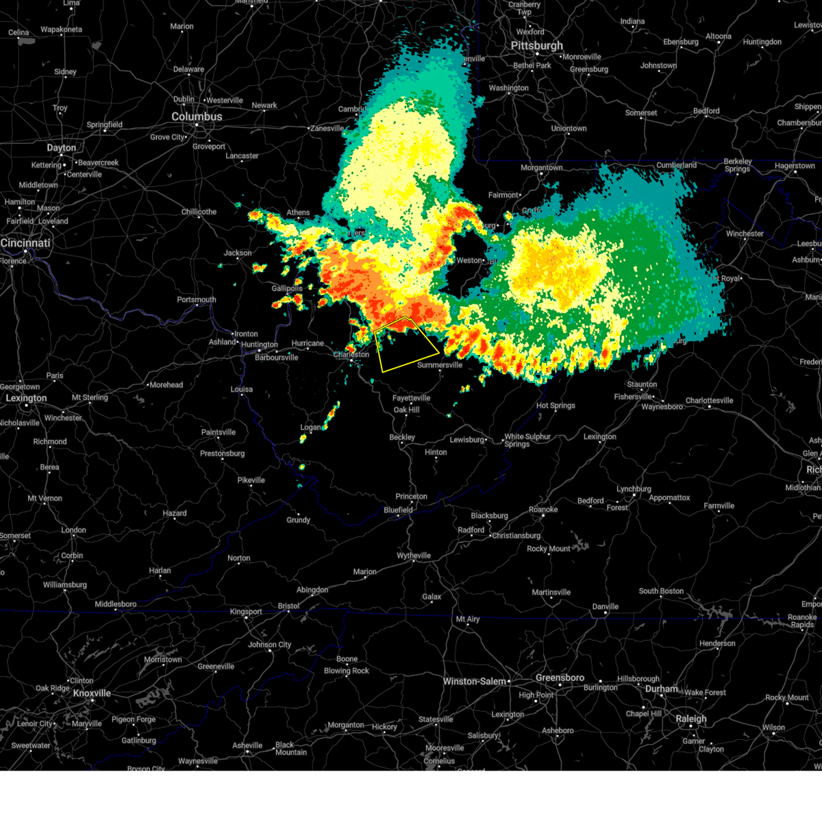
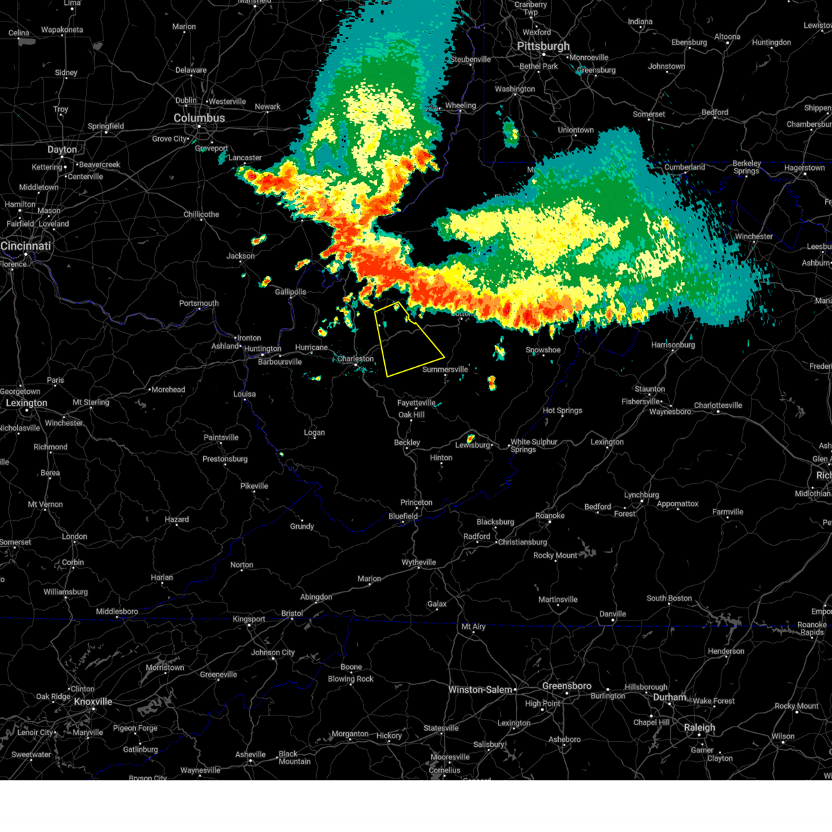
The Top Recent Hail Date for Clendenin, WV is Monday, April 14, 2025 (3rd out of 34)

Hail and Wind Damage Spotted near Clendenin, WV
| Date / Time | Report Details |
|---|---|
| 6/19/2025 3:32 PM EDT | Wv doh reports a tree down along wv-36 in southeastern roane county. time estimated from rada in roane county WV, 12.1 miles SSW of Clendenin, WV |
| 6/19/2025 3:18 PM EDT | Wv doh reports a tree down across us-119 in southern roane county. time estimated from rada in roane county WV, 6.8 miles SSE of Clendenin, WV |
| 5/16/2025 11:30 PM EDT | Svrrlx the national weather service in charleston west virginia has issued a * severe thunderstorm warning for, southeastern calhoun county in north central west virginia, northwestern nicholas county in southeastern west virginia, northeastern kanawha county in central west virginia, southwestern braxton county in north central west virginia, southeastern roane county in central west virginia, clay county in north central west virginia, northwestern fayette county in southeastern west virginia, * until midnight edt. * at 1130 pm edt, severe thunderstorms were located along a line extending from near clendenin to near pinch to marmet, moving east at 55 mph (radar indicated). Hazards include 60 mph wind gusts. expect damage to roofs, siding, and trees |
| 5/16/2025 11:22 PM EDT |
 the severe thunderstorm warning has been cancelled and is no longer in effect the severe thunderstorm warning has been cancelled and is no longer in effect
|
| 5/16/2025 11:22 PM EDT |
 At 1122 pm edt, a severe thunderstorm was located near pinch, or near charleston, moving east at 50 mph (radar indicated). Hazards include 60 mph wind gusts and nickel size hail. Expect damage to roofs, siding, and trees. Locations impacted include, charleston, jefferson, south charleston, dunbar, sissonville, marmet, belle, clendenin, pinch, coal fork, elkview, and pond gap. At 1122 pm edt, a severe thunderstorm was located near pinch, or near charleston, moving east at 50 mph (radar indicated). Hazards include 60 mph wind gusts and nickel size hail. Expect damage to roofs, siding, and trees. Locations impacted include, charleston, jefferson, south charleston, dunbar, sissonville, marmet, belle, clendenin, pinch, coal fork, elkview, and pond gap.
|
| 5/16/2025 11:04 PM EDT | Svrrlx the national weather service in charleston west virginia has issued a * severe thunderstorm warning for, southern putnam county in western west virginia, kanawha county in central west virginia, northeastern lincoln county in central west virginia, south central roane county in central west virginia, * until 1130 pm edt. * at 1103 pm edt, a severe thunderstorm was located over st. albans, or over nitro, moving east at 50 mph (radar indicated). Hazards include 60 mph wind gusts and nickel size hail. expect damage to roofs, siding, and trees |
| 4/29/2025 10:18 PM EDT |
 At 1017 pm edt, severe thunderstorms were located along a line extending from grantsville to near smithers, moving east at 45 mph (radar indicated). Hazards include 60 mph wind gusts. Expect damage to roofs, siding, and trees. Locations impacted include, nebo, millstone, cedar grove, procious, glasgow, mount zion, indore, glen, left hand, ivydale, pond gap, clay, clendenin, pratt, bickmore, tariff, arnoldsburg, bentree, chesapeake, and big otter. At 1017 pm edt, severe thunderstorms were located along a line extending from grantsville to near smithers, moving east at 45 mph (radar indicated). Hazards include 60 mph wind gusts. Expect damage to roofs, siding, and trees. Locations impacted include, nebo, millstone, cedar grove, procious, glasgow, mount zion, indore, glen, left hand, ivydale, pond gap, clay, clendenin, pratt, bickmore, tariff, arnoldsburg, bentree, chesapeake, and big otter.
|
| 4/29/2025 10:18 PM EDT |
 the severe thunderstorm warning has been cancelled and is no longer in effect the severe thunderstorm warning has been cancelled and is no longer in effect
|
| 4/29/2025 10:06 PM EDT |
 At 1006 pm edt, severe thunderstorms were located along a line extending from 6 miles northwest of arnoldsburg to glasgow, moving northeast at 60 mph (radar indicated). Hazards include 60 mph wind gusts. Expect damage to roofs, siding, and trees. Locations impacted include, nebo, millstone, charleston, pinch, cedar grove, procious, glasgow, mount zion, indore, glen, left hand, ivydale, coal fork, pond gap, elkview, racine, clay, clendenin, pratt, and harmony. At 1006 pm edt, severe thunderstorms were located along a line extending from 6 miles northwest of arnoldsburg to glasgow, moving northeast at 60 mph (radar indicated). Hazards include 60 mph wind gusts. Expect damage to roofs, siding, and trees. Locations impacted include, nebo, millstone, charleston, pinch, cedar grove, procious, glasgow, mount zion, indore, glen, left hand, ivydale, coal fork, pond gap, elkview, racine, clay, clendenin, pratt, and harmony.
|
| 4/29/2025 10:06 PM EDT |
 the severe thunderstorm warning has been cancelled and is no longer in effect the severe thunderstorm warning has been cancelled and is no longer in effect
|
| 4/29/2025 10:00 PM EDT | Downed tree reported on elk river road near falling rock. time estimated from rada in kanawha county WV, 3.4 miles ENE of Clendenin, WV |
| 4/29/2025 9:53 PM EDT |
 Svrrlx the national weather service in charleston west virginia has issued a * severe thunderstorm warning for, calhoun county in north central west virginia, northeastern putnam county in western west virginia, kanawha county in central west virginia, roane county in central west virginia, clay county in north central west virginia, southeastern jackson county in northwestern west virginia, northern boone county in central west virginia, * until 1100 pm edt. * at 952 pm edt, a severe thunderstorm was located over dunbar, or near charleston, moving east at 45 mph (radar indicated). Hazards include 60 mph wind gusts. expect damage to roofs, siding, and trees Svrrlx the national weather service in charleston west virginia has issued a * severe thunderstorm warning for, calhoun county in north central west virginia, northeastern putnam county in western west virginia, kanawha county in central west virginia, roane county in central west virginia, clay county in north central west virginia, southeastern jackson county in northwestern west virginia, northern boone county in central west virginia, * until 1100 pm edt. * at 952 pm edt, a severe thunderstorm was located over dunbar, or near charleston, moving east at 45 mph (radar indicated). Hazards include 60 mph wind gusts. expect damage to roofs, siding, and trees
|
| 4/14/2025 8:24 PM EDT |
 The storm which prompted the warning has moved out of the area. therefore, the warning will be allowed to expire. a severe thunderstorm watch remains in effect until 1100 pm edt for central, western, north central and northwestern west virginia. The storm which prompted the warning has moved out of the area. therefore, the warning will be allowed to expire. a severe thunderstorm watch remains in effect until 1100 pm edt for central, western, north central and northwestern west virginia.
|
| 4/14/2025 8:00 PM EDT |
 Svrrlx the national weather service in charleston west virginia has issued a * severe thunderstorm warning for, northern kanawha county in central west virginia, south central roane county in central west virginia, west central clay county in north central west virginia, * until 830 pm edt. * at 759 pm edt, a severe thunderstorm was located near dunbar, or near charleston, moving east at 65 mph (public). Hazards include 60 mph wind gusts and quarter size hail. Hail damage to vehicles is expected. Expect wind damage to roofs, siding, and trees. Svrrlx the national weather service in charleston west virginia has issued a * severe thunderstorm warning for, northern kanawha county in central west virginia, south central roane county in central west virginia, west central clay county in north central west virginia, * until 830 pm edt. * at 759 pm edt, a severe thunderstorm was located near dunbar, or near charleston, moving east at 65 mph (public). Hazards include 60 mph wind gusts and quarter size hail. Hail damage to vehicles is expected. Expect wind damage to roofs, siding, and trees.
|
| 4/14/2025 7:35 PM EDT |
 The storm which prompted the warning has moved out of the area. therefore, the warning will be allowed to expire. a severe thunderstorm watch remains in effect until 1100 pm edt for central and northwestern west virginia. The storm which prompted the warning has moved out of the area. therefore, the warning will be allowed to expire. a severe thunderstorm watch remains in effect until 1100 pm edt for central and northwestern west virginia.
|
| 4/14/2025 7:22 PM EDT |
 the severe thunderstorm warning has been cancelled and is no longer in effect the severe thunderstorm warning has been cancelled and is no longer in effect
|
| 4/14/2025 7:22 PM EDT |
 At 721 pm edt, a severe thunderstorm was located near sissonville, or 10 miles northeast of charleston, moving east at 60 mph (radar indicated). Hazards include 60 mph wind gusts and penny size hail. Expect damage to roofs, siding, and trees. Locations impacted include, pinch, institute, jefferson, dunbar, elkview, sissonville, walton, charleston, and south charleston. At 721 pm edt, a severe thunderstorm was located near sissonville, or 10 miles northeast of charleston, moving east at 60 mph (radar indicated). Hazards include 60 mph wind gusts and penny size hail. Expect damage to roofs, siding, and trees. Locations impacted include, pinch, institute, jefferson, dunbar, elkview, sissonville, walton, charleston, and south charleston.
|
| 4/14/2025 7:13 PM EDT |
 the severe thunderstorm warning has been cancelled and is no longer in effect the severe thunderstorm warning has been cancelled and is no longer in effect
|
| 4/14/2025 7:13 PM EDT |
 At 713 pm edt, a severe thunderstorm was located near sissonville, or 7 miles northeast of nitro, moving east at 60 mph (radar indicated). Hazards include 60 mph wind gusts and quarter size hail. Hail damage to vehicles is expected. expect wind damage to roofs, siding, and trees. locations impacted include, cross lanes, pinch, jefferson, liberty, walton, institute, st. Albans, dunbar, elkview, sissonville, poca, charleston, south charleston, and nitro. At 713 pm edt, a severe thunderstorm was located near sissonville, or 7 miles northeast of nitro, moving east at 60 mph (radar indicated). Hazards include 60 mph wind gusts and quarter size hail. Hail damage to vehicles is expected. expect wind damage to roofs, siding, and trees. locations impacted include, cross lanes, pinch, jefferson, liberty, walton, institute, st. Albans, dunbar, elkview, sissonville, poca, charleston, south charleston, and nitro.
|
| 4/14/2025 6:55 PM EDT |
 Svrrlx the national weather service in charleston west virginia has issued a * severe thunderstorm warning for, southern mason county in western west virginia, east central cabell county in central west virginia, putnam county in western west virginia, northwestern kanawha county in central west virginia, southwestern roane county in central west virginia, southeastern jackson county in northwestern west virginia, * until 745 pm edt. * at 655 pm edt, a severe thunderstorm was located near milton, or 12 miles west of winfield, moving east at 60 mph (radar indicated). Hazards include 60 mph wind gusts and half dollar size hail. Hail damage to vehicles is expected. Expect wind damage to roofs, siding, and trees. Svrrlx the national weather service in charleston west virginia has issued a * severe thunderstorm warning for, southern mason county in western west virginia, east central cabell county in central west virginia, putnam county in western west virginia, northwestern kanawha county in central west virginia, southwestern roane county in central west virginia, southeastern jackson county in northwestern west virginia, * until 745 pm edt. * at 655 pm edt, a severe thunderstorm was located near milton, or 12 miles west of winfield, moving east at 60 mph (radar indicated). Hazards include 60 mph wind gusts and half dollar size hail. Hail damage to vehicles is expected. Expect wind damage to roofs, siding, and trees.
|
| 4/14/2025 6:47 PM EDT |
 At 646 pm edt, a severe thunderstorm was located over glen, or 9 miles west of clay, moving east at 60 mph (radar indicated). Hazards include 60 mph wind gusts and quarter size hail. Hail damage to vehicles is expected. expect wind damage to roofs, siding, and trees. Locations impacted include, pinch, clendenin, elkview, and glen. At 646 pm edt, a severe thunderstorm was located over glen, or 9 miles west of clay, moving east at 60 mph (radar indicated). Hazards include 60 mph wind gusts and quarter size hail. Hail damage to vehicles is expected. expect wind damage to roofs, siding, and trees. Locations impacted include, pinch, clendenin, elkview, and glen.
|
| 4/14/2025 6:47 PM EDT |
 the severe thunderstorm warning has been cancelled and is no longer in effect the severe thunderstorm warning has been cancelled and is no longer in effect
|
| 4/14/2025 6:15 PM EDT |
 Svrrlx the national weather service in charleston west virginia has issued a * severe thunderstorm warning for, central putnam county in western west virginia, northern kanawha county in central west virginia, south central roane county in central west virginia, west central clay county in north central west virginia, south central jackson county in northwestern west virginia, * until 700 pm edt. * at 614 pm edt, a severe thunderstorm was located over winfield, moving east at 50 mph (radar indicated). Hazards include 60 mph wind gusts and quarter size hail. Hail damage to vehicles is expected. Expect wind damage to roofs, siding, and trees. Svrrlx the national weather service in charleston west virginia has issued a * severe thunderstorm warning for, central putnam county in western west virginia, northern kanawha county in central west virginia, south central roane county in central west virginia, west central clay county in north central west virginia, south central jackson county in northwestern west virginia, * until 700 pm edt. * at 614 pm edt, a severe thunderstorm was located over winfield, moving east at 50 mph (radar indicated). Hazards include 60 mph wind gusts and quarter size hail. Hail damage to vehicles is expected. Expect wind damage to roofs, siding, and trees.
|
| 4/14/2025 6:11 PM EDT |
 The storm which prompted the warning has moved out of the area. therefore, the warning will be allowed to expire. a severe thunderstorm watch remains in effect until 1100 pm edt for central and north central west virginia. The storm which prompted the warning has moved out of the area. therefore, the warning will be allowed to expire. a severe thunderstorm watch remains in effect until 1100 pm edt for central and north central west virginia.
|
| 4/14/2025 6:01 PM EDT |
 the severe thunderstorm warning has been cancelled and is no longer in effect the severe thunderstorm warning has been cancelled and is no longer in effect
|
| 4/14/2025 6:01 PM EDT |
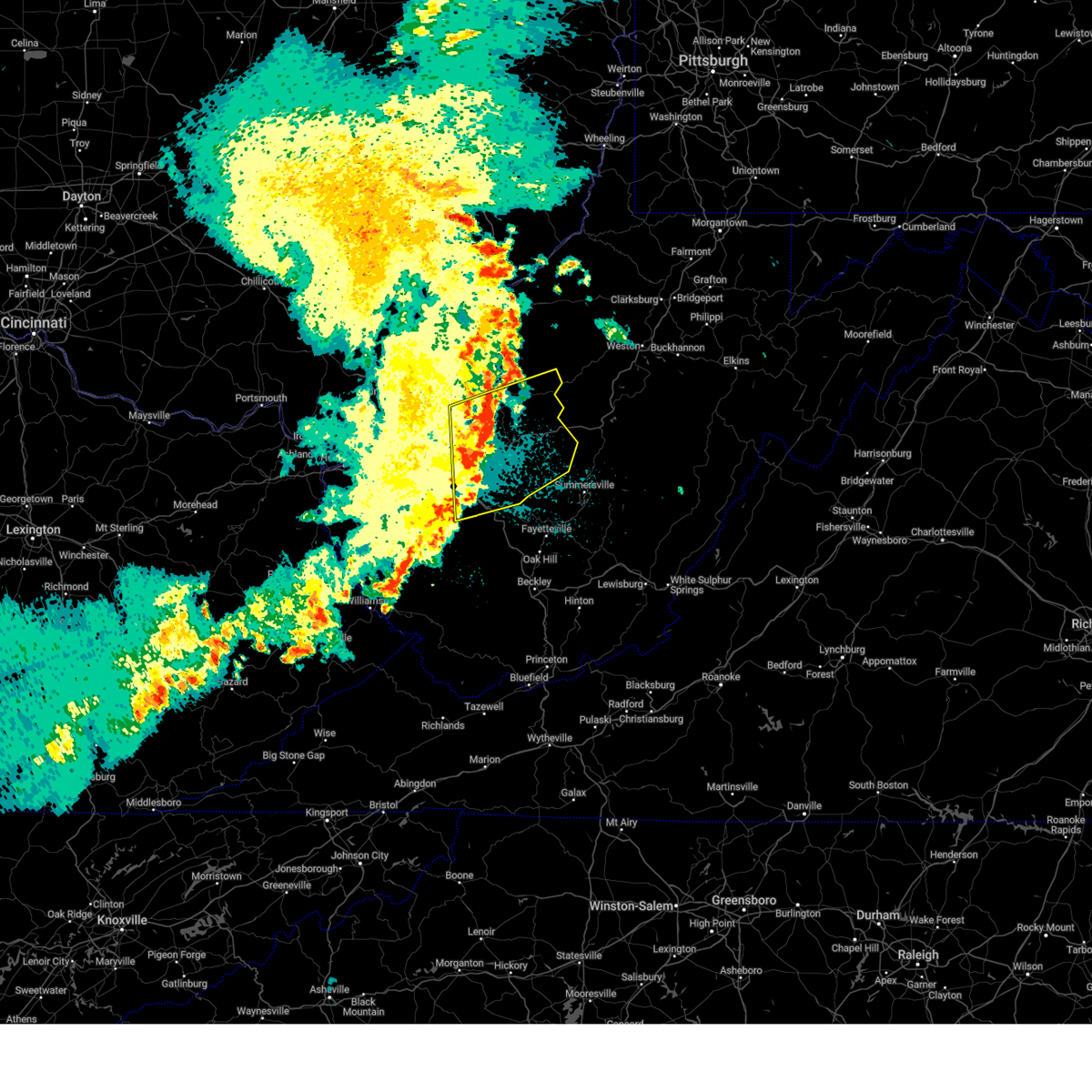
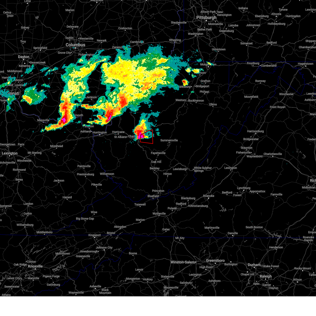
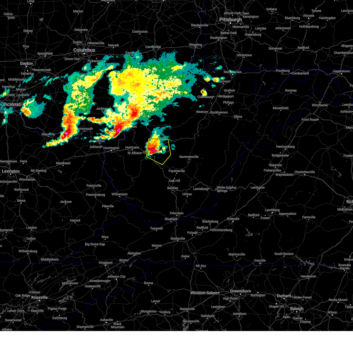
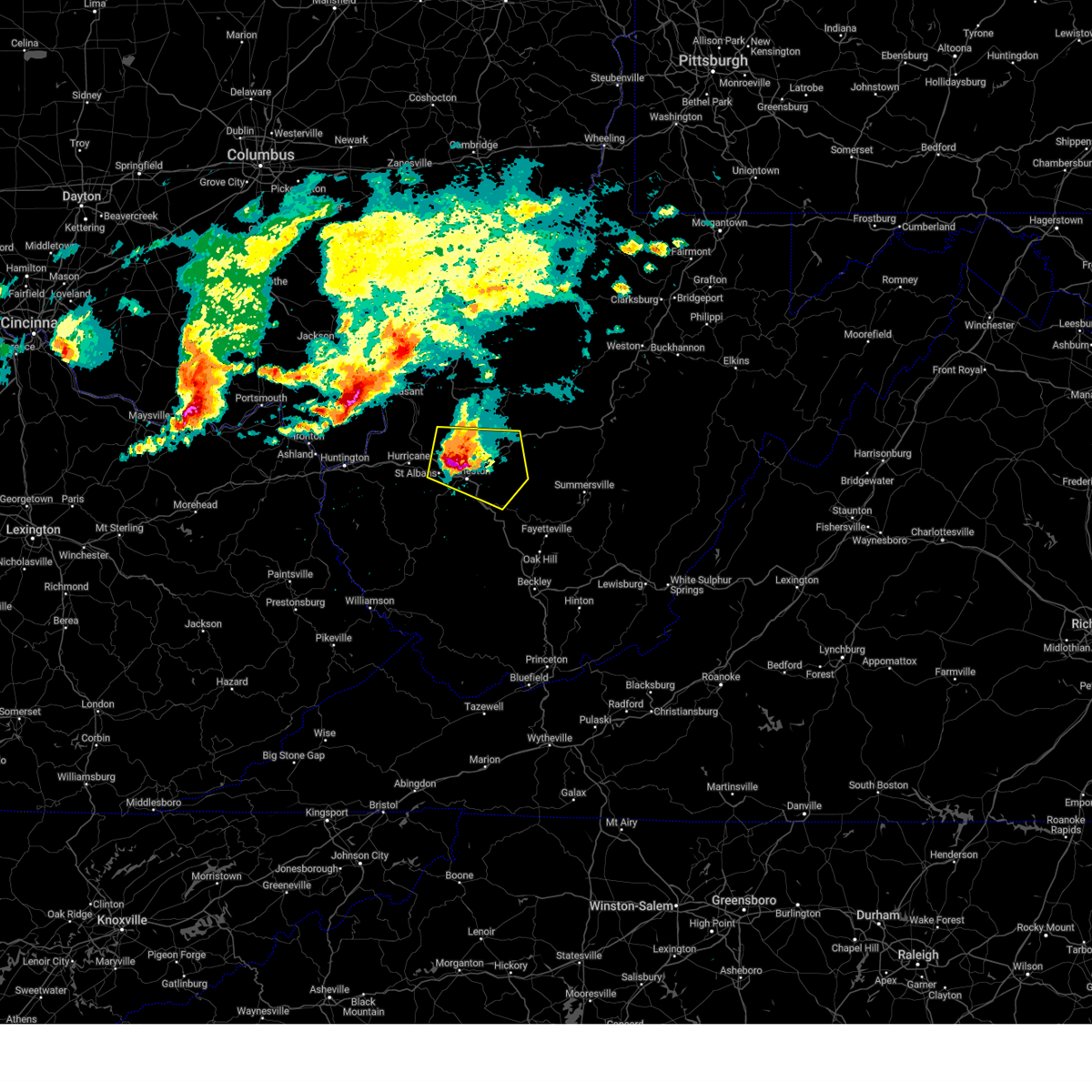
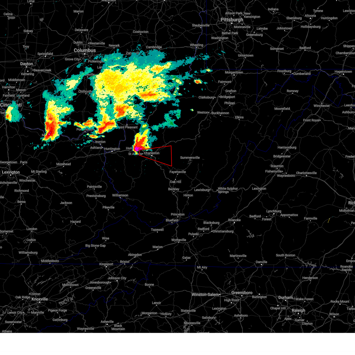
 At 600 pm edt, a severe thunderstorm was located near clendenin, or 12 miles west of clay, moving east at 50 mph. this is a destructive storm (radar indicated). Hazards include baseball size hail and 60 mph wind gusts. People and animals outdoors will be severely injured. expect shattered windows, extensive damage to roofs, siding, and vehicles. Locations impacted include, clendenin. At 600 pm edt, a severe thunderstorm was located near clendenin, or 12 miles west of clay, moving east at 50 mph. this is a destructive storm (radar indicated). Hazards include baseball size hail and 60 mph wind gusts. People and animals outdoors will be severely injured. expect shattered windows, extensive damage to roofs, siding, and vehicles. Locations impacted include, clendenin.
|
| 4/14/2025 6:01 PM EDT |
 Svrrlx the national weather service in charleston west virginia has issued a * severe thunderstorm warning for, nicholas county in southeastern west virginia, northeastern kanawha county in central west virginia, southwestern webster county in northeastern west virginia, clay county in north central west virginia, northeastern fayette county in southeastern west virginia, * until 700 pm edt. * at 601 pm edt, a severe thunderstorm was located near glen, or 13 miles west of clay, moving east at 55 mph (radar indicated). Hazards include golf ball size hail and 60 mph wind gusts. People and animals outdoors will be injured. expect hail damage to roofs, siding, windows, and vehicles. Expect wind damage to roofs, siding, and trees. Svrrlx the national weather service in charleston west virginia has issued a * severe thunderstorm warning for, nicholas county in southeastern west virginia, northeastern kanawha county in central west virginia, southwestern webster county in northeastern west virginia, clay county in north central west virginia, northeastern fayette county in southeastern west virginia, * until 700 pm edt. * at 601 pm edt, a severe thunderstorm was located near glen, or 13 miles west of clay, moving east at 55 mph (radar indicated). Hazards include golf ball size hail and 60 mph wind gusts. People and animals outdoors will be injured. expect hail damage to roofs, siding, windows, and vehicles. Expect wind damage to roofs, siding, and trees.
|
| 4/14/2025 5:56 PM EDT |
 The tornado threat has diminished and the tornado warning has been cancelled. however, large hail and damaging winds remain likely and a severe thunderstorm warning remains in effect for the area. a severe thunderstorm watch remains in effect until 1100 pm edt for central, southeastern and north central west virginia. The tornado threat has diminished and the tornado warning has been cancelled. however, large hail and damaging winds remain likely and a severe thunderstorm warning remains in effect for the area. a severe thunderstorm watch remains in effect until 1100 pm edt for central, southeastern and north central west virginia.
|
| 4/14/2025 5:53 PM EDT |
 the tornado warning has been cancelled and is no longer in effect the tornado warning has been cancelled and is no longer in effect
|
| 4/14/2025 5:53 PM EDT |
 At 552 pm edt, a severe thunderstorm capable of producing a tornado was located over coal fork, or 7 miles east of charleston, moving east at 55 mph (radar indicated rotation). Hazards include tornado and baseball size hail. Flying debris will be dangerous to those caught without shelter. mobile homes will be damaged or destroyed. damage to roofs, windows, and vehicles will occur. tree damage is likely. This tornadic thunderstorm will remain over mainly rural areas of northeastern kanawha and southwestern clay counties, including the following locations, pond gap. At 552 pm edt, a severe thunderstorm capable of producing a tornado was located over coal fork, or 7 miles east of charleston, moving east at 55 mph (radar indicated rotation). Hazards include tornado and baseball size hail. Flying debris will be dangerous to those caught without shelter. mobile homes will be damaged or destroyed. damage to roofs, windows, and vehicles will occur. tree damage is likely. This tornadic thunderstorm will remain over mainly rural areas of northeastern kanawha and southwestern clay counties, including the following locations, pond gap.
|
| 4/14/2025 5:48 PM EDT |
 At 546 pm edt, a severe thunderstorm was located near elkview, or 9 miles northeast of charleston, moving east at 50 mph. this is a destructive storm for charleston and coal fork (radar indicated). Hazards include baseball size hail and 70 mph wind gusts. People and animals outdoors will be severely injured. expect shattered windows, extensive damage to roofs, siding, and vehicles. Locations impacted include, charleston, pinch, clendenin, pratt, cedar grove, glasgow, south charleston, east bank, coal fork, elkview, sissonville, glen, and dunbar. At 546 pm edt, a severe thunderstorm was located near elkview, or 9 miles northeast of charleston, moving east at 50 mph. this is a destructive storm for charleston and coal fork (radar indicated). Hazards include baseball size hail and 70 mph wind gusts. People and animals outdoors will be severely injured. expect shattered windows, extensive damage to roofs, siding, and vehicles. Locations impacted include, charleston, pinch, clendenin, pratt, cedar grove, glasgow, south charleston, east bank, coal fork, elkview, sissonville, glen, and dunbar.
|
| 4/14/2025 5:48 PM EDT |
 the severe thunderstorm warning has been cancelled and is no longer in effect the severe thunderstorm warning has been cancelled and is no longer in effect
|
| 4/14/2025 5:42 PM EDT |
 the tornado warning has been cancelled and is no longer in effect the tornado warning has been cancelled and is no longer in effect
|
| 4/14/2025 5:42 PM EDT |
 At 541 pm edt, a severe thunderstorm capable of producing a tornado was located over charleston, moving east at 65 mph (radar indicated rotation). Hazards include tornado and baseball size hail. Flying debris will be dangerous to those caught without shelter. mobile homes will be damaged or destroyed. damage to roofs, windows, and vehicles will occur. tree damage is likely. this dangerous storm will be near, charleston, coal fork, pinch, and elkview around 545 pm edt. Other locations impacted by this tornadic thunderstorm include pond gap. At 541 pm edt, a severe thunderstorm capable of producing a tornado was located over charleston, moving east at 65 mph (radar indicated rotation). Hazards include tornado and baseball size hail. Flying debris will be dangerous to those caught without shelter. mobile homes will be damaged or destroyed. damage to roofs, windows, and vehicles will occur. tree damage is likely. this dangerous storm will be near, charleston, coal fork, pinch, and elkview around 545 pm edt. Other locations impacted by this tornadic thunderstorm include pond gap.
|
| 4/14/2025 5:36 PM EDT |
 the severe thunderstorm warning has been cancelled and is no longer in effect the severe thunderstorm warning has been cancelled and is no longer in effect
|
| 4/14/2025 5:36 PM EDT |
 At 535 pm edt, a severe thunderstorm was located near cross lanes, or 7 miles northeast of nitro, moving east at 50 mph. this is a destructive storm for cross lanes and saint albans (radar indicated). Hazards include baseball size hail and 70 mph wind gusts. People and animals outdoors will be severely injured. expect shattered windows, extensive damage to roofs, siding, and vehicles. locations impacted include, charleston, pinch, cedar grove, glasgow, nitro, liberty, institute, st. Albans, south charleston, poca, coal fork, elkview, sissonville, cross lanes, clendenin, pratt, jefferson, bancroft, east bank, and dunbar. At 535 pm edt, a severe thunderstorm was located near cross lanes, or 7 miles northeast of nitro, moving east at 50 mph. this is a destructive storm for cross lanes and saint albans (radar indicated). Hazards include baseball size hail and 70 mph wind gusts. People and animals outdoors will be severely injured. expect shattered windows, extensive damage to roofs, siding, and vehicles. locations impacted include, charleston, pinch, cedar grove, glasgow, nitro, liberty, institute, st. Albans, south charleston, poca, coal fork, elkview, sissonville, cross lanes, clendenin, pratt, jefferson, bancroft, east bank, and dunbar.
|
| 4/14/2025 5:31 PM EDT |
 Torrlx the national weather service in charleston west virginia has issued a * tornado warning for, southeastern putnam county in western west virginia, central kanawha county in central west virginia, southwestern clay county in north central west virginia, northwestern fayette county in southeastern west virginia, * until 600 pm edt. * at 531 pm edt, a severe thunderstorm capable of producing a tornado was located over st. albans, or over nitro, moving east at 65 mph (radar indicated rotation). Hazards include tornado and baseball size hail. Flying debris will be dangerous to those caught without shelter. mobile homes will be damaged or destroyed. damage to roofs, windows, and vehicles will occur. tree damage is likely. this dangerous storm will be near, institute, charleston, jefferson, dunbar, st. albans, sissonville, nitro, south charleston, tornado, and cross lanes around 535 pm edt. coal fork around 540 pm edt. pinch and elkview around 545 pm edt. Other locations impacted by this tornadic thunderstorm include pond gap. Torrlx the national weather service in charleston west virginia has issued a * tornado warning for, southeastern putnam county in western west virginia, central kanawha county in central west virginia, southwestern clay county in north central west virginia, northwestern fayette county in southeastern west virginia, * until 600 pm edt. * at 531 pm edt, a severe thunderstorm capable of producing a tornado was located over st. albans, or over nitro, moving east at 65 mph (radar indicated rotation). Hazards include tornado and baseball size hail. Flying debris will be dangerous to those caught without shelter. mobile homes will be damaged or destroyed. damage to roofs, windows, and vehicles will occur. tree damage is likely. this dangerous storm will be near, institute, charleston, jefferson, dunbar, st. albans, sissonville, nitro, south charleston, tornado, and cross lanes around 535 pm edt. coal fork around 540 pm edt. pinch and elkview around 545 pm edt. Other locations impacted by this tornadic thunderstorm include pond gap.
|
| 4/14/2025 5:28 PM EDT |
 At 527 pm edt, a severe thunderstorm was located over winfield, moving east at 50 mph. this is a destructive storm for cross lanes and saint albans (radar indicated). Hazards include baseball size hail and 70 mph wind gusts. People and animals outdoors will be severely injured. expect shattered windows, extensive damage to roofs, siding, and vehicles. locations impacted include, charleston, pinch, winfield, cedar grove, glasgow, nitro, liberty, institute, st. Albans, south charleston, eleanor, poca, fraziers bottom, coal fork, hurricane, elkview, sissonville, buffalo, cross lanes, and clendenin. At 527 pm edt, a severe thunderstorm was located over winfield, moving east at 50 mph. this is a destructive storm for cross lanes and saint albans (radar indicated). Hazards include baseball size hail and 70 mph wind gusts. People and animals outdoors will be severely injured. expect shattered windows, extensive damage to roofs, siding, and vehicles. locations impacted include, charleston, pinch, winfield, cedar grove, glasgow, nitro, liberty, institute, st. Albans, south charleston, eleanor, poca, fraziers bottom, coal fork, hurricane, elkview, sissonville, buffalo, cross lanes, and clendenin.
|
| 4/14/2025 5:13 PM EDT |
 Svrrlx the national weather service in charleston west virginia has issued a * severe thunderstorm warning for, southwestern mason county in western west virginia, northeastern cabell county in central west virginia, putnam county in western west virginia, kanawha county in central west virginia, southwestern roane county in central west virginia, west central clay county in north central west virginia, southeastern jackson county in northwestern west virginia, * until 615 pm edt. * at 512 pm edt, a severe thunderstorm was located near milton, or 12 miles west of winfield, moving east at 50 mph (radar indicated). Hazards include golf ball size hail and 60 mph wind gusts. People and animals outdoors will be injured. expect hail damage to roofs, siding, windows, and vehicles. Expect wind damage to roofs, siding, and trees. Svrrlx the national weather service in charleston west virginia has issued a * severe thunderstorm warning for, southwestern mason county in western west virginia, northeastern cabell county in central west virginia, putnam county in western west virginia, kanawha county in central west virginia, southwestern roane county in central west virginia, west central clay county in north central west virginia, southeastern jackson county in northwestern west virginia, * until 615 pm edt. * at 512 pm edt, a severe thunderstorm was located near milton, or 12 miles west of winfield, moving east at 50 mph (radar indicated). Hazards include golf ball size hail and 60 mph wind gusts. People and animals outdoors will be injured. expect hail damage to roofs, siding, windows, and vehicles. Expect wind damage to roofs, siding, and trees.
|
| 4/3/2025 5:57 AM EDT | Svrrlx the national weather service in charleston west virginia has issued a * severe thunderstorm warning for, southeastern calhoun county in north central west virginia, northwestern randolph county in northeastern west virginia, northeastern kanawha county in central west virginia, upshur county in northeastern west virginia, southeastern roane county in central west virginia, northwestern webster county in northeastern west virginia, barbour county in northeastern west virginia, harrison county in northern west virginia, southeastern doddridge county in northern west virginia, taylor county in northern west virginia, north central nicholas county in southeastern west virginia, central gilmer county in north central west virginia, lewis county in northern west virginia, braxton county in north central west virginia, northern clay county in north central west virginia, * until 645 am edt. * at 557 am edt, severe thunderstorms were located along a line extending from near salem to 7 miles northwest of gassaway to near amma, moving east at 65 mph (radar indicated). Hazards include 60 mph wind gusts. expect damage to roofs, siding, and trees |
| 4/3/2025 5:46 AM EDT |
 At 545 am edt, severe thunderstorms were located along a line extending from 11 miles north of glenville to near grantsville to amma, moving east at 60 mph (radar indicated). Hazards include 60 mph wind gusts. Expect damage to roofs, siding, and trees. Locations impacted include, smithville, glenville, newberne, berea, stumptown, tanner, frametown, wilsie, sand fork, tariff, gassaway, arnoldsburg, servia, auburn, grantsville, stouts mills, leopold, walton, troy, and exchange. At 545 am edt, severe thunderstorms were located along a line extending from 11 miles north of glenville to near grantsville to amma, moving east at 60 mph (radar indicated). Hazards include 60 mph wind gusts. Expect damage to roofs, siding, and trees. Locations impacted include, smithville, glenville, newberne, berea, stumptown, tanner, frametown, wilsie, sand fork, tariff, gassaway, arnoldsburg, servia, auburn, grantsville, stouts mills, leopold, walton, troy, and exchange.
|
| 4/3/2025 5:46 AM EDT |
 the severe thunderstorm warning has been cancelled and is no longer in effect the severe thunderstorm warning has been cancelled and is no longer in effect
|
| 4/3/2025 5:34 AM EDT | At 533 am edt, severe thunderstorms were located along a line extending from near elizabeth to near spencer to near sissonville, moving east at 60 mph (radar indicated). Hazards include 60 mph wind gusts. Expect damage to roofs, siding, and trees. Locations impacted include, cherry, smithville, glenville, newberne, lucille, berea, stumptown, poca, tanner, macfarlan, frametown, wilsie, harmony, sand fork, tariff, gassaway, arnoldsburg, servia, auburn, and grantsville. |
| 4/3/2025 5:34 AM EDT | the severe thunderstorm warning has been cancelled and is no longer in effect |
| 4/3/2025 5:21 AM EDT |
 Svrrlx the national weather service in charleston west virginia has issued a * severe thunderstorm warning for, calhoun county in north central west virginia, east central putnam county in western west virginia, northern kanawha county in central west virginia, wirt county in northwestern west virginia, roane county in central west virginia, eastern jackson county in northwestern west virginia, south central wood county in northwestern west virginia, southern ritchie county in northwestern west virginia, southwestern doddridge county in northern west virginia, gilmer county in north central west virginia, northwestern lewis county in northern west virginia, western braxton county in north central west virginia, northern clay county in north central west virginia, * until 600 am edt. * at 521 am edt, severe thunderstorms were located along a line extending from 8 miles west of elizabeth to 7 miles west of spencer to near poca, moving east at 60 mph (radar indicated). Hazards include 60 mph wind gusts. expect damage to roofs, siding, and trees Svrrlx the national weather service in charleston west virginia has issued a * severe thunderstorm warning for, calhoun county in north central west virginia, east central putnam county in western west virginia, northern kanawha county in central west virginia, wirt county in northwestern west virginia, roane county in central west virginia, eastern jackson county in northwestern west virginia, south central wood county in northwestern west virginia, southern ritchie county in northwestern west virginia, southwestern doddridge county in northern west virginia, gilmer county in north central west virginia, northwestern lewis county in northern west virginia, western braxton county in north central west virginia, northern clay county in north central west virginia, * until 600 am edt. * at 521 am edt, severe thunderstorms were located along a line extending from 8 miles west of elizabeth to 7 miles west of spencer to near poca, moving east at 60 mph (radar indicated). Hazards include 60 mph wind gusts. expect damage to roofs, siding, and trees
|
| 3/16/2025 11:16 AM EDT |
 Svrrlx the national weather service in charleston west virginia has issued a * severe thunderstorm warning for, south central calhoun county in north central west virginia, northwestern nicholas county in southeastern west virginia, northeastern kanawha county in central west virginia, southwestern braxton county in north central west virginia, southern roane county in central west virginia, clay county in north central west virginia, * until 1145 am edt. * at 1116 am edt, a severe thunderstorm was located near wallback, or 7 miles northwest of clay, moving east at 40 mph (radar indicated). Hazards include 60 mph wind gusts. expect damage to roofs, siding, and trees Svrrlx the national weather service in charleston west virginia has issued a * severe thunderstorm warning for, south central calhoun county in north central west virginia, northwestern nicholas county in southeastern west virginia, northeastern kanawha county in central west virginia, southwestern braxton county in north central west virginia, southern roane county in central west virginia, clay county in north central west virginia, * until 1145 am edt. * at 1116 am edt, a severe thunderstorm was located near wallback, or 7 miles northwest of clay, moving east at 40 mph (radar indicated). Hazards include 60 mph wind gusts. expect damage to roofs, siding, and trees
|
| 3/16/2025 11:10 AM EDT | Trees down on elk river r in kanawha county WV, 3.6 miles WNW of Clendenin, WV |
| 3/16/2025 10:52 AM EDT |
 At 1052 am edt, severe thunderstorms were located along a line extending from 9 miles southwest of spencer to near coal fork to near madison, moving east at 35 mph (radar indicated). Hazards include 60 mph wind gusts. Expect damage to roofs, siding, and trees. Locations impacted include, charleston, seth, madison, pinch, turtle creek, prenter, ashford, kentuck, south charleston, coal fork, elkview, racine, sissonville, clendenin, harmony, walton, marmet, chesapeake, danville, and foster. At 1052 am edt, severe thunderstorms were located along a line extending from 9 miles southwest of spencer to near coal fork to near madison, moving east at 35 mph (radar indicated). Hazards include 60 mph wind gusts. Expect damage to roofs, siding, and trees. Locations impacted include, charleston, seth, madison, pinch, turtle creek, prenter, ashford, kentuck, south charleston, coal fork, elkview, racine, sissonville, clendenin, harmony, walton, marmet, chesapeake, danville, and foster.
|
| 3/16/2025 10:52 AM EDT |
 the severe thunderstorm warning has been cancelled and is no longer in effect the severe thunderstorm warning has been cancelled and is no longer in effect
|
| 3/16/2025 10:32 AM EDT |
 Svrrlx the national weather service in charleston west virginia has issued a * severe thunderstorm warning for, northeastern putnam county in western west virginia, kanawha county in central west virginia, eastern lincoln county in central west virginia, southwestern roane county in central west virginia, north central logan county in southern west virginia, southeastern jackson county in northwestern west virginia, northern boone county in central west virginia, * until 1115 am edt. * at 1031 am edt, severe thunderstorms were located along a line extending from near kenna to near madison, moving northeast at 25 mph (radar indicated). Hazards include 60 mph wind gusts. expect damage to roofs, siding, and trees Svrrlx the national weather service in charleston west virginia has issued a * severe thunderstorm warning for, northeastern putnam county in western west virginia, kanawha county in central west virginia, eastern lincoln county in central west virginia, southwestern roane county in central west virginia, north central logan county in southern west virginia, southeastern jackson county in northwestern west virginia, northern boone county in central west virginia, * until 1115 am edt. * at 1031 am edt, severe thunderstorms were located along a line extending from near kenna to near madison, moving northeast at 25 mph (radar indicated). Hazards include 60 mph wind gusts. expect damage to roofs, siding, and trees
|
| 2/16/2025 11:13 AM EST |
 Svrrlx the national weather service in charleston west virginia has issued a * severe thunderstorm warning for, nicholas county in southeastern west virginia, eastern kanawha county in central west virginia, south central roane county in central west virginia, north central raleigh county in southeastern west virginia, west central webster county in northeastern west virginia, clay county in north central west virginia, fayette county in southeastern west virginia, northeastern boone county in central west virginia, * until noon est. * at 1112 am est, severe thunderstorms were located along a line extending from 8 miles northwest of clendenin to 8 miles northeast of van, moving east at 60 mph (radar indicated). Hazards include 60 mph wind gusts. expect damage to roofs, siding, and trees Svrrlx the national weather service in charleston west virginia has issued a * severe thunderstorm warning for, nicholas county in southeastern west virginia, eastern kanawha county in central west virginia, south central roane county in central west virginia, north central raleigh county in southeastern west virginia, west central webster county in northeastern west virginia, clay county in north central west virginia, fayette county in southeastern west virginia, northeastern boone county in central west virginia, * until noon est. * at 1112 am est, severe thunderstorms were located along a line extending from 8 miles northwest of clendenin to 8 miles northeast of van, moving east at 60 mph (radar indicated). Hazards include 60 mph wind gusts. expect damage to roofs, siding, and trees
|
| 7/16/2024 3:30 PM EDT | Power outage caused by downed tree reported by utility compan in roane county WV, 9 miles SSE of Clendenin, WV |
| 7/14/2024 7:13 PM EDT |
 The storms which prompted the warning have weakened below severe limits, and no longer pose an immediate threat to life or property. therefore, the warning will be allowed to expire. however, gusty winds of 40 to 50 mph are still possible with these thunderstorms. The storms which prompted the warning have weakened below severe limits, and no longer pose an immediate threat to life or property. therefore, the warning will be allowed to expire. however, gusty winds of 40 to 50 mph are still possible with these thunderstorms.
|
| 7/14/2024 7:00 PM EDT |
 At 658 pm edt, severe thunderstorms were located along a line extending from 7 miles east of kenna to near dunbar to near spurlockville, moving southeast at 45 mph (radar indicated). Hazards include 5o to 60 mph wind gusts. Expect damage to roofs, siding, and trees. locations impacted include, charleston, nitro, spencer, hamlin, jefferson, south charleston, st. Albans, dunbar, sissonville, chesapeake, marmet, belle, clendenin, cedar grove, poca, pinch, institute, tornado, coal fork, and elkview. At 658 pm edt, severe thunderstorms were located along a line extending from 7 miles east of kenna to near dunbar to near spurlockville, moving southeast at 45 mph (radar indicated). Hazards include 5o to 60 mph wind gusts. Expect damage to roofs, siding, and trees. locations impacted include, charleston, nitro, spencer, hamlin, jefferson, south charleston, st. Albans, dunbar, sissonville, chesapeake, marmet, belle, clendenin, cedar grove, poca, pinch, institute, tornado, coal fork, and elkview.
|
| 7/14/2024 7:00 PM EDT |
 the severe thunderstorm warning has been cancelled and is no longer in effect the severe thunderstorm warning has been cancelled and is no longer in effect
|
| 7/14/2024 6:46 PM EDT |
 the severe thunderstorm warning has been cancelled and is no longer in effect the severe thunderstorm warning has been cancelled and is no longer in effect
|
| 7/14/2024 6:46 PM EDT |
 At 645 pm edt, severe thunderstorms were located along a line extending from near kenna to poca to near hamlin, moving southeast at 45 mph (radar indicated). Hazards include 60 mph wind gusts. Expect damage to roofs, siding, and trees. locations impacted include, charleston, nitro, ripley, spencer, winfield, hamlin, jefferson, south charleston, st. Albans, dunbar, hurricane, ravenswood, sissonville, milton, chesapeake, eleanor, marmet, belle, clendenin, and cedar grove. At 645 pm edt, severe thunderstorms were located along a line extending from near kenna to poca to near hamlin, moving southeast at 45 mph (radar indicated). Hazards include 60 mph wind gusts. Expect damage to roofs, siding, and trees. locations impacted include, charleston, nitro, ripley, spencer, winfield, hamlin, jefferson, south charleston, st. Albans, dunbar, hurricane, ravenswood, sissonville, milton, chesapeake, eleanor, marmet, belle, clendenin, and cedar grove.
|
| 7/14/2024 6:07 PM EDT |
 Svrrlx the national weather service in charleston west virginia has issued a * severe thunderstorm warning for, central calhoun county in north central west virginia, southern mason county in western west virginia, cabell county in central west virginia, putnam county in western west virginia, kanawha county in central west virginia, northern lincoln county in central west virginia, roane county in central west virginia, jackson county in northwestern west virginia, northeastern wayne county in western west virginia, northern boone county in central west virginia, * until 715 pm edt. * at 607 pm edt, severe thunderstorms were located along a line extending from 6 miles southwest of racine to 8 miles west of buffalo to proctorville, moving southeast at 45 mph (radar indicated). Hazards include 60 mph wind gusts. expect damage to roofs, siding, and trees Svrrlx the national weather service in charleston west virginia has issued a * severe thunderstorm warning for, central calhoun county in north central west virginia, southern mason county in western west virginia, cabell county in central west virginia, putnam county in western west virginia, kanawha county in central west virginia, northern lincoln county in central west virginia, roane county in central west virginia, jackson county in northwestern west virginia, northeastern wayne county in western west virginia, northern boone county in central west virginia, * until 715 pm edt. * at 607 pm edt, severe thunderstorms were located along a line extending from 6 miles southwest of racine to 8 miles west of buffalo to proctorville, moving southeast at 45 mph (radar indicated). Hazards include 60 mph wind gusts. expect damage to roofs, siding, and trees
|
| 6/26/2024 4:52 PM EDT |
 The storm which prompted the warning has weakened below severe limits, and has exited the warned area. therefore, the warning will be allowed to expire. a severe thunderstorm watch remains in effect until 1000 pm edt for central and north central west virginia. The storm which prompted the warning has weakened below severe limits, and has exited the warned area. therefore, the warning will be allowed to expire. a severe thunderstorm watch remains in effect until 1000 pm edt for central and north central west virginia.
|
| 6/26/2024 4:41 PM EDT |
 At 441 pm edt, a severe thunderstorm was located near clendenin, or 16 miles west of clay, moving northeast at 35 mph (radar indicated). Hazards include 60 mph wind gusts and quarter size hail. Hail damage to vehicles is expected. expect wind damage to roofs, siding, and trees. Locations impacted include, clendenin, amma, left hand, looneyville, procious, walton, and tariff. At 441 pm edt, a severe thunderstorm was located near clendenin, or 16 miles west of clay, moving northeast at 35 mph (radar indicated). Hazards include 60 mph wind gusts and quarter size hail. Hail damage to vehicles is expected. expect wind damage to roofs, siding, and trees. Locations impacted include, clendenin, amma, left hand, looneyville, procious, walton, and tariff.
|
| 6/26/2024 4:29 PM EDT |
 The storm which prompted the warning has moved out of the area. therefore, the warning will be allowed to expire. The storm which prompted the warning has moved out of the area. therefore, the warning will be allowed to expire.
|
| 6/26/2024 4:28 PM EDT |
 Svrrlx the national weather service in charleston west virginia has issued a * severe thunderstorm warning for, northeastern kanawha county in central west virginia, southern roane county in central west virginia, west central clay county in north central west virginia, * until 500 pm edt. * at 427 pm edt, a severe thunderstorm was located near sissonville, or 10 miles north of charleston, moving northeast at 30 mph (radar indicated). Hazards include 60 mph wind gusts and quarter size hail. Hail damage to vehicles is expected. Expect wind damage to roofs, siding, and trees. Svrrlx the national weather service in charleston west virginia has issued a * severe thunderstorm warning for, northeastern kanawha county in central west virginia, southern roane county in central west virginia, west central clay county in north central west virginia, * until 500 pm edt. * at 427 pm edt, a severe thunderstorm was located near sissonville, or 10 miles north of charleston, moving northeast at 30 mph (radar indicated). Hazards include 60 mph wind gusts and quarter size hail. Hail damage to vehicles is expected. Expect wind damage to roofs, siding, and trees.
|
| 6/26/2024 4:11 PM EDT |
 At 409 pm edt, a severe thunderstorm was located near cross lanes, or 7 miles northwest of charleston, moving east at 25 mph (radar indicated. at 353 pm, a national weather service employee reported tree branches down and nickle sized hail). Hazards include 60 mph wind gusts and quarter size hail. Hail damage to vehicles is expected. expect wind damage to roofs, siding, and trees. Locations impacted include, charleston, jefferson, south charleston, dunbar, sissonville, clendenin, cross lanes, pinch, institute, elkview, and coal fork. At 409 pm edt, a severe thunderstorm was located near cross lanes, or 7 miles northwest of charleston, moving east at 25 mph (radar indicated. at 353 pm, a national weather service employee reported tree branches down and nickle sized hail). Hazards include 60 mph wind gusts and quarter size hail. Hail damage to vehicles is expected. expect wind damage to roofs, siding, and trees. Locations impacted include, charleston, jefferson, south charleston, dunbar, sissonville, clendenin, cross lanes, pinch, institute, elkview, and coal fork.
|
| 6/26/2024 3:57 PM EDT |
 Svrrlx the national weather service in charleston west virginia has issued a * severe thunderstorm warning for, east central putnam county in western west virginia, northern kanawha county in central west virginia, south central roane county in central west virginia, * until 430 pm edt. * at 357 pm edt, a severe thunderstorm was located over cross lanes, or near nitro, moving east at 30 mph (radar indicated). Hazards include 60 mph wind gusts and quarter size hail. Hail damage to vehicles is expected. Expect wind damage to roofs, siding, and trees. Svrrlx the national weather service in charleston west virginia has issued a * severe thunderstorm warning for, east central putnam county in western west virginia, northern kanawha county in central west virginia, south central roane county in central west virginia, * until 430 pm edt. * at 357 pm edt, a severe thunderstorm was located over cross lanes, or near nitro, moving east at 30 mph (radar indicated). Hazards include 60 mph wind gusts and quarter size hail. Hail damage to vehicles is expected. Expect wind damage to roofs, siding, and trees.
|
| 5/26/2024 5:51 PM EDT |
 The storm which prompted the warning has moved out of the area. therefore, the warning will be allowed to expire. however, gusty winds are still possible with this thunderstorm. a severe thunderstorm watch remains in effect until 900 pm edt for central, southern, southeastern and north central west virginia. The storm which prompted the warning has moved out of the area. therefore, the warning will be allowed to expire. however, gusty winds are still possible with this thunderstorm. a severe thunderstorm watch remains in effect until 900 pm edt for central, southern, southeastern and north central west virginia.
|
| 5/26/2024 5:46 PM EDT |
 At 545 pm edt, a severe thunderstorm was located near piney view, or 8 miles east of beckley, moving northeast at 35 mph (radar indicated). Hazards include 60 mph wind gusts and penny size hail. Expect damage to roofs, siding, and trees. Locations impacted include, beckley, summersville, fayetteville, clay, babcock state park, oak hill, montgomery, mullens, mount hope, mabscott, ansted, sophia, clendenin, cedar grove, east bank, glasgow, smithers, gauley bridge, pratt, and pinch. At 545 pm edt, a severe thunderstorm was located near piney view, or 8 miles east of beckley, moving northeast at 35 mph (radar indicated). Hazards include 60 mph wind gusts and penny size hail. Expect damage to roofs, siding, and trees. Locations impacted include, beckley, summersville, fayetteville, clay, babcock state park, oak hill, montgomery, mullens, mount hope, mabscott, ansted, sophia, clendenin, cedar grove, east bank, glasgow, smithers, gauley bridge, pratt, and pinch.
|
| 5/26/2024 5:26 PM EDT |
 The storm which prompted the warning has moved out of the area. therefore, the warning will be allowed to expire. however, gusty winds are still possible with this thunderstorm. a severe thunderstorm watch remains in effect until 800 pm edt for southeastern ohio, and western and northwestern west virginia. a severe thunderstorm watch also remains in effect until 900 pm edt for southeastern ohio, and central, north central and northwestern west virginia. The storm which prompted the warning has moved out of the area. therefore, the warning will be allowed to expire. however, gusty winds are still possible with this thunderstorm. a severe thunderstorm watch remains in effect until 800 pm edt for southeastern ohio, and western and northwestern west virginia. a severe thunderstorm watch also remains in effect until 900 pm edt for southeastern ohio, and central, north central and northwestern west virginia.
|
| 5/26/2024 5:25 PM EDT |
 The storm which prompted the warning has weakened below severe limits, and no longer poses an immediate threat to life or property. therefore, the warning will be allowed to expire. however, gusty winds are still possible with this thunderstorm. a severe thunderstorm watch remains in effect until 900 pm edt for central, southern, southeastern and north central west virginia. The storm which prompted the warning has weakened below severe limits, and no longer poses an immediate threat to life or property. therefore, the warning will be allowed to expire. however, gusty winds are still possible with this thunderstorm. a severe thunderstorm watch remains in effect until 900 pm edt for central, southern, southeastern and north central west virginia.
|
| 5/26/2024 5:24 PM EDT |
 Svrrlx the national weather service in charleston west virginia has issued a * severe thunderstorm warning for, southwestern nicholas county in southeastern west virginia, eastern kanawha county in central west virginia, southeastern roane county in central west virginia, raleigh county in southeastern west virginia, southeastern wyoming county in southern west virginia, clay county in north central west virginia, fayette county in southeastern west virginia, * until 600 pm edt. * at 524 pm edt, a severe thunderstorm was located over crab orchard, or near beckley, moving northeast at 35 mph (radar indicated). Hazards include 60 mph wind gusts and penny size hail. expect damage to roofs, siding, and trees Svrrlx the national weather service in charleston west virginia has issued a * severe thunderstorm warning for, southwestern nicholas county in southeastern west virginia, eastern kanawha county in central west virginia, southeastern roane county in central west virginia, raleigh county in southeastern west virginia, southeastern wyoming county in southern west virginia, clay county in north central west virginia, fayette county in southeastern west virginia, * until 600 pm edt. * at 524 pm edt, a severe thunderstorm was located over crab orchard, or near beckley, moving northeast at 35 mph (radar indicated). Hazards include 60 mph wind gusts and penny size hail. expect damage to roofs, siding, and trees
|
| 5/26/2024 4:44 PM EDT |
 At 443 pm edt, a severe thunderstorm was located over ravenswood, or near racine, moving northeast at 50 mph (radar indicated). Hazards include 60 mph wind gusts and penny size hail. Expect damage to roofs, siding, and trees. Locations impacted include, parkersburg, athens, marietta, belpre, ripley, spencer, beverly, elizabeth, coolville, chesterhill, forked run state park, vienna, ravenswood, williamstown, sissonville, clendenin, pinch, sandyville, mineralwells, and kenna. At 443 pm edt, a severe thunderstorm was located over ravenswood, or near racine, moving northeast at 50 mph (radar indicated). Hazards include 60 mph wind gusts and penny size hail. Expect damage to roofs, siding, and trees. Locations impacted include, parkersburg, athens, marietta, belpre, ripley, spencer, beverly, elizabeth, coolville, chesterhill, forked run state park, vienna, ravenswood, williamstown, sissonville, clendenin, pinch, sandyville, mineralwells, and kenna.
|
| 5/26/2024 4:36 PM EDT |
 Svrrlx the national weather service in charleston west virginia has issued a * severe thunderstorm warning for, southwestern nicholas county in southeastern west virginia, eastern kanawha county in central west virginia, southeastern roane county in central west virginia, raleigh county in southeastern west virginia, southeastern wyoming county in southern west virginia, clay county in north central west virginia, fayette county in southeastern west virginia, * until 530 pm edt. * at 436 pm edt, a severe thunderstorm was located near hanover, or 10 miles west of pineville, moving northeast at 35 mph (radar indicated). Hazards include 60 mph wind gusts and penny size hail. expect damage to roofs, siding, and trees Svrrlx the national weather service in charleston west virginia has issued a * severe thunderstorm warning for, southwestern nicholas county in southeastern west virginia, eastern kanawha county in central west virginia, southeastern roane county in central west virginia, raleigh county in southeastern west virginia, southeastern wyoming county in southern west virginia, clay county in north central west virginia, fayette county in southeastern west virginia, * until 530 pm edt. * at 436 pm edt, a severe thunderstorm was located near hanover, or 10 miles west of pineville, moving northeast at 35 mph (radar indicated). Hazards include 60 mph wind gusts and penny size hail. expect damage to roofs, siding, and trees
|
| 5/26/2024 4:32 PM EDT |
 Svrrlx the national weather service in charleston west virginia has issued a * severe thunderstorm warning for, eastern meigs county in southeastern ohio, washington county in southeastern ohio, southern morgan county in southeastern ohio, southeastern athens county in southeastern ohio, northeastern kanawha county in central west virginia, wirt county in northwestern west virginia, roane county in central west virginia, northwestern clay county in north central west virginia, jackson county in northwestern west virginia, wood county in northwestern west virginia, * until 530 pm edt. * at 432 pm edt, a severe thunderstorm was located over racine, moving northeast at 120 mph (radar indicated). Hazards include 60 mph wind gusts and penny size hail. expect damage to roofs, siding, and trees Svrrlx the national weather service in charleston west virginia has issued a * severe thunderstorm warning for, eastern meigs county in southeastern ohio, washington county in southeastern ohio, southern morgan county in southeastern ohio, southeastern athens county in southeastern ohio, northeastern kanawha county in central west virginia, wirt county in northwestern west virginia, roane county in central west virginia, northwestern clay county in north central west virginia, jackson county in northwestern west virginia, wood county in northwestern west virginia, * until 530 pm edt. * at 432 pm edt, a severe thunderstorm was located over racine, moving northeast at 120 mph (radar indicated). Hazards include 60 mph wind gusts and penny size hail. expect damage to roofs, siding, and trees
|
| 4/18/2024 12:16 AM EDT |
 Svrrlx the national weather service in charleston west virginia has issued a * severe thunderstorm warning for, west central pocahontas county in northeastern west virginia, central nicholas county in southeastern west virginia, northeastern kanawha county in central west virginia, southwestern webster county in northeastern west virginia, clay county in north central west virginia, * until 1245 am edt. * at 1214 am edt, severe thunderstorms were located along a line extending from near birch river to near elkview, moving southeast at 30 mph (radar indicated). Hazards include 60 mph wind gusts and penny size hail. expect damage to roofs, siding, and trees Svrrlx the national weather service in charleston west virginia has issued a * severe thunderstorm warning for, west central pocahontas county in northeastern west virginia, central nicholas county in southeastern west virginia, northeastern kanawha county in central west virginia, southwestern webster county in northeastern west virginia, clay county in north central west virginia, * until 1245 am edt. * at 1214 am edt, severe thunderstorms were located along a line extending from near birch river to near elkview, moving southeast at 30 mph (radar indicated). Hazards include 60 mph wind gusts and penny size hail. expect damage to roofs, siding, and trees
|
| 4/17/2024 11:59 PM EDT |
 At 1159 pm edt, severe thunderstorms were located along a line extending from near birch river to 6 miles east of sissonville, moving southeast at 40 mph (radar indicated). Hazards include 60 mph wind gusts and quarter size hail. Hail damage to vehicles is expected. expect wind damage to roofs, siding, and trees. Locations impacted include, clay, clendenin, birch river, glen, amma, wallback, harrison, cowen, widen, strange creek, procious, boggs, and ivydale. At 1159 pm edt, severe thunderstorms were located along a line extending from near birch river to 6 miles east of sissonville, moving southeast at 40 mph (radar indicated). Hazards include 60 mph wind gusts and quarter size hail. Hail damage to vehicles is expected. expect wind damage to roofs, siding, and trees. Locations impacted include, clay, clendenin, birch river, glen, amma, wallback, harrison, cowen, widen, strange creek, procious, boggs, and ivydale.
|
| 4/17/2024 11:59 PM EDT |
 the severe thunderstorm warning has been cancelled and is no longer in effect the severe thunderstorm warning has been cancelled and is no longer in effect
|
| 4/17/2024 11:43 PM EDT |
 Svrrlx the national weather service in charleston west virginia has issued a * severe thunderstorm warning for, south central calhoun county in north central west virginia, north central nicholas county in southeastern west virginia, northeastern kanawha county in central west virginia, southwestern braxton county in north central west virginia, southern roane county in central west virginia, west central webster county in northeastern west virginia, clay county in north central west virginia, southeastern jackson county in northwestern west virginia, * until 1215 am edt. * at 1142 pm edt, severe thunderstorms were located along a line extending from near big otter to 6 miles southwest of kenna, moving southeast at 25 mph (radar indicated). Hazards include 60 mph wind gusts and quarter size hail. Hail damage to vehicles is expected. Expect wind damage to roofs, siding, and trees. Svrrlx the national weather service in charleston west virginia has issued a * severe thunderstorm warning for, south central calhoun county in north central west virginia, north central nicholas county in southeastern west virginia, northeastern kanawha county in central west virginia, southwestern braxton county in north central west virginia, southern roane county in central west virginia, west central webster county in northeastern west virginia, clay county in north central west virginia, southeastern jackson county in northwestern west virginia, * until 1215 am edt. * at 1142 pm edt, severe thunderstorms were located along a line extending from near big otter to 6 miles southwest of kenna, moving southeast at 25 mph (radar indicated). Hazards include 60 mph wind gusts and quarter size hail. Hail damage to vehicles is expected. Expect wind damage to roofs, siding, and trees.
|
| 4/17/2024 11:33 PM EDT |
 At 1132 pm edt, severe thunderstorms were located along a line extending from 7 miles northeast of big otter to 7 miles east of buffalo, moving southeast at 20 mph (radar indicated). Hazards include 60 mph wind gusts and quarter size hail. Hail damage to vehicles is expected. expect wind damage to roofs, siding, and trees. Locations impacted include, nitro, winfield, clay, sissonville, clendenin, poca, cross lanes, birch river, big otter, kenna, amma, wallback, elkview, harrison, bancroft, nebo, procious, kentuck, liberty, and left hand. At 1132 pm edt, severe thunderstorms were located along a line extending from 7 miles northeast of big otter to 7 miles east of buffalo, moving southeast at 20 mph (radar indicated). Hazards include 60 mph wind gusts and quarter size hail. Hail damage to vehicles is expected. expect wind damage to roofs, siding, and trees. Locations impacted include, nitro, winfield, clay, sissonville, clendenin, poca, cross lanes, birch river, big otter, kenna, amma, wallback, elkview, harrison, bancroft, nebo, procious, kentuck, liberty, and left hand.
|
| 4/17/2024 11:33 PM EDT |
 the severe thunderstorm warning has been cancelled and is no longer in effect the severe thunderstorm warning has been cancelled and is no longer in effect
|
| 4/17/2024 11:17 PM EDT |
 Svrrlx the national weather service in charleston west virginia has issued a * severe thunderstorm warning for, southeastern calhoun county in north central west virginia, east central mason county in western west virginia, north central nicholas county in southeastern west virginia, northeastern putnam county in western west virginia, northern kanawha county in central west virginia, southwestern gilmer county in north central west virginia, southwestern braxton county in north central west virginia, roane county in central west virginia, west central webster county in northeastern west virginia, central clay county in north central west virginia, southeastern jackson county in northwestern west virginia, * until 1145 pm edt. * at 1116 pm edt, severe thunderstorms were located along a line extending from 8 miles southeast of arnoldsburg to 7 miles northeast of buffalo, moving southeast at 25 mph (radar indicated). Hazards include 60 mph wind gusts and quarter size hail. Hail damage to vehicles is expected. Expect wind damage to roofs, siding, and trees. Svrrlx the national weather service in charleston west virginia has issued a * severe thunderstorm warning for, southeastern calhoun county in north central west virginia, east central mason county in western west virginia, north central nicholas county in southeastern west virginia, northeastern putnam county in western west virginia, northern kanawha county in central west virginia, southwestern gilmer county in north central west virginia, southwestern braxton county in north central west virginia, roane county in central west virginia, west central webster county in northeastern west virginia, central clay county in north central west virginia, southeastern jackson county in northwestern west virginia, * until 1145 pm edt. * at 1116 pm edt, severe thunderstorms were located along a line extending from 8 miles southeast of arnoldsburg to 7 miles northeast of buffalo, moving southeast at 25 mph (radar indicated). Hazards include 60 mph wind gusts and quarter size hail. Hail damage to vehicles is expected. Expect wind damage to roofs, siding, and trees.
|
| 4/16/2024 3:47 PM EDT |
 The storm which prompted the warning has weakened below severe limits, and no longer poses an immediate threat to life or property. therefore, the warning has been allowed to expire. The storm which prompted the warning has weakened below severe limits, and no longer poses an immediate threat to life or property. therefore, the warning has been allowed to expire.
|
| 4/16/2024 3:40 PM EDT |
 At 339 pm edt, a severe thunderstorm was located over clendenin, or 14 miles west of clay, moving northeast at 20 mph (radar indicated). Hazards include 60 mph wind gusts and quarter size hail. Hail damage to vehicles is expected. expect wind damage to roofs, siding, and trees. Locations impacted include, clendenin, amma, elkview, left hand, looneyville, procious, and walton. At 339 pm edt, a severe thunderstorm was located over clendenin, or 14 miles west of clay, moving northeast at 20 mph (radar indicated). Hazards include 60 mph wind gusts and quarter size hail. Hail damage to vehicles is expected. expect wind damage to roofs, siding, and trees. Locations impacted include, clendenin, amma, elkview, left hand, looneyville, procious, and walton.
|
| 4/16/2024 3:21 PM EDT |
 Svrrlx the national weather service in charleston west virginia has issued a * severe thunderstorm warning for, northeastern kanawha county in central west virginia, south central roane county in central west virginia, west central clay county in north central west virginia, * until 345 pm edt. * at 320 pm edt, a severe thunderstorm was located over elkview, or 10 miles northeast of charleston, moving northeast at 20 mph (radar indicated). Hazards include 60 mph wind gusts and quarter size hail. Hail damage to vehicles is expected. Expect wind damage to roofs, siding, and trees. Svrrlx the national weather service in charleston west virginia has issued a * severe thunderstorm warning for, northeastern kanawha county in central west virginia, south central roane county in central west virginia, west central clay county in north central west virginia, * until 345 pm edt. * at 320 pm edt, a severe thunderstorm was located over elkview, or 10 miles northeast of charleston, moving northeast at 20 mph (radar indicated). Hazards include 60 mph wind gusts and quarter size hail. Hail damage to vehicles is expected. Expect wind damage to roofs, siding, and trees.
|
| 4/2/2024 11:15 AM EDT |
 Torrlx the national weather service in charleston west virginia has issued a * tornado warning for, southeastern calhoun county in north central west virginia, western nicholas county in southeastern west virginia, northeastern kanawha county in central west virginia, southwestern braxton county in north central west virginia, southern roane county in central west virginia, clay county in north central west virginia, northwestern fayette county in southeastern west virginia, * until 1145 am edt. * at 1115 am edt, severe thunderstorms capable of producing both tornadoes and extensive straight line wind damage were located along a line extending from 6 miles east of kenna to near coal fork to 7 miles southwest of marmet, moving east at 70 mph (radar indicated rotation). Hazards include tornado. Flying debris will be dangerous to those caught without shelter. mobile homes will be damaged or destroyed. damage to roofs, windows, and vehicles will occur. tree damage is likely. these dangerous storms will be near, chesapeake, marmet, belle, clendenin, cedar grove, east bank, glasgow, pratt, coal fork, and pinch around 1120 am edt. montgomery, smithers, powellton, amma, and glen around 1125 am edt. clay, gauley bridge, wallback, and big otter around 1130 am edt. Other locations impacted by these tornadic storms include widen, nebo, frametown, strange creek, wilsie, bickmore, tariff, procious, servia, and muddlety. Torrlx the national weather service in charleston west virginia has issued a * tornado warning for, southeastern calhoun county in north central west virginia, western nicholas county in southeastern west virginia, northeastern kanawha county in central west virginia, southwestern braxton county in north central west virginia, southern roane county in central west virginia, clay county in north central west virginia, northwestern fayette county in southeastern west virginia, * until 1145 am edt. * at 1115 am edt, severe thunderstorms capable of producing both tornadoes and extensive straight line wind damage were located along a line extending from 6 miles east of kenna to near coal fork to 7 miles southwest of marmet, moving east at 70 mph (radar indicated rotation). Hazards include tornado. Flying debris will be dangerous to those caught without shelter. mobile homes will be damaged or destroyed. damage to roofs, windows, and vehicles will occur. tree damage is likely. these dangerous storms will be near, chesapeake, marmet, belle, clendenin, cedar grove, east bank, glasgow, pratt, coal fork, and pinch around 1120 am edt. montgomery, smithers, powellton, amma, and glen around 1125 am edt. clay, gauley bridge, wallback, and big otter around 1130 am edt. Other locations impacted by these tornadic storms include widen, nebo, frametown, strange creek, wilsie, bickmore, tariff, procious, servia, and muddlety.
|
| 2/28/2024 8:30 AM EST | Tree down between foreman drive and gabe roa in kanawha county WV, 3.7 miles SSE of Clendenin, WV |
| 2/28/2024 8:24 AM EST |
 Svrrlx the national weather service in charleston west virginia has issued a * severe thunderstorm warning for, southeastern calhoun county in north central west virginia, northeastern kanawha county in central west virginia, southwestern braxton county in north central west virginia, southeastern roane county in central west virginia, clay county in north central west virginia, * until 900 am est. * at 824 am est, a severe thunderstorm was located near clendenin, or 17 miles northeast of charleston, moving east at 45 mph (radar indicated). Hazards include 60 mph wind gusts and penny size hail. expect damage to roofs, siding, and trees Svrrlx the national weather service in charleston west virginia has issued a * severe thunderstorm warning for, southeastern calhoun county in north central west virginia, northeastern kanawha county in central west virginia, southwestern braxton county in north central west virginia, southeastern roane county in central west virginia, clay county in north central west virginia, * until 900 am est. * at 824 am est, a severe thunderstorm was located near clendenin, or 17 miles northeast of charleston, moving east at 45 mph (radar indicated). Hazards include 60 mph wind gusts and penny size hail. expect damage to roofs, siding, and trees
|
| 9/12/2023 1:27 PM EDT |
 The severe thunderstorm warning for northeastern kanawha county will expire at 130 pm edt, the storm which prompted the warning has weakened below severe limits, and no longer poses an immediate threat to life or property. therefore, the warning will be allowed to expire. however gusty winds are still possible with this thunderstorm. The severe thunderstorm warning for northeastern kanawha county will expire at 130 pm edt, the storm which prompted the warning has weakened below severe limits, and no longer poses an immediate threat to life or property. therefore, the warning will be allowed to expire. however gusty winds are still possible with this thunderstorm.
|
| 9/12/2023 1:17 PM EDT |
 At 116 pm edt, a severe thunderstorm was located over pinch, or near charleston, moving east at 30 mph (radar indicated). Hazards include 60 mph wind gusts and penny size hail. Expect damage to roofs, siding, and trees. locations impacted include, charleston, clendenin, pinch, coal fork, and elkview. hail threat, radar indicated max hail size, 0. 75 in wind threat, radar indicated max wind gust, 60 mph. At 116 pm edt, a severe thunderstorm was located over pinch, or near charleston, moving east at 30 mph (radar indicated). Hazards include 60 mph wind gusts and penny size hail. Expect damage to roofs, siding, and trees. locations impacted include, charleston, clendenin, pinch, coal fork, and elkview. hail threat, radar indicated max hail size, 0. 75 in wind threat, radar indicated max wind gust, 60 mph.
|
| 9/12/2023 1:05 PM EDT |
 At 105 pm edt, a severe thunderstorm was located over charleston, moving east at 30 mph (radar indicated). Hazards include 60 mph wind gusts and quarter size hail. Hail damage to vehicles is expected. expect wind damage to roofs, siding, and trees. locations impacted include, charleston, south charleston, dunbar, marmet, belle, pinch, coal fork, elkview, and pond gap. hail threat, radar indicated max hail size, 1. 00 in wind threat, radar indicated max wind gust, 60 mph. At 105 pm edt, a severe thunderstorm was located over charleston, moving east at 30 mph (radar indicated). Hazards include 60 mph wind gusts and quarter size hail. Hail damage to vehicles is expected. expect wind damage to roofs, siding, and trees. locations impacted include, charleston, south charleston, dunbar, marmet, belle, pinch, coal fork, elkview, and pond gap. hail threat, radar indicated max hail size, 1. 00 in wind threat, radar indicated max wind gust, 60 mph.
|
| 9/12/2023 12:56 PM EDT |
 At 1256 pm edt, a severe thunderstorm was located over south charleston, or near charleston, moving east at 30 mph (radar indicated). Hazards include 60 mph wind gusts and quarter size hail. Hail damage to vehicles is expected. Expect wind damage to roofs, siding, and trees. At 1256 pm edt, a severe thunderstorm was located over south charleston, or near charleston, moving east at 30 mph (radar indicated). Hazards include 60 mph wind gusts and quarter size hail. Hail damage to vehicles is expected. Expect wind damage to roofs, siding, and trees.
|
| 8/25/2023 6:15 AM EDT | Kanawha county 911 center received a report of a tree down along leatherwood road in clendenin around the 400 block. time estimated by rada in kanawha county WV, 1.7 miles N of Clendenin, WV |
| 8/25/2023 6:06 AM EDT |
 At 606 am edt, a severe thunderstorm was located over amma, or 10 miles northwest of clay, moving south at 35 mph (radar indicated). Hazards include 60 mph wind gusts. Expect damage to roofs, siding, and trees. locations impacted include, clay, clendenin, amma, wallback, glen, left hand, bickmore, ivydale, procious, and indore. hail threat, radar indicated max hail size, <. 75 in wind threat, radar indicated max wind gust, 60 mph. At 606 am edt, a severe thunderstorm was located over amma, or 10 miles northwest of clay, moving south at 35 mph (radar indicated). Hazards include 60 mph wind gusts. Expect damage to roofs, siding, and trees. locations impacted include, clay, clendenin, amma, wallback, glen, left hand, bickmore, ivydale, procious, and indore. hail threat, radar indicated max hail size, <. 75 in wind threat, radar indicated max wind gust, 60 mph.
|
| 8/25/2023 5:48 AM EDT |
 At 547 am edt, a severe thunderstorm was located 8 miles south of spencer, moving south at 35 mph (radar indicated). Hazards include 60 mph wind gusts. expect damage to roofs, siding, and trees At 547 am edt, a severe thunderstorm was located 8 miles south of spencer, moving south at 35 mph (radar indicated). Hazards include 60 mph wind gusts. expect damage to roofs, siding, and trees
|
| 8/7/2023 4:21 PM EDT |
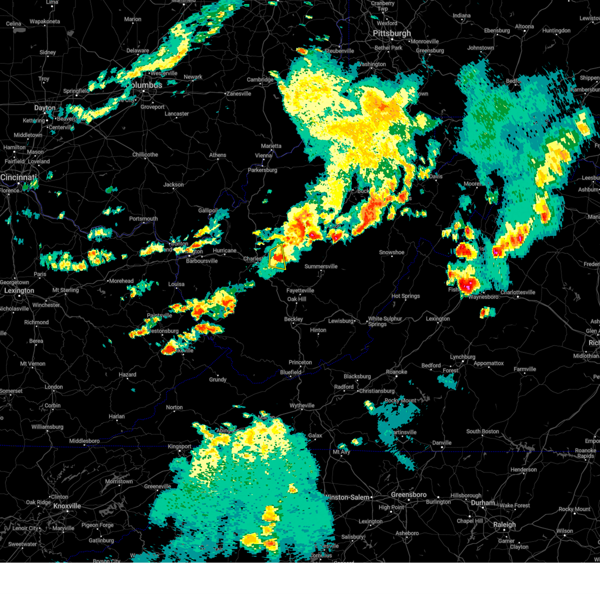 The severe thunderstorm warning for northeastern kanawha county will expire at 430 pm edt, the storm which prompted the warning has weakened below severe limits, and no longer poses an immediate threat to life or property. therefore, the warning will be allowed to expire. a tornado watch remains in effect until 600 pm edt for central west virginia. The severe thunderstorm warning for northeastern kanawha county will expire at 430 pm edt, the storm which prompted the warning has weakened below severe limits, and no longer poses an immediate threat to life or property. therefore, the warning will be allowed to expire. a tornado watch remains in effect until 600 pm edt for central west virginia.
|
| 8/7/2023 4:16 PM EDT |
 At 416 pm edt, a severe thunderstorm was located near pinch, or 12 miles east of charleston, moving east at 40 mph (radar indicated). Hazards include 60 mph wind gusts and quarter size hail. Hail damage to vehicles is expected. expect wind damage to roofs, siding, and trees. Locations impacted include, clendenin, elkview, and pinch. At 416 pm edt, a severe thunderstorm was located near pinch, or 12 miles east of charleston, moving east at 40 mph (radar indicated). Hazards include 60 mph wind gusts and quarter size hail. Hail damage to vehicles is expected. expect wind damage to roofs, siding, and trees. Locations impacted include, clendenin, elkview, and pinch.
|
| 8/7/2023 3:53 PM EDT |
 At 353 pm edt, a severe thunderstorm was located over south charleston, or over charleston, moving east at 25 mph (radar indicated). Hazards include 60 mph wind gusts and quarter size hail. Hail damage to vehicles is expected. Expect wind damage to roofs, siding, and trees. At 353 pm edt, a severe thunderstorm was located over south charleston, or over charleston, moving east at 25 mph (radar indicated). Hazards include 60 mph wind gusts and quarter size hail. Hail damage to vehicles is expected. Expect wind damage to roofs, siding, and trees.
|
| 8/7/2023 3:20 PM EDT | Ping Pong Ball sized hail reported 4.6 miles SSW of Clendenin, WV, report received via social media picture. |
| 8/7/2023 3:20 PM EDT |
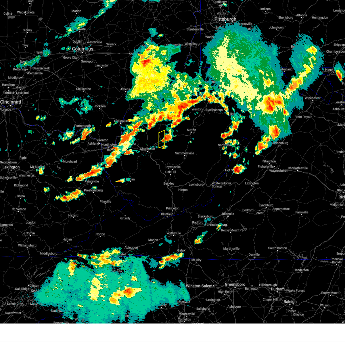 The severe thunderstorm warning for northeastern kanawha and south central roane counties will expire at 330 pm edt, the storm which prompted the warning has moved out of the area. therefore, the warning will be allowed to expire. a tornado watch remains in effect until 600 pm edt for central and north central west virginia. The severe thunderstorm warning for northeastern kanawha and south central roane counties will expire at 330 pm edt, the storm which prompted the warning has moved out of the area. therefore, the warning will be allowed to expire. a tornado watch remains in effect until 600 pm edt for central and north central west virginia.
|
| 8/7/2023 3:12 PM EDT |
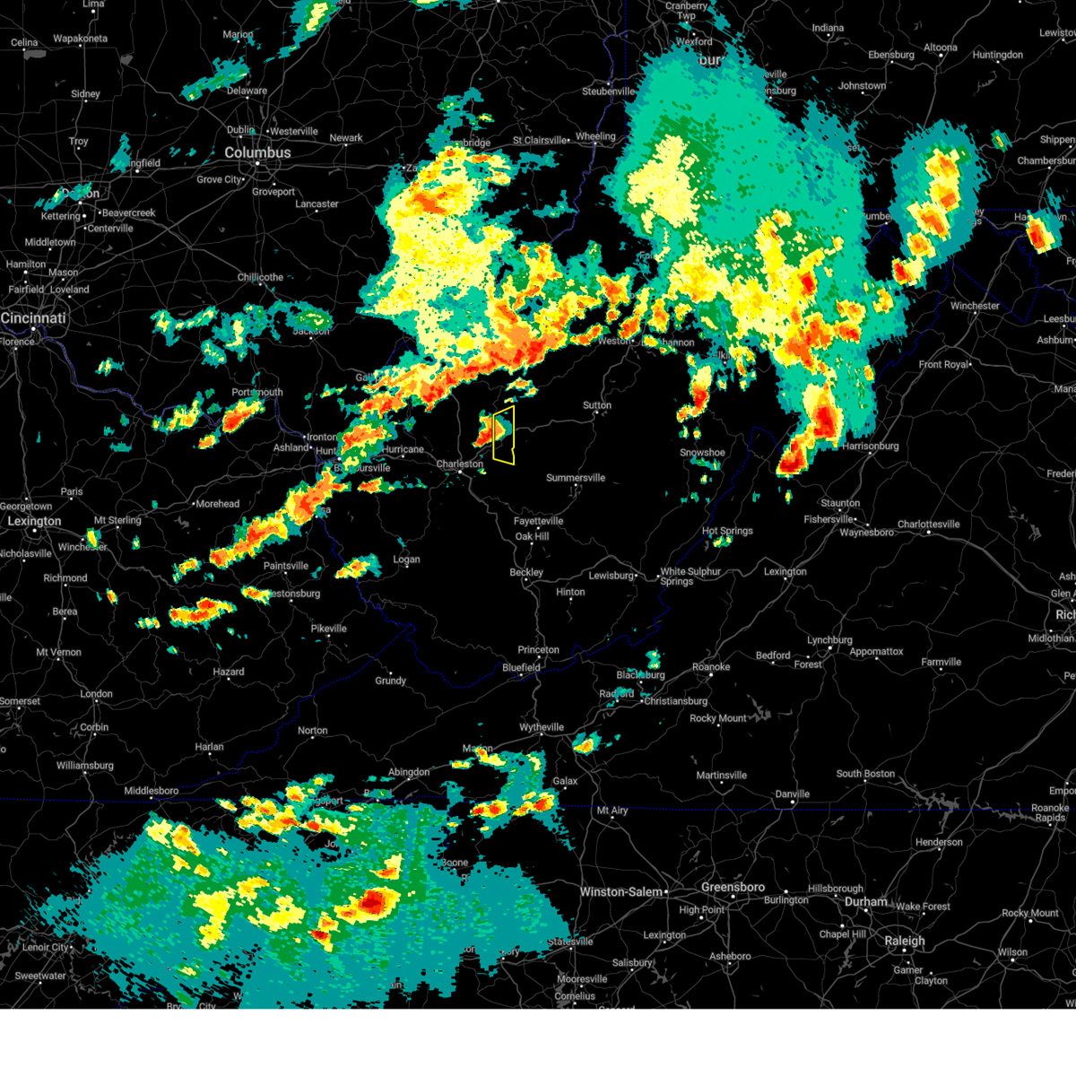 At 311 pm edt, a severe thunderstorm was located over amma, or 13 miles northwest of clay, moving east at 50 mph (radar indicated). Hazards include 60 mph wind gusts and nickel size hail. Expect damage to roofs, siding, and trees. locations impacted include, clendenin, looneyville, and walton. hail threat, radar indicated max hail size, 0. 88 in wind threat, radar indicated max wind gust, 60 mph. At 311 pm edt, a severe thunderstorm was located over amma, or 13 miles northwest of clay, moving east at 50 mph (radar indicated). Hazards include 60 mph wind gusts and nickel size hail. Expect damage to roofs, siding, and trees. locations impacted include, clendenin, looneyville, and walton. hail threat, radar indicated max hail size, 0. 88 in wind threat, radar indicated max wind gust, 60 mph.
|
| 8/7/2023 2:56 PM EDT |
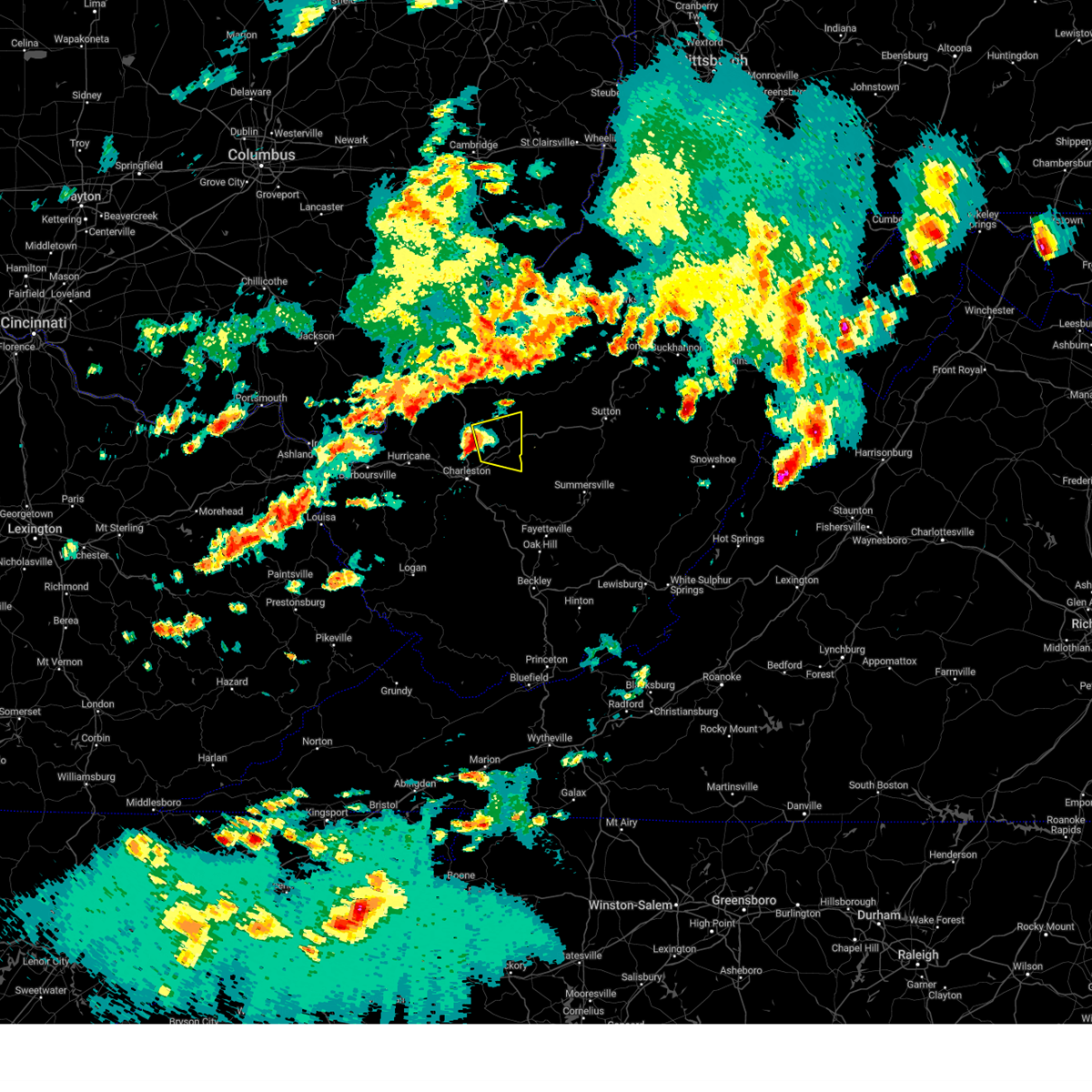 At 256 pm edt, a severe thunderstorm was located near sissonville, or 14 miles northeast of charleston, moving east at 50 mph (radar indicated). Hazards include 60 mph wind gusts and nickel size hail. expect damage to roofs, siding, and trees At 256 pm edt, a severe thunderstorm was located near sissonville, or 14 miles northeast of charleston, moving east at 50 mph (radar indicated). Hazards include 60 mph wind gusts and nickel size hail. expect damage to roofs, siding, and trees
|
| 8/7/2023 12:45 PM EDT | Tree down on vineyard ridge roa in roane county WV, 9.5 miles S of Clendenin, WV |
| 7/28/2023 3:37 PM EDT |
 At 337 pm edt, severe thunderstorms were located along a line extending from near grantsville to near belle, moving east at 45 mph (radar indicated). Hazards include 60 mph wind gusts and nickel size hail. expect damage to roofs, siding, and trees At 337 pm edt, severe thunderstorms were located along a line extending from near grantsville to near belle, moving east at 45 mph (radar indicated). Hazards include 60 mph wind gusts and nickel size hail. expect damage to roofs, siding, and trees
|
| 7/28/2023 3:26 PM EDT |
 At 325 pm edt, a severe thunderstorm was located near cross lanes, or near charleston, moving southeast at 40 mph (radar indicated). Hazards include 60 mph wind gusts and nickel size hail. Expect damage to roofs, siding, and trees. locations impacted include, charleston, nitro, jefferson, south charleston, st. albans, dunbar, sissonville, marmet, belle, clendenin, poca, pinch, institute, tornado, coal fork, elkview, cross lanes, amma, teays valley, and alum creek. hail threat, radar indicated max hail size, 0. 88 in wind threat, radar indicated max wind gust, 60 mph. At 325 pm edt, a severe thunderstorm was located near cross lanes, or near charleston, moving southeast at 40 mph (radar indicated). Hazards include 60 mph wind gusts and nickel size hail. Expect damage to roofs, siding, and trees. locations impacted include, charleston, nitro, jefferson, south charleston, st. albans, dunbar, sissonville, marmet, belle, clendenin, poca, pinch, institute, tornado, coal fork, elkview, cross lanes, amma, teays valley, and alum creek. hail threat, radar indicated max hail size, 0. 88 in wind threat, radar indicated max wind gust, 60 mph.
|
| 7/28/2023 3:05 PM EDT |
 At 305 pm edt, a severe thunderstorm was located 7 miles northeast of winfield, moving southeast at 50 mph (radar indicated). Hazards include 60 mph wind gusts and nickel size hail. expect damage to roofs, siding, and trees At 305 pm edt, a severe thunderstorm was located 7 miles northeast of winfield, moving southeast at 50 mph (radar indicated). Hazards include 60 mph wind gusts and nickel size hail. expect damage to roofs, siding, and trees
|
| 7/18/2023 6:42 PM EDT | Tree down along ambler roa in roane county WV, 11 miles SSE of Clendenin, WV |
| 7/18/2023 6:42 PM EDT |
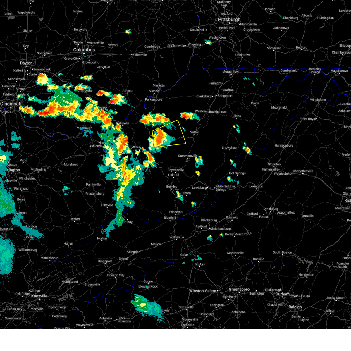 At 640 pm edt, a severe thunderstorm was located 8 miles northwest of amma, or 12 miles south of spencer, moving northeast at 35 mph (radar indicated). Hazards include 60 mph wind gusts and penny size hail. expect damage to roofs, siding, and trees At 640 pm edt, a severe thunderstorm was located 8 miles northwest of amma, or 12 miles south of spencer, moving northeast at 35 mph (radar indicated). Hazards include 60 mph wind gusts and penny size hail. expect damage to roofs, siding, and trees
|
| 7/13/2023 5:16 PM EDT |
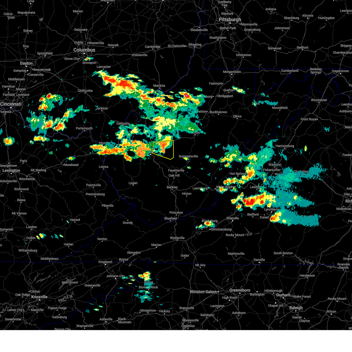 At 516 pm edt, a severe thunderstorm was located over glen, or 9 miles west of clay, moving east at 40 mph (radar indicated). Hazards include 60 mph wind gusts and quarter size hail. Hail damage to vehicles is expected. expect wind damage to roofs, siding, and trees. locations impacted include, charleston, clendenin, pinch, elkview, amma, glen, procious and bentree. hail threat, radar indicated max hail size, 1. 00 in wind threat, radar indicated max wind gust, 60 mph. At 516 pm edt, a severe thunderstorm was located over glen, or 9 miles west of clay, moving east at 40 mph (radar indicated). Hazards include 60 mph wind gusts and quarter size hail. Hail damage to vehicles is expected. expect wind damage to roofs, siding, and trees. locations impacted include, charleston, clendenin, pinch, elkview, amma, glen, procious and bentree. hail threat, radar indicated max hail size, 1. 00 in wind threat, radar indicated max wind gust, 60 mph.
|
| 7/13/2023 4:53 PM EDT |
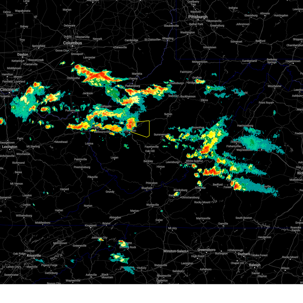 At 452 pm edt, a severe thunderstorm was located over elkview, or 9 miles northeast of charleston, moving east at 40 mph (radar indicated). Hazards include 60 mph wind gusts and quarter size hail. Hail damage to vehicles is expected. Expect wind damage to roofs, siding, and trees. At 452 pm edt, a severe thunderstorm was located over elkview, or 9 miles northeast of charleston, moving east at 40 mph (radar indicated). Hazards include 60 mph wind gusts and quarter size hail. Hail damage to vehicles is expected. Expect wind damage to roofs, siding, and trees.
|
| 7/23/2022 3:03 PM EDT |
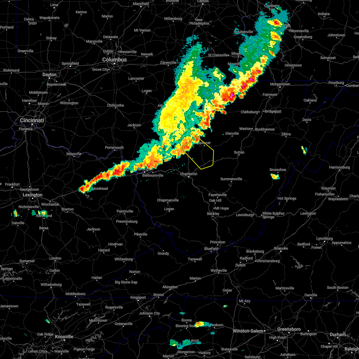 At 302 pm edt, a severe thunderstorm was located 8 miles southwest of spencer, moving southeast at 40 mph (radar indicated). Hazards include 60 mph wind gusts. Expect damage to roofs, siding, and trees. locations impacted include, ripley, spencer, clendenin, kenna, amma, statts mills, harmony, tariff, given, kentuck, walton, left hand, looneyville, fairplain, gay and gandeeville. hail threat, radar indicated max hail size, <. 75 in wind threat, radar indicated max wind gust, 60 mph. At 302 pm edt, a severe thunderstorm was located 8 miles southwest of spencer, moving southeast at 40 mph (radar indicated). Hazards include 60 mph wind gusts. Expect damage to roofs, siding, and trees. locations impacted include, ripley, spencer, clendenin, kenna, amma, statts mills, harmony, tariff, given, kentuck, walton, left hand, looneyville, fairplain, gay and gandeeville. hail threat, radar indicated max hail size, <. 75 in wind threat, radar indicated max wind gust, 60 mph.
|
| 7/23/2022 2:47 PM EDT |
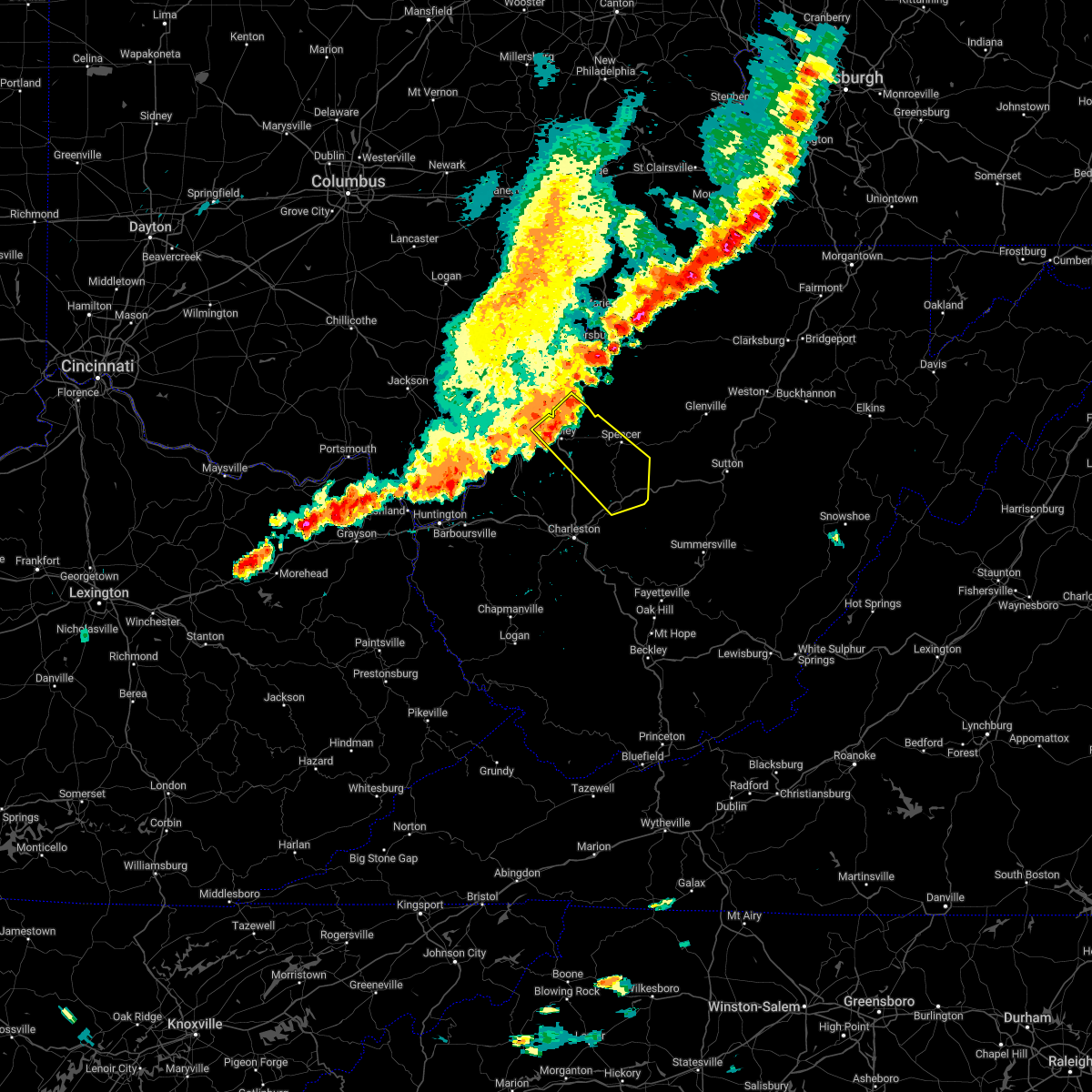 At 246 pm edt, a severe thunderstorm was located over ripley, moving southeast at 40 mph (radar indicated). Hazards include 60 mph wind gusts. expect damage to roofs, siding, and trees At 246 pm edt, a severe thunderstorm was located over ripley, moving southeast at 40 mph (radar indicated). Hazards include 60 mph wind gusts. expect damage to roofs, siding, and trees
|
| 7/6/2022 4:06 PM EDT |
 The severe thunderstorm warning for north central kanawha and southwestern roane counties will expire at 415 pm edt, the storm which prompted the warning has moved out of the area. therefore, the warning will be allowed to expire. a severe thunderstorm watch remains in effect until 700 pm edt for central and northwestern west virginia. The severe thunderstorm warning for north central kanawha and southwestern roane counties will expire at 415 pm edt, the storm which prompted the warning has moved out of the area. therefore, the warning will be allowed to expire. a severe thunderstorm watch remains in effect until 700 pm edt for central and northwestern west virginia.
|
| 7/6/2022 3:54 PM EDT | Tree down between elk river road north and queen road. time estimated by rada in kanawha county WV, 4.2 miles WNW of Clendenin, WV |
| 7/6/2022 3:48 PM EDT |
 At 348 pm edt, a severe thunderstorm was located near elkview, or 14 miles northeast of charleston, moving southeast at 20 mph (radar indicated). Hazards include 60 mph wind gusts and quarter size hail. Hail damage to vehicles is expected. expect wind damage to roofs, siding, and trees. locations impacted include, clendenin, elkview and pinch. hail threat, radar indicated max hail size, 1. 00 in wind threat, radar indicated max wind gust, 60 mph. At 348 pm edt, a severe thunderstorm was located near elkview, or 14 miles northeast of charleston, moving southeast at 20 mph (radar indicated). Hazards include 60 mph wind gusts and quarter size hail. Hail damage to vehicles is expected. expect wind damage to roofs, siding, and trees. locations impacted include, clendenin, elkview and pinch. hail threat, radar indicated max hail size, 1. 00 in wind threat, radar indicated max wind gust, 60 mph.
|
| 7/6/2022 3:23 PM EDT |
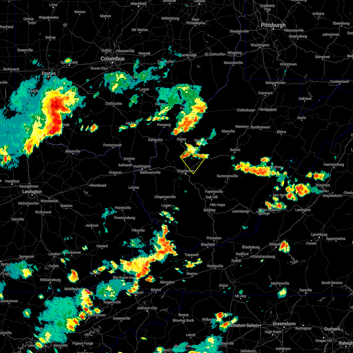 At 322 pm edt, a severe thunderstorm was located near kenna, or 15 miles east of winfield, moving southeast at 20 mph (radar indicated). Hazards include 60 mph wind gusts and quarter size hail. Hail damage to vehicles is expected. Expect wind damage to roofs, siding, and trees. At 322 pm edt, a severe thunderstorm was located near kenna, or 15 miles east of winfield, moving southeast at 20 mph (radar indicated). Hazards include 60 mph wind gusts and quarter size hail. Hail damage to vehicles is expected. Expect wind damage to roofs, siding, and trees.
|
| 6/17/2022 3:24 PM EDT |
 The severe thunderstorm warning for southern mason, northeastern cabell, nicholas, kanawha, southern putnam, southwestern braxton, northeastern lincoln, southeastern roane, southwestern webster, clay, north central fayette and north central boone counties will expire at 330 pm edt, the storms which prompted the warning have moved out of the area. therefore, the warning will be allowed to expire. a severe thunderstorm watch remains in effect until 500 pm edt for southeastern ohio, and central, western, southeastern, north central and northeastern west virginia. The severe thunderstorm warning for southern mason, northeastern cabell, nicholas, kanawha, southern putnam, southwestern braxton, northeastern lincoln, southeastern roane, southwestern webster, clay, north central fayette and north central boone counties will expire at 330 pm edt, the storms which prompted the warning have moved out of the area. therefore, the warning will be allowed to expire. a severe thunderstorm watch remains in effect until 500 pm edt for southeastern ohio, and central, western, southeastern, north central and northeastern west virginia.
|
| 6/17/2022 2:33 PM EDT |
 At 233 pm edt, severe thunderstorms were located along a line extending from 6 miles southeast of big otter to near milton, moving southeast at 30 mph (radar indicated). Hazards include 60 mph wind gusts. expect damage to roofs, siding, and trees At 233 pm edt, severe thunderstorms were located along a line extending from 6 miles southeast of big otter to near milton, moving southeast at 30 mph (radar indicated). Hazards include 60 mph wind gusts. expect damage to roofs, siding, and trees
|
| 6/17/2022 2:30 PM EDT | Tree down at spencer rd and doctors creek roa in kanawha county WV, 1.8 miles S of Clendenin, WV |
| 6/17/2022 2:11 PM EDT |
 At 210 pm edt, severe thunderstorms were located along a line extending from big otter to 10 miles north of proctorville, moving east at 75 mph (radar indicated). Hazards include 60 mph wind gusts. expect damage to roofs, siding, and trees At 210 pm edt, severe thunderstorms were located along a line extending from big otter to 10 miles north of proctorville, moving east at 75 mph (radar indicated). Hazards include 60 mph wind gusts. expect damage to roofs, siding, and trees
|
| 6/13/2022 9:20 PM EDT | Tree dow in kanawha county WV, 0.5 miles SSW of Clendenin, WV |
| 6/13/2022 9:12 PM EDT |
 At 911 pm edt, severe thunderstorms were located along a line extending from near arnoldsburg to 6 miles southeast of pinch to near alum creek, moving east at 45 mph (radar indicated). Hazards include 70 mph wind gusts and nickel size hail. Expect considerable tree damage. Damage is likely to mobile homes, roofs, and outbuildings. At 911 pm edt, severe thunderstorms were located along a line extending from near arnoldsburg to 6 miles southeast of pinch to near alum creek, moving east at 45 mph (radar indicated). Hazards include 70 mph wind gusts and nickel size hail. Expect considerable tree damage. Damage is likely to mobile homes, roofs, and outbuildings.
|
| 6/13/2022 8:37 PM EDT |
 The national weather service in charleston west virginia has issued a * severe thunderstorm warning for. southern gallia county in southeastern ohio. mason county in western west virginia. cabell county in central west virginia. Kanawha county in central west virginia. The national weather service in charleston west virginia has issued a * severe thunderstorm warning for. southern gallia county in southeastern ohio. mason county in western west virginia. cabell county in central west virginia. Kanawha county in central west virginia.
|
| 6/8/2022 8:52 PM EDT |
 The severe thunderstorm warning for northern kanawha, southeastern roane and west central clay counties will expire at 900 pm edt, the storm which prompted the warning has weakened below severe limits, and no longer poses an immediate threat to life or property. therefore, the warning will be allowed to expire. however gusty winds are still possible with this thunderstorm. a tornado watch remains in effect until 100 am edt for central west virginia. The severe thunderstorm warning for northern kanawha, southeastern roane and west central clay counties will expire at 900 pm edt, the storm which prompted the warning has weakened below severe limits, and no longer poses an immediate threat to life or property. therefore, the warning will be allowed to expire. however gusty winds are still possible with this thunderstorm. a tornado watch remains in effect until 100 am edt for central west virginia.
|
| 6/8/2022 8:37 PM EDT |
 At 837 pm edt, a severe thunderstorm was located near elkview, or 11 miles northeast of charleston, moving east at 35 mph (radar indicated). Hazards include 60 mph wind gusts and quarter size hail. Hail damage to vehicles is expected. expect wind damage to roofs, siding, and trees. locations impacted include, charleston, sissonville, clendenin, pinch, elkview, amma and procious. hail threat, radar indicated max hail size, 1. 00 in wind threat, radar indicated max wind gust, 60 mph. At 837 pm edt, a severe thunderstorm was located near elkview, or 11 miles northeast of charleston, moving east at 35 mph (radar indicated). Hazards include 60 mph wind gusts and quarter size hail. Hail damage to vehicles is expected. expect wind damage to roofs, siding, and trees. locations impacted include, charleston, sissonville, clendenin, pinch, elkview, amma and procious. hail threat, radar indicated max hail size, 1. 00 in wind threat, radar indicated max wind gust, 60 mph.
|
| 6/8/2022 8:15 PM EDT |
 At 814 pm edt, a severe thunderstorm was located over poca, or near nitro, moving east at 35 mph (radar indicated). Hazards include 60 mph wind gusts and quarter size hail. Hail damage to vehicles is expected. Expect wind damage to roofs, siding, and trees. At 814 pm edt, a severe thunderstorm was located over poca, or near nitro, moving east at 35 mph (radar indicated). Hazards include 60 mph wind gusts and quarter size hail. Hail damage to vehicles is expected. Expect wind damage to roofs, siding, and trees.
|
| 3/23/2022 8:55 PM EDT |
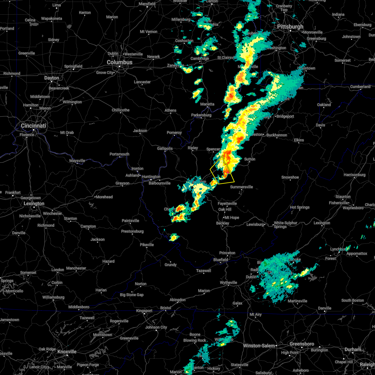 The severe thunderstorm warning for northeastern kanawha, southeastern roane and northwestern clay counties will expire at 900 pm edt, the storm which prompted the warning has weakened below severe limits, and no longer poses an immediate threat to life or property. therefore, the warning will be allowed to expire. however small hail and gusty winds are still possible with this thunderstorm. a tornado watch remains in effect until 1000 pm edt for central and north central west virginia. The severe thunderstorm warning for northeastern kanawha, southeastern roane and northwestern clay counties will expire at 900 pm edt, the storm which prompted the warning has weakened below severe limits, and no longer poses an immediate threat to life or property. therefore, the warning will be allowed to expire. however small hail and gusty winds are still possible with this thunderstorm. a tornado watch remains in effect until 1000 pm edt for central and north central west virginia.
|
| 3/23/2022 8:45 PM EDT |
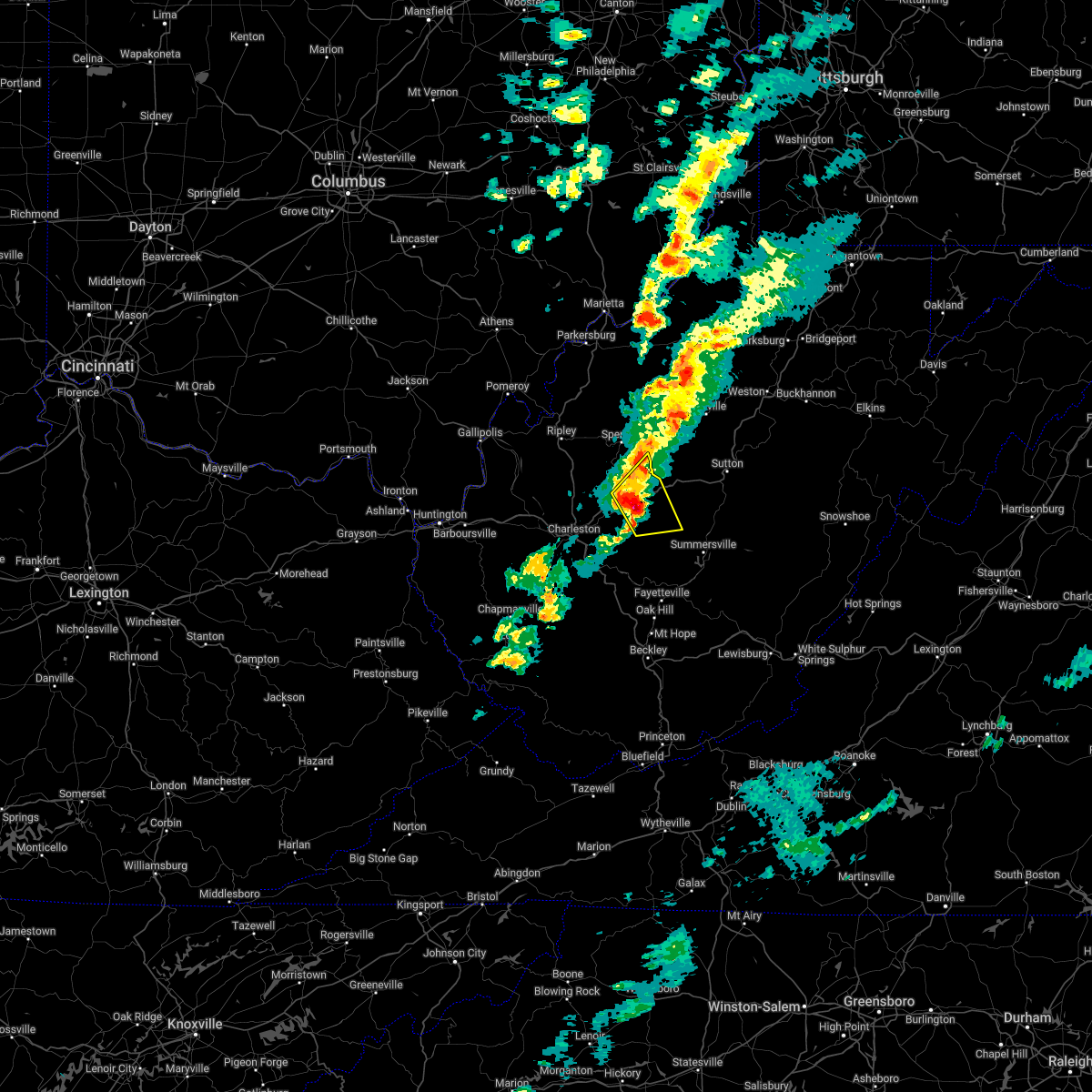 At 845 pm edt, a severe thunderstorm was located over wallback, or near clay, moving northeast at 65 mph (radar indicated). Hazards include 60 mph wind gusts and nickel size hail. Expect damage to roofs, siding, and trees. locations impacted include, clay, clendenin, wallback, amma, glen, left hand, bickmore, tariff and procious. hail threat, radar indicated max hail size, 0. 88 in wind threat, radar indicated max wind gust, 60 mph. At 845 pm edt, a severe thunderstorm was located over wallback, or near clay, moving northeast at 65 mph (radar indicated). Hazards include 60 mph wind gusts and nickel size hail. Expect damage to roofs, siding, and trees. locations impacted include, clay, clendenin, wallback, amma, glen, left hand, bickmore, tariff and procious. hail threat, radar indicated max hail size, 0. 88 in wind threat, radar indicated max wind gust, 60 mph.
|
| 3/23/2022 8:30 PM EDT |
 At 830 pm edt, a severe thunderstorm was located near elkview, or 13 miles east of charleston, moving northeast at 60 mph (radar indicated). Hazards include 60 mph wind gusts and nickel size hail. expect damage to roofs, siding, and trees At 830 pm edt, a severe thunderstorm was located near elkview, or 13 miles east of charleston, moving northeast at 60 mph (radar indicated). Hazards include 60 mph wind gusts and nickel size hail. expect damage to roofs, siding, and trees
|
| 6/21/2021 1:25 PM EDT |
 At 125 pm edt, a severe thunderstorm was located near pinch, or 13 miles east of charleston, moving east at 30 mph (radar indicated). Hazards include 60 mph wind gusts and quarter size hail. Hail damage to vehicles is expected. Expect wind damage to roofs, siding, and trees. At 125 pm edt, a severe thunderstorm was located near pinch, or 13 miles east of charleston, moving east at 30 mph (radar indicated). Hazards include 60 mph wind gusts and quarter size hail. Hail damage to vehicles is expected. Expect wind damage to roofs, siding, and trees.
|
| 6/21/2021 1:13 PM EDT |
 The severe thunderstorm warning for northeastern kanawha, northeastern putnam, southwestern roane and southeastern jackson counties will expire at 115 pm edt, the storm which prompted the warning has weakened below severe limits, and no longer poses an immediate threat to life or property. therefore, the warning will be allowed to expire. however gusty winds and heavy rain are still possible with this thunderstorm. a severe thunderstorm watch remains in effect until 800 pm edt for central, western and northwestern west virginia. remember, a severe thunderstorm warning still remains in effect for parts of southern and eastern kanawha county until 130 pm edt. The severe thunderstorm warning for northeastern kanawha, northeastern putnam, southwestern roane and southeastern jackson counties will expire at 115 pm edt, the storm which prompted the warning has weakened below severe limits, and no longer poses an immediate threat to life or property. therefore, the warning will be allowed to expire. however gusty winds and heavy rain are still possible with this thunderstorm. a severe thunderstorm watch remains in effect until 800 pm edt for central, western and northwestern west virginia. remember, a severe thunderstorm warning still remains in effect for parts of southern and eastern kanawha county until 130 pm edt.
|
| 6/21/2021 12:58 PM EDT |
 At 1258 pm edt, a severe thunderstorm was located over sissonville, or 11 miles north of charleston, moving east at 35 mph (radar indicated). Hazards include 60 mph wind gusts and quarter size hail. Hail damage to vehicles is expected. expect wind damage to roofs, siding, and trees. Locations impacted include, sissonville, clendenin, kenna, cross lanes, statts mills, harmony, kentuck, liberty and gay. At 1258 pm edt, a severe thunderstorm was located over sissonville, or 11 miles north of charleston, moving east at 35 mph (radar indicated). Hazards include 60 mph wind gusts and quarter size hail. Hail damage to vehicles is expected. expect wind damage to roofs, siding, and trees. Locations impacted include, sissonville, clendenin, kenna, cross lanes, statts mills, harmony, kentuck, liberty and gay.
|
| 6/21/2021 12:34 PM EDT |
 At 1234 pm edt, a severe thunderstorm was located over winfield, moving east at 35 mph (radar indicated). Hazards include 60 mph wind gusts and quarter size hail. Hail damage to vehicles is expected. Expect wind damage to roofs, siding, and trees. At 1234 pm edt, a severe thunderstorm was located over winfield, moving east at 35 mph (radar indicated). Hazards include 60 mph wind gusts and quarter size hail. Hail damage to vehicles is expected. Expect wind damage to roofs, siding, and trees.
|
| 6/13/2021 6:18 PM EDT |
 At 617 pm edt, severe thunderstorms were located along a line extending from 8 miles southeast of addison (webster springs) to near amma, moving southeast at 40 mph (radar indicated). Hazards include 60 mph wind gusts and quarter size hail. Hail damage to vehicles is expected. Expect wind damage to roofs, siding, and trees. At 617 pm edt, severe thunderstorms were located along a line extending from 8 miles southeast of addison (webster springs) to near amma, moving southeast at 40 mph (radar indicated). Hazards include 60 mph wind gusts and quarter size hail. Hail damage to vehicles is expected. Expect wind damage to roofs, siding, and trees.
|
| 6/13/2021 5:58 PM EDT |
 The severe thunderstorm warning for east central mason, northern kanawha, northern putnam and southeastern jackson counties will expire at 600 pm edt, the storm which prompted the warning has moved out of the area. therefore, the warning will be allowed to expire. a severe thunderstorm watch remains in effect until 700 pm edt for central, western and northwestern west virginia. remember, a severe thunderstorm warning still remains in effect for the northern portion of kanawha county until 645 pm. The severe thunderstorm warning for east central mason, northern kanawha, northern putnam and southeastern jackson counties will expire at 600 pm edt, the storm which prompted the warning has moved out of the area. therefore, the warning will be allowed to expire. a severe thunderstorm watch remains in effect until 700 pm edt for central, western and northwestern west virginia. remember, a severe thunderstorm warning still remains in effect for the northern portion of kanawha county until 645 pm.
|
| 6/13/2021 5:34 PM EDT |
 At 534 pm edt, a severe thunderstorm was located 7 miles northeast of winfield, moving southeast at 35 mph (radar indicated). Hazards include 60 mph wind gusts and quarter size hail. Hail damage to vehicles is expected. Expect wind damage to roofs, siding, and trees. At 534 pm edt, a severe thunderstorm was located 7 miles northeast of winfield, moving southeast at 35 mph (radar indicated). Hazards include 60 mph wind gusts and quarter size hail. Hail damage to vehicles is expected. Expect wind damage to roofs, siding, and trees.
|
| 8/25/2020 6:47 PM EDT |
 At 646 pm edt, a severe thunderstorm was located over glen, or 8 miles southwest of clay, moving southeast at 35 mph (radar indicated). Hazards include 60 mph wind gusts. Expect damage to roofs, siding, and trees. Locations impacted include, charleston, clay, south charleston, sissonville, clendenin, pinch, glen, coal fork, elkview, cross lanes, bickmore, procious, indore and pond gap. At 646 pm edt, a severe thunderstorm was located over glen, or 8 miles southwest of clay, moving southeast at 35 mph (radar indicated). Hazards include 60 mph wind gusts. Expect damage to roofs, siding, and trees. Locations impacted include, charleston, clay, south charleston, sissonville, clendenin, pinch, glen, coal fork, elkview, cross lanes, bickmore, procious, indore and pond gap.
|
| 8/25/2020 6:15 PM EDT |
 At 614 pm edt, a severe thunderstorm was located 9 miles northwest of clendenin, or 14 miles south of spencer, moving southeast at 35 mph (radar indicated). Hazards include 60 mph wind gusts. expect damage to roofs, siding, and trees At 614 pm edt, a severe thunderstorm was located 9 miles northwest of clendenin, or 14 miles south of spencer, moving southeast at 35 mph (radar indicated). Hazards include 60 mph wind gusts. expect damage to roofs, siding, and trees
|
| 7/22/2020 6:26 PM EDT |
 At 626 pm edt, a severe thunderstorm was located over pinch, or 8 miles northeast of charleston, moving east at 30 mph (radar indicated). Hazards include 60 mph wind gusts. Expect damage to roofs, siding, and trees. Locations impacted include, charleston, south charleston, dunbar, sissonville, montgomery, chesapeake, marmet, belle, clendenin, cedar grove, east bank, glasgow, pratt, pinch, coal fork, elkview, handley, dawes and sharon. At 626 pm edt, a severe thunderstorm was located over pinch, or 8 miles northeast of charleston, moving east at 30 mph (radar indicated). Hazards include 60 mph wind gusts. Expect damage to roofs, siding, and trees. Locations impacted include, charleston, south charleston, dunbar, sissonville, montgomery, chesapeake, marmet, belle, clendenin, cedar grove, east bank, glasgow, pratt, pinch, coal fork, elkview, handley, dawes and sharon.
|
| 7/22/2020 6:09 PM EDT |
 At 608 pm edt, a severe thunderstorm was located near charleston, moving east at 25 mph (radar indicated). Hazards include 60 mph wind gusts. expect damage to roofs, siding, and trees At 608 pm edt, a severe thunderstorm was located near charleston, moving east at 25 mph (radar indicated). Hazards include 60 mph wind gusts. expect damage to roofs, siding, and trees
|
| 7/20/2020 5:47 PM EDT |
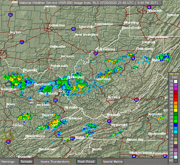 At 547 pm edt, a severe thunderstorm was located near glen, or 11 miles west of clay, moving east at 25 mph (radar indicated). Hazards include 60 mph wind gusts. Expect damage to roofs, siding, and trees. Locations impacted include, clay, clendenin, glen, bickmore, procious, indore and pond gap. At 547 pm edt, a severe thunderstorm was located near glen, or 11 miles west of clay, moving east at 25 mph (radar indicated). Hazards include 60 mph wind gusts. Expect damage to roofs, siding, and trees. Locations impacted include, clay, clendenin, glen, bickmore, procious, indore and pond gap.
|
| 7/20/2020 5:21 PM EDT |
 At 521 pm edt, a severe thunderstorm was located over elkview, or 10 miles northeast of charleston, moving east at 25 mph (radar indicated). Hazards include 60 mph wind gusts. expect damage to roofs, siding, and trees At 521 pm edt, a severe thunderstorm was located over elkview, or 10 miles northeast of charleston, moving east at 25 mph (radar indicated). Hazards include 60 mph wind gusts. expect damage to roofs, siding, and trees
|
| 4/9/2020 1:46 AM EDT |
 At 146 am edt, severe thunderstorms were located along a line extending from near arnoldsburg to near glen to 6 miles north of gauley bridge to 7 miles northeast of bald knob, moving east at 60 mph (radar indicated). Hazards include 70 mph wind gusts and quarter size hail. Hail damage to vehicles is expected. expect considerable tree damage. wind damage is also likely to mobile homes, roofs, and outbuildings. Locations impacted include, beckley, summersville, madison, fayetteville, sutton, clay, babcock state park, oak hill, montgomery, chesapeake, marmet, mount hope, mabscott, ansted, sophia, belle, clendenin, cedar grove, east bank and gassaway. At 146 am edt, severe thunderstorms were located along a line extending from near arnoldsburg to near glen to 6 miles north of gauley bridge to 7 miles northeast of bald knob, moving east at 60 mph (radar indicated). Hazards include 70 mph wind gusts and quarter size hail. Hail damage to vehicles is expected. expect considerable tree damage. wind damage is also likely to mobile homes, roofs, and outbuildings. Locations impacted include, beckley, summersville, madison, fayetteville, sutton, clay, babcock state park, oak hill, montgomery, chesapeake, marmet, mount hope, mabscott, ansted, sophia, belle, clendenin, cedar grove, east bank and gassaway.
|
| 4/9/2020 1:23 AM EDT |
 At 122 am edt, severe thunderstorms were located along a line extending from 6 miles south of spencer to marmet to near chesapeake to near logan, moving southeast at 85 mph (radar indicated). Hazards include 70 mph wind gusts and quarter size hail. Hail damage to vehicles is expected. expect considerable tree damage. Wind damage is also likely to mobile homes, roofs, and outbuildings. At 122 am edt, severe thunderstorms were located along a line extending from 6 miles south of spencer to marmet to near chesapeake to near logan, moving southeast at 85 mph (radar indicated). Hazards include 70 mph wind gusts and quarter size hail. Hail damage to vehicles is expected. expect considerable tree damage. Wind damage is also likely to mobile homes, roofs, and outbuildings.
|
| 4/9/2020 1:20 AM EDT |
 At 119 am edt, severe thunderstorms were located along a line extending from 7 miles southeast of kenna to near gill, moving southeast at 55 mph (radar indicated). Hazards include 70 mph wind gusts and quarter size hail. Hail damage to vehicles is expected. expect considerable tree damage. wind damage is also likely to mobile homes, roofs, and outbuildings. locations impacted include, charleston, nitro, madison, spencer, hamlin, jefferson, south charleston, st. Albans, dunbar, sissonville, montgomery, chesapeake, marmet, belle, clendenin, cedar grove, poca, east bank, glasgow and smithers. At 119 am edt, severe thunderstorms were located along a line extending from 7 miles southeast of kenna to near gill, moving southeast at 55 mph (radar indicated). Hazards include 70 mph wind gusts and quarter size hail. Hail damage to vehicles is expected. expect considerable tree damage. wind damage is also likely to mobile homes, roofs, and outbuildings. locations impacted include, charleston, nitro, madison, spencer, hamlin, jefferson, south charleston, st. Albans, dunbar, sissonville, montgomery, chesapeake, marmet, belle, clendenin, cedar grove, poca, east bank, glasgow and smithers.
|
| 4/9/2020 1:08 AM EDT |
 At 108 am edt, severe thunderstorms were located along a line extending from near kenna to near ranger, moving southeast at 55 mph (radar indicated). Hazards include 70 mph wind gusts and quarter size hail. Hail damage to vehicles is expected. expect considerable tree damage. wind damage is also likely to mobile homes, roofs, and outbuildings. locations impacted include, charleston, nitro, madison, spencer, winfield, hamlin, jefferson, south charleston, st. Albans, dunbar, hurricane, sissonville, milton, montgomery, chesapeake, eleanor, marmet, belle, buffalo and clendenin. At 108 am edt, severe thunderstorms were located along a line extending from near kenna to near ranger, moving southeast at 55 mph (radar indicated). Hazards include 70 mph wind gusts and quarter size hail. Hail damage to vehicles is expected. expect considerable tree damage. wind damage is also likely to mobile homes, roofs, and outbuildings. locations impacted include, charleston, nitro, madison, spencer, winfield, hamlin, jefferson, south charleston, st. Albans, dunbar, hurricane, sissonville, milton, montgomery, chesapeake, eleanor, marmet, belle, buffalo and clendenin.
|
| 4/9/2020 12:41 AM EDT |
 At 1241 am edt, severe thunderstorms were located along a line extending from near point pleasant to near durbin, moving southeast at 55 mph (radar indicated). Hazards include 70 mph wind gusts and quarter size hail. Hail damage to vehicles is expected. expect considerable tree damage. Wind damage is also likely to mobile homes, roofs, and outbuildings. At 1241 am edt, severe thunderstorms were located along a line extending from near point pleasant to near durbin, moving southeast at 55 mph (radar indicated). Hazards include 70 mph wind gusts and quarter size hail. Hail damage to vehicles is expected. expect considerable tree damage. Wind damage is also likely to mobile homes, roofs, and outbuildings.
|
| 10/31/2019 1:51 PM EDT |
 At 150 pm edt, severe thunderstorms were located along a line extending from 8 miles northwest of amma to near burnwell, moving northeast at 65 mph (radar indicated). Hazards include 60 mph wind gusts. expect damage to roofs, siding, and trees At 150 pm edt, severe thunderstorms were located along a line extending from 8 miles northwest of amma to near burnwell, moving northeast at 65 mph (radar indicated). Hazards include 60 mph wind gusts. expect damage to roofs, siding, and trees
|
| 6/24/2019 7:42 PM EDT |
 At 742 pm edt, severe thunderstorms were located along a line extending from 10 miles east of kenna to near clendenin to near pratt, moving northeast at 40 mph (radar indicated). Hazards include 60 mph wind gusts. expect damage to roofs, siding, and trees At 742 pm edt, severe thunderstorms were located along a line extending from 10 miles east of kenna to near clendenin to near pratt, moving northeast at 40 mph (radar indicated). Hazards include 60 mph wind gusts. expect damage to roofs, siding, and trees
|
| 6/24/2019 7:34 PM EDT |
 At 734 pm edt, severe thunderstorms were located along a line extending from near spencer to 7 miles northeast of cedar grove to 8 miles northwest of dry creek, moving east at 35 mph (radar indicated). Hazards include 60 mph wind gusts. Expect damage to roofs, siding, and trees. Locations impacted include, clay, clendenin, glen, elkview, wallback, amma, pinch, bickmore, tariff, procious, indore, walton, bentree, left hand, looneyville, ivydale, pond gap and gandeeville. At 734 pm edt, severe thunderstorms were located along a line extending from near spencer to 7 miles northeast of cedar grove to 8 miles northwest of dry creek, moving east at 35 mph (radar indicated). Hazards include 60 mph wind gusts. Expect damage to roofs, siding, and trees. Locations impacted include, clay, clendenin, glen, elkview, wallback, amma, pinch, bickmore, tariff, procious, indore, walton, bentree, left hand, looneyville, ivydale, pond gap and gandeeville.
|
| 6/24/2019 7:20 PM EDT |
 At 719 pm edt, severe thunderstorms were located along a line extending from 6 miles southwest of spencer to near coal fork to 10 miles east of bald knob, moving east at 35 mph (radar indicated). Hazards include 60 mph wind gusts. Expect damage to roofs, siding, and trees. Locations impacted include, charleston, clay, sissonville, chesapeake, marmet, belle, clendenin, cedar grove, east bank, glasgow, pratt, pinch, glen, coal fork, elkview, wallback, amma, procious, indore and left hand. At 719 pm edt, severe thunderstorms were located along a line extending from 6 miles southwest of spencer to near coal fork to 10 miles east of bald knob, moving east at 35 mph (radar indicated). Hazards include 60 mph wind gusts. Expect damage to roofs, siding, and trees. Locations impacted include, charleston, clay, sissonville, chesapeake, marmet, belle, clendenin, cedar grove, east bank, glasgow, pratt, pinch, glen, coal fork, elkview, wallback, amma, procious, indore and left hand.
|
| 6/24/2019 7:15 PM EDT | 911 reports multiple trees down. time estimated from rada in clay county WV, 7.2 miles WNW of Clendenin, WV |
| 6/24/2019 7:12 PM EDT |
 At 711 pm edt, severe thunderstorms were located along a line extending from 8 miles northeast of kenna to coal fork to 7 miles east of bald knob, moving east at 35 mph (radar indicated). Hazards include 60 mph wind gusts. expect damage to roofs, siding, and trees At 711 pm edt, severe thunderstorms were located along a line extending from 8 miles northeast of kenna to coal fork to 7 miles east of bald knob, moving east at 35 mph (radar indicated). Hazards include 60 mph wind gusts. expect damage to roofs, siding, and trees
|
| 6/24/2019 4:57 PM EDT |
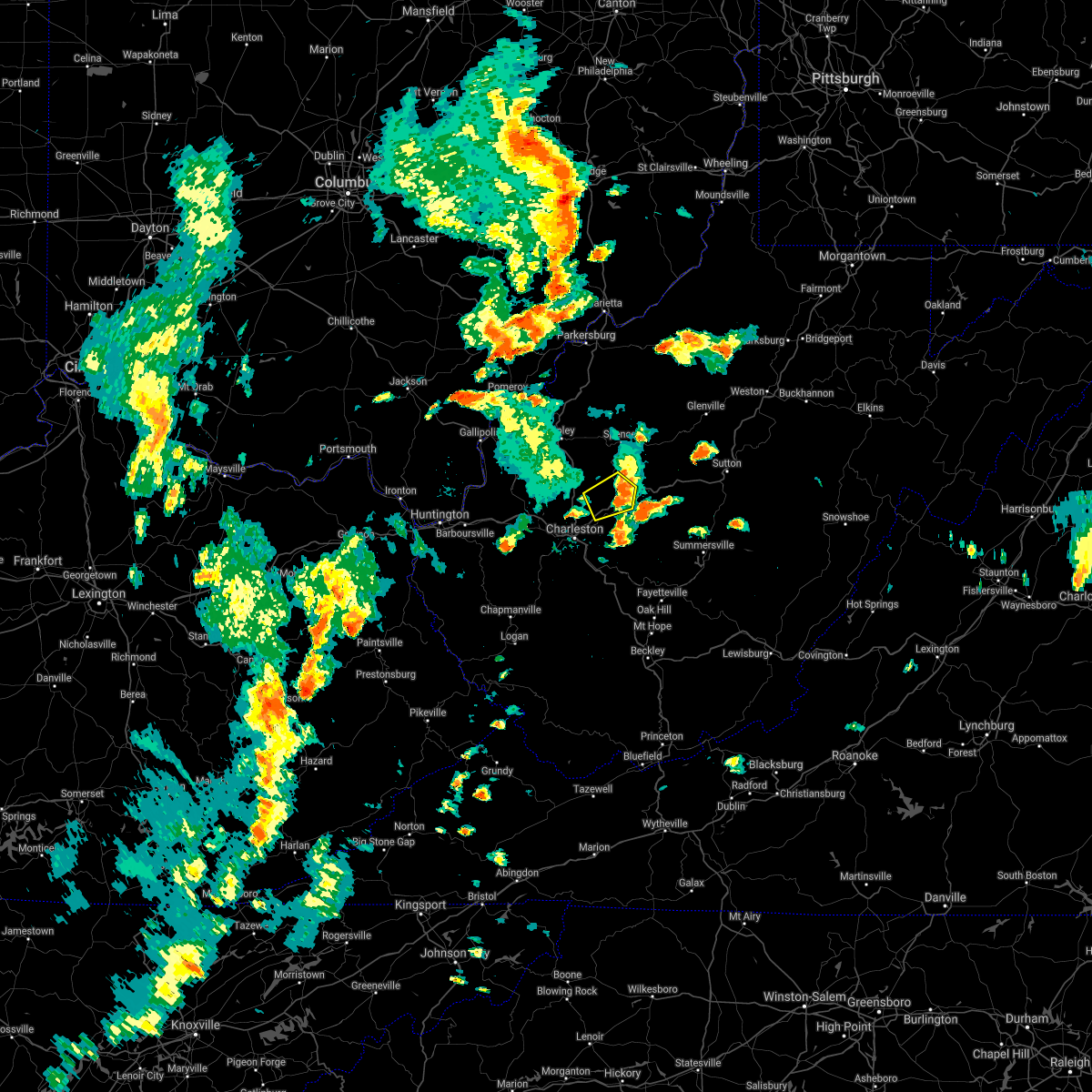 At 433 pm edt, a severe thunderstorm was located near elkview, or 13 miles northeast of charleston, moving northeast at 35 mph (radar indicated). Hazards include 60 mph wind gusts and penny size hail. Expect damage to roofs, siding, and trees. Locations impacted include, clendenin, amma, elkview and walton. At 433 pm edt, a severe thunderstorm was located near elkview, or 13 miles northeast of charleston, moving northeast at 35 mph (radar indicated). Hazards include 60 mph wind gusts and penny size hail. Expect damage to roofs, siding, and trees. Locations impacted include, clendenin, amma, elkview and walton.
|
| 6/24/2019 4:35 PM EDT |
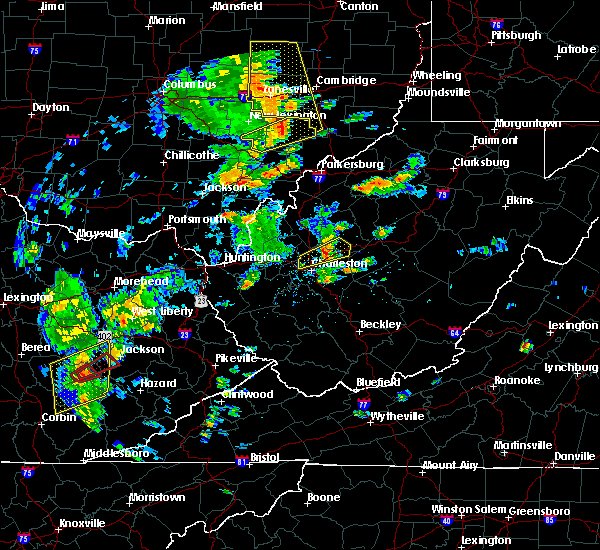 At 433 pm edt, a severe thunderstorm was located near elkview, or 13 miles northeast of charleston, moving northeast at 35 mph (radar indicated). Hazards include 60 mph wind gusts and penny size hail. Expect damage to roofs, siding, and trees. Locations impacted include, clendenin, amma, elkview and walton. At 433 pm edt, a severe thunderstorm was located near elkview, or 13 miles northeast of charleston, moving northeast at 35 mph (radar indicated). Hazards include 60 mph wind gusts and penny size hail. Expect damage to roofs, siding, and trees. Locations impacted include, clendenin, amma, elkview and walton.
|
| 6/24/2019 4:14 PM EDT |
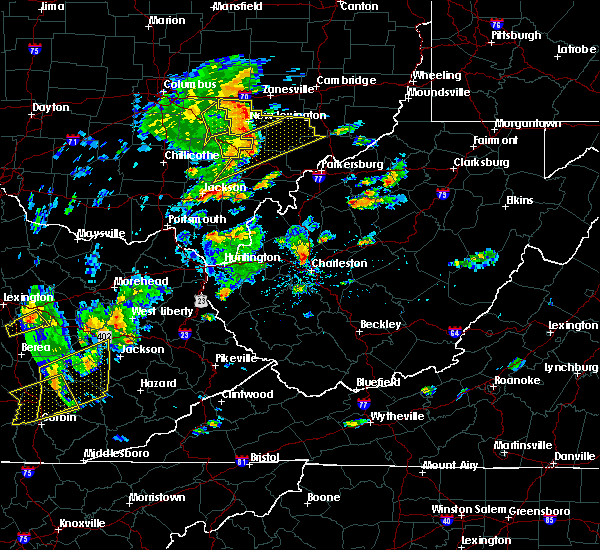 At 414 pm edt, a severe thunderstorm was located over sissonville, or 7 miles north of charleston, moving northeast at 35 mph (radar indicated). Hazards include 60 mph wind gusts and penny size hail. expect damage to roofs, siding, and trees At 414 pm edt, a severe thunderstorm was located over sissonville, or 7 miles north of charleston, moving northeast at 35 mph (radar indicated). Hazards include 60 mph wind gusts and penny size hail. expect damage to roofs, siding, and trees
|
| 5/23/2019 8:42 PM EDT |
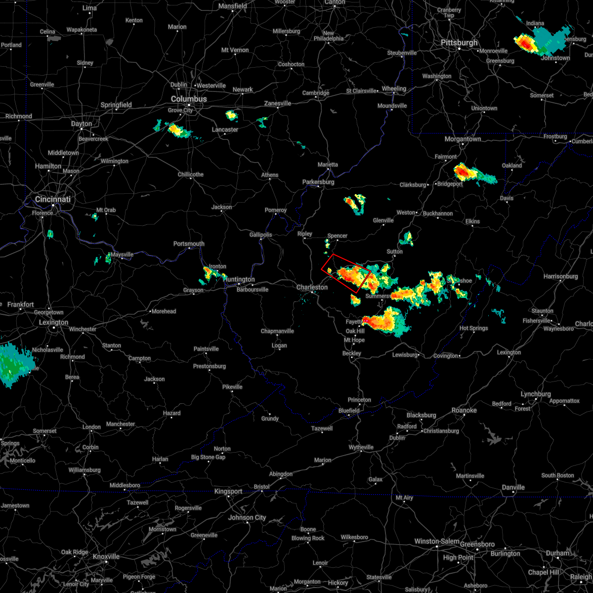 At 825 pm edt, a severe thunderstorm capable of producing a tornado was located near clendenin, or 17 miles south of spencer, moving southeast at 35 mph (radar indicated rotation). Hazards include tornado and two inch hail. Flying debris will be dangerous to those caught without shelter. mobile homes will be damaged or destroyed. damage to roofs, windows, and vehicles will occur. tree damage is likely. this dangerous storm will be near, amma around 835 pm edt. clendenin around 840 pm edt. glen around 845 pm edt. Other locations impacted by this tornadic thunderstorm include ivydale, procious, left hand, indore, bickmore and walton. At 825 pm edt, a severe thunderstorm capable of producing a tornado was located near clendenin, or 17 miles south of spencer, moving southeast at 35 mph (radar indicated rotation). Hazards include tornado and two inch hail. Flying debris will be dangerous to those caught without shelter. mobile homes will be damaged or destroyed. damage to roofs, windows, and vehicles will occur. tree damage is likely. this dangerous storm will be near, amma around 835 pm edt. clendenin around 840 pm edt. glen around 845 pm edt. Other locations impacted by this tornadic thunderstorm include ivydale, procious, left hand, indore, bickmore and walton.
|
| 5/23/2019 8:26 PM EDT |
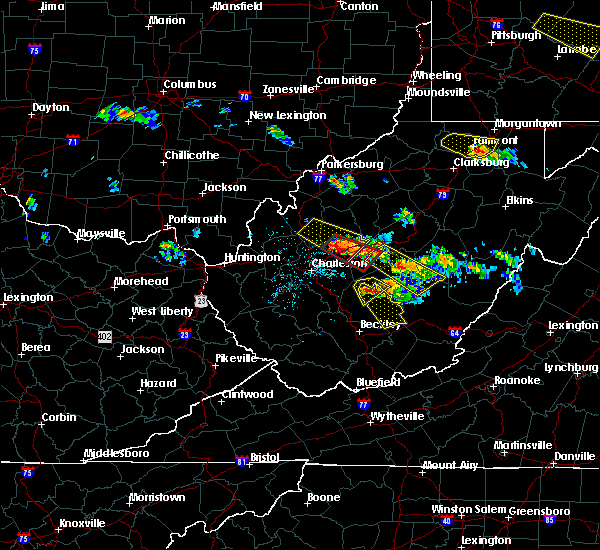 At 825 pm edt, a severe thunderstorm capable of producing a tornado was located near clendenin, or 17 miles south of spencer, moving southeast at 35 mph (radar indicated rotation). Hazards include tornado and two inch hail. Flying debris will be dangerous to those caught without shelter. mobile homes will be damaged or destroyed. damage to roofs, windows, and vehicles will occur. tree damage is likely. this dangerous storm will be near, amma around 835 pm edt. clendenin around 840 pm edt. glen around 845 pm edt. Other locations impacted by this tornadic thunderstorm include ivydale, procious, left hand, indore, bickmore and walton. At 825 pm edt, a severe thunderstorm capable of producing a tornado was located near clendenin, or 17 miles south of spencer, moving southeast at 35 mph (radar indicated rotation). Hazards include tornado and two inch hail. Flying debris will be dangerous to those caught without shelter. mobile homes will be damaged or destroyed. damage to roofs, windows, and vehicles will occur. tree damage is likely. this dangerous storm will be near, amma around 835 pm edt. clendenin around 840 pm edt. glen around 845 pm edt. Other locations impacted by this tornadic thunderstorm include ivydale, procious, left hand, indore, bickmore and walton.
|
| 5/23/2019 8:12 PM EDT | Large limbs and trees dow in roane county WV, 11.7 miles SSE of Clendenin, WV |
| 5/23/2019 8:07 PM EDT |
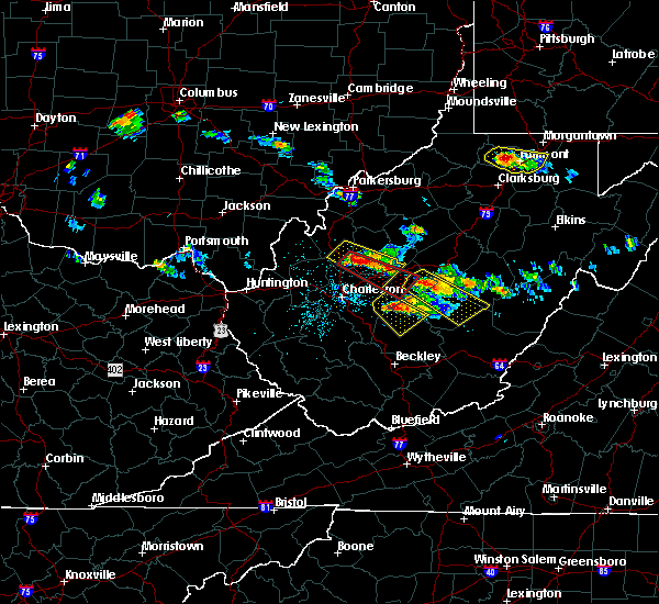 At 807 pm edt, a severe thunderstorm capable of producing a tornado was located near kenna, or 14 miles southeast of ripley, moving southeast at 45 mph (radar indicated rotation). Hazards include tornado and hail up to two inches in diameter. Flying debris will be dangerous to those caught without shelter. mobile homes will be damaged or destroyed. damage to roofs, windows, and vehicles will occur. tree damage is likely. this dangerous storm will be near, clendenin and amma around 830 pm edt. wallback and glen around 835 pm edt. clay around 845 pm edt. Other locations impacted by this tornadic thunderstorm include left hand, harmony, bickmore, ivydale, procious, indore, kentuck and walton. At 807 pm edt, a severe thunderstorm capable of producing a tornado was located near kenna, or 14 miles southeast of ripley, moving southeast at 45 mph (radar indicated rotation). Hazards include tornado and hail up to two inches in diameter. Flying debris will be dangerous to those caught without shelter. mobile homes will be damaged or destroyed. damage to roofs, windows, and vehicles will occur. tree damage is likely. this dangerous storm will be near, clendenin and amma around 830 pm edt. wallback and glen around 835 pm edt. clay around 845 pm edt. Other locations impacted by this tornadic thunderstorm include left hand, harmony, bickmore, ivydale, procious, indore, kentuck and walton.
|
| 5/23/2019 7:55 PM EDT |
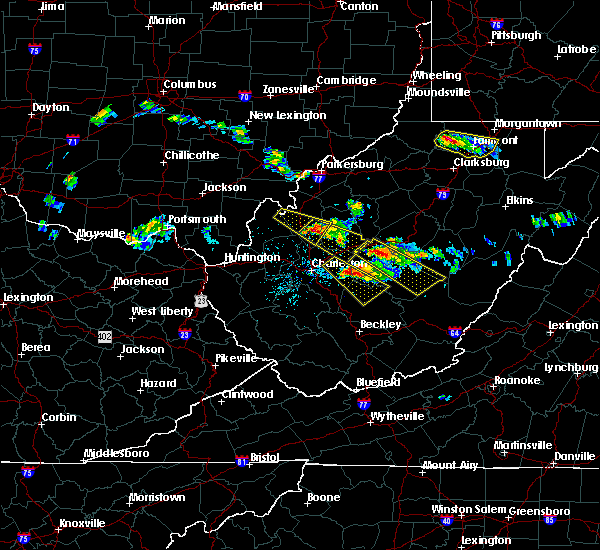 At 754 pm edt, a severe thunderstorm was located near kenna, or 8 miles southeast of ripley, moving southeast at 35 mph (radar indicated). Hazards include golf ball size hail and 60 mph wind gusts. People and animals outdoors will be injured. expect hail damage to roofs, siding, windows, and vehicles. Expect wind damage to roofs, siding, and trees. At 754 pm edt, a severe thunderstorm was located near kenna, or 8 miles southeast of ripley, moving southeast at 35 mph (radar indicated). Hazards include golf ball size hail and 60 mph wind gusts. People and animals outdoors will be injured. expect hail damage to roofs, siding, windows, and vehicles. Expect wind damage to roofs, siding, and trees.
|
| 5/23/2019 7:33 PM EDT |
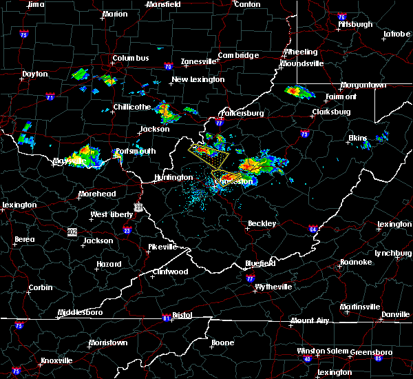 At 732 pm edt, a severe thunderstorm was located over elkview, or 10 miles northeast of charleston, moving southeast at 30 mph (trained weather spotters). Hazards include 60 mph wind gusts and half dollar size hail. Hail damage to vehicles is expected. expect wind damage to roofs, siding, and trees. Locations impacted include, clendenin, elkview and pinch. At 732 pm edt, a severe thunderstorm was located over elkview, or 10 miles northeast of charleston, moving southeast at 30 mph (trained weather spotters). Hazards include 60 mph wind gusts and half dollar size hail. Hail damage to vehicles is expected. expect wind damage to roofs, siding, and trees. Locations impacted include, clendenin, elkview and pinch.
|
| 5/23/2019 7:19 PM EDT |
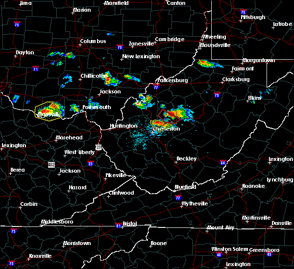 A severe thunderstorm warning remains in effect until 745 pm edt for northeastern kanawha county. at 718 pm edt, a severe thunderstorm was located over sissonville, or 12 miles north of charleston, moving southeast at 25 mph. hazard. 60 mph wind gusts and quarter size hail. source. Trained weather spotters. A severe thunderstorm warning remains in effect until 745 pm edt for northeastern kanawha county. at 718 pm edt, a severe thunderstorm was located over sissonville, or 12 miles north of charleston, moving southeast at 25 mph. hazard. 60 mph wind gusts and quarter size hail. source. Trained weather spotters.
|
| 5/23/2019 7:03 PM EDT |
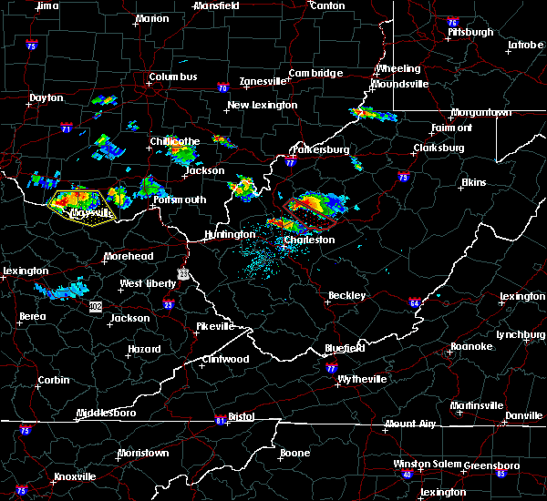 At 703 pm edt, a severe thunderstorm was located near sissonville, or 9 miles northeast of winfield, moving southeast at 25 mph (radar indicated). Hazards include 60 mph wind gusts and penny size hail. expect damage to roofs, siding, and trees At 703 pm edt, a severe thunderstorm was located near sissonville, or 9 miles northeast of winfield, moving southeast at 25 mph (radar indicated). Hazards include 60 mph wind gusts and penny size hail. expect damage to roofs, siding, and trees
|
| 5/17/2019 6:53 PM EDT |
 At 653 pm edt, a severe thunderstorm was located over glen, or 11 miles southwest of clay, moving east at 35 mph (radar indicated). Hazards include 60 mph wind gusts and quarter size hail. Hail damage to vehicles is expected. expect wind damage to roofs, siding, and trees. Locations impacted include, summersville, fayetteville, clay, babcock state park, ansted, clendenin, smithers, gauley bridge, pinch, glen, hawks nest state park, coal fork, amma, elkview, craigsville, procious, muddlety, swiss, indore and drennan. At 653 pm edt, a severe thunderstorm was located over glen, or 11 miles southwest of clay, moving east at 35 mph (radar indicated). Hazards include 60 mph wind gusts and quarter size hail. Hail damage to vehicles is expected. expect wind damage to roofs, siding, and trees. Locations impacted include, summersville, fayetteville, clay, babcock state park, ansted, clendenin, smithers, gauley bridge, pinch, glen, hawks nest state park, coal fork, amma, elkview, craigsville, procious, muddlety, swiss, indore and drennan.
|
| 5/17/2019 6:26 PM EDT |
 At 626 pm edt, a severe thunderstorm was located near sissonville, or 11 miles north of charleston, moving southeast at 40 mph (radar indicated). Hazards include 60 mph wind gusts and quarter size hail. Hail damage to vehicles is expected. Expect wind damage to roofs, siding, and trees. At 626 pm edt, a severe thunderstorm was located near sissonville, or 11 miles north of charleston, moving southeast at 40 mph (radar indicated). Hazards include 60 mph wind gusts and quarter size hail. Hail damage to vehicles is expected. Expect wind damage to roofs, siding, and trees.
|
| 5/17/2019 6:11 PM EDT |
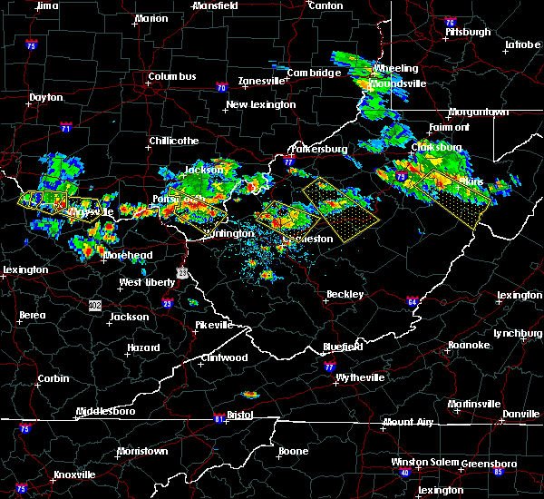 At 610 pm edt, a severe thunderstorm was located 7 miles southeast of kenna, or 15 miles southwest of spencer, moving southeast at 30 mph (radar indicated). Hazards include 60 mph wind gusts and quarter size hail. Hail damage to vehicles is expected. expect wind damage to roofs, siding, and trees. Locations impacted include, sissonville, clendenin, pinch, kenna, elkview, statts mills, harmony, given, kentuck, liberty, fairplain and walton. At 610 pm edt, a severe thunderstorm was located 7 miles southeast of kenna, or 15 miles southwest of spencer, moving southeast at 30 mph (radar indicated). Hazards include 60 mph wind gusts and quarter size hail. Hail damage to vehicles is expected. expect wind damage to roofs, siding, and trees. Locations impacted include, sissonville, clendenin, pinch, kenna, elkview, statts mills, harmony, given, kentuck, liberty, fairplain and walton.
|
| 5/17/2019 5:33 PM EDT |
 At 533 pm edt, a severe thunderstorm was located 8 miles southwest of ripley, moving southeast at 30 mph (radar indicated). Hazards include ping pong ball size hail and 60 mph wind gusts. People and animals outdoors will be injured. expect hail damage to roofs, siding, windows, and vehicles. Expect wind damage to roofs, siding, and trees. At 533 pm edt, a severe thunderstorm was located 8 miles southwest of ripley, moving southeast at 30 mph (radar indicated). Hazards include ping pong ball size hail and 60 mph wind gusts. People and animals outdoors will be injured. expect hail damage to roofs, siding, windows, and vehicles. Expect wind damage to roofs, siding, and trees.
|
| 5/3/2019 2:55 PM EDT |
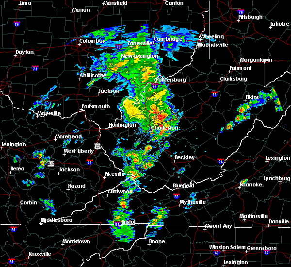 At 255 pm edt, a severe thunderstorm was located near clendenin, or 14 miles northeast of charleston, moving northeast at 35 mph (radar indicated). Hazards include 60 mph wind gusts and penny size hail. expect damage to roofs, siding, and trees At 255 pm edt, a severe thunderstorm was located near clendenin, or 14 miles northeast of charleston, moving northeast at 35 mph (radar indicated). Hazards include 60 mph wind gusts and penny size hail. expect damage to roofs, siding, and trees
|
| 4/26/2019 7:26 PM EDT | Power outage reported due to tree out of row. reported time was long after storm had passed. time est via rada in roane county WV, 6 miles SSE of Clendenin, WV |
| 4/26/2019 9:56 AM EDT | *** corrected time *** damage report corresponds with earlier wind... and not recent convectio in roane county WV, 6 miles SSE of Clendenin, WV |
| 4/14/2019 9:36 PM EDT |
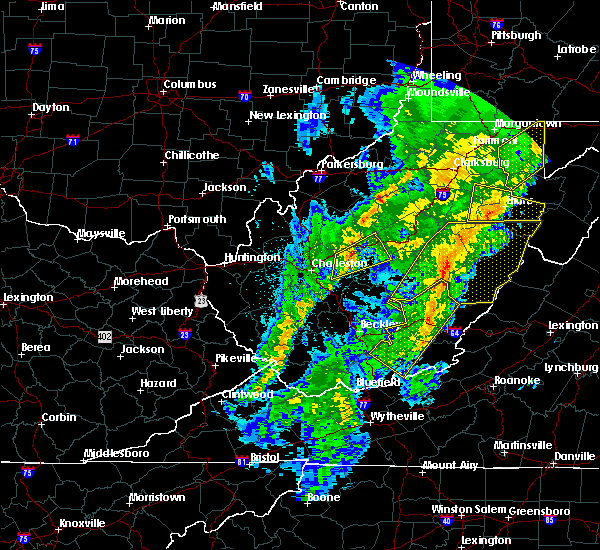 At 936 pm edt, a severe thunderstorm was located near glen, or 12 miles west of clay, moving northeast at 65 mph (radar indicated). Hazards include 60 mph wind gusts. Expect damage to roofs, siding, and trees. Locations impacted include, clay, clendenin, big otter, wallback, amma, glen, harrison, nebo, bickmore, ivydale and procious. At 936 pm edt, a severe thunderstorm was located near glen, or 12 miles west of clay, moving northeast at 65 mph (radar indicated). Hazards include 60 mph wind gusts. Expect damage to roofs, siding, and trees. Locations impacted include, clay, clendenin, big otter, wallback, amma, glen, harrison, nebo, bickmore, ivydale and procious.
|
| 4/14/2019 9:22 PM EDT |
 At 922 pm edt, a severe thunderstorm was located over coal fork, or near charleston, moving northeast at 65 mph (radar indicated). Hazards include 60 mph wind gusts. expect damage to roofs, siding, and trees At 922 pm edt, a severe thunderstorm was located over coal fork, or near charleston, moving northeast at 65 mph (radar indicated). Hazards include 60 mph wind gusts. expect damage to roofs, siding, and trees
|
| 4/14/2019 8:07 PM EDT | All lanes blocked in front of herbert hoover high school due to downed tree in kanawha county WV, 0.5 miles SSW of Clendenin, WV |
| 4/14/2019 8:04 PM EDT |
 At 803 pm edt, severe thunderstorms were located along a line extending from near birch river to 7 miles south of summersville, moving east at 60 mph (radar indicated). Hazards include 60 mph wind gusts. Expect damage to roofs, siding, and trees. Locations impacted include, summersville, fayetteville, richwood, sutton, clay, montgomery, ansted, clendenin, gassaway, smithers, gauley bridge, camden-on-gauley, birch river, glen, hawks nest state park, craigsville, big otter, camden on gauley, wallback and amma. At 803 pm edt, severe thunderstorms were located along a line extending from near birch river to 7 miles south of summersville, moving east at 60 mph (radar indicated). Hazards include 60 mph wind gusts. Expect damage to roofs, siding, and trees. Locations impacted include, summersville, fayetteville, richwood, sutton, clay, montgomery, ansted, clendenin, gassaway, smithers, gauley bridge, camden-on-gauley, birch river, glen, hawks nest state park, craigsville, big otter, camden on gauley, wallback and amma.
|
| 4/14/2019 7:36 PM EDT | Tree down at elk river rd and jordan creek in kanawha county WV, 3.5 miles W of Clendenin, WV |
| 4/14/2019 7:33 PM EDT |
 At 733 pm edt, severe thunderstorms were located along a line extending from near amma to pratt, moving east at 60 mph (radar indicated). Hazards include 60 mph wind gusts. expect damage to roofs, siding, and trees At 733 pm edt, severe thunderstorms were located along a line extending from near amma to pratt, moving east at 60 mph (radar indicated). Hazards include 60 mph wind gusts. expect damage to roofs, siding, and trees
|
| 5/21/2018 4:12 PM EDT | Trees down on ambler road and on 119 near ambler road intersectio in roane county WV, 9.8 miles SSE of Clendenin, WV |
| 5/27/2017 7:20 PM EDT |
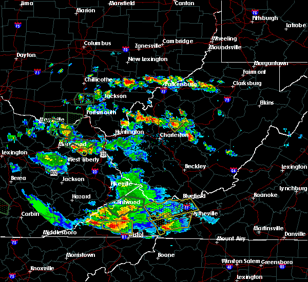 At 719 pm edt, a severe thunderstorm was located 7 miles northwest of amma, or 13 miles south of spencer, moving southeast at 10 mph (radar indicated). Hazards include quarter size hail. Damage to vehicles is expected. locations impacted include, clendenin, amma, left hand and walton. This includes interstate 79 between mile markers 18 and 26. At 719 pm edt, a severe thunderstorm was located 7 miles northwest of amma, or 13 miles south of spencer, moving southeast at 10 mph (radar indicated). Hazards include quarter size hail. Damage to vehicles is expected. locations impacted include, clendenin, amma, left hand and walton. This includes interstate 79 between mile markers 18 and 26.
|
| 5/27/2017 7:02 PM EDT |
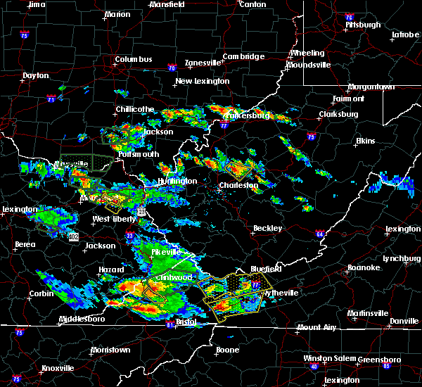 At 701 pm edt, a severe thunderstorm was located 10 miles northwest of amma, or 12 miles south of spencer, moving southeast at 10 mph (radar indicated). Hazards include quarter size hail. damage to vehicles is expected At 701 pm edt, a severe thunderstorm was located 10 miles northwest of amma, or 12 miles south of spencer, moving southeast at 10 mph (radar indicated). Hazards include quarter size hail. damage to vehicles is expected
|
| 5/19/2017 9:37 PM EDT | Tree down along russell street in clendenin in kanawha county WV, 2.5 miles NNE of Clendenin, WV |
| 3/1/2017 10:09 AM EST |
 At 1009 am est, a severe thunderstorm was located near clendenin, or 12 miles west of clay, moving east at 60 mph (radar indicated). Hazards include 70 mph wind gusts and penny size hail. Expect considerable tree damage. damage is likely to mobile homes, roofs, and outbuildings. locations impacted include, charleston, nitro, jefferson, south charleston, st. albans, dunbar, sissonville, clendenin, cross lanes, pinch, institute, coal fork, elkview, amma, walton, left hand and pond gap. this includes the following highways, interstate 79 between mile markers 1 and 29. interstate 77 in west virginia between mile markers 98 and 121. interstate 64 in west virginia between mile markers 46 and 57. Route 119 near mile marker 80. At 1009 am est, a severe thunderstorm was located near clendenin, or 12 miles west of clay, moving east at 60 mph (radar indicated). Hazards include 70 mph wind gusts and penny size hail. Expect considerable tree damage. damage is likely to mobile homes, roofs, and outbuildings. locations impacted include, charleston, nitro, jefferson, south charleston, st. albans, dunbar, sissonville, clendenin, cross lanes, pinch, institute, coal fork, elkview, amma, walton, left hand and pond gap. this includes the following highways, interstate 79 between mile markers 1 and 29. interstate 77 in west virginia between mile markers 98 and 121. interstate 64 in west virginia between mile markers 46 and 57. Route 119 near mile marker 80.
|
| 3/1/2017 9:41 AM EST |
 At 941 am est, a severe thunderstorm was located over poca, or near winfield, moving east at 60 mph (radar indicated). Hazards include 70 mph wind gusts and penny size hail. Expect considerable tree damage. Damage is likely to mobile homes, roofs, and outbuildings. At 941 am est, a severe thunderstorm was located over poca, or near winfield, moving east at 60 mph (radar indicated). Hazards include 70 mph wind gusts and penny size hail. Expect considerable tree damage. Damage is likely to mobile homes, roofs, and outbuildings.
|
| 8/17/2016 2:11 PM EDT |
 The severe thunderstorm warning for southwestern roane and northeastern kanawha counties will expire at 215 pm edt, the severe thunderstorm which prompted the warning has weakened and moved out of the warned area. therefore, the warning will be allowed to expire. a severe thunderstorm watch remains in effect until 800 pm edt for central west virginia. The severe thunderstorm warning for southwestern roane and northeastern kanawha counties will expire at 215 pm edt, the severe thunderstorm which prompted the warning has weakened and moved out of the warned area. therefore, the warning will be allowed to expire. a severe thunderstorm watch remains in effect until 800 pm edt for central west virginia.
|
| 8/17/2016 2:04 PM EDT |
 At 203 pm edt, a severe thunderstorm was located near charleston, moving east at 25 mph (radar indicated). Hazards include 60 mph wind gusts and quarter size hail. Hail damage to vehicles is expected. expect wind damage to roofs, siding, and trees. Locations impacted include, charleston, south charleston, sissonville, clendenin, elkview, pinch and coal fork. At 203 pm edt, a severe thunderstorm was located near charleston, moving east at 25 mph (radar indicated). Hazards include 60 mph wind gusts and quarter size hail. Hail damage to vehicles is expected. expect wind damage to roofs, siding, and trees. Locations impacted include, charleston, south charleston, sissonville, clendenin, elkview, pinch and coal fork.
|
| 8/17/2016 1:41 PM EDT |
 At 139 pm edt, a severe thunderstorm was located over nitro, moving east at 25 mph (radar indicated). Hazards include 60 mph wind gusts and quarter size hail. Hail damage to vehicles is expected. Expect wind damage to roofs, siding, and trees. At 139 pm edt, a severe thunderstorm was located over nitro, moving east at 25 mph (radar indicated). Hazards include 60 mph wind gusts and quarter size hail. Hail damage to vehicles is expected. Expect wind damage to roofs, siding, and trees.
|
| 7/4/2016 5:24 PM EDT |
 At 524 pm edt, a severe thunderstorm was located near glen, or 13 miles southwest of clay, moving east at 60 mph (radar indicated). Hazards include 60 mph wind gusts. Expect damage to roofs. siding. And trees. At 524 pm edt, a severe thunderstorm was located near glen, or 13 miles southwest of clay, moving east at 60 mph (radar indicated). Hazards include 60 mph wind gusts. Expect damage to roofs. siding. And trees.
|
| 6/23/2016 4:10 PM EDT |
 The severe thunderstorm warning for southern roane, clay and northeastern kanawha counties will expire at 415 pm edt, the storms which prompted the warning have weakened below severe limits, and no longer pose an immediate threat to life or property. therefore, the warning will be allowed to expire. however wind gusts of 40 to 50 mph are still possible with these thunderstorms. a tornado watch remains in effect until 1000 pm edt for north central, southeastern, central and northwestern west virginia. The severe thunderstorm warning for southern roane, clay and northeastern kanawha counties will expire at 415 pm edt, the storms which prompted the warning have weakened below severe limits, and no longer pose an immediate threat to life or property. therefore, the warning will be allowed to expire. however wind gusts of 40 to 50 mph are still possible with these thunderstorms. a tornado watch remains in effect until 1000 pm edt for north central, southeastern, central and northwestern west virginia.
|
| 6/23/2016 4:08 PM EDT | Numerous trees down. time estimated from rada in clay county WV, 7.9 miles W of Clendenin, WV |
| 6/23/2016 4:04 PM EDT | Tree down at spencer rd and elk river rd n in kanawha county WV, 0.5 miles SSW of Clendenin, WV |
| 6/23/2016 3:57 PM EDT | Four trees down in clendenin in kanawha county WV, 0.5 miles SSW of Clendenin, WV |
| 6/23/2016 3:44 PM EDT |
 At 343 pm edt, severe thunderstorms were located along a line extending from near wallback to near clendenin to near sissonville, moving southeast at 35 mph (radar indicated). Hazards include 60 mph wind gusts and quarter size hail. Hail damage to vehicles is expected. Expect wind damage to roofs, siding, and trees. At 343 pm edt, severe thunderstorms were located along a line extending from near wallback to near clendenin to near sissonville, moving southeast at 35 mph (radar indicated). Hazards include 60 mph wind gusts and quarter size hail. Hail damage to vehicles is expected. Expect wind damage to roofs, siding, and trees.
|
| 6/23/2016 5:11 AM EDT |
 At 511 am edt, severe thunderstorms were located along a line extending from near chesapeake to 9 miles east of kenna, moving southeast at 40 mph (radar indicated). Hazards include 60 mph wind gusts. Expect damage to roofs. siding. And trees. At 511 am edt, severe thunderstorms were located along a line extending from near chesapeake to 9 miles east of kenna, moving southeast at 40 mph (radar indicated). Hazards include 60 mph wind gusts. Expect damage to roofs. siding. And trees.
|
| 6/21/2016 4:17 PM EDT |
 At 416 pm edt, a severe thunderstorm was located near sissonville, or near charleston, moving east at 35 mph (radar indicated). Hazards include 60 mph wind gusts and quarter size hail. Hail damage to vehicles is expected. expect wind damage to roofs, siding, and trees. Locations impacted include, charleston, sissonville, clendenin, glen, elkview, pinch, coal fork, bickmore, indore, pond gap and bentree. At 416 pm edt, a severe thunderstorm was located near sissonville, or near charleston, moving east at 35 mph (radar indicated). Hazards include 60 mph wind gusts and quarter size hail. Hail damage to vehicles is expected. expect wind damage to roofs, siding, and trees. Locations impacted include, charleston, sissonville, clendenin, glen, elkview, pinch, coal fork, bickmore, indore, pond gap and bentree.
|
| 6/21/2016 4:02 PM EDT |
 At 402 pm edt, a severe thunderstorm was located over cross lanes, or near nitro, moving east at 35 mph (radar indicated). Hazards include 60 mph wind gusts and half dollar size hail. Hail damage to vehicles is expected. Expect wind damage to roofs, siding, and trees. At 402 pm edt, a severe thunderstorm was located over cross lanes, or near nitro, moving east at 35 mph (radar indicated). Hazards include 60 mph wind gusts and half dollar size hail. Hail damage to vehicles is expected. Expect wind damage to roofs, siding, and trees.
|
| 6/21/2016 2:27 PM EDT |
 At 227 pm edt, a severe thunderstorm was located near clendenin, or 15 miles west of clay, moving southeast at 40 mph (radar indicated). Hazards include 60 mph wind gusts and quarter size hail. Hail damage to vehicles is expected. Expect wind damage to roofs, siding, and trees. At 227 pm edt, a severe thunderstorm was located near clendenin, or 15 miles west of clay, moving southeast at 40 mph (radar indicated). Hazards include 60 mph wind gusts and quarter size hail. Hail damage to vehicles is expected. Expect wind damage to roofs, siding, and trees.
|
| 7/14/2015 5:59 PM EDT |
 At 559 pm edt, doppler radar indicated a line of severe thunderstorms capable of producing damaging winds in excess of 60 mph. these storms were located along a line extending from 7 miles southeast of grantsville to near amma to near nitro, moving southeast at 50 mph. locations impacted include, charleston, nitro, clay, jefferson, south charleston, st. albans, dunbar, hurricane, sissonville, marmet, belle, clendenin, poca, glen, arnoldsburg, spurlockville, teays valley, institute, tornado and amma. At 559 pm edt, doppler radar indicated a line of severe thunderstorms capable of producing damaging winds in excess of 60 mph. these storms were located along a line extending from 7 miles southeast of grantsville to near amma to near nitro, moving southeast at 50 mph. locations impacted include, charleston, nitro, clay, jefferson, south charleston, st. albans, dunbar, hurricane, sissonville, marmet, belle, clendenin, poca, glen, arnoldsburg, spurlockville, teays valley, institute, tornado and amma.
|
| 7/14/2015 5:18 PM EDT |
 At 518 pm edt, doppler radar indicated a line of severe thunderstorms capable of producing damaging winds in excess of 60 mph. these storms were located along a line extending from sandyville to 6 miles northwest of kenna to near buffalo, and moving southeast at 50 mph. At 518 pm edt, doppler radar indicated a line of severe thunderstorms capable of producing damaging winds in excess of 60 mph. these storms were located along a line extending from sandyville to 6 miles northwest of kenna to near buffalo, and moving southeast at 50 mph.
|
| 7/13/2015 4:56 PM EDT |
 At 456 pm edt, doppler radar indicated a line of severe thunderstorms capable of producing damaging winds in excess of 60 mph. these storms were located along a line extending from near sissonville to near madison, moving southeast at 35 mph. these severe storms will be near, elkview and pinch around 510 pm edt. clendenin around 520 pm edt. other locations impacted by these severe thunderstorms include sharon, sylvester, foster, ashford, prenter, racine, seth, danville, dawes and whitesville. At 456 pm edt, doppler radar indicated a line of severe thunderstorms capable of producing damaging winds in excess of 60 mph. these storms were located along a line extending from near sissonville to near madison, moving southeast at 35 mph. these severe storms will be near, elkview and pinch around 510 pm edt. clendenin around 520 pm edt. other locations impacted by these severe thunderstorms include sharon, sylvester, foster, ashford, prenter, racine, seth, danville, dawes and whitesville.
|
| 7/13/2015 4:26 PM EDT |
 At 425 pm edt, doppler radar indicated a line of severe thunderstorms capable of producing damaging winds in excess of 60 mph. these storms were located along a line extending from near winfield to 7 miles southeast of culloden, and moving east at 35 mph. * severe thunderstorms will be near, nitro and poca around 430 pm edt. alum creek and cross lanes around 435 pm edt. tornado around 440 pm edt. jefferson, st. albans, sissonville and institute around 445 pm edt. charleston, south charleston and dunbar around 450 pm edt. pinch around 500 pm edt. marmet and elkview around 505 pm edt. chesapeake, belle and coal fork around 510 pm edt. other locations impacted by these severe thunderstorms include sod, palermo, griffithsville, foster, prenter, myra, sharon, sylvester, yawkey and woodville. At 425 pm edt, doppler radar indicated a line of severe thunderstorms capable of producing damaging winds in excess of 60 mph. these storms were located along a line extending from near winfield to 7 miles southeast of culloden, and moving east at 35 mph. * severe thunderstorms will be near, nitro and poca around 430 pm edt. alum creek and cross lanes around 435 pm edt. tornado around 440 pm edt. jefferson, st. albans, sissonville and institute around 445 pm edt. charleston, south charleston and dunbar around 450 pm edt. pinch around 500 pm edt. marmet and elkview around 505 pm edt. chesapeake, belle and coal fork around 510 pm edt. other locations impacted by these severe thunderstorms include sod, palermo, griffithsville, foster, prenter, myra, sharon, sylvester, yawkey and woodville.
|
| 6/26/2015 8:20 PM EDT | Numerous trees down in southern roane county...particularly along rt 11 in roane county WV, 5.9 miles S of Clendenin, WV |
| 6/26/2015 7:00 PM EDT | At 659 pm edt, doppler radar indicated a severe thunderstorm capable of producing quarter size hail and damaging winds in excess of 60 mph. this storm was located 7 miles west of ripley, and moving east at 35 mph. |
| 6/26/2015 7:00 PM EDT | At 659 pm edt, doppler radar indicated a severe thunderstorm capable of producing quarter size hail and damaging winds in excess of 60 mph. this storm was located 7 miles west of ripley, and moving east at 35 mph. |
| 6/18/2015 5:41 PM EDT | The severe thunderstorm warning for southwestern roane, east central putnam, west central clay, northeastern lincoln, southeastern jackson and northern kanawha counties will expire at 545 pm edt, the storm which prompted the warning has weakened below severe limits. therefore the warning will be allowed to expire. |
| 6/18/2015 5:20 PM EDT | At 519 pm edt, doppler radar indicated a severe thunderstorm capable of producing quarter size hail and damaging winds in excess of 60 mph. this storm was located over sissonville, or 10 miles north of charleston, moving northeast at 50 mph. locations impacted include, charleston, nitro, jefferson, south charleston, st. albans, dunbar, sissonville, clendenin, poca, tornado, pinch, elkview, cross lanes, institute, teays valley, alum creek and walton. |
| 6/18/2015 4:58 PM EDT | At 457 pm edt, doppler radar indicated a severe thunderstorm capable of producing quarter size hail and damaging winds in excess of 60 mph. this storm was located near teays valley, or near nitro, and moving northeast at 55 mph. |
| 5/13/2014 9:40 PM EDT | Trees and powerlines down in roane county WV, 10.4 miles SSE of Clendenin, WV |
| 8/1/2012 6:30 PM EDT | Tree down on elk river r in kanawha county WV, 0.5 miles SSW of Clendenin, WV |
| 1/1/0001 12:00 AM | Numerous trees down on wv 4 near procious in clay county WV, 7.9 miles W of Clendenin, WV |
| 1/1/0001 12:00 AM | Quarter sized hail reported 5.2 miles N of Clendenin, WV |
| 1/1/0001 12:00 AM | Quarter sized hail reported 1.7 miles NE of Clendenin, WV |
Hail Maps for Clendenin, WV


Connect with Interactive Hail Maps