

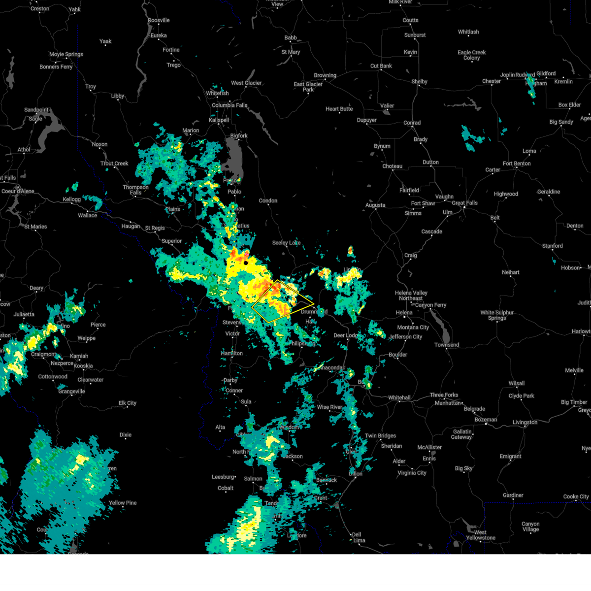
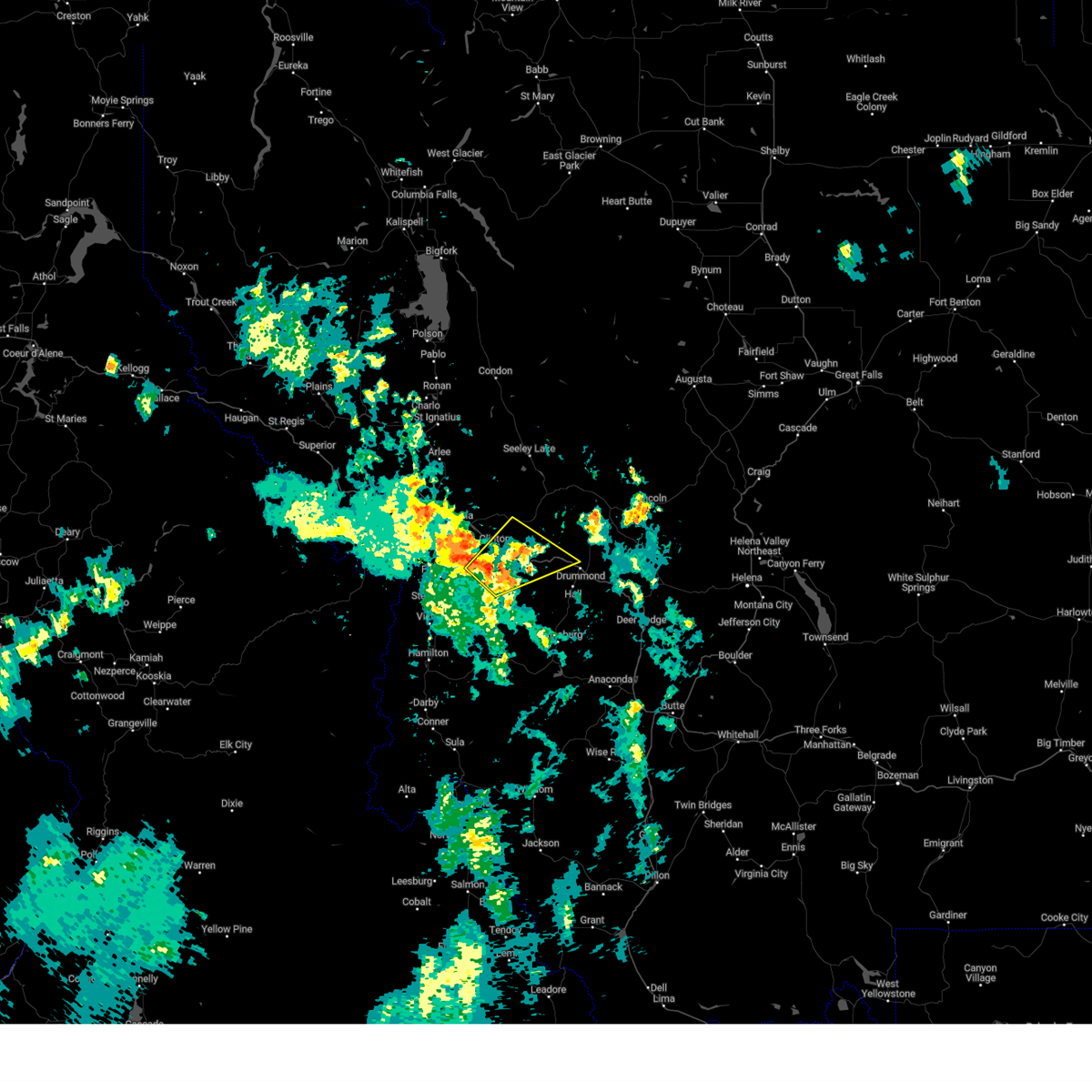
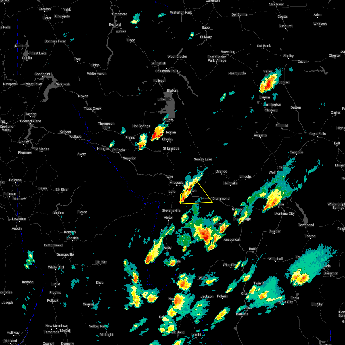
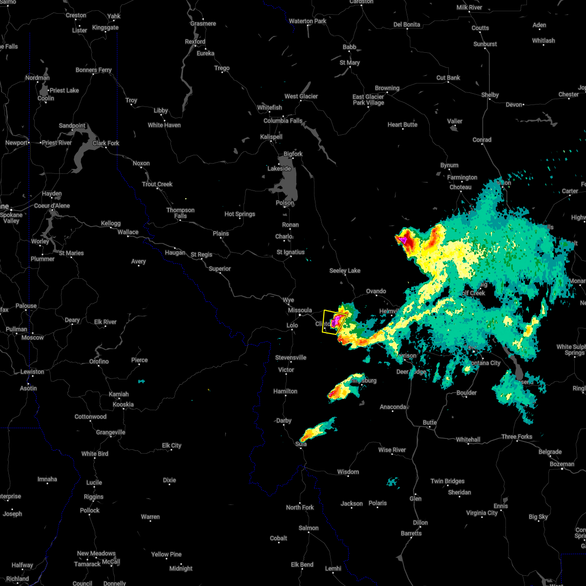
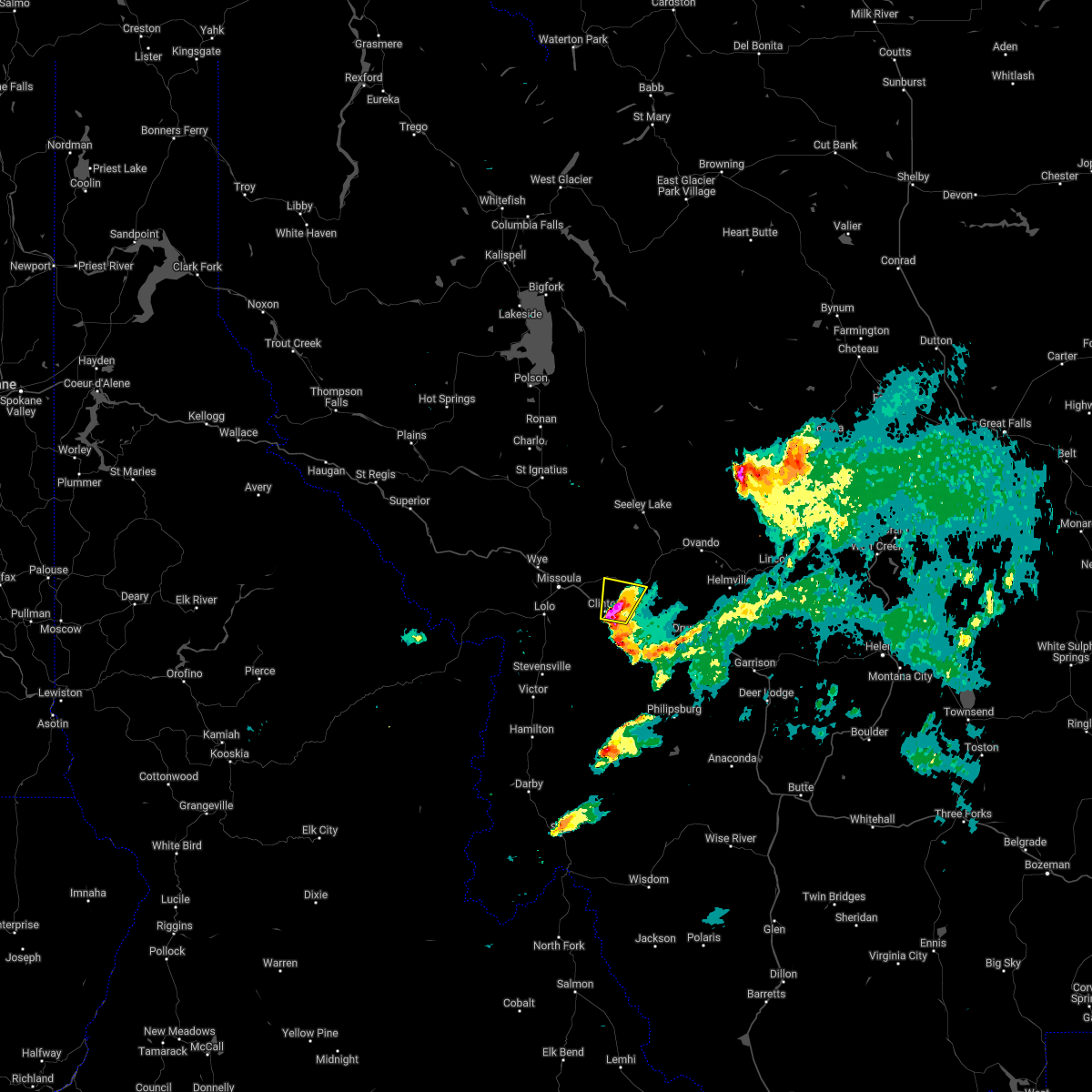
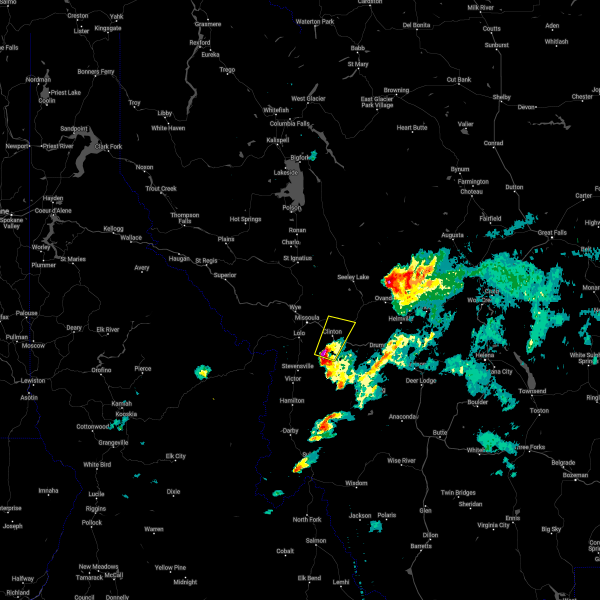
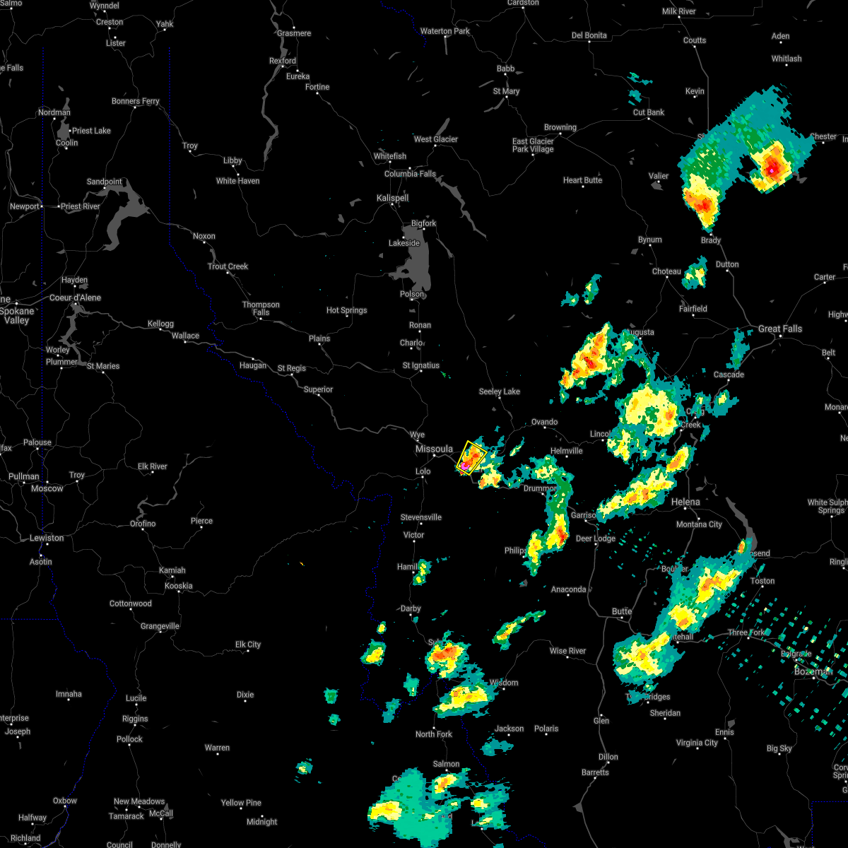
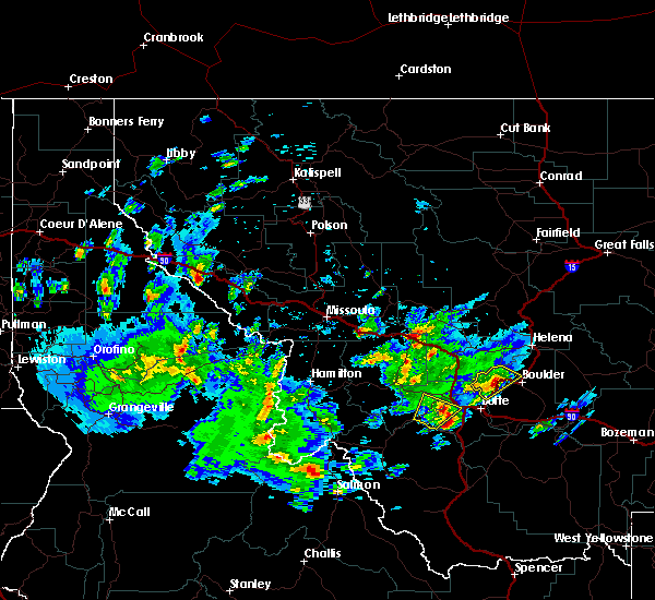
Hail Map for Clinton, MT
The Clinton, MT area has had 5 reports of on-the-ground hail by trained spotters, and has been under severe weather warnings 11 times during the past 12 months. Doppler radar has detected hail at or near Clinton, MT on 14 occasions, including 4 occasions during the past year.
| Name: | Clinton, MT |
| Where Located: | 15.1 miles ESE of Missoula, MT |
| Map: | Google Map for Clinton, MT |
| Population: | 1052 |
| Housing Units: | 446 |
| More Info: | Search Google for Clinton, MT |
0
The Top Recent Hail Date for Clinton, MT is Monday, August 19, 2024 (14th out of 14)

Hail and Wind Damage Spotted near Clinton, MT
| Date / Time | Report Details |
|---|---|
| 8/23/2024 3:41 PM MDT |
 Svrmso the national weather service in missoula has issued a * severe thunderstorm warning for, southern missoula county in west central montana, northwestern granite county in west central montana, north central ravalli county in west central montana, * until 415 pm mdt. * at 340 pm mdt, severe thunderstorms were located along a line extending from 20 miles west of drummond to 8 miles southwest of florence, moving north at 30 mph (trained weather spotters). Hazards include 60 mph wind gusts. expect damage to roofs, siding, and trees Svrmso the national weather service in missoula has issued a * severe thunderstorm warning for, southern missoula county in west central montana, northwestern granite county in west central montana, north central ravalli county in west central montana, * until 415 pm mdt. * at 340 pm mdt, severe thunderstorms were located along a line extending from 20 miles west of drummond to 8 miles southwest of florence, moving north at 30 mph (trained weather spotters). Hazards include 60 mph wind gusts. expect damage to roofs, siding, and trees
|
| 8/18/2024 5:58 PM MDT |
 At 557 pm mdt, severe thunderstorms were located along a line extending from near lolo to 17 miles west of drummond, moving north at 35 mph (radar indicated). Hazards include 60 mph wind gusts and quarter size hail. Hail damage to vehicles is expected. expect wind damage to roofs, siding, and trees. Locations impacted include, missoula, lolo, bonner-west riverside, wye, east missoula, florence, nimrod, potomac, greenough, twin creeks, clinton, and turah. At 557 pm mdt, severe thunderstorms were located along a line extending from near lolo to 17 miles west of drummond, moving north at 35 mph (radar indicated). Hazards include 60 mph wind gusts and quarter size hail. Hail damage to vehicles is expected. expect wind damage to roofs, siding, and trees. Locations impacted include, missoula, lolo, bonner-west riverside, wye, east missoula, florence, nimrod, potomac, greenough, twin creeks, clinton, and turah.
|
| 8/18/2024 5:40 PM MDT |
 Svrmso the national weather service in missoula has issued a * severe thunderstorm warning for, southeastern missoula county in west central montana, northwestern granite county in west central montana, north central ravalli county in west central montana, * until 615 pm mdt. * at 540 pm mdt, severe thunderstorms were located along a line extending from near florence to 20 miles west of drummond, moving north at 35 mph (radar indicated). Hazards include ping pong ball size hail and 60 mph wind gusts. People and animals outdoors will be injured. expect hail damage to roofs, siding, windows, and vehicles. Expect wind damage to roofs, siding, and trees. Svrmso the national weather service in missoula has issued a * severe thunderstorm warning for, southeastern missoula county in west central montana, northwestern granite county in west central montana, north central ravalli county in west central montana, * until 615 pm mdt. * at 540 pm mdt, severe thunderstorms were located along a line extending from near florence to 20 miles west of drummond, moving north at 35 mph (radar indicated). Hazards include ping pong ball size hail and 60 mph wind gusts. People and animals outdoors will be injured. expect hail damage to roofs, siding, windows, and vehicles. Expect wind damage to roofs, siding, and trees.
|
| 8/6/2024 6:02 PM MDT |
 Svrmso the national weather service in missoula has issued a * severe thunderstorm warning for, southeastern missoula county in west central montana, northwestern granite county in west central montana, north central ravalli county in west central montana, * until 630 pm mdt. * at 602 pm mdt, a severe thunderstorm was located near florence, or 12 miles south of missoula, moving east at 35 mph (radar indicated). Hazards include quarter size hail winds up to 40 mph. damage to vehicles is expected Svrmso the national weather service in missoula has issued a * severe thunderstorm warning for, southeastern missoula county in west central montana, northwestern granite county in west central montana, north central ravalli county in west central montana, * until 630 pm mdt. * at 602 pm mdt, a severe thunderstorm was located near florence, or 12 miles south of missoula, moving east at 35 mph (radar indicated). Hazards include quarter size hail winds up to 40 mph. damage to vehicles is expected
|
| 7/24/2024 9:26 PM MDT |
 the severe thunderstorm warning has been cancelled and is no longer in effect the severe thunderstorm warning has been cancelled and is no longer in effect
|
| 7/24/2024 9:25 PM MDT |
 The severe thunderstorm which prompted the warning has therefore, the warning will be allowed to expire. The severe thunderstorm which prompted the warning has therefore, the warning will be allowed to expire.
|
| 7/24/2024 9:13 PM MDT |
 At 913 pm mdt, a severe thunderstorm was located near wye, or near missoula, moving northeast at 25 mph (radar indicated). Hazards include 70 mph wind gusts. Expect damage to roofs, siding, and trees. Locations impacted include, missoula, lolo, bonner-west riverside, wye, east missoula, frenchtown, and turah. At 913 pm mdt, a severe thunderstorm was located near wye, or near missoula, moving northeast at 25 mph (radar indicated). Hazards include 70 mph wind gusts. Expect damage to roofs, siding, and trees. Locations impacted include, missoula, lolo, bonner-west riverside, wye, east missoula, frenchtown, and turah.
|
| 7/24/2024 9:10 PM MDT |
 Svrmso the national weather service in missoula has issued a * severe thunderstorm warning for, southeastern missoula county in west central montana, northwestern granite county in west central montana, north central ravalli county in west central montana, * until 945 pm mdt. * at 910 pm mdt, a severe thunderstorm was located 13 miles southeast of bonner-west riverside, or 18 miles southeast of missoula, moving northeast at 25 mph (radar indicated). Hazards include 70 mph wind gusts. Expect considerable tree damage. Damage is likely to mobile homes, roofs, and outbuildings. Svrmso the national weather service in missoula has issued a * severe thunderstorm warning for, southeastern missoula county in west central montana, northwestern granite county in west central montana, north central ravalli county in west central montana, * until 945 pm mdt. * at 910 pm mdt, a severe thunderstorm was located 13 miles southeast of bonner-west riverside, or 18 miles southeast of missoula, moving northeast at 25 mph (radar indicated). Hazards include 70 mph wind gusts. Expect considerable tree damage. Damage is likely to mobile homes, roofs, and outbuildings.
|
| 7/24/2024 9:04 PM MDT |
 At 903 pm mdt, a severe thunderstorm was located near missoula, moving northeast at 25 mph (radar indicated). Hazards include 60 mph wind gusts. wind gusts estimated up to 80 mph in the missoula valley. seek shelter now. Expect damage to roofs, siding, and trees. Locations impacted include, missoula, lolo, bonner-west riverside, wye, florence, east missoula, frenchtown, lolo hot springs, and turah. At 903 pm mdt, a severe thunderstorm was located near missoula, moving northeast at 25 mph (radar indicated). Hazards include 60 mph wind gusts. wind gusts estimated up to 80 mph in the missoula valley. seek shelter now. Expect damage to roofs, siding, and trees. Locations impacted include, missoula, lolo, bonner-west riverside, wye, florence, east missoula, frenchtown, lolo hot springs, and turah.
|
| 7/24/2024 8:59 PM MDT |
 At 859 pm mdt, a severe thunderstorm was located near lolo, or near missoula, moving northeast at 25 mph (radar indicated). Hazards include 60 mph wind gusts. gusts in excess of 65 mph is occuring in the missoula valley. take shelter now. Expect damage to roofs, siding, and trees. Locations impacted include, missoula, lolo, bonner-west riverside, wye, florence, east missoula, frenchtown, lolo hot springs, and turah. At 859 pm mdt, a severe thunderstorm was located near lolo, or near missoula, moving northeast at 25 mph (radar indicated). Hazards include 60 mph wind gusts. gusts in excess of 65 mph is occuring in the missoula valley. take shelter now. Expect damage to roofs, siding, and trees. Locations impacted include, missoula, lolo, bonner-west riverside, wye, florence, east missoula, frenchtown, lolo hot springs, and turah.
|
| 7/24/2024 8:42 PM MDT |
 Svrmso the national weather service in missoula has issued a * severe thunderstorm warning for, south central missoula county in west central montana, north central ravalli county in west central montana, * until 930 pm mdt. * at 841 pm mdt, a severe thunderstorm was located near lolo, or 12 miles southwest of missoula, moving northeast at 25 mph (radar indicated). Hazards include 60 mph wind gusts. this cluster of thunderstorms have a history of producing 50 to 60 mph wind gusts, creating poweroutages. expect damage to roofs, siding, and trees Svrmso the national weather service in missoula has issued a * severe thunderstorm warning for, south central missoula county in west central montana, north central ravalli county in west central montana, * until 930 pm mdt. * at 841 pm mdt, a severe thunderstorm was located near lolo, or 12 miles southwest of missoula, moving northeast at 25 mph (radar indicated). Hazards include 60 mph wind gusts. this cluster of thunderstorms have a history of producing 50 to 60 mph wind gusts, creating poweroutages. expect damage to roofs, siding, and trees
|
| 7/9/2022 4:21 PM MDT | Quarter sized hail reported 0.2 miles NW of Clinton, MT |
| 7/9/2022 4:10 PM MDT |
 At 409 pm mdt, a severe thunderstorm was located 12 miles east of bonner-west riverside, or 19 miles east of missoula, moving northeast at 20 mph (radar indicated). Hazards include 60 mph wind gusts and quarter size hail. Hail damage to vehicles is expected. expect wind damage to roofs, siding, and trees. locations impacted include, clinton, nimrod and potomac. hail threat, radar indicated max hail size, 1. 00 in wind threat, radar indicated max wind gust, 60 mph. At 409 pm mdt, a severe thunderstorm was located 12 miles east of bonner-west riverside, or 19 miles east of missoula, moving northeast at 20 mph (radar indicated). Hazards include 60 mph wind gusts and quarter size hail. Hail damage to vehicles is expected. expect wind damage to roofs, siding, and trees. locations impacted include, clinton, nimrod and potomac. hail threat, radar indicated max hail size, 1. 00 in wind threat, radar indicated max wind gust, 60 mph.
|
| 7/9/2022 3:53 PM MDT |
 At 353 pm mdt, a severe thunderstorm was located 9 miles southeast of bonner-west riverside, or 15 miles east of missoula, moving northeast at 20 mph (radar indicated). Hazards include 60 mph wind gusts and quarter size hail. Hail damage to vehicles is expected. expect wind damage to roofs, siding, and trees. locations impacted include, clinton, nimrod and potomac. hail threat, radar indicated max hail size, 1. 00 in wind threat, radar indicated max wind gust, 60 mph. At 353 pm mdt, a severe thunderstorm was located 9 miles southeast of bonner-west riverside, or 15 miles east of missoula, moving northeast at 20 mph (radar indicated). Hazards include 60 mph wind gusts and quarter size hail. Hail damage to vehicles is expected. expect wind damage to roofs, siding, and trees. locations impacted include, clinton, nimrod and potomac. hail threat, radar indicated max hail size, 1. 00 in wind threat, radar indicated max wind gust, 60 mph.
|
| 7/9/2022 3:36 PM MDT |
 At 336 pm mdt, a severe thunderstorm was located 9 miles south of bonner-west riverside, or 12 miles southeast of missoula, moving northeast at 20 mph (radar indicated). Hazards include 60 mph wind gusts and quarter size hail. Hail damage to vehicles is expected. Expect wind damage to roofs, siding, and trees. At 336 pm mdt, a severe thunderstorm was located 9 miles south of bonner-west riverside, or 12 miles southeast of missoula, moving northeast at 20 mph (radar indicated). Hazards include 60 mph wind gusts and quarter size hail. Hail damage to vehicles is expected. Expect wind damage to roofs, siding, and trees.
|
| 7/8/2022 9:04 PM MDT | Quarter sized hail reported 10 miles SW of Clinton, MT |
| 7/8/2022 8:53 PM MDT |
 The severe thunderstorm warning for southeastern missoula county will expire at 900 pm mdt, the storm which prompted the warning has moved out of the area. therefore, the warning will be allowed to expire. a severe thunderstorm watch remains in effect until 1000 pm mdt for west central montana. The severe thunderstorm warning for southeastern missoula county will expire at 900 pm mdt, the storm which prompted the warning has moved out of the area. therefore, the warning will be allowed to expire. a severe thunderstorm watch remains in effect until 1000 pm mdt for west central montana.
|
| 7/8/2022 8:46 PM MDT |
 At 846 pm mdt, a severe thunderstorm was located 11 miles east of bonner-west riverside, or 18 miles east of missoula, moving northeast at 35 mph (radar indicated). Hazards include two inch hail and 60 mph wind gusts. People and animals outdoors will be injured. expect hail damage to roofs, siding, windows, and vehicles. expect wind damage to roofs, siding, and trees. locations impacted include, clinton and potomac. thunderstorm damage threat, considerable hail threat, radar indicated max hail size, 2. 00 in wind threat, radar indicated max wind gust, 60 mph. At 846 pm mdt, a severe thunderstorm was located 11 miles east of bonner-west riverside, or 18 miles east of missoula, moving northeast at 35 mph (radar indicated). Hazards include two inch hail and 60 mph wind gusts. People and animals outdoors will be injured. expect hail damage to roofs, siding, windows, and vehicles. expect wind damage to roofs, siding, and trees. locations impacted include, clinton and potomac. thunderstorm damage threat, considerable hail threat, radar indicated max hail size, 2. 00 in wind threat, radar indicated max wind gust, 60 mph.
|
| 7/8/2022 8:40 PM MDT | Quarter sized hail reported 0.2 miles NW of Clinton, MT |
| 7/8/2022 8:39 PM MDT |
 At 839 pm mdt, a severe thunderstorm was located 10 miles southeast of bonner-west riverside, or 17 miles east of missoula, moving northeast at 35 mph (radar indicated). Hazards include two inch hail and 60 mph wind gusts. People and animals outdoors will be injured. expect hail damage to roofs, siding, windows, and vehicles. expect wind damage to roofs, siding, and trees. locations impacted include, clinton, potomac and twin creeks. thunderstorm damage threat, considerable hail threat, radar indicated max hail size, 2. 00 in wind threat, radar indicated max wind gust, 60 mph. At 839 pm mdt, a severe thunderstorm was located 10 miles southeast of bonner-west riverside, or 17 miles east of missoula, moving northeast at 35 mph (radar indicated). Hazards include two inch hail and 60 mph wind gusts. People and animals outdoors will be injured. expect hail damage to roofs, siding, windows, and vehicles. expect wind damage to roofs, siding, and trees. locations impacted include, clinton, potomac and twin creeks. thunderstorm damage threat, considerable hail threat, radar indicated max hail size, 2. 00 in wind threat, radar indicated max wind gust, 60 mph.
|
| 7/8/2022 8:30 PM MDT |
 At 829 pm mdt, a severe thunderstorm was located 12 miles southeast of bonner-west riverside, or 17 miles southeast of missoula, moving northeast at 35 mph (radar indicated). Hazards include golf ball size hail and 60 mph wind gusts. People and animals outdoors will be injured. expect hail damage to roofs, siding, windows, and vehicles. expect wind damage to roofs, siding, and trees. locations impacted include, clinton, potomac and twin creeks. thunderstorm damage threat, considerable hail threat, radar indicated max hail size, 1. 75 in wind threat, radar indicated max wind gust, 60 mph. At 829 pm mdt, a severe thunderstorm was located 12 miles southeast of bonner-west riverside, or 17 miles southeast of missoula, moving northeast at 35 mph (radar indicated). Hazards include golf ball size hail and 60 mph wind gusts. People and animals outdoors will be injured. expect hail damage to roofs, siding, windows, and vehicles. expect wind damage to roofs, siding, and trees. locations impacted include, clinton, potomac and twin creeks. thunderstorm damage threat, considerable hail threat, radar indicated max hail size, 1. 75 in wind threat, radar indicated max wind gust, 60 mph.
|
| 7/8/2022 8:23 PM MDT |
 At 823 pm mdt, a severe thunderstorm was located 14 miles south of bonner-west riverside, or 18 miles southeast of missoula, moving northeast at 35 mph (radar indicated). Hazards include golf ball size hail and 60 mph wind gusts. People and animals outdoors will be injured. expect hail damage to roofs, siding, windows, and vehicles. Expect wind damage to roofs, siding, and trees. At 823 pm mdt, a severe thunderstorm was located 14 miles south of bonner-west riverside, or 18 miles southeast of missoula, moving northeast at 35 mph (radar indicated). Hazards include golf ball size hail and 60 mph wind gusts. People and animals outdoors will be injured. expect hail damage to roofs, siding, windows, and vehicles. Expect wind damage to roofs, siding, and trees.
|
| 7/7/2022 7:56 PM MDT |
 The severe thunderstorm warning for southeastern missoula, north central ravalli and northwestern granite counties will expire at 800 pm mdt, the storm which prompted the warning has moved out of the area. therefore, the warning will be allowed to expire. The severe thunderstorm warning for southeastern missoula, north central ravalli and northwestern granite counties will expire at 800 pm mdt, the storm which prompted the warning has moved out of the area. therefore, the warning will be allowed to expire.
|
| 7/7/2022 7:36 PM MDT |
 At 736 pm mdt, a severe thunderstorm was located 9 miles south of bonner-west riverside, or 13 miles southeast of missoula, moving northeast at 30 mph (radar indicated). Hazards include 60 mph wind gusts and half dollar size hail. Hail damage to vehicles is expected. expect wind damage to roofs, siding, and trees. locations impacted include, bonner-west riverside, clinton and turah. hail threat, radar indicated max hail size, 1. 25 in wind threat, radar indicated max wind gust, 60 mph. At 736 pm mdt, a severe thunderstorm was located 9 miles south of bonner-west riverside, or 13 miles southeast of missoula, moving northeast at 30 mph (radar indicated). Hazards include 60 mph wind gusts and half dollar size hail. Hail damage to vehicles is expected. expect wind damage to roofs, siding, and trees. locations impacted include, bonner-west riverside, clinton and turah. hail threat, radar indicated max hail size, 1. 25 in wind threat, radar indicated max wind gust, 60 mph.
|
| 7/7/2022 7:24 PM MDT |
 At 724 pm mdt, a severe thunderstorm was located 11 miles east of florence, or 14 miles southeast of missoula, moving northeast at 30 mph (radar indicated). Hazards include 70 mph wind gusts and ping pong ball size hail. People and animals outdoors will be injured. expect hail damage to roofs, siding, windows, and vehicles. expect considerable tree damage. wind damage is also likely to mobile homes, roofs, and outbuildings. locations impacted include, bonner-west riverside, clinton and turah. thunderstorm damage threat, considerable hail threat, radar indicated max hail size, 1. 50 in wind threat, radar indicated max wind gust, 70 mph. At 724 pm mdt, a severe thunderstorm was located 11 miles east of florence, or 14 miles southeast of missoula, moving northeast at 30 mph (radar indicated). Hazards include 70 mph wind gusts and ping pong ball size hail. People and animals outdoors will be injured. expect hail damage to roofs, siding, windows, and vehicles. expect considerable tree damage. wind damage is also likely to mobile homes, roofs, and outbuildings. locations impacted include, bonner-west riverside, clinton and turah. thunderstorm damage threat, considerable hail threat, radar indicated max hail size, 1. 50 in wind threat, radar indicated max wind gust, 70 mph.
|
| 7/7/2022 7:16 PM MDT |
 At 715 pm mdt, a severe thunderstorm was located 8 miles east of florence, or 17 miles south of missoula, moving northeast at 30 mph (radar indicated). Hazards include two inch hail and 70 mph wind gusts. People and animals outdoors will be injured. expect hail damage to roofs, siding, windows, and vehicles. expect considerable tree damage. Wind damage is also likely to mobile homes, roofs, and outbuildings. At 715 pm mdt, a severe thunderstorm was located 8 miles east of florence, or 17 miles south of missoula, moving northeast at 30 mph (radar indicated). Hazards include two inch hail and 70 mph wind gusts. People and animals outdoors will be injured. expect hail damage to roofs, siding, windows, and vehicles. expect considerable tree damage. Wind damage is also likely to mobile homes, roofs, and outbuildings.
|
| 6/18/2022 2:09 PM MDT |
 The severe thunderstorm warning for southeastern missoula county will expire at 215 pm mdt, the storm which prompted the warning has moved out of the area. therefore, the warning will be allowed to expire. a severe thunderstorm watch remains in effect until 700 pm mdt for west central montana. The severe thunderstorm warning for southeastern missoula county will expire at 215 pm mdt, the storm which prompted the warning has moved out of the area. therefore, the warning will be allowed to expire. a severe thunderstorm watch remains in effect until 700 pm mdt for west central montana.
|
| 6/18/2022 1:34 PM MDT |
 At 133 pm mdt, a severe thunderstorm was located near florence, or 12 miles south of missoula, moving northeast at 45 mph (radar indicated). Hazards include quarter size hail. in addition wind gusts to 40 mph and heavy rain is anticipated. damage to vehicles is expected At 133 pm mdt, a severe thunderstorm was located near florence, or 12 miles south of missoula, moving northeast at 45 mph (radar indicated). Hazards include quarter size hail. in addition wind gusts to 40 mph and heavy rain is anticipated. damage to vehicles is expected
|
| 7/21/2021 5:28 PM MDT | Quarter sized hail reported 10 miles SW of Clinton, MT |
| 7/21/2021 5:12 PM MDT |
 At 512 pm mdt, a severe thunderstorm was located 7 miles east of bonner-west riverside, or 14 miles east of missoula, moving northeast at 20 mph (radar indicated). Hazards include 60 mph wind gusts and quarter size hail. Hail damage to vehicles is expected. Expect wind damage to roofs, siding, and trees. At 512 pm mdt, a severe thunderstorm was located 7 miles east of bonner-west riverside, or 14 miles east of missoula, moving northeast at 20 mph (radar indicated). Hazards include 60 mph wind gusts and quarter size hail. Hail damage to vehicles is expected. Expect wind damage to roofs, siding, and trees.
|
| 7/1/2021 6:15 PM MDT | 176 customers lost power along the i-90 corridor due to downed powerlines. time of damage estimated using radar data. outage reported to utility webpage at 643 p in missoula county MT, 6.1 miles SE of Clinton, MT |
| 8/10/2019 4:38 PM MDT |
 At 437 pm mdt, a severe thunderstorm was located 13 miles southeast of bonner-west riverside, or 17 miles southeast of missoula, moving north at 20 mph (radar indicated). Hazards include ping pong ball size hail and 60 mph wind gusts. People and animals outdoors will be injured. expect hail damage to roofs, siding, windows, and vehicles. Expect wind damage to roofs, siding, and trees. At 437 pm mdt, a severe thunderstorm was located 13 miles southeast of bonner-west riverside, or 17 miles southeast of missoula, moving north at 20 mph (radar indicated). Hazards include ping pong ball size hail and 60 mph wind gusts. People and animals outdoors will be injured. expect hail damage to roofs, siding, windows, and vehicles. Expect wind damage to roofs, siding, and trees.
|
| 7/13/2019 9:05 PM MDT |
 At 904 pm mdt, a severe thunderstorm was located 18 miles east of florence, or 24 miles southeast of missoula, moving northeast at 30 mph (radar indicated). Hazards include ping pong ball size hail and 60 mph wind gusts. People and animals outdoors will be injured. expect hail damage to roofs, siding, windows, and vehicles. expect wind damage to roofs, siding, and trees. Locations impacted include, quigley and clinton. At 904 pm mdt, a severe thunderstorm was located 18 miles east of florence, or 24 miles southeast of missoula, moving northeast at 30 mph (radar indicated). Hazards include ping pong ball size hail and 60 mph wind gusts. People and animals outdoors will be injured. expect hail damage to roofs, siding, windows, and vehicles. expect wind damage to roofs, siding, and trees. Locations impacted include, quigley and clinton.
|
| 7/13/2019 8:43 PM MDT |
 At 843 pm mdt, a severe thunderstorm was located 14 miles east of stevensville, or 22 miles northeast of hamilton, moving northeast at 30 mph (radar indicated). Hazards include ping pong ball size hail and 60 mph wind gusts. People and animals outdoors will be injured. expect hail damage to roofs, siding, windows, and vehicles. Expect wind damage to roofs, siding, and trees. At 843 pm mdt, a severe thunderstorm was located 14 miles east of stevensville, or 22 miles northeast of hamilton, moving northeast at 30 mph (radar indicated). Hazards include ping pong ball size hail and 60 mph wind gusts. People and animals outdoors will be injured. expect hail damage to roofs, siding, windows, and vehicles. Expect wind damage to roofs, siding, and trees.
|
| 7/15/2017 5:42 PM MDT | Power outag in missoula county MT, 1.8 miles SE of Clinton, MT |
| 7/15/2017 5:39 PM MDT |
 The severe thunderstorm warning for southeastern missoula and north central ravalli counties will expire at 545 pm mdt, the storm which prompted the warning has weakened below severe limits, and has exited the warned area. therefore, the warning will be allowed to expire. The severe thunderstorm warning for southeastern missoula and north central ravalli counties will expire at 545 pm mdt, the storm which prompted the warning has weakened below severe limits, and has exited the warned area. therefore, the warning will be allowed to expire.
|
| 7/15/2017 4:59 PM MDT |
 At 458 pm mdt, a severe thunderstorm was located over florence, or 16 miles south of missoula, moving northeast at 30 mph (radar indicated). Hazards include 60 mph wind gusts, heavy rain and penny size hail. expect damage to roofs, siding, and trees At 458 pm mdt, a severe thunderstorm was located over florence, or 16 miles south of missoula, moving northeast at 30 mph (radar indicated). Hazards include 60 mph wind gusts, heavy rain and penny size hail. expect damage to roofs, siding, and trees
|
| 7/15/2017 4:27 PM MDT |
 At 426 pm mdt, a severe thunderstorm was located 8 miles west of stevensville, or 19 miles north of hamilton, moving northeast at 45 mph (radar indicated). Hazards include 65 mph wind gusts and penny size hail. expect damage to roofs, siding, and trees At 426 pm mdt, a severe thunderstorm was located 8 miles west of stevensville, or 19 miles north of hamilton, moving northeast at 45 mph (radar indicated). Hazards include 65 mph wind gusts and penny size hail. expect damage to roofs, siding, and trees
|
| 7/17/2016 10:35 PM MDT |
 At 1034 pm mdt, trained weather spotter just south of rock creek reported a severe thunderstorm producing quarter size hail. this storm was located 7 miles west of ovando, or 25 miles north of drummond, moving northeast at 45 mph. winds in excess of 60 mph and heavy rainfall should also be expected with this storm. localized flooding may occur as a result of heavy rainfall. locations impacted include, ovando, potomac, helmville, clearwater, greenough, woodworth, bearmouth, nimrod and garnet. At 1034 pm mdt, trained weather spotter just south of rock creek reported a severe thunderstorm producing quarter size hail. this storm was located 7 miles west of ovando, or 25 miles north of drummond, moving northeast at 45 mph. winds in excess of 60 mph and heavy rainfall should also be expected with this storm. localized flooding may occur as a result of heavy rainfall. locations impacted include, ovando, potomac, helmville, clearwater, greenough, woodworth, bearmouth, nimrod and garnet.
|
| 7/17/2016 10:31 PM MDT |
 At 1028 pm mdt, the public reported a severe thunderstorm producing up to quarter size hail and damaging winds in excess of 60 mph. this storm was located 10 miles west of ovando, or 22 miles northwest of drummond, moving northeast at 45 mph. heavy rain could cause localized flooding. in addition, a spotter from rock creek reported heavy amounts of nickel sized hail. this storm has a history of producing larger hail 1 inch in diameter, and should this storm intensify further, could produce large hail again. locations impacted include, ovando, potomac, helmville, clearwater, greenough, woodworth, bearmouth, nimrod and garnet. At 1028 pm mdt, the public reported a severe thunderstorm producing up to quarter size hail and damaging winds in excess of 60 mph. this storm was located 10 miles west of ovando, or 22 miles northwest of drummond, moving northeast at 45 mph. heavy rain could cause localized flooding. in addition, a spotter from rock creek reported heavy amounts of nickel sized hail. this storm has a history of producing larger hail 1 inch in diameter, and should this storm intensify further, could produce large hail again. locations impacted include, ovando, potomac, helmville, clearwater, greenough, woodworth, bearmouth, nimrod and garnet.
|
| 7/17/2016 10:25 PM MDT | Quarter sized hail reported 4.1 miles NNW of Clinton, MT, reported at 81 rock creek rd... clinton... mt 59825. |
| 7/17/2016 10:08 PM MDT |
 At 1008 pm mdt, doppler radar indicated a severe thunderstorm capable of producing quarter size hail and damaging winds in excess of 60 mph. this storm was located 17 miles east of bonner- west riverside, or 20 miles northwest of drummond, and moving northeast at 45 mph. At 1008 pm mdt, doppler radar indicated a severe thunderstorm capable of producing quarter size hail and damaging winds in excess of 60 mph. this storm was located 17 miles east of bonner- west riverside, or 20 miles northwest of drummond, and moving northeast at 45 mph.
|
| 7/17/2016 9:51 PM MDT |
 At 951 pm mdt, multiple trained weather spotters reported a severe thunderstorm producing quarter size hail and damaging winds in excess of 60 mph. this storm was located 10 miles northeast of bonner-west riverside, or 15 miles east of missoula, moving northeast at 55 mph. locations impacted include, missoula, lolo, stevensville, evaro, wye, bonner-west riverside, frenchtown, florence, east missoula, arlee, twin creeks, clinton, potomac and turah. At 951 pm mdt, multiple trained weather spotters reported a severe thunderstorm producing quarter size hail and damaging winds in excess of 60 mph. this storm was located 10 miles northeast of bonner-west riverside, or 15 miles east of missoula, moving northeast at 55 mph. locations impacted include, missoula, lolo, stevensville, evaro, wye, bonner-west riverside, frenchtown, florence, east missoula, arlee, twin creeks, clinton, potomac and turah.
|
| 7/17/2016 9:27 PM MDT |
 At 926 pm mdt, doppler radar indicated a severe thunderstorm capable of producing damaging winds in excess of 60 mph. this storm was located over lolo, or 10 miles south of missoula, and moving northeast at 55 mph. nickel size to quarter size hail may also accompany the damaging winds. At 926 pm mdt, doppler radar indicated a severe thunderstorm capable of producing damaging winds in excess of 60 mph. this storm was located over lolo, or 10 miles south of missoula, and moving northeast at 55 mph. nickel size to quarter size hail may also accompany the damaging winds.
|
| 8/14/2015 4:11 PM MDT |
 The severe thunderstorm warning for southeastern missoula and northern ravalli counties will expire at 415 pm mdt, the storm which prompted the warning has weakened below severe limits, and no longer poses an immediate threat to life or property. therefore the warning will be allowed to expire. however gusty winds and heavy rain are still possible with this thunderstorm. to report severe weather, contact your nearest law enforcement agency. they will relay your report to the national weather service missoula. The severe thunderstorm warning for southeastern missoula and northern ravalli counties will expire at 415 pm mdt, the storm which prompted the warning has weakened below severe limits, and no longer poses an immediate threat to life or property. therefore the warning will be allowed to expire. however gusty winds and heavy rain are still possible with this thunderstorm. to report severe weather, contact your nearest law enforcement agency. they will relay your report to the national weather service missoula.
|
| 8/14/2015 3:58 PM MDT |
 At 358 pm mdt, the public reported a severe thunderstorm producing quarter size hail and damaging winds in excess of 60 mph. this storm was located over bonner-west riverside, or near missoula, moving northeast at 35 mph. locations impacted include, missoula, lolo, east missoula, bonner-west riverside, turah and clinton. At 358 pm mdt, the public reported a severe thunderstorm producing quarter size hail and damaging winds in excess of 60 mph. this storm was located over bonner-west riverside, or near missoula, moving northeast at 35 mph. locations impacted include, missoula, lolo, east missoula, bonner-west riverside, turah and clinton.
|
| 8/14/2015 3:38 PM MDT |
 At 337 pm mdt, doppler radar indicated a severe thunderstorm capable of producing quarter size hail and damaging winds in excess of 60 mph. this storm was located near florence, or 12 miles south of missoula, and moving northeast at 30 mph. At 337 pm mdt, doppler radar indicated a severe thunderstorm capable of producing quarter size hail and damaging winds in excess of 60 mph. this storm was located near florence, or 12 miles south of missoula, and moving northeast at 30 mph.
|
| 8/10/2015 7:09 PM MDT |
 At 707 pm mdt, a severe thunderstorm was located 16 miles south of seeley lake, moving northeast at 45 mph. this storm has had a history of producing wind gusts over 70 mph. any downed power lines could cause a new fire start (nws observation). Hazards include 70 mph wind gusts. Expect considerable tree damage. damage is likely to mobile homes, roofs, powerlines and outbuildings. Locations impacted include, seeley lake, ovando, clinton, potomac, clearwater, greenough, woodworth, twin creeks, nimrod and garnet. At 707 pm mdt, a severe thunderstorm was located 16 miles south of seeley lake, moving northeast at 45 mph. this storm has had a history of producing wind gusts over 70 mph. any downed power lines could cause a new fire start (nws observation). Hazards include 70 mph wind gusts. Expect considerable tree damage. damage is likely to mobile homes, roofs, powerlines and outbuildings. Locations impacted include, seeley lake, ovando, clinton, potomac, clearwater, greenough, woodworth, twin creeks, nimrod and garnet.
|
| 8/10/2015 6:44 PM MDT |
 At 642 pm mdt, doppler radar indicated a severe thunderstorm capable of producing damaging winds in excess of 60 mph. this storm was located 12 miles northeast of bonner-west riverside, or 16 miles east of missoula, and moving north at 25 mph. this storm has a history of damaging winds, capable of downing power lines and trees. At 642 pm mdt, doppler radar indicated a severe thunderstorm capable of producing damaging winds in excess of 60 mph. this storm was located 12 miles northeast of bonner-west riverside, or 16 miles east of missoula, and moving north at 25 mph. this storm has a history of damaging winds, capable of downing power lines and trees.
|
| 8/9/2013 7:40 PM MDT | "hundreds" of powerlines and trees down all around the clinton are in missoula county MT, 0.2 miles NW of Clinton, MT |
| 8/9/2013 7:40 PM MDT | Reports of powerlines and trees down around the clinton are in missoula county MT, 0.2 miles NW of Clinton, MT |
Hail Maps for Clinton, MT


Connect with Interactive Hail Maps