

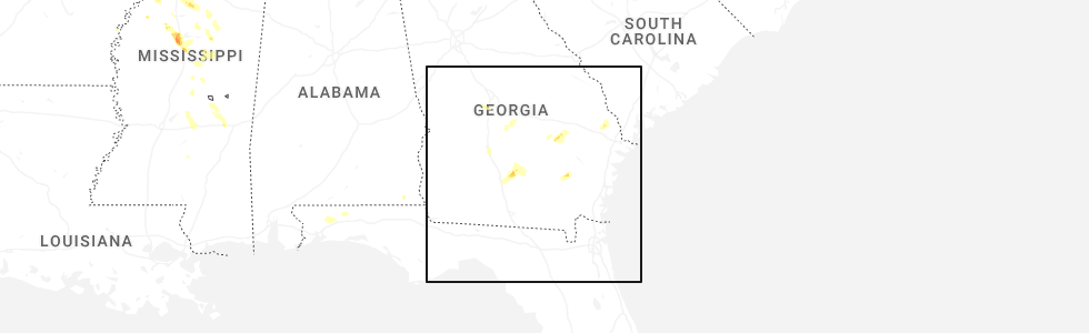
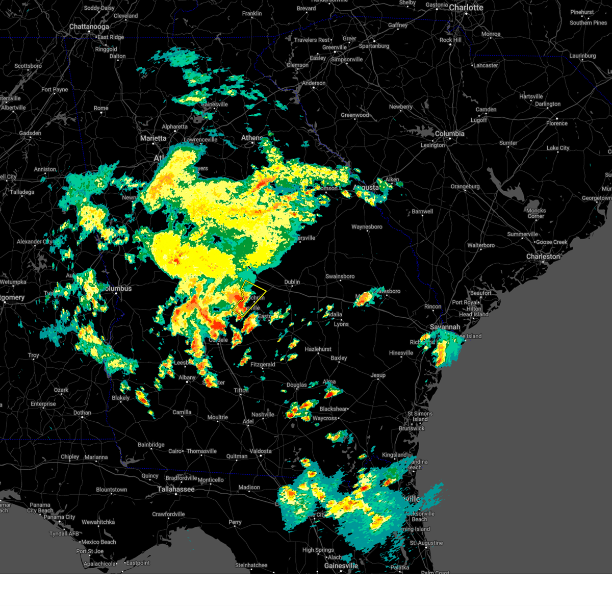
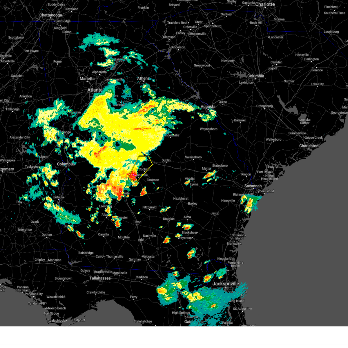
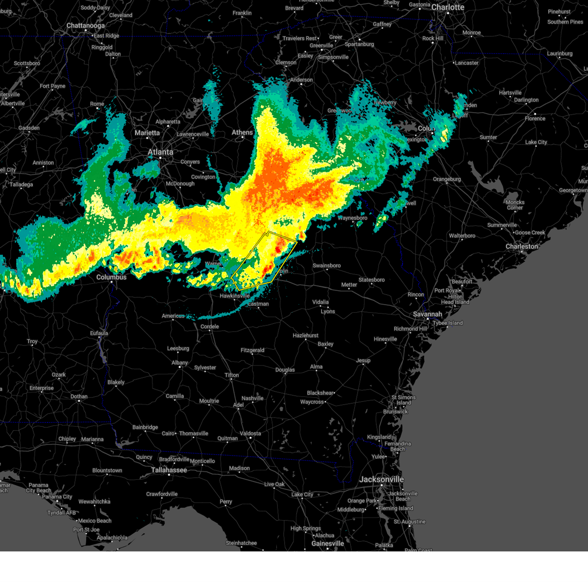
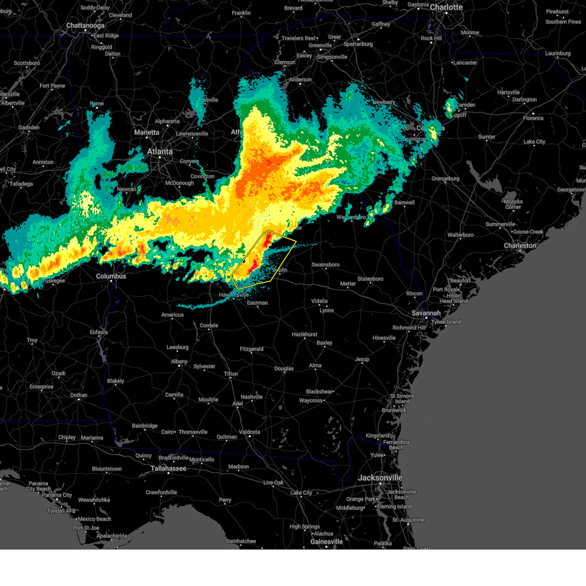
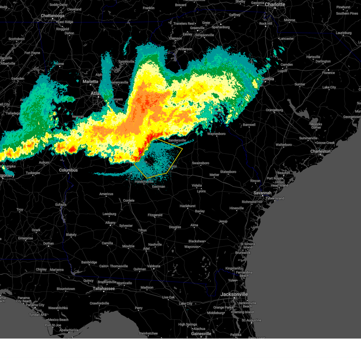
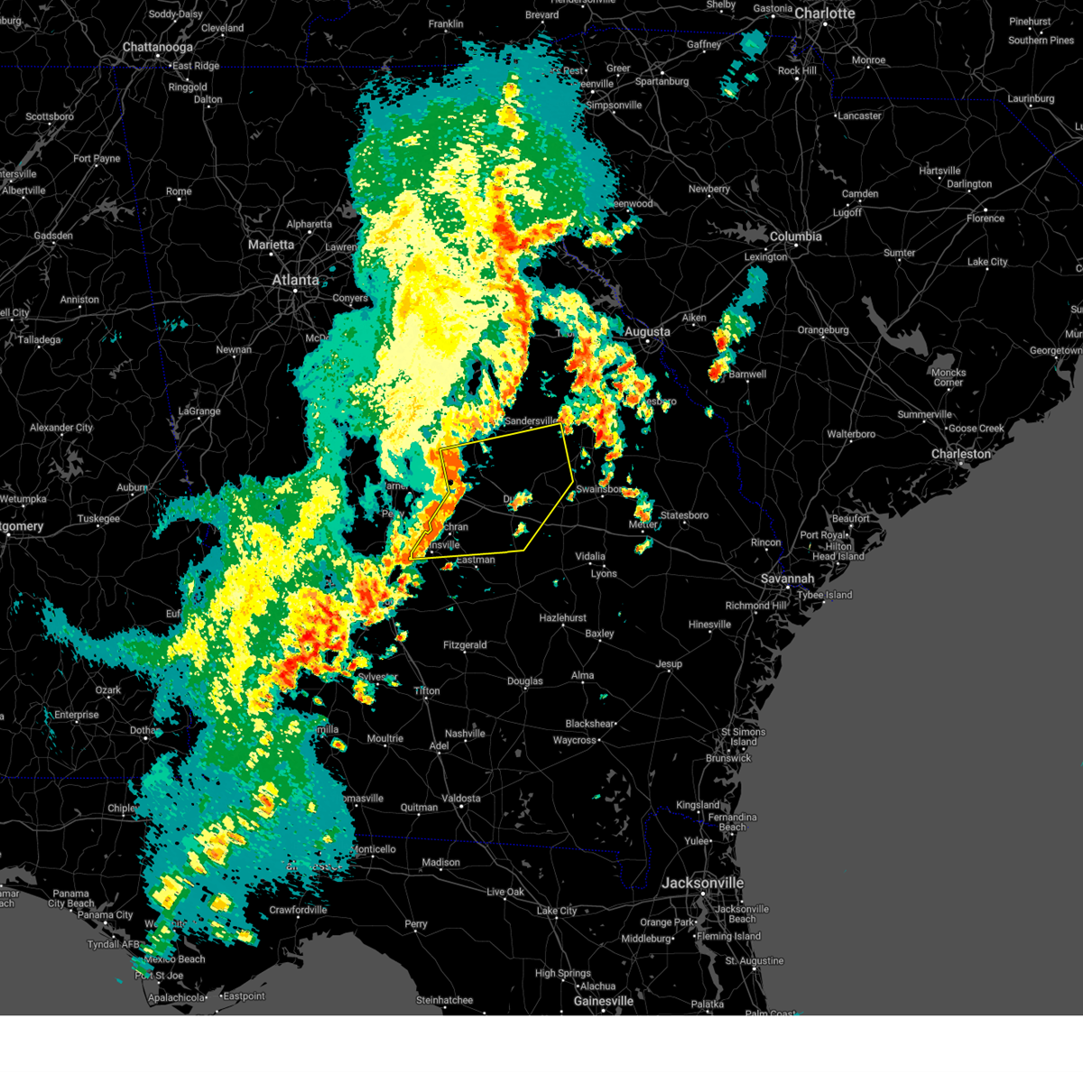
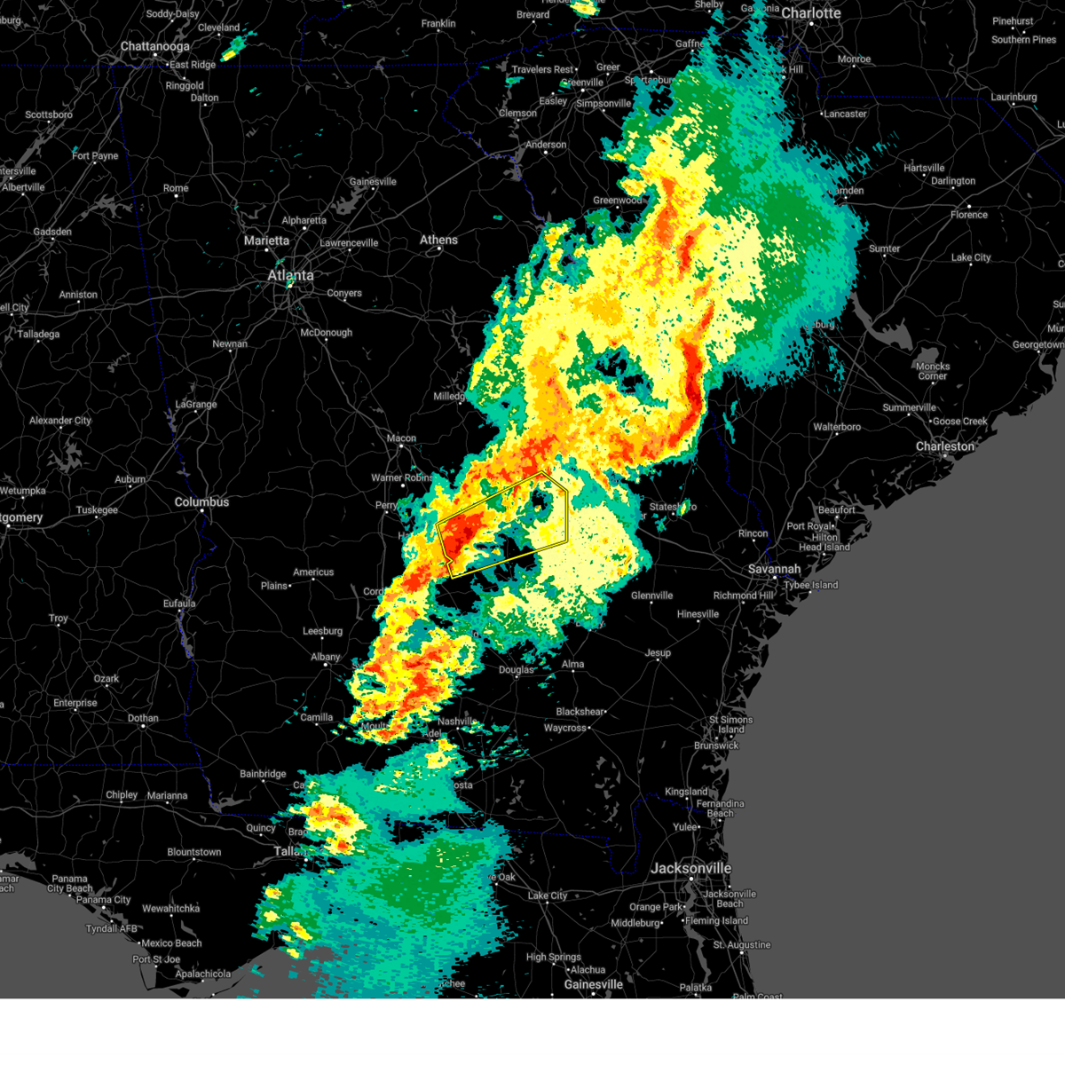
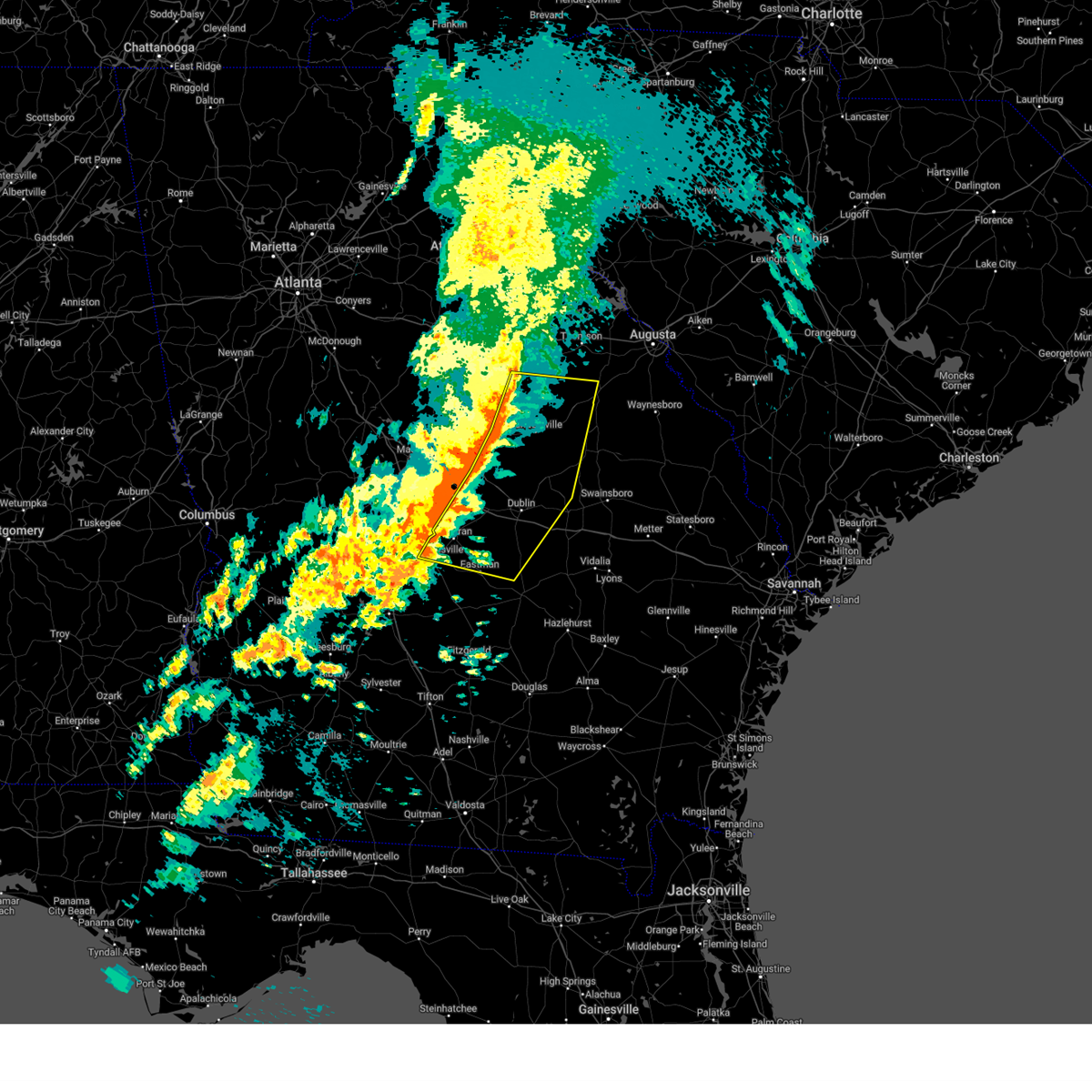
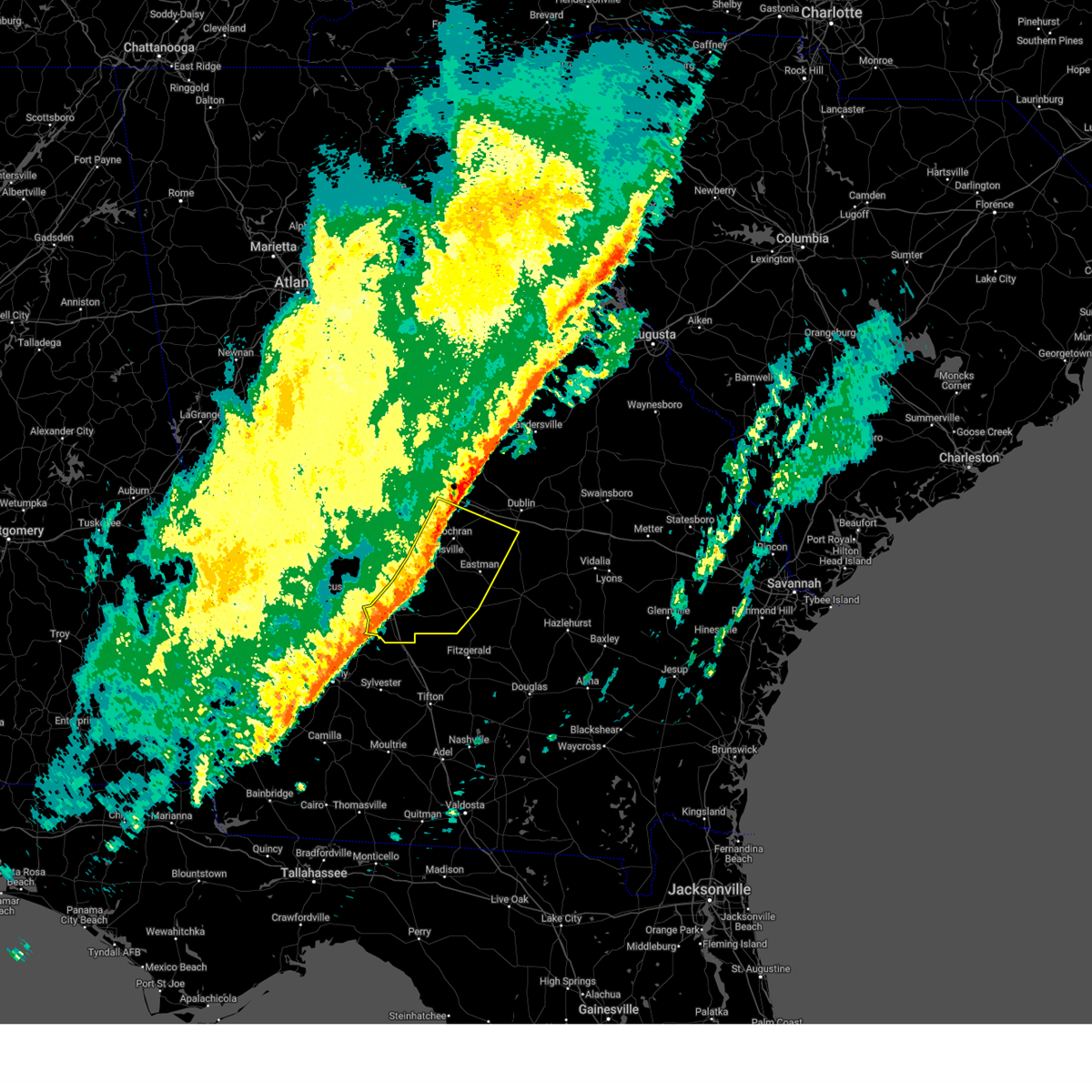
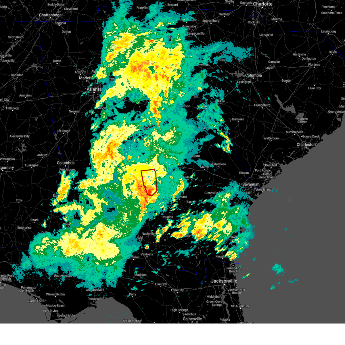
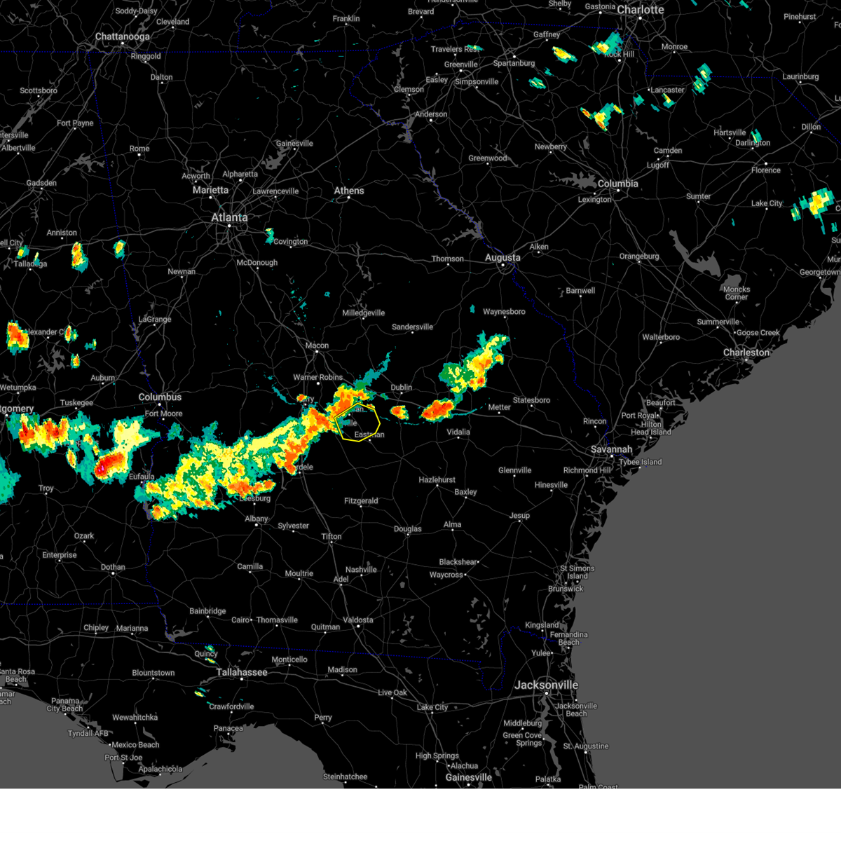
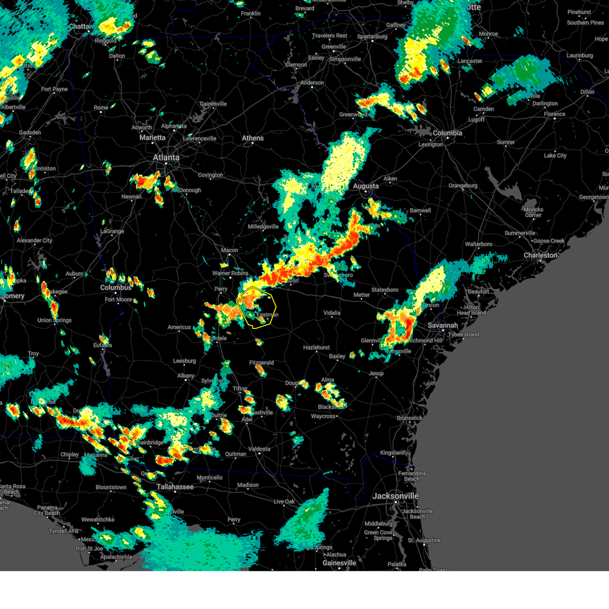
Hail Map for Cochran, GA
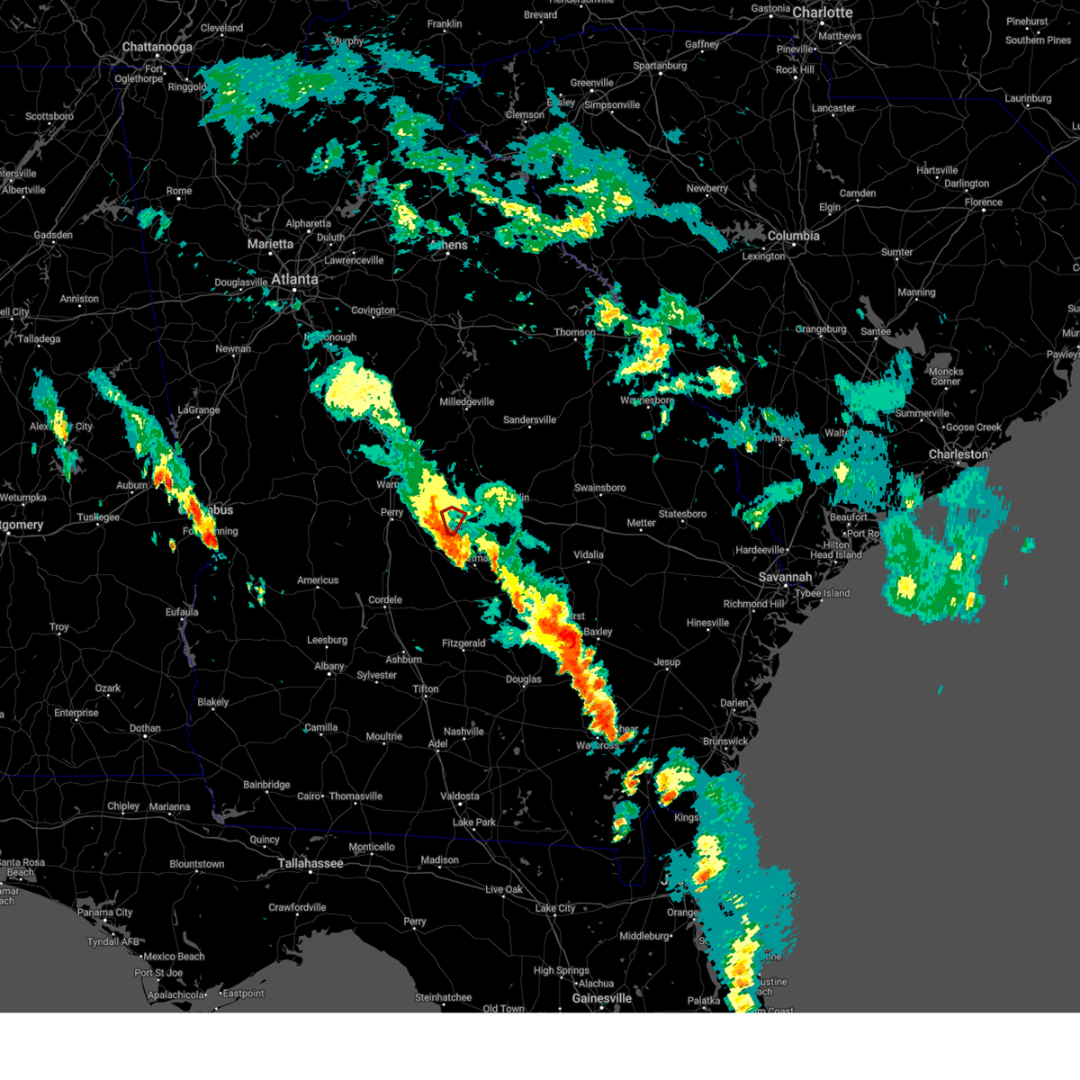
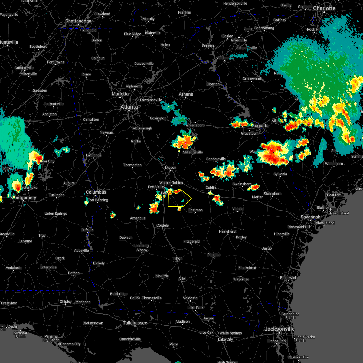
The Cochran, GA area has had 1 report of on-the-ground hail by trained spotters, and has been under severe weather warnings 33 times during the past 12 months. Doppler radar has detected hail at or near Cochran, GA on 58 occasions, including 3 occasions during the past year.
| Name: | Cochran, GA |
| Where Located: | 67.1 miles NNW of Douglas, GA |
| Map: | Google Map for Cochran, GA |
| Population: | 5150 |
| Housing Units: | 1909 |
| More Info: | Search Google for Cochran, GA |
1
The Top Recent Hail Date for Cochran, GA is Sunday, April 27, 2025 (18th out of 58)
Hail and Wind Damage Spotted near Cochran, GA
| Date / Time | Report Details |
|---|---|
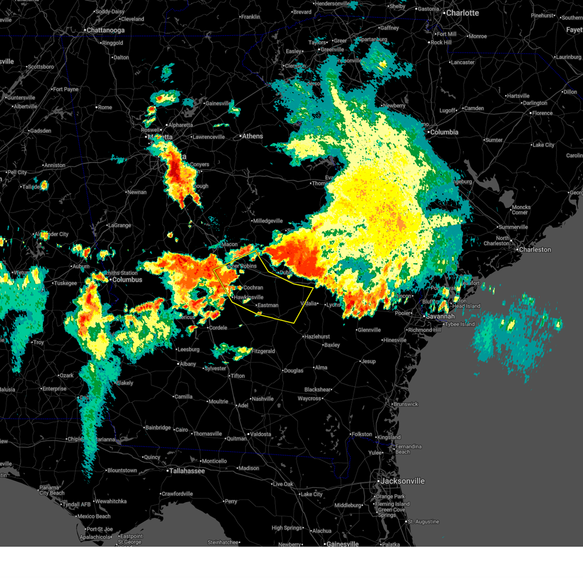
| 6/27/2025 4:02 PM EDT | Svrffc the national weather service in peachtree city has issued a * severe thunderstorm warning for, northwestern dodge county in central georgia, central pulaski county in central georgia, southwestern bleckley county in central georgia, * until 445 pm edt. * at 402 pm edt, a severe thunderstorm was located near gresston, or 7 miles west of eastman, moving northwest at 10 mph (radar indicated). Hazards include 60 mph wind gusts. expect damage to roofs, siding, and trees |
| 6/26/2025 12:32 AM EDT |
 Svrffc the national weather service in peachtree city has issued a * severe thunderstorm warning for, southwestern wilkinson county in central georgia, laurens county in central georgia, dodge county in central georgia, central pulaski county in central georgia, southern twiggs county in central georgia, north central telfair county in central georgia, southwestern treutlen county in east central georgia, bleckley county in central georgia, eastern houston county in central georgia, wheeler county in central georgia, northwestern montgomery county in central georgia, * until 130 am edt. * at 1232 am edt, severe thunderstorms were located along a line extending from near danville to near dudley to near lowery to near zaidee, moving southwest at 30 mph (radar indicated). Hazards include 60 mph wind gusts and quarter size hail. Hail damage to vehicles is expected. Expect wind damage to roofs, siding, and trees. Svrffc the national weather service in peachtree city has issued a * severe thunderstorm warning for, southwestern wilkinson county in central georgia, laurens county in central georgia, dodge county in central georgia, central pulaski county in central georgia, southern twiggs county in central georgia, north central telfair county in central georgia, southwestern treutlen county in east central georgia, bleckley county in central georgia, eastern houston county in central georgia, wheeler county in central georgia, northwestern montgomery county in central georgia, * until 130 am edt. * at 1232 am edt, severe thunderstorms were located along a line extending from near danville to near dudley to near lowery to near zaidee, moving southwest at 30 mph (radar indicated). Hazards include 60 mph wind gusts and quarter size hail. Hail damage to vehicles is expected. Expect wind damage to roofs, siding, and trees.
|
| 5/18/2025 11:27 AM EDT |
 Svrffc the national weather service in peachtree city has issued a * severe thunderstorm warning for, southern laurens county in central georgia, dodge county in central georgia, southern pulaski county in central georgia, telfair county in central georgia, wilcox county in central georgia, southeastern dooly county in central georgia, central bleckley county in central georgia, western wheeler county in central georgia, northeastern crisp county in central georgia, * until 1215 pm edt. * at 1124 am edt, severe thunderstorms were located along a line extending from near cochran to dubois to near ocmulgee banks to near finleyson to near vienna, moving southeast at 45 mph (radar indicated). Hazards include 60 mph wind gusts. expect damage to roofs, siding, and trees Svrffc the national weather service in peachtree city has issued a * severe thunderstorm warning for, southern laurens county in central georgia, dodge county in central georgia, southern pulaski county in central georgia, telfair county in central georgia, wilcox county in central georgia, southeastern dooly county in central georgia, central bleckley county in central georgia, western wheeler county in central georgia, northeastern crisp county in central georgia, * until 1215 pm edt. * at 1124 am edt, severe thunderstorms were located along a line extending from near cochran to dubois to near ocmulgee banks to near finleyson to near vienna, moving southeast at 45 mph (radar indicated). Hazards include 60 mph wind gusts. expect damage to roofs, siding, and trees
|
| 5/18/2025 10:46 AM EDT |
 Svrffc the national weather service in peachtree city has issued a * severe thunderstorm warning for, central laurens county in central georgia, dodge county in central georgia, southeastern marion county in west central georgia, southeastern bibb county in central georgia, houston county in central georgia, sumter county in west central georgia, northern crisp county in central georgia, southern wilkinson county in central georgia, southern macon county in west central georgia, pulaski county in central georgia, twiggs county in central georgia, northwestern wilcox county in central georgia, dooly county in central georgia, bleckley county in central georgia, east central webster county in west central georgia, schley county in west central georgia, * until 1130 am edt. * at 1045 am edt, severe thunderstorms were located along a line extending from near skipperton to centerville to near meadowdale to near whitewater state park to near buena vista, moving east at 55 mph (radar indicated). Hazards include 60 mph wind gusts. expect damage to roofs, siding, and trees Svrffc the national weather service in peachtree city has issued a * severe thunderstorm warning for, central laurens county in central georgia, dodge county in central georgia, southeastern marion county in west central georgia, southeastern bibb county in central georgia, houston county in central georgia, sumter county in west central georgia, northern crisp county in central georgia, southern wilkinson county in central georgia, southern macon county in west central georgia, pulaski county in central georgia, twiggs county in central georgia, northwestern wilcox county in central georgia, dooly county in central georgia, bleckley county in central georgia, east central webster county in west central georgia, schley county in west central georgia, * until 1130 am edt. * at 1045 am edt, severe thunderstorms were located along a line extending from near skipperton to centerville to near meadowdale to near whitewater state park to near buena vista, moving east at 55 mph (radar indicated). Hazards include 60 mph wind gusts. expect damage to roofs, siding, and trees
|
| 5/10/2025 7:05 PM EDT |
 At 704 pm edt, a severe thunderstorm was located over magnolia, or 7 miles west of cochran, moving northeast at 25 mph (radar indicated). Hazards include 60 mph wind gusts and penny size hail. Expect damage to roofs, siding, and trees. Locations impacted include, cochran, hawkinsville, browndale, coley station, tarversville, mobley crossing, magnolia, royal, ocmulgee public fishing area, paulk, cary, hartford, pulaski state prison, porter, and goldsboro. At 704 pm edt, a severe thunderstorm was located over magnolia, or 7 miles west of cochran, moving northeast at 25 mph (radar indicated). Hazards include 60 mph wind gusts and penny size hail. Expect damage to roofs, siding, and trees. Locations impacted include, cochran, hawkinsville, browndale, coley station, tarversville, mobley crossing, magnolia, royal, ocmulgee public fishing area, paulk, cary, hartford, pulaski state prison, porter, and goldsboro.
|
| 5/10/2025 7:05 PM EDT |
 the severe thunderstorm warning has been cancelled and is no longer in effect the severe thunderstorm warning has been cancelled and is no longer in effect
|
| 5/10/2025 6:45 PM EDT |
 Svrffc the national weather service in peachtree city has issued a * severe thunderstorm warning for, northwestern pulaski county in central georgia, southern twiggs county in central georgia, northeastern dooly county in central georgia, bleckley county in central georgia, southeastern houston county in central georgia, * until 730 pm edt. * at 644 pm edt, a severe thunderstorm was located over browndale, or near hawkinsville, moving northeast at 25 mph (radar indicated). Hazards include 60 mph wind gusts and quarter size hail. Hail damage to vehicles is expected. Expect wind damage to roofs, siding, and trees. Svrffc the national weather service in peachtree city has issued a * severe thunderstorm warning for, northwestern pulaski county in central georgia, southern twiggs county in central georgia, northeastern dooly county in central georgia, bleckley county in central georgia, southeastern houston county in central georgia, * until 730 pm edt. * at 644 pm edt, a severe thunderstorm was located over browndale, or near hawkinsville, moving northeast at 25 mph (radar indicated). Hazards include 60 mph wind gusts and quarter size hail. Hail damage to vehicles is expected. Expect wind damage to roofs, siding, and trees.
|
| 4/10/2025 11:48 PM EDT |
 the severe thunderstorm warning has been cancelled and is no longer in effect the severe thunderstorm warning has been cancelled and is no longer in effect
|
| 4/10/2025 11:33 PM EDT |
 the severe thunderstorm warning has been cancelled and is no longer in effect the severe thunderstorm warning has been cancelled and is no longer in effect
|
| 4/10/2025 11:33 PM EDT |
 At 1133 pm edt, severe thunderstorms were located along a line extending from near hebron to near royal, moving southeast at 40 mph (radar indicated). Hazards include 60 mph wind gusts and penny size hail. Expect damage to roofs, siding, and trees. Locations impacted include, jeffersonville, coley station, tarversville, allentown, dudley, oconee, irwinton, toomsboro, mcintyre, tuckers crossroad, nicklesville, montrose, magnolia, royal, danville, district path, paulk, hebron, goldsboro, and chappells mill. At 1133 pm edt, severe thunderstorms were located along a line extending from near hebron to near royal, moving southeast at 40 mph (radar indicated). Hazards include 60 mph wind gusts and penny size hail. Expect damage to roofs, siding, and trees. Locations impacted include, jeffersonville, coley station, tarversville, allentown, dudley, oconee, irwinton, toomsboro, mcintyre, tuckers crossroad, nicklesville, montrose, magnolia, royal, danville, district path, paulk, hebron, goldsboro, and chappells mill.
|
| 4/10/2025 11:11 PM EDT |
 Svrffc the national weather service in peachtree city has issued a * severe thunderstorm warning for, wilkinson county in central georgia, northwestern laurens county in central georgia, southern baldwin county in central georgia, twiggs county in central georgia, bleckley county in central georgia, southwestern washington county in east central georgia, northeastern houston county in central georgia, northwestern johnson county in east central georgia, * until midnight edt. * at 1111 pm edt, severe thunderstorms were located along a line extending from near milledgeville to centerville, moving southeast at 40 mph (radar indicated). Hazards include 60 mph wind gusts and quarter size hail. Hail damage to vehicles is expected. Expect wind damage to roofs, siding, and trees. Svrffc the national weather service in peachtree city has issued a * severe thunderstorm warning for, wilkinson county in central georgia, northwestern laurens county in central georgia, southern baldwin county in central georgia, twiggs county in central georgia, bleckley county in central georgia, southwestern washington county in east central georgia, northeastern houston county in central georgia, northwestern johnson county in east central georgia, * until midnight edt. * at 1111 pm edt, severe thunderstorms were located along a line extending from near milledgeville to centerville, moving southeast at 40 mph (radar indicated). Hazards include 60 mph wind gusts and quarter size hail. Hail damage to vehicles is expected. Expect wind damage to roofs, siding, and trees.
|
| 4/7/2025 10:05 AM EDT |
 the severe thunderstorm warning has been cancelled and is no longer in effect the severe thunderstorm warning has been cancelled and is no longer in effect
|
| 4/7/2025 9:30 AM EDT |
 Svrffc the national weather service in peachtree city has issued a * severe thunderstorm warning for, northwestern dodge county in central georgia, pulaski county in central georgia, wilcox county in central georgia, southeastern dooly county in central georgia, southwestern bleckley county in central georgia, crisp county in central georgia, * until 1015 am edt. * at 930 am edt, a severe thunderstorm was located over pineview, or 12 miles south of hawkinsville, moving northeast at 50 mph (radar indicated). Hazards include 60 mph wind gusts. expect damage to roofs, siding, and trees Svrffc the national weather service in peachtree city has issued a * severe thunderstorm warning for, northwestern dodge county in central georgia, pulaski county in central georgia, wilcox county in central georgia, southeastern dooly county in central georgia, southwestern bleckley county in central georgia, crisp county in central georgia, * until 1015 am edt. * at 930 am edt, a severe thunderstorm was located over pineview, or 12 miles south of hawkinsville, moving northeast at 50 mph (radar indicated). Hazards include 60 mph wind gusts. expect damage to roofs, siding, and trees
|
| 3/31/2025 3:14 PM EDT |
 the severe thunderstorm warning has been cancelled and is no longer in effect the severe thunderstorm warning has been cancelled and is no longer in effect
|
| 3/31/2025 3:14 PM EDT |
 At 314 pm edt, severe thunderstorms were located along a line extending from near oconee to near tuckers crossroad to near plainfield, moving east at 50 mph (radar indicated). Hazards include 60 mph wind gusts and penny size hail. Expect damage to roofs, siding, and trees. Locations impacted include, dubois, tennille, cochran, spann, dudley, oconee, plainfield, empire, dublin, toomsboro, mobley crossing, roddy, nicklesville, montrose, baileys park, rowland, minter, pringle, lovett, and harlow. At 314 pm edt, severe thunderstorms were located along a line extending from near oconee to near tuckers crossroad to near plainfield, moving east at 50 mph (radar indicated). Hazards include 60 mph wind gusts and penny size hail. Expect damage to roofs, siding, and trees. Locations impacted include, dubois, tennille, cochran, spann, dudley, oconee, plainfield, empire, dublin, toomsboro, mobley crossing, roddy, nicklesville, montrose, baileys park, rowland, minter, pringle, lovett, and harlow.
|
| 3/31/2025 2:46 PM EDT |
 Svrffc the national weather service in peachtree city has issued a * severe thunderstorm warning for, wilkinson county in central georgia, laurens county in central georgia, northwestern dodge county in central georgia, northern pulaski county in central georgia, eastern twiggs county in central georgia, bleckley county in central georgia, southern washington county in east central georgia, johnson county in east central georgia, * until 330 pm edt. * at 246 pm edt, severe thunderstorms were located along a line extending from near gordon to danville to hawkinsville, moving east at 50 mph (radar indicated). Hazards include 60 mph wind gusts and penny size hail. expect damage to roofs, siding, and trees Svrffc the national weather service in peachtree city has issued a * severe thunderstorm warning for, wilkinson county in central georgia, laurens county in central georgia, northwestern dodge county in central georgia, northern pulaski county in central georgia, eastern twiggs county in central georgia, bleckley county in central georgia, southern washington county in east central georgia, johnson county in east central georgia, * until 330 pm edt. * at 246 pm edt, severe thunderstorms were located along a line extending from near gordon to danville to hawkinsville, moving east at 50 mph (radar indicated). Hazards include 60 mph wind gusts and penny size hail. expect damage to roofs, siding, and trees
|
| 3/16/2025 7:15 AM EDT |
 The storm which prompted the warning has moved out of the area. therefore, the warning has been allowed to expire. a tornado watch remains in effect until 1000 am edt for central georgia. The storm which prompted the warning has moved out of the area. therefore, the warning has been allowed to expire. a tornado watch remains in effect until 1000 am edt for central georgia.
|
| 3/16/2025 7:05 AM EDT |
 the severe thunderstorm warning has been cancelled and is no longer in effect the severe thunderstorm warning has been cancelled and is no longer in effect
|
| 3/16/2025 7:05 AM EDT |
 At 705 am edt, a severe thunderstorm was located near gresston, or near eastman, moving northeast at 60 mph (radar indicated). Hazards include 60 mph wind gusts and penny size hail. Expect damage to roofs, siding, and trees. Locations impacted include, dubois, cochran, eastman, gresston, plainfield, empire, yonkers, mobley crossing, roddy, baileys park, union, ocmulgee banks, godwinsville, and paulk. At 705 am edt, a severe thunderstorm was located near gresston, or near eastman, moving northeast at 60 mph (radar indicated). Hazards include 60 mph wind gusts and penny size hail. Expect damage to roofs, siding, and trees. Locations impacted include, dubois, cochran, eastman, gresston, plainfield, empire, yonkers, mobley crossing, roddy, baileys park, union, ocmulgee banks, godwinsville, and paulk.
|
| 3/16/2025 7:04 AM EDT |
 Svrffc the national weather service in peachtree city has issued a * severe thunderstorm warning for, laurens county in central georgia, dodge county in central georgia, west central emanuel county in east central georgia, treutlen county in east central georgia, southeastern bleckley county in central georgia, southeastern johnson county in east central georgia, northwestern wheeler county in central georgia, northwestern montgomery county in central georgia, * until 745 am edt. * at 704 am edt, a severe thunderstorm was located over gresston, or near eastman, moving northeast at 60 mph (radar indicated). Hazards include 60 mph wind gusts and penny size hail. expect damage to roofs, siding, and trees Svrffc the national weather service in peachtree city has issued a * severe thunderstorm warning for, laurens county in central georgia, dodge county in central georgia, west central emanuel county in east central georgia, treutlen county in east central georgia, southeastern bleckley county in central georgia, southeastern johnson county in east central georgia, northwestern wheeler county in central georgia, northwestern montgomery county in central georgia, * until 745 am edt. * at 704 am edt, a severe thunderstorm was located over gresston, or near eastman, moving northeast at 60 mph (radar indicated). Hazards include 60 mph wind gusts and penny size hail. expect damage to roofs, siding, and trees
|
| 3/16/2025 6:44 AM EDT |
 At 644 am edt, a severe thunderstorm was located over finleyson, or 9 miles south of hawkinsville, moving northeast at 60 mph (radar indicated). Hazards include 60 mph wind gusts and quarter size hail. Hail damage to vehicles is expected. expect wind damage to roofs, siding, and trees. Locations impacted include, dubois, cochran, eastman, hawkinsville, plainfield, empire, mobley crossing, mock springs, roddy, baileys park, union, ocmulgee banks, finleyson, pleasant view, tippettville, godwinsville, pulaski state prison, gresston, yonkers, and cedar creek. At 644 am edt, a severe thunderstorm was located over finleyson, or 9 miles south of hawkinsville, moving northeast at 60 mph (radar indicated). Hazards include 60 mph wind gusts and quarter size hail. Hail damage to vehicles is expected. expect wind damage to roofs, siding, and trees. Locations impacted include, dubois, cochran, eastman, hawkinsville, plainfield, empire, mobley crossing, mock springs, roddy, baileys park, union, ocmulgee banks, finleyson, pleasant view, tippettville, godwinsville, pulaski state prison, gresston, yonkers, and cedar creek.
|
| 3/16/2025 6:25 AM EDT |
 Svrffc the national weather service in peachtree city has issued a * severe thunderstorm warning for, northwestern dodge county in central georgia, pulaski county in central georgia, northwestern wilcox county in central georgia, eastern dooly county in central georgia, southwestern bleckley county in central georgia, northern crisp county in central georgia, * until 715 am edt. * at 625 am edt, a severe thunderstorm was located over richwood, or near vienna, moving northeast at 60 mph (radar indicated). Hazards include 60 mph wind gusts. expect damage to roofs, siding, and trees Svrffc the national weather service in peachtree city has issued a * severe thunderstorm warning for, northwestern dodge county in central georgia, pulaski county in central georgia, northwestern wilcox county in central georgia, eastern dooly county in central georgia, southwestern bleckley county in central georgia, northern crisp county in central georgia, * until 715 am edt. * at 625 am edt, a severe thunderstorm was located over richwood, or near vienna, moving northeast at 60 mph (radar indicated). Hazards include 60 mph wind gusts. expect damage to roofs, siding, and trees
|
| 3/16/2025 5:09 AM EDT |
 The storms which prompted the warning have moved out of the area. therefore, the warning will be allowed to expire. a tornado watch remains in effect until 1000 am edt for central and east central georgia. remember, a severe thunderstorm warning still remains in effect for jefferson, johnson, laurens, and dodge counties!. The storms which prompted the warning have moved out of the area. therefore, the warning will be allowed to expire. a tornado watch remains in effect until 1000 am edt for central and east central georgia. remember, a severe thunderstorm warning still remains in effect for jefferson, johnson, laurens, and dodge counties!.
|
| 3/16/2025 4:31 AM EDT |
 Svrffc the national weather service in peachtree city has issued a * severe thunderstorm warning for, laurens county in central georgia, northern dodge county in central georgia, southeastern hancock county in east central georgia, glascock county in east central georgia, western jefferson county in east central georgia, wilkinson county in central georgia, east central baldwin county in central georgia, south central warren county in east central georgia, northern pulaski county in central georgia, southeastern twiggs county in central georgia, bleckley county in central georgia, washington county in east central georgia, johnson county in east central georgia, * until 515 am edt. * at 430 am edt, severe thunderstorms were located along a line extending from 6 miles southeast of sparta to hebron to near nicklesville to near cary to near hawkinsville, moving southeast at 40 mph (radar indicated). Hazards include 60 mph wind gusts. expect damage to roofs, siding, and trees Svrffc the national weather service in peachtree city has issued a * severe thunderstorm warning for, laurens county in central georgia, northern dodge county in central georgia, southeastern hancock county in east central georgia, glascock county in east central georgia, western jefferson county in east central georgia, wilkinson county in central georgia, east central baldwin county in central georgia, south central warren county in east central georgia, northern pulaski county in central georgia, southeastern twiggs county in central georgia, bleckley county in central georgia, washington county in east central georgia, johnson county in east central georgia, * until 515 am edt. * at 430 am edt, severe thunderstorms were located along a line extending from 6 miles southeast of sparta to hebron to near nicklesville to near cary to near hawkinsville, moving southeast at 40 mph (radar indicated). Hazards include 60 mph wind gusts. expect damage to roofs, siding, and trees
|
| 2/16/2025 6:36 AM EST |
 At 636 am est, severe thunderstorms were located along a line extending from near cary to finleyson to near doles, moving southeast at 50 mph (radar indicated). Hazards include 60 mph wind gusts. Expect damage to roofs, siding, and trees. Locations impacted include, cordele, cochran, eastman, hawkinsville, vienna, abbeville, chester, rochelle, arabi, dexter, cadwell, pineview, rhine, pitts, rentz, union, plainfield, mobley crossing, mock springs, and seville. At 636 am est, severe thunderstorms were located along a line extending from near cary to finleyson to near doles, moving southeast at 50 mph (radar indicated). Hazards include 60 mph wind gusts. Expect damage to roofs, siding, and trees. Locations impacted include, cordele, cochran, eastman, hawkinsville, vienna, abbeville, chester, rochelle, arabi, dexter, cadwell, pineview, rhine, pitts, rentz, union, plainfield, mobley crossing, mock springs, and seville.
|
| 2/16/2025 6:36 AM EST |
 the severe thunderstorm warning has been cancelled and is no longer in effect the severe thunderstorm warning has been cancelled and is no longer in effect
|
| 2/16/2025 5:55 AM EST |
 Svrffc the national weather service in peachtree city has issued a * severe thunderstorm warning for, southwestern laurens county in central georgia, dodge county in central georgia, houston county in central georgia, sumter county in west central georgia, crisp county in central georgia, macon county in west central georgia, pulaski county in central georgia, southern twiggs county in central georgia, wilcox county in central georgia, dooly county in central georgia, bleckley county in central georgia, southeastern webster county in west central georgia, peach county in central georgia, southeastern crawford county in central georgia, southeastern schley county in west central georgia, * until 700 am est. * at 555 am est, severe thunderstorms were located along a line extending from near jack brown estates to near montezuma to near croxton crossroads, moving southeast at 50 mph (radar indicated). Hazards include 60 mph wind gusts. expect damage to roofs, siding, and trees Svrffc the national weather service in peachtree city has issued a * severe thunderstorm warning for, southwestern laurens county in central georgia, dodge county in central georgia, houston county in central georgia, sumter county in west central georgia, crisp county in central georgia, macon county in west central georgia, pulaski county in central georgia, southern twiggs county in central georgia, wilcox county in central georgia, dooly county in central georgia, bleckley county in central georgia, southeastern webster county in west central georgia, peach county in central georgia, southeastern crawford county in central georgia, southeastern schley county in west central georgia, * until 700 am est. * at 555 am est, severe thunderstorms were located along a line extending from near jack brown estates to near montezuma to near croxton crossroads, moving southeast at 50 mph (radar indicated). Hazards include 60 mph wind gusts. expect damage to roofs, siding, and trees
|
| 12/29/2024 6:44 AM EST |
 The storms which prompted the warning have weakened below severe limits, and no longer pose an immediate threat to life or property. therefore, the warning will be allowed to expire. however, gusty winds are still possible with these thunderstorms. a tornado watch remains in effect until 900 am est for central and east central georgia. The storms which prompted the warning have weakened below severe limits, and no longer pose an immediate threat to life or property. therefore, the warning will be allowed to expire. however, gusty winds are still possible with these thunderstorms. a tornado watch remains in effect until 900 am est for central and east central georgia.
|
| 12/29/2024 5:51 AM EST |
 Svrffc the national weather service in peachtree city has issued a * severe thunderstorm warning for, western laurens county in central georgia, northwestern dodge county in central georgia, hancock county in east central georgia, west central glascock county in east central georgia, east central houston county in central georgia, taliaferro county in east central georgia, wilkinson county in central georgia, baldwin county in central georgia, western warren county in east central georgia, southeastern morgan county in north central georgia, twiggs county in central georgia, central putnam county in central georgia, bleckley county in central georgia, southern greene county in east central georgia, washington county in east central georgia, northwestern johnson county in east central georgia, * until 645 am est. * at 550 am est, severe thunderstorms were located along a line extending from swords to near gordon to bonaire, moving east at 35 mph (radar indicated). Hazards include 60 mph wind gusts. expect damage to roofs, siding, and trees Svrffc the national weather service in peachtree city has issued a * severe thunderstorm warning for, western laurens county in central georgia, northwestern dodge county in central georgia, hancock county in east central georgia, west central glascock county in east central georgia, east central houston county in central georgia, taliaferro county in east central georgia, wilkinson county in central georgia, baldwin county in central georgia, western warren county in east central georgia, southeastern morgan county in north central georgia, twiggs county in central georgia, central putnam county in central georgia, bleckley county in central georgia, southern greene county in east central georgia, washington county in east central georgia, northwestern johnson county in east central georgia, * until 645 am est. * at 550 am est, severe thunderstorms were located along a line extending from swords to near gordon to bonaire, moving east at 35 mph (radar indicated). Hazards include 60 mph wind gusts. expect damage to roofs, siding, and trees
|
| 9/26/2024 1:03 AM EDT |
 At 103 am edt, a severe thunderstorm capable of producing a tornado was located over union, or near eastman, moving north at 25 mph (radar indicated rotation). Hazards include tornado. Flying debris will be dangerous to those caught without shelter. mobile homes will be damaged or destroyed. damage to roofs, windows, and vehicles will occur. tree damage is likely. Locations impacted include, cochran, eastman, chester, union, dubois, gresston, plainfield, empire, yonkers, roddy, baileys park, five points, and godwinsville. At 103 am edt, a severe thunderstorm capable of producing a tornado was located over union, or near eastman, moving north at 25 mph (radar indicated rotation). Hazards include tornado. Flying debris will be dangerous to those caught without shelter. mobile homes will be damaged or destroyed. damage to roofs, windows, and vehicles will occur. tree damage is likely. Locations impacted include, cochran, eastman, chester, union, dubois, gresston, plainfield, empire, yonkers, roddy, baileys park, five points, and godwinsville.
|
| 9/26/2024 12:44 AM EDT |
 Torffc the national weather service in peachtree city has issued a * tornado warning for, dodge county in central georgia, southeastern pulaski county in central georgia, south central bleckley county in central georgia, * until 115 am edt. * at 1244 am edt, a severe thunderstorm capable of producing a tornado was located over rhine, or near abbeville, moving north at 25 mph (radar indicated rotation). Hazards include tornado. Flying debris will be dangerous to those caught without shelter. mobile homes will be damaged or destroyed. damage to roofs, windows, and vehicles will occur. Tree damage is likely. Torffc the national weather service in peachtree city has issued a * tornado warning for, dodge county in central georgia, southeastern pulaski county in central georgia, south central bleckley county in central georgia, * until 115 am edt. * at 1244 am edt, a severe thunderstorm capable of producing a tornado was located over rhine, or near abbeville, moving north at 25 mph (radar indicated rotation). Hazards include tornado. Flying debris will be dangerous to those caught without shelter. mobile homes will be damaged or destroyed. damage to roofs, windows, and vehicles will occur. Tree damage is likely.
|
| 8/18/2024 7:59 PM EDT |
 Svrffc the national weather service in peachtree city has issued a * severe thunderstorm warning for, northwestern dodge county in central georgia, northeastern pulaski county in central georgia, southern bleckley county in central georgia, * until 845 pm edt. * at 759 pm edt, a severe thunderstorm was located over cochran, moving southeast at 30 mph (radar indicated). Hazards include 60 mph wind gusts. expect damage to roofs, siding, and trees Svrffc the national weather service in peachtree city has issued a * severe thunderstorm warning for, northwestern dodge county in central georgia, northeastern pulaski county in central georgia, southern bleckley county in central georgia, * until 845 pm edt. * at 759 pm edt, a severe thunderstorm was located over cochran, moving southeast at 30 mph (radar indicated). Hazards include 60 mph wind gusts. expect damage to roofs, siding, and trees
|
| 7/29/2024 5:46 PM EDT |
 Svrffc the national weather service in peachtree city has issued a * severe thunderstorm warning for, northwestern dodge county in central georgia, central pulaski county in central georgia, bleckley county in central georgia, * until 630 pm edt. * at 546 pm edt, a severe thunderstorm was located over baileys park, or near cochran, moving southeast at 25 mph (radar indicated). Hazards include 60 mph wind gusts and penny size hail. expect damage to roofs, siding, and trees Svrffc the national weather service in peachtree city has issued a * severe thunderstorm warning for, northwestern dodge county in central georgia, central pulaski county in central georgia, bleckley county in central georgia, * until 630 pm edt. * at 546 pm edt, a severe thunderstorm was located over baileys park, or near cochran, moving southeast at 25 mph (radar indicated). Hazards include 60 mph wind gusts and penny size hail. expect damage to roofs, siding, and trees
|
| 5/9/2024 12:32 PM EDT |
 Svrffc the national weather service in peachtree city has issued a * severe thunderstorm warning for, western laurens county in central georgia, northwestern dodge county in central georgia, northern pulaski county in central georgia, southern twiggs county in central georgia, bleckley county in central georgia, southeastern houston county in central georgia, * until 115 pm edt. * at 1232 pm edt, a severe thunderstorm was located near goldsboro, or near cochran, moving east at 60 mph (radar indicated). Hazards include 60 mph wind gusts and quarter size hail. Hail damage to vehicles is expected. Expect wind damage to roofs, siding, and trees. Svrffc the national weather service in peachtree city has issued a * severe thunderstorm warning for, western laurens county in central georgia, northwestern dodge county in central georgia, northern pulaski county in central georgia, southern twiggs county in central georgia, bleckley county in central georgia, southeastern houston county in central georgia, * until 115 pm edt. * at 1232 pm edt, a severe thunderstorm was located near goldsboro, or near cochran, moving east at 60 mph (radar indicated). Hazards include 60 mph wind gusts and quarter size hail. Hail damage to vehicles is expected. Expect wind damage to roofs, siding, and trees.
|
| 4/3/2024 5:06 AM EDT |
 Svrffc the national weather service in peachtree city has issued a * severe thunderstorm warning for, northwestern dodge county in central georgia, pulaski county in central georgia, northwestern wilcox county in central georgia, southeastern dooly county in central georgia, southwestern bleckley county in central georgia, northeastern crisp county in central georgia, * until 545 am edt. * at 506 am edt, a severe thunderstorm was located over tremont, or near cordele, moving northeast at 55 mph (radar indicated). Hazards include 60 mph wind gusts. expect damage to roofs, siding, and trees Svrffc the national weather service in peachtree city has issued a * severe thunderstorm warning for, northwestern dodge county in central georgia, pulaski county in central georgia, northwestern wilcox county in central georgia, southeastern dooly county in central georgia, southwestern bleckley county in central georgia, northeastern crisp county in central georgia, * until 545 am edt. * at 506 am edt, a severe thunderstorm was located over tremont, or near cordele, moving northeast at 55 mph (radar indicated). Hazards include 60 mph wind gusts. expect damage to roofs, siding, and trees
|
| 1/9/2024 11:19 AM EST |
 At 1119 am est, severe thunderstorms were located along a line extending from robins afb to near magnolia to tippettville, moving northeast at 70 mph (radar indicated). Hazards include 60 mph wind gusts. expect damage to roofs, siding, and trees At 1119 am est, severe thunderstorms were located along a line extending from robins afb to near magnolia to tippettville, moving northeast at 70 mph (radar indicated). Hazards include 60 mph wind gusts. expect damage to roofs, siding, and trees
|
| 1/9/2024 10:54 AM EST |
 At 1053 am est, severe thunderstorms were located along a line extending from robins afb to dooling to warwick, moving northeast at 75 mph (radar indicated). Hazards include 60 mph wind gusts. Expect damage to roofs, siding, and trees. Locations impacted include, perry, cordele, cochran, hawkinsville, vienna, warner robins, unadilla, arabi, byromville, pineview, pinehurst, pitts, danville, montrose, lilly, allentown, dooling, robins afb, hayneville, and robins air force base. At 1053 am est, severe thunderstorms were located along a line extending from robins afb to dooling to warwick, moving northeast at 75 mph (radar indicated). Hazards include 60 mph wind gusts. Expect damage to roofs, siding, and trees. Locations impacted include, perry, cordele, cochran, hawkinsville, vienna, warner robins, unadilla, arabi, byromville, pineview, pinehurst, pitts, danville, montrose, lilly, allentown, dooling, robins afb, hayneville, and robins air force base.
|
| 1/9/2024 10:30 AM EST | Tree down across butts rd near the intersection at hwy 26 eas in bleckley county GA, 5.3 miles SSW of Cochran, GA |
| 1/9/2024 10:30 AM EST | Tree down along hwy 278 near the intersection at hwy 26 eas in bleckley county GA, 5.7 miles SW of Cochran, GA |
| 1/9/2024 10:30 AM EST |
 At 1030 am est, severe thunderstorms were located along a line extending from near centerville to perry to near dooling to near huntington, moving northeast at 45 mph (radar indicated). Hazards include 60 mph wind gusts. expect damage to roofs, siding, and trees At 1030 am est, severe thunderstorms were located along a line extending from near centerville to perry to near dooling to near huntington, moving northeast at 45 mph (radar indicated). Hazards include 60 mph wind gusts. expect damage to roofs, siding, and trees
|
| 9/14/2023 5:50 PM EDT |
 The severe thunderstorm warning for northwestern dodge, northeastern pulaski and bleckley counties will expire at 600 pm edt, the storm which prompted the warning has weakened below severe limits, and no longer poses an immediate threat to life or property. therefore, the warning will be allowed to expire. however, heavy rain is still possible with this thunderstorm. The severe thunderstorm warning for northwestern dodge, northeastern pulaski and bleckley counties will expire at 600 pm edt, the storm which prompted the warning has weakened below severe limits, and no longer poses an immediate threat to life or property. therefore, the warning will be allowed to expire. however, heavy rain is still possible with this thunderstorm.
|
| 9/14/2023 5:37 PM EDT |
 At 537 pm edt, a severe thunderstorm was located over porter, or near cochran, moving southeast at 15 mph (radar indicated). Hazards include 60 mph wind gusts. Expect damage to roofs, siding, and trees. locations impacted include, cochran, hawkinsville, dubois, coley station, gresston, empire, yonkers, mobley crossing, roddy, baileys park, magnolia, rowland, royal, ocmulgee public fishing area, paulk, goldsboro, pulaski state prison, and porter. hail threat, radar indicated max hail size, <. 75 in wind threat, radar indicated max wind gust, 60 mph. At 537 pm edt, a severe thunderstorm was located over porter, or near cochran, moving southeast at 15 mph (radar indicated). Hazards include 60 mph wind gusts. Expect damage to roofs, siding, and trees. locations impacted include, cochran, hawkinsville, dubois, coley station, gresston, empire, yonkers, mobley crossing, roddy, baileys park, magnolia, rowland, royal, ocmulgee public fishing area, paulk, goldsboro, pulaski state prison, and porter. hail threat, radar indicated max hail size, <. 75 in wind threat, radar indicated max wind gust, 60 mph.
|
| 9/14/2023 5:09 PM EDT |
 At 508 pm edt, a severe thunderstorm was located near tarversville, or 12 miles northwest of cochran, moving southeast at 15 mph (radar indicated). Hazards include 60 mph wind gusts. expect damage to roofs, siding, and trees At 508 pm edt, a severe thunderstorm was located near tarversville, or 12 miles northwest of cochran, moving southeast at 15 mph (radar indicated). Hazards include 60 mph wind gusts. expect damage to roofs, siding, and trees
|
| 9/7/2023 8:20 PM EDT |
 The severe thunderstorm warning for southwestern laurens, east central macon, northern dodge, pulaski, northeastern dooly, bleckley and southern houston counties will expire at 830 pm edt, the storms which prompted the warning have weakened below severe limits, and no longer pose an immediate threat to life or property. therefore, the warning will be allowed to expire. The severe thunderstorm warning for southwestern laurens, east central macon, northern dodge, pulaski, northeastern dooly, bleckley and southern houston counties will expire at 830 pm edt, the storms which prompted the warning have weakened below severe limits, and no longer pose an immediate threat to life or property. therefore, the warning will be allowed to expire.
|
| 9/7/2023 7:57 PM EDT |
 At 756 pm edt, severe thunderstorms were located along a line extending from near henderson to near cedar grove, moving east at 25 mph (radar indicated). Hazards include 60 mph wind gusts and quarter size hail. Hail damage to vehicles is expected. Expect wind damage to roofs, siding, and trees. At 756 pm edt, severe thunderstorms were located along a line extending from near henderson to near cedar grove, moving east at 25 mph (radar indicated). Hazards include 60 mph wind gusts and quarter size hail. Hail damage to vehicles is expected. Expect wind damage to roofs, siding, and trees.
|
| 9/7/2023 7:52 PM EDT |
 At 751 pm edt, severe thunderstorms were located along a line extending from near saint louis to cochran, and are nearly stationary (radar indicated). Hazards include 60 mph wind gusts and quarter size hail. Hail damage to vehicles is expected. expect wind damage to roofs, siding, and trees. locations impacted include, perry, cochran, eastman, hawkinsville, unadilla, chester, pinehurst, dubois, hayneville, browndale, meadowdale, plainfield, empire, mobley crossing, elko, mock springs, roddy, grove park, baileys park, and rowland. hail threat, radar indicated max hail size, 1. 00 in wind threat, radar indicated max wind gust, 60 mph. At 751 pm edt, severe thunderstorms were located along a line extending from near saint louis to cochran, and are nearly stationary (radar indicated). Hazards include 60 mph wind gusts and quarter size hail. Hail damage to vehicles is expected. expect wind damage to roofs, siding, and trees. locations impacted include, perry, cochran, eastman, hawkinsville, unadilla, chester, pinehurst, dubois, hayneville, browndale, meadowdale, plainfield, empire, mobley crossing, elko, mock springs, roddy, grove park, baileys park, and rowland. hail threat, radar indicated max hail size, 1. 00 in wind threat, radar indicated max wind gust, 60 mph.
|
| 9/7/2023 7:20 PM EDT |
 At 720 pm edt, severe thunderstorms were located along a line extending from near saint louis to cochran, and are nearly stationary (radar indicated). Hazards include 60 mph wind gusts and quarter size hail. Hail damage to vehicles is expected. Expect wind damage to roofs, siding, and trees. At 720 pm edt, severe thunderstorms were located along a line extending from near saint louis to cochran, and are nearly stationary (radar indicated). Hazards include 60 mph wind gusts and quarter size hail. Hail damage to vehicles is expected. Expect wind damage to roofs, siding, and trees.
|
| 9/7/2023 6:22 PM EDT | Emergency manager reported metal roofing removed from a carport and damage to the roof of a barn on the 1500 block of hwy 35 in twiggs county GA, 14.3 miles S of Cochran, GA |
| 9/7/2023 6:20 PM EDT |
 The severe thunderstorm warning for northwestern dodge, central pulaski and bleckley counties will expire at 630 pm edt, the storm which prompted the warning has weakened below severe limits, and no longer poses an immediate threat to life or property. therefore, the warning will be allowed to expire. The severe thunderstorm warning for northwestern dodge, central pulaski and bleckley counties will expire at 630 pm edt, the storm which prompted the warning has weakened below severe limits, and no longer poses an immediate threat to life or property. therefore, the warning will be allowed to expire.
|
| 9/7/2023 6:08 PM EDT |
 At 607 pm edt, a severe thunderstorm was located over cochran, moving east at 20 mph (radar indicated). Hazards include 60 mph wind gusts and quarter size hail. Hail damage to vehicles is expected. expect wind damage to roofs, siding, and trees. locations impacted include, cochran, eastman, hawkinsville, chester, dubois, coley station, gresston, empire, yonkers, mobley crossing, roddy, baileys park, magnolia, rowland, royal, paulk, goldsboro, rebie, hartford, and pulaski state prison. hail threat, radar indicated max hail size, 1. 00 in wind threat, radar indicated max wind gust, 60 mph. At 607 pm edt, a severe thunderstorm was located over cochran, moving east at 20 mph (radar indicated). Hazards include 60 mph wind gusts and quarter size hail. Hail damage to vehicles is expected. expect wind damage to roofs, siding, and trees. locations impacted include, cochran, eastman, hawkinsville, chester, dubois, coley station, gresston, empire, yonkers, mobley crossing, roddy, baileys park, magnolia, rowland, royal, paulk, goldsboro, rebie, hartford, and pulaski state prison. hail threat, radar indicated max hail size, 1. 00 in wind threat, radar indicated max wind gust, 60 mph.
|
| 9/7/2023 5:57 PM EDT |
 The severe thunderstorm warning for northwestern pulaski, southwestern twiggs, west central bleckley and southeastern houston counties will expire at 600 pm edt, the storm which prompted the warning has moved out of the area. therefore, the warning will be allowed to expire. remember, a severe thunderstorm warning still remains in effect for portions of western bleckley and southeastern houston counties until 630 pm edt. The severe thunderstorm warning for northwestern pulaski, southwestern twiggs, west central bleckley and southeastern houston counties will expire at 600 pm edt, the storm which prompted the warning has moved out of the area. therefore, the warning will be allowed to expire. remember, a severe thunderstorm warning still remains in effect for portions of western bleckley and southeastern houston counties until 630 pm edt.
|
| 9/7/2023 5:47 PM EDT |
 At 546 pm edt, a severe thunderstorm was located over ocmulgee public fishing area, or near hawkinsville, moving east at 20 mph (radar indicated). Hazards include 60 mph wind gusts and half dollar size hail. Hail damage to vehicles is expected. Expect wind damage to roofs, siding, and trees. At 546 pm edt, a severe thunderstorm was located over ocmulgee public fishing area, or near hawkinsville, moving east at 20 mph (radar indicated). Hazards include 60 mph wind gusts and half dollar size hail. Hail damage to vehicles is expected. Expect wind damage to roofs, siding, and trees.
|
| 9/7/2023 5:44 PM EDT |
 At 543 pm edt, a severe thunderstorm was located over ocmulgee public fishing area, or 7 miles north of hawkinsville, moving east at 20 mph (public. at 520pm edt ping pong ball sized hail was reported northeast of perry). Hazards include ping pong ball size hail and 60 mph wind gusts. People and animals outdoors will be injured. expect hail damage to roofs, siding, windows, and vehicles. expect wind damage to roofs, siding, and trees. locations impacted include, perry, cochran, hawkinsville, warner robins, hayneville, tarversville, sand bed, houston lake, magnolia, ocmulgee public fishing area, paulk, porter, bonaire, kathleen, klondike, clinchfield, and coley station. hail threat, observed max hail size, 1. 50 in wind threat, radar indicated max wind gust, 60 mph. At 543 pm edt, a severe thunderstorm was located over ocmulgee public fishing area, or 7 miles north of hawkinsville, moving east at 20 mph (public. at 520pm edt ping pong ball sized hail was reported northeast of perry). Hazards include ping pong ball size hail and 60 mph wind gusts. People and animals outdoors will be injured. expect hail damage to roofs, siding, windows, and vehicles. expect wind damage to roofs, siding, and trees. locations impacted include, perry, cochran, hawkinsville, warner robins, hayneville, tarversville, sand bed, houston lake, magnolia, ocmulgee public fishing area, paulk, porter, bonaire, kathleen, klondike, clinchfield, and coley station. hail threat, observed max hail size, 1. 50 in wind threat, radar indicated max wind gust, 60 mph.
|
| 9/7/2023 5:41 PM EDT |
 At 541 pm edt, a severe thunderstorm was located over ocmulgee public fishing area, or 7 miles north of hawkinsville, moving east at 20 mph (radar indicated). Hazards include 60 mph wind gusts and quarter size hail. Hail damage to vehicles is expected. expect wind damage to roofs, siding, and trees. locations impacted include, perry, cochran, hawkinsville, warner robins, hayneville, tarversville, sand bed, houston lake, magnolia, ocmulgee public fishing area, paulk, porter, bonaire, kathleen, klondike, clinchfield, and coley station. hail threat, radar indicated max hail size, 1. 00 in wind threat, radar indicated max wind gust, 60 mph. At 541 pm edt, a severe thunderstorm was located over ocmulgee public fishing area, or 7 miles north of hawkinsville, moving east at 20 mph (radar indicated). Hazards include 60 mph wind gusts and quarter size hail. Hail damage to vehicles is expected. expect wind damage to roofs, siding, and trees. locations impacted include, perry, cochran, hawkinsville, warner robins, hayneville, tarversville, sand bed, houston lake, magnolia, ocmulgee public fishing area, paulk, porter, bonaire, kathleen, klondike, clinchfield, and coley station. hail threat, radar indicated max hail size, 1. 00 in wind threat, radar indicated max wind gust, 60 mph.
|
| 9/7/2023 5:34 PM EDT |
 At 534 pm edt, a severe thunderstorm was located near klondike, or 7 miles northwest of hawkinsville, moving east at 25 mph (radar indicated). Hazards include 60 mph wind gusts and quarter size hail. Hail damage to vehicles is expected. expect wind damage to roofs, siding, and trees. locations impacted include, perry, cochran, hawkinsville, warner robins, hayneville, coley station, tarversville, sand bed, houston lake, grovania, grove park, magnolia, ocmulgee public fishing area, paulk, porter, bonaire, kathleen, klondike, and clinchfield. hail threat, radar indicated max hail size, 1. 00 in wind threat, radar indicated max wind gust, 60 mph. At 534 pm edt, a severe thunderstorm was located near klondike, or 7 miles northwest of hawkinsville, moving east at 25 mph (radar indicated). Hazards include 60 mph wind gusts and quarter size hail. Hail damage to vehicles is expected. expect wind damage to roofs, siding, and trees. locations impacted include, perry, cochran, hawkinsville, warner robins, hayneville, coley station, tarversville, sand bed, houston lake, grovania, grove park, magnolia, ocmulgee public fishing area, paulk, porter, bonaire, kathleen, klondike, and clinchfield. hail threat, radar indicated max hail size, 1. 00 in wind threat, radar indicated max wind gust, 60 mph.
|
| 9/7/2023 5:13 PM EDT |
 At 513 pm edt, a severe thunderstorm was located over houston lake, or over perry, moving east at 20 mph (radar indicated). Hazards include 60 mph wind gusts and quarter size hail. Hail damage to vehicles is expected. Expect wind damage to roofs, siding, and trees. At 513 pm edt, a severe thunderstorm was located over houston lake, or over perry, moving east at 20 mph (radar indicated). Hazards include 60 mph wind gusts and quarter size hail. Hail damage to vehicles is expected. Expect wind damage to roofs, siding, and trees.
|
| 8/15/2023 6:53 PM EDT |
 At 653 pm edt, a severe thunderstorm was located over baileys park, or near cochran, moving east at 20 mph (radar indicated). Hazards include 60 mph wind gusts and quarter size hail. Hail damage to vehicles is expected. expect wind damage to roofs, siding, and trees. locations impacted include, cochran, eastman, hawkinsville, dubois, gresston, empire, yonkers, mobley crossing, mock springs, roddy, baileys park, wallace, paulk, hartford, and pulaski state prison. hail threat, radar indicated max hail size, 1. 00 in wind threat, radar indicated max wind gust, 60 mph. At 653 pm edt, a severe thunderstorm was located over baileys park, or near cochran, moving east at 20 mph (radar indicated). Hazards include 60 mph wind gusts and quarter size hail. Hail damage to vehicles is expected. expect wind damage to roofs, siding, and trees. locations impacted include, cochran, eastman, hawkinsville, dubois, gresston, empire, yonkers, mobley crossing, mock springs, roddy, baileys park, wallace, paulk, hartford, and pulaski state prison. hail threat, radar indicated max hail size, 1. 00 in wind threat, radar indicated max wind gust, 60 mph.
|
| 8/15/2023 6:26 PM EDT |
 At 625 pm edt, a severe thunderstorm was located over hawkinsville, moving east at 20 mph (radar indicated). Hazards include 60 mph wind gusts and quarter size hail. Hail damage to vehicles is expected. Expect wind damage to roofs, siding, and trees. At 625 pm edt, a severe thunderstorm was located over hawkinsville, moving east at 20 mph (radar indicated). Hazards include 60 mph wind gusts and quarter size hail. Hail damage to vehicles is expected. Expect wind damage to roofs, siding, and trees.
|
| 8/12/2023 8:26 PM EDT |
 At 825 pm edt, severe thunderstorms were located along a line extending from near montrose to near royal, moving southeast at 25 mph (radar indicated). Hazards include 60 mph wind gusts. expect damage to roofs, siding, and trees At 825 pm edt, severe thunderstorms were located along a line extending from near montrose to near royal, moving southeast at 25 mph (radar indicated). Hazards include 60 mph wind gusts. expect damage to roofs, siding, and trees
|
| 8/8/2023 6:27 PM EDT |
 The severe thunderstorm warning for northwestern laurens, southern wilkinson, northwestern dodge, northeastern pulaski, southeastern twiggs and bleckley counties will expire at 630 pm edt, the storms which prompted the warning have moved out of the area. therefore, the warning will be allowed to expire. a severe thunderstorm watch remains in effect until 900 pm edt for central georgia. a severe thunderstorm watch also remains in effect until 1100 pm edt for central georgia. The severe thunderstorm warning for northwestern laurens, southern wilkinson, northwestern dodge, northeastern pulaski, southeastern twiggs and bleckley counties will expire at 630 pm edt, the storms which prompted the warning have moved out of the area. therefore, the warning will be allowed to expire. a severe thunderstorm watch remains in effect until 900 pm edt for central georgia. a severe thunderstorm watch also remains in effect until 1100 pm edt for central georgia.
|
| 8/8/2023 6:08 PM EDT |
 At 608 pm edt, severe thunderstorms were located along a line extending from near chappells mill to near montrose to near roddy, moving east at 50 mph (radar indicated). Hazards include ping pong ball size hail and 60 mph wind gusts. People and animals outdoors will be injured. expect hail damage to roofs, siding, windows, and vehicles. Expect wind damage to roofs, siding, and trees. At 608 pm edt, severe thunderstorms were located along a line extending from near chappells mill to near montrose to near roddy, moving east at 50 mph (radar indicated). Hazards include ping pong ball size hail and 60 mph wind gusts. People and animals outdoors will be injured. expect hail damage to roofs, siding, windows, and vehicles. Expect wind damage to roofs, siding, and trees.
|
| 8/8/2023 6:00 PM EDT |
 At 600 pm edt, severe thunderstorms were located along a line extending from near nicklesville to cary to hartford, moving east at 40 mph (radar indicated). Hazards include ping pong ball size hail and 60 mph wind gusts. People and animals outdoors will be injured. expect hail damage to roofs, siding, windows, and vehicles. expect wind damage to roofs, siding, and trees. locations impacted include, cochran, hawkinsville, jeffersonville, chester, dexter, dudley, danville, montrose, allentown, dubois, tarversville, empire, mobley crossing, roddy, nicklesville, baileys park, rowland, royal, district path, and paulk. hail threat, radar indicated max hail size, 1. 50 in wind threat, radar indicated max wind gust, 60 mph. At 600 pm edt, severe thunderstorms were located along a line extending from near nicklesville to cary to hartford, moving east at 40 mph (radar indicated). Hazards include ping pong ball size hail and 60 mph wind gusts. People and animals outdoors will be injured. expect hail damage to roofs, siding, windows, and vehicles. expect wind damage to roofs, siding, and trees. locations impacted include, cochran, hawkinsville, jeffersonville, chester, dexter, dudley, danville, montrose, allentown, dubois, tarversville, empire, mobley crossing, roddy, nicklesville, baileys park, rowland, royal, district path, and paulk. hail threat, radar indicated max hail size, 1. 50 in wind threat, radar indicated max wind gust, 60 mph.
|
| 8/8/2023 5:53 PM EDT |
 At 553 pm edt, severe thunderstorms were located along a line extending from near jeffersonville to near tarversville to browndale, moving east at 35 mph (radar indicated). Hazards include ping pong ball size hail and 60 mph wind gusts. People and animals outdoors will be injured. expect hail damage to roofs, siding, windows, and vehicles. expect wind damage to roofs, siding, and trees. locations impacted include, cochran, hawkinsville, jeffersonville, chester, dexter, dudley, danville, montrose, allentown, marion, dubois, hayneville, browndale, tarversville, empire, mobley crossing, roddy, nicklesville, baileys park, and rowland. hail threat, radar indicated max hail size, 1. 50 in wind threat, radar indicated max wind gust, 60 mph. At 553 pm edt, severe thunderstorms were located along a line extending from near jeffersonville to near tarversville to browndale, moving east at 35 mph (radar indicated). Hazards include ping pong ball size hail and 60 mph wind gusts. People and animals outdoors will be injured. expect hail damage to roofs, siding, windows, and vehicles. expect wind damage to roofs, siding, and trees. locations impacted include, cochran, hawkinsville, jeffersonville, chester, dexter, dudley, danville, montrose, allentown, marion, dubois, hayneville, browndale, tarversville, empire, mobley crossing, roddy, nicklesville, baileys park, and rowland. hail threat, radar indicated max hail size, 1. 50 in wind threat, radar indicated max wind gust, 60 mph.
|
| 8/8/2023 5:40 PM EDT |
 At 540 pm edt, severe thunderstorms were located along a line extending from marion to near tarversville to near elko, moving east at 35 mph (radar indicated). Hazards include 60 mph wind gusts and quarter size hail. Hail damage to vehicles is expected. Expect wind damage to roofs, siding, and trees. At 540 pm edt, severe thunderstorms were located along a line extending from marion to near tarversville to near elko, moving east at 35 mph (radar indicated). Hazards include 60 mph wind gusts and quarter size hail. Hail damage to vehicles is expected. Expect wind damage to roofs, siding, and trees.
|
| 8/3/2023 8:15 PM EDT |
 At 815 pm edt, severe thunderstorms were located along a line extending from lovett to near minter to gresston to near clearview, moving southeast at 40 mph (radar indicated). Hazards include 60 mph wind gusts. Expect damage to roofs, siding, and trees. locations impacted include, dublin, cochran, hawkinsville, oglethorpe, unadilla, montezuma, east dublin, chester, dexter, dudley, byromville, cadwell, pinehurst, rentz, montrose, lilly, dooling, hayneville, plainfield, and mobley crossing. hail threat, radar indicated max hail size, <. 75 in wind threat, radar indicated max wind gust, 60 mph. At 815 pm edt, severe thunderstorms were located along a line extending from lovett to near minter to gresston to near clearview, moving southeast at 40 mph (radar indicated). Hazards include 60 mph wind gusts. Expect damage to roofs, siding, and trees. locations impacted include, dublin, cochran, hawkinsville, oglethorpe, unadilla, montezuma, east dublin, chester, dexter, dudley, byromville, cadwell, pinehurst, rentz, montrose, lilly, dooling, hayneville, plainfield, and mobley crossing. hail threat, radar indicated max hail size, <. 75 in wind threat, radar indicated max wind gust, 60 mph.
|
| 8/3/2023 7:45 PM EDT |
 At 744 pm edt, severe thunderstorms were located along a line extending from 6 miles west of hebron to near potterville, moving southeast at 45 mph (radar indicated). Hazards include 60 mph wind gusts. expect damage to roofs, siding, and trees At 744 pm edt, severe thunderstorms were located along a line extending from 6 miles west of hebron to near potterville, moving southeast at 45 mph (radar indicated). Hazards include 60 mph wind gusts. expect damage to roofs, siding, and trees
|
| 7/21/2023 9:52 PM EDT |
 At 952 pm edt, severe thunderstorms were located along a line extending from district path to near royal to baileys park, moving east at 40 mph (radar indicated). Hazards include 60 mph wind gusts and penny size hail. Expect damage to roofs, siding, and trees. locations impacted include, cochran, eastman, jeffersonville, chester, dudley, danville, montrose, allentown, dubois, empire, mobley crossing, roddy, baileys park, rowland, royal, district path, paulk, goldsboro, cary and porter. hail threat, radar indicated max hail size, 0. 75 in wind threat, radar indicated max wind gust, 60 mph. At 952 pm edt, severe thunderstorms were located along a line extending from district path to near royal to baileys park, moving east at 40 mph (radar indicated). Hazards include 60 mph wind gusts and penny size hail. Expect damage to roofs, siding, and trees. locations impacted include, cochran, eastman, jeffersonville, chester, dudley, danville, montrose, allentown, dubois, empire, mobley crossing, roddy, baileys park, rowland, royal, district path, paulk, goldsboro, cary and porter. hail threat, radar indicated max hail size, 0. 75 in wind threat, radar indicated max wind gust, 60 mph.
|
| 7/21/2023 9:37 PM EDT |
 At 937 pm edt, severe thunderstorms were located along a line extending from near robins afb to near magnolia to hawkinsville, moving east at 40 mph (radar indicated). Hazards include 60 mph wind gusts and penny size hail. expect damage to roofs, siding, and trees At 937 pm edt, severe thunderstorms were located along a line extending from near robins afb to near magnolia to hawkinsville, moving east at 40 mph (radar indicated). Hazards include 60 mph wind gusts and penny size hail. expect damage to roofs, siding, and trees
|
| 7/21/2023 9:17 PM EDT |
 At 917 pm edt, a severe thunderstorm was located over sand bed, or 7 miles east of perry, moving east at 20 mph (radar indicated). Hazards include 60 mph wind gusts and penny size hail. expect damage to roofs, siding, and trees At 917 pm edt, a severe thunderstorm was located over sand bed, or 7 miles east of perry, moving east at 20 mph (radar indicated). Hazards include 60 mph wind gusts and penny size hail. expect damage to roofs, siding, and trees
|
| 6/25/2023 8:58 PM EDT |
 At 858 pm edt, severe thunderstorms were located along a line extending from near dublin to paulk to near henderson, moving south at 30 mph (radar indicated). Hazards include 60 mph wind gusts. expect damage to roofs, siding, and trees At 858 pm edt, severe thunderstorms were located along a line extending from near dublin to paulk to near henderson, moving south at 30 mph (radar indicated). Hazards include 60 mph wind gusts. expect damage to roofs, siding, and trees
|
| 6/25/2023 8:27 PM EDT |
 At 826 pm edt, severe thunderstorms were located along a line extending from near tuckers crossroad to sand bed to garden valley, moving south at 55 mph (radar indicated). Hazards include 60 mph wind gusts. expect damage to roofs, siding, and trees At 826 pm edt, severe thunderstorms were located along a line extending from near tuckers crossroad to sand bed to garden valley, moving south at 55 mph (radar indicated). Hazards include 60 mph wind gusts. expect damage to roofs, siding, and trees
|
| 5/9/2023 5:58 PM EDT |
 The severe thunderstorm warning for northwestern bleckley county will expire at 600 pm edt, the storm which prompted the warning has weakened below severe limits, and no longer poses an immediate threat to life or property. therefore, the warning will be allowed to expire. The severe thunderstorm warning for northwestern bleckley county will expire at 600 pm edt, the storm which prompted the warning has weakened below severe limits, and no longer poses an immediate threat to life or property. therefore, the warning will be allowed to expire.
|
| 5/9/2023 5:41 PM EDT |
 At 540 pm edt, a severe thunderstorm was located over coley station, or near cochran, moving southeast at 20 mph (radar indicated). Hazards include 60 mph wind gusts and nickel size hail. Expect damage to roofs, siding, and trees. locations impacted include, cochran, royal, coley station, paulk, cary, porter and magnolia. hail threat, radar indicated max hail size, 0. 88 in wind threat, radar indicated max wind gust, 60 mph. At 540 pm edt, a severe thunderstorm was located over coley station, or near cochran, moving southeast at 20 mph (radar indicated). Hazards include 60 mph wind gusts and nickel size hail. Expect damage to roofs, siding, and trees. locations impacted include, cochran, royal, coley station, paulk, cary, porter and magnolia. hail threat, radar indicated max hail size, 0. 88 in wind threat, radar indicated max wind gust, 60 mph.
|
| 5/9/2023 5:29 PM EDT |
 At 529 pm edt, a severe thunderstorm was located near tarversville, or 9 miles northwest of cochran, moving southeast at 20 mph (radar indicated). Hazards include 60 mph wind gusts and quarter size hail. Hail damage to vehicles is expected. Expect wind damage to roofs, siding, and trees. At 529 pm edt, a severe thunderstorm was located near tarversville, or 9 miles northwest of cochran, moving southeast at 20 mph (radar indicated). Hazards include 60 mph wind gusts and quarter size hail. Hail damage to vehicles is expected. Expect wind damage to roofs, siding, and trees.
|
| 4/13/2023 4:22 PM EDT |
 At 422 pm edt, a radar confirmed tornado was located over cochran, moving north at 20 mph (radar confirmed tornado). Hazards include damaging tornado. Flying debris will be dangerous to those caught without shelter. mobile homes will be damaged or destroyed. damage to roofs, windows, and vehicles will occur. tree damage is likely. Locations impacted include, cochran, royal and cary. At 422 pm edt, a radar confirmed tornado was located over cochran, moving north at 20 mph (radar confirmed tornado). Hazards include damaging tornado. Flying debris will be dangerous to those caught without shelter. mobile homes will be damaged or destroyed. damage to roofs, windows, and vehicles will occur. tree damage is likely. Locations impacted include, cochran, royal and cary.
|
| 4/13/2023 4:16 PM EDT | Tree uprooted along fairfield street near clarendon rd and berkley rd in east cochra in bleckley county GA, 0.6 miles SSW of Cochran, GA |
| 4/13/2023 4:16 PM EDT | Trees and powerlines down... high school gym siding off... and debris in road from local business along e dykes st between chester rd and 9th st s in bleckley county GA, 1.2 miles SSW of Cochran, GA |
| 4/13/2023 4:11 PM EDT |
 At 411 pm edt, a severe thunderstorm capable of producing a tornado was located near baileys park, or near cochran, moving north at 20 mph (radar indicated rotation). Hazards include tornado. Flying debris will be dangerous to those caught without shelter. mobile homes will be damaged or destroyed. damage to roofs, windows, and vehicles will occur. Tree damage is likely. At 411 pm edt, a severe thunderstorm capable of producing a tornado was located near baileys park, or near cochran, moving north at 20 mph (radar indicated rotation). Hazards include tornado. Flying debris will be dangerous to those caught without shelter. mobile homes will be damaged or destroyed. damage to roofs, windows, and vehicles will occur. Tree damage is likely.
|
| 3/25/2023 3:47 PM EDT |
 At 346 pm edt, a severe thunderstorm was located 4 miles northwest of roddy, or 3 miles northeast of cochran, moving east at 30 mph (radar indicated). Hazards include 60 mph wind gusts and quarter size hail. Hail damage to vehicles is expected. expect wind damage to roofs, siding, and trees. locations impacted include, cochran, chester, goldsboro, rebie, rowland and yonkers. hail threat, radar indicated max hail size, 1. 00 in wind threat, radar indicated max wind gust, 60 mph. At 346 pm edt, a severe thunderstorm was located 4 miles northwest of roddy, or 3 miles northeast of cochran, moving east at 30 mph (radar indicated). Hazards include 60 mph wind gusts and quarter size hail. Hail damage to vehicles is expected. expect wind damage to roofs, siding, and trees. locations impacted include, cochran, chester, goldsboro, rebie, rowland and yonkers. hail threat, radar indicated max hail size, 1. 00 in wind threat, radar indicated max wind gust, 60 mph.
|
| 3/25/2023 3:32 PM EDT |
 At 331 pm edt, a severe thunderstorm was located near coley station, or near cochran, moving east at 30 mph (radar indicated). Hazards include 60 mph wind gusts and quarter size hail. Hail damage to vehicles is expected. expect wind damage to roofs, siding, and trees. locations impacted include, cochran, chester, dudley, montrose, coley station, yonkers, rowland, royal, paulk, goldsboro, rebie, cary and porter. hail threat, radar indicated max hail size, 1. 00 in wind threat, radar indicated max wind gust, 60 mph. At 331 pm edt, a severe thunderstorm was located near coley station, or near cochran, moving east at 30 mph (radar indicated). Hazards include 60 mph wind gusts and quarter size hail. Hail damage to vehicles is expected. expect wind damage to roofs, siding, and trees. locations impacted include, cochran, chester, dudley, montrose, coley station, yonkers, rowland, royal, paulk, goldsboro, rebie, cary and porter. hail threat, radar indicated max hail size, 1. 00 in wind threat, radar indicated max wind gust, 60 mph.
|
| 3/25/2023 3:18 PM EDT |
 At 318 pm edt, a severe thunderstorm was located near magnolia, or 9 miles west of cochran, moving east at 35 mph (radar indicated). Hazards include ping pong ball size hail and 60 mph wind gusts. People and animals outdoors will be injured. expect hail damage to roofs, siding, windows, and vehicles. Expect wind damage to roofs, siding, and trees. At 318 pm edt, a severe thunderstorm was located near magnolia, or 9 miles west of cochran, moving east at 35 mph (radar indicated). Hazards include ping pong ball size hail and 60 mph wind gusts. People and animals outdoors will be injured. expect hail damage to roofs, siding, windows, and vehicles. Expect wind damage to roofs, siding, and trees.
|
| 8/10/2022 5:59 PM EDT |
 At 558 pm edt, a severe thunderstorm was located over dubois, or 8 miles southeast of cochran, moving north at 20 mph (radar indicated). Hazards include 60 mph wind gusts and quarter size hail. Hail damage to vehicles is expected. Expect wind damage to roofs, siding, and trees. At 558 pm edt, a severe thunderstorm was located over dubois, or 8 miles southeast of cochran, moving north at 20 mph (radar indicated). Hazards include 60 mph wind gusts and quarter size hail. Hail damage to vehicles is expected. Expect wind damage to roofs, siding, and trees.
|
| 6/17/2022 8:13 PM EDT |
 At 813 pm edt, a severe thunderstorm was located over paulk, or near cochran, moving south at 15 mph (radar indicated). Hazards include 60 mph wind gusts and quarter size hail. Hail damage to vehicles is expected. Expect wind damage to roofs, siding, and trees. At 813 pm edt, a severe thunderstorm was located over paulk, or near cochran, moving south at 15 mph (radar indicated). Hazards include 60 mph wind gusts and quarter size hail. Hail damage to vehicles is expected. Expect wind damage to roofs, siding, and trees.
|
| 6/17/2022 7:43 PM EDT |
 At 743 pm edt, a severe thunderstorm was located near magnolia, or 10 miles northwest of cochran, moving southeast at 20 mph (radar indicated). Hazards include 60 mph wind gusts and penny size hail. Expect damage to roofs, siding, and trees. locations impacted include, cochran, hawkinsville, hayneville, browndale, coley station, tarversville, sand bed, grovania, mobley crossing, magnolia, royal, ocmulgee public fishing area, paulk, pulaski state prison, porter, kathleen, klondike, clinchfield and houston lake. hail threat, radar indicated max hail size, 0. 75 in wind threat, radar indicated max wind gust, 60 mph. At 743 pm edt, a severe thunderstorm was located near magnolia, or 10 miles northwest of cochran, moving southeast at 20 mph (radar indicated). Hazards include 60 mph wind gusts and penny size hail. Expect damage to roofs, siding, and trees. locations impacted include, cochran, hawkinsville, hayneville, browndale, coley station, tarversville, sand bed, grovania, mobley crossing, magnolia, royal, ocmulgee public fishing area, paulk, pulaski state prison, porter, kathleen, klondike, clinchfield and houston lake. hail threat, radar indicated max hail size, 0. 75 in wind threat, radar indicated max wind gust, 60 mph.
|
| 6/17/2022 7:28 PM EDT |
 At 728 pm edt, a severe thunderstorm was located near bonaire, or 11 miles northeast of perry, moving southeast at 20 mph (radar indicated). Hazards include 60 mph wind gusts and penny size hail. expect damage to roofs, siding, and trees At 728 pm edt, a severe thunderstorm was located near bonaire, or 11 miles northeast of perry, moving southeast at 20 mph (radar indicated). Hazards include 60 mph wind gusts and penny size hail. expect damage to roofs, siding, and trees
|
| 5/6/2022 5:36 PM EDT |
 At 535 pm edt, a severe thunderstorm was located over baileys park, or near hawkinsville, moving east at 30 mph (radar indicated). Hazards include 60 mph wind gusts and penny size hail. Expect damage to roofs, siding, and trees. Locations impacted include, dubois, roddy, gresston, baileys park and empire. At 535 pm edt, a severe thunderstorm was located over baileys park, or near hawkinsville, moving east at 30 mph (radar indicated). Hazards include 60 mph wind gusts and penny size hail. Expect damage to roofs, siding, and trees. Locations impacted include, dubois, roddy, gresston, baileys park and empire.
|
| 5/6/2022 5:17 PM EDT |
 At 517 pm edt, a severe thunderstorm was located near hawkinsville, moving east at 30 mph (radar indicated). Hazards include 60 mph wind gusts and quarter size hail. Hail damage to vehicles is expected. Expect wind damage to roofs, siding, and trees. At 517 pm edt, a severe thunderstorm was located near hawkinsville, moving east at 30 mph (radar indicated). Hazards include 60 mph wind gusts and quarter size hail. Hail damage to vehicles is expected. Expect wind damage to roofs, siding, and trees.
|
| 5/6/2022 3:07 PM EDT | Multiple trees reported down on macedonia church r in dodge county GA, 7.4 miles W of Cochran, GA |
| 5/6/2022 2:51 PM EDT |
 At 251 pm edt, a severe thunderstorm was located over klondike, or 7 miles northwest of hawkinsville, moving northeast at 45 mph (radar indicated). Hazards include 70 mph wind gusts and quarter size hail. Hail damage to vehicles is expected. expect considerable tree damage. Wind damage is also likely to mobile homes, roofs, and outbuildings. At 251 pm edt, a severe thunderstorm was located over klondike, or 7 miles northwest of hawkinsville, moving northeast at 45 mph (radar indicated). Hazards include 70 mph wind gusts and quarter size hail. Hail damage to vehicles is expected. expect considerable tree damage. Wind damage is also likely to mobile homes, roofs, and outbuildings.
|
| 4/5/2022 4:27 PM EDT |
 At 427 pm edt, severe thunderstorms were located along a line extending from nicklesville to near milan, moving northeast at 55 mph (radar indicated). Hazards include 60 mph wind gusts and penny size hail. Expect damage to roofs, siding, and trees. locations impacted include, dublin, mcrae, cochran, eastman, abbeville, wrightsville, helena, east dublin, chester, milan, dexter, dudley, cadwell, rhine, scotland, chauncey, rentz, danville, montrose and allentown. hail threat, radar indicated max hail size, 0. 75 in wind threat, radar indicated max wind gust, 60 mph. At 427 pm edt, severe thunderstorms were located along a line extending from nicklesville to near milan, moving northeast at 55 mph (radar indicated). Hazards include 60 mph wind gusts and penny size hail. Expect damage to roofs, siding, and trees. locations impacted include, dublin, mcrae, cochran, eastman, abbeville, wrightsville, helena, east dublin, chester, milan, dexter, dudley, cadwell, rhine, scotland, chauncey, rentz, danville, montrose and allentown. hail threat, radar indicated max hail size, 0. 75 in wind threat, radar indicated max wind gust, 60 mph.
|
| 4/5/2022 4:15 PM EDT |
 At 415 pm edt, a severe thunderstorm capable of producing a tornado was located over roddy, or near cochran, moving northeast at 50 mph (radar indicated rotation). Hazards include tornado. Flying debris will be dangerous to those caught without shelter. mobile homes will be damaged or destroyed. damage to roofs, windows, and vehicles will occur. Tree damage is likely. At 415 pm edt, a severe thunderstorm capable of producing a tornado was located over roddy, or near cochran, moving northeast at 50 mph (radar indicated rotation). Hazards include tornado. Flying debris will be dangerous to those caught without shelter. mobile homes will be damaged or destroyed. damage to roofs, windows, and vehicles will occur. Tree damage is likely.
|
| 4/5/2022 4:06 PM EDT |
 At 405 pm edt, severe thunderstorms were located along a line extending from district path to near antioch church, moving northeast at 55 mph (radar indicated). Hazards include 60 mph wind gusts and penny size hail. expect damage to roofs, siding, and trees At 405 pm edt, severe thunderstorms were located along a line extending from district path to near antioch church, moving northeast at 55 mph (radar indicated). Hazards include 60 mph wind gusts and penny size hail. expect damage to roofs, siding, and trees
|
| 4/5/2022 4:00 PM EDT |
 At 400 pm edt, a severe thunderstorm capable of producing a tornado was located over pulaski state prison, or near hawkinsville, moving northeast at 55 mph (radar indicated rotation). Hazards include tornado. Flying debris will be dangerous to those caught without shelter. mobile homes will be damaged or destroyed. damage to roofs, windows, and vehicles will occur. Tree damage is likely. At 400 pm edt, a severe thunderstorm capable of producing a tornado was located over pulaski state prison, or near hawkinsville, moving northeast at 55 mph (radar indicated rotation). Hazards include tornado. Flying debris will be dangerous to those caught without shelter. mobile homes will be damaged or destroyed. damage to roofs, windows, and vehicles will occur. Tree damage is likely.
|
| 4/5/2022 3:52 PM EDT |
 At 352 pm edt, severe thunderstorms were located along a line extending from near montrose to near ocmulgee banks to bowens mill, moving east at 60 mph (radar indicated). Hazards include 60 mph wind gusts and penny size hail. Expect damage to roofs, siding, and trees. locations impacted include, perry, cordele, cochran, hawkinsville, vienna, abbeville, unadilla, rochelle, arabi, pineview, pinehurst, pitts, hayneville, houston lake, mobley crossing, mock springs, seville, finleyson, ocmulgee public fishing area and paulk. hail threat, radar indicated max hail size, 0. 75 in wind threat, radar indicated max wind gust, 60 mph. At 352 pm edt, severe thunderstorms were located along a line extending from near montrose to near ocmulgee banks to bowens mill, moving east at 60 mph (radar indicated). Hazards include 60 mph wind gusts and penny size hail. Expect damage to roofs, siding, and trees. locations impacted include, perry, cordele, cochran, hawkinsville, vienna, abbeville, unadilla, rochelle, arabi, pineview, pinehurst, pitts, hayneville, houston lake, mobley crossing, mock springs, seville, finleyson, ocmulgee public fishing area and paulk. hail threat, radar indicated max hail size, 0. 75 in wind threat, radar indicated max wind gust, 60 mph.
|
| 4/5/2022 3:13 PM EDT |
 At 313 pm edt, severe thunderstorms were located along a line extending from near miami valley to near flint river wma to near warwick, moving east at 60 mph (radar indicated). Hazards include 60 mph wind gusts and penny size hail. expect damage to roofs, siding, and trees At 313 pm edt, severe thunderstorms were located along a line extending from near miami valley to near flint river wma to near warwick, moving east at 60 mph (radar indicated). Hazards include 60 mph wind gusts and penny size hail. expect damage to roofs, siding, and trees
|
| 12/30/2021 5:45 PM EST |
 At 545 pm est, severe thunderstorms were located along a line extending from near gordon to mock springs, moving east at 40 mph (radar indicated). Hazards include 60 mph wind gusts and penny size hail. expect damage to roofs, siding, and trees At 545 pm est, severe thunderstorms were located along a line extending from near gordon to mock springs, moving east at 40 mph (radar indicated). Hazards include 60 mph wind gusts and penny size hail. expect damage to roofs, siding, and trees
|
| 12/30/2021 5:03 PM EST |
 At 503 pm est, a severe thunderstorm was located over cochran, moving east at 35 mph (radar indicated). Hazards include 60 mph wind gusts and nickel size hail. expect damage to roofs, siding, and trees At 503 pm est, a severe thunderstorm was located over cochran, moving east at 35 mph (radar indicated). Hazards include 60 mph wind gusts and nickel size hail. expect damage to roofs, siding, and trees
|
| 12/30/2021 4:32 PM EST |
 At 431 pm est, a severe thunderstorm was located over sand bed, or 7 miles east of perry, moving east at 30 mph (radar indicated). Hazards include 60 mph wind gusts and nickel size hail. expect damage to roofs, siding, and trees At 431 pm est, a severe thunderstorm was located over sand bed, or 7 miles east of perry, moving east at 30 mph (radar indicated). Hazards include 60 mph wind gusts and nickel size hail. expect damage to roofs, siding, and trees
|
| 10/7/2021 10:47 PM EDT |
 At 1047 pm edt, a severe thunderstorm was located over browndale, or 7 miles west of hawkinsville, moving northeast at 20 mph (radar indicated). Hazards include quarter size hail. damage to vehicles is expected At 1047 pm edt, a severe thunderstorm was located over browndale, or 7 miles west of hawkinsville, moving northeast at 20 mph (radar indicated). Hazards include quarter size hail. damage to vehicles is expected
|
| 5/4/2021 6:57 PM EDT |
 The severe thunderstorm warning for northwestern dodge, pulaski and southwestern bleckley counties will expire at 700 pm edt, the storm which prompted the warning has weakened below severe limits, and no longer poses a threat to life or property. therefore, the warning will be allowed to expire. however heavy rain is still possible with this thunderstorm. The severe thunderstorm warning for northwestern dodge, pulaski and southwestern bleckley counties will expire at 700 pm edt, the storm which prompted the warning has weakened below severe limits, and no longer poses a threat to life or property. therefore, the warning will be allowed to expire. however heavy rain is still possible with this thunderstorm.
|
| 5/4/2021 6:24 PM EDT |
 At 624 pm edt, a severe thunderstorm was located over wallace, or near hawkinsville, moving northeast at 35 mph (radar indicated). Hazards include 60 mph wind gusts and quarter size hail. Hail damage to vehicles is expected. Expect wind damage to roofs, siding, and trees. At 624 pm edt, a severe thunderstorm was located over wallace, or near hawkinsville, moving northeast at 35 mph (radar indicated). Hazards include 60 mph wind gusts and quarter size hail. Hail damage to vehicles is expected. Expect wind damage to roofs, siding, and trees.
|
| 3/28/2021 3:33 PM EDT |
 At 332 pm edt, severe thunderstorms were located along a line extending from near myricks mill to near jeffersonville to near ocmulgee public fishing area, moving east at 55 mph (radar indicated). Hazards include 60 mph wind gusts. Expect damage to roofs, siding, and trees. Locations impacted include, cochran, hawkinsville, jeffersonville, irwinton, chester, mcintyre, dexter, dudley, danville, montrose, allentown, marion, dubois, browndale, tarversville, empire, mobley crossing, roddy, nicklesville and baileys park. At 332 pm edt, severe thunderstorms were located along a line extending from near myricks mill to near jeffersonville to near ocmulgee public fishing area, moving east at 55 mph (radar indicated). Hazards include 60 mph wind gusts. Expect damage to roofs, siding, and trees. Locations impacted include, cochran, hawkinsville, jeffersonville, irwinton, chester, mcintyre, dexter, dudley, danville, montrose, allentown, marion, dubois, browndale, tarversville, empire, mobley crossing, roddy, nicklesville and baileys park.
|
| 3/28/2021 3:14 PM EDT |
 At 314 pm edt, severe thunderstorms were located along a line extending from dry branch to near bullard to grove park, moving east at 50 mph (radar indicated). Hazards include 60 mph wind gusts. Expect damage to roofs, siding, and trees. Locations impacted include, macon, perry, cochran, hawkinsville, jeffersonville, irwinton, warner robins, centerville, gordon, chester, mcintyre, dexter, dudley, danville, montrose, allentown, robins air force base, marion, hayneville and houston lake. At 314 pm edt, severe thunderstorms were located along a line extending from dry branch to near bullard to grove park, moving east at 50 mph (radar indicated). Hazards include 60 mph wind gusts. Expect damage to roofs, siding, and trees. Locations impacted include, macon, perry, cochran, hawkinsville, jeffersonville, irwinton, warner robins, centerville, gordon, chester, mcintyre, dexter, dudley, danville, montrose, allentown, robins air force base, marion, hayneville and houston lake.
|
| 3/28/2021 2:53 PM EDT |
 At 253 pm edt, severe thunderstorms were located along a line extending from near jack brown estates to near winchester, moving east at 65 mph (radar indicated). Hazards include 60 mph wind gusts. expect damage to roofs, siding, and trees At 253 pm edt, severe thunderstorms were located along a line extending from near jack brown estates to near winchester, moving east at 65 mph (radar indicated). Hazards include 60 mph wind gusts. expect damage to roofs, siding, and trees
|
| 8/12/2020 2:35 PM EDT | Tree down on power line along the 600 block of hwy 25 in bleckley county GA, 4.4 miles NNW of Cochran, GA |
| 5/24/2020 8:00 PM EDT |
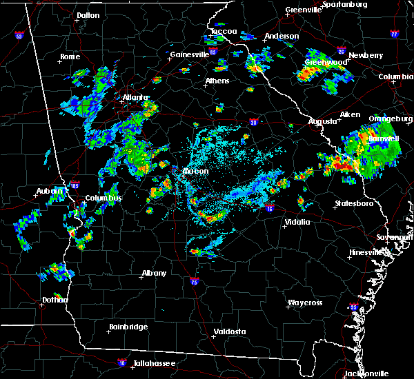 At 800 pm edt, a severe thunderstorm was located over paulk, or near cochran, and is nearly stationary (radar indicated). Hazards include 60 mph wind gusts and quarter size hail. Hail damage to vehicles is expected. Expect wind damage to roofs, siding, and trees. At 800 pm edt, a severe thunderstorm was located over paulk, or near cochran, and is nearly stationary (radar indicated). Hazards include 60 mph wind gusts and quarter size hail. Hail damage to vehicles is expected. Expect wind damage to roofs, siding, and trees.
|
| 5/24/2020 7:28 PM EDT |
 The national weather service in peachtree city has issued a * severe thunderstorm warning for. northwestern dodge county in central georgia. southeastern bleckley county in central georgia. until 815 pm edt. At 728 pm edt, a severe thunderstorm was located over gresston, or. The national weather service in peachtree city has issued a * severe thunderstorm warning for. northwestern dodge county in central georgia. southeastern bleckley county in central georgia. until 815 pm edt. At 728 pm edt, a severe thunderstorm was located over gresston, or.
|
| 4/19/2020 11:41 AM EDT |
 At 1141 am edt, a severe thunderstorm was located over pulaski state prison, or over hawkinsville, moving east at 50 mph (radar indicated). Hazards include 60 mph wind gusts and quarter size hail. Hail damage to vehicles is expected. Expect wind damage to roofs, siding, and trees. At 1141 am edt, a severe thunderstorm was located over pulaski state prison, or over hawkinsville, moving east at 50 mph (radar indicated). Hazards include 60 mph wind gusts and quarter size hail. Hail damage to vehicles is expected. Expect wind damage to roofs, siding, and trees.
|
| 4/13/2020 3:37 AM EDT |
 At 337 am edt, severe thunderstorms were located along a line extending from tarversville to near cobb, moving east at 45 mph (radar indicated). Hazards include 60 mph wind gusts. expect damage to roofs, siding, and trees At 337 am edt, severe thunderstorms were located along a line extending from tarversville to near cobb, moving east at 45 mph (radar indicated). Hazards include 60 mph wind gusts. expect damage to roofs, siding, and trees
|
| 4/13/2020 3:01 AM EDT |
 At 301 am edt, severe thunderstorms were located along a line extending from near powerville to near croxton crossroads, moving east at 55 mph (radar indicated). Hazards include 60 mph wind gusts. expect damage to roofs, siding, and trees At 301 am edt, severe thunderstorms were located along a line extending from near powerville to near croxton crossroads, moving east at 55 mph (radar indicated). Hazards include 60 mph wind gusts. expect damage to roofs, siding, and trees
|
| 1/11/2020 7:54 PM EST |
 At 754 pm est, a severe thunderstorm was located over klondike, or 8 miles northwest of hawkinsville, moving east at 45 mph (radar indicated). Hazards include 60 mph wind gusts. expect damage to roofs, siding, and trees At 754 pm est, a severe thunderstorm was located over klondike, or 8 miles northwest of hawkinsville, moving east at 45 mph (radar indicated). Hazards include 60 mph wind gusts. expect damage to roofs, siding, and trees
|
| 9/10/2019 5:07 PM EDT |
 At 506 pm edt, a severe thunderstorm was located over clinchfield, or near perry, moving west at 15 mph (radar indicated). Hazards include 60 mph wind gusts and penny size hail. Expect damage to roofs, siding, and trees. Locations impacted include, cochran, hawkinsville, hayneville, ocmulgee public fishing area, paulk, grovania, elko, porter, grove park and klondike. At 506 pm edt, a severe thunderstorm was located over clinchfield, or near perry, moving west at 15 mph (radar indicated). Hazards include 60 mph wind gusts and penny size hail. Expect damage to roofs, siding, and trees. Locations impacted include, cochran, hawkinsville, hayneville, ocmulgee public fishing area, paulk, grovania, elko, porter, grove park and klondike.
|
| 9/10/2019 4:45 PM EDT |
 At 445 pm edt, a severe thunderstorm was located near sand bed, or 9 miles east of perry, moving west at 15 mph (radar indicated). Hazards include 60 mph wind gusts and quarter size hail. Hail damage to vehicles is expected. expect wind damage to roofs, siding, and trees. Locations impacted include, perry, cochran, hawkinsville, hayneville, coley station, sand bed, grovania, elko, grove park, magnolia, ocmulgee public fishing area, paulk, porter, klondike, clinchfield and moss oak. At 445 pm edt, a severe thunderstorm was located near sand bed, or 9 miles east of perry, moving west at 15 mph (radar indicated). Hazards include 60 mph wind gusts and quarter size hail. Hail damage to vehicles is expected. expect wind damage to roofs, siding, and trees. Locations impacted include, perry, cochran, hawkinsville, hayneville, coley station, sand bed, grovania, elko, grove park, magnolia, ocmulgee public fishing area, paulk, porter, klondike, clinchfield and moss oak.
|
| 9/10/2019 4:29 PM EDT |
 The national weather service in peachtree city has issued a * severe thunderstorm warning for. northwestern pulaski county in central georgia. southwestern twiggs county in central georgia. southwestern bleckley county in central georgia. East central peach county in central georgia. The national weather service in peachtree city has issued a * severe thunderstorm warning for. northwestern pulaski county in central georgia. southwestern twiggs county in central georgia. southwestern bleckley county in central georgia. East central peach county in central georgia.
|
| 6/29/2019 4:52 PM EDT |
 At 452 pm edt, a severe thunderstorm was located over baileys park, or near hawkinsville, moving northwest at 5 mph (radar indicated). Hazards include 60 mph wind gusts. expect damage to roofs, siding, and trees At 452 pm edt, a severe thunderstorm was located over baileys park, or near hawkinsville, moving northwest at 5 mph (radar indicated). Hazards include 60 mph wind gusts. expect damage to roofs, siding, and trees
|
| 6/22/2019 8:50 PM EDT |
 At 850 pm edt, severe thunderstorms were located along a line extending from near magnolia to near unadilla to near dooling, moving southeast at 40 mph (radar indicated). Hazards include 60 mph wind gusts and quarter size hail. Hail damage to vehicles is expected. Expect wind damage to roofs, siding, and trees. At 850 pm edt, severe thunderstorms were located along a line extending from near magnolia to near unadilla to near dooling, moving southeast at 40 mph (radar indicated). Hazards include 60 mph wind gusts and quarter size hail. Hail damage to vehicles is expected. Expect wind damage to roofs, siding, and trees.
|
| 6/22/2019 5:11 PM EDT |
 The severe thunderstorm warning for southwestern bleckley county will expire at 515 pm edt, the storm which prompted the warning has weakened below severe limits, and no longer poses an immediate threat to life or property. therefore, the warning will be allowed to expire. a severe thunderstorm watch remains in effect until 900 pm edt for central georgia. to report severe weather, contact your nearest law enforcement agency. they will relay your report to the national weather service peachtree city. The severe thunderstorm warning for southwestern bleckley county will expire at 515 pm edt, the storm which prompted the warning has weakened below severe limits, and no longer poses an immediate threat to life or property. therefore, the warning will be allowed to expire. a severe thunderstorm watch remains in effect until 900 pm edt for central georgia. to report severe weather, contact your nearest law enforcement agency. they will relay your report to the national weather service peachtree city.
|
| 6/22/2019 4:59 PM EDT |
 At 459 pm edt, a severe thunderstorm was located over cochran, moving south at 15 mph (radar indicated). Hazards include 60 mph wind gusts and quarter size hail. Hail damage to vehicles is expected. expect wind damage to roofs, siding, and trees. Locations impacted include, cochran, porter, paulk and empire. At 459 pm edt, a severe thunderstorm was located over cochran, moving south at 15 mph (radar indicated). Hazards include 60 mph wind gusts and quarter size hail. Hail damage to vehicles is expected. expect wind damage to roofs, siding, and trees. Locations impacted include, cochran, porter, paulk and empire.
|
| 6/22/2019 4:56 PM EDT |
 At 456 pm edt, a severe thunderstorm was located over ocmulgee public fishing area, or near hawkinsville, moving southeast at 20 mph (radar indicated). Hazards include 60 mph wind gusts and quarter size hail. Hail damage to vehicles is expected. Expect wind damage to roofs, siding, and trees. At 456 pm edt, a severe thunderstorm was located over ocmulgee public fishing area, or near hawkinsville, moving southeast at 20 mph (radar indicated). Hazards include 60 mph wind gusts and quarter size hail. Hail damage to vehicles is expected. Expect wind damage to roofs, siding, and trees.
|
| 6/22/2019 4:42 PM EDT |
 At 442 pm edt, a severe thunderstorm was located over royal, or near cochran, moving south at 15 mph (radar indicated). Hazards include 60 mph wind gusts and quarter size hail. Hail damage to vehicles is expected. Expect wind damage to roofs, siding, and trees. At 442 pm edt, a severe thunderstorm was located over royal, or near cochran, moving south at 15 mph (radar indicated). Hazards include 60 mph wind gusts and quarter size hail. Hail damage to vehicles is expected. Expect wind damage to roofs, siding, and trees.
|
| 6/22/2019 3:28 PM EDT |
 At 327 pm edt, a severe thunderstorm was located near cary, or 10 miles south of jeffersonville, moving southeast at 20 mph (radar indicated). Hazards include 60 mph wind gusts and quarter size hail. Hail damage to vehicles is expected. Expect wind damage to roofs, siding, and trees. At 327 pm edt, a severe thunderstorm was located near cary, or 10 miles south of jeffersonville, moving southeast at 20 mph (radar indicated). Hazards include 60 mph wind gusts and quarter size hail. Hail damage to vehicles is expected. Expect wind damage to roofs, siding, and trees.
|
| 6/20/2019 5:53 PM EDT |
 At 553 pm edt, a severe thunderstorm was located over yonkers, or 10 miles east of cochran, moving east at 45 mph (radar indicated). Hazards include 60 mph wind gusts and quarter size hail. Hail damage to vehicles is expected. expect wind damage to roofs, siding, and trees. Locations impacted include, dublin, cochran, eastman, chester, dexter, dudley, cadwell, rentz, dubois, gresston, plainfield, empire, yonkers, cedar grove, roddy, baileys park, rowland, harlow, rebie and goldsboro. At 553 pm edt, a severe thunderstorm was located over yonkers, or 10 miles east of cochran, moving east at 45 mph (radar indicated). Hazards include 60 mph wind gusts and quarter size hail. Hail damage to vehicles is expected. expect wind damage to roofs, siding, and trees. Locations impacted include, dublin, cochran, eastman, chester, dexter, dudley, cadwell, rentz, dubois, gresston, plainfield, empire, yonkers, cedar grove, roddy, baileys park, rowland, harlow, rebie and goldsboro.
|
| 6/20/2019 5:30 PM EDT |
 At 530 pm edt, a severe thunderstorm was located over hartford, or over hawkinsville, moving east at 45 mph (radar indicated). Hazards include 60 mph wind gusts and quarter size hail. Hail damage to vehicles is expected. Expect wind damage to roofs, siding, and trees. At 530 pm edt, a severe thunderstorm was located over hartford, or over hawkinsville, moving east at 45 mph (radar indicated). Hazards include 60 mph wind gusts and quarter size hail. Hail damage to vehicles is expected. Expect wind damage to roofs, siding, and trees.
|
| 4/14/2019 2:30 PM EDT | Powerlines down on friendship umc rd near intersection with hardy r in dodge county GA, 7.2 miles NNW of Cochran, GA |
| 2/12/2019 2:52 PM EST |
 At 252 pm est, a severe thunderstorm was located near lee pope, or 7 miles north of fort valley, moving east at 45 mph (radar indicated). Hazards include 60 mph wind gusts. expect damage to roofs, siding, and trees At 252 pm est, a severe thunderstorm was located near lee pope, or 7 miles north of fort valley, moving east at 45 mph (radar indicated). Hazards include 60 mph wind gusts. expect damage to roofs, siding, and trees
|
| 7/22/2018 6:07 PM EDT |
 At 607 pm edt, a severe thunderstorm was located near magnolia, or 11 miles northwest of cochran, moving south at 20 mph (radar indicated). Hazards include 60 mph wind gusts and quarter size hail. Hail damage to vehicles is expected. Expect wind damage to roofs, siding, and trees. At 607 pm edt, a severe thunderstorm was located near magnolia, or 11 miles northwest of cochran, moving south at 20 mph (radar indicated). Hazards include 60 mph wind gusts and quarter size hail. Hail damage to vehicles is expected. Expect wind damage to roofs, siding, and trees.
|
| 6/28/2018 2:45 PM EDT |
 At 245 pm edt, a severe thunderstorm was located over pulaski state prison, or near hawkinsville, moving south at 25 mph (radar indicated). Hazards include 60 mph wind gusts. Expect damage to roofs, siding, and trees. Locations impacted include, cochran, hawkinsville, browndale, coley station, mobley crossing, baileys park, magnolia, royal, ocmulgee public fishing area, paulk, hartford, pulaski state prison, porter, klondike and empire. At 245 pm edt, a severe thunderstorm was located over pulaski state prison, or near hawkinsville, moving south at 25 mph (radar indicated). Hazards include 60 mph wind gusts. Expect damage to roofs, siding, and trees. Locations impacted include, cochran, hawkinsville, browndale, coley station, mobley crossing, baileys park, magnolia, royal, ocmulgee public fishing area, paulk, hartford, pulaski state prison, porter, klondike and empire.
|
| 6/28/2018 2:25 PM EDT |
 At 224 pm edt, a severe thunderstorm was located over magnolia, or 8 miles northwest of cochran, moving south at 25 mph (radar indicated). Hazards include 60 mph wind gusts. expect damage to roofs, siding, and trees At 224 pm edt, a severe thunderstorm was located over magnolia, or 8 miles northwest of cochran, moving south at 25 mph (radar indicated). Hazards include 60 mph wind gusts. expect damage to roofs, siding, and trees
|
| 9/21/2017 6:29 PM EDT | 2 trees down on hardy rd near dubois church rd in dodge county GA, 6.1 miles NNW of Cochran, GA |
| 5/24/2017 2:39 PM EDT |
 At 239 pm edt, a severe thunderstorm capable of producing a tornado was located over baileys park, or near cochran, moving northeast at 25 mph (radar indicated rotation). Hazards include tornado. Flying debris will be dangerous to those caught without shelter. mobile homes will be damaged or destroyed. damage to roofs, windows, and vehicles will occur. Tree damage is likely. At 239 pm edt, a severe thunderstorm capable of producing a tornado was located over baileys park, or near cochran, moving northeast at 25 mph (radar indicated rotation). Hazards include tornado. Flying debris will be dangerous to those caught without shelter. mobile homes will be damaged or destroyed. damage to roofs, windows, and vehicles will occur. Tree damage is likely.
|
| 5/24/2017 2:23 PM EDT |
 At 222 pm edt, a severe thunderstorm was located over empire, or over cochran, moving northeast at 40 mph (radar indicated). Hazards include 70 mph wind gusts and quarter size hail. Hail damage to vehicles is expected. expect considerable tree damage. Wind damage is also likely to mobile homes, roofs, and outbuildings. At 222 pm edt, a severe thunderstorm was located over empire, or over cochran, moving northeast at 40 mph (radar indicated). Hazards include 70 mph wind gusts and quarter size hail. Hail damage to vehicles is expected. expect considerable tree damage. Wind damage is also likely to mobile homes, roofs, and outbuildings.
|
| 4/5/2017 8:14 AM EDT |
 At 814 am edt, a severe thunderstorm was located near byromville, or 10 miles southeast of oglethorpe, moving northeast at 55 mph (radar indicated). Hazards include 60 mph wind gusts and quarter size hail. Hail damage to vehicles is expected. Expect wind damage to roofs, siding, and trees. At 814 am edt, a severe thunderstorm was located near byromville, or 10 miles southeast of oglethorpe, moving northeast at 55 mph (radar indicated). Hazards include 60 mph wind gusts and quarter size hail. Hail damage to vehicles is expected. Expect wind damage to roofs, siding, and trees.
|
| 4/3/2017 1:53 PM EDT |
 At 153 pm edt, severe thunderstorms were located along a line extending from franklinton to klondike, moving east at 45 mph (radar indicated). Hazards include 60 mph wind gusts. expect damage to roofs, siding, and trees At 153 pm edt, severe thunderstorms were located along a line extending from franklinton to klondike, moving east at 45 mph (radar indicated). Hazards include 60 mph wind gusts. expect damage to roofs, siding, and trees
|
| 1/22/2017 4:13 PM EST |
 At 413 pm est, a severe thunderstorm capable of producing a tornado was located over coley station, or over cochran, moving northeast at 40 mph (radar indicated rotation). Hazards include tornado. Flying debris will be dangerous to those caught without shelter. mobile homes will be damaged or destroyed. damage to roofs, windows, and vehicles will occur. Tree damage is likely. At 413 pm est, a severe thunderstorm capable of producing a tornado was located over coley station, or over cochran, moving northeast at 40 mph (radar indicated rotation). Hazards include tornado. Flying debris will be dangerous to those caught without shelter. mobile homes will be damaged or destroyed. damage to roofs, windows, and vehicles will occur. Tree damage is likely.
|
| 1/21/2017 12:42 PM EST |
 At 1241 pm est, a severe thunderstorm was located over magnolia, or near cochran, moving east at 50 mph (radar indicated). Hazards include 60 mph wind gusts and penny size hail. expect damage to roofs, siding, and trees At 1241 pm est, a severe thunderstorm was located over magnolia, or near cochran, moving east at 50 mph (radar indicated). Hazards include 60 mph wind gusts and penny size hail. expect damage to roofs, siding, and trees
|
| 6/17/2016 5:49 PM EDT |
 At 549 pm edt, severe thunderstorms were located along a line extending from near chester to near cochran, moving southeast at 45 mph (radar indicated). Hazards include 60 mph wind gusts and quarter size hail. Hail damage to vehicles is expected. expect wind damage to roofs, siding, and trees. Other locations in the warning include but are not limited to mcrae, cochran, eastman, alamo, helena, chester, glenwood, milan, cadwell, scotland, chauncey, rentz, union, yonkers, gresston, dubois, little ocmulgee state park, roddy, godwinsville and achord. At 549 pm edt, severe thunderstorms were located along a line extending from near chester to near cochran, moving southeast at 45 mph (radar indicated). Hazards include 60 mph wind gusts and quarter size hail. Hail damage to vehicles is expected. expect wind damage to roofs, siding, and trees. Other locations in the warning include but are not limited to mcrae, cochran, eastman, alamo, helena, chester, glenwood, milan, cadwell, scotland, chauncey, rentz, union, yonkers, gresston, dubois, little ocmulgee state park, roddy, godwinsville and achord.
|
| 8/23/2015 11:05 AM EDT |
 At 1105 am edt, severe thunderstorms were located extending from near macon to near robins afb to near unadilla, moving east at 40 mph (radar indicated). Hazards include 60 mph wind gusts. Expect damage to roofs. siding and trees. Other locations in the warning include but are not limited to macon, milledgeville, perry, cochran, jeffersonville, irwinton, gordon, ivey, mcintyre, toomsboro, danville, allentown, midway-hardwick, marion, scottsboro, ocmulgee public fishing area, royal, cary, griswoldville and myricks mill. At 1105 am edt, severe thunderstorms were located extending from near macon to near robins afb to near unadilla, moving east at 40 mph (radar indicated). Hazards include 60 mph wind gusts. Expect damage to roofs. siding and trees. Other locations in the warning include but are not limited to macon, milledgeville, perry, cochran, jeffersonville, irwinton, gordon, ivey, mcintyre, toomsboro, danville, allentown, midway-hardwick, marion, scottsboro, ocmulgee public fishing area, royal, cary, griswoldville and myricks mill.
|
| 7/31/2015 5:25 PM EDT |
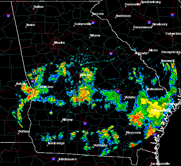 The severe thunderstorm warning for southwestern bleckley, northwestern pulaski, southern houston and northeastern dooly counties will expire at 530 pm edt, the storm which prompted the warning has weakened below severe limits, and no longer pose an immediate threat to life or property. therefore the warning will be allowed to expire. The severe thunderstorm warning for southwestern bleckley, northwestern pulaski, southern houston and northeastern dooly counties will expire at 530 pm edt, the storm which prompted the warning has weakened below severe limits, and no longer pose an immediate threat to life or property. therefore the warning will be allowed to expire.
|
| 7/31/2015 4:56 PM EDT |
 At 456 pm edt, a severe thunderstorm was located 8 miles west of cochran, moving southwest at 15 mph (radar indicated). Hazards include 60 mph wind gusts. Expect damage to roofs. siding and trees. Other locations in the warning include but are not limited to perry, cochran, hawkinsville, unadilla, paulk, magnolia, pulaski state prison, grovania, ocmulgee public fishing area, hayneville, henderson, browndale, grove park, clinchfield, moss oak, elko, coley station, sand bed, porter and klondike. At 456 pm edt, a severe thunderstorm was located 8 miles west of cochran, moving southwest at 15 mph (radar indicated). Hazards include 60 mph wind gusts. Expect damage to roofs. siding and trees. Other locations in the warning include but are not limited to perry, cochran, hawkinsville, unadilla, paulk, magnolia, pulaski state prison, grovania, ocmulgee public fishing area, hayneville, henderson, browndale, grove park, clinchfield, moss oak, elko, coley station, sand bed, porter and klondike.
|
| 7/20/2015 4:51 PM EDT |
 The severe thunderstorm warning for central bleckley and northwestern dodge counties will expire at 500 pm edt, the storm which prompted the warning is weakening below severe limits, and therefore the warning will be allowed to expire. however, gusty winds are still possible with this thunderstorm. The severe thunderstorm warning for central bleckley and northwestern dodge counties will expire at 500 pm edt, the storm which prompted the warning is weakening below severe limits, and therefore the warning will be allowed to expire. however, gusty winds are still possible with this thunderstorm.
|
| 7/20/2015 4:37 PM EDT |
 At 437 pm edt, a severe thunderstorm was located near chester, or east of cochran, moving southeast at 10 mph (radar indicated). Hazards include 60 mph wind gusts and nickel size hail. Expect damage to roofs. siding and trees. Other locations in the warning include but are not limited to cochran, chester, dubois, empire, rowland, roddy, gresston and yonkers. At 437 pm edt, a severe thunderstorm was located near chester, or east of cochran, moving southeast at 10 mph (radar indicated). Hazards include 60 mph wind gusts and nickel size hail. Expect damage to roofs. siding and trees. Other locations in the warning include but are not limited to cochran, chester, dubois, empire, rowland, roddy, gresston and yonkers.
|
| 7/20/2015 4:15 PM EDT |
 At 415 pm edt, a severe thunderstorm was located near cochran, moving southeast at 10 mph (radar indicated). Hazards include 60 mph wind gusts and nickel size hail. Expect damage to roofs. siding and trees. Other locations in the warning include but are not limited to cochran, chester, dubois, baileys park, empire, rowland, roddy, gresston and yonkers. At 415 pm edt, a severe thunderstorm was located near cochran, moving southeast at 10 mph (radar indicated). Hazards include 60 mph wind gusts and nickel size hail. Expect damage to roofs. siding and trees. Other locations in the warning include but are not limited to cochran, chester, dubois, baileys park, empire, rowland, roddy, gresston and yonkers.
|
| 6/30/2015 2:21 PM EDT |
 At 221 pm edt, a severe thunderstorm was located over cochran, moving east at 25 mph (radar indicated). Hazards include 60 mph wind gusts and nickel size hail. Expect damage to roofs. siding and trees. Other locations in the warning include but are not limited to dublin, cochran, chester, dexter, dudley, cadwell, rentz, paulk, royal, rebie, harlow, rowland, roddy, yonkers, empire, coley station, porter and goldsboro. At 221 pm edt, a severe thunderstorm was located over cochran, moving east at 25 mph (radar indicated). Hazards include 60 mph wind gusts and nickel size hail. Expect damage to roofs. siding and trees. Other locations in the warning include but are not limited to dublin, cochran, chester, dexter, dudley, cadwell, rentz, paulk, royal, rebie, harlow, rowland, roddy, yonkers, empire, coley station, porter and goldsboro.
|
| 6/23/2015 2:44 PM EDT |
 At 244 pm edt, a severe thunderstorm was located over hawkinsville, moving southeast at 10 mph (radar indicated). Hazards include 60 mph wind gusts and quarter size hail. Hail damage to vehicles is expected. expect wind damage to roofs, siding and trees. Other locations in the warning include but are not limited to cochran, eastman, hawkinsville, paulk, hartford, pulaski state prison, baileys park, wallace, mobley crossing, ocmulgee banks and dubois. At 244 pm edt, a severe thunderstorm was located over hawkinsville, moving southeast at 10 mph (radar indicated). Hazards include 60 mph wind gusts and quarter size hail. Hail damage to vehicles is expected. expect wind damage to roofs, siding and trees. Other locations in the warning include but are not limited to cochran, eastman, hawkinsville, paulk, hartford, pulaski state prison, baileys park, wallace, mobley crossing, ocmulgee banks and dubois.
|
| 4/25/2015 6:56 PM EDT | At 656 pm edt, severe thunderstorms were located along a line extending from near perry to 7 miles southwest of allentown, moving east at 45 mph (radar indicated). Hazards include 60 mph wind gusts and half dollar size hail. Hail damage to vehicles is expected. expect wind damage to roofs, siding and trees. other locations in the warning include but are not limited to perry, cochran, hawkinsville, warner robins, chester, dudley, danville, montrose, allentown, ocmulgee public fishing area, royal, mobley crossing, rebie, hayneville, houston lake, cary, yonkers, clinchfield, kathleen and moss oak. 1. 25in. |
| 4/25/2015 6:25 PM EDT | At 624 pm edt, a severe thunderstorm was located near perry, moving east at 40 mph (radar indicated). Hazards include 60 mph wind gusts and quarter size hail. Hail damage to vehicles is expected. expect wind damage to roofs, siding and trees. other locations in the warning include but are not limited to macon, perry, fort valley, cochran, jeffersonville, warner robins, centerville, byron, robins afb, marion, royal, franklinton, lakewood, houston lake, myricks mill, bullard, fitzpatrick, clinchfield, kathleen and elberta. 1. 00in. |
| 4/19/2015 1:05 PM EDT | A tree was reported down near route 25 in bleckley county GA, 1.3 miles NW of Cochran, GA |
| 4/19/2015 12:26 PM EDT | this alert has expired |
| 3/31/2015 9:16 PM EDT | The national weather service in peachtree city has issued a * severe thunderstorm warning for. southern bleckley county in central georgia. northern pulaski county in central georgia. southeastern houston county in central georgia. Northwestern dodge county in central georgia. |
| 3/31/2015 8:41 PM EDT | The national weather service in peachtree city has issued a * severe thunderstorm warning for. southeastern bleckley county in central georgia. southwestern laurens county in central georgia. northern dodge county in central georgia. Until 930 pm edt. |
| 11/23/2014 5:30 PM EST | Numerous trees and powerlines down all over the count in bleckley county GA, 5.1 miles SSE of Cochran, GA |
| 8/20/2014 5:22 PM EDT | Several powerlines and trees down across bleckley county in bleckley county GA, 0.6 miles SSE of Cochran, GA |
| 8/20/2014 5:00 PM EDT | 4 power lines and at least one tree down in bleckley county GA, 0.6 miles SSE of Cochran, GA |
| 5/18/2014 7:00 PM EDT | 1 tree down in bleckley county GA, 2.1 miles WSW of Cochran, GA |
| 5/18/2014 7:00 PM EDT | 6 trees down in bleckley county GA, 3.3 miles W of Cochran, GA |
| 6/28/2013 5:15 PM EDT | Half Dollar sized hail reported 9.2 miles SSW of Cochran, GA, a trained spotter reported half dollar sized hail nne of cochran. |
| 6/9/2013 4:10 PM EDT | A couple of trees were blown down in cochra in bleckley county GA, 0.6 miles SSE of Cochran, GA |
| 1/1/0001 12:00 AM | Bleckley county 911 reported a couple of downed trees in the count in bleckley county GA, 5 miles E of Cochran, GA |
| 1/1/0001 12:00 AM | Bleckly county 911 relayed reports of over a dozen downed trees along highway 112 southwest of car in bleckley county GA, 7.4 miles S of Cochran, GA |
Hail Maps for Cochran, GA
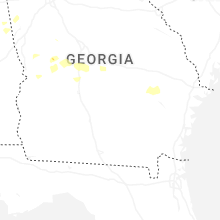
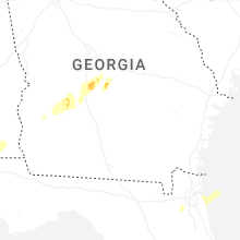


Connect with Interactive Hail Maps