

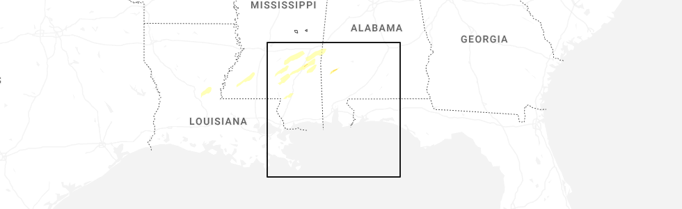
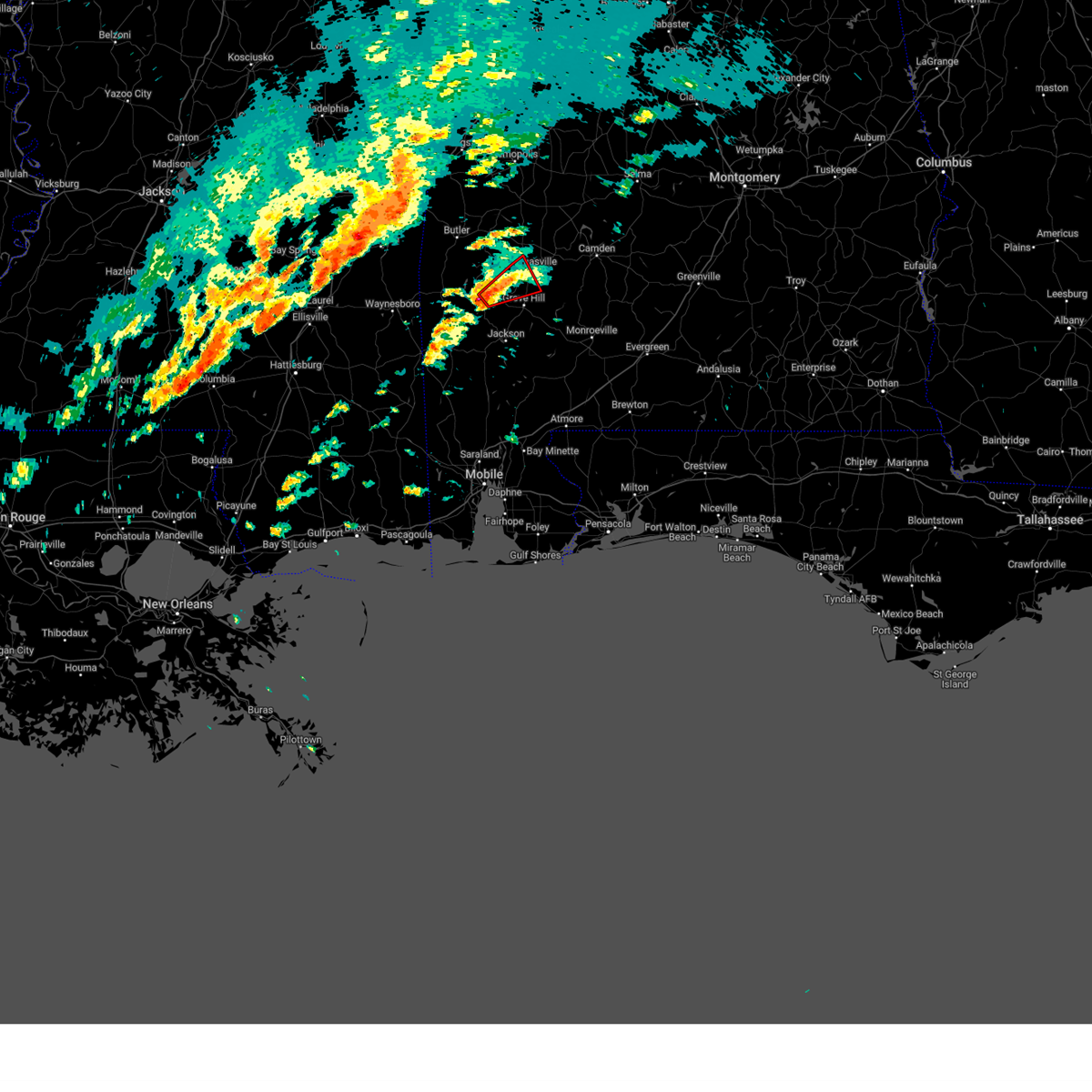
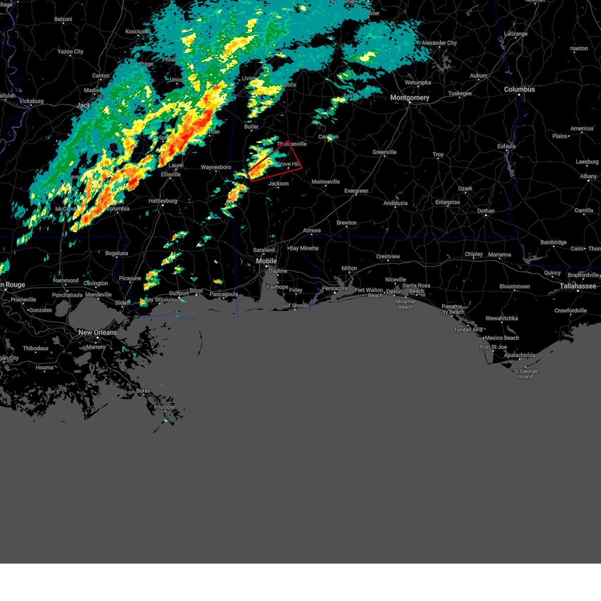
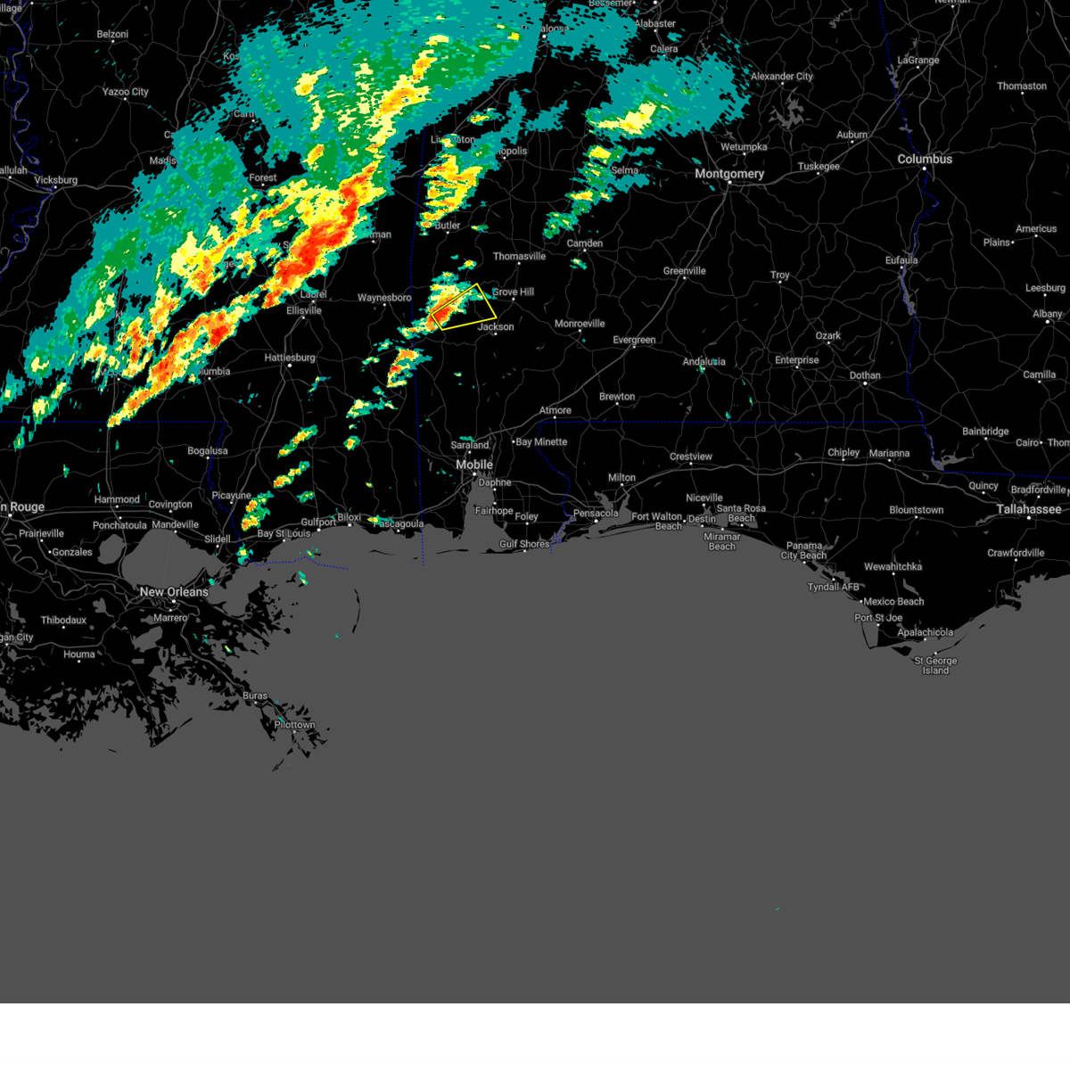
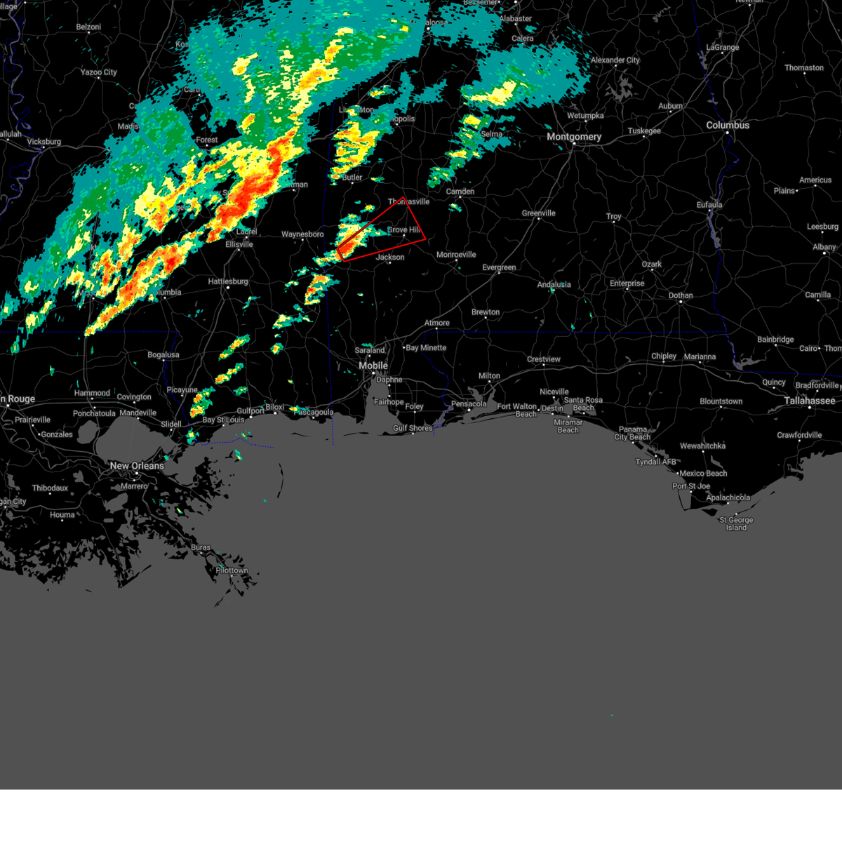
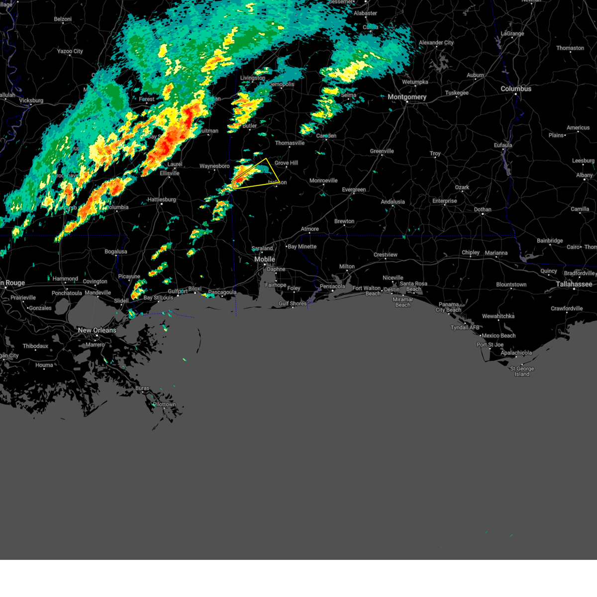
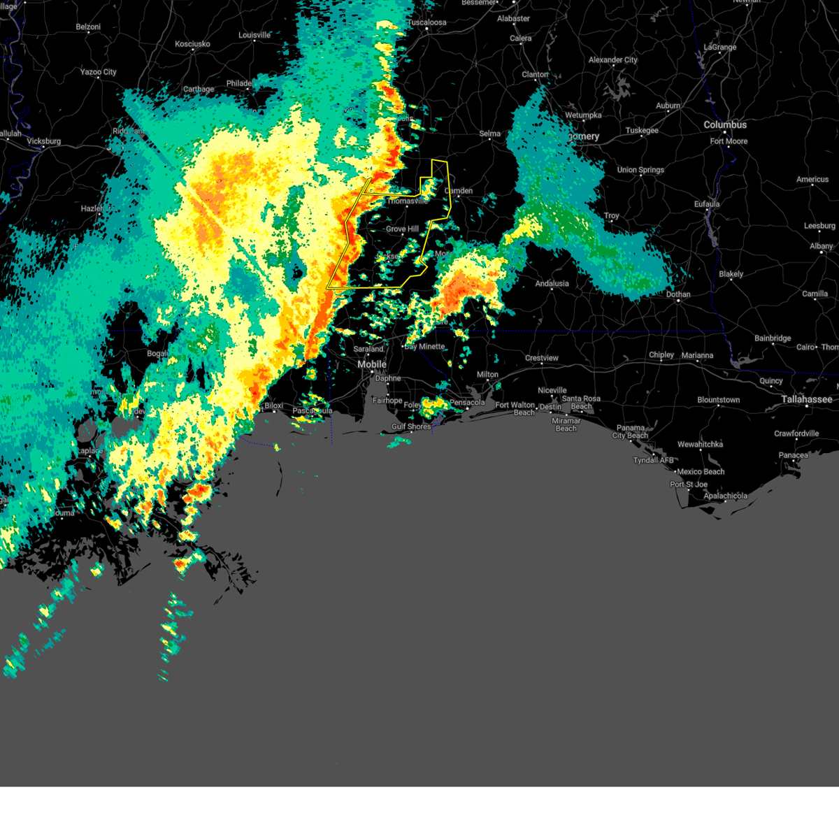
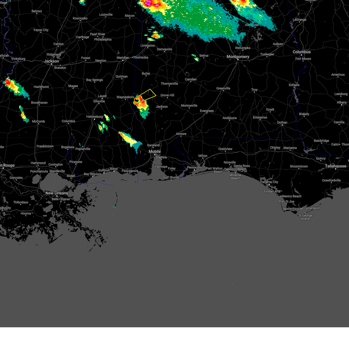
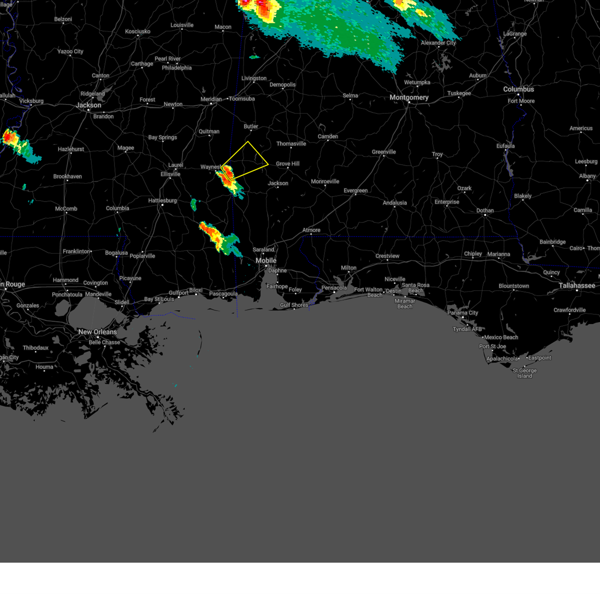
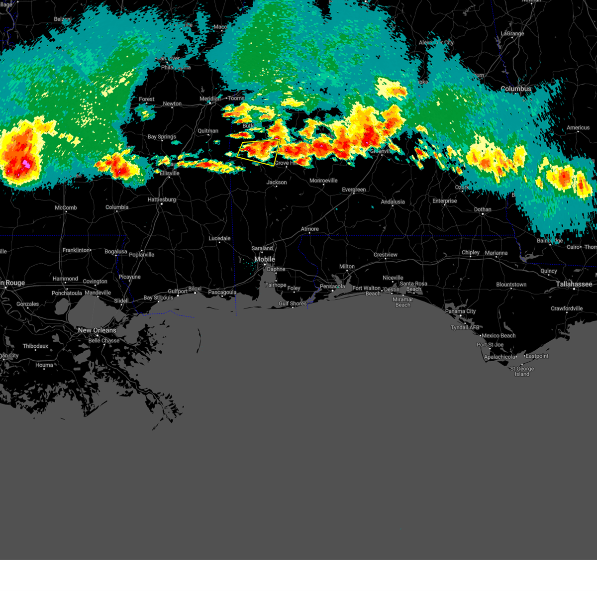
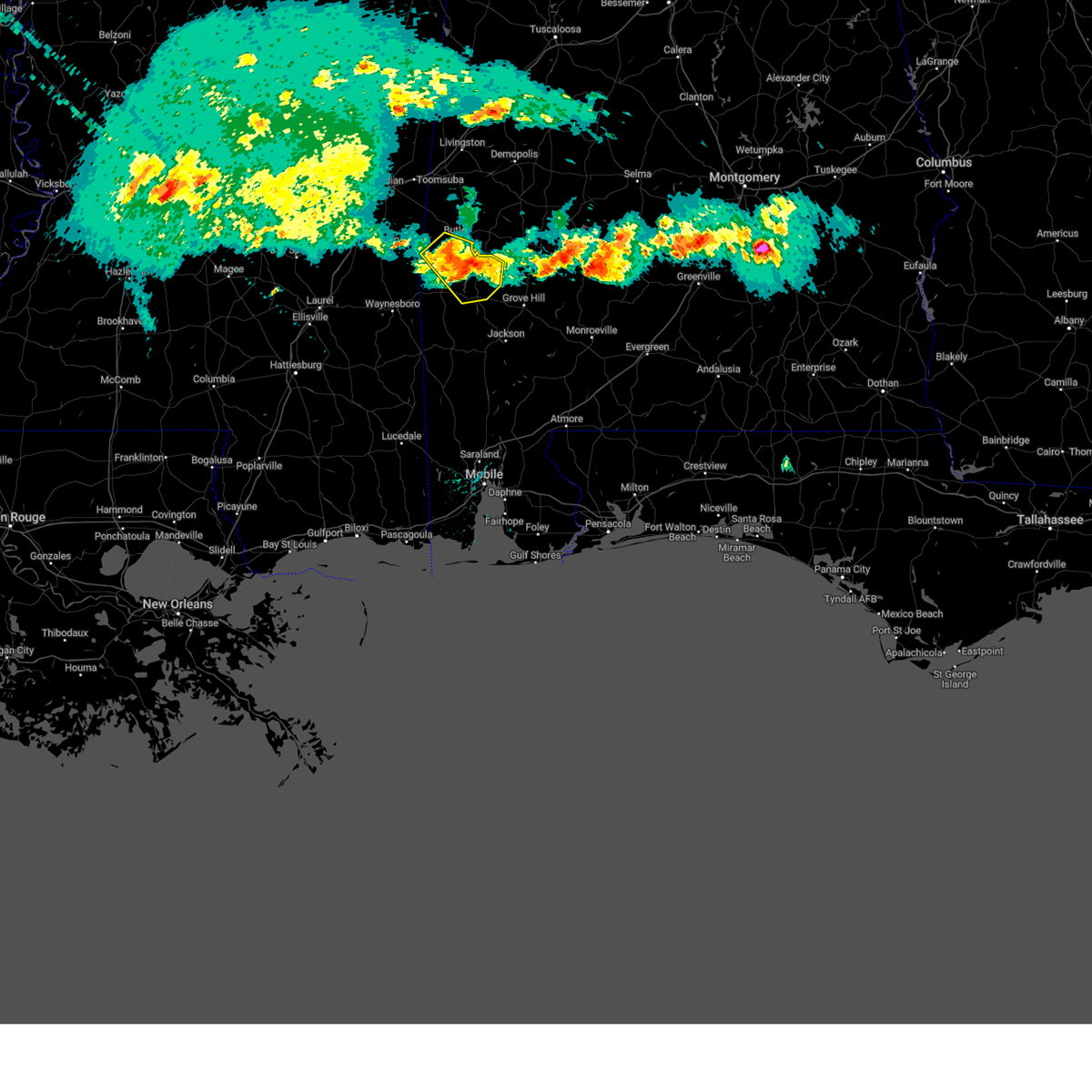
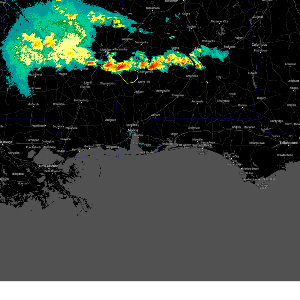
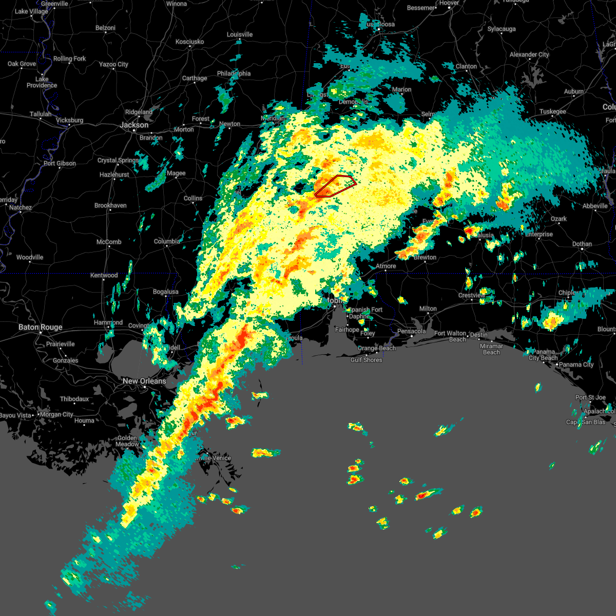
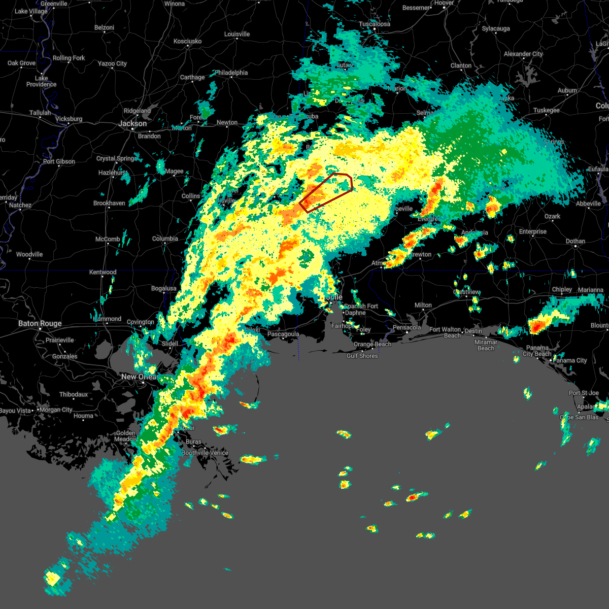
Hail Map for Coffeeville, AL
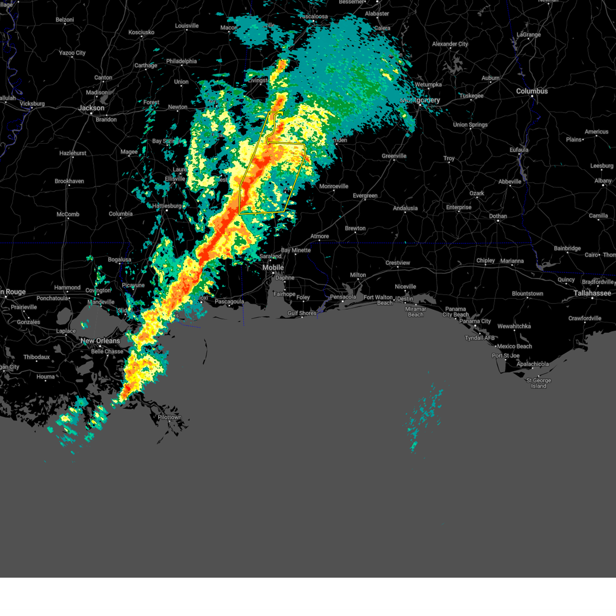
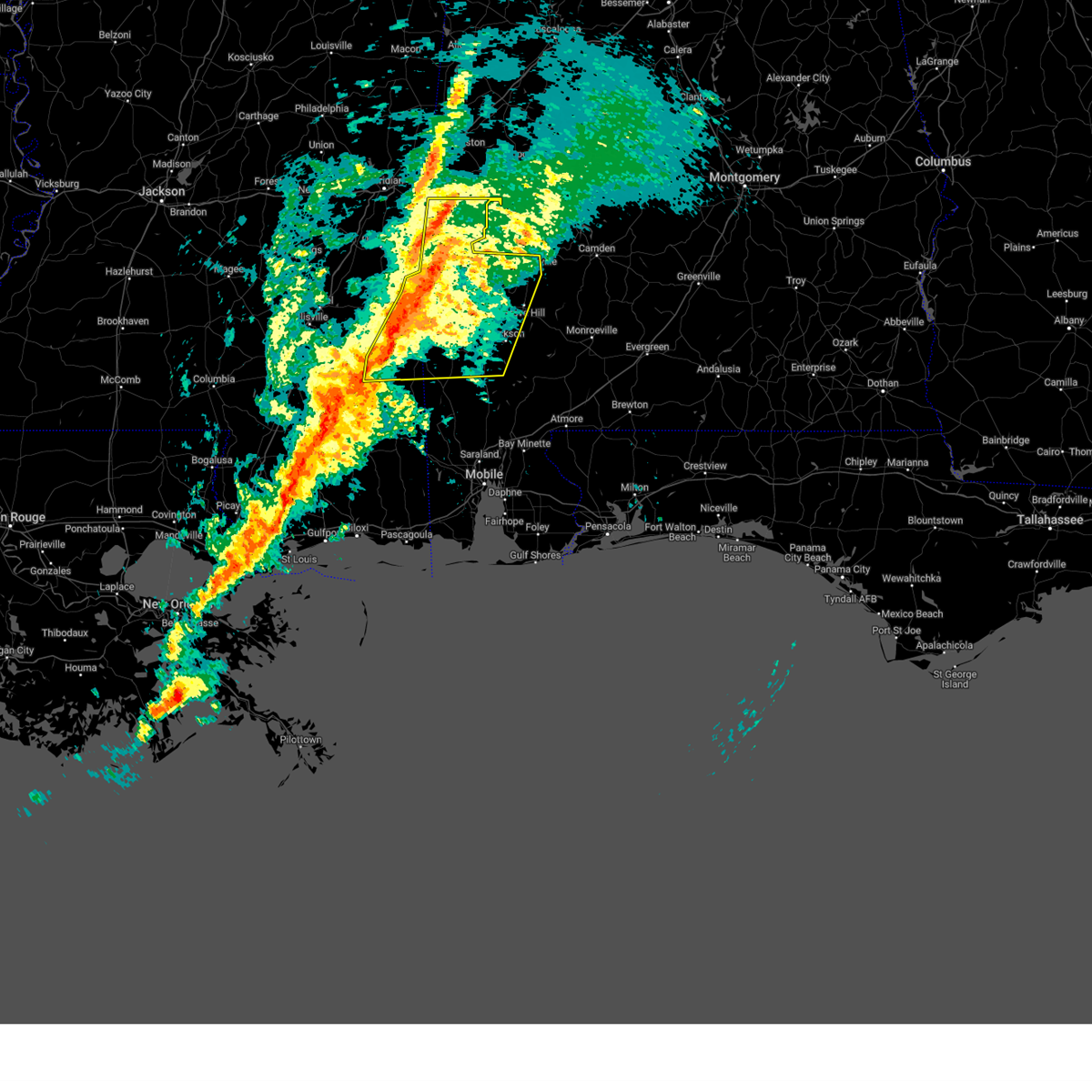
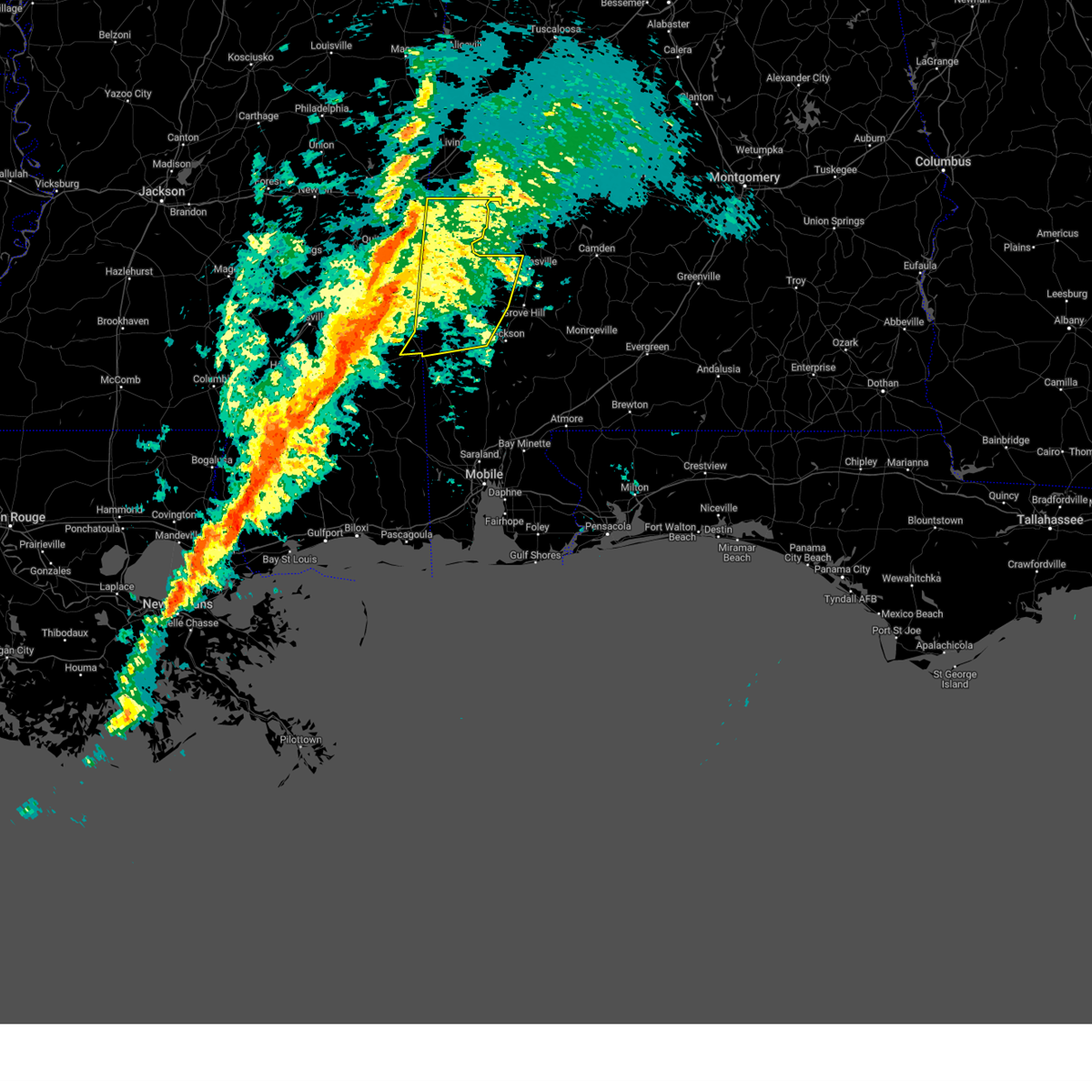
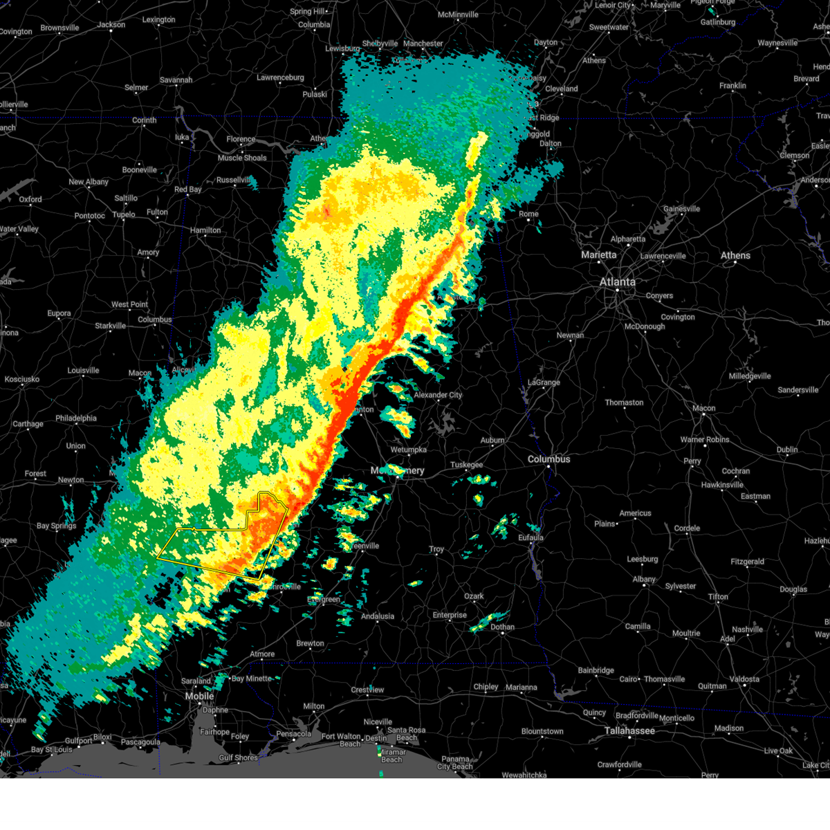
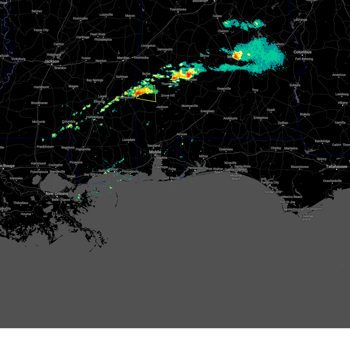
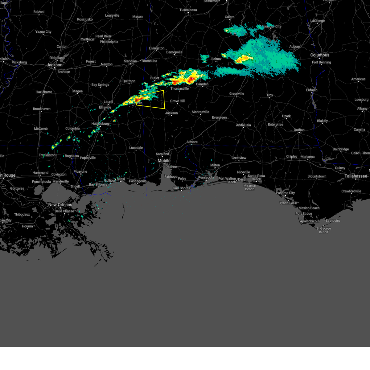
The Coffeeville, AL area has had 4 reports of on-the-ground hail by trained spotters, and has been under severe weather warnings 27 times during the past 12 months. Doppler radar has detected hail at or near Coffeeville, AL on 45 occasions, including 3 occasions during the past year.
| Name: | Coffeeville, AL |
| Where Located: | 49.2 miles WSW of Camden, AL |
| Map: | Google Map for Coffeeville, AL |
| Population: | 352 |
| Housing Units: | 233 |
| More Info: | Search Google for Coffeeville, AL |
3
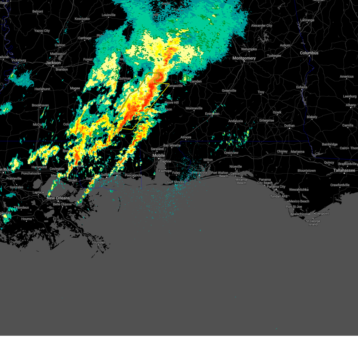
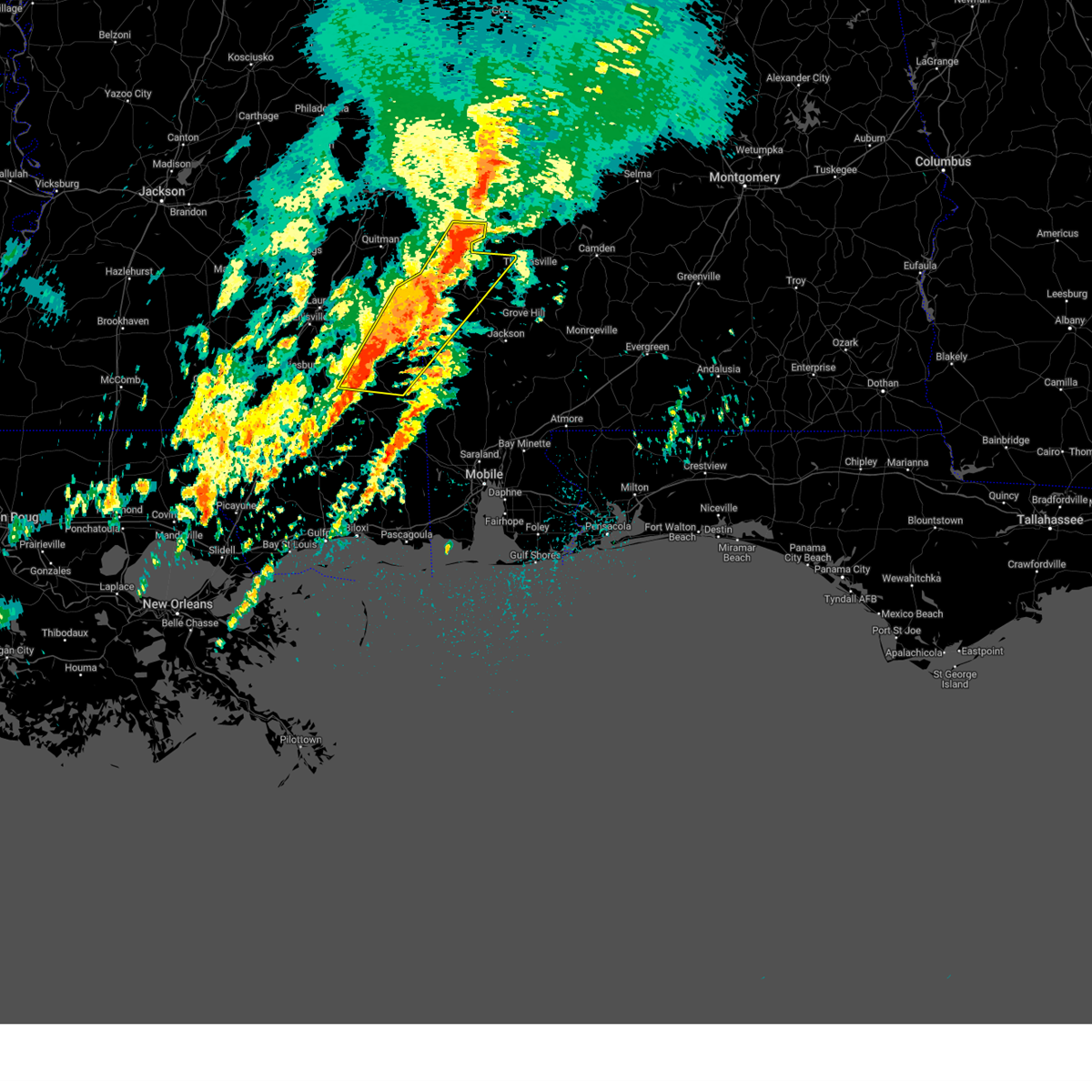
The Top Recent Hail Date for Coffeeville, AL is Wednesday, February 12, 2025 (9th out of 45)
Hail and Wind Damage Spotted near Coffeeville, AL
| Date / Time | Report Details |
|---|---|
| 5/25/2025 11:38 PM CDT |
 the severe thunderstorm warning has been cancelled and is no longer in effect the severe thunderstorm warning has been cancelled and is no longer in effect
|
| 5/25/2025 11:14 PM CDT |
 Svrmob the national weather service in mobile has issued a * severe thunderstorm warning for, southeastern choctaw county in southwestern alabama, north central washington county in southwestern alabama, northwestern clarke county in southwestern alabama, * until midnight cdt. * at 1114 pm cdt, severe thunderstorms were located along a line extending from pennington to gilbertown, moving southeast at 20 mph (radar indicated). Hazards include 60 mph wind gusts. expect damage to roofs, siding, and trees Svrmob the national weather service in mobile has issued a * severe thunderstorm warning for, southeastern choctaw county in southwestern alabama, north central washington county in southwestern alabama, northwestern clarke county in southwestern alabama, * until midnight cdt. * at 1114 pm cdt, severe thunderstorms were located along a line extending from pennington to gilbertown, moving southeast at 20 mph (radar indicated). Hazards include 60 mph wind gusts. expect damage to roofs, siding, and trees
|
| 4/6/2025 8:00 AM CDT |
 The storms which prompted the warning have weakened. therefore, the warning will be allowed to expire. a tornado watch remains in effect until 1000 am cdt for southwestern alabama, and southeastern mississippi. The storms which prompted the warning have weakened. therefore, the warning will be allowed to expire. a tornado watch remains in effect until 1000 am cdt for southwestern alabama, and southeastern mississippi.
|
| 4/6/2025 7:38 AM CDT |
 At 738 am cdt, severe thunderstorms were located along a line extending from 5 miles northwest of putnam to 5 miles southwest of beaumont, moving east at 15 mph (radar indicated). Hazards include 60 mph wind gusts. Expect damage to roofs, siding, and trees. Locations impacted include, gilbertown, toxey, state line, clara, silas, coffeeville, millry, waynesboro, butler, and buckatunna. At 738 am cdt, severe thunderstorms were located along a line extending from 5 miles northwest of putnam to 5 miles southwest of beaumont, moving east at 15 mph (radar indicated). Hazards include 60 mph wind gusts. Expect damage to roofs, siding, and trees. Locations impacted include, gilbertown, toxey, state line, clara, silas, coffeeville, millry, waynesboro, butler, and buckatunna.
|
| 3/4/2025 7:30 PM CST |
 the severe thunderstorm warning has been cancelled and is no longer in effect the severe thunderstorm warning has been cancelled and is no longer in effect
|
| 3/4/2025 7:30 PM CST |
 At 729 pm cst, severe thunderstorms were located along a line extending from 4 miles northwest of myrtlewood to 4 miles southwest of coffeeville to 3 miles southwest of fruitdale, moving east at 35 mph (radar indicated). Hazards include 60 mph wind gusts. Expect damage to roofs, siding, and trees. Locations impacted include, fulton, saint stephens, silas, chatom, coffeeville, pennington, jackson, wagarville, grove hill, thomasville, fruitdale, millry, tibbie, and leroy. At 729 pm cst, severe thunderstorms were located along a line extending from 4 miles northwest of myrtlewood to 4 miles southwest of coffeeville to 3 miles southwest of fruitdale, moving east at 35 mph (radar indicated). Hazards include 60 mph wind gusts. Expect damage to roofs, siding, and trees. Locations impacted include, fulton, saint stephens, silas, chatom, coffeeville, pennington, jackson, wagarville, grove hill, thomasville, fruitdale, millry, tibbie, and leroy.
|
| 3/4/2025 6:57 PM CST |
 Svrmob the national weather service in mobile has issued a * severe thunderstorm warning for, choctaw county in southwestern alabama, washington county in southwestern alabama, western clarke county in southwestern alabama, eastern wayne county in southeastern mississippi, northern greene county in southeastern mississippi, * until 800 pm cst. * at 656 pm cst, severe thunderstorms were located along a line extending from 3 miles southeast of kinterbish to 3 miles northwest of silas to 14 miles southwest of state line, moving east at 40 mph (radar indicated). Hazards include 60 mph wind gusts. expect damage to roofs, siding, and trees Svrmob the national weather service in mobile has issued a * severe thunderstorm warning for, choctaw county in southwestern alabama, washington county in southwestern alabama, western clarke county in southwestern alabama, eastern wayne county in southeastern mississippi, northern greene county in southeastern mississippi, * until 800 pm cst. * at 656 pm cst, severe thunderstorms were located along a line extending from 3 miles southeast of kinterbish to 3 miles northwest of silas to 14 miles southwest of state line, moving east at 40 mph (radar indicated). Hazards include 60 mph wind gusts. expect damage to roofs, siding, and trees
|
| 3/4/2025 6:31 PM CST |
 Svrmob the national weather service in mobile has issued a * severe thunderstorm warning for, choctaw county in southwestern alabama, northern washington county in southwestern alabama, northwestern clarke county in southwestern alabama, southeastern wayne county in southeastern mississippi, * until 700 pm cst. * at 631 pm cst, severe thunderstorms were located along a line extending from near causeyville to 3 miles west of waynesboro to 4 miles southwest of clara to near richton, moving east at 45 mph (radar indicated). Hazards include 60 mph wind gusts. expect damage to roofs, siding, and trees Svrmob the national weather service in mobile has issued a * severe thunderstorm warning for, choctaw county in southwestern alabama, northern washington county in southwestern alabama, northwestern clarke county in southwestern alabama, southeastern wayne county in southeastern mississippi, * until 700 pm cst. * at 631 pm cst, severe thunderstorms were located along a line extending from near causeyville to 3 miles west of waynesboro to 4 miles southwest of clara to near richton, moving east at 45 mph (radar indicated). Hazards include 60 mph wind gusts. expect damage to roofs, siding, and trees
|
| 2/16/2025 1:45 AM CST |
 The storms which prompted the warning have moved out of the area. therefore, the warning has been allowed to expire. a tornado watch remains in effect until 600 am cst for south central and southwestern alabama. The storms which prompted the warning have moved out of the area. therefore, the warning has been allowed to expire. a tornado watch remains in effect until 600 am cst for south central and southwestern alabama.
|
| 2/16/2025 1:16 AM CST | The storms which prompted the warning have moved out of the area. therefore, the warning has been allowed to expire. a tornado watch remains in effect until 400 am cst for southwestern alabama, and southeastern mississippi. remember, a severe thunderstorm warning still remains in effect for southeastern wayne and greene counties until 2 am. |
| 2/16/2025 1:10 AM CST | Svrmob the national weather service in mobile has issued a * severe thunderstorm warning for, northwestern monroe county in south central alabama, south central choctaw county in southwestern alabama, northwestern mobile county in southwestern alabama, washington county in southwestern alabama, central clarke county in southwestern alabama, east central perry county in southeastern mississippi, southeastern wayne county in southeastern mississippi, greene county in southeastern mississippi, * until 200 am cst. * at 109 am cst, severe thunderstorms were located along a line extending from 6 miles west of coffeeville to state line to near beaumont, moving east at 50 mph (radar indicated). Hazards include 60 mph wind gusts. expect damage to roofs, siding, and trees |
| 2/16/2025 12:49 AM CST |
 Svrmob the national weather service in mobile has issued a * severe thunderstorm warning for, north central monroe county in south central alabama, southwestern choctaw county in southwestern alabama, northern clarke county in southwestern alabama, western wilcox county in south central alabama, * until 145 am cst. * at 1249 am cst, severe thunderstorms were located along a line extending from 4 miles south of demopolis to 5 miles west of gilbertown to 4 miles northeast of waynesboro, moving east at 45 mph (radar indicated). Hazards include 60 mph wind gusts. expect damage to roofs, siding, and trees Svrmob the national weather service in mobile has issued a * severe thunderstorm warning for, north central monroe county in south central alabama, southwestern choctaw county in southwestern alabama, northern clarke county in southwestern alabama, western wilcox county in south central alabama, * until 145 am cst. * at 1249 am cst, severe thunderstorms were located along a line extending from 4 miles south of demopolis to 5 miles west of gilbertown to 4 miles northeast of waynesboro, moving east at 45 mph (radar indicated). Hazards include 60 mph wind gusts. expect damage to roofs, siding, and trees
|
| 2/16/2025 12:44 AM CST |
 At 1243 am cst, severe thunderstorms were located along a line extending from 6 miles north of waynesboro to 4 miles west of richton to 3 miles northwest of mclaurin, moving east at 55 mph (radar indicated). Hazards include 60 mph wind gusts. Expect damage to roofs, siding, and trees. Locations impacted include, clara, new augusta, silas, chatom, leakesville, mclain, waynesboro, beaumont, state line, richton, fruitdale, millry, tibbie, and buckatunna. At 1243 am cst, severe thunderstorms were located along a line extending from 6 miles north of waynesboro to 4 miles west of richton to 3 miles northwest of mclaurin, moving east at 55 mph (radar indicated). Hazards include 60 mph wind gusts. Expect damage to roofs, siding, and trees. Locations impacted include, clara, new augusta, silas, chatom, leakesville, mclain, waynesboro, beaumont, state line, richton, fruitdale, millry, tibbie, and buckatunna.
|
| 2/16/2025 12:22 AM CST |
 Svrmob the national weather service in mobile has issued a * severe thunderstorm warning for, southwestern choctaw county in southwestern alabama, western washington county in southwestern alabama, northwestern clarke county in southwestern alabama, perry county in southeastern mississippi, wayne county in southeastern mississippi, greene county in southeastern mississippi, * until 115 am cst. * at 1222 am cst, severe thunderstorms were located along a line extending from 4 miles northeast of mill creek to eastabuchie to 6 miles northwest of pine ridge, moving east at 50 mph (radar indicated). Hazards include 60 mph wind gusts. expect damage to roofs, siding, and trees Svrmob the national weather service in mobile has issued a * severe thunderstorm warning for, southwestern choctaw county in southwestern alabama, western washington county in southwestern alabama, northwestern clarke county in southwestern alabama, perry county in southeastern mississippi, wayne county in southeastern mississippi, greene county in southeastern mississippi, * until 115 am cst. * at 1222 am cst, severe thunderstorms were located along a line extending from 4 miles northeast of mill creek to eastabuchie to 6 miles northwest of pine ridge, moving east at 50 mph (radar indicated). Hazards include 60 mph wind gusts. expect damage to roofs, siding, and trees
|
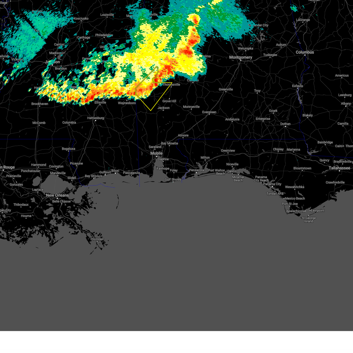
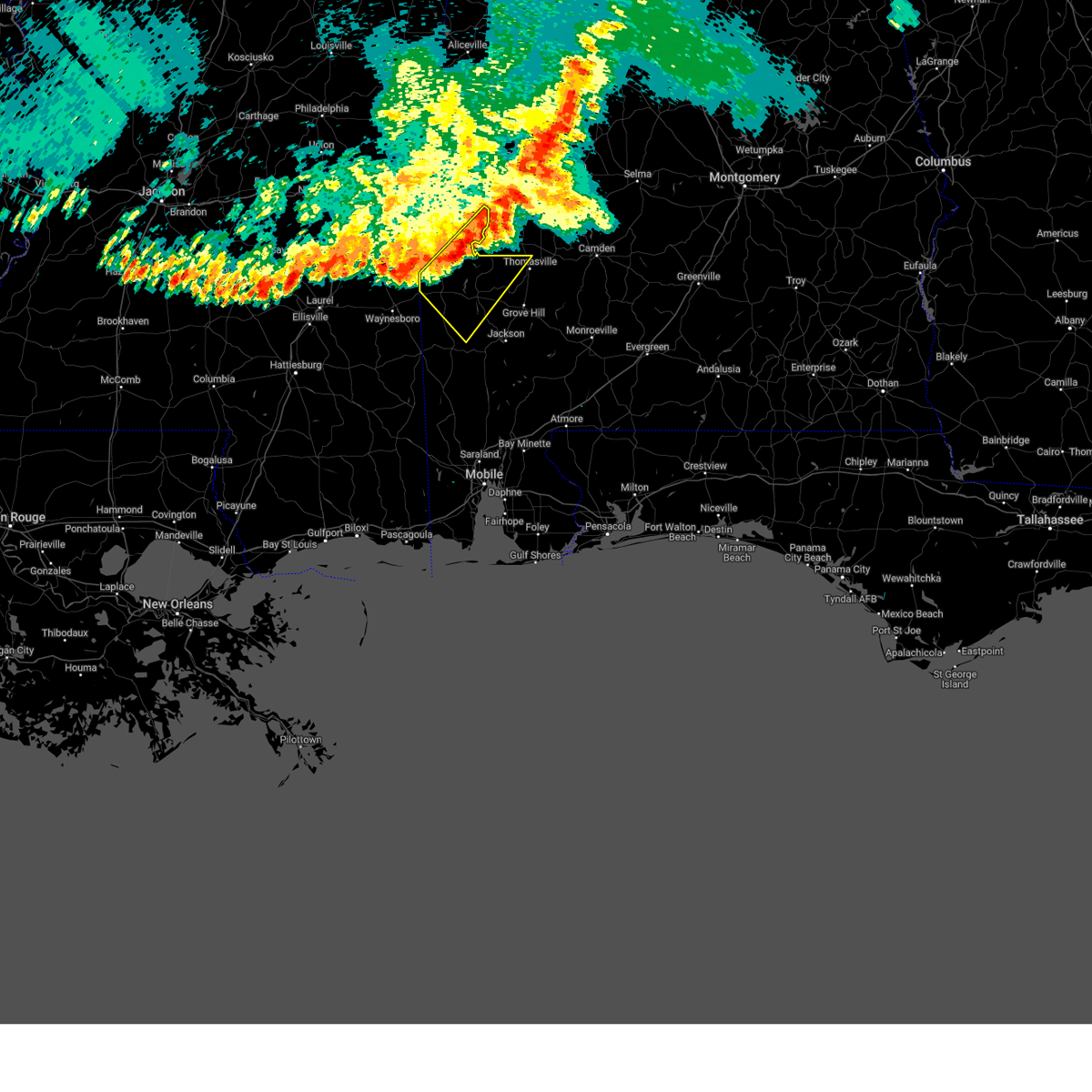
| 2/12/2025 6:27 PM CST |
 At 627 pm cst, a confirmed large and extremely dangerous tornado was located 7 miles east of coffeeville, or 11 miles west of grove hill, moving northeast at 45 mph. this is a particularly dangerous situation. take cover now! (radar confirmed tornado). Hazards include damaging tornado. You are in a life-threatening situation. flying debris may be deadly to those caught without shelter. mobile homes will be destroyed. considerable damage to homes, businesses, and vehicles is likely and complete destruction is possible. Locations impacted include, fulton and thomasville. At 627 pm cst, a confirmed large and extremely dangerous tornado was located 7 miles east of coffeeville, or 11 miles west of grove hill, moving northeast at 45 mph. this is a particularly dangerous situation. take cover now! (radar confirmed tornado). Hazards include damaging tornado. You are in a life-threatening situation. flying debris may be deadly to those caught without shelter. mobile homes will be destroyed. considerable damage to homes, businesses, and vehicles is likely and complete destruction is possible. Locations impacted include, fulton and thomasville.
|
| 2/12/2025 6:27 PM CST |
 the tornado warning has been cancelled and is no longer in effect the tornado warning has been cancelled and is no longer in effect
|
| 2/12/2025 6:20 PM CST |
 At 620 pm cst, a confirmed large and extremely dangerous tornado was located 4 miles southeast of coffeeville, or 15 miles west of grove hill, moving northeast at 55 mph. this is a particularly dangerous situation. take cover now! (radar confirmed tornado). Hazards include damaging tornado. You are in a life-threatening situation. flying debris may be deadly to those caught without shelter. mobile homes will be destroyed. considerable damage to homes, businesses, and vehicles is likely and complete destruction is possible. Locations impacted include, fulton, thomasville, and coffeeville. At 620 pm cst, a confirmed large and extremely dangerous tornado was located 4 miles southeast of coffeeville, or 15 miles west of grove hill, moving northeast at 55 mph. this is a particularly dangerous situation. take cover now! (radar confirmed tornado). Hazards include damaging tornado. You are in a life-threatening situation. flying debris may be deadly to those caught without shelter. mobile homes will be destroyed. considerable damage to homes, businesses, and vehicles is likely and complete destruction is possible. Locations impacted include, fulton, thomasville, and coffeeville.
|
| 2/12/2025 6:20 PM CST |
 the tornado warning has been cancelled and is no longer in effect the tornado warning has been cancelled and is no longer in effect
|
| 2/12/2025 6:11 PM CST |
 At 610 pm cst, a severe thunderstorm was located 7 miles southwest of coffeeville, or 14 miles northeast of chatom, moving northeast at 40 mph (radar indicated). Hazards include 60 mph wind gusts and half dollar size hail. Hail damage to vehicles is expected. expect wind damage to roofs, siding, and trees. Locations impacted include, coffeeville. At 610 pm cst, a severe thunderstorm was located 7 miles southwest of coffeeville, or 14 miles northeast of chatom, moving northeast at 40 mph (radar indicated). Hazards include 60 mph wind gusts and half dollar size hail. Hail damage to vehicles is expected. expect wind damage to roofs, siding, and trees. Locations impacted include, coffeeville.
|
| 2/12/2025 6:08 PM CST |
 At 608 pm cst, a severe thunderstorm capable of producing a tornado was located 8 miles northwest of saint stephens, or 12 miles northeast of chatom, moving northeast at 45 mph (radar indicated rotation). Hazards include tornado and half dollar size hail. Flying debris will be dangerous to those caught without shelter. mobile homes will be damaged or destroyed. damage to roofs, windows, and vehicles will occur. tree damage is likely. Locations impacted include, fulton, thomasville, coffeeville, and grove hill. At 608 pm cst, a severe thunderstorm capable of producing a tornado was located 8 miles northwest of saint stephens, or 12 miles northeast of chatom, moving northeast at 45 mph (radar indicated rotation). Hazards include tornado and half dollar size hail. Flying debris will be dangerous to those caught without shelter. mobile homes will be damaged or destroyed. damage to roofs, windows, and vehicles will occur. tree damage is likely. Locations impacted include, fulton, thomasville, coffeeville, and grove hill.
|
| 2/12/2025 6:05 PM CST |
 At 604 pm cst, a severe thunderstorm was located 6 miles east of millry, or 9 miles north of chatom, moving northeast at 40 mph (radar indicated). Hazards include 60 mph wind gusts. Expect damage to roofs, siding, and trees. Locations impacted include, coffeeville. At 604 pm cst, a severe thunderstorm was located 6 miles east of millry, or 9 miles north of chatom, moving northeast at 40 mph (radar indicated). Hazards include 60 mph wind gusts. Expect damage to roofs, siding, and trees. Locations impacted include, coffeeville.
|
| 2/12/2025 6:01 PM CST |
 Tormob the national weather service in mobile has issued a * tornado warning for, south central choctaw county in southwestern alabama, north central washington county in southwestern alabama, northern clarke county in southwestern alabama, * until 645 pm cst. * at 600 pm cst, a severe thunderstorm capable of producing a tornado was located 4 miles southeast of millry, or 8 miles north of chatom, moving northeast at 45 mph (radar indicated rotation). Hazards include tornado. Flying debris will be dangerous to those caught without shelter. mobile homes will be damaged or destroyed. damage to roofs, windows, and vehicles will occur. tree damage is likely. This tornadic thunderstorm will remain over mainly rural areas of south central choctaw, north central washington and northern clarke counties. Tormob the national weather service in mobile has issued a * tornado warning for, south central choctaw county in southwestern alabama, north central washington county in southwestern alabama, northern clarke county in southwestern alabama, * until 645 pm cst. * at 600 pm cst, a severe thunderstorm capable of producing a tornado was located 4 miles southeast of millry, or 8 miles north of chatom, moving northeast at 45 mph (radar indicated rotation). Hazards include tornado. Flying debris will be dangerous to those caught without shelter. mobile homes will be damaged or destroyed. damage to roofs, windows, and vehicles will occur. tree damage is likely. This tornadic thunderstorm will remain over mainly rural areas of south central choctaw, north central washington and northern clarke counties.
|
| 2/12/2025 5:52 PM CST |
 Svrmob the national weather service in mobile has issued a * severe thunderstorm warning for, southeastern choctaw county in southwestern alabama, northern washington county in southwestern alabama, west central clarke county in southwestern alabama, * until 630 pm cst. * at 552 pm cst, a severe thunderstorm was located 7 miles northwest of chatom, moving northeast at 35 mph (radar indicated). Hazards include 60 mph wind gusts. expect damage to roofs, siding, and trees Svrmob the national weather service in mobile has issued a * severe thunderstorm warning for, southeastern choctaw county in southwestern alabama, northern washington county in southwestern alabama, west central clarke county in southwestern alabama, * until 630 pm cst. * at 552 pm cst, a severe thunderstorm was located 7 miles northwest of chatom, moving northeast at 35 mph (radar indicated). Hazards include 60 mph wind gusts. expect damage to roofs, siding, and trees
|
| 2/12/2025 4:55 PM CST |
 The storm which prompted the warning has weakened below severe limits, and no longer appears capable of producing a tornado. therefore, the warning will be allowed to expire. a tornado watch remains in effect until 1000 pm cst for southwestern alabama. The storm which prompted the warning has weakened below severe limits, and no longer appears capable of producing a tornado. therefore, the warning will be allowed to expire. a tornado watch remains in effect until 1000 pm cst for southwestern alabama.
|
| 2/12/2025 4:36 PM CST |
 At 436 pm cst, a severe thunderstorm capable of producing a tornado was located 7 miles southeast of millry, or 7 miles north of chatom, moving northeast at 45 mph (radar indicated rotation). Hazards include tornado. Flying debris will be dangerous to those caught without shelter. mobile homes will be damaged or destroyed. damage to roofs, windows, and vehicles will occur. tree damage is likely. This tornadic thunderstorm will remain over mainly rural areas of south central choctaw, north central washington and west central clarke counties. At 436 pm cst, a severe thunderstorm capable of producing a tornado was located 7 miles southeast of millry, or 7 miles north of chatom, moving northeast at 45 mph (radar indicated rotation). Hazards include tornado. Flying debris will be dangerous to those caught without shelter. mobile homes will be damaged or destroyed. damage to roofs, windows, and vehicles will occur. tree damage is likely. This tornadic thunderstorm will remain over mainly rural areas of south central choctaw, north central washington and west central clarke counties.
|
| 2/12/2025 4:24 PM CST |
 Tormob the national weather service in mobile has issued a * tornado warning for, south central choctaw county in southwestern alabama, northwestern washington county in southwestern alabama, west central clarke county in southwestern alabama, * until 500 pm cst. * at 424 pm cst, a severe thunderstorm capable of producing a tornado was located 5 miles northwest of chatom, moving northeast at 45 mph (radar indicated rotation). Hazards include tornado. Flying debris will be dangerous to those caught without shelter. mobile homes will be damaged or destroyed. damage to roofs, windows, and vehicles will occur. tree damage is likely. This dangerous storm will be near, coffeeville around 450 pm cst. Tormob the national weather service in mobile has issued a * tornado warning for, south central choctaw county in southwestern alabama, northwestern washington county in southwestern alabama, west central clarke county in southwestern alabama, * until 500 pm cst. * at 424 pm cst, a severe thunderstorm capable of producing a tornado was located 5 miles northwest of chatom, moving northeast at 45 mph (radar indicated rotation). Hazards include tornado. Flying debris will be dangerous to those caught without shelter. mobile homes will be damaged or destroyed. damage to roofs, windows, and vehicles will occur. tree damage is likely. This dangerous storm will be near, coffeeville around 450 pm cst.
|
| 12/28/2024 10:19 PM CST |
 Svrmob the national weather service in mobile has issued a * severe thunderstorm warning for, northwestern monroe county in south central alabama, south central choctaw county in southwestern alabama, central washington county in southwestern alabama, clarke county in southwestern alabama, western wilcox county in south central alabama, * until 1100 pm cst. * at 1019 pm cst, severe thunderstorms were located along a line extending from 3 miles south of butler to near silas to 7 miles southwest of millry to 9 miles southwest of state line, moving east at 50 mph (radar indicated). Hazards include 60 mph wind gusts. expect damage to roofs, siding, and trees Svrmob the national weather service in mobile has issued a * severe thunderstorm warning for, northwestern monroe county in south central alabama, south central choctaw county in southwestern alabama, central washington county in southwestern alabama, clarke county in southwestern alabama, western wilcox county in south central alabama, * until 1100 pm cst. * at 1019 pm cst, severe thunderstorms were located along a line extending from 3 miles south of butler to near silas to 7 miles southwest of millry to 9 miles southwest of state line, moving east at 50 mph (radar indicated). Hazards include 60 mph wind gusts. expect damage to roofs, siding, and trees
|
| 5/10/2024 1:23 AM CDT |
 At 122 am cdt, severe thunderstorms were located along a line extending from shawnee to 6 miles northwest of grove hill to 5 miles north of saint stephens, moving east at 60 mph (radar indicated). Hazards include 60 mph wind gusts and quarter size hail. Hail damage to vehicles is expected. expect wind damage to roofs, siding, and trees. Locations impacted include, thomasville, grove hill, whatley, pine hill, coffeeville, and fulton. At 122 am cdt, severe thunderstorms were located along a line extending from shawnee to 6 miles northwest of grove hill to 5 miles north of saint stephens, moving east at 60 mph (radar indicated). Hazards include 60 mph wind gusts and quarter size hail. Hail damage to vehicles is expected. expect wind damage to roofs, siding, and trees. Locations impacted include, thomasville, grove hill, whatley, pine hill, coffeeville, and fulton.
|
| 5/10/2024 1:23 AM CDT |
 the severe thunderstorm warning has been cancelled and is no longer in effect the severe thunderstorm warning has been cancelled and is no longer in effect
|
| 5/10/2024 12:52 AM CDT |
 Svrmob the national weather service in mobile has issued a * severe thunderstorm warning for, south central choctaw county in southwestern alabama, northern washington county in southwestern alabama, clarke county in southwestern alabama, southwestern wilcox county in south central alabama, east central wayne county in southeastern mississippi, * until 145 am cdt. * at 1251 am cdt, severe thunderstorms were located along a line extending from near butler to silas to near waynesboro, moving east at 55 mph (radar indicated). Hazards include 70 mph wind gusts and quarter size hail. Hail damage to vehicles is expected. expect considerable tree damage. Wind damage is also likely to mobile homes, roofs, and outbuildings. Svrmob the national weather service in mobile has issued a * severe thunderstorm warning for, south central choctaw county in southwestern alabama, northern washington county in southwestern alabama, clarke county in southwestern alabama, southwestern wilcox county in south central alabama, east central wayne county in southeastern mississippi, * until 145 am cdt. * at 1251 am cdt, severe thunderstorms were located along a line extending from near butler to silas to near waynesboro, moving east at 55 mph (radar indicated). Hazards include 70 mph wind gusts and quarter size hail. Hail damage to vehicles is expected. expect considerable tree damage. Wind damage is also likely to mobile homes, roofs, and outbuildings.
|
| 1/8/2024 11:43 PM CST |
 At 1142 pm cst, a severe thunderstorm was located 5 miles north of saint stephens, or 12 miles northwest of jackson, moving northeast at 90 mph (radar indicated). Hazards include 70 mph wind gusts. Expect considerable tree damage. damage is likely to mobile homes, roofs, and outbuildings. locations impacted include, thomasville, grove hill, and fulton. thunderstorm damage threat, considerable hail threat, radar indicated max hail size, <. 75 in wind threat, radar indicated max wind gust, 70 mph. At 1142 pm cst, a severe thunderstorm was located 5 miles north of saint stephens, or 12 miles northwest of jackson, moving northeast at 90 mph (radar indicated). Hazards include 70 mph wind gusts. Expect considerable tree damage. damage is likely to mobile homes, roofs, and outbuildings. locations impacted include, thomasville, grove hill, and fulton. thunderstorm damage threat, considerable hail threat, radar indicated max hail size, <. 75 in wind threat, radar indicated max wind gust, 70 mph.
|
| 1/8/2024 11:31 PM CST |
 At 1131 pm cst, a severe thunderstorm was located 5 miles southwest of saint stephens, or 7 miles east of chatom, moving northeast at 55 mph (radar indicated). Hazards include 70 mph wind gusts. Expect considerable tree damage. damage is likely to mobile homes, roofs, and outbuildings. Locations impacted include, jackson, thomasville, grove hill, saint stephens, wagarville, leroy, whatley, and fulton. At 1131 pm cst, a severe thunderstorm was located 5 miles southwest of saint stephens, or 7 miles east of chatom, moving northeast at 55 mph (radar indicated). Hazards include 70 mph wind gusts. Expect considerable tree damage. damage is likely to mobile homes, roofs, and outbuildings. Locations impacted include, jackson, thomasville, grove hill, saint stephens, wagarville, leroy, whatley, and fulton.
|
| 1/8/2024 11:26 PM CST |
 At 1126 pm cst, a severe thunderstorm was located over chatom, moving northeast at 55 mph (radar indicated). Hazards include 70 mph wind gusts. Expect considerable tree damage. Damage is likely to mobile homes, roofs, and outbuildings. At 1126 pm cst, a severe thunderstorm was located over chatom, moving northeast at 55 mph (radar indicated). Hazards include 70 mph wind gusts. Expect considerable tree damage. Damage is likely to mobile homes, roofs, and outbuildings.
|
| 7/22/2023 7:43 PM CDT |
 The severe thunderstorm warning for south central choctaw and northwestern clarke counties will expire at 745 pm cdt, the storm which prompted the warning has weakened below severe limits, and no longer poses an immediate threat to life or property. therefore, the warning will be allowed to expire. The severe thunderstorm warning for south central choctaw and northwestern clarke counties will expire at 745 pm cdt, the storm which prompted the warning has weakened below severe limits, and no longer poses an immediate threat to life or property. therefore, the warning will be allowed to expire.
|
| 7/22/2023 7:21 PM CDT |
 At 721 pm cdt, a severe thunderstorm was located 8 miles southwest of putnam, or 13 miles southeast of butler, moving southeast at 20 mph (radar indicated). Hazards include 60 mph wind gusts and half dollar size hail. Hail damage to vehicles is expected. expect wind damage to roofs, siding, and trees. locations impacted include, coffeeville. hail threat, radar indicated max hail size, 1. 25 in wind threat, radar indicated max wind gust, 60 mph. At 721 pm cdt, a severe thunderstorm was located 8 miles southwest of putnam, or 13 miles southeast of butler, moving southeast at 20 mph (radar indicated). Hazards include 60 mph wind gusts and half dollar size hail. Hail damage to vehicles is expected. expect wind damage to roofs, siding, and trees. locations impacted include, coffeeville. hail threat, radar indicated max hail size, 1. 25 in wind threat, radar indicated max wind gust, 60 mph.
|
| 7/22/2023 7:02 PM CDT |
 At 701 pm cdt, a severe thunderstorm was located 7 miles south of butler, moving southeast at 20 mph (radar indicated). Hazards include 60 mph wind gusts and half dollar size hail. Hail damage to vehicles is expected. Expect wind damage to roofs, siding, and trees. At 701 pm cdt, a severe thunderstorm was located 7 miles south of butler, moving southeast at 20 mph (radar indicated). Hazards include 60 mph wind gusts and half dollar size hail. Hail damage to vehicles is expected. Expect wind damage to roofs, siding, and trees.
|
| 6/26/2023 1:17 AM CDT |
 At 117 am cdt, severe thunderstorms were located along a line extending from 5 miles southwest of sweet water to 7 miles south of putnam to 4 miles northeast of silas to near waynesboro, moving east at 35 mph (radar indicated). Hazards include 60 mph wind gusts. Expect damage to roofs, siding, and trees. locations impacted include, thomasville, millry, silas and coffeeville. hail threat, radar indicated max hail size, <. 75 in wind threat, radar indicated max wind gust, 60 mph. At 117 am cdt, severe thunderstorms were located along a line extending from 5 miles southwest of sweet water to 7 miles south of putnam to 4 miles northeast of silas to near waynesboro, moving east at 35 mph (radar indicated). Hazards include 60 mph wind gusts. Expect damage to roofs, siding, and trees. locations impacted include, thomasville, millry, silas and coffeeville. hail threat, radar indicated max hail size, <. 75 in wind threat, radar indicated max wind gust, 60 mph.
|
| 6/26/2023 12:46 AM CDT |
 At 1246 am cdt, severe thunderstorms were located along a line extending from butler to 4 miles north of toxey to 8 miles south of crandall to 6 miles northeast of mill creek, moving east at 35 mph (radar indicated). Hazards include 60 mph wind gusts. expect damage to roofs, siding, and trees At 1246 am cdt, severe thunderstorms were located along a line extending from butler to 4 miles north of toxey to 8 miles south of crandall to 6 miles northeast of mill creek, moving east at 35 mph (radar indicated). Hazards include 60 mph wind gusts. expect damage to roofs, siding, and trees
|
| 6/19/2023 3:23 AM CDT |
 At 323 am cdt, severe thunderstorms were located along a line extending from 3 miles east of lisman to 7 miles southwest of butler to crandall, moving southeast at 50 mph (radar indicated). Hazards include 60 mph wind gusts and nickel size hail. expect damage to roofs, siding, and trees At 323 am cdt, severe thunderstorms were located along a line extending from 3 miles east of lisman to 7 miles southwest of butler to crandall, moving southeast at 50 mph (radar indicated). Hazards include 60 mph wind gusts and nickel size hail. expect damage to roofs, siding, and trees
|
| 6/18/2023 11:36 AM CDT |
 At 1135 am cdt, severe thunderstorms were located along a line extending from near nanafalia to chatom, moving east at 55 mph (radar indicated). Hazards include 70 mph wind gusts and quarter size hail. Hail damage to vehicles is expected. expect considerable tree damage. Wind damage is also likely to mobile homes, roofs, and outbuildings. At 1135 am cdt, severe thunderstorms were located along a line extending from near nanafalia to chatom, moving east at 55 mph (radar indicated). Hazards include 70 mph wind gusts and quarter size hail. Hail damage to vehicles is expected. expect considerable tree damage. Wind damage is also likely to mobile homes, roofs, and outbuildings.
|
| 6/18/2023 11:00 AM CDT |
 At 1059 am cdt, severe thunderstorms were located along a line extending from near increase to 4 miles west of clara, moving east at 60 mph (radar indicated). Hazards include 70 mph wind gusts and quarter size hail. Hail damage to vehicles is expected. expect considerable tree damage. Wind damage is also likely to mobile homes, roofs, and outbuildings. At 1059 am cdt, severe thunderstorms were located along a line extending from near increase to 4 miles west of clara, moving east at 60 mph (radar indicated). Hazards include 70 mph wind gusts and quarter size hail. Hail damage to vehicles is expected. expect considerable tree damage. Wind damage is also likely to mobile homes, roofs, and outbuildings.
|
| 6/17/2023 2:41 PM CDT |
 At 240 pm cdt, a severe thunderstorm was located over millry, or 11 miles north of chatom, moving east at 35 mph (radar indicated). Hazards include 60 mph wind gusts and quarter size hail. Hail damage to vehicles is expected. Expect wind damage to roofs, siding, and trees. At 240 pm cdt, a severe thunderstorm was located over millry, or 11 miles north of chatom, moving east at 35 mph (radar indicated). Hazards include 60 mph wind gusts and quarter size hail. Hail damage to vehicles is expected. Expect wind damage to roofs, siding, and trees.
|
| 6/16/2023 9:30 PM CDT |
 At 929 pm cdt, severe thunderstorms were located along a line extending from 10 miles south of crandall to 4 miles east of coffeeville to 9 miles east of fulton, moving south at 35 mph (radar indicated). Hazards include 60 mph wind gusts and half dollar size hail. Hail damage to vehicles is expected. expect wind damage to roofs, siding, and trees. locations impacted include, monroeville, jackson, thomasville, camden, frisco city, grove hill, chatom, peterman, saint stephens, wagarville, leroy, whatley, millry, silas, beatrice, coffeeville, vredenburgh, fulton, gilbertown and yellow bluff. hail threat, radar indicated max hail size, 1. 25 in wind threat, radar indicated max wind gust, 60 mph. At 929 pm cdt, severe thunderstorms were located along a line extending from 10 miles south of crandall to 4 miles east of coffeeville to 9 miles east of fulton, moving south at 35 mph (radar indicated). Hazards include 60 mph wind gusts and half dollar size hail. Hail damage to vehicles is expected. expect wind damage to roofs, siding, and trees. locations impacted include, monroeville, jackson, thomasville, camden, frisco city, grove hill, chatom, peterman, saint stephens, wagarville, leroy, whatley, millry, silas, beatrice, coffeeville, vredenburgh, fulton, gilbertown and yellow bluff. hail threat, radar indicated max hail size, 1. 25 in wind threat, radar indicated max wind gust, 60 mph.
|
| 6/16/2023 8:52 PM CDT |
 At 851 pm cdt, severe thunderstorms were located along a line extending from 7 miles southwest of lisman to 4 miles northwest of thomasville to 5 miles southwest of old cahaba park, moving south at 35 mph (radar indicated). Hazards include 60 mph wind gusts and half dollar size hail. Hail damage to vehicles is expected. Expect wind damage to roofs, siding, and trees. At 851 pm cdt, severe thunderstorms were located along a line extending from 7 miles southwest of lisman to 4 miles northwest of thomasville to 5 miles southwest of old cahaba park, moving south at 35 mph (radar indicated). Hazards include 60 mph wind gusts and half dollar size hail. Hail damage to vehicles is expected. Expect wind damage to roofs, siding, and trees.
|
| 6/16/2023 6:24 PM CDT |
 At 624 pm cdt, a severe thunderstorm was located 6 miles southwest of coffeeville, or 16 miles northeast of chatom, moving east at 25 mph (radar indicated). Hazards include golf ball size hail and 60 mph wind gusts. People and animals outdoors will be injured. expect hail damage to roofs, siding, windows, and vehicles. expect wind damage to roofs, siding, and trees. locations impacted include, coffeeville. thunderstorm damage threat, considerable hail threat, radar indicated max hail size, 1. 75 in wind threat, radar indicated max wind gust, 60 mph. At 624 pm cdt, a severe thunderstorm was located 6 miles southwest of coffeeville, or 16 miles northeast of chatom, moving east at 25 mph (radar indicated). Hazards include golf ball size hail and 60 mph wind gusts. People and animals outdoors will be injured. expect hail damage to roofs, siding, windows, and vehicles. expect wind damage to roofs, siding, and trees. locations impacted include, coffeeville. thunderstorm damage threat, considerable hail threat, radar indicated max hail size, 1. 75 in wind threat, radar indicated max wind gust, 60 mph.
|
| 6/16/2023 6:16 PM CDT |
 At 616 pm cdt, a severe thunderstorm was located 6 miles east of millry, or 13 miles north of chatom, moving east at 20 mph (radar indicated). Hazards include 60 mph wind gusts and quarter size hail. Hail damage to vehicles is expected. Expect wind damage to roofs, siding, and trees. At 616 pm cdt, a severe thunderstorm was located 6 miles east of millry, or 13 miles north of chatom, moving east at 20 mph (radar indicated). Hazards include 60 mph wind gusts and quarter size hail. Hail damage to vehicles is expected. Expect wind damage to roofs, siding, and trees.
|
| 6/16/2023 6:06 PM CDT |
 At 606 pm cdt, a severe thunderstorm was located near millry, or 15 miles north of chatom, moving east at 30 mph (radar indicated). Hazards include 60 mph wind gusts and quarter size hail. Hail damage to vehicles is expected. expect wind damage to roofs, siding, and trees. locations impacted include, coffeeville. hail threat, radar indicated max hail size, 1. 00 in wind threat, radar indicated max wind gust, 60 mph. At 606 pm cdt, a severe thunderstorm was located near millry, or 15 miles north of chatom, moving east at 30 mph (radar indicated). Hazards include 60 mph wind gusts and quarter size hail. Hail damage to vehicles is expected. expect wind damage to roofs, siding, and trees. locations impacted include, coffeeville. hail threat, radar indicated max hail size, 1. 00 in wind threat, radar indicated max wind gust, 60 mph.
|
| 6/16/2023 5:49 PM CDT |
 At 549 pm cdt, a severe thunderstorm was located 9 miles east of waynesboro, moving northeast at 25 mph (radar indicated). Hazards include 60 mph wind gusts and quarter size hail. Hail damage to vehicles is expected. Expect wind damage to roofs, siding, and trees. At 549 pm cdt, a severe thunderstorm was located 9 miles east of waynesboro, moving northeast at 25 mph (radar indicated). Hazards include 60 mph wind gusts and quarter size hail. Hail damage to vehicles is expected. Expect wind damage to roofs, siding, and trees.
|
| 6/16/2023 7:56 AM CDT |
 At 756 am cdt, severe thunderstorms were located along a line extending from 5 miles northeast of magnolia to 4 miles east of fulton to 10 miles south of jackson, moving east at 55 mph (radar indicated). Hazards include 70 mph wind gusts. Expect considerable tree damage. damage is likely to mobile homes, roofs, and outbuildings. locations impacted include, jackson, waynesboro, thomasville, camden, butler, grove hill, chatom, wagarville, saint stephens, leroy, clara, whatley, pine hill, lisman, millry, state line, buckatunna, silas, coffeeville and pennington. thunderstorm damage threat, considerable hail threat, radar indicated max hail size, <. 75 in wind threat, radar indicated max wind gust, 70 mph. At 756 am cdt, severe thunderstorms were located along a line extending from 5 miles northeast of magnolia to 4 miles east of fulton to 10 miles south of jackson, moving east at 55 mph (radar indicated). Hazards include 70 mph wind gusts. Expect considerable tree damage. damage is likely to mobile homes, roofs, and outbuildings. locations impacted include, jackson, waynesboro, thomasville, camden, butler, grove hill, chatom, wagarville, saint stephens, leroy, clara, whatley, pine hill, lisman, millry, state line, buckatunna, silas, coffeeville and pennington. thunderstorm damage threat, considerable hail threat, radar indicated max hail size, <. 75 in wind threat, radar indicated max wind gust, 70 mph.
|
| 6/16/2023 7:16 AM CDT |
 At 715 am cdt, severe thunderstorms were located along a line extending from 7 miles west of pennington to 5 miles southeast of gilbertown to 3 miles east of state line, moving east at 55 mph (radar indicated). Hazards include 60 mph wind gusts and quarter size hail. Hail damage to vehicles is expected. Expect wind damage to roofs, siding, and trees. At 715 am cdt, severe thunderstorms were located along a line extending from 7 miles west of pennington to 5 miles southeast of gilbertown to 3 miles east of state line, moving east at 55 mph (radar indicated). Hazards include 60 mph wind gusts and quarter size hail. Hail damage to vehicles is expected. Expect wind damage to roofs, siding, and trees.
|
| 6/14/2023 5:19 PM CDT |
 At 518 pm cdt, a severe thunderstorm was located 6 miles southeast of toxey, or 14 miles south of butler, moving east at 35 mph (radar indicated). Hazards include 60 mph wind gusts and quarter size hail. Hail damage to vehicles is expected. Expect wind damage to roofs, siding, and trees. At 518 pm cdt, a severe thunderstorm was located 6 miles southeast of toxey, or 14 miles south of butler, moving east at 35 mph (radar indicated). Hazards include 60 mph wind gusts and quarter size hail. Hail damage to vehicles is expected. Expect wind damage to roofs, siding, and trees.
|
| 6/13/2023 12:24 PM CDT |
 The severe thunderstorm warning for central choctaw and northwestern clarke counties will expire at 1230 pm cdt, the storm which prompted the warning has weakened below severe limits. therefore, the warning will be allowed to expire. however small hail and gusty winds are still possible with this thunderstorm. The severe thunderstorm warning for central choctaw and northwestern clarke counties will expire at 1230 pm cdt, the storm which prompted the warning has weakened below severe limits. therefore, the warning will be allowed to expire. however small hail and gusty winds are still possible with this thunderstorm.
|
| 6/13/2023 11:52 AM CDT |
 At 1151 am cdt, a severe thunderstorm was located 6 miles north of toxey, or 7 miles southwest of butler, moving southeast at 35 mph (radar indicated). Hazards include 60 mph wind gusts and quarter size hail. Hail damage to vehicles is expected. Expect wind damage to roofs, siding, and trees. At 1151 am cdt, a severe thunderstorm was located 6 miles north of toxey, or 7 miles southwest of butler, moving southeast at 35 mph (radar indicated). Hazards include 60 mph wind gusts and quarter size hail. Hail damage to vehicles is expected. Expect wind damage to roofs, siding, and trees.
|
| 4/3/2023 6:45 AM CDT |
 At 644 am cdt, a severe thunderstorm was located 8 miles north of buckatunna, or 10 miles east of waynesboro, moving east at 35 mph (radar indicated). Hazards include 60 mph wind gusts and half dollar size hail. Hail damage to vehicles is expected. Expect wind damage to roofs, siding, and trees. At 644 am cdt, a severe thunderstorm was located 8 miles north of buckatunna, or 10 miles east of waynesboro, moving east at 35 mph (radar indicated). Hazards include 60 mph wind gusts and half dollar size hail. Hail damage to vehicles is expected. Expect wind damage to roofs, siding, and trees.
|
| 3/26/2023 8:30 PM CDT |
 At 830 pm cdt, severe thunderstorms were located along a line extending from 3 miles southwest of dixons mill to 11 miles west of thomasville to 5 miles east of coffeeville to 9 miles east of millry, moving east at 45 mph (radar indicated). Hazards include 60 mph wind gusts and quarter size hail. Hail damage to vehicles is expected. Expect wind damage to roofs, siding, and trees. At 830 pm cdt, severe thunderstorms were located along a line extending from 3 miles southwest of dixons mill to 11 miles west of thomasville to 5 miles east of coffeeville to 9 miles east of millry, moving east at 45 mph (radar indicated). Hazards include 60 mph wind gusts and quarter size hail. Hail damage to vehicles is expected. Expect wind damage to roofs, siding, and trees.
|
| 3/26/2023 8:11 PM CDT |
 At 811 pm cdt, severe thunderstorms were located along a line extending from 5 miles south of putnam to 6 miles west of coffeeville to 6 miles east of waynesboro, moving east at 55 mph (radar indicated). Hazards include 60 mph wind gusts and quarter size hail. Hail damage to vehicles is expected. expect wind damage to roofs, siding, and trees. Locations impacted include, waynesboro, clara, millry, silas, coffeeville and gilbertown. At 811 pm cdt, severe thunderstorms were located along a line extending from 5 miles south of putnam to 6 miles west of coffeeville to 6 miles east of waynesboro, moving east at 55 mph (radar indicated). Hazards include 60 mph wind gusts and quarter size hail. Hail damage to vehicles is expected. expect wind damage to roofs, siding, and trees. Locations impacted include, waynesboro, clara, millry, silas, coffeeville and gilbertown.
|
| 3/26/2023 7:42 PM CDT |
 At 741 pm cdt, severe thunderstorms were located along a line extending from 3 miles northwest of toxey to 8 miles southeast of mill creek, moving east at 40 mph (radar indicated). Hazards include 60 mph wind gusts and quarter size hail. Hail damage to vehicles is expected. Expect wind damage to roofs, siding, and trees. At 741 pm cdt, severe thunderstorms were located along a line extending from 3 miles northwest of toxey to 8 miles southeast of mill creek, moving east at 40 mph (radar indicated). Hazards include 60 mph wind gusts and quarter size hail. Hail damage to vehicles is expected. Expect wind damage to roofs, siding, and trees.
|
| 3/26/2023 5:55 PM CDT |
 At 554 pm cdt, a severe thunderstorm was located 6 miles north of coffeeville, or 18 miles southeast of butler, moving northeast at 40 mph (radar indicated). Hazards include golf ball size hail and 60 mph wind gusts. People and animals outdoors will be injured. expect hail damage to roofs, siding, windows, and vehicles. Expect wind damage to roofs, siding, and trees. At 554 pm cdt, a severe thunderstorm was located 6 miles north of coffeeville, or 18 miles southeast of butler, moving northeast at 40 mph (radar indicated). Hazards include golf ball size hail and 60 mph wind gusts. People and animals outdoors will be injured. expect hail damage to roofs, siding, windows, and vehicles. Expect wind damage to roofs, siding, and trees.
|
| 3/26/2023 5:50 PM CDT | Quarter sized hail reported 4.6 miles SE of Coffeeville, AL, significant amount of quarter size hail reported in west bend. |
| 3/26/2023 5:50 PM CDT |
 At 549 pm cdt, a severe thunderstorm was located over coffeeville, or 20 miles west of grove hill, moving east at 25 mph. a new warning will soon be issued for this storm (radar indicated). Hazards include golf ball size hail and 60 mph wind gusts. People and animals outdoors will be injured. expect hail damage to roofs, siding, windows, and vehicles. expect wind damage to roofs, siding, and trees. This severe thunderstorm will remain over mainly rural areas of south central choctaw and northwestern clarke counties. At 549 pm cdt, a severe thunderstorm was located over coffeeville, or 20 miles west of grove hill, moving east at 25 mph. a new warning will soon be issued for this storm (radar indicated). Hazards include golf ball size hail and 60 mph wind gusts. People and animals outdoors will be injured. expect hail damage to roofs, siding, windows, and vehicles. expect wind damage to roofs, siding, and trees. This severe thunderstorm will remain over mainly rural areas of south central choctaw and northwestern clarke counties.
|
| 3/26/2023 5:43 PM CDT |
 At 541 pm cdt, a severe thunderstorm was located 5 miles west of coffeeville, or 20 miles south of butler, moving east at 25 mph (radar indicated). Hazards include 60 mph wind gusts and half dollar size hail. Hail damage to vehicles is expected. expect wind damage to roofs, siding, and trees. Locations impacted include, butler, pennington, gilbertown and toxey. At 541 pm cdt, a severe thunderstorm was located 5 miles west of coffeeville, or 20 miles south of butler, moving east at 25 mph (radar indicated). Hazards include 60 mph wind gusts and half dollar size hail. Hail damage to vehicles is expected. expect wind damage to roofs, siding, and trees. Locations impacted include, butler, pennington, gilbertown and toxey.
|
| 3/26/2023 5:14 PM CDT |
 At 514 pm cdt, a severe thunderstorm was located 4 miles northwest of silas, or 17 miles northeast of waynesboro, moving northeast at 30 mph (radar indicated). Hazards include 60 mph wind gusts and quarter size hail. Hail damage to vehicles is expected. Expect wind damage to roofs, siding, and trees. At 514 pm cdt, a severe thunderstorm was located 4 miles northwest of silas, or 17 miles northeast of waynesboro, moving northeast at 30 mph (radar indicated). Hazards include 60 mph wind gusts and quarter size hail. Hail damage to vehicles is expected. Expect wind damage to roofs, siding, and trees.
|
| 3/26/2023 11:09 AM CDT |
 At 1108 am cdt, a severe thunderstorm was located near silas, or 21 miles south of butler, moving east at 35 mph (radar indicated). Hazards include ping pong ball size hail and 60 mph wind gusts. People and animals outdoors will be injured. expect hail damage to roofs, siding, windows, and vehicles. expect wind damage to roofs, siding, and trees. locations impacted include, silas, coffeeville and gilbertown. hail threat, radar indicated max hail size, 1. 50 in wind threat, radar indicated max wind gust, 60 mph. At 1108 am cdt, a severe thunderstorm was located near silas, or 21 miles south of butler, moving east at 35 mph (radar indicated). Hazards include ping pong ball size hail and 60 mph wind gusts. People and animals outdoors will be injured. expect hail damage to roofs, siding, windows, and vehicles. expect wind damage to roofs, siding, and trees. locations impacted include, silas, coffeeville and gilbertown. hail threat, radar indicated max hail size, 1. 50 in wind threat, radar indicated max wind gust, 60 mph.
|
| 3/26/2023 11:00 AM CDT |
 At 1059 am cdt, a severe thunderstorm was located over silas, or 19 miles northeast of waynesboro, moving east at 35 mph (radar indicated). Hazards include 60 mph wind gusts and quarter size hail. Hail damage to vehicles is expected. expect wind damage to roofs, siding, and trees. locations impacted include, silas, coffeeville and gilbertown. hail threat, radar indicated max hail size, 1. 00 in wind threat, radar indicated max wind gust, 60 mph. At 1059 am cdt, a severe thunderstorm was located over silas, or 19 miles northeast of waynesboro, moving east at 35 mph (radar indicated). Hazards include 60 mph wind gusts and quarter size hail. Hail damage to vehicles is expected. expect wind damage to roofs, siding, and trees. locations impacted include, silas, coffeeville and gilbertown. hail threat, radar indicated max hail size, 1. 00 in wind threat, radar indicated max wind gust, 60 mph.
|
| 3/26/2023 10:42 AM CDT |
 At 1041 am cdt, a severe thunderstorm was located 9 miles northeast of waynesboro, moving east at 35 mph (radar indicated). Hazards include 60 mph wind gusts and quarter size hail. Hail damage to vehicles is expected. Expect wind damage to roofs, siding, and trees. At 1041 am cdt, a severe thunderstorm was located 9 miles northeast of waynesboro, moving east at 35 mph (radar indicated). Hazards include 60 mph wind gusts and quarter size hail. Hail damage to vehicles is expected. Expect wind damage to roofs, siding, and trees.
|
| 1/12/2023 12:58 PM CST |
 At 1257 pm cst, a severe thunderstorm was located 5 miles southeast of coffeeville, or 14 miles west of grove hill, moving east at 60 mph (radar indicated). Hazards include 60 mph wind gusts and quarter size hail. Hail damage to vehicles is expected. Expect wind damage to roofs, siding, and trees. At 1257 pm cst, a severe thunderstorm was located 5 miles southeast of coffeeville, or 14 miles west of grove hill, moving east at 60 mph (radar indicated). Hazards include 60 mph wind gusts and quarter size hail. Hail damage to vehicles is expected. Expect wind damage to roofs, siding, and trees.
|
| 1/12/2023 12:43 PM CST |
 At 1242 pm cst, severe thunderstorms were located along a line extending from near central mills to 4 miles southeast of silas, moving east at 45 mph (radar indicated). Hazards include 60 mph wind gusts and quarter size hail. Hail damage to vehicles is expected. expect wind damage to roofs, siding, and trees. locations impacted include, thomasville, saint stephens, pine hill, millry and coffeeville. hail threat, radar indicated max hail size, 1. 00 in wind threat, radar indicated max wind gust, 60 mph. At 1242 pm cst, severe thunderstorms were located along a line extending from near central mills to 4 miles southeast of silas, moving east at 45 mph (radar indicated). Hazards include 60 mph wind gusts and quarter size hail. Hail damage to vehicles is expected. expect wind damage to roofs, siding, and trees. locations impacted include, thomasville, saint stephens, pine hill, millry and coffeeville. hail threat, radar indicated max hail size, 1. 00 in wind threat, radar indicated max wind gust, 60 mph.
|
| 1/12/2023 11:54 AM CST |
 At 1154 am cst, severe thunderstorms were located along a line extending from 4 miles south of myrtlewood to 8 miles west of clara, moving east at 45 mph (radar indicated). Hazards include 60 mph wind gusts and quarter size hail. Hail damage to vehicles is expected. Expect wind damage to roofs, siding, and trees. At 1154 am cst, severe thunderstorms were located along a line extending from 4 miles south of myrtlewood to 8 miles west of clara, moving east at 45 mph (radar indicated). Hazards include 60 mph wind gusts and quarter size hail. Hail damage to vehicles is expected. Expect wind damage to roofs, siding, and trees.
|
| 1/4/2023 12:38 AM CST |
 At 1237 am cst, a severe thunderstorm was located 6 miles east of coffeeville, or 12 miles west of grove hill, moving east at 45 mph (radar indicated). Hazards include 60 mph wind gusts. expect damage to roofs, siding, and trees At 1237 am cst, a severe thunderstorm was located 6 miles east of coffeeville, or 12 miles west of grove hill, moving east at 45 mph (radar indicated). Hazards include 60 mph wind gusts. expect damage to roofs, siding, and trees
|
| 1/4/2023 12:19 AM CST |
 At 1219 am cst, severe thunderstorms were located along a line extending from 6 miles east of silas to 5 miles east of millry to 3 miles west of chatom to 8 miles west of fruitdale, moving northeast at 55 mph (radar indicated). Hazards include 60 mph wind gusts. Expect damage to roofs, siding, and trees. Locations impacted include, chatom, saint stephens, tibbie, millry, state line, silas, fruitdale and coffeeville. At 1219 am cst, severe thunderstorms were located along a line extending from 6 miles east of silas to 5 miles east of millry to 3 miles west of chatom to 8 miles west of fruitdale, moving northeast at 55 mph (radar indicated). Hazards include 60 mph wind gusts. Expect damage to roofs, siding, and trees. Locations impacted include, chatom, saint stephens, tibbie, millry, state line, silas, fruitdale and coffeeville.
|
| 1/3/2023 11:56 PM CST |
 At 1156 pm cst, severe thunderstorms were located along a line extending from 7 miles east of waynesboro to buckatunna to 12 miles southwest of state line to 5 miles north of mclain, moving northeast at 50 mph (radar indicated). Hazards include 60 mph wind gusts. expect damage to roofs, siding, and trees At 1156 pm cst, severe thunderstorms were located along a line extending from 7 miles east of waynesboro to buckatunna to 12 miles southwest of state line to 5 miles north of mclain, moving northeast at 50 mph (radar indicated). Hazards include 60 mph wind gusts. expect damage to roofs, siding, and trees
|
| 12/14/2022 6:12 PM CST |
 The tornado warning for northwestern clarke county will expire at 615 pm cst, the storm which prompted the warning has weakened below severe limits. therefore, the warning will be allowed to expire. a tornado watch remains in effect until 800 pm cst for southwestern alabama. The tornado warning for northwestern clarke county will expire at 615 pm cst, the storm which prompted the warning has weakened below severe limits. therefore, the warning will be allowed to expire. a tornado watch remains in effect until 800 pm cst for southwestern alabama.
|
| 12/14/2022 6:05 PM CST |
 At 605 pm cst, a severe thunderstorm capable of producing a tornado was located over coffeeville, or 17 miles west of grove hill, moving northeast at 35 mph (radar indicated rotation). Hazards include tornado. Flying debris will be dangerous to those caught without shelter. mobile homes will be damaged or destroyed. damage to roofs, windows, and vehicles will occur. tree damage is likely. Locations impacted include, coffeeville. At 605 pm cst, a severe thunderstorm capable of producing a tornado was located over coffeeville, or 17 miles west of grove hill, moving northeast at 35 mph (radar indicated rotation). Hazards include tornado. Flying debris will be dangerous to those caught without shelter. mobile homes will be damaged or destroyed. damage to roofs, windows, and vehicles will occur. tree damage is likely. Locations impacted include, coffeeville.
|
| 12/14/2022 5:59 PM CST |
 At 559 pm cst, a confirmed tornado was located over coffeeville, or 20 miles west of grove hill, moving east at 25 mph (radar confirmed tornado). Hazards include damaging tornado. Flying debris will be dangerous to those caught without shelter. mobile homes will be damaged or destroyed. damage to roofs, windows, and vehicles will occur. tree damage is likely. This tornadic thunderstorm will remain over mainly rural areas of northwestern clarke county. At 559 pm cst, a confirmed tornado was located over coffeeville, or 20 miles west of grove hill, moving east at 25 mph (radar confirmed tornado). Hazards include damaging tornado. Flying debris will be dangerous to those caught without shelter. mobile homes will be damaged or destroyed. damage to roofs, windows, and vehicles will occur. tree damage is likely. This tornadic thunderstorm will remain over mainly rural areas of northwestern clarke county.
|
| 12/14/2022 5:49 PM CST |
 At 549 pm cst, a confirmed tornado was located 7 miles southwest of coffeeville, or 17 miles north of chatom, moving northeast at 35 mph (radar confirmed tornado). Hazards include damaging tornado. Flying debris will be dangerous to those caught without shelter. mobile homes will be damaged or destroyed. damage to roofs, windows, and vehicles will occur. tree damage is likely. This tornado will be near, coffeeville around 600 pm cst. At 549 pm cst, a confirmed tornado was located 7 miles southwest of coffeeville, or 17 miles north of chatom, moving northeast at 35 mph (radar confirmed tornado). Hazards include damaging tornado. Flying debris will be dangerous to those caught without shelter. mobile homes will be damaged or destroyed. damage to roofs, windows, and vehicles will occur. tree damage is likely. This tornado will be near, coffeeville around 600 pm cst.
|
| 12/14/2022 5:34 PM CST |
 At 534 pm cst, a severe thunderstorm capable of producing a tornado was located over millry, or 10 miles north of chatom, moving northeast at 35 mph (radar indicated rotation). Hazards include tornado. Flying debris will be dangerous to those caught without shelter. mobile homes will be damaged or destroyed. damage to roofs, windows, and vehicles will occur. tree damage is likely. This dangerous storm will be near, coffeeville around 600 pm cst. At 534 pm cst, a severe thunderstorm capable of producing a tornado was located over millry, or 10 miles north of chatom, moving northeast at 35 mph (radar indicated rotation). Hazards include tornado. Flying debris will be dangerous to those caught without shelter. mobile homes will be damaged or destroyed. damage to roofs, windows, and vehicles will occur. tree damage is likely. This dangerous storm will be near, coffeeville around 600 pm cst.
|
| 7/21/2022 9:42 PM CDT |
 At 942 pm cdt, severe thunderstorms were located along a line extending from 3 miles south of nellieburg to near putnam to 7 miles south of yellow bluff, moving southwest at 25 mph (radar indicated). Hazards include 60 mph wind gusts and penny size hail. expect damage to roofs, siding, and trees At 942 pm cdt, severe thunderstorms were located along a line extending from 3 miles south of nellieburg to near putnam to 7 miles south of yellow bluff, moving southwest at 25 mph (radar indicated). Hazards include 60 mph wind gusts and penny size hail. expect damage to roofs, siding, and trees
|
| 7/21/2022 9:36 PM CDT |
 At 936 pm cdt, severe thunderstorms were located along a line extending from 3 miles south of lisman to 7 miles northwest of peterman to 5 miles north of gantt to 6 miles west of ariton, moving south at 35 mph (radar indicated). Hazards include 60 mph wind gusts and quarter size hail. Hail damage to vehicles is expected. expect wind damage to roofs, siding, and trees. locations impacted include, greenville, monroeville, thomasville, camden, butler, grove hill, peterman, georgiana, whatley, pine hill, lisman, mckenzie, red level, beatrice, coffeeville, pennington, vredenburgh, fulton, gilbertown and yellow bluff. hail threat, radar indicated max hail size, 1. 00 in wind threat, radar indicated max wind gust, 60 mph. At 936 pm cdt, severe thunderstorms were located along a line extending from 3 miles south of lisman to 7 miles northwest of peterman to 5 miles north of gantt to 6 miles west of ariton, moving south at 35 mph (radar indicated). Hazards include 60 mph wind gusts and quarter size hail. Hail damage to vehicles is expected. expect wind damage to roofs, siding, and trees. locations impacted include, greenville, monroeville, thomasville, camden, butler, grove hill, peterman, georgiana, whatley, pine hill, lisman, mckenzie, red level, beatrice, coffeeville, pennington, vredenburgh, fulton, gilbertown and yellow bluff. hail threat, radar indicated max hail size, 1. 00 in wind threat, radar indicated max wind gust, 60 mph.
|
| 7/21/2022 8:45 PM CDT |
 At 844 pm cdt, severe thunderstorms were located along a line extending from near lauderdale to 7 miles north of yellow bluff to 3 miles northwest of greenville to 6 miles north of troy municipal airport, moving south at 35 mph (public). Hazards include 60 mph wind gusts and quarter size hail. Hail damage to vehicles is expected. expect wind damage to roofs, siding, and trees. locations impacted include, greenville, monroeville, thomasville, luverne, camden, butler, grove hill, peterman, georgiana, whatley, pine hill, brantley, lisman, mckenzie, red level, rutledge, beatrice, dozier, coffeeville and pennington. hail threat, radar indicated max hail size, 1. 00 in wind threat, observed max wind gust, 60 mph. At 844 pm cdt, severe thunderstorms were located along a line extending from near lauderdale to 7 miles north of yellow bluff to 3 miles northwest of greenville to 6 miles north of troy municipal airport, moving south at 35 mph (public). Hazards include 60 mph wind gusts and quarter size hail. Hail damage to vehicles is expected. expect wind damage to roofs, siding, and trees. locations impacted include, greenville, monroeville, thomasville, luverne, camden, butler, grove hill, peterman, georgiana, whatley, pine hill, brantley, lisman, mckenzie, red level, rutledge, beatrice, dozier, coffeeville and pennington. hail threat, radar indicated max hail size, 1. 00 in wind threat, observed max wind gust, 60 mph.
|
| 7/21/2022 8:11 PM CDT |
 At 810 pm cdt, severe thunderstorms were located along a line extending from 4 miles southeast of alamucha to near thomaston to mosses to 5 miles south of pike road, moving south at 35 mph (public). Hazards include 60 mph wind gusts and quarter size hail. Hail damage to vehicles is expected. Expect wind damage to roofs, siding, and trees. At 810 pm cdt, severe thunderstorms were located along a line extending from 4 miles southeast of alamucha to near thomaston to mosses to 5 miles south of pike road, moving south at 35 mph (public). Hazards include 60 mph wind gusts and quarter size hail. Hail damage to vehicles is expected. Expect wind damage to roofs, siding, and trees.
|
| 6/10/2022 3:35 PM CDT | Em reports a tree down on highway 69 near thronton circl in clarke county AL, 3.2 miles NNW of Coffeeville, AL |
| 6/10/2022 3:17 PM CDT |
 At 317 pm cdt, severe thunderstorms were located along a line extending from near coffeeville to 7 miles southwest of grove hill to jackson to 6 miles southeast of leroy to 5 miles south of wagarville, moving east at 50 mph (radar indicated). Hazards include 60 mph wind gusts and quarter size hail. Hail damage to vehicles is expected. Expect wind damage to roofs, siding, and trees. At 317 pm cdt, severe thunderstorms were located along a line extending from near coffeeville to 7 miles southwest of grove hill to jackson to 6 miles southeast of leroy to 5 miles south of wagarville, moving east at 50 mph (radar indicated). Hazards include 60 mph wind gusts and quarter size hail. Hail damage to vehicles is expected. Expect wind damage to roofs, siding, and trees.
|
| 6/10/2022 3:01 PM CDT |
 At 301 pm cdt, severe thunderstorms were located along a line extending from 5 miles north of toxey to 7 miles northwest of saint stephens to 3 miles southwest of tibbie to 7 miles west of leakesville, moving east at 35 mph (radar indicated). Hazards include 60 mph wind gusts and quarter size hail. Hail damage to vehicles is expected. expect wind damage to roofs, siding, and trees. locations impacted include, jackson, butler, chatom, saint stephens, wagarville, leroy, deer park, tibbie, millry, state line, buckatunna, silas, fruitdale, coffeeville, mcintosh, gilbertown and toxey. hail threat, radar indicated max hail size, 1. 00 in wind threat, radar indicated max wind gust, 60 mph. At 301 pm cdt, severe thunderstorms were located along a line extending from 5 miles north of toxey to 7 miles northwest of saint stephens to 3 miles southwest of tibbie to 7 miles west of leakesville, moving east at 35 mph (radar indicated). Hazards include 60 mph wind gusts and quarter size hail. Hail damage to vehicles is expected. expect wind damage to roofs, siding, and trees. locations impacted include, jackson, butler, chatom, saint stephens, wagarville, leroy, deer park, tibbie, millry, state line, buckatunna, silas, fruitdale, coffeeville, mcintosh, gilbertown and toxey. hail threat, radar indicated max hail size, 1. 00 in wind threat, radar indicated max wind gust, 60 mph.
|
| 6/10/2022 2:25 PM CDT |
 At 224 pm cdt, severe thunderstorms were located along a line extending from 4 miles southwest of stonewall to near waynesboro to 9 miles northeast of richton to 4 miles northeast of mclaurin, moving east at 40 mph (radar indicated). Hazards include 60 mph wind gusts and quarter size hail. Hail damage to vehicles is expected. Expect wind damage to roofs, siding, and trees. At 224 pm cdt, severe thunderstorms were located along a line extending from 4 miles southwest of stonewall to near waynesboro to 9 miles northeast of richton to 4 miles northeast of mclaurin, moving east at 40 mph (radar indicated). Hazards include 60 mph wind gusts and quarter size hail. Hail damage to vehicles is expected. Expect wind damage to roofs, siding, and trees.
|
| 5/15/2022 7:40 PM CDT |
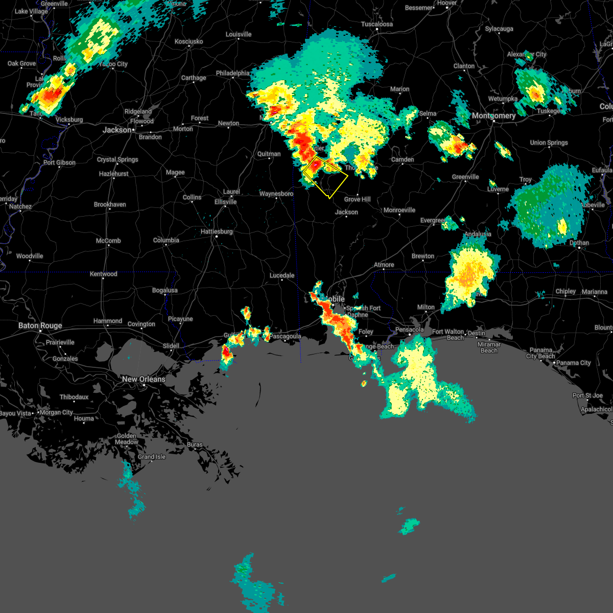 At 740 pm cdt, a severe thunderstorm was located 5 miles northeast of toxey, or 10 miles south of butler, moving southeast at 15 mph (radar indicated). Hazards include 60 mph wind gusts and quarter size hail. Hail damage to vehicles is expected. Expect wind damage to roofs, siding, and trees. At 740 pm cdt, a severe thunderstorm was located 5 miles northeast of toxey, or 10 miles south of butler, moving southeast at 15 mph (radar indicated). Hazards include 60 mph wind gusts and quarter size hail. Hail damage to vehicles is expected. Expect wind damage to roofs, siding, and trees.
|
| 4/13/2022 9:52 PM CDT | Trees blocking road near highway 69 and ulcanush lan in clarke county AL, 2.5 miles SSW of Coffeeville, AL |
| 4/13/2022 9:43 PM CDT |
 At 943 pm cdt, severe thunderstorms were located along a line extending from 7 miles northwest of pennington to 4 miles southwest of gilbertown to 3 miles southeast of richton, moving east at 55 mph (radar indicated). Hazards include 70 mph wind gusts and penny size hail. Expect considerable tree damage. Damage is likely to mobile homes, roofs, and outbuildings. At 943 pm cdt, severe thunderstorms were located along a line extending from 7 miles northwest of pennington to 4 miles southwest of gilbertown to 3 miles southeast of richton, moving east at 55 mph (radar indicated). Hazards include 70 mph wind gusts and penny size hail. Expect considerable tree damage. Damage is likely to mobile homes, roofs, and outbuildings.
|
| 4/5/2022 9:26 AM CDT |
 At 925 am cdt, severe thunderstorms were located along a line extending from new augusta to near wagarville to grove hill to shawnee, moving east at 70 mph (radar indicated). Hazards include 70 mph wind gusts and nickel size hail. Expect considerable tree damage. Damage is likely to mobile homes, roofs, and outbuildings. At 925 am cdt, severe thunderstorms were located along a line extending from new augusta to near wagarville to grove hill to shawnee, moving east at 70 mph (radar indicated). Hazards include 70 mph wind gusts and nickel size hail. Expect considerable tree damage. Damage is likely to mobile homes, roofs, and outbuildings.
|
| 4/5/2022 9:08 AM CDT |
 At 908 am cdt, a tornado producing storm was located over coffeeville, or 20 miles west of grove hill, moving east at 55 mph (radar confirmed tornado). Hazards include damaging tornado and quarter size hail. Flying debris will be dangerous to those caught without shelter. mobile homes will be damaged or destroyed. damage to roofs, windows, and vehicles will occur. tree damage is likely. this tornadic storm will be near, fulton around 930 am cdt. thomasville around 935 am cdt. pine hill around 945 am cdt. Yellow bluff around 950 am cdt. At 908 am cdt, a tornado producing storm was located over coffeeville, or 20 miles west of grove hill, moving east at 55 mph (radar confirmed tornado). Hazards include damaging tornado and quarter size hail. Flying debris will be dangerous to those caught without shelter. mobile homes will be damaged or destroyed. damage to roofs, windows, and vehicles will occur. tree damage is likely. this tornadic storm will be near, fulton around 930 am cdt. thomasville around 935 am cdt. pine hill around 945 am cdt. Yellow bluff around 950 am cdt.
|
| 4/5/2022 9:00 AM CDT |
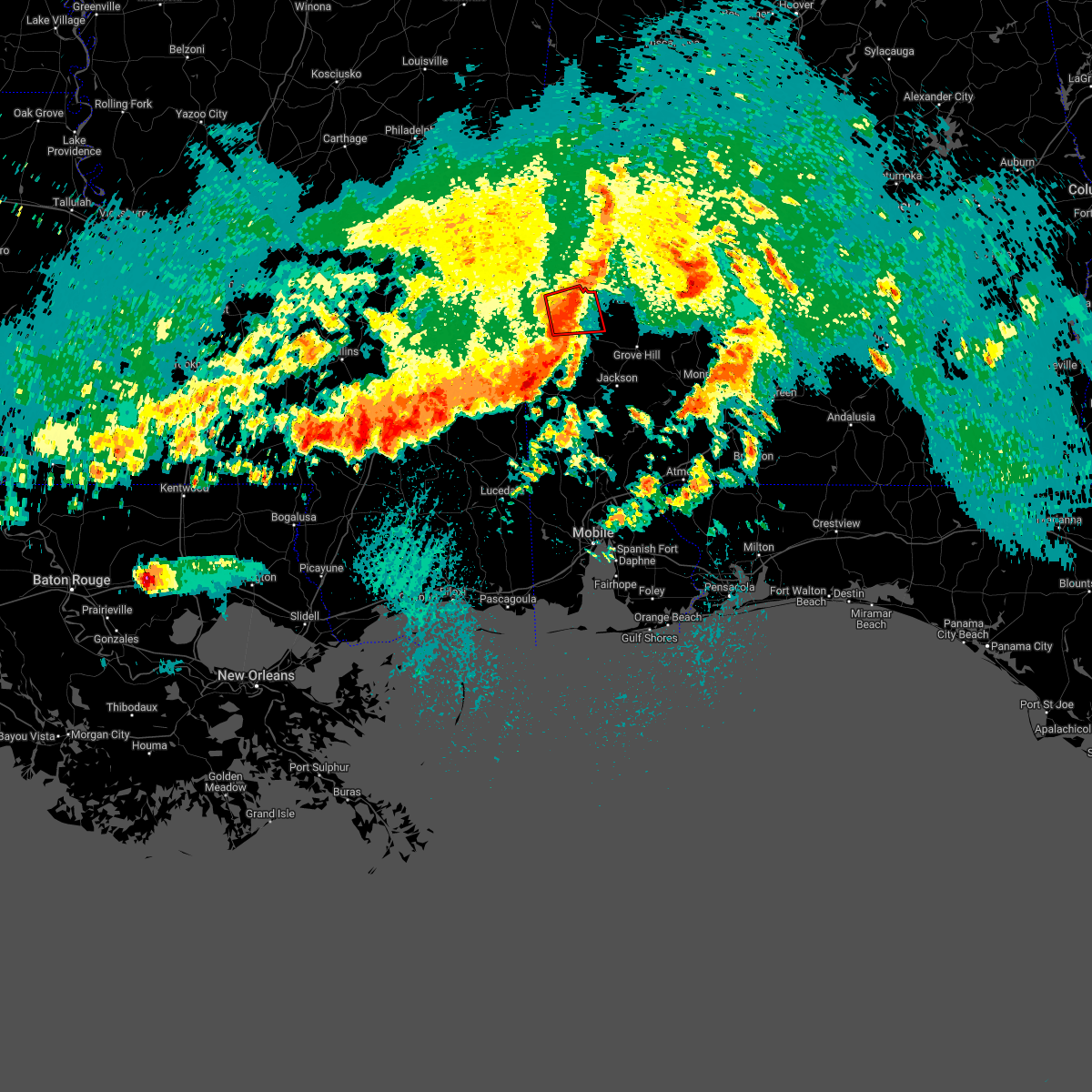 At 900 am cdt, a severe thunderstorm capable of producing a tornado was located 6 miles northwest of coffeeville, or 20 miles south of butler, moving east at 50 mph (radar indicated rotation). Hazards include tornado and quarter size hail. Flying debris will be dangerous to those caught without shelter. mobile homes will be damaged or destroyed. damage to roofs, windows, and vehicles will occur. tree damage is likely. This tornadic thunderstorm will remain over mainly rural areas of south central choctaw and northwestern clarke counties. At 900 am cdt, a severe thunderstorm capable of producing a tornado was located 6 miles northwest of coffeeville, or 20 miles south of butler, moving east at 50 mph (radar indicated rotation). Hazards include tornado and quarter size hail. Flying debris will be dangerous to those caught without shelter. mobile homes will be damaged or destroyed. damage to roofs, windows, and vehicles will occur. tree damage is likely. This tornadic thunderstorm will remain over mainly rural areas of south central choctaw and northwestern clarke counties.
|
| 4/5/2022 8:57 AM CDT |
 At 856 am cdt, severe thunderstorms were located along a line extending from near myrtlewood to 3 miles northeast of millry to near buckatunna, moving east at 65 mph (radar indicated). Hazards include 70 mph wind gusts and quarter size hail. Hail damage to vehicles is expected. expect considerable tree damage. wind damage is also likely to mobile homes, roofs, and outbuildings. Locations impacted include, jackson, thomasville, butler, grove hill, chatom, saint stephens, leroy, pine hill, millry, buckatunna, silas, coffeeville, pennington, fulton, gilbertown and toxey. At 856 am cdt, severe thunderstorms were located along a line extending from near myrtlewood to 3 miles northeast of millry to near buckatunna, moving east at 65 mph (radar indicated). Hazards include 70 mph wind gusts and quarter size hail. Hail damage to vehicles is expected. expect considerable tree damage. wind damage is also likely to mobile homes, roofs, and outbuildings. Locations impacted include, jackson, thomasville, butler, grove hill, chatom, saint stephens, leroy, pine hill, millry, buckatunna, silas, coffeeville, pennington, fulton, gilbertown and toxey.
|
| 4/5/2022 8:48 AM CDT |
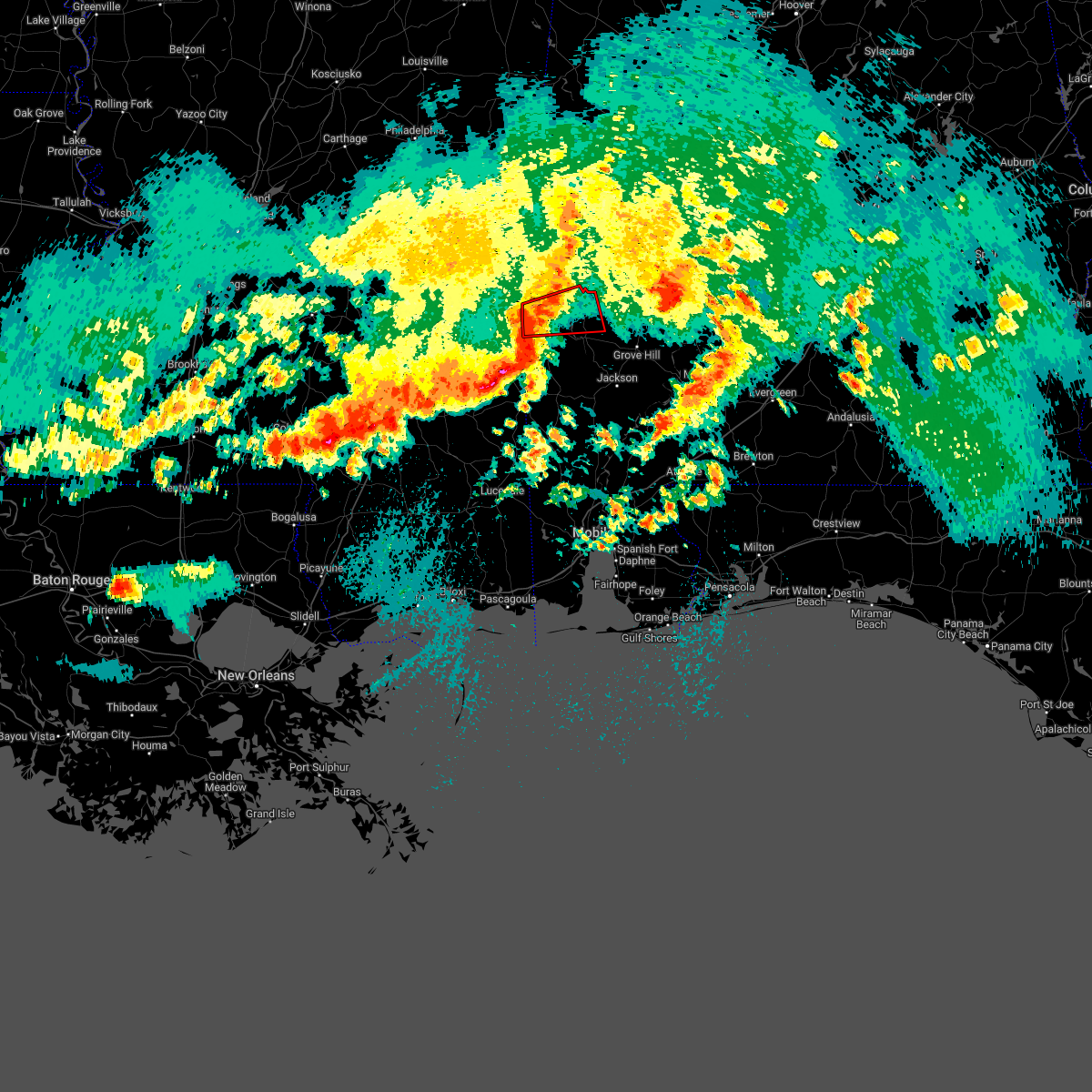 At 847 am cdt, a severe thunderstorm capable of producing a tornado was located 4 miles west of gilbertown, or 19 miles northeast of waynesboro, moving east at 45 mph (radar indicated rotation). Hazards include tornado and quarter size hail. Flying debris will be dangerous to those caught without shelter. mobile homes will be damaged or destroyed. damage to roofs, windows, and vehicles will occur. tree damage is likely. This dangerous storm will be near, toxey around 855 am cdt. At 847 am cdt, a severe thunderstorm capable of producing a tornado was located 4 miles west of gilbertown, or 19 miles northeast of waynesboro, moving east at 45 mph (radar indicated rotation). Hazards include tornado and quarter size hail. Flying debris will be dangerous to those caught without shelter. mobile homes will be damaged or destroyed. damage to roofs, windows, and vehicles will occur. tree damage is likely. This dangerous storm will be near, toxey around 855 am cdt.
|
| 4/5/2022 8:40 AM CDT |
 At 839 am cdt, severe thunderstorms were located along a line extending from 5 miles south of kinterbish to 6 miles southeast of waynesboro to 10 miles southwest of clara, moving east at 60 mph (radar indicated). Hazards include 60 mph wind gusts and quarter size hail. Hail damage to vehicles is expected. Expect wind damage to roofs, siding, and trees. At 839 am cdt, severe thunderstorms were located along a line extending from 5 miles south of kinterbish to 6 miles southeast of waynesboro to 10 miles southwest of clara, moving east at 60 mph (radar indicated). Hazards include 60 mph wind gusts and quarter size hail. Hail damage to vehicles is expected. Expect wind damage to roofs, siding, and trees.
|
| 4/5/2022 8:33 AM CDT |
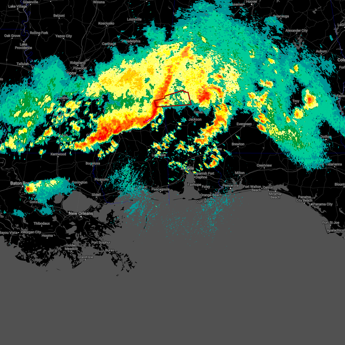 At 832 am cdt, a severe thunderstorm capable of producing a tornado was located 10 miles north of waynesboro, moving east at 45 mph (radar indicated rotation). Hazards include tornado and quarter size hail. Flying debris will be dangerous to those caught without shelter. mobile homes will be damaged or destroyed. damage to roofs, windows, and vehicles will occur. tree damage is likely. This dangerous storm will be near, gilbertown and toxey around 855 am cdt. At 832 am cdt, a severe thunderstorm capable of producing a tornado was located 10 miles north of waynesboro, moving east at 45 mph (radar indicated rotation). Hazards include tornado and quarter size hail. Flying debris will be dangerous to those caught without shelter. mobile homes will be damaged or destroyed. damage to roofs, windows, and vehicles will occur. tree damage is likely. This dangerous storm will be near, gilbertown and toxey around 855 am cdt.
|
| 4/5/2022 8:12 AM CDT |
 At 812 am cdt, a severe thunderstorm was located 10 miles east of coffeeville, or 10 miles northwest of grove hill, moving northeast at 60 mph (radar indicated). Hazards include 60 mph wind gusts and penny size hail. expect damage to roofs, siding, and trees At 812 am cdt, a severe thunderstorm was located 10 miles east of coffeeville, or 10 miles northwest of grove hill, moving northeast at 60 mph (radar indicated). Hazards include 60 mph wind gusts and penny size hail. expect damage to roofs, siding, and trees
|
| 3/30/2022 9:37 PM CDT |
 At 936 pm cdt, severe thunderstorms were located along a line extending from 4 miles west of putnam to 5 miles south of coffeeville, moving east at 50 mph (radar indicated). Hazards include 70 mph wind gusts. Expect considerable tree damage. Damage is likely to mobile homes, roofs, and outbuildings. At 936 pm cdt, severe thunderstorms were located along a line extending from 4 miles west of putnam to 5 miles south of coffeeville, moving east at 50 mph (radar indicated). Hazards include 70 mph wind gusts. Expect considerable tree damage. Damage is likely to mobile homes, roofs, and outbuildings.
|
| 3/30/2022 9:18 PM CDT |
 At 917 pm cdt, severe thunderstorms were located along a line extending from jefferson to 4 miles west of putnam to 5 miles east of silas, moving east at 45 mph (radar indicated). Hazards include 70 mph wind gusts. Expect considerable tree damage. damage is likely to mobile homes, roofs, and outbuildings. locations impacted include, butler, lisman, silas, coffeeville, pennington, gilbertown and toxey. thunderstorm damage threat, considerable hail threat, radar indicated max hail size, <. 75 in wind threat, radar indicated max wind gust, 70 mph. At 917 pm cdt, severe thunderstorms were located along a line extending from jefferson to 4 miles west of putnam to 5 miles east of silas, moving east at 45 mph (radar indicated). Hazards include 70 mph wind gusts. Expect considerable tree damage. damage is likely to mobile homes, roofs, and outbuildings. locations impacted include, butler, lisman, silas, coffeeville, pennington, gilbertown and toxey. thunderstorm damage threat, considerable hail threat, radar indicated max hail size, <. 75 in wind threat, radar indicated max wind gust, 70 mph.
|
| 3/30/2022 9:09 PM CDT |
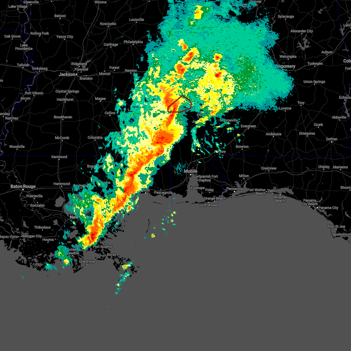 At 906 pm cdt, a severe thunderstorm capable of producing a tornado was located 4 miles southwest of silas, or 14 miles east of waynesboro, moving northeast at 55 mph. destructive winds up to 80 mph will be possible outside any possible tornadoes (radar indicated rotation). Hazards include tornado. Flying debris will be dangerous to those caught without shelter. mobile homes will be damaged or destroyed. damage to roofs, windows, and vehicles will occur. tree damage is likely. this dangerous storm will be near, silas around 910 pm cdt. Gilbertown around 915 pm cdt. At 906 pm cdt, a severe thunderstorm capable of producing a tornado was located 4 miles southwest of silas, or 14 miles east of waynesboro, moving northeast at 55 mph. destructive winds up to 80 mph will be possible outside any possible tornadoes (radar indicated rotation). Hazards include tornado. Flying debris will be dangerous to those caught without shelter. mobile homes will be damaged or destroyed. damage to roofs, windows, and vehicles will occur. tree damage is likely. this dangerous storm will be near, silas around 910 pm cdt. Gilbertown around 915 pm cdt.
|
| 3/30/2022 8:59 PM CDT |
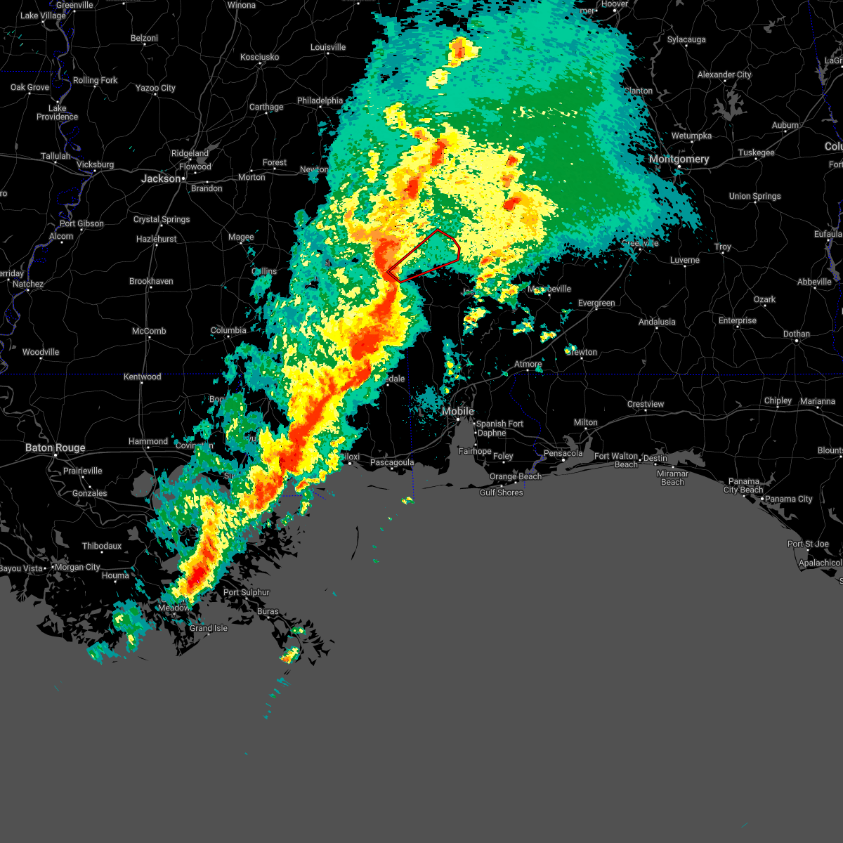 At 859 pm cdt, a severe thunderstorm capable of producing a tornado was located 8 miles east of waynesboro, moving northeast at 55 mph (radar indicated rotation). Hazards include tornado. Flying debris will be dangerous to those caught without shelter. mobile homes will be damaged or destroyed. damage to roofs, windows, and vehicles will occur. tree damage is likely. this dangerous storm will be near, silas around 910 pm cdt. Coffeeville around 925 pm cdt. At 859 pm cdt, a severe thunderstorm capable of producing a tornado was located 8 miles east of waynesboro, moving northeast at 55 mph (radar indicated rotation). Hazards include tornado. Flying debris will be dangerous to those caught without shelter. mobile homes will be damaged or destroyed. damage to roofs, windows, and vehicles will occur. tree damage is likely. this dangerous storm will be near, silas around 910 pm cdt. Coffeeville around 925 pm cdt.
|
| 3/30/2022 8:42 PM CDT |
 At 841 pm cdt, severe thunderstorms were located along a line extending from 4 miles east of alamucha to near crandall to 3 miles west of waynesboro, moving east at 45 mph (radar indicated). Hazards include 70 mph wind gusts. Expect considerable tree damage. Damage is likely to mobile homes, roofs, and outbuildings. At 841 pm cdt, severe thunderstorms were located along a line extending from 4 miles east of alamucha to near crandall to 3 miles west of waynesboro, moving east at 45 mph (radar indicated). Hazards include 70 mph wind gusts. Expect considerable tree damage. Damage is likely to mobile homes, roofs, and outbuildings.
|
| 3/22/2022 7:09 PM CDT |
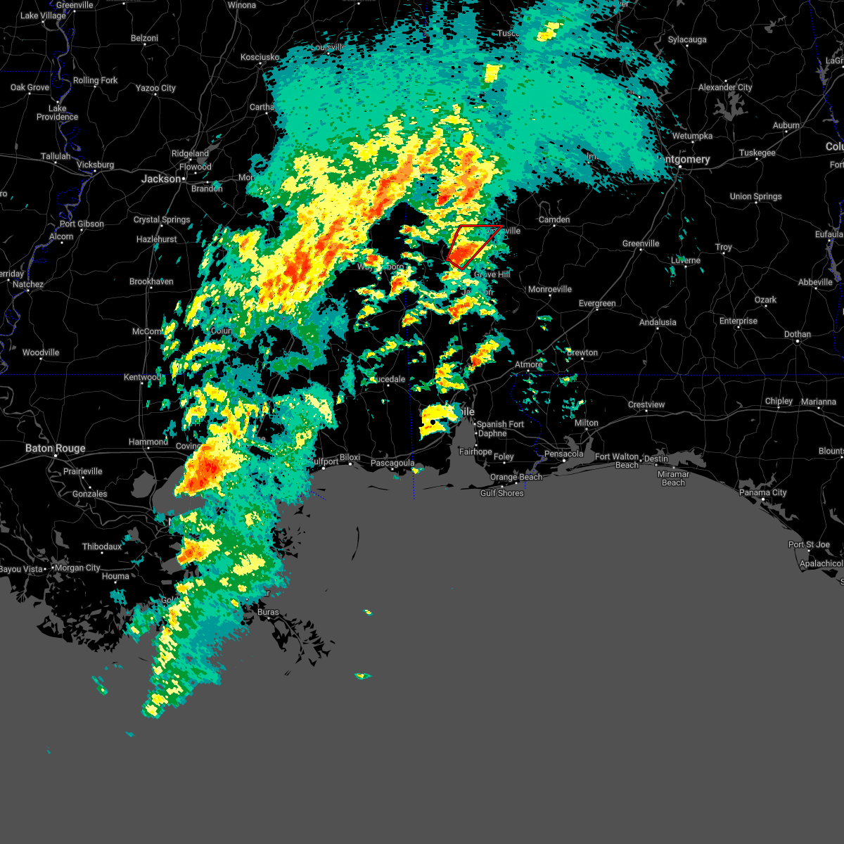 At 709 pm cdt, a severe thunderstorm capable of producing a tornado was located near coffeeville, or 16 miles west of grove hill, moving northeast at 55 mph (radar indicated rotation). Hazards include tornado. Flying debris will be dangerous to those caught without shelter. mobile homes will be damaged or destroyed. damage to roofs, windows, and vehicles will occur. tree damage is likely. This tornadic thunderstorm will remain over mainly rural areas of northwestern clarke county. At 709 pm cdt, a severe thunderstorm capable of producing a tornado was located near coffeeville, or 16 miles west of grove hill, moving northeast at 55 mph (radar indicated rotation). Hazards include tornado. Flying debris will be dangerous to those caught without shelter. mobile homes will be damaged or destroyed. damage to roofs, windows, and vehicles will occur. tree damage is likely. This tornadic thunderstorm will remain over mainly rural areas of northwestern clarke county.
|
| 3/22/2022 6:59 PM CDT |
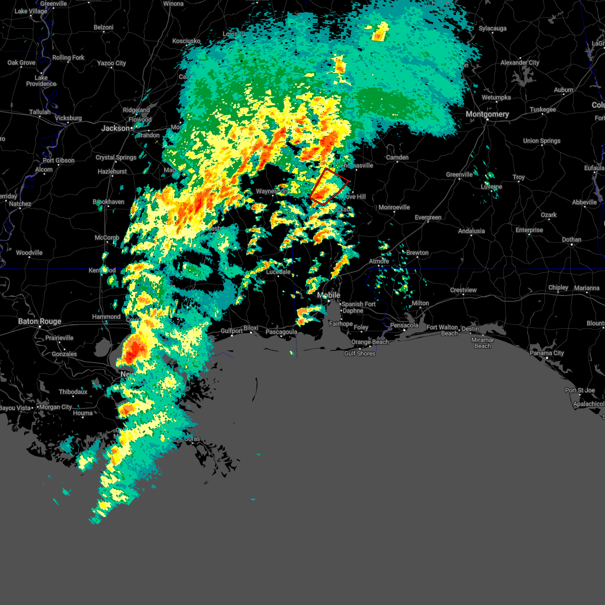 At 659 pm cdt, a severe thunderstorm capable of producing a tornado was located 4 miles southwest of coffeeville, or 17 miles northeast of chatom, moving northeast at 50 mph (radar indicated rotation). Hazards include tornado and quarter size hail. Flying debris will be dangerous to those caught without shelter. mobile homes will be damaged or destroyed. damage to roofs, windows, and vehicles will occur. tree damage is likely. This tornadic thunderstorm will remain over mainly rural areas of south central choctaw, north central washington and northwestern clarke counties. At 659 pm cdt, a severe thunderstorm capable of producing a tornado was located 4 miles southwest of coffeeville, or 17 miles northeast of chatom, moving northeast at 50 mph (radar indicated rotation). Hazards include tornado and quarter size hail. Flying debris will be dangerous to those caught without shelter. mobile homes will be damaged or destroyed. damage to roofs, windows, and vehicles will occur. tree damage is likely. This tornadic thunderstorm will remain over mainly rural areas of south central choctaw, north central washington and northwestern clarke counties.
|
| 3/22/2022 6:49 PM CDT |
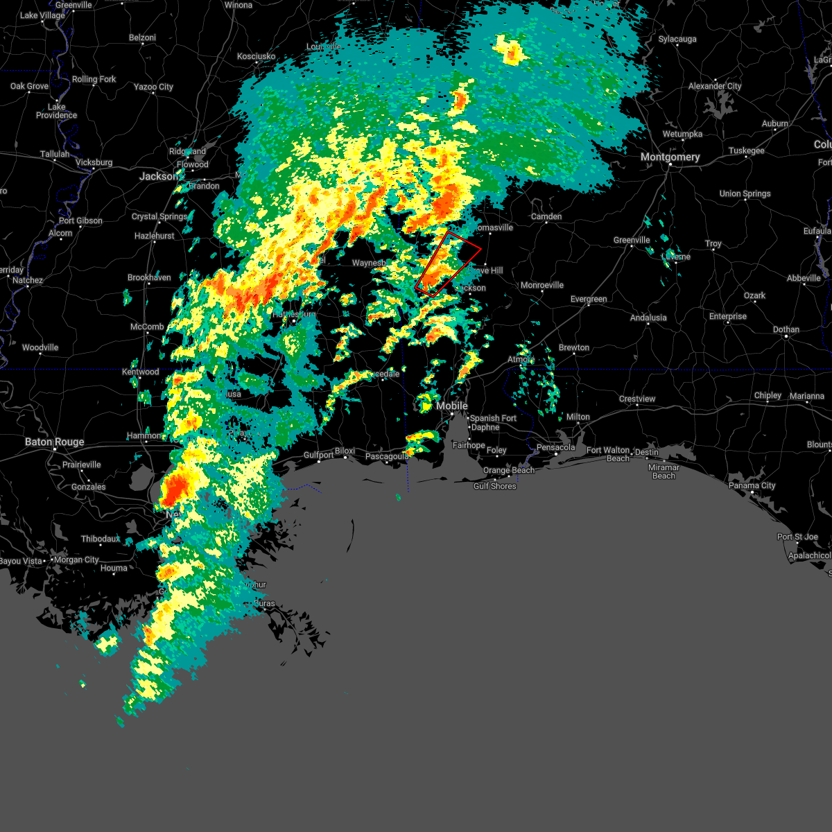 At 648 pm cdt, a severe thunderstorm capable of producing a tornado was located 7 miles southeast of millry, or 7 miles north of chatom, moving northeast at 55 mph (radar indicated rotation). Hazards include tornado and quarter size hail. Flying debris will be dangerous to those caught without shelter. mobile homes will be damaged or destroyed. damage to roofs, windows, and vehicles will occur. tree damage is likely. This dangerous storm will be near, coffeeville around 705 pm cdt. At 648 pm cdt, a severe thunderstorm capable of producing a tornado was located 7 miles southeast of millry, or 7 miles north of chatom, moving northeast at 55 mph (radar indicated rotation). Hazards include tornado and quarter size hail. Flying debris will be dangerous to those caught without shelter. mobile homes will be damaged or destroyed. damage to roofs, windows, and vehicles will occur. tree damage is likely. This dangerous storm will be near, coffeeville around 705 pm cdt.
|
| 3/22/2022 6:39 PM CDT |
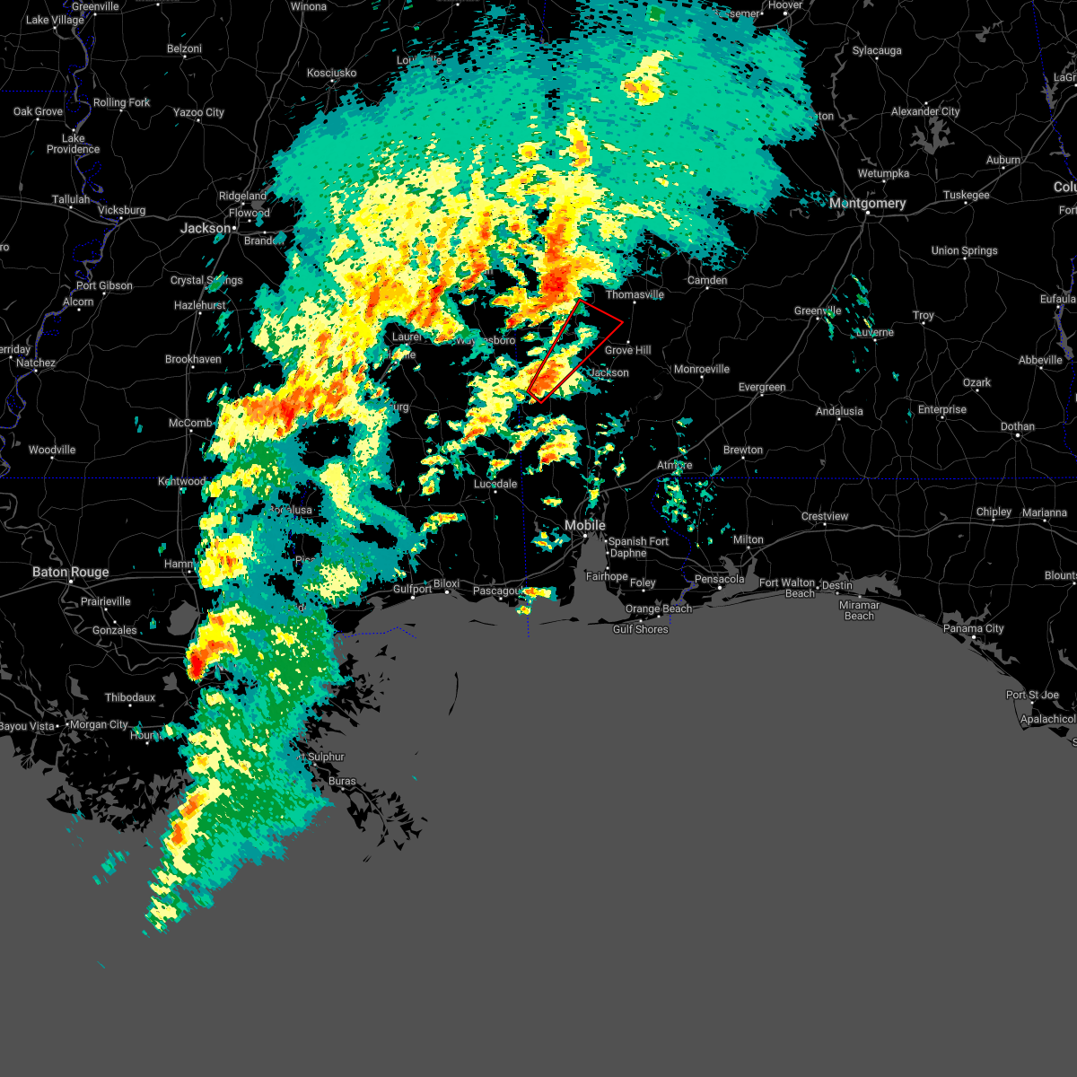 At 639 pm cdt, a severe thunderstorm capable of producing a tornado was located over chatom, moving northeast at 50 mph (radar indicated rotation). Hazards include tornado and quarter size hail. Flying debris will be dangerous to those caught without shelter. mobile homes will be damaged or destroyed. damage to roofs, windows, and vehicles will occur. tree damage is likely. This dangerous storm will be near, coffeeville around 705 pm cdt. At 639 pm cdt, a severe thunderstorm capable of producing a tornado was located over chatom, moving northeast at 50 mph (radar indicated rotation). Hazards include tornado and quarter size hail. Flying debris will be dangerous to those caught without shelter. mobile homes will be damaged or destroyed. damage to roofs, windows, and vehicles will occur. tree damage is likely. This dangerous storm will be near, coffeeville around 705 pm cdt.
|
| 3/22/2022 6:30 PM CDT |
 At 630 pm cdt, a severe thunderstorm capable of producing a tornado was located over fruitdale, or 12 miles southwest of chatom, moving northeast at 55 mph (radar indicated rotation). Hazards include tornado and quarter size hail. Flying debris will be dangerous to those caught without shelter. mobile homes will be damaged or destroyed. damage to roofs, windows, and vehicles will occur. tree damage is likely. this dangerous storm will be near, chatom around 645 pm cdt. Coffeeville around 710 pm cdt. At 630 pm cdt, a severe thunderstorm capable of producing a tornado was located over fruitdale, or 12 miles southwest of chatom, moving northeast at 55 mph (radar indicated rotation). Hazards include tornado and quarter size hail. Flying debris will be dangerous to those caught without shelter. mobile homes will be damaged or destroyed. damage to roofs, windows, and vehicles will occur. tree damage is likely. this dangerous storm will be near, chatom around 645 pm cdt. Coffeeville around 710 pm cdt.
|
| 3/18/2022 6:18 AM CDT |
 At 618 am cdt, severe thunderstorms were located along a line extending from 4 miles north of lisman to 4 miles southwest of silas, moving east at 65 mph (radar indicated). Hazards include 70 mph wind gusts and nickel size hail. Expect considerable tree damage. Damage is likely to mobile homes, roofs, and outbuildings. At 618 am cdt, severe thunderstorms were located along a line extending from 4 miles north of lisman to 4 miles southwest of silas, moving east at 65 mph (radar indicated). Hazards include 70 mph wind gusts and nickel size hail. Expect considerable tree damage. Damage is likely to mobile homes, roofs, and outbuildings.
|
| 3/15/2022 10:54 PM CDT |
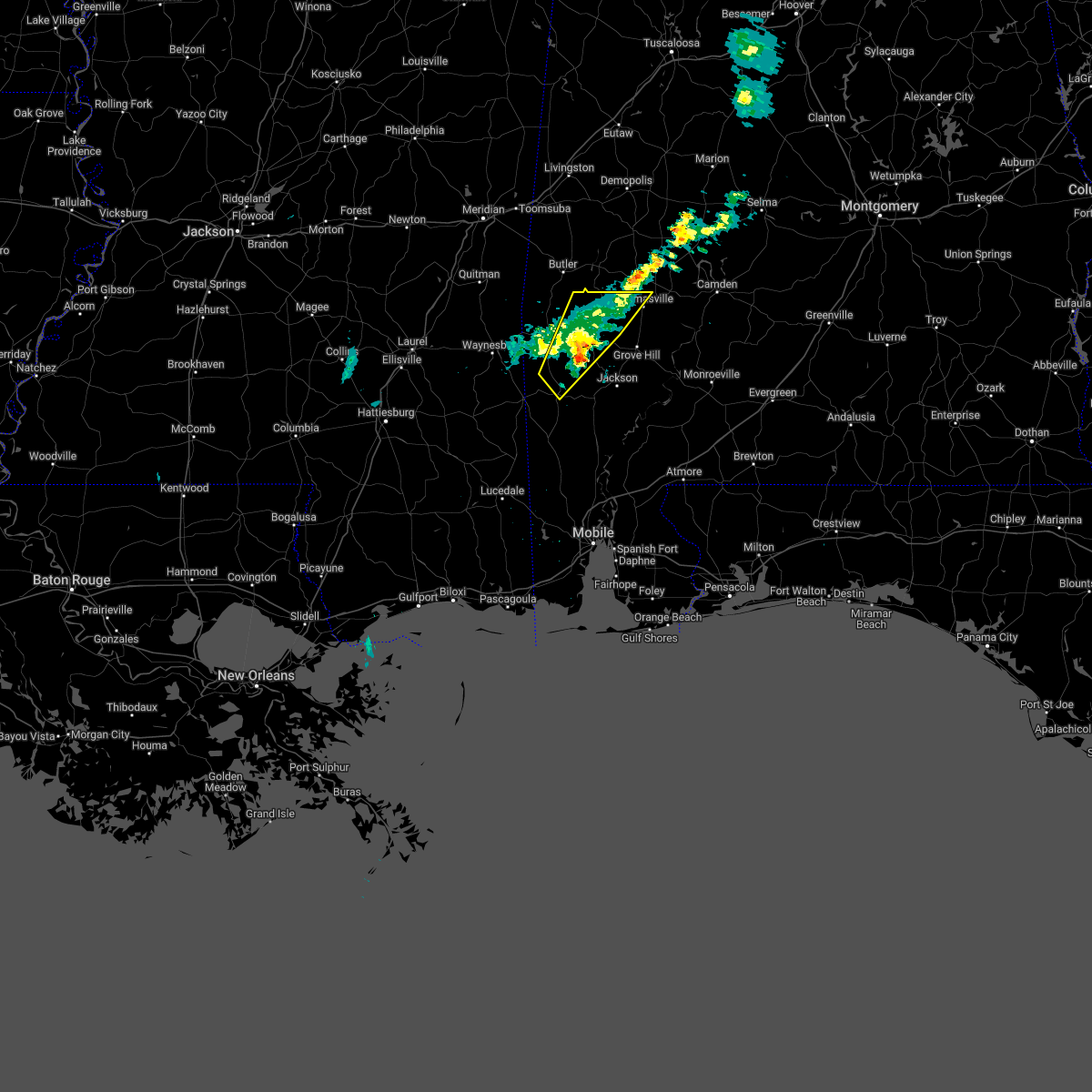 The severe thunderstorm warning for south central choctaw, northwestern washington and northwestern clarke counties will expire at 1100 pm cdt, the storms which prompted the warning have weakened below severe limits. therefore, the warning will be allowed to expire. The severe thunderstorm warning for south central choctaw, northwestern washington and northwestern clarke counties will expire at 1100 pm cdt, the storms which prompted the warning have weakened below severe limits. therefore, the warning will be allowed to expire.
|
| 3/15/2022 10:22 PM CDT |
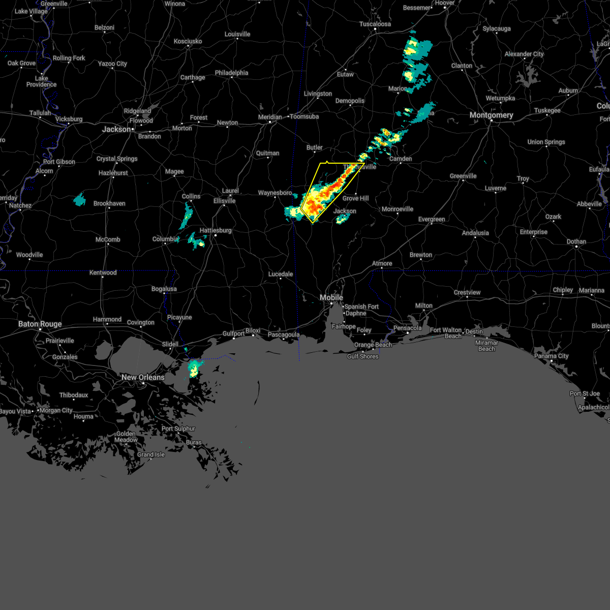 At 1022 pm cdt, severe thunderstorms were located along a line extending from 5 miles west of thomasville to 3 miles north of chatom, moving northeast at 25 mph (radar indicated). Hazards include half dollar size hail. damage to vehicles is expected At 1022 pm cdt, severe thunderstorms were located along a line extending from 5 miles west of thomasville to 3 miles north of chatom, moving northeast at 25 mph (radar indicated). Hazards include half dollar size hail. damage to vehicles is expected
|
| 2/3/2022 2:23 PM CST |
 At 223 pm cst, severe thunderstorms were located along a line extending from millry to 5 miles northwest of chatom to 5 miles northeast of fruitdale, moving east at 50 mph (radar indicated). Hazards include 60 mph wind gusts. expect damage to roofs, siding, and trees At 223 pm cst, severe thunderstorms were located along a line extending from millry to 5 miles northwest of chatom to 5 miles northeast of fruitdale, moving east at 50 mph (radar indicated). Hazards include 60 mph wind gusts. expect damage to roofs, siding, and trees
|
| 2/3/2022 2:06 PM CST |
 At 206 pm cst, a severe thunderstorm was located 9 miles east of coffeeville, or 9 miles west of grove hill, moving northeast at 45 mph (radar indicated). Hazards include 60 mph wind gusts. expect damage to roofs, siding, and trees At 206 pm cst, a severe thunderstorm was located 9 miles east of coffeeville, or 9 miles west of grove hill, moving northeast at 45 mph (radar indicated). Hazards include 60 mph wind gusts. expect damage to roofs, siding, and trees
|
| 8/19/2021 7:38 PM CDT |
 At 738 pm cdt, severe thunderstorms were located along a line extending from near grove hill to 5 miles east of millry, and are nearly stationary (radar indicated). Hazards include 60 mph wind gusts. expect damage to roofs, siding, and trees At 738 pm cdt, severe thunderstorms were located along a line extending from near grove hill to 5 miles east of millry, and are nearly stationary (radar indicated). Hazards include 60 mph wind gusts. expect damage to roofs, siding, and trees
|
| 6/8/2021 2:46 PM CDT |
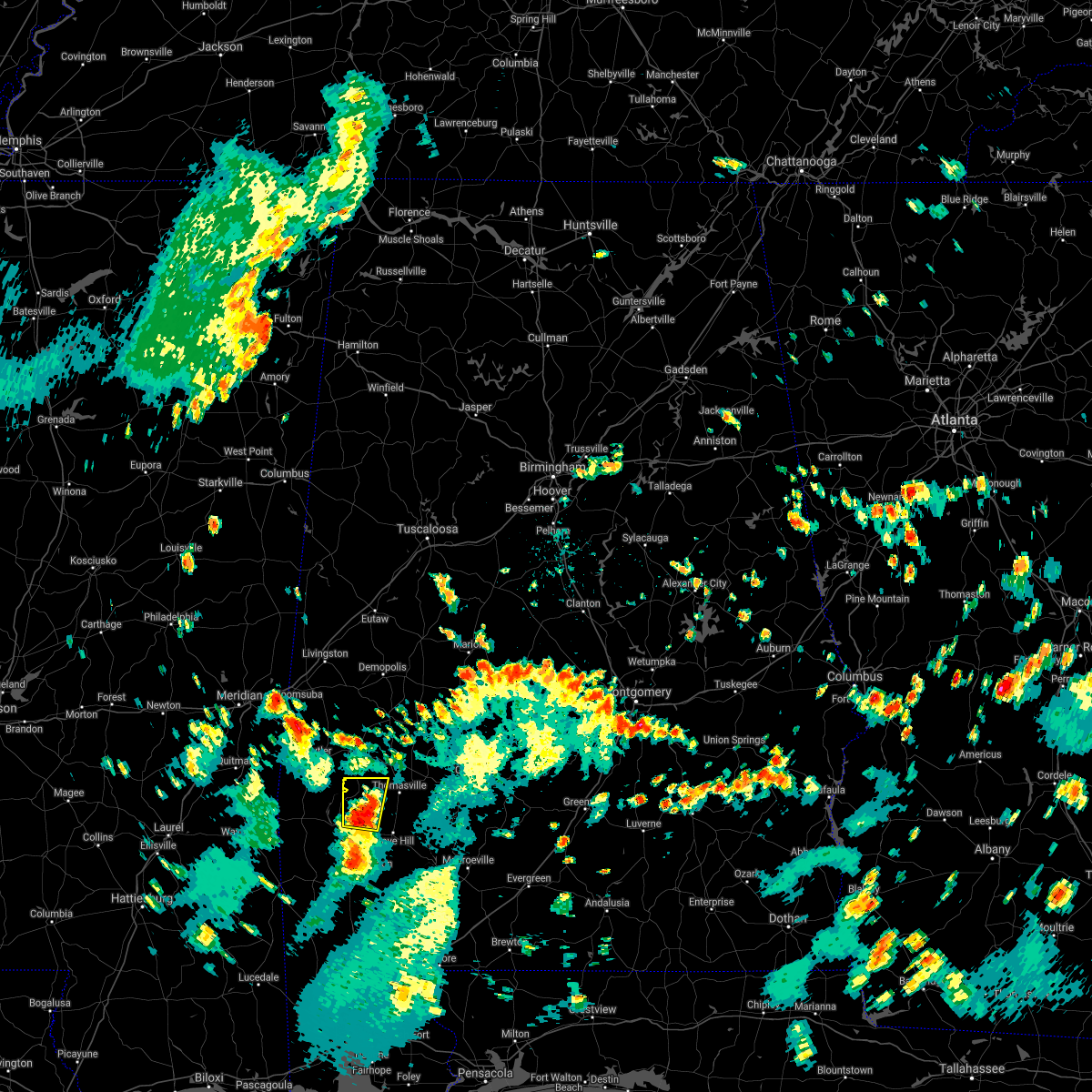 At 245 pm cdt, a severe thunderstorm was located 7 miles northeast of coffeeville, or 13 miles northwest of grove hill, moving north at 30 mph (radar indicated). Hazards include 60 mph wind gusts and nickel size hail. Expect damage to roofs, siding, and trees. This severe thunderstorm will remain over mainly rural areas of northwestern clarke county. At 245 pm cdt, a severe thunderstorm was located 7 miles northeast of coffeeville, or 13 miles northwest of grove hill, moving north at 30 mph (radar indicated). Hazards include 60 mph wind gusts and nickel size hail. Expect damage to roofs, siding, and trees. This severe thunderstorm will remain over mainly rural areas of northwestern clarke county.
|
| 5/4/2021 5:35 PM CDT |
 At 534 pm cdt, severe thunderstorms were located along a line extending from 3 miles northeast of vineland to 10 miles west of fulton to 7 miles east of millry to near buckatunna, moving east at 40 mph (radar indicated). Hazards include 60 mph wind gusts. Expect damage to roofs, siding, and trees. Locations impacted include, jackson, thomasville, grove hill, saint stephens, leroy, pine hill, millry, buckatunna, coffeeville, fulton and yellow bluff. At 534 pm cdt, severe thunderstorms were located along a line extending from 3 miles northeast of vineland to 10 miles west of fulton to 7 miles east of millry to near buckatunna, moving east at 40 mph (radar indicated). Hazards include 60 mph wind gusts. Expect damage to roofs, siding, and trees. Locations impacted include, jackson, thomasville, grove hill, saint stephens, leroy, pine hill, millry, buckatunna, coffeeville, fulton and yellow bluff.
|
| 5/4/2021 5:23 PM CDT |
 At 523 pm cdt, severe thunderstorms were located along a line extending from surginer to 7 miles northeast of coffeeville to 4 miles north of millry to 3 miles west of buckatunna, moving east at 45 mph (radar indicated). Hazards include 60 mph wind gusts. Expect damage to roofs, siding, and trees. Locations impacted include, jackson, waynesboro, thomasville, grove hill, saint stephens, leroy, clara, pine hill, millry, buckatunna, silas, coffeeville, fulton and yellow bluff. At 523 pm cdt, severe thunderstorms were located along a line extending from surginer to 7 miles northeast of coffeeville to 4 miles north of millry to 3 miles west of buckatunna, moving east at 45 mph (radar indicated). Hazards include 60 mph wind gusts. Expect damage to roofs, siding, and trees. Locations impacted include, jackson, waynesboro, thomasville, grove hill, saint stephens, leroy, clara, pine hill, millry, buckatunna, silas, coffeeville, fulton and yellow bluff.
|
| 5/4/2021 5:18 PM CDT | Trees down blocking the road near coffeevill in clarke county AL, 6.8 miles W of Coffeeville, AL |
| 5/4/2021 4:59 PM CDT |
 The national weather service in mobile has issued a * severe thunderstorm warning for. choctaw county in southwestern alabama. northern washington county in southwestern alabama. clarke county in southwestern alabama. Western wilcox county in south central alabama. The national weather service in mobile has issued a * severe thunderstorm warning for. choctaw county in southwestern alabama. northern washington county in southwestern alabama. clarke county in southwestern alabama. Western wilcox county in south central alabama.
|
| 5/4/2021 3:55 PM CDT |
 At 354 pm cdt, severe thunderstorms were located along a line extending from 4 miles east of suqualena to 3 miles northwest of paulding to 5 miles south of turnerville to near mount olive, moving east at 70 mph (radar indicated). Hazards include 70 mph wind gusts. Expect considerable tree damage. Damage is likely to mobile homes, roofs, and outbuildings. At 354 pm cdt, severe thunderstorms were located along a line extending from 4 miles east of suqualena to 3 miles northwest of paulding to 5 miles south of turnerville to near mount olive, moving east at 70 mph (radar indicated). Hazards include 70 mph wind gusts. Expect considerable tree damage. Damage is likely to mobile homes, roofs, and outbuildings.
|
| 5/2/2021 4:10 PM CDT |
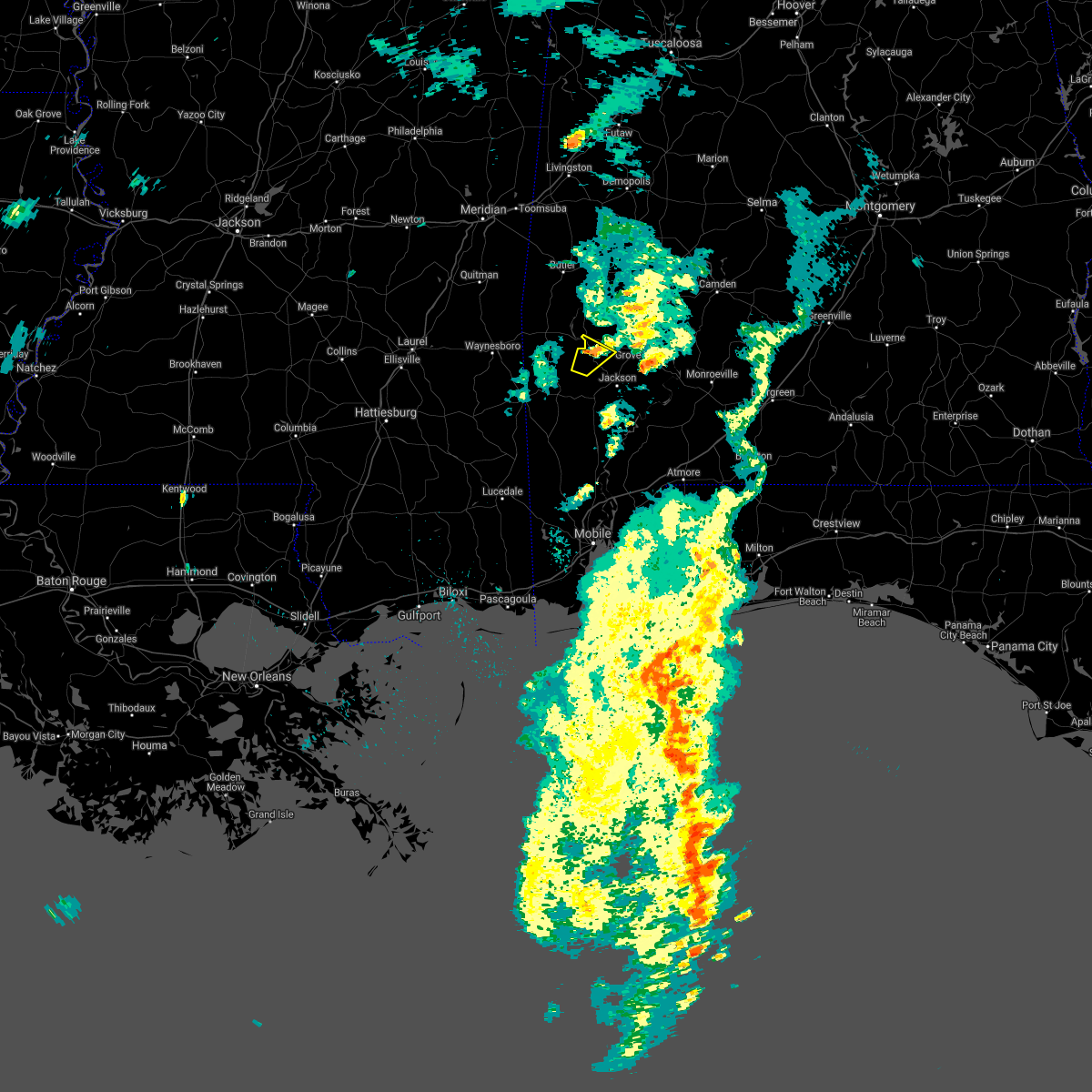 At 409 pm cdt, a severe thunderstorm was located 7 miles north of saint stephens, or 14 miles northwest of jackson, moving northeast at 30 mph (radar indicated). Hazards include 60 mph wind gusts, possible brief tornado. Expect damage to roofs, siding, and trees. Locations impacted include, coffeeville. At 409 pm cdt, a severe thunderstorm was located 7 miles north of saint stephens, or 14 miles northwest of jackson, moving northeast at 30 mph (radar indicated). Hazards include 60 mph wind gusts, possible brief tornado. Expect damage to roofs, siding, and trees. Locations impacted include, coffeeville.
|
| 5/2/2021 3:57 PM CDT |
 At 357 pm cdt, a severe thunderstorm was located 5 miles west of saint stephens, or 8 miles northeast of chatom, moving northeast at 30 mph (radar indicated). Hazards include 60 mph wind gusts. Expect damage to roofs, siding, and trees. Locations impacted include, saint stephens and coffeeville. At 357 pm cdt, a severe thunderstorm was located 5 miles west of saint stephens, or 8 miles northeast of chatom, moving northeast at 30 mph (radar indicated). Hazards include 60 mph wind gusts. Expect damage to roofs, siding, and trees. Locations impacted include, saint stephens and coffeeville.
|
| 5/2/2021 3:44 PM CDT |
 At 343 pm cdt, a severe thunderstorm was located near chatom, moving northeast at 30 mph (radar indicated). Hazards include 60 mph wind gusts. expect damage to roofs, siding, and trees At 343 pm cdt, a severe thunderstorm was located near chatom, moving northeast at 30 mph (radar indicated). Hazards include 60 mph wind gusts. expect damage to roofs, siding, and trees
|
| 4/24/2021 3:15 PM CDT |
 At 315 pm cdt, a severe thunderstorm was located over coffeeville, or 20 miles west of grove hill, moving east at 50 mph (radar indicated). Hazards include 60 mph wind gusts and half dollar size hail. Hail damage to vehicles is expected. Expect wind damage to roofs, siding, and trees. At 315 pm cdt, a severe thunderstorm was located over coffeeville, or 20 miles west of grove hill, moving east at 50 mph (radar indicated). Hazards include 60 mph wind gusts and half dollar size hail. Hail damage to vehicles is expected. Expect wind damage to roofs, siding, and trees.
|
| 4/10/2021 2:25 AM CDT |
 At 224 am cdt, severe thunderstorms were located along a line extending from 4 miles east of putnam to 4 miles east of fruitdale to 7 miles southwest of leakesville, moving east at 60 mph (radar indicated). Hazards include 60 mph wind gusts. Expect damage to roofs, siding, and trees. Locations impacted include, jackson, thomasville, grove hill, chatom, leakesville, saint stephens, wagarville, leroy, deer park, whatley, tibbie, pine hill, calvert, millry, state line, fruitdale, coffeeville, fulton, mcintosh and yellow bluff. At 224 am cdt, severe thunderstorms were located along a line extending from 4 miles east of putnam to 4 miles east of fruitdale to 7 miles southwest of leakesville, moving east at 60 mph (radar indicated). Hazards include 60 mph wind gusts. Expect damage to roofs, siding, and trees. Locations impacted include, jackson, thomasville, grove hill, chatom, leakesville, saint stephens, wagarville, leroy, deer park, whatley, tibbie, pine hill, calvert, millry, state line, fruitdale, coffeeville, fulton, mcintosh and yellow bluff.
|
| 4/10/2021 1:58 AM CDT |
 At 157 am cdt, severe thunderstorms were located along a line extending from 8 miles northwest of pennington to beaumont, moving east at 65 mph (radar indicated). Hazards include 70 mph wind gusts and quarter size hail. Hail damage to vehicles is expected. expect considerable tree damage. Wind damage is also likely to mobile homes, roofs, and outbuildings. At 157 am cdt, severe thunderstorms were located along a line extending from 8 miles northwest of pennington to beaumont, moving east at 65 mph (radar indicated). Hazards include 70 mph wind gusts and quarter size hail. Hail damage to vehicles is expected. expect considerable tree damage. Wind damage is also likely to mobile homes, roofs, and outbuildings.
|
| 4/9/2021 7:19 AM CDT |
 At 718 am cdt, a severe thunderstorm was located 7 miles southeast of coffeeville, or 13 miles west of grove hill, moving east at 30 mph (radar indicated). Hazards include ping pong ball size hail and 60 mph wind gusts. People and animals outdoors will be injured. expect hail damage to roofs, siding, windows, and vehicles. expect wind damage to roofs, siding, and trees. Locations impacted include, grove hill and coffeeville. At 718 am cdt, a severe thunderstorm was located 7 miles southeast of coffeeville, or 13 miles west of grove hill, moving east at 30 mph (radar indicated). Hazards include ping pong ball size hail and 60 mph wind gusts. People and animals outdoors will be injured. expect hail damage to roofs, siding, windows, and vehicles. expect wind damage to roofs, siding, and trees. Locations impacted include, grove hill and coffeeville.
|
| 4/9/2021 7:15 AM CDT | Tennis Ball sized hail reported 4.1 miles NNW of Coffeeville, AL, hail up to tennis ball size reported on highway 69 between coffeeville and salitpa. the hail resulted in vehicle damage. |
| 4/9/2021 7:02 AM CDT |
 At 702 am cdt, a severe thunderstorm was located 5 miles southwest of coffeeville, or 16 miles northeast of chatom, moving east at 25 mph (radar indicated). Hazards include 60 mph wind gusts and quarter size hail. Hail damage to vehicles is expected. Expect wind damage to roofs, siding, and trees. At 702 am cdt, a severe thunderstorm was located 5 miles southwest of coffeeville, or 16 miles northeast of chatom, moving east at 25 mph (radar indicated). Hazards include 60 mph wind gusts and quarter size hail. Hail damage to vehicles is expected. Expect wind damage to roofs, siding, and trees.
|
| 4/9/2021 6:54 AM CDT |
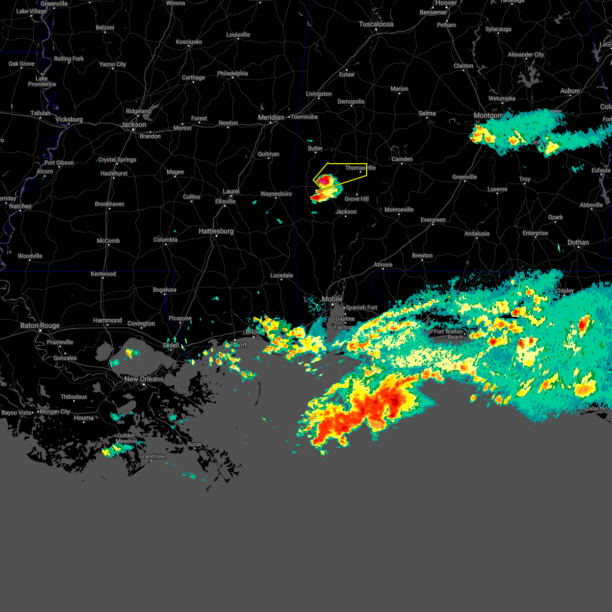 At 653 am cdt, a severe thunderstorm was located 5 miles north of coffeeville, or 18 miles south of butler, moving northeast at 35 mph (radar indicated). Hazards include 60 mph wind gusts and quarter size hail. Hail damage to vehicles is expected. Expect wind damage to roofs, siding, and trees. At 653 am cdt, a severe thunderstorm was located 5 miles north of coffeeville, or 18 miles south of butler, moving northeast at 35 mph (radar indicated). Hazards include 60 mph wind gusts and quarter size hail. Hail damage to vehicles is expected. Expect wind damage to roofs, siding, and trees.
|
| 3/31/2021 1:49 PM CDT |
 At 148 pm cdt, severe thunderstorms were located along a line extending from 5 miles west of putnam to 7 miles north of coffeeville to 6 miles east of silas, moving east at 55 mph (radar indicated). Hazards include 60 mph wind gusts and half dollar size hail. Hail damage to vehicles is expected. expect wind damage to roofs, siding, and trees. Locations impacted include, thomasville, grove hill, whatley, coffeeville and fulton. At 148 pm cdt, severe thunderstorms were located along a line extending from 5 miles west of putnam to 7 miles north of coffeeville to 6 miles east of silas, moving east at 55 mph (radar indicated). Hazards include 60 mph wind gusts and half dollar size hail. Hail damage to vehicles is expected. expect wind damage to roofs, siding, and trees. Locations impacted include, thomasville, grove hill, whatley, coffeeville and fulton.
|
| 3/31/2021 1:29 PM CDT |
 At 129 pm cdt, severe thunderstorms were located along a line extending from 4 miles northeast of crandall to 7 miles west of gilbertown to 10 miles north of waynesboro, moving east at 45 mph (radar indicated). Hazards include 60 mph wind gusts and quarter size hail. Hail damage to vehicles is expected. Expect wind damage to roofs, siding, and trees. At 129 pm cdt, severe thunderstorms were located along a line extending from 4 miles northeast of crandall to 7 miles west of gilbertown to 10 miles north of waynesboro, moving east at 45 mph (radar indicated). Hazards include 60 mph wind gusts and quarter size hail. Hail damage to vehicles is expected. Expect wind damage to roofs, siding, and trees.
|
| 3/17/2021 5:15 PM CDT |
 At 515 pm cdt, a severe thunderstorm was located 8 miles northeast of coffeeville, or 13 miles northwest of grove hill, moving northeast at 40 mph (radar indicated). Hazards include 60 mph wind gusts and quarter size hail. Hail damage to vehicles is expected. Expect wind damage to roofs, siding, and trees. At 515 pm cdt, a severe thunderstorm was located 8 miles northeast of coffeeville, or 13 miles northwest of grove hill, moving northeast at 40 mph (radar indicated). Hazards include 60 mph wind gusts and quarter size hail. Hail damage to vehicles is expected. Expect wind damage to roofs, siding, and trees.
|
| 3/17/2021 2:36 PM CDT |
 At 236 pm cdt, a severe thunderstorm capable of producing a tornado was located over coffeeville, or 18 miles west of grove hill, moving northeast at 30 mph (radar indicated rotation). Hazards include tornado. Flying debris will be dangerous to those caught without shelter. mobile homes will be damaged or destroyed. damage to roofs, windows, and vehicles will occur. tree damage is likely. This tornadic thunderstorm will impact coffeeville and over mainly rural areas of northwestern clarke county. At 236 pm cdt, a severe thunderstorm capable of producing a tornado was located over coffeeville, or 18 miles west of grove hill, moving northeast at 30 mph (radar indicated rotation). Hazards include tornado. Flying debris will be dangerous to those caught without shelter. mobile homes will be damaged or destroyed. damage to roofs, windows, and vehicles will occur. tree damage is likely. This tornadic thunderstorm will impact coffeeville and over mainly rural areas of northwestern clarke county.
|
| 3/17/2021 2:34 PM CDT |
 At 234 pm cdt, a severe thunderstorm was located 5 miles southeast of waynesboro, and another was located near coffeeville, moving northeast at 40 mph (radar indicated). Hazards include 60 mph wind gusts and quarter size hail. Hail damage to vehicles is expected. Expect wind damage to roofs, siding, and trees. At 234 pm cdt, a severe thunderstorm was located 5 miles southeast of waynesboro, and another was located near coffeeville, moving northeast at 40 mph (radar indicated). Hazards include 60 mph wind gusts and quarter size hail. Hail damage to vehicles is expected. Expect wind damage to roofs, siding, and trees.
|
| 7/1/2020 2:26 PM CDT |
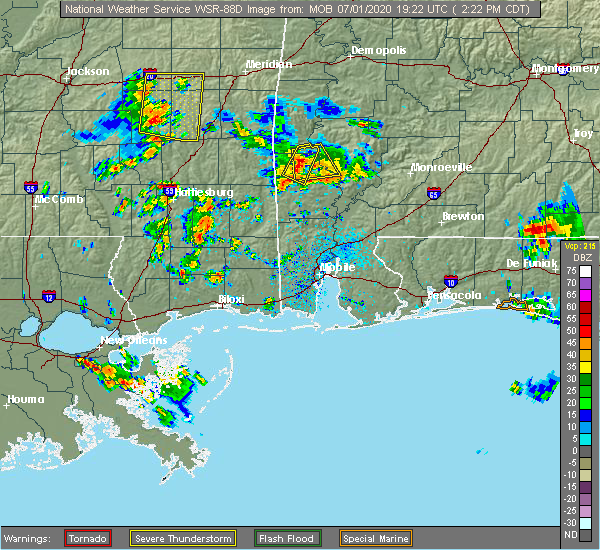 At 226 pm cdt, a severe thunderstorm was located 7 miles southeast of millry, or 8 miles north of chatom, moving southeast at 35 mph (radar indicated). Hazards include 60 mph wind gusts. Expect damage to roofs, siding, and trees. Locations impacted include, chatom and millry. At 226 pm cdt, a severe thunderstorm was located 7 miles southeast of millry, or 8 miles north of chatom, moving southeast at 35 mph (radar indicated). Hazards include 60 mph wind gusts. Expect damage to roofs, siding, and trees. Locations impacted include, chatom and millry.
|
| 7/1/2020 2:07 PM CDT |
 At 207 pm cdt, a severe thunderstorm was located 4 miles south of silas, or 17 miles north of chatom, moving southeast at 30 mph (radar indicated). Hazards include 60 mph wind gusts. expect damage to roofs, siding, and trees At 207 pm cdt, a severe thunderstorm was located 4 miles south of silas, or 17 miles north of chatom, moving southeast at 30 mph (radar indicated). Hazards include 60 mph wind gusts. expect damage to roofs, siding, and trees
|
| 7/1/2020 2:07 PM CDT |
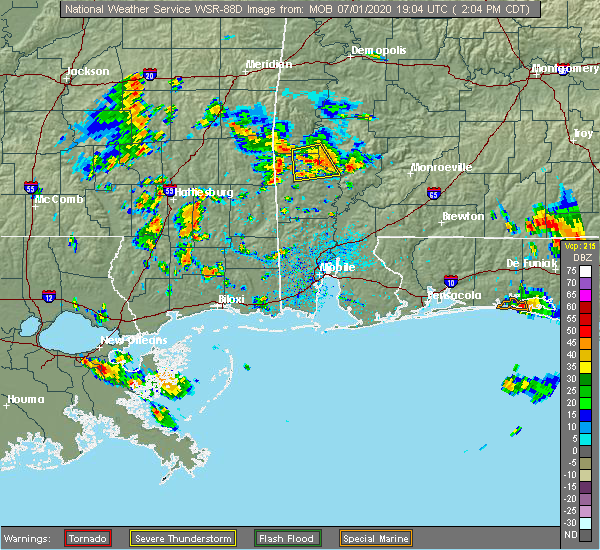 At 207 pm cdt, a severe thunderstorm was located 4 miles south of silas, or 17 miles north of chatom, moving southeast at 30 mph (radar indicated). Hazards include 60 mph wind gusts. expect damage to roofs, siding, and trees At 207 pm cdt, a severe thunderstorm was located 4 miles south of silas, or 17 miles north of chatom, moving southeast at 30 mph (radar indicated). Hazards include 60 mph wind gusts. expect damage to roofs, siding, and trees
|
| 7/1/2020 1:41 PM CDT |
 At 141 pm cdt, a severe thunderstorm was located 6 miles southwest of coffeeville, or 16 miles northeast of chatom, moving south at 15 mph (radar indicated). Hazards include 60 mph wind gusts. expect damage to roofs, siding, and trees At 141 pm cdt, a severe thunderstorm was located 6 miles southwest of coffeeville, or 16 miles northeast of chatom, moving south at 15 mph (radar indicated). Hazards include 60 mph wind gusts. expect damage to roofs, siding, and trees
|
| 6/25/2020 7:18 PM CDT |
 At 717 pm cdt, severe thunderstorms were located along a line extending from 5 miles west of lisman to 7 miles east of toxey to 3 miles northeast of millry, moving east at 40 mph (radar indicated). Hazards include 60 mph wind gusts. Expect damage to roofs, siding, and trees. Locations impacted include, butler, lisman, silas, coffeeville, pennington, gilbertown and toxey. At 717 pm cdt, severe thunderstorms were located along a line extending from 5 miles west of lisman to 7 miles east of toxey to 3 miles northeast of millry, moving east at 40 mph (radar indicated). Hazards include 60 mph wind gusts. Expect damage to roofs, siding, and trees. Locations impacted include, butler, lisman, silas, coffeeville, pennington, gilbertown and toxey.
|
| 6/25/2020 6:37 PM CDT |
 At 637 pm cdt, severe thunderstorms were located along a line extending from near stonewall to 3 miles northeast of waynesboro to 8 miles southwest of clara, moving east at 35 mph (radar indicated). Hazards include 60 mph wind gusts. expect damage to roofs, siding, and trees At 637 pm cdt, severe thunderstorms were located along a line extending from near stonewall to 3 miles northeast of waynesboro to 8 miles southwest of clara, moving east at 35 mph (radar indicated). Hazards include 60 mph wind gusts. expect damage to roofs, siding, and trees
|
| 6/24/2020 2:41 PM CDT |
 At 240 pm cdt, severe thunderstorms were located along a line extending from 7 miles southeast of coffeeville to 3 miles north of mccullough, moving northeast at 35 mph (radar indicated). Hazards include 60 mph wind gusts. Expect damage to roofs, siding, and trees. Locations impacted include, jackson, grove hill, mccullough, leroy, uriah, whatley, coffeeville, i65 and al 113 and poarch creek reservation. At 240 pm cdt, severe thunderstorms were located along a line extending from 7 miles southeast of coffeeville to 3 miles north of mccullough, moving northeast at 35 mph (radar indicated). Hazards include 60 mph wind gusts. Expect damage to roofs, siding, and trees. Locations impacted include, jackson, grove hill, mccullough, leroy, uriah, whatley, coffeeville, i65 and al 113 and poarch creek reservation.
|
| 6/24/2020 2:18 PM CDT |
 At 218 pm cdt, severe thunderstorms were located along a line extending from 4 miles north of chatom to 5 miles northeast of stockton, moving northeast at 30 mph (radar indicated). Hazards include 60 mph wind gusts. expect damage to roofs, siding, and trees At 218 pm cdt, severe thunderstorms were located along a line extending from 4 miles north of chatom to 5 miles northeast of stockton, moving northeast at 30 mph (radar indicated). Hazards include 60 mph wind gusts. expect damage to roofs, siding, and trees
|
| 6/5/2020 7:31 PM CDT |
 At 730 pm cdt, severe thunderstorms were located along a line extending from 3 miles south of coatopa to 6 miles west of lisman to 4 miles southeast of turnerville, moving southeast at 30 mph (radar indicated). Hazards include 60 mph wind gusts. expect damage to roofs, siding, and trees At 730 pm cdt, severe thunderstorms were located along a line extending from 3 miles south of coatopa to 6 miles west of lisman to 4 miles southeast of turnerville, moving southeast at 30 mph (radar indicated). Hazards include 60 mph wind gusts. expect damage to roofs, siding, and trees
|
| 5/27/2020 3:40 PM CDT |
 At 340 pm cdt, a severe thunderstorm was located 7 miles southwest of coffeeville, or 16 miles north of chatom, moving northeast at 40 mph (radar indicated). Hazards include 60 mph wind gusts and nickel size hail. Expect damage to roofs, siding, and trees. Locations impacted include, coffeeville. At 340 pm cdt, a severe thunderstorm was located 7 miles southwest of coffeeville, or 16 miles north of chatom, moving northeast at 40 mph (radar indicated). Hazards include 60 mph wind gusts and nickel size hail. Expect damage to roofs, siding, and trees. Locations impacted include, coffeeville.
|
| 5/27/2020 3:09 PM CDT |
 At 309 pm cdt, a severe thunderstorm was located 7 miles east of millry, or 13 miles north of chatom, moving northeast at 35 mph (radar indicated). Hazards include 60 mph wind gusts and quarter size hail. Hail damage to vehicles is expected. Expect wind damage to roofs, siding, and trees. At 309 pm cdt, a severe thunderstorm was located 7 miles east of millry, or 13 miles north of chatom, moving northeast at 35 mph (radar indicated). Hazards include 60 mph wind gusts and quarter size hail. Hail damage to vehicles is expected. Expect wind damage to roofs, siding, and trees.
|
| 5/22/2020 3:55 PM CDT |
 The severe thunderstorm warning for south central choctaw, north central washington and northwestern clarke counties will expire at 400 pm cdt, the storm which prompted the warning has weakened below severe limits, and no longer poses an immediate threat to life or property. therefore, the warning will be allowed to expire. however, gusty winds and heavy rain are still possible with this thunderstorm. The severe thunderstorm warning for south central choctaw, north central washington and northwestern clarke counties will expire at 400 pm cdt, the storm which prompted the warning has weakened below severe limits, and no longer poses an immediate threat to life or property. therefore, the warning will be allowed to expire. however, gusty winds and heavy rain are still possible with this thunderstorm.
|
| 5/22/2020 3:27 PM CDT |
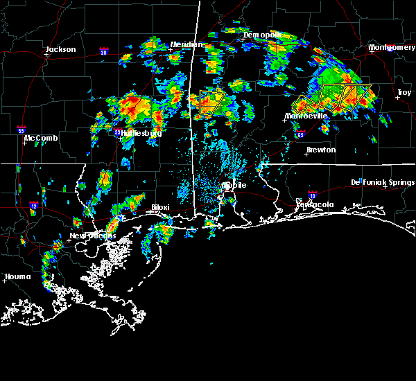 At 326 pm cdt, a severe thunderstorm was located 6 miles east of silas, or 21 miles south of butler, moving north at 15 mph (radar indicated). Hazards include 60 mph wind gusts and nickel size hail. Expect damage to roofs, siding, and trees. Locations impacted include, millry, silas and gilbertown. At 326 pm cdt, a severe thunderstorm was located 6 miles east of silas, or 21 miles south of butler, moving north at 15 mph (radar indicated). Hazards include 60 mph wind gusts and nickel size hail. Expect damage to roofs, siding, and trees. Locations impacted include, millry, silas and gilbertown.
|
| 5/22/2020 2:58 PM CDT |
 At 257 pm cdt, a severe thunderstorm was located 5 miles northeast of millry, or 14 miles north of chatom, moving north at 15 mph (radar indicated). Hazards include 60 mph wind gusts and nickel size hail. expect damage to roofs, siding, and trees At 257 pm cdt, a severe thunderstorm was located 5 miles northeast of millry, or 14 miles north of chatom, moving north at 15 mph (radar indicated). Hazards include 60 mph wind gusts and nickel size hail. expect damage to roofs, siding, and trees
|
| 5/17/2020 7:29 PM CDT |
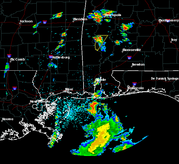 At 729 pm cdt, a severe thunderstorm was located 9 miles southeast of putnam, or 10 miles west of thomasville, moving northeast at 45 mph (radar indicated). Hazards include 60 mph wind gusts and penny size hail. Expect damage to roofs, siding, and trees. This severe thunderstorm will remain over mainly rural areas of northwestern clarke county. At 729 pm cdt, a severe thunderstorm was located 9 miles southeast of putnam, or 10 miles west of thomasville, moving northeast at 45 mph (radar indicated). Hazards include 60 mph wind gusts and penny size hail. Expect damage to roofs, siding, and trees. This severe thunderstorm will remain over mainly rural areas of northwestern clarke county.
|
| 5/17/2020 7:10 PM CDT | Trees down and covering both lanes of highway 15 in clarke county AL, 1.3 miles SW of Coffeeville, AL |
| 5/17/2020 7:04 PM CDT |
 At 704 pm cdt, a severe thunderstorm was located 6 miles southeast of coffeeville, or 14 miles northwest of jackson, moving northeast at 45 mph (radar indicated). Hazards include 60 mph wind gusts and penny size hail. Expect damage to roofs, siding, and trees. This severe thunderstorm will remain over mainly rural areas of northwestern clarke county. At 704 pm cdt, a severe thunderstorm was located 6 miles southeast of coffeeville, or 14 miles northwest of jackson, moving northeast at 45 mph (radar indicated). Hazards include 60 mph wind gusts and penny size hail. Expect damage to roofs, siding, and trees. This severe thunderstorm will remain over mainly rural areas of northwestern clarke county.
|
| 4/23/2020 5:34 AM CDT |
 At 534 am cdt, severe thunderstorms were located along a line extending from 5 miles northwest of thomasville to 6 miles west of saint stephens, moving east at 50 mph (radar indicated). Hazards include 60 mph wind gusts. Expect damage to roofs, siding, and trees. Locations impacted include, jackson, thomasville, grove hill, saint stephens, leroy, whatley, pine hill, coffeeville, fulton and yellow bluff. At 534 am cdt, severe thunderstorms were located along a line extending from 5 miles northwest of thomasville to 6 miles west of saint stephens, moving east at 50 mph (radar indicated). Hazards include 60 mph wind gusts. Expect damage to roofs, siding, and trees. Locations impacted include, jackson, thomasville, grove hill, saint stephens, leroy, whatley, pine hill, coffeeville, fulton and yellow bluff.
|
| 4/23/2020 5:23 AM CDT |
 At 522 am cdt, a severe thunderstorm capable of producing a tornado was located near coffeeville, or 16 miles west of grove hill, moving east at 55 mph (radar indicated rotation). Hazards include tornado. Flying debris will be dangerous to those caught without shelter. mobile homes will be damaged or destroyed. damage to roofs, windows, and vehicles will occur. tree damage is likely. This dangerous storm will be near, fulton around 540 am cdt. At 522 am cdt, a severe thunderstorm capable of producing a tornado was located near coffeeville, or 16 miles west of grove hill, moving east at 55 mph (radar indicated rotation). Hazards include tornado. Flying debris will be dangerous to those caught without shelter. mobile homes will be damaged or destroyed. damage to roofs, windows, and vehicles will occur. tree damage is likely. This dangerous storm will be near, fulton around 540 am cdt.
|
| 4/23/2020 5:22 AM CDT | Trees and power lines down on highway 154 near the 2 mile marke in clarke county AL, 0.5 miles NE of Coffeeville, AL |
| 4/23/2020 5:12 AM CDT |
 At 512 am cdt, severe thunderstorms were located along a line extending from 5 miles east of toxey to 6 miles northeast of buckatunna, moving east at 50 mph (radar indicated). Hazards include 60 mph wind gusts. expect damage to roofs, siding, and trees At 512 am cdt, severe thunderstorms were located along a line extending from 5 miles east of toxey to 6 miles northeast of buckatunna, moving east at 50 mph (radar indicated). Hazards include 60 mph wind gusts. expect damage to roofs, siding, and trees
|
| 4/23/2020 5:08 AM CDT |
 At 507 am cdt, a severe thunderstorm capable of producing a tornado was located over silas, or 20 miles east of waynesboro, moving east at 60 mph (radar indicated rotation). Hazards include tornado. Flying debris will be dangerous to those caught without shelter. mobile homes will be damaged or destroyed. damage to roofs, windows, and vehicles will occur. tree damage is likely. this dangerous storm will be near, coffeeville around 520 am cdt. Fulton around 545 am cdt. At 507 am cdt, a severe thunderstorm capable of producing a tornado was located over silas, or 20 miles east of waynesboro, moving east at 60 mph (radar indicated rotation). Hazards include tornado. Flying debris will be dangerous to those caught without shelter. mobile homes will be damaged or destroyed. damage to roofs, windows, and vehicles will occur. tree damage is likely. this dangerous storm will be near, coffeeville around 520 am cdt. Fulton around 545 am cdt.
|
| 4/23/2020 4:55 AM CDT |
 At 455 am cdt, a severe thunderstorm capable of producing a tornado was located 9 miles south of crandall, or 12 miles northeast of waynesboro, moving east at 55 mph (radar indicated rotation). Hazards include tornado. Flying debris will be dangerous to those caught without shelter. mobile homes will be damaged or destroyed. damage to roofs, windows, and vehicles will occur. tree damage is likely. this dangerous storm will be near, silas, gilbertown and toxey around 510 am cdt. coffeeville around 525 am cdt. Thomasville and fulton around 545 am cdt. At 455 am cdt, a severe thunderstorm capable of producing a tornado was located 9 miles south of crandall, or 12 miles northeast of waynesboro, moving east at 55 mph (radar indicated rotation). Hazards include tornado. Flying debris will be dangerous to those caught without shelter. mobile homes will be damaged or destroyed. damage to roofs, windows, and vehicles will occur. tree damage is likely. this dangerous storm will be near, silas, gilbertown and toxey around 510 am cdt. coffeeville around 525 am cdt. Thomasville and fulton around 545 am cdt.
|
| 4/19/2020 6:14 PM CDT |
 At 613 pm cdt, severe thunderstorms were located along a line extending from 8 miles southwest of dixons mill to 13 miles northwest of grove hill to coffeeville, moving east at 45 mph (radar indicated). Hazards include 60 mph wind gusts. expect damage to roofs, siding, and trees At 613 pm cdt, severe thunderstorms were located along a line extending from 8 miles southwest of dixons mill to 13 miles northwest of grove hill to coffeeville, moving east at 45 mph (radar indicated). Hazards include 60 mph wind gusts. expect damage to roofs, siding, and trees
|
| 4/12/2020 9:20 PM CDT |
 At 919 pm cdt, severe thunderstorms were located from near coffeeville to near buckatunna, moving northeast at 55 mph (radar indicated). Hazards include 70 mph wind gusts and penny size hail. Expect considerable tree damage. damage is likely to mobile homes, roofs, and outbuildings. Locations impacted include, clara, millry, buckatunna, silas, coffeeville and gilbertown. At 919 pm cdt, severe thunderstorms were located from near coffeeville to near buckatunna, moving northeast at 55 mph (radar indicated). Hazards include 70 mph wind gusts and penny size hail. Expect considerable tree damage. damage is likely to mobile homes, roofs, and outbuildings. Locations impacted include, clara, millry, buckatunna, silas, coffeeville and gilbertown.
|
| 4/12/2020 9:17 PM CDT | Numerous trees down on hwy 69 between coffeeville and salipt in clarke county AL, 4.7 miles NNW of Coffeeville, AL |
| 4/12/2020 9:15 PM CDT |
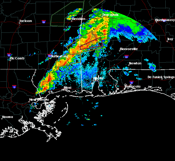 At 915 pm cdt, a severe thunderstorm capable of producing a tornado was located 4 miles southwest of coffeeville, or 17 miles northeast of chatom, moving east at 55 mph (radar indicated rotation). Hazards include tornado. Flying debris will be dangerous to those caught without shelter. mobile homes will be damaged or destroyed. damage to roofs, windows, and vehicles will occur. tree damage is likely. This tornadic thunderstorm will remain over mainly rural areas of south central choctaw, north central washington and northwestern clarke counties. At 915 pm cdt, a severe thunderstorm capable of producing a tornado was located 4 miles southwest of coffeeville, or 17 miles northeast of chatom, moving east at 55 mph (radar indicated rotation). Hazards include tornado. Flying debris will be dangerous to those caught without shelter. mobile homes will be damaged or destroyed. damage to roofs, windows, and vehicles will occur. tree damage is likely. This tornadic thunderstorm will remain over mainly rural areas of south central choctaw, north central washington and northwestern clarke counties.
|
| 4/12/2020 9:13 PM CDT |
 At 913 pm cdt, severe thunderstorms were located along a line extending from near putnam to near coffeeville to 5 miles south of millry, moving east at 70 mph (radar indicated). Hazards include 70 mph wind gusts and penny size hail. Expect considerable tree damage. Damage is likely to mobile homes, roofs, and outbuildings. At 913 pm cdt, severe thunderstorms were located along a line extending from near putnam to near coffeeville to 5 miles south of millry, moving east at 70 mph (radar indicated). Hazards include 70 mph wind gusts and penny size hail. Expect considerable tree damage. Damage is likely to mobile homes, roofs, and outbuildings.
|
| 4/12/2020 9:12 PM CDT | Numerous trees dow in clarke county AL, 4.6 miles SE of Coffeeville, AL |
| 4/12/2020 9:04 PM CDT |
 At 903 pm cdt, a severe thunderstorm was located 4 miles southwest of silas, or 15 miles east of waynesboro, moving northeast at 55 mph (radar indicated). Hazards include 70 mph wind gusts and penny size hail. Expect considerable tree damage. damage is likely to mobile homes, roofs, and outbuildings. Locations impacted include, waynesboro, clara, millry, buckatunna, silas, coffeeville, gilbertown and toxey. At 903 pm cdt, a severe thunderstorm was located 4 miles southwest of silas, or 15 miles east of waynesboro, moving northeast at 55 mph (radar indicated). Hazards include 70 mph wind gusts and penny size hail. Expect considerable tree damage. damage is likely to mobile homes, roofs, and outbuildings. Locations impacted include, waynesboro, clara, millry, buckatunna, silas, coffeeville, gilbertown and toxey.
|
| 4/12/2020 8:58 PM CDT |
 At 858 pm cdt, a severe thunderstorm capable of producing a tornado was located 5 miles west of millry, or 14 miles northwest of chatom, moving east at 55 mph (radar indicated rotation). Hazards include tornado. Flying debris will be dangerous to those caught without shelter. mobile homes will be damaged or destroyed. damage to roofs, windows, and vehicles will occur. tree damage is likely. This dangerous storm will be near, coffeeville around 920 pm cdt. At 858 pm cdt, a severe thunderstorm capable of producing a tornado was located 5 miles west of millry, or 14 miles northwest of chatom, moving east at 55 mph (radar indicated rotation). Hazards include tornado. Flying debris will be dangerous to those caught without shelter. mobile homes will be damaged or destroyed. damage to roofs, windows, and vehicles will occur. tree damage is likely. This dangerous storm will be near, coffeeville around 920 pm cdt.
|
| 4/12/2020 8:46 PM CDT |
 At 845 pm cdt, a severe thunderstorm was located 4 miles east of clara, or 5 miles south of waynesboro, moving northeast at 55 mph (radar indicated). Hazards include 60 mph wind gusts and penny size hail. expect damage to roofs, siding, and trees At 845 pm cdt, a severe thunderstorm was located 4 miles east of clara, or 5 miles south of waynesboro, moving northeast at 55 mph (radar indicated). Hazards include 60 mph wind gusts and penny size hail. expect damage to roofs, siding, and trees
|
| 3/31/2020 8:31 AM CDT |
 At 831 am cdt, severe thunderstorms were located along a line extending from pine hill to near fulton to 8 miles southeast of coffeeville, moving east at 70 mph (radar indicated). Hazards include 70 mph wind gusts. Expect considerable tree damage. damage is likely to mobile homes, roofs, and outbuildings. Locations impacted include, thomasville, grove hill, pine hill, coffeeville and fulton. At 831 am cdt, severe thunderstorms were located along a line extending from pine hill to near fulton to 8 miles southeast of coffeeville, moving east at 70 mph (radar indicated). Hazards include 70 mph wind gusts. Expect considerable tree damage. damage is likely to mobile homes, roofs, and outbuildings. Locations impacted include, thomasville, grove hill, pine hill, coffeeville and fulton.
|
| 3/31/2020 8:19 AM CDT |
 At 818 am cdt, a severe thunderstorm was located over coffeeville, or 18 miles west of grove hill, moving east at 70 mph. residents near coffeeville should seek safe shelter immediately (radar indicated). Hazards include 70 mph wind gusts. Expect considerable tree damage. damage is likely to mobile homes, roofs, and outbuildings. Locations impacted include, thomasville, grove hill, pine hill, coffeeville and fulton. At 818 am cdt, a severe thunderstorm was located over coffeeville, or 18 miles west of grove hill, moving east at 70 mph. residents near coffeeville should seek safe shelter immediately (radar indicated). Hazards include 70 mph wind gusts. Expect considerable tree damage. damage is likely to mobile homes, roofs, and outbuildings. Locations impacted include, thomasville, grove hill, pine hill, coffeeville and fulton.
|
| 3/31/2020 7:50 AM CDT |
 At 750 am cdt, severe thunderstorms were located along a line extending from 4 miles west of nanafalia to 4 miles southwest of putnam to 9 miles east of toxey to 3 miles northwest of silas, moving east at 45 mph (radar indicated). Hazards include 60 mph wind gusts. expect damage to roofs, siding, and trees At 750 am cdt, severe thunderstorms were located along a line extending from 4 miles west of nanafalia to 4 miles southwest of putnam to 9 miles east of toxey to 3 miles northwest of silas, moving east at 45 mph (radar indicated). Hazards include 60 mph wind gusts. expect damage to roofs, siding, and trees
|
| 2/10/2020 7:13 PM CST |
 At 712 pm cst, a severe thunderstorm was located 7 miles south of coffeeville, or 15 miles northeast of chatom, moving northeast at 45 mph (radar indicated). Hazards include 60 mph wind gusts. Expect damage to roofs, siding, and trees. Locations impacted include, saint stephens and millry. At 712 pm cst, a severe thunderstorm was located 7 miles south of coffeeville, or 15 miles northeast of chatom, moving northeast at 45 mph (radar indicated). Hazards include 60 mph wind gusts. Expect damage to roofs, siding, and trees. Locations impacted include, saint stephens and millry.
|
| 2/10/2020 6:58 PM CST |
 At 646 pm cst, a severe thunderstorm was located 5 miles east of buckatunna, or 11 miles northwest of chatom, moving east at 45 mph (radar indicated). Hazards include 60 mph wind gusts. expect damage to roofs, siding, and trees At 646 pm cst, a severe thunderstorm was located 5 miles east of buckatunna, or 11 miles northwest of chatom, moving east at 45 mph (radar indicated). Hazards include 60 mph wind gusts. expect damage to roofs, siding, and trees
|
| 2/10/2020 6:47 PM CST |
 At 646 pm cst, a severe thunderstorm was located 5 miles east of buckatunna, or 11 miles northwest of chatom, moving east at 45 mph (radar indicated). Hazards include 60 mph wind gusts. expect damage to roofs, siding, and trees At 646 pm cst, a severe thunderstorm was located 5 miles east of buckatunna, or 11 miles northwest of chatom, moving east at 45 mph (radar indicated). Hazards include 60 mph wind gusts. expect damage to roofs, siding, and trees
|
| 1/11/2020 12:30 PM CST | Report of a roof blown off of a mobile home on hickory street in coffeevill in clarke county AL, 0.5 miles NE of Coffeeville, AL |
| 1/11/2020 12:28 PM CST |
 At 1227 pm cst, severe thunderstorms were located along a line extending from 5 miles west of shawnee to 5 miles east of coffeeville to 5 miles northeast of saint stephens, moving northeast at 55 mph (emergency management). Hazards include 60 mph wind gusts. expect damage to roofs, siding, and trees At 1227 pm cst, severe thunderstorms were located along a line extending from 5 miles west of shawnee to 5 miles east of coffeeville to 5 miles northeast of saint stephens, moving northeast at 55 mph (emergency management). Hazards include 60 mph wind gusts. expect damage to roofs, siding, and trees
|
| 1/11/2020 12:18 PM CST | Trees down in the coffeeville area near highway 84... calico road... and west bend roa in clarke county AL, 3.2 miles SE of Coffeeville, AL |
| 10/25/2019 9:25 PM CDT |
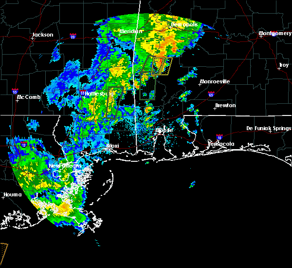 At 924 pm cdt, a severe thunderstorm was located 5 miles northeast of coffeeville, or 15 miles northwest of grove hill, moving north at 25 mph (radar indicated). Hazards include 60 mph wind gusts. Expect damage to roofs, siding, and trees. This severe thunderstorm will remain over mainly rural areas of northwestern clarke county. At 924 pm cdt, a severe thunderstorm was located 5 miles northeast of coffeeville, or 15 miles northwest of grove hill, moving north at 25 mph (radar indicated). Hazards include 60 mph wind gusts. Expect damage to roofs, siding, and trees. This severe thunderstorm will remain over mainly rural areas of northwestern clarke county.
|
| 10/25/2019 9:16 PM CDT |
 At 916 pm cdt, a severe thunderstorm was located 4 miles east of coffeeville, or 14 miles west of grove hill, moving north at 25 mph (radar indicated). Hazards include 60 mph wind gusts. Expect damage to roofs, siding, and trees. Locations impacted include, coffeeville. At 916 pm cdt, a severe thunderstorm was located 4 miles east of coffeeville, or 14 miles west of grove hill, moving north at 25 mph (radar indicated). Hazards include 60 mph wind gusts. Expect damage to roofs, siding, and trees. Locations impacted include, coffeeville.
|
| 10/25/2019 9:09 PM CDT |
 A severe thunderstorm warning remains in effect until 1000 pm cdt for south central choctaw and northwestern clarke counties. at 908 pm cdt, a severe thunderstorm was located 5 miles southeast of coffeeville, or 15 miles west of grove hill, moving north at 55 mph. hazard. 60 mph wind gusts. source. Radar indicated. A severe thunderstorm warning remains in effect until 1000 pm cdt for south central choctaw and northwestern clarke counties. at 908 pm cdt, a severe thunderstorm was located 5 miles southeast of coffeeville, or 15 miles west of grove hill, moving north at 55 mph. hazard. 60 mph wind gusts. source. Radar indicated.
|
| 10/25/2019 8:53 PM CDT |
 At 852 pm cdt, a cluster of severe thunderstorms was located 6 miles southwest of coffeeville, or 16 miles north of chatom, moving north at 25 mph (radar indicated). Hazards include 60 mph wind gusts. expect damage to roofs, siding, and trees At 852 pm cdt, a cluster of severe thunderstorms was located 6 miles southwest of coffeeville, or 16 miles north of chatom, moving north at 25 mph (radar indicated). Hazards include 60 mph wind gusts. expect damage to roofs, siding, and trees
|
| 10/25/2019 8:12 PM CDT |
 At 811 pm cdt, a severe thunderstorm capable of producing a tornado was located 6 miles north of coffeeville, or 19 miles northwest of grove hill, moving north at 40 mph (radar indicated rotation). Hazards include tornado. Flying debris will be dangerous to those caught without shelter. mobile homes will be damaged or destroyed. damage to roofs, windows, and vehicles will occur. tree damage is likely. This dangerous storm will be near, pennington around 850 pm cdt. At 811 pm cdt, a severe thunderstorm capable of producing a tornado was located 6 miles north of coffeeville, or 19 miles northwest of grove hill, moving north at 40 mph (radar indicated rotation). Hazards include tornado. Flying debris will be dangerous to those caught without shelter. mobile homes will be damaged or destroyed. damage to roofs, windows, and vehicles will occur. tree damage is likely. This dangerous storm will be near, pennington around 850 pm cdt.
|
| 10/25/2019 6:23 PM CDT |
 At 622 pm cdt, a severe thunderstorm was located 6 miles north of saint stephens, or 12 miles northwest of jackson, moving north at 30 mph (radar indicated). Hazards include 60 mph wind gusts. expect damage to roofs, siding, and trees At 622 pm cdt, a severe thunderstorm was located 6 miles north of saint stephens, or 12 miles northwest of jackson, moving north at 30 mph (radar indicated). Hazards include 60 mph wind gusts. expect damage to roofs, siding, and trees
|
| 10/25/2019 5:50 PM CDT |
 At 550 pm cdt, a severe thunderstorm capable of producing a tornado was located 8 miles east of millry, or 11 miles northeast of chatom, moving north at 30 mph (radar indicated rotation). Hazards include tornado. Flying debris will be dangerous to those caught without shelter. mobile homes will be damaged or destroyed. damage to roofs, windows, and vehicles will occur. tree damage is likely. This dangerous storm will be near, coffeeville around 610 pm cdt. At 550 pm cdt, a severe thunderstorm capable of producing a tornado was located 8 miles east of millry, or 11 miles northeast of chatom, moving north at 30 mph (radar indicated rotation). Hazards include tornado. Flying debris will be dangerous to those caught without shelter. mobile homes will be damaged or destroyed. damage to roofs, windows, and vehicles will occur. tree damage is likely. This dangerous storm will be near, coffeeville around 610 pm cdt.
|
| 10/25/2019 5:50 PM CDT |
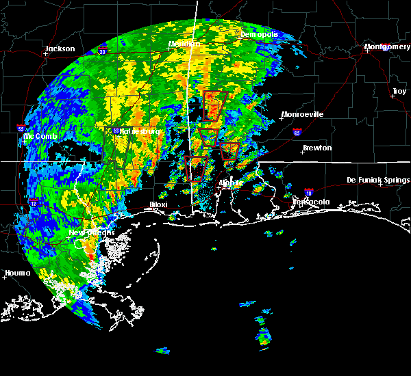 At 550 pm cdt, a severe thunderstorm capable of producing a tornado was located 8 miles east of millry, or 11 miles northeast of chatom, moving north at 30 mph (radar indicated rotation). Hazards include tornado. Flying debris will be dangerous to those caught without shelter. mobile homes will be damaged or destroyed. damage to roofs, windows, and vehicles will occur. tree damage is likely. This dangerous storm will be near, coffeeville around 610 pm cdt. At 550 pm cdt, a severe thunderstorm capable of producing a tornado was located 8 miles east of millry, or 11 miles northeast of chatom, moving north at 30 mph (radar indicated rotation). Hazards include tornado. Flying debris will be dangerous to those caught without shelter. mobile homes will be damaged or destroyed. damage to roofs, windows, and vehicles will occur. tree damage is likely. This dangerous storm will be near, coffeeville around 610 pm cdt.
|
| 10/25/2019 5:43 PM CDT |
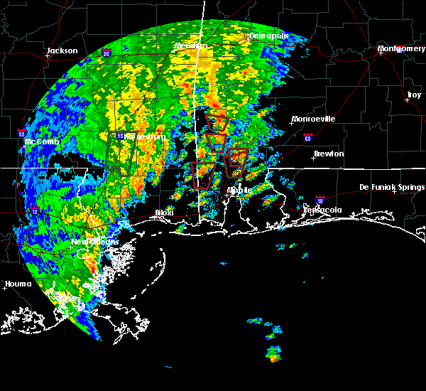 At 543 pm cdt, a severe thunderstorm capable of producing a tornado was located 6 miles west of saint stephens, or 9 miles northeast of chatom, moving north at 30 mph (radar indicated rotation). Hazards include tornado. Flying debris will be dangerous to those caught without shelter. mobile homes will be damaged or destroyed. damage to roofs, windows, and vehicles will occur. tree damage is likely. This dangerous storm will be near, coffeeville around 610 pm cdt. At 543 pm cdt, a severe thunderstorm capable of producing a tornado was located 6 miles west of saint stephens, or 9 miles northeast of chatom, moving north at 30 mph (radar indicated rotation). Hazards include tornado. Flying debris will be dangerous to those caught without shelter. mobile homes will be damaged or destroyed. damage to roofs, windows, and vehicles will occur. tree damage is likely. This dangerous storm will be near, coffeeville around 610 pm cdt.
|
| 10/25/2019 4:00 PM CDT |
 At 400 pm cdt, a severe thunderstorm was located 4 miles northwest of coffeeville, or 19 miles south of butler, moving north at 25 mph (radar indicated). Hazards include 60 mph wind gusts. expect damage to roofs, siding, and trees At 400 pm cdt, a severe thunderstorm was located 4 miles northwest of coffeeville, or 19 miles south of butler, moving north at 25 mph (radar indicated). Hazards include 60 mph wind gusts. expect damage to roofs, siding, and trees
|
| 10/25/2019 2:53 PM CDT |
 At 253 pm cdt, a severe thunderstorm capable of producing a tornado was located over coffeeville, or 20 miles west of grove hill, moving north at 30 mph (radar indicated rotation). Hazards include tornado. Flying debris will be dangerous to those caught without shelter. mobile homes will be damaged or destroyed. damage to roofs, windows, and vehicles will occur. tree damage is likely. This tornadic thunderstorm will remain over mainly rural areas of central choctaw and northwestern clarke counties. At 253 pm cdt, a severe thunderstorm capable of producing a tornado was located over coffeeville, or 20 miles west of grove hill, moving north at 30 mph (radar indicated rotation). Hazards include tornado. Flying debris will be dangerous to those caught without shelter. mobile homes will be damaged or destroyed. damage to roofs, windows, and vehicles will occur. tree damage is likely. This tornadic thunderstorm will remain over mainly rural areas of central choctaw and northwestern clarke counties.
|
| 10/25/2019 2:40 PM CDT |
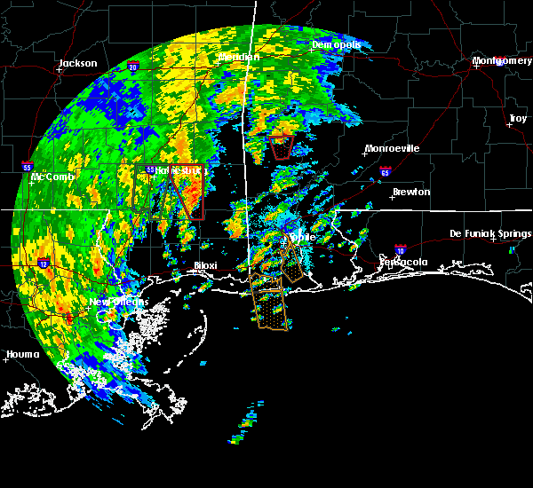 At 240 pm cdt, a severe thunderstorm capable of producing a tornado was located 5 miles south of coffeeville, or 17 miles northwest of jackson, moving north at 30 mph (radar indicated rotation). Hazards include tornado. Flying debris will be dangerous to those caught without shelter. mobile homes will be damaged or destroyed. damage to roofs, windows, and vehicles will occur. tree damage is likely. This dangerous storm will be near, coffeeville around 250 pm cdt. At 240 pm cdt, a severe thunderstorm capable of producing a tornado was located 5 miles south of coffeeville, or 17 miles northwest of jackson, moving north at 30 mph (radar indicated rotation). Hazards include tornado. Flying debris will be dangerous to those caught without shelter. mobile homes will be damaged or destroyed. damage to roofs, windows, and vehicles will occur. tree damage is likely. This dangerous storm will be near, coffeeville around 250 pm cdt.
|
| 6/27/2019 5:25 PM CDT | Reports of trees down along highway 84 in the coffeeville community. also a report of trees down in the scyrene communit in clarke county AL, 0.4 miles NNW of Coffeeville, AL |
| 4/18/2019 9:39 PM CDT |
 At 939 pm cdt, severe thunderstorms were located along a line extending from 7 miles west of silas to 5 miles northeast of buckatunna to 5 miles west of state line, moving east at 35 mph (radar indicated). Hazards include 60 mph wind gusts. expect damage to roofs, siding, and trees At 939 pm cdt, severe thunderstorms were located along a line extending from 7 miles west of silas to 5 miles northeast of buckatunna to 5 miles west of state line, moving east at 35 mph (radar indicated). Hazards include 60 mph wind gusts. expect damage to roofs, siding, and trees
|
| 4/18/2019 6:18 PM CDT |
 At 618 pm cdt, severe thunderstorms were located along a line extending from 7 miles south of sweet water to chatom, moving east at 35 mph (radar indicated). Hazards include 60 mph wind gusts. expect damage to roofs, siding, and trees At 618 pm cdt, severe thunderstorms were located along a line extending from 7 miles south of sweet water to chatom, moving east at 35 mph (radar indicated). Hazards include 60 mph wind gusts. expect damage to roofs, siding, and trees
|
| 4/18/2019 6:06 PM CDT |
 At 606 pm cdt, severe thunderstorms were located along a line extending from 3 miles south of pin hook to 3 miles northeast of state line, moving east at 45 mph (radar indicated). Hazards include 60 mph wind gusts. Expect damage to roofs, siding, and trees. Locations impacted include, butler, chatom, millry, state line, buckatunna, silas, coffeeville, pennington, gilbertown and toxey. At 606 pm cdt, severe thunderstorms were located along a line extending from 3 miles south of pin hook to 3 miles northeast of state line, moving east at 45 mph (radar indicated). Hazards include 60 mph wind gusts. Expect damage to roofs, siding, and trees. Locations impacted include, butler, chatom, millry, state line, buckatunna, silas, coffeeville, pennington, gilbertown and toxey.
|
| 4/18/2019 5:30 PM CDT |
 At 530 pm cdt, severe thunderstorms were located along a line extending from near kinterbish to 9 miles northeast of richton, moving east at 30 mph (radar indicated). Hazards include 60 mph wind gusts. expect damage to roofs, siding, and trees At 530 pm cdt, severe thunderstorms were located along a line extending from near kinterbish to 9 miles northeast of richton, moving east at 30 mph (radar indicated). Hazards include 60 mph wind gusts. expect damage to roofs, siding, and trees
|
| 3/3/2019 12:53 PM CST |
 At 1253 pm cst, severe thunderstorms were located along a line extending from grove hill to 6 miles west of wagarville to 7 miles northwest of leakesville, moving east at 55 mph (radar indicated). Hazards include 60 mph wind gusts and quarter size hail. Hail damage to vehicles is expected. expect wind damage to roofs, siding, and trees. locations impacted include, jackson, grove hill, chatom, richton, leakesville, saint stephens, wagarville, leroy, deer park, whatley, tibbie, new augusta, state line, fruitdale, coffeeville and fulton. A tornado watch remains in effect until 600 pm cst for south central and southwestern alabama, and southeastern mississippi. At 1253 pm cst, severe thunderstorms were located along a line extending from grove hill to 6 miles west of wagarville to 7 miles northwest of leakesville, moving east at 55 mph (radar indicated). Hazards include 60 mph wind gusts and quarter size hail. Hail damage to vehicles is expected. expect wind damage to roofs, siding, and trees. locations impacted include, jackson, grove hill, chatom, richton, leakesville, saint stephens, wagarville, leroy, deer park, whatley, tibbie, new augusta, state line, fruitdale, coffeeville and fulton. A tornado watch remains in effect until 600 pm cst for south central and southwestern alabama, and southeastern mississippi.
|
| 3/3/2019 12:40 PM CST |
 At 1240 pm cst, severe thunderstorms were located along a line extending from 8 miles southeast of coffeeville to 6 miles southwest of chatom to 6 miles northeast of beaumont, moving east at 55 mph (radar indicated). Hazards include 60 mph wind gusts and penny size hail. Expect damage to roofs, siding, and trees. locations impacted include, jackson, grove hill, chatom, richton, leakesville, saint stephens, wagarville, leroy, deer park, whatley, tibbie, new augusta, state line, fruitdale, coffeeville and fulton. A tornado watch remains in effect until 600 pm cst for south central and southwestern alabama, and southeastern mississippi. At 1240 pm cst, severe thunderstorms were located along a line extending from 8 miles southeast of coffeeville to 6 miles southwest of chatom to 6 miles northeast of beaumont, moving east at 55 mph (radar indicated). Hazards include 60 mph wind gusts and penny size hail. Expect damage to roofs, siding, and trees. locations impacted include, jackson, grove hill, chatom, richton, leakesville, saint stephens, wagarville, leroy, deer park, whatley, tibbie, new augusta, state line, fruitdale, coffeeville and fulton. A tornado watch remains in effect until 600 pm cst for south central and southwestern alabama, and southeastern mississippi.
|
| 3/3/2019 12:23 PM CST |
 At 1223 pm cst, severe thunderstorms were located along a line extending from 6 miles northeast of millry to 7 miles west of state line to 4 miles northwest of new augusta, moving east at 55 mph (radar indicated). Hazards include 60 mph wind gusts and penny size hail. expect damage to roofs, siding, and trees At 1223 pm cst, severe thunderstorms were located along a line extending from 6 miles northeast of millry to 7 miles west of state line to 4 miles northwest of new augusta, moving east at 55 mph (radar indicated). Hazards include 60 mph wind gusts and penny size hail. expect damage to roofs, siding, and trees
|
| 2/12/2019 8:07 AM CST |
 The severe thunderstorm warning for southwestern choctaw, northwestern washington and northwestern clarke counties will expire at 815 am cst, the storms which prompted the warning have weakened below severe limits, and no longer pose an immediate threat to life or property. therefore, the warning will be allowed to expire. The severe thunderstorm warning for southwestern choctaw, northwestern washington and northwestern clarke counties will expire at 815 am cst, the storms which prompted the warning have weakened below severe limits, and no longer pose an immediate threat to life or property. therefore, the warning will be allowed to expire.
|
| 2/12/2019 7:51 AM CST |
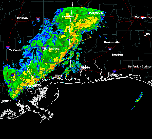 At 751 am cst, severe thunderstorms were located along a line extending from near gilbertown to near millry to 7 miles northwest of chatom, moving east at 30 mph (radar indicated). Hazards include 60 mph wind gusts. Expect damage to roofs, siding, and trees. Locations impacted include, millry, silas, coffeeville and gilbertown. At 751 am cst, severe thunderstorms were located along a line extending from near gilbertown to near millry to 7 miles northwest of chatom, moving east at 30 mph (radar indicated). Hazards include 60 mph wind gusts. Expect damage to roofs, siding, and trees. Locations impacted include, millry, silas, coffeeville and gilbertown.
|
| 2/12/2019 7:33 AM CST |
 At 732 am cst, a severe thunderstorm was located 7 miles west of millry, or 12 miles east of waynesboro, moving northeast at 50 mph (radar indicated). Hazards include 60 mph wind gusts. expect damage to roofs, siding, and trees At 732 am cst, a severe thunderstorm was located 7 miles west of millry, or 12 miles east of waynesboro, moving northeast at 50 mph (radar indicated). Hazards include 60 mph wind gusts. expect damage to roofs, siding, and trees
|
| 1/19/2019 12:15 PM CST |
 At 1215 pm cst, severe thunderstorms were located along a line extending from near nanafalia to chatom, moving east at 40 mph (radar indicated). Hazards include 60 mph wind gusts. expect damage to roofs, siding, and trees At 1215 pm cst, severe thunderstorms were located along a line extending from near nanafalia to chatom, moving east at 40 mph (radar indicated). Hazards include 60 mph wind gusts. expect damage to roofs, siding, and trees
|
| 1/19/2019 12:08 PM CST |
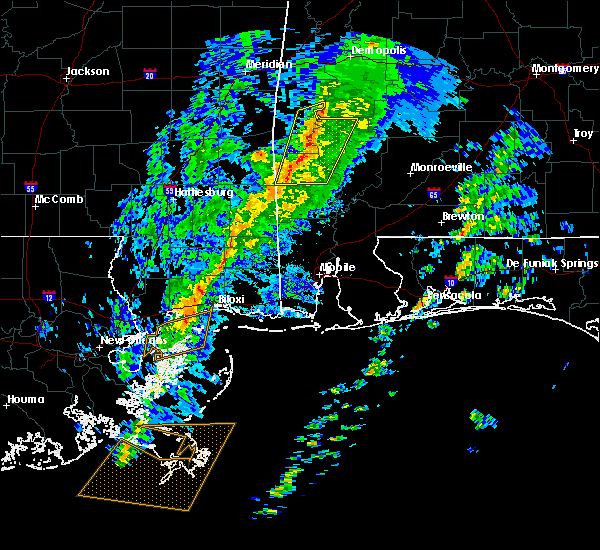 At 1207 pm cst, severe thunderstorms were located along a line extending from nanafalia to 4 miles north of chatom, moving east at 55 mph (radar indicated). Hazards include 60 mph wind gusts. Expect damage to roofs, siding, and trees. locations impacted include, chatom, saint stephens and coffeeville. A tornado watch remains in effect until 500 pm cst for southwestern alabama. At 1207 pm cst, severe thunderstorms were located along a line extending from nanafalia to 4 miles north of chatom, moving east at 55 mph (radar indicated). Hazards include 60 mph wind gusts. Expect damage to roofs, siding, and trees. locations impacted include, chatom, saint stephens and coffeeville. A tornado watch remains in effect until 500 pm cst for southwestern alabama.
|
| 1/19/2019 11:56 AM CST |
 At 1156 am cst, severe thunderstorms were located along a line extending from 4 miles southeast of butler to 4 miles northeast of state line, moving east at 45 mph (radar indicated). Hazards include 60 mph wind gusts. Expect damage to roofs, siding, and trees. locations impacted include, chatom, saint stephens, millry, silas and coffeeville. A tornado watch remains in effect until 500 pm cst for southwestern alabama, and southeastern mississippi. At 1156 am cst, severe thunderstorms were located along a line extending from 4 miles southeast of butler to 4 miles northeast of state line, moving east at 45 mph (radar indicated). Hazards include 60 mph wind gusts. Expect damage to roofs, siding, and trees. locations impacted include, chatom, saint stephens, millry, silas and coffeeville. A tornado watch remains in effect until 500 pm cst for southwestern alabama, and southeastern mississippi.
|
| 1/19/2019 11:31 AM CST |
 At 1130 am cst, severe thunderstorms were located along a line extending from 7 miles south of crandall to 12 miles south of clara, moving east at 55 mph (radar indicated). Hazards include 60 mph wind gusts. expect damage to roofs, siding, and trees At 1130 am cst, severe thunderstorms were located along a line extending from 7 miles south of crandall to 12 miles south of clara, moving east at 55 mph (radar indicated). Hazards include 60 mph wind gusts. expect damage to roofs, siding, and trees
|
| 12/28/2018 3:13 AM CST |
 At 313 am cst, a severe thunderstorm was located 6 miles east of millry, or 12 miles north of chatom, moving northeast at 40 mph (radar indicated). Hazards include 60 mph wind gusts. expect damage to roofs, siding, and trees At 313 am cst, a severe thunderstorm was located 6 miles east of millry, or 12 miles north of chatom, moving northeast at 40 mph (radar indicated). Hazards include 60 mph wind gusts. expect damage to roofs, siding, and trees
|
| 11/1/2018 7:15 AM CDT |
 At 715 am cdt, severe thunderstorms were located along a line extending from 7 miles west of pennington to 6 miles east of gilbertown to 3 miles northwest of mcintosh, moving east at 40 mph (radar indicated). Hazards include 60 mph wind gusts. expect damage to roofs, siding, and trees At 715 am cdt, severe thunderstorms were located along a line extending from 7 miles west of pennington to 6 miles east of gilbertown to 3 miles northwest of mcintosh, moving east at 40 mph (radar indicated). Hazards include 60 mph wind gusts. expect damage to roofs, siding, and trees
|
| 11/1/2018 7:02 AM CDT |
 At 702 am cdt, a severe thunderstorm capable of producing a tornado was located over silas, or 20 miles south of butler, moving northeast at 45 mph (radar indicated rotation). Hazards include tornado. Flying debris will be dangerous to those caught without shelter. mobile homes will be damaged or destroyed. damage to roofs, windows, and vehicles will occur. tree damage is likely. This tornadic thunderstorm will remain over mainly rural areas of southwestern choctaw and northwestern clarke counties. At 702 am cdt, a severe thunderstorm capable of producing a tornado was located over silas, or 20 miles south of butler, moving northeast at 45 mph (radar indicated rotation). Hazards include tornado. Flying debris will be dangerous to those caught without shelter. mobile homes will be damaged or destroyed. damage to roofs, windows, and vehicles will occur. tree damage is likely. This tornadic thunderstorm will remain over mainly rural areas of southwestern choctaw and northwestern clarke counties.
|
| 11/1/2018 6:33 AM CDT |
 At 632 am cdt, severe thunderstorms were located along a line extending from near alamucha to 7 miles south of crandall to 5 miles north of leakesville, moving northeast at 50 mph (radar indicated). Hazards include 70 mph wind gusts. Expect considerable tree damage. Damage is likely to mobile homes, roofs, and outbuildings. At 632 am cdt, severe thunderstorms were located along a line extending from near alamucha to 7 miles south of crandall to 5 miles north of leakesville, moving northeast at 50 mph (radar indicated). Hazards include 70 mph wind gusts. Expect considerable tree damage. Damage is likely to mobile homes, roofs, and outbuildings.
|
| 6/28/2018 6:24 PM CDT |
 At 623 pm cdt, severe thunderstorms were located along a line extending from 5 miles south of kinterbish to 9 miles west of thomasville to 11 miles northwest of monroeville, moving south at 50 mph (radar indicated). Hazards include 60 mph wind gusts. expect damage to roofs, siding, and trees At 623 pm cdt, severe thunderstorms were located along a line extending from 5 miles south of kinterbish to 9 miles west of thomasville to 11 miles northwest of monroeville, moving south at 50 mph (radar indicated). Hazards include 60 mph wind gusts. expect damage to roofs, siding, and trees
|
| 6/3/2018 5:19 PM CDT |
 At 519 pm cdt, a severe thunderstorm was located near coffeeville, or 16 miles west of grove hill, moving southeast at 25 mph (radar indicated). Hazards include 60 mph wind gusts and quarter size hail. Hail damage to vehicles is expected. Expect wind damage to roofs, siding, and trees. At 519 pm cdt, a severe thunderstorm was located near coffeeville, or 16 miles west of grove hill, moving southeast at 25 mph (radar indicated). Hazards include 60 mph wind gusts and quarter size hail. Hail damage to vehicles is expected. Expect wind damage to roofs, siding, and trees.
|
| 4/14/2018 12:47 PM CDT |
 At 1246 pm cdt, severe thunderstorms were located along a line extending from 7 miles northwest of pennington to 3 miles southwest of chatom, moving northeast at 60 mph (radar indicated). Hazards include 60 mph wind gusts. Expect damage to roofs, siding, and trees. locations impacted include, jackson, thomasville, butler, grove hill, chatom, saint stephens, leroy, lisman, millry, silas, fruitdale, coffeeville, pennington, gilbertown and toxey. A tornado watch remains in effect until 700 pm cdt for southwestern alabama. At 1246 pm cdt, severe thunderstorms were located along a line extending from 7 miles northwest of pennington to 3 miles southwest of chatom, moving northeast at 60 mph (radar indicated). Hazards include 60 mph wind gusts. Expect damage to roofs, siding, and trees. locations impacted include, jackson, thomasville, butler, grove hill, chatom, saint stephens, leroy, lisman, millry, silas, fruitdale, coffeeville, pennington, gilbertown and toxey. A tornado watch remains in effect until 700 pm cdt for southwestern alabama.
|
| 4/14/2018 11:59 AM CDT |
 At 1158 am cdt, severe thunderstorms were located along a line extending from near snell to 12 miles southwest of state line, moving northeast at 65 mph (radar indicated). Hazards include 60 mph wind gusts. expect damage to roofs, siding, and trees At 1158 am cdt, severe thunderstorms were located along a line extending from near snell to 12 miles southwest of state line, moving northeast at 65 mph (radar indicated). Hazards include 60 mph wind gusts. expect damage to roofs, siding, and trees
|
| 2/10/2018 6:00 PM CST |
 At 600 pm cst, a severe thunderstorm was located over coffeeville, or 18 miles west of grove hill, moving northeast at 35 mph (radar indicated). Hazards include 60 mph wind gusts. Expect damage to roofs, siding, and trees. Locations impacted include, coffeeville. At 600 pm cst, a severe thunderstorm was located over coffeeville, or 18 miles west of grove hill, moving northeast at 35 mph (radar indicated). Hazards include 60 mph wind gusts. Expect damage to roofs, siding, and trees. Locations impacted include, coffeeville.
|
| 2/10/2018 5:41 PM CST |
 At 540 pm cst, a severe thunderstorm was located 4 miles east of millry, or 10 miles north of chatom, moving northeast at 35 mph (radar indicated). Hazards include 60 mph wind gusts. expect damage to roofs, siding, and trees At 540 pm cst, a severe thunderstorm was located 4 miles east of millry, or 10 miles north of chatom, moving northeast at 35 mph (radar indicated). Hazards include 60 mph wind gusts. expect damage to roofs, siding, and trees
|
| 8/31/2017 11:53 AM CDT |
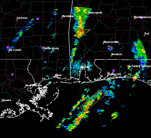 At 1152 am cdt, a severe thunderstorm was located near woods bluff, or 15 miles southeast of butler, moving northeast at 50 mph (radar indicated). Hazards include 60 mph wind gusts. Expect damage to roofs, siding, and trees. Locations impacted include, coffeeville. At 1152 am cdt, a severe thunderstorm was located near woods bluff, or 15 miles southeast of butler, moving northeast at 50 mph (radar indicated). Hazards include 60 mph wind gusts. Expect damage to roofs, siding, and trees. Locations impacted include, coffeeville.
|
| 8/31/2017 11:37 AM CDT |
 At 1137 am cdt, a severe thunderstorm was located near coffeeville, or 20 miles south of butler, moving northeast at 55 mph (radar indicated). Hazards include 60 mph wind gusts. expect damage to roofs, siding, and trees At 1137 am cdt, a severe thunderstorm was located near coffeeville, or 20 miles south of butler, moving northeast at 55 mph (radar indicated). Hazards include 60 mph wind gusts. expect damage to roofs, siding, and trees
|
| 5/1/2017 12:55 AM CDT |
 The severe thunderstorm warning for northern clarke and wilcox counties will expire at 100 am cdt, the storms which prompted the warning have weakened below severe limits, and no longer pose an immediate threat to life or property. therefore the warning will be allowed to expire. The severe thunderstorm warning for northern clarke and wilcox counties will expire at 100 am cdt, the storms which prompted the warning have weakened below severe limits, and no longer pose an immediate threat to life or property. therefore the warning will be allowed to expire.
|
| 5/1/2017 12:13 AM CDT |
 At 1212 am cdt, severe thunderstorms were located along a line extending from near myrtlewood to 7 miles south of sweet water to near coffeeville, moving northeast at 55 mph (radar indicated). Hazards include 60 mph wind gusts and nickel size hail. expect damage to roofs, siding, and trees At 1212 am cdt, severe thunderstorms were located along a line extending from near myrtlewood to 7 miles south of sweet water to near coffeeville, moving northeast at 55 mph (radar indicated). Hazards include 60 mph wind gusts and nickel size hail. expect damage to roofs, siding, and trees
|
| 4/30/2017 11:41 PM CDT |
 At 1141 pm cdt, a severe thunderstorm was located over gilbertown, or 15 miles southwest of butler, moving east at 40 mph (radar indicated). Hazards include 60 mph wind gusts and nickel size hail. expect damage to roofs, siding, and trees At 1141 pm cdt, a severe thunderstorm was located over gilbertown, or 15 miles southwest of butler, moving east at 40 mph (radar indicated). Hazards include 60 mph wind gusts and nickel size hail. expect damage to roofs, siding, and trees
|
| 4/30/2017 2:33 PM CDT |
 At 232 pm cdt, severe thunderstorms were located along a line extending from near shawnee to jackson to near tibbie, moving east at 25 mph (radar indicated). Hazards include 60 mph wind gusts. Expect damage to roofs, siding, and trees. locations impacted include, jackson, thomasville, grove hill, chatom, saint stephens, wagarville, leroy, whatley, tibbie, fruitdale, coffeeville, fulton and mcintosh. a tornado watch remains in effect until 300 pm cdt for southeastern mississippi. A tornado watch also remains in effect until 700 pm cdt for south central and southwestern alabama. At 232 pm cdt, severe thunderstorms were located along a line extending from near shawnee to jackson to near tibbie, moving east at 25 mph (radar indicated). Hazards include 60 mph wind gusts. Expect damage to roofs, siding, and trees. locations impacted include, jackson, thomasville, grove hill, chatom, saint stephens, wagarville, leroy, whatley, tibbie, fruitdale, coffeeville, fulton and mcintosh. a tornado watch remains in effect until 300 pm cdt for southeastern mississippi. A tornado watch also remains in effect until 700 pm cdt for south central and southwestern alabama.
|
| 4/30/2017 1:46 PM CDT |
 At 146 pm cdt, severe thunderstorms were located along a line extending from near putnam to near chatom to near fruitdale, moving east at 25 mph (radar indicated). Hazards include 60 mph wind gusts. expect damage to roofs, siding, and trees At 146 pm cdt, severe thunderstorms were located along a line extending from near putnam to near chatom to near fruitdale, moving east at 25 mph (radar indicated). Hazards include 60 mph wind gusts. expect damage to roofs, siding, and trees
|
| 4/30/2017 1:39 PM CDT |
 At 138 pm cdt, severe thunderstorms were located along a line extending from near putnam to near chatom, moving east at 20 mph. a new severe thunderstorm warning may be issued soon for much of this area (radar indicated). Hazards include 60 mph wind gusts. Expect damage to roofs, siding, and trees. locations impacted include, thomasville, butler, chatom, saint stephens, millry, buckatunna, silas, coffeeville, pennington, gilbertown and toxey. a tornado watch remains in effect until 300 pm cdt for southeastern mississippi. A tornado watch also remains in effect until 700 pm cdt for southwestern alabama. At 138 pm cdt, severe thunderstorms were located along a line extending from near putnam to near chatom, moving east at 20 mph. a new severe thunderstorm warning may be issued soon for much of this area (radar indicated). Hazards include 60 mph wind gusts. Expect damage to roofs, siding, and trees. locations impacted include, thomasville, butler, chatom, saint stephens, millry, buckatunna, silas, coffeeville, pennington, gilbertown and toxey. a tornado watch remains in effect until 300 pm cdt for southeastern mississippi. A tornado watch also remains in effect until 700 pm cdt for southwestern alabama.
|
| 4/30/2017 1:06 PM CDT |
 At 105 pm cdt, severe thunderstorms were located along a line extending from near putnam to near state line, moving east at 25 mph (radar indicated). Hazards include 60 mph wind gusts. expect damage to roofs, siding, and trees At 105 pm cdt, severe thunderstorms were located along a line extending from near putnam to near state line, moving east at 25 mph (radar indicated). Hazards include 60 mph wind gusts. expect damage to roofs, siding, and trees
|
| 4/5/2017 8:07 AM CDT |
 At 806 am cdt, a severe thunderstorm was located 8 miles southeast of coffeeville, or 12 miles northwest of jackson, moving east at 40 mph (radar indicated). Hazards include 70 mph wind gusts and half dollar size hail. Hail damage to vehicles is expected. expect considerable tree damage. wind damage is also likely to mobile homes, roofs, and outbuildings. this severe thunderstorm will remain over mainly rural areas of central clarke county. A tornado watch remains in effect until noon cdt for southwestern alabama. At 806 am cdt, a severe thunderstorm was located 8 miles southeast of coffeeville, or 12 miles northwest of jackson, moving east at 40 mph (radar indicated). Hazards include 70 mph wind gusts and half dollar size hail. Hail damage to vehicles is expected. expect considerable tree damage. wind damage is also likely to mobile homes, roofs, and outbuildings. this severe thunderstorm will remain over mainly rural areas of central clarke county. A tornado watch remains in effect until noon cdt for southwestern alabama.
|
| 4/5/2017 7:41 AM CDT |
 At 741 am cdt, a severe thunderstorm was located near millry, or 8 miles north of chatom, moving east at 40 mph (radar indicated). Hazards include golf ball size hail and 70 mph wind gusts. People and animals outdoors will be injured. expect hail damage to roofs, siding, windows, and vehicles. expect considerable tree damage. Wind damage is also likely to mobile homes, roofs, and outbuildings. At 741 am cdt, a severe thunderstorm was located near millry, or 8 miles north of chatom, moving east at 40 mph (radar indicated). Hazards include golf ball size hail and 70 mph wind gusts. People and animals outdoors will be injured. expect hail damage to roofs, siding, windows, and vehicles. expect considerable tree damage. Wind damage is also likely to mobile homes, roofs, and outbuildings.
|
| 4/3/2017 5:45 AM CDT |
 At 544 am cdt, severe thunderstorms were located along a line extending from 7 miles northwest of coffeeville to near state line, moving east at 35 mph (radar indicated). Hazards include 60 mph wind gusts. expect damage to roofs, siding, and trees At 544 am cdt, severe thunderstorms were located along a line extending from 7 miles northwest of coffeeville to near state line, moving east at 35 mph (radar indicated). Hazards include 60 mph wind gusts. expect damage to roofs, siding, and trees
|
| 1/22/2017 10:52 AM CST |
 At 1052 am cst, a severe thunderstorm was located near mcintosh, or 15 miles northeast of citronelle, moving northeast at 65 mph (radar indicated). Hazards include 60 mph wind gusts and quarter size hail. Hail damage to vehicles is expected. Expect wind damage to roofs, siding, and trees. At 1052 am cst, a severe thunderstorm was located near mcintosh, or 15 miles northeast of citronelle, moving northeast at 65 mph (radar indicated). Hazards include 60 mph wind gusts and quarter size hail. Hail damage to vehicles is expected. Expect wind damage to roofs, siding, and trees.
|
| 1/21/2017 9:38 PM CST |
 The severe thunderstorm warning for south central choctaw, northwestern washington, northwestern clarke and southeastern wayne counties will expire at 945 pm cst, the storm which prompted the warning has weakened below severe limits, and no longer pose an immediate threat to life or property. therefore the warning will be allowed to expire. however gusty winds are still possible with this thunderstorm. a tornado watch remains in effect until 300 am cst for southwestern alabama, and southeastern mississippi. The severe thunderstorm warning for south central choctaw, northwestern washington, northwestern clarke and southeastern wayne counties will expire at 945 pm cst, the storm which prompted the warning has weakened below severe limits, and no longer pose an immediate threat to life or property. therefore the warning will be allowed to expire. however gusty winds are still possible with this thunderstorm. a tornado watch remains in effect until 300 am cst for southwestern alabama, and southeastern mississippi.
|
| 1/21/2017 9:06 PM CST |
 At 905 pm cst, a severe thunderstorm was located near buckatunna, or 13 miles west of chatom, moving northeast at 50 mph (radar indicated). Hazards include 60 mph wind gusts and half dollar size hail. Hail damage to vehicles is expected. Expect wind damage to roofs, siding, and trees. At 905 pm cst, a severe thunderstorm was located near buckatunna, or 13 miles west of chatom, moving northeast at 50 mph (radar indicated). Hazards include 60 mph wind gusts and half dollar size hail. Hail damage to vehicles is expected. Expect wind damage to roofs, siding, and trees.
|
| 1/21/2017 5:06 AM CST |
 At 506 am cst, a large and extremely dangerous tornado was located near silas, or 18 miles northeast of waynesboro, moving northeast at 55 mph. this is a particularly dangerous situation. take cover now! (radar indicated rotation). Hazards include damaging tornado. You are in a life-threatening situation. flying debris may be deadly to those caught without shelter. mobile homes will be destroyed. considerable damage to homes, businesses, and vehicles is likely and complete destruction is possible. the tornado will be near, gilbertown around 510 am cst. Toxey around 515 am cst. At 506 am cst, a large and extremely dangerous tornado was located near silas, or 18 miles northeast of waynesboro, moving northeast at 55 mph. this is a particularly dangerous situation. take cover now! (radar indicated rotation). Hazards include damaging tornado. You are in a life-threatening situation. flying debris may be deadly to those caught without shelter. mobile homes will be destroyed. considerable damage to homes, businesses, and vehicles is likely and complete destruction is possible. the tornado will be near, gilbertown around 510 am cst. Toxey around 515 am cst.
|
| 1/2/2017 3:59 PM CST |
 At 358 pm cst, severe thunderstorms were located along a line extending from kinterbish to 7 miles east of toxey to near fruitdale to near leakesville to 12 miles northwest of wade, moving northeast at 55 mph. damage has been reported from this line of thunderstorms as it moved through new augusta mississippi (radar indicated). Hazards include 70 mph wind gusts and quarter size hail. Hail damage to vehicles is expected. expect considerable tree damage. Wind damage is also likely to mobile homes, roofs, and outbuildings. At 358 pm cst, severe thunderstorms were located along a line extending from kinterbish to 7 miles east of toxey to near fruitdale to near leakesville to 12 miles northwest of wade, moving northeast at 55 mph. damage has been reported from this line of thunderstorms as it moved through new augusta mississippi (radar indicated). Hazards include 70 mph wind gusts and quarter size hail. Hail damage to vehicles is expected. expect considerable tree damage. Wind damage is also likely to mobile homes, roofs, and outbuildings.
|
| 7/5/2016 1:26 PM CDT |
 The severe thunderstorm warning for south central choctaw, northeastern washington and northwestern clarke counties will expire at 130 pm cdt, the storms which prompted the warning have weakened below severe limits, and no longer pose an immediate threat to life or property. therefore the warning will be allowed to expire. however gusty winds are still possible with these thunderstorms. additional updates will be issued on this line of thunderstorms as conditions warrant. The severe thunderstorm warning for south central choctaw, northeastern washington and northwestern clarke counties will expire at 130 pm cdt, the storms which prompted the warning have weakened below severe limits, and no longer pose an immediate threat to life or property. therefore the warning will be allowed to expire. however gusty winds are still possible with these thunderstorms. additional updates will be issued on this line of thunderstorms as conditions warrant.
|
| 7/5/2016 1:11 PM CDT |
 At 110 pm cdt, severe thunderstorms were located along a line extending from 13 miles south of putnam to coffeeville to 8 miles east of silas, moving east at 20 mph (radar indicated). Hazards include 60 mph wind gusts. Expect damage to roofs. siding. and trees. Locations impacted include, thomasville and coffeeville. At 110 pm cdt, severe thunderstorms were located along a line extending from 13 miles south of putnam to coffeeville to 8 miles east of silas, moving east at 20 mph (radar indicated). Hazards include 60 mph wind gusts. Expect damage to roofs. siding. and trees. Locations impacted include, thomasville and coffeeville.
|
| 7/5/2016 1:03 PM CDT | Tree knocked down and blocking the entire roa in clarke county AL, 1 miles ESE of Coffeeville, AL |
| 7/5/2016 12:56 PM CDT |
 At 1256 pm cdt, severe thunderstorms were located along a line extending from 12 miles south of putnam to near coffeeville to near silas, moving east at 20 mph (radar indicated). Hazards include 60 mph wind gusts and penny size hail. Expect damage to roofs. siding. And trees. At 1256 pm cdt, severe thunderstorms were located along a line extending from 12 miles south of putnam to near coffeeville to near silas, moving east at 20 mph (radar indicated). Hazards include 60 mph wind gusts and penny size hail. Expect damage to roofs. siding. And trees.
|
| 6/17/2016 5:26 PM CDT |
 At 523 pm cdt, severe thunderstorms were located along a line extending from near pintlala to near pine apple to near silas to bay springs, moving south at 45 mph (radar indicated. several reports of winds around 60 mph have been received with this line of storms. trees have been blown down in choctaw and clarke counties). Hazards include 60 mph wind gusts and quarter size hail. Hail damage to vehicles is expected. expect wind damage to roofs, siding, and trees. Locations impacted include, greenville, monroeville, jackson, waynesboro, thomasville, luverne, camden, butler, frisco city, grove hill, chatom, peterman, saint stephens, wagarville, leroy, clara, georgiana, whatley, pine hill and mckenzie. At 523 pm cdt, severe thunderstorms were located along a line extending from near pintlala to near pine apple to near silas to bay springs, moving south at 45 mph (radar indicated. several reports of winds around 60 mph have been received with this line of storms. trees have been blown down in choctaw and clarke counties). Hazards include 60 mph wind gusts and quarter size hail. Hail damage to vehicles is expected. expect wind damage to roofs, siding, and trees. Locations impacted include, greenville, monroeville, jackson, waynesboro, thomasville, luverne, camden, butler, frisco city, grove hill, chatom, peterman, saint stephens, wagarville, leroy, clara, georgiana, whatley, pine hill and mckenzie.
|
| 6/17/2016 5:25 PM CDT | Report of trees and power lines down on hodge rd. in coffeeville and trees down west bend north od f coffeevill in clarke county AL, 0.5 miles NE of Coffeeville, AL |
| 6/17/2016 5:02 PM CDT |
 At 500 pm cdt, severe thunderstorms were located along a line extending from near dannelly field to 10 miles southeast of dannelly reservoir to near butler to near conehatta, moving south at 45 mph. additional severe thunderstorm development is possible ahead of the main line (radar indicated). Hazards include 60 mph wind gusts and quarter size hail. Hail damage to vehicles is expected. Expect wind damage to roofs, siding, and trees. At 500 pm cdt, severe thunderstorms were located along a line extending from near dannelly field to 10 miles southeast of dannelly reservoir to near butler to near conehatta, moving south at 45 mph. additional severe thunderstorm development is possible ahead of the main line (radar indicated). Hazards include 60 mph wind gusts and quarter size hail. Hail damage to vehicles is expected. Expect wind damage to roofs, siding, and trees.
|
| 3/31/2016 6:15 PM CDT |
 At 615 pm cdt, a large and extremely dangerous tornado was located near gilbertown, or 16 miles south of butler, moving east at 50 mph. this is a particularly dangerous situation. take cover now! (radar indicated rotation). Hazards include damaging tornado. You are in a life-threatening situation. flying debris may be deadly to those caught without shelter. mobile homes will be destroyed. considerable damage to homes, businesses, and vehicles is likely and complete destruction is possible. The tornado will be near, thomasville around 655 pm cdt. At 615 pm cdt, a large and extremely dangerous tornado was located near gilbertown, or 16 miles south of butler, moving east at 50 mph. this is a particularly dangerous situation. take cover now! (radar indicated rotation). Hazards include damaging tornado. You are in a life-threatening situation. flying debris may be deadly to those caught without shelter. mobile homes will be destroyed. considerable damage to homes, businesses, and vehicles is likely and complete destruction is possible. The tornado will be near, thomasville around 655 pm cdt.
|
| 2/23/2016 9:12 PM CST | Tree down hwy 154 at mile marker 6... across roa in clarke county AL, 1 miles SSW of Coffeeville, AL |
| 2/23/2016 6:39 PM CST |
 At 638 pm cst, a severe thunderstorm capable of producing a tornado was located near grove hill, moving northeast at 40 mph (radar indicated rotation). Hazards include tornado and quarter size hail. Flying debris will be dangerous to those caught without shelter. mobile homes will be damaged or destroyed. damage to roofs, windows, and vehicles will occur. tree damage is likely. this dangerous storm will be near, fulton around 650 pm cst. Thomasville around 655 pm cst. At 638 pm cst, a severe thunderstorm capable of producing a tornado was located near grove hill, moving northeast at 40 mph (radar indicated rotation). Hazards include tornado and quarter size hail. Flying debris will be dangerous to those caught without shelter. mobile homes will be damaged or destroyed. damage to roofs, windows, and vehicles will occur. tree damage is likely. this dangerous storm will be near, fulton around 650 pm cst. Thomasville around 655 pm cst.
|
| 2/23/2016 6:30 PM CST | Tree down hwy 154 at mile marker 6... across roa in clarke county AL, 1 miles SSW of Coffeeville, AL |
| 2/23/2016 6:30 PM CST | Large tree down across hwy. 69 1 mile s. of coffeevill in clarke county AL, 1.1 miles NNE of Coffeeville, AL |
| 2/23/2016 6:26 PM CST |
 At 626 pm cst, a severe thunderstorm capable of producing a tornado was located near saint stephens, or 9 miles northwest of jackson, moving northeast at 50 mph (radar indicated rotation). Hazards include tornado and quarter size hail. Flying debris will be dangerous to those caught without shelter. mobile homes will be damaged or destroyed. damage to roofs, windows, and vehicles will occur. tree damage is likely. this dangerous storm will be near, grove hill and whatley around 645 pm cst. Fulton around 650 pm cst. At 626 pm cst, a severe thunderstorm capable of producing a tornado was located near saint stephens, or 9 miles northwest of jackson, moving northeast at 50 mph (radar indicated rotation). Hazards include tornado and quarter size hail. Flying debris will be dangerous to those caught without shelter. mobile homes will be damaged or destroyed. damage to roofs, windows, and vehicles will occur. tree damage is likely. this dangerous storm will be near, grove hill and whatley around 645 pm cst. Fulton around 650 pm cst.
|
| 2/23/2016 6:16 PM CST |
 At 615 pm cst, severe thunderstorms were located along a line extending from near coffeeville to near wagarville to 6 miles southwest of leakesville, moving northeast at 55 mph (radar indicated). Hazards include 70 mph wind gusts and quarter size hail. Hail damage to vehicles is expected. expect considerable tree damage. wind damage is also likely to mobile homes, roofs, and outbuildings. locations impacted include, jackson, wiggins, thomasville, citronelle, lucedale, grove hill, chatom, leakesville, state line, millry, coffeeville, fulton, mcintosh, saint stephens, deer park, whatley, wagarville, vinegar bend, fruitdale and tibbie. A tornado watch remains in effect until 1000 pm cst for southwestern alabama and southeastern mississippi. At 615 pm cst, severe thunderstorms were located along a line extending from near coffeeville to near wagarville to 6 miles southwest of leakesville, moving northeast at 55 mph (radar indicated). Hazards include 70 mph wind gusts and quarter size hail. Hail damage to vehicles is expected. expect considerable tree damage. wind damage is also likely to mobile homes, roofs, and outbuildings. locations impacted include, jackson, wiggins, thomasville, citronelle, lucedale, grove hill, chatom, leakesville, state line, millry, coffeeville, fulton, mcintosh, saint stephens, deer park, whatley, wagarville, vinegar bend, fruitdale and tibbie. A tornado watch remains in effect until 1000 pm cst for southwestern alabama and southeastern mississippi.
|
| 2/23/2016 6:10 PM CST |
 At 610 pm cst, a severe thunderstorm capable of producing a tornado was located near chatom, moving northeast at 50 mph (radar indicated rotation). Hazards include tornado and quarter size hail. Flying debris will be dangerous to those caught without shelter. mobile homes will be damaged or destroyed. damage to roofs, windows, and vehicles will occur. tree damage is likely. this dangerous storm will be near, saint stephens around 620 pm cst. coffeeville around 630 pm cst. fulton around 650 pm cst. Thomasville around 655 pm cst. At 610 pm cst, a severe thunderstorm capable of producing a tornado was located near chatom, moving northeast at 50 mph (radar indicated rotation). Hazards include tornado and quarter size hail. Flying debris will be dangerous to those caught without shelter. mobile homes will be damaged or destroyed. damage to roofs, windows, and vehicles will occur. tree damage is likely. this dangerous storm will be near, saint stephens around 620 pm cst. coffeeville around 630 pm cst. fulton around 650 pm cst. Thomasville around 655 pm cst.
|
| 2/23/2016 5:44 PM CST |
 At 544 pm cst, severe thunderstorms were located along a line extending from 6 miles northeast of buckatunna to 7 miles southwest of fruitdale to near wiggins, moving northeast at 55 mph (radar indicated). Hazards include 60 mph wind gusts and quarter size hail. Hail damage to vehicles is expected. Expect wind damage to roofs, siding, and trees. At 544 pm cst, severe thunderstorms were located along a line extending from 6 miles northeast of buckatunna to 7 miles southwest of fruitdale to near wiggins, moving northeast at 55 mph (radar indicated). Hazards include 60 mph wind gusts and quarter size hail. Hail damage to vehicles is expected. Expect wind damage to roofs, siding, and trees.
|
| 2/15/2016 3:59 PM CST |
 At 358 pm cst, severe thunderstorms were located along a line extending from 8 miles northeast of mcintosh to gulfport, moving southeast at 35 mph (radar indicated). Hazards include 60 mph wind gusts and quarter size hail. Hail damage to vehicles is expected. Expect wind damage to roofs, siding, and trees. At 358 pm cst, severe thunderstorms were located along a line extending from 8 miles northeast of mcintosh to gulfport, moving southeast at 35 mph (radar indicated). Hazards include 60 mph wind gusts and quarter size hail. Hail damage to vehicles is expected. Expect wind damage to roofs, siding, and trees.
|
| 2/15/2016 3:19 PM CST |
 At 319 pm cst, severe thunderstorms were located along a line extending from near lisman to 6 miles southwest of fruitdale to 10 miles south of mclain to saucier, moving east at 50 mph (radar indicated). Hazards include 70 mph wind gusts and quarter size hail. Hail damage to vehicles is expected. expect considerable tree damage. Wind damage is also likely to mobile homes, roofs, and outbuildings. At 319 pm cst, severe thunderstorms were located along a line extending from near lisman to 6 miles southwest of fruitdale to 10 miles south of mclain to saucier, moving east at 50 mph (radar indicated). Hazards include 70 mph wind gusts and quarter size hail. Hail damage to vehicles is expected. expect considerable tree damage. Wind damage is also likely to mobile homes, roofs, and outbuildings.
|
| 2/15/2016 12:55 PM CST |
 At 1254 pm cst, a severe thunderstorm capable of producing a tornado was located near chatom, moving northeast at 30 mph (radar indicated rotation). Hazards include tornado and quarter size hail. Flying debris will be dangerous to those caught without shelter. mobile homes will be damaged or destroyed. damage to roofs, windows, and vehicles will occur. tree damage is likely. this dangerous storm will be near, saint stephens around 105 pm cst. Coffeeville around 115 pm cst. At 1254 pm cst, a severe thunderstorm capable of producing a tornado was located near chatom, moving northeast at 30 mph (radar indicated rotation). Hazards include tornado and quarter size hail. Flying debris will be dangerous to those caught without shelter. mobile homes will be damaged or destroyed. damage to roofs, windows, and vehicles will occur. tree damage is likely. this dangerous storm will be near, saint stephens around 105 pm cst. Coffeeville around 115 pm cst.
|
| 2/15/2016 12:36 PM CST |
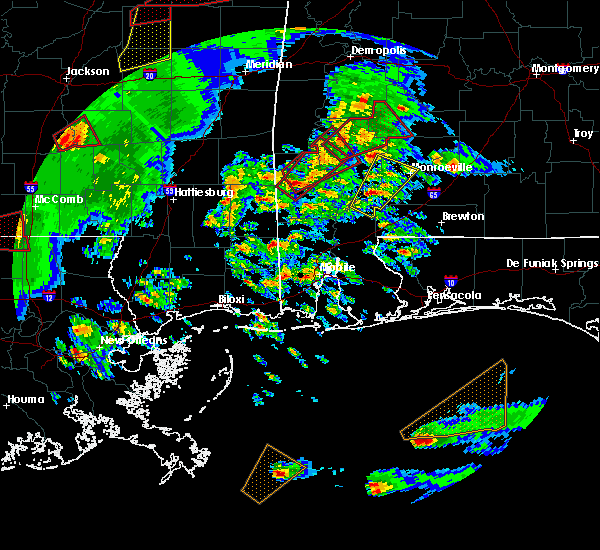 At 1236 pm cst, a severe thunderstorm capable of producing a tornado was located near chatom, moving northeast at 35 mph (radar indicated rotation). Hazards include tornado and quarter size hail. Flying debris will be dangerous to those caught without shelter. mobile homes will be damaged or destroyed. damage to roofs, windows, and vehicles will occur. tree damage is likely. this dangerous storm will be near, chatom around 1245 pm cst. saint stephens around 105 pm cst. Coffeeville around 115 pm cst. At 1236 pm cst, a severe thunderstorm capable of producing a tornado was located near chatom, moving northeast at 35 mph (radar indicated rotation). Hazards include tornado and quarter size hail. Flying debris will be dangerous to those caught without shelter. mobile homes will be damaged or destroyed. damage to roofs, windows, and vehicles will occur. tree damage is likely. this dangerous storm will be near, chatom around 1245 pm cst. saint stephens around 105 pm cst. Coffeeville around 115 pm cst.
|
| 2/15/2016 12:17 PM CST |
 At 1216 pm cst, a severe thunderstorm capable of producing a tornado was located near chatom, moving northeast at 40 mph (radar indicated rotation). Hazards include tornado and half dollar size hail. Flying debris will be dangerous to those caught without shelter. mobile homes will be damaged or destroyed. damage to roofs, windows, and vehicles will occur. tree damage is likely. this dangerous storm will be near, saint stephens around 1235 pm cst. Stay tuned for further updates from your national weather service in mobile. At 1216 pm cst, a severe thunderstorm capable of producing a tornado was located near chatom, moving northeast at 40 mph (radar indicated rotation). Hazards include tornado and half dollar size hail. Flying debris will be dangerous to those caught without shelter. mobile homes will be damaged or destroyed. damage to roofs, windows, and vehicles will occur. tree damage is likely. this dangerous storm will be near, saint stephens around 1235 pm cst. Stay tuned for further updates from your national weather service in mobile.
|
| 2/15/2016 12:06 PM CST |
 At 1205 pm cst, a severe thunderstorm capable of producing a tornado was located near chatom, moving northeast at 40 mph (radar indicated rotation). Hazards include tornado and half dollar size hail. Flying debris will be dangerous to those caught without shelter. mobile homes will be damaged or destroyed. damage to roofs, windows, and vehicles will occur. tree damage is likely. this dangerous storm will be near, chatom around 1215 pm cst. Saint stephens around 1230 pm cst. At 1205 pm cst, a severe thunderstorm capable of producing a tornado was located near chatom, moving northeast at 40 mph (radar indicated rotation). Hazards include tornado and half dollar size hail. Flying debris will be dangerous to those caught without shelter. mobile homes will be damaged or destroyed. damage to roofs, windows, and vehicles will occur. tree damage is likely. this dangerous storm will be near, chatom around 1215 pm cst. Saint stephens around 1230 pm cst.
|
| 12/28/2015 9:00 AM CST | Tree down on hwy 84 near the tombigbee river bridge in coffeevill in clarke county AL, 1 miles ENE of Coffeeville, AL |
| 12/28/2015 8:46 AM CST |
 At 845 am cst, severe thunderstorms were located along a line extending from near coffeeville to near tibbie to near chunchula to near tillmans corner, moving northeast at 30 mph (radar indicated). Hazards include 60 mph wind gusts. Expect damage to roofs. siding and trees. locations impacted include, mobile, prichard, saraland, satsuma, chickasaw, jackson, thomasville, citronelle, bayou la batre, creola, grove hill and chatom. A tornado watch remains in effect until noon cst for southwestern alabama. At 845 am cst, severe thunderstorms were located along a line extending from near coffeeville to near tibbie to near chunchula to near tillmans corner, moving northeast at 30 mph (radar indicated). Hazards include 60 mph wind gusts. Expect damage to roofs. siding and trees. locations impacted include, mobile, prichard, saraland, satsuma, chickasaw, jackson, thomasville, citronelle, bayou la batre, creola, grove hill and chatom. A tornado watch remains in effect until noon cst for southwestern alabama.
|
| 12/28/2015 8:13 AM CST |
 At 812 am cst, a line of severe thunderstorms capable of producing damaging winds over 60 mph was located along a line extending from near buckatunna to 8 miles southeast of leakesville to near hurley to 6 miles east of pascagoula, and moving northeast at 65 mph. At 812 am cst, a line of severe thunderstorms capable of producing damaging winds over 60 mph was located along a line extending from near buckatunna to 8 miles southeast of leakesville to near hurley to 6 miles east of pascagoula, and moving northeast at 65 mph.
|
| 12/23/2015 1:34 PM CST | At 133 pm cst, a severe thunderstorm was located near coffeeville, or 14 miles west of grove hill, moving northeast at 40 mph (radar indicated). Hazards include 60 mph wind gusts and nickel size hail. Expect damage to roofs. siding and trees. Locations impacted include, thomasville, coffeeville and fulton. |
| 12/23/2015 1:17 PM CST | At 116 pm cst, a severe thunderstorm was located 7 miles northwest of saint stephens, or 10 miles northeast of chatom, moving northeast at 40 mph (radar indicated). Hazards include 60 mph wind gusts and nickel size hail. Expect damage to roofs. Siding and trees. |
| 10/31/2015 6:56 PM CDT |
 The severe thunderstorm warning for northwestern mobile, south central choctaw, washington, northwestern clarke and east central greene counties will expire at 700 pm cdt, the storms which prompted the warning have weakened below severe limits, and no longer pose an immediate threat to life or property. therefore the warning will be allowed to expire. a tornado watch remains in effect until 1000 pm cdt for southwestern alabama. The severe thunderstorm warning for northwestern mobile, south central choctaw, washington, northwestern clarke and east central greene counties will expire at 700 pm cdt, the storms which prompted the warning have weakened below severe limits, and no longer pose an immediate threat to life or property. therefore the warning will be allowed to expire. a tornado watch remains in effect until 1000 pm cdt for southwestern alabama.
|
| 10/31/2015 6:37 PM CDT |
 At 637 pm cdt, severe thunderstorms were located along a line extending from 6 miles south of putnam to 8 miles southwest of deer park, moving east at 30 mph (radar indicated). Hazards include 60 mph wind gusts. Expect damage to roofs. siding and trees. locations impacted include, jackson, thomasville, chatom, coffeeville, mcintosh, vinegar bend, saint stephens, deer park, wagarville, tibbie and leroy. a tornado watch remains in effect until 700 pm cdt for southeastern mississippi. A tornado watch also remains in effect until 1000 pm cdt for southwestern alabama. At 637 pm cdt, severe thunderstorms were located along a line extending from 6 miles south of putnam to 8 miles southwest of deer park, moving east at 30 mph (radar indicated). Hazards include 60 mph wind gusts. Expect damage to roofs. siding and trees. locations impacted include, jackson, thomasville, chatom, coffeeville, mcintosh, vinegar bend, saint stephens, deer park, wagarville, tibbie and leroy. a tornado watch remains in effect until 700 pm cdt for southeastern mississippi. A tornado watch also remains in effect until 1000 pm cdt for southwestern alabama.
|
| 10/31/2015 6:11 PM CDT |
 At 611 pm cdt, severe thunderstorms were located along a line extending from 6 miles east of toxey to 6 miles south of leakesville, moving east at 30 mph (radar indicated). Hazards include 60 mph wind gusts. Expect damage to roofs. Siding and trees. At 611 pm cdt, severe thunderstorms were located along a line extending from 6 miles east of toxey to 6 miles south of leakesville, moving east at 30 mph (radar indicated). Hazards include 60 mph wind gusts. Expect damage to roofs. Siding and trees.
|
| 10/31/2015 5:26 PM CDT |
 At 525 pm cdt, severe thunderstorms were located along a line extending from 7 miles southwest of crandall to beaumont, moving east at 20 mph (radar indicated). Hazards include 60 mph wind gusts. Expect damage to roofs. Siding and trees. At 525 pm cdt, severe thunderstorms were located along a line extending from 7 miles southwest of crandall to beaumont, moving east at 20 mph (radar indicated). Hazards include 60 mph wind gusts. Expect damage to roofs. Siding and trees.
|
| 7/21/2015 7:19 PM CDT | Trees down on fluker kiel roa in clarke county AL, 2 miles W of Coffeeville, AL |
| 7/21/2015 7:09 PM CDT | Trees down on lc deas roa in clarke county AL, 0.4 miles NNW of Coffeeville, AL |
| 7/21/2015 7:09 PM CDT | Trees and power lines down blocking roa in clarke county AL, 1.8 miles N of Coffeeville, AL |
| 7/21/2015 7:09 PM CDT | Trees and power lines down blocking roa in clarke county AL, 1.8 miles NW of Coffeeville, AL |
| 7/9/2015 4:30 PM CDT | County em reports multiple trees and powerlines down just north of coffeeville... a in clarke county AL, 0.5 miles SE of Coffeeville, AL |
| 7/5/2015 2:01 PM CDT |
 At 201 pm cdt, a line of severe thunderstorms capable of producing damaging winds over 60 mph was located along a line extending from near putnam to near saint stephens to near deer park, and moving east at 35 mph. At 201 pm cdt, a line of severe thunderstorms capable of producing damaging winds over 60 mph was located along a line extending from near putnam to near saint stephens to near deer park, and moving east at 35 mph.
|
| 7/4/2015 4:12 PM CDT |
 At 411 pm cdt, a line of severe thunderstorms capable of producing damaging winds over 60 mph were located along a line extending from 10 miles east of coffeeville to near mcintosh, moving east at 40 mph. At 411 pm cdt, a line of severe thunderstorms capable of producing damaging winds over 60 mph were located along a line extending from 10 miles east of coffeeville to near mcintosh, moving east at 40 mph.
|
| 7/4/2015 3:46 PM CDT |
 At 345 pm cdt, a line of severe thunderstorms capable of producing damaging winds over 60 mph was located along a line extending from silas to 7 miles northeast of leakesville, and moving east at 35 mph. At 345 pm cdt, a line of severe thunderstorms capable of producing damaging winds over 60 mph was located along a line extending from silas to 7 miles northeast of leakesville, and moving east at 35 mph.
|
| 6/13/2015 3:40 PM CDT |
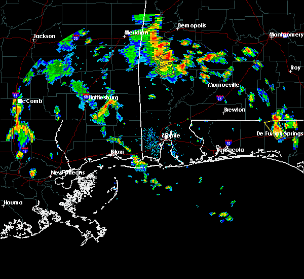 At 340 pm cdt, the storm that prompted the warning for northwestern clarke county has moved out of the warned area thus the severe thunderstorm warning will be allowed to expire at 345 pm cdt. At 340 pm cdt, the storm that prompted the warning for northwestern clarke county has moved out of the warned area thus the severe thunderstorm warning will be allowed to expire at 345 pm cdt.
|
| 6/13/2015 3:29 PM CDT |
 At 329 pm cdt, a severe thunderstorm capable of producing damaging winds over 60 mph was located 9 miles northeast of coffeeville, or 17 miles west of thomasville, moving north at 20 mph. At 329 pm cdt, a severe thunderstorm capable of producing damaging winds over 60 mph was located 9 miles northeast of coffeeville, or 17 miles west of thomasville, moving north at 20 mph.
|
| 6/13/2015 3:18 PM CDT | Em reports two trees down on gumball ln. 5 miles n of coffeeville... a in clarke county AL, 4.6 miles SSE of Coffeeville, AL |
| 6/13/2015 3:15 PM CDT |
 At 314 pm cdt, a severe thunderstorm capable of producing quarter size hail and damaging winds over 60 mph was located near coffeeville, or 18 miles northwest of grove hill, moving northwest at 25 mph. At 314 pm cdt, a severe thunderstorm capable of producing quarter size hail and damaging winds over 60 mph was located near coffeeville, or 18 miles northwest of grove hill, moving northwest at 25 mph.
|
| 6/13/2015 3:00 PM CDT |
 At 258 pm cdt, a severe thunderstorm capable of producing quarter size hail and damaging winds over 60 mph was located 9 miles west of grove hill, and moving northwest at 25 mph. At 258 pm cdt, a severe thunderstorm capable of producing quarter size hail and damaging winds over 60 mph was located 9 miles west of grove hill, and moving northwest at 25 mph.
|
| 5/28/2014 5:10 PM CDT | Tree down on west bend road. reported by clarke em in choctaw county AL, 0.5 miles NE of Coffeeville, AL |
| 4/28/2014 11:40 PM CDT | Trees down on highway 84 in coffeeville area in clarke county AL, 0.5 miles NE of Coffeeville, AL |
| 2/10/2013 6:00 PM CST | Golf Ball sized hail reported 0.5 miles NE of Coffeeville, AL, golf ball size hail and trees down in coffeeville. |
| 1/30/2013 9:12 AM CST | Clarke county ema reports trees down on prospect road near hwy 15 in clarke county AL, 7.4 miles WSW of Coffeeville, AL |
| 6/11/2012 10:00 PM CDT | Trees blown down near the intersection of hwy 84 and county road in clarke county AL, 5 miles WNW of Coffeeville, AL |
| 5/21/2012 2:30 PM CDT | Quarter sized hail reported 4.6 miles SE of Coffeeville, AL, quarter size hail reported at west bend. |
| 5/6/2012 1:30 PM CDT | Thunderstorm winds pushed large tree on house. extensive damag in clarke county AL, 0.9 miles WNW of Coffeeville, AL |
Hail Maps for Coffeeville, AL
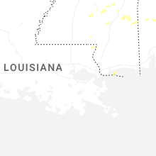
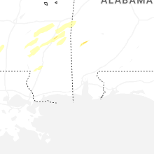


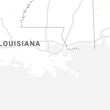
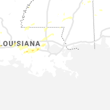


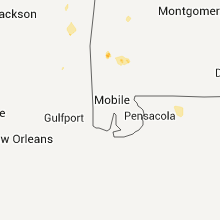


Connect with Interactive Hail Maps