

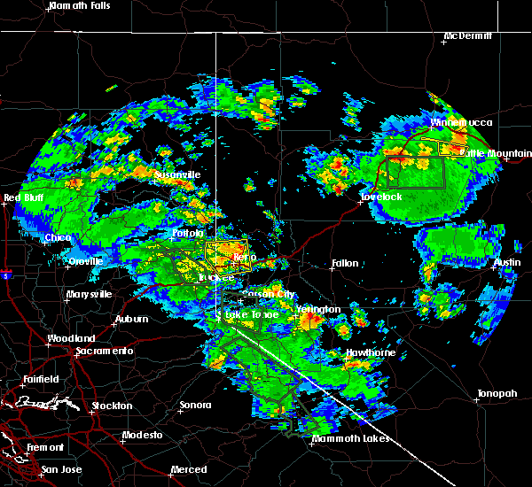
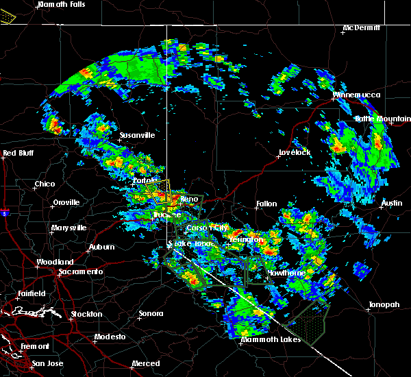
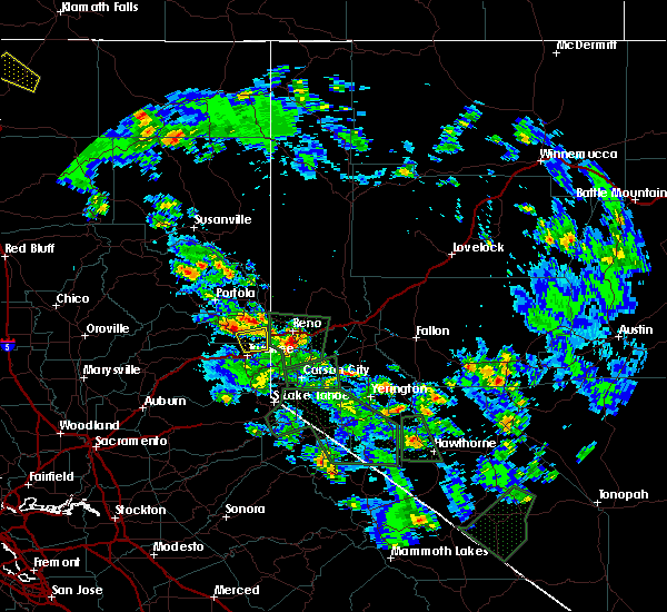
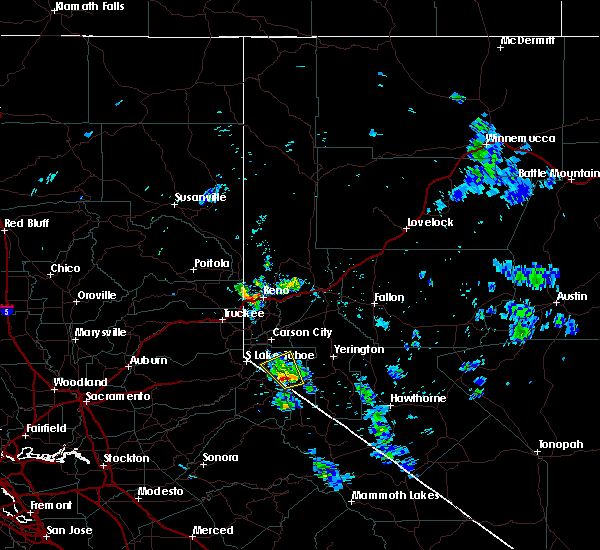
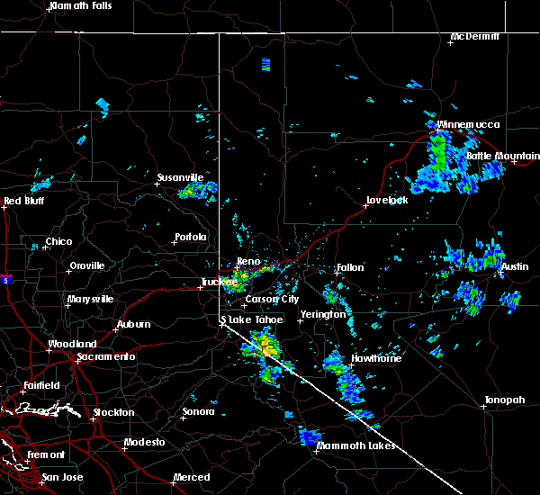
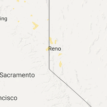
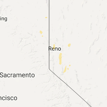
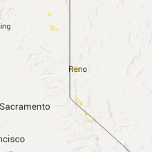
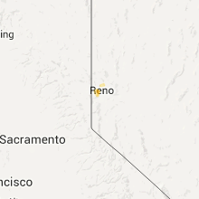
Hail Map for Cold Springs, NV
The Cold Springs, NV area has had 1 report of on-the-ground hail by trained spotters, and has been under severe weather warnings 0 times during the past 12 months. Doppler radar has detected hail at or near Cold Springs, NV on 10 occasions, including 1 occasion during the past year.
| Name: | Cold Springs, NV |
| Where Located: | 14.6 miles NW of Reno, NV |
| Map: | Google Map for Cold Springs, NV |
| Population: | 8544 |
| Housing Units: | 3210 |
| More Info: | Search Google for Cold Springs, NV |
0
The Top Recent Hail Date for Cold Springs, NV is Tuesday, July 23, 2024 (4th out of 10)

Hail and Wind Damage Spotted near Cold Springs, NV
| Date / Time | Report Details |
|---|---|
| 7/8/2015 3:40 PM PDT |
 The severe thunderstorm warning for sierra, southeastern lassen, southern washoe and storey counties will expire at 345 pm pdt, the storm which prompted the warning has weakened below severe limits, and no longer poses an immediate threat to life or property. therefore the warning will be allowed to expire. however heavy rain is still possible with this thunderstorm. please post any storm reports to nws social media or report to local law enforcement agency. The severe thunderstorm warning for sierra, southeastern lassen, southern washoe and storey counties will expire at 345 pm pdt, the storm which prompted the warning has weakened below severe limits, and no longer poses an immediate threat to life or property. therefore the warning will be allowed to expire. however heavy rain is still possible with this thunderstorm. please post any storm reports to nws social media or report to local law enforcement agency.
|
| 7/8/2015 3:28 PM PDT |
 At 327 pm pdt, the public reported a severe thunderstorm producing quarter size hail and damaging winds in excess of 60 mph. this storm was located near lemmon valley-golden valley, or 12 miles north of reno, moving north at 15 mph. locations impacted include, reno, sparks, caughlin ranch, spanish springs, northwest reno, hidden valley, lemmon valley-golden valley, verdi-mogul, stead, reno-tahoe international airport, wingfield springs, dog valley, mogul, lockwood, verdi, golden valley, somersett, lemmon valley, cold springs valley and stead airport. At 327 pm pdt, the public reported a severe thunderstorm producing quarter size hail and damaging winds in excess of 60 mph. this storm was located near lemmon valley-golden valley, or 12 miles north of reno, moving north at 15 mph. locations impacted include, reno, sparks, caughlin ranch, spanish springs, northwest reno, hidden valley, lemmon valley-golden valley, verdi-mogul, stead, reno-tahoe international airport, wingfield springs, dog valley, mogul, lockwood, verdi, golden valley, somersett, lemmon valley, cold springs valley and stead airport.
|
| 7/8/2015 3:06 PM PDT |
 At 303 pm pdt, a severe thunderstorm capable of producing quarter size hail and damaging winds in excess of 60 mph is continuing to move through reno. this storm was located over reno, and moving north at 20 mph. this storm has a history of producing large. At 303 pm pdt, a severe thunderstorm capable of producing quarter size hail and damaging winds in excess of 60 mph is continuing to move through reno. this storm was located over reno, and moving north at 20 mph. this storm has a history of producing large.
|
| 7/7/2015 3:15 PM PDT | Quarter sized hail reported 4.1 miles SE of Cold Springs, NV, one inch hail reported by long valley california inspection station. |
| 7/7/2015 3:09 PM PDT |
 At 306 pm pdt, doppler radar indicated a severe thunderstorm capable of producing quarter size hail and damaging winds in excess of 60 mph. this storm is approaching hallelujah junction, and hwy 70 near vinton an chilcoot, moving north at 20 mph. torrential rain with blinding visibility and ponding of water is the main threat with this storm. locations impacted include, chilcoot, vinton, chilcoot-vinton, hallelujah junction, cold springs valley, verdi-mogul, ca 49 at sierra-plumas co line, ca 70 at plumas-lassen co line, us 395 at sierra-lassen co line and us 395 at calif-nevada line near bordertown. At 306 pm pdt, doppler radar indicated a severe thunderstorm capable of producing quarter size hail and damaging winds in excess of 60 mph. this storm is approaching hallelujah junction, and hwy 70 near vinton an chilcoot, moving north at 20 mph. torrential rain with blinding visibility and ponding of water is the main threat with this storm. locations impacted include, chilcoot, vinton, chilcoot-vinton, hallelujah junction, cold springs valley, verdi-mogul, ca 49 at sierra-plumas co line, ca 70 at plumas-lassen co line, us 395 at sierra-lassen co line and us 395 at calif-nevada line near bordertown.
|
| 7/7/2015 2:49 PM PDT |
 At 248 pm pdt, doppler radar indicated a severe thunderstorm capable of producing damaging winds in excess of 60 mph. this storm was located near dog valley, or 8 miles northwest of verdi, and moving north at 20 mph. nickel size hail may also accompany the damaging winds. At 248 pm pdt, doppler radar indicated a severe thunderstorm capable of producing damaging winds in excess of 60 mph. this storm was located near dog valley, or 8 miles northwest of verdi, and moving north at 20 mph. nickel size hail may also accompany the damaging winds.
|
| 6/27/2015 5:38 PM PDT |
 At 535 pm pdt, doppler radar indicated a severe thunderstorm capable of producing quarter size hail and destructive winds in excess of 70 mph. this storm was located over cold springs valley, or 11 miles northwest of reno, moving north at 20 mph. locations impacted include, cold springs valley and stead. At 535 pm pdt, doppler radar indicated a severe thunderstorm capable of producing quarter size hail and destructive winds in excess of 70 mph. this storm was located over cold springs valley, or 11 miles northwest of reno, moving north at 20 mph. locations impacted include, cold springs valley and stead.
|
| 6/27/2015 5:18 PM PDT |
 At 517 pm pdt, doppler radar indicated a severe thunderstorm capable of producing damaging winds in excess of 60 mph. this storm was located over somersett, or near verdi, and moving north at 20 mph. penny size hail may also accompany the damaging winds. At 517 pm pdt, doppler radar indicated a severe thunderstorm capable of producing damaging winds in excess of 60 mph. this storm was located over somersett, or near verdi, and moving north at 20 mph. penny size hail may also accompany the damaging winds.
|
| 6/27/2015 5:09 PM PDT |
 At 508 pm pdt, doppler radar indicated a severe thunderstorm capable of producing damaging winds in excess of 60 mph. this storm was located over verdi, moving north at 25 mph. penny size hail may also accompany the damaging winds. locations impacted include, reno, dog valley, mogul, verdi, cold springs valley and stead. At 508 pm pdt, doppler radar indicated a severe thunderstorm capable of producing damaging winds in excess of 60 mph. this storm was located over verdi, moving north at 25 mph. penny size hail may also accompany the damaging winds. locations impacted include, reno, dog valley, mogul, verdi, cold springs valley and stead.
|
| 6/27/2015 4:53 PM PDT |
 At 452 pm pdt, doppler radar indicated a severe thunderstorm capable of producing destructive winds in excess of 70 mph. this storm was located near mogul, or near verdi, and moving north at 25 mph. At 452 pm pdt, doppler radar indicated a severe thunderstorm capable of producing destructive winds in excess of 70 mph. this storm was located near mogul, or near verdi, and moving north at 25 mph.
|
Hail Maps for Cold Springs, NV


Connect with Interactive Hail Maps