

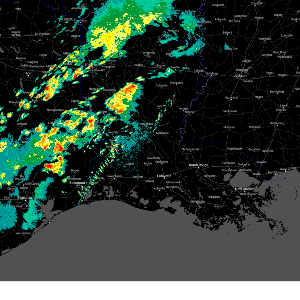
Hail Map for Colmesneil, TX
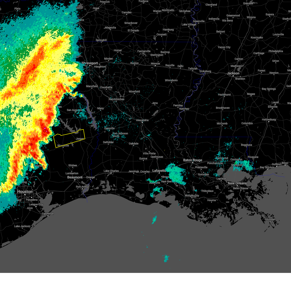
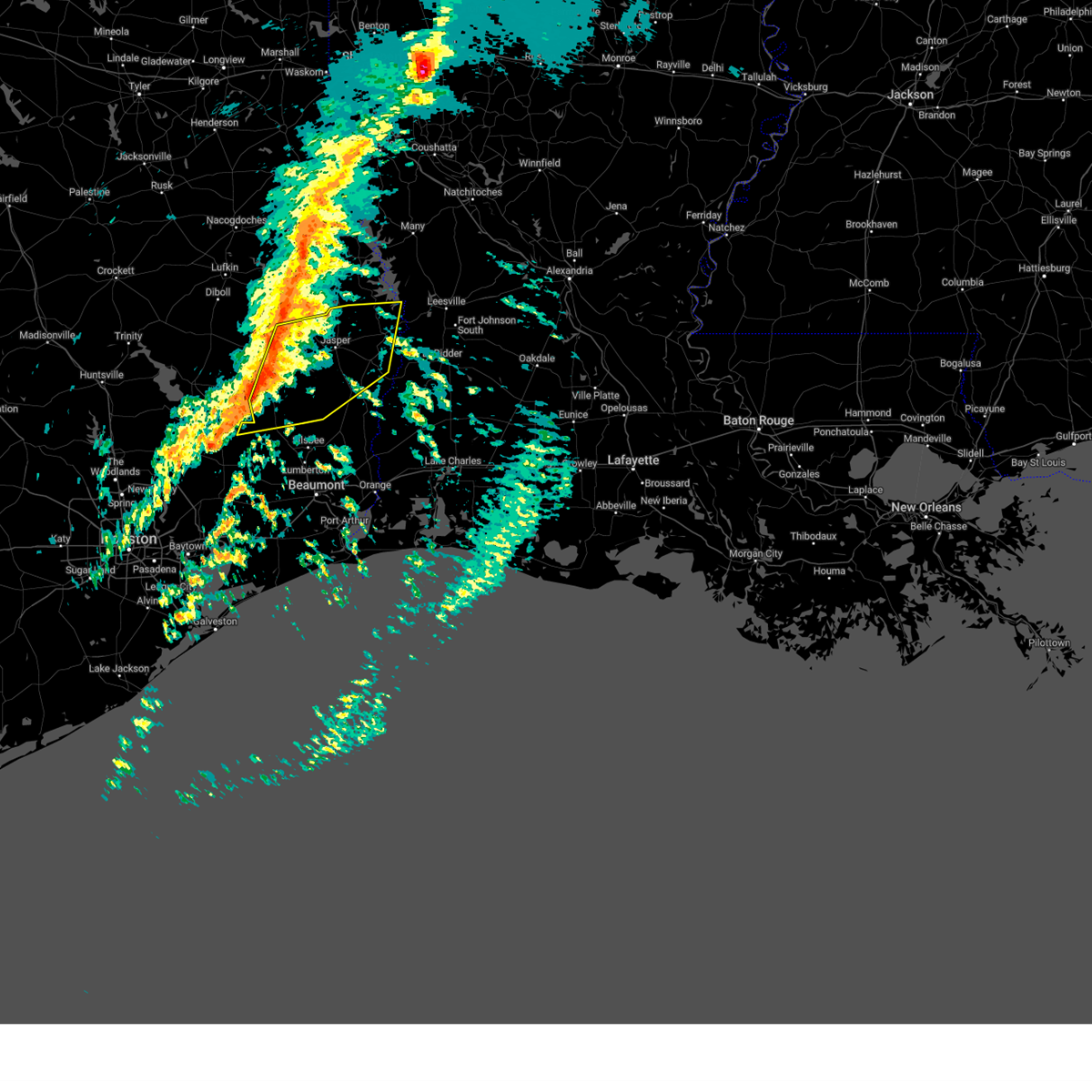
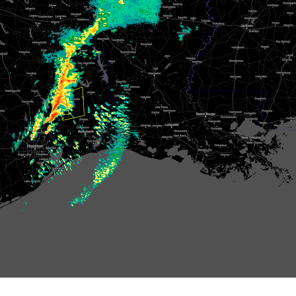
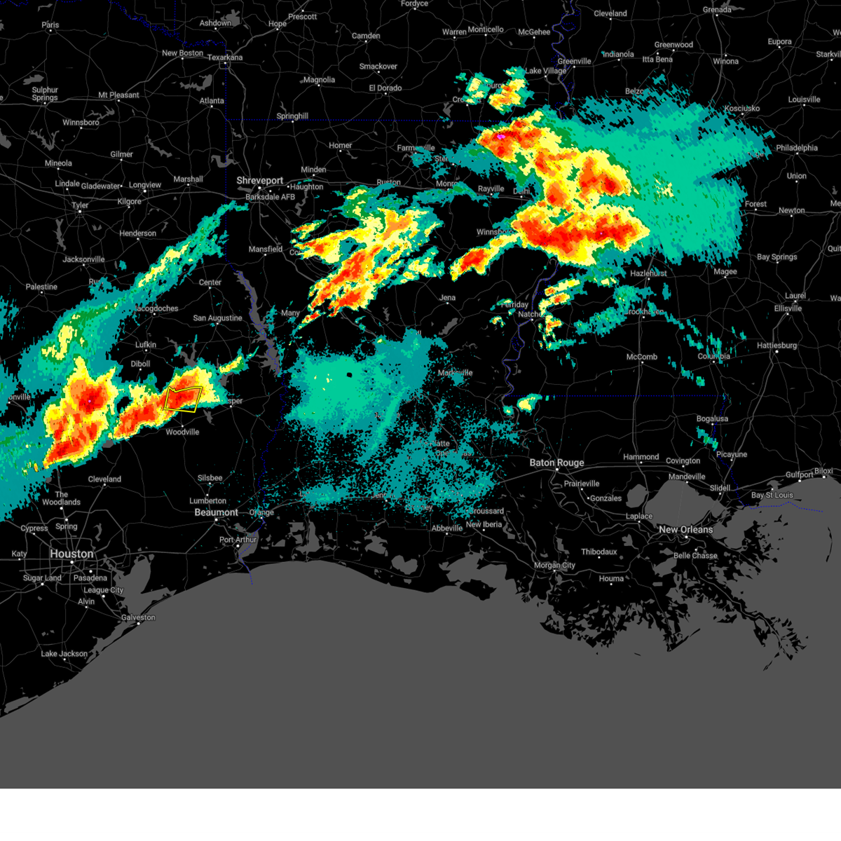
The Colmesneil, TX area has had 3 reports of on-the-ground hail by trained spotters, and has been under severe weather warnings 6 times during the past 12 months. Doppler radar has detected hail at or near Colmesneil, TX on 67 occasions, including 2 occasions during the past year.
| Name: | Colmesneil, TX |
| Where Located: | 34.7 miles SSE of Lufkin, TX |
| Map: | Google Map for Colmesneil, TX |
| Population: | 596 |
| Housing Units: | 294 |
| More Info: | Search Google for Colmesneil, TX |
0
The Top Recent Hail Date for Colmesneil, TX is Saturday, August 3, 2024 (67th out of 67)

Hail and Wind Damage Spotted near Colmesneil, TX
| Date / Time | Report Details |
|---|---|
| 5/27/2025 12:09 AM CDT |
 Svrlch the national weather service in lake charles has issued a * severe thunderstorm warning for, northwestern tyler county in southeastern texas, northern jasper county in southeastern texas, * until 100 am cdt. * at 1209 am cdt, a severe thunderstorm was located 9 miles north of chester, moving northeast at 50 mph (radar indicated). Hazards include 60 mph wind gusts and penny size hail. expect damage to roofs, siding, and trees Svrlch the national weather service in lake charles has issued a * severe thunderstorm warning for, northwestern tyler county in southeastern texas, northern jasper county in southeastern texas, * until 100 am cdt. * at 1209 am cdt, a severe thunderstorm was located 9 miles north of chester, moving northeast at 50 mph (radar indicated). Hazards include 60 mph wind gusts and penny size hail. expect damage to roofs, siding, and trees
|
| 4/5/2025 6:08 PM CDT | The storm which prompted the warning has weakened below severe limits, and has exited the warned area. therefore, the warning will be allowed to expire. a tornado watch remains in effect until 900 pm cdt for southeastern texas. |
| 4/5/2025 5:56 PM CDT | At 555 pm cdt, a severe thunderstorm was located over colmesneil, moving northeast at 45 mph (radar indicated). Hazards include 60 mph wind gusts and quarter size hail. Hail damage to vehicles is expected. expect wind damage to roofs, siding, and trees. Locations impacted include, colmesneil and rockland. |
| 4/5/2025 5:46 PM CDT | Svrlch the national weather service in lake charles has issued a * severe thunderstorm warning for, northwestern tyler county in southeastern texas, northwestern jasper county in southeastern texas, * until 615 pm cdt. * at 546 pm cdt, a severe thunderstorm was located over colmesneil, moving northeast at 55 mph (radar indicated). Hazards include 60 mph wind gusts and quarter size hail. Hail damage to vehicles is expected. Expect wind damage to roofs, siding, and trees. |
| 3/4/2025 9:59 AM CST |
 Svrlch the national weather service in lake charles has issued a * severe thunderstorm warning for, tyler county in southeastern texas, northwestern newton county in southeastern texas, northern hardin county in southeastern texas, jasper county in southeastern texas, * until 1045 am cst. * at 958 am cst, severe thunderstorms were located along a line extending from near ebenezer to near wildwood, moving northeast at 70 mph (radar indicated). Hazards include 60 mph wind gusts. expect damage to roofs, siding, and trees Svrlch the national weather service in lake charles has issued a * severe thunderstorm warning for, tyler county in southeastern texas, northwestern newton county in southeastern texas, northern hardin county in southeastern texas, jasper county in southeastern texas, * until 1045 am cst. * at 958 am cst, severe thunderstorms were located along a line extending from near ebenezer to near wildwood, moving northeast at 70 mph (radar indicated). Hazards include 60 mph wind gusts. expect damage to roofs, siding, and trees
|
| 3/4/2025 9:22 AM CST |
 Svrlch the national weather service in lake charles has issued a * severe thunderstorm warning for, tyler county in southeastern texas, northern hardin county in southeastern texas, north central jasper county in southeastern texas, * until 1000 am cst. * at 921 am cst, severe thunderstorms were located along a line extending from 7 miles northeast of seven oaks to 11 miles east of cleveland, moving northeast at 45 mph (radar indicated). Hazards include 60 mph wind gusts. expect damage to roofs, siding, and trees Svrlch the national weather service in lake charles has issued a * severe thunderstorm warning for, tyler county in southeastern texas, northern hardin county in southeastern texas, north central jasper county in southeastern texas, * until 1000 am cst. * at 921 am cst, severe thunderstorms were located along a line extending from 7 miles northeast of seven oaks to 11 miles east of cleveland, moving northeast at 45 mph (radar indicated). Hazards include 60 mph wind gusts. expect damage to roofs, siding, and trees
|
| 7/7/2024 2:09 PM CDT |
 The storms which prompted the warning have weakened below severe limits, and have exited the warned area. therefore, the warning will be allowed to expire. The storms which prompted the warning have weakened below severe limits, and have exited the warned area. therefore, the warning will be allowed to expire.
|
| 7/7/2024 1:55 PM CDT | Severe thunderstorm wind gusts damaged trees across northern tyler county. 888 customers were out of power due to large trees falling on transformers and power line in tyler county TX, 0.3 miles SW of Colmesneil, TX |
| 7/7/2024 1:51 PM CDT |
 At 151 pm cdt, severe thunderstorms were located along a line extending from 6 miles southwest of ebenezer to near colmesneil to near chester, moving north at 40 mph (radar indicated). Hazards include 60 mph wind gusts. Expect damage to roofs, siding, and trees. Locations impacted include, colmesneil, chester, rockland, and ebenezer. At 151 pm cdt, severe thunderstorms were located along a line extending from 6 miles southwest of ebenezer to near colmesneil to near chester, moving north at 40 mph (radar indicated). Hazards include 60 mph wind gusts. Expect damage to roofs, siding, and trees. Locations impacted include, colmesneil, chester, rockland, and ebenezer.
|
| 7/7/2024 1:36 PM CDT |
 At 136 pm cdt, severe thunderstorms were located along a line extending from 6 miles west of jasper to woodville to 10 miles north of votaw, moving northwest at 30 mph (radar indicated). Hazards include 60 mph wind gusts. Expect damage to roofs, siding, and trees. Locations impacted include, jasper, woodville, colmesneil, chester, ebenezer, rockland, ivanhoe, and sam rayburn dam. At 136 pm cdt, severe thunderstorms were located along a line extending from 6 miles west of jasper to woodville to 10 miles north of votaw, moving northwest at 30 mph (radar indicated). Hazards include 60 mph wind gusts. Expect damage to roofs, siding, and trees. Locations impacted include, jasper, woodville, colmesneil, chester, ebenezer, rockland, ivanhoe, and sam rayburn dam.
|
| 7/7/2024 1:18 PM CDT |
 Svrlch the national weather service in lake charles has issued a * severe thunderstorm warning for, tyler county in southeastern texas, northern jasper county in southeastern texas, * until 215 pm cdt. * at 118 pm cdt, severe thunderstorms were located along a line extending from near jasper to 6 miles northeast of warren to near wildwood, moving northwest at 30 mph (radar indicated). Hazards include 60 mph wind gusts. expect damage to roofs, siding, and trees Svrlch the national weather service in lake charles has issued a * severe thunderstorm warning for, tyler county in southeastern texas, northern jasper county in southeastern texas, * until 215 pm cdt. * at 118 pm cdt, severe thunderstorms were located along a line extending from near jasper to 6 miles northeast of warren to near wildwood, moving northwest at 30 mph (radar indicated). Hazards include 60 mph wind gusts. expect damage to roofs, siding, and trees
|
| 5/30/2024 8:13 PM CDT |
 The storms which prompted the warning have moved out of the area. therefore, the warning will be allowed to expire. however gusty winds and heavy rain are still possible with these thunderstorms. a severe thunderstorm watch remains in effect until 1100 pm cdt for southeastern texas. The storms which prompted the warning have moved out of the area. therefore, the warning will be allowed to expire. however gusty winds and heavy rain are still possible with these thunderstorms. a severe thunderstorm watch remains in effect until 1100 pm cdt for southeastern texas.
|
| 5/30/2024 7:51 PM CDT |
 At 751 pm cdt, severe thunderstorms were located along a line extending from near browndell to 6 miles northeast of town bluff to 6 miles east of alabama-coushatta reservation, moving southeast at 30 mph (radar indicated). Hazards include 60 mph wind gusts and penny size hail. Expect damage to roofs, siding, and trees. locations impacted include, jasper, woodville, colmesneil, ebenezer, warren, town bluff, browndell, magnolia springs, mt. Union, spurger, ivanhoe, sam rayburn dam, and hillister. At 751 pm cdt, severe thunderstorms were located along a line extending from near browndell to 6 miles northeast of town bluff to 6 miles east of alabama-coushatta reservation, moving southeast at 30 mph (radar indicated). Hazards include 60 mph wind gusts and penny size hail. Expect damage to roofs, siding, and trees. locations impacted include, jasper, woodville, colmesneil, ebenezer, warren, town bluff, browndell, magnolia springs, mt. Union, spurger, ivanhoe, sam rayburn dam, and hillister.
|
| 5/30/2024 7:35 PM CDT | Report of trees down in the colmesneil area. power outages in association. time from rada in tyler county TX, 0.3 miles SW of Colmesneil, TX |
| 5/30/2024 7:18 PM CDT |
 Svrlch the national weather service in lake charles has issued a * severe thunderstorm warning for, tyler county in southeastern texas, northern jasper county in southeastern texas, * until 815 pm cdt. * at 718 pm cdt, severe thunderstorms were located along a line extending from 12 miles southeast of etoile to 7 miles northeast of chester to 7 miles north of livingston, moving southeast at 25 mph (radar indicated). Hazards include 60 mph wind gusts and penny size hail. expect damage to roofs, siding, and trees Svrlch the national weather service in lake charles has issued a * severe thunderstorm warning for, tyler county in southeastern texas, northern jasper county in southeastern texas, * until 815 pm cdt. * at 718 pm cdt, severe thunderstorms were located along a line extending from 12 miles southeast of etoile to 7 miles northeast of chester to 7 miles north of livingston, moving southeast at 25 mph (radar indicated). Hazards include 60 mph wind gusts and penny size hail. expect damage to roofs, siding, and trees
|
| 5/28/2024 12:46 PM CDT |
 Svrlch the national weather service in lake charles has issued a * severe thunderstorm warning for, tyler county in southeastern texas, western hardin county in southeastern texas, northwestern jasper county in southeastern texas, * until 145 pm cdt. * at 1245 pm cdt, severe thunderstorms were located along a line extending from 6 miles northeast of corrigan to near goodrich, moving southeast at 30 mph (radar indicated). Hazards include 60 mph wind gusts and quarter size hail. Hail damage to vehicles is expected. Expect wind damage to roofs, siding, and trees. Svrlch the national weather service in lake charles has issued a * severe thunderstorm warning for, tyler county in southeastern texas, western hardin county in southeastern texas, northwestern jasper county in southeastern texas, * until 145 pm cdt. * at 1245 pm cdt, severe thunderstorms were located along a line extending from 6 miles northeast of corrigan to near goodrich, moving southeast at 30 mph (radar indicated). Hazards include 60 mph wind gusts and quarter size hail. Hail damage to vehicles is expected. Expect wind damage to roofs, siding, and trees.
|
| 5/16/2024 3:52 PM CDT |
 Svrlch the national weather service in lake charles has issued a * severe thunderstorm warning for, tyler county in southeastern texas, northwestern newton county in southeastern texas, northern jasper county in southeastern texas, * until 445 pm cdt. * at 352 pm cdt, a severe thunderstorm was located near woodville, moving northeast at 40 mph (radar indicated). Hazards include 60 mph wind gusts and quarter size hail. Hail damage to vehicles is expected. Expect wind damage to roofs, siding, and trees. Svrlch the national weather service in lake charles has issued a * severe thunderstorm warning for, tyler county in southeastern texas, northwestern newton county in southeastern texas, northern jasper county in southeastern texas, * until 445 pm cdt. * at 352 pm cdt, a severe thunderstorm was located near woodville, moving northeast at 40 mph (radar indicated). Hazards include 60 mph wind gusts and quarter size hail. Hail damage to vehicles is expected. Expect wind damage to roofs, siding, and trees.
|
| 5/9/2024 10:06 PM CDT |
 At 1005 pm cdt, a severe thunderstorm was located 7 miles southeast of rockland, moving east at 15 mph (radar indicated). Hazards include two inch hail and 60 mph wind gusts. People and animals outdoors will be injured. expect hail damage to roofs, siding, windows, and vehicles. expect wind damage to roofs, siding, and trees. Locations impacted include, colmesneil, rockland, ebenezer, town bluff, and sam rayburn dam. At 1005 pm cdt, a severe thunderstorm was located 7 miles southeast of rockland, moving east at 15 mph (radar indicated). Hazards include two inch hail and 60 mph wind gusts. People and animals outdoors will be injured. expect hail damage to roofs, siding, windows, and vehicles. expect wind damage to roofs, siding, and trees. Locations impacted include, colmesneil, rockland, ebenezer, town bluff, and sam rayburn dam.
|
| 5/9/2024 9:44 PM CDT |
 Svrlch the national weather service in lake charles has issued a * severe thunderstorm warning for, northeastern tyler county in southeastern texas, northwestern jasper county in southeastern texas, * until 1045 pm cdt. * at 944 pm cdt, a severe thunderstorm was located over rockland, moving east at 15 mph (radar indicated). Hazards include ping pong ball size hail and 60 mph wind gusts. People and animals outdoors will be injured. expect hail damage to roofs, siding, windows, and vehicles. Expect wind damage to roofs, siding, and trees. Svrlch the national weather service in lake charles has issued a * severe thunderstorm warning for, northeastern tyler county in southeastern texas, northwestern jasper county in southeastern texas, * until 1045 pm cdt. * at 944 pm cdt, a severe thunderstorm was located over rockland, moving east at 15 mph (radar indicated). Hazards include ping pong ball size hail and 60 mph wind gusts. People and animals outdoors will be injured. expect hail damage to roofs, siding, windows, and vehicles. Expect wind damage to roofs, siding, and trees.
|
| 5/9/2024 9:33 PM CDT |
 At 932 pm cdt, a severe thunderstorm was located near rockland, moving east at 10 mph (radar indicated. at 923 pm, tyler county emergency management reported quarter size hail on county road 2925). Hazards include ping pong ball size hail and 60 mph wind gusts. People and animals outdoors will be injured. expect hail damage to roofs, siding, windows, and vehicles. expect wind damage to roofs, siding, and trees. Locations impacted include, colmesneil and rockland. At 932 pm cdt, a severe thunderstorm was located near rockland, moving east at 10 mph (radar indicated. at 923 pm, tyler county emergency management reported quarter size hail on county road 2925). Hazards include ping pong ball size hail and 60 mph wind gusts. People and animals outdoors will be injured. expect hail damage to roofs, siding, windows, and vehicles. expect wind damage to roofs, siding, and trees. Locations impacted include, colmesneil and rockland.
|
| 5/9/2024 9:32 PM CDT | Hen Egg sized hail reported 4.3 miles S of Colmesneil, TX |
| 5/9/2024 9:23 PM CDT | Quarter sized hail reported 4.3 miles S of Colmesneil, TX, report of quarter size hail from tyler county em. |
| 5/9/2024 8:55 PM CDT |
 At 854 pm cdt, a severe thunderstorm was located near chester, moving east at 20 mph (radar indicated). Hazards include two inch hail and 60 mph wind gusts. People and animals outdoors will be injured. expect hail damage to roofs, siding, windows, and vehicles. expect wind damage to roofs, siding, and trees. Locations impacted include, colmesneil, chester, and rockland. At 854 pm cdt, a severe thunderstorm was located near chester, moving east at 20 mph (radar indicated). Hazards include two inch hail and 60 mph wind gusts. People and animals outdoors will be injured. expect hail damage to roofs, siding, windows, and vehicles. expect wind damage to roofs, siding, and trees. Locations impacted include, colmesneil, chester, and rockland.
|
| 5/9/2024 8:40 PM CDT |
 Svrlch the national weather service in lake charles has issued a * severe thunderstorm warning for, northwestern tyler county in southeastern texas, northwestern jasper county in southeastern texas, * until 945 pm cdt. * at 840 pm cdt, a severe thunderstorm was located near chester, moving east at 20 mph (radar indicated). Hazards include ping pong ball size hail and 60 mph wind gusts. People and animals outdoors will be injured. expect hail damage to roofs, siding, windows, and vehicles. Expect wind damage to roofs, siding, and trees. Svrlch the national weather service in lake charles has issued a * severe thunderstorm warning for, northwestern tyler county in southeastern texas, northwestern jasper county in southeastern texas, * until 945 pm cdt. * at 840 pm cdt, a severe thunderstorm was located near chester, moving east at 20 mph (radar indicated). Hazards include ping pong ball size hail and 60 mph wind gusts. People and animals outdoors will be injured. expect hail damage to roofs, siding, windows, and vehicles. Expect wind damage to roofs, siding, and trees.
|
| 5/2/2024 4:17 AM CDT |
 At 417 am cdt, severe thunderstorms were located along a line extending from 12 miles southeast of huntington to near rockland to near wildwood, moving northeast at 30 mph (radar indicated). Hazards include 60 mph wind gusts and quarter size hail. Hail damage to vehicles is expected. expect wind damage to roofs, siding, and trees. Locations impacted include, woodville, colmesneil, rockland, ebenezer, town bluff, and ivanhoe. At 417 am cdt, severe thunderstorms were located along a line extending from 12 miles southeast of huntington to near rockland to near wildwood, moving northeast at 30 mph (radar indicated). Hazards include 60 mph wind gusts and quarter size hail. Hail damage to vehicles is expected. expect wind damage to roofs, siding, and trees. Locations impacted include, woodville, colmesneil, rockland, ebenezer, town bluff, and ivanhoe.
|
| 5/2/2024 3:49 AM CDT |
 Svrlch the national weather service in lake charles has issued a * severe thunderstorm warning for, tyler county in southeastern texas, northwestern jasper county in southeastern texas, * until 445 am cdt. * at 348 am cdt, severe thunderstorms were located along a line extending from 10 miles east of corrigan to 6 miles southeast of chester to 10 miles west of warren, moving northeast at 25 mph (radar indicated). Hazards include 60 mph wind gusts and quarter size hail. Hail damage to vehicles is expected. Expect wind damage to roofs, siding, and trees. Svrlch the national weather service in lake charles has issued a * severe thunderstorm warning for, tyler county in southeastern texas, northwestern jasper county in southeastern texas, * until 445 am cdt. * at 348 am cdt, severe thunderstorms were located along a line extending from 10 miles east of corrigan to 6 miles southeast of chester to 10 miles west of warren, moving northeast at 25 mph (radar indicated). Hazards include 60 mph wind gusts and quarter size hail. Hail damage to vehicles is expected. Expect wind damage to roofs, siding, and trees.
|
| 4/28/2024 11:40 PM CDT | Tree down on rr255 between colmesneil and hwy 6 in tyler county TX, 5.7 miles SW of Colmesneil, TX |
| 4/28/2024 11:13 PM CDT |
 Svrlch the national weather service in lake charles has issued a * severe thunderstorm warning for, central tyler county in southeastern texas, northern jasper county in southeastern texas, * until 1145 pm cdt. * at 1113 pm cdt, severe thunderstorms were located along a line extending from 6 miles north of ebenezer to near woodville, moving east at 25 mph (radar indicated). Hazards include 60 mph wind gusts and quarter size hail. Hail damage to vehicles is expected. Expect wind damage to roofs, siding, and trees. Svrlch the national weather service in lake charles has issued a * severe thunderstorm warning for, central tyler county in southeastern texas, northern jasper county in southeastern texas, * until 1145 pm cdt. * at 1113 pm cdt, severe thunderstorms were located along a line extending from 6 miles north of ebenezer to near woodville, moving east at 25 mph (radar indicated). Hazards include 60 mph wind gusts and quarter size hail. Hail damage to vehicles is expected. Expect wind damage to roofs, siding, and trees.
|
| 4/28/2024 10:45 PM CDT |
 Svrlch the national weather service in lake charles has issued a * severe thunderstorm warning for, northwestern tyler county in southeastern texas, northwestern jasper county in southeastern texas, * until 1115 pm cdt. * at 1044 pm cdt, severe thunderstorms were located along a line extending from near rockland to near chester, moving east at 15 mph (radar indicated). Hazards include 60 mph wind gusts and penny size hail. expect damage to roofs, siding, and trees Svrlch the national weather service in lake charles has issued a * severe thunderstorm warning for, northwestern tyler county in southeastern texas, northwestern jasper county in southeastern texas, * until 1115 pm cdt. * at 1044 pm cdt, severe thunderstorms were located along a line extending from near rockland to near chester, moving east at 15 mph (radar indicated). Hazards include 60 mph wind gusts and penny size hail. expect damage to roofs, siding, and trees
|
| 4/9/2024 8:15 PM CDT |
 the severe thunderstorm warning has been cancelled and is no longer in effect the severe thunderstorm warning has been cancelled and is no longer in effect
|
| 4/9/2024 8:06 PM CDT |
 At 806 pm cdt, a severe thunderstorm was located near woodville, moving northeast at 25 mph (radar indicated). Hazards include quarter size hail. Damage to vehicles is expected. Locations impacted include, woodville, colmesneil, and rockland. At 806 pm cdt, a severe thunderstorm was located near woodville, moving northeast at 25 mph (radar indicated). Hazards include quarter size hail. Damage to vehicles is expected. Locations impacted include, woodville, colmesneil, and rockland.
|
| 4/9/2024 7:37 PM CDT |
 Svrlch the national weather service in lake charles has issued a * severe thunderstorm warning for, central tyler county in southeastern texas, * until 830 pm cdt. * at 737 pm cdt, a severe thunderstorm was located near woodville, moving northeast at 30 mph (radar indicated). Hazards include 60 mph wind gusts and half dollar size hail. Hail damage to vehicles is expected. Expect wind damage to roofs, siding, and trees. Svrlch the national weather service in lake charles has issued a * severe thunderstorm warning for, central tyler county in southeastern texas, * until 830 pm cdt. * at 737 pm cdt, a severe thunderstorm was located near woodville, moving northeast at 30 mph (radar indicated). Hazards include 60 mph wind gusts and half dollar size hail. Hail damage to vehicles is expected. Expect wind damage to roofs, siding, and trees.
|
| 2/11/2024 12:41 PM CST |
 At 1241 pm cst, a severe thunderstorm was located near alabama-coushatta reservation, or 14 miles west of warren, moving northeast at 45 mph (radar indicated). Hazards include 60 mph wind gusts and half dollar size hail. Hail damage to vehicles is expected. Expect wind damage to roofs, siding, and trees. At 1241 pm cst, a severe thunderstorm was located near alabama-coushatta reservation, or 14 miles west of warren, moving northeast at 45 mph (radar indicated). Hazards include 60 mph wind gusts and half dollar size hail. Hail damage to vehicles is expected. Expect wind damage to roofs, siding, and trees.
|
| 2/11/2024 11:26 AM CST |
 The tornado warning for northwestern tyler county will expire at 1130 am cst, the tornado warning that was previously in effect has been reissued! please refer to that bulletin for the latest severe weather information. a tornado watch remains in effect until 300 pm cst for southeastern texas. remember, a tornado warning still remains in effect! &&. The tornado warning for northwestern tyler county will expire at 1130 am cst, the tornado warning that was previously in effect has been reissued! please refer to that bulletin for the latest severe weather information. a tornado watch remains in effect until 300 pm cst for southeastern texas. remember, a tornado warning still remains in effect! &&.
|
| 2/11/2024 11:10 AM CST |
 At 1108 am cst, a severe thunderstorm capable of producing a tornado was located near chester, moving northeast at 35 mph (radar indicated rotation). Hazards include tornado and ping pong ball size hail. Flying debris will be dangerous to those caught without shelter. mobile homes will be damaged or destroyed. damage to roofs, windows, and vehicles will occur. tree damage is likely. this dangerous storm will be near, chester around 1115 am cst. Colmesneil around 1125 am cst. At 1108 am cst, a severe thunderstorm capable of producing a tornado was located near chester, moving northeast at 35 mph (radar indicated rotation). Hazards include tornado and ping pong ball size hail. Flying debris will be dangerous to those caught without shelter. mobile homes will be damaged or destroyed. damage to roofs, windows, and vehicles will occur. tree damage is likely. this dangerous storm will be near, chester around 1115 am cst. Colmesneil around 1125 am cst.
|
| 2/11/2024 10:57 AM CST |
 At 1057 am cst, a severe thunderstorm capable of producing a tornado was located near seven oaks, or 12 miles west of chester, moving northeast at 35 mph (radar indicated rotation). Hazards include tornado and ping pong ball size hail. Flying debris will be dangerous to those caught without shelter. mobile homes will be damaged or destroyed. damage to roofs, windows, and vehicles will occur. tree damage is likely. This dangerous storm will be near, chester around 1105 am cst. At 1057 am cst, a severe thunderstorm capable of producing a tornado was located near seven oaks, or 12 miles west of chester, moving northeast at 35 mph (radar indicated rotation). Hazards include tornado and ping pong ball size hail. Flying debris will be dangerous to those caught without shelter. mobile homes will be damaged or destroyed. damage to roofs, windows, and vehicles will occur. tree damage is likely. This dangerous storm will be near, chester around 1105 am cst.
|
| 12/9/2023 5:30 PM CST |
 At 529 pm cst, a severe thunderstorm was located near woodville, moving east at 35 mph (radar indicated). Hazards include quarter size hail. Damage to vehicles is expected. locations impacted include, woodville, colmesneil, and town bluff. hail threat, radar indicated max hail size, 1. 00 in wind threat, radar indicated max wind gust, <50 mph. At 529 pm cst, a severe thunderstorm was located near woodville, moving east at 35 mph (radar indicated). Hazards include quarter size hail. Damage to vehicles is expected. locations impacted include, woodville, colmesneil, and town bluff. hail threat, radar indicated max hail size, 1. 00 in wind threat, radar indicated max wind gust, <50 mph.
|
| 12/9/2023 5:13 PM CST |
 At 512 pm cst, a severe thunderstorm was located near chester, moving east at 30 mph (radar indicated). Hazards include quarter size hail. damage to vehicles is expected At 512 pm cst, a severe thunderstorm was located near chester, moving east at 30 mph (radar indicated). Hazards include quarter size hail. damage to vehicles is expected
|
| 9/8/2023 1:20 PM CDT |
 At 119 pm cdt, severe thunderstorms were located along a line extending from 7 miles north of chester to roganville, moving south at 35 mph (radar indicated). Hazards include 60 mph wind gusts and penny size hail. expect damage to roofs, siding, and trees At 119 pm cdt, severe thunderstorms were located along a line extending from 7 miles north of chester to roganville, moving south at 35 mph (radar indicated). Hazards include 60 mph wind gusts and penny size hail. expect damage to roofs, siding, and trees
|
| 4/26/2023 11:56 PM CDT |
 At 1156 pm cdt, a severe thunderstorm was located near town bluff, moving east at 45 mph (radar indicated). Hazards include 70 mph wind gusts and ping pong ball size hail. People and animals outdoors will be injured. expect hail damage to roofs, siding, windows, and vehicles. expect considerable tree damage. wind damage is also likely to mobile homes, roofs, and outbuildings. locations impacted include, jasper, woodville, colmesneil, chester, ebenezer, town bluff, rockland, browndell, roganville and sam rayburn dam. thunderstorm damage threat, considerable hail threat, radar indicated max hail size, 1. 50 in wind threat, radar indicated max wind gust, 70 mph. At 1156 pm cdt, a severe thunderstorm was located near town bluff, moving east at 45 mph (radar indicated). Hazards include 70 mph wind gusts and ping pong ball size hail. People and animals outdoors will be injured. expect hail damage to roofs, siding, windows, and vehicles. expect considerable tree damage. wind damage is also likely to mobile homes, roofs, and outbuildings. locations impacted include, jasper, woodville, colmesneil, chester, ebenezer, town bluff, rockland, browndell, roganville and sam rayburn dam. thunderstorm damage threat, considerable hail threat, radar indicated max hail size, 1. 50 in wind threat, radar indicated max wind gust, 70 mph.
|
| 4/26/2023 11:53 PM CDT |
 The severe thunderstorm warning for tyler, north central hardin and northwestern jasper counties will expire at midnight cdt, the storms which prompted the warning continue and are covered by severe thunderstorm warnings 76 and 77. therefore, the warning will be allowed to expire. large hail and gusty winds are still likely with these thunderstorms. a severe thunderstorm watch remains in effect until 500 am cdt for southeastern texas. The severe thunderstorm warning for tyler, north central hardin and northwestern jasper counties will expire at midnight cdt, the storms which prompted the warning continue and are covered by severe thunderstorm warnings 76 and 77. therefore, the warning will be allowed to expire. large hail and gusty winds are still likely with these thunderstorms. a severe thunderstorm watch remains in effect until 500 am cdt for southeastern texas.
|
| 4/26/2023 11:45 PM CDT |
 At 1144 pm cdt, severe thunderstorms were located along a line extending from 7 miles northeast of rockland to near woodville to 10 miles northwest of wildwood, moving east at 50 mph (trained weather spotters). Hazards include golf ball size hail and 70 mph wind gusts. People and animals outdoors will be injured. expect hail damage to roofs, siding, windows, and vehicles. expect considerable tree damage. wind damage is also likely to mobile homes, roofs, and outbuildings. locations impacted include, woodville, colmesneil, chester, warren, ebenezer, rockland, wildwood, ivanhoe and hillister. thunderstorm damage threat, considerable hail threat, observed max hail size, 1. 75 in wind threat, observed max wind gust, 70 mph. At 1144 pm cdt, severe thunderstorms were located along a line extending from 7 miles northeast of rockland to near woodville to 10 miles northwest of wildwood, moving east at 50 mph (trained weather spotters). Hazards include golf ball size hail and 70 mph wind gusts. People and animals outdoors will be injured. expect hail damage to roofs, siding, windows, and vehicles. expect considerable tree damage. wind damage is also likely to mobile homes, roofs, and outbuildings. locations impacted include, woodville, colmesneil, chester, warren, ebenezer, rockland, wildwood, ivanhoe and hillister. thunderstorm damage threat, considerable hail threat, observed max hail size, 1. 75 in wind threat, observed max wind gust, 70 mph.
|
| 4/26/2023 11:30 PM CDT |
 At 1130 pm cdt, a severe thunderstorm was located near colmesneil, moving east at 50 mph (radar indicated). Hazards include golf ball size hail and 70 mph wind gusts. People and animals outdoors will be injured. expect hail damage to roofs, siding, windows, and vehicles. expect considerable tree damage. Wind damage is also likely to mobile homes, roofs, and outbuildings. At 1130 pm cdt, a severe thunderstorm was located near colmesneil, moving east at 50 mph (radar indicated). Hazards include golf ball size hail and 70 mph wind gusts. People and animals outdoors will be injured. expect hail damage to roofs, siding, windows, and vehicles. expect considerable tree damage. Wind damage is also likely to mobile homes, roofs, and outbuildings.
|
| 4/26/2023 11:18 PM CDT |
 At 1117 pm cdt, severe thunderstorms were located along a line extending from near huntington to near chester to near livingston, moving southeast at 40 mph (radar indicated). Hazards include ping pong ball size hail and 60 mph wind gusts. People and animals outdoors will be injured. expect hail damage to roofs, siding, windows, and vehicles. Expect wind damage to roofs, siding, and trees. At 1117 pm cdt, severe thunderstorms were located along a line extending from near huntington to near chester to near livingston, moving southeast at 40 mph (radar indicated). Hazards include ping pong ball size hail and 60 mph wind gusts. People and animals outdoors will be injured. expect hail damage to roofs, siding, windows, and vehicles. Expect wind damage to roofs, siding, and trees.
|
| 4/5/2023 9:45 PM CDT |
 At 945 pm cdt, severe thunderstorms were located along a line extending from near chester to near ebenezer, moving northeast at 35 mph (radar indicated). Hazards include quarter size hail. Damage to vehicles is expected. locations impacted include, colmesneil, chester and rockland. hail threat, radar indicated max hail size, 1. 00 in wind threat, radar indicated max wind gust, <50 mph. At 945 pm cdt, severe thunderstorms were located along a line extending from near chester to near ebenezer, moving northeast at 35 mph (radar indicated). Hazards include quarter size hail. Damage to vehicles is expected. locations impacted include, colmesneil, chester and rockland. hail threat, radar indicated max hail size, 1. 00 in wind threat, radar indicated max wind gust, <50 mph.
|
| 4/5/2023 9:27 PM CDT |
 At 927 pm cdt, a severe thunderstorm was located 7 miles south of chester, moving northeast at 55 mph (radar indicated). Hazards include quarter size hail. damage to vehicles is expected At 927 pm cdt, a severe thunderstorm was located 7 miles south of chester, moving northeast at 55 mph (radar indicated). Hazards include quarter size hail. damage to vehicles is expected
|
| 4/5/2023 8:59 PM CDT |
 At 859 pm cdt, a severe thunderstorm was located near colmesneil, moving northeast at 35 mph (radar indicated). Hazards include 60 mph wind gusts and quarter size hail. Hail damage to vehicles is expected. Expect wind damage to roofs, siding, and trees. At 859 pm cdt, a severe thunderstorm was located near colmesneil, moving northeast at 35 mph (radar indicated). Hazards include 60 mph wind gusts and quarter size hail. Hail damage to vehicles is expected. Expect wind damage to roofs, siding, and trees.
|
| 11/4/2022 10:12 PM CDT |
 At 1012 pm cdt, a severe thunderstorm was located over colmesneil, moving northeast at 40 mph (radar indicated). Hazards include 60 mph wind gusts and penny size hail. Expect damage to roofs, siding, and trees. Locations impacted include, colmesneil. At 1012 pm cdt, a severe thunderstorm was located over colmesneil, moving northeast at 40 mph (radar indicated). Hazards include 60 mph wind gusts and penny size hail. Expect damage to roofs, siding, and trees. Locations impacted include, colmesneil.
|
| 11/4/2022 9:44 PM CDT |
 At 943 pm cdt, a severe thunderstorm was located near alabama-coushatta reservation, or 11 miles west of woodville, moving northeast at 35 mph (radar indicated). Hazards include 60 mph wind gusts and penny size hail. expect damage to roofs, siding, and trees At 943 pm cdt, a severe thunderstorm was located near alabama-coushatta reservation, or 11 miles west of woodville, moving northeast at 35 mph (radar indicated). Hazards include 60 mph wind gusts and penny size hail. expect damage to roofs, siding, and trees
|
| 1/9/2022 2:29 AM CST |
 At 229 am cst, a severe thunderstorm was located near rockland, moving northeast at 50 mph (radar indicated). Hazards include 60 mph wind gusts and quarter size hail. Hail damage to vehicles is expected. Expect wind damage to roofs, siding, and trees. At 229 am cst, a severe thunderstorm was located near rockland, moving northeast at 50 mph (radar indicated). Hazards include 60 mph wind gusts and quarter size hail. Hail damage to vehicles is expected. Expect wind damage to roofs, siding, and trees.
|
| 5/11/2021 6:36 PM CDT |
 At 635 pm cdt, severe thunderstorms were located along a line extending from 12 miles southeast of huntington to near colmesneil to woodville to 6 miles west of warren to near votaw, moving east at 30 mph (radar indicated). Hazards include 60 mph wind gusts and quarter size hail. Hail damage to vehicles is expected. expect wind damage to roofs, siding, and trees. Locations impacted include, woodville, colmesneil, warren, rockland, ivanhoe and hillister. At 635 pm cdt, severe thunderstorms were located along a line extending from 12 miles southeast of huntington to near colmesneil to woodville to 6 miles west of warren to near votaw, moving east at 30 mph (radar indicated). Hazards include 60 mph wind gusts and quarter size hail. Hail damage to vehicles is expected. expect wind damage to roofs, siding, and trees. Locations impacted include, woodville, colmesneil, warren, rockland, ivanhoe and hillister.
|
| 5/11/2021 5:58 PM CDT |
 At 557 pm cdt, severe thunderstorms were located along a line extending from near diboll to near chester to 6 miles north of alabama-coushatta reservation to 6 miles northeast of goodrich to near shepherd, moving east at 30 mph (radar indicated). Hazards include 60 mph wind gusts and quarter size hail. Hail damage to vehicles is expected. Expect wind damage to roofs, siding, and trees. At 557 pm cdt, severe thunderstorms were located along a line extending from near diboll to near chester to 6 miles north of alabama-coushatta reservation to 6 miles northeast of goodrich to near shepherd, moving east at 30 mph (radar indicated). Hazards include 60 mph wind gusts and quarter size hail. Hail damage to vehicles is expected. Expect wind damage to roofs, siding, and trees.
|
| 4/23/2021 7:03 PM CDT |
 At 703 pm cdt, severe thunderstorms were located along a line extending from woodville to near wildwood, moving east at 35 mph (radar indicated). Hazards include 60 mph wind gusts and nickel size hail. Expect damage to roofs, siding, and trees. locations impacted include, jasper, woodville, kirbyville, kountze, colmesneil, ebenezer, fred, rockland, wildwood, warren, town bluff, browndell, caney head, honey island, magnolia springs, mt. Union, spurger, roganville, harrisburg and village mills. At 703 pm cdt, severe thunderstorms were located along a line extending from woodville to near wildwood, moving east at 35 mph (radar indicated). Hazards include 60 mph wind gusts and nickel size hail. Expect damage to roofs, siding, and trees. locations impacted include, jasper, woodville, kirbyville, kountze, colmesneil, ebenezer, fred, rockland, wildwood, warren, town bluff, browndell, caney head, honey island, magnolia springs, mt. Union, spurger, roganville, harrisburg and village mills.
|
| 4/23/2021 6:42 PM CDT |
 At 642 pm cdt, severe thunderstorms were located along a line extending from near alabama-coushatta reservation to near votaw, moving east at 35 mph (radar indicated). Hazards include 60 mph wind gusts and nickel size hail. expect damage to roofs, siding, and trees At 642 pm cdt, severe thunderstorms were located along a line extending from near alabama-coushatta reservation to near votaw, moving east at 35 mph (radar indicated). Hazards include 60 mph wind gusts and nickel size hail. expect damage to roofs, siding, and trees
|
| 4/23/2021 5:45 PM CDT |
 At 545 pm cdt, severe thunderstorms were located along a line extending from near macune to 7 miles south of ebenezer, moving east at 30 mph (radar indicated). Hazards include 60 mph wind gusts and nickel size hail. Expect damage to roofs, siding, and trees. Locations impacted include, jasper, colmesneil, rockland, ebenezer, browndell and sam rayburn dam. At 545 pm cdt, severe thunderstorms were located along a line extending from near macune to 7 miles south of ebenezer, moving east at 30 mph (radar indicated). Hazards include 60 mph wind gusts and nickel size hail. Expect damage to roofs, siding, and trees. Locations impacted include, jasper, colmesneil, rockland, ebenezer, browndell and sam rayburn dam.
|
| 4/23/2021 5:12 PM CDT |
 At 512 pm cdt, severe thunderstorms were located along a line extending from 12 miles southeast of etoile to woodville, moving northeast at 30 mph (radar indicated). Hazards include 60 mph wind gusts and penny size hail. expect damage to roofs, siding, and trees At 512 pm cdt, severe thunderstorms were located along a line extending from 12 miles southeast of etoile to woodville, moving northeast at 30 mph (radar indicated). Hazards include 60 mph wind gusts and penny size hail. expect damage to roofs, siding, and trees
|
| 4/23/2021 5:06 PM CDT |
 At 506 pm cdt, a severe thunderstorm was located 10 miles northwest of ebenezer, moving northeast at 55 mph (radar indicated). Hazards include 60 mph wind gusts and nickel size hail. Expect damage to roofs, siding, and trees. Locations impacted include, colmesneil, chester and rockland. At 506 pm cdt, a severe thunderstorm was located 10 miles northwest of ebenezer, moving northeast at 55 mph (radar indicated). Hazards include 60 mph wind gusts and nickel size hail. Expect damage to roofs, siding, and trees. Locations impacted include, colmesneil, chester and rockland.
|
| 4/23/2021 4:47 PM CDT |
 At 447 pm cdt, a severe thunderstorm was located near colmesneil, moving northeast at 55 mph (radar indicated). Hazards include 60 mph wind gusts and nickel size hail. expect damage to roofs, siding, and trees At 447 pm cdt, a severe thunderstorm was located near colmesneil, moving northeast at 55 mph (radar indicated). Hazards include 60 mph wind gusts and nickel size hail. expect damage to roofs, siding, and trees
|
| 3/23/2021 3:11 AM CDT |
 At 311 am cdt, a severe thunderstorm was located near rockland, moving east at 45 mph (radar indicated). Hazards include 60 mph wind gusts and penny size hail. Expect damage to roofs, siding, and trees. Locations impacted include, colmesneil, chester and rockland. At 311 am cdt, a severe thunderstorm was located near rockland, moving east at 45 mph (radar indicated). Hazards include 60 mph wind gusts and penny size hail. Expect damage to roofs, siding, and trees. Locations impacted include, colmesneil, chester and rockland.
|
| 3/23/2021 2:57 AM CDT |
 At 256 am cdt, a severe thunderstorm was located 7 miles east of corrigan, or 7 miles northwest of chester, moving east at 45 mph (radar indicated). Hazards include 60 mph wind gusts and nickel size hail. expect damage to roofs, siding, and trees At 256 am cdt, a severe thunderstorm was located 7 miles east of corrigan, or 7 miles northwest of chester, moving east at 45 mph (radar indicated). Hazards include 60 mph wind gusts and nickel size hail. expect damage to roofs, siding, and trees
|
| 1/6/2021 5:56 PM CST |
 At 542 pm cst, a severe thunderstorm was located near woodville, moving east at 20 mph (radar indicated). Hazards include 60 mph wind gusts and penny size hail. Expect damage to roofs, siding, and trees. Locations impacted include, woodville, colmesneil, warren, ivanhoe and hillister. At 542 pm cst, a severe thunderstorm was located near woodville, moving east at 20 mph (radar indicated). Hazards include 60 mph wind gusts and penny size hail. Expect damage to roofs, siding, and trees. Locations impacted include, woodville, colmesneil, warren, ivanhoe and hillister.
|
| 1/6/2021 5:42 PM CST |
 At 542 pm cst, a severe thunderstorm was located near woodville, moving east at 20 mph (radar indicated). Hazards include 60 mph wind gusts and penny size hail. Expect damage to roofs, siding, and trees. Locations impacted include, woodville, colmesneil, warren, ivanhoe and hillister. At 542 pm cst, a severe thunderstorm was located near woodville, moving east at 20 mph (radar indicated). Hazards include 60 mph wind gusts and penny size hail. Expect damage to roofs, siding, and trees. Locations impacted include, woodville, colmesneil, warren, ivanhoe and hillister.
|
| 1/6/2021 5:20 PM CST |
 At 519 pm cst, a severe thunderstorm was located near alabama-coushatta reservation, or 12 miles southwest of woodville, moving east at 30 mph (radar indicated). Hazards include 60 mph wind gusts and penny size hail. expect damage to roofs, siding, and trees At 519 pm cst, a severe thunderstorm was located near alabama-coushatta reservation, or 12 miles southwest of woodville, moving east at 30 mph (radar indicated). Hazards include 60 mph wind gusts and penny size hail. expect damage to roofs, siding, and trees
|
| 8/28/2020 3:53 PM CDT |
 The severe thunderstorm warning for northwestern tyler county will expire at 400 pm cdt, the storm which prompted the warning has weakened below severe limits, and no longer poses an immediate threat to life or property. therefore, the warning will be allowed to expire. however heavy rain is still possible with this thunderstorm. The severe thunderstorm warning for northwestern tyler county will expire at 400 pm cdt, the storm which prompted the warning has weakened below severe limits, and no longer poses an immediate threat to life or property. therefore, the warning will be allowed to expire. however heavy rain is still possible with this thunderstorm.
|
| 8/28/2020 3:46 PM CDT |
 At 346 pm cdt, a severe thunderstorm was located 8 miles northeast of alabama-coushatta reservation, or 9 miles south of chester, moving south at 10 mph (radar indicated). Hazards include 60 mph wind gusts and penny size hail. Expect damage to roofs, siding, and trees. Locations impacted include, woodville, colmesneil and chester. At 346 pm cdt, a severe thunderstorm was located 8 miles northeast of alabama-coushatta reservation, or 9 miles south of chester, moving south at 10 mph (radar indicated). Hazards include 60 mph wind gusts and penny size hail. Expect damage to roofs, siding, and trees. Locations impacted include, woodville, colmesneil and chester.
|
| 8/28/2020 3:35 PM CDT |
 At 335 pm cdt, a severe thunderstorm was located near chester, moving south at 10 mph (radar indicated). Hazards include 60 mph wind gusts and penny size hail. Expect damage to roofs, siding, and trees. Locations impacted include, woodville, colmesneil and chester. At 335 pm cdt, a severe thunderstorm was located near chester, moving south at 10 mph (radar indicated). Hazards include 60 mph wind gusts and penny size hail. Expect damage to roofs, siding, and trees. Locations impacted include, woodville, colmesneil and chester.
|
| 8/28/2020 3:05 PM CDT |
 At 304 pm cdt, a severe thunderstorm was located over chester, moving south at 10 mph (radar indicated). Hazards include 60 mph wind gusts and penny size hail. expect damage to roofs, siding, and trees At 304 pm cdt, a severe thunderstorm was located over chester, moving south at 10 mph (radar indicated). Hazards include 60 mph wind gusts and penny size hail. expect damage to roofs, siding, and trees
|
| 4/29/2020 3:23 AM CDT |
 At 322 am cdt, severe thunderstorms were located along a line extending from 6 miles southeast of archie to 6 miles east of fort polk to near colmesneil, moving south at 45 mph (radar indicated). Hazards include 60 mph wind gusts and quarter size hail. Hail damage to vehicles is expected. expect wind damage to roofs, siding, and trees. locations impacted include, alexandria, pineville, de ridder, oakdale, jasper, leesville, marksville, woodville, newton, kirbyville, rosepine, glenmora, merryville, boyce, moreauville, anacoco, cheneyville, colmesneil, elizabeth and chester. This includes interstate 49 between mile markers 54 and 109. At 322 am cdt, severe thunderstorms were located along a line extending from 6 miles southeast of archie to 6 miles east of fort polk to near colmesneil, moving south at 45 mph (radar indicated). Hazards include 60 mph wind gusts and quarter size hail. Hail damage to vehicles is expected. expect wind damage to roofs, siding, and trees. locations impacted include, alexandria, pineville, de ridder, oakdale, jasper, leesville, marksville, woodville, newton, kirbyville, rosepine, glenmora, merryville, boyce, moreauville, anacoco, cheneyville, colmesneil, elizabeth and chester. This includes interstate 49 between mile markers 54 and 109.
|
| 4/29/2020 2:47 AM CDT |
 At 247 am cdt, severe thunderstorms were located along a line extending from near rosefield to near kurthwood to near huntington, moving south at 40 mph (radar indicated). Hazards include 60 mph wind gusts and quarter size hail. Hail damage to vehicles is expected. Expect wind damage to roofs, siding, and trees. At 247 am cdt, severe thunderstorms were located along a line extending from near rosefield to near kurthwood to near huntington, moving south at 40 mph (radar indicated). Hazards include 60 mph wind gusts and quarter size hail. Hail damage to vehicles is expected. Expect wind damage to roofs, siding, and trees.
|
| 4/24/2020 9:52 PM CDT |
 The severe thunderstorm warning for western tyler county will expire at 1000 pm cdt, the storm which prompted the warning has weakened below severe limits, and no longer poses an immediate threat to life or property. therefore, the warning will be allowed to expire. however small hail is still possible with this thunderstorm. The severe thunderstorm warning for western tyler county will expire at 1000 pm cdt, the storm which prompted the warning has weakened below severe limits, and no longer poses an immediate threat to life or property. therefore, the warning will be allowed to expire. however small hail is still possible with this thunderstorm.
|
| 4/24/2020 9:21 PM CDT |
 At 920 pm cdt, a severe thunderstorm was located 7 miles southeast of corrigan, or 8 miles west of chester, moving southeast at 55 mph (radar indicated). Hazards include 60 mph wind gusts and quarter size hail. Hail damage to vehicles is expected. Expect wind damage to roofs, siding, and trees. At 920 pm cdt, a severe thunderstorm was located 7 miles southeast of corrigan, or 8 miles west of chester, moving southeast at 55 mph (radar indicated). Hazards include 60 mph wind gusts and quarter size hail. Hail damage to vehicles is expected. Expect wind damage to roofs, siding, and trees.
|
| 4/22/2020 6:43 PM CDT |
 At 642 pm cdt, a confirmed large and extremely dangerous tornado was located over colmesneil, moving east at 40 mph. this is a particularly dangerous situation. take cover now! (radar confirmed tornado). Hazards include damaging tornado. You are in a life-threatening situation. flying debris may be deadly to those caught without shelter. mobile homes will be destroyed. considerable damage to homes, businesses, and vehicles is likely and complete destruction is possible. the tornado will be near, ebenezer around 705 pm cdt. jasper around 715 pm cdt. Other locations impacted by this tornadic thunderstorm include sam rayburn dam. At 642 pm cdt, a confirmed large and extremely dangerous tornado was located over colmesneil, moving east at 40 mph. this is a particularly dangerous situation. take cover now! (radar confirmed tornado). Hazards include damaging tornado. You are in a life-threatening situation. flying debris may be deadly to those caught without shelter. mobile homes will be destroyed. considerable damage to homes, businesses, and vehicles is likely and complete destruction is possible. the tornado will be near, ebenezer around 705 pm cdt. jasper around 715 pm cdt. Other locations impacted by this tornadic thunderstorm include sam rayburn dam.
|
| 4/22/2020 6:33 PM CDT |
 At 633 pm cdt, a confirmed large and extremely dangerous tornado was located near chester, moving east at 40 mph. this is a particularly dangerous situation. take cover now! (radar confirmed tornado). Hazards include damaging tornado. You are in a life-threatening situation. flying debris may be deadly to those caught without shelter. mobile homes will be destroyed. considerable damage to homes, businesses, and vehicles is likely and complete destruction is possible. the tornado will be near, colmesneil around 645 pm cdt. Rockland around 650 pm cdt. At 633 pm cdt, a confirmed large and extremely dangerous tornado was located near chester, moving east at 40 mph. this is a particularly dangerous situation. take cover now! (radar confirmed tornado). Hazards include damaging tornado. You are in a life-threatening situation. flying debris may be deadly to those caught without shelter. mobile homes will be destroyed. considerable damage to homes, businesses, and vehicles is likely and complete destruction is possible. the tornado will be near, colmesneil around 645 pm cdt. Rockland around 650 pm cdt.
|
| 4/22/2020 6:23 PM CDT |
 At 623 pm cdt, a confirmed large and extremely dangerous tornado was located near chester, moving east at 30 mph. this is a particularly dangerous situation. take cover now! (radar confirmed tornado). Hazards include damaging tornado. You are in a life-threatening situation. flying debris may be deadly to those caught without shelter. mobile homes will be destroyed. considerable damage to homes, businesses, and vehicles is likely and complete destruction is possible. the tornado will be near, colmesneil around 650 pm cdt. Rockland around 655 pm cdt. At 623 pm cdt, a confirmed large and extremely dangerous tornado was located near chester, moving east at 30 mph. this is a particularly dangerous situation. take cover now! (radar confirmed tornado). Hazards include damaging tornado. You are in a life-threatening situation. flying debris may be deadly to those caught without shelter. mobile homes will be destroyed. considerable damage to homes, businesses, and vehicles is likely and complete destruction is possible. the tornado will be near, colmesneil around 650 pm cdt. Rockland around 655 pm cdt.
|
| 4/22/2020 5:59 PM CDT |
 The national weather service in lake charles has issued a * tornado warning for. northern tyler county in southeastern texas. until 645 pm cdt. At 559 pm cdt, a severe thunderstorm capable of producing a tornado was located near seven oaks, or 12 miles north of livingston,. The national weather service in lake charles has issued a * tornado warning for. northern tyler county in southeastern texas. until 645 pm cdt. At 559 pm cdt, a severe thunderstorm capable of producing a tornado was located near seven oaks, or 12 miles north of livingston,.
|
| 4/19/2020 1:25 PM CDT |
 At 125 pm cdt, a severe thunderstorm was located 7 miles west of woodville, moving northeast at 55 mph (radar indicated). Hazards include quarter size hail. Damage to vehicles is expected. Locations impacted include, colmesneil. At 125 pm cdt, a severe thunderstorm was located 7 miles west of woodville, moving northeast at 55 mph (radar indicated). Hazards include quarter size hail. Damage to vehicles is expected. Locations impacted include, colmesneil.
|
| 4/19/2020 1:13 PM CDT |
 At 113 pm cdt, a severe thunderstorm was located near alabama-coushatta reservation, or 13 miles east of livingston, moving northeast at 55 mph (radar indicated). Hazards include quarter size hail. damage to vehicles is expected At 113 pm cdt, a severe thunderstorm was located near alabama-coushatta reservation, or 13 miles east of livingston, moving northeast at 55 mph (radar indicated). Hazards include quarter size hail. damage to vehicles is expected
|
| 4/19/2020 9:48 AM CDT |
 At 948 am cdt, a severe thunderstorm was located near ebenezer, moving northeast at 55 mph (radar indicated). Hazards include quarter size hail. Damage to vehicles is expected. Locations impacted include, jasper, colmesneil, toledo bend dam, ebenezer, town bluff, burkeville, browndell, farrsville, harrisburg, mayflower, sam rayburn dam and wiergate. At 948 am cdt, a severe thunderstorm was located near ebenezer, moving northeast at 55 mph (radar indicated). Hazards include quarter size hail. Damage to vehicles is expected. Locations impacted include, jasper, colmesneil, toledo bend dam, ebenezer, town bluff, burkeville, browndell, farrsville, harrisburg, mayflower, sam rayburn dam and wiergate.
|
| 4/19/2020 9:27 AM CDT |
 At 927 am cdt, a severe thunderstorm was located near woodville, moving northeast at 55 mph (radar indicated). Hazards include quarter size hail. damage to vehicles is expected At 927 am cdt, a severe thunderstorm was located near woodville, moving northeast at 55 mph (radar indicated). Hazards include quarter size hail. damage to vehicles is expected
|
| 1/11/2020 1:17 AM CST |
 At 115 am cst, a severe thunderstorm was located near ebenezer, moving northeast at 35 mph (radar indicated. the tyler county so has reported powerlines down in chester). Hazards include 60 mph wind gusts. Expect damage to roofs, siding, and trees. Locations impacted include, colmesneil, chester, rockland and ebenezer. At 115 am cst, a severe thunderstorm was located near ebenezer, moving northeast at 35 mph (radar indicated. the tyler county so has reported powerlines down in chester). Hazards include 60 mph wind gusts. Expect damage to roofs, siding, and trees. Locations impacted include, colmesneil, chester, rockland and ebenezer.
|
| 1/11/2020 12:50 AM CST |
 At 1249 am cst, a severe thunderstorm was located near rockland, moving northeast at 35 mph (radar indicated). Hazards include 60 mph wind gusts. expect damage to roofs, siding, and trees At 1249 am cst, a severe thunderstorm was located near rockland, moving northeast at 35 mph (radar indicated). Hazards include 60 mph wind gusts. expect damage to roofs, siding, and trees
|
| 4/12/2019 11:42 PM CDT |
 At 1142 pm cdt, a severe thunderstorm was located near woodville, moving northeast at 30 mph (radar indicated). Hazards include 60 mph wind gusts and quarter size hail. Hail damage to vehicles is expected. expect wind damage to roofs, siding, and trees. Locations impacted include, jasper, woodville, colmesneil, ebenezer, town bluff, rockland, browndell, ivanhoe, sam rayburn dam and hillister. At 1142 pm cdt, a severe thunderstorm was located near woodville, moving northeast at 30 mph (radar indicated). Hazards include 60 mph wind gusts and quarter size hail. Hail damage to vehicles is expected. expect wind damage to roofs, siding, and trees. Locations impacted include, jasper, woodville, colmesneil, ebenezer, town bluff, rockland, browndell, ivanhoe, sam rayburn dam and hillister.
|
| 4/12/2019 11:21 PM CDT |
 At 1120 pm cdt, severe thunderstorms were located along a line extending from 7 miles northwest of warren to near fred, moving north at 30 mph (radar indicated). Hazards include 60 mph wind gusts and quarter size hail. Hail damage to vehicles is expected. Expect wind damage to roofs, siding, and trees. At 1120 pm cdt, severe thunderstorms were located along a line extending from 7 miles northwest of warren to near fred, moving north at 30 mph (radar indicated). Hazards include 60 mph wind gusts and quarter size hail. Hail damage to vehicles is expected. Expect wind damage to roofs, siding, and trees.
|
| 4/7/2019 2:53 PM CDT |
 At 253 pm cdt, severe thunderstorms were located along a line extending from near jasper to near bancroft to 6 miles south of holly beach, moving northeast at 50 mph (radar indicated). Hazards include 60 mph wind gusts and quarter size hail. Hail damage to vehicles is expected. expect wind damage to roofs, siding, and trees. Locations impacted include, lake charles, sulphur, cameron, westlake, vinton, kirbyville, colmesneil, grand lake, singer, johnsons bayou, town bluff, de quincy, call, lake charles regional airport, starks, sabine national wildlife, fields, bon weir, dequincy and trout creek. At 253 pm cdt, severe thunderstorms were located along a line extending from near jasper to near bancroft to 6 miles south of holly beach, moving northeast at 50 mph (radar indicated). Hazards include 60 mph wind gusts and quarter size hail. Hail damage to vehicles is expected. expect wind damage to roofs, siding, and trees. Locations impacted include, lake charles, sulphur, cameron, westlake, vinton, kirbyville, colmesneil, grand lake, singer, johnsons bayou, town bluff, de quincy, call, lake charles regional airport, starks, sabine national wildlife, fields, bon weir, dequincy and trout creek.
|
| 4/7/2019 2:36 PM CDT |
 At 236 pm cdt, severe thunderstorms were located along a line extending from near town bluff to wrights settlement to 11 miles south of johnsons bayou, moving northeast at 50 mph (radar indicated). Hazards include 60 mph wind gusts and quarter size hail. Hail damage to vehicles is expected. expect wind damage to roofs, siding, and trees. Locations impacted include, beaumont, lake charles, port arthur, sulphur, orange, nederland, groves, port neches, vidor, bridge city, cameron, westlake, west orange, vinton, woodville, kirbyville, colmesneil, chester, singer and johnsons bayou. At 236 pm cdt, severe thunderstorms were located along a line extending from near town bluff to wrights settlement to 11 miles south of johnsons bayou, moving northeast at 50 mph (radar indicated). Hazards include 60 mph wind gusts and quarter size hail. Hail damage to vehicles is expected. expect wind damage to roofs, siding, and trees. Locations impacted include, beaumont, lake charles, port arthur, sulphur, orange, nederland, groves, port neches, vidor, bridge city, cameron, westlake, west orange, vinton, woodville, kirbyville, colmesneil, chester, singer and johnsons bayou.
|
| 4/7/2019 2:10 PM CDT |
 At 210 pm cdt, severe thunderstorms were located along a line extending from near wildwood to near lumberton to 19 miles south of sabine pass, moving northeast at 50 mph (radar indicated). Hazards include 60 mph wind gusts and quarter size hail. Hail damage to vehicles is expected. Expect wind damage to roofs, siding, and trees. At 210 pm cdt, severe thunderstorms were located along a line extending from near wildwood to near lumberton to 19 miles south of sabine pass, moving northeast at 50 mph (radar indicated). Hazards include 60 mph wind gusts and quarter size hail. Hail damage to vehicles is expected. Expect wind damage to roofs, siding, and trees.
|
| 4/6/2019 9:05 AM CDT |
 At 905 am cdt, severe thunderstorms were located along a line extending from 12 miles east of corrigan to near chester, moving northeast at 45 mph (radar indicated). Hazards include 60 mph wind gusts and quarter size hail. Hail damage to vehicles is expected. Expect wind damage to roofs, siding, and trees. At 905 am cdt, severe thunderstorms were located along a line extending from 12 miles east of corrigan to near chester, moving northeast at 45 mph (radar indicated). Hazards include 60 mph wind gusts and quarter size hail. Hail damage to vehicles is expected. Expect wind damage to roofs, siding, and trees.
|
| 6/3/2018 7:31 PM CDT |
 At 730 pm cdt, a severe thunderstorm was located over warren, moving south at 30 mph (radar indicated). Hazards include nickel to quarter size hail. Damage to vehicles is expected. Locations impacted include, woodville, colmesneil, chester, warren, wildwood, village mills, ivanhoe and hillister. At 730 pm cdt, a severe thunderstorm was located over warren, moving south at 30 mph (radar indicated). Hazards include nickel to quarter size hail. Damage to vehicles is expected. Locations impacted include, woodville, colmesneil, chester, warren, wildwood, village mills, ivanhoe and hillister.
|
| 6/3/2018 6:59 PM CDT |
 At 659 pm cdt, a severe thunderstorm was located near colmesneil, moving south at 30 mph (radar indicated). Hazards include 60 mph wind gusts and quarter size hail. Hail damage to vehicles is expected. Expect wind damage to roofs, siding, and trees. At 659 pm cdt, a severe thunderstorm was located near colmesneil, moving south at 30 mph (radar indicated). Hazards include 60 mph wind gusts and quarter size hail. Hail damage to vehicles is expected. Expect wind damage to roofs, siding, and trees.
|
| 5/26/2018 7:12 PM CDT |
 At 712 pm cdt, severe thunderstorms were located along a line extending from near woodville to 7 miles south of chester, moving southwest at 30 mph (radar indicated). Hazards include golf ball size hail and 70 mph wind gusts. People and animals outdoors will be injured. expect hail damage to roofs, siding, windows, and vehicles. expect considerable tree damage. wind damage is also likely to mobile homes, roofs, and outbuildings. Locations impacted include, woodville, colmesneil, warren, ivanhoe and hillister. At 712 pm cdt, severe thunderstorms were located along a line extending from near woodville to 7 miles south of chester, moving southwest at 30 mph (radar indicated). Hazards include golf ball size hail and 70 mph wind gusts. People and animals outdoors will be injured. expect hail damage to roofs, siding, windows, and vehicles. expect considerable tree damage. wind damage is also likely to mobile homes, roofs, and outbuildings. Locations impacted include, woodville, colmesneil, warren, ivanhoe and hillister.
|
| 5/26/2018 6:57 PM CDT |
 At 657 pm cdt, severe thunderstorms were located along a line extending from near colmesneil to near chester, moving southwest at 25 mph (radar indicated). Hazards include golf ball size hail and 70 mph wind gusts. People and animals outdoors will be injured. expect hail damage to roofs, siding, windows, and vehicles. expect considerable tree damage. wind damage is also likely to mobile homes, roofs, and outbuildings. Locations impacted include, woodville, colmesneil, chester, warren, rockland, ivanhoe and hillister. At 657 pm cdt, severe thunderstorms were located along a line extending from near colmesneil to near chester, moving southwest at 25 mph (radar indicated). Hazards include golf ball size hail and 70 mph wind gusts. People and animals outdoors will be injured. expect hail damage to roofs, siding, windows, and vehicles. expect considerable tree damage. wind damage is also likely to mobile homes, roofs, and outbuildings. Locations impacted include, woodville, colmesneil, chester, warren, rockland, ivanhoe and hillister.
|
| 5/26/2018 6:36 PM CDT |
 At 636 pm cdt, a severe thunderstorm was located over rockland, moving southwest at 35 mph (radar indicated). Hazards include 70 mph wind gusts and half dollar size hail. Hail damage to vehicles is expected. expect considerable tree damage. Wind damage is also likely to mobile homes, roofs, and outbuildings. At 636 pm cdt, a severe thunderstorm was located over rockland, moving southwest at 35 mph (radar indicated). Hazards include 70 mph wind gusts and half dollar size hail. Hail damage to vehicles is expected. expect considerable tree damage. Wind damage is also likely to mobile homes, roofs, and outbuildings.
|
| 5/26/2018 5:46 PM CDT |
 At 546 pm cdt, a severe thunderstorm was located over woodville, moving southwest at 15 mph (radar indicated). Hazards include 60 mph wind gusts and quarter size hail. Hail damage to vehicles is expected. expect wind damage to roofs, siding, and trees. Locations impacted include, woodville, warren, ivanhoe and hillister. At 546 pm cdt, a severe thunderstorm was located over woodville, moving southwest at 15 mph (radar indicated). Hazards include 60 mph wind gusts and quarter size hail. Hail damage to vehicles is expected. expect wind damage to roofs, siding, and trees. Locations impacted include, woodville, warren, ivanhoe and hillister.
|
| 5/26/2018 5:28 PM CDT |
 At 527 pm cdt, a severe thunderstorm was located over woodville, moving southwest at 15 mph (radar indicated). Hazards include 60 mph wind gusts and quarter size hail. Hail damage to vehicles is expected. Expect wind damage to roofs, siding, and trees. At 527 pm cdt, a severe thunderstorm was located over woodville, moving southwest at 15 mph (radar indicated). Hazards include 60 mph wind gusts and quarter size hail. Hail damage to vehicles is expected. Expect wind damage to roofs, siding, and trees.
|
| 5/26/2018 5:18 PM CDT |
 At 518 pm cdt, a severe thunderstorm was located over woodville, moving southwest at 15 mph (radar indicated). Hazards include 60 mph wind gusts and quarter size hail. Hail damage to vehicles is expected. Expect wind damage to roofs, siding, and trees. At 518 pm cdt, a severe thunderstorm was located over woodville, moving southwest at 15 mph (radar indicated). Hazards include 60 mph wind gusts and quarter size hail. Hail damage to vehicles is expected. Expect wind damage to roofs, siding, and trees.
|
| 4/6/2018 11:47 PM CDT |
 At 1147 pm cdt, severe thunderstorms were located along a line extending from 12 miles east of milam to 6 miles west of pineland to 6 miles southeast of huntington, moving southeast at 25 mph (radar indicated). Hazards include 60 mph wind gusts and quarter size hail. Hail damage to vehicles is expected. Expect wind damage to roofs, siding, and trees. At 1147 pm cdt, severe thunderstorms were located along a line extending from 12 miles east of milam to 6 miles west of pineland to 6 miles southeast of huntington, moving southeast at 25 mph (radar indicated). Hazards include 60 mph wind gusts and quarter size hail. Hail damage to vehicles is expected. Expect wind damage to roofs, siding, and trees.
|
| 3/18/2018 9:00 PM CDT | Quarter sized hail reported 10.9 miles WSW of Colmesneil, TX, public reports quarter-sized hail for approximately 15 minutes west of the neches river on hwy 255. |
| 3/18/2018 8:36 PM CDT |
 At 835 pm cdt, a severe thunderstorm was located over seven oaks, or 11 miles northeast of livingston, moving northeast at 25 mph (radar indicated). Hazards include 60 mph wind gusts and quarter size hail. Hail damage to vehicles is expected. Expect wind damage to roofs, siding, and trees. At 835 pm cdt, a severe thunderstorm was located over seven oaks, or 11 miles northeast of livingston, moving northeast at 25 mph (radar indicated). Hazards include 60 mph wind gusts and quarter size hail. Hail damage to vehicles is expected. Expect wind damage to roofs, siding, and trees.
|
| 3/18/2018 8:16 PM CDT |
 At 815 pm cdt, a severe thunderstorm was located near colmesneil, moving east at 45 mph (radar indicated). Hazards include 60 mph wind gusts and quarter size hail. Hail damage to vehicles is expected. Expect wind damage to roofs, siding, and trees. At 815 pm cdt, a severe thunderstorm was located near colmesneil, moving east at 45 mph (radar indicated). Hazards include 60 mph wind gusts and quarter size hail. Hail damage to vehicles is expected. Expect wind damage to roofs, siding, and trees.
|
| 3/18/2018 8:03 PM CDT |
 At 802 pm cdt, a severe thunderstorm was located over chester, moving east at 45 mph (radar indicated). Hazards include 60 mph wind gusts and quarter size hail. Hail damage to vehicles is expected. expect wind damage to roofs, siding, and trees. Locations impacted include, colmesneil, chester and rockland. At 802 pm cdt, a severe thunderstorm was located over chester, moving east at 45 mph (radar indicated). Hazards include 60 mph wind gusts and quarter size hail. Hail damage to vehicles is expected. expect wind damage to roofs, siding, and trees. Locations impacted include, colmesneil, chester and rockland.
|
| 3/18/2018 7:49 PM CDT |
 At 727 pm cdt, a severe thunderstorm was located over seven oaks, or 10 miles north of livingston, moving east at 45 mph. this storm has a history of producing hail greater than 2 inches (radar indicated). Hazards include two inch hail and 70 mph wind gusts. People and animals outdoors will be injured. expect hail damage to roofs, siding, windows, and vehicles. expect considerable tree damage. Wind damage is also likely to mobile homes, roofs, and outbuildings. At 727 pm cdt, a severe thunderstorm was located over seven oaks, or 10 miles north of livingston, moving east at 45 mph. this storm has a history of producing hail greater than 2 inches (radar indicated). Hazards include two inch hail and 70 mph wind gusts. People and animals outdoors will be injured. expect hail damage to roofs, siding, windows, and vehicles. expect considerable tree damage. Wind damage is also likely to mobile homes, roofs, and outbuildings.
|
| 3/18/2018 7:28 PM CDT |
 At 727 pm cdt, a severe thunderstorm was located over seven oaks, or 10 miles north of livingston, moving east at 45 mph. this storm has a history of producing hail greater than 2 inches (radar indicated). Hazards include two inch hail and 70 mph wind gusts. People and animals outdoors will be injured. expect hail damage to roofs, siding, windows, and vehicles. expect considerable tree damage. Wind damage is also likely to mobile homes, roofs, and outbuildings. At 727 pm cdt, a severe thunderstorm was located over seven oaks, or 10 miles north of livingston, moving east at 45 mph. this storm has a history of producing hail greater than 2 inches (radar indicated). Hazards include two inch hail and 70 mph wind gusts. People and animals outdoors will be injured. expect hail damage to roofs, siding, windows, and vehicles. expect considerable tree damage. Wind damage is also likely to mobile homes, roofs, and outbuildings.
|
| 2/24/2018 11:35 PM CST |
 At 1135 pm cst, a severe thunderstorm was located near colmesneil, moving northeast at 35 mph (radar indicated). Hazards include 60 mph wind gusts and quarter size hail. Hail damage to vehicles is expected. Expect wind damage to roofs, siding, and trees. At 1135 pm cst, a severe thunderstorm was located near colmesneil, moving northeast at 35 mph (radar indicated). Hazards include 60 mph wind gusts and quarter size hail. Hail damage to vehicles is expected. Expect wind damage to roofs, siding, and trees.
|
| 8/26/2017 3:33 PM CDT |
 At 332 pm cdt, a severe thunderstorm capable of producing a tornado was located near woodville, moving north at 30 mph (radar indicated rotation). Hazards include tornado. Flying debris will be dangerous to those caught without shelter. mobile homes will be damaged or destroyed. damage to roofs, windows, and vehicles will occur. tree damage is likely. this dangerous storm will be near, colmesneil around 345 pm cdt. Chester around 355 pm cdt. At 332 pm cdt, a severe thunderstorm capable of producing a tornado was located near woodville, moving north at 30 mph (radar indicated rotation). Hazards include tornado. Flying debris will be dangerous to those caught without shelter. mobile homes will be damaged or destroyed. damage to roofs, windows, and vehicles will occur. tree damage is likely. this dangerous storm will be near, colmesneil around 345 pm cdt. Chester around 355 pm cdt.
|
| 8/26/2017 2:16 PM CDT |
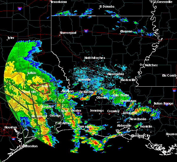 At 216 pm cdt, a severe thunderstorm capable of producing a tornado was located near rockland, moving northwest at 35 mph (radar indicated rotation). Hazards include tornado. Flying debris will be dangerous to those caught without shelter. mobile homes will be damaged or destroyed. damage to roofs, windows, and vehicles will occur. tree damage is likely. This dangerous storm will be near, rockland around 220 pm cdt. At 216 pm cdt, a severe thunderstorm capable of producing a tornado was located near rockland, moving northwest at 35 mph (radar indicated rotation). Hazards include tornado. Flying debris will be dangerous to those caught without shelter. mobile homes will be damaged or destroyed. damage to roofs, windows, and vehicles will occur. tree damage is likely. This dangerous storm will be near, rockland around 220 pm cdt.
|
| 8/26/2017 1:54 PM CDT |
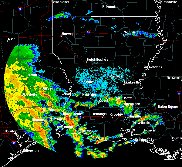 At 154 pm cdt, a severe thunderstorm capable of producing a tornado was located over town bluff, moving northwest at 35 mph (radar indicated rotation). Hazards include tornado. Flying debris will be dangerous to those caught without shelter. mobile homes will be damaged or destroyed. damage to roofs, windows, and vehicles will occur. tree damage is likely. this dangerous storm will be near, colmesneil around 215 pm cdt. Rockland around 220 pm cdt. At 154 pm cdt, a severe thunderstorm capable of producing a tornado was located over town bluff, moving northwest at 35 mph (radar indicated rotation). Hazards include tornado. Flying debris will be dangerous to those caught without shelter. mobile homes will be damaged or destroyed. damage to roofs, windows, and vehicles will occur. tree damage is likely. this dangerous storm will be near, colmesneil around 215 pm cdt. Rockland around 220 pm cdt.
|
| 5/23/2017 7:01 PM CDT |
 At 700 pm cdt, severe thunderstorms were located along a line extending from 7 miles northwest of woodville to near ebenezer, moving east at 25 mph (radar indicated). Hazards include 60 mph wind gusts and quarter size hail. Hail damage to vehicles is expected. Expect wind damage to roofs, siding, and trees. At 700 pm cdt, severe thunderstorms were located along a line extending from 7 miles northwest of woodville to near ebenezer, moving east at 25 mph (radar indicated). Hazards include 60 mph wind gusts and quarter size hail. Hail damage to vehicles is expected. Expect wind damage to roofs, siding, and trees.
|
| 5/3/2017 6:21 PM CDT |
 At 620 pm cdt, severe thunderstorms were located along a line extending from 6 miles southwest of hornbeck to near chester, moving southeast at 40 mph (radar indicated). Hazards include 60 mph wind gusts and quarter size hail. Hail damage to vehicles is expected. Expect wind damage to roofs, siding, and trees. At 620 pm cdt, severe thunderstorms were located along a line extending from 6 miles southwest of hornbeck to near chester, moving southeast at 40 mph (radar indicated). Hazards include 60 mph wind gusts and quarter size hail. Hail damage to vehicles is expected. Expect wind damage to roofs, siding, and trees.
|
| 5/3/2017 7:24 AM CDT |
 The severe thunderstorm warning for tyler and north central hardin counties will expire at 730 am cdt, the storms which prompted the warning have weakened below severe limits, and no longer pose an immediate threat to life or property. therefore the warning will be allowed to expire. however small hail and gusty winds are still possible with these thunderstorms. The severe thunderstorm warning for tyler and north central hardin counties will expire at 730 am cdt, the storms which prompted the warning have weakened below severe limits, and no longer pose an immediate threat to life or property. therefore the warning will be allowed to expire. however small hail and gusty winds are still possible with these thunderstorms.
|
| 5/3/2017 7:00 AM CDT |
 At 658 am cdt, severe thunderstorms were located along a line extending from 6 miles southwest of woodville to 7 miles east of warren, moving north at 40 mph (public reported golf ball size hail in warren). Hazards include golf ball size hail and 60 mph wind gusts. People and animals outdoors will be injured. expect hail damage to roofs, siding, windows, and vehicles. expect wind damage to roofs, siding, and trees. Locations impacted include, woodville, colmesneil, warren, town bluff, wildwood, spurger, village mills, ivanhoe and hillister. At 658 am cdt, severe thunderstorms were located along a line extending from 6 miles southwest of woodville to 7 miles east of warren, moving north at 40 mph (public reported golf ball size hail in warren). Hazards include golf ball size hail and 60 mph wind gusts. People and animals outdoors will be injured. expect hail damage to roofs, siding, windows, and vehicles. expect wind damage to roofs, siding, and trees. Locations impacted include, woodville, colmesneil, warren, town bluff, wildwood, spurger, village mills, ivanhoe and hillister.
|
| 5/3/2017 6:48 AM CDT |
 At 647 am cdt, severe thunderstorms were located along a line extending from near warren to near village mills, moving north at 40 mph (radar indicated). Hazards include 60 mph wind gusts and quarter size hail. Hail damage to vehicles is expected. expect wind damage to roofs, siding, and trees. locations impacted include, silsbee, woodville, kountze, colmesneil, saratoga, fred, wildwood, warren, town bluff, caney head, honey island, mt. Union, spurger, village mills, ivanhoe and hillister. At 647 am cdt, severe thunderstorms were located along a line extending from near warren to near village mills, moving north at 40 mph (radar indicated). Hazards include 60 mph wind gusts and quarter size hail. Hail damage to vehicles is expected. expect wind damage to roofs, siding, and trees. locations impacted include, silsbee, woodville, kountze, colmesneil, saratoga, fred, wildwood, warren, town bluff, caney head, honey island, mt. Union, spurger, village mills, ivanhoe and hillister.
|
| 5/3/2017 6:26 AM CDT |
 At 625 am cdt, severe thunderstorms were located along a line extending from near thicket to near kountze, moving north at 40 mph (radar indicated). Hazards include 60 mph wind gusts and quarter size hail. Hail damage to vehicles is expected. Expect wind damage to roofs, siding, and trees. At 625 am cdt, severe thunderstorms were located along a line extending from near thicket to near kountze, moving north at 40 mph (radar indicated). Hazards include 60 mph wind gusts and quarter size hail. Hail damage to vehicles is expected. Expect wind damage to roofs, siding, and trees.
|
| 4/26/2017 5:25 PM CDT |
 At 524 pm cdt, severe thunderstorms were located along a line extending from near ebenezer to near alabama-coushatta reservation, moving east at 40 mph (radar indicated). Hazards include 60 mph wind gusts and quarter size hail. Hail damage to vehicles is expected. Expect wind damage to roofs, siding, and trees. At 524 pm cdt, severe thunderstorms were located along a line extending from near ebenezer to near alabama-coushatta reservation, moving east at 40 mph (radar indicated). Hazards include 60 mph wind gusts and quarter size hail. Hail damage to vehicles is expected. Expect wind damage to roofs, siding, and trees.
|
| 3/29/2017 3:15 PM CDT | Sheriffs department reports large tree down across us 69 in tyler county TX, 2.6 miles N of Colmesneil, TX |
| 3/24/2017 10:41 PM CDT |
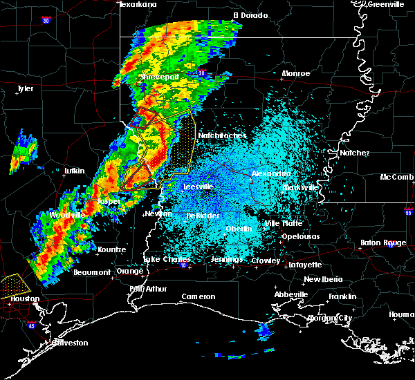 At 1041 pm cdt, a severe thunderstorm capable of producing a tornado was located over colmesneil, moving northeast at 25 mph (radar indicated rotation). Hazards include tornado. Flying debris will be dangerous to those caught without shelter. mobile homes will be damaged or destroyed. damage to roofs, windows, and vehicles will occur. tree damage is likely. This dangerous storm will be near, rockland around 1055 pm cdt. At 1041 pm cdt, a severe thunderstorm capable of producing a tornado was located over colmesneil, moving northeast at 25 mph (radar indicated rotation). Hazards include tornado. Flying debris will be dangerous to those caught without shelter. mobile homes will be damaged or destroyed. damage to roofs, windows, and vehicles will occur. tree damage is likely. This dangerous storm will be near, rockland around 1055 pm cdt.
|
| 1/2/2017 8:40 AM CST |
 At 839 am cst, a severe thunderstorm was located over colmesneil, moving east at 35 mph (radar indicated). Hazards include 60 mph wind gusts. expect damage to roofs, siding, and trees At 839 am cst, a severe thunderstorm was located over colmesneil, moving east at 35 mph (radar indicated). Hazards include 60 mph wind gusts. expect damage to roofs, siding, and trees
|
| 1/2/2017 7:25 AM CST |
 At 724 am cst, a severe thunderstorm was located near woodville, moving northeast at 40 mph (radar indicated). Hazards include 60 mph wind gusts and quarter size hail. Hail damage to vehicles is expected. Expect wind damage to roofs, siding, and trees. At 724 am cst, a severe thunderstorm was located near woodville, moving northeast at 40 mph (radar indicated). Hazards include 60 mph wind gusts and quarter size hail. Hail damage to vehicles is expected. Expect wind damage to roofs, siding, and trees.
|
| 5/27/2016 3:10 PM CDT |
 At 309 pm cdt, severe thunderstorms were located along a line extending from near harrisburg to warren, moving northeast at 25 mph (radar indicated). Hazards include 60 mph wind gusts and nickel size hail. Expect damage to roofs. siding. and trees. Locations impacted include, jasper, woodville, colmesneil, town bluff, ebenezer, burkeville, rockland, browndell, harrisburg, mayflower, farrsville, jamestown, ivanhoe, holly springs, wiergate, sam rayburn dam and hillister. At 309 pm cdt, severe thunderstorms were located along a line extending from near harrisburg to warren, moving northeast at 25 mph (radar indicated). Hazards include 60 mph wind gusts and nickel size hail. Expect damage to roofs. siding. and trees. Locations impacted include, jasper, woodville, colmesneil, town bluff, ebenezer, burkeville, rockland, browndell, harrisburg, mayflower, farrsville, jamestown, ivanhoe, holly springs, wiergate, sam rayburn dam and hillister.
|
| 5/27/2016 2:30 PM CDT |
 At 229 pm cdt, severe thunderstorms were located along a line extending from near harrisburg to 9 miles north of votaw, moving northeast at 30 mph (radar indicated). Hazards include 60 mph wind gusts and nickel size hail. Expect damage to roofs. siding. And trees. At 229 pm cdt, severe thunderstorms were located along a line extending from near harrisburg to 9 miles north of votaw, moving northeast at 30 mph (radar indicated). Hazards include 60 mph wind gusts and nickel size hail. Expect damage to roofs. siding. And trees.
|
| 4/27/2016 5:49 AM CDT |
 At 547 am cdt, severe thunderstorms were located along a line extending from 9 miles north of chester to near warren to near saratoga to daisetta to near la porte, moving east at 50 mph (radar indicated). Hazards include 60 mph wind gusts and penny size hail. Expect damage to roofs. siding. and trees. Locations impacted include, beaumont, lumberton, silsbee, woodville, kountze, sour lake, colmesneil, nome, chester, thicket, fred, saratoga, ebenezer, rockland, town bluff, warren, wildwood, bevil oaks, china and lakeview. At 547 am cdt, severe thunderstorms were located along a line extending from 9 miles north of chester to near warren to near saratoga to daisetta to near la porte, moving east at 50 mph (radar indicated). Hazards include 60 mph wind gusts and penny size hail. Expect damage to roofs. siding. and trees. Locations impacted include, beaumont, lumberton, silsbee, woodville, kountze, sour lake, colmesneil, nome, chester, thicket, fred, saratoga, ebenezer, rockland, town bluff, warren, wildwood, bevil oaks, china and lakeview.
|
| 4/27/2016 5:17 AM CDT |
 At 516 am cdt, severe thunderstorms were located along a line extending from 8 miles east of groveton to near goodrich to 8 miles east of cleveland to near plum grove to brays oaks, moving east at 50 mph (radar indicated). Hazards include 60 mph wind gusts and penny size hail. Expect damage to roofs. siding. And trees. At 516 am cdt, severe thunderstorms were located along a line extending from 8 miles east of groveton to near goodrich to 8 miles east of cleveland to near plum grove to brays oaks, moving east at 50 mph (radar indicated). Hazards include 60 mph wind gusts and penny size hail. Expect damage to roofs. siding. And trees.
|
| 1/21/2016 12:14 PM CST | At 1214 pm cst, a severe thunderstorm capable of producing a tornado was located near chester, moving northeast at 40 mph (radar indicated rotation). Hazards include tornado and quarter size hail. Flying debris will be dangerous to those caught without shelter. mobile homes will be damaged or destroyed. damage to roofs, windows and vehicles will occur. tree damage is likely. this dangerous storm will be near, colmesneil around 1220 pm cst. rockland around 1230 pm cst. Ebenezer around 1245 pm cst. |
| 1/21/2016 12:04 PM CST | At 1204 pm cst, a severe thunderstorm capable of producing a tornado was located over chester, moving northeast at 35 mph (radar indicated rotation). Hazards include tornado and quarter size hail. Flying debris will be dangerous to those caught without shelter. mobile homes will be damaged or destroyed. damage to roofs, windows and vehicles will occur. tree damage is likely. this dangerous storm will be near, colmesneil around 1225 pm cst. Rockland around 1235 pm cst. |
| 7/4/2015 5:21 PM CDT |
 At 520 pm cdt, doppler radar indicated a severe thunderstorm capable of producing quarter size hail and damaging winds in excess of 60 mph. this storm was located over chester, and moving east at 20 mph. At 520 pm cdt, doppler radar indicated a severe thunderstorm capable of producing quarter size hail and damaging winds in excess of 60 mph. this storm was located over chester, and moving east at 20 mph.
|
| 5/27/2015 4:10 AM CDT | At 410 am cdt, trained weather spotters reported a line of severe thunderstorms producing quarter size hail and damaging winds in excess of 60 mph. these storms were located along a line extending from near ebenezer to near woodville to 10 miles northwest of warren, and moving southeast at 25 mph. |
| 5/25/2015 9:02 PM CDT | At 901 pm cdt, doppler radar indicated a line of severe thunderstorms capable of producing quarter size hail and damaging winds in excess of 60 mph. these storms were located along a line extending from 6 miles west of pineland to near warren, moving east at 65 mph. locations impacted include, woodville, colmesneil, chester, warren, fred, rockland, town bluff, spurger, ivanhoe and hillister. a tornado watch remains in effect until 200 am cdt for southeastern texas. |
| 5/25/2015 8:26 PM CDT | At 826 pm cdt, doppler radar indicated a line of severe thunderstorms capable of producing damaging winds in excess of 60 mph. these storms were located along a line extending from 9 miles southeast of diboll to near shepherd, and moving east at 65 mph. penny size hail may also accompany the damaging winds. |
| 5/11/2015 6:51 AM CDT | At 651 am cdt, doppler radar indicated a severe thunderstorm capable of producing quarter size hail and damaging winds in excess of 60 mph. this storm was located near seven oaks, or 11 miles southwest of chester, and moving east at 30 mph. |
| 4/27/2015 5:27 AM CDT | At 526 am cdt, doppler radar indicated a line of severe thunderstorms capable of producing quarter size hail and damaging winds in excess of 60 mph. these storms were located along a line extending from near chester to 7 miles southeast of alabama-coushatta reservation to near batson, moving east at 45 mph. locations impacted include, jasper, silsbee, woodville, kountze, colmesneil, chester, thicket, fred, saratoga, ebenezer, rockland, town bluff, warren, wildwood, browndell, votaw, village mills, caney head, spurger and mt. union. a tornado watch remains in effect until 900 am cdt for southeastern texas. |
| 4/27/2015 4:59 AM CDT | At 458 am cdt, doppler radar indicated a line of severe thunderstorms capable of producing quarter size hail and damaging winds in excess of 60 mph. these storms were located along a line extending from lufkin to near seven oaks to near kingwood, and moving east at 35 mph. |
| 4/16/2015 6:08 PM CDT | The severe thunderstorm warning for northwestern tyler and northwestern jasper counties will expire at 615 pm cdt, the storm which prompted the warning has moved out of the area. therefore the warning will be allowed to expire. |
| 4/16/2015 5:46 PM CDT | At 545 pm cdt, doppler radar indicated a severe thunderstorm capable of producing quarter size hail. this storm was located 7 miles west of rockland, and moving northeast at 30 mph. * this severe thunderstorm will be near, rockland around 555 pm cdt. |
| 4/16/2015 5:25 PM CDT | At 525 pm cdt, doppler radar indicated a severe thunderstorm capable of producing quarter size hail and damaging winds in excess of 60 mph. this storm was located near chester, moving northeast at 30 mph. locations impacted include, woodville, colmesneil, chester and rockland. |
| 4/16/2015 5:03 PM CDT | At 502 pm cdt, doppler radar indicated a severe thunderstorm capable of producing quarter size hail. this storm was located near alabama-coushatta reservation, or 14 miles west of woodville, and moving north at 20 mph. |
| 6/6/2013 5:16 PM CDT | Sheriffs dept reports numerous trees down from colmesneil to woodvill in tyler county TX, 0.3 miles SW of Colmesneil, TX |
| 6/12/2012 12:38 PM CDT | Sheriff dept reports trees down near kirkland spring off route 28 in tyler county TX, 5.2 miles NE of Colmesneil, TX |
Hail Maps for Colmesneil, TX


Connect with Interactive Hail Maps