

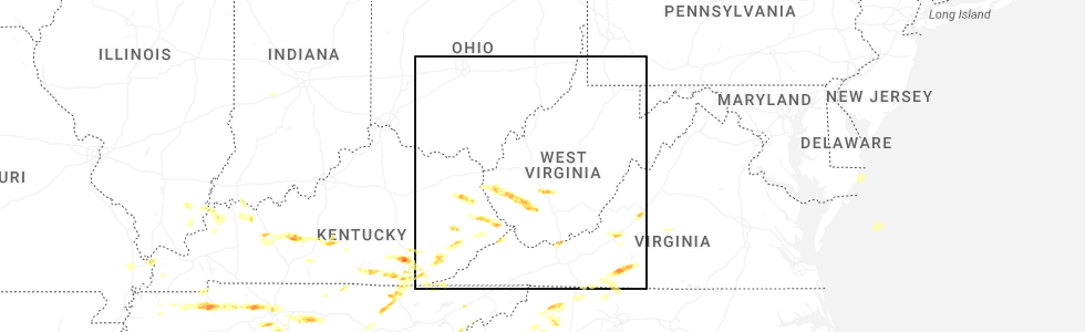
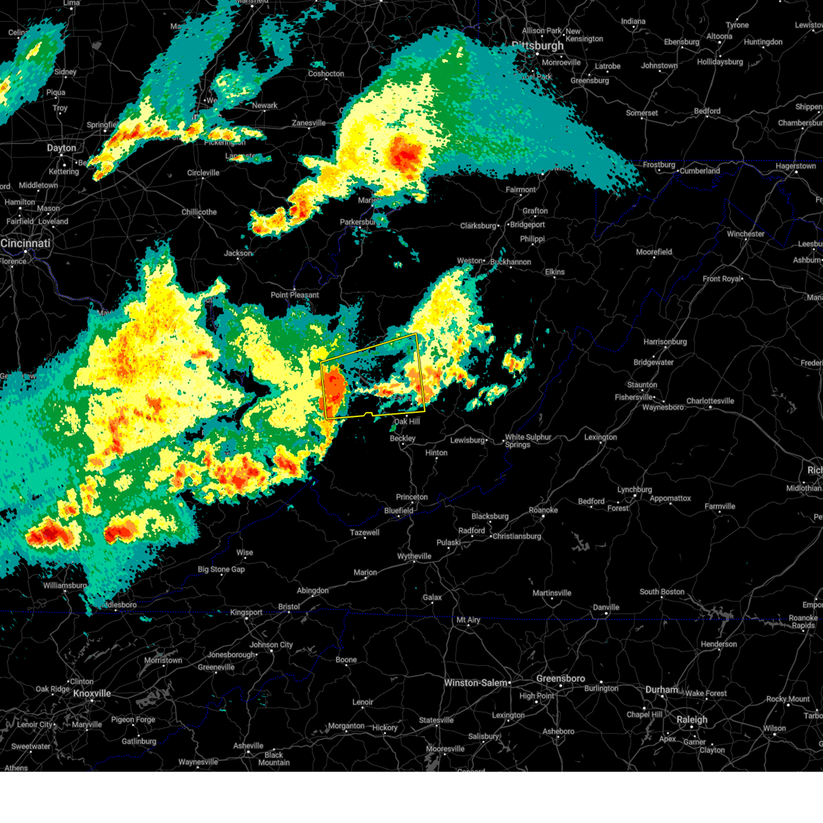
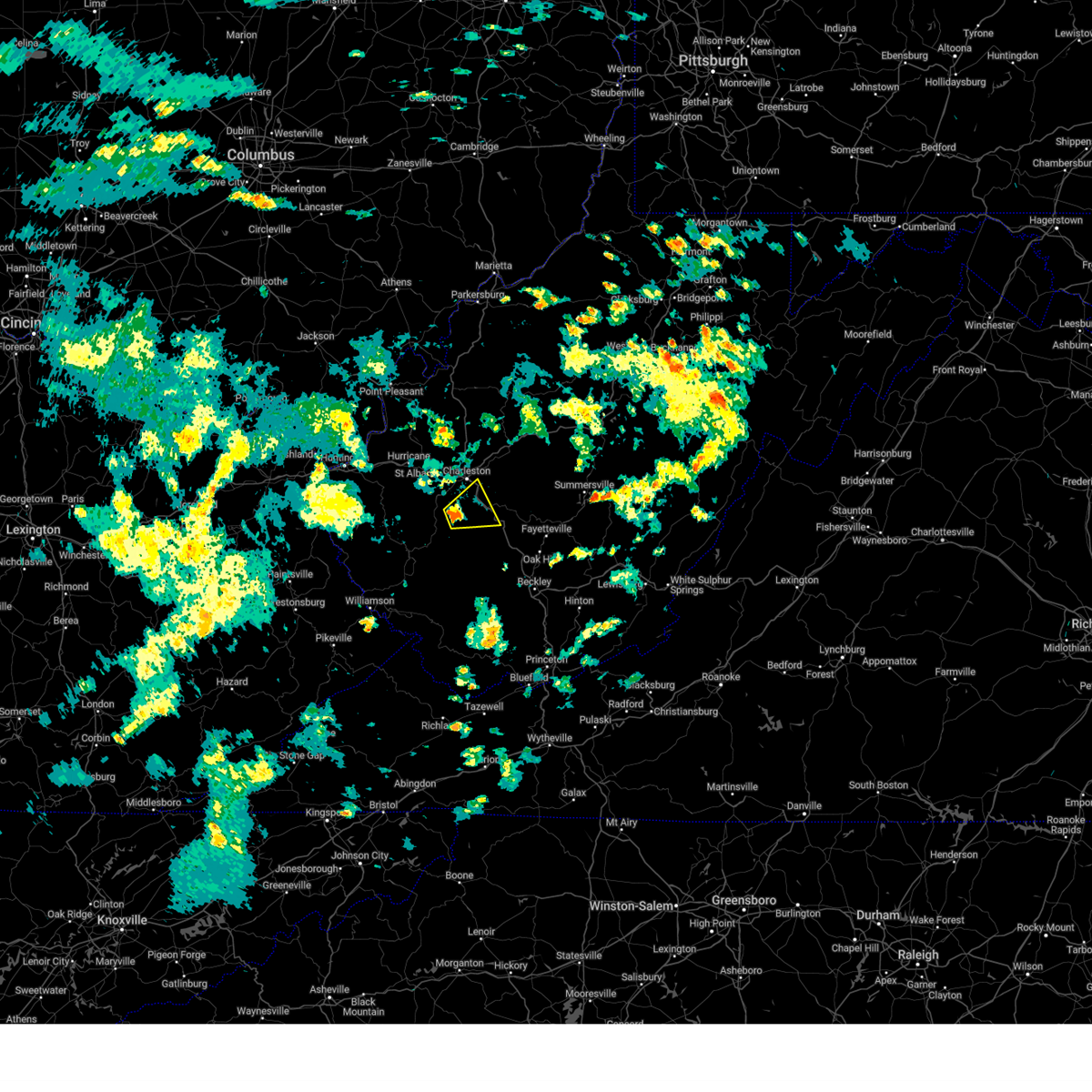
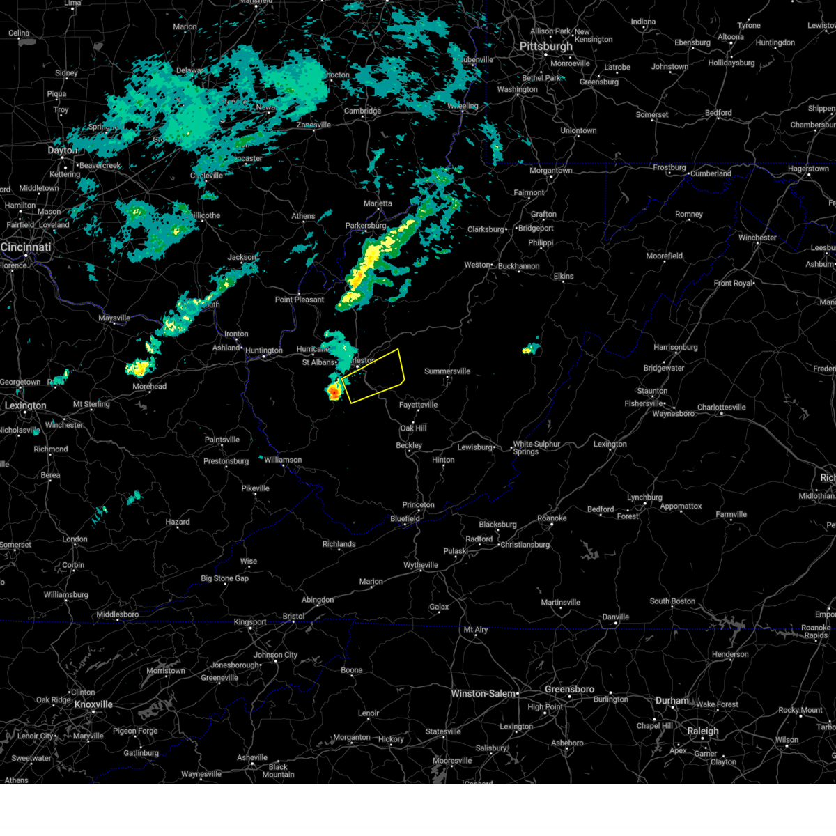
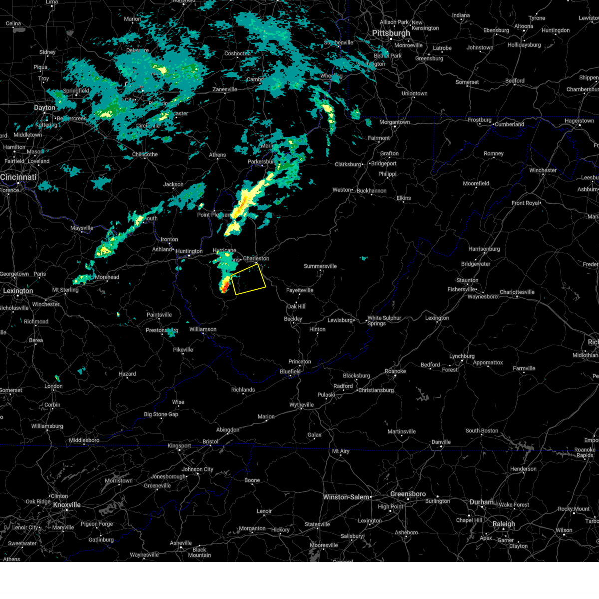
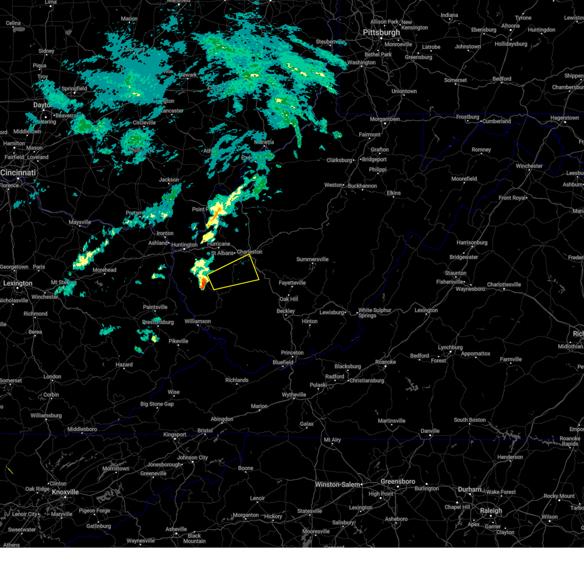
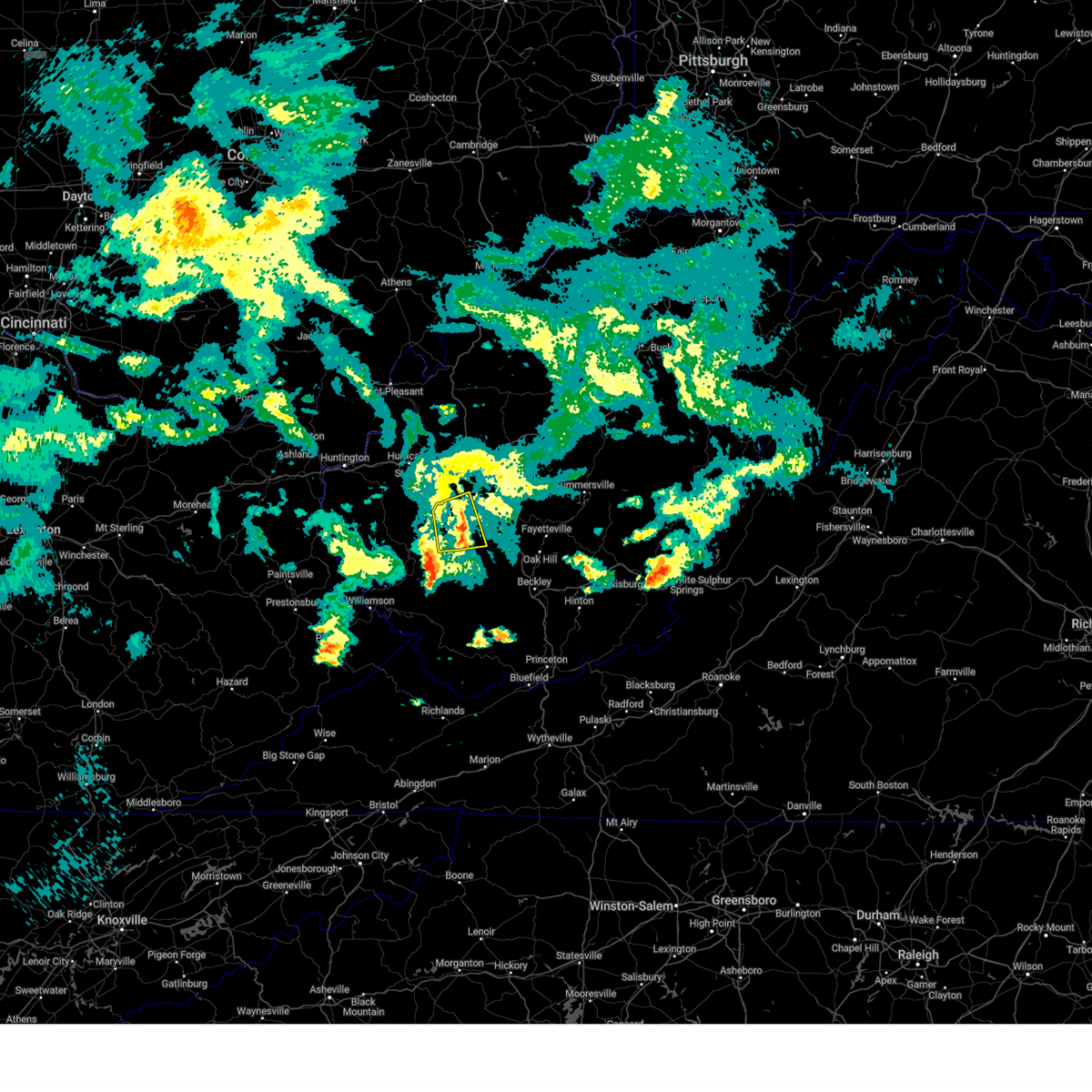
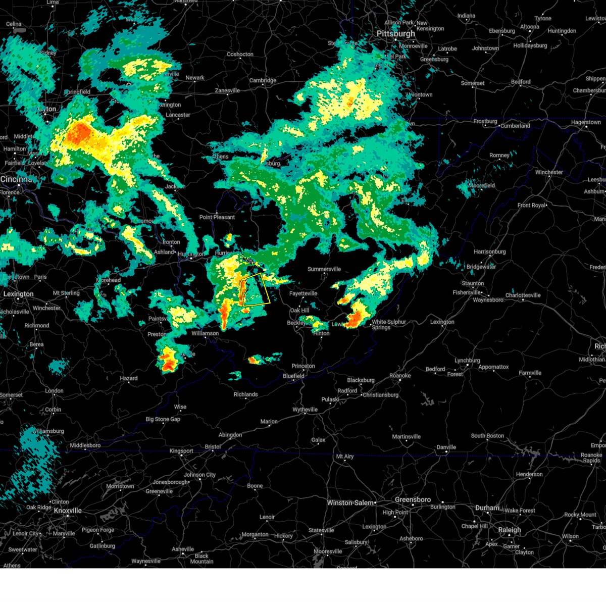
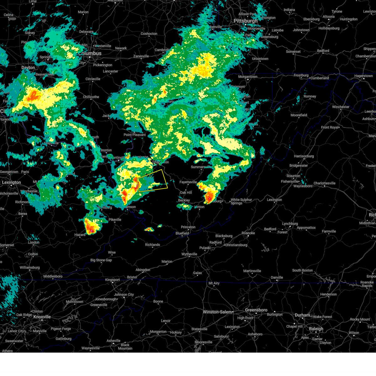
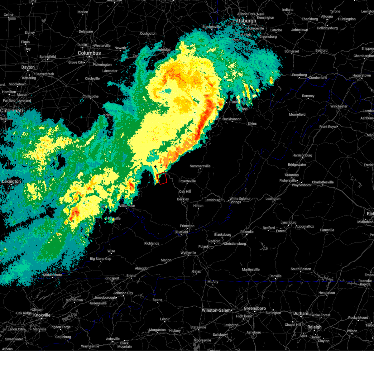
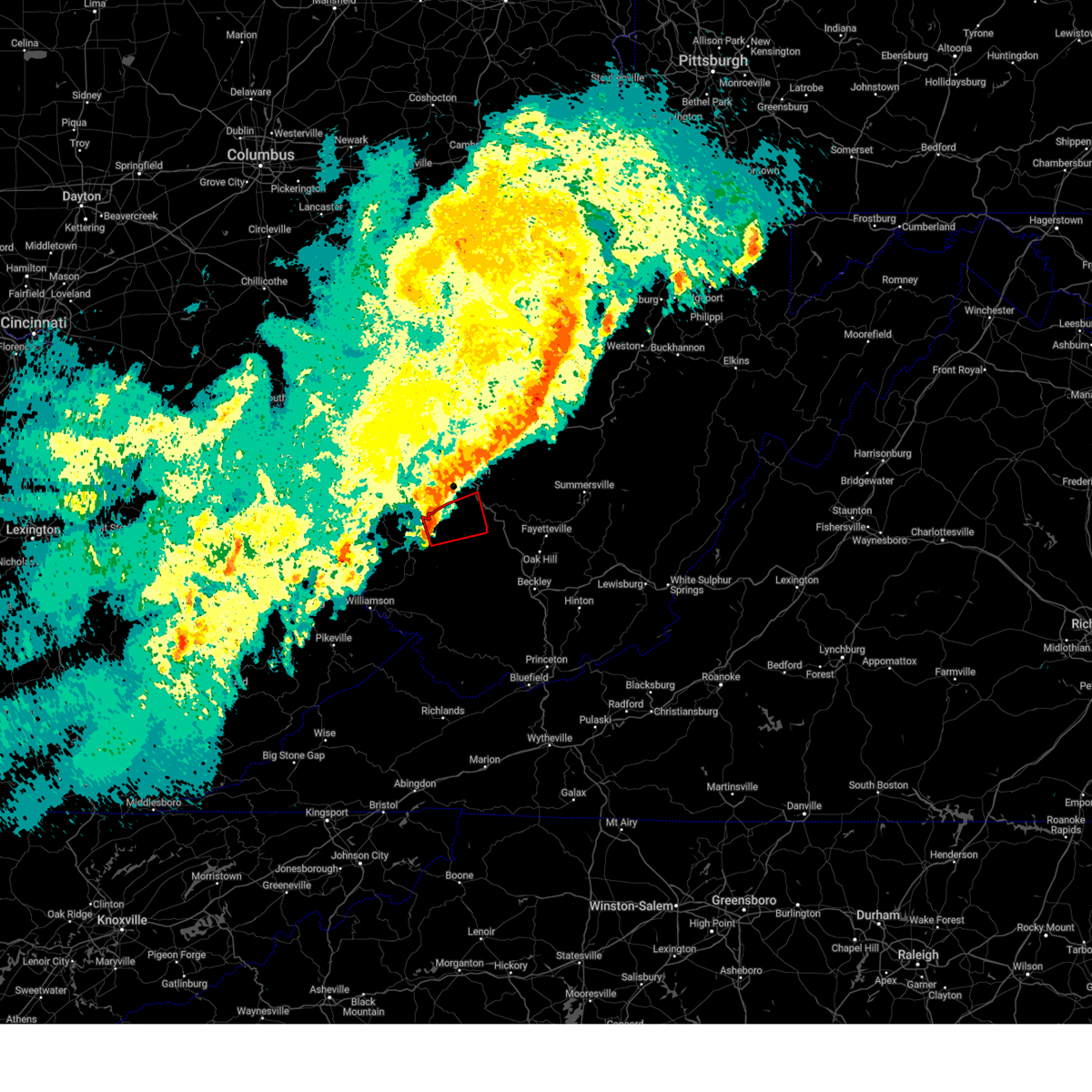
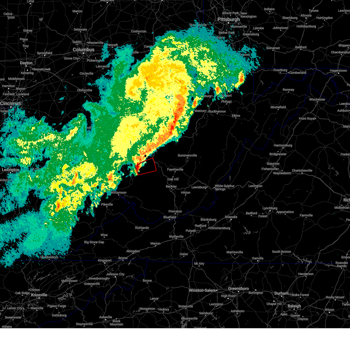
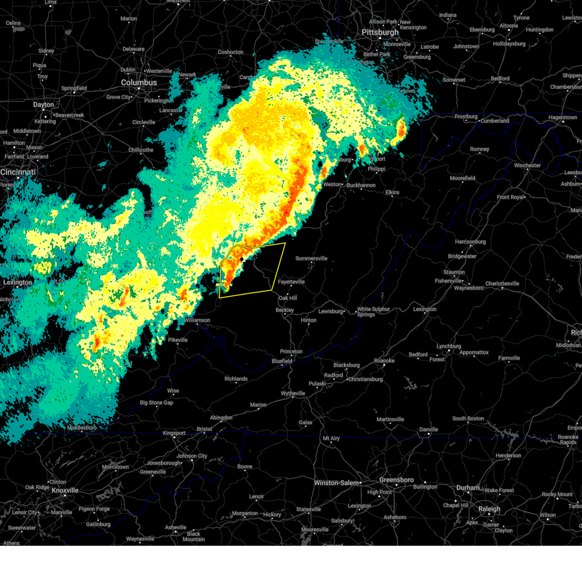
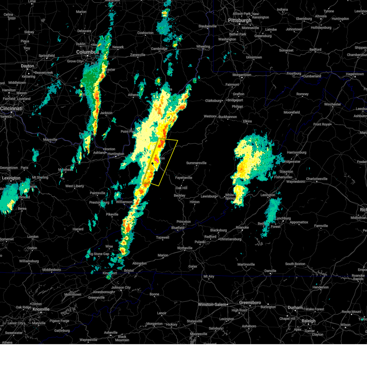
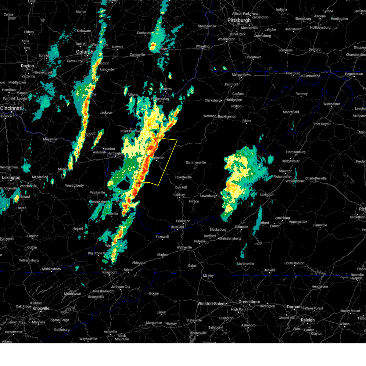
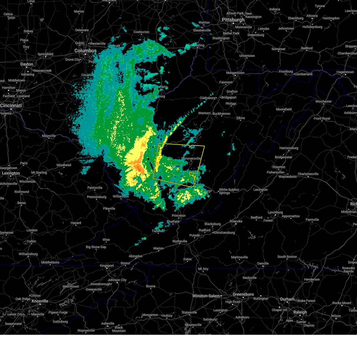
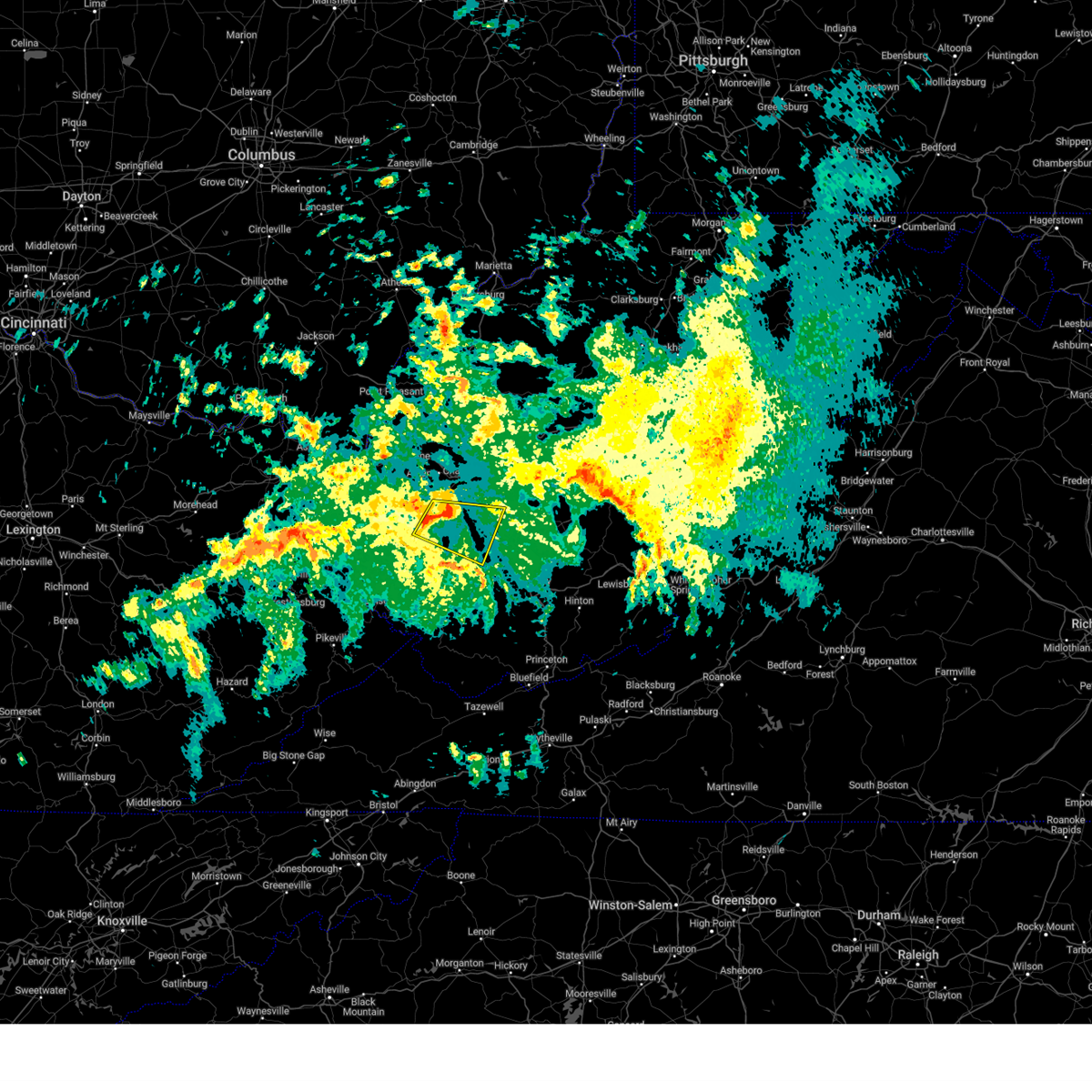
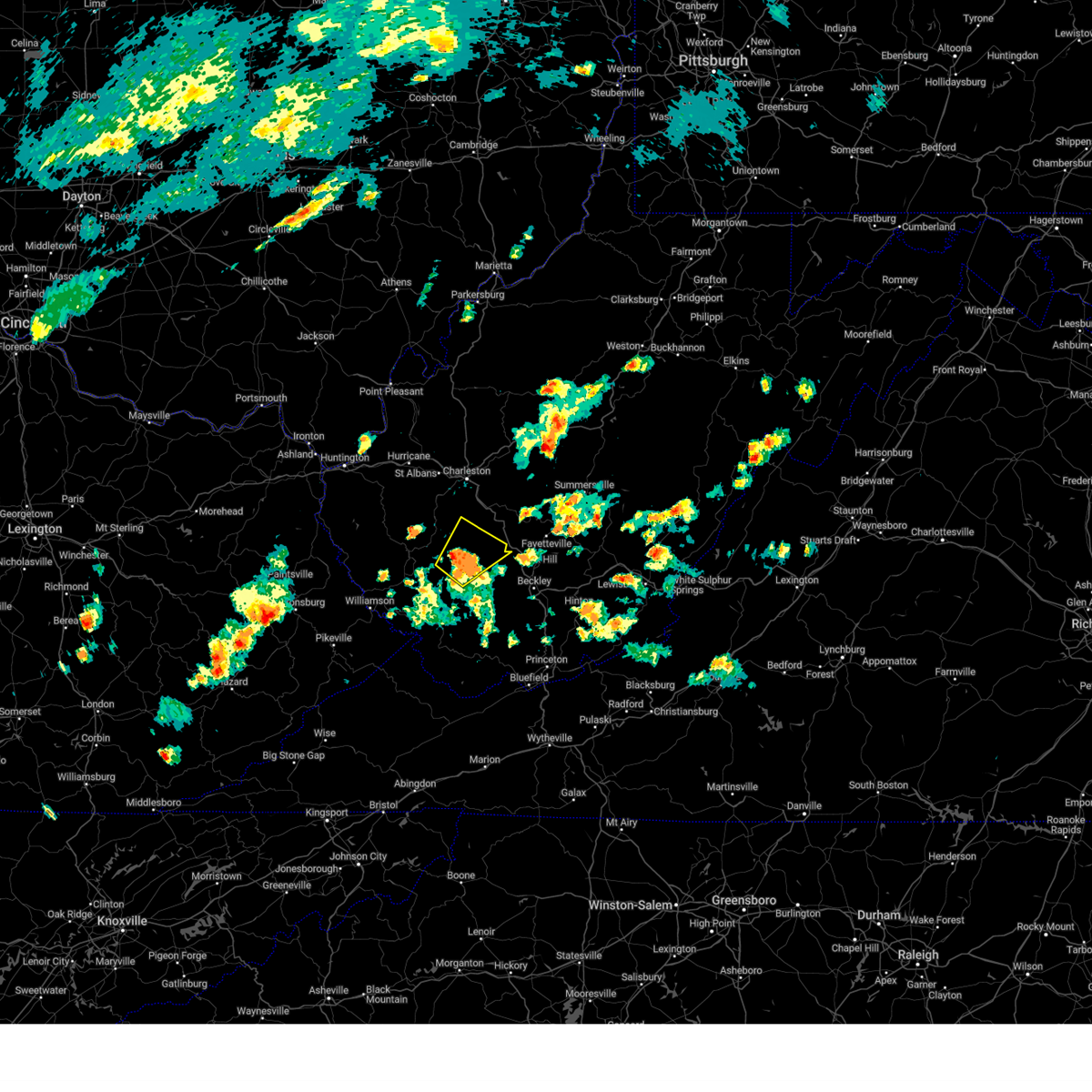
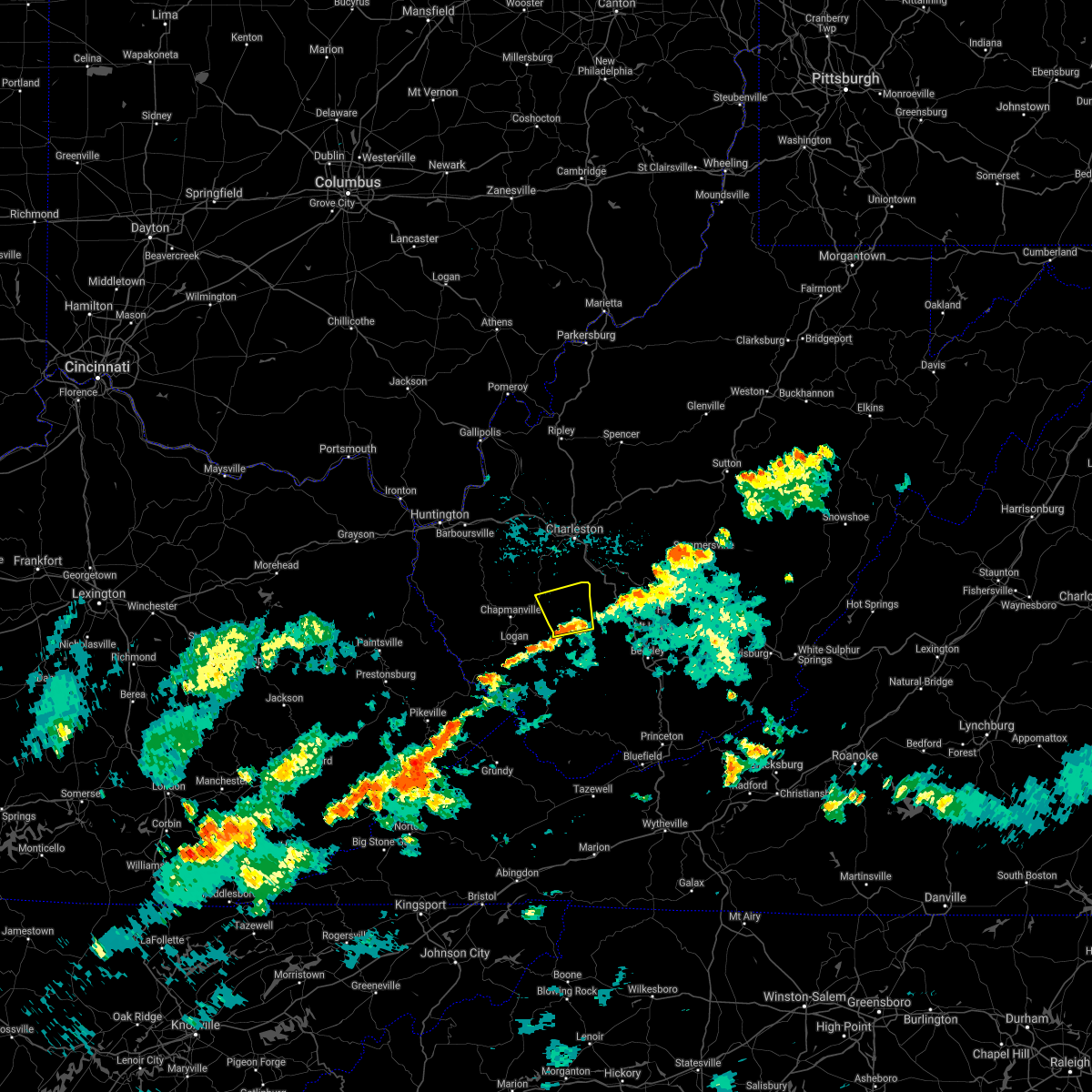
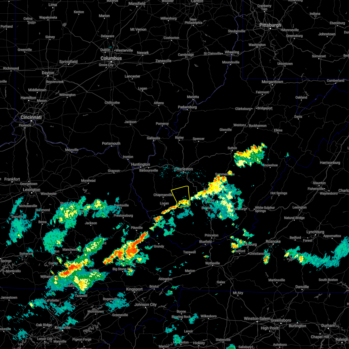
Hail Map for Comfort, WV
The Comfort, WV area has had 1 report of on-the-ground hail by trained spotters, and has been under severe weather warnings 45 times during the past 12 months. Doppler radar has detected hail at or near Comfort, WV on 26 occasions, including 3 occasions during the past year.
| Name: | Comfort, WV |
| Where Located: | 15.2 miles S of Charleston, WV |
| Map: | Google Map for Comfort, WV |
| Population: | 306 |
| Housing Units: | 136 |
| More Info: | Search Google for Comfort, WV |
0
The Top Recent Hail Date for Comfort, WV is Thursday, May 8, 2025 (23rd out of 26)
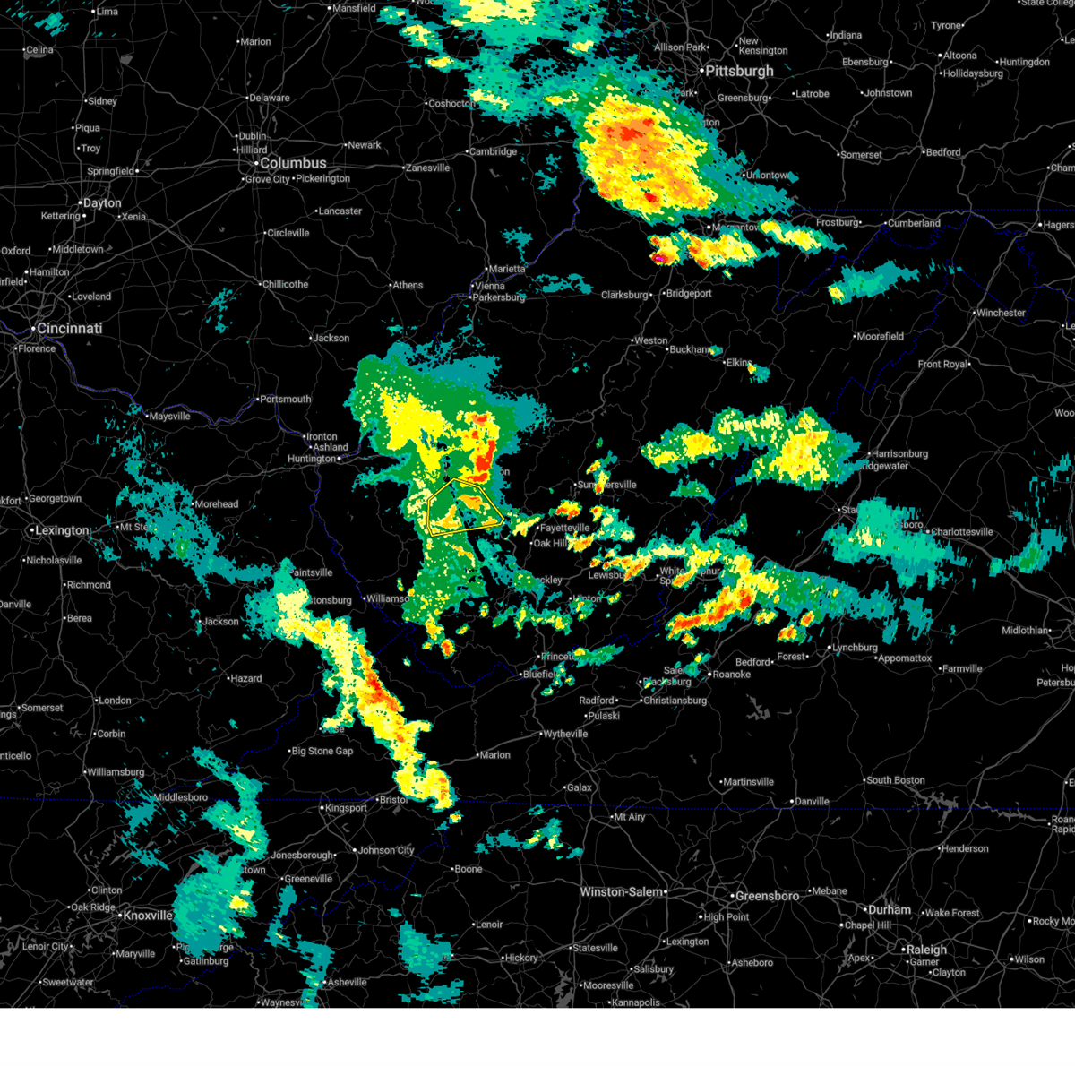
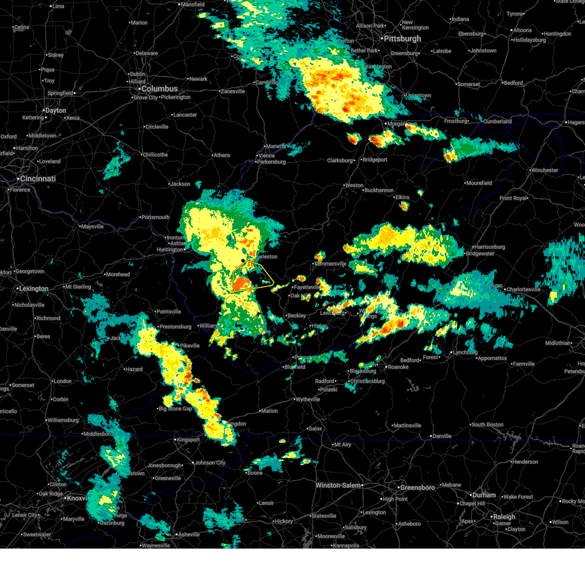
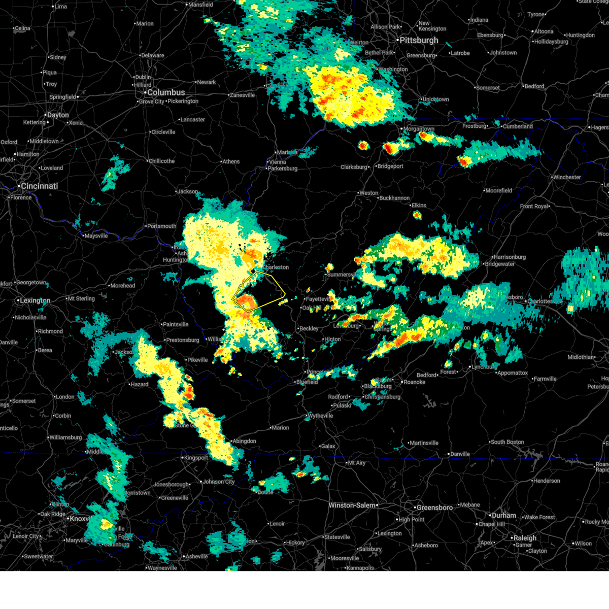
Hail and Wind Damage Spotted near Comfort, WV
| Date / Time | Report Details |
|---|---|
| 6/13/2025 9:58 PM EDT |
 the severe thunderstorm warning has been cancelled and is no longer in effect the severe thunderstorm warning has been cancelled and is no longer in effect
|
| 6/13/2025 9:40 PM EDT |
 At 939 pm edt, a severe thunderstorm was located near madison, moving northeast at 25 mph (radar indicated). Hazards include 60 mph wind gusts. Expect damage to roofs, siding, and trees. Locations impacted include, madison, chesapeake, marmet, belle, cedar grove, east bank, danville, seth, leewood, dawes, ashford, sharon, eskdale, foster, and racine. At 939 pm edt, a severe thunderstorm was located near madison, moving northeast at 25 mph (radar indicated). Hazards include 60 mph wind gusts. Expect damage to roofs, siding, and trees. Locations impacted include, madison, chesapeake, marmet, belle, cedar grove, east bank, danville, seth, leewood, dawes, ashford, sharon, eskdale, foster, and racine.
|
| 6/13/2025 9:27 PM EDT |
 Svrrlx the national weather service in charleston west virginia has issued a * severe thunderstorm warning for, southern kanawha county in central west virginia, boone county in central west virginia, * until 1015 pm edt. * at 926 pm edt, a severe thunderstorm was located near madison, moving northeast at 25 mph (radar indicated). Hazards include 60 mph wind gusts. expect damage to roofs, siding, and trees Svrrlx the national weather service in charleston west virginia has issued a * severe thunderstorm warning for, southern kanawha county in central west virginia, boone county in central west virginia, * until 1015 pm edt. * at 926 pm edt, a severe thunderstorm was located near madison, moving northeast at 25 mph (radar indicated). Hazards include 60 mph wind gusts. expect damage to roofs, siding, and trees
|
| 5/17/2025 12:13 AM EDT |
 Svrrlx the national weather service in charleston west virginia has issued a * severe thunderstorm warning for, west central nicholas county in southeastern west virginia, kanawha county in central west virginia, northeastern lincoln county in central west virginia, southwestern clay county in north central west virginia, northwestern fayette county in southeastern west virginia, boone county in central west virginia, * until 1245 am edt. * at 1212 am edt, severe thunderstorms were located along a line extending from near alum creek to near madison, moving east at 65 mph (radar indicated). Hazards include 60 mph wind gusts and penny size hail. expect damage to roofs, siding, and trees Svrrlx the national weather service in charleston west virginia has issued a * severe thunderstorm warning for, west central nicholas county in southeastern west virginia, kanawha county in central west virginia, northeastern lincoln county in central west virginia, southwestern clay county in north central west virginia, northwestern fayette county in southeastern west virginia, boone county in central west virginia, * until 1245 am edt. * at 1212 am edt, severe thunderstorms were located along a line extending from near alum creek to near madison, moving east at 65 mph (radar indicated). Hazards include 60 mph wind gusts and penny size hail. expect damage to roofs, siding, and trees
|
| 5/17/2025 12:05 AM EDT |
 At 1205 am edt, severe thunderstorms were located along a line extending from near alum creek to near chapmanville, moving east at 55 mph (radar indicated). Hazards include 70 mph wind gusts and penny size hail. Expect considerable tree damage. damage is likely to mobile homes, roofs, and outbuildings. locations impacted include, charleston, madison, jefferson, south charleston, st. Albans, dunbar, chapmanville, van, spurlockville, institute, tornado, chief logan state, alum creek, julian, danville, mitchell heights, seth, turtle creek, prenter, and ashford. At 1205 am edt, severe thunderstorms were located along a line extending from near alum creek to near chapmanville, moving east at 55 mph (radar indicated). Hazards include 70 mph wind gusts and penny size hail. Expect considerable tree damage. damage is likely to mobile homes, roofs, and outbuildings. locations impacted include, charleston, madison, jefferson, south charleston, st. Albans, dunbar, chapmanville, van, spurlockville, institute, tornado, chief logan state, alum creek, julian, danville, mitchell heights, seth, turtle creek, prenter, and ashford.
|
| 5/17/2025 12:05 AM EDT |
 the severe thunderstorm warning has been cancelled and is no longer in effect the severe thunderstorm warning has been cancelled and is no longer in effect
|
| 5/16/2025 11:56 PM EDT |
 the severe thunderstorm warning has been cancelled and is no longer in effect the severe thunderstorm warning has been cancelled and is no longer in effect
|
| 5/16/2025 11:56 PM EDT |
 At 1155 pm edt, severe thunderstorms were located along a line extending from near ranger to near mount gay-shamrock, moving east at 55 mph (radar indicated). Hazards include 70 mph wind gusts and penny size hail. Expect considerable tree damage. damage is likely to mobile homes, roofs, and outbuildings. locations impacted include, charleston, madison, logan, hamlin, jefferson, south charleston, st. Albans, dunbar, chapmanville, van, ranger, mount gay-shamrock, harts, gill, julian, spurlockville, institute, tornado, bald knob, and chief logan state. At 1155 pm edt, severe thunderstorms were located along a line extending from near ranger to near mount gay-shamrock, moving east at 55 mph (radar indicated). Hazards include 70 mph wind gusts and penny size hail. Expect considerable tree damage. damage is likely to mobile homes, roofs, and outbuildings. locations impacted include, charleston, madison, logan, hamlin, jefferson, south charleston, st. Albans, dunbar, chapmanville, van, ranger, mount gay-shamrock, harts, gill, julian, spurlockville, institute, tornado, bald knob, and chief logan state.
|
| 5/16/2025 11:45 PM EDT | Svrrlx the national weather service in charleston west virginia has issued a * severe thunderstorm warning for, northwestern mingo county in southern west virginia, southwestern putnam county in western west virginia, west central kanawha county in central west virginia, lincoln county in central west virginia, northwestern logan county in southern west virginia, southeastern wayne county in western west virginia, boone county in central west virginia, * until 1215 am edt. * at 1144 pm edt, severe thunderstorms were located along a line extending from near kiahsville to 7 miles northeast of oppy, moving east at 55 mph (radar indicated). Hazards include 60 mph wind gusts and penny size hail. expect damage to roofs, siding, and trees |
| 1/1/0001 12:00 AM | Tree blocking one lane on coal river roa in boone county WV, 2.2 miles N of Comfort, WV |
| 4/25/2025 2:52 PM EDT |
 The storm which prompted the warning has weakened below severe limits and is moving out of the warned area, and no longer poses an immediate threat to life or property. therefore, the warning will be allowed to expire. however, gusty winds and heavy rain are still possible with this thunderstorm. The storm which prompted the warning has weakened below severe limits and is moving out of the warned area, and no longer poses an immediate threat to life or property. therefore, the warning will be allowed to expire. however, gusty winds and heavy rain are still possible with this thunderstorm.
|
| 4/25/2025 2:42 PM EDT |
 At 242 pm edt, a severe thunderstorm was located 7 miles southwest of marmet, or 10 miles northeast of madison, moving east at 25 mph (radar indicated). Hazards include 60 mph wind gusts and quarter size hail. Hail damage to vehicles is expected. expect wind damage to roofs, siding, and trees. Locations impacted include, chesapeake, seth, belle, dawes, ashford, sharon, racine, marmet, coal fork, and charleston. At 242 pm edt, a severe thunderstorm was located 7 miles southwest of marmet, or 10 miles northeast of madison, moving east at 25 mph (radar indicated). Hazards include 60 mph wind gusts and quarter size hail. Hail damage to vehicles is expected. expect wind damage to roofs, siding, and trees. Locations impacted include, chesapeake, seth, belle, dawes, ashford, sharon, racine, marmet, coal fork, and charleston.
|
| 4/25/2025 2:28 PM EDT |
 Svrrlx the national weather service in charleston west virginia has issued a * severe thunderstorm warning for, southwestern kanawha county in central west virginia, northeastern boone county in central west virginia, * until 300 pm edt. * at 227 pm edt, a severe thunderstorm was located near julian, or near madison, moving east at 25 mph (radar indicated). Hazards include 60 mph wind gusts and quarter size hail. Hail damage to vehicles is expected. Expect wind damage to roofs, siding, and trees. Svrrlx the national weather service in charleston west virginia has issued a * severe thunderstorm warning for, southwestern kanawha county in central west virginia, northeastern boone county in central west virginia, * until 300 pm edt. * at 227 pm edt, a severe thunderstorm was located near julian, or near madison, moving east at 25 mph (radar indicated). Hazards include 60 mph wind gusts and quarter size hail. Hail damage to vehicles is expected. Expect wind damage to roofs, siding, and trees.
|
| 4/25/2025 2:18 PM EDT |
 At 217 pm edt, a severe thunderstorm was located over julian, or near madison, moving northeast at 25 mph (radar indicated). Hazards include 60 mph wind gusts and quarter size hail. Hail damage to vehicles is expected. expect wind damage to roofs, siding, and trees. Locations impacted include, danville, seth, madison, foster, woodville, ashford, alkol, racine, julian, south charleston, alum creek, and charleston. At 217 pm edt, a severe thunderstorm was located over julian, or near madison, moving northeast at 25 mph (radar indicated). Hazards include 60 mph wind gusts and quarter size hail. Hail damage to vehicles is expected. expect wind damage to roofs, siding, and trees. Locations impacted include, danville, seth, madison, foster, woodville, ashford, alkol, racine, julian, south charleston, alum creek, and charleston.
|
| 4/25/2025 2:04 PM EDT |
 Svrrlx the national weather service in charleston west virginia has issued a * severe thunderstorm warning for, west central kanawha county in central west virginia, southeastern lincoln county in central west virginia, northern boone county in central west virginia, * until 230 pm edt. * at 203 pm edt, a severe thunderstorm was located near julian, or near madison, moving northeast at 25 mph (radar indicated). Hazards include 60 mph wind gusts and quarter size hail. Hail damage to vehicles is expected. Expect wind damage to roofs, siding, and trees. Svrrlx the national weather service in charleston west virginia has issued a * severe thunderstorm warning for, west central kanawha county in central west virginia, southeastern lincoln county in central west virginia, northern boone county in central west virginia, * until 230 pm edt. * at 203 pm edt, a severe thunderstorm was located near julian, or near madison, moving northeast at 25 mph (radar indicated). Hazards include 60 mph wind gusts and quarter size hail. Hail damage to vehicles is expected. Expect wind damage to roofs, siding, and trees.
|
| 4/5/2025 4:59 PM EDT |
 Svrrlx the national weather service in charleston west virginia has issued a * severe thunderstorm warning for, central kanawha county in central west virginia, north central boone county in central west virginia, * until 530 pm edt. * at 458 pm edt, a severe thunderstorm was located near marmet, or 8 miles south of charleston, moving east at 40 mph (radar indicated). Hazards include 60 mph wind gusts and quarter size hail. Hail damage to vehicles is expected. Expect wind damage to roofs, siding, and trees. Svrrlx the national weather service in charleston west virginia has issued a * severe thunderstorm warning for, central kanawha county in central west virginia, north central boone county in central west virginia, * until 530 pm edt. * at 458 pm edt, a severe thunderstorm was located near marmet, or 8 miles south of charleston, moving east at 40 mph (radar indicated). Hazards include 60 mph wind gusts and quarter size hail. Hail damage to vehicles is expected. Expect wind damage to roofs, siding, and trees.
|
| 4/5/2025 4:44 PM EDT |
 At 443 pm edt, a severe thunderstorm was located over julian, or 7 miles north of madison, moving east at 35 mph (radar indicated). Hazards include 60 mph wind gusts and half dollar size hail. Hail damage to vehicles is expected. expect wind damage to roofs, siding, and trees. Locations impacted include, seth, sod, woodville, ashford, danville, foster, racine, julian, marmet, madison, charleston, alum creek, and south charleston. At 443 pm edt, a severe thunderstorm was located over julian, or 7 miles north of madison, moving east at 35 mph (radar indicated). Hazards include 60 mph wind gusts and half dollar size hail. Hail damage to vehicles is expected. expect wind damage to roofs, siding, and trees. Locations impacted include, seth, sod, woodville, ashford, danville, foster, racine, julian, marmet, madison, charleston, alum creek, and south charleston.
|
| 4/5/2025 4:26 PM EDT |
 Svrrlx the national weather service in charleston west virginia has issued a * severe thunderstorm warning for, west central kanawha county in central west virginia, central lincoln county in central west virginia, northern boone county in central west virginia, * until 500 pm edt. * at 425 pm edt, a severe thunderstorm was located over spurlockville, or 11 miles southeast of hamlin, moving east at 40 mph (radar indicated). Hazards include 60 mph wind gusts and half dollar size hail. Hail damage to vehicles is expected. Expect wind damage to roofs, siding, and trees. Svrrlx the national weather service in charleston west virginia has issued a * severe thunderstorm warning for, west central kanawha county in central west virginia, central lincoln county in central west virginia, northern boone county in central west virginia, * until 500 pm edt. * at 425 pm edt, a severe thunderstorm was located over spurlockville, or 11 miles southeast of hamlin, moving east at 40 mph (radar indicated). Hazards include 60 mph wind gusts and half dollar size hail. Hail damage to vehicles is expected. Expect wind damage to roofs, siding, and trees.
|
| 4/3/2025 6:31 PM EDT |
 The storm which prompted the warning has weakened below severe limits, and no longer poses an immediate threat to life or property. therefore, the warning has been allowed to expire. remember, a severe thunderstorm warning still remains in effect for portions of boone county until 645 pm edt. The storm which prompted the warning has weakened below severe limits, and no longer poses an immediate threat to life or property. therefore, the warning has been allowed to expire. remember, a severe thunderstorm warning still remains in effect for portions of boone county until 645 pm edt.
|
| 4/3/2025 6:18 PM EDT |
 At 618 pm edt, a severe thunderstorm was located 8 miles northeast of madison, moving east at 65 mph (radar indicated). Hazards include quarter size hail. Damage to vehicles is expected. Locations impacted include, danville, seth, madison, foster, sylvester, prenter, ashford, racine, julian, jeffrey, and whitesville. At 618 pm edt, a severe thunderstorm was located 8 miles northeast of madison, moving east at 65 mph (radar indicated). Hazards include quarter size hail. Damage to vehicles is expected. Locations impacted include, danville, seth, madison, foster, sylvester, prenter, ashford, racine, julian, jeffrey, and whitesville.
|
| 4/3/2025 6:18 PM EDT |
 the severe thunderstorm warning has been cancelled and is no longer in effect the severe thunderstorm warning has been cancelled and is no longer in effect
|
| 4/3/2025 6:05 PM EDT |
 Svrrlx the national weather service in charleston west virginia has issued a * severe thunderstorm warning for, southwestern kanawha county in central west virginia, central lincoln county in central west virginia, north central logan county in southern west virginia, boone county in central west virginia, * until 630 pm edt. * at 605 pm edt, a severe thunderstorm was located near spurlockville, or 7 miles west of madison, moving east at 65 mph (radar indicated). Hazards include quarter size hail. damage to vehicles is expected Svrrlx the national weather service in charleston west virginia has issued a * severe thunderstorm warning for, southwestern kanawha county in central west virginia, central lincoln county in central west virginia, north central logan county in southern west virginia, boone county in central west virginia, * until 630 pm edt. * at 605 pm edt, a severe thunderstorm was located near spurlockville, or 7 miles west of madison, moving east at 65 mph (radar indicated). Hazards include quarter size hail. damage to vehicles is expected
|
| 4/3/2025 6:11 AM EDT | The storm which prompted the warning has moved out of the area. therefore, the warning will be allowed to expire. a severe thunderstorm watch remains in effect until 700 am edt for central west virginia. remember, a tornado warning still remains in effect for southern kanawha county until 645 am. |
| 4/3/2025 6:04 AM EDT |
 At 603 am edt, a severe thunderstorm capable of producing a tornado was located near chesapeake, or 12 miles south of charleston, moving east at 50 mph (radar indicated rotation). Hazards include tornado. Flying debris will be dangerous to those caught without shelter. mobile homes will be damaged or destroyed. damage to roofs, windows, and vehicles will occur. tree damage is likely. this dangerous storm will be near, chesapeake around 610 am edt. Other locations impacted by this tornadic thunderstorm include seth and racine. At 603 am edt, a severe thunderstorm capable of producing a tornado was located near chesapeake, or 12 miles south of charleston, moving east at 50 mph (radar indicated rotation). Hazards include tornado. Flying debris will be dangerous to those caught without shelter. mobile homes will be damaged or destroyed. damage to roofs, windows, and vehicles will occur. tree damage is likely. this dangerous storm will be near, chesapeake around 610 am edt. Other locations impacted by this tornadic thunderstorm include seth and racine.
|
| 4/3/2025 6:02 AM EDT |
 At 602 am edt, severe thunderstorms were located along a line extending from near pinch to 8 miles east of madison, moving east at 50 mph (radar indicated). Hazards include 60 mph wind gusts. Expect damage to roofs, siding, and trees. Locations impacted include, seth, pinch, dawes, cedar grove, prenter, glasgow, sharon, eskdale, glen, coal fork, pond gap, elkview, racine, pratt, leewood, montgomery, burnwell, smithers, marmet, and chesapeake. At 602 am edt, severe thunderstorms were located along a line extending from near pinch to 8 miles east of madison, moving east at 50 mph (radar indicated). Hazards include 60 mph wind gusts. Expect damage to roofs, siding, and trees. Locations impacted include, seth, pinch, dawes, cedar grove, prenter, glasgow, sharon, eskdale, glen, coal fork, pond gap, elkview, racine, pratt, leewood, montgomery, burnwell, smithers, marmet, and chesapeake.
|
| 4/3/2025 5:56 AM EDT |
 the severe thunderstorm warning has been cancelled and is no longer in effect the severe thunderstorm warning has been cancelled and is no longer in effect
|
| 4/3/2025 5:56 AM EDT |
 At 556 am edt, severe thunderstorms were located along a line extending from near pinch to near madison, moving east at 45 mph (radar indicated). Hazards include 60 mph wind gusts. Expect damage to roofs, siding, and trees. Locations impacted include, charleston, seth, pinch, dawes, cedar grove, prenter, glasgow, ashford, sharon, eskdale, glen, coal fork, pond gap, elkview, racine, pratt, leewood, montgomery, burnwell, and smithers. At 556 am edt, severe thunderstorms were located along a line extending from near pinch to near madison, moving east at 45 mph (radar indicated). Hazards include 60 mph wind gusts. Expect damage to roofs, siding, and trees. Locations impacted include, charleston, seth, pinch, dawes, cedar grove, prenter, glasgow, ashford, sharon, eskdale, glen, coal fork, pond gap, elkview, racine, pratt, leewood, montgomery, burnwell, and smithers.
|
| 4/3/2025 5:48 AM EDT |
 the tornado warning has been cancelled and is no longer in effect the tornado warning has been cancelled and is no longer in effect
|
| 4/3/2025 5:48 AM EDT |
 At 548 am edt, a severe thunderstorm capable of producing a tornado was located over madison, moving east at 50 mph (radar indicated rotation). Hazards include tornado. Flying debris will be dangerous to those caught without shelter. mobile homes will be damaged or destroyed. damage to roofs, windows, and vehicles will occur. tree damage is likely. this dangerous storm will be near, belle, marmet, and chesapeake around 600 am edt. Other locations impacted by this tornadic thunderstorm include danville, seth, foster, ashford, turtle creek, and racine. At 548 am edt, a severe thunderstorm capable of producing a tornado was located over madison, moving east at 50 mph (radar indicated rotation). Hazards include tornado. Flying debris will be dangerous to those caught without shelter. mobile homes will be damaged or destroyed. damage to roofs, windows, and vehicles will occur. tree damage is likely. this dangerous storm will be near, belle, marmet, and chesapeake around 600 am edt. Other locations impacted by this tornadic thunderstorm include danville, seth, foster, ashford, turtle creek, and racine.
|
| 4/3/2025 5:45 AM EDT |
 At 544 am edt, a severe thunderstorm was located over jefferson, or near nitro, moving east at 50 mph (radar indicated). Hazards include 60 mph wind gusts. Expect damage to roofs, siding, and trees. Locations impacted include, charleston, van, pinch, glasgow, nitro, ashford, south charleston, alkol, mud, racine, cross lanes, pratt, montgomery, burnwell, woodville, marmet, handley, dunbar, julian, and seth. At 544 am edt, a severe thunderstorm was located over jefferson, or near nitro, moving east at 50 mph (radar indicated). Hazards include 60 mph wind gusts. Expect damage to roofs, siding, and trees. Locations impacted include, charleston, van, pinch, glasgow, nitro, ashford, south charleston, alkol, mud, racine, cross lanes, pratt, montgomery, burnwell, woodville, marmet, handley, dunbar, julian, and seth.
|
| 4/3/2025 5:45 AM EDT |
 the severe thunderstorm warning has been cancelled and is no longer in effect the severe thunderstorm warning has been cancelled and is no longer in effect
|
| 4/3/2025 5:41 AM EDT | Torrlx the national weather service in charleston west virginia has issued a * tornado warning for, southwestern kanawha county in central west virginia, southeastern lincoln county in central west virginia, northern logan county in southern west virginia, northern boone county in central west virginia, * until 615 am edt. * at 540 am edt, a severe thunderstorm capable of producing a tornado was located near madison, moving east at 50 mph (radar indicated rotation). Hazards include tornado. Flying debris will be dangerous to those caught without shelter. mobile homes will be damaged or destroyed. damage to roofs, windows, and vehicles will occur. tree damage is likely. this dangerous storm will be near, julian and madison around 545 am edt. belle, marmet, and chesapeake around 600 am edt. Other locations impacted by this tornadic thunderstorm include danville, seth, foster, turtle creek, woodville, ashford, mud, and racine. |
| 4/3/2025 5:27 AM EDT | Svrrlx the national weather service in charleston west virginia has issued a * severe thunderstorm warning for, north central mingo county in southern west virginia, southern putnam county in western west virginia, kanawha county in central west virginia, lincoln county in central west virginia, northwestern logan county in southern west virginia, east central wayne county in western west virginia, west central clay county in north central west virginia, northwestern fayette county in southeastern west virginia, boone county in central west virginia, * until 615 am edt. * at 526 am edt, a cluster of severe thunderstorms were located near hamlin, harts, and ranger, moving east at 50 mph (radar indicated). Hazards include 60 mph wind gusts. expect damage to roofs, siding, and trees |
| 3/16/2025 10:52 AM EDT |
 At 1052 am edt, severe thunderstorms were located along a line extending from 9 miles southwest of spencer to near coal fork to near madison, moving east at 35 mph (radar indicated). Hazards include 60 mph wind gusts. Expect damage to roofs, siding, and trees. Locations impacted include, charleston, seth, madison, pinch, turtle creek, prenter, ashford, kentuck, south charleston, coal fork, elkview, racine, sissonville, clendenin, harmony, walton, marmet, chesapeake, danville, and foster. At 1052 am edt, severe thunderstorms were located along a line extending from 9 miles southwest of spencer to near coal fork to near madison, moving east at 35 mph (radar indicated). Hazards include 60 mph wind gusts. Expect damage to roofs, siding, and trees. Locations impacted include, charleston, seth, madison, pinch, turtle creek, prenter, ashford, kentuck, south charleston, coal fork, elkview, racine, sissonville, clendenin, harmony, walton, marmet, chesapeake, danville, and foster.
|
| 3/16/2025 10:52 AM EDT |
 the severe thunderstorm warning has been cancelled and is no longer in effect the severe thunderstorm warning has been cancelled and is no longer in effect
|
| 3/16/2025 10:32 AM EDT |
 Svrrlx the national weather service in charleston west virginia has issued a * severe thunderstorm warning for, northeastern putnam county in western west virginia, kanawha county in central west virginia, eastern lincoln county in central west virginia, southwestern roane county in central west virginia, north central logan county in southern west virginia, southeastern jackson county in northwestern west virginia, northern boone county in central west virginia, * until 1115 am edt. * at 1031 am edt, severe thunderstorms were located along a line extending from near kenna to near madison, moving northeast at 25 mph (radar indicated). Hazards include 60 mph wind gusts. expect damage to roofs, siding, and trees Svrrlx the national weather service in charleston west virginia has issued a * severe thunderstorm warning for, northeastern putnam county in western west virginia, kanawha county in central west virginia, eastern lincoln county in central west virginia, southwestern roane county in central west virginia, north central logan county in southern west virginia, southeastern jackson county in northwestern west virginia, northern boone county in central west virginia, * until 1115 am edt. * at 1031 am edt, severe thunderstorms were located along a line extending from near kenna to near madison, moving northeast at 25 mph (radar indicated). Hazards include 60 mph wind gusts. expect damage to roofs, siding, and trees
|
| 2/16/2025 11:13 AM EST |
 Svrrlx the national weather service in charleston west virginia has issued a * severe thunderstorm warning for, nicholas county in southeastern west virginia, eastern kanawha county in central west virginia, south central roane county in central west virginia, north central raleigh county in southeastern west virginia, west central webster county in northeastern west virginia, clay county in north central west virginia, fayette county in southeastern west virginia, northeastern boone county in central west virginia, * until noon est. * at 1112 am est, severe thunderstorms were located along a line extending from 8 miles northwest of clendenin to 8 miles northeast of van, moving east at 60 mph (radar indicated). Hazards include 60 mph wind gusts. expect damage to roofs, siding, and trees Svrrlx the national weather service in charleston west virginia has issued a * severe thunderstorm warning for, nicholas county in southeastern west virginia, eastern kanawha county in central west virginia, south central roane county in central west virginia, north central raleigh county in southeastern west virginia, west central webster county in northeastern west virginia, clay county in north central west virginia, fayette county in southeastern west virginia, northeastern boone county in central west virginia, * until noon est. * at 1112 am est, severe thunderstorms were located along a line extending from 8 miles northwest of clendenin to 8 miles northeast of van, moving east at 60 mph (radar indicated). Hazards include 60 mph wind gusts. expect damage to roofs, siding, and trees
|
| 2/6/2025 8:25 AM EST |
 Svrrlx the national weather service in charleston west virginia has issued a * severe thunderstorm warning for, southeastern kanawha county in central west virginia, northwestern raleigh county in southeastern west virginia, southwestern fayette county in southeastern west virginia, northeastern boone county in central west virginia, * until 900 am est. * at 825 am est, a severe thunderstorm was located near madison, moving east at 55 mph (radar indicated). Hazards include 60 mph wind gusts. expect damage to roofs, siding, and trees Svrrlx the national weather service in charleston west virginia has issued a * severe thunderstorm warning for, southeastern kanawha county in central west virginia, northwestern raleigh county in southeastern west virginia, southwestern fayette county in southeastern west virginia, northeastern boone county in central west virginia, * until 900 am est. * at 825 am est, a severe thunderstorm was located near madison, moving east at 55 mph (radar indicated). Hazards include 60 mph wind gusts. expect damage to roofs, siding, and trees
|
| 2/6/2025 4:35 AM EST |
 The storm which prompted the warning has moved out of the area. therefore, the warning will be allowed to expire. however, heavy rain is still possible with this thunderstorm. The storm which prompted the warning has moved out of the area. therefore, the warning will be allowed to expire. however, heavy rain is still possible with this thunderstorm.
|
| 2/6/2025 4:28 AM EST |
 the severe thunderstorm warning has been cancelled and is no longer in effect the severe thunderstorm warning has been cancelled and is no longer in effect
|
| 2/6/2025 4:28 AM EST |
 At 427 am est, a severe thunderstorm was located near glasgow, or 17 miles southeast of charleston, moving east at 50 mph (radar indicated). Hazards include 60 mph wind gusts and nickel size hail. Expect damage to roofs, siding, and trees. Locations impacted include, seth, van, whitesville, sylvester, leewood, dawes, prenter, sharon, eskdale, and racine. At 427 am est, a severe thunderstorm was located near glasgow, or 17 miles southeast of charleston, moving east at 50 mph (radar indicated). Hazards include 60 mph wind gusts and nickel size hail. Expect damage to roofs, siding, and trees. Locations impacted include, seth, van, whitesville, sylvester, leewood, dawes, prenter, sharon, eskdale, and racine.
|
| 2/6/2025 4:08 AM EST |
 Svrrlx the national weather service in charleston west virginia has issued a * severe thunderstorm warning for, southwestern kanawha county in central west virginia, east central lincoln county in central west virginia, northwestern raleigh county in southeastern west virginia, boone county in central west virginia, * until 445 am est. * at 408 am est, a severe thunderstorm was located near julian, or near madison, moving east at 45 mph (radar indicated). Hazards include 60 mph wind gusts and nickel size hail. expect damage to roofs, siding, and trees Svrrlx the national weather service in charleston west virginia has issued a * severe thunderstorm warning for, southwestern kanawha county in central west virginia, east central lincoln county in central west virginia, northwestern raleigh county in southeastern west virginia, boone county in central west virginia, * until 445 am est. * at 408 am est, a severe thunderstorm was located near julian, or near madison, moving east at 45 mph (radar indicated). Hazards include 60 mph wind gusts and nickel size hail. expect damage to roofs, siding, and trees
|
| 12/31/2024 12:48 PM EST |
 Svrrlx the national weather service in charleston west virginia has issued a * severe thunderstorm warning for, west central nicholas county in southeastern west virginia, east central kanawha county in central west virginia, southwestern clay county in north central west virginia, northwestern fayette county in southeastern west virginia, northeastern boone county in central west virginia, * until 130 pm est. * at 1248 pm est, a severe thunderstorm was located near chesapeake, or 13 miles northeast of madison, moving northeast at 25 mph (radar indicated). Hazards include 60 mph wind gusts and quarter size hail. Hail damage to vehicles is expected. Expect wind damage to roofs, siding, and trees. Svrrlx the national weather service in charleston west virginia has issued a * severe thunderstorm warning for, west central nicholas county in southeastern west virginia, east central kanawha county in central west virginia, southwestern clay county in north central west virginia, northwestern fayette county in southeastern west virginia, northeastern boone county in central west virginia, * until 130 pm est. * at 1248 pm est, a severe thunderstorm was located near chesapeake, or 13 miles northeast of madison, moving northeast at 25 mph (radar indicated). Hazards include 60 mph wind gusts and quarter size hail. Hail damage to vehicles is expected. Expect wind damage to roofs, siding, and trees.
|
| 12/31/2024 12:45 PM EST |
 The storm which prompted the warning has weakened below severe limits, and no longer poses an immediate threat to life or property. therefore, the warning has been allowed to expire. however, small hail and gusty winds are still possible with this thunderstorm. The storm which prompted the warning has weakened below severe limits, and no longer poses an immediate threat to life or property. therefore, the warning has been allowed to expire. however, small hail and gusty winds are still possible with this thunderstorm.
|
| 12/31/2024 12:29 PM EST |
 At 1229 pm est, a severe thunderstorm was located near madison, moving northeast at 30 mph (radar indicated). Hazards include 60 mph wind gusts and quarter size hail. Hail damage to vehicles is expected. expect wind damage to roofs, siding, and trees. Locations impacted include, madison, seth, foster, ashford, and racine. At 1229 pm est, a severe thunderstorm was located near madison, moving northeast at 30 mph (radar indicated). Hazards include 60 mph wind gusts and quarter size hail. Hail damage to vehicles is expected. expect wind damage to roofs, siding, and trees. Locations impacted include, madison, seth, foster, ashford, and racine.
|
| 12/31/2024 12:20 PM EST |
 Svrrlx the national weather service in charleston west virginia has issued a * severe thunderstorm warning for, south central kanawha county in central west virginia, northern boone county in central west virginia, * until 1245 pm est. * at 1219 pm est, a severe thunderstorm was located over madison, moving northeast at 25 mph (radar indicated). Hazards include 60 mph wind gusts and penny size hail. expect damage to roofs, siding, and trees Svrrlx the national weather service in charleston west virginia has issued a * severe thunderstorm warning for, south central kanawha county in central west virginia, northern boone county in central west virginia, * until 1245 pm est. * at 1219 pm est, a severe thunderstorm was located over madison, moving northeast at 25 mph (radar indicated). Hazards include 60 mph wind gusts and penny size hail. expect damage to roofs, siding, and trees
|
| 8/31/2024 2:50 PM EDT | One tree down along coal river road in seth. time estimated from rada in boone county WV, 1.5 miles NNE of Comfort, WV |
| 8/31/2024 2:48 PM EDT | One tree down blocking roadway near seth. time estimated from rada in boone county WV, 3.2 miles NNE of Comfort, WV |
| 7/14/2024 7:15 PM EDT | Tree down on kelly driv in boone county WV, 0.4 miles ENE of Comfort, WV |
| 7/14/2024 7:13 PM EDT |
 The storms which prompted the warning have weakened below severe limits, and no longer pose an immediate threat to life or property. therefore, the warning will be allowed to expire. however, gusty winds of 40 to 50 mph are still possible with these thunderstorms. The storms which prompted the warning have weakened below severe limits, and no longer pose an immediate threat to life or property. therefore, the warning will be allowed to expire. however, gusty winds of 40 to 50 mph are still possible with these thunderstorms.
|
| 7/14/2024 7:00 PM EDT |
 At 658 pm edt, severe thunderstorms were located along a line extending from 7 miles east of kenna to near dunbar to near spurlockville, moving southeast at 45 mph (radar indicated). Hazards include 5o to 60 mph wind gusts. Expect damage to roofs, siding, and trees. locations impacted include, charleston, nitro, spencer, hamlin, jefferson, south charleston, st. Albans, dunbar, sissonville, chesapeake, marmet, belle, clendenin, cedar grove, poca, pinch, institute, tornado, coal fork, and elkview. At 658 pm edt, severe thunderstorms were located along a line extending from 7 miles east of kenna to near dunbar to near spurlockville, moving southeast at 45 mph (radar indicated). Hazards include 5o to 60 mph wind gusts. Expect damage to roofs, siding, and trees. locations impacted include, charleston, nitro, spencer, hamlin, jefferson, south charleston, st. Albans, dunbar, sissonville, chesapeake, marmet, belle, clendenin, cedar grove, poca, pinch, institute, tornado, coal fork, and elkview.
|
| 7/14/2024 7:00 PM EDT |
 the severe thunderstorm warning has been cancelled and is no longer in effect the severe thunderstorm warning has been cancelled and is no longer in effect
|
| 7/14/2024 6:46 PM EDT |
 the severe thunderstorm warning has been cancelled and is no longer in effect the severe thunderstorm warning has been cancelled and is no longer in effect
|
| 7/14/2024 6:46 PM EDT |
 At 645 pm edt, severe thunderstorms were located along a line extending from near kenna to poca to near hamlin, moving southeast at 45 mph (radar indicated). Hazards include 60 mph wind gusts. Expect damage to roofs, siding, and trees. locations impacted include, charleston, nitro, ripley, spencer, winfield, hamlin, jefferson, south charleston, st. Albans, dunbar, hurricane, ravenswood, sissonville, milton, chesapeake, eleanor, marmet, belle, clendenin, and cedar grove. At 645 pm edt, severe thunderstorms were located along a line extending from near kenna to poca to near hamlin, moving southeast at 45 mph (radar indicated). Hazards include 60 mph wind gusts. Expect damage to roofs, siding, and trees. locations impacted include, charleston, nitro, ripley, spencer, winfield, hamlin, jefferson, south charleston, st. Albans, dunbar, hurricane, ravenswood, sissonville, milton, chesapeake, eleanor, marmet, belle, clendenin, and cedar grove.
|
| 7/14/2024 6:07 PM EDT |
 Svrrlx the national weather service in charleston west virginia has issued a * severe thunderstorm warning for, central calhoun county in north central west virginia, southern mason county in western west virginia, cabell county in central west virginia, putnam county in western west virginia, kanawha county in central west virginia, northern lincoln county in central west virginia, roane county in central west virginia, jackson county in northwestern west virginia, northeastern wayne county in western west virginia, northern boone county in central west virginia, * until 715 pm edt. * at 607 pm edt, severe thunderstorms were located along a line extending from 6 miles southwest of racine to 8 miles west of buffalo to proctorville, moving southeast at 45 mph (radar indicated). Hazards include 60 mph wind gusts. expect damage to roofs, siding, and trees Svrrlx the national weather service in charleston west virginia has issued a * severe thunderstorm warning for, central calhoun county in north central west virginia, southern mason county in western west virginia, cabell county in central west virginia, putnam county in western west virginia, kanawha county in central west virginia, northern lincoln county in central west virginia, roane county in central west virginia, jackson county in northwestern west virginia, northeastern wayne county in western west virginia, northern boone county in central west virginia, * until 715 pm edt. * at 607 pm edt, severe thunderstorms were located along a line extending from 6 miles southwest of racine to 8 miles west of buffalo to proctorville, moving southeast at 45 mph (radar indicated). Hazards include 60 mph wind gusts. expect damage to roofs, siding, and trees
|
| 6/26/2024 5:28 PM EDT |
 The storm which prompted the warning has weakened below severe limits, and no longer poses an immediate threat to life or property. therefore, the warning will be allowed to expire. however, small hail, gusty winds and heavy rain are still possible with this thunderstorm. a severe thunderstorm watch remains in effect until 1000 pm edt for central, southern and southeastern west virginia. to report severe weather, contact your nearest law enforcement agency. they will relay your report to the national weather service charleston west virginia. The storm which prompted the warning has weakened below severe limits, and no longer poses an immediate threat to life or property. therefore, the warning will be allowed to expire. however, small hail, gusty winds and heavy rain are still possible with this thunderstorm. a severe thunderstorm watch remains in effect until 1000 pm edt for central, southern and southeastern west virginia. to report severe weather, contact your nearest law enforcement agency. they will relay your report to the national weather service charleston west virginia.
|
| 6/26/2024 5:09 PM EDT |
 the severe thunderstorm warning has been cancelled and is no longer in effect the severe thunderstorm warning has been cancelled and is no longer in effect
|
| 6/26/2024 5:09 PM EDT |
 At 508 pm edt, a severe thunderstorm was located over van, or 10 miles southeast of madison, moving northeast at 30 mph (radar indicated). Hazards include 60 mph wind gusts and nickel size hail. Expect damage to roofs, siding, and trees. Locations impacted include, van, wharton, bald knob, whitesville, sylvester, seth, dorothy, stickney, prenter, and racine. At 508 pm edt, a severe thunderstorm was located over van, or 10 miles southeast of madison, moving northeast at 30 mph (radar indicated). Hazards include 60 mph wind gusts and nickel size hail. Expect damage to roofs, siding, and trees. Locations impacted include, van, wharton, bald knob, whitesville, sylvester, seth, dorothy, stickney, prenter, and racine.
|
| 6/26/2024 4:56 PM EDT |
 Svrrlx the national weather service in charleston west virginia has issued a * severe thunderstorm warning for, south central kanawha county in central west virginia, northwestern raleigh county in southeastern west virginia, northwestern wyoming county in southern west virginia, eastern logan county in southern west virginia, central boone county in central west virginia, * until 530 pm edt. * at 455 pm edt, a severe thunderstorm was located near amherstdale-robinette, or 11 miles east of logan, moving northeast at 30 mph (radar indicated). Hazards include 60 mph wind gusts. expect damage to roofs, siding, and trees Svrrlx the national weather service in charleston west virginia has issued a * severe thunderstorm warning for, south central kanawha county in central west virginia, northwestern raleigh county in southeastern west virginia, northwestern wyoming county in southern west virginia, eastern logan county in southern west virginia, central boone county in central west virginia, * until 530 pm edt. * at 455 pm edt, a severe thunderstorm was located near amherstdale-robinette, or 11 miles east of logan, moving northeast at 30 mph (radar indicated). Hazards include 60 mph wind gusts. expect damage to roofs, siding, and trees
|
| 5/26/2024 5:05 PM EDT |
 The storms which prompted the warning have weakened below severe limits, and have exited the warned area. therefore, the warning will be allowed to expire. a severe thunderstorm watch remains in effect until 800 pm edt for central west virginia. a severe thunderstorm watch also remains in effect until 900 pm edt for central, southern and southeastern west virginia. The storms which prompted the warning have weakened below severe limits, and have exited the warned area. therefore, the warning will be allowed to expire. a severe thunderstorm watch remains in effect until 800 pm edt for central west virginia. a severe thunderstorm watch also remains in effect until 900 pm edt for central, southern and southeastern west virginia.
|
| 5/26/2024 4:47 PM EDT |
 At 447 pm edt, severe thunderstorms were located along a line extending from near alum creek to near bald knob to near northfork, moving east at 65 mph (radar indicated). Hazards include 60 mph wind gusts and penny size hail. Expect damage to roofs, siding, and trees. Locations impacted include, charleston, madison, pineville, south charleston, mullens, chesapeake, marmet, oceana, belle, cedar grove, east bank, van, julian, coal fork, bald knob, twin falls state park, wharton, pinch, alum creek, and amherstdale-robinette. At 447 pm edt, severe thunderstorms were located along a line extending from near alum creek to near bald knob to near northfork, moving east at 65 mph (radar indicated). Hazards include 60 mph wind gusts and penny size hail. Expect damage to roofs, siding, and trees. Locations impacted include, charleston, madison, pineville, south charleston, mullens, chesapeake, marmet, oceana, belle, cedar grove, east bank, van, julian, coal fork, bald knob, twin falls state park, wharton, pinch, alum creek, and amherstdale-robinette.
|
| 5/26/2024 4:22 PM EDT |
 Svrrlx the national weather service in charleston west virginia has issued a * severe thunderstorm warning for, central kanawha county in central west virginia, southeastern lincoln county in central west virginia, northwestern raleigh county in southeastern west virginia, wyoming county in southern west virginia, eastern logan county in southern west virginia, boone county in central west virginia, * until 515 pm edt. * at 422 pm edt, a severe thunderstorm was located near holden, or 8 miles south of logan, moving east at 40 mph (radar indicated). Hazards include 60 mph wind gusts and penny size hail. expect damage to roofs, siding, and trees Svrrlx the national weather service in charleston west virginia has issued a * severe thunderstorm warning for, central kanawha county in central west virginia, southeastern lincoln county in central west virginia, northwestern raleigh county in southeastern west virginia, wyoming county in southern west virginia, eastern logan county in southern west virginia, boone county in central west virginia, * until 515 pm edt. * at 422 pm edt, a severe thunderstorm was located near holden, or 8 miles south of logan, moving east at 40 mph (radar indicated). Hazards include 60 mph wind gusts and penny size hail. expect damage to roofs, siding, and trees
|
| 4/11/2024 5:30 PM EDT |
 The storm which prompted the warning has moved out of the area. therefore, the warning will be allowed to expire. a tornado watch remains in effect until 900 pm edt for central and southeastern west virginia. remember, a severe thunderstorm warning still remains in effect for portions of kanawha and fayette counties. The storm which prompted the warning has moved out of the area. therefore, the warning will be allowed to expire. a tornado watch remains in effect until 900 pm edt for central and southeastern west virginia. remember, a severe thunderstorm warning still remains in effect for portions of kanawha and fayette counties.
|
| 4/11/2024 4:55 PM EDT |
 Svrrlx the national weather service in charleston west virginia has issued a * severe thunderstorm warning for, southeastern kanawha county in central west virginia, northwestern raleigh county in southeastern west virginia, west central fayette county in southeastern west virginia, northeastern boone county in central west virginia, * until 530 pm edt. * at 455 pm edt, a severe thunderstorm was located 8 miles east of van, or 14 miles east of madison, moving northeast at 40 mph (radar indicated). Hazards include 60 mph wind gusts and quarter size hail. Hail damage to vehicles is expected. Expect wind damage to roofs, siding, and trees. Svrrlx the national weather service in charleston west virginia has issued a * severe thunderstorm warning for, southeastern kanawha county in central west virginia, northwestern raleigh county in southeastern west virginia, west central fayette county in southeastern west virginia, northeastern boone county in central west virginia, * until 530 pm edt. * at 455 pm edt, a severe thunderstorm was located 8 miles east of van, or 14 miles east of madison, moving northeast at 40 mph (radar indicated). Hazards include 60 mph wind gusts and quarter size hail. Hail damage to vehicles is expected. Expect wind damage to roofs, siding, and trees.
|
| 4/2/2024 11:20 AM EDT |
 the severe thunderstorm warning has been cancelled and is no longer in effect the severe thunderstorm warning has been cancelled and is no longer in effect
|
| 4/2/2024 11:20 AM EDT |
 At 1119 am edt, severe thunderstorms were located along a line extending from 6 miles east of julian to chief logan state, moving east at 60 mph (radar indicated). Hazards include 70 mph wind gusts. Expect considerable tree damage. damage is likely to mobile homes, roofs, and outbuildings. Locations impacted include, madison, fayetteville, logan, oak hill, ansted, gauley bridge, van, powellton, mount gay-shamrock, hawks nest state park, bald knob, chief logan state, burnwell, wharton, danville, whitesville, west logan, mitchell heights, pax, and sylvester. At 1119 am edt, severe thunderstorms were located along a line extending from 6 miles east of julian to chief logan state, moving east at 60 mph (radar indicated). Hazards include 70 mph wind gusts. Expect considerable tree damage. damage is likely to mobile homes, roofs, and outbuildings. Locations impacted include, madison, fayetteville, logan, oak hill, ansted, gauley bridge, van, powellton, mount gay-shamrock, hawks nest state park, bald knob, chief logan state, burnwell, wharton, danville, whitesville, west logan, mitchell heights, pax, and sylvester.
|
| 4/2/2024 11:05 AM EDT |
 the tornado warning has been cancelled and is no longer in effect the tornado warning has been cancelled and is no longer in effect
|
| 4/2/2024 11:05 AM EDT |
 At 1105 am edt, a severe squall line capable of producing both tornadoes and extensive straight line wind damage was located along a line extending from near poca to st. albans to near spurlockville, moving east at 70 mph (radar indicated rotation). Hazards include tornado. Flying debris will be dangerous to those caught without shelter. mobile homes will be damaged or destroyed. damage to roofs, windows, and vehicles will occur. tree damage is likely. these dangerous storms will be near, charleston, jefferson, south charleston, dunbar, sissonville, institute, cross lanes, and alum creek around 1110 am edt. chesapeake, marmet, belle, coal fork, pinch, and elkview around 1115 am edt. Other locations impacted by these tornadic storms include bancroft, sod, ashford, kentuck, liberty, and walton. At 1105 am edt, a severe squall line capable of producing both tornadoes and extensive straight line wind damage was located along a line extending from near poca to st. albans to near spurlockville, moving east at 70 mph (radar indicated rotation). Hazards include tornado. Flying debris will be dangerous to those caught without shelter. mobile homes will be damaged or destroyed. damage to roofs, windows, and vehicles will occur. tree damage is likely. these dangerous storms will be near, charleston, jefferson, south charleston, dunbar, sissonville, institute, cross lanes, and alum creek around 1110 am edt. chesapeake, marmet, belle, coal fork, pinch, and elkview around 1115 am edt. Other locations impacted by these tornadic storms include bancroft, sod, ashford, kentuck, liberty, and walton.
|
| 4/2/2024 11:00 AM EDT |
 Svrrlx the national weather service in charleston west virginia has issued a * severe thunderstorm warning for, northwestern mingo county in southern west virginia, southeastern kanawha county in central west virginia, southern lincoln county in central west virginia, northwestern raleigh county in southeastern west virginia, northern logan county in southern west virginia, southern wayne county in western west virginia, southwestern fayette county in southeastern west virginia, boone county in central west virginia, * until 1145 am edt. * at 1100 am edt, severe thunderstorms were located along a line extending from near spurlockville to 8 miles east of hode, moving east at 65 mph (radar indicated). Hazards include 70 mph wind gusts. Expect considerable tree damage. Damage is likely to mobile homes, roofs, and outbuildings. Svrrlx the national weather service in charleston west virginia has issued a * severe thunderstorm warning for, northwestern mingo county in southern west virginia, southeastern kanawha county in central west virginia, southern lincoln county in central west virginia, northwestern raleigh county in southeastern west virginia, northern logan county in southern west virginia, southern wayne county in western west virginia, southwestern fayette county in southeastern west virginia, boone county in central west virginia, * until 1145 am edt. * at 1100 am edt, severe thunderstorms were located along a line extending from near spurlockville to 8 miles east of hode, moving east at 65 mph (radar indicated). Hazards include 70 mph wind gusts. Expect considerable tree damage. Damage is likely to mobile homes, roofs, and outbuildings.
|
| 4/2/2024 10:51 AM EDT |
 Torrlx the national weather service in charleston west virginia has issued a * tornado warning for, southeastern mason county in western west virginia, east central cabell county in central west virginia, putnam county in western west virginia, kanawha county in central west virginia, northern lincoln county in central west virginia, southwestern roane county in central west virginia, southeastern jackson county in northwestern west virginia, northeastern boone county in central west virginia, * until 1115 am edt. * at 1050 am edt, severe thunderstorms capable of producing both tornadoes and extensive straight line wind damage were located along a line extending from 6 miles southwest of buffalo to near culloden to near ranger, moving east at 70 mph (radar indicated rotation). Hazards include tornado. Flying debris will be dangerous to those caught without shelter. mobile homes will be damaged or destroyed. damage to roofs, windows, and vehicles will occur. tree damage is likely. these dangerous storms will be near, nitro, winfield, hamlin, hurricane, eleanor, buffalo, culloden, tornado, and teays valley around 1055 am edt. jefferson, south charleston, st. albans, dunbar, poca, institute, cross lanes, and alum creek around 1100 am edt. charleston and sissonville around 1105 am edt. Other locations impacted by these tornadic storms include sweetland, sod, ashford, kentuck, liberty, walton, branchland, grimms landing, griffithsville, and bancroft. Torrlx the national weather service in charleston west virginia has issued a * tornado warning for, southeastern mason county in western west virginia, east central cabell county in central west virginia, putnam county in western west virginia, kanawha county in central west virginia, northern lincoln county in central west virginia, southwestern roane county in central west virginia, southeastern jackson county in northwestern west virginia, northeastern boone county in central west virginia, * until 1115 am edt. * at 1050 am edt, severe thunderstorms capable of producing both tornadoes and extensive straight line wind damage were located along a line extending from 6 miles southwest of buffalo to near culloden to near ranger, moving east at 70 mph (radar indicated rotation). Hazards include tornado. Flying debris will be dangerous to those caught without shelter. mobile homes will be damaged or destroyed. damage to roofs, windows, and vehicles will occur. tree damage is likely. these dangerous storms will be near, nitro, winfield, hamlin, hurricane, eleanor, buffalo, culloden, tornado, and teays valley around 1055 am edt. jefferson, south charleston, st. albans, dunbar, poca, institute, cross lanes, and alum creek around 1100 am edt. charleston and sissonville around 1105 am edt. Other locations impacted by these tornadic storms include sweetland, sod, ashford, kentuck, liberty, walton, branchland, grimms landing, griffithsville, and bancroft.
|
| 7/28/2023 3:30 PM EDT |
 At 330 pm edt, severe thunderstorms were located along a line extending from near marmet to 6 miles northeast of wharton to mallory, moving east at 45 mph (radar indicated). Hazards include 60 mph wind gusts and nickel size hail. expect damage to roofs, siding, and trees At 330 pm edt, severe thunderstorms were located along a line extending from near marmet to 6 miles northeast of wharton to mallory, moving east at 45 mph (radar indicated). Hazards include 60 mph wind gusts and nickel size hail. expect damage to roofs, siding, and trees
|
| 7/17/2023 3:45 PM EDT |
 At 345 pm edt, a severe thunderstorm was located near glasgow, or 18 miles southeast of charleston, moving east at 20 mph (radar indicated). Hazards include 60 mph wind gusts and quarter size hail. Hail damage to vehicles is expected. Expect wind damage to roofs, siding, and trees. At 345 pm edt, a severe thunderstorm was located near glasgow, or 18 miles southeast of charleston, moving east at 20 mph (radar indicated). Hazards include 60 mph wind gusts and quarter size hail. Hail damage to vehicles is expected. Expect wind damage to roofs, siding, and trees.
|
| 7/2/2023 7:53 PM EDT |
 At 752 pm edt, a severe thunderstorm was located 7 miles west of alum creek, or 7 miles east of hamlin, moving east at 45 mph (radar indicated). Hazards include 60 mph wind gusts and penny size hail. expect damage to roofs, siding, and trees At 752 pm edt, a severe thunderstorm was located 7 miles west of alum creek, or 7 miles east of hamlin, moving east at 45 mph (radar indicated). Hazards include 60 mph wind gusts and penny size hail. expect damage to roofs, siding, and trees
|
| 7/12/2022 4:37 PM EDT | At 436 pm edt, severe thunderstorms were located along a line extending from near cedar grove to 7 miles southwest of marmet, moving east at 35 mph (radar indicated). Hazards include 60 mph wind gusts and penny size hail. expect damage to roofs, siding, and trees |
| 7/6/2022 6:15 PM EDT |
 At 615 pm edt, a severe thunderstorm was located over alum creek, or 8 miles south of nitro, moving southeast at 40 mph (radar indicated). Hazards include 60 mph wind gusts. expect damage to roofs, siding, and trees At 615 pm edt, a severe thunderstorm was located over alum creek, or 8 miles south of nitro, moving southeast at 40 mph (radar indicated). Hazards include 60 mph wind gusts. expect damage to roofs, siding, and trees
|
| 6/22/2022 9:10 PM EDT |
 At 910 pm edt, a severe thunderstorm was located near madison, moving southeast at 20 mph (radar indicated). Hazards include 60 mph wind gusts and quarter size hail. Hail damage to vehicles is expected. Expect wind damage to roofs, siding, and trees. At 910 pm edt, a severe thunderstorm was located near madison, moving southeast at 20 mph (radar indicated). Hazards include 60 mph wind gusts and quarter size hail. Hail damage to vehicles is expected. Expect wind damage to roofs, siding, and trees.
|
| 6/22/2022 8:54 PM EDT |
 At 854 pm edt, a severe thunderstorm was located 8 miles northeast of madison, moving southeast at 15 mph (radar indicated). Hazards include 60 mph wind gusts and quarter size hail. Hail damage to vehicles is expected. Expect wind damage to roofs, siding, and trees. At 854 pm edt, a severe thunderstorm was located 8 miles northeast of madison, moving southeast at 15 mph (radar indicated). Hazards include 60 mph wind gusts and quarter size hail. Hail damage to vehicles is expected. Expect wind damage to roofs, siding, and trees.
|
| 6/17/2022 1:59 PM EDT |
 At 158 pm edt, severe thunderstorms were located along a line extending from near madison to 8 miles northwest of holden to threeforks, moving east at 45 mph (radar indicated). Hazards include 60 mph wind gusts. expect damage to roofs, siding, and trees At 158 pm edt, severe thunderstorms were located along a line extending from near madison to 8 miles northwest of holden to threeforks, moving east at 45 mph (radar indicated). Hazards include 60 mph wind gusts. expect damage to roofs, siding, and trees
|
| 6/13/2022 9:12 PM EDT |
 At 911 pm edt, severe thunderstorms were located along a line extending from near arnoldsburg to 6 miles southeast of pinch to near alum creek, moving east at 45 mph (radar indicated). Hazards include 70 mph wind gusts and nickel size hail. Expect considerable tree damage. Damage is likely to mobile homes, roofs, and outbuildings. At 911 pm edt, severe thunderstorms were located along a line extending from near arnoldsburg to 6 miles southeast of pinch to near alum creek, moving east at 45 mph (radar indicated). Hazards include 70 mph wind gusts and nickel size hail. Expect considerable tree damage. Damage is likely to mobile homes, roofs, and outbuildings.
|
| 6/13/2022 8:37 PM EDT |
 The national weather service in charleston west virginia has issued a * severe thunderstorm warning for. southern gallia county in southeastern ohio. mason county in western west virginia. cabell county in central west virginia. Kanawha county in central west virginia. The national weather service in charleston west virginia has issued a * severe thunderstorm warning for. southern gallia county in southeastern ohio. mason county in western west virginia. cabell county in central west virginia. Kanawha county in central west virginia.
|
| 6/8/2022 5:32 PM EDT |
 At 532 pm edt, a severe thunderstorm was located 7 miles north of van, or 7 miles east of madison, moving northeast at 25 mph (radar indicated). Hazards include 60 mph wind gusts and quarter size hail. Hail damage to vehicles is expected. Expect wind damage to roofs, siding, and trees. At 532 pm edt, a severe thunderstorm was located 7 miles north of van, or 7 miles east of madison, moving northeast at 25 mph (radar indicated). Hazards include 60 mph wind gusts and quarter size hail. Hail damage to vehicles is expected. Expect wind damage to roofs, siding, and trees.
|
| 3/23/2022 4:53 PM EDT |
 At 453 pm edt, a severe thunderstorm was located 7 miles south of chesapeake, or 16 miles east of madison, moving northeast at 70 mph (radar indicated). Hazards include 70 mph wind gusts and quarter size hail. Hail damage to vehicles is expected. expect considerable tree damage. Wind damage is also likely to mobile homes, roofs, and outbuildings. At 453 pm edt, a severe thunderstorm was located 7 miles south of chesapeake, or 16 miles east of madison, moving northeast at 70 mph (radar indicated). Hazards include 70 mph wind gusts and quarter size hail. Hail damage to vehicles is expected. expect considerable tree damage. Wind damage is also likely to mobile homes, roofs, and outbuildings.
|
| 3/23/2022 4:43 PM EDT |
 At 442 pm edt, a severe thunderstorm was located 9 miles south of chesapeake, or 11 miles east of madison, moving northeast at 65 mph (radar indicated). Hazards include 70 mph wind gusts and quarter size hail. Hail damage to vehicles is expected. expect considerable tree damage. wind damage is also likely to mobile homes, roofs, and outbuildings. locations impacted include, montgomery, chesapeake, marmet, belle, cedar grove, east bank, glasgow, smithers, gauley bridge, pratt, van, powellton, burnwell, wharton, coal fork, whitesville, handley, sylvester, seth and dawes. thunderstorm damage threat, considerable hail threat, radar indicated max hail size, 1. 00 in wind threat, radar indicated max wind gust, 70 mph. At 442 pm edt, a severe thunderstorm was located 9 miles south of chesapeake, or 11 miles east of madison, moving northeast at 65 mph (radar indicated). Hazards include 70 mph wind gusts and quarter size hail. Hail damage to vehicles is expected. expect considerable tree damage. wind damage is also likely to mobile homes, roofs, and outbuildings. locations impacted include, montgomery, chesapeake, marmet, belle, cedar grove, east bank, glasgow, smithers, gauley bridge, pratt, van, powellton, burnwell, wharton, coal fork, whitesville, handley, sylvester, seth and dawes. thunderstorm damage threat, considerable hail threat, radar indicated max hail size, 1. 00 in wind threat, radar indicated max wind gust, 70 mph.
|
| 3/23/2022 4:22 PM EDT |
 At 420 pm edt, a severe thunderstorm was located near logan, moving northeast at 65 mph (radar indicated). Hazards include 70 mph wind gusts and quarter size hail. Hail damage to vehicles is expected. expect considerable tree damage. Wind damage is also likely to mobile homes, roofs, and outbuildings. At 420 pm edt, a severe thunderstorm was located near logan, moving northeast at 65 mph (radar indicated). Hazards include 70 mph wind gusts and quarter size hail. Hail damage to vehicles is expected. expect considerable tree damage. Wind damage is also likely to mobile homes, roofs, and outbuildings.
|
| 12/25/2021 8:57 PM EST |
 The severe thunderstorm warning for southeastern kanawha, west central fayette and northeastern boone counties will expire at 900 pm est, the storm which prompted the warning has weakened below severe limits, and no longer poses an immediate threat to life or property. therefore, the warning will be allowed to expire. however gusty winds are still possible with this thunderstorm. The severe thunderstorm warning for southeastern kanawha, west central fayette and northeastern boone counties will expire at 900 pm est, the storm which prompted the warning has weakened below severe limits, and no longer poses an immediate threat to life or property. therefore, the warning will be allowed to expire. however gusty winds are still possible with this thunderstorm.
|
| 12/25/2021 8:42 PM EST |
 At 841 pm est, a severe thunderstorm was located over powellton, or 11 miles west of fayetteville, moving southeast at 45 mph (radar indicated). Hazards include 60 mph wind gusts. Expect damage to roofs, siding, and trees. locations impacted include, fayetteville, oak hill, montgomery, ansted, smithers, burnwell, powellton, whitesville, handley, sylvester, seth, leewood, dawes, sharon and eskdale. hail threat, radar indicated max hail size, <. 75 in wind threat, radar indicated max wind gust, 60 mph. At 841 pm est, a severe thunderstorm was located over powellton, or 11 miles west of fayetteville, moving southeast at 45 mph (radar indicated). Hazards include 60 mph wind gusts. Expect damage to roofs, siding, and trees. locations impacted include, fayetteville, oak hill, montgomery, ansted, smithers, burnwell, powellton, whitesville, handley, sylvester, seth, leewood, dawes, sharon and eskdale. hail threat, radar indicated max hail size, <. 75 in wind threat, radar indicated max wind gust, 60 mph.
|
| 12/25/2021 8:12 PM EST |
 At 812 pm est, a severe thunderstorm was located 7 miles southwest of marmet, or 11 miles northeast of madison, moving southeast at 45 mph (radar indicated). Hazards include 60 mph wind gusts. expect damage to roofs, siding, and trees At 812 pm est, a severe thunderstorm was located 7 miles southwest of marmet, or 11 miles northeast of madison, moving southeast at 45 mph (radar indicated). Hazards include 60 mph wind gusts. expect damage to roofs, siding, and trees
|
| 8/15/2021 8:18 PM EDT |
 At 817 pm edt, a severe thunderstorm was located 9 miles south of chesapeake, or 12 miles east of madison, moving northwest at 10 mph (radar indicated). Hazards include 60 mph wind gusts. Expect damage to roofs, siding, and trees. locations impacted include, chesapeake, belle, seth, dawes, prenter, eskdale and racine. hail threat, radar indicated max hail size, <. 75 in wind threat, radar indicated max wind gust, 60 mph. At 817 pm edt, a severe thunderstorm was located 9 miles south of chesapeake, or 12 miles east of madison, moving northwest at 10 mph (radar indicated). Hazards include 60 mph wind gusts. Expect damage to roofs, siding, and trees. locations impacted include, chesapeake, belle, seth, dawes, prenter, eskdale and racine. hail threat, radar indicated max hail size, <. 75 in wind threat, radar indicated max wind gust, 60 mph.
|
| 8/15/2021 7:59 PM EDT |
 At 759 pm edt, a severe thunderstorm was located 8 miles west of burnwell, or 14 miles east of madison, moving northwest at 10 mph (radar indicated). Hazards include 60 mph wind gusts. expect damage to roofs, siding, and trees At 759 pm edt, a severe thunderstorm was located 8 miles west of burnwell, or 14 miles east of madison, moving northwest at 10 mph (radar indicated). Hazards include 60 mph wind gusts. expect damage to roofs, siding, and trees
|
| 8/15/2021 7:37 PM EDT |
 At 737 pm edt, a severe thunderstorm was located near van, or 10 miles southeast of madison, moving north at 15 mph (radar indicated). Hazards include 60 mph wind gusts. Expect damage to roofs, siding, and trees. locations impacted include, madison, van, wharton, danville, whitesville, sylvester, seth, foster and prenter. hail threat, radar indicated max hail size, <. 75 in wind threat, radar indicated max wind gust, 60 mph. At 737 pm edt, a severe thunderstorm was located near van, or 10 miles southeast of madison, moving north at 15 mph (radar indicated). Hazards include 60 mph wind gusts. Expect damage to roofs, siding, and trees. locations impacted include, madison, van, wharton, danville, whitesville, sylvester, seth, foster and prenter. hail threat, radar indicated max hail size, <. 75 in wind threat, radar indicated max wind gust, 60 mph.
|
| 8/15/2021 7:24 PM EDT |
 At 724 pm edt, a severe thunderstorm was located over wharton, or 12 miles southeast of madison, moving north at 15 mph (radar indicated). Hazards include 60 mph wind gusts. expect damage to roofs, siding, and trees At 724 pm edt, a severe thunderstorm was located over wharton, or 12 miles southeast of madison, moving north at 15 mph (radar indicated). Hazards include 60 mph wind gusts. expect damage to roofs, siding, and trees
|
| 8/13/2021 2:55 PM EDT |
 At 254 pm edt, a severe thunderstorm was located over madison, moving east at 55 mph (radar indicated). Hazards include 60 mph wind gusts. expect damage to roofs, siding, and trees At 254 pm edt, a severe thunderstorm was located over madison, moving east at 55 mph (radar indicated). Hazards include 60 mph wind gusts. expect damage to roofs, siding, and trees
|
| 6/13/2021 7:56 PM EDT |
 The severe thunderstorm warning for southeastern kanawha, northwestern raleigh, eastern logan, northeastern wyoming, southwestern fayette and eastern boone counties will expire at 800 pm edt, the storms which prompted the warning have moved out of the area. therefore, the warning will be allowed to expire. a severe thunderstorm watch remains in effect until 1000 pm edt for central, southern and southeastern west virginia. remember, a severe thunderstorm warning still remains in effect for the eastern portion of raleigh county and southern portion of fayette county. The severe thunderstorm warning for southeastern kanawha, northwestern raleigh, eastern logan, northeastern wyoming, southwestern fayette and eastern boone counties will expire at 800 pm edt, the storms which prompted the warning have moved out of the area. therefore, the warning will be allowed to expire. a severe thunderstorm watch remains in effect until 1000 pm edt for central, southern and southeastern west virginia. remember, a severe thunderstorm warning still remains in effect for the eastern portion of raleigh county and southern portion of fayette county.
|
| 6/13/2021 7:39 PM EDT |
 At 738 pm edt, severe thunderstorms were located along a line extending from near babcock state park to near burnwell to oceana, moving southeast at 30 mph (radar indicated). Hazards include 60 mph wind gusts and quarter size hail. Hail damage to vehicles is expected. expect wind damage to roofs, siding, and trees. Locations impacted include, montgomery, mullens, chesapeake, marmet, belle, cedar grove, east bank, glasgow, smithers, pratt, powellton, bald knob, burnwell, twin falls state park, wharton, bradley, amherstdale-robinette, whitesville, handley and lester. At 738 pm edt, severe thunderstorms were located along a line extending from near babcock state park to near burnwell to oceana, moving southeast at 30 mph (radar indicated). Hazards include 60 mph wind gusts and quarter size hail. Hail damage to vehicles is expected. expect wind damage to roofs, siding, and trees. Locations impacted include, montgomery, mullens, chesapeake, marmet, belle, cedar grove, east bank, glasgow, smithers, pratt, powellton, bald knob, burnwell, twin falls state park, wharton, bradley, amherstdale-robinette, whitesville, handley and lester.
|
| 6/13/2021 7:10 PM EDT |
 The severe thunderstorm warning for west central kanawha, eastern lincoln, northern logan and boone counties will expire at 715 pm edt, the storms which prompted the warning have moved out of the area. therefore, the warning will be allowed to expire. a severe thunderstorm watch remains in effect until 800 pm edt for central west virginia. a severe thunderstorm watch also remains in effect until 1000 pm edt for central and southern west virginia. remember, a severe thunderstorm warning still remains in effect for portions of boone, logan, and southern kanawha counties. The severe thunderstorm warning for west central kanawha, eastern lincoln, northern logan and boone counties will expire at 715 pm edt, the storms which prompted the warning have moved out of the area. therefore, the warning will be allowed to expire. a severe thunderstorm watch remains in effect until 800 pm edt for central west virginia. a severe thunderstorm watch also remains in effect until 1000 pm edt for central and southern west virginia. remember, a severe thunderstorm warning still remains in effect for portions of boone, logan, and southern kanawha counties.
|
| 6/13/2021 7:08 PM EDT |
 At 708 pm edt, severe thunderstorms were located along a line extending from powellton to 9 miles east of madison to near amherstdale-robinette, moving southeast at 30 mph (radar indicated). Hazards include 60 mph wind gusts and quarter size hail. Hail damage to vehicles is expected. Expect wind damage to roofs, siding, and trees. At 708 pm edt, severe thunderstorms were located along a line extending from powellton to 9 miles east of madison to near amherstdale-robinette, moving southeast at 30 mph (radar indicated). Hazards include 60 mph wind gusts and quarter size hail. Hail damage to vehicles is expected. Expect wind damage to roofs, siding, and trees.
|
| 6/13/2021 6:56 PM EDT |
 At 656 pm edt, severe thunderstorms were located along a line extending from st. albans to near madison to near chapmanville, moving east at 30 mph (radar indicated). Hazards include 60 mph wind gusts and quarter size hail. Hail damage to vehicles is expected. expect wind damage to roofs, siding, and trees. locations impacted include, charleston, madison, jefferson, south charleston, st. Albans, dunbar, chapmanville, van, tornado, amherstdale-robinette, alum creek, julian, wharton, chief logan state, danville, mitchell heights, seth, turtle creek, prenter and ashford. At 656 pm edt, severe thunderstorms were located along a line extending from st. albans to near madison to near chapmanville, moving east at 30 mph (radar indicated). Hazards include 60 mph wind gusts and quarter size hail. Hail damage to vehicles is expected. expect wind damage to roofs, siding, and trees. locations impacted include, charleston, madison, jefferson, south charleston, st. Albans, dunbar, chapmanville, van, tornado, amherstdale-robinette, alum creek, julian, wharton, chief logan state, danville, mitchell heights, seth, turtle creek, prenter and ashford.
|
| 6/13/2021 6:36 PM EDT |
 At 635 pm edt, severe thunderstorms were located along a line extending from near hurricane to near spurlockville to near harts, moving east at 30 mph (radar indicated). Hazards include 60 mph wind gusts and quarter size hail. Hail damage to vehicles is expected. Expect wind damage to roofs, siding, and trees. At 635 pm edt, severe thunderstorms were located along a line extending from near hurricane to near spurlockville to near harts, moving east at 30 mph (radar indicated). Hazards include 60 mph wind gusts and quarter size hail. Hail damage to vehicles is expected. Expect wind damage to roofs, siding, and trees.
|
| 6/4/2020 8:14 PM EDT |
 At 814 pm edt, a severe thunderstorm was located near chesapeake, or 14 miles southeast of charleston, moving east at 45 mph (radar indicated). Hazards include 60 mph wind gusts and quarter size hail. Hail damage to vehicles is expected. expect wind damage to roofs, siding, and trees. Locations impacted include, montgomery, chesapeake, marmet, belle, cedar grove, east bank, glasgow, smithers, pratt, powellton, handley, seth, leewood, dawes, prenter, ashford, sharon, eskdale and racine. At 814 pm edt, a severe thunderstorm was located near chesapeake, or 14 miles southeast of charleston, moving east at 45 mph (radar indicated). Hazards include 60 mph wind gusts and quarter size hail. Hail damage to vehicles is expected. expect wind damage to roofs, siding, and trees. Locations impacted include, montgomery, chesapeake, marmet, belle, cedar grove, east bank, glasgow, smithers, pratt, powellton, handley, seth, leewood, dawes, prenter, ashford, sharon, eskdale and racine.
|
| 6/4/2020 7:49 PM EDT |
 At 748 pm edt, a severe thunderstorm was located near madison, moving east at 30 mph (radar indicated). Hazards include 60 mph wind gusts and quarter size hail. Hail damage to vehicles is expected. Expect wind damage to roofs, siding, and trees. At 748 pm edt, a severe thunderstorm was located near madison, moving east at 30 mph (radar indicated). Hazards include 60 mph wind gusts and quarter size hail. Hail damage to vehicles is expected. Expect wind damage to roofs, siding, and trees.
|
| 6/4/2020 6:36 PM EDT | 2 power poles down along tonys branch rd. wind estimated from radar of 40 to 50 mp in boone county WV, 1.3 miles SSE of Comfort, WV |
| 4/9/2020 1:46 AM EDT |
 At 146 am edt, severe thunderstorms were located along a line extending from near arnoldsburg to near glen to 6 miles north of gauley bridge to 7 miles northeast of bald knob, moving east at 60 mph (radar indicated). Hazards include 70 mph wind gusts and quarter size hail. Hail damage to vehicles is expected. expect considerable tree damage. wind damage is also likely to mobile homes, roofs, and outbuildings. Locations impacted include, beckley, summersville, madison, fayetteville, sutton, clay, babcock state park, oak hill, montgomery, chesapeake, marmet, mount hope, mabscott, ansted, sophia, belle, clendenin, cedar grove, east bank and gassaway. At 146 am edt, severe thunderstorms were located along a line extending from near arnoldsburg to near glen to 6 miles north of gauley bridge to 7 miles northeast of bald knob, moving east at 60 mph (radar indicated). Hazards include 70 mph wind gusts and quarter size hail. Hail damage to vehicles is expected. expect considerable tree damage. wind damage is also likely to mobile homes, roofs, and outbuildings. Locations impacted include, beckley, summersville, madison, fayetteville, sutton, clay, babcock state park, oak hill, montgomery, chesapeake, marmet, mount hope, mabscott, ansted, sophia, belle, clendenin, cedar grove, east bank and gassaway.
|
| 4/9/2020 1:23 AM EDT |
 At 122 am edt, severe thunderstorms were located along a line extending from 6 miles south of spencer to marmet to near chesapeake to near logan, moving southeast at 85 mph (radar indicated). Hazards include 70 mph wind gusts and quarter size hail. Hail damage to vehicles is expected. expect considerable tree damage. Wind damage is also likely to mobile homes, roofs, and outbuildings. At 122 am edt, severe thunderstorms were located along a line extending from 6 miles south of spencer to marmet to near chesapeake to near logan, moving southeast at 85 mph (radar indicated). Hazards include 70 mph wind gusts and quarter size hail. Hail damage to vehicles is expected. expect considerable tree damage. Wind damage is also likely to mobile homes, roofs, and outbuildings.
|
| 4/9/2020 1:20 AM EDT |
 At 119 am edt, severe thunderstorms were located along a line extending from 7 miles southeast of kenna to near gill, moving southeast at 55 mph (radar indicated). Hazards include 70 mph wind gusts and quarter size hail. Hail damage to vehicles is expected. expect considerable tree damage. wind damage is also likely to mobile homes, roofs, and outbuildings. locations impacted include, charleston, nitro, madison, spencer, hamlin, jefferson, south charleston, st. Albans, dunbar, sissonville, montgomery, chesapeake, marmet, belle, clendenin, cedar grove, poca, east bank, glasgow and smithers. At 119 am edt, severe thunderstorms were located along a line extending from 7 miles southeast of kenna to near gill, moving southeast at 55 mph (radar indicated). Hazards include 70 mph wind gusts and quarter size hail. Hail damage to vehicles is expected. expect considerable tree damage. wind damage is also likely to mobile homes, roofs, and outbuildings. locations impacted include, charleston, nitro, madison, spencer, hamlin, jefferson, south charleston, st. Albans, dunbar, sissonville, montgomery, chesapeake, marmet, belle, clendenin, cedar grove, poca, east bank, glasgow and smithers.
|
| 4/9/2020 1:08 AM EDT |
 At 108 am edt, severe thunderstorms were located along a line extending from near kenna to near ranger, moving southeast at 55 mph (radar indicated). Hazards include 70 mph wind gusts and quarter size hail. Hail damage to vehicles is expected. expect considerable tree damage. wind damage is also likely to mobile homes, roofs, and outbuildings. locations impacted include, charleston, nitro, madison, spencer, winfield, hamlin, jefferson, south charleston, st. Albans, dunbar, hurricane, sissonville, milton, montgomery, chesapeake, eleanor, marmet, belle, buffalo and clendenin. At 108 am edt, severe thunderstorms were located along a line extending from near kenna to near ranger, moving southeast at 55 mph (radar indicated). Hazards include 70 mph wind gusts and quarter size hail. Hail damage to vehicles is expected. expect considerable tree damage. wind damage is also likely to mobile homes, roofs, and outbuildings. locations impacted include, charleston, nitro, madison, spencer, winfield, hamlin, jefferson, south charleston, st. Albans, dunbar, hurricane, sissonville, milton, montgomery, chesapeake, eleanor, marmet, belle, buffalo and clendenin.
|
| 4/9/2020 12:41 AM EDT |
 At 1241 am edt, severe thunderstorms were located along a line extending from near point pleasant to near durbin, moving southeast at 55 mph (radar indicated). Hazards include 70 mph wind gusts and quarter size hail. Hail damage to vehicles is expected. expect considerable tree damage. Wind damage is also likely to mobile homes, roofs, and outbuildings. At 1241 am edt, severe thunderstorms were located along a line extending from near point pleasant to near durbin, moving southeast at 55 mph (radar indicated). Hazards include 70 mph wind gusts and quarter size hail. Hail damage to vehicles is expected. expect considerable tree damage. Wind damage is also likely to mobile homes, roofs, and outbuildings.
|
| 4/8/2020 3:06 PM EDT |
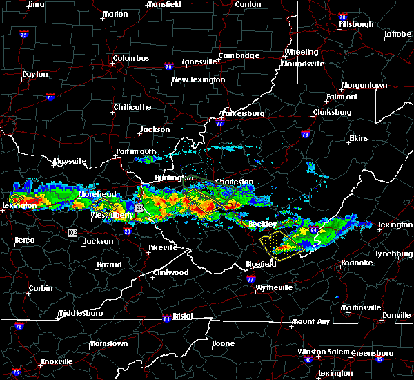 At 306 pm edt, a severe thunderstorm was located near julian, or near madison, moving southeast at 45 mph (radar indicated). Hazards include 60 mph wind gusts and quarter size hail. Hail damage to vehicles is expected. expect wind damage to roofs, siding, and trees. Locations impacted include, madison, julian, danville, seth, foster, ashford and racine. At 306 pm edt, a severe thunderstorm was located near julian, or near madison, moving southeast at 45 mph (radar indicated). Hazards include 60 mph wind gusts and quarter size hail. Hail damage to vehicles is expected. expect wind damage to roofs, siding, and trees. Locations impacted include, madison, julian, danville, seth, foster, ashford and racine.
|
| 4/8/2020 2:48 PM EDT |
 At 247 pm edt, a severe thunderstorm was located near tornado, or 8 miles east of hamlin, moving southeast at 40 mph (radar indicated). Hazards include ping pong ball size hail. People and animals outdoors will be injured. Expect damage to roofs, siding, windows, and vehicles. At 247 pm edt, a severe thunderstorm was located near tornado, or 8 miles east of hamlin, moving southeast at 40 mph (radar indicated). Hazards include ping pong ball size hail. People and animals outdoors will be injured. Expect damage to roofs, siding, windows, and vehicles.
|
| 4/8/2020 1:35 PM EDT |
 At 135 pm edt, a severe thunderstorm was located near marmet, or near charleston, moving southeast at 35 mph (radar indicated). Hazards include 60 mph wind gusts and quarter size hail. Hail damage to vehicles is expected. expect wind damage to roofs, siding, and trees. Locations impacted include, charleston, south charleston, chesapeake, marmet, belle, coal fork and ashford. At 135 pm edt, a severe thunderstorm was located near marmet, or near charleston, moving southeast at 35 mph (radar indicated). Hazards include 60 mph wind gusts and quarter size hail. Hail damage to vehicles is expected. expect wind damage to roofs, siding, and trees. Locations impacted include, charleston, south charleston, chesapeake, marmet, belle, coal fork and ashford.
|
| 4/8/2020 1:23 PM EDT |
 At 123 pm edt, a severe thunderstorm was located near alum creek, or 7 miles west of charleston, moving southeast at 35 mph (radar indicated). Hazards include 60 mph wind gusts and quarter size hail. Hail damage to vehicles is expected. expect wind damage to roofs, siding, and trees. locations impacted include, charleston, nitro, jefferson, south charleston, st. Albans, dunbar, chesapeake, marmet, belle, alum creek, institute, tornado, coal fork, cross lanes and ashford. At 123 pm edt, a severe thunderstorm was located near alum creek, or 7 miles west of charleston, moving southeast at 35 mph (radar indicated). Hazards include 60 mph wind gusts and quarter size hail. Hail damage to vehicles is expected. expect wind damage to roofs, siding, and trees. locations impacted include, charleston, nitro, jefferson, south charleston, st. Albans, dunbar, chesapeake, marmet, belle, alum creek, institute, tornado, coal fork, cross lanes and ashford.
|
| 4/8/2020 1:08 PM EDT |
 At 108 pm edt, a severe thunderstorm was located near teays valley, or near nitro, moving southeast at 35 mph (radar indicated). Hazards include 60 mph wind gusts and quarter size hail. Hail damage to vehicles is expected. Expect wind damage to roofs, siding, and trees. At 108 pm edt, a severe thunderstorm was located near teays valley, or near nitro, moving southeast at 35 mph (radar indicated). Hazards include 60 mph wind gusts and quarter size hail. Hail damage to vehicles is expected. Expect wind damage to roofs, siding, and trees.
|
| 10/31/2019 1:41 PM EDT |
 At 140 pm edt, severe thunderstorms were located along a line extending from near sissonville to near van, moving east at 50 mph (radar indicated). Hazards include 60 mph wind gusts. Expect damage to roofs, siding, and trees. locations impacted include, charleston, nitro, madison, jefferson, south charleston, st. Albans, dunbar, sissonville, chesapeake, marmet, belle, cedar grove, poca, east bank, glasgow, van, pinch, institute, coal fork and elkview. At 140 pm edt, severe thunderstorms were located along a line extending from near sissonville to near van, moving east at 50 mph (radar indicated). Hazards include 60 mph wind gusts. Expect damage to roofs, siding, and trees. locations impacted include, charleston, nitro, madison, jefferson, south charleston, st. Albans, dunbar, sissonville, chesapeake, marmet, belle, cedar grove, poca, east bank, glasgow, van, pinch, institute, coal fork and elkview.
|
| 10/31/2019 1:31 PM EDT |
 At 130 pm edt, severe thunderstorms were located along a line extending from near poca to near van, moving east at 50 mph (radar indicated). Hazards include 60 mph wind gusts. Expect damage to roofs, siding, and trees. locations impacted include, charleston, nitro, madison, jefferson, south charleston, st. Albans, dunbar, sissonville, chesapeake, marmet, belle, cedar grove, poca, east bank, glasgow, van, pinch, institute, tornado and coal fork. At 130 pm edt, severe thunderstorms were located along a line extending from near poca to near van, moving east at 50 mph (radar indicated). Hazards include 60 mph wind gusts. Expect damage to roofs, siding, and trees. locations impacted include, charleston, nitro, madison, jefferson, south charleston, st. Albans, dunbar, sissonville, chesapeake, marmet, belle, cedar grove, poca, east bank, glasgow, van, pinch, institute, tornado and coal fork.
|
| 10/31/2019 1:10 PM EDT |
 At 110 pm edt, severe thunderstorms were located along a line extending from culloden to near mount gay-shamrock, moving east at 50 mph (radar indicated). Hazards include 60 mph wind gusts. expect damage to roofs, siding, and trees At 110 pm edt, severe thunderstorms were located along a line extending from culloden to near mount gay-shamrock, moving east at 50 mph (radar indicated). Hazards include 60 mph wind gusts. expect damage to roofs, siding, and trees
|
| 6/24/2019 6:39 PM EDT |
 At 639 pm edt, severe thunderstorms were located along a line extending from near teays valley to near julian to near logan, moving east at 40 mph (radar indicated). Hazards include 60 mph wind gusts. expect damage to roofs, siding, and trees At 639 pm edt, severe thunderstorms were located along a line extending from near teays valley to near julian to near logan, moving east at 40 mph (radar indicated). Hazards include 60 mph wind gusts. expect damage to roofs, siding, and trees
|
| 5/17/2019 7:53 PM EDT |
 The severe thunderstorm warning for west central kanawha, southwestern putnam, northeastern lincoln and northeastern boone counties will expire at 800 pm edt, the storm which prompted the warning has weakened below severe limits, and no longer poses an immediate threat to life or property. therefore, the warning will be allowed to expire. a severe thunderstorm watch remains in effect until 1100 pm edt for central and western west virginia. The severe thunderstorm warning for west central kanawha, southwestern putnam, northeastern lincoln and northeastern boone counties will expire at 800 pm edt, the storm which prompted the warning has weakened below severe limits, and no longer poses an immediate threat to life or property. therefore, the warning will be allowed to expire. a severe thunderstorm watch remains in effect until 1100 pm edt for central and western west virginia.
|
| 5/17/2019 6:57 PM EDT |
 At 657 pm edt, a severe thunderstorm was located near hurricane, or 8 miles northeast of hamlin, moving southeast at 30 mph (radar indicated). Hazards include 60 mph wind gusts and quarter size hail. Hail damage to vehicles is expected. Expect wind damage to roofs, siding, and trees. At 657 pm edt, a severe thunderstorm was located near hurricane, or 8 miles northeast of hamlin, moving southeast at 30 mph (radar indicated). Hazards include 60 mph wind gusts and quarter size hail. Hail damage to vehicles is expected. Expect wind damage to roofs, siding, and trees.
|
| 4/14/2019 7:22 PM EDT |
 The severe thunderstorm warning for central kanawha, north central logan, northwestern fayette and boone counties will expire at 730 pm edt, the storm which prompted the warning has weakened below severe limits, and no longer poses an immediate threat to life or property. therefore, the warning will be allowed to expire. a tornado watch remains in effect until 900 pm edt for central and southern west virginia. a severe thunderstorm watch remains in effect until 200 am edt for southeastern west virginia. The severe thunderstorm warning for central kanawha, north central logan, northwestern fayette and boone counties will expire at 730 pm edt, the storm which prompted the warning has weakened below severe limits, and no longer poses an immediate threat to life or property. therefore, the warning will be allowed to expire. a tornado watch remains in effect until 900 pm edt for central and southern west virginia. a severe thunderstorm watch remains in effect until 200 am edt for southeastern west virginia.
|
| 4/14/2019 7:07 PM EDT |
 At 706 pm edt, a severe thunderstorm was located near madison, moving northeast at 55 mph (radar indicated). Hazards include 60 mph wind gusts. expect damage to roofs, siding, and trees At 706 pm edt, a severe thunderstorm was located near madison, moving northeast at 55 mph (radar indicated). Hazards include 60 mph wind gusts. expect damage to roofs, siding, and trees
|
| 6/13/2017 12:33 PM EDT |
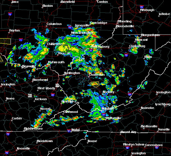 At 1233 pm edt, a severe thunderstorm was located near powellton, or 16 miles west of fayetteville, moving east at 20 mph (radar indicated). Hazards include 60 mph wind gusts and penny size hail. Expect damage to roofs, siding, and trees. locations impacted include, montgomery, smithers, burnwell, powellton, handley, leewood, dawes, sharon and eskdale. This includes west virginia turnpike between mile markers 66 and 82. At 1233 pm edt, a severe thunderstorm was located near powellton, or 16 miles west of fayetteville, moving east at 20 mph (radar indicated). Hazards include 60 mph wind gusts and penny size hail. Expect damage to roofs, siding, and trees. locations impacted include, montgomery, smithers, burnwell, powellton, handley, leewood, dawes, sharon and eskdale. This includes west virginia turnpike between mile markers 66 and 82.
|
| 6/13/2017 12:18 PM EDT |
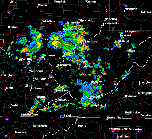 At 1218 pm edt, a severe thunderstorm was located near chesapeake, or 16 miles southeast of charleston, moving east at 20 mph (radar indicated). Hazards include 60 mph wind gusts and quarter size hail. Hail damage to vehicles is expected. Expect wind damage to roofs, siding, and trees. At 1218 pm edt, a severe thunderstorm was located near chesapeake, or 16 miles southeast of charleston, moving east at 20 mph (radar indicated). Hazards include 60 mph wind gusts and quarter size hail. Hail damage to vehicles is expected. Expect wind damage to roofs, siding, and trees.
|
| 5/20/2017 7:49 PM EDT |
 At 749 pm edt, severe thunderstorms were located along a line extending from near ansted to near montgomery to near madison to chapmanville, moving northwest at 15 mph (trained weather spotters). Hazards include 60 mph wind gusts and quarter size hail. Hail damage to vehicles is expected. expect wind damage to roofs, siding, and trees. locations impacted include, madison, montgomery, chesapeake, marmet, ansted, belle, chapmanville, cedar grove, east bank, glasgow, smithers, gauley bridge, pratt, ranger, spurlockville, hawks nest state park, harts, gill, julian and powellton. this includes the following highways, west virginia turnpike between mile markers 72 and 92. Route 119 between mile markers 34 and 65. At 749 pm edt, severe thunderstorms were located along a line extending from near ansted to near montgomery to near madison to chapmanville, moving northwest at 15 mph (trained weather spotters). Hazards include 60 mph wind gusts and quarter size hail. Hail damage to vehicles is expected. expect wind damage to roofs, siding, and trees. locations impacted include, madison, montgomery, chesapeake, marmet, ansted, belle, chapmanville, cedar grove, east bank, glasgow, smithers, gauley bridge, pratt, ranger, spurlockville, hawks nest state park, harts, gill, julian and powellton. this includes the following highways, west virginia turnpike between mile markers 72 and 92. Route 119 between mile markers 34 and 65.
|
| 5/20/2017 7:23 PM EDT |
 At 723 pm edt, severe thunderstorms were located along a line extending from 6 miles north of babcock state park to powellton to 7 miles northeast of van to near chief logan state, moving northwest at 10 mph (radar indicated). Hazards include 60 mph wind gusts and quarter size hail. Hail damage to vehicles is expected. Expect wind damage to roofs, siding, and trees. At 723 pm edt, severe thunderstorms were located along a line extending from 6 miles north of babcock state park to powellton to 7 miles northeast of van to near chief logan state, moving northwest at 10 mph (radar indicated). Hazards include 60 mph wind gusts and quarter size hail. Hail damage to vehicles is expected. Expect wind damage to roofs, siding, and trees.
|
| 5/20/2017 7:21 PM EDT |
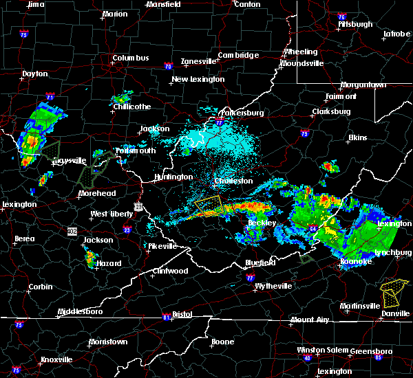 At 721 pm edt, a severe thunderstorm was located near van, or 7 miles east of madison, moving north at 20 mph (radar indicated). Hazards include 60 mph wind gusts and quarter size hail. Hail damage to vehicles is expected. expect wind damage to roofs, siding, and trees. locations impacted include, madison, van, danville, whitesville, sylvester, seth, foster, prenter and racine. This includes route 119 between mile markers 52 and 56. At 721 pm edt, a severe thunderstorm was located near van, or 7 miles east of madison, moving north at 20 mph (radar indicated). Hazards include 60 mph wind gusts and quarter size hail. Hail damage to vehicles is expected. expect wind damage to roofs, siding, and trees. locations impacted include, madison, van, danville, whitesville, sylvester, seth, foster, prenter and racine. This includes route 119 between mile markers 52 and 56.
|
| 5/20/2017 7:02 PM EDT |
 At 701 pm edt, a severe thunderstorm was located near van, or 11 miles southeast of madison, moving north at 20 mph (radar indicated). Hazards include 60 mph wind gusts and quarter size hail. Hail damage to vehicles is expected. Expect wind damage to roofs, siding, and trees. At 701 pm edt, a severe thunderstorm was located near van, or 11 miles southeast of madison, moving north at 20 mph (radar indicated). Hazards include 60 mph wind gusts and quarter size hail. Hail damage to vehicles is expected. Expect wind damage to roofs, siding, and trees.
|
| 3/1/2017 9:48 AM EST |
 At 948 am est, severe thunderstorms were located along a line extending from near st. albans to oppy, moving east at 60 mph (radar indicated). Hazards include 70 mph wind gusts and penny size hail. Expect considerable tree damage. Damage is likely to mobile homes, roofs, and outbuildings. At 948 am est, severe thunderstorms were located along a line extending from near st. albans to oppy, moving east at 60 mph (radar indicated). Hazards include 70 mph wind gusts and penny size hail. Expect considerable tree damage. Damage is likely to mobile homes, roofs, and outbuildings.
|
| 7/14/2016 6:21 PM EDT |
 The severe thunderstorm warning for west central fayette, boone and southeastern kanawha counties will expire at 630 pm edt, the storm which prompted the warning weakened below severe limits and exited the warned area. therefore, the warning will be allowed to expire. The severe thunderstorm warning for west central fayette, boone and southeastern kanawha counties will expire at 630 pm edt, the storm which prompted the warning weakened below severe limits and exited the warned area. therefore, the warning will be allowed to expire.
|
| 7/14/2016 5:31 PM EDT |
 At 531 pm edt, a severe thunderstorm was located over madison, moving east at 35 mph (radar indicated). Hazards include 60 mph wind gusts. Expect damage to roofs. siding. And trees. At 531 pm edt, a severe thunderstorm was located over madison, moving east at 35 mph (radar indicated). Hazards include 60 mph wind gusts. Expect damage to roofs. siding. And trees.
|
| 7/8/2016 2:53 PM EDT |
 At 252 pm edt, severe thunderstorms were located along a line extending from near teays valley to near spurlockville, moving southeast at 45 mph (radar indicated). Hazards include 60 mph wind gusts. Expect damage to roofs. siding. And trees. At 252 pm edt, severe thunderstorms were located along a line extending from near teays valley to near spurlockville, moving southeast at 45 mph (radar indicated). Hazards include 60 mph wind gusts. Expect damage to roofs. siding. And trees.
|
| 6/23/2016 2:11 PM EDT |
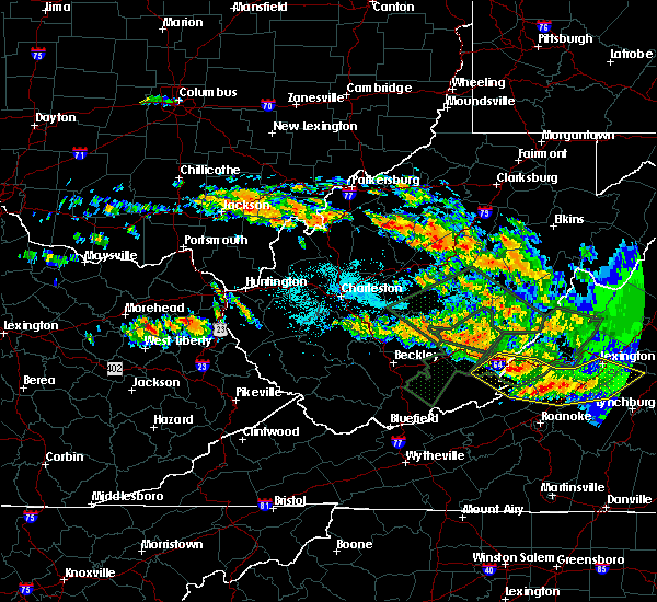 At 210 pm edt, a severe thunderstorm was located 9 miles west of burnwell, or 13 miles east of madison, moving southeast at 40 mph (radar indicated). Hazards include 60 mph wind gusts and quarter size hail. Hail damage to vehicles is expected. Expect wind damage to roofs, siding, and trees. At 210 pm edt, a severe thunderstorm was located 9 miles west of burnwell, or 13 miles east of madison, moving southeast at 40 mph (radar indicated). Hazards include 60 mph wind gusts and quarter size hail. Hail damage to vehicles is expected. Expect wind damage to roofs, siding, and trees.
|
| 6/23/2016 7:47 AM EDT |
 At 746 am edt, severe thunderstorms were located along a line extending from 8 miles south of chesapeake to coalpoint, moving southeast at 45 mph (radar indicated). Hazards include 60 mph wind gusts. Expect damage to roofs. siding. And trees. At 746 am edt, severe thunderstorms were located along a line extending from 8 miles south of chesapeake to coalpoint, moving southeast at 45 mph (radar indicated). Hazards include 60 mph wind gusts. Expect damage to roofs. siding. And trees.
|
| 6/23/2016 6:09 AM EDT |
 The severe thunderstorm warning for southeastern lawrence, southwestern putnam, southwestern nicholas, southwestern clay, northwestern fayette, northern boone, lincoln, cabell and kanawha counties will expire at 615 am edt, the storms which prompted the warning have weakened. therefore, the warning will be allowed to expire. a severe thunderstorm watch remains in effect until 800 am edt for southeastern ohio, and western, north central, southern, southeastern and central west virginia. The severe thunderstorm warning for southeastern lawrence, southwestern putnam, southwestern nicholas, southwestern clay, northwestern fayette, northern boone, lincoln, cabell and kanawha counties will expire at 615 am edt, the storms which prompted the warning have weakened. therefore, the warning will be allowed to expire. a severe thunderstorm watch remains in effect until 800 am edt for southeastern ohio, and western, north central, southern, southeastern and central west virginia.
|
| 6/23/2016 5:46 AM EDT |
 At 546 am edt, severe thunderstorms were located along a line extending from near hamlin to near glen, moving southeast at 40 mph (radar indicated). Hazards include 60 mph wind gusts. Expect damage to roofs. siding. and trees. locations impacted include, charleston, huntington, nitro, summersville, madison, hamlin, proctorville, clay, jefferson, south charleston, st. Albans, dunbar, hurricane, barboursville, milton, montgomery, chesapeake, marmet, ansted and belle. At 546 am edt, severe thunderstorms were located along a line extending from near hamlin to near glen, moving southeast at 40 mph (radar indicated). Hazards include 60 mph wind gusts. Expect damage to roofs. siding. and trees. locations impacted include, charleston, huntington, nitro, summersville, madison, hamlin, proctorville, clay, jefferson, south charleston, st. Albans, dunbar, hurricane, barboursville, milton, montgomery, chesapeake, marmet, ansted and belle.
|
| 6/23/2016 5:11 AM EDT |
 At 511 am edt, severe thunderstorms were located along a line extending from near chesapeake to 9 miles east of kenna, moving southeast at 40 mph (radar indicated). Hazards include 60 mph wind gusts. Expect damage to roofs. siding. And trees. At 511 am edt, severe thunderstorms were located along a line extending from near chesapeake to 9 miles east of kenna, moving southeast at 40 mph (radar indicated). Hazards include 60 mph wind gusts. Expect damage to roofs. siding. And trees.
|
| 6/21/2016 3:19 PM EDT |
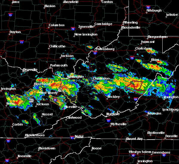 At 319 pm edt, a severe thunderstorm was located 9 miles south of chesapeake, or 13 miles east of madison, moving southeast at 25 mph (radar indicated). Hazards include 70 mph wind gusts and half dollar size hail. Hail damage to vehicles is expected. expect considerable tree damage. Wind damage is also likely to mobile homes, roofs, and outbuildings. At 319 pm edt, a severe thunderstorm was located 9 miles south of chesapeake, or 13 miles east of madison, moving southeast at 25 mph (radar indicated). Hazards include 70 mph wind gusts and half dollar size hail. Hail damage to vehicles is expected. expect considerable tree damage. Wind damage is also likely to mobile homes, roofs, and outbuildings.
|
| 6/4/2016 2:11 PM EDT |
 The severe thunderstorm warning for north central boone, northeastern lincoln and central kanawha counties will expire at 215 pm edt, the storm which prompted the warning has weakened below severe limits, and no longer poses an immediate threat to life or property. therefore the warning will be allowed to expire. however heavy rain is still possible with this thunderstorm. The severe thunderstorm warning for north central boone, northeastern lincoln and central kanawha counties will expire at 215 pm edt, the storm which prompted the warning has weakened below severe limits, and no longer poses an immediate threat to life or property. therefore the warning will be allowed to expire. however heavy rain is still possible with this thunderstorm.
|
| 6/4/2016 1:55 PM EDT |
 At 154 pm edt, a severe thunderstorm was located near alum creek, or 12 miles north of madison, moving east at 25 mph (radar indicated). Hazards include 60 mph wind gusts and quarter size hail. Hail damage to vehicles is expected. expect wind damage to roofs, siding, and trees. Locations impacted include, charleston, jefferson, south charleston, dunbar, chesapeake, marmet, belle, coal fork, julian, alum creek, tornado, sod, ashford and racine. At 154 pm edt, a severe thunderstorm was located near alum creek, or 12 miles north of madison, moving east at 25 mph (radar indicated). Hazards include 60 mph wind gusts and quarter size hail. Hail damage to vehicles is expected. expect wind damage to roofs, siding, and trees. Locations impacted include, charleston, jefferson, south charleston, dunbar, chesapeake, marmet, belle, coal fork, julian, alum creek, tornado, sod, ashford and racine.
|
| 6/4/2016 1:41 PM EDT |
 At 140 pm edt, a severe thunderstorm was located near julian, or 10 miles southeast of hamlin, moving east at 25 mph (radar indicated). Hazards include 60 mph wind gusts and quarter size hail. Hail damage to vehicles is expected. Expect wind damage to roofs, siding, and trees. At 140 pm edt, a severe thunderstorm was located near julian, or 10 miles southeast of hamlin, moving east at 25 mph (radar indicated). Hazards include 60 mph wind gusts and quarter size hail. Hail damage to vehicles is expected. Expect wind damage to roofs, siding, and trees.
|
| 5/1/2016 6:57 PM EDT |
 At 656 pm edt, severe thunderstorms were located along a line extending from jefferson to near alum creek to 6 miles east of julian, moving east at 35 mph (radar indicated). Hazards include 60 mph wind gusts and quarter size hail. Hail damage to vehicles is expected. Expect wind damage to roofs, siding, and trees. At 656 pm edt, severe thunderstorms were located along a line extending from jefferson to near alum creek to 6 miles east of julian, moving east at 35 mph (radar indicated). Hazards include 60 mph wind gusts and quarter size hail. Hail damage to vehicles is expected. Expect wind damage to roofs, siding, and trees.
|
| 5/1/2016 6:47 PM EDT |
 At 647 pm edt, severe thunderstorms were located along a line extending from near teays valley to near tornado to near julian, moving east at 40 mph (radar indicated). Hazards include 60 mph wind gusts and half dollar size hail. Hail damage to vehicles is expected. expect wind damage to roofs, siding, and trees. locations impacted include, charleston, nitro, jefferson, south charleston, st. Albans, dunbar, chesapeake, marmet, belle, tornado, coal fork, julian, alum creek, institute, cross lanes, palermo, sod, griffithsville, woodville and yawkey. At 647 pm edt, severe thunderstorms were located along a line extending from near teays valley to near tornado to near julian, moving east at 40 mph (radar indicated). Hazards include 60 mph wind gusts and half dollar size hail. Hail damage to vehicles is expected. expect wind damage to roofs, siding, and trees. locations impacted include, charleston, nitro, jefferson, south charleston, st. Albans, dunbar, chesapeake, marmet, belle, tornado, coal fork, julian, alum creek, institute, cross lanes, palermo, sod, griffithsville, woodville and yawkey.
|
| 5/1/2016 6:35 PM EDT |
 At 635 pm edt, severe thunderstorms were located along a line extending from near culloden to near hamlin to near spurlockville, moving east at 40 mph (radar indicated). Hazards include 60 mph wind gusts and half dollar size hail. Hail damage to vehicles is expected. Expect wind damage to roofs, siding, and trees. At 635 pm edt, severe thunderstorms were located along a line extending from near culloden to near hamlin to near spurlockville, moving east at 40 mph (radar indicated). Hazards include 60 mph wind gusts and half dollar size hail. Hail damage to vehicles is expected. Expect wind damage to roofs, siding, and trees.
|
| 5/1/2016 6:17 PM EDT |
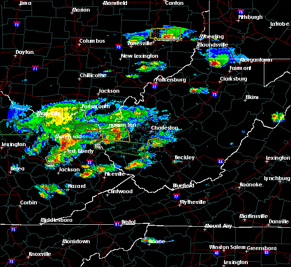 At 617 pm edt, a severe thunderstorm was located 9 miles west of burnwell, or 13 miles east of madison, moving east at 30 mph (radar indicated). Hazards include 60 mph wind gusts and half dollar size hail. Hail damage to vehicles is expected. Expect wind damage to roofs, siding, and trees. At 617 pm edt, a severe thunderstorm was located 9 miles west of burnwell, or 13 miles east of madison, moving east at 30 mph (radar indicated). Hazards include 60 mph wind gusts and half dollar size hail. Hail damage to vehicles is expected. Expect wind damage to roofs, siding, and trees.
|
| 5/1/2016 6:11 PM EDT |
 At 611 pm edt, a severe thunderstorm was located near marmet, or 10 miles south of charleston, moving east at 30 mph (radar indicated). Hazards include 60 mph wind gusts and quarter size hail. Hail damage to vehicles is expected. expect wind damage to roofs, siding, and trees. Locations impacted include, chesapeake, racine, eskdale, seth, dawes and sharon. At 611 pm edt, a severe thunderstorm was located near marmet, or 10 miles south of charleston, moving east at 30 mph (radar indicated). Hazards include 60 mph wind gusts and quarter size hail. Hail damage to vehicles is expected. expect wind damage to roofs, siding, and trees. Locations impacted include, chesapeake, racine, eskdale, seth, dawes and sharon.
|
| 5/1/2016 6:07 PM EDT | Quarter sized hail reported 1.5 miles NNE of Comfort, WV |
| 5/1/2016 5:42 PM EDT |
 At 542 pm edt, a severe thunderstorm was located over julian, or 7 miles northwest of madison, moving east at 30 mph (radar indicated). Hazards include 60 mph wind gusts and quarter size hail. Hail damage to vehicles is expected. Expect wind damage to roofs, siding, and trees. At 542 pm edt, a severe thunderstorm was located over julian, or 7 miles northwest of madison, moving east at 30 mph (radar indicated). Hazards include 60 mph wind gusts and quarter size hail. Hail damage to vehicles is expected. Expect wind damage to roofs, siding, and trees.
|
| 7/14/2015 6:35 PM EDT |
 At 634 pm edt, doppler radar indicated a line of severe thunderstorms capable of producing damaging winds in excess of 60 mph. these storms were located along a line extending from near gauley bridge to near madison to blaine, and moving southeast at 30 mph. At 634 pm edt, doppler radar indicated a line of severe thunderstorms capable of producing damaging winds in excess of 60 mph. these storms were located along a line extending from near gauley bridge to near madison to blaine, and moving southeast at 30 mph.
|
| 7/14/2015 6:25 PM EDT |
 At 624 pm edt, doppler radar indicated a line of severe thunderstorms capable of producing damaging winds in excess of 60 mph. these storms were located along a line extending from near chesapeake to near ranger to near webbville, moving southeast at 35 mph. locations impacted include, madison, louisa, blaine, yatesville lake state park, oak hill, chesapeake, marmet, mount hope, belle, chapmanville, east bank, fort gay, wharton, ulysses, kiahsville, charley, east lynn lake, chief logan state, powellton and spurlockville. At 624 pm edt, doppler radar indicated a line of severe thunderstorms capable of producing damaging winds in excess of 60 mph. these storms were located along a line extending from near chesapeake to near ranger to near webbville, moving southeast at 35 mph. locations impacted include, madison, louisa, blaine, yatesville lake state park, oak hill, chesapeake, marmet, mount hope, belle, chapmanville, east bank, fort gay, wharton, ulysses, kiahsville, charley, east lynn lake, chief logan state, powellton and spurlockville.
|
| 7/14/2015 5:43 PM EDT |
 At 542 pm edt, doppler radar indicated a line of severe thunderstorms capable of producing damaging winds in excess of 70 mph. these storms were located along a line extending from near culloden to near catlettsburg to carter caves state park, and moving southeast at 60 mph. At 542 pm edt, doppler radar indicated a line of severe thunderstorms capable of producing damaging winds in excess of 70 mph. these storms were located along a line extending from near culloden to near catlettsburg to carter caves state park, and moving southeast at 60 mph.
|
| 7/13/2015 4:56 PM EDT |
 At 456 pm edt, doppler radar indicated a line of severe thunderstorms capable of producing damaging winds in excess of 60 mph. these storms were located along a line extending from near sissonville to near madison, moving southeast at 35 mph. these severe storms will be near, elkview and pinch around 510 pm edt. clendenin around 520 pm edt. other locations impacted by these severe thunderstorms include sharon, sylvester, foster, ashford, prenter, racine, seth, danville, dawes and whitesville. At 456 pm edt, doppler radar indicated a line of severe thunderstorms capable of producing damaging winds in excess of 60 mph. these storms were located along a line extending from near sissonville to near madison, moving southeast at 35 mph. these severe storms will be near, elkview and pinch around 510 pm edt. clendenin around 520 pm edt. other locations impacted by these severe thunderstorms include sharon, sylvester, foster, ashford, prenter, racine, seth, danville, dawes and whitesville.
|
| 7/13/2015 4:26 PM EDT |
 At 425 pm edt, doppler radar indicated a line of severe thunderstorms capable of producing damaging winds in excess of 60 mph. these storms were located along a line extending from near winfield to 7 miles southeast of culloden, and moving east at 35 mph. * severe thunderstorms will be near, nitro and poca around 430 pm edt. alum creek and cross lanes around 435 pm edt. tornado around 440 pm edt. jefferson, st. albans, sissonville and institute around 445 pm edt. charleston, south charleston and dunbar around 450 pm edt. pinch around 500 pm edt. marmet and elkview around 505 pm edt. chesapeake, belle and coal fork around 510 pm edt. other locations impacted by these severe thunderstorms include sod, palermo, griffithsville, foster, prenter, myra, sharon, sylvester, yawkey and woodville. At 425 pm edt, doppler radar indicated a line of severe thunderstorms capable of producing damaging winds in excess of 60 mph. these storms were located along a line extending from near winfield to 7 miles southeast of culloden, and moving east at 35 mph. * severe thunderstorms will be near, nitro and poca around 430 pm edt. alum creek and cross lanes around 435 pm edt. tornado around 440 pm edt. jefferson, st. albans, sissonville and institute around 445 pm edt. charleston, south charleston and dunbar around 450 pm edt. pinch around 500 pm edt. marmet and elkview around 505 pm edt. chesapeake, belle and coal fork around 510 pm edt. other locations impacted by these severe thunderstorms include sod, palermo, griffithsville, foster, prenter, myra, sharon, sylvester, yawkey and woodville.
|
| 7/10/2015 4:10 PM EDT |
 The severe thunderstorm warning for northeastern boone and southeastern kanawha counties will expire at 415 pm edt, the storm which prompted the warning has weakened below severe limits, therefore the warning will be allowed to expire. however gusty winds are still possible with this thunderstorm. The severe thunderstorm warning for northeastern boone and southeastern kanawha counties will expire at 415 pm edt, the storm which prompted the warning has weakened below severe limits, therefore the warning will be allowed to expire. however gusty winds are still possible with this thunderstorm.
|
| 7/10/2015 3:52 PM EDT |
 At 351 pm edt, a severe thunderstorm was located near chesapeake, or 13 miles northeast of madison, moving east at 40 mph (radar indicated). Hazards include 60 mph wind gusts. expect damage to trees and some power outages locations impacted include, montgomery, chesapeake, cedar grove, east bank, glasgow, pratt, burnwell, handley, eskdale, sharon, racine, leewood, seth and dawes At 351 pm edt, a severe thunderstorm was located near chesapeake, or 13 miles northeast of madison, moving east at 40 mph (radar indicated). Hazards include 60 mph wind gusts. expect damage to trees and some power outages locations impacted include, montgomery, chesapeake, cedar grove, east bank, glasgow, pratt, burnwell, handley, eskdale, sharon, racine, leewood, seth and dawes
|
| 7/10/2015 3:33 PM EDT |
 At 333 pm edt, doppler radar indicated a severe thunderstorm capable of producing damaging winds in excess of 60 mph. this storm was located over julian, or near madison, and moving east at 40 mph. At 333 pm edt, doppler radar indicated a severe thunderstorm capable of producing damaging winds in excess of 60 mph. this storm was located over julian, or near madison, and moving east at 40 mph.
|
| 6/8/2015 3:11 PM EDT |
 The severe thunderstorm warning for western fayette, northeastern boone and southeastern kanawha counties will expire at 315 pm edt, the storm which prompted the warning has weakened below severe limits, and no longer poses an immediate threat to life or property. therefore the warning will be allowed to expire. The severe thunderstorm warning for western fayette, northeastern boone and southeastern kanawha counties will expire at 315 pm edt, the storm which prompted the warning has weakened below severe limits, and no longer poses an immediate threat to life or property. therefore the warning will be allowed to expire.
|
| 6/8/2015 3:00 PM EDT |
 At 259 pm edt, doppler radar indicated a severe thunderstorm capable of producing damaging winds in excess of 60 mph. this storm was located near madison, moving east at 35 mph. locations impacted include, chesapeake, marmet, belle, cedar grove, east bank, glasgow, pratt, burnwell, powellton, handley, eskdale, prenter, sharon, racine, leewood, seth and dawes. At 259 pm edt, doppler radar indicated a severe thunderstorm capable of producing damaging winds in excess of 60 mph. this storm was located near madison, moving east at 35 mph. locations impacted include, chesapeake, marmet, belle, cedar grove, east bank, glasgow, pratt, burnwell, powellton, handley, eskdale, prenter, sharon, racine, leewood, seth and dawes.
|
| 6/8/2015 2:49 PM EDT |
 At 248 pm edt, doppler radar indicated a severe thunderstorm capable of producing damaging winds in excess of 60 mph. this storm was located near madison, moving east at 35 mph. locations impacted include, madison, chesapeake, marmet, belle, cedar grove, east bank, glasgow, pratt, burnwell, julian, powellton, danville, handley, eskdale, foster, prenter, turtle creek, sharon, ashford and racine. At 248 pm edt, doppler radar indicated a severe thunderstorm capable of producing damaging winds in excess of 60 mph. this storm was located near madison, moving east at 35 mph. locations impacted include, madison, chesapeake, marmet, belle, cedar grove, east bank, glasgow, pratt, burnwell, julian, powellton, danville, handley, eskdale, foster, prenter, turtle creek, sharon, ashford and racine.
|
| 6/8/2015 2:33 PM EDT |
 At 233 pm edt, doppler radar indicated a severe thunderstorm capable of producing damaging winds in excess of 60 mph. this storm was located near chapmanville, or 12 miles west of madison, and moving east at 40 mph. At 233 pm edt, doppler radar indicated a severe thunderstorm capable of producing damaging winds in excess of 60 mph. this storm was located near chapmanville, or 12 miles west of madison, and moving east at 40 mph.
|
| 5/11/2015 5:14 PM EDT | At 512 pm edt, national weather service doppler radar continued to indicate a severe thunderstorm capable of producing quarter size. |
| 5/11/2015 4:45 PM EDT | At 443 pm edt, national weather service doppler radar indicated a severe thunderstorm capable of producing quarter size hail, and damaging winds in excess of 60 mph. this storm was located near van, or 8 miles southeast of madison, moving northeast at 30 mph. * other locations in the warning include but are not limited to smithers, montgomery, gauley bridge, pratt, glasgow, east bank, chesapeake and cedar grove. this will impact the following interstate, the west virginia turnpike between mile markers 70 and 87. a severe thunderstorm watch remains in effect until 1000 pm edt monday evening for central kentucky and southeast ohio and central west virginia. please report hail or strong wind to the national weather service by calling toll free, 800-401-9535, when you can do so safely. you may also report severe weather by posting your report to the charleston west virginia national weather service facebook page, or by using the twitter hashtag, nwsrlx. |
| 2/21/2014 2:30 AM EST | 71 mph wind gust on bee mountain elevation 1353 fee in kanawha county WV, 3.5 miles SSE of Comfort, WV |
| 1/1/0001 12:00 AM | Tree down across route 3 just north of the town of seth in boone county WV, 1.5 miles NNE of Comfort, WV |
Hail Maps for Comfort, WV
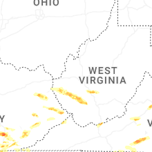


Connect with Interactive Hail Maps