

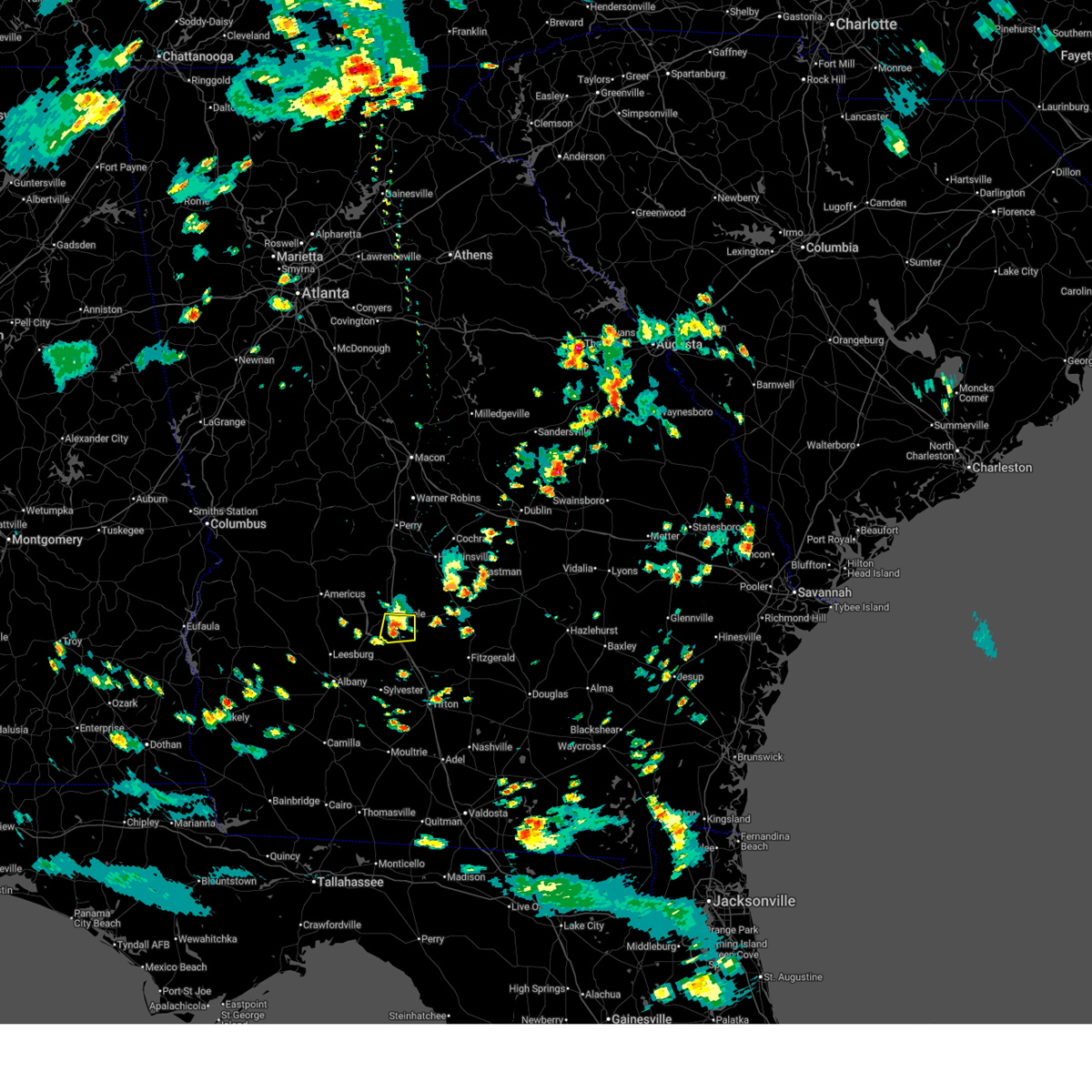
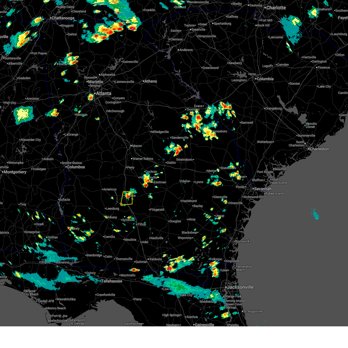
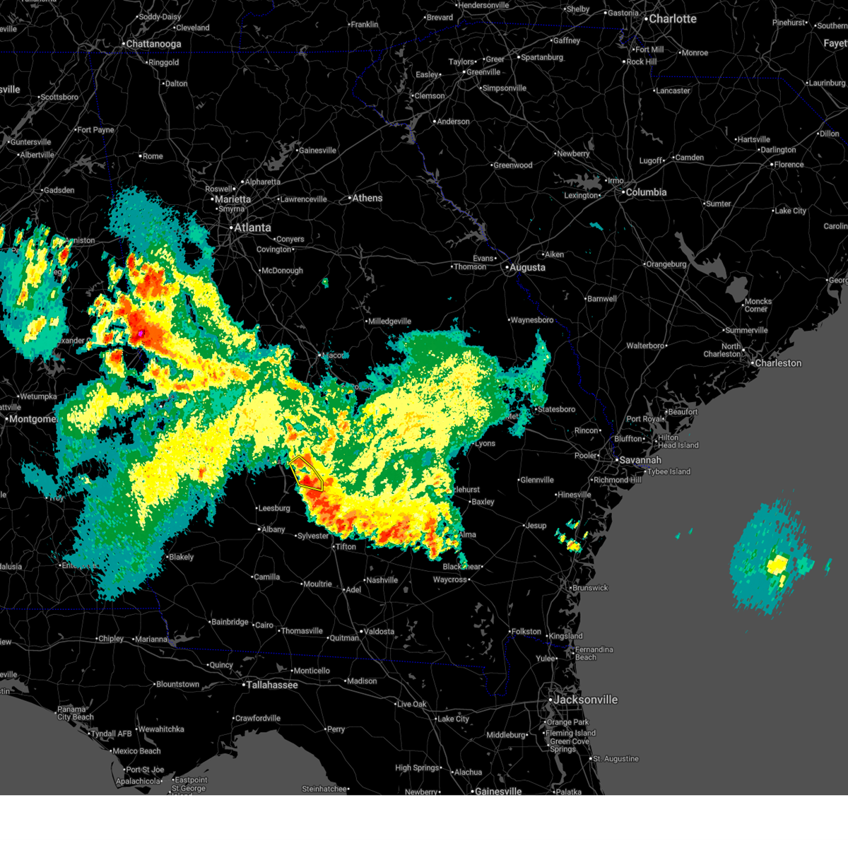
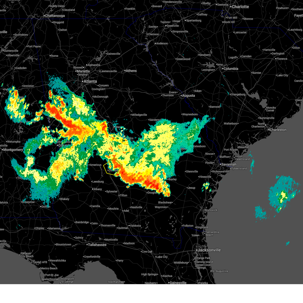
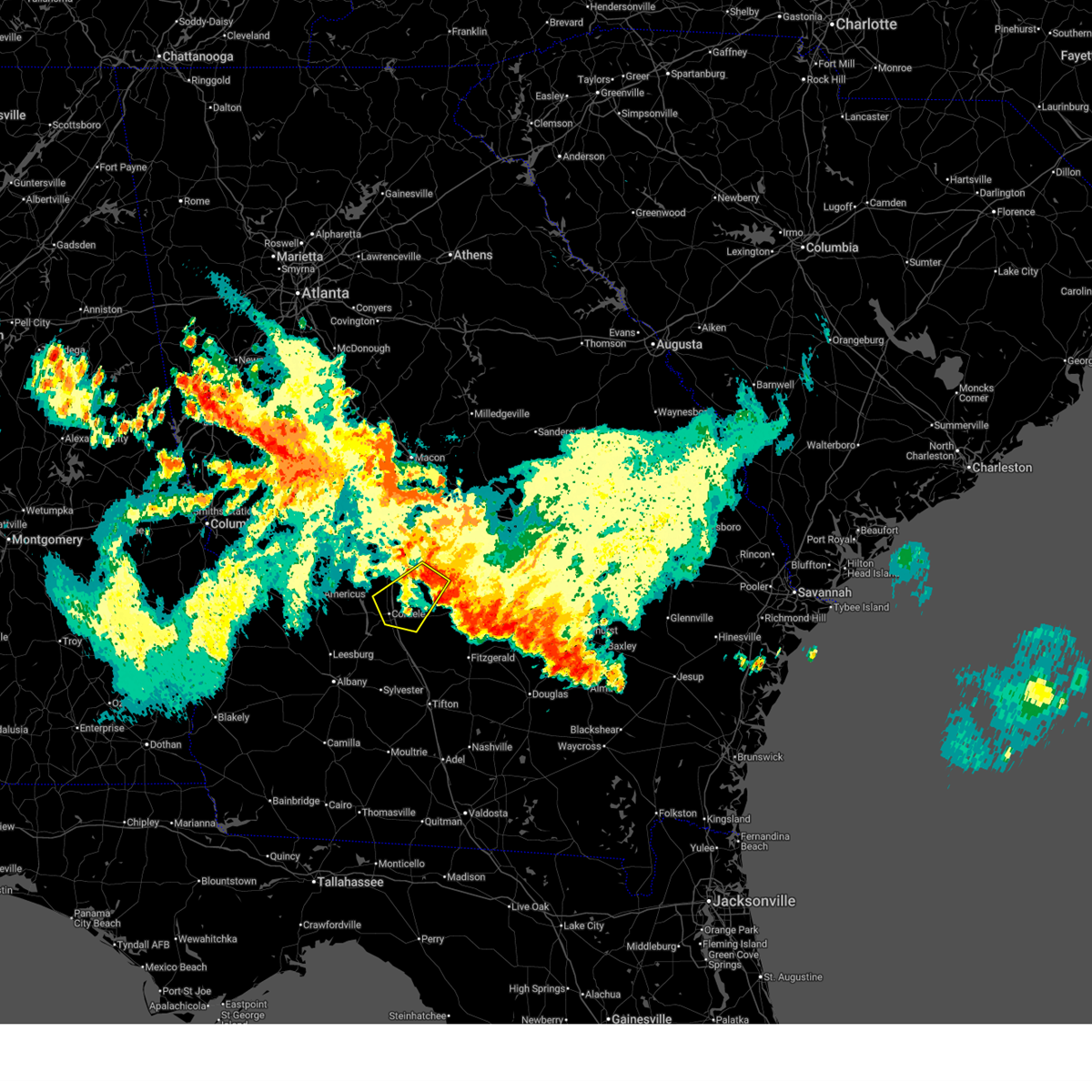
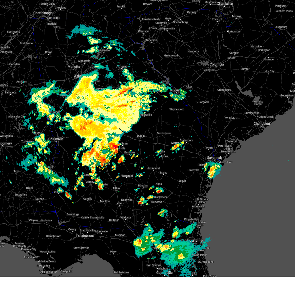
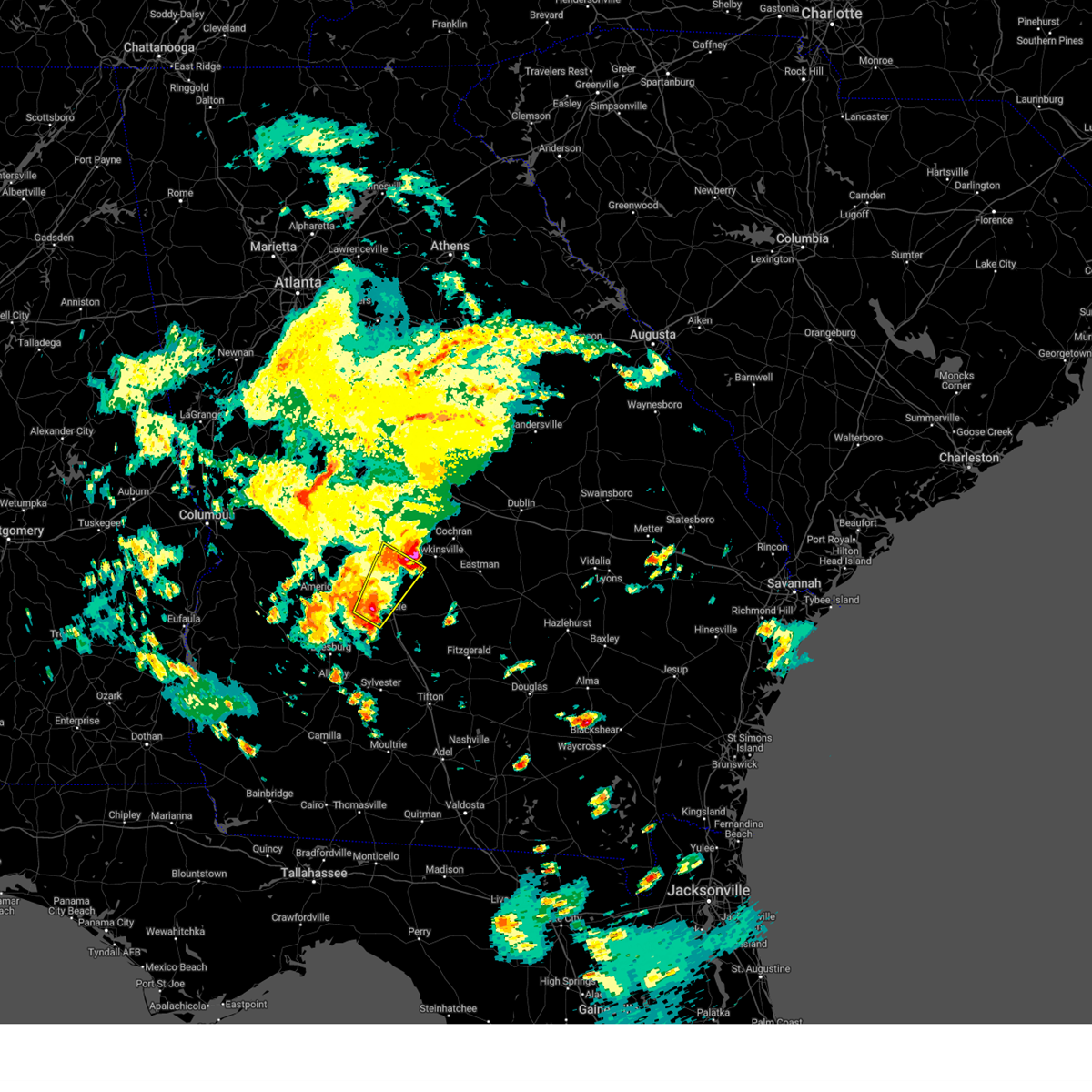
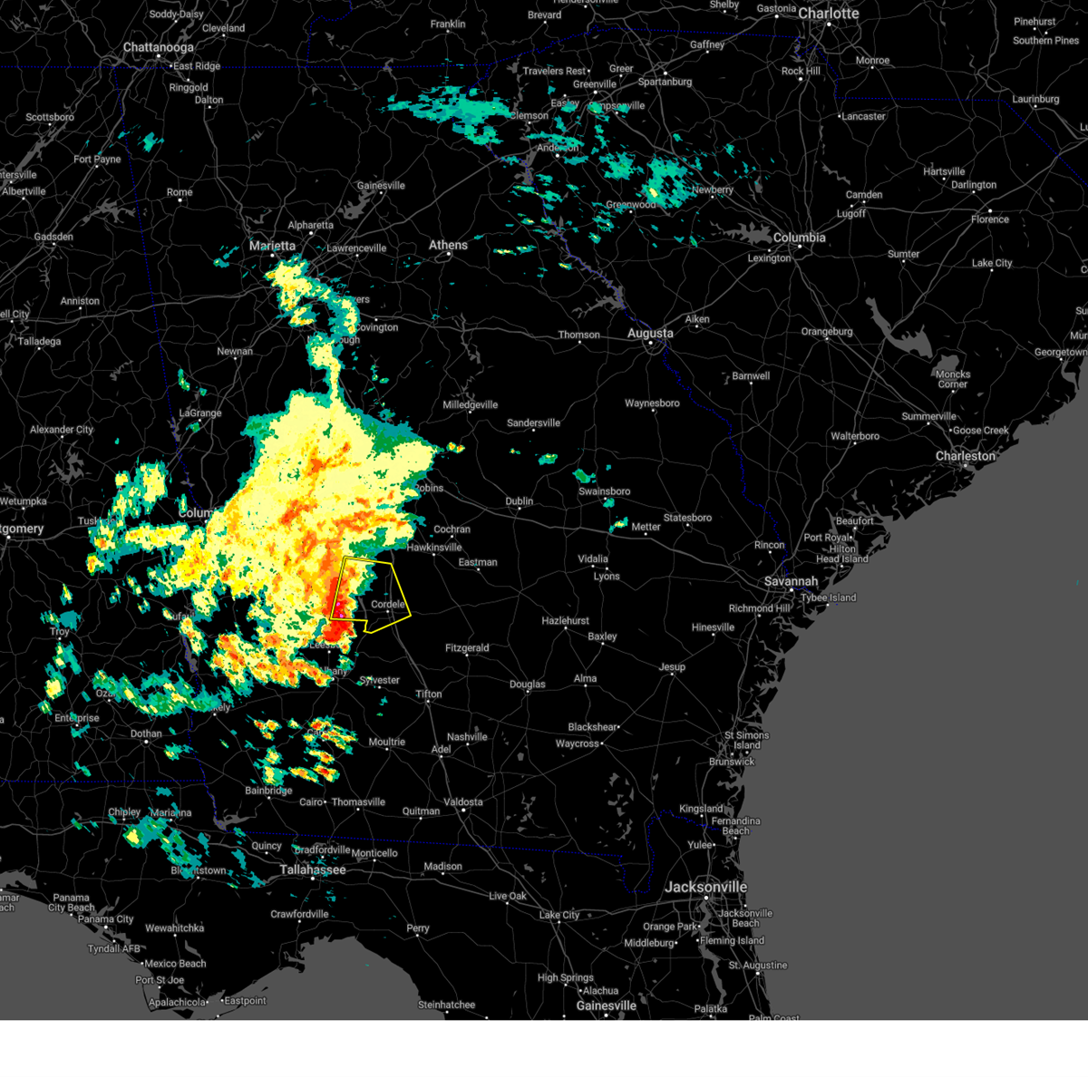
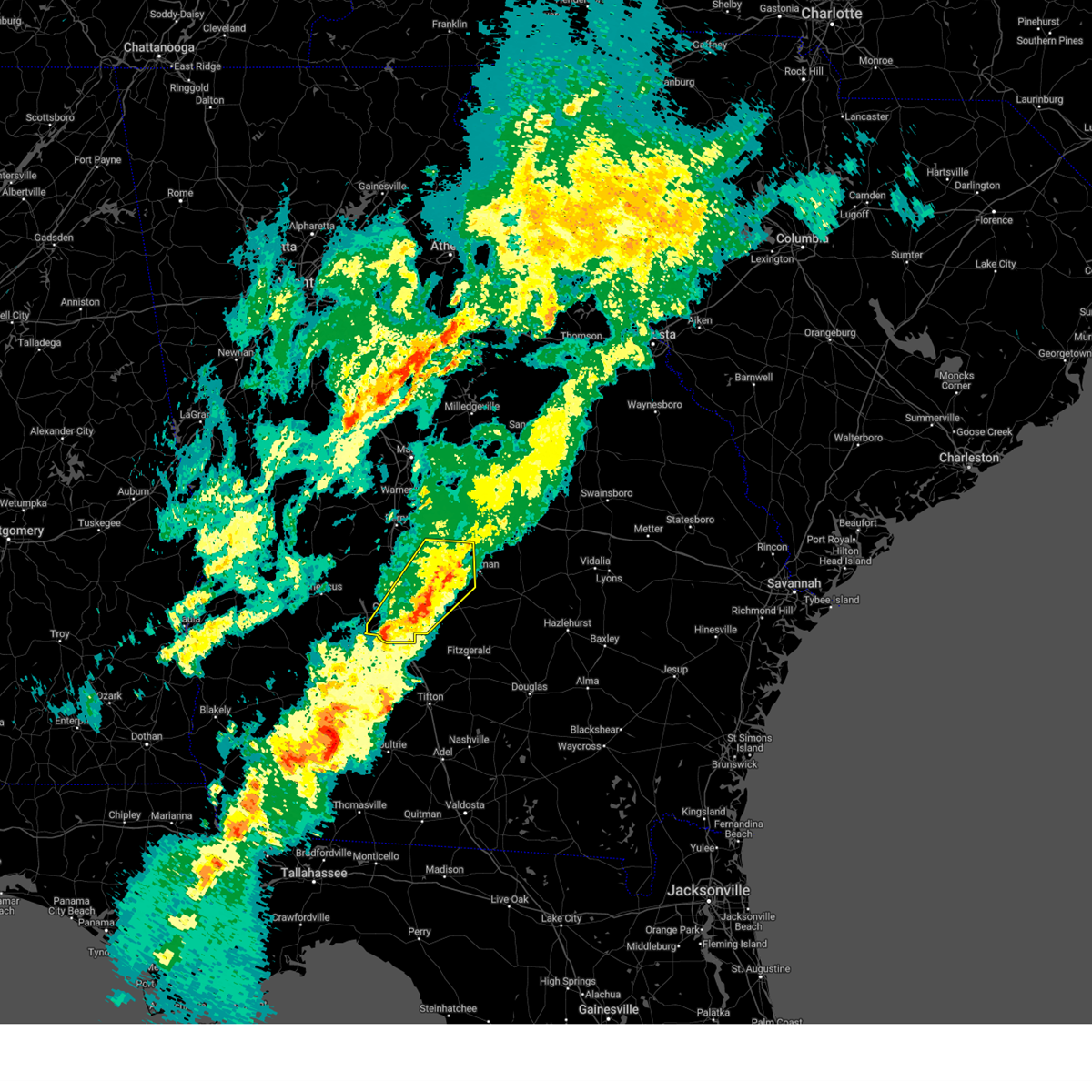
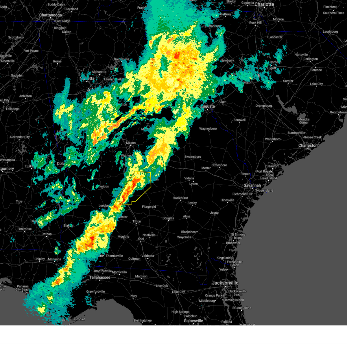
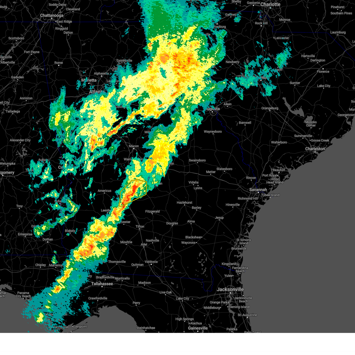
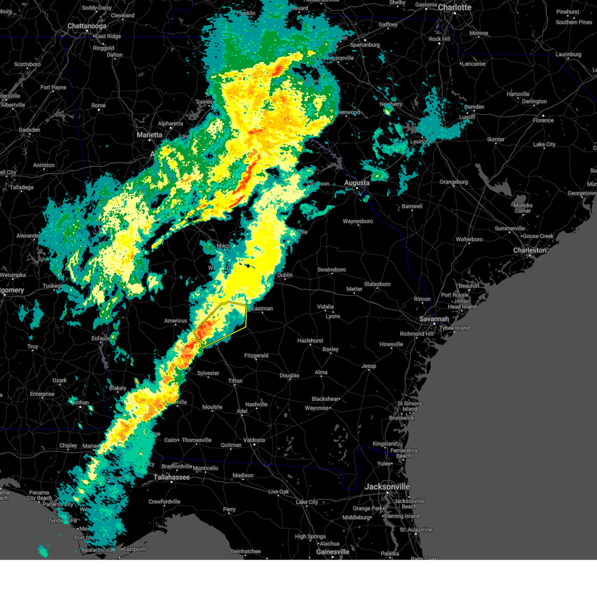
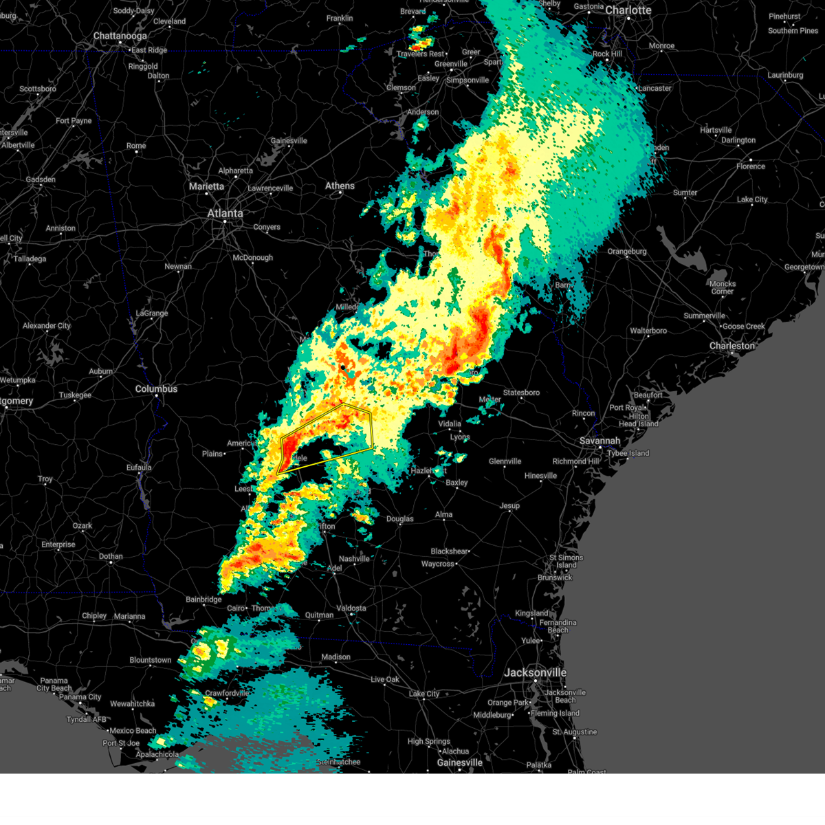
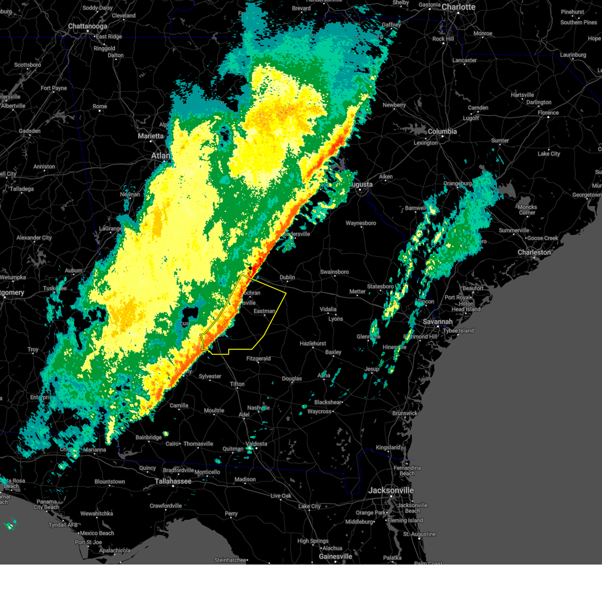
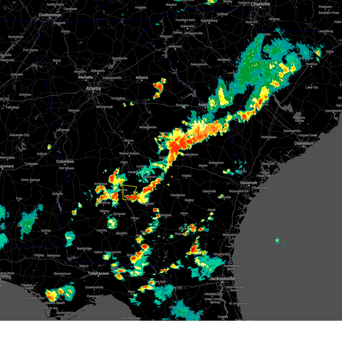
Hail Map for Cordele, GA
The Cordele, GA area has had 10 reports of on-the-ground hail by trained spotters, and has been under severe weather warnings 23 times during the past 12 months. Doppler radar has detected hail at or near Cordele, GA on 77 occasions, including 7 occasions during the past year.
| Name: | Cordele, GA |
| Where Located: | 62.7 miles WNW of Douglas, GA |
| Map: | Google Map for Cordele, GA |
| Population: | 11147 |
| Housing Units: | 4898 |
| More Info: | Search Google for Cordele, GA |
3
The Top Recent Hail Date for Cordele, GA is Saturday, August 3, 2024 (16th out of 77)

Hail and Wind Damage Spotted near Cordele, GA
| Date / Time | Report Details |
|---|---|
| 6/27/2025 4:53 PM EDT | The storm which prompted the warning has weakened below severe limits, and no longer poses an immediate threat to life or property. therefore, the warning will be allowed to expire. to report severe weather, contact your nearest law enforcement agency. they will relay your report to the national weather service peachtree city. |
| 6/27/2025 4:40 PM EDT |
 At 440 pm edt, a severe thunderstorm was located near wenona, or near cordele, moving south at 10 mph (radar indicated). Hazards include 60 mph wind gusts and quarter size hail. Hail damage to vehicles is expected. expect wind damage to roofs, siding, and trees. Locations impacted include, cordele, arabi, wenona, and hatley. At 440 pm edt, a severe thunderstorm was located near wenona, or near cordele, moving south at 10 mph (radar indicated). Hazards include 60 mph wind gusts and quarter size hail. Hail damage to vehicles is expected. expect wind damage to roofs, siding, and trees. Locations impacted include, cordele, arabi, wenona, and hatley.
|
| 6/27/2025 4:30 PM EDT | Quarter sized hail reported 4.2 miles N of Cordele, GA, ema reports quarter-sized hail south of cordele. |
| 6/27/2025 4:13 PM EDT |
 Svrffc the national weather service in peachtree city has issued a * severe thunderstorm warning for, crisp county in central georgia, * until 500 pm edt. * at 413 pm edt, a severe thunderstorm was located over east crisp, or near cordele, moving south at 10 mph (radar indicated). Hazards include 60 mph wind gusts and quarter size hail. Hail damage to vehicles is expected. Expect wind damage to roofs, siding, and trees. Svrffc the national weather service in peachtree city has issued a * severe thunderstorm warning for, crisp county in central georgia, * until 500 pm edt. * at 413 pm edt, a severe thunderstorm was located over east crisp, or near cordele, moving south at 10 mph (radar indicated). Hazards include 60 mph wind gusts and quarter size hail. Hail damage to vehicles is expected. Expect wind damage to roofs, siding, and trees.
|
| 6/26/2025 2:24 AM EDT |
 At 224 am edt, a severe thunderstorm was located over cordele, moving southwest at 25 mph (radar indicated). Hazards include 60 mph wind gusts and penny size hail. Expect damage to roofs, siding, and trees. Locations impacted include, cordele, vienna, east crisp, wenona, richwood, and hatley. At 224 am edt, a severe thunderstorm was located over cordele, moving southwest at 25 mph (radar indicated). Hazards include 60 mph wind gusts and penny size hail. Expect damage to roofs, siding, and trees. Locations impacted include, cordele, vienna, east crisp, wenona, richwood, and hatley.
|
| 6/26/2025 2:24 AM EDT |
 the severe thunderstorm warning has been cancelled and is no longer in effect the severe thunderstorm warning has been cancelled and is no longer in effect
|
| 6/26/2025 2:01 AM EDT |
 At 201 am edt, a severe thunderstorm was located near tremont, or 8 miles east of vienna, moving southwest at 25 mph (radar indicated). Hazards include 60 mph wind gusts and penny size hail. Expect damage to roofs, siding, and trees. Locations impacted include, cordele, vienna, pineview, pitts, east crisp, richwood, pope city, seville, hatley, pleasant view, tippettville, tremont, and wenona. At 201 am edt, a severe thunderstorm was located near tremont, or 8 miles east of vienna, moving southwest at 25 mph (radar indicated). Hazards include 60 mph wind gusts and penny size hail. Expect damage to roofs, siding, and trees. Locations impacted include, cordele, vienna, pineview, pitts, east crisp, richwood, pope city, seville, hatley, pleasant view, tippettville, tremont, and wenona.
|
| 6/26/2025 1:38 AM EDT |
 Svrffc the national weather service in peachtree city has issued a * severe thunderstorm warning for, southwestern pulaski county in central georgia, northwestern wilcox county in central georgia, southeastern dooly county in central georgia, northeastern crisp county in central georgia, * until 230 am edt. * at 138 am edt, a severe thunderstorm was located over finleyson, or 10 miles south of hawkinsville, moving southwest at 25 mph (radar indicated). Hazards include 60 mph wind gusts and penny size hail. expect damage to roofs, siding, and trees Svrffc the national weather service in peachtree city has issued a * severe thunderstorm warning for, southwestern pulaski county in central georgia, northwestern wilcox county in central georgia, southeastern dooly county in central georgia, northeastern crisp county in central georgia, * until 230 am edt. * at 138 am edt, a severe thunderstorm was located over finleyson, or 10 miles south of hawkinsville, moving southwest at 25 mph (radar indicated). Hazards include 60 mph wind gusts and penny size hail. expect damage to roofs, siding, and trees
|
| 5/30/2025 4:49 PM EDT | Mesonet station ga346 i-75 at sr 30 us 28 in crisp county GA, 1.3 miles W of Cordele, GA |
| 5/10/2025 6:59 PM EDT |
 the severe thunderstorm warning has been cancelled and is no longer in effect the severe thunderstorm warning has been cancelled and is no longer in effect
|
| 5/10/2025 6:37 PM EDT |
 Svrffc the national weather service in peachtree city has issued a * severe thunderstorm warning for, west central pulaski county in central georgia, dooly county in central georgia, southwestern houston county in central georgia, east central sumter county in west central georgia, northwestern crisp county in central georgia, * until 715 pm edt. * at 636 pm edt, a severe thunderstorm was located near georgia veterans memorial st pk, or 7 miles west of cordele, moving northeast at 25 mph (radar indicated). Hazards include 60 mph wind gusts and quarter size hail. Hail damage to vehicles is expected. Expect wind damage to roofs, siding, and trees. Svrffc the national weather service in peachtree city has issued a * severe thunderstorm warning for, west central pulaski county in central georgia, dooly county in central georgia, southwestern houston county in central georgia, east central sumter county in west central georgia, northwestern crisp county in central georgia, * until 715 pm edt. * at 636 pm edt, a severe thunderstorm was located near georgia veterans memorial st pk, or 7 miles west of cordele, moving northeast at 25 mph (radar indicated). Hazards include 60 mph wind gusts and quarter size hail. Hail damage to vehicles is expected. Expect wind damage to roofs, siding, and trees.
|
| 5/10/2025 4:51 PM EDT |
 Svrffc the national weather service in peachtree city has issued a * severe thunderstorm warning for, south central macon county in west central georgia, dooly county in central georgia, eastern sumter county in west central georgia, crisp county in central georgia, * until 530 pm edt. * at 450 pm edt, a severe thunderstorm was located over leslie, or 11 miles southeast of americus, moving northeast at 25 mph (radar indicated). Hazards include 60 mph wind gusts and quarter size hail. Hail damage to vehicles is expected. Expect wind damage to roofs, siding, and trees. Svrffc the national weather service in peachtree city has issued a * severe thunderstorm warning for, south central macon county in west central georgia, dooly county in central georgia, eastern sumter county in west central georgia, crisp county in central georgia, * until 530 pm edt. * at 450 pm edt, a severe thunderstorm was located over leslie, or 11 miles southeast of americus, moving northeast at 25 mph (radar indicated). Hazards include 60 mph wind gusts and quarter size hail. Hail damage to vehicles is expected. Expect wind damage to roofs, siding, and trees.
|
| 4/7/2025 10:05 AM EDT |
 the severe thunderstorm warning has been cancelled and is no longer in effect the severe thunderstorm warning has been cancelled and is no longer in effect
|
| 4/7/2025 9:30 AM EDT |
 Svrffc the national weather service in peachtree city has issued a * severe thunderstorm warning for, northwestern dodge county in central georgia, pulaski county in central georgia, wilcox county in central georgia, southeastern dooly county in central georgia, southwestern bleckley county in central georgia, crisp county in central georgia, * until 1015 am edt. * at 930 am edt, a severe thunderstorm was located over pineview, or 12 miles south of hawkinsville, moving northeast at 50 mph (radar indicated). Hazards include 60 mph wind gusts. expect damage to roofs, siding, and trees Svrffc the national weather service in peachtree city has issued a * severe thunderstorm warning for, northwestern dodge county in central georgia, pulaski county in central georgia, wilcox county in central georgia, southeastern dooly county in central georgia, southwestern bleckley county in central georgia, crisp county in central georgia, * until 1015 am edt. * at 930 am edt, a severe thunderstorm was located over pineview, or 12 miles south of hawkinsville, moving northeast at 50 mph (radar indicated). Hazards include 60 mph wind gusts. expect damage to roofs, siding, and trees
|
| 4/7/2025 9:21 AM EDT |
 At 921 am edt, a severe thunderstorm was located over empire, or near cochran, moving northeast at 50 mph (radar indicated). Hazards include 60 mph wind gusts. Expect damage to roofs, siding, and trees. Locations impacted include, east crisp, cordele, browndale, fort early, pinehurst, georgia veterans memorial st pk, richwood, cedar creek, mock springs, pope city, seville, finleyson, wallace, pineview, pleasant view, tippettville, raines, vienna, tremont, and hartford. At 921 am edt, a severe thunderstorm was located over empire, or near cochran, moving northeast at 50 mph (radar indicated). Hazards include 60 mph wind gusts. Expect damage to roofs, siding, and trees. Locations impacted include, east crisp, cordele, browndale, fort early, pinehurst, georgia veterans memorial st pk, richwood, cedar creek, mock springs, pope city, seville, finleyson, wallace, pineview, pleasant view, tippettville, raines, vienna, tremont, and hartford.
|
| 4/7/2025 9:21 AM EDT |
 the severe thunderstorm warning has been cancelled and is no longer in effect the severe thunderstorm warning has been cancelled and is no longer in effect
|
| 4/7/2025 8:51 AM EDT |
 Svrffc the national weather service in peachtree city has issued a * severe thunderstorm warning for, pulaski county in central georgia, northwestern wilcox county in central georgia, eastern dooly county in central georgia, east central sumter county in west central georgia, crisp county in central georgia, * until 930 am edt. * at 851 am edt, a severe thunderstorm was located over richwood, or near vienna, moving northeast at 55 mph (radar indicated). Hazards include 60 mph wind gusts. expect damage to roofs, siding, and trees Svrffc the national weather service in peachtree city has issued a * severe thunderstorm warning for, pulaski county in central georgia, northwestern wilcox county in central georgia, eastern dooly county in central georgia, east central sumter county in west central georgia, crisp county in central georgia, * until 930 am edt. * at 851 am edt, a severe thunderstorm was located over richwood, or near vienna, moving northeast at 55 mph (radar indicated). Hazards include 60 mph wind gusts. expect damage to roofs, siding, and trees
|
| 3/31/2025 3:05 PM EDT | Svrffc the national weather service in peachtree city has issued a * severe thunderstorm warning for, southeastern laurens county in central georgia, dodge county in central georgia, southern pulaski county in central georgia, wilcox county in central georgia, southeastern dooly county in central georgia, crisp county in central georgia, * until 345 pm edt. * at 305 pm edt, severe thunderstorms were located along a line extending from wallace to near raines, moving east at 45 mph (radar indicated). Hazards include 60 mph wind gusts and quarter size hail. Hail damage to vehicles is expected. Expect wind damage to roofs, siding, and trees. |
| 3/16/2025 6:25 AM EDT |
 Svrffc the national weather service in peachtree city has issued a * severe thunderstorm warning for, northwestern dodge county in central georgia, pulaski county in central georgia, northwestern wilcox county in central georgia, eastern dooly county in central georgia, southwestern bleckley county in central georgia, northern crisp county in central georgia, * until 715 am edt. * at 625 am edt, a severe thunderstorm was located over richwood, or near vienna, moving northeast at 60 mph (radar indicated). Hazards include 60 mph wind gusts. expect damage to roofs, siding, and trees Svrffc the national weather service in peachtree city has issued a * severe thunderstorm warning for, northwestern dodge county in central georgia, pulaski county in central georgia, northwestern wilcox county in central georgia, eastern dooly county in central georgia, southwestern bleckley county in central georgia, northern crisp county in central georgia, * until 715 am edt. * at 625 am edt, a severe thunderstorm was located over richwood, or near vienna, moving northeast at 60 mph (radar indicated). Hazards include 60 mph wind gusts. expect damage to roofs, siding, and trees
|
| 2/16/2025 6:36 AM EST |
 At 636 am est, severe thunderstorms were located along a line extending from near cary to finleyson to near doles, moving southeast at 50 mph (radar indicated). Hazards include 60 mph wind gusts. Expect damage to roofs, siding, and trees. Locations impacted include, cordele, cochran, eastman, hawkinsville, vienna, abbeville, chester, rochelle, arabi, dexter, cadwell, pineview, rhine, pitts, rentz, union, plainfield, mobley crossing, mock springs, and seville. At 636 am est, severe thunderstorms were located along a line extending from near cary to finleyson to near doles, moving southeast at 50 mph (radar indicated). Hazards include 60 mph wind gusts. Expect damage to roofs, siding, and trees. Locations impacted include, cordele, cochran, eastman, hawkinsville, vienna, abbeville, chester, rochelle, arabi, dexter, cadwell, pineview, rhine, pitts, rentz, union, plainfield, mobley crossing, mock springs, and seville.
|
| 2/16/2025 6:36 AM EST |
 the severe thunderstorm warning has been cancelled and is no longer in effect the severe thunderstorm warning has been cancelled and is no longer in effect
|
| 2/16/2025 6:30 AM EST | Mesonet station uga39 cordel in crisp county GA, 10.7 miles ESE of Cordele, GA |
| 2/16/2025 5:55 AM EST |
 Svrffc the national weather service in peachtree city has issued a * severe thunderstorm warning for, southwestern laurens county in central georgia, dodge county in central georgia, houston county in central georgia, sumter county in west central georgia, crisp county in central georgia, macon county in west central georgia, pulaski county in central georgia, southern twiggs county in central georgia, wilcox county in central georgia, dooly county in central georgia, bleckley county in central georgia, southeastern webster county in west central georgia, peach county in central georgia, southeastern crawford county in central georgia, southeastern schley county in west central georgia, * until 700 am est. * at 555 am est, severe thunderstorms were located along a line extending from near jack brown estates to near montezuma to near croxton crossroads, moving southeast at 50 mph (radar indicated). Hazards include 60 mph wind gusts. expect damage to roofs, siding, and trees Svrffc the national weather service in peachtree city has issued a * severe thunderstorm warning for, southwestern laurens county in central georgia, dodge county in central georgia, houston county in central georgia, sumter county in west central georgia, crisp county in central georgia, macon county in west central georgia, pulaski county in central georgia, southern twiggs county in central georgia, wilcox county in central georgia, dooly county in central georgia, bleckley county in central georgia, southeastern webster county in west central georgia, peach county in central georgia, southeastern crawford county in central georgia, southeastern schley county in west central georgia, * until 700 am est. * at 555 am est, severe thunderstorms were located along a line extending from near jack brown estates to near montezuma to near croxton crossroads, moving southeast at 50 mph (radar indicated). Hazards include 60 mph wind gusts. expect damage to roofs, siding, and trees
|
| 8/3/2024 6:56 PM EDT | The storm which prompted the warning has weakened below severe limits, and no longer poses an immediate threat to life or property. therefore, the warning will be allowed to expire. |
| 8/3/2024 6:45 PM EDT | At 644 pm edt, a severe thunderstorm was located over east crisp, or near cordele, moving north at 10 mph (radar indicated). Hazards include 60 mph wind gusts and quarter size hail. Hail damage to vehicles is expected. expect wind damage to roofs, siding, and trees. Locations impacted include, cordele, pitts, east crisp, pleasant view, tremont, pope city, seville, and hatley. |
| 8/3/2024 6:40 PM EDT | Six power poles downed along hatley road in between arabi williford rd and stokes rd. just off of east ga hwy 9 in crisp county GA, 8.3 miles WNW of Cordele, GA |
| 8/3/2024 6:23 PM EDT | Quarter sized hail reported 6 miles NW of Cordele, GA, 1 inch hail report at hatley rd and ga 90. |
| 8/3/2024 6:20 PM EDT |
 Svrffc the national weather service in peachtree city has issued a * severe thunderstorm warning for, southwestern wilcox county in central georgia, southeastern dooly county in central georgia, eastern crisp county in central georgia, * until 700 pm edt. * at 619 pm edt, a severe thunderstorm was located over hatley, or 8 miles southeast of cordele, moving north at 10 mph (radar indicated). Hazards include 60 mph wind gusts and quarter size hail. Hail damage to vehicles is expected. Expect wind damage to roofs, siding, and trees. Svrffc the national weather service in peachtree city has issued a * severe thunderstorm warning for, southwestern wilcox county in central georgia, southeastern dooly county in central georgia, eastern crisp county in central georgia, * until 700 pm edt. * at 619 pm edt, a severe thunderstorm was located over hatley, or 8 miles southeast of cordele, moving north at 10 mph (radar indicated). Hazards include 60 mph wind gusts and quarter size hail. Hail damage to vehicles is expected. Expect wind damage to roofs, siding, and trees.
|
| 8/3/2024 6:15 PM EDT | Quarter sized hail reported 8.9 miles ESE of Cordele, GA, 1 inch hail reported by em at cannon branch rd and cannon rd. |
| 6/10/2024 3:56 PM EDT |
 the severe thunderstorm warning has been cancelled and is no longer in effect the severe thunderstorm warning has been cancelled and is no longer in effect
|
| 6/10/2024 3:42 PM EDT |
 the severe thunderstorm warning has been cancelled and is no longer in effect the severe thunderstorm warning has been cancelled and is no longer in effect
|
| 6/10/2024 3:42 PM EDT |
 At 342 pm edt, a severe thunderstorm was located near richwood, or near cordele, moving northeast at 15 mph (radar indicated). Hazards include 60 mph wind gusts and quarter size hail. Hail damage to vehicles is expected. expect wind damage to roofs, siding, and trees. Locations impacted include, cordele, vienna, east crisp, tremont, and richwood. At 342 pm edt, a severe thunderstorm was located near richwood, or near cordele, moving northeast at 15 mph (radar indicated). Hazards include 60 mph wind gusts and quarter size hail. Hail damage to vehicles is expected. expect wind damage to roofs, siding, and trees. Locations impacted include, cordele, vienna, east crisp, tremont, and richwood.
|
| 6/10/2024 3:36 PM EDT | Tree limbs reported down on ga 300 northbound near pike roa in worth county GA, 11.6 miles NE of Cordele, GA |
| 6/10/2024 3:26 PM EDT |
 Svrffc the national weather service in peachtree city has issued a * severe thunderstorm warning for, southeastern dooly county in central georgia, east central sumter county in west central georgia, crisp county in central georgia, * until 415 pm edt. * at 326 pm edt, a severe thunderstorm was located over georgia veterans memorial st pk, or near cordele, moving northeast at 15 mph (radar indicated). Hazards include 60 mph wind gusts and quarter size hail. Hail damage to vehicles is expected. Expect wind damage to roofs, siding, and trees. Svrffc the national weather service in peachtree city has issued a * severe thunderstorm warning for, southeastern dooly county in central georgia, east central sumter county in west central georgia, crisp county in central georgia, * until 415 pm edt. * at 326 pm edt, a severe thunderstorm was located over georgia veterans memorial st pk, or near cordele, moving northeast at 15 mph (radar indicated). Hazards include 60 mph wind gusts and quarter size hail. Hail damage to vehicles is expected. Expect wind damage to roofs, siding, and trees.
|
| 6/10/2024 2:31 PM EDT |
 Svrffc the national weather service in peachtree city has issued a * severe thunderstorm warning for, crisp county in central georgia, * until 315 pm edt. * at 231 pm edt, a severe thunderstorm was located over warwick, or 13 miles southwest of cordele, moving east at 20 mph (radar indicated). Hazards include 60 mph wind gusts and quarter size hail. Hail damage to vehicles is expected. Expect wind damage to roofs, siding, and trees. Svrffc the national weather service in peachtree city has issued a * severe thunderstorm warning for, crisp county in central georgia, * until 315 pm edt. * at 231 pm edt, a severe thunderstorm was located over warwick, or 13 miles southwest of cordele, moving east at 20 mph (radar indicated). Hazards include 60 mph wind gusts and quarter size hail. Hail damage to vehicles is expected. Expect wind damage to roofs, siding, and trees.
|
| 5/27/2024 5:18 PM EDT |
 Svrffc the national weather service in peachtree city has issued a * severe thunderstorm warning for, southwestern wilcox county in central georgia, crisp county in central georgia, * until 600 pm edt. * at 516 pm edt, a severe thunderstorm was located over raines, or near cordele, moving east at 20 mph (radar indicated. at 510 pm, trees were reported down near lake blackshear). Hazards include 60 mph wind gusts and quarter size hail. Hail damage to vehicles is expected. Expect wind damage to roofs, siding, and trees. Svrffc the national weather service in peachtree city has issued a * severe thunderstorm warning for, southwestern wilcox county in central georgia, crisp county in central georgia, * until 600 pm edt. * at 516 pm edt, a severe thunderstorm was located over raines, or near cordele, moving east at 20 mph (radar indicated. at 510 pm, trees were reported down near lake blackshear). Hazards include 60 mph wind gusts and quarter size hail. Hail damage to vehicles is expected. Expect wind damage to roofs, siding, and trees.
|
| 5/27/2024 5:11 PM EDT | Trees down on scenic route south of georgia veterans state par in crisp county GA, 8.7 miles E of Cordele, GA |
| 5/27/2024 4:31 PM EDT |
 Svrffc the national weather service in peachtree city has issued a * severe thunderstorm warning for, southeastern sumter county in west central georgia, western crisp county in central georgia, * until 515 pm edt. * at 431 pm edt, a severe thunderstorm was located near scrutchins, or 10 miles south of americus, moving east at 20 mph (radar indicated). Hazards include 60 mph wind gusts and quarter size hail. Hail damage to vehicles is expected. Expect wind damage to roofs, siding, and trees. Svrffc the national weather service in peachtree city has issued a * severe thunderstorm warning for, southeastern sumter county in west central georgia, western crisp county in central georgia, * until 515 pm edt. * at 431 pm edt, a severe thunderstorm was located near scrutchins, or 10 miles south of americus, moving east at 20 mph (radar indicated). Hazards include 60 mph wind gusts and quarter size hail. Hail damage to vehicles is expected. Expect wind damage to roofs, siding, and trees.
|
| 5/10/2024 1:27 AM EDT |
 The storm which prompted the warning has weakened below severe limits, and has exited the warned area. therefore, the warning will be allowed to expire. however, small hail and gusty winds are still possible with this thunderstorm. The storm which prompted the warning has weakened below severe limits, and has exited the warned area. therefore, the warning will be allowed to expire. however, small hail and gusty winds are still possible with this thunderstorm.
|
| 5/10/2024 1:19 AM EDT |
 the severe thunderstorm warning has been cancelled and is no longer in effect the severe thunderstorm warning has been cancelled and is no longer in effect
|
| 5/10/2024 1:19 AM EDT |
 At 119 am edt, a severe thunderstorm was located near rochelle, or 8 miles west of abbeville, moving east at 50 mph (radar indicated). Hazards include 60 mph wind gusts and penny size hail. Expect damage to roofs, siding, and trees. Locations impacted include, cordele, abbeville, rochelle, leslie, pitts, de soto, desoto, cobb, east crisp, georgia veterans memorial st pk, richwood, cedar creek, antioch church, pope city, seville, hatley, browning, pleasant view, raines, and tremont. At 119 am edt, a severe thunderstorm was located near rochelle, or 8 miles west of abbeville, moving east at 50 mph (radar indicated). Hazards include 60 mph wind gusts and penny size hail. Expect damage to roofs, siding, and trees. Locations impacted include, cordele, abbeville, rochelle, leslie, pitts, de soto, desoto, cobb, east crisp, georgia veterans memorial st pk, richwood, cedar creek, antioch church, pope city, seville, hatley, browning, pleasant view, raines, and tremont.
|
| 5/10/2024 12:47 AM EDT |
 Svrffc the national weather service in peachtree city has issued a * severe thunderstorm warning for, southwestern dodge county in central georgia, southern pulaski county in central georgia, wilcox county in central georgia, southern dooly county in central georgia, central sumter county in west central georgia, crisp county in central georgia, * until 130 am edt. * at 1245 am edt, a severe thunderstorm was located near drayton, or 10 miles southwest of vienna, moving east at 50 mph (radar indicated). Hazards include 60 mph wind gusts and penny size hail. expect damage to roofs, siding, and trees Svrffc the national weather service in peachtree city has issued a * severe thunderstorm warning for, southwestern dodge county in central georgia, southern pulaski county in central georgia, wilcox county in central georgia, southern dooly county in central georgia, central sumter county in west central georgia, crisp county in central georgia, * until 130 am edt. * at 1245 am edt, a severe thunderstorm was located near drayton, or 10 miles southwest of vienna, moving east at 50 mph (radar indicated). Hazards include 60 mph wind gusts and penny size hail. expect damage to roofs, siding, and trees
|
| 5/9/2024 1:28 PM EDT |
 Torffc the national weather service in peachtree city has issued a * tornado warning for, wilcox county in central georgia, southeastern dooly county in central georgia, northern crisp county in central georgia, * until 215 pm edt. * at 128 pm edt, a severe thunderstorm capable of producing a tornado was located over richwood, or near vienna, moving east at 45 mph (radar indicated rotation). Hazards include tornado. Flying debris will be dangerous to those caught without shelter. mobile homes will be damaged or destroyed. damage to roofs, windows, and vehicles will occur. Tree damage is likely. Torffc the national weather service in peachtree city has issued a * tornado warning for, wilcox county in central georgia, southeastern dooly county in central georgia, northern crisp county in central georgia, * until 215 pm edt. * at 128 pm edt, a severe thunderstorm capable of producing a tornado was located over richwood, or near vienna, moving east at 45 mph (radar indicated rotation). Hazards include tornado. Flying debris will be dangerous to those caught without shelter. mobile homes will be damaged or destroyed. damage to roofs, windows, and vehicles will occur. Tree damage is likely.
|
| 4/3/2024 5:08 AM EDT |
 the tornado warning has been cancelled and is no longer in effect the tornado warning has been cancelled and is no longer in effect
|
| 4/3/2024 5:06 AM EDT |
 Svrffc the national weather service in peachtree city has issued a * severe thunderstorm warning for, northwestern dodge county in central georgia, pulaski county in central georgia, northwestern wilcox county in central georgia, southeastern dooly county in central georgia, southwestern bleckley county in central georgia, northeastern crisp county in central georgia, * until 545 am edt. * at 506 am edt, a severe thunderstorm was located over tremont, or near cordele, moving northeast at 55 mph (radar indicated). Hazards include 60 mph wind gusts. expect damage to roofs, siding, and trees Svrffc the national weather service in peachtree city has issued a * severe thunderstorm warning for, northwestern dodge county in central georgia, pulaski county in central georgia, northwestern wilcox county in central georgia, southeastern dooly county in central georgia, southwestern bleckley county in central georgia, northeastern crisp county in central georgia, * until 545 am edt. * at 506 am edt, a severe thunderstorm was located over tremont, or near cordele, moving northeast at 55 mph (radar indicated). Hazards include 60 mph wind gusts. expect damage to roofs, siding, and trees
|
| 4/3/2024 5:02 AM EDT |
 At 501 am edt, a severe thunderstorm capable of producing a tornado was located near richwood, or near cordele, moving northeast at 55 mph (radar indicated rotation). Hazards include tornado. Flying debris will be dangerous to those caught without shelter. mobile homes will be damaged or destroyed. damage to roofs, windows, and vehicles will occur. tree damage is likely. Locations impacted include, cordele, vienna, east crisp, tremont, wenona, and richwood. At 501 am edt, a severe thunderstorm capable of producing a tornado was located near richwood, or near cordele, moving northeast at 55 mph (radar indicated rotation). Hazards include tornado. Flying debris will be dangerous to those caught without shelter. mobile homes will be damaged or destroyed. damage to roofs, windows, and vehicles will occur. tree damage is likely. Locations impacted include, cordele, vienna, east crisp, tremont, wenona, and richwood.
|
| 4/3/2024 5:02 AM EDT |
 the tornado warning has been cancelled and is no longer in effect the tornado warning has been cancelled and is no longer in effect
|
| 4/3/2024 4:44 AM EDT |
 Torffc the national weather service in peachtree city has issued a * tornado warning for, southeastern dooly county in central georgia, southeastern sumter county in west central georgia, crisp county in central georgia, * until 530 am edt. * at 444 am edt, a severe thunderstorm capable of producing a tornado was located near cobb, or 12 miles west of cordele, moving northeast at 55 mph (radar indicated rotation). Hazards include tornado. Flying debris will be dangerous to those caught without shelter. mobile homes will be damaged or destroyed. damage to roofs, windows, and vehicles will occur. Tree damage is likely. Torffc the national weather service in peachtree city has issued a * tornado warning for, southeastern dooly county in central georgia, southeastern sumter county in west central georgia, crisp county in central georgia, * until 530 am edt. * at 444 am edt, a severe thunderstorm capable of producing a tornado was located near cobb, or 12 miles west of cordele, moving northeast at 55 mph (radar indicated rotation). Hazards include tornado. Flying debris will be dangerous to those caught without shelter. mobile homes will be damaged or destroyed. damage to roofs, windows, and vehicles will occur. Tree damage is likely.
|
| 3/15/2024 7:09 PM EDT |
 The storm which prompted the warning has weakened below severe limits, and no longer poses an immediate threat to life or property. therefore, the warning will be allowed to expire. however, small hail is still possible with this thunderstorm. The storm which prompted the warning has weakened below severe limits, and no longer poses an immediate threat to life or property. therefore, the warning will be allowed to expire. however, small hail is still possible with this thunderstorm.
|
| 3/15/2024 6:50 PM EDT |
 Svrffc the national weather service in peachtree city has issued a * severe thunderstorm warning for, crisp county in central georgia, * until 715 pm edt. * at 650 pm edt, a severe thunderstorm was located over warwick, or 13 miles southwest of cordele, moving east at 45 mph (radar indicated). Hazards include 60 mph wind gusts and quarter size hail. Hail damage to vehicles is expected. Expect wind damage to roofs, siding, and trees. Svrffc the national weather service in peachtree city has issued a * severe thunderstorm warning for, crisp county in central georgia, * until 715 pm edt. * at 650 pm edt, a severe thunderstorm was located over warwick, or 13 miles southwest of cordele, moving east at 45 mph (radar indicated). Hazards include 60 mph wind gusts and quarter size hail. Hail damage to vehicles is expected. Expect wind damage to roofs, siding, and trees.
|
| 1/9/2024 10:56 AM EST |
 At 1056 am est, severe thunderstorms were located along a line extending from warwick to near doles to red rock, moving northeast at 70 mph (radar indicated). Hazards include 60 mph wind gusts. expect damage to roofs, siding, and trees At 1056 am est, severe thunderstorms were located along a line extending from warwick to near doles to red rock, moving northeast at 70 mph (radar indicated). Hazards include 60 mph wind gusts. expect damage to roofs, siding, and trees
|
| 1/9/2024 10:54 AM EST |
 At 1053 am est, severe thunderstorms were located along a line extending from robins afb to dooling to warwick, moving northeast at 75 mph (radar indicated). Hazards include 60 mph wind gusts. Expect damage to roofs, siding, and trees. Locations impacted include, perry, cordele, cochran, hawkinsville, vienna, warner robins, unadilla, arabi, byromville, pineview, pinehurst, pitts, danville, montrose, lilly, allentown, dooling, robins afb, hayneville, and robins air force base. At 1053 am est, severe thunderstorms were located along a line extending from robins afb to dooling to warwick, moving northeast at 75 mph (radar indicated). Hazards include 60 mph wind gusts. Expect damage to roofs, siding, and trees. Locations impacted include, perry, cordele, cochran, hawkinsville, vienna, warner robins, unadilla, arabi, byromville, pineview, pinehurst, pitts, danville, montrose, lilly, allentown, dooling, robins afb, hayneville, and robins air force base.
|
| 1/9/2024 10:30 AM EST |
 At 1030 am est, severe thunderstorms were located along a line extending from near centerville to perry to near dooling to near huntington, moving northeast at 45 mph (radar indicated). Hazards include 60 mph wind gusts. expect damage to roofs, siding, and trees At 1030 am est, severe thunderstorms were located along a line extending from near centerville to perry to near dooling to near huntington, moving northeast at 45 mph (radar indicated). Hazards include 60 mph wind gusts. expect damage to roofs, siding, and trees
|
| 9/7/2023 9:09 PM EDT |
 The severe thunderstorm warning for dodge, southern pulaski, central telfair, wilcox, southeastern dooly and eastern crisp counties will expire at 915 pm edt, the storms which prompted the warning have weakened below severe limits, and no longer pose an immediate threat to life or property. therefore, the warning will be allowed to expire. however, gusty winds are still possible with these thunderstorms. The severe thunderstorm warning for dodge, southern pulaski, central telfair, wilcox, southeastern dooly and eastern crisp counties will expire at 915 pm edt, the storms which prompted the warning have weakened below severe limits, and no longer pose an immediate threat to life or property. therefore, the warning will be allowed to expire. however, gusty winds are still possible with these thunderstorms.
|
| 9/7/2023 8:49 PM EDT |
 At 849 pm edt, severe thunderstorms were located along a line extending from near godwinsville to near finleyson to near hatley, moving southeast at 25 mph (radar indicated). Hazards include 60 mph wind gusts and quarter size hail. Hail damage to vehicles is expected. expect wind damage to roofs, siding, and trees. locations impacted include, cordele, mcrae, eastman, abbeville, helena, rochelle, milan, arabi, pineview, rhine, chauncey, pitts, union, seville, ocmulgee banks, finleyson, jay bird springs, pleasant view, tippettville, and double run. hail threat, radar indicated max hail size, 1. 00 in wind threat, radar indicated max wind gust, 60 mph. At 849 pm edt, severe thunderstorms were located along a line extending from near godwinsville to near finleyson to near hatley, moving southeast at 25 mph (radar indicated). Hazards include 60 mph wind gusts and quarter size hail. Hail damage to vehicles is expected. expect wind damage to roofs, siding, and trees. locations impacted include, cordele, mcrae, eastman, abbeville, helena, rochelle, milan, arabi, pineview, rhine, chauncey, pitts, union, seville, ocmulgee banks, finleyson, jay bird springs, pleasant view, tippettville, and double run. hail threat, radar indicated max hail size, 1. 00 in wind threat, radar indicated max wind gust, 60 mph.
|
| 9/7/2023 8:25 PM EDT |
 At 825 pm edt, severe thunderstorms were located along a line extending from near plainfield to near mock springs to near cordele, moving southeast at 25 mph (radar indicated). Hazards include 60 mph wind gusts and quarter size hail. Hail damage to vehicles is expected. Expect wind damage to roofs, siding, and trees. At 825 pm edt, severe thunderstorms were located along a line extending from near plainfield to near mock springs to near cordele, moving southeast at 25 mph (radar indicated). Hazards include 60 mph wind gusts and quarter size hail. Hail damage to vehicles is expected. Expect wind damage to roofs, siding, and trees.
|
| 8/10/2023 12:42 AM EDT |
 At 1241 am edt, a severe thunderstorm was located over byromville, or 9 miles northwest of vienna, moving southeast at 25 mph (radar indicated). Hazards include 60 mph wind gusts and quarter size hail. Hail damage to vehicles is expected. Expect wind damage to roofs, siding, and trees. At 1241 am edt, a severe thunderstorm was located over byromville, or 9 miles northwest of vienna, moving southeast at 25 mph (radar indicated). Hazards include 60 mph wind gusts and quarter size hail. Hail damage to vehicles is expected. Expect wind damage to roofs, siding, and trees.
|
| 8/10/2023 12:22 AM EDT |
 At 1221 am edt, a severe thunderstorm was located over flint river wma, or 9 miles southeast of oglethorpe, moving southeast at 35 mph (radar indicated). Hazards include 60 mph wind gusts and quarter size hail. Hail damage to vehicles is expected. expect wind damage to roofs, siding, and trees. locations impacted include, cordele, vienna, oglethorpe, unadilla, montezuma, marshallville, byromville, pinehurst, andersonville, lilly, dooling, whitewater state park, georgia veterans memorial st pk, richwood, flint river wma, elko, pennington, andersonville national historic, drayton, and clearview. hail threat, radar indicated max hail size, 1. 00 in wind threat, radar indicated max wind gust, 60 mph. At 1221 am edt, a severe thunderstorm was located over flint river wma, or 9 miles southeast of oglethorpe, moving southeast at 35 mph (radar indicated). Hazards include 60 mph wind gusts and quarter size hail. Hail damage to vehicles is expected. expect wind damage to roofs, siding, and trees. locations impacted include, cordele, vienna, oglethorpe, unadilla, montezuma, marshallville, byromville, pinehurst, andersonville, lilly, dooling, whitewater state park, georgia veterans memorial st pk, richwood, flint river wma, elko, pennington, andersonville national historic, drayton, and clearview. hail threat, radar indicated max hail size, 1. 00 in wind threat, radar indicated max wind gust, 60 mph.
|
| 8/10/2023 12:07 AM EDT |
 At 1207 am edt, a severe thunderstorm was located over clearview, or near oglethorpe, moving southeast at 35 mph (radar indicated). Hazards include 60 mph wind gusts and quarter size hail. Hail damage to vehicles is expected. Expect wind damage to roofs, siding, and trees. At 1207 am edt, a severe thunderstorm was located over clearview, or near oglethorpe, moving southeast at 35 mph (radar indicated). Hazards include 60 mph wind gusts and quarter size hail. Hail damage to vehicles is expected. Expect wind damage to roofs, siding, and trees.
|
| 7/30/2023 5:35 PM EDT |
 The severe thunderstorm warning for southern crisp county will expire at 545 pm edt, the severe thunderstorm which prompted the warning has moved out of the warned area. therefore, the warning will be allowed to expire. The severe thunderstorm warning for southern crisp county will expire at 545 pm edt, the severe thunderstorm which prompted the warning has moved out of the warned area. therefore, the warning will be allowed to expire.
|
| 7/30/2023 4:55 PM EDT |
 At 455 pm edt, a severe thunderstorm was located over arabi, or near cordele, moving east at 20 mph (radar indicated). Hazards include 60 mph wind gusts and quarter size hail. Hail damage to vehicles is expected. Expect wind damage to roofs, siding, and trees. At 455 pm edt, a severe thunderstorm was located over arabi, or near cordele, moving east at 20 mph (radar indicated). Hazards include 60 mph wind gusts and quarter size hail. Hail damage to vehicles is expected. Expect wind damage to roofs, siding, and trees.
|
| 7/30/2023 4:47 PM EDT | Trees down on powerlines in the 200 block of south cedar cree in crisp county GA, 8.3 miles ENE of Cordele, GA |
| 7/30/2023 4:35 PM EDT |
 At 435 pm edt, a severe thunderstorm was located over lamar, or 10 miles east of americus, moving east at 20 mph (radar indicated). Hazards include 60 mph wind gusts and quarter size hail. Hail damage to vehicles is expected. Expect wind damage to roofs, siding, and trees. At 435 pm edt, a severe thunderstorm was located over lamar, or 10 miles east of americus, moving east at 20 mph (radar indicated). Hazards include 60 mph wind gusts and quarter size hail. Hail damage to vehicles is expected. Expect wind damage to roofs, siding, and trees.
|
| 7/30/2023 4:05 PM EDT | Tree uprooted in the 900 block of scenic rout in crisp county GA, 8.8 miles E of Cordele, GA |
| 7/22/2023 12:47 PM EDT |
 At 1246 pm edt, a severe thunderstorm was located over hatley, or 9 miles southeast of cordele, moving east at 25 mph (radar indicated). Hazards include 60 mph wind gusts. Expect damage to roofs, siding, and trees. locations impacted include, arabi, wenona and hatley. hail threat, radar indicated max hail size, <. 75 in wind threat, radar indicated max wind gust, 60 mph. At 1246 pm edt, a severe thunderstorm was located over hatley, or 9 miles southeast of cordele, moving east at 25 mph (radar indicated). Hazards include 60 mph wind gusts. Expect damage to roofs, siding, and trees. locations impacted include, arabi, wenona and hatley. hail threat, radar indicated max hail size, <. 75 in wind threat, radar indicated max wind gust, 60 mph.
|
| 7/22/2023 12:29 PM EDT |
 At 1228 pm edt, a severe thunderstorm was located over wenona, or near cordele, moving east at 25 mph (radar indicated). Hazards include 60 mph wind gusts and penny size hail. Expect damage to roofs, siding, and trees. locations impacted include, cordele, arabi, fort early, georgia veterans memorial st pk, raines, wenona and hatley. hail threat, radar indicated max hail size, 0. 75 in wind threat, radar indicated max wind gust, 60 mph. At 1228 pm edt, a severe thunderstorm was located over wenona, or near cordele, moving east at 25 mph (radar indicated). Hazards include 60 mph wind gusts and penny size hail. Expect damage to roofs, siding, and trees. locations impacted include, cordele, arabi, fort early, georgia veterans memorial st pk, raines, wenona and hatley. hail threat, radar indicated max hail size, 0. 75 in wind threat, radar indicated max wind gust, 60 mph.
|
| 7/22/2023 12:17 PM EDT |
 At 1216 pm edt, a severe thunderstorm was located over raines, or 7 miles southwest of cordele, moving east at 25 mph (radar indicated). Hazards include 60 mph wind gusts and penny size hail. expect damage to roofs, siding, and trees At 1216 pm edt, a severe thunderstorm was located over raines, or 7 miles southwest of cordele, moving east at 25 mph (radar indicated). Hazards include 60 mph wind gusts and penny size hail. expect damage to roofs, siding, and trees
|
| 7/1/2023 9:22 PM EDT |
 At 922 pm edt, severe thunderstorms were located along a line extending from drayton to near vienna to near tremont, moving south at 10 mph (radar indicated). Hazards include 60 mph wind gusts and penny size hail. expect damage to roofs, siding, and trees At 922 pm edt, severe thunderstorms were located along a line extending from drayton to near vienna to near tremont, moving south at 10 mph (radar indicated). Hazards include 60 mph wind gusts and penny size hail. expect damage to roofs, siding, and trees
|
| 6/25/2023 10:20 PM EDT |
 The severe thunderstorm warning for south central dodge, telfair, southern wilcox, southern wheeler and southern crisp counties will expire at 1030 pm edt, the storms which prompted the warning have moved out of the area. therefore, the warning will be allowed to expire. The severe thunderstorm warning for south central dodge, telfair, southern wilcox, southern wheeler and southern crisp counties will expire at 1030 pm edt, the storms which prompted the warning have moved out of the area. therefore, the warning will be allowed to expire.
|
| 6/25/2023 9:56 PM EDT |
 At 956 pm edt, severe thunderstorms were located along a line extending from near jordan to near browning to near arabi, moving southeast at 35 mph (radar indicated). Hazards include 60 mph wind gusts. Expect damage to roofs, siding, and trees. locations impacted include, cordele, mcrae, abbeville, alamo, helena, lumber city, rochelle, glenwood, milan, arabi, rhine, scotland, pitts, jacksonville, towns, horse creek wma, spring hill, china hill, raines and double run. hail threat, radar indicated max hail size, <. 75 in wind threat, radar indicated max wind gust, 60 mph. At 956 pm edt, severe thunderstorms were located along a line extending from near jordan to near browning to near arabi, moving southeast at 35 mph (radar indicated). Hazards include 60 mph wind gusts. Expect damage to roofs, siding, and trees. locations impacted include, cordele, mcrae, abbeville, alamo, helena, lumber city, rochelle, glenwood, milan, arabi, rhine, scotland, pitts, jacksonville, towns, horse creek wma, spring hill, china hill, raines and double run. hail threat, radar indicated max hail size, <. 75 in wind threat, radar indicated max wind gust, 60 mph.
|
| 6/25/2023 9:32 PM EDT |
 At 932 pm edt, severe thunderstorms were located along a line extending from near lowery to near ocmulgee banks to near vienna, moving south at 30 mph (radar indicated). Hazards include 60 mph wind gusts. Expect damage to roofs, siding, and trees. locations impacted include, cordele, eastman, vienna, pineview, chauncey, union, east crisp, georgia veterans memorial st pk, richwood, cedar creek, pope city, finleyson, five points, pleasant view, tippettville, tremont and godwinsville. hail threat, radar indicated max hail size, <. 75 in wind threat, radar indicated max wind gust, 60 mph. At 932 pm edt, severe thunderstorms were located along a line extending from near lowery to near ocmulgee banks to near vienna, moving south at 30 mph (radar indicated). Hazards include 60 mph wind gusts. Expect damage to roofs, siding, and trees. locations impacted include, cordele, eastman, vienna, pineview, chauncey, union, east crisp, georgia veterans memorial st pk, richwood, cedar creek, pope city, finleyson, five points, pleasant view, tippettville, tremont and godwinsville. hail threat, radar indicated max hail size, <. 75 in wind threat, radar indicated max wind gust, 60 mph.
|
| 6/25/2023 9:27 PM EDT |
 At 927 pm edt, severe thunderstorms were located along a line extending from near cedar grove to near union to near georgia veterans memorial st pk, moving southeast at 35 mph (radar indicated). Hazards include 60 mph wind gusts. expect damage to roofs, siding, and trees At 927 pm edt, severe thunderstorms were located along a line extending from near cedar grove to near union to near georgia veterans memorial st pk, moving southeast at 35 mph (radar indicated). Hazards include 60 mph wind gusts. expect damage to roofs, siding, and trees
|
| 6/25/2023 9:22 PM EDT |
 At 921 pm edt, severe thunderstorms were located along a line extending from near lowery to near gresston to near pinehurst, moving south at 30 mph (radar indicated). Hazards include 60 mph wind gusts. Expect damage to roofs, siding, and trees. locations impacted include, cordele, eastman, hawkinsville, vienna, unadilla, chester, dexter, byromville, cadwell, pineview, pinehurst, chauncey, rentz, lilly, dooling, union, dubois, browndale, plainfield and richwood. hail threat, radar indicated max hail size, <. 75 in wind threat, radar indicated max wind gust, 60 mph. At 921 pm edt, severe thunderstorms were located along a line extending from near lowery to near gresston to near pinehurst, moving south at 30 mph (radar indicated). Hazards include 60 mph wind gusts. Expect damage to roofs, siding, and trees. locations impacted include, cordele, eastman, hawkinsville, vienna, unadilla, chester, dexter, byromville, cadwell, pineview, pinehurst, chauncey, rentz, lilly, dooling, union, dubois, browndale, plainfield and richwood. hail threat, radar indicated max hail size, <. 75 in wind threat, radar indicated max wind gust, 60 mph.
|
| 6/25/2023 8:58 PM EDT |
 At 858 pm edt, severe thunderstorms were located along a line extending from near dublin to paulk to near henderson, moving south at 30 mph (radar indicated). Hazards include 60 mph wind gusts. expect damage to roofs, siding, and trees At 858 pm edt, severe thunderstorms were located along a line extending from near dublin to paulk to near henderson, moving south at 30 mph (radar indicated). Hazards include 60 mph wind gusts. expect damage to roofs, siding, and trees
|
| 6/15/2023 9:15 AM EDT |
 At 914 am edt, a severe thunderstorm was located near tremont, or near vienna, moving east at 30 mph (radar indicated). Hazards include 60 mph wind gusts and quarter size hail. Hail damage to vehicles is expected. Expect wind damage to roofs, siding, and trees. At 914 am edt, a severe thunderstorm was located near tremont, or near vienna, moving east at 30 mph (radar indicated). Hazards include 60 mph wind gusts and quarter size hail. Hail damage to vehicles is expected. Expect wind damage to roofs, siding, and trees.
|
| 6/15/2023 8:48 AM EDT |
 At 848 am edt, a severe thunderstorm was located over cobb, or 12 miles west of cordele, moving east at 40 mph (radar indicated). Hazards include 60 mph wind gusts and quarter size hail. Hail damage to vehicles is expected. Expect wind damage to roofs, siding, and trees. At 848 am edt, a severe thunderstorm was located over cobb, or 12 miles west of cordele, moving east at 40 mph (radar indicated). Hazards include 60 mph wind gusts and quarter size hail. Hail damage to vehicles is expected. Expect wind damage to roofs, siding, and trees.
|
| 6/14/2023 8:39 AM EDT |
 At 838 am edt, severe thunderstorms were located along a line extending from near cobb to near cordele to near pineview, moving southeast at 25 mph (radar indicated). Hazards include 60 mph wind gusts. Expect damage to roofs, siding, and trees. locations impacted include, cordele, abbeville, rochelle, pineview, pitts, east crisp, cedar creek, pope city, seville, finleyson, hatley, pleasant view, tippettville, double run and tremont. hail threat, radar indicated max hail size, <. 75 in wind threat, radar indicated max wind gust, 60 mph. At 838 am edt, severe thunderstorms were located along a line extending from near cobb to near cordele to near pineview, moving southeast at 25 mph (radar indicated). Hazards include 60 mph wind gusts. Expect damage to roofs, siding, and trees. locations impacted include, cordele, abbeville, rochelle, pineview, pitts, east crisp, cedar creek, pope city, seville, finleyson, hatley, pleasant view, tippettville, double run and tremont. hail threat, radar indicated max hail size, <. 75 in wind threat, radar indicated max wind gust, 60 mph.
|
| 6/14/2023 8:19 AM EDT |
 At 819 am edt, severe thunderstorms were located along a line extending from methvins to near vienna to near mock springs, moving southeast at 25 mph (radar indicated). Hazards include 60 mph wind gusts. expect damage to roofs, siding, and trees At 819 am edt, severe thunderstorms were located along a line extending from methvins to near vienna to near mock springs, moving southeast at 25 mph (radar indicated). Hazards include 60 mph wind gusts. expect damage to roofs, siding, and trees
|
| 6/13/2023 2:59 PM EDT |
 At 258 pm edt, a severe thunderstorm was located over raines, or 7 miles southwest of cordele, moving east at 35 mph (radar indicated). Hazards include ping pong ball size hail and 60 mph wind gusts. People and animals outdoors will be injured. expect hail damage to roofs, siding, windows, and vehicles. Expect wind damage to roofs, siding, and trees. At 258 pm edt, a severe thunderstorm was located over raines, or 7 miles southwest of cordele, moving east at 35 mph (radar indicated). Hazards include ping pong ball size hail and 60 mph wind gusts. People and animals outdoors will be injured. expect hail damage to roofs, siding, windows, and vehicles. Expect wind damage to roofs, siding, and trees.
|
| 6/12/2023 6:54 PM EDT | Multiple trees reported down near the intersection of cannon rd and us hwy 28 in crisp county GA, 8.1 miles E of Cordele, GA |
| 4/13/2023 3:07 PM EDT |
 The severe thunderstorm warning for southwestern pulaski, western wilcox, eastern dooly and crisp counties will expire at 315 pm edt, the storm which prompted the warning has weakened below severe limits, and no longer poses an immediate threat to life or property. therefore, the warning will be allowed to expire. however gusty winds are still possible with this thunderstorm. a tornado watch remains in effect until 700 pm edt for central georgia. to report severe weather, contact your nearest law enforcement agency. they will relay your report to the national weather service peachtree city. The severe thunderstorm warning for southwestern pulaski, western wilcox, eastern dooly and crisp counties will expire at 315 pm edt, the storm which prompted the warning has weakened below severe limits, and no longer poses an immediate threat to life or property. therefore, the warning will be allowed to expire. however gusty winds are still possible with this thunderstorm. a tornado watch remains in effect until 700 pm edt for central georgia. to report severe weather, contact your nearest law enforcement agency. they will relay your report to the national weather service peachtree city.
|
| 4/13/2023 2:44 PM EDT |
 At 244 pm edt, a confirmed tornado was located over east crisp, or 3 miles east of cordele, moving northeast at 30 mph (emergency management confirmed tornado). Hazards include damaging tornado. Flying debris will be dangerous to those caught without shelter. mobile homes will be damaged or destroyed. damage to roofs, windows, and vehicles will occur. Tree damage is likely. At 244 pm edt, a confirmed tornado was located over east crisp, or 3 miles east of cordele, moving northeast at 30 mph (emergency management confirmed tornado). Hazards include damaging tornado. Flying debris will be dangerous to those caught without shelter. mobile homes will be damaged or destroyed. damage to roofs, windows, and vehicles will occur. Tree damage is likely.
|
| 4/13/2023 2:42 PM EDT | Multiple trees down with car in ditch at 900 block of cemetery rd between old tremont rd and dorough rd in crisp county GA, 5.7 miles WSW of Cordele, GA |
| 4/13/2023 2:36 PM EDT | Trees down in wooded area along old penia rd just east of penia... ga. nearest cross street is old penia rd and penia rd in crisp county GA, 4.3 miles W of Cordele, GA |
| 4/13/2023 2:34 PM EDT | Reports of damage around the east side of cordele... starting roughly 2 miles south of town on hwy 90. damage includes downed trees and powerline in crisp county GA, 2.4 miles NW of Cordele, GA |
| 4/13/2023 2:34 PM EDT | Numerous trees reported down along old hatley rd near hwy 9 in crisp county GA, 3.7 miles NW of Cordele, GA |
| 4/13/2023 2:34 PM EDT |
 At 234 pm edt, a severe thunderstorm was located near wenona, or 3 miles south of cordele, moving northeast at 30 mph (radar indicated). Hazards include 60 mph wind gusts and quarter size hail. Hail damage to vehicles is expected. Expect wind damage to roofs, siding, and trees. At 234 pm edt, a severe thunderstorm was located near wenona, or 3 miles south of cordele, moving northeast at 30 mph (radar indicated). Hazards include 60 mph wind gusts and quarter size hail. Hail damage to vehicles is expected. Expect wind damage to roofs, siding, and trees.
|
| 4/1/2023 2:02 PM EDT |
 At 202 pm edt, a severe thunderstorm was located over rochelle, or 10 miles west of abbeville, moving east at 50 mph (radar indicated). Hazards include 60 mph wind gusts and penny size hail. Expect damage to roofs, siding, and trees. locations impacted include, cordele, abbeville, rochelle, arabi, pitts, east crisp, antioch church, seville, hatley, double run, tremont, wenona and owensboro. hail threat, radar indicated max hail size, 0. 75 in wind threat, radar indicated max wind gust, 60 mph. At 202 pm edt, a severe thunderstorm was located over rochelle, or 10 miles west of abbeville, moving east at 50 mph (radar indicated). Hazards include 60 mph wind gusts and penny size hail. Expect damage to roofs, siding, and trees. locations impacted include, cordele, abbeville, rochelle, arabi, pitts, east crisp, antioch church, seville, hatley, double run, tremont, wenona and owensboro. hail threat, radar indicated max hail size, 0. 75 in wind threat, radar indicated max wind gust, 60 mph.
|
| 4/1/2023 1:44 PM EDT |
 At 143 pm edt, a severe thunderstorm was located over cordele, moving east at 50 mph (radar indicated). Hazards include 60 mph wind gusts and penny size hail. expect damage to roofs, siding, and trees At 143 pm edt, a severe thunderstorm was located over cordele, moving east at 50 mph (radar indicated). Hazards include 60 mph wind gusts and penny size hail. expect damage to roofs, siding, and trees
|
| 1/12/2023 6:31 PM EST |
 At 631 pm est, a severe thunderstorm was located over richwood, or near vienna, moving east at 50 mph (radar indicated). Hazards include 60 mph wind gusts and quarter size hail. Hail damage to vehicles is expected. expect wind damage to roofs, siding, and trees. Locations impacted include, cordele, vienna, rochelle, pineview, pitts, east crisp, georgia veterans memorial st pk, richwood, mock springs, pope city, seville, finleyson, wallace, drayton, pleasant view, tippettville and tremont. At 631 pm est, a severe thunderstorm was located over richwood, or near vienna, moving east at 50 mph (radar indicated). Hazards include 60 mph wind gusts and quarter size hail. Hail damage to vehicles is expected. expect wind damage to roofs, siding, and trees. Locations impacted include, cordele, vienna, rochelle, pineview, pitts, east crisp, georgia veterans memorial st pk, richwood, mock springs, pope city, seville, finleyson, wallace, drayton, pleasant view, tippettville and tremont.
|
| 1/12/2023 6:27 PM EST |
 At 627 pm est, a severe thunderstorm was located over raines, or 8 miles southwest of cordele, moving east at 50 mph (radar indicated). Hazards include 60 mph wind gusts. expect damage to roofs, siding, and trees At 627 pm est, a severe thunderstorm was located over raines, or 8 miles southwest of cordele, moving east at 50 mph (radar indicated). Hazards include 60 mph wind gusts. expect damage to roofs, siding, and trees
|
| 1/12/2023 6:21 PM EST |
 At 621 pm est, a severe thunderstorm was located near georgia veterans memorial st pk, or 8 miles west of cordele, moving east at 50 mph (radar indicated). Hazards include 60 mph wind gusts. expect damage to roofs, siding, and trees At 621 pm est, a severe thunderstorm was located near georgia veterans memorial st pk, or 8 miles west of cordele, moving east at 50 mph (radar indicated). Hazards include 60 mph wind gusts. expect damage to roofs, siding, and trees
|
| 1/12/2023 6:21 PM EST |
 At 620 pm est, a severe thunderstorm was located over georgia veterans memorial st pk, or 9 miles west of cordele, moving east at 55 mph (radar indicated). Hazards include 60 mph wind gusts and penny size hail. Expect damage to roofs, siding, and trees. Locations impacted include, cordele, leslie, de soto, desoto, cobb, lamar, fort early, drayton, georgia veterans memorial st pk, raines and huntington. At 620 pm est, a severe thunderstorm was located over georgia veterans memorial st pk, or 9 miles west of cordele, moving east at 55 mph (radar indicated). Hazards include 60 mph wind gusts and penny size hail. Expect damage to roofs, siding, and trees. Locations impacted include, cordele, leslie, de soto, desoto, cobb, lamar, fort early, drayton, georgia veterans memorial st pk, raines and huntington.
|
| 1/12/2023 5:48 PM EST |
 At 548 pm est, a severe thunderstorm was located near olivers mill, or 9 miles north of dawson, moving east at 45 mph (radar indicated). Hazards include 60 mph wind gusts and penny size hail. expect damage to roofs, siding, and trees At 548 pm est, a severe thunderstorm was located near olivers mill, or 9 miles north of dawson, moving east at 45 mph (radar indicated). Hazards include 60 mph wind gusts and penny size hail. expect damage to roofs, siding, and trees
|
| 7/19/2022 1:20 PM EDT | Approximately 2000 customers without power across southern limits of cordele due to trees down on powerline in crisp county GA, 2.2 miles N of Cordele, GA |
| 7/19/2022 1:15 PM EDT |
 At 115 pm edt, a severe thunderstorm was located over raines, or near cordele, moving northeast at 20 mph (radar indicated). Hazards include 60 mph wind gusts and penny size hail. expect damage to roofs, siding, and trees At 115 pm edt, a severe thunderstorm was located over raines, or near cordele, moving northeast at 20 mph (radar indicated). Hazards include 60 mph wind gusts and penny size hail. expect damage to roofs, siding, and trees
|
| 6/24/2022 3:49 PM EDT |
 At 349 pm edt, a severe thunderstorm was located over east crisp, or near cordele, and is nearly stationary (radar indicated). Hazards include 60 mph wind gusts and quarter size hail. Hail damage to vehicles is expected. Expect wind damage to roofs, siding, and trees. At 349 pm edt, a severe thunderstorm was located over east crisp, or near cordele, and is nearly stationary (radar indicated). Hazards include 60 mph wind gusts and quarter size hail. Hail damage to vehicles is expected. Expect wind damage to roofs, siding, and trees.
|
| 6/17/2022 8:55 PM EDT |
 The severe thunderstorm warning for southern dooly and northern crisp counties will expire at 900 pm edt, the storm which prompted the warning has weakened below severe limits, and no longer poses an immediate threat to life or property. therefore, the warning will be allowed to expire. The severe thunderstorm warning for southern dooly and northern crisp counties will expire at 900 pm edt, the storm which prompted the warning has weakened below severe limits, and no longer poses an immediate threat to life or property. therefore, the warning will be allowed to expire.
|
| 6/17/2022 8:30 PM EDT | Several trees and power lines were downed in the drayton road are in crisp county GA, 4.5 miles ESE of Cordele, GA |
| 6/17/2022 8:29 PM EDT | Several large trees were downed... shingles were removed from roofs... and trampolines were blown around in the meadow park area just north of cordel in crisp county GA, 2.2 miles SSE of Cordele, GA |
| 6/17/2022 8:25 PM EDT | Power poles were snapped along highway 4 in crisp county GA, 3.5 miles SSE of Cordele, GA |
| 6/17/2022 8:08 PM EDT |
 At 807 pm edt, a severe thunderstorm was located over vienna, moving southeast at 15 mph (radar indicated). Hazards include 60 mph wind gusts and quarter size hail. Hail damage to vehicles is expected. Expect wind damage to roofs, siding, and trees. At 807 pm edt, a severe thunderstorm was located over vienna, moving southeast at 15 mph (radar indicated). Hazards include 60 mph wind gusts and quarter size hail. Hail damage to vehicles is expected. Expect wind damage to roofs, siding, and trees.
|
| 5/24/2022 5:31 PM EDT |
 At 531 pm edt, severe thunderstorms were located along a line extending from lamar to near georgia veterans memorial st pk to cordele, moving north at 25 mph (radar indicated). Hazards include 60 mph wind gusts and quarter size hail. Hail damage to vehicles is expected. Expect wind damage to roofs, siding, and trees. At 531 pm edt, severe thunderstorms were located along a line extending from lamar to near georgia veterans memorial st pk to cordele, moving north at 25 mph (radar indicated). Hazards include 60 mph wind gusts and quarter size hail. Hail damage to vehicles is expected. Expect wind damage to roofs, siding, and trees.
|
| 5/24/2022 5:24 PM EDT | Trees down near the intersection of valhalla rd s and cannon rd in crisp county GA, 8.8 miles E of Cordele, GA |
| 5/24/2022 5:21 PM EDT | Quarter sized hail reported 4.2 miles N of Cordele, GA, quarter size hail reported near town of wenona |
| 5/24/2022 5:20 PM EDT | Tree reported down near intersection of ferry landing rd and clay pit rd in crisp county GA, 7.6 miles E of Cordele, GA |
| 5/24/2022 5:05 PM EDT |
 At 504 pm edt, a severe thunderstorm was located over fort early, or 10 miles southwest of cordele, moving north at 30 mph (radar indicated). Hazards include 60 mph wind gusts and penny size hail. expect damage to roofs, siding, and trees At 504 pm edt, a severe thunderstorm was located over fort early, or 10 miles southwest of cordele, moving north at 30 mph (radar indicated). Hazards include 60 mph wind gusts and penny size hail. expect damage to roofs, siding, and trees
|
| 4/6/2022 4:18 PM EDT |
 At 418 pm edt, a confirmed tornado was located over east crisp, or near cordele, moving east at 20 mph (radar confirmed tornado). Hazards include damaging tornado. Flying debris will be dangerous to those caught without shelter. mobile homes will be damaged or destroyed. damage to roofs, windows, and vehicles will occur. tree damage is likely. Locations impacted include, cordele, rochelle, arabi, pitts, east crisp, richwood, pope city, seville, hatley, pleasant view, tippettville, double run, tremont, wenona and owensboro. At 418 pm edt, a confirmed tornado was located over east crisp, or near cordele, moving east at 20 mph (radar confirmed tornado). Hazards include damaging tornado. Flying debris will be dangerous to those caught without shelter. mobile homes will be damaged or destroyed. damage to roofs, windows, and vehicles will occur. tree damage is likely. Locations impacted include, cordele, rochelle, arabi, pitts, east crisp, richwood, pope city, seville, hatley, pleasant view, tippettville, double run, tremont, wenona and owensboro.
|
| 4/6/2022 4:02 PM EDT |
 At 402 pm edt, a tornado producing storm was located over cordele, moving east at 20 mph (radar confirmed tornado). Hazards include damaging tornado. Flying debris will be dangerous to those caught without shelter. mobile homes will be damaged or destroyed. damage to roofs, windows, and vehicles will occur. Tree damage is likely. At 402 pm edt, a tornado producing storm was located over cordele, moving east at 20 mph (radar confirmed tornado). Hazards include damaging tornado. Flying debris will be dangerous to those caught without shelter. mobile homes will be damaged or destroyed. damage to roofs, windows, and vehicles will occur. Tree damage is likely.
|
| 4/6/2022 3:59 PM EDT |
 At 359 pm edt, a severe thunderstorm was located over georgia veterans memorial st pk, or near cordele, moving northeast at 25 mph (radar indicated). Hazards include golf ball size hail and 60 mph wind gusts. People and animals outdoors will be injured. expect hail damage to roofs, siding, windows, and vehicles. Expect wind damage to roofs, siding, and trees. At 359 pm edt, a severe thunderstorm was located over georgia veterans memorial st pk, or near cordele, moving northeast at 25 mph (radar indicated). Hazards include golf ball size hail and 60 mph wind gusts. People and animals outdoors will be injured. expect hail damage to roofs, siding, windows, and vehicles. Expect wind damage to roofs, siding, and trees.
|
| 4/6/2022 3:54 PM EDT |
 At 354 pm edt, a confirmed tornado was located near richwood, or near cordele, moving northeast at 35 mph (radar confirmed tornado). Hazards include damaging tornado and quarter size hail. Flying debris will be dangerous to those caught without shelter. mobile homes will be damaged or destroyed. damage to roofs, windows, and vehicles will occur. tree damage is likely. Locations impacted include, cordele, cobb, georgia veterans memorial st pk and raines. At 354 pm edt, a confirmed tornado was located near richwood, or near cordele, moving northeast at 35 mph (radar confirmed tornado). Hazards include damaging tornado and quarter size hail. Flying debris will be dangerous to those caught without shelter. mobile homes will be damaged or destroyed. damage to roofs, windows, and vehicles will occur. tree damage is likely. Locations impacted include, cordele, cobb, georgia veterans memorial st pk and raines.
|
| 4/6/2022 3:46 PM EDT |
 At 346 pm edt, a confirmed large and extremely dangerous tornado was located near cordele, moving northeast at 35 mph. this is a particularly dangerous situation. take cover now! (radar confirmed tornado). Hazards include damaging tornado. You are in a life-threatening situation. flying debris may be deadly to those caught without shelter. mobile homes will be destroyed. considerable damage to homes, businesses, and vehicles is likely and complete destruction is possible. Locations impacted include, cordele, cobb, fort early, georgia veterans memorial st pk and raines. At 346 pm edt, a confirmed large and extremely dangerous tornado was located near cordele, moving northeast at 35 mph. this is a particularly dangerous situation. take cover now! (radar confirmed tornado). Hazards include damaging tornado. You are in a life-threatening situation. flying debris may be deadly to those caught without shelter. mobile homes will be destroyed. considerable damage to homes, businesses, and vehicles is likely and complete destruction is possible. Locations impacted include, cordele, cobb, fort early, georgia veterans memorial st pk and raines.
|
| 4/6/2022 3:43 PM EDT |
 At 342 pm edt, a confirmed large and extremely dangerous tornado was located over georgia veterans memorial st pk, or near cordele, moving northeast at 35 mph. this is a particularly dangerous situation. take cover now! (radar confirmed tornado). Hazards include damaging tornado. You are in a life-threatening situation. flying debris may be deadly to those caught without shelter. mobile homes will be destroyed. considerable damage to homes, businesses, and vehicles is likely and complete destruction is possible. Locations impacted include, cordele, leslie, de soto, desoto, cobb, fort early, georgia veterans memorial st pk and raines. At 342 pm edt, a confirmed large and extremely dangerous tornado was located over georgia veterans memorial st pk, or near cordele, moving northeast at 35 mph. this is a particularly dangerous situation. take cover now! (radar confirmed tornado). Hazards include damaging tornado. You are in a life-threatening situation. flying debris may be deadly to those caught without shelter. mobile homes will be destroyed. considerable damage to homes, businesses, and vehicles is likely and complete destruction is possible. Locations impacted include, cordele, leslie, de soto, desoto, cobb, fort early, georgia veterans memorial st pk and raines.
|
| 4/6/2022 3:38 PM EDT |
 At 338 pm edt, a confirmed tornado was located over georgia veterans memorial st pk, or 8 miles west of cordele, moving northeast at 35 mph (radar confirmed tornado). Hazards include damaging tornado and quarter size hail. Flying debris will be dangerous to those caught without shelter. mobile homes will be damaged or destroyed. damage to roofs, windows, and vehicles will occur. tree damage is likely. Locations impacted include, cordele, leslie, de soto, desoto, cobb, fort early, georgia veterans memorial st pk and raines. At 338 pm edt, a confirmed tornado was located over georgia veterans memorial st pk, or 8 miles west of cordele, moving northeast at 35 mph (radar confirmed tornado). Hazards include damaging tornado and quarter size hail. Flying debris will be dangerous to those caught without shelter. mobile homes will be damaged or destroyed. damage to roofs, windows, and vehicles will occur. tree damage is likely. Locations impacted include, cordele, leslie, de soto, desoto, cobb, fort early, georgia veterans memorial st pk and raines.
|
| 4/6/2022 3:32 PM EDT |
 At 332 pm edt, a severe thunderstorm capable of producing a tornado was located over cobb, or 11 miles west of cordele, moving northeast at 35 mph (radar indicated rotation). Hazards include tornado and quarter size hail. Flying debris will be dangerous to those caught without shelter. mobile homes will be damaged or destroyed. damage to roofs, windows, and vehicles will occur. tree damage is likely. Locations impacted include, cordele, leslie, de soto, desoto, cobb, fort early, georgia veterans memorial st pk and raines. At 332 pm edt, a severe thunderstorm capable of producing a tornado was located over cobb, or 11 miles west of cordele, moving northeast at 35 mph (radar indicated rotation). Hazards include tornado and quarter size hail. Flying debris will be dangerous to those caught without shelter. mobile homes will be damaged or destroyed. damage to roofs, windows, and vehicles will occur. tree damage is likely. Locations impacted include, cordele, leslie, de soto, desoto, cobb, fort early, georgia veterans memorial st pk and raines.
|
| 4/6/2022 3:27 PM EDT |
 At 326 pm edt, a severe thunderstorm capable of producing a tornado was located over chokee, or 14 miles northeast of leesburg, moving northeast at 35 mph (radar indicated rotation). Hazards include tornado and quarter size hail. Flying debris will be dangerous to those caught without shelter. mobile homes will be damaged or destroyed. damage to roofs, windows, and vehicles will occur. Tree damage is likely. At 326 pm edt, a severe thunderstorm capable of producing a tornado was located over chokee, or 14 miles northeast of leesburg, moving northeast at 35 mph (radar indicated rotation). Hazards include tornado and quarter size hail. Flying debris will be dangerous to those caught without shelter. mobile homes will be damaged or destroyed. damage to roofs, windows, and vehicles will occur. Tree damage is likely.
|
| 4/5/2022 3:52 PM EDT |
 At 352 pm edt, severe thunderstorms were located along a line extending from near montrose to near ocmulgee banks to bowens mill, moving east at 60 mph (radar indicated). Hazards include 60 mph wind gusts and penny size hail. Expect damage to roofs, siding, and trees. locations impacted include, perry, cordele, cochran, hawkinsville, vienna, abbeville, unadilla, rochelle, arabi, pineview, pinehurst, pitts, hayneville, houston lake, mobley crossing, mock springs, seville, finleyson, ocmulgee public fishing area and paulk. hail threat, radar indicated max hail size, 0. 75 in wind threat, radar indicated max wind gust, 60 mph. At 352 pm edt, severe thunderstorms were located along a line extending from near montrose to near ocmulgee banks to bowens mill, moving east at 60 mph (radar indicated). Hazards include 60 mph wind gusts and penny size hail. Expect damage to roofs, siding, and trees. locations impacted include, perry, cordele, cochran, hawkinsville, vienna, abbeville, unadilla, rochelle, arabi, pineview, pinehurst, pitts, hayneville, houston lake, mobley crossing, mock springs, seville, finleyson, ocmulgee public fishing area and paulk. hail threat, radar indicated max hail size, 0. 75 in wind threat, radar indicated max wind gust, 60 mph.
|
| 4/5/2022 3:13 PM EDT |
 At 313 pm edt, severe thunderstorms were located along a line extending from near miami valley to near flint river wma to near warwick, moving east at 60 mph (radar indicated). Hazards include 60 mph wind gusts and penny size hail. expect damage to roofs, siding, and trees At 313 pm edt, severe thunderstorms were located along a line extending from near miami valley to near flint river wma to near warwick, moving east at 60 mph (radar indicated). Hazards include 60 mph wind gusts and penny size hail. expect damage to roofs, siding, and trees
|
| 1/2/2022 4:19 PM EST |
 At 419 pm est, a severe thunderstorm was located near hatley, or 9 miles north of ashburn, moving northeast at 45 mph (radar indicated). Hazards include 60 mph wind gusts and nickel size hail. Expect damage to roofs, siding, and trees. Locations impacted include, cordele, rochelle, arabi, pitts, east crisp, pleasant view, double run, wenona, antioch church, owensboro, seville and hatley. At 419 pm est, a severe thunderstorm was located near hatley, or 9 miles north of ashburn, moving northeast at 45 mph (radar indicated). Hazards include 60 mph wind gusts and nickel size hail. Expect damage to roofs, siding, and trees. Locations impacted include, cordele, rochelle, arabi, pitts, east crisp, pleasant view, double run, wenona, antioch church, owensboro, seville and hatley.
|
| 1/2/2022 4:04 PM EST |
 At 404 pm est, a severe thunderstorm was located near doles, or 9 miles west of ashburn, moving northeast at 45 mph (radar indicated). Hazards include 60 mph wind gusts and penny size hail. expect damage to roofs, siding, and trees At 404 pm est, a severe thunderstorm was located near doles, or 9 miles west of ashburn, moving northeast at 45 mph (radar indicated). Hazards include 60 mph wind gusts and penny size hail. expect damage to roofs, siding, and trees
|
| 12/30/2021 6:25 PM EST | At 625 pm est, a severe thunderstorm was located over east crisp, or near cordele, moving east at 30 mph (radar indicated). Hazards include 60 mph wind gusts and nickel size hail. expect damage to roofs, siding, and trees |
| 12/30/2021 5:58 PM EST |
 At 558 pm est, a severe thunderstorm was located over drayton, or 7 miles west of vienna, moving east at 35 mph (radar indicated). Hazards include 60 mph wind gusts and nickel size hail. expect damage to roofs, siding, and trees At 558 pm est, a severe thunderstorm was located over drayton, or 7 miles west of vienna, moving east at 35 mph (radar indicated). Hazards include 60 mph wind gusts and nickel size hail. expect damage to roofs, siding, and trees
|
| 6/15/2021 8:15 PM EDT | The crisp county emergency manager reported trees and power lines down on rains station roa in crisp county GA, 7.1 miles NE of Cordele, GA |
| 6/15/2021 8:10 PM EDT | The crisp county emergency manager reported power lines down on rockhouse road near i-7 in crisp county GA, 3.8 miles NNW of Cordele, GA |
| 5/4/2021 10:11 PM EDT |
 The severe thunderstorm warning for bibb, southeastern pike, monroe, eastern upson, houston, sumter, crisp, macon, western pulaski, dooly, peach, crawford and lamar counties will expire at 1015 pm edt, the storms which prompted the warning have weakened below severe limits, and no longer pose an immediate threat to life or property. therefore, the warning will be allowed to expire. however gusty winds and heavy rain are still possible with these thunderstorms. a severe thunderstorm watch remains in effect until 100 am edt for central and west central georgia. The severe thunderstorm warning for bibb, southeastern pike, monroe, eastern upson, houston, sumter, crisp, macon, western pulaski, dooly, peach, crawford and lamar counties will expire at 1015 pm edt, the storms which prompted the warning have weakened below severe limits, and no longer pose an immediate threat to life or property. therefore, the warning will be allowed to expire. however gusty winds and heavy rain are still possible with these thunderstorms. a severe thunderstorm watch remains in effect until 100 am edt for central and west central georgia.
|
| 5/4/2021 9:50 PM EDT |
 At 949 pm edt, severe thunderstorms were located along a line extending from meansville to near salem to montezuma to maddox, moving east at 45 mph (radar indicated). Hazards include 60 mph wind gusts and nickel size hail. expect damage to roofs, siding, and trees At 949 pm edt, severe thunderstorms were located along a line extending from meansville to near salem to montezuma to maddox, moving east at 45 mph (radar indicated). Hazards include 60 mph wind gusts and nickel size hail. expect damage to roofs, siding, and trees
|
| 7/10/2020 4:36 PM EDT |
 At 435 pm edt, a severe thunderstorm was located over raines, or near cordele, moving southeast at 20 mph (radar indicated). Hazards include 60 mph wind gusts and penny size hail. Expect damage to roofs, siding, and trees. Locations impacted include, cordele, east crisp, fort early, wenona, georgia veterans memorial st pk and raines. At 435 pm edt, a severe thunderstorm was located over raines, or near cordele, moving southeast at 20 mph (radar indicated). Hazards include 60 mph wind gusts and penny size hail. Expect damage to roofs, siding, and trees. Locations impacted include, cordele, east crisp, fort early, wenona, georgia veterans memorial st pk and raines.
|
| 7/10/2020 4:05 PM EDT |
 At 405 pm edt, a severe thunderstorm was located near drayton, or 9 miles southwest of vienna, moving southeast at 20 mph (radar indicated). Hazards include 60 mph wind gusts and quarter size hail. Hail damage to vehicles is expected. Expect wind damage to roofs, siding, and trees. At 405 pm edt, a severe thunderstorm was located near drayton, or 9 miles southwest of vienna, moving southeast at 20 mph (radar indicated). Hazards include 60 mph wind gusts and quarter size hail. Hail damage to vehicles is expected. Expect wind damage to roofs, siding, and trees.
|
| 4/30/2020 12:35 AM EDT | Cordele awos (kckf) reported 54 knot wind gus in crisp county GA, 2 miles S of Cordele, GA |
| 4/20/2020 2:11 AM EDT |
 At 211 am edt, a severe thunderstorm was located over fort early, or 10 miles southwest of cordele, moving east at 55 mph (radar indicated). Hazards include 60 mph wind gusts and penny size hail. expect damage to roofs, siding, and trees At 211 am edt, a severe thunderstorm was located over fort early, or 10 miles southwest of cordele, moving east at 55 mph (radar indicated). Hazards include 60 mph wind gusts and penny size hail. expect damage to roofs, siding, and trees
|
| 4/13/2020 5:01 AM EDT |
 At 500 am edt, severe thunderstorms were located along a line extending from nunez to near workmore, moving east at 45 mph (radar indicated). Hazards include 60 mph wind gusts. Expect damage to roofs, siding, and trees. Locations impacted include, cordele, mcrae, eastman, soperton, abbeville, alamo, mount vernon, helena, rochelle, glenwood, milan, arabi, ailey, rhine, scotland, chauncey, pitts, tarrytown, union and towns. At 500 am edt, severe thunderstorms were located along a line extending from nunez to near workmore, moving east at 45 mph (radar indicated). Hazards include 60 mph wind gusts. Expect damage to roofs, siding, and trees. Locations impacted include, cordele, mcrae, eastman, soperton, abbeville, alamo, mount vernon, helena, rochelle, glenwood, milan, arabi, ailey, rhine, scotland, chauncey, pitts, tarrytown, union and towns.
|
| 4/13/2020 4:46 AM EDT |
 At 446 am edt, a severe thunderstorm capable of producing a tornado was located just west of arabi, or 7 miles south of cordele, moving east at 55 mph (radar indicated rotation). Hazards include tornado. Flying debris will be dangerous to those caught without shelter. mobile homes will be damaged or destroyed. damage to roofs, windows, and vehicles will occur. Tree damage is likely. At 446 am edt, a severe thunderstorm capable of producing a tornado was located just west of arabi, or 7 miles south of cordele, moving east at 55 mph (radar indicated rotation). Hazards include tornado. Flying debris will be dangerous to those caught without shelter. mobile homes will be damaged or destroyed. damage to roofs, windows, and vehicles will occur. Tree damage is likely.
|
| 4/13/2020 4:38 AM EDT |
 At 438 am edt, severe thunderstorms were located along a line extending from orianna to near bowens mill, moving east at 45 mph (radar indicated). Hazards include 60 mph wind gusts. Expect damage to roofs, siding, and trees. Locations impacted include, dublin, cordele, mcrae, eastman, soperton, abbeville, alamo, mount vernon, helena, rochelle, glenwood, milan, arabi, cadwell, ailey, rhine, scotland, chauncey, pitts and rentz. At 438 am edt, severe thunderstorms were located along a line extending from orianna to near bowens mill, moving east at 45 mph (radar indicated). Hazards include 60 mph wind gusts. Expect damage to roofs, siding, and trees. Locations impacted include, dublin, cordele, mcrae, eastman, soperton, abbeville, alamo, mount vernon, helena, rochelle, glenwood, milan, arabi, cadwell, ailey, rhine, scotland, chauncey, pitts and rentz.
|
| 4/13/2020 4:22 AM EDT |
 At 422 am edt, severe thunderstorms were located along a line extending from near minter to owensboro, moving east at 45 mph (radar indicated). Hazards include 60 mph wind gusts. Expect damage to roofs, siding, and trees. Locations impacted include, dublin, cordele, eastman, abbeville, chester, rochelle, arabi, dexter, dudley, cadwell, pineview, rhine, chauncey, pitts, rentz, union, dubois, plainfield, cedar grove and rockledge. At 422 am edt, severe thunderstorms were located along a line extending from near minter to owensboro, moving east at 45 mph (radar indicated). Hazards include 60 mph wind gusts. Expect damage to roofs, siding, and trees. Locations impacted include, dublin, cordele, eastman, abbeville, chester, rochelle, arabi, dexter, dudley, cadwell, pineview, rhine, chauncey, pitts, rentz, union, dubois, plainfield, cedar grove and rockledge.
|
| 4/13/2020 4:17 AM EDT |
 At 416 am edt, severe thunderstorms were located along a line extending from near dublin to near owensboro, moving east at 45 mph (radar indicated). Hazards include 60 mph wind gusts. expect damage to roofs, siding, and trees At 416 am edt, severe thunderstorms were located along a line extending from near dublin to near owensboro, moving east at 45 mph (radar indicated). Hazards include 60 mph wind gusts. expect damage to roofs, siding, and trees
|
| 4/13/2020 3:37 AM EDT |
 At 337 am edt, severe thunderstorms were located along a line extending from tarversville to near cobb, moving east at 45 mph (radar indicated). Hazards include 60 mph wind gusts. expect damage to roofs, siding, and trees At 337 am edt, severe thunderstorms were located along a line extending from tarversville to near cobb, moving east at 45 mph (radar indicated). Hazards include 60 mph wind gusts. expect damage to roofs, siding, and trees
|
| 4/13/2020 3:01 AM EDT |
 At 301 am edt, severe thunderstorms were located along a line extending from near powerville to near croxton crossroads, moving east at 55 mph (radar indicated). Hazards include 60 mph wind gusts. expect damage to roofs, siding, and trees At 301 am edt, severe thunderstorms were located along a line extending from near powerville to near croxton crossroads, moving east at 55 mph (radar indicated). Hazards include 60 mph wind gusts. expect damage to roofs, siding, and trees
|
| 3/31/2020 2:01 PM EDT |
 At 201 pm edt, a severe thunderstorm was located over pinehurst, or 7 miles north of vienna, moving northeast at 60 mph (radar indicated). Hazards include 60 mph wind gusts. Expect damage to roofs, siding, and trees. Locations impacted include, vienna, unadilla, pineview, pinehurst, lilly, hayneville, browndale, richwood, grovania, elko, mock springs, grove park, finleyson, wallace, drayton, tippettville, henderson and clinchfield. At 201 pm edt, a severe thunderstorm was located over pinehurst, or 7 miles north of vienna, moving northeast at 60 mph (radar indicated). Hazards include 60 mph wind gusts. Expect damage to roofs, siding, and trees. Locations impacted include, vienna, unadilla, pineview, pinehurst, lilly, hayneville, browndale, richwood, grovania, elko, mock springs, grove park, finleyson, wallace, drayton, tippettville, henderson and clinchfield.
|
| 3/31/2020 1:53 PM EDT |
 At 153 pm edt, a severe thunderstorm was located over oakfield, or 12 miles east of leesburg, moving northeast at 60 mph (radar indicated). Hazards include 60 mph wind gusts. expect damage to roofs, siding, and trees At 153 pm edt, a severe thunderstorm was located over oakfield, or 12 miles east of leesburg, moving northeast at 60 mph (radar indicated). Hazards include 60 mph wind gusts. expect damage to roofs, siding, and trees
|
| 3/31/2020 1:33 PM EDT |
 At 133 pm edt, a severe thunderstorm was located over huntington, or 9 miles southeast of americus, moving northeast at 60 mph (radar indicated). Hazards include 60 mph wind gusts and penny size hail. expect damage to roofs, siding, and trees At 133 pm edt, a severe thunderstorm was located over huntington, or 9 miles southeast of americus, moving northeast at 60 mph (radar indicated). Hazards include 60 mph wind gusts and penny size hail. expect damage to roofs, siding, and trees
|
| 10/19/2019 7:28 PM EDT |
 At 728 pm edt, a severe thunderstorm was located over seville, or 11 miles east of cordele, moving northeast at 20 mph (radar indicated). Hazards include 60 mph wind gusts. expect damage to roofs, siding, and trees At 728 pm edt, a severe thunderstorm was located over seville, or 11 miles east of cordele, moving northeast at 20 mph (radar indicated). Hazards include 60 mph wind gusts. expect damage to roofs, siding, and trees
|
| 10/19/2019 7:01 PM EDT |
 At 701 pm edt, a severe thunderstorm capable of producing a tornado was located near cordele, moving north at 5 mph (radar indicated rotation). Hazards include tornado. Flying debris will be dangerous to those caught without shelter. mobile homes will be damaged or destroyed. damage to roofs, windows, and vehicles will occur. tree damage is likely. Locations impacted include, cordele, vienna, unadilla, pinehurst, lilly and richwood. At 701 pm edt, a severe thunderstorm capable of producing a tornado was located near cordele, moving north at 5 mph (radar indicated rotation). Hazards include tornado. Flying debris will be dangerous to those caught without shelter. mobile homes will be damaged or destroyed. damage to roofs, windows, and vehicles will occur. tree damage is likely. Locations impacted include, cordele, vienna, unadilla, pinehurst, lilly and richwood.
|
| 10/19/2019 6:43 PM EDT |
 At 643 pm edt, a severe thunderstorm capable of producing a tornado was located near richwood, or near cordele, moving north at 25 mph (radar indicated rotation). Hazards include tornado. Flying debris will be dangerous to those caught without shelter. mobile homes will be damaged or destroyed. damage to roofs, windows, and vehicles will occur. Tree damage is likely. At 643 pm edt, a severe thunderstorm capable of producing a tornado was located near richwood, or near cordele, moving north at 25 mph (radar indicated rotation). Hazards include tornado. Flying debris will be dangerous to those caught without shelter. mobile homes will be damaged or destroyed. damage to roofs, windows, and vehicles will occur. Tree damage is likely.
|
| 6/22/2019 9:11 PM EDT |
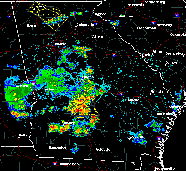 At 911 pm edt, severe thunderstorms were located along a line extending from near wallace to tremont to near raines, moving south at 55 mph (radar indicated). Hazards include 60 mph wind gusts and quarter size hail. Hail damage to vehicles is expected. Expect wind damage to roofs, siding, and trees. At 911 pm edt, severe thunderstorms were located along a line extending from near wallace to tremont to near raines, moving south at 55 mph (radar indicated). Hazards include 60 mph wind gusts and quarter size hail. Hail damage to vehicles is expected. Expect wind damage to roofs, siding, and trees.
|
| 6/22/2019 8:28 PM EDT |
 At 827 pm edt, a severe thunderstorm was located over cordele, moving east at 20 mph (radar indicated). Hazards include 60 mph wind gusts and quarter size hail. Hail damage to vehicles is expected. Expect wind damage to roofs, siding, and trees. At 827 pm edt, a severe thunderstorm was located over cordele, moving east at 20 mph (radar indicated). Hazards include 60 mph wind gusts and quarter size hail. Hail damage to vehicles is expected. Expect wind damage to roofs, siding, and trees.
|
| 6/20/2019 6:07 PM EDT |
 At 607 pm edt, a severe thunderstorm was located over abbeville, moving east at 55 mph (radar indicated). Hazards include 60 mph wind gusts. Expect damage to roofs, siding, and trees. Locations impacted include, cordele, eastman, abbeville, rochelle, milan, arabi, rhine, chauncey, pitts, jacksonville, union, east crisp, antioch church, seville, hatley, jay bird springs, temperance, browning, china hill and five points. At 607 pm edt, a severe thunderstorm was located over abbeville, moving east at 55 mph (radar indicated). Hazards include 60 mph wind gusts. Expect damage to roofs, siding, and trees. Locations impacted include, cordele, eastman, abbeville, rochelle, milan, arabi, rhine, chauncey, pitts, jacksonville, union, east crisp, antioch church, seville, hatley, jay bird springs, temperance, browning, china hill and five points.
|
| 6/20/2019 5:49 PM EDT |
 The national weather service in peachtree city has issued a * severe thunderstorm warning for. southern dodge county in central georgia. southern pulaski county in central georgia. western telfair county in central georgia. Wilcox county in central georgia. The national weather service in peachtree city has issued a * severe thunderstorm warning for. southern dodge county in central georgia. southern pulaski county in central georgia. western telfair county in central georgia. Wilcox county in central georgia.
|
| 6/20/2019 5:23 PM EDT | Trees down on 300 to 700 block of scenic route near lake blackshear in crisp county GA, 8.8 miles E of Cordele, GA |
| 6/20/2019 5:21 PM EDT |
 At 520 pm edt, a severe thunderstorm was located over cobb, or 11 miles west of cordele, moving east at 35 mph (radar indicated). Hazards include 60 mph wind gusts and quarter size hail. Hail damage to vehicles is expected. Expect wind damage to roofs, siding, and trees. At 520 pm edt, a severe thunderstorm was located over cobb, or 11 miles west of cordele, moving east at 35 mph (radar indicated). Hazards include 60 mph wind gusts and quarter size hail. Hail damage to vehicles is expected. Expect wind damage to roofs, siding, and trees.
|
| 5/12/2019 2:21 PM EDT |
 The severe thunderstorm warning for wilcox and crisp counties will expire at 230 pm edt, the storm which prompted the warning is weakening below severe limits, and no longer poses an immediate threat to life or property. therefore, the warning will be allowed to expire at 230 pm edt. however small hail, gusty winds and heavy rain are still possible with this thunderstorm. a severe thunderstorm watch remains in effect until 900 pm edt for central georgia. to report severe weather, contact your nearest law enforcement agency. they will relay your report to the national weather service peachtree city. The severe thunderstorm warning for wilcox and crisp counties will expire at 230 pm edt, the storm which prompted the warning is weakening below severe limits, and no longer poses an immediate threat to life or property. therefore, the warning will be allowed to expire at 230 pm edt. however small hail, gusty winds and heavy rain are still possible with this thunderstorm. a severe thunderstorm watch remains in effect until 900 pm edt for central georgia. to report severe weather, contact your nearest law enforcement agency. they will relay your report to the national weather service peachtree city.
|
| 5/12/2019 1:51 PM EDT |
 The national weather service in peachtree city has issued a * severe thunderstorm warning for. wilcox county in central georgia. crisp county in central georgia. until 230 pm edt. At 150 pm edt, a severe thunderstorm was southwest of cordele,. The national weather service in peachtree city has issued a * severe thunderstorm warning for. wilcox county in central georgia. crisp county in central georgia. until 230 pm edt. At 150 pm edt, a severe thunderstorm was southwest of cordele,.
|
| 5/11/2019 3:51 PM EDT |
 At 351 pm edt, severe thunderstorms were located along a line extending from near clearview to lilly to raines, moving northeast at 35 mph (radar indicated). Hazards include 60 mph wind gusts and quarter size hail. Hail damage to vehicles is expected. Expect wind damage to roofs, siding, and trees. At 351 pm edt, severe thunderstorms were located along a line extending from near clearview to lilly to raines, moving northeast at 35 mph (radar indicated). Hazards include 60 mph wind gusts and quarter size hail. Hail damage to vehicles is expected. Expect wind damage to roofs, siding, and trees.
|
| 5/11/2019 3:20 PM EDT | A tree was reported down on lakeshore driv in crisp county GA, 12 miles NE of Cordele, GA |
| 3/3/2019 5:42 PM EST |
 At 541 pm est, a severe thunderstorm was located over dumas, or near preston, moving east at 55 mph (radar indicated). Hazards include 60 mph wind gusts. expect damage to roofs, siding, and trees At 541 pm est, a severe thunderstorm was located over dumas, or near preston, moving east at 55 mph (radar indicated). Hazards include 60 mph wind gusts. expect damage to roofs, siding, and trees
|
| 3/3/2019 3:18 PM EST |
 At 317 pm est, a severe thunderstorm capable of producing a tornado was located over richwood, or near cordele, moving northeast at 45 mph (radar indicated rotation). Hazards include tornado. Flying debris will be dangerous to those caught without shelter. mobile homes will be damaged or destroyed. damage to roofs, windows, and vehicles will occur. Tree damage is likely. At 317 pm est, a severe thunderstorm capable of producing a tornado was located over richwood, or near cordele, moving northeast at 45 mph (radar indicated rotation). Hazards include tornado. Flying debris will be dangerous to those caught without shelter. mobile homes will be damaged or destroyed. damage to roofs, windows, and vehicles will occur. Tree damage is likely.
|
| 3/3/2019 2:34 PM EST |
 At 233 pm est, severe thunderstorms were located along a line extending from near croxton crossroads to sumter, moving northeast at 40 mph (radar indicated). Hazards include 60 mph wind gusts and penny size hail. expect damage to roofs, siding, and trees At 233 pm est, severe thunderstorms were located along a line extending from near croxton crossroads to sumter, moving northeast at 40 mph (radar indicated). Hazards include 60 mph wind gusts and penny size hail. expect damage to roofs, siding, and trees
|
| 7/23/2018 1:06 AM EDT |
 At 106 am edt, a severe thunderstorm was located near drayton, or 8 miles southwest of vienna, moving southeast at 20 mph (radar indicated). Hazards include 60 mph wind gusts and nickel size hail. expect damage to roofs, siding, and trees At 106 am edt, a severe thunderstorm was located near drayton, or 8 miles southwest of vienna, moving southeast at 20 mph (radar indicated). Hazards include 60 mph wind gusts and nickel size hail. expect damage to roofs, siding, and trees
|
| 7/22/2018 6:27 PM EDT | Report of quarter size hail in cordele... g in crisp county GA, 0.5 miles E of Cordele, GA |
| 6/28/2018 4:24 PM EDT | Ga 511 reports utility lines downed on hwy 300 and pateville rd in crisp county GA, 3.6 miles NE of Cordele, GA |
| 6/28/2018 3:26 PM EDT |
 At 326 pm edt, severe thunderstorms were located along a line extending from maddox to east crisp, moving south at 35 mph (radar indicated). Hazards include 60 mph wind gusts. Expect damage to roofs, siding, and trees. Locations impacted include, americus, cordele, vienna, arabi, byromville, pinehurst, leslie, andersonville, lilly, de soto, desoto, cobb, sumter, lamar, richwood, new era, huntington, pennington, drayton and methvins. At 326 pm edt, severe thunderstorms were located along a line extending from maddox to east crisp, moving south at 35 mph (radar indicated). Hazards include 60 mph wind gusts. Expect damage to roofs, siding, and trees. Locations impacted include, americus, cordele, vienna, arabi, byromville, pinehurst, leslie, andersonville, lilly, de soto, desoto, cobb, sumter, lamar, richwood, new era, huntington, pennington, drayton and methvins.
|
| 6/28/2018 3:12 PM EDT |
 At 311 pm edt, severe thunderstorms were located along a line extending from near new era to tippettville, moving south at 35 mph (radar indicated). Hazards include 60 mph wind gusts. expect damage to roofs, siding, and trees At 311 pm edt, severe thunderstorms were located along a line extending from near new era to tippettville, moving south at 35 mph (radar indicated). Hazards include 60 mph wind gusts. expect damage to roofs, siding, and trees
|
| 6/27/2018 3:02 PM EDT |
 At 301 pm edt, a severe thunderstorm was located over drayton, or 7 miles west of vienna, moving east at 20 mph (radar indicated). Hazards include 60 mph wind gusts and quarter size hail. Hail damage to vehicles is expected. Expect wind damage to roofs, siding, and trees. At 301 pm edt, a severe thunderstorm was located over drayton, or 7 miles west of vienna, moving east at 20 mph (radar indicated). Hazards include 60 mph wind gusts and quarter size hail. Hail damage to vehicles is expected. Expect wind damage to roofs, siding, and trees.
|
| 6/25/2018 7:41 PM EDT |
 At 709 pm edt, a severe thunderstorm was located over wenona, or near cordele, moving southeast at 20 mph (radar indicated). Hazards include 60 mph wind gusts and quarter size hail. Hail damage to vehicles is expected. Expect wind damage to roofs, siding, and trees. At 709 pm edt, a severe thunderstorm was located over wenona, or near cordele, moving southeast at 20 mph (radar indicated). Hazards include 60 mph wind gusts and quarter size hail. Hail damage to vehicles is expected. Expect wind damage to roofs, siding, and trees.
|
| 6/25/2018 7:09 PM EDT |
 At 709 pm edt, a severe thunderstorm was located over wenona, or near cordele, moving southeast at 20 mph (radar indicated). Hazards include 60 mph wind gusts and quarter size hail. Hail damage to vehicles is expected. Expect wind damage to roofs, siding, and trees. At 709 pm edt, a severe thunderstorm was located over wenona, or near cordele, moving southeast at 20 mph (radar indicated). Hazards include 60 mph wind gusts and quarter size hail. Hail damage to vehicles is expected. Expect wind damage to roofs, siding, and trees.
|
| 3/19/2018 5:14 PM EDT |
 At 514 pm edt, a severe thunderstorm was located over chokee, or 13 miles north of leesburg, moving northeast at 50 mph (radar indicated). Hazards include 60 mph wind gusts and half dollar size hail. Hail damage to vehicles is expected. Expect wind damage to roofs, siding, and trees. At 514 pm edt, a severe thunderstorm was located over chokee, or 13 miles north of leesburg, moving northeast at 50 mph (radar indicated). Hazards include 60 mph wind gusts and half dollar size hail. Hail damage to vehicles is expected. Expect wind damage to roofs, siding, and trees.
|
| 8/30/2017 4:19 PM EDT |
 At 419 pm edt, a severe thunderstorm was located over hatley, or 9 miles east of cordele, moving northeast at 35 mph (radar indicated). Hazards include 60 mph wind gusts. Expect damage to roofs, siding, and trees. Locations impacted include, cordele, arabi, east crisp, tremont, wenona and hatley. At 419 pm edt, a severe thunderstorm was located over hatley, or 9 miles east of cordele, moving northeast at 35 mph (radar indicated). Hazards include 60 mph wind gusts. Expect damage to roofs, siding, and trees. Locations impacted include, cordele, arabi, east crisp, tremont, wenona and hatley.
|
| 8/30/2017 4:04 PM EDT |
 At 403 pm edt, a severe thunderstorm was located near cordele, moving northeast at 40 mph (radar indicated). Hazards include 60 mph wind gusts. Expect damage to roofs, siding, and trees. Locations impacted include, cordele, vienna, arabi, east crisp, fort early, georgia veterans memorial st pk, richwood, tippettville, raines, tremont, wenona and hatley. At 403 pm edt, a severe thunderstorm was located near cordele, moving northeast at 40 mph (radar indicated). Hazards include 60 mph wind gusts. Expect damage to roofs, siding, and trees. Locations impacted include, cordele, vienna, arabi, east crisp, fort early, georgia veterans memorial st pk, richwood, tippettville, raines, tremont, wenona and hatley.
|
| 8/30/2017 3:44 PM EDT |
 At 344 pm edt, a severe thunderstorm was located over fort early, or 10 miles southwest of cordele, moving northeast at 40 mph (radar indicated). Hazards include 60 mph wind gusts and pea size hail. expect damage to roofs, siding, and trees At 344 pm edt, a severe thunderstorm was located over fort early, or 10 miles southwest of cordele, moving northeast at 40 mph (radar indicated). Hazards include 60 mph wind gusts and pea size hail. expect damage to roofs, siding, and trees
|
| 5/24/2017 11:54 AM EDT |
 At 1154 am edt, a severe thunderstorm capable of producing a tornado was located over georgia veterans memorial st pk, or near cordele, moving northeast at 40 mph (radar indicated rotation). Hazards include tornado. Flying debris will be dangerous to those caught without shelter. mobile homes will be damaged or destroyed. damage to roofs, windows, and vehicles will occur. Tree damage is likely. At 1154 am edt, a severe thunderstorm capable of producing a tornado was located over georgia veterans memorial st pk, or near cordele, moving northeast at 40 mph (radar indicated rotation). Hazards include tornado. Flying debris will be dangerous to those caught without shelter. mobile homes will be damaged or destroyed. damage to roofs, windows, and vehicles will occur. Tree damage is likely.
|
| 5/24/2017 11:31 AM EDT |
 At 1130 am edt, a severe thunderstorm capable of producing a tornado was located near raines, or near cordele, moving northeast at 30 mph (radar indicated rotation). Hazards include tornado. Flying debris will be dangerous to those caught without shelter. mobile homes will be damaged or destroyed. damage to roofs, windows, and vehicles will occur. Tree damage is likely. At 1130 am edt, a severe thunderstorm capable of producing a tornado was located near raines, or near cordele, moving northeast at 30 mph (radar indicated rotation). Hazards include tornado. Flying debris will be dangerous to those caught without shelter. mobile homes will be damaged or destroyed. damage to roofs, windows, and vehicles will occur. Tree damage is likely.
|
| 5/23/2017 1:30 PM EDT |
 At 130 pm edt, a severe thunderstorm was located near warwick, or 10 miles southwest of cordele, moving northeast at 40 mph (radar indicated). Hazards include 60 mph wind gusts and penny size hail. expect damage to roofs, siding, and trees At 130 pm edt, a severe thunderstorm was located near warwick, or 10 miles southwest of cordele, moving northeast at 40 mph (radar indicated). Hazards include 60 mph wind gusts and penny size hail. expect damage to roofs, siding, and trees
|
| 5/23/2017 12:41 PM EDT |
 At 1241 pm edt, a severe thunderstorm was located over richwood, or near vienna, moving northeast at 25 mph (radar indicated). Hazards include 60 mph wind gusts. expect damage to roofs, siding, and trees At 1241 pm edt, a severe thunderstorm was located over richwood, or near vienna, moving northeast at 25 mph (radar indicated). Hazards include 60 mph wind gusts. expect damage to roofs, siding, and trees
|
| 5/20/2017 3:13 PM EDT |
 At 313 pm edt, a severe thunderstorm was located near cordele, moving north at 20 mph (radar indicated). Hazards include 60 mph wind gusts. Expect damage to roofs, siding, and trees. Locations impacted include, cordele, arabi, east crisp, georgia veterans memorial st pk, raines, tremont, wenona and hatley. At 313 pm edt, a severe thunderstorm was located near cordele, moving north at 20 mph (radar indicated). Hazards include 60 mph wind gusts. Expect damage to roofs, siding, and trees. Locations impacted include, cordele, arabi, east crisp, georgia veterans memorial st pk, raines, tremont, wenona and hatley.
|
| 5/20/2017 2:38 PM EDT |
 At 237 pm edt, a severe thunderstorm was located near sibley, or 7 miles northwest of ashburn, moving north at 25 mph (radar indicated). Hazards include 60 mph wind gusts and penny size hail. expect damage to roofs, siding, and trees At 237 pm edt, a severe thunderstorm was located near sibley, or 7 miles northwest of ashburn, moving north at 25 mph (radar indicated). Hazards include 60 mph wind gusts and penny size hail. expect damage to roofs, siding, and trees
|
| 4/5/2017 2:54 PM EDT |
 At 254 pm edt, a severe thunderstorm capable of producing a tornado was located over oakfield, or 13 miles east of leesburg, moving east at 30 mph (radar indicated rotation). Hazards include tornado and quarter size hail. Flying debris will be dangerous to those caught without shelter. mobile homes will be damaged or destroyed. damage to roofs, windows, and vehicles will occur. Tree damage is likely. At 254 pm edt, a severe thunderstorm capable of producing a tornado was located over oakfield, or 13 miles east of leesburg, moving east at 30 mph (radar indicated rotation). Hazards include tornado and quarter size hail. Flying debris will be dangerous to those caught without shelter. mobile homes will be damaged or destroyed. damage to roofs, windows, and vehicles will occur. Tree damage is likely.
|
| 4/5/2017 2:15 PM EDT |
 At 214 pm edt, a severe thunderstorm was located over cordele, moving east at 30 mph (radar indicated). Hazards include 60 mph wind gusts and half dollar size hail. Hail damage to vehicles is expected. Expect wind damage to roofs, siding, and trees. At 214 pm edt, a severe thunderstorm was located over cordele, moving east at 30 mph (radar indicated). Hazards include 60 mph wind gusts and half dollar size hail. Hail damage to vehicles is expected. Expect wind damage to roofs, siding, and trees.
|
| 4/5/2017 2:03 PM EDT |
 At 202 pm edt, a confirmed large and destructive tornado was located near drayton, or near vienna, moving east at 35 mph. tornado emergency for southern dooly and northwestern crisp counties. this is a particularly dangerous situation. take cover now! (emergency management confirmed tornado that is now likely rain wrapped and difficult to see along with a history of producing widespread damage). Hazards include deadly tornado. You are in a life-threatening situation. flying debris may be deadly to those caught without shelter. mobile homes will be destroyed. considerable damage to homes, businesses, and vehicles is likely and complete destruction is possible. Locations impacted include, cordele, vienna, lilly, drayton, georgia veterans memorial st pk and richwood. At 202 pm edt, a confirmed large and destructive tornado was located near drayton, or near vienna, moving east at 35 mph. tornado emergency for southern dooly and northwestern crisp counties. this is a particularly dangerous situation. take cover now! (emergency management confirmed tornado that is now likely rain wrapped and difficult to see along with a history of producing widespread damage). Hazards include deadly tornado. You are in a life-threatening situation. flying debris may be deadly to those caught without shelter. mobile homes will be destroyed. considerable damage to homes, businesses, and vehicles is likely and complete destruction is possible. Locations impacted include, cordele, vienna, lilly, drayton, georgia veterans memorial st pk and richwood.
|
| 4/5/2017 1:31 PM EDT |
 Tornado emergency for southern dooly, southeast sumter , and northwest crisp counties, the national weather service in peachtree city has issued a * tornado warning for, southern dooly county in central georgia, southeastern sumter county in west central georgia, northwestern crisp county in central georgia, * until 215 pm edt * at 128 pm edt, a confirmed large and destructive tornado was observed over maddox, or near americus, moving east at 35 mph. tornado emergency for southern dooly, southeast sumter , and northwest crisp counties. this is a particularly dangerous situation. take cover now! (emergency management confirmed tornado that is now likely rain wrapped and difficult to see along with a history of producing widespread damage). Hazards include deadly tornado. You are in a life-threatening situation. flying debris may be deadly to those caught without shelter. mobile homes will be destroyed. Considerable damage to homes, businesses, and vehicles is likely and complete destruction is possible. Tornado emergency for southern dooly, southeast sumter , and northwest crisp counties, the national weather service in peachtree city has issued a * tornado warning for, southern dooly county in central georgia, southeastern sumter county in west central georgia, northwestern crisp county in central georgia, * until 215 pm edt * at 128 pm edt, a confirmed large and destructive tornado was observed over maddox, or near americus, moving east at 35 mph. tornado emergency for southern dooly, southeast sumter , and northwest crisp counties. this is a particularly dangerous situation. take cover now! (emergency management confirmed tornado that is now likely rain wrapped and difficult to see along with a history of producing widespread damage). Hazards include deadly tornado. You are in a life-threatening situation. flying debris may be deadly to those caught without shelter. mobile homes will be destroyed. Considerable damage to homes, businesses, and vehicles is likely and complete destruction is possible.
|
| 4/3/2017 2:09 PM EDT | Trees were reported down at highway 300 and the 300 connecto in crisp county GA, 2.4 miles ENE of Cordele, GA |
| 4/3/2017 2:06 PM EDT | Trees reported down near the highway 300/30 connector in crisp county GA, 2.2 miles E of Cordele, GA |
| 4/3/2017 1:58 PM EDT |
 At 158 pm edt, severe thunderstorms were located along a line extending from unadilla to near vienna to raines, moving east at 35 mph (radar indicated). Hazards include 60 mph wind gusts and nickel size hail. expect damage to roofs, siding, and trees At 158 pm edt, severe thunderstorms were located along a line extending from unadilla to near vienna to raines, moving east at 35 mph (radar indicated). Hazards include 60 mph wind gusts and nickel size hail. expect damage to roofs, siding, and trees
|
| 2/7/2017 6:10 PM EST |
 At 610 pm est, severe thunderstorms were located extending from near browndale to near tippettville to near warwick, moving east at 40 mph (radar indicated). Hazards include 60 mph wind gusts and penny size hail. expect damage to roofs, siding, and trees At 610 pm est, severe thunderstorms were located extending from near browndale to near tippettville to near warwick, moving east at 40 mph (radar indicated). Hazards include 60 mph wind gusts and penny size hail. expect damage to roofs, siding, and trees
|
| 2/7/2017 5:44 PM EST |
 At 544 pm est, a severe thunderstorm was located over cobb, or 11 miles west of cordele, moving northeast at 30 mph (radar indicated). Hazards include 60 mph wind gusts and penny size hail. expect damage to roofs, siding, and trees At 544 pm est, a severe thunderstorm was located over cobb, or 11 miles west of cordele, moving northeast at 30 mph (radar indicated). Hazards include 60 mph wind gusts and penny size hail. expect damage to roofs, siding, and trees
|
| 1/22/2017 3:59 PM EST |
 At 358 pm est, a confirmed large and extremely dangerous tornado was located near sibley, or 7 miles north of ashburn, moving northeast at 65 mph. this is a particularly dangerous situation. take cover now! (public confirmed tornado). Hazards include damaging tornado. You are in a life-threatening situation. flying debris may be deadly to those caught without shelter. mobile homes will be destroyed. considerable damage to homes, businesses, and vehicles is likely and complete destruction is possible. Locations impacted include, cordele, abbeville, rochelle, arabi, pineview, pitts, east crisp, cedar creek, antioch church, pope city, seville, hatley, browning, pleasant view, double run, wenona and owensboro. At 358 pm est, a confirmed large and extremely dangerous tornado was located near sibley, or 7 miles north of ashburn, moving northeast at 65 mph. this is a particularly dangerous situation. take cover now! (public confirmed tornado). Hazards include damaging tornado. You are in a life-threatening situation. flying debris may be deadly to those caught without shelter. mobile homes will be destroyed. considerable damage to homes, businesses, and vehicles is likely and complete destruction is possible. Locations impacted include, cordele, abbeville, rochelle, arabi, pineview, pitts, east crisp, cedar creek, antioch church, pope city, seville, hatley, browning, pleasant view, double run, wenona and owensboro.
|
| 1/22/2017 3:56 PM EST | Significant damage to mobile homes along south 7th street. additional damage extended northeast from this point on the south and east side of cordele. tornado possibl in crisp county GA, 1.5 miles NNE of Cordele, GA |
| 1/22/2017 3:55 PM EST | Numerous trees down along with structural damage to building near ga-hwy 300 and pateville road. possible tornado. time estimated from rada in crisp county GA, 3.6 miles NE of Cordele, GA |
| 1/22/2017 3:42 PM EST |
 At 341 pm est, a confirmed large and extremely dangerous tornado was located near doles, or 10 miles northwest of sylvester, moving northeast at 65 mph. this is a particularly dangerous situation. take cover now! (radar confirmed tornado). Hazards include damaging tornado. You are in a life-threatening situation. flying debris may be deadly to those caught without shelter. mobile homes will be destroyed. Considerable damage to homes, businesses, and vehicles is likely and complete destruction is possible. At 341 pm est, a confirmed large and extremely dangerous tornado was located near doles, or 10 miles northwest of sylvester, moving northeast at 65 mph. this is a particularly dangerous situation. take cover now! (radar confirmed tornado). Hazards include damaging tornado. You are in a life-threatening situation. flying debris may be deadly to those caught without shelter. mobile homes will be destroyed. Considerable damage to homes, businesses, and vehicles is likely and complete destruction is possible.
|
| 1/22/2017 11:38 AM EST |
 The severe thunderstorm warning for southern dooly. eastern sumter and central crisp counties will expire at 1145 am est. the storm which prompted the warning has weakened below severe limits, and no longer pose an immediate threat to life or property. therefore the warning will be allowed to expire. A tornado watch remains in effect until 100 pm est for central and. The severe thunderstorm warning for southern dooly. eastern sumter and central crisp counties will expire at 1145 am est. the storm which prompted the warning has weakened below severe limits, and no longer pose an immediate threat to life or property. therefore the warning will be allowed to expire. A tornado watch remains in effect until 100 pm est for central and.
|
| 1/22/2017 11:01 AM EST |
 The national weather service in peachtree city has issued a * severe thunderstorm warning for. southern dooly county in central georgia. eastern sumter county in west central georgia. central crisp county in central georgia. Until 1145 am est. The national weather service in peachtree city has issued a * severe thunderstorm warning for. southern dooly county in central georgia. eastern sumter county in west central georgia. central crisp county in central georgia. Until 1145 am est.
|
| 1/22/2017 11:01 AM EST |
 At 1100 am est, a severe thunderstorm was located near chokee, or 10 miles northeast of leesburg, moving northeast at 55 mph (radar indicated). Hazards include 60 mph wind gusts and quarter size hail. Hail damage to vehicles is expected. Expect wind damage to roofs, siding, and trees. At 1100 am est, a severe thunderstorm was located near chokee, or 10 miles northeast of leesburg, moving northeast at 55 mph (radar indicated). Hazards include 60 mph wind gusts and quarter size hail. Hail damage to vehicles is expected. Expect wind damage to roofs, siding, and trees.
|
| 1/21/2017 12:53 PM EST |
 At 1253 pm est, severe thunderstorms were located extending from pulaski state prison to near tippettville to near arabi, moving east at 50 mph (radar indicated). Hazards include 60 mph wind gusts. expect damage to roofs, siding, and trees At 1253 pm est, severe thunderstorms were located extending from pulaski state prison to near tippettville to near arabi, moving east at 50 mph (radar indicated). Hazards include 60 mph wind gusts. expect damage to roofs, siding, and trees
|
| 1/21/2017 12:47 PM EST | Traffic lights and power lines down near venona. 46 mph wind in crisp county GA, 5.2 miles NW of Cordele, GA |
| 1/2/2017 11:00 PM EST | Tree down into a house in crisp county GA, 2.4 miles ENE of Cordele, GA |
| 1/2/2017 10:55 PM EST | Preliminary from crisp county. 1 vehicle totaled...2 damaged from falling trees. one home has moderate damage. one home has minimal. several barns and storage buidlings in crisp county GA, 2.2 miles NNE of Cordele, GA |
| 1/2/2017 10:55 PM EST | Preliminary from crisp county. 1 vehicle totaled...2 damaged from falling trees. one home has moderate damage. one home has minimal. several barns and storage buidlings in crisp county GA, 4.9 miles N of Cordele, GA |
| 1/2/2017 10:51 PM EST |
 At 1051 pm est, a severe thunderstorm was located over worth, or near ashburn, moving east at 65 mph (radar indicated). Hazards include 60 mph wind gusts. expect damage to roofs, siding, and trees At 1051 pm est, a severe thunderstorm was located over worth, or near ashburn, moving east at 65 mph (radar indicated). Hazards include 60 mph wind gusts. expect damage to roofs, siding, and trees
|
| 6/17/2016 9:05 PM EDT | Crisp county ema/law enforcement has received reports of damage to several homes and numerous vehicles. also many downed powerlines. most damage found around the crisp in crisp county GA, 0.5 miles E of Cordele, GA |
| 6/17/2016 8:58 PM EDT | 1 tree down that destroyed a mobile home at corner of crisp and church st. on the south side of cordele. also had power lines down on farmersmarket road on the east sid in crisp county GA, 0.5 miles E of Cordele, GA |
| 6/17/2016 8:58 PM EDT |
 At 857 pm edt, severe thunderstorms were located along a line extending from near rhine to cordele, moving southeast at 30 mph (radar indicated). Hazards include 60 mph wind gusts and quarter size hail. Hail damage to vehicles is expected. expect wind damage to roofs, siding, and trees. Other locations in the warning include but are not limited to cordele, abbeville, rochelle, arabi, rhine, pitts, tremont, antioch church, double run, hatley, wenona, owensboro, seville, browning and east crisp. At 857 pm edt, severe thunderstorms were located along a line extending from near rhine to cordele, moving southeast at 30 mph (radar indicated). Hazards include 60 mph wind gusts and quarter size hail. Hail damage to vehicles is expected. expect wind damage to roofs, siding, and trees. Other locations in the warning include but are not limited to cordele, abbeville, rochelle, arabi, rhine, pitts, tremont, antioch church, double run, hatley, wenona, owensboro, seville, browning and east crisp.
|
| 6/17/2016 8:22 PM EDT |
 At 822 pm edt, severe thunderstorms were located along a line extending from 9 miles southeast of hawkinsville to near andersonville, moving southeast at 40 mph (radar indicated). Hazards include 60 mph wind gusts and quarter size hail. Hail damage to vehicles is expected. expect wind damage to roofs, siding, and trees. Other locations in the warning include but are not limited to cordele, vienna, abbeville, rochelle, arabi, byromville, pineview, pinehurst, rhine, pitts, lilly, union, antioch church, cedar creek, richwood, pope city, drayton, ocmulgee banks, owensboro and tippettville. At 822 pm edt, severe thunderstorms were located along a line extending from 9 miles southeast of hawkinsville to near andersonville, moving southeast at 40 mph (radar indicated). Hazards include 60 mph wind gusts and quarter size hail. Hail damage to vehicles is expected. expect wind damage to roofs, siding, and trees. Other locations in the warning include but are not limited to cordele, vienna, abbeville, rochelle, arabi, byromville, pineview, pinehurst, rhine, pitts, lilly, union, antioch church, cedar creek, richwood, pope city, drayton, ocmulgee banks, owensboro and tippettville.
|
| 6/1/2016 4:40 PM EDT | Quarter sized hail reported 4.3 miles W of Cordele, GA |
| 6/1/2016 4:31 PM EDT |
 At 431 pm edt, a severe thunderstorm was located near pitts, or 9 miles east of cordele, moving east at 20 mph (radar indicated). Hazards include 60 mph wind gusts and quarter size hail. Hail damage to vehicles is expected. expect wind damage to roofs, siding, and trees. Other locations in the warning include but are not limited to cordele, abbeville, rochelle, pineview, pitts, antioch church, tremont, cedar creek, pope city, hatley, pleasant view, seville and east crisp. At 431 pm edt, a severe thunderstorm was located near pitts, or 9 miles east of cordele, moving east at 20 mph (radar indicated). Hazards include 60 mph wind gusts and quarter size hail. Hail damage to vehicles is expected. expect wind damage to roofs, siding, and trees. Other locations in the warning include but are not limited to cordele, abbeville, rochelle, pineview, pitts, antioch church, tremont, cedar creek, pope city, hatley, pleasant view, seville and east crisp.
|
| 5/3/2016 8:08 PM EDT |
 The severe thunderstorm warning for northeastern crisp county will expire at 815 pm edt, the storm which prompted the warning has moved out of the area. therefore the warning will be allowed to expire. a severe thunderstorm watch remains in effect until 1000 pm edt for central georgia. The severe thunderstorm warning for northeastern crisp county will expire at 815 pm edt, the storm which prompted the warning has moved out of the area. therefore the warning will be allowed to expire. a severe thunderstorm watch remains in effect until 1000 pm edt for central georgia.
|
| 5/3/2016 7:57 PM EDT | Numerous trees and power lines were downed in the vicinity of cemetery rd and dockweiler rd. some trees were blown onto house in crisp county GA, 6.9 miles WSW of Cordele, GA |
| 5/3/2016 7:52 PM EDT |
 At 752 pm edt, a severe thunderstorm was located just south of cordele, moving northeast at 35 mph (radar indicated). Hazards include 70 mph wind gusts and ping pong ball size hail. People and animals outdoors will be injured. expect hail damage to roofs, siding, windows, and vehicles. expect considerable tree damage. wind damage is also likely to mobile homes, roofs, and outbuildings. Other locations in the warning include but are not limited to cordele, tremont, wenona and east crisp. At 752 pm edt, a severe thunderstorm was located just south of cordele, moving northeast at 35 mph (radar indicated). Hazards include 70 mph wind gusts and ping pong ball size hail. People and animals outdoors will be injured. expect hail damage to roofs, siding, windows, and vehicles. expect considerable tree damage. wind damage is also likely to mobile homes, roofs, and outbuildings. Other locations in the warning include but are not limited to cordele, tremont, wenona and east crisp.
|
| 5/3/2016 7:36 PM EDT |
 At 736 pm edt, a severe thunderstorm was located 9 miles southwest of cordele, moving northeast at 35 mph (radar indicated). Hazards include 70 mph wind gusts and quarter size hail. Hail damage to vehicles is expected. expect considerable tree damage. wind damage is also likely to mobile homes, roofs, and outbuildings. Other locations in the warning include but are not limited to cordele, vienna, arabi, cobb, tremont, georgia veterans memorial st pk, richwood, wenona, east crisp, fort early and raines. At 736 pm edt, a severe thunderstorm was located 9 miles southwest of cordele, moving northeast at 35 mph (radar indicated). Hazards include 70 mph wind gusts and quarter size hail. Hail damage to vehicles is expected. expect considerable tree damage. wind damage is also likely to mobile homes, roofs, and outbuildings. Other locations in the warning include but are not limited to cordele, vienna, arabi, cobb, tremont, georgia veterans memorial st pk, richwood, wenona, east crisp, fort early and raines.
|
| 5/3/2016 7:34 PM EDT | Numerous trees were downed on cork ferry rd on lake blackshea in crisp county GA, 10.4 miles ENE of Cordele, GA |
| 2/24/2016 1:40 AM EST | Metal roof blown off a pole barn on highway 33 between cofer and landfill road in crisp county GA, 2.4 miles ENE of Cordele, GA |
| 2/24/2016 1:33 AM EST |
 At 133 am est, a severe thunderstorm was located near cordele, moving northeast at 60 mph (radar indicated). Hazards include 70 mph wind gusts. Expect considerable tree damage. damage is likely to mobile homes, roofs and outbuildings. other locations in the warning include but are not limited to cordele, arabi, tremont, georgia veterans memorial st pk, hatley, wenona, east crisp, fort early and raines. A tornado watch remains in effect until 600 am est for west central georgia. At 133 am est, a severe thunderstorm was located near cordele, moving northeast at 60 mph (radar indicated). Hazards include 70 mph wind gusts. Expect considerable tree damage. damage is likely to mobile homes, roofs and outbuildings. other locations in the warning include but are not limited to cordele, arabi, tremont, georgia veterans memorial st pk, hatley, wenona, east crisp, fort early and raines. A tornado watch remains in effect until 600 am est for west central georgia.
|
| 2/24/2016 1:27 AM EST |
 At 126 am est, a severe thunderstorm was located 9 miles southeast of desoto, or 10 miles southwest of cordele, moving northeast at 60 mph (radar indicated). Hazards include 60 mph wind gusts. Expect damage to roofs. siding and trees. other locations in the warning include but are not limited to cordele, arabi, tremont, georgia veterans memorial st pk, hatley, wenona, east crisp, fort early and raines. A tornado watch remains in effect until 600 am est for west central georgia. At 126 am est, a severe thunderstorm was located 9 miles southeast of desoto, or 10 miles southwest of cordele, moving northeast at 60 mph (radar indicated). Hazards include 60 mph wind gusts. Expect damage to roofs. siding and trees. other locations in the warning include but are not limited to cordele, arabi, tremont, georgia veterans memorial st pk, hatley, wenona, east crisp, fort early and raines. A tornado watch remains in effect until 600 am est for west central georgia.
|
| 8/6/2015 2:50 PM EDT |
 At 249 pm edt, a severe thunderstorm was located near desoto, or 11 miles west of cordele, moving east at 30 mph (radar indicated). Hazards include 60 mph wind gusts and penny size hail. Expect damage to roofs. siding and trees. Other locations in the warning include but are not limited to cordele, vienna, cobb, tremont, georgia veterans memorial st pk, richwood, east crisp, drayton and tippettville. At 249 pm edt, a severe thunderstorm was located near desoto, or 11 miles west of cordele, moving east at 30 mph (radar indicated). Hazards include 60 mph wind gusts and penny size hail. Expect damage to roofs. siding and trees. Other locations in the warning include but are not limited to cordele, vienna, cobb, tremont, georgia veterans memorial st pk, richwood, east crisp, drayton and tippettville.
|
| 7/31/2015 6:05 PM EDT | 911 call center received report of a tree down on cemetary road just off of highway 257 and another tree down on frontage road very near cordel in crisp county GA, 0.5 miles E of Cordele, GA |
| 7/31/2015 5:45 PM EDT |
 At 544 pm edt, a severe thunderstorm was located near vienna, moving south at 10 mph (radar indicated). Hazards include 60 mph wind gusts. Expect damage to roofs. siding and trees. Other locations in the warning include but are not limited to cordele, vienna, tremont, richwood, wenona, east crisp, tippettville, pleasant view, seville, raines and hatley. At 544 pm edt, a severe thunderstorm was located near vienna, moving south at 10 mph (radar indicated). Hazards include 60 mph wind gusts. Expect damage to roofs. siding and trees. Other locations in the warning include but are not limited to cordele, vienna, tremont, richwood, wenona, east crisp, tippettville, pleasant view, seville, raines and hatley.
|
| 7/19/2015 6:26 PM EDT | Two trees down at scenic route and south cedar creek r in crisp county GA, 5.4 miles ENE of Cordele, GA |
| 6/23/2015 2:52 PM EDT |
 At 252 pm edt, a severe thunderstorm was located near cordele, moving southeast at 15 mph (radar indicated). Hazards include 60 mph wind gusts and quarter size hail. Hail damage to vehicles is expected. expect wind damage to roofs, siding and trees. Other locations in the warning include but are not limited to cordele, arabi, pitts, tremont, double run, hatley, wenona, east crisp, owensboro and seville. At 252 pm edt, a severe thunderstorm was located near cordele, moving southeast at 15 mph (radar indicated). Hazards include 60 mph wind gusts and quarter size hail. Hail damage to vehicles is expected. expect wind damage to roofs, siding and trees. Other locations in the warning include but are not limited to cordele, arabi, pitts, tremont, double run, hatley, wenona, east crisp, owensboro and seville.
|
| 6/23/2015 2:45 PM EDT | 911 call center received report of a tree branch on vehicle in the valhalla neighborhood west of cordele. numerous trees have also been reported to have fallen down on in crisp county GA, 0.5 miles E of Cordele, GA |
| 6/23/2015 2:08 PM EDT |
 At 208 pm edt, a severe thunderstorm was located near lilly, or near vienna, moving southeast at 20 mph (radar indicated). Hazards include 60 mph wind gusts and quarter size hail. Hail damage to vehicles is expected. expect wind damage to roofs, siding and trees. Other locations in the warning include but are not limited to cordele, vienna, lilly, tremont, georgia veterans memorial st pk, richwood, drayton and raines. At 208 pm edt, a severe thunderstorm was located near lilly, or near vienna, moving southeast at 20 mph (radar indicated). Hazards include 60 mph wind gusts and quarter size hail. Hail damage to vehicles is expected. expect wind damage to roofs, siding and trees. Other locations in the warning include but are not limited to cordele, vienna, lilly, tremont, georgia veterans memorial st pk, richwood, drayton and raines.
|
| 6/18/2015 9:10 PM EDT | The severe thunderstorm warning for north central crisp and eastern dooly counties will expire at 915 pm edt, the storm which prompted the warning has weakened below severe limits, and no longer pose an immediate threat to life or property. therefore the warning will be allowed to expire. |
| 6/18/2015 8:45 PM EDT | At 845 pm edt, a severe thunderstorm was located over vienna, moving northeast at 20 mph (radar indicated). Hazards include 60 mph wind gusts and quarter size hail. Hail damage to vehicles is expected. expect wind damage to roofs, siding and trees. Other locations in the warning include but are not limited to vienna, unadilla, pinehurst and richwood. |
| 4/25/2015 7:11 PM EDT | Emergency manager reports numerous trees and powerlines down across the county. at least one tree is on a hous in crisp county GA, 0.5 miles E of Cordele, GA |
| 4/25/2015 6:41 PM EDT | At 641 pm edt, a severe thunderstorm was located over desoto, or 13 miles southeast of americus, moving east at 45 mph (radar indicated). Hazards include 60 mph wind gusts and quarter size hail. Hail damage to vehicles is expected. expect wind damage to roofs, siding and trees. other locations in the warning include but are not limited to cordele, vienna, rochelle, arabi, pineview, leslie, pitts, de soto, desoto, cobb, lamar, richwood, pope city, drayton, tippettville, seville, raines, georgia veterans memorial st pk, tremont and double run. 1. 00in. |
| 4/19/2015 12:13 PM EDT | At 1213 pm edt, a severe thunderstorm with weak rotation was located 11 miles south southwest of cordele, moving northeast at 35 mph (radar indicated). Hazards include 60 mph wind gusts. Expect damage to roofs. siding and trees. other locations in the warning include but are not limited to cordele, arabi, tremont, hatley, wenona, east crisp, pleasant view and seville. a tornado watch remains in effect until 300 pm edt for central georgia. Possible. |
| 3/31/2015 4:25 PM EDT | The severe thunderstorm warning for northeastern crisp and southeastern dooly counties will expire at 430 pm edt. the storms which prompted the warning have weakened below severe limits. and no longer poses an immediate threat to life or property. therefore the warning will be allowed to expire. However small hail is still possible with this thunderstorm. |
| 3/31/2015 3:15 PM EST | Quarter sized hail reported 4 miles S of Cordele, GA, quarter size hail. report came from social media. |
| 3/31/2015 4:00 PM EDT | A severe thunderstorm warning remains in effect until 430 pm edt for northeastern crisp and southeastern dooly counties. at 359 pm edt. doppler radar indicated two severe thunderstorms capable of producing quarter size hail and damaging winds in excess of 60 mph. these storms were located along a line extending from 8 miles northeast of cordele to near vienna. Moving. |
| 3/31/2015 3:42 PM EDT | The national weather service in peachtree city has issued a * severe thunderstorm warning for. northern crisp county in central georgia. southern dooly county in central georgia. until 430 pm edt * at 342 pm edt. Doppler radar indicated a severe thunderstorm. |
| 7/28/2014 4:30 PM EDT | Two trees were knocked down near the georgia veterans state par in crisp county GA, 0.5 miles E of Cordele, GA |
| 6/21/2014 5:54 PM EDT | Crisp county emergency manager and the media reported a roof blew off a house naer jameston road and hwy30 in crisp county GA, 6.7 miles NE of Cordele, GA |
| 6/6/2014 7:39 PM EDT | A couple of trees were reported down on the east side of the count in crisp county GA, 4.7 miles NW of Cordele, GA |
| 7/5/2013 4:50 PM EDT | Estimated winds of 40 to 50 mph caused several powerpoles to lean over. nearby a few tree limbs were also blown dow in crisp county GA, 1.6 miles NNW of Cordele, GA |
| 6/28/2013 5:50 PM EDT | The crisp county emergency manager reported one tree down in addition to a few limb in crisp county GA, 0.5 miles E of Cordele, GA |
| 6/28/2013 5:50 PM EDT | Emergency manager reported power lines blown down along u.s. highway 28 in crisp county GA, 4.7 miles E of Cordele, GA |
| 6/28/2013 5:45 PM EDT | Emergency manager reported two large oak trees blown down in the clay pit and cork ferry road area in crisp county GA, 8 miles ENE of Cordele, GA |
| 5/19/2013 4:00 PM EDT | County emergency manager reports around 10 trees down across the east and southeast portions of the county...mainly east of i-7 in crisp county GA, 2 miles NW of Cordele, GA |
| 3/31/2013 5:44 PM EDT | Quarter sized hail reported 5.8 miles WNW of Cordele, GA, the crisp county emergency manager reported quarter sized hail. |
| 7/25/2012 7:48 PM EDT | Quarter sized hail reported 6 miles W of Cordele, GA, crisp county 911 relayed a report from a deputy in east crisp of hail from slightly larger than pennys to quarters. time estimated from radar. |
| 1/1/0001 12:00 AM | Crisp county ema relayed a report of a downed tree near the intersection of antioch and range station road in crisp county GA, 5.3 miles NE of Cordele, GA |
| 1/1/0001 12:00 AM | Crisp county 911 relayed report of a downed tree. water was also reported over ga 300 near culpeppe in crisp county GA, 0.5 miles E of Cordele, GA |
| 1/1/0001 12:00 AM | 1 tree down at drayton roa in crisp county GA, 0.5 miles E of Cordele, GA |
| 1/1/0001 12:00 AM | Quarter sized hail reported 9.3 miles E of Cordele, GA |
| 1/1/0001 12:00 AM | Golf Ball sized hail reported 0.5 miles E of Cordele, GA |
| 1/1/0001 12:00 AM | Crisp county 911 relayed reports of 4-5 downed in crisp county GA, 0.5 miles E of Cordele, GA |
Hail Maps for Cordele, GA
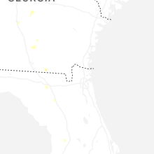

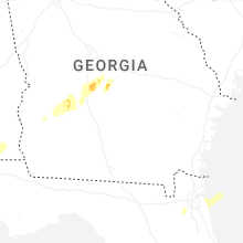

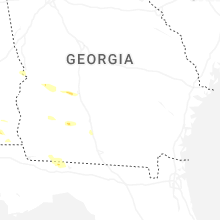


Connect with Interactive Hail Maps