

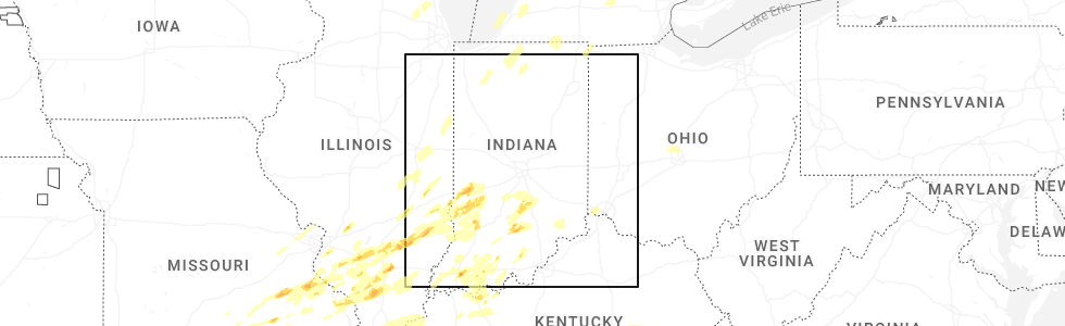
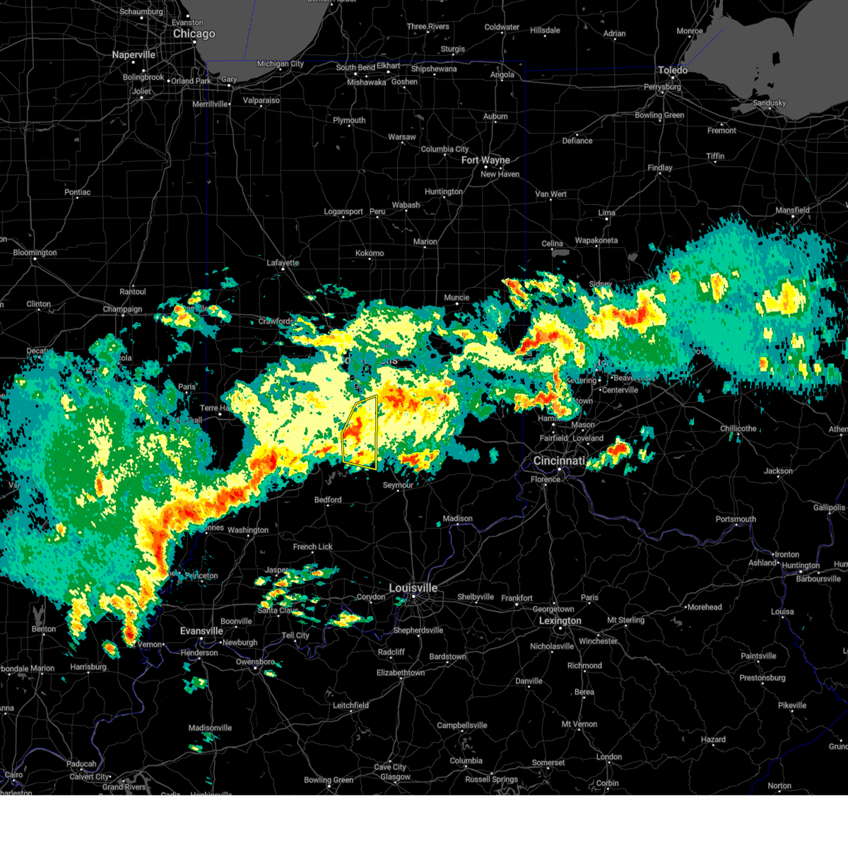
Hail Map for Cordry Sweetwater Lakes, IN
The Cordry Sweetwater Lakes, IN area has had 1 report of on-the-ground hail by trained spotters, and has been under severe weather warnings 18 times during the past 12 months. Doppler radar has detected hail at or near Cordry Sweetwater Lakes, IN on 42 occasions, including 4 occasions during the past year.
| Name: | Cordry Sweetwater Lakes, IN |
| Where Located: | 31.9 miles S of Indianapolis, IN |
| Map: | Google Map for Cordry Sweetwater Lakes, IN |
| Population: | 1128 |
| Housing Units: | 1259 |
| More Info: | Search Google for Cordry Sweetwater Lakes, IN |
2
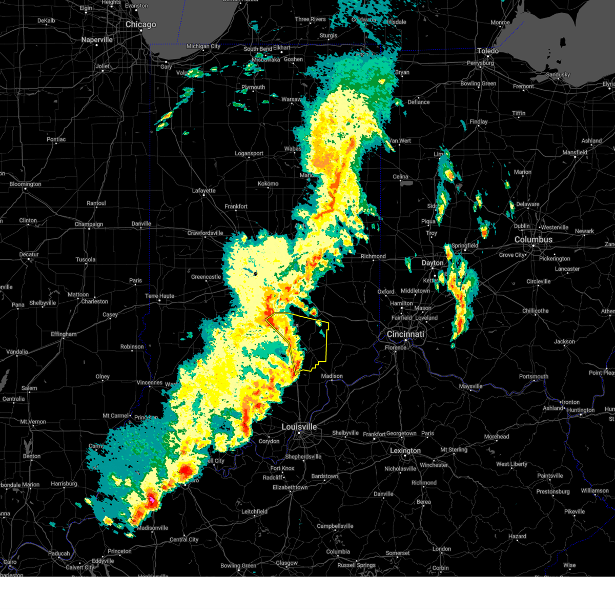
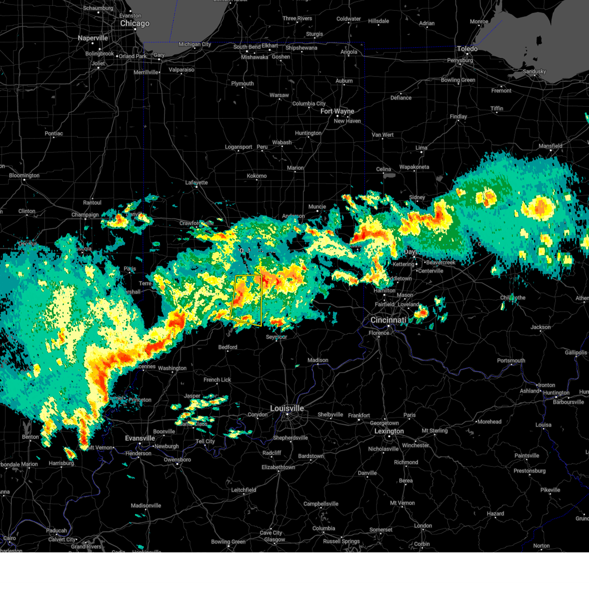
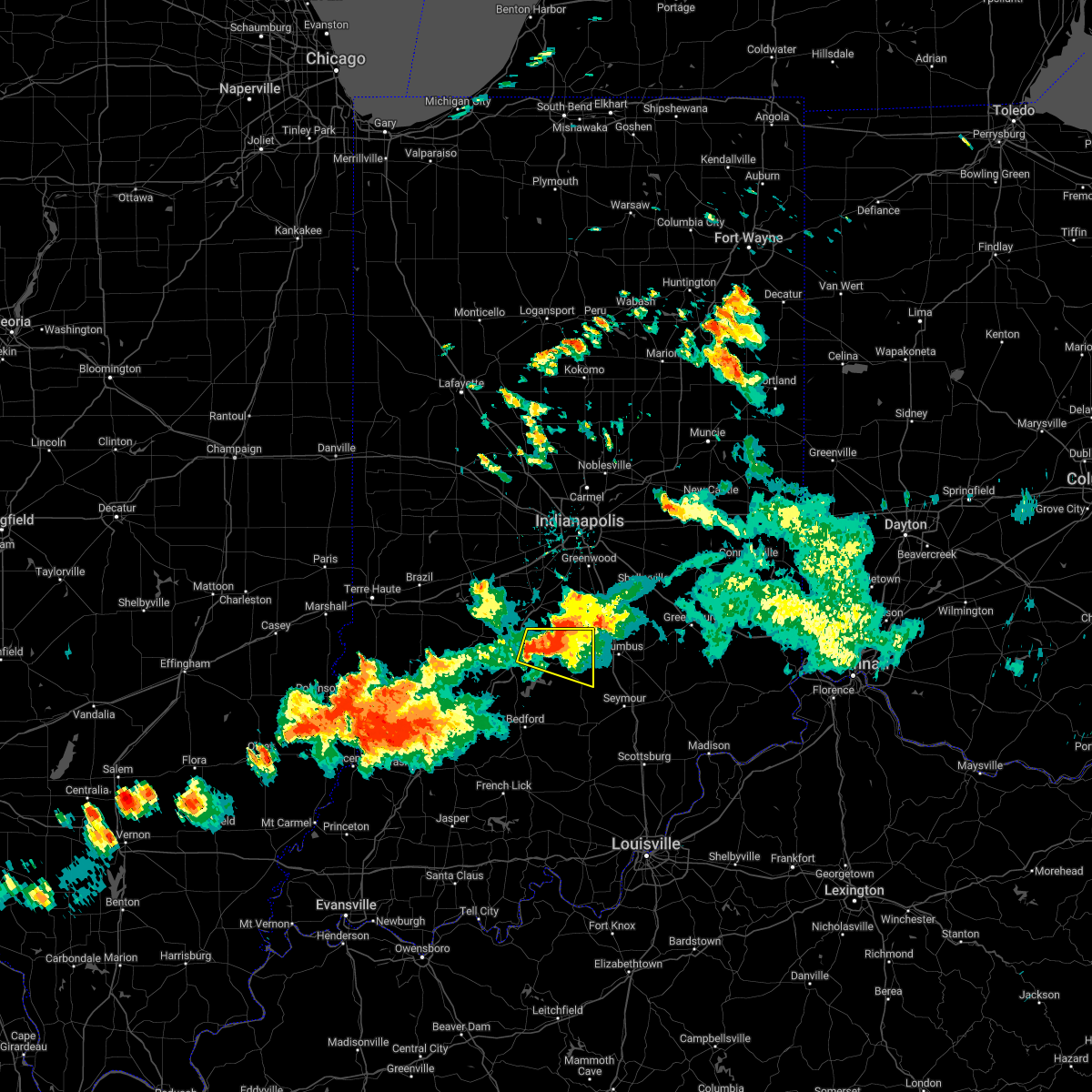
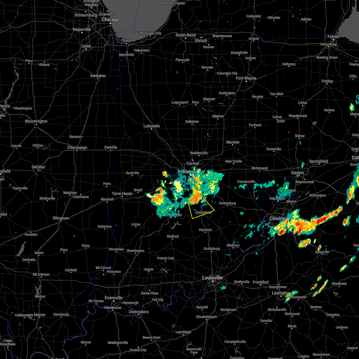
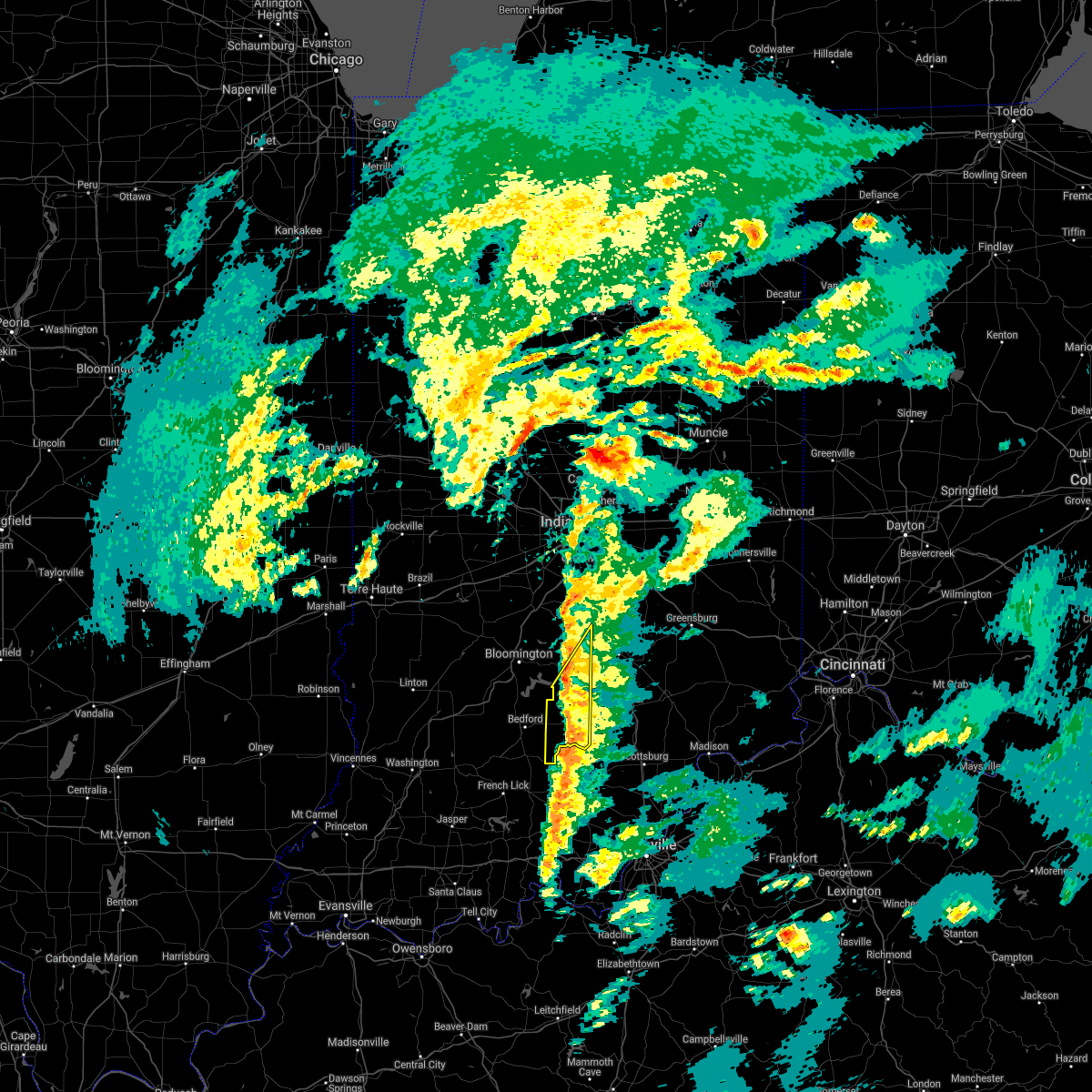
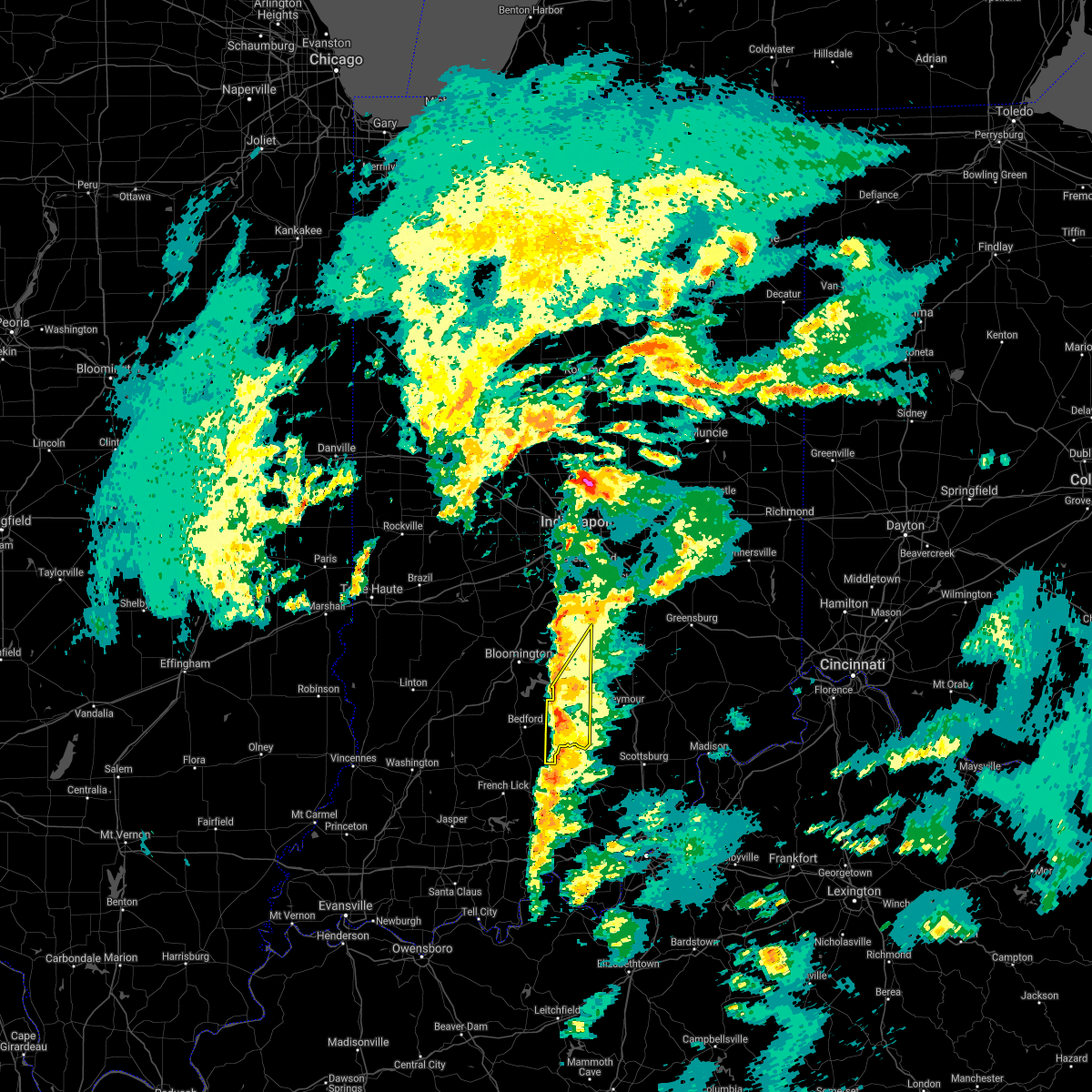
The Top Recent Hail Date for Cordry Sweetwater Lakes, IN is Sunday, March 30, 2025 (3rd out of 42)
Hail and Wind Damage Spotted near Cordry Sweetwater Lakes, IN
| Date / Time | Report Details |
|---|---|
| 6/18/2025 5:14 PM EDT |
 Svrind the national weather service in indianapolis has issued a * severe thunderstorm warning for, southeastern hancock county in central indiana, shelby county in central indiana, rush county in central indiana, decatur county in central indiana, southeastern brown county in south central indiana, southeastern johnson county in central indiana, bartholomew county in central indiana, southeastern henry county in east central indiana, * until 600 pm edt. * at 513 pm edt, severe thunderstorms were located along a line extending from 7 miles south of greenfield to 11 miles north of brownstown, moving east at 45 mph (radar indicated). Hazards include 60 mph wind gusts and penny size hail. expect damage to roofs, siding, and trees Svrind the national weather service in indianapolis has issued a * severe thunderstorm warning for, southeastern hancock county in central indiana, shelby county in central indiana, rush county in central indiana, decatur county in central indiana, southeastern brown county in south central indiana, southeastern johnson county in central indiana, bartholomew county in central indiana, southeastern henry county in east central indiana, * until 600 pm edt. * at 513 pm edt, severe thunderstorms were located along a line extending from 7 miles south of greenfield to 11 miles north of brownstown, moving east at 45 mph (radar indicated). Hazards include 60 mph wind gusts and penny size hail. expect damage to roofs, siding, and trees
|
| 6/18/2025 5:06 PM EDT |
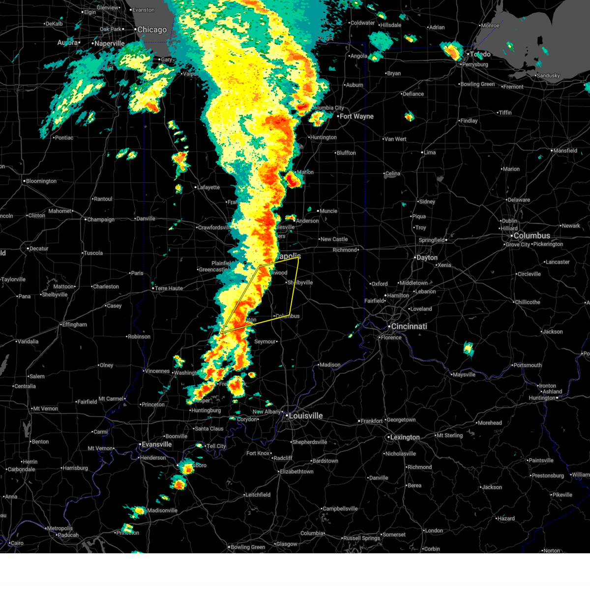 At 506 pm edt, severe thunderstorms were located along a line extending from near greenfield to 7 miles southeast of nashville, moving east at 45 mph (radar indicated). Hazards include 60 mph wind gusts and penny size hail. Expect damage to roofs, siding, and trees. locations impacted include, indianapolis, bloomington, columbus, shelbyville, greenwood, franklin, southport, nashville, new whiteland, edinburgh, whiteland, bargersville, hope, flat rock, princes lakes, geneva, morristown, trafalgar, morgantown, and fairland. this includes the following highways, interstate 65 between mile markers 66 and 103. Interstate 74 between mile markers 98 and 119. At 506 pm edt, severe thunderstorms were located along a line extending from near greenfield to 7 miles southeast of nashville, moving east at 45 mph (radar indicated). Hazards include 60 mph wind gusts and penny size hail. Expect damage to roofs, siding, and trees. locations impacted include, indianapolis, bloomington, columbus, shelbyville, greenwood, franklin, southport, nashville, new whiteland, edinburgh, whiteland, bargersville, hope, flat rock, princes lakes, geneva, morristown, trafalgar, morgantown, and fairland. this includes the following highways, interstate 65 between mile markers 66 and 103. Interstate 74 between mile markers 98 and 119.
|
| 6/18/2025 4:32 PM EDT |
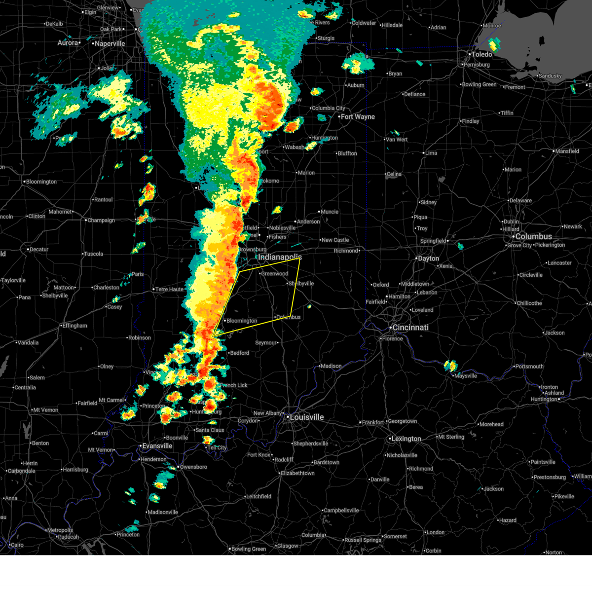 Svrind the national weather service in indianapolis has issued a * severe thunderstorm warning for, southern hancock county in central indiana, shelby county in central indiana, central monroe county in south central indiana, eastern morgan county in central indiana, brown county in south central indiana, johnson county in central indiana, northern bartholomew county in central indiana, southern marion county in central indiana, * until 515 pm edt. * at 431 pm edt, severe thunderstorms were located along a line extending from mooresville to 12 miles southwest of bloomington, moving east at 55 mph (radar indicated). Hazards include 70 mph wind gusts and penny size hail. Expect considerable tree damage. Damage is likely to mobile homes, roofs, and outbuildings. Svrind the national weather service in indianapolis has issued a * severe thunderstorm warning for, southern hancock county in central indiana, shelby county in central indiana, central monroe county in south central indiana, eastern morgan county in central indiana, brown county in south central indiana, johnson county in central indiana, northern bartholomew county in central indiana, southern marion county in central indiana, * until 515 pm edt. * at 431 pm edt, severe thunderstorms were located along a line extending from mooresville to 12 miles southwest of bloomington, moving east at 55 mph (radar indicated). Hazards include 70 mph wind gusts and penny size hail. Expect considerable tree damage. Damage is likely to mobile homes, roofs, and outbuildings.
|
| 5/16/2025 9:11 PM EDT | Svrind the national weather service in indianapolis has issued a * severe thunderstorm warning for, southwestern shelby county in central indiana, southeastern morgan county in central indiana, northeastern brown county in south central indiana, southern johnson county in central indiana, northwestern bartholomew county in central indiana, * until 945 pm edt. * at 911 pm edt, a severe thunderstorm was located 8 miles southeast of martinsville, or 18 miles northeast of bloomington, moving east at 50 mph (radar indicated). Hazards include 60 mph wind gusts and quarter size hail. Hail damage to vehicles is expected. Expect wind damage to roofs, siding, and trees. |
| 5/16/2025 7:48 PM EDT |
 Svrind the national weather service in indianapolis has issued a * severe thunderstorm warning for, shelby county in central indiana, southern rush county in central indiana, northwestern decatur county in central indiana, northeastern brown county in south central indiana, southeastern johnson county in central indiana, northern bartholomew county in central indiana, * until 830 pm edt. * at 747 pm edt, a severe thunderstorm was located 9 miles northwest of columbus, moving northeast at 60 mph (radar indicated). Hazards include golf ball size hail and 60 mph wind gusts. People and animals outdoors will be injured. expect hail damage to roofs, siding, windows, and vehicles. Expect wind damage to roofs, siding, and trees. Svrind the national weather service in indianapolis has issued a * severe thunderstorm warning for, shelby county in central indiana, southern rush county in central indiana, northwestern decatur county in central indiana, northeastern brown county in south central indiana, southeastern johnson county in central indiana, northern bartholomew county in central indiana, * until 830 pm edt. * at 747 pm edt, a severe thunderstorm was located 9 miles northwest of columbus, moving northeast at 60 mph (radar indicated). Hazards include golf ball size hail and 60 mph wind gusts. People and animals outdoors will be injured. expect hail damage to roofs, siding, windows, and vehicles. Expect wind damage to roofs, siding, and trees.
|
| 4/2/2025 9:39 PM EDT | At 939 pm edt, a severe thunderstorm was located near greenwood, or 12 miles northwest of shelbyville, moving east at 65 mph (radar indicated). Hazards include 70 mph wind gusts and penny size hail. Expect considerable tree damage. damage is likely to mobile homes, roofs, and outbuildings. locations impacted include, franklin, peoga, morgantown, new whiteland, beanblossom, manilla, martinsville, edinburgh, fairland, arlington, taylorsville, mahalasville, trafalgar, greenwood, paragon, whiteland, boggstown, marietta, waverly, and spearsville. this includes the following highways, interstate 65 between mile markers 75 and 101. Interstate 74 between mile markers 102 and 118. |
| 4/2/2025 9:21 PM EDT | Svrind the national weather service in indianapolis has issued a * severe thunderstorm warning for, shelby county in central indiana, northern monroe county in south central indiana, west central rush county in central indiana, morgan county in central indiana, northern brown county in south central indiana, johnson county in central indiana, northwestern bartholomew county in central indiana, southern marion county in central indiana, * until 1000 pm edt. * at 920 pm edt, severe thunderstorms were located along a line extending from near mooresville to 7 miles southwest of martinsville, moving east at 45 mph (radar indicated). Hazards include 70 mph wind gusts and penny size hail. Expect considerable tree damage. Damage is likely to mobile homes, roofs, and outbuildings. |
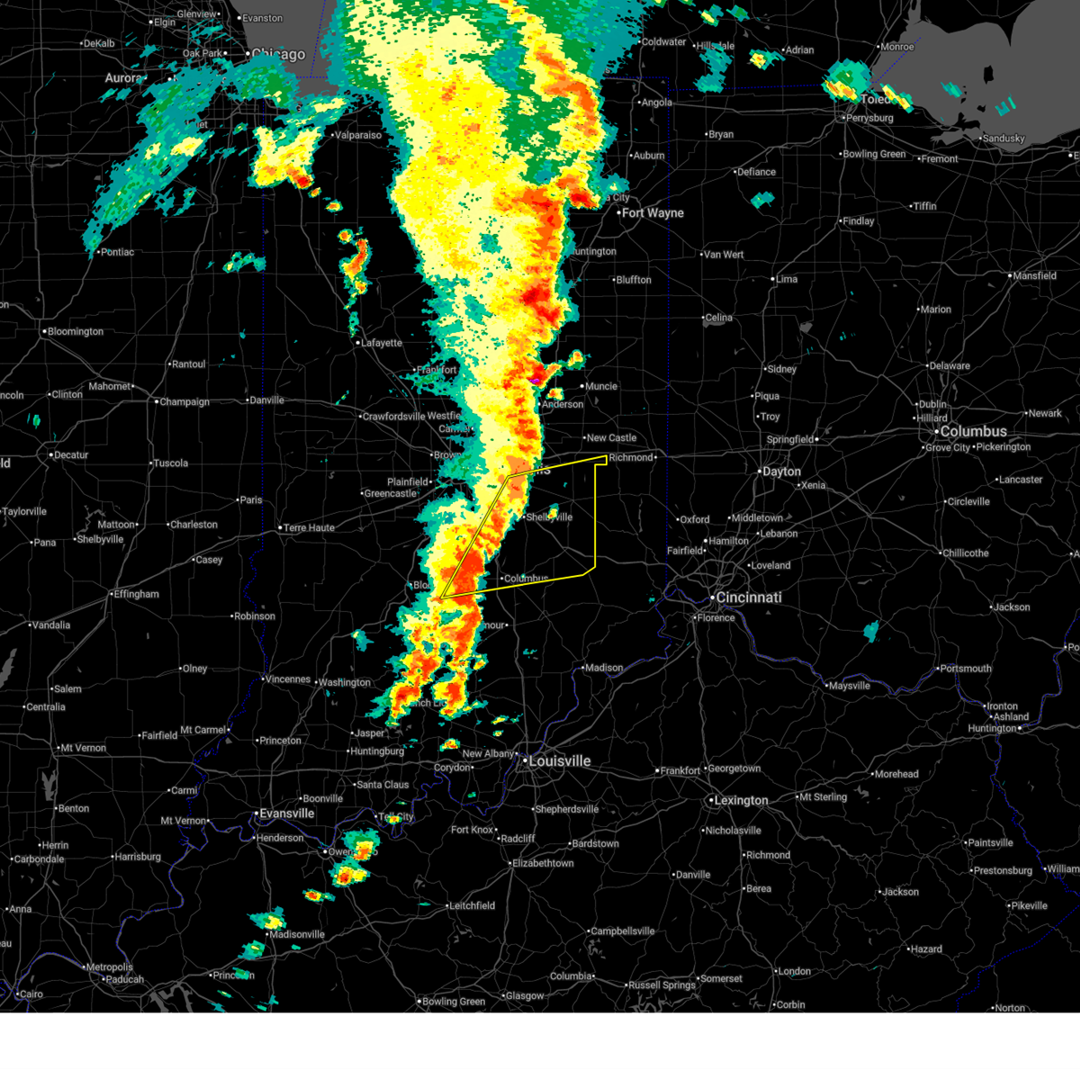
| 3/30/2025 7:13 PM EDT |
 At 713 pm edt, severe thunderstorms were located along a line extending from near franklin to 7 miles southwest of brownstown, moving east at 50 mph (radar indicated). Hazards include 60 mph wind gusts and quarter size hail. Hail damage to vehicles is expected. expect wind damage to roofs, siding, and trees. locations impacted include, franklin, peoga, gnaw bone, vallonia, spurgeons corner, medora, azalia, pleasant view, elkinsville, cortland, elizabethtown, edinburgh, fairland, stone head, story, seymour, taylorsville, flat rock, norman, and trafalgar. this includes the following highways, interstate 65 between mile markers 40 and 95. Interstate 74 between mile markers 107 and 112. At 713 pm edt, severe thunderstorms were located along a line extending from near franklin to 7 miles southwest of brownstown, moving east at 50 mph (radar indicated). Hazards include 60 mph wind gusts and quarter size hail. Hail damage to vehicles is expected. expect wind damage to roofs, siding, and trees. locations impacted include, franklin, peoga, gnaw bone, vallonia, spurgeons corner, medora, azalia, pleasant view, elkinsville, cortland, elizabethtown, edinburgh, fairland, stone head, story, seymour, taylorsville, flat rock, norman, and trafalgar. this includes the following highways, interstate 65 between mile markers 40 and 95. Interstate 74 between mile markers 107 and 112.
|
| 3/30/2025 7:13 PM EDT |
 the severe thunderstorm warning has been cancelled and is no longer in effect the severe thunderstorm warning has been cancelled and is no longer in effect
|
| 3/30/2025 7:03 PM EDT | Svrind the national weather service in indianapolis has issued a * severe thunderstorm warning for, western shelby county in central indiana, southeastern monroe county in south central indiana, southeastern morgan county in central indiana, brown county in south central indiana, johnson county in central indiana, bartholomew county in central indiana, eastern lawrence county in south central indiana, jackson county in south central indiana, west central jennings county in southeastern indiana, * until 730 pm edt. * at 703 pm edt, a severe thunderstorm was located 8 miles south of nashville, or 14 miles east of bloomington, moving east at 50 mph (radar indicated). Hazards include 60 mph wind gusts and quarter size hail. Hail damage to vehicles is expected. Expect wind damage to roofs, siding, and trees. |
| 3/15/2025 5:33 AM EDT |
 At 532 am edt, severe thunderstorms were located along a line extending from 12 miles northeast of nashville to 7 miles southeast of columbus to 10 miles southwest of vernon, moving northeast at 70 mph (radar indicated). Hazards include 60 mph wind gusts and penny size hail. Expect damage to roofs, siding, and trees. locations impacted include, westport, hayden, north vernon, letts, newbern, paris crossing, hartsville, clifford, butlerville, grammer, nebraska, vernon, azalia, millhousen, columbus, country squire lakes, elizabethtown, hope, taylorsville, and edinburgh. This includes interstate 65 between mile markers 40 and 53, and between mile markers 64 and 79. At 532 am edt, severe thunderstorms were located along a line extending from 12 miles northeast of nashville to 7 miles southeast of columbus to 10 miles southwest of vernon, moving northeast at 70 mph (radar indicated). Hazards include 60 mph wind gusts and penny size hail. Expect damage to roofs, siding, and trees. locations impacted include, westport, hayden, north vernon, letts, newbern, paris crossing, hartsville, clifford, butlerville, grammer, nebraska, vernon, azalia, millhousen, columbus, country squire lakes, elizabethtown, hope, taylorsville, and edinburgh. This includes interstate 65 between mile markers 40 and 53, and between mile markers 64 and 79.
|
| 3/15/2025 5:33 AM EDT |
 the severe thunderstorm warning has been cancelled and is no longer in effect the severe thunderstorm warning has been cancelled and is no longer in effect
|
| 3/15/2025 5:17 AM EDT |
 the tornado warning has been cancelled and is no longer in effect the tornado warning has been cancelled and is no longer in effect
|
| 3/15/2025 5:17 AM EDT |
 At 517 am edt, a severe thunderstorm capable of producing a tornado was located 9 miles south of nashville, or 15 miles southeast of bloomington, moving northeast at 55 mph (radar indicated rotation). Hazards include tornado. Flying debris will be dangerous to those caught without shelter. mobile homes will be damaged or destroyed. damage to roofs, windows, and vehicles will occur. tree damage is likely. locations impacted include, spurgeons corner, waymansville, elkinsville, nashville, stone head, gnaw bone, story, and columbus. This includes interstate 65 between mile markers 61 and 68. At 517 am edt, a severe thunderstorm capable of producing a tornado was located 9 miles south of nashville, or 15 miles southeast of bloomington, moving northeast at 55 mph (radar indicated rotation). Hazards include tornado. Flying debris will be dangerous to those caught without shelter. mobile homes will be damaged or destroyed. damage to roofs, windows, and vehicles will occur. tree damage is likely. locations impacted include, spurgeons corner, waymansville, elkinsville, nashville, stone head, gnaw bone, story, and columbus. This includes interstate 65 between mile markers 61 and 68.
|
| 3/15/2025 5:13 AM EDT |
 Torind the national weather service in indianapolis has issued a * tornado warning for, southeastern monroe county in south central indiana, brown county in south central indiana, southwestern bartholomew county in central indiana, northeastern lawrence county in south central indiana, northwestern jackson county in south central indiana, * until 545 am edt. * at 513 am edt, a severe thunderstorm capable of producing a tornado was located 12 miles southwest of nashville, or 13 miles southeast of bloomington, moving northeast at 55 mph (radar indicated rotation). Hazards include tornado. Flying debris will be dangerous to those caught without shelter. mobile homes will be damaged or destroyed. damage to roofs, windows, and vehicles will occur. Tree damage is likely. Torind the national weather service in indianapolis has issued a * tornado warning for, southeastern monroe county in south central indiana, brown county in south central indiana, southwestern bartholomew county in central indiana, northeastern lawrence county in south central indiana, northwestern jackson county in south central indiana, * until 545 am edt. * at 513 am edt, a severe thunderstorm capable of producing a tornado was located 12 miles southwest of nashville, or 13 miles southeast of bloomington, moving northeast at 55 mph (radar indicated rotation). Hazards include tornado. Flying debris will be dangerous to those caught without shelter. mobile homes will be damaged or destroyed. damage to roofs, windows, and vehicles will occur. Tree damage is likely.
|
| 3/15/2025 5:09 AM EDT | Svrind the national weather service in indianapolis has issued a * severe thunderstorm warning for, southeastern monroe county in south central indiana, southwestern decatur county in central indiana, brown county in south central indiana, bartholomew county in central indiana, jackson county in south central indiana, jennings county in southeastern indiana, * until 600 am edt. * at 509 am edt, severe thunderstorms were located along a line extending from near bloomington to 10 miles northwest of brownstown to near salem, moving northeast at 75 mph (radar indicated). Hazards include 60 mph wind gusts and penny size hail. expect damage to roofs, siding, and trees |
| 7/15/2024 7:12 PM EDT | The storm which prompted the warning has weakened below severe limits, and no longer poses an immediate threat to life or property. therefore, the warning will be allowed to expire. however, small hail, gusty winds and heavy rain are still possible with this thunderstorm. |
| 7/15/2024 6:42 PM EDT | Svrind the national weather service in indianapolis has issued a * severe thunderstorm warning for, central brown county in south central indiana, * until 715 pm edt. * at 642 pm edt, a severe thunderstorm was located near nashville, or 16 miles west of columbus, moving southeast at 15 mph (public). Hazards include quarter size hail. damage to vehicles is expected |
| 5/7/2024 11:29 PM EDT |
 At 1129 pm edt, a severe thunderstorm was located 8 miles southeast of nashville, or 9 miles west of columbus, moving east at 45 mph (radar indicated). Hazards include 60 mph wind gusts and quarter size hail. Hail damage to vehicles is expected. expect wind damage to roofs, siding, and trees. locations impacted include, columbus, nashville, edinburgh, hope, elizabethtown, hartsville, clifford, newbern, gnaw bone, grammer, azalia, stone head, story, and taylorsville. This includes interstate 65 between mile markers 60 and 78. At 1129 pm edt, a severe thunderstorm was located 8 miles southeast of nashville, or 9 miles west of columbus, moving east at 45 mph (radar indicated). Hazards include 60 mph wind gusts and quarter size hail. Hail damage to vehicles is expected. expect wind damage to roofs, siding, and trees. locations impacted include, columbus, nashville, edinburgh, hope, elizabethtown, hartsville, clifford, newbern, gnaw bone, grammer, azalia, stone head, story, and taylorsville. This includes interstate 65 between mile markers 60 and 78.
|
| 5/7/2024 11:14 PM EDT |
 Svrind the national weather service in indianapolis has issued a * severe thunderstorm warning for, brown county in south central indiana, bartholomew county in central indiana, * until midnight edt. * at 1113 pm edt, a severe thunderstorm was located near nashville, or 10 miles east of bloomington, moving east at 50 mph (radar indicated). Hazards include 60 mph wind gusts and quarter size hail. Hail damage to vehicles is expected. Expect wind damage to roofs, siding, and trees. Svrind the national weather service in indianapolis has issued a * severe thunderstorm warning for, brown county in south central indiana, bartholomew county in central indiana, * until midnight edt. * at 1113 pm edt, a severe thunderstorm was located near nashville, or 10 miles east of bloomington, moving east at 50 mph (radar indicated). Hazards include 60 mph wind gusts and quarter size hail. Hail damage to vehicles is expected. Expect wind damage to roofs, siding, and trees.
|
| 5/7/2024 8:45 PM EDT |
 At 845 pm edt, a severe thunderstorm was located 8 miles southwest of franklin, or 18 miles northwest of columbus, moving east at 45 mph (radar indicated). Hazards include 60 mph wind gusts and quarter size hail. Hail damage to vehicles is expected. expect wind damage to roofs, siding, and trees. locations impacted include, franklin, edinburgh, princes lakes, trafalgar, morgantown, peoga, mahalasville, spearsville, and beanblossom. This includes interstate 65 between mile markers 84 and 90. At 845 pm edt, a severe thunderstorm was located 8 miles southwest of franklin, or 18 miles northwest of columbus, moving east at 45 mph (radar indicated). Hazards include 60 mph wind gusts and quarter size hail. Hail damage to vehicles is expected. expect wind damage to roofs, siding, and trees. locations impacted include, franklin, edinburgh, princes lakes, trafalgar, morgantown, peoga, mahalasville, spearsville, and beanblossom. This includes interstate 65 between mile markers 84 and 90.
|
| 5/7/2024 8:29 PM EDT |
 At 828 pm edt, a severe thunderstorm was located near martinsville, or 15 miles northeast of bloomington, moving east at 45 mph (radar indicated). Hazards include 60 mph wind gusts and quarter size hail. Hail damage to vehicles is expected. expect wind damage to roofs, siding, and trees. locations impacted include, franklin, martinsville, edinburgh, princes lakes, trafalgar, morgantown, peoga, mahalasville, spearsville, and beanblossom. This includes interstate 65 between mile markers 84 and 90. At 828 pm edt, a severe thunderstorm was located near martinsville, or 15 miles northeast of bloomington, moving east at 45 mph (radar indicated). Hazards include 60 mph wind gusts and quarter size hail. Hail damage to vehicles is expected. expect wind damage to roofs, siding, and trees. locations impacted include, franklin, martinsville, edinburgh, princes lakes, trafalgar, morgantown, peoga, mahalasville, spearsville, and beanblossom. This includes interstate 65 between mile markers 84 and 90.
|
| 5/7/2024 8:20 PM EDT |
 Svrind the national weather service in indianapolis has issued a * severe thunderstorm warning for, north central monroe county in south central indiana, southern morgan county in central indiana, southern johnson county in central indiana, northern brown county in south central indiana, northwestern bartholomew county in central indiana, * until 900 pm edt. * at 820 pm edt, a severe thunderstorm was located near martinsville, or 13 miles north of bloomington, moving east at 45 mph (radar indicated). Hazards include 60 mph wind gusts and quarter size hail. Hail damage to vehicles is expected. Expect wind damage to roofs, siding, and trees. Svrind the national weather service in indianapolis has issued a * severe thunderstorm warning for, north central monroe county in south central indiana, southern morgan county in central indiana, southern johnson county in central indiana, northern brown county in south central indiana, northwestern bartholomew county in central indiana, * until 900 pm edt. * at 820 pm edt, a severe thunderstorm was located near martinsville, or 13 miles north of bloomington, moving east at 45 mph (radar indicated). Hazards include 60 mph wind gusts and quarter size hail. Hail damage to vehicles is expected. Expect wind damage to roofs, siding, and trees.
|
| 4/2/2024 4:31 PM EDT |
 Svrind the national weather service in indianapolis has issued a * severe thunderstorm warning for, southwestern shelby county in central indiana, west central decatur county in central indiana, southeastern johnson county in central indiana, northeastern brown county in south central indiana, northern bartholomew county in central indiana, * until 500 pm edt. * at 430 pm edt, a severe thunderstorm was located over nashville, or 14 miles west of columbus, moving northeast at 50 mph (radar indicated). Hazards include 60 mph wind gusts and quarter size hail. Hail damage to vehicles is expected. Expect wind damage to roofs, siding, and trees. Svrind the national weather service in indianapolis has issued a * severe thunderstorm warning for, southwestern shelby county in central indiana, west central decatur county in central indiana, southeastern johnson county in central indiana, northeastern brown county in south central indiana, northern bartholomew county in central indiana, * until 500 pm edt. * at 430 pm edt, a severe thunderstorm was located over nashville, or 14 miles west of columbus, moving northeast at 50 mph (radar indicated). Hazards include 60 mph wind gusts and quarter size hail. Hail damage to vehicles is expected. Expect wind damage to roofs, siding, and trees.
|
| 4/2/2024 3:50 PM EDT |
 At 350 pm edt, a severe thunderstorm was located 9 miles south of martinsville, or 9 miles north of bloomington, moving northeast at 85 mph (radar indicated). Hazards include 60 mph wind gusts and quarter size hail. Hail damage to vehicles is expected. expect wind damage to roofs, siding, and trees. Locations impacted include, bloomington, martinsville, ellettsville, princes lakes, trafalgar, morgantown, mahalasville, peoga, helmsburg, lake lemon, beanblossom, waverly, spearsville, unionville, and whitehall. At 350 pm edt, a severe thunderstorm was located 9 miles south of martinsville, or 9 miles north of bloomington, moving northeast at 85 mph (radar indicated). Hazards include 60 mph wind gusts and quarter size hail. Hail damage to vehicles is expected. expect wind damage to roofs, siding, and trees. Locations impacted include, bloomington, martinsville, ellettsville, princes lakes, trafalgar, morgantown, mahalasville, peoga, helmsburg, lake lemon, beanblossom, waverly, spearsville, unionville, and whitehall.
|
| 4/2/2024 3:50 PM EDT |
 the severe thunderstorm warning has been cancelled and is no longer in effect the severe thunderstorm warning has been cancelled and is no longer in effect
|
| 4/2/2024 3:36 PM EDT |
 Svrind the national weather service in indianapolis has issued a * severe thunderstorm warning for, monroe county in south central indiana, southeastern morgan county in central indiana, southwestern johnson county in central indiana, northern brown county in south central indiana, northwestern bartholomew county in central indiana, southeastern owen county in west central indiana, northeastern greene county in southwestern indiana, * until 400 pm edt. * at 336 pm edt, a severe thunderstorm was located 11 miles northeast of bloomfield, or 13 miles west of bloomington, moving northeast at 85 mph (radar indicated). Hazards include 60 mph wind gusts and quarter size hail. Hail damage to vehicles is expected. Expect wind damage to roofs, siding, and trees. Svrind the national weather service in indianapolis has issued a * severe thunderstorm warning for, monroe county in south central indiana, southeastern morgan county in central indiana, southwestern johnson county in central indiana, northern brown county in south central indiana, northwestern bartholomew county in central indiana, southeastern owen county in west central indiana, northeastern greene county in southwestern indiana, * until 400 pm edt. * at 336 pm edt, a severe thunderstorm was located 11 miles northeast of bloomfield, or 13 miles west of bloomington, moving northeast at 85 mph (radar indicated). Hazards include 60 mph wind gusts and quarter size hail. Hail damage to vehicles is expected. Expect wind damage to roofs, siding, and trees.
|
| 4/2/2024 4:02 AM EDT |
 Svrind the national weather service in indianapolis has issued a * severe thunderstorm warning for, southern shelby county in central indiana, southwestern rush county in central indiana, northwestern decatur county in central indiana, southeastern johnson county in central indiana, northern brown county in south central indiana, northern bartholomew county in central indiana, * until 430 am edt. * at 402 am edt, severe thunderstorms were located along a line extending from franklin to 14 miles northwest of columbus to near nashville, moving east at 55 mph (radar indicated). Hazards include 60 mph wind gusts and penny size hail. expect damage to roofs, siding, and trees Svrind the national weather service in indianapolis has issued a * severe thunderstorm warning for, southern shelby county in central indiana, southwestern rush county in central indiana, northwestern decatur county in central indiana, southeastern johnson county in central indiana, northern brown county in south central indiana, northern bartholomew county in central indiana, * until 430 am edt. * at 402 am edt, severe thunderstorms were located along a line extending from franklin to 14 miles northwest of columbus to near nashville, moving east at 55 mph (radar indicated). Hazards include 60 mph wind gusts and penny size hail. expect damage to roofs, siding, and trees
|
| 3/14/2024 9:46 PM EDT |
 the severe thunderstorm warning has been cancelled and is no longer in effect the severe thunderstorm warning has been cancelled and is no longer in effect
|
| 3/14/2024 9:39 PM EDT |
 At 938 pm edt, severe thunderstorms were located along a line extending from 8 miles west of franklin to near nashville, moving east at 45 mph (radar indicated). Hazards include 60 mph wind gusts. Expect damage to roofs, siding, and trees. Locations impacted include, greenwood, franklin, nashville, new whiteland, whiteland, bargersville, princes lakes, trafalgar, morgantown, peoga, helmsburg, beanblossom, gnaw bone, yellowwood lake, spearsville, and stone head. At 938 pm edt, severe thunderstorms were located along a line extending from 8 miles west of franklin to near nashville, moving east at 45 mph (radar indicated). Hazards include 60 mph wind gusts. Expect damage to roofs, siding, and trees. Locations impacted include, greenwood, franklin, nashville, new whiteland, whiteland, bargersville, princes lakes, trafalgar, morgantown, peoga, helmsburg, beanblossom, gnaw bone, yellowwood lake, spearsville, and stone head.
|
| 3/14/2024 9:39 PM EDT |
 the severe thunderstorm warning has been cancelled and is no longer in effect the severe thunderstorm warning has been cancelled and is no longer in effect
|
| 3/14/2024 9:32 PM EDT |
 At 931 pm edt, severe thunderstorms were located along a line extending from 8 miles northeast of martinsville to 6 miles west of nashville, moving east at 50 mph (radar indicated). Hazards include 60 mph wind gusts. Expect damage to roofs, siding, and trees. Locations impacted include, greenwood, franklin, martinsville, mooresville, nashville, new whiteland, whiteland, bargersville, brooklyn, princes lakes, trafalgar, morgantown, bethany, peoga, lake lemon, beanblossom, gnaw bone, centerton, stone head, and unionville. At 931 pm edt, severe thunderstorms were located along a line extending from 8 miles northeast of martinsville to 6 miles west of nashville, moving east at 50 mph (radar indicated). Hazards include 60 mph wind gusts. Expect damage to roofs, siding, and trees. Locations impacted include, greenwood, franklin, martinsville, mooresville, nashville, new whiteland, whiteland, bargersville, brooklyn, princes lakes, trafalgar, morgantown, bethany, peoga, lake lemon, beanblossom, gnaw bone, centerton, stone head, and unionville.
|
| 3/14/2024 9:24 PM EDT |
 At 923 pm edt, severe thunderstorms were located along a line extending from near martinsville to near bloomington, moving east at 45 mph (radar indicated). Hazards include 60 mph wind gusts. Expect damage to roofs, siding, and trees. Locations impacted include, bloomington, greenwood, franklin, martinsville, mooresville, nashville, ellettsville, new whiteland, whiteland, bargersville, brooklyn, princes lakes, trafalgar, monrovia, morgantown, bethany, peoga, lake lemon, beanblossom, and gnaw bone. At 923 pm edt, severe thunderstorms were located along a line extending from near martinsville to near bloomington, moving east at 45 mph (radar indicated). Hazards include 60 mph wind gusts. Expect damage to roofs, siding, and trees. Locations impacted include, bloomington, greenwood, franklin, martinsville, mooresville, nashville, ellettsville, new whiteland, whiteland, bargersville, brooklyn, princes lakes, trafalgar, monrovia, morgantown, bethany, peoga, lake lemon, beanblossom, and gnaw bone.
|
| 3/14/2024 9:15 PM EDT |
 Svrind the national weather service in indianapolis has issued a * severe thunderstorm warning for, northern monroe county in south central indiana, morgan county in central indiana, western johnson county in central indiana, brown county in south central indiana, * until 1000 pm edt. * at 915 pm edt, severe thunderstorms were located along a line extending from 8 miles northwest of martinsville to 7 miles northwest of bloomington, moving east at 45 mph (radar indicated). Hazards include 60 mph wind gusts. expect damage to roofs, siding, and trees Svrind the national weather service in indianapolis has issued a * severe thunderstorm warning for, northern monroe county in south central indiana, morgan county in central indiana, western johnson county in central indiana, brown county in south central indiana, * until 1000 pm edt. * at 915 pm edt, severe thunderstorms were located along a line extending from 8 miles northwest of martinsville to 7 miles northwest of bloomington, moving east at 45 mph (radar indicated). Hazards include 60 mph wind gusts. expect damage to roofs, siding, and trees
|
| 8/8/2023 6:06 PM EDT |
 At 606 pm edt, a severe thunderstorm was located 8 miles west of columbus, moving east at 35 mph (radar indicated). Hazards include 60 mph wind gusts and quarter size hail. Hail damage to vehicles is expected. expect wind damage to roofs, siding, and trees. this severe thunderstorm will be near, columbus around 610 pm edt. this includes interstate 65 between mile markers 61 and 74. hail threat, radar indicated max hail size, 1. 00 in wind threat, radar indicated max wind gust, 60 mph. At 606 pm edt, a severe thunderstorm was located 8 miles west of columbus, moving east at 35 mph (radar indicated). Hazards include 60 mph wind gusts and quarter size hail. Hail damage to vehicles is expected. expect wind damage to roofs, siding, and trees. this severe thunderstorm will be near, columbus around 610 pm edt. this includes interstate 65 between mile markers 61 and 74. hail threat, radar indicated max hail size, 1. 00 in wind threat, radar indicated max wind gust, 60 mph.
|
| 7/2/2023 4:26 PM EDT |
 At 426 pm edt, a severe thunderstorm was located 8 miles west of columbus, moving northeast at 35 mph (radar indicated). Hazards include 60 mph wind gusts and quarter size hail. Hail damage to vehicles is expected. expect wind damage to roofs, siding, and trees. this severe thunderstorm will be near, princes lakes around 435 pm edt. taylorsville around 440 pm edt. edinburgh around 445 pm edt. other locations in the path of this severe thunderstorm include flat rock. this includes interstate 65 between mile markers 72 and 84. hail threat, radar indicated max hail size, 1. 00 in wind threat, radar indicated max wind gust, 60 mph. At 426 pm edt, a severe thunderstorm was located 8 miles west of columbus, moving northeast at 35 mph (radar indicated). Hazards include 60 mph wind gusts and quarter size hail. Hail damage to vehicles is expected. expect wind damage to roofs, siding, and trees. this severe thunderstorm will be near, princes lakes around 435 pm edt. taylorsville around 440 pm edt. edinburgh around 445 pm edt. other locations in the path of this severe thunderstorm include flat rock. this includes interstate 65 between mile markers 72 and 84. hail threat, radar indicated max hail size, 1. 00 in wind threat, radar indicated max wind gust, 60 mph.
|
| 7/1/2023 1:40 AM EDT |
 At 140 am edt, a severe thunderstorm was located over nashville, or 14 miles east of bloomington, moving east at 40 mph (radar indicated). Hazards include 60 mph wind gusts and quarter size hail. Hail damage to vehicles is expected. expect wind damage to roofs, siding, and trees. locations impacted include, gnaw bone and stone head. hail threat, radar indicated max hail size, 1. 00 in wind threat, radar indicated max wind gust, 60 mph. At 140 am edt, a severe thunderstorm was located over nashville, or 14 miles east of bloomington, moving east at 40 mph (radar indicated). Hazards include 60 mph wind gusts and quarter size hail. Hail damage to vehicles is expected. expect wind damage to roofs, siding, and trees. locations impacted include, gnaw bone and stone head. hail threat, radar indicated max hail size, 1. 00 in wind threat, radar indicated max wind gust, 60 mph.
|
| 7/1/2023 1:26 AM EDT |
 At 126 am edt, a severe thunderstorm was located near bloomington, moving east at 40 mph (radar indicated). Hazards include 60 mph wind gusts and quarter size hail. Hail damage to vehicles is expected. expect wind damage to roofs, siding, and trees. this severe thunderstorm will be near, woodville hills around 130 am edt. yellowwood lake around 135 am edt. helmsburg and beanblossom around 140 am edt. nashville and story around 145 am edt. other locations in the path of this severe thunderstorm include gnaw bone and stone head. hail threat, radar indicated max hail size, 1. 00 in wind threat, radar indicated max wind gust, 60 mph. At 126 am edt, a severe thunderstorm was located near bloomington, moving east at 40 mph (radar indicated). Hazards include 60 mph wind gusts and quarter size hail. Hail damage to vehicles is expected. expect wind damage to roofs, siding, and trees. this severe thunderstorm will be near, woodville hills around 130 am edt. yellowwood lake around 135 am edt. helmsburg and beanblossom around 140 am edt. nashville and story around 145 am edt. other locations in the path of this severe thunderstorm include gnaw bone and stone head. hail threat, radar indicated max hail size, 1. 00 in wind threat, radar indicated max wind gust, 60 mph.
|
| 6/29/2023 3:27 PM EDT |
 At 327 pm edt, severe thunderstorms were located along a line extending from 6 miles west of lebanon to spencer, moving east at 70 mph (radar indicated). Hazards include 70 mph wind gusts. Expect considerable tree damage. damage is likely to mobile homes, roofs, and outbuildings. severe thunderstorms will be near, zionsville and eagle creek reservoir around 340 pm edt. wynnedale, spring hill and helmsburg around 345 pm edt. other locations in the path of these severe thunderstorms include carmel, nashville, meridian hills, rocky ripple, williams creek, crows nest, north crows nest, castleton, broad ripple, indiana state fairgrounds, indianapolis, fishers, lawrence, mccordsville, warren park, geist reservoir, gnaw bone, cumberland, fortville, spring lake, greenfield and elizabethtown. this includes the following highways, interstate 65 between mile markers 65 and 127. interstate 69 between mile markers 200 and 210. interstate 70 between mile markers 68 and 111. interstate 74 between mile markers 70 and 117. thunderstorm damage threat, considerable hail threat, radar indicated max hail size, <. 75 in wind threat, radar indicated max wind gust, 70 mph. At 327 pm edt, severe thunderstorms were located along a line extending from 6 miles west of lebanon to spencer, moving east at 70 mph (radar indicated). Hazards include 70 mph wind gusts. Expect considerable tree damage. damage is likely to mobile homes, roofs, and outbuildings. severe thunderstorms will be near, zionsville and eagle creek reservoir around 340 pm edt. wynnedale, spring hill and helmsburg around 345 pm edt. other locations in the path of these severe thunderstorms include carmel, nashville, meridian hills, rocky ripple, williams creek, crows nest, north crows nest, castleton, broad ripple, indiana state fairgrounds, indianapolis, fishers, lawrence, mccordsville, warren park, geist reservoir, gnaw bone, cumberland, fortville, spring lake, greenfield and elizabethtown. this includes the following highways, interstate 65 between mile markers 65 and 127. interstate 69 between mile markers 200 and 210. interstate 70 between mile markers 68 and 111. interstate 74 between mile markers 70 and 117. thunderstorm damage threat, considerable hail threat, radar indicated max hail size, <. 75 in wind threat, radar indicated max wind gust, 70 mph.
|
| 7/24/2022 7:32 PM EDT |
 At 731 pm edt, a severe thunderstorm was located near bloomington, moving east at 25 mph (radar indicated). Hazards include 60 mph wind gusts and quarter size hail. Hail damage to vehicles is expected. expect wind damage to roofs, siding, and trees. this severe storm will be near, lake lemon around 735 pm edt. Other locations in the path of this severe thunderstorm include woodville hills, yellowwood lake, helmsburg, nashville, gnaw bone, story, stone head and spurgeons corner. At 731 pm edt, a severe thunderstorm was located near bloomington, moving east at 25 mph (radar indicated). Hazards include 60 mph wind gusts and quarter size hail. Hail damage to vehicles is expected. expect wind damage to roofs, siding, and trees. this severe storm will be near, lake lemon around 735 pm edt. Other locations in the path of this severe thunderstorm include woodville hills, yellowwood lake, helmsburg, nashville, gnaw bone, story, stone head and spurgeons corner.
|
| 7/24/2022 7:18 PM EDT |
 At 718 pm edt, a severe thunderstorm was located near bloomington, moving east at 25 mph (radar indicated). Hazards include 60 mph wind gusts and quarter size hail. Hail damage to vehicles is expected. expect wind damage to roofs, siding, and trees. this severe thunderstorm will be near, unionville around 730 pm edt. lake lemon around 735 pm edt. other locations in the path of this severe thunderstorm include woodville hills, yellowwood lake, helmsburg, beanblossom, nashville, story, gnaw bone and stone head. hail threat, radar indicated max hail size, 1. 00 in wind threat, radar indicated max wind gust, 60 mph. At 718 pm edt, a severe thunderstorm was located near bloomington, moving east at 25 mph (radar indicated). Hazards include 60 mph wind gusts and quarter size hail. Hail damage to vehicles is expected. expect wind damage to roofs, siding, and trees. this severe thunderstorm will be near, unionville around 730 pm edt. lake lemon around 735 pm edt. other locations in the path of this severe thunderstorm include woodville hills, yellowwood lake, helmsburg, beanblossom, nashville, story, gnaw bone and stone head. hail threat, radar indicated max hail size, 1. 00 in wind threat, radar indicated max wind gust, 60 mph.
|
| 5/21/2022 3:40 PM EDT | Large area of trees down. time estimated from rada in brown county IN, 1.8 miles S of Cordry Sweetwater Lakes, IN |
| 4/13/2022 7:33 PM EDT |
 At 732 pm edt, a severe thunderstorm was located 8 miles southwest of columbus, moving northeast at 45 mph (radar indicated). Hazards include 70 mph wind gusts and nickel size hail. Expect considerable tree damage. damage is likely to mobile homes, roofs, and outbuildings. locations impacted include, azalia, elizabethtown, taylorsville, columbus, clifford and newbern. This includes interstate 65 between mile markers 37 and 94. At 732 pm edt, a severe thunderstorm was located 8 miles southwest of columbus, moving northeast at 45 mph (radar indicated). Hazards include 70 mph wind gusts and nickel size hail. Expect considerable tree damage. damage is likely to mobile homes, roofs, and outbuildings. locations impacted include, azalia, elizabethtown, taylorsville, columbus, clifford and newbern. This includes interstate 65 between mile markers 37 and 94.
|
| 4/13/2022 7:17 PM EDT |
 At 716 pm edt, a severe thunderstorm was located 12 miles northwest of brownstown, or 17 miles west of seymour, moving northeast at 45 mph (radar indicated). Hazards include 70 mph wind gusts and nickel size hail. Expect considerable tree damage. damage is likely to mobile homes, roofs, and outbuildings. this severe thunderstorm will be near, story around 720 pm edt. spurgeons corner and stone head around 725 pm edt. waymansville and gnaw bone around 730 pm edt. other locations in the path of this severe thunderstorm include azalia, elizabethtown, columbus, clifford, taylorsville and newbern. This includes interstate 65 between mile markers 37 and 94. At 716 pm edt, a severe thunderstorm was located 12 miles northwest of brownstown, or 17 miles west of seymour, moving northeast at 45 mph (radar indicated). Hazards include 70 mph wind gusts and nickel size hail. Expect considerable tree damage. damage is likely to mobile homes, roofs, and outbuildings. this severe thunderstorm will be near, story around 720 pm edt. spurgeons corner and stone head around 725 pm edt. waymansville and gnaw bone around 730 pm edt. other locations in the path of this severe thunderstorm include azalia, elizabethtown, columbus, clifford, taylorsville and newbern. This includes interstate 65 between mile markers 37 and 94.
|
| 12/11/2021 3:09 AM EST |
 At 309 am est, severe thunderstorms were located along a line extending from near franklin to near nashville, moving northeast at 65 mph (radar indicated). Hazards include 60 mph wind gusts. Expect damage to roofs, siding, and trees. these severe storms will be near, franklin around 315 am est. other locations in the path of these severe thunderstorms include marietta, peoga, shelbyville, edinburgh, taylorsville, flat rock and clifford. this includes the following highways, interstate 65 between mile markers 62 and 89. interstate 74 between mile markers 115 and 117. hail threat, radar indicated max hail size, <. 75 in wind threat, radar indicated max wind gust, 60 mph. At 309 am est, severe thunderstorms were located along a line extending from near franklin to near nashville, moving northeast at 65 mph (radar indicated). Hazards include 60 mph wind gusts. Expect damage to roofs, siding, and trees. these severe storms will be near, franklin around 315 am est. other locations in the path of these severe thunderstorms include marietta, peoga, shelbyville, edinburgh, taylorsville, flat rock and clifford. this includes the following highways, interstate 65 between mile markers 62 and 89. interstate 74 between mile markers 115 and 117. hail threat, radar indicated max hail size, <. 75 in wind threat, radar indicated max wind gust, 60 mph.
|
| 8/25/2021 12:55 PM EDT |
 The severe thunderstorm warning for southwestern shelby, southeastern johnson, northeastern brown and northern bartholomew counties will expire at 100 pm edt, the storm which prompted the warning has weakened below severe limits, and no longer poses an immediate threat to life or property. therefore, the warning will be allowed to expire. however gusty winds are still possible with this thunderstorm. The severe thunderstorm warning for southwestern shelby, southeastern johnson, northeastern brown and northern bartholomew counties will expire at 100 pm edt, the storm which prompted the warning has weakened below severe limits, and no longer poses an immediate threat to life or property. therefore, the warning will be allowed to expire. however gusty winds are still possible with this thunderstorm.
|
| 8/25/2021 12:44 PM EDT |
 At 1243 pm edt, a severe thunderstorm was located near columbus, moving southeast at 30 mph (radar indicated). Hazards include 60 mph wind gusts. Expect damage to roofs, siding, and trees. locations impacted include, columbus. this includes interstate 65 between mile markers 69 and 84. hail threat, radar indicated max hail size, <. 75 in wind threat, radar indicated max wind gust, 60 mph. At 1243 pm edt, a severe thunderstorm was located near columbus, moving southeast at 30 mph (radar indicated). Hazards include 60 mph wind gusts. Expect damage to roofs, siding, and trees. locations impacted include, columbus. this includes interstate 65 between mile markers 69 and 84. hail threat, radar indicated max hail size, <. 75 in wind threat, radar indicated max wind gust, 60 mph.
|
| 8/25/2021 12:24 PM EDT |
 At 1224 pm edt, a severe thunderstorm was located 7 miles south of franklin, or 13 miles northwest of columbus, moving southeast at 30 mph (radar indicated). Hazards include 60 mph wind gusts. Expect damage to roofs, siding, and trees. this severe thunderstorm will be near, edinburgh around 1230 pm edt. taylorsville around 1240 pm edt. other locations in the path of this severe thunderstorm include clifford and columbus. this includes interstate 65 between mile markers 69 and 90. hail threat, radar indicated max hail size, <. 75 in wind threat, radar indicated max wind gust, 60 mph. At 1224 pm edt, a severe thunderstorm was located 7 miles south of franklin, or 13 miles northwest of columbus, moving southeast at 30 mph (radar indicated). Hazards include 60 mph wind gusts. Expect damage to roofs, siding, and trees. this severe thunderstorm will be near, edinburgh around 1230 pm edt. taylorsville around 1240 pm edt. other locations in the path of this severe thunderstorm include clifford and columbus. this includes interstate 65 between mile markers 69 and 90. hail threat, radar indicated max hail size, <. 75 in wind threat, radar indicated max wind gust, 60 mph.
|
| 6/18/2021 8:45 PM EDT |
 At 845 pm edt, a severe thunderstorm was located near nashville, or 11 miles northeast of bloomington, moving southeast at 25 mph (radar indicated). Hazards include 60 mph wind gusts and half dollar size hail. Hail damage to vehicles is expected. expect wind damage to roofs, siding, and trees. this severe thunderstorm will be near, helmsburg and beanblossom around 850 pm edt. yellowwood lake around 855 pm edt. nashville around 905 pm edt. other locations in the path of this severe thunderstorm include gnaw bone, story, stone head and spurgeons corner. This includes interstate 65 near mile marker 70. At 845 pm edt, a severe thunderstorm was located near nashville, or 11 miles northeast of bloomington, moving southeast at 25 mph (radar indicated). Hazards include 60 mph wind gusts and half dollar size hail. Hail damage to vehicles is expected. expect wind damage to roofs, siding, and trees. this severe thunderstorm will be near, helmsburg and beanblossom around 850 pm edt. yellowwood lake around 855 pm edt. nashville around 905 pm edt. other locations in the path of this severe thunderstorm include gnaw bone, story, stone head and spurgeons corner. This includes interstate 65 near mile marker 70.
|
| 3/25/2021 10:23 PM EDT |
 The severe thunderstorm warning for eastern brown, eastern lawrence and western jackson counties will expire at 1030 pm edt, the storms which prompted the warning have weakened below severe limits, and no longer pose an immediate threat to life or property. therefore, the warning will be allowed to expire. however gusty winds and heavy rain are still possible with these thunderstorms. a tornado watch remains in effect until midnight edt for south central indiana. The severe thunderstorm warning for eastern brown, eastern lawrence and western jackson counties will expire at 1030 pm edt, the storms which prompted the warning have weakened below severe limits, and no longer pose an immediate threat to life or property. therefore, the warning will be allowed to expire. however gusty winds and heavy rain are still possible with these thunderstorms. a tornado watch remains in effect until midnight edt for south central indiana.
|
| 3/25/2021 10:15 PM EDT |
 At 1014 pm edt, severe thunderstorms were located along a line extending from 6 miles south of nashville to 9 miles northeast of paoli, moving northeast at 50 mph (radar indicated). Hazards include 60 mph wind gusts. Expect damage to roofs, siding, and trees. Locations impacted include, nashville, medora, spurgeons corner, norman, pleasant view, elkinsville, kurtz, freetown, stone head, gnaw bone and story. At 1014 pm edt, severe thunderstorms were located along a line extending from 6 miles south of nashville to 9 miles northeast of paoli, moving northeast at 50 mph (radar indicated). Hazards include 60 mph wind gusts. Expect damage to roofs, siding, and trees. Locations impacted include, nashville, medora, spurgeons corner, norman, pleasant view, elkinsville, kurtz, freetown, stone head, gnaw bone and story.
|
| 3/25/2021 10:01 PM EDT |
 At 946 pm edt, severe thunderstorms were located along a line extending from near bedford to 11 miles west of english, moving northeast at 45 mph (radar indicated). Hazards include 60 mph wind gusts. expect damage to roofs, siding, and trees At 946 pm edt, severe thunderstorms were located along a line extending from near bedford to 11 miles west of english, moving northeast at 45 mph (radar indicated). Hazards include 60 mph wind gusts. expect damage to roofs, siding, and trees
|
| 3/25/2021 9:47 PM EDT |
 At 946 pm edt, severe thunderstorms were located along a line extending from near bedford to 11 miles west of english, moving northeast at 45 mph (radar indicated). Hazards include 60 mph wind gusts. expect damage to roofs, siding, and trees At 946 pm edt, severe thunderstorms were located along a line extending from near bedford to 11 miles west of english, moving northeast at 45 mph (radar indicated). Hazards include 60 mph wind gusts. expect damage to roofs, siding, and trees
|
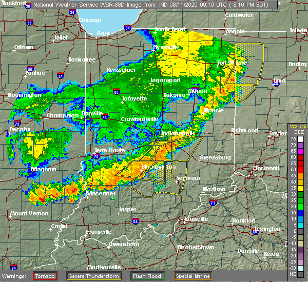
| 8/10/2020 8:43 PM EDT |
 At 842 pm edt, severe thunderstorms were located along a line extending from columbus to near bedford, moving southeast at 25 mph (radar indicated). Hazards include 60 mph wind gusts. Expect damage to roofs, siding, and trees. locations impacted include, columbus, seymour, bedford, brownstown, nashville, edinburgh, mitchell, hope, crothersville, oolitic, medora, elizabethtown, hartsville, clifford, jonesville, newbern, tunnelton, gnaw bone, bartlettsville and vallonia. This includes interstate 65 between mile markers 37 and 78. At 842 pm edt, severe thunderstorms were located along a line extending from columbus to near bedford, moving southeast at 25 mph (radar indicated). Hazards include 60 mph wind gusts. Expect damage to roofs, siding, and trees. locations impacted include, columbus, seymour, bedford, brownstown, nashville, edinburgh, mitchell, hope, crothersville, oolitic, medora, elizabethtown, hartsville, clifford, jonesville, newbern, tunnelton, gnaw bone, bartlettsville and vallonia. This includes interstate 65 between mile markers 37 and 78.
|
| 8/10/2020 8:32 PM EDT |
 At 832 pm edt, severe thunderstorms were located along a line extending from near columbus to near bedford, moving southeast at 30 mph (radar indicated). Hazards include 70 mph wind gusts. Expect considerable tree damage. damage is likely to mobile homes, roofs, and outbuildings. locations impacted include, columbus, seymour, bedford, brownstown, nashville, edinburgh, mitchell, hope, crothersville, oolitic, medora, elizabethtown, hartsville, clifford, jonesville, peoga, newbern, smithville, tunnelton and gnaw bone. This includes interstate 65 between mile markers 37 and 78. At 832 pm edt, severe thunderstorms were located along a line extending from near columbus to near bedford, moving southeast at 30 mph (radar indicated). Hazards include 70 mph wind gusts. Expect considerable tree damage. damage is likely to mobile homes, roofs, and outbuildings. locations impacted include, columbus, seymour, bedford, brownstown, nashville, edinburgh, mitchell, hope, crothersville, oolitic, medora, elizabethtown, hartsville, clifford, jonesville, peoga, newbern, smithville, tunnelton and gnaw bone. This includes interstate 65 between mile markers 37 and 78.
|
| 8/10/2020 8:20 PM EDT |
 At 819 pm edt, a severe thunderstorm was located near nashville, or 11 miles east of bloomington, moving east at 35 mph (radar indicated). Hazards include 70 mph wind gusts. Expect considerable tree damage. damage is likely to mobile homes, roofs, and outbuildings. Locations impacted include, bloomington, nashville, indiana university, smithville, helmsburg, freetown, lake lemon, beanblossom, gnaw bone, spurgeons corner, yellowwood lake, spearsville, monroe reservoir, woodville hills, elkinsville, charles deam wilderness, stone head, unionville, story and whitehall. At 819 pm edt, a severe thunderstorm was located near nashville, or 11 miles east of bloomington, moving east at 35 mph (radar indicated). Hazards include 70 mph wind gusts. Expect considerable tree damage. damage is likely to mobile homes, roofs, and outbuildings. Locations impacted include, bloomington, nashville, indiana university, smithville, helmsburg, freetown, lake lemon, beanblossom, gnaw bone, spurgeons corner, yellowwood lake, spearsville, monroe reservoir, woodville hills, elkinsville, charles deam wilderness, stone head, unionville, story and whitehall.
|
| 8/10/2020 8:06 PM EDT |
 At 806 pm edt, a severe thunderstorm was located near nashville, or 9 miles east of bloomington, moving southeast at 30 mph (radar indicated). Hazards include 70 mph wind gusts. Expect considerable tree damage. damage is likely to mobile homes, roofs, and outbuildings. Locations impacted include, bloomington, nashville, ellettsville, stinesville, indiana university, smithville, helmsburg, freetown, lake lemon, beanblossom, gnaw bone, spurgeons corner, yellowwood lake, spearsville, solsberry, monroe reservoir, woodville hills, elkinsville, charles deam wilderness and stone head. At 806 pm edt, a severe thunderstorm was located near nashville, or 9 miles east of bloomington, moving southeast at 30 mph (radar indicated). Hazards include 70 mph wind gusts. Expect considerable tree damage. damage is likely to mobile homes, roofs, and outbuildings. Locations impacted include, bloomington, nashville, ellettsville, stinesville, indiana university, smithville, helmsburg, freetown, lake lemon, beanblossom, gnaw bone, spurgeons corner, yellowwood lake, spearsville, solsberry, monroe reservoir, woodville hills, elkinsville, charles deam wilderness and stone head.
|
| 8/10/2020 8:01 PM EDT |
 At 801 pm edt, severe thunderstorms were located along a line extending from 9 miles north of nashville to 12 miles east of bloomfield, moving southeast at 35 mph (radar indicated). Hazards include 70 mph wind gusts. Expect considerable tree damage. Damage is likely to mobile homes, roofs, and outbuildings. At 801 pm edt, severe thunderstorms were located along a line extending from 9 miles north of nashville to 12 miles east of bloomfield, moving southeast at 35 mph (radar indicated). Hazards include 70 mph wind gusts. Expect considerable tree damage. Damage is likely to mobile homes, roofs, and outbuildings.
|
| 8/10/2020 7:34 PM EDT |
 At 733 pm edt, a severe thunderstorm was located 8 miles east of spencer, or 11 miles northwest of bloomington, moving east at 45 mph (radar indicated). Hazards include 60 mph wind gusts. expect damage to roofs, siding, and trees At 733 pm edt, a severe thunderstorm was located 8 miles east of spencer, or 11 miles northwest of bloomington, moving east at 45 mph (radar indicated). Hazards include 60 mph wind gusts. expect damage to roofs, siding, and trees
|
| 7/12/2020 1:10 AM EDT |
 At 109 am edt, severe thunderstorms were located along a line extending from near mooresville to near bloomington to 12 miles east of bloomfield to 13 miles south of linton, moving southeast at 45 mph. the line has weakened since 1255 am (radar indicated). Hazards include 60 mph wind gusts and quarter size hail. Hail damage to vehicles is expected. expect wind damage to roofs, siding, and trees. locations impacted include, bloomington, plainfield, franklin, martinsville, mooresville, linton, bloomfield, nashville, ellettsville, new whiteland, whiteland, bargersville, bicknell, brooklyn, odon, princes lakes, trafalgar, monrovia, morgantown and lyons. this includes the following highways, interstate 65 between mile markers 89 and 93. Interstate 70 between mile markers 59 and 65. At 109 am edt, severe thunderstorms were located along a line extending from near mooresville to near bloomington to 12 miles east of bloomfield to 13 miles south of linton, moving southeast at 45 mph. the line has weakened since 1255 am (radar indicated). Hazards include 60 mph wind gusts and quarter size hail. Hail damage to vehicles is expected. expect wind damage to roofs, siding, and trees. locations impacted include, bloomington, plainfield, franklin, martinsville, mooresville, linton, bloomfield, nashville, ellettsville, new whiteland, whiteland, bargersville, bicknell, brooklyn, odon, princes lakes, trafalgar, monrovia, morgantown and lyons. this includes the following highways, interstate 65 between mile markers 89 and 93. Interstate 70 between mile markers 59 and 65.
|
| 7/12/2020 12:53 AM EDT |
 At 1252 am edt, severe thunderstorms were located along a line extending from near danville to near spencer to 7 miles north of bloomfield to 7 miles northeast of russellville, moving southeast at 45 mph (radar indicated). Hazards include 60 mph wind gusts and quarter size hail. Hail damage to vehicles is expected. Expect wind damage to roofs, siding, and trees. At 1252 am edt, severe thunderstorms were located along a line extending from near danville to near spencer to 7 miles north of bloomfield to 7 miles northeast of russellville, moving southeast at 45 mph (radar indicated). Hazards include 60 mph wind gusts and quarter size hail. Hail damage to vehicles is expected. Expect wind damage to roofs, siding, and trees.
|
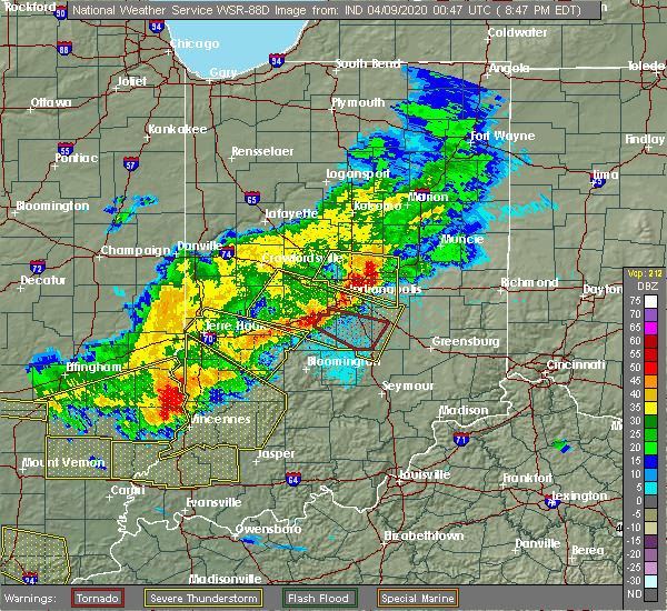
| 4/8/2020 9:27 PM EDT |
 At 926 pm edt, a severe thunderstorm was located 9 miles west of greensburg, or 11 miles southeast of shelbyville, moving southeast at 55 mph (trained weather spotters). Hazards include 60 mph wind gusts. Expect damage to roofs, siding, and trees. locations impacted include, columbus, shelbyville, franklin, greensburg, adams, edinburgh, hope, flat rock, milford, westport, princes lakes, geneva, morristown, trafalgar, st. paul, hartsville, fairland, milroy, clifford and millhousen. this includes the following highways, interstate 65 between mile markers 68 and 90. Interstate 74 between mile markers 109 and 144. At 926 pm edt, a severe thunderstorm was located 9 miles west of greensburg, or 11 miles southeast of shelbyville, moving southeast at 55 mph (trained weather spotters). Hazards include 60 mph wind gusts. Expect damage to roofs, siding, and trees. locations impacted include, columbus, shelbyville, franklin, greensburg, adams, edinburgh, hope, flat rock, milford, westport, princes lakes, geneva, morristown, trafalgar, st. paul, hartsville, fairland, milroy, clifford and millhousen. this includes the following highways, interstate 65 between mile markers 68 and 90. Interstate 74 between mile markers 109 and 144.
|
| 4/8/2020 9:06 PM EDT |
 At 905 pm edt, a severe thunderstorm was located near franklin, or 11 miles west of shelbyville, moving southeast at 55 mph (radar indicated). Hazards include 70 mph wind gusts. Expect considerable tree damage. Damage is likely to mobile homes, roofs, and outbuildings. At 905 pm edt, a severe thunderstorm was located near franklin, or 11 miles west of shelbyville, moving southeast at 55 mph (radar indicated). Hazards include 70 mph wind gusts. Expect considerable tree damage. Damage is likely to mobile homes, roofs, and outbuildings.
|
| 4/8/2020 8:47 PM EDT |
 At 847 pm edt, a severe thunderstorm capable of producing a tornado was located over martinsville, or 20 miles north of bloomington, moving southeast at 60 mph (radar indicated rotation). Hazards include tornado. Flying debris will be dangerous to those caught without shelter. mobile homes will be damaged or destroyed. damage to roofs, windows, and vehicles will occur. tree damage is likely. this dangerous storm will be near, morgantown, beanblossom and helmsburg around 900 pm edt. Princes lakes, trafalgar, peoga and spearsville around 905 pm edt. At 847 pm edt, a severe thunderstorm capable of producing a tornado was located over martinsville, or 20 miles north of bloomington, moving southeast at 60 mph (radar indicated rotation). Hazards include tornado. Flying debris will be dangerous to those caught without shelter. mobile homes will be damaged or destroyed. damage to roofs, windows, and vehicles will occur. tree damage is likely. this dangerous storm will be near, morgantown, beanblossom and helmsburg around 900 pm edt. Princes lakes, trafalgar, peoga and spearsville around 905 pm edt.
|
| 3/28/2020 10:02 PM EDT |
 At 1002 pm edt, a severe thunderstorm was located near martinsville, or 19 miles northeast of bloomington, moving northeast at 20 mph (radar indicated). Hazards include 70 mph wind gusts. Expect considerable tree damage. Damage is likely to mobile homes, roofs, and outbuildings. At 1002 pm edt, a severe thunderstorm was located near martinsville, or 19 miles northeast of bloomington, moving northeast at 20 mph (radar indicated). Hazards include 70 mph wind gusts. Expect considerable tree damage. Damage is likely to mobile homes, roofs, and outbuildings.
|
| 8/20/2019 3:22 PM EDT |
 A severe thunderstorm warning remains in effect until 330 pm edt for shelby. southern hancock. northeastern brown. eastern johnson. bartholomew and southeastern marion counties. At 322 pm edt, severe thunderstorms were located along a line extending from greenfield to shelbyville to columbus, moving east at 35 mph. A severe thunderstorm warning remains in effect until 330 pm edt for shelby. southern hancock. northeastern brown. eastern johnson. bartholomew and southeastern marion counties. At 322 pm edt, severe thunderstorms were located along a line extending from greenfield to shelbyville to columbus, moving east at 35 mph.
|
| 8/20/2019 3:01 PM EDT |
 A severe thunderstorm warning remains in effect until 315 pm edt for southwestern shelby. southeastern morgan. northern brown. southern johnson and northwestern bartholomew counties. at 300 pm edt, a severe thunderstorm was located near franklin, or 15 miles northwest of columbus, moving east at 40 mph. hazard. 60 mph wind gusts and penny size hail. A severe thunderstorm warning remains in effect until 315 pm edt for southwestern shelby. southeastern morgan. northern brown. southern johnson and northwestern bartholomew counties. at 300 pm edt, a severe thunderstorm was located near franklin, or 15 miles northwest of columbus, moving east at 40 mph. hazard. 60 mph wind gusts and penny size hail.
|
| 8/20/2019 2:58 PM EDT |
 The national weather service in indianapolis has issued a * severe thunderstorm warning for. shelby county in central indiana. southern hancock county in central indiana. eastern morgan county in central indiana. Northern brown county in south central indiana. The national weather service in indianapolis has issued a * severe thunderstorm warning for. shelby county in central indiana. southern hancock county in central indiana. eastern morgan county in central indiana. Northern brown county in south central indiana.
|
| 8/20/2019 2:45 PM EDT |
 The national weather service in indianapolis has issued a * severe thunderstorm warning for. southwestern shelby county in central indiana. northeastern monroe county in south central indiana. southeastern morgan county in central indiana. Northern brown county in south central indiana. The national weather service in indianapolis has issued a * severe thunderstorm warning for. southwestern shelby county in central indiana. northeastern monroe county in south central indiana. southeastern morgan county in central indiana. Northern brown county in south central indiana.
|
| 6/23/2019 3:27 PM EDT |
 At 327 pm edt, severe thunderstorms were located along a line extending from 8 miles northeast of nashville to 7 miles south of columbus to 6 miles south of brownstown, moving east at 45 mph (radar indicated). Hazards include 60 mph wind gusts. Expect damage to roofs, siding, and trees. locations impacted include, columbus, seymour, north vernon, brownstown, nashville, vernon, edinburgh, hope, crothersville, flat rock, westport, princes lakes, geneva, medora, elizabethtown, hartsville, clifford, jonesville, newbern and paris crossing. This includes interstate 65 between mile markers 37 and 84. At 327 pm edt, severe thunderstorms were located along a line extending from 8 miles northeast of nashville to 7 miles south of columbus to 6 miles south of brownstown, moving east at 45 mph (radar indicated). Hazards include 60 mph wind gusts. Expect damage to roofs, siding, and trees. locations impacted include, columbus, seymour, north vernon, brownstown, nashville, vernon, edinburgh, hope, crothersville, flat rock, westport, princes lakes, geneva, medora, elizabethtown, hartsville, clifford, jonesville, newbern and paris crossing. This includes interstate 65 between mile markers 37 and 84.
|
| 6/23/2019 3:16 PM EDT |
 At 316 pm edt, severe thunderstorms were located along a line extending from 13 miles northwest of danville to mooresville to 6 miles north of nashville, moving northeast at 60 mph (law enforcement). Hazards include 60 mph wind gusts. Expect damage to roofs, siding, and trees. locations impacted include, indianapolis, carmel, greenwood, lawrence, plainfield, franklin, brownsburg, beech grove, zionsville, martinsville, speedway, mooresville, danville, southport, avon, new whiteland, whiteland, bargersville, pittsboro and whitestown. this includes the following highways, interstate 65 between mile markers 84 and 137. interstate 70 between mile markers 48 and 90. Interstate 74 between mile markers 56 and 98. At 316 pm edt, severe thunderstorms were located along a line extending from 13 miles northwest of danville to mooresville to 6 miles north of nashville, moving northeast at 60 mph (law enforcement). Hazards include 60 mph wind gusts. Expect damage to roofs, siding, and trees. locations impacted include, indianapolis, carmel, greenwood, lawrence, plainfield, franklin, brownsburg, beech grove, zionsville, martinsville, speedway, mooresville, danville, southport, avon, new whiteland, whiteland, bargersville, pittsboro and whitestown. this includes the following highways, interstate 65 between mile markers 84 and 137. interstate 70 between mile markers 48 and 90. Interstate 74 between mile markers 56 and 98.
|
| 6/23/2019 3:14 PM EDT |
 At 313 pm edt, severe thunderstorms were located along a line extending from near nashville to 13 miles north of brownstown to 11 miles northwest of salem, moving east at 45 mph. this storm has a history of causing tree damage (radar indicated). Hazards include 60 mph wind gusts. expect damage to roofs, siding, and trees At 313 pm edt, severe thunderstorms were located along a line extending from near nashville to 13 miles north of brownstown to 11 miles northwest of salem, moving east at 45 mph. this storm has a history of causing tree damage (radar indicated). Hazards include 60 mph wind gusts. expect damage to roofs, siding, and trees
|
| 6/23/2019 2:52 PM EDT |
 At 252 pm edt, severe thunderstorms were located along a line extending from 9 miles northeast of brazil to 7 miles northeast of spencer to 7 miles south of bloomington, moving northeast at 60 mph. this storm has a history of producing significant tree damage (law enforcement). Hazards include 60 mph wind gusts. expect damage to roofs, siding, and trees At 252 pm edt, severe thunderstorms were located along a line extending from 9 miles northeast of brazil to 7 miles northeast of spencer to 7 miles south of bloomington, moving northeast at 60 mph. this storm has a history of producing significant tree damage (law enforcement). Hazards include 60 mph wind gusts. expect damage to roofs, siding, and trees
|
| 5/29/2019 10:10 PM EDT |
 At 1009 pm edt, a severe thunderstorm was located near nashville, or 12 miles east of bloomington, moving northeast at 15 mph (radar indicated). Hazards include 60 mph wind gusts and quarter size hail. Hail damage to vehicles is expected. Expect wind damage to roofs, siding, and trees. At 1009 pm edt, a severe thunderstorm was located near nashville, or 12 miles east of bloomington, moving northeast at 15 mph (radar indicated). Hazards include 60 mph wind gusts and quarter size hail. Hail damage to vehicles is expected. Expect wind damage to roofs, siding, and trees.
|
| 2/7/2019 1:12 PM EST |
 At 111 pm est, a severe thunderstorm was located 7 miles northeast of nashville, or 13 miles northwest of columbus, moving northeast at 65 mph (radar indicated). Hazards include 60 mph wind gusts. Expect damage to roofs, siding, and trees. locations impacted include, columbus, franklin, nashville, edinburgh, princes lakes, trafalgar, elizabethtown, clifford, peoga, waymansville, gnaw bone, spurgeons corner, azalia, spearsville, elkinsville, stone head, story and taylorsville. This includes interstate 65 between mile markers 59 and 79, and between mile markers 84 and 90. At 111 pm est, a severe thunderstorm was located 7 miles northeast of nashville, or 13 miles northwest of columbus, moving northeast at 65 mph (radar indicated). Hazards include 60 mph wind gusts. Expect damage to roofs, siding, and trees. locations impacted include, columbus, franklin, nashville, edinburgh, princes lakes, trafalgar, elizabethtown, clifford, peoga, waymansville, gnaw bone, spurgeons corner, azalia, spearsville, elkinsville, stone head, story and taylorsville. This includes interstate 65 between mile markers 59 and 79, and between mile markers 84 and 90.
|
| 2/7/2019 12:56 PM EST |
 At 1256 pm est, a severe thunderstorm was located near nashville, or 10 miles east of bloomington, moving northeast at 65 mph (radar indicated). Hazards include 60 mph wind gusts. expect damage to roofs, siding, and trees At 1256 pm est, a severe thunderstorm was located near nashville, or 10 miles east of bloomington, moving northeast at 65 mph (radar indicated). Hazards include 60 mph wind gusts. expect damage to roofs, siding, and trees
|
| 6/10/2018 5:47 PM EDT |
 At 546 pm edt, severe thunderstorms were located along a line extending from near beech grove to near franklin to nashville to 6 miles southeast of bloomington, moving east at 45 mph (radar indicated). Hazards include 60 mph wind gusts. Expect damage to roofs, siding, and trees. locations impacted include, indianapolis, bloomington, greenwood, franklin, beech grove, southport, new whiteland, cumberland, edinburgh, whiteland, bargersville, warren park, princes lakes, trafalgar, homecroft, peoga, indiana university, helmsburg, lake lemon and beanblossom. this includes the following highways, interstate 65 between mile markers 84 and 107. interstate 70 near mile marker 92. Interstate 74 between mile markers 93 and 99. At 546 pm edt, severe thunderstorms were located along a line extending from near beech grove to near franklin to nashville to 6 miles southeast of bloomington, moving east at 45 mph (radar indicated). Hazards include 60 mph wind gusts. Expect damage to roofs, siding, and trees. locations impacted include, indianapolis, bloomington, greenwood, franklin, beech grove, southport, new whiteland, cumberland, edinburgh, whiteland, bargersville, warren park, princes lakes, trafalgar, homecroft, peoga, indiana university, helmsburg, lake lemon and beanblossom. this includes the following highways, interstate 65 between mile markers 84 and 107. interstate 70 near mile marker 92. Interstate 74 between mile markers 93 and 99.
|
| 6/10/2018 5:35 PM EDT |
 At 534 pm edt, severe thunderstorms were located along a line extending from near beech grove to 9 miles east of martinsville to 10 miles west of nashville to near bloomington, moving east at 45 mph (radar indicated). Hazards include 60 mph wind gusts. Expect damage to roofs, siding, and trees. locations impacted include, indianapolis, bloomington, greenwood, lawrence, franklin, beech grove, speedway, southport, ellettsville, new whiteland, cumberland, edinburgh, whiteland, bargersville, warren park, princes lakes, trafalgar, morgantown, homecroft and geist reservoir. this includes the following highways, interstate 65 between mile markers 84 and 117. interstate 70 between mile markers 70 and 93. Interstate 74 between mile markers 93 and 100. At 534 pm edt, severe thunderstorms were located along a line extending from near beech grove to 9 miles east of martinsville to 10 miles west of nashville to near bloomington, moving east at 45 mph (radar indicated). Hazards include 60 mph wind gusts. Expect damage to roofs, siding, and trees. locations impacted include, indianapolis, bloomington, greenwood, lawrence, franklin, beech grove, speedway, southport, ellettsville, new whiteland, cumberland, edinburgh, whiteland, bargersville, warren park, princes lakes, trafalgar, morgantown, homecroft and geist reservoir. this includes the following highways, interstate 65 between mile markers 84 and 117. interstate 70 between mile markers 70 and 93. Interstate 74 between mile markers 93 and 100.
|
| 6/10/2018 5:23 PM EDT |
 At 522 pm edt, severe thunderstorms were located along a line extending from near speedway to near martinsville to 9 miles north of bloomington to 7 miles south of spencer, moving east at 45 mph (radar indicated). Hazards include 60 mph wind gusts. expect damage to roofs, siding, and trees At 522 pm edt, severe thunderstorms were located along a line extending from near speedway to near martinsville to 9 miles north of bloomington to 7 miles south of spencer, moving east at 45 mph (radar indicated). Hazards include 60 mph wind gusts. expect damage to roofs, siding, and trees
|
| 4/3/2018 2:42 PM EDT |
 The severe thunderstorm warning for central monroe, southeastern morgan and northern brown counties will expire at 245 pm edt, the storm which prompted the warning has weakened below severe limits, and has exited the warned area. therefore, the warning will be allowed to expire. a tornado watch remains in effect until 800 pm edt for south central and central indiana. The severe thunderstorm warning for central monroe, southeastern morgan and northern brown counties will expire at 245 pm edt, the storm which prompted the warning has weakened below severe limits, and has exited the warned area. therefore, the warning will be allowed to expire. a tornado watch remains in effect until 800 pm edt for south central and central indiana.
|
| 4/3/2018 2:33 PM EDT |
 At 232 pm edt, a severe thunderstorm was located near bloomington, moving northeast at 65 mph (radar indicated). Hazards include 60 mph wind gusts and quarter size hail. Hail damage to vehicles is expected. expect wind damage to roofs, siding, and trees. locations impacted include, bloomington, martinsville, nashville, ellettsville, morgantown, mahalasville, indiana university, smithville, helmsburg, lake lemon, beanblossom, yellowwood lake, spearsville, woodville hills, unionville and whitehall. A tornado watch remains in effect until 800 pm edt for south central and central indiana. At 232 pm edt, a severe thunderstorm was located near bloomington, moving northeast at 65 mph (radar indicated). Hazards include 60 mph wind gusts and quarter size hail. Hail damage to vehicles is expected. expect wind damage to roofs, siding, and trees. locations impacted include, bloomington, martinsville, nashville, ellettsville, morgantown, mahalasville, indiana university, smithville, helmsburg, lake lemon, beanblossom, yellowwood lake, spearsville, woodville hills, unionville and whitehall. A tornado watch remains in effect until 800 pm edt for south central and central indiana.
|
| 4/3/2018 2:24 PM EDT |
 At 224 pm edt, a severe thunderstorm was located near bloomington, moving northeast at 65 mph (radar indicated). Hazards include 60 mph wind gusts and quarter size hail. Hail damage to vehicles is expected. expect wind damage to roofs, siding, and trees. locations impacted include, bloomington, martinsville, nashville, ellettsville, morgantown, mahalasville, indiana university, smithville, helmsburg, lake lemon, beanblossom, yellowwood lake, spearsville, solsberry, woodville hills, owensburg, unionville and whitehall. A tornado watch remains in effect until 800 pm edt for south central, central, southwestern and west central indiana. At 224 pm edt, a severe thunderstorm was located near bloomington, moving northeast at 65 mph (radar indicated). Hazards include 60 mph wind gusts and quarter size hail. Hail damage to vehicles is expected. expect wind damage to roofs, siding, and trees. locations impacted include, bloomington, martinsville, nashville, ellettsville, morgantown, mahalasville, indiana university, smithville, helmsburg, lake lemon, beanblossom, yellowwood lake, spearsville, solsberry, woodville hills, owensburg, unionville and whitehall. A tornado watch remains in effect until 800 pm edt for south central, central, southwestern and west central indiana.
|
| 4/3/2018 2:10 PM EDT |
 At 209 pm edt, a severe thunderstorm was located near bloomfield, or 21 miles southwest of bloomington, moving northeast at 65 mph (radar indicated). Hazards include 60 mph wind gusts and quarter size hail. Hail damage to vehicles is expected. Expect wind damage to roofs, siding, and trees. At 209 pm edt, a severe thunderstorm was located near bloomfield, or 21 miles southwest of bloomington, moving northeast at 65 mph (radar indicated). Hazards include 60 mph wind gusts and quarter size hail. Hail damage to vehicles is expected. Expect wind damage to roofs, siding, and trees.
|
| 7/7/2017 5:24 PM EDT |
 At 522 pm edt, a severe thunderstorm was located near nashville, or 12 miles northeast of bloomington, moving southeast at 35 mph (radar indicated). Hazards include 60 mph wind gusts and quarter size hail. Hail damage to vehicles is expected. Expect wind damage to roofs, siding, and trees. At 522 pm edt, a severe thunderstorm was located near nashville, or 12 miles northeast of bloomington, moving southeast at 35 mph (radar indicated). Hazards include 60 mph wind gusts and quarter size hail. Hail damage to vehicles is expected. Expect wind damage to roofs, siding, and trees.
|
| 7/7/2017 5:10 PM EDT |
 At 510 pm edt, a severe thunderstorm was located 7 miles northwest of nashville, or 14 miles northeast of bloomington, moving southeast at 35 mph (trained weather spotters). Hazards include ping pong ball size hail and 60 mph wind gusts. People and animals outdoors will be injured. expect hail damage to roofs, siding, windows, and vehicles. expect wind damage to roofs, siding, and trees. Locations impacted include, nashville, princes lakes, trafalgar, morgantown, yellowwood lake, mahalasville, peoga, spearsville, helmsburg, lake lemon, beanblossom and unionville. At 510 pm edt, a severe thunderstorm was located 7 miles northwest of nashville, or 14 miles northeast of bloomington, moving southeast at 35 mph (trained weather spotters). Hazards include ping pong ball size hail and 60 mph wind gusts. People and animals outdoors will be injured. expect hail damage to roofs, siding, windows, and vehicles. expect wind damage to roofs, siding, and trees. Locations impacted include, nashville, princes lakes, trafalgar, morgantown, yellowwood lake, mahalasville, peoga, spearsville, helmsburg, lake lemon, beanblossom and unionville.
|
| 7/7/2017 5:04 PM EDT |
 At 503 pm edt, a severe thunderstorm was located 7 miles southeast of martinsville, or 13 miles northeast of bloomington, moving southeast at 35 mph. at 450 pm edt, trained spotters reported 1.5 inch hail near paragon (trained weather spotters). Hazards include ping pong ball size hail and 60 mph wind gusts. People and animals outdoors will be injured. expect hail damage to roofs, siding, windows, and vehicles. expect wind damage to roofs, siding, and trees. Locations impacted include, martinsville, nashville, princes lakes, trafalgar, morgantown, paragon, mahalasville, peoga, helmsburg, lake lemon, beanblossom, yellowwood lake, spearsville, centerton and unionville. At 503 pm edt, a severe thunderstorm was located 7 miles southeast of martinsville, or 13 miles northeast of bloomington, moving southeast at 35 mph. at 450 pm edt, trained spotters reported 1.5 inch hail near paragon (trained weather spotters). Hazards include ping pong ball size hail and 60 mph wind gusts. People and animals outdoors will be injured. expect hail damage to roofs, siding, windows, and vehicles. expect wind damage to roofs, siding, and trees. Locations impacted include, martinsville, nashville, princes lakes, trafalgar, morgantown, paragon, mahalasville, peoga, helmsburg, lake lemon, beanblossom, yellowwood lake, spearsville, centerton and unionville.
|
| 7/7/2017 4:54 PM EDT |
 At 454 pm edt, a severe thunderstorm was located near martinsville, or 14 miles north of bloomington, moving southeast at 35 mph (radar indicated). Hazards include ping pong ball size hail and 60 mph wind gusts. People and animals outdoors will be injured. expect hail damage to roofs, siding, windows, and vehicles. expect wind damage to roofs, siding, and trees. Locations impacted include, martinsville, nashville, princes lakes, trafalgar, morgantown, paragon, mahalasville, peoga, helmsburg, lake lemon, beanblossom, yellowwood lake, spearsville, centerton and unionville. At 454 pm edt, a severe thunderstorm was located near martinsville, or 14 miles north of bloomington, moving southeast at 35 mph (radar indicated). Hazards include ping pong ball size hail and 60 mph wind gusts. People and animals outdoors will be injured. expect hail damage to roofs, siding, windows, and vehicles. expect wind damage to roofs, siding, and trees. Locations impacted include, martinsville, nashville, princes lakes, trafalgar, morgantown, paragon, mahalasville, peoga, helmsburg, lake lemon, beanblossom, yellowwood lake, spearsville, centerton and unionville.
|
| 7/7/2017 4:38 PM EDT |
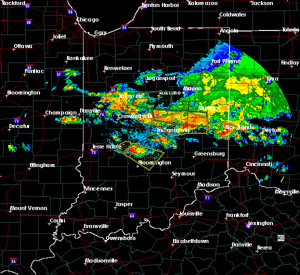 At 437 pm edt, a severe thunderstorm was located 11 miles west of martinsville, or 20 miles north of bloomington, moving southeast at 35 mph (radar indicated). Hazards include ping pong ball size hail and 60 mph wind gusts. People and animals outdoors will be injured. expect hail damage to roofs, siding, windows, and vehicles. Expect wind damage to roofs, siding, and trees. At 437 pm edt, a severe thunderstorm was located 11 miles west of martinsville, or 20 miles north of bloomington, moving southeast at 35 mph (radar indicated). Hazards include ping pong ball size hail and 60 mph wind gusts. People and animals outdoors will be injured. expect hail damage to roofs, siding, windows, and vehicles. Expect wind damage to roofs, siding, and trees.
|
| 5/19/2017 2:29 PM EDT |
 At 228 pm edt, a severe thunderstorm was located 9 miles northeast of nashville, or 12 miles northwest of columbus, moving east at 45 mph (radar indicated). Hazards include half dollar size hail. Damage to vehicles is expected. Locations impacted include, nashville, yellowwood lake, helmsburg, woodville hills, elkinsville, lake lemon, stone head, gnaw bone, unionville and story. At 228 pm edt, a severe thunderstorm was located 9 miles northeast of nashville, or 12 miles northwest of columbus, moving east at 45 mph (radar indicated). Hazards include half dollar size hail. Damage to vehicles is expected. Locations impacted include, nashville, yellowwood lake, helmsburg, woodville hills, elkinsville, lake lemon, stone head, gnaw bone, unionville and story.
|
| 5/19/2017 2:12 PM EDT |
 At 212 pm edt, a severe thunderstorm was located near nashville, or 8 miles east of bloomington, moving northeast at 55 mph (radar indicated). Hazards include quarter size hail. damage to vehicles is expected At 212 pm edt, a severe thunderstorm was located near nashville, or 8 miles east of bloomington, moving northeast at 55 mph (radar indicated). Hazards include quarter size hail. damage to vehicles is expected
|
| 5/10/2017 11:49 PM EDT |
 At 1148 pm edt, severe thunderstorms were located along a line extending from 8 miles northwest of shelbyville to 6 miles north of columbus to 8 miles northwest of brownstown, moving east at 60 mph (radar indicated). Hazards include 60 mph wind gusts. Expect damage to roofs, siding, and trees. locations impacted include, columbus, shelbyville, seymour, franklin, nashville, edinburgh, hope, flat rock, princes lakes, geneva, elizabethtown, hartsville, fairland, clifford, jonesville, newbern, waldron, gnaw bone, spurgeons corner and azalia. this includes the following highways, interstate 65 between mile markers 44 and 93. Interstate 74 between mile markers 101 and 122. At 1148 pm edt, severe thunderstorms were located along a line extending from 8 miles northwest of shelbyville to 6 miles north of columbus to 8 miles northwest of brownstown, moving east at 60 mph (radar indicated). Hazards include 60 mph wind gusts. Expect damage to roofs, siding, and trees. locations impacted include, columbus, shelbyville, seymour, franklin, nashville, edinburgh, hope, flat rock, princes lakes, geneva, elizabethtown, hartsville, fairland, clifford, jonesville, newbern, waldron, gnaw bone, spurgeons corner and azalia. this includes the following highways, interstate 65 between mile markers 44 and 93. Interstate 74 between mile markers 101 and 122.
|
| 5/10/2017 11:41 PM EDT |
 At 1141 pm edt, severe thunderstorms were located along a line extending from near greenwood to 10 miles northwest of columbus to 13 miles south of nashville, moving east at 60 mph (radar indicated). Hazards include 60 mph wind gusts. Expect damage to roofs, siding, and trees. locations impacted include, indianapolis, columbus, shelbyville, seymour, greenwood, franklin, beech grove, southport, nashville, new whiteland, edinburgh, whiteland, bargersville, hope, flat rock, princes lakes, geneva, morristown, trafalgar and homecroft. this includes the following highways, interstate 65 between mile markers 44 and 107. Interstate 74 between mile markers 98 and 122. At 1141 pm edt, severe thunderstorms were located along a line extending from near greenwood to 10 miles northwest of columbus to 13 miles south of nashville, moving east at 60 mph (radar indicated). Hazards include 60 mph wind gusts. Expect damage to roofs, siding, and trees. locations impacted include, indianapolis, columbus, shelbyville, seymour, greenwood, franklin, beech grove, southport, nashville, new whiteland, edinburgh, whiteland, bargersville, hope, flat rock, princes lakes, geneva, morristown, trafalgar and homecroft. this includes the following highways, interstate 65 between mile markers 44 and 107. Interstate 74 between mile markers 98 and 122.
|
| 5/10/2017 11:34 PM EDT |
 At 1134 pm edt, severe thunderstorms were located along a line extending from greenwood to 11 miles southwest of franklin to 12 miles southeast of bloomington, moving east at 60 mph (radar indicated). Hazards include 70 mph wind gusts. Expect considerable tree damage. damage is likely to mobile homes, roofs, and outbuildings. locations impacted include, indianapolis, bloomington, columbus, shelbyville, seymour, greenwood, franklin, beech grove, southport, nashville, new whiteland, edinburgh, whiteland, bargersville, hope, flat rock, princes lakes, geneva, morristown and trafalgar. this includes the following highways, interstate 65 between mile markers 44 and 108. interstate 70 between mile markers 70 and 75. Interstate 74 between mile markers 97 and 122. At 1134 pm edt, severe thunderstorms were located along a line extending from greenwood to 11 miles southwest of franklin to 12 miles southeast of bloomington, moving east at 60 mph (radar indicated). Hazards include 70 mph wind gusts. Expect considerable tree damage. damage is likely to mobile homes, roofs, and outbuildings. locations impacted include, indianapolis, bloomington, columbus, shelbyville, seymour, greenwood, franklin, beech grove, southport, nashville, new whiteland, edinburgh, whiteland, bargersville, hope, flat rock, princes lakes, geneva, morristown and trafalgar. this includes the following highways, interstate 65 between mile markers 44 and 108. interstate 70 between mile markers 70 and 75. Interstate 74 between mile markers 97 and 122.
|
| 5/10/2017 11:23 PM EDT |
 At 1122 pm edt, severe thunderstorms were located along a line extending from near plainfield to near martinsville to 7 miles southwest of bloomington, moving east at 60 mph (radar indicated). Hazards include 70 mph wind gusts. Expect considerable tree damage. Damage is likely to mobile homes, roofs, and outbuildings. At 1122 pm edt, severe thunderstorms were located along a line extending from near plainfield to near martinsville to 7 miles southwest of bloomington, moving east at 60 mph (radar indicated). Hazards include 70 mph wind gusts. Expect considerable tree damage. Damage is likely to mobile homes, roofs, and outbuildings.
|
| 4/28/2017 7:54 PM EDT |
 The severe thunderstorm warning for southwestern johnson, northwestern bartholomew and northeastern brown counties will expire at 800 pm edt, the severe thunderstorm which prompted the warning has moved out of the warned area. therefore, the warning will be allowed to expire. The severe thunderstorm warning for southwestern johnson, northwestern bartholomew and northeastern brown counties will expire at 800 pm edt, the severe thunderstorm which prompted the warning has moved out of the warned area. therefore, the warning will be allowed to expire.
|
| 4/28/2017 7:45 PM EDT |
 At 745 pm edt, a severe thunderstorm was located 10 miles south of franklin, or 11 miles northwest of columbus, moving northeast at 45 mph (public). Hazards include 60 mph wind gusts. Expect damage to roofs, siding, and trees. locations impacted include, princes lakes, trafalgar, peoga, gnaw bone and spearsville. This includes interstate 65 between mile markers 71 and 72. At 745 pm edt, a severe thunderstorm was located 10 miles south of franklin, or 11 miles northwest of columbus, moving northeast at 45 mph (public). Hazards include 60 mph wind gusts. Expect damage to roofs, siding, and trees. locations impacted include, princes lakes, trafalgar, peoga, gnaw bone and spearsville. This includes interstate 65 between mile markers 71 and 72.
|
| 4/28/2017 7:35 PM EDT |
 At 734 pm edt, a severe thunderstorm was located 7 miles northeast of nashville, or 12 miles west of columbus, moving east at 55 mph (public). Hazards include 60 mph wind gusts. Expect damage to roofs, siding, and trees. locations impacted include, nashville, princes lakes, trafalgar, morgantown, mahalasville, peoga, helmsburg, lake lemon, gnaw bone, beanblossom, yellowwood lake, spearsville and woodville hills. This includes interstate 65 between mile markers 71 and 72. At 734 pm edt, a severe thunderstorm was located 7 miles northeast of nashville, or 12 miles west of columbus, moving east at 55 mph (public). Hazards include 60 mph wind gusts. Expect damage to roofs, siding, and trees. locations impacted include, nashville, princes lakes, trafalgar, morgantown, mahalasville, peoga, helmsburg, lake lemon, gnaw bone, beanblossom, yellowwood lake, spearsville and woodville hills. This includes interstate 65 between mile markers 71 and 72.
|
| 4/28/2017 7:18 PM EDT |
 At 718 pm edt, a severe thunderstorm was located near bloomington, moving northeast at 60 mph (public). Hazards include 60 mph wind gusts. expect damage to roofs, siding, and trees At 718 pm edt, a severe thunderstorm was located near bloomington, moving northeast at 60 mph (public). Hazards include 60 mph wind gusts. expect damage to roofs, siding, and trees
|
| 4/5/2017 7:38 PM EDT |
 The severe thunderstorm warning for southeastern morgan, northern brown, southern johnson and northwestern bartholomew counties will expire at 745 pm edt, the storm which prompted the warning has weakened below severe limits, and no longer poses an immediate threat to life or property. therefore, the warning will be allowed to expire. a severe thunderstorm watch remains in effect until 900 pm edt for central and south central indiana. The severe thunderstorm warning for southeastern morgan, northern brown, southern johnson and northwestern bartholomew counties will expire at 745 pm edt, the storm which prompted the warning has weakened below severe limits, and no longer poses an immediate threat to life or property. therefore, the warning will be allowed to expire. a severe thunderstorm watch remains in effect until 900 pm edt for central and south central indiana.
|
| 4/5/2017 7:26 PM EDT |
 At 726 pm edt, a severe thunderstorm was located 10 miles north of nashville, or 16 miles northwest of columbus, moving northeast at 50 mph (radar indicated). Hazards include 60 mph wind gusts and quarter size hail. Hail damage to vehicles is expected. expect wind damage to roofs, siding, and trees. locations impacted include, edinburgh, bargersville, princes lakes, trafalgar, morgantown, peoga, mahalasville, spearsville, helmsburg, beanblossom and taylorsville. This includes interstate 65 between mile markers 74 and 79. At 726 pm edt, a severe thunderstorm was located 10 miles north of nashville, or 16 miles northwest of columbus, moving northeast at 50 mph (radar indicated). Hazards include 60 mph wind gusts and quarter size hail. Hail damage to vehicles is expected. expect wind damage to roofs, siding, and trees. locations impacted include, edinburgh, bargersville, princes lakes, trafalgar, morgantown, peoga, mahalasville, spearsville, helmsburg, beanblossom and taylorsville. This includes interstate 65 between mile markers 74 and 79.
|
| 4/5/2017 7:10 PM EDT |
 At 709 pm edt, a severe thunderstorm was located near nashville, or 10 miles east of bloomington, moving northeast at 50 mph. at 706 pm, trained spotters reported quarter sized hail on state road 46 at the monroe, brown county line (trained weather spotters). Hazards include 60 mph wind gusts and quarter size hail. Hail damage to vehicles is expected. Expect wind damage to roofs, siding, and trees. At 709 pm edt, a severe thunderstorm was located near nashville, or 10 miles east of bloomington, moving northeast at 50 mph. at 706 pm, trained spotters reported quarter sized hail on state road 46 at the monroe, brown county line (trained weather spotters). Hazards include 60 mph wind gusts and quarter size hail. Hail damage to vehicles is expected. Expect wind damage to roofs, siding, and trees.
|
| 3/1/2017 5:36 AM EST |
 At 536 am est, a severe thunderstorm was located 9 miles southeast of shelbyville, moving northeast at 65 mph (radar indicated). Hazards include 60 mph wind gusts. expect damage to roofs, siding, and trees At 536 am est, a severe thunderstorm was located 9 miles southeast of shelbyville, moving northeast at 65 mph (radar indicated). Hazards include 60 mph wind gusts. expect damage to roofs, siding, and trees
|
| 1/10/2017 8:16 PM EST |
 At 816 pm est, severe thunderstorms were located along a line extending from near columbus to 11 miles west of bedford, moving east at 55 mph (radar indicated). Hazards include 60 mph wind gusts. Expect damage to roofs, siding, and trees. locations impacted include, columbus, bedford, nashville, shoals, loogootee, oolitic, williams, heltonville, silverville, story, burns city, indian springs, norman, monroe reservoir, huron, harrodsburg, bartlettsville, spurgeons corner, gnaw bone and elkinsville. This includes interstate 65 between mile markers 64 and 69. At 816 pm est, severe thunderstorms were located along a line extending from near columbus to 11 miles west of bedford, moving east at 55 mph (radar indicated). Hazards include 60 mph wind gusts. Expect damage to roofs, siding, and trees. locations impacted include, columbus, bedford, nashville, shoals, loogootee, oolitic, williams, heltonville, silverville, story, burns city, indian springs, norman, monroe reservoir, huron, harrodsburg, bartlettsville, spurgeons corner, gnaw bone and elkinsville. This includes interstate 65 between mile markers 64 and 69.
|
| 1/10/2017 8:14 PM EST |
 At 814 pm est, severe thunderstorms were located along a line extending from 11 miles north of rushville to near nashville, moving southeast at 45 mph (radar indicated). Hazards include 60 mph wind gusts. expect damage to roofs, siding, and trees At 814 pm est, severe thunderstorms were located along a line extending from 11 miles north of rushville to near nashville, moving southeast at 45 mph (radar indicated). Hazards include 60 mph wind gusts. expect damage to roofs, siding, and trees
|
| 1/10/2017 8:06 PM EST |
 At 806 pm est, severe thunderstorms were located along a line extending from 8 miles northeast of nashville to 10 miles southeast of bloomfield, moving east at 50 mph (radar indicated). Hazards include 60 mph wind gusts. Expect damage to roofs, siding, and trees. locations impacted include, bloomington, columbus, bedford, nashville, shoals, loogootee, odon, oolitic, plainville, crane, woodville hills, williams, heltonville, indiana university, west boggs lake, silverville, story, unionville, helmsburg and burns city. This includes interstate 65 between mile markers 64 and 69. At 806 pm est, severe thunderstorms were located along a line extending from 8 miles northeast of nashville to 10 miles southeast of bloomfield, moving east at 50 mph (radar indicated). Hazards include 60 mph wind gusts. Expect damage to roofs, siding, and trees. locations impacted include, bloomington, columbus, bedford, nashville, shoals, loogootee, odon, oolitic, plainville, crane, woodville hills, williams, heltonville, indiana university, west boggs lake, silverville, story, unionville, helmsburg and burns city. This includes interstate 65 between mile markers 64 and 69.
|
| 1/10/2017 7:56 PM EST |
 At 756 pm est, severe thunderstorms were located along a line extending from greenfield to 9 miles east of martinsville, moving southeast at 50 mph (trained weather spotters). Hazards include 60 mph wind gusts. Expect damage to roofs, siding, and trees. locations impacted include, indianapolis, columbus, shelbyville, greenwood, franklin, greenfield, rushville, new whiteland, edinburgh, whiteland, bargersville, knightstown, new palestine, flat rock, princes lakes, morristown, trafalgar, morgantown, carthage and fairland. this includes the following highways, interstate 65 between mile markers 70 and 101. interstate 70 between mile markers 98 and 111. Interstate 74 between mile markers 97 and 122. At 756 pm est, severe thunderstorms were located along a line extending from greenfield to 9 miles east of martinsville, moving southeast at 50 mph (trained weather spotters). Hazards include 60 mph wind gusts. Expect damage to roofs, siding, and trees. locations impacted include, indianapolis, columbus, shelbyville, greenwood, franklin, greenfield, rushville, new whiteland, edinburgh, whiteland, bargersville, knightstown, new palestine, flat rock, princes lakes, morristown, trafalgar, morgantown, carthage and fairland. this includes the following highways, interstate 65 between mile markers 70 and 101. interstate 70 between mile markers 98 and 111. Interstate 74 between mile markers 97 and 122.
|
| 1/10/2017 7:48 PM EST |
 At 747 pm est, severe thunderstorms were located along a line extending from near martinsville to 8 miles south of linton, moving east at 50 mph (radar indicated). Hazards include 60 mph wind gusts. expect damage to roofs, siding, and trees At 747 pm est, severe thunderstorms were located along a line extending from near martinsville to 8 miles south of linton, moving east at 50 mph (radar indicated). Hazards include 60 mph wind gusts. expect damage to roofs, siding, and trees
|
| 1/10/2017 7:40 PM EST |
 At 740 pm est, severe thunderstorms were located along a line extending from lawrence to 6 miles north of martinsville, moving southeast at 50 mph (trained weather spotters). Hazards include 60 mph wind gusts. expect damage to roofs, siding, and trees At 740 pm est, severe thunderstorms were located along a line extending from lawrence to 6 miles north of martinsville, moving southeast at 50 mph (trained weather spotters). Hazards include 60 mph wind gusts. expect damage to roofs, siding, and trees
|
| 7/13/2016 8:43 PM EDT |
 The severe thunderstorm warning for northern brown, johnson, eastern morgan and marion counties will expire at 845 pm edt, the storm which prompted the warning has weakened below severe limits, and no longer poses an immediate threat to life or property. therefore, the warning will be allowed to expire. a severe thunderstorm watch remains in effect until 100 am edt for south central and central indiana. to report severe weather, contact your nearest law enforcement agency. they will relay your report to the national weather service indianapolis. The severe thunderstorm warning for northern brown, johnson, eastern morgan and marion counties will expire at 845 pm edt, the storm which prompted the warning has weakened below severe limits, and no longer poses an immediate threat to life or property. therefore, the warning will be allowed to expire. a severe thunderstorm watch remains in effect until 100 am edt for south central and central indiana. to report severe weather, contact your nearest law enforcement agency. they will relay your report to the national weather service indianapolis.
|
| 7/13/2016 8:36 PM EDT |
 At 836 pm edt, a severe thunderstorm was located near greenwood, or 16 miles south of indianapolis, moving east at 45 mph (radar indicated). Hazards include 60 mph wind gusts. Expect damage to roofs. siding. and trees. locations impacted include, indianapolis, greenwood, lawrence, franklin, beech grove, speedway, southport, new whiteland, cumberland, edinburgh, whiteland, bargersville, warren park, princes lakes, trafalgar, morgantown, homecroft, indiana state fairgrounds, camby and mahalasville. this includes the following highways, interstate 65 between mile markers 86 and 117. interstate 70 between mile markers 70 and 93. Interstate 74 between mile markers 93 and 99. At 836 pm edt, a severe thunderstorm was located near greenwood, or 16 miles south of indianapolis, moving east at 45 mph (radar indicated). Hazards include 60 mph wind gusts. Expect damage to roofs. siding. and trees. locations impacted include, indianapolis, greenwood, lawrence, franklin, beech grove, speedway, southport, new whiteland, cumberland, edinburgh, whiteland, bargersville, warren park, princes lakes, trafalgar, morgantown, homecroft, indiana state fairgrounds, camby and mahalasville. this includes the following highways, interstate 65 between mile markers 86 and 117. interstate 70 between mile markers 70 and 93. Interstate 74 between mile markers 93 and 99.
|
| 7/13/2016 8:27 PM EDT |
 At 827 pm edt, a severe thunderstorm was located 7 miles southeast of mooresville, or 19 miles southwest of indianapolis, moving east at 55 mph (radar indicated). Hazards include 60 mph wind gusts. Expect damage to roofs. siding. and trees. locations impacted include, indianapolis, bloomington, greenwood, lawrence, plainfield, franklin, beech grove, martinsville, speedway, mooresville, southport, avon, ellettsville, new whiteland, cumberland, edinburgh, whiteland, bargersville, brooklyn and warren park. this includes the following highways, interstate 65 between mile markers 86 and 118. interstate 70 between mile markers 63 and 93. Interstate 74 between mile markers 93 and 99. At 827 pm edt, a severe thunderstorm was located 7 miles southeast of mooresville, or 19 miles southwest of indianapolis, moving east at 55 mph (radar indicated). Hazards include 60 mph wind gusts. Expect damage to roofs. siding. and trees. locations impacted include, indianapolis, bloomington, greenwood, lawrence, plainfield, franklin, beech grove, martinsville, speedway, mooresville, southport, avon, ellettsville, new whiteland, cumberland, edinburgh, whiteland, bargersville, brooklyn and warren park. this includes the following highways, interstate 65 between mile markers 86 and 118. interstate 70 between mile markers 63 and 93. Interstate 74 between mile markers 93 and 99.
|
| 7/13/2016 8:18 PM EDT |
 At 817 pm edt, a severe thunderstorm was located near martinsville, or 22 miles north of bloomington, moving northeast at 50 mph (radar indicated). Hazards include 60 mph wind gusts. Expect damage to roofs. siding. and trees. locations impacted include, indianapolis, bloomington, greenwood, lawrence, plainfield, franklin, beech grove, martinsville, speedway, mooresville, southport, avon, ellettsville, new whiteland, cumberland, edinburgh, whiteland, bargersville, brooklyn and warren park. this includes the following highways, interstate 65 between mile markers 86 and 118. interstate 70 between mile markers 57 and 93. Interstate 74 between mile markers 93 and 99. At 817 pm edt, a severe thunderstorm was located near martinsville, or 22 miles north of bloomington, moving northeast at 50 mph (radar indicated). Hazards include 60 mph wind gusts. Expect damage to roofs. siding. and trees. locations impacted include, indianapolis, bloomington, greenwood, lawrence, plainfield, franklin, beech grove, martinsville, speedway, mooresville, southport, avon, ellettsville, new whiteland, cumberland, edinburgh, whiteland, bargersville, brooklyn and warren park. this includes the following highways, interstate 65 between mile markers 86 and 118. interstate 70 between mile markers 57 and 93. Interstate 74 between mile markers 93 and 99.
|
| 7/13/2016 8:01 PM EDT |
 At 800 pm edt, a severe thunderstorms was located 10 miles west of martinsville, or 18 miles north of bloomington, moving northeast at 55 mph (radar indicated). Hazards include 60 mph wind gusts. Expect damage to roofs. siding. And trees. At 800 pm edt, a severe thunderstorms was located 10 miles west of martinsville, or 18 miles north of bloomington, moving northeast at 55 mph (radar indicated). Hazards include 60 mph wind gusts. Expect damage to roofs. siding. And trees.
|
| 3/31/2016 7:03 PM EDT |
 At 702 pm edt, a severe thunderstorm was located 8 miles north of nashville, or 18 miles northwest of columbus, moving east at 45 mph (radar indicated). Hazards include quarter size hail. Damage to vehicles is expected. Locations impacted include, peoga, beanblossom and spearsville. At 702 pm edt, a severe thunderstorm was located 8 miles north of nashville, or 18 miles northwest of columbus, moving east at 45 mph (radar indicated). Hazards include quarter size hail. Damage to vehicles is expected. Locations impacted include, peoga, beanblossom and spearsville.
|
| 3/31/2016 6:52 PM EDT |
 At 651 pm edt, a severe thunderstorm was located near martinsville, or 13 miles northeast of bloomington, moving northeast at 50 mph (radar indicated). Hazards include quarter size hail. Damage to vehicles is expected. Locations impacted include, martinsville, morgantown, lake lemon, peoga, beanblossom, spearsville and mahalasville. At 651 pm edt, a severe thunderstorm was located near martinsville, or 13 miles northeast of bloomington, moving northeast at 50 mph (radar indicated). Hazards include quarter size hail. Damage to vehicles is expected. Locations impacted include, martinsville, morgantown, lake lemon, peoga, beanblossom, spearsville and mahalasville.
|
| 3/31/2016 6:38 PM EDT |
 At 638 pm edt, a severe thunderstorm was located 7 miles northwest of bloomington, moving northeast at 50 mph (radar indicated). Hazards include quarter size hail. damage to vehicles is expected At 638 pm edt, a severe thunderstorm was located 7 miles northwest of bloomington, moving northeast at 50 mph (radar indicated). Hazards include quarter size hail. damage to vehicles is expected
|
| 3/27/2016 9:07 PM EDT |
 At 906 pm edt, severe thunderstorms were located along a line extending from near shelbyville to 15 miles east of franklin to near columbus, moving east at 45 mph (radar indicated). Hazards include 70 mph wind gusts and quarter size hail. Hail damage to vehicles is expected. expect considerable tree damage. wind damage is also likely to mobile homes, roofs, and outbuildings. locations impacted include, columbus, shelbyville, franklin, greensburg, rushville, nashville, glenwood, adams, edinburgh, whiteland, bargersville, hope, flat rock, milford, princes lakes, geneva, trafalgar, st. paul, hartsville and fairland. this includes the following highways, interstate 65 between mile markers 67 and 94. Interstate 74 between mile markers 109 and 144. At 906 pm edt, severe thunderstorms were located along a line extending from near shelbyville to 15 miles east of franklin to near columbus, moving east at 45 mph (radar indicated). Hazards include 70 mph wind gusts and quarter size hail. Hail damage to vehicles is expected. expect considerable tree damage. wind damage is also likely to mobile homes, roofs, and outbuildings. locations impacted include, columbus, shelbyville, franklin, greensburg, rushville, nashville, glenwood, adams, edinburgh, whiteland, bargersville, hope, flat rock, milford, princes lakes, geneva, trafalgar, st. paul, hartsville and fairland. this includes the following highways, interstate 65 between mile markers 67 and 94. Interstate 74 between mile markers 109 and 144.
|
| 3/27/2016 8:47 PM EDT |
 At 847 pm edt, severe thunderstorms were located along a line extending from near greenwood to 8 miles south of franklin to near nashville, moving east at 45 mph (radar indicated). Hazards include 60 mph wind gusts and quarter size hail. Hail damage to vehicles is expected. Expect wind damage to roofs, siding, and trees. At 847 pm edt, severe thunderstorms were located along a line extending from near greenwood to 8 miles south of franklin to near nashville, moving east at 45 mph (radar indicated). Hazards include 60 mph wind gusts and quarter size hail. Hail damage to vehicles is expected. Expect wind damage to roofs, siding, and trees.
|
| 3/27/2016 8:44 PM EDT |
 At 843 pm edt, a severe thunderstorm was located 9 miles northeast of nashville, or 15 miles northwest of columbus, moving northeast at 50 mph (radar indicated). Hazards include 60 mph wind gusts and half dollar size hail. Hail damage to vehicles is expected. expect wind damage to roofs, siding, and trees. locations impacted include, franklin, nashville, edinburgh, whiteland, princes lakes, trafalgar, peoga, beanblossom, spearsville and taylorsville. This includes interstate 65 between mile markers 76 and 77, and between mile markers 84 and 95. At 843 pm edt, a severe thunderstorm was located 9 miles northeast of nashville, or 15 miles northwest of columbus, moving northeast at 50 mph (radar indicated). Hazards include 60 mph wind gusts and half dollar size hail. Hail damage to vehicles is expected. expect wind damage to roofs, siding, and trees. locations impacted include, franklin, nashville, edinburgh, whiteland, princes lakes, trafalgar, peoga, beanblossom, spearsville and taylorsville. This includes interstate 65 between mile markers 76 and 77, and between mile markers 84 and 95.
|
| 3/27/2016 8:37 PM EDT |
 At 837 pm edt, a severe thunderstorm was located near nashville, or 16 miles northeast of bloomington, moving northeast at 50 mph (radar indicated). Hazards include half dollar size hail. Damage to vehicles is expected. locations impacted include, franklin, nashville, edinburgh, whiteland, princes lakes, trafalgar, morgantown, yellowwood lake, helmsburg, peoga, beanblossom, spearsville, mahalasville and taylorsville. This includes interstate 65 between mile markers 76 and 77, and between mile markers 84 and 95. At 837 pm edt, a severe thunderstorm was located near nashville, or 16 miles northeast of bloomington, moving northeast at 50 mph (radar indicated). Hazards include half dollar size hail. Damage to vehicles is expected. locations impacted include, franklin, nashville, edinburgh, whiteland, princes lakes, trafalgar, morgantown, yellowwood lake, helmsburg, peoga, beanblossom, spearsville, mahalasville and taylorsville. This includes interstate 65 between mile markers 76 and 77, and between mile markers 84 and 95.
|
| 3/27/2016 8:22 PM EDT |
 At 822 pm edt, a severe thunderstorm was located 7 miles northeast of bloomington, moving northeast at 50 mph (radar indicated). Hazards include half dollar size hail. damage to vehicles is expected At 822 pm edt, a severe thunderstorm was located 7 miles northeast of bloomington, moving northeast at 50 mph (radar indicated). Hazards include half dollar size hail. damage to vehicles is expected
|
| 12/23/2015 3:44 PM EST | At 344 pm est, severe thunderstorms were located along a line extending from greenwood to 10 miles southwest of columbus to 7 miles northwest of salem, moving east at 50 mph (radar indicated). Hazards include 60 mph wind gusts. Expect damage to roofs. siding and trees. locations impacted include, columbus, shelbyville, seymour, greenwood, franklin, brownstown, new whiteland, edinburgh, whiteland, bargersville, crothersville, flat rock, princes lakes, trafalgar, medora, elizabethtown, fairland, clifford, jonesville and freetown. this includes the following highways, interstate 65 between mile markers 37 and 100. interstate 74 between mile markers 101 and 111. A tornado watch remains in effect until 900 pm est for south central indiana. |
| 12/23/2015 3:25 PM EST | The national weather service in indianapolis has issued a * severe thunderstorm warning for. bartholomew county in central indiana. eastern lawrence county in south central indiana. brown county in south central indiana. Johnson county in central indiana. |
| 7/13/2015 11:16 PM EDT |
 At 1107 pm edt, a severe thunderstorm was located over columbus, moving southeast at 25 mph (trained weather spotters. sixty mph winds were reported on central avenue in columbus). Hazards include 70 mph wind gusts and quarter size hail. Hail damage to vehicles is expected. expect considerable tree damage. wind damage is also likely to mobile homes, roofs and outbuildings. Locations impacted include, this includes interstate 65 between mile markers 60 and 79. At 1107 pm edt, a severe thunderstorm was located over columbus, moving southeast at 25 mph (trained weather spotters. sixty mph winds were reported on central avenue in columbus). Hazards include 70 mph wind gusts and quarter size hail. Hail damage to vehicles is expected. expect considerable tree damage. wind damage is also likely to mobile homes, roofs and outbuildings. Locations impacted include, this includes interstate 65 between mile markers 60 and 79.
|
| 7/13/2015 11:07 PM EDT |
 At 1056 pm edt, a severe thunderstorm was located near columbus vernon, and moving southeast at 25 mph (radar indicated). Hazards include 70 mph wind gusts and quarter size hail. Hail damage to vehicles is expected. expect considerable tree damage. Wind damage is also likely to mobile homes, roofs and outbuildings. At 1056 pm edt, a severe thunderstorm was located near columbus vernon, and moving southeast at 25 mph (radar indicated). Hazards include 70 mph wind gusts and quarter size hail. Hail damage to vehicles is expected. expect considerable tree damage. Wind damage is also likely to mobile homes, roofs and outbuildings.
|
| 7/13/2015 10:52 PM EDT |
 At 1048 pm edt, a severe thunderstorm was located 6 miles northwest of north vernon, and moving southeast at 85 mph (trained weather spotters. trees downed in northwest brown county). Hazards include 70 mph wind gusts and quarter size hail. Hail damage to vehicles is expected. expect considerable tree damage. wind damage is also likely to mobile homes, roofs and outbuildings. Locations impacted include, this includes interstate 65 between mile markers 60 and 78. At 1048 pm edt, a severe thunderstorm was located 6 miles northwest of north vernon, and moving southeast at 85 mph (trained weather spotters. trees downed in northwest brown county). Hazards include 70 mph wind gusts and quarter size hail. Hail damage to vehicles is expected. expect considerable tree damage. wind damage is also likely to mobile homes, roofs and outbuildings. Locations impacted include, this includes interstate 65 between mile markers 60 and 78.
|
| 7/13/2015 10:37 PM EDT |
 At 1035 pm edt, a severe thunderstorm was located near columbus, and moving southeast at 25 mph (radar indicated). Hazards include 70 mph wind gusts and quarter size hail. Hail damage to vehicles is expected. expect considerable tree damage. wind damage is also likely to mobile homes, roofs and outbuildings. locations impacted include, hope, newbern, elizabethtown and azalia. This includes interstate 65 between mile markers 60 and 79. At 1035 pm edt, a severe thunderstorm was located near columbus, and moving southeast at 25 mph (radar indicated). Hazards include 70 mph wind gusts and quarter size hail. Hail damage to vehicles is expected. expect considerable tree damage. wind damage is also likely to mobile homes, roofs and outbuildings. locations impacted include, hope, newbern, elizabethtown and azalia. This includes interstate 65 between mile markers 60 and 79.
|
| 7/13/2015 10:31 PM EDT |
 At 1030 pm edt, a severe thunderstorm was located 10 miles northwest of columbus, and moving southeast at 25 mph (radar indicated). Hazards include 70 mph wind gusts and quarter size hail. Hail damage to vehicles is expected. expect considerable tree damage. Wind damage is also likely to mobile homes, roofs and outbuildings. At 1030 pm edt, a severe thunderstorm was located 10 miles northwest of columbus, and moving southeast at 25 mph (radar indicated). Hazards include 70 mph wind gusts and quarter size hail. Hail damage to vehicles is expected. expect considerable tree damage. Wind damage is also likely to mobile homes, roofs and outbuildings.
|
| 7/13/2015 1:02 PM EDT |
 At 1258 pm edt, severe thunderstorms were located along a line extending from 10 miles southwest of greensburg to 7 miles north of seymour to 10 miles south of nashville, and moving southeast at 40 mph (radar indicated). Hazards include 70 mph wind gusts and penny size hail. Expect considerable tree damage. damage is likely to mobile homes, roofs and outbuildings. locations impacted include, seymour, north vernon, vernon, brownstown, westport, scipio, cortland, kurtz, freetown, country squire lakes, hayden, pleasant view, butlerville, nebraska, vallonia, medora, crothersville and paris crossing. This includes interstate 65 between mile markers 37 and 79. At 1258 pm edt, severe thunderstorms were located along a line extending from 10 miles southwest of greensburg to 7 miles north of seymour to 10 miles south of nashville, and moving southeast at 40 mph (radar indicated). Hazards include 70 mph wind gusts and penny size hail. Expect considerable tree damage. damage is likely to mobile homes, roofs and outbuildings. locations impacted include, seymour, north vernon, vernon, brownstown, westport, scipio, cortland, kurtz, freetown, country squire lakes, hayden, pleasant view, butlerville, nebraska, vallonia, medora, crothersville and paris crossing. This includes interstate 65 between mile markers 37 and 79.
|
| 7/13/2015 12:48 PM EDT |
 At 1245 pm edt, severe thunderstorms were located along a line extending from 11 miles west of greensburg to columbus to nashville, and moving southeast at 45 mph (radar indicated). Hazards include 70 mph wind gusts and penny size hail. Expect considerable tree damage. damage is likely to mobile homes, roofs and outbuildings. locations impacted include, seymour, north vernon, vernon, brownstown, burney, stone head, hartsville, newbern, story, elkinsville, elizabethtown, azalia, grammer, spurgeons corner, jonesville, waymansville, letts, norman, scipio and westport. this includes interstate 65 between mile markers 37 and 84. This includes interstate 74 between mile markers 121 and 124. At 1245 pm edt, severe thunderstorms were located along a line extending from 11 miles west of greensburg to columbus to nashville, and moving southeast at 45 mph (radar indicated). Hazards include 70 mph wind gusts and penny size hail. Expect considerable tree damage. damage is likely to mobile homes, roofs and outbuildings. locations impacted include, seymour, north vernon, vernon, brownstown, burney, stone head, hartsville, newbern, story, elkinsville, elizabethtown, azalia, grammer, spurgeons corner, jonesville, waymansville, letts, norman, scipio and westport. this includes interstate 65 between mile markers 37 and 84. This includes interstate 74 between mile markers 121 and 124.
|
| 7/13/2015 12:21 PM EDT |
 At 1218 pm edt, severe thunderstorms were located along a line extending from shelbyville to 6 miles south of franklin to martinsville, and moving southeast at 45 mph (radar indicated). Hazards include 70 mph wind gusts and penny size hail. Expect considerable tree damage. Damage is likely to mobile homes, roofs and outbuildings. At 1218 pm edt, severe thunderstorms were located along a line extending from shelbyville to 6 miles south of franklin to martinsville, and moving southeast at 45 mph (radar indicated). Hazards include 70 mph wind gusts and penny size hail. Expect considerable tree damage. Damage is likely to mobile homes, roofs and outbuildings.
|
| 7/12/2015 4:07 AM EDT |
 At 404 am edt, a severe thunderstorm was located near columbus, and moving southeast at 40 mph (radar indicated). Hazards include 70 mph wind gusts. Expect considerable tree damage. damage is likely to mobile homes, roofs and outbuildings. locations impacted include, hope, newbern, hartsville, elizabethtown, jonesville, azalia, grammer and scipio. This includes interstate 65 between mile markers 50 and 84. At 404 am edt, a severe thunderstorm was located near columbus, and moving southeast at 40 mph (radar indicated). Hazards include 70 mph wind gusts. Expect considerable tree damage. damage is likely to mobile homes, roofs and outbuildings. locations impacted include, hope, newbern, hartsville, elizabethtown, jonesville, azalia, grammer and scipio. This includes interstate 65 between mile markers 50 and 84.
|
| 7/12/2015 3:50 AM EDT |
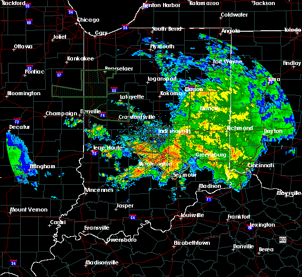 At 348 am edt, a severe thunderstorm was located 10 miles north of nashville, and moving southeast at 30 mph (radar indicated). Hazards include 70 mph wind gusts. Expect considerable tree damage. damage is likely to mobile homes, roofs and outbuildings. Locations impacted include, peoga and princes lakes. At 348 am edt, a severe thunderstorm was located 10 miles north of nashville, and moving southeast at 30 mph (radar indicated). Hazards include 70 mph wind gusts. Expect considerable tree damage. damage is likely to mobile homes, roofs and outbuildings. Locations impacted include, peoga and princes lakes.
|
| 7/12/2015 3:48 AM EDT |
 At 345 am edt, a severe thunderstorm was located 11 miles south of franklin, and moving southeast at 40 mph (radar indicated). Hazards include 70 mph wind gusts. Expect considerable tree damage. Damage is likely to mobile homes, roofs and outbuildings. At 345 am edt, a severe thunderstorm was located 11 miles south of franklin, and moving southeast at 40 mph (radar indicated). Hazards include 70 mph wind gusts. Expect considerable tree damage. Damage is likely to mobile homes, roofs and outbuildings.
|
| 7/12/2015 3:26 AM EDT |
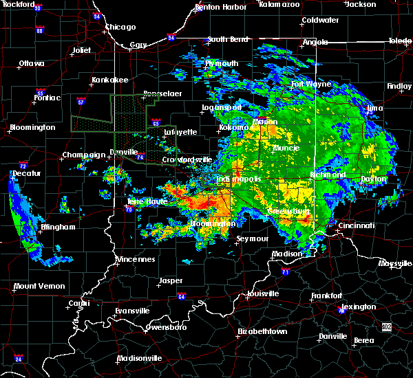 At 323 am edt, a severe thunderstorm was located near martinsville, and moving southeast at 30 mph (radar indicated). Hazards include 60 mph wind gusts. Expect damage to roofs. Siding and trees. At 323 am edt, a severe thunderstorm was located near martinsville, and moving southeast at 30 mph (radar indicated). Hazards include 60 mph wind gusts. Expect damage to roofs. Siding and trees.
|
| 4/8/2015 5:01 PM EDT | A severe thunderstorm warning remains in effect for eastern brown. northwestern bartholomew and southeastern johnson counties until 515 pm edt. at 500 pm edt. a severe thunderstorm was located 9 miles west of columbus. and moving east at 25 mph. hazard. 60 mph wind gusts and quarter size hail. |
| 4/8/2015 4:47 PM EDT | The national weather service in indianapolis has issued a * severe thunderstorm warning for. northwestern bartholomew county in central indiana. brown county in south central indiana. southern johnson county in central indiana. Until 515 pm edt. |
| 4/8/2015 4:32 PM EDT | A tornado warning remains in effect for northern brown county until 445 pm edt. at 429 pm edt. a severe thunderstorm capable of producing a tornado was located near nashville. and moving northeast at 25 mph. hazard. tornado and quarter size hail. source. Radar indicated rotation. |
| 4/8/2015 4:20 PM EDT | A tornado warning remains in effect for northern brown and east central monroe counties until 445 pm edt. at 416 pm edt. a severe thunderstorm capable of producing a tornado was located 8 miles east of bloomington. and moving northeast at 25 mph. hazard. Tornado and tennis ball size hail. |
| 4/8/2015 4:10 PM EDT | The national weather service in indianapolis has issued a * tornado warning for. northern brown county in south central indiana. east central monroe county in south central indiana. until 445 pm edt * at 408 pm edt. A severe thunderstorm capable of producing a. |
| 4/8/2015 9:46 AM EDT | A severe thunderstorm warning remains in effect for decatur. northeastern brown. northern bartholomew. southeastern henry. southeastern johnson. southeastern rush and southern shelby counties until 1000 am edt. at 944 am edt. Severe thunderstorms were located along a line extending from 11 miles southeast of rushville to greensburg to 7. |
| 4/8/2015 9:34 AM EDT | A severe thunderstorm warning remains in effect for decatur. northeastern brown. northern bartholomew. southeastern henry. southern johnson. rush and southern shelby counties until 1000 am edt. at 933 am edt. Severe thunderstorms were located along a line extending from dublin to 8 miles east of rushville to 12 miles west. |
| 4/8/2015 9:14 AM EDT | A severe thunderstorm warning remains in effect for decatur. northeastern brown. northern bartholomew. eastern hancock. southern henry. johnson. southeastern madison. southern morgan. rush and shelby counties until 1000 am edt. at 911 am edt. Severe thunderstorms were located along a line extending from 12 miles south of anderson to 9 miles northeast of. |
| 4/8/2015 9:11 AM EDT | The national weather service in indianapolis has issued a * severe thunderstorm warning for. northern bartholomew county in central indiana. northeastern brown county in south central indiana. decatur county in central indiana. Eastern hancock county in central indiana. |
| 4/2/2015 7:40 PM EDT | The severe thunderstorm warning for northeastern brown. northwestern bartholomew and southeastern johnson counties will expire at 745 pm edt/645 pm cdt/. The storm which prompted the warning has weakened and moved out of the warned area. |
| 4/2/2015 7:29 PM EDT | A severe thunderstorm warning remains in effect for northeastern brown. northwestern bartholomew and southeastern johnson counties until 745 pm edt. at 728 pm edt. a severe thunderstorm was located 9 miles northwest of columbus. and moving east at 35 mph. hazard. 60 mph wind gusts and quarter size hail. |
| 4/2/2015 7:16 PM EDT | A severe thunderstorm warning remains in effect for northern brown. northwestern bartholomew. southern johnson and southeastern morgan counties until 745 pm edt. at 715 pm edt. a severe thunderstorm was located near nashville. and moving east at 35 mph. hazard. 60 mph wind gusts and quarter size hail. |
| 4/2/2015 7:04 PM EDT | The national weather service in indianapolis has issued a * severe thunderstorm warning for. northwestern bartholomew county in central indiana. northern brown county in south central indiana. southern johnson county in central indiana. Northeastern monroe county in south central indiana. |
| 11/17/2013 4:56 PM EST | Storm damage reported in brown county IN, 2.3 miles WSW of Cordry Sweetwater Lakes, IN |
| 11/17/2013 4:54 PM EST | Location is estimated in brown county IN, 1.8 miles NNE of Cordry Sweetwater Lakes, IN |
| 4/17/2013 5:46 PM EDT | Quarter sized hail reported 1.1 miles WSW of Cordry Sweetwater Lakes, IN |
| 3/23/2012 8:10 PM EDT | Tree limbs and other litter at weber hill and east washington in brown county IN, 3.8 miles E of Cordry Sweetwater Lakes, IN |
| 1/1/0001 12:00 AM | Storm damage reported in brown county IN, 3.8 miles E of Cordry Sweetwater Lakes, IN |
Hail Maps for Cordry Sweetwater Lakes, IN


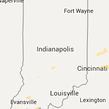


Connect with Interactive Hail Maps