

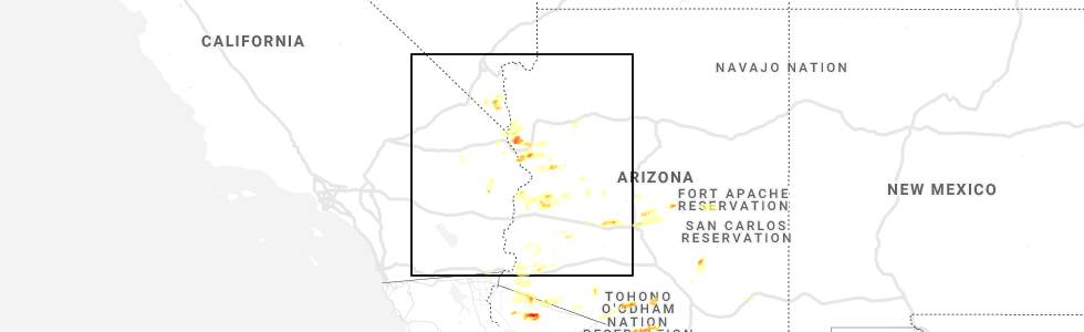
Hail Map for Crystal Beach, AZ
The Crystal Beach, AZ area has had 0 reports of on-the-ground hail by trained spotters, and has been under severe weather warnings 3 times during the past 12 months. Doppler radar has detected hail at or near Crystal Beach, AZ on 11 occasions.
| Name: | Crystal Beach, AZ |
| Where Located: | 7.1 miles NNW of Lake Havasu City, AZ |
| Map: | Google Map for Crystal Beach, AZ |
| Population: | 279 |
| Housing Units: | 171 |
| More Info: | Search Google for Crystal Beach, AZ |
5
The Top Recent Hail Date for Crystal Beach, AZ is Monday, September 23, 2019 (1st out of 11)
Hail and Wind Damage Spotted near Crystal Beach, AZ
| Date / Time | Report Details |
|---|---|
| 8/10/2024 6:40 PM MST |
 The storm which prompted the warning has weakened, and no longer poses an immediate threat to life or property. therefore, the warning will be allowed to expire. The storm which prompted the warning has weakened, and no longer poses an immediate threat to life or property. therefore, the warning will be allowed to expire.
|
| 8/10/2024 6:24 PM MST |
 At 622 pm mst, a severe thunderstorm was located 7 miles southwest of yucca, moving northwest at 10 mph (radar indicated). Hazards include 60 mph wind gusts and quarter size hail. Hail damage to vehicles is expected. expect wind damage to roofs and trees. locations impacted include, lake havasu city, yucca, and desert hills. this includes the following roads, interstate 40 in arizona between mile markers 3 and 25. state route 95 in mohave county between mile markers 188 and 201. Oatman highway between mile markers 7 and 11. At 622 pm mst, a severe thunderstorm was located 7 miles southwest of yucca, moving northwest at 10 mph (radar indicated). Hazards include 60 mph wind gusts and quarter size hail. Hail damage to vehicles is expected. expect wind damage to roofs and trees. locations impacted include, lake havasu city, yucca, and desert hills. this includes the following roads, interstate 40 in arizona between mile markers 3 and 25. state route 95 in mohave county between mile markers 188 and 201. Oatman highway between mile markers 7 and 11.
|
| 8/10/2024 6:01 PM MST |
 Svrvef the national weather service in las vegas has issued a * severe thunderstorm warning for, southwestern mohave county in northwestern arizona, * until 645 pm mst. * at 600 pm mst, a severe thunderstorm was located 8 miles southwest of yucca, moving northwest at 10 mph (radar indicated). Hazards include 60 mph wind gusts and quarter size hail. Hail damage to vehicles is expected. Expect wind damage to roofs and trees. Svrvef the national weather service in las vegas has issued a * severe thunderstorm warning for, southwestern mohave county in northwestern arizona, * until 645 pm mst. * at 600 pm mst, a severe thunderstorm was located 8 miles southwest of yucca, moving northwest at 10 mph (radar indicated). Hazards include 60 mph wind gusts and quarter size hail. Hail damage to vehicles is expected. Expect wind damage to roofs and trees.
|
| 10/3/2022 3:23 PM PDT |
 The severe thunderstorm warning for southwestern mohave and eastern san bernardino counties will expire at 330 pm pdt/330 pm mst/, the storm which prompted the warning has weakened below severe limits, and no longer poses an immediate threat to life or property. therefore, the warning will be allowed to expire. The severe thunderstorm warning for southwestern mohave and eastern san bernardino counties will expire at 330 pm pdt/330 pm mst/, the storm which prompted the warning has weakened below severe limits, and no longer poses an immediate threat to life or property. therefore, the warning will be allowed to expire.
|
| 10/3/2022 2:56 PM PDT |
 At 255 pm pdt/255 pm mst/, a severe thunderstorm was located over lake havasu city, moving southeast at 20 mph (radar indicated). Hazards include 60 mph wind gusts and quarter size hail. Hail damage to vehicles is expected. expect wind damage to roofs and trees. locations impacted include, lake havasu city, parker dam, three dunes campground, cattail cove state park, desert hills and black meadow landing campground. hail threat, radar indicated max hail size, 1. 00 in wind threat, radar indicated max wind gust, 60 mph. At 255 pm pdt/255 pm mst/, a severe thunderstorm was located over lake havasu city, moving southeast at 20 mph (radar indicated). Hazards include 60 mph wind gusts and quarter size hail. Hail damage to vehicles is expected. expect wind damage to roofs and trees. locations impacted include, lake havasu city, parker dam, three dunes campground, cattail cove state park, desert hills and black meadow landing campground. hail threat, radar indicated max hail size, 1. 00 in wind threat, radar indicated max wind gust, 60 mph.
|
| 10/3/2022 2:34 PM PDT |
 At 233 pm pdt/233 pm mst/, a severe thunderstorm was located near desert hills, or 7 miles northwest of lake havasu city, moving southeast at 20 mph (radar indicated). Hazards include 60 mph wind gusts and quarter size hail. Hail damage to vehicles is expected. Expect wind damage to roofs and trees. At 233 pm pdt/233 pm mst/, a severe thunderstorm was located near desert hills, or 7 miles northwest of lake havasu city, moving southeast at 20 mph (radar indicated). Hazards include 60 mph wind gusts and quarter size hail. Hail damage to vehicles is expected. Expect wind damage to roofs and trees.
|
| 9/12/2022 3:34 PM PDT |
 At 334 pm pdt/334 pm mst/, a severe thunderstorm was located near cattail cove state park, or 11 miles north of parker dam, moving northwest at 20 mph (radar indicated). Hazards include 60 mph wind gusts. Expect damage to roofs and trees. locations impacted include, lake havasu city, parker dam, three dunes campground, cattail cove state park, desert hills, black meadow landing campground, earp and big river. hail threat, radar indicated max hail size, <. 75 in wind threat, radar indicated max wind gust, 60 mph. At 334 pm pdt/334 pm mst/, a severe thunderstorm was located near cattail cove state park, or 11 miles north of parker dam, moving northwest at 20 mph (radar indicated). Hazards include 60 mph wind gusts. Expect damage to roofs and trees. locations impacted include, lake havasu city, parker dam, three dunes campground, cattail cove state park, desert hills, black meadow landing campground, earp and big river. hail threat, radar indicated max hail size, <. 75 in wind threat, radar indicated max wind gust, 60 mph.
|
| 9/12/2022 3:13 PM PDT |
 At 312 pm pdt/312 pm mst/, a severe thunderstorm was located over parker dam, moving north at 20 mph (radar indicated). Hazards include 60 mph wind gusts. expect damage to roofs and trees At 312 pm pdt/312 pm mst/, a severe thunderstorm was located over parker dam, moving north at 20 mph (radar indicated). Hazards include 60 mph wind gusts. expect damage to roofs and trees
|
| 9/4/2022 6:21 PM MST |
 The severe thunderstorm warning for southwestern mohave, east central san bernardino and southern clark counties will expire at 630 pm pdt/630 pm mst/, the storms from mohave valley to lake havasu city have weakened and no longer pose an immediate threat to life or property. therefore, the warning will be allowed to expire. The severe thunderstorm warning for southwestern mohave, east central san bernardino and southern clark counties will expire at 630 pm pdt/630 pm mst/, the storms from mohave valley to lake havasu city have weakened and no longer pose an immediate threat to life or property. therefore, the warning will be allowed to expire.
|
| 9/4/2022 6:02 PM MST |
 At 600 pm pdt/600 pm mst/, doppler radar indicated thunderstorms finally weakening as they reach the colorado river. however, very strong winds are persisting, so the warning remains in effect until 630 pm (radar indicated). Hazards include 60 mph wind gusts and quarter size hail. Hail damage to vehicles is expected. expect wind damage to roofs and trees. locations impacted include, lake havasu city, topock, needles, mesquite creek, desert hills, arizona village, mojave ranch estates, mohave valley, highway 95 and i-40 and willow valley. this includes the following highways, interstate 40 in arizona between mile markers 0 and 14. interstate 40 in california between mile markers 131 and 155. hail threat, radar indicated max hail size, 1. 00 in wind threat, observed max wind gust, 60 mph. At 600 pm pdt/600 pm mst/, doppler radar indicated thunderstorms finally weakening as they reach the colorado river. however, very strong winds are persisting, so the warning remains in effect until 630 pm (radar indicated). Hazards include 60 mph wind gusts and quarter size hail. Hail damage to vehicles is expected. expect wind damage to roofs and trees. locations impacted include, lake havasu city, topock, needles, mesquite creek, desert hills, arizona village, mojave ranch estates, mohave valley, highway 95 and i-40 and willow valley. this includes the following highways, interstate 40 in arizona between mile markers 0 and 14. interstate 40 in california between mile markers 131 and 155. hail threat, radar indicated max hail size, 1. 00 in wind threat, observed max wind gust, 60 mph.
|
| 9/4/2022 5:42 PM MST |
 The severe thunderstorm warning for southwestern mohave, east central san bernardino and southern clark counties will expire at 545 pm pdt/545 pm mst/, this warning has been replaced with a new severe thunderstorm warning valid until 630 pm pdt/mst. The severe thunderstorm warning for southwestern mohave, east central san bernardino and southern clark counties will expire at 545 pm pdt/545 pm mst/, this warning has been replaced with a new severe thunderstorm warning valid until 630 pm pdt/mst.
|
| 9/4/2022 5:42 PM MST |
 The severe thunderstorm warning for southwestern mohave. east central san bernardino and southern clark counties will expire at 545 pm pdt/545 pm mst/. This warning has been replaced with a new severe thunderstorm warning valid until 630 pm pdt/mst. The severe thunderstorm warning for southwestern mohave. east central san bernardino and southern clark counties will expire at 545 pm pdt/545 pm mst/. This warning has been replaced with a new severe thunderstorm warning valid until 630 pm pdt/mst.
|
| 9/4/2022 5:38 PM MST |
 At 537 pm pdt/537 pm mst/, severe thunderstorms were located along a line extending from near mesquite creek to lake havasu city, moving west at 30 mph (radar indicated). Hazards include 60 mph wind gusts and quarter size hail. Hail damage to vehicles is expected. Expect wind damage to roofs and trees. At 537 pm pdt/537 pm mst/, severe thunderstorms were located along a line extending from near mesquite creek to lake havasu city, moving west at 30 mph (radar indicated). Hazards include 60 mph wind gusts and quarter size hail. Hail damage to vehicles is expected. Expect wind damage to roofs and trees.
|
| 9/4/2022 5:23 PM MST |
 At 522 pm pdt/522 pm mst/, severe thunderstorms were located along a line extending from 8 miles south of oatman to 9 miles north of three dunes campground, moving west at 30 mph (radar indicated). Hazards include 70 mph wind gusts and quarter size hail. Hail damage to vehicles is expected. expect considerable tree damage. wind damage is also likely to mobile homes, roofs, and outbuildings. locations impacted include, lake havasu city, topock, needles, mesquite creek, desert hills, arizona village, mojave ranch estates, mohave valley, highway 95 and i-40 and willow valley. this includes the following highways, interstate 40 in arizona between mile markers 0 and 20. interstate 40 in california between mile markers 131 and 155. thunderstorm damage threat, considerable hail threat, radar indicated max hail size, 1. 00 in wind threat, observed max wind gust, 70 mph. At 522 pm pdt/522 pm mst/, severe thunderstorms were located along a line extending from 8 miles south of oatman to 9 miles north of three dunes campground, moving west at 30 mph (radar indicated). Hazards include 70 mph wind gusts and quarter size hail. Hail damage to vehicles is expected. expect considerable tree damage. wind damage is also likely to mobile homes, roofs, and outbuildings. locations impacted include, lake havasu city, topock, needles, mesquite creek, desert hills, arizona village, mojave ranch estates, mohave valley, highway 95 and i-40 and willow valley. this includes the following highways, interstate 40 in arizona between mile markers 0 and 20. interstate 40 in california between mile markers 131 and 155. thunderstorm damage threat, considerable hail threat, radar indicated max hail size, 1. 00 in wind threat, observed max wind gust, 70 mph.
|
| 9/4/2022 5:04 PM MST |
 At 503 pm pdt/503 pm mst/, severe thunderstorms were located along a line extending from 9 miles west of yucca to 12 miles northeast of cattail cove state park, moving west at 30 mph (radar indicated). Hazards include 70 mph wind gusts and quarter size hail. Hail damage to vehicles is expected. expect considerable tree damage. Wind damage is also likely to mobile homes, roofs, and outbuildings. At 503 pm pdt/503 pm mst/, severe thunderstorms were located along a line extending from 9 miles west of yucca to 12 miles northeast of cattail cove state park, moving west at 30 mph (radar indicated). Hazards include 70 mph wind gusts and quarter size hail. Hail damage to vehicles is expected. expect considerable tree damage. Wind damage is also likely to mobile homes, roofs, and outbuildings.
|
| 8/26/2022 5:24 PM PDT | The severe thunderstorm warning for southwestern mohave and east central san bernardino counties will expire at 530 pm pdt/530 pm mst/, the storm which prompted the warning has weakened below severe limits, and no longer poses an immediate threat to life or property. therefore, the warning will be allowed to expire. |
| 8/26/2022 5:24 PM PDT | The severe thunderstorm warning for southwestern mohave and east central san bernardino counties will expire at 530 pm pdt/530 pm mst/, the storm which prompted the warning has weakened below severe limits, and no longer poses an immediate threat to life or property. therefore, the warning will be allowed to expire. |
| 8/26/2022 4:46 PM PDT | At 444 pm pdt/444 pm mst/, a severe thunderstorm was located near desert hills, or 8 miles northwest of lake havasu city, moving south at 15 mph. lake havasu city airport reported a peak wind gust to 54 mph (radar indicated). Hazards include 60 mph wind gusts. Expect damage to roofs and trees. locations impacted include, lake havasu city and desert hills. this includes interstate 40 in arizona near mile marker 5. hail threat, radar indicated max hail size, <. 75 in wind threat, radar indicated max wind gust, 60 mph. |
| 8/26/2022 4:46 PM PDT | At 444 pm pdt/444 pm mst/, a severe thunderstorm was located near desert hills, or 8 miles northwest of lake havasu city, moving south at 15 mph. lake havasu city airport reported a peak wind gust to 54 mph (radar indicated). Hazards include 60 mph wind gusts. Expect damage to roofs and trees. locations impacted include, lake havasu city and desert hills. this includes interstate 40 in arizona near mile marker 5. hail threat, radar indicated max hail size, <. 75 in wind threat, radar indicated max wind gust, 60 mph. |
| 8/26/2022 4:28 PM PDT | At 427 pm pdt/427 pm mst/, a severe thunderstorm was located near topock, moving south at 15 mph (radar indicated). Hazards include 60 mph wind gusts. expect damage to roofs and trees |
| 8/26/2022 4:28 PM PDT | At 427 pm pdt/427 pm mst/, a severe thunderstorm was located near topock, moving south at 15 mph (radar indicated). Hazards include 60 mph wind gusts. expect damage to roofs and trees |
| 8/21/2022 11:09 PM MST | The severe thunderstorm warning for southwestern mohave and southeastern san bernardino counties will expire at 1115 pm pdt/1115 pm mst/, the storm which prompted the warning has weakened below severe limits, and no longer poses an immediate threat to life or property. therefore, the warning will be allowed to expire. however gusty winds are still possible with this thunderstorm. |
| 8/21/2022 11:09 PM MST | The severe thunderstorm warning for southwestern mohave and southeastern san bernardino counties will expire at 1115 pm pdt/1115 pm mst/, the storm which prompted the warning has weakened below severe limits, and no longer poses an immediate threat to life or property. therefore, the warning will be allowed to expire. however gusty winds are still possible with this thunderstorm. |
| 8/21/2022 10:41 PM MST | At 1040 pm pdt/1040 pm mst/, a severe thunderstorm was located 10 miles northeast of desert hills, or 11 miles northeast of lake havasu city, moving southwest at 30 mph. wind gusts to 60 mph were observed at yucca with this storm earlier (radar indicated). Hazards include 60 mph wind gusts. Expect damage to roofs and trees. locations impacted include, lake havasu city, topock, parker dam, needles, three dunes campground, cattail cove state park, desert hills, black meadow landing campground, earp and big river. this includes the following highways, interstate 40 in arizona between mile markers 0 and 22. interstate 40 in california between mile markers 148 and 155. hail threat, radar indicated max hail size, <. 75 in wind threat, radar indicated max wind gust, 60 mph. |
| 8/21/2022 10:41 PM MST | At 1040 pm pdt/1040 pm mst/, a severe thunderstorm was located 10 miles northeast of desert hills, or 11 miles northeast of lake havasu city, moving southwest at 30 mph. wind gusts to 60 mph were observed at yucca with this storm earlier (radar indicated). Hazards include 60 mph wind gusts. Expect damage to roofs and trees. locations impacted include, lake havasu city, topock, parker dam, needles, three dunes campground, cattail cove state park, desert hills, black meadow landing campground, earp and big river. this includes the following highways, interstate 40 in arizona between mile markers 0 and 22. interstate 40 in california between mile markers 148 and 155. hail threat, radar indicated max hail size, <. 75 in wind threat, radar indicated max wind gust, 60 mph. |
| 8/21/2022 10:03 PM MST | At 1003 pm pdt/1003 pm mst/, a severe thunderstorm was located near yucca, moving south at 30 mph. this storm will approach lake havasu city through 11pm (radar indicated). Hazards include 60 mph wind gusts and quarter size hail. Hail damage to vehicles is expected. Expect wind damage to roofs and trees. |
| 8/21/2022 10:03 PM MST | At 1003 pm pdt/1003 pm mst/, a severe thunderstorm was located near yucca, moving south at 30 mph. this storm will approach lake havasu city through 11pm (radar indicated). Hazards include 60 mph wind gusts and quarter size hail. Hail damage to vehicles is expected. Expect wind damage to roofs and trees. |
| 8/18/2022 7:10 PM MST |
 The severe thunderstorm warning for southwestern mohave and eastern san bernardino counties will expire at 715 pm pdt/715 pm mst/, the storm which prompted the warning for lake havasu has moved out of the area. therefore, the warning will be allowed to expire. The severe thunderstorm warning for southwestern mohave and eastern san bernardino counties will expire at 715 pm pdt/715 pm mst/, the storm which prompted the warning for lake havasu has moved out of the area. therefore, the warning will be allowed to expire.
|
| 8/18/2022 6:43 PM MST |
 At 642 pm pdt/642 pm mst/, a severe thunderstorm was located over three dunes campground, or 9 miles northwest of parker dam, moving southeast at 55 mph. at 638 pm a wind gust to 58 mph was recorded at lake havasu city (radar indicated). Hazards include 60 mph wind gusts. Expect damage to roofs and trees. locations impacted include, lake havasu city and desert hills. hail threat, radar indicated max hail size, <. 75 in wind threat, radar indicated max wind gust, 60 mph. At 642 pm pdt/642 pm mst/, a severe thunderstorm was located over three dunes campground, or 9 miles northwest of parker dam, moving southeast at 55 mph. at 638 pm a wind gust to 58 mph was recorded at lake havasu city (radar indicated). Hazards include 60 mph wind gusts. Expect damage to roofs and trees. locations impacted include, lake havasu city and desert hills. hail threat, radar indicated max hail size, <. 75 in wind threat, radar indicated max wind gust, 60 mph.
|
| 8/18/2022 6:34 PM MST |
 At 633 pm pdt/633 pm mst/, a severe thunderstorm was located over lake havasu city, moving southeast at 55 mph (radar indicated). Hazards include 60 mph wind gusts. expect damage to roofs and trees At 633 pm pdt/633 pm mst/, a severe thunderstorm was located over lake havasu city, moving southeast at 55 mph (radar indicated). Hazards include 60 mph wind gusts. expect damage to roofs and trees
|
| 8/14/2022 3:21 PM PDT |
 At 320 pm pdt/320 pm mst/, a severe thunderstorm was located over arizona village, or 11 miles northwest of topock, moving south at 20 mph. this warning includes needles and the mohave valley (radar indicated). Hazards include 60 mph wind gusts. expect damage to roofs and trees At 320 pm pdt/320 pm mst/, a severe thunderstorm was located over arizona village, or 11 miles northwest of topock, moving south at 20 mph. this warning includes needles and the mohave valley (radar indicated). Hazards include 60 mph wind gusts. expect damage to roofs and trees
|
| 7/28/2022 6:09 PM PDT |
 At 609 pm pdt/609 pm mst/, a severe thunderstorm was located near lake havasu city, moving southwest at 20 mph (radar indicated). Hazards include 60 mph wind gusts. Expect damage to roofs and trees. locations impacted include, lake havasu city, highway 95 at mile marker 29, parker dam, three dunes campground, cattail cove state park, desert hills, black meadow landing campground, essex, earp, vidal junction and big river. hail threat, radar indicated max hail size, <. 75 in wind threat, radar indicated max wind gust, 60 mph. At 609 pm pdt/609 pm mst/, a severe thunderstorm was located near lake havasu city, moving southwest at 20 mph (radar indicated). Hazards include 60 mph wind gusts. Expect damage to roofs and trees. locations impacted include, lake havasu city, highway 95 at mile marker 29, parker dam, three dunes campground, cattail cove state park, desert hills, black meadow landing campground, essex, earp, vidal junction and big river. hail threat, radar indicated max hail size, <. 75 in wind threat, radar indicated max wind gust, 60 mph.
|
| 7/28/2022 5:46 PM PDT |
 At 546 pm pdt/546 pm mst/, a severe thunderstorm was located over lake havasu city, moving southwest at 20 mph (radar indicated). Hazards include 60 mph wind gusts. expect damage to roofs and trees At 546 pm pdt/546 pm mst/, a severe thunderstorm was located over lake havasu city, moving southwest at 20 mph (radar indicated). Hazards include 60 mph wind gusts. expect damage to roofs and trees
|
| 7/28/2022 5:33 PM MST |
 At 531 pm pdt/531 pm mst/, a severe thunderstorm was located over needles, or 10 miles northwest of topock, moving southwest at 20 mph. a wind gust of 58 mph was reported at the needles airport at 521 pm pdt/mst (radar indicated). Hazards include 60 mph wind gusts and quarter size hail. Hail damage to vehicles is expected. expect wind damage to roofs and trees. locations impacted include, lake havasu city, bullhead city, laughlin, topock, yucca, katherine landing, needles, oatman, desert hills, mojave ranch estates, mohave valley, big bend rec area, highway 95 and i-40, mesquite creek, arizona village and willow valley. this includes the following highways, interstate 40 in arizona between mile markers 0 and 28. interstate 40 in california between mile markers 122 and 155. hail threat, radar indicated max hail size, 1. 00 in wind threat, observed max wind gust, 60 mph. At 531 pm pdt/531 pm mst/, a severe thunderstorm was located over needles, or 10 miles northwest of topock, moving southwest at 20 mph. a wind gust of 58 mph was reported at the needles airport at 521 pm pdt/mst (radar indicated). Hazards include 60 mph wind gusts and quarter size hail. Hail damage to vehicles is expected. expect wind damage to roofs and trees. locations impacted include, lake havasu city, bullhead city, laughlin, topock, yucca, katherine landing, needles, oatman, desert hills, mojave ranch estates, mohave valley, big bend rec area, highway 95 and i-40, mesquite creek, arizona village and willow valley. this includes the following highways, interstate 40 in arizona between mile markers 0 and 28. interstate 40 in california between mile markers 122 and 155. hail threat, radar indicated max hail size, 1. 00 in wind threat, observed max wind gust, 60 mph.
|
| 7/28/2022 4:46 PM MST |
 At 445 pm pdt/445 pm mst/, a severe thunderstorm was located near oatman, or 14 miles southeast of bullhead city, moving southwest at 20 mph (radar indicated). Hazards include 60 mph wind gusts and quarter size hail. Hail damage to vehicles is expected. Expect wind damage to roofs and trees. At 445 pm pdt/445 pm mst/, a severe thunderstorm was located near oatman, or 14 miles southeast of bullhead city, moving southwest at 20 mph (radar indicated). Hazards include 60 mph wind gusts and quarter size hail. Hail damage to vehicles is expected. Expect wind damage to roofs and trees.
|
| 8/10/2021 6:43 PM PDT |
 At 641 pm pdt/641 pm mst/, severe thunderstorms were located along a line extending from 17 miles southwest of needles to near big river, moving southwest at 30 mph (radar indicated). Hazards include 60 mph wind gusts. expect damage to roofs and trees At 641 pm pdt/641 pm mst/, severe thunderstorms were located along a line extending from 17 miles southwest of needles to near big river, moving southwest at 30 mph (radar indicated). Hazards include 60 mph wind gusts. expect damage to roofs and trees
|
| 8/10/2021 6:31 PM MST |
 At 628 pm pdt/628 pm mst/, severe thunderstorms were located along a line extending from 8 miles south of needles to 4 miles west of lake havasu city to near parker, moving southwest at 25 mph (wind speeds of 59 mph have been observed in lake havasu city). Hazards include 60 mph wind gusts and near zero visibility due to blowing dust. Expect damage to roofs and trees. locations impacted include, lake havasu city, highway 95 at mile marker 29, topock, parker dam, alamo lake, needles, three dunes campground, alamo state park, desert hills, black meadow landing campground, mohave valley, cattail cove state park, arizona village, earp, vidal junction, big river, mesquite creek, mojave ranch estates and willow valley. this includes the following highways, interstate 40 in arizona between mile markers 0 and 17. interstate 40 in california between mile markers 140 and 155. hail threat, radar indicated max hail size, <. 75 in wind threat, observed max wind gust, 60 mph. At 628 pm pdt/628 pm mst/, severe thunderstorms were located along a line extending from 8 miles south of needles to 4 miles west of lake havasu city to near parker, moving southwest at 25 mph (wind speeds of 59 mph have been observed in lake havasu city). Hazards include 60 mph wind gusts and near zero visibility due to blowing dust. Expect damage to roofs and trees. locations impacted include, lake havasu city, highway 95 at mile marker 29, topock, parker dam, alamo lake, needles, three dunes campground, alamo state park, desert hills, black meadow landing campground, mohave valley, cattail cove state park, arizona village, earp, vidal junction, big river, mesquite creek, mojave ranch estates and willow valley. this includes the following highways, interstate 40 in arizona between mile markers 0 and 17. interstate 40 in california between mile markers 140 and 155. hail threat, radar indicated max hail size, <. 75 in wind threat, observed max wind gust, 60 mph.
|
| 8/10/2021 5:59 PM MST |
 At 557 pm pdt/557 pm mst/, severe thunderstorms were located along a line extending from near arizona village to desert hills to 2 miles east of lake havasu city to near parker dam, moving southwest at 25 mph (radar indicated). Hazards include 60 mph wind gusts. Expect damage to roofs and trees. locations impacted include, lake havasu city, highway 95 at mile marker 29, topock, parker dam, alamo lake, needles, three dunes campground, alamo state park, desert hills, black meadow landing campground, mohave valley, cattail cove state park, arizona village, earp, vidal junction, big river, mesquite creek, mojave ranch estates and willow valley. this includes the following highways, interstate 40 in arizona between mile markers 0 and 17. interstate 40 in california between mile markers 140 and 155. hail threat, radar indicated max hail size, <. 75 in wind threat, radar indicated max wind gust, 60 mph. At 557 pm pdt/557 pm mst/, severe thunderstorms were located along a line extending from near arizona village to desert hills to 2 miles east of lake havasu city to near parker dam, moving southwest at 25 mph (radar indicated). Hazards include 60 mph wind gusts. Expect damage to roofs and trees. locations impacted include, lake havasu city, highway 95 at mile marker 29, topock, parker dam, alamo lake, needles, three dunes campground, alamo state park, desert hills, black meadow landing campground, mohave valley, cattail cove state park, arizona village, earp, vidal junction, big river, mesquite creek, mojave ranch estates and willow valley. this includes the following highways, interstate 40 in arizona between mile markers 0 and 17. interstate 40 in california between mile markers 140 and 155. hail threat, radar indicated max hail size, <. 75 in wind threat, radar indicated max wind gust, 60 mph.
|
| 8/10/2021 5:35 PM MST |
 At 534 pm pdt/534 pm mst/, severe thunderstorms were located along a line extending from near arizona village to 6 miles northeast of lake havasu city to 14 miles east of parker dam to 13 miles south of alamo state park, moving southwest at 30 mph (radar indicated). Hazards include 60 mph wind gusts. Expect damage to roofs and trees. locations impacted include, lake havasu city, highway 95 at mile marker 29, topock, parker dam, alamo lake, needles, three dunes campground, alamo state park, desert hills, black meadow landing campground, mohave valley, cattail cove state park, arizona village, earp, vidal junction, big river, mesquite creek, mojave ranch estates and willow valley. this includes the following highways, interstate 40 in arizona between mile markers 0 and 17. interstate 40 in california between mile markers 140 and 155. hail threat, radar indicated max hail size, <. 75 in wind threat, radar indicated max wind gust, 60 mph. At 534 pm pdt/534 pm mst/, severe thunderstorms were located along a line extending from near arizona village to 6 miles northeast of lake havasu city to 14 miles east of parker dam to 13 miles south of alamo state park, moving southwest at 30 mph (radar indicated). Hazards include 60 mph wind gusts. Expect damage to roofs and trees. locations impacted include, lake havasu city, highway 95 at mile marker 29, topock, parker dam, alamo lake, needles, three dunes campground, alamo state park, desert hills, black meadow landing campground, mohave valley, cattail cove state park, arizona village, earp, vidal junction, big river, mesquite creek, mojave ranch estates and willow valley. this includes the following highways, interstate 40 in arizona between mile markers 0 and 17. interstate 40 in california between mile markers 140 and 155. hail threat, radar indicated max hail size, <. 75 in wind threat, radar indicated max wind gust, 60 mph.
|
| 8/10/2021 5:13 PM MST |
 At 509 pm pdt/509 pm mst/, severe thunderstorms were located along a line extending from near oatman to 11 miles south of yucca to the south to the la paz county line, moving southwest at 25 mph (radar indicated). Hazards include 60 mph wind gusts. expect damage to roofs and trees At 509 pm pdt/509 pm mst/, severe thunderstorms were located along a line extending from near oatman to 11 miles south of yucca to the south to the la paz county line, moving southwest at 25 mph (radar indicated). Hazards include 60 mph wind gusts. expect damage to roofs and trees
|
| 7/30/2021 1:51 PM MST |
 At 149 pm pdt/149 pm mst/, a severe thunderstorm was located over lake havasu city, moving northwest at 15 mph. the storm has now collapsed. severe outflow winds remain possible (radar indicated). Hazards include 60 mph wind gusts. Expect damage to roofs and trees. Locations impacted include, lake havasu city, three dunes campground, cattail cove state park, desert hills and black meadow landing campground. At 149 pm pdt/149 pm mst/, a severe thunderstorm was located over lake havasu city, moving northwest at 15 mph. the storm has now collapsed. severe outflow winds remain possible (radar indicated). Hazards include 60 mph wind gusts. Expect damage to roofs and trees. Locations impacted include, lake havasu city, three dunes campground, cattail cove state park, desert hills and black meadow landing campground.
|
| 7/30/2021 1:14 PM MST |
 At 114 pm pdt/114 pm mst/, a severe thunderstorm was located near three dunes campground, or 8 miles southeast of lake havasu city, moving northwest at 15 mph (radar indicated). Hazards include 60 mph wind gusts. expect damage to roofs and trees At 114 pm pdt/114 pm mst/, a severe thunderstorm was located near three dunes campground, or 8 miles southeast of lake havasu city, moving northwest at 15 mph (radar indicated). Hazards include 60 mph wind gusts. expect damage to roofs and trees
|
| 9/23/2019 5:58 PM MST |
 The severe thunderstorm warning for southwestern mohave and eastern san bernardino counties will expire at 600 pm pdt/600 pm mst/, the storm which prompted the warning is still capable of producing severe hail and an additional severe thunderstorm warning was issued. a severe thunderstorm watch remains in effect until 800 pm pdt/800 pm mst/ for northwestern arizona. The severe thunderstorm warning for southwestern mohave and eastern san bernardino counties will expire at 600 pm pdt/600 pm mst/, the storm which prompted the warning is still capable of producing severe hail and an additional severe thunderstorm warning was issued. a severe thunderstorm watch remains in effect until 800 pm pdt/800 pm mst/ for northwestern arizona.
|
| 9/23/2019 5:43 PM MST |
 At 541 pm pdt/541 pm mst/, a severe thunderstorm was located 9 miles northeast of desert hills, or 11 miles east of topock, moving northeast at 15 mph. severe thunderstorm is showing signs of low level rotation northeast desert hills, updated for tornado possible (radar indicated). Hazards include quarter size hail. Damage to vehicles is expected. locations impacted include, lake havasu city and desert hills. This includes interstate 40 in arizona between mile markers 7 and 22. At 541 pm pdt/541 pm mst/, a severe thunderstorm was located 9 miles northeast of desert hills, or 11 miles east of topock, moving northeast at 15 mph. severe thunderstorm is showing signs of low level rotation northeast desert hills, updated for tornado possible (radar indicated). Hazards include quarter size hail. Damage to vehicles is expected. locations impacted include, lake havasu city and desert hills. This includes interstate 40 in arizona between mile markers 7 and 22.
|
| 9/23/2019 5:33 PM MST |
 At 531 pm pdt/531 pm mst/, a severe thunderstorm was located 7 miles northeast of desert hills, or 10 miles southeast of topock, moving northeast at 15 mph. spotter reports nickle to quarter size hail along highway 95 north of desert hills (radar indicated). Hazards include quarter size hail. Damage to vehicles is expected. locations impacted include, lake havasu city and desert hills. This includes interstate 40 in arizona between mile markers 7 and 22. At 531 pm pdt/531 pm mst/, a severe thunderstorm was located 7 miles northeast of desert hills, or 10 miles southeast of topock, moving northeast at 15 mph. spotter reports nickle to quarter size hail along highway 95 north of desert hills (radar indicated). Hazards include quarter size hail. Damage to vehicles is expected. locations impacted include, lake havasu city and desert hills. This includes interstate 40 in arizona between mile markers 7 and 22.
|
| 9/23/2019 5:18 PM MST |
 At 518 pm pdt/518 pm mst/, a severe thunderstorm was located near desert hills, or 9 miles southeast of topock, moving northeast at 15 mph (radar indicated). Hazards include up to golf ball size hail. People and animals outdoors will be injured. Expect damage to roofs, windows, and vehicles. At 518 pm pdt/518 pm mst/, a severe thunderstorm was located near desert hills, or 9 miles southeast of topock, moving northeast at 15 mph (radar indicated). Hazards include up to golf ball size hail. People and animals outdoors will be injured. Expect damage to roofs, windows, and vehicles.
|
| 9/23/2019 12:52 PM PDT |
 The severe thunderstorm warning for southern mohave and eastern san bernardino counties will expire at 100 pm pdt/100 pm mst/, the severe thunderstorm just northeast of lake havasu city was weakening. therefore, the warning will be allowed to expire. another storm was developing just across the river from lake havasu city and will move through the city by 130 pm mst. this storm did not appear to be nearly as strong as the previous one, but we will continue to monitor in case it strengthens. a severe thunderstorm watch remains in effect until 800 pm pdt/800 pm mst/ for northwestern arizona. The severe thunderstorm warning for southern mohave and eastern san bernardino counties will expire at 100 pm pdt/100 pm mst/, the severe thunderstorm just northeast of lake havasu city was weakening. therefore, the warning will be allowed to expire. another storm was developing just across the river from lake havasu city and will move through the city by 130 pm mst. this storm did not appear to be nearly as strong as the previous one, but we will continue to monitor in case it strengthens. a severe thunderstorm watch remains in effect until 800 pm pdt/800 pm mst/ for northwestern arizona.
|
| 9/23/2019 12:32 PM PDT |
 At 1230 pm pdt/1230 pm mst/, a severe thunderstorm was located over desert hills, or near lake havasu city, moving east at 10 mph. this storm is showing strong indications of large hail over arizona highway 95 just north of desert hills (radar indicated). Hazards include golf ball size hail. People and animals outdoors will be injured. expect damage to roofs, windows, and vehicles. Locations impacted include, lake havasu city and desert hills. At 1230 pm pdt/1230 pm mst/, a severe thunderstorm was located over desert hills, or near lake havasu city, moving east at 10 mph. this storm is showing strong indications of large hail over arizona highway 95 just north of desert hills (radar indicated). Hazards include golf ball size hail. People and animals outdoors will be injured. expect damage to roofs, windows, and vehicles. Locations impacted include, lake havasu city and desert hills.
|
| 9/23/2019 12:13 PM PDT |
 At 1212 pm pdt/1212 pm mst/, a severe thunderstorm was located near desert hills, or 7 miles northwest of lake havasu city, moving east at 10 mph (radar indicated). Hazards include quarter size hail. damage to vehicles is expected At 1212 pm pdt/1212 pm mst/, a severe thunderstorm was located near desert hills, or 7 miles northwest of lake havasu city, moving east at 10 mph (radar indicated). Hazards include quarter size hail. damage to vehicles is expected
|
| 7/18/2018 12:49 AM PDT |
 At 1247 am pdt/1247 am mst/, a severe thunderstorm was located 8 miles west of black meadow landing campground, or 11 miles west of parker dam, moving west at 35 mph. at 1235 am a gust to 60 mph was reported at the lake havasu city airport (automated wind sensor). Hazards include 60 mph wind gusts. Expect damage to roofs and trees. Locations impacted include, lake havasu city, highway 95 at mile marker 29, parker dam, three dunes campground, cattail cove state park, desert hills, black meadow landing campground, earp, vidal junction and big river. At 1247 am pdt/1247 am mst/, a severe thunderstorm was located 8 miles west of black meadow landing campground, or 11 miles west of parker dam, moving west at 35 mph. at 1235 am a gust to 60 mph was reported at the lake havasu city airport (automated wind sensor). Hazards include 60 mph wind gusts. Expect damage to roofs and trees. Locations impacted include, lake havasu city, highway 95 at mile marker 29, parker dam, three dunes campground, cattail cove state park, desert hills, black meadow landing campground, earp, vidal junction and big river.
|
| 7/18/2018 12:31 AM PDT |
 At 1230 am pdt/1230 am mst/, a severe thunderstorm was located over parker dam, moving west at 35 mph (radar indicated). Hazards include 60 mph wind gusts. expect damage to roofs and trees as well as dangerous wave conditions on lake havasu At 1230 am pdt/1230 am mst/, a severe thunderstorm was located over parker dam, moving west at 35 mph (radar indicated). Hazards include 60 mph wind gusts. expect damage to roofs and trees as well as dangerous wave conditions on lake havasu
|
| 8/1/2017 6:38 PM MST |
 The severe thunderstorm warning for southwestern mohave and east central san bernardino counties will expire at 645 pm pdt/645 pm mst/, the storm which prompted the warning has weakened below severe limits, and no longer poses an immediate threat to life or property. therefore the warning will be allowed to expire. however gusty winds are still possible with this thunderstorm. remember, a severe thunderstorm warning still remains in effect for mohave valley, bullhead city, and lake mohave. The severe thunderstorm warning for southwestern mohave and east central san bernardino counties will expire at 645 pm pdt/645 pm mst/, the storm which prompted the warning has weakened below severe limits, and no longer poses an immediate threat to life or property. therefore the warning will be allowed to expire. however gusty winds are still possible with this thunderstorm. remember, a severe thunderstorm warning still remains in effect for mohave valley, bullhead city, and lake mohave.
|
| 8/1/2017 5:59 PM MST |
 At 558 pm pdt/558 pm mst/, a severe thunderstorm was located near lake havasu city, moving southwest at 25 mph (radar indicated). Hazards include 60 mph wind gusts and quarter size hail. Hail damage to vehicles is expected. expect wind damage to roofs, siding, and trees. locations impacted include, lake havasu city, topock, parker dam, yucca, needles, three dunes campground, cattail cove state park, desert hills and black meadow landing campground. this includes the following highways, interstate 40 in arizona between mile markers 0 and 29. Interstate 40 in california between mile markers 144 and 155. At 558 pm pdt/558 pm mst/, a severe thunderstorm was located near lake havasu city, moving southwest at 25 mph (radar indicated). Hazards include 60 mph wind gusts and quarter size hail. Hail damage to vehicles is expected. expect wind damage to roofs, siding, and trees. locations impacted include, lake havasu city, topock, parker dam, yucca, needles, three dunes campground, cattail cove state park, desert hills and black meadow landing campground. this includes the following highways, interstate 40 in arizona between mile markers 0 and 29. Interstate 40 in california between mile markers 144 and 155.
|
| 8/1/2017 5:30 PM MST |
 At 530 pm pdt/530 pm mst/, a severe thunderstorm was located 14 miles northeast of cattail cove state park, or 16 miles east of lake havasu city, moving southwest at 25 mph (radar indicated). Hazards include 60 mph wind gusts and quarter size hail. Hail damage to vehicles is expected. Expect wind damage to roofs, siding, and trees. At 530 pm pdt/530 pm mst/, a severe thunderstorm was located 14 miles northeast of cattail cove state park, or 16 miles east of lake havasu city, moving southwest at 25 mph (radar indicated). Hazards include 60 mph wind gusts and quarter size hail. Hail damage to vehicles is expected. Expect wind damage to roofs, siding, and trees.
|
| 7/17/2017 8:09 PM MST |
 At 809 pm pdt/809 pm mst/, severe thunderstorms were located along a line extending from yucca to near parker dam to 13 miles northwest of wenden, moving west at 15 mph (radar indicated). Hazards include 60 mph wind gusts and quarter size hail. Hail damage to vehicles is expected. Expect wind damage to roofs, siding, and trees. At 809 pm pdt/809 pm mst/, severe thunderstorms were located along a line extending from yucca to near parker dam to 13 miles northwest of wenden, moving west at 15 mph (radar indicated). Hazards include 60 mph wind gusts and quarter size hail. Hail damage to vehicles is expected. Expect wind damage to roofs, siding, and trees.
|
| 7/17/2017 7:50 PM MST |
 At 749 pm pdt/749 pm mst/, severe thunderstorms were located along a line extending from near yucca to near parker dam to 12 miles north of wenden, moving west at 15 mph (radar indicated). Hazards include 60 mph wind gusts and quarter size hail. Hail damage to vehicles is expected. expect wind damage to roofs, siding, and trees. locations impacted include, lake havasu city, highway 95 at mile marker 29, parker dam, three dunes campground, cattail cove state park, desert hills, black meadow landing campground, earp, vidal junction and big river. This includes interstate 40 in arizona between mile markers 12 and 13. At 749 pm pdt/749 pm mst/, severe thunderstorms were located along a line extending from near yucca to near parker dam to 12 miles north of wenden, moving west at 15 mph (radar indicated). Hazards include 60 mph wind gusts and quarter size hail. Hail damage to vehicles is expected. expect wind damage to roofs, siding, and trees. locations impacted include, lake havasu city, highway 95 at mile marker 29, parker dam, three dunes campground, cattail cove state park, desert hills, black meadow landing campground, earp, vidal junction and big river. This includes interstate 40 in arizona between mile markers 12 and 13.
|
| 7/17/2017 7:19 PM MST |
 At 718 pm pdt/718 pm mst/, severe thunderstorms were located along a line extending from 11 miles east of yucca to 11 miles east of parker dam to 13 miles northwest of gladden, moving west at 15 mph towards lake havasu city and parker dam (radar indicated). Hazards include 60 mph wind gusts and quarter size hail. Hail damage to vehicles is expected. Expect wind damage to roofs, siding, and trees. At 718 pm pdt/718 pm mst/, severe thunderstorms were located along a line extending from 11 miles east of yucca to 11 miles east of parker dam to 13 miles northwest of gladden, moving west at 15 mph towards lake havasu city and parker dam (radar indicated). Hazards include 60 mph wind gusts and quarter size hail. Hail damage to vehicles is expected. Expect wind damage to roofs, siding, and trees.
|
| 7/8/2017 8:21 PM MST |
 The severe thunderstorm warning for southwestern mohave county will expire at 830 pm mst, the storm which prompted the warning has moved out of the area. therefore the warning will be allowed to expire. however gusty winds will persist through at least 9 pm. The severe thunderstorm warning for southwestern mohave county will expire at 830 pm mst, the storm which prompted the warning has moved out of the area. therefore the warning will be allowed to expire. however gusty winds will persist through at least 9 pm.
|
| 7/8/2017 8:12 PM MST |
 At 810 pm mst, a severe thunderstorm was located 7 miles west of black meadow landing campground, or 9 miles south of lake havasu city, moving southwest at 25 mph. strongest winds are now pushing west of the colorado river into california (radar indicated). Hazards include 60 mph wind gusts and blowing dust. Expect damage to roofs, siding, and trees. Locations impacted include, lake havasu city, three dunes campground, cattail cove state park and desert hills. At 810 pm mst, a severe thunderstorm was located 7 miles west of black meadow landing campground, or 9 miles south of lake havasu city, moving southwest at 25 mph. strongest winds are now pushing west of the colorado river into california (radar indicated). Hazards include 60 mph wind gusts and blowing dust. Expect damage to roofs, siding, and trees. Locations impacted include, lake havasu city, three dunes campground, cattail cove state park and desert hills.
|
| 7/8/2017 7:48 PM MST |
 At 746 pm mst, a severe thunderstorm was located near three dunes campground, or 9 miles southeast of lake havasu city, moving southwest at 25 mph. spotters have reported significant reductions in visibility to below a half mile in blowing dust. dime sized hail has also been reported (radar indicated). Hazards include 60 mph wind gusts...dime sized hail...and blowing dust. Expect damage to roofs, siding, and trees. locations impacted include, lake havasu city, three dunes campground, cattail cove state park and desert hills. At 746 pm mst, a severe thunderstorm was located near three dunes campground, or 9 miles southeast of lake havasu city, moving southwest at 25 mph. spotters have reported significant reductions in visibility to below a half mile in blowing dust. dime sized hail has also been reported (radar indicated). Hazards include 60 mph wind gusts...dime sized hail...and blowing dust. Expect damage to roofs, siding, and trees. locations impacted include, lake havasu city, three dunes campground, cattail cove state park and desert hills.
|
| 7/8/2017 7:36 PM MST |
 At 734 pm mst, a severe thunderstorm was located 7 miles northeast of cattail cove state park, or 12 miles east of lake havasu city, moving southwest at 25 mph (radar indicated). Hazards include 60 mph wind gusts. expect damage to roofs, siding, and trees At 734 pm mst, a severe thunderstorm was located 7 miles northeast of cattail cove state park, or 12 miles east of lake havasu city, moving southwest at 25 mph (radar indicated). Hazards include 60 mph wind gusts. expect damage to roofs, siding, and trees
|
| 4/3/2017 4:14 PM MST |
 At 411 pm pdt/411 pm mst/, damaging winds in excess of 60 mph remain possible along an outflow boundary as it pushes south down the lower colorado river valley and southern mohave county. locations impacted include, lake havasu city, bullhead city, kingman, laughlin, topock, yucca, needles, wild cow campground, oatman, desert hills, mojave ranch estates, mohave valley, diamond m ranch, blake ranch road, golden valley, mesquite creek, dw ranch road, new kingman-butler, valentine and arizona village. At 411 pm pdt/411 pm mst/, damaging winds in excess of 60 mph remain possible along an outflow boundary as it pushes south down the lower colorado river valley and southern mohave county. locations impacted include, lake havasu city, bullhead city, kingman, laughlin, topock, yucca, needles, wild cow campground, oatman, desert hills, mojave ranch estates, mohave valley, diamond m ranch, blake ranch road, golden valley, mesquite creek, dw ranch road, new kingman-butler, valentine and arizona village.
|
| 4/3/2017 3:40 PM MST |
 At 337 pm pdt/337 pm mst/, the radar detected a line of strong winds from thunderstorms pushing south through the colorado river valley and southern mohave county. public reported visibility less than a quarter mile to near zero visibility at time in the mohave valley and around kingman. damaging winds in excess of 60 mph are possible. these storms were located along a line extending from 8 miles southeast of valentine to arizona village, and moving southeast at 35 mph. At 337 pm pdt/337 pm mst/, the radar detected a line of strong winds from thunderstorms pushing south through the colorado river valley and southern mohave county. public reported visibility less than a quarter mile to near zero visibility at time in the mohave valley and around kingman. damaging winds in excess of 60 mph are possible. these storms were located along a line extending from 8 miles southeast of valentine to arizona village, and moving southeast at 35 mph.
|
| 7/30/2016 12:36 AM MST |
 At 1232 am pdt/1232 am mst/, trained spotters reported thunderstorm wind gusts creating blowing dust reducing visibility to one-quarter mile across southern mohave and southeast san bernardino counties. wind gusts to 60 mph are possible with this storm. the gust front was moving northwest at 35 mph across southeast san bernardino county. locations impacted include, lake havasu city, wikieup, alamo lake, highway 95 at mile marker 29, parker dam, three dunes campground, earp, cattail cove state park, desert hills, burro creek campground, vidal junction, black meadow landing campground and big river. At 1232 am pdt/1232 am mst/, trained spotters reported thunderstorm wind gusts creating blowing dust reducing visibility to one-quarter mile across southern mohave and southeast san bernardino counties. wind gusts to 60 mph are possible with this storm. the gust front was moving northwest at 35 mph across southeast san bernardino county. locations impacted include, lake havasu city, wikieup, alamo lake, highway 95 at mile marker 29, parker dam, three dunes campground, earp, cattail cove state park, desert hills, burro creek campground, vidal junction, black meadow landing campground and big river.
|
| 7/29/2016 11:41 PM MST |
 The national weather service in las vegas has issued a * severe thunderstorm warning for. southwestern mohave county in northwestern arizona. southeastern san bernardino county in southern california. until 115 am pdt/115 am mst/ * at 1139 pm pdt/1139 pm mst/. Doppler radar indicated severe. The national weather service in las vegas has issued a * severe thunderstorm warning for. southwestern mohave county in northwestern arizona. southeastern san bernardino county in southern california. until 115 am pdt/115 am mst/ * at 1139 pm pdt/1139 pm mst/. Doppler radar indicated severe.
|
| 7/29/2016 11:41 PM MST |
 At 1139 pm pdt/1139 pm mst/, doppler radar indicated severe thunderstorm capable of producing damaging winds in excess of 60 mph as well as blowing dust with visibility briefly below one quarter mile. the storms are located just east of lake havasu city moving northwest at 35 mph. At 1139 pm pdt/1139 pm mst/, doppler radar indicated severe thunderstorm capable of producing damaging winds in excess of 60 mph as well as blowing dust with visibility briefly below one quarter mile. the storms are located just east of lake havasu city moving northwest at 35 mph.
|
| 8/13/2015 8:35 PM MST | Report of downed trees and swamp cooler blown off roof of house in crystal beach. time estimated off rada in mohave county AZ, 0.1 miles NW of Crystal Beach, AZ |
| 7/30/2015 3:57 PM MST | The severe thunderstorm warning for southwestern mohave and east central san bernardino counties will expire at 400 pm pdt, the storm which prompted the warning has moved out of the area and now focused further north near needles and topock. therefore the warning will be allowed to expire. however gusty winds are still possible in the area. |
| 7/30/2015 3:57 PM MST | The severe thunderstorm warning for southwestern mohave and east central san bernardino counties will expire at 400 pm pdt, the storm which prompted the warning has moved out of the area and now focused further north near needles and topock. therefore the warning will be allowed to expire. however gusty winds are still possible in the area. |
| 7/30/2015 3:33 PM MST |
 At 332 pm pdt /332 pm mst/, doppler radar continued to indicate a severe thunderstorm capable of producing damaging winds in excess of 60 mph. this storm was located near lake havasu city, moving northwest at 5 mph. at 310 pm, lake havasu airport reported a gust to 56 mph. locations impacted include, lake havasu city, topock, three dunes campground, cattail cove state park, desert hills and black meadow landing campground. this includes the following highways, interstate 40 in arizona between mile markers 0 and 14. interstate 40 in california between mile markers 153 and 155. At 332 pm pdt /332 pm mst/, doppler radar continued to indicate a severe thunderstorm capable of producing damaging winds in excess of 60 mph. this storm was located near lake havasu city, moving northwest at 5 mph. at 310 pm, lake havasu airport reported a gust to 56 mph. locations impacted include, lake havasu city, topock, three dunes campground, cattail cove state park, desert hills and black meadow landing campground. this includes the following highways, interstate 40 in arizona between mile markers 0 and 14. interstate 40 in california between mile markers 153 and 155.
|
| 7/30/2015 3:02 PM MST |
 At 301 pm pdt /301 pm mst/, doppler radar indicated a severe thunderstorm capable of producing damaging winds in excess of 60 mph. this storm was located near lake havasu city, and moving northwest at 5 mph. At 301 pm pdt /301 pm mst/, doppler radar indicated a severe thunderstorm capable of producing damaging winds in excess of 60 mph. this storm was located near lake havasu city, and moving northwest at 5 mph.
|
| 7/18/2015 2:37 PM MST |
 The severe thunderstorm warning for southwestern mohave and east central san bernardino counties will expire at 245 pm pdt, the storm which prompted the warning is weakening, therefore the warning will be allowed to expire. however gusty winds are still possible with this thunderstorm. The severe thunderstorm warning for southwestern mohave and east central san bernardino counties will expire at 245 pm pdt, the storm which prompted the warning is weakening, therefore the warning will be allowed to expire. however gusty winds are still possible with this thunderstorm.
|
| 7/18/2015 1:44 PM MST |
 At 143 pm pdt /143 pm mst/, doppler radar indicated a severe thunderstorm capable of producing damaging winds in excess of 60 mph. this storm was located near topock, and moving north at 25 mph. At 143 pm pdt /143 pm mst/, doppler radar indicated a severe thunderstorm capable of producing damaging winds in excess of 60 mph. this storm was located near topock, and moving north at 25 mph.
|
| 7/1/2015 12:55 AM MST |
 The severe thunderstorm warning for southwestern mohave and southeastern san bernardino counties will expire at 100 am pdt, the storm which prompted the warning has weakened below severe limits, and no longer poses an immediate threat to life or property. therefore the warning will be allowed to expire. however gusty winds are still possible with this thunderstorm. The severe thunderstorm warning for southwestern mohave and southeastern san bernardino counties will expire at 100 am pdt, the storm which prompted the warning has weakened below severe limits, and no longer poses an immediate threat to life or property. therefore the warning will be allowed to expire. however gusty winds are still possible with this thunderstorm.
|
| 7/1/2015 12:27 AM MST |
 At 1226 am pdt /1226 am mst/, doppler radar indicated a severe thunderstorm capable of producing quarter size hail and damaging winds in excess of 60 mph. this storm was located near three dunes campground, or near lake havasu city, moving west at 45 mph. a private weather station located in the southern part of lake havasu city reported a peak wind gust of 57 mph around 1220 pm mst. locations impacted include, lake havasu city, highway 95 at mile marker 29, parker dam, three dunes campground, cattail cove state park, desert hills, vidal junction and black meadow landing campground. At 1226 am pdt /1226 am mst/, doppler radar indicated a severe thunderstorm capable of producing quarter size hail and damaging winds in excess of 60 mph. this storm was located near three dunes campground, or near lake havasu city, moving west at 45 mph. a private weather station located in the southern part of lake havasu city reported a peak wind gust of 57 mph around 1220 pm mst. locations impacted include, lake havasu city, highway 95 at mile marker 29, parker dam, three dunes campground, cattail cove state park, desert hills, vidal junction and black meadow landing campground.
|
| 7/1/2015 12:01 AM MST |
 At 1201 am pdt /1201 am mst/, doppler radar indicated a severe thunderstorm capable of producing quarter size hail and damaging winds in excess of 60 mph. this storm was located 13 miles northeast of parker dam, and moving west at 45 mph. At 1201 am pdt /1201 am mst/, doppler radar indicated a severe thunderstorm capable of producing quarter size hail and damaging winds in excess of 60 mph. this storm was located 13 miles northeast of parker dam, and moving west at 45 mph.
|
Hail Maps for Crystal Beach, AZ


Connect with Interactive Hail Maps