

Hail Map for Cumberland City, TN
The Cumberland City, TN area has had 4 reports of on-the-ground hail by trained spotters, and has been under severe weather warnings 57 times during the past 12 months. Doppler radar has detected hail at or near Cumberland City, TN on 69 occasions, including 4 occasions during the past year.
| Name: | Cumberland City, TN |
| Where Located: | 50.1 miles WNW of Nashville, TN |
| Map: | Google Map for Cumberland City, TN |
| Population: | 311 |
| Housing Units: | 186 |
| More Info: | Search Google for Cumberland City, TN |
1
The Top Recent Hail Date for Cumberland City, TN is Wednesday, April 2, 2025 (12th out of 69)

Hail and Wind Damage Spotted near Cumberland City, TN
| Date / Time | Report Details |
|---|---|
| 6/9/2025 10:33 AM CDT |
 Svrohx the national weather service in nashville has issued a * severe thunderstorm warning for, northwestern dickson county in middle tennessee, montgomery county in middle tennessee, southeastern stewart county in middle tennessee, houston county in middle tennessee, northwestern cheatham county in middle tennessee, western robertson county in middle tennessee, * until 1115 am cdt. * at 1032 am cdt, severe thunderstorms were located along a line extending from near clarksville to 8 miles east of erin to 8 miles southwest of tennessee ridge, moving east at 40 mph (radar indicated). Hazards include 60 mph wind gusts. expect damage to roofs, siding, and trees Svrohx the national weather service in nashville has issued a * severe thunderstorm warning for, northwestern dickson county in middle tennessee, montgomery county in middle tennessee, southeastern stewart county in middle tennessee, houston county in middle tennessee, northwestern cheatham county in middle tennessee, western robertson county in middle tennessee, * until 1115 am cdt. * at 1032 am cdt, severe thunderstorms were located along a line extending from near clarksville to 8 miles east of erin to 8 miles southwest of tennessee ridge, moving east at 40 mph (radar indicated). Hazards include 60 mph wind gusts. expect damage to roofs, siding, and trees
|
| 6/6/2025 5:10 PM CDT | At 509 pm cdt, a severe thunderstorm was located 10 miles northeast of erin, moving east at 45 mph (radar indicated). Hazards include 60 mph wind gusts and nickel size hail. Expect damage to roofs, siding, and trees. locations impacted include, clarksville, springfield, ashland city, dover, erin, coopertown, tennessee ridge, pleasant view, adams, vanleer, cedar hill, cumberland city, slayden, cheatham dam, palmyra, woodlawn, indian mound, and cunningham. This includes interstate 24 between mile markers 6 and 29. |
| 6/6/2025 5:01 PM CDT |
 Svrohx the national weather service in nashville has issued a * severe thunderstorm warning for, northern dickson county in middle tennessee, montgomery county in middle tennessee, southern stewart county in middle tennessee, houston county in middle tennessee, northern cheatham county in middle tennessee, western robertson county in middle tennessee, * until 545 pm cdt. * at 501 pm cdt, a severe thunderstorm was located near erin, moving east at 45 mph (radar indicated). Hazards include 60 mph wind gusts and nickel size hail. expect damage to roofs, siding, and trees Svrohx the national weather service in nashville has issued a * severe thunderstorm warning for, northern dickson county in middle tennessee, montgomery county in middle tennessee, southern stewart county in middle tennessee, houston county in middle tennessee, northern cheatham county in middle tennessee, western robertson county in middle tennessee, * until 545 pm cdt. * at 501 pm cdt, a severe thunderstorm was located near erin, moving east at 45 mph (radar indicated). Hazards include 60 mph wind gusts and nickel size hail. expect damage to roofs, siding, and trees
|
| 6/6/2025 2:57 PM CDT |
 the severe thunderstorm warning has been cancelled and is no longer in effect the severe thunderstorm warning has been cancelled and is no longer in effect
|
| 6/6/2025 2:49 PM CDT |
 At 249 pm cdt, a severe thunderstorm was located near tennessee ridge, or 7 miles northwest of erin, moving northeast at 40 mph (radar indicated). Hazards include 60 mph wind gusts and nickel size hail. Expect damage to roofs, siding, and trees. Locations impacted include, dover, erin, tennessee ridge, cumberland city, land between the lakes, and houston county airport. At 249 pm cdt, a severe thunderstorm was located near tennessee ridge, or 7 miles northwest of erin, moving northeast at 40 mph (radar indicated). Hazards include 60 mph wind gusts and nickel size hail. Expect damage to roofs, siding, and trees. Locations impacted include, dover, erin, tennessee ridge, cumberland city, land between the lakes, and houston county airport.
|
| 6/6/2025 2:29 PM CDT |
 Svrohx the national weather service in nashville has issued a * severe thunderstorm warning for, stewart county in middle tennessee, houston county in middle tennessee, northwestern humphreys county in middle tennessee, * until 315 pm cdt. * at 229 pm cdt, a severe thunderstorm was located 7 miles east of springville, or 12 miles north of camden, moving northeast at 35 mph (radar indicated). Hazards include 60 mph wind gusts and nickel size hail. expect damage to roofs, siding, and trees Svrohx the national weather service in nashville has issued a * severe thunderstorm warning for, stewart county in middle tennessee, houston county in middle tennessee, northwestern humphreys county in middle tennessee, * until 315 pm cdt. * at 229 pm cdt, a severe thunderstorm was located 7 miles east of springville, or 12 miles north of camden, moving northeast at 35 mph (radar indicated). Hazards include 60 mph wind gusts and nickel size hail. expect damage to roofs, siding, and trees
|
| 5/20/2025 5:03 PM CDT | At 503 pm cdt, severe thunderstorms were located along a line extending from hopkinsville to big rock to near tennessee ridge, moving east at 45 mph (radar indicated). Hazards include 60 mph wind gusts and quarter size hail. Hail damage to vehicles is expected. expect wind damage to roofs, siding, and trees. Locations impacted include, clarksville, erin, cumberland city, houston county airport, indian mound, palmyra, tennessee ridge, woodlawn, and dover. |
| 5/20/2025 4:23 PM CDT | Svrohx the national weather service in nashville has issued a * severe thunderstorm warning for, western montgomery county in middle tennessee, stewart county in middle tennessee, houston county in middle tennessee, * until 530 pm cdt. * at 422 pm cdt, severe thunderstorms were located along a line extending from turkey bay to paris landing state park to routon, moving east at 45 mph (radar indicated). Hazards include 60 mph wind gusts and quarter size hail. Hail damage to vehicles is expected. Expect wind damage to roofs, siding, and trees. |
| 5/16/2025 10:40 PM CDT | Svrohx the national weather service in nashville has issued a * severe thunderstorm warning for, northern smith county in middle tennessee, southern montgomery county in middle tennessee, sumner county in middle tennessee, southeastern stewart county in middle tennessee, houston county in middle tennessee, northern wilson county in middle tennessee, cheatham county in middle tennessee, clay county in middle tennessee, northern humphreys county in middle tennessee, robertson county in middle tennessee, davidson county in middle tennessee, dickson county in middle tennessee, northern jackson county in middle tennessee, macon county in middle tennessee, trousdale county in middle tennessee, * until 1145 pm cdt. * at 1040 pm cdt, severe thunderstorms were located along a line extending from near westmoreland to near mcewen, moving east at 55 mph (radar indicated). Hazards include 60 mph wind gusts and quarter size hail. Hail damage to vehicles is expected. Expect wind damage to roofs, siding, and trees. |
| 5/16/2025 10:28 PM CDT | At 1028 pm cdt, severe thunderstorms were located along a line extending from 11 miles northwest of portland to near tennessee ridge, moving east at 60 mph (radar indicated). Hazards include 60 mph wind gusts and quarter size hail. Hail damage to vehicles is expected. expect wind damage to roofs, siding, and trees. locations impacted include, clarksville, charlotte, black jack, palmyra, tennessee ridge, greenbrier, orlinda, erin, pleasant view, cedar hill, houston county airport, ashland city, cunningham, cumberland city, cheatham dam, adams, woodlawn, cross plains, springfield, and vanleer. this includes the following highways, interstate 65 between mile markers 109 and 121. Interstate 24 between mile markers 1 and 31. |
| 5/16/2025 10:11 PM CDT | Tree down on highway 149 in cumberland city. time estimated based on rada in stewart county TN, 0.2 miles W of Cumberland City, TN |
| 5/16/2025 9:55 PM CDT | Svrohx the national weather service in nashville has issued a * severe thunderstorm warning for, northern dickson county in middle tennessee, montgomery county in middle tennessee, stewart county in middle tennessee, houston county in middle tennessee, northern cheatham county in middle tennessee, northeastern humphreys county in middle tennessee, robertson county in middle tennessee, * until 1100 pm cdt. * at 955 pm cdt, severe thunderstorms were located along a line extending from near guthrie to near routon, moving east at 60 mph (radar indicated). Hazards include 60 mph wind gusts and quarter size hail. Hail damage to vehicles is expected. Expect wind damage to roofs, siding, and trees. |
| 5/8/2025 2:13 PM CDT |
 the severe thunderstorm warning has been cancelled and is no longer in effect the severe thunderstorm warning has been cancelled and is no longer in effect
|
| 5/8/2025 2:13 PM CDT |
 At 213 pm cdt, a severe thunderstorm was located 7 miles southeast of erin, moving east at 35 mph (radar indicated). Hazards include 60 mph wind gusts and quarter size hail. Hail damage to vehicles is expected. expect wind damage to roofs, siding, and trees. Locations impacted include, slayden, vanleer, erin, and cumberland city. At 213 pm cdt, a severe thunderstorm was located 7 miles southeast of erin, moving east at 35 mph (radar indicated). Hazards include 60 mph wind gusts and quarter size hail. Hail damage to vehicles is expected. expect wind damage to roofs, siding, and trees. Locations impacted include, slayden, vanleer, erin, and cumberland city.
|
| 5/8/2025 2:00 PM CDT |
 At 200 pm cdt, a severe thunderstorm was located near erin, moving east at 30 mph (radar indicated). Hazards include 60 mph wind gusts and quarter size hail. Hail damage to vehicles is expected. expect wind damage to roofs, siding, and trees. Locations impacted include, erin, cumberland city, vanleer, palmyra, slayden, tennessee ridge, and mcewen. At 200 pm cdt, a severe thunderstorm was located near erin, moving east at 30 mph (radar indicated). Hazards include 60 mph wind gusts and quarter size hail. Hail damage to vehicles is expected. expect wind damage to roofs, siding, and trees. Locations impacted include, erin, cumberland city, vanleer, palmyra, slayden, tennessee ridge, and mcewen.
|
| 5/8/2025 1:41 PM CDT |
 Svrohx the national weather service in nashville has issued a * severe thunderstorm warning for, northwestern dickson county in middle tennessee, southwestern montgomery county in middle tennessee, southeastern stewart county in middle tennessee, houston county in middle tennessee, northeastern humphreys county in middle tennessee, * until 230 pm cdt. * at 141 pm cdt, a severe thunderstorm was located near tennessee ridge, or 7 miles southwest of erin, moving east at 30 mph (radar indicated). Hazards include 60 mph wind gusts and quarter size hail. Hail damage to vehicles is expected. Expect wind damage to roofs, siding, and trees. Svrohx the national weather service in nashville has issued a * severe thunderstorm warning for, northwestern dickson county in middle tennessee, southwestern montgomery county in middle tennessee, southeastern stewart county in middle tennessee, houston county in middle tennessee, northeastern humphreys county in middle tennessee, * until 230 pm cdt. * at 141 pm cdt, a severe thunderstorm was located near tennessee ridge, or 7 miles southwest of erin, moving east at 30 mph (radar indicated). Hazards include 60 mph wind gusts and quarter size hail. Hail damage to vehicles is expected. Expect wind damage to roofs, siding, and trees.
|
| 5/8/2025 1:32 PM CDT |
 the severe thunderstorm warning has been cancelled and is no longer in effect the severe thunderstorm warning has been cancelled and is no longer in effect
|
| 5/8/2025 1:32 PM CDT |
 At 132 pm cdt, a severe thunderstorm was located 7 miles southwest of tennessee ridge, or 10 miles west of erin, moving east at 30 mph (radar indicated). Hazards include 60 mph wind gusts and quarter size hail. Hail damage to vehicles is expected. expect wind damage to roofs, siding, and trees. Locations impacted include, houston county airport, tennessee ridge, erin, and cumberland city. At 132 pm cdt, a severe thunderstorm was located 7 miles southwest of tennessee ridge, or 10 miles west of erin, moving east at 30 mph (radar indicated). Hazards include 60 mph wind gusts and quarter size hail. Hail damage to vehicles is expected. expect wind damage to roofs, siding, and trees. Locations impacted include, houston county airport, tennessee ridge, erin, and cumberland city.
|
| 5/8/2025 1:14 PM CDT |
 At 114 pm cdt, a severe thunderstorm was located near springville, or 12 miles south of paris landing state park, moving east at 30 mph (radar indicated). Hazards include two inch hail and 60 mph wind gusts. People and animals outdoors will be injured. expect hail damage to roofs, siding, windows, and vehicles. expect wind damage to roofs, siding, and trees. Locations impacted include, houston county airport, indian mound, dover, tennessee ridge, cumberland city, and erin. At 114 pm cdt, a severe thunderstorm was located near springville, or 12 miles south of paris landing state park, moving east at 30 mph (radar indicated). Hazards include two inch hail and 60 mph wind gusts. People and animals outdoors will be injured. expect hail damage to roofs, siding, windows, and vehicles. expect wind damage to roofs, siding, and trees. Locations impacted include, houston county airport, indian mound, dover, tennessee ridge, cumberland city, and erin.
|
| 5/8/2025 12:55 PM CDT |
 Svrohx the national weather service in nashville has issued a * severe thunderstorm warning for, stewart county in middle tennessee, northwestern houston county in middle tennessee, * until 145 pm cdt. * at 1254 pm cdt, a severe thunderstorm was located over springville, or 7 miles east of paris, moving northeast at 35 mph (radar indicated). Hazards include 60 mph wind gusts and quarter size hail. Hail damage to vehicles is expected. Expect wind damage to roofs, siding, and trees. Svrohx the national weather service in nashville has issued a * severe thunderstorm warning for, stewart county in middle tennessee, northwestern houston county in middle tennessee, * until 145 pm cdt. * at 1254 pm cdt, a severe thunderstorm was located over springville, or 7 miles east of paris, moving northeast at 35 mph (radar indicated). Hazards include 60 mph wind gusts and quarter size hail. Hail damage to vehicles is expected. Expect wind damage to roofs, siding, and trees.
|
| 4/10/2025 4:27 PM CDT |
 At 427 pm cdt, severe thunderstorms were located along a line extending from near fort campbell to near waverly, moving east at 30 mph (emergency management). Hazards include 60 mph wind gusts. Expect damage to roofs, siding, and trees. locations impacted include, clarksville, charlotte, cumberland city, cheatham dam, mcewen, dover, palmyra, tennessee ridge, big rock, woodlawn, erin, waverly, vanleer, houston county airport, indian mound, slayden, burns, cunningham, dickson, and camden. this includes the following highways, interstate 40 between mile markers 164 and 173. Interstate 24 between mile markers 1 and 16. At 427 pm cdt, severe thunderstorms were located along a line extending from near fort campbell to near waverly, moving east at 30 mph (emergency management). Hazards include 60 mph wind gusts. Expect damage to roofs, siding, and trees. locations impacted include, clarksville, charlotte, cumberland city, cheatham dam, mcewen, dover, palmyra, tennessee ridge, big rock, woodlawn, erin, waverly, vanleer, houston county airport, indian mound, slayden, burns, cunningham, dickson, and camden. this includes the following highways, interstate 40 between mile markers 164 and 173. Interstate 24 between mile markers 1 and 16.
|
| 4/10/2025 4:16 PM CDT | Trees down on lee hollow rd. time estimate in stewart county TN, 5.5 miles SSE of Cumberland City, TN |
| 4/10/2025 4:13 PM CDT | Svrohx the national weather service in nashville has issued a * severe thunderstorm warning for, dickson county in middle tennessee, montgomery county in middle tennessee, stewart county in middle tennessee, houston county in middle tennessee, northwestern cheatham county in middle tennessee, northern humphreys county in middle tennessee, * until 500 pm cdt. * at 413 pm cdt, severe thunderstorms were located along a line extending from 7 miles east of big rock to near waverly, moving east at 30 mph (radar indicated). Hazards include 60 mph wind gusts. expect damage to roofs, siding, and trees |
| 4/5/2025 4:31 PM CDT |
 The storms which prompted the warning have moved out of the area. therefore, the warning has been allowed to expire. a tornado watch remains in effect until 900 pm cdt for middle tennessee. remember, a severe thunderstorm warning still remains in effect for dickson and hickman counties. The storms which prompted the warning have moved out of the area. therefore, the warning has been allowed to expire. a tornado watch remains in effect until 900 pm cdt for middle tennessee. remember, a severe thunderstorm warning still remains in effect for dickson and hickman counties.
|
| 4/5/2025 4:10 PM CDT |
 At 409 pm cdt, severe thunderstorms were located along a line extending from 6 miles east of erin to 8 miles southwest of dickson to 12 miles northeast of linden, moving east at 60 mph (radar indicated). Hazards include 60 mph wind gusts and quarter size hail. Hail damage to vehicles is expected. expect wind damage to roofs, siding, and trees. locations impacted include, charlotte, bon aqua, cumberland city, mcewen, primm springs, lyles, palmyra, tennessee ridge, bucksnort, centerville, lobelville, erin, pinewood, pleasantville, vanleer, white bluff, slayden, nunnelly, burns, and cunningham. this includes the following highways, interstate 40 between mile markers 146 and 180. Interstate 840 between mile markers 1 and 6. At 409 pm cdt, severe thunderstorms were located along a line extending from 6 miles east of erin to 8 miles southwest of dickson to 12 miles northeast of linden, moving east at 60 mph (radar indicated). Hazards include 60 mph wind gusts and quarter size hail. Hail damage to vehicles is expected. expect wind damage to roofs, siding, and trees. locations impacted include, charlotte, bon aqua, cumberland city, mcewen, primm springs, lyles, palmyra, tennessee ridge, bucksnort, centerville, lobelville, erin, pinewood, pleasantville, vanleer, white bluff, slayden, nunnelly, burns, and cunningham. this includes the following highways, interstate 40 between mile markers 146 and 180. Interstate 840 between mile markers 1 and 6.
|
| 4/5/2025 3:58 PM CDT |
 At 358 pm cdt, severe thunderstorms were located along a line extending from near erin to 6 miles east of hurricane mills to 6 miles north of linden, moving east at 65 mph (radar indicated). Hazards include 60 mph wind gusts and quarter size hail. Hail damage to vehicles is expected. expect wind damage to roofs, siding, and trees. locations impacted include, hurricane mills, charlotte, bon aqua, mcewen, primm springs, palmyra, tennessee ridge, bucksnort, erin, linden, pleasantville, houston county airport, white bluff, nunnelly, cunningham, dickson, cumberland city, lyles, i-40 near the tennessee river, and centerville. this includes the following highways, interstate 40 between mile markers 136 and 180. Interstate 840 between mile markers 1 and 6. At 358 pm cdt, severe thunderstorms were located along a line extending from near erin to 6 miles east of hurricane mills to 6 miles north of linden, moving east at 65 mph (radar indicated). Hazards include 60 mph wind gusts and quarter size hail. Hail damage to vehicles is expected. expect wind damage to roofs, siding, and trees. locations impacted include, hurricane mills, charlotte, bon aqua, mcewen, primm springs, palmyra, tennessee ridge, bucksnort, erin, linden, pleasantville, houston county airport, white bluff, nunnelly, cunningham, dickson, cumberland city, lyles, i-40 near the tennessee river, and centerville. this includes the following highways, interstate 40 between mile markers 136 and 180. Interstate 840 between mile markers 1 and 6.
|
| 4/5/2025 3:34 PM CDT |
 Svrohx the national weather service in nashville has issued a * severe thunderstorm warning for, dickson county in middle tennessee, southwestern montgomery county in middle tennessee, southeastern stewart county in middle tennessee, houston county in middle tennessee, perry county in middle tennessee, humphreys county in middle tennessee, hickman county in middle tennessee, * until 430 pm cdt. * at 334 pm cdt, severe thunderstorms were located along a line extending from 6 miles east of vale to 10 miles southwest of new johnsonville to decaturville, moving east at 60 mph (radar indicated). Hazards include 60 mph wind gusts and quarter size hail. Hail damage to vehicles is expected. Expect wind damage to roofs, siding, and trees. Svrohx the national weather service in nashville has issued a * severe thunderstorm warning for, dickson county in middle tennessee, southwestern montgomery county in middle tennessee, southeastern stewart county in middle tennessee, houston county in middle tennessee, perry county in middle tennessee, humphreys county in middle tennessee, hickman county in middle tennessee, * until 430 pm cdt. * at 334 pm cdt, severe thunderstorms were located along a line extending from 6 miles east of vale to 10 miles southwest of new johnsonville to decaturville, moving east at 60 mph (radar indicated). Hazards include 60 mph wind gusts and quarter size hail. Hail damage to vehicles is expected. Expect wind damage to roofs, siding, and trees.
|
| 4/5/2025 2:40 PM CDT |
 At 240 pm cdt, a severe thunderstorm was located over tennessee ridge, or near erin, moving northeast at 55 mph (radar indicated). Hazards include 60 mph wind gusts and penny size hail. Expect damage to roofs, siding, and trees. Locations impacted include, erin, cumberland city, houston county airport, indian mound, palmyra, slayden, and tennessee ridge. At 240 pm cdt, a severe thunderstorm was located over tennessee ridge, or near erin, moving northeast at 55 mph (radar indicated). Hazards include 60 mph wind gusts and penny size hail. Expect damage to roofs, siding, and trees. Locations impacted include, erin, cumberland city, houston county airport, indian mound, palmyra, slayden, and tennessee ridge.
|
| 4/5/2025 2:40 PM CDT |
 the severe thunderstorm warning has been cancelled and is no longer in effect the severe thunderstorm warning has been cancelled and is no longer in effect
|
| 4/5/2025 2:24 PM CDT |
 Svrohx the national weather service in nashville has issued a * severe thunderstorm warning for, northwestern dickson county in middle tennessee, western montgomery county in middle tennessee, southern stewart county in middle tennessee, houston county in middle tennessee, northern humphreys county in middle tennessee, * until 300 pm cdt. * at 223 pm cdt, a severe thunderstorm was located 7 miles east of springville, or 12 miles north of camden, moving east at 55 mph (radar indicated). Hazards include 60 mph wind gusts and penny size hail. expect damage to roofs, siding, and trees Svrohx the national weather service in nashville has issued a * severe thunderstorm warning for, northwestern dickson county in middle tennessee, western montgomery county in middle tennessee, southern stewart county in middle tennessee, houston county in middle tennessee, northern humphreys county in middle tennessee, * until 300 pm cdt. * at 223 pm cdt, a severe thunderstorm was located 7 miles east of springville, or 12 miles north of camden, moving east at 55 mph (radar indicated). Hazards include 60 mph wind gusts and penny size hail. expect damage to roofs, siding, and trees
|
| 4/5/2025 5:40 AM CDT |
 At 539 am cdt, a severe thunderstorm was located 7 miles north of waverly, moving east at 45 mph (radar indicated). Hazards include 60 mph wind gusts and nickel size hail. Expect damage to roofs, siding, and trees. Locations impacted include, houston county airport, erin, tennessee ridge, cumberland city, waverly, and mcewen. At 539 am cdt, a severe thunderstorm was located 7 miles north of waverly, moving east at 45 mph (radar indicated). Hazards include 60 mph wind gusts and nickel size hail. Expect damage to roofs, siding, and trees. Locations impacted include, houston county airport, erin, tennessee ridge, cumberland city, waverly, and mcewen.
|
| 4/5/2025 5:24 AM CDT |
 Svrohx the national weather service in nashville has issued a * severe thunderstorm warning for, southeastern stewart county in middle tennessee, houston county in middle tennessee, humphreys county in middle tennessee, * until 600 am cdt. * at 523 am cdt, a severe thunderstorm was located 7 miles north of camden, moving east at 45 mph (radar indicated). Hazards include 60 mph wind gusts and nickel size hail. expect damage to roofs, siding, and trees Svrohx the national weather service in nashville has issued a * severe thunderstorm warning for, southeastern stewart county in middle tennessee, houston county in middle tennessee, humphreys county in middle tennessee, * until 600 am cdt. * at 523 am cdt, a severe thunderstorm was located 7 miles north of camden, moving east at 45 mph (radar indicated). Hazards include 60 mph wind gusts and nickel size hail. expect damage to roofs, siding, and trees
|
| 4/3/2025 12:08 AM CDT | the severe thunderstorm warning has been cancelled and is no longer in effect |
| 4/2/2025 11:55 PM CDT | Svrohx the national weather service in nashville has issued a * severe thunderstorm warning for, western montgomery county in middle tennessee, southeastern stewart county in middle tennessee, eastern houston county in middle tennessee, north central humphreys county in middle tennessee, * until 1230 am cdt. * at 1154 pm cdt, severe thunderstorms were located along a line extending from oak grove to 6 miles southeast of erin, moving east at 50 mph (radar indicated). Hazards include 60 mph wind gusts and quarter size hail. Hail damage to vehicles is expected. Expect wind damage to roofs, siding, and trees. |
| 4/2/2025 11:41 PM CDT | At 1140 pm cdt, severe thunderstorms were located along a line extending from oak grove to 7 miles northwest of waverly, moving east at 50 mph (radar indicated). Hazards include 60 mph wind gusts and quarter size hail. Hail damage to vehicles is expected. expect wind damage to roofs, siding, and trees. Locations impacted include, erin, cumberland city, houston county airport, indian mound, dover, tennessee ridge, big rock, woodlawn, clarksville, and camden. |
| 4/2/2025 11:29 PM CDT | The storm which prompted the warning has weakened below severe limits, and no longer appears capable of producing a tornado. therefore, the warning will be allowed to expire. a tornado watch remains in effect until midnight cdt for middle tennessee. |
| 4/2/2025 11:06 PM CDT |
 Torohx the national weather service in nashville has issued a * tornado warning for, stewart county in middle tennessee, northwestern houston county in middle tennessee, * until 1130 pm cdt. * at 1106 pm cdt, a severe thunderstorm capable of producing a tornado was located 8 miles southeast of paris landing state park, moving northeast at 50 mph (radar indicated rotation). Hazards include tornado and quarter size hail. Flying debris will be dangerous to those caught without shelter. mobile homes will be damaged or destroyed. damage to roofs, windows, and vehicles will occur. tree damage is likely. this dangerous storm will be near, dover around 1115 pm cdt. Other locations impacted by this tornadic thunderstorm include houston county airport, indian mound, and cumberland city. Torohx the national weather service in nashville has issued a * tornado warning for, stewart county in middle tennessee, northwestern houston county in middle tennessee, * until 1130 pm cdt. * at 1106 pm cdt, a severe thunderstorm capable of producing a tornado was located 8 miles southeast of paris landing state park, moving northeast at 50 mph (radar indicated rotation). Hazards include tornado and quarter size hail. Flying debris will be dangerous to those caught without shelter. mobile homes will be damaged or destroyed. damage to roofs, windows, and vehicles will occur. tree damage is likely. this dangerous storm will be near, dover around 1115 pm cdt. Other locations impacted by this tornadic thunderstorm include houston county airport, indian mound, and cumberland city.
|
| 4/2/2025 10:55 PM CDT |
 Svrohx the national weather service in nashville has issued a * severe thunderstorm warning for, western montgomery county in middle tennessee, stewart county in middle tennessee, houston county in middle tennessee, northwestern humphreys county in middle tennessee, * until midnight cdt. * at 1055 pm cdt, severe thunderstorms were located along a line extending from 7 miles north of big rock to 6 miles southwest of springville, moving northeast at 50 mph (radar indicated). Hazards include 60 mph wind gusts and quarter size hail. Hail damage to vehicles is expected. Expect wind damage to roofs, siding, and trees. Svrohx the national weather service in nashville has issued a * severe thunderstorm warning for, western montgomery county in middle tennessee, stewart county in middle tennessee, houston county in middle tennessee, northwestern humphreys county in middle tennessee, * until midnight cdt. * at 1055 pm cdt, severe thunderstorms were located along a line extending from 7 miles north of big rock to 6 miles southwest of springville, moving northeast at 50 mph (radar indicated). Hazards include 60 mph wind gusts and quarter size hail. Hail damage to vehicles is expected. Expect wind damage to roofs, siding, and trees.
|
| 4/2/2025 10:23 PM CDT | At 1023 pm cdt, a severe thunderstorm was located 8 miles west of paris landing state park, moving northeast at 65 mph (radar indicated). Hazards include 60 mph wind gusts and quarter size hail. Hail damage to vehicles is expected. expect wind damage to roofs, siding, and trees. Locations impacted include, cumberland city, houston county airport, land between the lakes, indian mound, dover, tennessee ridge, and big rock. |
| 4/2/2025 9:58 PM CDT |
 Svrohx the national weather service in nashville has issued a * severe thunderstorm warning for, stewart county in middle tennessee, northwestern houston county in middle tennessee, * until 1100 pm cdt. * at 957 pm cdt, severe thunderstorms were located along a line extending from near turkey bay to 6 miles northwest of paris landing state park to near mckenzie, moving northeast at 60 mph (radar indicated). Hazards include 60 mph wind gusts and quarter size hail. Hail damage to vehicles is expected. Expect wind damage to roofs, siding, and trees. Svrohx the national weather service in nashville has issued a * severe thunderstorm warning for, stewart county in middle tennessee, northwestern houston county in middle tennessee, * until 1100 pm cdt. * at 957 pm cdt, severe thunderstorms were located along a line extending from near turkey bay to 6 miles northwest of paris landing state park to near mckenzie, moving northeast at 60 mph (radar indicated). Hazards include 60 mph wind gusts and quarter size hail. Hail damage to vehicles is expected. Expect wind damage to roofs, siding, and trees.
|
| 4/2/2025 6:42 PM CDT | the severe thunderstorm warning has been cancelled and is no longer in effect |
| 4/2/2025 6:42 PM CDT | At 642 pm cdt, a severe thunderstorm was located 8 miles north of erin, moving northeast at 45 mph (radar indicated). Hazards include 60 mph wind gusts and quarter size hail. Hail damage to vehicles is expected. expect wind damage to roofs, siding, and trees. locations impacted include, clarksville, indian mound, palmyra, cumberland city, and woodlawn. This includes interstate 24 between mile markers 1 and 7. |
| 4/2/2025 6:26 PM CDT | Svrohx the national weather service in nashville has issued a * severe thunderstorm warning for, montgomery county in middle tennessee, eastern stewart county in middle tennessee, northern houston county in middle tennessee, * until 730 pm cdt. * at 626 pm cdt, a severe thunderstorm was located near tennessee ridge, or near erin, moving northeast at 45 mph (radar indicated). Hazards include 60 mph wind gusts and quarter size hail. Hail damage to vehicles is expected. Expect wind damage to roofs, siding, and trees. |
| 3/30/2025 9:38 PM CDT |
 At 937 pm cdt, severe thunderstorms were located along a line extending from near erin to 6 miles northwest of waverly, moving east at 45 mph (radar indicated). Hazards include 60 mph wind gusts and penny size hail. Expect damage to roofs, siding, and trees. Locations impacted include, houston county airport, mcewen, erin, waverly, tennessee ridge, and cumberland city. At 937 pm cdt, severe thunderstorms were located along a line extending from near erin to 6 miles northwest of waverly, moving east at 45 mph (radar indicated). Hazards include 60 mph wind gusts and penny size hail. Expect damage to roofs, siding, and trees. Locations impacted include, houston county airport, mcewen, erin, waverly, tennessee ridge, and cumberland city.
|
| 3/30/2025 9:34 PM CDT |
 the tornado warning has been cancelled and is no longer in effect the tornado warning has been cancelled and is no longer in effect
|
| 3/30/2025 9:32 PM CDT |
 At 932 pm cdt, severe thunderstorms were located along a line extending from near fort campbell to near erin, moving east at 50 mph (radar indicated). Hazards include 60 mph wind gusts and penny size hail. Expect damage to roofs, siding, and trees. Locations impacted include, indian mound, dover, big rock, cumberland city, woodlawn, and clarksville. At 932 pm cdt, severe thunderstorms were located along a line extending from near fort campbell to near erin, moving east at 50 mph (radar indicated). Hazards include 60 mph wind gusts and penny size hail. Expect damage to roofs, siding, and trees. Locations impacted include, indian mound, dover, big rock, cumberland city, woodlawn, and clarksville.
|
| 3/30/2025 9:31 PM CDT |
 At 930 pm cdt, a severe thunderstorm capable of producing a tornado was located 9 miles southeast of big rock, or 9 miles east of dover, moving east at 45 mph (radar indicated rotation). Hazards include tornado. Flying debris will be dangerous to those caught without shelter. mobile homes will be damaged or destroyed. damage to roofs, windows, and vehicles will occur. tree damage is likely. Locations impacted include, indian mound, big rock, cumberland city, and dover. At 930 pm cdt, a severe thunderstorm capable of producing a tornado was located 9 miles southeast of big rock, or 9 miles east of dover, moving east at 45 mph (radar indicated rotation). Hazards include tornado. Flying debris will be dangerous to those caught without shelter. mobile homes will be damaged or destroyed. damage to roofs, windows, and vehicles will occur. tree damage is likely. Locations impacted include, indian mound, big rock, cumberland city, and dover.
|
| 3/30/2025 9:20 PM CDT |
 At 920 pm cdt, severe thunderstorms were located along a line extending from 8 miles east of big rock to near tennessee ridge, moving east at 50 mph (radar indicated). Hazards include 70 mph wind gusts and penny size hail. Expect considerable tree damage. damage is likely to mobile homes, roofs, and outbuildings. Locations impacted include, cumberland city, land between the lakes, indian mound, dover, big rock, woodlawn, and clarksville. At 920 pm cdt, severe thunderstorms were located along a line extending from 8 miles east of big rock to near tennessee ridge, moving east at 50 mph (radar indicated). Hazards include 70 mph wind gusts and penny size hail. Expect considerable tree damage. damage is likely to mobile homes, roofs, and outbuildings. Locations impacted include, cumberland city, land between the lakes, indian mound, dover, big rock, woodlawn, and clarksville.
|
| 3/30/2025 9:16 PM CDT |
 At 916 pm cdt, a severe thunderstorm capable of producing a tornado was located over dover, moving east at 45 mph (radar indicated rotation). Hazards include tornado. Flying debris will be dangerous to those caught without shelter. mobile homes will be damaged or destroyed. damage to roofs, windows, and vehicles will occur. tree damage is likely. This tornadic thunderstorm will remain over mainly rural areas of southeastern stewart county, including the following locations, indian mound and cumberland city. At 916 pm cdt, a severe thunderstorm capable of producing a tornado was located over dover, moving east at 45 mph (radar indicated rotation). Hazards include tornado. Flying debris will be dangerous to those caught without shelter. mobile homes will be damaged or destroyed. damage to roofs, windows, and vehicles will occur. tree damage is likely. This tornadic thunderstorm will remain over mainly rural areas of southeastern stewart county, including the following locations, indian mound and cumberland city.
|
| 3/30/2025 9:11 PM CDT | Svrohx the national weather service in nashville has issued a * severe thunderstorm warning for, houston county in middle tennessee, northern humphreys county in middle tennessee, * until 1015 pm cdt. * at 911 pm cdt, severe thunderstorms were located along a line extending from 8 miles east of paris landing state park to 6 miles south of springville, moving east at 45 mph (radar indicated). Hazards include 60 mph wind gusts and penny size hail. expect damage to roofs, siding, and trees |
| 3/30/2025 9:07 PM CDT |
 Torohx the national weather service in nashville has issued a * tornado warning for, central stewart county in middle tennessee, * until 945 pm cdt. * at 906 pm cdt, a severe thunderstorm capable of producing a tornado was located near dover, moving east at 45 mph (radar indicated rotation). Hazards include tornado. Flying debris will be dangerous to those caught without shelter. mobile homes will be damaged or destroyed. damage to roofs, windows, and vehicles will occur. tree damage is likely. this dangerous storm will be near, dover around 910 pm cdt. Other locations impacted by this tornadic thunderstorm include indian mound and cumberland city. Torohx the national weather service in nashville has issued a * tornado warning for, central stewart county in middle tennessee, * until 945 pm cdt. * at 906 pm cdt, a severe thunderstorm capable of producing a tornado was located near dover, moving east at 45 mph (radar indicated rotation). Hazards include tornado. Flying debris will be dangerous to those caught without shelter. mobile homes will be damaged or destroyed. damage to roofs, windows, and vehicles will occur. tree damage is likely. this dangerous storm will be near, dover around 910 pm cdt. Other locations impacted by this tornadic thunderstorm include indian mound and cumberland city.
|
| 3/30/2025 9:03 PM CDT |
 At 902 pm cdt, severe thunderstorms were located along a line extending from 8 miles southeast of wranglers campground to 6 miles southeast of paris landing state park, moving east at 50 mph (radar indicated). Hazards include 70 mph wind gusts and penny size hail. Expect considerable tree damage. damage is likely to mobile homes, roofs, and outbuildings. Locations impacted include, cumberland city, land between the lakes, indian mound, dover, big rock, woodlawn, and clarksville. At 902 pm cdt, severe thunderstorms were located along a line extending from 8 miles southeast of wranglers campground to 6 miles southeast of paris landing state park, moving east at 50 mph (radar indicated). Hazards include 70 mph wind gusts and penny size hail. Expect considerable tree damage. damage is likely to mobile homes, roofs, and outbuildings. Locations impacted include, cumberland city, land between the lakes, indian mound, dover, big rock, woodlawn, and clarksville.
|
| 3/30/2025 8:40 PM CDT | Svrohx the national weather service in nashville has issued a * severe thunderstorm warning for, western montgomery county in middle tennessee, stewart county in middle tennessee, * until 945 pm cdt. * at 840 pm cdt, severe thunderstorms were located along a line extending from near birmingham ferry recreation area to 8 miles southwest of turkey bay to 8 miles north of paris, moving east at 50 mph (radar indicated). Hazards include 60 mph wind gusts and penny size hail. expect damage to roofs, siding, and trees |
| 2/15/2025 8:35 PM CST |
 At 834 pm cst, a severe thunderstorm was located 7 miles northeast of erin, moving northeast at 60 mph (radar indicated). Hazards include 60 mph wind gusts and quarter size hail. Hail damage to vehicles is expected. expect wind damage to roofs, siding, and trees. Locations impacted include, erin, tennessee ridge, and cumberland city. At 834 pm cst, a severe thunderstorm was located 7 miles northeast of erin, moving northeast at 60 mph (radar indicated). Hazards include 60 mph wind gusts and quarter size hail. Hail damage to vehicles is expected. expect wind damage to roofs, siding, and trees. Locations impacted include, erin, tennessee ridge, and cumberland city.
|
| 2/15/2025 8:35 PM CST |
 the severe thunderstorm warning has been cancelled and is no longer in effect the severe thunderstorm warning has been cancelled and is no longer in effect
|
| 2/15/2025 8:17 PM CST |
 At 817 pm cst, a severe thunderstorm was located 9 miles west of tennessee ridge, or 12 miles southeast of paris landing state park, moving northeast at 60 mph (radar indicated). Hazards include ping pong ball size hail and 60 mph wind gusts. People and animals outdoors will be injured. expect hail damage to roofs, siding, windows, and vehicles. expect wind damage to roofs, siding, and trees. Locations impacted include, erin, tennessee ridge, cumberland city, and houston county airport. At 817 pm cst, a severe thunderstorm was located 9 miles west of tennessee ridge, or 12 miles southeast of paris landing state park, moving northeast at 60 mph (radar indicated). Hazards include ping pong ball size hail and 60 mph wind gusts. People and animals outdoors will be injured. expect hail damage to roofs, siding, windows, and vehicles. expect wind damage to roofs, siding, and trees. Locations impacted include, erin, tennessee ridge, cumberland city, and houston county airport.
|
| 2/15/2025 8:15 PM CST |
 At 815 pm cst, a severe thunderstorm was located near dover, moving east at 40 mph (radar indicated). Hazards include ping pong ball size hail and 60 mph wind gusts. People and animals outdoors will be injured. expect hail damage to roofs, siding, windows, and vehicles. expect wind damage to roofs, siding, and trees. Locations impacted include, dover, big rock, cumberland city, land between the lakes, and indian mound. At 815 pm cst, a severe thunderstorm was located near dover, moving east at 40 mph (radar indicated). Hazards include ping pong ball size hail and 60 mph wind gusts. People and animals outdoors will be injured. expect hail damage to roofs, siding, windows, and vehicles. expect wind damage to roofs, siding, and trees. Locations impacted include, dover, big rock, cumberland city, land between the lakes, and indian mound.
|
| 2/15/2025 8:02 PM CST |
 Svrohx the national weather service in nashville has issued a * severe thunderstorm warning for, southeastern stewart county in middle tennessee, houston county in middle tennessee, north central humphreys county in middle tennessee, * until 845 pm cst. * at 802 pm cst, severe thunderstorms were located along a line extending from 7 miles southwest of paris landing state park to near springville to vale, moving northeast at 60 mph (radar indicated). Hazards include 60 mph wind gusts and quarter size hail. Hail damage to vehicles is expected. Expect wind damage to roofs, siding, and trees. Svrohx the national weather service in nashville has issued a * severe thunderstorm warning for, southeastern stewart county in middle tennessee, houston county in middle tennessee, north central humphreys county in middle tennessee, * until 845 pm cst. * at 802 pm cst, severe thunderstorms were located along a line extending from 7 miles southwest of paris landing state park to near springville to vale, moving northeast at 60 mph (radar indicated). Hazards include 60 mph wind gusts and quarter size hail. Hail damage to vehicles is expected. Expect wind damage to roofs, siding, and trees.
|
| 2/15/2025 7:53 PM CST |
 Svrohx the national weather service in nashville has issued a * severe thunderstorm warning for, stewart county in middle tennessee, * until 845 pm cst. * at 753 pm cst, a severe thunderstorm was located near springville, or 7 miles northeast of paris, moving northeast at 50 mph (radar indicated). Hazards include 60 mph wind gusts and quarter size hail. Hail damage to vehicles is expected. Expect wind damage to roofs, siding, and trees. Svrohx the national weather service in nashville has issued a * severe thunderstorm warning for, stewart county in middle tennessee, * until 845 pm cst. * at 753 pm cst, a severe thunderstorm was located near springville, or 7 miles northeast of paris, moving northeast at 50 mph (radar indicated). Hazards include 60 mph wind gusts and quarter size hail. Hail damage to vehicles is expected. Expect wind damage to roofs, siding, and trees.
|
| 5/26/2024 10:40 PM CDT |
 At 1040 pm cdt, severe thunderstorms were located along a line extending from adairville, kentucky to near clarksville to near paris landing state park, moving southeast at 40 mph (radar indicated). Hazards include 60 mph wind gusts and quarter size hail. Hail damage to vehicles is expected. expect wind damage to roofs, siding, and trees. locations impacted include, clarksville, springfield, dover, erin, white house, millersville, greenbrier, coopertown, ridgetop, cross plains, tennessee ridge, big rock, pleasant view, orlinda, adams, cedar hill, cumberland city, palmyra, woodlawn, and land between the lakes. this includes the following highways, interstate 65 between mile markers 105 and 121. Interstate 24 between mile markers 1 and 26. At 1040 pm cdt, severe thunderstorms were located along a line extending from adairville, kentucky to near clarksville to near paris landing state park, moving southeast at 40 mph (radar indicated). Hazards include 60 mph wind gusts and quarter size hail. Hail damage to vehicles is expected. expect wind damage to roofs, siding, and trees. locations impacted include, clarksville, springfield, dover, erin, white house, millersville, greenbrier, coopertown, ridgetop, cross plains, tennessee ridge, big rock, pleasant view, orlinda, adams, cedar hill, cumberland city, palmyra, woodlawn, and land between the lakes. this includes the following highways, interstate 65 between mile markers 105 and 121. Interstate 24 between mile markers 1 and 26.
|
| 5/26/2024 10:00 PM CDT |
 Svrohx the national weather service in nashville has issued a * severe thunderstorm warning for, montgomery county in middle tennessee, stewart county in middle tennessee, northern houston county in middle tennessee, northwestern cheatham county in middle tennessee, robertson county in middle tennessee, * until 1100 pm cdt. * at 959 pm cdt, severe thunderstorms were located along a line extending from lewisburg, kentucky to near the land between the lakes, moving southeast at 40 mph (radar indicated). Hazards include 60 mph wind gusts and quarter size hail. Hail damage to vehicles is expected. Expect wind damage to roofs, siding, and trees. Svrohx the national weather service in nashville has issued a * severe thunderstorm warning for, montgomery county in middle tennessee, stewart county in middle tennessee, northern houston county in middle tennessee, northwestern cheatham county in middle tennessee, robertson county in middle tennessee, * until 1100 pm cdt. * at 959 pm cdt, severe thunderstorms were located along a line extending from lewisburg, kentucky to near the land between the lakes, moving southeast at 40 mph (radar indicated). Hazards include 60 mph wind gusts and quarter size hail. Hail damage to vehicles is expected. Expect wind damage to roofs, siding, and trees.
|
| 5/26/2024 1:25 PM CDT |
 the severe thunderstorm warning has been cancelled and is no longer in effect the severe thunderstorm warning has been cancelled and is no longer in effect
|
| 5/26/2024 1:25 PM CDT |
 At 125 pm cdt, severe thunderstorms were located along a line extending from 10 miles southwest of clarksville to 9 miles east of erin to waverly, moving east at 45 mph (radar indicated). Hazards include 60 mph wind gusts and nickel size hail. Expect damage to roofs, siding, and trees. locations impacted include, clarksville, springfield, dickson, ashland city, waverly, camden, erin, coopertown, white bluff, kingston springs, pegram, new johnsonville, mcewen, burns, pleasant view, charlotte, adams, vanleer, cedar hill, and cumberland city. this includes the following highways, interstate 40 between mile markers 161 and 181, and between mile markers 185 and 191. interstate 24 between mile markers 7 and 31. Interstate 840 between mile markers 1 and 6. At 125 pm cdt, severe thunderstorms were located along a line extending from 10 miles southwest of clarksville to 9 miles east of erin to waverly, moving east at 45 mph (radar indicated). Hazards include 60 mph wind gusts and nickel size hail. Expect damage to roofs, siding, and trees. locations impacted include, clarksville, springfield, dickson, ashland city, waverly, camden, erin, coopertown, white bluff, kingston springs, pegram, new johnsonville, mcewen, burns, pleasant view, charlotte, adams, vanleer, cedar hill, and cumberland city. this includes the following highways, interstate 40 between mile markers 161 and 181, and between mile markers 185 and 191. interstate 24 between mile markers 7 and 31. Interstate 840 between mile markers 1 and 6.
|
| 5/26/2024 1:14 PM CDT |
 Svrohx the national weather service in nashville has issued a * severe thunderstorm warning for, dickson county in middle tennessee, montgomery county in middle tennessee, southeastern stewart county in middle tennessee, houston county in middle tennessee, cheatham county in middle tennessee, humphreys county in middle tennessee, northeastern hickman county in middle tennessee, western robertson county in middle tennessee, * until 215 pm cdt. * at 114 pm cdt, severe thunderstorms were located along a line extending from 11 miles northeast of tennessee ridge to near erin to near new johnsonville, moving east at 45 mph (radar indicated). Hazards include 60 mph wind gusts and nickel size hail. expect damage to roofs, siding, and trees Svrohx the national weather service in nashville has issued a * severe thunderstorm warning for, dickson county in middle tennessee, montgomery county in middle tennessee, southeastern stewart county in middle tennessee, houston county in middle tennessee, cheatham county in middle tennessee, humphreys county in middle tennessee, northeastern hickman county in middle tennessee, western robertson county in middle tennessee, * until 215 pm cdt. * at 114 pm cdt, severe thunderstorms were located along a line extending from 11 miles northeast of tennessee ridge to near erin to near new johnsonville, moving east at 45 mph (radar indicated). Hazards include 60 mph wind gusts and nickel size hail. expect damage to roofs, siding, and trees
|
| 5/26/2024 12:04 PM CDT |
 Svrohx the national weather service in nashville has issued a * severe thunderstorm warning for, montgomery county in middle tennessee, southeastern stewart county in middle tennessee, * until 1245 pm cdt. * at 1204 pm cdt, a severe thunderstorm was located 8 miles north of erin, moving east at 50 mph (radar indicated). Hazards include 60 mph wind gusts and quarter size hail. Hail damage to vehicles is expected. Expect wind damage to roofs, siding, and trees. Svrohx the national weather service in nashville has issued a * severe thunderstorm warning for, montgomery county in middle tennessee, southeastern stewart county in middle tennessee, * until 1245 pm cdt. * at 1204 pm cdt, a severe thunderstorm was located 8 miles north of erin, moving east at 50 mph (radar indicated). Hazards include 60 mph wind gusts and quarter size hail. Hail damage to vehicles is expected. Expect wind damage to roofs, siding, and trees.
|
| 5/26/2024 9:51 AM CDT |
 Svrohx the national weather service in nashville has issued a * severe thunderstorm warning for, smith county in middle tennessee, northern davidson county in middle tennessee, northeastern dickson county in middle tennessee, montgomery county in middle tennessee, sumner county in middle tennessee, southeastern stewart county in middle tennessee, northern wilson county in middle tennessee, northeastern houston county in middle tennessee, northern cheatham county in middle tennessee, macon county in middle tennessee, trousdale county in middle tennessee, robertson county in middle tennessee, * until 1045 am cdt. * at 951 am cdt, severe thunderstorms were located along a line extending from 12 miles north of cross plains to near coopertown to 13 miles northeast of erin, moving east at 65 mph (radar indicated). Hazards include 70 mph wind gusts and nickel size hail. Expect considerable tree damage. Damage is likely to mobile homes, roofs, and outbuildings. Svrohx the national weather service in nashville has issued a * severe thunderstorm warning for, smith county in middle tennessee, northern davidson county in middle tennessee, northeastern dickson county in middle tennessee, montgomery county in middle tennessee, sumner county in middle tennessee, southeastern stewart county in middle tennessee, northern wilson county in middle tennessee, northeastern houston county in middle tennessee, northern cheatham county in middle tennessee, macon county in middle tennessee, trousdale county in middle tennessee, robertson county in middle tennessee, * until 1045 am cdt. * at 951 am cdt, severe thunderstorms were located along a line extending from 12 miles north of cross plains to near coopertown to 13 miles northeast of erin, moving east at 65 mph (radar indicated). Hazards include 70 mph wind gusts and nickel size hail. Expect considerable tree damage. Damage is likely to mobile homes, roofs, and outbuildings.
|
| 5/26/2024 9:41 AM CDT |
 At 941 am cdt, severe thunderstorms were located along a line extending from near big rock to erin, moving east at 60 mph (radar indicated). Hazards include 70 mph wind gusts and nickel size hail. Expect considerable tree damage. damage is likely to mobile homes, roofs, and outbuildings. Locations impacted include, dover, erin, clarksville, tennessee ridge, big rock, cumberland city, slayden, indian mound, palmyra, cunningham, and woodlawn. At 941 am cdt, severe thunderstorms were located along a line extending from near big rock to erin, moving east at 60 mph (radar indicated). Hazards include 70 mph wind gusts and nickel size hail. Expect considerable tree damage. damage is likely to mobile homes, roofs, and outbuildings. Locations impacted include, dover, erin, clarksville, tennessee ridge, big rock, cumberland city, slayden, indian mound, palmyra, cunningham, and woodlawn.
|
| 5/26/2024 9:34 AM CDT |
 the severe thunderstorm warning has been cancelled and is no longer in effect the severe thunderstorm warning has been cancelled and is no longer in effect
|
| 5/26/2024 9:34 AM CDT |
 At 933 am cdt, severe thunderstorms were located along a line extending from 8 miles east of big rock to near tennessee ridge, moving east at 70 mph (radar indicated). Hazards include 70 mph wind gusts and nickel size hail. Expect considerable tree damage. damage is likely to mobile homes, roofs, and outbuildings. Locations impacted include, dover, erin, clarksville, tennessee ridge, big rock, cumberland city, slayden, palmyra, woodlawn, land between the lakes, houston county airport, indian mound, and cunningham. At 933 am cdt, severe thunderstorms were located along a line extending from 8 miles east of big rock to near tennessee ridge, moving east at 70 mph (radar indicated). Hazards include 70 mph wind gusts and nickel size hail. Expect considerable tree damage. damage is likely to mobile homes, roofs, and outbuildings. Locations impacted include, dover, erin, clarksville, tennessee ridge, big rock, cumberland city, slayden, palmyra, woodlawn, land between the lakes, houston county airport, indian mound, and cunningham.
|
| 5/26/2024 9:22 AM CDT |
 At 921 am cdt, severe thunderstorms were located along a line extending from near dover to near springville, moving east at 60 mph (radar indicated). Hazards include 70 mph wind gusts and nickel size hail. Expect considerable tree damage. damage is likely to mobile homes, roofs, and outbuildings. Locations impacted include, clarksville, dover, erin, mcewen, tennessee ridge, big rock, vanleer, cumberland city, slayden, palmyra, woodlawn, land between the lakes, houston county airport, indian mound, and cunningham. At 921 am cdt, severe thunderstorms were located along a line extending from near dover to near springville, moving east at 60 mph (radar indicated). Hazards include 70 mph wind gusts and nickel size hail. Expect considerable tree damage. damage is likely to mobile homes, roofs, and outbuildings. Locations impacted include, clarksville, dover, erin, mcewen, tennessee ridge, big rock, vanleer, cumberland city, slayden, palmyra, woodlawn, land between the lakes, houston county airport, indian mound, and cunningham.
|
| 5/26/2024 9:10 AM CDT |
 Svrohx the national weather service in nashville has issued a * severe thunderstorm warning for, northwestern dickson county in middle tennessee, western montgomery county in middle tennessee, stewart county in middle tennessee, houston county in middle tennessee, northeastern humphreys county in middle tennessee, * until 1000 am cdt. * at 910 am cdt, severe thunderstorms were located along a line extending from near paris landing state park to near paris, moving east at 65 mph (radar indicated). Hazards include 60 mph wind gusts and nickel size hail. expect damage to roofs, siding, and trees Svrohx the national weather service in nashville has issued a * severe thunderstorm warning for, northwestern dickson county in middle tennessee, western montgomery county in middle tennessee, stewart county in middle tennessee, houston county in middle tennessee, northeastern humphreys county in middle tennessee, * until 1000 am cdt. * at 910 am cdt, severe thunderstorms were located along a line extending from near paris landing state park to near paris, moving east at 65 mph (radar indicated). Hazards include 60 mph wind gusts and nickel size hail. expect damage to roofs, siding, and trees
|
| 5/26/2024 9:04 AM CDT |
 Svrohx the national weather service in nashville has issued a * severe thunderstorm warning for, montgomery county in middle tennessee, southeastern stewart county in middle tennessee, northeastern houston county in middle tennessee, northern cheatham county in middle tennessee, robertson county in middle tennessee, * until 1000 am cdt. * at 904 am cdt, severe thunderstorms were located along a line extending from 7 miles west of fort campbell to near big rock to near paris landing state park, moving east at 60 mph (radar indicated). Hazards include 70 mph wind gusts and nickel size hail. Expect considerable tree damage. Damage is likely to mobile homes, roofs, and outbuildings. Svrohx the national weather service in nashville has issued a * severe thunderstorm warning for, montgomery county in middle tennessee, southeastern stewart county in middle tennessee, northeastern houston county in middle tennessee, northern cheatham county in middle tennessee, robertson county in middle tennessee, * until 1000 am cdt. * at 904 am cdt, severe thunderstorms were located along a line extending from 7 miles west of fort campbell to near big rock to near paris landing state park, moving east at 60 mph (radar indicated). Hazards include 70 mph wind gusts and nickel size hail. Expect considerable tree damage. Damage is likely to mobile homes, roofs, and outbuildings.
|
| 5/22/2024 1:47 PM CDT |
 the severe thunderstorm warning has been cancelled and is no longer in effect the severe thunderstorm warning has been cancelled and is no longer in effect
|
| 5/22/2024 1:47 PM CDT |
 At 146 pm cdt, severe thunderstorms were located along a line extending from 10 miles northeast of erin to 12 miles northeast of mcewen, moving northeast at 35 mph (radar indicated). Hazards include 60 mph wind gusts and nickel size hail. Expect damage to roofs, siding, and trees. Locations impacted include, erin, tennessee ridge, cumberland city, and houston county airport. At 146 pm cdt, severe thunderstorms were located along a line extending from 10 miles northeast of erin to 12 miles northeast of mcewen, moving northeast at 35 mph (radar indicated). Hazards include 60 mph wind gusts and nickel size hail. Expect damage to roofs, siding, and trees. Locations impacted include, erin, tennessee ridge, cumberland city, and houston county airport.
|
| 5/22/2024 1:13 PM CDT |
 Svrohx the national weather service in nashville has issued a * severe thunderstorm warning for, southwestern montgomery county in middle tennessee, southeastern stewart county in middle tennessee, houston county in middle tennessee, northeastern humphreys county in middle tennessee, * until 200 pm cdt. * at 113 pm cdt, severe thunderstorms were located along a line extending from 8 miles west of tennessee ridge to waverly, moving northeast at 35 mph (radar indicated). Hazards include 60 mph wind gusts and nickel size hail. expect damage to roofs, siding, and trees Svrohx the national weather service in nashville has issued a * severe thunderstorm warning for, southwestern montgomery county in middle tennessee, southeastern stewart county in middle tennessee, houston county in middle tennessee, northeastern humphreys county in middle tennessee, * until 200 pm cdt. * at 113 pm cdt, severe thunderstorms were located along a line extending from 8 miles west of tennessee ridge to waverly, moving northeast at 35 mph (radar indicated). Hazards include 60 mph wind gusts and nickel size hail. expect damage to roofs, siding, and trees
|
| 5/9/2024 2:17 AM CDT |
 the severe thunderstorm warning has been cancelled and is no longer in effect the severe thunderstorm warning has been cancelled and is no longer in effect
|
| 5/9/2024 1:43 AM CDT |
 Svrohx the national weather service in nashville has issued a * severe thunderstorm warning for, western dickson county in middle tennessee, southwestern montgomery county in middle tennessee, southeastern stewart county in middle tennessee, houston county in middle tennessee, humphreys county in middle tennessee, * until 230 am cdt. * at 143 am cdt, a severe thunderstorm was located near camden, moving east at 40 mph (radar indicated). Hazards include 60 mph wind gusts and quarter size hail. Hail damage to vehicles is expected. Expect wind damage to roofs, siding, and trees. Svrohx the national weather service in nashville has issued a * severe thunderstorm warning for, western dickson county in middle tennessee, southwestern montgomery county in middle tennessee, southeastern stewart county in middle tennessee, houston county in middle tennessee, humphreys county in middle tennessee, * until 230 am cdt. * at 143 am cdt, a severe thunderstorm was located near camden, moving east at 40 mph (radar indicated). Hazards include 60 mph wind gusts and quarter size hail. Hail damage to vehicles is expected. Expect wind damage to roofs, siding, and trees.
|
| 5/8/2024 4:24 PM CDT |
 At 423 pm cdt, a severe thunderstorm was located near erin, moving east at 35 mph (radar indicated). Hazards include golf ball size hail and 60 mph wind gusts. People and animals outdoors will be injured. expect hail damage to roofs, siding, windows, and vehicles. expect wind damage to roofs, siding, and trees. Locations impacted include, erin, tennessee ridge, cumberland city, and indian mound. At 423 pm cdt, a severe thunderstorm was located near erin, moving east at 35 mph (radar indicated). Hazards include golf ball size hail and 60 mph wind gusts. People and animals outdoors will be injured. expect hail damage to roofs, siding, windows, and vehicles. expect wind damage to roofs, siding, and trees. Locations impacted include, erin, tennessee ridge, cumberland city, and indian mound.
|
| 5/8/2024 4:22 PM CDT |
 At 421 pm cdt, a severe thunderstorm capable of producing a tornado was located near erin, moving east at 40 mph (radar indicated rotation). Hazards include tornado and golf ball size hail. Flying debris will be dangerous to those caught without shelter. mobile homes will be damaged or destroyed. damage to roofs, windows, and vehicles will occur. tree damage is likely. this dangerous storm will be near, erin and tennessee ridge around 425 pm cdt. Other locations impacted by this tornadic thunderstorm include cumberland city. At 421 pm cdt, a severe thunderstorm capable of producing a tornado was located near erin, moving east at 40 mph (radar indicated rotation). Hazards include tornado and golf ball size hail. Flying debris will be dangerous to those caught without shelter. mobile homes will be damaged or destroyed. damage to roofs, windows, and vehicles will occur. tree damage is likely. this dangerous storm will be near, erin and tennessee ridge around 425 pm cdt. Other locations impacted by this tornadic thunderstorm include cumberland city.
|
| 5/8/2024 4:06 PM CDT |
 Torohx the national weather service in nashville has issued a * tornado warning for, southern stewart county in middle tennessee, houston county in middle tennessee, * until 430 pm cdt. * at 406 pm cdt, a severe thunderstorm capable of producing a tornado was located 9 miles east of springville, or 11 miles southeast of paris landing state park, moving east at 40 mph (radar indicated rotation). Hazards include tornado and hail up to two inches in diameter. Flying debris will be dangerous to those caught without shelter. mobile homes will be damaged or destroyed. damage to roofs, windows, and vehicles will occur. tree damage is likely. this dangerous storm will be near, tennessee ridge around 415 pm cdt. erin around 425 pm cdt. Other locations impacted by this tornadic thunderstorm include houston county airport and cumberland city. Torohx the national weather service in nashville has issued a * tornado warning for, southern stewart county in middle tennessee, houston county in middle tennessee, * until 430 pm cdt. * at 406 pm cdt, a severe thunderstorm capable of producing a tornado was located 9 miles east of springville, or 11 miles southeast of paris landing state park, moving east at 40 mph (radar indicated rotation). Hazards include tornado and hail up to two inches in diameter. Flying debris will be dangerous to those caught without shelter. mobile homes will be damaged or destroyed. damage to roofs, windows, and vehicles will occur. tree damage is likely. this dangerous storm will be near, tennessee ridge around 415 pm cdt. erin around 425 pm cdt. Other locations impacted by this tornadic thunderstorm include houston county airport and cumberland city.
|
| 5/8/2024 3:54 PM CDT |
 Svrohx the national weather service in nashville has issued a * severe thunderstorm warning for, southern stewart county in middle tennessee, northern houston county in middle tennessee, * until 445 pm cdt. * at 353 pm cdt, a severe thunderstorm was located near springville, or 10 miles south of paris landing state park, moving northeast at 35 mph (radar indicated). Hazards include 60 mph wind gusts and quarter size hail. Hail damage to vehicles is expected. Expect wind damage to roofs, siding, and trees. Svrohx the national weather service in nashville has issued a * severe thunderstorm warning for, southern stewart county in middle tennessee, northern houston county in middle tennessee, * until 445 pm cdt. * at 353 pm cdt, a severe thunderstorm was located near springville, or 10 miles south of paris landing state park, moving northeast at 35 mph (radar indicated). Hazards include 60 mph wind gusts and quarter size hail. Hail damage to vehicles is expected. Expect wind damage to roofs, siding, and trees.
|
| 4/8/2024 7:14 PM CDT | Quarter sized hail reported 0.8 miles SSE of Cumberland City, TN, facebook report of approximately quarter sized hail in cumberland city. |
| 4/8/2024 7:14 PM CDT |
 At 713 pm cdt, a severe thunderstorm was located near indian mound, or 11 miles southwest of fort campbell, moving northeast at 50 mph (public). Hazards include ping pong ball size hail and 60 mph wind gusts. People and animals outdoors will be injured. expect hail damage to roofs, siding, windows, and vehicles. expect wind damage to roofs, siding, and trees. locations impacted include, clarksville, cumberland city, indian mound, palmyra, and woodlawn. This includes interstate 24 between mile markers 1 and 5. At 713 pm cdt, a severe thunderstorm was located near indian mound, or 11 miles southwest of fort campbell, moving northeast at 50 mph (public). Hazards include ping pong ball size hail and 60 mph wind gusts. People and animals outdoors will be injured. expect hail damage to roofs, siding, windows, and vehicles. expect wind damage to roofs, siding, and trees. locations impacted include, clarksville, cumberland city, indian mound, palmyra, and woodlawn. This includes interstate 24 between mile markers 1 and 5.
|
| 4/8/2024 7:14 PM CDT |
 the severe thunderstorm warning has been cancelled and is no longer in effect the severe thunderstorm warning has been cancelled and is no longer in effect
|
| 4/8/2024 7:10 PM CDT | Ping Pong Ball sized hail reported 0.8 miles NNE of Cumberland City, TN, facebook photos showed ping pong ball size hail fell in cumberland city. |
| 4/8/2024 7:03 PM CDT | Report of power lines down on east richview road in cumberland city. time estimated via rada in stewart county TN, 3.5 miles ENE of Cumberland City, TN |
| 4/8/2024 6:55 PM CDT |
 Svrohx the national weather service in nashville has issued a * severe thunderstorm warning for, western montgomery county in middle tennessee, stewart county in middle tennessee, houston county in middle tennessee, north central humphreys county in middle tennessee, * until 745 pm cdt. * at 654 pm cdt, a severe thunderstorm was located near tennessee ridge, moving northeast at 50 mph (public). Hazards include golf ball size hail and 70 mph wind gusts. People and animals outdoors will be injured. expect hail damage to roofs, siding, windows, and vehicles. expect considerable tree damage. Wind damage is also likely to mobile homes, roofs, and outbuildings. Svrohx the national weather service in nashville has issued a * severe thunderstorm warning for, western montgomery county in middle tennessee, stewart county in middle tennessee, houston county in middle tennessee, north central humphreys county in middle tennessee, * until 745 pm cdt. * at 654 pm cdt, a severe thunderstorm was located near tennessee ridge, moving northeast at 50 mph (public). Hazards include golf ball size hail and 70 mph wind gusts. People and animals outdoors will be injured. expect hail damage to roofs, siding, windows, and vehicles. expect considerable tree damage. Wind damage is also likely to mobile homes, roofs, and outbuildings.
|
| 12/9/2023 1:45 PM CST |
 At 144 pm cst, severe thunderstorms were located along a line extending from near oak grove to 7 miles north of erin, moving east at 40 mph (radar indicated). Hazards include 60 mph wind gusts and penny size hail. Expect damage to roofs, siding, and trees. locations impacted include, clarksville, cumberland city, indian mound, palmyra, cunningham, and woodlawn. this includes interstate 24 between mile markers 1 and 5. hail threat, radar indicated max hail size, 0. 75 in wind threat, radar indicated max wind gust, 60 mph. At 144 pm cst, severe thunderstorms were located along a line extending from near oak grove to 7 miles north of erin, moving east at 40 mph (radar indicated). Hazards include 60 mph wind gusts and penny size hail. Expect damage to roofs, siding, and trees. locations impacted include, clarksville, cumberland city, indian mound, palmyra, cunningham, and woodlawn. this includes interstate 24 between mile markers 1 and 5. hail threat, radar indicated max hail size, 0. 75 in wind threat, radar indicated max wind gust, 60 mph.
|
| 12/9/2023 1:25 PM CST |
 At 125 pm cst, severe thunderstorms were located along a line extending from 11 miles northeast of big rock to near dover, moving east at 35 mph (radar indicated). Hazards include 60 mph wind gusts and penny size hail. Expect damage to roofs, siding, and trees. locations impacted include, clarksville, dover, erin, tennessee ridge, big rock, cumberland city, indian mound, palmyra, cunningham, and woodlawn. this includes interstate 24 between mile markers 1 and 5. hail threat, radar indicated max hail size, 0. 75 in wind threat, radar indicated max wind gust, 60 mph. At 125 pm cst, severe thunderstorms were located along a line extending from 11 miles northeast of big rock to near dover, moving east at 35 mph (radar indicated). Hazards include 60 mph wind gusts and penny size hail. Expect damage to roofs, siding, and trees. locations impacted include, clarksville, dover, erin, tennessee ridge, big rock, cumberland city, indian mound, palmyra, cunningham, and woodlawn. this includes interstate 24 between mile markers 1 and 5. hail threat, radar indicated max hail size, 0. 75 in wind threat, radar indicated max wind gust, 60 mph.
|
| 12/9/2023 1:12 PM CST |
 At 112 pm cst, severe thunderstorms were located along a line extending from 7 miles north of big rock to 6 miles southwest of dover, moving northeast at 35 mph (radar indicated). Hazards include 60 mph wind gusts and penny size hail. Expect damage to roofs, siding, and trees. locations impacted include, dover, cumberland city, and land between the lakes. hail threat, radar indicated max hail size, 0. 75 in wind threat, radar indicated max wind gust, 60 mph. At 112 pm cst, severe thunderstorms were located along a line extending from 7 miles north of big rock to 6 miles southwest of dover, moving northeast at 35 mph (radar indicated). Hazards include 60 mph wind gusts and penny size hail. Expect damage to roofs, siding, and trees. locations impacted include, dover, cumberland city, and land between the lakes. hail threat, radar indicated max hail size, 0. 75 in wind threat, radar indicated max wind gust, 60 mph.
|
| 12/9/2023 1:11 PM CST |
 At 111 pm cst, severe thunderstorms were located along a line extending from 8 miles north of big rock to 6 miles southeast of paris landing state park, moving east at 35 mph (radar indicated). Hazards include 60 mph wind gusts and penny size hail. expect damage to roofs, siding, and trees At 111 pm cst, severe thunderstorms were located along a line extending from 8 miles north of big rock to 6 miles southeast of paris landing state park, moving east at 35 mph (radar indicated). Hazards include 60 mph wind gusts and penny size hail. expect damage to roofs, siding, and trees
|
| 12/9/2023 12:57 PM CST |
 At 1257 pm cst, severe thunderstorms were located along a line extending from 8 miles south of wranglers campground to 6 miles northeast of springville, moving northeast at 45 mph (radar indicated). Hazards include 60 mph wind gusts and penny size hail. Expect damage to roofs, siding, and trees. locations impacted include, dover, cumberland city, and land between the lakes. hail threat, radar indicated max hail size, 0. 75 in wind threat, radar indicated max wind gust, 60 mph. At 1257 pm cst, severe thunderstorms were located along a line extending from 8 miles south of wranglers campground to 6 miles northeast of springville, moving northeast at 45 mph (radar indicated). Hazards include 60 mph wind gusts and penny size hail. Expect damage to roofs, siding, and trees. locations impacted include, dover, cumberland city, and land between the lakes. hail threat, radar indicated max hail size, 0. 75 in wind threat, radar indicated max wind gust, 60 mph.
|
| 12/9/2023 12:37 PM CST |
 At 1237 pm cst, a severe thunderstorm was located near paris, moving northeast at 45 mph (radar indicated). Hazards include 60 mph wind gusts and penny size hail. expect damage to roofs, siding, and trees At 1237 pm cst, a severe thunderstorm was located near paris, moving northeast at 45 mph (radar indicated). Hazards include 60 mph wind gusts and penny size hail. expect damage to roofs, siding, and trees
|
| 8/26/2023 4:10 PM CDT |
 The severe thunderstorm warning for southeastern stewart county will expire at 415 pm cdt, the storm which prompted the warning has weakened below severe limits, and no longer poses an immediate threat to life or property. therefore, the warning will be allowed to expire. to report severe weather, contact your nearest law enforcement agency. they will relay your report to the national weather service nashville. The severe thunderstorm warning for southeastern stewart county will expire at 415 pm cdt, the storm which prompted the warning has weakened below severe limits, and no longer poses an immediate threat to life or property. therefore, the warning will be allowed to expire. to report severe weather, contact your nearest law enforcement agency. they will relay your report to the national weather service nashville.
|
| 8/26/2023 4:02 PM CDT |
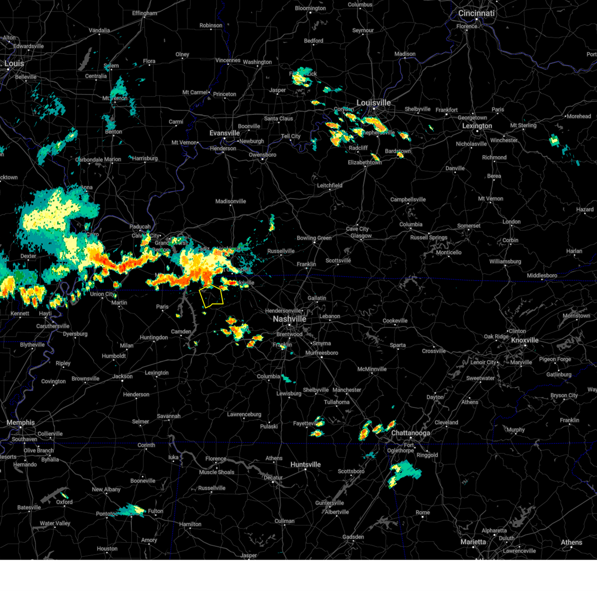 At 401 pm cdt, a severe thunderstorm was located near cumberland city, moving southeast at 20 mph (radar indicated). Hazards include 60 mph wind gusts and penny size hail. Expect damage to roofs, siding, and trees. locations impacted include, dover, cumberland city, and indian mound. hail threat, radar indicated max hail size, 0. 75 in wind threat, radar indicated max wind gust, 60 mph. At 401 pm cdt, a severe thunderstorm was located near cumberland city, moving southeast at 20 mph (radar indicated). Hazards include 60 mph wind gusts and penny size hail. Expect damage to roofs, siding, and trees. locations impacted include, dover, cumberland city, and indian mound. hail threat, radar indicated max hail size, 0. 75 in wind threat, radar indicated max wind gust, 60 mph.
|
| 8/26/2023 3:46 PM CDT |
 At 345 pm cdt, a severe thunderstorm was located near indian mound, moving southeast at 15 mph (radar indicated). Hazards include 60 mph wind gusts and penny size hail. expect damage to roofs, siding, and trees At 345 pm cdt, a severe thunderstorm was located near indian mound, moving southeast at 15 mph (radar indicated). Hazards include 60 mph wind gusts and penny size hail. expect damage to roofs, siding, and trees
|
| 8/13/2023 2:19 PM CDT |
 At 219 pm cdt, severe thunderstorms were located along a line extending from big rock to near centerville, moving east at 45 mph (radar indicated). Hazards include 60 mph wind gusts. Expect damage to roofs, siding, and trees. locations impacted include, dover, erin, mcewen, tennessee ridge, big rock, cumberland city and indian mound. hail threat, radar indicated max hail size, <. 75 in wind threat, radar indicated max wind gust, 60 mph. At 219 pm cdt, severe thunderstorms were located along a line extending from big rock to near centerville, moving east at 45 mph (radar indicated). Hazards include 60 mph wind gusts. Expect damage to roofs, siding, and trees. locations impacted include, dover, erin, mcewen, tennessee ridge, big rock, cumberland city and indian mound. hail threat, radar indicated max hail size, <. 75 in wind threat, radar indicated max wind gust, 60 mph.
|
| 8/13/2023 1:43 PM CDT |
 At 143 pm cdt, severe thunderstorms were located along a line extending from land between the lakes to near new johnsonville, moving east at 45 mph (radar indicated). Hazards include 60 mph wind gusts. expect damage to roofs, siding, and trees At 143 pm cdt, severe thunderstorms were located along a line extending from land between the lakes to near new johnsonville, moving east at 45 mph (radar indicated). Hazards include 60 mph wind gusts. expect damage to roofs, siding, and trees
|
| 7/20/2023 12:25 PM CDT |
 The severe thunderstorm warning for western montgomery, stewart, houston and north central humphreys counties will expire at 1230 pm cdt, the storm which prompted the warning has weakened below severe limits, and no longer poses an immediate threat to life or property. therefore, the warning will be allowed to expire. however gusty winds and heavy rain are still possible with this thunderstorm. a severe thunderstorm watch remains in effect until 700 pm cdt for middle tennessee. The severe thunderstorm warning for western montgomery, stewart, houston and north central humphreys counties will expire at 1230 pm cdt, the storm which prompted the warning has weakened below severe limits, and no longer poses an immediate threat to life or property. therefore, the warning will be allowed to expire. however gusty winds and heavy rain are still possible with this thunderstorm. a severe thunderstorm watch remains in effect until 700 pm cdt for middle tennessee.
|
| 7/20/2023 11:50 AM CDT |
 At 1150 am cdt, a severe thunderstorm was located 10 miles south of turkey bay, moving southeast at 45 mph (radar indicated). Hazards include 60 mph wind gusts and penny size hail. expect damage to roofs, siding, and trees At 1150 am cdt, a severe thunderstorm was located 10 miles south of turkey bay, moving southeast at 45 mph (radar indicated). Hazards include 60 mph wind gusts and penny size hail. expect damage to roofs, siding, and trees
|
| 7/18/2023 3:16 PM CDT |
 At 315 pm cdt, severe thunderstorms were located along a line extending from 6 miles east of guthrie to 6 miles west of ashland city to near mcewen, moving southeast at 55 mph (radar indicated). Hazards include 70 mph wind gusts and penny size hail. Expect considerable tree damage. damage is likely to mobile homes, roofs, and outbuildings. locations impacted include, springfield, dickson, ashland city, waverly, camden, erin, clarksville, coopertown, white bluff, new johnsonville, mcewen, burns, tennessee ridge, hurricane mills, pleasant view, charlotte, adams, vanleer, cedar hill and cumberland city. this includes the following highways, interstate 40 near mile marker 136. interstate 24 between mile markers 7 and 31. thunderstorm damage threat, considerable hail threat, radar indicated max hail size, 0. 75 in wind threat, radar indicated max wind gust, 70 mph. At 315 pm cdt, severe thunderstorms were located along a line extending from 6 miles east of guthrie to 6 miles west of ashland city to near mcewen, moving southeast at 55 mph (radar indicated). Hazards include 70 mph wind gusts and penny size hail. Expect considerable tree damage. damage is likely to mobile homes, roofs, and outbuildings. locations impacted include, springfield, dickson, ashland city, waverly, camden, erin, clarksville, coopertown, white bluff, new johnsonville, mcewen, burns, tennessee ridge, hurricane mills, pleasant view, charlotte, adams, vanleer, cedar hill and cumberland city. this includes the following highways, interstate 40 near mile marker 136. interstate 24 between mile markers 7 and 31. thunderstorm damage threat, considerable hail threat, radar indicated max hail size, 0. 75 in wind threat, radar indicated max wind gust, 70 mph.
|
| 7/18/2023 2:57 PM CDT |
 At 256 pm cdt, severe thunderstorms were located along a line extending from near pembroke to 13 miles south of clarksville to 8 miles northwest of waverly, moving southeast at 50 mph (radar indicated). Hazards include 70 mph wind gusts and penny size hail. Expect considerable tree damage. damage is likely to mobile homes, roofs, and outbuildings. locations impacted include, clarksville, springfield, dickson, ashland city, waverly, camden, dover, erin, coopertown, white bluff, new johnsonville, mcewen, burns, guthrie, tennessee ridge, hurricane mills, pleasant view, charlotte, adams and vanleer. this includes the following highways, interstate 40 between mile markers 134 and 136. interstate 24 between mile markers 1 and 31. thunderstorm damage threat, considerable hail threat, radar indicated max hail size, 0. 75 in wind threat, radar indicated max wind gust, 70 mph. At 256 pm cdt, severe thunderstorms were located along a line extending from near pembroke to 13 miles south of clarksville to 8 miles northwest of waverly, moving southeast at 50 mph (radar indicated). Hazards include 70 mph wind gusts and penny size hail. Expect considerable tree damage. damage is likely to mobile homes, roofs, and outbuildings. locations impacted include, clarksville, springfield, dickson, ashland city, waverly, camden, dover, erin, coopertown, white bluff, new johnsonville, mcewen, burns, guthrie, tennessee ridge, hurricane mills, pleasant view, charlotte, adams and vanleer. this includes the following highways, interstate 40 between mile markers 134 and 136. interstate 24 between mile markers 1 and 31. thunderstorm damage threat, considerable hail threat, radar indicated max hail size, 0. 75 in wind threat, radar indicated max wind gust, 70 mph.
|
| 7/18/2023 2:40 PM CDT |
 At 240 pm cdt, severe thunderstorms were located along a line extending from hopkinsville to 11 miles northeast of erin to springville, moving southeast at 50 mph (radar indicated). Hazards include 70 mph wind gusts and penny size hail. Expect considerable tree damage. Damage is likely to mobile homes, roofs, and outbuildings. At 240 pm cdt, severe thunderstorms were located along a line extending from hopkinsville to 11 miles northeast of erin to springville, moving southeast at 50 mph (radar indicated). Hazards include 70 mph wind gusts and penny size hail. Expect considerable tree damage. Damage is likely to mobile homes, roofs, and outbuildings.
|
| 7/18/2023 2:17 PM CDT |
 At 216 pm cdt, severe thunderstorms were located along a line extending from cobb to near big rock to near paris, moving southeast at 50 mph (radar indicated). Hazards include 70 mph wind gusts and penny size hail. Expect considerable tree damage. damage is likely to mobile homes, roofs, and outbuildings. locations impacted include, clarksville, waverly, dover, erin, new johnsonville, tennessee ridge, big rock, vanleer, cumberland city, slayden, palmyra, woodlawn, houston county airport, land between the lakes, indian mound and cunningham. this includes interstate 24 between mile markers 1 and 5. thunderstorm damage threat, considerable hail threat, radar indicated max hail size, 0. 75 in wind threat, radar indicated max wind gust, 70 mph. At 216 pm cdt, severe thunderstorms were located along a line extending from cobb to near big rock to near paris, moving southeast at 50 mph (radar indicated). Hazards include 70 mph wind gusts and penny size hail. Expect considerable tree damage. damage is likely to mobile homes, roofs, and outbuildings. locations impacted include, clarksville, waverly, dover, erin, new johnsonville, tennessee ridge, big rock, vanleer, cumberland city, slayden, palmyra, woodlawn, houston county airport, land between the lakes, indian mound and cunningham. this includes interstate 24 between mile markers 1 and 5. thunderstorm damage threat, considerable hail threat, radar indicated max hail size, 0. 75 in wind threat, radar indicated max wind gust, 70 mph.
|
| 7/18/2023 1:51 PM CDT |
 At 150 pm cdt, severe thunderstorms were located along a line extending from 6 miles northwest of eddyville to 8 miles west of turkey bay to near lynnville, moving southeast at 50 mph (radar indicated). Hazards include 60 mph wind gusts and nickel size hail. expect damage to roofs, siding, and trees At 150 pm cdt, severe thunderstorms were located along a line extending from 6 miles northwest of eddyville to 8 miles west of turkey bay to near lynnville, moving southeast at 50 mph (radar indicated). Hazards include 60 mph wind gusts and nickel size hail. expect damage to roofs, siding, and trees
|
| 5/7/2023 5:37 PM CDT |
 At 537 pm cdt, a severe thunderstorm was located near tennessee ridge, or 7 miles southwest of erin, moving east at 25 mph (radar indicated). Hazards include 60 mph wind gusts and quarter size hail. Hail damage to vehicles is expected. expect wind damage to roofs, siding, and trees. locations impacted include, waverly, erin, mcewen and tennessee ridge. hail threat, radar indicated max hail size, 1. 00 in wind threat, radar indicated max wind gust, 60 mph. At 537 pm cdt, a severe thunderstorm was located near tennessee ridge, or 7 miles southwest of erin, moving east at 25 mph (radar indicated). Hazards include 60 mph wind gusts and quarter size hail. Hail damage to vehicles is expected. expect wind damage to roofs, siding, and trees. locations impacted include, waverly, erin, mcewen and tennessee ridge. hail threat, radar indicated max hail size, 1. 00 in wind threat, radar indicated max wind gust, 60 mph.
|
| 5/7/2023 5:28 PM CDT |
 At 527 pm cdt, a severe thunderstorm was located 8 miles southwest of tennessee ridge, or 9 miles north of waverly, moving east at 25 mph (radar indicated). Hazards include 60 mph wind gusts and quarter size hail. Hail damage to vehicles is expected. Expect wind damage to roofs, siding, and trees. At 527 pm cdt, a severe thunderstorm was located 8 miles southwest of tennessee ridge, or 9 miles north of waverly, moving east at 25 mph (radar indicated). Hazards include 60 mph wind gusts and quarter size hail. Hail damage to vehicles is expected. Expect wind damage to roofs, siding, and trees.
|
| 1/3/2023 4:04 AM CST |
 At 403 am cst, a severe thunderstorm was located near dover, moving northeast at 55 mph (radar indicated). Hazards include 60 mph wind gusts. expect damage to roofs, siding, and trees At 403 am cst, a severe thunderstorm was located near dover, moving northeast at 55 mph (radar indicated). Hazards include 60 mph wind gusts. expect damage to roofs, siding, and trees
|
| 6/17/2022 9:35 AM CDT |
 At 935 am cdt, severe thunderstorms were located along a line extending from 10 miles west of coopertown to 11 miles southeast of clarksville to near tennessee ridge, moving southeast at 55 mph (radar indicated). Hazards include 60 mph wind gusts. expect damage to roofs, siding, and trees At 935 am cdt, severe thunderstorms were located along a line extending from 10 miles west of coopertown to 11 miles southeast of clarksville to near tennessee ridge, moving southeast at 55 mph (radar indicated). Hazards include 60 mph wind gusts. expect damage to roofs, siding, and trees
|
| 6/17/2022 9:03 AM CDT |
 At 902 am cdt, severe thunderstorms were located along a line extending from near dunmor to 12 miles east of murray, moving southeast at 45 mph (radar indicated). Hazards include 60 mph wind gusts and penny size hail. expect damage to roofs, siding, and trees At 902 am cdt, severe thunderstorms were located along a line extending from near dunmor to 12 miles east of murray, moving southeast at 45 mph (radar indicated). Hazards include 60 mph wind gusts and penny size hail. expect damage to roofs, siding, and trees
|
| 4/13/2022 5:58 PM CDT |
 At 558 pm cdt, severe thunderstorms were located along a line extending from near dunmor to near elkton to 9 miles south of clarksville to near waverly, moving east at 50 mph (radar indicated). Hazards include 60 mph wind gusts. Expect damage to roofs, siding, and trees. locations impacted include, dickson, waverly, erin, clarksville, new johnsonville, mcewen, tennessee ridge, pleasant view, charlotte, adams, vanleer, cedar hill, cumberland city, slayden, cheatham dam, palmyra, woodlawn and cunningham. this includes interstate 24 between mile markers 1 and 22. hail threat, radar indicated max hail size, <. 75 in wind threat, radar indicated max wind gust, 60 mph. At 558 pm cdt, severe thunderstorms were located along a line extending from near dunmor to near elkton to 9 miles south of clarksville to near waverly, moving east at 50 mph (radar indicated). Hazards include 60 mph wind gusts. Expect damage to roofs, siding, and trees. locations impacted include, dickson, waverly, erin, clarksville, new johnsonville, mcewen, tennessee ridge, pleasant view, charlotte, adams, vanleer, cedar hill, cumberland city, slayden, cheatham dam, palmyra, woodlawn and cunningham. this includes interstate 24 between mile markers 1 and 22. hail threat, radar indicated max hail size, <. 75 in wind threat, radar indicated max wind gust, 60 mph.
|
| 4/13/2022 5:29 PM CDT |
 At 529 pm cdt, severe thunderstorms were located along a line extending from near crofton to 7 miles southeast of big rock to 6 miles southeast of springville, moving east at 55 mph (radar indicated). Hazards include 60 mph wind gusts. expect damage to roofs, siding, and trees At 529 pm cdt, severe thunderstorms were located along a line extending from near crofton to 7 miles southeast of big rock to 6 miles southeast of springville, moving east at 55 mph (radar indicated). Hazards include 60 mph wind gusts. expect damage to roofs, siding, and trees
|
| 4/13/2022 5:11 PM CDT |
 At 511 pm cdt, severe thunderstorms were located along a line extending from cobb to 9 miles south of cadiz to near paris landing state park, moving east at 50 mph (radar indicated). Hazards include 60 mph wind gusts. Expect damage to roofs, siding, and trees. locations impacted include, dover, erin, clarksville, tennessee ridge, big rock, cumberland city, land between the lakes, houston county airport, indian mound and woodlawn. hail threat, radar indicated max hail size, <. 75 in wind threat, radar indicated max wind gust, 60 mph. At 511 pm cdt, severe thunderstorms were located along a line extending from cobb to 9 miles south of cadiz to near paris landing state park, moving east at 50 mph (radar indicated). Hazards include 60 mph wind gusts. Expect damage to roofs, siding, and trees. locations impacted include, dover, erin, clarksville, tennessee ridge, big rock, cumberland city, land between the lakes, houston county airport, indian mound and woodlawn. hail threat, radar indicated max hail size, <. 75 in wind threat, radar indicated max wind gust, 60 mph.
|
| 4/13/2022 4:46 PM CDT |
 At 445 pm cdt, severe thunderstorms were located along a line extending from near land between the lakes area to 8 miles east of murray to paris, moving east at 65 mph (radar indicated). Hazards include 60 mph wind gusts. expect damage to roofs, siding, and trees At 445 pm cdt, severe thunderstorms were located along a line extending from near land between the lakes area to 8 miles east of murray to paris, moving east at 65 mph (radar indicated). Hazards include 60 mph wind gusts. expect damage to roofs, siding, and trees
|
| 3/30/2022 7:33 PM CDT |
 At 732 pm cdt, severe thunderstorms were located along a line extending from near tennessee ridge to near waverly, moving northeast at 70 mph (radar indicated). Hazards include 70 mph wind gusts. Expect considerable tree damage. damage is likely to mobile homes, roofs, and outbuildings. Locations impacted include, waverly, dover, erin, new johnsonville, mcewen, tennessee ridge, big rock, cumberland city, land between the lakes, houston county airport and indian mound. At 732 pm cdt, severe thunderstorms were located along a line extending from near tennessee ridge to near waverly, moving northeast at 70 mph (radar indicated). Hazards include 70 mph wind gusts. Expect considerable tree damage. damage is likely to mobile homes, roofs, and outbuildings. Locations impacted include, waverly, dover, erin, new johnsonville, mcewen, tennessee ridge, big rock, cumberland city, land between the lakes, houston county airport and indian mound.
|
| 3/30/2022 7:19 PM CDT |
 At 719 pm cdt, severe thunderstorms were located along a line extending from near paris landing state park to near new johnsonville, moving northeast at 70 mph (radar indicated). Hazards include 60 mph wind gusts. expect damage to roofs, siding, and trees At 719 pm cdt, severe thunderstorms were located along a line extending from near paris landing state park to near new johnsonville, moving northeast at 70 mph (radar indicated). Hazards include 60 mph wind gusts. expect damage to roofs, siding, and trees
|
| 2/22/2022 8:34 AM CST |
 At 834 am cst, a severe thunderstorm was located 8 miles east of erin, moving east at 55 mph (radar indicated). Hazards include 60 mph wind gusts and penny size hail. expect damage to roofs, siding, and trees At 834 am cst, a severe thunderstorm was located 8 miles east of erin, moving east at 55 mph (radar indicated). Hazards include 60 mph wind gusts and penny size hail. expect damage to roofs, siding, and trees
|
| 2/22/2022 7:41 AM CST |
 At 740 am cst, a severe thunderstorm was located near dover, moving east at 60 mph (radar indicated). Hazards include 60 mph wind gusts. expect damage to roofs, siding, and trees At 740 am cst, a severe thunderstorm was located near dover, moving east at 60 mph (radar indicated). Hazards include 60 mph wind gusts. expect damage to roofs, siding, and trees
|
| 1/1/2022 11:30 AM CST |
 At 1130 am cst, a severe thunderstorm was located near camden, moving northeast at 60 mph (radar indicated). Hazards include 60 mph wind gusts and penny size hail. expect damage to roofs, siding, and trees At 1130 am cst, a severe thunderstorm was located near camden, moving northeast at 60 mph (radar indicated). Hazards include 60 mph wind gusts and penny size hail. expect damage to roofs, siding, and trees
|
| 12/6/2021 4:27 AM CST |
 At 427 am cst, severe thunderstorms were located along a line extending from near pembroke to near tennessee ridge, moving east at 55 mph (radar indicated). Hazards include 70 mph wind gusts. Expect considerable tree damage. damage is likely to mobile homes, roofs, and outbuildings. locations impacted include, erin, clarksville, tennessee ridge, cumberland city, houston county airport, indian mound, palmyra and woodlawn. This includes interstate 24 between mile markers 1 and 6. At 427 am cst, severe thunderstorms were located along a line extending from near pembroke to near tennessee ridge, moving east at 55 mph (radar indicated). Hazards include 70 mph wind gusts. Expect considerable tree damage. damage is likely to mobile homes, roofs, and outbuildings. locations impacted include, erin, clarksville, tennessee ridge, cumberland city, houston county airport, indian mound, palmyra and woodlawn. This includes interstate 24 between mile markers 1 and 6.
|
| 12/6/2021 4:14 AM CST |
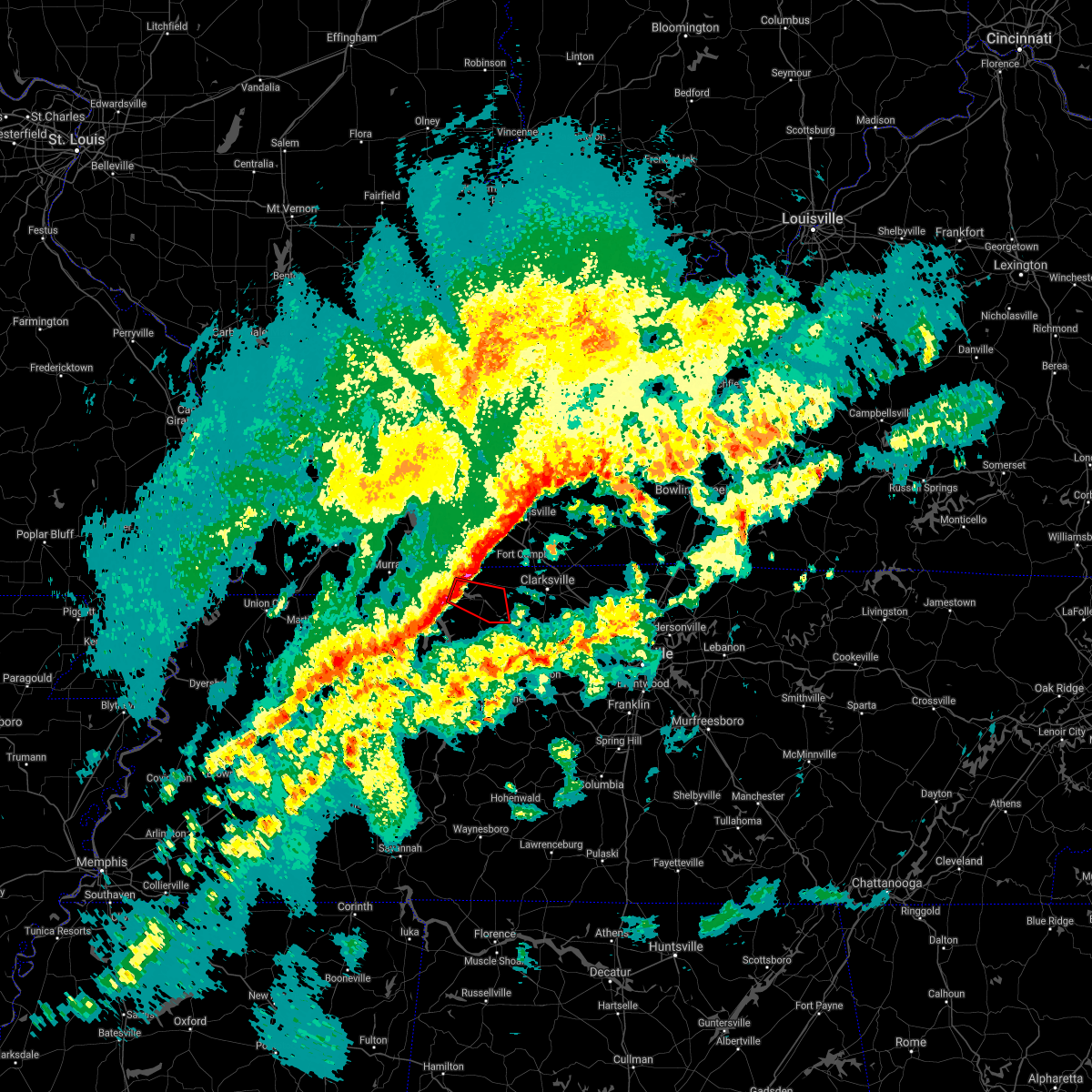 At 414 am cst, a severe thunderstorm capable of producing a tornado was located near dover, moving east at 55 mph (radar indicated rotation). Hazards include tornado. Flying debris will be dangerous to those caught without shelter. mobile homes will be damaged or destroyed. damage to roofs, windows, and vehicles will occur. tree damage is likely. This tornadic thunderstorm will remain over mainly rural areas of central stewart county, including the following locations, cumberland city and indian mound. At 414 am cst, a severe thunderstorm capable of producing a tornado was located near dover, moving east at 55 mph (radar indicated rotation). Hazards include tornado. Flying debris will be dangerous to those caught without shelter. mobile homes will be damaged or destroyed. damage to roofs, windows, and vehicles will occur. tree damage is likely. This tornadic thunderstorm will remain over mainly rural areas of central stewart county, including the following locations, cumberland city and indian mound.
|
| 12/6/2021 4:10 AM CST |
 At 409 am cst, severe thunderstorms were located along a line extending from hopkinsville, kentucky to springville, moving east at 55 mph (radar indicated). Hazards include 60 mph wind gusts. Expect damage to roofs, siding, and trees. locations impacted include, dover, erin, clarksville, tennessee ridge, big rock, cumberland city, land between the lakes, houston county airport, indian mound, palmyra and woodlawn. This includes interstate 24 between mile markers 1 and 6. At 409 am cst, severe thunderstorms were located along a line extending from hopkinsville, kentucky to springville, moving east at 55 mph (radar indicated). Hazards include 60 mph wind gusts. Expect damage to roofs, siding, and trees. locations impacted include, dover, erin, clarksville, tennessee ridge, big rock, cumberland city, land between the lakes, houston county airport, indian mound, palmyra and woodlawn. This includes interstate 24 between mile markers 1 and 6.
|
| 12/6/2021 3:54 AM CST |
 At 353 am cst, severe thunderstorms were located along a line extending from cadiz, kentucky to near paris, moving east at 55 mph (radar indicated). Hazards include 60 mph wind gusts. expect damage to roofs, siding, and trees At 353 am cst, severe thunderstorms were located along a line extending from cadiz, kentucky to near paris, moving east at 55 mph (radar indicated). Hazards include 60 mph wind gusts. expect damage to roofs, siding, and trees
|
| 7/31/2021 9:38 PM CDT |
 At 938 pm cdt, a severe thunderstorm was located near cumberland city, moving southeast at 40 mph (radar indicated). Hazards include 60 mph wind gusts. Expect damage to roofs, siding, and trees. Locations impacted include, erin, tennessee ridge, cumberland city, indian mound and palmyra. At 938 pm cdt, a severe thunderstorm was located near cumberland city, moving southeast at 40 mph (radar indicated). Hazards include 60 mph wind gusts. Expect damage to roofs, siding, and trees. Locations impacted include, erin, tennessee ridge, cumberland city, indian mound and palmyra.
|
| 7/31/2021 9:24 PM CDT |
 At 924 pm cdt, a severe thunderstorm was located over dover, moving southeast at 40 mph (radar indicated). Hazards include 60 mph wind gusts. Expect damage to roofs, siding, and trees. Locations impacted include, dover, erin, tennessee ridge, big rock, cumberland city, indian mound and palmyra. At 924 pm cdt, a severe thunderstorm was located over dover, moving southeast at 40 mph (radar indicated). Hazards include 60 mph wind gusts. Expect damage to roofs, siding, and trees. Locations impacted include, dover, erin, tennessee ridge, big rock, cumberland city, indian mound and palmyra.
|
| 7/31/2021 9:10 PM CDT |
 At 909 pm cdt, a severe thunderstorm was located 8 miles northwest of dover, or over the land between the lakes, moving southeast at 40 mph (radar indicated). Hazards include 60 mph wind gusts. expect damage to roofs, siding, and trees At 909 pm cdt, a severe thunderstorm was located 8 miles northwest of dover, or over the land between the lakes, moving southeast at 40 mph (radar indicated). Hazards include 60 mph wind gusts. expect damage to roofs, siding, and trees
|
| 6/12/2021 11:10 PM CDT |
 The severe thunderstorm warning for stewart and houston counties will expire at 1115 pm cdt, the storm which prompted the warning has moved out of the area. therefore, the warning will be allowed to expire. The severe thunderstorm warning for stewart and houston counties will expire at 1115 pm cdt, the storm which prompted the warning has moved out of the area. therefore, the warning will be allowed to expire.
|
| 6/12/2021 10:28 PM CDT |
 At 1027 pm cdt, a severe thunderstorm was located over dover, moving south at 25 mph (radar indicated). Hazards include 60 mph wind gusts and quarter size hail. Hail damage to vehicles is expected. Expect wind damage to roofs, siding, and trees. At 1027 pm cdt, a severe thunderstorm was located over dover, moving south at 25 mph (radar indicated). Hazards include 60 mph wind gusts and quarter size hail. Hail damage to vehicles is expected. Expect wind damage to roofs, siding, and trees.
|
| 6/12/2021 10:00 PM CDT |
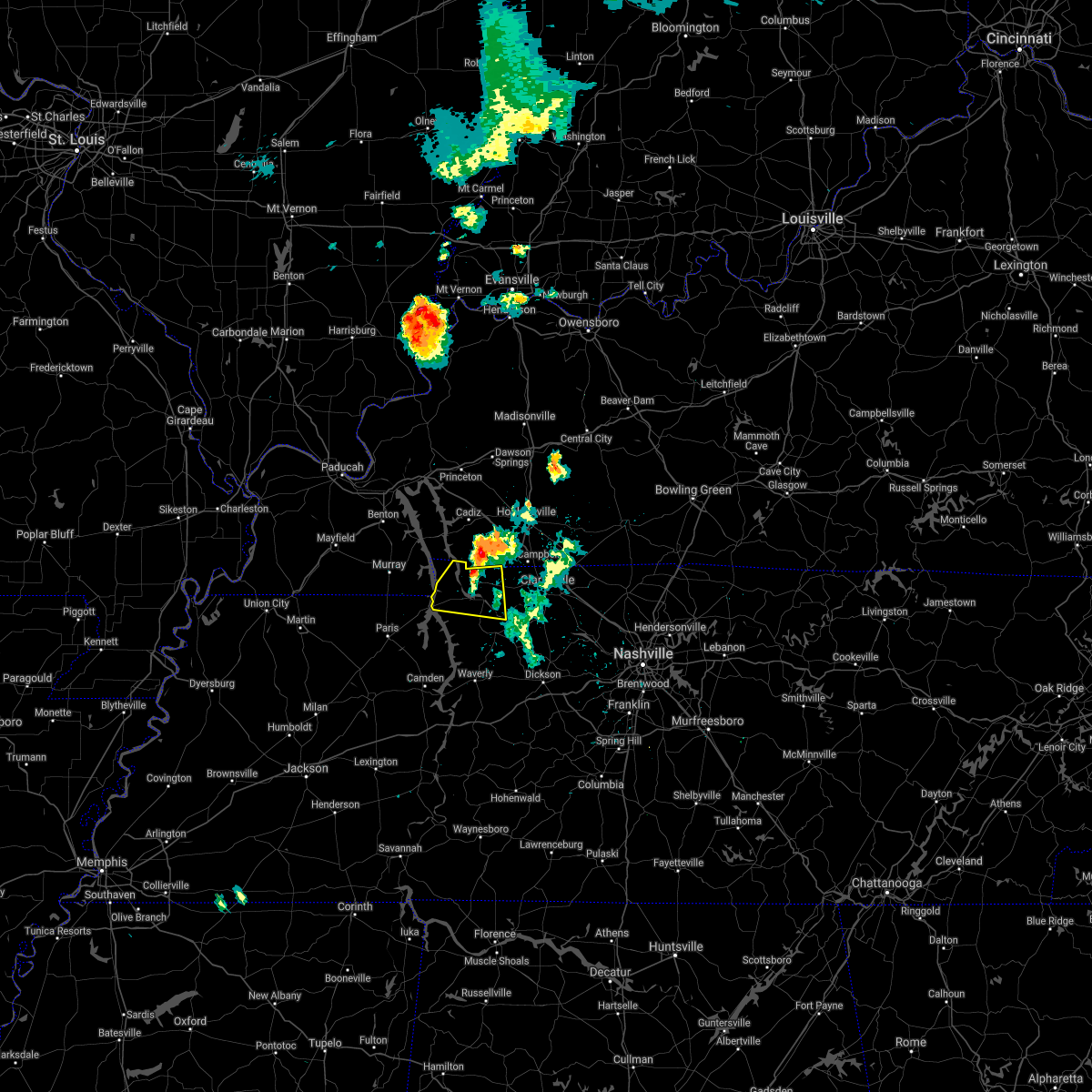 At 959 pm cdt, a severe thunderstorm was located near big rock, or 11 miles north of dover, moving south at 20 mph (radar indicated). Hazards include 60 mph wind gusts and quarter size hail. Hail damage to vehicles is expected. Expect wind damage to roofs, siding, and trees. At 959 pm cdt, a severe thunderstorm was located near big rock, or 11 miles north of dover, moving south at 20 mph (radar indicated). Hazards include 60 mph wind gusts and quarter size hail. Hail damage to vehicles is expected. Expect wind damage to roofs, siding, and trees.
|
| 5/6/2021 4:27 PM CDT |
 At 427 pm cdt, severe thunderstorms were located along a line extending from near elkton to 6 miles north of mcewen, moving east at 30 mph (radar indicated). Hazards include 60 mph wind gusts. expect damage to roofs, siding, and trees At 427 pm cdt, severe thunderstorms were located along a line extending from near elkton to 6 miles north of mcewen, moving east at 30 mph (radar indicated). Hazards include 60 mph wind gusts. expect damage to roofs, siding, and trees
|
| 5/6/2021 4:21 PM CDT |
 At 420 pm cdt, a severe thunderstorm was located 8 miles south of fort campbell, moving east at 30 mph (radar indicated). Hazards include 60 mph wind gusts. Expect damage to roofs, siding, and trees. locations impacted include, dover, clarksville, big rock, cumberland city, indian mound, palmyra, cunningham and woodlawn. This includes interstate 24 between mile markers 1 and 8. At 420 pm cdt, a severe thunderstorm was located 8 miles south of fort campbell, moving east at 30 mph (radar indicated). Hazards include 60 mph wind gusts. Expect damage to roofs, siding, and trees. locations impacted include, dover, clarksville, big rock, cumberland city, indian mound, palmyra, cunningham and woodlawn. This includes interstate 24 between mile markers 1 and 8.
|
| 5/6/2021 4:04 PM CDT |
 At 403 pm cdt, a severe thunderstorm was located near big rock, or 9 miles northeast of dover, moving east at 30 mph (radar indicated). Hazards include 60 mph wind gusts. expect damage to roofs, siding, and trees At 403 pm cdt, a severe thunderstorm was located near big rock, or 9 miles northeast of dover, moving east at 30 mph (radar indicated). Hazards include 60 mph wind gusts. expect damage to roofs, siding, and trees
|
| 5/4/2021 4:50 AM CDT |
 At 450 am cdt, severe thunderstorms were located along a line extending from 9 miles southeast of cadiz to tennessee ridge, moving east at 55 mph (radar indicated). Hazards include 60 mph wind gusts and penny size hail. expect damage to roofs, siding, and trees At 450 am cdt, severe thunderstorms were located along a line extending from 9 miles southeast of cadiz to tennessee ridge, moving east at 55 mph (radar indicated). Hazards include 60 mph wind gusts and penny size hail. expect damage to roofs, siding, and trees
|
| 5/4/2021 4:22 AM CDT |
 At 421 am cdt, severe thunderstorms were located along a line extending from murray to near springville, moving east at 60 mph (radar indicated). Hazards include 60 mph wind gusts and penny size hail. Expect damage to roofs, siding, and trees. Locations impacted include, dover, erin, tennessee ridge, big rock, cumberland city, land between the lakes, houston county airport and indian mound. At 421 am cdt, severe thunderstorms were located along a line extending from murray to near springville, moving east at 60 mph (radar indicated). Hazards include 60 mph wind gusts and penny size hail. Expect damage to roofs, siding, and trees. Locations impacted include, dover, erin, tennessee ridge, big rock, cumberland city, land between the lakes, houston county airport and indian mound.
|
| 5/4/2021 4:12 AM CDT |
 At 412 am cdt, severe thunderstorms were located along a line extending from 8 miles northwest of murray to paris, moving east at 55 mph (radar indicated). Hazards include 60 mph wind gusts and penny size hail. expect damage to roofs, siding, and trees At 412 am cdt, severe thunderstorms were located along a line extending from 8 miles northwest of murray to paris, moving east at 55 mph (radar indicated). Hazards include 60 mph wind gusts and penny size hail. expect damage to roofs, siding, and trees
|
| 4/28/2021 7:39 PM CDT |
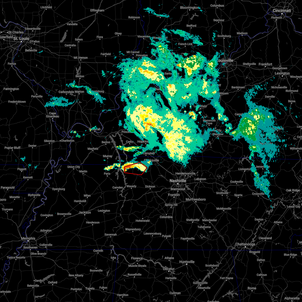 At 739 pm cdt, a severe thunderstorm capable of producing a tornado was located near dover, moving east at 25 mph (radar indicated rotation). Hazards include tornado. Flying debris will be dangerous to those caught without shelter. mobile homes will be damaged or destroyed. damage to roofs, windows, and vehicles will occur. tree damage is likely. this dangerous storm will be near, dover around 750 pm cdt. tennessee ridge around 800 pm cdt. Other locations impacted by this tornadic thunderstorm include cumberland city, indian mound and palmyra. At 739 pm cdt, a severe thunderstorm capable of producing a tornado was located near dover, moving east at 25 mph (radar indicated rotation). Hazards include tornado. Flying debris will be dangerous to those caught without shelter. mobile homes will be damaged or destroyed. damage to roofs, windows, and vehicles will occur. tree damage is likely. this dangerous storm will be near, dover around 750 pm cdt. tennessee ridge around 800 pm cdt. Other locations impacted by this tornadic thunderstorm include cumberland city, indian mound and palmyra.
|
| 4/28/2021 7:27 PM CDT |
 At 726 pm cdt, a severe thunderstorm capable of producing a tornado was located near paris landing state park, moving east at 30 mph (radar indicated rotation). Hazards include tornado. Flying debris will be dangerous to those caught without shelter. mobile homes will be damaged or destroyed. damage to roofs, windows, and vehicles will occur. tree damage is likely. this dangerous storm will be near, dover around 745 pm cdt. tennessee ridge around 750 pm cdt. erin around 800 pm cdt. other locations impacted by this tornadic thunderstorm include houston county airport and cumberland city. Numerous reports of damage have been received from henry county. At 726 pm cdt, a severe thunderstorm capable of producing a tornado was located near paris landing state park, moving east at 30 mph (radar indicated rotation). Hazards include tornado. Flying debris will be dangerous to those caught without shelter. mobile homes will be damaged or destroyed. damage to roofs, windows, and vehicles will occur. tree damage is likely. this dangerous storm will be near, dover around 745 pm cdt. tennessee ridge around 750 pm cdt. erin around 800 pm cdt. other locations impacted by this tornadic thunderstorm include houston county airport and cumberland city. Numerous reports of damage have been received from henry county.
|
| 4/28/2021 7:09 PM CDT |
 At 709 pm cdt, a severe thunderstorm capable of producing a tornado was located near paris landing state park, moving east at 30 mph (radar indicated rotation). Hazards include tornado. Flying debris will be dangerous to those caught without shelter. mobile homes will be damaged or destroyed. damage to roofs, windows, and vehicles will occur. tree damage is likely. this dangerous storm will be near, dover and tennessee ridge around 745 pm cdt. Other locations impacted by this tornadic thunderstorm include houston county airport and cumberland city. At 709 pm cdt, a severe thunderstorm capable of producing a tornado was located near paris landing state park, moving east at 30 mph (radar indicated rotation). Hazards include tornado. Flying debris will be dangerous to those caught without shelter. mobile homes will be damaged or destroyed. damage to roofs, windows, and vehicles will occur. tree damage is likely. this dangerous storm will be near, dover and tennessee ridge around 745 pm cdt. Other locations impacted by this tornadic thunderstorm include houston county airport and cumberland city.
|
| 8/31/2020 4:37 PM CDT |
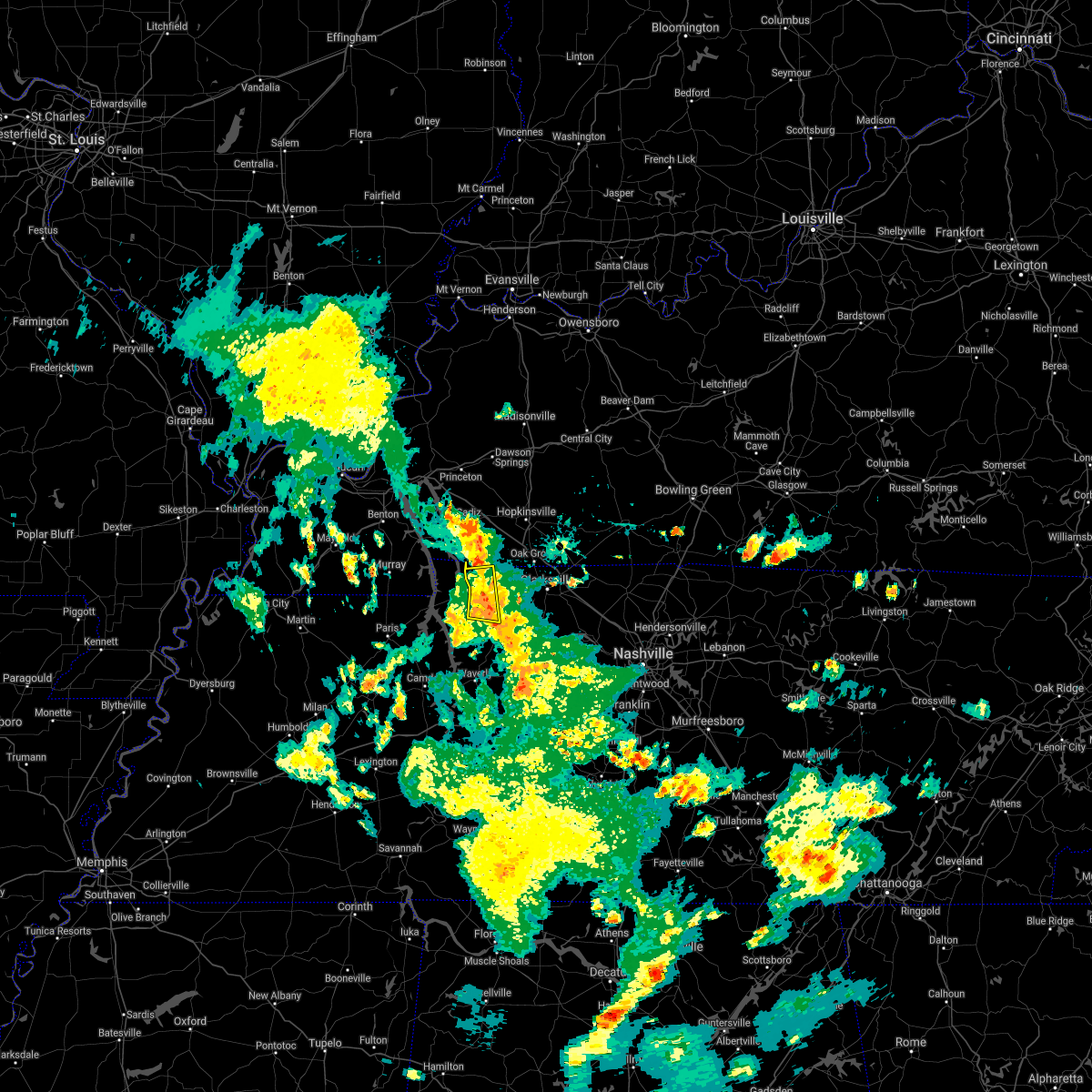 At 437 pm cdt, a severe thunderstorm was located near big rock, or 7 miles east of dover, moving east at 30 mph (radar indicated). Hazards include 60 mph wind gusts. Expect damage to roofs, siding, and trees. Locations impacted include, dover, big rock, cumberland city and indian mound. At 437 pm cdt, a severe thunderstorm was located near big rock, or 7 miles east of dover, moving east at 30 mph (radar indicated). Hazards include 60 mph wind gusts. Expect damage to roofs, siding, and trees. Locations impacted include, dover, big rock, cumberland city and indian mound.
|
| 8/31/2020 4:19 PM CDT |
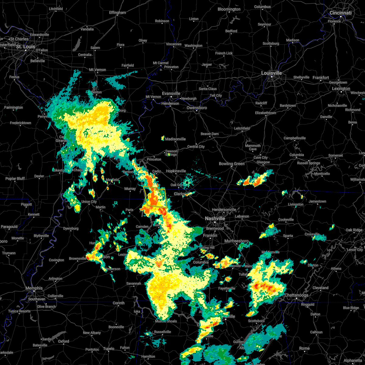 At 419 pm cdt, a severe thunderstorm was located over dover, moving east at 30 mph (radar indicated). Hazards include 60 mph wind gusts. expect damage to roofs, siding, and trees At 419 pm cdt, a severe thunderstorm was located over dover, moving east at 30 mph (radar indicated). Hazards include 60 mph wind gusts. expect damage to roofs, siding, and trees
|
| 7/12/2020 5:00 AM CDT |
 A severe thunderstorm warning remains in effect until 515 am cdt for west central dickson. houston and northeastern humphreys counties. at 500 am cdt, a severe thunderstorm was located near erin, moving southeast at 35 mph. hazard. 60 mph wind gusts. A severe thunderstorm warning remains in effect until 515 am cdt for west central dickson. houston and northeastern humphreys counties. at 500 am cdt, a severe thunderstorm was located near erin, moving southeast at 35 mph. hazard. 60 mph wind gusts.
|
| 7/12/2020 4:44 AM CDT |
 At 443 am cdt, a severe thunderstorm was located over tennessee ridge, or near erin, moving southeast at 35 mph (radar indicated). Hazards include 60 mph wind gusts. expect damage to roofs, siding, and trees At 443 am cdt, a severe thunderstorm was located over tennessee ridge, or near erin, moving southeast at 35 mph (radar indicated). Hazards include 60 mph wind gusts. expect damage to roofs, siding, and trees
|
| 7/12/2020 4:18 AM CDT |
 At 418 am cdt, a severe thunderstorm was located over dover, moving southeast at 35 mph (radar indicated). Hazards include 60 mph wind gusts. expect damage to roofs, siding, and trees At 418 am cdt, a severe thunderstorm was located over dover, moving southeast at 35 mph (radar indicated). Hazards include 60 mph wind gusts. expect damage to roofs, siding, and trees
|
| 7/12/2020 3:52 AM CDT |
 The severe thunderstorm warning for northwestern dickson, southwestern montgomery, southeastern stewart and northeastern houston counties will expire at 400 am cdt, the storm which prompted the warning has moved out of the area. therefore, the warning will be allowed to expire. however gusty winds are still possible with this thunderstorm. The severe thunderstorm warning for northwestern dickson, southwestern montgomery, southeastern stewart and northeastern houston counties will expire at 400 am cdt, the storm which prompted the warning has moved out of the area. therefore, the warning will be allowed to expire. however gusty winds are still possible with this thunderstorm.
|
| 7/12/2020 3:50 AM CDT |
 At 350 am cdt, a severe thunderstorm was located 8 miles northeast of mcewen, or 10 miles southeast of erin, moving southeast at 25 mph (radar indicated). Hazards include 60 mph wind gusts and quarter size hail. Hail damage to vehicles is expected. expect wind damage to roofs, siding, and trees. Locations impacted include, waverly, erin, mcewen, tennessee ridge, charlotte, vanleer, cumberland city and slayden. At 350 am cdt, a severe thunderstorm was located 8 miles northeast of mcewen, or 10 miles southeast of erin, moving southeast at 25 mph (radar indicated). Hazards include 60 mph wind gusts and quarter size hail. Hail damage to vehicles is expected. expect wind damage to roofs, siding, and trees. Locations impacted include, waverly, erin, mcewen, tennessee ridge, charlotte, vanleer, cumberland city and slayden.
|
| 7/12/2020 3:40 AM CDT |
 At 339 am cdt, a severe thunderstorm was located near erin, moving southeast at 25 mph (radar indicated). Hazards include 60 mph wind gusts. expect damage to roofs, siding, and trees At 339 am cdt, a severe thunderstorm was located near erin, moving southeast at 25 mph (radar indicated). Hazards include 60 mph wind gusts. expect damage to roofs, siding, and trees
|
| 7/12/2020 3:25 AM CDT |
 At 325 am cdt, a severe thunderstorm was located 9 miles northeast of erin, moving east at 40 mph (radar indicated). Hazards include 60 mph wind gusts and nickel size hail. expect damage to roofs, siding, and trees At 325 am cdt, a severe thunderstorm was located 9 miles northeast of erin, moving east at 40 mph (radar indicated). Hazards include 60 mph wind gusts and nickel size hail. expect damage to roofs, siding, and trees
|
| 7/12/2020 3:09 AM CDT | A tree fell on a house east of indian mound in montgomery count in montgomery county TN, 7.8 miles SSW of Cumberland City, TN |
| 5/3/2020 3:46 PM CDT |
 At 346 pm cdt, severe thunderstorms were located along a line extending from 6 miles southeast of cadiz to 7 miles northeast of big rock to 7 miles east of dover, moving east at 70 mph. these are very dangerous storms (radar indicated). Hazards include 80 mph wind gusts and penny size hail. Flying debris will be dangerous to those caught without shelter. mobile homes will be heavily damaged. expect considerable damage to roofs, windows, and vehicles. extensive tree damage and power outages are likely. Locations impacted include, dover, erin, tennessee ridge, big rock, cumberland city, land between the lakes, houston county airport and indian mound. At 346 pm cdt, severe thunderstorms were located along a line extending from 6 miles southeast of cadiz to 7 miles northeast of big rock to 7 miles east of dover, moving east at 70 mph. these are very dangerous storms (radar indicated). Hazards include 80 mph wind gusts and penny size hail. Flying debris will be dangerous to those caught without shelter. mobile homes will be heavily damaged. expect considerable damage to roofs, windows, and vehicles. extensive tree damage and power outages are likely. Locations impacted include, dover, erin, tennessee ridge, big rock, cumberland city, land between the lakes, houston county airport and indian mound.
|
| 5/3/2020 3:44 PM CDT |
 At 343 pm cdt, severe thunderstorms were located along a line extending from 7 miles west of big rock to near tennessee ridge to near waverly, moving east at 50 mph. these are very dangerous storms (radar indicated). Hazards include 80 mph wind gusts and nickel size hail. Flying debris will be dangerous to those caught without shelter. mobile homes will be heavily damaged. expect considerable damage to roofs, windows, and vehicles. Extensive tree damage and power outages are likely. At 343 pm cdt, severe thunderstorms were located along a line extending from 7 miles west of big rock to near tennessee ridge to near waverly, moving east at 50 mph. these are very dangerous storms (radar indicated). Hazards include 80 mph wind gusts and nickel size hail. Flying debris will be dangerous to those caught without shelter. mobile homes will be heavily damaged. expect considerable damage to roofs, windows, and vehicles. Extensive tree damage and power outages are likely.
|
| 5/3/2020 3:13 PM CDT |
 At 312 pm cdt, severe thunderstorms were located along a line extending from near murray to 12 miles northwest of paris landing state park to near paris, moving east at 70 mph (radar indicated). Hazards include 70 mph wind gusts and penny size hail. Expect considerable tree damage. Damage is likely to mobile homes, roofs, and outbuildings. At 312 pm cdt, severe thunderstorms were located along a line extending from near murray to 12 miles northwest of paris landing state park to near paris, moving east at 70 mph (radar indicated). Hazards include 70 mph wind gusts and penny size hail. Expect considerable tree damage. Damage is likely to mobile homes, roofs, and outbuildings.
|
| 4/8/2020 8:57 PM CDT |
 At 857 pm cdt, severe thunderstorms were located along a line extending from 7 miles northwest of elkton to near tennessee ridge, moving east at 45 mph (radar indicated). Hazards include 60 mph wind gusts and quarter size hail. Hail damage to vehicles is expected. Expect wind damage to roofs, siding, and trees. At 857 pm cdt, severe thunderstorms were located along a line extending from 7 miles northwest of elkton to near tennessee ridge, moving east at 45 mph (radar indicated). Hazards include 60 mph wind gusts and quarter size hail. Hail damage to vehicles is expected. Expect wind damage to roofs, siding, and trees.
|
| 4/8/2020 8:42 PM CDT |
 At 841 pm cdt, a severe thunderstorm was located near dover, moving east at 45 mph (radar indicated). Hazards include 60 mph wind gusts and quarter size hail. Hail damage to vehicles is expected. expect wind damage to roofs, siding, and trees. Locations impacted include, dover, erin, tennessee ridge, big rock, cumberland city, houston county airport, land between the lakes and indian mound. At 841 pm cdt, a severe thunderstorm was located near dover, moving east at 45 mph (radar indicated). Hazards include 60 mph wind gusts and quarter size hail. Hail damage to vehicles is expected. expect wind damage to roofs, siding, and trees. Locations impacted include, dover, erin, tennessee ridge, big rock, cumberland city, houston county airport, land between the lakes and indian mound.
|
| 4/8/2020 8:13 PM CDT |
 At 813 pm cdt, a severe thunderstorm was located near murray, moving southeast at 45 mph (radar indicated). Hazards include 60 mph wind gusts and quarter size hail. Hail damage to vehicles is expected. Expect wind damage to roofs, siding, and trees. At 813 pm cdt, a severe thunderstorm was located near murray, moving southeast at 45 mph (radar indicated). Hazards include 60 mph wind gusts and quarter size hail. Hail damage to vehicles is expected. Expect wind damage to roofs, siding, and trees.
|
| 3/28/2020 10:28 PM CDT |
 At 1027 pm cdt, severe thunderstorms were located along a line extending from near fort campbell north to erin, moving northeast at 70 mph (radar indicated). Hazards include 70 mph wind gusts and penny size hail. Expect considerable tree damage. damage is likely to mobile homes, roofs, and outbuildings. locations impacted include, clarksville, erin, tennessee ridge, vanleer, cumberland city, slayden, palmyra, cunningham and woodlawn. This includes interstate 24 between mile markers 1 and 8. At 1027 pm cdt, severe thunderstorms were located along a line extending from near fort campbell north to erin, moving northeast at 70 mph (radar indicated). Hazards include 70 mph wind gusts and penny size hail. Expect considerable tree damage. damage is likely to mobile homes, roofs, and outbuildings. locations impacted include, clarksville, erin, tennessee ridge, vanleer, cumberland city, slayden, palmyra, cunningham and woodlawn. This includes interstate 24 between mile markers 1 and 8.
|
| 3/28/2020 10:16 PM CDT |
 At 1016 pm cdt, severe thunderstorms were located along a line extending from cumberland city to waverly, moving northeast at 70 mph (radar indicated). Hazards include 70 mph wind gusts and penny size hail. Expect considerable tree damage. damage is likely to mobile homes, roofs, and outbuildings. locations impacted include, clarksville, erin, tennessee ridge, vanleer, cumberland city, slayden, indian mound, palmyra, cunningham and woodlawn. This includes interstate 24 between mile markers 1 and 8. At 1016 pm cdt, severe thunderstorms were located along a line extending from cumberland city to waverly, moving northeast at 70 mph (radar indicated). Hazards include 70 mph wind gusts and penny size hail. Expect considerable tree damage. damage is likely to mobile homes, roofs, and outbuildings. locations impacted include, clarksville, erin, tennessee ridge, vanleer, cumberland city, slayden, indian mound, palmyra, cunningham and woodlawn. This includes interstate 24 between mile markers 1 and 8.
|
| 3/28/2020 9:58 PM CDT |
 At 958 pm cdt, severe thunderstorms were located along a line extending from springville to near camden, moving northeast at 70 mph (radar indicated). Hazards include 70 mph wind gusts and penny size hail. Expect considerable tree damage. Damage is likely to mobile homes, roofs, and outbuildings. At 958 pm cdt, severe thunderstorms were located along a line extending from springville to near camden, moving northeast at 70 mph (radar indicated). Hazards include 70 mph wind gusts and penny size hail. Expect considerable tree damage. Damage is likely to mobile homes, roofs, and outbuildings.
|
| 3/3/2020 12:03 AM CST |
 At 1203 am cst, a severe thunderstorm was located near erin, moving east at 50 mph (radar indicated). Hazards include 60 mph wind gusts and half dollar size hail. Hail damage to vehicles is expected. expect wind damage to roofs, siding, and trees. Locations impacted include, erin, tennessee ridge, vanleer, slayden and cunningham. At 1203 am cst, a severe thunderstorm was located near erin, moving east at 50 mph (radar indicated). Hazards include 60 mph wind gusts and half dollar size hail. Hail damage to vehicles is expected. expect wind damage to roofs, siding, and trees. Locations impacted include, erin, tennessee ridge, vanleer, slayden and cunningham.
|
| 3/2/2020 11:43 PM CST |
 At 1143 pm cst, a severe thunderstorm was located near tennessee ridge, or 10 miles west of erin, moving east at 50 mph (radar indicated). Hazards include 60 mph wind gusts and half dollar size hail. Hail damage to vehicles is expected. Expect wind damage to roofs, siding, and trees. At 1143 pm cst, a severe thunderstorm was located near tennessee ridge, or 10 miles west of erin, moving east at 50 mph (radar indicated). Hazards include 60 mph wind gusts and half dollar size hail. Hail damage to vehicles is expected. Expect wind damage to roofs, siding, and trees.
|
| 1/11/2020 7:40 AM CST |
 At 739 am cst, severe thunderstorms were located along a line extending from fort campbell north to near waverly, moving northeast at 40 mph (radar indicated). Hazards include 60 mph wind gusts. expect damage to roofs, siding, and trees At 739 am cst, severe thunderstorms were located along a line extending from fort campbell north to near waverly, moving northeast at 40 mph (radar indicated). Hazards include 60 mph wind gusts. expect damage to roofs, siding, and trees
|
| 1/11/2020 7:11 AM CST |
 At 710 am cst, severe thunderstorms were located along a line extending from near cadiz to near new johnsonville, moving east at 45 mph (radar indicated). Hazards include 70 mph wind gusts. Expect considerable tree damage. damage is likely to mobile homes, roofs, and outbuildings. Locations impacted include, waverly, dover, erin, new johnsonville, mcewen, tennessee ridge, big rock, cumberland city, slayden, palmyra, woodlawn, houston county airport, land between the lakes and indian mound. At 710 am cst, severe thunderstorms were located along a line extending from near cadiz to near new johnsonville, moving east at 45 mph (radar indicated). Hazards include 70 mph wind gusts. Expect considerable tree damage. damage is likely to mobile homes, roofs, and outbuildings. Locations impacted include, waverly, dover, erin, new johnsonville, mcewen, tennessee ridge, big rock, cumberland city, slayden, palmyra, woodlawn, houston county airport, land between the lakes and indian mound.
|
| 1/11/2020 6:54 AM CST |
 At 653 am cst, severe thunderstorms were located along a line extending from near land between the lakes area to near bruceton, moving east at 45 mph (radar indicated). Hazards include 60 mph wind gusts. expect damage to roofs, siding, and trees At 653 am cst, severe thunderstorms were located along a line extending from near land between the lakes area to near bruceton, moving east at 45 mph (radar indicated). Hazards include 60 mph wind gusts. expect damage to roofs, siding, and trees
|
| 10/26/2019 3:12 PM CDT |
 The severe thunderstorm warning for montgomery and east central stewart counties will expire at 315 pm cdt, the storm which prompted the warning has moved out of the area. therefore, the warning will be allowed to expire. The severe thunderstorm warning for montgomery and east central stewart counties will expire at 315 pm cdt, the storm which prompted the warning has moved out of the area. therefore, the warning will be allowed to expire.
|
| 10/26/2019 2:56 PM CDT |
 At 255 pm cdt, a severe thunderstorm was located 12 miles northeast of erin, moving northeast at 60 mph (radar indicated. damage has been reported from this storm throughout humphreys county). Hazards include 70 mph wind gusts. Expect considerable tree damage. damage is likely to mobile homes, roofs, and outbuildings. locations impacted include, clarksville, cumberland city, palmyra, cunningham and woodlawn. This includes interstate 24 between mile markers 1 and 10. At 255 pm cdt, a severe thunderstorm was located 12 miles northeast of erin, moving northeast at 60 mph (radar indicated. damage has been reported from this storm throughout humphreys county). Hazards include 70 mph wind gusts. Expect considerable tree damage. damage is likely to mobile homes, roofs, and outbuildings. locations impacted include, clarksville, cumberland city, palmyra, cunningham and woodlawn. This includes interstate 24 between mile markers 1 and 10.
|
| 10/26/2019 2:46 PM CDT |
 At 243 pm cdt, a severe thunderstorm was located near erin, moving northeast at 60 mph (radar indicated. damage has been reported from this storm throughout humphreys county). Hazards include 70 mph wind gusts. Expect considerable tree damage. damage is likely to mobile homes, roofs, and outbuildings. locations impacted include, clarksville, erin, tennessee ridge, cumberland city, slayden, indian mound, palmyra, cunningham and woodlawn. farmers and artisan market will also be impacted. This includes interstate 24 between mile markers 1 and 10. At 243 pm cdt, a severe thunderstorm was located near erin, moving northeast at 60 mph (radar indicated. damage has been reported from this storm throughout humphreys county). Hazards include 70 mph wind gusts. Expect considerable tree damage. damage is likely to mobile homes, roofs, and outbuildings. locations impacted include, clarksville, erin, tennessee ridge, cumberland city, slayden, indian mound, palmyra, cunningham and woodlawn. farmers and artisan market will also be impacted. This includes interstate 24 between mile markers 1 and 10.
|
| 10/26/2019 2:30 PM CDT |
 At 229 pm cdt, a severe thunderstorm was located over waverly, moving northeast at 60 mph (radar indicated). Hazards include 70 mph wind gusts. Expect considerable tree damage. Damage is likely to mobile homes, roofs, and outbuildings. At 229 pm cdt, a severe thunderstorm was located over waverly, moving northeast at 60 mph (radar indicated). Hazards include 70 mph wind gusts. Expect considerable tree damage. Damage is likely to mobile homes, roofs, and outbuildings.
|
| 8/20/2019 5:32 PM CDT |
 At 532 pm cdt, a severe thunderstorm was located near tennessee ridge, or near erin, moving southeast at 10 mph (radar indicated). Hazards include 60 mph wind gusts. expect damage to roofs, siding, and trees At 532 pm cdt, a severe thunderstorm was located near tennessee ridge, or near erin, moving southeast at 10 mph (radar indicated). Hazards include 60 mph wind gusts. expect damage to roofs, siding, and trees
|
| 7/17/2019 10:14 PM CDT |
 At 1014 pm cdt, severe thunderstorms were located along a line extending from near erin to near tennessee ridge to near waverly, moving southeast at 35 mph (radar indicated). Hazards include 60 mph wind gusts. Expect damage to roofs, siding, and trees. Locations impacted include, waverly, erin, mcewen, tennessee ridge, hurricane mills, vanleer, cumberland city and slayden. At 1014 pm cdt, severe thunderstorms were located along a line extending from near erin to near tennessee ridge to near waverly, moving southeast at 35 mph (radar indicated). Hazards include 60 mph wind gusts. Expect damage to roofs, siding, and trees. Locations impacted include, waverly, erin, mcewen, tennessee ridge, hurricane mills, vanleer, cumberland city and slayden.
|
| 7/17/2019 9:57 PM CDT |
 At 956 pm cdt, severe thunderstorms were located along a line extending from near dover to near tennessee ridge to 10 miles east of springville, moving southeast at 35 mph. this storm does have a history of producing damaging wind gusts (radar indicated). Hazards include 60 mph wind gusts. expect damage to roofs, siding, and trees At 956 pm cdt, severe thunderstorms were located along a line extending from near dover to near tennessee ridge to 10 miles east of springville, moving southeast at 35 mph. this storm does have a history of producing damaging wind gusts (radar indicated). Hazards include 60 mph wind gusts. expect damage to roofs, siding, and trees
|
| 7/16/2019 3:27 PM CDT |
 At 327 pm cdt, a severe thunderstorm was located near waverly, moving northeast at 45 mph (radar indicated). Hazards include 70 mph wind gusts. Expect considerable tree damage. damage is likely to mobile homes, roofs, and outbuildings. Locations impacted include, waverly, erin, mcewen, tennessee ridge, vanleer and slayden. At 327 pm cdt, a severe thunderstorm was located near waverly, moving northeast at 45 mph (radar indicated). Hazards include 70 mph wind gusts. Expect considerable tree damage. damage is likely to mobile homes, roofs, and outbuildings. Locations impacted include, waverly, erin, mcewen, tennessee ridge, vanleer and slayden.
|
| 7/16/2019 3:10 PM CDT |
 At 310 pm cdt, a severe thunderstorm was located near hurricane mills, or near waverly, moving northeast at 45 mph (radar indicated). Hazards include 70 mph wind gusts. Expect considerable tree damage. Damage is likely to mobile homes, roofs, and outbuildings. At 310 pm cdt, a severe thunderstorm was located near hurricane mills, or near waverly, moving northeast at 45 mph (radar indicated). Hazards include 70 mph wind gusts. Expect considerable tree damage. Damage is likely to mobile homes, roofs, and outbuildings.
|
| 7/16/2019 2:33 PM CDT |
 The national weather service in nashville has issued a * severe thunderstorm warning for. montgomery county in middle tennessee. east central stewart county in middle tennessee. until 300 pm cdt. At 233 pm cdt, a severe thunderstorm was located 12 miles northeast. The national weather service in nashville has issued a * severe thunderstorm warning for. montgomery county in middle tennessee. east central stewart county in middle tennessee. until 300 pm cdt. At 233 pm cdt, a severe thunderstorm was located 12 miles northeast.
|
| 6/21/2019 6:32 PM CDT |
 At 632 pm cdt, severe thunderstorms were located along a line extending from 8 miles northeast of big rock to near dover to near springville, moving southeast at 45 mph (radar indicated). Hazards include 70 mph wind gusts and quarter size hail. Hail damage to vehicles is expected. expect considerable tree damage. Wind damage is also likely to mobile homes, roofs, and outbuildings. At 632 pm cdt, severe thunderstorms were located along a line extending from 8 miles northeast of big rock to near dover to near springville, moving southeast at 45 mph (radar indicated). Hazards include 70 mph wind gusts and quarter size hail. Hail damage to vehicles is expected. expect considerable tree damage. Wind damage is also likely to mobile homes, roofs, and outbuildings.
|
| 6/19/2019 5:40 PM CDT |
 At 539 pm cdt, a severe thunderstorm was located 5 miles east of erin, moving east at 25 mph (radar indicated). Hazards include 60 mph wind gusts and half dollar size hail. Hail damage to vehicles is expected. Expect wind damage to roofs, siding, and trees. At 539 pm cdt, a severe thunderstorm was located 5 miles east of erin, moving east at 25 mph (radar indicated). Hazards include 60 mph wind gusts and half dollar size hail. Hail damage to vehicles is expected. Expect wind damage to roofs, siding, and trees.
|
| 6/19/2019 5:07 PM CDT |
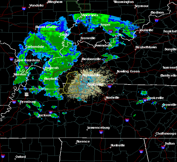 At 507 pm cdt, severe thunderstorms were located along a line extending from near cadiz, kentucky to near paris landing state park, moving east at 35 mph (radar indicated). Hazards include 60 mph wind gusts and quarter size hail. Hail damage to vehicles is expected. expect wind damage to roofs, siding, and trees. Locations impacted include, dover, big rock, cumberland city, land between the lakes and indian mound. At 507 pm cdt, severe thunderstorms were located along a line extending from near cadiz, kentucky to near paris landing state park, moving east at 35 mph (radar indicated). Hazards include 60 mph wind gusts and quarter size hail. Hail damage to vehicles is expected. expect wind damage to roofs, siding, and trees. Locations impacted include, dover, big rock, cumberland city, land between the lakes and indian mound.
|
| 6/19/2019 4:41 PM CDT |
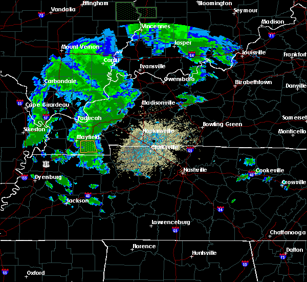 The national weather service in nashville has issued a * severe thunderstorm warning for. stewart county in middle tennessee. until 530 pm cdt. At 440 pm cdt, severe thunderstorms were located along a line extending from near murray, kentucky to near paris, moving east at. The national weather service in nashville has issued a * severe thunderstorm warning for. stewart county in middle tennessee. until 530 pm cdt. At 440 pm cdt, severe thunderstorms were located along a line extending from near murray, kentucky to near paris, moving east at.
|
| 2/23/2019 3:12 PM CST |
 At 312 pm cst, a severe thunderstorm was located near tennessee ridge, or near erin, moving east at 45 mph (radar indicated). Hazards include 60 mph wind gusts. Expect damage to roofs, siding, and trees. Locations impacted include, waverly, erin, mcewen, tennessee ridge, cumberland city and houston county airport. At 312 pm cst, a severe thunderstorm was located near tennessee ridge, or near erin, moving east at 45 mph (radar indicated). Hazards include 60 mph wind gusts. Expect damage to roofs, siding, and trees. Locations impacted include, waverly, erin, mcewen, tennessee ridge, cumberland city and houston county airport.
|
| 2/23/2019 2:44 PM CST |
 At 244 pm cst, a severe thunderstorm was located near springville, or 9 miles north of camden, moving east at 45 mph (radar indicated). Hazards include 60 mph wind gusts. expect damage to roofs, siding, and trees At 244 pm cst, a severe thunderstorm was located near springville, or 9 miles north of camden, moving east at 45 mph (radar indicated). Hazards include 60 mph wind gusts. expect damage to roofs, siding, and trees
|
| 12/31/2018 1:23 PM CST |
 At 122 pm cst, a severe thunderstorm was located 8 miles east of erin, moving northeast at 45 mph (radar indicated). Hazards include 60 mph wind gusts. Expect damage to roofs, siding, and trees. Locations impacted include, erin, mcewen, vanleer, cumberland city, slayden and palmyra. At 122 pm cst, a severe thunderstorm was located 8 miles east of erin, moving northeast at 45 mph (radar indicated). Hazards include 60 mph wind gusts. Expect damage to roofs, siding, and trees. Locations impacted include, erin, mcewen, vanleer, cumberland city, slayden and palmyra.
|
| 12/31/2018 1:08 PM CST |
 At 108 pm cst, a severe thunderstorm was located 7 miles north of waverly, moving northeast at 45 mph (radar indicated). Hazards include 60 mph wind gusts. expect damage to roofs, siding, and trees At 108 pm cst, a severe thunderstorm was located 7 miles north of waverly, moving northeast at 45 mph (radar indicated). Hazards include 60 mph wind gusts. expect damage to roofs, siding, and trees
|
| 7/5/2018 5:49 PM CDT | Tspotter report of trees and power lines down on the 1500 block of cumberland city road in stewart count in stewart county TN, 0.8 miles NNE of Cumberland City, TN |
| 7/5/2018 5:44 PM CDT | Report of multiple trees down in cumberland city with one tree falling on a hom in stewart county TN, 0.8 miles NNE of Cumberland City, TN |
| 7/5/2018 5:41 PM CDT |
 At 541 pm cdt, a severe thunderstorm was located 7 miles north of erin, moving southwest at 25 mph (radar indicated). Hazards include 60 mph wind gusts and penny size hail. expect damage to roofs, siding, and trees At 541 pm cdt, a severe thunderstorm was located 7 miles north of erin, moving southwest at 25 mph (radar indicated). Hazards include 60 mph wind gusts and penny size hail. expect damage to roofs, siding, and trees
|
| 6/28/2018 9:16 PM CDT |
 At 916 pm cdt, a severe thunderstorm was located 7 miles northeast of erin, moving southeast at 60 mph (radar indicated). Hazards include 60 mph wind gusts. Expect damage to roofs, siding, and trees. Locations impacted include, dover, clarksville, big rock, cumberland city, land between the lakes, indian mound, palmyra and woodlawn. At 916 pm cdt, a severe thunderstorm was located 7 miles northeast of erin, moving southeast at 60 mph (radar indicated). Hazards include 60 mph wind gusts. Expect damage to roofs, siding, and trees. Locations impacted include, dover, clarksville, big rock, cumberland city, land between the lakes, indian mound, palmyra and woodlawn.
|
| 6/28/2018 9:15 PM CDT |
 At 915 pm cdt, a severe thunderstorm was located near tennessee ridge, or near dover, moving south at 50 mph (radar indicated). Hazards include 60 mph wind gusts. expect damage to roofs, siding, and trees At 915 pm cdt, a severe thunderstorm was located near tennessee ridge, or near dover, moving south at 50 mph (radar indicated). Hazards include 60 mph wind gusts. expect damage to roofs, siding, and trees
|
| 6/28/2018 8:41 PM CDT |
 At 840 pm cdt, a severe thunderstorm was located near cadiz, moving southeast at 60 mph (radar indicated). Hazards include 60 mph wind gusts. expect damage to roofs, siding, and trees At 840 pm cdt, a severe thunderstorm was located near cadiz, moving southeast at 60 mph (radar indicated). Hazards include 60 mph wind gusts. expect damage to roofs, siding, and trees
|
| 6/28/2018 12:19 PM CDT |
 At 1219 pm cdt, severe thunderstorms were located along a line extending from near big rock to near mcewen, moving southeast at 45 mph (radar indicated). Hazards include 60 mph wind gusts and quarter size hail. Hail damage to vehicles is expected. expect wind damage to roofs, siding, and trees. Locations impacted include, waverly, camden, dover, erin, new johnsonville, mcewen, tennessee ridge, hurricane mills, big rock, cumberland city, houston county airport, land between the lakes and indian mound. At 1219 pm cdt, severe thunderstorms were located along a line extending from near big rock to near mcewen, moving southeast at 45 mph (radar indicated). Hazards include 60 mph wind gusts and quarter size hail. Hail damage to vehicles is expected. expect wind damage to roofs, siding, and trees. Locations impacted include, waverly, camden, dover, erin, new johnsonville, mcewen, tennessee ridge, hurricane mills, big rock, cumberland city, houston county airport, land between the lakes and indian mound.
|
| 6/28/2018 11:44 AM CDT |
 At 1144 am cdt, severe thunderstorms were located along a line extending from land between the lakes to near paris, moving southeast at 40 mph (radar indicated). Hazards include 60 mph wind gusts and quarter size hail. Hail damage to vehicles is expected. Expect wind damage to roofs, siding, and trees. At 1144 am cdt, severe thunderstorms were located along a line extending from land between the lakes to near paris, moving southeast at 40 mph (radar indicated). Hazards include 60 mph wind gusts and quarter size hail. Hail damage to vehicles is expected. Expect wind damage to roofs, siding, and trees.
|
| 6/24/2018 8:43 PM CDT |
 At 842 pm cdt, a severe thunderstorm was located near big rock, or 7 miles northeast of dover, moving east at 25 mph (radar indicated). Hazards include 60 mph wind gusts. expect damage to roofs, siding, and trees At 842 pm cdt, a severe thunderstorm was located near big rock, or 7 miles northeast of dover, moving east at 25 mph (radar indicated). Hazards include 60 mph wind gusts. expect damage to roofs, siding, and trees
|
| 6/24/2018 8:34 PM CDT |
 At 833 pm cdt, a severe thunderstorm was located near big rock, or near dover, moving east at 25 mph (radar indicated). Hazards include 60 mph wind gusts and quarter size hail. Hail damage to vehicles is expected. expect wind damage to roofs, siding, and trees. Locations impacted include, dover, big rock, cumberland city and indian mound. At 833 pm cdt, a severe thunderstorm was located near big rock, or near dover, moving east at 25 mph (radar indicated). Hazards include 60 mph wind gusts and quarter size hail. Hail damage to vehicles is expected. expect wind damage to roofs, siding, and trees. Locations impacted include, dover, big rock, cumberland city and indian mound.
|
| 6/24/2018 8:20 PM CDT |
 At 820 pm cdt, a severe thunderstorm was located near dover, moving east at 25 mph (radar indicated). Hazards include 60 mph wind gusts and quarter size hail. Hail damage to vehicles is expected. expect wind damage to roofs, siding, and trees. Locations impacted include, dover, big rock, cumberland city, land between the lakes and indian mound. At 820 pm cdt, a severe thunderstorm was located near dover, moving east at 25 mph (radar indicated). Hazards include 60 mph wind gusts and quarter size hail. Hail damage to vehicles is expected. expect wind damage to roofs, siding, and trees. Locations impacted include, dover, big rock, cumberland city, land between the lakes and indian mound.
|
| 6/24/2018 8:04 PM CDT |
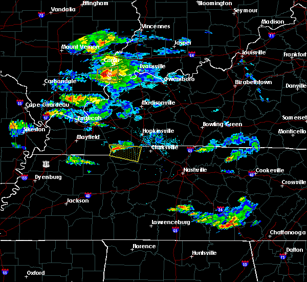 At 804 pm cdt, a severe thunderstorm was located 9 miles northwest of dover, moving east at 25 mph (radar indicated). Hazards include 60 mph wind gusts and quarter size hail. Hail damage to vehicles is expected. Expect wind damage to roofs, siding, and trees. At 804 pm cdt, a severe thunderstorm was located 9 miles northwest of dover, moving east at 25 mph (radar indicated). Hazards include 60 mph wind gusts and quarter size hail. Hail damage to vehicles is expected. Expect wind damage to roofs, siding, and trees.
|
| 4/3/2018 8:41 PM CDT | Tree fell on house along hwy 79 in stewart county TN, 6.2 miles S of Cumberland City, TN |
| 4/3/2018 8:34 PM CDT |
 At 833 pm cdt, severe thunderstorms were located along a line extending from near big rock to hurricane mills, moving east at 55 mph (radar indicated). Hazards include 60 mph wind gusts and penny size hail. expect damage to roofs, siding, and trees At 833 pm cdt, severe thunderstorms were located along a line extending from near big rock to hurricane mills, moving east at 55 mph (radar indicated). Hazards include 60 mph wind gusts and penny size hail. expect damage to roofs, siding, and trees
|
| 2/24/2018 8:54 PM CST |
 The severe thunderstorm warning for southern stewart, houston and humphreys counties will expire at 900 pm cst, the storm which prompted the warning has moved out of the area. therefore the warning will be allowed to expire. a tornado watch remains in effect until 1000 pm cst for middle tennessee. a tornado watch also remains in effect until 200 am cst for middle tennessee. The severe thunderstorm warning for southern stewart, houston and humphreys counties will expire at 900 pm cst, the storm which prompted the warning has moved out of the area. therefore the warning will be allowed to expire. a tornado watch remains in effect until 1000 pm cst for middle tennessee. a tornado watch also remains in effect until 200 am cst for middle tennessee.
|
| 2/24/2018 8:42 PM CST |
 At 841 pm cst, a severe thunderstorm capable of producing a tornado was located 8 miles southwest of fort campbell north, moving northeast at 55 mph (radar indicated rotation). Hazards include tornado. Flying debris will be dangerous to those caught without shelter. mobile homes will be damaged or destroyed. damage to roofs, windows, and vehicles will occur. tree damage is likely. this dangerous storm will be near, clarksville around 850 pm cst. Other locations impacted by this tornadic thunderstorm include indian mound, palmyra, slayden, cumberland city, cunningham and woodlawn. At 841 pm cst, a severe thunderstorm capable of producing a tornado was located 8 miles southwest of fort campbell north, moving northeast at 55 mph (radar indicated rotation). Hazards include tornado. Flying debris will be dangerous to those caught without shelter. mobile homes will be damaged or destroyed. damage to roofs, windows, and vehicles will occur. tree damage is likely. this dangerous storm will be near, clarksville around 850 pm cst. Other locations impacted by this tornadic thunderstorm include indian mound, palmyra, slayden, cumberland city, cunningham and woodlawn.
|
| 2/24/2018 8:33 PM CST |
 At 832 pm cst, a severe thunderstorm was located near tennessee ridge, or near erin, moving east at 50 mph (radar indicated). Hazards include 60 mph wind gusts. Expect damage to roofs, siding, and trees. locations impacted include, waverly, erin, new johnsonville, mcewen, tennessee ridge, hurricane mills, cumberland city and houston county airport. a tornado watch remains in effect until 900 pm cst for middle tennessee. A tornado watch also remains in effect until 200 am cst for middle tennessee. At 832 pm cst, a severe thunderstorm was located near tennessee ridge, or near erin, moving east at 50 mph (radar indicated). Hazards include 60 mph wind gusts. Expect damage to roofs, siding, and trees. locations impacted include, waverly, erin, new johnsonville, mcewen, tennessee ridge, hurricane mills, cumberland city and houston county airport. a tornado watch remains in effect until 900 pm cst for middle tennessee. A tornado watch also remains in effect until 200 am cst for middle tennessee.
|
| 2/24/2018 8:29 PM CST |
 At 828 pm cst, a severe thunderstorm capable of producing a tornado was located near dover, moving northeast at 55 mph (radar indicated rotation). Hazards include tornado. Flying debris will be dangerous to those caught without shelter. mobile homes will be damaged or destroyed. damage to roofs, windows, and vehicles will occur. tree damage is likely. this dangerous storm will be near, clarksville around 855 pm cst. Other locations impacted by this tornadic thunderstorm include indian mound, palmyra, slayden, cumberland city, cunningham and woodlawn. At 828 pm cst, a severe thunderstorm capable of producing a tornado was located near dover, moving northeast at 55 mph (radar indicated rotation). Hazards include tornado. Flying debris will be dangerous to those caught without shelter. mobile homes will be damaged or destroyed. damage to roofs, windows, and vehicles will occur. tree damage is likely. this dangerous storm will be near, clarksville around 855 pm cst. Other locations impacted by this tornadic thunderstorm include indian mound, palmyra, slayden, cumberland city, cunningham and woodlawn.
|
| 2/24/2018 8:24 PM CST |
 At 824 pm cst, a severe thunderstorm capable of producing a tornado was located near dover, moving northeast at 55 mph (radar indicated rotation). Hazards include tornado. Flying debris will be dangerous to those caught without shelter. mobile homes will be damaged or destroyed. damage to roofs, windows, and vehicles will occur. tree damage is likely. this dangerous storm will be near, big rock around 835 pm cst. Other locations impacted by this tornadic thunderstorm include land between the lakes, houston county airport, indian mound and cumberland city. At 824 pm cst, a severe thunderstorm capable of producing a tornado was located near dover, moving northeast at 55 mph (radar indicated rotation). Hazards include tornado. Flying debris will be dangerous to those caught without shelter. mobile homes will be damaged or destroyed. damage to roofs, windows, and vehicles will occur. tree damage is likely. this dangerous storm will be near, big rock around 835 pm cst. Other locations impacted by this tornadic thunderstorm include land between the lakes, houston county airport, indian mound and cumberland city.
|
| 2/24/2018 8:17 PM CST |
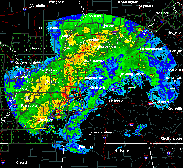 At 817 pm cst, a severe thunderstorm capable of producing a tornado was located near paris landing state park, moving northeast at 55 mph (radar indicated rotation). Hazards include tornado. Flying debris will be dangerous to those caught without shelter. mobile homes will be damaged or destroyed. damage to roofs, windows, and vehicles will occur. tree damage is likely. this dangerous storm will be near, dover around 825 pm cst. big rock around 835 pm cst. Other locations impacted by this tornadic thunderstorm include land between the lakes, houston county airport, indian mound and cumberland city. At 817 pm cst, a severe thunderstorm capable of producing a tornado was located near paris landing state park, moving northeast at 55 mph (radar indicated rotation). Hazards include tornado. Flying debris will be dangerous to those caught without shelter. mobile homes will be damaged or destroyed. damage to roofs, windows, and vehicles will occur. tree damage is likely. this dangerous storm will be near, dover around 825 pm cst. big rock around 835 pm cst. Other locations impacted by this tornadic thunderstorm include land between the lakes, houston county airport, indian mound and cumberland city.
|
| 2/24/2018 8:10 PM CST |
 At 809 pm cst, a severe thunderstorm was located over springville, or 11 miles east of paris, moving east at 35 mph (radar indicated). Hazards include 60 mph wind gusts. expect damage to roofs, siding, and trees At 809 pm cst, a severe thunderstorm was located over springville, or 11 miles east of paris, moving east at 35 mph (radar indicated). Hazards include 60 mph wind gusts. expect damage to roofs, siding, and trees
|
| 2/24/2018 8:01 PM CST |
 At 801 pm cst, a severe thunderstorm was located near paris landing state park, moving northeast at 55 mph (radar indicated). Hazards include 60 mph wind gusts. expect damage to roofs, siding, and trees At 801 pm cst, a severe thunderstorm was located near paris landing state park, moving northeast at 55 mph (radar indicated). Hazards include 60 mph wind gusts. expect damage to roofs, siding, and trees
|
| 2/24/2018 2:52 PM CST |
 At 252 pm cst, a severe thunderstorm was located near erin, moving northeast at 40 mph (radar indicated). Hazards include 60 mph wind gusts and nickel size hail. expect damage to roofs, siding, and trees At 252 pm cst, a severe thunderstorm was located near erin, moving northeast at 40 mph (radar indicated). Hazards include 60 mph wind gusts and nickel size hail. expect damage to roofs, siding, and trees
|
| 11/18/2017 3:45 PM CST |
 At 345 pm cst, severe thunderstorms were located along a line extending from near fort campbell to mcewen, moving east at 55 mph (radar indicated). Hazards include 70 mph wind gusts. Expect considerable tree damage. damage is likely to mobile homes, roofs, and outbuildings. Locations impacted include, clarksville, dickson, mcewen, charlotte, vanleer, cumberland city, slayden, palmyra, cunningham and woodlawn. At 345 pm cst, severe thunderstorms were located along a line extending from near fort campbell to mcewen, moving east at 55 mph (radar indicated). Hazards include 70 mph wind gusts. Expect considerable tree damage. damage is likely to mobile homes, roofs, and outbuildings. Locations impacted include, clarksville, dickson, mcewen, charlotte, vanleer, cumberland city, slayden, palmyra, cunningham and woodlawn.
|
| 11/18/2017 3:30 PM CST |
 At 330 pm cst, severe thunderstorms were located along a line extending from near big rock to near waverly, moving east at 50 mph (radar indicated). Hazards include 70 mph wind gusts. Expect considerable tree damage. Damage is likely to mobile homes, roofs, and outbuildings. At 330 pm cst, severe thunderstorms were located along a line extending from near big rock to near waverly, moving east at 50 mph (radar indicated). Hazards include 70 mph wind gusts. Expect considerable tree damage. Damage is likely to mobile homes, roofs, and outbuildings.
|
| 11/18/2017 3:21 PM CST |
 At 321 pm cst, severe thunderstorms were located along a line extending from near big rock to near tennessee ridge, moving east at 55 mph (radar indicated). Hazards include 60 mph wind gusts. Expect damage to roofs, siding, and trees. Locations impacted include, dover, erin, clarksville, tennessee ridge, big rock, cumberland city, houston county airport, indian mound and woodlawn. At 321 pm cst, severe thunderstorms were located along a line extending from near big rock to near tennessee ridge, moving east at 55 mph (radar indicated). Hazards include 60 mph wind gusts. Expect damage to roofs, siding, and trees. Locations impacted include, dover, erin, clarksville, tennessee ridge, big rock, cumberland city, houston county airport, indian mound and woodlawn.
|
| 11/18/2017 3:07 PM CST |
 At 306 pm cst, severe thunderstorms were located along a line extending from land between the lakes to near big sandy, moving east at 50 mph (radar indicated. at 405 pm, trees were reportedly blown down in calloway county, kentucky with this line of storms). Hazards include 60 mph wind gusts. expect damage to roofs, siding, and trees At 306 pm cst, severe thunderstorms were located along a line extending from land between the lakes to near big sandy, moving east at 50 mph (radar indicated. at 405 pm, trees were reportedly blown down in calloway county, kentucky with this line of storms). Hazards include 60 mph wind gusts. expect damage to roofs, siding, and trees
|
| 5/27/2017 7:55 PM CDT |
 At 754 pm cdt, a severe thunderstorm was located 14 miles south of clarksville, moving east at 55 mph (radar indicated). Hazards include 70 mph wind gusts and quarter size hail. Hail damage to vehicles is expected. expect considerable tree damage. wind damage is also likely to mobile homes, roofs, and outbuildings. Locations impacted include, waverly, erin, clarksville, mcewen, tennessee ridge, pleasant view, adams, vanleer, cumberland city, slayden, cheatham dam, palmyra, houston county airport and cunningham. At 754 pm cdt, a severe thunderstorm was located 14 miles south of clarksville, moving east at 55 mph (radar indicated). Hazards include 70 mph wind gusts and quarter size hail. Hail damage to vehicles is expected. expect considerable tree damage. wind damage is also likely to mobile homes, roofs, and outbuildings. Locations impacted include, waverly, erin, clarksville, mcewen, tennessee ridge, pleasant view, adams, vanleer, cumberland city, slayden, cheatham dam, palmyra, houston county airport and cunningham.
|
| 5/27/2017 7:41 PM CDT |
 At 741 pm cdt, a severe thunderstorm was located 10 miles east of erin, moving east at 45 mph (radar indicated). Hazards include 70 mph wind gusts and quarter size hail. Hail damage to vehicles is expected. expect considerable tree damage. Wind damage is also likely to mobile homes, roofs, and outbuildings. At 741 pm cdt, a severe thunderstorm was located 10 miles east of erin, moving east at 45 mph (radar indicated). Hazards include 70 mph wind gusts and quarter size hail. Hail damage to vehicles is expected. expect considerable tree damage. Wind damage is also likely to mobile homes, roofs, and outbuildings.
|
| 5/27/2017 7:22 PM CDT |
 At 721 pm cdt, a severe thunderstorm was located 7 miles northwest of dover, moving southeast at 55 mph (radar indicated). Hazards include 70 mph wind gusts and quarter size hail. Hail damage to vehicles is expected. expect considerable tree damage. Wind damage is also likely to mobile homes, roofs, and outbuildings. At 721 pm cdt, a severe thunderstorm was located 7 miles northwest of dover, moving southeast at 55 mph (radar indicated). Hazards include 70 mph wind gusts and quarter size hail. Hail damage to vehicles is expected. expect considerable tree damage. Wind damage is also likely to mobile homes, roofs, and outbuildings.
|
| 5/27/2017 6:58 PM CDT |
 At 657 pm cdt, a line of severe thunderstorm was centered at 11 miles east of erin, moving southeast at 35 mph (radar indicated). Hazards include 70 mph wind gusts and quarter size hail. Hail damage to vehicles is expected. expect considerable tree damage. Wind damage is also likely to mobile homes, roofs, and outbuildings. At 657 pm cdt, a line of severe thunderstorm was centered at 11 miles east of erin, moving southeast at 35 mph (radar indicated). Hazards include 70 mph wind gusts and quarter size hail. Hail damage to vehicles is expected. expect considerable tree damage. Wind damage is also likely to mobile homes, roofs, and outbuildings.
|
| 5/27/2017 6:40 PM CDT |
 At 640 pm cdt, a severe thunderstorm was located near erin, moving southeast at 30 mph (radar indicated). Hazards include 70 mph wind gusts and quarter size hail. Hail damage to vehicles is expected. expect considerable tree damage. wind damage is also likely to mobile homes, roofs, and outbuildings. Locations impacted include, waverly, erin, clarksville, mcewen, tennessee ridge, charlotte, vanleer, cumberland city, slayden, cheatham dam, palmyra, woodlawn, houston county airport, indian mound and cunningham. At 640 pm cdt, a severe thunderstorm was located near erin, moving southeast at 30 mph (radar indicated). Hazards include 70 mph wind gusts and quarter size hail. Hail damage to vehicles is expected. expect considerable tree damage. wind damage is also likely to mobile homes, roofs, and outbuildings. Locations impacted include, waverly, erin, clarksville, mcewen, tennessee ridge, charlotte, vanleer, cumberland city, slayden, cheatham dam, palmyra, woodlawn, houston county airport, indian mound and cunningham.
|
| 5/27/2017 6:31 PM CDT |
 At 631 pm cdt, a severe thunderstorm was located near erin, moving east at 55 mph (radar indicated). Hazards include 70 mph wind gusts and quarter size hail. Hail damage to vehicles is expected. expect considerable tree damage. Wind damage is also likely to mobile homes, roofs, and outbuildings. At 631 pm cdt, a severe thunderstorm was located near erin, moving east at 55 mph (radar indicated). Hazards include 70 mph wind gusts and quarter size hail. Hail damage to vehicles is expected. expect considerable tree damage. Wind damage is also likely to mobile homes, roofs, and outbuildings.
|
| 5/27/2017 6:04 PM CDT |
 At 604 pm cdt, an line of severe thunderstorms was centered near dover, moving southeast at 55 mph (radar indicated). Hazards include 70 mph wind gusts and quarter size hail. Hail damage to vehicles is expected. expect considerable tree damage. Wind damage is also likely to mobile homes, roofs, and outbuildings. At 604 pm cdt, an line of severe thunderstorms was centered near dover, moving southeast at 55 mph (radar indicated). Hazards include 70 mph wind gusts and quarter size hail. Hail damage to vehicles is expected. expect considerable tree damage. Wind damage is also likely to mobile homes, roofs, and outbuildings.
|
| 3/27/2017 2:59 PM CDT |
 At 259 pm cdt, severe thunderstorms were located along a line extending from near fort campbell north to 8 miles northwest of waverly, moving east at 25 mph (radar indicated). Hazards include 60 mph wind gusts and quarter size hail. Hail damage to vehicles is expected. expect wind damage to roofs, siding, and trees. Locations impacted include, camden, dover, erin, clarksville, tennessee ridge, big rock, cumberland city, houston county airport, indian mound, palmyra and woodlawn. At 259 pm cdt, severe thunderstorms were located along a line extending from near fort campbell north to 8 miles northwest of waverly, moving east at 25 mph (radar indicated). Hazards include 60 mph wind gusts and quarter size hail. Hail damage to vehicles is expected. expect wind damage to roofs, siding, and trees. Locations impacted include, camden, dover, erin, clarksville, tennessee ridge, big rock, cumberland city, houston county airport, indian mound, palmyra and woodlawn.
|
| 3/27/2017 2:51 PM CDT |
 At 251 pm cdt, severe thunderstorms were located along a line extending from fort campbell north to tennessee ridge, moving east at 25 mph (radar indicated). Hazards include 60 mph wind gusts and quarter size hail. Hail damage to vehicles is expected. expect wind damage to roofs, siding, and trees. Locations impacted include, camden, dover, erin, clarksville, tennessee ridge, big rock, cumberland city, houston county airport, indian mound, palmyra and woodlawn. At 251 pm cdt, severe thunderstorms were located along a line extending from fort campbell north to tennessee ridge, moving east at 25 mph (radar indicated). Hazards include 60 mph wind gusts and quarter size hail. Hail damage to vehicles is expected. expect wind damage to roofs, siding, and trees. Locations impacted include, camden, dover, erin, clarksville, tennessee ridge, big rock, cumberland city, houston county airport, indian mound, palmyra and woodlawn.
|
| 3/27/2017 2:39 PM CDT |
 At 239 pm cdt, severe thunderstorms were located along a line extending from near big rock to near waverly, moving northeast at 25 mph (radar indicated). Hazards include 60 mph wind gusts and quarter size hail. Hail damage to vehicles is expected. Expect wind damage to roofs, siding, and trees. At 239 pm cdt, severe thunderstorms were located along a line extending from near big rock to near waverly, moving northeast at 25 mph (radar indicated). Hazards include 60 mph wind gusts and quarter size hail. Hail damage to vehicles is expected. Expect wind damage to roofs, siding, and trees.
|
| 3/9/2017 10:05 PM CST |
 At 1004 pm cst, a severe thunderstorm was located 9 miles northeast of erin, moving east at 55 mph (radar indicated). Hazards include 60 mph wind gusts and quarter size hail. Hail damage to vehicles is expected. expect wind damage to roofs, siding, and trees. Locations impacted include, waverly, erin, tennessee ridge, cumberland city and indian mound. At 1004 pm cst, a severe thunderstorm was located 9 miles northeast of erin, moving east at 55 mph (radar indicated). Hazards include 60 mph wind gusts and quarter size hail. Hail damage to vehicles is expected. expect wind damage to roofs, siding, and trees. Locations impacted include, waverly, erin, tennessee ridge, cumberland city and indian mound.
|
| 3/9/2017 10:03 PM CST |
 At 1003 pm cst, a severe thunderstorm was located 7 miles east of erin, moving east at 55 mph (radar indicated). Hazards include 60 mph wind gusts and nickel size hail. expect damage to roofs, siding, and trees At 1003 pm cst, a severe thunderstorm was located 7 miles east of erin, moving east at 55 mph (radar indicated). Hazards include 60 mph wind gusts and nickel size hail. expect damage to roofs, siding, and trees
|
| 3/9/2017 9:53 PM CST |
 At 952 pm cst, a severe thunderstorm was located near dover, moving east at 55 mph (radar indicated). Hazards include 60 mph wind gusts and quarter size hail. Hail damage to vehicles is expected. Expect wind damage to roofs, siding, and trees. At 952 pm cst, a severe thunderstorm was located near dover, moving east at 55 mph (radar indicated). Hazards include 60 mph wind gusts and quarter size hail. Hail damage to vehicles is expected. Expect wind damage to roofs, siding, and trees.
|
| 3/1/2017 6:24 AM CST |
 At 624 am cst, severe thunderstorms were located along a line extending from 8 miles east of erin to near dickson to 11 miles west of centerville, moving east at 70 mph (radar indicated). Hazards include 70 mph wind gusts. Expect considerable tree damage. Damage is likely to mobile homes, roofs, and outbuildings. At 624 am cst, severe thunderstorms were located along a line extending from 8 miles east of erin to near dickson to 11 miles west of centerville, moving east at 70 mph (radar indicated). Hazards include 70 mph wind gusts. Expect considerable tree damage. Damage is likely to mobile homes, roofs, and outbuildings.
|
| 3/1/2017 6:17 AM CST |
 At 616 am cst, severe thunderstorms were located along a line extending from 7 miles east of big rock to near mcewen to 12 miles northeast of linden, moving east at 60 mph (radar indicated). Hazards include 70 mph wind gusts. Expect considerable tree damage. damage is likely to mobile homes, roofs, and outbuildings. locations impacted include, clarksville, dickson, waverly, centerville, dover, erin, mcewen, burns, tennessee ridge, hurricane mills, big rock, charlotte, lobelville, vanleer, cumberland city, slayden, bon aqua, palmyra, bucksnort and nunnelly. A tornado watch remains in effect until 1000 am cst for middle tennessee. At 616 am cst, severe thunderstorms were located along a line extending from 7 miles east of big rock to near mcewen to 12 miles northeast of linden, moving east at 60 mph (radar indicated). Hazards include 70 mph wind gusts. Expect considerable tree damage. damage is likely to mobile homes, roofs, and outbuildings. locations impacted include, clarksville, dickson, waverly, centerville, dover, erin, mcewen, burns, tennessee ridge, hurricane mills, big rock, charlotte, lobelville, vanleer, cumberland city, slayden, bon aqua, palmyra, bucksnort and nunnelly. A tornado watch remains in effect until 1000 am cst for middle tennessee.
|
| 3/1/2017 5:54 AM CST |
 At 553 am cst, severe thunderstorms were located along a line extending from 10 miles north of paris landing state park to near new johnsonville to 6 miles east of natchez trace state park, moving east at 70 mph (radar indicated). Hazards include 70 mph wind gusts. Expect considerable tree damage. Damage is likely to mobile homes, roofs, and outbuildings. At 553 am cst, severe thunderstorms were located along a line extending from 10 miles north of paris landing state park to near new johnsonville to 6 miles east of natchez trace state park, moving east at 70 mph (radar indicated). Hazards include 70 mph wind gusts. Expect considerable tree damage. Damage is likely to mobile homes, roofs, and outbuildings.
|
| 12/17/2016 8:22 PM CST |
 The severe thunderstorm warning for stewart, northern houston and southwestern montgomery counties will expire at 830 pm cst, the storm which prompted the warning has moved out of the area. therefore the warning will be allowed to expire. a tornado watch remains in effect until 900 pm cst for middle tennessee. The severe thunderstorm warning for stewart, northern houston and southwestern montgomery counties will expire at 830 pm cst, the storm which prompted the warning has moved out of the area. therefore the warning will be allowed to expire. a tornado watch remains in effect until 900 pm cst for middle tennessee.
|
| 12/17/2016 8:09 PM CST | Tree reportedly blown down in stewart county. estimated locatio in stewart county TN, 0.8 miles NNE of Cumberland City, TN |
| 12/17/2016 8:03 PM CST |
 At 802 pm cst, a severe thunderstorm was located over tennessee ridge, or near erin, moving northeast at 60 mph (radar indicated). Hazards include 60 mph wind gusts and quarter size hail. Hail damage to vehicles is expected. expect wind damage to roofs, siding, and trees. locations impacted include, dover, erin, tennessee ridge, big rock, cumberland city, houston county airport and indian mound. A tornado watch remains in effect until 900 pm cst for middle tennessee. At 802 pm cst, a severe thunderstorm was located over tennessee ridge, or near erin, moving northeast at 60 mph (radar indicated). Hazards include 60 mph wind gusts and quarter size hail. Hail damage to vehicles is expected. expect wind damage to roofs, siding, and trees. locations impacted include, dover, erin, tennessee ridge, big rock, cumberland city, houston county airport and indian mound. A tornado watch remains in effect until 900 pm cst for middle tennessee.
|
| 12/17/2016 7:46 PM CST |
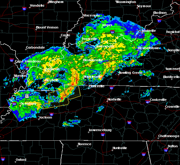 At 746 pm cst, a severe thunderstorm was located over springville, or 10 miles east of paris, moving northeast at 55 mph (radar indicated). Hazards include 60 mph wind gusts. expect damage to roofs, siding, and trees At 746 pm cst, a severe thunderstorm was located over springville, or 10 miles east of paris, moving northeast at 55 mph (radar indicated). Hazards include 60 mph wind gusts. expect damage to roofs, siding, and trees
|
| 8/1/2016 4:36 PM CDT | Received a couple of reports of trees down on old highway 13 and across the river on ham roa in montgomery county TN, 3.6 miles WNW of Cumberland City, TN |
| 7/8/2016 7:56 PM CDT |
 At 756 pm cdt, severe thunderstorms were located along a line extending from near oak grove to mcewen, moving east at 45 mph (emergency management. at 750 pm cdt...numerous trees and power lines were blown down across stewart county with these storms). Hazards include 60 mph wind gusts and penny size hail. Expect damage to roofs. siding. and trees. Locations impacted include, clarksville, waverly, camden, dover, erin, new johnsonville, mcewen, tennessee ridge, hurricane mills, vanleer, cumberland city, slayden, houston county airport, indian mound, palmyra, woodlawn and cunningham. At 756 pm cdt, severe thunderstorms were located along a line extending from near oak grove to mcewen, moving east at 45 mph (emergency management. at 750 pm cdt...numerous trees and power lines were blown down across stewart county with these storms). Hazards include 60 mph wind gusts and penny size hail. Expect damage to roofs. siding. and trees. Locations impacted include, clarksville, waverly, camden, dover, erin, new johnsonville, mcewen, tennessee ridge, hurricane mills, vanleer, cumberland city, slayden, houston county airport, indian mound, palmyra, woodlawn and cunningham.
|
| 7/8/2016 7:48 PM CDT | Power lines down on riversbend road in stewart county TN, 2.3 miles SSE of Cumberland City, TN |
| 7/8/2016 7:48 PM CDT |
 At 746 pm cdt, severe thunderstorms were located along a line extending from near fort campbell to waverly, moving east at 45 mph (emergency management. at 725 pm cdt...trees and power lines were blown down on highway 232 in stewart county with these storms). Hazards include 60 mph wind gusts and penny size hail. Expect damage to roofs. siding. and trees. Locations impacted include, clarksville, waverly, camden, dover, erin, new johnsonville, mcewen, tennessee ridge, hurricane mills, big rock, vanleer, cumberland city, slayden, houston county airport, indian mound, land between the lakes, palmyra, woodlawn and cunningham. At 746 pm cdt, severe thunderstorms were located along a line extending from near fort campbell to waverly, moving east at 45 mph (emergency management. at 725 pm cdt...trees and power lines were blown down on highway 232 in stewart county with these storms). Hazards include 60 mph wind gusts and penny size hail. Expect damage to roofs. siding. and trees. Locations impacted include, clarksville, waverly, camden, dover, erin, new johnsonville, mcewen, tennessee ridge, hurricane mills, big rock, vanleer, cumberland city, slayden, houston county airport, indian mound, land between the lakes, palmyra, woodlawn and cunningham.
|
| 7/8/2016 7:34 PM CDT |
 At 733 pm cdt, severe thunderstorms were located along a line extending from big rock to waverly, moving east at 35 mph (radar indicated). Hazards include 60 mph wind gusts and penny size hail. Expect damage to roofs. siding. And trees. At 733 pm cdt, severe thunderstorms were located along a line extending from big rock to waverly, moving east at 35 mph (radar indicated). Hazards include 60 mph wind gusts and penny size hail. Expect damage to roofs. siding. And trees.
|
| 7/6/2016 3:23 PM CDT |
 The severe thunderstorm warning for western dickson, houston and northern humphreys counties will expire at 330 pm cdt, the storms which prompted the warning have moved out of the area, and a new severe thunderstorm warning has been issued. a severe thunderstorm watch remains in effect until 900 pm cdt for middle tennessee. to report severe weather, contact your nearest law enforcement agency. they will relay your report to the national weather service nashville. The severe thunderstorm warning for western dickson, houston and northern humphreys counties will expire at 330 pm cdt, the storms which prompted the warning have moved out of the area, and a new severe thunderstorm warning has been issued. a severe thunderstorm watch remains in effect until 900 pm cdt for middle tennessee. to report severe weather, contact your nearest law enforcement agency. they will relay your report to the national weather service nashville.
|
| 7/6/2016 3:20 PM CDT |
 At 320 pm cdt, severe thunderstorms were located along a line extending from clarksville to near mcewen, moving east at 45 mph (radar indicated). Hazards include 60 mph wind gusts and nickel size hail. Expect damage to roofs. siding. And trees. At 320 pm cdt, severe thunderstorms were located along a line extending from clarksville to near mcewen, moving east at 45 mph (radar indicated). Hazards include 60 mph wind gusts and nickel size hail. Expect damage to roofs. siding. And trees.
|
| 7/6/2016 3:04 PM CDT |
 At 304 pm cdt, severe thunderstorms were located along a line extending from near erin to 6 miles west of waverly, moving east at 45 mph (radar indicated). Hazards include 60 mph wind gusts and nickel size hail. Expect damage to roofs. siding. and trees. Locations impacted include, dickson, waverly, erin, mcewen, tennessee ridge, vanleer, cumberland city, slayden and houston county airport. At 304 pm cdt, severe thunderstorms were located along a line extending from near erin to 6 miles west of waverly, moving east at 45 mph (radar indicated). Hazards include 60 mph wind gusts and nickel size hail. Expect damage to roofs. siding. and trees. Locations impacted include, dickson, waverly, erin, mcewen, tennessee ridge, vanleer, cumberland city, slayden and houston county airport.
|
| 7/6/2016 3:03 PM CDT |
 At 303 pm cdt, severe thunderstorms were located along a line extending from pembroke to near erin, moving east at 50 mph (radar indicated). Hazards include 60 mph wind gusts and penny size hail. Expect damage to roofs. siding. and trees. Locations impacted include, dover, clarksville, big rock, cumberland city, palmyra, woodlawn, indian mound, cunningham and land between the lakes. At 303 pm cdt, severe thunderstorms were located along a line extending from pembroke to near erin, moving east at 50 mph (radar indicated). Hazards include 60 mph wind gusts and penny size hail. Expect damage to roofs. siding. and trees. Locations impacted include, dover, clarksville, big rock, cumberland city, palmyra, woodlawn, indian mound, cunningham and land between the lakes.
|
| 7/6/2016 2:51 PM CDT |
 At 250 pm cdt, severe thunderstorms were located along a line extending from near hopkinsville to near tennessee ridge, moving east at 55 mph (radar indicated). Hazards include 60 mph wind gusts and penny size hail. Expect damage to roofs. siding. and trees. Locations impacted include, dover, clarksville, big rock, cumberland city, palmyra, woodlawn, indian mound, cunningham and land between the lakes. At 250 pm cdt, severe thunderstorms were located along a line extending from near hopkinsville to near tennessee ridge, moving east at 55 mph (radar indicated). Hazards include 60 mph wind gusts and penny size hail. Expect damage to roofs. siding. and trees. Locations impacted include, dover, clarksville, big rock, cumberland city, palmyra, woodlawn, indian mound, cunningham and land between the lakes.
|
| 7/6/2016 2:49 PM CDT |
 At 248 pm cdt, severe thunderstorms were located along a line extending from dover to camden, moving east at 35 mph (radar indicated). Hazards include 60 mph wind gusts and nickel size hail. Expect damage to roofs. siding. And trees. At 248 pm cdt, severe thunderstorms were located along a line extending from dover to camden, moving east at 35 mph (radar indicated). Hazards include 60 mph wind gusts and nickel size hail. Expect damage to roofs. siding. And trees.
|
| 7/6/2016 2:29 PM CDT |
 At 228 pm cdt, severe thunderstorms were located along a line extending from farmersville to near paris landing state park, moving east at 35 mph (radar indicated. at 215 pm cdt...a wind gust of 58 mph was measured in murray, kentucky and widespread wind damage was reported in calloway county, kentucky with these storms). Hazards include 60 mph wind gusts and penny size hail. Expect damage to roofs. siding. and trees. Locations impacted include, dover, clarksville, big rock, cumberland city, palmyra, woodlawn, indian mound, cunningham and land between the lakes. At 228 pm cdt, severe thunderstorms were located along a line extending from farmersville to near paris landing state park, moving east at 35 mph (radar indicated. at 215 pm cdt...a wind gust of 58 mph was measured in murray, kentucky and widespread wind damage was reported in calloway county, kentucky with these storms). Hazards include 60 mph wind gusts and penny size hail. Expect damage to roofs. siding. and trees. Locations impacted include, dover, clarksville, big rock, cumberland city, palmyra, woodlawn, indian mound, cunningham and land between the lakes.
|
| 7/6/2016 2:23 PM CDT |
 At 222 pm cdt, severe thunderstorms were located along a line extending from near farmersville to paris landing state park, moving east at 35 mph (radar indicated). Hazards include 60 mph wind gusts. Expect damage to roofs. siding. And trees. At 222 pm cdt, severe thunderstorms were located along a line extending from near farmersville to paris landing state park, moving east at 35 mph (radar indicated). Hazards include 60 mph wind gusts. Expect damage to roofs. siding. And trees.
|
| 6/15/2016 2:58 PM CDT |
 The national weather service in nashville has issued a * severe thunderstorm warning for. southern stewart county in middle tennessee. houston county in middle tennessee. southwestern montgomery county in middle tennessee. Northern humphreys county in middle tennessee. The national weather service in nashville has issued a * severe thunderstorm warning for. southern stewart county in middle tennessee. houston county in middle tennessee. southwestern montgomery county in middle tennessee. Northern humphreys county in middle tennessee.
|
| 6/15/2016 2:46 PM CDT |
 At 244 pm cdt, severe thunderstorms were located along a line extending from 10 miles northwest of fort campbell north to near big rock to near dover, moving southeast at 45 mph (radar indicated). Hazards include 60 mph wind gusts. Expect damage to roofs. siding. And trees. At 244 pm cdt, severe thunderstorms were located along a line extending from 10 miles northwest of fort campbell north to near big rock to near dover, moving southeast at 45 mph (radar indicated). Hazards include 60 mph wind gusts. Expect damage to roofs. siding. And trees.
|
| 5/12/2016 1:13 PM CDT | The severe thunderstorm warning for southeastern stewart, northeastern humphreys and houston counties will expire at 115 pm cdt, the storm which prompted the warning has weakened below severe limits, and no longer pose an immediate threat to life or property. therefore the warning will be allowed to expire. however gusty winds are still possible with this thunderstorm. |
| 5/12/2016 1:01 PM CDT |
 At 101 pm cdt, a severe thunderstorm was located over tennessee ridge, or near erin, moving northeast at 40 mph (radar indicated). Hazards include 60 mph wind gusts. Expect damage to roofs. siding. and trees. Locations impacted include, waverly, dover, erin, tennessee ridge, cumberland city and houston county airport. At 101 pm cdt, a severe thunderstorm was located over tennessee ridge, or near erin, moving northeast at 40 mph (radar indicated). Hazards include 60 mph wind gusts. Expect damage to roofs. siding. and trees. Locations impacted include, waverly, dover, erin, tennessee ridge, cumberland city and houston county airport.
|
| 5/12/2016 12:47 PM CDT |
 At 1246 pm cdt, a severe thunderstorm was located 10 miles east of springville, or 13 miles southeast of paris landing state park, moving northeast at 40 mph (radar indicated). Hazards include 60 mph wind gusts and penny size hail. Expect damage to roofs. siding. And trees. At 1246 pm cdt, a severe thunderstorm was located 10 miles east of springville, or 13 miles southeast of paris landing state park, moving northeast at 40 mph (radar indicated). Hazards include 60 mph wind gusts and penny size hail. Expect damage to roofs. siding. And trees.
|
| 5/10/2016 8:45 PM CDT | Quarter sized hail reported 0.8 miles NNE of Cumberland City, TN, quarter size hail at cumberland city |
| 5/10/2016 8:41 PM CDT |
 At 840 pm cdt, a severe thunderstorm was located near erin, moving east at 40 mph (radar indicated). Hazards include 60 mph wind gusts and quarter size hail. Hail damage to vehicles is expected. Expect wind damage to roofs, siding, and trees. At 840 pm cdt, a severe thunderstorm was located near erin, moving east at 40 mph (radar indicated). Hazards include 60 mph wind gusts and quarter size hail. Hail damage to vehicles is expected. Expect wind damage to roofs, siding, and trees.
|
| 5/1/2016 3:13 PM CDT |
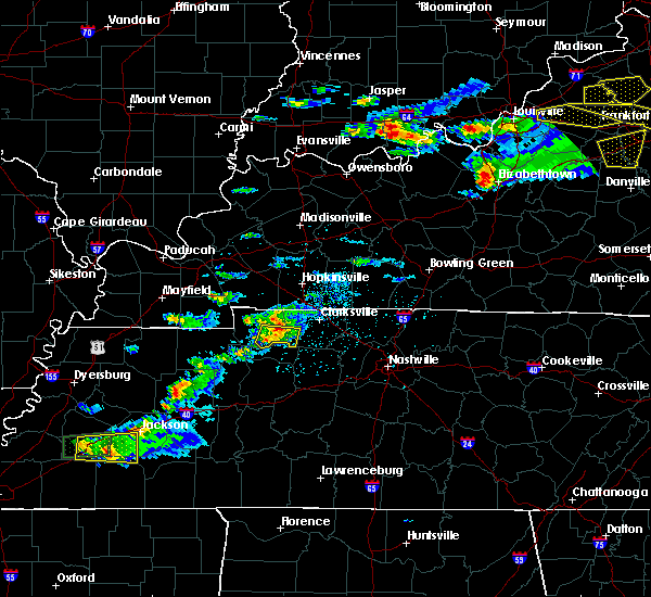 At 312 pm cdt, a severe thunderstorm was located 8 miles southeast of big rock, or 9 miles east of dover, moving east at 25 mph (radar indicated). Hazards include 60 mph wind gusts and quarter size hail. Hail damage to vehicles is expected. expect wind damage to roofs, siding, and trees. Locations impacted include, cumberland city and indian mound. At 312 pm cdt, a severe thunderstorm was located 8 miles southeast of big rock, or 9 miles east of dover, moving east at 25 mph (radar indicated). Hazards include 60 mph wind gusts and quarter size hail. Hail damage to vehicles is expected. expect wind damage to roofs, siding, and trees. Locations impacted include, cumberland city and indian mound.
|
| 5/1/2016 2:56 PM CDT |
 At 256 pm cdt, a severe thunderstorm was located near dover, moving east at 25 mph (radar indicated). Hazards include 60 mph wind gusts and quarter size hail. Hail damage to vehicles is expected. Expect wind damage to roofs, siding, and trees. At 256 pm cdt, a severe thunderstorm was located near dover, moving east at 25 mph (radar indicated). Hazards include 60 mph wind gusts and quarter size hail. Hail damage to vehicles is expected. Expect wind damage to roofs, siding, and trees.
|
| 4/27/2016 5:14 PM CDT |
 At 514 pm cdt, severe thunderstorms were located along a line extending from big rock to 11 miles south of clarksville, moving northeast at 40 mph (radar indicated). Hazards include 60 mph wind gusts and penny size hail. Expect damage to roofs. siding. and trees. Locations impacted include, dover, clarksville, big rock, cumberland city, palmyra, woodlawn, indian mound and cunningham. At 514 pm cdt, severe thunderstorms were located along a line extending from big rock to 11 miles south of clarksville, moving northeast at 40 mph (radar indicated). Hazards include 60 mph wind gusts and penny size hail. Expect damage to roofs. siding. and trees. Locations impacted include, dover, clarksville, big rock, cumberland city, palmyra, woodlawn, indian mound and cunningham.
|
| 4/27/2016 4:54 PM CDT |
 At 453 pm cdt, severe thunderstorms were located along a line extending from 8 miles southwest of dover to 7 miles northeast of mcewen, moving northeast at 40 mph (radar indicated). Hazards include 60 mph wind gusts and quarter size hail. Hail damage to vehicles is expected. Expect wind damage to roofs, siding, and trees. At 453 pm cdt, severe thunderstorms were located along a line extending from 8 miles southwest of dover to 7 miles northeast of mcewen, moving northeast at 40 mph (radar indicated). Hazards include 60 mph wind gusts and quarter size hail. Hail damage to vehicles is expected. Expect wind damage to roofs, siding, and trees.
|
| 4/27/2016 4:44 PM CDT |
 At 444 pm cdt, a severe thunderstorm was located near erin, moving northeast at 45 mph (radar indicated). Hazards include 60 mph wind gusts and quarter size hail. Hail damage to vehicles is expected. expect wind damage to roofs, siding, and trees. Locations impacted include, waverly, erin, mcewen, tennessee ridge, cumberland city and houston county airport. At 444 pm cdt, a severe thunderstorm was located near erin, moving northeast at 45 mph (radar indicated). Hazards include 60 mph wind gusts and quarter size hail. Hail damage to vehicles is expected. expect wind damage to roofs, siding, and trees. Locations impacted include, waverly, erin, mcewen, tennessee ridge, cumberland city and houston county airport.
|
| 4/27/2016 4:31 PM CDT |
 At 431 pm cdt, a severe thunderstorm was located over waverly, moving northeast at 45 mph (radar indicated). Hazards include 60 mph wind gusts and quarter size hail. Hail damage to vehicles is expected. expect wind damage to roofs, siding, and trees. Locations impacted include, waverly, erin, new johnsonville, mcewen, tennessee ridge, hurricane mills, cumberland city and houston county airport. At 431 pm cdt, a severe thunderstorm was located over waverly, moving northeast at 45 mph (radar indicated). Hazards include 60 mph wind gusts and quarter size hail. Hail damage to vehicles is expected. expect wind damage to roofs, siding, and trees. Locations impacted include, waverly, erin, new johnsonville, mcewen, tennessee ridge, hurricane mills, cumberland city and houston county airport.
|
| 4/27/2016 4:24 PM CDT |
 At 424 pm cdt, a severe thunderstorm was located near new johnsonville, or near waverly, moving northeast at 40 mph (radar indicated). Hazards include 60 mph wind gusts and quarter size hail. Hail damage to vehicles is expected. Expect wind damage to roofs, siding, and trees. At 424 pm cdt, a severe thunderstorm was located near new johnsonville, or near waverly, moving northeast at 40 mph (radar indicated). Hazards include 60 mph wind gusts and quarter size hail. Hail damage to vehicles is expected. Expect wind damage to roofs, siding, and trees.
|
| 4/26/2016 8:11 PM CDT |
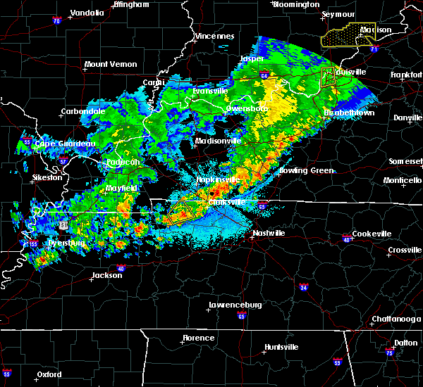 The severe thunderstorm warning for eastern stewart and west central montgomery counties will expire at 815 pm cdt, the storm which prompted the warning has weakened below severe limits, and no longer pose an immediate threat to life or property. therefore the warning will be allowed to expire. The severe thunderstorm warning for eastern stewart and west central montgomery counties will expire at 815 pm cdt, the storm which prompted the warning has weakened below severe limits, and no longer pose an immediate threat to life or property. therefore the warning will be allowed to expire.
|
| 4/26/2016 7:50 PM CDT |
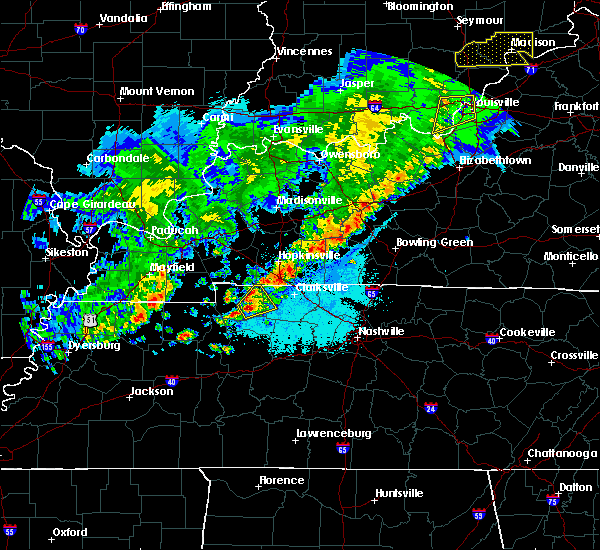 At 750 pm cdt, a severe thunderstorm was located near dover, moving northeast at 15 mph (radar indicated). Hazards include 60 mph wind gusts and quarter size hail. Hail damage to vehicles is expected. Expect wind damage to roofs, siding, and trees. At 750 pm cdt, a severe thunderstorm was located near dover, moving northeast at 15 mph (radar indicated). Hazards include 60 mph wind gusts and quarter size hail. Hail damage to vehicles is expected. Expect wind damage to roofs, siding, and trees.
|
| 10/12/2015 6:27 PM CDT | The severe thunderstorm warning for eastern stewart and montgomery counties will expire at 630 pm cdt, the storms which prompted the warning have weakened below severe limits, and no longer pose an immediate threat to life or property. therefore the warning will be allowed to expire. however gusty winds of 30 to 40 mph are still possible with these thunderstorms. |
| 10/12/2015 6:15 PM CDT |
 At 614 pm cdt, severe thunderstorms were located along a line extending from near fort campbell to dover, moving east at 50 mph (radar indicated). Hazards include 60 mph wind gusts and penny size hail. Expect damage to roofs. siding and trees. Locations impacted include, dover, clarksville, big rock, cumberland city, palmyra, woodlawn, cunningham and indian mound. At 614 pm cdt, severe thunderstorms were located along a line extending from near fort campbell to dover, moving east at 50 mph (radar indicated). Hazards include 60 mph wind gusts and penny size hail. Expect damage to roofs. siding and trees. Locations impacted include, dover, clarksville, big rock, cumberland city, palmyra, woodlawn, cunningham and indian mound.
|
| 10/12/2015 5:59 PM CDT |
 At 558 pm cdt, severe thunderstorms were located along a line extending from near big rock to near paris landing state park, moving east at 50 mph (radar indicated). Hazards include 60 mph wind gusts and quarter size hail. Hail damage to vehicles is expected. Expect wind damage to roofs, siding and trees. At 558 pm cdt, severe thunderstorms were located along a line extending from near big rock to near paris landing state park, moving east at 50 mph (radar indicated). Hazards include 60 mph wind gusts and quarter size hail. Hail damage to vehicles is expected. Expect wind damage to roofs, siding and trees.
|
| 10/13/2014 5:40 PM CDT | Golf Ball sized hail reported 6 miles NW of Cumberland City, TN, golf ball size hail with damage to vehicles |
| 7/18/2012 4:40 PM CDT | Trees down on lewis atkins road in the indian mound communit in montgomery county TN, 7.9 miles SSW of Cumberland City, TN |
| 5/29/2012 5:10 PM CDT | A tree was downed in cumberland cit in stewart county TN, 0.8 miles NNE of Cumberland City, TN |
| 1/1/0001 12:00 AM | Power lines were reported to have been peeled off a home in the southeastern part of the count in stewart county TN, 4.9 miles E of Cumberland City, TN |
| 1/1/0001 12:00 AM | Trees dow in stewart county TN, 0.8 miles NNE of Cumberland City, TN |
Hail Maps for Cumberland City, TN


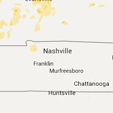


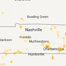


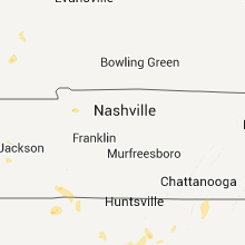


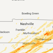

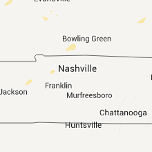
Connect with Interactive Hail Maps