

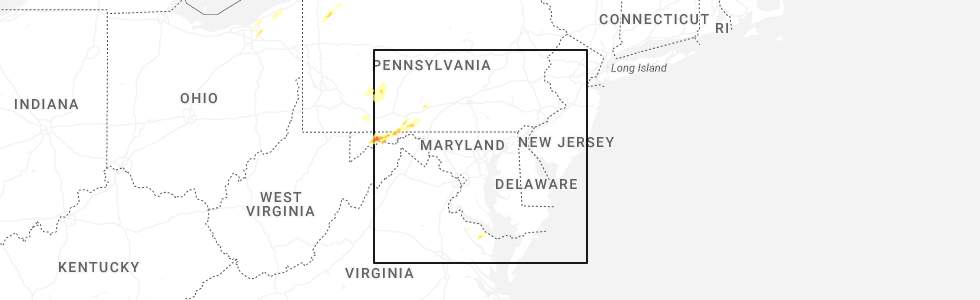
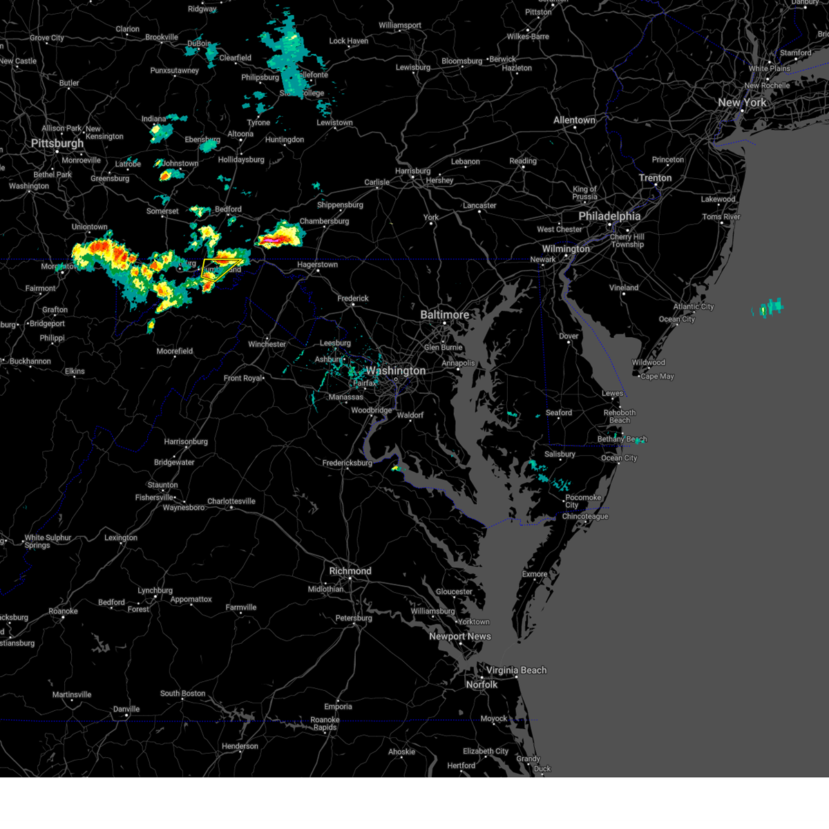
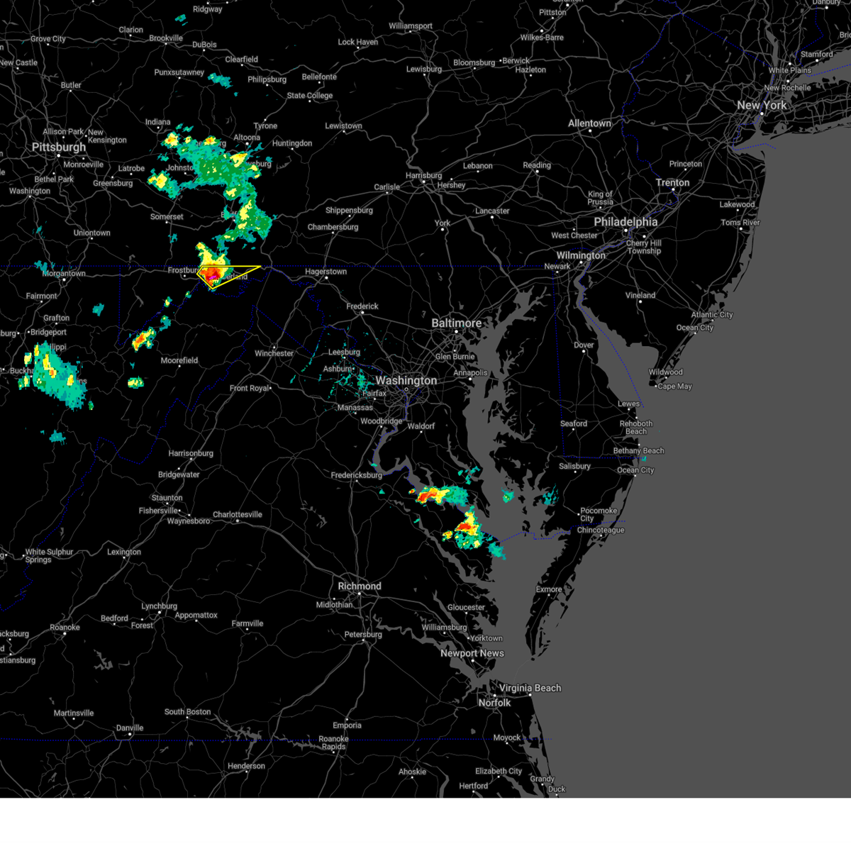
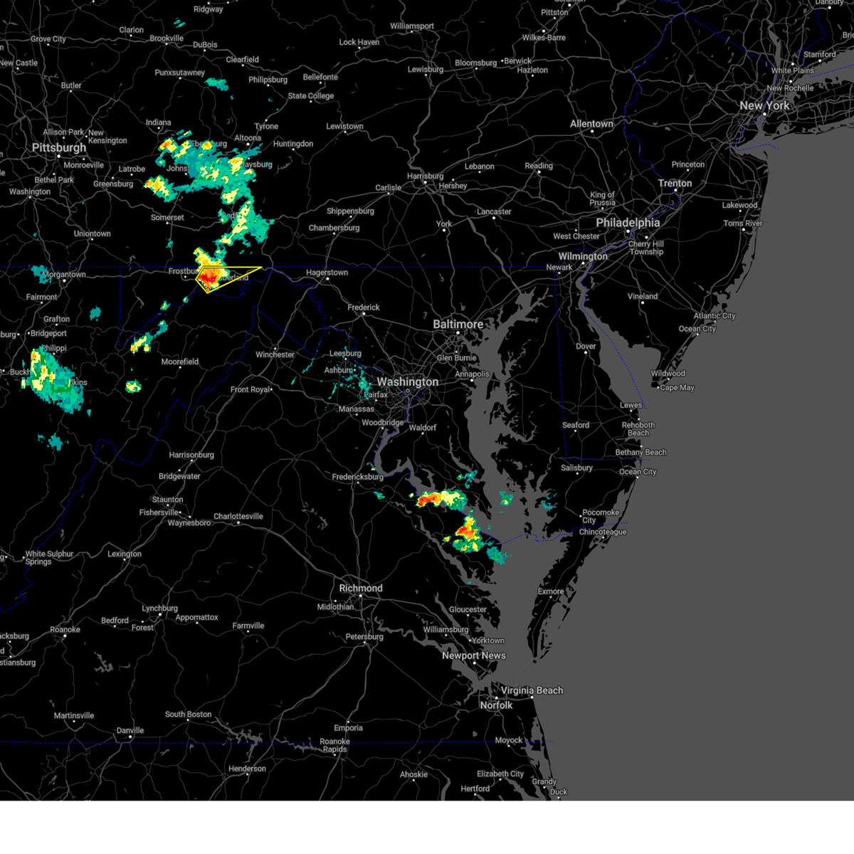
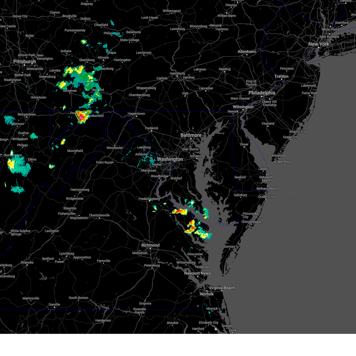
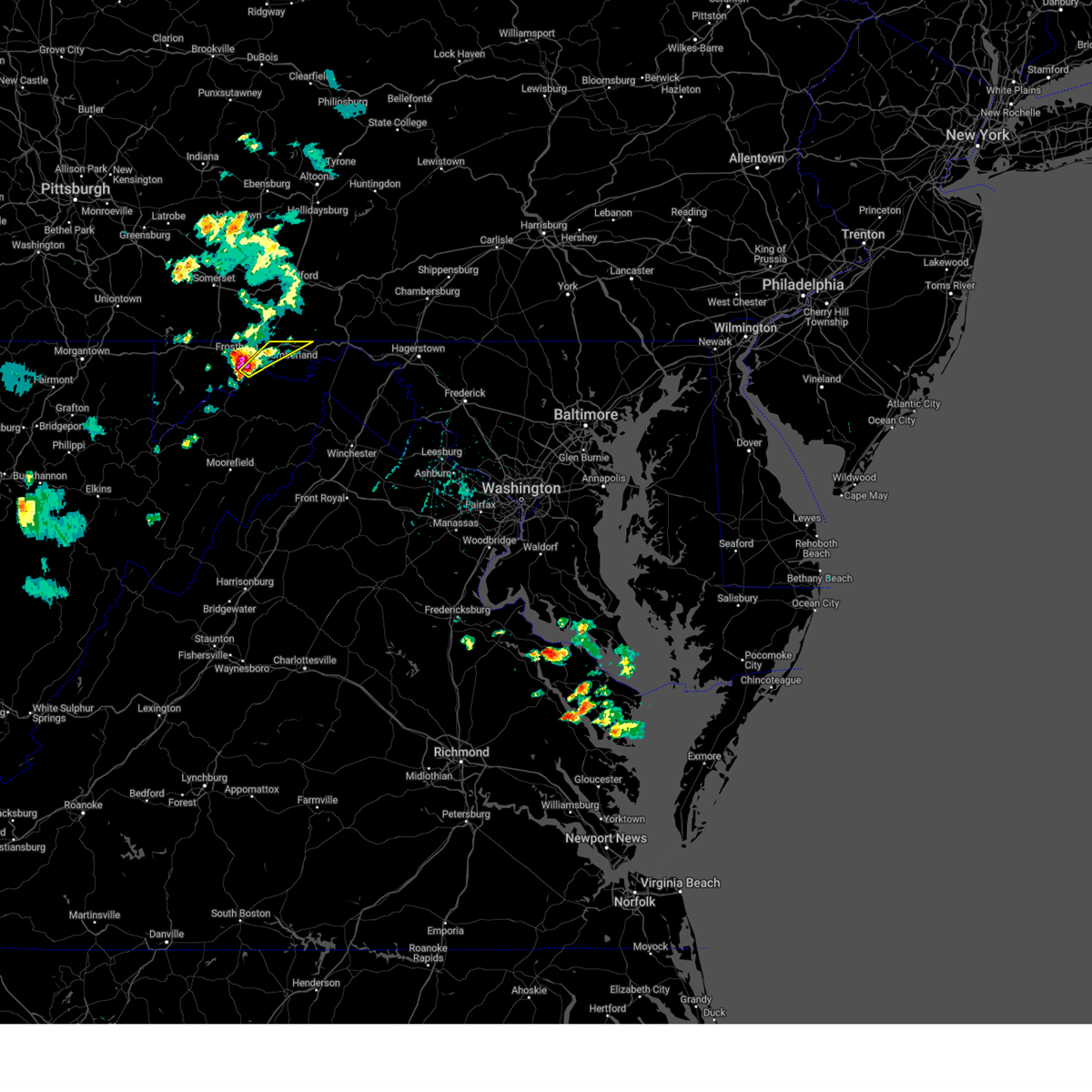
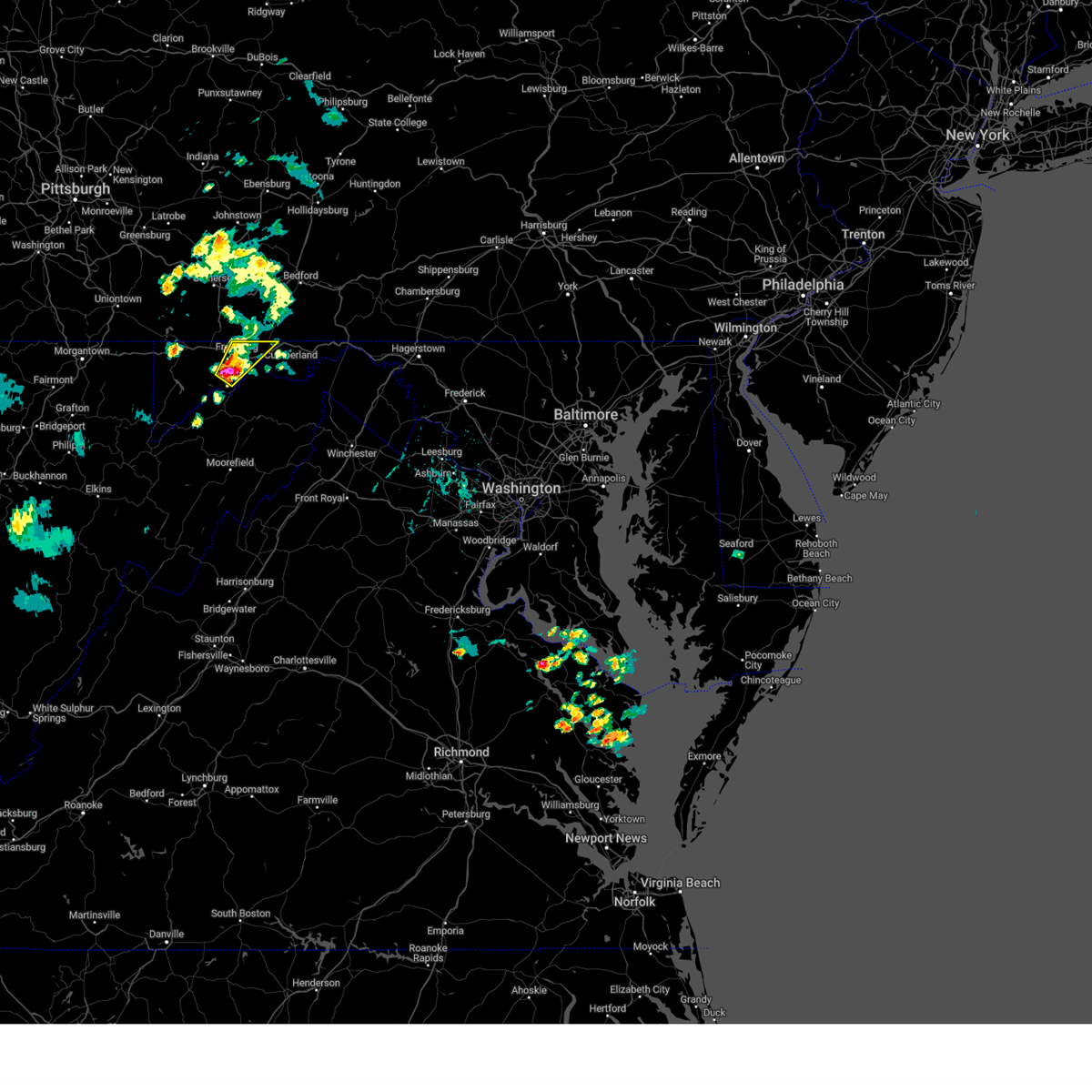
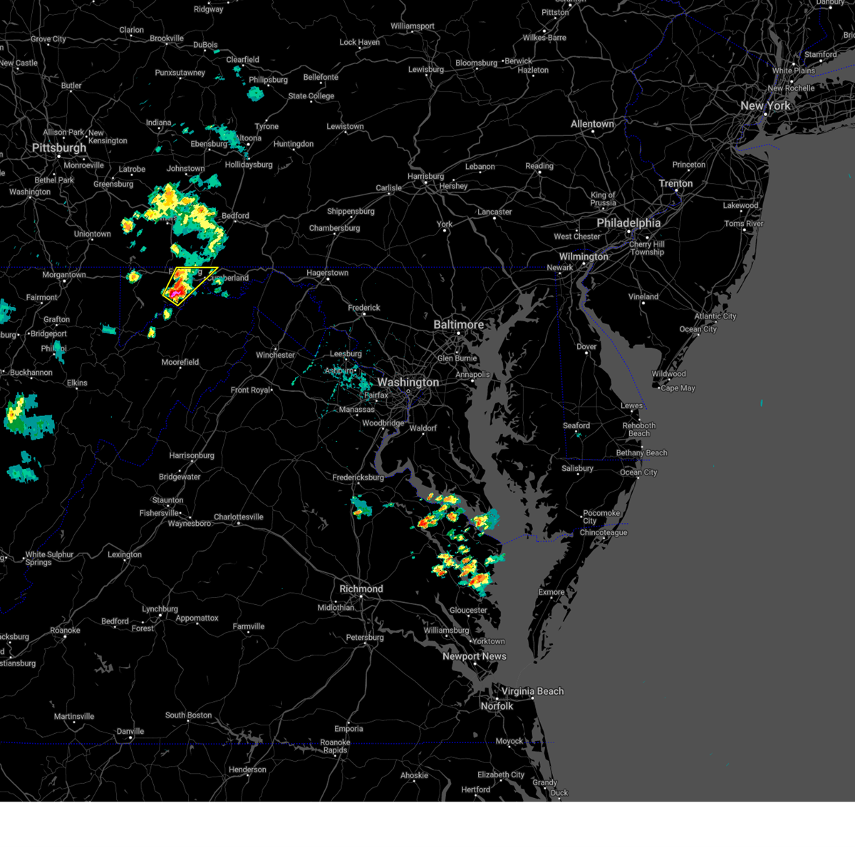
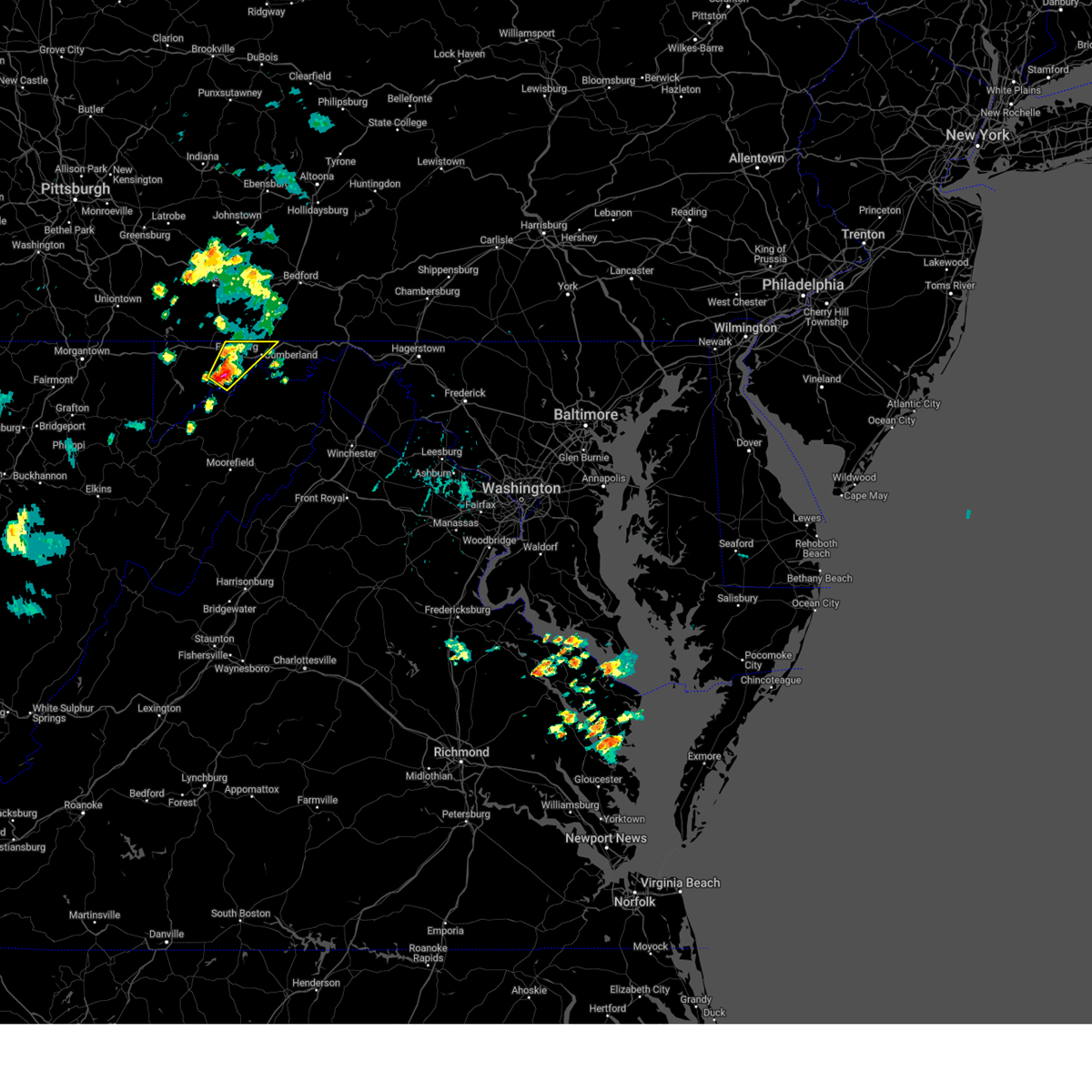
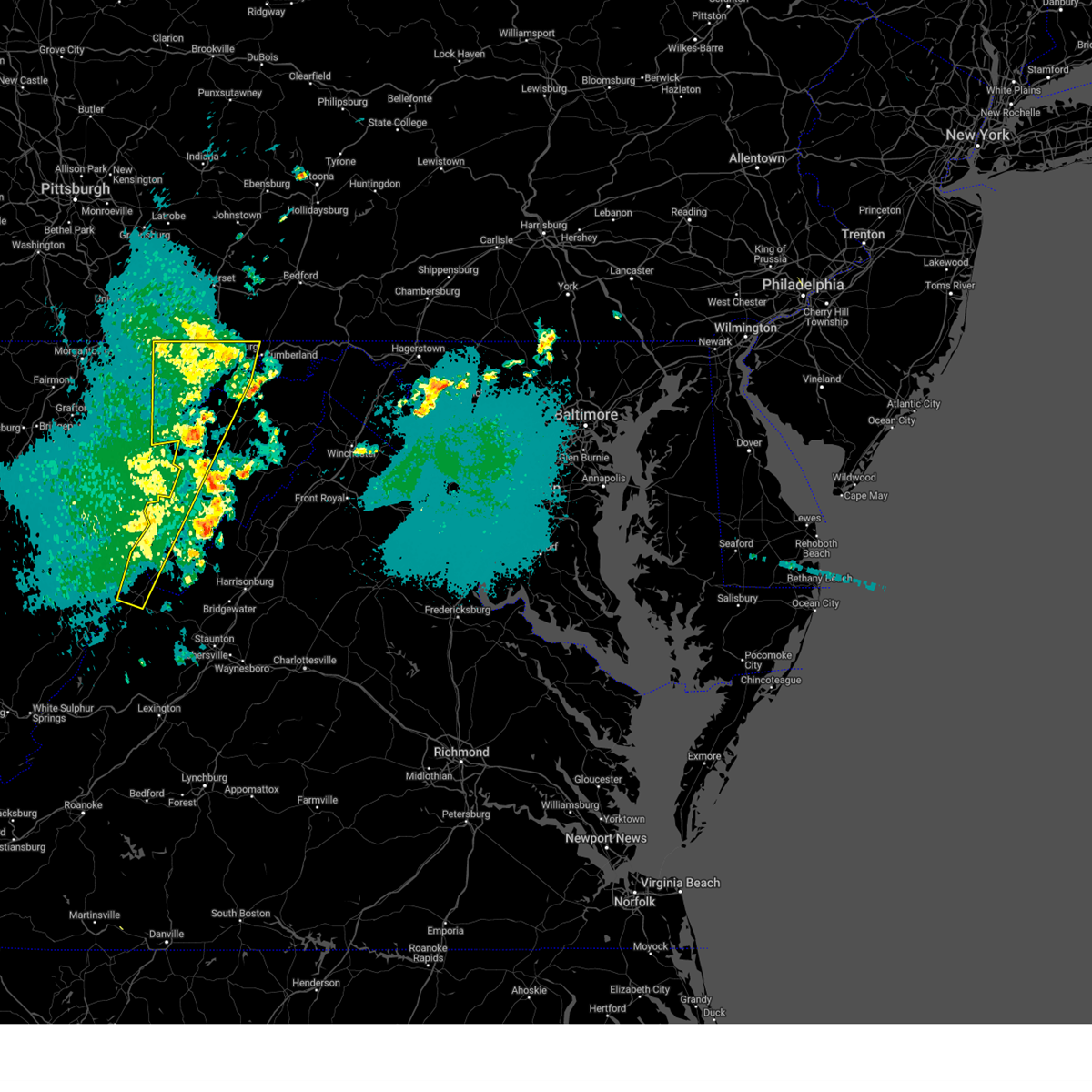
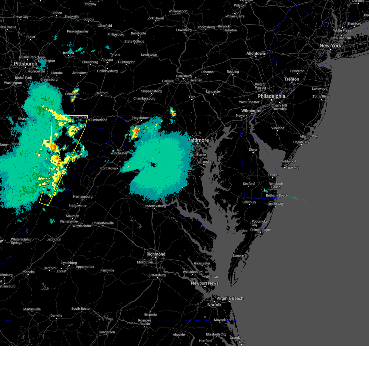
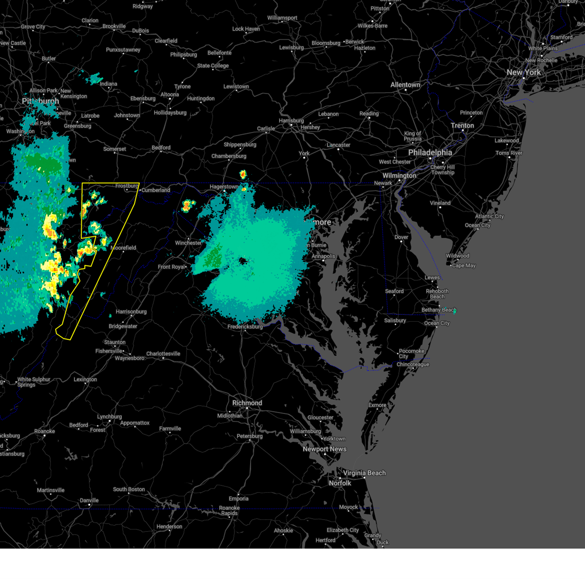
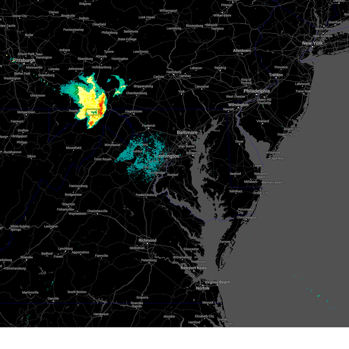
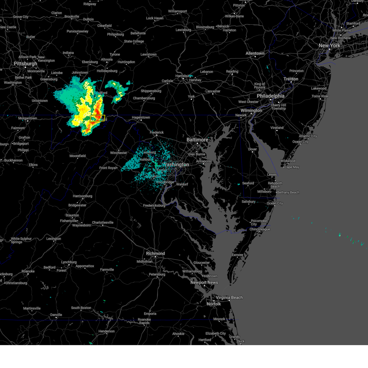
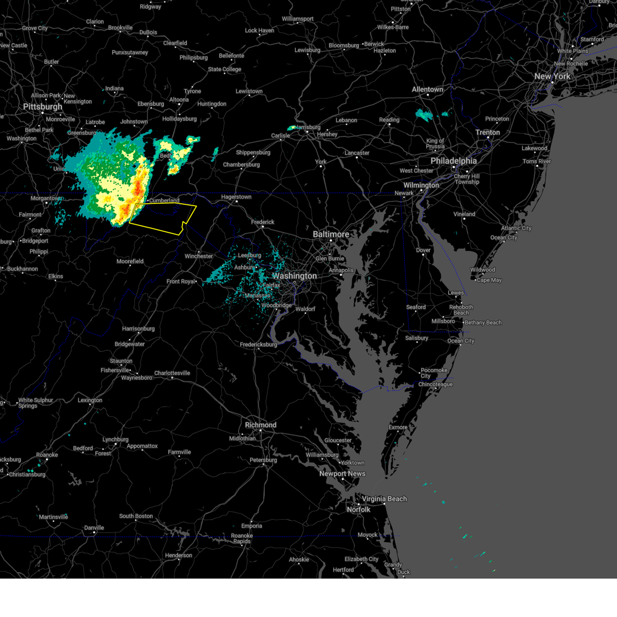
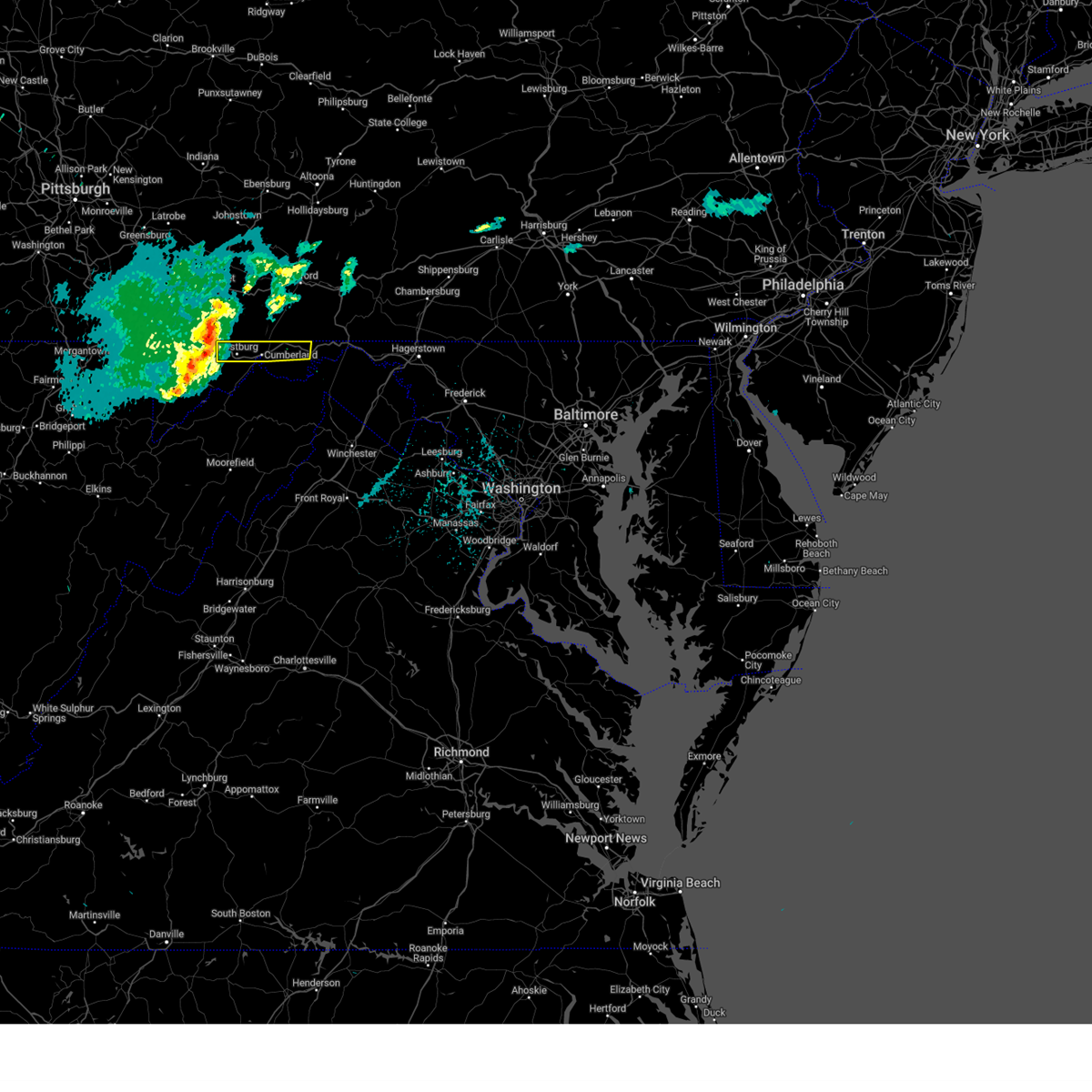
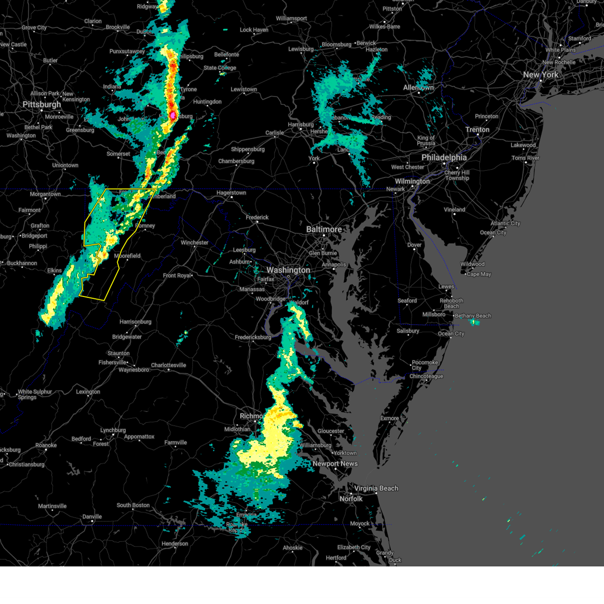
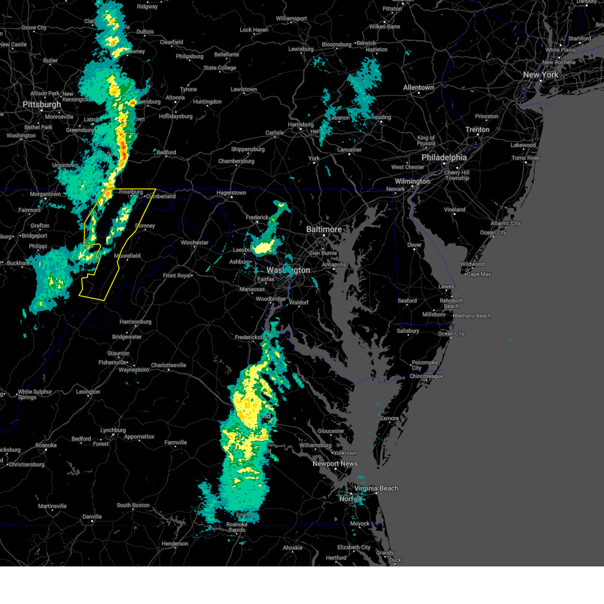
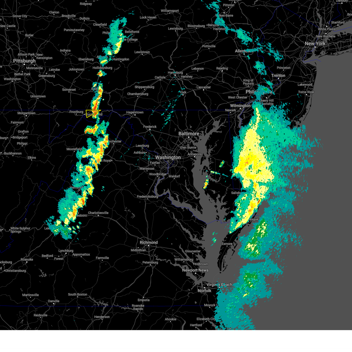
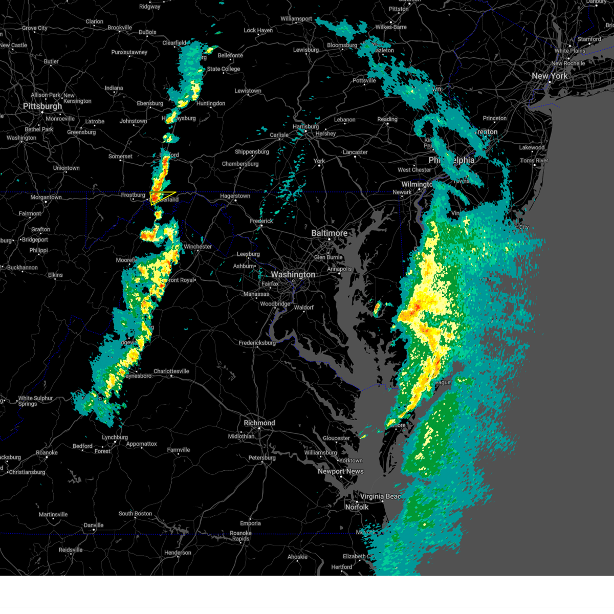
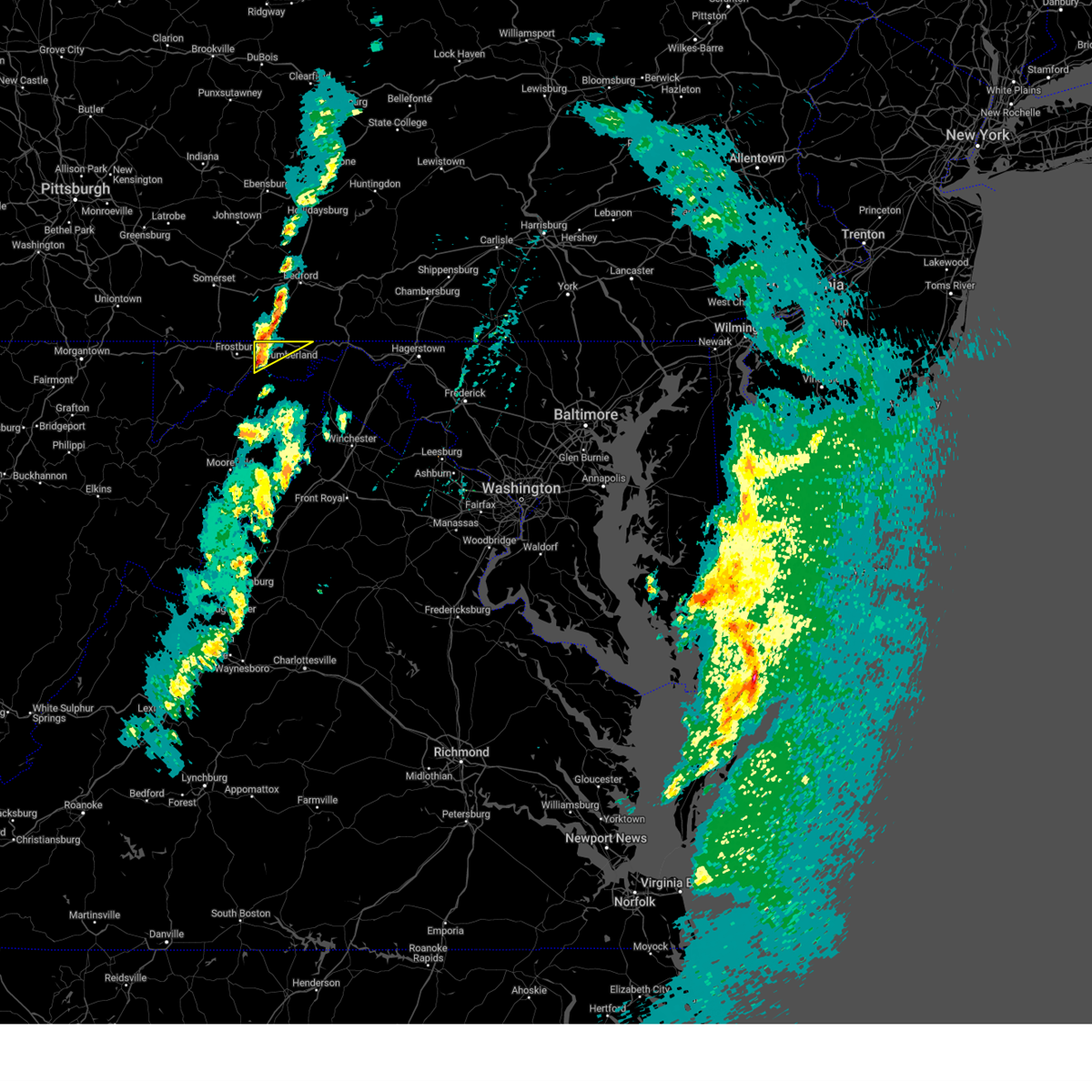
Hail Map for Cumberland, MD
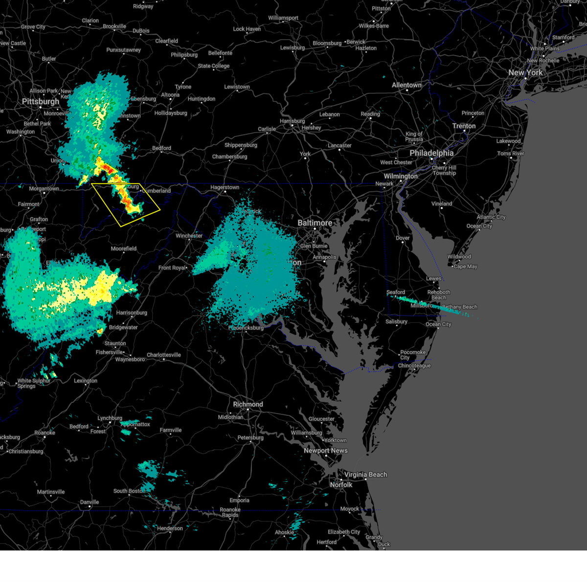
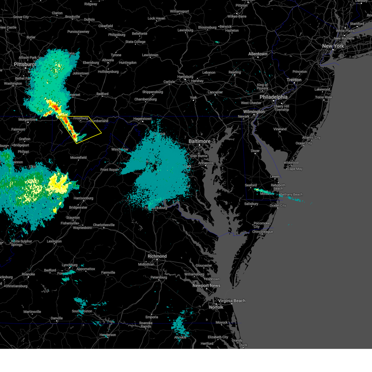
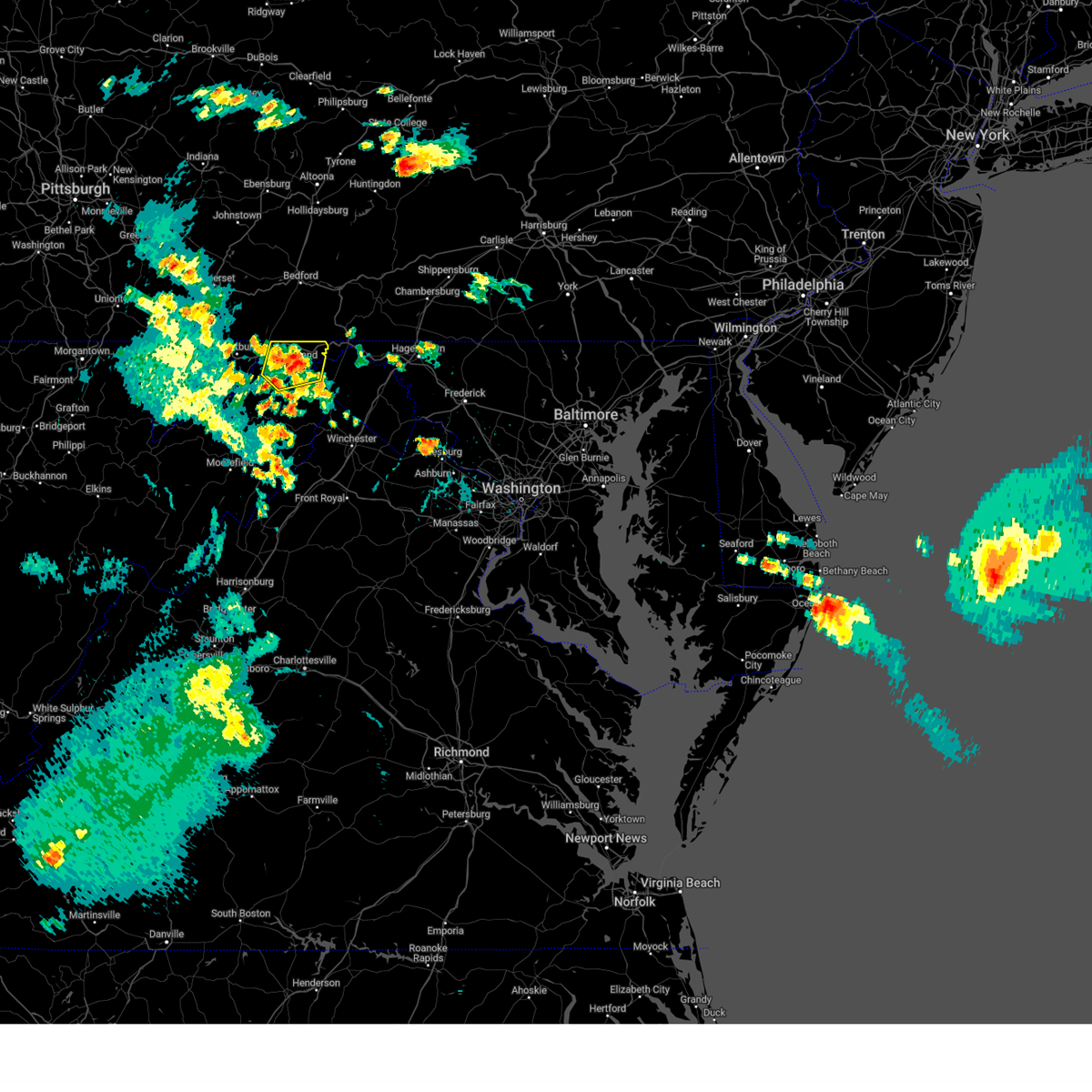
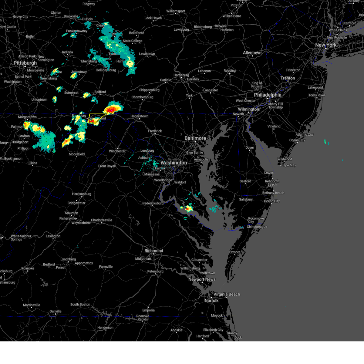
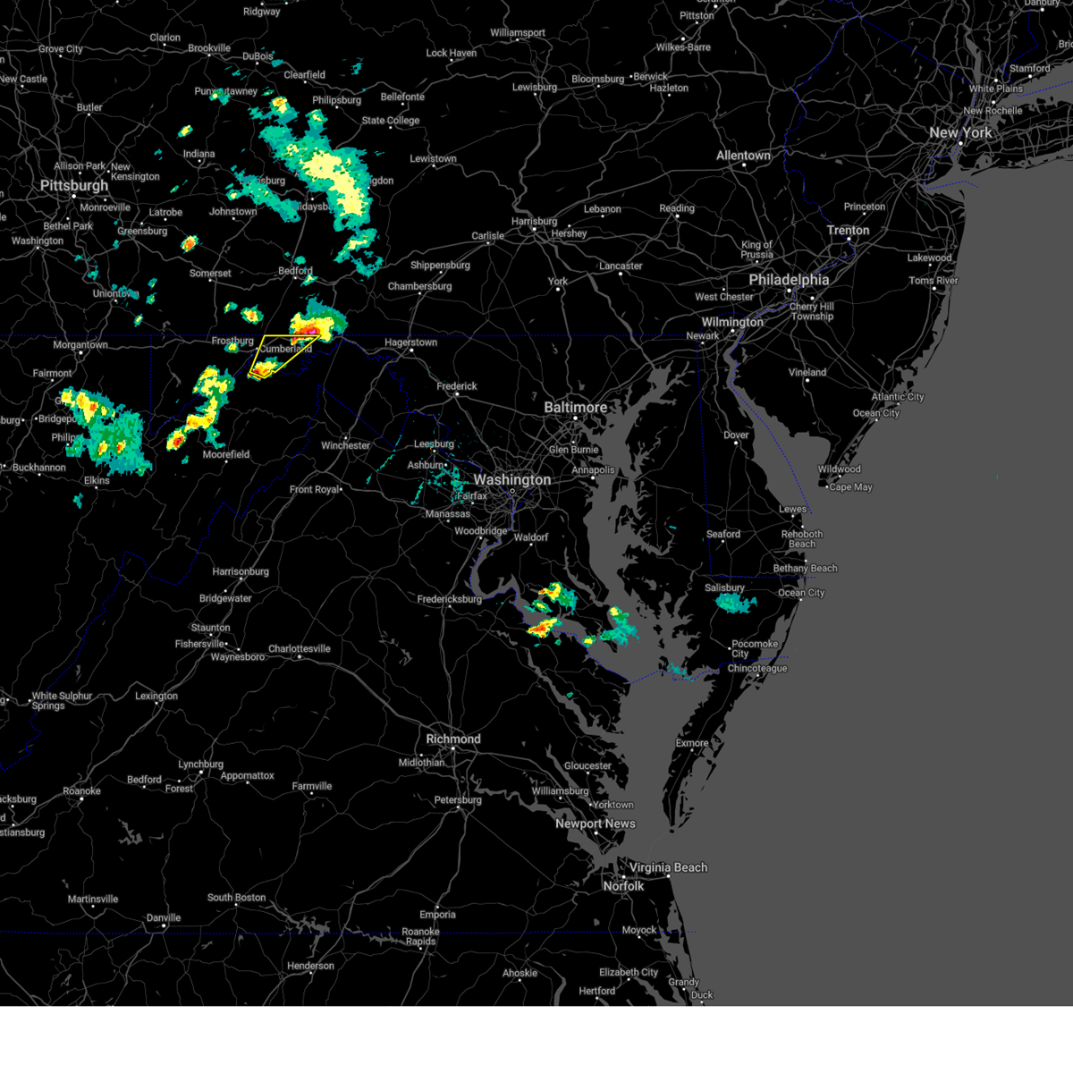
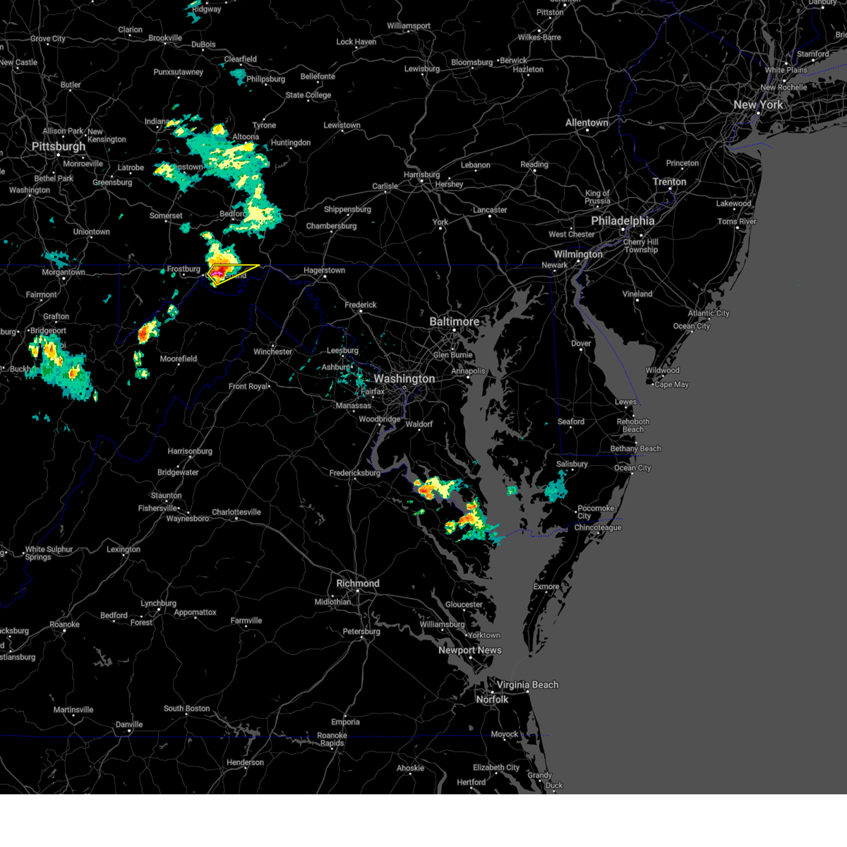
The Cumberland, MD area has had 16 reports of on-the-ground hail by trained spotters, and has been under severe weather warnings 42 times during the past 12 months. Doppler radar has detected hail at or near Cumberland, MD on 33 occasions, including 3 occasions during the past year.
| Name: | Cumberland, MD |
| Where Located: | 77.2 miles NE of Elkins, WV |
| Map: | Google Map for Cumberland, MD |
| Population: | 20859 |
| Housing Units: | 10914 |
| More Info: | Search Google for Cumberland, MD |
5
The Top Recent Hail Date for Cumberland, MD is Thursday, May 1, 2025 (1st out of 33)
Hail and Wind Damage Spotted near Cumberland, MD
| Date / Time | Report Details |
|---|---|
| 5/30/2025 7:00 PM EDT | Tree down along oldtown road in far eastern allegany c in allegany county MD, 0.5 miles ENE of Cumberland, MD |
| 5/17/2025 1:59 AM EDT |
 The storms which prompted the warning have weakened below severe limits, and no longer pose an immediate threat to life or property. therefore, the warning will be allowed to expire. The storms which prompted the warning have weakened below severe limits, and no longer pose an immediate threat to life or property. therefore, the warning will be allowed to expire.
|
| 5/17/2025 1:46 AM EDT |
 the severe thunderstorm warning has been cancelled and is no longer in effect the severe thunderstorm warning has been cancelled and is no longer in effect
|
| 5/17/2025 1:46 AM EDT |
 At 145 am edt, severe thunderstorms were located along a line extending from near ursina to near keyser, moving east at 55 mph (radar indicated). Hazards include 60 mph wind gusts and quarter size hail. Damaging winds will cause some trees and large branches to fall. this could injure those outdoors, as well as damage homes and vehicles. roadways may become blocked by downed trees. localized power outages are possible. unsecured light objects may become projectiles. Locations impacted include, potomac park, franklin, lonaconing, keyser, dogwood flats, fort ashby, bittinger, new creek, short gap, north branch, mccoole, brady, oldtown, big run state park, piney grove, ridgeville, cresaptown, merrill, rawlings, and spring gap. At 145 am edt, severe thunderstorms were located along a line extending from near ursina to near keyser, moving east at 55 mph (radar indicated). Hazards include 60 mph wind gusts and quarter size hail. Damaging winds will cause some trees and large branches to fall. this could injure those outdoors, as well as damage homes and vehicles. roadways may become blocked by downed trees. localized power outages are possible. unsecured light objects may become projectiles. Locations impacted include, potomac park, franklin, lonaconing, keyser, dogwood flats, fort ashby, bittinger, new creek, short gap, north branch, mccoole, brady, oldtown, big run state park, piney grove, ridgeville, cresaptown, merrill, rawlings, and spring gap.
|
| 5/17/2025 1:34 AM EDT | Svrlwx the national weather service in sterling virginia has issued a * severe thunderstorm warning for, western allegany county in western maryland, garrett county in western maryland, north central grant county in eastern west virginia, mineral county in eastern west virginia, north central hampshire county in eastern west virginia, * until 200 am edt. * at 134 am edt, severe thunderstorms were located along a line extending from 6 miles north of friendsville to near keyser, moving east at 55 mph (radar indicated). Hazards include 60 mph wind gusts. Damaging winds will cause some trees and large branches to fall. this could injure those outdoors, as well as damage homes and vehicles. roadways may become blocked by downed trees. localized power outages are possible. Unsecured light objects may become projectiles. |
| 5/16/2025 3:42 PM EDT |
 At 342 pm edt, a severe thunderstorm was located near paw paw, moving east at 40 mph (radar indicated). Hazards include 60 mph wind gusts and quarter size hail. Damaging winds will cause some trees and large branches to fall. this could injure those outdoors, as well as damage homes and vehicles. roadways may become blocked by downed trees. localized power outages are possible. unsecured light objects may become projectiles. Locations impacted include, flintstone, patterson creek, lineburg, pleasant valley, spring gap, green spring, wagoner, pumpkin center, north branch, magnolia, little orleans, oldtown, bellegrove, paw paw, green ridge, wiley ford, and cumberland. At 342 pm edt, a severe thunderstorm was located near paw paw, moving east at 40 mph (radar indicated). Hazards include 60 mph wind gusts and quarter size hail. Damaging winds will cause some trees and large branches to fall. this could injure those outdoors, as well as damage homes and vehicles. roadways may become blocked by downed trees. localized power outages are possible. unsecured light objects may become projectiles. Locations impacted include, flintstone, patterson creek, lineburg, pleasant valley, spring gap, green spring, wagoner, pumpkin center, north branch, magnolia, little orleans, oldtown, bellegrove, paw paw, green ridge, wiley ford, and cumberland.
|
| 5/16/2025 3:37 PM EDT | Tree down near the 800 block of shades lan in allegany county MD, 0.5 miles S of Cumberland, MD |
| 5/16/2025 3:33 PM EDT | Svrlwx the national weather service in sterling virginia has issued a * severe thunderstorm warning for, allegany county in western maryland, northwestern morgan county in the panhandle of west virginia, northeastern mineral county in eastern west virginia, north central hampshire county in eastern west virginia, * until 400 pm edt. * at 333 pm edt, a severe thunderstorm was located near cumberland, moving east at 40 mph (radar indicated). Hazards include 60 mph wind gusts and quarter size hail. Damaging winds will cause some trees and large branches to fall. this could injure those outdoors, as well as damage homes and vehicles. roadways may become blocked by downed trees. localized power outages are possible. Unsecured light objects may become projectiles. |
| 5/1/2025 6:01 PM EDT |
 The storm which prompted the warning has moved out of the area. therefore, the warning has been allowed to expire. to report severe weather, contact your nearest law enforcement agency. they will relay your report to the national weather service sterling virginia. The storm which prompted the warning has moved out of the area. therefore, the warning has been allowed to expire. to report severe weather, contact your nearest law enforcement agency. they will relay your report to the national weather service sterling virginia.
|
| 5/1/2025 5:35 PM EDT | Golf Ball sized hail reported 5.3 miles NNW of Cumberland, MD |
| 5/1/2025 5:35 PM EDT |
 At 535 pm edt, a severe thunderstorm was located near cumberland, moving northeast at 20 mph (radar indicated). Hazards include 60 mph wind gusts and quarter size hail. Damaging winds will cause some trees and large branches to fall. this could injure those outdoors, as well as damage homes and vehicles. roadways may become blocked by downed trees. localized power outages are possible. unsecured light objects may become projectiles. Locations impacted include, pumpkin center, flintstone, pleasant valley, wiley ford, and cumberland. At 535 pm edt, a severe thunderstorm was located near cumberland, moving northeast at 20 mph (radar indicated). Hazards include 60 mph wind gusts and quarter size hail. Damaging winds will cause some trees and large branches to fall. this could injure those outdoors, as well as damage homes and vehicles. roadways may become blocked by downed trees. localized power outages are possible. unsecured light objects may become projectiles. Locations impacted include, pumpkin center, flintstone, pleasant valley, wiley ford, and cumberland.
|
| 5/1/2025 5:30 PM EDT | Ping Pong Ball sized hail reported 6.1 miles NNW of Cumberland, MD, ping pong ball sized hail observed 6 miles se of cumberland... md. |
| 5/1/2025 5:25 PM EDT | Quarter sized hail reported 4.4 miles NNW of Cumberland, MD |
| 5/1/2025 5:13 PM EDT |
 Svrlwx the national weather service in sterling virginia has issued a * severe thunderstorm warning for, northeastern allegany county in western maryland, northeastern mineral county in eastern west virginia, * until 600 pm edt. * at 513 pm edt, a severe thunderstorm was located near fort ashby, or near bel air, moving northeast at 25 mph (radar indicated). Hazards include 60 mph wind gusts and quarter size hail. Damaging winds will cause some trees and large branches to fall. this could injure those outdoors, as well as damage homes and vehicles. roadways may become blocked by downed trees. localized power outages are possible. Unsecured light objects may become projectiles. Svrlwx the national weather service in sterling virginia has issued a * severe thunderstorm warning for, northeastern allegany county in western maryland, northeastern mineral county in eastern west virginia, * until 600 pm edt. * at 513 pm edt, a severe thunderstorm was located near fort ashby, or near bel air, moving northeast at 25 mph (radar indicated). Hazards include 60 mph wind gusts and quarter size hail. Damaging winds will cause some trees and large branches to fall. this could injure those outdoors, as well as damage homes and vehicles. roadways may become blocked by downed trees. localized power outages are possible. Unsecured light objects may become projectiles.
|
| 5/1/2025 4:48 PM EDT | Quarter sized hail reported 6.3 miles WSW of Cumberland, MD, quarter sized hail estimated near rocky gap state park. |
| 5/1/2025 4:46 PM EDT |
 the severe thunderstorm warning has been cancelled and is no longer in effect the severe thunderstorm warning has been cancelled and is no longer in effect
|
| 5/1/2025 4:46 PM EDT |
 At 446 pm edt, a severe thunderstorm was located 7 miles southeast of lake gordon, or 10 miles east of cumberland, moving east at 25 mph (radar indicated). Hazards include 60 mph wind gusts and quarter size hail. Damaging winds will cause some trees and large branches to fall. this could injure those outdoors, as well as damage homes and vehicles. roadways may become blocked by downed trees. localized power outages are possible. unsecured light objects may become projectiles. Locations impacted include, bellegrove, pumpkin center, flintstone, pleasant valley, and cumberland. At 446 pm edt, a severe thunderstorm was located 7 miles southeast of lake gordon, or 10 miles east of cumberland, moving east at 25 mph (radar indicated). Hazards include 60 mph wind gusts and quarter size hail. Damaging winds will cause some trees and large branches to fall. this could injure those outdoors, as well as damage homes and vehicles. roadways may become blocked by downed trees. localized power outages are possible. unsecured light objects may become projectiles. Locations impacted include, bellegrove, pumpkin center, flintstone, pleasant valley, and cumberland.
|
| 5/1/2025 4:34 PM EDT |
 At 433 pm edt, a severe thunderstorm was located near cumberland, moving east at 25 mph (radar indicated). Hazards include golf ball size hail and 60 mph wind gusts. Expect wind damage to trees and power lines. hail is large enough to dent and damage vehicles. some hail damage to roofs, siding, and windows is possible. Locations impacted include, wolfe mill, flintstone, pleasant valley, bellegrove, ridgeley, pumpkin center, cumberland, corriganville, wiley ford, and la vale. At 433 pm edt, a severe thunderstorm was located near cumberland, moving east at 25 mph (radar indicated). Hazards include golf ball size hail and 60 mph wind gusts. Expect wind damage to trees and power lines. hail is large enough to dent and damage vehicles. some hail damage to roofs, siding, and windows is possible. Locations impacted include, wolfe mill, flintstone, pleasant valley, bellegrove, ridgeley, pumpkin center, cumberland, corriganville, wiley ford, and la vale.
|
| 5/1/2025 4:27 PM EDT |
 Svrlwx the national weather service in sterling virginia has issued a * severe thunderstorm warning for, northwestern washington county in north central maryland, northeastern allegany county in western maryland, northeastern mineral county in eastern west virginia, * until 515 pm edt. * at 427 pm edt, a severe thunderstorm was located over cumberland, moving east at 25 mph (radar indicated). Hazards include 60 mph wind gusts and quarter size hail. Damaging winds will cause some trees and large branches to fall. this could injure those outdoors, as well as damage homes and vehicles. roadways may become blocked by downed trees. localized power outages are possible. Unsecured light objects may become projectiles. Svrlwx the national weather service in sterling virginia has issued a * severe thunderstorm warning for, northwestern washington county in north central maryland, northeastern allegany county in western maryland, northeastern mineral county in eastern west virginia, * until 515 pm edt. * at 427 pm edt, a severe thunderstorm was located over cumberland, moving east at 25 mph (radar indicated). Hazards include 60 mph wind gusts and quarter size hail. Damaging winds will cause some trees and large branches to fall. this could injure those outdoors, as well as damage homes and vehicles. roadways may become blocked by downed trees. localized power outages are possible. Unsecured light objects may become projectiles.
|
| 5/1/2025 4:26 PM EDT | Several trees down in the cumberland are in allegany county MD, 0.5 miles ENE of Cumberland, MD |
| 5/1/2025 4:25 PM EDT | Quarter sized hail reported 1 miles E of Cumberland, MD, quarter sized hail observed on i-68 west of cumberland. |
| 5/1/2025 4:22 PM EDT | Tree down onto power lines near the intersection of nemacolin ave and cherrywood av in allegany county MD, 2.6 miles E of Cumberland, MD |
| 5/1/2025 4:19 PM EDT | Tree down near the intersection of orchard st and valley view dr in allegany county MD, 3.7 miles E of Cumberland, MD |
| 5/1/2025 4:15 PM EDT |
 At 415 pm edt, a severe thunderstorm was located over la vale, or near cumberland, moving northeast at 25 mph (radar indicated). Hazards include 60 mph wind gusts and quarter size hail. Damaging winds will cause some trees and large branches to fall. this could injure those outdoors, as well as damage homes and vehicles. roadways may become blocked by downed trees. localized power outages are possible. unsecured light objects may become projectiles. Locations impacted include, potomac park, ellerslie, cresaptown, la vale, bel air, eckhart mines, cumberland, mount savage, corriganville, frostburg, wolfe mill, ridgeley, brady, and wiley ford. At 415 pm edt, a severe thunderstorm was located over la vale, or near cumberland, moving northeast at 25 mph (radar indicated). Hazards include 60 mph wind gusts and quarter size hail. Damaging winds will cause some trees and large branches to fall. this could injure those outdoors, as well as damage homes and vehicles. roadways may become blocked by downed trees. localized power outages are possible. unsecured light objects may become projectiles. Locations impacted include, potomac park, ellerslie, cresaptown, la vale, bel air, eckhart mines, cumberland, mount savage, corriganville, frostburg, wolfe mill, ridgeley, brady, and wiley ford.
|
| 5/1/2025 4:05 PM EDT |
 Svrlwx the national weather service in sterling virginia has issued a * severe thunderstorm warning for, northwestern allegany county in western maryland, northeastern mineral county in eastern west virginia, * until 430 pm edt. * at 404 pm edt, a severe thunderstorm was located over bel air, moving northeast at 35 mph (radar indicated). Hazards include 60 mph wind gusts and quarter size hail. Damaging winds will cause some trees and large branches to fall. this could injure those outdoors, as well as damage homes and vehicles. roadways may become blocked by downed trees. localized power outages are possible. Unsecured light objects may become projectiles. Svrlwx the national weather service in sterling virginia has issued a * severe thunderstorm warning for, northwestern allegany county in western maryland, northeastern mineral county in eastern west virginia, * until 430 pm edt. * at 404 pm edt, a severe thunderstorm was located over bel air, moving northeast at 35 mph (radar indicated). Hazards include 60 mph wind gusts and quarter size hail. Damaging winds will cause some trees and large branches to fall. this could injure those outdoors, as well as damage homes and vehicles. roadways may become blocked by downed trees. localized power outages are possible. Unsecured light objects may become projectiles.
|
| 5/1/2025 3:56 PM EDT |
 At 356 pm edt, a severe thunderstorm was located over lonaconing, or near frostburg, moving northeast at 25 mph (radar indicated). Hazards include golf ball size hail and 60 mph wind gusts. Expect wind damage to trees and power lines. hail is large enough to dent and damage vehicles. some hail damage to roofs, siding, and windows is possible. Locations impacted include, potomac park, ellerslie, lonaconing, dogwood flats, cresaptown, la vale, bel air, eckhart mines, midlothian, cumberland, barton, mount savage, woodland, corriganville, frostburg, midland, wolfe mill, ridgeley, brady, and rawlings. At 356 pm edt, a severe thunderstorm was located over lonaconing, or near frostburg, moving northeast at 25 mph (radar indicated). Hazards include golf ball size hail and 60 mph wind gusts. Expect wind damage to trees and power lines. hail is large enough to dent and damage vehicles. some hail damage to roofs, siding, and windows is possible. Locations impacted include, potomac park, ellerslie, lonaconing, dogwood flats, cresaptown, la vale, bel air, eckhart mines, midlothian, cumberland, barton, mount savage, woodland, corriganville, frostburg, midland, wolfe mill, ridgeley, brady, and rawlings.
|
| 5/1/2025 3:51 PM EDT |
 At 351 pm edt, a severe thunderstorm was located over lonaconing, or near frostburg, moving northeast at 25 mph (radar indicated). Hazards include 60 mph wind gusts and half dollar size hail. Damaging winds will cause some trees and large branches to fall. this could injure those outdoors, as well as damage homes and vehicles. roadways may become blocked by downed trees. localized power outages are possible. unsecured light objects may become projectiles. Locations impacted include, potomac park, ellerslie, lonaconing, dogwood flats, cresaptown, la vale, bel air, reynolds, eckhart mines, midlothian, cumberland, barton, mount savage, woodland, corriganville, frostburg, midland, wolfe mill, ridgeley, and brady. At 351 pm edt, a severe thunderstorm was located over lonaconing, or near frostburg, moving northeast at 25 mph (radar indicated). Hazards include 60 mph wind gusts and half dollar size hail. Damaging winds will cause some trees and large branches to fall. this could injure those outdoors, as well as damage homes and vehicles. roadways may become blocked by downed trees. localized power outages are possible. unsecured light objects may become projectiles. Locations impacted include, potomac park, ellerslie, lonaconing, dogwood flats, cresaptown, la vale, bel air, reynolds, eckhart mines, midlothian, cumberland, barton, mount savage, woodland, corriganville, frostburg, midland, wolfe mill, ridgeley, and brady.
|
| 5/1/2025 3:48 PM EDT |
 Svrlwx the national weather service in sterling virginia has issued a * severe thunderstorm warning for, northwestern allegany county in western maryland, northeastern garrett county in western maryland, northern mineral county in eastern west virginia, * until 430 pm edt. * at 348 pm edt, a severe thunderstorm was located over lonaconing, or near westernport, moving northeast at 25 mph (radar indicated). Hazards include 60 mph wind gusts and half dollar size hail. Damaging winds will cause some trees and large branches to fall. this could injure those outdoors, as well as damage homes and vehicles. roadways may become blocked by downed trees. localized power outages are possible. Unsecured light objects may become projectiles. Svrlwx the national weather service in sterling virginia has issued a * severe thunderstorm warning for, northwestern allegany county in western maryland, northeastern garrett county in western maryland, northern mineral county in eastern west virginia, * until 430 pm edt. * at 348 pm edt, a severe thunderstorm was located over lonaconing, or near westernport, moving northeast at 25 mph (radar indicated). Hazards include 60 mph wind gusts and half dollar size hail. Damaging winds will cause some trees and large branches to fall. this could injure those outdoors, as well as damage homes and vehicles. roadways may become blocked by downed trees. localized power outages are possible. Unsecured light objects may become projectiles.
|
| 4/30/2025 12:25 AM EDT |
 The storms which prompted the warning have weakened below severe limits, and no longer pose an immediate threat to life or property. therefore, the warning will be allowed to expire. however, gusty winds and heavy rain are still possible with these thunderstorms. The storms which prompted the warning have weakened below severe limits, and no longer pose an immediate threat to life or property. therefore, the warning will be allowed to expire. however, gusty winds and heavy rain are still possible with these thunderstorms.
|
| 4/30/2025 12:10 AM EDT |
 At 1210 am edt, severe thunderstorms were located along a line extending from near kitzmiller to 7 miles south of brandywine, moving east at 60 mph (radar indicated). Hazards include 60 mph wind gusts. Damaging winds will cause some trees and large branches to fall. this could injure those outdoors, as well as damage homes and vehicles. roadways may become blocked by downed trees. localized power outages are possible. unsecured light objects may become projectiles. Locations impacted include, potomac park, franklin, lonaconing, keyser, dogwood flats, arthur, bittinger, hutton, new creek, oakland, lahmansville, mccoole, brady, cabins, deer park, big run state park, kline gap, williamsport, piney grove, and kitzmiller. At 1210 am edt, severe thunderstorms were located along a line extending from near kitzmiller to 7 miles south of brandywine, moving east at 60 mph (radar indicated). Hazards include 60 mph wind gusts. Damaging winds will cause some trees and large branches to fall. this could injure those outdoors, as well as damage homes and vehicles. roadways may become blocked by downed trees. localized power outages are possible. unsecured light objects may become projectiles. Locations impacted include, potomac park, franklin, lonaconing, keyser, dogwood flats, arthur, bittinger, hutton, new creek, oakland, lahmansville, mccoole, brady, cabins, deer park, big run state park, kline gap, williamsport, piney grove, and kitzmiller.
|
| 4/29/2025 11:41 PM EDT |
 Svrlwx the national weather service in sterling virginia has issued a * severe thunderstorm warning for, western allegany county in western maryland, garrett county in western maryland, western highland county in western virginia, western pendleton county in eastern west virginia, grant county in eastern west virginia, western mineral county in eastern west virginia, * until 1230 am edt. * at 1140 pm edt, severe thunderstorms were located along a line extending from near kingwood to 10 miles northeast of greenbank, moving east at 60 mph (radar indicated). Hazards include 60 mph wind gusts. Damaging winds will cause some trees and large branches to fall. this could injure those outdoors, as well as damage homes and vehicles. roadways may become blocked by downed trees. localized power outages are possible. Unsecured light objects may become projectiles. Svrlwx the national weather service in sterling virginia has issued a * severe thunderstorm warning for, western allegany county in western maryland, garrett county in western maryland, western highland county in western virginia, western pendleton county in eastern west virginia, grant county in eastern west virginia, western mineral county in eastern west virginia, * until 1230 am edt. * at 1140 pm edt, severe thunderstorms were located along a line extending from near kingwood to 10 miles northeast of greenbank, moving east at 60 mph (radar indicated). Hazards include 60 mph wind gusts. Damaging winds will cause some trees and large branches to fall. this could injure those outdoors, as well as damage homes and vehicles. roadways may become blocked by downed trees. localized power outages are possible. Unsecured light objects may become projectiles.
|
| 4/19/2025 9:28 PM EDT |
 The storm which prompted the warning has moved out of the area. therefore, the warning will be allowed to expire. The storm which prompted the warning has moved out of the area. therefore, the warning will be allowed to expire.
|
| 4/19/2025 9:19 PM EDT |
 At 919 pm edt, a severe thunderstorm was located near lake gordon, or 11 miles northeast of cumberland, moving east at 70 mph (observation at cumberland regional airport). Hazards include 60 mph wind gusts and quarter size hail. Damaging winds will cause some trees and large branches to fall. this could injure those outdoors, as well as damage homes and vehicles. roadways may become blocked by downed trees. localized power outages are possible. unsecured light objects may become projectiles. Locations impacted include, flintstone, pleasant valley, and cumberland. At 919 pm edt, a severe thunderstorm was located near lake gordon, or 11 miles northeast of cumberland, moving east at 70 mph (observation at cumberland regional airport). Hazards include 60 mph wind gusts and quarter size hail. Damaging winds will cause some trees and large branches to fall. this could injure those outdoors, as well as damage homes and vehicles. roadways may become blocked by downed trees. localized power outages are possible. unsecured light objects may become projectiles. Locations impacted include, flintstone, pleasant valley, and cumberland.
|
| 4/19/2025 9:19 PM EDT |
 the severe thunderstorm warning has been cancelled and is no longer in effect the severe thunderstorm warning has been cancelled and is no longer in effect
|
| 4/19/2025 9:11 PM EDT | Over a hundred calls relating to storm damage. trees down everywhere across the northern portion of the count in allegany county MD, 0.5 miles ENE of Cumberland, MD |
| 4/19/2025 9:10 PM EDT |
 Svrlwx the national weather service in sterling virginia has issued a * severe thunderstorm warning for, central allegany county in western maryland, southwestern morgan county in the panhandle of west virginia, northeastern mineral county in eastern west virginia, northeastern hampshire county in eastern west virginia, * until 945 pm edt. * at 910 pm edt, severe thunderstorms were located along a line extending from near bel air to near westernport to near elk garden, moving east at 75 mph (radar indicated). Hazards include 60 mph wind gusts and quarter size hail. Damaging winds will cause some trees and large branches to fall. this could injure those outdoors, as well as damage homes and vehicles. roadways may become blocked by downed trees. localized power outages are possible. Unsecured light objects may become projectiles. Svrlwx the national weather service in sterling virginia has issued a * severe thunderstorm warning for, central allegany county in western maryland, southwestern morgan county in the panhandle of west virginia, northeastern mineral county in eastern west virginia, northeastern hampshire county in eastern west virginia, * until 945 pm edt. * at 910 pm edt, severe thunderstorms were located along a line extending from near bel air to near westernport to near elk garden, moving east at 75 mph (radar indicated). Hazards include 60 mph wind gusts and quarter size hail. Damaging winds will cause some trees and large branches to fall. this could injure those outdoors, as well as damage homes and vehicles. roadways may become blocked by downed trees. localized power outages are possible. Unsecured light objects may become projectiles.
|
| 4/19/2025 9:08 PM EDT | 50 foot tall tree down on power line... many branches down in allegany county MD, 1.5 miles E of Cumberland, MD |
| 4/19/2025 8:58 PM EDT |
 Svrlwx the national weather service in sterling virginia has issued a * severe thunderstorm warning for, northern allegany county in western maryland, northeastern garrett county in western maryland, northeastern mineral county in eastern west virginia, * until 930 pm edt. * at 858 pm edt, a severe thunderstorm was located near grantsville, or 7 miles northwest of frostburg, moving east at 70 mph (radar indicated). Hazards include 60 mph wind gusts and quarter size hail. Damaging winds will cause some trees and large branches to fall. this could injure those outdoors, as well as damage homes and vehicles. roadways may become blocked by downed trees. localized power outages are possible. Unsecured light objects may become projectiles. Svrlwx the national weather service in sterling virginia has issued a * severe thunderstorm warning for, northern allegany county in western maryland, northeastern garrett county in western maryland, northeastern mineral county in eastern west virginia, * until 930 pm edt. * at 858 pm edt, a severe thunderstorm was located near grantsville, or 7 miles northwest of frostburg, moving east at 70 mph (radar indicated). Hazards include 60 mph wind gusts and quarter size hail. Damaging winds will cause some trees and large branches to fall. this could injure those outdoors, as well as damage homes and vehicles. roadways may become blocked by downed trees. localized power outages are possible. Unsecured light objects may become projectiles.
|
| 3/16/2025 2:21 PM EDT |
 the severe thunderstorm warning has been cancelled and is no longer in effect the severe thunderstorm warning has been cancelled and is no longer in effect
|
| 3/16/2025 1:44 PM EDT |
 Svrlwx the national weather service in sterling virginia has issued a * severe thunderstorm warning for, western allegany county in western maryland, garrett county in western maryland, northern pendleton county in eastern west virginia, grant county in eastern west virginia, mineral county in eastern west virginia, * until 245 pm edt. * at 144 pm edt, severe thunderstorms were located along a line extending from grantsville to 9 miles south of davis, moving east at 30 mph (radar indicated). Hazards include 60 mph wind gusts. Damaging winds will cause some trees and large branches to fall. this could injure those outdoors, as well as damage homes and vehicles. roadways may become blocked by downed trees. localized power outages are possible. Unsecured light objects may become projectiles. Svrlwx the national weather service in sterling virginia has issued a * severe thunderstorm warning for, western allegany county in western maryland, garrett county in western maryland, northern pendleton county in eastern west virginia, grant county in eastern west virginia, mineral county in eastern west virginia, * until 245 pm edt. * at 144 pm edt, severe thunderstorms were located along a line extending from grantsville to 9 miles south of davis, moving east at 30 mph (radar indicated). Hazards include 60 mph wind gusts. Damaging winds will cause some trees and large branches to fall. this could injure those outdoors, as well as damage homes and vehicles. roadways may become blocked by downed trees. localized power outages are possible. Unsecured light objects may become projectiles.
|
| 3/5/2025 6:39 PM EST |
 the severe thunderstorm warning has been cancelled and is no longer in effect the severe thunderstorm warning has been cancelled and is no longer in effect
|
| 3/5/2025 6:27 PM EST |
 the severe thunderstorm warning has been cancelled and is no longer in effect the severe thunderstorm warning has been cancelled and is no longer in effect
|
| 3/5/2025 6:27 PM EST |
 At 626 pm est, a severe thunderstorm was located near cumberland, moving northeast at 25 mph (radar indicated). Hazards include 60 mph wind gusts and quarter size hail. Damaging winds will cause some trees and large branches to fall. this could injure those outdoors, as well as damage homes and vehicles. roadways may become blocked by downed trees. localized power outages are possible. unsecured light objects may become projectiles. Locations impacted include, flintstone, pleasant valley, and cumberland. At 626 pm est, a severe thunderstorm was located near cumberland, moving northeast at 25 mph (radar indicated). Hazards include 60 mph wind gusts and quarter size hail. Damaging winds will cause some trees and large branches to fall. this could injure those outdoors, as well as damage homes and vehicles. roadways may become blocked by downed trees. localized power outages are possible. unsecured light objects may become projectiles. Locations impacted include, flintstone, pleasant valley, and cumberland.
|
| 3/5/2025 6:10 PM EST |
 Svrlwx the national weather service in sterling virginia has issued a * severe thunderstorm warning for, north central allegany county in western maryland, northeastern mineral county in eastern west virginia, * until 700 pm est. * at 610 pm est, a severe thunderstorm was located over ridgeley, or over cumberland, moving northeast at 25 mph (radar indicated). Hazards include 60 mph wind gusts and quarter size hail. Damaging winds will cause some trees and large branches to fall. this could injure those outdoors, as well as damage homes and vehicles. roadways may become blocked by downed trees. localized power outages are possible. Unsecured light objects may become projectiles. Svrlwx the national weather service in sterling virginia has issued a * severe thunderstorm warning for, north central allegany county in western maryland, northeastern mineral county in eastern west virginia, * until 700 pm est. * at 610 pm est, a severe thunderstorm was located over ridgeley, or over cumberland, moving northeast at 25 mph (radar indicated). Hazards include 60 mph wind gusts and quarter size hail. Damaging winds will cause some trees and large branches to fall. this could injure those outdoors, as well as damage homes and vehicles. roadways may become blocked by downed trees. localized power outages are possible. Unsecured light objects may become projectiles.
|
| 8/31/2024 4:05 PM EDT |
 At 405 pm edt, a severe thunderstorm was located near cumberland, moving east at 20 mph (radar indicated). Hazards include 60 mph wind gusts and quarter size hail. Damaging winds will cause some trees and large branches to fall. this could injure those outdoors, as well as damage homes and vehicles. roadways may become blocked by downed trees. localized power outages are possible. unsecured light objects may become projectiles. Locations impacted include, cumberland, la vale, ridgeley, cresaptown, potomac park, wiley ford, ellerslie, corriganville, green spring, flintstone, oldtown, spring gap, patterson creek, pleasant valley, north branch, brady, and wolfe mill. At 405 pm edt, a severe thunderstorm was located near cumberland, moving east at 20 mph (radar indicated). Hazards include 60 mph wind gusts and quarter size hail. Damaging winds will cause some trees and large branches to fall. this could injure those outdoors, as well as damage homes and vehicles. roadways may become blocked by downed trees. localized power outages are possible. unsecured light objects may become projectiles. Locations impacted include, cumberland, la vale, ridgeley, cresaptown, potomac park, wiley ford, ellerslie, corriganville, green spring, flintstone, oldtown, spring gap, patterson creek, pleasant valley, north branch, brady, and wolfe mill.
|
| 8/31/2024 4:01 PM EDT | Multiple reports of trees and wires down across allegany county. hardest hit areas were cumberland and ridgel in allegany county MD, 0.5 miles ENE of Cumberland, MD |
| 8/31/2024 3:51 PM EDT |
 At 351 pm edt, a severe thunderstorm was located over la vale, or over cumberland, moving east at 20 mph (radar indicated). Hazards include 60 mph wind gusts and quarter size hail. Damaging winds will cause some trees and large branches to fall. this could injure those outdoors, as well as damage homes and vehicles. roadways may become blocked by downed trees. localized power outages are possible. unsecured light objects may become projectiles. Locations impacted include, cumberland, frostburg, la vale, ridgeley, cresaptown, potomac park, wiley ford, eckhart mines, mount savage, ellerslie, corriganville, green spring, flintstone, woodland, oldtown, spring gap, patterson creek, pleasant valley, north branch, and brady. At 351 pm edt, a severe thunderstorm was located over la vale, or over cumberland, moving east at 20 mph (radar indicated). Hazards include 60 mph wind gusts and quarter size hail. Damaging winds will cause some trees and large branches to fall. this could injure those outdoors, as well as damage homes and vehicles. roadways may become blocked by downed trees. localized power outages are possible. unsecured light objects may become projectiles. Locations impacted include, cumberland, frostburg, la vale, ridgeley, cresaptown, potomac park, wiley ford, eckhart mines, mount savage, ellerslie, corriganville, green spring, flintstone, woodland, oldtown, spring gap, patterson creek, pleasant valley, north branch, and brady.
|
| 8/31/2024 3:41 PM EDT |
 Svrlwx the national weather service in sterling virginia has issued a * severe thunderstorm warning for, northwestern allegany county in western maryland, northeastern mineral county in eastern west virginia, * until 415 pm edt. * at 341 pm edt, a severe thunderstorm was located near la vale, or near frostburg, moving east at 25 mph (radar indicated). Hazards include 60 mph wind gusts. Damaging winds will cause some trees and large branches to fall. this could injure those outdoors, as well as damage homes and vehicles. roadways may become blocked by downed trees. localized power outages are possible. Unsecured light objects may become projectiles. Svrlwx the national weather service in sterling virginia has issued a * severe thunderstorm warning for, northwestern allegany county in western maryland, northeastern mineral county in eastern west virginia, * until 415 pm edt. * at 341 pm edt, a severe thunderstorm was located near la vale, or near frostburg, moving east at 25 mph (radar indicated). Hazards include 60 mph wind gusts. Damaging winds will cause some trees and large branches to fall. this could injure those outdoors, as well as damage homes and vehicles. roadways may become blocked by downed trees. localized power outages are possible. Unsecured light objects may become projectiles.
|
| 8/29/2024 7:28 PM EDT |
 The storm which prompted the warning has weakened below severe limits, and no longer poses an immediate threat to life or property. therefore, the warning will be allowed to expire. however, gusty winds and heavy rain are still possible with this thunderstorm. a severe thunderstorm watch remains in effect until 1100 pm edt for western maryland, and eastern west virginia. to report severe weather, contact your nearest law enforcement agency. they will relay your report to the national weather service sterling virginia. The storm which prompted the warning has weakened below severe limits, and no longer poses an immediate threat to life or property. therefore, the warning will be allowed to expire. however, gusty winds and heavy rain are still possible with this thunderstorm. a severe thunderstorm watch remains in effect until 1100 pm edt for western maryland, and eastern west virginia. to report severe weather, contact your nearest law enforcement agency. they will relay your report to the national weather service sterling virginia.
|
| 8/29/2024 7:14 PM EDT |
 At 714 pm edt, a severe thunderstorm was located near ridgeley, or near cumberland, and is nearly stationary (radar indicated). Hazards include 60 mph wind gusts and nickel size hail. Damaging winds will cause some trees and large branches to fall. this could injure those outdoors, as well as damage homes and vehicles. roadways may become blocked by downed trees. localized power outages are possible. unsecured light objects may become projectiles. Locations impacted include, cumberland, fort ashby, ridgeley, cresaptown, potomac park, wiley ford, spring gap, patterson creek, pinto, short gap, wagoner, north branch, and brady. At 714 pm edt, a severe thunderstorm was located near ridgeley, or near cumberland, and is nearly stationary (radar indicated). Hazards include 60 mph wind gusts and nickel size hail. Damaging winds will cause some trees and large branches to fall. this could injure those outdoors, as well as damage homes and vehicles. roadways may become blocked by downed trees. localized power outages are possible. unsecured light objects may become projectiles. Locations impacted include, cumberland, fort ashby, ridgeley, cresaptown, potomac park, wiley ford, spring gap, patterson creek, pinto, short gap, wagoner, north branch, and brady.
|
| 8/29/2024 7:03 PM EDT |
 At 703 pm edt, a severe thunderstorm was located near fort ashby, or near bel air, and is nearly stationary (radar indicated). Hazards include ping pong ball size hail and 60 mph wind gusts. Damaging winds will cause some trees and large branches to fall. this could injure those outdoors, as well as damage homes and vehicles. roadways may become blocked by downed trees. localized power outages are possible. unsecured light objects may become projectiles. Locations impacted include, cumberland, fort ashby, ridgeley, cresaptown, potomac park, wiley ford, spring gap, patterson creek, pinto, short gap, wagoner, north branch, and brady. At 703 pm edt, a severe thunderstorm was located near fort ashby, or near bel air, and is nearly stationary (radar indicated). Hazards include ping pong ball size hail and 60 mph wind gusts. Damaging winds will cause some trees and large branches to fall. this could injure those outdoors, as well as damage homes and vehicles. roadways may become blocked by downed trees. localized power outages are possible. unsecured light objects may become projectiles. Locations impacted include, cumberland, fort ashby, ridgeley, cresaptown, potomac park, wiley ford, spring gap, patterson creek, pinto, short gap, wagoner, north branch, and brady.
|
| 8/29/2024 6:48 PM EDT |
 Svrlwx the national weather service in sterling virginia has issued a * severe thunderstorm warning for, central allegany county in western maryland, northeastern mineral county in eastern west virginia, northern hampshire county in eastern west virginia, * until 730 pm edt. * at 648 pm edt, a severe thunderstorm was located near fort ashby, or near bel air, and is nearly stationary (radar indicated). Hazards include two inch hail and 70 mph wind gusts. Expect wind damage to trees and power lines. hail is large enough to dent and damage vehicles. Some hail damage to roofs, siding, and windows is possible. Svrlwx the national weather service in sterling virginia has issued a * severe thunderstorm warning for, central allegany county in western maryland, northeastern mineral county in eastern west virginia, northern hampshire county in eastern west virginia, * until 730 pm edt. * at 648 pm edt, a severe thunderstorm was located near fort ashby, or near bel air, and is nearly stationary (radar indicated). Hazards include two inch hail and 70 mph wind gusts. Expect wind damage to trees and power lines. hail is large enough to dent and damage vehicles. Some hail damage to roofs, siding, and windows is possible.
|
| 8/29/2024 6:41 PM EDT |
 The storm which prompted the warning has weakened below severe limits, and no longer poses an immediate threat to life or property. therefore, the warning will be allowed to expire. however, small hail, gusty winds and heavy rain are still possible with this thunderstorm. a severe thunderstorm watch remains in effect until 1100 pm edt for western maryland, and eastern west virginia. to report severe weather, contact your nearest law enforcement agency. they will relay your report to the national weather service sterling virginia. The storm which prompted the warning has weakened below severe limits, and no longer poses an immediate threat to life or property. therefore, the warning will be allowed to expire. however, small hail, gusty winds and heavy rain are still possible with this thunderstorm. a severe thunderstorm watch remains in effect until 1100 pm edt for western maryland, and eastern west virginia. to report severe weather, contact your nearest law enforcement agency. they will relay your report to the national weather service sterling virginia.
|
| 8/29/2024 6:29 PM EDT | At 629 pm edt, a severe thunderstorm was located over cumberland, moving southeast at 10 mph (radar indicated). Hazards include 60 mph wind gusts and penny size hail. Damaging winds will cause some trees and large branches to fall. this could injure those outdoors, as well as damage homes and vehicles. roadways may become blocked by downed trees. localized power outages are possible. unsecured light objects may become projectiles. Locations impacted include, cumberland, frostburg, la vale, ridgeley, cresaptown, potomac park, wiley ford, eckhart mines, mount savage, ellerslie, corriganville, north branch, and wolfe mill. |
| 8/29/2024 6:12 PM EDT |
 Svrlwx the national weather service in sterling virginia has issued a * severe thunderstorm warning for, northwestern allegany county in western maryland, northeastern mineral county in eastern west virginia, * until 645 pm edt. * at 612 pm edt, a severe thunderstorm was located near la vale, or near cumberland, moving southeast at 10 mph (radar indicated). Hazards include 60 mph wind gusts and quarter size hail. Damaging winds will cause some trees and large branches to fall. this could injure those outdoors, as well as damage homes and vehicles. roadways may become blocked by downed trees. localized power outages are possible. Unsecured light objects may become projectiles. Svrlwx the national weather service in sterling virginia has issued a * severe thunderstorm warning for, northwestern allegany county in western maryland, northeastern mineral county in eastern west virginia, * until 645 pm edt. * at 612 pm edt, a severe thunderstorm was located near la vale, or near cumberland, moving southeast at 10 mph (radar indicated). Hazards include 60 mph wind gusts and quarter size hail. Damaging winds will cause some trees and large branches to fall. this could injure those outdoors, as well as damage homes and vehicles. roadways may become blocked by downed trees. localized power outages are possible. Unsecured light objects may become projectiles.
|
| 6/14/2024 5:03 PM EDT |
 Svrlwx the national weather service in sterling virginia has issued a * severe thunderstorm warning for, central allegany county in western maryland, northeastern mineral county in eastern west virginia, north central hampshire county in eastern west virginia, * until 530 pm edt. * at 502 pm edt, a severe thunderstorm was located near ridgeley, or near cumberland, moving east at 15 mph (radar indicated). Hazards include 60 mph wind gusts and quarter size hail. Damaging winds will cause some trees and large branches to fall. this could injure those outdoors, as well as damage homes and vehicles. roadways may become blocked by downed trees. localized power outages are possible. Unsecured light objects may become projectiles. Svrlwx the national weather service in sterling virginia has issued a * severe thunderstorm warning for, central allegany county in western maryland, northeastern mineral county in eastern west virginia, north central hampshire county in eastern west virginia, * until 530 pm edt. * at 502 pm edt, a severe thunderstorm was located near ridgeley, or near cumberland, moving east at 15 mph (radar indicated). Hazards include 60 mph wind gusts and quarter size hail. Damaging winds will cause some trees and large branches to fall. this could injure those outdoors, as well as damage homes and vehicles. roadways may become blocked by downed trees. localized power outages are possible. Unsecured light objects may become projectiles.
|
| 5/26/2024 9:05 PM EDT |
 Svrlwx the national weather service in sterling virginia has issued a * severe thunderstorm warning for, northwestern washington county in north central maryland, northeastern allegany county in western maryland, southwestern stafford county in northern virginia, southwestern loudoun county in northern virginia, northeastern shenandoah county in northwestern virginia, frederick county in northwestern virginia, orange county in central virginia, the city of fredericksburg in central virginia, rappahannock county in northwestern virginia, central fauquier county in northern virginia, culpeper county in northern virginia, central madison county in northwestern virginia, warren county in northwestern virginia, western clarke county in northwestern virginia, northeastern page county in northwestern virginia, the city of winchester in northwestern virginia, spotsylvania county in central virginia, west central jefferson county in the panhandle of west virginia, morgan county in the panhandle of west virginia, northeastern mineral county in eastern west virginia, northeastern hardy county in eastern west virginia, western berkeley county in the panhandle of west virginia, hampshire county in eastern west virginia, * until 1000 pm edt. * at 905 pm edt, severe thunderstorms were located along a line extending from near la vale to 6 miles south of romney to 6 miles north of basye-bryce mountain to near mount jackson to 6 miles north of boswells tavern, moving east at 35 mph (radar indicated). Hazards include 60 mph wind gusts. Damaging winds will cause some trees and large branches to fall. this could injure those outdoors, as well as damage homes and vehicles. roadways may become blocked by downed trees. localized power outages are possible. Unsecured light objects may become projectiles. Svrlwx the national weather service in sterling virginia has issued a * severe thunderstorm warning for, northwestern washington county in north central maryland, northeastern allegany county in western maryland, southwestern stafford county in northern virginia, southwestern loudoun county in northern virginia, northeastern shenandoah county in northwestern virginia, frederick county in northwestern virginia, orange county in central virginia, the city of fredericksburg in central virginia, rappahannock county in northwestern virginia, central fauquier county in northern virginia, culpeper county in northern virginia, central madison county in northwestern virginia, warren county in northwestern virginia, western clarke county in northwestern virginia, northeastern page county in northwestern virginia, the city of winchester in northwestern virginia, spotsylvania county in central virginia, west central jefferson county in the panhandle of west virginia, morgan county in the panhandle of west virginia, northeastern mineral county in eastern west virginia, northeastern hardy county in eastern west virginia, western berkeley county in the panhandle of west virginia, hampshire county in eastern west virginia, * until 1000 pm edt. * at 905 pm edt, severe thunderstorms were located along a line extending from near la vale to 6 miles south of romney to 6 miles north of basye-bryce mountain to near mount jackson to 6 miles north of boswells tavern, moving east at 35 mph (radar indicated). Hazards include 60 mph wind gusts. Damaging winds will cause some trees and large branches to fall. this could injure those outdoors, as well as damage homes and vehicles. roadways may become blocked by downed trees. localized power outages are possible. Unsecured light objects may become projectiles.
|
| 5/26/2024 8:53 PM EDT |
 At 850 pm edt, severe thunderstorms were located along a line extending from mount davis to near westernport to moorefield to 6 miles southwest of mathias to near broadway, moving east at 35 mph. these storms have a history of storm damage including numerous trees reported down (radar indicated. impact...damaging winds will cause some trees and large branches to fall. this could injure those outdoors, as well as damage homes and vehicles. roadways may become blocked by downed trees. localized power outages are possible. unsecured light objects may become projectiles. locations impacted include, cumberland, frostburg, keyser, woodstock, westernport, romney, bel air, luray, la vale, timberville, shenandoah, mount jackson, stanley, fort ashby, lonaconing, piedmont, basye-bryce mountain, mathias, big meadows, and ridgeley). Hazards include 60 mph wind gusts and quarter size hail. At 850 pm edt, severe thunderstorms were located along a line extending from mount davis to near westernport to moorefield to 6 miles southwest of mathias to near broadway, moving east at 35 mph. these storms have a history of storm damage including numerous trees reported down (radar indicated. impact...damaging winds will cause some trees and large branches to fall. this could injure those outdoors, as well as damage homes and vehicles. roadways may become blocked by downed trees. localized power outages are possible. unsecured light objects may become projectiles. locations impacted include, cumberland, frostburg, keyser, woodstock, westernport, romney, bel air, luray, la vale, timberville, shenandoah, mount jackson, stanley, fort ashby, lonaconing, piedmont, basye-bryce mountain, mathias, big meadows, and ridgeley). Hazards include 60 mph wind gusts and quarter size hail.
|
| 5/26/2024 8:53 PM EDT |
 the severe thunderstorm warning has been cancelled and is no longer in effect the severe thunderstorm warning has been cancelled and is no longer in effect
|
| 5/26/2024 8:17 PM EDT |
 Svrlwx the national weather service in sterling virginia has issued a * severe thunderstorm warning for, northeastern garrett county in western maryland, western allegany county in western maryland, shenandoah county in northwestern virginia, southwestern rappahannock county in northwestern virginia, northwestern madison county in northwestern virginia, northeastern rockingham county in western virginia, page county in northwestern virginia, northwestern greene county in central virginia, eastern grant county in eastern west virginia, mineral county in eastern west virginia, east central pendleton county in eastern west virginia, hardy county in eastern west virginia, western hampshire county in eastern west virginia, * until 915 pm edt. * at 817 pm edt, severe thunderstorms were located along a line extending from friendsville to near deer park to 6 miles west of rough run to near brandywine to 13 miles west of dale enterprise, moving northeast at 35 mph (radar indicated). Hazards include 60 mph wind gusts and quarter size hail. Damaging winds will cause some trees and large branches to fall. this could injure those outdoors, as well as damage homes and vehicles. roadways may become blocked by downed trees. localized power outages are possible. Unsecured light objects may become projectiles. Svrlwx the national weather service in sterling virginia has issued a * severe thunderstorm warning for, northeastern garrett county in western maryland, western allegany county in western maryland, shenandoah county in northwestern virginia, southwestern rappahannock county in northwestern virginia, northwestern madison county in northwestern virginia, northeastern rockingham county in western virginia, page county in northwestern virginia, northwestern greene county in central virginia, eastern grant county in eastern west virginia, mineral county in eastern west virginia, east central pendleton county in eastern west virginia, hardy county in eastern west virginia, western hampshire county in eastern west virginia, * until 915 pm edt. * at 817 pm edt, severe thunderstorms were located along a line extending from friendsville to near deer park to 6 miles west of rough run to near brandywine to 13 miles west of dale enterprise, moving northeast at 35 mph (radar indicated). Hazards include 60 mph wind gusts and quarter size hail. Damaging winds will cause some trees and large branches to fall. this could injure those outdoors, as well as damage homes and vehicles. roadways may become blocked by downed trees. localized power outages are possible. Unsecured light objects may become projectiles.
|
| 4/3/2024 2:01 AM EDT |
 the severe thunderstorm warning has been cancelled and is no longer in effect the severe thunderstorm warning has been cancelled and is no longer in effect
|
| 4/3/2024 1:52 AM EDT |
 At 152 am edt, a severe thunderstorm was located over bayard, moving northeast at 40 mph (radar indicated). Hazards include 60 mph wind gusts and quarter size hail. Damaging winds will cause some trees and large branches to fall. this could injure those outdoors, as well as damage homes and vehicles. roadways may become blocked by downed trees. localized power outages are possible. unsecured light objects may become projectiles. Locations impacted include, cumberland, frostburg, keyser, mountain lake park, oakland, westernport, bel air, bayard, bittinger, la vale, fort ashby, lonaconing, piedmont, loch lynn heights, deer park, elk garden, kitzmiller, cresaptown, potomac park, and wiley ford. At 152 am edt, a severe thunderstorm was located over bayard, moving northeast at 40 mph (radar indicated). Hazards include 60 mph wind gusts and quarter size hail. Damaging winds will cause some trees and large branches to fall. this could injure those outdoors, as well as damage homes and vehicles. roadways may become blocked by downed trees. localized power outages are possible. unsecured light objects may become projectiles. Locations impacted include, cumberland, frostburg, keyser, mountain lake park, oakland, westernport, bel air, bayard, bittinger, la vale, fort ashby, lonaconing, piedmont, loch lynn heights, deer park, elk garden, kitzmiller, cresaptown, potomac park, and wiley ford.
|
| 4/3/2024 1:34 AM EDT |
 Svrlwx the national weather service in sterling virginia has issued a * severe thunderstorm warning for, western allegany county in western maryland, garrett county in western maryland, northern grant county in eastern west virginia, mineral county in eastern west virginia, central hampshire county in eastern west virginia, * until 215 am edt. * at 133 am edt, a severe thunderstorm was located near thomas, moving northeast at 40 mph (radar indicated). Hazards include 60 mph wind gusts and quarter size hail. Damaging winds will cause some trees and large branches to fall. this could injure those outdoors, as well as damage homes and vehicles. roadways may become blocked by downed trees. localized power outages are possible. Unsecured light objects may become projectiles. Svrlwx the national weather service in sterling virginia has issued a * severe thunderstorm warning for, western allegany county in western maryland, garrett county in western maryland, northern grant county in eastern west virginia, mineral county in eastern west virginia, central hampshire county in eastern west virginia, * until 215 am edt. * at 133 am edt, a severe thunderstorm was located near thomas, moving northeast at 40 mph (radar indicated). Hazards include 60 mph wind gusts and quarter size hail. Damaging winds will cause some trees and large branches to fall. this could injure those outdoors, as well as damage homes and vehicles. roadways may become blocked by downed trees. localized power outages are possible. Unsecured light objects may become projectiles.
|
| 8/7/2023 2:39 PM EDT |
 At 238 pm edt, severe thunderstorms were located along a line extending from near buffalo mills to near cumberland to near romney, moving east at 35 mph (radar indicated). Hazards include 70 mph wind gusts and quarter size hail. Damaging winds will cause some trees and large branches to fall. this could injure those outdoors, as well as damage homes and vehicles. roadways may become blocked by downed trees. localized power outages are possible. unsecured light objects may become projectiles. locations impacted include, cumberland, fort ashby, wiley ford, flintstone, spring gap, reeses mill, wolfe mill, patterson creek, pleasant valley, wagoner and north branch. thunderstorm damage threat, considerable hail threat, radar indicated max hail size, 1. 00 in wind threat, radar indicated max wind gust, 70 mph. At 238 pm edt, severe thunderstorms were located along a line extending from near buffalo mills to near cumberland to near romney, moving east at 35 mph (radar indicated). Hazards include 70 mph wind gusts and quarter size hail. Damaging winds will cause some trees and large branches to fall. this could injure those outdoors, as well as damage homes and vehicles. roadways may become blocked by downed trees. localized power outages are possible. unsecured light objects may become projectiles. locations impacted include, cumberland, fort ashby, wiley ford, flintstone, spring gap, reeses mill, wolfe mill, patterson creek, pleasant valley, wagoner and north branch. thunderstorm damage threat, considerable hail threat, radar indicated max hail size, 1. 00 in wind threat, radar indicated max wind gust, 70 mph.
|
| 8/7/2023 2:27 PM EDT | Multiple trees... wires... and branches down in cumberland resulting in road closure in allegany county MD, 0.5 miles ENE of Cumberland, MD |
| 8/7/2023 2:23 PM EDT | Multiple reports of downed trees in la val in allegany county MD, 3.7 miles E of Cumberland, MD |
| 8/7/2023 1:58 PM EDT |
 At 158 pm edt, a severe thunderstorm was located near bittinger, moving east at 40 mph (radar indicated). Hazards include 70 mph wind gusts and ping pong ball size hail. Damaging winds will cause some trees and large branches to fall. this could injure those outdoors, as well as damage homes and vehicles. roadways may become blocked by downed trees. localized power outages are possible. Unsecured light objects may become projectiles. At 158 pm edt, a severe thunderstorm was located near bittinger, moving east at 40 mph (radar indicated). Hazards include 70 mph wind gusts and ping pong ball size hail. Damaging winds will cause some trees and large branches to fall. this could injure those outdoors, as well as damage homes and vehicles. roadways may become blocked by downed trees. localized power outages are possible. Unsecured light objects may become projectiles.
|
| 7/15/2023 8:21 PM EDT |
 At 821 pm edt, severe thunderstorms were located along a line extending from near frostburg to 9 miles southwest of paw paw, moving northeast at 20 mph (radar indicated). Hazards include 60 mph wind gusts. Damaging winds will cause some trees and large branches to fall. this could injure those outdoors, as well as damage homes and vehicles. roadways may become blocked by downed trees. localized power outages are possible. unsecured light objects may become projectiles. locations impacted include, cumberland, frostburg, bel air, paw paw, la vale, fort ashby, ridgeley, cresaptown, potomac park, wiley ford, eckhart mines, mount savage, rawlings, ellerslie, springfield, corriganville, midland, midlothian, green spring and flintstone. hail threat, radar indicated max hail size, <. 75 in wind threat, radar indicated max wind gust, 60 mph. At 821 pm edt, severe thunderstorms were located along a line extending from near frostburg to 9 miles southwest of paw paw, moving northeast at 20 mph (radar indicated). Hazards include 60 mph wind gusts. Damaging winds will cause some trees and large branches to fall. this could injure those outdoors, as well as damage homes and vehicles. roadways may become blocked by downed trees. localized power outages are possible. unsecured light objects may become projectiles. locations impacted include, cumberland, frostburg, bel air, paw paw, la vale, fort ashby, ridgeley, cresaptown, potomac park, wiley ford, eckhart mines, mount savage, rawlings, ellerslie, springfield, corriganville, midland, midlothian, green spring and flintstone. hail threat, radar indicated max hail size, <. 75 in wind threat, radar indicated max wind gust, 60 mph.
|
| 7/15/2023 8:00 PM EDT | Multiple trees down near the intersection of piedmont avenue and columbia avenu in allegany county MD, 1.6 miles ESE of Cumberland, MD |
| 7/15/2023 7:56 PM EDT |
 At 756 pm edt, severe thunderstorms were located along a line extending from near frostburg to near romney, moving northeast at 20 mph (radar indicated). Hazards include 60 mph wind gusts and quarter size hail. Damaging winds will cause some trees and large branches to fall. this could injure those outdoors, as well as damage homes and vehicles. roadways may become blocked by downed trees. localized power outages are possible. Unsecured light objects may become projectiles. At 756 pm edt, severe thunderstorms were located along a line extending from near frostburg to near romney, moving northeast at 20 mph (radar indicated). Hazards include 60 mph wind gusts and quarter size hail. Damaging winds will cause some trees and large branches to fall. this could injure those outdoors, as well as damage homes and vehicles. roadways may become blocked by downed trees. localized power outages are possible. Unsecured light objects may become projectiles.
|
| 6/26/2023 2:36 PM EDT | A tree and wires blew down across the road near hazen rd and evelyn d in allegany county MD, 5.4 miles SSW of Cumberland, MD |
| 6/26/2023 2:30 PM EDT | A tree blew down near the 12300 block of winfield dr n in allegany county MD, 2.7 miles SSW of Cumberland, MD |
| 6/26/2023 2:29 PM EDT |
 At 229 pm edt, a severe thunderstorm was located near cumberland, moving northeast at 15 mph (radar indicated). Hazards include 60 mph wind gusts and quarter size hail. Damaging winds will cause some trees and large branches to fall. this could injure those outdoors, as well as damage homes and vehicles. roadways may become blocked by downed trees. localized power outages are possible. Unsecured light objects may become projectiles. At 229 pm edt, a severe thunderstorm was located near cumberland, moving northeast at 15 mph (radar indicated). Hazards include 60 mph wind gusts and quarter size hail. Damaging winds will cause some trees and large branches to fall. this could injure those outdoors, as well as damage homes and vehicles. roadways may become blocked by downed trees. localized power outages are possible. Unsecured light objects may become projectiles.
|
| 9/25/2022 11:42 AM EDT |
 At 1142 am edt, a severe thunderstorm was located over fort ashby, or near bel air, moving east at 45 mph (radar indicated). Hazards include ping pong ball size hail and 60 mph wind gusts. Damaging winds will cause some trees and large branches to fall. this could injure those outdoors, as well as damage homes and vehicles. roadways may become blocked by downed trees. localized power outages are possible. unsecured light objects may become projectiles. locations impacted include, cumberland, bel air, fort ashby, cresaptown, potomac park, wiley ford, rawlings, springfield, green spring, oldtown, spring gap, patterson creek, three churches, pinto, higginsville, short gap, wagoner, pumpkin center, north branch and brady. hail threat, observed max hail size, 1. 50 in wind threat, radar indicated max wind gust, 60 mph. At 1142 am edt, a severe thunderstorm was located over fort ashby, or near bel air, moving east at 45 mph (radar indicated). Hazards include ping pong ball size hail and 60 mph wind gusts. Damaging winds will cause some trees and large branches to fall. this could injure those outdoors, as well as damage homes and vehicles. roadways may become blocked by downed trees. localized power outages are possible. unsecured light objects may become projectiles. locations impacted include, cumberland, bel air, fort ashby, cresaptown, potomac park, wiley ford, rawlings, springfield, green spring, oldtown, spring gap, patterson creek, three churches, pinto, higginsville, short gap, wagoner, pumpkin center, north branch and brady. hail threat, observed max hail size, 1. 50 in wind threat, radar indicated max wind gust, 60 mph.
|
| 9/25/2022 11:29 AM EDT |
 At 1128 am edt, a severe thunderstorm was located over lonaconing, or near westernport, moving east at 45 mph (radar indicated). Hazards include ping pong ball size hail and 60 mph wind gusts. Damaging winds will cause some trees and large branches to fall. this could injure those outdoors, as well as damage homes and vehicles. roadways may become blocked by downed trees. localized power outages are possible. unsecured light objects may become projectiles. locations impacted include, cumberland, westernport, bel air, fort ashby, lonaconing, piedmont, cresaptown, potomac park, wiley ford, rawlings, springfield, barton, midland, midlothian, franklin, green spring, woodland, oldtown, luke and spring gap. hail threat, observed max hail size, 1. 50 in wind threat, radar indicated max wind gust, 60 mph. At 1128 am edt, a severe thunderstorm was located over lonaconing, or near westernport, moving east at 45 mph (radar indicated). Hazards include ping pong ball size hail and 60 mph wind gusts. Damaging winds will cause some trees and large branches to fall. this could injure those outdoors, as well as damage homes and vehicles. roadways may become blocked by downed trees. localized power outages are possible. unsecured light objects may become projectiles. locations impacted include, cumberland, westernport, bel air, fort ashby, lonaconing, piedmont, cresaptown, potomac park, wiley ford, rawlings, springfield, barton, midland, midlothian, franklin, green spring, woodland, oldtown, luke and spring gap. hail threat, observed max hail size, 1. 50 in wind threat, radar indicated max wind gust, 60 mph.
|
| 9/25/2022 11:20 AM EDT |
 At 1120 am edt, a severe thunderstorm was located near westernport, moving east at 45 mph (radar indicated). Hazards include 60 mph wind gusts and quarter size hail. Damaging winds will cause some trees and large branches to fall. this could injure those outdoors, as well as damage homes and vehicles. roadways may become blocked by downed trees. localized power outages are possible. Unsecured light objects may become projectiles. At 1120 am edt, a severe thunderstorm was located near westernport, moving east at 45 mph (radar indicated). Hazards include 60 mph wind gusts and quarter size hail. Damaging winds will cause some trees and large branches to fall. this could injure those outdoors, as well as damage homes and vehicles. roadways may become blocked by downed trees. localized power outages are possible. Unsecured light objects may become projectiles.
|
| 7/23/2022 5:48 PM EDT | Several trees blew down on md-51 on the md side of the md/wv lin in allegany county MD, 0.5 miles ENE of Cumberland, MD |
| 7/12/2022 3:02 PM EDT |
 At 301 pm edt, severe thunderstorms were located along a line extending from near cumberland to near bayard, moving east at 45 mph (radar indicated). Hazards include 60 mph wind gusts and quarter size hail. Damaging winds will cause some trees and large branches to fall. this could injure those outdoors, as well as damage homes and vehicles. roadways may become blocked by downed trees. localized power outages are possible. unsecured light objects may become projectiles. locations impacted include, cumberland, frostburg, keyser, mountain lake park, oakland, westernport, bel air, bayard, la vale, lonaconing, piedmont, loch lynn heights, deer park, elk garden, kitzmiller, ridgeley, cresaptown, potomac park, wiley ford and eckhart mines. hail threat, radar indicated max hail size, 1. 00 in wind threat, radar indicated max wind gust, 60 mph. At 301 pm edt, severe thunderstorms were located along a line extending from near cumberland to near bayard, moving east at 45 mph (radar indicated). Hazards include 60 mph wind gusts and quarter size hail. Damaging winds will cause some trees and large branches to fall. this could injure those outdoors, as well as damage homes and vehicles. roadways may become blocked by downed trees. localized power outages are possible. unsecured light objects may become projectiles. locations impacted include, cumberland, frostburg, keyser, mountain lake park, oakland, westernport, bel air, bayard, la vale, lonaconing, piedmont, loch lynn heights, deer park, elk garden, kitzmiller, ridgeley, cresaptown, potomac park, wiley ford and eckhart mines. hail threat, radar indicated max hail size, 1. 00 in wind threat, radar indicated max wind gust, 60 mph.
|
| 7/12/2022 2:53 PM EDT |
 At 252 pm edt, severe thunderstorms were located along a line extending from near lake gordon to near rowlesburg, moving east at 50 mph (radar indicated). Hazards include 60 mph wind gusts and quarter size hail. Damaging winds will cause some trees and large branches to fall. this could injure those outdoors, as well as damage homes and vehicles. roadways may become blocked by downed trees. localized power outages are possible. unsecured light objects may become projectiles. locations impacted include, cumberland, frostburg, keyser, mountain lake park, oakland, westernport, bel air, bayard, bittinger, la vale, lonaconing, piedmont, loch lynn heights, deer park, elk garden, kitzmiller, ridgeley, cresaptown, potomac park and wiley ford. hail threat, radar indicated max hail size, 1. 00 in wind threat, radar indicated max wind gust, 60 mph. At 252 pm edt, severe thunderstorms were located along a line extending from near lake gordon to near rowlesburg, moving east at 50 mph (radar indicated). Hazards include 60 mph wind gusts and quarter size hail. Damaging winds will cause some trees and large branches to fall. this could injure those outdoors, as well as damage homes and vehicles. roadways may become blocked by downed trees. localized power outages are possible. unsecured light objects may become projectiles. locations impacted include, cumberland, frostburg, keyser, mountain lake park, oakland, westernport, bel air, bayard, bittinger, la vale, lonaconing, piedmont, loch lynn heights, deer park, elk garden, kitzmiller, ridgeley, cresaptown, potomac park and wiley ford. hail threat, radar indicated max hail size, 1. 00 in wind threat, radar indicated max wind gust, 60 mph.
|
| 7/12/2022 2:25 PM EDT |
 At 224 pm edt, severe thunderstorms were located along a line extending from near grantsville to near grafton, moving east at 45 mph (radar indicated). Hazards include 60 mph wind gusts and quarter size hail. Damaging winds will cause some trees and large branches to fall. this could injure those outdoors, as well as damage homes and vehicles. roadways may become blocked by downed trees. localized power outages are possible. Unsecured light objects may become projectiles. At 224 pm edt, severe thunderstorms were located along a line extending from near grantsville to near grafton, moving east at 45 mph (radar indicated). Hazards include 60 mph wind gusts and quarter size hail. Damaging winds will cause some trees and large branches to fall. this could injure those outdoors, as well as damage homes and vehicles. roadways may become blocked by downed trees. localized power outages are possible. Unsecured light objects may become projectiles.
|
| 6/22/2022 7:29 PM EDT |
 At 729 pm edt, severe thunderstorms were located along a line extending from near warfordsburg to near lake gordon, moving south at 45 mph (radar indicated). Hazards include 60 mph wind gusts and quarter size hail. Damaging winds will cause some trees and large branches to fall. this could injure those outdoors, as well as damage homes and vehicles. roadways may become blocked by downed trees. localized power outages are possible. Unsecured light objects may become projectiles. At 729 pm edt, severe thunderstorms were located along a line extending from near warfordsburg to near lake gordon, moving south at 45 mph (radar indicated). Hazards include 60 mph wind gusts and quarter size hail. Damaging winds will cause some trees and large branches to fall. this could injure those outdoors, as well as damage homes and vehicles. roadways may become blocked by downed trees. localized power outages are possible. Unsecured light objects may become projectiles.
|
| 6/22/2022 7:10 PM EDT |
 The severe thunderstorm warning for western allegany, garrett, northwestern grant and central mineral counties will expire at 715 pm edt, a new severe thunderstorm warning has been issued until 8:00 pm edt. a severe thunderstorm watch remains in effect until 900 pm edt for western maryland, and eastern west virginia. remember, a severe thunderstorm warning still remains in effect for central and southern garrett county and western allegany county until 8:00 pm edt. The severe thunderstorm warning for western allegany, garrett, northwestern grant and central mineral counties will expire at 715 pm edt, a new severe thunderstorm warning has been issued until 8:00 pm edt. a severe thunderstorm watch remains in effect until 900 pm edt for western maryland, and eastern west virginia. remember, a severe thunderstorm warning still remains in effect for central and southern garrett county and western allegany county until 8:00 pm edt.
|
| 6/22/2022 6:51 PM EDT |
 At 651 pm edt, severe thunderstorms were located along a line extending from near frostburg to near brookhaven, moving southeast at 35 mph (radar indicated). Hazards include 60 mph wind gusts and quarter size hail. Damaging winds will cause some trees and large branches to fall. this could injure those outdoors, as well as damage homes and vehicles. roadways may become blocked by downed trees. localized power outages are possible. unsecured light objects may become projectiles. locations impacted include, frostburg, mountain lake park, oakland, westernport, bel air, bayard, bittinger, la vale, lonaconing, piedmont, grantsville, loch lynn heights, friendsville, deer park, accident, cresaptown, potomac park, eckhart mines, mount savage and rawlings. hail threat, radar indicated max hail size, 1. 00 in wind threat, radar indicated max wind gust, 60 mph. At 651 pm edt, severe thunderstorms were located along a line extending from near frostburg to near brookhaven, moving southeast at 35 mph (radar indicated). Hazards include 60 mph wind gusts and quarter size hail. Damaging winds will cause some trees and large branches to fall. this could injure those outdoors, as well as damage homes and vehicles. roadways may become blocked by downed trees. localized power outages are possible. unsecured light objects may become projectiles. locations impacted include, frostburg, mountain lake park, oakland, westernport, bel air, bayard, bittinger, la vale, lonaconing, piedmont, grantsville, loch lynn heights, friendsville, deer park, accident, cresaptown, potomac park, eckhart mines, mount savage and rawlings. hail threat, radar indicated max hail size, 1. 00 in wind threat, radar indicated max wind gust, 60 mph.
|
| 6/22/2022 6:26 PM EDT |
 At 626 pm edt, severe thunderstorms were located along a line extending from near meyersdale to point marion, moving southeast at 40 mph (radar indicated). Hazards include 60 mph wind gusts and quarter size hail. Damaging winds will cause some trees and large branches to fall. this could injure those outdoors, as well as damage homes and vehicles. roadways may become blocked by downed trees. localized power outages are possible. Unsecured light objects may become projectiles. At 626 pm edt, severe thunderstorms were located along a line extending from near meyersdale to point marion, moving southeast at 40 mph (radar indicated). Hazards include 60 mph wind gusts and quarter size hail. Damaging winds will cause some trees and large branches to fall. this could injure those outdoors, as well as damage homes and vehicles. roadways may become blocked by downed trees. localized power outages are possible. Unsecured light objects may become projectiles.
|
| 5/20/2022 12:12 PM EDT |
 The severe thunderstorm warning for allegany and northeastern mineral counties will expire at 1215 pm edt, the storms which prompted the warning have moved out of the area. therefore, the warning will be allowed to expire. however heavy rain is still possible with these thunderstorms. a tornado watch remains in effect until 700 pm edt for western maryland, and eastern west virginia. The severe thunderstorm warning for allegany and northeastern mineral counties will expire at 1215 pm edt, the storms which prompted the warning have moved out of the area. therefore, the warning will be allowed to expire. however heavy rain is still possible with these thunderstorms. a tornado watch remains in effect until 700 pm edt for western maryland, and eastern west virginia.
|
| 5/20/2022 12:09 PM EDT |
 At 1208 pm edt, severe thunderstorms were located along a line extending from near lake gordon to westernport, moving east at 45 mph (radar indicated). Hazards include 60 mph wind gusts and quarter size hail. Damaging winds will cause some trees and large branches to fall. this could injure those outdoors, as well as damage homes and vehicles. roadways may become blocked by downed trees. localized power outages are possible. Unsecured light objects may become projectiles. At 1208 pm edt, severe thunderstorms were located along a line extending from near lake gordon to westernport, moving east at 45 mph (radar indicated). Hazards include 60 mph wind gusts and quarter size hail. Damaging winds will cause some trees and large branches to fall. this could injure those outdoors, as well as damage homes and vehicles. roadways may become blocked by downed trees. localized power outages are possible. Unsecured light objects may become projectiles.
|
| 5/20/2022 12:04 PM EDT | Wires down along bedford and hazen roads in northern allegany count in allegany county MD, 5.4 miles SSW of Cumberland, MD |
| 5/20/2022 12:04 PM EDT | Tree down blocking the road along williams stree in allegany county MD, 0.2 miles NNW of Cumberland, MD |
| 5/20/2022 12:02 PM EDT | Tree down along school stree in allegany county MD, 1.1 miles ESE of Cumberland, MD |
| 5/20/2022 12:00 PM EDT | Tree down along valley road in bowmans additio in allegany county MD, 2.7 miles SSW of Cumberland, MD |
| 5/20/2022 11:59 AM EDT | Numerous reports of trees and wires down in the corrigansville and ellerslie area in allegany county MD, 4.3 miles SSE of Cumberland, MD |
| 5/20/2022 11:50 AM EDT |
 At 1149 am edt, severe thunderstorms were located along a line extending from near la vale to near westernport, moving east at 45 mph (radar indicated). Hazards include 60 mph wind gusts and quarter size hail. Damaging winds will cause some trees and large branches to fall. this could injure those outdoors, as well as damage homes and vehicles. roadways may become blocked by downed trees. localized power outages are possible. unsecured light objects may become projectiles. Locations impacted include, cumberland, frostburg, westernport, bel air, la vale, fort ashby, lonaconing, piedmont, ridgeley, cresaptown, potomac park, wiley ford, eckhart mines, mount savage, rawlings, ellerslie, barton, corriganville, midland and midlothian. At 1149 am edt, severe thunderstorms were located along a line extending from near la vale to near westernport, moving east at 45 mph (radar indicated). Hazards include 60 mph wind gusts and quarter size hail. Damaging winds will cause some trees and large branches to fall. this could injure those outdoors, as well as damage homes and vehicles. roadways may become blocked by downed trees. localized power outages are possible. unsecured light objects may become projectiles. Locations impacted include, cumberland, frostburg, westernport, bel air, la vale, fort ashby, lonaconing, piedmont, ridgeley, cresaptown, potomac park, wiley ford, eckhart mines, mount savage, rawlings, ellerslie, barton, corriganville, midland and midlothian.
|
| 5/20/2022 11:29 AM EDT |
 At 1128 am edt, severe thunderstorms were located along a line extending from near grantsville to 6 miles north of oakland, moving east at 45 mph (radar indicated). Hazards include 60 mph wind gusts and quarter size hail. Damaging winds will cause some trees and large branches to fall. this could injure those outdoors, as well as damage homes and vehicles. roadways may become blocked by downed trees. localized power outages are possible. Unsecured light objects may become projectiles. At 1128 am edt, severe thunderstorms were located along a line extending from near grantsville to 6 miles north of oakland, moving east at 45 mph (radar indicated). Hazards include 60 mph wind gusts and quarter size hail. Damaging winds will cause some trees and large branches to fall. this could injure those outdoors, as well as damage homes and vehicles. roadways may become blocked by downed trees. localized power outages are possible. Unsecured light objects may become projectiles.
|
| 3/31/2022 3:33 PM EDT |
 At 333 pm edt, a severe thunderstorm was located near ridgeley, or near cumberland, moving northeast at 45 mph (trained weather spotters). Hazards include 60 mph wind gusts and quarter size hail. Damaging winds will cause some trees and large branches to fall. this could injure those outdoors, as well as damage homes and vehicles. roadways may become blocked by downed trees. localized power outages are possible. unsecured light objects may become projectiles. locations impacted include, cumberland, ridgeley, cresaptown, potomac park, wiley ford, flintstone, spring gap, wolfe mill, patterson creek, pleasant valley, short gap and north branch. hail threat, observed max hail size, 1. 00 in wind threat, observed max wind gust, 60 mph. At 333 pm edt, a severe thunderstorm was located near ridgeley, or near cumberland, moving northeast at 45 mph (trained weather spotters). Hazards include 60 mph wind gusts and quarter size hail. Damaging winds will cause some trees and large branches to fall. this could injure those outdoors, as well as damage homes and vehicles. roadways may become blocked by downed trees. localized power outages are possible. unsecured light objects may become projectiles. locations impacted include, cumberland, ridgeley, cresaptown, potomac park, wiley ford, flintstone, spring gap, wolfe mill, patterson creek, pleasant valley, short gap and north branch. hail threat, observed max hail size, 1. 00 in wind threat, observed max wind gust, 60 mph.
|
| 3/31/2022 3:26 PM EDT |
 At 324 pm edt, a severe thunderstorm was located over rawling, moving northeast at 60 mph (trained weather spotters reported quarter-size hail in keyser at 320 pm edt). Hazards include 60 mph wind gusts and quarter size hail. Damaging winds will cause some trees and large branches to fall. this could injure those outdoors, as well as damage homes and vehicles. roadways may become blocked by downed trees. localized power outages are possible. Unsecured light objects may become projectiles. At 324 pm edt, a severe thunderstorm was located over rawling, moving northeast at 60 mph (trained weather spotters reported quarter-size hail in keyser at 320 pm edt). Hazards include 60 mph wind gusts and quarter size hail. Damaging winds will cause some trees and large branches to fall. this could injure those outdoors, as well as damage homes and vehicles. roadways may become blocked by downed trees. localized power outages are possible. Unsecured light objects may become projectiles.
|
| 3/31/2022 3:15 PM EDT |
 At 314 pm edt, severe thunderstorms were located along a line extending from near frostburg to near keyser, moving south at 10 mph (radar indicated). Hazards include 60 mph wind gusts. Damaging winds will cause some trees and large branches to fall. this could injure those outdoors, as well as damage homes and vehicles. roadways may become blocked by downed trees. localized power outages are possible. unsecured light objects may become projectiles. locations impacted include, cumberland, frostburg, keyser, westernport, bel air, la vale, fort ashby, lonaconing, piedmont, ridgeley, cresaptown, potomac park, wiley ford, eckhart mines, rawlings, barton, corriganville, midland, midlothian and woodland. hail threat, radar indicated max hail size, <. 75 in wind threat, radar indicated max wind gust, 60 mph. At 314 pm edt, severe thunderstorms were located along a line extending from near frostburg to near keyser, moving south at 10 mph (radar indicated). Hazards include 60 mph wind gusts. Damaging winds will cause some trees and large branches to fall. this could injure those outdoors, as well as damage homes and vehicles. roadways may become blocked by downed trees. localized power outages are possible. unsecured light objects may become projectiles. locations impacted include, cumberland, frostburg, keyser, westernport, bel air, la vale, fort ashby, lonaconing, piedmont, ridgeley, cresaptown, potomac park, wiley ford, eckhart mines, rawlings, barton, corriganville, midland, midlothian and woodland. hail threat, radar indicated max hail size, <. 75 in wind threat, radar indicated max wind gust, 60 mph.
|
| 3/31/2022 3:14 PM EDT | Tree down on the 200 block of carroll street in allegany county MD, 1 miles E of Cumberland, MD |
| 3/31/2022 3:04 PM EDT |
 At 303 pm edt, a severe thunderstorm capable of producing a tornado was located over la vale, or near cumberland, moving northeast at 50 mph (radar indicated rotation). Hazards include tornado. For those in the direct path of a tornado touchdown, flying debris will be dangerous to those caught without shelter. damage to roofs, siding, and windows may occur. mobile homes may be damaged or destroyed. Tree damage is likely. At 303 pm edt, a severe thunderstorm capable of producing a tornado was located over la vale, or near cumberland, moving northeast at 50 mph (radar indicated rotation). Hazards include tornado. For those in the direct path of a tornado touchdown, flying debris will be dangerous to those caught without shelter. damage to roofs, siding, and windows may occur. mobile homes may be damaged or destroyed. Tree damage is likely.
|
| 3/31/2022 2:50 PM EDT |
 At 250 pm edt, severe thunderstorms were located along a line extending from near frostburg to near elk garden, moving east at 30 mph (radar indicated). Hazards include 60 mph wind gusts. Damaging winds will cause some trees and large branches to fall. this could injure those outdoors, as well as damage homes and vehicles. roadways may become blocked by downed trees. localized power outages are possible. Unsecured light objects may become projectiles. At 250 pm edt, severe thunderstorms were located along a line extending from near frostburg to near elk garden, moving east at 30 mph (radar indicated). Hazards include 60 mph wind gusts. Damaging winds will cause some trees and large branches to fall. this could injure those outdoors, as well as damage homes and vehicles. roadways may become blocked by downed trees. localized power outages are possible. Unsecured light objects may become projectiles.
|
| 3/7/2022 5:15 PM EST | Numerous trees and powerlines down throughout the city of cumberland in allegany county MD, 0.5 miles S of Cumberland, MD |
| 8/28/2021 3:40 PM EDT | Several trees and wires blew down near la vale and corriganvill in allegany county MD, 3.2 miles SE of Cumberland, MD |
| 8/26/2021 6:20 PM EDT |
 The severe thunderstorm warning for northeastern allegany county will expire at 630 pm edt, the storm which prompted the warning has weakened below severe limits, and has exited the warned area. therefore, the warning will be allowed to expire. to report severe weather, contact your nearest law enforcement agency. they will relay your report to the national weather service sterling virginia. The severe thunderstorm warning for northeastern allegany county will expire at 630 pm edt, the storm which prompted the warning has weakened below severe limits, and has exited the warned area. therefore, the warning will be allowed to expire. to report severe weather, contact your nearest law enforcement agency. they will relay your report to the national weather service sterling virginia.
|
| 8/26/2021 6:01 PM EDT |
 At 601 pm edt, a severe thunderstorm was located 7 miles east of cumberland, moving north at 10 mph (radar indicated). Hazards include 60 mph wind gusts. Damaging winds will cause some trees and large branches to fall. this could injure those outdoors, as well as damage homes and vehicles. roadways may become blocked by downed trees. localized power outages are possible. unsecured light objects may become projectiles. locations impacted include, cumberland, flintstone, pumpkin center and pleasant valley. hail threat, radar indicated max hail size, <. 75 in wind threat, radar indicated max wind gust, 60 mph. At 601 pm edt, a severe thunderstorm was located 7 miles east of cumberland, moving north at 10 mph (radar indicated). Hazards include 60 mph wind gusts. Damaging winds will cause some trees and large branches to fall. this could injure those outdoors, as well as damage homes and vehicles. roadways may become blocked by downed trees. localized power outages are possible. unsecured light objects may become projectiles. locations impacted include, cumberland, flintstone, pumpkin center and pleasant valley. hail threat, radar indicated max hail size, <. 75 in wind threat, radar indicated max wind gust, 60 mph.
|
| 8/26/2021 5:49 PM EDT |
 At 549 pm edt, a severe thunderstorm was located 7 miles east of cumberland, moving north at 10 mph (radar indicated). Hazards include 60 mph wind gusts and quarter size hail. Damaging winds will cause some trees and large branches to fall. this could injure those outdoors, as well as damage homes and vehicles. roadways may become blocked by downed trees. localized power outages are possible. Unsecured light objects may become projectiles. At 549 pm edt, a severe thunderstorm was located 7 miles east of cumberland, moving north at 10 mph (radar indicated). Hazards include 60 mph wind gusts and quarter size hail. Damaging winds will cause some trees and large branches to fall. this could injure those outdoors, as well as damage homes and vehicles. roadways may become blocked by downed trees. localized power outages are possible. Unsecured light objects may become projectiles.
|
| 8/25/2021 9:20 PM EDT |
 At 920 pm edt, a severe thunderstorm was located 8 miles southeast of lake gordon, or 9 miles east of cumberland, moving east at 20 mph (radar indicated). Hazards include 60 mph wind gusts. Damaging winds will cause some trees and large branches to fall. this could injure those outdoors, as well as damage homes and vehicles. roadways may become blocked by downed trees. localized power outages are possible. Unsecured light objects may become projectiles. At 920 pm edt, a severe thunderstorm was located 8 miles southeast of lake gordon, or 9 miles east of cumberland, moving east at 20 mph (radar indicated). Hazards include 60 mph wind gusts. Damaging winds will cause some trees and large branches to fall. this could injure those outdoors, as well as damage homes and vehicles. roadways may become blocked by downed trees. localized power outages are possible. Unsecured light objects may become projectiles.
|
| 7/13/2021 5:06 PM EDT |
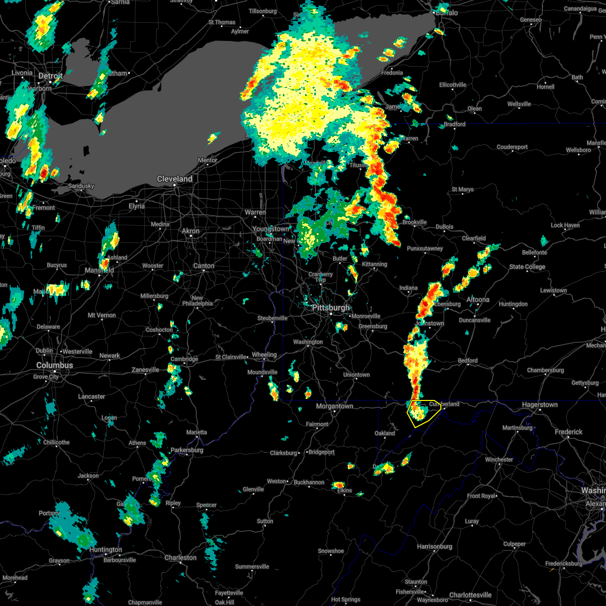 The severe thunderstorm warning for northwestern allegany and northeastern garrett counties will expire at 515 pm edt, the storms which prompted the warning have weakened below severe limits, and have exited the warned area. therefore, the warning will be allowed to expire. The severe thunderstorm warning for northwestern allegany and northeastern garrett counties will expire at 515 pm edt, the storms which prompted the warning have weakened below severe limits, and have exited the warned area. therefore, the warning will be allowed to expire.
|
| 7/13/2021 4:56 PM EDT |
 At 456 pm edt, severe thunderstorms were located along a line extending from near grantsville to westernport, moving northeast at 30 mph (radar indicated). Hazards include 60 mph wind gusts and quarter size hail. Damaging winds will cause some trees and large branches to fall. this could injure those outdoors, as well as damage homes and vehicles. roadways may become blocked by downed trees. localized power outages are possible. unsecured light objects may become projectiles. Locations impacted include, frostburg, la vale, lonaconing, cresaptown, eckhart mines, mount savage, barton, midland, midlothian, franklin, woodland, merrill, new germany, piney grove and dogwood flats. At 456 pm edt, severe thunderstorms were located along a line extending from near grantsville to westernport, moving northeast at 30 mph (radar indicated). Hazards include 60 mph wind gusts and quarter size hail. Damaging winds will cause some trees and large branches to fall. this could injure those outdoors, as well as damage homes and vehicles. roadways may become blocked by downed trees. localized power outages are possible. unsecured light objects may become projectiles. Locations impacted include, frostburg, la vale, lonaconing, cresaptown, eckhart mines, mount savage, barton, midland, midlothian, franklin, woodland, merrill, new germany, piney grove and dogwood flats.
|
| 7/13/2021 4:46 PM EDT |
 At 446 pm edt, a severe thunderstorm was located near westernport, moving northeast at 25 mph (radar indicated). Hazards include 60 mph wind gusts and quarter size hail. Damaging winds will cause some trees and large branches to fall. this could injure those outdoors, as well as damage homes and vehicles. roadways may become blocked by downed trees. localized power outages are possible. unsecured light objects may become projectiles. Locations impacted include, cumberland, frostburg, westernport, bel air, la vale, lonaconing, piedmont, cresaptown, eckhart mines, mount savage, rawlings, barton, midland, midlothian, franklin, woodland, luke, merrill, big run state park and new germany. At 446 pm edt, a severe thunderstorm was located near westernport, moving northeast at 25 mph (radar indicated). Hazards include 60 mph wind gusts and quarter size hail. Damaging winds will cause some trees and large branches to fall. this could injure those outdoors, as well as damage homes and vehicles. roadways may become blocked by downed trees. localized power outages are possible. unsecured light objects may become projectiles. Locations impacted include, cumberland, frostburg, westernport, bel air, la vale, lonaconing, piedmont, cresaptown, eckhart mines, mount savage, rawlings, barton, midland, midlothian, franklin, woodland, luke, merrill, big run state park and new germany.
|
| 7/13/2021 4:40 PM EDT |
 At 440 pm edt, a severe thunderstorm was located over piedmont, or near westernport, moving northeast at 30 mph (radar indicated). Hazards include 60 mph wind gusts and quarter size hail. Damaging winds will cause some trees and large branches to fall. this could injure those outdoors, as well as damage homes and vehicles. roadways may become blocked by downed trees. localized power outages are possible. unsecured light objects may become projectiles. Locations impacted include, cumberland, frostburg, westernport, bel air, la vale, lonaconing, piedmont, grantsville, ridgeley, cresaptown, potomac park, wiley ford, eckhart mines, mount savage, rawlings, barton, midland, midlothian, franklin and woodland. At 440 pm edt, a severe thunderstorm was located over piedmont, or near westernport, moving northeast at 30 mph (radar indicated). Hazards include 60 mph wind gusts and quarter size hail. Damaging winds will cause some trees and large branches to fall. this could injure those outdoors, as well as damage homes and vehicles. roadways may become blocked by downed trees. localized power outages are possible. unsecured light objects may become projectiles. Locations impacted include, cumberland, frostburg, westernport, bel air, la vale, lonaconing, piedmont, grantsville, ridgeley, cresaptown, potomac park, wiley ford, eckhart mines, mount savage, rawlings, barton, midland, midlothian, franklin and woodland.
|
| 7/13/2021 4:40 PM EDT |
 At 446 pm edt, a severe thunderstorm was located near westernport, moving northeast at 25 mph (radar indicated). Hazards include 60 mph wind gusts and quarter size hail. Damaging winds will cause some trees and large branches to fall. this could injure those outdoors, as well as damage homes and vehicles. roadways may become blocked by downed trees. localized power outages are possible. unsecured light objects may become projectiles. Locations impacted include, cumberland, frostburg, westernport, bel air, la vale, lonaconing, piedmont, cresaptown, eckhart mines, mount savage, rawlings, barton, midland, midlothian, franklin, woodland, luke, merrill, big run state park and new germany. At 446 pm edt, a severe thunderstorm was located near westernport, moving northeast at 25 mph (radar indicated). Hazards include 60 mph wind gusts and quarter size hail. Damaging winds will cause some trees and large branches to fall. this could injure those outdoors, as well as damage homes and vehicles. roadways may become blocked by downed trees. localized power outages are possible. unsecured light objects may become projectiles. Locations impacted include, cumberland, frostburg, westernport, bel air, la vale, lonaconing, piedmont, cresaptown, eckhart mines, mount savage, rawlings, barton, midland, midlothian, franklin, woodland, luke, merrill, big run state park and new germany.
|
| 7/13/2021 4:33 PM EDT |
 At 433 pm edt, a severe thunderstorm was located near elk garden, or near westernport, moving northeast at 30 mph (radar indicated). Hazards include 60 mph wind gusts and quarter size hail. Damaging winds will cause some trees and large branches to fall. this could injure those outdoors, as well as damage homes and vehicles. roadways may become blocked by downed trees. localized power outages are possible. Unsecured light objects may become projectiles. At 433 pm edt, a severe thunderstorm was located near elk garden, or near westernport, moving northeast at 30 mph (radar indicated). Hazards include 60 mph wind gusts and quarter size hail. Damaging winds will cause some trees and large branches to fall. this could injure those outdoors, as well as damage homes and vehicles. roadways may become blocked by downed trees. localized power outages are possible. Unsecured light objects may become projectiles.
|
| 6/21/2021 3:22 PM EDT | Tree down on collier run road southeast near oldtown roa in allegany county MD, 5.3 miles NNW of Cumberland, MD |
| 11/15/2020 5:21 PM EST |
 At 519 pm est, gradient winds from a passing cold front will continue to produce sporadic gusts around and above 60 mph (radar indicated). Hazards include 60 mph wind gusts. Damaging gradient winds will cause some trees and large branches to fall. this could injure those outdoors, as well as damage homes and vehicles. roadways may become blocked by downed trees. localized power outages are possible. unsecured light objects may become projectiles. Locations impacted include, cumberland, frostburg, keyser, westernport, romney, hancock, bel air, paw paw, bayard, la vale, fort ashby, lonaconing, piedmont, berkeley springs, elk garden, kitzmiller, ridgeley, cresaptown, potomac park and wiley ford. At 519 pm est, gradient winds from a passing cold front will continue to produce sporadic gusts around and above 60 mph (radar indicated). Hazards include 60 mph wind gusts. Damaging gradient winds will cause some trees and large branches to fall. this could injure those outdoors, as well as damage homes and vehicles. roadways may become blocked by downed trees. localized power outages are possible. unsecured light objects may become projectiles. Locations impacted include, cumberland, frostburg, keyser, westernport, romney, hancock, bel air, paw paw, bayard, la vale, fort ashby, lonaconing, piedmont, berkeley springs, elk garden, kitzmiller, ridgeley, cresaptown, potomac park and wiley ford.
|
| 11/15/2020 5:00 PM EST | Numerous reports of trees down all around the county in allegany county MD, 0.5 miles ENE of Cumberland, MD |
| 11/15/2020 4:58 PM EST |
 At 456 pm est, gradient winds from a passing cold front were located along a line extending from near frostburg to near thomas, moving east at 35 mph (radar indicated). Hazards include 60 mph wind gusts. Damaging gradint winds from a passing cold front will cause some trees and large branches to fall. this could injure those outdoors, as well as damage homes and vehicles. roadways may become blocked by downed trees. localized power outages are possible. Unsecured light objects may become projectiles. At 456 pm est, gradient winds from a passing cold front were located along a line extending from near frostburg to near thomas, moving east at 35 mph (radar indicated). Hazards include 60 mph wind gusts. Damaging gradint winds from a passing cold front will cause some trees and large branches to fall. this could injure those outdoors, as well as damage homes and vehicles. roadways may become blocked by downed trees. localized power outages are possible. Unsecured light objects may become projectiles.
|
| 11/15/2020 3:57 PM EST |
 At 337 pm est, severe thunderstorms were located along a line extending from near uniontown to 6 miles east of brookhaven to grafton, moving east at 40 mph (radar indicated). Hazards include 60 mph wind gusts. Damaging winds will cause some trees and large branches to fall. this could injure those outdoors, as well as damage homes and vehicles. roadways may become blocked by downed trees. localized power outages are possible. Unsecured light objects may become projectiles. At 337 pm est, severe thunderstorms were located along a line extending from near uniontown to 6 miles east of brookhaven to grafton, moving east at 40 mph (radar indicated). Hazards include 60 mph wind gusts. Damaging winds will cause some trees and large branches to fall. this could injure those outdoors, as well as damage homes and vehicles. roadways may become blocked by downed trees. localized power outages are possible. Unsecured light objects may become projectiles.
|
| 11/15/2020 3:57 PM EST |
 At 356 pm est, severe thunderstorms were located along a line extending from 7 miles northeast of farmington to 9 miles southwest of friendsville to near newburg, moving east at 40 mph. this storm has a history of producing wind damage in monongalia county west virginia (radar indicated). Hazards include 60 mph wind gusts. Damaging winds will cause some trees and large branches to fall. this could injure those outdoors, as well as damage homes and vehicles. roadways may become blocked by downed trees. localized power outages are possible. unsecured light objects may become projectiles. Locations impacted include, cumberland, frostburg, keyser, mountain lake park, oakland, westernport, bel air, bayard, bittinger, la vale, lonaconing, piedmont, grantsville, loch lynn heights, friendsville, deer park, accident, elk garden, kitzmiller and cresaptown. At 356 pm est, severe thunderstorms were located along a line extending from 7 miles northeast of farmington to 9 miles southwest of friendsville to near newburg, moving east at 40 mph. this storm has a history of producing wind damage in monongalia county west virginia (radar indicated). Hazards include 60 mph wind gusts. Damaging winds will cause some trees and large branches to fall. this could injure those outdoors, as well as damage homes and vehicles. roadways may become blocked by downed trees. localized power outages are possible. unsecured light objects may become projectiles. Locations impacted include, cumberland, frostburg, keyser, mountain lake park, oakland, westernport, bel air, bayard, bittinger, la vale, lonaconing, piedmont, grantsville, loch lynn heights, friendsville, deer park, accident, elk garden, kitzmiller and cresaptown.
|
| 11/15/2020 3:38 PM EST |
 At 337 pm est, severe thunderstorms were located along a line extending from near uniontown to 6 miles east of brookhaven to grafton, moving east at 40 mph (radar indicated). Hazards include 60 mph wind gusts. Damaging winds will cause some trees and large branches to fall. this could injure those outdoors, as well as damage homes and vehicles. roadways may become blocked by downed trees. localized power outages are possible. Unsecured light objects may become projectiles. At 337 pm est, severe thunderstorms were located along a line extending from near uniontown to 6 miles east of brookhaven to grafton, moving east at 40 mph (radar indicated). Hazards include 60 mph wind gusts. Damaging winds will cause some trees and large branches to fall. this could injure those outdoors, as well as damage homes and vehicles. roadways may become blocked by downed trees. localized power outages are possible. Unsecured light objects may become projectiles.
|
| 8/27/2020 3:25 PM EDT |
 The severe thunderstorm warning for western allegany and northeastern mineral counties will expire at 330 pm edt, the storm which prompted the warning has weakened below severe limits, and no longer poses an immediate threat to life or property. therefore, the warning will be allowed to expire. however gusty winds are still possible with this thunderstorm. The severe thunderstorm warning for western allegany and northeastern mineral counties will expire at 330 pm edt, the storm which prompted the warning has weakened below severe limits, and no longer poses an immediate threat to life or property. therefore, the warning will be allowed to expire. however gusty winds are still possible with this thunderstorm.
|
| 8/27/2020 2:51 PM EDT |
 At 251 pm edt, a severe thunderstorm was located over grantsville, or near bittinger, moving east at 35 mph (radar indicated). Hazards include 60 mph wind gusts. Damaging winds will cause some trees and large branches to fall. this could injure those outdoors, as well as damage homes and vehicles. roadways may become blocked by downed trees. localized power outages are possible. Unsecured light objects may become projectiles. At 251 pm edt, a severe thunderstorm was located over grantsville, or near bittinger, moving east at 35 mph (radar indicated). Hazards include 60 mph wind gusts. Damaging winds will cause some trees and large branches to fall. this could injure those outdoors, as well as damage homes and vehicles. roadways may become blocked by downed trees. localized power outages are possible. Unsecured light objects may become projectiles.
|
| 8/25/2020 4:56 PM EDT | Tree down on the 10000 block of mount savage road in allegany county MD, 3.3 miles SE of Cumberland, MD |
| 8/25/2020 4:53 PM EDT |
 At 453 pm edt, severe thunderstorms were located along a line extending from near berkeley springs to cumberland, moving southeast at 30 mph (radar indicated). Hazards include 60 mph wind gusts and quarter size hail. Damaging winds will cause some trees and large branches to fall. this could injure those outdoors, as well as damage homes and vehicles. roadways may become blocked by downed trees. localized power outages are possible. unsecured light objects may become projectiles. Locations impacted include, paw paw, berkeley springs, great cacapon, little orleans, johnsons mill, omps, lineburg, valley view, spohrs crossroads, fishers bridge, pumpkin center, spruce pine hollow, oakland, magnolia, rock gap, stotlers crossroads, highland ridge, smith crossroads, berryville and new hope. At 453 pm edt, severe thunderstorms were located along a line extending from near berkeley springs to cumberland, moving southeast at 30 mph (radar indicated). Hazards include 60 mph wind gusts and quarter size hail. Damaging winds will cause some trees and large branches to fall. this could injure those outdoors, as well as damage homes and vehicles. roadways may become blocked by downed trees. localized power outages are possible. unsecured light objects may become projectiles. Locations impacted include, paw paw, berkeley springs, great cacapon, little orleans, johnsons mill, omps, lineburg, valley view, spohrs crossroads, fishers bridge, pumpkin center, spruce pine hollow, oakland, magnolia, rock gap, stotlers crossroads, highland ridge, smith crossroads, berryville and new hope.
|
| 8/25/2020 4:52 PM EDT |
 At 451 pm edt, a severe thunderstorm was located near bittinger, moving southeast at 30 mph (radar indicated). Hazards include 60 mph wind gusts. Damaging winds will cause some trees and large branches to fall. this could injure those outdoors, as well as damage homes and vehicles. roadways may become blocked by downed trees. localized power outages are possible. Unsecured light objects may become projectiles. At 451 pm edt, a severe thunderstorm was located near bittinger, moving southeast at 30 mph (radar indicated). Hazards include 60 mph wind gusts. Damaging winds will cause some trees and large branches to fall. this could injure those outdoors, as well as damage homes and vehicles. roadways may become blocked by downed trees. localized power outages are possible. Unsecured light objects may become projectiles.
|
| 8/25/2020 4:50 PM EDT |
 At 450 pm edt, severe thunderstorms were located along a line extending from near berkeley springs to 7 miles east of cumberland, moving southeast at 60 mph (radar indicated). Hazards include 60 mph wind gusts and quarter size hail. Damaging winds will cause some trees and large branches to fall. this could injure those outdoors, as well as damage homes and vehicles. roadways may become blocked by downed trees. localized power outages are possible. Unsecured light objects may become projectiles. At 450 pm edt, severe thunderstorms were located along a line extending from near berkeley springs to 7 miles east of cumberland, moving southeast at 60 mph (radar indicated). Hazards include 60 mph wind gusts and quarter size hail. Damaging winds will cause some trees and large branches to fall. this could injure those outdoors, as well as damage homes and vehicles. roadways may become blocked by downed trees. localized power outages are possible. Unsecured light objects may become projectiles.
|
| 8/25/2020 4:36 PM EDT |
 At 436 pm edt, severe thunderstorms were located along a line extending from near inglesmith to near la vale, moving southeast at 25 mph (radar indicated). Hazards include 60 mph wind gusts and quarter size hail. Damaging winds will cause some trees and large branches to fall. this could injure those outdoors, as well as damage homes and vehicles. roadways may become blocked by downed trees. localized power outages are possible. unsecured light objects may become projectiles. Locations impacted include, cumberland, hancock, paw paw, berkeley springs, ellerslie, corriganville, great cacapon, flintstone, pecktonville, little orleans, johnsons mill, valley view, spohrs crossroads, fishers bridge, pumpkin center, oakland, rock gap, wolfe mill, smith crossroads and new hope. At 436 pm edt, severe thunderstorms were located along a line extending from near inglesmith to near la vale, moving southeast at 25 mph (radar indicated). Hazards include 60 mph wind gusts and quarter size hail. Damaging winds will cause some trees and large branches to fall. this could injure those outdoors, as well as damage homes and vehicles. roadways may become blocked by downed trees. localized power outages are possible. unsecured light objects may become projectiles. Locations impacted include, cumberland, hancock, paw paw, berkeley springs, ellerslie, corriganville, great cacapon, flintstone, pecktonville, little orleans, johnsons mill, valley view, spohrs crossroads, fishers bridge, pumpkin center, oakland, rock gap, wolfe mill, smith crossroads and new hope.
|
| 8/25/2020 4:12 PM EDT |
 At 411 pm edt, a severe thunderstorm was located near lake gordon, or 13 miles north of cumberland, moving southeast at 30 mph (radar indicated). Hazards include 60 mph wind gusts and quarter size hail. Damaging winds will cause some trees and large branches to fall. this could injure those outdoors, as well as damage homes and vehicles. roadways may become blocked by downed trees. localized power outages are possible. Unsecured light objects may become projectiles. At 411 pm edt, a severe thunderstorm was located near lake gordon, or 13 miles north of cumberland, moving southeast at 30 mph (radar indicated). Hazards include 60 mph wind gusts and quarter size hail. Damaging winds will cause some trees and large branches to fall. this could injure those outdoors, as well as damage homes and vehicles. roadways may become blocked by downed trees. localized power outages are possible. Unsecured light objects may become projectiles.
|
| 8/7/2020 4:42 PM EDT |
 At 442 pm edt, severe thunderstorms were located along a line extending from near cumberland to bel air, moving east at 15 mph (radar indicated). Hazards include 60 mph wind gusts. Damaging winds will cause some trees and large branches to fall. this could injure those outdoors, as well as damage homes and vehicles. roadways may become blocked by downed trees. localized power outages are possible. unsecured light objects may become projectiles. Locations impacted include, cumberland, bel air, la vale, fort ashby, lonaconing, ridgeley, cresaptown, potomac park, wiley ford, rawlings, barton, midland, woodland, spring gap, patterson creek, pinto, short gap, wagoner, north branch and brady. At 442 pm edt, severe thunderstorms were located along a line extending from near cumberland to bel air, moving east at 15 mph (radar indicated). Hazards include 60 mph wind gusts. Damaging winds will cause some trees and large branches to fall. this could injure those outdoors, as well as damage homes and vehicles. roadways may become blocked by downed trees. localized power outages are possible. unsecured light objects may become projectiles. Locations impacted include, cumberland, bel air, la vale, fort ashby, lonaconing, ridgeley, cresaptown, potomac park, wiley ford, rawlings, barton, midland, woodland, spring gap, patterson creek, pinto, short gap, wagoner, north branch and brady.
|
| 8/7/2020 4:27 PM EDT | Report of tree damage on private property near the railroad tracks in cumberlan in allegany county MD, 0.5 miles ENE of Cumberland, MD |
| 8/7/2020 4:26 PM EDT |
 At 426 pm edt, severe thunderstorms were located along a line extending from ridgeley to near bel air, moving east at 15 mph (radar indicated). Hazards include 60 mph wind gusts. Damaging winds will cause some trees and large branches to fall. this could injure those outdoors, as well as damage homes and vehicles. roadways may become blocked by downed trees. localized power outages are possible. Unsecured light objects may become projectiles. At 426 pm edt, severe thunderstorms were located along a line extending from ridgeley to near bel air, moving east at 15 mph (radar indicated). Hazards include 60 mph wind gusts. Damaging winds will cause some trees and large branches to fall. this could injure those outdoors, as well as damage homes and vehicles. roadways may become blocked by downed trees. localized power outages are possible. Unsecured light objects may become projectiles.
|
| 7/16/2020 4:11 PM EDT |
 The severe thunderstorm warning for central allegany and northeastern mineral counties will expire at 415 pm edt, the storm which prompted the warning has weakened below severe limits, and no longer poses an immediate threat to life or property. therefore, the warning will be allowed to expire. however gusty winds and heavy rain are still possible with this thunderstorm. The severe thunderstorm warning for central allegany and northeastern mineral counties will expire at 415 pm edt, the storm which prompted the warning has weakened below severe limits, and no longer poses an immediate threat to life or property. therefore, the warning will be allowed to expire. however gusty winds and heavy rain are still possible with this thunderstorm.
|
| 7/16/2020 3:59 PM EDT |
 At 321 pm edt, a severe thunderstorm was located over lonaconing, or near westernport, moving northeast at 20 mph (radar indicated). Hazards include 60 mph wind gusts and quarter size hail. Damaging winds will cause some trees and large branches to fall. this could injure those outdoors, as well as damage homes and vehicles. roadways may become blocked by downed trees. localized power outages are possible. unsecured light objects may become projectiles. Locations impacted include, cumberland, frostburg, westernport, bel air, la vale, lonaconing, ridgeley, cresaptown, potomac park, wiley ford, eckhart mines, mount savage, rawlings, ellerslie, barton, corriganville, midland, midlothian, franklin and flintstone. At 321 pm edt, a severe thunderstorm was located over lonaconing, or near westernport, moving northeast at 20 mph (radar indicated). Hazards include 60 mph wind gusts and quarter size hail. Damaging winds will cause some trees and large branches to fall. this could injure those outdoors, as well as damage homes and vehicles. roadways may become blocked by downed trees. localized power outages are possible. unsecured light objects may become projectiles. Locations impacted include, cumberland, frostburg, westernport, bel air, la vale, lonaconing, ridgeley, cresaptown, potomac park, wiley ford, eckhart mines, mount savage, rawlings, ellerslie, barton, corriganville, midland, midlothian, franklin and flintstone.
|
| 7/16/2020 3:54 PM EDT | Tree down in the 200 block of miller road in mineral county WV, 1.7 miles ENE of Cumberland, MD |
| 7/16/2020 3:21 PM EDT |
 At 321 pm edt, a severe thunderstorm was located over lonaconing, or near westernport, moving northeast at 20 mph (radar indicated). Hazards include 60 mph wind gusts and quarter size hail. Damaging winds will cause some trees and large branches to fall. this could injure those outdoors, as well as damage homes and vehicles. roadways may become blocked by downed trees. localized power outages are possible. unsecured light objects may become projectiles. Locations impacted include, cumberland, frostburg, westernport, bel air, la vale, lonaconing, ridgeley, cresaptown, potomac park, wiley ford, eckhart mines, mount savage, rawlings, ellerslie, barton, corriganville, midland, midlothian, franklin and flintstone. At 321 pm edt, a severe thunderstorm was located over lonaconing, or near westernport, moving northeast at 20 mph (radar indicated). Hazards include 60 mph wind gusts and quarter size hail. Damaging winds will cause some trees and large branches to fall. this could injure those outdoors, as well as damage homes and vehicles. roadways may become blocked by downed trees. localized power outages are possible. unsecured light objects may become projectiles. Locations impacted include, cumberland, frostburg, westernport, bel air, la vale, lonaconing, ridgeley, cresaptown, potomac park, wiley ford, eckhart mines, mount savage, rawlings, ellerslie, barton, corriganville, midland, midlothian, franklin and flintstone.
|
| 7/16/2020 3:17 PM EDT |
 At 317 pm edt, a severe thunderstorm was located over lonaconing, or near westernport, moving northeast at 20 mph (radar indicated). Hazards include 60 mph wind gusts and quarter size hail. Damaging winds will cause some trees and large branches to fall. this could injure those outdoors, as well as damage homes and vehicles. roadways may become blocked by downed trees. localized power outages are possible. Unsecured light objects may become projectiles. At 317 pm edt, a severe thunderstorm was located over lonaconing, or near westernport, moving northeast at 20 mph (radar indicated). Hazards include 60 mph wind gusts and quarter size hail. Damaging winds will cause some trees and large branches to fall. this could injure those outdoors, as well as damage homes and vehicles. roadways may become blocked by downed trees. localized power outages are possible. Unsecured light objects may become projectiles.
|
| 7/7/2020 5:21 PM EDT |
 The severe thunderstorm warning for northeastern allegany county will expire at 530 pm edt, the storm which prompted the warning has weakened below severe limits, and no longer poses an immediate threat to life or property. therefore, the warning will be allowed to expire. to report severe weather, contact your nearest law enforcement agency. they will relay your report to the national weather service sterling virginia. The severe thunderstorm warning for northeastern allegany county will expire at 530 pm edt, the storm which prompted the warning has weakened below severe limits, and no longer poses an immediate threat to life or property. therefore, the warning will be allowed to expire. to report severe weather, contact your nearest law enforcement agency. they will relay your report to the national weather service sterling virginia.
|
| 7/7/2020 5:09 PM EDT |
 At 508 pm edt, a severe thunderstorm was located near lake gordon, or 7 miles east of cumberland, moving northeast at 15 mph (radar indicated). Hazards include localized damaging wind gusts of up to 60 mph. Damaging winds will cause some trees and large branches to fall. this could injure those outdoors, as well as damage homes and vehicles. roadways may become blocked by downed trees. localized power outages are possible. unsecured light objects may become projectiles. Locations impacted include, cumberland, la vale, ellerslie, corriganville, flintstone, wolfe mill and pleasant valley. At 508 pm edt, a severe thunderstorm was located near lake gordon, or 7 miles east of cumberland, moving northeast at 15 mph (radar indicated). Hazards include localized damaging wind gusts of up to 60 mph. Damaging winds will cause some trees and large branches to fall. this could injure those outdoors, as well as damage homes and vehicles. roadways may become blocked by downed trees. localized power outages are possible. unsecured light objects may become projectiles. Locations impacted include, cumberland, la vale, ellerslie, corriganville, flintstone, wolfe mill and pleasant valley.
|
| 7/7/2020 5:01 PM EDT |
 At 501 pm edt, a severe thunderstorm was located near cumberland, moving northeast at 15 mph (radar indicated). Hazards include damaging wind gusts of up to 65 mph. Damaging winds will cause some trees and large branches to fall. this could injure those outdoors, as well as damage homes and vehicles. roadways may become blocked by downed trees. localized power outages are possible. unsecured light objects may become projectiles. Locations impacted include, cumberland, la vale, ridgeley, wiley ford, ellerslie, corriganville, flintstone, wolfe mill and pleasant valley. At 501 pm edt, a severe thunderstorm was located near cumberland, moving northeast at 15 mph (radar indicated). Hazards include damaging wind gusts of up to 65 mph. Damaging winds will cause some trees and large branches to fall. this could injure those outdoors, as well as damage homes and vehicles. roadways may become blocked by downed trees. localized power outages are possible. unsecured light objects may become projectiles. Locations impacted include, cumberland, la vale, ridgeley, wiley ford, ellerslie, corriganville, flintstone, wolfe mill and pleasant valley.
|
| 7/7/2020 4:49 PM EDT |
 The national weather service in sterling virginia has issued a * severe thunderstorm warning for. northeastern allegany county in western maryland. northeastern mineral county in eastern west virginia. until 530 pm edt. At 449 pm edt, a severe thunderstorm was located over cumberland,. The national weather service in sterling virginia has issued a * severe thunderstorm warning for. northeastern allegany county in western maryland. northeastern mineral county in eastern west virginia. until 530 pm edt. At 449 pm edt, a severe thunderstorm was located over cumberland,.
|
| 6/4/2020 6:19 PM EDT |
 At 618 pm edt, a severe thunderstorm was located near bel air, moving east at 20 mph (radar indicated). Hazards include 60 mph wind gusts. Damaging winds will cause some trees and large branches to fall. this could injure those outdoors, as well as damage homes and vehicles. roadways may become blocked by downed trees. localized power outages are possible. unsecured light objects may become projectiles. Locations impacted include, cumberland, ridgeley, cresaptown, potomac park, wiley ford, spring gap, patterson creek, pumpkin center and north branch. At 618 pm edt, a severe thunderstorm was located near bel air, moving east at 20 mph (radar indicated). Hazards include 60 mph wind gusts. Damaging winds will cause some trees and large branches to fall. this could injure those outdoors, as well as damage homes and vehicles. roadways may become blocked by downed trees. localized power outages are possible. unsecured light objects may become projectiles. Locations impacted include, cumberland, ridgeley, cresaptown, potomac park, wiley ford, spring gap, patterson creek, pumpkin center and north branch.
|
| 6/4/2020 6:02 PM EDT |
 At 602 pm edt, a severe thunderstorm was located near bel air, moving east at 20 mph (radar indicated). Hazards include 60 mph wind gusts and quarter size hail. Damaging winds will cause some trees and large branches to fall. this could injure those outdoors, as well as damage homes and vehicles. roadways may become blocked by downed trees. localized power outages are possible. Unsecured light objects may become projectiles. At 602 pm edt, a severe thunderstorm was located near bel air, moving east at 20 mph (radar indicated). Hazards include 60 mph wind gusts and quarter size hail. Damaging winds will cause some trees and large branches to fall. this could injure those outdoors, as well as damage homes and vehicles. roadways may become blocked by downed trees. localized power outages are possible. Unsecured light objects may become projectiles.
|
| 4/8/2020 2:43 AM EDT | Trees down on winchester road near cresaptow in allegany county MD, 0.5 miles ENE of Cumberland, MD |
| 4/8/2020 2:43 AM EDT | Trees down near corriganville and mount savage roa in allegany county MD, 3.3 miles SE of Cumberland, MD |
| 4/8/2020 2:43 AM EDT | Trees down in the area of route 40 & route 36 near la val in allegany county MD, 2.4 miles ESE of Cumberland, MD |
| 4/8/2020 2:29 AM EDT |
 At 229 am edt, severe thunderstorms were located along a line extending from near berlin to near accident to 6 miles east of point marion, moving southeast at 65 mph (radar indicated). Hazards include 60 mph wind gusts. Damaging winds will cause some trees and large branches to fall. this could injure those outdoors, as well as damage homes and vehicles. roadways may become blocked by downed trees. localized power outages are possible. Unsecured light objects may become projectiles. At 229 am edt, severe thunderstorms were located along a line extending from near berlin to near accident to 6 miles east of point marion, moving southeast at 65 mph (radar indicated). Hazards include 60 mph wind gusts. Damaging winds will cause some trees and large branches to fall. this could injure those outdoors, as well as damage homes and vehicles. roadways may become blocked by downed trees. localized power outages are possible. Unsecured light objects may become projectiles.
|
| 3/3/2020 10:06 PM EST | Trees down on bottle run rd and hazen dr in allegany county MD, 5.7 miles SW of Cumberland, MD |
| 3/3/2020 10:03 PM EST |
 At 1003 pm est, severe thunderstorms were located along a line extending from 6 miles southwest of inglesmith to near keyser, moving east at 55 mph (trained weather spotters). Hazards include 60 mph wind gusts. Damaging winds will cause some trees and large branches to fall. this could injure those outdoors, as well as damage homes and vehicles. roadways may become blocked by downed trees. localized power outages are possible. Unsecured light objects may become projectiles. At 1003 pm est, severe thunderstorms were located along a line extending from 6 miles southwest of inglesmith to near keyser, moving east at 55 mph (trained weather spotters). Hazards include 60 mph wind gusts. Damaging winds will cause some trees and large branches to fall. this could injure those outdoors, as well as damage homes and vehicles. roadways may become blocked by downed trees. localized power outages are possible. Unsecured light objects may become projectiles.
|
| 3/3/2020 9:55 PM EST | Storm damage reported in allegany county MD, 1.5 miles E of Cumberland, MD |
| 8/20/2019 5:18 PM EDT |
 At 518 pm edt, a severe thunderstorm was located near frostburg, moving east at 10 mph (radar indicated). Hazards include 60 mph wind gusts. Damaging winds will cause some trees and large branches to fall. this could injure those outdoors, as well as damage homes and vehicles. roadways may become blocked by downed trees. localized power outages are possible. unsecured light objects may become projectiles. Locations impacted include, frostburg, bel air, la vale, cresaptown, potomac park, eckhart mines, mount savage, corriganville, midlothian and woodland. At 518 pm edt, a severe thunderstorm was located near frostburg, moving east at 10 mph (radar indicated). Hazards include 60 mph wind gusts. Damaging winds will cause some trees and large branches to fall. this could injure those outdoors, as well as damage homes and vehicles. roadways may become blocked by downed trees. localized power outages are possible. unsecured light objects may become projectiles. Locations impacted include, frostburg, bel air, la vale, cresaptown, potomac park, eckhart mines, mount savage, corriganville, midlothian and woodland.
|
| 8/20/2019 5:00 PM EDT |
 At 500 pm edt, a severe thunderstorm was located over frostburg, moving east at 10 mph (radar indicated). Hazards include 60 mph wind gusts. Damaging winds will cause some trees and large branches to fall. this could injure those outdoors, as well as damage homes and vehicles. roadways may become blocked by downed trees. localized power outages are possible. Unsecured light objects may become projectiles. At 500 pm edt, a severe thunderstorm was located over frostburg, moving east at 10 mph (radar indicated). Hazards include 60 mph wind gusts. Damaging winds will cause some trees and large branches to fall. this could injure those outdoors, as well as damage homes and vehicles. roadways may become blocked by downed trees. localized power outages are possible. Unsecured light objects may become projectiles.
|
| 8/15/2019 7:11 PM EDT |
 The severe thunderstorm warning for central allegany county will expire at 715 pm edt, the storm which prompted the warning has weakened below severe limits, and no longer poses an immediate threat to life or property. therefore, the warning will be allowed to expire. however heavy rain is still possible with this thunderstorm. to report severe weather, contact your nearest law enforcement agency. they will relay your report to the national weather service sterling virginia. The severe thunderstorm warning for central allegany county will expire at 715 pm edt, the storm which prompted the warning has weakened below severe limits, and no longer poses an immediate threat to life or property. therefore, the warning will be allowed to expire. however heavy rain is still possible with this thunderstorm. to report severe weather, contact your nearest law enforcement agency. they will relay your report to the national weather service sterling virginia.
|
| 8/15/2019 7:00 PM EDT |
 At 700 pm edt, a severe thunderstorm was located 7 miles southeast of cumberland, moving east at 20 mph (radar indicated). Hazards include 60 mph wind gusts and quarter size hail. Damaging winds will cause some trees and large branches to fall. this could injure those outdoors, as well as damage homes and vehicles. roadways may become blocked by downed trees. localized power outages are possible. unsecured light objects may become projectiles. Locations impacted include, cumberland, wiley ford, green spring, flintstone, oldtown, spring gap, wolfe mill, wagoner, pumpkin center and north branch. At 700 pm edt, a severe thunderstorm was located 7 miles southeast of cumberland, moving east at 20 mph (radar indicated). Hazards include 60 mph wind gusts and quarter size hail. Damaging winds will cause some trees and large branches to fall. this could injure those outdoors, as well as damage homes and vehicles. roadways may become blocked by downed trees. localized power outages are possible. unsecured light objects may become projectiles. Locations impacted include, cumberland, wiley ford, green spring, flintstone, oldtown, spring gap, wolfe mill, wagoner, pumpkin center and north branch.
|
| 8/15/2019 6:49 PM EDT | Tree down on the 15600 block of brice hollow roa in allegany county MD, 5.7 miles NNW of Cumberland, MD |
| 8/15/2019 6:43 PM EDT | Tree down on wv-28 outside of ridgeley...w in mineral county WV, 1 miles E of Cumberland, MD |
| 8/15/2019 6:36 PM EDT | Tree down on winchester road near vocke roa in allegany county MD, 5 miles ENE of Cumberland, MD |
| 8/15/2019 6:36 PM EDT |
 At 636 pm edt, a severe thunderstorm was located near ridgeley, or near bel air, moving east at 15 mph. another potentially severe thunderstorm was near oldtown, moving north (radar indicated). Hazards include 60 mph wind gusts and quarter size hail. Damaging winds will cause some trees and large branches to fall. this could injure those outdoors, as well as damage homes and vehicles. roadways may become blocked by downed trees. localized power outages are possible. Unsecured light objects may become projectiles. At 636 pm edt, a severe thunderstorm was located near ridgeley, or near bel air, moving east at 15 mph. another potentially severe thunderstorm was near oldtown, moving north (radar indicated). Hazards include 60 mph wind gusts and quarter size hail. Damaging winds will cause some trees and large branches to fall. this could injure those outdoors, as well as damage homes and vehicles. roadways may become blocked by downed trees. localized power outages are possible. Unsecured light objects may become projectiles.
|
| 7/31/2019 2:30 PM EDT |
 At 230 pm edt, severe thunderstorms were located along a line extending from near frostburg to near lonaconing, moving east at 15 mph (radar indicated). Hazards include 60 mph wind gusts. Damaging winds will cause some trees and large branches to fall. this could injure those outdoors, as well as damage homes and vehicles. roadways may become blocked by downed trees. localized power outages are possible. unsecured light objects may become projectiles. Locations impacted include, cumberland, frostburg, bel air, la vale, lonaconing, ridgeley, cresaptown, potomac park, wiley ford, eckhart mines, mount savage, rawlings, ellerslie, corriganville, midland, midlothian, woodland, patterson creek, pinto and short gap. At 230 pm edt, severe thunderstorms were located along a line extending from near frostburg to near lonaconing, moving east at 15 mph (radar indicated). Hazards include 60 mph wind gusts. Damaging winds will cause some trees and large branches to fall. this could injure those outdoors, as well as damage homes and vehicles. roadways may become blocked by downed trees. localized power outages are possible. unsecured light objects may become projectiles. Locations impacted include, cumberland, frostburg, bel air, la vale, lonaconing, ridgeley, cresaptown, potomac park, wiley ford, eckhart mines, mount savage, rawlings, ellerslie, corriganville, midland, midlothian, woodland, patterson creek, pinto and short gap.
|
| 7/31/2019 2:15 PM EDT |
 At 215 pm edt, a severe thunderstorm was located near frostburg, moving east at 20 mph (radar indicated). Hazards include 60 mph wind gusts and quarter size hail. Damaging winds will cause some trees and large branches to fall. this could injure those outdoors, as well as damage homes and vehicles. roadways may become blocked by downed trees. localized power outages are possible. Unsecured light objects may become projectiles. At 215 pm edt, a severe thunderstorm was located near frostburg, moving east at 20 mph (radar indicated). Hazards include 60 mph wind gusts and quarter size hail. Damaging winds will cause some trees and large branches to fall. this could injure those outdoors, as well as damage homes and vehicles. roadways may become blocked by downed trees. localized power outages are possible. Unsecured light objects may become projectiles.
|
| 7/31/2019 2:15 PM EDT |
 The national weather service in sterling virginia has issued a * severe thunderstorm warning for. northwestern allegany county in western maryland. northeastern mineral county in eastern west virginia. until 245 pm edt. At 215 pm edt, a severe thunderstorm was located near frostburg,. The national weather service in sterling virginia has issued a * severe thunderstorm warning for. northwestern allegany county in western maryland. northeastern mineral county in eastern west virginia. until 245 pm edt. At 215 pm edt, a severe thunderstorm was located near frostburg,.
|
| 7/30/2019 2:17 PM EDT | Tree down on oldtown rd s in allegany county MD, 6.9 miles NNW of Cumberland, MD |
| 7/30/2019 2:09 PM EDT | Tree down on route 51 near the intersection with kirk hollow r in allegany county MD, 0.5 miles ENE of Cumberland, MD |
| 7/30/2019 1:55 PM EDT | Tree down on route 51 near the intersection with kirk hollow rd. corrected event tim in allegany county MD, 0.5 miles ENE of Cumberland, MD |
| 7/30/2019 1:52 PM EDT | Trees and wires down on crocus ave. in cumberland in allegany county MD, 4.3 miles NE of Cumberland, MD |
| 7/11/2019 2:30 PM EDT | Tree down near intersection of w. elder st. and canal parkway in allegany county MD, 1.8 miles NNE of Cumberland, MD |
| 7/11/2019 2:30 PM EDT | Tree down along valley rd ne south of the mason-dixon line in allegany county MD, 5 miles SSW of Cumberland, MD |
| 7/11/2019 2:30 PM EDT |
 At 230 pm edt, a severe thunderstorm was located near cumberland, moving east at 35 mph (radar indicated). Hazards include 60 mph wind gusts. Damaging winds will cause some trees and large branches to fall. this could injure those outdoors, as well as damage homes and vehicles. roadways may become blocked by downed trees. localized power outages are possible. unsecured light objects may become projectiles. Locations impacted include, cumberland, bel air, la vale, ridgeley, cresaptown, potomac park, wiley ford, ellerslie, corriganville, green spring, flintstone, oldtown, spring gap, patterson creek, pleasant valley, pinto, short gap, wagoner, pumpkin center and north branch. At 230 pm edt, a severe thunderstorm was located near cumberland, moving east at 35 mph (radar indicated). Hazards include 60 mph wind gusts. Damaging winds will cause some trees and large branches to fall. this could injure those outdoors, as well as damage homes and vehicles. roadways may become blocked by downed trees. localized power outages are possible. unsecured light objects may become projectiles. Locations impacted include, cumberland, bel air, la vale, ridgeley, cresaptown, potomac park, wiley ford, ellerslie, corriganville, green spring, flintstone, oldtown, spring gap, patterson creek, pleasant valley, pinto, short gap, wagoner, pumpkin center and north branch.
|
| 7/11/2019 2:11 PM EDT |
 At 211 pm edt, a severe thunderstorm was located over frostburg, moving east at 35 mph (radar indicated). Hazards include 60 mph wind gusts. Damaging winds will cause some trees and large branches to fall. this could injure those outdoors, as well as damage homes and vehicles. roadways may become blocked by downed trees. localized power outages are possible. Unsecured light objects may become projectiles. At 211 pm edt, a severe thunderstorm was located over frostburg, moving east at 35 mph (radar indicated). Hazards include 60 mph wind gusts. Damaging winds will cause some trees and large branches to fall. this could injure those outdoors, as well as damage homes and vehicles. roadways may become blocked by downed trees. localized power outages are possible. Unsecured light objects may become projectiles.
|
| 6/29/2019 9:05 PM EDT | Tree down near intersection of e. industrial blvd. and winston s in allegany county MD, 0.5 miles ENE of Cumberland, MD |
| 6/29/2019 9:05 PM EDT |
 At 905 pm edt, a severe thunderstorm was located over cumberland, moving east at 25 mph (radar indicated). Hazards include 60 mph wind gusts. Damaging winds will cause some trees and large branches to fall. this could injure those outdoors, as well as damage homes and vehicles. roadways may become blocked by downed trees. localized power outages are possible. Unsecured light objects may become projectiles. At 905 pm edt, a severe thunderstorm was located over cumberland, moving east at 25 mph (radar indicated). Hazards include 60 mph wind gusts. Damaging winds will cause some trees and large branches to fall. this could injure those outdoors, as well as damage homes and vehicles. roadways may become blocked by downed trees. localized power outages are possible. Unsecured light objects may become projectiles.
|
| 5/29/2019 4:07 PM EDT |
 The severe thunderstorm warning for central allegany and northeastern mineral counties will expire at 415 pm edt, the storm which prompted the warning has weakened below severe limits, and no longer poses an immediate threat to life or property. therefore, the warning will be allowed to expire. however heavy rain is still possible with this thunderstorm. The severe thunderstorm warning for central allegany and northeastern mineral counties will expire at 415 pm edt, the storm which prompted the warning has weakened below severe limits, and no longer poses an immediate threat to life or property. therefore, the warning will be allowed to expire. however heavy rain is still possible with this thunderstorm.
|
| 5/29/2019 4:01 PM EDT |
 At 400 pm edt, a severe thunderstorm was located near ridgeley, or near cumberland, moving east at 40 mph (radar indicated). Hazards include 60 mph wind gusts and quarter size hail. Damaging winds will cause some trees and large branches to fall. this could injure those outdoors, as well as damage homes and vehicles. roadways may become blocked by downed trees. localized power outages are possible. unsecured light objects may become projectiles. Locations impacted include, cumberland, fort ashby, ridgeley, wiley ford, flintstone, oldtown, spring gap, patterson creek, short gap, wagoner, pumpkin center, north branch and wolfe mill. At 400 pm edt, a severe thunderstorm was located near ridgeley, or near cumberland, moving east at 40 mph (radar indicated). Hazards include 60 mph wind gusts and quarter size hail. Damaging winds will cause some trees and large branches to fall. this could injure those outdoors, as well as damage homes and vehicles. roadways may become blocked by downed trees. localized power outages are possible. unsecured light objects may become projectiles. Locations impacted include, cumberland, fort ashby, ridgeley, wiley ford, flintstone, oldtown, spring gap, patterson creek, short gap, wagoner, pumpkin center, north branch and wolfe mill.
|
| 5/29/2019 3:44 PM EDT |
 At 343 pm edt, a severe thunderstorm was located over lonaconing, or near frostburg, moving east at 40 mph (radar indicated). Hazards include 60 mph wind gusts and quarter size hail. Damaging winds will cause some trees and large branches to fall. this could injure those outdoors, as well as damage homes and vehicles. roadways may become blocked by downed trees. localized power outages are possible. Unsecured light objects may become projectiles. At 343 pm edt, a severe thunderstorm was located over lonaconing, or near frostburg, moving east at 40 mph (radar indicated). Hazards include 60 mph wind gusts and quarter size hail. Damaging winds will cause some trees and large branches to fall. this could injure those outdoors, as well as damage homes and vehicles. roadways may become blocked by downed trees. localized power outages are possible. Unsecured light objects may become projectiles.
|
| 4/14/2019 10:38 PM EDT |
 At 1037 pm edt, severe thunderstorms were located along a line extending from near lake gordon to near ridgeley to 10 miles southeast of elk garden, moving east at 35 mph (radar indicated). Hazards include 60 mph wind gusts. Damaging winds will cause some trees and large branches to fall. this could injure those outdoors, as well as damage homes and vehicles. roadways may become blocked by downed trees. localized power outages are possible. unsecured light objects may become projectiles. Locations impacted include, cumberland, frostburg, keyser, westernport, romney, bel air, la vale, fort ashby, lonaconing, piedmont, ridgeley, cresaptown, potomac park, wiley ford, eckhart mines, mount savage, rawlings, ellerslie, springfield and barton. At 1037 pm edt, severe thunderstorms were located along a line extending from near lake gordon to near ridgeley to 10 miles southeast of elk garden, moving east at 35 mph (radar indicated). Hazards include 60 mph wind gusts. Damaging winds will cause some trees and large branches to fall. this could injure those outdoors, as well as damage homes and vehicles. roadways may become blocked by downed trees. localized power outages are possible. unsecured light objects may become projectiles. Locations impacted include, cumberland, frostburg, keyser, westernport, romney, bel air, la vale, fort ashby, lonaconing, piedmont, ridgeley, cresaptown, potomac park, wiley ford, eckhart mines, mount savage, rawlings, ellerslie, springfield and barton.
|
| 4/14/2019 10:11 PM EDT |
 At 1011 pm edt, severe thunderstorms were located along a line extending from 6 miles east of grantsville to piedmont to near bayard, moving east at 40 mph (radar indicated). Hazards include 60 mph wind gusts. Damaging winds will cause some trees and large branches to fall. this could injure those outdoors, as well as damage homes and vehicles. roadways may become blocked by downed trees. localized power outages are possible. unsecured light objects may become projectiles. Locations impacted include, cumberland, frostburg, keyser, westernport, romney, bel air, bayard, la vale, fort ashby, lonaconing, piedmont, elk garden, kitzmiller, ridgeley, cresaptown, potomac park, wiley ford, eckhart mines, mount savage and rawlings. At 1011 pm edt, severe thunderstorms were located along a line extending from 6 miles east of grantsville to piedmont to near bayard, moving east at 40 mph (radar indicated). Hazards include 60 mph wind gusts. Damaging winds will cause some trees and large branches to fall. this could injure those outdoors, as well as damage homes and vehicles. roadways may become blocked by downed trees. localized power outages are possible. unsecured light objects may become projectiles. Locations impacted include, cumberland, frostburg, keyser, westernport, romney, bel air, bayard, la vale, fort ashby, lonaconing, piedmont, elk garden, kitzmiller, ridgeley, cresaptown, potomac park, wiley ford, eckhart mines, mount savage and rawlings.
|
| 4/14/2019 9:55 PM EDT |
 At 955 pm edt, severe thunderstorms were located along a line extending from near accident to near davis, moving east at 40 mph (radar indicated). Hazards include 60 mph wind gusts. Damaging winds will cause some trees and large branches to fall. this could injure those outdoors, as well as damage homes and vehicles. roadways may become blocked by downed trees. localized power outages are possible. Unsecured light objects may become projectiles. At 955 pm edt, severe thunderstorms were located along a line extending from near accident to near davis, moving east at 40 mph (radar indicated). Hazards include 60 mph wind gusts. Damaging winds will cause some trees and large branches to fall. this could injure those outdoors, as well as damage homes and vehicles. roadways may become blocked by downed trees. localized power outages are possible. Unsecured light objects may become projectiles.
|
| 4/12/2019 5:36 PM EDT |
 At 535 pm edt, a severe thunderstorm was located near lake gordon, or 9 miles northeast of cumberland, moving northeast at 50 mph (radar indicated. this thunderstorm has produced tree damage near cumberland). Hazards include 60 mph wind gusts. Damaging winds will cause some trees and large branches to fall. this could injure those outdoors, as well as damage homes and vehicles. roadways may become blocked by downed trees. localized power outages are possible. unsecured light objects may become projectiles. Locations impacted include, cumberland, ridgeley, wiley ford, flintstone, wolfe mill, pleasant valley and pumpkin center. At 535 pm edt, a severe thunderstorm was located near lake gordon, or 9 miles northeast of cumberland, moving northeast at 50 mph (radar indicated. this thunderstorm has produced tree damage near cumberland). Hazards include 60 mph wind gusts. Damaging winds will cause some trees and large branches to fall. this could injure those outdoors, as well as damage homes and vehicles. roadways may become blocked by downed trees. localized power outages are possible. unsecured light objects may become projectiles. Locations impacted include, cumberland, ridgeley, wiley ford, flintstone, wolfe mill, pleasant valley and pumpkin center.
|
| 4/12/2019 5:29 PM EDT |
 At 528 pm edt, a severe thunderstorm was located near lake gordon, or near cumberland, moving northeast at 70 mph (radar indicated). Hazards include 60 mph wind gusts. Damaging winds will cause some trees and large branches to fall. this could injure those outdoors, as well as damage homes and vehicles. roadways may become blocked by downed trees. localized power outages are possible. unsecured light objects may become projectiles. Locations impacted include, cumberland, hancock, la vale, fort ashby, ridgeley, cresaptown, potomac park, wiley ford, green spring, flintstone, oldtown, spring gap, little orleans, patterson creek, lineburg, pleasant valley, short gap, wagoner, pumpkin center and north branch. At 528 pm edt, a severe thunderstorm was located near lake gordon, or near cumberland, moving northeast at 70 mph (radar indicated). Hazards include 60 mph wind gusts. Damaging winds will cause some trees and large branches to fall. this could injure those outdoors, as well as damage homes and vehicles. roadways may become blocked by downed trees. localized power outages are possible. unsecured light objects may become projectiles. Locations impacted include, cumberland, hancock, la vale, fort ashby, ridgeley, cresaptown, potomac park, wiley ford, green spring, flintstone, oldtown, spring gap, little orleans, patterson creek, lineburg, pleasant valley, short gap, wagoner, pumpkin center and north branch.
|
| 4/12/2019 5:26 PM EDT | 40-foot tree blown down... blocking all of us-220 mcmullen highway near north cresap stree in allegany county MD, 3.8 miles NE of Cumberland, MD |
| 4/12/2019 5:26 PM EDT | Tree down near the intersection of md-51 oldtown road southeast and moores hollow road southeas in allegany county MD, 5.1 miles NNW of Cumberland, MD |
| 4/12/2019 5:16 PM EDT |
 At 516 pm edt, a severe thunderstorm was located over fort ashby, or near bel air, moving northeast at 60 mph (radar indicated). Hazards include 60 mph wind gusts. Damaging winds will cause some trees and large branches to fall. this could injure those outdoors, as well as damage homes and vehicles. roadways may become blocked by downed trees. localized power outages are possible. Unsecured light objects may become projectiles. At 516 pm edt, a severe thunderstorm was located over fort ashby, or near bel air, moving northeast at 60 mph (radar indicated). Hazards include 60 mph wind gusts. Damaging winds will cause some trees and large branches to fall. this could injure those outdoors, as well as damage homes and vehicles. roadways may become blocked by downed trees. localized power outages are possible. Unsecured light objects may become projectiles.
|
| 8/21/2018 3:51 PM EDT |
 The tornado warning for northeastern allegany county will expire at 400 pm edt, the storm which prompted the warning has weakened below severe limits, and no longer appears capable of producing a tornado. therefore the warning will be allowed to expire. a severe thunderstorm watch remains in effect until 1000 pm edt for western maryland. The tornado warning for northeastern allegany county will expire at 400 pm edt, the storm which prompted the warning has weakened below severe limits, and no longer appears capable of producing a tornado. therefore the warning will be allowed to expire. a severe thunderstorm watch remains in effect until 1000 pm edt for western maryland.
|
| 8/21/2018 3:41 PM EDT |
 The severe thunderstorm warning for north central allegany county will expire at 345 pm edt, the storm which prompted the warning has moved out of the area. therefore the warning will be allowed to expire. a severe thunderstorm watch remains in effect until 1000 pm edt for western maryland. The severe thunderstorm warning for north central allegany county will expire at 345 pm edt, the storm which prompted the warning has moved out of the area. therefore the warning will be allowed to expire. a severe thunderstorm watch remains in effect until 1000 pm edt for western maryland.
|
| 8/21/2018 3:40 PM EDT |
 At 340 pm edt, severe thunderstorms were located along a line extending from near cumberland to near fort ashby, moving northeast at 35 mph (radar indicated). Hazards include 60 mph wind gusts and quarter size hail. Damaging winds will cause some trees and large branches to fall. this could injure those outdoors, as well as damage homes and vehicles. roadways may become blocked by downed trees. localized power outages are possible. unsecured light objects may become projectiles. Locations impacted include, cumberland, fort ashby, wiley ford, flintstone, spring gap, wolfe mill, patterson creek, pleasant valley, wagoner, pumpkin center and north branch. At 340 pm edt, severe thunderstorms were located along a line extending from near cumberland to near fort ashby, moving northeast at 35 mph (radar indicated). Hazards include 60 mph wind gusts and quarter size hail. Damaging winds will cause some trees and large branches to fall. this could injure those outdoors, as well as damage homes and vehicles. roadways may become blocked by downed trees. localized power outages are possible. unsecured light objects may become projectiles. Locations impacted include, cumberland, fort ashby, wiley ford, flintstone, spring gap, wolfe mill, patterson creek, pleasant valley, wagoner, pumpkin center and north branch.
|
| 8/21/2018 3:32 PM EDT |
 At 332 pm edt, a severe thunderstorm capable of producing a tornado was located near cumberland, moving northeast at 20 mph (radar indicated rotation). Hazards include tornado and quarter size hail. For those in the direct path of a tornado touchdown, flying debris will be dangerous to those caught without shelter. damage to roofs, siding, and windows may occur. mobile homes may be damaged or destroyed. tree damage is likely. This tornadic thunderstorm will remain over mainly rural areas of northeastern allegany county, including the following locations, flintstone, pleasant valley and pumpkin center. At 332 pm edt, a severe thunderstorm capable of producing a tornado was located near cumberland, moving northeast at 20 mph (radar indicated rotation). Hazards include tornado and quarter size hail. For those in the direct path of a tornado touchdown, flying debris will be dangerous to those caught without shelter. damage to roofs, siding, and windows may occur. mobile homes may be damaged or destroyed. tree damage is likely. This tornadic thunderstorm will remain over mainly rural areas of northeastern allegany county, including the following locations, flintstone, pleasant valley and pumpkin center.
|
| 8/21/2018 3:30 PM EDT | Wires down near the intersection of pine ridge road and us-22 in allegany county MD, 5.4 miles SSW of Cumberland, MD |
| 8/21/2018 3:25 PM EDT |
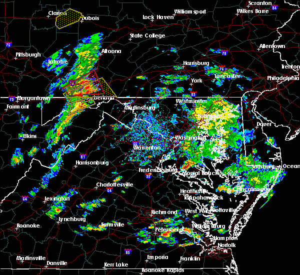 At 325 pm edt, a severe thunderstorm was located over la vale, or near cumberland, moving northeast at 20 mph (radar indicated). Hazards include 60 mph wind gusts and quarter size hail. Damaging winds will cause some trees and large branches to fall. this could injure those outdoors, as well as damage homes and vehicles. roadways may become blocked by downed trees. localized power outages are possible. unsecured light objects may become projectiles. Locations impacted include, cumberland, la vale, ellerslie, corriganville and pleasant valley. At 325 pm edt, a severe thunderstorm was located over la vale, or near cumberland, moving northeast at 20 mph (radar indicated). Hazards include 60 mph wind gusts and quarter size hail. Damaging winds will cause some trees and large branches to fall. this could injure those outdoors, as well as damage homes and vehicles. roadways may become blocked by downed trees. localized power outages are possible. unsecured light objects may become projectiles. Locations impacted include, cumberland, la vale, ellerslie, corriganville and pleasant valley.
|
| 8/21/2018 3:13 PM EDT |
 At 313 pm edt, severe thunderstorms were located along a line extending from lonaconing to near elk garden, moving northeast at 35 mph (radar indicated). Hazards include 60 mph wind gusts and quarter size hail. Damaging winds will cause some trees and large branches to fall. this could injure those outdoors, as well as damage homes and vehicles. roadways may become blocked by downed trees. localized power outages are possible. Unsecured light objects may become projectiles. At 313 pm edt, severe thunderstorms were located along a line extending from lonaconing to near elk garden, moving northeast at 35 mph (radar indicated). Hazards include 60 mph wind gusts and quarter size hail. Damaging winds will cause some trees and large branches to fall. this could injure those outdoors, as well as damage homes and vehicles. roadways may become blocked by downed trees. localized power outages are possible. Unsecured light objects may become projectiles.
|
| 8/21/2018 3:00 PM EDT |
 At 300 pm edt, a severe thunderstorm was located over frostburg, moving northeast at 20 mph (radar indicated). Hazards include 60 mph wind gusts and quarter size hail. Damaging winds will cause some trees and large branches to fall. this could injure those outdoors, as well as damage homes and vehicles. roadways may become blocked by downed trees. localized power outages are possible. Unsecured light objects may become projectiles. At 300 pm edt, a severe thunderstorm was located over frostburg, moving northeast at 20 mph (radar indicated). Hazards include 60 mph wind gusts and quarter size hail. Damaging winds will cause some trees and large branches to fall. this could injure those outdoors, as well as damage homes and vehicles. roadways may become blocked by downed trees. localized power outages are possible. Unsecured light objects may become projectiles.
|
| 8/21/2018 2:56 PM EDT |
 At 255 pm edt, a severe thunderstorm was located near lonaconing, or near westernport, moving northeast at 35 mph (radar indicated). Hazards include 60 mph wind gusts and quarter size hail. Damaging winds will cause some trees and large branches to fall. this could injure those outdoors, as well as damage homes and vehicles. roadways may become blocked by downed trees. localized power outages are possible. unsecured light objects may become projectiles. Locations impacted include, cumberland, frostburg, keyser, westernport, bel air, la vale, fort ashby, lonaconing, piedmont, ridgeley, cresaptown, potomac park, wiley ford, eckhart mines, rawlings, barton, corriganville, midland, midlothian and franklin. At 255 pm edt, a severe thunderstorm was located near lonaconing, or near westernport, moving northeast at 35 mph (radar indicated). Hazards include 60 mph wind gusts and quarter size hail. Damaging winds will cause some trees and large branches to fall. this could injure those outdoors, as well as damage homes and vehicles. roadways may become blocked by downed trees. localized power outages are possible. unsecured light objects may become projectiles. Locations impacted include, cumberland, frostburg, keyser, westernport, bel air, la vale, fort ashby, lonaconing, piedmont, ridgeley, cresaptown, potomac park, wiley ford, eckhart mines, rawlings, barton, corriganville, midland, midlothian and franklin.
|
| 8/21/2018 2:34 PM EDT |
 At 234 pm edt, a severe thunderstorm was located near kitzmiller, or 9 miles southwest of westernport, moving northeast at 35 mph (radar indicated). Hazards include 60 mph wind gusts and quarter size hail. Damaging winds will cause some trees and large branches to fall. this could injure those outdoors, as well as damage homes and vehicles. roadways may become blocked by downed trees. localized power outages are possible. Unsecured light objects may become projectiles. At 234 pm edt, a severe thunderstorm was located near kitzmiller, or 9 miles southwest of westernport, moving northeast at 35 mph (radar indicated). Hazards include 60 mph wind gusts and quarter size hail. Damaging winds will cause some trees and large branches to fall. this could injure those outdoors, as well as damage homes and vehicles. roadways may become blocked by downed trees. localized power outages are possible. Unsecured light objects may become projectiles.
|
| 8/16/2018 7:00 PM EDT | Several branches dow in allegany county MD, 1.3 miles SSE of Cumberland, MD |
| 5/14/2018 4:12 PM EDT |
 At 412 pm edt, severe thunderstorms were located along a line extending from near ridgeley to near bayard, moving east at 45 mph (radar indicated). Hazards include 60 mph wind gusts and quarter size hail. Damaging winds will cause some trees and large branches to fall. this could injure those outdoors, as well as damage homes and vehicles. roadways may become blocked by downed trees. localized power outages are possible. Unsecured light objects may become projectiles. At 412 pm edt, severe thunderstorms were located along a line extending from near ridgeley to near bayard, moving east at 45 mph (radar indicated). Hazards include 60 mph wind gusts and quarter size hail. Damaging winds will cause some trees and large branches to fall. this could injure those outdoors, as well as damage homes and vehicles. roadways may become blocked by downed trees. localized power outages are possible. Unsecured light objects may become projectiles.
|
| 5/13/2018 6:19 PM EDT |
 At 619 pm edt, severe thunderstorms were located along a line extending from near buffalo mills to near lake gordon, moving southeast at 40 mph (radar indicated). Hazards include 60 to 75 mph wind gusts and quarter size hail. Damaging winds will cause some trees and large branches to fall. this could injure those outdoors, as well as damage homes and vehicles. roadways may become blocked by downed trees. localized power outages are possible. unsecured light objects may become projectiles. Locations impacted include, cumberland, hancock, paw paw, greenwood, berkeley springs, ellerslie, corriganville, great cacapon, clear spring, flintstone, pecktonville, big spring, big pool, little orleans, johnsons mill, valley view, fishers bridge, spohrs crossroads, pumpkin center and oakland. At 619 pm edt, severe thunderstorms were located along a line extending from near buffalo mills to near lake gordon, moving southeast at 40 mph (radar indicated). Hazards include 60 to 75 mph wind gusts and quarter size hail. Damaging winds will cause some trees and large branches to fall. this could injure those outdoors, as well as damage homes and vehicles. roadways may become blocked by downed trees. localized power outages are possible. unsecured light objects may become projectiles. Locations impacted include, cumberland, hancock, paw paw, greenwood, berkeley springs, ellerslie, corriganville, great cacapon, clear spring, flintstone, pecktonville, big spring, big pool, little orleans, johnsons mill, valley view, fishers bridge, spohrs crossroads, pumpkin center and oakland.
|
| 5/13/2018 6:05 PM EDT |
 The national weather service in sterling virginia has issued a * severe thunderstorm warning for. northwestern washington county in north central maryland. northeastern allegany county in western maryland. morgan county in the panhandle of west virginia. Until 700 pm edt. The national weather service in sterling virginia has issued a * severe thunderstorm warning for. northwestern washington county in north central maryland. northeastern allegany county in western maryland. morgan county in the panhandle of west virginia. Until 700 pm edt.
|
| 5/13/2018 6:05 PM EDT |
 At 605 pm edt, severe thunderstorms were located along a line extending from near buffalo mills to 6 miles east of berlin, moving southeast at 40 mph (radar indicated). Hazards include damaging wind gusts of 60 to 75 mph wind gusts and quarter size hail. Damaging winds will cause some trees and large branches to fall. this could injure those outdoors, as well as damage homes and vehicles. roadways may become blocked by downed trees. localized power outages are possible. Unsecured light objects may become projectiles. At 605 pm edt, severe thunderstorms were located along a line extending from near buffalo mills to 6 miles east of berlin, moving southeast at 40 mph (radar indicated). Hazards include damaging wind gusts of 60 to 75 mph wind gusts and quarter size hail. Damaging winds will cause some trees and large branches to fall. this could injure those outdoors, as well as damage homes and vehicles. roadways may become blocked by downed trees. localized power outages are possible. Unsecured light objects may become projectiles.
|
| 8/4/2017 5:14 PM EDT |
 At 514 pm edt, a severe thunderstorm was located near cumberland, moving northeast at 30 mph (radar indicated). Hazards include 60 mph wind gusts. Damaging winds will cause some trees and large branches to fall. this could injure those outdoors, as well as damage homes and vehicles. roadways may become blocked by downed trees. localized power outages are possible. unsecured light objects may become projectiles. Locations impacted include, cumberland, wiley ford, green spring, flintstone, oldtown, wolfe mill, pleasant valley, pumpkin center and wagoner. At 514 pm edt, a severe thunderstorm was located near cumberland, moving northeast at 30 mph (radar indicated). Hazards include 60 mph wind gusts. Damaging winds will cause some trees and large branches to fall. this could injure those outdoors, as well as damage homes and vehicles. roadways may become blocked by downed trees. localized power outages are possible. unsecured light objects may become projectiles. Locations impacted include, cumberland, wiley ford, green spring, flintstone, oldtown, wolfe mill, pleasant valley, pumpkin center and wagoner.
|
| 8/4/2017 5:06 PM EDT | Trees and wires dow in allegany county MD, 0.5 miles ENE of Cumberland, MD |
| 8/4/2017 5:03 PM EDT |
 At 503 pm edt, a severe thunderstorm was located near ridgeley, or near cumberland, moving northeast at 30 mph (radar indicated). Hazards include 60 mph wind gusts. Damaging winds will cause some trees and large branches to fall. this could injure those outdoors, as well as damage homes and vehicles. roadways may become blocked by downed trees. localized power outages are possible. Unsecured light objects may become projectiles. At 503 pm edt, a severe thunderstorm was located near ridgeley, or near cumberland, moving northeast at 30 mph (radar indicated). Hazards include 60 mph wind gusts. Damaging winds will cause some trees and large branches to fall. this could injure those outdoors, as well as damage homes and vehicles. roadways may become blocked by downed trees. localized power outages are possible. Unsecured light objects may become projectiles.
|
| 7/4/2017 3:01 PM EDT | Tree down on house on wilmont avenue near fayette stree in allegany county MD, 1.5 miles E of Cumberland, MD |
| 5/1/2017 5:37 PM EDT |
 At 536 pm edt, severe thunderstorms were located along a line extending from 6 miles east of berlin to near kitzmiller, moving northeast at 60 mph (radar indicated). Hazards include 60 mph wind gusts. Damaging winds will cause some trees and large branches to fall. this could injure those outdoors, as well as damage homes and vehicles. roadways may become blocked by downed trees. localized power outages are possible. unsecured light objects may become projectiles. Locations impacted include, cumberland, frostburg, westernport, bel air, la vale, lonaconing, ridgeley, cresaptown, potomac park, wiley ford, eckhart mines, mount savage, rawlings, ellerslie, barton, corriganville, midland, midlothian, franklin and flintstone. At 536 pm edt, severe thunderstorms were located along a line extending from 6 miles east of berlin to near kitzmiller, moving northeast at 60 mph (radar indicated). Hazards include 60 mph wind gusts. Damaging winds will cause some trees and large branches to fall. this could injure those outdoors, as well as damage homes and vehicles. roadways may become blocked by downed trees. localized power outages are possible. unsecured light objects may become projectiles. Locations impacted include, cumberland, frostburg, westernport, bel air, la vale, lonaconing, ridgeley, cresaptown, potomac park, wiley ford, eckhart mines, mount savage, rawlings, ellerslie, barton, corriganville, midland, midlothian, franklin and flintstone.
|
| 5/1/2017 5:25 PM EDT |
 At 524 pm edt, severe thunderstorms were located along a line extending from near meyersdale to near loch lynn heights, moving northeast at 60 mph (radar indicated). Hazards include 60 mph wind gusts. Damaging winds will cause some trees and large branches to fall. this could injure those outdoors, as well as damage homes and vehicles. roadways may become blocked by downed trees. localized power outages are possible. Unsecured light objects may become projectiles. At 524 pm edt, severe thunderstorms were located along a line extending from near meyersdale to near loch lynn heights, moving northeast at 60 mph (radar indicated). Hazards include 60 mph wind gusts. Damaging winds will cause some trees and large branches to fall. this could injure those outdoors, as well as damage homes and vehicles. roadways may become blocked by downed trees. localized power outages are possible. Unsecured light objects may become projectiles.
|
| 3/1/2017 12:12 PM EST |
 At 1212 pm est, severe thunderstorms were located along a line extending from 8 miles northeast of lake gordon to 7 miles west of wardensville, moving east at 50 mph (radar indicated). Hazards include 60 mph wind gusts. Damaging winds will cause some trees and large branches to fall. this could injure those outdoors, as well as damage homes and vehicles. roadways may become blocked by downed trees. localized power outages are possible. Unsecured light objects may become projectiles. At 1212 pm est, severe thunderstorms were located along a line extending from 8 miles northeast of lake gordon to 7 miles west of wardensville, moving east at 50 mph (radar indicated). Hazards include 60 mph wind gusts. Damaging winds will cause some trees and large branches to fall. this could injure those outdoors, as well as damage homes and vehicles. roadways may become blocked by downed trees. localized power outages are possible. Unsecured light objects may become projectiles.
|
| 2/12/2017 9:26 PM EST |
 At 925 pm est, severe thunderstorms were located along a line extending from 6 miles southwest of clearville to westernport to near grafton, moving east at 45 mph (radar indicated). Hazards include 60 mph wind gusts. Damaging winds will cause some trees and large branches to fall. this could injure those outdoors, as well as damage homes and vehicles. roadways may become blocked by downed trees. localized power outages are possible. unsecured light objects may become projectiles. Locations impacted include, cumberland, frostburg, keyser, westernport, romney, hancock, bel air, paw paw, bayard, la vale, fort ashby, lonaconing, piedmont, berkeley springs, elk garden, kitzmiller, ridgeley, cresaptown, potomac park and wiley ford. At 925 pm est, severe thunderstorms were located along a line extending from 6 miles southwest of clearville to westernport to near grafton, moving east at 45 mph (radar indicated). Hazards include 60 mph wind gusts. Damaging winds will cause some trees and large branches to fall. this could injure those outdoors, as well as damage homes and vehicles. roadways may become blocked by downed trees. localized power outages are possible. unsecured light objects may become projectiles. Locations impacted include, cumberland, frostburg, keyser, westernport, romney, hancock, bel air, paw paw, bayard, la vale, fort ashby, lonaconing, piedmont, berkeley springs, elk garden, kitzmiller, ridgeley, cresaptown, potomac park and wiley ford.
|
| 2/12/2017 9:00 PM EST |
 At 900 pm est, severe thunderstorms were located along a line extending from near buffalo mills to near bittinger to near enterprise, moving southeast at 45 mph (radar indicated). Hazards include 60 mph wind gusts. Damaging winds will cause some trees and large branches to fall. this could injure those outdoors, as well as damage homes and vehicles. roadways may become blocked by downed trees. localized power outages are possible. Unsecured light objects may become projectiles. At 900 pm est, severe thunderstorms were located along a line extending from near buffalo mills to near bittinger to near enterprise, moving southeast at 45 mph (radar indicated). Hazards include 60 mph wind gusts. Damaging winds will cause some trees and large branches to fall. this could injure those outdoors, as well as damage homes and vehicles. roadways may become blocked by downed trees. localized power outages are possible. Unsecured light objects may become projectiles.
|
| 7/18/2016 1:24 PM EDT |
 At 124 pm edt, a severe thunderstorm was located near ridgeley, or near cumberland, moving east at 35 mph (radar indicated). Hazards include 60 mph wind gusts and quarter size hail. Damaging winds will cause some trees and large branches to fall. this could injure those outdoors, as well as damage homes and vehicles. roadways may become blocked by downed trees. localized power outages are possible. Unsecured light objects may become projectiles. At 124 pm edt, a severe thunderstorm was located near ridgeley, or near cumberland, moving east at 35 mph (radar indicated). Hazards include 60 mph wind gusts and quarter size hail. Damaging winds will cause some trees and large branches to fall. this could injure those outdoors, as well as damage homes and vehicles. roadways may become blocked by downed trees. localized power outages are possible. Unsecured light objects may become projectiles.
|
| 7/18/2016 1:23 PM EDT | Tree on house in the 300 block of avirett avenu in allegany county MD, 1 miles E of Cumberland, MD |
| 7/18/2016 1:23 PM EDT | Tree down in roadway in 600 block of william stree in allegany county MD, 0.2 miles NNW of Cumberland, MD |
| 7/18/2016 1:23 PM EDT | Tree in roadway in the 900 block of grand avenu in allegany county MD, 1 miles NNE of Cumberland, MD |
| 7/18/2016 1:23 PM EDT | Tree down near the intersection of east industrial boulevard and seymour stree in allegany county MD, 1.6 miles NNE of Cumberland, MD |
| 6/21/2016 1:23 PM EDT |
 At 123 pm edt, a severe thunderstorm was located near fort ashby, or near bel air, moving southeast at 30 mph (radar indicated). Hazards include 60 mph wind gusts and quarter size hail. Damaging winds will cause some trees and large branches to fall. this could injure those outdoors, as well as damage homes and vehicles. roadways may become blocked by downed trees. localized power outages are possible. Unsecured light objects may become projectiles. At 123 pm edt, a severe thunderstorm was located near fort ashby, or near bel air, moving southeast at 30 mph (radar indicated). Hazards include 60 mph wind gusts and quarter size hail. Damaging winds will cause some trees and large branches to fall. this could injure those outdoors, as well as damage homes and vehicles. roadways may become blocked by downed trees. localized power outages are possible. Unsecured light objects may become projectiles.
|
| 6/21/2016 1:09 PM EDT |
 At 109 pm edt, a severe thunderstorm was located near ridgeley, or near bel air, moving southeast at 25 mph (radar indicated). Hazards include 60 mph wind gusts and quarter size hail. Damaging winds will cause some trees and large branches to fall. this could injure those outdoors, as well as damage homes and vehicles. roadways may become blocked by downed trees. localized power outages are possible. unsecured light objects may become projectiles. Locations impacted include, cumberland, frostburg, hancock, bel air, paw paw, greenwood, la vale, fort ashby, lonaconing, berkeley springs, ridgeley, cresaptown, potomac park, wiley ford, eckhart mines, rawlings, midland, great cacapon, midlothian and green spring. At 109 pm edt, a severe thunderstorm was located near ridgeley, or near bel air, moving southeast at 25 mph (radar indicated). Hazards include 60 mph wind gusts and quarter size hail. Damaging winds will cause some trees and large branches to fall. this could injure those outdoors, as well as damage homes and vehicles. roadways may become blocked by downed trees. localized power outages are possible. unsecured light objects may become projectiles. Locations impacted include, cumberland, frostburg, hancock, bel air, paw paw, greenwood, la vale, fort ashby, lonaconing, berkeley springs, ridgeley, cresaptown, potomac park, wiley ford, eckhart mines, rawlings, midland, great cacapon, midlothian and green spring.
|
| 6/21/2016 12:50 PM EDT |
 At 1249 pm edt, a severe thunderstorm was located over frostburg, moving southeast at 25 mph (radar indicated). Hazards include 60 mph wind gusts. Damaging winds will cause some trees and large branches to fall. this could injure those outdoors, as well as damage homes and vehicles. roadways may become blocked by downed trees. localized power outages are possible. Unsecured light objects may become projectiles. At 1249 pm edt, a severe thunderstorm was located over frostburg, moving southeast at 25 mph (radar indicated). Hazards include 60 mph wind gusts. Damaging winds will cause some trees and large branches to fall. this could injure those outdoors, as well as damage homes and vehicles. roadways may become blocked by downed trees. localized power outages are possible. Unsecured light objects may become projectiles.
|
| 6/16/2016 6:39 PM EDT |
 At 639 pm edt, severe thunderstorms were located along a line extending from 7 miles southeast of lake gordon to 6 miles southeast of fort ashby to near rough run to 12 miles west of brandywine, moving southeast at 40 mph (radar indicated). Hazards include 60 mph wind gusts and quarter size hail. Damaging winds will cause some trees and large branches to fall. this could injure those outdoors, as well as damage homes and vehicles. roadways may become blocked by downed trees. localized power outages are possible. unsecured light objects may become projectiles. Locations impacted include, cumberland, moorefield, petersburg, romney, hancock, paw paw, brandywine, rough run, fort ashby, berkeley springs, ridgeley, upper tract, mathias, potomac park, wiley ford, franklin, springfield, great cacapon, capon bridge and green spring. At 639 pm edt, severe thunderstorms were located along a line extending from 7 miles southeast of lake gordon to 6 miles southeast of fort ashby to near rough run to 12 miles west of brandywine, moving southeast at 40 mph (radar indicated). Hazards include 60 mph wind gusts and quarter size hail. Damaging winds will cause some trees and large branches to fall. this could injure those outdoors, as well as damage homes and vehicles. roadways may become blocked by downed trees. localized power outages are possible. unsecured light objects may become projectiles. Locations impacted include, cumberland, moorefield, petersburg, romney, hancock, paw paw, brandywine, rough run, fort ashby, berkeley springs, ridgeley, upper tract, mathias, potomac park, wiley ford, franklin, springfield, great cacapon, capon bridge and green spring.
|
| 6/16/2016 6:01 PM EDT |
 At 600 pm edt, severe thunderstorms were located along a line extending from near frostburg to westernport to near bayard to near dailey, moving southeast at 45 mph (radar indicated). Hazards include 60 mph wind gusts and quarter size hail. Damaging winds will cause some trees and large branches to fall. this could injure those outdoors, as well as damage homes and vehicles. roadways may become blocked by downed trees. localized power outages are possible. Unsecured light objects may become projectiles. At 600 pm edt, severe thunderstorms were located along a line extending from near frostburg to westernport to near bayard to near dailey, moving southeast at 45 mph (radar indicated). Hazards include 60 mph wind gusts and quarter size hail. Damaging winds will cause some trees and large branches to fall. this could injure those outdoors, as well as damage homes and vehicles. roadways may become blocked by downed trees. localized power outages are possible. Unsecured light objects may become projectiles.
|
| 6/16/2016 3:11 PM EDT |
 At 311 pm edt, doppler radar indicated a severe thunderstorm capable of producing half dollar size hail and destructive winds in excess of 70 mph. this storm was located near buffalo mills, or 12 miles southwest of bedford, and moving southeast at 30 mph. At 311 pm edt, doppler radar indicated a severe thunderstorm capable of producing half dollar size hail and destructive winds in excess of 70 mph. this storm was located near buffalo mills, or 12 miles southwest of bedford, and moving southeast at 30 mph.
|
| 9/4/2015 2:48 PM EDT |
 At 248 pm edt, doppler radar indicated a severe thunderstorm capable of producing quarter size hail and damaging winds in excess of 60 mph. this storm was located near cumberland, moving southwest at 15 mph. locations impacted include, cumberland, ridgeley, la vale, spring gap, wiley ford, wolfe mill, oldtown, north branch, patterson creek and wagoner. At 248 pm edt, doppler radar indicated a severe thunderstorm capable of producing quarter size hail and damaging winds in excess of 60 mph. this storm was located near cumberland, moving southwest at 15 mph. locations impacted include, cumberland, ridgeley, la vale, spring gap, wiley ford, wolfe mill, oldtown, north branch, patterson creek and wagoner.
|
| 9/4/2015 2:36 PM EDT |
 At 236 pm edt, doppler radar indicated a severe thunderstorm capable of producing quarter size hail and damaging winds in excess of 60 mph. this storm was located 7 miles east of cumberland, and moving southwest at 15 mph. At 236 pm edt, doppler radar indicated a severe thunderstorm capable of producing quarter size hail and damaging winds in excess of 60 mph. this storm was located 7 miles east of cumberland, and moving southwest at 15 mph.
|
| 9/2/2015 1:59 PM EDT | Tree and power lines down in 1500 block of frederick st in allegany county MD, 1.2 miles S of Cumberland, MD |
| 8/4/2015 3:21 AM EDT |
 At 320 am edt, doppler radar indicated a severe thunderstorm capable of producing quarter size hail and damaging winds in excess of 60 mph. this storm was located near lonaconing, or 7 miles northeast of keyser, moving northeast at 45 mph. locations impacted include, cumberland, frostburg, la vale, ridgeley, corriganville, wolfe mill, pinto, cresaptown, brady, potomac park, spring gap, wiley ford, eckhart mines, short gap, north branch, patterson creek, rawlings, ellerslie and midland. At 320 am edt, doppler radar indicated a severe thunderstorm capable of producing quarter size hail and damaging winds in excess of 60 mph. this storm was located near lonaconing, or 7 miles northeast of keyser, moving northeast at 45 mph. locations impacted include, cumberland, frostburg, la vale, ridgeley, corriganville, wolfe mill, pinto, cresaptown, brady, potomac park, spring gap, wiley ford, eckhart mines, short gap, north branch, patterson creek, rawlings, ellerslie and midland.
|
| 8/4/2015 2:55 AM EDT |
 At 255 am edt, doppler radar indicated a severe thunderstorm capable of producing quarter size hail and damaging winds in excess of 60 mph. this storm was located over keyser, and moving northeast at 35 mph. At 255 am edt, doppler radar indicated a severe thunderstorm capable of producing quarter size hail and damaging winds in excess of 60 mph. this storm was located over keyser, and moving northeast at 35 mph.
|
| 5/30/2015 1:54 PM EDT | At 154 pm edt, doppler radar indicated a severe thunderstorm capable of producing damaging winds in excess of 60 mph. this storm was located near keyser, moving northeast at 35 mph. locations impacted include, cumberland, keyser, westernport, piedmont, fort ashby, ridgeley, la vale, luke, springfield, wolfe mill, reeses mill, new creek, reynolds, wiley ford, short gap, wapocomo, headsville, patterson creek, rawlings and three churches. lightning is one of natures number one killers. remember, if you can hear thunder, you are close enough to be struck by lightning. |
| 5/30/2015 1:54 PM EDT | At 154 pm edt, doppler radar indicated a severe thunderstorm capable of producing damaging winds in excess of 60 mph. this storm was located near keyser, moving northeast at 35 mph. locations impacted include, cumberland, keyser, westernport, piedmont, fort ashby, ridgeley, la vale, luke, springfield, wolfe mill, reeses mill, new creek, reynolds, wiley ford, short gap, wapocomo, headsville, patterson creek, rawlings and three churches. lightning is one of natures number one killers. remember, if you can hear thunder, you are close enough to be struck by lightning. |
| 5/30/2015 1:43 PM EDT | At 142 pm edt, doppler radar indicated a severe thunderstorm capable of producing damaging winds in excess of 60 mph. this storm was located over keyser, and moving northeast at 35 mph. penny size hail, frequent lightning and very heavy rain are also possible with this storm. |
| 5/30/2015 1:43 PM EDT | At 142 pm edt, doppler radar indicated a severe thunderstorm capable of producing damaging winds in excess of 60 mph. this storm was located over keyser, and moving northeast at 35 mph. penny size hail, frequent lightning and very heavy rain are also possible with this storm. |
| 4/20/2015 5:37 PM EDT | At 536 pm edt, doppler radar indicated a severe thunderstorm capable of producing quarter size hail and damaging winds in excess of 60 mph. this storm was located over lake gordon, or 9 miles northeast of cumberland, moving northeast at 30 mph. locations impacted include, cumberland, ridgeley, wiley ford, wolfe mill, pleasant valley in allegany county, flintstone and north branch. a tornado watch remains in effect until 1000 pm edt for western maryland and eastern west virginia. |
| 4/20/2015 5:37 PM EDT | At 536 pm edt, doppler radar indicated a severe thunderstorm capable of producing quarter size hail and damaging winds in excess of 60 mph. this storm was located over lake gordon, or 9 miles northeast of cumberland, moving northeast at 30 mph. locations impacted include, cumberland, ridgeley, wiley ford, wolfe mill, pleasant valley in allegany county, flintstone and north branch. a tornado watch remains in effect until 1000 pm edt for western maryland and eastern west virginia. |
| 4/20/2015 5:22 PM EDT | At 522 pm edt, doppler radar indicated a severe thunderstorm capable of producing quarter size hail and damaging winds in excess of 60 mph. this storm was located over cumberland, and moving northeast at 35 mph. |
| 4/20/2015 5:22 PM EDT | At 522 pm edt, doppler radar indicated a severe thunderstorm capable of producing quarter size hail and damaging winds in excess of 60 mph. this storm was located over cumberland, and moving northeast at 35 mph. |
| 7/8/2014 5:29 PM EDT | Tree down at louisiana avenue in cumberland... m in allegany county MD, 0.5 miles ENE of Cumberland, MD |
| 8/14/2012 4:19 PM EDT | Tree down across telephone lines near intersection of drake rd se and williams rd se in allegany county MD, 4.4 miles W of Cumberland, MD |
| 8/9/2012 1:40 PM EDT | Quarter sized hail reported 2.4 miles ESE of Cumberland, MD |
| 7/4/2012 8:00 PM EDT | Quarter sized hail reported 4.7 miles S of Cumberland, MD |
| 6/29/2012 9:15 PM EDT | Roof blown off house along york plac in allegany county MD, 1.6 miles NNE of Cumberland, MD |
| 6/29/2012 9:14 PM EDT | Quarter sized hail reported 1.8 miles NNE of Cumberland, MD, spotter reports power out throughout cumberland city |
| 6/29/2012 9:07 PM EDT | Numerous trees uprooted. damage extends into cumberland...where downtown windows were blown out...and several roofs were torn of in allegany county MD, 1.5 miles E of Cumberland, MD |
| 6/29/2012 9:07 PM EDT | Tree down over car on hilltop stree in allegany county MD, 1 miles NNE of Cumberland, MD |
| 6/1/2012 6:08 PM EDT | Trees down at robbins terrac in allegany county MD, 1.5 miles E of Cumberland, MD |
| 6/1/2012 6:08 PM EDT | Trees down south street at franks lan in allegany county MD, 1.6 miles NNE of Cumberland, MD |
| 1/1/0001 12:00 AM | Quarter sized hail reported 3.8 miles NNW of Cumberland, MD |
| 1/1/0001 12:00 AM | Half Dollar sized hail reported 0.6 miles WNW of Cumberland, MD |
| 1/1/0001 12:00 AM | Half Dollar sized hail reported 1 miles NNE of Cumberland, MD |
| 1/1/0001 12:00 AM | Quarter sized hail reported 5.9 miles NNW of Cumberland, MD |
| 1/1/0001 12:00 AM | Half Dollar sized hail reported 5.9 miles NNW of Cumberland, MD, half-dollar size hail in spring gap... md |
| 1/1/0001 12:00 AM | Quarter sized hail reported 7.7 miles NE of Cumberland, MD, quarter size hail whitened the ground near intersection of rt 956 and us 220. |
| 1/1/0001 12:00 AM | Quarter sized hail reported 1.7 miles NNW of Cumberland, MD, hail ranging from dime to quarter size. |
| 1/1/0001 12:00 AM | Quarter sized hail reported 6.9 miles NE of Cumberland, MD, quarter size hail south of rawlings and north of keyser in west virginia |
Hail Maps for Cumberland, MD
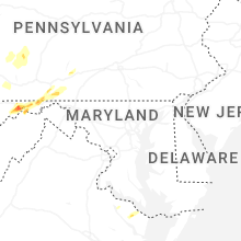


Connect with Interactive Hail Maps