

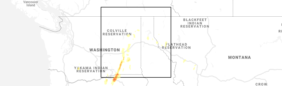
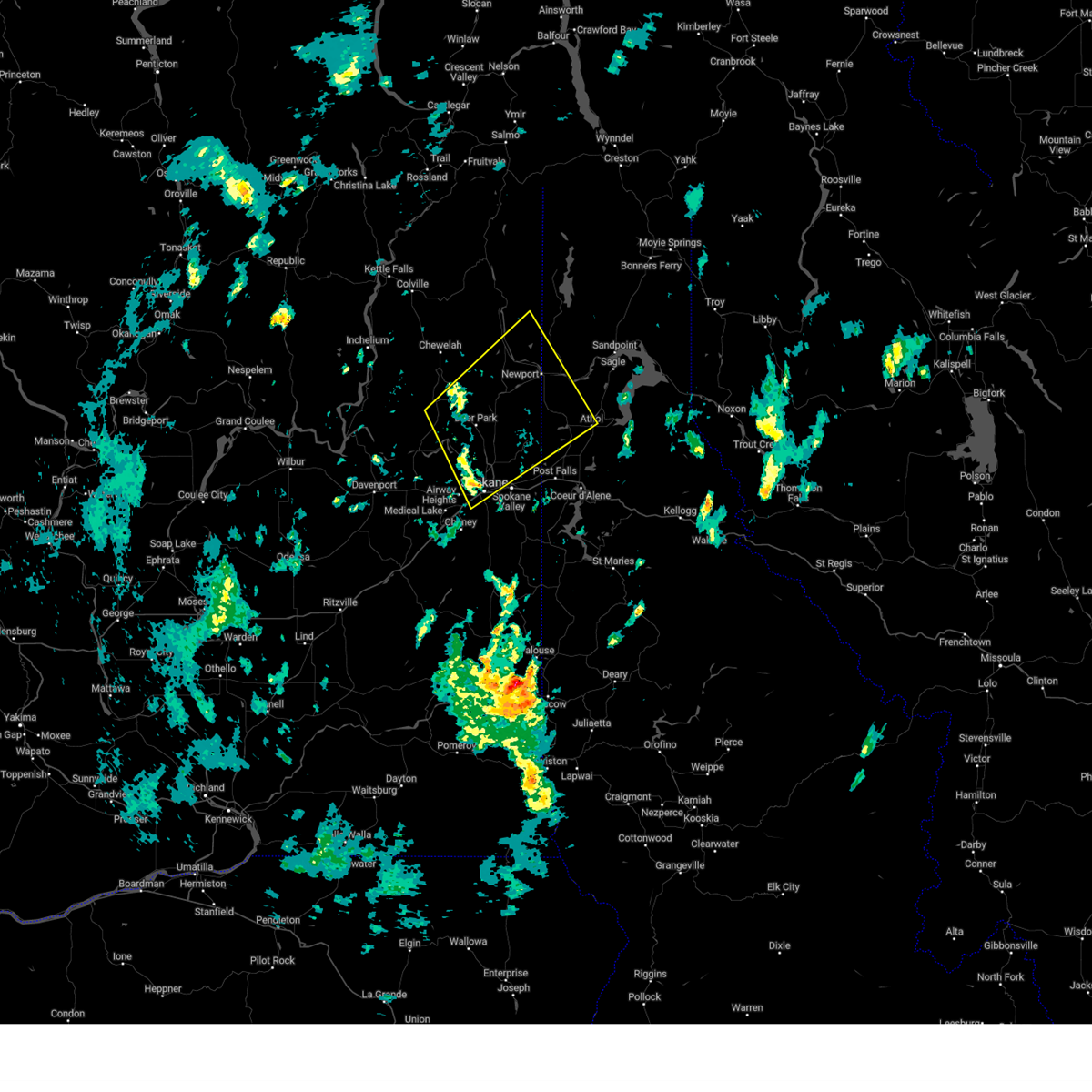
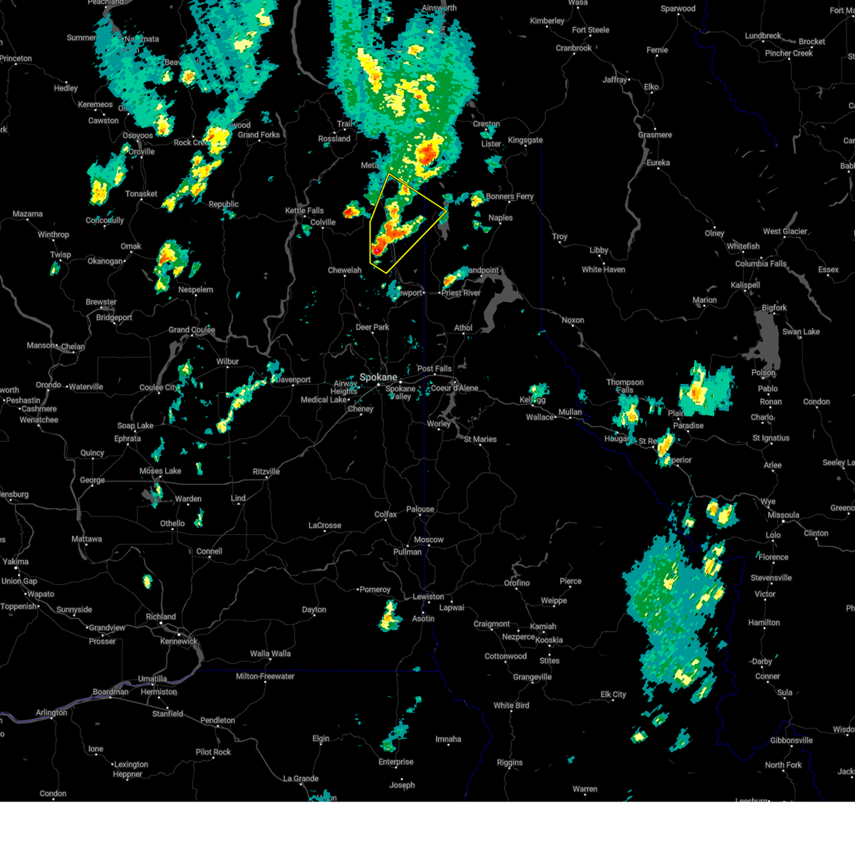
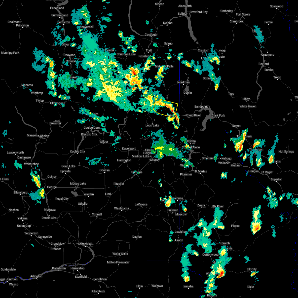
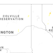
Hail Map for Cusick, WA
The Cusick, WA area has had 2 reports of on-the-ground hail by trained spotters, and has been under severe weather warnings 1 time during the past 12 months. Doppler radar has detected hail at or near Cusick, WA on 4 occasions.
| Name: | Cusick, WA |
| Where Located: | 47 miles N of Spokane, WA |
| Map: | Google Map for Cusick, WA |
| Population: | 207 |
| Housing Units: | 101 |
| More Info: | Search Google for Cusick, WA |
5
The Top Recent Hail Date for Cusick, WA is Saturday, May 30, 2020 (2nd out of 4)
Hail and Wind Damage Spotted near Cusick, WA
| Date / Time | Report Details |
|---|---|
| 9/25/2024 4:23 PM PDT |
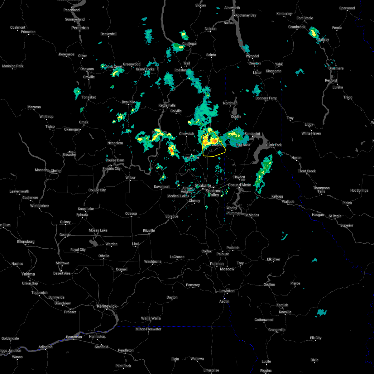
 Svrotx the national weather service in spokane has issued a * severe thunderstorm warning for, southwestern bonner county in the panhandle of idaho, northwestern kootenai county in the panhandle of idaho, southeastern stevens county in northeastern washington, northern spokane county in northeastern washington, southeastern pend oreille county in northeastern washington, * until 530 pm pdt. * at 423 pm pdt, a severe thunderstorm was located over nine mile falls, or 8 miles northwest of spokane, moving northeast at 40 mph (radar indicated). Hazards include 60 mph wind gusts. expect damage to roofs, siding, and trees Svrotx the national weather service in spokane has issued a * severe thunderstorm warning for, southwestern bonner county in the panhandle of idaho, northwestern kootenai county in the panhandle of idaho, southeastern stevens county in northeastern washington, northern spokane county in northeastern washington, southeastern pend oreille county in northeastern washington, * until 530 pm pdt. * at 423 pm pdt, a severe thunderstorm was located over nine mile falls, or 8 miles northwest of spokane, moving northeast at 40 mph (radar indicated). Hazards include 60 mph wind gusts. expect damage to roofs, siding, and trees
|
| 5/21/2023 4:14 PM PDT |
 At 414 pm pdt, a severe thunderstorm was located 19 miles southwest of nordman, or 29 miles northwest of priest river, moving northeast at 35 mph (radar indicated). Hazards include 60 mph wind gusts and quarter size hail. Hail damage to vehicles is expected. Expect wind damage to roofs, siding, and trees. At 414 pm pdt, a severe thunderstorm was located 19 miles southwest of nordman, or 29 miles northwest of priest river, moving northeast at 35 mph (radar indicated). Hazards include 60 mph wind gusts and quarter size hail. Hail damage to vehicles is expected. Expect wind damage to roofs, siding, and trees.
|
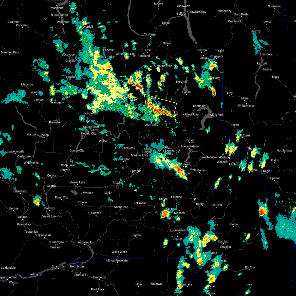
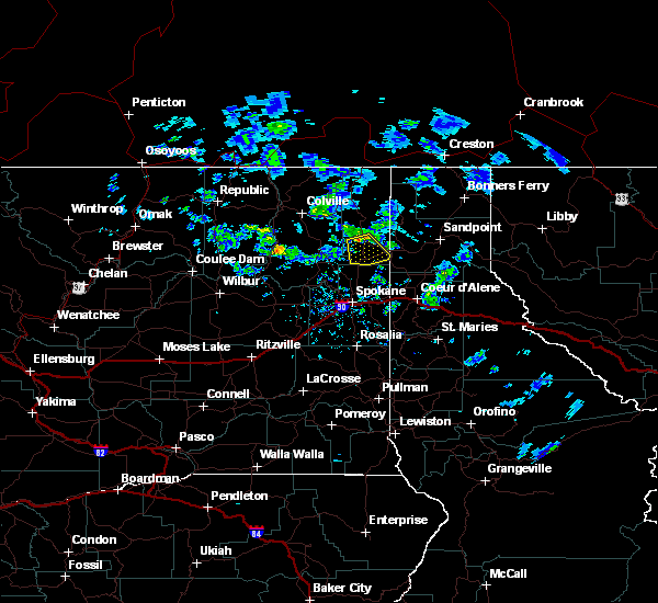
| 7/3/2022 2:42 PM PDT |
 At 242 pm pdt, severe thunderstorms were located along a line extending from 11 miles northeast of chewelah to 23 miles southeast of colville to 10 miles northwest of newport, moving north at 15 mph (radar indicated). Hazards include 60 mph wind gusts and penny size hail. Expect damage to roofs, siding, and trees. locations impacted include, cusick, chewelah peak, usk, bead lake campground, dalkena and 49 degrees north. hail threat, radar indicated max hail size, 0. 75 in wind threat, radar indicated max wind gust, 60 mph. At 242 pm pdt, severe thunderstorms were located along a line extending from 11 miles northeast of chewelah to 23 miles southeast of colville to 10 miles northwest of newport, moving north at 15 mph (radar indicated). Hazards include 60 mph wind gusts and penny size hail. Expect damage to roofs, siding, and trees. locations impacted include, cusick, chewelah peak, usk, bead lake campground, dalkena and 49 degrees north. hail threat, radar indicated max hail size, 0. 75 in wind threat, radar indicated max wind gust, 60 mph.
|
| 7/3/2022 2:15 PM PDT |
 At 215 pm pdt, severe thunderstorms were located along a line extending from 6 miles northeast of chewelah to 21 miles north of deer park to 8 miles west of newport, moving north at 10 mph (radar indicated). Hazards include 60 mph wind gusts and quarter size hail. Hail damage to vehicles is expected. Expect wind damage to roofs, siding, and trees. At 215 pm pdt, severe thunderstorms were located along a line extending from 6 miles northeast of chewelah to 21 miles north of deer park to 8 miles west of newport, moving north at 10 mph (radar indicated). Hazards include 60 mph wind gusts and quarter size hail. Hail damage to vehicles is expected. Expect wind damage to roofs, siding, and trees.
|
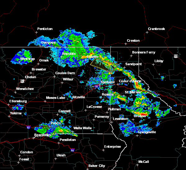
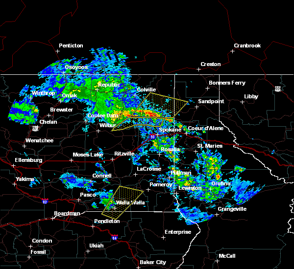
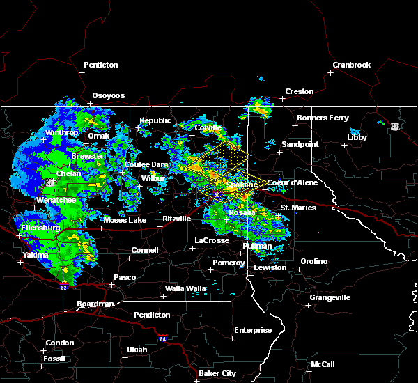
| 5/30/2020 8:56 PM PDT |
 The severe thunderstorm warning for west central bonner, east central stevens and southern pend oreille counties will expire at 900 pm pdt, the storms which prompted the warning have moved out of the area. therefore, the warning will be allowed to expire. a severe thunderstorm watch remains in effect until 1100 pm pdt for the panhandle of idaho, and northeastern washington. The severe thunderstorm warning for west central bonner, east central stevens and southern pend oreille counties will expire at 900 pm pdt, the storms which prompted the warning have moved out of the area. therefore, the warning will be allowed to expire. a severe thunderstorm watch remains in effect until 1100 pm pdt for the panhandle of idaho, and northeastern washington.
|
| 5/30/2020 8:31 PM PDT |
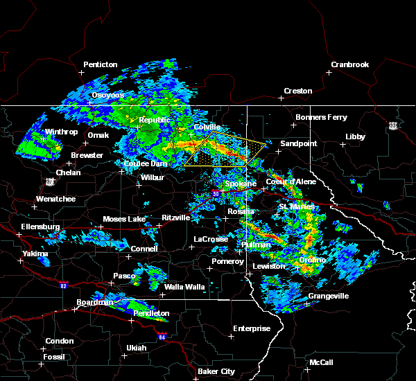 At 831 pm pdt, severe thunderstorms were located along a line extending from 12 miles northeast of chewelah to near priest river, moving northeast at 50 mph (radar indicated). Hazards include 60 mph wind gusts and penny size hail. Expect damage to roofs, siding, and trees. Locations impacted include, newport, cusick, oldtown, bead lake campground, south skookum lake campground, browns lake campground, usk, ruby and dalkena. At 831 pm pdt, severe thunderstorms were located along a line extending from 12 miles northeast of chewelah to near priest river, moving northeast at 50 mph (radar indicated). Hazards include 60 mph wind gusts and penny size hail. Expect damage to roofs, siding, and trees. Locations impacted include, newport, cusick, oldtown, bead lake campground, south skookum lake campground, browns lake campground, usk, ruby and dalkena.
|
| 5/30/2020 8:10 PM PDT |
 At 809 pm pdt, severe thunderstorms were located along a line extending from 7 miles southwest of chewelah to 12 miles west of spirit lake, moving northeast at 50 mph (radar indicated). Hazards include 60 mph wind gusts and penny size hail. expect damage to roofs, siding, and trees At 809 pm pdt, severe thunderstorms were located along a line extending from 7 miles southwest of chewelah to 12 miles west of spirit lake, moving northeast at 50 mph (radar indicated). Hazards include 60 mph wind gusts and penny size hail. expect damage to roofs, siding, and trees
|
| 7/23/2019 9:18 PM PDT |
 At 917 pm pdt, severe thunderstorms were located along a line extending from 16 miles south of chewelah to near deer park, moving northeast at 25 mph (radar indicated). Hazards include 60 mph wind gusts and penny size hail. expect damage to roofs, siding, and trees At 917 pm pdt, severe thunderstorms were located along a line extending from 16 miles south of chewelah to near deer park, moving northeast at 25 mph (radar indicated). Hazards include 60 mph wind gusts and penny size hail. expect damage to roofs, siding, and trees
|
| 6/8/2019 4:58 PM PDT |
 The severe thunderstorm warning for southeastern pend oreille county will expire at 500 pm pdt, the storm which prompted the warning has weakened below severe limits, and no longer poses an immediate threat to life or property. therefore, the warning will be allowed to expire. The severe thunderstorm warning for southeastern pend oreille county will expire at 500 pm pdt, the storm which prompted the warning has weakened below severe limits, and no longer poses an immediate threat to life or property. therefore, the warning will be allowed to expire.
|
| 6/8/2019 4:25 PM PDT |
 At 424 pm pdt, a severe thunderstorm was located 14 miles northwest of newport, or 20 miles west of priest river, moving south at 15 mph (radar indicated). Hazards include quarter size hail. damage to vehicles is possible At 424 pm pdt, a severe thunderstorm was located 14 miles northwest of newport, or 20 miles west of priest river, moving south at 15 mph (radar indicated). Hazards include quarter size hail. damage to vehicles is possible
|
| 5/29/2015 7:27 PM PDT | At 722 pm pdt, trained weather spotters reported a severe thunderstorm that produce hail around quarter size and one inch in diameter near arden around 715 pm. due to the reported large amount of hail, there was some damage to cars near arden. gusts up to 45 to 50 mph is possible. this storm was located 13 miles northeast of chewelah, or 36 miles northwest of priest river, and moving east at 30 mph. |
| 7/23/2014 4:54 PM PDT | Dime sized hail and several trees down in pend oreille county WA, 11.3 miles N of Cusick, WA |
| 8/25/2013 9:15 PM PDT | Trees knocked down power line in pend oreille county WA, 10.6 miles N of Cusick, WA |
| 6/23/2012 10:15 AM PDT | Quarter sized hail reported 15.9 miles S of Cusick, WA, public report |
| 6/23/2012 9:55 AM PDT | Quarter sized hail reported 9.5 miles S of Cusick, WA |
Hail Maps for Cusick, WA


Connect with Interactive Hail Maps