

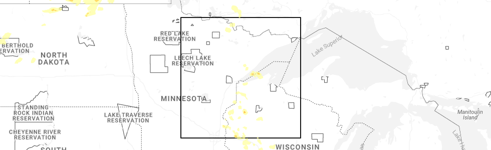
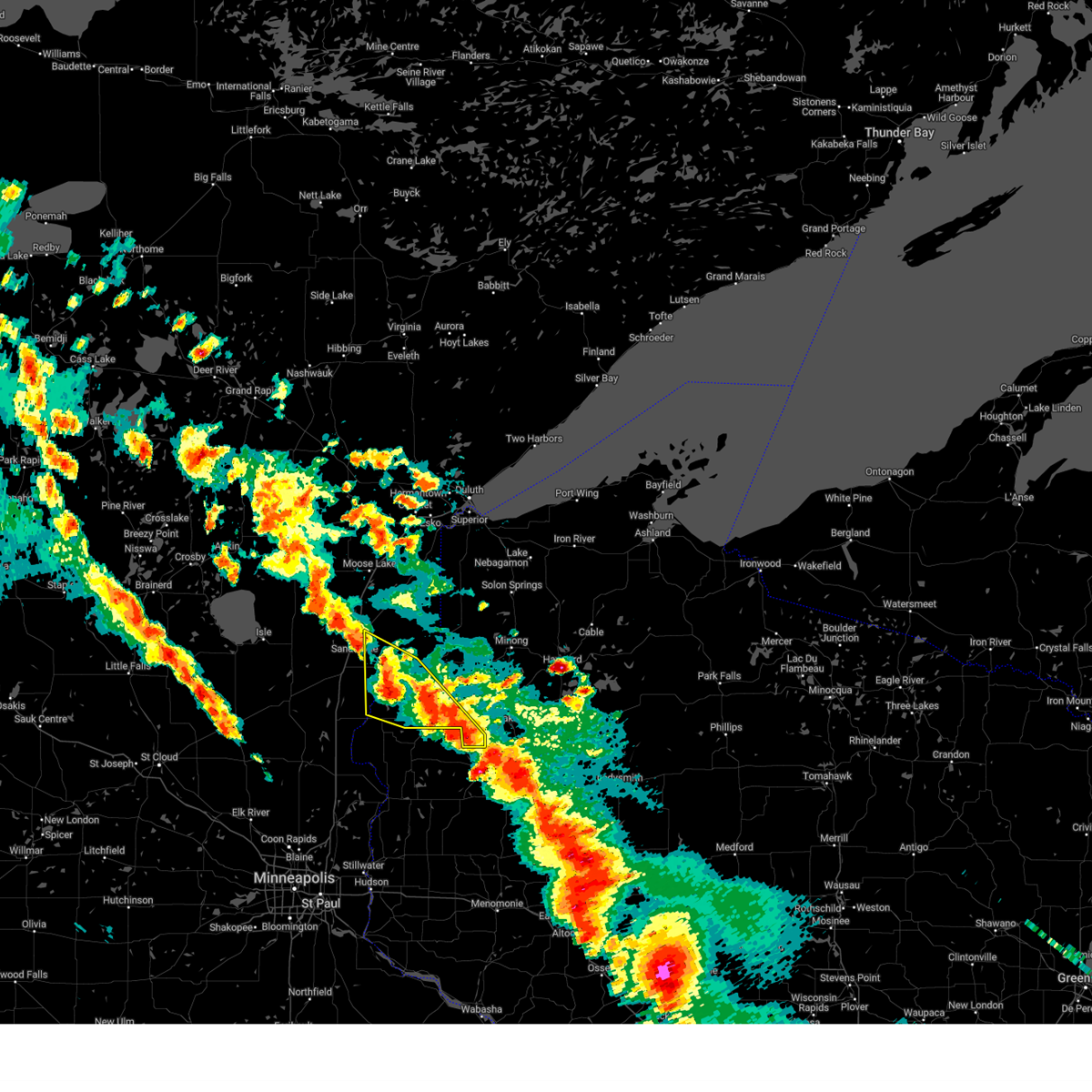
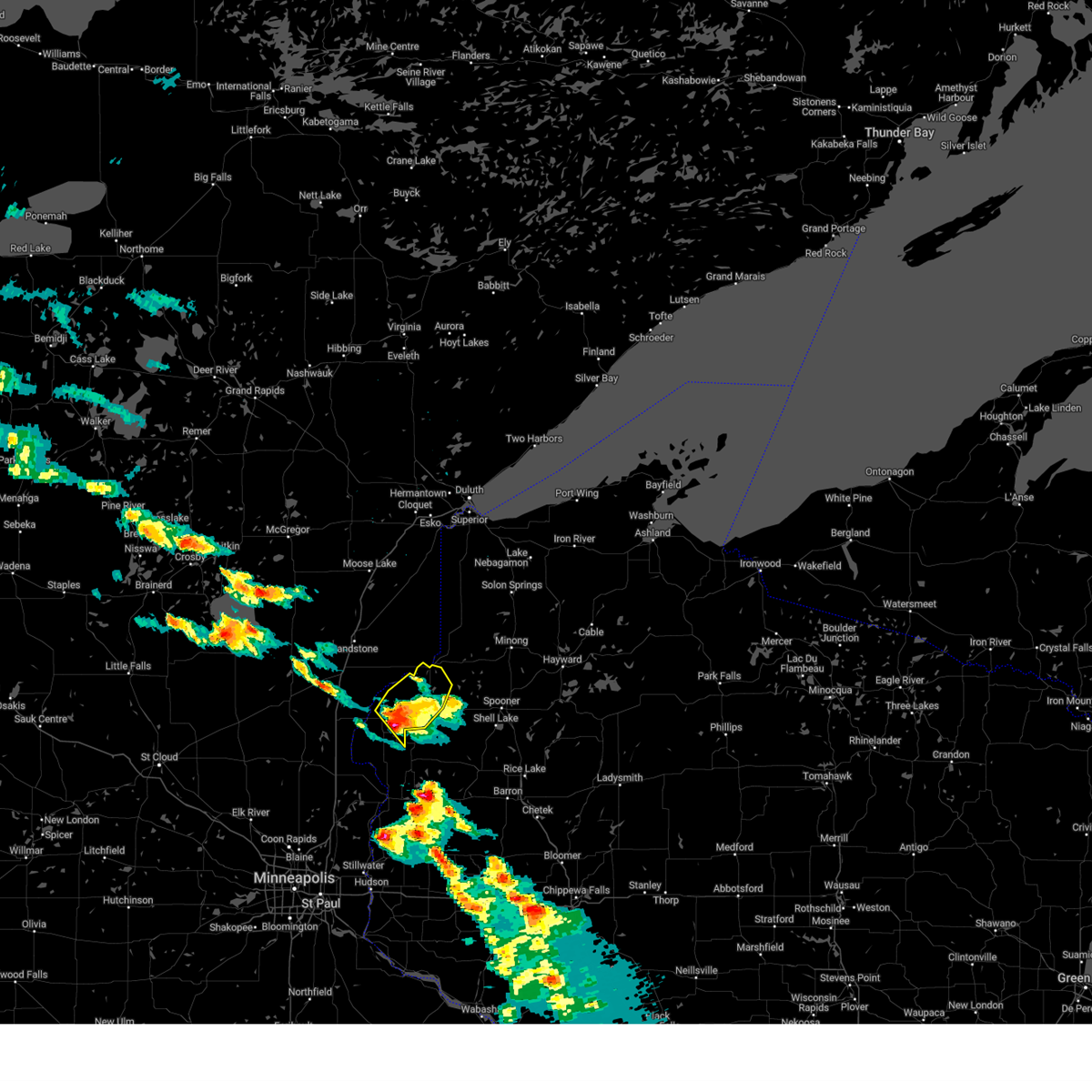
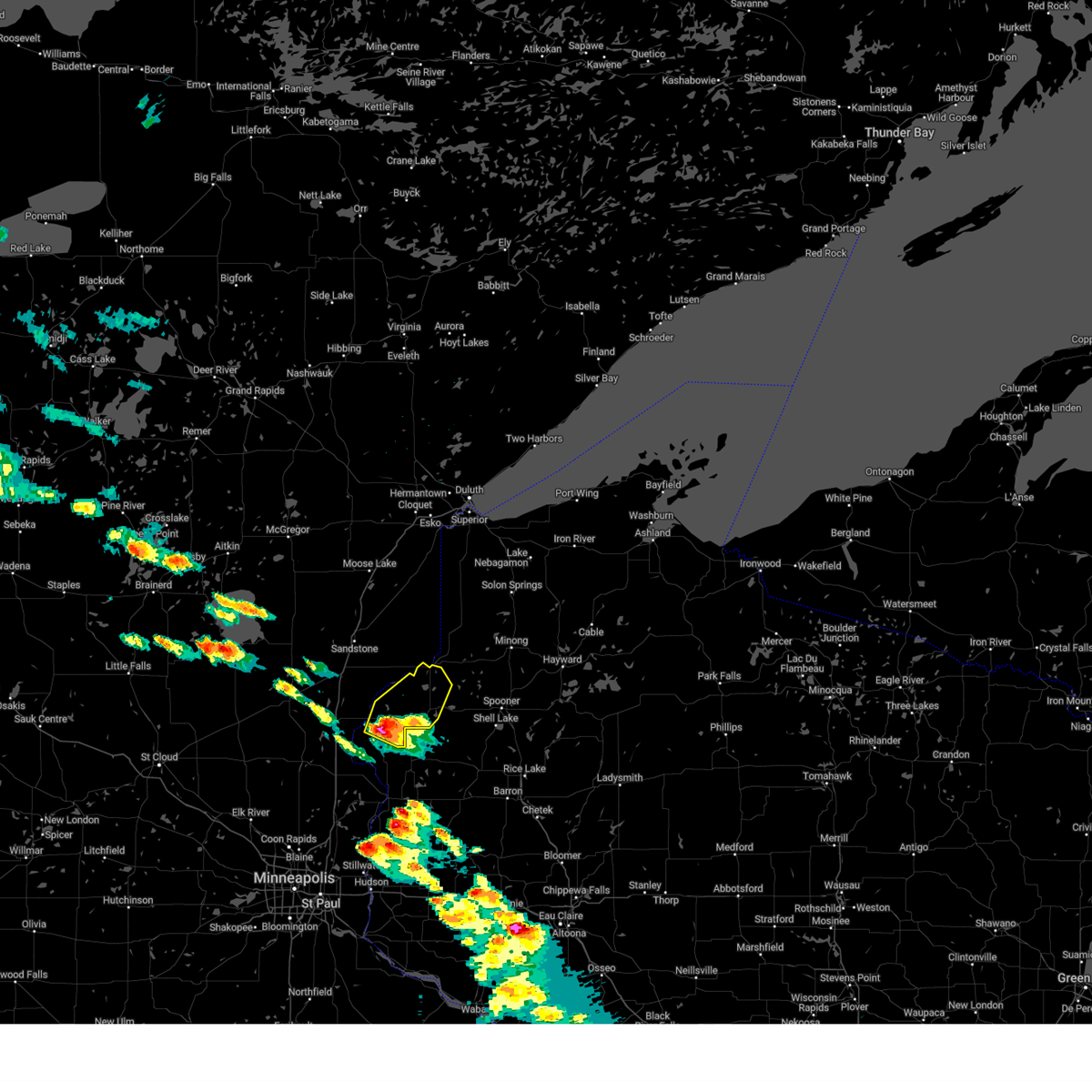
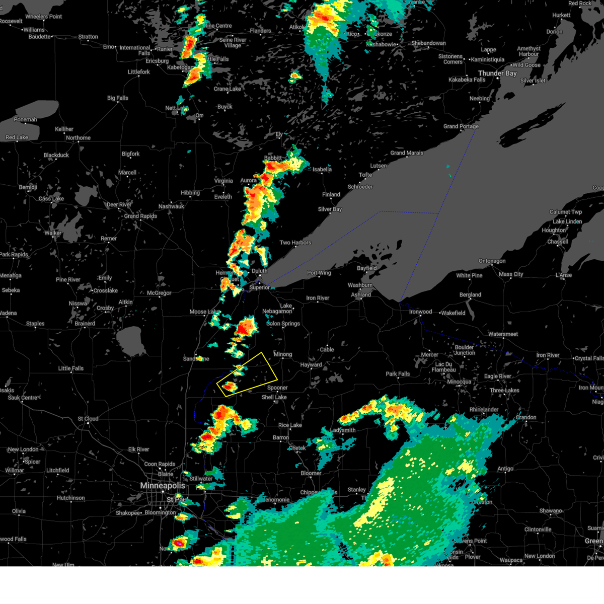
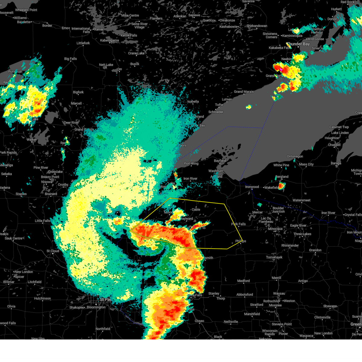
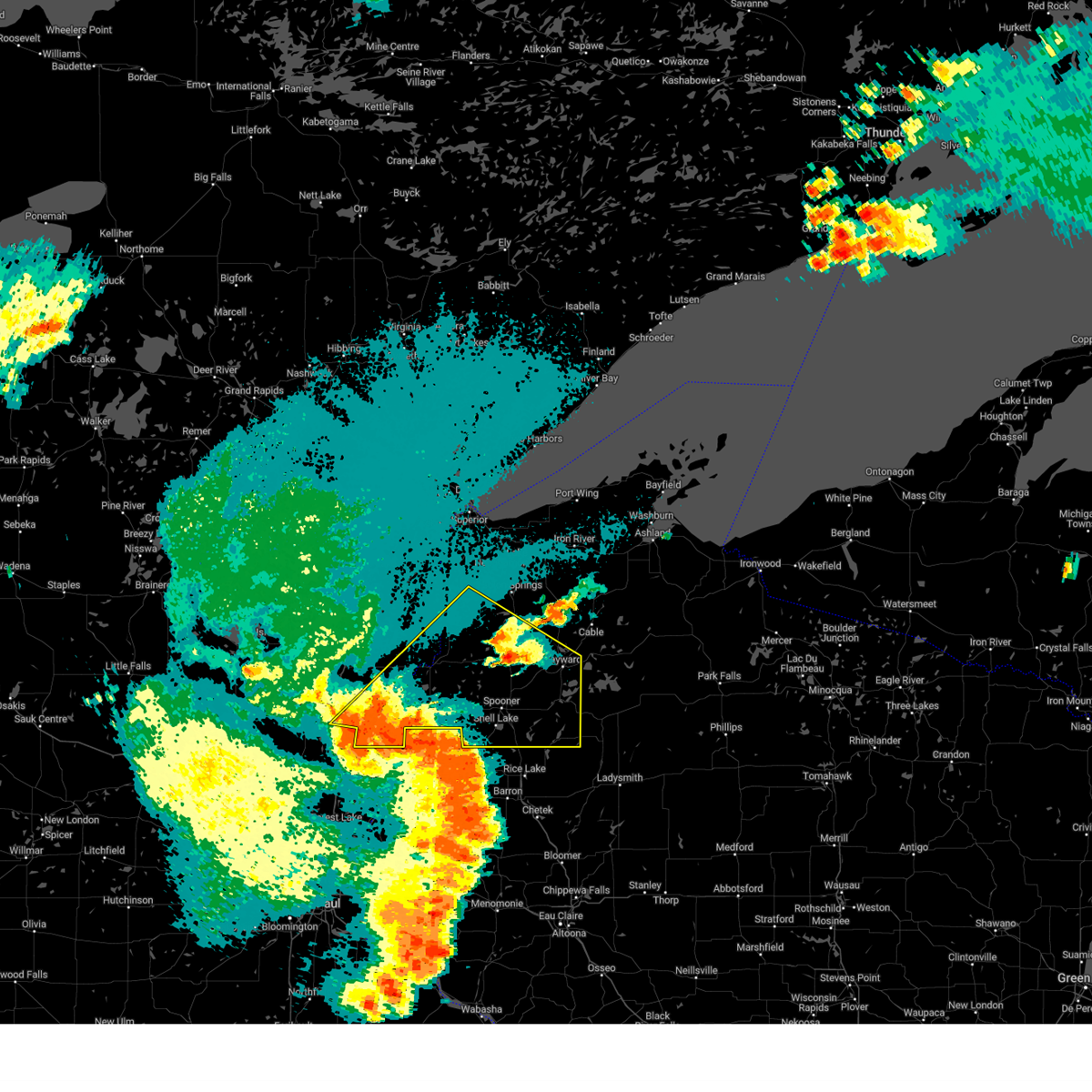
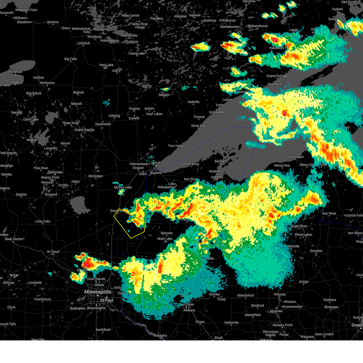
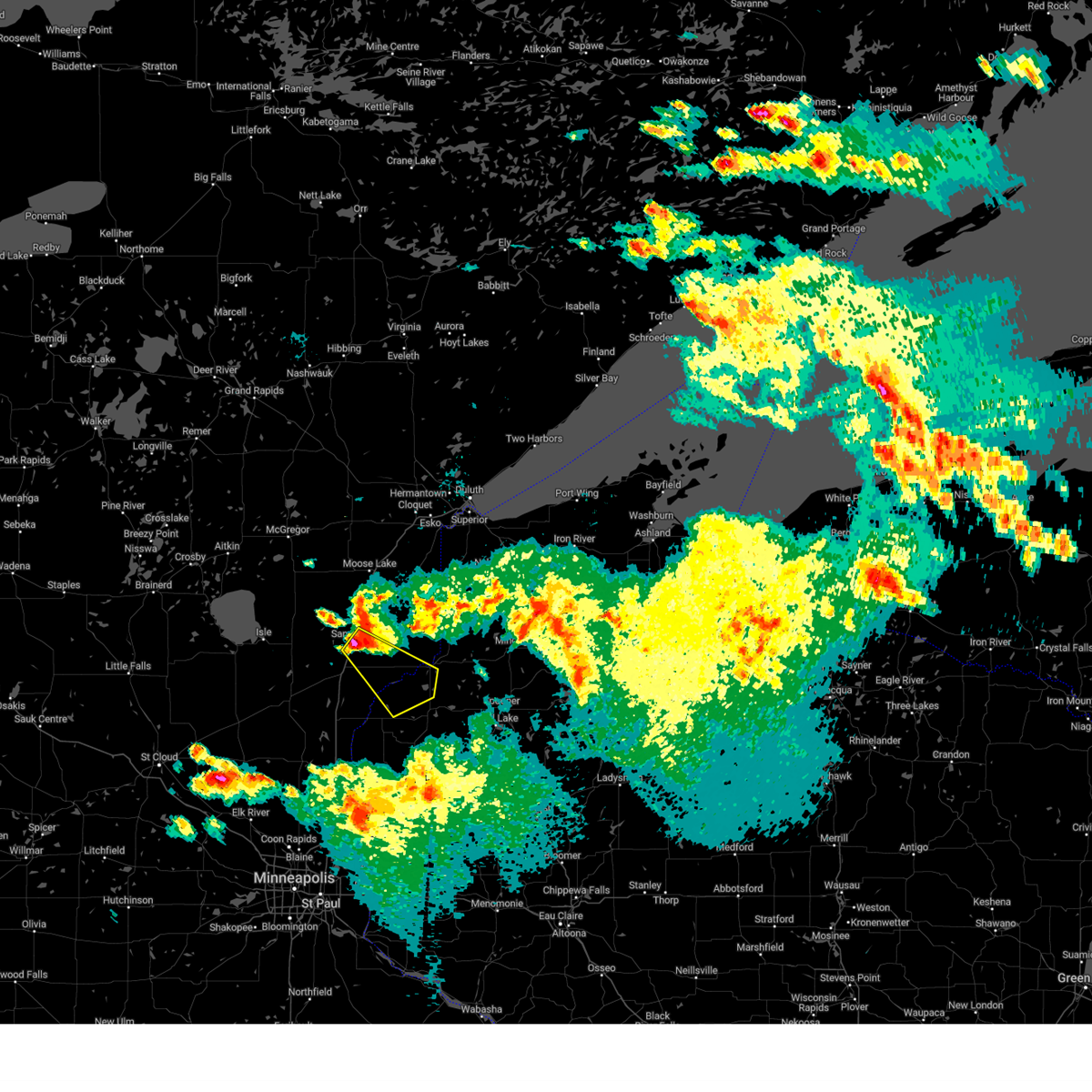
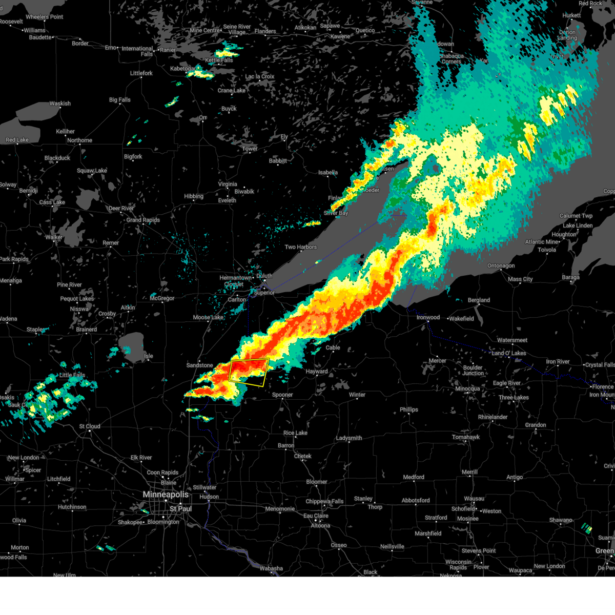
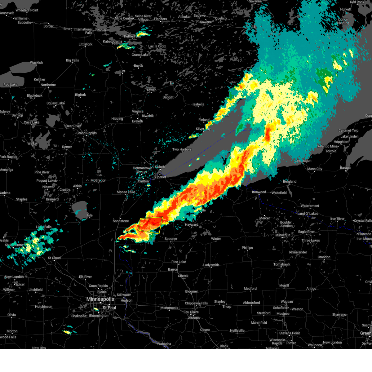
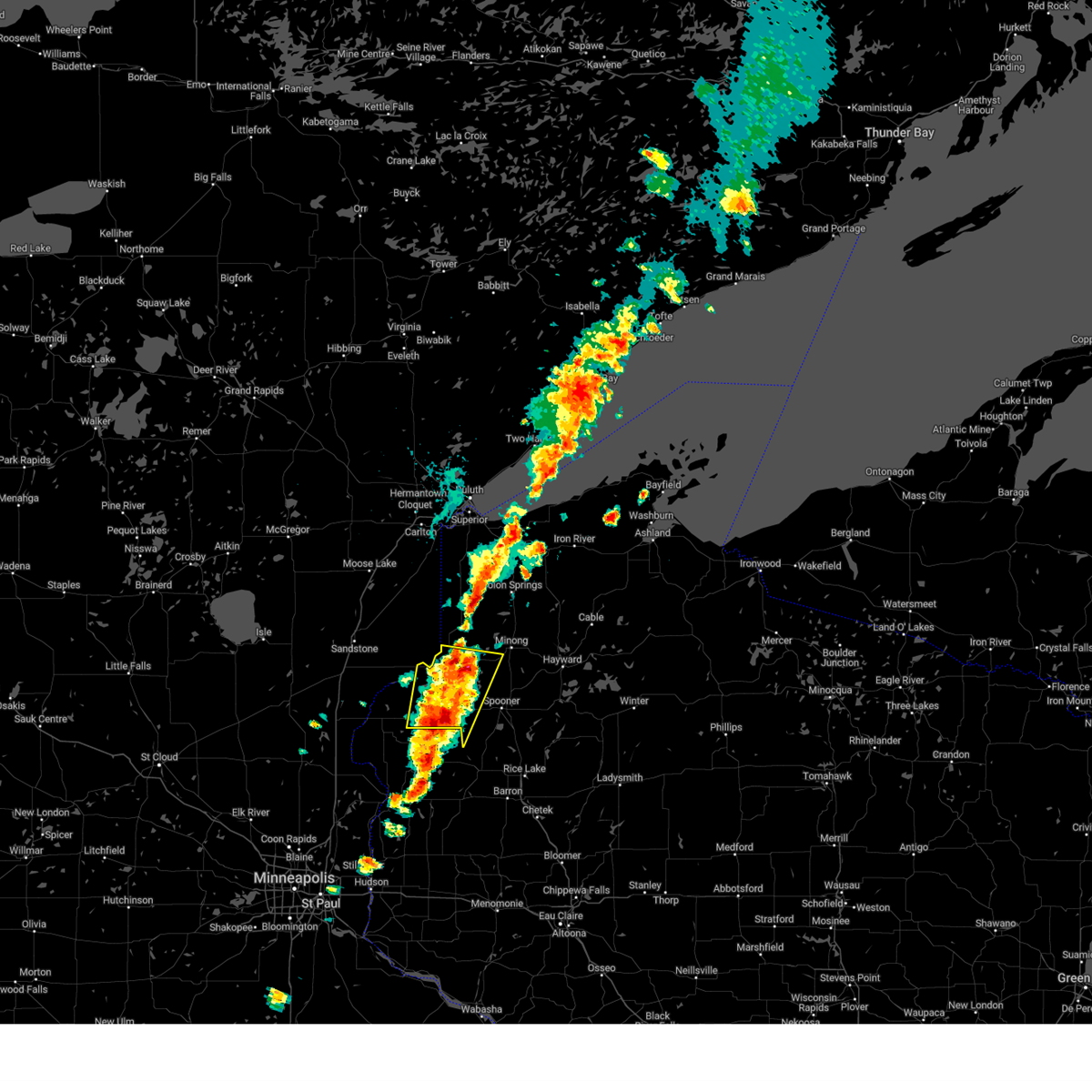
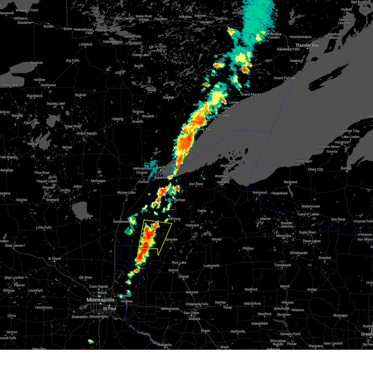
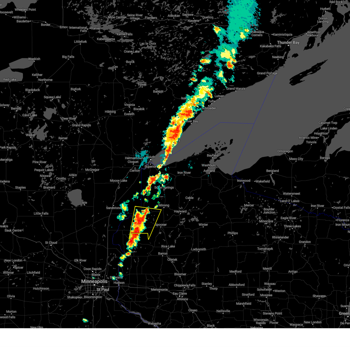
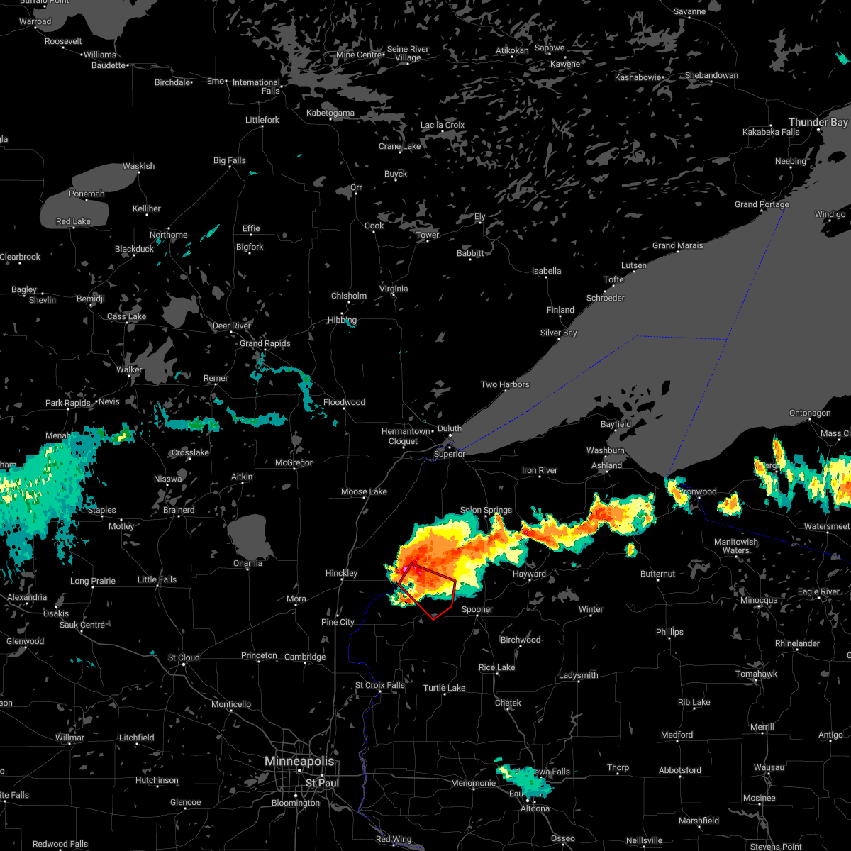
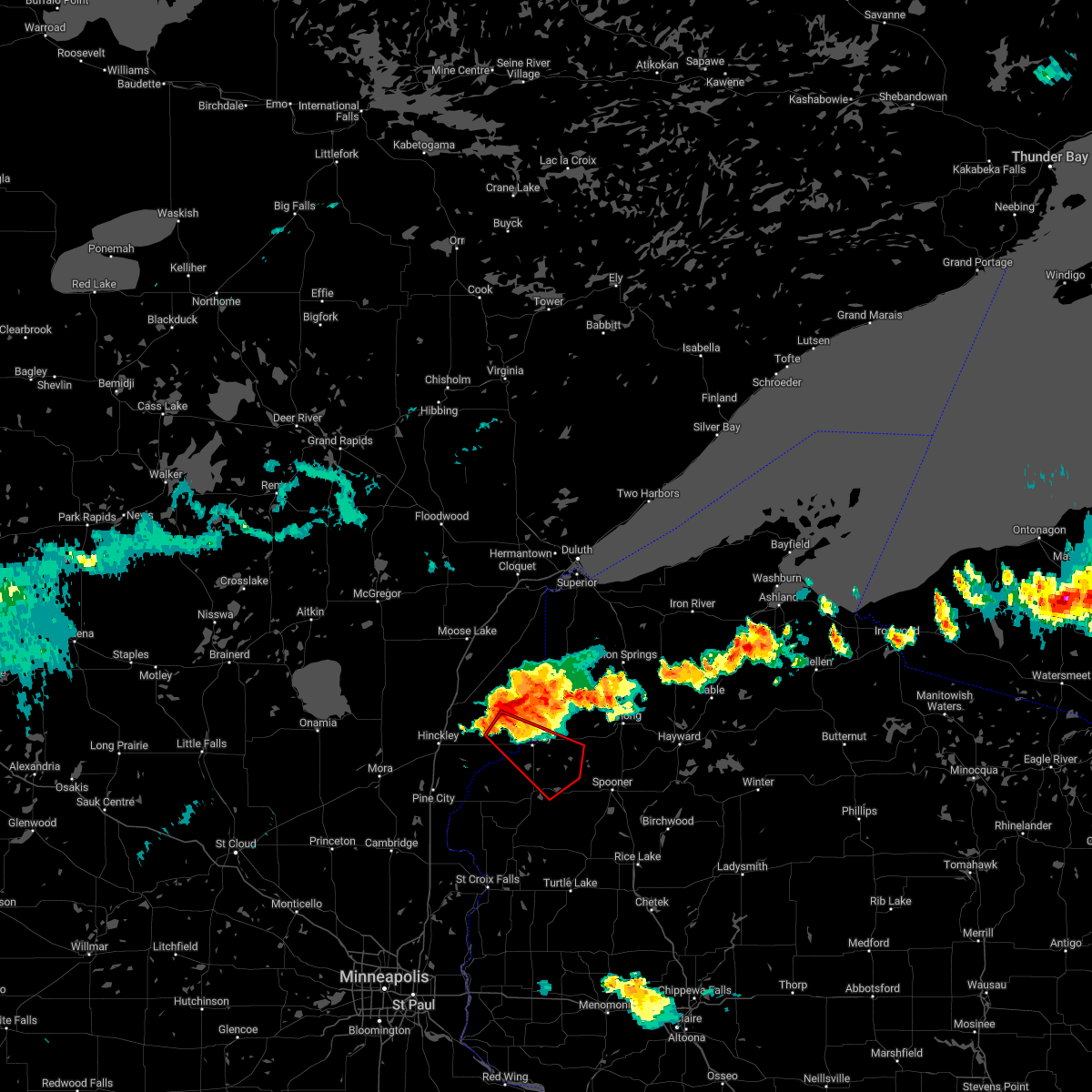
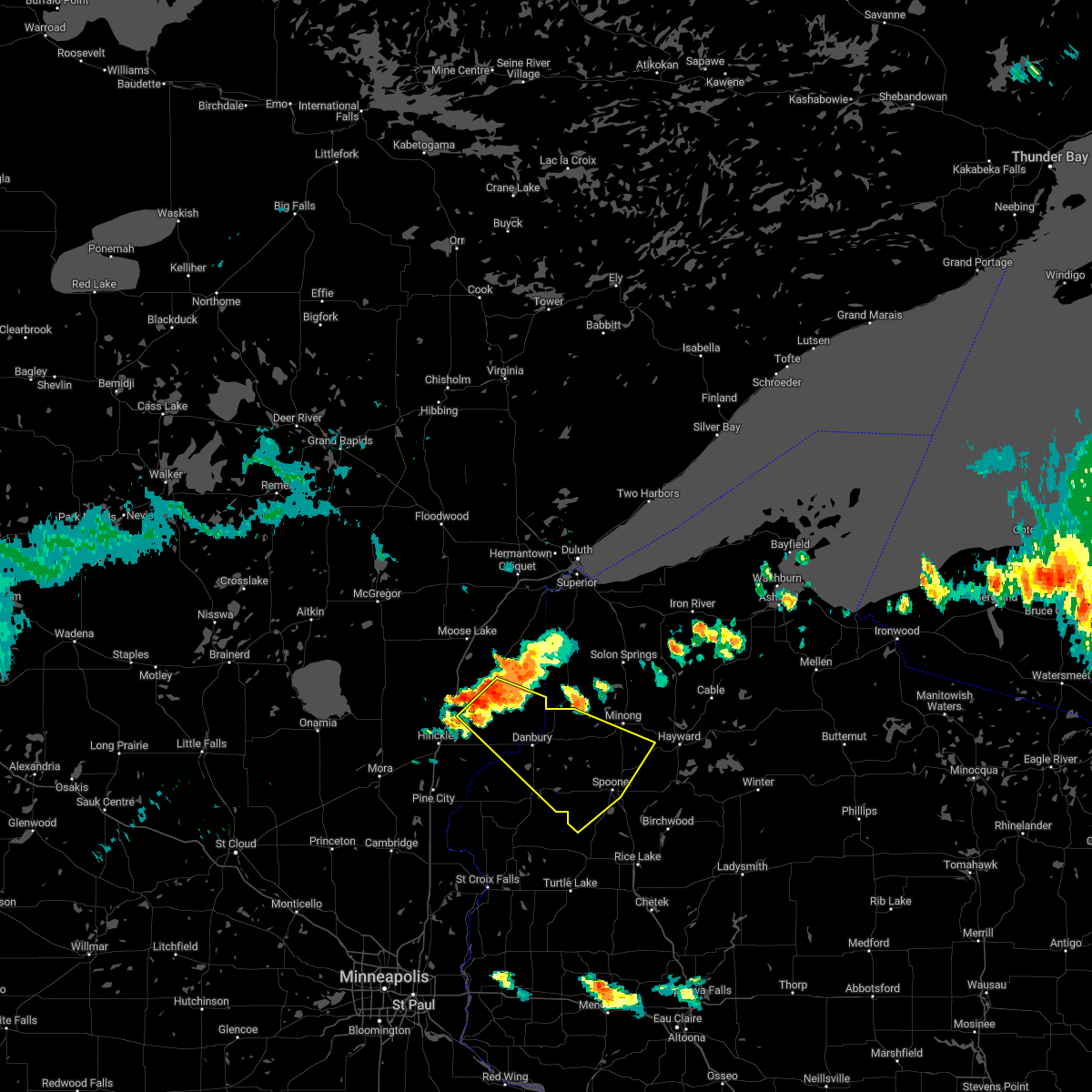
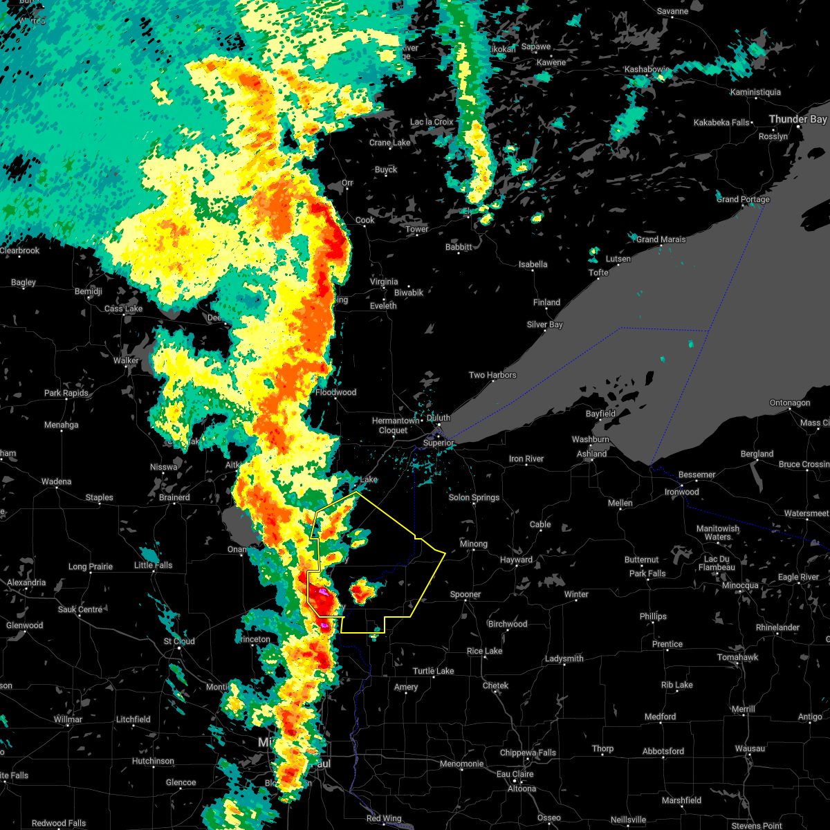
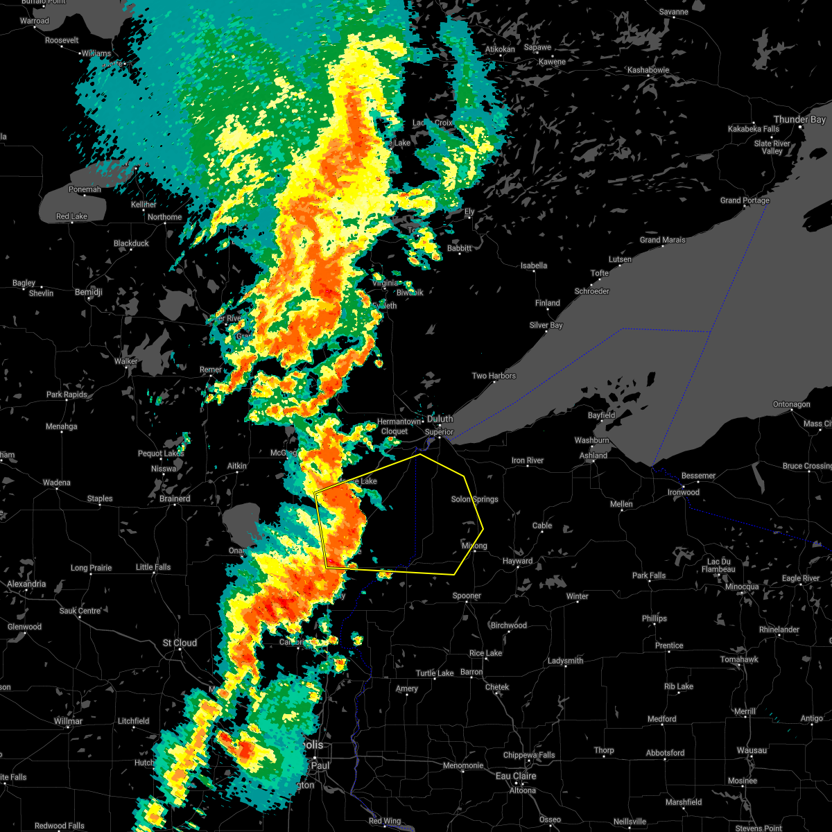
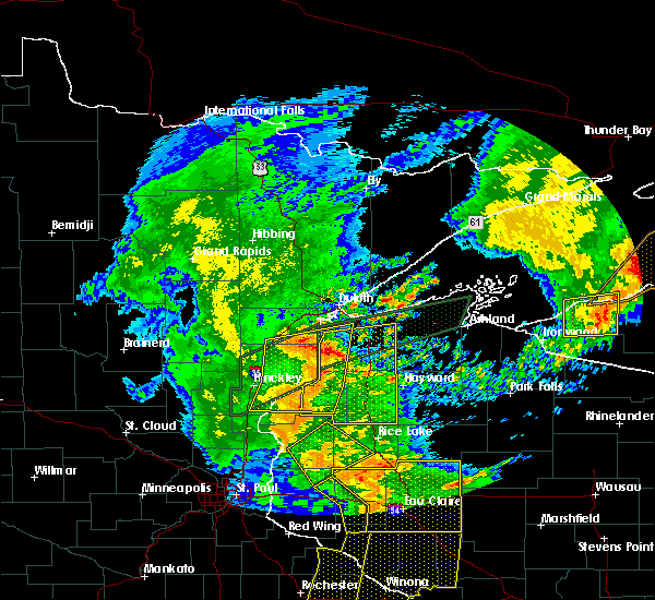
Hail Map for Danbury, WI
The Danbury, WI area has had 4 reports of on-the-ground hail by trained spotters, and has been under severe weather warnings 17 times during the past 12 months. Doppler radar has detected hail at or near Danbury, WI on 42 occasions, including 2 occasions during the past year.
| Name: | Danbury, WI |
| Where Located: | 55.3 miles SSW of Duluth, MN |
| Map: | Google Map for Danbury, WI |
| Population: | 172 |
| Housing Units: | 106 |
| More Info: | Search Google for Danbury, WI |
0
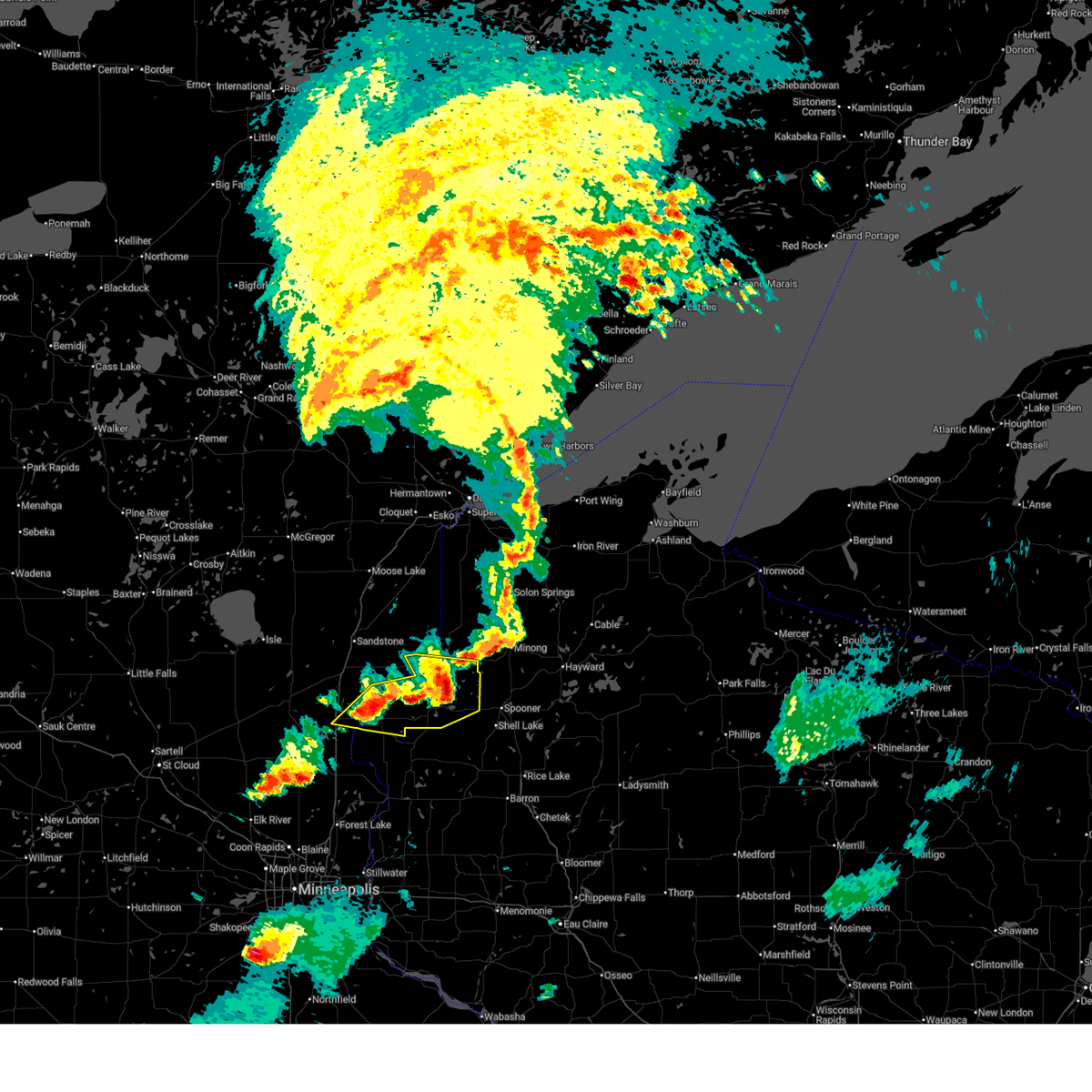
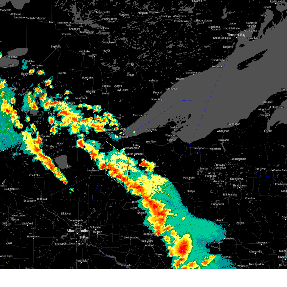
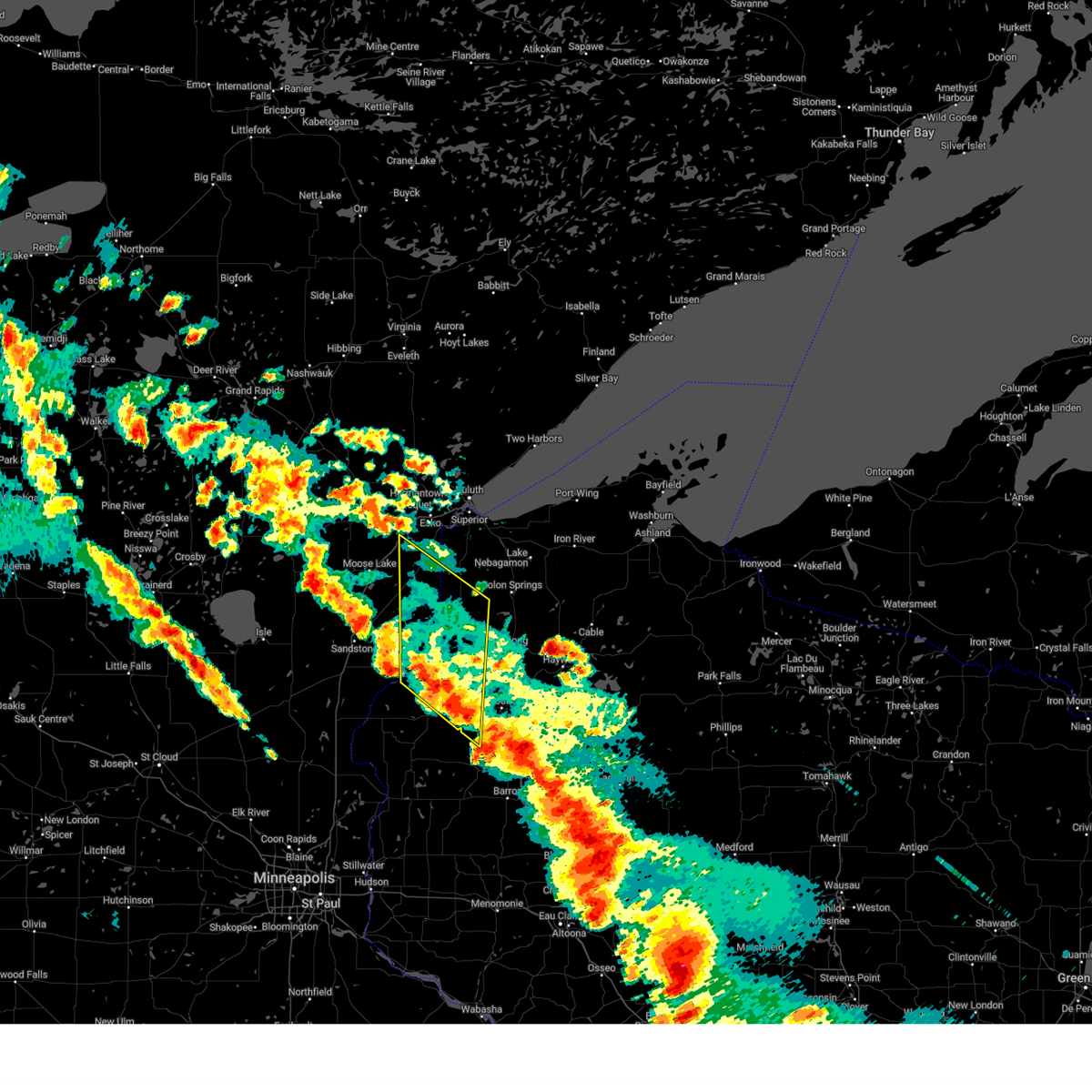
The Top Recent Hail Date for Danbury, WI is Thursday, July 3, 2025 (23rd out of 42)
Hail and Wind Damage Spotted near Danbury, WI
| Date / Time | Report Details |
|---|---|
| 6/16/2025 7:44 PM CDT |
 At 743 pm cdt, severe thunderstorms were located along a line extending from near danbury to near webster to near grantsburg to 6 miles east of rock creek, moving east at 50 mph (radar indicated). Hazards include 60 mph wind gusts. Expect damage to roofs, siding, and trees. Locations impacted include, rock creek, grantsburg, siren, webster, webb lake wisconsin, saint croix band sand lake area, saint croix band clam lake area, danbury, hertel, saint croix band pike lake area, branstad, mille lacs band lena lake area, saint croix state park, oakland, falun, mckenzie lake, birch island lake, yellow lake, clam lake near siren, and phantom lake. At 743 pm cdt, severe thunderstorms were located along a line extending from near danbury to near webster to near grantsburg to 6 miles east of rock creek, moving east at 50 mph (radar indicated). Hazards include 60 mph wind gusts. Expect damage to roofs, siding, and trees. Locations impacted include, rock creek, grantsburg, siren, webster, webb lake wisconsin, saint croix band sand lake area, saint croix band clam lake area, danbury, hertel, saint croix band pike lake area, branstad, mille lacs band lena lake area, saint croix state park, oakland, falun, mckenzie lake, birch island lake, yellow lake, clam lake near siren, and phantom lake.
|
| 6/16/2025 7:17 PM CDT | At 716 pm cdt, severe thunderstorms were located along a line extending from 7 miles east of hinckley to 6 miles southwest of saint croix state park to near pine city to grasston, moving east at 55 mph (radar indicated). Hazards include 60 mph wind gusts. Expect damage to roofs, siding, and trees. Locations impacted include, pine city, hinckley, rock creek, grantsburg, trade lake, siren, webster, webb lake wisconsin, brook park, henriette, saint croix band sand lake area, saint croix band bashaw area, saint croix band clam lake area, danbury, hertel, saint croix state park, saint croix band pike lake area, branstad, mille lacs band lena lake area, and randall. |
| 6/16/2025 6:53 PM CDT | Svrdlh the national weather service in duluth mn has issued a * severe thunderstorm warning for, southern pine county in east central minnesota, burnett county in northwestern wisconsin, * until 800 pm cdt. * at 653 pm cdt, severe thunderstorms were located along a line extending from 6 miles north of brook park to near quamba to near bock, moving east at 45 mph (radar indicated). Hazards include 60 mph wind gusts and penny size hail. expect damage to roofs, siding, and trees |
| 5/15/2025 4:52 PM CDT |
 At 452 pm cdt, severe thunderstorms were located along a line extending from 8 miles northwest of cloverton to 6 miles southeast of webb lake wisconsin, moving northeast at 60 mph (radar indicated). Hazards include 70 mph wind gusts and quarter size hail. Hail damage to vehicles is expected. expect considerable tree damage. wind damage is also likely to mobile homes, roofs, and outbuildings. These severe storms will be near, dairyland and cloverton around 455 pm cdt. At 452 pm cdt, severe thunderstorms were located along a line extending from 8 miles northwest of cloverton to 6 miles southeast of webb lake wisconsin, moving northeast at 60 mph (radar indicated). Hazards include 70 mph wind gusts and quarter size hail. Hail damage to vehicles is expected. expect considerable tree damage. wind damage is also likely to mobile homes, roofs, and outbuildings. These severe storms will be near, dairyland and cloverton around 455 pm cdt.
|
| 5/15/2025 4:40 PM CDT |
 Svrdlh the national weather service in duluth mn has issued a * severe thunderstorm warning for, northeastern pine county in east central minnesota, southeastern carlton county in northeastern minnesota, southwestern douglas county in northwestern wisconsin, northwestern washburn county in northwestern wisconsin, eastern burnett county in northwestern wisconsin, * until 515 pm cdt. * at 440 pm cdt, severe thunderstorms were located along a line extending from near mille lacs band lena lake area to near saint croix band bashaw area, moving north at 60 mph (radar indicated). Hazards include 70 mph wind gusts and quarter size hail. Hail damage to vehicles is expected. expect considerable tree damage. wind damage is also likely to mobile homes, roofs, and outbuildings. severe thunderstorms will be near, webb lake wisconsin, duxbury, mille lacs band lena lake area, and danbury around 445 pm cdt. cloverton around 450 pm cdt. dairyland around 500 pm cdt. Other locations in the path of these severe thunderstorms include holyoke. Svrdlh the national weather service in duluth mn has issued a * severe thunderstorm warning for, northeastern pine county in east central minnesota, southeastern carlton county in northeastern minnesota, southwestern douglas county in northwestern wisconsin, northwestern washburn county in northwestern wisconsin, eastern burnett county in northwestern wisconsin, * until 515 pm cdt. * at 440 pm cdt, severe thunderstorms were located along a line extending from near mille lacs band lena lake area to near saint croix band bashaw area, moving north at 60 mph (radar indicated). Hazards include 70 mph wind gusts and quarter size hail. Hail damage to vehicles is expected. expect considerable tree damage. wind damage is also likely to mobile homes, roofs, and outbuildings. severe thunderstorms will be near, webb lake wisconsin, duxbury, mille lacs band lena lake area, and danbury around 445 pm cdt. cloverton around 450 pm cdt. dairyland around 500 pm cdt. Other locations in the path of these severe thunderstorms include holyoke.
|
| 5/15/2025 4:29 PM CDT |
 The storms which prompted the warning have weakened below severe limits, and no longer pose an immediate threat to life or property. therefore, the warning will be allowed to expire. a tornado watch remains in effect until 800 pm cdt for east central minnesota, and northwestern wisconsin. The storms which prompted the warning have weakened below severe limits, and no longer pose an immediate threat to life or property. therefore, the warning will be allowed to expire. a tornado watch remains in effect until 800 pm cdt for east central minnesota, and northwestern wisconsin.
|
| 5/15/2025 4:22 PM CDT |
 At 421 pm cdt, severe thunderstorms were located along a line extending from near grantsburg to near siren to near cumberland, moving north at 55 mph (radar indicated). Hazards include 60 mph wind gusts and quarter size hail. Hail damage to vehicles is expected. expect wind damage to roofs, siding, and trees. these severe storms will be near, siren, saint croix state park, and saint croix band clam lake area around 425 pm cdt. Other locations in the path of these severe thunderstorms include webster, saint croix band pike lake area, saint croix band sand lake area, hertel, mille lacs band lena lake area and saint croix band bashaw area. At 421 pm cdt, severe thunderstorms were located along a line extending from near grantsburg to near siren to near cumberland, moving north at 55 mph (radar indicated). Hazards include 60 mph wind gusts and quarter size hail. Hail damage to vehicles is expected. expect wind damage to roofs, siding, and trees. these severe storms will be near, siren, saint croix state park, and saint croix band clam lake area around 425 pm cdt. Other locations in the path of these severe thunderstorms include webster, saint croix band pike lake area, saint croix band sand lake area, hertel, mille lacs band lena lake area and saint croix band bashaw area.
|
| 5/15/2025 4:06 PM CDT |
 Svrdlh the national weather service in duluth mn has issued a * severe thunderstorm warning for, central pine county in east central minnesota, southwestern washburn county in northwestern wisconsin, burnett county in northwestern wisconsin, * until 430 pm cdt. * at 405 pm cdt, severe thunderstorms were located along a line extending from 7 miles southwest of trade lake to near milltown to near clayton, moving north at 55 mph (radar indicated). Hazards include 60 mph wind gusts and quarter size hail. Hail damage to vehicles is expected. expect wind damage to roofs, siding, and trees. severe thunderstorms will be near, grantsburg, trade lake, and branstad around 410 pm cdt. saint croix state park around 420 pm cdt. Siren around 425 pm cdt. Svrdlh the national weather service in duluth mn has issued a * severe thunderstorm warning for, central pine county in east central minnesota, southwestern washburn county in northwestern wisconsin, burnett county in northwestern wisconsin, * until 430 pm cdt. * at 405 pm cdt, severe thunderstorms were located along a line extending from 7 miles southwest of trade lake to near milltown to near clayton, moving north at 55 mph (radar indicated). Hazards include 60 mph wind gusts and quarter size hail. Hail damage to vehicles is expected. expect wind damage to roofs, siding, and trees. severe thunderstorms will be near, grantsburg, trade lake, and branstad around 410 pm cdt. saint croix state park around 420 pm cdt. Siren around 425 pm cdt.
|
| 4/17/2025 12:51 PM CDT |
 At 1251 pm cdt, a severe thunderstorm was located near siren, or 23 miles east of pine city, moving northeast at 30 mph (radar indicated). Hazards include 60 mph wind gusts and quarter size hail. Hail damage to vehicles is expected. expect wind damage to roofs, siding, and trees. Locations impacted include, webster, danbury, falun, siren, clam lake near siren, saint croix band pike lake area, saint croix band danbury area, oakland, saint croix band clam lake area, and yellow lake. At 1251 pm cdt, a severe thunderstorm was located near siren, or 23 miles east of pine city, moving northeast at 30 mph (radar indicated). Hazards include 60 mph wind gusts and quarter size hail. Hail damage to vehicles is expected. expect wind damage to roofs, siding, and trees. Locations impacted include, webster, danbury, falun, siren, clam lake near siren, saint croix band pike lake area, saint croix band danbury area, oakland, saint croix band clam lake area, and yellow lake.
|
| 4/17/2025 12:39 PM CDT |
 At 1238 pm cdt, a severe thunderstorm was located near grantsburg, or 19 miles east of pine city, moving northeast at 30 mph (radar indicated). Hazards include 60 mph wind gusts and quarter size hail. Hail damage to vehicles is expected. expect wind damage to roofs, siding, and trees. Locations impacted include, webster and danbury. At 1238 pm cdt, a severe thunderstorm was located near grantsburg, or 19 miles east of pine city, moving northeast at 30 mph (radar indicated). Hazards include 60 mph wind gusts and quarter size hail. Hail damage to vehicles is expected. expect wind damage to roofs, siding, and trees. Locations impacted include, webster and danbury.
|
| 4/17/2025 12:26 PM CDT |
 Svrdlh the national weather service in duluth mn has issued a * severe thunderstorm warning for, southern burnett county in northwestern wisconsin, * until 115 pm cdt. * at 1226 pm cdt, a severe thunderstorm was located over branstad, or 16 miles southeast of pine city, moving northeast at 30 mph (radar indicated). Hazards include 60 mph wind gusts and quarter size hail. Hail damage to vehicles is expected. expect wind damage to roofs, siding, and trees. this severe thunderstorm will be near, grantsburg around 1230 pm cdt. Other locations in the path of this severe thunderstorm include webster and danbury. Svrdlh the national weather service in duluth mn has issued a * severe thunderstorm warning for, southern burnett county in northwestern wisconsin, * until 115 pm cdt. * at 1226 pm cdt, a severe thunderstorm was located over branstad, or 16 miles southeast of pine city, moving northeast at 30 mph (radar indicated). Hazards include 60 mph wind gusts and quarter size hail. Hail damage to vehicles is expected. expect wind damage to roofs, siding, and trees. this severe thunderstorm will be near, grantsburg around 1230 pm cdt. Other locations in the path of this severe thunderstorm include webster and danbury.
|
| 9/19/2024 6:51 PM CDT |
 Svrdlh the national weather service in duluth mn has issued a * severe thunderstorm warning for, west central washburn county in northwestern wisconsin, northeastern burnett county in northwestern wisconsin, * until 730 pm cdt. * at 651 pm cdt, a severe thunderstorm was located near webster, or 24 miles east of pine city, moving northeast at 25 mph (radar indicated). Hazards include 60 mph wind gusts and quarter size hail. Hail damage to vehicles is expected. expect wind damage to roofs, siding, and trees. This severe thunderstorm will be near, webster around 655 pm cdt. Svrdlh the national weather service in duluth mn has issued a * severe thunderstorm warning for, west central washburn county in northwestern wisconsin, northeastern burnett county in northwestern wisconsin, * until 730 pm cdt. * at 651 pm cdt, a severe thunderstorm was located near webster, or 24 miles east of pine city, moving northeast at 25 mph (radar indicated). Hazards include 60 mph wind gusts and quarter size hail. Hail damage to vehicles is expected. expect wind damage to roofs, siding, and trees. This severe thunderstorm will be near, webster around 655 pm cdt.
|
| 8/29/2024 5:49 PM CDT | At 548 pm cdt, severe thunderstorms were located along a line extending from near grantsburg to near frederic to near luck, moving northeast at 50 mph (radar indicated). Hazards include 60 mph wind gusts. Expect damage to roofs, siding, and trees. Locations impacted include, hertel, saint croix band bashaw area, saint croix band sand lake area, spooner, shell lake, webb lake wisconsin and trego. |
| 8/29/2024 5:30 PM CDT | At 530 pm cdt, severe thunderstorms were located along a line extending from near grantsburg to near frederic to near luck, moving northeast at 50 mph (radar indicated). Hazards include 60 mph wind gusts. Expect damage to roofs, siding, and trees. Locations impacted include, siren, saint croix band clam lake area, webster, saint croix band pike lake area, saint croix band bashaw area, saint croix band sand lake area, hertel, spooner, shell lake, webb lake wisconsin and trego. |
| 8/29/2024 5:13 PM CDT | Svrdlh the national weather service in duluth mn has issued a * severe thunderstorm warning for, western washburn county in northwestern wisconsin, burnett county in northwestern wisconsin, * until 615 pm cdt. * at 513 pm cdt, severe thunderstorms were located along a line extending from 6 miles southeast of rush city to 10 miles northwest of st. croix falls to near taylors falls, moving northeast at 45 mph (radar indicated). Hazards include 60 mph wind gusts. Expect damage to roofs, siding, and trees. severe thunderstorms will be near, trade lake and branstad around 525 pm cdt. grantsburg around 530 pm cdt. Other locations in the path of these severe thunderstorms include siren, saint croix band clam lake area, webster, saint croix band pike lake area, saint croix band sand lake area, hertel and saint croix band bashaw area. |
| 8/26/2024 9:25 PM CDT |
 Svrdlh the national weather service in duluth mn has issued a * severe thunderstorm warning for, southwestern bayfield county in northwestern wisconsin, southeastern douglas county in northwestern wisconsin, washburn county in northwestern wisconsin, southwestern ashland county in northwestern wisconsin, northwestern price county in north central wisconsin, northeastern burnett county in northwestern wisconsin, sawyer county in northwestern wisconsin, * until 1015 pm cdt. * at 924 pm cdt, severe thunderstorms were located along a line extending from near danbury to near stone lake to near bruce, moving northeast at 45 mph (radar indicated). Hazards include 60 mph wind gusts and penny size hail. Expect damage to roofs, siding, and trees. severe thunderstorms will be near, hayward, chippewa flowage west, trego, webb lake wisconsin, radisson, exeland, couderay, little round lake, and danbury around 930 pm cdt. round lake and chief lake on chippewa flowage around 935 pm cdt. chippewa flowage east, minong, and new post around 940 pm cdt. Other locations in the path of these severe thunderstorms include winter, seeley, wascott, cable, gordon, namekagon lake, namekagon and clam lake. Svrdlh the national weather service in duluth mn has issued a * severe thunderstorm warning for, southwestern bayfield county in northwestern wisconsin, southeastern douglas county in northwestern wisconsin, washburn county in northwestern wisconsin, southwestern ashland county in northwestern wisconsin, northwestern price county in north central wisconsin, northeastern burnett county in northwestern wisconsin, sawyer county in northwestern wisconsin, * until 1015 pm cdt. * at 924 pm cdt, severe thunderstorms were located along a line extending from near danbury to near stone lake to near bruce, moving northeast at 45 mph (radar indicated). Hazards include 60 mph wind gusts and penny size hail. Expect damage to roofs, siding, and trees. severe thunderstorms will be near, hayward, chippewa flowage west, trego, webb lake wisconsin, radisson, exeland, couderay, little round lake, and danbury around 930 pm cdt. round lake and chief lake on chippewa flowage around 935 pm cdt. chippewa flowage east, minong, and new post around 940 pm cdt. Other locations in the path of these severe thunderstorms include winter, seeley, wascott, cable, gordon, namekagon lake, namekagon and clam lake.
|
| 8/26/2024 8:41 PM CDT |
 Svrdlh the national weather service in duluth mn has issued a * severe thunderstorm warning for, southeastern pine county in east central minnesota, southwestern douglas county in northwestern wisconsin, washburn county in northwestern wisconsin, burnett county in northwestern wisconsin, western sawyer county in northwestern wisconsin, * until 930 pm cdt. * at 837 pm cdt, severe thunderstorms were located along a line extending from near grantsburg to 8 miles northwest of cumberland to near glenwood city, moving northeast at 55 mph (radar indicated). Hazards include 60 mph wind gusts and quarter size hail. Hail damage to vehicles is expected. expect wind damage to roofs, siding, and trees. severe thunderstorms will be near, siren, webster, hertel, saint croix state park, saint croix band pike lake area, saint croix band bashaw area, saint croix band clam lake area, and saint croix band sand lake area around 845 pm cdt. shell lake and mille lacs band lena lake area around 850 pm cdt. spooner and danbury around 855 pm cdt. Other locations in the path of these severe thunderstorms include webb lake wisconsin, trego, cloverton, minong, stone lake, birchwood, dairyland and hayward. Svrdlh the national weather service in duluth mn has issued a * severe thunderstorm warning for, southeastern pine county in east central minnesota, southwestern douglas county in northwestern wisconsin, washburn county in northwestern wisconsin, burnett county in northwestern wisconsin, western sawyer county in northwestern wisconsin, * until 930 pm cdt. * at 837 pm cdt, severe thunderstorms were located along a line extending from near grantsburg to 8 miles northwest of cumberland to near glenwood city, moving northeast at 55 mph (radar indicated). Hazards include 60 mph wind gusts and quarter size hail. Hail damage to vehicles is expected. expect wind damage to roofs, siding, and trees. severe thunderstorms will be near, siren, webster, hertel, saint croix state park, saint croix band pike lake area, saint croix band bashaw area, saint croix band clam lake area, and saint croix band sand lake area around 845 pm cdt. shell lake and mille lacs band lena lake area around 850 pm cdt. spooner and danbury around 855 pm cdt. Other locations in the path of these severe thunderstorms include webb lake wisconsin, trego, cloverton, minong, stone lake, birchwood, dairyland and hayward.
|
| 8/26/2024 7:41 PM CDT | Half Dollar sized hail reported 15.3 miles W of Danbury, WI |
| 6/12/2024 9:13 PM CDT |
 the severe thunderstorm warning has been cancelled and is no longer in effect the severe thunderstorm warning has been cancelled and is no longer in effect
|
| 6/12/2024 8:54 PM CDT |
 Svrdlh the national weather service in duluth mn has issued a * severe thunderstorm warning for, central pine county in east central minnesota, central burnett county in northwestern wisconsin, * until 930 pm cdt. * at 854 pm cdt, a severe thunderstorm was located near sandstone, or 7 miles northeast of hinckley, moving southeast at 45 mph (radar indicated). Hazards include golf ball size hail and 60 mph wind gusts. People and animals outdoors will be injured. expect hail damage to roofs, siding, windows, and vehicles. expect wind damage to roofs, siding, and trees. this severe thunderstorm will be near, saint croix state park around 905 pm cdt. Mille lacs band lena lake area around 910 pm cdt. Svrdlh the national weather service in duluth mn has issued a * severe thunderstorm warning for, central pine county in east central minnesota, central burnett county in northwestern wisconsin, * until 930 pm cdt. * at 854 pm cdt, a severe thunderstorm was located near sandstone, or 7 miles northeast of hinckley, moving southeast at 45 mph (radar indicated). Hazards include golf ball size hail and 60 mph wind gusts. People and animals outdoors will be injured. expect hail damage to roofs, siding, windows, and vehicles. expect wind damage to roofs, siding, and trees. this severe thunderstorm will be near, saint croix state park around 905 pm cdt. Mille lacs band lena lake area around 910 pm cdt.
|
| 8/16/2023 7:51 PM CDT |
 At 751 pm cdt, a severe thunderstorm was located near danbury, or 26 miles east of hinckley, moving east at 40 mph (radar indicated). Hazards include golf ball size hail and 60 mph wind gusts. People and animals outdoors will be injured. expect hail damage to roofs, siding, windows, and vehicles. expect wind damage to roofs, siding, and trees. Locations impacted include, webb lake wisconsin. At 751 pm cdt, a severe thunderstorm was located near danbury, or 26 miles east of hinckley, moving east at 40 mph (radar indicated). Hazards include golf ball size hail and 60 mph wind gusts. People and animals outdoors will be injured. expect hail damage to roofs, siding, windows, and vehicles. expect wind damage to roofs, siding, and trees. Locations impacted include, webb lake wisconsin.
|
| 8/16/2023 7:43 PM CDT |
 At 743 pm cdt, a severe thunderstorm was located over mille lacs band lena lake area, or 20 miles east of hinckley, moving east at 40 mph (radar indicated). Hazards include golf ball size hail and 60 mph wind gusts. People and animals outdoors will be injured. expect hail damage to roofs, siding, windows, and vehicles. expect wind damage to roofs, siding, and trees. this severe storm will be near, danbury around 755 pm cdt. Other locations in the path of this severe thunderstorm include webb lake wisconsin. At 743 pm cdt, a severe thunderstorm was located over mille lacs band lena lake area, or 20 miles east of hinckley, moving east at 40 mph (radar indicated). Hazards include golf ball size hail and 60 mph wind gusts. People and animals outdoors will be injured. expect hail damage to roofs, siding, windows, and vehicles. expect wind damage to roofs, siding, and trees. this severe storm will be near, danbury around 755 pm cdt. Other locations in the path of this severe thunderstorm include webb lake wisconsin.
|
| 8/16/2023 7:39 PM CDT |
 At 738 pm cdt, a severe thunderstorm was located near mille lacs band lena lake area, or 17 miles east of hinckley, moving east at 40 mph (radar indicated). Hazards include 60 mph wind gusts and half dollar size hail. Hail damage to vehicles is expected. expect wind damage to roofs, siding, and trees. this severe thunderstorm will be near, mille lacs band lena lake area around 745 pm cdt. danbury around 755 pm cdt. Other locations in the path of this severe thunderstorm include webb lake wisconsin. At 738 pm cdt, a severe thunderstorm was located near mille lacs band lena lake area, or 17 miles east of hinckley, moving east at 40 mph (radar indicated). Hazards include 60 mph wind gusts and half dollar size hail. Hail damage to vehicles is expected. expect wind damage to roofs, siding, and trees. this severe thunderstorm will be near, mille lacs band lena lake area around 745 pm cdt. danbury around 755 pm cdt. Other locations in the path of this severe thunderstorm include webb lake wisconsin.
|
| 7/27/2023 5:31 PM CDT |
 At 531 pm cdt, severe thunderstorms were located along a line extending from foxboro, to 7 miles west of webster, moving east at 25 mph (trained weather spotters). Hazards include golf ball size hail and 60 mph wind gusts. People and animals outdoors will be injured. expect hail damage to roofs, siding, windows, and vehicles. expect wind damage to roofs, siding, and trees. locations impacted include, danbury and webster. thunderstorm damage threat, considerable hail threat, radar indicated max hail size, 1. 75 in wind threat, radar indicated max wind gust, 60 mph. At 531 pm cdt, severe thunderstorms were located along a line extending from foxboro, to 7 miles west of webster, moving east at 25 mph (trained weather spotters). Hazards include golf ball size hail and 60 mph wind gusts. People and animals outdoors will be injured. expect hail damage to roofs, siding, windows, and vehicles. expect wind damage to roofs, siding, and trees. locations impacted include, danbury and webster. thunderstorm damage threat, considerable hail threat, radar indicated max hail size, 1. 75 in wind threat, radar indicated max wind gust, 60 mph.
|
| 7/27/2023 5:00 PM CDT |
 At 459 pm cdt, severe thunderstorms were located along a line extending from nemadji, to 9 miles southeast of hinckley, moving east at 25 mph (trained weather spotters reported 1 inch hail west of hinckley). Hazards include golf ball size hail and 60 mph wind gusts. People and animals outdoors will be injured. expect hail damage to roofs, siding, windows, and vehicles. expect wind damage to roofs, siding, and trees. severe thunderstorms will be near, nemadji around 505 pm cdt. other locations in the path of these severe thunderstorms include holyoke, webster and danbury. thunderstorm damage threat, considerable hail threat, radar indicated max hail size, 1. 75 in wind threat, radar indicated max wind gust, 60 mph. At 459 pm cdt, severe thunderstorms were located along a line extending from nemadji, to 9 miles southeast of hinckley, moving east at 25 mph (trained weather spotters reported 1 inch hail west of hinckley). Hazards include golf ball size hail and 60 mph wind gusts. People and animals outdoors will be injured. expect hail damage to roofs, siding, windows, and vehicles. expect wind damage to roofs, siding, and trees. severe thunderstorms will be near, nemadji around 505 pm cdt. other locations in the path of these severe thunderstorms include holyoke, webster and danbury. thunderstorm damage threat, considerable hail threat, radar indicated max hail size, 1. 75 in wind threat, radar indicated max wind gust, 60 mph.
|
| 7/27/2023 3:47 PM CDT | Ping Pong Ball sized hail reported 11.1 miles SW of Danbury, WI |
| 7/19/2023 4:55 PM CDT |
 At 455 pm cdt, a severe thunderstorm was located near webster, or 23 miles east of hinckley, moving east at 25 mph (radar indicated). Hazards include two inch hail and 60 mph wind gusts. People and animals outdoors will be injured. expect hail damage to roofs, siding, windows, and vehicles. expect wind damage to roofs, siding, and trees. Locations impacted include, siren, webster, webb lake wisconsin, danbury, hertel, mille lacs band lena lake area, oakland, mckenzie lake, big sand lake, birch island lake, yellow lake, and saint croix state park. At 455 pm cdt, a severe thunderstorm was located near webster, or 23 miles east of hinckley, moving east at 25 mph (radar indicated). Hazards include two inch hail and 60 mph wind gusts. People and animals outdoors will be injured. expect hail damage to roofs, siding, windows, and vehicles. expect wind damage to roofs, siding, and trees. Locations impacted include, siren, webster, webb lake wisconsin, danbury, hertel, mille lacs band lena lake area, oakland, mckenzie lake, big sand lake, birch island lake, yellow lake, and saint croix state park.
|
| 7/19/2023 4:41 PM CDT |
 At 441 pm cdt, a severe thunderstorm was located 8 miles southwest of mille lacs band lena lake area, or 17 miles east of hinckley, moving east at 25 mph (radar indicated). Hazards include 60 mph wind gusts and half dollar size hail. Hail damage to vehicles is expected. Expect wind damage to roofs, siding, and trees. At 441 pm cdt, a severe thunderstorm was located 8 miles southwest of mille lacs band lena lake area, or 17 miles east of hinckley, moving east at 25 mph (radar indicated). Hazards include 60 mph wind gusts and half dollar size hail. Hail damage to vehicles is expected. Expect wind damage to roofs, siding, and trees.
|
| 7/3/2023 3:37 PM CDT |
 At 337 pm cdt, severe thunderstorms were located along a line extending from near webb lake wisconsin, to 7 miles east of frederic, moving east at 20 mph (radar indicated). Hazards include 60 mph wind gusts and quarter size hail. Hail damage to vehicles is expected. expect wind damage to roofs, siding, and trees. these severe storms will be near, webb lake wisconsin around 340 pm cdt. hail threat, radar indicated max hail size, 1. 00 in wind threat, radar indicated max wind gust, 60 mph. At 337 pm cdt, severe thunderstorms were located along a line extending from near webb lake wisconsin, to 7 miles east of frederic, moving east at 20 mph (radar indicated). Hazards include 60 mph wind gusts and quarter size hail. Hail damage to vehicles is expected. expect wind damage to roofs, siding, and trees. these severe storms will be near, webb lake wisconsin around 340 pm cdt. hail threat, radar indicated max hail size, 1. 00 in wind threat, radar indicated max wind gust, 60 mph.
|
| 7/3/2023 3:21 PM CDT |
 At 321 pm cdt, severe thunderstorms were located along a line extending from near webb lake wisconsin, to near frederic, moving east at 20 mph (radar indicated). Hazards include ping pong ball size hail and 60 mph wind gusts. People and animals outdoors will be injured. expect hail damage to roofs, siding, windows, and vehicles. expect wind damage to roofs, siding, and trees. severe thunderstorms will be near, webb lake wisconsin around 330 pm cdt. hail threat, radar indicated max hail size, 1. 50 in wind threat, radar indicated max wind gust, 60 mph. At 321 pm cdt, severe thunderstorms were located along a line extending from near webb lake wisconsin, to near frederic, moving east at 20 mph (radar indicated). Hazards include ping pong ball size hail and 60 mph wind gusts. People and animals outdoors will be injured. expect hail damage to roofs, siding, windows, and vehicles. expect wind damage to roofs, siding, and trees. severe thunderstorms will be near, webb lake wisconsin around 330 pm cdt. hail threat, radar indicated max hail size, 1. 50 in wind threat, radar indicated max wind gust, 60 mph.
|
| 8/28/2022 11:52 PM CDT | At 1152 pm cdt, a severe thunderstorm was located over cloverton, or 29 miles northwest of spooner, moving east at 40 mph (radar indicated). Hazards include 70 mph wind gusts and penny size hail. Expect considerable tree damage. Damage is likely to mobile homes, roofs, and outbuildings. |
| 8/28/2022 11:52 PM CDT | At 1152 pm cdt, a severe thunderstorm was located over cloverton, or 29 miles northwest of spooner, moving east at 40 mph (radar indicated). Hazards include 70 mph wind gusts and penny size hail. Expect considerable tree damage. Damage is likely to mobile homes, roofs, and outbuildings. |
| 8/2/2022 8:45 PM CDT |
 At 844 pm cdt, a severe thunderstorm was located near webb lake wisconsin, or 12 miles northwest of spooner, moving southeast at 30 mph (radar indicated). Hazards include 60 mph wind gusts and half dollar size hail. Hail damage to vehicles is expected. Expect wind damage to roofs, siding, and trees. At 844 pm cdt, a severe thunderstorm was located near webb lake wisconsin, or 12 miles northwest of spooner, moving southeast at 30 mph (radar indicated). Hazards include 60 mph wind gusts and half dollar size hail. Hail damage to vehicles is expected. Expect wind damage to roofs, siding, and trees.
|
| 8/2/2022 8:30 PM CDT | Quarter sized hail reported 0.2 miles W of Danbury, WI, time estimated by radar. |
| 8/2/2022 8:28 PM CDT |
 At 828 pm cdt, a severe thunderstorm capable of producing a tornado was located over danbury, or 25 miles northwest of spooner, moving southeast at 35 mph (radar indicated rotation). Hazards include tornado and quarter size hail. Flying debris will be dangerous to those caught without shelter. mobile homes will be damaged or destroyed. damage to roofs, windows, and vehicles will occur. tree damage is likely. Locations impacted include, webb lake wisconsin. At 828 pm cdt, a severe thunderstorm capable of producing a tornado was located over danbury, or 25 miles northwest of spooner, moving southeast at 35 mph (radar indicated rotation). Hazards include tornado and quarter size hail. Flying debris will be dangerous to those caught without shelter. mobile homes will be damaged or destroyed. damage to roofs, windows, and vehicles will occur. tree damage is likely. Locations impacted include, webb lake wisconsin.
|
| 8/2/2022 8:16 PM CDT |
 At 816 pm cdt, a severe thunderstorm capable of producing a tornado was located over mille lacs band lena lake area, or 20 miles east of hinckley, moving southeast at 25 mph (radar indicated rotation). Hazards include tornado and quarter size hail. Flying debris will be dangerous to those caught without shelter. mobile homes will be damaged or destroyed. damage to roofs, windows, and vehicles will occur. tree damage is likely. this dangerous storm will be near, danbury around 835 pm cdt. Other locations in the path of this tornadic thunderstorm include webster and webb lake wisconsin. At 816 pm cdt, a severe thunderstorm capable of producing a tornado was located over mille lacs band lena lake area, or 20 miles east of hinckley, moving southeast at 25 mph (radar indicated rotation). Hazards include tornado and quarter size hail. Flying debris will be dangerous to those caught without shelter. mobile homes will be damaged or destroyed. damage to roofs, windows, and vehicles will occur. tree damage is likely. this dangerous storm will be near, danbury around 835 pm cdt. Other locations in the path of this tornadic thunderstorm include webster and webb lake wisconsin.
|
| 8/2/2022 8:05 PM CDT |
 At 804 pm cdt, a severe thunderstorm was located over mille lacs band lena lake area, or 21 miles east of hinckley, moving southeast at 40 mph (radar indicated). Hazards include 60 mph wind gusts and quarter size hail. Hail damage to vehicles is expected. expect wind damage to roofs, siding, and trees. this severe thunderstorm will be near, danbury around 815 pm cdt. webster around 820 pm cdt. Other locations in the path of this severe thunderstorm include webb lake wisconsin and spooner. At 804 pm cdt, a severe thunderstorm was located over mille lacs band lena lake area, or 21 miles east of hinckley, moving southeast at 40 mph (radar indicated). Hazards include 60 mph wind gusts and quarter size hail. Hail damage to vehicles is expected. expect wind damage to roofs, siding, and trees. this severe thunderstorm will be near, danbury around 815 pm cdt. webster around 820 pm cdt. Other locations in the path of this severe thunderstorm include webb lake wisconsin and spooner.
|
| 5/30/2022 8:05 PM CDT |
 At 803 pm cdt, severe thunderstorms were located along a line extending from 6 miles northwest of rutledge, to near askov, to grantsburg, moving northeast at 70 mph (law enforcement. at 742 pm trees and power lines were reported down in and near pine city). Hazards include 70 mph wind gusts and quarter size hail. Hail damage to vehicles is expected. expect considerable tree damage. wind damage is also likely to mobile homes, roofs, and outbuildings. Locations impacted include, pine city, hinckley, sandstone, rock creek, grantsburg, trade lake, siren, webster, willow river, askov, webb lake wisconsin, rutledge, bruno, cloverton, duxbury, danbury, branstad, mille lacs band lena lake area, randall, and oakland. At 803 pm cdt, severe thunderstorms were located along a line extending from 6 miles northwest of rutledge, to near askov, to grantsburg, moving northeast at 70 mph (law enforcement. at 742 pm trees and power lines were reported down in and near pine city). Hazards include 70 mph wind gusts and quarter size hail. Hail damage to vehicles is expected. expect considerable tree damage. wind damage is also likely to mobile homes, roofs, and outbuildings. Locations impacted include, pine city, hinckley, sandstone, rock creek, grantsburg, trade lake, siren, webster, willow river, askov, webb lake wisconsin, rutledge, bruno, cloverton, duxbury, danbury, branstad, mille lacs band lena lake area, randall, and oakland.
|
| 5/30/2022 8:00 PM CDT |
 At 800 pm cdt, severe thunderstorms were located along a line extending from 6 miles west of rutledge, to near askov, to branstad, moving northeast at 70 mph (radar indicated). Hazards include 70 mph wind gusts and quarter size hail. Hail damage to vehicles is expected. expect considerable tree damage. wind damage is also likely to mobile homes, roofs, and outbuildings. Locations impacted include, pine city, hinckley, sandstone, rock creek, grantsburg, trade lake, siren, webster, willow river, askov, webb lake wisconsin, rutledge, bruno, cloverton, duxbury, danbury, branstad, mille lacs band lena lake area, randall, and oakland. At 800 pm cdt, severe thunderstorms were located along a line extending from 6 miles west of rutledge, to near askov, to branstad, moving northeast at 70 mph (radar indicated). Hazards include 70 mph wind gusts and quarter size hail. Hail damage to vehicles is expected. expect considerable tree damage. wind damage is also likely to mobile homes, roofs, and outbuildings. Locations impacted include, pine city, hinckley, sandstone, rock creek, grantsburg, trade lake, siren, webster, willow river, askov, webb lake wisconsin, rutledge, bruno, cloverton, duxbury, danbury, branstad, mille lacs band lena lake area, randall, and oakland.
|
| 5/30/2022 7:54 PM CDT |
 At 754 pm cdt, severe thunderstorms were located along a line extending from 8 miles southwest of rutledge, to 7 miles southeast of sandstone, to 7 miles southwest of branstad, moving northeast at 70 mph (radar indicated). Hazards include 70 mph wind gusts and quarter size hail. Hail damage to vehicles is expected. expect considerable tree damage. wind damage is also likely to mobile homes, roofs, and outbuildings. Locations impacted include, pine city, hinckley, sandstone, rock creek, grantsburg, trade lake, siren, webster, willow river, askov, webb lake wisconsin, rutledge, brook park, bruno, henriette, cloverton, duxbury, danbury, branstad, and mille lacs band lena lake area. At 754 pm cdt, severe thunderstorms were located along a line extending from 8 miles southwest of rutledge, to 7 miles southeast of sandstone, to 7 miles southwest of branstad, moving northeast at 70 mph (radar indicated). Hazards include 70 mph wind gusts and quarter size hail. Hail damage to vehicles is expected. expect considerable tree damage. wind damage is also likely to mobile homes, roofs, and outbuildings. Locations impacted include, pine city, hinckley, sandstone, rock creek, grantsburg, trade lake, siren, webster, willow river, askov, webb lake wisconsin, rutledge, brook park, bruno, henriette, cloverton, duxbury, danbury, branstad, and mille lacs band lena lake area.
|
| 5/30/2022 7:45 PM CDT |
 At 744 pm cdt, a severe thunderstorm was located near pine city, moving northeast at 65 mph (radar indicated). Hazards include 60 mph wind gusts and quarter size hail. Hail damage to vehicles is expected. expect wind damage to roofs, siding, and trees. this severe thunderstorm will be near, hinckley around 750 pm cdt. Other locations in the path of this severe thunderstorm include askov, mille lacs band lena lake area and duxbury. At 744 pm cdt, a severe thunderstorm was located near pine city, moving northeast at 65 mph (radar indicated). Hazards include 60 mph wind gusts and quarter size hail. Hail damage to vehicles is expected. expect wind damage to roofs, siding, and trees. this severe thunderstorm will be near, hinckley around 750 pm cdt. Other locations in the path of this severe thunderstorm include askov, mille lacs band lena lake area and duxbury.
|
| 5/12/2022 1:39 PM CDT |
 At 138 pm cdt, a severe thunderstorm was located near grantsburg, or 17 miles east of pine city, moving east at 40 mph (trained weather spotters). Hazards include golf ball size hail. People and animals outdoors will be injured. expect damage to roofs, siding, windows, and vehicles. this severe thunderstorm will be near, siren around 150 pm cdt. webster around 155 pm cdt. other locations in the path of this severe thunderstorm include danbury, webb lake wisconsin, wascott and minong. thunderstorm damage threat, considerable hail threat, observed max hail size, 1. 75 in wind threat, radar indicated max wind gust, <50 mph. At 138 pm cdt, a severe thunderstorm was located near grantsburg, or 17 miles east of pine city, moving east at 40 mph (trained weather spotters). Hazards include golf ball size hail. People and animals outdoors will be injured. expect damage to roofs, siding, windows, and vehicles. this severe thunderstorm will be near, siren around 150 pm cdt. webster around 155 pm cdt. other locations in the path of this severe thunderstorm include danbury, webb lake wisconsin, wascott and minong. thunderstorm damage threat, considerable hail threat, observed max hail size, 1. 75 in wind threat, radar indicated max wind gust, <50 mph.
|
| 8/14/2020 7:55 PM CDT |
 At 755 pm cdt, severe thunderstorms were located along a line extending from south range, to near hawthorne, to 8 miles southwest of solon springs, to near danbury, moving east at 55 mph (radar indicated). Hazards include 60 mph wind gusts. expect damage to roofs, siding, and trees At 755 pm cdt, severe thunderstorms were located along a line extending from south range, to near hawthorne, to 8 miles southwest of solon springs, to near danbury, moving east at 55 mph (radar indicated). Hazards include 60 mph wind gusts. expect damage to roofs, siding, and trees
|
| 8/14/2020 7:45 PM CDT |
 At 745 pm cdt, severe thunderstorms were located along a line extending from near foxboro, to 13 miles east of holyoke, to near dairyland, to near danbury, moving east at 60 mph (radar indicated). Hazards include 60 mph wind gusts and penny size hail. Expect damage to roofs, siding, and trees. Locations impacted include, solon springs, webb lake wisconsin, gordon, dairyland, holyoke, danbury, cloverton, foxboro, pleasant valley, cozy corner, belden, minong flowage, moose junction, amnicon lake, kingsdale, chaffey, markville, harlis, pattison state park, and patzau. At 745 pm cdt, severe thunderstorms were located along a line extending from near foxboro, to 13 miles east of holyoke, to near dairyland, to near danbury, moving east at 60 mph (radar indicated). Hazards include 60 mph wind gusts and penny size hail. Expect damage to roofs, siding, and trees. Locations impacted include, solon springs, webb lake wisconsin, gordon, dairyland, holyoke, danbury, cloverton, foxboro, pleasant valley, cozy corner, belden, minong flowage, moose junction, amnicon lake, kingsdale, chaffey, markville, harlis, pattison state park, and patzau.
|
| 8/14/2020 7:24 PM CDT |
 At 723 pm cdt, severe thunderstorms were located along a line extending from barnum, to 8 miles south of nemadji, to 7 miles southeast of bruno, to near duxbury, moving east at 55 mph (radar indicated. trained spotters have reported power outages near askov and bruno with these storms). Hazards include 70 mph wind gusts and penny size hail. Expect considerable tree damage. damage is likely to mobile homes, roofs, and outbuildings. Locations impacted include, barnum, solon springs, webb lake wisconsin, gordon, dairyland, holyoke, bruno, cloverton, duxbury, foxboro, danbury, nemadji, pleasant valley, nickerson, kerrick, cozy corner, minong flowage, duquette, moose junction, and amnicon lake. At 723 pm cdt, severe thunderstorms were located along a line extending from barnum, to 8 miles south of nemadji, to 7 miles southeast of bruno, to near duxbury, moving east at 55 mph (radar indicated. trained spotters have reported power outages near askov and bruno with these storms). Hazards include 70 mph wind gusts and penny size hail. Expect considerable tree damage. damage is likely to mobile homes, roofs, and outbuildings. Locations impacted include, barnum, solon springs, webb lake wisconsin, gordon, dairyland, holyoke, bruno, cloverton, duxbury, foxboro, danbury, nemadji, pleasant valley, nickerson, kerrick, cozy corner, minong flowage, duquette, moose junction, and amnicon lake.
|
| 8/14/2020 7:10 PM CDT |
 At 709 pm cdt, severe thunderstorms were located along a line extending from 7 miles south of kettle river, to near willow river, to near askov, to near hinckley, moving east at 55 mph (radar indicated). Hazards include 70 mph wind gusts and penny size hail. Expect considerable tree damage. Damage is likely to mobile homes, roofs, and outbuildings. At 709 pm cdt, severe thunderstorms were located along a line extending from 7 miles south of kettle river, to near willow river, to near askov, to near hinckley, moving east at 55 mph (radar indicated). Hazards include 70 mph wind gusts and penny size hail. Expect considerable tree damage. Damage is likely to mobile homes, roofs, and outbuildings.
|
| 9/5/2019 11:14 AM CDT |
 At 1113 am cdt, a severe thunderstorm was located near willow river, or 22 miles north of hinckley, moving southeast at 40 mph. we had a few reports of nickel size hail near sturgeon lake from this storm, which could possibly develop quarter size hail over the next half hour (radar indicated). Hazards include quarter size hail. damage to vehicles is expected At 1113 am cdt, a severe thunderstorm was located near willow river, or 22 miles north of hinckley, moving southeast at 40 mph. we had a few reports of nickel size hail near sturgeon lake from this storm, which could possibly develop quarter size hail over the next half hour (radar indicated). Hazards include quarter size hail. damage to vehicles is expected
|
| 7/19/2019 3:47 PM CDT |
 At 347 pm cdt, a severe thunderstorm was located near webb lake wisconsin, or 20 miles northwest of spooner, moving east at 55 mph (radar indicated). Hazards include 60 mph wind gusts and quarter size hail. Hail damage to vehicles is expected. Expect wind damage to roofs, siding, and trees. At 347 pm cdt, a severe thunderstorm was located near webb lake wisconsin, or 20 miles northwest of spooner, moving east at 55 mph (radar indicated). Hazards include 60 mph wind gusts and quarter size hail. Hail damage to vehicles is expected. Expect wind damage to roofs, siding, and trees.
|
| 6/30/2019 11:21 AM CDT |
 The severe thunderstorm warning for southern pine, northwestern washburn and central burnett counties will expire at 1130 am cdt, the storms which prompted the warning have moved out of the area. therefore, the warning will be allowed to expire. The severe thunderstorm warning for southern pine, northwestern washburn and central burnett counties will expire at 1130 am cdt, the storms which prompted the warning have moved out of the area. therefore, the warning will be allowed to expire.
|
| 6/30/2019 10:59 AM CDT |
 A severe thunderstorm warning remains in effect until 1130 am cdt for southern pine. northwestern washburn and central burnett counties. At 1058 am cdt, severe thunderstorms were located along a line extending from 7 miles northeast of webb lake wisconsin, to near webster, to 9 miles northwest of grantsburg, moving southeast at 55. A severe thunderstorm warning remains in effect until 1130 am cdt for southern pine. northwestern washburn and central burnett counties. At 1058 am cdt, severe thunderstorms were located along a line extending from 7 miles northeast of webb lake wisconsin, to near webster, to 9 miles northwest of grantsburg, moving southeast at 55.
|
| 6/30/2019 10:59 AM CDT |
 At 1058 am cdt, severe thunderstorms were located along a line extending from 7 miles northeast of webb lake wisconsin, to near webster, to 9 miles northwest of grantsburg, moving southeast at 55 mph (radar indicated). Hazards include 60 mph wind gusts and quarter size hail. Hail damage to vehicles is expected. expect wind damage to roofs, siding, and trees. Locations impacted include, pine city, hinckley, rock creek, webster, webb lake wisconsin, brook park, henriette, danbury, oakland, greely, minong flowage, phantom lake, chengwatana state forest, markville, saint croix state park, west rock, cloverdale, beroun, riverside, and yellow lake. At 1058 am cdt, severe thunderstorms were located along a line extending from 7 miles northeast of webb lake wisconsin, to near webster, to 9 miles northwest of grantsburg, moving southeast at 55 mph (radar indicated). Hazards include 60 mph wind gusts and quarter size hail. Hail damage to vehicles is expected. expect wind damage to roofs, siding, and trees. Locations impacted include, pine city, hinckley, rock creek, webster, webb lake wisconsin, brook park, henriette, danbury, oakland, greely, minong flowage, phantom lake, chengwatana state forest, markville, saint croix state park, west rock, cloverdale, beroun, riverside, and yellow lake.
|
| 6/30/2019 10:38 AM CDT |
 At 1037 am cdt, severe thunderstorms were located along a line extending from 8 miles north of cloverton, to 8 miles west of duxbury, to 6 miles northwest of hinckley, moving southeast at 55 mph (radar indicated). Hazards include 60 mph wind gusts and quarter size hail. Hail damage to vehicles is expected. Expect wind damage to roofs, siding, and trees. At 1037 am cdt, severe thunderstorms were located along a line extending from 8 miles north of cloverton, to 8 miles west of duxbury, to 6 miles northwest of hinckley, moving southeast at 55 mph (radar indicated). Hazards include 60 mph wind gusts and quarter size hail. Hail damage to vehicles is expected. Expect wind damage to roofs, siding, and trees.
|
| 8/27/2018 6:38 PM CDT |
 At 638 pm cdt, severe thunderstorms were located along a line extending from near foxboro, to near dairyland, to near webster, moving northeast at 40 mph (radar indicated). Hazards include 60 mph wind gusts and torrential rainfall. Expect damage to roofs, siding, and trees. Locations impacted include, grantsburg, siren, webster, webb lake wisconsin, dairyland, holyoke, cloverton, duxbury, foxboro, danbury, hertel, south range, oakland, nickerson, kerrick, cozy corner, falun, duquette, moose junction, and amnicon lake. At 638 pm cdt, severe thunderstorms were located along a line extending from near foxboro, to near dairyland, to near webster, moving northeast at 40 mph (radar indicated). Hazards include 60 mph wind gusts and torrential rainfall. Expect damage to roofs, siding, and trees. Locations impacted include, grantsburg, siren, webster, webb lake wisconsin, dairyland, holyoke, cloverton, duxbury, foxboro, danbury, hertel, south range, oakland, nickerson, kerrick, cozy corner, falun, duquette, moose junction, and amnicon lake.
|
| 8/27/2018 6:34 PM CDT |
 At 633 pm cdt, a severe thunderstorm was located near webb lake wisconsin, or 22 miles northwest of spooner, moving east at 45 mph (radar indicated). Hazards include 60 mph wind gusts. Expect damage to roofs, siding, and trees. this severe thunderstorm will be near, minong around 655 pm cdt. wascott and gordon around 700 pm cdt. Other locations impacted by this severe thunderstorm include spooner lake, cozy corner, mckenzie lake, minong flowage, springbrook, moose junction, amnicon lake, oakland, birch island lake, and lampson. At 633 pm cdt, a severe thunderstorm was located near webb lake wisconsin, or 22 miles northwest of spooner, moving east at 45 mph (radar indicated). Hazards include 60 mph wind gusts. Expect damage to roofs, siding, and trees. this severe thunderstorm will be near, minong around 655 pm cdt. wascott and gordon around 700 pm cdt. Other locations impacted by this severe thunderstorm include spooner lake, cozy corner, mckenzie lake, minong flowage, springbrook, moose junction, amnicon lake, oakland, birch island lake, and lampson.
|
| 8/27/2018 6:12 PM CDT |
 At 612 pm cdt, severe thunderstorms were located along a line extending from 7 miles southeast of nemadji, to near duxbury, to near grantsburg, moving northeast at 45 mph (radar indicated). Hazards include 60 mph wind gusts. Expect damage to roofs, siding, and trees. a flash flood warning is also in effect for much of the warned area. Locations impacted include, grantsburg, siren, webster, willow river, askov, webb lake wisconsin, dairyland, holyoke, bruno, cloverton, south range, duxbury, foxboro, danbury, hertel, nemadji, oakland, sturgeon lake, nickerson, and kerrick. At 612 pm cdt, severe thunderstorms were located along a line extending from 7 miles southeast of nemadji, to near duxbury, to near grantsburg, moving northeast at 45 mph (radar indicated). Hazards include 60 mph wind gusts. Expect damage to roofs, siding, and trees. a flash flood warning is also in effect for much of the warned area. Locations impacted include, grantsburg, siren, webster, willow river, askov, webb lake wisconsin, dairyland, holyoke, bruno, cloverton, south range, duxbury, foxboro, danbury, hertel, nemadji, oakland, sturgeon lake, nickerson, and kerrick.
|
| 8/27/2018 6:12 PM CDT |
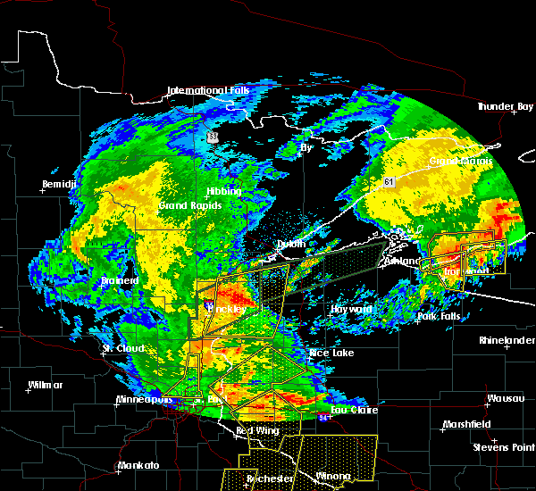 At 612 pm cdt, severe thunderstorms were located along a line extending from 7 miles southeast of nemadji, to near duxbury, to near grantsburg, moving northeast at 45 mph (radar indicated). Hazards include 60 mph wind gusts. Expect damage to roofs, siding, and trees. a flash flood warning is also in effect for much of the warned area. Locations impacted include, grantsburg, siren, webster, willow river, askov, webb lake wisconsin, dairyland, holyoke, bruno, cloverton, south range, duxbury, foxboro, danbury, hertel, nemadji, oakland, sturgeon lake, nickerson, and kerrick. At 612 pm cdt, severe thunderstorms were located along a line extending from 7 miles southeast of nemadji, to near duxbury, to near grantsburg, moving northeast at 45 mph (radar indicated). Hazards include 60 mph wind gusts. Expect damage to roofs, siding, and trees. a flash flood warning is also in effect for much of the warned area. Locations impacted include, grantsburg, siren, webster, willow river, askov, webb lake wisconsin, dairyland, holyoke, bruno, cloverton, south range, duxbury, foxboro, danbury, hertel, nemadji, oakland, sturgeon lake, nickerson, and kerrick.
|
| 8/27/2018 5:58 PM CDT |
 At 558 pm cdt, severe thunderstorms were located along a line extending from near bruno, to 9 miles southeast of sandstone, to near rock creek, moving northeast at 40 mph (radar indicated). Hazards include 60 mph wind gusts and torrential rainfall. expect damage to roofs, siding, and trees At 558 pm cdt, severe thunderstorms were located along a line extending from near bruno, to 9 miles southeast of sandstone, to near rock creek, moving northeast at 40 mph (radar indicated). Hazards include 60 mph wind gusts and torrential rainfall. expect damage to roofs, siding, and trees
|
| 8/27/2018 4:20 PM CDT | Power lines knocked down on state highway 77 along the border of washburn and burnett countie in washburn county WI, 15.8 miles W of Danbury, WI |
| 8/27/2018 3:06 PM CDT |
 At 306 pm cdt, severe thunderstorms were located along a line extending from near askov, to 10 miles east of hinckley, to 6 miles west of grantsburg, moving east at 40 mph (radar indicated). Hazards include 60 mph wind gusts and torrential rainfall. Expect damage to roofs, siding, and trees. locations impacted include, pine city, hinckley, sandstone, rock creek, grantsburg, askov, duxbury, finlayson, falun, grindstone lake pine county, greely, phantom lake, banning state park, saint croix state park, west rock, alpha, cloverdale, friesland, and beroun. This also includes interstate 35 between pine city and sandstone. At 306 pm cdt, severe thunderstorms were located along a line extending from near askov, to 10 miles east of hinckley, to 6 miles west of grantsburg, moving east at 40 mph (radar indicated). Hazards include 60 mph wind gusts and torrential rainfall. Expect damage to roofs, siding, and trees. locations impacted include, pine city, hinckley, sandstone, rock creek, grantsburg, askov, duxbury, finlayson, falun, grindstone lake pine county, greely, phantom lake, banning state park, saint croix state park, west rock, alpha, cloverdale, friesland, and beroun. This also includes interstate 35 between pine city and sandstone.
|
| 8/27/2018 2:55 PM CDT |
 At 255 pm cdt, severe thunderstorms were located along a line extending from near sandstone, to near hinckley, to rock creek, moving east at 40 mph (radar indicated). Hazards include 60 mph wind gusts and torrential rainfall. Expect damage to roofs, siding, and trees. locations impacted include, pine city, hinckley, sandstone, rock creek, grantsburg, trade lake, askov, brook park, henriette, duxbury, branstad, danbury, randall, finlayson, falun, banning state park, four corners, west rock, trade river, and friesland. This also includes interstate 35 between rush city and sandstone. At 255 pm cdt, severe thunderstorms were located along a line extending from near sandstone, to near hinckley, to rock creek, moving east at 40 mph (radar indicated). Hazards include 60 mph wind gusts and torrential rainfall. Expect damage to roofs, siding, and trees. locations impacted include, pine city, hinckley, sandstone, rock creek, grantsburg, trade lake, askov, brook park, henriette, duxbury, branstad, danbury, randall, finlayson, falun, banning state park, four corners, west rock, trade river, and friesland. This also includes interstate 35 between rush city and sandstone.
|
| 8/27/2018 2:41 PM CDT |
 At 241 pm cdt, severe thunderstorms were located along a line extending from 7 miles northwest of hinckley, to near brook park, to near grasston, moving east at 30 mph (radar indicated). Hazards include 60 mph wind gusts and penny size hail. Expect damage to roofs, siding, and trees. locations impacted include, pine city, hinckley, sandstone, rock creek, grantsburg, trade lake, askov, brook park, henriette, duxbury, branstad, danbury, randall, finlayson, falun, banning state park, four corners, west rock, trade river, and friesland. This also includes interstate 35 between rush city and sandstone. At 241 pm cdt, severe thunderstorms were located along a line extending from 7 miles northwest of hinckley, to near brook park, to near grasston, moving east at 30 mph (radar indicated). Hazards include 60 mph wind gusts and penny size hail. Expect damage to roofs, siding, and trees. locations impacted include, pine city, hinckley, sandstone, rock creek, grantsburg, trade lake, askov, brook park, henriette, duxbury, branstad, danbury, randall, finlayson, falun, banning state park, four corners, west rock, trade river, and friesland. This also includes interstate 35 between rush city and sandstone.
|
| 8/27/2018 2:41 PM CDT |
 At 229 pm cdt, a severe thunderstorm was located over just east of mora, or 8 miles west of pine city, moving east at 40 mph (radar indicated). Hazards include 60 mph wind gusts and penny size hail and torrential rainfall. expect damage to roofs, siding, and trees At 229 pm cdt, a severe thunderstorm was located over just east of mora, or 8 miles west of pine city, moving east at 40 mph (radar indicated). Hazards include 60 mph wind gusts and penny size hail and torrential rainfall. expect damage to roofs, siding, and trees
|
| 8/27/2018 2:30 PM CDT |
 At 229 pm cdt, a severe thunderstorm was located over just east of mora, or 8 miles west of pine city, moving east at 40 mph (radar indicated). Hazards include 60 mph wind gusts and penny size hail and torrential rainfall. expect damage to roofs, siding, and trees At 229 pm cdt, a severe thunderstorm was located over just east of mora, or 8 miles west of pine city, moving east at 40 mph (radar indicated). Hazards include 60 mph wind gusts and penny size hail and torrential rainfall. expect damage to roofs, siding, and trees
|
| 6/28/2018 6:49 PM CDT |
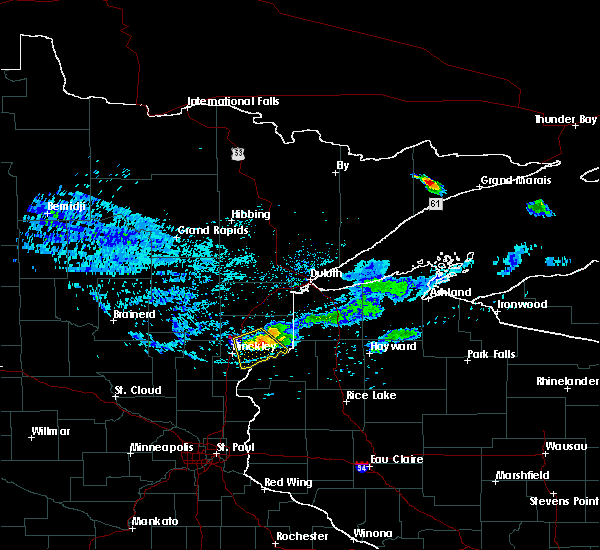 At 649 pm cdt, a severe thunderstorm was located 7 miles southwest of duxbury, or 14 miles east of hinckley, moving southeast at 35 mph (radar indicated). Hazards include 60 mph wind gusts and quarter size hail. Hail damage to vehicles is expected. expect wind damage to roofs, siding, and trees. this severe storm will be near, danbury around 700 pm cdt. Other locations impacted by this severe thunderstorm include cloverdale, saint croix state park, banning state park, and chengwatana state forest. At 649 pm cdt, a severe thunderstorm was located 7 miles southwest of duxbury, or 14 miles east of hinckley, moving southeast at 35 mph (radar indicated). Hazards include 60 mph wind gusts and quarter size hail. Hail damage to vehicles is expected. expect wind damage to roofs, siding, and trees. this severe storm will be near, danbury around 700 pm cdt. Other locations impacted by this severe thunderstorm include cloverdale, saint croix state park, banning state park, and chengwatana state forest.
|
| 6/28/2018 6:28 PM CDT |
 At 628 pm cdt, a severe thunderstorm was located over askov, or 15 miles northeast of hinckley, moving southeast at 25 mph (radar indicated). Hazards include 60 mph wind gusts and quarter size hail. Hail damage to vehicles is expected. expect wind damage to roofs, siding, and trees. this severe storm will be near, duxbury around 700 pm cdt. Other locations impacted by this severe thunderstorm include finlayson, saint croix state park, sturgeon lake, cloverdale, friesland, banning state park, and chengwatana state forest. At 628 pm cdt, a severe thunderstorm was located over askov, or 15 miles northeast of hinckley, moving southeast at 25 mph (radar indicated). Hazards include 60 mph wind gusts and quarter size hail. Hail damage to vehicles is expected. expect wind damage to roofs, siding, and trees. this severe storm will be near, duxbury around 700 pm cdt. Other locations impacted by this severe thunderstorm include finlayson, saint croix state park, sturgeon lake, cloverdale, friesland, banning state park, and chengwatana state forest.
|
| 6/28/2018 6:10 PM CDT |
 At 609 pm cdt, a severe thunderstorm was located over rutledge, or 18 miles north of hinckley, moving southeast at 35 mph (radar indicated). Hazards include 60 mph wind gusts and half dollar size hail. Hail damage to vehicles is expected. expect wind damage to roofs, siding, and trees. this severe thunderstorm will be near, bruno around 620 pm cdt. sandstone and askov around 625 pm cdt. duxbury around 645 pm cdt. danbury around 700 pm cdt. Other locations impacted by this severe thunderstorm include finlayson, saint croix state park, sturgeon lake, cloverdale, denham, friesland, banning state park, and chengwatana state forest. At 609 pm cdt, a severe thunderstorm was located over rutledge, or 18 miles north of hinckley, moving southeast at 35 mph (radar indicated). Hazards include 60 mph wind gusts and half dollar size hail. Hail damage to vehicles is expected. expect wind damage to roofs, siding, and trees. this severe thunderstorm will be near, bruno around 620 pm cdt. sandstone and askov around 625 pm cdt. duxbury around 645 pm cdt. danbury around 700 pm cdt. Other locations impacted by this severe thunderstorm include finlayson, saint croix state park, sturgeon lake, cloverdale, denham, friesland, banning state park, and chengwatana state forest.
|
| 6/17/2018 3:26 PM CDT |
 At 326 pm cdt, severe thunderstorms were located along a line extending from near lake nebagamon, to near solon springs, to near webster, moving east at 60 mph. in this line a stronger storm is near solon springs, moving east at 50 to 60 mph. these are very dangerous storms (radar indicated). Hazards include 80 mph wind gusts and quarter size hail. Hail damage to vehicles is expected. locations impacted include, pine city, grantsburg, trego, trade lake, siren, barnes, wascott, webster, solon springs, minong, webb lake wisconsin, gordon, dairyland, cloverton, duxbury, danbury, hertel, branstad, oakland, and bennett. A tornado watch remains in effect until 900 pm cdt for northeastern and east central minnesota, and northwestern wisconsin. At 326 pm cdt, severe thunderstorms were located along a line extending from near lake nebagamon, to near solon springs, to near webster, moving east at 60 mph. in this line a stronger storm is near solon springs, moving east at 50 to 60 mph. these are very dangerous storms (radar indicated). Hazards include 80 mph wind gusts and quarter size hail. Hail damage to vehicles is expected. locations impacted include, pine city, grantsburg, trego, trade lake, siren, barnes, wascott, webster, solon springs, minong, webb lake wisconsin, gordon, dairyland, cloverton, duxbury, danbury, hertel, branstad, oakland, and bennett. A tornado watch remains in effect until 900 pm cdt for northeastern and east central minnesota, and northwestern wisconsin.
|
| 6/17/2018 3:01 PM CDT |
 At 300 pm cdt, severe thunderstorms were located along a line extending from 6 miles southeast of foxboro, to near cloverton, to near grantsburg, moving east at 45 mph (radar indicated). Hazards include 70 mph wind gusts and quarter size hail. Hail damage to vehicles is expected. expect considerable tree damage. Wind damage is also likely to mobile homes, roofs, and outbuildings. At 300 pm cdt, severe thunderstorms were located along a line extending from 6 miles southeast of foxboro, to near cloverton, to near grantsburg, moving east at 45 mph (radar indicated). Hazards include 70 mph wind gusts and quarter size hail. Hail damage to vehicles is expected. expect considerable tree damage. Wind damage is also likely to mobile homes, roofs, and outbuildings.
|
| 5/29/2018 5:08 PM CDT |
 At 507 pm cdt, a severe thunderstorm was located near webster, or 20 miles west of spooner, moving north at 30 mph (radar indicated). Hazards include 60 mph wind gusts and half dollar size hail. Hail damage to vehicles is expected. expect wind damage to roofs, siding, and trees. Locations impacted include, siren, webster, webb lake wisconsin, danbury, hertel, oakland, big sand lake, birch island lake, and yellow lake. At 507 pm cdt, a severe thunderstorm was located near webster, or 20 miles west of spooner, moving north at 30 mph (radar indicated). Hazards include 60 mph wind gusts and half dollar size hail. Hail damage to vehicles is expected. expect wind damage to roofs, siding, and trees. Locations impacted include, siren, webster, webb lake wisconsin, danbury, hertel, oakland, big sand lake, birch island lake, and yellow lake.
|
| 5/29/2018 4:44 PM CDT |
 At 444 pm cdt, a severe thunderstorm was located near siren, or 20 miles west of spooner, moving north at 30 mph (radar indicated). Hazards include 60 mph wind gusts and half dollar size hail. Hail damage to vehicles is expected. Expect wind damage to roofs, siding, and trees. At 444 pm cdt, a severe thunderstorm was located near siren, or 20 miles west of spooner, moving north at 30 mph (radar indicated). Hazards include 60 mph wind gusts and half dollar size hail. Hail damage to vehicles is expected. Expect wind damage to roofs, siding, and trees.
|
| 5/29/2018 4:44 PM CDT |
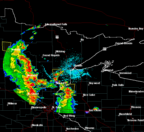 At 444 pm cdt, a severe thunderstorm was located near siren, or 20 miles west of spooner, moving north at 30 mph (radar indicated). Hazards include 60 mph wind gusts and half dollar size hail. Hail damage to vehicles is expected. Expect wind damage to roofs, siding, and trees. At 444 pm cdt, a severe thunderstorm was located near siren, or 20 miles west of spooner, moving north at 30 mph (radar indicated). Hazards include 60 mph wind gusts and half dollar size hail. Hail damage to vehicles is expected. Expect wind damage to roofs, siding, and trees.
|
| 9/22/2017 6:35 AM CDT |
 At 635 am cdt, a severe thunderstorm was located near danbury, or 26 miles northwest of spooner, moving northeast at 35 mph (radar indicated). Hazards include 60 mph wind gusts and half dollar size hail. Hail damage to vehicles is expected. expect wind damage to roofs, siding, and trees. Locations impacted include, webb lake wisconsin, dairyland, danbury, markville, cozy corner, minong flowage, and riverside. At 635 am cdt, a severe thunderstorm was located near danbury, or 26 miles northwest of spooner, moving northeast at 35 mph (radar indicated). Hazards include 60 mph wind gusts and half dollar size hail. Hail damage to vehicles is expected. expect wind damage to roofs, siding, and trees. Locations impacted include, webb lake wisconsin, dairyland, danbury, markville, cozy corner, minong flowage, and riverside.
|
| 9/22/2017 6:19 AM CDT |
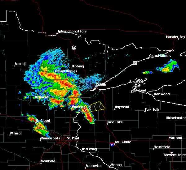 At 618 am cdt, a severe thunderstorm was located 7 miles west of danbury, or 20 miles east of hinckley, moving northeast at 40 mph (radar indicated). Hazards include ping pong ball size hail and 60 mph wind gusts. People and animals outdoors will be injured. expect hail damage to roofs, siding, windows, and vehicles. Expect wind damage to roofs, siding, and trees. At 618 am cdt, a severe thunderstorm was located 7 miles west of danbury, or 20 miles east of hinckley, moving northeast at 40 mph (radar indicated). Hazards include ping pong ball size hail and 60 mph wind gusts. People and animals outdoors will be injured. expect hail damage to roofs, siding, windows, and vehicles. Expect wind damage to roofs, siding, and trees.
|
| 9/20/2017 3:37 AM CDT |
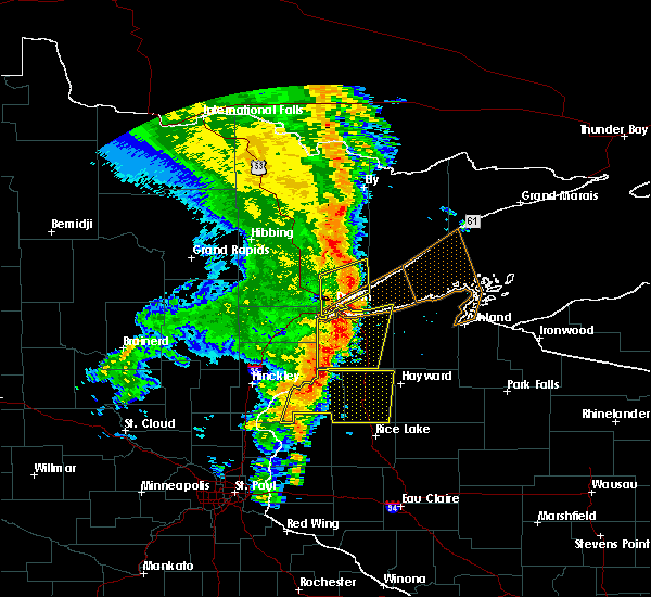 At 337 am cdt, severe thunderstorms were located along a line extending from near cloverton, to near siren, moving east at 50 mph (radar indicated). Hazards include 60 mph wind gusts and nickel size hail. Expect damage to roofs, siding, and trees. Locations impacted include, spooner, shell lake, trego, trade lake, siren, webster, minong, webb lake wisconsin, danbury, hertel, oakland, springbrook, sarona, spooner lake, falun, mckenzie lake, birch island lake, lampson, four corners, and stanberry. At 337 am cdt, severe thunderstorms were located along a line extending from near cloverton, to near siren, moving east at 50 mph (radar indicated). Hazards include 60 mph wind gusts and nickel size hail. Expect damage to roofs, siding, and trees. Locations impacted include, spooner, shell lake, trego, trade lake, siren, webster, minong, webb lake wisconsin, danbury, hertel, oakland, springbrook, sarona, spooner lake, falun, mckenzie lake, birch island lake, lampson, four corners, and stanberry.
|
| 9/20/2017 3:15 AM CDT |
 At 314 am cdt, severe thunderstorms were located along a line extending from duxbury, to 6 miles south of branstad, moving east at 55 mph (radar indicated). Hazards include 60 mph wind gusts and nickel size hail. expect damage to roofs, siding, and trees At 314 am cdt, severe thunderstorms were located along a line extending from duxbury, to 6 miles south of branstad, moving east at 55 mph (radar indicated). Hazards include 60 mph wind gusts and nickel size hail. expect damage to roofs, siding, and trees
|
| 7/21/2017 8:29 PM CDT |
 At 827 pm cdt, a severe thunderstorm was located near duxbury, or 22 miles northeast of hinckley, moving southeast at 45 mph (radar indicated). Hazards include 60 mph wind gusts and penny size hail. Expect damage to roofs, siding, and trees. this severe thunderstorm will be near, cloverton around 845 pm cdt. danbury around 850 pm cdt. webb lake wisconsin around 900 pm cdt. Other locations impacted by this severe thunderstorm include cozy corner, finlayson, belden, duquette, moose junction, oakland, birch island lake, banning state park, kingsdale, and markville. At 827 pm cdt, a severe thunderstorm was located near duxbury, or 22 miles northeast of hinckley, moving southeast at 45 mph (radar indicated). Hazards include 60 mph wind gusts and penny size hail. Expect damage to roofs, siding, and trees. this severe thunderstorm will be near, cloverton around 845 pm cdt. danbury around 850 pm cdt. webb lake wisconsin around 900 pm cdt. Other locations impacted by this severe thunderstorm include cozy corner, finlayson, belden, duquette, moose junction, oakland, birch island lake, banning state park, kingsdale, and markville.
|
| 7/17/2017 8:19 PM CDT |
 At 819 pm cdt, severe thunderstorms were located along a line extending from near cloverton, to near trade lake, moving east at 35 mph (radar indicated). Hazards include 60 mph wind gusts and quarter size hail. Hail damage to vehicles is expected. expect wind damage to roofs, siding, and trees. These severe thunderstorms will remain over mainly rural areas of southeastern pine and central burnett counties, including the following locations: markville, falun, saint croix state park, four corners, alpha, trade river, phantom lake, oakland, randall and riverside. At 819 pm cdt, severe thunderstorms were located along a line extending from near cloverton, to near trade lake, moving east at 35 mph (radar indicated). Hazards include 60 mph wind gusts and quarter size hail. Hail damage to vehicles is expected. expect wind damage to roofs, siding, and trees. These severe thunderstorms will remain over mainly rural areas of southeastern pine and central burnett counties, including the following locations: markville, falun, saint croix state park, four corners, alpha, trade river, phantom lake, oakland, randall and riverside.
|
| 7/17/2017 8:01 PM CDT |
 At 800 pm cdt, severe thunderstorms were located along a line extending from duxbury, to near rush city, moving east at 30 mph (radar indicated). Hazards include 60 mph wind gusts and quarter size hail. Hail damage to vehicles is expected. expect wind damage to roofs, siding, and trees. these severe storms will be near, duxbury around 805 pm cdt. danbury around 815 pm cdt. trade lake around 830 pm cdt. Other locations impacted by these severe thunderstorms include falun, phantom lake, oakland, markville, saint croix state park, four corners, west rock, alpha, trade river, and cloverdale. At 800 pm cdt, severe thunderstorms were located along a line extending from duxbury, to near rush city, moving east at 30 mph (radar indicated). Hazards include 60 mph wind gusts and quarter size hail. Hail damage to vehicles is expected. expect wind damage to roofs, siding, and trees. these severe storms will be near, duxbury around 805 pm cdt. danbury around 815 pm cdt. trade lake around 830 pm cdt. Other locations impacted by these severe thunderstorms include falun, phantom lake, oakland, markville, saint croix state park, four corners, west rock, alpha, trade river, and cloverdale.
|
| 7/17/2017 7:39 PM CDT |
 At 738 pm cdt, severe thunderstorms were located along a line extending from near askov, to near grasston, moving east at 30 mph (radar indicated). Hazards include 60 mph wind gusts and quarter size hail. Hail damage to vehicles is expected. expect wind damage to roofs, siding, and trees. severe thunderstorms will be near, duxbury around 755 pm cdt. danbury around 815 pm cdt. grantsburg and branstad around 820 pm cdt. trade lake around 830 pm cdt. Other locations impacted by these severe thunderstorms include falun, greely, phantom lake, oakland, markville, saint croix state park, four corners, west rock, alpha, and trade river. At 738 pm cdt, severe thunderstorms were located along a line extending from near askov, to near grasston, moving east at 30 mph (radar indicated). Hazards include 60 mph wind gusts and quarter size hail. Hail damage to vehicles is expected. expect wind damage to roofs, siding, and trees. severe thunderstorms will be near, duxbury around 755 pm cdt. danbury around 815 pm cdt. grantsburg and branstad around 820 pm cdt. trade lake around 830 pm cdt. Other locations impacted by these severe thunderstorms include falun, greely, phantom lake, oakland, markville, saint croix state park, four corners, west rock, alpha, and trade river.
|
| 7/6/2017 5:35 AM CDT |
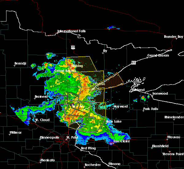 At 535 am cdt, severe thunderstorms were located along a line extending from 6 miles northeast of duxbury, to 8 miles west of webster, to 10 miles southwest of trade lake, moving east at 45 mph (radar indicated). Hazards include 60 mph wind gusts and penny size hail. expect damage to roofs, siding, and trees At 535 am cdt, severe thunderstorms were located along a line extending from 6 miles northeast of duxbury, to 8 miles west of webster, to 10 miles southwest of trade lake, moving east at 45 mph (radar indicated). Hazards include 60 mph wind gusts and penny size hail. expect damage to roofs, siding, and trees
|
| 7/6/2017 5:17 AM CDT |
 At 517 am cdt, severe thunderstorms were located along a line extending from near askov, to 6 miles east of pine city, to 8 miles northeast of cambridge, moving east at 45 mph (radar indicated). Hazards include 60 mph wind gusts and quarter size hail. Hail damage to vehicles is expected. expect wind damage to roofs, siding, and trees. Locations impacted include, pine city, hinckley, sandstone, rock creek, grantsburg, trade lake, siren, webster, askov, rutledge, brook park, henriette, cloverton, duxbury, danbury, branstad, randall, oakland, finlayson, and falun. At 517 am cdt, severe thunderstorms were located along a line extending from near askov, to 6 miles east of pine city, to 8 miles northeast of cambridge, moving east at 45 mph (radar indicated). Hazards include 60 mph wind gusts and quarter size hail. Hail damage to vehicles is expected. expect wind damage to roofs, siding, and trees. Locations impacted include, pine city, hinckley, sandstone, rock creek, grantsburg, trade lake, siren, webster, askov, rutledge, brook park, henriette, cloverton, duxbury, danbury, branstad, randall, oakland, finlayson, and falun.
|
| 7/6/2017 5:13 AM CDT |
 At 512 am cdt, severe thunderstorms were located along a line extending from askov, to near pine city, to 8 miles south of brunswick, moving east at 45 mph (radar indicated). Hazards include 60 mph wind gusts and quarter size hail. Hail damage to vehicles is expected. Expect wind damage to roofs, siding, and trees. At 512 am cdt, severe thunderstorms were located along a line extending from askov, to near pine city, to 8 miles south of brunswick, moving east at 45 mph (radar indicated). Hazards include 60 mph wind gusts and quarter size hail. Hail damage to vehicles is expected. Expect wind damage to roofs, siding, and trees.
|
| 7/6/2017 4:48 AM CDT |
 At 448 am cdt, severe thunderstorms were located along a line extending from 7 miles east of mcgrath, to near quamba, to near bock, moving east at 45 mph (radar indicated). Hazards include 60 mph wind gusts and quarter size hail. Hail damage to vehicles is expected. Expect wind damage to roofs, siding, and trees. At 448 am cdt, severe thunderstorms were located along a line extending from 7 miles east of mcgrath, to near quamba, to near bock, moving east at 45 mph (radar indicated). Hazards include 60 mph wind gusts and quarter size hail. Hail damage to vehicles is expected. Expect wind damage to roofs, siding, and trees.
|
| 6/11/2017 10:15 AM CDT |
 At 1014 am cdt, severe thunderstorms were located along a line extending from near webb lake wisconsin, to near shell lake, moving east at 55 mph (trained weather spotters reported winds up to 70 mph and wind damage across burnett county). Hazards include 70 mph wind gusts and penny size hail. Expect considerable tree damage. damage is likely to mobile homes, roofs, and outbuildings. Locations impacted include, spooner, hayward, chippewa flowage, shell lake, trego, wascott, minong, stone lake, birchwood, webb lake wisconsin, radisson, exeland, couderay, little round lake, chief lake, danbury, hertel, oakland, edgewater, and springbrook. At 1014 am cdt, severe thunderstorms were located along a line extending from near webb lake wisconsin, to near shell lake, moving east at 55 mph (trained weather spotters reported winds up to 70 mph and wind damage across burnett county). Hazards include 70 mph wind gusts and penny size hail. Expect considerable tree damage. damage is likely to mobile homes, roofs, and outbuildings. Locations impacted include, spooner, hayward, chippewa flowage, shell lake, trego, wascott, minong, stone lake, birchwood, webb lake wisconsin, radisson, exeland, couderay, little round lake, chief lake, danbury, hertel, oakland, edgewater, and springbrook.
|
| 6/11/2017 10:03 AM CDT |
 At 1003 am cdt, severe thunderstorms were located along a line extending from near webb lake wisconsin, to 7 miles north of cumberland, moving east at 55 mph (radar indicated). Hazards include 70 mph wind gusts and penny size hail. Expect considerable tree damage. damage is likely to mobile homes, roofs, and outbuildings. Locations impacted include, spooner, hayward, chippewa flowage, shell lake, trego, siren, wascott, webster, minong, stone lake, birchwood, webb lake wisconsin, radisson, exeland, couderay, little round lake, chief lake, danbury, hertel, and oakland. At 1003 am cdt, severe thunderstorms were located along a line extending from near webb lake wisconsin, to 7 miles north of cumberland, moving east at 55 mph (radar indicated). Hazards include 70 mph wind gusts and penny size hail. Expect considerable tree damage. damage is likely to mobile homes, roofs, and outbuildings. Locations impacted include, spooner, hayward, chippewa flowage, shell lake, trego, siren, wascott, webster, minong, stone lake, birchwood, webb lake wisconsin, radisson, exeland, couderay, little round lake, chief lake, danbury, hertel, and oakland.
|
| 6/11/2017 9:51 AM CDT |
 At 951 am cdt, severe thunderstorms were located along a line extending from near danbury, to 10 miles northwest of cumberland, moving east at 55 mph (radar indicated). Hazards include 70 mph wind gusts and penny size hail. Expect considerable tree damage. Damage is likely to mobile homes, roofs, and outbuildings. At 951 am cdt, severe thunderstorms were located along a line extending from near danbury, to 10 miles northwest of cumberland, moving east at 55 mph (radar indicated). Hazards include 70 mph wind gusts and penny size hail. Expect considerable tree damage. Damage is likely to mobile homes, roofs, and outbuildings.
|
| 8/4/2016 5:19 AM CDT |
 At 518 am cdt, severe thunderstorms were located along a line extending from wascott, to near siren, moving east at 55 mph (radar indicated). Hazards include 60 mph wind gusts and penny size hail. Expect damage to roofs. siding. and trees. Locations impacted include, spooner, hayward, grantsburg, trego, cable, siren, wascott, webster, minong, webb lake wisconsin, danbury, seeley, hertel, oakland, springbrook, alpha, falun, lampson, riverside and totagatic flowage. At 518 am cdt, severe thunderstorms were located along a line extending from wascott, to near siren, moving east at 55 mph (radar indicated). Hazards include 60 mph wind gusts and penny size hail. Expect damage to roofs. siding. and trees. Locations impacted include, spooner, hayward, grantsburg, trego, cable, siren, wascott, webster, minong, webb lake wisconsin, danbury, seeley, hertel, oakland, springbrook, alpha, falun, lampson, riverside and totagatic flowage.
|
| 8/4/2016 5:02 AM CDT |
 At 502 am cdt, severe thunderstorms were located along a line extending from near dairyland, to near grantsburg, moving east at 55 mph (radar indicated). Hazards include 60 mph wind gusts and penny size hail. Expect damage to roofs. siding. And trees. At 502 am cdt, severe thunderstorms were located along a line extending from near dairyland, to near grantsburg, moving east at 55 mph (radar indicated). Hazards include 60 mph wind gusts and penny size hail. Expect damage to roofs. siding. And trees.
|
| 8/4/2016 4:56 AM CDT |
 The severe thunderstorm warning for central pine, central burnett and southwestern douglas counties will expire at 500 am cdt, the storms which prompted the warning have weakened below severe limits, and exited the warned area. therefore the warning will be allowed to expire. however gusty winds are still possible with these thunderstorms. The severe thunderstorm warning for central pine, central burnett and southwestern douglas counties will expire at 500 am cdt, the storms which prompted the warning have weakened below severe limits, and exited the warned area. therefore the warning will be allowed to expire. however gusty winds are still possible with these thunderstorms.
|
| 8/4/2016 4:48 AM CDT |
 At 447 am cdt, severe thunderstorms were located along a line extending from near bruno, to 7 miles northeast of grantsburg, moving east at 45 mph (radar indicated). Hazards include 70 mph wind gusts and penny size hail. Expect considerable tree damage. damage is likely to mobile homes, roofs, and outbuildings. Locations impacted include, pine city, hinckley, webster, danbury, cloverton, duxbury, oakland, beroun, riverside, belden, markville, cloverdale, saint croix state park, kingsdale, yellow lake, cozy corner and phantom lake. At 447 am cdt, severe thunderstorms were located along a line extending from near bruno, to 7 miles northeast of grantsburg, moving east at 45 mph (radar indicated). Hazards include 70 mph wind gusts and penny size hail. Expect considerable tree damage. damage is likely to mobile homes, roofs, and outbuildings. Locations impacted include, pine city, hinckley, webster, danbury, cloverton, duxbury, oakland, beroun, riverside, belden, markville, cloverdale, saint croix state park, kingsdale, yellow lake, cozy corner and phantom lake.
|
| 8/4/2016 4:35 AM CDT |
 At 434 am cdt, severe thunderstorms were located along a line extending from willow river, to 8 miles northeast of pine city, moving east at 45 mph (radar indicated). Hazards include 70 mph wind gusts and penny size hail. Expect considerable tree damage. damage is likely to mobile homes, roofs, and outbuildings. Locations impacted include, pine city, hinckley, sandstone, webster, askov, brook park, bruno, henriette, danbury, cloverton, duxbury, oakland, finlayson, nickerson, kerrick, beroun, riverside, cloverdale, cozy corner and harlis. At 434 am cdt, severe thunderstorms were located along a line extending from willow river, to 8 miles northeast of pine city, moving east at 45 mph (radar indicated). Hazards include 70 mph wind gusts and penny size hail. Expect considerable tree damage. damage is likely to mobile homes, roofs, and outbuildings. Locations impacted include, pine city, hinckley, sandstone, webster, askov, brook park, bruno, henriette, danbury, cloverton, duxbury, oakland, finlayson, nickerson, kerrick, beroun, riverside, cloverdale, cozy corner and harlis.
|
| 8/4/2016 4:18 AM CDT |
 At 417 am cdt, severe thunderstorms were located along a line extending from 9 miles west of rutledge, to near henriette, moving east at 50 mph (radar indicated). Hazards include 70 mph wind gusts and penny size hail. Expect considerable tree damage. Damage is likely to mobile homes, roofs, and outbuildings. At 417 am cdt, severe thunderstorms were located along a line extending from 9 miles west of rutledge, to near henriette, moving east at 50 mph (radar indicated). Hazards include 70 mph wind gusts and penny size hail. Expect considerable tree damage. Damage is likely to mobile homes, roofs, and outbuildings.
|
| 7/26/2016 8:38 PM CDT |
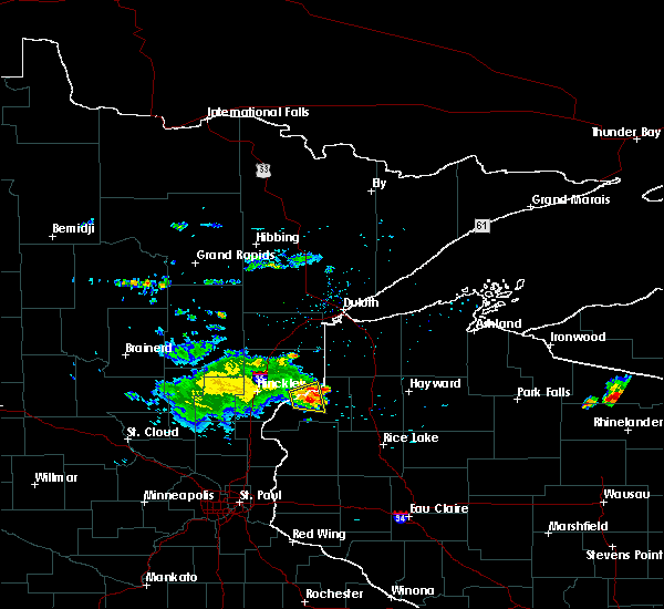 The severe thunderstorm warning for east central pine and central burnett counties will expire at 845 pm cdt, the severe thunderstorm which prompted the warning has weakened. therefore the warning will be allowed to expire. however, lightning, heavy downpours, and wind gusts around 30 mph will still be possible with this storm. The severe thunderstorm warning for east central pine and central burnett counties will expire at 845 pm cdt, the severe thunderstorm which prompted the warning has weakened. therefore the warning will be allowed to expire. however, lightning, heavy downpours, and wind gusts around 30 mph will still be possible with this storm.
|
| 7/26/2016 8:26 PM CDT |
 At 825 pm cdt, a severe thunderstorm was located near danbury, or 20 miles east of hinckley, moving east at 35 mph (radar indicated). Hazards include 50 mph wind gusts and quarter size hail. Hail damage to vehicles and wind damage to trees can be expected. this severe thunderstorm will impact the saint croix state park through 830 pm. The severe thunderstorm will reach the areas of webster and danbury around 835 pm cdt. At 825 pm cdt, a severe thunderstorm was located near danbury, or 20 miles east of hinckley, moving east at 35 mph (radar indicated). Hazards include 50 mph wind gusts and quarter size hail. Hail damage to vehicles and wind damage to trees can be expected. this severe thunderstorm will impact the saint croix state park through 830 pm. The severe thunderstorm will reach the areas of webster and danbury around 835 pm cdt.
|
| 7/26/2016 8:26 PM CDT |
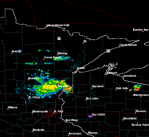 At 825 pm cdt, a severe thunderstorm was located near danbury, or 20 miles east of hinckley, moving east at 35 mph (radar indicated). Hazards include 50 mph wind gusts and quarter size hail. Hail damage to vehicles and wind damage to trees can be expected. this severe thunderstorm will impact the saint croix state park through 830 pm. The severe thunderstorm will reach the areas of webster and danbury around 835 pm cdt. At 825 pm cdt, a severe thunderstorm was located near danbury, or 20 miles east of hinckley, moving east at 35 mph (radar indicated). Hazards include 50 mph wind gusts and quarter size hail. Hail damage to vehicles and wind damage to trees can be expected. this severe thunderstorm will impact the saint croix state park through 830 pm. The severe thunderstorm will reach the areas of webster and danbury around 835 pm cdt.
|
| 7/26/2016 8:14 PM CDT |
 At 812 pm cdt, a severe thunderstorm was located 11 miles north of grantsburg, or 15 miles east of hinckley, moving east at 35 mph (radar indicated). Hazards include 50 mph wind gusts and quarter size hail. Hail damage to vehicles is expected. expect wind damage to trees. this severe thunderstorm will impact the saint croix state park through 830 pm. The severe thunderstorm will reach the areas of webster and danbury around 835 pm cdt. At 812 pm cdt, a severe thunderstorm was located 11 miles north of grantsburg, or 15 miles east of hinckley, moving east at 35 mph (radar indicated). Hazards include 50 mph wind gusts and quarter size hail. Hail damage to vehicles is expected. expect wind damage to trees. this severe thunderstorm will impact the saint croix state park through 830 pm. The severe thunderstorm will reach the areas of webster and danbury around 835 pm cdt.
|
| 7/21/2016 4:20 AM CDT |
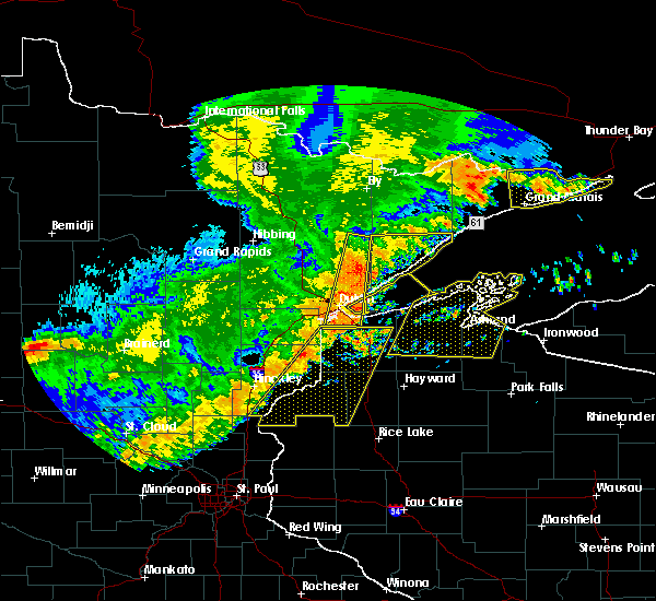 At 420 am cdt, severe thunderstorms were located along a line extending from near poplar in douglas county, to near luck, moving east at 50 mph (radar indicated). Hazards include 60 mph wind gusts and quarter size hail. Hail damage to vehicles is expected. expect wind damage to roofs, siding, and trees. these severe storms will be near, hawthorne and lake nebagamon around 425 am cdt. Other locations impacted by these severe thunderstorms include alpha, lyman lake, falun, birch island lake, riverside, four corners, mckenzie lake, markville, phantom lake and minong flowage. At 420 am cdt, severe thunderstorms were located along a line extending from near poplar in douglas county, to near luck, moving east at 50 mph (radar indicated). Hazards include 60 mph wind gusts and quarter size hail. Hail damage to vehicles is expected. expect wind damage to roofs, siding, and trees. these severe storms will be near, hawthorne and lake nebagamon around 425 am cdt. Other locations impacted by these severe thunderstorms include alpha, lyman lake, falun, birch island lake, riverside, four corners, mckenzie lake, markville, phantom lake and minong flowage.
|
| 7/21/2016 4:06 AM CDT |
 At 406 am cdt, severe thunderstorms were located along a line extending from near south range, to 6 miles south of trade lake, moving east at 50 mph (radar indicated). Hazards include 60 mph wind gusts and quarter size hail. Hail damage to vehicles is expected. expect wind damage to roofs, siding, and trees. these severe storms will be near, hawthorne around 410 am cdt. poplar in douglas county around 415 am cdt. lake nebagamon around 425 am cdt. Other locations impacted by these severe thunderstorms include pattison state park, alpha, falun, riverside, patzau, cloverdale, minong flowage, trade river, blueberry and bennett. At 406 am cdt, severe thunderstorms were located along a line extending from near south range, to 6 miles south of trade lake, moving east at 50 mph (radar indicated). Hazards include 60 mph wind gusts and quarter size hail. Hail damage to vehicles is expected. expect wind damage to roofs, siding, and trees. these severe storms will be near, hawthorne around 410 am cdt. poplar in douglas county around 415 am cdt. lake nebagamon around 425 am cdt. Other locations impacted by these severe thunderstorms include pattison state park, alpha, falun, riverside, patzau, cloverdale, minong flowage, trade river, blueberry and bennett.
|
| 7/21/2016 4:06 AM CDT |
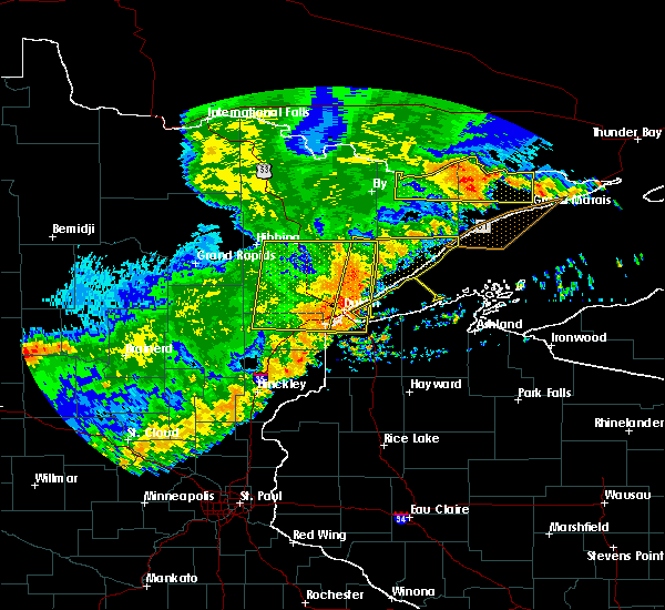 At 406 am cdt, severe thunderstorms were located along a line extending from near south range, to 6 miles south of trade lake, moving east at 50 mph (radar indicated). Hazards include 60 mph wind gusts and quarter size hail. Hail damage to vehicles is expected. expect wind damage to roofs, siding, and trees. these severe storms will be near, hawthorne around 410 am cdt. poplar in douglas county around 415 am cdt. lake nebagamon around 425 am cdt. Other locations impacted by these severe thunderstorms include pattison state park, alpha, falun, riverside, patzau, cloverdale, minong flowage, trade river, blueberry and bennett. At 406 am cdt, severe thunderstorms were located along a line extending from near south range, to 6 miles south of trade lake, moving east at 50 mph (radar indicated). Hazards include 60 mph wind gusts and quarter size hail. Hail damage to vehicles is expected. expect wind damage to roofs, siding, and trees. these severe storms will be near, hawthorne around 410 am cdt. poplar in douglas county around 415 am cdt. lake nebagamon around 425 am cdt. Other locations impacted by these severe thunderstorms include pattison state park, alpha, falun, riverside, patzau, cloverdale, minong flowage, trade river, blueberry and bennett.
|
| 7/21/2016 3:50 AM CDT |
 At 349 am cdt, severe thunderstorms were located along a line extending from 6 miles northeast of foxboro, to 7 miles southeast of rush city, moving east at 50 mph (radar indicated). Hazards include 60 mph wind gusts and quarter size hail. Hail damage to vehicles is expected. expect wind damage to roofs, siding, and trees. severe thunderstorms will be near, foxboro around 355 am cdt. trade lake around 405 am cdt. hawthorne around 410 am cdt. poplar in douglas county around 415 am cdt. lake nebagamon around 420 am cdt. Other locations impacted by these severe thunderstorms include pattison state park, alpha, falun, west rock, riverside, patzau, cloverdale, minong flowage, trade river and blueberry. At 349 am cdt, severe thunderstorms were located along a line extending from 6 miles northeast of foxboro, to 7 miles southeast of rush city, moving east at 50 mph (radar indicated). Hazards include 60 mph wind gusts and quarter size hail. Hail damage to vehicles is expected. expect wind damage to roofs, siding, and trees. severe thunderstorms will be near, foxboro around 355 am cdt. trade lake around 405 am cdt. hawthorne around 410 am cdt. poplar in douglas county around 415 am cdt. lake nebagamon around 420 am cdt. Other locations impacted by these severe thunderstorms include pattison state park, alpha, falun, west rock, riverside, patzau, cloverdale, minong flowage, trade river and blueberry.
|
| 7/11/2016 6:00 PM CDT |
 At 600 pm cdt, a severe thunderstorm was located 8 miles northeast of grantsburg, or 20 miles east of pine city, moving northeast at 45 mph (radar indicated). Hazards include 60 mph wind gusts and quarter size hail. Hail damage to vehicles is expected. expect wind damage to roofs, siding, and trees. this severe storm will be near, siren around 605 pm cdt. webster around 610 pm cdt. danbury around 615 pm cdt. Other locations impacted by this severe thunderstorm include saint croix state park, alpha, falun, yellow lake, oakland, cloverdale, phantom lake and riverside. At 600 pm cdt, a severe thunderstorm was located 8 miles northeast of grantsburg, or 20 miles east of pine city, moving northeast at 45 mph (radar indicated). Hazards include 60 mph wind gusts and quarter size hail. Hail damage to vehicles is expected. expect wind damage to roofs, siding, and trees. this severe storm will be near, siren around 605 pm cdt. webster around 610 pm cdt. danbury around 615 pm cdt. Other locations impacted by this severe thunderstorm include saint croix state park, alpha, falun, yellow lake, oakland, cloverdale, phantom lake and riverside.
|
| 7/11/2016 6:00 PM CDT |
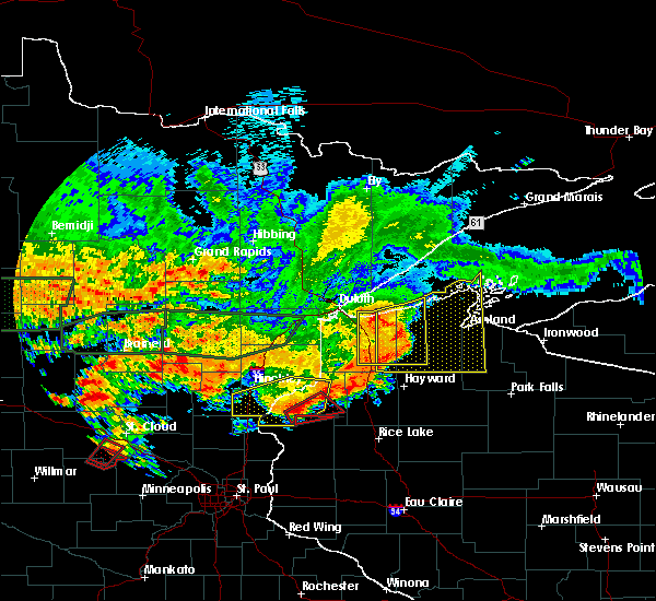 At 600 pm cdt, a severe thunderstorm was located 8 miles northeast of grantsburg, or 20 miles east of pine city, moving northeast at 45 mph (radar indicated). Hazards include 60 mph wind gusts and quarter size hail. Hail damage to vehicles is expected. expect wind damage to roofs, siding, and trees. this severe storm will be near, siren around 605 pm cdt. webster around 610 pm cdt. danbury around 615 pm cdt. Other locations impacted by this severe thunderstorm include saint croix state park, alpha, falun, yellow lake, oakland, cloverdale, phantom lake and riverside. At 600 pm cdt, a severe thunderstorm was located 8 miles northeast of grantsburg, or 20 miles east of pine city, moving northeast at 45 mph (radar indicated). Hazards include 60 mph wind gusts and quarter size hail. Hail damage to vehicles is expected. expect wind damage to roofs, siding, and trees. this severe storm will be near, siren around 605 pm cdt. webster around 610 pm cdt. danbury around 615 pm cdt. Other locations impacted by this severe thunderstorm include saint croix state park, alpha, falun, yellow lake, oakland, cloverdale, phantom lake and riverside.
|
| 7/11/2016 5:21 PM CDT |
 At 521 pm cdt, a severe thunderstorm was located over rush city, or 8 miles south of pine city, moving northeast at 35 mph (radar indicated). Hazards include 60 mph wind gusts and quarter size hail. Hail damage to vehicles is expected. expect wind damage to roofs, siding, and trees. this severe thunderstorm will be near, pine city around 530 pm cdt. grantsburg and branstad around 540 pm cdt. webster around 610 pm cdt. danbury around 615 pm cdt. Other locations impacted by this severe thunderstorm include greely, beroun, alpha, falun, randall, west rock, four corners, cloverdale, phantom lake and saint croix state park. At 521 pm cdt, a severe thunderstorm was located over rush city, or 8 miles south of pine city, moving northeast at 35 mph (radar indicated). Hazards include 60 mph wind gusts and quarter size hail. Hail damage to vehicles is expected. expect wind damage to roofs, siding, and trees. this severe thunderstorm will be near, pine city around 530 pm cdt. grantsburg and branstad around 540 pm cdt. webster around 610 pm cdt. danbury around 615 pm cdt. Other locations impacted by this severe thunderstorm include greely, beroun, alpha, falun, randall, west rock, four corners, cloverdale, phantom lake and saint croix state park.
|
| 7/7/2016 10:47 PM CDT |
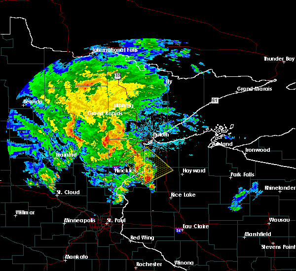 At 1046 pm cdt, severe thunderstorms were located along a line extending from near holyoke to 6 miles north of webb lake wisconsin, moving northeast at 35 mph (radar indicated). Hazards include 60 mph wind gusts and quarter size hail. Hail damage to vehicles is expected. expect wind damage to roofs, siding, and trees. these severe storms will be near, dairyland and holyoke around 1055 pm cdt. wascott, minong and foxboro around 1100 pm cdt. Other locations impacted by these severe thunderstorms include nickerson, birch island lake, riverside, belden, patzau, markville, chaffey, minong flowage, kingsdale and duquette. At 1046 pm cdt, severe thunderstorms were located along a line extending from near holyoke to 6 miles north of webb lake wisconsin, moving northeast at 35 mph (radar indicated). Hazards include 60 mph wind gusts and quarter size hail. Hail damage to vehicles is expected. expect wind damage to roofs, siding, and trees. these severe storms will be near, dairyland and holyoke around 1055 pm cdt. wascott, minong and foxboro around 1100 pm cdt. Other locations impacted by these severe thunderstorms include nickerson, birch island lake, riverside, belden, patzau, markville, chaffey, minong flowage, kingsdale and duquette.
|
| 7/7/2016 10:30 PM CDT |
 At 1029 pm cdt, severe thunderstorms were located along a line extending from near bruno to near danbury, moving northeast at 35 mph (radar indicated). Hazards include 60 mph wind gusts and quarter size hail. Hail damage to vehicles is expected. expect wind damage to roofs, siding, and trees. these severe storms will be near, webb lake wisconsin around 1040 pm cdt. dairyland and holyoke around 1055 pm cdt. wascott, minong and foxboro around 1100 pm cdt. Other locations impacted by these severe thunderstorms include nickerson, birch island lake, riverside, belden, patzau, markville, chaffey, minong flowage, kingsdale and duquette. At 1029 pm cdt, severe thunderstorms were located along a line extending from near bruno to near danbury, moving northeast at 35 mph (radar indicated). Hazards include 60 mph wind gusts and quarter size hail. Hail damage to vehicles is expected. expect wind damage to roofs, siding, and trees. these severe storms will be near, webb lake wisconsin around 1040 pm cdt. dairyland and holyoke around 1055 pm cdt. wascott, minong and foxboro around 1100 pm cdt. Other locations impacted by these severe thunderstorms include nickerson, birch island lake, riverside, belden, patzau, markville, chaffey, minong flowage, kingsdale and duquette.
|
| 7/7/2016 10:30 PM CDT |
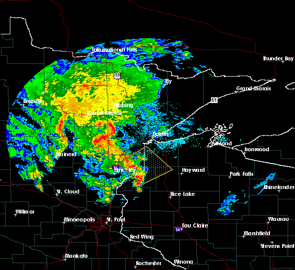 At 1029 pm cdt, severe thunderstorms were located along a line extending from near bruno to near danbury, moving northeast at 35 mph (radar indicated). Hazards include 60 mph wind gusts and quarter size hail. Hail damage to vehicles is expected. expect wind damage to roofs, siding, and trees. these severe storms will be near, webb lake wisconsin around 1040 pm cdt. dairyland and holyoke around 1055 pm cdt. wascott, minong and foxboro around 1100 pm cdt. Other locations impacted by these severe thunderstorms include nickerson, birch island lake, riverside, belden, patzau, markville, chaffey, minong flowage, kingsdale and duquette. At 1029 pm cdt, severe thunderstorms were located along a line extending from near bruno to near danbury, moving northeast at 35 mph (radar indicated). Hazards include 60 mph wind gusts and quarter size hail. Hail damage to vehicles is expected. expect wind damage to roofs, siding, and trees. these severe storms will be near, webb lake wisconsin around 1040 pm cdt. dairyland and holyoke around 1055 pm cdt. wascott, minong and foxboro around 1100 pm cdt. Other locations impacted by these severe thunderstorms include nickerson, birch island lake, riverside, belden, patzau, markville, chaffey, minong flowage, kingsdale and duquette.
|
| 7/7/2016 10:19 PM CDT |
 At 1018 pm cdt, severe thunderstorms were located along a line extending from near bruno to near webster, moving northeast at 35 mph (radar indicated). Hazards include 60 mph wind gusts and quarter size hail. Hail damage to vehicles is expected. expect wind damage to roofs, siding, and trees. severe thunderstorms will be near, webb lake wisconsin around 1035 pm cdt. dairyland around 1050 pm cdt. holyoke around 1055 pm cdt. wascott, minong and foxboro around 1100 pm cdt. Other locations impacted by these severe thunderstorms include nickerson, birch island lake, riverside, belden, patzau, markville, chaffey, minong flowage, kingsdale and duquette. At 1018 pm cdt, severe thunderstorms were located along a line extending from near bruno to near webster, moving northeast at 35 mph (radar indicated). Hazards include 60 mph wind gusts and quarter size hail. Hail damage to vehicles is expected. expect wind damage to roofs, siding, and trees. severe thunderstorms will be near, webb lake wisconsin around 1035 pm cdt. dairyland around 1050 pm cdt. holyoke around 1055 pm cdt. wascott, minong and foxboro around 1100 pm cdt. Other locations impacted by these severe thunderstorms include nickerson, birch island lake, riverside, belden, patzau, markville, chaffey, minong flowage, kingsdale and duquette.
|
| 6/25/2016 6:05 PM CDT |
 At 605 pm cdt, severe thunderstorms were located along a line extending from iron river to barnes to 6 miles northwest of webb lake wisconsin, moving east at 35 mph (radar indicated). Hazards include 60 mph wind gusts. Expect damage to roofs. siding. and trees. locations impacted include, hawthorne, iron river, lake nebagamon, barnes, wascott, maple, brule, poplar in douglas county, solon springs, oulu, minong, webb lake wisconsin, gordon, dairyland, danbury, cloverton, duxbury, bennett, cloverland and middle eau claire lake. A tornado watch remains in effect until 900 pm cdt for east central minnesota, and northwestern wisconsin. At 605 pm cdt, severe thunderstorms were located along a line extending from iron river to barnes to 6 miles northwest of webb lake wisconsin, moving east at 35 mph (radar indicated). Hazards include 60 mph wind gusts. Expect damage to roofs. siding. and trees. locations impacted include, hawthorne, iron river, lake nebagamon, barnes, wascott, maple, brule, poplar in douglas county, solon springs, oulu, minong, webb lake wisconsin, gordon, dairyland, danbury, cloverton, duxbury, bennett, cloverland and middle eau claire lake. A tornado watch remains in effect until 900 pm cdt for east central minnesota, and northwestern wisconsin.
|
| 6/25/2016 6:05 PM CDT |
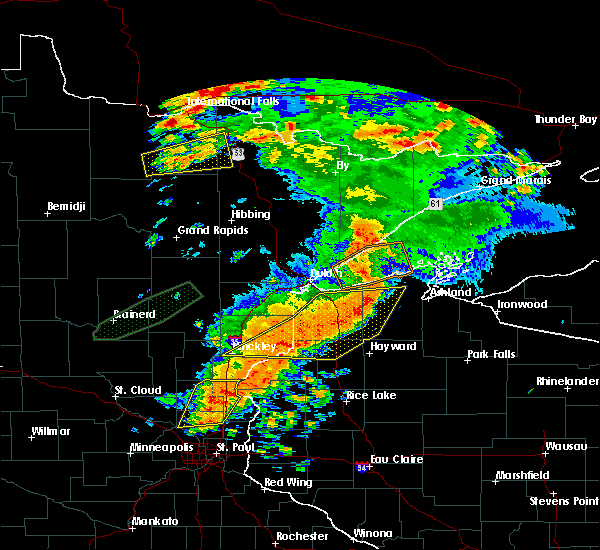 At 605 pm cdt, severe thunderstorms were located along a line extending from iron river to barnes to 6 miles northwest of webb lake wisconsin, moving east at 35 mph (radar indicated). Hazards include 60 mph wind gusts. Expect damage to roofs. siding. and trees. locations impacted include, hawthorne, iron river, lake nebagamon, barnes, wascott, maple, brule, poplar in douglas county, solon springs, oulu, minong, webb lake wisconsin, gordon, dairyland, danbury, cloverton, duxbury, bennett, cloverland and middle eau claire lake. A tornado watch remains in effect until 900 pm cdt for east central minnesota, and northwestern wisconsin. At 605 pm cdt, severe thunderstorms were located along a line extending from iron river to barnes to 6 miles northwest of webb lake wisconsin, moving east at 35 mph (radar indicated). Hazards include 60 mph wind gusts. Expect damage to roofs. siding. and trees. locations impacted include, hawthorne, iron river, lake nebagamon, barnes, wascott, maple, brule, poplar in douglas county, solon springs, oulu, minong, webb lake wisconsin, gordon, dairyland, danbury, cloverton, duxbury, bennett, cloverland and middle eau claire lake. A tornado watch remains in effect until 900 pm cdt for east central minnesota, and northwestern wisconsin.
|
| 6/25/2016 5:44 PM CDT |
 At 544 pm cdt, severe thunderstorms were located along a line extending from near brule to near solon springs to near duxbury, moving east at 45 mph (radar indicated). Hazards include 60 mph wind gusts. Expect damage to roofs. siding. And trees. At 544 pm cdt, severe thunderstorms were located along a line extending from near brule to near solon springs to near duxbury, moving east at 45 mph (radar indicated). Hazards include 60 mph wind gusts. Expect damage to roofs. siding. And trees.
|
| 6/19/2016 10:40 PM CDT |
 At 1040 pm cdt, a severe thunderstorm was located 7 miles west of danbury, or 19 miles east of hinckley, moving east at 60 mph (radar indicated). Hazards include 60 mph wind gusts and half dollar size hail. Hail damage to vehicles is expected. expect wind damage to roofs, siding, and trees. this severe storm will be near, webster and danbury around 1050 pm cdt. webb lake wisconsin around 1100 pm cdt. Other locations impacted by this severe thunderstorm include saint croix state park, beroun, big sand lake, yellow lake, birch island lake, riverside, oakland, markville, cloverdale and phantom lake. At 1040 pm cdt, a severe thunderstorm was located 7 miles west of danbury, or 19 miles east of hinckley, moving east at 60 mph (radar indicated). Hazards include 60 mph wind gusts and half dollar size hail. Hail damage to vehicles is expected. expect wind damage to roofs, siding, and trees. this severe storm will be near, webster and danbury around 1050 pm cdt. webb lake wisconsin around 1100 pm cdt. Other locations impacted by this severe thunderstorm include saint croix state park, beroun, big sand lake, yellow lake, birch island lake, riverside, oakland, markville, cloverdale and phantom lake.
|
| 6/19/2016 10:29 PM CDT |
 At 1029 pm cdt, a severe thunderstorm was located 8 miles east of hinckley, moving east at 60 mph (radar indicated). Hazards include 60 mph wind gusts and half dollar size hail. Hail damage to vehicles is expected. expect wind damage to roofs, siding, and trees. this severe thunderstorm will be near, webster and danbury around 1050 pm cdt. webb lake wisconsin around 1100 pm cdt. Other locations impacted by this severe thunderstorm include saint croix state park, beroun, big sand lake, yellow lake, birch island lake, riverside, oakland, markville, cloverdale and phantom lake. At 1029 pm cdt, a severe thunderstorm was located 8 miles east of hinckley, moving east at 60 mph (radar indicated). Hazards include 60 mph wind gusts and half dollar size hail. Hail damage to vehicles is expected. expect wind damage to roofs, siding, and trees. this severe thunderstorm will be near, webster and danbury around 1050 pm cdt. webb lake wisconsin around 1100 pm cdt. Other locations impacted by this severe thunderstorm include saint croix state park, beroun, big sand lake, yellow lake, birch island lake, riverside, oakland, markville, cloverdale and phantom lake.
|
| 8/2/2015 5:25 AM CDT | The severe thunderstorm warning for central burnett county will expire at 530 am cdt, the storm which prompted the warning has moved out of the area. therefore the warning will be allowed to expire. however gusty winds are still possible with this thunderstorm. |
| 8/2/2015 5:12 AM CDT |
 At 511 am cdt, a severe thunderstorm was located over webster, or 22 miles west of spooner, moving southeast at 40 mph (radar indicated). Hazards include 60 mph wind gusts and quarter size hail. Hail damage to vehicles is expected. expect wind damage to roofs, siding and trees. Locations impacted include, siren, webster, oakland and yellow lake. At 511 am cdt, a severe thunderstorm was located over webster, or 22 miles west of spooner, moving southeast at 40 mph (radar indicated). Hazards include 60 mph wind gusts and quarter size hail. Hail damage to vehicles is expected. expect wind damage to roofs, siding and trees. Locations impacted include, siren, webster, oakland and yellow lake.
|
| 8/2/2015 4:59 AM CDT |
 At 459 am cdt, a severe thunderstorm was located 7 miles northwest of webster, or 21 miles east of hinckley, moving southeast at 45 mph (radar indicated). Hazards include 60 mph wind gusts and half dollar size hail. Hail damage to vehicles is expected. expect wind damage to roofs, siding and trees. locations impacted include, siren, webster, oakland and yellow lake. This includes hole in the wall casino. At 459 am cdt, a severe thunderstorm was located 7 miles northwest of webster, or 21 miles east of hinckley, moving southeast at 45 mph (radar indicated). Hazards include 60 mph wind gusts and half dollar size hail. Hail damage to vehicles is expected. expect wind damage to roofs, siding and trees. locations impacted include, siren, webster, oakland and yellow lake. This includes hole in the wall casino.
|
| 8/2/2015 4:59 AM CDT |
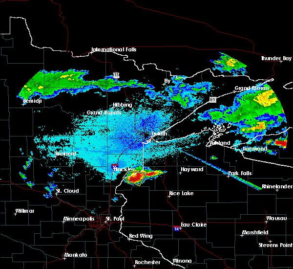 At 459 am cdt, a severe thunderstorm was located 7 miles northwest of webster, or 21 miles east of hinckley, moving southeast at 45 mph (radar indicated). Hazards include 60 mph wind gusts and half dollar size hail. Hail damage to vehicles is expected. expect wind damage to roofs, siding and trees. locations impacted include, siren, webster, oakland and yellow lake. This includes hole in the wall casino. At 459 am cdt, a severe thunderstorm was located 7 miles northwest of webster, or 21 miles east of hinckley, moving southeast at 45 mph (radar indicated). Hazards include 60 mph wind gusts and half dollar size hail. Hail damage to vehicles is expected. expect wind damage to roofs, siding and trees. locations impacted include, siren, webster, oakland and yellow lake. This includes hole in the wall casino.
|
| 8/2/2015 4:46 AM CDT |
 At 445 am cdt, a severe thunderstorm was located 9 miles east of hinckley, moving southeast at 40 mph (radar indicated). Hazards include 60 mph wind gusts and half dollar size hail. Hail damage to vehicles is expected. Expect wind damage to roofs, siding and trees. At 445 am cdt, a severe thunderstorm was located 9 miles east of hinckley, moving southeast at 40 mph (radar indicated). Hazards include 60 mph wind gusts and half dollar size hail. Hail damage to vehicles is expected. Expect wind damage to roofs, siding and trees.
|
| 6/22/2015 4:43 AM CDT | The severe thunderstorm warning for central pine and central burnett counties will expire at 445 am cdt, the storm which prompted the warning has weakened below severe limits, and no longer poses an immediate threat to life or property. therefore the warning will be allowed to expire. |
| 6/22/2015 4:43 AM CDT | The severe thunderstorm warning for central pine and central burnett counties will expire at 445 am cdt, the storm which prompted the warning has weakened below severe limits, and no longer poses an immediate threat to life or property. therefore the warning will be allowed to expire. |
| 6/22/2015 4:32 AM CDT |
 At 432 am cdt, a severe thunderstorm was located over cloverdale, or 12 miles east of hinckley, moving east at 30 mph (radar indicated). Hazards include ping pong ball size hail and 60 mph wind gusts. People and animals outdoors will be injured. expect hail damage to roofs, siding, windows and vehicles. expect wind damage to roofs, siding and trees. Locations impacted include, duxbury and cloverdale. At 432 am cdt, a severe thunderstorm was located over cloverdale, or 12 miles east of hinckley, moving east at 30 mph (radar indicated). Hazards include ping pong ball size hail and 60 mph wind gusts. People and animals outdoors will be injured. expect hail damage to roofs, siding, windows and vehicles. expect wind damage to roofs, siding and trees. Locations impacted include, duxbury and cloverdale.
|
| 6/22/2015 4:32 AM CDT |
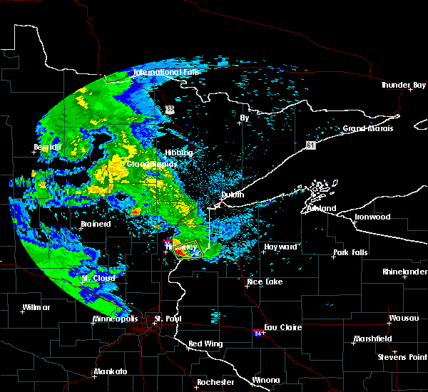 At 432 am cdt, a severe thunderstorm was located over cloverdale, or 12 miles east of hinckley, moving east at 30 mph (radar indicated). Hazards include ping pong ball size hail and 60 mph wind gusts. People and animals outdoors will be injured. expect hail damage to roofs, siding, windows and vehicles. expect wind damage to roofs, siding and trees. Locations impacted include, duxbury and cloverdale. At 432 am cdt, a severe thunderstorm was located over cloverdale, or 12 miles east of hinckley, moving east at 30 mph (radar indicated). Hazards include ping pong ball size hail and 60 mph wind gusts. People and animals outdoors will be injured. expect hail damage to roofs, siding, windows and vehicles. expect wind damage to roofs, siding and trees. Locations impacted include, duxbury and cloverdale.
|
| 6/22/2015 4:18 AM CDT |
 At 418 am cdt, a severe thunderstorm was located near cloverdale, or near hinckley, moving east at 30 mph (radar indicated). Hazards include quarter size hail and 60 mph wind gusts. Hail damage to vehicles is expected. Expect wind damage to roofs, siding and trees. At 418 am cdt, a severe thunderstorm was located near cloverdale, or near hinckley, moving east at 30 mph (radar indicated). Hazards include quarter size hail and 60 mph wind gusts. Hail damage to vehicles is expected. Expect wind damage to roofs, siding and trees.
|
| 9/4/2014 8:22 AM CDT | Delayed report. 4 or 5 mature 12 inch diamater oak and pine trees broken or uprooted. time estimated by rada in burnett county WI, 1.4 miles N of Danbury, WI |
| 7/3/2012 1:16 AM CDT | Quarter sized hail reported 11.8 miles W of Danbury, WI |
| 1/1/0001 12:00 AM | Widespread wind damage to trees in dairyland area. lots of homes impacted by falling trees. one tree fell through the roof of a house. time estimated on rada in douglas county WI, 15 miles SW of Danbury, WI |
| 1/1/0001 12:00 AM | Corridor of intense downburst wind damage found just west of danbury. 1/4 mile wide and 500 yd long area where every tree was snapped or flattened. consistent with stra in burnett county WI, 0.7 miles E of Danbury, WI |
| 1/1/0001 12:00 AM | Corridor of intense downburst wind damage found just west of danbury. 1/4 mile wide and 500 yd long area where every tree was snapped or flattened. consistent with stra in burnett county WI, 0.7 miles E of Danbury, WI |
| 1/1/0001 12:00 AM | Trees blown down...several falling on cars or structures. mobile home damaged. relayed by medi in burnett county WI, 0.2 miles W of Danbury, WI |
| 1/1/0001 12:00 AM | Widespread tree damage. all powerlines along county road h between webb lake and fish lake were dow in burnett county WI, 11.8 miles W of Danbury, WI |
| 1/1/0001 12:00 AM | Numberous trees down along county road a from bushy road through sand lake and voyagers village area. numberous trees on homes/cabins and blocking driveway in burnett county WI, 8.2 miles WNW of Danbury, WI |
| 1/1/0001 12:00 AM | Many large trees blown down...including 18 inch diameter norway pine in burnett county WI, 11.8 miles W of Danbury, WI |
| 1/1/0001 12:00 AM | Many 2 foot diamter trees down in pine county MN, 12.3 miles E of Danbury, WI |
| 1/1/0001 12:00 AM | Shingle damage to roof on 2 story home along highway 77. several trees down in are in burnett county WI, 1.7 miles E of Danbury, WI |
Hail Maps for Danbury, WI
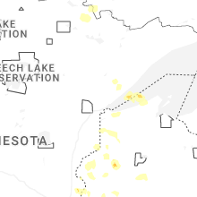


Connect with Interactive Hail Maps