

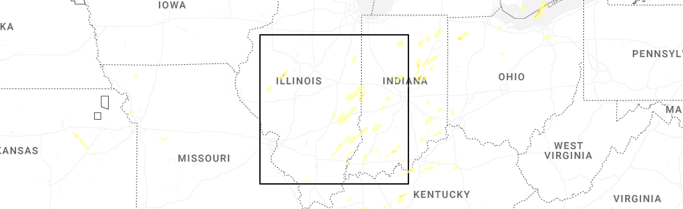
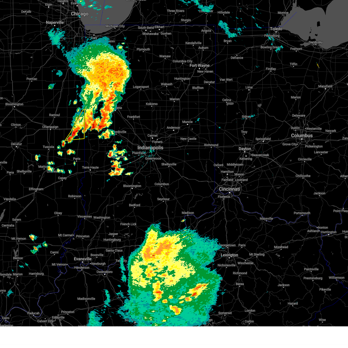
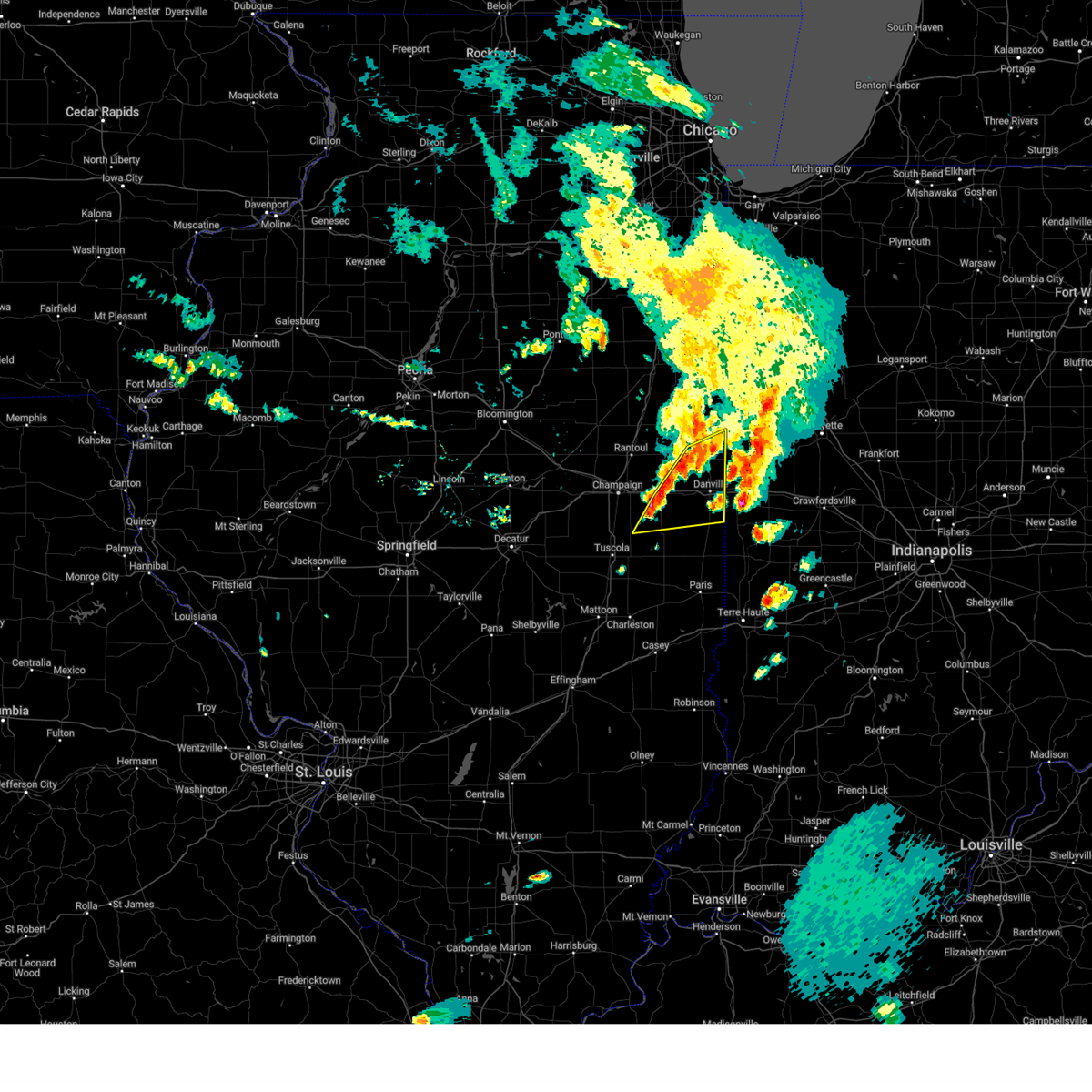
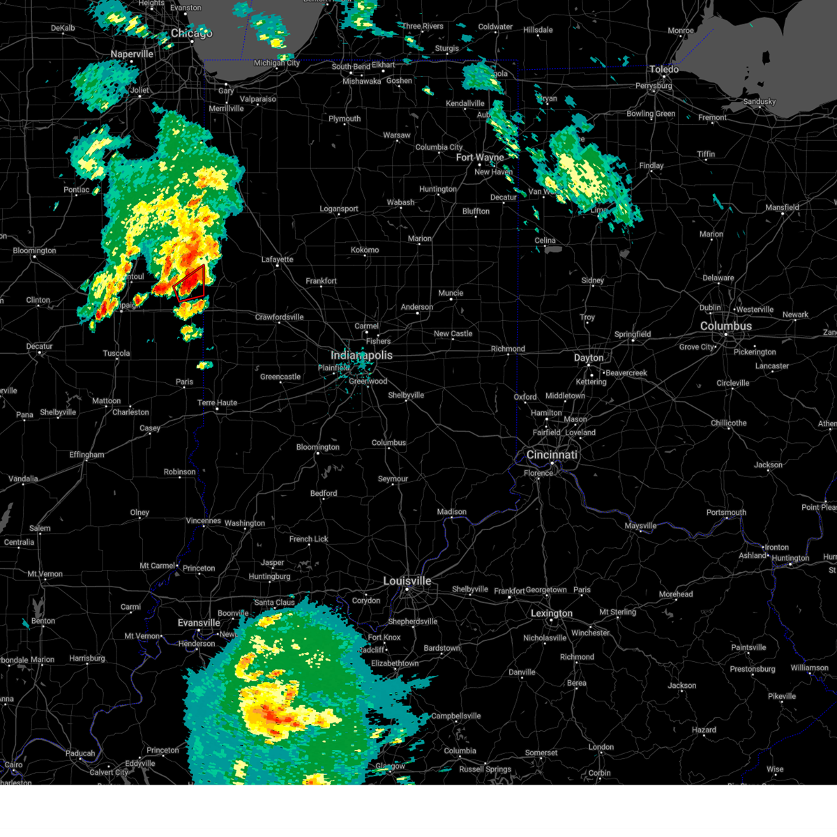
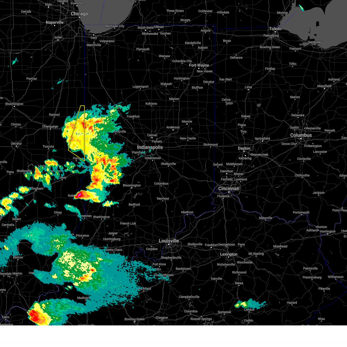
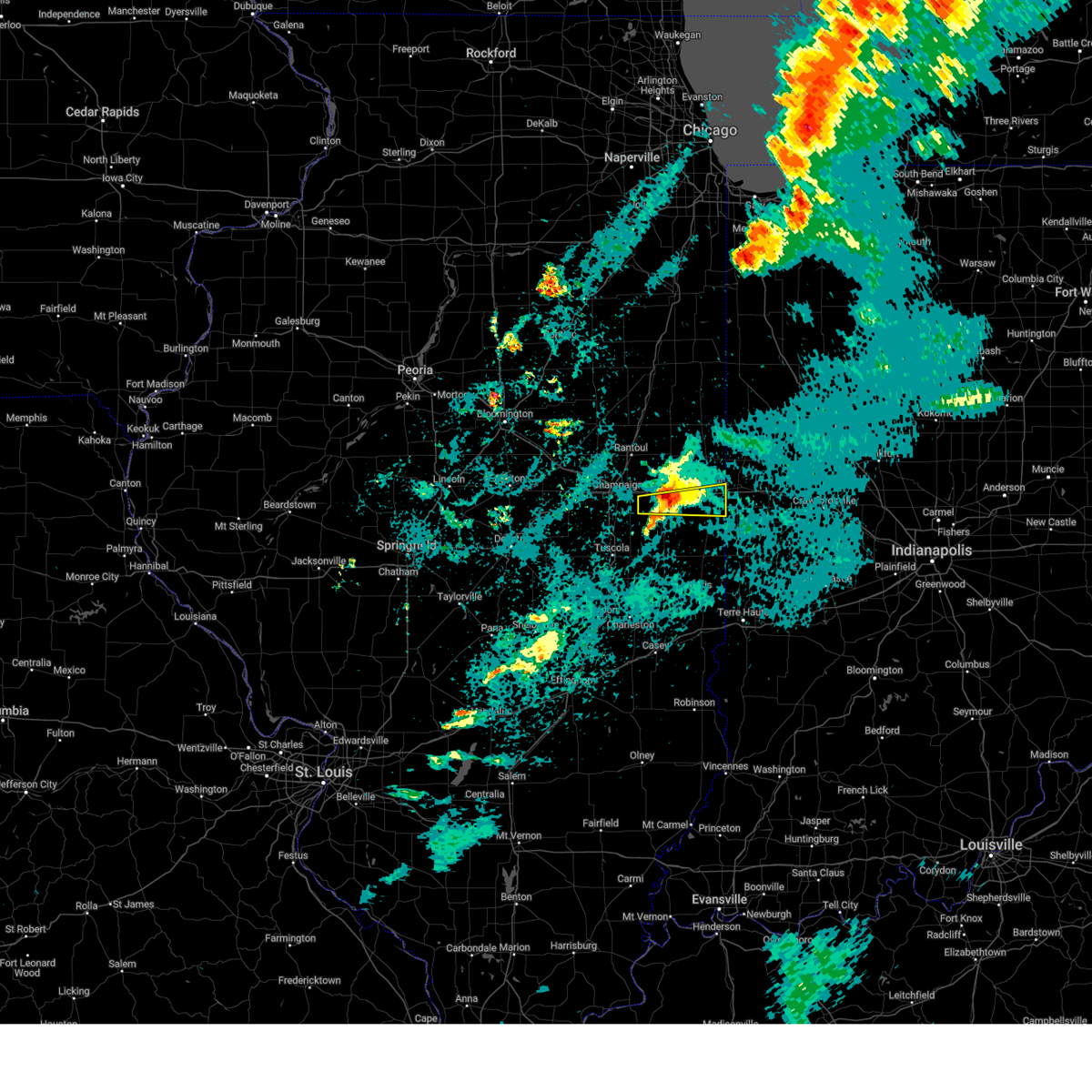
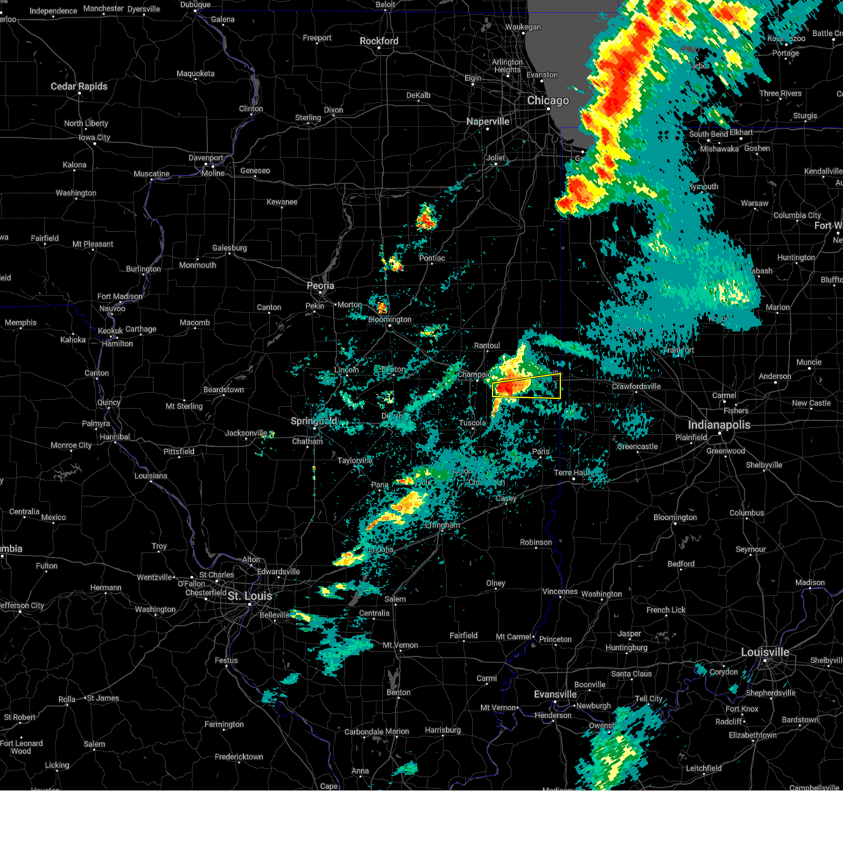
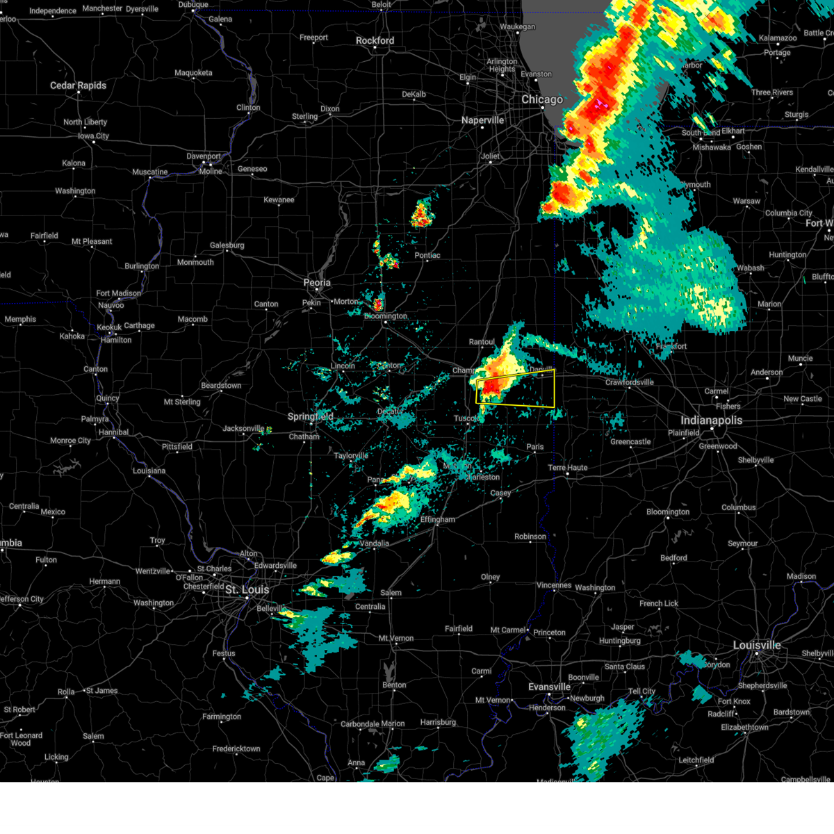
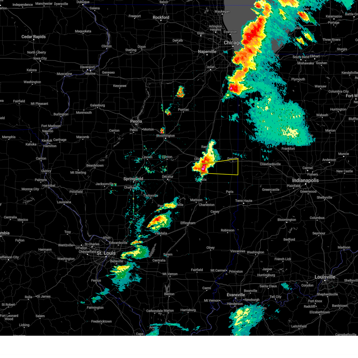
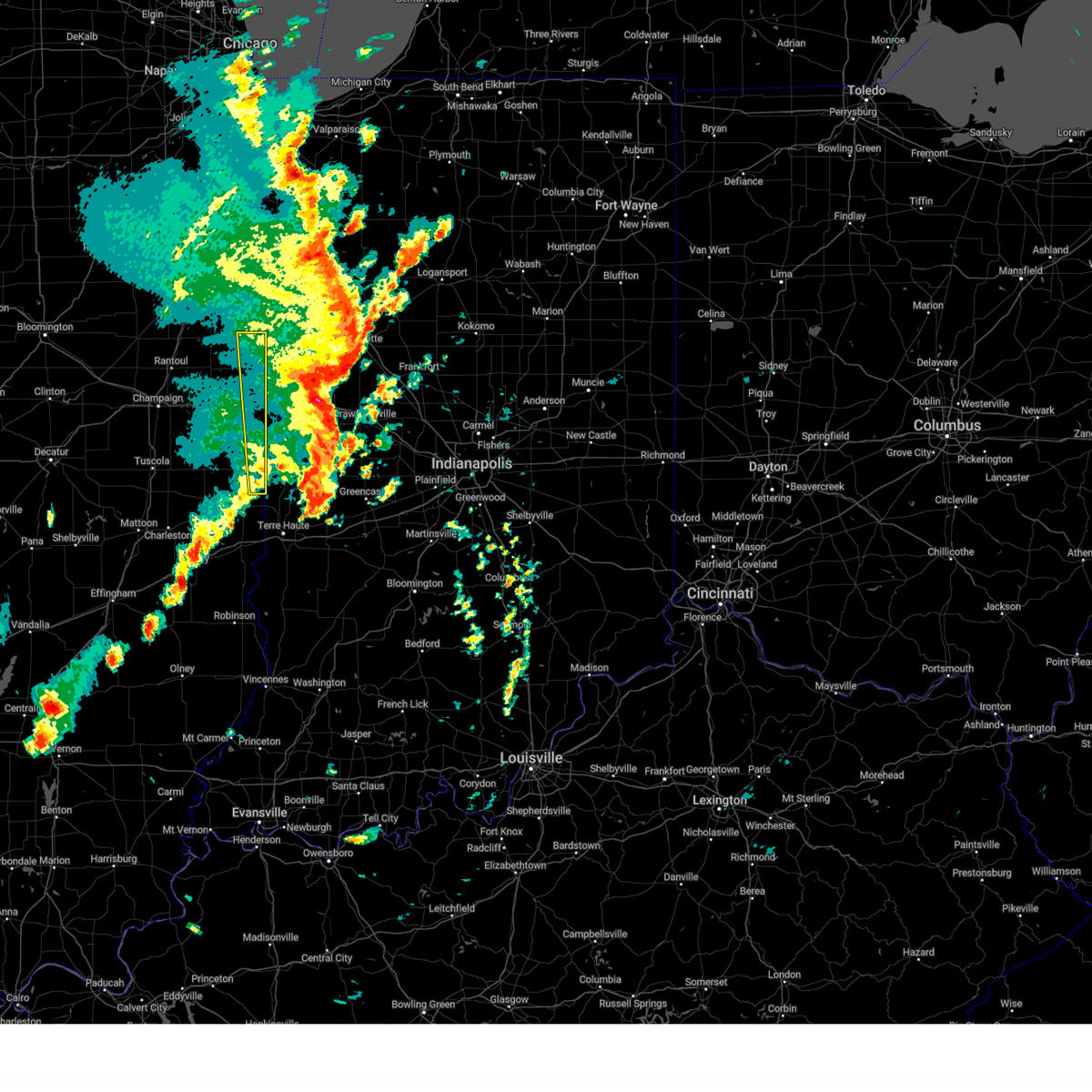
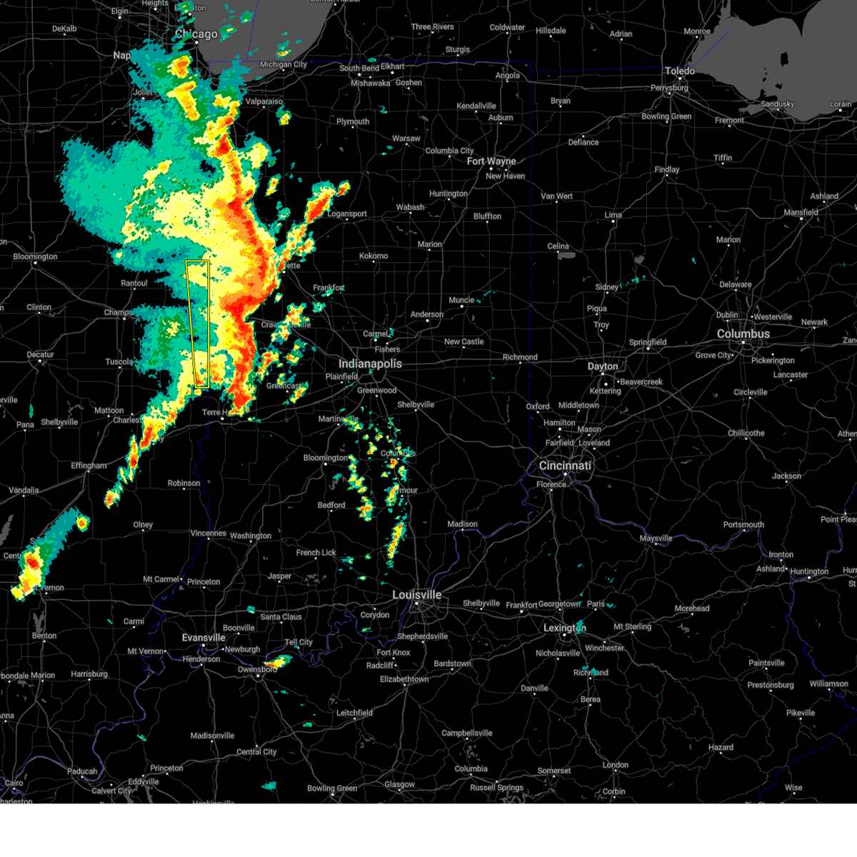
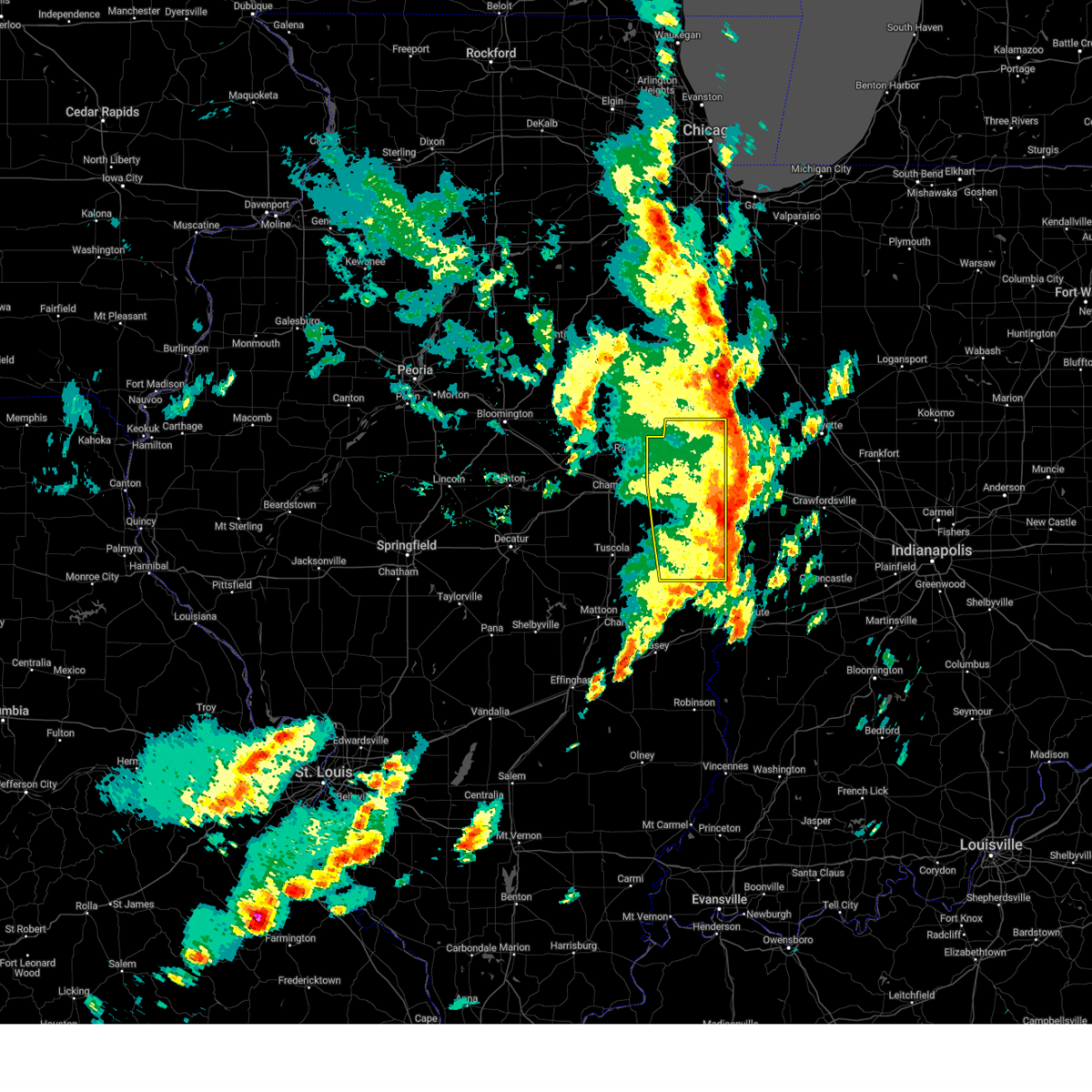
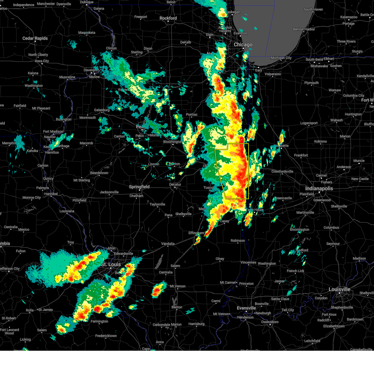
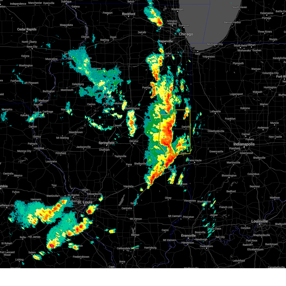
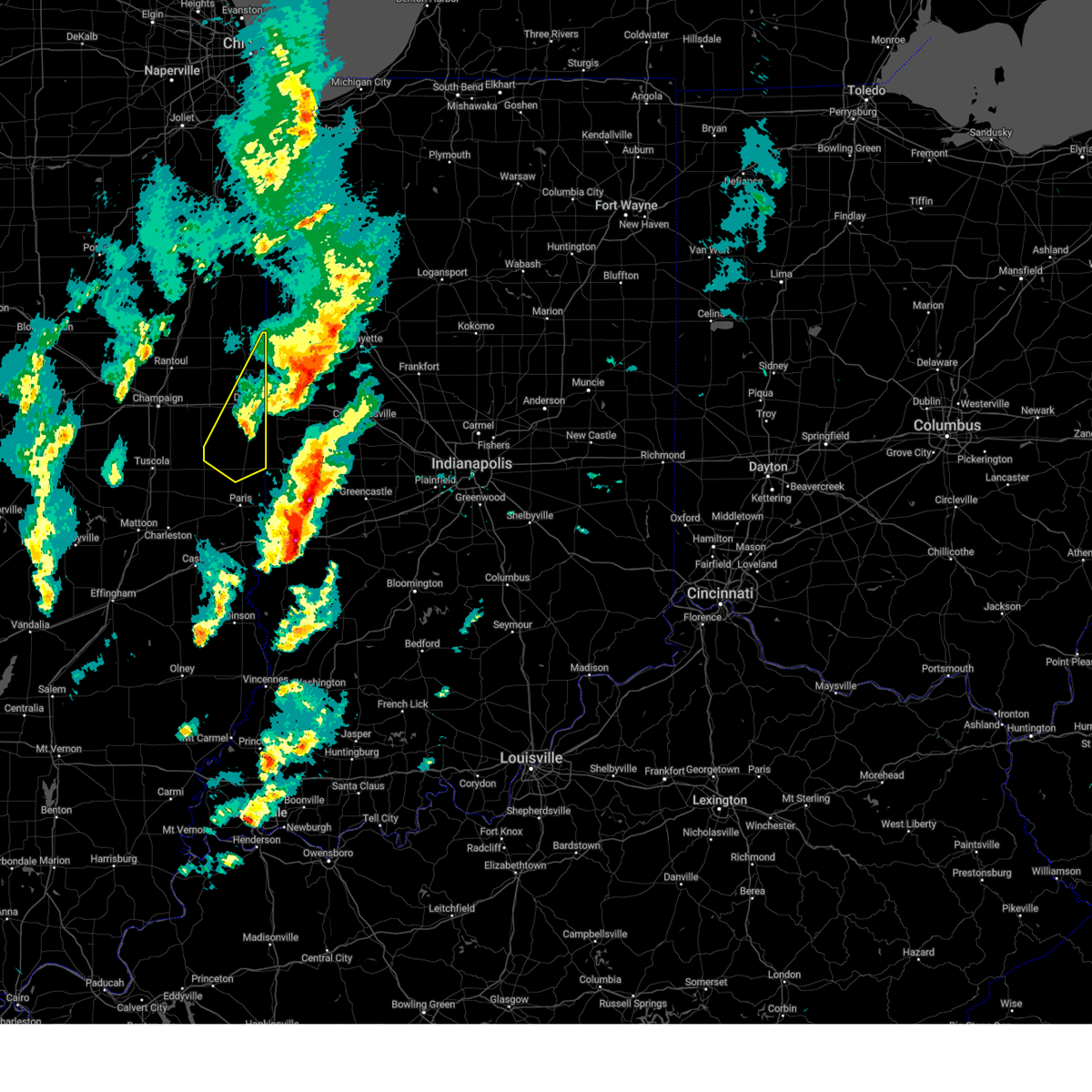
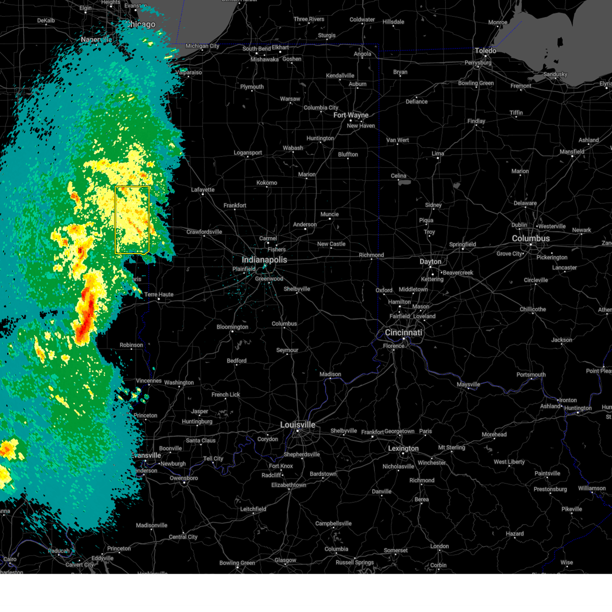
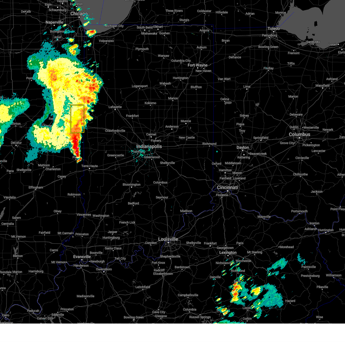
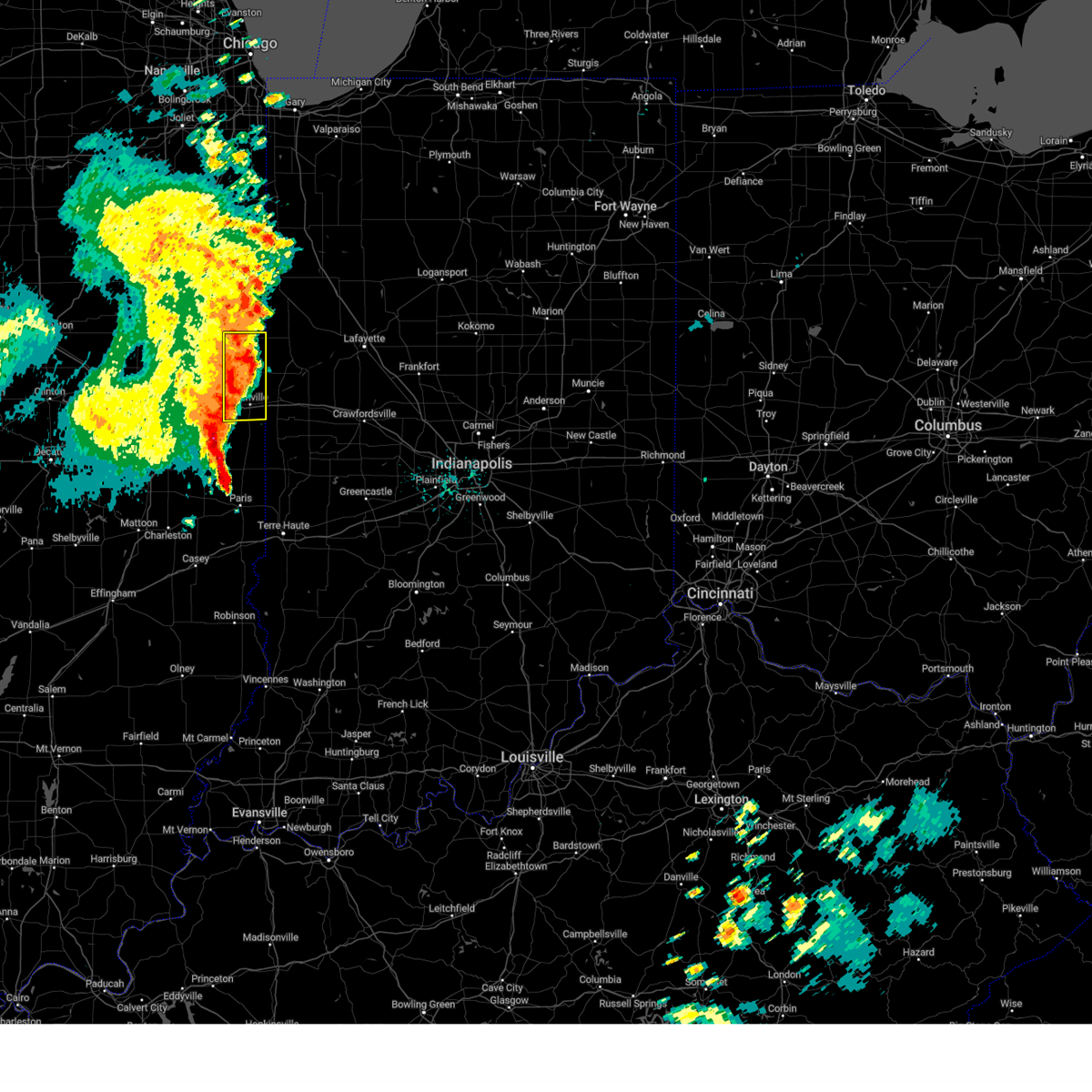
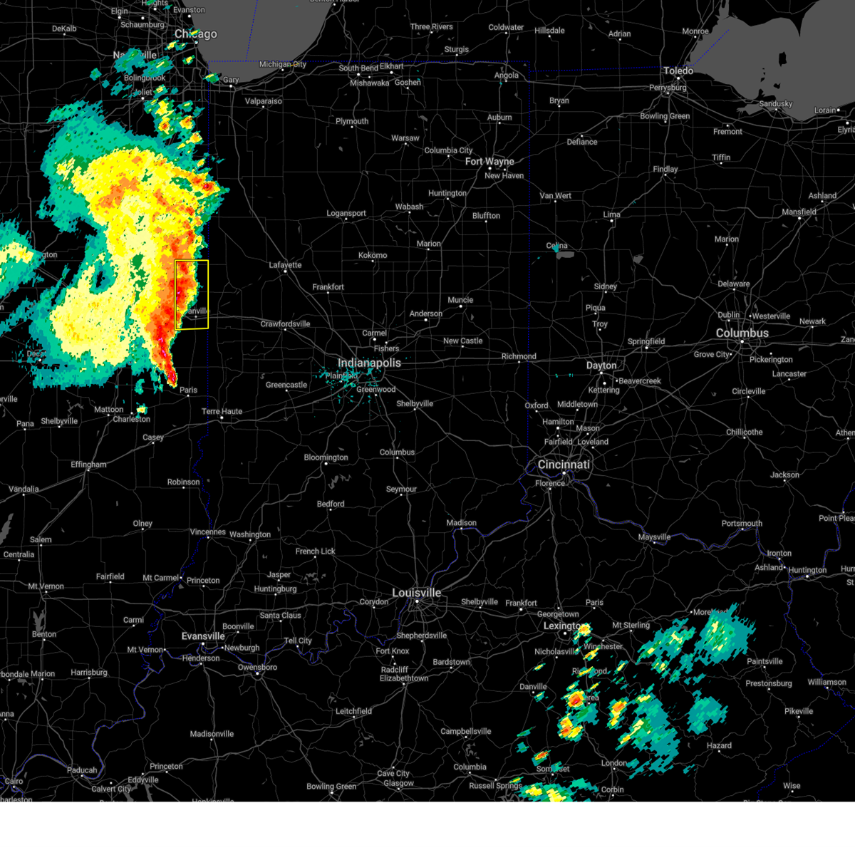
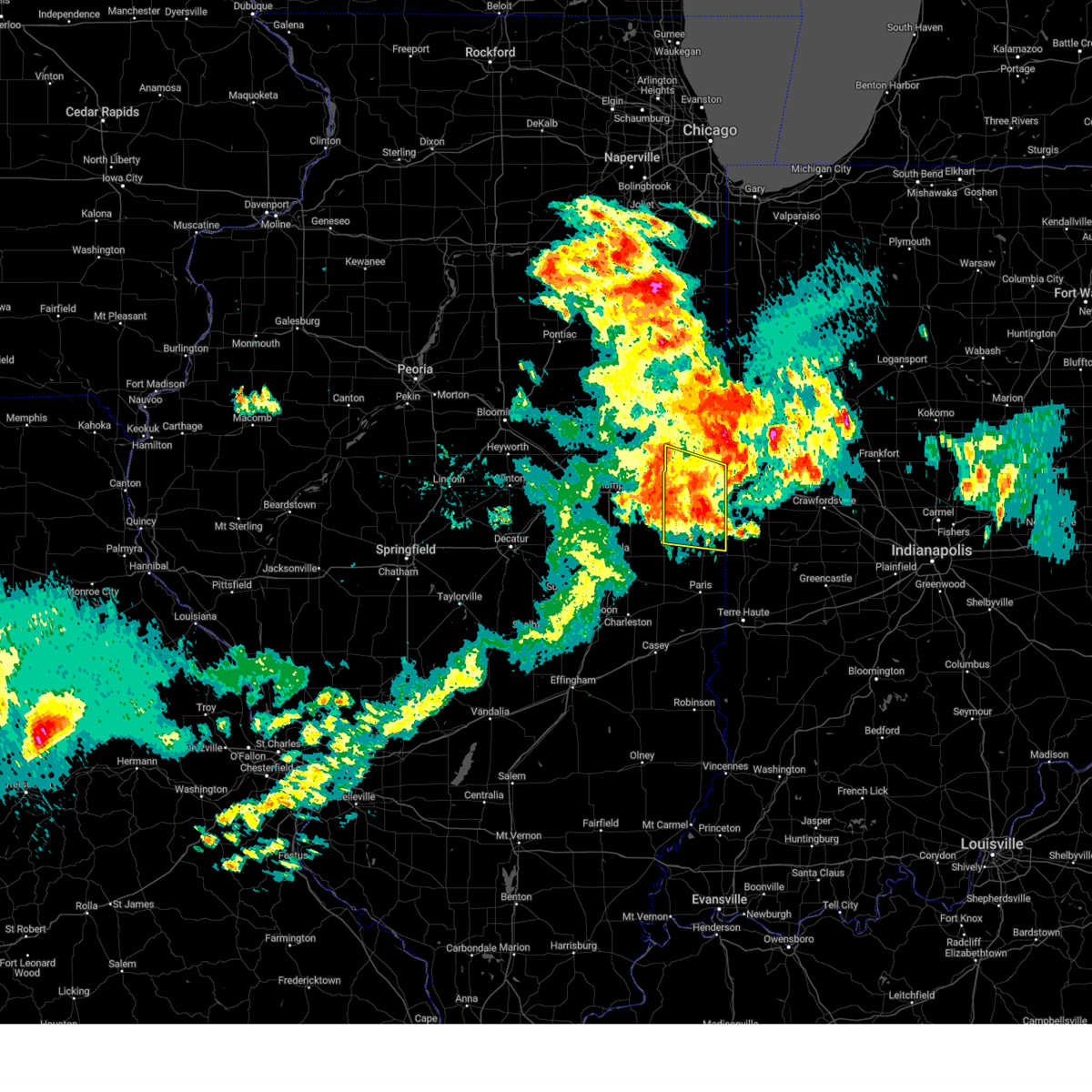
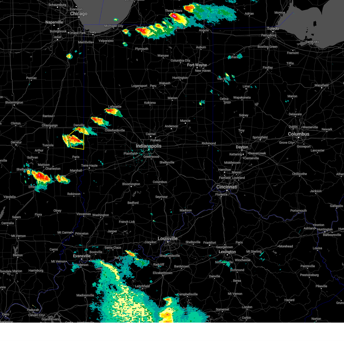
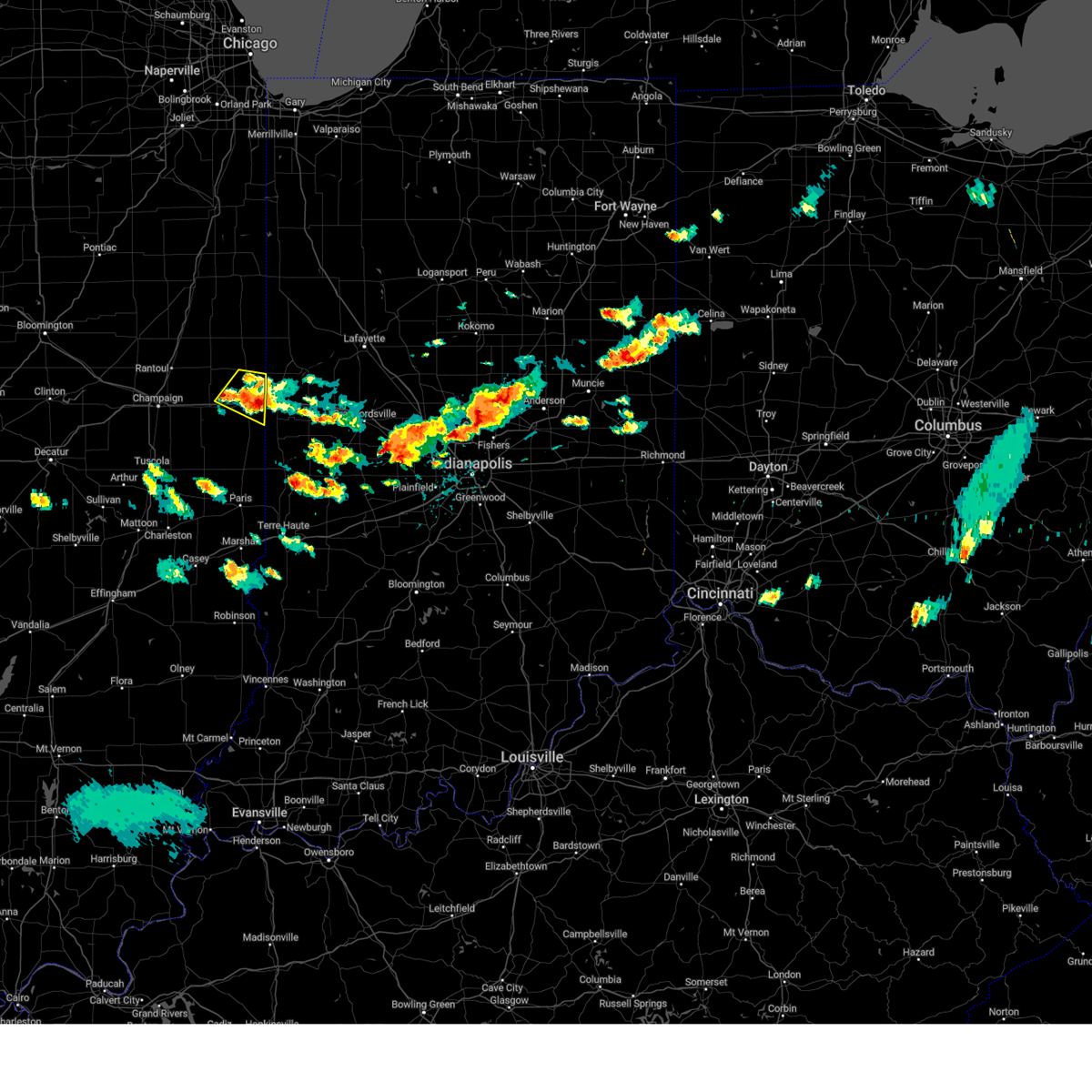
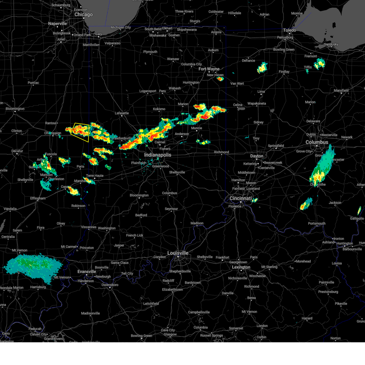
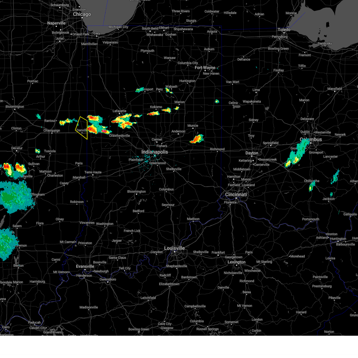
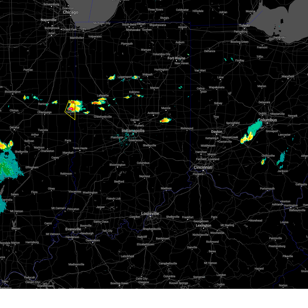
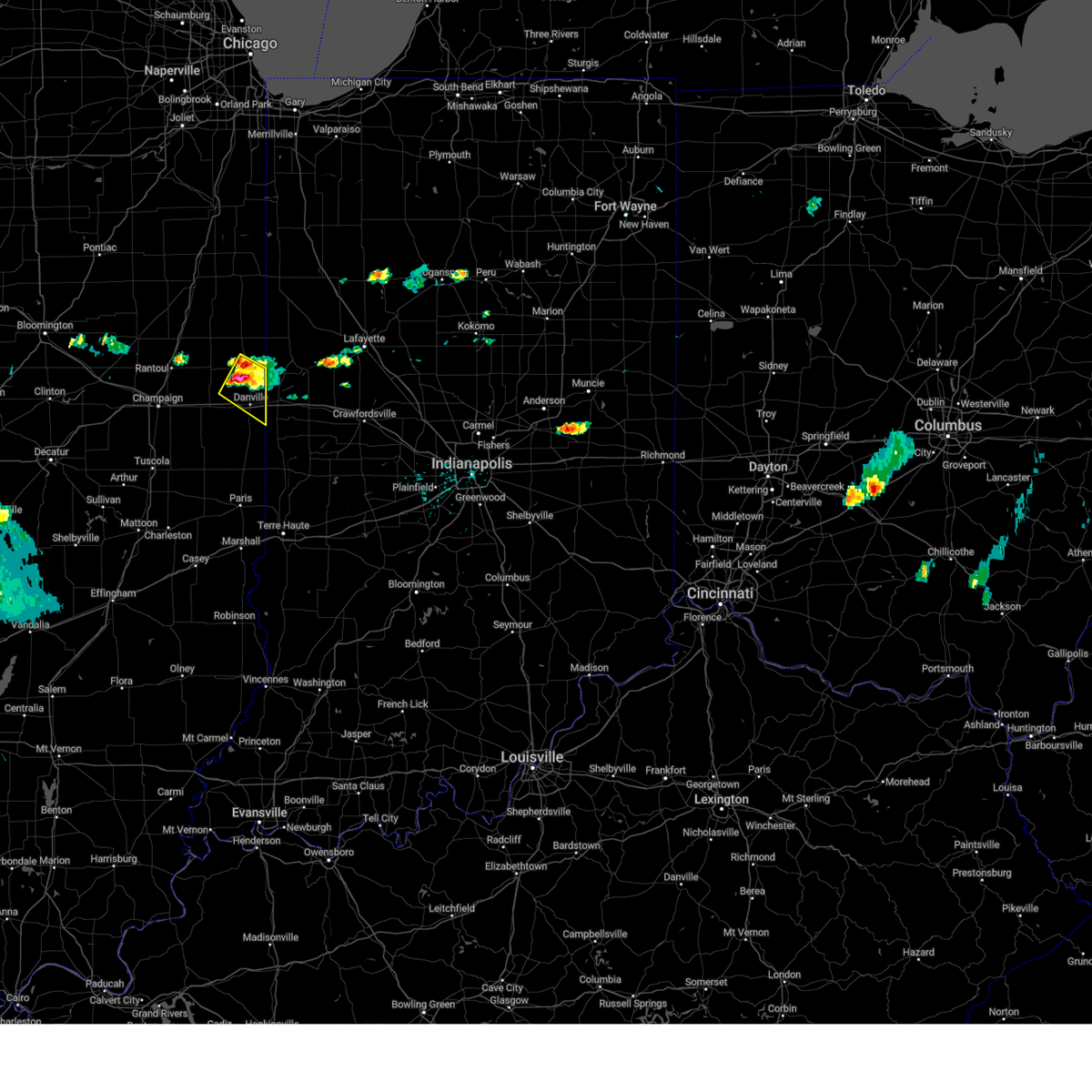
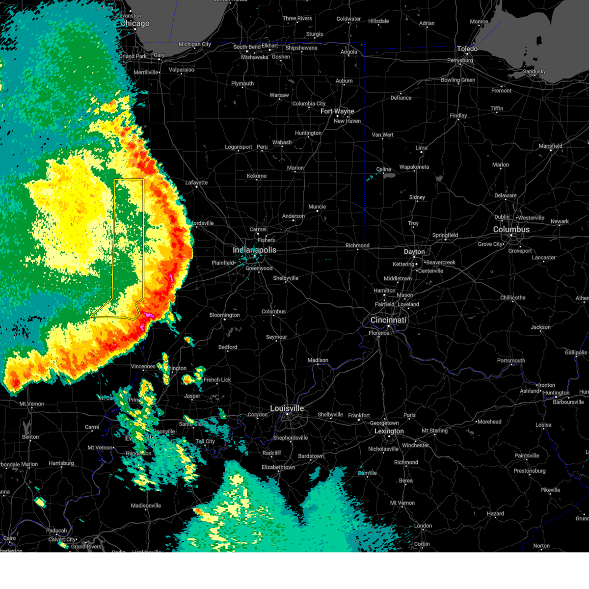
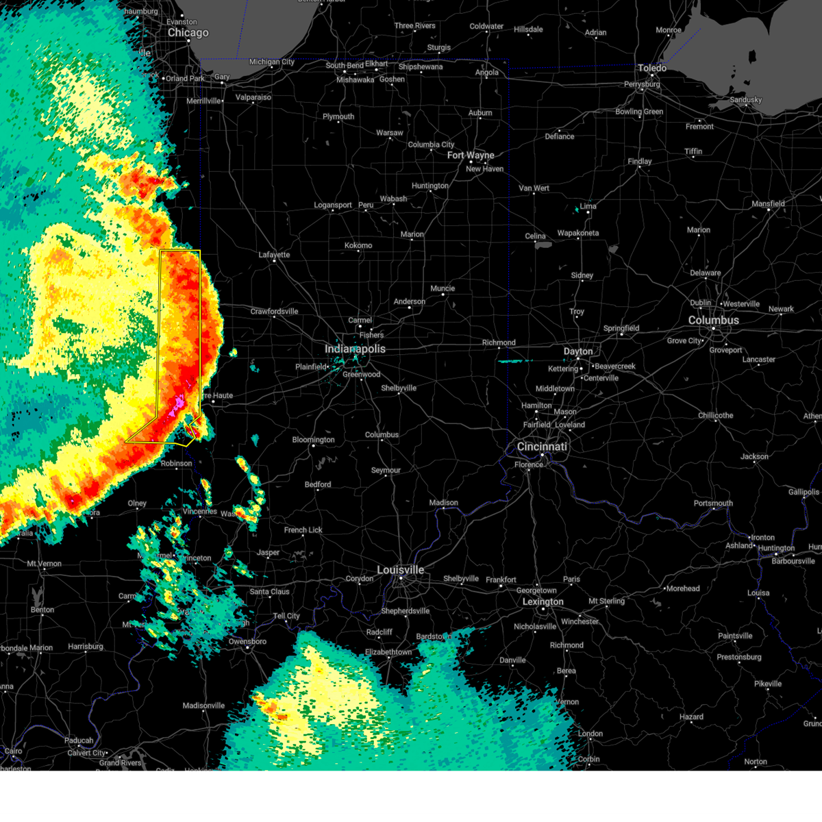
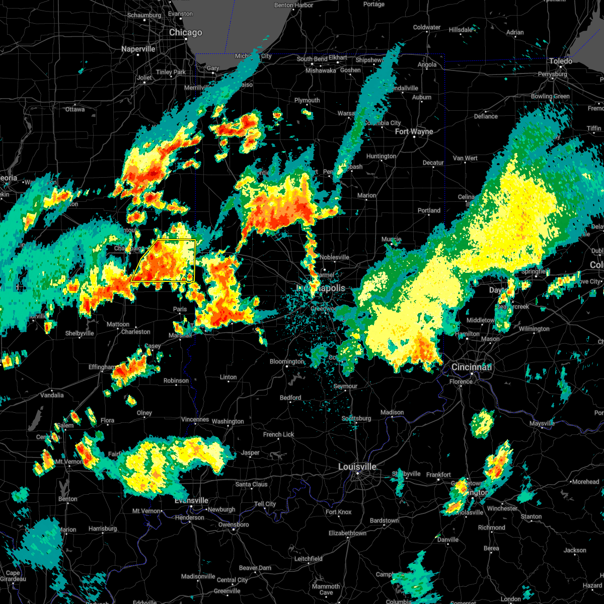
Hail Map for Danville, IL
The Danville, IL area has had 19 reports of on-the-ground hail by trained spotters, and has been under severe weather warnings 43 times during the past 12 months. Doppler radar has detected hail at or near Danville, IL on 88 occasions, including 2 occasions during the past year.
| Name: | Danville, IL |
| Where Located: | 61.1 miles NE of Mattoon, IL |
| Map: | Google Map for Danville, IL |
| Population: | 33027 |
| Housing Units: | 14719 |
| More Info: | Search Google for Danville, IL |
0
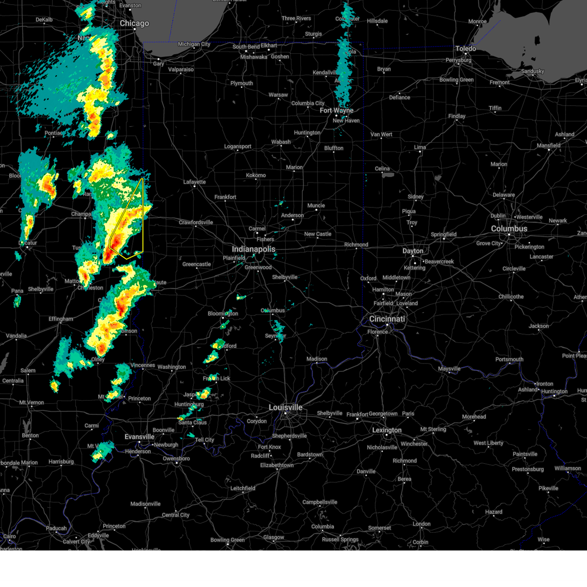
The Top Recent Hail Date for Danville, IL is Wednesday, June 18, 2025 (50th out of 88)
Hail and Wind Damage Spotted near Danville, IL
| Date / Time | Report Details |
|---|---|
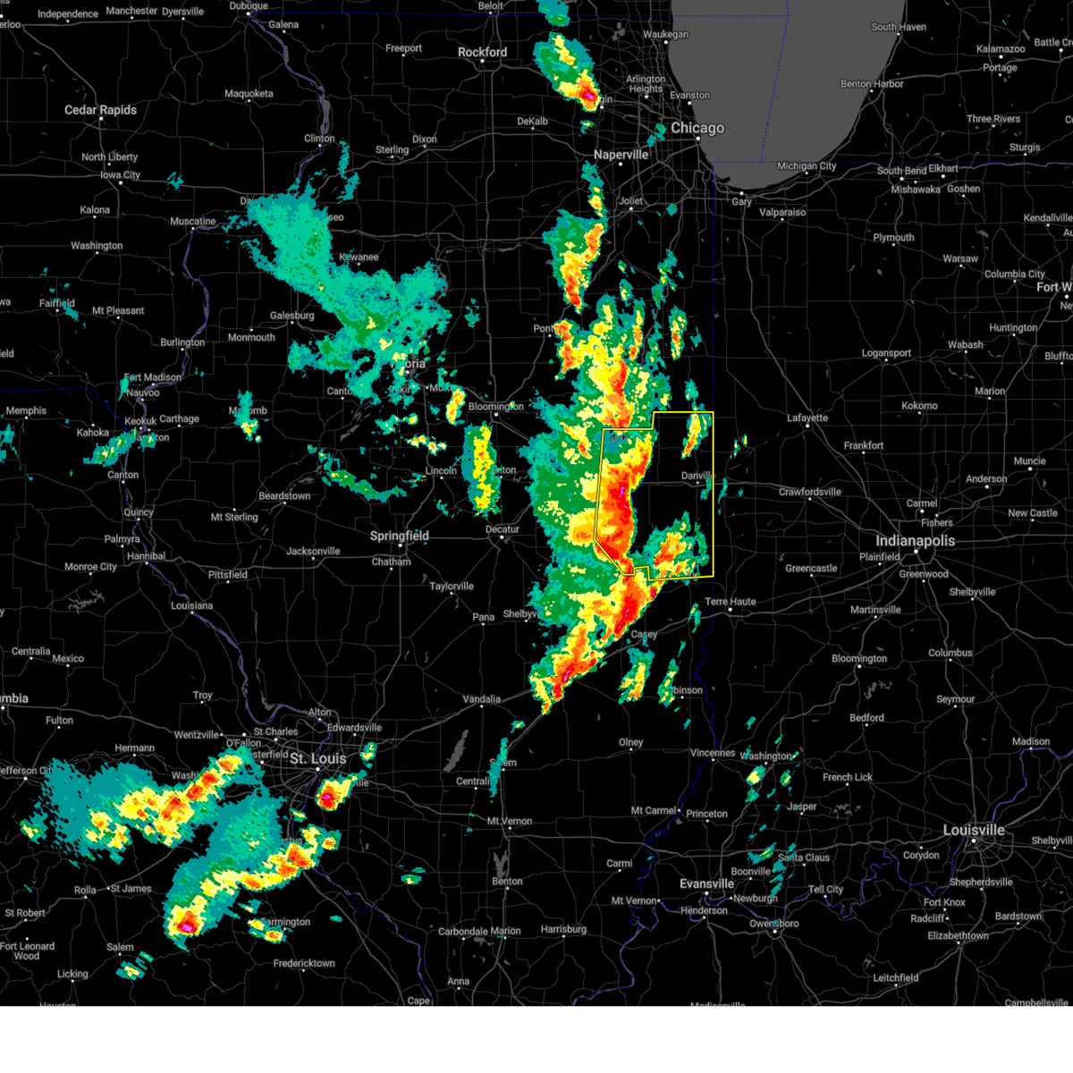
| 6/18/2025 1:31 PM CDT | Corn flattened. social media repor in vermilion county IL, 3.9 miles WNW of Danville, IL |
| 6/18/2025 1:17 PM CDT |
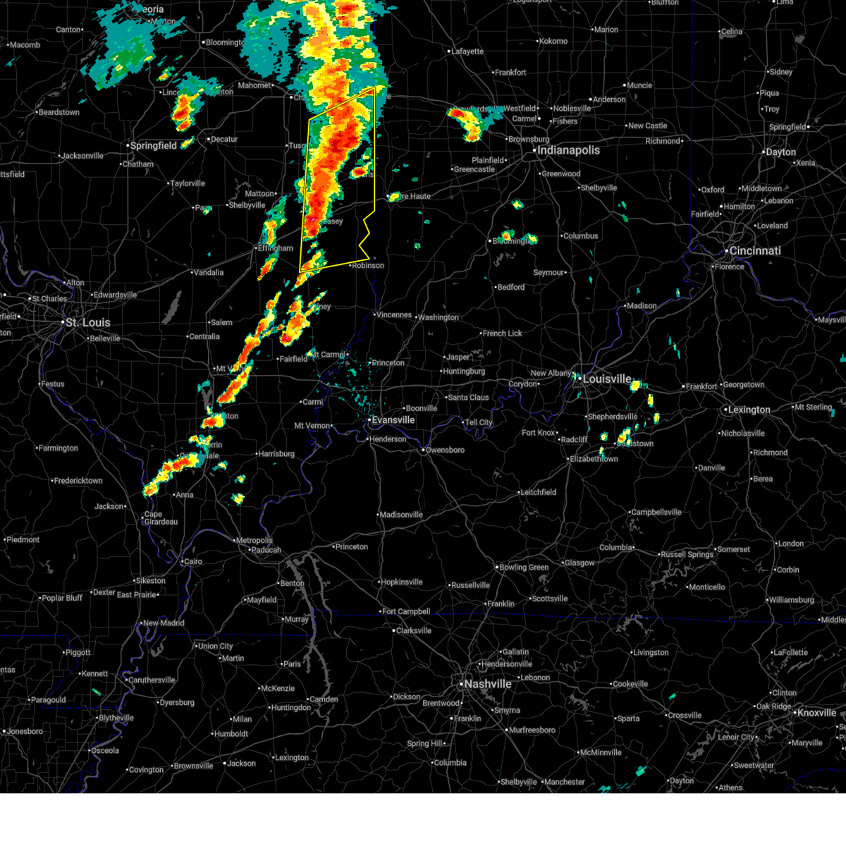 At 117 pm cdt, severe thunderstorms were located along a line extending from 6 miles northwest of vermilion regional airport to near chrisman to 6 miles south of casey, moving northeast at 55 mph (radar indicated). Hazards include 60 mph wind gusts. Expect damage to roofs, siding, and trees. these severe storms will be near, danville, paris, georgetown, westville, tilton, catlin, chrisman, martinsville, ridge farm, and edgar county airport around 120 pm cdt. marshall around 125 pm cdt. vermilion around 130 pm cdt. other locations impacted by these severe thunderstorms include isabel, murdock, edgar, clarksville, annapolis, west york, york, longview, yale, and lincoln trail state park. this includes the following highways, interstate 70 between mile markers 119 and 154. Interstate 74 between mile markers 211 and 220. At 117 pm cdt, severe thunderstorms were located along a line extending from 6 miles northwest of vermilion regional airport to near chrisman to 6 miles south of casey, moving northeast at 55 mph (radar indicated). Hazards include 60 mph wind gusts. Expect damage to roofs, siding, and trees. these severe storms will be near, danville, paris, georgetown, westville, tilton, catlin, chrisman, martinsville, ridge farm, and edgar county airport around 120 pm cdt. marshall around 125 pm cdt. vermilion around 130 pm cdt. other locations impacted by these severe thunderstorms include isabel, murdock, edgar, clarksville, annapolis, west york, york, longview, yale, and lincoln trail state park. this includes the following highways, interstate 70 between mile markers 119 and 154. Interstate 74 between mile markers 211 and 220.
|
| 6/18/2025 1:03 PM CDT |
 Svrilx the national weather service in lincoln has issued a * severe thunderstorm warning for, vermilion county in east central illinois, * until 145 pm cdt. * at 103 pm cdt, severe thunderstorms were located along a line extending from near buckley to near gifford to near homer, moving northeast at 50 mph (radar indicated). Hazards include 70 mph wind gusts. Expect considerable tree damage. damage is likely to mobile homes, roofs, and outbuildings. severe thunderstorms will be near, oakwood, potomac, and rankin around 110 pm cdt. danville around 115 pm cdt. hoopeston, rossville, and vermilion regional airport around 120 pm cdt. This includes interstate 74 between mile markers 199 and 211. Svrilx the national weather service in lincoln has issued a * severe thunderstorm warning for, vermilion county in east central illinois, * until 145 pm cdt. * at 103 pm cdt, severe thunderstorms were located along a line extending from near buckley to near gifford to near homer, moving northeast at 50 mph (radar indicated). Hazards include 70 mph wind gusts. Expect considerable tree damage. damage is likely to mobile homes, roofs, and outbuildings. severe thunderstorms will be near, oakwood, potomac, and rankin around 110 pm cdt. danville around 115 pm cdt. hoopeston, rossville, and vermilion regional airport around 120 pm cdt. This includes interstate 74 between mile markers 199 and 211.
|
| 6/18/2025 12:55 PM CDT |
 Svrilx the national weather service in lincoln has issued a * severe thunderstorm warning for, coles county in east central illinois, northern crawford county in east central illinois, edgar county in east central illinois, northern jasper county in southeastern illinois, clark county in east central illinois, southern vermilion county in east central illinois, cumberland county in east central illinois, southeastern champaign county in east central illinois, douglas county in east central illinois, * until 145 pm cdt. * at 1254 pm cdt, severe thunderstorms were located along a line extending from homer to ashmore to near newton, moving northeast at 60 mph (radar indicated). Hazards include 60 mph wind gusts. Expect damage to roofs, siding, and trees. severe thunderstorms will be near, casey, kansas, fairmount, sidell, westfield, hume, brocton, and allerton around 100 pm cdt. martinsville around 105 pm cdt. paris and catlin around 110 pm cdt. other locations in the path of these severe thunderstorms include danville, georgetown, westville, tilton, chrisman, ridge farm, edgar county airport, marshall and vermilion. this includes the following highways, interstate 57 between mile markers 210 and 219. interstate 70 between mile markers 109 and 154. Interstate 74 between mile markers 211 and 220. Svrilx the national weather service in lincoln has issued a * severe thunderstorm warning for, coles county in east central illinois, northern crawford county in east central illinois, edgar county in east central illinois, northern jasper county in southeastern illinois, clark county in east central illinois, southern vermilion county in east central illinois, cumberland county in east central illinois, southeastern champaign county in east central illinois, douglas county in east central illinois, * until 145 pm cdt. * at 1254 pm cdt, severe thunderstorms were located along a line extending from homer to ashmore to near newton, moving northeast at 60 mph (radar indicated). Hazards include 60 mph wind gusts. Expect damage to roofs, siding, and trees. severe thunderstorms will be near, casey, kansas, fairmount, sidell, westfield, hume, brocton, and allerton around 100 pm cdt. martinsville around 105 pm cdt. paris and catlin around 110 pm cdt. other locations in the path of these severe thunderstorms include danville, georgetown, westville, tilton, chrisman, ridge farm, edgar county airport, marshall and vermilion. this includes the following highways, interstate 57 between mile markers 210 and 219. interstate 70 between mile markers 109 and 154. Interstate 74 between mile markers 211 and 220.
|
| 5/20/2025 6:43 PM CDT |
 The storms which prompted the warning have weakened below severe limits, and no longer pose an immediate threat to life or property. therefore, the warning will be allowed to expire. however, small hail and gusty winds are still possible with these thunderstorms. a tornado watch remains in effect until 800 pm cdt for east central illinois. The storms which prompted the warning have weakened below severe limits, and no longer pose an immediate threat to life or property. therefore, the warning will be allowed to expire. however, small hail and gusty winds are still possible with these thunderstorms. a tornado watch remains in effect until 800 pm cdt for east central illinois.
|
| 5/20/2025 6:35 PM CDT |
 At 634 pm cdt, severe thunderstorms were located along a line extending from 6 miles northeast of vermilion regional airport to near oakwood to near sidell, moving east at 30 mph (radar indicated). Hazards include 60 mph wind gusts and quarter size hail. Hail damage to vehicles is expected. expect wind damage to roofs, siding, and trees. these severe storms will be near, danville, westville, tilton, catlin, and vermilion regional airport around 640 pm cdt. georgetown around 645 pm cdt. other locations impacted by these severe thunderstorms include belgium, jamaica, bismarck, and alvin. This includes interstate 74 between mile markers 207 and 219. At 634 pm cdt, severe thunderstorms were located along a line extending from 6 miles northeast of vermilion regional airport to near oakwood to near sidell, moving east at 30 mph (radar indicated). Hazards include 60 mph wind gusts and quarter size hail. Hail damage to vehicles is expected. expect wind damage to roofs, siding, and trees. these severe storms will be near, danville, westville, tilton, catlin, and vermilion regional airport around 640 pm cdt. georgetown around 645 pm cdt. other locations impacted by these severe thunderstorms include belgium, jamaica, bismarck, and alvin. This includes interstate 74 between mile markers 207 and 219.
|
| 5/20/2025 6:35 PM CDT |
 the severe thunderstorm warning has been cancelled and is no longer in effect the severe thunderstorm warning has been cancelled and is no longer in effect
|
| 5/20/2025 6:07 PM CDT |
 Svrilx the national weather service in lincoln has issued a * severe thunderstorm warning for, vermilion county in east central illinois, southeastern champaign county in east central illinois, * until 645 pm cdt. * at 607 pm cdt, severe thunderstorms were located along a line extending from near potomac to near ogden to near sidney, moving northeast at 40 mph (radar indicated). Hazards include 60 mph wind gusts and quarter size hail. Hail damage to vehicles is expected. expect wind damage to roofs, siding, and trees. severe thunderstorms will be near, rossville, homer, ogden, potomac, and fithian around 610 pm cdt. oakwood and fairmount around 615 pm cdt. danville and catlin around 620 pm cdt. tilton and vermilion regional airport around 625 pm cdt. This includes interstate 74 between mile markers 196 and 219. Svrilx the national weather service in lincoln has issued a * severe thunderstorm warning for, vermilion county in east central illinois, southeastern champaign county in east central illinois, * until 645 pm cdt. * at 607 pm cdt, severe thunderstorms were located along a line extending from near potomac to near ogden to near sidney, moving northeast at 40 mph (radar indicated). Hazards include 60 mph wind gusts and quarter size hail. Hail damage to vehicles is expected. expect wind damage to roofs, siding, and trees. severe thunderstorms will be near, rossville, homer, ogden, potomac, and fithian around 610 pm cdt. oakwood and fairmount around 615 pm cdt. danville and catlin around 620 pm cdt. tilton and vermilion regional airport around 625 pm cdt. This includes interstate 74 between mile markers 196 and 219.
|
| 5/20/2025 5:26 PM CDT |
 Torilx the national weather service in lincoln has issued a * tornado warning for, northeastern vermilion county in east central illinois, * until 600 pm cdt. * at 525 pm cdt, a confirmed tornado was located near collison, or 7 miles northwest of danville, moving northeast at 30 mph (emergency management confirmed tornado). Hazards include damaging tornado and golf ball size hail. Flying debris will be dangerous to those caught without shelter. mobile homes will be damaged or destroyed. damage to roofs, windows, and vehicles will occur. tree damage is likely. This tornadic thunderstorm will remain over mainly rural areas of northeastern vermilion county, including the following locations, bismarck, henning, and alvin. Torilx the national weather service in lincoln has issued a * tornado warning for, northeastern vermilion county in east central illinois, * until 600 pm cdt. * at 525 pm cdt, a confirmed tornado was located near collison, or 7 miles northwest of danville, moving northeast at 30 mph (emergency management confirmed tornado). Hazards include damaging tornado and golf ball size hail. Flying debris will be dangerous to those caught without shelter. mobile homes will be damaged or destroyed. damage to roofs, windows, and vehicles will occur. tree damage is likely. This tornadic thunderstorm will remain over mainly rural areas of northeastern vermilion county, including the following locations, bismarck, henning, and alvin.
|
| 5/16/2025 5:32 PM CDT | the severe thunderstorm warning has been cancelled and is no longer in effect |
| 5/16/2025 5:30 PM CDT | the severe thunderstorm warning has been cancelled and is no longer in effect |
| 5/16/2025 5:30 PM CDT | At 529 pm cdt, severe thunderstorms were located along a line extending from near rossville to near williamsport, moving northeast at 50 mph (radar indicated). Hazards include 60 mph wind gusts. blowing dust with near zero visibility will be possible as well. Expect damage to roofs, siding, and trees. locations impacted include, danville, vermilion regional airport, bismarck, and alvin. This includes interstate 74 between mile markers 217 and 220. |
| 5/16/2025 5:13 PM CDT |
 At 512 pm cdt, severe thunderstorms were located along a line extending from near vermilion regional airport to near covington, moving northeast at 50 mph (radar indicated). Hazards include 60 mph wind gusts. blowing dust with near zero visibility will be possible as well. Expect damage to roofs, siding, and trees. these severe thunderstorms will remain over mainly rural areas of northeastern edgar and eastern vermilion counties, including the following locations, edgar, belgium, scottland, alvin, indianola, bismarck, and metcalf. This includes interstate 74 between mile markers 209 and 220. At 512 pm cdt, severe thunderstorms were located along a line extending from near vermilion regional airport to near covington, moving northeast at 50 mph (radar indicated). Hazards include 60 mph wind gusts. blowing dust with near zero visibility will be possible as well. Expect damage to roofs, siding, and trees. these severe thunderstorms will remain over mainly rural areas of northeastern edgar and eastern vermilion counties, including the following locations, edgar, belgium, scottland, alvin, indianola, bismarck, and metcalf. This includes interstate 74 between mile markers 209 and 220.
|
| 5/16/2025 5:13 PM CDT |
 the severe thunderstorm warning has been cancelled and is no longer in effect the severe thunderstorm warning has been cancelled and is no longer in effect
|
| 5/16/2025 5:02 PM CDT | At 502 pm cdt, severe thunderstorms were located along a line extending from near oakwood to near danville, moving north at 35 mph (radar indicated). Hazards include 60 mph wind gusts. blowing dust with near zero visibility will be possible as well. Expect damage to roofs, siding, and trees. these severe storms will be near, danville and vermilion regional airport around 505 pm cdt. other locations impacted by these severe thunderstorms include redmon, edgar, belgium, oliver, scottland, alvin, indianola, sandford, bismarck, and metcalf. This includes interstate 74 between mile markers 209 and 220. |
| 5/16/2025 5:02 PM CDT | the severe thunderstorm warning has been cancelled and is no longer in effect |
| 5/16/2025 4:46 PM CDT | Svrilx the national weather service in lincoln has issued a * severe thunderstorm warning for, eastern coles county in east central illinois, edgar county in east central illinois, northern clark county in east central illinois, eastern vermilion county in east central illinois, * until 545 pm cdt. * at 444 pm cdt, severe thunderstorms were located along a line extending from 6 miles southeast of brocton to near vermilion, moving northeast at 50 mph (radar indicated). Hazards include 60 mph wind gusts. blowing dust with near zero visibility will be possible. Expect damage to roofs, siding, and trees. severe thunderstorms will be near, edgar county airport around 450 pm cdt. chrisman around 455 pm cdt. ridge farm around 500 pm cdt. other locations in the path of these severe thunderstorms include georgetown, westville, danville and tilton. this includes the following highways, interstate 70 between mile markers 142 and 154. Interstate 74 between mile markers 209 and 220. |
| 5/15/2025 8:53 PM CDT |
 the severe thunderstorm warning has been cancelled and is no longer in effect the severe thunderstorm warning has been cancelled and is no longer in effect
|
| 5/15/2025 8:48 PM CDT |
 At 847 pm cdt, a severe thunderstorm was located over homer, or 14 miles east of urbana, moving east at 55 mph (radar indicated). Hazards include 60 mph wind gusts. Expect damage to roofs, siding, and trees. this severe storm will be near, catlin, oakwood, and fairmount around 855 pm cdt. westville and tilton around 900 pm cdt. danville around 905 pm cdt. other locations impacted by this severe thunderstorm include belgium and muncie. This includes interstate 74 between mile markers 202 and 220. At 847 pm cdt, a severe thunderstorm was located over homer, or 14 miles east of urbana, moving east at 55 mph (radar indicated). Hazards include 60 mph wind gusts. Expect damage to roofs, siding, and trees. this severe storm will be near, catlin, oakwood, and fairmount around 855 pm cdt. westville and tilton around 900 pm cdt. danville around 905 pm cdt. other locations impacted by this severe thunderstorm include belgium and muncie. This includes interstate 74 between mile markers 202 and 220.
|
| 5/15/2025 8:41 PM CDT |
 At 841 pm cdt, a severe thunderstorm was located over sidney, or 9 miles southeast of urbana, moving east at 55 mph (radar indicated). Hazards include 60 mph wind gusts. Expect damage to roofs, siding, and trees. this severe storm will be near, homer around 845 pm cdt. fairmount around 850 pm cdt. catlin around 855 pm cdt. westville and tilton around 900 pm cdt. other locations impacted by this severe thunderstorm include muncie, belgium, jamaica, and indianola. This includes interstate 74 between mile markers 202 and 220. At 841 pm cdt, a severe thunderstorm was located over sidney, or 9 miles southeast of urbana, moving east at 55 mph (radar indicated). Hazards include 60 mph wind gusts. Expect damage to roofs, siding, and trees. this severe storm will be near, homer around 845 pm cdt. fairmount around 850 pm cdt. catlin around 855 pm cdt. westville and tilton around 900 pm cdt. other locations impacted by this severe thunderstorm include muncie, belgium, jamaica, and indianola. This includes interstate 74 between mile markers 202 and 220.
|
| 5/15/2025 8:34 PM CDT |
 Svrilx the national weather service in lincoln has issued a * severe thunderstorm warning for, southern vermilion county in east central illinois, southeastern champaign county in east central illinois, * until 915 pm cdt. * at 833 pm cdt, a severe thunderstorm was located over philo, near moving east at 55 mph (trained weather spotters. at 823 pm, a 58 mph wind gust was reported at willard airport in savoy). Hazards include 60 mph wind gusts. Expect damage to roofs, siding, and trees. this severe thunderstorm will be near, sidney and homer around 840 pm cdt. fairmount around 850 pm cdt. other locations in the path of this severe thunderstorm include catlin, westville and tilton. This includes interstate 74 between mile markers 203 and 220. Svrilx the national weather service in lincoln has issued a * severe thunderstorm warning for, southern vermilion county in east central illinois, southeastern champaign county in east central illinois, * until 915 pm cdt. * at 833 pm cdt, a severe thunderstorm was located over philo, near moving east at 55 mph (trained weather spotters. at 823 pm, a 58 mph wind gust was reported at willard airport in savoy). Hazards include 60 mph wind gusts. Expect damage to roofs, siding, and trees. this severe thunderstorm will be near, sidney and homer around 840 pm cdt. fairmount around 850 pm cdt. other locations in the path of this severe thunderstorm include catlin, westville and tilton. This includes interstate 74 between mile markers 203 and 220.
|
| 3/30/2025 2:46 PM CDT |
 the severe thunderstorm warning has been cancelled and is no longer in effect the severe thunderstorm warning has been cancelled and is no longer in effect
|
| 3/30/2025 2:37 PM CDT |
 At 237 pm cdt, severe thunderstorms were located along a line extending from otterbein to 9 miles northwest of crawfordsville to 8 miles northeast of brazil, moving east at 70 mph (emergency management. at 2:05 pm, emergency management reported trees and power lines down in danville). Hazards include 70 mph wind gusts. Expect considerable tree damage. damage is likely to mobile homes, roofs, and outbuildings. locations impacted include, hoopeston, westville, ridge farm, tilton, danville, belgium, scottland, alvin, vermilion regional airport, rossville, bismarck, henning, and georgetown. This includes interstate 74 between mile markers 212 and 220. At 237 pm cdt, severe thunderstorms were located along a line extending from otterbein to 9 miles northwest of crawfordsville to 8 miles northeast of brazil, moving east at 70 mph (emergency management. at 2:05 pm, emergency management reported trees and power lines down in danville). Hazards include 70 mph wind gusts. Expect considerable tree damage. damage is likely to mobile homes, roofs, and outbuildings. locations impacted include, hoopeston, westville, ridge farm, tilton, danville, belgium, scottland, alvin, vermilion regional airport, rossville, bismarck, henning, and georgetown. This includes interstate 74 between mile markers 212 and 220.
|
| 3/30/2025 2:37 PM CDT |
 the severe thunderstorm warning has been cancelled and is no longer in effect the severe thunderstorm warning has been cancelled and is no longer in effect
|
| 3/30/2025 2:21 PM CDT |
 At 218 pm cdt, severe thunderstorms were located along a line extending from near boswell to near covington to clinton, moving east at 70 mph. these are destructive storms for far eastern champaign, vermilion, and northern edgar counties (trained weather spotters. at 2:07pm, a trained weather spotter in hoopeston measured an 85 mph wind gust). Hazards include winds in excess of 80 mph and quarter size hail. Flying debris will be dangerous to those caught without shelter. mobile homes will be heavily damaged. expect considerable damage to roofs, windows, and vehicles. extensive tree damage and power outages are likely. locations impacted include, edgar, hoopeston, westville, potomac, rankin, st. joseph, oakwood, gifford, broadlands, royal, muncie, armstrong, penfield, ogden, rossville, georgetown, brocton, collison, indianola, and fairmount. This includes interstate 74 between mile markers 193 and 220. At 218 pm cdt, severe thunderstorms were located along a line extending from near boswell to near covington to clinton, moving east at 70 mph. these are destructive storms for far eastern champaign, vermilion, and northern edgar counties (trained weather spotters. at 2:07pm, a trained weather spotter in hoopeston measured an 85 mph wind gust). Hazards include winds in excess of 80 mph and quarter size hail. Flying debris will be dangerous to those caught without shelter. mobile homes will be heavily damaged. expect considerable damage to roofs, windows, and vehicles. extensive tree damage and power outages are likely. locations impacted include, edgar, hoopeston, westville, potomac, rankin, st. joseph, oakwood, gifford, broadlands, royal, muncie, armstrong, penfield, ogden, rossville, georgetown, brocton, collison, indianola, and fairmount. This includes interstate 74 between mile markers 193 and 220.
|
| 3/30/2025 2:11 PM CDT |
 Svrilx the national weather service in lincoln has issued a * severe thunderstorm warning for, northeastern coles county in east central illinois, northern edgar county in east central illinois, vermilion county in east central illinois, eastern champaign county in east central illinois, northeastern douglas county in east central illinois, * until 300 pm cdt. * at 209 pm cdt, severe thunderstorms were located along a line extending from near hoopeston to vermilion regional airport to 6 miles north of vermilion, moving east at 70 mph. these are destructive storms for eastern champaign, vermilion, and northern edgar counties (emergency management. emergency managers have reported widespread wind damage, including structural damage in eastern champaign county). Hazards include 80 mph wind gusts and quarter size hail. Flying debris will be dangerous to those caught without shelter. mobile homes will be heavily damaged. expect considerable damage to roofs, windows, and vehicles. extensive tree damage and power outages are likely. these severe thunderstorms will remain over mainly rural areas of northeastern coles, northern edgar, vermilion, eastern champaign and northeastern douglas counties, including the following locations, edgar, collison, indianola, ludlow, flatville, royal, muncie, armstrong, belgium, and scottland. this includes the following highways, interstate 57 between mile markers 252 and 257. Interstate 74 between mile markers 188 and 220. Svrilx the national weather service in lincoln has issued a * severe thunderstorm warning for, northeastern coles county in east central illinois, northern edgar county in east central illinois, vermilion county in east central illinois, eastern champaign county in east central illinois, northeastern douglas county in east central illinois, * until 300 pm cdt. * at 209 pm cdt, severe thunderstorms were located along a line extending from near hoopeston to vermilion regional airport to 6 miles north of vermilion, moving east at 70 mph. these are destructive storms for eastern champaign, vermilion, and northern edgar counties (emergency management. emergency managers have reported widespread wind damage, including structural damage in eastern champaign county). Hazards include 80 mph wind gusts and quarter size hail. Flying debris will be dangerous to those caught without shelter. mobile homes will be heavily damaged. expect considerable damage to roofs, windows, and vehicles. extensive tree damage and power outages are likely. these severe thunderstorms will remain over mainly rural areas of northeastern coles, northern edgar, vermilion, eastern champaign and northeastern douglas counties, including the following locations, edgar, collison, indianola, ludlow, flatville, royal, muncie, armstrong, belgium, and scottland. this includes the following highways, interstate 57 between mile markers 252 and 257. Interstate 74 between mile markers 188 and 220.
|
| 3/30/2025 2:10 PM CDT | Garage destroyed in danville near fairchild and griffin street in vermilion county IL, 0.8 miles NE of Danville, IL |
| 3/30/2025 2:07 PM CDT | Wind gust of 62 mph with damage to chicken coop fence. wind snapped old cedar posts of in vermilion county IL, 8.1 miles SSE of Danville, IL |
| 3/30/2025 2:05 PM CDT | Tree blown down on a house near denmark rd and west newell r in vermilion county IL, 5 miles SSE of Danville, IL |
| 3/30/2025 2:00 PM CDT | House roof damage from strong winds on e 2430 north roa in vermilion county IL, 6.8 miles SE of Danville, IL |
| 3/30/2025 1:55 PM CDT | At 153 pm cdt, severe thunderstorms were located along a line extending from cissna park to near hume, moving east at 60 mph (trained weather spotters. at 1:45 pm, emergency management estimated 70 mph winds in sidney, with structural damage observed). Hazards include 70 mph wind gusts and quarter size hail. Hail damage to vehicles is expected. expect considerable tree damage. wind damage is also likely to mobile homes, roofs, and outbuildings. these severe storms will be near, potomac, catlin, oakwood, hoopeston, rossville, chrisman, fairmount, ridge farm, and sidell around 200 pm cdt. vermilion regional airport, georgetown, westville, tilton, and danville around 205 pm cdt. other locations impacted by these severe thunderstorms include isabel, murdock, edgar, collison, longview, indianola, walnut point state park, ludlow, flatville, and royal. this includes the following highways, interstate 57 between mile markers 240 and 257. Interstate 74 between mile markers 181 and 220. |
| 3/30/2025 1:46 PM CDT |
 At 145 pm cdt, severe thunderstorms were located along a line extending from near buckley to near newman, moving east at 60 mph (trained weather spotters. at 1:35 pm, a 68 mph wind gust was measured at the champaign airport). Hazards include 70 mph wind gusts and quarter size hail. Hail damage to vehicles is expected. expect considerable tree damage. wind damage is also likely to mobile homes, roofs, and outbuildings. these severe storms will be near, rankin, homer, newman, hume, allerton, brocton, fairmount, fithian, ogden, and sidell around 150 pm cdt. potomac and oakwood around 155 pm cdt. catlin, georgetown, hoopeston, rossville, westville, chrisman, tilton, ridge farm, and danville around 200 pm cdt. vermilion regional airport around 205 pm cdt. other locations impacted by these severe thunderstorms include isabel, murdock, edgar, collison, longview, indianola, walnut point state park, ludlow, hindsboro, and flatville. this includes the following highways, interstate 57 between mile markers 211 and 232, and between mile markers 237 and 257. Interstate 74 between mile markers 179 and 220. At 145 pm cdt, severe thunderstorms were located along a line extending from near buckley to near newman, moving east at 60 mph (trained weather spotters. at 1:35 pm, a 68 mph wind gust was measured at the champaign airport). Hazards include 70 mph wind gusts and quarter size hail. Hail damage to vehicles is expected. expect considerable tree damage. wind damage is also likely to mobile homes, roofs, and outbuildings. these severe storms will be near, rankin, homer, newman, hume, allerton, brocton, fairmount, fithian, ogden, and sidell around 150 pm cdt. potomac and oakwood around 155 pm cdt. catlin, georgetown, hoopeston, rossville, westville, chrisman, tilton, ridge farm, and danville around 200 pm cdt. vermilion regional airport around 205 pm cdt. other locations impacted by these severe thunderstorms include isabel, murdock, edgar, collison, longview, indianola, walnut point state park, ludlow, hindsboro, and flatville. this includes the following highways, interstate 57 between mile markers 211 and 232, and between mile markers 237 and 257. Interstate 74 between mile markers 179 and 220.
|
| 3/30/2025 1:44 PM CDT |
 Svrilx the national weather service in lincoln has issued a * severe thunderstorm warning for, edgar county in east central illinois, vermilion county in east central illinois, champaign county in east central illinois, eastern douglas county in east central illinois, * until 215 pm cdt. * at 143 pm cdt, severe thunderstorms were located along a line extending from near buckley to near newman, moving east at 60 mph (radar indicated. at 1:35 pm, a 67 mph wind gust was measured at champaign airport). Hazards include 60 mph wind gusts and quarter size hail. Hail damage to vehicles is expected. expect wind damage to roofs, siding, and trees. severe thunderstorms will be near, potomac, rankin, homer, oakwood, hume, allerton, fairmount, fithian, ogden, and sidell around 150 pm cdt. catlin and chrisman around 155 pm cdt. vermilion regional airport, georgetown, hoopeston, rossville, westville, tilton, ridge farm, and danville around 200 pm cdt. this includes the following highways, interstate 57 between mile markers 211 and 232, and between mile markers 237 and 257. Interstate 74 between mile markers 179 and 220. Svrilx the national weather service in lincoln has issued a * severe thunderstorm warning for, edgar county in east central illinois, vermilion county in east central illinois, champaign county in east central illinois, eastern douglas county in east central illinois, * until 215 pm cdt. * at 143 pm cdt, severe thunderstorms were located along a line extending from near buckley to near newman, moving east at 60 mph (radar indicated. at 1:35 pm, a 67 mph wind gust was measured at champaign airport). Hazards include 60 mph wind gusts and quarter size hail. Hail damage to vehicles is expected. expect wind damage to roofs, siding, and trees. severe thunderstorms will be near, potomac, rankin, homer, oakwood, hume, allerton, fairmount, fithian, ogden, and sidell around 150 pm cdt. catlin and chrisman around 155 pm cdt. vermilion regional airport, georgetown, hoopeston, rossville, westville, tilton, ridge farm, and danville around 200 pm cdt. this includes the following highways, interstate 57 between mile markers 211 and 232, and between mile markers 237 and 257. Interstate 74 between mile markers 179 and 220.
|
| 3/19/2025 7:46 PM CDT |
 The storm which prompted the warning has moved out of the area. therefore, the warning has been allowed to expire. a tornado watch remains in effect until 900 pm cdt for east central illinois. The storm which prompted the warning has moved out of the area. therefore, the warning has been allowed to expire. a tornado watch remains in effect until 900 pm cdt for east central illinois.
|
| 3/19/2025 7:35 PM CDT | Storm damage reported in vermilion county IL, 0.8 miles NE of Danville, IL |
| 3/19/2025 7:29 PM CDT |
 Svrilx the national weather service in lincoln has issued a * severe thunderstorm warning for, northeastern vermilion county in east central illinois, * until 745 pm cdt. * at 729 pm cdt, a severe thunderstorm was located over rossville, or near hoopeston, moving northeast at 50 mph (radar indicated). Hazards include 60 mph wind gusts. Expect damage to roofs, siding, and trees. This severe thunderstorm will remain over mainly rural areas of northeastern vermilion county, including the following locations, bismarck and alvin. Svrilx the national weather service in lincoln has issued a * severe thunderstorm warning for, northeastern vermilion county in east central illinois, * until 745 pm cdt. * at 729 pm cdt, a severe thunderstorm was located over rossville, or near hoopeston, moving northeast at 50 mph (radar indicated). Hazards include 60 mph wind gusts. Expect damage to roofs, siding, and trees. This severe thunderstorm will remain over mainly rural areas of northeastern vermilion county, including the following locations, bismarck and alvin.
|
| 3/19/2025 6:08 PM CDT |
 The storm which prompted the warning has moved out of the area. therefore, the warning will be allowed to expire. a tornado watch remains in effect until 900 pm cdt for east central illinois. The storm which prompted the warning has moved out of the area. therefore, the warning will be allowed to expire. a tornado watch remains in effect until 900 pm cdt for east central illinois.
|
| 3/19/2025 5:09 PM CDT |
 Svrilx the national weather service in lincoln has issued a * severe thunderstorm warning for, northern edgar county in east central illinois, southeastern vermilion county in east central illinois, * until 615 pm cdt. * at 509 pm cdt, a severe thunderstorm was located over newman, or 17 miles east of tuscola, moving northeast at 55 mph (radar indicated). Hazards include 70 mph wind gusts and quarter size hail. Hail damage to vehicles is expected. expect considerable tree damage. wind damage is also likely to mobile homes, roofs, and outbuildings. this severe thunderstorm will be near, hume around 515 pm cdt. sidell around 520 pm cdt. other locations in the path of this severe thunderstorm include catlin, georgetown, westville, tilton and danville. This includes interstate 74 between mile markers 206 and 220. Svrilx the national weather service in lincoln has issued a * severe thunderstorm warning for, northern edgar county in east central illinois, southeastern vermilion county in east central illinois, * until 615 pm cdt. * at 509 pm cdt, a severe thunderstorm was located over newman, or 17 miles east of tuscola, moving northeast at 55 mph (radar indicated). Hazards include 70 mph wind gusts and quarter size hail. Hail damage to vehicles is expected. expect considerable tree damage. wind damage is also likely to mobile homes, roofs, and outbuildings. this severe thunderstorm will be near, hume around 515 pm cdt. sidell around 520 pm cdt. other locations in the path of this severe thunderstorm include catlin, georgetown, westville, tilton and danville. This includes interstate 74 between mile markers 206 and 220.
|
| 3/15/2025 1:57 AM CDT |
 The storms which prompted the warning have moved out of the area. therefore, the warning will be allowed to expire. however, gusty winds are still possible with these thunderstorms. a tornado watch remains in effect until 300 am cdt for east central illinois. The storms which prompted the warning have moved out of the area. therefore, the warning will be allowed to expire. however, gusty winds are still possible with these thunderstorms. a tornado watch remains in effect until 300 am cdt for east central illinois.
|
| 3/15/2025 1:12 AM CDT |
 Svrilx the national weather service in lincoln has issued a * severe thunderstorm warning for, edgar county in east central illinois, clark county in east central illinois, eastern vermilion county in east central illinois, * until 200 am cdt. * at 111 am cdt, severe thunderstorms were located along a line extending from near hoopeston to near georgetown to 6 miles south of martinsville, moving northeast at 65 mph (radar indicated). Hazards include 70 mph wind gusts. Expect considerable tree damage. damage is likely to mobile homes, roofs, and outbuildings. severe thunderstorms will be near, edgar county airport, vermilion regional airport, georgetown, hoopeston, rossville, westville, marshall, chrisman, tilton, and ridge farm around 115 am cdt. vermilion around 120 am cdt. this includes the following highways, interstate 70 between mile markers 135 and 154. Interstate 74 between mile markers 208 and 220. Svrilx the national weather service in lincoln has issued a * severe thunderstorm warning for, edgar county in east central illinois, clark county in east central illinois, eastern vermilion county in east central illinois, * until 200 am cdt. * at 111 am cdt, severe thunderstorms were located along a line extending from near hoopeston to near georgetown to 6 miles south of martinsville, moving northeast at 65 mph (radar indicated). Hazards include 70 mph wind gusts. Expect considerable tree damage. damage is likely to mobile homes, roofs, and outbuildings. severe thunderstorms will be near, edgar county airport, vermilion regional airport, georgetown, hoopeston, rossville, westville, marshall, chrisman, tilton, and ridge farm around 115 am cdt. vermilion around 120 am cdt. this includes the following highways, interstate 70 between mile markers 135 and 154. Interstate 74 between mile markers 208 and 220.
|
| 3/15/2025 12:15 AM CDT |
 Svrilx the national weather service in lincoln has issued a * severe thunderstorm warning for, vermilion county in east central illinois, * until 115 am cdt. * at 1214 am cdt, severe thunderstorms were located along a line extending from near paxton to sidney to near charleston, moving northeast at 65 mph (radar indicated). Hazards include 70 mph wind gusts. Expect considerable tree damage. damage is likely to mobile homes, roofs, and outbuildings. severe thunderstorms will be near, rankin, fairmount, fithian, and sidell around 1225 am cdt. potomac, catlin, and oakwood around 1230 am cdt. other locations in the path of these severe thunderstorms include hoopeston, rossville, westville, tilton, ridge farm, danville, vermilion regional airport and georgetown. This includes interstate 74 between mile markers 199 and 220. Svrilx the national weather service in lincoln has issued a * severe thunderstorm warning for, vermilion county in east central illinois, * until 115 am cdt. * at 1214 am cdt, severe thunderstorms were located along a line extending from near paxton to sidney to near charleston, moving northeast at 65 mph (radar indicated). Hazards include 70 mph wind gusts. Expect considerable tree damage. damage is likely to mobile homes, roofs, and outbuildings. severe thunderstorms will be near, rankin, fairmount, fithian, and sidell around 1225 am cdt. potomac, catlin, and oakwood around 1230 am cdt. other locations in the path of these severe thunderstorms include hoopeston, rossville, westville, tilton, ridge farm, danville, vermilion regional airport and georgetown. This includes interstate 74 between mile markers 199 and 220.
|
| 7/31/2024 9:57 AM CDT |
 The storms which prompted the warning have moved out of the area. therefore, the warning will be allowed to expire. however, gusty winds are still possible with these thunderstorms. a severe thunderstorm watch remains in effect until noon cdt for east central illinois. remember, a severe thunderstorm warning still remains in effect for southern vermilion county until 1030 pm. The storms which prompted the warning have moved out of the area. therefore, the warning will be allowed to expire. however, gusty winds are still possible with these thunderstorms. a severe thunderstorm watch remains in effect until noon cdt for east central illinois. remember, a severe thunderstorm warning still remains in effect for southern vermilion county until 1030 pm.
|
| 7/31/2024 9:55 AM CDT | Report of trees down across power line in vermilion county IL, 2.3 miles NNW of Danville, IL |
| 7/31/2024 9:45 AM CDT |
 At 945 am cdt, severe thunderstorms were located along a line extending from near hoopeston to 6 miles southeast of rossville to danville, moving east at 45 mph (emergency management). Hazards include 60 mph wind gusts. Expect damage to roofs, siding, and trees. these severe storms will be near, danville and vermilion regional airport around 950 am cdt. other locations impacted by these severe thunderstorms include belgium, collison, bismarck, henning, and alvin. This includes interstate 74 between mile markers 205 and 220. At 945 am cdt, severe thunderstorms were located along a line extending from near hoopeston to 6 miles southeast of rossville to danville, moving east at 45 mph (emergency management). Hazards include 60 mph wind gusts. Expect damage to roofs, siding, and trees. these severe storms will be near, danville and vermilion regional airport around 950 am cdt. other locations impacted by these severe thunderstorms include belgium, collison, bismarck, henning, and alvin. This includes interstate 74 between mile markers 205 and 220.
|
| 7/31/2024 9:35 AM CDT |
 Svrilx the national weather service in lincoln has issued a * severe thunderstorm warning for, northeastern vermilion county in east central illinois, * until 1000 am cdt. * at 935 am cdt, severe thunderstorms were located along a line extending from near hoopeston to near rossville to near oakwood, moving east at 50 mph (law enforcement). Hazards include 60 mph wind gusts. Expect damage to roofs, siding, and trees. severe thunderstorms will be near, danville, hoopeston, tilton, and vermilion regional airport around 940 am cdt. This includes interstate 74 between mile markers 205 and 220. Svrilx the national weather service in lincoln has issued a * severe thunderstorm warning for, northeastern vermilion county in east central illinois, * until 1000 am cdt. * at 935 am cdt, severe thunderstorms were located along a line extending from near hoopeston to near rossville to near oakwood, moving east at 50 mph (law enforcement). Hazards include 60 mph wind gusts. Expect damage to roofs, siding, and trees. severe thunderstorms will be near, danville, hoopeston, tilton, and vermilion regional airport around 940 am cdt. This includes interstate 74 between mile markers 205 and 220.
|
| 7/15/2024 11:15 PM CDT |
 The storms which prompted the warning have weakened below severe limits, and no longer pose an immediate threat to life or property. therefore, the warning has been allowed to expire. however, gusty winds are still possible with these thunderstorms. a severe thunderstorm watch remains in effect until 400 am cdt for east central illinois. The storms which prompted the warning have weakened below severe limits, and no longer pose an immediate threat to life or property. therefore, the warning has been allowed to expire. however, gusty winds are still possible with these thunderstorms. a severe thunderstorm watch remains in effect until 400 am cdt for east central illinois.
|
| 7/15/2024 11:02 PM CDT |
 At 1102 pm cdt, severe thunderstorms were located along a line extending from near veedersburg to 6 miles northwest of clinton to near martinsville, moving east at 50 mph (radar indicated). Hazards include 60 mph wind gusts. Expect damage to roofs, siding, and trees. these severe storms will be near, paris and vermilion around 1105 pm cdt. other locations impacted by these severe thunderstorms include isabel, edgar, oliver, fairgrange, indianola, loxa, fox ridge state park, bushton, redmon, and coles county airport. This includes interstate 57 between mile markers 190 and 197. At 1102 pm cdt, severe thunderstorms were located along a line extending from near veedersburg to 6 miles northwest of clinton to near martinsville, moving east at 50 mph (radar indicated). Hazards include 60 mph wind gusts. Expect damage to roofs, siding, and trees. these severe storms will be near, paris and vermilion around 1105 pm cdt. other locations impacted by these severe thunderstorms include isabel, edgar, oliver, fairgrange, indianola, loxa, fox ridge state park, bushton, redmon, and coles county airport. This includes interstate 57 between mile markers 190 and 197.
|
| 7/15/2024 11:02 PM CDT |
 the severe thunderstorm warning has been cancelled and is no longer in effect the severe thunderstorm warning has been cancelled and is no longer in effect
|
| 7/15/2024 10:45 PM CDT | Report from mping: 3-inch tree limbs broken; power poles broke in vermilion county IL, 2.5 miles WNW of Danville, IL |
| 7/15/2024 10:42 PM CDT | Numerous reports of power lines and trees down in vermilion count in vermilion county IL, 0.8 miles NE of Danville, IL |
| 7/15/2024 10:39 PM CDT |
 At 1038 pm cdt, severe thunderstorms were located along a line extending from 8 miles northeast of vermilion regional airport to near hume to near charleston, moving east at 50 mph (radar indicated). Hazards include 60 mph wind gusts. Expect damage to roofs, siding, and trees. these severe storms will be near, charleston, georgetown, chrisman, ridge farm, kansas, ashmore, and brocton around 1045 pm cdt. edgar county airport around 1050 pm cdt. paris around 1055 pm cdt. vermilion around 1105 pm cdt. other locations impacted by these severe thunderstorms include isabel, murdock, edgar, collison, oliver, fairgrange, indianola, walnut point state park, loxa, and fox ridge state park. this includes the following highways, interstate 57 between mile markers 190 and 202. Interstate 74 between mile markers 198 and 220. At 1038 pm cdt, severe thunderstorms were located along a line extending from 8 miles northeast of vermilion regional airport to near hume to near charleston, moving east at 50 mph (radar indicated). Hazards include 60 mph wind gusts. Expect damage to roofs, siding, and trees. these severe storms will be near, charleston, georgetown, chrisman, ridge farm, kansas, ashmore, and brocton around 1045 pm cdt. edgar county airport around 1050 pm cdt. paris around 1055 pm cdt. vermilion around 1105 pm cdt. other locations impacted by these severe thunderstorms include isabel, murdock, edgar, collison, oliver, fairgrange, indianola, walnut point state park, loxa, and fox ridge state park. this includes the following highways, interstate 57 between mile markers 190 and 202. Interstate 74 between mile markers 198 and 220.
|
| 7/15/2024 10:06 PM CDT |
 Svrilx the national weather service in lincoln has issued a * severe thunderstorm warning for, coles county in east central illinois, edgar county in east central illinois, vermilion county in east central illinois, southeastern champaign county in east central illinois, eastern douglas county in east central illinois, * until 1115 pm cdt. * at 1006 pm cdt, severe thunderstorms were located along a line extending from rankin to near willard airport to near lovington, moving southeast at 50 mph (radar indicated). Hazards include 70 mph wind gusts. Expect considerable tree damage. damage is likely to mobile homes, roofs, and outbuildings. severe thunderstorms will be near, rankin around 1010 pm cdt. homer and potomac around 1015 pm cdt. rossville, fithian, broadlands, and cooks mill around 1020 pm cdt. danville, oakwood, newman, fairmount, humboldt, and allerton around 1025 pm cdt. other locations in the path of these severe thunderstorms include tilton, catlin, sidell, vermilion regional airport, charleston, georgetown, westville, oakland, hume, brocton, rardin, chrisman, ridge farm, ashmore and kansas. this includes the following highways, interstate 57 between mile markers 190 and 202. Interstate 74 between mile markers 198 and 220. Svrilx the national weather service in lincoln has issued a * severe thunderstorm warning for, coles county in east central illinois, edgar county in east central illinois, vermilion county in east central illinois, southeastern champaign county in east central illinois, eastern douglas county in east central illinois, * until 1115 pm cdt. * at 1006 pm cdt, severe thunderstorms were located along a line extending from rankin to near willard airport to near lovington, moving southeast at 50 mph (radar indicated). Hazards include 70 mph wind gusts. Expect considerable tree damage. damage is likely to mobile homes, roofs, and outbuildings. severe thunderstorms will be near, rankin around 1010 pm cdt. homer and potomac around 1015 pm cdt. rossville, fithian, broadlands, and cooks mill around 1020 pm cdt. danville, oakwood, newman, fairmount, humboldt, and allerton around 1025 pm cdt. other locations in the path of these severe thunderstorms include tilton, catlin, sidell, vermilion regional airport, charleston, georgetown, westville, oakland, hume, brocton, rardin, chrisman, ridge farm, ashmore and kansas. this includes the following highways, interstate 57 between mile markers 190 and 202. Interstate 74 between mile markers 198 and 220.
|
| 7/8/2024 7:15 PM CDT | 8 to 10 inch diameter maple tree branch that is 20 foot long blown down on bowman ave in vermilion county IL, 0.8 miles NE of Danville, IL |
| 6/13/2024 10:17 PM CDT |
 the severe thunderstorm warning has been cancelled and is no longer in effect the severe thunderstorm warning has been cancelled and is no longer in effect
|
| 6/13/2024 10:06 PM CDT |
 the severe thunderstorm warning has been cancelled and is no longer in effect the severe thunderstorm warning has been cancelled and is no longer in effect
|
| 6/13/2024 10:06 PM CDT |
 At 1006 pm cdt, severe thunderstorms were located along a line extending from near covington to 7 miles northwest of newport to near allerton, moving east at 50 mph (radar indicated). Hazards include 60 mph wind gusts and penny size hail. Expect damage to roofs, siding, and trees. these severe storms will be near, ridge farm and sidell around 1010 pm cdt. other locations impacted by these severe thunderstorms include muncie, armstrong, belgium, collison, indianola, jamaica, bismarck, and henning. This includes interstate 74 between mile markers 198 and 220. At 1006 pm cdt, severe thunderstorms were located along a line extending from near covington to 7 miles northwest of newport to near allerton, moving east at 50 mph (radar indicated). Hazards include 60 mph wind gusts and penny size hail. Expect damage to roofs, siding, and trees. these severe storms will be near, ridge farm and sidell around 1010 pm cdt. other locations impacted by these severe thunderstorms include muncie, armstrong, belgium, collison, indianola, jamaica, bismarck, and henning. This includes interstate 74 between mile markers 198 and 220.
|
| 6/13/2024 9:44 PM CDT |
 Svrilx the national weather service in lincoln has issued a * severe thunderstorm warning for, northeastern edgar county in east central illinois, vermilion county in east central illinois, champaign county in east central illinois, northeastern douglas county in east central illinois, * until 1030 pm cdt. * at 944 pm cdt, severe thunderstorms were located along a line extending from near vermilion regional airport to fairmount to near tolono, moving east at 50 mph (radar indicated). Hazards include 60 mph wind gusts and penny size hail. Expect damage to roofs, siding, and trees. severe thunderstorms will be near, danville, georgetown, westville, tilton, catlin, homer, fairmount, broadlands, allerton, and vermilion regional airport around 950 pm cdt. sidell around 955 pm cdt. ridge farm around 1000 pm cdt. this includes the following highways, interstate 57 between mile markers 229 and 238. interstate 72 between mile markers 176 and 182. Interstate 74 between mile markers 179 and 220. Svrilx the national weather service in lincoln has issued a * severe thunderstorm warning for, northeastern edgar county in east central illinois, vermilion county in east central illinois, champaign county in east central illinois, northeastern douglas county in east central illinois, * until 1030 pm cdt. * at 944 pm cdt, severe thunderstorms were located along a line extending from near vermilion regional airport to fairmount to near tolono, moving east at 50 mph (radar indicated). Hazards include 60 mph wind gusts and penny size hail. Expect damage to roofs, siding, and trees. severe thunderstorms will be near, danville, georgetown, westville, tilton, catlin, homer, fairmount, broadlands, allerton, and vermilion regional airport around 950 pm cdt. sidell around 955 pm cdt. ridge farm around 1000 pm cdt. this includes the following highways, interstate 57 between mile markers 229 and 238. interstate 72 between mile markers 176 and 182. Interstate 74 between mile markers 179 and 220.
|
| 6/13/2024 9:37 PM CDT |
 the severe thunderstorm warning has been cancelled and is no longer in effect the severe thunderstorm warning has been cancelled and is no longer in effect
|
| 6/13/2024 9:37 PM CDT |
 At 937 pm cdt, severe thunderstorms were located along a line extending from near potomac to near fithian to near tolono, moving southeast at 45 mph (radar indicated). Hazards include 60 mph wind gusts and penny size hail. Expect damage to roofs, siding, and trees. these severe storms will be near, danville, tolono, catlin, oakwood, philo, sidney, homer, and fairmount around 940 pm cdt. westville, tilton, broadlands, allerton, and vermilion regional airport around 945 pm cdt. georgetown and sidell around 950 pm cdt. other locations impacted by these severe thunderstorms include royal, muncie, armstrong, belgium, collison, longview, penfield, indianola, jamaica, and bismarck. this includes the following highways, interstate 57 between mile markers 228 and 244. interstate 72 between mile markers 174 and 182. Interstate 74 between mile markers 172 and 220. At 937 pm cdt, severe thunderstorms were located along a line extending from near potomac to near fithian to near tolono, moving southeast at 45 mph (radar indicated). Hazards include 60 mph wind gusts and penny size hail. Expect damage to roofs, siding, and trees. these severe storms will be near, danville, tolono, catlin, oakwood, philo, sidney, homer, and fairmount around 940 pm cdt. westville, tilton, broadlands, allerton, and vermilion regional airport around 945 pm cdt. georgetown and sidell around 950 pm cdt. other locations impacted by these severe thunderstorms include royal, muncie, armstrong, belgium, collison, longview, penfield, indianola, jamaica, and bismarck. this includes the following highways, interstate 57 between mile markers 228 and 244. interstate 72 between mile markers 174 and 182. Interstate 74 between mile markers 172 and 220.
|
| 6/13/2024 9:01 PM CDT |
 Svrilx the national weather service in lincoln has issued a * severe thunderstorm warning for, northeastern piatt county in central illinois, northeastern de witt county in central illinois, vermilion county in east central illinois, southeastern mclean county in central illinois, champaign county in east central illinois, northeastern douglas county in east central illinois, * until 945 pm cdt. * at 901 pm cdt, severe thunderstorms were located along a line extending from near paxton to fisher to near mansfield, moving east at 45 mph (radar indicated). Hazards include 60 mph wind gusts and penny size hail. Expect damage to roofs, siding, and trees. severe thunderstorms will be near, rantoul, mahomet, fisher, thomasboro, gifford, mansfield, and lake of the woods around 905 pm cdt. champaign and potomac around 910 pm cdt. urbana around 915 pm cdt. danville, st. joseph, ogden, fithian, and vermilion regional airport around 920 pm cdt. other locations in the path of these severe thunderstorms include oakwood, homer, westville, tilton, catlin, fairmount and georgetown. this includes the following highways, interstate 57 between mile markers 228 and 257. interstate 72 between mile markers 174 and 182. Interstate 74 between mile markers 156 and 220. Svrilx the national weather service in lincoln has issued a * severe thunderstorm warning for, northeastern piatt county in central illinois, northeastern de witt county in central illinois, vermilion county in east central illinois, southeastern mclean county in central illinois, champaign county in east central illinois, northeastern douglas county in east central illinois, * until 945 pm cdt. * at 901 pm cdt, severe thunderstorms were located along a line extending from near paxton to fisher to near mansfield, moving east at 45 mph (radar indicated). Hazards include 60 mph wind gusts and penny size hail. Expect damage to roofs, siding, and trees. severe thunderstorms will be near, rantoul, mahomet, fisher, thomasboro, gifford, mansfield, and lake of the woods around 905 pm cdt. champaign and potomac around 910 pm cdt. urbana around 915 pm cdt. danville, st. joseph, ogden, fithian, and vermilion regional airport around 920 pm cdt. other locations in the path of these severe thunderstorms include oakwood, homer, westville, tilton, catlin, fairmount and georgetown. this includes the following highways, interstate 57 between mile markers 228 and 257. interstate 72 between mile markers 174 and 182. Interstate 74 between mile markers 156 and 220.
|
| 5/24/2024 3:40 PM CDT |
 The storms which prompted the warning have weakened below severe limits, and no longer pose an immediate threat to life or property. therefore, the warning will be allowed to expire. however, small hail, gusty winds and heavy rain are still possible with these thunderstorms. The storms which prompted the warning have weakened below severe limits, and no longer pose an immediate threat to life or property. therefore, the warning will be allowed to expire. however, small hail, gusty winds and heavy rain are still possible with these thunderstorms.
|
| 5/24/2024 2:52 PM CDT |
 Svrilx the national weather service in lincoln has issued a * severe thunderstorm warning for, vermilion county in east central illinois, southern champaign county in east central illinois, * until 345 pm cdt. * at 251 pm cdt, severe thunderstorms were located along a line extending from champaign to danville, moving east at 30 mph (radar indicated). Hazards include 60 mph wind gusts and quarter size hail. Hail damage to vehicles is expected. expect wind damage to roofs, siding, and trees. severe thunderstorms will be near, danville, st. joseph, tolono, oakwood, philo, sidney, homer, ogden, fithian, and vermilion regional airport around 255 pm cdt. fairmount around 300 pm cdt. tilton and catlin around 310 pm cdt. other locations in the path of these severe thunderstorms include westville. this includes the following highways, interstate 57 between mile markers 218 and 239. interstate 72 between mile markers 176 and 182. Interstate 74 between mile markers 178 and 219. Svrilx the national weather service in lincoln has issued a * severe thunderstorm warning for, vermilion county in east central illinois, southern champaign county in east central illinois, * until 345 pm cdt. * at 251 pm cdt, severe thunderstorms were located along a line extending from champaign to danville, moving east at 30 mph (radar indicated). Hazards include 60 mph wind gusts and quarter size hail. Hail damage to vehicles is expected. expect wind damage to roofs, siding, and trees. severe thunderstorms will be near, danville, st. joseph, tolono, oakwood, philo, sidney, homer, ogden, fithian, and vermilion regional airport around 255 pm cdt. fairmount around 300 pm cdt. tilton and catlin around 310 pm cdt. other locations in the path of these severe thunderstorms include westville. this includes the following highways, interstate 57 between mile markers 218 and 239. interstate 72 between mile markers 176 and 182. Interstate 74 between mile markers 178 and 219.
|
| 5/21/2024 11:01 PM CDT |
 The showers and storms which prompted the warning have weakened below severe limits, and no longer pose an immediate threat to life or property. therefore, the warning will be allowed to expire. however, gusty winds up to 50 mph are still possible with these showers and thunderstorms. The showers and storms which prompted the warning have weakened below severe limits, and no longer pose an immediate threat to life or property. therefore, the warning will be allowed to expire. however, gusty winds up to 50 mph are still possible with these showers and thunderstorms.
|
| 5/21/2024 10:22 PM CDT |
 Svrilx the national weather service in lincoln has issued a * severe thunderstorm warning for, northeastern coles county in east central illinois, edgar county in east central illinois, vermilion county in east central illinois, champaign county in east central illinois, douglas county in east central illinois, * until 1100 pm cdt. * at 1022 pm cdt, a severe thunderstorm was located near arcola, moving northeast at 55 mph (radar indicated). Hazards include 60 mph wind gusts. expect damage to roofs, siding, and trees Svrilx the national weather service in lincoln has issued a * severe thunderstorm warning for, northeastern coles county in east central illinois, edgar county in east central illinois, vermilion county in east central illinois, champaign county in east central illinois, douglas county in east central illinois, * until 1100 pm cdt. * at 1022 pm cdt, a severe thunderstorm was located near arcola, moving northeast at 55 mph (radar indicated). Hazards include 60 mph wind gusts. expect damage to roofs, siding, and trees
|
| 4/16/2024 7:37 PM CDT | Relayed via broadcast media. time estimated from radar. tree damage and power outages from storm in vermilion county IL, 4.8 miles N of Danville, IL |
| 3/14/2024 9:45 AM CDT |
 the severe thunderstorm warning has been cancelled and is no longer in effect the severe thunderstorm warning has been cancelled and is no longer in effect
|
| 3/14/2024 9:38 AM CDT |
 At 938 am cdt, severe thunderstorms were located along a line extending from near danville to near chrisman, moving east at 45 mph (radar indicated). Hazards include 60 mph wind gusts and quarter size hail. Hail damage to vehicles is expected. expect wind damage to roofs, siding, and trees. these severe thunderstorms will remain over mainly rural areas of northeastern edgar and southeastern vermilion counties, including the following locations, belgium. This includes interstate 74 between mile markers 212 and 220. At 938 am cdt, severe thunderstorms were located along a line extending from near danville to near chrisman, moving east at 45 mph (radar indicated). Hazards include 60 mph wind gusts and quarter size hail. Hail damage to vehicles is expected. expect wind damage to roofs, siding, and trees. these severe thunderstorms will remain over mainly rural areas of northeastern edgar and southeastern vermilion counties, including the following locations, belgium. This includes interstate 74 between mile markers 212 and 220.
|
| 3/14/2024 9:27 AM CDT |
 Svrilx the national weather service in lincoln has issued a * severe thunderstorm warning for, northeastern edgar county in east central illinois, southeastern vermilion county in east central illinois, * until 1000 am cdt. * at 927 am cdt, a severe thunderstorm was located over westville, or near danville, moving northeast at 65 mph (radar indicated). Hazards include 60 mph wind gusts and quarter size hail. Hail damage to vehicles is expected. expect wind damage to roofs, siding, and trees. this severe thunderstorm will be near, danville around 935 am cdt. This includes interstate 74 between mile markers 209 and 220. Svrilx the national weather service in lincoln has issued a * severe thunderstorm warning for, northeastern edgar county in east central illinois, southeastern vermilion county in east central illinois, * until 1000 am cdt. * at 927 am cdt, a severe thunderstorm was located over westville, or near danville, moving northeast at 65 mph (radar indicated). Hazards include 60 mph wind gusts and quarter size hail. Hail damage to vehicles is expected. expect wind damage to roofs, siding, and trees. this severe thunderstorm will be near, danville around 935 am cdt. This includes interstate 74 between mile markers 209 and 220.
|
| 3/5/2024 2:39 AM CST | Quarter sized hail reported 2.5 miles WNW of Danville, IL |
| 7/20/2023 2:05 PM CDT |
 At 205 pm cdt, a severe thunderstorm was located over ridge farm, or 14 miles south of danville, moving east at 35 mph (radar indicated). Hazards include 60 mph wind gusts and quarter size hail. Hail damage to vehicles is expected. expect wind damage to roofs, siding, and trees. this severe thunderstorm will remain over mainly rural areas of northeastern edgar and southeastern vermilion counties, including the following locations, jamaica, scottland and indianola. this includes interstate 74 between mile markers 213 and 217. hail threat, radar indicated max hail size, 1. 00 in wind threat, radar indicated max wind gust, 60 mph. At 205 pm cdt, a severe thunderstorm was located over ridge farm, or 14 miles south of danville, moving east at 35 mph (radar indicated). Hazards include 60 mph wind gusts and quarter size hail. Hail damage to vehicles is expected. expect wind damage to roofs, siding, and trees. this severe thunderstorm will remain over mainly rural areas of northeastern edgar and southeastern vermilion counties, including the following locations, jamaica, scottland and indianola. this includes interstate 74 between mile markers 213 and 217. hail threat, radar indicated max hail size, 1. 00 in wind threat, radar indicated max wind gust, 60 mph.
|
| 7/17/2023 4:55 PM CDT |
 At 455 pm cdt, a severe thunderstorm was located over danville, moving east at 30 mph (radar indicated). Hazards include 60 mph wind gusts and quarter size hail. Hail damage to vehicles is expected. expect wind damage to roofs, siding, and trees. this severe thunderstorm will remain over mainly rural areas of central vermilion county, including the following locations, vermilion county airport, bismarck, kickapoo state park and henning. this includes interstate 74 between mile markers 204 and 220. hail threat, radar indicated max hail size, 1. 00 in wind threat, radar indicated max wind gust, 60 mph. At 455 pm cdt, a severe thunderstorm was located over danville, moving east at 30 mph (radar indicated). Hazards include 60 mph wind gusts and quarter size hail. Hail damage to vehicles is expected. expect wind damage to roofs, siding, and trees. this severe thunderstorm will remain over mainly rural areas of central vermilion county, including the following locations, vermilion county airport, bismarck, kickapoo state park and henning. this includes interstate 74 between mile markers 204 and 220. hail threat, radar indicated max hail size, 1. 00 in wind threat, radar indicated max wind gust, 60 mph.
|
| 7/17/2023 4:41 PM CDT |
 At 441 pm cdt, a severe thunderstorm was located near danville, moving east at 35 mph (radar indicated). Hazards include 60 mph wind gusts and half dollar size hail. Hail damage to vehicles is expected. expect wind damage to roofs, siding, and trees. this severe thunderstorm will be near, danville, westville and belgium around 445 pm cdt. this includes interstate 74 between mile markers 203 and 220. hail threat, radar indicated max hail size, 1. 25 in wind threat, radar indicated max wind gust, 60 mph. At 441 pm cdt, a severe thunderstorm was located near danville, moving east at 35 mph (radar indicated). Hazards include 60 mph wind gusts and half dollar size hail. Hail damage to vehicles is expected. expect wind damage to roofs, siding, and trees. this severe thunderstorm will be near, danville, westville and belgium around 445 pm cdt. this includes interstate 74 between mile markers 203 and 220. hail threat, radar indicated max hail size, 1. 25 in wind threat, radar indicated max wind gust, 60 mph.
|
| 7/17/2023 3:22 PM CDT |
 The severe thunderstorm warning for northeastern vermilion county will expire at 330 pm cdt, the storm which prompted the warning has moved out of the area. therefore, the warning will be allowed to expire. to report severe weather, contact your nearest law enforcement agency. they will relay your report to the national weather service lincoln. The severe thunderstorm warning for northeastern vermilion county will expire at 330 pm cdt, the storm which prompted the warning has moved out of the area. therefore, the warning will be allowed to expire. to report severe weather, contact your nearest law enforcement agency. they will relay your report to the national weather service lincoln.
|
| 7/17/2023 3:10 PM CDT | Hen Egg sized hail reported 3 miles SSE of Danville, IL, relayed from broadcast media. |
| 7/17/2023 3:08 PM CDT |
 At 307 pm cdt, a severe thunderstorm was located near danville, moving southeast at 30 mph (radar indicated). Hazards include golf ball size hail and 60 mph wind gusts. People and animals outdoors will be injured. expect hail damage to roofs, siding, windows, and vehicles. expect wind damage to roofs, siding, and trees. this severe thunderstorm will remain over mainly rural areas of northeastern vermilion county, including the following locations, vermilion county airport, bismarck, alvin and henning. this includes interstate 74 near mile marker 211, and between mile markers 213 and 220. thunderstorm damage threat, considerable hail threat, radar indicated max hail size, 1. 75 in wind threat, radar indicated max wind gust, 60 mph. At 307 pm cdt, a severe thunderstorm was located near danville, moving southeast at 30 mph (radar indicated). Hazards include golf ball size hail and 60 mph wind gusts. People and animals outdoors will be injured. expect hail damage to roofs, siding, windows, and vehicles. expect wind damage to roofs, siding, and trees. this severe thunderstorm will remain over mainly rural areas of northeastern vermilion county, including the following locations, vermilion county airport, bismarck, alvin and henning. this includes interstate 74 near mile marker 211, and between mile markers 213 and 220. thunderstorm damage threat, considerable hail threat, radar indicated max hail size, 1. 75 in wind threat, radar indicated max wind gust, 60 mph.
|
| 7/17/2023 3:03 PM CDT | Half Dollar sized hail reported 4.2 miles S of Danville, IL, relayed via broadcast media. |
| 7/17/2023 2:57 PM CDT |
 At 256 pm cdt, a severe thunderstorm was located 7 miles northwest of danville, moving southeast at 30 mph (radar indicated). Hazards include ping pong ball size hail and 60 mph wind gusts. People and animals outdoors will be injured. expect hail damage to roofs, siding, windows, and vehicles. expect wind damage to roofs, siding, and trees. this severe thunderstorm will be near, danville and tilton around 310 pm cdt. this includes interstate 74 between mile markers 209 and 220. hail threat, radar indicated max hail size, 1. 50 in wind threat, radar indicated max wind gust, 60 mph. At 256 pm cdt, a severe thunderstorm was located 7 miles northwest of danville, moving southeast at 30 mph (radar indicated). Hazards include ping pong ball size hail and 60 mph wind gusts. People and animals outdoors will be injured. expect hail damage to roofs, siding, windows, and vehicles. expect wind damage to roofs, siding, and trees. this severe thunderstorm will be near, danville and tilton around 310 pm cdt. this includes interstate 74 between mile markers 209 and 220. hail threat, radar indicated max hail size, 1. 50 in wind threat, radar indicated max wind gust, 60 mph.
|
| 6/29/2023 2:13 PM CDT |
 The severe thunderstorm warning for edgar, clark, vermilion and southeastern cumberland counties will expire at 215 pm cdt, the storms which prompted the warning have moved out of the area. therefore, the warning will be allowed to expire. a severe thunderstorm watch remains in effect until 500 pm cdt for east central illinois. The severe thunderstorm warning for edgar, clark, vermilion and southeastern cumberland counties will expire at 215 pm cdt, the storms which prompted the warning have moved out of the area. therefore, the warning will be allowed to expire. a severe thunderstorm watch remains in effect until 500 pm cdt for east central illinois.
|
| 6/29/2023 1:56 PM CDT |
 At 155 pm cdt, severe thunderstorms were located along a line extending from near rossville to 6 miles west of newport to martinsville, moving east at 65 mph (trained weather spotters). Hazards include 80 mph wind gusts. Flying debris will be dangerous to those caught without shelter. mobile homes will be heavily damaged. expect considerable damage to roofs, windows, and vehicles. extensive tree damage and power outages are likely. locations impacted include, marshall and dennison. this includes the following highways, interstate 70 near mile marker 120, and between mile markers 132 and 154. Interstate 74 between mile markers 201 and 220. At 155 pm cdt, severe thunderstorms were located along a line extending from near rossville to 6 miles west of newport to martinsville, moving east at 65 mph (trained weather spotters). Hazards include 80 mph wind gusts. Flying debris will be dangerous to those caught without shelter. mobile homes will be heavily damaged. expect considerable damage to roofs, windows, and vehicles. extensive tree damage and power outages are likely. locations impacted include, marshall and dennison. this includes the following highways, interstate 70 near mile marker 120, and between mile markers 132 and 154. Interstate 74 between mile markers 201 and 220.
|
| 6/29/2023 1:50 PM CDT | Large tree snapped onto power pole in vermilion county IL, 1.2 miles ENE of Danville, IL |
| 6/29/2023 1:50 PM CDT | Tree fell on vehicle... no injurie in vermilion county IL, 3.6 miles S of Danville, IL |
| 6/29/2023 1:50 PM CDT | Intersection of michigan and winter blocked by downed tree in vermilion county IL, 2.2 miles WSW of Danville, IL |
| 6/29/2023 1:48 PM CDT | Several trees were blown down... including one that fell onto a hous in vermilion county IL, 0.8 miles NE of Danville, IL |
| 6/29/2023 1:45 PM CDT | Trees down on home in vermilion county IL, 3.6 miles NNE of Danville, IL |
| 6/29/2023 1:45 PM CDT | Memorial bridge (il route 1) blocked by downed tree in vermilion county IL, 2.3 miles NNE of Danville, IL |
| 6/29/2023 1:27 PM CDT |
 At 125 pm cdt, severe thunderstorms were located along a line extending from near rantoul to near camargo to neoga, moving east at 65 mph (trained weather spotters). Hazards include 80 mph wind gusts. Flying debris will be dangerous to those caught without shelter. mobile homes will be heavily damaged. expect considerable damage to roofs, windows, and vehicles. extensive tree damage and power outages are likely. severe thunderstorms will be near, rantoul, thomasboro, newman and broadlands around 130 pm cdt. gifford, hume, brocton, allerton, lerna, jewett and janesville around 135 pm cdt. greenup, sidell and rankin around 140 pm cdt. chrisman and potomac around 145 pm cdt. other locations in the path of these severe thunderstorms include casey, ridge farm, westfield, hoopeston, rossville, martinsville, clarksville and marshall. this includes the following highways, interstate 57 between mile markers 186 and 194, and between mile markers 238 and 257. interstate 70 between mile markers 109 and 154. Interstate 74 between mile markers 180 and 220. At 125 pm cdt, severe thunderstorms were located along a line extending from near rantoul to near camargo to neoga, moving east at 65 mph (trained weather spotters). Hazards include 80 mph wind gusts. Flying debris will be dangerous to those caught without shelter. mobile homes will be heavily damaged. expect considerable damage to roofs, windows, and vehicles. extensive tree damage and power outages are likely. severe thunderstorms will be near, rantoul, thomasboro, newman and broadlands around 130 pm cdt. gifford, hume, brocton, allerton, lerna, jewett and janesville around 135 pm cdt. greenup, sidell and rankin around 140 pm cdt. chrisman and potomac around 145 pm cdt. other locations in the path of these severe thunderstorms include casey, ridge farm, westfield, hoopeston, rossville, martinsville, clarksville and marshall. this includes the following highways, interstate 57 between mile markers 186 and 194, and between mile markers 238 and 257. interstate 70 between mile markers 109 and 154. Interstate 74 between mile markers 180 and 220.
|
| 5/7/2023 2:20 AM CDT | Large tree blown down. time estimated from rada in vermilion county IL, 0.8 miles NE of Danville, IL |
| 8/29/2022 8:32 PM CDT |
 At 832 pm cdt, severe thunderstorms were located along a line extending from near muncie to near broadlands, moving east at 15 mph (radar indicated). Hazards include 60 mph wind gusts and penny size hail. Expect damage to roofs, siding, and trees. locations impacted include, fithian, muncie, oakwood, catlin, fairmount, sidell, danville, westville, tilton, ridge farm and belgium. this includes interstate 74 between mile markers 192 and 220. hail threat, radar indicated max hail size, 0. 75 in wind threat, radar indicated max wind gust, 60 mph. At 832 pm cdt, severe thunderstorms were located along a line extending from near muncie to near broadlands, moving east at 15 mph (radar indicated). Hazards include 60 mph wind gusts and penny size hail. Expect damage to roofs, siding, and trees. locations impacted include, fithian, muncie, oakwood, catlin, fairmount, sidell, danville, westville, tilton, ridge farm and belgium. this includes interstate 74 between mile markers 192 and 220. hail threat, radar indicated max hail size, 0. 75 in wind threat, radar indicated max wind gust, 60 mph.
|
| 8/29/2022 8:15 PM CDT |
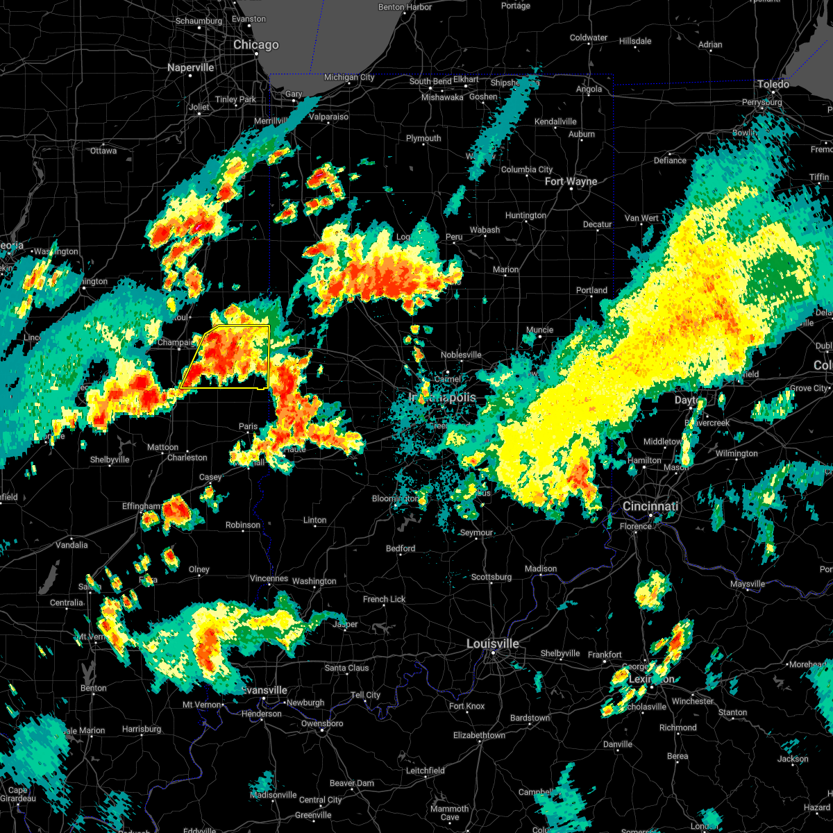 At 815 pm cdt, severe thunderstorms were located along a line extending from near ogden to near sidney, moving east at 15 mph (radar indicated). Hazards include 60 mph wind gusts and penny size hail. Expect damage to roofs, siding, and trees. severe thunderstorms will be near, ogden around 820 pm cdt. fithian around 830 pm cdt. muncie around 835 pm cdt. other locations in the path of these severe thunderstorms include homer, allerton, oakwood, catlin, fairmount, danville, westville, tilton, sidell and belgium. this includes interstate 74 between mile markers 190 and 220. hail threat, radar indicated max hail size, 0. 75 in wind threat, radar indicated max wind gust, 60 mph. At 815 pm cdt, severe thunderstorms were located along a line extending from near ogden to near sidney, moving east at 15 mph (radar indicated). Hazards include 60 mph wind gusts and penny size hail. Expect damage to roofs, siding, and trees. severe thunderstorms will be near, ogden around 820 pm cdt. fithian around 830 pm cdt. muncie around 835 pm cdt. other locations in the path of these severe thunderstorms include homer, allerton, oakwood, catlin, fairmount, danville, westville, tilton, sidell and belgium. this includes interstate 74 between mile markers 190 and 220. hail threat, radar indicated max hail size, 0. 75 in wind threat, radar indicated max wind gust, 60 mph.
|
| 8/29/2022 7:56 PM CDT |
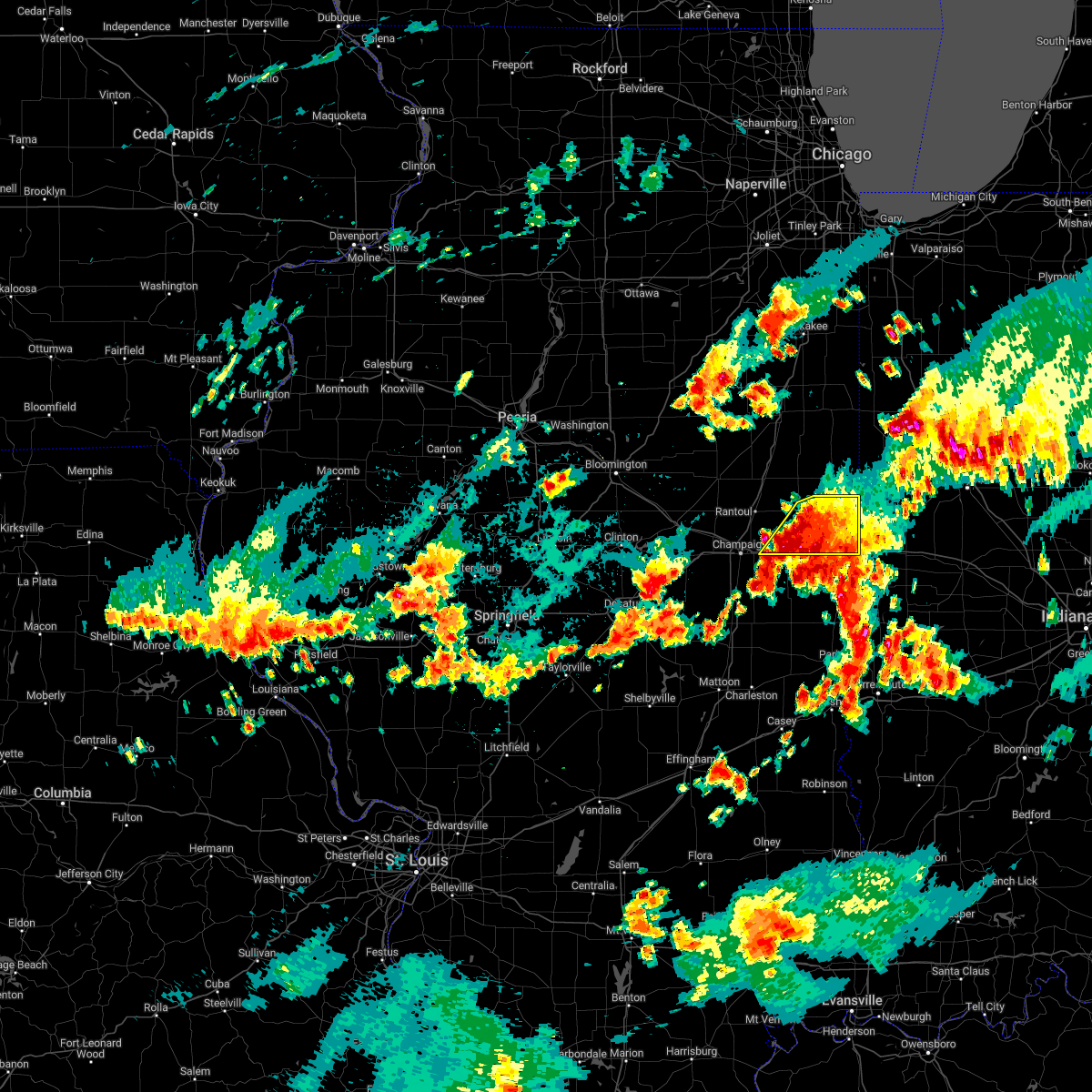 At 756 pm cdt, severe thunderstorms were located along a line extending from 8 miles southwest of potomac to ogden, moving east at 25 mph (emergency management). Hazards include 60 mph wind gusts and nickel size hail. Expect damage to roofs, siding, and trees. locations impacted include, potomac, fithian, muncie, oakwood and danville. this includes interstate 74 between mile markers 189 and 211, and between mile markers 216 and 220. hail threat, radar indicated max hail size, 0. 88 in wind threat, radar indicated max wind gust, 60 mph. At 756 pm cdt, severe thunderstorms were located along a line extending from 8 miles southwest of potomac to ogden, moving east at 25 mph (emergency management). Hazards include 60 mph wind gusts and nickel size hail. Expect damage to roofs, siding, and trees. locations impacted include, potomac, fithian, muncie, oakwood and danville. this includes interstate 74 between mile markers 189 and 211, and between mile markers 216 and 220. hail threat, radar indicated max hail size, 0. 88 in wind threat, radar indicated max wind gust, 60 mph.
|
| 8/29/2022 7:46 PM CDT |
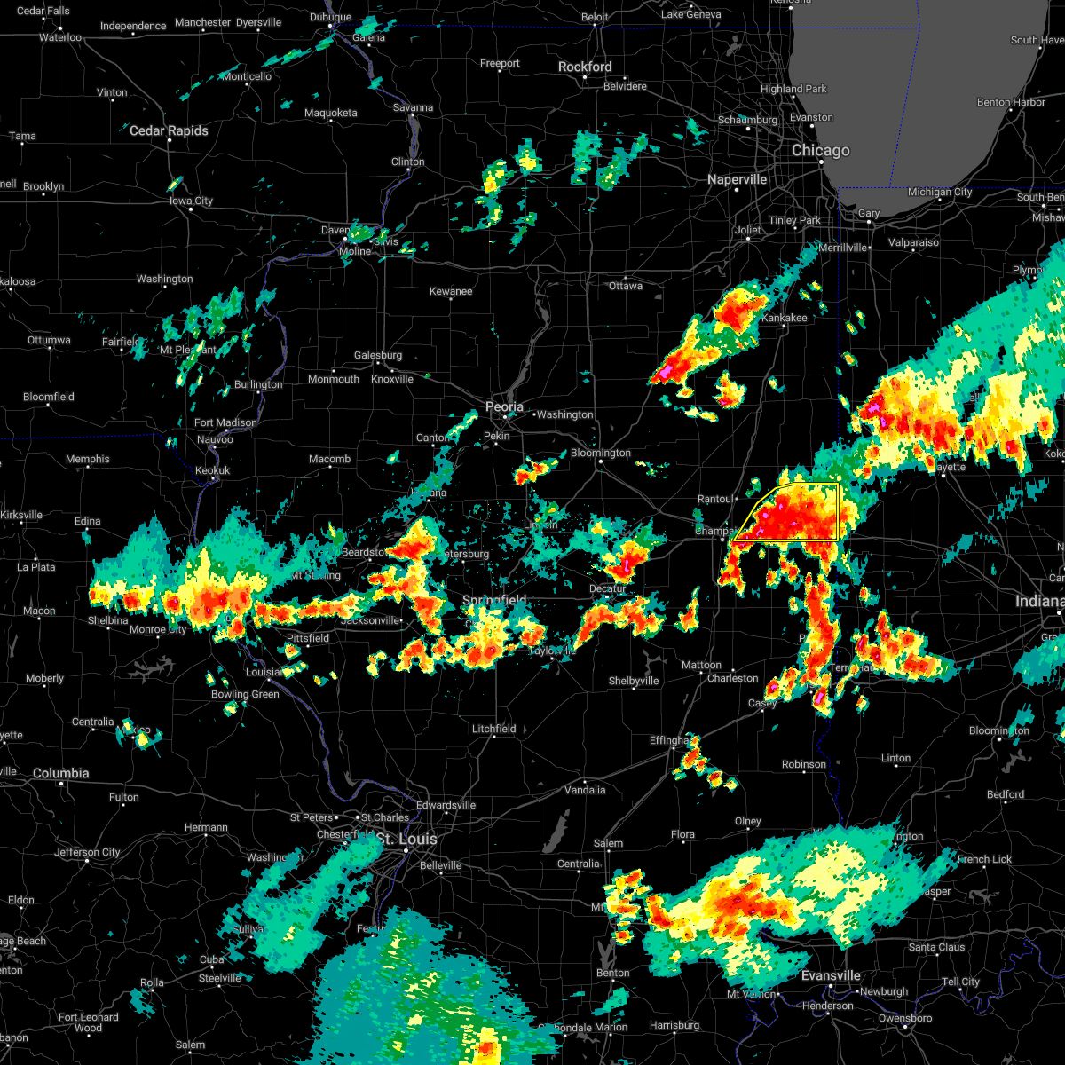 At 745 pm cdt, severe thunderstorms were located along a line extending from near potomac to st. joseph, moving east at 15 mph (emergency management). Hazards include 60 mph wind gusts and quarter size hail. Hail damage to vehicles is expected. expect wind damage to roofs, siding, and trees. locations impacted include, potomac, fithian, muncie, rossville and oakwood. this includes interstate 74 between mile markers 187 and 211, and between mile markers 216 and 220. hail threat, radar indicated max hail size, 1. 00 in wind threat, radar indicated max wind gust, 60 mph. At 745 pm cdt, severe thunderstorms were located along a line extending from near potomac to st. joseph, moving east at 15 mph (emergency management). Hazards include 60 mph wind gusts and quarter size hail. Hail damage to vehicles is expected. expect wind damage to roofs, siding, and trees. locations impacted include, potomac, fithian, muncie, rossville and oakwood. this includes interstate 74 between mile markers 187 and 211, and between mile markers 216 and 220. hail threat, radar indicated max hail size, 1. 00 in wind threat, radar indicated max wind gust, 60 mph.
|
| 8/29/2022 7:40 PM CDT | Trees dow in vermilion county IL, 6.9 miles NE of Danville, IL |
| 8/29/2022 7:35 PM CDT | Large limbs down on denmark rd 2 nw of danvill in vermilion county IL, 2.1 miles SE of Danville, IL |
| 8/29/2022 7:35 PM CDT | Power poles down on poland rd in danvill in vermilion county IL, 2.2 miles SSE of Danville, IL |
| 8/29/2022 7:31 PM CDT |
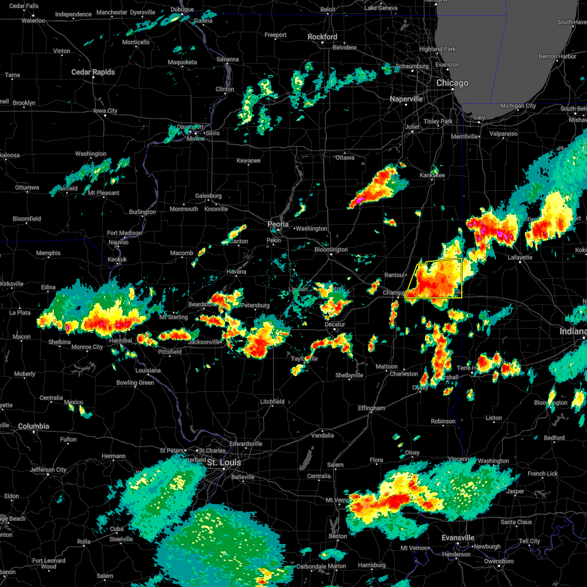 At 730 pm cdt, severe thunderstorms were located along a line extending from near gifford to near st. joseph, moving east at 25 mph (emergency management). Hazards include 60 mph wind gusts and quarter size hail. Hail damage to vehicles is expected. expect wind damage to roofs, siding, and trees. locations impacted include, ogden, potomac, fithian, muncie, oakwood, rossville and danville. this includes interstate 74 between mile markers 186 and 211, and between mile markers 216 and 220. hail threat, radar indicated max hail size, 1. 00 in wind threat, radar indicated max wind gust, 60 mph. At 730 pm cdt, severe thunderstorms were located along a line extending from near gifford to near st. joseph, moving east at 25 mph (emergency management). Hazards include 60 mph wind gusts and quarter size hail. Hail damage to vehicles is expected. expect wind damage to roofs, siding, and trees. locations impacted include, ogden, potomac, fithian, muncie, oakwood, rossville and danville. this includes interstate 74 between mile markers 186 and 211, and between mile markers 216 and 220. hail threat, radar indicated max hail size, 1. 00 in wind threat, radar indicated max wind gust, 60 mph.
|
| 8/29/2022 7:15 PM CDT |
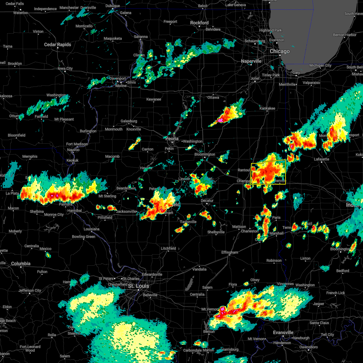 At 714 pm cdt, a severe thunderstorm was located near gifford, or 7 miles southeast of rantoul, moving east at 20 mph (radar indicated). Hazards include 60 mph wind gusts and quarter size hail. Hail damage to vehicles is expected. expect wind damage to roofs, siding, and trees. this severe thunderstorm will be near, ogden around 730 pm cdt. other locations in the path of this severe thunderstorm include fithian, muncie, potomac, oakwood and danville. this includes the following highways, interstate 57 between mile markers 254 and 257. interstate 74 between mile markers 186 and 211, and between mile markers 216 and 220. hail threat, radar indicated max hail size, 1. 00 in wind threat, radar indicated max wind gust, 60 mph. At 714 pm cdt, a severe thunderstorm was located near gifford, or 7 miles southeast of rantoul, moving east at 20 mph (radar indicated). Hazards include 60 mph wind gusts and quarter size hail. Hail damage to vehicles is expected. expect wind damage to roofs, siding, and trees. this severe thunderstorm will be near, ogden around 730 pm cdt. other locations in the path of this severe thunderstorm include fithian, muncie, potomac, oakwood and danville. this includes the following highways, interstate 57 between mile markers 254 and 257. interstate 74 between mile markers 186 and 211, and between mile markers 216 and 220. hail threat, radar indicated max hail size, 1. 00 in wind threat, radar indicated max wind gust, 60 mph.
|
| 7/4/2022 6:59 PM CDT | Power lines downe in vermilion county IL, 0.8 miles NE of Danville, IL |
| 6/13/2022 12:32 PM CDT |
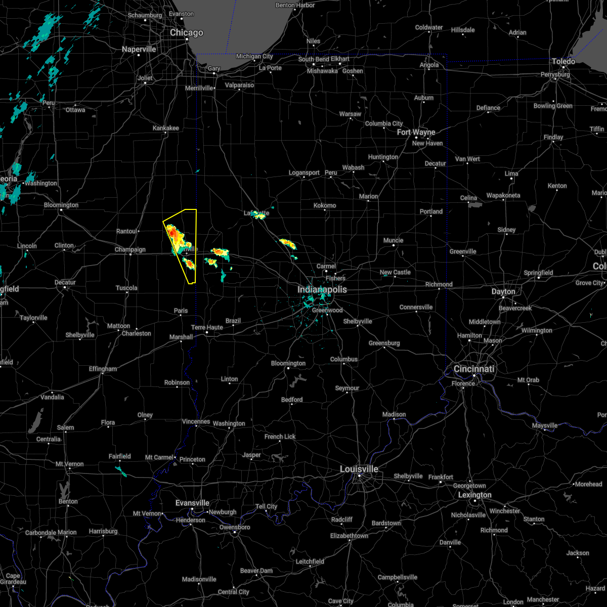 At 1232 pm cdt, a severe thunderstorm was located near potomac, or 12 miles northwest of danville, moving northeast at 25 mph (radar indicated). Hazards include 60 mph wind gusts and quarter size hail. Hail damage to vehicles is expected. expect wind damage to roofs, siding, and trees. this severe thunderstorm will be near, rossville around 1245 pm cdt. other locations in the path of this severe thunderstorm include hoopeston. This includes interstate 74 between mile markers 209 and 219. At 1232 pm cdt, a severe thunderstorm was located near potomac, or 12 miles northwest of danville, moving northeast at 25 mph (radar indicated). Hazards include 60 mph wind gusts and quarter size hail. Hail damage to vehicles is expected. expect wind damage to roofs, siding, and trees. this severe thunderstorm will be near, rossville around 1245 pm cdt. other locations in the path of this severe thunderstorm include hoopeston. This includes interstate 74 between mile markers 209 and 219.
|
| 4/24/2022 7:53 PM CDT |
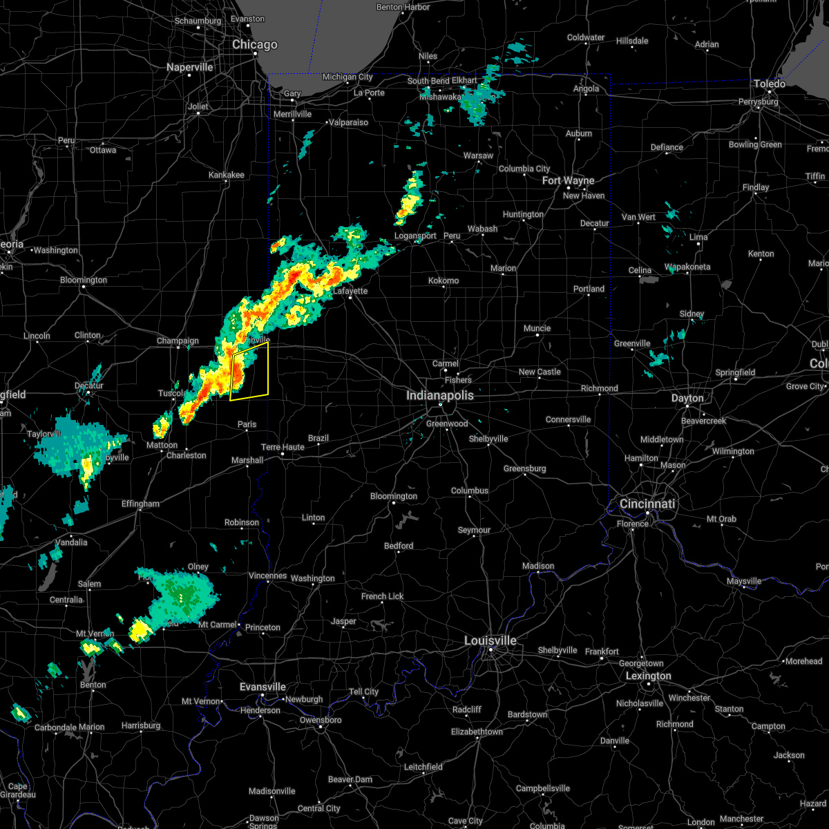 At 752 pm cdt, severe thunderstorms were located along a line extending from catlin to near sidell, moving east at 50 mph (radar indicated). Hazards include 60 mph wind gusts. Expect damage to roofs, siding, and trees. these severe storms will be near, catlin around 755 pm cdt. danville, westville, tilton, ridge farm and belgium around 800 pm cdt. other locations in the path of these severe thunderstorms include georgetown. this includes interstate 74 between mile markers 213 and 220. hail threat, radar indicated max hail size, <. 75 in wind threat, radar indicated max wind gust, 60 mph. At 752 pm cdt, severe thunderstorms were located along a line extending from catlin to near sidell, moving east at 50 mph (radar indicated). Hazards include 60 mph wind gusts. Expect damage to roofs, siding, and trees. these severe storms will be near, catlin around 755 pm cdt. danville, westville, tilton, ridge farm and belgium around 800 pm cdt. other locations in the path of these severe thunderstorms include georgetown. this includes interstate 74 between mile markers 213 and 220. hail threat, radar indicated max hail size, <. 75 in wind threat, radar indicated max wind gust, 60 mph.
|
| 4/24/2022 7:40 PM CDT |
 At 740 pm cdt, severe thunderstorms were located along a line extending from near homer to newman, moving east at 45 mph (radar indicated). Hazards include 60 mph wind gusts. Expect damage to roofs, siding, and trees. severe thunderstorms will be near, fairmount around 750 pm cdt. sidell around 755 pm cdt. catlin and chrisman around 800 pm cdt. other locations in the path of these severe thunderstorms include danville, westville, tilton, ridge farm, belgium and georgetown. this includes interstate 74 between mile markers 213 and 220. hail threat, radar indicated max hail size, <. 75 in wind threat, radar indicated max wind gust, 60 mph. At 740 pm cdt, severe thunderstorms were located along a line extending from near homer to newman, moving east at 45 mph (radar indicated). Hazards include 60 mph wind gusts. Expect damage to roofs, siding, and trees. severe thunderstorms will be near, fairmount around 750 pm cdt. sidell around 755 pm cdt. catlin and chrisman around 800 pm cdt. other locations in the path of these severe thunderstorms include danville, westville, tilton, ridge farm, belgium and georgetown. this includes interstate 74 between mile markers 213 and 220. hail threat, radar indicated max hail size, <. 75 in wind threat, radar indicated max wind gust, 60 mph.
|
| 3/6/2022 12:43 AM CST |
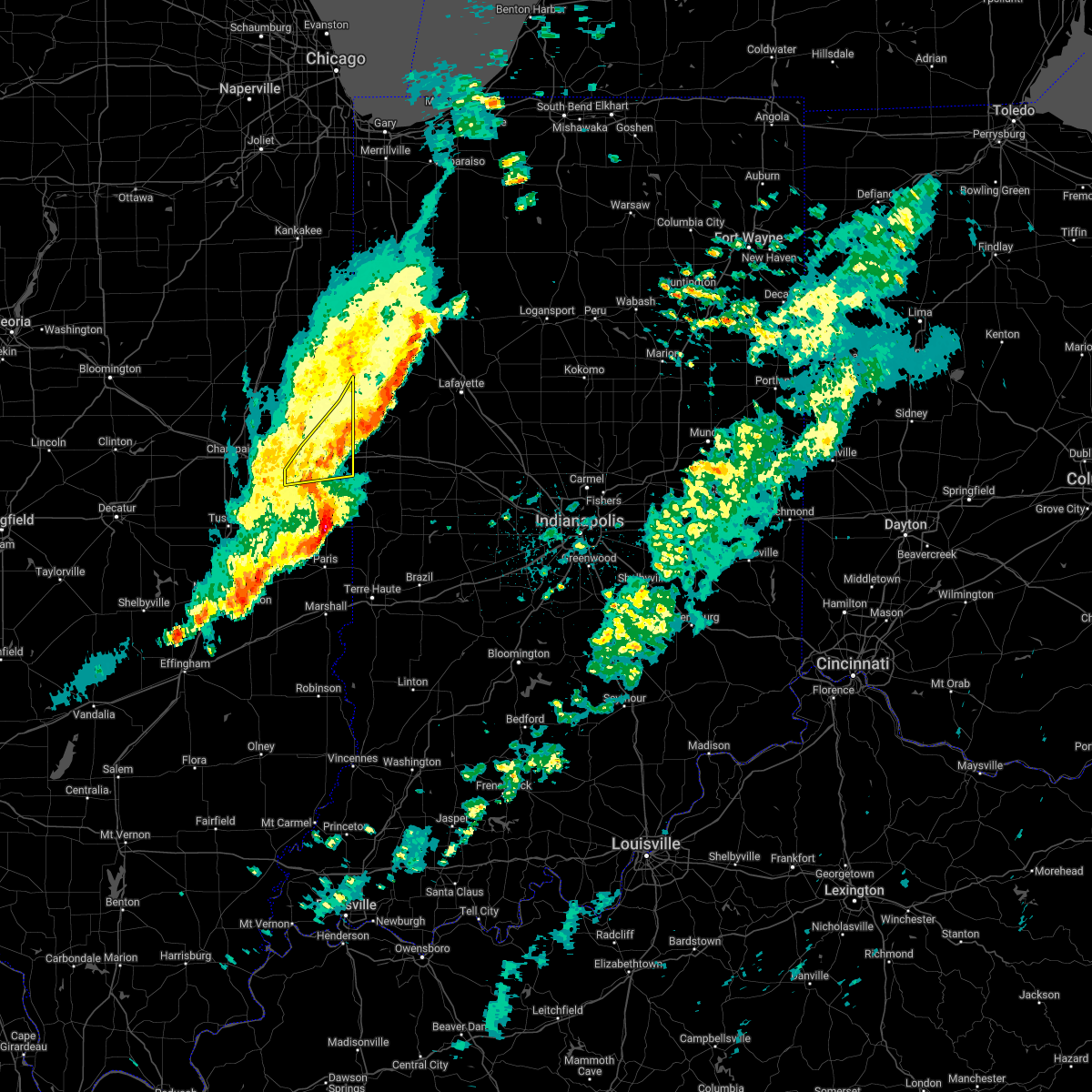 The severe thunderstorm warning for central vermilion county will expire at 1245 am cst, the storm which prompted the warning has moved out of the area. therefore, the warning will be allowed to expire. a severe thunderstorm watch remains in effect until 200 am cst for east central illinois. to report severe weather, contact your nearest law enforcement agency. they will relay your report to the national weather service lincoln. The severe thunderstorm warning for central vermilion county will expire at 1245 am cst, the storm which prompted the warning has moved out of the area. therefore, the warning will be allowed to expire. a severe thunderstorm watch remains in effect until 200 am cst for east central illinois. to report severe weather, contact your nearest law enforcement agency. they will relay your report to the national weather service lincoln.
|
| 3/6/2022 12:25 AM CST |
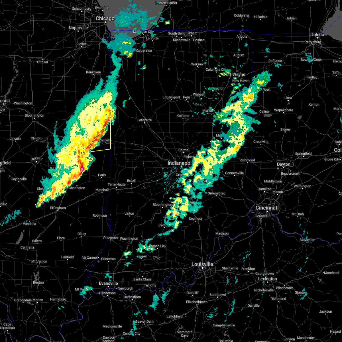 At 1225 am cst, a severe thunderstorm was located 7 miles east of rossville, or 8 miles southwest of talbot, moving northeast at 65 mph (radar indicated). Hazards include 70 mph wind gusts. Expect considerable tree damage. damage is likely to mobile homes, roofs, and outbuildings. locations impacted include, danville, westville, tilton, catlin, oakwood, fairmount, fithian, belgium, muncie, bismarck, henning, vermilion county airport, alvin and kickapoo state park. this includes interstate 74 between mile markers 201 and 220. thunderstorm damage threat, considerable hail threat, radar indicated max hail size, <. 75 in wind threat, radar indicated max wind gust, 70 mph. At 1225 am cst, a severe thunderstorm was located 7 miles east of rossville, or 8 miles southwest of talbot, moving northeast at 65 mph (radar indicated). Hazards include 70 mph wind gusts. Expect considerable tree damage. damage is likely to mobile homes, roofs, and outbuildings. locations impacted include, danville, westville, tilton, catlin, oakwood, fairmount, fithian, belgium, muncie, bismarck, henning, vermilion county airport, alvin and kickapoo state park. this includes interstate 74 between mile markers 201 and 220. thunderstorm damage threat, considerable hail threat, radar indicated max hail size, <. 75 in wind threat, radar indicated max wind gust, 70 mph.
|
| 3/6/2022 12:06 AM CST |
 At 1206 am cst, a severe thunderstorm was located near potomac, or 14 miles east of rantoul, moving east at 65 mph (radar indicated). Hazards include 70 mph wind gusts. Expect considerable tree damage. damage is likely to mobile homes, roofs, and outbuildings. locations impacted include, potomac and rossville. this includes the following highways, interstate 57 between mile markers 223 and 230. interstate 74 between mile markers 183 and 220. thunderstorm damage threat, considerable hail threat, radar indicated max hail size, <. 75 in wind threat, radar indicated max wind gust, 70 mph. At 1206 am cst, a severe thunderstorm was located near potomac, or 14 miles east of rantoul, moving east at 65 mph (radar indicated). Hazards include 70 mph wind gusts. Expect considerable tree damage. damage is likely to mobile homes, roofs, and outbuildings. locations impacted include, potomac and rossville. this includes the following highways, interstate 57 between mile markers 223 and 230. interstate 74 between mile markers 183 and 220. thunderstorm damage threat, considerable hail threat, radar indicated max hail size, <. 75 in wind threat, radar indicated max wind gust, 70 mph.
|
| 3/5/2022 11:38 PM CST |
 At 1138 pm cst, a severe thunderstorm was located over mahomet, or 10 miles northwest of champaign, moving east at 65 mph (radar indicated). Hazards include 60 mph wind gusts. Expect damage to roofs, siding, and trees. this severe thunderstorm will be near, champaign and fisher around 1145 pm cst. urbana and thomasboro around 1150 pm cst. rantoul around 1155 pm cst. other locations in the path of this severe thunderstorm include gifford, potomac, rankin, rossville and hoopeston. this includes the following highways, interstate 57 between mile markers 222 and 257. interstate 72 between mile markers 170 and 182. interstate 74 between mile markers 164 and 220. hail threat, radar indicated max hail size, <. 75 in wind threat, radar indicated max wind gust, 60 mph. At 1138 pm cst, a severe thunderstorm was located over mahomet, or 10 miles northwest of champaign, moving east at 65 mph (radar indicated). Hazards include 60 mph wind gusts. Expect damage to roofs, siding, and trees. this severe thunderstorm will be near, champaign and fisher around 1145 pm cst. urbana and thomasboro around 1150 pm cst. rantoul around 1155 pm cst. other locations in the path of this severe thunderstorm include gifford, potomac, rankin, rossville and hoopeston. this includes the following highways, interstate 57 between mile markers 222 and 257. interstate 72 between mile markers 170 and 182. interstate 74 between mile markers 164 and 220. hail threat, radar indicated max hail size, <. 75 in wind threat, radar indicated max wind gust, 60 mph.
|
| 9/7/2021 6:58 PM CDT |
 The severe thunderstorm warning for vermilion and champaign counties will expire at 700 pm cdt, the storms which prompted the warning have weakened below severe limits, and no longer pose an immediate threat to life or property. therefore, the warning will be allowed to expire. however gusty winds and heavy rain are still expected with these thunderstorms. a severe thunderstorm watch remains in effect until 900 pm cdt for east central illinois. to report severe weather, contact your nearest law enforcement agency. they will relay your report to the national weather service lincoln. The severe thunderstorm warning for vermilion and champaign counties will expire at 700 pm cdt, the storms which prompted the warning have weakened below severe limits, and no longer pose an immediate threat to life or property. therefore, the warning will be allowed to expire. however gusty winds and heavy rain are still expected with these thunderstorms. a severe thunderstorm watch remains in effect until 900 pm cdt for east central illinois. to report severe weather, contact your nearest law enforcement agency. they will relay your report to the national weather service lincoln.
|
| 9/7/2021 6:33 PM CDT |
 At 632 pm cdt, severe thunderstorms were located along a line extending from 6 miles southeast of rossville to oakwood to seymour, moving southeast at 45 mph (radar indicated). Hazards include 60 mph wind gusts. Expect damage to roofs, siding, and trees. locations impacted include, danville, tilton, catlin, oakwood, fairmount, georgetown, westville, pesotum, belgium, sidney, broadlands, allerton, sidell and ridge farm. this includes the following highways, interstate 57 between mile markers 218 and 249. interstate 72 between mile markers 174 and 182. interstate 74 between mile marker 169 and the indiana border. hail threat, radar indicated max hail size, <. 75 in wind threat, radar indicated max wind gust, 60 mph. At 632 pm cdt, severe thunderstorms were located along a line extending from 6 miles southeast of rossville to oakwood to seymour, moving southeast at 45 mph (radar indicated). Hazards include 60 mph wind gusts. Expect damage to roofs, siding, and trees. locations impacted include, danville, tilton, catlin, oakwood, fairmount, georgetown, westville, pesotum, belgium, sidney, broadlands, allerton, sidell and ridge farm. this includes the following highways, interstate 57 between mile markers 218 and 249. interstate 72 between mile markers 174 and 182. interstate 74 between mile marker 169 and the indiana border. hail threat, radar indicated max hail size, <. 75 in wind threat, radar indicated max wind gust, 60 mph.
|
| 9/7/2021 6:09 PM CDT |
 At 608 pm cdt, severe thunderstorms were located along a line extending from near rankin to 6 miles north of st. joseph to mahomet, moving southeast at 45 mph (radar indicated). Hazards include 60 mph wind gusts and nickel size hail. Expect damage to roofs, siding, and trees. severe thunderstorms will be near, rankin around 615 pm cdt. ogden and potomac around 620 pm cdt. savoy, tolono, rossville, fithian and muncie around 625 pm cdt. other locations in the path of these severe thunderstorms include oakwood, fairmount, st. joseph, catlin, philo, danville, westville, tilton, sidney, belgium, georgetown, homer, broadlands and allerton. this includes the following highways, interstate 57 between mile markers 218 and 251. interstate 72 between mile markers 174 and 182. interstate 74 between mile marker 169 and the indiana border. hail threat, radar indicated max hail size, 0. 88 in wind threat, radar indicated max wind gust, 60 mph. At 608 pm cdt, severe thunderstorms were located along a line extending from near rankin to 6 miles north of st. joseph to mahomet, moving southeast at 45 mph (radar indicated). Hazards include 60 mph wind gusts and nickel size hail. Expect damage to roofs, siding, and trees. severe thunderstorms will be near, rankin around 615 pm cdt. ogden and potomac around 620 pm cdt. savoy, tolono, rossville, fithian and muncie around 625 pm cdt. other locations in the path of these severe thunderstorms include oakwood, fairmount, st. joseph, catlin, philo, danville, westville, tilton, sidney, belgium, georgetown, homer, broadlands and allerton. this includes the following highways, interstate 57 between mile markers 218 and 251. interstate 72 between mile markers 174 and 182. interstate 74 between mile marker 169 and the indiana border. hail threat, radar indicated max hail size, 0. 88 in wind threat, radar indicated max wind gust, 60 mph.
|
| 8/12/2021 3:10 PM CDT |
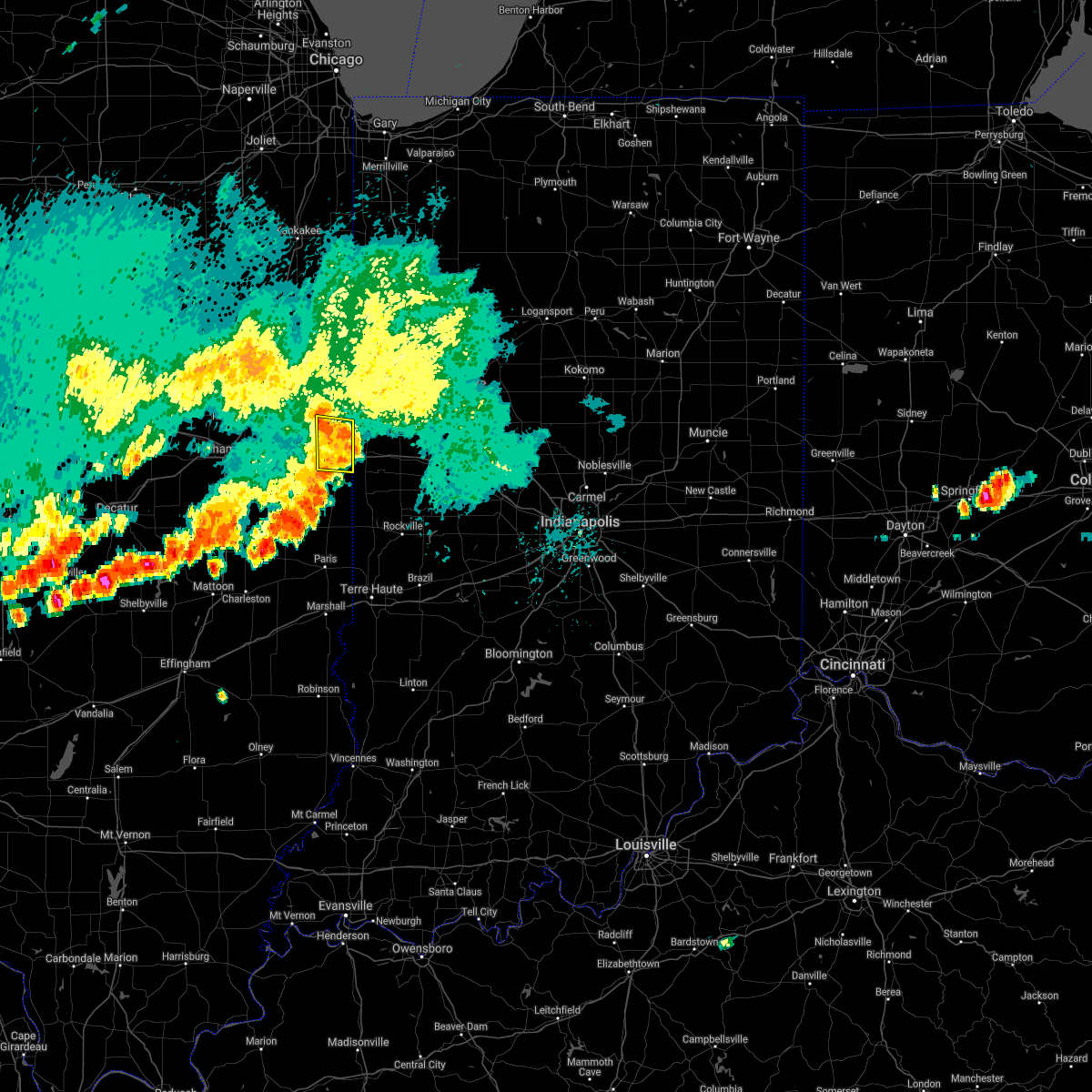 At 309 pm cdt, a severe thunderstorm was located near danville, moving east at 35 mph (radar indicated). Hazards include 60 mph wind gusts and penny size hail. Expect damage to roofs, siding, and trees. this severe thunderstorm will remain over mainly rural areas of east central vermilion county, including the following locations, vermilion county airport, bismarck, kickapoo state park and henning. this includes interstate 74 between mile markers 209 and 220. hail threat, radar indicated max hail size, 0. 75 in wind threat, radar indicated max wind gust, 60 mph. At 309 pm cdt, a severe thunderstorm was located near danville, moving east at 35 mph (radar indicated). Hazards include 60 mph wind gusts and penny size hail. Expect damage to roofs, siding, and trees. this severe thunderstorm will remain over mainly rural areas of east central vermilion county, including the following locations, vermilion county airport, bismarck, kickapoo state park and henning. this includes interstate 74 between mile markers 209 and 220. hail threat, radar indicated max hail size, 0. 75 in wind threat, radar indicated max wind gust, 60 mph.
|
| 8/12/2021 2:53 PM CDT |
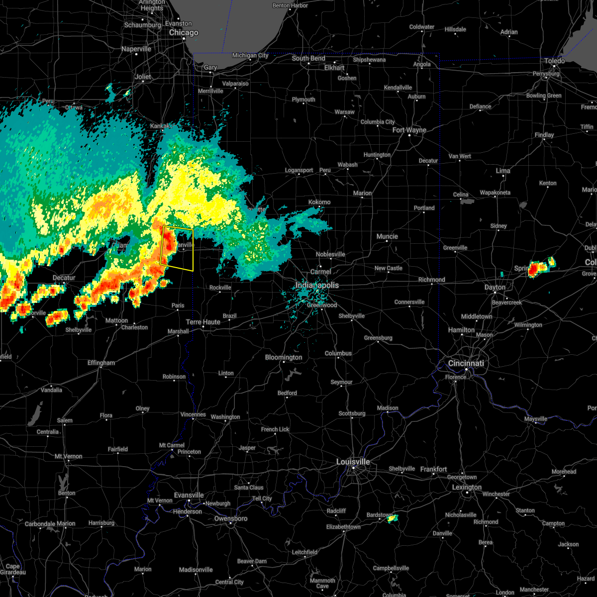 At 253 pm cdt, a severe thunderstorm was located near oakwood, or near danville, moving east at 35 mph (radar indicated). Hazards include 60 mph wind gusts and penny size hail. Expect damage to roofs, siding, and trees. this severe thunderstorm will be near, danville, westville, tilton and belgium around 305 pm cdt. this includes interstate 74 between mile markers 202 and 220. hail threat, radar indicated max hail size, 0. 75 in wind threat, radar indicated max wind gust, 60 mph. At 253 pm cdt, a severe thunderstorm was located near oakwood, or near danville, moving east at 35 mph (radar indicated). Hazards include 60 mph wind gusts and penny size hail. Expect damage to roofs, siding, and trees. this severe thunderstorm will be near, danville, westville, tilton and belgium around 305 pm cdt. this includes interstate 74 between mile markers 202 and 220. hail threat, radar indicated max hail size, 0. 75 in wind threat, radar indicated max wind gust, 60 mph.
|
| 6/29/2021 2:32 PM CDT |
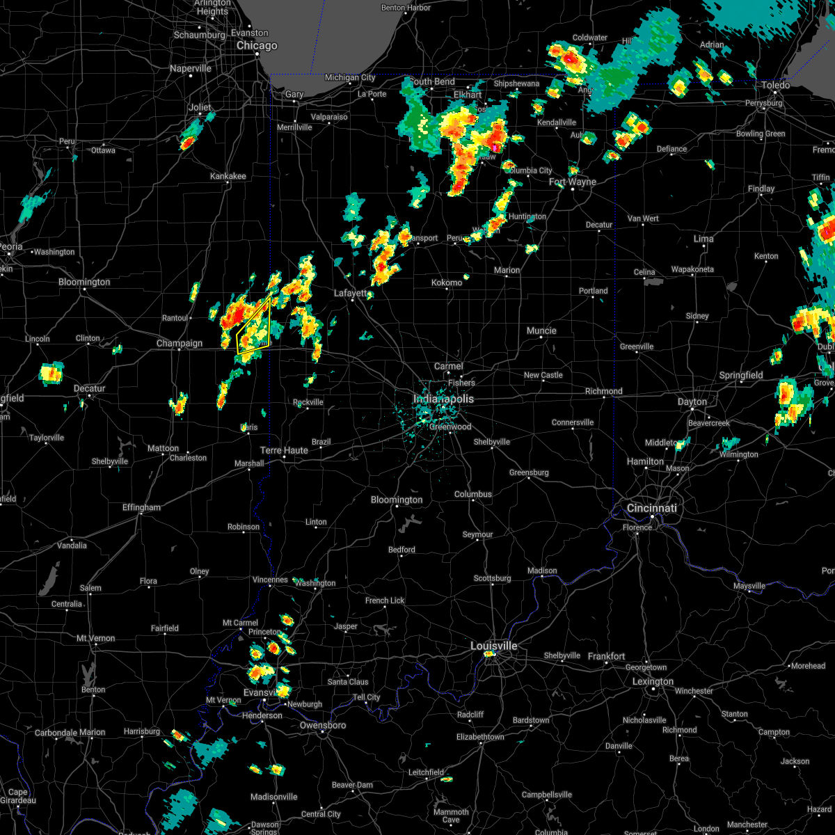 At 232 pm cdt, a severe thunderstorm was located near oakwood, moving northeast at 20 mph (radar indicated). Hazards include 60 mph wind gusts. Expect damage to roofs, siding, and trees. locations impacted include, danville, oakwood, bismarck, vermilion county airport, alvin and kickapoo state park. This includes interstate 74 between mile markers 207 and 211. At 232 pm cdt, a severe thunderstorm was located near oakwood, moving northeast at 20 mph (radar indicated). Hazards include 60 mph wind gusts. Expect damage to roofs, siding, and trees. locations impacted include, danville, oakwood, bismarck, vermilion county airport, alvin and kickapoo state park. This includes interstate 74 between mile markers 207 and 211.
|
| 6/29/2021 2:17 PM CDT |
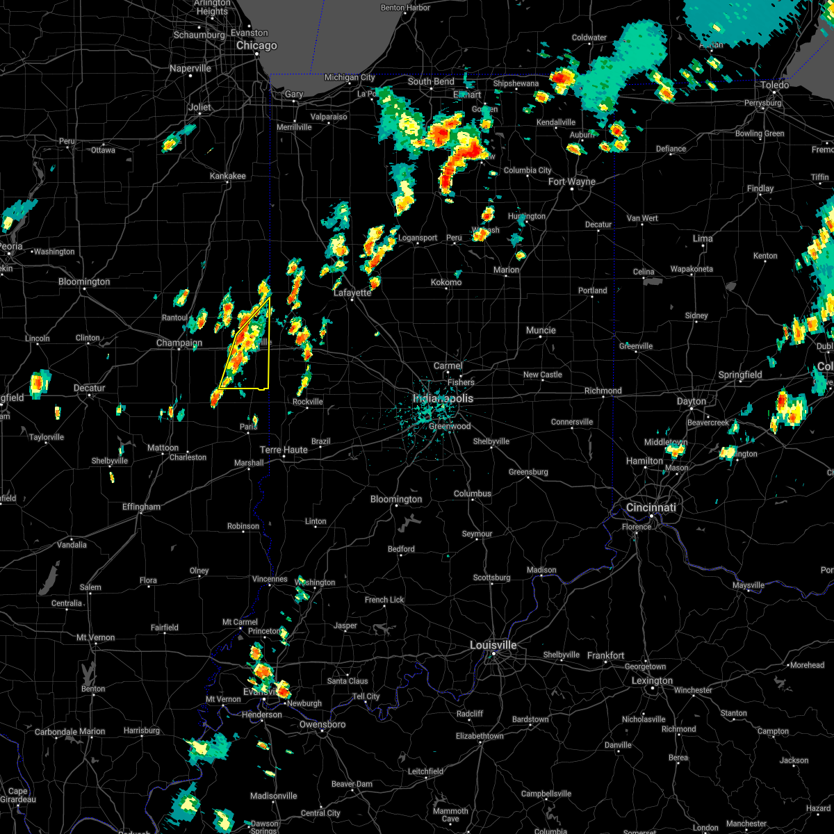 At 217 pm cdt, a severe thunderstorm was located near catlin, or 10 miles southwest of danville, moving northeast at 20 mph (radar indicated). Hazards include 60 mph wind gusts. Expect damage to roofs, siding, and trees. locations impacted include, georgetown, catlin, oakwood, westville, belgium, danville and tilton. This includes interstate 74 between mile markers 204 and 219. At 217 pm cdt, a severe thunderstorm was located near catlin, or 10 miles southwest of danville, moving northeast at 20 mph (radar indicated). Hazards include 60 mph wind gusts. Expect damage to roofs, siding, and trees. locations impacted include, georgetown, catlin, oakwood, westville, belgium, danville and tilton. This includes interstate 74 between mile markers 204 and 219.
|
| 6/29/2021 1:58 PM CDT |
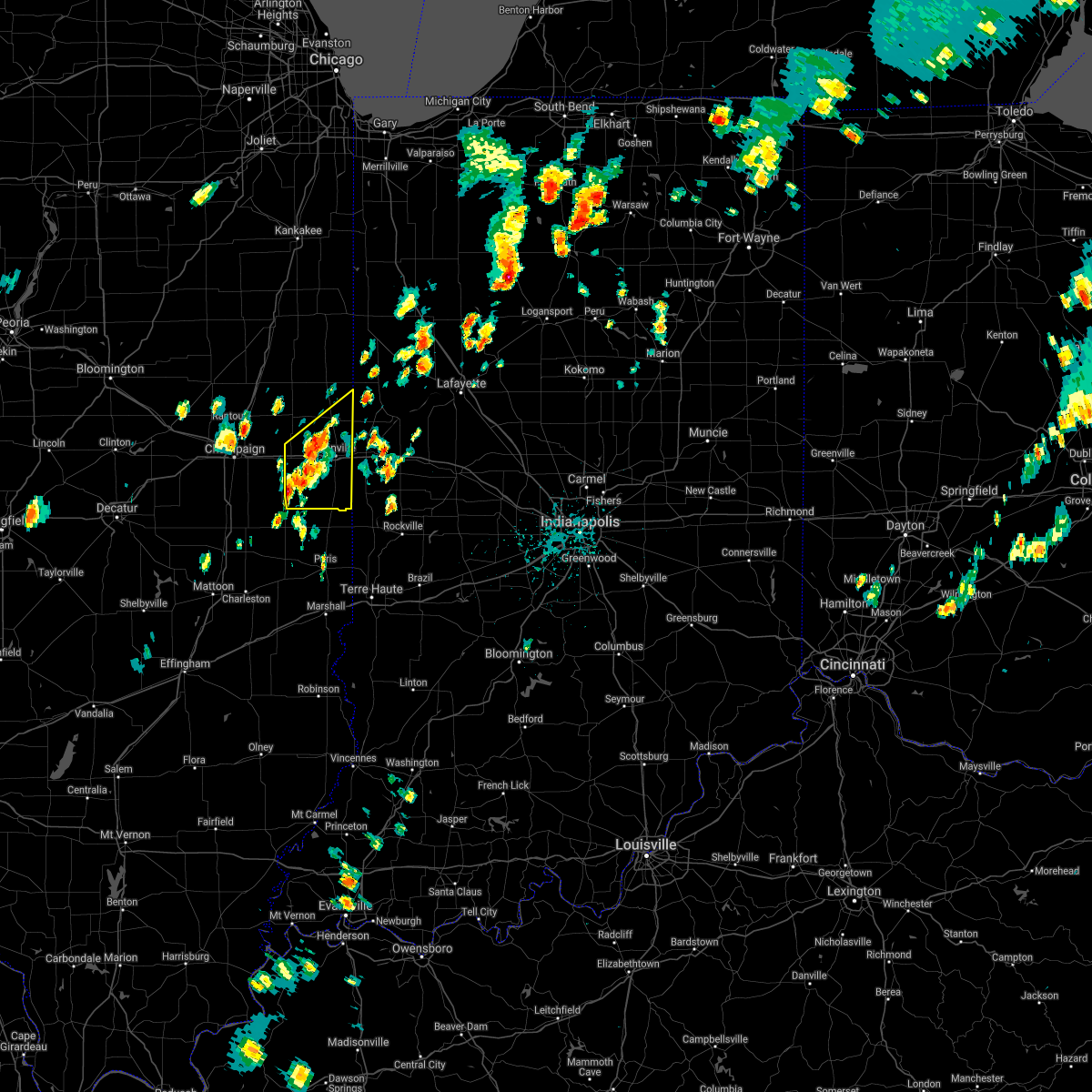 The national weather service in lincoln has issued a * severe thunderstorm warning for. vermilion county in east central illinois. until 245 pm cdt. At 158 pm cdt, a severe thunderstorm was located near allerton, or 18 miles southwest of danville, moving northeast at 20 mph. The national weather service in lincoln has issued a * severe thunderstorm warning for. vermilion county in east central illinois. until 245 pm cdt. At 158 pm cdt, a severe thunderstorm was located near allerton, or 18 miles southwest of danville, moving northeast at 20 mph.
|
| 6/26/2021 7:11 PM CDT |
 At 711 pm cdt, severe thunderstorms were located along a line extending from near hoopeston to near catlin to near newman to near arcola, moving east at 40 mph (radar indicated). Hazards include 60 mph wind gusts and penny size hail. Expect damage to roofs, siding, and trees. locations impacted include, danville, hoopeston, georgetown, westville, arcola, tilton, catlin, oakwood, chrisman, rossville, ridge farm, newman, fairmount, sidell, belgium, hume, brocton, hindsboro, allerton and edgar. this includes the following highways, interstate 57 between mile markers 202 and 203. Interstate 74 between mile markers 205 and 220. At 711 pm cdt, severe thunderstorms were located along a line extending from near hoopeston to near catlin to near newman to near arcola, moving east at 40 mph (radar indicated). Hazards include 60 mph wind gusts and penny size hail. Expect damage to roofs, siding, and trees. locations impacted include, danville, hoopeston, georgetown, westville, arcola, tilton, catlin, oakwood, chrisman, rossville, ridge farm, newman, fairmount, sidell, belgium, hume, brocton, hindsboro, allerton and edgar. this includes the following highways, interstate 57 between mile markers 202 and 203. Interstate 74 between mile markers 205 and 220.
|
| 6/26/2021 6:52 PM CDT |
 At 652 pm cdt, severe thunderstorms were located along a line extending from rossville to near homer to hindsboro, moving northeast at 35 mph (radar indicated). Hazards include 60 mph wind gusts and penny size hail. Expect damage to roofs, siding, and trees. locations impacted include, hoopeston, rossville, sidell, fairmount, fithian, muncie, newman, oakwood, brocton, catlin, westville, belgium, hume, danville and tilton. this includes the following highways, interstate 57 between mile markers 202 and 205. Interstate 74 between mile markers 197 and 220. At 652 pm cdt, severe thunderstorms were located along a line extending from rossville to near homer to hindsboro, moving northeast at 35 mph (radar indicated). Hazards include 60 mph wind gusts and penny size hail. Expect damage to roofs, siding, and trees. locations impacted include, hoopeston, rossville, sidell, fairmount, fithian, muncie, newman, oakwood, brocton, catlin, westville, belgium, hume, danville and tilton. this includes the following highways, interstate 57 between mile markers 202 and 205. Interstate 74 between mile markers 197 and 220.
|
| 6/26/2021 6:24 PM CDT |
 At 623 pm cdt, severe thunderstorms were located along a line extending from 7 miles north of ogden to near pesotum to near humboldt, moving northeast at 35 mph (radar indicated). Hazards include 60 mph wind gusts and penny size hail. Expect damage to roofs, siding, and trees. severe thunderstorms will be near, tuscola, sidney, potomac and broadlands around 640 pm cdt. other locations in the path of these severe thunderstorms include hindsboro, rossville, homer, camargo, ogden, newman, fairmount, fithian, brocton, muncie, catlin, oakwood, hume, westville, belgium and allerton. this includes the following highways, interstate 57 between mile markers 202 and 218. Interstate 74 between mile markers 190 and 220. At 623 pm cdt, severe thunderstorms were located along a line extending from 7 miles north of ogden to near pesotum to near humboldt, moving northeast at 35 mph (radar indicated). Hazards include 60 mph wind gusts and penny size hail. Expect damage to roofs, siding, and trees. severe thunderstorms will be near, tuscola, sidney, potomac and broadlands around 640 pm cdt. other locations in the path of these severe thunderstorms include hindsboro, rossville, homer, camargo, ogden, newman, fairmount, fithian, brocton, muncie, catlin, oakwood, hume, westville, belgium and allerton. this includes the following highways, interstate 57 between mile markers 202 and 218. Interstate 74 between mile markers 190 and 220.
|
| 8/10/2020 4:50 PM CDT | Numerous trees and power lines down throughout danville. several streets blocke in vermilion county IL, 0.6 miles N of Danville, IL |
| 8/10/2020 4:49 PM CDT |
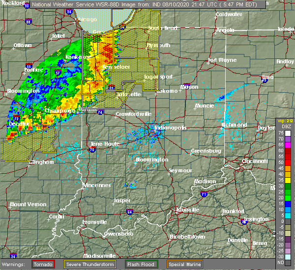 At 448 pm cdt, severe thunderstorms were located along a line extending from 7 miles northeast of danville to near allerton, moving east at 40 mph (emergency management). Hazards include 70 mph wind gusts. Expect considerable tree damage. Damage is likely to mobile homes, roofs, and outbuildings. At 448 pm cdt, severe thunderstorms were located along a line extending from 7 miles northeast of danville to near allerton, moving east at 40 mph (emergency management). Hazards include 70 mph wind gusts. Expect considerable tree damage. Damage is likely to mobile homes, roofs, and outbuildings.
|
| 8/10/2020 4:43 PM CDT | Storm damage reported in vermilion county IL, 1.5 miles SSE of Danville, IL |
| 7/21/2020 12:27 PM CDT |
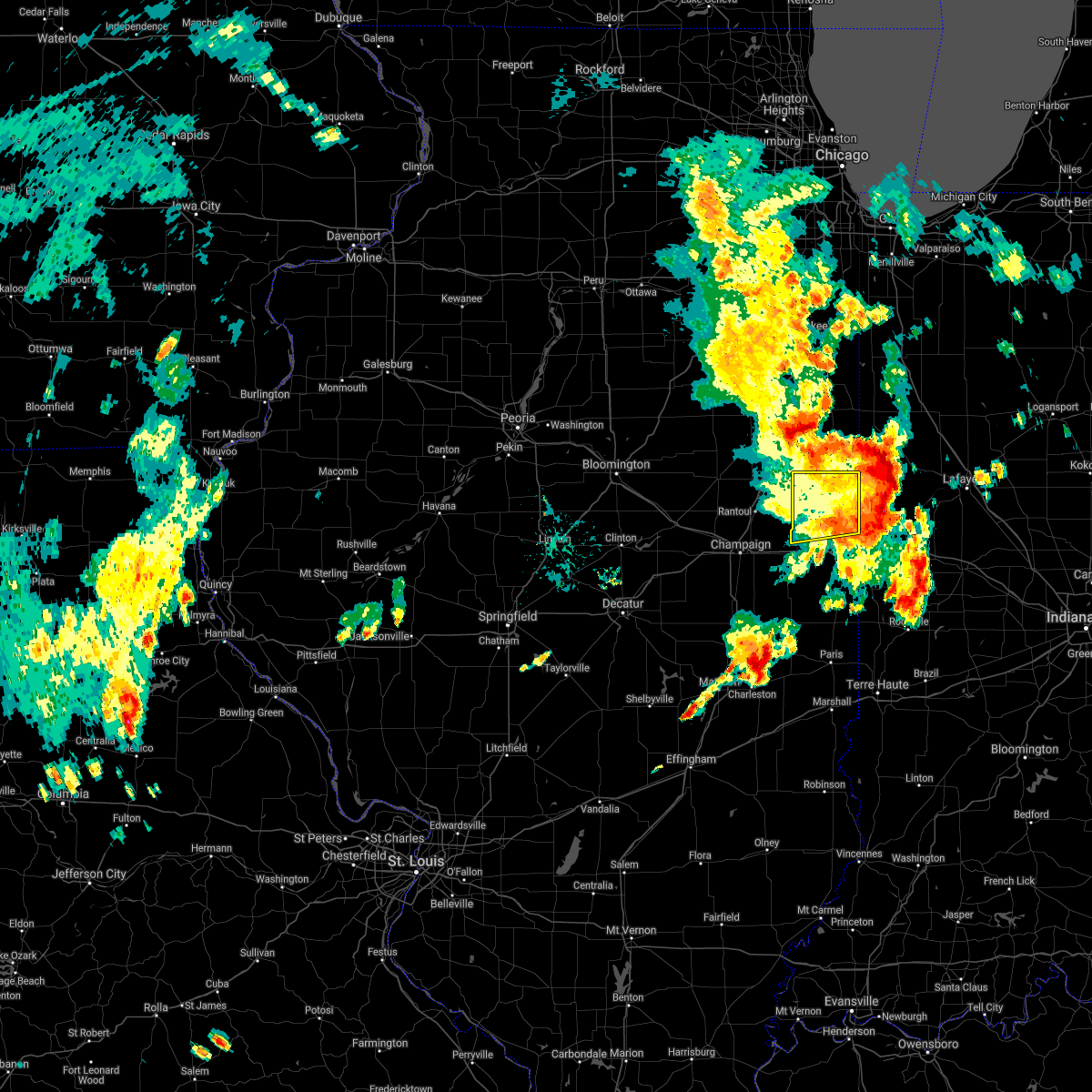 The severe thunderstorm warning for northern vermilion county will expire at 1230 pm cdt, the storm which prompted the warning has moved out of the area. therefore, the warning will be allowed to expire. The severe thunderstorm warning for northern vermilion county will expire at 1230 pm cdt, the storm which prompted the warning has moved out of the area. therefore, the warning will be allowed to expire.
|
| 7/21/2020 12:04 PM CDT |
 At 1203 pm cdt, a severe thunderstorm was located near rossville, or 14 miles south of claytonville, moving east at 45 mph (radar indicated). Hazards include 60 mph wind gusts. Expect damage to roofs, siding, and trees. Locations impacted include, hoopeston, rossville, potomac, rankin, bismarck, henning, middle fork wildlife area, armstrong, collison and alvin. At 1203 pm cdt, a severe thunderstorm was located near rossville, or 14 miles south of claytonville, moving east at 45 mph (radar indicated). Hazards include 60 mph wind gusts. Expect damage to roofs, siding, and trees. Locations impacted include, hoopeston, rossville, potomac, rankin, bismarck, henning, middle fork wildlife area, armstrong, collison and alvin.
|
| 7/21/2020 11:29 AM CDT |
 At 1128 am cdt, a severe thunderstorm was located over thomasboro, or near rantoul, moving east at 40 mph (radar indicated). Hazards include 60 mph wind gusts. expect damage to roofs, siding, and trees At 1128 am cdt, a severe thunderstorm was located over thomasboro, or near rantoul, moving east at 40 mph (radar indicated). Hazards include 60 mph wind gusts. expect damage to roofs, siding, and trees
|
| 7/11/2020 10:37 PM CDT |
 At 1036 pm cdt, severe thunderstorms were located along a line extending from 8 miles northeast of danville to near newman to near shelbyville, moving southeast at 50 mph (radar indicated). Hazards include 60 mph wind gusts and quarter size hail. Hail damage to vehicles is expected. expect wind damage to roofs, siding, and trees. locations impacted include, danville, mattoon, paris, shelbyville, tuscola, sullivan, hoopeston, georgetown, westville, arcola, tilton, villa grove, arthur, catlin, oakwood, bethany, chrisman, rossville, homer and ridge farm. this includes the following highways, interstate 57 between mile markers 192 and 217. Interstate 74 between mile markers 200 and 220. At 1036 pm cdt, severe thunderstorms were located along a line extending from 8 miles northeast of danville to near newman to near shelbyville, moving southeast at 50 mph (radar indicated). Hazards include 60 mph wind gusts and quarter size hail. Hail damage to vehicles is expected. expect wind damage to roofs, siding, and trees. locations impacted include, danville, mattoon, paris, shelbyville, tuscola, sullivan, hoopeston, georgetown, westville, arcola, tilton, villa grove, arthur, catlin, oakwood, bethany, chrisman, rossville, homer and ridge farm. this includes the following highways, interstate 57 between mile markers 192 and 217. Interstate 74 between mile markers 200 and 220.
|
| 7/11/2020 10:11 PM CDT |
 At 1010 pm cdt, severe thunderstorms were located along a line extending from near rankin to pesotum to dalton city, moving southeast at 50 mph (radar indicated). Hazards include 60 mph wind gusts and quarter size hail. Hail damage to vehicles is expected. Expect wind damage to roofs, siding, and trees. At 1010 pm cdt, severe thunderstorms were located along a line extending from near rankin to pesotum to dalton city, moving southeast at 50 mph (radar indicated). Hazards include 60 mph wind gusts and quarter size hail. Hail damage to vehicles is expected. Expect wind damage to roofs, siding, and trees.
|
| 4/8/2020 6:51 PM CDT |
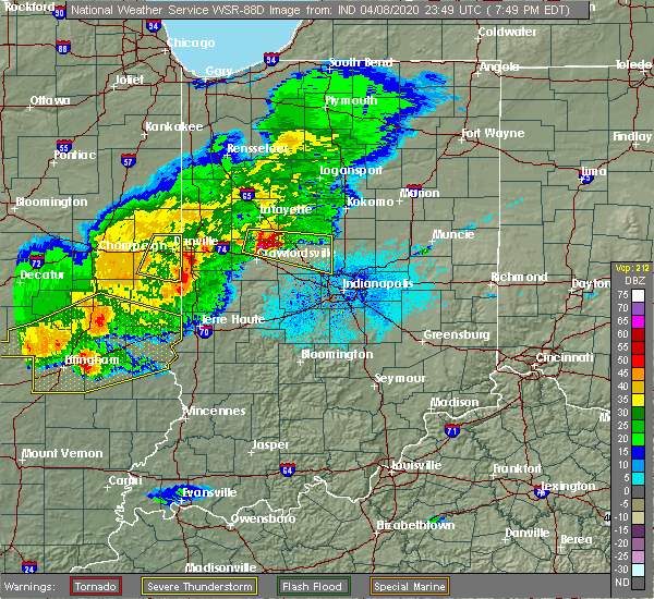 The severe thunderstorm warning for southern vermilion county will expire at 700 pm cdt, the storm which prompted the warning has moved out of the area. therefore, the warning will be allowed to expire. a severe thunderstorm watch remains in effect until 900 pm cdt for east central illinois. The severe thunderstorm warning for southern vermilion county will expire at 700 pm cdt, the storm which prompted the warning has moved out of the area. therefore, the warning will be allowed to expire. a severe thunderstorm watch remains in effect until 900 pm cdt for east central illinois.
|
| 4/8/2020 6:50 PM CDT | Wind gust recorded at county emergency management offic in vermilion county IL, 4.1 miles N of Danville, IL |
| 4/8/2020 6:38 PM CDT |
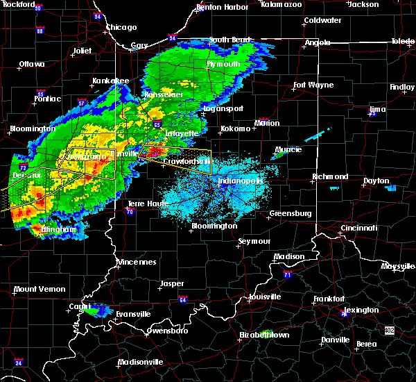 At 637 pm cdt, a severe thunderstorm was located near danville, moving east at 55 mph (radar indicated). Hazards include 60 mph wind gusts and quarter size hail. Hail damage to vehicles is expected. expect wind damage to roofs, siding, and trees. locations impacted include, danville, georgetown, westville, tilton, catlin, oakwood, ridge farm, fairmount, sidell, belgium, bismarck, indianola, jamaica, vermilion county airport and kickapoo state park. This includes interstate 74 between mile markers 204 and 220. At 637 pm cdt, a severe thunderstorm was located near danville, moving east at 55 mph (radar indicated). Hazards include 60 mph wind gusts and quarter size hail. Hail damage to vehicles is expected. expect wind damage to roofs, siding, and trees. locations impacted include, danville, georgetown, westville, tilton, catlin, oakwood, ridge farm, fairmount, sidell, belgium, bismarck, indianola, jamaica, vermilion county airport and kickapoo state park. This includes interstate 74 between mile markers 204 and 220.
|
| 4/8/2020 6:34 PM CDT | Multiple reports of roofs being blown off buildings in danville... on bensyl and emerson and 100 block of north walnu in vermilion county IL, 0.6 miles N of Danville, IL |
| 4/8/2020 6:33 PM CDT | Corrects previous tstm wnd dmg report from danville. county emergency manager reported that law enforcement reported tree down in danville on bowman and may stree in vermilion county IL, 0.6 miles N of Danville, IL |
| 4/8/2020 6:32 PM CDT | Report from mping: 1-inch tree limbs broken; shingles blown of in vermilion county IL, 2.5 miles WNW of Danville, IL |
| 4/8/2020 6:30 PM CDT | Storm damage reported in vermilion county IL, 0.6 miles N of Danville, IL |
| 4/8/2020 6:08 PM CDT |
 At 608 pm cdt, a severe thunderstorm was located near st. joseph, or 9 miles southeast of rantoul, moving east at 55 mph (radar indicated). Hazards include 60 mph wind gusts and quarter size hail. Hail damage to vehicles is expected. Expect wind damage to roofs, siding, and trees. At 608 pm cdt, a severe thunderstorm was located near st. joseph, or 9 miles southeast of rantoul, moving east at 55 mph (radar indicated). Hazards include 60 mph wind gusts and quarter size hail. Hail damage to vehicles is expected. Expect wind damage to roofs, siding, and trees.
|
| 3/28/2020 1:16 PM CDT |
 At 115 pm cdt, a severe thunderstorm was located near camargo, or 9 miles east of tuscola, moving east at 30 mph (radar indicated). Hazards include half dollar size hail. Damage to vehicles is expected. locations impacted include, danville, georgetown, westville, tilton, chrisman, ridge farm, newman, sidell, camargo, belgium, hume, broadlands, brocton, hindsboro, allerton, edgar, indianola, murdock, jamaica and metcalf. This includes interstate 74 between mile markers 218 and 220. At 115 pm cdt, a severe thunderstorm was located near camargo, or 9 miles east of tuscola, moving east at 30 mph (radar indicated). Hazards include half dollar size hail. Damage to vehicles is expected. locations impacted include, danville, georgetown, westville, tilton, chrisman, ridge farm, newman, sidell, camargo, belgium, hume, broadlands, brocton, hindsboro, allerton, edgar, indianola, murdock, jamaica and metcalf. This includes interstate 74 between mile markers 218 and 220.
|
| 3/28/2020 12:59 PM CDT |
 The national weather service in lincoln has issued a * severe thunderstorm warning for. northern edgar county in east central illinois. southern vermilion county in east central illinois. southeastern champaign county in east central illinois. Douglas county in east central illinois. The national weather service in lincoln has issued a * severe thunderstorm warning for. northern edgar county in east central illinois. southern vermilion county in east central illinois. southeastern champaign county in east central illinois. Douglas county in east central illinois.
|
| 9/29/2019 6:48 PM CDT |
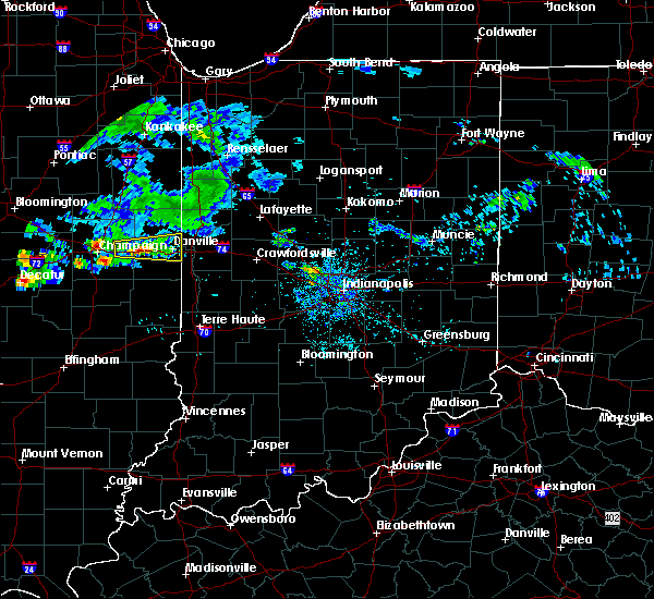 At 647 pm cdt, a severe thunderstorm was located near muncie, or 12 miles west of danville, moving east at 25 mph (radar indicated). Hazards include 60 mph wind gusts and quarter size hail. Hail damage to vehicles is expected. expect wind damage to roofs, siding, and trees. locations impacted include, danville, westville, tilton, catlin, oakwood, fithian, belgium, muncie, bismarck, vermilion county airport and kickapoo state park. This includes interstate 74 between mile markers 199 and 220. At 647 pm cdt, a severe thunderstorm was located near muncie, or 12 miles west of danville, moving east at 25 mph (radar indicated). Hazards include 60 mph wind gusts and quarter size hail. Hail damage to vehicles is expected. expect wind damage to roofs, siding, and trees. locations impacted include, danville, westville, tilton, catlin, oakwood, fithian, belgium, muncie, bismarck, vermilion county airport and kickapoo state park. This includes interstate 74 between mile markers 199 and 220.
|
| 9/29/2019 6:24 PM CDT |
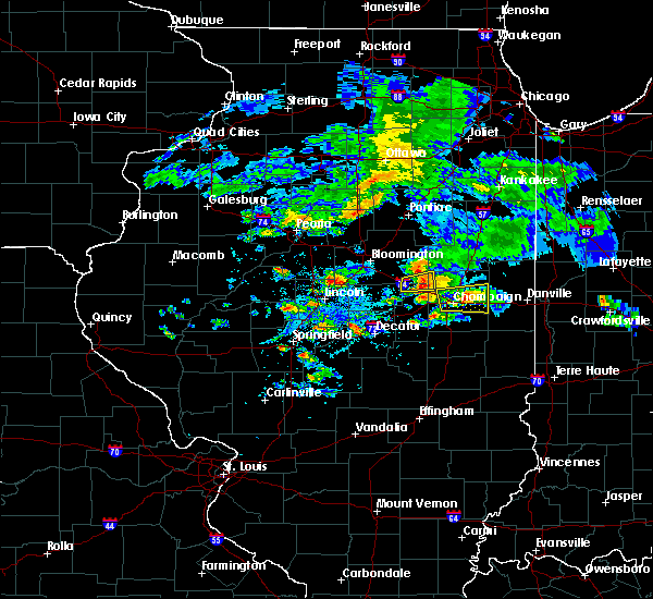 At 624 pm cdt, a severe thunderstorm was located over st. joseph, or 11 miles east of champaign, moving east at 25 mph (radar indicated). Hazards include 60 mph wind gusts and quarter size hail. Hail damage to vehicles is expected. Expect wind damage to roofs, siding, and trees. At 624 pm cdt, a severe thunderstorm was located over st. joseph, or 11 miles east of champaign, moving east at 25 mph (radar indicated). Hazards include 60 mph wind gusts and quarter size hail. Hail damage to vehicles is expected. Expect wind damage to roofs, siding, and trees.
|
| 8/20/2019 12:11 PM CDT |
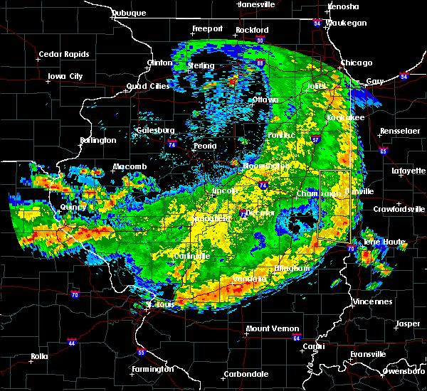 At 1135 am cdt, severe thunderstorms were located along a line extending from near rankin to near fairmount to oakland, moving east at 45 mph (radar indicated). Hazards include 60 mph wind gusts and quarter size hail. Hail damage to vehicles is expected. Expect wind damage to roofs, siding, and trees. At 1135 am cdt, severe thunderstorms were located along a line extending from near rankin to near fairmount to oakland, moving east at 45 mph (radar indicated). Hazards include 60 mph wind gusts and quarter size hail. Hail damage to vehicles is expected. Expect wind damage to roofs, siding, and trees.
|
| 8/20/2019 11:56 AM CDT | Estimated a 50-60 mph wind gust from a thunderstorm in vermilion county IL, 0.6 miles N of Danville, IL |
| 8/20/2019 11:56 AM CDT | Thunderstorm wind gusts blew 3 to 4 inch diameter tree branches down in vermilion county IL, 0.6 miles N of Danville, IL |
| 8/20/2019 11:55 AM CDT | Trees down. from county emergency manager in vermilion county IL, 0.6 miles N of Danville, IL |
| 8/20/2019 11:35 AM CDT |
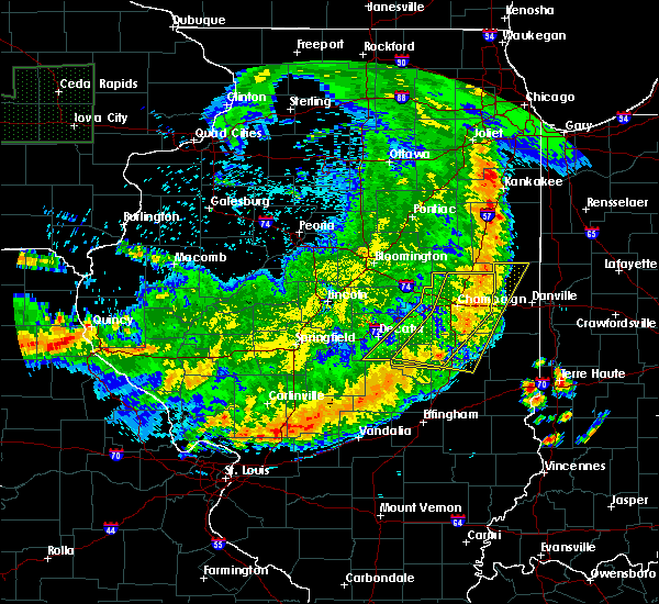 The national weather service in lincoln has issued a * severe thunderstorm warning for. edgar county in east central illinois. vermilion county in east central illinois. until 1215 pm cdt. At 1135 am cdt, severe thunderstorms were located along a line. The national weather service in lincoln has issued a * severe thunderstorm warning for. edgar county in east central illinois. vermilion county in east central illinois. until 1215 pm cdt. At 1135 am cdt, severe thunderstorms were located along a line.
|
| 8/18/2019 4:34 PM CDT |
 At 434 pm cdt, severe thunderstorms were located along a line extending from near danville to near georgetown, moving east at 30 mph (radar indicated). Hazards include 60 mph wind gusts and half dollar size hail. Hail damage to vehicles is expected. expect wind damage to roofs, siding, and trees. locations impacted include, danville, georgetown, westville, tilton, catlin, oakwood, ridge farm, fairmount, sidell, belgium, allerton, muncie, bismarck, indianola, jamaica, vermilion county airport and kickapoo state park. This includes interstate 74 between mile markers 204 and 220. At 434 pm cdt, severe thunderstorms were located along a line extending from near danville to near georgetown, moving east at 30 mph (radar indicated). Hazards include 60 mph wind gusts and half dollar size hail. Hail damage to vehicles is expected. expect wind damage to roofs, siding, and trees. locations impacted include, danville, georgetown, westville, tilton, catlin, oakwood, ridge farm, fairmount, sidell, belgium, allerton, muncie, bismarck, indianola, jamaica, vermilion county airport and kickapoo state park. This includes interstate 74 between mile markers 204 and 220.
|
| 8/18/2019 4:15 PM CDT |
 At 414 pm cdt, severe thunderstorms were located along a line extending from near oakwood to near georgetown, moving east at 30 mph (radar indicated). Hazards include 60 mph wind gusts and half dollar size hail. Hail damage to vehicles is expected. expect wind damage to roofs, siding, and trees. locations impacted include, danville, georgetown, westville, tilton, catlin, oakwood, homer, ridge farm, fairmount, sidell, fithian, belgium, broadlands, allerton, muncie, bismarck, indianola, jamaica, vermilion county airport and kickapoo state park. This includes interstate 74 between mile markers 200 and 220. At 414 pm cdt, severe thunderstorms were located along a line extending from near oakwood to near georgetown, moving east at 30 mph (radar indicated). Hazards include 60 mph wind gusts and half dollar size hail. Hail damage to vehicles is expected. expect wind damage to roofs, siding, and trees. locations impacted include, danville, georgetown, westville, tilton, catlin, oakwood, homer, ridge farm, fairmount, sidell, fithian, belgium, broadlands, allerton, muncie, bismarck, indianola, jamaica, vermilion county airport and kickapoo state park. This includes interstate 74 between mile markers 200 and 220.
|
| 8/18/2019 3:47 PM CDT |
 The national weather service in lincoln has issued a * severe thunderstorm warning for. southern vermilion county in east central illinois. southeastern champaign county in east central illinois. until 445 pm cdt. At 347 pm cdt, severe thunderstorms were located along a line. The national weather service in lincoln has issued a * severe thunderstorm warning for. southern vermilion county in east central illinois. southeastern champaign county in east central illinois. until 445 pm cdt. At 347 pm cdt, severe thunderstorms were located along a line.
|
| 6/30/2019 3:55 PM CDT | Large limbs and power lines downed in 700 block of south stree in vermilion county IL, 0.6 miles N of Danville, IL |
| 6/30/2019 3:35 PM CDT |
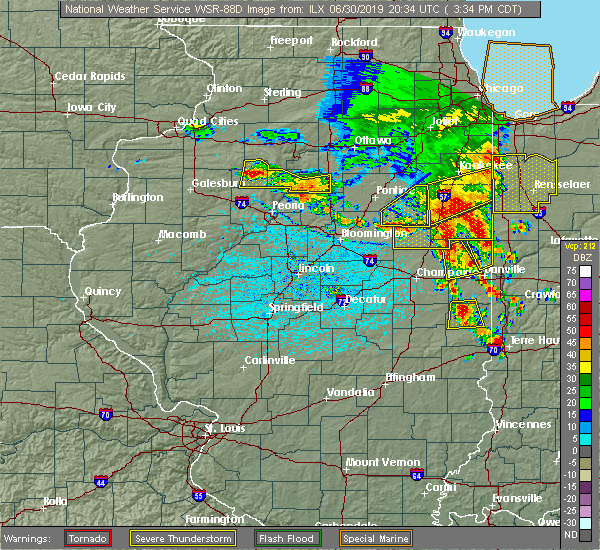 At 335 pm cdt, a severe thunderstorm was located near potomac, or 10 miles northwest of danville, moving southeast at 20 mph (radar indicated). Hazards include ping pong ball size hail and 60 mph wind gusts. People and animals outdoors will be injured. expect hail damage to roofs, siding, windows, and vehicles. expect wind damage to roofs, siding, and trees. locations impacted include, danville, ogden, potomac, rankin, royal, henning, middle fork wildlife area, armstrong, collison and penfield. This includes interstate 74 between mile markers 197 and 200. At 335 pm cdt, a severe thunderstorm was located near potomac, or 10 miles northwest of danville, moving southeast at 20 mph (radar indicated). Hazards include ping pong ball size hail and 60 mph wind gusts. People and animals outdoors will be injured. expect hail damage to roofs, siding, windows, and vehicles. expect wind damage to roofs, siding, and trees. locations impacted include, danville, ogden, potomac, rankin, royal, henning, middle fork wildlife area, armstrong, collison and penfield. This includes interstate 74 between mile markers 197 and 200.
|
| 6/30/2019 3:20 PM CDT |
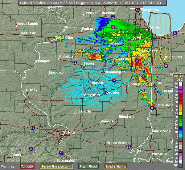 At 320 pm cdt, a severe thunderstorm was located near potomac, or 14 miles southeast of paxton, moving southeast at 10 mph (radar indicated). Hazards include 60 mph wind gusts and quarter size hail. Hail damage to vehicles is expected. expect wind damage to roofs, siding, and trees. locations impacted include, danville, ogden, potomac, rankin, royal, henning, middle fork wildlife area, armstrong, collison and penfield. This includes interstate 74 between mile markers 197 and 200. At 320 pm cdt, a severe thunderstorm was located near potomac, or 14 miles southeast of paxton, moving southeast at 10 mph (radar indicated). Hazards include 60 mph wind gusts and quarter size hail. Hail damage to vehicles is expected. expect wind damage to roofs, siding, and trees. locations impacted include, danville, ogden, potomac, rankin, royal, henning, middle fork wildlife area, armstrong, collison and penfield. This includes interstate 74 between mile markers 197 and 200.
|
| 6/30/2019 2:59 PM CDT |
 At 258 pm cdt, a severe thunderstorm was located near rankin, or 11 miles east of paxton, moving south at 15 mph (radar indicated). Hazards include 60 mph wind gusts and quarter size hail. Hail damage to vehicles is expected. Expect wind damage to roofs, siding, and trees. At 258 pm cdt, a severe thunderstorm was located near rankin, or 11 miles east of paxton, moving south at 15 mph (radar indicated). Hazards include 60 mph wind gusts and quarter size hail. Hail damage to vehicles is expected. Expect wind damage to roofs, siding, and trees.
|
| 6/29/2019 8:13 PM CDT |
 The severe thunderstorm warning for southeastern vermilion county will expire at 815 pm cdt, the storm which prompted the warning has moved out of the area. therefore, the warning will be allowed to expire. however gusty winds are still possible with this thunderstorm. The severe thunderstorm warning for southeastern vermilion county will expire at 815 pm cdt, the storm which prompted the warning has moved out of the area. therefore, the warning will be allowed to expire. however gusty winds are still possible with this thunderstorm.
|
| 6/29/2019 7:55 PM CDT | Tree reported down across shake rag road near 2350n roa in vermilion county IL, 3.5 miles S of Danville, IL |
| 6/29/2019 7:50 PM CDT |
 At 749 pm cdt, a severe thunderstorm was located near belgium, or near danville, moving southeast at 25 mph (emergency management). Hazards include 60 mph wind gusts and quarter size hail. Hail damage to vehicles is expected. expect wind damage to roofs, siding, and trees. locations impacted include, danville, georgetown, westville, tilton, belgium and vermilion county airport. This includes interstate 74 between mile markers 210 and 220. At 749 pm cdt, a severe thunderstorm was located near belgium, or near danville, moving southeast at 25 mph (emergency management). Hazards include 60 mph wind gusts and quarter size hail. Hail damage to vehicles is expected. expect wind damage to roofs, siding, and trees. locations impacted include, danville, georgetown, westville, tilton, belgium and vermilion county airport. This includes interstate 74 between mile markers 210 and 220.
|
| 6/29/2019 7:30 PM CDT |
 At 730 pm cdt, a severe thunderstorm was located 7 miles north of danville, moving southeast at 20 mph (emergency management). Hazards include 60 mph wind gusts and quarter size hail. Hail damage to vehicles is expected. Expect wind damage to roofs, siding, and trees. At 730 pm cdt, a severe thunderstorm was located 7 miles north of danville, moving southeast at 20 mph (emergency management). Hazards include 60 mph wind gusts and quarter size hail. Hail damage to vehicles is expected. Expect wind damage to roofs, siding, and trees.
|
| 6/23/2019 1:45 PM CDT | Power lines down at intersection of perrysville ave and griffin s in vermilion county IL, 2.9 miles NNW of Danville, IL |
| 6/16/2019 12:55 AM CDT |
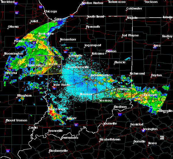 The severe thunderstorm warning for southeastern vermilion county will expire at 100 am cdt, the storm which prompted the warning has weakened below severe limits, and no longer poses an immediate threat to life or property. therefore, the warning will be allowed to expire. a severe thunderstorm watch remains in effect until 200 am cdt for east central illinois. to report severe weather, contact your nearest law enforcement agency. they will relay your report to the national weather service lincoln. The severe thunderstorm warning for southeastern vermilion county will expire at 100 am cdt, the storm which prompted the warning has weakened below severe limits, and no longer poses an immediate threat to life or property. therefore, the warning will be allowed to expire. a severe thunderstorm watch remains in effect until 200 am cdt for east central illinois. to report severe weather, contact your nearest law enforcement agency. they will relay your report to the national weather service lincoln.
|
| 6/16/2019 12:46 AM CDT |
 At 1235 am cdt, a severe thunderstorm was located over danville, moving east at 55 mph (radar indicated). Hazards include 60 mph wind gusts. Expect damage to roofs, siding, and trees. locations impacted include, danville, hoopeston, georgetown, westville, tilton, catlin, oakwood, rossville, ridge farm, fairmount, sidell, belgium, bismarck, indianola, henning, jamaica, vermilion county airport, alvin and kickapoo state park. This includes interstate 74 between mile markers 206 and 219. At 1235 am cdt, a severe thunderstorm was located over danville, moving east at 55 mph (radar indicated). Hazards include 60 mph wind gusts. Expect damage to roofs, siding, and trees. locations impacted include, danville, hoopeston, georgetown, westville, tilton, catlin, oakwood, rossville, ridge farm, fairmount, sidell, belgium, bismarck, indianola, henning, jamaica, vermilion county airport, alvin and kickapoo state park. This includes interstate 74 between mile markers 206 and 219.
|
| 6/16/2019 12:35 AM CDT |
 At 1235 am cdt, a severe thunderstorm was located over danville, moving east at 55 mph (radar indicated). Hazards include 60 mph wind gusts. Expect damage to roofs, siding, and trees. locations impacted include, danville, hoopeston, georgetown, westville, tilton, catlin, oakwood, rossville, ridge farm, fairmount, sidell, belgium, bismarck, indianola, henning, jamaica, vermilion county airport, alvin and kickapoo state park. This includes interstate 74 between mile markers 206 and 219. At 1235 am cdt, a severe thunderstorm was located over danville, moving east at 55 mph (radar indicated). Hazards include 60 mph wind gusts. Expect damage to roofs, siding, and trees. locations impacted include, danville, hoopeston, georgetown, westville, tilton, catlin, oakwood, rossville, ridge farm, fairmount, sidell, belgium, bismarck, indianola, henning, jamaica, vermilion county airport, alvin and kickapoo state park. This includes interstate 74 between mile markers 206 and 219.
|
| 6/16/2019 12:23 AM CDT |
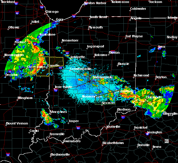 At 1223 am cdt, a severe thunderstorm was located near potomac, or 11 miles northwest of danville, moving east at 50 mph (radar indicated). Hazards include 60 mph wind gusts. Expect damage to roofs, siding, and trees. locations impacted include, danville, hoopeston, georgetown, westville, tilton, catlin, oakwood, rossville, ridge farm, potomac, fairmount, sidell, rankin, fithian, belgium, allerton, muncie, bismarck, indianola and henning. This includes interstate 74 between mile markers 198 and 219. At 1223 am cdt, a severe thunderstorm was located near potomac, or 11 miles northwest of danville, moving east at 50 mph (radar indicated). Hazards include 60 mph wind gusts. Expect damage to roofs, siding, and trees. locations impacted include, danville, hoopeston, georgetown, westville, tilton, catlin, oakwood, rossville, ridge farm, potomac, fairmount, sidell, rankin, fithian, belgium, allerton, muncie, bismarck, indianola and henning. This includes interstate 74 between mile markers 198 and 219.
|
| 6/16/2019 12:06 AM CDT |
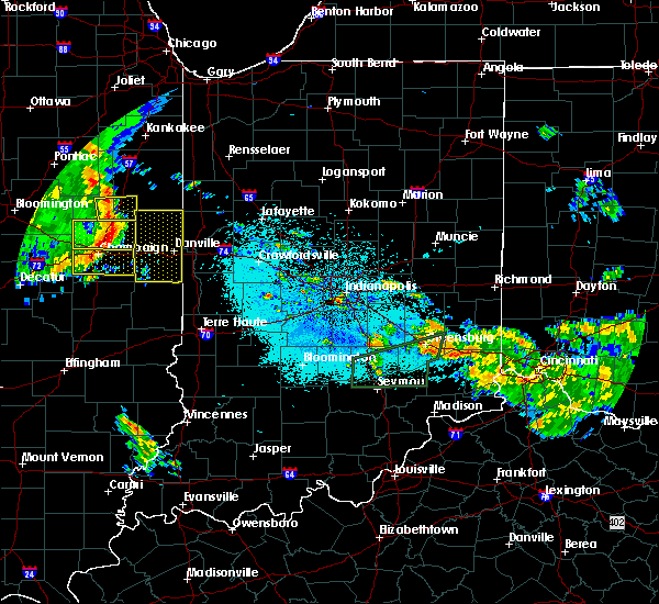 At 1205 am cdt, a severe thunderstorm was located over gifford, or 7 miles east of rantoul, moving east at 55 mph (emergency management). Hazards include 60 mph wind gusts. expect damage to roofs, siding, and trees At 1205 am cdt, a severe thunderstorm was located over gifford, or 7 miles east of rantoul, moving east at 55 mph (emergency management). Hazards include 60 mph wind gusts. expect damage to roofs, siding, and trees
|
| 5/26/2019 2:01 AM CDT |
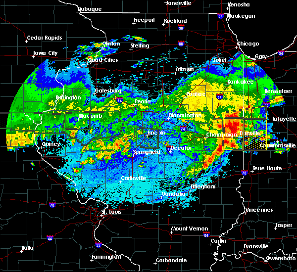 A severe thunderstorm warning remains in effect until 215 am cdt for vermilion county. at 200 am cdt, severe thunderstorms were located along a line extending from near rossville to near oakwood to sidell, moving east at 45 mph. hazard. 60 mph wind gusts and nickel size hail. A severe thunderstorm warning remains in effect until 215 am cdt for vermilion county. at 200 am cdt, severe thunderstorms were located along a line extending from near rossville to near oakwood to sidell, moving east at 45 mph. hazard. 60 mph wind gusts and nickel size hail.
|
| 5/26/2019 2:00 AM CDT | Scattered trees down in danville in vermilion county IL, 0.6 miles N of Danville, IL |
| 5/26/2019 1:48 AM CDT |
 At 148 am cdt, severe thunderstorms were located along a line extending from 6 miles northeast of gifford to near fithian to near broadlands, moving east at 50 mph (radar indicated). Hazards include 60 mph wind gusts. Expect damage to roofs, siding, and trees. locations impacted include, danville, hoopeston, st. joseph, georgetown, westville, tilton, catlin, oakwood, rossville, sidney, homer, gifford, ridge farm, ogden, potomac, fairmount, sidell, rankin, fithian and belgium. This includes interstate 74 between mile marker 189 and the indiana border. At 148 am cdt, severe thunderstorms were located along a line extending from 6 miles northeast of gifford to near fithian to near broadlands, moving east at 50 mph (radar indicated). Hazards include 60 mph wind gusts. Expect damage to roofs, siding, and trees. locations impacted include, danville, hoopeston, st. joseph, georgetown, westville, tilton, catlin, oakwood, rossville, sidney, homer, gifford, ridge farm, ogden, potomac, fairmount, sidell, rankin, fithian and belgium. This includes interstate 74 between mile marker 189 and the indiana border.
|
| 5/26/2019 1:30 AM CDT |
 At 129 am cdt, severe thunderstorms were located along a line extending from near gifford to near pesotum, moving east at 40 mph (radar indicated. at 125 am, a wind gust of 63 mph was reported at willard airport near savoy). Hazards include 60 mph wind gusts. expect damage to roofs, siding, and trees At 129 am cdt, severe thunderstorms were located along a line extending from near gifford to near pesotum, moving east at 40 mph (radar indicated. at 125 am, a wind gust of 63 mph was reported at willard airport near savoy). Hazards include 60 mph wind gusts. expect damage to roofs, siding, and trees
|
| 5/23/2019 2:24 AM CDT |
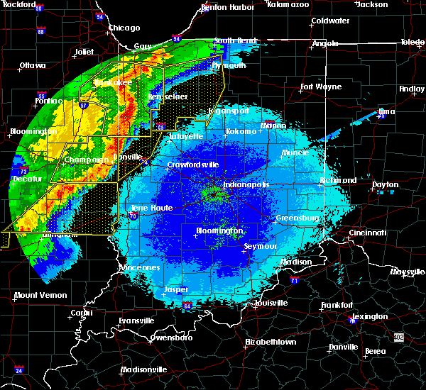 At 223 am cdt, a severe thunderstorm was located over danville, moving east at 45 mph. this is a very dangerous storm (radar indicated). Hazards include 80 mph wind gusts. brief tornados are possible with this storm. Flying debris will be dangerous to those caught without shelter. mobile homes will be heavily damaged. expect considerable damage to roofs, windows, and vehicles. extensive tree damage and power outages are likely. locations impacted include, danville, hoopeston, georgetown, westville, tilton, catlin, oakwood, rossville, ridge farm, potomac, fairmount, sidell, rankin, fithian, belgium, allerton, muncie, bismarck, indianola and henning. This includes interstate 74 between mile markers 198 and 219. At 223 am cdt, a severe thunderstorm was located over danville, moving east at 45 mph. this is a very dangerous storm (radar indicated). Hazards include 80 mph wind gusts. brief tornados are possible with this storm. Flying debris will be dangerous to those caught without shelter. mobile homes will be heavily damaged. expect considerable damage to roofs, windows, and vehicles. extensive tree damage and power outages are likely. locations impacted include, danville, hoopeston, georgetown, westville, tilton, catlin, oakwood, rossville, ridge farm, potomac, fairmount, sidell, rankin, fithian, belgium, allerton, muncie, bismarck, indianola and henning. This includes interstate 74 between mile markers 198 and 219.
|
| 5/23/2019 2:17 AM CDT | Numerous reports of trees... tree limbs and power lines down across the city. at least two houses damaged by downed tree in vermilion county IL, 0.6 miles N of Danville, IL |
| 5/23/2019 1:53 AM CDT |
 At 153 am cdt, a severe thunderstorm was located over st. joseph, or 13 miles east of champaign, moving east at 45 mph. this is a very dangerous storm (radar indicated). Hazards include 80 mph wind gusts. brief tornados are possible with this storm. Flying debris will be dangerous to those caught without shelter. mobile homes will be heavily damaged. expect considerable damage to roofs, windows, and vehicles. Extensive tree damage and power outages are likely. At 153 am cdt, a severe thunderstorm was located over st. joseph, or 13 miles east of champaign, moving east at 45 mph. this is a very dangerous storm (radar indicated). Hazards include 80 mph wind gusts. brief tornados are possible with this storm. Flying debris will be dangerous to those caught without shelter. mobile homes will be heavily damaged. expect considerable damage to roofs, windows, and vehicles. Extensive tree damage and power outages are likely.
|
| 5/16/2019 4:11 PM CDT |
 At 410 pm cdt, a severe thunderstorm capable of producing a tornado was located near georgetown, or 14 miles south of danville, moving southeast at 30 mph (radar indicated rotation). Hazards include tornado and golf ball size hail. Flying debris will be dangerous to those caught without shelter. mobile homes will be damaged or destroyed. damage to roofs, windows, and vehicles will occur. tree damage is likely. this tornadic thunderstorm will remain over mainly rural areas of southeastern vermilion county. This includes interstate 74 between mile markers 218 and 220. At 410 pm cdt, a severe thunderstorm capable of producing a tornado was located near georgetown, or 14 miles south of danville, moving southeast at 30 mph (radar indicated rotation). Hazards include tornado and golf ball size hail. Flying debris will be dangerous to those caught without shelter. mobile homes will be damaged or destroyed. damage to roofs, windows, and vehicles will occur. tree damage is likely. this tornadic thunderstorm will remain over mainly rural areas of southeastern vermilion county. This includes interstate 74 between mile markers 218 and 220.
|
| 5/16/2019 4:05 PM CDT | Ping Pong Ball sized hail reported 1.4 miles S of Danville, IL |
| 5/16/2019 4:00 PM CDT | Golf Ball sized hail reported 0.6 miles N of Danville, IL |
| 5/16/2019 3:58 PM CDT | Quarter sized hail reported 0.6 miles N of Danville, IL |
| 5/16/2019 3:55 PM CDT |
 At 354 pm cdt, a severe thunderstorm capable of producing a tornado was located over westville moving southeast at 35 mph (radar indicated rotation). Hazards include tornado and golf ball size hail. Flying debris will be dangerous to those caught without shelter. mobile homes will be damaged or destroyed. damage to roofs, windows, and vehicles will occur. tree damage is likely. this dangerous storm will be near, georgetown around 405 pm cdt. ridge farm around 410 pm cdt. other locations impacted by this tornadic thunderstorm include kickapoo state park and indianola. This includes interstate 74 between mile markers 209 and 220. At 354 pm cdt, a severe thunderstorm capable of producing a tornado was located over westville moving southeast at 35 mph (radar indicated rotation). Hazards include tornado and golf ball size hail. Flying debris will be dangerous to those caught without shelter. mobile homes will be damaged or destroyed. damage to roofs, windows, and vehicles will occur. tree damage is likely. this dangerous storm will be near, georgetown around 405 pm cdt. ridge farm around 410 pm cdt. other locations impacted by this tornadic thunderstorm include kickapoo state park and indianola. This includes interstate 74 between mile markers 209 and 220.
|
| 5/16/2019 3:50 PM CDT | Golf Ball sized hail reported 0.6 miles N of Danville, IL, west of danville. from county em. |
| 5/16/2019 3:50 PM CDT | Large tree down on garage in the 1700 block... west of danvill in vermilion county IL, 0.6 miles N of Danville, IL |
| 5/16/2019 3:34 PM CDT |
 At 334 pm cdt, a severe thunderstorm capable of producing a tornado was located near oakwood, or 7 miles west of danville, moving southeast at 35 mph (radar indicated rotation). Hazards include tornado and golf ball size hail. Flying debris will be dangerous to those caught without shelter. mobile homes will be damaged or destroyed. damage to roofs, windows, and vehicles will occur. tree damage is likely. this dangerous storm will be near, oakwood around 340 pm cdt. danville, tilton and catlin around 350 pm cdt. westville and belgium around 355 pm cdt. georgetown and ridge farm around 400 pm cdt. other locations impacted by this tornadic thunderstorm include collison and kickapoo state park. This includes interstate 74 between mile markers 205 and 220. At 334 pm cdt, a severe thunderstorm capable of producing a tornado was located near oakwood, or 7 miles west of danville, moving southeast at 35 mph (radar indicated rotation). Hazards include tornado and golf ball size hail. Flying debris will be dangerous to those caught without shelter. mobile homes will be damaged or destroyed. damage to roofs, windows, and vehicles will occur. tree damage is likely. this dangerous storm will be near, oakwood around 340 pm cdt. danville, tilton and catlin around 350 pm cdt. westville and belgium around 355 pm cdt. georgetown and ridge farm around 400 pm cdt. other locations impacted by this tornadic thunderstorm include collison and kickapoo state park. This includes interstate 74 between mile markers 205 and 220.
|
| 5/16/2019 3:31 PM CDT |
 At 330 pm cdt, a severe thunderstorm was located near potomac, or 13 miles northwest of danville, moving southeast at 30 mph (radar indicated). Hazards include 60 mph wind gusts and quarter size hail. Hail damage to vehicles is expected. expect wind damage to roofs, siding, and trees. Locations impacted include, danville, potomac, bismarck, henning, middle fork wildlife area, armstrong, collison, alvin and vermilion county airport. At 330 pm cdt, a severe thunderstorm was located near potomac, or 13 miles northwest of danville, moving southeast at 30 mph (radar indicated). Hazards include 60 mph wind gusts and quarter size hail. Hail damage to vehicles is expected. expect wind damage to roofs, siding, and trees. Locations impacted include, danville, potomac, bismarck, henning, middle fork wildlife area, armstrong, collison, alvin and vermilion county airport.
|
| 5/16/2019 3:00 PM CDT |
 At 300 pm cdt, a severe thunderstorm was located over rankin, or 8 miles east of paxton, moving southeast at 25 mph. this replaces the previous warning for northeastern vermilion county (radar indicated). Hazards include 60 mph wind gusts and quarter size hail. Hail damage to vehicles is expected. Expect wind damage to roofs, siding, and trees. At 300 pm cdt, a severe thunderstorm was located over rankin, or 8 miles east of paxton, moving southeast at 25 mph. this replaces the previous warning for northeastern vermilion county (radar indicated). Hazards include 60 mph wind gusts and quarter size hail. Hail damage to vehicles is expected. Expect wind damage to roofs, siding, and trees.
|
| 5/16/2019 2:42 PM CDT |
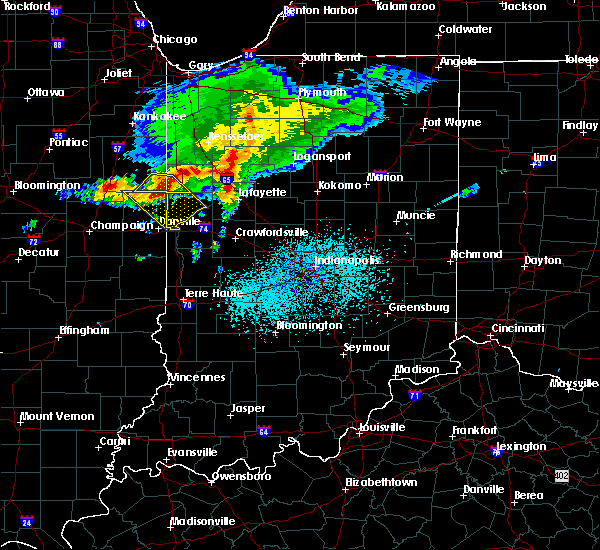 At 241 pm cdt, severe thunderstorms were located along a line extending from near boswell to near rossville, moving southeast at 40 mph (radar indicated). Hazards include 60 mph wind gusts and quarter size hail. Hail damage to vehicles is expected. expect wind damage to roofs, siding, and trees. Locations impacted include, hoopeston, rossville, rankin, bismarck, henning, alvin and vermilion county airport. At 241 pm cdt, severe thunderstorms were located along a line extending from near boswell to near rossville, moving southeast at 40 mph (radar indicated). Hazards include 60 mph wind gusts and quarter size hail. Hail damage to vehicles is expected. expect wind damage to roofs, siding, and trees. Locations impacted include, hoopeston, rossville, rankin, bismarck, henning, alvin and vermilion county airport.
|
| 5/16/2019 2:15 PM CDT |
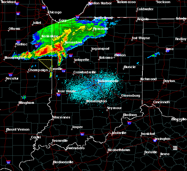 The national weather service in lincoln has issued a * severe thunderstorm warning for. northeastern vermilion county in east central illinois. until 315 pm cdt. At 215 pm cdt, severe thunderstorms were located along a line extending from near freeland park to 6 miles west of buckley,. The national weather service in lincoln has issued a * severe thunderstorm warning for. northeastern vermilion county in east central illinois. until 315 pm cdt. At 215 pm cdt, severe thunderstorms were located along a line extending from near freeland park to 6 miles west of buckley,.
|
| 8/6/2018 11:17 PM CDT |
 At 1117 pm cdt, a severe thunderstorm was located over tilton, or over danville, moving east at 25 mph (radar indicated). Hazards include 60 mph wind gusts and quarter size hail. Hail damage to vehicles is expected. expect wind damage to roofs, siding, and trees. locations impacted include, danville, westville, tilton, catlin, oakwood, fithian, belgium, muncie, collison, vermilion county airport and kickapoo state park. This includes interstate 74 between mile markers 198 and 220. At 1117 pm cdt, a severe thunderstorm was located over tilton, or over danville, moving east at 25 mph (radar indicated). Hazards include 60 mph wind gusts and quarter size hail. Hail damage to vehicles is expected. expect wind damage to roofs, siding, and trees. locations impacted include, danville, westville, tilton, catlin, oakwood, fithian, belgium, muncie, collison, vermilion county airport and kickapoo state park. This includes interstate 74 between mile markers 198 and 220.
|
| 8/6/2018 10:46 PM CDT |
 At 1046 pm cdt, a severe thunderstorm was located near muncie, or 11 miles west of danville, moving east at 20 mph (radar indicated). Hazards include 60 mph wind gusts and quarter size hail. Hail damage to vehicles is expected. Expect wind damage to roofs, siding, and trees. At 1046 pm cdt, a severe thunderstorm was located near muncie, or 11 miles west of danville, moving east at 20 mph (radar indicated). Hazards include 60 mph wind gusts and quarter size hail. Hail damage to vehicles is expected. Expect wind damage to roofs, siding, and trees.
|
| 8/6/2018 10:30 PM CDT |
 At 1030 pm cdt, a severe thunderstorm was located near danville, moving east at 20 mph (radar indicated). Hazards include 60 mph wind gusts and quarter size hail. Hail damage to vehicles is expected. Expect wind damage to roofs, siding, and trees. At 1030 pm cdt, a severe thunderstorm was located near danville, moving east at 20 mph (radar indicated). Hazards include 60 mph wind gusts and quarter size hail. Hail damage to vehicles is expected. Expect wind damage to roofs, siding, and trees.
|
| 8/6/2018 10:18 PM CDT | Quarter sized hail reported 3.9 miles SSE of Danville, IL, estimated 1 inch hail west of lake vermilion near old ottawa and denmark roads. |
| 8/6/2018 10:14 PM CDT |
 At 1014 pm cdt, severe thunderstorms were located along a line extending from near danville to near potomac, moving east at 15 mph (radar indicated). Hazards include 60 mph wind gusts and quarter size hail. Hail damage to vehicles is expected. Expect wind damage to roofs, siding, and trees. At 1014 pm cdt, severe thunderstorms were located along a line extending from near danville to near potomac, moving east at 15 mph (radar indicated). Hazards include 60 mph wind gusts and quarter size hail. Hail damage to vehicles is expected. Expect wind damage to roofs, siding, and trees.
|
| 8/6/2018 8:13 PM CDT |
 At 812 pm cdt, a severe thunderstorm was located near ogden, or 13 miles southeast of rantoul, moving east at 25 mph (radar indicated). Hazards include 60 mph wind gusts and penny size hail. Expect damage to roofs, siding, and trees. locations impacted include, danville, tilton, oakwood, fithian, muncie, bismarck, royal, collison, vermilion county airport and kickapoo state park. This includes interstate 74 between mile markers 199 and 220. At 812 pm cdt, a severe thunderstorm was located near ogden, or 13 miles southeast of rantoul, moving east at 25 mph (radar indicated). Hazards include 60 mph wind gusts and penny size hail. Expect damage to roofs, siding, and trees. locations impacted include, danville, tilton, oakwood, fithian, muncie, bismarck, royal, collison, vermilion county airport and kickapoo state park. This includes interstate 74 between mile markers 199 and 220.
|
| 8/6/2018 7:39 PM CDT |
 At 739 pm cdt, a severe thunderstorm was located over thomasboro, or near rantoul, moving east at 25 mph (radar indicated). Hazards include 60 mph wind gusts and quarter size hail. Hail damage to vehicles is expected. Expect wind damage to roofs, siding, and trees. At 739 pm cdt, a severe thunderstorm was located over thomasboro, or near rantoul, moving east at 25 mph (radar indicated). Hazards include 60 mph wind gusts and quarter size hail. Hail damage to vehicles is expected. Expect wind damage to roofs, siding, and trees.
|
| 8/2/2018 7:44 PM CDT |
 At 743 pm cdt, a severe thunderstorm was located 7 miles north of danville, moving east at 15 mph (radar indicated). Hazards include 60 mph wind gusts and quarter size hail. Hail damage to vehicles is expected. expect wind damage to roofs, siding, and trees. Locations impacted include, danville, bismarck, vermilion county airport and alvin. At 743 pm cdt, a severe thunderstorm was located 7 miles north of danville, moving east at 15 mph (radar indicated). Hazards include 60 mph wind gusts and quarter size hail. Hail damage to vehicles is expected. expect wind damage to roofs, siding, and trees. Locations impacted include, danville, bismarck, vermilion county airport and alvin.
|
| 8/2/2018 7:28 PM CDT |
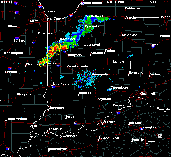 At 727 pm cdt, a severe thunderstorm was located near potomac, or 8 miles northwest of danville, moving northeast at 15 mph (radar indicated). Hazards include 60 mph wind gusts and quarter size hail. Hail damage to vehicles is expected. Expect wind damage to roofs, siding, and trees. At 727 pm cdt, a severe thunderstorm was located near potomac, or 8 miles northwest of danville, moving northeast at 15 mph (radar indicated). Hazards include 60 mph wind gusts and quarter size hail. Hail damage to vehicles is expected. Expect wind damage to roofs, siding, and trees.
|
| 6/10/2018 3:00 PM CDT | Numerous reports of trees and power poles downed from southwest of danville to georgetow in vermilion county IL, 2.6 miles NE of Danville, IL |
| 6/10/2018 2:41 PM CDT |
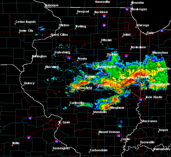 At 240 pm cdt, a severe thunderstorm was located near danville, moving east at 55 mph (radar indicated). Hazards include 60 mph wind gusts and nickel size hail. Expect damage to roofs, siding, and trees. locations impacted include, danville, st. joseph, westville, tilton, catlin, oakwood, philo, rossville, sidney, homer, ogden, potomac, fairmount, fithian, belgium, broadlands, allerton, muncie, bismarck and henning. This includes interstate 74 between mile markers 192 and 220. At 240 pm cdt, a severe thunderstorm was located near danville, moving east at 55 mph (radar indicated). Hazards include 60 mph wind gusts and nickel size hail. Expect damage to roofs, siding, and trees. locations impacted include, danville, st. joseph, westville, tilton, catlin, oakwood, philo, rossville, sidney, homer, ogden, potomac, fairmount, fithian, belgium, broadlands, allerton, muncie, bismarck and henning. This includes interstate 74 between mile markers 192 and 220.
|
| 6/10/2018 2:15 PM CDT |
 At 215 pm cdt, a severe thunderstorm was located near thomasboro, or near rantoul, moving southeast at 45 mph (radar indicated). Hazards include 60 mph wind gusts and nickel size hail. expect damage to roofs, siding, and trees At 215 pm cdt, a severe thunderstorm was located near thomasboro, or near rantoul, moving southeast at 45 mph (radar indicated). Hazards include 60 mph wind gusts and nickel size hail. expect damage to roofs, siding, and trees
|
| 6/10/2018 1:47 PM CDT | Report of a tree down on power lines on north kimball stree in vermilion county IL, 0.6 miles N of Danville, IL |
| 6/10/2018 1:47 PM CDT | Report of a tree down on power lines on north kimball stree in vermilion county IL, 0.6 miles N of Danville, IL |
| 6/10/2018 8:10 AM CDT | Report of tree limbs and wires down. time estimated by rada in vermilion county IL, 3.2 miles E of Danville, IL |
| 5/31/2018 6:25 PM CDT |
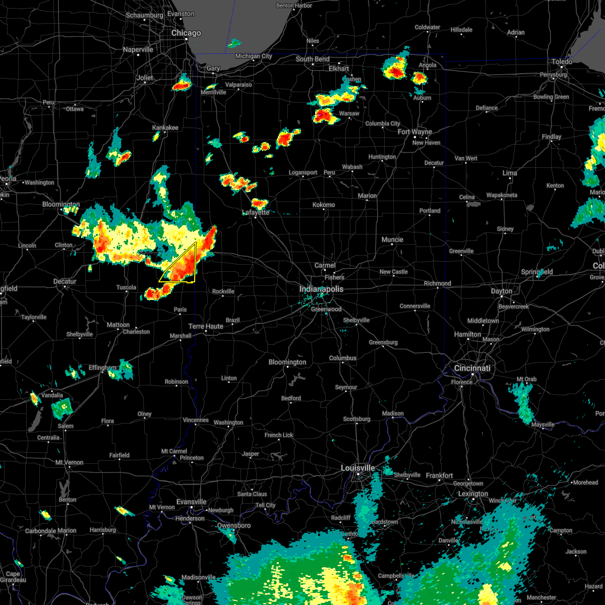 At 625 pm cdt, severe thunderstorms were located along a line extending from 6 miles southwest of covington indiana, to near sidell illinois, moving east at 45 mph (emergency management). Hazards include 60 mph wind gusts. Expect damage to roofs, siding, and trees. locations impacted include, danville, georgetown, westville, tilton, catlin, ridge farm, sidell, belgium, indianola and jamaica. This includes interstate 74 between mile markers 213 and 220. At 625 pm cdt, severe thunderstorms were located along a line extending from 6 miles southwest of covington indiana, to near sidell illinois, moving east at 45 mph (emergency management). Hazards include 60 mph wind gusts. Expect damage to roofs, siding, and trees. locations impacted include, danville, georgetown, westville, tilton, catlin, ridge farm, sidell, belgium, indianola and jamaica. This includes interstate 74 between mile markers 213 and 220.
|
| 5/31/2018 6:10 PM CDT | 4 trees down. from county emergency manage in vermilion county IL, 4.3 miles NW of Danville, IL |
| 5/31/2018 6:07 PM CDT | Large tree down across road near main street and michigan ave... on danville east side. from county emergency manage in vermilion county IL, 0.6 miles N of Danville, IL |
| 5/31/2018 6:06 PM CDT |
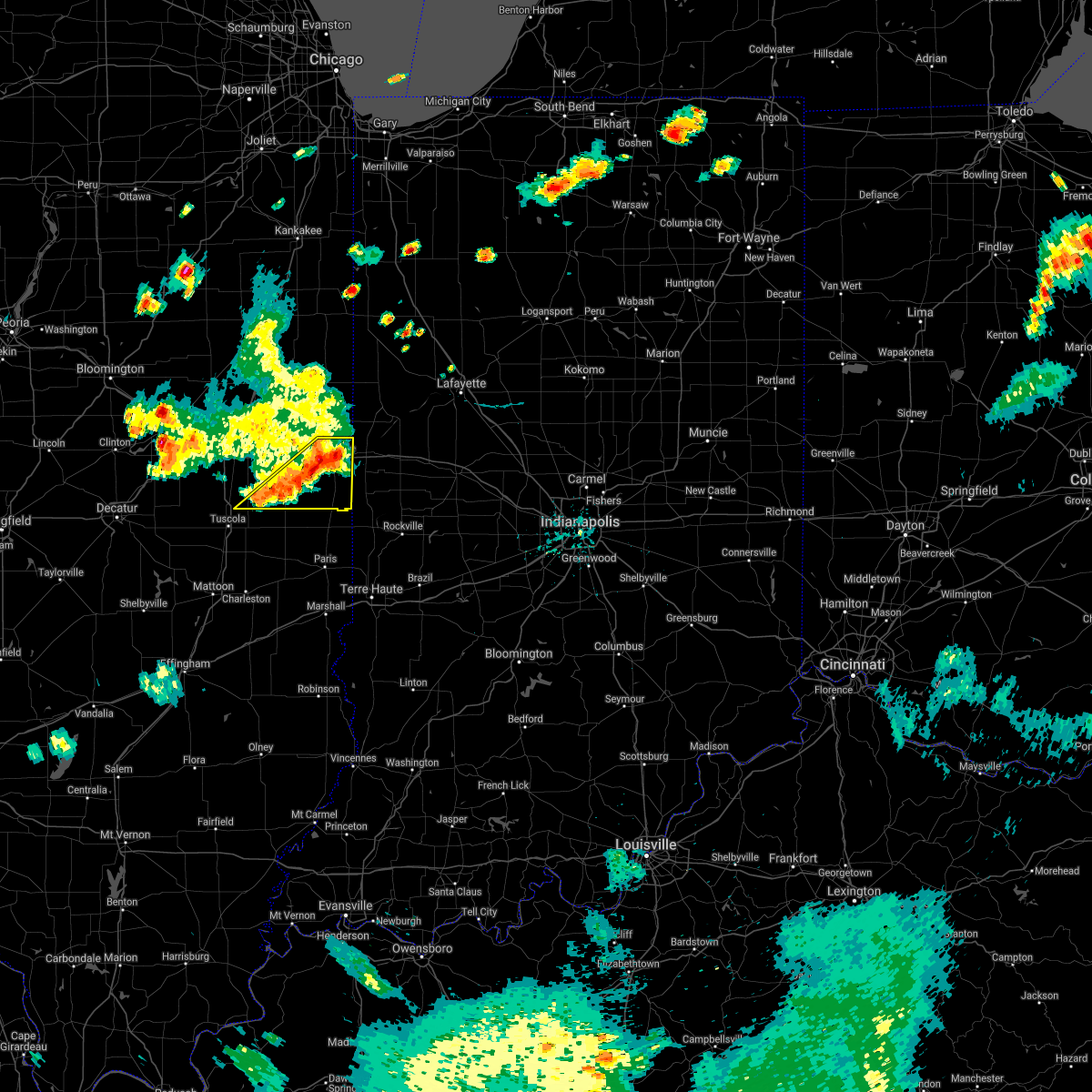 At 605 pm cdt, severe thunderstorms were located along a line extending from near danville to near villa grove, moving east at 40 mph (emergency management. at 6 pm, power lines and power poles were blown down south of saint joseph). Hazards include 60 mph wind gusts. expect damage to roofs, siding, and trees At 605 pm cdt, severe thunderstorms were located along a line extending from near danville to near villa grove, moving east at 40 mph (emergency management. at 6 pm, power lines and power poles were blown down south of saint joseph). Hazards include 60 mph wind gusts. expect damage to roofs, siding, and trees
|
| 11/5/2017 1:28 PM CDT |
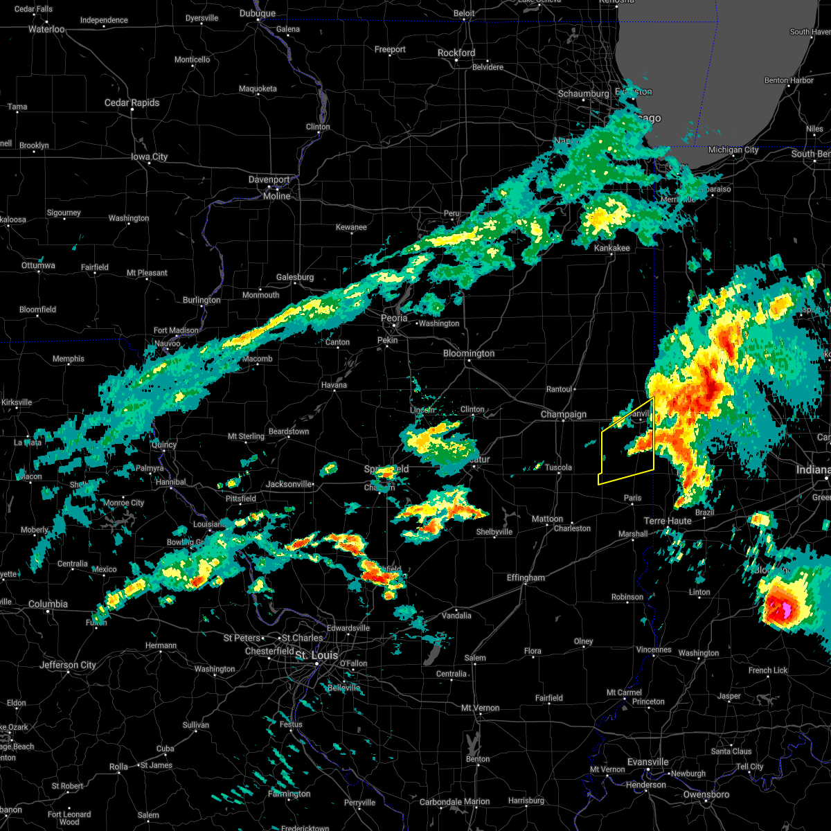 The severe thunderstorm warning for northern edgar and southern vermilion counties will expire at 1230 pm cst, the severe thunderstorm which prompted the warning has moved out of the warned area. therefore, the warning will be allowed to expire. The severe thunderstorm warning for northern edgar and southern vermilion counties will expire at 1230 pm cst, the severe thunderstorm which prompted the warning has moved out of the warned area. therefore, the warning will be allowed to expire.
|
| 11/5/2017 1:02 PM CDT |
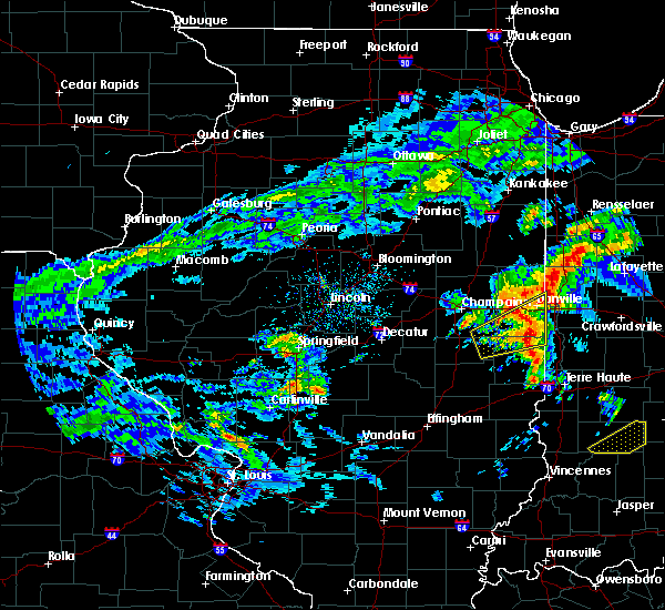 At 1201 pm cst, a severe thunderstorm was located near georgetown, or 12 miles south of danville, moving east at 55 mph (radar indicated). Hazards include 60 mph wind gusts and quarter size hail. Hail damage to vehicles is expected. expect wind damage to roofs, siding, and trees. locations impacted include, danville, georgetown, westville, tilton, catlin, oakwood, chrisman, ridge farm, fairmount, sidell, belgium, hume, allerton, indianola, jamaica, metcalf, vermilion county airport, palermo, kickapoo state park and scottland. This includes interstate 74 between mile markers 206 and 220. At 1201 pm cst, a severe thunderstorm was located near georgetown, or 12 miles south of danville, moving east at 55 mph (radar indicated). Hazards include 60 mph wind gusts and quarter size hail. Hail damage to vehicles is expected. expect wind damage to roofs, siding, and trees. locations impacted include, danville, georgetown, westville, tilton, catlin, oakwood, chrisman, ridge farm, fairmount, sidell, belgium, hume, allerton, indianola, jamaica, metcalf, vermilion county airport, palermo, kickapoo state park and scottland. This includes interstate 74 between mile markers 206 and 220.
|
| 11/5/2017 12:42 PM CDT |
 At 1142 am cst, a severe thunderstorm was located over broadlands, or 14 miles east of tuscola, moving east at 55 mph (radar indicated). Hazards include 60 mph wind gusts and quarter size hail. Hail damage to vehicles is expected. Expect wind damage to roofs, siding, and trees. At 1142 am cst, a severe thunderstorm was located over broadlands, or 14 miles east of tuscola, moving east at 55 mph (radar indicated). Hazards include 60 mph wind gusts and quarter size hail. Hail damage to vehicles is expected. Expect wind damage to roofs, siding, and trees.
|
| 7/22/2017 1:03 AM CDT |
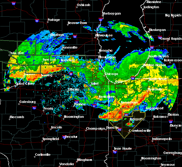 At 102 am cdt, a severe thunderstorm was located over hoopeston, or 9 miles southeast of claytonville, moving southeast at 45 mph (radar indicated). Hazards include 60 mph wind gusts. expect damage to roofs, siding, and trees At 102 am cdt, a severe thunderstorm was located over hoopeston, or 9 miles southeast of claytonville, moving southeast at 45 mph (radar indicated). Hazards include 60 mph wind gusts. expect damage to roofs, siding, and trees
|
| 7/11/2017 10:30 AM CDT | Trees snapped or uprooted...trees down in 1300 block of logan ave blocking roa in vermilion county IL, 0.6 miles N of Danville, IL |
| 7/11/2017 10:06 AM CDT |
 At 1005 am cdt, a severe thunderstorm was located over philo, or 7 miles southeast of champaign, moving east at 60 mph (radar indicated. at 957 am, a wind gust 61 mph was reported at the willard airport in savoy). Hazards include 60 mph wind gusts. expect damage to roofs, siding, and trees At 1005 am cdt, a severe thunderstorm was located over philo, or 7 miles southeast of champaign, moving east at 60 mph (radar indicated. at 957 am, a wind gust 61 mph was reported at the willard airport in savoy). Hazards include 60 mph wind gusts. expect damage to roofs, siding, and trees
|
| 6/17/2017 10:34 PM CDT |
 At 1033 pm cdt, severe thunderstorms were located along a line from hoopeston to collison, moving east at 45 mph (radar indicated). Hazards include 60 mph wind gusts. Expect damage to roofs, siding, and trees. locations impacted include, danville, hoopeston, tilton, oakwood, rossville, potomac, rankin, bismarck, henning, collison, vermilion county airport, middle fork wildlife area, armstrong, alvin and kickapoo state park. This includes interstate 74 between mile markers 207 and 220. At 1033 pm cdt, severe thunderstorms were located along a line from hoopeston to collison, moving east at 45 mph (radar indicated). Hazards include 60 mph wind gusts. Expect damage to roofs, siding, and trees. locations impacted include, danville, hoopeston, tilton, oakwood, rossville, potomac, rankin, bismarck, henning, collison, vermilion county airport, middle fork wildlife area, armstrong, alvin and kickapoo state park. This includes interstate 74 between mile markers 207 and 220.
|
| 6/17/2017 10:09 PM CDT |
 At 1008 pm cdt, a severe thunderstorm was located near paxton, moving east-southeast at 50 mph (radar indicated). Hazards include 60 mph wind gusts. expect damage to roofs, siding, and trees At 1008 pm cdt, a severe thunderstorm was located near paxton, moving east-southeast at 50 mph (radar indicated). Hazards include 60 mph wind gusts. expect damage to roofs, siding, and trees
|
| 4/29/2017 7:46 PM CDT |
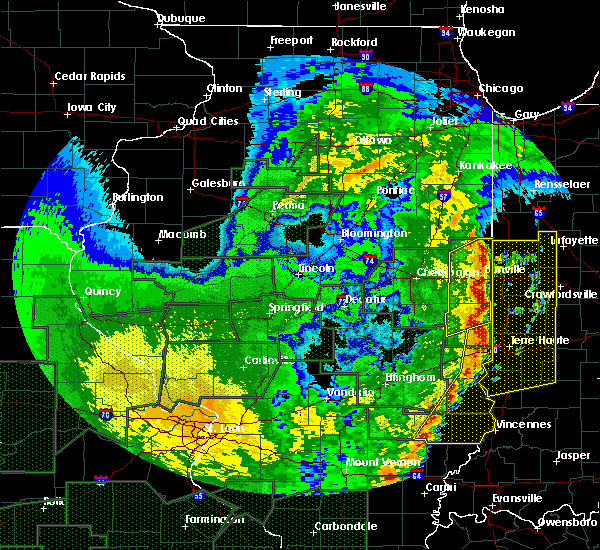 At 745 pm cdt, severe thunderstorms were located along a line extending from near rossville to near danville to near chrisman, moving northeast at 45 mph (trained weather spotters). Hazards include 60 mph wind gusts and quarter size hail. Hail damage to vehicles is expected. Expect wind damage to roofs, siding, and trees. At 745 pm cdt, severe thunderstorms were located along a line extending from near rossville to near danville to near chrisman, moving northeast at 45 mph (trained weather spotters). Hazards include 60 mph wind gusts and quarter size hail. Hail damage to vehicles is expected. Expect wind damage to roofs, siding, and trees.
|
| 4/29/2017 7:34 PM CDT |
 At 733 pm cdt, severe thunderstorms were located along a line extending from near potomac to oakwood to near redmon, moving northeast at 35 mph (trained weather spotters). Hazards include 60 mph wind gusts and quarter size hail. Hail damage to vehicles is expected. expect wind damage to roofs, siding, and trees. locations impacted include, danville, hoopeston, georgetown, westville, tilton, catlin, oakwood, chrisman, rossville, ridge farm, potomac, fairmount, sidell, fithian, belgium, hume, brocton, allerton, redmon and muncie. This includes interstate 74 between mile markers 199 and 220. At 733 pm cdt, severe thunderstorms were located along a line extending from near potomac to oakwood to near redmon, moving northeast at 35 mph (trained weather spotters). Hazards include 60 mph wind gusts and quarter size hail. Hail damage to vehicles is expected. expect wind damage to roofs, siding, and trees. locations impacted include, danville, hoopeston, georgetown, westville, tilton, catlin, oakwood, chrisman, rossville, ridge farm, potomac, fairmount, sidell, fithian, belgium, hume, brocton, allerton, redmon and muncie. This includes interstate 74 between mile markers 199 and 220.
|
| 4/29/2017 6:56 PM CDT |
 At 656 pm cdt, severe thunderstorms were located along a line extending from near thomasboro to near sidney to near mattoon, moving northeast at 45 mph (trained weather spotters). Hazards include 60 mph wind gusts and quarter size hail. Hail damage to vehicles is expected. Expect wind damage to roofs, siding, and trees. At 656 pm cdt, severe thunderstorms were located along a line extending from near thomasboro to near sidney to near mattoon, moving northeast at 45 mph (trained weather spotters). Hazards include 60 mph wind gusts and quarter size hail. Hail damage to vehicles is expected. Expect wind damage to roofs, siding, and trees.
|
| 4/10/2017 11:57 AM CDT |
 At 1156 am cdt, a severe thunderstorm was located near chrisman, or 16 miles north of paris, moving northeast at 55 mph (radar indicated). Hazards include quarter size hail. Damage to vehicles is expected. this severe thunderstorm will be near, georgetown and ridge farm around 1205 pm cdt. Other locations impacted by this severe thunderstorm include scottland and indianola. At 1156 am cdt, a severe thunderstorm was located near chrisman, or 16 miles north of paris, moving northeast at 55 mph (radar indicated). Hazards include quarter size hail. Damage to vehicles is expected. this severe thunderstorm will be near, georgetown and ridge farm around 1205 pm cdt. Other locations impacted by this severe thunderstorm include scottland and indianola.
|
| 4/10/2017 7:50 AM CDT | Quarter sized hail reported 6.8 miles SSE of Danville, IL, time estimated by radar. |
| 4/10/2017 7:40 AM CDT |
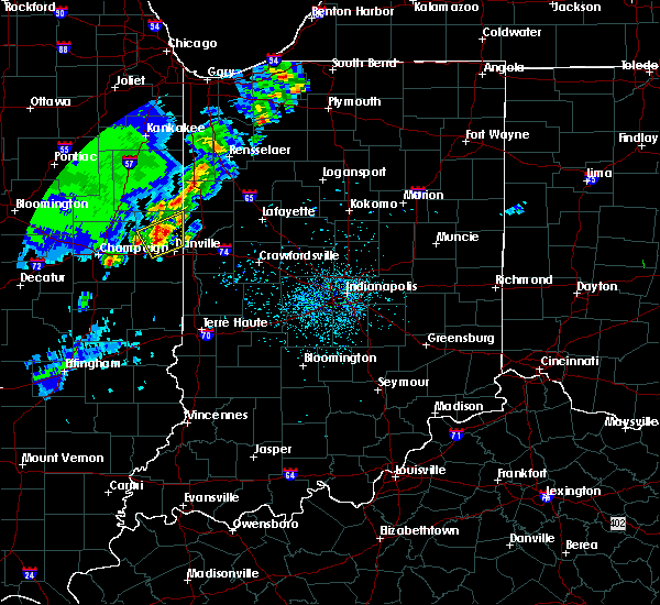 At 740 am cdt, a severe thunderstorm was located near potomac, or 9 miles northwest of danville, moving northeast at 60 mph (radar indicated). Hazards include quarter size hail. damage to vehicles is expected At 740 am cdt, a severe thunderstorm was located near potomac, or 9 miles northwest of danville, moving northeast at 60 mph (radar indicated). Hazards include quarter size hail. damage to vehicles is expected
|
| 3/30/2017 4:30 PM CDT |
 At 429 pm cdt, severe thunderstorms were located along a line extending from near potomac to near danville, moving northeast at 30 mph (radar indicated). Hazards include 60 mph wind gusts. expect damage to roofs, siding, and trees At 429 pm cdt, severe thunderstorms were located along a line extending from near potomac to near danville, moving northeast at 30 mph (radar indicated). Hazards include 60 mph wind gusts. expect damage to roofs, siding, and trees
|
| 3/30/2017 4:20 PM CDT | 2 power poles downed... one snapped at bas in vermilion county IL, 0.6 miles N of Danville, IL |
| 3/30/2017 4:10 PM CDT |
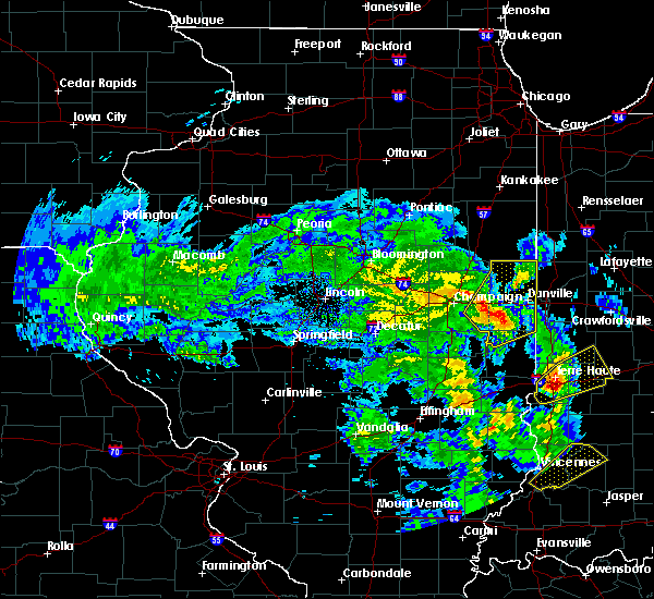 At 409 pm cdt, a severe thunderstorm was located over fairmount, or 11 miles southwest of danville, moving northeast at 40 mph (radar indicated). Hazards include 60 mph wind gusts. Expect damage to roofs, siding, and trees. locations impacted include, danville, hoopeston, st. joseph, georgetown, westville, tilton, catlin, oakwood, rossville, homer, ridge farm, ogden, potomac, fairmount, sidell, rankin, fithian, belgium, broadlands and allerton. This includes interstate 74 between mile markers 193 and 219. At 409 pm cdt, a severe thunderstorm was located over fairmount, or 11 miles southwest of danville, moving northeast at 40 mph (radar indicated). Hazards include 60 mph wind gusts. Expect damage to roofs, siding, and trees. locations impacted include, danville, hoopeston, st. joseph, georgetown, westville, tilton, catlin, oakwood, rossville, homer, ridge farm, ogden, potomac, fairmount, sidell, rankin, fithian, belgium, broadlands and allerton. This includes interstate 74 between mile markers 193 and 219.
|
| 3/30/2017 3:52 PM CDT |
 At 352 pm cdt, a severe thunderstorm was located over allerton, or 19 miles northeast of tuscola, moving northeast at 40 mph (radar indicated). Hazards include 60 mph wind gusts. expect damage to roofs, siding, and trees At 352 pm cdt, a severe thunderstorm was located over allerton, or 19 miles northeast of tuscola, moving northeast at 40 mph (radar indicated). Hazards include 60 mph wind gusts. expect damage to roofs, siding, and trees
|
| 3/30/2017 3:30 PM CDT | Numerous small trees and limbs downed... as well as railroad crossing gates blown off/broken. time estimated by rada in vermilion county IL, 0.1 miles S of Danville, IL |
| 3/20/2017 6:20 AM CDT |
 At 619 am cdt, a severe thunderstorm was located over oakwood, or 9 miles west of danville, moving east at 25 mph (radar indicated). Hazards include quarter size hail. Damage to vehicles is expected. locations impacted include, danville, tilton, catlin, oakwood, fairmount, sidell, fithian, muncie, indianola, jamaica, collison and kickapoo state park. This includes interstate 74 between mile markers 202 and 214. At 619 am cdt, a severe thunderstorm was located over oakwood, or 9 miles west of danville, moving east at 25 mph (radar indicated). Hazards include quarter size hail. Damage to vehicles is expected. locations impacted include, danville, tilton, catlin, oakwood, fairmount, sidell, fithian, muncie, indianola, jamaica, collison and kickapoo state park. This includes interstate 74 between mile markers 202 and 214.
|
| 3/20/2017 5:47 AM CDT |
 At 546 am cdt, a severe thunderstorm was located near st. joseph, or 9 miles southeast of rantoul, moving east at 25 mph (radar indicated). Hazards include half dollar size hail. damage to vehicles is expected At 546 am cdt, a severe thunderstorm was located near st. joseph, or 9 miles southeast of rantoul, moving east at 25 mph (radar indicated). Hazards include half dollar size hail. damage to vehicles is expected
|
| 3/7/2017 2:17 AM CST |
 At 216 am cst, severe thunderstorms were located along a line extending from near talbot to broadlands, moving east at 65 mph (radar indicated). Hazards include 60 mph wind gusts and quarter size hail. Hail damage to vehicles is expected. Expect wind damage to roofs, siding, and trees. At 216 am cst, severe thunderstorms were located along a line extending from near talbot to broadlands, moving east at 65 mph (radar indicated). Hazards include 60 mph wind gusts and quarter size hail. Hail damage to vehicles is expected. Expect wind damage to roofs, siding, and trees.
|
| 3/1/2017 12:45 AM CST | Em reports multiple power lines and large tree limbs downed throughout the cit in vermilion county IL, 0.6 miles N of Danville, IL |
| 11/18/2016 3:15 PM CST | Powerlines down in the city of danvill in vermilion county IL, 0.6 miles N of Danville, IL |
| 9/9/2016 7:42 PM CDT |
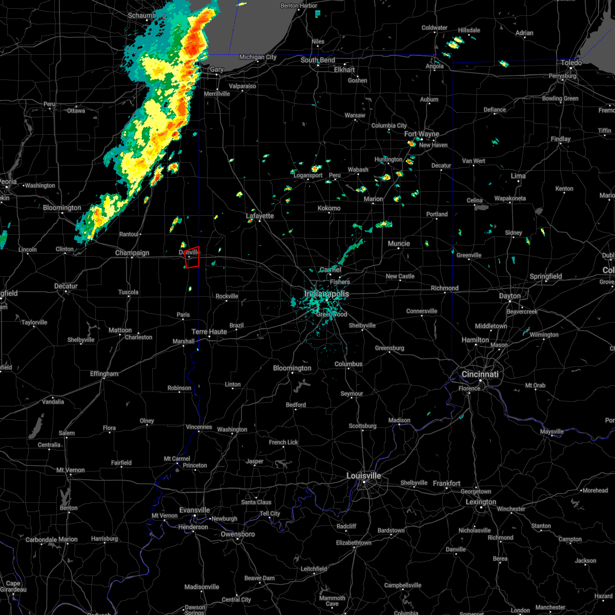 The tornado warning for east central vermilion county will expire at 745 pm cdt. the storm which prompted the warning has moved out of the area. therefore. the warning will be allowed to expire. A tornado watch remains in effect until 100 am cdt for east central illinois. The tornado warning for east central vermilion county will expire at 745 pm cdt. the storm which prompted the warning has moved out of the area. therefore. the warning will be allowed to expire. A tornado watch remains in effect until 100 am cdt for east central illinois.
|
| 9/9/2016 7:26 PM CDT |
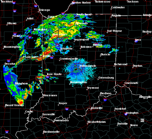 At 726 pm cdt, a confirmed tornado was located over tilton, or near danville, moving east at 30 mph (weather spotters confirmed tornado). Hazards include damaging tornado. Flying debris will be dangerous to those caught without shelter. mobile homes will be damaged or destroyed. damage to roofs, windows, and vehicles will occur. tree damage is likely. this tornadic thunderstorm will remain over mainly rural areas of east central vermilion county. This includes interstate 74 between mile markers 213 and 220. At 726 pm cdt, a confirmed tornado was located over tilton, or near danville, moving east at 30 mph (weather spotters confirmed tornado). Hazards include damaging tornado. Flying debris will be dangerous to those caught without shelter. mobile homes will be damaged or destroyed. damage to roofs, windows, and vehicles will occur. tree damage is likely. this tornadic thunderstorm will remain over mainly rural areas of east central vermilion county. This includes interstate 74 between mile markers 213 and 220.
|
| 9/9/2016 7:15 PM CDT |
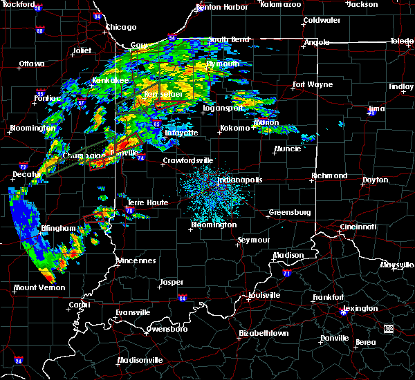 At 714 pm cdt, a confirmed tornado was located over catlin, or 7 miles southwest of danville, moving east at 30 mph (weather spotters confirmed tornado). Hazards include damaging tornado. Flying debris will be dangerous to those caught without shelter. mobile homes will be damaged or destroyed. damage to roofs, windows, and vehicles will occur. tree damage is likely. the tornado will be near, danville, westville, tilton and belgium around 725 pm cdt. other locations impacted by this tornadic thunderstorm include kickapoo state park. This includes interstate 74 between mile markers 207 and 220. At 714 pm cdt, a confirmed tornado was located over catlin, or 7 miles southwest of danville, moving east at 30 mph (weather spotters confirmed tornado). Hazards include damaging tornado. Flying debris will be dangerous to those caught without shelter. mobile homes will be damaged or destroyed. damage to roofs, windows, and vehicles will occur. tree damage is likely. the tornado will be near, danville, westville, tilton and belgium around 725 pm cdt. other locations impacted by this tornadic thunderstorm include kickapoo state park. This includes interstate 74 between mile markers 207 and 220.
|
| 9/9/2016 7:10 PM CDT | Houses damaged... trees and power lines down on fletcher in danvill in vermilion county IL, 0.5 miles E of Danville, IL |
| 9/9/2016 6:53 PM CDT |
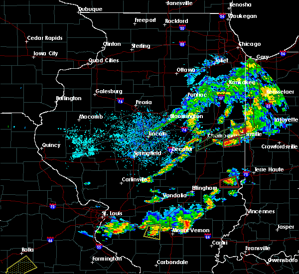 At 652 pm cdt, a confirmed tornado was located near homer, or 16 miles southwest of danville, moving east at 30 mph (weather spotters confirmed tornado). Hazards include damaging tornado. Flying debris will be dangerous to those caught without shelter. mobile homes will be damaged or destroyed. damage to roofs, windows, and vehicles will occur. tree damage is likely. this tornado will be near, fairmount around 700 pm cdt. muncie around 705 pm cdt. oakwood around 710 pm cdt. danville, westville, tilton, catlin and belgium around 715 pm cdt. other locations impacted by this tornadic thunderstorm include kickapoo state park and jamaica. This includes interstate 74 between mile markers 205 and 213. At 652 pm cdt, a confirmed tornado was located near homer, or 16 miles southwest of danville, moving east at 30 mph (weather spotters confirmed tornado). Hazards include damaging tornado. Flying debris will be dangerous to those caught without shelter. mobile homes will be damaged or destroyed. damage to roofs, windows, and vehicles will occur. tree damage is likely. this tornado will be near, fairmount around 700 pm cdt. muncie around 705 pm cdt. oakwood around 710 pm cdt. danville, westville, tilton, catlin and belgium around 715 pm cdt. other locations impacted by this tornadic thunderstorm include kickapoo state park and jamaica. This includes interstate 74 between mile markers 205 and 213.
|
| 9/9/2016 6:44 PM CDT |
 At 643 pm cdt, a confirmed tornado was located over homer, or 16 miles southeast of champaign, moving east at 30 mph (weather spotters confirmed tornado). Hazards include damaging tornado. Flying debris will be dangerous to those caught without shelter. mobile homes will be damaged or destroyed. damage to roofs, windows, and vehicles will occur. tree damage is likely. the tornado will be near, fairmount around 700 pm cdt. muncie around 705 pm cdt. oakwood around 710 pm cdt. danville, westville, tilton, catlin and belgium around 715 pm cdt. other locations impacted by this tornadic thunderstorm include kickapoo state park and jamaica. This includes interstate 74 between mile markers 205 and 213. At 643 pm cdt, a confirmed tornado was located over homer, or 16 miles southeast of champaign, moving east at 30 mph (weather spotters confirmed tornado). Hazards include damaging tornado. Flying debris will be dangerous to those caught without shelter. mobile homes will be damaged or destroyed. damage to roofs, windows, and vehicles will occur. tree damage is likely. the tornado will be near, fairmount around 700 pm cdt. muncie around 705 pm cdt. oakwood around 710 pm cdt. danville, westville, tilton, catlin and belgium around 715 pm cdt. other locations impacted by this tornadic thunderstorm include kickapoo state park and jamaica. This includes interstate 74 between mile markers 205 and 213.
|
| 9/9/2016 6:25 PM CDT |
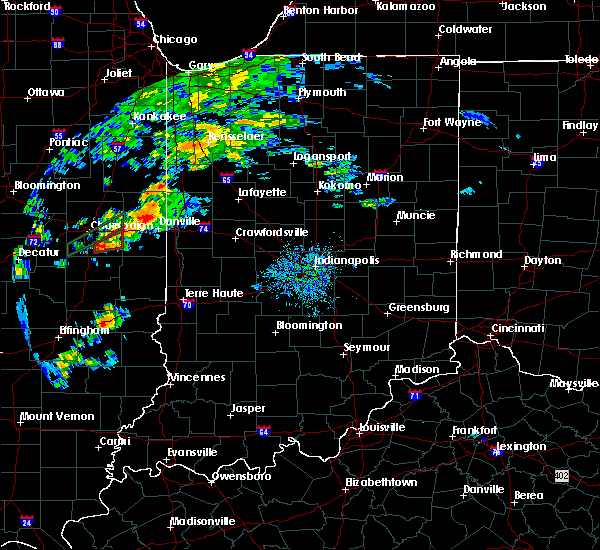 At 624 pm cdt, a severe thunderstorm capable of producing a tornado was located near oakwood, or 8 miles northwest of danville, moving east at 20 mph (radar indicated rotation). Hazards include tornado. Flying debris will be dangerous to those caught without shelter. mobile homes will be damaged or destroyed. damage to roofs, windows, and vehicles will occur. tree damage is likely. this tornadic thunderstorm will remain over mainly rural areas of northern vermilion county, including the following locations: vermilion county airport, collison, kickapoo state park, henning, alvin, middle fork wildlife area and bismarck. This includes interstate 74 between mile markers 205 and 211. At 624 pm cdt, a severe thunderstorm capable of producing a tornado was located near oakwood, or 8 miles northwest of danville, moving east at 20 mph (radar indicated rotation). Hazards include tornado. Flying debris will be dangerous to those caught without shelter. mobile homes will be damaged or destroyed. damage to roofs, windows, and vehicles will occur. tree damage is likely. this tornadic thunderstorm will remain over mainly rural areas of northern vermilion county, including the following locations: vermilion county airport, collison, kickapoo state park, henning, alvin, middle fork wildlife area and bismarck. This includes interstate 74 between mile markers 205 and 211.
|
| 7/13/2016 6:42 PM CDT |
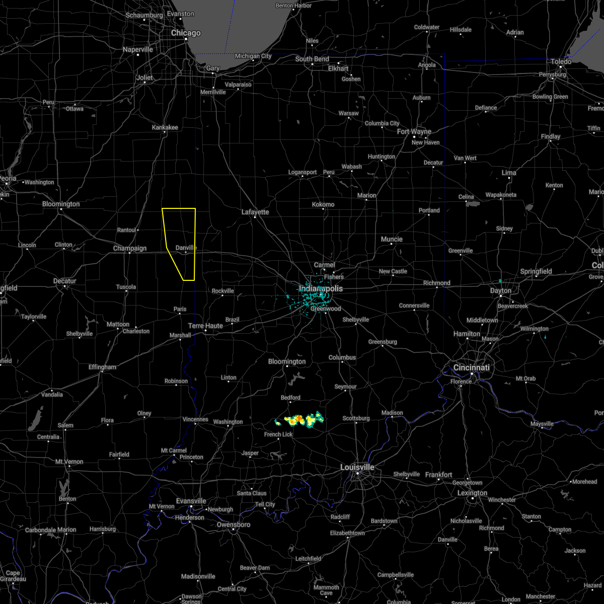 The severe thunderstorm warning for vermilion county will expire at 645 pm cdt, the storms which prompted the warning have moved out of the area. therefore, the warning will be allowed to expire. a severe thunderstorm watch remains in effect until 900 pm cdt for east central illinois. to report severe weather, contact your nearest law enforcement agency. they will relay your report to the national weather service lincoln. The severe thunderstorm warning for vermilion county will expire at 645 pm cdt, the storms which prompted the warning have moved out of the area. therefore, the warning will be allowed to expire. a severe thunderstorm watch remains in effect until 900 pm cdt for east central illinois. to report severe weather, contact your nearest law enforcement agency. they will relay your report to the national weather service lincoln.
|
| 7/13/2016 6:26 PM CDT |
 At 625 pm cdt, severe thunderstorms were located along a line extending from near potomac to near oakwood to near westville, moving east at 50 mph (trained weather spotters). Hazards include 60 mph wind gusts. Expect damage to roofs. siding. and trees. locations impacted include, danville, hoopeston, georgetown, westville, tilton, catlin, oakwood, rossville, ridge farm, potomac, belgium, bismarck, henning, vermilion county airport, collison, alvin, middle fork wildlife area and kickapoo state park. This includes interstate 74 between mile markers 205 and 219. At 625 pm cdt, severe thunderstorms were located along a line extending from near potomac to near oakwood to near westville, moving east at 50 mph (trained weather spotters). Hazards include 60 mph wind gusts. Expect damage to roofs. siding. and trees. locations impacted include, danville, hoopeston, georgetown, westville, tilton, catlin, oakwood, rossville, ridge farm, potomac, belgium, bismarck, henning, vermilion county airport, collison, alvin, middle fork wildlife area and kickapoo state park. This includes interstate 74 between mile markers 205 and 219.
|
| 7/13/2016 6:16 PM CDT |
 At 616 pm cdt, severe thunderstorms were located along a line extending from 6 miles northwest of potomac to near fithian to near sidell, moving east at 50 mph (trained weather spotters). Hazards include 60 mph wind gusts. Expect damage to roofs. siding. and trees. locations impacted include, danville, hoopeston, georgetown, westville, tilton, catlin, oakwood, rossville, ridge farm, potomac, fairmount, rankin, fithian, belgium, muncie, bismarck, indianola, henning, jamaica and vermilion county airport. This includes interstate 74 between mile markers 199 and 219. At 616 pm cdt, severe thunderstorms were located along a line extending from 6 miles northwest of potomac to near fithian to near sidell, moving east at 50 mph (trained weather spotters). Hazards include 60 mph wind gusts. Expect damage to roofs. siding. and trees. locations impacted include, danville, hoopeston, georgetown, westville, tilton, catlin, oakwood, rossville, ridge farm, potomac, fairmount, rankin, fithian, belgium, muncie, bismarck, indianola, henning, jamaica and vermilion county airport. This includes interstate 74 between mile markers 199 and 219.
|
| 7/13/2016 6:08 PM CDT |
 At 606 pm cdt, severe thunderstorms were located along a line extending from near gifford to near st. joseph to near allerton, moving east at 50 mph (trained weather spotters. at 555 pm...a 78 mile per hour wind gust was reported in urbana). Hazards include 70 mph wind gusts. Expect damage to roofs. siding. and trees. locations impacted include, danville, hoopeston, st. joseph, georgetown, westville, tilton, catlin, oakwood, rossville, homer, gifford, ridge farm, ogden, potomac, fairmount, sidell, rankin, fithian, belgium and broadlands. This includes interstate 74 between mile markers 191 and 219. At 606 pm cdt, severe thunderstorms were located along a line extending from near gifford to near st. joseph to near allerton, moving east at 50 mph (trained weather spotters. at 555 pm...a 78 mile per hour wind gust was reported in urbana). Hazards include 70 mph wind gusts. Expect damage to roofs. siding. and trees. locations impacted include, danville, hoopeston, st. joseph, georgetown, westville, tilton, catlin, oakwood, rossville, homer, gifford, ridge farm, ogden, potomac, fairmount, sidell, rankin, fithian, belgium and broadlands. This includes interstate 74 between mile markers 191 and 219.
|
| 7/13/2016 5:56 PM CDT |
 At 555 pm cdt, severe thunderstorms were located along a line extending from rantoul to near broadlands, moving east at 50 mph (trained weather spotters). Hazards include 60 mph wind gusts. Expect damage to roofs. siding. and trees. trained spotters reported power poles down near tolono. locations impacted include, champaign, danville, rantoul, urbana, savoy, hoopeston, st. joseph, georgetown, westville, tilton, catlin, oakwood, philo, rossville, sidney, homer, thomasboro, gifford, ridge farm and ogden. this includes the following highways, interstate 57 between mile markers 240 and 257. Interstate 74 between mile markers 182 and 219. At 555 pm cdt, severe thunderstorms were located along a line extending from rantoul to near broadlands, moving east at 50 mph (trained weather spotters). Hazards include 60 mph wind gusts. Expect damage to roofs. siding. and trees. trained spotters reported power poles down near tolono. locations impacted include, champaign, danville, rantoul, urbana, savoy, hoopeston, st. joseph, georgetown, westville, tilton, catlin, oakwood, philo, rossville, sidney, homer, thomasboro, gifford, ridge farm and ogden. this includes the following highways, interstate 57 between mile markers 240 and 257. Interstate 74 between mile markers 182 and 219.
|
| 7/13/2016 5:40 PM CDT |
 At 540 pm cdt, severe thunderstorms were located along a line extending from fisher to near bondville, moving east at 55 mph (radar indicated). Hazards include 60 mph wind gusts. Expect damage to roofs. siding. And trees. At 540 pm cdt, severe thunderstorms were located along a line extending from fisher to near bondville, moving east at 55 mph (radar indicated). Hazards include 60 mph wind gusts. Expect damage to roofs. siding. And trees.
|
| 6/20/2016 9:40 PM CDT |
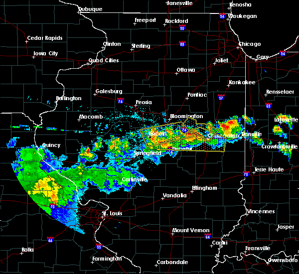 At 940 pm cdt, a severe thunderstorm was located near gifford, or 12 miles east of rantoul, moving east at 40 mph (radar indicated). Hazards include 60 mph wind gusts and nickel size hail. Expect damage to roofs. siding. And trees. At 940 pm cdt, a severe thunderstorm was located near gifford, or 12 miles east of rantoul, moving east at 40 mph (radar indicated). Hazards include 60 mph wind gusts and nickel size hail. Expect damage to roofs. siding. And trees.
|
| 3/31/2016 2:29 PM CDT |
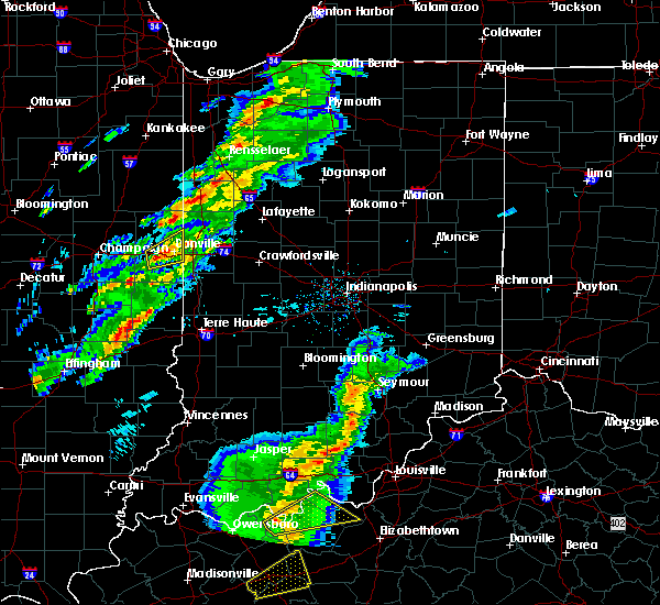 At 228 pm cdt, a severe thunderstorm was located over oakwood, or 9 miles southwest of danville, moving northeast at 50 mph (radar indicated). Hazards include 60 mph wind gusts and quarter size hail. Hail damage to vehicles is expected. expect wind damage to roofs, siding, and trees. locations impacted include, danville, westville, tilton, catlin, oakwood, fairmount, belgium, muncie, bismarck, vermilion county airport and kickapoo state park. This includes interstate 74 between mile markers 203 and 220. At 228 pm cdt, a severe thunderstorm was located over oakwood, or 9 miles southwest of danville, moving northeast at 50 mph (radar indicated). Hazards include 60 mph wind gusts and quarter size hail. Hail damage to vehicles is expected. expect wind damage to roofs, siding, and trees. locations impacted include, danville, westville, tilton, catlin, oakwood, fairmount, belgium, muncie, bismarck, vermilion county airport and kickapoo state park. This includes interstate 74 between mile markers 203 and 220.
|
| 3/31/2016 2:10 PM CDT |
 At 210 pm cdt, a severe thunderstorm was located near homer, or 15 miles southeast of champaign, moving northeast at 50 mph (radar indicated). Hazards include 60 mph wind gusts and quarter size hail. Hail damage to vehicles is expected. Expect wind damage to roofs, siding, and trees. At 210 pm cdt, a severe thunderstorm was located near homer, or 15 miles southeast of champaign, moving northeast at 50 mph (radar indicated). Hazards include 60 mph wind gusts and quarter size hail. Hail damage to vehicles is expected. Expect wind damage to roofs, siding, and trees.
|
| 9/18/2015 9:53 PM CDT |
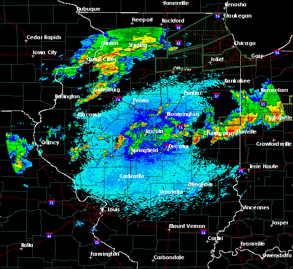 At 953 pm cdt, a severe thunderstorm was located 5 miles north of oakwood, or 7 miles northwest of danville, moving east at 35 mph (emergency management). Hazards include 60 mph wind gusts and quarter size hail. Hail damage to vehicles is expected. Expect wind damage to roofs, siding and trees. At 953 pm cdt, a severe thunderstorm was located 5 miles north of oakwood, or 7 miles northwest of danville, moving east at 35 mph (emergency management). Hazards include 60 mph wind gusts and quarter size hail. Hail damage to vehicles is expected. Expect wind damage to roofs, siding and trees.
|
| 9/4/2015 7:40 PM CDT | Large tree limbs/branches down across the city of danvill in vermilion county IL, 0.6 miles N of Danville, IL |
| 7/13/2015 11:13 AM EDT | The severe thunderstorm warning for clinton, carroll, northern boone, fountain, southwestern howard, northern montgomery, tippecanoe, northwestern vermillion and warren counties will expire at 1115 am edt, the line of storms which prompted the warning has moved out of the warned area. additional strong thunderstorms are still possible, and a severe thunderstorm watch remains in effect until 400 pm edt. |
| 7/13/2015 9:59 AM CDT |
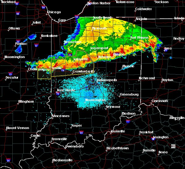 At 958 am cdt, severe thunderstorms were located along a line extending from 5 miles northeast of belgium to ogden, moving south at 30 mph (emergency management). Hazards include 60 mph wind gusts. Expect damage to roofs. Siding and trees. At 958 am cdt, severe thunderstorms were located along a line extending from 5 miles northeast of belgium to ogden, moving south at 30 mph (emergency management). Hazards include 60 mph wind gusts. Expect damage to roofs. Siding and trees.
|
| 7/13/2015 9:49 AM CDT | Tree down across railroad tracks at 3rd street in vermilion county IL, 0.6 miles N of Danville, IL |
| 7/13/2015 10:44 AM EDT |
 At 1041 am edt, severe thunderstorms were located along a line extending from 13 miles west of kokomo to 7 miles west of frankfort to williamsport, and moving southeast at 45 mph (radar indicated). Hazards include 60 mph wind gusts and penny size hail. Expect damage to roofs. siding and trees. locations impacted include, frankfort, crawfordsville, veedersburg, lebanon, newtown, gessie, new richmond, linden, colfax, mellott, wingate, michigantown, perrysville, hillsboro, waynetown, thorntown, darlington, yeddo, kirklin and wallace. this includes interstate 65 between mile markers 140 and 184. This includes interstate 74 between mile markers 1 and 42. At 1041 am edt, severe thunderstorms were located along a line extending from 13 miles west of kokomo to 7 miles west of frankfort to williamsport, and moving southeast at 45 mph (radar indicated). Hazards include 60 mph wind gusts and penny size hail. Expect damage to roofs. siding and trees. locations impacted include, frankfort, crawfordsville, veedersburg, lebanon, newtown, gessie, new richmond, linden, colfax, mellott, wingate, michigantown, perrysville, hillsboro, waynetown, thorntown, darlington, yeddo, kirklin and wallace. this includes interstate 65 between mile markers 140 and 184. This includes interstate 74 between mile markers 1 and 42.
|
| 7/13/2015 10:26 AM EDT |
 At 1025 am edt, severe thunderstorms were located along a line extending from 8 miles east of delphi to 8 miles east of lafayette to 6 miles south of otterbein, and moving southeast at 45 mph (radar indicated). Hazards include 60 mph wind gusts and penny size hail. Expect damage to roofs. Siding and trees. At 1025 am edt, severe thunderstorms were located along a line extending from 8 miles east of delphi to 8 miles east of lafayette to 6 miles south of otterbein, and moving southeast at 45 mph (radar indicated). Hazards include 60 mph wind gusts and penny size hail. Expect damage to roofs. Siding and trees.
|
| 6/21/2015 12:09 AM CDT |
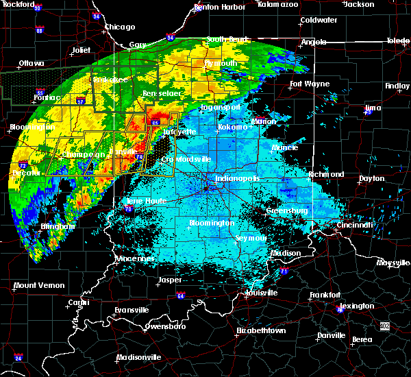 The severe thunderstorm warning for vermilion county will expire at 1215 am cdt, the storms which prompted the warning have moved out of the area. therefore the warning will be allowed to expire. a severe thunderstorm watch remains in effect until 200 am cdt for east central illinois. to report severe weather, contact your nearest law enforcement agency. they will relay your report to the national weather service lincoln. The severe thunderstorm warning for vermilion county will expire at 1215 am cdt, the storms which prompted the warning have moved out of the area. therefore the warning will be allowed to expire. a severe thunderstorm watch remains in effect until 200 am cdt for east central illinois. to report severe weather, contact your nearest law enforcement agency. they will relay your report to the national weather service lincoln.
|
| 6/20/2015 11:42 PM CDT |
 At 1142 pm cdt, severe thunderstorms were located along a line extending from 8 miles east of rossville to near allerton, moving east at 50 mph (radar indicated). Hazards include 60 mph wind gusts. Expect damage to roofs. siding and trees. locations impacted include, danville, hoopeston, georgetown, westville, tilton, catlin, oakwood, rossville, ridge farm, fairmount, sidell, belgium, vermilion county airport, bismarck, indianola, henning, jamaica, alvin and kickapoo state park. This includes interstate 74 between mile markers 205 and 219. At 1142 pm cdt, severe thunderstorms were located along a line extending from 8 miles east of rossville to near allerton, moving east at 50 mph (radar indicated). Hazards include 60 mph wind gusts. Expect damage to roofs. siding and trees. locations impacted include, danville, hoopeston, georgetown, westville, tilton, catlin, oakwood, rossville, ridge farm, fairmount, sidell, belgium, vermilion county airport, bismarck, indianola, henning, jamaica, alvin and kickapoo state park. This includes interstate 74 between mile markers 205 and 219.
|
| 6/20/2015 11:34 PM CDT |
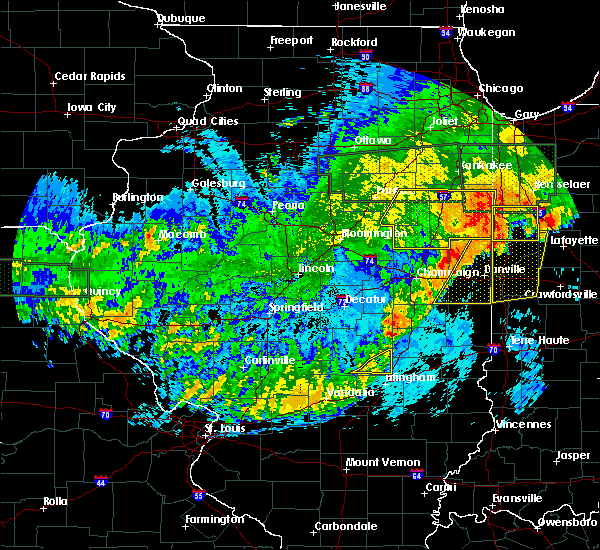 At 1134 pm cdt, severe thunderstorms were located along a line extending from near hoopeston to broadlands, moving east at 55 mph (radar indicated). Hazards include 60 mph wind gusts. Expect damage to roofs. siding and trees. locations impacted include, danville, hoopeston, georgetown, westville, tilton, catlin, oakwood, rossville, homer, ridge farm, potomac, fairmount, sidell, fithian, belgium, broadlands, allerton, vermilion county airport, bismarck and indianola. This includes interstate 74 between mile markers 199 and 219. At 1134 pm cdt, severe thunderstorms were located along a line extending from near hoopeston to broadlands, moving east at 55 mph (radar indicated). Hazards include 60 mph wind gusts. Expect damage to roofs. siding and trees. locations impacted include, danville, hoopeston, georgetown, westville, tilton, catlin, oakwood, rossville, homer, ridge farm, potomac, fairmount, sidell, fithian, belgium, broadlands, allerton, vermilion county airport, bismarck and indianola. This includes interstate 74 between mile markers 199 and 219.
|
| 6/20/2015 11:10 PM CDT |
 At 1109 pm cdt, severe thunderstorms were located along a line extending from 6 miles northwest of rankin to near willard airport, moving east at 50 mph (radar indicated). Hazards include 60 mph wind gusts. Expect damage to roofs. Siding and trees. At 1109 pm cdt, severe thunderstorms were located along a line extending from 6 miles northwest of rankin to near willard airport, moving east at 50 mph (radar indicated). Hazards include 60 mph wind gusts. Expect damage to roofs. Siding and trees.
|
| 6/7/2015 11:19 PM EDT | At 1117 pm edt, a severe thunderstorm was located near covington, and moving east at 45 mph (radar indicated). Hazards include 60 mph wind gusts and penny size hail. Expect damage to roofs. siding and trees. locations impacted include, covington, veedersburg, williamsport, west lebanon, kingman, yeddo and attica. This includes interstate 74 between mile markers 1 and 16. |
| 6/7/2015 10:09 PM CDT | The tornado warning for southern vermilion and southeastern champaign counties will expire at 1015 pm cdt, the storm which prompted the warning has weakened below severe limits, and no longer appears capable of producing a tornado. therefore the warning will be allowed to expire. however gusty winds and heavy rain are still possible with this thunderstorm. a severe thunderstorm watch remains in effect until 300 am cdt for east central illinois. |
| 6/7/2015 11:05 PM EDT | At 1103 pm edt, a severe thunderstorm was located near tilton, and moving east at 30 mph (radar indicated). Hazards include 60 mph wind gusts and penny size hail. Expect damage to roofs. Siding and trees. |
| 6/7/2015 9:52 PM CDT | At 951 pm cdt, severe thunderstorms were located along a line extending from near potomac to near allerton to near newman to humboldt, moving east at 45 mph (radar indicated). Hazards include 60 mph wind gusts and quarter size hail. Hail damage to vehicles is expected. expect wind damage to roofs, siding and trees. locations impacted include, danville, charleston, mattoon, paris, tuscola, st. joseph, georgetown, westville, arcola, tilton, villa grove, arthur, catlin, oakwood, philo, chrisman, rossville, sidney, atwood and homer. this includes the following highways, interstate 57 between mile markers 189 and 219. Interstate 74 between mile markers 192 and 220. |
| 6/7/2015 9:39 PM CDT | At 939 pm cdt, a severe thunderstorm capable of producing a tornado was located over homer, or 12 miles southeast of urbana, moving east at 45 mph (radar indicated rotation). Hazards include tornado and quarter size hail. Flying debris will be dangerous to those caught without shelter. mobile homes will be damaged or destroyed. damage to roofs, windows and vehicles will occur. tree damage is likely. this dangerous storm will be near, fairmount and fithian around 950 pm cdt. oakwood around 955 pm cdt. catlin around 1000 pm cdt. danville, georgetown, westville, tilton and belgium around 1005 pm cdt. other locations impacted by this tornadic thunderstorm include kickapoo state park, muncie and jamaica. This includes interstate 74 between mile markers 193 and 220. |
| 6/7/2015 9:29 PM CDT | At 929 pm cdt, severe thunderstorms were located along a line extending from 6 miles north of rantoul to philo to near tuscola to 4 miles north of sullivan, moving east at 45 mph (radar indicated). Hazards include 60 mph wind gusts and quarter size hail. Hail damage to vehicles is expected. Expect wind damage to roofs, siding and trees. |
| 6/7/2015 8:59 PM CDT | At 859 pm cdt, a severe thunderstorm was located over catlin, or 8 miles southwest of danville, moving east at 30 mph (radar indicated). Hazards include 60 mph wind gusts and quarter size hail. Hail damage to vehicles is expected. expect wind damage to roofs, siding and trees. locations impacted include, danville, georgetown, westville, tilton, catlin, oakwood, fairmount, fithian, belgium, vermilion county airport, jamaica, muncie and kickapoo state park. This includes interstate 74 between mile markers 198 and 220. |
| 6/7/2015 8:47 PM CDT | At 847 pm cdt, a severe thunderstorm was located over fairmount, or 15 miles southwest of danville, moving east at 30 mph (radar indicated). Hazards include 60 mph wind gusts. Expect damage to roofs. Siding and trees. |
| 6/7/2015 8:10 PM CDT | Numerous trees blown down and power outages in danvill in vermilion county IL, 0.6 miles N of Danville, IL |
| 6/7/2015 7:59 PM CDT | At 759 pm cdt, a severe thunderstorm was located 5 miles northeast of vermilion county airport, or 9 miles northeast of danville, moving east at 25 mph (radar indicated). Hazards include 60 mph wind gusts. Expect damage to roofs. siding and trees. locations impacted include, danville, hoopeston, westville, tilton, catlin, oakwood, rossville, potomac, fairmount, fithian, belgium, vermilion county airport, bismarck, henning, muncie, collison, alvin, middle fork wildlife area, armstrong and kickapoo state park. This includes interstate 74 between mile markers 198 and 220. |
| 6/7/2015 7:52 PM CDT | Quarter sized hail reported 4.3 miles E of Danville, IL, reported 1 inch hail in danville at henning road and us-150. |
| 6/7/2015 7:40 PM CDT | Several trees blown down on denmark road near lake vermilion on north side of danvill in vermilion county IL, 0.6 miles N of Danville, IL |
| 6/7/2015 7:23 PM CDT | At 722 pm cdt, a severe thunderstorm was located near potomac, or 12 miles northwest of danville, moving east at 25 mph (radar indicated). Hazards include 60 mph wind gusts. Expect damage to roofs. Siding and trees. |
| 5/15/2015 5:55 PM CDT | Two trees down on roads in danville in vermilion county IL, 0.6 miles N of Danville, IL |
| 5/10/2015 9:15 PM CDT | Tree blown down and large tree limb blown down... both blocking roa in vermilion county IL, 0.6 miles N of Danville, IL |
| 5/10/2015 9:11 PM CDT | At 910 pm cdt, severe thunderstorms were located along a line extending from near potomac to near georgetown to near vermilion, moving northeast at 50 mph (radar indicated). Hazards include 60 mph wind gusts. Expect damage to roofs. siding and trees. locations impacted include, danville, georgetown, westville, tilton, catlin, oakwood, chrisman, ridge farm, fairmount, fithian, belgium, vermilion, muncie, bismarck, indianola, henning, jamaica, vermilion county airport, collison and alvin. this includes interstate 74 between mile markers 201 and 220. 75in. |
| 5/10/2015 8:59 PM CDT | At 859 pm cdt, severe thunderstorms were located along a line extending from near muncie to near ridge farm to near vermilion, moving east at 50 mph (radar indicated). Hazards include 60 mph wind gusts. Expect damage to roofs. Siding and trees. |
| 5/10/2015 8:52 PM CDT | At 851 pm cdt, severe thunderstorms were located along a line extending from fithian to near sidell to oliver, moving northeast at 50 mph (radar indicated). Hazards include 60 mph wind gusts. Expect damage to roofs. siding and trees. locations impacted include, danville, paris, georgetown, westville, tilton, catlin, oakwood, chrisman, homer, ridge farm, newman, fairmount, sidell, fithian, belgium, hume, broadlands, brocton, allerton and vermilion. this includes interstate 74 between mile markers 202 and 219. 75in. |
| 5/10/2015 8:43 PM CDT | At 834 pm cdt, severe thunderstorms were located along a line extending from near sidney to clarksville, moving northeast at 50 mph (radar indicated). Hazards include 60 mph wind gusts. Expect damage to roofs. Siding and trees. |
| 5/10/2015 8:34 PM CDT | At 834 pm cdt, severe thunderstorms were located along a line extending from near sidney to clarksville, moving northeast at 50 mph (radar indicated). Hazards include 60 mph wind gusts. Expect damage to roofs. Siding and trees. |
| 4/9/2015 5:31 AM CDT | A severe thunderstorm warning remains in effect for central vermilion county until 545 am cdt. at 527 am cdt. a severe thunderstorm was located near danville. and moving northeast at 45 mph. another severe thunderstorm was located near oakland. moving northeast at 45 mph. hazard. 60 mph wind gusts and penny size hail. |
| 4/9/2015 5:07 AM CDT | A severe thunderstorm warning remains in effect for southern vermilion county until 545 am cdt. at 502 am cdt. a severe thunderstorm was located near sidell. and moving northeast at 45 mph. another severe thunderstorm was located 5 miles east of ogden. moving northeast at 45 mph. hazard. 60 mph wind gusts and penny size hail. |
| 4/9/2015 4:53 AM CDT | The national weather service in lincoln has issued a * severe thunderstorm warning for. southern vermilion county in east central illinois. until 545 am cdt * at 452 am cdt. a severe thunderstorm was located near allerton. And moving northeast at 45 mph. |
| 4/8/2015 6:14 AM CDT | The national weather service in lincoln has issued a * severe thunderstorm warning for. vermilion county in east central illinois. until 715 am cdt * at 608 am cdt. a severe thunderstorm was located 6 miles north of ogden. and moving east at 35 mph. Another severe thunderstorm. |
| 9/20/2014 4:55 PM CDT | Large tree limb down on logan and kimber intersection blocking both lanes of traffic in vermilion county IL, 0.6 miles N of Danville, IL |
| 7/14/2014 2:01 PM CDT | Large tree and power lines down on franklin street. corrected tim in vermilion county IL, 0.6 miles N of Danville, IL |
| 7/14/2014 2:00 PM CDT | Large tree limbs down and a tree down blocking henning road at kickapoo roa in vermilion county IL, 4.3 miles E of Danville, IL |
| 6/21/2014 6:42 PM CDT | Storm damage reported in vermilion county IL, 3.7 miles SSW of Danville, IL |
| 6/21/2014 6:42 PM CDT | Large tree down at liberty lane and ferndale. tree blocking roa in vermilion county IL, 0.6 miles N of Danville, IL |
| 5/21/2014 3:35 PM CDT | Ping Pong Ball sized hail reported 1.8 miles WSW of Danville, IL, 1.5 inch hail northeast of danville near airport. from county ema. |
| 11/17/2013 1:11 PM CST | Roof off house in vermilion county IL, 3.4 miles N of Danville, IL |
| 8/30/2013 9:47 PM CDT | Trees were blown down in the leisure time estates near henning r in vermilion county IL, 3.2 miles E of Danville, IL |
| 8/30/2013 9:42 PM CDT | Trees were blown down in danville...200 people are without power...wind gusts were measured up to 51 mph on the northwest side of danvill in vermilion county IL, 0.6 miles N of Danville, IL |
| 7/10/2013 10:05 AM CDT | Numerous trees and limbs down and power outages in vermilion county IL, 0.6 miles N of Danville, IL |
| 6/25/2013 7:05 PM CDT | Tree blown blown down at bowman and seminary streets...power lines blown down as wel in vermilion county IL, 0.6 miles N of Danville, IL |
| 6/25/2013 7:05 PM CDT | 2-foot diameter tree blown down on car in danvill in vermilion county IL, 0.6 miles N of Danville, IL |
| 5/31/2013 11:27 PM CDT | At airport in vermilion county IL, 0.6 miles N of Danville, IL |
| 5/31/2013 11:20 PM CDT | Numerous power lines donw around cit in vermilion county IL, 0.6 miles N of Danville, IL |
| 7/18/2012 7:10 PM CDT | Large tree blown down across road at 1750e and 2000n in vermilion county IL, 2.6 miles SW of Danville, IL |
| 6/29/2012 2:38 PM CDT | Hen Egg sized hail reported 3.7 miles SSW of Danville, IL |
| 6/29/2012 2:25 PM CDT | Baseball sized hail reported 8.9 miles SSE of Danville, IL |
| 6/29/2012 2:25 PM CDT | Tea Cup sized hail reported 7.7 miles SSE of Danville, IL |
| 5/6/2012 6:20 PM CDT | Tree down across winter avenue a quarter mile east of bowman avenue. power lines also don in vermilion county IL, 0.5 miles W of Danville, IL |
| 5/1/2012 5:20 PM CDT | Quarter sized hail reported 5.5 miles N of Danville, IL, at eoc |
| 5/1/2012 5:20 PM CDT | Golf Ball sized hail reported 0.6 miles N of Danville, IL, at 14th st and il rt 1. relayed by ema. |
| 8/24/2011 7:11 PM CDT | Golf Ball sized hail reported 0.6 miles N of Danville, IL |
| 8/24/2011 7:10 PM CDT | Half Dollar sized hail reported 0.6 miles N of Danville, IL, half dollar hail reported just west of danville from county em. |
| 8/24/2011 7:06 PM CDT | Quarter sized hail reported 1.2 miles ENE of Danville, IL, hail report from wcia-tv. |
| 1/1/0001 12:00 AM | Estimated 60 mph wind gus in vermilion county IL, 6 miles SE of Danville, IL |
| 1/1/0001 12:00 AM | Measured 60 mph wind gust at county courthous in vermilion county IL, 0.6 miles N of Danville, IL |
| 1/1/0001 12:00 AM | Power pole blown down at 3rd street and highland bvl in vermilion county IL, 0.6 miles N of Danville, IL |
| 1/1/0001 12:00 AM | Several trees blown dow in vermilion county IL, 0.6 miles N of Danville, IL |
| 1/1/0001 12:00 AM | Power lines down in danville...on gilbert street. from trained spotters from county emergency managemen in vermilion county IL, 0.6 miles N of Danville, IL |
| 1/1/0001 12:00 AM | Numerous trees blown down on grape creek roa in vermilion county IL, 3.4 miles NW of Danville, IL |
| 1/1/0001 12:00 AM | Power lines down in danville...on gilbert street. from trained spotters from county emergency managemen in vermilion county IL, 0.6 miles N of Danville, IL |
| 1/1/0001 12:00 AM | Power lines down on the east side of danvill in vermilion county IL, 1.2 miles WNW of Danville, IL |
| 1/1/0001 12:00 AM | Trees and powerlines down in vermilion county IL, 1.4 miles NNW of Danville, IL |
Hail Maps for Danville, IL


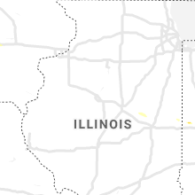


Connect with Interactive Hail Maps