

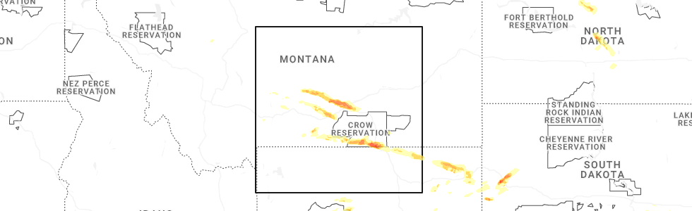
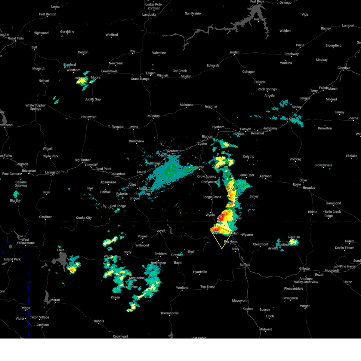
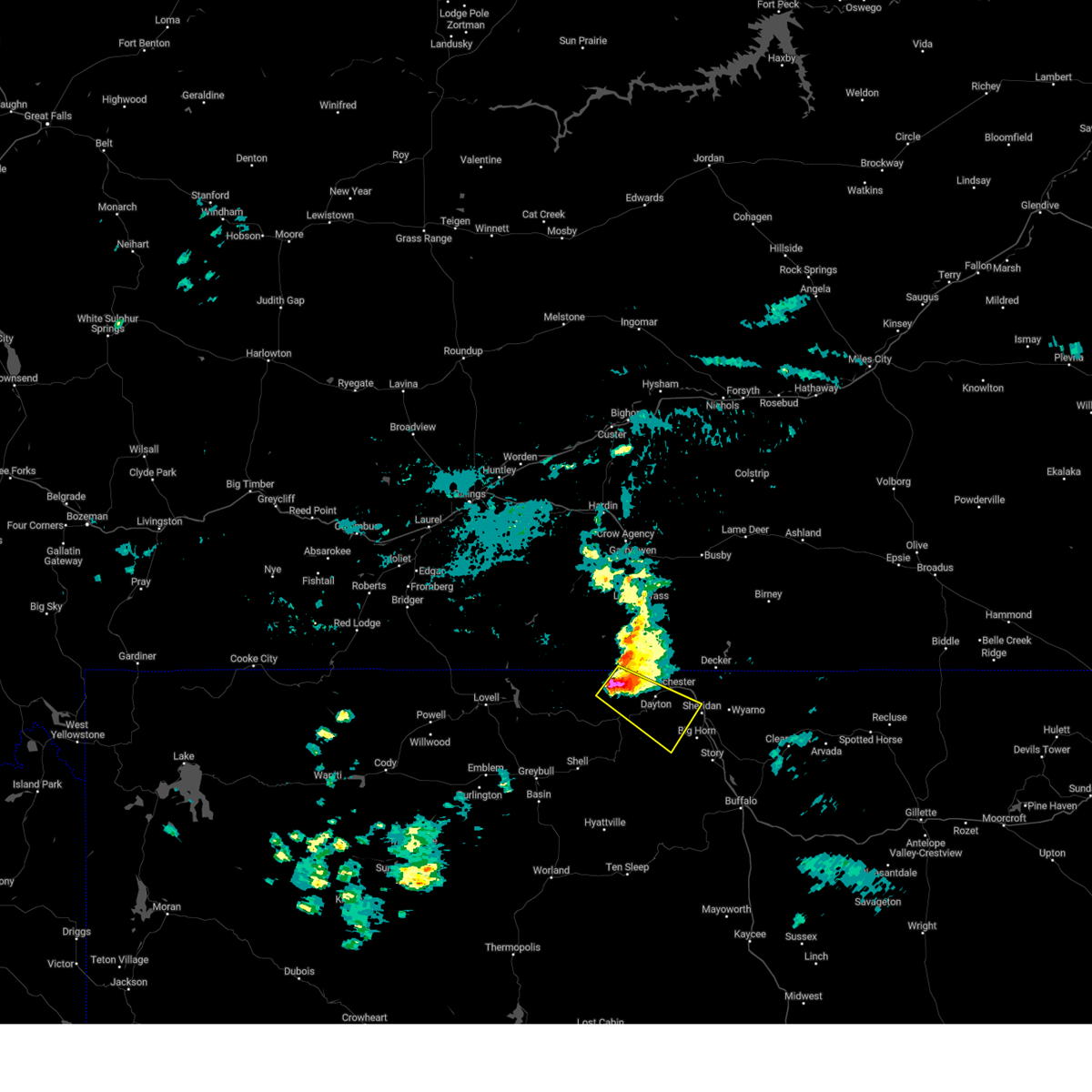
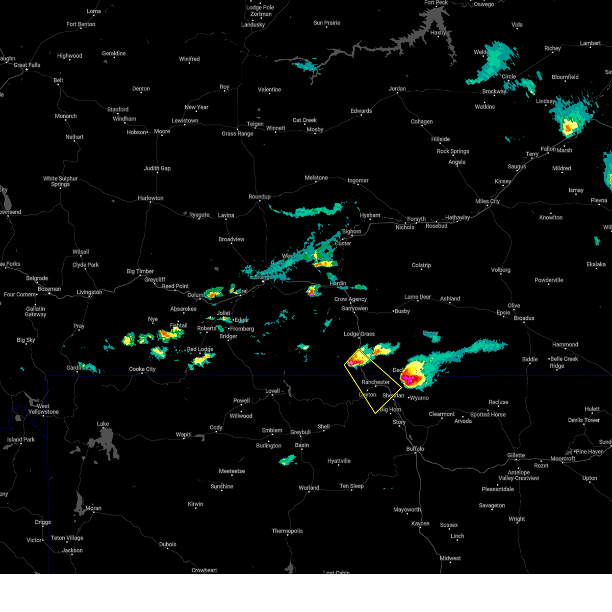
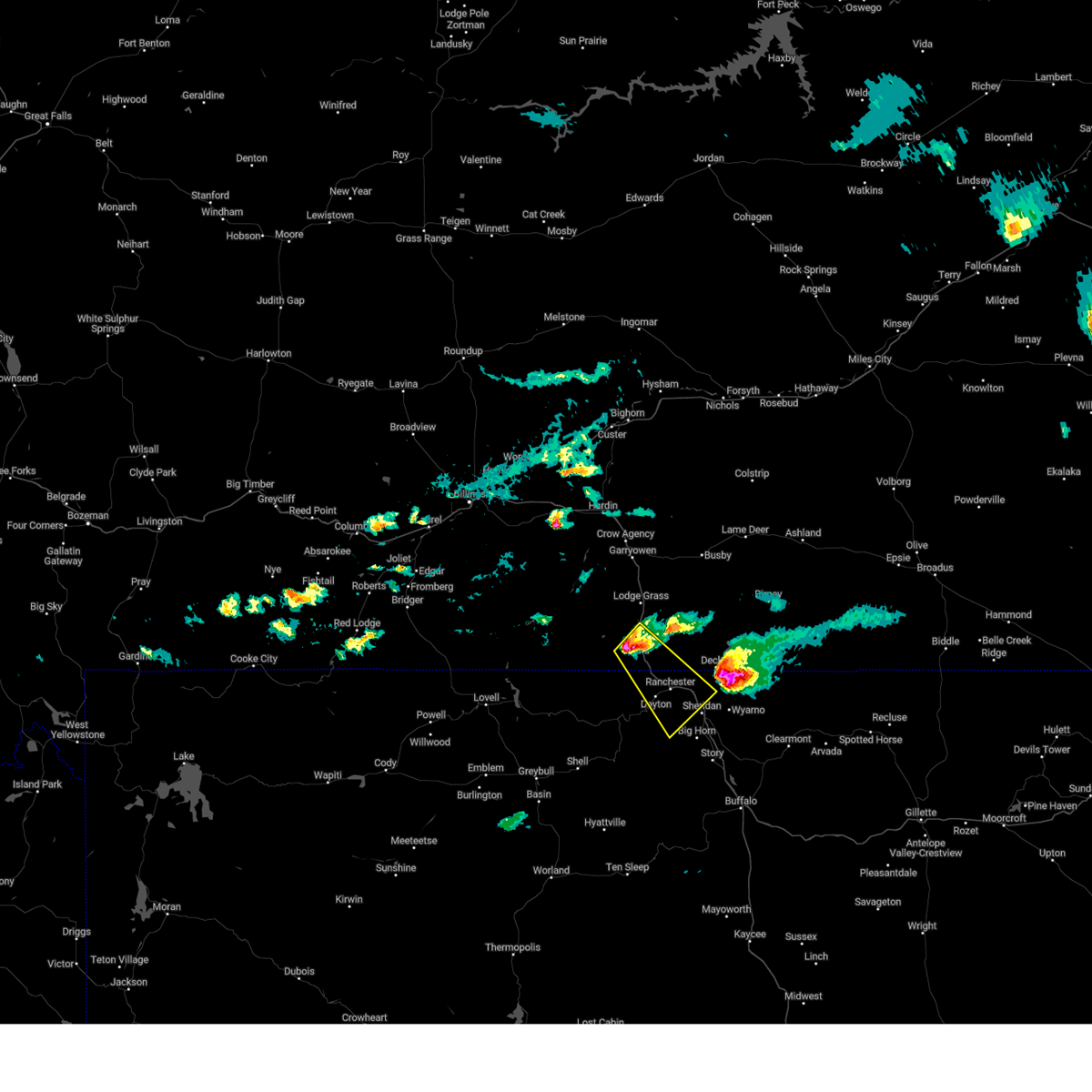
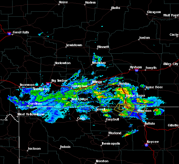
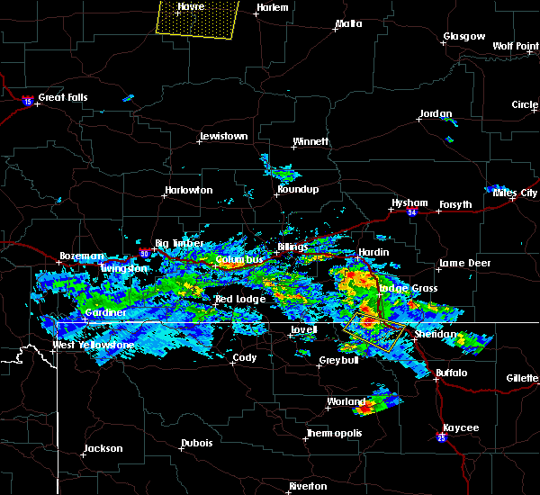
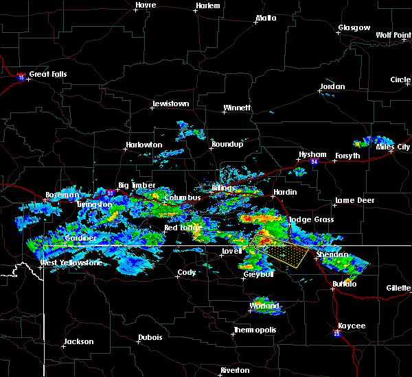
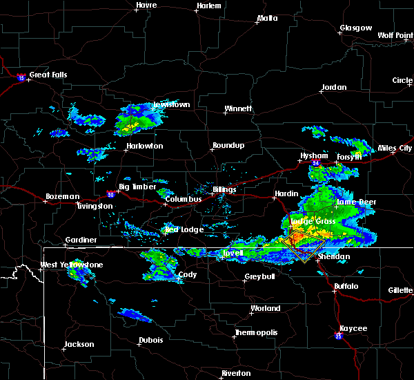
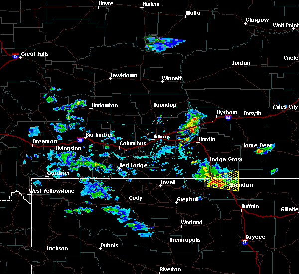
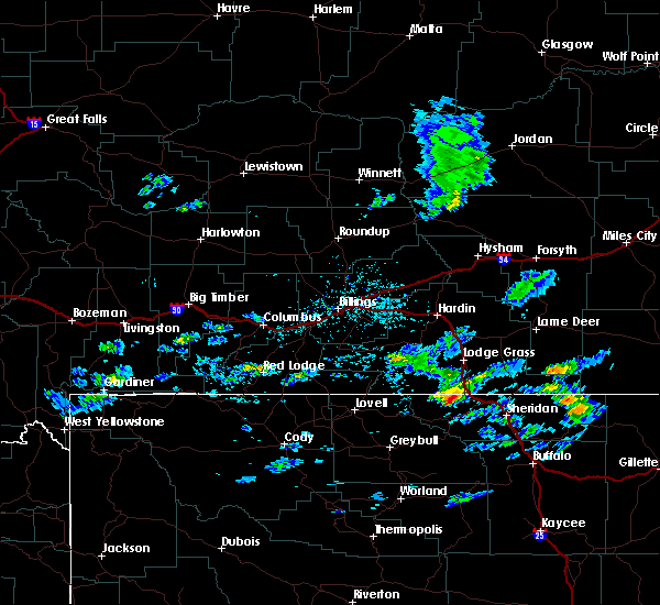
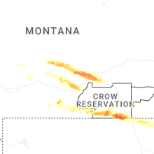
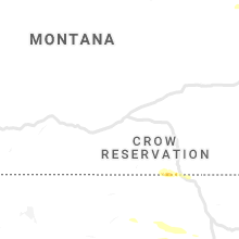
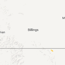
Hail Map for Dayton, WY
The Dayton, WY area has had 5 reports of on-the-ground hail by trained spotters, and has been under severe weather warnings 0 times during the past 12 months. Doppler radar has detected hail at or near Dayton, WY on 23 occasions, including 2 occasions during the past year.
| Name: | Dayton, WY |
| Where Located: | 87.2 miles SE of Billings, MT |
| Map: | Google Map for Dayton, WY |
| Population: | 757 |
| Housing Units: | 336 |
| More Info: | Search Google for Dayton, WY |
0
The Top Recent Hail Date for Dayton, WY is Monday, June 16, 2025 (17th out of 23)
Hail and Wind Damage Spotted near Dayton, WY
| Date / Time | Report Details |
|---|---|
| 7/3/2024 4:55 PM MDT |
 Svrbyz the national weather service in billings has issued a * severe thunderstorm warning for, central sheridan county in north central wyoming, * until 600 pm mdt. * at 454 pm mdt, a severe thunderstorm was located over ranchester, or 13 miles northwest of sheridan, moving southeast at 30 mph (radar indicated. gust to 68 mph was report at the montana state line). Hazards include 70 mph wind gusts. Expect considerable tree damage. Damage is likely to mobile homes, roofs, and outbuildings. Svrbyz the national weather service in billings has issued a * severe thunderstorm warning for, central sheridan county in north central wyoming, * until 600 pm mdt. * at 454 pm mdt, a severe thunderstorm was located over ranchester, or 13 miles northwest of sheridan, moving southeast at 30 mph (radar indicated. gust to 68 mph was report at the montana state line). Hazards include 70 mph wind gusts. Expect considerable tree damage. Damage is likely to mobile homes, roofs, and outbuildings.
|
| 7/30/2023 2:43 PM MDT |
 At 242 pm mdt, a severe thunderstorm was located near dayton, or 18 miles west of sheridan, moving southeast at 20 mph (radar indicated). Hazards include 60 mph wind gusts and quarter size hail and torrential rain. Hail damage to vehicles is expected. expect wind damage to roofs, siding, and trees. locations impacted include, ranchester, dayton, and parkman. hail threat, radar indicated max hail size, 1. 00 in wind threat, radar indicated max wind gust, 60 mph. At 242 pm mdt, a severe thunderstorm was located near dayton, or 18 miles west of sheridan, moving southeast at 20 mph (radar indicated). Hazards include 60 mph wind gusts and quarter size hail and torrential rain. Hail damage to vehicles is expected. expect wind damage to roofs, siding, and trees. locations impacted include, ranchester, dayton, and parkman. hail threat, radar indicated max hail size, 1. 00 in wind threat, radar indicated max wind gust, 60 mph.
|
| 7/30/2023 2:10 PM MDT |
 At 209 pm mdt, a severe thunderstorm was located 12 miles west of dayton, or 28 miles west of sheridan, moving southeast at 20 mph (radar indicated). Hazards include 60 mph wind gusts and quarter size hail and torrential rain. Hail damage to vehicles is expected. Expect wind damage to roofs, siding, and trees. At 209 pm mdt, a severe thunderstorm was located 12 miles west of dayton, or 28 miles west of sheridan, moving southeast at 20 mph (radar indicated). Hazards include 60 mph wind gusts and quarter size hail and torrential rain. Hail damage to vehicles is expected. Expect wind damage to roofs, siding, and trees.
|
| 7/11/2023 5:49 PM MDT |
 At 548 pm mdt, a severe thunderstorm was located 16 miles south of lodge grass, or 30 miles northwest of sheridan, moving southeast at 30 mph (radar indicated). Hazards include 60 mph wind gusts and half dollar size hail. Hail damage to vehicles is expected. Expect wind damage to roofs, siding, and trees. At 548 pm mdt, a severe thunderstorm was located 16 miles south of lodge grass, or 30 miles northwest of sheridan, moving southeast at 30 mph (radar indicated). Hazards include 60 mph wind gusts and half dollar size hail. Hail damage to vehicles is expected. Expect wind damage to roofs, siding, and trees.
|
| 5/26/2023 5:57 PM MDT | Quarter sized hail reported 0.3 miles NW of Dayton, WY |
| 5/26/2023 5:55 PM MDT | Quarter sized hail reported 0.5 miles SSW of Dayton, WY |
| 7/15/2022 6:30 PM MDT | Storm damage reported in sheridan county WY, 18.4 miles N of Dayton, WY |
| 7/15/2022 5:43 PM MDT |
 At 543 pm mdt, severe thunderstorms were located along a line extending from 19 miles south of sand springs to 21 miles northwest of forsyth to 6 miles northwest of lame deer to 7 miles east of busby to near ranchester, moving east at 20 mph (weather station. between 500 pm and 530 pm reports of 55 to 65 mph winds have been reported by weather station. these outflow winds have a history of damage). Hazards include 70 mph wind gusts. Expect considerable tree damage. Damage is likely to mobile homes, roofs, and outbuildings. At 543 pm mdt, severe thunderstorms were located along a line extending from 19 miles south of sand springs to 21 miles northwest of forsyth to 6 miles northwest of lame deer to 7 miles east of busby to near ranchester, moving east at 20 mph (weather station. between 500 pm and 530 pm reports of 55 to 65 mph winds have been reported by weather station. these outflow winds have a history of damage). Hazards include 70 mph wind gusts. Expect considerable tree damage. Damage is likely to mobile homes, roofs, and outbuildings.
|
| 7/15/2022 5:18 PM MDT |
 At 517 pm mdt, severe thunderstorms were located along a line extending from 13 miles northwest of colstrip to 12 miles north of ranchester, moving east at 40 mph (weather station. at 430 pm, 64 mph wind gust was reported 5 miles north of hardin from the hardin n mda weather station). Hazards include 70 mph wind gusts. Expect considerable tree damage. damage is likely to mobile homes, roofs, and outbuildings. locations impacted include, sheridan, colstrip, ranchester, dayton, lame deer, busby, ashland, big horn, birney, wyola, parkman, tongue river reservoir, banner, birney village, brandenberg, kirby, muddy cluster, rosebud battlefield park, story and northern cheyenne indian reservation. thunderstorm damage threat, considerable hail threat, radar indicated max hail size, <. 75 in wind threat, observed max wind gust, 70 mph. At 517 pm mdt, severe thunderstorms were located along a line extending from 13 miles northwest of colstrip to 12 miles north of ranchester, moving east at 40 mph (weather station. at 430 pm, 64 mph wind gust was reported 5 miles north of hardin from the hardin n mda weather station). Hazards include 70 mph wind gusts. Expect considerable tree damage. damage is likely to mobile homes, roofs, and outbuildings. locations impacted include, sheridan, colstrip, ranchester, dayton, lame deer, busby, ashland, big horn, birney, wyola, parkman, tongue river reservoir, banner, birney village, brandenberg, kirby, muddy cluster, rosebud battlefield park, story and northern cheyenne indian reservation. thunderstorm damage threat, considerable hail threat, radar indicated max hail size, <. 75 in wind threat, observed max wind gust, 70 mph.
|
| 7/15/2022 4:55 PM MDT |
 At 452 pm mdt, a gust front ahead of strong thunderstorms was located along a line extending from 19 miles south of hysham to 14 miles southwest of lodge grass, moving east at 40 mph (weather station. at 430 pm, 64 mph wind gust was reported 5 miles north of hardin from the hardin n mda weather station). Hazards include 70 mph wind gusts. Expect considerable tree damage. Damage is likely to mobile homes, roofs, and outbuildings. At 452 pm mdt, a gust front ahead of strong thunderstorms was located along a line extending from 19 miles south of hysham to 14 miles southwest of lodge grass, moving east at 40 mph (weather station. at 430 pm, 64 mph wind gust was reported 5 miles north of hardin from the hardin n mda weather station). Hazards include 70 mph wind gusts. Expect considerable tree damage. Damage is likely to mobile homes, roofs, and outbuildings.
|
| 6/20/2022 2:27 PM MDT |
 At 227 pm mdt, severe thunderstorms were located along a line extending from 6 miles northwest of dayton to 12 miles northwest of fort phil kearny historical site, moving east at 10 mph (trained weather spotters report quarter size hail in dayton with these storms). Hazards include 60 mph wind gusts and quarter size hail. Hail damage to vehicles is expected. Expect wind damage to roofs, siding, and trees. At 227 pm mdt, severe thunderstorms were located along a line extending from 6 miles northwest of dayton to 12 miles northwest of fort phil kearny historical site, moving east at 10 mph (trained weather spotters report quarter size hail in dayton with these storms). Hazards include 60 mph wind gusts and quarter size hail. Hail damage to vehicles is expected. Expect wind damage to roofs, siding, and trees.
|
| 6/20/2022 2:25 PM MDT | Quarter sized hail reported 0.5 miles SE of Dayton, WY, lots of smaller hail with the largest stones quarter size. |
| 7/6/2021 9:13 PM MDT |
 At 912 pm mdt, a severe thunderstorm was located near ranchester, or 10 miles northwest of sheridan, moving southeast at 20 mph (trained weather spotters). Hazards include 60 mph wind gusts and quarter size hail. Hail damage to vehicles is expected. Expect wind damage to roofs, siding, and trees. At 912 pm mdt, a severe thunderstorm was located near ranchester, or 10 miles northwest of sheridan, moving southeast at 20 mph (trained weather spotters). Hazards include 60 mph wind gusts and quarter size hail. Hail damage to vehicles is expected. Expect wind damage to roofs, siding, and trees.
|
| 6/19/2019 4:47 PM MDT |
 At 445 pm mdt, a severe thunderstorm was located 8 miles northwest of dayton, or 23 miles northwest of sheridan, moving east at 30 mph (radar indicated). Hazards include 60 mph wind gusts and quarter size hail. Hail damage to vehicles is expected. Expect wind damage to roofs, siding, and trees. At 445 pm mdt, a severe thunderstorm was located 8 miles northwest of dayton, or 23 miles northwest of sheridan, moving east at 30 mph (radar indicated). Hazards include 60 mph wind gusts and quarter size hail. Hail damage to vehicles is expected. Expect wind damage to roofs, siding, and trees.
|
| 6/19/2019 4:30 PM MDT |
 At 429 pm mdt, a severe thunderstorm was located 14 miles northwest of dayton, or 30 miles northwest of sheridan, moving southeast at 30 mph (radar indicated). Hazards include 60 mph wind gusts and quarter size hail. Hail damage to vehicles is expected. expect wind damage to roofs, siding, and trees. Locations impacted include, ranchester, dayton and parkman. At 429 pm mdt, a severe thunderstorm was located 14 miles northwest of dayton, or 30 miles northwest of sheridan, moving southeast at 30 mph (radar indicated). Hazards include 60 mph wind gusts and quarter size hail. Hail damage to vehicles is expected. expect wind damage to roofs, siding, and trees. Locations impacted include, ranchester, dayton and parkman.
|
| 6/19/2019 4:03 PM MDT |
 At 402 pm mdt, a severe thunderstorm was located 16 miles northeast of medicine wheel, or 33 miles northeast of lovell, moving southeast at 30 mph (radar indicated). Hazards include 60 mph wind gusts and nickel size hail. expect damage to roofs, siding, and trees At 402 pm mdt, a severe thunderstorm was located 16 miles northeast of medicine wheel, or 33 miles northeast of lovell, moving southeast at 30 mph (radar indicated). Hazards include 60 mph wind gusts and nickel size hail. expect damage to roofs, siding, and trees
|
| 7/28/2018 8:25 PM MDT |
 At 824 pm mdt, a severe thunderstorm was located 9 miles northeast of sheridan, moving southeast at 40 mph. this is a very dangerous storm (trained weather spotters reported wind gusts of 75 to 80 mph just south of decker in sheridan county at 820 pm mdt). Hazards include 80 mph wind gusts. Flying debris will be dangerous to those caught without shelter. mobile homes will be heavily damaged. expect considerable damage to roofs, windows, and vehicles. extensive tree damage and power outages are likely. Locations impacted include, sheridan, ranchester, dayton and big horn. At 824 pm mdt, a severe thunderstorm was located 9 miles northeast of sheridan, moving southeast at 40 mph. this is a very dangerous storm (trained weather spotters reported wind gusts of 75 to 80 mph just south of decker in sheridan county at 820 pm mdt). Hazards include 80 mph wind gusts. Flying debris will be dangerous to those caught without shelter. mobile homes will be heavily damaged. expect considerable damage to roofs, windows, and vehicles. extensive tree damage and power outages are likely. Locations impacted include, sheridan, ranchester, dayton and big horn.
|
| 7/28/2018 8:25 PM MDT |
 At 817 pm mdt, a severe thunderstorm was located 11 miles east of ranchester, or 11 miles north of sheridan, moving southeast at 40 mph (radar indicated). Hazards include 60 mph wind gusts. Expect damage to roofs, siding, and trees. Locations impacted include, sheridan, ranchester, dayton, big horn and parkman. At 817 pm mdt, a severe thunderstorm was located 11 miles east of ranchester, or 11 miles north of sheridan, moving southeast at 40 mph (radar indicated). Hazards include 60 mph wind gusts. Expect damage to roofs, siding, and trees. Locations impacted include, sheridan, ranchester, dayton, big horn and parkman.
|
| 7/28/2018 8:18 PM MDT |
 At 817 pm mdt, a severe thunderstorm was located 11 miles east of ranchester, or 11 miles north of sheridan, moving southeast at 40 mph (radar indicated). Hazards include 60 mph wind gusts. Expect damage to roofs, siding, and trees. Locations impacted include, sheridan, ranchester, dayton, big horn and parkman. At 817 pm mdt, a severe thunderstorm was located 11 miles east of ranchester, or 11 miles north of sheridan, moving southeast at 40 mph (radar indicated). Hazards include 60 mph wind gusts. Expect damage to roofs, siding, and trees. Locations impacted include, sheridan, ranchester, dayton, big horn and parkman.
|
| 7/28/2018 7:58 PM MDT |
 At 757 pm mdt, a severe thunderstorm was located 7 miles north of ranchester, or 18 miles northwest of sheridan, moving southeast at 40 mph (radar indicated). Hazards include 70 mph wind gusts and quarter size hail. Hail damage to vehicles is expected. expect considerable tree damage. Wind damage is also likely to mobile homes, roofs, and outbuildings. At 757 pm mdt, a severe thunderstorm was located 7 miles north of ranchester, or 18 miles northwest of sheridan, moving southeast at 40 mph (radar indicated). Hazards include 70 mph wind gusts and quarter size hail. Hail damage to vehicles is expected. expect considerable tree damage. Wind damage is also likely to mobile homes, roofs, and outbuildings.
|
| 7/28/2018 7:49 PM MDT |
 At 748 pm mdt, a severe thunderstorm was located 11 miles north of ranchester, or 22 miles northwest of sheridan, moving southeast at 45 mph (radar indicated). Hazards include 60 mph wind gusts and quarter size hail. Hail damage to vehicles is expected. expect wind damage to roofs, siding, and trees. Locations impacted include, ranchester, dayton, wyola and parkman. At 748 pm mdt, a severe thunderstorm was located 11 miles north of ranchester, or 22 miles northwest of sheridan, moving southeast at 45 mph (radar indicated). Hazards include 60 mph wind gusts and quarter size hail. Hail damage to vehicles is expected. expect wind damage to roofs, siding, and trees. Locations impacted include, ranchester, dayton, wyola and parkman.
|
| 7/28/2018 7:29 PM MDT |
 At 729 pm mdt, a severe thunderstorm was located 11 miles southwest of lodge grass, or 35 miles northwest of sheridan, moving southeast at 40 mph (radar indicated). Hazards include 70 mph wind gusts and quarter size hail. Hail damage to vehicles is expected. expect considerable tree damage. Wind damage is also likely to mobile homes, roofs, and outbuildings. At 729 pm mdt, a severe thunderstorm was located 11 miles southwest of lodge grass, or 35 miles northwest of sheridan, moving southeast at 40 mph (radar indicated). Hazards include 70 mph wind gusts and quarter size hail. Hail damage to vehicles is expected. expect considerable tree damage. Wind damage is also likely to mobile homes, roofs, and outbuildings.
|
| 7/27/2018 7:01 PM MDT |
 At 642 pm mdt, a severe thunderstorm was located near dayton, or 11 miles west of sheridan, moving southeast at 35 mph (trained weather spotters). Hazards include 60 mph wind gusts and quarter size hail. Hail damage to vehicles is expected. Expect wind damage to roofs, siding, and trees. At 642 pm mdt, a severe thunderstorm was located near dayton, or 11 miles west of sheridan, moving southeast at 35 mph (trained weather spotters). Hazards include 60 mph wind gusts and quarter size hail. Hail damage to vehicles is expected. Expect wind damage to roofs, siding, and trees.
|
| 7/27/2018 6:43 PM MDT |
 The national weather service in billings has issued a * severe thunderstorm warning for. south central big horn county in south central montana. sheridan county in north central wyoming. until 745 pm mdt. At 642 pm mdt, a severe thunderstorm was located near dayton, or 11. The national weather service in billings has issued a * severe thunderstorm warning for. south central big horn county in south central montana. sheridan county in north central wyoming. until 745 pm mdt. At 642 pm mdt, a severe thunderstorm was located near dayton, or 11.
|
| 7/27/2018 6:28 PM MDT | Quarter sized hail reported 4.6 miles ESE of Dayton, WY, hail shreadding leaves from trees. |
| 7/27/2018 6:27 PM MDT |
 At 626 pm mdt, a severe thunderstorm was located near dayton, or 19 miles northwest of sheridan, moving southeast at 50 mph (radar indicated). Hazards include 60 mph wind gusts and quarter size hail. Hail damage to vehicles is expected. expect wind damage to roofs, siding, and trees. Locations impacted include, ranchester, dayton, lodge grass, wyola, parkman and tongue river reservoir. At 626 pm mdt, a severe thunderstorm was located near dayton, or 19 miles northwest of sheridan, moving southeast at 50 mph (radar indicated). Hazards include 60 mph wind gusts and quarter size hail. Hail damage to vehicles is expected. expect wind damage to roofs, siding, and trees. Locations impacted include, ranchester, dayton, lodge grass, wyola, parkman and tongue river reservoir.
|
| 7/27/2018 6:12 PM MDT |
 At 611 pm mdt, severe thunderstorms were located along a line extending from 14 miles southeast of lodge grass to 6 miles west of medicine wheel, moving southeast at 45 mph (radar indicated). Hazards include 60 mph wind gusts and quarter size hail. Hail damage to vehicles is expected. expect wind damage to roofs, siding, and trees. Locations impacted include, ranchester, dayton, lodge grass, wyola, parkman, tongue river reservoir, kirby, rosebud battlefield park and burgess junction. At 611 pm mdt, severe thunderstorms were located along a line extending from 14 miles southeast of lodge grass to 6 miles west of medicine wheel, moving southeast at 45 mph (radar indicated). Hazards include 60 mph wind gusts and quarter size hail. Hail damage to vehicles is expected. expect wind damage to roofs, siding, and trees. Locations impacted include, ranchester, dayton, lodge grass, wyola, parkman, tongue river reservoir, kirby, rosebud battlefield park and burgess junction.
|
| 7/27/2018 5:57 PM MDT |
 The national weather service in billings has issued a * severe thunderstorm warning for. southern big horn county in south central montana. southeastern carbon county in south central montana. south central rosebud county in southeastern montana. Western sheridan county in north central wyoming. The national weather service in billings has issued a * severe thunderstorm warning for. southern big horn county in south central montana. southeastern carbon county in south central montana. south central rosebud county in southeastern montana. Western sheridan county in north central wyoming.
|
| 6/15/2018 5:23 PM MDT | Quarter sized hail reported 0.3 miles NW of Dayton, WY, pea to quarter sized hail between parkman and dayton. |
| 7/27/2017 7:24 PM MDT |
 The severe thunderstorm warning for north central sheridan county will expire at 730 pm mdt, the storm which prompted the warning has weakened below severe limits, and has exited the warned area. therefore, the warning will be allowed to expire. however gusty winds are still possible with this thunderstorm. The severe thunderstorm warning for north central sheridan county will expire at 730 pm mdt, the storm which prompted the warning has weakened below severe limits, and has exited the warned area. therefore, the warning will be allowed to expire. however gusty winds are still possible with this thunderstorm.
|
| 7/27/2017 6:57 PM MDT |
 At 655 pm mdt, a severe thunderstorm was located 8 miles east of ranchester, or 9 miles north of sheridan, moving east at 30 mph (radar indicated). Hazards include 60 mph wind gusts, nickel size hail, and torrential rainfall. Expect damage to roofs, siding, and trees. Locations impacted include, sheridan, ranchester, dayton and parkman. At 655 pm mdt, a severe thunderstorm was located 8 miles east of ranchester, or 9 miles north of sheridan, moving east at 30 mph (radar indicated). Hazards include 60 mph wind gusts, nickel size hail, and torrential rainfall. Expect damage to roofs, siding, and trees. Locations impacted include, sheridan, ranchester, dayton and parkman.
|
| 7/27/2017 6:30 PM MDT |
 At 629 pm mdt, a severe thunderstorm was located near dayton, or 17 miles northwest of sheridan, moving east at 30 mph (radar indicated). Hazards include 60 mph wind gusts, nickel size hail, and torrential rain. expect damage to roofs, siding, and trees At 629 pm mdt, a severe thunderstorm was located near dayton, or 17 miles northwest of sheridan, moving east at 30 mph (radar indicated). Hazards include 60 mph wind gusts, nickel size hail, and torrential rain. expect damage to roofs, siding, and trees
|
| 7/16/2016 3:05 PM MDT |
 At 303 pm mdt, a severe thunderstorm was located just north of ranchester, or 17 miles northwest of sheridan, moving east at 35 mph (trained weather spotters). Hazards include two inch hail. People and animals outdoors will be injured. expect damage to roofs, siding, windows, and vehicles. Locations impacted include, ranchester, dayton, parkman, tongue river reservoir, rosebud battlefield park. At 303 pm mdt, a severe thunderstorm was located just north of ranchester, or 17 miles northwest of sheridan, moving east at 35 mph (trained weather spotters). Hazards include two inch hail. People and animals outdoors will be injured. expect damage to roofs, siding, windows, and vehicles. Locations impacted include, ranchester, dayton, parkman, tongue river reservoir, rosebud battlefield park.
|
| 7/16/2016 2:41 PM MDT |
 At 240 pm mdt, a severe thunderstorm was located 10 miles northwest of dayton, or 26 miles northwest of sheridan, moving east at 40 mph (radar indicated). Hazards include 60 mph wind gusts and quarter size hail. Hail damage to vehicles is expected. Expect wind damage to roofs, siding, and trees. At 240 pm mdt, a severe thunderstorm was located 10 miles northwest of dayton, or 26 miles northwest of sheridan, moving east at 40 mph (radar indicated). Hazards include 60 mph wind gusts and quarter size hail. Hail damage to vehicles is expected. Expect wind damage to roofs, siding, and trees.
|
| 7/4/2016 5:19 PM MDT |
 At 516 pm mdt, showers and thunderstorms were moving east across sheridan county at 45 mph. these showers have a history of producing very strong winds (radar indicated). Hazards include 60 mph wind gusts. Expect damage to roofs. siding. and trees. downed power lines are also possible. Locations impacted include, sheridan, ranchester, dayton, big horn, clearmont, story, parkman and banner. At 516 pm mdt, showers and thunderstorms were moving east across sheridan county at 45 mph. these showers have a history of producing very strong winds (radar indicated). Hazards include 60 mph wind gusts. Expect damage to roofs. siding. and trees. downed power lines are also possible. Locations impacted include, sheridan, ranchester, dayton, big horn, clearmont, story, parkman and banner.
|
| 7/4/2016 4:51 PM MDT |
 At 448 pm mdt, thunderstorms were moving across the big horn mountains moving east at 45 mph. these storms have a history of producing very strong wind gusts (radar indicated). Hazards include 60 to 70 mph wind gusts. Expect damage to roofs. siding. And trees. At 448 pm mdt, thunderstorms were moving across the big horn mountains moving east at 45 mph. these storms have a history of producing very strong wind gusts (radar indicated). Hazards include 60 to 70 mph wind gusts. Expect damage to roofs. siding. And trees.
|
| 6/9/2016 5:47 PM MDT |
 At 545 pm mdt, severe wind gusts were occurring at sheridan, due to a line of thunderstorms moving east of the bighorn mountains (measured at the sheridan airport). Hazards include 60 mph wind gusts. Damage to roofs. siding. And trees is possible. At 545 pm mdt, severe wind gusts were occurring at sheridan, due to a line of thunderstorms moving east of the bighorn mountains (measured at the sheridan airport). Hazards include 60 mph wind gusts. Damage to roofs. siding. And trees is possible.
|
| 5/21/2016 3:19 PM MDT | Storm damage reported in sheridan county WY, 22.4 miles ESE of Dayton, WY |
| 6/18/2015 10:40 PM MDT | At 1037 pm mdt, a severe thunderstorm was located 19 miles northeast of ranchester, or 24 miles north of sheridan, moving east at 45 mph (radar indicated. at 1010 pm mdt a semi trailer was blown over 4 miles south southeast of lodge grass on i-90). Hazards include 70 mph wind gusts and quarter size hail. Hail damage to vehicles is expected. expect considerable tree damage. wind damage is also likely to mobile homes, roofs and outbuildings. Locations impacted include, sheridan, ranchester, dayton, busby, big horn, birney, parkman, birney village, rosebud battlefield park, story, ucross, tongue river reservoir, kirby, banner and northern cheyenne indian reservation. |
| 6/18/2015 10:40 PM MDT | At 1037 pm mdt, a severe thunderstorm was located 19 miles northeast of ranchester, or 24 miles north of sheridan, moving east at 45 mph (radar indicated. at 1010 pm mdt a semi trailer was blown over 4 miles south southeast of lodge grass on i-90). Hazards include 70 mph wind gusts and quarter size hail. Hail damage to vehicles is expected. expect considerable tree damage. wind damage is also likely to mobile homes, roofs and outbuildings. Locations impacted include, sheridan, ranchester, dayton, busby, big horn, birney, parkman, birney village, rosebud battlefield park, story, ucross, tongue river reservoir, kirby, banner and northern cheyenne indian reservation. |
| 6/18/2015 10:20 PM MDT | At 1019 pm mdt, a severe thunderstorm was located 10 miles southeast of lodge grass, or 30 miles northwest of sheridan, moving east at 45 mph (radar indicated). Hazards include 70 mph wind gusts and quarter size hail. Hail damage to vehicles is expected. expect wind damage to roofs, siding and trees. This warning replaces the previous warning for central big horn. |
| 6/18/2015 10:20 PM MDT | At 1019 pm mdt, a severe thunderstorm was located 10 miles southeast of lodge grass, or 30 miles northwest of sheridan, moving east at 45 mph (radar indicated). Hazards include 70 mph wind gusts and quarter size hail. Hail damage to vehicles is expected. expect wind damage to roofs, siding and trees. This warning replaces the previous warning for central big horn. |
Hail Maps for Dayton, WY


Connect with Interactive Hail Maps