

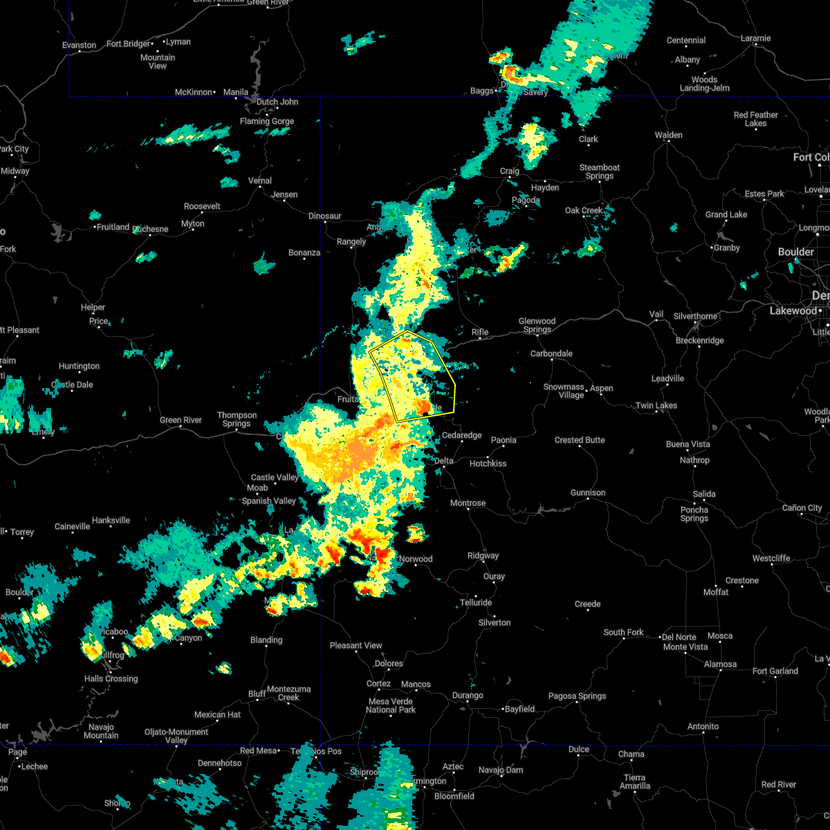
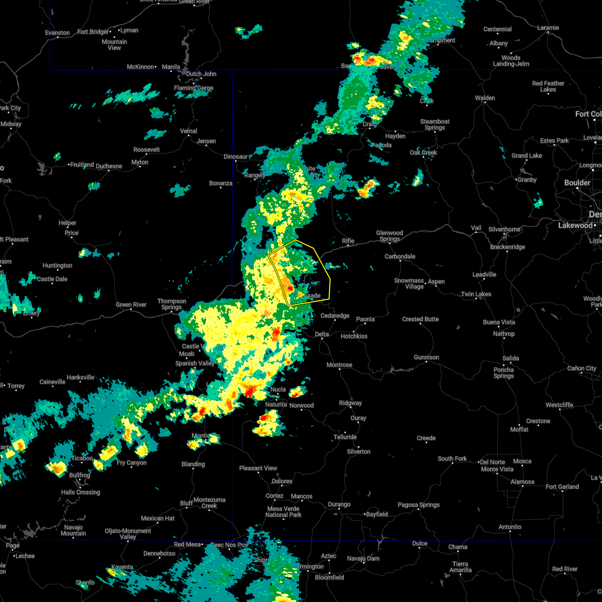
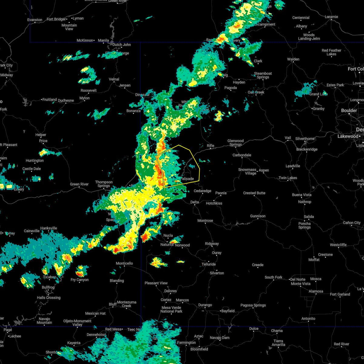
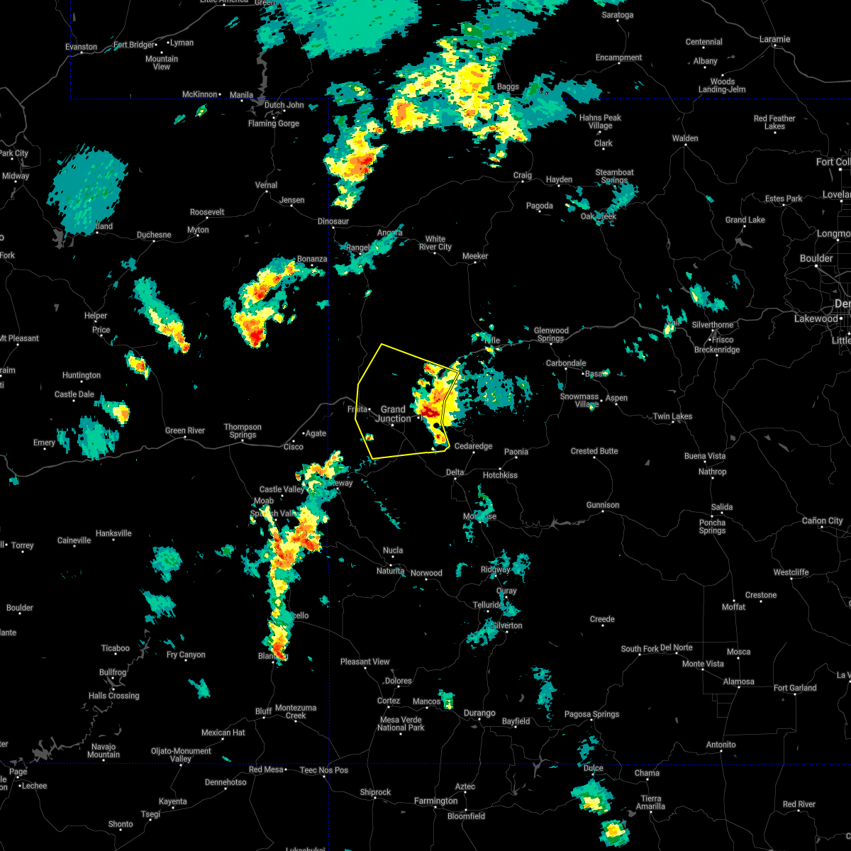
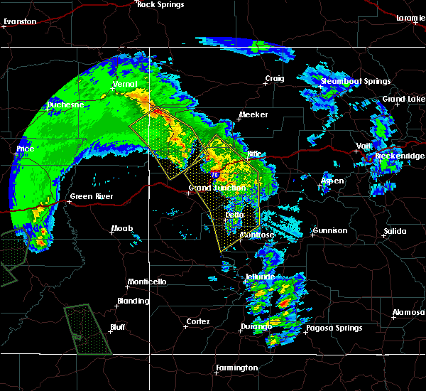
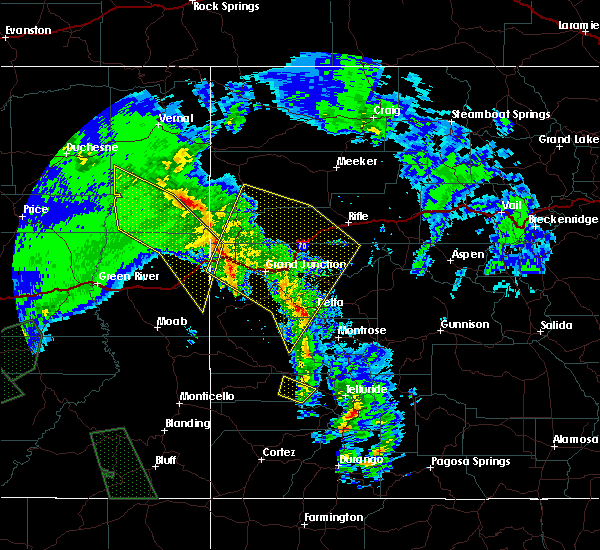
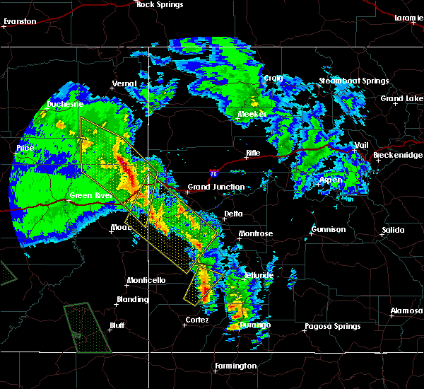
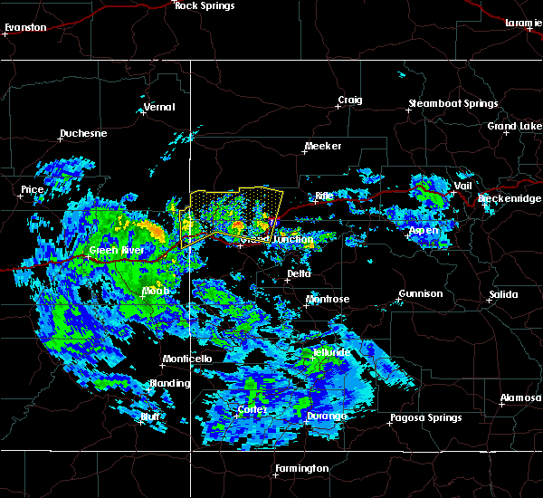
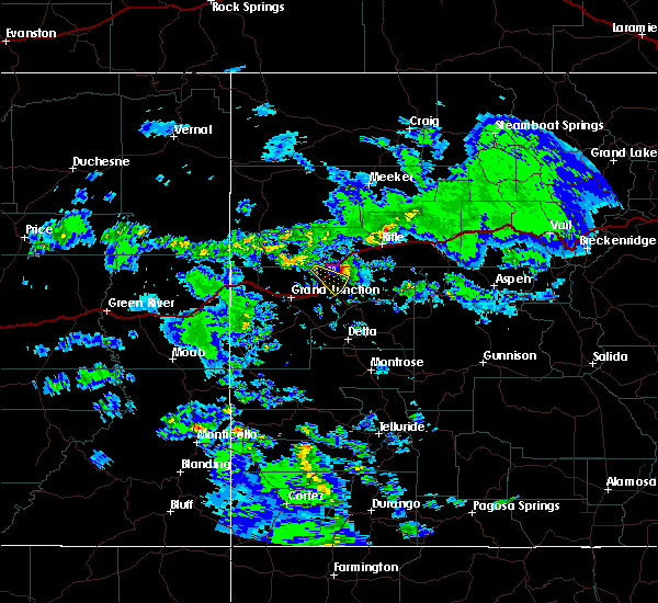
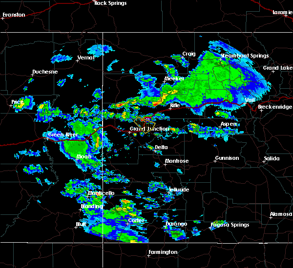
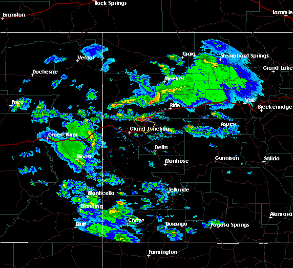
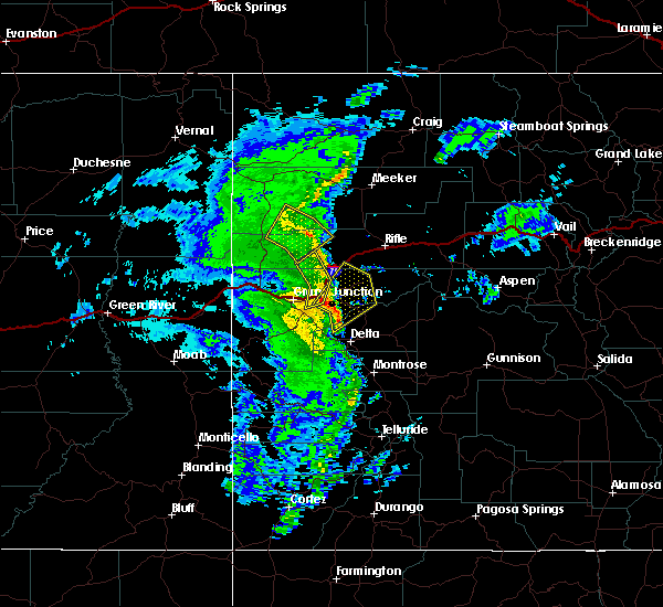
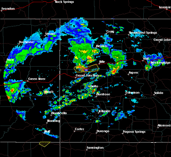
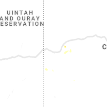
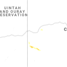
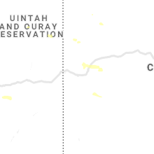
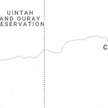
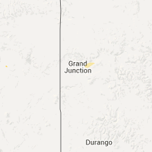
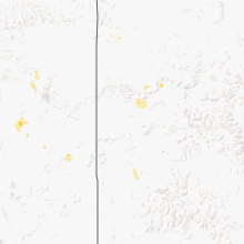
Hail Map for De Beque, CO
The De Beque, CO area has had 2 reports of on-the-ground hail by trained spotters, and has been under severe weather warnings 0 times during the past 12 months. Doppler radar has detected hail at or near De Beque, CO on 9 occasions.
| Name: | De Beque, CO |
| Where Located: | 26.1 miles NE of Grand Junction, CO |
| Map: | Google Map for De Beque, CO |
| Population: | 504 |
| Housing Units: | 222 |
| More Info: | Search Google for De Beque, CO |
5
The Top Recent Hail Date for De Beque, CO is Sunday, June 30, 2024 (2nd out of 9)

Hail and Wind Damage Spotted near De Beque, CO
| Date / Time | Report Details |
|---|---|
| 9/16/2024 1:56 PM MDT | Mesonet station co098 139s034 douglas pas in garfield county CO, 38.1 miles ESE of De Beque, CO |
| 6/15/2023 4:22 PM MDT | Mesonet station co098 139s034 douglas pas in garfield county CO, 38.1 miles ESE of De Beque, CO |
| 6/7/2023 4:47 PM MDT | Mesonet station co118 070e051 beaver tail tunne in mesa county CO, 9.2 miles NNE of De Beque, CO |
| 10/2/2022 6:26 PM MDT |
 The severe thunderstorm warning for north central mesa and south central garfield counties will expire at 630 pm mdt, the storms which prompted the warning have weakened below severe limits, and no longer pose an immediate threat to life or property. therefore, the warning will be allowed to expire. however gusty winds and heavy rain are still possible with these thunderstorms. The severe thunderstorm warning for north central mesa and south central garfield counties will expire at 630 pm mdt, the storms which prompted the warning have weakened below severe limits, and no longer pose an immediate threat to life or property. therefore, the warning will be allowed to expire. however gusty winds and heavy rain are still possible with these thunderstorms.
|
| 10/2/2022 6:16 PM MDT |
 At 615 pm mdt, severe thunderstorms were located along a line extending from 18 miles west of parachute to near de beque to 14 miles west of collbran to 9 miles southeast of palisade, moving east at 60 mph (radar indicated). Hazards include 60 mph wind gusts. Expect damage to roofs, siding, and trees. locations impacted include, collbran. this includes the following highways, interstate 70 in colorado between mile markers 36 and 70. colorado 65 between mile markers 38 and 61. colorado 141 between mile markers 161 and 162. hail threat, radar indicated max hail size, <. 75 in wind threat, radar indicated max wind gust, 60 mph. At 615 pm mdt, severe thunderstorms were located along a line extending from 18 miles west of parachute to near de beque to 14 miles west of collbran to 9 miles southeast of palisade, moving east at 60 mph (radar indicated). Hazards include 60 mph wind gusts. Expect damage to roofs, siding, and trees. locations impacted include, collbran. this includes the following highways, interstate 70 in colorado between mile markers 36 and 70. colorado 65 between mile markers 38 and 61. colorado 141 between mile markers 161 and 162. hail threat, radar indicated max hail size, <. 75 in wind threat, radar indicated max wind gust, 60 mph.
|
| 10/2/2022 5:56 PM MDT |
 At 555 pm mdt, severe thunderstorms were located along a line extending from 27 miles west of de beque to 11 miles northeast of fruita to near grand junction, moving east at 60 mph (radar indicated). Hazards include 60 mph wind gusts. Expect damage to roofs, siding, and trees. severe thunderstorms will be near, palisade around 605 pm mdt. de beque around 615 pm mdt. other locations in the path of these severe thunderstorms include collbran. this includes the following highways, interstate 70 in colorado between mile markers 26 and 70. u. s. highway 50 in colorado between mile markers 32 and 39. colorado 65 between mile markers 38 and 61. colorado 141 between mile markers 157 and 162. hail threat, radar indicated max hail size, <. 75 in wind threat, radar indicated max wind gust, 60 mph. At 555 pm mdt, severe thunderstorms were located along a line extending from 27 miles west of de beque to 11 miles northeast of fruita to near grand junction, moving east at 60 mph (radar indicated). Hazards include 60 mph wind gusts. Expect damage to roofs, siding, and trees. severe thunderstorms will be near, palisade around 605 pm mdt. de beque around 615 pm mdt. other locations in the path of these severe thunderstorms include collbran. this includes the following highways, interstate 70 in colorado between mile markers 26 and 70. u. s. highway 50 in colorado between mile markers 32 and 39. colorado 65 between mile markers 38 and 61. colorado 141 between mile markers 157 and 162. hail threat, radar indicated max hail size, <. 75 in wind threat, radar indicated max wind gust, 60 mph.
|
| 7/28/2021 6:30 PM MDT |
 At 630 pm mdt, severe thunderstorms were located along a line extending from 6 miles west of de beque to near palisade to 15 miles southeast of grand junction, moving west at 30 mph (radar indicated). Hazards include 60 mph wind gusts and quarter size hail. Hail damage to vehicles is expected. Expect wind damage to roofs, siding, and trees. At 630 pm mdt, severe thunderstorms were located along a line extending from 6 miles west of de beque to near palisade to 15 miles southeast of grand junction, moving west at 30 mph (radar indicated). Hazards include 60 mph wind gusts and quarter size hail. Hail damage to vehicles is expected. Expect wind damage to roofs, siding, and trees.
|
| 11/7/2020 7:49 PM MST | Mesonet station dmmc2 demaree... mack 16 in garfield county CO, 37.4 miles ESE of De Beque, CO |
| 6/6/2020 12:28 PM MDT |
 At 1228 pm mdt, severe thunderstorms were located along a line extending from 19 miles northwest of parachute to 6 miles south of collbran, moving northeast at 80 mph (radar indicated). Hazards include 70 mph wind gusts. Expect considerable tree damage. Damage is likely to mobile homes, roofs, and outbuildings. At 1228 pm mdt, severe thunderstorms were located along a line extending from 19 miles northwest of parachute to 6 miles south of collbran, moving northeast at 80 mph (radar indicated). Hazards include 70 mph wind gusts. Expect considerable tree damage. Damage is likely to mobile homes, roofs, and outbuildings.
|
| 6/6/2020 12:16 PM MDT |
 At 1215 pm mdt, severe thunderstorms were located along a line extending from 15 miles northwest of de beque to 11 miles north of cedaredge to near olathe, moving northeast at 70 mph (trained weather spotters). Hazards include 70 mph wind gusts. Expect considerable tree damage. damage is likely to mobile homes, roofs, and outbuildings. locations impacted include, montrose, delta, orchard city, palisade, cedaredge, olathe, parachute, hotchkiss, collbran, de beque, crawford, mesa, battlement mesa, cameo, molina, austin, skyway, lazear, cory and plateau city. this includes the following highways, interstate 70 in colorado between mile markers 38 and 89. u. s. highway 50 in colorado between mile markers 61 and 91. colorado 65 between mile markers 1 and 61. colorado 90 mile marker 82 and near mile marker 88. colorado 92 between mile markers 1 and 31. Colorado 133 between mile markers 1 and 7. At 1215 pm mdt, severe thunderstorms were located along a line extending from 15 miles northwest of de beque to 11 miles north of cedaredge to near olathe, moving northeast at 70 mph (trained weather spotters). Hazards include 70 mph wind gusts. Expect considerable tree damage. damage is likely to mobile homes, roofs, and outbuildings. locations impacted include, montrose, delta, orchard city, palisade, cedaredge, olathe, parachute, hotchkiss, collbran, de beque, crawford, mesa, battlement mesa, cameo, molina, austin, skyway, lazear, cory and plateau city. this includes the following highways, interstate 70 in colorado between mile markers 38 and 89. u. s. highway 50 in colorado between mile markers 61 and 91. colorado 65 between mile markers 1 and 61. colorado 90 mile marker 82 and near mile marker 88. colorado 92 between mile markers 1 and 31. Colorado 133 between mile markers 1 and 7.
|
| 6/6/2020 11:59 AM MDT |
 At 1159 am mdt, severe thunderstorms were located along a line extending from 9 miles northeast of fruita to 6 miles northwest of delta to 13 miles west of montrose, moving northeast at 70 mph (trained weather spotters). Hazards include 70 mph wind gusts and penny size hail. Expect considerable tree damage. Damage is likely to mobile homes, roofs, and outbuildings. At 1159 am mdt, severe thunderstorms were located along a line extending from 9 miles northeast of fruita to 6 miles northwest of delta to 13 miles west of montrose, moving northeast at 70 mph (trained weather spotters). Hazards include 70 mph wind gusts and penny size hail. Expect considerable tree damage. Damage is likely to mobile homes, roofs, and outbuildings.
|
| 6/6/2020 11:53 AM MDT |
 At 1152 am mdt, severe thunderstorms were located along a line extending from 27 miles north of fruita to 7 miles northwest of de beque to 10 miles northwest of cedaredge, moving north at 115 mph (radar indicated). Hazards include 60 mph wind gusts and penny size hail. the highest winds appear to be occuring near the whitewater area. Expect damage to roofs, siding, and trees. locations impacted include, grand junction, fruita, delta, palisade, parachute, collbran, de beque, mesa, battlement mesa, cameo, fruitvale, molina, clifton, whitewater, glade park, redlands, skyway, escalante forks, loma and plateau city. this includes the following highways, interstate 70 in colorado between mile markers 1 and 85. u. s. highway 50 in colorado between mile markers 32 and 72. colorado 65 between mile markers 14 and 61. colorado 92 near mile marker 1. colorado 139 between mile markers 1 and 58. colorado 141 between mile markers 137 and 162. Time, mot, loc 1752z 202deg 102kt 3955 10879 3938 10833 3903 10802. At 1152 am mdt, severe thunderstorms were located along a line extending from 27 miles north of fruita to 7 miles northwest of de beque to 10 miles northwest of cedaredge, moving north at 115 mph (radar indicated). Hazards include 60 mph wind gusts and penny size hail. the highest winds appear to be occuring near the whitewater area. Expect damage to roofs, siding, and trees. locations impacted include, grand junction, fruita, delta, palisade, parachute, collbran, de beque, mesa, battlement mesa, cameo, fruitvale, molina, clifton, whitewater, glade park, redlands, skyway, escalante forks, loma and plateau city. this includes the following highways, interstate 70 in colorado between mile markers 1 and 85. u. s. highway 50 in colorado between mile markers 32 and 72. colorado 65 between mile markers 14 and 61. colorado 92 near mile marker 1. colorado 139 between mile markers 1 and 58. colorado 141 between mile markers 137 and 162. Time, mot, loc 1752z 202deg 102kt 3955 10879 3938 10833 3903 10802.
|
| 6/6/2020 11:35 AM MDT |
 At 1134 am mdt, severe thunderstorms were located along a line extending from 16 miles west of fruita to 10 miles south of grand junction to 14 miles west of olathe, moving northeast at 120 mph (radar indicated). Hazards include 70 mph wind gusts and penny size hail. Expect considerable tree damage. Damage is likely to mobile homes, roofs, and outbuildings. At 1134 am mdt, severe thunderstorms were located along a line extending from 16 miles west of fruita to 10 miles south of grand junction to 14 miles west of olathe, moving northeast at 120 mph (radar indicated). Hazards include 70 mph wind gusts and penny size hail. Expect considerable tree damage. Damage is likely to mobile homes, roofs, and outbuildings.
|
| 6/5/2020 8:24 PM MDT | Mesonet station co098 139s034 douglas pas in garfield county CO, 37.6 miles ESE of De Beque, CO |
| 6/5/2020 8:03 PM MDT |
 At 803 pm mdt, doppler radar indicated severe thunderstorms capable of producing damaging winds in excess of 60 mph. these storms were located along a line extending from 9 miles northwest of de beque to 32 miles north of grand junction to 24 miles northwest of fruita, moving north at 45 mph. locations impacted include, de beque. At 803 pm mdt, doppler radar indicated severe thunderstorms capable of producing damaging winds in excess of 60 mph. these storms were located along a line extending from 9 miles northwest of de beque to 32 miles north of grand junction to 24 miles northwest of fruita, moving north at 45 mph. locations impacted include, de beque.
|
| 6/5/2020 7:41 PM MDT |
 At 741 pm mdt, doppler radar indicated a line of severe thunderstorms capable of producing destructive winds in excess of 70 mph. these storms were located along a line extending from 6 miles north of palisade to 10 miles north of fruita to 26 miles west of grand junction, and moving north at 45 mph. At 741 pm mdt, doppler radar indicated a line of severe thunderstorms capable of producing destructive winds in excess of 70 mph. these storms were located along a line extending from 6 miles north of palisade to 10 miles north of fruita to 26 miles west of grand junction, and moving north at 45 mph.
|
| 6/5/2020 5:54 PM MDT | Storm damage reported in mesa county CO, 9.2 miles NNE of De Beque, CO |
| 5/11/2020 4:57 PM MDT |
 At 455 pm mdt, a severe thunderstorm was located near de beque, or 26 miles northeast of grand junction, moving east at 20 mph (trained weather spotters in de beque observed half dollar sized hail). Hazards include 60 mph wind gusts and half dollar size hail. Hail damage to vehicles is expected. Expect wind damage to roofs, siding, and trees. At 455 pm mdt, a severe thunderstorm was located near de beque, or 26 miles northeast of grand junction, moving east at 20 mph (trained weather spotters in de beque observed half dollar sized hail). Hazards include 60 mph wind gusts and half dollar size hail. Hail damage to vehicles is expected. Expect wind damage to roofs, siding, and trees.
|
| 5/11/2020 4:53 PM MDT | Half Dollar sized hail reported 0.9 miles NNE of De Beque, CO |
| 5/11/2020 4:45 PM MDT | Quarter sized hail reported 0.4 miles ENE of De Beque, CO, dispatch reports numerous vehicles sheltering under highway overpass due to large hail on i-70 south of de beque... with resulting slowdowns on the highway. |
| 5/11/2020 4:35 PM MDT |
 At 434 pm mdt, a severe thunderstorm was located near de beque, or 20 miles northeast of grand junction, moving east at 20 mph (radar indicated). Hazards include 60 mph wind gusts and quarter size hail. Hail damage to vehicles is expected. expect wind damage to roofs, siding, and trees. locations impacted include, de beque and mesa. this includes the following highways, interstate 70 in colorado between mile markers 52 and 61. Colorado 65 between mile markers 48 and 57. At 434 pm mdt, a severe thunderstorm was located near de beque, or 20 miles northeast of grand junction, moving east at 20 mph (radar indicated). Hazards include 60 mph wind gusts and quarter size hail. Hail damage to vehicles is expected. expect wind damage to roofs, siding, and trees. locations impacted include, de beque and mesa. this includes the following highways, interstate 70 in colorado between mile markers 52 and 61. Colorado 65 between mile markers 48 and 57.
|
| 5/11/2020 4:24 PM MDT |
 At 423 pm mdt, a severe thunderstorm was located 8 miles west of de beque, or 18 miles northeast of grand junction, moving southeast at 30 mph (radar indicated). Hazards include 60 mph wind gusts and quarter size hail. Hail damage to vehicles is expected. Expect wind damage to roofs, siding, and trees. At 423 pm mdt, a severe thunderstorm was located 8 miles west of de beque, or 18 miles northeast of grand junction, moving southeast at 30 mph (radar indicated). Hazards include 60 mph wind gusts and quarter size hail. Hail damage to vehicles is expected. Expect wind damage to roofs, siding, and trees.
|
| 9/8/2019 4:34 PM MDT | Mesonet station co098 douglas pas in garfield county CO, 37.6 miles ESE of De Beque, CO |
| 6/18/2019 5:52 PM MDT |
 At 551 pm mdt, a severe thunderstorm was located over de beque, or 26 miles northeast of grand junction, moving southeast at 20 mph (radar indicated). Hazards include quarter size hail. damage to vehicles is expected At 551 pm mdt, a severe thunderstorm was located over de beque, or 26 miles northeast of grand junction, moving southeast at 20 mph (radar indicated). Hazards include quarter size hail. damage to vehicles is expected
|
| 6/14/2019 2:55 PM MDT | Mesonet station co098 douglas pas in garfield county CO, 37.6 miles ESE of De Beque, CO |
| 10/4/2018 1:15 PM MDT | Mesonet station co098... douglas pas in garfield county CO, 37.6 miles ESE of De Beque, CO |
| 10/4/2018 10:05 AM MDT | Storm damage reported in mesa county CO, 9.2 miles NNE of De Beque, CO |
| 10/4/2018 10:05 AM MDT | Storm damage reported in garfield county CO, 37.2 miles ESE of De Beque, CO |
| 10/4/2018 10:05 AM MDT |
 At 1004 am mdt, severe thunderstorms were located along a line extending from near palisade to 16 miles northwest of cedaredge to 9 miles northwest of delta, moving northeast at 50 mph (radar indicated). Hazards include 60 mph wind gusts and nickel size hail. expect damage to roofs, siding, and trees At 1004 am mdt, severe thunderstorms were located along a line extending from near palisade to 16 miles northwest of cedaredge to 9 miles northwest of delta, moving northeast at 50 mph (radar indicated). Hazards include 60 mph wind gusts and nickel size hail. expect damage to roofs, siding, and trees
|
| 8/21/2018 1:09 PM MDT |
 At 108 pm mdt, a severe thunderstorm was located near de beque, or 22 miles northeast of grand junction, moving east at 35 mph (this storm has had a history of producing damaging wind gusts as well as large hail at highline lake state park). Hazards include 60 mph wind gusts and nickel size hail. expect damage to roofs, siding, and trees At 108 pm mdt, a severe thunderstorm was located near de beque, or 22 miles northeast of grand junction, moving east at 35 mph (this storm has had a history of producing damaging wind gusts as well as large hail at highline lake state park). Hazards include 60 mph wind gusts and nickel size hail. expect damage to roofs, siding, and trees
|
| 7/17/2018 4:20 PM MDT |
 At 417 pm mdt, an outflow boundary associated with a line of decaying thunderstorms were located along a line extending from 7 miles north of palisade to 11 miles southeast of grand junction to 25 miles south of fruita, moving southeast at 60 mph (trained spotters reported. at 4:11 pm mdt, 70 mph wind gusts were measured at the grand junction regional airport with significantly reduced visibility in blowing dust). Hazards include 70 mph wind gusts. Expect considerable tree damage. Damage is likely to mobile homes, roofs, and outbuildings. At 417 pm mdt, an outflow boundary associated with a line of decaying thunderstorms were located along a line extending from 7 miles north of palisade to 11 miles southeast of grand junction to 25 miles south of fruita, moving southeast at 60 mph (trained spotters reported. at 4:11 pm mdt, 70 mph wind gusts were measured at the grand junction regional airport with significantly reduced visibility in blowing dust). Hazards include 70 mph wind gusts. Expect considerable tree damage. Damage is likely to mobile homes, roofs, and outbuildings.
|
| 9/30/2017 11:49 AM MDT | Mesonet station dmmc2... demaree - 16 n mac in garfield county CO, 37.4 miles ESE of De Beque, CO |
| 6/22/2017 3:49 PM MDT | Mesonet station dmmc2... demaree - 16 n mac in garfield county CO, 37.4 miles ESE of De Beque, CO |
| 5/6/2017 3:43 PM MDT | Mesonet station co098... douglas pass - 26 n mac in garfield county CO, 37.6 miles ESE of De Beque, CO |
| 8/25/2016 6:00 PM MDT | Two inch diameter branch broke in mesa county CO, 0.9 miles NNE of De Beque, CO |
| 5/22/2015 12:38 PM MDT | At 1233 pm mdt, a severe thunderstorm was located 9 miles west of de beque, or 16 miles northeast of grand junction, moving northeast at 15 mph. another strong storm was reported over palisade at 1235 pm and will move over de beque canyon by 1240 pm mdt (radar indicated. in fruitvale...quarter sized hail was reported at 1230 pm mdt). Hazards include quarter size hail and brief heavy rain. damage to vehicles is expected |
| 5/28/2014 8:39 PM MDT | Gust likely associated with rain shower to the southwest of de bequ in mesa county CO, 0.9 miles NNE of De Beque, CO |
| 10/3/2013 5:30 PM MDT | Power outage... 2 inch diameter tree limbs down in mesa county CO, 0.9 miles NNE of De Beque, CO |
| 6/4/2012 4:23 PM MDT | Storm damage reported in mesa county CO, 0.6 miles SSE of De Beque, CO |
Hail Maps for De Beque, CO

Connect with Interactive Hail Maps