

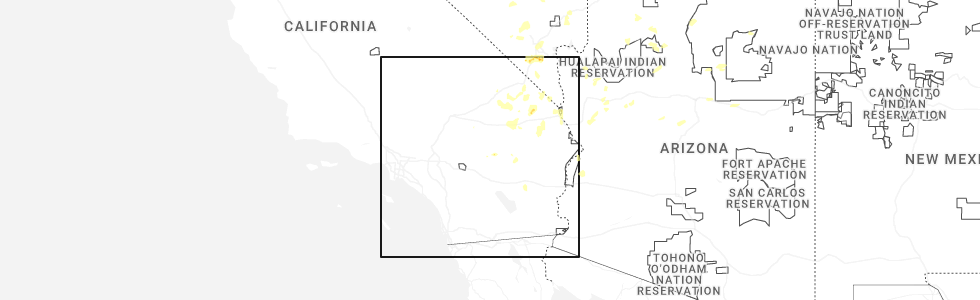
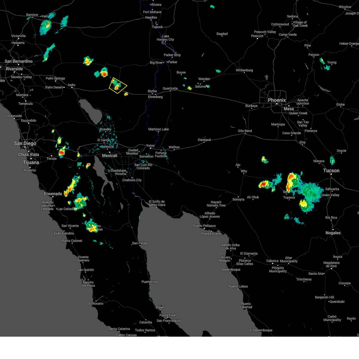
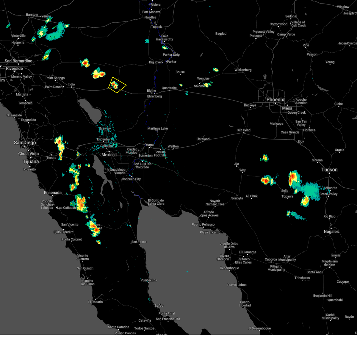
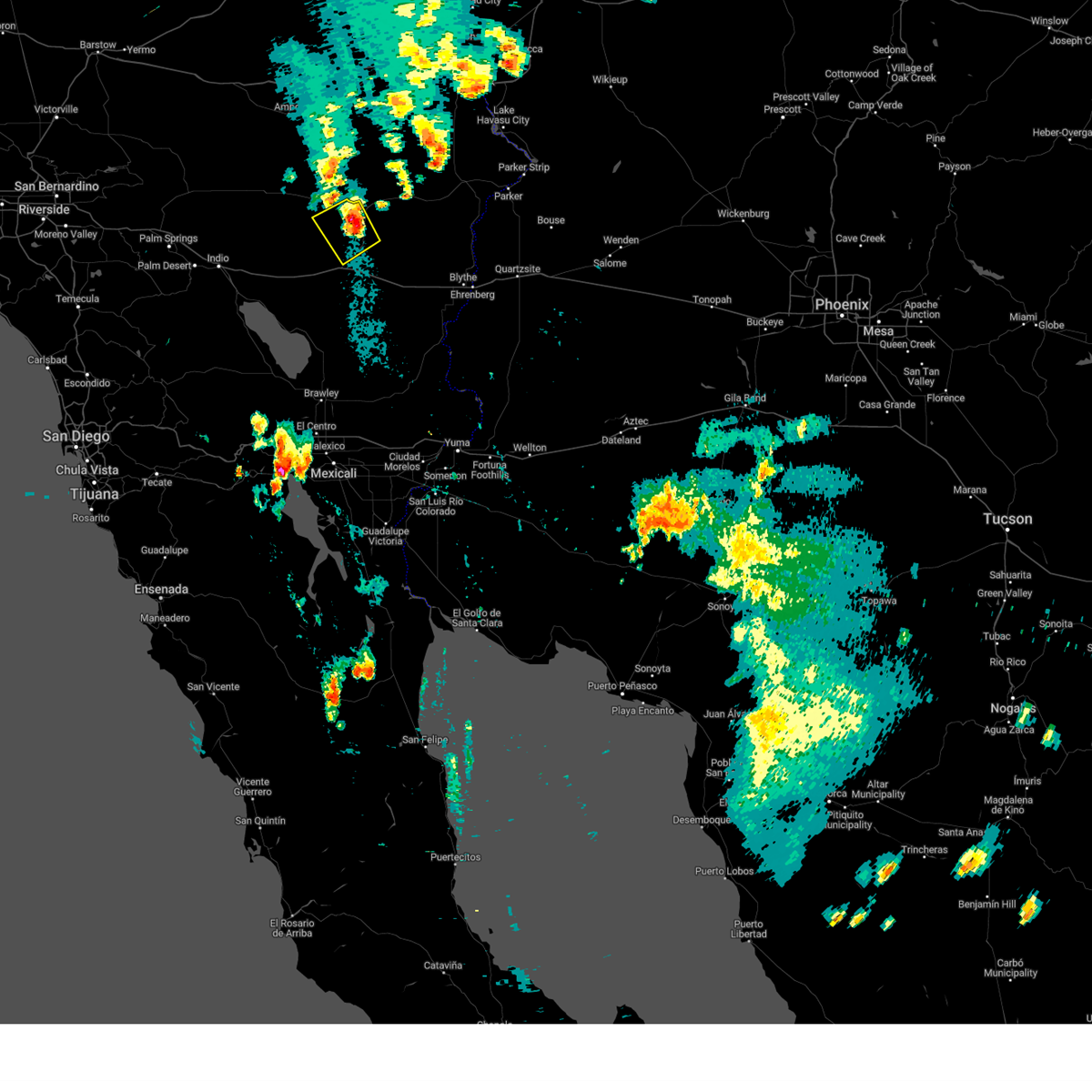
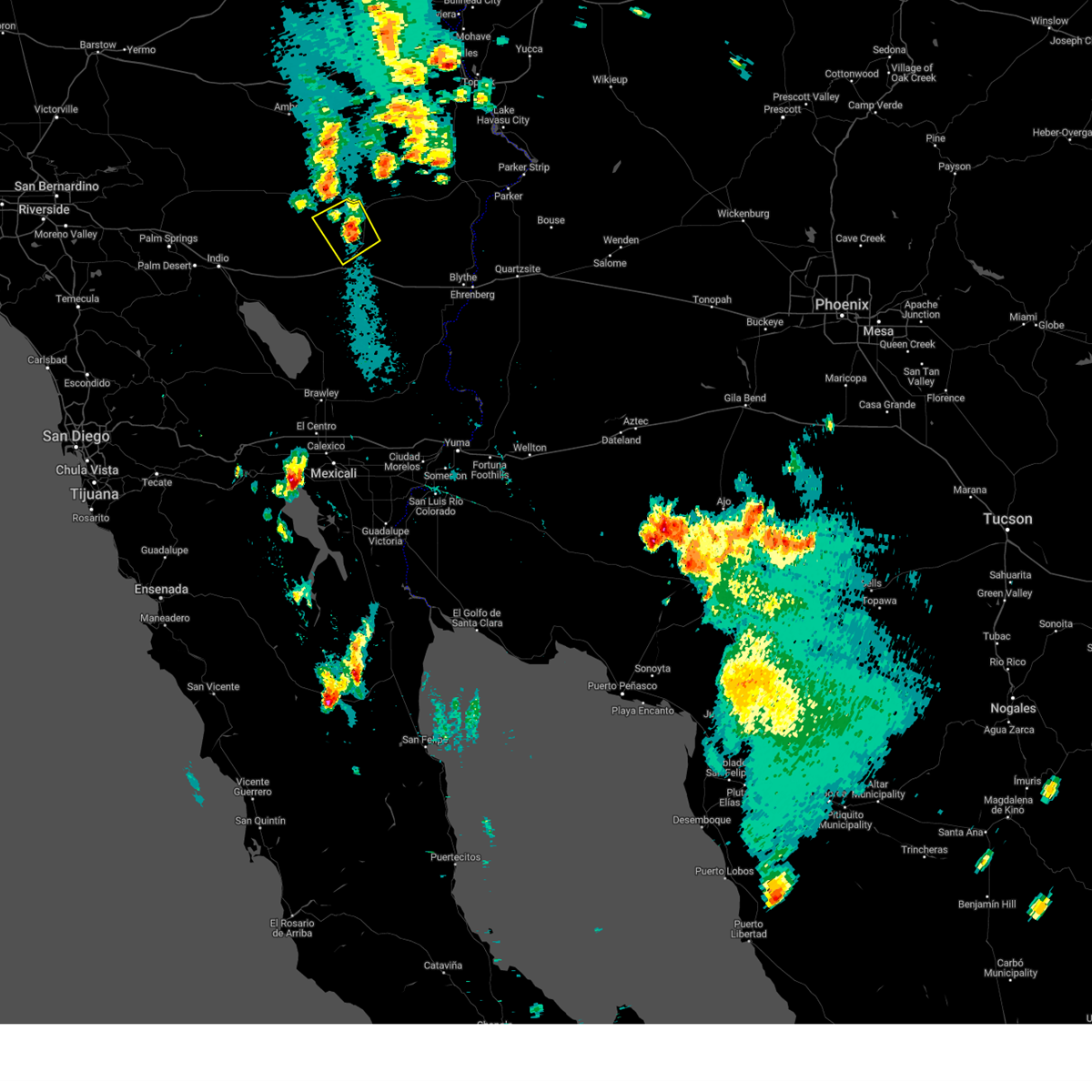
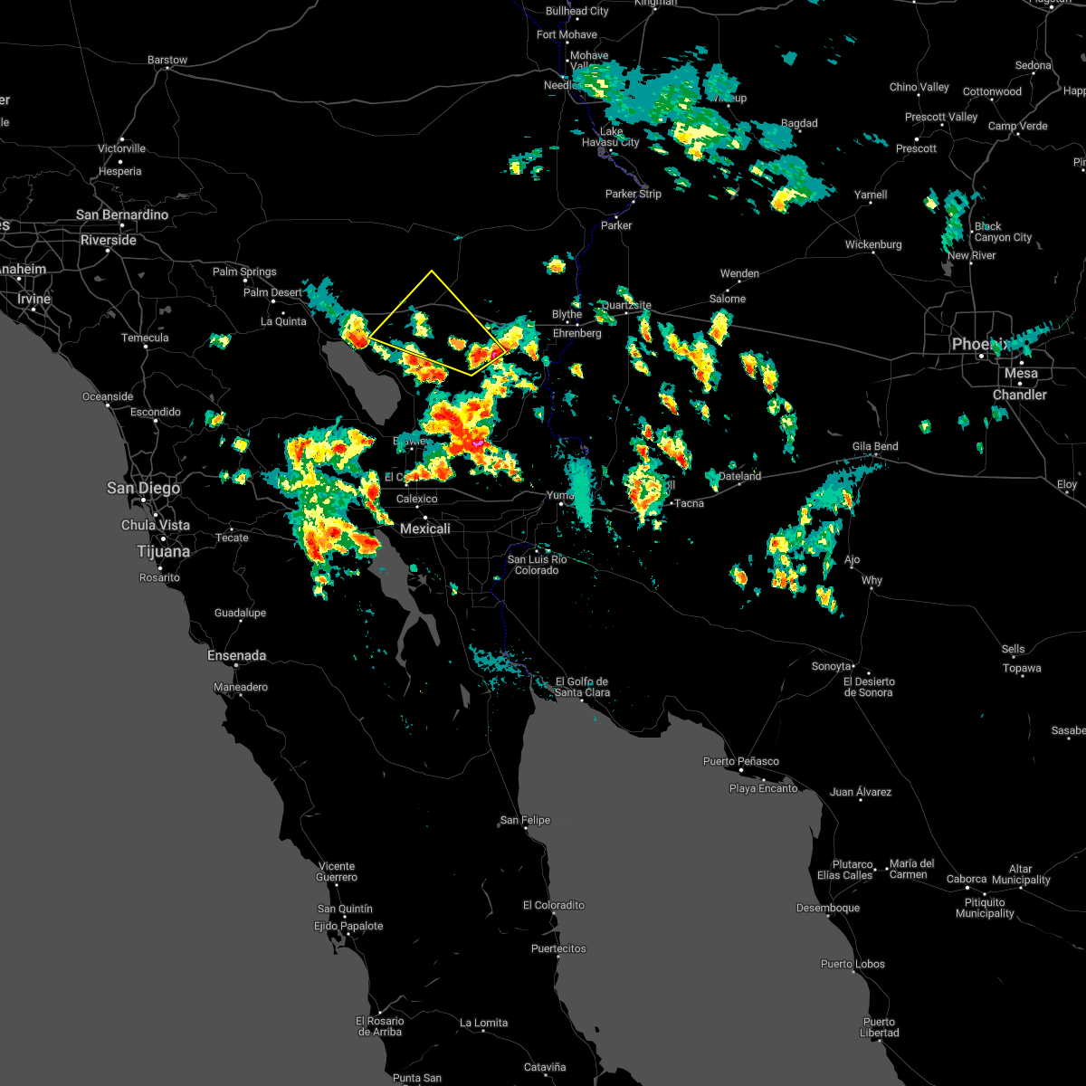
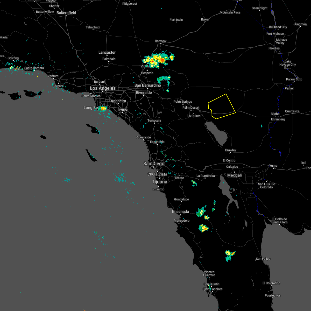
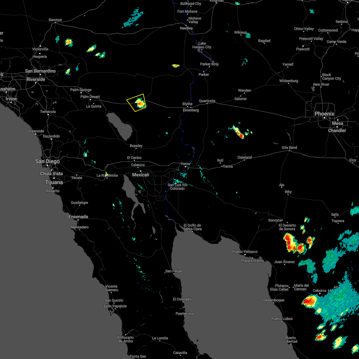
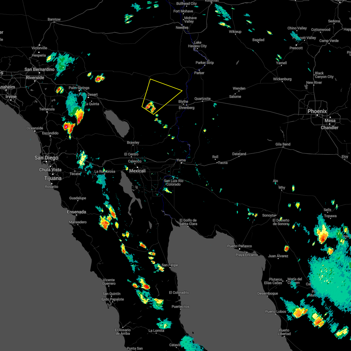
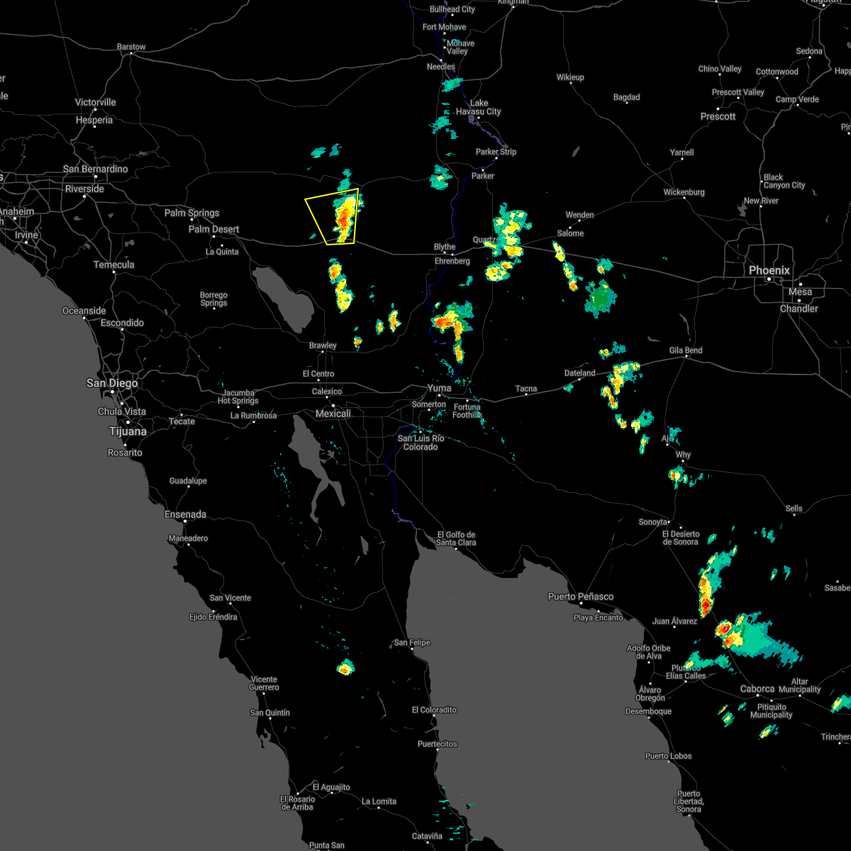
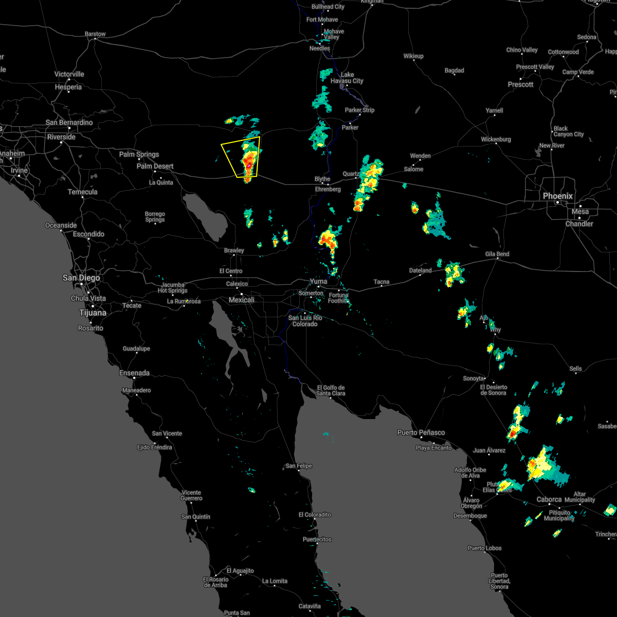
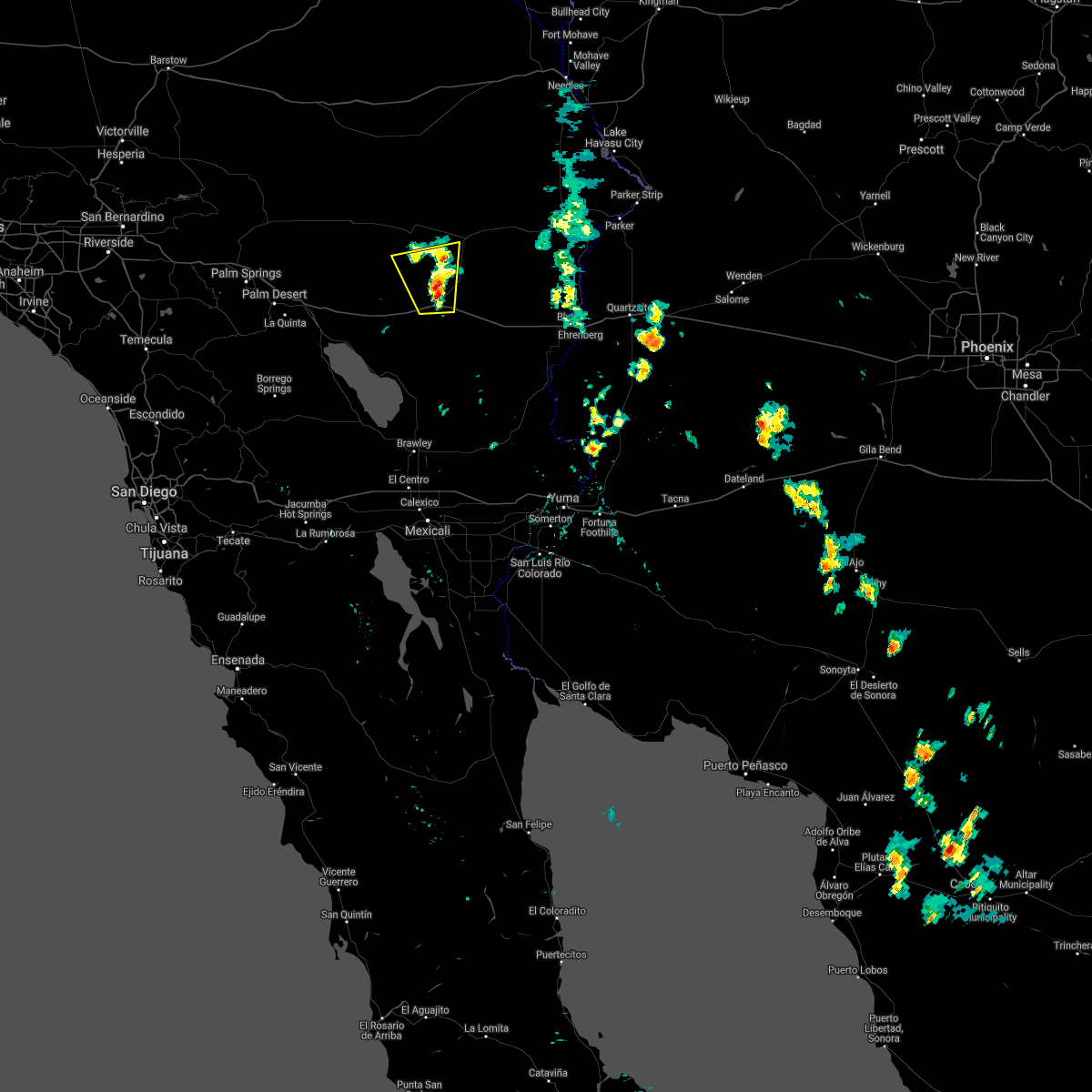
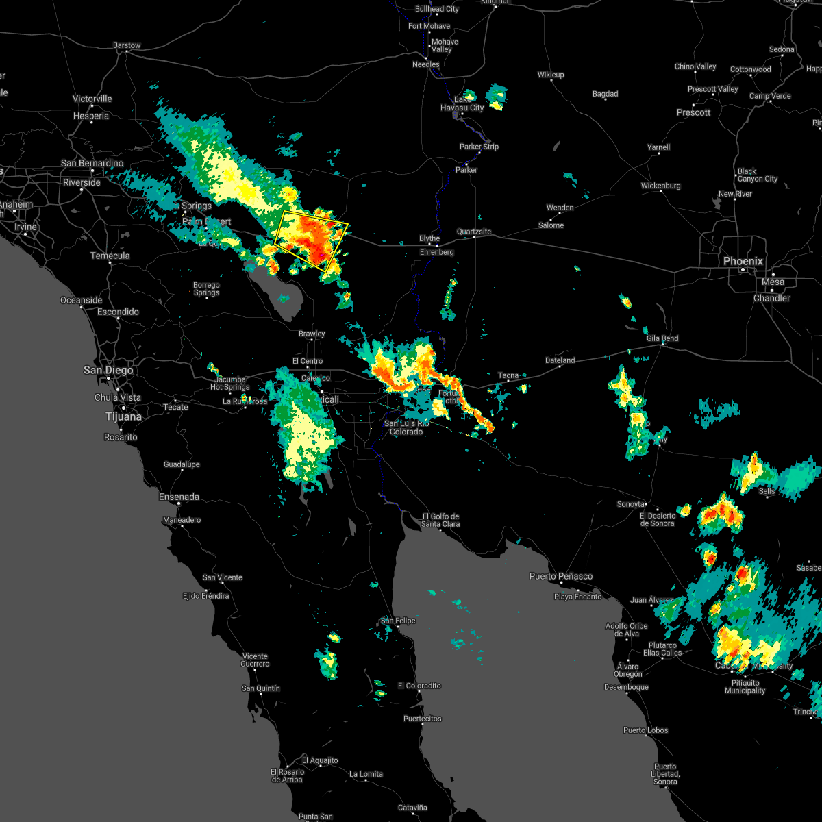
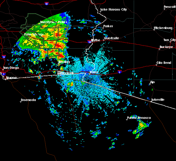
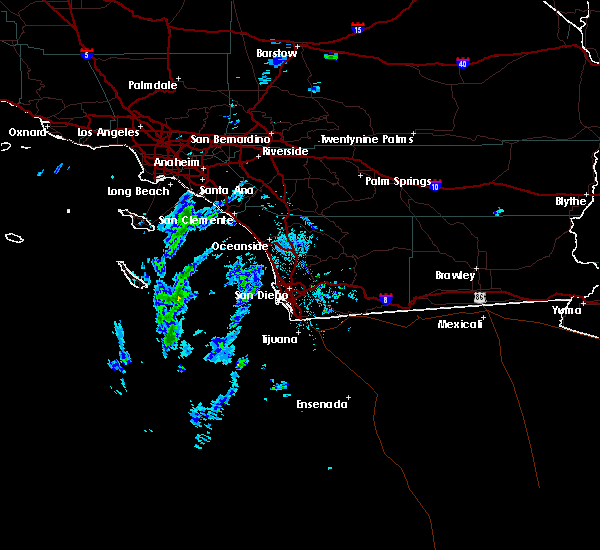
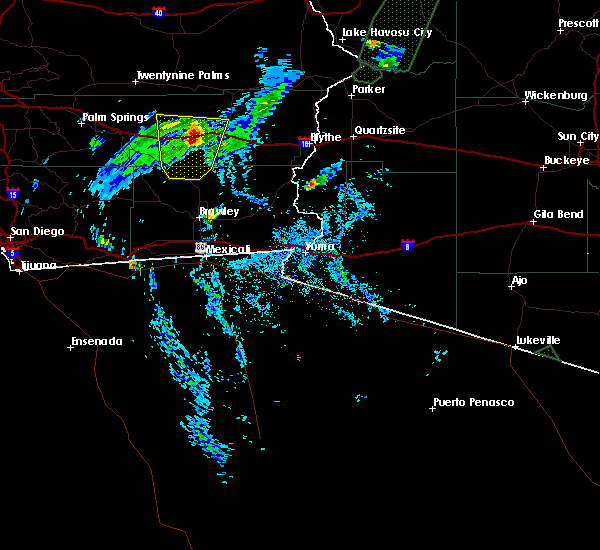
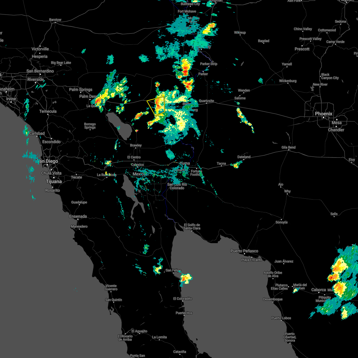
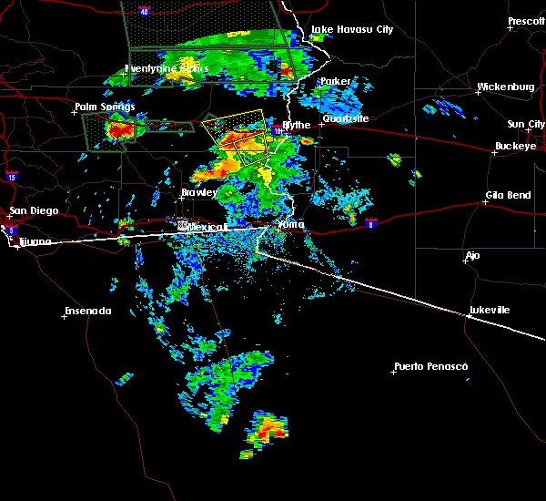
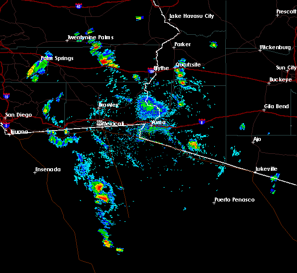
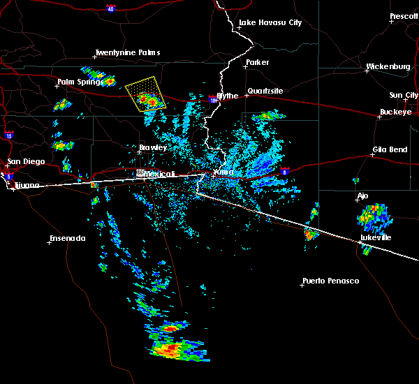
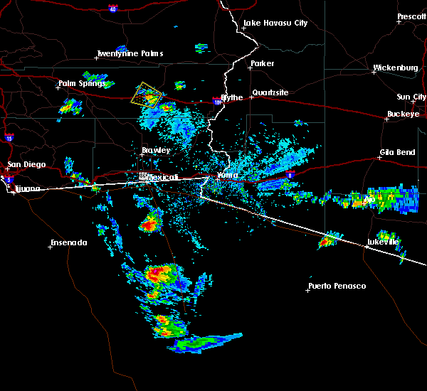
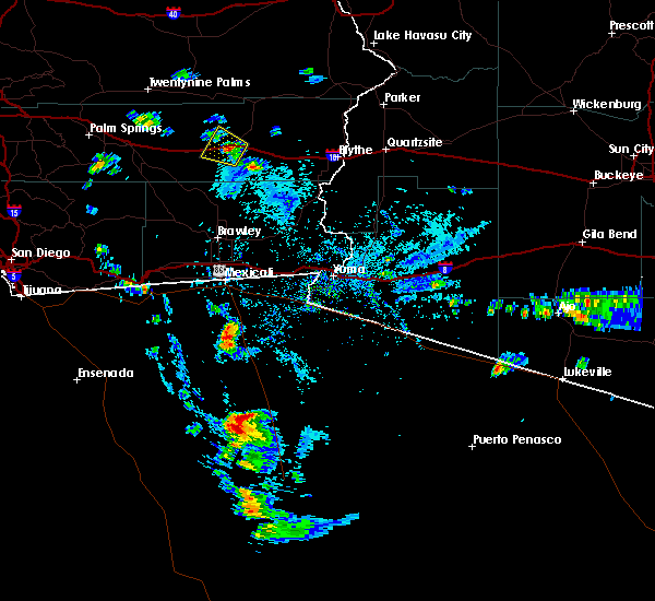
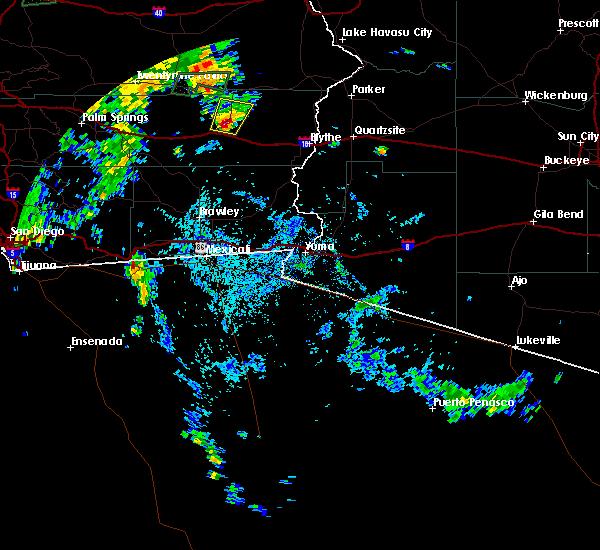
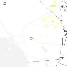
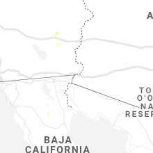
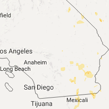
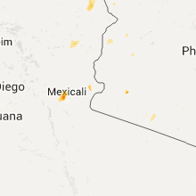
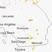
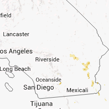
Hail Map for Desert Center, CA
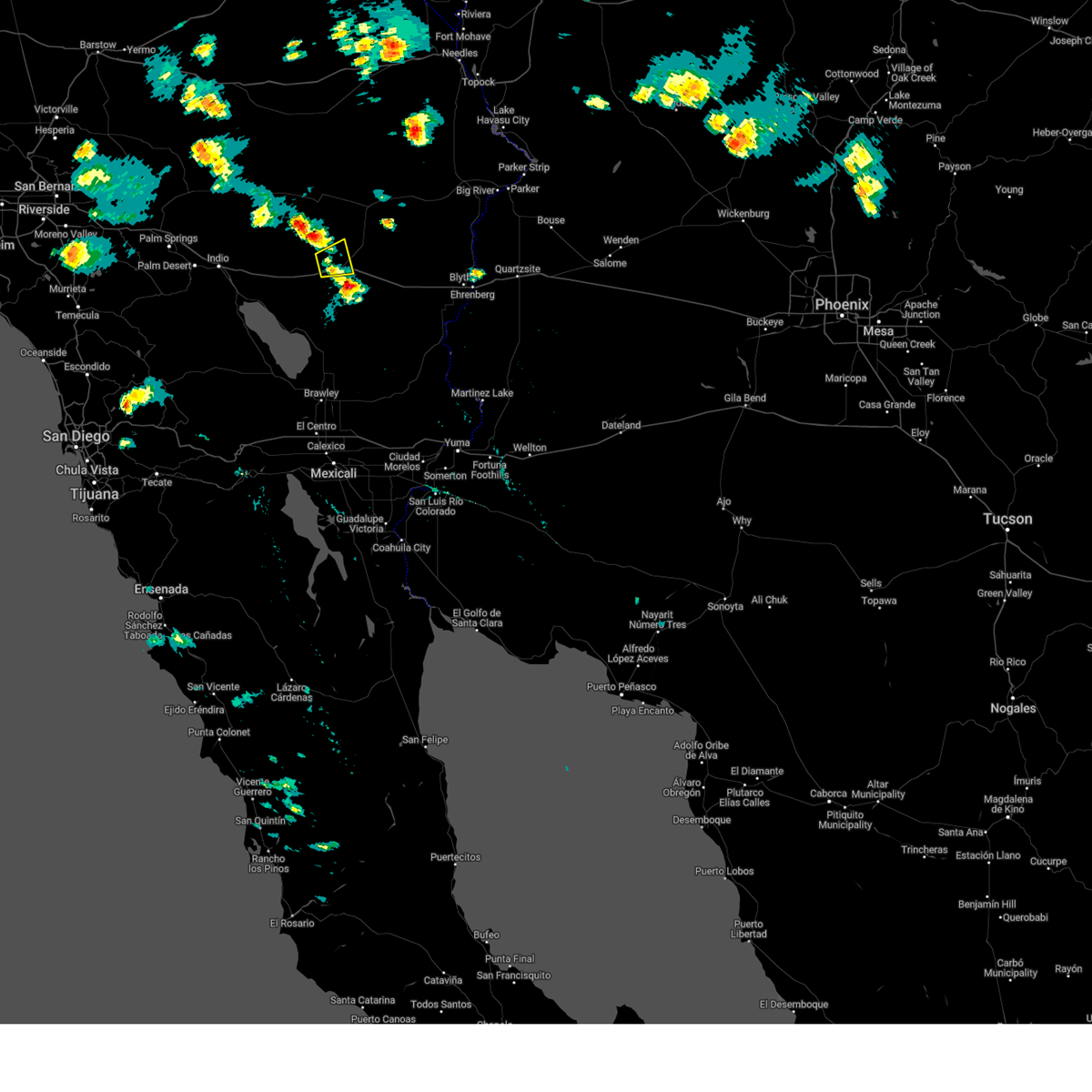
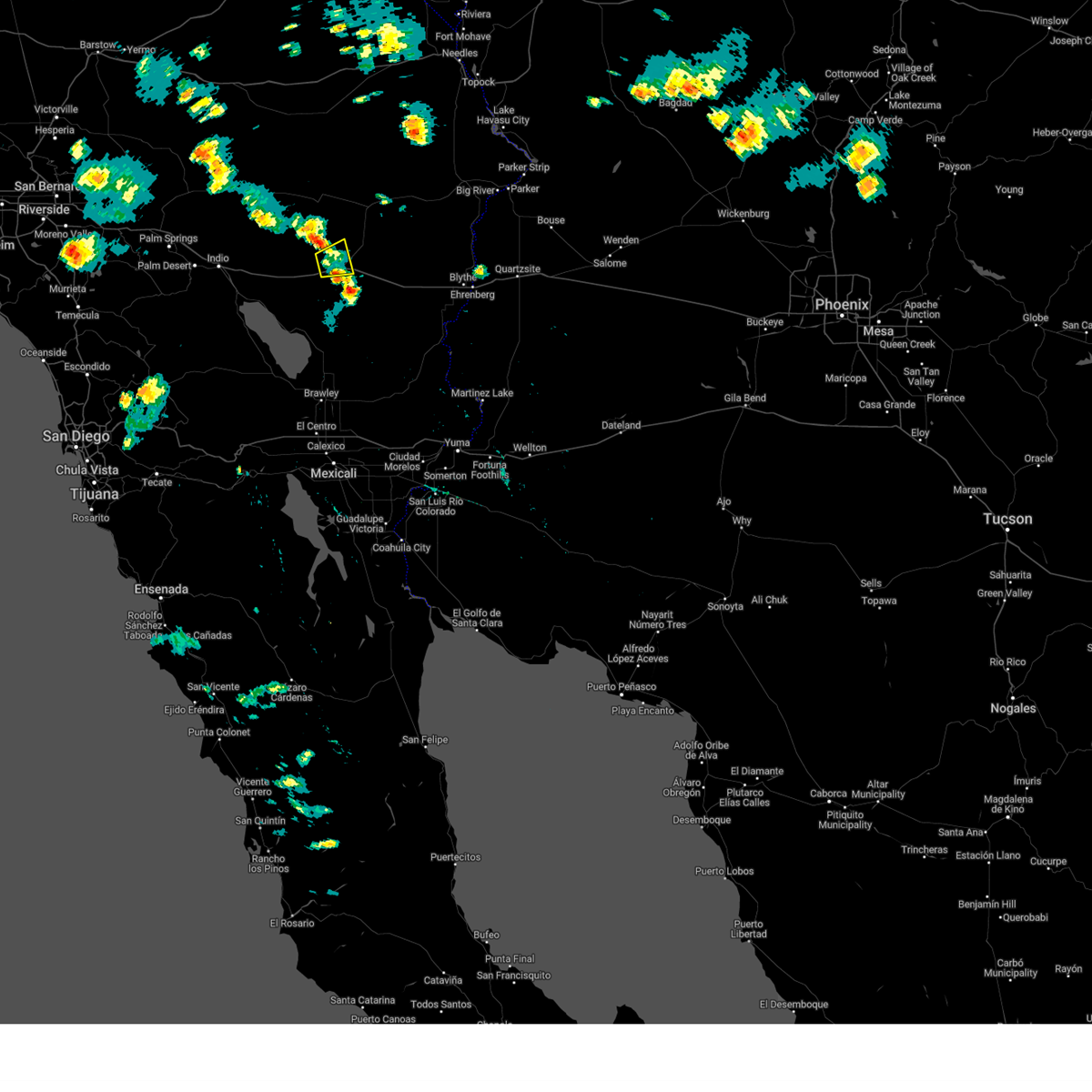
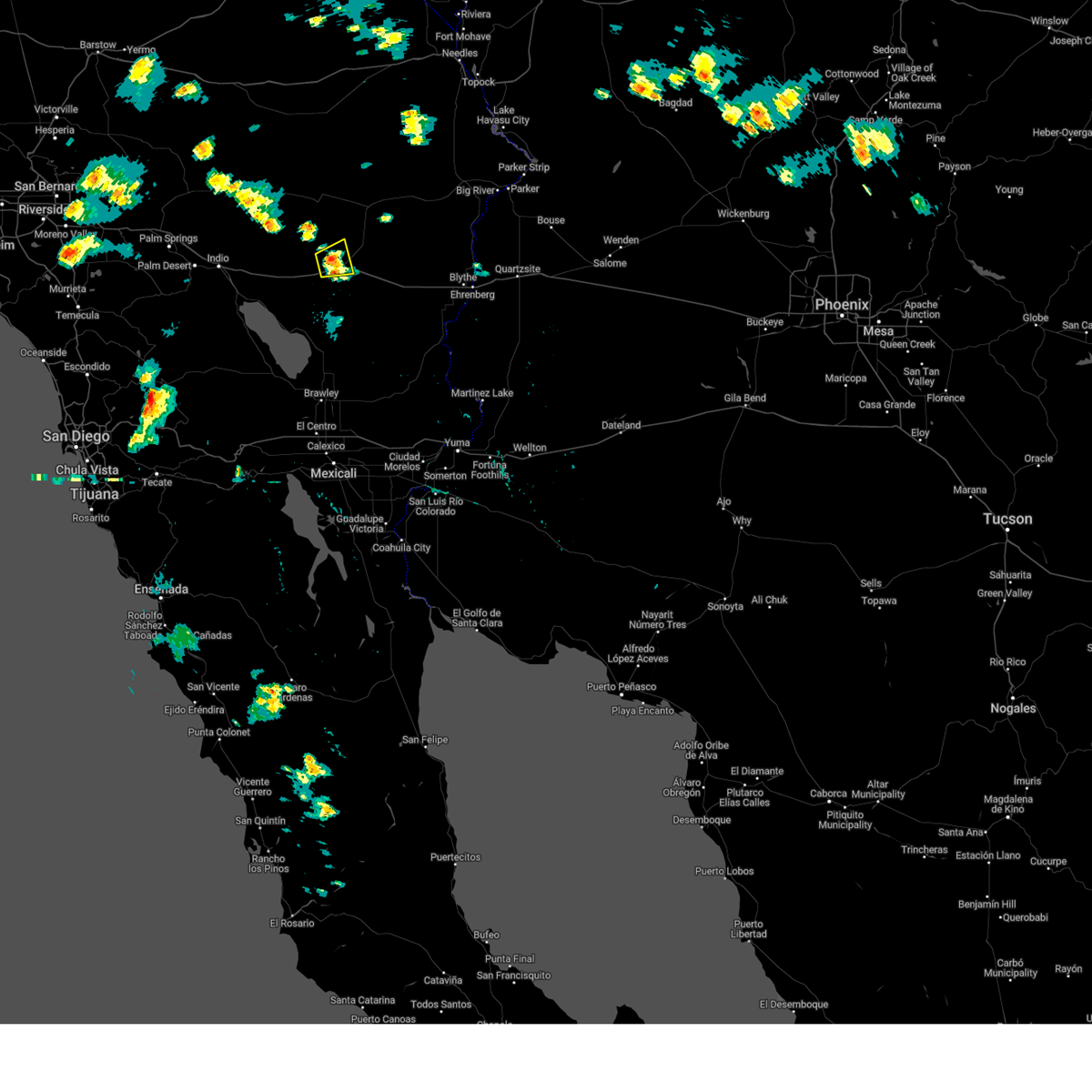
The Desert Center, CA area has had 0 reports of on-the-ground hail by trained spotters, and has been under severe weather warnings 7 times during the past 12 months. Doppler radar has detected hail at or near Desert Center, CA on 17 occasions, including 1 occasion during the past year.
| Name: | Desert Center, CA |
| Where Located: | 65.1 miles ESE of Yucca Valley, CA |
| Map: | Google Map for Desert Center, CA |
| Population: | 204 |
| Housing Units: | 140 |
| More Info: | Search Google for Desert Center, CA |
0
The Top Recent Hail Date for Desert Center, CA is Tuesday, June 3, 2025 (15th out of 17)
Hail and Wind Damage Spotted near Desert Center, CA
| Date / Time | Report Details |
|---|---|
| 9/7/2024 4:08 PM PDT |
 The storm which prompted the warning has weakened below severe limits, and has exited the warned area. therefore, the warning will be allowed to expire. The storm which prompted the warning has weakened below severe limits, and has exited the warned area. therefore, the warning will be allowed to expire.
|
| 9/7/2024 3:56 PM PDT |
 At 355 pm pdt, a severe thunderstorm was located near desert center, and is nearly stationary (radar indicated). Hazards include 60 mph wind gusts. Expect damage to roofs, siding, and trees. locations impacted include, desert center. this includes the following highways, ca interstate 10 between mile markers 97 and 109. Ca route 177 between mile markers 1 and 4. At 355 pm pdt, a severe thunderstorm was located near desert center, and is nearly stationary (radar indicated). Hazards include 60 mph wind gusts. Expect damage to roofs, siding, and trees. locations impacted include, desert center. this includes the following highways, ca interstate 10 between mile markers 97 and 109. Ca route 177 between mile markers 1 and 4.
|
| 9/7/2024 3:30 PM PDT |
 Svrpsr the national weather service in phoenix has issued a * severe thunderstorm warning for, riverside county in southern california, * until 415 pm pdt. * at 330 pm pdt, a severe thunderstorm was located near desert center, and is nearly stationary (radar indicated). Hazards include 60 mph wind gusts. expect damage to roofs, siding, and trees Svrpsr the national weather service in phoenix has issued a * severe thunderstorm warning for, riverside county in southern california, * until 415 pm pdt. * at 330 pm pdt, a severe thunderstorm was located near desert center, and is nearly stationary (radar indicated). Hazards include 60 mph wind gusts. expect damage to roofs, siding, and trees
|
| 7/24/2024 3:43 PM PDT |
 the severe thunderstorm warning has been cancelled and is no longer in effect the severe thunderstorm warning has been cancelled and is no longer in effect
|
| 7/24/2024 3:31 PM PDT | Semi-truck was flipped by strong wind gusts and was blocking most of the eb lanes causing traffic to back u in riverside county CA, 3.8 miles NW of Desert Center, CA |
| 7/24/2024 3:22 PM PDT |
 Svrpsr the national weather service in phoenix has issued a * severe thunderstorm warning for, riverside county in southern california, * until 400 pm pdt. * at 322 pm pdt, a severe thunderstorm was located near desert center, and is nearly stationary (radar indicated). Hazards include 60 mph wind gusts. expect damage to roofs, siding, and trees Svrpsr the national weather service in phoenix has issued a * severe thunderstorm warning for, riverside county in southern california, * until 400 pm pdt. * at 322 pm pdt, a severe thunderstorm was located near desert center, and is nearly stationary (radar indicated). Hazards include 60 mph wind gusts. expect damage to roofs, siding, and trees
|
| 7/15/2024 3:38 PM PDT | The storm which prompted the warning has weakened below severe limits, and no longer poses an immediate threat to life or property. therefore, the warning will be allowed to expire. |
| 7/15/2024 3:02 PM PDT | Svrpsr the national weather service in phoenix has issued a * severe thunderstorm warning for, riverside county in southern california, * until 345 pm pdt. * at 302 pm pdt, a severe thunderstorm was located 8 miles southeast of desert center, and is nearly stationary (radar indicated). Hazards include 60 mph wind gusts and penny size hail. Expect damage to roofs, siding, and trees. this severe thunderstorm will remain over mainly rural areas of riverside county. This includes ca interstate 10 between mile markers 107 and 114. |
| 8/18/2023 5:28 PM PDT |
 The severe thunderstorm warning for san bernardino and riverside counties will expire at 530 pm pdt, the storm which prompted the warning has weakened below severe limits, and no longer poses an immediate threat to life or property. therefore, the warning will be allowed to expire. however gusty winds and heavy rain will continue with this thunderstorm. The severe thunderstorm warning for san bernardino and riverside counties will expire at 530 pm pdt, the storm which prompted the warning has weakened below severe limits, and no longer poses an immediate threat to life or property. therefore, the warning will be allowed to expire. however gusty winds and heavy rain will continue with this thunderstorm.
|
| 8/18/2023 5:08 PM PDT |
 At 507 pm pdt, a severe thunderstorm was located 8 miles northeast of eagle mtn, or 12 miles north of desert center, moving northwest at 10 mph (radar indicated). Hazards include 60 mph wind gusts and penny size hail. expect damage to roofs, siding, and trees At 507 pm pdt, a severe thunderstorm was located 8 miles northeast of eagle mtn, or 12 miles north of desert center, moving northwest at 10 mph (radar indicated). Hazards include 60 mph wind gusts and penny size hail. expect damage to roofs, siding, and trees
|
| 10/15/2022 1:34 PM PDT |
 At 133 pm pdt, a severe thunderstorm was located 13 miles south of desert center, moving northwest at 30 mph (radar indicated). Hazards include 60 mph wind gusts and quarter size hail. Hail damage to vehicles is expected. expect wind damage to roofs, siding, and trees. this severe thunderstorm will remain over mainly rural areas of north central imperial and riverside counties. this includes ca interstate 10 between mile markers 92 and 103. hail threat, radar indicated max hail size, 1. 00 in wind threat, radar indicated max wind gust, 60 mph. At 133 pm pdt, a severe thunderstorm was located 13 miles south of desert center, moving northwest at 30 mph (radar indicated). Hazards include 60 mph wind gusts and quarter size hail. Hail damage to vehicles is expected. expect wind damage to roofs, siding, and trees. this severe thunderstorm will remain over mainly rural areas of north central imperial and riverside counties. this includes ca interstate 10 between mile markers 92 and 103. hail threat, radar indicated max hail size, 1. 00 in wind threat, radar indicated max wind gust, 60 mph.
|
| 10/15/2022 1:07 PM PDT |
 At 107 pm pdt, a severe thunderstorm was located 22 miles southeast of desert center, moving northwest at 35 mph (radar indicated). Hazards include 60 mph wind gusts and quarter size hail. Hail damage to vehicles is expected. Expect wind damage to roofs, siding, and trees. At 107 pm pdt, a severe thunderstorm was located 22 miles southeast of desert center, moving northwest at 35 mph (radar indicated). Hazards include 60 mph wind gusts and quarter size hail. Hail damage to vehicles is expected. Expect wind damage to roofs, siding, and trees.
|
| 8/28/2022 2:42 PM PDT | At 242 pm pdt, a severe thunderstorm was located near desert center, and is nearly stationary (radar indicated). Hazards include 60 mph wind gusts. Expect damage to roofs, siding, and trees. this severe thunderstorm will remain over mainly rural areas of riverside county. this includes the following highways, ca interstate 10 between mile markers 107 and 109. Ca route 177 between mile markers 1 and 13. |
| 8/24/2022 6:25 PM PDT | Overturned big rig truck on i-10. sinkhole size of domestic truck nearby in fastlane @6:39p in riverside county CA, 15.1 miles WNW of Desert Center, CA |
| 8/24/2022 5:59 PM PDT | At 559 pm pdt, a severe thunderstorm was located 16 miles east of desert center, moving north at 15 mph (radar indicated). Hazards include 60 mph wind gusts. Expect damage to roofs, siding, and trees. this severe thunderstorm will remain over mainly rural areas of riverside county. this includes the following highways, ca interstate 10 between mile markers 111 and 137. ca route 177 between mile markers 6 and 7. hail threat, radar indicated max hail size, <. 75 in wind threat, radar indicated max wind gust, 60 mph. |
| 8/24/2022 5:24 PM PDT | Big rig tipped over on i-10. weather cause in riverside county CA, 14.9 miles WNW of Desert Center, CA |
| 8/24/2022 4:37 PM PDT | Power poles knocked down and hanging by wire in riverside county CA, 0.9 miles SW of Desert Center, CA |
| 8/16/2022 2:16 PM PDT |
 At 216 pm pdt, a severe thunderstorm was located near chiriaco summit, and is nearly stationary (radar indicated). Hazards include 60 mph wind gusts and penny size hail. Expect damage to roofs, siding, and trees. locations impacted include, chiriaco summit and cottonwood visitor. this includes ca interstate 10 between mile markers 74 and 102. hail threat, radar indicated max hail size, 0. 75 in wind threat, radar indicated max wind gust, 60 mph. At 216 pm pdt, a severe thunderstorm was located near chiriaco summit, and is nearly stationary (radar indicated). Hazards include 60 mph wind gusts and penny size hail. Expect damage to roofs, siding, and trees. locations impacted include, chiriaco summit and cottonwood visitor. this includes ca interstate 10 between mile markers 74 and 102. hail threat, radar indicated max hail size, 0. 75 in wind threat, radar indicated max wind gust, 60 mph.
|
| 8/16/2022 1:59 PM PDT |
 At 158 pm pdt, a severe thunderstorm was located near cottonwood visitor, or near chiriaco summit, moving north at 5 mph (radar indicated). Hazards include 60 mph wind gusts and penny size hail. Expect damage to roofs, siding, and trees. locations impacted include, chiriaco summit and cottonwood visitor. this includes ca interstate 10 between mile markers 74 and 102. hail threat, radar indicated max hail size, 0. 75 in wind threat, radar indicated max wind gust, 60 mph. At 158 pm pdt, a severe thunderstorm was located near cottonwood visitor, or near chiriaco summit, moving north at 5 mph (radar indicated). Hazards include 60 mph wind gusts and penny size hail. Expect damage to roofs, siding, and trees. locations impacted include, chiriaco summit and cottonwood visitor. this includes ca interstate 10 between mile markers 74 and 102. hail threat, radar indicated max hail size, 0. 75 in wind threat, radar indicated max wind gust, 60 mph.
|
| 8/16/2022 1:40 PM PDT |
 At 140 pm pdt, a severe thunderstorm was located over cottonwood visitor, or 8 miles northwest of chiriaco summit, moving northwest at 5 mph (radar indicated). Hazards include 60 mph wind gusts and penny size hail. expect damage to roofs, siding, and trees At 140 pm pdt, a severe thunderstorm was located over cottonwood visitor, or 8 miles northwest of chiriaco summit, moving northwest at 5 mph (radar indicated). Hazards include 60 mph wind gusts and penny size hail. expect damage to roofs, siding, and trees
|
| 8/15/2022 5:22 PM PDT |
 The severe thunderstorm warning for riverside county will expire at 530 pm pdt, the storm which prompted the warning has weakened below severe limits, and no longer poses an immediate threat to life or property. therefore, the warning will be allowed to expire. however gusty winds and heavy rain are still possible with this thunderstorm. The severe thunderstorm warning for riverside county will expire at 530 pm pdt, the storm which prompted the warning has weakened below severe limits, and no longer poses an immediate threat to life or property. therefore, the warning will be allowed to expire. however gusty winds and heavy rain are still possible with this thunderstorm.
|
| 8/15/2022 4:51 PM PDT |
 At 451 pm pdt, a severe thunderstorm was located 7 miles southwest of desert center, and is nearly stationary (radar indicated). Hazards include 60 mph wind gusts and penny size hail. expect damage to roofs, siding, and trees At 451 pm pdt, a severe thunderstorm was located 7 miles southwest of desert center, and is nearly stationary (radar indicated). Hazards include 60 mph wind gusts and penny size hail. expect damage to roofs, siding, and trees
|
| 8/13/2022 2:25 PM PDT |
 At 224 pm pdt, a severe thunderstorm was located 13 miles east of desert center, moving northeast at 30 mph (radar indicated). Hazards include 60 mph wind gusts and nickel size hail. expect damage to roofs, siding, and trees At 224 pm pdt, a severe thunderstorm was located 13 miles east of desert center, moving northeast at 30 mph (radar indicated). Hazards include 60 mph wind gusts and nickel size hail. expect damage to roofs, siding, and trees
|
| 9/17/2021 3:54 PM PDT |
 The severe thunderstorm warning for riverside county will expire at 400 pm pdt, the storm which prompted the warning has weakened below severe limits, and no longer poses an immediate threat to life or property. therefore, the warning will be allowed to expire. however gusty winds and heavy rain are still possible with this thunderstorm. to report severe weather, contact your nearest law enforcement agency. they will relay your report to the national weather service phoenix. The severe thunderstorm warning for riverside county will expire at 400 pm pdt, the storm which prompted the warning has weakened below severe limits, and no longer poses an immediate threat to life or property. therefore, the warning will be allowed to expire. however gusty winds and heavy rain are still possible with this thunderstorm. to report severe weather, contact your nearest law enforcement agency. they will relay your report to the national weather service phoenix.
|
| 9/17/2021 3:38 PM PDT |
 At 338 pm pdt, a severe thunderstorm was located near eagle mtn, or near desert center, moving north at 20 mph (radar indicated). Hazards include 60 mph wind gusts and quarter size hail. Hail damage to vehicles is expected. expect wind damage to roofs, siding, and trees. locations impacted include, desert center and eagle mtn. this includes the following highways, ca interstate 10 between mile markers 99 and 111. ca route 177 between mile markers 1 and 10. hail threat, radar indicated max hail size, 1. 00 in wind threat, radar indicated max wind gust, 60 mph. At 338 pm pdt, a severe thunderstorm was located near eagle mtn, or near desert center, moving north at 20 mph (radar indicated). Hazards include 60 mph wind gusts and quarter size hail. Hail damage to vehicles is expected. expect wind damage to roofs, siding, and trees. locations impacted include, desert center and eagle mtn. this includes the following highways, ca interstate 10 between mile markers 99 and 111. ca route 177 between mile markers 1 and 10. hail threat, radar indicated max hail size, 1. 00 in wind threat, radar indicated max wind gust, 60 mph.
|
| 9/17/2021 3:08 PM PDT |
 At 307 pm pdt, a severe thunderstorm was located near eagle mtn, or near desert center, moving north at 15 mph (radar indicated). Hazards include 60 mph wind gusts and quarter size hail. Hail damage to vehicles is expected. Expect wind damage to roofs, siding, and trees. At 307 pm pdt, a severe thunderstorm was located near eagle mtn, or near desert center, moving north at 15 mph (radar indicated). Hazards include 60 mph wind gusts and quarter size hail. Hail damage to vehicles is expected. Expect wind damage to roofs, siding, and trees.
|
| 7/30/2021 7:26 PM PDT |
 The severe thunderstorm warning for riverside county will expire at 730 pm pdt, the storm which prompted the warning has weakened below severe limits, and has exited the warned area. therefore, the warning will be allowed to expire. The severe thunderstorm warning for riverside county will expire at 730 pm pdt, the storm which prompted the warning has weakened below severe limits, and has exited the warned area. therefore, the warning will be allowed to expire.
|
| 7/30/2021 6:34 PM PDT |
 At 634 pm pdt, a severe thunderstorm was located 8 miles east of chiriaco summit, moving southeast at 15 mph (radar indicated). Hazards include 60 mph wind gusts and quarter size hail. Hail damage to vehicles is expected. expect wind damage to roofs, siding, and trees. locations impacted include, desert center and chiriaco summit. this includes the following highways, ca interstate 10 between mile markers 81 and 112. Ca route 177 between mile markers 1 and 5. At 634 pm pdt, a severe thunderstorm was located 8 miles east of chiriaco summit, moving southeast at 15 mph (radar indicated). Hazards include 60 mph wind gusts and quarter size hail. Hail damage to vehicles is expected. expect wind damage to roofs, siding, and trees. locations impacted include, desert center and chiriaco summit. this includes the following highways, ca interstate 10 between mile markers 81 and 112. Ca route 177 between mile markers 1 and 5.
|
| 7/30/2021 6:11 PM PDT |
 At 611 pm pdt, a severe thunderstorm was located near chiriaco summit, moving southeast at 15 mph (radar indicated). Hazards include 60 mph wind gusts and quarter size hail. Hail damage to vehicles is expected. Expect wind damage to roofs, siding, and trees. At 611 pm pdt, a severe thunderstorm was located near chiriaco summit, moving southeast at 15 mph (radar indicated). Hazards include 60 mph wind gusts and quarter size hail. Hail damage to vehicles is expected. Expect wind damage to roofs, siding, and trees.
|
| 7/30/2021 6:06 PM PDT | *** 1 inj *** two big rigs flipped over by wind on i-10 ramp with 1 injury reported per ch in riverside county CA, 16.5 miles ENE of Desert Center, CA |
| 10/13/2018 1:48 AM PDT |
 At 148 am pdt, a severe thunderstorm was located near eagle mtn, or 9 miles northwest of desert center, moving north at 25 mph (radar indicated). Hazards include 60 mph wind gusts and quarter size hail. Hail damage to vehicles is expected. Expect wind damage to roofs, siding, and trees. At 148 am pdt, a severe thunderstorm was located near eagle mtn, or 9 miles northwest of desert center, moving north at 25 mph (radar indicated). Hazards include 60 mph wind gusts and quarter size hail. Hail damage to vehicles is expected. Expect wind damage to roofs, siding, and trees.
|
| 10/3/2018 7:28 PM PDT |
 At 727 pm pdt, a severe thunderstorm was located 16 miles north of eagle mtn, or 26 miles north of desert center, moving north at 35 mph (radar indicated). Hazards include 60 mph wind gusts and quarter size hail. Hail damage to vehicles is expected. expect wind damage to roofs, siding, and trees. locations impacted include, eagle mtn. This includes ca interstate 10 between mile markers 89 and 103. At 727 pm pdt, a severe thunderstorm was located 16 miles north of eagle mtn, or 26 miles north of desert center, moving north at 35 mph (radar indicated). Hazards include 60 mph wind gusts and quarter size hail. Hail damage to vehicles is expected. expect wind damage to roofs, siding, and trees. locations impacted include, eagle mtn. This includes ca interstate 10 between mile markers 89 and 103.
|
| 10/3/2018 7:15 PM PDT |
 At 714 pm pdt, a severe thunderstorm was located near eagle mtn, or 13 miles northwest of desert center, moving north at 70 mph (radar indicated). Hazards include 60 mph wind gusts and quarter size hail. Hail damage to vehicles is expected. Expect wind damage to roofs, siding, and trees. At 714 pm pdt, a severe thunderstorm was located near eagle mtn, or 13 miles northwest of desert center, moving north at 70 mph (radar indicated). Hazards include 60 mph wind gusts and quarter size hail. Hail damage to vehicles is expected. Expect wind damage to roofs, siding, and trees.
|
| 10/3/2018 6:59 PM PDT |
 At 659 pm pdt, a severe thunderstorm was located 7 miles northeast of chiriaco summit, moving north at 60 mph (radar indicated). Hazards include 60 mph wind gusts and quarter size hail. Hail damage to vehicles is expected. expect wind damage to roofs, siding, and trees. locations impacted include, desert center, chiriaco summit, bombay beach, cottonwood visitor and imperial hot mineral springs. this includes the following highways, ca interstate 10 between mile markers 79 and 110. ca route 111 between mile markers 48 and 65. Ca route 177 between mile markers 1 and 10. At 659 pm pdt, a severe thunderstorm was located 7 miles northeast of chiriaco summit, moving north at 60 mph (radar indicated). Hazards include 60 mph wind gusts and quarter size hail. Hail damage to vehicles is expected. expect wind damage to roofs, siding, and trees. locations impacted include, desert center, chiriaco summit, bombay beach, cottonwood visitor and imperial hot mineral springs. this includes the following highways, ca interstate 10 between mile markers 79 and 110. ca route 111 between mile markers 48 and 65. Ca route 177 between mile markers 1 and 10.
|
| 10/3/2018 6:39 PM PDT |
 At 639 pm pdt, a severe thunderstorm was located 8 miles northeast of bombay beach, or 15 miles south of chiriaco summit, moving north at 55 mph (radar indicated). Hazards include 60 mph wind gusts and quarter size hail. Hail damage to vehicles is expected. Expect wind damage to roofs, siding, and trees. At 639 pm pdt, a severe thunderstorm was located 8 miles northeast of bombay beach, or 15 miles south of chiriaco summit, moving north at 55 mph (radar indicated). Hazards include 60 mph wind gusts and quarter size hail. Hail damage to vehicles is expected. Expect wind damage to roofs, siding, and trees.
|
| 9/8/2017 6:27 PM PDT |
 The severe thunderstorm warning for riverside county will expire at 630 pm pdt, the storm which prompted the warning has weakened below severe limits, and no longer poses an immediate threat to life or property. therefore the warning will be allowed to expire. The severe thunderstorm warning for riverside county will expire at 630 pm pdt, the storm which prompted the warning has weakened below severe limits, and no longer poses an immediate threat to life or property. therefore the warning will be allowed to expire.
|
| 9/8/2017 6:17 PM PDT |
 At 617 pm pdt, a severe thunderstorm was located 17 miles southwest of midland, or 19 miles east of desert center, moving north at 25 mph (radar indicated). Hazards include 60 mph wind gusts. Expect damage to roofs, siding, and trees. This severe thunderstorm will remain over mainly rural areas of riverside county. At 617 pm pdt, a severe thunderstorm was located 17 miles southwest of midland, or 19 miles east of desert center, moving north at 25 mph (radar indicated). Hazards include 60 mph wind gusts. Expect damage to roofs, siding, and trees. This severe thunderstorm will remain over mainly rural areas of riverside county.
|
| 9/8/2017 5:43 PM PDT |
 At 543 pm pdt, a severe thunderstorm was located 16 miles west of nicholls warm springs, or 26 miles southeast of desert center, moving north at 25 mph (radar indicated). Hazards include 60 mph wind gusts and quarter size hail. Hail damage to vehicles is expected. Expect wind damage to roofs, siding, and trees. At 543 pm pdt, a severe thunderstorm was located 16 miles west of nicholls warm springs, or 26 miles southeast of desert center, moving north at 25 mph (radar indicated). Hazards include 60 mph wind gusts and quarter size hail. Hail damage to vehicles is expected. Expect wind damage to roofs, siding, and trees.
|
| 9/8/2017 3:08 PM PDT |
 At 308 pm pdt, a severe thunderstorm was located 11 miles east of desert center, moving northeast at 10 mph (radar indicated). Hazards include 60 mph wind gusts and penny size hail. Expect damage to roofs, siding, and trees. This severe thunderstorm will remain over mainly rural areas of riverside county. At 308 pm pdt, a severe thunderstorm was located 11 miles east of desert center, moving northeast at 10 mph (radar indicated). Hazards include 60 mph wind gusts and penny size hail. Expect damage to roofs, siding, and trees. This severe thunderstorm will remain over mainly rural areas of riverside county.
|
| 9/8/2017 2:53 PM PDT |
 At 253 pm pdt, a severe thunderstorm was located 11 miles east of desert center, moving northeast at 10 mph (radar indicated). Hazards include 60 mph wind gusts. Expect damage to roofs, siding, and trees. This severe thunderstorm will remain over mainly rural areas of riverside county. At 253 pm pdt, a severe thunderstorm was located 11 miles east of desert center, moving northeast at 10 mph (radar indicated). Hazards include 60 mph wind gusts. Expect damage to roofs, siding, and trees. This severe thunderstorm will remain over mainly rural areas of riverside county.
|
| 9/6/2017 4:32 PM PDT |
 At 430 pm pdt, a severe thunderstorm was located over eagle mtn, or 11 miles northwest of desert center, moving north at 10 mph. severe storms were also present to the southeast of eagle mountain just north of desert center. storms in the area remain very strong (radar indicated). Hazards include 60 mph wind gusts and penny size hail. Expect damage to roofs, siding, and trees. Locations impacted include, eagle mtn and desert center. At 430 pm pdt, a severe thunderstorm was located over eagle mtn, or 11 miles northwest of desert center, moving north at 10 mph. severe storms were also present to the southeast of eagle mountain just north of desert center. storms in the area remain very strong (radar indicated). Hazards include 60 mph wind gusts and penny size hail. Expect damage to roofs, siding, and trees. Locations impacted include, eagle mtn and desert center.
|
| 9/6/2017 4:07 PM PDT |
 At 407 pm pdt, a severe thunderstorm was located near eagle mtn, or 7 miles northwest of desert center, moving north at 10 mph (radar indicated). Hazards include 60 mph wind gusts and penny size hail. expect damage to roofs, siding, and trees At 407 pm pdt, a severe thunderstorm was located near eagle mtn, or 7 miles northwest of desert center, moving north at 10 mph (radar indicated). Hazards include 60 mph wind gusts and penny size hail. expect damage to roofs, siding, and trees
|
| 8/20/2016 3:24 PM PDT |
 The severe thunderstorm warning for riverside county will expire at 330 pm pdt, the severe thunderstorm warning issued earlier for portions of interstate 10 near desert center was cancelled. thunderstorms have weakened below severe limits. a chance of strong thunderstorms will continue for the remainder of the afternoon and early evening. The severe thunderstorm warning for riverside county will expire at 330 pm pdt, the severe thunderstorm warning issued earlier for portions of interstate 10 near desert center was cancelled. thunderstorms have weakened below severe limits. a chance of strong thunderstorms will continue for the remainder of the afternoon and early evening.
|
| 8/20/2016 2:46 PM PDT |
 At 245 pm pdt, doppler radar indicated powerful thunderstorms capable of producing damaging winds in excess of 60 mph. this storm was located near desert center, and moving northwest at 10 mph. nickel size hail may also accompany the damaging winds. caution, high profile vehicles can be blown off the road. At 245 pm pdt, doppler radar indicated powerful thunderstorms capable of producing damaging winds in excess of 60 mph. this storm was located near desert center, and moving northwest at 10 mph. nickel size hail may also accompany the damaging winds. caution, high profile vehicles can be blown off the road.
|
| 8/19/2016 3:42 PM PDT |
 The severe thunderstorm warning for riverside county will expire at 345 pm pdt. the severe thunderstorm which prompted the warning has weakened. therefore the warning will be allowed to expire. However heavy rain and flooding is still possible with this thunderstorm. The severe thunderstorm warning for riverside county will expire at 345 pm pdt. the severe thunderstorm which prompted the warning has weakened. therefore the warning will be allowed to expire. However heavy rain and flooding is still possible with this thunderstorm.
|
| 8/19/2016 3:31 PM PDT |
 A severe thunderstorm warning remains in effect until 345 pm pdt for riverside county, along interstate 10 near desert center. at 330 pm pdt, doppler radar indicated a severe thunderstorm capable of producing damaging wind in excess of 60 mph and heavy rain. this storm was located near desert center, moving northwest at 5 mph. locations impacted include, desert center. A severe thunderstorm warning remains in effect until 345 pm pdt for riverside county, along interstate 10 near desert center. at 330 pm pdt, doppler radar indicated a severe thunderstorm capable of producing damaging wind in excess of 60 mph and heavy rain. this storm was located near desert center, moving northwest at 5 mph. locations impacted include, desert center.
|
| 8/19/2016 3:17 PM PDT |
 At 316 pm pdt, doppler radar indicated a severe thunderstorm capable of producing damaging winds in excess of 60 mph. this storm was located near desert center, and moving northwest at 5 mph. At 316 pm pdt, doppler radar indicated a severe thunderstorm capable of producing damaging winds in excess of 60 mph. this storm was located near desert center, and moving northwest at 5 mph.
|
| 7/18/2015 12:00 PM PDT |
 At 1159 am pdt, doppler radar indicated a severe thunderstorm capable of producing damaging winds in excess of 60 mph. this storm was located 14 miles east of eagle mtn, or 15 miles northeast of desert center. this storm was moving slowly towards the northeast. this severe thunderstorm will remain over mainly rural areas of north central riverside county, however it may affect motorists on highway 177 north of desert center. At 1159 am pdt, doppler radar indicated a severe thunderstorm capable of producing damaging winds in excess of 60 mph. this storm was located 14 miles east of eagle mtn, or 15 miles northeast of desert center. this storm was moving slowly towards the northeast. this severe thunderstorm will remain over mainly rural areas of north central riverside county, however it may affect motorists on highway 177 north of desert center.
|
| 7/18/2015 11:37 AM PDT |
 At 1135 am pdt, doppler radar indicated a severe thunderstorm capable of producing damaging winds in excess of 60 mph. this storm was located 8 miles northeast of desert center, and moving north at 20 mph. nickle size hail may also accompany the damaging winds. * this severe thunderstorm will remain over mainly rural areas of north central riverside county. otherwise the storm may affect motorists on highway 177 north of desert center. At 1135 am pdt, doppler radar indicated a severe thunderstorm capable of producing damaging winds in excess of 60 mph. this storm was located 8 miles northeast of desert center, and moving north at 20 mph. nickle size hail may also accompany the damaging winds. * this severe thunderstorm will remain over mainly rural areas of north central riverside county. otherwise the storm may affect motorists on highway 177 north of desert center.
|
| 8/24/2013 2:30 PM PDT | Delayed report...storm continued until 330 pm. multiple trees and power lines blown down in riverside county CA, 9.8 miles SE of Desert Center, CA |
| 1/1/0001 12:00 AM | 20 x 40 foot patio cover at fire station ripped by high winds. palm fronds blown down. time of damage estimate in riverside county CA, 4.6 miles WSW of Desert Center, CA |
Hail Maps for Desert Center, CA


Connect with Interactive Hail Maps