

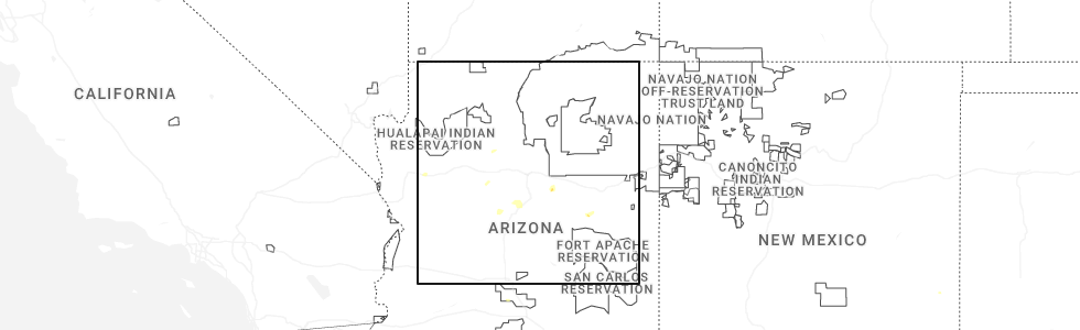
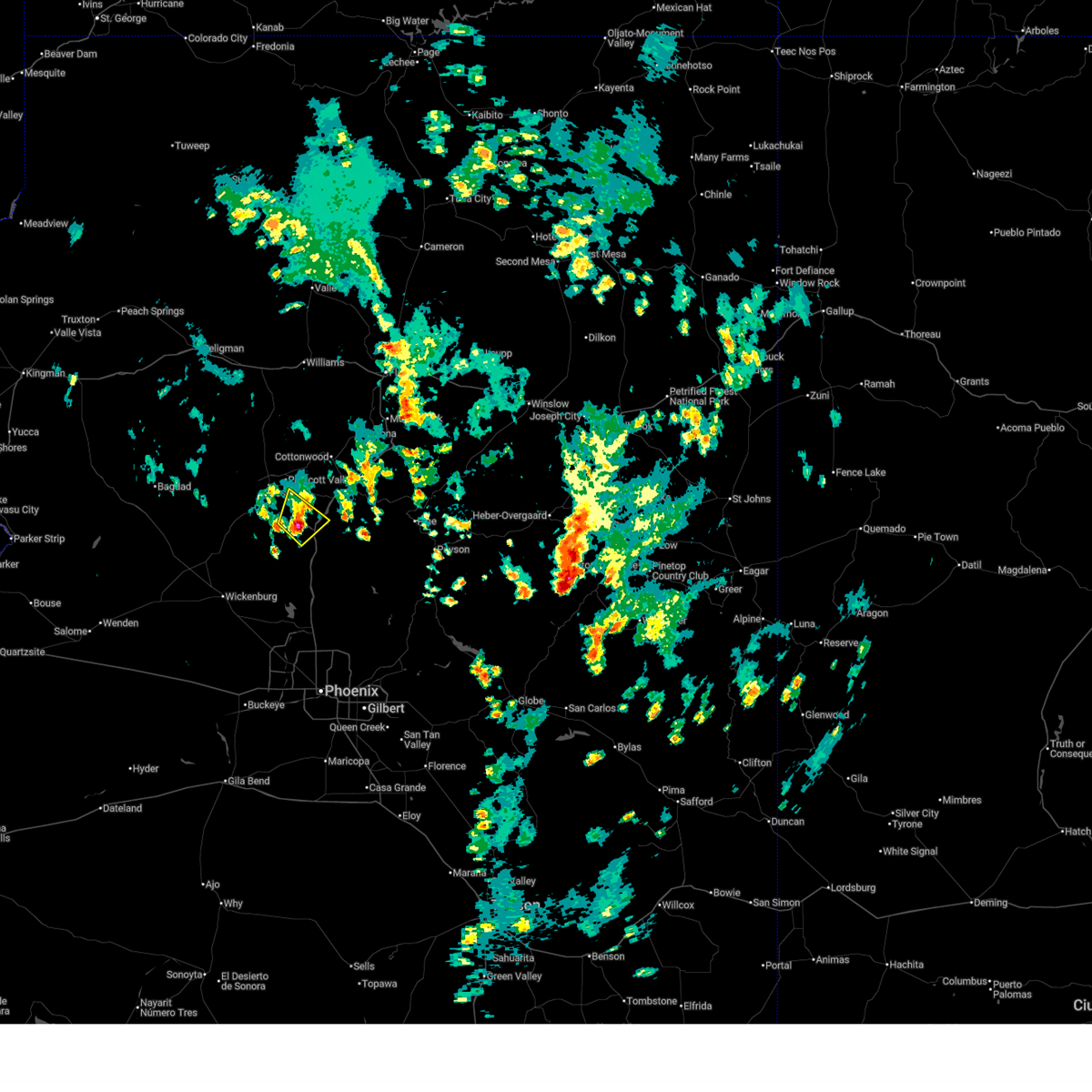
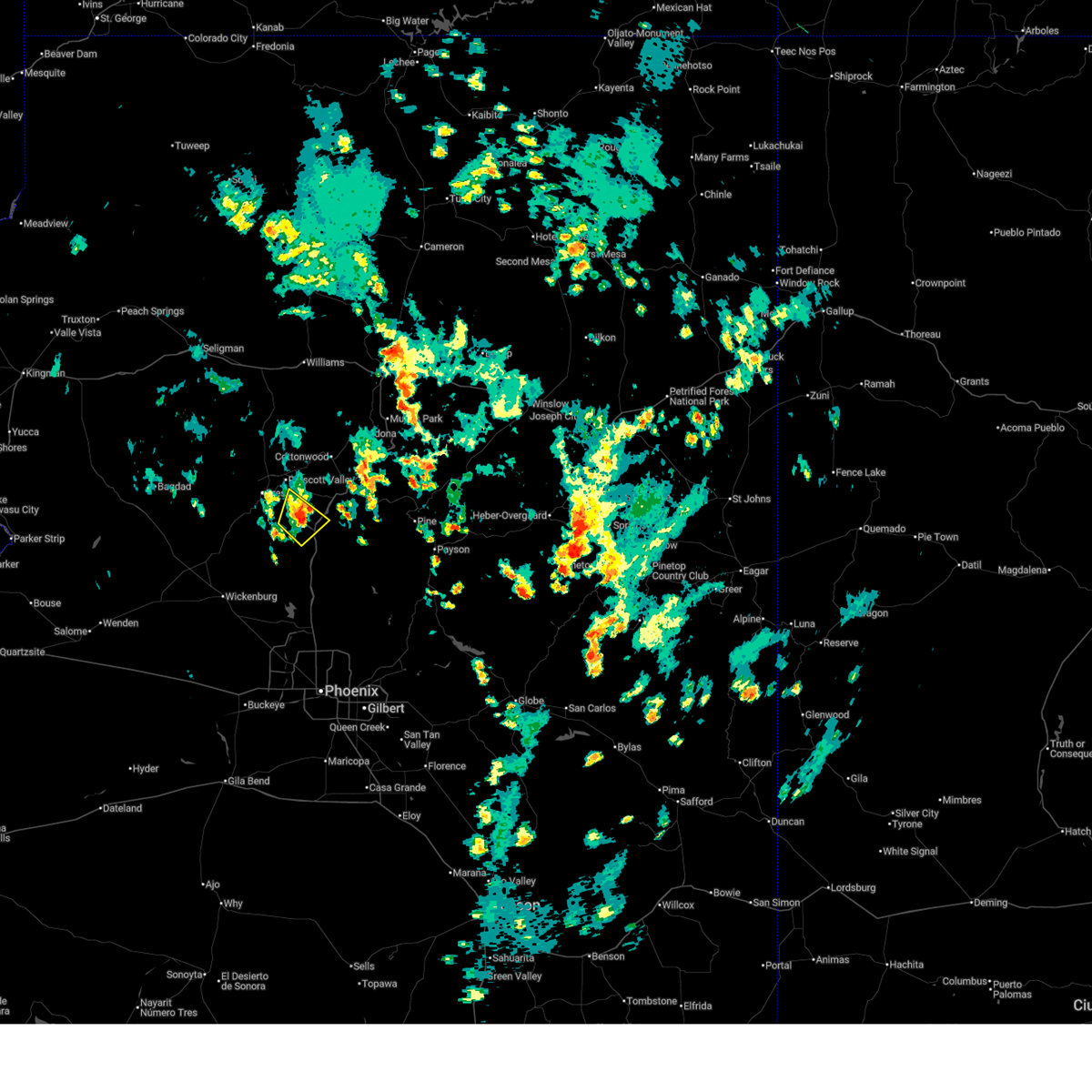
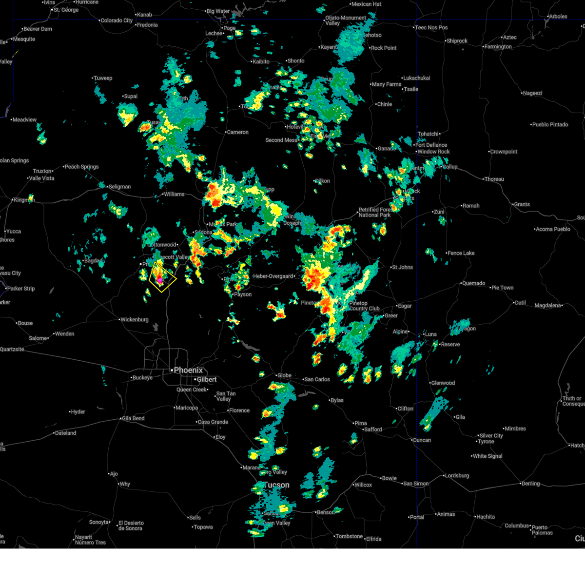
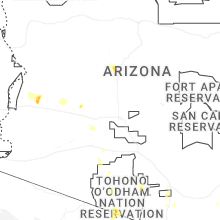
Hail Map for Dewey-Humboldt, AZ
The Dewey-Humboldt, AZ area has had 3 reports of on-the-ground hail by trained spotters, and has been under severe weather warnings 20 times during the past 12 months. Doppler radar has detected hail at or near Dewey-Humboldt, AZ on 67 occasions, including 10 occasions during the past year.
| Name: | Dewey-Humboldt, AZ |
| Where Located: | 57.5 miles SW of Flagstaff, AZ |
| Map: | Google Map for Dewey-Humboldt, AZ |
| Population: | 3894 |
| Housing Units: | 1888 |
| More Info: | Search Google for Dewey-Humboldt, AZ |
2
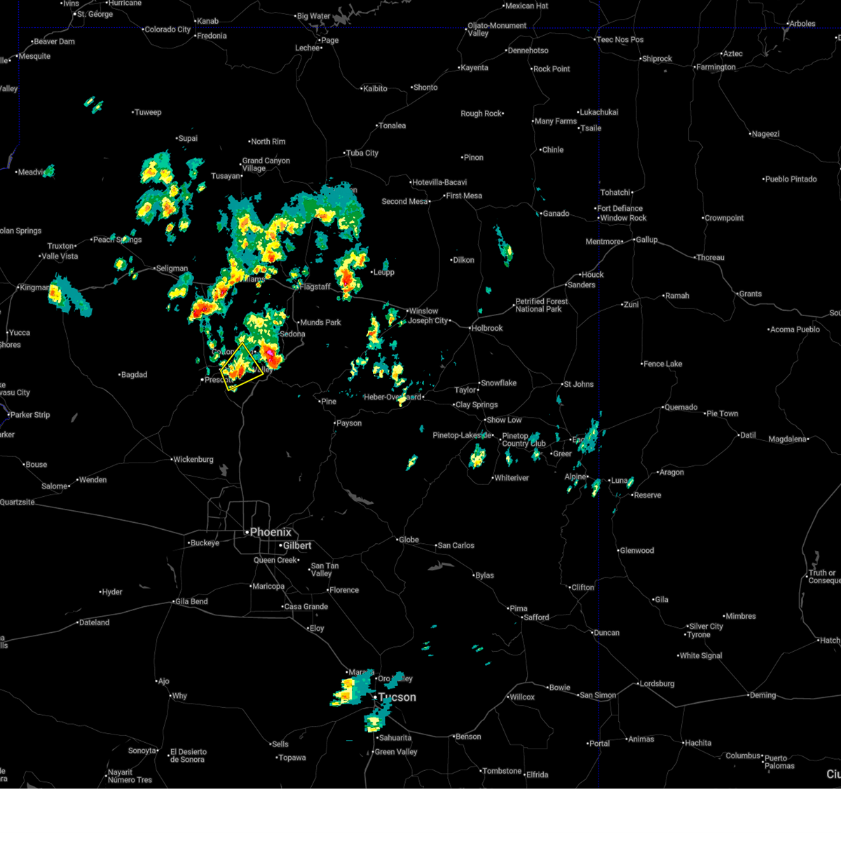
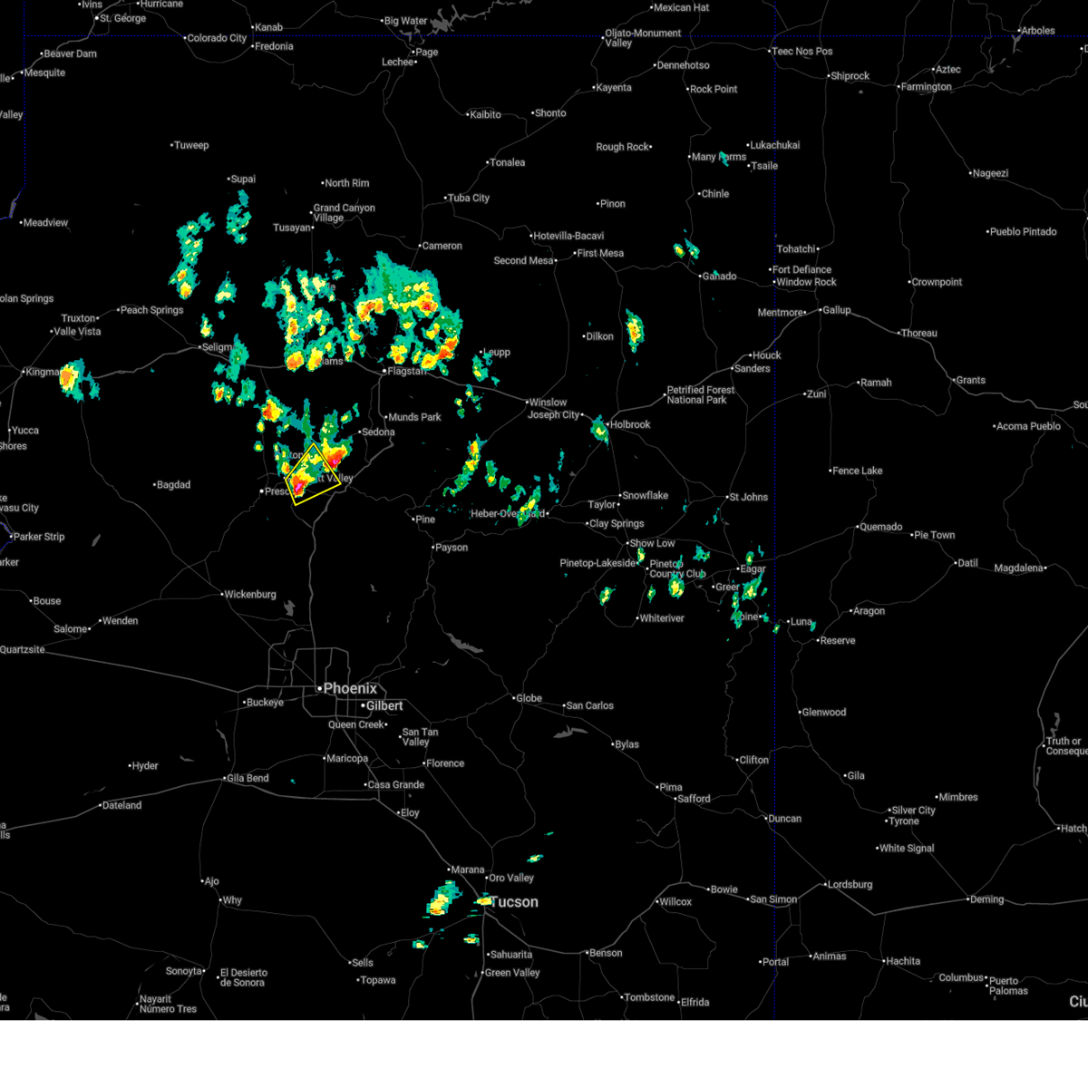
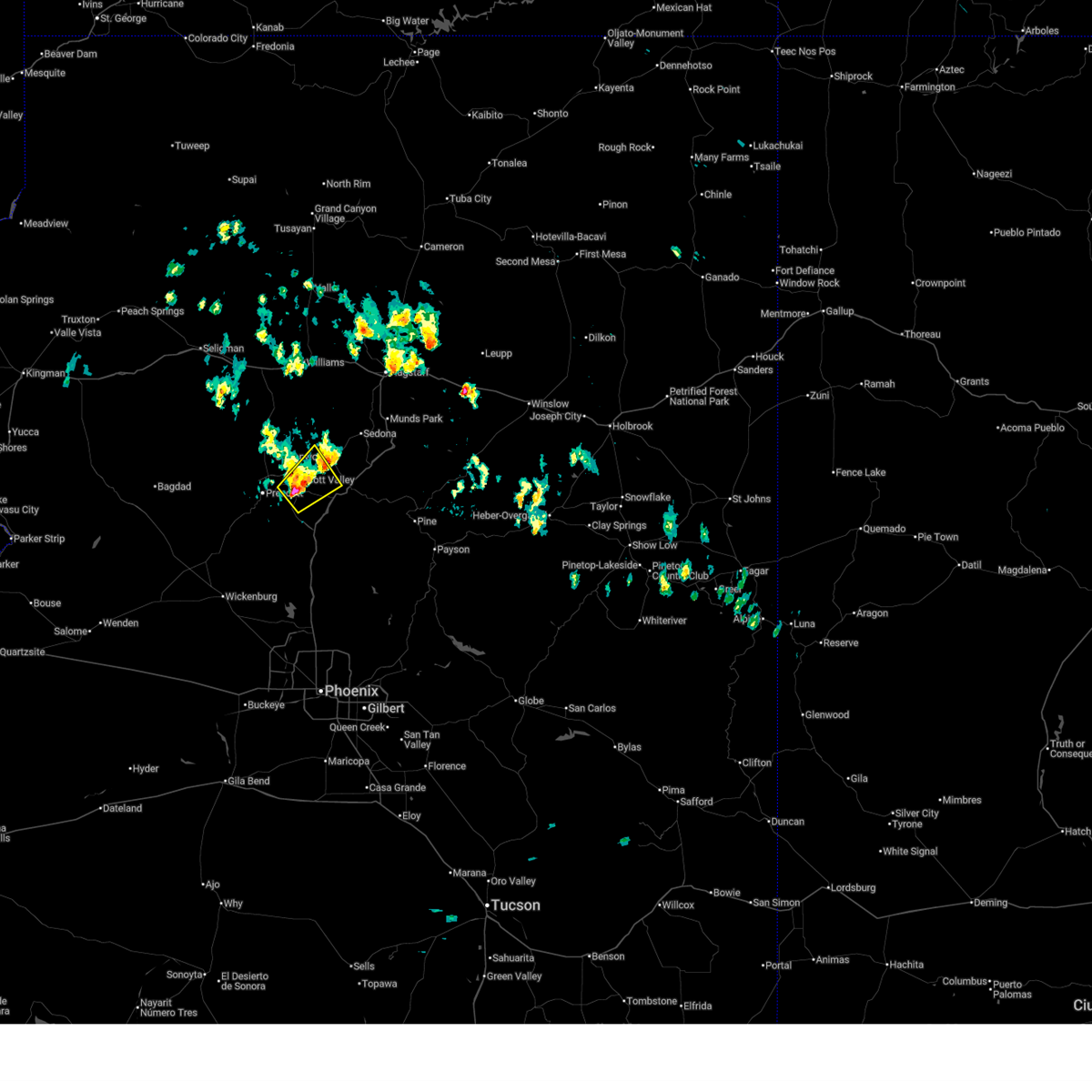
The Top Recent Hail Date for Dewey-Humboldt, AZ is Thursday, July 3, 2025 (11th out of 67)
Hail and Wind Damage Spotted near Dewey-Humboldt, AZ
| Date / Time | Report Details |
|---|---|
| 7/3/2025 2:30 PM MST | Quarter sized hail reported 2.9 miles E of Dewey-Humboldt, AZ, location estimated... size estimated from social media picture. |
| 7/3/2025 1:58 PM MST |
 The storm which prompted the warning has weakened below severe limits, and no longer poses an immediate threat to life or property. therefore, the warning will be allowed to expire. however, small hail, gusty winds, and heavy rain are still possible with this thunderstorm. The storm which prompted the warning has weakened below severe limits, and no longer poses an immediate threat to life or property. therefore, the warning will be allowed to expire. however, small hail, gusty winds, and heavy rain are still possible with this thunderstorm.
|
| 7/3/2025 1:35 PM MST |
 At 135 pm mst, a severe thunderstorm was located near dewey-humboldt, or 8 miles east of prescott valley, moving northeast at 10 mph (radar indicated). Hazards include 60 mph wind gusts and quarter size hail. Hail damage to vehicles is expected. expect wind damage to roofs, siding, and trees. locations impacted include, prescott valley, clarkdale, dewey-humboldt, jerome state historic park, mayer, jerome, mingus mountain and cherry. this includes the following highways, state route 69 between mile markers 278 and 286. State route 89a between mile markers 329 and 347. At 135 pm mst, a severe thunderstorm was located near dewey-humboldt, or 8 miles east of prescott valley, moving northeast at 10 mph (radar indicated). Hazards include 60 mph wind gusts and quarter size hail. Hail damage to vehicles is expected. expect wind damage to roofs, siding, and trees. locations impacted include, prescott valley, clarkdale, dewey-humboldt, jerome state historic park, mayer, jerome, mingus mountain and cherry. this includes the following highways, state route 69 between mile markers 278 and 286. State route 89a between mile markers 329 and 347.
|
| 7/3/2025 1:09 PM MST |
 Svrfgz the national weather service in flagstaff has issued a * severe thunderstorm warning for, dewey-humboldt in yavapai county in west central arizona, * until 200 pm mst. * at 109 pm mst, a severe thunderstorm was located over dewey-humboldt, or 6 miles southeast of prescott valley, moving northeast at 10 mph (radar indicated). Hazards include 60 mph wind gusts and quarter size hail. Hail damage to vehicles is expected. Expect wind damage to roofs, siding, and trees. Svrfgz the national weather service in flagstaff has issued a * severe thunderstorm warning for, dewey-humboldt in yavapai county in west central arizona, * until 200 pm mst. * at 109 pm mst, a severe thunderstorm was located over dewey-humboldt, or 6 miles southeast of prescott valley, moving northeast at 10 mph (radar indicated). Hazards include 60 mph wind gusts and quarter size hail. Hail damage to vehicles is expected. Expect wind damage to roofs, siding, and trees.
|
| 7/2/2025 2:27 PM MST |
 The storm which prompted the warning has weakened below severe limits, and no longer poses an immediate threat to life or property. therefore, the warning will be allowed to expire. however, gusty winds and heavy rain are still possible with this thunderstorm. The storm which prompted the warning has weakened below severe limits, and no longer poses an immediate threat to life or property. therefore, the warning will be allowed to expire. however, gusty winds and heavy rain are still possible with this thunderstorm.
|
| 7/2/2025 2:14 PM MST |
 At 214 pm mst, a severe thunderstorm was located over mayer, or 16 miles southeast of prescott valley. this storm was stationary (radar indicated). Hazards include 60 mph wind gusts and small hail. Expect damage to roofs, siding, and trees. locations impacted include, prescott valley, dewey-humboldt, mayer, spring valley, cordes lakes, agua fria national monument, poland junction, cordes junction, cleator and arcosanti. this includes the following highways, state route 69 between mile markers 263 and 281. Interstate 17 between mile markers 262 and 269. At 214 pm mst, a severe thunderstorm was located over mayer, or 16 miles southeast of prescott valley. this storm was stationary (radar indicated). Hazards include 60 mph wind gusts and small hail. Expect damage to roofs, siding, and trees. locations impacted include, prescott valley, dewey-humboldt, mayer, spring valley, cordes lakes, agua fria national monument, poland junction, cordes junction, cleator and arcosanti. this includes the following highways, state route 69 between mile markers 263 and 281. Interstate 17 between mile markers 262 and 269.
|
| 7/2/2025 1:59 PM MST |
 Svrfgz the national weather service in flagstaff has issued a * severe thunderstorm warning for, yavapai county in west central arizona, * until 230 pm mst. * at 159 pm mst, a severe thunderstorm was located near mayer, or 18 miles south of prescott valley. this storm was stationary (radar indicated). Hazards include 60 mph wind gusts and quarter size hail. Hail damage to vehicles is expected. Expect wind damage to roofs, siding, and trees. Svrfgz the national weather service in flagstaff has issued a * severe thunderstorm warning for, yavapai county in west central arizona, * until 230 pm mst. * at 159 pm mst, a severe thunderstorm was located near mayer, or 18 miles south of prescott valley. this storm was stationary (radar indicated). Hazards include 60 mph wind gusts and quarter size hail. Hail damage to vehicles is expected. Expect wind damage to roofs, siding, and trees.
|
| 7/25/2024 4:16 PM MST |
 Svrfgz the national weather service in flagstaff has issued a * severe thunderstorm warning for, yavapai county from nea cherry to cordes junction in west central arizona, * until 445 pm mst. * at 415 pm mst, a severe thunderstorm was located near flower pot, or 8 miles west of camp verde, moving southeast at 20 mph (radar indicated). Hazards include 60 mph wind gusts and penny size hail. expect damage to roofs, siding, and trees Svrfgz the national weather service in flagstaff has issued a * severe thunderstorm warning for, yavapai county from nea cherry to cordes junction in west central arizona, * until 445 pm mst. * at 415 pm mst, a severe thunderstorm was located near flower pot, or 8 miles west of camp verde, moving southeast at 20 mph (radar indicated). Hazards include 60 mph wind gusts and penny size hail. expect damage to roofs, siding, and trees
|
| 7/21/2024 1:41 PM MST |
 The storm which prompted the warning has weakened below severe limits, and no longer poses an immediate threat to life or property. therefore, the warning will be allowed to expire. however, small hail, gusty winds up to 45 mph and heavy rain are still possible with this thunderstorm. The storm which prompted the warning has weakened below severe limits, and no longer poses an immediate threat to life or property. therefore, the warning will be allowed to expire. however, small hail, gusty winds up to 45 mph and heavy rain are still possible with this thunderstorm.
|
| 7/21/2024 1:36 PM MST |
 At 136 pm mst, a severe thunderstorm was located 7 miles west of flower pot, or 13 miles east of prescott valley, moving south at 15 mph (radar indicated). Hazards include 60 mph wind gusts and quarter size hail. Hail damage to vehicles is expected. expect wind damage to roofs, siding, and trees. locations impacted include, cherry, centennial park, mayer, and dewey-humboldt. this includes the following highways, interstate 17 between mile markers 267 and 275. State route 69 between mile markers 271 and 272. At 136 pm mst, a severe thunderstorm was located 7 miles west of flower pot, or 13 miles east of prescott valley, moving south at 15 mph (radar indicated). Hazards include 60 mph wind gusts and quarter size hail. Hail damage to vehicles is expected. expect wind damage to roofs, siding, and trees. locations impacted include, cherry, centennial park, mayer, and dewey-humboldt. this includes the following highways, interstate 17 between mile markers 267 and 275. State route 69 between mile markers 271 and 272.
|
| 7/21/2024 1:22 PM MST |
 Svrfgz the national weather service in flagstaff has issued a * severe thunderstorm warning for, yavapai county in west central arizona, * until 145 pm mst. * at 122 pm mst, a severe thunderstorm was located 8 miles west of flower pot, or 13 miles east of prescott valley, moving south at 15 mph (radar indicated). Hazards include 60 mph wind gusts and quarter size hail. Hail damage to vehicles is expected. Expect wind damage to roofs, siding, and trees. Svrfgz the national weather service in flagstaff has issued a * severe thunderstorm warning for, yavapai county in west central arizona, * until 145 pm mst. * at 122 pm mst, a severe thunderstorm was located 8 miles west of flower pot, or 13 miles east of prescott valley, moving south at 15 mph (radar indicated). Hazards include 60 mph wind gusts and quarter size hail. Hail damage to vehicles is expected. Expect wind damage to roofs, siding, and trees.
|
| 7/17/2024 6:29 PM MST |
 the severe thunderstorm warning has been cancelled and is no longer in effect the severe thunderstorm warning has been cancelled and is no longer in effect
|
| 7/17/2024 6:06 PM MST |
 Svrfgz the national weather service in flagstaff has issued a * severe thunderstorm warning for, yavapai county in west central arizona, * until 645 pm mst. * at 606 pm mst, a severe thunderstorm was located near dewey-humboldt, or 10 miles east of prescott valley, and is nearly stationary (radar indicated). Hazards include 60 mph wind gusts and quarter size hail. Hail damage to vehicles is expected. Expect wind damage to roofs, siding, and trees. Svrfgz the national weather service in flagstaff has issued a * severe thunderstorm warning for, yavapai county in west central arizona, * until 645 pm mst. * at 606 pm mst, a severe thunderstorm was located near dewey-humboldt, or 10 miles east of prescott valley, and is nearly stationary (radar indicated). Hazards include 60 mph wind gusts and quarter size hail. Hail damage to vehicles is expected. Expect wind damage to roofs, siding, and trees.
|
| 7/11/2024 3:14 PM MST |
 The severe thunderstorm over prescott has weakened below severe limits and no longer poses an immediate threat to life or property. therefore, the warning will be allowed to expire. however, small hail, heavy rain and minor street flooding are still possible with this thunderstorm. The severe thunderstorm over prescott has weakened below severe limits and no longer poses an immediate threat to life or property. therefore, the warning will be allowed to expire. however, small hail, heavy rain and minor street flooding are still possible with this thunderstorm.
|
| 7/11/2024 2:52 PM MST |
 At 251 pm mst, a severe thunderstorm was located over the greater prescott area and was moving southwest at 10 to 15 mph (radar indicated). Hazards include 60 mph wind gusts and quarter size hail. Hail damage to vehicles is expected. expect wind damage to roofs, siding, and trees. locations impacted include, quartz mountain, thumbe butte, rancho vista estates, willow creek reservoir, poland junction, prescott gateway mall, iron springs, embry-riddle aeronautical university, acker park, prescott valley, goldwater lake park, wildwood estates, fain lake, alto pit ohv, courthouse plaza, wilhoit, prescott regional airport, goldwater lake, lynx lake, and potato patch. this includes the following highways, state route 89 between mile markers 293 and 322. state route 89a between mile markers 318 and 325. State route 69 between mile markers 275 and 276, and between mile markers 286 and 296. At 251 pm mst, a severe thunderstorm was located over the greater prescott area and was moving southwest at 10 to 15 mph (radar indicated). Hazards include 60 mph wind gusts and quarter size hail. Hail damage to vehicles is expected. expect wind damage to roofs, siding, and trees. locations impacted include, quartz mountain, thumbe butte, rancho vista estates, willow creek reservoir, poland junction, prescott gateway mall, iron springs, embry-riddle aeronautical university, acker park, prescott valley, goldwater lake park, wildwood estates, fain lake, alto pit ohv, courthouse plaza, wilhoit, prescott regional airport, goldwater lake, lynx lake, and potato patch. this includes the following highways, state route 89 between mile markers 293 and 322. state route 89a between mile markers 318 and 325. State route 69 between mile markers 275 and 276, and between mile markers 286 and 296.
|
| 7/11/2024 2:34 PM MST |
 Svrfgz the national weather service in flagstaff has issued a * severe thunderstorm warning for, yavapai county in west central arizona, * until 315 pm mst. * at 233 pm mst, a severe thunderstorm was located over central prescott, moving southwest at 10 to 15 mph (radar indicated). Hazards include 60 mph wind gusts and quarter size hail. Hail damage to vehicles is expected. Expect wind damage to roofs, siding, and trees. Svrfgz the national weather service in flagstaff has issued a * severe thunderstorm warning for, yavapai county in west central arizona, * until 315 pm mst. * at 233 pm mst, a severe thunderstorm was located over central prescott, moving southwest at 10 to 15 mph (radar indicated). Hazards include 60 mph wind gusts and quarter size hail. Hail damage to vehicles is expected. Expect wind damage to roofs, siding, and trees.
|
| 7/10/2024 3:44 PM MST |
 The storm which prompted the warning has weakened below severe limits, and no longer poses an immediate threat to life or property. therefore, the warning will be allowed to expire. however, small hail, gusty winds up to 50 mph and heavy rain are still possible with this thunderstorm. The storm which prompted the warning has weakened below severe limits, and no longer poses an immediate threat to life or property. therefore, the warning will be allowed to expire. however, small hail, gusty winds up to 50 mph and heavy rain are still possible with this thunderstorm.
|
| 7/10/2024 3:35 PM MST |
 At 335 pm mst, a severe thunderstorm was located over lynx lake, or near prescott, moving southeast at 15 mph (radar indicated). Hazards include 60 mph wind gusts and penny size hail. Expect damage to roofs, siding, and trees. locations impacted include, quartz mountain, thumbe butte, rancho vista estates, willow creek reservoir, poland junction, prescott gateway mall, iron springs, embry-riddle aeronautical university, acker park, prescott valley, goldwater lake park, wildwood estates, fain lake, alto pit ohv, courthouse plaza, prescott regional airport, goldwater lake, lynx lake, potato patch, and palace station. this includes the following highways, state route 89 between mile markers 302 and 326. state route 89a between mile markers 318 and 325. State route 69 between mile markers 275 and 296. At 335 pm mst, a severe thunderstorm was located over lynx lake, or near prescott, moving southeast at 15 mph (radar indicated). Hazards include 60 mph wind gusts and penny size hail. Expect damage to roofs, siding, and trees. locations impacted include, quartz mountain, thumbe butte, rancho vista estates, willow creek reservoir, poland junction, prescott gateway mall, iron springs, embry-riddle aeronautical university, acker park, prescott valley, goldwater lake park, wildwood estates, fain lake, alto pit ohv, courthouse plaza, prescott regional airport, goldwater lake, lynx lake, potato patch, and palace station. this includes the following highways, state route 89 between mile markers 302 and 326. state route 89a between mile markers 318 and 325. State route 69 between mile markers 275 and 296.
|
| 7/10/2024 3:25 PM MST |
 The storm near wilhoit which prompted the warning has weakened below severe limits, and no longer poses an immediate threat to life or property. therefore, the warning will be allowed to expire. however, small hail, gusty winds and heavy rain are still possible with this thunderstorm. remember, a severe thunderstorm warning still remains in effect for the prescott area from prescott to dewey-humboldt to walker. The storm near wilhoit which prompted the warning has weakened below severe limits, and no longer poses an immediate threat to life or property. therefore, the warning will be allowed to expire. however, small hail, gusty winds and heavy rain are still possible with this thunderstorm. remember, a severe thunderstorm warning still remains in effect for the prescott area from prescott to dewey-humboldt to walker.
|
| 7/10/2024 3:21 PM MST | Svrfgz the national weather service in flagstaff has issued a * severe thunderstorm warning for, yavapai county in west central arizona, * until 345 pm mst. * at 320 pm mst, a severe thunderstorm was located over embry-riddle aeronautical university, or near prescott, moving southeast at 15 mph (radar indicated). Hazards include 60 mph wind gusts and penny size hail. expect damage to roofs, siding, and trees |
| 7/10/2024 3:07 PM MST |
 Svrfgz the national weather service in flagstaff has issued a * severe thunderstorm warning for, yavapai county in west central arizona, * until 330 pm mst. * at 307 pm mst, a severe thunderstorm was located over copper basin, or near prescott, moving southeast at 15 mph (radar indicated). Hazards include 60 mph wind gusts and penny size hail. expect damage to roofs, siding, and trees Svrfgz the national weather service in flagstaff has issued a * severe thunderstorm warning for, yavapai county in west central arizona, * until 330 pm mst. * at 307 pm mst, a severe thunderstorm was located over copper basin, or near prescott, moving southeast at 15 mph (radar indicated). Hazards include 60 mph wind gusts and penny size hail. expect damage to roofs, siding, and trees
|
| 7/28/2023 11:30 AM MST |
 At 1130 am mst, a severe thunderstorm was located near prescott valley, moving north at 10 mph (radar indicated). Hazards include 60 mph wind gusts and quarter size hail. Hail damage to vehicles is expected. Expect wind damage to roofs, siding, and trees. At 1130 am mst, a severe thunderstorm was located near prescott valley, moving north at 10 mph (radar indicated). Hazards include 60 mph wind gusts and quarter size hail. Hail damage to vehicles is expected. Expect wind damage to roofs, siding, and trees.
|
| 7/22/2023 6:12 PM MST |
 At 611 pm mst, a severe thunderstorm was located over prescott valley, moving northwest at 10 mph (radar indicated). Hazards include 60 mph wind gusts and penny size hail. expect damage to roofs, siding, and trees At 611 pm mst, a severe thunderstorm was located over prescott valley, moving northwest at 10 mph (radar indicated). Hazards include 60 mph wind gusts and penny size hail. expect damage to roofs, siding, and trees
|
| 9/2/2022 5:17 PM MST |
 At 517 pm mst, severe thunderstorms were located along a line extending from mayer to near crown king, moving west at 30 mph (radar indicated). Hazards include 60 mph wind gusts and quarter size hail. Hail damage to vehicles is expected. Expect wind damage to roofs, siding, and trees. At 517 pm mst, severe thunderstorms were located along a line extending from mayer to near crown king, moving west at 30 mph (radar indicated). Hazards include 60 mph wind gusts and quarter size hail. Hail damage to vehicles is expected. Expect wind damage to roofs, siding, and trees.
|
| 8/23/2022 4:10 PM MST | The severe thunderstorm warning for yavapai county will expire at 415 pm mst, the severe thunderstorm which prompted the warning has moved out of the warned area. therefore, the warning will be allowed to expire. a severe thunderstorm warning remains in effect for areas near walker. |
| 8/23/2022 4:06 PM MST | At 406 pm mst, a severe thunderstorm was located over walker, or 10 miles southeast of prescott, moving southwest at 10 mph (radar indicated). Hazards include 60 mph wind gusts and quarter size hail. Hail damage to vehicles is expected. Expect wind damage to roofs, siding, and trees. |
| 8/23/2022 3:52 PM MST | At 352 pm mst, a severe thunderstorm was located over walker, or 9 miles south of prescott valley, moving southwest at 10 mph (radar indicated). Hazards include 60 mph wind gusts and quarter size hail. Hail damage to vehicles is expected. Expect wind damage to roofs, siding, and trees. |
| 8/21/2022 4:41 PM MST |
 At 440 pm mst, a severe thunderstorm was located near dewey- humboldt, or 11 miles southeast of prescott valley, moving south at 10 mph (radar indicated). Hazards include 60 mph wind gusts, quarter size hail, and heavy rainfall. Hail damage to vehicles is expected. Expect wind damage to roofs, siding, and trees. At 440 pm mst, a severe thunderstorm was located near dewey- humboldt, or 11 miles southeast of prescott valley, moving south at 10 mph (radar indicated). Hazards include 60 mph wind gusts, quarter size hail, and heavy rainfall. Hail damage to vehicles is expected. Expect wind damage to roofs, siding, and trees.
|
| 8/12/2022 12:23 PM MST |
 The severe thunderstorm warning for yavapai county will expire at 1230 pm mst, the storm near dewey-humboldt which prompted the warning has weakened below severe limits. therefore, the warning will be allowed to expire. however, heavy rain will continue with a flash flood warning remaining in effect. The severe thunderstorm warning for yavapai county will expire at 1230 pm mst, the storm near dewey-humboldt which prompted the warning has weakened below severe limits. therefore, the warning will be allowed to expire. however, heavy rain will continue with a flash flood warning remaining in effect.
|
| 8/12/2022 12:00 PM MST | Quarter sized hail reported 2 miles NNW of Dewey-Humboldt, AZ, severe thunderstorm produced 1 inch hail... heavy rain... and gusty winds peaking at roughly 25 kts. |
| 8/12/2022 11:54 AM MST |
 At 1153 am mst, a severe thunderstorm was located over dewey-humboldt, or 8 miles southeast of prescott valley, and is nearly stationary (radar indicated). Hazards include 60 mph wind gusts and quarter size hail. Hail damage to vehicles is expected. Expect wind damage to roofs, siding, and trees. At 1153 am mst, a severe thunderstorm was located over dewey-humboldt, or 8 miles southeast of prescott valley, and is nearly stationary (radar indicated). Hazards include 60 mph wind gusts and quarter size hail. Hail damage to vehicles is expected. Expect wind damage to roofs, siding, and trees.
|
| 8/1/2022 6:11 PM MST |
 The severe thunderstorm warning for yavapai county will expire at 615 pm mst, the storm which prompted the warning has weakened below severe limits, and no longer poses an immediate threat to life or property. therefore, the warning will be allowed to expire. however gusty winds and heavy rain are still possible with this thunderstorm. The severe thunderstorm warning for yavapai county will expire at 615 pm mst, the storm which prompted the warning has weakened below severe limits, and no longer poses an immediate threat to life or property. therefore, the warning will be allowed to expire. however gusty winds and heavy rain are still possible with this thunderstorm.
|
| 8/1/2022 5:59 PM MST |
 At 559 pm mst, a severe thunderstorm was located 8 miles southeast of dewey-humboldt, or 14 miles southeast of prescott valley, moving north at 5 mph (radar indicated). Hazards include 60 mph wind gusts and quarter size hail. Hail damage to vehicles is expected. expect wind damage to roofs, siding, and trees. locations impacted include, cherry and powell springs campground. hail threat, radar indicated max hail size, 1. 00 in wind threat, radar indicated max wind gust, 60 mph. At 559 pm mst, a severe thunderstorm was located 8 miles southeast of dewey-humboldt, or 14 miles southeast of prescott valley, moving north at 5 mph (radar indicated). Hazards include 60 mph wind gusts and quarter size hail. Hail damage to vehicles is expected. expect wind damage to roofs, siding, and trees. locations impacted include, cherry and powell springs campground. hail threat, radar indicated max hail size, 1. 00 in wind threat, radar indicated max wind gust, 60 mph.
|
| 8/1/2022 5:35 PM MST |
 At 534 pm mst, a severe thunderstorm was located 8 miles north of spring valley, or 14 miles southeast of prescott valley, moving north at 5 mph (radar indicated). Hazards include 60 mph wind gusts and half dollar size hail. Hail damage to vehicles is expected. Expect wind damage to roofs, siding, and trees. At 534 pm mst, a severe thunderstorm was located 8 miles north of spring valley, or 14 miles southeast of prescott valley, moving north at 5 mph (radar indicated). Hazards include 60 mph wind gusts and half dollar size hail. Hail damage to vehicles is expected. Expect wind damage to roofs, siding, and trees.
|
| 6/28/2022 5:47 PM MST |
 At 546 pm mst, a severe thunderstorm was located over prescott valley, moving south at 10 mph (radar indicated). Hazards include quarter size hail. damage to vehicles is expected At 546 pm mst, a severe thunderstorm was located over prescott valley, moving south at 10 mph (radar indicated). Hazards include quarter size hail. damage to vehicles is expected
|
| 6/25/2022 11:57 AM MST |
 The severe thunderstorm warning for central yavapai county will expire at noon mst, the storm located south of prescott valley and west of mayer which prompted the warning has weakened below severe limits, and no longer poses an immediate threat to life or property. therefore, the warning will be allowed to expire. however, heavy rain is still possible with this thunderstorm. The severe thunderstorm warning for central yavapai county will expire at noon mst, the storm located south of prescott valley and west of mayer which prompted the warning has weakened below severe limits, and no longer poses an immediate threat to life or property. therefore, the warning will be allowed to expire. however, heavy rain is still possible with this thunderstorm.
|
| 6/25/2022 11:28 AM MST |
 At 1127 am mst, a severe thunderstorm was located over walker, or 11 miles south of prescott valley, west of mayer, and is nearly stationary (radar indicated). Hazards include 60 mph wind gusts, quarter size hail, and heavy rainfall. Hail damage to vehicles is expected. Expect wind damage to roofs, siding, and trees. At 1127 am mst, a severe thunderstorm was located over walker, or 11 miles south of prescott valley, west of mayer, and is nearly stationary (radar indicated). Hazards include 60 mph wind gusts, quarter size hail, and heavy rainfall. Hail damage to vehicles is expected. Expect wind damage to roofs, siding, and trees.
|
| 6/24/2022 2:41 PM MST |
 At 235 pm mst, a severe thunderstorm was located near dewey- humboldt, or 10 miles east of prescott valley, and is nearly stationary. the thunderstorm has begun to weaken with additional strong thunderstorms in the area. this thunderstorm continues to produce heavy rainfall as slowly moves to the east-southeast (radar indicated. 1/2" hail has reported). Hazards include up to ping pong ball size hail, 60 mph wind gusts, and heavy rainfall. People and animals outdoors will be injured. expect hail damage to roofs, siding, windows, and vehicles. expect wind damage to roofs, siding, and trees. locations impacted include, prescott valley and dewey-humboldt. hail threat, radar indicated max hail size, 1. 50 in wind threat, radar indicated max wind gust, 60 mph. At 235 pm mst, a severe thunderstorm was located near dewey- humboldt, or 10 miles east of prescott valley, and is nearly stationary. the thunderstorm has begun to weaken with additional strong thunderstorms in the area. this thunderstorm continues to produce heavy rainfall as slowly moves to the east-southeast (radar indicated. 1/2" hail has reported). Hazards include up to ping pong ball size hail, 60 mph wind gusts, and heavy rainfall. People and animals outdoors will be injured. expect hail damage to roofs, siding, windows, and vehicles. expect wind damage to roofs, siding, and trees. locations impacted include, prescott valley and dewey-humboldt. hail threat, radar indicated max hail size, 1. 50 in wind threat, radar indicated max wind gust, 60 mph.
|
| 6/24/2022 2:16 PM MST |
 At 215 pm mst, a severe thunderstorm was located near dewey- humboldt, or 9 miles east of prescott valley, and is nearly stationary (radar indicated). Hazards include ping pong ball size hail, up to 60 mph wind gusts, and heavy rainfall. People and animals outdoors will be injured. expect hail damage to roofs, siding, windows, and vehicles. Expect wind damage to roofs, siding, and trees. At 215 pm mst, a severe thunderstorm was located near dewey- humboldt, or 9 miles east of prescott valley, and is nearly stationary (radar indicated). Hazards include ping pong ball size hail, up to 60 mph wind gusts, and heavy rainfall. People and animals outdoors will be injured. expect hail damage to roofs, siding, windows, and vehicles. Expect wind damage to roofs, siding, and trees.
|
| 7/29/2021 2:41 PM MST |
 At 240 pm mst, a severe thunderstorm was located over poland junction, or 9 miles southeast of prescott valley, moving northwest at 10 mph (radar indicated). Hazards include half dollar size hail. damage to vehicles is expected At 240 pm mst, a severe thunderstorm was located over poland junction, or 9 miles southeast of prescott valley, moving northwest at 10 mph (radar indicated). Hazards include half dollar size hail. damage to vehicles is expected
|
| 7/23/2021 1:50 PM MST |
 At 149 pm mst, a severe thunderstorm was located near yavapai county fairgrounds, or near prescott valley, moving southeast at 20 mph (radar indicated). Hazards include 60 mph wind gusts and quarter size hail. Hail damage to vehicles is expected. expect wind damage to roofs, siding, and trees. Locations impacted include, prescott valley, yavapai county fairgrounds, prescott airport and prescott valley event center. At 149 pm mst, a severe thunderstorm was located near yavapai county fairgrounds, or near prescott valley, moving southeast at 20 mph (radar indicated). Hazards include 60 mph wind gusts and quarter size hail. Hail damage to vehicles is expected. expect wind damage to roofs, siding, and trees. Locations impacted include, prescott valley, yavapai county fairgrounds, prescott airport and prescott valley event center.
|
| 7/23/2021 1:31 PM MST |
 At 131 pm mst, a severe thunderstorm was located near chino valley, moving southeast at 25 mph (radar indicated). Hazards include 60 mph wind gusts and quarter size hail. Hail damage to vehicles is expected. Expect wind damage to roofs, siding, and trees. At 131 pm mst, a severe thunderstorm was located near chino valley, moving southeast at 25 mph (radar indicated). Hazards include 60 mph wind gusts and quarter size hail. Hail damage to vehicles is expected. Expect wind damage to roofs, siding, and trees.
|
| 7/11/2021 4:05 PM MST |
 At 404 pm mst, a severe thunderstorm was located over walker, or 9 miles south of prescott valley, moving southwest at 15 mph (trained weather spotters). Hazards include 60 mph wind gusts and half dollar size hail. Hail damage to vehicles is expected. expect wind damage to roofs, siding, and trees. Locations impacted include, prescott valley, prescott, downtown prescott, indian hill west prescott, oak knoll village, prescott gateway mall, prescott valley event center, white spar campground and lynx lake dam. At 404 pm mst, a severe thunderstorm was located over walker, or 9 miles south of prescott valley, moving southwest at 15 mph (trained weather spotters). Hazards include 60 mph wind gusts and half dollar size hail. Hail damage to vehicles is expected. expect wind damage to roofs, siding, and trees. Locations impacted include, prescott valley, prescott, downtown prescott, indian hill west prescott, oak knoll village, prescott gateway mall, prescott valley event center, white spar campground and lynx lake dam.
|
| 7/11/2021 3:57 PM MST |
 At 356 pm mst, a severe thunderstorm was located over walker, or 8 miles south of prescott valley, moving southwest at 15 mph (trained weather spotters). Hazards include 60 mph wind gusts and half dollar size hail. Hail damage to vehicles is expected. expect wind damage to roofs, siding, and trees. Locations impacted include, prescott valley, prescott, dewey-humboldt, groom creek subdivision, walker, prescott gateway mall, downtown prescott, indian hill west prescott, oak knoll village, lynx lake dam, prescott valley event center, upper wolf creek group campground, white spar campground and lower wolf creek campground. At 356 pm mst, a severe thunderstorm was located over walker, or 8 miles south of prescott valley, moving southwest at 15 mph (trained weather spotters). Hazards include 60 mph wind gusts and half dollar size hail. Hail damage to vehicles is expected. expect wind damage to roofs, siding, and trees. Locations impacted include, prescott valley, prescott, dewey-humboldt, groom creek subdivision, walker, prescott gateway mall, downtown prescott, indian hill west prescott, oak knoll village, lynx lake dam, prescott valley event center, upper wolf creek group campground, white spar campground and lower wolf creek campground.
|
| 7/11/2021 3:50 PM MST |
 At 350 pm mst, a severe thunderstorm was located over walker, or 8 miles south of prescott valley, moving southwest at 15 mph (trained weather spotters). Hazards include 60 mph wind gusts and quarter size hail. Hail damage to vehicles is expected. expect wind damage to roofs, siding, and trees. Locations impacted include, prescott valley, prescott, dewey-humboldt, groom creek subdivision, walker, poland junction, prescott gateway mall, downtown prescott, indian hill west prescott, oak knoll village, lynx lake dam, prescott valley event center, upper wolf creek group campground and white spar campground. At 350 pm mst, a severe thunderstorm was located over walker, or 8 miles south of prescott valley, moving southwest at 15 mph (trained weather spotters). Hazards include 60 mph wind gusts and quarter size hail. Hail damage to vehicles is expected. expect wind damage to roofs, siding, and trees. Locations impacted include, prescott valley, prescott, dewey-humboldt, groom creek subdivision, walker, poland junction, prescott gateway mall, downtown prescott, indian hill west prescott, oak knoll village, lynx lake dam, prescott valley event center, upper wolf creek group campground and white spar campground.
|
| 7/11/2021 3:48 PM MST | Quarter sized hail reported 2.4 miles E of Dewey-Humboldt, AZ |
| 7/11/2021 3:35 PM MST |
 At 334 pm mst, a severe thunderstorm was located near dewey-humboldt, or 7 miles southeast of prescott valley, moving southwest at 15 mph (radar indicated). Hazards include 60 mph wind gusts and quarter size hail. Hail damage to vehicles is expected. Expect wind damage to roofs, siding, and trees. At 334 pm mst, a severe thunderstorm was located near dewey-humboldt, or 7 miles southeast of prescott valley, moving southwest at 15 mph (radar indicated). Hazards include 60 mph wind gusts and quarter size hail. Hail damage to vehicles is expected. Expect wind damage to roofs, siding, and trees.
|
| 8/30/2020 12:42 PM MST |
 At 1241 pm mst, a severe thunderstorm was located near mayer, or 16 miles southeast of prescott valley, moving southeast at 10 mph (radar indicated). Hazards include 60 mph wind gusts and quarter size hail. Hail damage to vehicles is expected. Expect wind damage to roofs, siding, and trees. At 1241 pm mst, a severe thunderstorm was located near mayer, or 16 miles southeast of prescott valley, moving southeast at 10 mph (radar indicated). Hazards include 60 mph wind gusts and quarter size hail. Hail damage to vehicles is expected. Expect wind damage to roofs, siding, and trees.
|
| 8/22/2020 4:21 PM MST |
 At 421 pm mst, a severe thunderstorm was located over walker, or 7 miles south of prescott valley, and is nearly stationary (radar indicated). Hazards include 60 mph wind gusts and half dollar size hail. Hail damage to vehicles is expected. Expect wind damage to roofs, siding, and trees. At 421 pm mst, a severe thunderstorm was located over walker, or 7 miles south of prescott valley, and is nearly stationary (radar indicated). Hazards include 60 mph wind gusts and half dollar size hail. Hail damage to vehicles is expected. Expect wind damage to roofs, siding, and trees.
|
| 8/21/2020 4:37 PM MST |
 At 437 pm mst, a severe thunderstorm was located near yavapai county fairgrounds, or 11 miles northeast of prescott valley, moving southwest at 10 mph (trained weather spotters reported nickel sized hail and estimated 60 mph winds). Hazards include 60 mph wind gusts and quarter size hail. Hail damage to vehicles is expected. expect wind damage to roofs, siding, and trees. Locations impacted include, clarkdale, verde village, cottonwood, jerome, mingus mountain campground, playground group campground and potato patch campground. At 437 pm mst, a severe thunderstorm was located near yavapai county fairgrounds, or 11 miles northeast of prescott valley, moving southwest at 10 mph (trained weather spotters reported nickel sized hail and estimated 60 mph winds). Hazards include 60 mph wind gusts and quarter size hail. Hail damage to vehicles is expected. expect wind damage to roofs, siding, and trees. Locations impacted include, clarkdale, verde village, cottonwood, jerome, mingus mountain campground, playground group campground and potato patch campground.
|
| 8/21/2020 4:19 PM MST |
 At 419 pm mst, a severe thunderstorm was located 7 miles east of yavapai county fairgrounds, or 14 miles northeast of prescott valley, moving southwest at 10 mph (radar indicated). Hazards include 60 mph wind gusts and quarter size hail. Hail damage to vehicles is expected. Expect wind damage to roofs, siding, and trees. At 419 pm mst, a severe thunderstorm was located 7 miles east of yavapai county fairgrounds, or 14 miles northeast of prescott valley, moving southwest at 10 mph (radar indicated). Hazards include 60 mph wind gusts and quarter size hail. Hail damage to vehicles is expected. Expect wind damage to roofs, siding, and trees.
|
| 9/26/2019 4:11 AM MST |
 The severe thunderstorm warning for yavapai county will expire at 415 am mst, the storm which prompted the warning has weakened below severe limits, and no longer poses an immediate threat to life or property. therefore, the warning will be allowed to expire. however small hail and heavy rain are still possible with this thunderstorm. to report severe weather, contact your nearest law enforcement agency. they will relay your report to the national weather service flagstaff. The severe thunderstorm warning for yavapai county will expire at 415 am mst, the storm which prompted the warning has weakened below severe limits, and no longer poses an immediate threat to life or property. therefore, the warning will be allowed to expire. however small hail and heavy rain are still possible with this thunderstorm. to report severe weather, contact your nearest law enforcement agency. they will relay your report to the national weather service flagstaff.
|
| 9/26/2019 4:02 AM MST |
 At 401 am mst, a severe thunderstorm was located over mayer, or 16 miles southeast of prescott valley, moving northwest at 25 mph (radar indicated). Hazards include quarter size hail. Damage to vehicles is expected. Locations impacted include, dewey-humboldt, mayer, poland junction and spring valley. At 401 am mst, a severe thunderstorm was located over mayer, or 16 miles southeast of prescott valley, moving northwest at 25 mph (radar indicated). Hazards include quarter size hail. Damage to vehicles is expected. Locations impacted include, dewey-humboldt, mayer, poland junction and spring valley.
|
| 9/26/2019 3:49 AM MST |
 At 348 am mst, a severe thunderstorm was located over spring valley, or 21 miles southeast of prescott valley, moving northwest at 25 mph (radar indicated). Hazards include quarter size hail. damage to vehicles is expected At 348 am mst, a severe thunderstorm was located over spring valley, or 21 miles southeast of prescott valley, moving northwest at 25 mph (radar indicated). Hazards include quarter size hail. damage to vehicles is expected
|
| 8/28/2019 11:17 AM MST |
 At 1117 am mst, a severe thunderstorm was located over dewey-humboldt, or 10 miles southeast of prescott valley, moving east at 5 mph (radar indicated). Hazards include 60 mph wind gusts and penny size hail. Expect damage to roofs, siding, and trees. Locations impacted include, dewey-humboldt and poland junction. At 1117 am mst, a severe thunderstorm was located over dewey-humboldt, or 10 miles southeast of prescott valley, moving east at 5 mph (radar indicated). Hazards include 60 mph wind gusts and penny size hail. Expect damage to roofs, siding, and trees. Locations impacted include, dewey-humboldt and poland junction.
|
| 8/28/2019 10:59 AM MST |
 At 1058 am mst, a severe thunderstorm was located over dewey-humboldt, or 9 miles southeast of prescott valley, moving east at 5 mph (radar indicated). Hazards include 60 mph wind gusts and quarter size hail. Hail damage to vehicles is expected. Expect wind damage to roofs, siding, and trees. At 1058 am mst, a severe thunderstorm was located over dewey-humboldt, or 9 miles southeast of prescott valley, moving east at 5 mph (radar indicated). Hazards include 60 mph wind gusts and quarter size hail. Hail damage to vehicles is expected. Expect wind damage to roofs, siding, and trees.
|
| 5/8/2019 11:39 AM MST |
 The severe thunderstorm warning for yavapai county will expire at 1145 am mst, the storm which prompted the warning has weakened below severe limits, and no longer pose an immediate threat to life or property. therefore the warning will be allowed to expire. The severe thunderstorm warning for yavapai county will expire at 1145 am mst, the storm which prompted the warning has weakened below severe limits, and no longer pose an immediate threat to life or property. therefore the warning will be allowed to expire.
|
| 5/8/2019 11:22 AM MST |
 At 1121 am mst, a severe thunderstorm was located 7 miles south of cherry, or 14 miles southwest of camp verde, moving southeast at 40 mph (radar indicated). Hazards include quarter size hail. damage to vehicles is expected At 1121 am mst, a severe thunderstorm was located 7 miles south of cherry, or 14 miles southwest of camp verde, moving southeast at 40 mph (radar indicated). Hazards include quarter size hail. damage to vehicles is expected
|
| 8/12/2018 4:54 PM MST |
 The severe thunderstorm warning for yavapai county will expire at 500 pm mst, the storm which prompted the warning has weakened below severe limits, and no longer pose an immediate threat to life or property. therefore the warning will be allowed to expire. however small hail and heavy rain are still possible with this thunderstorm. a severe thunderstorm watch remains in effect until 1100 pm mst for west central arizona. The severe thunderstorm warning for yavapai county will expire at 500 pm mst, the storm which prompted the warning has weakened below severe limits, and no longer pose an immediate threat to life or property. therefore the warning will be allowed to expire. however small hail and heavy rain are still possible with this thunderstorm. a severe thunderstorm watch remains in effect until 1100 pm mst for west central arizona.
|
| 8/12/2018 4:14 PM MST |
 At 414 pm mst, a severe thunderstorm was located over dewey-humboldt, or 7 miles southeast of prescott valley, moving west at 30 mph (radar indicated). Hazards include 60 mph wind gusts and quarter size hail. Hail damage to vehicles is expected. Expect wind damage to roofs, siding, and trees. At 414 pm mst, a severe thunderstorm was located over dewey-humboldt, or 7 miles southeast of prescott valley, moving west at 30 mph (radar indicated). Hazards include 60 mph wind gusts and quarter size hail. Hail damage to vehicles is expected. Expect wind damage to roofs, siding, and trees.
|
| 8/11/2018 3:31 PM MST |
 At 331 pm mst, a severe thunderstorm was located near mayer, or 16 miles southeast of prescott valley, moving southwest at 10 mph (radar indicated). Hazards include 60 mph wind gusts and half dollar size hail. Hail damage to vehicles is expected. Expect wind damage to roofs, siding, and trees. At 331 pm mst, a severe thunderstorm was located near mayer, or 16 miles southeast of prescott valley, moving southwest at 10 mph (radar indicated). Hazards include 60 mph wind gusts and half dollar size hail. Hail damage to vehicles is expected. Expect wind damage to roofs, siding, and trees.
|
| 8/2/2018 2:26 PM MST |
 At 201 pm mst, a severe thunderstorm was located near prescott airport, or near chino valley, moving northeast at 15 mph (radar indicated). Hazards include 60 mph wind gusts and quarter size hail. Hail damage to vehicles is expected. expect wind damage to roofs, siding, and trees. locations impacted include, chino valley, prescott valley, prescott, prescott airport, williamson valley, prescott gateway mall, iron springs, yavapai campground, downtown prescott, indian hill west prescott, oak knoll village, prescott valley event center and white spar campground. this includes the following highways, state route 89 between mile markers 308 and 326. state route 89a between mile markers 318 and 321. State route 69 between mile markers 287 and 296. At 201 pm mst, a severe thunderstorm was located near prescott airport, or near chino valley, moving northeast at 15 mph (radar indicated). Hazards include 60 mph wind gusts and quarter size hail. Hail damage to vehicles is expected. expect wind damage to roofs, siding, and trees. locations impacted include, chino valley, prescott valley, prescott, prescott airport, williamson valley, prescott gateway mall, iron springs, yavapai campground, downtown prescott, indian hill west prescott, oak knoll village, prescott valley event center and white spar campground. this includes the following highways, state route 89 between mile markers 308 and 326. state route 89a between mile markers 318 and 321. State route 69 between mile markers 287 and 296.
|
| 8/2/2018 2:01 PM MST |
 At 201 pm mst, a severe thunderstorm was located near prescott airport, or near chino valley, moving northeast at 15 mph (radar indicated). Hazards include 60 mph wind gusts and quarter size hail. Hail damage to vehicles is expected. expect wind damage to roofs, siding, and trees. locations impacted include, chino valley, prescott valley, prescott, prescott airport, williamson valley, prescott gateway mall, iron springs, yavapai campground, downtown prescott, indian hill west prescott, oak knoll village, prescott valley event center and white spar campground. this includes the following highways, state route 89 between mile markers 308 and 326. state route 89a between mile markers 318 and 321. State route 69 between mile markers 287 and 296. At 201 pm mst, a severe thunderstorm was located near prescott airport, or near chino valley, moving northeast at 15 mph (radar indicated). Hazards include 60 mph wind gusts and quarter size hail. Hail damage to vehicles is expected. expect wind damage to roofs, siding, and trees. locations impacted include, chino valley, prescott valley, prescott, prescott airport, williamson valley, prescott gateway mall, iron springs, yavapai campground, downtown prescott, indian hill west prescott, oak knoll village, prescott valley event center and white spar campground. this includes the following highways, state route 89 between mile markers 308 and 326. state route 89a between mile markers 318 and 321. State route 69 between mile markers 287 and 296.
|
| 8/2/2018 1:39 PM MST |
 At 139 pm mst, a severe thunderstorm was located over yavapai campground, or 8 miles west of prescott valley, moving northeast at 15 mph (radar indicated). Hazards include 60 mph wind gusts and quarter size hail. Hail damage to vehicles is expected. Expect wind damage to roofs, siding, and trees. At 139 pm mst, a severe thunderstorm was located over yavapai campground, or 8 miles west of prescott valley, moving northeast at 15 mph (radar indicated). Hazards include 60 mph wind gusts and quarter size hail. Hail damage to vehicles is expected. Expect wind damage to roofs, siding, and trees.
|
| 7/26/2018 5:27 PM MST |
 At 451 pm mst, a severe thunderstorm was located over spring valley, or 19 miles southwest of camp verde, moving southwest at 15 mph (radar indicated). Hazards include 60 mph wind gusts and quarter size hail. Hail damage to vehicles is expected. Expect wind damage to roofs, siding, and trees. At 451 pm mst, a severe thunderstorm was located over spring valley, or 19 miles southwest of camp verde, moving southwest at 15 mph (radar indicated). Hazards include 60 mph wind gusts and quarter size hail. Hail damage to vehicles is expected. Expect wind damage to roofs, siding, and trees.
|
| 7/26/2018 4:53 PM MST |
 At 451 pm mst, a severe thunderstorm was located over spring valley, or 19 miles southwest of camp verde, moving southwest at 15 mph (radar indicated). Hazards include 60 mph wind gusts and quarter size hail. Hail damage to vehicles is expected. Expect wind damage to roofs, siding, and trees. At 451 pm mst, a severe thunderstorm was located over spring valley, or 19 miles southwest of camp verde, moving southwest at 15 mph (radar indicated). Hazards include 60 mph wind gusts and quarter size hail. Hail damage to vehicles is expected. Expect wind damage to roofs, siding, and trees.
|
| 7/19/2018 8:08 PM MST |
 The severe thunderstorm warning for yavapai county will expire at 815 pm mst, the storms which prompted the warning have weakened below severe limits, and no longer pose an immediate threat to life or property. therefore the warning will be allowed to expire. however small hail and torrential rain are still possible with these thunderstorms. The severe thunderstorm warning for yavapai county will expire at 815 pm mst, the storms which prompted the warning have weakened below severe limits, and no longer pose an immediate threat to life or property. therefore the warning will be allowed to expire. however small hail and torrential rain are still possible with these thunderstorms.
|
| 7/19/2018 7:27 PM MST |
 At 726 pm mst, severe thunderstorms were located along a line extending from 7 miles northwest of childs power plant to 15 miles north of horseshoe reservoir, moving west at 15 mph (radar indicated). Hazards include 60 mph wind gusts and quarter size hail. Hail damage to vehicles is expected. Expect wind damage to roofs, siding, and trees. At 726 pm mst, severe thunderstorms were located along a line extending from 7 miles northwest of childs power plant to 15 miles north of horseshoe reservoir, moving west at 15 mph (radar indicated). Hazards include 60 mph wind gusts and quarter size hail. Hail damage to vehicles is expected. Expect wind damage to roofs, siding, and trees.
|
| 7/15/2017 3:15 PM MST |
 At 313 pm mst, a severe thunderstorm was located over oak knoll village, or 3 miles southeast of downtown prescott, moving southwest at 15 mph (radar indicated). Hazards include 70 mph wind gusts and quarter size hail. Hail damage to vehicles is expected. expect considerable tree damage. wind damage is also likely to mobile homes, roofs, and outbuildings. locations impacted include, prescott valley, prescott, walker, prescott gateway mall, downtown prescott, ponderosa park, prescott valley event center. this includes the following highways, state route 89 between mile markers 298 and 318. state route 89a between mile markers 318 and 323. State route 69 between mile markers 287 and 296. At 313 pm mst, a severe thunderstorm was located over oak knoll village, or 3 miles southeast of downtown prescott, moving southwest at 15 mph (radar indicated). Hazards include 70 mph wind gusts and quarter size hail. Hail damage to vehicles is expected. expect considerable tree damage. wind damage is also likely to mobile homes, roofs, and outbuildings. locations impacted include, prescott valley, prescott, walker, prescott gateway mall, downtown prescott, ponderosa park, prescott valley event center. this includes the following highways, state route 89 between mile markers 298 and 318. state route 89a between mile markers 318 and 323. State route 69 between mile markers 287 and 296.
|
| 7/15/2017 2:57 PM MST |
 At 255 pm mst, a severe thunderstorm was located near prescott valley, moving southwest at 15 mph (radar indicated). Hazards include 70 mph wind gusts and quarter size hail. Hail damage to vehicles is expected. expect considerable tree damage. wind damage is also likely to mobile homes, roofs, and outbuildings. locations impacted include, prescott valley, prescott, dewey-humboldt, walker, poland junction, prescott gateway mall, yavapai county fairgrounds, downtown prescott, ponderosa park, prescott valley event center. this includes the following highways, state route 89 between mile markers 298 and 318. state route 89a between mile markers 318 and 326. State route 69 between mile markers 275 and 296. At 255 pm mst, a severe thunderstorm was located near prescott valley, moving southwest at 15 mph (radar indicated). Hazards include 70 mph wind gusts and quarter size hail. Hail damage to vehicles is expected. expect considerable tree damage. wind damage is also likely to mobile homes, roofs, and outbuildings. locations impacted include, prescott valley, prescott, dewey-humboldt, walker, poland junction, prescott gateway mall, yavapai county fairgrounds, downtown prescott, ponderosa park, prescott valley event center. this includes the following highways, state route 89 between mile markers 298 and 318. state route 89a between mile markers 318 and 326. State route 69 between mile markers 275 and 296.
|
| 7/15/2017 2:49 PM MST |
 At 248 pm mst, a severe thunderstorm was located near dewey- humboldt, or near prescott valley, moving southwest at 15 mph (radar indicated). Hazards include 60 mph wind gusts and quarter size hail. Hail damage to vehicles is expected. Expect wind damage to roofs, siding, and trees. At 248 pm mst, a severe thunderstorm was located near dewey- humboldt, or near prescott valley, moving southwest at 15 mph (radar indicated). Hazards include 60 mph wind gusts and quarter size hail. Hail damage to vehicles is expected. Expect wind damage to roofs, siding, and trees.
|
| 7/28/2016 4:16 PM MST |
 At 415 pm mst, doppler radar indicated a severe thunderstorm capable of producing quarter size hail and damaging winds in excess of 60 mph. this storm was located over walker, and moving northwest at 5 mph. At 415 pm mst, doppler radar indicated a severe thunderstorm capable of producing quarter size hail and damaging winds in excess of 60 mph. this storm was located over walker, and moving northwest at 5 mph.
|
| 6/29/2015 4:49 PM MST |
 At 448 pm mst, doppler radar indicated a severe thunderstorm capable of producing quarter size hail and damaging winds in excess of 60 mph. this storm was located over prescott valley, and moving southwest at 20 mph. At 448 pm mst, doppler radar indicated a severe thunderstorm capable of producing quarter size hail and damaging winds in excess of 60 mph. this storm was located over prescott valley, and moving southwest at 20 mph.
|
Hail Maps for Dewey-Humboldt, AZ


Connect with Interactive Hail Maps