

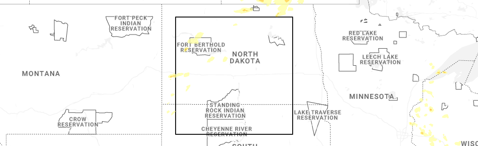
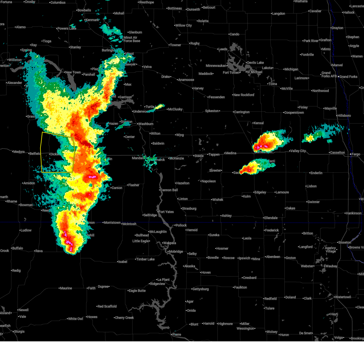
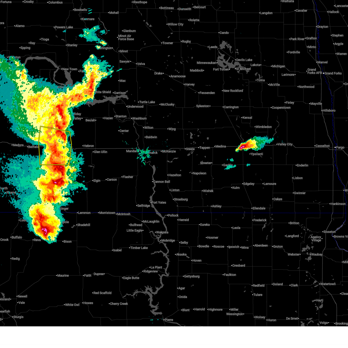
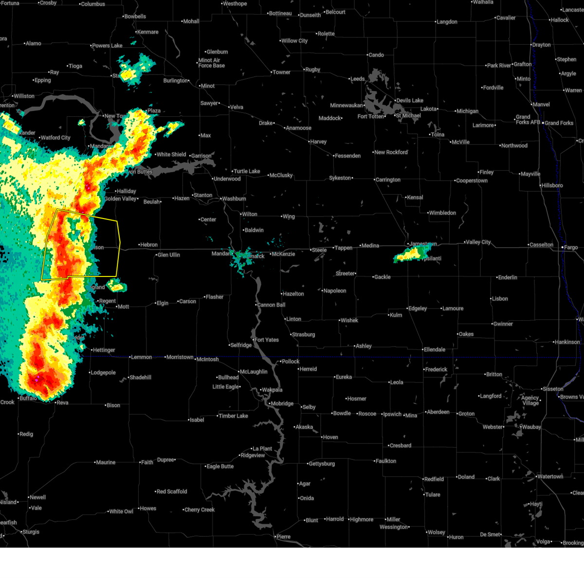
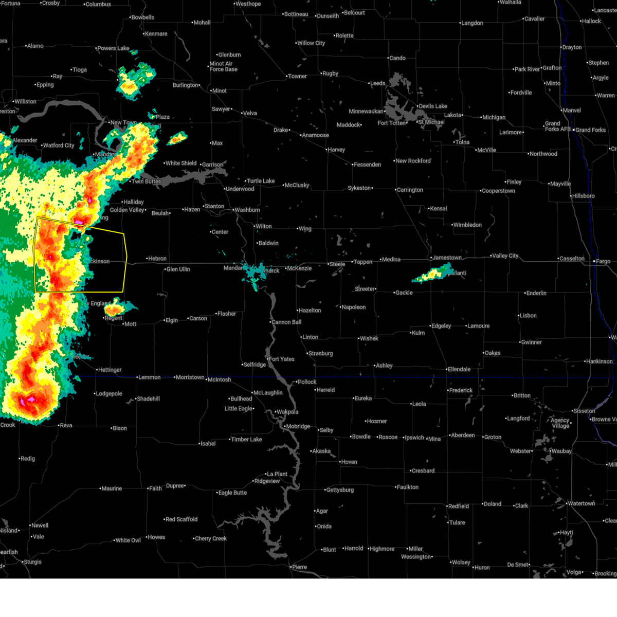
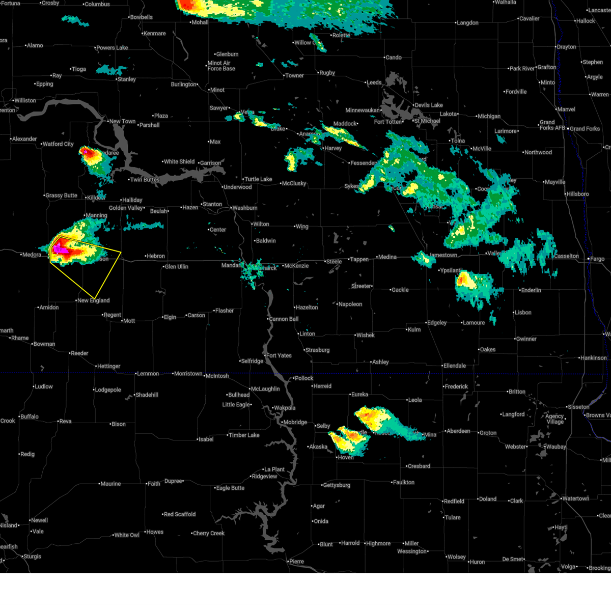
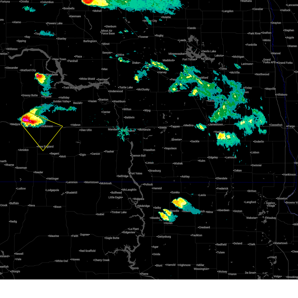
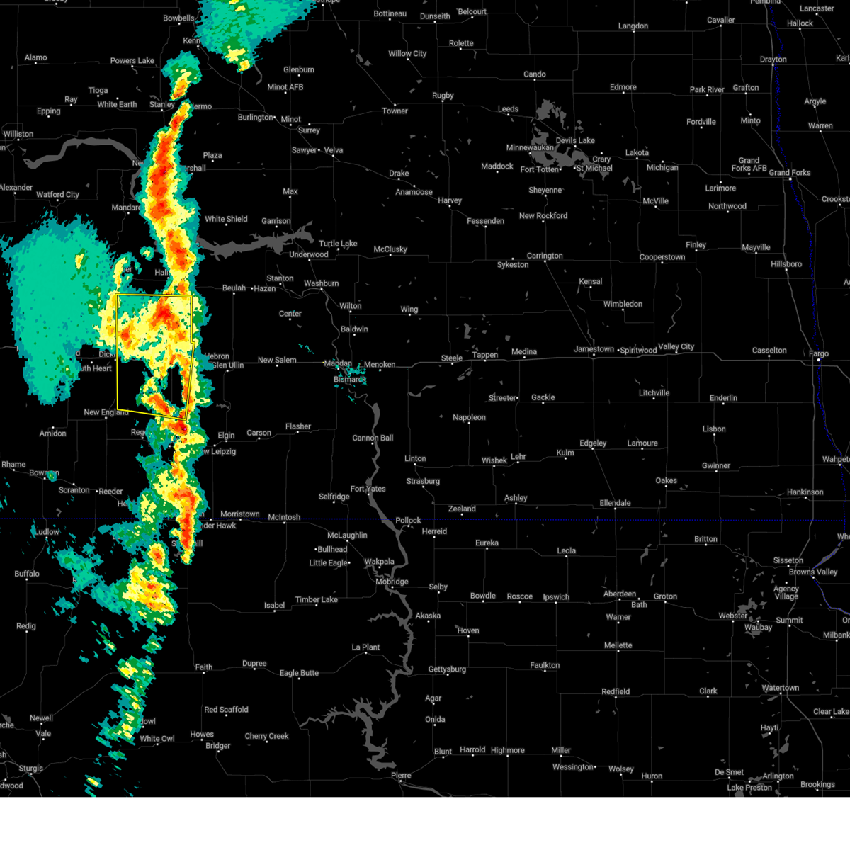
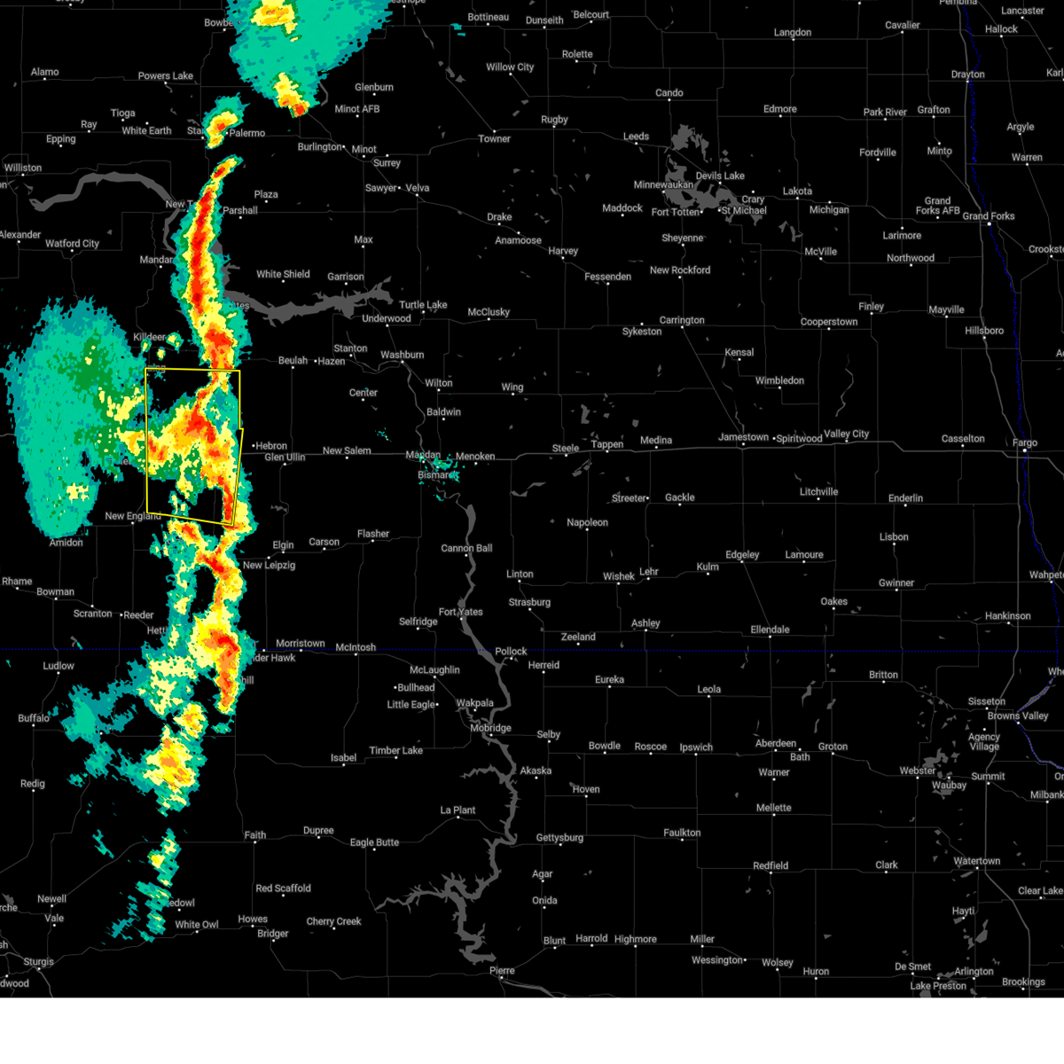
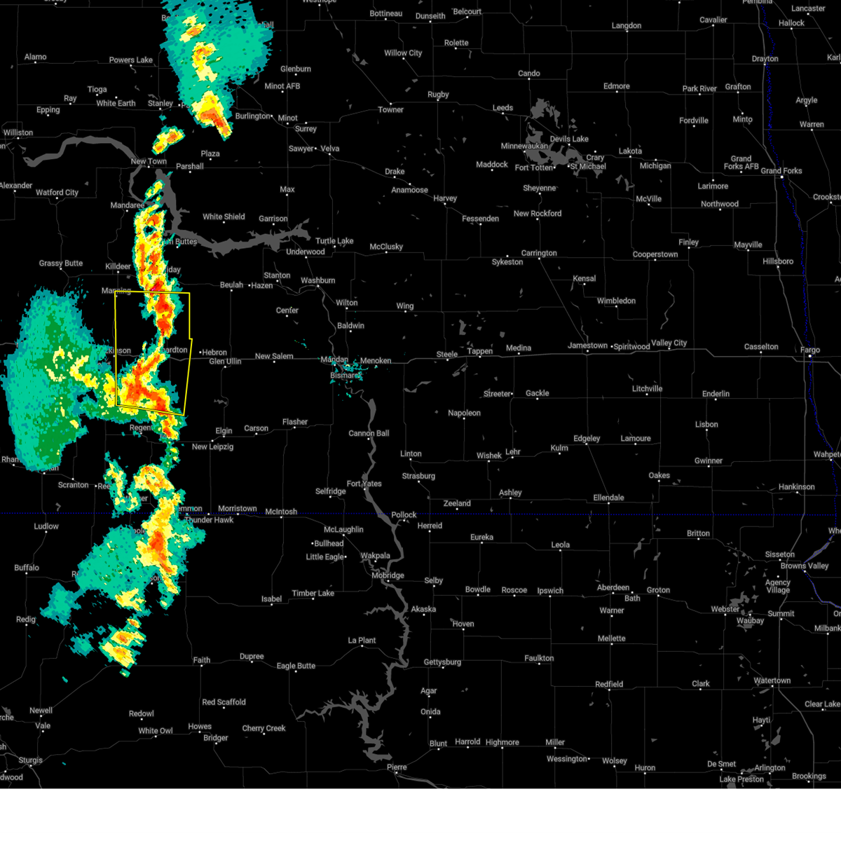
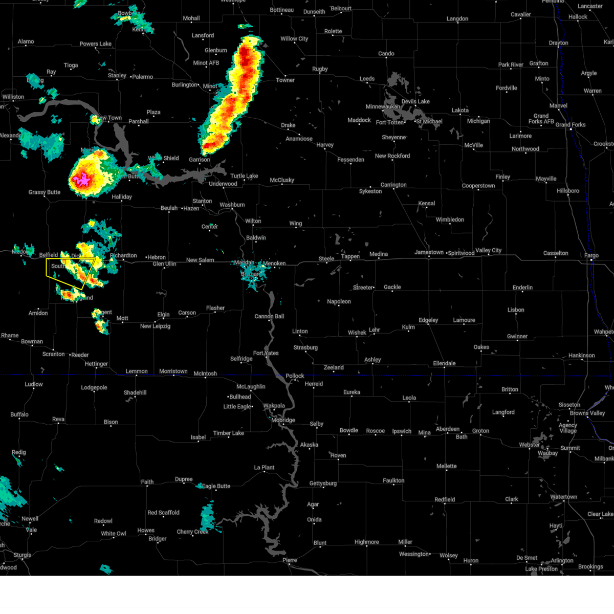
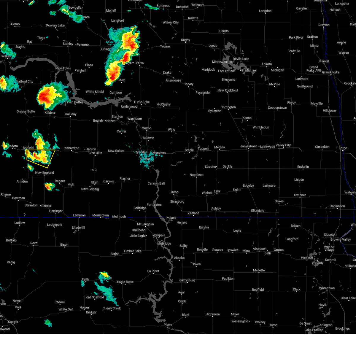
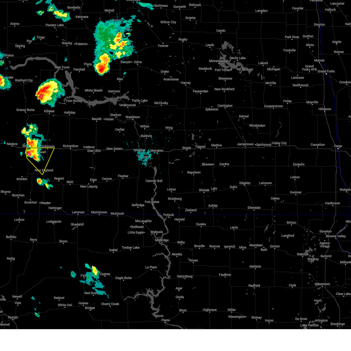
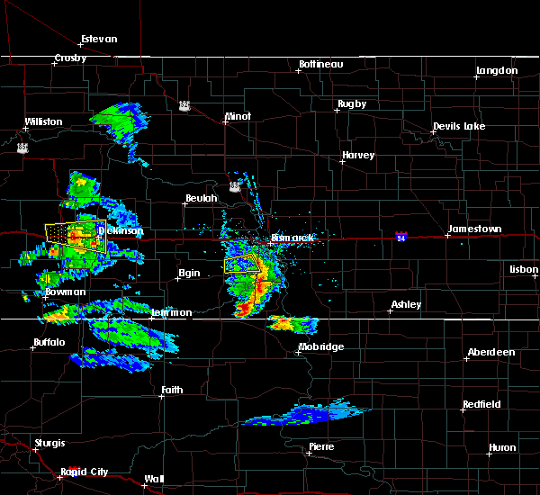
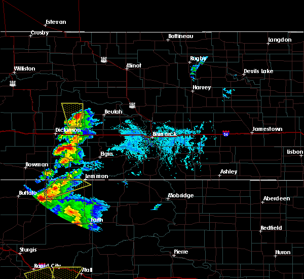
Hail Map for Dickinson, ND
The Dickinson, ND area has had 24 reports of on-the-ground hail by trained spotters, and has been under severe weather warnings 14 times during the past 12 months. Doppler radar has detected hail at or near Dickinson, ND on 46 occasions, including 3 occasions during the past year.
| Name: | Dickinson, ND |
| Where Located: | 95.2 miles W of Bismarck, ND |
| Map: | Google Map for Dickinson, ND |
| Population: | 17787 |
| Housing Units: | 7865 |
| More Info: | Search Google for Dickinson, ND |
0
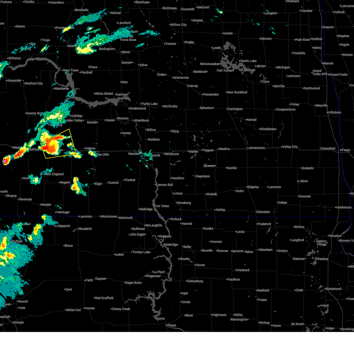
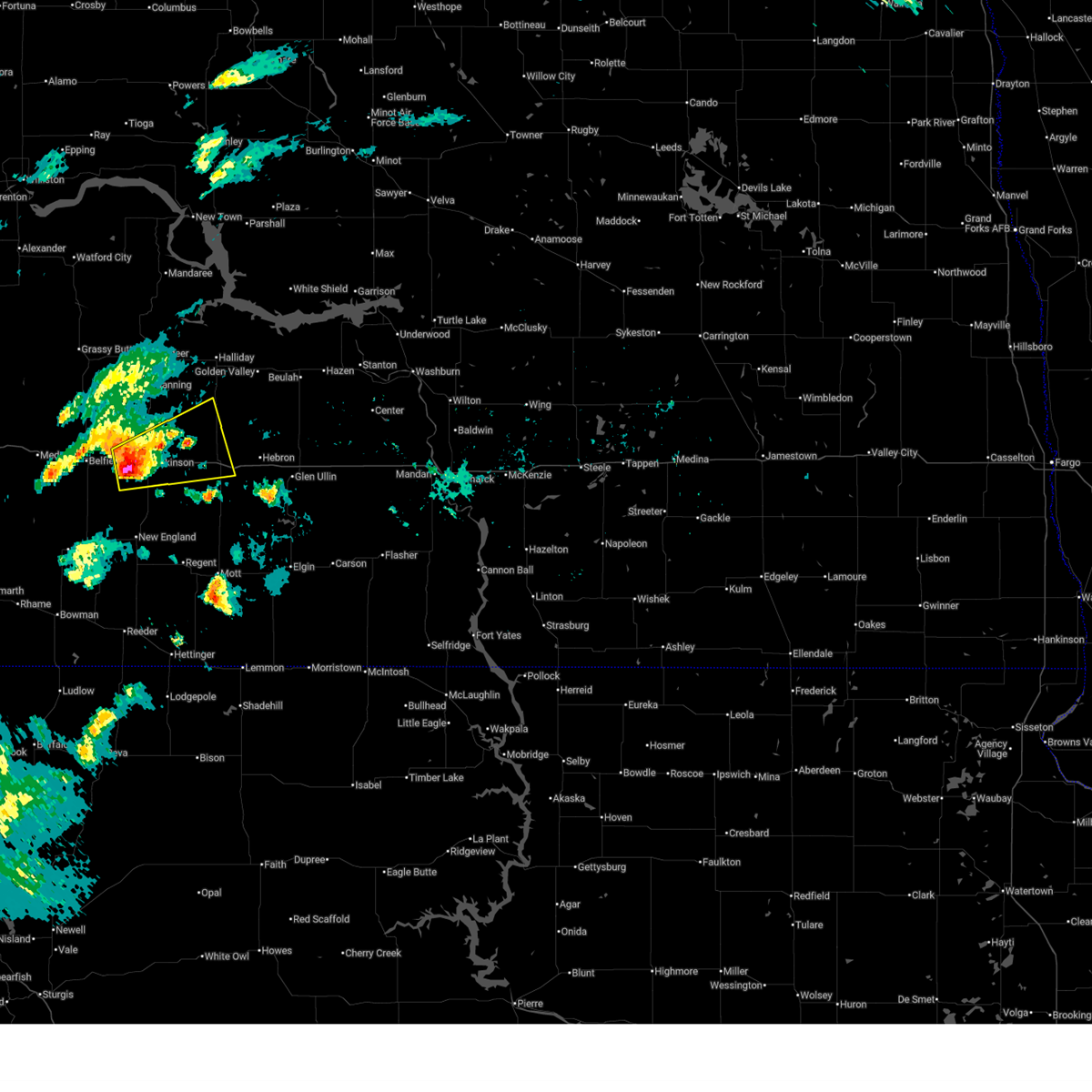
The Top Recent Hail Date for Dickinson, ND is Thursday, July 3, 2025 (27th out of 46)
Hail and Wind Damage Spotted near Dickinson, ND
| Date / Time | Report Details |
|---|---|
| 7/3/2025 11:33 PM MDT | Asos station kdik dickinson airpor in stark county ND, 5.5 miles N of Dickinson, ND |
| 7/3/2025 9:15 PM MDT |
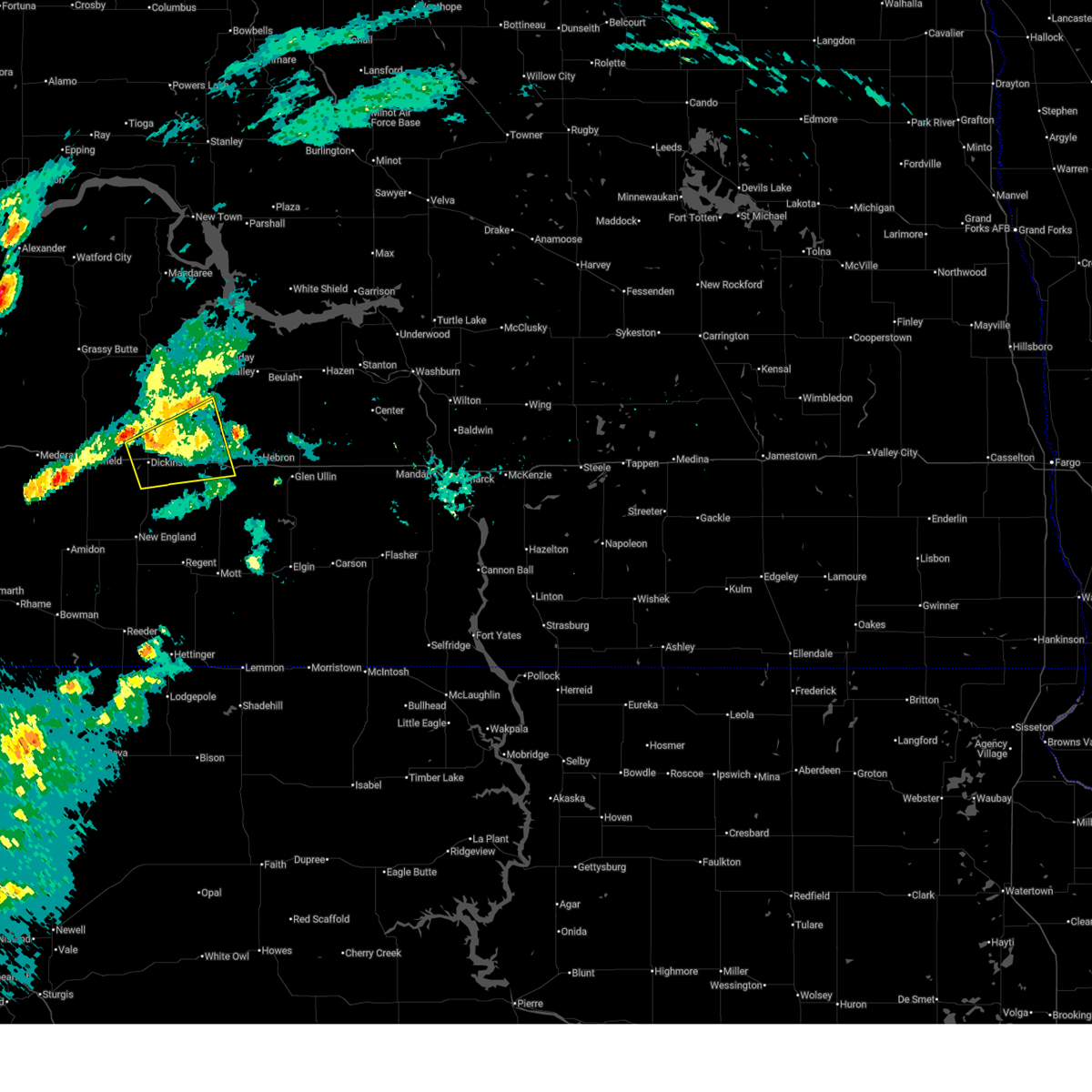 The storm which prompted the warning has weakened below severe limits, and no longer poses an immediate threat to life or property. therefore, the warning will be allowed to expire. a severe thunderstorm watch remains in effect until 100 am mdt for southwestern north dakota. The storm which prompted the warning has weakened below severe limits, and no longer poses an immediate threat to life or property. therefore, the warning will be allowed to expire. a severe thunderstorm watch remains in effect until 100 am mdt for southwestern north dakota.
|
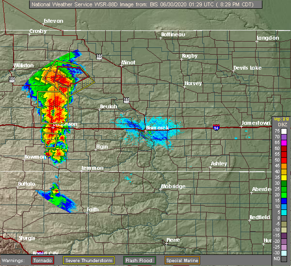
| 7/3/2025 8:58 PM MDT |
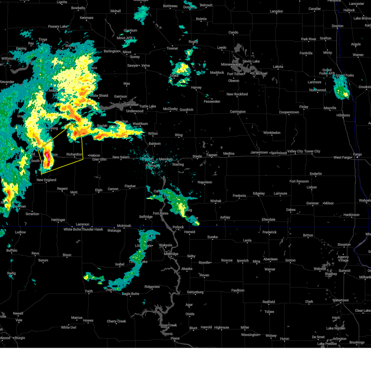
 At 857 pm mdt, a severe thunderstorm was located 5 miles north of gladstone, or 9 miles northeast of dickinson, moving northeast at 40 mph (radar indicated). Hazards include 60 mph wind gusts and quarter size hail. Hail damage to vehicles is expected. expect wind damage to roofs, siding, and trees. Locations impacted include, dickinson, richardton, gladstone, taylor, hirschville, and dickinson regional airport. At 857 pm mdt, a severe thunderstorm was located 5 miles north of gladstone, or 9 miles northeast of dickinson, moving northeast at 40 mph (radar indicated). Hazards include 60 mph wind gusts and quarter size hail. Hail damage to vehicles is expected. expect wind damage to roofs, siding, and trees. Locations impacted include, dickinson, richardton, gladstone, taylor, hirschville, and dickinson regional airport.
|
| 7/3/2025 8:45 PM MDT | 10 meter wind gust from ndawn statio in stark county ND, 1.4 miles ESE of Dickinson, ND |
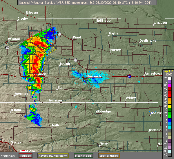
| 7/3/2025 8:37 PM MDT |
 Svrbis the national weather service in bismarck has issued a * severe thunderstorm warning for, south central dunn county in southwestern north dakota, northern stark county in southwestern north dakota, * until 915 pm mdt. * at 837 pm mdt, a severe thunderstorm was located 5 miles west of dickinson, moving northeast at 35 mph (radar indicated). Hazards include ping pong ball size hail and 60 mph wind gusts. People and animals outdoors will be injured. expect hail damage to roofs, siding, windows, and vehicles. Expect wind damage to roofs, siding, and trees. Svrbis the national weather service in bismarck has issued a * severe thunderstorm warning for, south central dunn county in southwestern north dakota, northern stark county in southwestern north dakota, * until 915 pm mdt. * at 837 pm mdt, a severe thunderstorm was located 5 miles west of dickinson, moving northeast at 35 mph (radar indicated). Hazards include ping pong ball size hail and 60 mph wind gusts. People and animals outdoors will be injured. expect hail damage to roofs, siding, windows, and vehicles. Expect wind damage to roofs, siding, and trees.
|
| 6/20/2025 7:25 PM MDT |
 The storms which prompted the warning have moved out of the area. therefore, the warning will be allowed to expire. a severe thunderstorm watch remains in effect until 900 pm mdt for southwestern north dakota. The storms which prompted the warning have moved out of the area. therefore, the warning will be allowed to expire. a severe thunderstorm watch remains in effect until 900 pm mdt for southwestern north dakota.
|
| 6/20/2025 6:56 PM MDT |
 the severe thunderstorm warning has been cancelled and is no longer in effect the severe thunderstorm warning has been cancelled and is no longer in effect
|
| 6/20/2025 6:56 PM MDT |
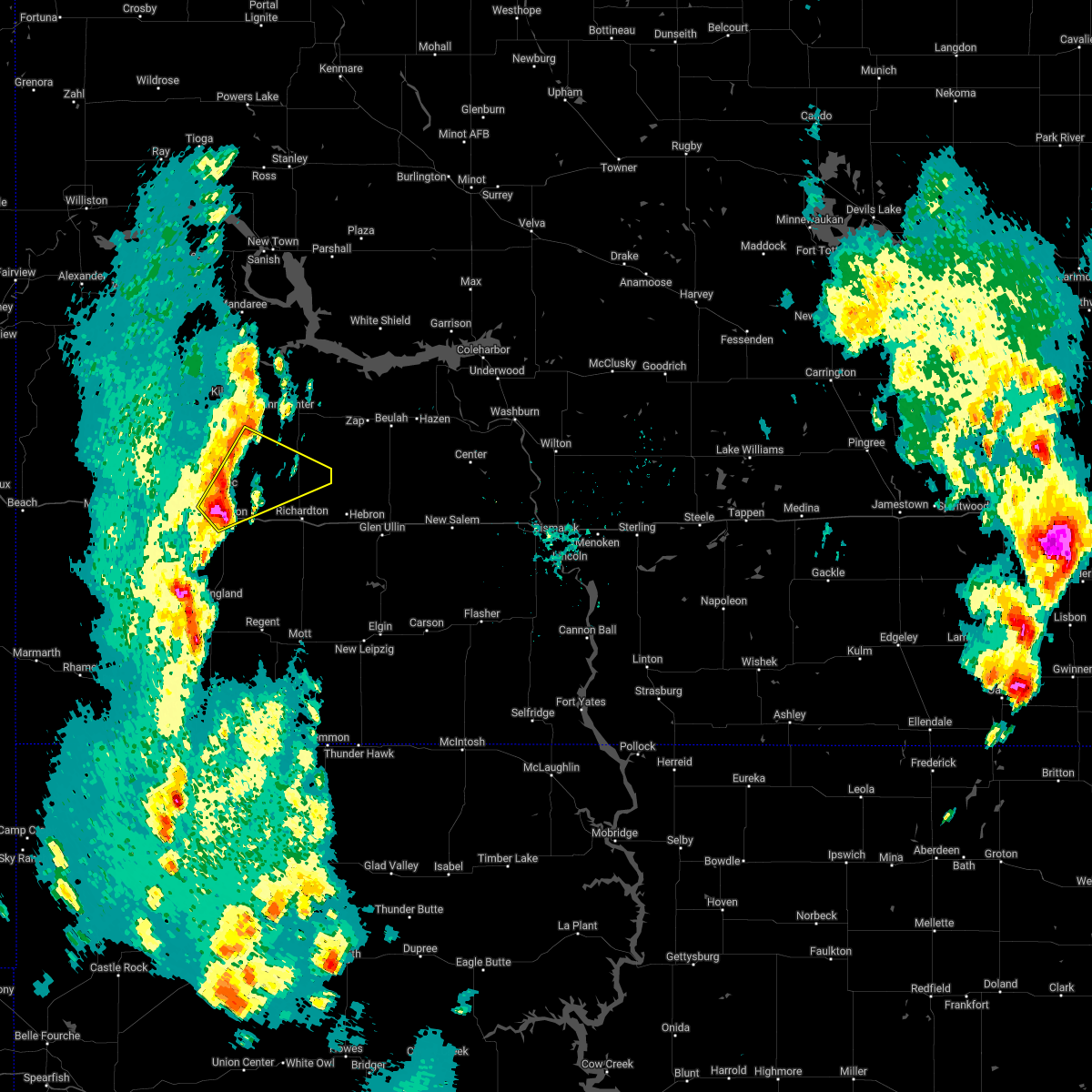
 At 655 pm mdt, severe thunderstorms were located along a line extending from 13 miles southeast of manning to 10 miles east of new england, moving east at 45 mph (radar indicated. at 638 mdt, 58 mph wind was reported dickinson airport). Hazards include 70 mph wind gusts and quarter size hail. Hail damage to vehicles is expected. expect considerable tree damage. wind damage is also likely to mobile homes, roofs, and outbuildings. Locations impacted include, dickinson, richardton, gladstone, taylor, hirschville, schefield, lefor, new hradec, and dickinson regional airport. At 655 pm mdt, severe thunderstorms were located along a line extending from 13 miles southeast of manning to 10 miles east of new england, moving east at 45 mph (radar indicated. at 638 mdt, 58 mph wind was reported dickinson airport). Hazards include 70 mph wind gusts and quarter size hail. Hail damage to vehicles is expected. expect considerable tree damage. wind damage is also likely to mobile homes, roofs, and outbuildings. Locations impacted include, dickinson, richardton, gladstone, taylor, hirschville, schefield, lefor, new hradec, and dickinson regional airport.
|
| 6/20/2025 6:42 PM MDT | Asos station kdik dickinson airpor in stark county ND, 5.5 miles N of Dickinson, ND |
| 6/20/2025 6:30 PM MDT |
 Svrbis the national weather service in bismarck has issued a * severe thunderstorm warning for, southwestern dunn county in southwestern north dakota, southeastern billings county in southwestern north dakota, northeastern slope county in southwestern north dakota, stark county in southwestern north dakota, * until 730 pm mdt. * at 630 pm mdt, severe thunderstorms were located along a line extending from 10 miles east of south fairfield to 8 miles northwest of new england, moving east at 45 mph (radar indicated). Hazards include 70 mph wind gusts and quarter size hail. Hail damage to vehicles is expected. expect considerable tree damage. Wind damage is also likely to mobile homes, roofs, and outbuildings. Svrbis the national weather service in bismarck has issued a * severe thunderstorm warning for, southwestern dunn county in southwestern north dakota, southeastern billings county in southwestern north dakota, northeastern slope county in southwestern north dakota, stark county in southwestern north dakota, * until 730 pm mdt. * at 630 pm mdt, severe thunderstorms were located along a line extending from 10 miles east of south fairfield to 8 miles northwest of new england, moving east at 45 mph (radar indicated). Hazards include 70 mph wind gusts and quarter size hail. Hail damage to vehicles is expected. expect considerable tree damage. Wind damage is also likely to mobile homes, roofs, and outbuildings.
|
| 6/20/2025 6:19 PM MDT |
 Svrbis the national weather service in bismarck has issued a * severe thunderstorm warning for, southwestern dunn county in southwestern north dakota, eastern billings county in southwestern north dakota, stark county in southwestern north dakota, * until 645 pm mdt. * at 618 pm mdt, severe thunderstorms were located along a line extending from near south fairfield to 10 miles northeast of amidon, moving east at 25 mph (radar indicated). Hazards include 70 mph wind gusts and quarter size hail. Hail damage to vehicles is expected. expect considerable tree damage. Wind damage is also likely to mobile homes, roofs, and outbuildings. Svrbis the national weather service in bismarck has issued a * severe thunderstorm warning for, southwestern dunn county in southwestern north dakota, eastern billings county in southwestern north dakota, stark county in southwestern north dakota, * until 645 pm mdt. * at 618 pm mdt, severe thunderstorms were located along a line extending from near south fairfield to 10 miles northeast of amidon, moving east at 25 mph (radar indicated). Hazards include 70 mph wind gusts and quarter size hail. Hail damage to vehicles is expected. expect considerable tree damage. Wind damage is also likely to mobile homes, roofs, and outbuildings.
|
| 6/19/2025 6:30 PM MDT | Hen Egg sized hail reported 0.2 miles E of Dickinson, ND, photo relayed through broadcast media. |
| 6/19/2025 6:23 PM MDT | Golf Ball sized hail reported 1.8 miles SE of Dickinson, ND, hail began at 723 cdt and lasted two minutes. hail from the size of quarters to a few golf ball sized stones. |
| 6/19/2025 6:20 PM MDT | Golf Ball sized hail reported 4.2 miles ENE of Dickinson, ND, relayed through broadcast media. time estimated from radar. |
| 6/19/2025 6:02 PM MDT |
 Svrbis the national weather service in bismarck has issued a * severe thunderstorm warning for, southwestern dunn county in southwestern north dakota, northwestern hettinger county in southwestern north dakota, eastern billings county in southwestern north dakota, central stark county in southwestern north dakota, * until 700 pm mdt. * at 601 pm mdt, a severe thunderstorm was located 5 miles northwest of south heart, or 13 miles west of dickinson, moving southeast at 30 mph. this is a destructive storm for dickinson to south heart (radar indicated). Hazards include baseball size hail and 60 mph wind gusts. People and animals outdoors will be severely injured. Expect shattered windows, extensive damage to roofs, siding, and vehicles. Svrbis the national weather service in bismarck has issued a * severe thunderstorm warning for, southwestern dunn county in southwestern north dakota, northwestern hettinger county in southwestern north dakota, eastern billings county in southwestern north dakota, central stark county in southwestern north dakota, * until 700 pm mdt. * at 601 pm mdt, a severe thunderstorm was located 5 miles northwest of south heart, or 13 miles west of dickinson, moving southeast at 30 mph. this is a destructive storm for dickinson to south heart (radar indicated). Hazards include baseball size hail and 60 mph wind gusts. People and animals outdoors will be severely injured. Expect shattered windows, extensive damage to roofs, siding, and vehicles.
|
| 6/19/2025 5:53 PM MDT |
 At 553 pm mdt, a severe thunderstorm was located 6 miles northwest of south heart, or 13 miles west of dickinson, moving southeast at 30 mph (radar indicated). Hazards include tennis ball size hail and 60 mph wind gusts. People and animals outdoors will be injured. expect hail damage to roofs, siding, windows, and vehicles. expect wind damage to roofs, siding, and trees. Locations impacted include, dickinson, belfield, richardton, south heart, gladstone, taylor, schefield, lefor, new hradec, and dickinson regional airport. At 553 pm mdt, a severe thunderstorm was located 6 miles northwest of south heart, or 13 miles west of dickinson, moving southeast at 30 mph (radar indicated). Hazards include tennis ball size hail and 60 mph wind gusts. People and animals outdoors will be injured. expect hail damage to roofs, siding, windows, and vehicles. expect wind damage to roofs, siding, and trees. Locations impacted include, dickinson, belfield, richardton, south heart, gladstone, taylor, schefield, lefor, new hradec, and dickinson regional airport.
|
| 6/19/2025 5:44 PM MDT | Svrbis the national weather service in bismarck has issued a * severe thunderstorm warning for, southwestern dunn county in southwestern north dakota, northwestern hettinger county in southwestern north dakota, east central billings county in southwestern north dakota, stark county in southwestern north dakota, * until 645 pm mdt. * at 543 pm mdt, a severe thunderstorm was located 7 miles northwest of south heart, or 14 miles west of dickinson, moving southeast at 35 mph (radar indicated). Hazards include two inch hail and 60 mph wind gusts. People and animals outdoors will be injured. expect hail damage to roofs, siding, windows, and vehicles. Expect wind damage to roofs, siding, and trees. |
| 9/12/2024 6:41 PM MDT |
 The storm which prompted the warning has weakened below severe limits. therefore, the warning will be allowed to expire. however, gusty winds are still possible with this thunderstorm. a severe thunderstorm watch remains in effect until 1000 pm mdt for southwestern north dakota. The storm which prompted the warning has weakened below severe limits. therefore, the warning will be allowed to expire. however, gusty winds are still possible with this thunderstorm. a severe thunderstorm watch remains in effect until 1000 pm mdt for southwestern north dakota.
|
| 9/12/2024 6:30 PM MDT |
 At 630 pm mdt, a severe thunderstorm was located 7 miles southwest of marshall, or 20 miles northeast of dickinson, moving north at 65 mph (radar indicated). Hazards include 60 mph wind gusts. Expect damage to roofs, siding, and trees. Locations impacted include, dickinson, richardton, gladstone, taylor, manning, marshall, hirschville, and lefor. At 630 pm mdt, a severe thunderstorm was located 7 miles southwest of marshall, or 20 miles northeast of dickinson, moving north at 65 mph (radar indicated). Hazards include 60 mph wind gusts. Expect damage to roofs, siding, and trees. Locations impacted include, dickinson, richardton, gladstone, taylor, manning, marshall, hirschville, and lefor.
|
| 9/12/2024 6:09 PM MDT |
 Svrbis the national weather service in bismarck has issued a * severe thunderstorm warning for, southeastern dunn county in southwestern north dakota, northeastern hettinger county in southwestern north dakota, eastern stark county in southwestern north dakota, * until 645 pm mdt. * at 609 pm mdt, a severe thunderstorm was located 7 miles south of gladstone, or 14 miles southeast of dickinson, moving north at 65 mph (radar indicated). Hazards include 60 mph wind gusts. expect damage to roofs, siding, and trees Svrbis the national weather service in bismarck has issued a * severe thunderstorm warning for, southeastern dunn county in southwestern north dakota, northeastern hettinger county in southwestern north dakota, eastern stark county in southwestern north dakota, * until 645 pm mdt. * at 609 pm mdt, a severe thunderstorm was located 7 miles south of gladstone, or 14 miles southeast of dickinson, moving north at 65 mph (radar indicated). Hazards include 60 mph wind gusts. expect damage to roofs, siding, and trees
|
| 7/12/2024 6:36 PM MDT |
 The storm which prompted the warning has weakened below severe limits, and no longer poses an immediate threat to life or property. therefore, the warning will be allowed to expire. however, small hail and gusty winds are still possible with this thunderstorm. a severe thunderstorm watch remains in effect until 1100 pm mdt for southwestern north dakota. The storm which prompted the warning has weakened below severe limits, and no longer poses an immediate threat to life or property. therefore, the warning will be allowed to expire. however, small hail and gusty winds are still possible with this thunderstorm. a severe thunderstorm watch remains in effect until 1100 pm mdt for southwestern north dakota.
|
| 7/12/2024 6:13 PM MDT |
 At 613 pm mdt, a severe thunderstorm was located 6 miles south of south heart, or 11 miles southwest of dickinson, moving east at 20 mph (radar indicated). Hazards include 60 mph wind gusts and quarter size hail. Hail damage to vehicles is expected. expect wind damage to roofs, siding, and trees. Locations impacted include, dickinson, belfield, south heart, schefield, and dickinson regional airport. At 613 pm mdt, a severe thunderstorm was located 6 miles south of south heart, or 11 miles southwest of dickinson, moving east at 20 mph (radar indicated). Hazards include 60 mph wind gusts and quarter size hail. Hail damage to vehicles is expected. expect wind damage to roofs, siding, and trees. Locations impacted include, dickinson, belfield, south heart, schefield, and dickinson regional airport.
|
| 7/12/2024 6:13 PM MDT |
 the severe thunderstorm warning has been cancelled and is no longer in effect the severe thunderstorm warning has been cancelled and is no longer in effect
|
| 7/12/2024 5:49 PM MDT |
 Svrbis the national weather service in bismarck has issued a * severe thunderstorm warning for, northwestern hettinger county in southwestern north dakota, northeastern slope county in southwestern north dakota, southwestern stark county in southwestern north dakota, * until 645 pm mdt. * at 549 pm mdt, a severe thunderstorm was located 5 miles south of belfield, or 19 miles west of dickinson, moving southeast at 20 mph (radar indicated). Hazards include ping pong ball size hail and 60 mph wind gusts. People and animals outdoors will be injured. expect hail damage to roofs, siding, windows, and vehicles. Expect wind damage to roofs, siding, and trees. Svrbis the national weather service in bismarck has issued a * severe thunderstorm warning for, northwestern hettinger county in southwestern north dakota, northeastern slope county in southwestern north dakota, southwestern stark county in southwestern north dakota, * until 645 pm mdt. * at 549 pm mdt, a severe thunderstorm was located 5 miles south of belfield, or 19 miles west of dickinson, moving southeast at 20 mph (radar indicated). Hazards include ping pong ball size hail and 60 mph wind gusts. People and animals outdoors will be injured. expect hail damage to roofs, siding, windows, and vehicles. Expect wind damage to roofs, siding, and trees.
|
| 6/27/2024 7:15 PM MDT |
 The tornado threat has diminished and the tornado warning has been allowed to expire. however, intense damaging winds remain likely and a severe thunderstorm warning remains in effect for the area. a tornado watch remains in effect until 900 pm mdt for southwestern north dakota. remember, a severe thunderstorm warning still remains in effect until 745 pm mdt. The tornado threat has diminished and the tornado warning has been allowed to expire. however, intense damaging winds remain likely and a severe thunderstorm warning remains in effect for the area. a tornado watch remains in effect until 900 pm mdt for southwestern north dakota. remember, a severe thunderstorm warning still remains in effect until 745 pm mdt.
|
| 6/27/2024 6:58 PM MDT |
 At 658 pm mdt, severe thunderstorms capable of producing tornadoes were located along a line extending from 5 miles north of dickinson to 4 miles west of gladstone, moving east at 40 mph (radar indicated rotation). Hazards include tornado. Flying debris will be dangerous to those caught without shelter. mobile homes will be damaged or destroyed. damage to roofs, windows, and vehicles will occur. tree damage is likely. these dangerous storms will be near, gladstone around 705 pm mdt. Other locations impacted by these tornadic storms include hirschville and new hradec. At 658 pm mdt, severe thunderstorms capable of producing tornadoes were located along a line extending from 5 miles north of dickinson to 4 miles west of gladstone, moving east at 40 mph (radar indicated rotation). Hazards include tornado. Flying debris will be dangerous to those caught without shelter. mobile homes will be damaged or destroyed. damage to roofs, windows, and vehicles will occur. tree damage is likely. these dangerous storms will be near, gladstone around 705 pm mdt. Other locations impacted by these tornadic storms include hirschville and new hradec.
|
| 6/27/2024 6:50 PM MDT |
 Torbis the national weather service in bismarck has issued a * tornado warning for, southwestern dunn county in southwestern north dakota, north central stark county in southwestern north dakota, * until 715 pm mdt. * at 650 pm mdt, severe thunderstorms capable of producing a tornado were located along a line extending from 9 miles north of south heart to near dickinson, moving east at 35 mph (weather spotters reported funnel cloud). Hazards include tornado. Flying debris will be dangerous to those caught without shelter. mobile homes will be damaged or destroyed. damage to roofs, windows, and vehicles will occur. tree damage is likely. these dangerous storms will be near, dickinson around 655 pm mdt. gladstone around 700 pm mdt. Other locations impacted by these tornadic storms include hirschville, new hradec, and dickinson regional airport. Torbis the national weather service in bismarck has issued a * tornado warning for, southwestern dunn county in southwestern north dakota, north central stark county in southwestern north dakota, * until 715 pm mdt. * at 650 pm mdt, severe thunderstorms capable of producing a tornado were located along a line extending from 9 miles north of south heart to near dickinson, moving east at 35 mph (weather spotters reported funnel cloud). Hazards include tornado. Flying debris will be dangerous to those caught without shelter. mobile homes will be damaged or destroyed. damage to roofs, windows, and vehicles will occur. tree damage is likely. these dangerous storms will be near, dickinson around 655 pm mdt. gladstone around 700 pm mdt. Other locations impacted by these tornadic storms include hirschville, new hradec, and dickinson regional airport.
|
| 6/27/2024 6:48 PM MDT | Asos station kdik dickinson airpor in stark county ND, 5.5 miles N of Dickinson, ND |
| 6/27/2024 6:48 PM MDT | Healthy tree fallen over... snapped at base. public report relayed via media partner... with photo. time estimated from rada in stark county ND, 5.4 miles NW of Dickinson, ND |
| 6/27/2024 6:48 PM MDT | Healthy tree fallen over onto house. public report relayed via media partner... with photos. time estimated from rada in stark county ND, 1.4 miles S of Dickinson, ND |
| 6/27/2024 6:48 PM MDT |
 At 647 pm mdt, severe thunderstorms were located along a line extending from 11 miles west of killdeer to 10 miles north of dickinson to 12 miles northeast of new england, moving east at 60 mph (radar indicated). Hazards include 70 mph wind gusts and half dollar size hail. Hail damage to vehicles is expected. expect considerable tree damage. wind damage is also likely to mobile homes, roofs, and outbuildings. Locations impacted include, dickinson, belfield, richardton, south heart, gladstone, taylor, dodge, manning, marshall, south fairfield, fairfield, hirschville, lefor, new hradec, schefield, and dickinson regional airport. At 647 pm mdt, severe thunderstorms were located along a line extending from 11 miles west of killdeer to 10 miles north of dickinson to 12 miles northeast of new england, moving east at 60 mph (radar indicated). Hazards include 70 mph wind gusts and half dollar size hail. Hail damage to vehicles is expected. expect considerable tree damage. wind damage is also likely to mobile homes, roofs, and outbuildings. Locations impacted include, dickinson, belfield, richardton, south heart, gladstone, taylor, dodge, manning, marshall, south fairfield, fairfield, hirschville, lefor, new hradec, schefield, and dickinson regional airport.
|
| 6/27/2024 6:13 PM MDT |
 Svrbis the national weather service in bismarck has issued a * severe thunderstorm warning for, southern dunn county in southwestern north dakota, billings county in southwestern north dakota, stark county in southwestern north dakota, * until 730 pm mdt. * at 612 pm mdt, severe thunderstorms were located along a line extending from 15 miles east of trotters to 7 miles northeast of medora to 9 miles north of amidon, moving east at 55 mph (radar indicated). Hazards include 70 mph wind gusts. Expect considerable tree damage. Damage is likely to mobile homes, roofs, and outbuildings. Svrbis the national weather service in bismarck has issued a * severe thunderstorm warning for, southern dunn county in southwestern north dakota, billings county in southwestern north dakota, stark county in southwestern north dakota, * until 730 pm mdt. * at 612 pm mdt, severe thunderstorms were located along a line extending from 15 miles east of trotters to 7 miles northeast of medora to 9 miles north of amidon, moving east at 55 mph (radar indicated). Hazards include 70 mph wind gusts. Expect considerable tree damage. Damage is likely to mobile homes, roofs, and outbuildings.
|
| 8/30/2023 8:47 PM MDT | Quarter sized hail reported 1.4 miles S of Dickinson, ND, heavy rain. |
| 8/30/2023 8:36 PM MDT |
 At 836 pm mdt, a severe thunderstorm was located over dickinson, moving northeast at 40 mph (radar indicated). Hazards include 60 mph wind gusts and quarter size hail. Hail damage to vehicles is expected. expect wind damage to roofs, siding, and trees. this severe thunderstorm will be near, dickinson around 840 pm mdt. other locations impacted by this severe thunderstorm include hirschville, new hradec and dickinson regional airport. hail threat, radar indicated max hail size, 1. 00 in wind threat, radar indicated max wind gust, 60 mph. At 836 pm mdt, a severe thunderstorm was located over dickinson, moving northeast at 40 mph (radar indicated). Hazards include 60 mph wind gusts and quarter size hail. Hail damage to vehicles is expected. expect wind damage to roofs, siding, and trees. this severe thunderstorm will be near, dickinson around 840 pm mdt. other locations impacted by this severe thunderstorm include hirschville, new hradec and dickinson regional airport. hail threat, radar indicated max hail size, 1. 00 in wind threat, radar indicated max wind gust, 60 mph.
|
| 8/1/2023 7:49 PM MDT |
 At 748 pm mdt, a severe thunderstorm was located near dickinson, moving east at 30 mph (trained weather spotters). Hazards include 70 mph wind gusts and quarter size hail. Hail damage to vehicles is expected. expect considerable tree damage. wind damage is also likely to mobile homes, roofs, and outbuildings. this severe thunderstorm will be near, gladstone around 805 pm mdt. richardton and taylor around 815 pm mdt. thunderstorm damage threat, considerable hail threat, radar indicated max hail size, 1. 00 in wind threat, observed max wind gust, 70 mph. At 748 pm mdt, a severe thunderstorm was located near dickinson, moving east at 30 mph (trained weather spotters). Hazards include 70 mph wind gusts and quarter size hail. Hail damage to vehicles is expected. expect considerable tree damage. wind damage is also likely to mobile homes, roofs, and outbuildings. this severe thunderstorm will be near, gladstone around 805 pm mdt. richardton and taylor around 815 pm mdt. thunderstorm damage threat, considerable hail threat, radar indicated max hail size, 1. 00 in wind threat, observed max wind gust, 70 mph.
|
| 8/1/2023 7:38 PM MDT | Mesonet station 322189 1 nw dickinson (ndawn in stark county ND, 1.8 miles SE of Dickinson, ND |
| 6/21/2023 11:40 PM MDT |
 At 1140 pm mdt, severe thunderstorms were located along a line extending from 10 miles northwest of gladstone to near dickinson, moving east at 40 mph (radar indicated). Hazards include 60 mph wind gusts and nickel size hail. Expect damage to roofs, siding, and trees. these severe storms will be near, gladstone around 1150 pm mdt. taylor around 1200 am mdt. richardton around 1210 am mdt. marshall around 1215 am mdt. other locations impacted by these severe thunderstorms include hirschville and dickinson regional airport. hail threat, radar indicated max hail size, 0. 88 in wind threat, observed max wind gust, 60 mph. At 1140 pm mdt, severe thunderstorms were located along a line extending from 10 miles northwest of gladstone to near dickinson, moving east at 40 mph (radar indicated). Hazards include 60 mph wind gusts and nickel size hail. Expect damage to roofs, siding, and trees. these severe storms will be near, gladstone around 1150 pm mdt. taylor around 1200 am mdt. richardton around 1210 am mdt. marshall around 1215 am mdt. other locations impacted by these severe thunderstorms include hirschville and dickinson regional airport. hail threat, radar indicated max hail size, 0. 88 in wind threat, observed max wind gust, 60 mph.
|
| 6/21/2023 11:32 PM MDT |
 At 1132 pm mdt, severe thunderstorms were located along a line extending from 9 miles northeast of south heart to dickinson, moving northeast at 40 mph (radar indicated). Hazards include 60 mph wind gusts and nickel size hail. Expect damage to roofs, siding, and trees. severe thunderstorms will be near, gladstone around 1150 pm mdt. taylor around 1200 am mdt. richardton around 1205 am mdt. marshall around 1210 am mdt. other locations impacted by these severe thunderstorms include hirschville, new hradec and dickinson regional airport. hail threat, radar indicated max hail size, 0. 88 in wind threat, radar indicated max wind gust, 60 mph. At 1132 pm mdt, severe thunderstorms were located along a line extending from 9 miles northeast of south heart to dickinson, moving northeast at 40 mph (radar indicated). Hazards include 60 mph wind gusts and nickel size hail. Expect damage to roofs, siding, and trees. severe thunderstorms will be near, gladstone around 1150 pm mdt. taylor around 1200 am mdt. richardton around 1205 am mdt. marshall around 1210 am mdt. other locations impacted by these severe thunderstorms include hirschville, new hradec and dickinson regional airport. hail threat, radar indicated max hail size, 0. 88 in wind threat, radar indicated max wind gust, 60 mph.
|
| 6/21/2023 11:29 PM MDT | Asos station kdik dickinson airport. began at 1229 cdt and lasted until 1234 cd in stark county ND, 5.5 miles N of Dickinson, ND |
| 7/25/2022 8:24 PM MDT |
 At 923 pm cdt/823 pm mdt/, severe thunderstorms were located along a line extending from 4 miles west of halliday to 4 miles northeast of richardton to near new england, moving east at 50 mph (radar indicated). Hazards include 60 mph wind gusts. Expect damage to roofs, siding, and trees. severe thunderstorms will be near, hebron around 935 pm cdt. dodge around 835 pm mdt. other locations in the path of these severe thunderstorms include golden valley, glen ullin, zap, beulah, hazen, new salem, stanton, elgin and new leipzig. hail threat, radar indicated max hail size, <. 75 in wind threat, radar indicated max wind gust, 60 mph. At 923 pm cdt/823 pm mdt/, severe thunderstorms were located along a line extending from 4 miles west of halliday to 4 miles northeast of richardton to near new england, moving east at 50 mph (radar indicated). Hazards include 60 mph wind gusts. Expect damage to roofs, siding, and trees. severe thunderstorms will be near, hebron around 935 pm cdt. dodge around 835 pm mdt. other locations in the path of these severe thunderstorms include golden valley, glen ullin, zap, beulah, hazen, new salem, stanton, elgin and new leipzig. hail threat, radar indicated max hail size, <. 75 in wind threat, radar indicated max wind gust, 60 mph.
|
| 7/25/2022 7:50 PM MDT | Ndawn station. this is the 10 meter peak wind gust. 3 meter peak wind gust of 52 mp in stark county ND, 1.8 miles SE of Dickinson, ND |
| 7/25/2022 7:50 PM MDT | Nddot site at mannin in dunn county ND, 10.4 miles S of Dickinson, ND |
| 7/10/2022 2:15 AM MDT |
 At 314 am cdt/214 am mdt/, severe thunderstorms were located along a line extending from near little missouri state park to 7 miles southwest of halliday to 7 miles northwest of gladstone to 8 miles east of new england, moving east at 55 mph (radar indicated). Hazards include 70 mph wind gusts and quarter size hail. Hail damage to vehicles is expected. expect considerable tree damage. wind damage is also likely to mobile homes, roofs, and outbuildings. locations impacted include, dickinson, killdeer, new england, richardton, south heart, gladstone, halliday, taylor, dunn center, dodge, manning, marshall, little missouri state park, lefor, and schefield. thunderstorm damage threat, considerable hail threat, radar indicated max hail size, 1. 00 in wind threat, observed max wind gust, 70 mph. At 314 am cdt/214 am mdt/, severe thunderstorms were located along a line extending from near little missouri state park to 7 miles southwest of halliday to 7 miles northwest of gladstone to 8 miles east of new england, moving east at 55 mph (radar indicated). Hazards include 70 mph wind gusts and quarter size hail. Hail damage to vehicles is expected. expect considerable tree damage. wind damage is also likely to mobile homes, roofs, and outbuildings. locations impacted include, dickinson, killdeer, new england, richardton, south heart, gladstone, halliday, taylor, dunn center, dodge, manning, marshall, little missouri state park, lefor, and schefield. thunderstorm damage threat, considerable hail threat, radar indicated max hail size, 1. 00 in wind threat, observed max wind gust, 70 mph.
|
| 7/10/2022 2:05 AM MDT | Asos station kdik dickinson airpor in stark county ND, 5.5 miles N of Dickinson, ND |
| 7/10/2022 2:02 AM MDT |
 At 300 am cdt/200 am mdt/, severe thunderstorms were located along a line extending from 7 miles east of grassy butte to 4 miles northeast of manning to 6 miles northwest of dickinson to 4 miles west of new england, moving east at 50 mph (radar indicated). Hazards include 70 mph wind gusts and half dollar size hail. Hail damage to vehicles is expected. expect considerable tree damage. wind damage is also likely to mobile homes, roofs, and outbuildings. these severe storms will be near, manning around 205 am mdt. dunn center around 210 am mdt. killdeer around 220 am mdt. halliday and taylor around 225 am mdt. dodge around 230 am mdt. marshall around 240 am mdt. other locations impacted by these severe thunderstorms include hirschville, schefield, oakdale, fairfield, havelock, lefor, new hradec and dickinson regional airport. thunderstorm damage threat, considerable hail threat, radar indicated max hail size, 1. 25 in wind threat, observed max wind gust, 70 mph. At 300 am cdt/200 am mdt/, severe thunderstorms were located along a line extending from 7 miles east of grassy butte to 4 miles northeast of manning to 6 miles northwest of dickinson to 4 miles west of new england, moving east at 50 mph (radar indicated). Hazards include 70 mph wind gusts and half dollar size hail. Hail damage to vehicles is expected. expect considerable tree damage. wind damage is also likely to mobile homes, roofs, and outbuildings. these severe storms will be near, manning around 205 am mdt. dunn center around 210 am mdt. killdeer around 220 am mdt. halliday and taylor around 225 am mdt. dodge around 230 am mdt. marshall around 240 am mdt. other locations impacted by these severe thunderstorms include hirschville, schefield, oakdale, fairfield, havelock, lefor, new hradec and dickinson regional airport. thunderstorm damage threat, considerable hail threat, radar indicated max hail size, 1. 25 in wind threat, observed max wind gust, 70 mph.
|
| 7/10/2022 1:42 AM MDT |
 At 242 am cdt/142 am mdt/, severe thunderstorms were located along a line extending from 9 miles southwest of grassy butte to 6 miles southeast of south fairfield to near amidon, moving east at 55 mph (radar indicated). Hazards include 70 mph wind gusts and half dollar size hail. Hail damage to vehicles is expected. expect considerable tree damage. wind damage is also likely to mobile homes, roofs, and outbuildings. severe thunderstorms will be near, new england around 205 am mdt. killdeer around 220 am mdt. dunn center and marshall around 225 am mdt. halliday around 240 am mdt. dodge around 245 am mdt. other locations impacted by these severe thunderstorms include fryburg, hirschville, schefield, oakdale, fairfield, havelock, lefor, new hradec, and dickinson. thunderstorm damage threat, considerable hail threat, radar indicated max hail size, 1. 25 in wind threat, observed max wind gust, 70 mph. At 242 am cdt/142 am mdt/, severe thunderstorms were located along a line extending from 9 miles southwest of grassy butte to 6 miles southeast of south fairfield to near amidon, moving east at 55 mph (radar indicated). Hazards include 70 mph wind gusts and half dollar size hail. Hail damage to vehicles is expected. expect considerable tree damage. wind damage is also likely to mobile homes, roofs, and outbuildings. severe thunderstorms will be near, new england around 205 am mdt. killdeer around 220 am mdt. dunn center and marshall around 225 am mdt. halliday around 240 am mdt. dodge around 245 am mdt. other locations impacted by these severe thunderstorms include fryburg, hirschville, schefield, oakdale, fairfield, havelock, lefor, new hradec, and dickinson. thunderstorm damage threat, considerable hail threat, radar indicated max hail size, 1. 25 in wind threat, observed max wind gust, 70 mph.
|
| 7/3/2022 11:39 PM MDT |
 At 1238 am cdt/1138 pm mdt/, severe thunderstorms were located along a line extending from 5 miles northwest of taylor to 4 miles southwest of mott to 7 miles southwest of hettinger, moving east at 40 mph (radar indicated). Hazards include 70 mph wind gusts. Expect considerable tree damage. damage is likely to mobile homes, roofs, and outbuildings. severe thunderstorms will be near, mott around 1145 pm mdt. richardton around 1150 pm mdt. other locations in the path of these severe thunderstorms include haynes, hebron, new leipzig, elgin, north lemmon and carson. thunderstorm damage threat, considerable hail threat, radar indicated max hail size, <. 75 in wind threat, radar indicated max wind gust, 70 mph. At 1238 am cdt/1138 pm mdt/, severe thunderstorms were located along a line extending from 5 miles northwest of taylor to 4 miles southwest of mott to 7 miles southwest of hettinger, moving east at 40 mph (radar indicated). Hazards include 70 mph wind gusts. Expect considerable tree damage. damage is likely to mobile homes, roofs, and outbuildings. severe thunderstorms will be near, mott around 1145 pm mdt. richardton around 1150 pm mdt. other locations in the path of these severe thunderstorms include haynes, hebron, new leipzig, elgin, north lemmon and carson. thunderstorm damage threat, considerable hail threat, radar indicated max hail size, <. 75 in wind threat, radar indicated max wind gust, 70 mph.
|
| 7/3/2022 11:22 PM MDT | Asos station kdik dickinson airpor in stark county ND, 5.5 miles N of Dickinson, ND |
| 6/20/2022 4:50 PM MDT | Multiple reports of strong winds in dickinson. multiple reports of accumulating hail up to dime siz in stark county ND, 0.2 miles E of Dickinson, ND |
| 6/20/2022 4:44 PM MDT |
 At 444 pm mdt, a severe thunderstorm was located over dickinson, moving northeast at 35 mph (radar indicated). Hazards include 60 mph wind gusts and quarter size hail. Hail damage to vehicles is expected. Expect wind damage to roofs, siding, and trees. At 444 pm mdt, a severe thunderstorm was located over dickinson, moving northeast at 35 mph (radar indicated). Hazards include 60 mph wind gusts and quarter size hail. Hail damage to vehicles is expected. Expect wind damage to roofs, siding, and trees.
|
| 6/20/2022 4:42 PM MDT | Asos station kdik dickinson airpor in stark county ND, 5.5 miles N of Dickinson, ND |
| 5/13/2022 7:14 PM MDT | Asos station kdik dickinson airpor in stark county ND, 5.5 miles N of Dickinson, ND |
| 6/5/2021 11:16 PM MDT |
 At 1114 pm mdt, a severe thunderstorm was located near dickinson, moving northeast at 55 mph (trained weather spotters. quarter size hail has been reported near dickinson). Hazards include 60 mph wind gusts and quarter size hail. Hail damage to vehicles is expected. expect wind damage to roofs, siding, and trees. This severe thunderstorm will remain over mainly rural areas of south central dunn and northwestern stark counties, including the following locations, gladstone, taylor, hirschville, new hradec, and dickinson regional airport. At 1114 pm mdt, a severe thunderstorm was located near dickinson, moving northeast at 55 mph (trained weather spotters. quarter size hail has been reported near dickinson). Hazards include 60 mph wind gusts and quarter size hail. Hail damage to vehicles is expected. expect wind damage to roofs, siding, and trees. This severe thunderstorm will remain over mainly rural areas of south central dunn and northwestern stark counties, including the following locations, gladstone, taylor, hirschville, new hradec, and dickinson regional airport.
|
| 6/5/2021 11:10 PM MDT | Quarter sized hail reported 0.2 miles E of Dickinson, ND, dickinson warning point report. |
| 6/5/2021 10:59 PM MDT |
 At 1058 pm mdt, a severe thunderstorm was located over south heart, or 9 miles west of dickinson, moving northeast at 50 mph (radar indicated). Hazards include 60 mph wind gusts and quarter size hail. Hail damage to vehicles is expected. expect wind damage to roofs, siding, and trees. This severe thunderstorm will be near, dickinson around 1110 pm mdt. At 1058 pm mdt, a severe thunderstorm was located over south heart, or 9 miles west of dickinson, moving northeast at 50 mph (radar indicated). Hazards include 60 mph wind gusts and quarter size hail. Hail damage to vehicles is expected. expect wind damage to roofs, siding, and trees. This severe thunderstorm will be near, dickinson around 1110 pm mdt.
|
| 6/5/2021 10:25 PM MDT |
 At 1124 pm cdt/1024 pm mdt/, severe thunderstorms were located along a line extending from 8 miles northwest of mckenzie bay recreation area to marshall to 14 miles south of gladstone, moving east at 60 mph (surface observations). Hazards include 60 mph wind gusts and penny size hail. Expect damage to roofs, siding, and trees. Locations impacted include, dickinson, killdeer, richardton, south heart, gladstone, halliday, taylor, dunn center, dodge, manning, marshall, little missouri state park, mckenzie bay recreation area, hirschville, oakdale, lefor, new hradec, skunk creek bay recreation area, and twin buttes. At 1124 pm cdt/1024 pm mdt/, severe thunderstorms were located along a line extending from 8 miles northwest of mckenzie bay recreation area to marshall to 14 miles south of gladstone, moving east at 60 mph (surface observations). Hazards include 60 mph wind gusts and penny size hail. Expect damage to roofs, siding, and trees. Locations impacted include, dickinson, killdeer, richardton, south heart, gladstone, halliday, taylor, dunn center, dodge, manning, marshall, little missouri state park, mckenzie bay recreation area, hirschville, oakdale, lefor, new hradec, skunk creek bay recreation area, and twin buttes.
|
| 6/5/2021 10:11 PM MDT |
 At 1110 pm cdt/1010 pm mdt/, severe thunderstorms were located along a line extending from 5 miles north of little missouri state park to 8 miles northeast of new england, moving east at 45 mph (surface observations). Hazards include 60 mph wind gusts and penny size hail. expect damage to roofs, siding, and trees At 1110 pm cdt/1010 pm mdt/, severe thunderstorms were located along a line extending from 5 miles north of little missouri state park to 8 miles northeast of new england, moving east at 45 mph (surface observations). Hazards include 60 mph wind gusts and penny size hail. expect damage to roofs, siding, and trees
|
| 6/5/2021 10:08 PM MDT | Nddot station manning nd-2 in dunn county ND, 10.4 miles S of Dickinson, ND |
| 6/5/2021 10:04 PM MDT | Asos station kdik dickinson airpor in stark county ND, 5.5 miles N of Dickinson, ND |
| 8/27/2020 7:50 AM MDT |
 At 849 am cdt/749 am mdt/, a severe thunderstorm was located over gladstone, or 9 miles east of dickinson, moving northeast at 40 mph (radar indicated). Hazards include 60 mph wind gusts and quarter size hail. Hail damage to vehicles is expected. expect wind damage to roofs, siding, and trees. this severe thunderstorm will be near, taylor around 800 am mdt. richardton around 810 am mdt. Other locations impacted by this severe thunderstorm include hirschville, lefor and dickinson regional airport. At 849 am cdt/749 am mdt/, a severe thunderstorm was located over gladstone, or 9 miles east of dickinson, moving northeast at 40 mph (radar indicated). Hazards include 60 mph wind gusts and quarter size hail. Hail damage to vehicles is expected. expect wind damage to roofs, siding, and trees. this severe thunderstorm will be near, taylor around 800 am mdt. richardton around 810 am mdt. Other locations impacted by this severe thunderstorm include hirschville, lefor and dickinson regional airport.
|
| 8/11/2020 7:45 PM MDT | One inch of rain with pea size hail accompanied the win in dunn county ND, 15.9 miles SSE of Dickinson, ND |
| 7/31/2020 1:26 PM MDT | Storm damage reported in stark county ND, 4.8 miles N of Dickinson, ND |
| 7/31/2020 1:26 PM MDT |
 At 126 pm mdt, a severe thunderstorm was located 5 miles southwest of dickinson, moving southeast at 30 mph (radar indicated). Hazards include 60 mph wind gusts and quarter size hail. Hail damage to vehicles is expected. expect wind damage to roofs, siding, and trees. This severe thunderstorm will remain over mainly rural areas of south central stark county, including the following locations, lefor and dickinson regional airport. At 126 pm mdt, a severe thunderstorm was located 5 miles southwest of dickinson, moving southeast at 30 mph (radar indicated). Hazards include 60 mph wind gusts and quarter size hail. Hail damage to vehicles is expected. expect wind damage to roofs, siding, and trees. This severe thunderstorm will remain over mainly rural areas of south central stark county, including the following locations, lefor and dickinson regional airport.
|
| 7/31/2020 1:25 PM MDT | Penny size hail and some rotation in the cloud in stark county ND, 11.7 miles N of Dickinson, ND |
| 7/12/2020 10:44 PM MDT |
 At 1144 pm cdt/1044 pm mdt/, a severe thunderstorm was located 9 miles north of taylor, or 17 miles northeast of dickinson, moving northeast at 45 mph (radar indicated). Hazards include golf ball size hail and 60 mph wind gusts. People and animals outdoors will be injured. expect hail damage to roofs, siding, windows, and vehicles. expect wind damage to roofs, siding, and trees. Locations impacted include, dickinson, richardton, gladstone, taylor, marshall, hirschville and dickinson regional airport. At 1144 pm cdt/1044 pm mdt/, a severe thunderstorm was located 9 miles north of taylor, or 17 miles northeast of dickinson, moving northeast at 45 mph (radar indicated). Hazards include golf ball size hail and 60 mph wind gusts. People and animals outdoors will be injured. expect hail damage to roofs, siding, windows, and vehicles. expect wind damage to roofs, siding, and trees. Locations impacted include, dickinson, richardton, gladstone, taylor, marshall, hirschville and dickinson regional airport.
|
| 7/12/2020 10:30 PM MDT |
 At 1130 pm cdt/1030 pm mdt/, a severe thunderstorm was located over dickinson, moving east at 35 mph (radar indicated). Hazards include ping pong ball size hail and 60 mph wind gusts. People and animals outdoors will be injured. expect hail damage to roofs, siding, windows, and vehicles. Expect wind damage to roofs, siding, and trees. At 1130 pm cdt/1030 pm mdt/, a severe thunderstorm was located over dickinson, moving east at 35 mph (radar indicated). Hazards include ping pong ball size hail and 60 mph wind gusts. People and animals outdoors will be injured. expect hail damage to roofs, siding, windows, and vehicles. Expect wind damage to roofs, siding, and trees.
|
| 7/10/2020 6:02 PM MDT |
 At 602 pm mdt, a severe thunderstorm was located over south heart, or 9 miles west of dickinson, moving east at 40 mph (radar indicated). Hazards include 60 mph wind gusts and nickel size hail. Expect damage to roofs, siding, and trees. this severe storm will be near, dickinson around 615 pm mdt. Other locations impacted by this severe thunderstorm include dickinson regional airport. At 602 pm mdt, a severe thunderstorm was located over south heart, or 9 miles west of dickinson, moving east at 40 mph (radar indicated). Hazards include 60 mph wind gusts and nickel size hail. Expect damage to roofs, siding, and trees. this severe storm will be near, dickinson around 615 pm mdt. Other locations impacted by this severe thunderstorm include dickinson regional airport.
|
| 7/10/2020 5:43 PM MDT |
 At 543 pm mdt, a severe thunderstorm was located near belfield, or 23 miles west of dickinson, moving east at 40 mph (radar indicated). Hazards include 60 mph wind gusts and half dollar size hail. Hail damage to vehicles is expected. expect wind damage to roofs, siding, and trees. this severe thunderstorm will be near, south heart around 605 pm mdt. dickinson around 620 pm mdt. Other locations impacted by this severe thunderstorm include fryburg, new hradec and dickinson regional airport. At 543 pm mdt, a severe thunderstorm was located near belfield, or 23 miles west of dickinson, moving east at 40 mph (radar indicated). Hazards include 60 mph wind gusts and half dollar size hail. Hail damage to vehicles is expected. expect wind damage to roofs, siding, and trees. this severe thunderstorm will be near, south heart around 605 pm mdt. dickinson around 620 pm mdt. Other locations impacted by this severe thunderstorm include fryburg, new hradec and dickinson regional airport.
|
| 7/7/2020 9:39 PM MDT |
 At 1039 pm cdt/939 pm mdt/, severe thunderstorms were located along a line extending from 5 miles northeast of manning to 9 miles east of marshall to 10 miles southwest of glen ullin to 9 miles south of mott, moving northeast at 55 mph. these are very dangerous storms (radar indicated). Hazards include 80 mph wind gusts and half dollar size hail. Flying debris will be dangerous to those caught without shelter. mobile homes will be heavily damaged. expect considerable damage to roofs, windows, and vehicles. extensive tree damage and power outages are likely. these severe storms will be near, glen ullin around 1050 pm cdt. zap and halliday around 1055 pm cdt. beulah and new leipzig around 1100 pm cdt. elgin and hazen around 1110 pm cdt. Other locations impacted by these severe thunderstorms include heil, twin buttes, hirschville, burt, bentley, lefor and new hradec. At 1039 pm cdt/939 pm mdt/, severe thunderstorms were located along a line extending from 5 miles northeast of manning to 9 miles east of marshall to 10 miles southwest of glen ullin to 9 miles south of mott, moving northeast at 55 mph. these are very dangerous storms (radar indicated). Hazards include 80 mph wind gusts and half dollar size hail. Flying debris will be dangerous to those caught without shelter. mobile homes will be heavily damaged. expect considerable damage to roofs, windows, and vehicles. extensive tree damage and power outages are likely. these severe storms will be near, glen ullin around 1050 pm cdt. zap and halliday around 1055 pm cdt. beulah and new leipzig around 1100 pm cdt. elgin and hazen around 1110 pm cdt. Other locations impacted by these severe thunderstorms include heil, twin buttes, hirschville, burt, bentley, lefor and new hradec.
|
| 7/7/2020 9:19 PM MDT |
 At 918 pm mdt, severe thunderstorms were located along a line extending from 10 miles east of south fairfield to near taylor to 11 miles southeast of gladstone to 12 miles northeast of reeder, moving northeast at 50 mph. these are very dangerous storms (radar indicated). Hazards include 80 mph wind gusts and half dollar size hail. Flying debris will be dangerous to those caught without shelter. mobile homes will be heavily damaged. expect considerable damage to roofs, windows, and vehicles. extensive tree damage and power outages are likely. these severe storms will be near, richardton and taylor around 925 pm mdt. regent around 935 pm mdt. Other locations impacted by these severe thunderstorms include bowman haley dam, fryburg, hirschville, schefield, griffin, buffalo springs, havelock, lefor, new hradec and gascoyne. At 918 pm mdt, severe thunderstorms were located along a line extending from 10 miles east of south fairfield to near taylor to 11 miles southeast of gladstone to 12 miles northeast of reeder, moving northeast at 50 mph. these are very dangerous storms (radar indicated). Hazards include 80 mph wind gusts and half dollar size hail. Flying debris will be dangerous to those caught without shelter. mobile homes will be heavily damaged. expect considerable damage to roofs, windows, and vehicles. extensive tree damage and power outages are likely. these severe storms will be near, richardton and taylor around 925 pm mdt. regent around 935 pm mdt. Other locations impacted by these severe thunderstorms include bowman haley dam, fryburg, hirschville, schefield, griffin, buffalo springs, havelock, lefor, new hradec and gascoyne.
|
| 7/7/2020 9:13 PM MDT |
 At 1013 pm cdt/913 pm mdt/, severe thunderstorms were located along a line extending from 8 miles east of south fairfield to 5 miles north of gladstone to 10 miles northeast of regent to 7 miles northeast of reeder, moving northeast at 50 mph. these are very dangerous storms (radar indicated). Hazards include 80 mph wind gusts and half dollar size hail. Flying debris will be dangerous to those caught without shelter. mobile homes will be heavily damaged. expect considerable damage to roofs, windows, and vehicles. extensive tree damage and power outages are likely. severe thunderstorms will be near, taylor around 920 pm mdt. manning and marshall around 935 pm mdt. regent around 940 pm mdt. dunn center around 945 pm mdt. mott around 950 pm mdt. glen ullin and golden valley around 1055 pm cdt. zap and halliday around 1100 pm cdt. dodge around 1105 pm cdt. Other locations impacted by these severe thunderstorms include heil, twin buttes, hirschville, burt, bentley, lefor and new hradec. At 1013 pm cdt/913 pm mdt/, severe thunderstorms were located along a line extending from 8 miles east of south fairfield to 5 miles north of gladstone to 10 miles northeast of regent to 7 miles northeast of reeder, moving northeast at 50 mph. these are very dangerous storms (radar indicated). Hazards include 80 mph wind gusts and half dollar size hail. Flying debris will be dangerous to those caught without shelter. mobile homes will be heavily damaged. expect considerable damage to roofs, windows, and vehicles. extensive tree damage and power outages are likely. severe thunderstorms will be near, taylor around 920 pm mdt. manning and marshall around 935 pm mdt. regent around 940 pm mdt. dunn center around 945 pm mdt. mott around 950 pm mdt. glen ullin and golden valley around 1055 pm cdt. zap and halliday around 1100 pm cdt. dodge around 1105 pm cdt. Other locations impacted by these severe thunderstorms include heil, twin buttes, hirschville, burt, bentley, lefor and new hradec.
|
| 7/7/2020 9:04 PM MDT | Dickinson airpor in stark county ND, 5.5 miles N of Dickinson, ND |
| 7/7/2020 8:49 PM MDT |
 At 849 pm mdt, severe thunderstorms were located along a line extending from 5 miles east of medora to 7 miles southwest of dickinson to new england to 5 miles southwest of scranton, moving northeast at 55 mph. these are very dangerous storms (radar indicated). Hazards include 80 mph wind gusts and half dollar size hail. Flying debris will be dangerous to those caught without shelter. mobile homes will be heavily damaged. expect considerable damage to roofs, windows, and vehicles. extensive tree damage and power outages are likely. these severe storms will be near, new england around 855 pm mdt. dickinson around 900 pm mdt. gladstone around 905 pm mdt. taylor around 915 pm mdt. richardton around 925 pm mdt. regent around 930 pm mdt. Other locations impacted by these severe thunderstorms include sunset butte, bowman haley dam, fryburg, hirschville, buffalo springs, three v crossing, lefor, new hradec, alpha and schefield. At 849 pm mdt, severe thunderstorms were located along a line extending from 5 miles east of medora to 7 miles southwest of dickinson to new england to 5 miles southwest of scranton, moving northeast at 55 mph. these are very dangerous storms (radar indicated). Hazards include 80 mph wind gusts and half dollar size hail. Flying debris will be dangerous to those caught without shelter. mobile homes will be heavily damaged. expect considerable damage to roofs, windows, and vehicles. extensive tree damage and power outages are likely. these severe storms will be near, new england around 855 pm mdt. dickinson around 900 pm mdt. gladstone around 905 pm mdt. taylor around 915 pm mdt. richardton around 925 pm mdt. regent around 930 pm mdt. Other locations impacted by these severe thunderstorms include sunset butte, bowman haley dam, fryburg, hirschville, buffalo springs, three v crossing, lefor, new hradec, alpha and schefield.
|
| 7/7/2020 8:29 PM MDT |
 At 828 pm mdt, severe thunderstorms were located along a line extending from 11 miles southeast of sentinel butte to 10 miles northeast of amidon to 11 miles northeast of table mountain, moving northeast at 50 mph (emergency management). Hazards include 70 mph wind gusts and half dollar size hail. Hail damage to vehicles is expected. expect considerable tree damage. wind damage is also likely to mobile homes, roofs, and outbuildings. severe thunderstorms will be near, bowman around 840 pm mdt. medora around 845 pm mdt. scranton around 855 pm mdt. belfield around 900 pm mdt. dickinson around 900 pm mdt. gladstone around 910 pm mdt. taylor around 920 pm mdt. richardton around 925 pm mdt. regent around 930 pm mdt. Other locations impacted by these severe thunderstorms include sunset butte, bowman haley dam, fryburg, hirschville, buffalo springs, three v crossing, lefor, new hradec, alpha and schefield. At 828 pm mdt, severe thunderstorms were located along a line extending from 11 miles southeast of sentinel butte to 10 miles northeast of amidon to 11 miles northeast of table mountain, moving northeast at 50 mph (emergency management). Hazards include 70 mph wind gusts and half dollar size hail. Hail damage to vehicles is expected. expect considerable tree damage. wind damage is also likely to mobile homes, roofs, and outbuildings. severe thunderstorms will be near, bowman around 840 pm mdt. medora around 845 pm mdt. scranton around 855 pm mdt. belfield around 900 pm mdt. dickinson around 900 pm mdt. gladstone around 910 pm mdt. taylor around 920 pm mdt. richardton around 925 pm mdt. regent around 930 pm mdt. Other locations impacted by these severe thunderstorms include sunset butte, bowman haley dam, fryburg, hirschville, buffalo springs, three v crossing, lefor, new hradec, alpha and schefield.
|
| 7/2/2020 4:33 PM MDT |
 At 433 pm mdt, a severe thunderstorm was located near richardton, or 20 miles east of dickinson, moving north at 25 mph (radar indicated). Hazards include 60 mph wind gusts and quarter size hail. Hail damage to vehicles is expected. expect wind damage to roofs, siding, and trees. this severe storm will be near, richardton around 445 pm mdt. Other locations impacted by this severe thunderstorm include havelock, burt and lefor. At 433 pm mdt, a severe thunderstorm was located near richardton, or 20 miles east of dickinson, moving north at 25 mph (radar indicated). Hazards include 60 mph wind gusts and quarter size hail. Hail damage to vehicles is expected. expect wind damage to roofs, siding, and trees. this severe storm will be near, richardton around 445 pm mdt. Other locations impacted by this severe thunderstorm include havelock, burt and lefor.
|
| 7/2/2020 4:24 PM MDT |
 At 424 pm mdt, a severe thunderstorm was located 6 miles south of richardton, or 21 miles east of dickinson, moving northeast at 25 mph (radar indicated). Hazards include ping pong ball size hail and 60 mph wind gusts. People and animals outdoors will be injured. expect hail damage to roofs, siding, windows, and vehicles. expect wind damage to roofs, siding, and trees. this severe storm will be near, taylor around 440 pm mdt. richardton around 445 pm mdt. Other locations impacted by this severe thunderstorm include havelock, burt and lefor. At 424 pm mdt, a severe thunderstorm was located 6 miles south of richardton, or 21 miles east of dickinson, moving northeast at 25 mph (radar indicated). Hazards include ping pong ball size hail and 60 mph wind gusts. People and animals outdoors will be injured. expect hail damage to roofs, siding, windows, and vehicles. expect wind damage to roofs, siding, and trees. this severe storm will be near, taylor around 440 pm mdt. richardton around 445 pm mdt. Other locations impacted by this severe thunderstorm include havelock, burt and lefor.
|
| 7/2/2020 4:13 PM MDT |
 At 413 pm mdt, a severe thunderstorm was located 12 miles northeast of new england, or 18 miles south of dickinson, moving north at 35 mph (radar indicated). Hazards include two inch hail and 60 mph wind gusts. People and animals outdoors will be injured. expect hail damage to roofs, siding, windows, and vehicles. expect wind damage to roofs, siding, and trees. this severe storm will be near, gladstone around 445 pm mdt. taylor around 450 pm mdt. Other locations impacted by this severe thunderstorm include havelock, burt and lefor. At 413 pm mdt, a severe thunderstorm was located 12 miles northeast of new england, or 18 miles south of dickinson, moving north at 35 mph (radar indicated). Hazards include two inch hail and 60 mph wind gusts. People and animals outdoors will be injured. expect hail damage to roofs, siding, windows, and vehicles. expect wind damage to roofs, siding, and trees. this severe storm will be near, gladstone around 445 pm mdt. taylor around 450 pm mdt. Other locations impacted by this severe thunderstorm include havelock, burt and lefor.
|
| 7/2/2020 4:08 PM MDT |
 At 408 pm mdt, a severe thunderstorm was located 10 miles northeast of new england, or 20 miles south of dickinson, moving north at 35 mph (radar indicated). Hazards include 60 mph wind gusts and half dollar size hail. Hail damage to vehicles is expected. expect wind damage to roofs, siding, and trees. this severe thunderstorm will be near, gladstone around 440 pm mdt. taylor around 450 pm mdt. Other locations impacted by this severe thunderstorm include havelock, burt and lefor. At 408 pm mdt, a severe thunderstorm was located 10 miles northeast of new england, or 20 miles south of dickinson, moving north at 35 mph (radar indicated). Hazards include 60 mph wind gusts and half dollar size hail. Hail damage to vehicles is expected. expect wind damage to roofs, siding, and trees. this severe thunderstorm will be near, gladstone around 440 pm mdt. taylor around 450 pm mdt. Other locations impacted by this severe thunderstorm include havelock, burt and lefor.
|
| 6/29/2020 7:50 PM MDT |
 At 750 pm mdt, a severe thunderstorm was located near dickinson, moving north at 20 mph (radar indicated). Hazards include 60 mph wind gusts and quarter size hail. Hail damage to vehicles is expected. expect wind damage to roofs, siding, and trees. This severe thunderstorm will remain over mainly rural areas of north central stark county, including the following locations, dickinson regional airport. At 750 pm mdt, a severe thunderstorm was located near dickinson, moving north at 20 mph (radar indicated). Hazards include 60 mph wind gusts and quarter size hail. Hail damage to vehicles is expected. expect wind damage to roofs, siding, and trees. This severe thunderstorm will remain over mainly rural areas of north central stark county, including the following locations, dickinson regional airport.
|
| 6/29/2020 7:30 PM MDT |
 At 730 pm mdt, a severe thunderstorm was located near dickinson, moving north at 20 mph (radar indicated). Hazards include 60 mph wind gusts and quarter size hail. Hail damage to vehicles is expected. expect wind damage to roofs, siding, and trees. this severe thunderstorm will be near, dickinson around 750 pm mdt. Other locations impacted by this severe thunderstorm include dickinson regional airport. At 730 pm mdt, a severe thunderstorm was located near dickinson, moving north at 20 mph (radar indicated). Hazards include 60 mph wind gusts and quarter size hail. Hail damage to vehicles is expected. expect wind damage to roofs, siding, and trees. this severe thunderstorm will be near, dickinson around 750 pm mdt. Other locations impacted by this severe thunderstorm include dickinson regional airport.
|
| 8/19/2019 7:10 PM MDT | Half Dollar sized hail reported 8.4 miles S of Dickinson, ND |
| 8/19/2019 6:35 PM MDT | Half Dollar sized hail reported 10.4 miles S of Dickinson, ND, hail for about 10 minutes. 0.20 inch of rain. |
| 7/17/2019 6:38 PM MDT |
 The severe thunderstorm warning for south central dunn and north central stark counties will expire at 645 pm mdt, the storm which prompted the warning has moved out of the area. therefore, the warning will be allowed to expire. remember, a severe thunderstorm warning still remains in effect for northeastern stark county. The severe thunderstorm warning for south central dunn and north central stark counties will expire at 645 pm mdt, the storm which prompted the warning has moved out of the area. therefore, the warning will be allowed to expire. remember, a severe thunderstorm warning still remains in effect for northeastern stark county.
|
| 7/17/2019 6:29 PM MDT |
 At 616 pm mdt, a severe thunderstorm was located 5 miles northwest of gladstone, or 6 miles east of dickinson, moving east at 35 mph (radar indicated). Hazards include 60 mph wind gusts and half dollar size hail. Hail damage to vehicles is expected. expect wind damage to roofs, siding, and trees. this severe storm will be near, gladstone around 625 pm mdt. Other locations impacted by this severe thunderstorm include dickinson regional airport. At 616 pm mdt, a severe thunderstorm was located 5 miles northwest of gladstone, or 6 miles east of dickinson, moving east at 35 mph (radar indicated). Hazards include 60 mph wind gusts and half dollar size hail. Hail damage to vehicles is expected. expect wind damage to roofs, siding, and trees. this severe storm will be near, gladstone around 625 pm mdt. Other locations impacted by this severe thunderstorm include dickinson regional airport.
|
| 7/17/2019 6:17 PM MDT |
 At 616 pm mdt, a severe thunderstorm was located 5 miles northwest of gladstone, or 6 miles east of dickinson, moving east at 35 mph (radar indicated). Hazards include 60 mph wind gusts and half dollar size hail. Hail damage to vehicles is expected. expect wind damage to roofs, siding, and trees. this severe storm will be near, gladstone around 625 pm mdt. Other locations impacted by this severe thunderstorm include dickinson regional airport. At 616 pm mdt, a severe thunderstorm was located 5 miles northwest of gladstone, or 6 miles east of dickinson, moving east at 35 mph (radar indicated). Hazards include 60 mph wind gusts and half dollar size hail. Hail damage to vehicles is expected. expect wind damage to roofs, siding, and trees. this severe storm will be near, gladstone around 625 pm mdt. Other locations impacted by this severe thunderstorm include dickinson regional airport.
|
| 7/17/2019 6:15 PM MDT |
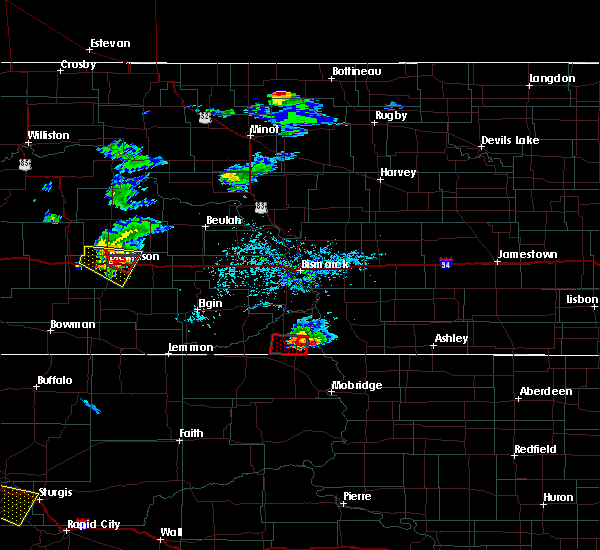 At 615 pm mdt, a severe thunderstorm capable of producing a tornado was located 5 miles northeast of dickinson, moving east at 35 mph (radar indicated rotation). Hazards include tornado and half dollar size hail. Flying debris will be dangerous to those caught without shelter. mobile homes will be damaged or destroyed. damage to roofs, windows, and vehicles will occur. tree damage is likely. This dangerous storm will be near, gladstone around 625 pm mdt. At 615 pm mdt, a severe thunderstorm capable of producing a tornado was located 5 miles northeast of dickinson, moving east at 35 mph (radar indicated rotation). Hazards include tornado and half dollar size hail. Flying debris will be dangerous to those caught without shelter. mobile homes will be damaged or destroyed. damage to roofs, windows, and vehicles will occur. tree damage is likely. This dangerous storm will be near, gladstone around 625 pm mdt.
|
| 7/17/2019 6:10 PM MDT | This is about a mile north of i-94 and about a mile east of nd highway 22. also had a lot of pea size hai in stark county ND, 2.2 miles SSW of Dickinson, ND |
| 7/17/2019 6:04 PM MDT |
 At 604 pm mdt, a severe thunderstorm capable of producing a tornado was located 5 miles north of dickinson, moving east at 30 mph (radar indicated rotation). Hazards include tornado and golf ball size hail. Flying debris will be dangerous to those caught without shelter. mobile homes will be damaged or destroyed. damage to roofs, windows, and vehicles will occur. tree damage is likely. this dangerous storm will be near, dickinson around 610 pm mdt. Gladstone around 630 pm mdt. At 604 pm mdt, a severe thunderstorm capable of producing a tornado was located 5 miles north of dickinson, moving east at 30 mph (radar indicated rotation). Hazards include tornado and golf ball size hail. Flying debris will be dangerous to those caught without shelter. mobile homes will be damaged or destroyed. damage to roofs, windows, and vehicles will occur. tree damage is likely. this dangerous storm will be near, dickinson around 610 pm mdt. Gladstone around 630 pm mdt.
|
| 7/17/2019 6:00 PM MDT | Half Dollar sized hail reported 8.1 miles SE of Dickinson, ND, hail lasted a few minutes. time of event uncertain so radar used to estimate it. |
| 7/17/2019 5:55 PM MDT |
 At 554 pm mdt, a severe thunderstorm was located 5 miles north of south heart, or 9 miles northwest of dickinson, moving east at 35 mph (radar indicated). Hazards include 60 mph wind gusts and half dollar size hail. Hail damage to vehicles is expected. expect wind damage to roofs, siding, and trees. this severe storm will be near, dickinson around 610 pm mdt. gladstone around 630 pm mdt. Other locations impacted by this severe thunderstorm include new hradec and dickinson regional airport. At 554 pm mdt, a severe thunderstorm was located 5 miles north of south heart, or 9 miles northwest of dickinson, moving east at 35 mph (radar indicated). Hazards include 60 mph wind gusts and half dollar size hail. Hail damage to vehicles is expected. expect wind damage to roofs, siding, and trees. this severe storm will be near, dickinson around 610 pm mdt. gladstone around 630 pm mdt. Other locations impacted by this severe thunderstorm include new hradec and dickinson regional airport.
|
| 7/17/2019 5:38 PM MDT |
 At 537 pm mdt, a severe thunderstorm was located 6 miles north of belfield, or 19 miles west of dickinson, moving east at 35 mph (radar indicated). Hazards include 60 mph wind gusts and quarter size hail. Hail damage to vehicles is expected. expect wind damage to roofs, siding, and trees. this severe thunderstorm will be near, south heart around 555 pm mdt. dickinson around 615 pm mdt. gladstone around 630 pm mdt. Other locations impacted by this severe thunderstorm include new hradec and dickinson regional airport. At 537 pm mdt, a severe thunderstorm was located 6 miles north of belfield, or 19 miles west of dickinson, moving east at 35 mph (radar indicated). Hazards include 60 mph wind gusts and quarter size hail. Hail damage to vehicles is expected. expect wind damage to roofs, siding, and trees. this severe thunderstorm will be near, south heart around 555 pm mdt. dickinson around 615 pm mdt. gladstone around 630 pm mdt. Other locations impacted by this severe thunderstorm include new hradec and dickinson regional airport.
|
| 7/15/2019 12:19 AM MDT |
 At 117 am cdt/1217 am mdt/, severe thunderstorms were located along a line extending from 8 miles southeast of mandaree to 9 miles south of regent, moving east at 55 mph. these are very dangerous storms (radar indicated. also, a 77 mph wind gust was measured at the dickinson airport). Hazards include 80 mph wind gusts. Flying debris will be dangerous to those caught without shelter. mobile homes will be heavily damaged. expect considerable damage to roofs, windows, and vehicles. extensive tree damage and power outages are likely. Locations impacted include, dickinson, killdeer, mott, amidon, belfield, new england, richardton, south heart, gladstone, halliday, regent, taylor, dunn center, dodge, manning, marshall, grassy butte, south fairfield, little missouri state park and mckenzie bay recreation area. At 117 am cdt/1217 am mdt/, severe thunderstorms were located along a line extending from 8 miles southeast of mandaree to 9 miles south of regent, moving east at 55 mph. these are very dangerous storms (radar indicated. also, a 77 mph wind gust was measured at the dickinson airport). Hazards include 80 mph wind gusts. Flying debris will be dangerous to those caught without shelter. mobile homes will be heavily damaged. expect considerable damage to roofs, windows, and vehicles. extensive tree damage and power outages are likely. Locations impacted include, dickinson, killdeer, mott, amidon, belfield, new england, richardton, south heart, gladstone, halliday, regent, taylor, dunn center, dodge, manning, marshall, grassy butte, south fairfield, little missouri state park and mckenzie bay recreation area.
|
| 7/15/2019 12:14 AM MDT | Davis instrument measured wind gus in stark county ND, 2.2 miles ESE of Dickinson, ND |
| 7/15/2019 12:12 AM MDT |
 At 111 am cdt/1211 am mdt/, severe thunderstorms were located along a line extending from 7 miles northwest of little missouri state park to 12 miles north of reeder, moving east at 50 mph (radar indicated). Hazards include 70 mph wind gusts. Expect considerable tree damage. damage is likely to mobile homes, roofs, and outbuildings. severe thunderstorms will be near, little missouri state park around 1220 am mdt. mckenzie bay recreation area around 1240 am mdt. mott around 1250 am mdt. Other locations impacted by these severe thunderstorms include fryburg, twin buttes, hirschville, schefield, burt, oakdale, fairfield, havelock, bentley and lefor. At 111 am cdt/1211 am mdt/, severe thunderstorms were located along a line extending from 7 miles northwest of little missouri state park to 12 miles north of reeder, moving east at 50 mph (radar indicated). Hazards include 70 mph wind gusts. Expect considerable tree damage. damage is likely to mobile homes, roofs, and outbuildings. severe thunderstorms will be near, little missouri state park around 1220 am mdt. mckenzie bay recreation area around 1240 am mdt. mott around 1250 am mdt. Other locations impacted by these severe thunderstorms include fryburg, twin buttes, hirschville, schefield, burt, oakdale, fairfield, havelock, bentley and lefor.
|
| 7/15/2019 12:04 AM MDT | Dickinson airport measured wind gus in stark county ND, 5.5 miles N of Dickinson, ND |
| 7/8/2019 2:07 PM MDT |
 The severe thunderstorm warning for central stark county will expire at 215 pm mdt, the storm which prompted the warning has moved out of the area. therefore, the warning will be allowed to expire. remember, a severe thunderstorm warning still remains in effect for eastern stark county until 245 pm mdt. a severe thunderstorm watch remains in effect until 800 pm mdt for southwestern north dakota. The severe thunderstorm warning for central stark county will expire at 215 pm mdt, the storm which prompted the warning has moved out of the area. therefore, the warning will be allowed to expire. remember, a severe thunderstorm warning still remains in effect for eastern stark county until 245 pm mdt. a severe thunderstorm watch remains in effect until 800 pm mdt for southwestern north dakota.
|
| 7/8/2019 2:00 PM MDT | Quarter sized hail reported 10.3 miles NNW of Dickinson, ND, heavy rain measured at 1.40 also. hail lasted for 20 minutes. |
| 7/8/2019 1:47 PM MDT |
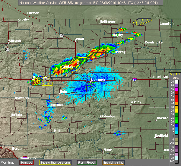 At 147 pm mdt, a severe thunderstorm was located 5 miles southwest of gladstone, or 9 miles southeast of dickinson, moving northeast at 20 mph (radar indicated). Hazards include golf ball size hail and 60 mph wind gusts. People and animals outdoors will be injured. expect hail damage to roofs, siding, windows, and vehicles. expect wind damage to roofs, siding, and trees. This severe storm will be near, gladstone around 205 pm mdt. At 147 pm mdt, a severe thunderstorm was located 5 miles southwest of gladstone, or 9 miles southeast of dickinson, moving northeast at 20 mph (radar indicated). Hazards include golf ball size hail and 60 mph wind gusts. People and animals outdoors will be injured. expect hail damage to roofs, siding, windows, and vehicles. expect wind damage to roofs, siding, and trees. This severe storm will be near, gladstone around 205 pm mdt.
|
| 7/8/2019 1:31 PM MDT |
 At 130 pm mdt, a severe thunderstorm was located near dickinson, moving northeast at 20 mph (radar indicated). Hazards include 60 mph wind gusts and half dollar size hail. Hail damage to vehicles is expected. expect wind damage to roofs, siding, and trees. this severe storm will be near, dickinson around 150 pm mdt. gladstone around 200 pm mdt. Other locations impacted by this severe thunderstorm include dickinson regional airport and schefield. At 130 pm mdt, a severe thunderstorm was located near dickinson, moving northeast at 20 mph (radar indicated). Hazards include 60 mph wind gusts and half dollar size hail. Hail damage to vehicles is expected. expect wind damage to roofs, siding, and trees. this severe storm will be near, dickinson around 150 pm mdt. gladstone around 200 pm mdt. Other locations impacted by this severe thunderstorm include dickinson regional airport and schefield.
|
| 7/8/2019 1:25 PM MDT | Quarter sized hail reported 10.4 miles N of Dickinson, ND, hail ongoing at the time of call. |
| 7/8/2019 1:13 PM MDT |
 At 112 pm mdt, a severe thunderstorm was located 8 miles southeast of south heart, or 10 miles southwest of dickinson, moving northeast at 20 mph (radar indicated). Hazards include ping pong ball size hail and 60 mph wind gusts. People and animals outdoors will be injured. expect hail damage to roofs, siding, windows, and vehicles. expect wind damage to roofs, siding, and trees. this severe thunderstorm will be near, dickinson around 150 pm mdt. gladstone around 200 pm mdt. Other locations impacted by this severe thunderstorm include schefield and dickinson regional airport. At 112 pm mdt, a severe thunderstorm was located 8 miles southeast of south heart, or 10 miles southwest of dickinson, moving northeast at 20 mph (radar indicated). Hazards include ping pong ball size hail and 60 mph wind gusts. People and animals outdoors will be injured. expect hail damage to roofs, siding, windows, and vehicles. expect wind damage to roofs, siding, and trees. this severe thunderstorm will be near, dickinson around 150 pm mdt. gladstone around 200 pm mdt. Other locations impacted by this severe thunderstorm include schefield and dickinson regional airport.
|
| 9/3/2018 8:51 PM MDT |
 At 851 pm mdt, a severe thunderstorm was located 8 miles northwest of gladstone, or 9 miles northeast of dickinson, moving east at 30 mph (trained weather spotters). Hazards include 60 mph wind gusts and quarter size hail. Hail damage to vehicles is expected. expect wind damage to roofs, siding, and trees. this severe storm will be near, taylor around 910 pm mdt. Other locations impacted by this severe thunderstorm include hirschville and new hradec. At 851 pm mdt, a severe thunderstorm was located 8 miles northwest of gladstone, or 9 miles northeast of dickinson, moving east at 30 mph (trained weather spotters). Hazards include 60 mph wind gusts and quarter size hail. Hail damage to vehicles is expected. expect wind damage to roofs, siding, and trees. this severe storm will be near, taylor around 910 pm mdt. Other locations impacted by this severe thunderstorm include hirschville and new hradec.
|
| 9/3/2018 8:38 PM MDT |
 At 838 pm mdt, a severe thunderstorm was located 5 miles north of dickinson, moving east at 30 mph (radar indicated). Hazards include 60 mph wind gusts and quarter size hail. Hail damage to vehicles is expected. expect wind damage to roofs, siding, and trees. this severe storm will be near, taylor around 910 pm mdt. Other locations impacted by this severe thunderstorm include hirschville, new hradec and dickinson regional airport. At 838 pm mdt, a severe thunderstorm was located 5 miles north of dickinson, moving east at 30 mph (radar indicated). Hazards include 60 mph wind gusts and quarter size hail. Hail damage to vehicles is expected. expect wind damage to roofs, siding, and trees. this severe storm will be near, taylor around 910 pm mdt. Other locations impacted by this severe thunderstorm include hirschville, new hradec and dickinson regional airport.
|
| 9/3/2018 8:36 PM MDT | Quarter sized hail reported 2.8 miles S of Dickinson, ND, hail lasted about 2 minutes. |
| 9/3/2018 8:23 PM MDT |
 At 822 pm mdt, a severe thunderstorm was located near south heart, or 8 miles west of dickinson, moving east at 30 mph (radar indicated). Hazards include 60 mph wind gusts and quarter size hail. Hail damage to vehicles is expected. expect wind damage to roofs, siding, and trees. this severe thunderstorm will be near, dickinson around 840 pm mdt. taylor around 910 pm mdt. Other locations impacted by this severe thunderstorm include hirschville, new hradec and dickinson regional airport. At 822 pm mdt, a severe thunderstorm was located near south heart, or 8 miles west of dickinson, moving east at 30 mph (radar indicated). Hazards include 60 mph wind gusts and quarter size hail. Hail damage to vehicles is expected. expect wind damage to roofs, siding, and trees. this severe thunderstorm will be near, dickinson around 840 pm mdt. taylor around 910 pm mdt. Other locations impacted by this severe thunderstorm include hirschville, new hradec and dickinson regional airport.
|
| 9/3/2018 6:58 PM MDT |
 At 657 pm mdt, a severe thunderstorm was located 7 miles north of south heart, or 13 miles northwest of dickinson, moving northeast at 25 mph (radar indicated). Hazards include 70 mph wind gusts and ping pong ball size hail. People and animals outdoors will be injured. expect hail damage to roofs, siding, windows, and vehicles. expect considerable tree damage. wind damage is also likely to mobile homes, roofs, and outbuildings. this severe thunderstorm will be near, manning around 755 pm mdt. killdeer around 800 pm mdt. Other locations impacted by this severe thunderstorm include new hradec. At 657 pm mdt, a severe thunderstorm was located 7 miles north of south heart, or 13 miles northwest of dickinson, moving northeast at 25 mph (radar indicated). Hazards include 70 mph wind gusts and ping pong ball size hail. People and animals outdoors will be injured. expect hail damage to roofs, siding, windows, and vehicles. expect considerable tree damage. wind damage is also likely to mobile homes, roofs, and outbuildings. this severe thunderstorm will be near, manning around 755 pm mdt. killdeer around 800 pm mdt. Other locations impacted by this severe thunderstorm include new hradec.
|
| 7/21/2018 7:22 PM MDT | Measured by personal weather statio in dunn county ND, 20.7 miles SSE of Dickinson, ND |
| 7/3/2018 10:03 PM MDT |
 At 1002 pm mdt, a severe thunderstorm was located 5 miles southwest of gladstone, or 10 miles southeast of dickinson, moving northeast at 35 mph (trained weather spotters. a 64 mph wind gust was reported at the dickinson airport at 946 pm mdt). Hazards include 60 mph wind gusts. Expect damage to roofs, siding, and trees. Locations impacted include, dickinson, new england, havelock, schefield, lefor and dickinson regional airport. At 1002 pm mdt, a severe thunderstorm was located 5 miles southwest of gladstone, or 10 miles southeast of dickinson, moving northeast at 35 mph (trained weather spotters. a 64 mph wind gust was reported at the dickinson airport at 946 pm mdt). Hazards include 60 mph wind gusts. Expect damage to roofs, siding, and trees. Locations impacted include, dickinson, new england, havelock, schefield, lefor and dickinson regional airport.
|
| 7/3/2018 9:49 PM MDT |
 At 948 pm mdt, a severe thunderstorm was located 12 miles northeast of new england, or 13 miles south of dickinson, moving northeast at 35 mph (radar indicated). Hazards include 60 mph wind gusts and penny size hail. Expect damage to roofs, siding, and trees. Locations impacted include, dickinson, new england, south heart, havelock, schefield, lefor and dickinson regional airport. At 948 pm mdt, a severe thunderstorm was located 12 miles northeast of new england, or 13 miles south of dickinson, moving northeast at 35 mph (radar indicated). Hazards include 60 mph wind gusts and penny size hail. Expect damage to roofs, siding, and trees. Locations impacted include, dickinson, new england, south heart, havelock, schefield, lefor and dickinson regional airport.
|
| 7/3/2018 9:39 PM MDT |
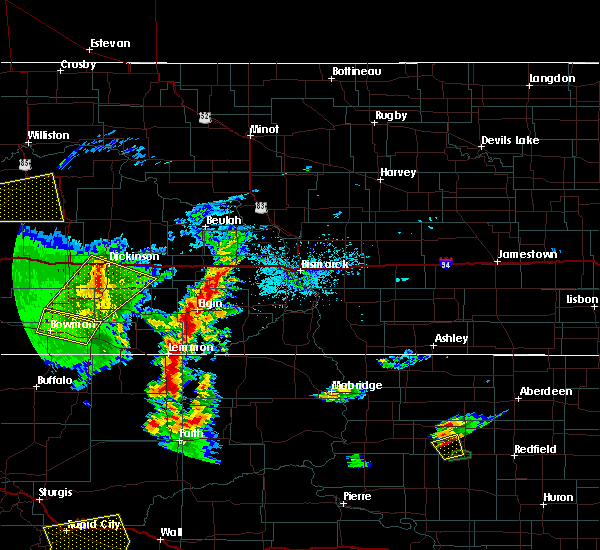 At 939 pm mdt, a severe thunderstorm was located 6 miles northeast of new england, or 18 miles south of dickinson, moving northeast at 35 mph (radar indicated). Hazards include 60 mph wind gusts and quarter size hail. Hail damage to vehicles is expected. expect wind damage to roofs, siding, and trees. This severe thunderstorm will remain over mainly rural areas of northwestern hettinger, eastern slope and southwestern stark counties, including the following locations, schefield, havelock, lefor and dickinson regional airport. At 939 pm mdt, a severe thunderstorm was located 6 miles northeast of new england, or 18 miles south of dickinson, moving northeast at 35 mph (radar indicated). Hazards include 60 mph wind gusts and quarter size hail. Hail damage to vehicles is expected. expect wind damage to roofs, siding, and trees. This severe thunderstorm will remain over mainly rural areas of northwestern hettinger, eastern slope and southwestern stark counties, including the following locations, schefield, havelock, lefor and dickinson regional airport.
|
| 7/3/2018 9:21 PM MDT |
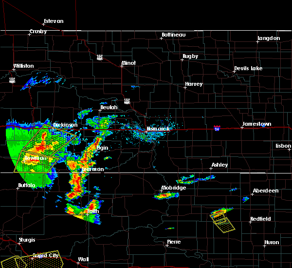 At 921 pm mdt, a severe thunderstorm was located 5 miles southwest of new england, or 17 miles east of amidon, moving northeast at 35 mph (radar indicated). Hazards include 60 mph wind gusts and quarter size hail. Hail damage to vehicles is expected. expect wind damage to roofs, siding, and trees. this severe thunderstorm will be near, new england around 930 pm mdt. Other locations impacted by this severe thunderstorm include schefield, havelock, lefor and dickinson regional airport. At 921 pm mdt, a severe thunderstorm was located 5 miles southwest of new england, or 17 miles east of amidon, moving northeast at 35 mph (radar indicated). Hazards include 60 mph wind gusts and quarter size hail. Hail damage to vehicles is expected. expect wind damage to roofs, siding, and trees. this severe thunderstorm will be near, new england around 930 pm mdt. Other locations impacted by this severe thunderstorm include schefield, havelock, lefor and dickinson regional airport.
|
| 7/3/2018 2:15 AM MDT |
 At 314 am cdt/214 am mdt/, severe thunderstorms were located along a line extending from 6 miles northeast of richardton to 8 miles northwest of mott to 4 miles south of haynes, moving east at 45 mph (radar indicated). Hazards include 60 mph wind gusts and quarter size hail. Hail damage to vehicles is expected. Expect wind damage to roofs, siding, and trees. At 314 am cdt/214 am mdt/, severe thunderstorms were located along a line extending from 6 miles northeast of richardton to 8 miles northwest of mott to 4 miles south of haynes, moving east at 45 mph (radar indicated). Hazards include 60 mph wind gusts and quarter size hail. Hail damage to vehicles is expected. Expect wind damage to roofs, siding, and trees.
|
| 7/3/2018 1:58 AM MDT | Tr airport south of dickinson along highway 2 in stark county ND, 5.5 miles N of Dickinson, ND |
| 7/3/2018 1:38 AM MDT |
 At 137 am mdt, severe thunderstorms were located along a line extending from 6 miles northwest of dickinson to 11 miles south of south heart to 9 miles east of amidon to 7 miles southwest of scranton, moving northeast at 45 mph (radar indicated). Hazards include 60 mph wind gusts and quarter size hail. Hail damage to vehicles is expected. expect wind damage to roofs, siding, and trees. Locations impacted include, dickinson, bowman, amidon, belfield, new england, scranton, gladstone, reeder, taylor, bucyrus, havelock, gascoyne, bowman haley dam, fryburg, lefor and dickinson regional airport. At 137 am mdt, severe thunderstorms were located along a line extending from 6 miles northwest of dickinson to 11 miles south of south heart to 9 miles east of amidon to 7 miles southwest of scranton, moving northeast at 45 mph (radar indicated). Hazards include 60 mph wind gusts and quarter size hail. Hail damage to vehicles is expected. expect wind damage to roofs, siding, and trees. Locations impacted include, dickinson, bowman, amidon, belfield, new england, scranton, gladstone, reeder, taylor, bucyrus, havelock, gascoyne, bowman haley dam, fryburg, lefor and dickinson regional airport.
|
| 7/3/2018 1:18 AM MDT |
 At 117 am mdt, severe thunderstorms were located along a line extending from near belfield to 15 miles west of new england to 9 miles southwest of amidon to 7 miles north of north cave hills, moving northeast at 45 mph (radar indicated). Hazards include 70 mph wind gusts and half dollar size hail. Hail damage to vehicles is expected. expect considerable tree damage. Wind damage is also likely to mobile homes, roofs, and outbuildings. At 117 am mdt, severe thunderstorms were located along a line extending from near belfield to 15 miles west of new england to 9 miles southwest of amidon to 7 miles north of north cave hills, moving northeast at 45 mph (radar indicated). Hazards include 70 mph wind gusts and half dollar size hail. Hail damage to vehicles is expected. expect considerable tree damage. Wind damage is also likely to mobile homes, roofs, and outbuildings.
|
| 6/28/2018 11:07 PM MDT |
 At 1107 pm mdt, severe thunderstorms were located along a line extending from 7 miles north of richardton to 12 miles northeast of new england, moving east at 50 mph (radar indicated). Hazards include 70 mph wind gusts and quarter size hail. Hail damage to vehicles is expected. expect considerable tree damage. wind damage is also likely to mobile homes, roofs, and outbuildings. Locations impacted include, dickinson, richardton, gladstone, taylor, schefield, lefor and dickinson regional airport. At 1107 pm mdt, severe thunderstorms were located along a line extending from 7 miles north of richardton to 12 miles northeast of new england, moving east at 50 mph (radar indicated). Hazards include 70 mph wind gusts and quarter size hail. Hail damage to vehicles is expected. expect considerable tree damage. wind damage is also likely to mobile homes, roofs, and outbuildings. Locations impacted include, dickinson, richardton, gladstone, taylor, schefield, lefor and dickinson regional airport.
|
| 6/28/2018 10:30 PM MDT |
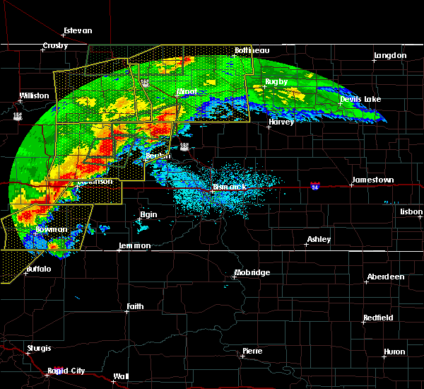 At 1029 pm mdt, severe thunderstorms were located along a line extending from 7 miles north of dickinson to 10 miles west of new england, moving east at 55 mph (radar indicated). Hazards include 70 mph wind gusts and quarter size hail. Hail damage to vehicles is expected. expect considerable tree damage. wind damage is also likely to mobile homes, roofs, and outbuildings. These severe thunderstorms will remain over mainly rural areas of stark county, including the following locations, schefield, lefor and dickinson regional airport. At 1029 pm mdt, severe thunderstorms were located along a line extending from 7 miles north of dickinson to 10 miles west of new england, moving east at 55 mph (radar indicated). Hazards include 70 mph wind gusts and quarter size hail. Hail damage to vehicles is expected. expect considerable tree damage. wind damage is also likely to mobile homes, roofs, and outbuildings. These severe thunderstorms will remain over mainly rural areas of stark county, including the following locations, schefield, lefor and dickinson regional airport.
|
| 6/26/2018 7:34 PM MDT |
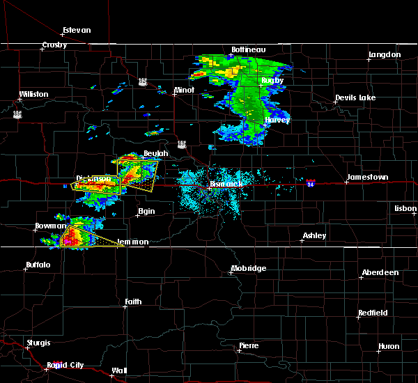 At 732 pm mdt, a severe thunderstorm was located over richardton, or 19 miles east of dickinson, moving east at 35 mph (radar indicated). Hazards include quarter size hail. Damage to vehicles is expected. This severe storm will be near, richardton around 735 pm mdt. At 732 pm mdt, a severe thunderstorm was located over richardton, or 19 miles east of dickinson, moving east at 35 mph (radar indicated). Hazards include quarter size hail. Damage to vehicles is expected. This severe storm will be near, richardton around 735 pm mdt.
|
| 6/26/2018 7:11 PM MDT |
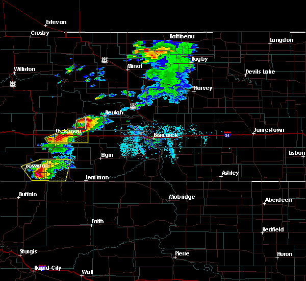 At 711 pm mdt, a severe thunderstorm was located near gladstone, or 6 miles east of dickinson, moving northeast at 25 mph (radar indicated). Hazards include quarter size hail. Damage to vehicles is expected. this severe thunderstorm will be near, gladstone around 720 pm mdt. taylor around 740 pm mdt. richardton around 750 pm mdt. Other locations impacted by this severe thunderstorm include dickinson regional airport. At 711 pm mdt, a severe thunderstorm was located near gladstone, or 6 miles east of dickinson, moving northeast at 25 mph (radar indicated). Hazards include quarter size hail. Damage to vehicles is expected. this severe thunderstorm will be near, gladstone around 720 pm mdt. taylor around 740 pm mdt. richardton around 750 pm mdt. Other locations impacted by this severe thunderstorm include dickinson regional airport.
|
| 6/26/2018 6:12 PM MDT | Quarter sized hail reported 0.2 miles E of Dickinson, ND |
| 6/10/2018 5:49 PM MDT |
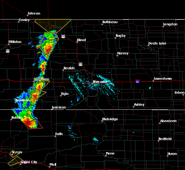 At 547 pm mdt, a severe thunderstorm was located 12 miles south of gladstone, or 17 miles southeast of dickinson, moving northeast at 15 mph (radar indicated). Hazards include 60 mph wind gusts and half dollar size hail. Hail damage to vehicles is expected. expect wind damage to roofs, siding, and trees. Locations impacted include, dickinson, richardton, gladstone, taylor and lefor. At 547 pm mdt, a severe thunderstorm was located 12 miles south of gladstone, or 17 miles southeast of dickinson, moving northeast at 15 mph (radar indicated). Hazards include 60 mph wind gusts and half dollar size hail. Hail damage to vehicles is expected. expect wind damage to roofs, siding, and trees. Locations impacted include, dickinson, richardton, gladstone, taylor and lefor.
|
| 6/10/2018 5:33 PM MDT |
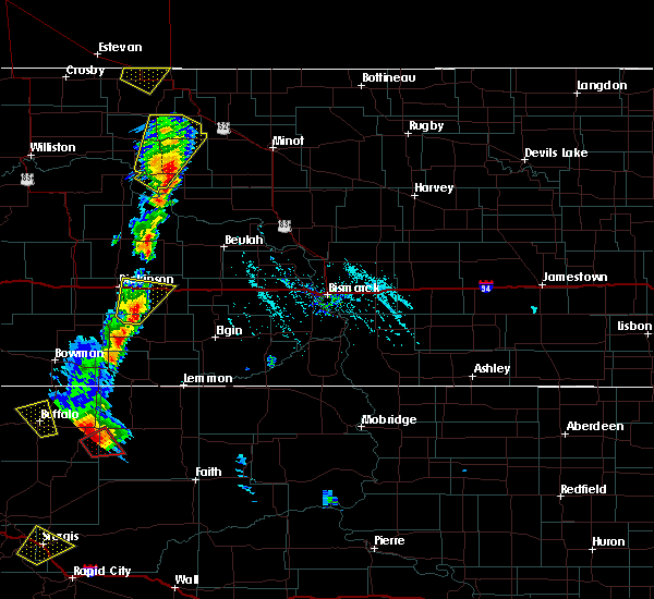 At 532 pm mdt, a severe thunderstorm was located 13 miles northeast of new england, or 17 miles southeast of dickinson, moving northeast at 20 mph. this will affect i-94 east of dickinson, near gladstone and taylor (radar indicated). Hazards include 60 mph wind gusts and half dollar size hail. Hail damage to vehicles is expected. Expect wind damage to roofs, siding, and trees. At 532 pm mdt, a severe thunderstorm was located 13 miles northeast of new england, or 17 miles southeast of dickinson, moving northeast at 20 mph. this will affect i-94 east of dickinson, near gladstone and taylor (radar indicated). Hazards include 60 mph wind gusts and half dollar size hail. Hail damage to vehicles is expected. Expect wind damage to roofs, siding, and trees.
|
| 6/9/2018 12:39 AM MDT |
 At 1238 am mdt, a severe thunderstorm was located 5 miles southeast of belfield, or 16 miles west of dickinson, moving east at 10 mph (radar indicated). Hazards include 60 mph wind gusts and quarter size hail. Hail damage to vehicles is expected. expect wind damage to roofs, siding, and trees. Locations impacted include, dickinson, belfield, south heart, fryburg and dickinson regional airport. At 1238 am mdt, a severe thunderstorm was located 5 miles southeast of belfield, or 16 miles west of dickinson, moving east at 10 mph (radar indicated). Hazards include 60 mph wind gusts and quarter size hail. Hail damage to vehicles is expected. expect wind damage to roofs, siding, and trees. Locations impacted include, dickinson, belfield, south heart, fryburg and dickinson regional airport.
|
| 6/9/2018 12:13 AM MDT |
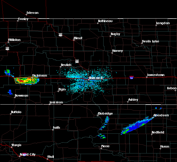 At 1213 am mdt, a severe thunderstorm was located 5 miles south of belfield, or 21 miles west of dickinson, moving east at 10 mph (radar indicated). Hazards include 60 mph wind gusts and quarter size hail. Hail damage to vehicles is expected. expect wind damage to roofs, siding, and trees. Locations impacted include, dickinson, belfield, south heart, fryburg and dickinson regional airport. At 1213 am mdt, a severe thunderstorm was located 5 miles south of belfield, or 21 miles west of dickinson, moving east at 10 mph (radar indicated). Hazards include 60 mph wind gusts and quarter size hail. Hail damage to vehicles is expected. expect wind damage to roofs, siding, and trees. Locations impacted include, dickinson, belfield, south heart, fryburg and dickinson regional airport.
|
| 6/9/2018 12:04 AM MDT |
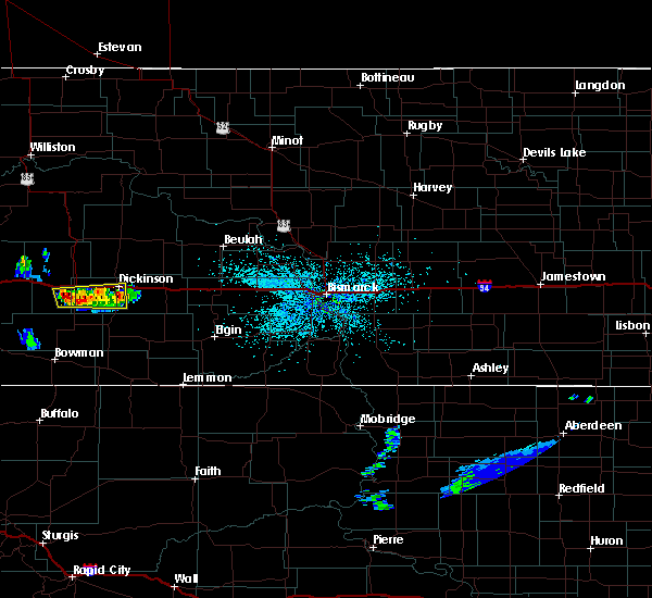 At 1203 am mdt, a severe thunderstorm was located 6 miles southwest of belfield, or 22 miles north of amidon, moving east at 10 mph (radar indicated). Hazards include 60 mph wind gusts and quarter size hail. Hail damage to vehicles is expected. Expect wind damage to roofs, siding, and trees. At 1203 am mdt, a severe thunderstorm was located 6 miles southwest of belfield, or 22 miles north of amidon, moving east at 10 mph (radar indicated). Hazards include 60 mph wind gusts and quarter size hail. Hail damage to vehicles is expected. Expect wind damage to roofs, siding, and trees.
|
| 5/31/2018 4:00 PM MDT |
 At 400 pm mdt, a severe thunderstorm was located 9 miles west of new england, or 12 miles east of amidon, moving northeast at 20 mph (radar indicated). Hazards include golf ball size hail and 70 mph wind gusts. People and animals outdoors will be injured. expect hail damage to roofs, siding, windows, and vehicles. expect considerable tree damage. wind damage is also likely to mobile homes, roofs, and outbuildings. this severe storm will be near, new england around 430 pm mdt. Other locations impacted by this severe thunderstorm include schefield, havelock, lefor and dickinson regional airport. At 400 pm mdt, a severe thunderstorm was located 9 miles west of new england, or 12 miles east of amidon, moving northeast at 20 mph (radar indicated). Hazards include golf ball size hail and 70 mph wind gusts. People and animals outdoors will be injured. expect hail damage to roofs, siding, windows, and vehicles. expect considerable tree damage. wind damage is also likely to mobile homes, roofs, and outbuildings. this severe storm will be near, new england around 430 pm mdt. Other locations impacted by this severe thunderstorm include schefield, havelock, lefor and dickinson regional airport.
|
| 5/31/2018 3:46 PM MDT |
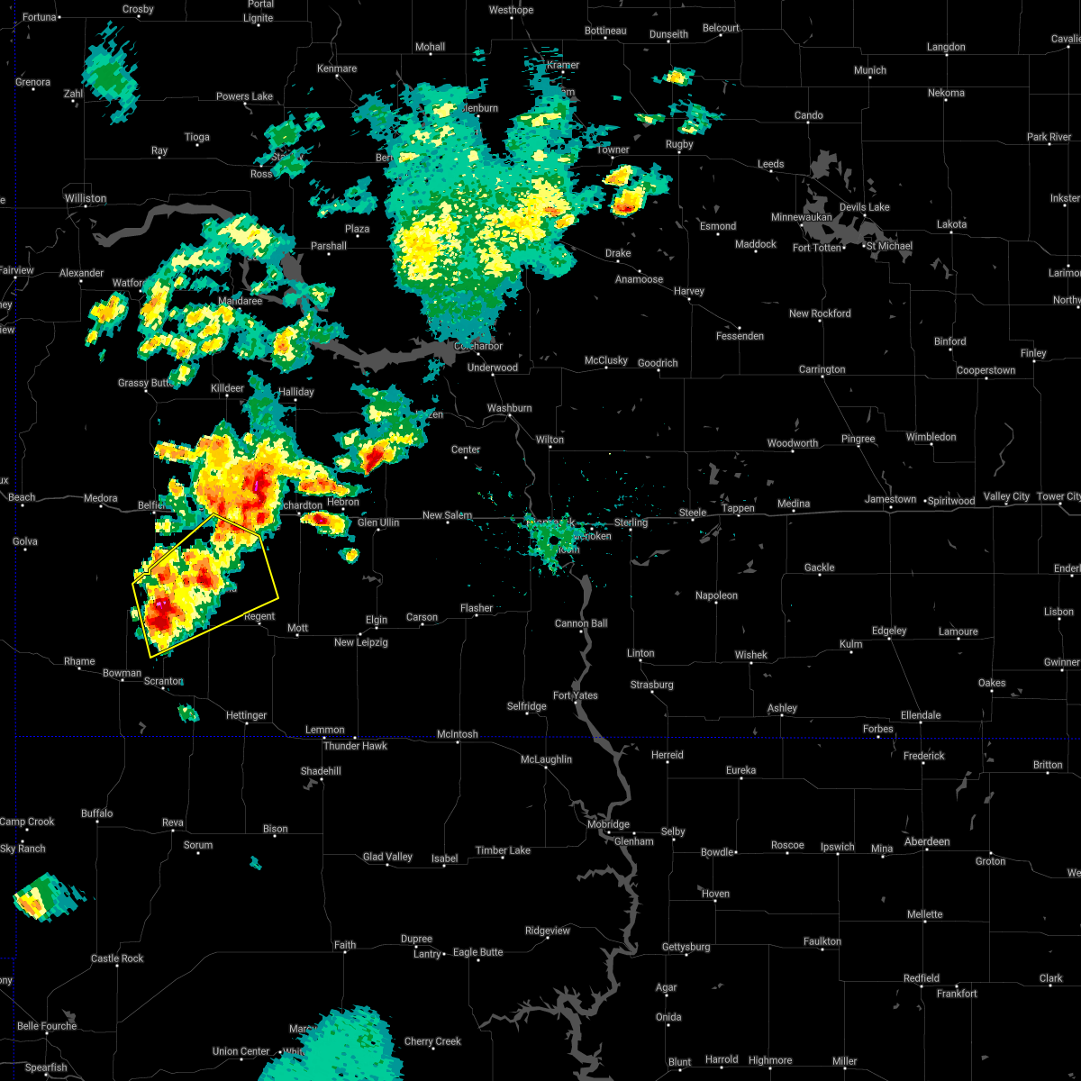 At 346 pm mdt, a severe thunderstorm was located 10 miles west of new england, or 11 miles east of amidon, moving northeast at 35 mph (radar indicated). Hazards include golf ball size hail and 60 mph wind gusts. People and animals outdoors will be injured. expect hail damage to roofs, siding, windows, and vehicles. expect wind damage to roofs, siding, and trees. this severe storm will be near, new england around 400 pm mdt. Other locations impacted by this severe thunderstorm include schefield, havelock, lefor and dickinson regional airport. At 346 pm mdt, a severe thunderstorm was located 10 miles west of new england, or 11 miles east of amidon, moving northeast at 35 mph (radar indicated). Hazards include golf ball size hail and 60 mph wind gusts. People and animals outdoors will be injured. expect hail damage to roofs, siding, windows, and vehicles. expect wind damage to roofs, siding, and trees. this severe storm will be near, new england around 400 pm mdt. Other locations impacted by this severe thunderstorm include schefield, havelock, lefor and dickinson regional airport.
|
| 5/31/2018 3:40 PM MDT |
 At 340 pm mdt, a severe thunderstorm was located 8 miles east of amidon, moving northeast at 35 mph (radar indicated). Hazards include 60 mph wind gusts and half dollar size hail. Hail damage to vehicles is expected. expect wind damage to roofs, siding, and trees. this severe thunderstorm will be near, new england around 400 pm mdt. Other locations impacted by this severe thunderstorm include schefield, havelock, lefor and dickinson regional airport. At 340 pm mdt, a severe thunderstorm was located 8 miles east of amidon, moving northeast at 35 mph (radar indicated). Hazards include 60 mph wind gusts and half dollar size hail. Hail damage to vehicles is expected. expect wind damage to roofs, siding, and trees. this severe thunderstorm will be near, new england around 400 pm mdt. Other locations impacted by this severe thunderstorm include schefield, havelock, lefor and dickinson regional airport.
|
| 5/31/2018 3:23 PM MDT |
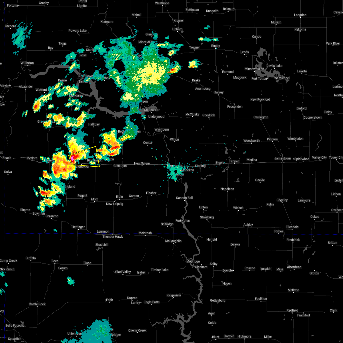 At 322 pm mdt, a severe thunderstorm was located 5 miles northeast of dickinson, moving east at 25 mph (trained weather spotters reported 1 inch hail 3 miles north of dickinson at 316 pm mdt). Hazards include 60 mph wind gusts and quarter size hail. Hail damage to vehicles is expected. expect wind damage to roofs, siding, and trees. Locations impacted include, dickinson, richardton, gladstone and taylor. At 322 pm mdt, a severe thunderstorm was located 5 miles northeast of dickinson, moving east at 25 mph (trained weather spotters reported 1 inch hail 3 miles north of dickinson at 316 pm mdt). Hazards include 60 mph wind gusts and quarter size hail. Hail damage to vehicles is expected. expect wind damage to roofs, siding, and trees. Locations impacted include, dickinson, richardton, gladstone and taylor.
|
| 5/31/2018 3:15 PM MDT | Quarter sized hail reported 2.8 miles S of Dickinson, ND, still hailing at time of report. |
| 5/31/2018 3:12 PM MDT |
 At 311 pm mdt, a severe thunderstorm was located over dickinson, moving east at 25 mph (radar indicated). Hazards include two inch hail and 60 mph wind gusts. People and animals outdoors will be injured. expect hail damage to roofs, siding, windows, and vehicles. expect wind damage to roofs, siding, and trees. this severe thunderstorm will be near, gladstone around 335 pm mdt. taylor around 350 pm mdt. richardton around 400 pm mdt. Other locations impacted by this severe thunderstorm include dickinson regional airport. At 311 pm mdt, a severe thunderstorm was located over dickinson, moving east at 25 mph (radar indicated). Hazards include two inch hail and 60 mph wind gusts. People and animals outdoors will be injured. expect hail damage to roofs, siding, windows, and vehicles. expect wind damage to roofs, siding, and trees. this severe thunderstorm will be near, gladstone around 335 pm mdt. taylor around 350 pm mdt. richardton around 400 pm mdt. Other locations impacted by this severe thunderstorm include dickinson regional airport.
|
| 5/31/2018 2:42 PM MDT |
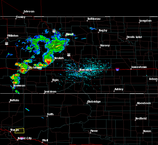 At 241 pm mdt, a severe thunderstorm was located over south heart, or 11 miles west of dickinson, moving northeast at 30 mph (radar indicated). Hazards include 60 mph wind gusts and quarter size hail. this storm shows signs of rotation, and a tornado is possible. Hail damage to vehicles is expected. expect wind damage to roofs, siding, and trees. Locations impacted include, dickinson, south heart and new hradec. At 241 pm mdt, a severe thunderstorm was located over south heart, or 11 miles west of dickinson, moving northeast at 30 mph (radar indicated). Hazards include 60 mph wind gusts and quarter size hail. this storm shows signs of rotation, and a tornado is possible. Hail damage to vehicles is expected. expect wind damage to roofs, siding, and trees. Locations impacted include, dickinson, south heart and new hradec.
|
| 5/31/2018 2:28 PM MDT |
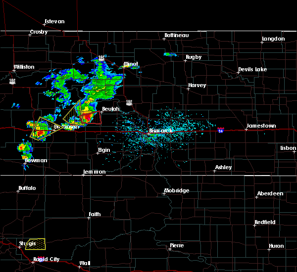 At 228 pm mdt, a severe thunderstorm was located 6 miles southwest of south heart, or 15 miles west of dickinson, moving northeast at 30 mph (radar indicated). Hazards include 60 mph wind gusts and half dollar size hail. Hail damage to vehicles is expected. Expect wind damage to roofs, siding, and trees. At 228 pm mdt, a severe thunderstorm was located 6 miles southwest of south heart, or 15 miles west of dickinson, moving northeast at 30 mph (radar indicated). Hazards include 60 mph wind gusts and half dollar size hail. Hail damage to vehicles is expected. Expect wind damage to roofs, siding, and trees.
|
| 7/20/2017 5:01 PM MDT |
 At 600 pm cdt/500 pm mdt/, a severe thunderstorm was located 11 miles south of dickinson, moving east at 25 mph (radar indicated). Hazards include 60 mph wind gusts and quarter size hail. Hail damage to vehicles is expected. Expect wind damage to roofs, siding, and trees. At 600 pm cdt/500 pm mdt/, a severe thunderstorm was located 11 miles south of dickinson, moving east at 25 mph (radar indicated). Hazards include 60 mph wind gusts and quarter size hail. Hail damage to vehicles is expected. Expect wind damage to roofs, siding, and trees.
|
| 7/20/2017 4:42 PM MDT | Golf Ball sized hail reported 0.2 miles E of Dickinson, ND, relayed through state radio. |
| 7/20/2017 4:35 PM MDT |
 At 434 pm mdt, a severe thunderstorm was located near dickinson, moving east at 45 mph. other severe thunderstorms were located southwest of south heart, and west of hirschville (radar indicated). Hazards include golf ball size hail and 70 mph wind gusts. People and animals outdoors will be injured. expect hail damage to roofs, siding, windows, and vehicles. expect considerable tree damage. wind damage is also likely to mobile homes, roofs, and outbuildings. Locations impacted include, dickinson, belfield, south heart, gladstone, taylor, marshall, fryburg, hirschville, schefield, lefor, new hradec and dickinson regional airport. At 434 pm mdt, a severe thunderstorm was located near dickinson, moving east at 45 mph. other severe thunderstorms were located southwest of south heart, and west of hirschville (radar indicated). Hazards include golf ball size hail and 70 mph wind gusts. People and animals outdoors will be injured. expect hail damage to roofs, siding, windows, and vehicles. expect considerable tree damage. wind damage is also likely to mobile homes, roofs, and outbuildings. Locations impacted include, dickinson, belfield, south heart, gladstone, taylor, marshall, fryburg, hirschville, schefield, lefor, new hradec and dickinson regional airport.
|
| 7/20/2017 4:26 PM MDT | Quarter sized hail reported 2.1 miles E of Dickinson, ND, interstate at exit 56. |
| 7/20/2017 4:05 PM MDT |
 At 405 pm mdt, a severe thunderstorm was located 6 miles south of belfield, or 18 miles west of dickinson, moving northeast at 60 mph (radar indicated). Hazards include 70 mph wind gusts and quarter size hail. Hail damage to vehicles is expected. expect considerable tree damage. wind damage is also likely to mobile homes, roofs, and outbuildings. this severe thunderstorm will be near, south heart around 415 pm mdt. dickinson around 425 pm mdt. marshall around 450 pm mdt. Other locations impacted by this severe thunderstorm include hirschville, fryburg, schefield, lefor, new hradec and dickinson regional airport. At 405 pm mdt, a severe thunderstorm was located 6 miles south of belfield, or 18 miles west of dickinson, moving northeast at 60 mph (radar indicated). Hazards include 70 mph wind gusts and quarter size hail. Hail damage to vehicles is expected. expect considerable tree damage. wind damage is also likely to mobile homes, roofs, and outbuildings. this severe thunderstorm will be near, south heart around 415 pm mdt. dickinson around 425 pm mdt. marshall around 450 pm mdt. Other locations impacted by this severe thunderstorm include hirschville, fryburg, schefield, lefor, new hradec and dickinson regional airport.
|
| 7/10/2017 7:09 PM MDT |
 At 709 pm mdt, a severe thunderstorm was located 12 miles north of amidon, moving northeast at 25 mph (radar indicated). Hazards include 60 mph wind gusts and quarter size hail. Hail damage to vehicles is expected. expect wind damage to roofs, siding, and trees. Locations impacted include, dickinson, south heart, schefield and dickinson regional airport. At 709 pm mdt, a severe thunderstorm was located 12 miles north of amidon, moving northeast at 25 mph (radar indicated). Hazards include 60 mph wind gusts and quarter size hail. Hail damage to vehicles is expected. expect wind damage to roofs, siding, and trees. Locations impacted include, dickinson, south heart, schefield and dickinson regional airport.
|
| 7/10/2017 6:54 PM MDT |
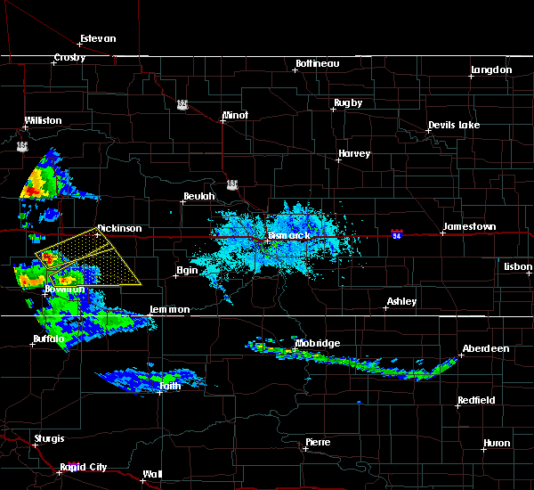 At 654 pm mdt, a severe thunderstorm was located 9 miles north of amidon, moving northeast at 30 mph (radar indicated). Hazards include ping pong ball size hail and 60 mph wind gusts. People and animals outdoors will be injured. expect hail damage to roofs, siding, windows, and vehicles. expect wind damage to roofs, siding, and trees. Locations impacted include, dickinson, south heart, schefield and dickinson regional airport. At 654 pm mdt, a severe thunderstorm was located 9 miles north of amidon, moving northeast at 30 mph (radar indicated). Hazards include ping pong ball size hail and 60 mph wind gusts. People and animals outdoors will be injured. expect hail damage to roofs, siding, windows, and vehicles. expect wind damage to roofs, siding, and trees. Locations impacted include, dickinson, south heart, schefield and dickinson regional airport.
|
| 7/10/2017 6:44 PM MDT |
 At 643 pm mdt, a severe thunderstorm was located 28 miles north of bowman, moving east at 30 mph (radar indicated). Hazards include 60 mph wind gusts and quarter size hail. Hail damage to vehicles is expected. Expect wind damage to roofs, siding, and trees. At 643 pm mdt, a severe thunderstorm was located 28 miles north of bowman, moving east at 30 mph (radar indicated). Hazards include 60 mph wind gusts and quarter size hail. Hail damage to vehicles is expected. Expect wind damage to roofs, siding, and trees.
|
| 6/10/2017 12:33 AM CDT |
 At 1233 am cdt/1133 pm mdt/, a severe thunderstorm was located 5 miles southwest of gladstone, or 8 miles southeast of dickinson, moving east at 45 mph (radar indicated). Hazards include ping pong ball size hail and 60 mph wind gusts. People and animals outdoors will be injured. expect hail damage to roofs, siding, windows, and vehicles. expect wind damage to roofs, siding, and trees. this severe thunderstorm will be near, taylor around 1150 pm mdt. richardton around 1155 pm mdt. Hebron around 110 am cdt. At 1233 am cdt/1133 pm mdt/, a severe thunderstorm was located 5 miles southwest of gladstone, or 8 miles southeast of dickinson, moving east at 45 mph (radar indicated). Hazards include ping pong ball size hail and 60 mph wind gusts. People and animals outdoors will be injured. expect hail damage to roofs, siding, windows, and vehicles. expect wind damage to roofs, siding, and trees. this severe thunderstorm will be near, taylor around 1150 pm mdt. richardton around 1155 pm mdt. Hebron around 110 am cdt.
|
| 8/10/2016 6:26 PM MDT | Tennis Ball sized hail reported 16.5 miles SE of Dickinson, ND, relayed via social media. time estimated from radar. |
| 8/10/2016 6:02 PM MDT |
 At 601 pm mdt, a severe thunderstorm capable of producing a tornado was located 10 miles northeast of dickinson, moving east at 20 mph (radar indicated rotation). Hazards include tornado and baseball size hail. Flying debris will be dangerous to those caught without shelter. mobile homes will be damaged or destroyed. damage to roofs, windows, and vehicles will occur. tree damage is likely. Locations impacted include, gladstone and hirschville. At 601 pm mdt, a severe thunderstorm capable of producing a tornado was located 10 miles northeast of dickinson, moving east at 20 mph (radar indicated rotation). Hazards include tornado and baseball size hail. Flying debris will be dangerous to those caught without shelter. mobile homes will be damaged or destroyed. damage to roofs, windows, and vehicles will occur. tree damage is likely. Locations impacted include, gladstone and hirschville.
|
| 8/10/2016 5:57 PM MDT |
 At 557 pm mdt, a severe thunderstorm was located 11 miles north of dickinson, moving east at 25 mph. this is a very dangerous storm (radar indicated). Hazards include baseball size hail and 60 mph wind gusts. People and animals outdoors will be severely injured. expect shattered windows, extensive damage to roofs, siding, and vehicles. This severe thunderstorm will remain over mainly rural areas of northern stark and southern dunn counties, including the following locations: hirschville and new hradec. At 557 pm mdt, a severe thunderstorm was located 11 miles north of dickinson, moving east at 25 mph. this is a very dangerous storm (radar indicated). Hazards include baseball size hail and 60 mph wind gusts. People and animals outdoors will be severely injured. expect shattered windows, extensive damage to roofs, siding, and vehicles. This severe thunderstorm will remain over mainly rural areas of northern stark and southern dunn counties, including the following locations: hirschville and new hradec.
|
| 8/10/2016 5:52 PM MDT |
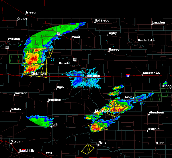 At 552 pm mdt, a severe thunderstorm capable of producing a tornado was located 9 miles north of dickinson, moving east at 20 mph (radar indicated rotation). Hazards include tornado and tennis ball size hail. Flying debris will be dangerous to those caught without shelter. mobile homes will be damaged or destroyed. damage to roofs, windows, and vehicles will occur. tree damage is likely. This tornadic thunderstorm will remain over mainly rural areas of north central stark and south central dunn counties, including the following locations: hirschville and new hradec. At 552 pm mdt, a severe thunderstorm capable of producing a tornado was located 9 miles north of dickinson, moving east at 20 mph (radar indicated rotation). Hazards include tornado and tennis ball size hail. Flying debris will be dangerous to those caught without shelter. mobile homes will be damaged or destroyed. damage to roofs, windows, and vehicles will occur. tree damage is likely. This tornadic thunderstorm will remain over mainly rural areas of north central stark and south central dunn counties, including the following locations: hirschville and new hradec.
|
| 8/10/2016 5:42 PM MDT |
 At 542 pm mdt, a severe thunderstorm was located 12 miles north of dickinson, moving east at 25 mph (radar indicated). Hazards include tennis ball size hail and 60 mph wind gusts. People and animals outdoors will be injured. expect hail damage to roofs, siding, windows, and vehicles. expect wind damage to roofs, siding, and trees. this severe thunderstorm will be near, marshall around 640 pm mdt. Other locations impacted by this severe thunderstorm include hirschville and new hradec. At 542 pm mdt, a severe thunderstorm was located 12 miles north of dickinson, moving east at 25 mph (radar indicated). Hazards include tennis ball size hail and 60 mph wind gusts. People and animals outdoors will be injured. expect hail damage to roofs, siding, windows, and vehicles. expect wind damage to roofs, siding, and trees. this severe thunderstorm will be near, marshall around 640 pm mdt. Other locations impacted by this severe thunderstorm include hirschville and new hradec.
|
| 7/10/2016 6:21 PM MDT |
 At 719 pm cdt/619 pm mdt/, severe thunderstorms were located along a line extending from 4 miles west of marshall to 5 miles west of heart butte dam to 4 miles northeast of white butte, moving east at 70 mph. these are very dangerous storms. get to shelter now if you are in the warned area! stay away from windows! (public). Hazards include 80 mph wind gusts and golf ball size hail. Flying debris will be dangerous to those caught without shelter. mobile homes will be heavily damaged. expect considerable damage to roofs, windows, and vehicles. extensive tree damage and power outages are likely. Locations impacted include, glen ullin, elgin, hebron, richardton, carson, new leipzig, haynes, heart butte dam and fish creek dam. At 719 pm cdt/619 pm mdt/, severe thunderstorms were located along a line extending from 4 miles west of marshall to 5 miles west of heart butte dam to 4 miles northeast of white butte, moving east at 70 mph. these are very dangerous storms. get to shelter now if you are in the warned area! stay away from windows! (public). Hazards include 80 mph wind gusts and golf ball size hail. Flying debris will be dangerous to those caught without shelter. mobile homes will be heavily damaged. expect considerable damage to roofs, windows, and vehicles. extensive tree damage and power outages are likely. Locations impacted include, glen ullin, elgin, hebron, richardton, carson, new leipzig, haynes, heart butte dam and fish creek dam.
|
| 7/10/2016 5:57 PM MDT |
 At 656 pm cdt/556 pm mdt/, severe thunderstorms were located along a line extending from 7 miles south of dunn center to 13 miles south of hebron to 11 miles south of mott, moving east at 70 mph (radar indicated). Hazards include 70 mph wind gusts and half dollar size hail. Hail damage to vehicles is expected. expect considerable tree damage. wind damage is also likely to mobile homes, roofs, and outbuildings. Locations impacted include, dickinson, beulah, hettinger, glen ullin, mott, elgin, new salem, hebron, new england, richardton, carson, gladstone, zap, new leipzig, regent, taylor, almont, marshall, haynes and heart butte dam. At 656 pm cdt/556 pm mdt/, severe thunderstorms were located along a line extending from 7 miles south of dunn center to 13 miles south of hebron to 11 miles south of mott, moving east at 70 mph (radar indicated). Hazards include 70 mph wind gusts and half dollar size hail. Hail damage to vehicles is expected. expect considerable tree damage. wind damage is also likely to mobile homes, roofs, and outbuildings. Locations impacted include, dickinson, beulah, hettinger, glen ullin, mott, elgin, new salem, hebron, new england, richardton, carson, gladstone, zap, new leipzig, regent, taylor, almont, marshall, haynes and heart butte dam.
|
| 7/10/2016 5:44 PM MDT | Storm damage reported in stark county ND, 5.6 miles NNE of Dickinson, ND |
| 7/10/2016 5:36 PM MDT |
 At 635 pm cdt/535 pm mdt/, severe thunderstorms were located along a line extending from 5 miles east of south fairfield to 13 miles north of regent to 6 miles east of reeder, moving east at 70 mph (radar indicated). Hazards include two inch hail and 70 mph wind gusts. People and animals outdoors will be injured. expect hail damage to roofs, siding, windows, and vehicles. expect considerable tree damage. Wind damage is also likely to mobile homes, roofs, and outbuildings. At 635 pm cdt/535 pm mdt/, severe thunderstorms were located along a line extending from 5 miles east of south fairfield to 13 miles north of regent to 6 miles east of reeder, moving east at 70 mph (radar indicated). Hazards include two inch hail and 70 mph wind gusts. People and animals outdoors will be injured. expect hail damage to roofs, siding, windows, and vehicles. expect considerable tree damage. Wind damage is also likely to mobile homes, roofs, and outbuildings.
|
| 7/10/2016 12:26 AM MDT |
 At 1225 am mdt, severe thunderstorms were located along a line extending from near dunn center to 12 miles southeast of manning to near gladstone, moving east at 55 mph. these are very dangerous storms (radar indicated). Hazards include 80 mph wind gusts and nickel size hail. Flying debris will be dangerous to those caught without shelter. mobile homes will be heavily damaged. expect considerable damage to roofs, windows, and vehicles. extensive tree damage and power outages are likely. these severe storms will be near, dunn center around 1230 am mdt. taylor around 1235 am mdt. richardton, halliday and marshall around 1240 am mdt. dodge around 1245 am mdt. Other locations impacted by these severe thunderstorms include twin buttes, hirschville and new hradec. At 1225 am mdt, severe thunderstorms were located along a line extending from near dunn center to 12 miles southeast of manning to near gladstone, moving east at 55 mph. these are very dangerous storms (radar indicated). Hazards include 80 mph wind gusts and nickel size hail. Flying debris will be dangerous to those caught without shelter. mobile homes will be heavily damaged. expect considerable damage to roofs, windows, and vehicles. extensive tree damage and power outages are likely. these severe storms will be near, dunn center around 1230 am mdt. taylor around 1235 am mdt. richardton, halliday and marshall around 1240 am mdt. dodge around 1245 am mdt. Other locations impacted by these severe thunderstorms include twin buttes, hirschville and new hradec.
|
| 7/10/2016 12:11 AM MDT | 63 mph wind gust measured by dickinson ndaw in stark county ND, 1 miles SE of Dickinson, ND |
| 7/10/2016 12:11 AM MDT |
 At 1210 am mdt, severe thunderstorms were located along a line extending from 7 miles west of manning to near south heart, moving northeast at 45 mph (radar indicated). Hazards include 70 mph wind gusts and nickel size hail. Expect considerable tree damage. damage is likely to mobile homes, roofs, and outbuildings. these severe storms will be near, dickinson around 1210 am mdt. manning around 1215 am mdt. killdeer around 1225 am mdt. dunn center around 1230 am mdt. halliday around 1245 am mdt. marshall around 1250 am mdt. Other locations impacted by these severe thunderstorms include twin buttes, hirschville and new hradec. At 1210 am mdt, severe thunderstorms were located along a line extending from 7 miles west of manning to near south heart, moving northeast at 45 mph (radar indicated). Hazards include 70 mph wind gusts and nickel size hail. Expect considerable tree damage. damage is likely to mobile homes, roofs, and outbuildings. these severe storms will be near, dickinson around 1210 am mdt. manning around 1215 am mdt. killdeer around 1225 am mdt. dunn center around 1230 am mdt. halliday around 1245 am mdt. marshall around 1250 am mdt. Other locations impacted by these severe thunderstorms include twin buttes, hirschville and new hradec.
|
| 7/10/2016 12:04 AM MDT | Storm damage reported in stark county ND, 0.2 miles E of Dickinson, ND |
| 7/10/2016 12:02 AM MDT |
 At 1201 am mdt, severe thunderstorms were located along a line extending from 10 miles northeast of south fairfield to south heart, moving northeast at 45 mph (radar indicated). Hazards include 70 mph wind gusts and nickel size hail. Expect considerable tree damage. damage is likely to mobile homes, roofs, and outbuildings. severe thunderstorms will be near, dickinson and manning around 1210 am mdt. killdeer around 1220 am mdt. dunn center around 1230 am mdt. halliday around 1240 am mdt. marshall around 1250 am mdt. Other locations impacted by these severe thunderstorms include twin buttes, hirschville and new hradec. At 1201 am mdt, severe thunderstorms were located along a line extending from 10 miles northeast of south fairfield to south heart, moving northeast at 45 mph (radar indicated). Hazards include 70 mph wind gusts and nickel size hail. Expect considerable tree damage. damage is likely to mobile homes, roofs, and outbuildings. severe thunderstorms will be near, dickinson and manning around 1210 am mdt. killdeer around 1220 am mdt. dunn center around 1230 am mdt. halliday around 1240 am mdt. marshall around 1250 am mdt. Other locations impacted by these severe thunderstorms include twin buttes, hirschville and new hradec.
|
| 7/6/2016 6:11 PM MDT |
 At 710 pm cdt/610 pm mdt/, severe thunderstorms were located along a line extending from 12 miles southwest of glen ullin to 9 miles southwest of new leipzig to haynes, moving east at 45 mph (trained weather spotters). Hazards include 70 mph wind gusts and penny size hail. Expect considerable tree damage. damage is likely to mobile homes, roofs, and outbuildings. these severe storms will be near, new leipzig around 620 pm mdt. heart butte dam around 625 pm mdt. Other locations impacted by these severe thunderstorms include burt, porcupine, raleigh, bucyrus, havelock, lark and leith. At 710 pm cdt/610 pm mdt/, severe thunderstorms were located along a line extending from 12 miles southwest of glen ullin to 9 miles southwest of new leipzig to haynes, moving east at 45 mph (trained weather spotters). Hazards include 70 mph wind gusts and penny size hail. Expect considerable tree damage. damage is likely to mobile homes, roofs, and outbuildings. these severe storms will be near, new leipzig around 620 pm mdt. heart butte dam around 625 pm mdt. Other locations impacted by these severe thunderstorms include burt, porcupine, raleigh, bucyrus, havelock, lark and leith.
|
| 7/6/2016 5:56 PM MDT |
 At 655 pm cdt/555 pm mdt/, severe thunderstorms were located along a line extending from 9 miles south of richardton to 7 miles southeast of mott to near haynes, moving east at 50 mph (trained weather spotters). Hazards include 70 mph wind gusts and nickel size hail. Expect considerable tree damage. damage is likely to mobile homes, roofs, and outbuildings. these severe storms will be near, new leipzig around 605 pm mdt. heart butte dam around 625 pm mdt. Other locations impacted by these severe thunderstorms include burt, porcupine, raleigh, bucyrus, havelock, lark and leith. At 655 pm cdt/555 pm mdt/, severe thunderstorms were located along a line extending from 9 miles south of richardton to 7 miles southeast of mott to near haynes, moving east at 50 mph (trained weather spotters). Hazards include 70 mph wind gusts and nickel size hail. Expect considerable tree damage. damage is likely to mobile homes, roofs, and outbuildings. these severe storms will be near, new leipzig around 605 pm mdt. heart butte dam around 625 pm mdt. Other locations impacted by these severe thunderstorms include burt, porcupine, raleigh, bucyrus, havelock, lark and leith.
|
| 7/6/2016 5:39 PM MDT |
 At 638 pm cdt/538 pm mdt/, severe thunderstorms were located along a line extending from 7 miles south of gladstone to 5 miles southwest of mott to hettinger, moving east at 60 mph (radar indicated). Hazards include 70 mph wind gusts and penny size hail. Expect considerable tree damage. damage is likely to mobile homes, roofs, and outbuildings. severe thunderstorms will be near, mott around 545 pm mdt. new leipzig around 600 pm mdt. heart butte dam around 615 pm mdt. almont around 625 pm mdt. Other locations impacted by these severe thunderstorms include burt, porcupine, raleigh, bucyrus, havelock, lark, leith, lefor and heil. At 638 pm cdt/538 pm mdt/, severe thunderstorms were located along a line extending from 7 miles south of gladstone to 5 miles southwest of mott to hettinger, moving east at 60 mph (radar indicated). Hazards include 70 mph wind gusts and penny size hail. Expect considerable tree damage. damage is likely to mobile homes, roofs, and outbuildings. severe thunderstorms will be near, mott around 545 pm mdt. new leipzig around 600 pm mdt. heart butte dam around 615 pm mdt. almont around 625 pm mdt. Other locations impacted by these severe thunderstorms include burt, porcupine, raleigh, bucyrus, havelock, lark, leith, lefor and heil.
|
| 6/17/2016 1:45 AM MDT | At 245 am cdt/145 am mdt/, severe thunderstorms were located along a line extending from 4 miles north of taylor to 18 miles west of heart butte dam to 5 miles southwest of mott, moving east at 50 mph (radar indicated). Hazards include 70 mph wind gusts and ping pong ball size hail. People and animals outdoors will be injured. expect hail damage to roofs, siding, windows, and vehicles. expect considerable tree damage. wind damage is also likely to mobile homes, roofs, and outbuildings. these severe storms will be near, hebron and heart butte dam around 205 am mdt. new leipzig around 210 am mdt. elgin around 215 am mdt. almont around 325 am cdt. carson around 330 am cdt. Other locations impacted by these severe thunderstorms include burt, leith, lark, bentley, lefor and heil. |
| 6/17/2016 1:30 AM MDT | At 230 am cdt/130 am mdt/, severe thunderstorms were located along a line extending from 7 miles northeast of dickinson to 11 miles north of mott to 8 miles south of regent, moving east at 50 mph (radar indicated). Hazards include 70 mph wind gusts and quarter size hail. Hail damage to vehicles is expected. expect considerable tree damage. wind damage is also likely to mobile homes, roofs, and outbuildings. severe thunderstorms will be near, mott and taylor around 145 am mdt. richardton around 150 am mdt. heart butte dam around 200 am mdt. hebron and new leipzig around 205 am mdt. elgin around 315 am cdt. almont around 320 am cdt. carson around 330 am cdt. Other locations impacted by these severe thunderstorms include burt, heil, havelock, dickinson regional airport, leith, lark, bentley and lefor. |
| 6/17/2016 1:25 AM MDT | At 123 am mdt, severe thunderstorms were located along a line extending from 4 miles north of dickinson to 7 miles north of regent, moving east at 45 mph. at 120 am mdt, 64 mph winds were reported at the dickinson airport (radar indicated). Hazards include 70 mph wind gusts and quarter size hail. Hail damage to vehicles is expected. expect considerable tree damage. wind damage is also likely to mobile homes, roofs, and outbuildings. these severe storms will be near, gladstone around 135 am mdt. Other locations impacted by these severe thunderstorms include schefield, dickinson regional airport, lefor and new hradec. |
| 6/17/2016 1:20 AM MDT | Storm damage reported in stark county ND, 5.6 miles NNE of Dickinson, ND |
| 6/17/2016 1:07 AM MDT |
 At 107 am mdt, severe thunderstorms were located along a line extending from south heart to new england, moving east at 50 mph (radar indicated). Hazards include 70 mph wind gusts and quarter size hail. Hail damage to vehicles is expected. expect considerable tree damage. wind damage is also likely to mobile homes, roofs, and outbuildings. these severe storms will be near, dickinson around 120 am mdt. gladstone around 130 am mdt. Other locations impacted by these severe thunderstorms include schefield, dickinson regional airport, lefor and new hradec. At 107 am mdt, severe thunderstorms were located along a line extending from south heart to new england, moving east at 50 mph (radar indicated). Hazards include 70 mph wind gusts and quarter size hail. Hail damage to vehicles is expected. expect considerable tree damage. wind damage is also likely to mobile homes, roofs, and outbuildings. these severe storms will be near, dickinson around 120 am mdt. gladstone around 130 am mdt. Other locations impacted by these severe thunderstorms include schefield, dickinson regional airport, lefor and new hradec.
|
| 6/17/2016 12:43 AM MDT |
 At 1242 am mdt, severe thunderstorms were located along a line extending from 9 miles southeast of medora to 6 miles northwest of amidon, moving east at 45 mph (radar indicated). Hazards include 70 mph wind gusts and ping pong ball size hail. People and animals outdoors will be injured. expect hail damage to roofs, siding, windows, and vehicles. expect considerable tree damage. wind damage is also likely to mobile homes, roofs, and outbuildings. severe thunderstorms will be near, belfield around 100 am mdt. south heart around 110 am mdt. new england around 115 am mdt. dickinson around 125 am mdt. gladstone around 140 am mdt. Other locations impacted by these severe thunderstorms include schefield, dickinson regional airport, fryburg, lefor and new hradec. At 1242 am mdt, severe thunderstorms were located along a line extending from 9 miles southeast of medora to 6 miles northwest of amidon, moving east at 45 mph (radar indicated). Hazards include 70 mph wind gusts and ping pong ball size hail. People and animals outdoors will be injured. expect hail damage to roofs, siding, windows, and vehicles. expect considerable tree damage. wind damage is also likely to mobile homes, roofs, and outbuildings. severe thunderstorms will be near, belfield around 100 am mdt. south heart around 110 am mdt. new england around 115 am mdt. dickinson around 125 am mdt. gladstone around 140 am mdt. Other locations impacted by these severe thunderstorms include schefield, dickinson regional airport, fryburg, lefor and new hradec.
|
| 6/11/2016 2:27 AM MDT | The severe thunderstorm warning for central stark and southern dunn counties will expire at 230 am mdt, the storm which prompted the warning has weakened below severe limits, and no longer pose an immediate threat to life or property. therefore the warning will be allowed to expire. however small hail and gusty winds are still possible with this thunderstorm. to report severe weather, contact your nearest law enforcement agency. they will relay your report to the national weather service bismarck. |
| 6/11/2016 2:03 AM MDT |
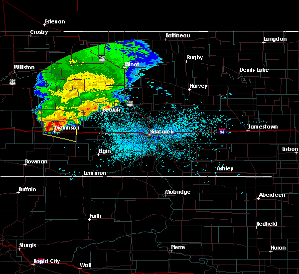 At 202 am mdt, a severe thunderstorm was located 9 miles northeast of dickinson, moving east at 50 mph (radar indicated). Hazards include 60 mph wind gusts and half dollar size hail. Hail damage to vehicles is expected. expect wind damage to roofs, siding, and trees. this severe storm will be near, taylor around 215 am mdt. richardton around 225 am mdt. Other locations impacted by this severe thunderstorm include dickinson regional airport, hirschville and new hradec. At 202 am mdt, a severe thunderstorm was located 9 miles northeast of dickinson, moving east at 50 mph (radar indicated). Hazards include 60 mph wind gusts and half dollar size hail. Hail damage to vehicles is expected. expect wind damage to roofs, siding, and trees. this severe storm will be near, taylor around 215 am mdt. richardton around 225 am mdt. Other locations impacted by this severe thunderstorm include dickinson regional airport, hirschville and new hradec.
|
| 6/11/2016 1:43 AM MDT |
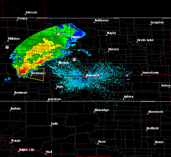 At 143 am mdt, a severe thunderstorm was located 8 miles north of south heart, or 11 miles northwest of dickinson, moving east at 45 mph (radar indicated). Hazards include ping pong ball size hail and 60 mph wind gusts. People and animals outdoors will be injured. expect hail damage to roofs, siding, windows, and vehicles. expect wind damage to roofs, siding, and trees. this severe storm will be near, dickinson around 155 am mdt. taylor around 220 am mdt. richardton around 225 am mdt. Other locations impacted by this severe thunderstorm include dickinson regional airport, hirschville and new hradec. At 143 am mdt, a severe thunderstorm was located 8 miles north of south heart, or 11 miles northwest of dickinson, moving east at 45 mph (radar indicated). Hazards include ping pong ball size hail and 60 mph wind gusts. People and animals outdoors will be injured. expect hail damage to roofs, siding, windows, and vehicles. expect wind damage to roofs, siding, and trees. this severe storm will be near, dickinson around 155 am mdt. taylor around 220 am mdt. richardton around 225 am mdt. Other locations impacted by this severe thunderstorm include dickinson regional airport, hirschville and new hradec.
|
| 6/11/2016 1:27 AM MDT |
 At 126 am mdt, a severe thunderstorm was located near belfield, or 22 miles west of dickinson, moving east at 50 mph (radar indicated). Hazards include 60 mph wind gusts and quarter size hail. Hail damage to vehicles is expected. expect wind damage to roofs, siding, and trees. this severe thunderstorm will be near, belfield around 130 am mdt. south heart around 140 am mdt. dickinson around 155 am mdt. gladstone around 210 am mdt. taylor around 215 am mdt. richardton around 220 am mdt. Other locations impacted by this severe thunderstorm include dickinson regional airport, fryburg, hirschville and new hradec. At 126 am mdt, a severe thunderstorm was located near belfield, or 22 miles west of dickinson, moving east at 50 mph (radar indicated). Hazards include 60 mph wind gusts and quarter size hail. Hail damage to vehicles is expected. expect wind damage to roofs, siding, and trees. this severe thunderstorm will be near, belfield around 130 am mdt. south heart around 140 am mdt. dickinson around 155 am mdt. gladstone around 210 am mdt. taylor around 215 am mdt. richardton around 220 am mdt. Other locations impacted by this severe thunderstorm include dickinson regional airport, fryburg, hirschville and new hradec.
|
| 6/2/2016 4:04 PM MDT |
 At 503 pm cdt/403 pm mdt/, a severe thunderstorm was located near gladstone, or 13 miles east of dickinson, moving northeast at 40 mph (radar indicated). Hazards include 60 mph wind gusts and quarter size hail. Hail damage to vehicles is expected. expect wind damage to roofs, siding, and trees. this severe thunderstorm will be near, taylor around 415 pm mdt. Richardton around 420 pm mdt. At 503 pm cdt/403 pm mdt/, a severe thunderstorm was located near gladstone, or 13 miles east of dickinson, moving northeast at 40 mph (radar indicated). Hazards include 60 mph wind gusts and quarter size hail. Hail damage to vehicles is expected. expect wind damage to roofs, siding, and trees. this severe thunderstorm will be near, taylor around 415 pm mdt. Richardton around 420 pm mdt.
|
| 9/16/2015 8:34 PM MDT |
 At 833 pm mdt, a severe thunderstorm was located 8 miles northwest of gladstone, or 8 miles northeast of dickinson, moving northeast at 40 mph (radar indicated). Hazards include 60 mph wind gusts and quarter size hail. Hail damage to vehicles is expected. expect wind damage to roofs, siding and trees. this severe storm will be near, marshall around 900 pm mdt. other locations impacted by this severe thunderstorm include hirschville. This storm has produced quarter size hail in dickinson and 60 mph winds in south heart. At 833 pm mdt, a severe thunderstorm was located 8 miles northwest of gladstone, or 8 miles northeast of dickinson, moving northeast at 40 mph (radar indicated). Hazards include 60 mph wind gusts and quarter size hail. Hail damage to vehicles is expected. expect wind damage to roofs, siding and trees. this severe storm will be near, marshall around 900 pm mdt. other locations impacted by this severe thunderstorm include hirschville. This storm has produced quarter size hail in dickinson and 60 mph winds in south heart.
|
| 9/16/2015 8:23 PM MDT |
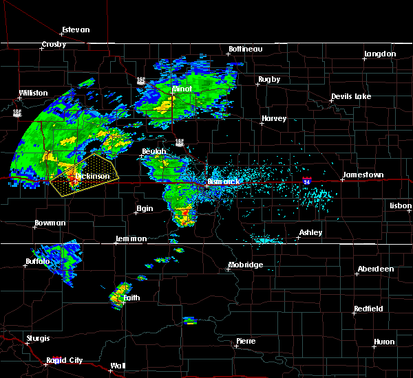 At 822 pm mdt, severe thunderstorms were located along a line extending from 10 miles northeast of south heart to 5 miles south of dickinson, moving northeast at 45 mph (radar indicated). Hazards include 60 mph wind gusts and quarter size hail. Hail damage to vehicles is expected. expect wind damage to roofs, siding and trees. these severe storms will be near, gladstone around 840 pm mdt. taylor around 845 pm mdt. richardton around 855 pm mdt. marshall around 900 pm mdt. Other locations impacted by these severe thunderstorms include dickinson regional airport, new hradec and hirschville. At 822 pm mdt, severe thunderstorms were located along a line extending from 10 miles northeast of south heart to 5 miles south of dickinson, moving northeast at 45 mph (radar indicated). Hazards include 60 mph wind gusts and quarter size hail. Hail damage to vehicles is expected. expect wind damage to roofs, siding and trees. these severe storms will be near, gladstone around 840 pm mdt. taylor around 845 pm mdt. richardton around 855 pm mdt. marshall around 900 pm mdt. Other locations impacted by these severe thunderstorms include dickinson regional airport, new hradec and hirschville.
|
| 9/16/2015 8:18 PM MDT | Quarter sized hail reported 0.2 miles E of Dickinson, ND, hail started at 818 pm mdt and ended at 824 pm mdt. estimated wind gusts to 45 mph |
| 9/16/2015 8:12 PM MDT |
 At 811 pm mdt, a severe thunderstorm was located near south heart, or 5 miles west of dickinson, moving northeast at 45 mph (radar indicated). Hazards include 60 mph wind gusts and quarter size hail. Hail damage to vehicles is expected. expect wind damage to roofs, siding and trees. this severe thunderstorm will be near, dickinson around 820 pm mdt. gladstone around 830 pm mdt. marshall around 855 pm mdt. Other locations impacted by this severe thunderstorm include dickinson regional airport, new hradec and hirschville. At 811 pm mdt, a severe thunderstorm was located near south heart, or 5 miles west of dickinson, moving northeast at 45 mph (radar indicated). Hazards include 60 mph wind gusts and quarter size hail. Hail damage to vehicles is expected. expect wind damage to roofs, siding and trees. this severe thunderstorm will be near, dickinson around 820 pm mdt. gladstone around 830 pm mdt. marshall around 855 pm mdt. Other locations impacted by this severe thunderstorm include dickinson regional airport, new hradec and hirschville.
|
| 9/5/2015 11:47 PM MDT |
 At 1147 pm mdt, severe thunderstorms were located along a line extending from 8 miles east of manning to 13 miles south of richardton, moving northeast at 45 mph (radar indicated). Hazards include 60 mph wind gusts and penny size hail. Expect damage to roofs. siding and trees. Locations impacted include, dickinson, richardton, gladstone, taylor, lefor and hirschville. At 1147 pm mdt, severe thunderstorms were located along a line extending from 8 miles east of manning to 13 miles south of richardton, moving northeast at 45 mph (radar indicated). Hazards include 60 mph wind gusts and penny size hail. Expect damage to roofs. siding and trees. Locations impacted include, dickinson, richardton, gladstone, taylor, lefor and hirschville.
|
| 9/5/2015 11:20 PM MDT |
 At 1120 pm mdt, severe thunderstorms were located along a line extending from 11 miles southwest of manning to 9 miles northeast of new england, moving northeast at 45 mph (radar indicated). Hazards include 60 mph wind gusts and quarter size hail. Hail damage to vehicles is expected. Expect wind damage to roofs, siding and trees. At 1120 pm mdt, severe thunderstorms were located along a line extending from 11 miles southwest of manning to 9 miles northeast of new england, moving northeast at 45 mph (radar indicated). Hazards include 60 mph wind gusts and quarter size hail. Hail damage to vehicles is expected. Expect wind damage to roofs, siding and trees.
|
| 7/26/2015 6:10 PM MDT |
 At 608 pm mdt, the center of a cluster of severe thunderstorms was over taylor, or 15 miles east of dickinson, moving northeast at 30 mph (radar indicated). Hazards include 60 mph wind gusts and quarter size hail. Hail damage to vehicles is expected. expect wind damage to roofs, siding and trees. this severe storm will be near, richardton around 620 pm mdt. Other locations impacted by this severe thunderstorm include lefor. At 608 pm mdt, the center of a cluster of severe thunderstorms was over taylor, or 15 miles east of dickinson, moving northeast at 30 mph (radar indicated). Hazards include 60 mph wind gusts and quarter size hail. Hail damage to vehicles is expected. expect wind damage to roofs, siding and trees. this severe storm will be near, richardton around 620 pm mdt. Other locations impacted by this severe thunderstorm include lefor.
|
| 7/26/2015 5:41 PM MDT |
 At 540 pm mdt, a severe thunderstorm was located near gladstone, or 10 miles southeast of dickinson, moving northeast at 45 mph (radar indicated). Hazards include 60 mph wind gusts and quarter size hail. Hail damage to vehicles is expected. expect wind damage to roofs, siding and trees. this severe thunderstorm will be near, richardton and taylor around 555 pm mdt. Other locations impacted by this severe thunderstorm include lefor and hirschville. At 540 pm mdt, a severe thunderstorm was located near gladstone, or 10 miles southeast of dickinson, moving northeast at 45 mph (radar indicated). Hazards include 60 mph wind gusts and quarter size hail. Hail damage to vehicles is expected. expect wind damage to roofs, siding and trees. this severe thunderstorm will be near, richardton and taylor around 555 pm mdt. Other locations impacted by this severe thunderstorm include lefor and hirschville.
|
| 7/26/2015 4:23 PM MDT |
 At 423 pm mdt, a severe thunderstorm was located 8 miles south of belfield, or 20 miles west of dickinson, moving east at 20 mph (radar indicated). Hazards include 60 mph wind gusts and quarter size hail. Hail damage to vehicles is expected. expect wind damage to roofs, siding and trees. this severe thunderstorm will be near, south heart around 500 pm mdt. dickinson around 530 pm mdt. Other locations impacted by this severe thunderstorm include schefield. At 423 pm mdt, a severe thunderstorm was located 8 miles south of belfield, or 20 miles west of dickinson, moving east at 20 mph (radar indicated). Hazards include 60 mph wind gusts and quarter size hail. Hail damage to vehicles is expected. expect wind damage to roofs, siding and trees. this severe thunderstorm will be near, south heart around 500 pm mdt. dickinson around 530 pm mdt. Other locations impacted by this severe thunderstorm include schefield.
|
| 7/7/2015 5:05 PM MDT | Storm damage reported in dunn county ND, 9.7 miles S of Dickinson, ND |
| 7/7/2015 4:46 PM MDT |
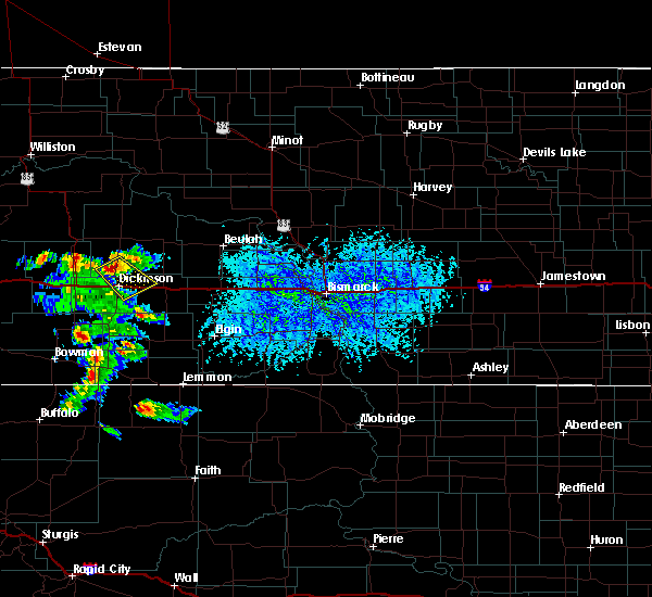 At 446 pm mdt, a severe thunderstorm was located 8 miles north of dickinson, moving southeast at 15 mph (radar indicated). Hazards include 60 mph wind gusts and half dollar size hail. Hail damage to vehicles is expected. expect wind damage to roofs, siding and trees. this severe storm will be near, dickinson around 500 pm mdt. gladstone and taylor around 530 pm mdt. Other locations impacted by this severe thunderstorm include new hradec. At 446 pm mdt, a severe thunderstorm was located 8 miles north of dickinson, moving southeast at 15 mph (radar indicated). Hazards include 60 mph wind gusts and half dollar size hail. Hail damage to vehicles is expected. expect wind damage to roofs, siding and trees. this severe storm will be near, dickinson around 500 pm mdt. gladstone and taylor around 530 pm mdt. Other locations impacted by this severe thunderstorm include new hradec.
|
| 7/7/2015 4:27 PM MDT |
 At 427 pm mdt, a severe thunderstorm was located 12 miles north of dickinson, moving southeast at 20 mph (radar indicated). Hazards include 60 mph wind gusts and half dollar size hail. Hail damage to vehicles is expected. expect wind damage to roofs, siding and trees. this severe thunderstorm will be near, dickinson around 450 pm mdt. gladstone around 515 pm mdt. taylor around 520 pm mdt. Other locations impacted by this severe thunderstorm include new hradec. At 427 pm mdt, a severe thunderstorm was located 12 miles north of dickinson, moving southeast at 20 mph (radar indicated). Hazards include 60 mph wind gusts and half dollar size hail. Hail damage to vehicles is expected. expect wind damage to roofs, siding and trees. this severe thunderstorm will be near, dickinson around 450 pm mdt. gladstone around 515 pm mdt. taylor around 520 pm mdt. Other locations impacted by this severe thunderstorm include new hradec.
|
| 6/19/2015 6:40 PM MDT | North side of dickinson. medium size tree limbs down along with minor street floodin in stark county ND, 0.2 miles E of Dickinson, ND |
| 6/19/2015 6:38 PM MDT |
 At 737 pm cdt /637 pm mdt/, severe thunderstorms were located along a line extending from golden valley to 8 miles southeast of south heart, moving southeast at 30 mph (radar indicated). Hazards include 60 mph wind gusts and half dollar size hail. Hail damage to vehicles is expected. expect wind damage to roofs, siding and trees. severe thunderstorms will be near, zap around 645 pm mdt. Other locations impacted by these severe thunderstorms include dickinson regional airport and hirschville. At 737 pm cdt /637 pm mdt/, severe thunderstorms were located along a line extending from golden valley to 8 miles southeast of south heart, moving southeast at 30 mph (radar indicated). Hazards include 60 mph wind gusts and half dollar size hail. Hail damage to vehicles is expected. expect wind damage to roofs, siding and trees. severe thunderstorms will be near, zap around 645 pm mdt. Other locations impacted by these severe thunderstorms include dickinson regional airport and hirschville.
|
| 3/28/2015 5:41 PM MDT | The national weather service in bismarck has issued a * severe thunderstorm warning for. eastern dunn county in southwest north dakota. mercer county in south central north dakota. northwestern morton county in south central north dakota. Eastern stark county in southwest north dakota. |
| 3/28/2015 4:26 PM MST | Storm damage reported in stark county ND, 5.6 miles NNE of Dickinson, ND |
| 7/21/2014 3:07 PM MDT | Estimated 65 mph winds. crops layed over. pea sized hail. total rainfall 1.20 inche in stark county ND, 11.7 miles N of Dickinson, ND |
| 8/6/2013 8:36 PM MDT | Public reported very strong winds with intermittent power outages. report relayed by broadcast medi in stark county ND, 14 miles NNW of Dickinson, ND |
| 8/6/2013 8:25 PM MDT | Storm damage reported in stark county ND, 5.6 miles NNE of Dickinson, ND |
| 8/6/2013 8:18 PM MDT | Reported roof damage on the west side of dickinso in stark county ND, 0.2 miles E of Dickinson, ND |
| 5/25/2013 1:49 PM MDT | Golf Ball sized hail reported 8.9 miles N of Dickinson, ND |
| 5/25/2013 1:35 PM MDT | Very heavy rain and gusty swirling wind in stark county ND, 8.3 miles N of Dickinson, ND |
| 7/11/2012 7:35 PM MDT | Golf Ball sized hail reported 4.7 miles SW of Dickinson, ND, hail began 830 pm cdt lasted 12 minutes. |
| 7/11/2012 7:32 PM MDT | Half Dollar sized hail reported 16.3 miles WSW of Dickinson, ND, hail lasted 20 minutes. 0.48 inches precip in about 30 min...with peak wind 38 mph. |
| 7/11/2012 7:28 PM MDT | Hen Egg sized hail reported 2.7 miles SW of Dickinson, ND, 2 inch hail reported by amature radio. |
| 7/11/2012 7:08 PM MDT | Golf Ball sized hail reported 4.9 miles S of Dickinson, ND |
| 7/11/2012 7:06 PM MDT | Golf Ball sized hail reported 9.5 miles SSE of Dickinson, ND, damage to crops...homes and vehicles reported. no further details. report relayed by media. |
| 1/1/0001 12:00 AM | Storm damage reported in stark county ND, 5.5 miles N of Dickinson, ND |
| 8/28/2011 1:05 AM MDT | Golf Ball sized hail reported 4.9 miles S of Dickinson, ND, public report relayed by media. time estimated by radar. |
| 1/1/0001 12:00 AM | Law enforcement estimated 70 to 80 mph winds on i-94 east of dickinso in stark county ND, 3.6 miles W of Dickinson, ND |
| 1/1/0001 12:00 AM | Storm damage reported in stark county ND, 0.2 miles E of Dickinson, ND |
| 1/1/0001 12:00 AM | 50-60 mph wind gus in stark county ND, 12.4 miles N of Dickinson, ND |
Hail Maps for Dickinson, ND


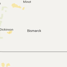


Connect with Interactive Hail Maps