

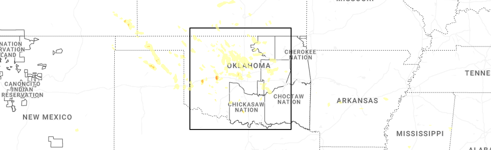
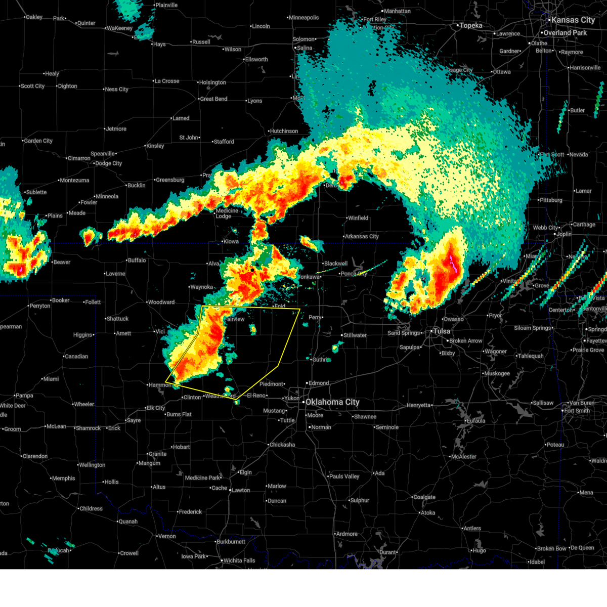
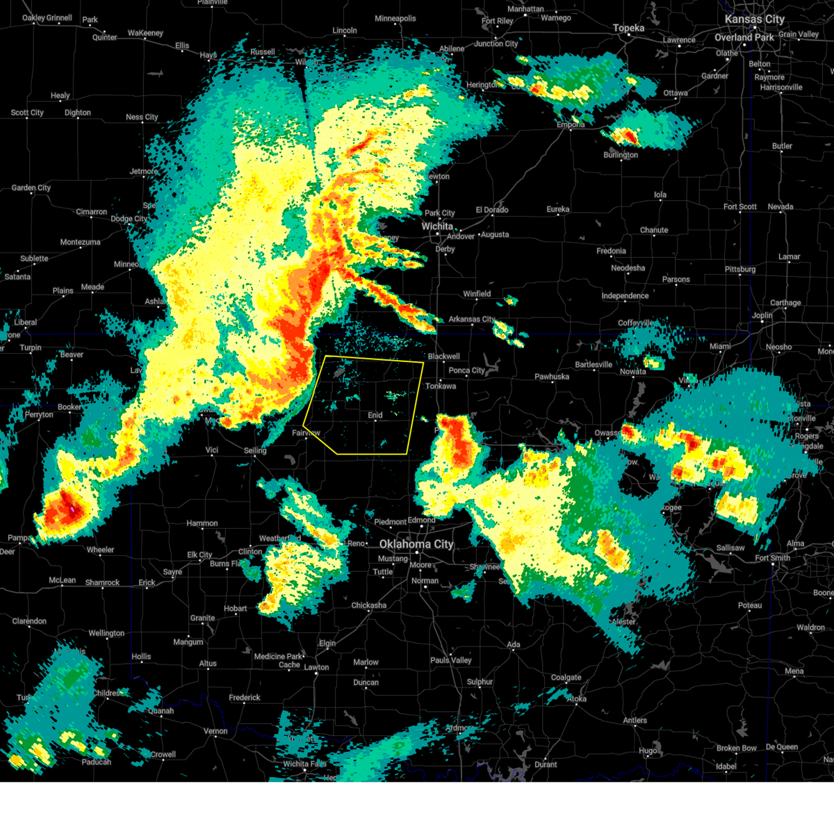
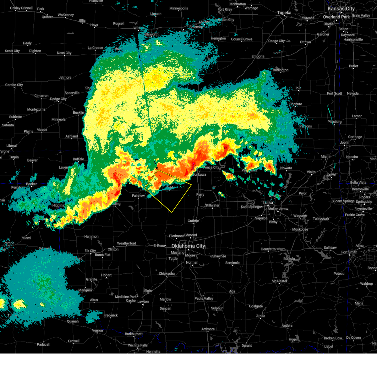
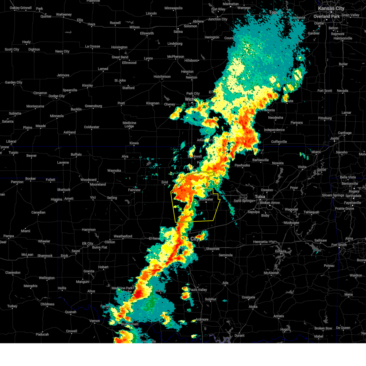
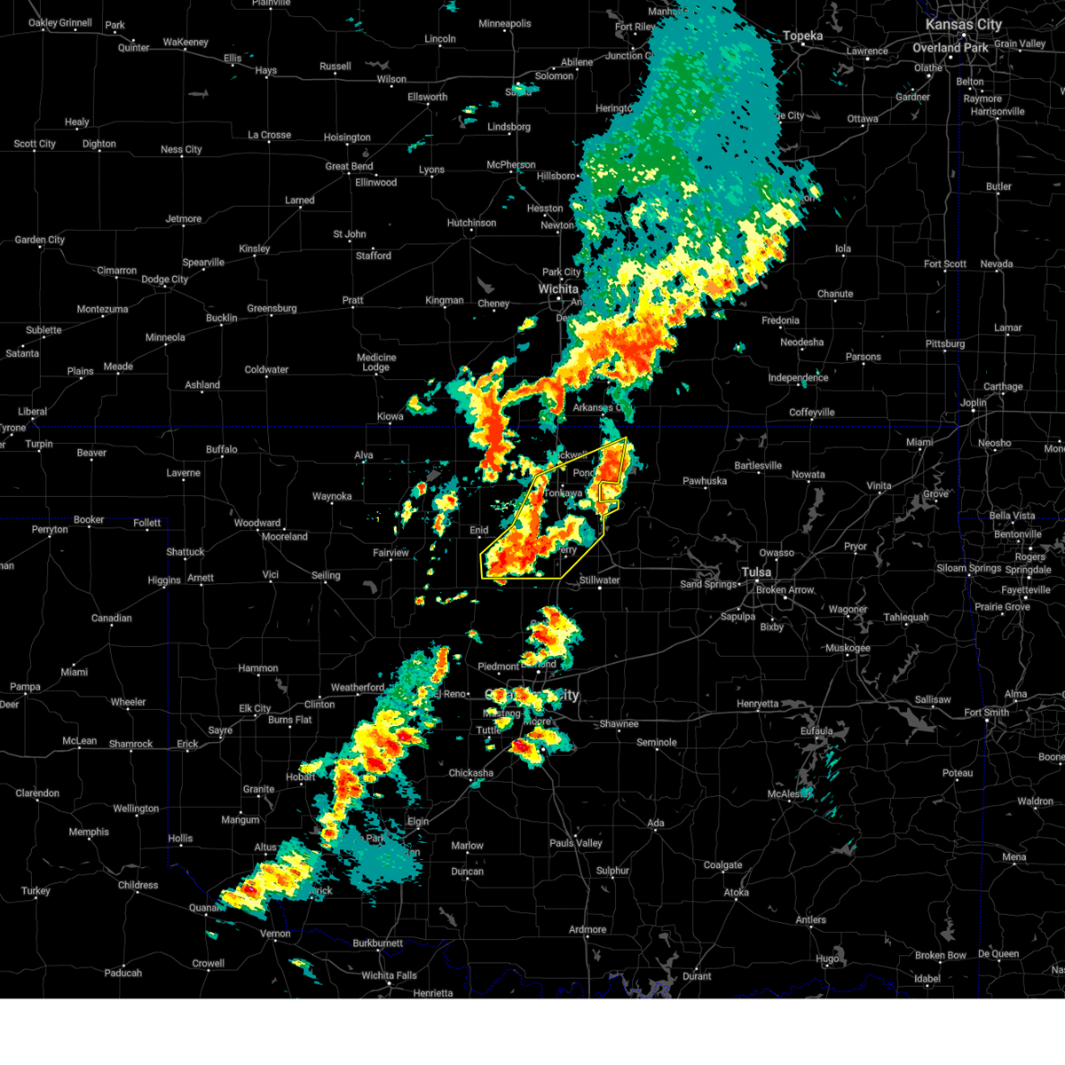
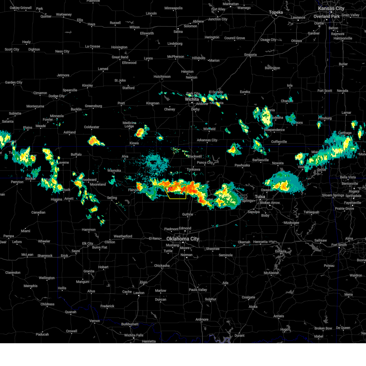
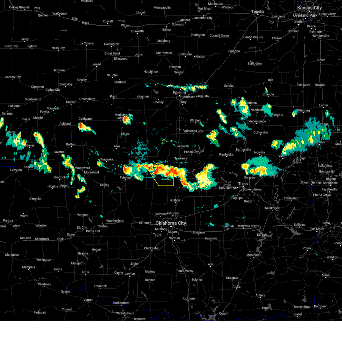
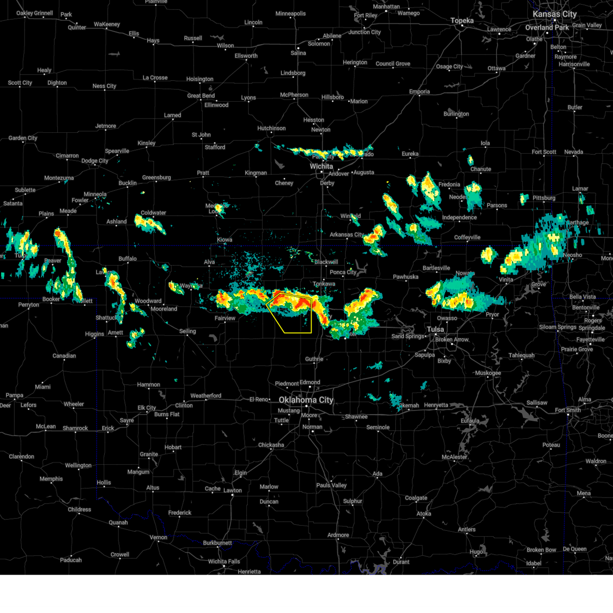
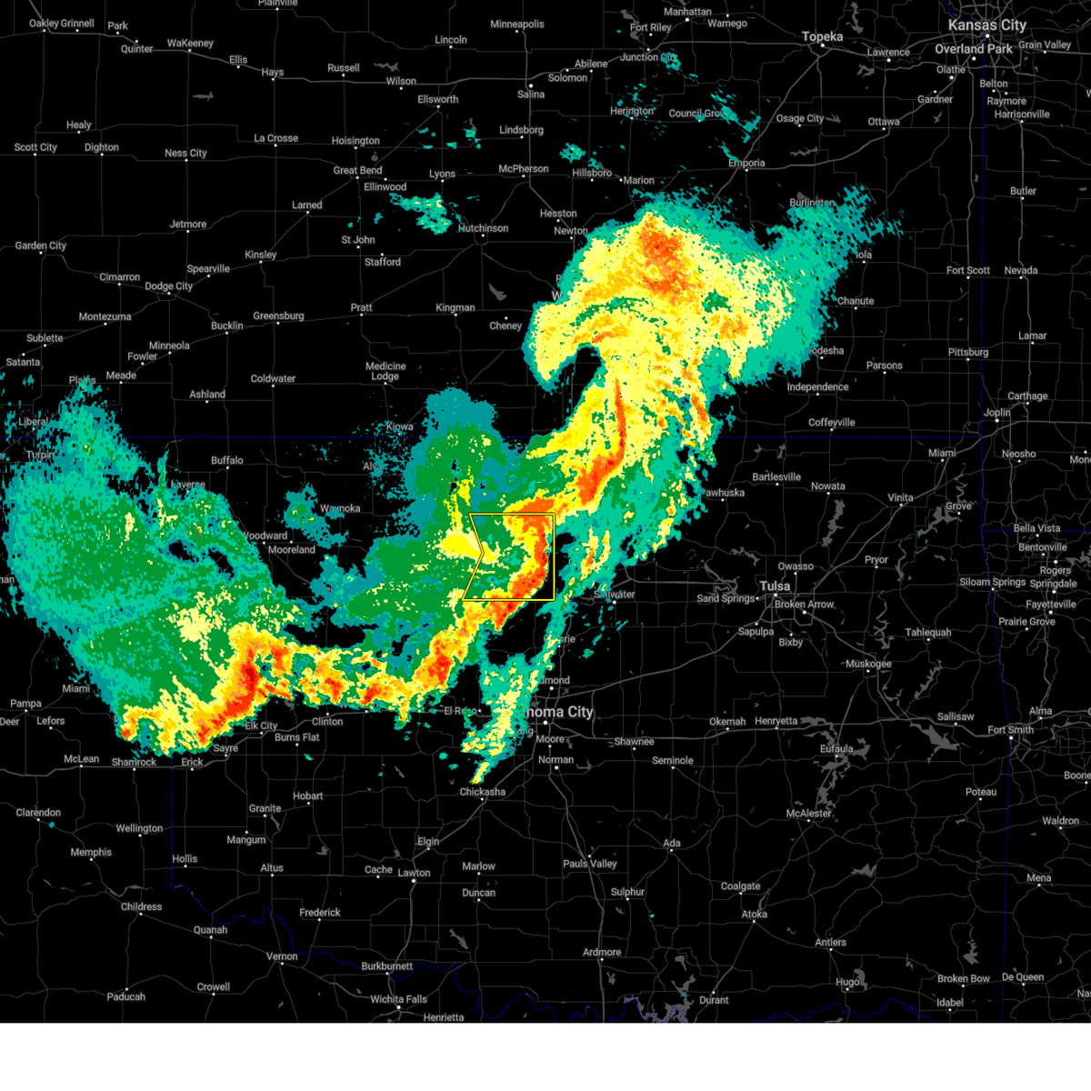
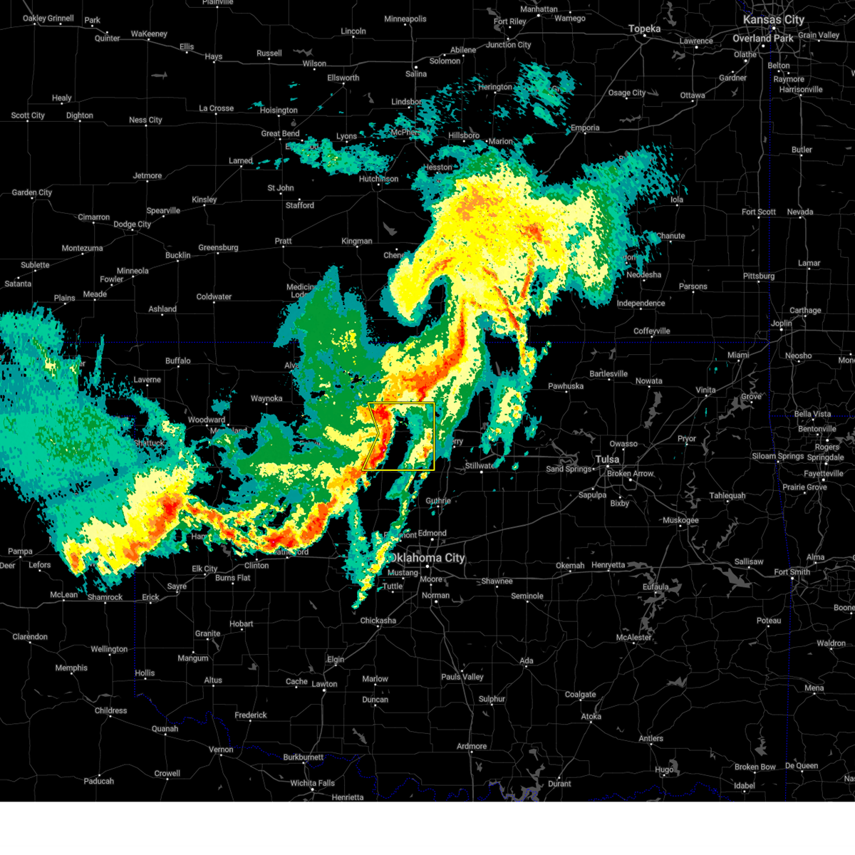
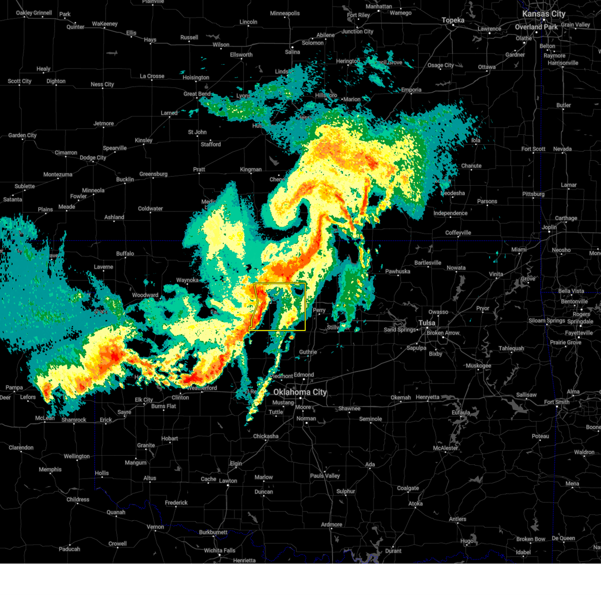
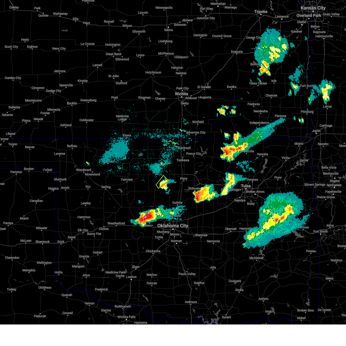
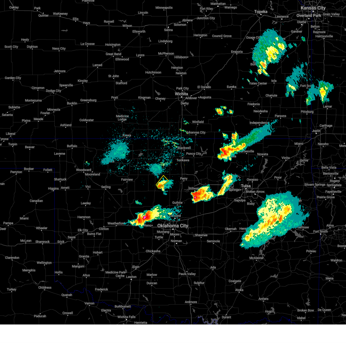
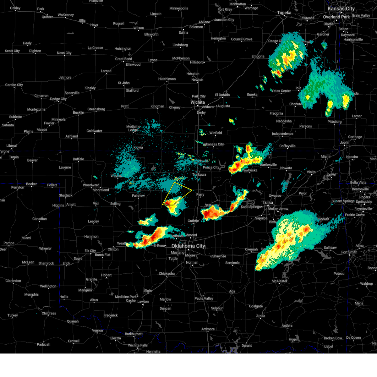
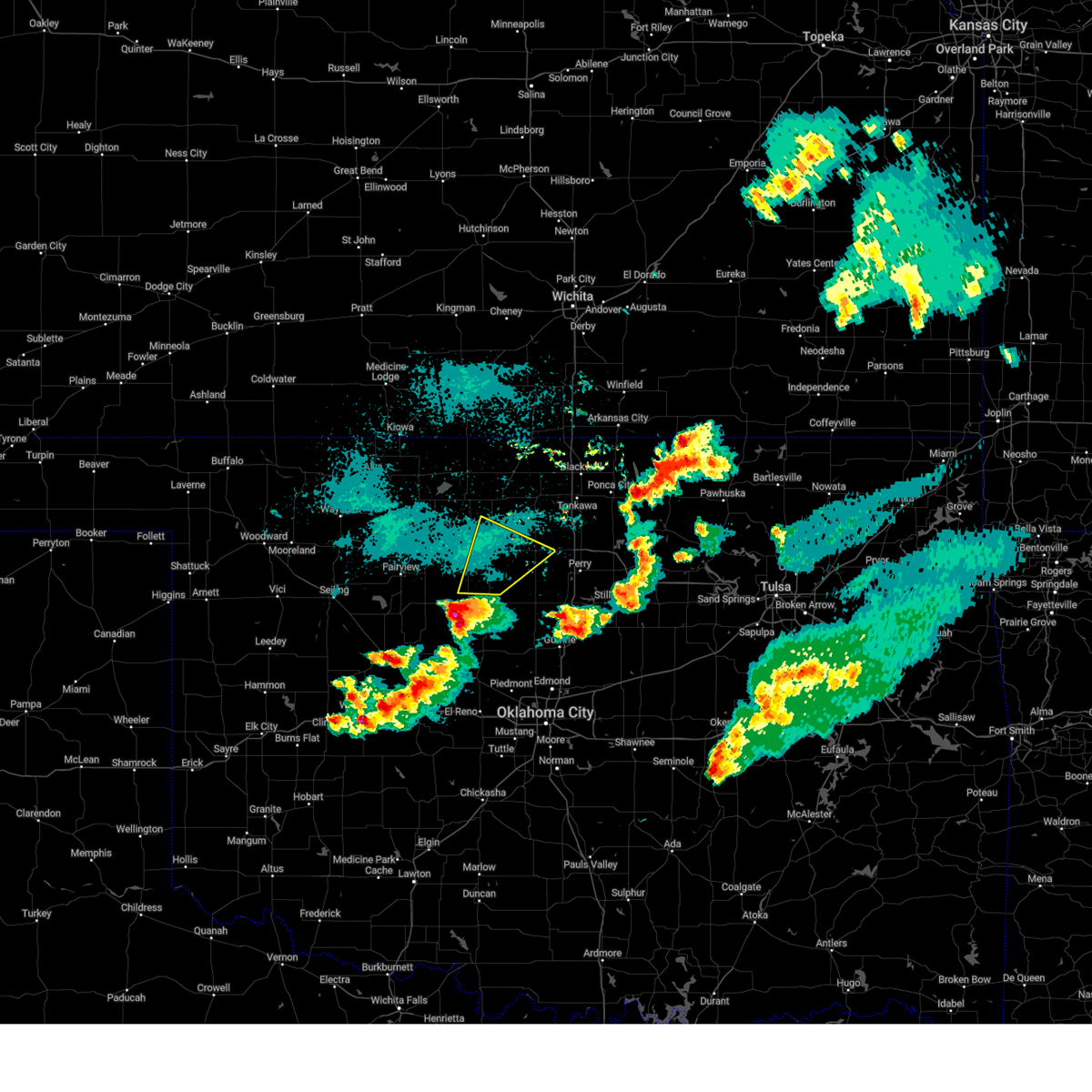
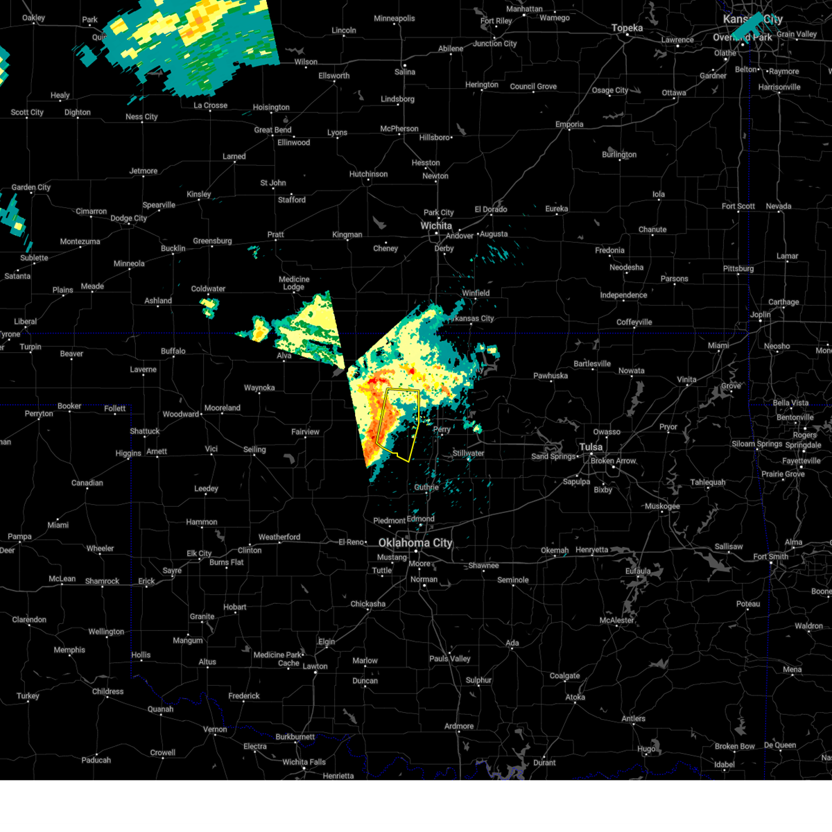
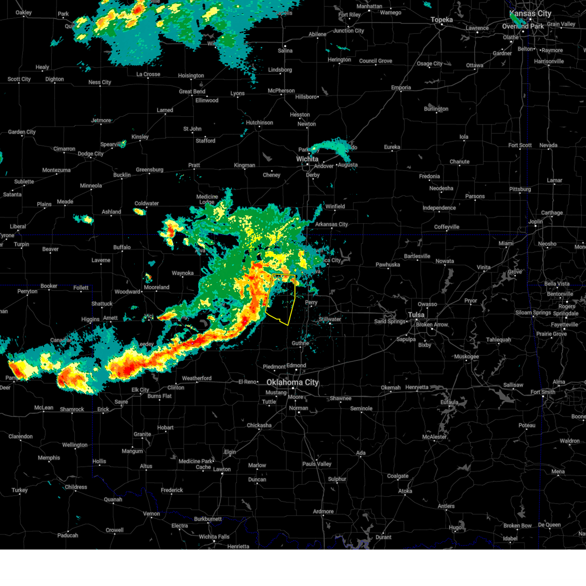
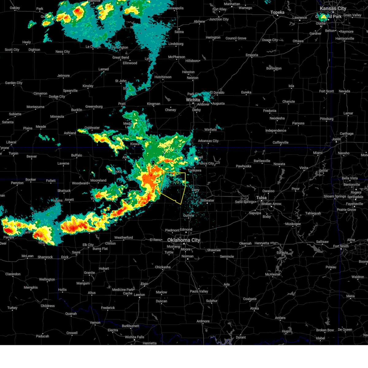
Hail Map for Douglas, OK
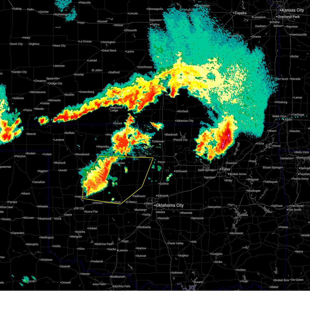
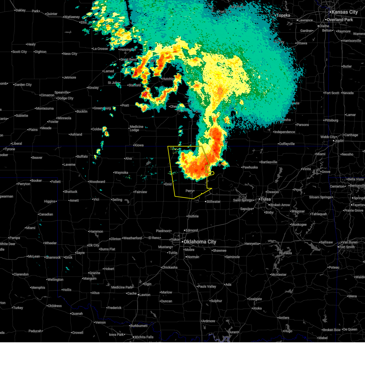
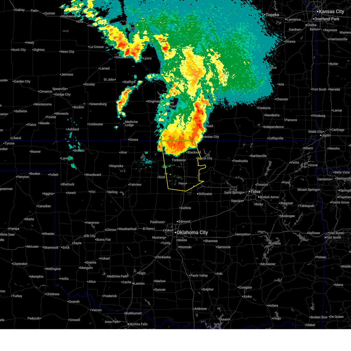
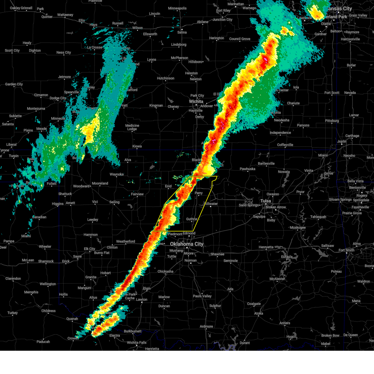
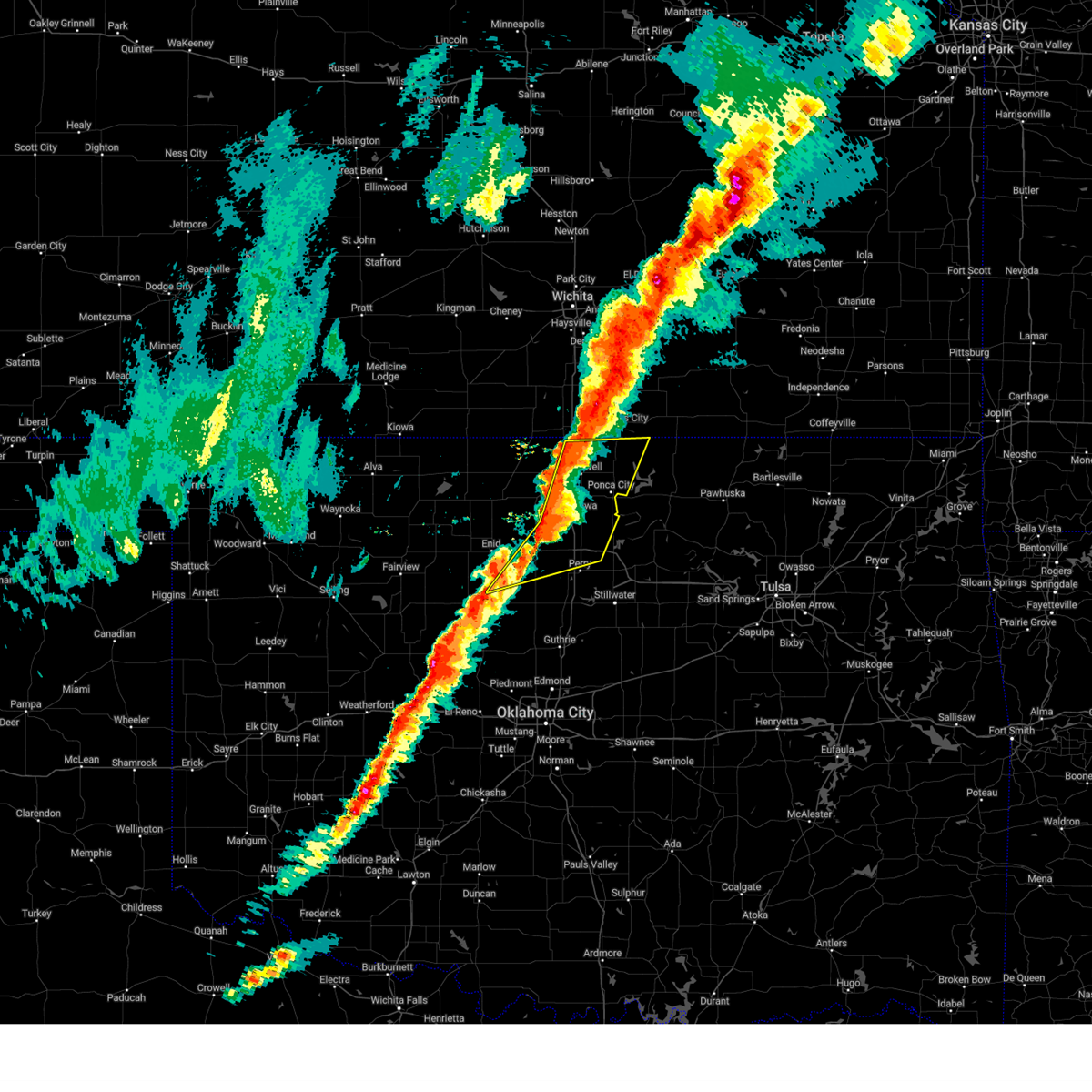
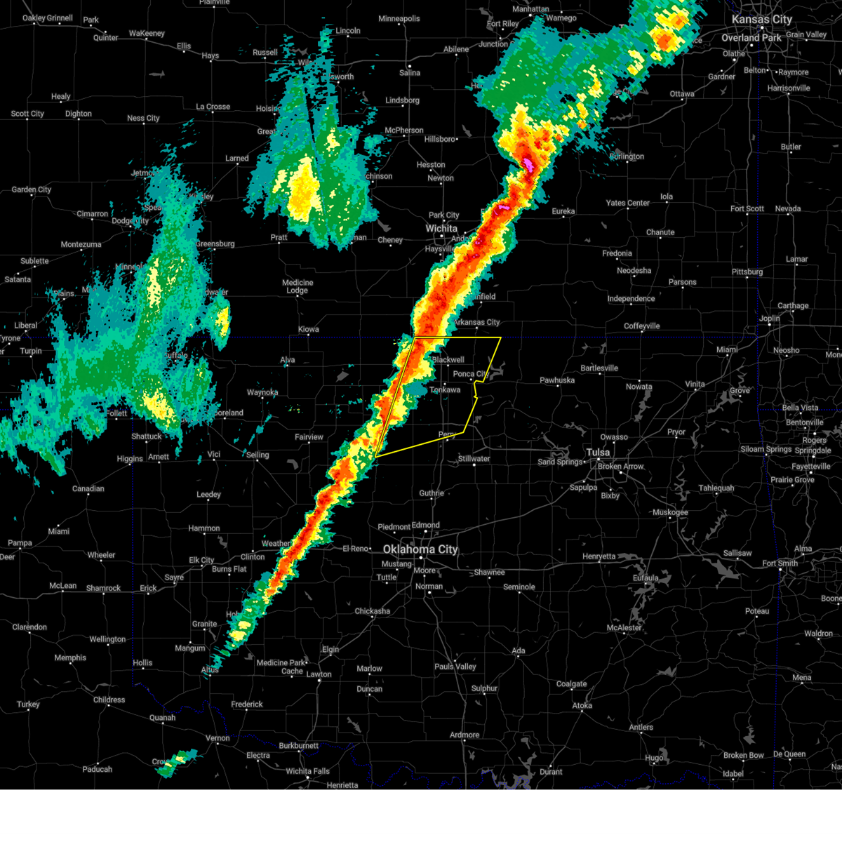
The Douglas, OK area has had 2 reports of on-the-ground hail by trained spotters, and has been under severe weather warnings 63 times during the past 12 months. Doppler radar has detected hail at or near Douglas, OK on 92 occasions, including 10 occasions during the past year.
| Name: | Douglas, OK |
| Where Located: | 55 miles N of Oklahoma City, OK |
| Map: | Google Map for Douglas, OK |
| Population: | 32 |
| Housing Units: | 16 |
| More Info: | Search Google for Douglas, OK |
1
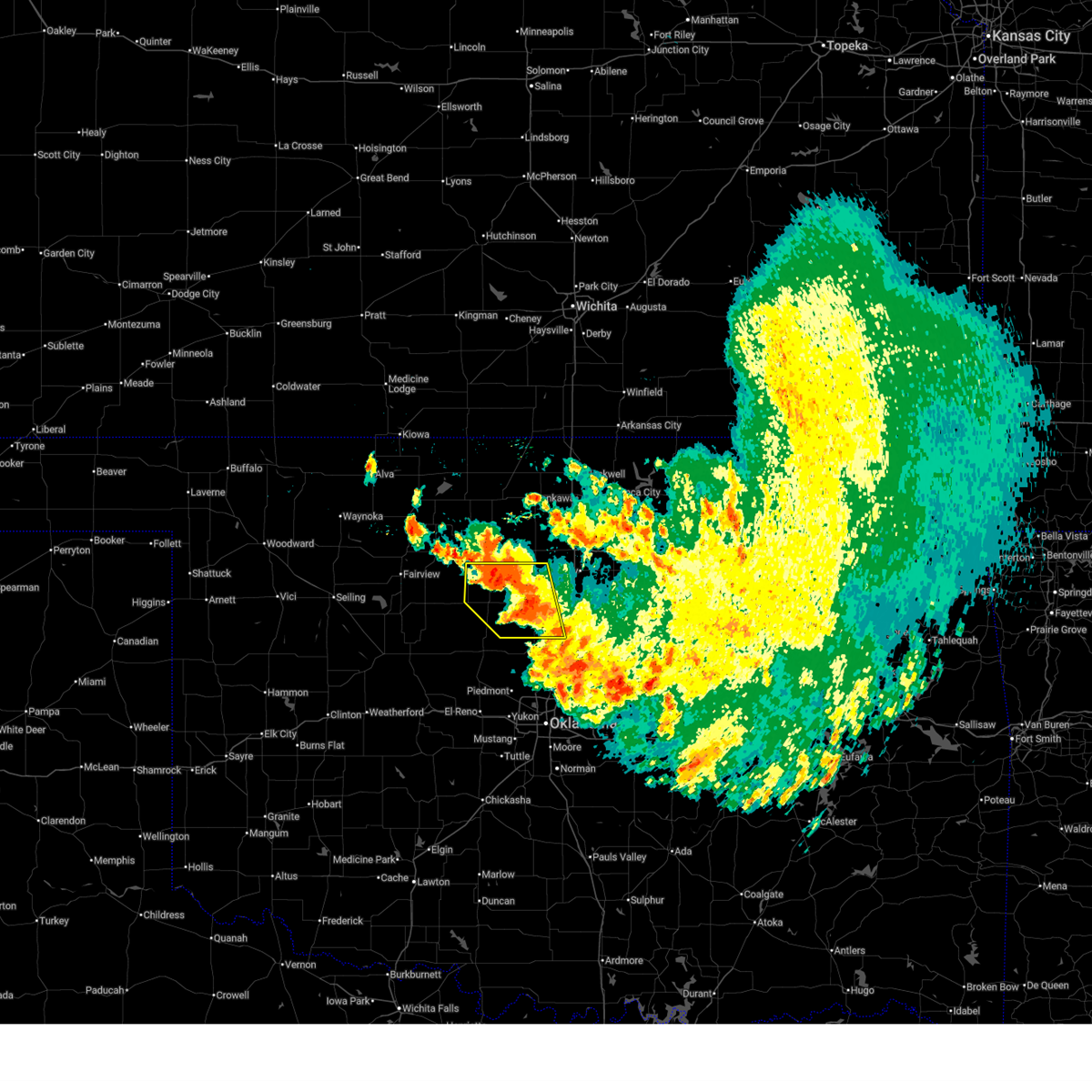
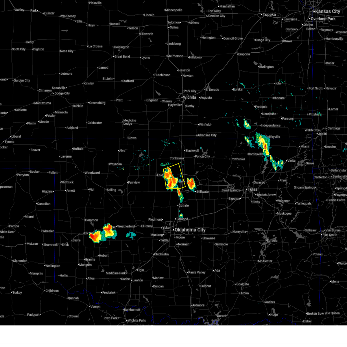
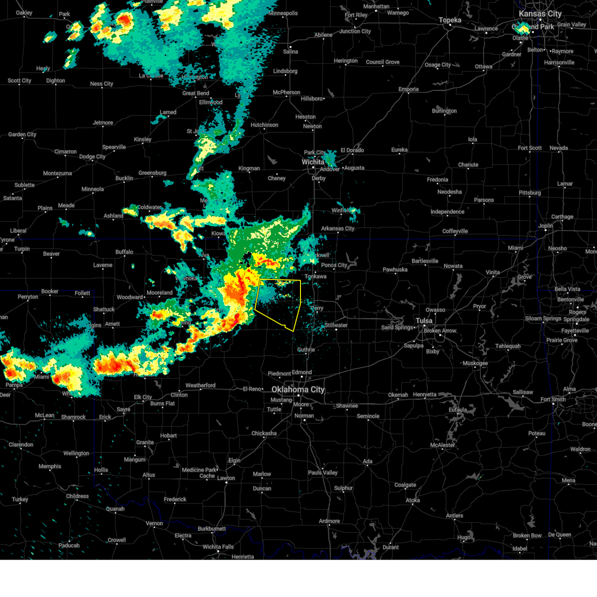
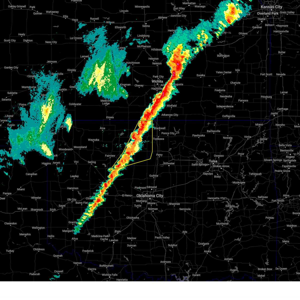
The Top Recent Hail Date for Douglas, OK is Saturday, June 14, 2025 (31st out of 92)
Hail and Wind Damage Spotted near Douglas, OK
| Date / Time | Report Details |
|---|---|
| 6/30/2025 1:10 AM CDT |
 The storms which prompted the warning have weakened below severe limits, therefore the warning will be allowed to expire. however, gusty winds are still possible with these thunderstorms. The storms which prompted the warning have weakened below severe limits, therefore the warning will be allowed to expire. however, gusty winds are still possible with these thunderstorms.
|
| 6/30/2025 12:48 AM CDT |
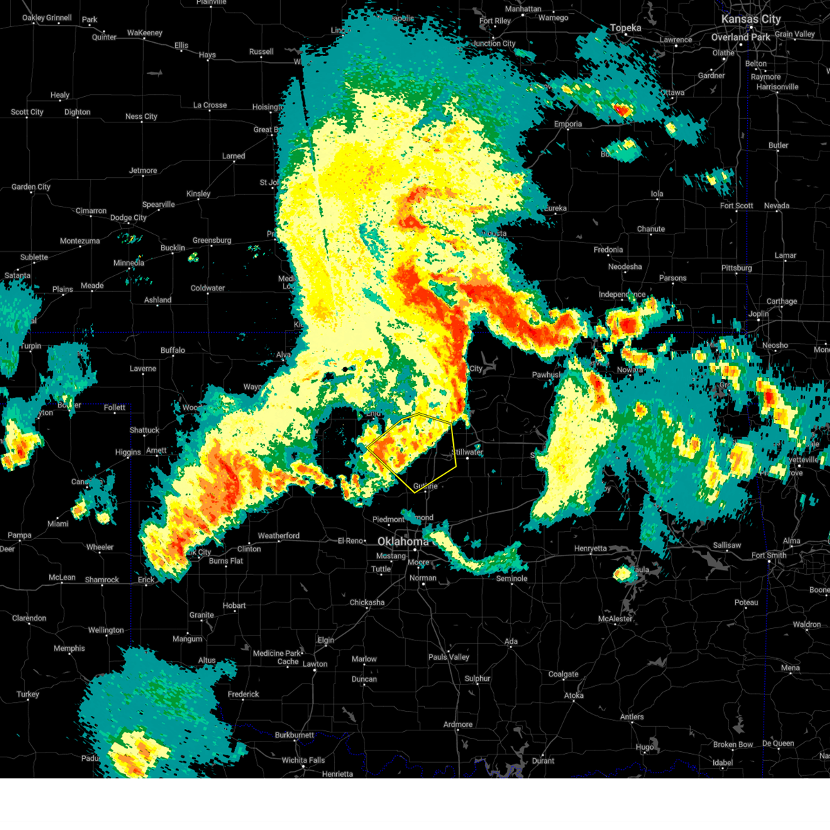
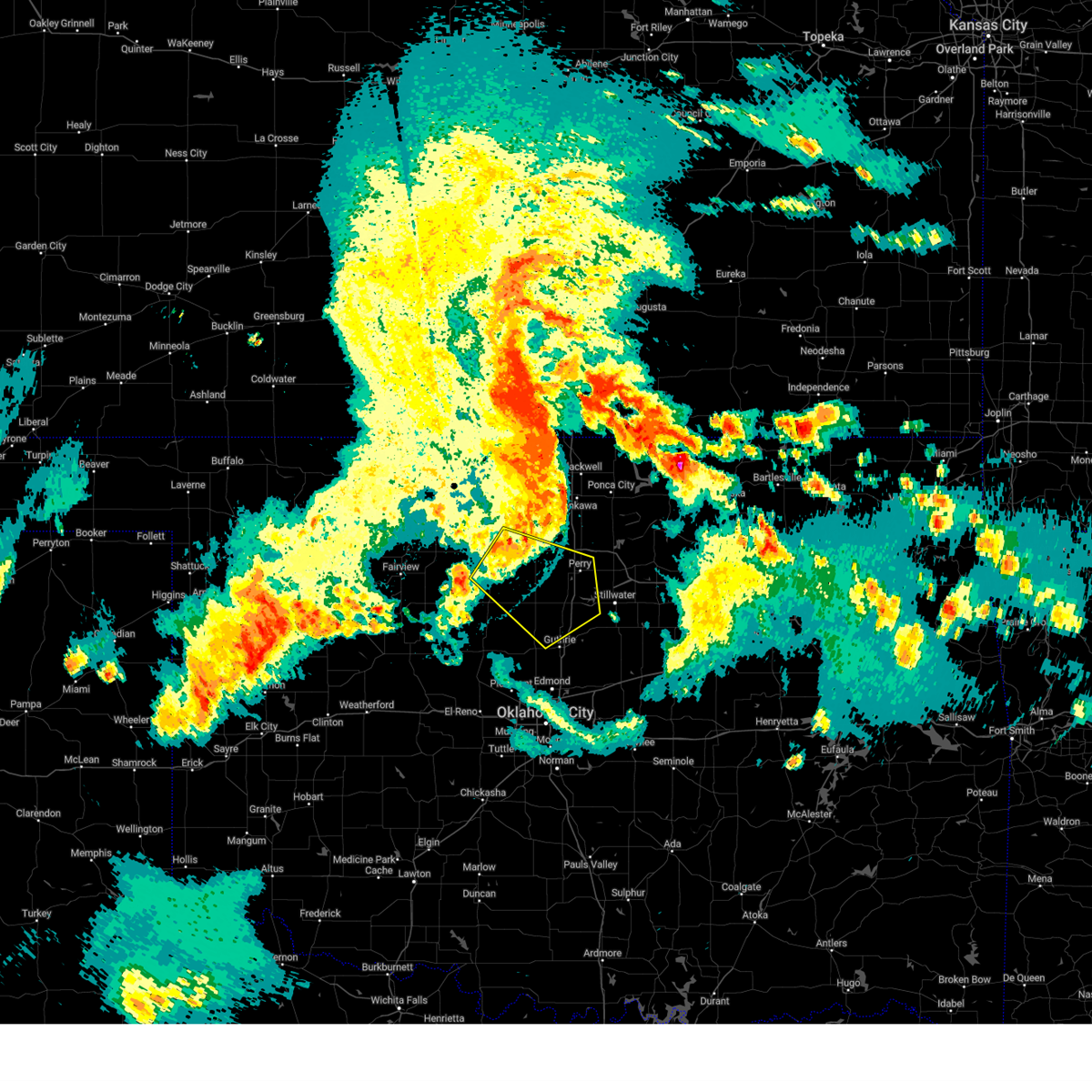
 At 1248 am cdt, the leading edge of winds from severe thunderstorms was located along a line extending from near okeene to 3 miles west of crescent to near lake mcmurtry, moving south at 40 mph (radar indicated). Hazards include 60 mph wind gusts. Expect damage to roofs, siding, and trees. Locations impacted include, enid, stillwater, guthrie, perry, hennessey, langston, crescent, waukomis, okeene, lahoma, covington, ringwood, dover, drummond, coyle, cedar valley, marshall, ames, meno, and mulhall. At 1248 am cdt, the leading edge of winds from severe thunderstorms was located along a line extending from near okeene to 3 miles west of crescent to near lake mcmurtry, moving south at 40 mph (radar indicated). Hazards include 60 mph wind gusts. Expect damage to roofs, siding, and trees. Locations impacted include, enid, stillwater, guthrie, perry, hennessey, langston, crescent, waukomis, okeene, lahoma, covington, ringwood, dover, drummond, coyle, cedar valley, marshall, ames, meno, and mulhall.
|
| 6/30/2025 12:33 AM CDT |
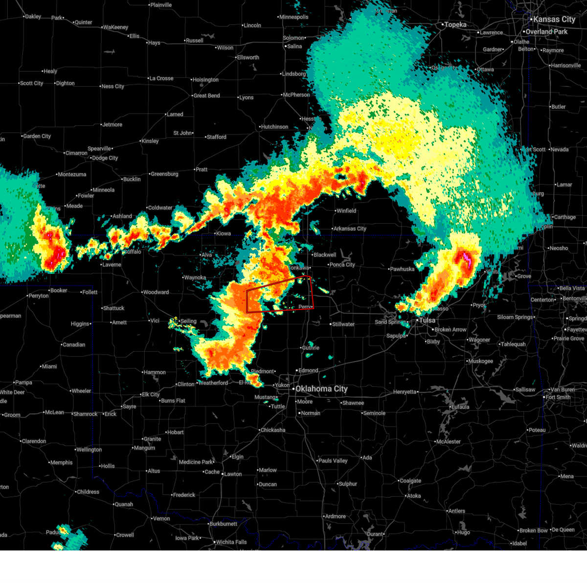
 At 1232 am cdt, severe thunderstorms were located along a line extending from 4 miles southeast of carrier to 3 miles northwest of perry, moving south at 20 mph (mesonet and awos observations). Hazards include 60 mph wind gusts and penny size hail. Expect damage to roofs, siding, and trees. Locations impacted include, enid, perry, tonkawa, waukomis, pond creek, garber, lahoma, covington, billings, drummond, lamont, red rock, kremlin, breckenridge, marland, nash, hunter, fairmont, hillsdale, and carrier. At 1232 am cdt, severe thunderstorms were located along a line extending from 4 miles southeast of carrier to 3 miles northwest of perry, moving south at 20 mph (mesonet and awos observations). Hazards include 60 mph wind gusts and penny size hail. Expect damage to roofs, siding, and trees. Locations impacted include, enid, perry, tonkawa, waukomis, pond creek, garber, lahoma, covington, billings, drummond, lamont, red rock, kremlin, breckenridge, marland, nash, hunter, fairmont, hillsdale, and carrier.
|
| 6/30/2025 12:30 AM CDT |
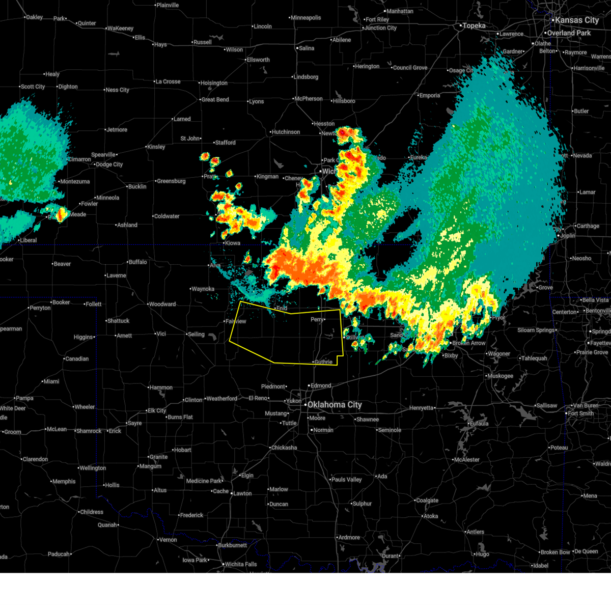 Svroun the national weather service in norman has issued a * severe thunderstorm warning for, northern kingfisher county in central oklahoma, southwestern noble county in northern oklahoma, northeastern blaine county in northwestern oklahoma, logan county in central oklahoma, western payne county in central oklahoma, southern garfield county in northern oklahoma, eastern major county in northwestern oklahoma, * until 115 am cdt. * at 1229 am cdt, the leading edge of winds from a line of severe thunderstorms was located along a line extending from near ringwood to near waukomis to 4 miles southwest of lucien, moving south at 35 mph (mesonet and awos observations. multiple severe wind gusts have been observed across major and garfield counties since 1220 am cdt). Hazards include 60 mph wind gusts. expect damage to roofs, siding, and trees Svroun the national weather service in norman has issued a * severe thunderstorm warning for, northern kingfisher county in central oklahoma, southwestern noble county in northern oklahoma, northeastern blaine county in northwestern oklahoma, logan county in central oklahoma, western payne county in central oklahoma, southern garfield county in northern oklahoma, eastern major county in northwestern oklahoma, * until 115 am cdt. * at 1229 am cdt, the leading edge of winds from a line of severe thunderstorms was located along a line extending from near ringwood to near waukomis to 4 miles southwest of lucien, moving south at 35 mph (mesonet and awos observations. multiple severe wind gusts have been observed across major and garfield counties since 1220 am cdt). Hazards include 60 mph wind gusts. expect damage to roofs, siding, and trees
|
| 6/30/2025 12:11 AM CDT |
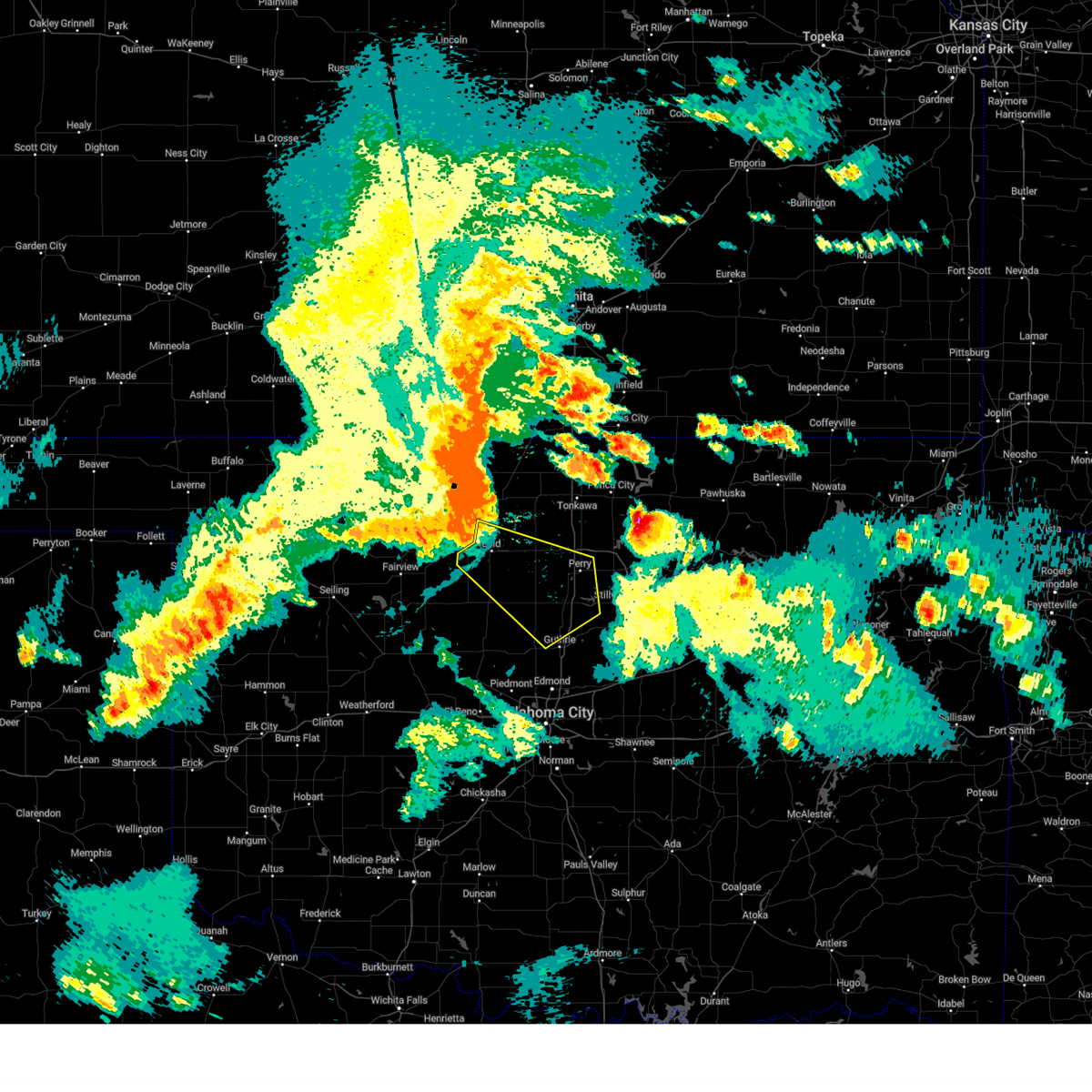
 At 1211 am cdt, severe thunderstorms were located along a line extending from near hillsdale to 6 miles northwest of red rock, moving south at 30 mph (radar indicated). Hazards include 60 mph wind gusts and penny size hail. Expect damage to roofs, siding, and trees. Locations impacted include, enid, blackwell, perry, tonkawa, medford, waukomis, pond creek, garber, lahoma, covington, billings, drummond, lamont, red rock, kremlin, breckenridge, marland, nash, hunter, and fairmont. At 1211 am cdt, severe thunderstorms were located along a line extending from near hillsdale to 6 miles northwest of red rock, moving south at 30 mph (radar indicated). Hazards include 60 mph wind gusts and penny size hail. Expect damage to roofs, siding, and trees. Locations impacted include, enid, blackwell, perry, tonkawa, medford, waukomis, pond creek, garber, lahoma, covington, billings, drummond, lamont, red rock, kremlin, breckenridge, marland, nash, hunter, and fairmont.
|
| 6/29/2025 11:55 PM CDT |
 Svroun the national weather service in norman has issued a * severe thunderstorm warning for, southwestern kay county in northern oklahoma, northwestern noble county in northern oklahoma, grant county in northern oklahoma, garfield county in northern oklahoma, * until 1245 am cdt. * at 1155 pm cdt, severe thunderstorms were located along a line extending from 6 miles east of nash to 3 miles southeast of tonkawa, moving south at 35 mph (radar indicated). Hazards include 60 mph wind gusts and penny size hail. expect damage to roofs, siding, and trees Svroun the national weather service in norman has issued a * severe thunderstorm warning for, southwestern kay county in northern oklahoma, northwestern noble county in northern oklahoma, grant county in northern oklahoma, garfield county in northern oklahoma, * until 1245 am cdt. * at 1155 pm cdt, severe thunderstorms were located along a line extending from 6 miles east of nash to 3 miles southeast of tonkawa, moving south at 35 mph (radar indicated). Hazards include 60 mph wind gusts and penny size hail. expect damage to roofs, siding, and trees
|
| 6/17/2025 10:50 PM CDT |
 At 1050 pm cdt, severe thunderstorms were located along a line extending from 8 miles west of red rock to 5 miles west of langston to near oklahoma city, moving east at 70 mph (radar indicated). Hazards include 70 mph wind gusts and quarter size hail. Hail damage to vehicles is expected. expect considerable tree damage. wind damage is also likely to mobile homes, roofs, and outbuildings. Locations impacted include, northern oklahoma city, edmond, stillwater, guthrie, perry, choctaw, the village, piedmont, spencer, nichols hills, perkins, jones, langston, crescent, luther, garber, cashion, morrison, carney, and glencoe. At 1050 pm cdt, severe thunderstorms were located along a line extending from 8 miles west of red rock to 5 miles west of langston to near oklahoma city, moving east at 70 mph (radar indicated). Hazards include 70 mph wind gusts and quarter size hail. Hail damage to vehicles is expected. expect considerable tree damage. wind damage is also likely to mobile homes, roofs, and outbuildings. Locations impacted include, northern oklahoma city, edmond, stillwater, guthrie, perry, choctaw, the village, piedmont, spencer, nichols hills, perkins, jones, langston, crescent, luther, garber, cashion, morrison, carney, and glencoe.
|
| 6/17/2025 10:38 PM CDT |
 At 1037 pm cdt, severe thunderstorms were located along a line extending from near garber to near crescent to 6 miles southwest of piedmont, moving east at 60 mph (radar indicated). Hazards include 70 mph wind gusts and quarter size hail. Hail damage to vehicles is expected. expect considerable tree damage. wind damage is also likely to mobile homes, roofs, and outbuildings. Locations impacted include, northern oklahoma city, edmond, enid, stillwater, guthrie, perry, kingfisher, choctaw, the village, piedmont, spencer, nichols hills, perkins, jones, langston, crescent, luther, okarche, garber, and cashion. At 1037 pm cdt, severe thunderstorms were located along a line extending from near garber to near crescent to 6 miles southwest of piedmont, moving east at 60 mph (radar indicated). Hazards include 70 mph wind gusts and quarter size hail. Hail damage to vehicles is expected. expect considerable tree damage. wind damage is also likely to mobile homes, roofs, and outbuildings. Locations impacted include, northern oklahoma city, edmond, enid, stillwater, guthrie, perry, kingfisher, choctaw, the village, piedmont, spencer, nichols hills, perkins, jones, langston, crescent, luther, okarche, garber, and cashion.
|
| 6/17/2025 10:38 PM CDT |
 the severe thunderstorm warning has been cancelled and is no longer in effect the severe thunderstorm warning has been cancelled and is no longer in effect
|
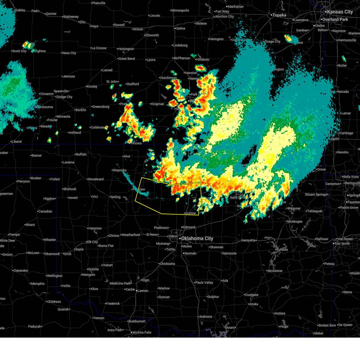
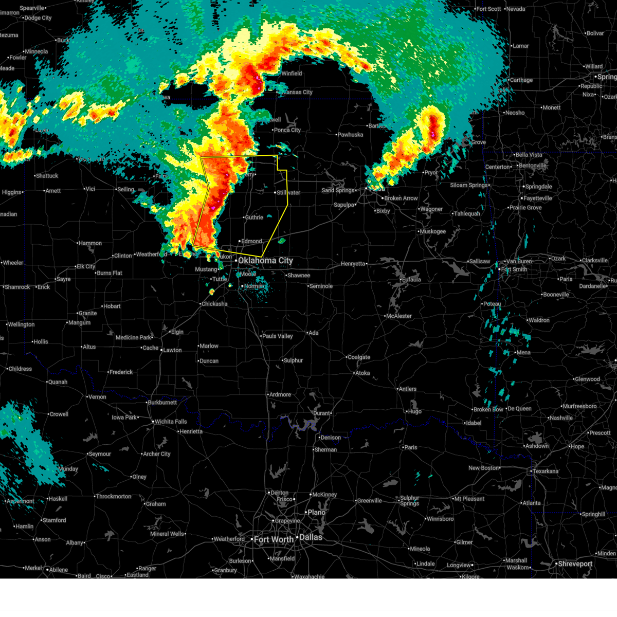
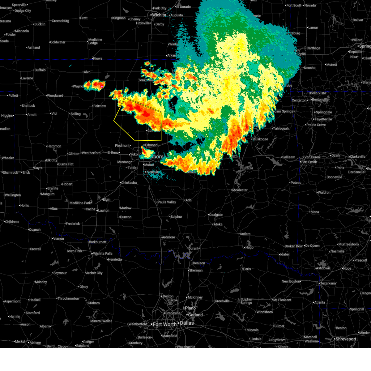
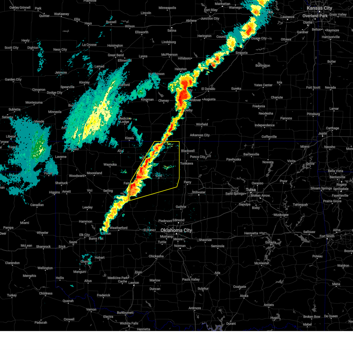
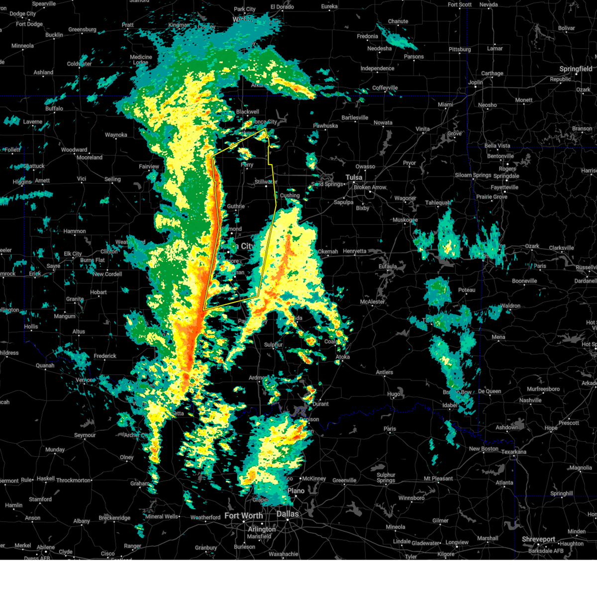
| 6/17/2025 10:32 PM CDT | At 1032 pm cdt, a severe thunderstorm capable of producing a tornado was located near fairmont, moving east at 65 mph (radar indicated rotation). Hazards include tornado. Flying debris will be dangerous to those caught without shelter. mobile homes will be damaged or destroyed. damage to roofs, windows, and vehicles will occur. tree damage is likely. locations impacted include, enid, perry, garber, covington, billings, breckenridge, fairmont, douglas, lucien, north enid, and hayward. This includes interstate 35 between mile markers 186 and 207. |
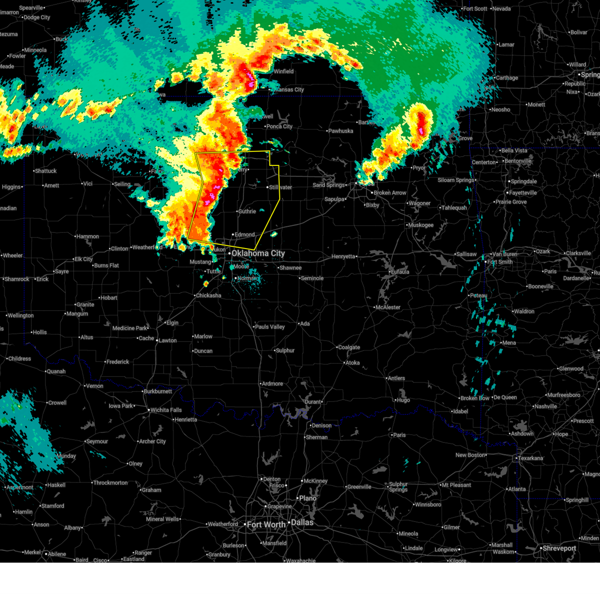
| 6/17/2025 10:22 PM CDT | Svroun the national weather service in norman has issued a * severe thunderstorm warning for, kingfisher county in central oklahoma, northwestern lincoln county in central oklahoma, northern oklahoma county in central oklahoma, noble county in northern oklahoma, central blaine county in northwestern oklahoma, logan county in central oklahoma, western payne county in central oklahoma, garfield county in northern oklahoma, southeastern major county in northwestern oklahoma, northern canadian county in central oklahoma, * until 1100 pm cdt. * at 1022 pm cdt, severe thunderstorms were located along a line extending from 3 miles south of kremlin to 3 miles northeast of dover to 3 miles northeast of calumet, moving east at 60 mph (radar indicated). Hazards include 70 mph wind gusts and quarter size hail. Hail damage to vehicles is expected. expect considerable tree damage. Wind damage is also likely to mobile homes, roofs, and outbuildings. |
| 6/17/2025 10:19 PM CDT |
 Toroun the national weather service in norman has issued a * tornado warning for, northwestern noble county in northern oklahoma, garfield county in northern oklahoma, * until 1045 pm cdt. * at 1019 pm cdt, a severe thunderstorm capable of producing a tornado was located near vance air force base, moving east at 65 mph (radar indicated rotation). Hazards include tornado. Flying debris will be dangerous to those caught without shelter. mobile homes will be damaged or destroyed. damage to roofs, windows, and vehicles will occur. Tree damage is likely. Toroun the national weather service in norman has issued a * tornado warning for, northwestern noble county in northern oklahoma, garfield county in northern oklahoma, * until 1045 pm cdt. * at 1019 pm cdt, a severe thunderstorm capable of producing a tornado was located near vance air force base, moving east at 65 mph (radar indicated rotation). Hazards include tornado. Flying debris will be dangerous to those caught without shelter. mobile homes will be damaged or destroyed. damage to roofs, windows, and vehicles will occur. Tree damage is likely.
|
| 6/17/2025 10:05 PM CDT |
 At 1004 pm cdt, severe thunderstorms were located along a line extending from near drummond to 6 miles southeast of hitchcock to 6 miles southeast of thomas, moving east at 60 mph (at 9:45 pm, there was a 66 mph wind gust at the watonga mesonet site). Hazards include 70 mph wind gusts and quarter size hail. Hail damage to vehicles is expected. expect considerable tree damage. wind damage is also likely to mobile homes, roofs, and outbuildings. Locations impacted include, enid, weatherford, watonga, kingfisher, fairview, hennessey, waukomis, geary, okarche, okeene, thomas, hydro, covington, ringwood, dover, drummond, custer city, ames, fairmont, and hitchcock. At 1004 pm cdt, severe thunderstorms were located along a line extending from near drummond to 6 miles southeast of hitchcock to 6 miles southeast of thomas, moving east at 60 mph (at 9:45 pm, there was a 66 mph wind gust at the watonga mesonet site). Hazards include 70 mph wind gusts and quarter size hail. Hail damage to vehicles is expected. expect considerable tree damage. wind damage is also likely to mobile homes, roofs, and outbuildings. Locations impacted include, enid, weatherford, watonga, kingfisher, fairview, hennessey, waukomis, geary, okarche, okeene, thomas, hydro, covington, ringwood, dover, drummond, custer city, ames, fairmont, and hitchcock.
|
| 6/17/2025 9:51 PM CDT |
 At 951 pm cdt, severe thunderstorms were located along a line extending from near isabella to 5 miles southeast of eagle city to 4 miles north of arapaho, moving east at 45 mph (radar indicated). Hazards include 70 mph wind gusts and quarter size hail. Hail damage to vehicles is expected. expect considerable tree damage. wind damage is also likely to mobile homes, roofs, and outbuildings. Locations impacted include, enid, weatherford, watonga, kingfisher, fairview, hennessey, waukomis, geary, okarche, okeene, thomas, hydro, canton, covington, ringwood, dover, drummond, custer city, longdale, and ames. At 951 pm cdt, severe thunderstorms were located along a line extending from near isabella to 5 miles southeast of eagle city to 4 miles north of arapaho, moving east at 45 mph (radar indicated). Hazards include 70 mph wind gusts and quarter size hail. Hail damage to vehicles is expected. expect considerable tree damage. wind damage is also likely to mobile homes, roofs, and outbuildings. Locations impacted include, enid, weatherford, watonga, kingfisher, fairview, hennessey, waukomis, geary, okarche, okeene, thomas, hydro, canton, covington, ringwood, dover, drummond, custer city, longdale, and ames.
|
| 6/17/2025 9:41 PM CDT |
 Svroun the national weather service in norman has issued a * severe thunderstorm warning for, kingfisher county in central oklahoma, northwestern caddo county in southwestern oklahoma, central custer county in western oklahoma, blaine county in northwestern oklahoma, dewey county in northwestern oklahoma, southern garfield county in northern oklahoma, major county in northwestern oklahoma, northwestern canadian county in central oklahoma, * until 1030 pm cdt. * at 941 pm cdt, severe thunderstorms were located along a line extending from near fairview to 4 miles northeast of fay to 6 miles northwest of arapaho, moving east at 50 mph (radar indicated). Hazards include 70 mph wind gusts and quarter size hail. Hail damage to vehicles is expected. expect considerable tree damage. Wind damage is also likely to mobile homes, roofs, and outbuildings. Svroun the national weather service in norman has issued a * severe thunderstorm warning for, kingfisher county in central oklahoma, northwestern caddo county in southwestern oklahoma, central custer county in western oklahoma, blaine county in northwestern oklahoma, dewey county in northwestern oklahoma, southern garfield county in northern oklahoma, major county in northwestern oklahoma, northwestern canadian county in central oklahoma, * until 1030 pm cdt. * at 941 pm cdt, severe thunderstorms were located along a line extending from near fairview to 4 miles northeast of fay to 6 miles northwest of arapaho, moving east at 50 mph (radar indicated). Hazards include 70 mph wind gusts and quarter size hail. Hail damage to vehicles is expected. expect considerable tree damage. Wind damage is also likely to mobile homes, roofs, and outbuildings.
|
| 6/17/2025 6:22 AM CDT |
 The storms which prompted the warning have weakened below severe limits, therefore the warning will be allowed to expire. however, small hail and gusty winds are still possible with these thunderstorms. The storms which prompted the warning have weakened below severe limits, therefore the warning will be allowed to expire. however, small hail and gusty winds are still possible with these thunderstorms.
|
| 6/17/2025 5:45 AM CDT |
 Svroun the national weather service in norman has issued a * severe thunderstorm warning for, kay county in northern oklahoma, noble county in northern oklahoma, eastern grant county in northern oklahoma, eastern garfield county in northern oklahoma, * until 630 am cdt. * at 545 am cdt, the leading edge of winds from a line of severe thunderstorms was located along a line extending from 3 miles west of kildare to 4 miles southeast of lamont to 4 miles northeast of hunter, moving south at 35 mph (radar indicated). Hazards include 70 mph wind gusts and quarter size hail. Hail damage to vehicles is expected. expect considerable tree damage. Wind damage is also likely to mobile homes, roofs, and outbuildings. Svroun the national weather service in norman has issued a * severe thunderstorm warning for, kay county in northern oklahoma, noble county in northern oklahoma, eastern grant county in northern oklahoma, eastern garfield county in northern oklahoma, * until 630 am cdt. * at 545 am cdt, the leading edge of winds from a line of severe thunderstorms was located along a line extending from 3 miles west of kildare to 4 miles southeast of lamont to 4 miles northeast of hunter, moving south at 35 mph (radar indicated). Hazards include 70 mph wind gusts and quarter size hail. Hail damage to vehicles is expected. expect considerable tree damage. Wind damage is also likely to mobile homes, roofs, and outbuildings.
|
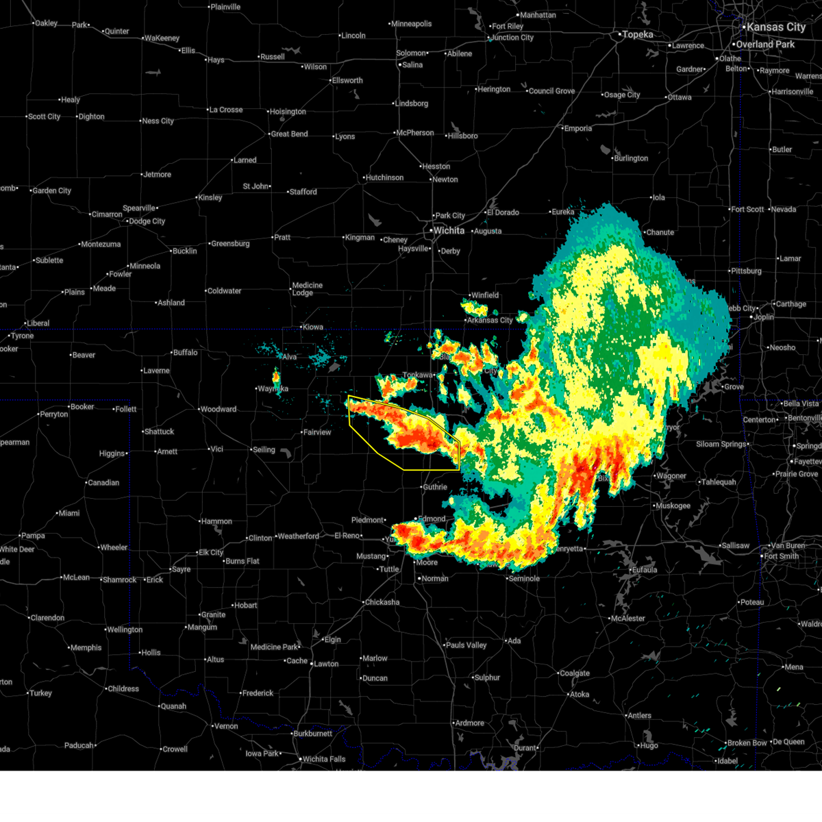
| 6/15/2025 2:15 AM CDT |
 Svroun the national weather service in norman has issued a * severe thunderstorm warning for, northeastern kingfisher county in central oklahoma, northwestern logan county in central oklahoma, southern garfield county in northern oklahoma, * until 300 am cdt. * at 215 am cdt, severe thunderstorms were located along a line extending from near waukomis to near lovell, moving south at 10 mph (radar indicated). Hazards include 60 mph wind gusts and quarter size hail. Hail damage to vehicles is expected. Expect wind damage to roofs, siding, and trees. Svroun the national weather service in norman has issued a * severe thunderstorm warning for, northeastern kingfisher county in central oklahoma, northwestern logan county in central oklahoma, southern garfield county in northern oklahoma, * until 300 am cdt. * at 215 am cdt, severe thunderstorms were located along a line extending from near waukomis to near lovell, moving south at 10 mph (radar indicated). Hazards include 60 mph wind gusts and quarter size hail. Hail damage to vehicles is expected. Expect wind damage to roofs, siding, and trees.
|
| 6/15/2025 1:37 AM CDT |
 Svroun the national weather service in norman has issued a * severe thunderstorm warning for, northeastern kingfisher county in central oklahoma, southwestern noble county in northern oklahoma, logan county in central oklahoma, southwestern payne county in central oklahoma, southeastern garfield county in northern oklahoma, * until 215 am cdt. * at 136 am cdt, severe thunderstorms were located along a line extending from 6 miles east of meridian to 3 miles east of crescent to near bison, moving south at 20 mph (radar indicated). Hazards include 60 mph wind gusts and quarter size hail. Hail damage to vehicles is expected. Expect wind damage to roofs, siding, and trees. Svroun the national weather service in norman has issued a * severe thunderstorm warning for, northeastern kingfisher county in central oklahoma, southwestern noble county in northern oklahoma, logan county in central oklahoma, southwestern payne county in central oklahoma, southeastern garfield county in northern oklahoma, * until 215 am cdt. * at 136 am cdt, severe thunderstorms were located along a line extending from 6 miles east of meridian to 3 miles east of crescent to near bison, moving south at 20 mph (radar indicated). Hazards include 60 mph wind gusts and quarter size hail. Hail damage to vehicles is expected. Expect wind damage to roofs, siding, and trees.
|
| 6/15/2025 1:00 AM CDT |
 Svroun the national weather service in norman has issued a * severe thunderstorm warning for, northeastern kingfisher county in central oklahoma, southwestern noble county in northern oklahoma, northwestern logan county in central oklahoma, western payne county in central oklahoma, garfield county in northern oklahoma, * until 145 am cdt. * at 1259 am cdt, severe thunderstorms were located along a line extending from 3 miles southeast of carrier to near douglas to near marshall to near lake carl blackwell, moving south at 10 mph (radar indicated). Hazards include 60 mph wind gusts and quarter size hail. Hail damage to vehicles is expected. Expect wind damage to roofs, siding, and trees. Svroun the national weather service in norman has issued a * severe thunderstorm warning for, northeastern kingfisher county in central oklahoma, southwestern noble county in northern oklahoma, northwestern logan county in central oklahoma, western payne county in central oklahoma, garfield county in northern oklahoma, * until 145 am cdt. * at 1259 am cdt, severe thunderstorms were located along a line extending from 3 miles southeast of carrier to near douglas to near marshall to near lake carl blackwell, moving south at 10 mph (radar indicated). Hazards include 60 mph wind gusts and quarter size hail. Hail damage to vehicles is expected. Expect wind damage to roofs, siding, and trees.
|
| 6/15/2025 12:28 AM CDT |
 Svroun the national weather service in norman has issued a * severe thunderstorm warning for, southwestern noble county in northern oklahoma, northwestern logan county in central oklahoma, northwestern payne county in central oklahoma, southeastern garfield county in northern oklahoma, * until 115 am cdt. * at 1228 am cdt, severe thunderstorms were located along a line extending from near perry to near douglas, moving southeast at 20 mph (radar indicated). Hazards include 60 mph wind gusts and quarter size hail. Hail damage to vehicles is expected. Expect wind damage to roofs, siding, and trees. Svroun the national weather service in norman has issued a * severe thunderstorm warning for, southwestern noble county in northern oklahoma, northwestern logan county in central oklahoma, northwestern payne county in central oklahoma, southeastern garfield county in northern oklahoma, * until 115 am cdt. * at 1228 am cdt, severe thunderstorms were located along a line extending from near perry to near douglas, moving southeast at 20 mph (radar indicated). Hazards include 60 mph wind gusts and quarter size hail. Hail damage to vehicles is expected. Expect wind damage to roofs, siding, and trees.
|
| 6/14/2025 9:13 PM CDT |
 Svroun the national weather service in norman has issued a * severe thunderstorm warning for, western noble county in northern oklahoma, eastern garfield county in northern oklahoma, * until 1000 pm cdt. * at 913 pm cdt, a severe thunderstorm was located 4 miles south of covington, moving northeast at 20 mph (radar indicated). Hazards include 60 mph wind gusts and half dollar size hail. Hail damage to vehicles is expected. Expect wind damage to roofs, siding, and trees. Svroun the national weather service in norman has issued a * severe thunderstorm warning for, western noble county in northern oklahoma, eastern garfield county in northern oklahoma, * until 1000 pm cdt. * at 913 pm cdt, a severe thunderstorm was located 4 miles south of covington, moving northeast at 20 mph (radar indicated). Hazards include 60 mph wind gusts and half dollar size hail. Hail damage to vehicles is expected. Expect wind damage to roofs, siding, and trees.
|
| 6/7/2025 2:36 AM CDT |
 The storms which prompted the warning have weakened below severe limits, therefore the warning will be allowed to expire. however, gusty winds are still possible with these thunderstorms. The storms which prompted the warning have weakened below severe limits, therefore the warning will be allowed to expire. however, gusty winds are still possible with these thunderstorms.
|
| 6/7/2025 2:33 AM CDT |
 At 233 am cdt, severe thunderstorms were located along a line extending from 7 miles northeast of lucien to 3 miles north of orlando to near lovell, moving southeast at 50 mph (radar indicated). Hazards include 60 mph wind gusts. Expect damage to roofs, siding, and trees. Locations impacted include, perry, crescent, covington, marshall, mulhall, orlando, douglas, lake carl blackwell, lake mcmurtry, lovell, lucien, bison, and hayward. At 233 am cdt, severe thunderstorms were located along a line extending from 7 miles northeast of lucien to 3 miles north of orlando to near lovell, moving southeast at 50 mph (radar indicated). Hazards include 60 mph wind gusts. Expect damage to roofs, siding, and trees. Locations impacted include, perry, crescent, covington, marshall, mulhall, orlando, douglas, lake carl blackwell, lake mcmurtry, lovell, lucien, bison, and hayward.
|
| 6/7/2025 2:18 AM CDT |
 At 218 am cdt, severe thunderstorms were located along a line extending from near garber to near covington to 5 miles east of hennessey, moving southeast at 50 mph (radar indicated). Hazards include 60 mph wind gusts. Expect damage to roofs, siding, and trees. Locations impacted include, enid, perry, crescent, waukomis, garber, covington, marshall, breckenridge, mulhall, orlando, fairmont, douglas, lake carl blackwell, vance air force base, lake mcmurtry, lovell, lucien, bison, north enid, and hayward. At 218 am cdt, severe thunderstorms were located along a line extending from near garber to near covington to 5 miles east of hennessey, moving southeast at 50 mph (radar indicated). Hazards include 60 mph wind gusts. Expect damage to roofs, siding, and trees. Locations impacted include, enid, perry, crescent, waukomis, garber, covington, marshall, breckenridge, mulhall, orlando, fairmont, douglas, lake carl blackwell, vance air force base, lake mcmurtry, lovell, lucien, bison, north enid, and hayward.
|
| 6/7/2025 1:57 AM CDT |
 Svroun the national weather service in norman has issued a * severe thunderstorm warning for, northeastern kingfisher county in central oklahoma, southwestern noble county in northern oklahoma, northwestern logan county in central oklahoma, west central payne county in central oklahoma, garfield county in northern oklahoma, * until 245 am cdt. * at 157 am cdt, severe thunderstorms were located along a line extending from near kremlin to near enid to 3 miles south of drummond, moving southeast at 50 mph (radar indicated). Hazards include 70 mph wind gusts and quarter size hail. Hail damage to vehicles is expected. expect considerable tree damage. Wind damage is also likely to mobile homes, roofs, and outbuildings. Svroun the national weather service in norman has issued a * severe thunderstorm warning for, northeastern kingfisher county in central oklahoma, southwestern noble county in northern oklahoma, northwestern logan county in central oklahoma, west central payne county in central oklahoma, garfield county in northern oklahoma, * until 245 am cdt. * at 157 am cdt, severe thunderstorms were located along a line extending from near kremlin to near enid to 3 miles south of drummond, moving southeast at 50 mph (radar indicated). Hazards include 70 mph wind gusts and quarter size hail. Hail damage to vehicles is expected. expect considerable tree damage. Wind damage is also likely to mobile homes, roofs, and outbuildings.
|
| 6/7/2025 1:20 AM CDT |
 Svroun the national weather service in norman has issued a * severe thunderstorm warning for, northern kingfisher county in central oklahoma, southeastern alfalfa county in northwestern oklahoma, southern grant county in northern oklahoma, garfield county in northern oklahoma, eastern major county in northwestern oklahoma, * until 200 am cdt. * at 120 am cdt, severe thunderstorms were located along a line extending from 4 miles east of ingersoll to 8 miles west of orienta, moving east at 60 mph (radar indicated). Hazards include 70 mph wind gusts and quarter size hail. Hail damage to vehicles is expected. expect considerable tree damage. Wind damage is also likely to mobile homes, roofs, and outbuildings. Svroun the national weather service in norman has issued a * severe thunderstorm warning for, northern kingfisher county in central oklahoma, southeastern alfalfa county in northwestern oklahoma, southern grant county in northern oklahoma, garfield county in northern oklahoma, eastern major county in northwestern oklahoma, * until 200 am cdt. * at 120 am cdt, severe thunderstorms were located along a line extending from 4 miles east of ingersoll to 8 miles west of orienta, moving east at 60 mph (radar indicated). Hazards include 70 mph wind gusts and quarter size hail. Hail damage to vehicles is expected. expect considerable tree damage. Wind damage is also likely to mobile homes, roofs, and outbuildings.
|
| 6/6/2025 3:24 AM CDT |
 The storm which prompted the warning has moved out of the area. therefore the warning will be allowed to expire. a severe thunderstorm watch remains in effect until 800 am cdt for northern and northwestern oklahoma. to report severe weather, contact your nearest law enforcement agency. they will relay your report to the national weather service norman. The storm which prompted the warning has moved out of the area. therefore the warning will be allowed to expire. a severe thunderstorm watch remains in effect until 800 am cdt for northern and northwestern oklahoma. to report severe weather, contact your nearest law enforcement agency. they will relay your report to the national weather service norman.
|
| 6/6/2025 3:05 AM CDT |
 At 305 am cdt, a severe thunderstorm was located near douglas, or 13 miles southeast of enid, moving southeast at 30 mph (radar indicated). Hazards include 60 mph wind gusts and quarter size hail. Hail damage to vehicles is expected. expect wind damage to roofs, siding, and trees. Locations impacted include, breckenridge, douglas, garber, enid, vance air force base, lahoma, waukomis, fairmont, carrier, kremlin, and north enid. At 305 am cdt, a severe thunderstorm was located near douglas, or 13 miles southeast of enid, moving southeast at 30 mph (radar indicated). Hazards include 60 mph wind gusts and quarter size hail. Hail damage to vehicles is expected. expect wind damage to roofs, siding, and trees. Locations impacted include, breckenridge, douglas, garber, enid, vance air force base, lahoma, waukomis, fairmont, carrier, kremlin, and north enid.
|
| 6/6/2025 3:05 AM CDT |
 the severe thunderstorm warning has been cancelled and is no longer in effect the severe thunderstorm warning has been cancelled and is no longer in effect
|
| 6/6/2025 2:49 AM CDT |
 the severe thunderstorm warning has been cancelled and is no longer in effect the severe thunderstorm warning has been cancelled and is no longer in effect
|
| 6/6/2025 2:49 AM CDT |
 At 248 am cdt, a severe thunderstorm was located near enid, moving southeast at 30 mph (emergency management. at 245 am cdt...quarter size hail was reported near enid). Hazards include 60 mph wind gusts and quarter size hail. Hail damage to vehicles is expected. expect wind damage to roofs, siding, and trees. Locations impacted include, hennessey, hillsdale, garber, enid, vance air force base, lahoma, waukomis, drummond, breckenridge, douglas, bison, fairmont, carrier, kremlin, and north enid. At 248 am cdt, a severe thunderstorm was located near enid, moving southeast at 30 mph (emergency management. at 245 am cdt...quarter size hail was reported near enid). Hazards include 60 mph wind gusts and quarter size hail. Hail damage to vehicles is expected. expect wind damage to roofs, siding, and trees. Locations impacted include, hennessey, hillsdale, garber, enid, vance air force base, lahoma, waukomis, drummond, breckenridge, douglas, bison, fairmont, carrier, kremlin, and north enid.
|
| 6/6/2025 2:25 AM CDT |
 Svroun the national weather service in norman has issued a * severe thunderstorm warning for, north central kingfisher county in central oklahoma, southeastern alfalfa county in northwestern oklahoma, southwestern grant county in northern oklahoma, garfield county in northern oklahoma, northeastern major county in northwestern oklahoma, * until 330 am cdt. * at 225 am cdt, a severe thunderstorm was located over carrier, or 7 miles northwest of enid, moving southeast at 30 mph (radar indicated). Hazards include 60 mph wind gusts and quarter size hail. Hail damage to vehicles is expected. Expect wind damage to roofs, siding, and trees. Svroun the national weather service in norman has issued a * severe thunderstorm warning for, north central kingfisher county in central oklahoma, southeastern alfalfa county in northwestern oklahoma, southwestern grant county in northern oklahoma, garfield county in northern oklahoma, northeastern major county in northwestern oklahoma, * until 330 am cdt. * at 225 am cdt, a severe thunderstorm was located over carrier, or 7 miles northwest of enid, moving southeast at 30 mph (radar indicated). Hazards include 60 mph wind gusts and quarter size hail. Hail damage to vehicles is expected. Expect wind damage to roofs, siding, and trees.
|
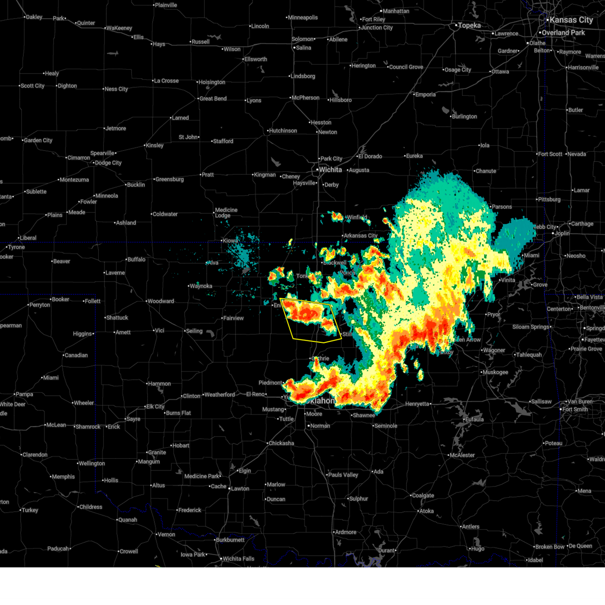
| 6/3/2025 4:58 PM CDT |
 Svroun the national weather service in norman has issued a * severe thunderstorm warning for, northeastern kingfisher county in central oklahoma, northwestern lincoln county in central oklahoma, noble county in northern oklahoma, logan county in central oklahoma, payne county in central oklahoma, southeastern garfield county in northern oklahoma, * until 545 pm cdt. * at 455 pm cdt, severe thunderstorms were located along a line extending from 4 miles east of billings to 2 miles east of orlando to 2 miles southwest of guthrie, moving east at 35 mph (radar indicated). Hazards include 60 mph wind gusts and quarter size hail. Hail damage to vehicles is expected. expect wind damage to roofs, siding, and trees. Locations in or near the path include, ingalls, ceres, coyle, cedar valley, morrison, lake mcmurtry, covington, red rock, lovell, navina, billings, perry, mulhall, cimarron city, marland, guthrie, stillwater, hayward, lake carl blackwell, langston,. Svroun the national weather service in norman has issued a * severe thunderstorm warning for, northeastern kingfisher county in central oklahoma, northwestern lincoln county in central oklahoma, noble county in northern oklahoma, logan county in central oklahoma, payne county in central oklahoma, southeastern garfield county in northern oklahoma, * until 545 pm cdt. * at 455 pm cdt, severe thunderstorms were located along a line extending from 4 miles east of billings to 2 miles east of orlando to 2 miles southwest of guthrie, moving east at 35 mph (radar indicated). Hazards include 60 mph wind gusts and quarter size hail. Hail damage to vehicles is expected. expect wind damage to roofs, siding, and trees. Locations in or near the path include, ingalls, ceres, coyle, cedar valley, morrison, lake mcmurtry, covington, red rock, lovell, navina, billings, perry, mulhall, cimarron city, marland, guthrie, stillwater, hayward, lake carl blackwell, langston,.
|
| 6/3/2025 3:45 PM CDT |
 Svroun the national weather service in norman has issued a * severe thunderstorm warning for, southeastern kay county in northern oklahoma, noble county in northern oklahoma, southeastern grant county in northern oklahoma, eastern garfield county in northern oklahoma, * until 430 pm cdt. * at 345 pm cdt, severe thunderstorms were located along a line extending from 5 miles east of lamont to 6 miles northeast of covington to 6 miles southwest of douglas, moving east at 25 mph (radar indicated). Hazards include 60 mph wind gusts. Expect damage to roofs, siding, and trees. Locations in or near the path include, ceres, garber, tonkawa, ponca city, covington, red rock, billings, perry, douglas, lucien, marland, fairmont, hayward, kildare, sooner lake, newkirk, blackwell, kaw lake,. Svroun the national weather service in norman has issued a * severe thunderstorm warning for, southeastern kay county in northern oklahoma, noble county in northern oklahoma, southeastern grant county in northern oklahoma, eastern garfield county in northern oklahoma, * until 430 pm cdt. * at 345 pm cdt, severe thunderstorms were located along a line extending from 5 miles east of lamont to 6 miles northeast of covington to 6 miles southwest of douglas, moving east at 25 mph (radar indicated). Hazards include 60 mph wind gusts. Expect damage to roofs, siding, and trees. Locations in or near the path include, ceres, garber, tonkawa, ponca city, covington, red rock, billings, perry, douglas, lucien, marland, fairmont, hayward, kildare, sooner lake, newkirk, blackwell, kaw lake,.
|
| 6/1/2025 1:17 AM CDT |
 At 117 am cdt, a severe thunderstorm was located 4 miles northwest of douglas, moving southeast at 35 mph (radar indicated). Hazards include 60 mph wind gusts and half dollar size hail. Hail damage to vehicles is expected. expect wind damage to roofs, siding, and trees. Locations impacted include, covington, fairmont, douglas, and hayward. At 117 am cdt, a severe thunderstorm was located 4 miles northwest of douglas, moving southeast at 35 mph (radar indicated). Hazards include 60 mph wind gusts and half dollar size hail. Hail damage to vehicles is expected. expect wind damage to roofs, siding, and trees. Locations impacted include, covington, fairmont, douglas, and hayward.
|
| 6/1/2025 1:05 AM CDT |
 At 104 am cdt, a severe thunderstorm was located near enid, moving southeast at 30 mph (radar indicated). Hazards include 60 mph wind gusts and half dollar size hail. Hail damage to vehicles is expected. expect wind damage to roofs, siding, and trees. Locations impacted include, enid, waukomis, garber, covington, kremlin, breckenridge, fairmont, douglas, vance air force base, north enid, and hayward. At 104 am cdt, a severe thunderstorm was located near enid, moving southeast at 30 mph (radar indicated). Hazards include 60 mph wind gusts and half dollar size hail. Hail damage to vehicles is expected. expect wind damage to roofs, siding, and trees. Locations impacted include, enid, waukomis, garber, covington, kremlin, breckenridge, fairmont, douglas, vance air force base, north enid, and hayward.
|
| 6/1/2025 12:56 AM CDT |
 Svroun the national weather service in norman has issued a * severe thunderstorm warning for, central garfield county in northern oklahoma, * until 145 am cdt. * at 1256 am cdt, a severe thunderstorm was located near enid, moving southeast at 35 mph (radar indicated). Hazards include 60 mph wind gusts and quarter size hail. Hail damage to vehicles is expected. Expect wind damage to roofs, siding, and trees. Svroun the national weather service in norman has issued a * severe thunderstorm warning for, central garfield county in northern oklahoma, * until 145 am cdt. * at 1256 am cdt, a severe thunderstorm was located near enid, moving southeast at 35 mph (radar indicated). Hazards include 60 mph wind gusts and quarter size hail. Hail damage to vehicles is expected. Expect wind damage to roofs, siding, and trees.
|
| 5/29/2025 1:14 AM CDT |
 The storms which prompted the warning have weakened below severe limits, and have exited the warned area. therefore, the warning will be allowed to expire. however, gusty winds are still possible with these thunderstorms. The storms which prompted the warning have weakened below severe limits, and have exited the warned area. therefore, the warning will be allowed to expire. however, gusty winds are still possible with these thunderstorms.
|
| 5/29/2025 12:51 AM CDT |
 At 1251 am cdt, severe thunderstorms were located along a line extending from near kremlin to 3 miles south of breckenridge to near hennessey, moving east at 45 mph (radar indicated). Hazards include 60 mph wind gusts. Expect damage to roofs, siding, and trees. Locations impacted include, enid, waukomis, garber, covington, marshall, kremlin, breckenridge, hunter, fairmont, hillsdale, douglas, vance air force base, bison, north enid, and hayward. At 1251 am cdt, severe thunderstorms were located along a line extending from near kremlin to 3 miles south of breckenridge to near hennessey, moving east at 45 mph (radar indicated). Hazards include 60 mph wind gusts. Expect damage to roofs, siding, and trees. Locations impacted include, enid, waukomis, garber, covington, marshall, kremlin, breckenridge, hunter, fairmont, hillsdale, douglas, vance air force base, bison, north enid, and hayward.
|
| 5/29/2025 12:43 AM CDT |
 Svroun the national weather service in norman has issued a * severe thunderstorm warning for, northeastern kingfisher county in central oklahoma, northwestern logan county in central oklahoma, garfield county in northern oklahoma, * until 115 am cdt. * at 1243 am cdt, severe thunderstorms were located along a line extending from 3 miles east of hillsdale to near enid to 9 miles north of loyal, moving east at 45 mph (radar indicated). Hazards include 70 mph wind gusts. Expect considerable tree damage. Damage is likely to mobile homes, roofs, and outbuildings. Svroun the national weather service in norman has issued a * severe thunderstorm warning for, northeastern kingfisher county in central oklahoma, northwestern logan county in central oklahoma, garfield county in northern oklahoma, * until 115 am cdt. * at 1243 am cdt, severe thunderstorms were located along a line extending from 3 miles east of hillsdale to near enid to 9 miles north of loyal, moving east at 45 mph (radar indicated). Hazards include 70 mph wind gusts. Expect considerable tree damage. Damage is likely to mobile homes, roofs, and outbuildings.
|
| 5/18/2025 12:20 AM CDT |
 the severe thunderstorm warning has been cancelled and is no longer in effect the severe thunderstorm warning has been cancelled and is no longer in effect
|
| 5/18/2025 12:15 AM CDT |
 At 1215 am cdt, a severe thunderstorm was located 6 miles east of bison, moving northeast at 25 mph (radar indicated). Hazards include 60 mph wind gusts and quarter size hail. Hail damage to vehicles is expected. expect wind damage to roofs, siding, and trees. Locations impacted include, fairmont and douglas. At 1215 am cdt, a severe thunderstorm was located 6 miles east of bison, moving northeast at 25 mph (radar indicated). Hazards include 60 mph wind gusts and quarter size hail. Hail damage to vehicles is expected. expect wind damage to roofs, siding, and trees. Locations impacted include, fairmont and douglas.
|
| 5/18/2025 12:05 AM CDT |
 At 1204 am cdt, a severe thunderstorm was located near bison, moving northeast at 40 mph (radar indicated). Hazards include 60 mph wind gusts and half dollar size hail. Hail damage to vehicles is expected. expect wind damage to roofs, siding, and trees. Locations impacted include, enid, waukomis, garber, covington, breckenridge, fairmont, douglas, bison, and vance air force base. At 1204 am cdt, a severe thunderstorm was located near bison, moving northeast at 40 mph (radar indicated). Hazards include 60 mph wind gusts and half dollar size hail. Hail damage to vehicles is expected. expect wind damage to roofs, siding, and trees. Locations impacted include, enid, waukomis, garber, covington, breckenridge, fairmont, douglas, bison, and vance air force base.
|
| 5/17/2025 11:43 PM CDT |
 Svroun the national weather service in norman has issued a * severe thunderstorm warning for, garfield county in northern oklahoma, * until 1230 am cdt. * at 1143 pm cdt, a severe thunderstorm was located 8 miles west of hennessey, moving northeast at 40 mph (radar indicated). Hazards include golf ball size hail and 60 mph wind gusts. People and animals outdoors will be injured. expect hail damage to roofs, siding, windows, and vehicles. Expect wind damage to roofs, siding, and trees. Svroun the national weather service in norman has issued a * severe thunderstorm warning for, garfield county in northern oklahoma, * until 1230 am cdt. * at 1143 pm cdt, a severe thunderstorm was located 8 miles west of hennessey, moving northeast at 40 mph (radar indicated). Hazards include golf ball size hail and 60 mph wind gusts. People and animals outdoors will be injured. expect hail damage to roofs, siding, windows, and vehicles. Expect wind damage to roofs, siding, and trees.
|
| 4/24/2025 11:56 PM CDT |
 The storms which prompted the warning have weakened below severe limits, therefore the warning will be allowed to expire. however, gusty winds of 35 to 45 mph are still possible with these thunderstorms. The storms which prompted the warning have weakened below severe limits, therefore the warning will be allowed to expire. however, gusty winds of 35 to 45 mph are still possible with these thunderstorms.
|
| 4/24/2025 11:44 PM CDT |
 At 1144 pm cdt, severe thunderstorms were located along a line extending from near hunter to 3 miles southwest of garber to near douglas, moving east at 30 mph (radar indicated). Hazards include 60 mph wind gusts. Expect damage to roofs, siding, and trees. Locations impacted include, enid, garber, covington, marshall, breckenridge, hunter, fairmont, and douglas. At 1144 pm cdt, severe thunderstorms were located along a line extending from near hunter to 3 miles southwest of garber to near douglas, moving east at 30 mph (radar indicated). Hazards include 60 mph wind gusts. Expect damage to roofs, siding, and trees. Locations impacted include, enid, garber, covington, marshall, breckenridge, hunter, fairmont, and douglas.
|
| 4/24/2025 11:27 PM CDT |
 At 1127 pm cdt, severe thunderstorms were located along a line extending from near kremlin to near enid to near vance air force base, moving east at 20 mph (radar indicated). Hazards include 70 mph wind gusts. Expect considerable tree damage. damage is likely to mobile homes, roofs, and outbuildings. Locations impacted include, enid, waukomis, garber, covington, marshall, kremlin, breckenridge, hunter, fairmont, douglas, vance air force base, and north enid. At 1127 pm cdt, severe thunderstorms were located along a line extending from near kremlin to near enid to near vance air force base, moving east at 20 mph (radar indicated). Hazards include 70 mph wind gusts. Expect considerable tree damage. damage is likely to mobile homes, roofs, and outbuildings. Locations impacted include, enid, waukomis, garber, covington, marshall, kremlin, breckenridge, hunter, fairmont, douglas, vance air force base, and north enid.
|
| 4/24/2025 11:12 PM CDT |
 Svroun the national weather service in norman has issued a * severe thunderstorm warning for, south central grant county in northern oklahoma, northwestern logan county in central oklahoma, garfield county in northern oklahoma, * until midnight cdt. * at 1112 pm cdt, severe thunderstorms were located along a line extending from near hillsdale to 4 miles east of carrier to 3 miles northeast of drummond, moving east at 20 mph (radar indicated). Hazards include 60 mph wind gusts. expect damage to roofs, siding, and trees Svroun the national weather service in norman has issued a * severe thunderstorm warning for, south central grant county in northern oklahoma, northwestern logan county in central oklahoma, garfield county in northern oklahoma, * until midnight cdt. * at 1112 pm cdt, severe thunderstorms were located along a line extending from near hillsdale to 4 miles east of carrier to 3 miles northeast of drummond, moving east at 20 mph (radar indicated). Hazards include 60 mph wind gusts. expect damage to roofs, siding, and trees
|
| 4/2/2025 4:12 AM CDT |
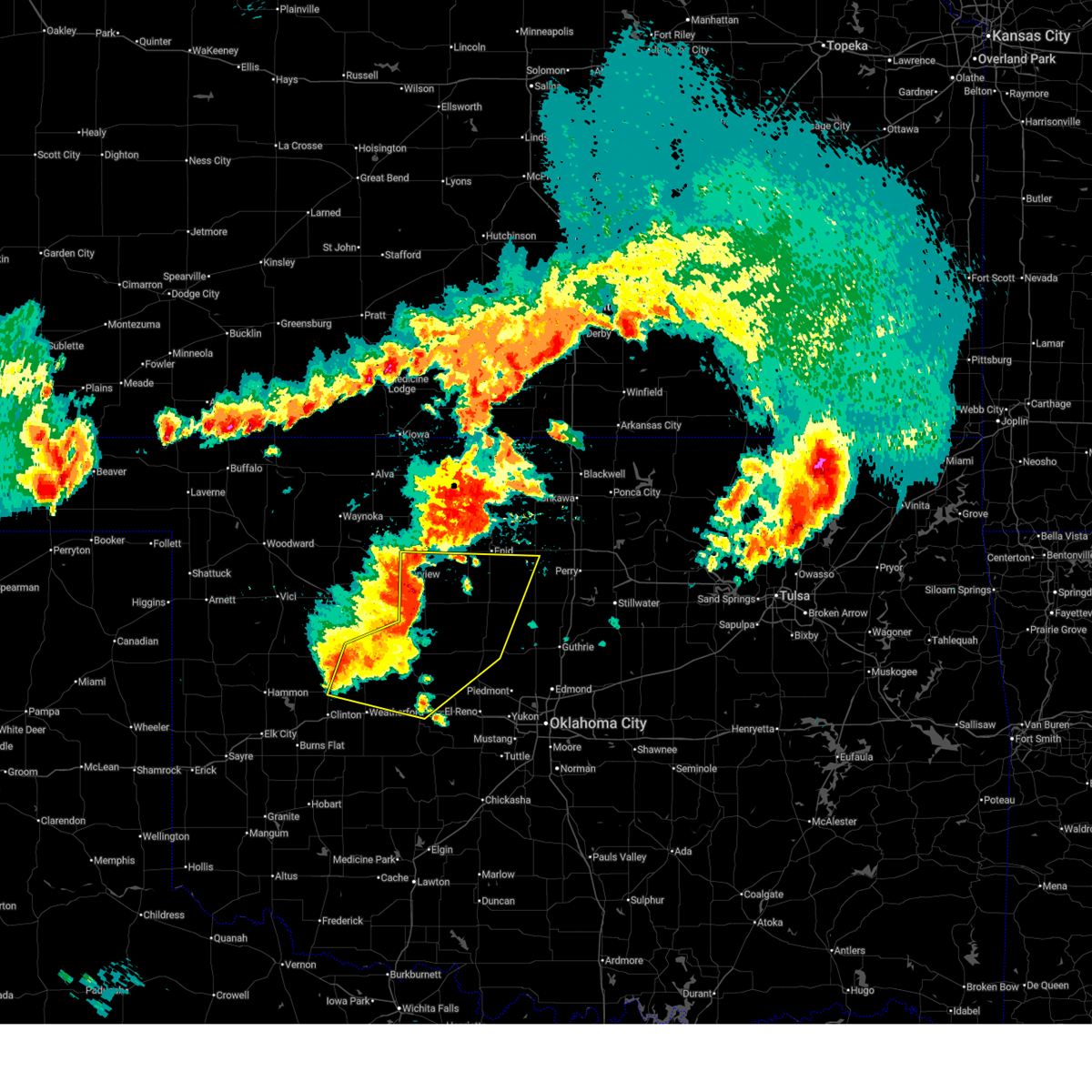
 Svroun the national weather service in norman has issued a * severe thunderstorm warning for, kingfisher county in central oklahoma, noble county in northern oklahoma, logan county in central oklahoma, western payne county in central oklahoma, southeastern garfield county in northern oklahoma, * until 500 am cdt. * at 411 am cdt, severe thunderstorms were located along a line extending from 6 miles southeast of bison to near okarche, moving northeast at 75 mph (radar indicated). Hazards include 60 mph wind gusts and half dollar size hail. Hail damage to vehicles is expected. Expect wind damage to roofs, siding, and trees. Svroun the national weather service in norman has issued a * severe thunderstorm warning for, kingfisher county in central oklahoma, noble county in northern oklahoma, logan county in central oklahoma, western payne county in central oklahoma, southeastern garfield county in northern oklahoma, * until 500 am cdt. * at 411 am cdt, severe thunderstorms were located along a line extending from 6 miles southeast of bison to near okarche, moving northeast at 75 mph (radar indicated). Hazards include 60 mph wind gusts and half dollar size hail. Hail damage to vehicles is expected. Expect wind damage to roofs, siding, and trees.
|
| 4/2/2025 3:59 AM CDT |
 At 359 am cdt, severe thunderstorms were located along a line extending from 7 miles west of chilocco to 4 miles east of billings to 5 miles southwest of douglas, moving northeast at 70 mph (radar indicated). Hazards include 60 mph wind gusts and half dollar size hail. Hail damage to vehicles is expected. expect wind damage to roofs, siding, and trees. Locations impacted include, ceres, chilocco, blackwell lake, garber, tonkawa, peckham, blackwell, newkirk, nardin, ponca city, covington, red rock, billings, douglas, lucien, marland, bison, fairmont, hayward, and braman. At 359 am cdt, severe thunderstorms were located along a line extending from 7 miles west of chilocco to 4 miles east of billings to 5 miles southwest of douglas, moving northeast at 70 mph (radar indicated). Hazards include 60 mph wind gusts and half dollar size hail. Hail damage to vehicles is expected. expect wind damage to roofs, siding, and trees. Locations impacted include, ceres, chilocco, blackwell lake, garber, tonkawa, peckham, blackwell, newkirk, nardin, ponca city, covington, red rock, billings, douglas, lucien, marland, bison, fairmont, hayward, and braman.
|
| 4/2/2025 3:39 AM CDT |
 Svroun the national weather service in norman has issued a * severe thunderstorm warning for, kay county in northern oklahoma, northwestern noble county in northern oklahoma, eastern grant county in northern oklahoma, eastern garfield county in northern oklahoma, * until 430 am cdt. * at 338 am cdt, severe thunderstorms were located along a line extending from 4 miles southwest of south haven kansas to 5 miles east of waukomis, moving northeast at 45 mph (radar indicated). Hazards include 60 mph wind gusts and half dollar size hail. Hail damage to vehicles is expected. Expect wind damage to roofs, siding, and trees. Svroun the national weather service in norman has issued a * severe thunderstorm warning for, kay county in northern oklahoma, northwestern noble county in northern oklahoma, eastern grant county in northern oklahoma, eastern garfield county in northern oklahoma, * until 430 am cdt. * at 338 am cdt, severe thunderstorms were located along a line extending from 4 miles southwest of south haven kansas to 5 miles east of waukomis, moving northeast at 45 mph (radar indicated). Hazards include 60 mph wind gusts and half dollar size hail. Hail damage to vehicles is expected. Expect wind damage to roofs, siding, and trees.
|
| 4/2/2025 3:22 AM CDT |
 At 321 am cdt, severe thunderstorms were located along a line extending from near renfrow to near drummond to near okeene, moving northeast at 80 mph (radar indicated). Hazards include 60 mph wind gusts and half dollar size hail. Hail damage to vehicles is expected. expect wind damage to roofs, siding, and trees. Locations impacted include, pond creek, enid, lamont, lahoma, waukomis, covington, breckenridge, deer creek, bison, fairmont, hayward, carrier, hunter, hillsdale, garber, ames, vance air force base, jefferson, medford, and drummond. At 321 am cdt, severe thunderstorms were located along a line extending from near renfrow to near drummond to near okeene, moving northeast at 80 mph (radar indicated). Hazards include 60 mph wind gusts and half dollar size hail. Hail damage to vehicles is expected. expect wind damage to roofs, siding, and trees. Locations impacted include, pond creek, enid, lamont, lahoma, waukomis, covington, breckenridge, deer creek, bison, fairmont, hayward, carrier, hunter, hillsdale, garber, ames, vance air force base, jefferson, medford, and drummond.
|
| 4/2/2025 3:22 AM CDT |
 the severe thunderstorm warning has been cancelled and is no longer in effect the severe thunderstorm warning has been cancelled and is no longer in effect
|
| 4/2/2025 3:02 AM CDT |
 Svroun the national weather service in norman has issued a * severe thunderstorm warning for, northwestern kingfisher county in central oklahoma, southeastern alfalfa county in northwestern oklahoma, northeastern blaine county in northwestern oklahoma, grant county in northern oklahoma, garfield county in northern oklahoma, eastern major county in northwestern oklahoma, * until 345 am cdt. * at 302 am cdt, severe thunderstorms were located along a line extending from 5 miles south of wakita to near okeene, moving northeast at 60 mph (radar indicated). Hazards include 60 mph wind gusts and half dollar size hail. Hail damage to vehicles is expected. Expect wind damage to roofs, siding, and trees. Svroun the national weather service in norman has issued a * severe thunderstorm warning for, northwestern kingfisher county in central oklahoma, southeastern alfalfa county in northwestern oklahoma, northeastern blaine county in northwestern oklahoma, grant county in northern oklahoma, garfield county in northern oklahoma, eastern major county in northwestern oklahoma, * until 345 am cdt. * at 302 am cdt, severe thunderstorms were located along a line extending from 5 miles south of wakita to near okeene, moving northeast at 60 mph (radar indicated). Hazards include 60 mph wind gusts and half dollar size hail. Hail damage to vehicles is expected. Expect wind damage to roofs, siding, and trees.
|
| 3/29/2025 10:56 PM CDT |
 At 1056 pm cdt, a severe thunderstorm was located near douglas, moving northeast at 30 mph (radar indicated). Hazards include golf ball size hail and 60 mph wind gusts. People and animals outdoors will be injured. expect hail damage to roofs, siding, windows, and vehicles. expect wind damage to roofs, siding, and trees. Locations impacted include, breckenridge, billings, douglas, garber, fairmont, covington, ceres, and hayward. At 1056 pm cdt, a severe thunderstorm was located near douglas, moving northeast at 30 mph (radar indicated). Hazards include golf ball size hail and 60 mph wind gusts. People and animals outdoors will be injured. expect hail damage to roofs, siding, windows, and vehicles. expect wind damage to roofs, siding, and trees. Locations impacted include, breckenridge, billings, douglas, garber, fairmont, covington, ceres, and hayward.
|
| 3/29/2025 10:36 PM CDT |
 Svroun the national weather service in norman has issued a * severe thunderstorm warning for, northeastern kingfisher county in central oklahoma, northwestern noble county in northern oklahoma, southeastern grant county in northern oklahoma, eastern garfield county in northern oklahoma, * until 1115 pm cdt. * at 1035 pm cdt, a severe thunderstorm was located near hennessey, moving northeast at 45 mph (radar indicated). Hazards include 60 mph wind gusts and half dollar size hail. Hail damage to vehicles is expected. Expect wind damage to roofs, siding, and trees. Svroun the national weather service in norman has issued a * severe thunderstorm warning for, northeastern kingfisher county in central oklahoma, northwestern noble county in northern oklahoma, southeastern grant county in northern oklahoma, eastern garfield county in northern oklahoma, * until 1115 pm cdt. * at 1035 pm cdt, a severe thunderstorm was located near hennessey, moving northeast at 45 mph (radar indicated). Hazards include 60 mph wind gusts and half dollar size hail. Hail damage to vehicles is expected. Expect wind damage to roofs, siding, and trees.
|
| 11/18/2024 6:37 AM CST |
 Svroun the national weather service in norman has issued a * severe thunderstorm warning for, south central kay county in northern oklahoma, northeastern grady county in central oklahoma, western lincoln county in central oklahoma, oklahoma county in central oklahoma, noble county in northern oklahoma, cleveland county in central oklahoma, logan county in central oklahoma, western payne county in central oklahoma, southeastern garfield county in northern oklahoma, southeastern canadian county in central oklahoma, northwestern pottawatomie county in central oklahoma, western mcclain county in central oklahoma, * until 715 am cst. * at 637 am cst, severe thunderstorms were located along a line extending from near fairmont to 5 miles southeast of cashion to 4 miles north of alex, moving east at 35 mph (radar indicated). Hazards include 70 mph wind gusts and penny size hail. Expect considerable tree damage. Damage is likely to mobile homes, roofs, and outbuildings. Svroun the national weather service in norman has issued a * severe thunderstorm warning for, south central kay county in northern oklahoma, northeastern grady county in central oklahoma, western lincoln county in central oklahoma, oklahoma county in central oklahoma, noble county in northern oklahoma, cleveland county in central oklahoma, logan county in central oklahoma, western payne county in central oklahoma, southeastern garfield county in northern oklahoma, southeastern canadian county in central oklahoma, northwestern pottawatomie county in central oklahoma, western mcclain county in central oklahoma, * until 715 am cst. * at 637 am cst, severe thunderstorms were located along a line extending from near fairmont to 5 miles southeast of cashion to 4 miles north of alex, moving east at 35 mph (radar indicated). Hazards include 70 mph wind gusts and penny size hail. Expect considerable tree damage. Damage is likely to mobile homes, roofs, and outbuildings.
|
| 11/18/2024 6:04 AM CST |
 Svroun the national weather service in norman has issued a * severe thunderstorm warning for, kingfisher county in central oklahoma, central grady county in central oklahoma, oklahoma county in central oklahoma, western noble county in northern oklahoma, cleveland county in central oklahoma, logan county in central oklahoma, southwestern payne county in central oklahoma, garfield county in northern oklahoma, eastern canadian county in central oklahoma, western mcclain county in central oklahoma, * until 645 am cst. * at 604 am cst, severe thunderstorms were located along a line extending from 8 miles south of drummond to near concho to near norge, moving northeast at 45 mph (radar indicated). Hazards include 70 mph wind gusts and penny size hail. Expect considerable tree damage. Damage is likely to mobile homes, roofs, and outbuildings. Svroun the national weather service in norman has issued a * severe thunderstorm warning for, kingfisher county in central oklahoma, central grady county in central oklahoma, oklahoma county in central oklahoma, western noble county in northern oklahoma, cleveland county in central oklahoma, logan county in central oklahoma, southwestern payne county in central oklahoma, garfield county in northern oklahoma, eastern canadian county in central oklahoma, western mcclain county in central oklahoma, * until 645 am cst. * at 604 am cst, severe thunderstorms were located along a line extending from 8 miles south of drummond to near concho to near norge, moving northeast at 45 mph (radar indicated). Hazards include 70 mph wind gusts and penny size hail. Expect considerable tree damage. Damage is likely to mobile homes, roofs, and outbuildings.
|
| 10/30/2024 6:33 PM CDT |
 Svroun the national weather service in norman has issued a * severe thunderstorm warning for, northeastern kingfisher county in central oklahoma, southwestern noble county in northern oklahoma, northwestern logan county in central oklahoma, southeastern garfield county in northern oklahoma, * until 715 pm cdt. * at 632 pm cdt, a severe thunderstorm was located 7 miles southwest of lovell, moving northeast at 40 mph (radar indicated). Hazards include 70 mph wind gusts and ping pong ball size hail. People and animals outdoors will be injured. expect hail damage to roofs, siding, windows, and vehicles. expect considerable tree damage. Wind damage is also likely to mobile homes, roofs, and outbuildings. Svroun the national weather service in norman has issued a * severe thunderstorm warning for, northeastern kingfisher county in central oklahoma, southwestern noble county in northern oklahoma, northwestern logan county in central oklahoma, southeastern garfield county in northern oklahoma, * until 715 pm cdt. * at 632 pm cdt, a severe thunderstorm was located 7 miles southwest of lovell, moving northeast at 40 mph (radar indicated). Hazards include 70 mph wind gusts and ping pong ball size hail. People and animals outdoors will be injured. expect hail damage to roofs, siding, windows, and vehicles. expect considerable tree damage. Wind damage is also likely to mobile homes, roofs, and outbuildings.
|
| 8/18/2024 6:01 PM CDT |
 Svroun the national weather service in norman has issued a * severe thunderstorm warning for, eastern garfield county in northern oklahoma, * until 630 pm cdt. * at 601 pm cdt, a severe thunderstorm was located near garber, moving east at 10 mph (radar indicated). Hazards include 60 mph wind gusts and quarter size hail. Hail damage to vehicles is expected. Expect wind damage to roofs, siding, and trees. Svroun the national weather service in norman has issued a * severe thunderstorm warning for, eastern garfield county in northern oklahoma, * until 630 pm cdt. * at 601 pm cdt, a severe thunderstorm was located near garber, moving east at 10 mph (radar indicated). Hazards include 60 mph wind gusts and quarter size hail. Hail damage to vehicles is expected. Expect wind damage to roofs, siding, and trees.
|
| 7/7/2024 3:26 AM CDT |
 The storm which prompted the warning has weakened below severe limits, therefore the warning will be allowed to expire. however, gusty winds and heavy rain are still possible with this thunderstorm. The storm which prompted the warning has weakened below severe limits, therefore the warning will be allowed to expire. however, gusty winds and heavy rain are still possible with this thunderstorm.
|
| 7/7/2024 2:50 AM CDT |
 Svroun the national weather service in norman has issued a * severe thunderstorm warning for, garfield county in northern oklahoma, * until 330 am cdt. * at 250 am cdt, a severe thunderstorm was located near carrier, moving east at 25 mph (radar indicated). Hazards include 60 mph wind gusts. expect damage to roofs, siding, and trees Svroun the national weather service in norman has issued a * severe thunderstorm warning for, garfield county in northern oklahoma, * until 330 am cdt. * at 250 am cdt, a severe thunderstorm was located near carrier, moving east at 25 mph (radar indicated). Hazards include 60 mph wind gusts. expect damage to roofs, siding, and trees
|
| 6/29/2024 7:11 PM CDT |
 Svroun the national weather service in norman has issued a * severe thunderstorm warning for, northeastern kingfisher county in central oklahoma, west central noble county in northern oklahoma, northwestern logan county in central oklahoma, southern garfield county in northern oklahoma, * until 730 pm cdt. * at 711 pm cdt, severe thunderstorms were located along a line extending from 3 miles north of douglas to 7 miles east of bison, moving southeast at 5 mph (radar indicated). Hazards include 60 mph wind gusts and quarter size hail. Hail damage to vehicles is expected. Expect wind damage to roofs, siding, and trees. Svroun the national weather service in norman has issued a * severe thunderstorm warning for, northeastern kingfisher county in central oklahoma, west central noble county in northern oklahoma, northwestern logan county in central oklahoma, southern garfield county in northern oklahoma, * until 730 pm cdt. * at 711 pm cdt, severe thunderstorms were located along a line extending from 3 miles north of douglas to 7 miles east of bison, moving southeast at 5 mph (radar indicated). Hazards include 60 mph wind gusts and quarter size hail. Hail damage to vehicles is expected. Expect wind damage to roofs, siding, and trees.
|
| 6/25/2024 9:12 PM CDT |
 Svroun the national weather service in norman has issued a * severe thunderstorm warning for, northeastern kingfisher county in central oklahoma, southwestern noble county in northern oklahoma, northern logan county in central oklahoma, southwestern payne county in central oklahoma, southeastern garfield county in northern oklahoma, * until 1000 pm cdt. * at 911 pm cdt, a severe thunderstorm was located over marshall, moving south at 15 mph (radar indicated). Hazards include 60 mph wind gusts and quarter size hail. Hail damage to vehicles is expected. Expect wind damage to roofs, siding, and trees. Svroun the national weather service in norman has issued a * severe thunderstorm warning for, northeastern kingfisher county in central oklahoma, southwestern noble county in northern oklahoma, northern logan county in central oklahoma, southwestern payne county in central oklahoma, southeastern garfield county in northern oklahoma, * until 1000 pm cdt. * at 911 pm cdt, a severe thunderstorm was located over marshall, moving south at 15 mph (radar indicated). Hazards include 60 mph wind gusts and quarter size hail. Hail damage to vehicles is expected. Expect wind damage to roofs, siding, and trees.
|
| 5/25/2024 8:24 PM CDT |
 the severe thunderstorm warning has been cancelled and is no longer in effect the severe thunderstorm warning has been cancelled and is no longer in effect
|
| 5/25/2024 7:58 PM CDT |
 Svroun the national weather service in norman has issued a * severe thunderstorm warning for, northeastern kingfisher county in central oklahoma, northwestern noble county in northern oklahoma, eastern garfield county in northern oklahoma, * until 845 pm cdt. * at 758 pm cdt, a severe thunderstorm was located 6 miles east of bison, moving northeast at 45 mph (radar indicated). Hazards include ping pong ball size hail and 60 mph wind gusts. People and animals outdoors will be injured. expect hail damage to roofs, siding, windows, and vehicles. Expect wind damage to roofs, siding, and trees. Svroun the national weather service in norman has issued a * severe thunderstorm warning for, northeastern kingfisher county in central oklahoma, northwestern noble county in northern oklahoma, eastern garfield county in northern oklahoma, * until 845 pm cdt. * at 758 pm cdt, a severe thunderstorm was located 6 miles east of bison, moving northeast at 45 mph (radar indicated). Hazards include ping pong ball size hail and 60 mph wind gusts. People and animals outdoors will be injured. expect hail damage to roofs, siding, windows, and vehicles. Expect wind damage to roofs, siding, and trees.
|
| 5/25/2024 7:46 PM CDT |
 Svroun the national weather service in norman has issued a * severe thunderstorm warning for, southern noble county in northern oklahoma, north central payne county in central oklahoma, southeastern garfield county in northern oklahoma, * until 830 pm cdt. * at 746 pm cdt, a severe thunderstorm was located near covington, moving east at 45 mph (radar indicated). Hazards include golf ball size hail and 60 mph wind gusts. People and animals outdoors will be injured. expect hail damage to roofs, siding, windows, and vehicles. Expect wind damage to roofs, siding, and trees. Svroun the national weather service in norman has issued a * severe thunderstorm warning for, southern noble county in northern oklahoma, north central payne county in central oklahoma, southeastern garfield county in northern oklahoma, * until 830 pm cdt. * at 746 pm cdt, a severe thunderstorm was located near covington, moving east at 45 mph (radar indicated). Hazards include golf ball size hail and 60 mph wind gusts. People and animals outdoors will be injured. expect hail damage to roofs, siding, windows, and vehicles. Expect wind damage to roofs, siding, and trees.
|
| 5/25/2024 7:45 PM CDT |
 At 745 pm cdt, a severe thunderstorm was located near covington, moving east at 50 mph (radar indicated). Hazards include ping pong ball size hail. People and animals outdoors will be injured. expect damage to roofs, siding, windows, and vehicles. Locations impacted include, garber, covington, breckenridge, fairmont, douglas, and hayward. At 745 pm cdt, a severe thunderstorm was located near covington, moving east at 50 mph (radar indicated). Hazards include ping pong ball size hail. People and animals outdoors will be injured. expect damage to roofs, siding, windows, and vehicles. Locations impacted include, garber, covington, breckenridge, fairmont, douglas, and hayward.
|
| 5/25/2024 7:41 PM CDT |
 Svroun the national weather service in norman has issued a * severe thunderstorm warning for, north central kingfisher county in central oklahoma, southern garfield county in northern oklahoma, * until 800 pm cdt. * at 741 pm cdt, a severe thunderstorm was located 4 miles west of hennessey, moving northeast at 45 mph (radar indicated). Hazards include golf ball size hail and 60 mph wind gusts. People and animals outdoors will be injured. expect hail damage to roofs, siding, windows, and vehicles. Expect wind damage to roofs, siding, and trees. Svroun the national weather service in norman has issued a * severe thunderstorm warning for, north central kingfisher county in central oklahoma, southern garfield county in northern oklahoma, * until 800 pm cdt. * at 741 pm cdt, a severe thunderstorm was located 4 miles west of hennessey, moving northeast at 45 mph (radar indicated). Hazards include golf ball size hail and 60 mph wind gusts. People and animals outdoors will be injured. expect hail damage to roofs, siding, windows, and vehicles. Expect wind damage to roofs, siding, and trees.
|
| 5/25/2024 7:33 PM CDT |
 At 732 pm cdt, a severe thunderstorm was located 5 miles northeast of waukomis, moving east at 45 mph (radar indicated). Hazards include golf ball size hail and 70 mph wind gusts. People and animals outdoors will be injured. expect hail damage to roofs, siding, windows, and vehicles. expect considerable tree damage. wind damage is also likely to mobile homes, roofs, and outbuildings. Locations impacted include, enid, waukomis, garber, covington, breckenridge, fairmont, douglas, vance air force base, north enid, and hayward. At 732 pm cdt, a severe thunderstorm was located 5 miles northeast of waukomis, moving east at 45 mph (radar indicated). Hazards include golf ball size hail and 70 mph wind gusts. People and animals outdoors will be injured. expect hail damage to roofs, siding, windows, and vehicles. expect considerable tree damage. wind damage is also likely to mobile homes, roofs, and outbuildings. Locations impacted include, enid, waukomis, garber, covington, breckenridge, fairmont, douglas, vance air force base, north enid, and hayward.
|
| 5/25/2024 7:21 PM CDT |
 Svroun the national weather service in norman has issued a * severe thunderstorm warning for, garfield county in northern oklahoma, * until 800 pm cdt. * at 721 pm cdt, a severe thunderstorm was located near vance air force base, moving east at 45 mph (radar indicated). Hazards include golf ball size hail and 70 mph wind gusts. People and animals outdoors will be injured. expect hail damage to roofs, siding, windows, and vehicles. expect considerable tree damage. Wind damage is also likely to mobile homes, roofs, and outbuildings. Svroun the national weather service in norman has issued a * severe thunderstorm warning for, garfield county in northern oklahoma, * until 800 pm cdt. * at 721 pm cdt, a severe thunderstorm was located near vance air force base, moving east at 45 mph (radar indicated). Hazards include golf ball size hail and 70 mph wind gusts. People and animals outdoors will be injured. expect hail damage to roofs, siding, windows, and vehicles. expect considerable tree damage. Wind damage is also likely to mobile homes, roofs, and outbuildings.
|
| 5/25/2024 6:43 PM CDT |
 Svroun the national weather service in norman has issued a * severe thunderstorm warning for, kay county in northern oklahoma, northwestern noble county in northern oklahoma, southeastern alfalfa county in northwestern oklahoma, grant county in northern oklahoma, garfield county in northern oklahoma, east central major county in northwestern oklahoma, * until 730 pm cdt. * at 643 pm cdt, severe thunderstorms were located along a line extending from 4 miles north of lahoma to 3 miles northeast of enid to 3 miles east of fairmont, moving northeast at 65 mph (radar indicated). Hazards include two inch hail and 70 mph wind gusts. People and animals outdoors will be injured. expect hail damage to roofs, siding, windows, and vehicles. expect considerable tree damage. Wind damage is also likely to mobile homes, roofs, and outbuildings. Svroun the national weather service in norman has issued a * severe thunderstorm warning for, kay county in northern oklahoma, northwestern noble county in northern oklahoma, southeastern alfalfa county in northwestern oklahoma, grant county in northern oklahoma, garfield county in northern oklahoma, east central major county in northwestern oklahoma, * until 730 pm cdt. * at 643 pm cdt, severe thunderstorms were located along a line extending from 4 miles north of lahoma to 3 miles northeast of enid to 3 miles east of fairmont, moving northeast at 65 mph (radar indicated). Hazards include two inch hail and 70 mph wind gusts. People and animals outdoors will be injured. expect hail damage to roofs, siding, windows, and vehicles. expect considerable tree damage. Wind damage is also likely to mobile homes, roofs, and outbuildings.
|
| 5/20/2024 2:21 AM CDT |
 At 220 am cdt, severe thunderstorms were located along a line extending from near fairmont to 6 miles southwest of marshall, moving east at 45 mph (radar indicated). Hazards include golf ball size hail and 60 mph wind gusts. People and animals outdoors will be injured. expect hail damage to roofs, siding, windows, and vehicles. expect wind damage to roofs, siding, and trees. Locations impacted include, enid, hennessey, waukomis, garber, covington, drummond, marshall, breckenridge, fairmont, douglas, vance air force base, and bison. At 220 am cdt, severe thunderstorms were located along a line extending from near fairmont to 6 miles southwest of marshall, moving east at 45 mph (radar indicated). Hazards include golf ball size hail and 60 mph wind gusts. People and animals outdoors will be injured. expect hail damage to roofs, siding, windows, and vehicles. expect wind damage to roofs, siding, and trees. Locations impacted include, enid, hennessey, waukomis, garber, covington, drummond, marshall, breckenridge, fairmont, douglas, vance air force base, and bison.
|
| 5/20/2024 2:00 AM CDT |
 Svroun the national weather service in norman has issued a * severe thunderstorm warning for, northeastern kingfisher county in central oklahoma, northwestern logan county in central oklahoma, southern garfield county in northern oklahoma, * until 245 am cdt. * at 200 am cdt, a severe thunderstorm was located near bison, moving northeast at 45 mph (radar indicated). Hazards include 60 mph wind gusts and half dollar size hail. Hail damage to vehicles is expected. Expect wind damage to roofs, siding, and trees. Svroun the national weather service in norman has issued a * severe thunderstorm warning for, northeastern kingfisher county in central oklahoma, northwestern logan county in central oklahoma, southern garfield county in northern oklahoma, * until 245 am cdt. * at 200 am cdt, a severe thunderstorm was located near bison, moving northeast at 45 mph (radar indicated). Hazards include 60 mph wind gusts and half dollar size hail. Hail damage to vehicles is expected. Expect wind damage to roofs, siding, and trees.
|
| 5/20/2024 1:38 AM CDT |
 Svroun the national weather service in norman has issued a * severe thunderstorm warning for, southwestern noble county in northern oklahoma, northwestern logan county in central oklahoma, northwestern payne county in central oklahoma, southeastern garfield county in northern oklahoma, * until 215 am cdt. * at 137 am cdt, a severe thunderstorm was located 6 miles southwest of lucien, moving east at 45 mph (radar indicated). Hazards include 60 mph wind gusts and half dollar size hail. Hail damage to vehicles is expected. Expect wind damage to roofs, siding, and trees. Svroun the national weather service in norman has issued a * severe thunderstorm warning for, southwestern noble county in northern oklahoma, northwestern logan county in central oklahoma, northwestern payne county in central oklahoma, southeastern garfield county in northern oklahoma, * until 215 am cdt. * at 137 am cdt, a severe thunderstorm was located 6 miles southwest of lucien, moving east at 45 mph (radar indicated). Hazards include 60 mph wind gusts and half dollar size hail. Hail damage to vehicles is expected. Expect wind damage to roofs, siding, and trees.
|
| 5/7/2024 7:45 AM CDT | Damaged power pole. facebook report with picture. time est. from rada in garfield county OK, 0.1 miles ENE of Douglas, OK |
| 5/6/2024 8:20 PM CDT |
 Svroun the national weather service in norman has issued a * severe thunderstorm warning for, south central kay county in northern oklahoma, kingfisher county in central oklahoma, noble county in northern oklahoma, southern blaine county in northwestern oklahoma, western logan county in central oklahoma, northwestern payne county in central oklahoma, southeastern garfield county in northern oklahoma, northwestern canadian county in central oklahoma, * until 900 pm cdt. * at 820 pm cdt, severe thunderstorms were located along a line extending from 5 miles south of red rock to 3 miles west of lake mcmurtry to 3 miles south of marshall to 6 miles west of kingfisher to 6 miles southwest of greenfield, moving east at 45 mph (radar indicated). Hazards include 60 mph wind gusts and half dollar size hail. Hail damage to vehicles is expected. Expect wind damage to roofs, siding, and trees. Svroun the national weather service in norman has issued a * severe thunderstorm warning for, south central kay county in northern oklahoma, kingfisher county in central oklahoma, noble county in northern oklahoma, southern blaine county in northwestern oklahoma, western logan county in central oklahoma, northwestern payne county in central oklahoma, southeastern garfield county in northern oklahoma, northwestern canadian county in central oklahoma, * until 900 pm cdt. * at 820 pm cdt, severe thunderstorms were located along a line extending from 5 miles south of red rock to 3 miles west of lake mcmurtry to 3 miles south of marshall to 6 miles west of kingfisher to 6 miles southwest of greenfield, moving east at 45 mph (radar indicated). Hazards include 60 mph wind gusts and half dollar size hail. Hail damage to vehicles is expected. Expect wind damage to roofs, siding, and trees.
|
| 5/6/2024 7:58 PM CDT |
 Svroun the national weather service in norman has issued a * severe thunderstorm warning for, southwestern kay county in northern oklahoma, northern kingfisher county in central oklahoma, noble county in northern oklahoma, northern blaine county in northwestern oklahoma, southeastern grant county in northern oklahoma, northwestern logan county in central oklahoma, garfield county in northern oklahoma, southeastern major county in northwestern oklahoma, * until 845 pm cdt. * at 758 pm cdt, severe thunderstorms were located along a line extending from 4 miles southwest of billings to near waukomis to 7 miles east of okeene to 4 miles northwest of watonga, moving east at 40 mph (radar indicated). Hazards include 60 mph wind gusts and half dollar size hail. Hail damage to vehicles is expected. Expect wind damage to roofs, siding, and trees. Svroun the national weather service in norman has issued a * severe thunderstorm warning for, southwestern kay county in northern oklahoma, northern kingfisher county in central oklahoma, noble county in northern oklahoma, northern blaine county in northwestern oklahoma, southeastern grant county in northern oklahoma, northwestern logan county in central oklahoma, garfield county in northern oklahoma, southeastern major county in northwestern oklahoma, * until 845 pm cdt. * at 758 pm cdt, severe thunderstorms were located along a line extending from 4 miles southwest of billings to near waukomis to 7 miles east of okeene to 4 miles northwest of watonga, moving east at 40 mph (radar indicated). Hazards include 60 mph wind gusts and half dollar size hail. Hail damage to vehicles is expected. Expect wind damage to roofs, siding, and trees.
|
| 5/6/2024 7:56 PM CDT |
 At 756 pm cdt, a confirmed tornado was located near covington, moving east at 25 mph (emergency management confirmed tornado). Hazards include damaging tornado and golf ball size hail. Flying debris will be dangerous to those caught without shelter. mobile homes will be damaged or destroyed. damage to roofs, windows, and vehicles will occur. tree damage is likely. locations impacted include, covington, douglas, lucien, and hayward. This includes interstate 35 between mile markers 182 and 201. At 756 pm cdt, a confirmed tornado was located near covington, moving east at 25 mph (emergency management confirmed tornado). Hazards include damaging tornado and golf ball size hail. Flying debris will be dangerous to those caught without shelter. mobile homes will be damaged or destroyed. damage to roofs, windows, and vehicles will occur. tree damage is likely. locations impacted include, covington, douglas, lucien, and hayward. This includes interstate 35 between mile markers 182 and 201.
|
| 5/6/2024 7:50 PM CDT |
 Toroun the national weather service in norman has issued a * tornado warning for, western noble county in northern oklahoma, southeastern garfield county in northern oklahoma, * until 830 pm cdt. * at 750 pm cdt, a severe thunderstorm capable of producing a tornado was located over douglas, moving northeast at 25 mph (radar indicated rotation). Hazards include tornado and golf ball size hail. Flying debris will be dangerous to those caught without shelter. mobile homes will be damaged or destroyed. damage to roofs, windows, and vehicles will occur. Tree damage is likely. Toroun the national weather service in norman has issued a * tornado warning for, western noble county in northern oklahoma, southeastern garfield county in northern oklahoma, * until 830 pm cdt. * at 750 pm cdt, a severe thunderstorm capable of producing a tornado was located over douglas, moving northeast at 25 mph (radar indicated rotation). Hazards include tornado and golf ball size hail. Flying debris will be dangerous to those caught without shelter. mobile homes will be damaged or destroyed. damage to roofs, windows, and vehicles will occur. Tree damage is likely.
|
| 5/6/2024 7:47 PM CDT |
 At 747 pm cdt, a severe thunderstorm capable of producing a tornado was located near douglas, moving northeast at 25 mph (radar indicated rotation). Hazards include tornado and golf ball size hail. Flying debris will be dangerous to those caught without shelter. mobile homes will be damaged or destroyed. damage to roofs, windows, and vehicles will occur. tree damage is likely. Locations impacted include, fairmont and douglas. At 747 pm cdt, a severe thunderstorm capable of producing a tornado was located near douglas, moving northeast at 25 mph (radar indicated rotation). Hazards include tornado and golf ball size hail. Flying debris will be dangerous to those caught without shelter. mobile homes will be damaged or destroyed. damage to roofs, windows, and vehicles will occur. tree damage is likely. Locations impacted include, fairmont and douglas.
|
| 5/6/2024 7:39 PM CDT |
 At 739 pm cdt, a severe thunderstorm capable of producing a tornado was located 4 miles west of douglas, moving east at 35 mph (radar indicated rotation). Hazards include tornado and golf ball size hail. Flying debris will be dangerous to those caught without shelter. mobile homes will be damaged or destroyed. damage to roofs, windows, and vehicles will occur. tree damage is likely. Locations impacted include, enid, waukomis, fairmont, and douglas. At 739 pm cdt, a severe thunderstorm capable of producing a tornado was located 4 miles west of douglas, moving east at 35 mph (radar indicated rotation). Hazards include tornado and golf ball size hail. Flying debris will be dangerous to those caught without shelter. mobile homes will be damaged or destroyed. damage to roofs, windows, and vehicles will occur. tree damage is likely. Locations impacted include, enid, waukomis, fairmont, and douglas.
|
| 5/6/2024 7:22 PM CDT |
 Toroun the national weather service in norman has issued a * tornado warning for, southwestern garfield county in northern oklahoma, * until 800 pm cdt. * at 722 pm cdt, a severe thunderstorm capable of producing a tornado was located near bison, moving northeast at 25 mph (radar indicated rotation). Hazards include tornado and golf ball size hail. Flying debris will be dangerous to those caught without shelter. mobile homes will be damaged or destroyed. damage to roofs, windows, and vehicles will occur. Tree damage is likely. Toroun the national weather service in norman has issued a * tornado warning for, southwestern garfield county in northern oklahoma, * until 800 pm cdt. * at 722 pm cdt, a severe thunderstorm capable of producing a tornado was located near bison, moving northeast at 25 mph (radar indicated rotation). Hazards include tornado and golf ball size hail. Flying debris will be dangerous to those caught without shelter. mobile homes will be damaged or destroyed. damage to roofs, windows, and vehicles will occur. Tree damage is likely.
|
| 5/6/2024 7:17 PM CDT |
 Svroun the national weather service in norman has issued a * severe thunderstorm warning for, northern kingfisher county in central oklahoma, northeastern blaine county in northwestern oklahoma, garfield county in northern oklahoma, southeastern major county in northwestern oklahoma, * until 800 pm cdt. * at 717 pm cdt, severe thunderstorms were located along a line extending from 4 miles west of fairmont to near okeene, moving northeast at 45 mph (radar indicated). Hazards include golf ball size hail and 60 mph wind gusts. People and animals outdoors will be injured. expect hail damage to roofs, siding, windows, and vehicles. Expect wind damage to roofs, siding, and trees. Svroun the national weather service in norman has issued a * severe thunderstorm warning for, northern kingfisher county in central oklahoma, northeastern blaine county in northwestern oklahoma, garfield county in northern oklahoma, southeastern major county in northwestern oklahoma, * until 800 pm cdt. * at 717 pm cdt, severe thunderstorms were located along a line extending from 4 miles west of fairmont to near okeene, moving northeast at 45 mph (radar indicated). Hazards include golf ball size hail and 60 mph wind gusts. People and animals outdoors will be injured. expect hail damage to roofs, siding, windows, and vehicles. Expect wind damage to roofs, siding, and trees.
|
| 4/27/2024 6:10 PM CDT |
 The storm which prompted the warning has moved into noble county. therefore, the warning will be allowed to expire for garfield county. The storm which prompted the warning has moved into noble county. therefore, the warning will be allowed to expire for garfield county.
|
| 4/27/2024 5:52 PM CDT |
 Svroun the national weather service in norman has issued a * severe thunderstorm warning for, northern noble county in northern oklahoma, southeastern garfield county in northern oklahoma, * until 630 pm cdt. * at 552 pm cdt, a severe thunderstorm was located 4 miles west of lucien, moving northeast at 45 mph (broadcast media). Hazards include golf ball size hail and 60 mph wind gusts. People and animals outdoors will be injured. expect hail damage to roofs, siding, windows, and vehicles. Expect wind damage to roofs, siding, and trees. Svroun the national weather service in norman has issued a * severe thunderstorm warning for, northern noble county in northern oklahoma, southeastern garfield county in northern oklahoma, * until 630 pm cdt. * at 552 pm cdt, a severe thunderstorm was located 4 miles west of lucien, moving northeast at 45 mph (broadcast media). Hazards include golf ball size hail and 60 mph wind gusts. People and animals outdoors will be injured. expect hail damage to roofs, siding, windows, and vehicles. Expect wind damage to roofs, siding, and trees.
|
| 4/27/2024 5:50 PM CDT |
 At 550 pm cdt, a severe thunderstorm was located 4 miles south of covington, moving northeast at 45 mph (broadcast media). Hazards include golf ball size hail and 60 mph wind gusts. People and animals outdoors will be injured. expect hail damage to roofs, siding, windows, and vehicles. expect wind damage to roofs, siding, and trees. Locations impacted include, covington, douglas, and hayward. At 550 pm cdt, a severe thunderstorm was located 4 miles south of covington, moving northeast at 45 mph (broadcast media). Hazards include golf ball size hail and 60 mph wind gusts. People and animals outdoors will be injured. expect hail damage to roofs, siding, windows, and vehicles. expect wind damage to roofs, siding, and trees. Locations impacted include, covington, douglas, and hayward.
|
| 4/27/2024 5:50 PM CDT |
 the severe thunderstorm warning has been cancelled and is no longer in effect the severe thunderstorm warning has been cancelled and is no longer in effect
|
| 4/27/2024 5:44 PM CDT |
 At 543 pm cdt, a severe thunderstorm was located near douglas, moving northeast at 40 mph (radar indicated). Hazards include 60 mph wind gusts and half dollar size hail. Hail damage to vehicles is expected. expect wind damage to roofs, siding, and trees. Locations impacted include, covington, marshall, douglas, and hayward. At 543 pm cdt, a severe thunderstorm was located near douglas, moving northeast at 40 mph (radar indicated). Hazards include 60 mph wind gusts and half dollar size hail. Hail damage to vehicles is expected. expect wind damage to roofs, siding, and trees. Locations impacted include, covington, marshall, douglas, and hayward.
|
| 4/27/2024 5:28 PM CDT |
 Svroun the national weather service in norman has issued a * severe thunderstorm warning for, northeastern kingfisher county in central oklahoma, northwestern logan county in central oklahoma, southeastern garfield county in northern oklahoma, * until 615 pm cdt. * at 527 pm cdt, a severe thunderstorm was located 7 miles east of hennessey, moving northeast at 40 mph (radar indicated). Hazards include 60 mph wind gusts and quarter size hail. Hail damage to vehicles is expected. Expect wind damage to roofs, siding, and trees. Svroun the national weather service in norman has issued a * severe thunderstorm warning for, northeastern kingfisher county in central oklahoma, northwestern logan county in central oklahoma, southeastern garfield county in northern oklahoma, * until 615 pm cdt. * at 527 pm cdt, a severe thunderstorm was located 7 miles east of hennessey, moving northeast at 40 mph (radar indicated). Hazards include 60 mph wind gusts and quarter size hail. Hail damage to vehicles is expected. Expect wind damage to roofs, siding, and trees.
|
| 4/27/2024 3:17 PM CDT |
 the tornado warning has been cancelled and is no longer in effect the tornado warning has been cancelled and is no longer in effect
|
| 4/27/2024 3:10 PM CDT |
 Toroun the national weather service in norman has issued a * tornado warning for, southwestern kay county in northern oklahoma, northwestern noble county in northern oklahoma, southeastern grant county in northern oklahoma, garfield county in northern oklahoma, * until 345 pm cdt. * at 310 pm cdt, severe thunderstorms capable of producing a tornado were located along a line extending from 3 miles south of enid to near waukomis, moving northeast at 80 mph (radar indicated rotation). Hazards include tornado and golf ball size hail. Flying debris will be dangerous to those caught without shelter. mobile homes will be damaged or destroyed. damage to roofs, windows, and vehicles will occur. Tree damage is likely. Toroun the national weather service in norman has issued a * tornado warning for, southwestern kay county in northern oklahoma, northwestern noble county in northern oklahoma, southeastern grant county in northern oklahoma, garfield county in northern oklahoma, * until 345 pm cdt. * at 310 pm cdt, severe thunderstorms capable of producing a tornado were located along a line extending from 3 miles south of enid to near waukomis, moving northeast at 80 mph (radar indicated rotation). Hazards include tornado and golf ball size hail. Flying debris will be dangerous to those caught without shelter. mobile homes will be damaged or destroyed. damage to roofs, windows, and vehicles will occur. Tree damage is likely.
|
| 4/27/2024 1:46 PM CDT |
 Svroun the national weather service in norman has issued a * severe thunderstorm warning for, southeastern grant county in northern oklahoma, garfield county in northern oklahoma, * until 230 pm cdt. * at 146 pm cdt, severe thunderstorms were located along a line extending from 6 miles east of jefferson to 3 miles east of covington, moving northeast at 40 mph (radar indicated). Hazards include 60 mph wind gusts and quarter size hail. Hail damage to vehicles is expected. Expect wind damage to roofs, siding, and trees. Svroun the national weather service in norman has issued a * severe thunderstorm warning for, southeastern grant county in northern oklahoma, garfield county in northern oklahoma, * until 230 pm cdt. * at 146 pm cdt, severe thunderstorms were located along a line extending from 6 miles east of jefferson to 3 miles east of covington, moving northeast at 40 mph (radar indicated). Hazards include 60 mph wind gusts and quarter size hail. Hail damage to vehicles is expected. Expect wind damage to roofs, siding, and trees.
|
| 4/1/2024 2:10 PM CDT |
 At 210 pm cdt, a severe thunderstorm was located near bison, moving northeast at 55 mph (radar indicated). Hazards include quarter size hail. Damage to vehicles is expected. Locations impacted include, enid, hennessey, waukomis, garber, covington, billings, breckenridge, fairmont, douglas, and bison. At 210 pm cdt, a severe thunderstorm was located near bison, moving northeast at 55 mph (radar indicated). Hazards include quarter size hail. Damage to vehicles is expected. Locations impacted include, enid, hennessey, waukomis, garber, covington, billings, breckenridge, fairmont, douglas, and bison.
|
| 4/1/2024 1:57 PM CDT |
 Svroun the national weather service in norman has issued a * severe thunderstorm warning for, north central kingfisher county in central oklahoma, northwestern noble county in northern oklahoma, eastern garfield county in northern oklahoma, * until 245 pm cdt. * at 156 pm cdt, a severe thunderstorm was located near bison, moving northeast at 55 mph (law enforcement). Hazards include 60 mph wind gusts and quarter size hail. Hail damage to vehicles is expected. Expect wind damage to roofs, siding, and trees. Svroun the national weather service in norman has issued a * severe thunderstorm warning for, north central kingfisher county in central oklahoma, northwestern noble county in northern oklahoma, eastern garfield county in northern oklahoma, * until 245 pm cdt. * at 156 pm cdt, a severe thunderstorm was located near bison, moving northeast at 55 mph (law enforcement). Hazards include 60 mph wind gusts and quarter size hail. Hail damage to vehicles is expected. Expect wind damage to roofs, siding, and trees.
|
| 8/13/2023 11:32 PM CDT |
 At 1131 pm cdt, severe thunderstorms were located along a line extending from 5 miles west of orlando to 3 miles south of yale, moving east at 35 mph (radar indicated). Hazards include 70 mph wind gusts. Expect considerable tree damage. damage is likely to mobile homes, roofs, and outbuildings. locations impacted include, stillwater, guthrie, cushing, perry, perkins, stroud, hennessey, langston, crescent, waukomis, yale, cashion, carney, glencoe, tryon, ripley, agra, coyle, cedar valley, and marshall. thunderstorm damage threat, considerable hail threat, radar indicated max hail size, <. 75 in wind threat, radar indicated max wind gust, 70 mph. At 1131 pm cdt, severe thunderstorms were located along a line extending from 5 miles west of orlando to 3 miles south of yale, moving east at 35 mph (radar indicated). Hazards include 70 mph wind gusts. Expect considerable tree damage. damage is likely to mobile homes, roofs, and outbuildings. locations impacted include, stillwater, guthrie, cushing, perry, perkins, stroud, hennessey, langston, crescent, waukomis, yale, cashion, carney, glencoe, tryon, ripley, agra, coyle, cedar valley, and marshall. thunderstorm damage threat, considerable hail threat, radar indicated max hail size, <. 75 in wind threat, radar indicated max wind gust, 70 mph.
|
| 8/13/2023 11:11 PM CDT |
 At 1111 pm cdt, severe thunderstorms were located along a line extending from near marshall to near ripley, moving east at 35 mph (radar indicated). Hazards include 60 mph wind gusts. expect damage to roofs, siding, and trees At 1111 pm cdt, severe thunderstorms were located along a line extending from near marshall to near ripley, moving east at 35 mph (radar indicated). Hazards include 60 mph wind gusts. expect damage to roofs, siding, and trees
|
| 8/13/2023 10:36 PM CDT |
 At 1036 pm cdt, severe thunderstorms were located along a line extending from 5 miles northeast of loyal to near kingfisher to 4 miles east of concho, moving northeast at 35 mph (radar indicated). Hazards include 60 mph wind gusts. expect damage to roofs, siding, and trees At 1036 pm cdt, severe thunderstorms were located along a line extending from 5 miles northeast of loyal to near kingfisher to 4 miles east of concho, moving northeast at 35 mph (radar indicated). Hazards include 60 mph wind gusts. expect damage to roofs, siding, and trees
|
| 8/11/2023 9:54 PM CDT |
 At 954 pm cdt, severe thunderstorms were located along a line extending from near covington to 6 miles west of mulhall to near cimarron city, moving east at 35 mph (radar indicated). Hazards include 60 mph wind gusts and penny size hail. Expect damage to roofs, siding, and trees. locations impacted include, guthrie, crescent, cashion, covington, cedar valley, marshall, mulhall, cimarron city, douglas, lovell, lucien, seward, navina, and hayward. hail threat, radar indicated max hail size, 0. 75 in wind threat, radar indicated max wind gust, 60 mph. At 954 pm cdt, severe thunderstorms were located along a line extending from near covington to 6 miles west of mulhall to near cimarron city, moving east at 35 mph (radar indicated). Hazards include 60 mph wind gusts and penny size hail. Expect damage to roofs, siding, and trees. locations impacted include, guthrie, crescent, cashion, covington, cedar valley, marshall, mulhall, cimarron city, douglas, lovell, lucien, seward, navina, and hayward. hail threat, radar indicated max hail size, 0. 75 in wind threat, radar indicated max wind gust, 60 mph.
|
| 8/11/2023 9:22 PM CDT |
 At 922 pm cdt, severe thunderstorms were located along a line extending from near bison to 6 miles east of dover to 3 miles east of kingfisher, moving east at 25 mph (radar indicated). Hazards include 60 mph wind gusts and quarter size hail. Hail damage to vehicles is expected. Expect wind damage to roofs, siding, and trees. At 922 pm cdt, severe thunderstorms were located along a line extending from near bison to 6 miles east of dover to 3 miles east of kingfisher, moving east at 25 mph (radar indicated). Hazards include 60 mph wind gusts and quarter size hail. Hail damage to vehicles is expected. Expect wind damage to roofs, siding, and trees.
|
| 8/8/2023 1:35 AM CDT |
 At 135 am cdt, a severe thunderstorm was located near carrier, moving southeast at 45 mph (radar indicated). Hazards include 70 mph wind gusts and quarter size hail. Hail damage to vehicles is expected. expect considerable tree damage. Wind damage is also likely to mobile homes, roofs, and outbuildings. At 135 am cdt, a severe thunderstorm was located near carrier, moving southeast at 45 mph (radar indicated). Hazards include 70 mph wind gusts and quarter size hail. Hail damage to vehicles is expected. expect considerable tree damage. Wind damage is also likely to mobile homes, roofs, and outbuildings.
|
| 8/7/2023 3:51 AM CDT |
 The severe thunderstorm warning for western noble, southeastern alfalfa, southwestern grant, north central logan and garfield counties will expire at 400 am cdt, the storm which prompted the warning has weakened below severe limits, therefore the warning will be allowed to expire. however, small hail and gusty winds are still possible with this thunderstorm. The severe thunderstorm warning for western noble, southeastern alfalfa, southwestern grant, north central logan and garfield counties will expire at 400 am cdt, the storm which prompted the warning has weakened below severe limits, therefore the warning will be allowed to expire. however, small hail and gusty winds are still possible with this thunderstorm.
|
| 8/7/2023 3:09 AM CDT |
 At 309 am cdt, a severe thunderstorm was located near hillsdale, moving southeast at 50 mph (radar indicated). Hazards include 60 mph wind gusts and quarter size hail. Hail damage to vehicles is expected. Expect wind damage to roofs, siding, and trees. At 309 am cdt, a severe thunderstorm was located near hillsdale, moving southeast at 50 mph (radar indicated). Hazards include 60 mph wind gusts and quarter size hail. Hail damage to vehicles is expected. Expect wind damage to roofs, siding, and trees.
|
| 8/6/2023 3:39 AM CDT |
 The severe thunderstorm warning for western kay, northwestern noble, southeastern alfalfa, grant, garfield and northeastern major counties will expire at 345 am cdt, the storm which prompted the warning has weakened below severe limits, therefore the warning will be allowed to expire. The severe thunderstorm warning for western kay, northwestern noble, southeastern alfalfa, grant, garfield and northeastern major counties will expire at 345 am cdt, the storm which prompted the warning has weakened below severe limits, therefore the warning will be allowed to expire.
|
| 8/6/2023 3:12 AM CDT |
 At 311 am cdt, a severe thunderstorm was located near jefferson, moving east at 50 mph (radar indicated). Hazards include 60 mph wind gusts. expect damage to roofs, siding, and trees At 311 am cdt, a severe thunderstorm was located near jefferson, moving east at 50 mph (radar indicated). Hazards include 60 mph wind gusts. expect damage to roofs, siding, and trees
|
| 7/21/2023 4:06 AM CDT |
 At 404 am cdt, a severe thunderstorm was located near fairmont, moving east at 45 mph. this is a destructive storm for fairmont (automated weather station. at 345 am, vance air force base reported a 84 mph wind gust). Hazards include 80 mph wind gusts. Flying debris will be dangerous to those caught without shelter. mobile homes will be heavily damaged. expect considerable damage to roofs, windows, and vehicles. extensive tree damage and power outages are likely. Locations impacted include, enid, perry, garber, covington, billings, breckenridge, fairmont, douglas, lucien, and hayward. At 404 am cdt, a severe thunderstorm was located near fairmont, moving east at 45 mph. this is a destructive storm for fairmont (automated weather station. at 345 am, vance air force base reported a 84 mph wind gust). Hazards include 80 mph wind gusts. Flying debris will be dangerous to those caught without shelter. mobile homes will be heavily damaged. expect considerable damage to roofs, windows, and vehicles. extensive tree damage and power outages are likely. Locations impacted include, enid, perry, garber, covington, billings, breckenridge, fairmont, douglas, lucien, and hayward.
|
| 7/21/2023 3:54 AM CDT |
 At 352 am cdt, a severe thunderstorm was located 4 miles east of vance air force base, moving east at 45 mph. this is a destructive storm for south enid (automated weather station. at 345 am, the vance air force reported a 84 mph wind gust). Hazards include 80 mph wind gusts. Flying debris will be dangerous to those caught without shelter. mobile homes will be heavily damaged. expect considerable damage to roofs, windows, and vehicles. Extensive tree damage and power outages are likely. At 352 am cdt, a severe thunderstorm was located 4 miles east of vance air force base, moving east at 45 mph. this is a destructive storm for south enid (automated weather station. at 345 am, the vance air force reported a 84 mph wind gust). Hazards include 80 mph wind gusts. Flying debris will be dangerous to those caught without shelter. mobile homes will be heavily damaged. expect considerable damage to roofs, windows, and vehicles. Extensive tree damage and power outages are likely.
|
| 7/3/2023 1:10 PM CDT | Storm damage reported in garfield county OK, 0.1 miles ENE of Douglas, OK |
| 7/3/2023 1:10 PM CDT |
 At 108 pm cdt, a severe thunderstorm was located near douglas, moving east at 25 mph. another severe storm has developed between enid and waukomis. as these storms weaken damaging winds are likely (radar indicated). Hazards include 60 mph wind gusts and quarter size hail. Hail damage to vehicles is expected. expect wind damage to roofs, siding, and trees. locations impacted include, enid, waukomis, garber, covington, fairmont, douglas, vance air force base, bison, and hayward. hail threat, radar indicated max hail size, 1. 00 in wind threat, radar indicated max wind gust, 60 mph. At 108 pm cdt, a severe thunderstorm was located near douglas, moving east at 25 mph. another severe storm has developed between enid and waukomis. as these storms weaken damaging winds are likely (radar indicated). Hazards include 60 mph wind gusts and quarter size hail. Hail damage to vehicles is expected. expect wind damage to roofs, siding, and trees. locations impacted include, enid, waukomis, garber, covington, fairmont, douglas, vance air force base, bison, and hayward. hail threat, radar indicated max hail size, 1. 00 in wind threat, radar indicated max wind gust, 60 mph.
|
| 7/3/2023 12:58 PM CDT |
 At 1258 pm cdt, a severe thunderstorm was located 5 miles west of douglas, moving east at 30 mph (radar indicated). Hazards include 60 mph wind gusts and quarter size hail. Hail damage to vehicles is expected. Expect wind damage to roofs, siding, and trees. At 1258 pm cdt, a severe thunderstorm was located 5 miles west of douglas, moving east at 30 mph (radar indicated). Hazards include 60 mph wind gusts and quarter size hail. Hail damage to vehicles is expected. Expect wind damage to roofs, siding, and trees.
|
| 6/17/2023 10:19 PM CDT |
 At 1019 pm cdt, severe thunderstorms were located along a line extending from 4 miles southwest of hennessey to 6 miles west of okarche to 5 miles south of hydro, moving east at 40 mph (radar indicated). Hazards include 70 mph wind gusts and quarter size hail. Hail damage to vehicles is expected. expect considerable tree damage. Wind damage is also likely to mobile homes, roofs, and outbuildings. At 1019 pm cdt, severe thunderstorms were located along a line extending from 4 miles southwest of hennessey to 6 miles west of okarche to 5 miles south of hydro, moving east at 40 mph (radar indicated). Hazards include 70 mph wind gusts and quarter size hail. Hail damage to vehicles is expected. expect considerable tree damage. Wind damage is also likely to mobile homes, roofs, and outbuildings.
|
| 6/17/2023 9:50 PM CDT |
 At 949 pm cdt, severe thunderstorms were located along a line extending from 3 miles west of ames to 3 miles north of eagle city to 5 miles west of putnam, moving east at 80 mph (radar indicated). Hazards include 70 mph wind gusts and quarter size hail. Hail damage to vehicles is expected. expect considerable tree damage. Wind damage is also likely to mobile homes, roofs, and outbuildings. At 949 pm cdt, severe thunderstorms were located along a line extending from 3 miles west of ames to 3 miles north of eagle city to 5 miles west of putnam, moving east at 80 mph (radar indicated). Hazards include 70 mph wind gusts and quarter size hail. Hail damage to vehicles is expected. expect considerable tree damage. Wind damage is also likely to mobile homes, roofs, and outbuildings.
|
| 6/15/2023 8:50 PM CDT |
 At 849 pm cdt, severe thunderstorms were located along a line extending from 6 miles east of medford to 3 miles southwest of lovell, moving east at 45 mph (radar indicated). Hazards include 70 mph wind gusts and quarter size hail. Hail damage to vehicles is expected. expect considerable tree damage. Wind damage is also likely to mobile homes, roofs, and outbuildings. At 849 pm cdt, severe thunderstorms were located along a line extending from 6 miles east of medford to 3 miles southwest of lovell, moving east at 45 mph (radar indicated). Hazards include 70 mph wind gusts and quarter size hail. Hail damage to vehicles is expected. expect considerable tree damage. Wind damage is also likely to mobile homes, roofs, and outbuildings.
|
| 6/15/2023 8:38 PM CDT |
 At 837 pm cdt, severe thunderstorms were located along a line extending from near enid to 3 miles southwest of loyal to 4 miles west of corn, moving east at 45 mph (radar indicated). Hazards include 70 mph wind gusts and half dollar size hail. Hail damage to vehicles is expected. expect considerable tree damage. wind damage is also likely to mobile homes, roofs, and outbuildings. Locations impacted include, enid, weatherford, clinton, watonga, kingfisher, hennessey, waukomis, geary, okeene, thomas, hydro, arapaho, canton, lahoma, corn, ringwood, dover, drummond, custer city, and longdale. At 837 pm cdt, severe thunderstorms were located along a line extending from near enid to 3 miles southwest of loyal to 4 miles west of corn, moving east at 45 mph (radar indicated). Hazards include 70 mph wind gusts and half dollar size hail. Hail damage to vehicles is expected. expect considerable tree damage. wind damage is also likely to mobile homes, roofs, and outbuildings. Locations impacted include, enid, weatherford, clinton, watonga, kingfisher, hennessey, waukomis, geary, okeene, thomas, hydro, arapaho, canton, lahoma, corn, ringwood, dover, drummond, custer city, and longdale.
|
| 6/15/2023 8:26 PM CDT |
 At 826 pm cdt, severe thunderstorms were located along a line extending from 4 miles east of lahoma to 5 miles east of hitchcock to near bessie, moving east at 45 mph (radar indicated). Hazards include 70 mph wind gusts and half dollar size hail. Hail damage to vehicles is expected. expect considerable tree damage. wind damage is also likely to mobile homes, roofs, and outbuildings. Locations impacted include, enid, weatherford, clinton, watonga, kingfisher, fairview, hennessey, waukomis, geary, okeene, thomas, hydro, arapaho, canton, lahoma, corn, ringwood, dover, drummond, and custer city. At 826 pm cdt, severe thunderstorms were located along a line extending from 4 miles east of lahoma to 5 miles east of hitchcock to near bessie, moving east at 45 mph (radar indicated). Hazards include 70 mph wind gusts and half dollar size hail. Hail damage to vehicles is expected. expect considerable tree damage. wind damage is also likely to mobile homes, roofs, and outbuildings. Locations impacted include, enid, weatherford, clinton, watonga, kingfisher, fairview, hennessey, waukomis, geary, okeene, thomas, hydro, arapaho, canton, lahoma, corn, ringwood, dover, drummond, and custer city.
|
| 6/15/2023 8:11 PM CDT |
 At 810 pm cdt, severe thunderstorms were located along a line extending from 3 miles northwest of meno to 5 miles west of hitchcock to near foss, moving east at 45 mph (radar indicated). Hazards include 70 mph wind gusts and ping pong ball size hail. People and animals outdoors will be injured. expect hail damage to roofs, siding, windows, and vehicles. expect considerable tree damage. Wind damage is also likely to mobile homes, roofs, and outbuildings. At 810 pm cdt, severe thunderstorms were located along a line extending from 3 miles northwest of meno to 5 miles west of hitchcock to near foss, moving east at 45 mph (radar indicated). Hazards include 70 mph wind gusts and ping pong ball size hail. People and animals outdoors will be injured. expect hail damage to roofs, siding, windows, and vehicles. expect considerable tree damage. Wind damage is also likely to mobile homes, roofs, and outbuildings.
|
| 6/10/2023 2:57 AM CDT |
 At 257 am cdt, severe thunderstorms were located along a line extending from near billings to near marshall to 5 miles northeast of geary, moving east at 40 mph (public). Hazards include 60 mph wind gusts and quarter size hail. Hail damage to vehicles is expected. expect wind damage to roofs, siding, and trees. locations impacted include, enid, perry, watonga, kingfisher, piedmont, hennessey, crescent, waukomis, okarche, garber, cashion, covington, calumet, dover, cedar valley, red rock, marshall, breckenridge, mulhall, and cimarron city. hail threat, radar indicated max hail size, 1. 00 in wind threat, observed max wind gust, 60 mph. At 257 am cdt, severe thunderstorms were located along a line extending from near billings to near marshall to 5 miles northeast of geary, moving east at 40 mph (public). Hazards include 60 mph wind gusts and quarter size hail. Hail damage to vehicles is expected. expect wind damage to roofs, siding, and trees. locations impacted include, enid, perry, watonga, kingfisher, piedmont, hennessey, crescent, waukomis, okarche, garber, cashion, covington, calumet, dover, cedar valley, red rock, marshall, breckenridge, mulhall, and cimarron city. hail threat, radar indicated max hail size, 1. 00 in wind threat, observed max wind gust, 60 mph.
|
| 6/10/2023 2:40 AM CDT |
 At 239 am cdt, severe thunderstorms were located along a line extending from 4 miles northeast of breckenridge to 5 miles east of hennessey to 3 miles southeast of watonga, moving southeast at 40 mph (radar indicated). Hazards include 60 mph wind gusts and quarter size hail. Hail damage to vehicles is expected. expect wind damage to roofs, siding, and trees. locations impacted include, enid, perry, watonga, kingfisher, piedmont, hennessey, crescent, waukomis, okarche, garber, cashion, covington, calumet, dover, drummond, cedar valley, red rock, marshall, breckenridge, and mulhall. hail threat, radar indicated max hail size, 1. 00 in wind threat, radar indicated max wind gust, 60 mph. At 239 am cdt, severe thunderstorms were located along a line extending from 4 miles northeast of breckenridge to 5 miles east of hennessey to 3 miles southeast of watonga, moving southeast at 40 mph (radar indicated). Hazards include 60 mph wind gusts and quarter size hail. Hail damage to vehicles is expected. expect wind damage to roofs, siding, and trees. locations impacted include, enid, perry, watonga, kingfisher, piedmont, hennessey, crescent, waukomis, okarche, garber, cashion, covington, calumet, dover, drummond, cedar valley, red rock, marshall, breckenridge, and mulhall. hail threat, radar indicated max hail size, 1. 00 in wind threat, radar indicated max wind gust, 60 mph.
|
| 6/10/2023 2:29 AM CDT |
 At 228 am cdt, severe thunderstorms were located along a line extending from near breckenridge to 7 miles northeast of loyal to 5 miles southwest of watonga, moving east at 45 mph (radar indicated). Hazards include 60 mph wind gusts and quarter size hail. Hail damage to vehicles is expected. Expect wind damage to roofs, siding, and trees. At 228 am cdt, severe thunderstorms were located along a line extending from near breckenridge to 7 miles northeast of loyal to 5 miles southwest of watonga, moving east at 45 mph (radar indicated). Hazards include 60 mph wind gusts and quarter size hail. Hail damage to vehicles is expected. Expect wind damage to roofs, siding, and trees.
|
| 6/6/2023 2:59 PM CDT |
 At 258 pm cdt, a severe thunderstorm was located near douglas, moving south at 5 mph (radar indicated). Hazards include 60 mph wind gusts and quarter size hail. Hail damage to vehicles is expected. Expect wind damage to roofs, siding, and trees. At 258 pm cdt, a severe thunderstorm was located near douglas, moving south at 5 mph (radar indicated). Hazards include 60 mph wind gusts and quarter size hail. Hail damage to vehicles is expected. Expect wind damage to roofs, siding, and trees.
|
| 6/1/2023 6:09 PM CDT |
 At 609 pm cdt, a severe thunderstorm was located 5 miles southeast of hennessey, moving north at 20 mph (radar indicated). Hazards include 60 mph wind gusts and half dollar size hail. Hail damage to vehicles is expected. Expect wind damage to roofs, siding, and trees. At 609 pm cdt, a severe thunderstorm was located 5 miles southeast of hennessey, moving north at 20 mph (radar indicated). Hazards include 60 mph wind gusts and half dollar size hail. Hail damage to vehicles is expected. Expect wind damage to roofs, siding, and trees.
|
| 5/11/2023 7:37 PM CDT |
 At 737 pm cdt, a severe thunderstorm was located near cashion, moving northeast at 45 mph (radar indicated). Hazards include 60 mph wind gusts and quarter size hail. Hail damage to vehicles is expected. Expect wind damage to roofs, siding, and trees. At 737 pm cdt, a severe thunderstorm was located near cashion, moving northeast at 45 mph (radar indicated). Hazards include 60 mph wind gusts and quarter size hail. Hail damage to vehicles is expected. Expect wind damage to roofs, siding, and trees.
|
| 5/11/2023 6:35 PM CDT |
 At 634 pm cdt, a severe thunderstorm was located 5 miles west of crescent, moving northeast at 20 mph (radar indicated). Hazards include 60 mph wind gusts and quarter size hail. Hail damage to vehicles is expected. expect wind damage to roofs, siding, and trees. locations impacted include, crescent, marshall, mulhall, orlando, douglas, and lovell. hail threat, radar indicated max hail size, 1. 00 in wind threat, radar indicated max wind gust, 60 mph. At 634 pm cdt, a severe thunderstorm was located 5 miles west of crescent, moving northeast at 20 mph (radar indicated). Hazards include 60 mph wind gusts and quarter size hail. Hail damage to vehicles is expected. expect wind damage to roofs, siding, and trees. locations impacted include, crescent, marshall, mulhall, orlando, douglas, and lovell. hail threat, radar indicated max hail size, 1. 00 in wind threat, radar indicated max wind gust, 60 mph.
|
| 5/11/2023 6:18 PM CDT |
 At 618 pm cdt, a severe thunderstorm was located 8 miles northwest of cashion, moving northeast at 30 mph (radar indicated). Hazards include 60 mph wind gusts and quarter size hail. Hail damage to vehicles is expected. Expect wind damage to roofs, siding, and trees. At 618 pm cdt, a severe thunderstorm was located 8 miles northwest of cashion, moving northeast at 30 mph (radar indicated). Hazards include 60 mph wind gusts and quarter size hail. Hail damage to vehicles is expected. Expect wind damage to roofs, siding, and trees.
|
| 2/26/2023 9:48 PM CST |
 At 947 pm cst, severe thunderstorms were located along a line extending from 3 miles southwest of blackwell to near billings to 4 miles east of covington to near marshall, moving east at 85 mph. these are destructive storms for blackwell, billings, perry (radar indicated). Hazards include 90 mph wind gusts. You are in a life-threatening situation. flying debris may be deadly to those caught without shelter. mobile homes will be heavily damaged or destroyed. homes and businesses will have substantial roof and window damage. expect extensive tree damage and power outages. Locations impacted include, ponca city, blackwell, perry, tonkawa, newkirk, garber, covington, billings, lamont, kaw city, red rock, marshall, breckenridge, marland, hunter, fairmont, kildare, douglas, kaw lake and nardin. At 947 pm cst, severe thunderstorms were located along a line extending from 3 miles southwest of blackwell to near billings to 4 miles east of covington to near marshall, moving east at 85 mph. these are destructive storms for blackwell, billings, perry (radar indicated). Hazards include 90 mph wind gusts. You are in a life-threatening situation. flying debris may be deadly to those caught without shelter. mobile homes will be heavily damaged or destroyed. homes and businesses will have substantial roof and window damage. expect extensive tree damage and power outages. Locations impacted include, ponca city, blackwell, perry, tonkawa, newkirk, garber, covington, billings, lamont, kaw city, red rock, marshall, breckenridge, marland, hunter, fairmont, kildare, douglas, kaw lake and nardin.
|
| 2/26/2023 9:33 PM CST |
 At 932 pm cst, severe thunderstorms were located along a line extending from near lamont to 3 miles west of garber to 4 miles southwest of douglas to near hennessey, moving northeast at 60 mph. these are destructive storms for lamont, garber, and covington (radar indicated). Hazards include 80 mph wind gusts and penny size hail. Flying debris will be dangerous to those caught without shelter. mobile homes will be heavily damaged. expect considerable damage to roofs, windows, and vehicles. Extensive tree damage and power outages are likely. At 932 pm cst, severe thunderstorms were located along a line extending from near lamont to 3 miles west of garber to 4 miles southwest of douglas to near hennessey, moving northeast at 60 mph. these are destructive storms for lamont, garber, and covington (radar indicated). Hazards include 80 mph wind gusts and penny size hail. Flying debris will be dangerous to those caught without shelter. mobile homes will be heavily damaged. expect considerable damage to roofs, windows, and vehicles. Extensive tree damage and power outages are likely.
|
| 2/26/2023 9:12 PM CST |
 At 911 pm cst, a severe thunderstorm capable of producing a tornado was located 6 miles south of drummond, moving northeast at 60 mph (radar indicated rotation). Hazards include tornado. Flying debris will be dangerous to those caught without shelter. mobile homes will be damaged or destroyed. damage to roofs, windows, and vehicles will occur. Tree damage is likely. At 911 pm cst, a severe thunderstorm capable of producing a tornado was located 6 miles south of drummond, moving northeast at 60 mph (radar indicated rotation). Hazards include tornado. Flying debris will be dangerous to those caught without shelter. mobile homes will be damaged or destroyed. damage to roofs, windows, and vehicles will occur. Tree damage is likely.
|
| 2/26/2023 9:06 PM CST |
 At 906 pm cst, severe thunderstorms were located along a line extending from 6 miles north of wakita to 7 miles northeast of nash to 3 miles southwest of drummond to 3 miles south of watonga, moving northeast at 70 mph (radar indicated). Hazards include 60 mph wind gusts and penny size hail. expect damage to roofs, siding, and trees At 906 pm cst, severe thunderstorms were located along a line extending from 6 miles north of wakita to 7 miles northeast of nash to 3 miles southwest of drummond to 3 miles south of watonga, moving northeast at 70 mph (radar indicated). Hazards include 60 mph wind gusts and penny size hail. expect damage to roofs, siding, and trees
|
| 8/28/2022 5:26 PM CDT | The severe thunderstorm warning for northeastern kingfisher, southern noble, northern logan, western payne and southeastern garfield counties will expire at 530 pm cdt, the storms which prompted the warning have weakened below severe limits, therefore the warning will be allowed to expire. however small hail and gusty winds are still possible with these thunderstorms. |
| 8/28/2022 5:16 PM CDT | At 516 pm cdt, severe thunderstorms were located along a line extending from 4 miles west of morrison to 3 miles northwest of mulhall to 4 miles east of crescent to 3 miles northeast of bison, moving northeast at 15 mph (radar indicated). Hazards include 60 mph wind gusts and quarter size hail. Hail damage to vehicles is expected. expect wind damage to roofs, siding, and trees. locations impacted include, stillwater, guthrie, perry, hennessey, langston, crescent, cashion, covington, coyle, cedar valley, marshall, mulhall, cimarron city, orlando, douglas, lake carl blackwell, lake mcmurtry, lovell, lucien and bison. hail threat, radar indicated max hail size, 1. 00 in wind threat, radar indicated max wind gust, 60 mph. |
| 8/28/2022 4:51 PM CDT | At 450 pm cdt, severe thunderstorms were located along a line extending from near lake mcmurtry to 5 miles east of lovell to near cimarron city to 3 miles southwest of bison, moving northeast at 15 mph (radar indicated). Hazards include ping pong ball size hail and 60 mph wind gusts. People and animals outdoors will be injured. expect hail damage to roofs, siding, windows, and vehicles. Expect wind damage to roofs, siding, and trees. |
| 8/28/2022 4:28 PM CDT | At 428 pm cdt, severe thunderstorms were located along a line extending from 4 miles west of mulhall to 4 miles northwest of crescent to 5 miles southeast of bison, moving northeast at 20 mph (radar indicated). Hazards include ping pong ball size hail and 60 mph wind gusts. People and animals outdoors will be injured. expect hail damage to roofs, siding, windows, and vehicles. expect wind damage to roofs, siding, and trees. locations impacted include, crescent, covington, marshall, mulhall, orlando, douglas, lake carl blackwell, lovell, lake mcmurtry, lucien and hayward. hail threat, radar indicated max hail size, 1. 50 in wind threat, radar indicated max wind gust, 60 mph. |
| 8/28/2022 4:17 PM CDT | At 417 pm cdt, severe thunderstorms were located along a line extending from 5 miles west of mulhall to 3 miles west of crescent to 5 miles east of hennessey, moving northeast at 25 mph (radar indicated). Hazards include 60 mph wind gusts and quarter size hail. Hail damage to vehicles is expected. Expect wind damage to roofs, siding, and trees. |
| 6/5/2022 7:37 AM CDT |
 The severe thunderstorm warning for west central noble, southern grant and eastern garfield counties will expire at 745 am cdt, the storm which prompted the warning has weakened below severe limits, and has exited the warned area. therefore, the warning will be allowed to expire. however gusty winds and heavy rain are still possible with this thunderstorm. The severe thunderstorm warning for west central noble, southern grant and eastern garfield counties will expire at 745 am cdt, the storm which prompted the warning has weakened below severe limits, and has exited the warned area. therefore, the warning will be allowed to expire. however gusty winds and heavy rain are still possible with this thunderstorm.
|
| 6/5/2022 7:23 AM CDT |
 At 723 am cdt, a severe thunderstorm was located near breckenridge, moving southeast at 35 mph (radar indicated). Hazards include 60 mph wind gusts and quarter size hail. Hail damage to vehicles is expected. expect wind damage to roofs, siding, and trees. locations impacted include, enid, garber, covington, kremlin, breckenridge, hunter, fairmont, douglas and north enid. hail threat, radar indicated max hail size, 1. 00 in wind threat, radar indicated max wind gust, 60 mph. At 723 am cdt, a severe thunderstorm was located near breckenridge, moving southeast at 35 mph (radar indicated). Hazards include 60 mph wind gusts and quarter size hail. Hail damage to vehicles is expected. expect wind damage to roofs, siding, and trees. locations impacted include, enid, garber, covington, kremlin, breckenridge, hunter, fairmont, douglas and north enid. hail threat, radar indicated max hail size, 1. 00 in wind threat, radar indicated max wind gust, 60 mph.
|
| 6/5/2022 6:58 AM CDT |
 At 658 am cdt, a severe thunderstorm was located near kremlin, moving southeast at 35 mph (radar indicated). Hazards include 60 mph wind gusts and quarter size hail. Hail damage to vehicles is expected. Expect wind damage to roofs, siding, and trees. At 658 am cdt, a severe thunderstorm was located near kremlin, moving southeast at 35 mph (radar indicated). Hazards include 60 mph wind gusts and quarter size hail. Hail damage to vehicles is expected. Expect wind damage to roofs, siding, and trees.
|
| 5/19/2022 3:10 AM CDT |
 At 310 am cdt, severe thunderstorms were located along a line extending from 4 miles north of wakita to near deer creek to 5 miles west of red rock to near lake carl blackwell, moving northeast at 55 mph (radar indicated). Hazards include 70 mph wind gusts and quarter size hail. Hail damage to vehicles is expected. expect considerable tree damage. wind damage is also likely to mobile homes, roofs, and outbuildings. locations impacted include, enid, stillwater, ponca city, blackwell, perry, tonkawa, medford, newkirk, pond creek, garber, morrison, glencoe, covington, billings, lamont, kaw city, wakita, red rock, marshall and kremlin. thunderstorm damage threat, considerable hail threat, radar indicated max hail size, 1. 00 in wind threat, radar indicated max wind gust, 70 mph. At 310 am cdt, severe thunderstorms were located along a line extending from 4 miles north of wakita to near deer creek to 5 miles west of red rock to near lake carl blackwell, moving northeast at 55 mph (radar indicated). Hazards include 70 mph wind gusts and quarter size hail. Hail damage to vehicles is expected. expect considerable tree damage. wind damage is also likely to mobile homes, roofs, and outbuildings. locations impacted include, enid, stillwater, ponca city, blackwell, perry, tonkawa, medford, newkirk, pond creek, garber, morrison, glencoe, covington, billings, lamont, kaw city, wakita, red rock, marshall and kremlin. thunderstorm damage threat, considerable hail threat, radar indicated max hail size, 1. 00 in wind threat, radar indicated max wind gust, 70 mph.
|
| 5/19/2022 2:53 AM CDT |
 At 253 am cdt, severe thunderstorms were located along a line extending from 4 miles northwest of amorita to 4 miles east of nash to near fairmont to 4 miles southwest of lovell, moving northeast at 75 mph (radar indicated). Hazards include 70 mph wind gusts and quarter size hail. Hail damage to vehicles is expected. expect considerable tree damage. Wind damage is also likely to mobile homes, roofs, and outbuildings. At 253 am cdt, severe thunderstorms were located along a line extending from 4 miles northwest of amorita to 4 miles east of nash to near fairmont to 4 miles southwest of lovell, moving northeast at 75 mph (radar indicated). Hazards include 70 mph wind gusts and quarter size hail. Hail damage to vehicles is expected. expect considerable tree damage. Wind damage is also likely to mobile homes, roofs, and outbuildings.
|
| 5/19/2022 2:36 AM CDT |
 At 236 am cdt, severe thunderstorms were located along a line extending from 4 miles northwest of burlington to near jet to 4 miles northwest of vance air force base to near hennessey, moving northeast at 45 mph. these are destructive storms near the jet and great salt plains lake areas! (radar indicated). Hazards include 80 mph wind gusts and quarter size hail. Flying debris will be dangerous to those caught without shelter. mobile homes will be heavily damaged. expect considerable damage to roofs, windows, and vehicles. extensive tree damage and power outages are likely. locations impacted include, enid, cherokee, medford, hennessey, helena, waukomis, pond creek, garber, lahoma, covington, ringwood, dover, drummond, lamont, carmen, wakita, cleo springs, marshall, kremlin and goltry. thunderstorm damage threat, destructive hail threat, radar indicated max hail size, 1. 00 in wind threat, radar indicated max wind gust, 80 mph. At 236 am cdt, severe thunderstorms were located along a line extending from 4 miles northwest of burlington to near jet to 4 miles northwest of vance air force base to near hennessey, moving northeast at 45 mph. these are destructive storms near the jet and great salt plains lake areas! (radar indicated). Hazards include 80 mph wind gusts and quarter size hail. Flying debris will be dangerous to those caught without shelter. mobile homes will be heavily damaged. expect considerable damage to roofs, windows, and vehicles. extensive tree damage and power outages are likely. locations impacted include, enid, cherokee, medford, hennessey, helena, waukomis, pond creek, garber, lahoma, covington, ringwood, dover, drummond, lamont, carmen, wakita, cleo springs, marshall, kremlin and goltry. thunderstorm damage threat, destructive hail threat, radar indicated max hail size, 1. 00 in wind threat, radar indicated max wind gust, 80 mph.
|
| 5/19/2022 2:29 AM CDT |
 At 229 am cdt, severe thunderstorms were located along a line extending from near capron to 5 miles northwest of goltry to 3 miles southeast of lahoma to 4 miles southwest of hennessey, moving east at 40 mph (radar indicated). Hazards include 70 mph wind gusts and quarter size hail. Hail damage to vehicles is expected. expect considerable tree damage. wind damage is also likely to mobile homes, roofs, and outbuildings. locations impacted include, enid, cherokee, medford, hennessey, helena, waukomis, pond creek, garber, lahoma, covington, ringwood, dover, drummond, lamont, carmen, wakita, cleo springs, marshall, kremlin and goltry. thunderstorm damage threat, considerable hail threat, radar indicated max hail size, 1. 00 in wind threat, radar indicated max wind gust, 70 mph. At 229 am cdt, severe thunderstorms were located along a line extending from near capron to 5 miles northwest of goltry to 3 miles southeast of lahoma to 4 miles southwest of hennessey, moving east at 40 mph (radar indicated). Hazards include 70 mph wind gusts and quarter size hail. Hail damage to vehicles is expected. expect considerable tree damage. wind damage is also likely to mobile homes, roofs, and outbuildings. locations impacted include, enid, cherokee, medford, hennessey, helena, waukomis, pond creek, garber, lahoma, covington, ringwood, dover, drummond, lamont, carmen, wakita, cleo springs, marshall, kremlin and goltry. thunderstorm damage threat, considerable hail threat, radar indicated max hail size, 1. 00 in wind threat, radar indicated max wind gust, 70 mph.
|
| 5/19/2022 2:05 AM CDT | At 205 am cdt, the leading edge of severe thunderstorms were located along a line extending from 4 miles southwest of kiowa to near carmen to 4 miles west of ames to 4 miles west of loyal, moving northeast at 50 mph (radar indicated). Hazards include 70 mph wind gusts and quarter size hail. Hail damage to vehicles is expected. expect considerable tree damage. Wind damage is also likely to mobile homes, roofs, and outbuildings. |
| 5/4/2022 3:00 PM CDT |
 At 259 pm cdt, a severe thunderstorm was located 4 miles northeast of dover, moving northeast at 50 mph (radar indicated). Hazards include 60 mph wind gusts and quarter size hail. Hail damage to vehicles is expected. Expect wind damage to roofs, siding, and trees. At 259 pm cdt, a severe thunderstorm was located 4 miles northeast of dover, moving northeast at 50 mph (radar indicated). Hazards include 60 mph wind gusts and quarter size hail. Hail damage to vehicles is expected. Expect wind damage to roofs, siding, and trees.
|
| 5/2/2022 5:16 PM CDT |
 At 516 pm cdt, severe thunderstorms were located along a line extending from 3 miles northeast of billings to 4 miles southwest of calumet, moving east at 40 mph (radar indicated). Hazards include 60 mph wind gusts and quarter size hail. Hail damage to vehicles is expected. Expect wind damage to roofs, siding, and trees. At 516 pm cdt, severe thunderstorms were located along a line extending from 3 miles northeast of billings to 4 miles southwest of calumet, moving east at 40 mph (radar indicated). Hazards include 60 mph wind gusts and quarter size hail. Hail damage to vehicles is expected. Expect wind damage to roofs, siding, and trees.
|
| 5/2/2022 4:36 PM CDT |
 At 435 pm cdt, severe thunderstorms were located along a line extending from 3 miles southeast of hillsdale to 3 miles east of okeene, moving east at 30 mph (radar indicated). Hazards include 60 mph wind gusts and quarter size hail. Hail damage to vehicles is expected. Expect wind damage to roofs, siding, and trees. At 435 pm cdt, severe thunderstorms were located along a line extending from 3 miles southeast of hillsdale to 3 miles east of okeene, moving east at 30 mph (radar indicated). Hazards include 60 mph wind gusts and quarter size hail. Hail damage to vehicles is expected. Expect wind damage to roofs, siding, and trees.
|
| 7/26/2021 3:55 PM CDT |
 The severe thunderstorm warning for kay, eastern kingfisher, noble, eastern grant, logan, west central payne and eastern garfield counties will expire at 400 pm cdt, the storms which prompted the warning have weakened below severe limits, therefore the warning will be allowed to expire. however gusty winds and heavy rain are still possible with these thunderstorms. The severe thunderstorm warning for kay, eastern kingfisher, noble, eastern grant, logan, west central payne and eastern garfield counties will expire at 400 pm cdt, the storms which prompted the warning have weakened below severe limits, therefore the warning will be allowed to expire. however gusty winds and heavy rain are still possible with these thunderstorms.
|
| 7/26/2021 3:45 PM CDT |
 At 345 pm cdt, severe thunderstorms were located along a line extending from near blackwell to near red rock to 4 miles southwest of orlando to 3 miles southeast of crescent to 4 miles southeast of cashion, moving west at 10 mph (radar indicated). Hazards include 60 mph wind gusts and nickel size hail. Expect damage to roofs, siding, and trees. Locations impacted include, ponca city, guthrie, blackwell, perry, kingfisher, tonkawa, newkirk, crescent, garber, cashion, covington, billings, lamont, cedar valley, red rock, marshall, mulhall, marland, braman and cimarron city. At 345 pm cdt, severe thunderstorms were located along a line extending from near blackwell to near red rock to 4 miles southwest of orlando to 3 miles southeast of crescent to 4 miles southeast of cashion, moving west at 10 mph (radar indicated). Hazards include 60 mph wind gusts and nickel size hail. Expect damage to roofs, siding, and trees. Locations impacted include, ponca city, guthrie, blackwell, perry, kingfisher, tonkawa, newkirk, crescent, garber, cashion, covington, billings, lamont, cedar valley, red rock, marshall, mulhall, marland, braman and cimarron city.
|
| 7/26/2021 3:08 PM CDT |
 At 308 pm cdt, severe thunderstorms were located along a line extending from 5 miles northeast of braman to 5 miles southeast of billings to 3 miles east of marshall to 4 miles west of cimarron city, moving east at 15 mph (radar indicated). Hazards include 60 mph wind gusts and nickel size hail. expect damage to roofs, siding, and trees At 308 pm cdt, severe thunderstorms were located along a line extending from 5 miles northeast of braman to 5 miles southeast of billings to 3 miles east of marshall to 4 miles west of cimarron city, moving east at 15 mph (radar indicated). Hazards include 60 mph wind gusts and nickel size hail. expect damage to roofs, siding, and trees
|
| 6/11/2021 11:14 PM CDT |
 At 1113 pm cdt, severe thunderstorms were located along a line extending from near byron to 7 miles northeast of nash to near hunter to 4 miles northeast of marland, moving south at 35 mph (radar indicated). Hazards include 70 mph wind gusts and ping pong ball size hail. People and animals outdoors will be injured. expect hail damage to roofs, siding, windows, and vehicles. expect considerable tree damage. Wind damage is also likely to mobile homes, roofs, and outbuildings. At 1113 pm cdt, severe thunderstorms were located along a line extending from near byron to 7 miles northeast of nash to near hunter to 4 miles northeast of marland, moving south at 35 mph (radar indicated). Hazards include 70 mph wind gusts and ping pong ball size hail. People and animals outdoors will be injured. expect hail damage to roofs, siding, windows, and vehicles. expect considerable tree damage. Wind damage is also likely to mobile homes, roofs, and outbuildings.
|
| 5/27/2021 5:42 PM CDT |
 The severe thunderstorm warning for northern kingfisher, northern blaine, northwestern logan, southern garfield and southeastern major counties will expire at 545 pm cdt, the storms which prompted the warning have weakened and moved out of the warned area. therefore, the warning will be allowed to expire. however a strong thunderstorms is still located southeast of okeene which may produce nickel size hail and winds gusts of 50 mph. The severe thunderstorm warning for northern kingfisher, northern blaine, northwestern logan, southern garfield and southeastern major counties will expire at 545 pm cdt, the storms which prompted the warning have weakened and moved out of the warned area. therefore, the warning will be allowed to expire. however a strong thunderstorms is still located southeast of okeene which may produce nickel size hail and winds gusts of 50 mph.
|
| 5/27/2021 4:56 PM CDT |
 At 455 pm cdt, severe thunderstorms were located along a line extending from 3 miles southwest of drummond to 7 miles northwest of loyal to near eagle city, moving east at 45 mph. the strongest storm of the line is located southeast of ames (radar indicated). Hazards include golf ball size hail and 60 mph wind gusts. People and animals outdoors will be injured. expect hail damage to roofs, siding, windows, and vehicles. Expect wind damage to roofs, siding, and trees. At 455 pm cdt, severe thunderstorms were located along a line extending from 3 miles southwest of drummond to 7 miles northwest of loyal to near eagle city, moving east at 45 mph. the strongest storm of the line is located southeast of ames (radar indicated). Hazards include golf ball size hail and 60 mph wind gusts. People and animals outdoors will be injured. expect hail damage to roofs, siding, windows, and vehicles. Expect wind damage to roofs, siding, and trees.
|
| 5/27/2021 4:45 PM CDT |
 At 444 pm cdt, a severe thunderstorm was located near ames moving east at 45 mph. this storm is capable of producing baseball size hail. other severe thunderstorms extend along a line from near ames to near oakwood. these are very dangerous storms (radar indicated). Hazards include baseball size hail and 60 mph wind gusts. People and animals outdoors will be severely injured. expect shattered windows, extensive damage to roofs, siding, and vehicles. Locations impacted include, taloga, hennessey, waukomis, okeene, canton, covington, drummond, leedey, longdale, ames, hitchcock, oakwood, douglas, putnam, canton lake, eagle city, bison, isabella, fay and homestead. At 444 pm cdt, a severe thunderstorm was located near ames moving east at 45 mph. this storm is capable of producing baseball size hail. other severe thunderstorms extend along a line from near ames to near oakwood. these are very dangerous storms (radar indicated). Hazards include baseball size hail and 60 mph wind gusts. People and animals outdoors will be severely injured. expect shattered windows, extensive damage to roofs, siding, and vehicles. Locations impacted include, taloga, hennessey, waukomis, okeene, canton, covington, drummond, leedey, longdale, ames, hitchcock, oakwood, douglas, putnam, canton lake, eagle city, bison, isabella, fay and homestead.
|
| 5/27/2021 4:15 PM CDT |
 At 414 pm cdt, severe thunderstorms were located along a line extending from near ames to 5 miles south of taloga, moving east at 35 mph (radar indicated). Hazards include ping pong ball size hail and 60 mph wind gusts. People and animals outdoors will be injured. expect hail damage to roofs, siding, windows, and vehicles. Expect wind damage to roofs, siding, and trees. At 414 pm cdt, severe thunderstorms were located along a line extending from near ames to 5 miles south of taloga, moving east at 35 mph (radar indicated). Hazards include ping pong ball size hail and 60 mph wind gusts. People and animals outdoors will be injured. expect hail damage to roofs, siding, windows, and vehicles. Expect wind damage to roofs, siding, and trees.
|
| 5/27/2021 12:58 PM CDT |
 At 1258 pm cdt, a severe thunderstorm was located near marshall, moving northeast at 35 mph (radar indicated). Hazards include golf ball size hail and 60 mph wind gusts. People and animals outdoors will be injured. expect hail damage to roofs, siding, windows, and vehicles. Expect wind damage to roofs, siding, and trees. At 1258 pm cdt, a severe thunderstorm was located near marshall, moving northeast at 35 mph (radar indicated). Hazards include golf ball size hail and 60 mph wind gusts. People and animals outdoors will be injured. expect hail damage to roofs, siding, windows, and vehicles. Expect wind damage to roofs, siding, and trees.
|
| 5/27/2021 12:25 PM CDT |
 At 1214 pm cdt, a severe thunderstorm was located 5 miles east of hennessey, moving northeast at 25 mph (radar indicated). Hazards include golf ball size hail and 60 mph wind gusts. People and animals outdoors will be injured. expect hail damage to roofs, siding, windows, and vehicles. Expect wind damage to roofs, siding, and trees. At 1214 pm cdt, a severe thunderstorm was located 5 miles east of hennessey, moving northeast at 25 mph (radar indicated). Hazards include golf ball size hail and 60 mph wind gusts. People and animals outdoors will be injured. expect hail damage to roofs, siding, windows, and vehicles. Expect wind damage to roofs, siding, and trees.
|
| 5/27/2021 12:14 PM CDT |
 At 1214 pm cdt, a severe thunderstorm was located 5 miles east of hennessey, moving northeast at 25 mph (radar indicated). Hazards include golf ball size hail and 60 mph wind gusts. People and animals outdoors will be injured. expect hail damage to roofs, siding, windows, and vehicles. Expect wind damage to roofs, siding, and trees. At 1214 pm cdt, a severe thunderstorm was located 5 miles east of hennessey, moving northeast at 25 mph (radar indicated). Hazards include golf ball size hail and 60 mph wind gusts. People and animals outdoors will be injured. expect hail damage to roofs, siding, windows, and vehicles. Expect wind damage to roofs, siding, and trees.
|
| 3/17/2021 3:15 AM CDT |
 At 315 am cdt, severe thunderstorms were located along a line extending from 6 miles southwest of tonkawa to 7 miles west of red rock to near lucien, moving northeast at 40 mph (radar indicated). Hazards include 60 mph wind gusts and quarter size hail. Hail damage to vehicles is expected. expect wind damage to roofs, siding, and trees. Locations impacted include, ponca city, perry, tonkawa, morrison, covington, billings, red rock, marland, douglas, lucien, sooner lake, ceres and hayward. At 315 am cdt, severe thunderstorms were located along a line extending from 6 miles southwest of tonkawa to 7 miles west of red rock to near lucien, moving northeast at 40 mph (radar indicated). Hazards include 60 mph wind gusts and quarter size hail. Hail damage to vehicles is expected. expect wind damage to roofs, siding, and trees. Locations impacted include, ponca city, perry, tonkawa, morrison, covington, billings, red rock, marland, douglas, lucien, sooner lake, ceres and hayward.
|
| 3/17/2021 3:06 AM CDT |
 At 306 am cdt, severe thunderstorms were located along a line extending from 4 miles northwest of billings to 10 miles northwest of perry to near lucien, moving northeast at 40 mph (radar indicated). Hazards include 60 mph wind gusts and quarter size hail. Hail damage to vehicles is expected. expect wind damage to roofs, siding, and trees. Locations impacted include, ponca city, perry, tonkawa, garber, morrison, covington, billings, red rock, marland, douglas, lucien, sooner lake, ceres and hayward. At 306 am cdt, severe thunderstorms were located along a line extending from 4 miles northwest of billings to 10 miles northwest of perry to near lucien, moving northeast at 40 mph (radar indicated). Hazards include 60 mph wind gusts and quarter size hail. Hail damage to vehicles is expected. expect wind damage to roofs, siding, and trees. Locations impacted include, ponca city, perry, tonkawa, garber, morrison, covington, billings, red rock, marland, douglas, lucien, sooner lake, ceres and hayward.
|
| 3/17/2021 2:55 AM CDT |
 At 255 am cdt, severe thunderstorms were located along a line extending from near hunter to 6 miles southeast of garber to 4 miles east of douglas, moving northeast at 40 mph (radar indicated). Hazards include 60 mph wind gusts and quarter size hail. Hail damage to vehicles is expected. Expect wind damage to roofs, siding, and trees. At 255 am cdt, severe thunderstorms were located along a line extending from near hunter to 6 miles southeast of garber to 4 miles east of douglas, moving northeast at 40 mph (radar indicated). Hazards include 60 mph wind gusts and quarter size hail. Hail damage to vehicles is expected. Expect wind damage to roofs, siding, and trees.
|
| 3/17/2021 2:13 AM CDT |
 At 213 am cdt, severe thunderstorms were located along a line extending from 3 miles west of waukomis to near dover to 9 miles south of loyal, moving northeast at 35 mph (radar indicated). Hazards include 60 mph wind gusts and nickel size hail. expect damage to roofs, siding, and trees At 213 am cdt, severe thunderstorms were located along a line extending from 3 miles west of waukomis to near dover to 9 miles south of loyal, moving northeast at 35 mph (radar indicated). Hazards include 60 mph wind gusts and nickel size hail. expect damage to roofs, siding, and trees
|
| 7/30/2020 5:41 AM CDT |
 The severe thunderstorm warning for southwestern kay, northeastern kingfisher, noble, logan, payne and garfield counties will expire at 545 am cdt, the storms which prompted the warning have weakened below severe limits, therefore the warning will be allowed to expire. however gusty winds of around 50 mph are still possible with these thunderstorms. The severe thunderstorm warning for southwestern kay, northeastern kingfisher, noble, logan, payne and garfield counties will expire at 545 am cdt, the storms which prompted the warning have weakened below severe limits, therefore the warning will be allowed to expire. however gusty winds of around 50 mph are still possible with these thunderstorms.
|
| 7/30/2020 5:26 AM CDT |
 At 524 am cdt, the leading edge of winds from severe thunderstorms was located along a line extending from near morrison to near cimarron city, moving southeast at 55 mph. these storms have a history of producing wind damage in enid. the strong winds will arrive before rain or lightning (radar indicated). Hazards include 60 mph wind gusts. Expect damage to roofs, siding, and trees. Locations impacted include, enid, stillwater, ponca city, guthrie, perry, tonkawa, perkins, hennessey, langston, crescent, waukomis, garber, morrison, glencoe, covington, billings, drummond, coyle, cedar valley and red rock. At 524 am cdt, the leading edge of winds from severe thunderstorms was located along a line extending from near morrison to near cimarron city, moving southeast at 55 mph. these storms have a history of producing wind damage in enid. the strong winds will arrive before rain or lightning (radar indicated). Hazards include 60 mph wind gusts. Expect damage to roofs, siding, and trees. Locations impacted include, enid, stillwater, ponca city, guthrie, perry, tonkawa, perkins, hennessey, langston, crescent, waukomis, garber, morrison, glencoe, covington, billings, drummond, coyle, cedar valley and red rock.
|
| 7/30/2020 4:56 AM CDT |
 At 456 am cdt, the leading edge of winds from a line of severe thunderstorms was located along a line extending from 3 miles northwest of marland to 4 miles northwest of hennessey, moving east-southeast at 55 mph. strong winds will arrive before rain or lightning (radar indicated). Hazards include 60 mph wind gusts. expect damage to roofs, siding, and trees At 456 am cdt, the leading edge of winds from a line of severe thunderstorms was located along a line extending from 3 miles northwest of marland to 4 miles northwest of hennessey, moving east-southeast at 55 mph. strong winds will arrive before rain or lightning (radar indicated). Hazards include 60 mph wind gusts. expect damage to roofs, siding, and trees
|
| 7/30/2020 4:38 AM CDT |
 At 437 am cdt, the leading edge of winds from a line of severe thunderstorms was located along a line extending from 4 miles west of enid to near isabella, moving southeast at 50 mph. a wind gust of 62 mph was measured near goltry. strong winds will arrive before rain or lightning (radar indicated). Hazards include 60 mph wind gusts. expect damage to roofs, siding, and trees At 437 am cdt, the leading edge of winds from a line of severe thunderstorms was located along a line extending from 4 miles west of enid to near isabella, moving southeast at 50 mph. a wind gust of 62 mph was measured near goltry. strong winds will arrive before rain or lightning (radar indicated). Hazards include 60 mph wind gusts. expect damage to roofs, siding, and trees
|
| 7/16/2020 5:57 AM CDT |
 At 556 am cdt, severe thunderstorms were located along a line extending from near manchester to 4 miles west of medford to 6 miles southwest of douglas, moving northeast at 40 mph (radar indicated). Hazards include 60 mph wind gusts and quarter size hail. Hail damage to vehicles is expected. expect wind damage to roofs, siding, and trees. Locations impacted include, enid, cherokee, medford, waukomis, pond creek, garber, lahoma, covington, drummond, lamont, wakita, kremlin, breckenridge, jet, nash, hunter, burlington, fairmont, deer creek and hillsdale. At 556 am cdt, severe thunderstorms were located along a line extending from near manchester to 4 miles west of medford to 6 miles southwest of douglas, moving northeast at 40 mph (radar indicated). Hazards include 60 mph wind gusts and quarter size hail. Hail damage to vehicles is expected. expect wind damage to roofs, siding, and trees. Locations impacted include, enid, cherokee, medford, waukomis, pond creek, garber, lahoma, covington, drummond, lamont, wakita, kremlin, breckenridge, jet, nash, hunter, burlington, fairmont, deer creek and hillsdale.
|
| 7/16/2020 5:23 AM CDT |
 At 523 am cdt, severe thunderstorms were located along a line extending from 4 miles east of hardtner to near jet to 8 miles southeast of ames, moving northeast at 40 mph (radar indicated). Hazards include 60 mph wind gusts and quarter size hail. Hail damage to vehicles is expected. Expect wind damage to roofs, siding, and trees. At 523 am cdt, severe thunderstorms were located along a line extending from 4 miles east of hardtner to near jet to 8 miles southeast of ames, moving northeast at 40 mph (radar indicated). Hazards include 60 mph wind gusts and quarter size hail. Hail damage to vehicles is expected. Expect wind damage to roofs, siding, and trees.
|
| 7/11/2020 7:56 PM CDT |
 At 756 pm cdt, a severe thunderstorm was located near perry, moving east at 40 mph (radar indicated). Hazards include two inch hail and 60 mph wind gusts. People and animals outdoors will be injured. expect hail damage to roofs, siding, windows, and vehicles. expect wind damage to roofs, siding, and trees. Locations impacted include, stillwater, perry, garber, morrison, covington, red rock, douglas, lake carl blackwell, lake mcmurtry, lucien, sooner lake, ceres and hayward. At 756 pm cdt, a severe thunderstorm was located near perry, moving east at 40 mph (radar indicated). Hazards include two inch hail and 60 mph wind gusts. People and animals outdoors will be injured. expect hail damage to roofs, siding, windows, and vehicles. expect wind damage to roofs, siding, and trees. Locations impacted include, stillwater, perry, garber, morrison, covington, red rock, douglas, lake carl blackwell, lake mcmurtry, lucien, sooner lake, ceres and hayward.
|
| 7/11/2020 7:43 PM CDT |
 At 742 pm cdt, a severe thunderstorm was located near lucien, moving east at 40 mph (radar indicated). Hazards include two inch hail and 70 mph wind gusts. People and animals outdoors will be injured. expect hail damage to roofs, siding, windows, and vehicles. expect considerable tree damage. Wind damage is also likely to mobile homes, roofs, and outbuildings. At 742 pm cdt, a severe thunderstorm was located near lucien, moving east at 40 mph (radar indicated). Hazards include two inch hail and 70 mph wind gusts. People and animals outdoors will be injured. expect hail damage to roofs, siding, windows, and vehicles. expect considerable tree damage. Wind damage is also likely to mobile homes, roofs, and outbuildings.
|
| 7/11/2020 7:37 PM CDT |
 At 737 pm cdt, a severe thunderstorm was located near covington, moving east at 35 mph (radar indicated). Hazards include two inch hail and 60 mph wind gusts. People and animals outdoors will be injured. expect hail damage to roofs, siding, windows, and vehicles. expect wind damage to roofs, siding, and trees. Locations impacted include, enid, perry, garber, covington, breckenridge, orlando, fairmont, douglas, lucien and hayward. At 737 pm cdt, a severe thunderstorm was located near covington, moving east at 35 mph (radar indicated). Hazards include two inch hail and 60 mph wind gusts. People and animals outdoors will be injured. expect hail damage to roofs, siding, windows, and vehicles. expect wind damage to roofs, siding, and trees. Locations impacted include, enid, perry, garber, covington, breckenridge, orlando, fairmont, douglas, lucien and hayward.
|
| 7/11/2020 7:32 PM CDT |
 At 732 pm cdt, a severe thunderstorm was located over fairmont, moving east at 30 mph (radar indicated). Hazards include 60 mph wind gusts and quarter size hail. Hail damage to vehicles is expected. expect wind damage to roofs, siding, and trees. Locations impacted include, enid, perry, waukomis, garber, covington, breckenridge, orlando, fairmont, douglas, vance air force base, lucien and hayward. At 732 pm cdt, a severe thunderstorm was located over fairmont, moving east at 30 mph (radar indicated). Hazards include 60 mph wind gusts and quarter size hail. Hail damage to vehicles is expected. expect wind damage to roofs, siding, and trees. Locations impacted include, enid, perry, waukomis, garber, covington, breckenridge, orlando, fairmont, douglas, vance air force base, lucien and hayward.
|
| 7/11/2020 7:09 PM CDT |
 At 709 pm cdt, a severe thunderstorm was located 4 miles west of fairmont, moving east at 45 mph (emergency management). Hazards include golf ball size hail and 60 mph wind gusts. People and animals outdoors will be injured. expect hail damage to roofs, siding, windows, and vehicles. Expect wind damage to roofs, siding, and trees. At 709 pm cdt, a severe thunderstorm was located 4 miles west of fairmont, moving east at 45 mph (emergency management). Hazards include golf ball size hail and 60 mph wind gusts. People and animals outdoors will be injured. expect hail damage to roofs, siding, windows, and vehicles. Expect wind damage to roofs, siding, and trees.
|
| 7/10/2020 9:26 AM CDT |
 The severe thunderstorm warning for noble, logan, western payne and southeastern garfield counties will expire at 930 am cdt, the storms which prompted the warning have weakened below severe limits, therefore the warning will be allowed to expire. however heavy rain is still possible with these thunderstorms. The severe thunderstorm warning for noble, logan, western payne and southeastern garfield counties will expire at 930 am cdt, the storms which prompted the warning have weakened below severe limits, therefore the warning will be allowed to expire. however heavy rain is still possible with these thunderstorms.
|
| 7/10/2020 8:56 AM CDT |
 At 856 am cdt, severe thunderstorms were located along a line extending from near perry to 4 miles east of crescent, moving southeast at 30 mph (radar indicated). Hazards include 60 mph wind gusts and nickel size hail. Expect damage to roofs, siding, and trees. Locations impacted include, stillwater, guthrie, perry, langston, crescent, morrison, covington, billings, coyle, cedar valley, marshall, mulhall, cimarron city, orlando, douglas, lake carl blackwell, lake mcmurtry, lovell, lucien and ceres. At 856 am cdt, severe thunderstorms were located along a line extending from near perry to 4 miles east of crescent, moving southeast at 30 mph (radar indicated). Hazards include 60 mph wind gusts and nickel size hail. Expect damage to roofs, siding, and trees. Locations impacted include, stillwater, guthrie, perry, langston, crescent, morrison, covington, billings, coyle, cedar valley, marshall, mulhall, cimarron city, orlando, douglas, lake carl blackwell, lake mcmurtry, lovell, lucien and ceres.
|
| 7/10/2020 8:31 AM CDT |
 At 831 am cdt, a severe thunderstorm was located near vance air force base, moving southeast at 25 mph (radar indicated). Hazards include 60 mph wind gusts and quarter size hail. Hail damage to vehicles is expected. expect wind damage to roofs, siding, and trees. Locations impacted include, enid, waukomis, lahoma, drummond, meno, carrier, douglas, vance air force base, bison and north enid. At 831 am cdt, a severe thunderstorm was located near vance air force base, moving southeast at 25 mph (radar indicated). Hazards include 60 mph wind gusts and quarter size hail. Hail damage to vehicles is expected. expect wind damage to roofs, siding, and trees. Locations impacted include, enid, waukomis, lahoma, drummond, meno, carrier, douglas, vance air force base, bison and north enid.
|
| 7/10/2020 8:29 AM CDT |
 At 828 am cdt, severe thunderstorms were located along a line extending from near billings to near marshall, moving south at 30 mph (radar indicated). Hazards include 70 mph wind gusts and quarter size hail. Hail damage to vehicles is expected. expect considerable tree damage. Wind damage is also likely to mobile homes, roofs, and outbuildings. At 828 am cdt, severe thunderstorms were located along a line extending from near billings to near marshall, moving south at 30 mph (radar indicated). Hazards include 70 mph wind gusts and quarter size hail. Hail damage to vehicles is expected. expect considerable tree damage. Wind damage is also likely to mobile homes, roofs, and outbuildings.
|
| 7/10/2020 8:04 AM CDT |
 At 804 am cdt, a severe thunderstorm was located near garber, moving southeast at 35 mph (radar indicated). Hazards include 70 mph wind gusts and ping pong ball size hail. People and animals outdoors will be injured. expect hail damage to roofs, siding, windows, and vehicles. expect considerable tree damage. wind damage is also likely to mobile homes, roofs, and outbuildings. Locations impacted include, enid, perry, garber, covington, billings, red rock, breckenridge, hunter, fairmont, douglas, lake mcmurtry, lucien, ceres and hayward. At 804 am cdt, a severe thunderstorm was located near garber, moving southeast at 35 mph (radar indicated). Hazards include 70 mph wind gusts and ping pong ball size hail. People and animals outdoors will be injured. expect hail damage to roofs, siding, windows, and vehicles. expect considerable tree damage. wind damage is also likely to mobile homes, roofs, and outbuildings. Locations impacted include, enid, perry, garber, covington, billings, red rock, breckenridge, hunter, fairmont, douglas, lake mcmurtry, lucien, ceres and hayward.
|
| 7/10/2020 8:02 AM CDT |
 At 802 am cdt, a severe thunderstorm was located near goltry, moving southeast at 25 mph (radar indicated). Hazards include 70 mph wind gusts and quarter size hail. Hail damage to vehicles is expected. expect considerable tree damage. Wind damage is also likely to mobile homes, roofs, and outbuildings. At 802 am cdt, a severe thunderstorm was located near goltry, moving southeast at 25 mph (radar indicated). Hazards include 70 mph wind gusts and quarter size hail. Hail damage to vehicles is expected. expect considerable tree damage. Wind damage is also likely to mobile homes, roofs, and outbuildings.
|
| 7/10/2020 7:45 AM CDT |
 At 744 am cdt, a severe thunderstorm was located near hunter, moving south at 40 mph. this is a very dangerous storm (radar indicated). Hazards include 80 mph wind gusts and ping pong ball size hail. Flying debris will be dangerous to those caught without shelter. mobile homes will be heavily damaged. expect considerable damage to roofs, windows, and vehicles. Extensive tree damage and power outages are likely. At 744 am cdt, a severe thunderstorm was located near hunter, moving south at 40 mph. this is a very dangerous storm (radar indicated). Hazards include 80 mph wind gusts and ping pong ball size hail. Flying debris will be dangerous to those caught without shelter. mobile homes will be heavily damaged. expect considerable damage to roofs, windows, and vehicles. Extensive tree damage and power outages are likely.
|
| 6/21/2020 11:08 PM CDT |
 The severe thunderstorm warning for northeastern kingfisher, western logan and garfield counties will expire at 1115 pm cdt, the storms which prompted the warning have weakened below severe limits, and have exited the warned area. therefore, the warning will be allowed to expire. however gusty winds and heavy rain are still possible with these thunderstorms. The severe thunderstorm warning for northeastern kingfisher, western logan and garfield counties will expire at 1115 pm cdt, the storms which prompted the warning have weakened below severe limits, and have exited the warned area. therefore, the warning will be allowed to expire. however gusty winds and heavy rain are still possible with these thunderstorms.
|
| 6/21/2020 10:57 PM CDT |
 At 1056 pm cdt, severe thunderstorms were located along a line extending from 3 miles west of hunter to near garber to 5 miles northeast of marshall to 5 miles southeast of lovell to 3 miles northwest of cashion, moving east at 40 mph (radar indicated). Hazards include 60 mph wind gusts and penny size hail. Expect damage to roofs, siding, and trees. Locations impacted include, enid, crescent, garber, covington, cedar valley, marshall, kremlin, breckenridge, hunter, cimarron city, fairmont, douglas, lovell, north enid and hayward. At 1056 pm cdt, severe thunderstorms were located along a line extending from 3 miles west of hunter to near garber to 5 miles northeast of marshall to 5 miles southeast of lovell to 3 miles northwest of cashion, moving east at 40 mph (radar indicated). Hazards include 60 mph wind gusts and penny size hail. Expect damage to roofs, siding, and trees. Locations impacted include, enid, crescent, garber, covington, cedar valley, marshall, kremlin, breckenridge, hunter, cimarron city, fairmont, douglas, lovell, north enid and hayward.
|
| 6/21/2020 10:24 PM CDT |
 At 1024 pm cdt, severe thunderstorms were located along a line extending from 4 miles southeast of jet to 5 miles northwest of enid to near waukomis to 6 miles southeast of loyal, moving east at 35 mph (radar indicated). Hazards include 60 mph wind gusts and quarter size hail. Hail damage to vehicles is expected. Expect wind damage to roofs, siding, and trees. At 1024 pm cdt, severe thunderstorms were located along a line extending from 4 miles southeast of jet to 5 miles northwest of enid to near waukomis to 6 miles southeast of loyal, moving east at 35 mph (radar indicated). Hazards include 60 mph wind gusts and quarter size hail. Hail damage to vehicles is expected. Expect wind damage to roofs, siding, and trees.
|
| 5/22/2020 4:43 AM CDT |
 At 443 am cdt, severe thunderstorms were located along a line extending from near marland to 7 miles northeast of perry to near oklahoma city, moving east at 45 mph. these are very dangerous storms (radar indicated). Hazards include 80 mph wind gusts and quarter size hail. Flying debris will be dangerous to those caught without shelter. mobile homes will be heavily damaged. expect considerable damage to roofs, windows, and vehicles. extensive tree damage and power outages are likely. Locations impacted include, northeastern oklahoma city, edmond, stillwater, guthrie, perry, kingfisher, piedmont, perkins, jones, langston, crescent, luther, okarche, garber, cashion, morrison, carney, glencoe, covington and billings. At 443 am cdt, severe thunderstorms were located along a line extending from near marland to 7 miles northeast of perry to near oklahoma city, moving east at 45 mph. these are very dangerous storms (radar indicated). Hazards include 80 mph wind gusts and quarter size hail. Flying debris will be dangerous to those caught without shelter. mobile homes will be heavily damaged. expect considerable damage to roofs, windows, and vehicles. extensive tree damage and power outages are likely. Locations impacted include, northeastern oklahoma city, edmond, stillwater, guthrie, perry, kingfisher, piedmont, perkins, jones, langston, crescent, luther, okarche, garber, cashion, morrison, carney, glencoe, covington and billings.
|
| 5/22/2020 4:24 AM CDT |
 At 424 am cdt, severe thunderstorms were located along a line extending from 3 miles north of billings to 8 miles north of lucien to 5 miles northwest of piedmont, moving east at 45 mph (radar indicated). Hazards include 70 mph wind gusts and nickel size hail. Expect considerable tree damage. Damage is likely to mobile homes, roofs, and outbuildings. At 424 am cdt, severe thunderstorms were located along a line extending from 3 miles north of billings to 8 miles north of lucien to 5 miles northwest of piedmont, moving east at 45 mph (radar indicated). Hazards include 70 mph wind gusts and nickel size hail. Expect considerable tree damage. Damage is likely to mobile homes, roofs, and outbuildings.
|
| 5/22/2020 4:14 AM CDT |
 At 414 am cdt, severe thunderstorms were located along a line extending from near fairmont to 5 miles southwest of douglas to near hennessey, moving southeast at 30 mph. these are very dangerous storms (emergency management). Hazards include 80 mph wind gusts and nickel size hail. Flying debris will be dangerous to those caught without shelter. mobile homes will be heavily damaged. expect considerable damage to roofs, windows, and vehicles. extensive tree damage and power outages are likely. Locations impacted include, enid, hennessey, crescent, waukomis, garber, covington, drummond, marshall, breckenridge, fairmont, carrier, douglas, vance air force base, lovell, lucien, bison, north enid, hayward and lacey. At 414 am cdt, severe thunderstorms were located along a line extending from near fairmont to 5 miles southwest of douglas to near hennessey, moving southeast at 30 mph. these are very dangerous storms (emergency management). Hazards include 80 mph wind gusts and nickel size hail. Flying debris will be dangerous to those caught without shelter. mobile homes will be heavily damaged. expect considerable damage to roofs, windows, and vehicles. extensive tree damage and power outages are likely. Locations impacted include, enid, hennessey, crescent, waukomis, garber, covington, drummond, marshall, breckenridge, fairmont, carrier, douglas, vance air force base, lovell, lucien, bison, north enid, hayward and lacey.
|
| 5/22/2020 3:53 AM CDT |
 At 353 am cdt, severe thunderstorms were located along a line extending from near enid to near waukomis to 7 miles northwest of hennessey, moving southeast at 30 mph. these are very dangerous storms (emergency management). Hazards include 80 mph wind gusts and nickel size hail. Flying debris will be dangerous to those caught without shelter. mobile homes will be heavily damaged. expect considerable damage to roofs, windows, and vehicles. extensive tree damage and power outages are likely. Locations impacted include, enid, hennessey, crescent, waukomis, garber, covington, drummond, marshall, breckenridge, fairmont, carrier, douglas, vance air force base, lovell, lucien, bison, north enid, hayward and lacey. At 353 am cdt, severe thunderstorms were located along a line extending from near enid to near waukomis to 7 miles northwest of hennessey, moving southeast at 30 mph. these are very dangerous storms (emergency management). Hazards include 80 mph wind gusts and nickel size hail. Flying debris will be dangerous to those caught without shelter. mobile homes will be heavily damaged. expect considerable damage to roofs, windows, and vehicles. extensive tree damage and power outages are likely. Locations impacted include, enid, hennessey, crescent, waukomis, garber, covington, drummond, marshall, breckenridge, fairmont, carrier, douglas, vance air force base, lovell, lucien, bison, north enid, hayward and lacey.
|
| 5/22/2020 3:40 AM CDT |
 At 339 am cdt, severe thunderstorms were located along a line extending from near carrier to near drummond to 6 miles southeast of ames, moving southeast at 35 mph. these are very dangerous storms (radar indicated). Hazards include 80 mph wind gusts and nickel size hail. Flying debris will be dangerous to those caught without shelter. mobile homes will be heavily damaged. expect considerable damage to roofs, windows, and vehicles. Extensive tree damage and power outages are likely. At 339 am cdt, severe thunderstorms were located along a line extending from near carrier to near drummond to 6 miles southeast of ames, moving southeast at 35 mph. these are very dangerous storms (radar indicated). Hazards include 80 mph wind gusts and nickel size hail. Flying debris will be dangerous to those caught without shelter. mobile homes will be heavily damaged. expect considerable damage to roofs, windows, and vehicles. Extensive tree damage and power outages are likely.
|
| 4/28/2020 4:21 PM CDT |
 At 420 pm cdt, a severe thunderstorm was located near marshall, moving east at 20 mph (radar indicated). Hazards include golf ball size hail and 60 mph wind gusts. People and animals outdoors will be injured. expect hail damage to roofs, siding, windows, and vehicles. expect wind damage to roofs, siding, and trees. Locations impacted include, perry, marshall, mulhall, orlando, douglas, lake carl blackwell, lake mcmurtry, lucien and hayward. At 420 pm cdt, a severe thunderstorm was located near marshall, moving east at 20 mph (radar indicated). Hazards include golf ball size hail and 60 mph wind gusts. People and animals outdoors will be injured. expect hail damage to roofs, siding, windows, and vehicles. expect wind damage to roofs, siding, and trees. Locations impacted include, perry, marshall, mulhall, orlando, douglas, lake carl blackwell, lake mcmurtry, lucien and hayward.
|
| 4/28/2020 4:18 PM CDT |
 At 417 pm cdt, a severe thunderstorm was located near marshall, moving east at 25 mph (radar indicated). Hazards include 60 mph wind gusts and quarter size hail. Hail damage to vehicles is expected. Expect wind damage to roofs, siding, and trees. At 417 pm cdt, a severe thunderstorm was located near marshall, moving east at 25 mph (radar indicated). Hazards include 60 mph wind gusts and quarter size hail. Hail damage to vehicles is expected. Expect wind damage to roofs, siding, and trees.
|
| 4/22/2020 5:50 AM CDT |
 At 548 am cdt, severe thunderstorms were located along a line extending from 5 miles north of great salt plains lake to 3 miles northeast of kremlin to 3 miles west of garber to 3 miles northwest of orlando to near mulhall, moving east at 40 mph. the strongest storm near mulhall could have hail up to the size of golf balls, with most other storms producing quarter to half dollar size hail (radar indicated). Hazards include golf ball size hail. People and animals outdoors will be injured. expect damage to roofs, siding, windows, and vehicles. Locations impacted include, enid, stillwater, cushing, blackwell, perry, tonkawa, cherokee, medford, perkins, langston, crescent, helena, pond creek, garber, morrison, glencoe, covington, billings, lamont and ripley. At 548 am cdt, severe thunderstorms were located along a line extending from 5 miles north of great salt plains lake to 3 miles northeast of kremlin to 3 miles west of garber to 3 miles northwest of orlando to near mulhall, moving east at 40 mph. the strongest storm near mulhall could have hail up to the size of golf balls, with most other storms producing quarter to half dollar size hail (radar indicated). Hazards include golf ball size hail. People and animals outdoors will be injured. expect damage to roofs, siding, windows, and vehicles. Locations impacted include, enid, stillwater, cushing, blackwell, perry, tonkawa, cherokee, medford, perkins, langston, crescent, helena, pond creek, garber, morrison, glencoe, covington, billings, lamont and ripley.
|
| 4/22/2020 5:41 AM CDT |
 At 541 am cdt, severe thunderstorms were located along a line extending from 4 miles northwest of great salt plains lake to near kremlin to near breckenridge to 6 miles east of marshall to 5 miles northwest of langston, moving east at 40 mph (radar indicated). Hazards include quarter size hail. damage to vehicles is expected At 541 am cdt, severe thunderstorms were located along a line extending from 4 miles northwest of great salt plains lake to near kremlin to near breckenridge to 6 miles east of marshall to 5 miles northwest of langston, moving east at 40 mph (radar indicated). Hazards include quarter size hail. damage to vehicles is expected
|
| 4/22/2020 5:03 AM CDT |
 At 503 am cdt, a severe thunderstorm was located 4 miles east of ames, moving northeast at 40 mph (radar indicated). Hazards include ping pong ball size hail and 60 mph wind gusts. People and animals outdoors will be injured. expect hail damage to roofs, siding, windows, and vehicles. Expect wind damage to roofs, siding, and trees. At 503 am cdt, a severe thunderstorm was located 4 miles east of ames, moving northeast at 40 mph (radar indicated). Hazards include ping pong ball size hail and 60 mph wind gusts. People and animals outdoors will be injured. expect hail damage to roofs, siding, windows, and vehicles. Expect wind damage to roofs, siding, and trees.
|
| 9/12/2019 4:47 PM CDT |
 The national weather service in norman has issued a * severe thunderstorm warning for. western noble county in northern oklahoma. southeastern garfield county in northern oklahoma. until 530 pm cdt. At 447 pm cdt, severe thunderstorms were located along a line. The national weather service in norman has issued a * severe thunderstorm warning for. western noble county in northern oklahoma. southeastern garfield county in northern oklahoma. until 530 pm cdt. At 447 pm cdt, severe thunderstorms were located along a line.
|
| 9/12/2019 2:55 PM CDT |
 The national weather service in norman has issued a * severe thunderstorm warning for. noble county in northern oklahoma. eastern garfield county in northern oklahoma. until 345 pm cdt. At 253 pm cdt, a severe thunderstorm was located near fairmont,. The national weather service in norman has issued a * severe thunderstorm warning for. noble county in northern oklahoma. eastern garfield county in northern oklahoma. until 345 pm cdt. At 253 pm cdt, a severe thunderstorm was located near fairmont,.
|
| 7/16/2019 7:09 PM CDT |
 The severe thunderstorm warning for northeastern kingfisher, northwestern logan and south central garfield counties will expire at 715 pm cdt, the storm which prompted the warning has weakened below severe limits, and no longer poses an immediate threat to life or property. therefore, the warning will be allowed to expire. The severe thunderstorm warning for northeastern kingfisher, northwestern logan and south central garfield counties will expire at 715 pm cdt, the storm which prompted the warning has weakened below severe limits, and no longer poses an immediate threat to life or property. therefore, the warning will be allowed to expire.
|
| 7/16/2019 6:56 PM CDT |
 At 627 pm cdt, a severe thunderstorm was located 6 miles southwest of douglas, moving south at 15 mph (radar indicated). Hazards include 60 mph wind gusts and nickel size hail. expect damage to roofs, siding, and trees At 627 pm cdt, a severe thunderstorm was located 6 miles southwest of douglas, moving south at 15 mph (radar indicated). Hazards include 60 mph wind gusts and nickel size hail. expect damage to roofs, siding, and trees
|
| 7/16/2019 6:28 PM CDT |
 At 627 pm cdt, a severe thunderstorm was located 6 miles southwest of douglas, moving south at 15 mph (radar indicated). Hazards include 60 mph wind gusts and nickel size hail. expect damage to roofs, siding, and trees At 627 pm cdt, a severe thunderstorm was located 6 miles southwest of douglas, moving south at 15 mph (radar indicated). Hazards include 60 mph wind gusts and nickel size hail. expect damage to roofs, siding, and trees
|
| 7/16/2019 6:12 PM CDT |
 At 612 pm cdt, a severe thunderstorm was located 5 miles west of douglas, or about 5 miles southeast of enid, moving east at 5 mph (radar indicated). Hazards include 60 mph wind gusts and nickel size hail. Expect damage to roofs, siding, and trees. Locations impacted include, covington, marshall, fairmont, douglas and hayward. At 612 pm cdt, a severe thunderstorm was located 5 miles west of douglas, or about 5 miles southeast of enid, moving east at 5 mph (radar indicated). Hazards include 60 mph wind gusts and nickel size hail. Expect damage to roofs, siding, and trees. Locations impacted include, covington, marshall, fairmont, douglas and hayward.
|
| 7/16/2019 5:47 PM CDT |
 At 547 pm cdt, a severe thunderstorm was located near covington, moving southeast at 5 mph (radar indicated). Hazards include 60 mph wind gusts and nickel size hail. expect damage to roofs, siding, and trees At 547 pm cdt, a severe thunderstorm was located near covington, moving southeast at 5 mph (radar indicated). Hazards include 60 mph wind gusts and nickel size hail. expect damage to roofs, siding, and trees
|
| 7/3/2019 1:00 PM CDT |
 At 100 pm cdt, a severe thunderstorm was located 4 miles southeast of covington, moving east at 10 mph (radar indicated). Hazards include 60 to 65 mph wind gusts and nickel size hail. Expect damage to roofs, siding, and trees. Locations impacted include, covington, marshall, douglas, lucien and hayward. At 100 pm cdt, a severe thunderstorm was located 4 miles southeast of covington, moving east at 10 mph (radar indicated). Hazards include 60 to 65 mph wind gusts and nickel size hail. Expect damage to roofs, siding, and trees. Locations impacted include, covington, marshall, douglas, lucien and hayward.
|
| 7/3/2019 12:46 PM CDT |
 At 1246 pm cdt, a severe thunderstorm was located near douglas, moving east at 5 to 10 mph (radar indicated). Hazards include 60 to 65 mph wind gusts and quarter size hail. Hail damage to vehicles is expected. Expect wind damage to roofs, siding, and trees. At 1246 pm cdt, a severe thunderstorm was located near douglas, moving east at 5 to 10 mph (radar indicated). Hazards include 60 to 65 mph wind gusts and quarter size hail. Hail damage to vehicles is expected. Expect wind damage to roofs, siding, and trees.
|
| 6/15/2019 11:49 PM CDT |
 At 1148 pm cdt, severe thunderstorms were located along a line extending from near lahoma to near langston to near pink, moving northeast at 40 mph (radar indicated). Hazards include 70 mph wind gusts and quarter size hail. brief gustnadoes may occur on the leading edge of the line, which could enhance the potential for wind damage. Hail damage to vehicles is expected. expect considerable tree damage. Wind damage is also likely to mobile homes, roofs, and outbuildings. At 1148 pm cdt, severe thunderstorms were located along a line extending from near lahoma to near langston to near pink, moving northeast at 40 mph (radar indicated). Hazards include 70 mph wind gusts and quarter size hail. brief gustnadoes may occur on the leading edge of the line, which could enhance the potential for wind damage. Hail damage to vehicles is expected. expect considerable tree damage. Wind damage is also likely to mobile homes, roofs, and outbuildings.
|
| 6/15/2019 11:38 PM CDT |
 At 1135 pm cdt, severe thunderstorms were located along a line extending from near drummond to near edmond to near norman, moving east at 45 mph (a 68 mph wind gust was measured in moore). Hazards include 70 mph wind gusts and quarter size hail. brief gustnadoes may occur on the leading edge of the line. Hail damage to vehicles is expected. expect considerable tree damage. wind damage is also likely to mobile homes, roofs, and outbuildings. Locations impacted include, oklahoma city, norman, edmond, moore, midwest city, enid, del city, guthrie, newcastle, blanchard, kingfisher, fairview, yukon, bethany, mustang, choctaw, warr acres, the village, noble and piedmont. At 1135 pm cdt, severe thunderstorms were located along a line extending from near drummond to near edmond to near norman, moving east at 45 mph (a 68 mph wind gust was measured in moore). Hazards include 70 mph wind gusts and quarter size hail. brief gustnadoes may occur on the leading edge of the line. Hail damage to vehicles is expected. expect considerable tree damage. wind damage is also likely to mobile homes, roofs, and outbuildings. Locations impacted include, oklahoma city, norman, edmond, moore, midwest city, enid, del city, guthrie, newcastle, blanchard, kingfisher, fairview, yukon, bethany, mustang, choctaw, warr acres, the village, noble and piedmont.
|
| 6/15/2019 11:10 PM CDT |
 At 1110 pm cdt, severe thunderstorms were located along a line extending from 5 miles southeast of ames to near oklahoma city to near blanchard, moving east at 45 mph (radar indicated). Hazards include 70 mph wind gusts and quarter size hail. Hail damage to vehicles is expected. expect considerable tree damage. Wind damage is also likely to mobile homes, roofs, and outbuildings. At 1110 pm cdt, severe thunderstorms were located along a line extending from 5 miles southeast of ames to near oklahoma city to near blanchard, moving east at 45 mph (radar indicated). Hazards include 70 mph wind gusts and quarter size hail. Hail damage to vehicles is expected. expect considerable tree damage. Wind damage is also likely to mobile homes, roofs, and outbuildings.
|
| 5/25/2019 9:10 PM CDT |
 At 910 pm cdt, severe thunderstorms were located along a line extending from 5 miles northeast of braman to 3 miles north of tonkawa to 6 miles southeast of billings to 5 miles southeast of lucien, moving east at 40 mph (radar indicated). Hazards include 70 mph wind gusts and nickel size hail. Expect considerable tree damage. Damage is likely to mobile homes, roofs, and outbuildings. At 910 pm cdt, severe thunderstorms were located along a line extending from 5 miles northeast of braman to 3 miles north of tonkawa to 6 miles southeast of billings to 5 miles southeast of lucien, moving east at 40 mph (radar indicated). Hazards include 70 mph wind gusts and nickel size hail. Expect considerable tree damage. Damage is likely to mobile homes, roofs, and outbuildings.
|
| 5/25/2019 8:49 PM CDT |
 At 848 pm cdt, severe thunderstorms were located along a line extending from 7 miles north of deer creek to near lamont to near garber to 5 miles northeast of marshall, moving east at 45 mph (radar indicated). Hazards include 70 mph wind gusts and nickel size hail. Expect considerable tree damage. damage is likely to mobile homes, roofs, and outbuildings. Locations impacted include, enid, blackwell, perry, tonkawa, medford, waukomis, pond creek, garber, covington, billings, lamont, wakita, kremlin, breckenridge, braman, hunter, fairmont, deer creek, douglas and jefferson. At 848 pm cdt, severe thunderstorms were located along a line extending from 7 miles north of deer creek to near lamont to near garber to 5 miles northeast of marshall, moving east at 45 mph (radar indicated). Hazards include 70 mph wind gusts and nickel size hail. Expect considerable tree damage. damage is likely to mobile homes, roofs, and outbuildings. Locations impacted include, enid, blackwell, perry, tonkawa, medford, waukomis, pond creek, garber, covington, billings, lamont, wakita, kremlin, breckenridge, braman, hunter, fairmont, deer creek, douglas and jefferson.
|
| 5/25/2019 8:24 PM CDT |
 At 823 pm cdt, severe thunderstorms were located along a line extending from 7 miles west of renfrow to near pond creek to 3 miles northeast of enid to near bison, moving east at 45 mph (radar indicated). Hazards include 70 mph wind gusts and nickel size hail. Expect considerable tree damage. Damage is likely to mobile homes, roofs, and outbuildings. At 823 pm cdt, severe thunderstorms were located along a line extending from 7 miles west of renfrow to near pond creek to 3 miles northeast of enid to near bison, moving east at 45 mph (radar indicated). Hazards include 70 mph wind gusts and nickel size hail. Expect considerable tree damage. Damage is likely to mobile homes, roofs, and outbuildings.
|
| 5/25/2019 8:11 PM CDT |
 At 810 pm cdt, severe thunderstorms were located along a line extending from 3 miles southwest of hillsdale to near drummond to 6 miles west of bison, moving northeast at 45 mph (radar indicated). Hazards include 70 mph wind gusts and nickel size hail. Expect considerable tree damage. damage is likely to mobile homes, roofs, and outbuildings. Locations impacted include, enid, fairview, waukomis, garber, lahoma, covington, ringwood, drummond, cleo springs, marshall, kremlin, goltry, breckenridge, ames, meno, hunter, fairmont, hillsdale, carrier and douglas. At 810 pm cdt, severe thunderstorms were located along a line extending from 3 miles southwest of hillsdale to near drummond to 6 miles west of bison, moving northeast at 45 mph (radar indicated). Hazards include 70 mph wind gusts and nickel size hail. Expect considerable tree damage. damage is likely to mobile homes, roofs, and outbuildings. Locations impacted include, enid, fairview, waukomis, garber, lahoma, covington, ringwood, drummond, cleo springs, marshall, kremlin, goltry, breckenridge, ames, meno, hunter, fairmont, hillsdale, carrier and douglas.
|
| 5/25/2019 7:45 PM CDT |
 At 744 pm cdt, severe thunderstorms were located along a line extending from 4 miles east of cleo springs to near hitchcock, moving east at 35 mph (radar indicated). Hazards include 70 mph wind gusts and nickel size hail. Expect considerable tree damage. Damage is likely to mobile homes, roofs, and outbuildings. At 744 pm cdt, severe thunderstorms were located along a line extending from 4 miles east of cleo springs to near hitchcock, moving east at 35 mph (radar indicated). Hazards include 70 mph wind gusts and nickel size hail. Expect considerable tree damage. Damage is likely to mobile homes, roofs, and outbuildings.
|
| 5/24/2019 7:11 PM CDT |
 At 711 pm cdt, a severe thunderstorm was located 4 miles northeast of covington, moving northeast at 40 mph (radar indicated). Hazards include 60 mph wind gusts and nickel size hail. expect damage to roofs, siding, and trees At 711 pm cdt, a severe thunderstorm was located 4 miles northeast of covington, moving northeast at 40 mph (radar indicated). Hazards include 60 mph wind gusts and nickel size hail. expect damage to roofs, siding, and trees
|
| 5/24/2019 6:43 PM CDT |
 At 642 pm cdt, a severe thunderstorm was located near waukomis, moving northeast at 45 mph (radar indicated). Hazards include 60 to 65 mph wind gusts and nickel to quarter size hail. expect damage to roofs, siding, and trees At 642 pm cdt, a severe thunderstorm was located near waukomis, moving northeast at 45 mph (radar indicated). Hazards include 60 to 65 mph wind gusts and nickel to quarter size hail. expect damage to roofs, siding, and trees
|
| 5/22/2019 7:00 PM CDT |
 At 700 pm cdt, a severe thunderstorm was located over covington, moving northeast at 15 mph (emergency management reported quarter size hail in covington). Hazards include quarter size hail. Damage to vehicles is expected. Locations impacted include, garber, covington, billings, douglas, lucien, ceres and hayward. At 700 pm cdt, a severe thunderstorm was located over covington, moving northeast at 15 mph (emergency management reported quarter size hail in covington). Hazards include quarter size hail. Damage to vehicles is expected. Locations impacted include, garber, covington, billings, douglas, lucien, ceres and hayward.
|
| 5/22/2019 6:57 PM CDT |
 At 657 pm cdt, a severe thunderstorm was located near covington, moving northeast at 15 mph (radar indicated). Hazards include 60 mph wind gusts and quarter size hail. Hail damage to vehicles is expected. Expect wind damage to roofs, siding, and trees. At 657 pm cdt, a severe thunderstorm was located near covington, moving northeast at 15 mph (radar indicated). Hazards include 60 mph wind gusts and quarter size hail. Hail damage to vehicles is expected. Expect wind damage to roofs, siding, and trees.
|
| 5/22/2019 6:53 PM CDT |
 At 653 pm cdt, a severe thunderstorm was located near covington, moving northeast at 15 mph (radar indicated). Hazards include 60 mph wind gusts and quarter size hail. Hail damage to vehicles is expected. expect wind damage to roofs, siding, and trees. Locations impacted include, garber, covington, breckenridge, fairmont and douglas. At 653 pm cdt, a severe thunderstorm was located near covington, moving northeast at 15 mph (radar indicated). Hazards include 60 mph wind gusts and quarter size hail. Hail damage to vehicles is expected. expect wind damage to roofs, siding, and trees. Locations impacted include, garber, covington, breckenridge, fairmont and douglas.
|
| 5/22/2019 6:24 PM CDT |
 At 623 pm cdt, a severe thunderstorm was located 4 miles south of douglas, moving north at 25 mph (radar indicated). Hazards include ping pong ball size hail and 60 mph wind gusts. People and animals outdoors will be injured. expect hail damage to roofs, siding, windows, and vehicles. expect wind damage to roofs, siding, and trees. Locations impacted include, enid, garber, covington, marshall, breckenridge, fairmont and douglas. At 623 pm cdt, a severe thunderstorm was located 4 miles south of douglas, moving north at 25 mph (radar indicated). Hazards include ping pong ball size hail and 60 mph wind gusts. People and animals outdoors will be injured. expect hail damage to roofs, siding, windows, and vehicles. expect wind damage to roofs, siding, and trees. Locations impacted include, enid, garber, covington, marshall, breckenridge, fairmont and douglas.
|
| 5/22/2019 6:07 PM CDT |
 At 607 pm cdt, a severe thunderstorm was located 7 miles southeast of bison, moving north at 30 mph (radar indicated). Hazards include ping pong ball size hail and 60 mph wind gusts. People and animals outdoors will be injured. expect hail damage to roofs, siding, windows, and vehicles. Expect wind damage to roofs, siding, and trees. At 607 pm cdt, a severe thunderstorm was located 7 miles southeast of bison, moving north at 30 mph (radar indicated). Hazards include ping pong ball size hail and 60 mph wind gusts. People and animals outdoors will be injured. expect hail damage to roofs, siding, windows, and vehicles. Expect wind damage to roofs, siding, and trees.
|
| 5/20/2019 6:08 PM CDT |
 At 608 pm cdt, a severe thunderstorm was located 5 miles northwest of lovell, moving northeast at 60 mph (radar indicated). Hazards include 60 mph wind gusts and quarter size hail. Hail damage to vehicles is expected. Expect wind damage to roofs, siding, and trees. At 608 pm cdt, a severe thunderstorm was located 5 miles northwest of lovell, moving northeast at 60 mph (radar indicated). Hazards include 60 mph wind gusts and quarter size hail. Hail damage to vehicles is expected. Expect wind damage to roofs, siding, and trees.
|
| 5/20/2019 5:15 PM CDT |
 At 515 pm cdt, severe thunderstorms were located along a line extending from 4 miles west of kaw city to 5 miles west of red rock to near lucien to near hennessey, moving northeast at 40 mph (radar indicated). Hazards include 60 mph wind gusts and quarter size hail. Hail damage to vehicles is expected. expect wind damage to roofs, siding, and trees. Locations impacted include, enid, ponca city, blackwell, perry, tonkawa, newkirk, hennessey, waukomis, garber, covington, billings, lamont, kaw city, red rock, marshall, kremlin, breckenridge, marland, braman and hunter. At 515 pm cdt, severe thunderstorms were located along a line extending from 4 miles west of kaw city to 5 miles west of red rock to near lucien to near hennessey, moving northeast at 40 mph (radar indicated). Hazards include 60 mph wind gusts and quarter size hail. Hail damage to vehicles is expected. expect wind damage to roofs, siding, and trees. Locations impacted include, enid, ponca city, blackwell, perry, tonkawa, newkirk, hennessey, waukomis, garber, covington, billings, lamont, kaw city, red rock, marshall, kremlin, breckenridge, marland, braman and hunter.
|
| 5/20/2019 4:43 PM CDT |
 At 443 pm cdt, severe thunderstorms were located along a line extending from near chilocco to 3 miles northwest of red rock to 4 miles southeast of garber to 5 miles south of drummond, moving northeast at 50 mph (radar indicated). Hazards include 60 mph wind gusts and quarter size hail. Hail damage to vehicles is expected. Expect wind damage to roofs, siding, and trees. At 443 pm cdt, severe thunderstorms were located along a line extending from near chilocco to 3 miles northwest of red rock to 4 miles southeast of garber to 5 miles south of drummond, moving northeast at 50 mph (radar indicated). Hazards include 60 mph wind gusts and quarter size hail. Hail damage to vehicles is expected. Expect wind damage to roofs, siding, and trees.
|
| 5/20/2019 4:06 PM CDT |
 At 406 pm cdt, a severe thunderstorm was located near hennessey, moving northeast at 35 mph (radar indicated). Hazards include 60 mph wind gusts and quarter size hail. Hail damage to vehicles is expected. Expect wind damage to roofs, siding, and trees. At 406 pm cdt, a severe thunderstorm was located near hennessey, moving northeast at 35 mph (radar indicated). Hazards include 60 mph wind gusts and quarter size hail. Hail damage to vehicles is expected. Expect wind damage to roofs, siding, and trees.
|
| 5/7/2019 11:52 PM CDT |
 At 1152 pm cdt, severe thunderstorms were located along a line extending from 7 miles west of marland to 4 miles north of orlando to near lovell, moving east at 35 mph (radar indicated). Hazards include 60 mph wind gusts. expect damage to roofs, siding, and trees At 1152 pm cdt, severe thunderstorms were located along a line extending from 7 miles west of marland to 4 miles north of orlando to near lovell, moving east at 35 mph (radar indicated). Hazards include 60 mph wind gusts. expect damage to roofs, siding, and trees
|
| 5/7/2019 11:20 PM CDT |
 At 1119 pm cdt, severe thunderstorms were located along a line extending from near billings to near fairmont to near bison, moving east at 30 mph (radar indicated). Hazards include 60 mph wind gusts. Expect damage to roofs, siding, and trees. Locations impacted include, enid, perry, waukomis, garber, covington, billings, drummond, red rock, marshall, kremlin, breckenridge, marland, hunter, fairmont, douglas, vance air force base, lucien, bison, north enid and ceres. At 1119 pm cdt, severe thunderstorms were located along a line extending from near billings to near fairmont to near bison, moving east at 30 mph (radar indicated). Hazards include 60 mph wind gusts. Expect damage to roofs, siding, and trees. Locations impacted include, enid, perry, waukomis, garber, covington, billings, drummond, red rock, marshall, kremlin, breckenridge, marland, hunter, fairmont, douglas, vance air force base, lucien, bison, north enid and ceres.
|
| 5/7/2019 10:53 PM CDT |
 At 1053 pm cdt, severe thunderstorms were located along a line extending from near kremlin to near enid to near ames, moving east at 35 mph (radar indicated). Hazards include 60 mph wind gusts. expect damage to roofs, siding, and trees At 1053 pm cdt, severe thunderstorms were located along a line extending from near kremlin to near enid to near ames, moving east at 35 mph (radar indicated). Hazards include 60 mph wind gusts. expect damage to roofs, siding, and trees
|
| 5/5/2019 11:26 PM CDT |
 At 1126 pm cdt, severe thunderstorms were located along a line extending from 3 miles northeast of billings to 4 miles north of lucien to near marshall, moving east at 35 mph (radar indicated). Hazards include 60 mph wind gusts and quarter size hail. Hail damage to vehicles is expected. expect wind damage to roofs, siding, and trees. Locations impacted include, ponca city, perry, tonkawa, garber, covington, billings, red rock, marshall, marland, douglas, lovell, lucien, ceres and hayward. At 1126 pm cdt, severe thunderstorms were located along a line extending from 3 miles northeast of billings to 4 miles north of lucien to near marshall, moving east at 35 mph (radar indicated). Hazards include 60 mph wind gusts and quarter size hail. Hail damage to vehicles is expected. expect wind damage to roofs, siding, and trees. Locations impacted include, ponca city, perry, tonkawa, garber, covington, billings, red rock, marshall, marland, douglas, lovell, lucien, ceres and hayward.
|
| 5/5/2019 11:05 PM CDT |
 At 1105 pm cdt, severe thunderstorms were located along a line extending from 3 miles north of hunter to near breckenridge to near waukomis, moving east at 30 mph (radar indicated). Hazards include 60 mph wind gusts and quarter size hail. Hail damage to vehicles is expected. Expect wind damage to roofs, siding, and trees. At 1105 pm cdt, severe thunderstorms were located along a line extending from 3 miles north of hunter to near breckenridge to near waukomis, moving east at 30 mph (radar indicated). Hazards include 60 mph wind gusts and quarter size hail. Hail damage to vehicles is expected. Expect wind damage to roofs, siding, and trees.
|
| 5/5/2019 10:44 PM CDT |
 At 1044 pm cdt, severe thunderstorms were located along a line extending from near kremlin to 3 miles east of lahoma to near meno, moving southeast at 15 mph (radar indicated). Hazards include 60 mph wind gusts and quarter size hail. Hail damage to vehicles is expected. Expect wind damage to roofs, siding, and trees. At 1044 pm cdt, severe thunderstorms were located along a line extending from near kremlin to 3 miles east of lahoma to near meno, moving southeast at 15 mph (radar indicated). Hazards include 60 mph wind gusts and quarter size hail. Hail damage to vehicles is expected. Expect wind damage to roofs, siding, and trees.
|
| 4/17/2019 8:58 PM CDT |
 At 857 pm cdt, a severe thunderstorm was located near marshall, moving northeast at 40 to 50 mph (radar indicated). Hazards include 60 to 65 mph wind gusts and quarter size hail. Hail damage to vehicles is expected. Expect wind damage to roofs, siding, and trees. At 857 pm cdt, a severe thunderstorm was located near marshall, moving northeast at 40 to 50 mph (radar indicated). Hazards include 60 to 65 mph wind gusts and quarter size hail. Hail damage to vehicles is expected. Expect wind damage to roofs, siding, and trees.
|
| 8/16/2018 2:52 PM CDT |
 The severe thunderstorm warning for southwestern noble, northwestern logan and southeastern garfield counties will expire at 300 pm cdt, the storms which prompted the warning have weakened below severe limits, therefore the severe thunderstorm warning will be allowed to expire. however these storms continue to produce very heavy rain and will continue to pose a risk for flooding across the area. The severe thunderstorm warning for southwestern noble, northwestern logan and southeastern garfield counties will expire at 300 pm cdt, the storms which prompted the warning have weakened below severe limits, therefore the severe thunderstorm warning will be allowed to expire. however these storms continue to produce very heavy rain and will continue to pose a risk for flooding across the area.
|
| 8/16/2018 2:36 PM CDT |
 At 235 pm cdt, severe thunderstorms were located along a line extending from near covington to 5 miles east of marshall, moving east at 40 mph (radar indicated). Hazards include ping pong ball size hail and 60 mph wind gusts. People and animals outdoors will be injured. expect hail damage to roofs, siding, windows, and vehicles. expect wind damage to roofs, siding, and trees. Locations impacted include, covington, marshall, orlando, fairmont, douglas, lucien and hayward. At 235 pm cdt, severe thunderstorms were located along a line extending from near covington to 5 miles east of marshall, moving east at 40 mph (radar indicated). Hazards include ping pong ball size hail and 60 mph wind gusts. People and animals outdoors will be injured. expect hail damage to roofs, siding, windows, and vehicles. expect wind damage to roofs, siding, and trees. Locations impacted include, covington, marshall, orlando, fairmont, douglas, lucien and hayward.
|
| 8/16/2018 2:17 PM CDT |
 At 216 pm cdt, severe thunderstorms were located 3 miles west of douglas and 3 miles west of marshall, moving east at 20 mph (radar indicated). Hazards include 60 mph wind gusts and quarter size hail. Hail damage to vehicles is expected. Expect wind damage to roofs, siding, and trees. At 216 pm cdt, severe thunderstorms were located 3 miles west of douglas and 3 miles west of marshall, moving east at 20 mph (radar indicated). Hazards include 60 mph wind gusts and quarter size hail. Hail damage to vehicles is expected. Expect wind damage to roofs, siding, and trees.
|
| 7/29/2018 4:11 AM CDT |
 At 410 am cdt, severe thunderstorms were located along a line extending from near nardin to 4 miles west of billings to 5 miles southwest of douglas, moving east at 55 mph (radar indicated). Hazards include 60 mph wind gusts. expect damage to roofs, siding, and trees At 410 am cdt, severe thunderstorms were located along a line extending from near nardin to 4 miles west of billings to 5 miles southwest of douglas, moving east at 55 mph (radar indicated). Hazards include 60 mph wind gusts. expect damage to roofs, siding, and trees
|
| 6/30/2018 5:05 PM CDT |
 At 504 pm cdt, severe thunderstorms were located along a line extending from 4 miles west of hillsdale to 6 miles west of orlando, moving north at 60 mph (radar indicated). Hazards include 60 mph wind gusts and quarter size hail. Hail damage to vehicles is expected. expect wind damage to roofs, siding, and trees. Locations impacted include, enid, perry, waukomis, pond creek, garber, lahoma, covington, billings, drummond, marshall, kremlin, breckenridge, nash, hunter, fairmont, hillsdale, carrier, douglas, jefferson and vance air force base. At 504 pm cdt, severe thunderstorms were located along a line extending from 4 miles west of hillsdale to 6 miles west of orlando, moving north at 60 mph (radar indicated). Hazards include 60 mph wind gusts and quarter size hail. Hail damage to vehicles is expected. expect wind damage to roofs, siding, and trees. Locations impacted include, enid, perry, waukomis, pond creek, garber, lahoma, covington, billings, drummond, marshall, kremlin, breckenridge, nash, hunter, fairmont, hillsdale, carrier, douglas, jefferson and vance air force base.
|
| 6/30/2018 4:40 PM CDT |
 At 440 pm cdt, severe thunderstorms were located along a line extending from near drummond to 3 miles southwest of lovell, moving northeast at 40 mph (radar indicated). Hazards include 70 mph wind gusts and quarter size hail. Hail damage to vehicles is expected. expect considerable tree damage. Wind damage is also likely to mobile homes, roofs, and outbuildings. At 440 pm cdt, severe thunderstorms were located along a line extending from near drummond to 3 miles southwest of lovell, moving northeast at 40 mph (radar indicated). Hazards include 70 mph wind gusts and quarter size hail. Hail damage to vehicles is expected. expect considerable tree damage. Wind damage is also likely to mobile homes, roofs, and outbuildings.
|
| 6/25/2018 2:17 AM CDT |
 At 217 am cdt, severe thunderstorms were located along a line extending from near kildare to near mustang to near verden, moving southeast at 50 mph (radar indicated). Hazards include 70 mph wind gusts and quarter size hail. Hail damage to vehicles is expected. expect considerable tree damage. wind damage is also likely to mobile homes, roofs, and outbuildings. locations impacted include, oklahoma city, norman, edmond, moore, midwest city, stillwater, ponca city, del city, el reno, chickasha, guthrie, cushing, newcastle, blanchard, blackwell, purcell, perry, marlow, kingfisher and tonkawa. this includes the following highways, interstate 35 between mile markers 87 and 216. interstate 40 between mile markers 94 and 182. interstate 44 between mile markers 73 and 168. Interstate 240 between mile markers 1 and 16. At 217 am cdt, severe thunderstorms were located along a line extending from near kildare to near mustang to near verden, moving southeast at 50 mph (radar indicated). Hazards include 70 mph wind gusts and quarter size hail. Hail damage to vehicles is expected. expect considerable tree damage. wind damage is also likely to mobile homes, roofs, and outbuildings. locations impacted include, oklahoma city, norman, edmond, moore, midwest city, stillwater, ponca city, del city, el reno, chickasha, guthrie, cushing, newcastle, blanchard, blackwell, purcell, perry, marlow, kingfisher and tonkawa. this includes the following highways, interstate 35 between mile markers 87 and 216. interstate 40 between mile markers 94 and 182. interstate 44 between mile markers 73 and 168. Interstate 240 between mile markers 1 and 16.
|
| 6/25/2018 2:05 AM CDT |
 At 204 am cdt, severe thunderstorms were located along a line extending from 3 miles southwest of chilocco to near yukon to 4 miles east of gracemont, moving southeast at 50 mph (radar indicated). Hazards include 70 mph wind gusts and quarter size hail. Hail damage to vehicles is expected. expect considerable tree damage. Wind damage is also likely to mobile homes, roofs, and outbuildings. At 204 am cdt, severe thunderstorms were located along a line extending from 3 miles southwest of chilocco to near yukon to 4 miles east of gracemont, moving southeast at 50 mph (radar indicated). Hazards include 70 mph wind gusts and quarter size hail. Hail damage to vehicles is expected. expect considerable tree damage. Wind damage is also likely to mobile homes, roofs, and outbuildings.
|
| 6/25/2018 1:24 AM CDT |
 At 124 am cdt, severe thunderstorms were located along a line extending from 8 miles southeast of caldwell to near ames to 9 miles west of okarche to near geary, moving southeast at 55 mph (radar indicated). Hazards include 70 mph wind gusts and quarter size hail. Hail damage to vehicles is expected. expect considerable tree damage. Wind damage is also likely to mobile homes, roofs, and outbuildings. At 124 am cdt, severe thunderstorms were located along a line extending from 8 miles southeast of caldwell to near ames to 9 miles west of okarche to near geary, moving southeast at 55 mph (radar indicated). Hazards include 70 mph wind gusts and quarter size hail. Hail damage to vehicles is expected. expect considerable tree damage. Wind damage is also likely to mobile homes, roofs, and outbuildings.
|
| 6/24/2018 3:21 AM CDT |
 At 306 am cdt, severe thunderstorms were located along a line extending from 4 miles southwest of south haven to 3 miles north of covington to 7 miles west of hennessey, moving southeast at 45 mph (radar indicated). Hazards include 70 mph wind gusts and quarter size hail. Hail damage to vehicles is expected. expect considerable tree damage. Wind damage is also likely to mobile homes, roofs, and outbuildings. At 306 am cdt, severe thunderstorms were located along a line extending from 4 miles southwest of south haven to 3 miles north of covington to 7 miles west of hennessey, moving southeast at 45 mph (radar indicated). Hazards include 70 mph wind gusts and quarter size hail. Hail damage to vehicles is expected. expect considerable tree damage. Wind damage is also likely to mobile homes, roofs, and outbuildings.
|
| 6/24/2018 3:06 AM CDT |
 At 306 am cdt, severe thunderstorms were located along a line extending from 4 miles southwest of south haven to 3 miles north of covington to 7 miles west of hennessey, moving southeast at 45 mph (radar indicated). Hazards include 70 mph wind gusts and quarter size hail. Hail damage to vehicles is expected. expect considerable tree damage. Wind damage is also likely to mobile homes, roofs, and outbuildings. At 306 am cdt, severe thunderstorms were located along a line extending from 4 miles southwest of south haven to 3 miles north of covington to 7 miles west of hennessey, moving southeast at 45 mph (radar indicated). Hazards include 70 mph wind gusts and quarter size hail. Hail damage to vehicles is expected. expect considerable tree damage. Wind damage is also likely to mobile homes, roofs, and outbuildings.
|
| 6/24/2018 3:02 AM CDT |
 At 302 am cdt, severe thunderstorms were located along a line extending from 7 miles east of renfrow to 3 miles east of hunter to 4 miles northwest of douglas, moving east at 45 mph (radar indicated). Hazards include 70 mph wind gusts and quarter size hail. Hail damage to vehicles is expected. expect considerable tree damage. wind damage is also likely to mobile homes, roofs, and outbuildings. locations impacted include, enid, blackwell, tonkawa, medford, waukomis, pond creek, garber, covington, billings, lamont, kremlin, breckenridge, braman, hunter, fairmont, deer creek, douglas, jefferson, renfrow and vance air force base. This includes interstate 35 between mile markers 207 and 236. At 302 am cdt, severe thunderstorms were located along a line extending from 7 miles east of renfrow to 3 miles east of hunter to 4 miles northwest of douglas, moving east at 45 mph (radar indicated). Hazards include 70 mph wind gusts and quarter size hail. Hail damage to vehicles is expected. expect considerable tree damage. wind damage is also likely to mobile homes, roofs, and outbuildings. locations impacted include, enid, blackwell, tonkawa, medford, waukomis, pond creek, garber, covington, billings, lamont, kremlin, breckenridge, braman, hunter, fairmont, deer creek, douglas, jefferson, renfrow and vance air force base. This includes interstate 35 between mile markers 207 and 236.
|
| 6/24/2018 2:45 AM CDT |
 At 244 am cdt, severe thunderstorms were located along a line extending from 3 miles southwest of renfrow to 4 miles south of pond creek to 4 miles southeast of carrier, moving east at 45 mph. the most dangerous part of the storm is located near enid. these are very dangerous storms (radar indicated). Hazards include 80 mph wind gusts and ping pong ball size hail. Flying debris will be dangerous to those caught without shelter. mobile homes will be heavily damaged. expect considerable damage to roofs, windows, and vehicles. extensive tree damage and power outages are likely. locations impacted include, enid, blackwell, tonkawa, medford, waukomis, pond creek, garber, lahoma, covington, billings, ringwood, lamont, wakita, kremlin, goltry, breckenridge, meno, braman, nash and hunter. This includes interstate 35 between mile markers 207 and 236. At 244 am cdt, severe thunderstorms were located along a line extending from 3 miles southwest of renfrow to 4 miles south of pond creek to 4 miles southeast of carrier, moving east at 45 mph. the most dangerous part of the storm is located near enid. these are very dangerous storms (radar indicated). Hazards include 80 mph wind gusts and ping pong ball size hail. Flying debris will be dangerous to those caught without shelter. mobile homes will be heavily damaged. expect considerable damage to roofs, windows, and vehicles. extensive tree damage and power outages are likely. locations impacted include, enid, blackwell, tonkawa, medford, waukomis, pond creek, garber, lahoma, covington, billings, ringwood, lamont, wakita, kremlin, goltry, breckenridge, meno, braman, nash and hunter. This includes interstate 35 between mile markers 207 and 236.
|
| 6/24/2018 2:34 AM CDT |
 At 233 am cdt, severe thunderstorms were located along a line extending from 5 miles northeast of wakita to 6 miles east of nash to 3 miles west of carrier, moving east at 45 mph (radar indicated). Hazards include 70 mph wind gusts and ping pong ball size hail. People and animals outdoors will be injured. expect hail damage to roofs, siding, windows, and vehicles. expect considerable tree damage. wind damage is also likely to mobile homes, roofs, and outbuildings. locations impacted include, enid, blackwell, tonkawa, medford, helena, waukomis, pond creek, garber, lahoma, covington, billings, ringwood, lamont, wakita, kremlin, goltry, breckenridge, meno, braman and jet. This includes interstate 35 between mile markers 207 and 236. At 233 am cdt, severe thunderstorms were located along a line extending from 5 miles northeast of wakita to 6 miles east of nash to 3 miles west of carrier, moving east at 45 mph (radar indicated). Hazards include 70 mph wind gusts and ping pong ball size hail. People and animals outdoors will be injured. expect hail damage to roofs, siding, windows, and vehicles. expect considerable tree damage. wind damage is also likely to mobile homes, roofs, and outbuildings. locations impacted include, enid, blackwell, tonkawa, medford, helena, waukomis, pond creek, garber, lahoma, covington, billings, ringwood, lamont, wakita, kremlin, goltry, breckenridge, meno, braman and jet. This includes interstate 35 between mile markers 207 and 236.
|
| 6/24/2018 2:24 AM CDT |
 At 223 am cdt, severe thunderstorms were located along a line extending from 4 miles southeast of manchester to near nash to 3 miles southwest of goltry, moving east at 45 mph (radar indicated). Hazards include 60 mph wind gusts and quarter size hail. Hail damage to vehicles is expected. Expect wind damage to roofs, siding, and trees. At 223 am cdt, severe thunderstorms were located along a line extending from 4 miles southeast of manchester to near nash to 3 miles southwest of goltry, moving east at 45 mph (radar indicated). Hazards include 60 mph wind gusts and quarter size hail. Hail damage to vehicles is expected. Expect wind damage to roofs, siding, and trees.
|
| 6/22/2018 10:28 PM CDT |
 At 1022 pm cdt, severe thunderstorms were located along a line extending from near mulhall to 3 miles northeast of binger, moving southeast at 65 mph (radar indicated). Hazards include 70 mph wind gusts. Expect considerable tree damage. Damage is likely to mobile homes, roofs, and outbuildings. At 1022 pm cdt, severe thunderstorms were located along a line extending from near mulhall to 3 miles northeast of binger, moving southeast at 65 mph (radar indicated). Hazards include 70 mph wind gusts. Expect considerable tree damage. Damage is likely to mobile homes, roofs, and outbuildings.
|
| 6/22/2018 10:23 PM CDT |
 At 1022 pm cdt, severe thunderstorms were located along a line extending from near mulhall to 3 miles northeast of binger, moving southeast at 65 mph (radar indicated). Hazards include 70 mph wind gusts. Expect considerable tree damage. Damage is likely to mobile homes, roofs, and outbuildings. At 1022 pm cdt, severe thunderstorms were located along a line extending from near mulhall to 3 miles northeast of binger, moving southeast at 65 mph (radar indicated). Hazards include 70 mph wind gusts. Expect considerable tree damage. Damage is likely to mobile homes, roofs, and outbuildings.
|
| 6/22/2018 10:11 PM CDT |
 At 1010 pm cdt, severe thunderstorms were located along a line extending from 4 miles west of kildare to 5 miles southwest of dover, moving east at 60 mph. these are very dangerous storms (radar indicated). Hazards include 80 mph wind gusts and penny size hail. Flying debris will be dangerous to those caught without shelter. mobile homes will be heavily damaged. expect considerable damage to roofs, windows, and vehicles. extensive tree damage and power outages are likely. locations impacted include, enid, ponca city, blackwell, perry, tonkawa, medford, newkirk, hennessey, crescent, waukomis, okeene, pond creek, garber, lahoma, covington, billings, ringwood, dover, drummond and lamont. This includes interstate 35 between mile markers 171 and 236. At 1010 pm cdt, severe thunderstorms were located along a line extending from 4 miles west of kildare to 5 miles southwest of dover, moving east at 60 mph. these are very dangerous storms (radar indicated). Hazards include 80 mph wind gusts and penny size hail. Flying debris will be dangerous to those caught without shelter. mobile homes will be heavily damaged. expect considerable damage to roofs, windows, and vehicles. extensive tree damage and power outages are likely. locations impacted include, enid, ponca city, blackwell, perry, tonkawa, medford, newkirk, hennessey, crescent, waukomis, okeene, pond creek, garber, lahoma, covington, billings, ringwood, dover, drummond and lamont. This includes interstate 35 between mile markers 171 and 236.
|
| 6/22/2018 9:39 PM CDT |
 At 938 pm cdt, severe thunderstorms were located along a line extending from 3 miles east of renfrow to 7 miles southeast of longdale, moving east at 60 mph. these are very dangerous storms (radar indicated). Hazards include 80 mph wind gusts and penny size hail. Flying debris will be dangerous to those caught without shelter. mobile homes will be heavily damaged. expect considerable damage to roofs, windows, and vehicles. Extensive tree damage and power outages are likely. At 938 pm cdt, severe thunderstorms were located along a line extending from 3 miles east of renfrow to 7 miles southeast of longdale, moving east at 60 mph. these are very dangerous storms (radar indicated). Hazards include 80 mph wind gusts and penny size hail. Flying debris will be dangerous to those caught without shelter. mobile homes will be heavily damaged. expect considerable damage to roofs, windows, and vehicles. Extensive tree damage and power outages are likely.
|
| 6/7/2018 6:42 AM CDT |
 The severe thunderstorm warning for southeastern grant and garfield counties will expire at 645 am cdt. the storms which prompted the warning have weakened below severe limits, and no longer pose an immediate threat to life or property. therefore the warning will be allowed to expire. However small hail, gusty winds and heavy rain are still possible with these. The severe thunderstorm warning for southeastern grant and garfield counties will expire at 645 am cdt. the storms which prompted the warning have weakened below severe limits, and no longer pose an immediate threat to life or property. therefore the warning will be allowed to expire. However small hail, gusty winds and heavy rain are still possible with these.
|
| 6/7/2018 6:28 AM CDT |
 At 628 am cdt, severe thunderstorms were located along a line extending from 3 miles northwest of lamont to near waukomis, moving southeast at 30 mph (radar indicated). Hazards include 60 mph wind gusts and quarter size hail. Hail damage to vehicles is expected. expect wind damage to roofs, siding, and trees. Locations impacted include, enid, waukomis, pond creek, garber, covington, drummond, lamont, kremlin, breckenridge, hunter, fairmont, deer creek, douglas, jefferson, vance air force base, bison and north enid. At 628 am cdt, severe thunderstorms were located along a line extending from 3 miles northwest of lamont to near waukomis, moving southeast at 30 mph (radar indicated). Hazards include 60 mph wind gusts and quarter size hail. Hail damage to vehicles is expected. expect wind damage to roofs, siding, and trees. Locations impacted include, enid, waukomis, pond creek, garber, covington, drummond, lamont, kremlin, breckenridge, hunter, fairmont, deer creek, douglas, jefferson, vance air force base, bison and north enid.
|
| 6/7/2018 6:17 AM CDT |
 At 616 am cdt, severe thunderstorms were located along a line extending from 4 miles southeast of medford to 3 miles east of drummond, moving southeast at 30 mph (radar indicated). Hazards include 60 mph wind gusts and quarter size hail. Hail damage to vehicles is expected. expect wind damage to roofs, siding, and trees. Locations impacted include, enid, medford, waukomis, pond creek, garber, lahoma, covington, drummond, lamont, kremlin, breckenridge, hunter, fairmont, deer creek, hillsdale, carrier, douglas, jefferson, vance air force base and bison. At 616 am cdt, severe thunderstorms were located along a line extending from 4 miles southeast of medford to 3 miles east of drummond, moving southeast at 30 mph (radar indicated). Hazards include 60 mph wind gusts and quarter size hail. Hail damage to vehicles is expected. expect wind damage to roofs, siding, and trees. Locations impacted include, enid, medford, waukomis, pond creek, garber, lahoma, covington, drummond, lamont, kremlin, breckenridge, hunter, fairmont, deer creek, hillsdale, carrier, douglas, jefferson, vance air force base and bison.
|
| 6/7/2018 6:11 AM CDT |
 At 611 am cdt, severe thunderstorms were located along a line extending from near medford to 3 miles northeast of drummond, moving southeast at 30 mph (radar indicated). Hazards include 60 mph wind gusts and quarter size hail. Hail damage to vehicles is expected. Expect wind damage to roofs, siding, and trees. At 611 am cdt, severe thunderstorms were located along a line extending from near medford to 3 miles northeast of drummond, moving southeast at 30 mph (radar indicated). Hazards include 60 mph wind gusts and quarter size hail. Hail damage to vehicles is expected. Expect wind damage to roofs, siding, and trees.
|
| 5/31/2018 12:52 AM CDT |
 At 1251 am cdt, severe thunderstorms were located along a line extending from near medford to 4 miles south of billings to 6 miles west of orlando to 6 miles west of kingfisher, moving east at 65 mph. the strongest winds associated with these storms were located near and just north of kingfisher (radar indicated). Hazards include 70 mph wind gusts and quarter size hail. Hail damage to vehicles is expected. expect considerable tree damage. Wind damage is also likely to mobile homes, roofs, and outbuildings. At 1251 am cdt, severe thunderstorms were located along a line extending from near medford to 4 miles south of billings to 6 miles west of orlando to 6 miles west of kingfisher, moving east at 65 mph. the strongest winds associated with these storms were located near and just north of kingfisher (radar indicated). Hazards include 70 mph wind gusts and quarter size hail. Hail damage to vehicles is expected. expect considerable tree damage. Wind damage is also likely to mobile homes, roofs, and outbuildings.
|
| 5/31/2018 12:46 AM CDT |
 At 1245 am cdt, severe thunderstorms were located along a line extending from near medford to 5 miles southwest of hennessey to 5 miles southeast of hitchcock to near taloga, moving east at 45 mph. these are very dangerous storms (radar indicated). Hazards include 80 mph wind gusts and quarter size hail. Flying debris will be dangerous to those caught without shelter. mobile homes will be heavily damaged. expect considerable damage to roofs, windows, and vehicles. extensive tree damage and power outages are likely. Locations impacted include, enid, watonga, kingfisher, fairview, medford, taloga, hennessey, waukomis, okeene, seiling, pond creek, garber, canton, lahoma, covington, dover, drummond, lamont, wakita and marshall. At 1245 am cdt, severe thunderstorms were located along a line extending from near medford to 5 miles southwest of hennessey to 5 miles southeast of hitchcock to near taloga, moving east at 45 mph. these are very dangerous storms (radar indicated). Hazards include 80 mph wind gusts and quarter size hail. Flying debris will be dangerous to those caught without shelter. mobile homes will be heavily damaged. expect considerable damage to roofs, windows, and vehicles. extensive tree damage and power outages are likely. Locations impacted include, enid, watonga, kingfisher, fairview, medford, taloga, hennessey, waukomis, okeene, seiling, pond creek, garber, canton, lahoma, covington, dover, drummond, lamont, wakita and marshall.
|
| 5/31/2018 12:29 AM CDT |
 At 1229 am cdt, severe thunderstorms were located along a line extending from 7 miles northeast of nash to 7 miles southeast of ames to 5 miles southwest of hitchcock to 5 miles east of camargo, moving east at 60 mph (radar indicated). Hazards include 70 mph wind gusts and quarter size hail. Hail damage to vehicles is expected. expect considerable tree damage. wind damage is also likely to mobile homes, roofs, and outbuildings. Locations impacted include, enid, watonga, kingfisher, fairview, cherokee, medford, taloga, hennessey, helena, waukomis, okeene, seiling, pond creek, garber, canton, lahoma, covington, ringwood, dover and drummond. At 1229 am cdt, severe thunderstorms were located along a line extending from 7 miles northeast of nash to 7 miles southeast of ames to 5 miles southwest of hitchcock to 5 miles east of camargo, moving east at 60 mph (radar indicated). Hazards include 70 mph wind gusts and quarter size hail. Hail damage to vehicles is expected. expect considerable tree damage. wind damage is also likely to mobile homes, roofs, and outbuildings. Locations impacted include, enid, watonga, kingfisher, fairview, cherokee, medford, taloga, hennessey, helena, waukomis, okeene, seiling, pond creek, garber, canton, lahoma, covington, ringwood, dover and drummond.
|
| 5/31/2018 12:16 AM CDT |
 At 1216 am cdt, severe thunderstorms were located along a line extending from near nash to 4 miles northeast of okeene to 7 miles west of oakwood to 8 miles northwest of leedey, moving east at 45 mph. these are very dangerous storms (radar indicated). Hazards include 80 mph wind gusts and golf ball size hail. Flying debris will be dangerous to those caught without shelter. mobile homes will be heavily damaged. expect considerable damage to roofs, windows, and vehicles. extensive tree damage and power outages are likely. Locations impacted include, enid, watonga, alva, kingfisher, fairview, cherokee, medford, taloga, hennessey, helena, waukomis, okeene, waynoka, seiling, pond creek, garber, canton, lahoma, covington and ringwood. At 1216 am cdt, severe thunderstorms were located along a line extending from near nash to 4 miles northeast of okeene to 7 miles west of oakwood to 8 miles northwest of leedey, moving east at 45 mph. these are very dangerous storms (radar indicated). Hazards include 80 mph wind gusts and golf ball size hail. Flying debris will be dangerous to those caught without shelter. mobile homes will be heavily damaged. expect considerable damage to roofs, windows, and vehicles. extensive tree damage and power outages are likely. Locations impacted include, enid, watonga, alva, kingfisher, fairview, cherokee, medford, taloga, hennessey, helena, waukomis, okeene, waynoka, seiling, pond creek, garber, canton, lahoma, covington and ringwood.
|
| 5/30/2018 11:56 PM CDT |
 The national weather service in norman has issued a * severe thunderstorm warning for. kingfisher county in central oklahoma. eastern woods county in northwestern oklahoma. northeastern roger mills county in western oklahoma. Alfalfa county in northwestern oklahoma. The national weather service in norman has issued a * severe thunderstorm warning for. kingfisher county in central oklahoma. eastern woods county in northwestern oklahoma. northeastern roger mills county in western oklahoma. Alfalfa county in northwestern oklahoma.
|
| 5/29/2018 11:42 PM CDT |
 At 1141 pm cdt, a severe thunderstorm was located near covington, moving east at 35 mph (radar indicated). Hazards include ping pong ball size hail and 60 mph wind gusts. People and animals outdoors will be injured. expect hail damage to roofs, siding, windows, and vehicles. Expect wind damage to roofs, siding, and trees. At 1141 pm cdt, a severe thunderstorm was located near covington, moving east at 35 mph (radar indicated). Hazards include ping pong ball size hail and 60 mph wind gusts. People and animals outdoors will be injured. expect hail damage to roofs, siding, windows, and vehicles. Expect wind damage to roofs, siding, and trees.
|
| 5/29/2018 11:31 PM CDT |
 At 1131 pm cdt, a severe thunderstorm was located near fairmont, moving east at 35 mph (trained weather spotters). Hazards include golf ball size hail and 60 mph wind gusts. People and animals outdoors will be injured. expect hail damage to roofs, siding, windows, and vehicles. expect wind damage to roofs, siding, and trees. Locations impacted include, enid, garber, covington, breckenridge, fairmont, douglas, north enid and hayward. At 1131 pm cdt, a severe thunderstorm was located near fairmont, moving east at 35 mph (trained weather spotters). Hazards include golf ball size hail and 60 mph wind gusts. People and animals outdoors will be injured. expect hail damage to roofs, siding, windows, and vehicles. expect wind damage to roofs, siding, and trees. Locations impacted include, enid, garber, covington, breckenridge, fairmont, douglas, north enid and hayward.
|
| 5/29/2018 11:20 PM CDT |
 At 1119 pm cdt, a severe thunderstorm was located near vance air force base, moving east at 35 mph (radar indicated). Hazards include golf ball size hail and 60 mph wind gusts. People and animals outdoors will be injured. expect hail damage to roofs, siding, windows, and vehicles. expect wind damage to roofs, siding, and trees. Locations impacted include, enid, waukomis, garber, lahoma, covington, kremlin, breckenridge, hunter, fairmont, hillsdale, carrier, douglas, vance air force base, north enid and hayward. At 1119 pm cdt, a severe thunderstorm was located near vance air force base, moving east at 35 mph (radar indicated). Hazards include golf ball size hail and 60 mph wind gusts. People and animals outdoors will be injured. expect hail damage to roofs, siding, windows, and vehicles. expect wind damage to roofs, siding, and trees. Locations impacted include, enid, waukomis, garber, lahoma, covington, kremlin, breckenridge, hunter, fairmont, hillsdale, carrier, douglas, vance air force base, north enid and hayward.
|
| 5/29/2018 11:00 PM CDT |
 At 1100 pm cdt, a severe thunderstorm was located near carrier, moving east at 35 mph (radar indicated). Hazards include golf ball size hail and 60 mph wind gusts. People and animals outdoors will be injured. expect hail damage to roofs, siding, windows, and vehicles. Expect wind damage to roofs, siding, and trees. At 1100 pm cdt, a severe thunderstorm was located near carrier, moving east at 35 mph (radar indicated). Hazards include golf ball size hail and 60 mph wind gusts. People and animals outdoors will be injured. expect hail damage to roofs, siding, windows, and vehicles. Expect wind damage to roofs, siding, and trees.
|
| 5/29/2018 10:26 PM CDT |
 The severe thunderstorm warning for central garfield county will expire at 1030 pm cdt, the storm which prompted the warning has weakened below severe limits, and no longer poses an immediate threat to life or property. therefore the warning will be allowed to expire. The severe thunderstorm warning for central garfield county will expire at 1030 pm cdt, the storm which prompted the warning has weakened below severe limits, and no longer poses an immediate threat to life or property. therefore the warning will be allowed to expire.
|
| 5/29/2018 9:41 PM CDT |
 At 941 pm cdt, a severe thunderstorm was located near vance air force base, moving east at 25 mph (radar indicated). Hazards include golf ball size hail and 60 mph wind gusts. People and animals outdoors will be injured. expect hail damage to roofs, siding, windows, and vehicles. Expect wind damage to roofs, siding, and trees. At 941 pm cdt, a severe thunderstorm was located near vance air force base, moving east at 25 mph (radar indicated). Hazards include golf ball size hail and 60 mph wind gusts. People and animals outdoors will be injured. expect hail damage to roofs, siding, windows, and vehicles. Expect wind damage to roofs, siding, and trees.
|
| 5/24/2018 3:23 PM CDT |
 At 323 pm cdt, a severe thunderstorm was located near covington, moving east at 20 mph (radar indicated). Hazards include 60 mph wind gusts and quarter size hail. Hail damage to vehicles is expected. Expect wind damage to roofs, siding, and trees. At 323 pm cdt, a severe thunderstorm was located near covington, moving east at 20 mph (radar indicated). Hazards include 60 mph wind gusts and quarter size hail. Hail damage to vehicles is expected. Expect wind damage to roofs, siding, and trees.
|
| 5/24/2018 3:05 PM CDT |
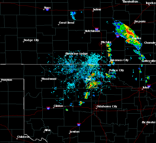 At 304 pm cdt, a severe thunderstorm was located near douglas, moving east at 10 mph (radar indicated). Hazards include 60 mph wind gusts and quarter size hail. Hail damage to vehicles is expected. Expect wind damage to roofs, siding, and trees. At 304 pm cdt, a severe thunderstorm was located near douglas, moving east at 10 mph (radar indicated). Hazards include 60 mph wind gusts and quarter size hail. Hail damage to vehicles is expected. Expect wind damage to roofs, siding, and trees.
|
| 5/19/2018 1:54 PM CDT |
 At 154 pm cdt, a severe thunderstorm was located over lucien, moving northeast at 40 mph (radar indicated). Hazards include golf ball size hail and 70 mph wind gusts. People and animals outdoors will be injured. expect hail damage to roofs, siding, windows, and vehicles. expect considerable tree damage. wind damage is also likely to mobile homes, roofs, and outbuildings. locations impacted include, perry, covington, marshall, douglas, lucien, ceres and hayward. This includes interstate 35 between mile markers 180 and 202. At 154 pm cdt, a severe thunderstorm was located over lucien, moving northeast at 40 mph (radar indicated). Hazards include golf ball size hail and 70 mph wind gusts. People and animals outdoors will be injured. expect hail damage to roofs, siding, windows, and vehicles. expect considerable tree damage. wind damage is also likely to mobile homes, roofs, and outbuildings. locations impacted include, perry, covington, marshall, douglas, lucien, ceres and hayward. This includes interstate 35 between mile markers 180 and 202.
|
| 5/19/2018 1:33 PM CDT |
 At 132 pm cdt, a severe thunderstorm was located 6 miles west of marshall, moving northeast at 50 mph (radar indicated). Hazards include 60 mph wind gusts and quarter size hail. Hail damage to vehicles is expected. Expect wind damage to roofs, siding, and trees. At 132 pm cdt, a severe thunderstorm was located 6 miles west of marshall, moving northeast at 50 mph (radar indicated). Hazards include 60 mph wind gusts and quarter size hail. Hail damage to vehicles is expected. Expect wind damage to roofs, siding, and trees.
|
| 5/18/2018 11:50 PM CDT |
 At 1149 pm cdt, severe thunderstorms were located along a line extending from 6 miles southeast of caldwell to 5 miles east of lamont to 4 miles southeast of billings to 3 miles southeast of lucien, moving northeast at 45 mph (radar indicated). Hazards include 70 mph wind gusts and quarter size hail. Expect considerable tree damage. wind damage is also likely to mobile homes, roofs, and outbuildings. locations impacted include, enid, blackwell, perry, tonkawa, medford, pond creek, garber, covington, billings, lamont, breckenridge, braman, hunter, fairmont, deer creek, douglas, jefferson, renfrow, nardin and lucien. This includes interstate 35 between mile markers 179 and 236. At 1149 pm cdt, severe thunderstorms were located along a line extending from 6 miles southeast of caldwell to 5 miles east of lamont to 4 miles southeast of billings to 3 miles southeast of lucien, moving northeast at 45 mph (radar indicated). Hazards include 70 mph wind gusts and quarter size hail. Expect considerable tree damage. wind damage is also likely to mobile homes, roofs, and outbuildings. locations impacted include, enid, blackwell, perry, tonkawa, medford, pond creek, garber, covington, billings, lamont, breckenridge, braman, hunter, fairmont, deer creek, douglas, jefferson, renfrow, nardin and lucien. This includes interstate 35 between mile markers 179 and 236.
|
| 5/18/2018 11:26 PM CDT |
 At 1126 pm cdt, severe thunderstorms were located along a line extending from 8 miles northeast of wakita to 3 miles east of pond creek to 3 miles north of fairmont to near marshall, moving northeast at 25 mph (radar indicated). Hazards include 70 mph wind gusts and quarter size hail. Hail damage to vehicles is expected. expect considerable tree damage. Wind damage is also likely to mobile homes, roofs, and outbuildings. At 1126 pm cdt, severe thunderstorms were located along a line extending from 8 miles northeast of wakita to 3 miles east of pond creek to 3 miles north of fairmont to near marshall, moving northeast at 25 mph (radar indicated). Hazards include 70 mph wind gusts and quarter size hail. Hail damage to vehicles is expected. expect considerable tree damage. Wind damage is also likely to mobile homes, roofs, and outbuildings.
|
| 5/2/2018 6:44 PM CDT |
 At 644 pm cdt, a severe thunderstorm was located 4 miles east of vance air force base, moving northeast at 35 mph (radar indicated). Hazards include 60 mph wind gusts and half dollar size hail. Hail damage to vehicles is expected. Expect wind damage to roofs, siding, and trees. At 644 pm cdt, a severe thunderstorm was located 4 miles east of vance air force base, moving northeast at 35 mph (radar indicated). Hazards include 60 mph wind gusts and half dollar size hail. Hail damage to vehicles is expected. Expect wind damage to roofs, siding, and trees.
|
| 5/2/2018 6:34 PM CDT |
 At 634 pm cdt, a severe thunderstorm was located near vance air force base, moving northeast at 35 mph (radar indicated). Hazards include 60 mph wind gusts and half dollar size hail. Hail damage to vehicles is expected. expect wind damage to roofs, siding, and trees. Locations impacted include, enid, waukomis, garber, covington, drummond, breckenridge, hunter, fairmont, douglas, vance air force base, bison, north enid and hayward. At 634 pm cdt, a severe thunderstorm was located near vance air force base, moving northeast at 35 mph (radar indicated). Hazards include 60 mph wind gusts and half dollar size hail. Hail damage to vehicles is expected. expect wind damage to roofs, siding, and trees. Locations impacted include, enid, waukomis, garber, covington, drummond, breckenridge, hunter, fairmont, douglas, vance air force base, bison, north enid and hayward.
|
| 5/2/2018 6:00 PM CDT |
 At 559 pm cdt, a severe thunderstorm was located 5 miles northeast of okeene, moving northeast at 55 mph (radar indicated). Hazards include ping pong ball size hail and 60 mph wind gusts. People and animals outdoors will be injured. expect hail damage to roofs, siding, windows, and vehicles. Expect wind damage to roofs, siding, and trees. At 559 pm cdt, a severe thunderstorm was located 5 miles northeast of okeene, moving northeast at 55 mph (radar indicated). Hazards include ping pong ball size hail and 60 mph wind gusts. People and animals outdoors will be injured. expect hail damage to roofs, siding, windows, and vehicles. Expect wind damage to roofs, siding, and trees.
|
| 8/10/2017 5:05 PM CDT |
 The severe thunderstorm warning for southern garfield county will expire at 515 pm cdt, the storm which prompted the warning has weakened below severe limits, therefore the warning will be allowed to expire. The severe thunderstorm warning for southern garfield county will expire at 515 pm cdt, the storm which prompted the warning has weakened below severe limits, therefore the warning will be allowed to expire.
|
| 8/10/2017 4:27 PM CDT |
 At 425 pm cdt, a severe thunderstorm was located 6 miles south of drummond, moving east at 10 mph. another strong storm was located about 8 miles southeast of enid (radar indicated). Hazards include 60 mph wind gusts and quarter size hail. Hail damage to vehicles is expected. Expect wind damage to roofs, siding, and trees. At 425 pm cdt, a severe thunderstorm was located 6 miles south of drummond, moving east at 10 mph. another strong storm was located about 8 miles southeast of enid (radar indicated). Hazards include 60 mph wind gusts and quarter size hail. Hail damage to vehicles is expected. Expect wind damage to roofs, siding, and trees.
|
| 7/7/2017 7:42 PM CDT |
 At 741 pm cdt, a severe thunderstorm was located over fairmont, and is nearly stationary (radar indicated). Hazards include 70 mph wind gusts and ping pong ball size hail. People and animals outdoors will be injured. expect hail damage to roofs, siding, windows, and vehicles. expect considerable tree damage. Wind damage is also likely to mobile homes, roofs, and outbuildings. At 741 pm cdt, a severe thunderstorm was located over fairmont, and is nearly stationary (radar indicated). Hazards include 70 mph wind gusts and ping pong ball size hail. People and animals outdoors will be injured. expect hail damage to roofs, siding, windows, and vehicles. expect considerable tree damage. Wind damage is also likely to mobile homes, roofs, and outbuildings.
|
| 7/7/2017 7:16 PM CDT |
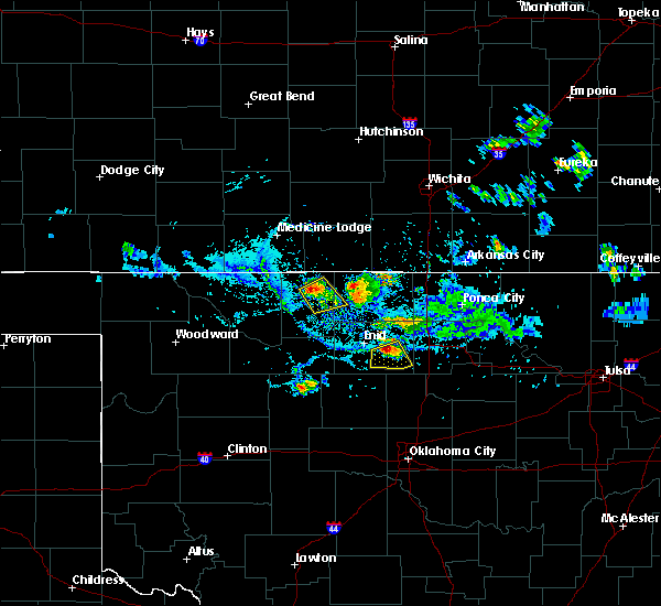 At 715 pm cdt, a severe thunderstorm was located near fairmont, moving south at 15 mph (radar indicated). Hazards include 70 mph wind gusts and quarter size hail. Hail damage to vehicles is expected. expect considerable tree damage. Wind damage is also likely to mobile homes, roofs, and outbuildings. At 715 pm cdt, a severe thunderstorm was located near fairmont, moving south at 15 mph (radar indicated). Hazards include 70 mph wind gusts and quarter size hail. Hail damage to vehicles is expected. expect considerable tree damage. Wind damage is also likely to mobile homes, roofs, and outbuildings.
|
| 7/3/2017 8:47 PM CDT |
 At 846 pm cdt, severe thunderstorms located along a line extending from 4 miles northwest of braman to 3 miles north of tonkawa to 7 miles northwest of red rock to 3 miles northeast of orlando, moving east at 55 mph (radar and weather observations indicate 60 to 70 mph winds). Hazards include 70 mph wind gusts and nickel size hail. Expect considerable tree damage. damage is likely to mobile homes, roofs, and outbuildings. locations impacted include, enid, ponca city, blackwell, perry, tonkawa, medford, newkirk, pond creek, garber, covington, billings, lamont, kaw city, red rock, breckenridge, marland, braman, hunter, fairmont and deer creek. This includes interstate 35 between mile markers 178 and 235. At 846 pm cdt, severe thunderstorms located along a line extending from 4 miles northwest of braman to 3 miles north of tonkawa to 7 miles northwest of red rock to 3 miles northeast of orlando, moving east at 55 mph (radar and weather observations indicate 60 to 70 mph winds). Hazards include 70 mph wind gusts and nickel size hail. Expect considerable tree damage. damage is likely to mobile homes, roofs, and outbuildings. locations impacted include, enid, ponca city, blackwell, perry, tonkawa, medford, newkirk, pond creek, garber, covington, billings, lamont, kaw city, red rock, breckenridge, marland, braman, hunter, fairmont and deer creek. This includes interstate 35 between mile markers 178 and 235.
|
| 7/3/2017 8:36 PM CDT |
 At 834 pm cdt, severe thunderstorms were located along a line extending from 7 miles east of renfrow to 5 miles east of lamont to 4 miles south of billings to 5 miles south of lucien, moving east at 45 mph (a weather observation station reported a 73 mph gust at medford. widespread 60 to 70 mph wind gusts are expected in the warning). Hazards include 70 mph wind gusts and nickel size hail. Expect considerable tree damage. damage is likely to mobile homes, roofs, and outbuildings. locations impacted include, enid, ponca city, blackwell, perry, tonkawa, medford, newkirk, waukomis, pond creek, garber, lahoma, covington, billings, drummond, lamont, kaw city, wakita, red rock, kremlin and breckenridge. This includes interstate 35 between mile markers 178 and 235. At 834 pm cdt, severe thunderstorms were located along a line extending from 7 miles east of renfrow to 5 miles east of lamont to 4 miles south of billings to 5 miles south of lucien, moving east at 45 mph (a weather observation station reported a 73 mph gust at medford. widespread 60 to 70 mph wind gusts are expected in the warning). Hazards include 70 mph wind gusts and nickel size hail. Expect considerable tree damage. damage is likely to mobile homes, roofs, and outbuildings. locations impacted include, enid, ponca city, blackwell, perry, tonkawa, medford, newkirk, waukomis, pond creek, garber, lahoma, covington, billings, drummond, lamont, kaw city, wakita, red rock, kremlin and breckenridge. This includes interstate 35 between mile markers 178 and 235.
|
| 7/3/2017 8:17 PM CDT |
 At 817 pm cdt, severe thunderstorms were located along a line extending from 3 miles south of renfrow to 4 miles southwest of lamont to near breckenridge to 3 miles northwest of marshall, moving east at 20 mph (numerous trained weather spotters have reported 60 mph wind gusts with this large area of storms). Hazards include 60 mph wind gusts and quarter size hail. Hail damage to vehicles is expected. expect wind damage to roofs, siding, and trees. locations impacted include, enid, ponca city, blackwell, perry, tonkawa, medford, newkirk, waukomis, pond creek, garber, lahoma, covington, billings, drummond, lamont, kaw city, wakita, red rock, kremlin and breckenridge. This includes interstate 35 between mile markers 178 and 235. At 817 pm cdt, severe thunderstorms were located along a line extending from 3 miles south of renfrow to 4 miles southwest of lamont to near breckenridge to 3 miles northwest of marshall, moving east at 20 mph (numerous trained weather spotters have reported 60 mph wind gusts with this large area of storms). Hazards include 60 mph wind gusts and quarter size hail. Hail damage to vehicles is expected. expect wind damage to roofs, siding, and trees. locations impacted include, enid, ponca city, blackwell, perry, tonkawa, medford, newkirk, waukomis, pond creek, garber, lahoma, covington, billings, drummond, lamont, kaw city, wakita, red rock, kremlin and breckenridge. This includes interstate 35 between mile markers 178 and 235.
|
| 7/3/2017 8:03 PM CDT |
 At 803 pm cdt, a severe thunderstorm was located near lovell, moving east at 45 mph (radar indicated). Hazards include 60 mph wind gusts and quarter size hail. Hail damage to vehicles is expected. expect wind damage to roofs, siding, and trees. locations impacted include, guthrie, hennessey, crescent, dover, cedar valley, marshall, mulhall, cimarron city, orlando, douglas, lovell, lucien, bison and hayward. This includes interstate 35 between mile markers 157 and 164. At 803 pm cdt, a severe thunderstorm was located near lovell, moving east at 45 mph (radar indicated). Hazards include 60 mph wind gusts and quarter size hail. Hail damage to vehicles is expected. expect wind damage to roofs, siding, and trees. locations impacted include, guthrie, hennessey, crescent, dover, cedar valley, marshall, mulhall, cimarron city, orlando, douglas, lovell, lucien, bison and hayward. This includes interstate 35 between mile markers 157 and 164.
|
| 7/3/2017 7:58 PM CDT |
 At 758 pm cdt, severe thunderstorms were located along a line extending from 5 miles west of renfrow to near pond creek to 3 miles southwest of garber to near douglas, moving east at 55 mph (radar indicated). Hazards include 60 mph wind gusts and quarter size hail. Hail damage to vehicles is expected. Expect wind damage to roofs, siding, and trees. At 758 pm cdt, severe thunderstorms were located along a line extending from 5 miles west of renfrow to near pond creek to 3 miles southwest of garber to near douglas, moving east at 55 mph (radar indicated). Hazards include 60 mph wind gusts and quarter size hail. Hail damage to vehicles is expected. Expect wind damage to roofs, siding, and trees.
|
| 7/3/2017 7:24 PM CDT |
 At 724 pm cdt, a severe thunderstorm was located 7 miles east of dover, moving northeast at 40 mph (radar indicated). Hazards include 60 mph wind gusts and quarter size hail. Hail damage to vehicles is expected. Expect wind damage to roofs, siding, and trees. At 724 pm cdt, a severe thunderstorm was located 7 miles east of dover, moving northeast at 40 mph (radar indicated). Hazards include 60 mph wind gusts and quarter size hail. Hail damage to vehicles is expected. Expect wind damage to roofs, siding, and trees.
|
| 6/18/2017 3:39 AM CDT |
 At 338 am cdt, severe thunderstorms were located along a line extending from 3 miles east of lucien to near marshall to 5 miles east of hennessey, moving southeast at 30 mph (radar indicated). Hazards include ping pong ball size hail and 60 mph wind gusts. People and animals outdoors will be injured. expect hail damage to roofs, siding, windows, and vehicles. Expect wind damage to roofs, siding, and trees. At 338 am cdt, severe thunderstorms were located along a line extending from 3 miles east of lucien to near marshall to 5 miles east of hennessey, moving southeast at 30 mph (radar indicated). Hazards include ping pong ball size hail and 60 mph wind gusts. People and animals outdoors will be injured. expect hail damage to roofs, siding, windows, and vehicles. Expect wind damage to roofs, siding, and trees.
|
| 6/18/2017 3:29 AM CDT |
 At 328 am cdt, a severe thunderstorm was located 5 miles southwest of fairmont, moving east at 40 mph. a second severe thunderstorm was located south of douglas (radar indicated). Hazards include 60 mph wind gusts and quarter size hail. Hail damage to vehicles is expected. expect wind damage to roofs, siding, and trees. Locations impacted include, enid, waukomis, covington, marshall, fairmont, douglas, vance air force base and hayward. At 328 am cdt, a severe thunderstorm was located 5 miles southwest of fairmont, moving east at 40 mph. a second severe thunderstorm was located south of douglas (radar indicated). Hazards include 60 mph wind gusts and quarter size hail. Hail damage to vehicles is expected. expect wind damage to roofs, siding, and trees. Locations impacted include, enid, waukomis, covington, marshall, fairmont, douglas, vance air force base and hayward.
|
| 6/18/2017 3:16 AM CDT |
 At 315 am cdt, a severe thunderstorm was located near vance air force base, moving east at 40 mph. a second severe thunderstorm was located near douglas (radar indicated). Hazards include ping pong ball size hail and 60 mph wind gusts. People and animals outdoors will be injured. expect hail damage to roofs, siding, windows, and vehicles. expect wind damage to roofs, siding, and trees. Locations impacted include, enid, waukomis, lahoma, covington, drummond, marshall, fairmont, douglas, vance air force base and hayward. At 315 am cdt, a severe thunderstorm was located near vance air force base, moving east at 40 mph. a second severe thunderstorm was located near douglas (radar indicated). Hazards include ping pong ball size hail and 60 mph wind gusts. People and animals outdoors will be injured. expect hail damage to roofs, siding, windows, and vehicles. expect wind damage to roofs, siding, and trees. Locations impacted include, enid, waukomis, lahoma, covington, drummond, marshall, fairmont, douglas, vance air force base and hayward.
|
| 6/18/2017 3:03 AM CDT |
 At 303 am cdt, a severe thunderstorm was located near lahoma, moving east at 40 mph (radar indicated). Hazards include ping pong ball size hail and 60 mph wind gusts. People and animals outdoors will be injured. expect hail damage to roofs, siding, windows, and vehicles. Expect wind damage to roofs, siding, and trees. At 303 am cdt, a severe thunderstorm was located near lahoma, moving east at 40 mph (radar indicated). Hazards include ping pong ball size hail and 60 mph wind gusts. People and animals outdoors will be injured. expect hail damage to roofs, siding, windows, and vehicles. Expect wind damage to roofs, siding, and trees.
|
| 5/18/2017 6:49 PM CDT |
 At 648 pm cdt, a severe thunderstorm was located 4 miles west of douglas, moving northeast at 40 mph (trained weather spotters reported golf ball size hail 2 miles southeast of hennessey at 633 pm). Hazards include golf ball size hail and 60 mph wind gusts. People and animals outdoors will be injured. expect hail damage to roofs, siding, windows, and vehicles. expect wind damage to roofs, siding, and trees. Locations impacted include, enid, waukomis, garber, covington, breckenridge, fairmont and douglas. At 648 pm cdt, a severe thunderstorm was located 4 miles west of douglas, moving northeast at 40 mph (trained weather spotters reported golf ball size hail 2 miles southeast of hennessey at 633 pm). Hazards include golf ball size hail and 60 mph wind gusts. People and animals outdoors will be injured. expect hail damage to roofs, siding, windows, and vehicles. expect wind damage to roofs, siding, and trees. Locations impacted include, enid, waukomis, garber, covington, breckenridge, fairmont and douglas.
|
| 5/18/2017 6:27 PM CDT |
 At 626 pm cdt, a severe thunderstorm was located near hennessey, moving northeast at 40 mph (radar indicated). Hazards include ping pong ball size hail and 60 mph wind gusts. People and animals outdoors will be injured. expect hail damage to roofs, siding, windows, and vehicles. Expect wind damage to roofs, siding, and trees. At 626 pm cdt, a severe thunderstorm was located near hennessey, moving northeast at 40 mph (radar indicated). Hazards include ping pong ball size hail and 60 mph wind gusts. People and animals outdoors will be injured. expect hail damage to roofs, siding, windows, and vehicles. Expect wind damage to roofs, siding, and trees.
|
| 5/11/2017 2:22 PM CDT |
 At 222 pm cdt, a severe thunderstorm was located near marshall, moving northeast at 20 mph (radar indicated). Hazards include golf ball size hail and 60 mph wind gusts. People and animals outdoors will be injured. expect hail damage to roofs, siding, windows, and vehicles. expect wind damage to roofs, siding, and trees. Locations impacted include, marshall, douglas and hayward. At 222 pm cdt, a severe thunderstorm was located near marshall, moving northeast at 20 mph (radar indicated). Hazards include golf ball size hail and 60 mph wind gusts. People and animals outdoors will be injured. expect hail damage to roofs, siding, windows, and vehicles. expect wind damage to roofs, siding, and trees. Locations impacted include, marshall, douglas and hayward.
|
| 5/11/2017 2:03 PM CDT |
 At 203 pm cdt, a severe thunderstorm was located 7 miles east of hennessey, moving northeast at 20 mph (radar indicated). Hazards include 60 mph wind gusts and half dollar size hail. Hail damage to vehicles is expected. Expect wind damage to roofs, siding, and trees. At 203 pm cdt, a severe thunderstorm was located 7 miles east of hennessey, moving northeast at 20 mph (radar indicated). Hazards include 60 mph wind gusts and half dollar size hail. Hail damage to vehicles is expected. Expect wind damage to roofs, siding, and trees.
|
| 4/29/2017 2:02 AM CDT |
 At 201 am cdt, a severe thunderstorm was located near marshall, moving northeast at 40 mph (radar indicated). Hazards include 60 mph wind gusts and half dollar size hail. Hail damage to vehicles is expected. Expect wind damage to roofs, siding, and trees. At 201 am cdt, a severe thunderstorm was located near marshall, moving northeast at 40 mph (radar indicated). Hazards include 60 mph wind gusts and half dollar size hail. Hail damage to vehicles is expected. Expect wind damage to roofs, siding, and trees.
|
| 3/28/2017 9:32 PM CDT |
 At 932 pm cdt, a severe thunderstorm was located near douglas, moving northeast at 35 mph (radar indicated). Hazards include 70 mph wind gusts and quarter size hail. Hail damage to vehicles is expected. expect considerable tree damage. Wind damage is also likely to mobile homes, roofs, and outbuildings. At 932 pm cdt, a severe thunderstorm was located near douglas, moving northeast at 35 mph (radar indicated). Hazards include 70 mph wind gusts and quarter size hail. Hail damage to vehicles is expected. expect considerable tree damage. Wind damage is also likely to mobile homes, roofs, and outbuildings.
|
| 10/6/2016 7:55 PM CDT |
 At 755 pm cdt, the leading edge of severe thunderstorms was located along a line extending from 3 miles south of chilocco to 4 miles northeast of billings to 5 miles east of bison, moving east at 40 mph (radar indicated). Hazards include 60 mph wind gusts and quarter size hail. Hail damage to vehicles is expected. expect wind damage to roofs, siding, and trees. locations impacted include, enid, stillwater, ponca city, blackwell, perry, tonkawa, newkirk, waukomis, garber, morrison, glencoe, covington, billings, lamont, kaw city, red rock, breckenridge, marland, braman and hunter. This includes interstate 35 between mile markers 178 and 236. At 755 pm cdt, the leading edge of severe thunderstorms was located along a line extending from 3 miles south of chilocco to 4 miles northeast of billings to 5 miles east of bison, moving east at 40 mph (radar indicated). Hazards include 60 mph wind gusts and quarter size hail. Hail damage to vehicles is expected. expect wind damage to roofs, siding, and trees. locations impacted include, enid, stillwater, ponca city, blackwell, perry, tonkawa, newkirk, waukomis, garber, morrison, glencoe, covington, billings, lamont, kaw city, red rock, breckenridge, marland, braman and hunter. This includes interstate 35 between mile markers 178 and 236.
|
| 10/6/2016 7:31 PM CDT |
 At 731 pm cdt, severe thunderstorms were located along a line extending from near renfrow to 3 miles southwest of lamont to near drummond, moving east at 55 mph (radar indicated). Hazards include 70 mph wind gusts and quarter size hail. Hail damage to vehicles is expected. expect considerable tree damage. Wind damage is also likely to mobile homes, roofs, and outbuildings. At 731 pm cdt, severe thunderstorms were located along a line extending from near renfrow to 3 miles southwest of lamont to near drummond, moving east at 55 mph (radar indicated). Hazards include 70 mph wind gusts and quarter size hail. Hail damage to vehicles is expected. expect considerable tree damage. Wind damage is also likely to mobile homes, roofs, and outbuildings.
|
| 10/5/2016 10:55 PM CDT |
 At 1053 pm cdt, a severe thunderstorm was located near douglas, moving northeast at 40 mph (radar indicated). Hazards include ping pong ball size hail and 60 mph wind gusts. People and animals outdoors will be injured. expect hail damage to roofs, siding, windows, and vehicles. expect wind damage to roofs, siding, and trees. locations impacted include, garber, covington, breckenridge, fairmont, douglas and hayward. This includes interstate 35 near mile marker 193. At 1053 pm cdt, a severe thunderstorm was located near douglas, moving northeast at 40 mph (radar indicated). Hazards include ping pong ball size hail and 60 mph wind gusts. People and animals outdoors will be injured. expect hail damage to roofs, siding, windows, and vehicles. expect wind damage to roofs, siding, and trees. locations impacted include, garber, covington, breckenridge, fairmont, douglas and hayward. This includes interstate 35 near mile marker 193.
|
| 10/5/2016 10:35 PM CDT |
 At 1034 pm cdt, a severe thunderstorm was located 6 miles east of hennessey, moving northeast at 40 mph (radar indicated). Hazards include golf ball size hail and 60 mph wind gusts. People and animals outdoors will be injured. expect hail damage to roofs, siding, windows, and vehicles. Expect wind damage to roofs, siding, and trees. At 1034 pm cdt, a severe thunderstorm was located 6 miles east of hennessey, moving northeast at 40 mph (radar indicated). Hazards include golf ball size hail and 60 mph wind gusts. People and animals outdoors will be injured. expect hail damage to roofs, siding, windows, and vehicles. Expect wind damage to roofs, siding, and trees.
|
| 10/4/2016 10:14 PM CDT |
 At 1014 pm cdt, severe thunderstorms were located along a line extending from 4 miles northeast of covington to 3 miles northeast of hennessey, moving southeast at 10 mph (radar indicated). Hazards include 60 mph wind gusts and quarter size hail. Hail damage to vehicles is expected. Expect wind damage to roofs, siding, and trees. At 1014 pm cdt, severe thunderstorms were located along a line extending from 4 miles northeast of covington to 3 miles northeast of hennessey, moving southeast at 10 mph (radar indicated). Hazards include 60 mph wind gusts and quarter size hail. Hail damage to vehicles is expected. Expect wind damage to roofs, siding, and trees.
|
| 10/4/2016 9:30 PM CDT |
 At 929 pm cdt, severe thunderstorms were located along a line extending from near garber to 4 miles west of bison, moving east at 10 mph (radar indicated). Hazards include 60 mph wind gusts and quarter size hail. Hail damage to vehicles is expected. Expect wind damage to roofs, siding, and trees. At 929 pm cdt, severe thunderstorms were located along a line extending from near garber to 4 miles west of bison, moving east at 10 mph (radar indicated). Hazards include 60 mph wind gusts and quarter size hail. Hail damage to vehicles is expected. Expect wind damage to roofs, siding, and trees.
|
| 10/4/2016 9:19 PM CDT |
 At 919 pm cdt, a severe thunderstorm was located near fairmont, moving east at 15 mph (radar indicated). Hazards include 60 mph wind gusts and quarter size hail. Hail damage to vehicles is expected. expect wind damage to roofs, siding, and trees. Locations impacted include, enid, waukomis, covington, breckenridge, fairmont, douglas and north enid. At 919 pm cdt, a severe thunderstorm was located near fairmont, moving east at 15 mph (radar indicated). Hazards include 60 mph wind gusts and quarter size hail. Hail damage to vehicles is expected. expect wind damage to roofs, siding, and trees. Locations impacted include, enid, waukomis, covington, breckenridge, fairmont, douglas and north enid.
|
| 10/4/2016 9:04 PM CDT |
 At 903 pm cdt, a severe thunderstorm was located near vance air force base, moving east at 20 mph (radar indicated). Hazards include 60 mph wind gusts and half dollar size hail. Hail damage to vehicles is expected. expect wind damage to roofs, siding, and trees. Locations impacted include, enid, waukomis, covington, breckenridge, fairmont, douglas, vance air force base and north enid. At 903 pm cdt, a severe thunderstorm was located near vance air force base, moving east at 20 mph (radar indicated). Hazards include 60 mph wind gusts and half dollar size hail. Hail damage to vehicles is expected. expect wind damage to roofs, siding, and trees. Locations impacted include, enid, waukomis, covington, breckenridge, fairmont, douglas, vance air force base and north enid.
|
| 10/4/2016 8:44 PM CDT |
 At 844 pm cdt, severe thunderstorms were located along a line extending from 5 miles east of hunter to 3 miles southeast of drummond, moving east at 20 mph (radar indicated). Hazards include 60 mph wind gusts and quarter size hail. Hail damage to vehicles is expected. Expect wind damage to roofs, siding, and trees. At 844 pm cdt, severe thunderstorms were located along a line extending from 5 miles east of hunter to 3 miles southeast of drummond, moving east at 20 mph (radar indicated). Hazards include 60 mph wind gusts and quarter size hail. Hail damage to vehicles is expected. Expect wind damage to roofs, siding, and trees.
|
| 9/9/2016 9:11 PM CDT |
 At 910 pm cdt, the leading edge of winds from a line of severe thunderstorms was located along a line extending from near tonkawa to near fairmont to 6 miles east of okeene, moving east at 45 mph (radar indicated). Hazards include 60 mph wind gusts and nickel size hail. Expect damage to roofs. siding. And trees. At 910 pm cdt, the leading edge of winds from a line of severe thunderstorms was located along a line extending from near tonkawa to near fairmont to 6 miles east of okeene, moving east at 45 mph (radar indicated). Hazards include 60 mph wind gusts and nickel size hail. Expect damage to roofs. siding. And trees.
|
| 7/28/2016 4:33 PM CDT |
 At 432 pm cdt, a severe thunderstorm was located near marshall, moving southeast at 20 mph (radar indicated). Hazards include 60 mph wind gusts. Expect damage to roofs. siding. And trees. At 432 pm cdt, a severe thunderstorm was located near marshall, moving southeast at 20 mph (radar indicated). Hazards include 60 mph wind gusts. Expect damage to roofs. siding. And trees.
|
| 7/28/2016 4:01 PM CDT | Near zero visibility in blowing dus in garfield county OK, 0.1 miles ENE of Douglas, OK |
| 7/28/2016 3:51 PM CDT |
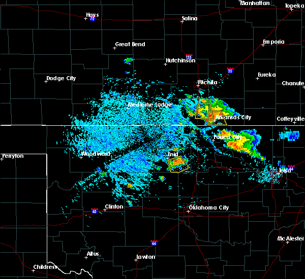 At 350 pm cdt, a severe thunderstorm was located near fairmont, moving southeast at 15 mph (radar indicated). Hazards include 60 mph wind gusts. Expect damage to roofs. siding. and trees. this storm produced a 58 mph wind gust 3 miles southeast of breckenridge at 340 pm cdt. Locations impacted include, enid, covington, fairmont and douglas. At 350 pm cdt, a severe thunderstorm was located near fairmont, moving southeast at 15 mph (radar indicated). Hazards include 60 mph wind gusts. Expect damage to roofs. siding. and trees. this storm produced a 58 mph wind gust 3 miles southeast of breckenridge at 340 pm cdt. Locations impacted include, enid, covington, fairmont and douglas.
|
| 7/28/2016 3:44 PM CDT |
 At 343 pm cdt, a severe thunderstorm was located near fairmont, moving southeast at 15 mph (radar indicated). Hazards include 60 mph wind gusts. Expect damage to roofs. siding. and trees. Locations impacted include, enid, covington, breckenridge, fairmont, douglas and hayward. At 343 pm cdt, a severe thunderstorm was located near fairmont, moving southeast at 15 mph (radar indicated). Hazards include 60 mph wind gusts. Expect damage to roofs. siding. and trees. Locations impacted include, enid, covington, breckenridge, fairmont, douglas and hayward.
|
| 7/28/2016 3:35 PM CDT |
 At 334 pm cdt, a severe thunderstorm was located near fairmont, moving southeast at 15 mph (radar indicated). Hazards include 60 mph wind gusts and penny size hail. Expect damage to roofs. siding. And trees. At 334 pm cdt, a severe thunderstorm was located near fairmont, moving southeast at 15 mph (radar indicated). Hazards include 60 mph wind gusts and penny size hail. Expect damage to roofs. siding. And trees.
|
| 7/14/2016 12:21 AM CDT |
 At 1221 am cdt, severe thunderstorms were located along a line extending from near stillwater to 3 miles southwest of fairmont, moving southeast at 35 mph (radar indicated). Hazards include golf ball size hail and 70 mph wind gusts. People and animals outdoors will be injured. expect hail damage to roofs, siding, windows, and vehicles. expect considerable tree damage. wind damage is also likely to mobile homes, roofs, and outbuildings. locations impacted include, enid, stillwater, perry, hennessey, waukomis, yale, morrison, glencoe, covington, marshall, breckenridge, mulhall, orlando, fairmont, douglas, quay, lake carl blackwell, lake mcmurtry, bison and lucien. This includes interstate 35 between mile markers 170 and 191. At 1221 am cdt, severe thunderstorms were located along a line extending from near stillwater to 3 miles southwest of fairmont, moving southeast at 35 mph (radar indicated). Hazards include golf ball size hail and 70 mph wind gusts. People and animals outdoors will be injured. expect hail damage to roofs, siding, windows, and vehicles. expect considerable tree damage. wind damage is also likely to mobile homes, roofs, and outbuildings. locations impacted include, enid, stillwater, perry, hennessey, waukomis, yale, morrison, glencoe, covington, marshall, breckenridge, mulhall, orlando, fairmont, douglas, quay, lake carl blackwell, lake mcmurtry, bison and lucien. This includes interstate 35 between mile markers 170 and 191.
|
| 7/13/2016 11:44 PM CDT |
 At 1144 pm cdt, severe thunderstorms were located along a line extending from 5 miles north of perry to 5 miles southeast of hillsdale, moving southeast at 30 mph (radar indicated). Hazards include golf ball size hail and 70 mph wind gusts. People and animals outdoors will be injured. expect hail damage to roofs, siding, windows, and vehicles. expect considerable tree damage. wind damage is also likely to mobile homes, roofs, and outbuildings. locations impacted include, enid, stillwater, perry, hennessey, waukomis, yale, garber, morrison, lahoma, glencoe, covington, billings, drummond, red rock, marshall, kremlin, breckenridge, mulhall, hunter and orlando. This includes interstate 35 between mile markers 170 and 204. At 1144 pm cdt, severe thunderstorms were located along a line extending from 5 miles north of perry to 5 miles southeast of hillsdale, moving southeast at 30 mph (radar indicated). Hazards include golf ball size hail and 70 mph wind gusts. People and animals outdoors will be injured. expect hail damage to roofs, siding, windows, and vehicles. expect considerable tree damage. wind damage is also likely to mobile homes, roofs, and outbuildings. locations impacted include, enid, stillwater, perry, hennessey, waukomis, yale, garber, morrison, lahoma, glencoe, covington, billings, drummond, red rock, marshall, kremlin, breckenridge, mulhall, hunter and orlando. This includes interstate 35 between mile markers 170 and 204.
|
| 7/13/2016 11:31 PM CDT |
 At 1130 pm cdt, severe thunderstorms were located along a line extending from near sooner lake to 4 miles south of billings to 3 miles northeast of hillsdale, moving southeast at 25 mph. the most damaging storms were located just south of billings and near hillsdale (radar indicated). Hazards include golf ball size hail and 70 mph wind gusts. People and animals outdoors will be injured. expect hail damage to roofs, siding, windows, and vehicles. expect considerable tree damage. wind damage is also likely to mobile homes, roofs, and outbuildings. locations impacted include, enid, stillwater, perry, hennessey, waukomis, yale, pond creek, garber, morrison, lahoma, glencoe, covington, billings, drummond, red rock, marshall, kremlin, goltry, breckenridge and meno. This includes interstate 35 between mile markers 170 and 211. At 1130 pm cdt, severe thunderstorms were located along a line extending from near sooner lake to 4 miles south of billings to 3 miles northeast of hillsdale, moving southeast at 25 mph. the most damaging storms were located just south of billings and near hillsdale (radar indicated). Hazards include golf ball size hail and 70 mph wind gusts. People and animals outdoors will be injured. expect hail damage to roofs, siding, windows, and vehicles. expect considerable tree damage. wind damage is also likely to mobile homes, roofs, and outbuildings. locations impacted include, enid, stillwater, perry, hennessey, waukomis, yale, pond creek, garber, morrison, lahoma, glencoe, covington, billings, drummond, red rock, marshall, kremlin, goltry, breckenridge and meno. This includes interstate 35 between mile markers 170 and 211.
|
| 7/13/2016 11:10 PM CDT |
 At 1109 pm cdt, the leading edge of severe thunderstorms were located along a line extending from 3 miles north of sooner lake to 4 miles southeast of hunter to 4 miles north of goltry, moving south at 20 mph (radar indicated). Hazards include golf ball size hail and 70 mph wind gusts. People and animals outdoors will be injured. expect hail damage to roofs, siding, windows, and vehicles. expect considerable tree damage. Wind damage is also likely to mobile homes, roofs, and outbuildings. At 1109 pm cdt, the leading edge of severe thunderstorms were located along a line extending from 3 miles north of sooner lake to 4 miles southeast of hunter to 4 miles north of goltry, moving south at 20 mph (radar indicated). Hazards include golf ball size hail and 70 mph wind gusts. People and animals outdoors will be injured. expect hail damage to roofs, siding, windows, and vehicles. expect considerable tree damage. Wind damage is also likely to mobile homes, roofs, and outbuildings.
|
| 5/31/2016 6:36 AM CDT |
 The severe thunderstorm warning for east central alfalfa, western kay, western noble, grant and garfield counties will expire at 645 am cdt, the storms which prompted the warning have weakened below severe limits, and no longer pose an immediate threat to life or property. therefore the warning will be allowed to expire. however, gusty winds and heavy rain are still possible with these thunderstorms. The severe thunderstorm warning for east central alfalfa, western kay, western noble, grant and garfield counties will expire at 645 am cdt, the storms which prompted the warning have weakened below severe limits, and no longer pose an immediate threat to life or property. therefore the warning will be allowed to expire. however, gusty winds and heavy rain are still possible with these thunderstorms.
|
| 5/31/2016 6:19 AM CDT |
 At 618 am cdt, severe thunderstorms were located along a line extending from 4 miles northeast of wakita to 3 miles south of medford to 3 miles north of hunter to near breckenridge to near bison, moving east at 35 mph (radar indicated). Hazards include 60 mph wind gusts and penny size hail. Expect damage to roofs. siding. and trees. locations impacted include, enid, blackwell, perry, tonkawa, medford, waukomis, pond creek, garber, lahoma, covington, billings, drummond, lamont, wakita, kremlin, breckenridge, braman, nash, hunter and fairmont. This includes interstate 35 between mile markers 179 and 235. At 618 am cdt, severe thunderstorms were located along a line extending from 4 miles northeast of wakita to 3 miles south of medford to 3 miles north of hunter to near breckenridge to near bison, moving east at 35 mph (radar indicated). Hazards include 60 mph wind gusts and penny size hail. Expect damage to roofs. siding. and trees. locations impacted include, enid, blackwell, perry, tonkawa, medford, waukomis, pond creek, garber, lahoma, covington, billings, drummond, lamont, wakita, kremlin, breckenridge, braman, nash, hunter and fairmont. This includes interstate 35 between mile markers 179 and 235.
|
| 5/31/2016 5:43 AM CDT |
 At 542 am cdt, severe thunderstorms were located along a line extending from 8 miles southwest of manchester to 6 miles northeast of nash to 5 miles northeast of hillsdale to 4 miles northwest of vance air force base to 6 miles southeast of ames, moving east at 40 mph (radar indicated). Hazards include 60 mph wind gusts and quarter size hail. Hail damage to vehicles is expected. Expect wind damage to roofs, siding, and trees. At 542 am cdt, severe thunderstorms were located along a line extending from 8 miles southwest of manchester to 6 miles northeast of nash to 5 miles northeast of hillsdale to 4 miles northwest of vance air force base to 6 miles southeast of ames, moving east at 40 mph (radar indicated). Hazards include 60 mph wind gusts and quarter size hail. Hail damage to vehicles is expected. Expect wind damage to roofs, siding, and trees.
|
| 5/27/2016 6:46 PM CDT |
 At 646 pm cdt, a severe thunderstorm was located 4 miles northwest of lovell, moving northeast at 25 mph (radar indicated). Hazards include 60 mph wind gusts and half dollar size hail. Hail damage to vehicles is expected. Expect wind damage to roofs, siding, and trees. At 646 pm cdt, a severe thunderstorm was located 4 miles northwest of lovell, moving northeast at 25 mph (radar indicated). Hazards include 60 mph wind gusts and half dollar size hail. Hail damage to vehicles is expected. Expect wind damage to roofs, siding, and trees.
|
| 4/26/2016 8:31 PM CDT |
 At 831 pm cdt, severe thunderstorms were located along a line extending from 4 miles east of braman to 4 miles southeast of douglas, moving northeast at 60 mph (radar indicated). Hazards include 60 mph wind gusts. Expect damage to roofs. siding. And trees. At 831 pm cdt, severe thunderstorms were located along a line extending from 4 miles east of braman to 4 miles southeast of douglas, moving northeast at 60 mph (radar indicated). Hazards include 60 mph wind gusts. Expect damage to roofs. siding. And trees.
|
| 11/17/2015 1:24 AM CST |
 At 123 am cst, severe thunderstorms were located along a line extending from near renfrow to 5 miles west of orlando to near cashion, moving northeast at 50 mph (radar indicated). Hazards include 60 mph wind gusts. Expect damage to roofs. siding and trees. Locations impacted include, enid, stillwater, ponca city, guthrie, blackwell, perry, kingfisher, tonkawa, medford, perkins, newkirk, hennessey, langston, crescent, okarche, pond creek, garber, cashion, morrison and glencoe. At 123 am cst, severe thunderstorms were located along a line extending from near renfrow to 5 miles west of orlando to near cashion, moving northeast at 50 mph (radar indicated). Hazards include 60 mph wind gusts. Expect damage to roofs. siding and trees. Locations impacted include, enid, stillwater, ponca city, guthrie, blackwell, perry, kingfisher, tonkawa, medford, perkins, newkirk, hennessey, langston, crescent, okarche, pond creek, garber, cashion, morrison and glencoe.
|
| 11/17/2015 12:59 AM CST |
 At 1258 am cst, severe thunderstorms were located along a line extending from near medford to 7 miles west of cashion, moving northeast at 65 mph (radar indicated). Hazards include 60 mph wind gusts. Expect damage to roofs. Siding and trees. At 1258 am cst, severe thunderstorms were located along a line extending from near medford to 7 miles west of cashion, moving northeast at 65 mph (radar indicated). Hazards include 60 mph wind gusts. Expect damage to roofs. Siding and trees.
|
| 8/21/2015 10:55 PM CDT | The severe thunderstorm warning for kay, western noble, eastern grant and garfield counties will expire at 1100 pm cdt, the storms which prompted the warning have weakened below severe limits, and no longer pose an immediate threat to life or property. therefore the warning will be allowed to expire. however wind gusts of 40 to 50 mph and heavy rain are still possible with these thunderstorms. |
| 8/21/2015 10:22 PM CDT |
 At 1022 pm cdt, severe thunderstorms were located along a line extending from 7 miles east of renfrow to 3 miles west of lamont to 4 miles northwest of breckenridge to 4 miles northeast of drummond, moving east at 40 mph (radar indicated). Hazards include 60 mph wind gusts and quarter size hail. Hail damage to vehicles is expected. Expect wind damage to roofs, siding and trees. At 1022 pm cdt, severe thunderstorms were located along a line extending from 7 miles east of renfrow to 3 miles west of lamont to 4 miles northwest of breckenridge to 4 miles northeast of drummond, moving east at 40 mph (radar indicated). Hazards include 60 mph wind gusts and quarter size hail. Hail damage to vehicles is expected. Expect wind damage to roofs, siding and trees.
|
| 7/6/2015 8:21 PM CDT |
 At 820 pm cdt, severe thunderstorms were located along a line extending from 4 miles northwest of garber to 5 miles southwest of hennessey, moving east at 45 mph (awos reported a 61 mph wind gust at vance airforce base). Hazards include 60 mph wind gusts. Expect damage to roofs. Siding and trees. At 820 pm cdt, severe thunderstorms were located along a line extending from 4 miles northwest of garber to 5 miles southwest of hennessey, moving east at 45 mph (awos reported a 61 mph wind gust at vance airforce base). Hazards include 60 mph wind gusts. Expect damage to roofs. Siding and trees.
|
| 5/26/2015 10:58 PM CDT | At 1058 pm cdt, severe thunderstorms were located along a line extending from 3 miles southeast of douglas to 5 miles south of mulhall, moving east at 20 mph (radar indicated). Hazards include ping pong ball size hail and 60 mph wind gusts. People and animals outdoors will be injured. expect hail damage to roofs, siding, windows and vehicles. Expect wind damage to roofs, siding and trees. |
| 5/26/2015 9:57 PM CDT | At 957 pm cdt, severe thunderstorms were located along a line extending from near garber to 5 miles north of lucien, moving east at 15 mph (radar indicated). Hazards include 60 mph wind gusts and quarter size hail. Hail damage to vehicles is expected. expect wind damage to roofs, siding and trees. Locations impacted include, garber, covington, breckenridge, hunter, fairmont, douglas and hayward. |
| 5/26/2015 9:26 PM CDT | At 925 pm cdt, a severe thunderstorm was located near fairmont, moving northeast at 20 mph. this was part of a line of strong thunderstorms that extended from enid to 7 miles south of hayward (radar indicated). Hazards include ping pong ball size hail and 60 mph wind gusts. People and animals outdoors will be injured. expect hail damage to roofs, siding, windows and vehicles. Expect wind damage to roofs, siding and trees. |
| 1/29/2013 6:15 AM CST | Quarter sized hail reported 0.1 miles ENE of Douglas, OK |
| 4/29/2012 12:19 AM CDT | Quarter sized hail reported 0.1 miles ENE of Douglas, OK |
Hail Maps for Douglas, OK

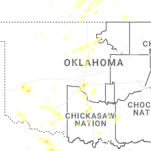
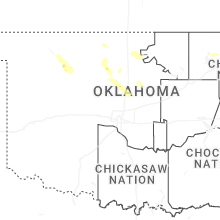
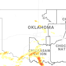
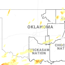


Connect with Interactive Hail Maps