

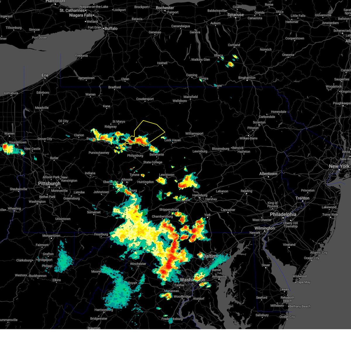
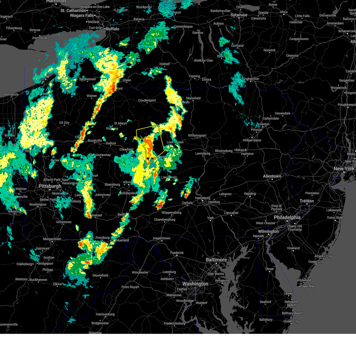
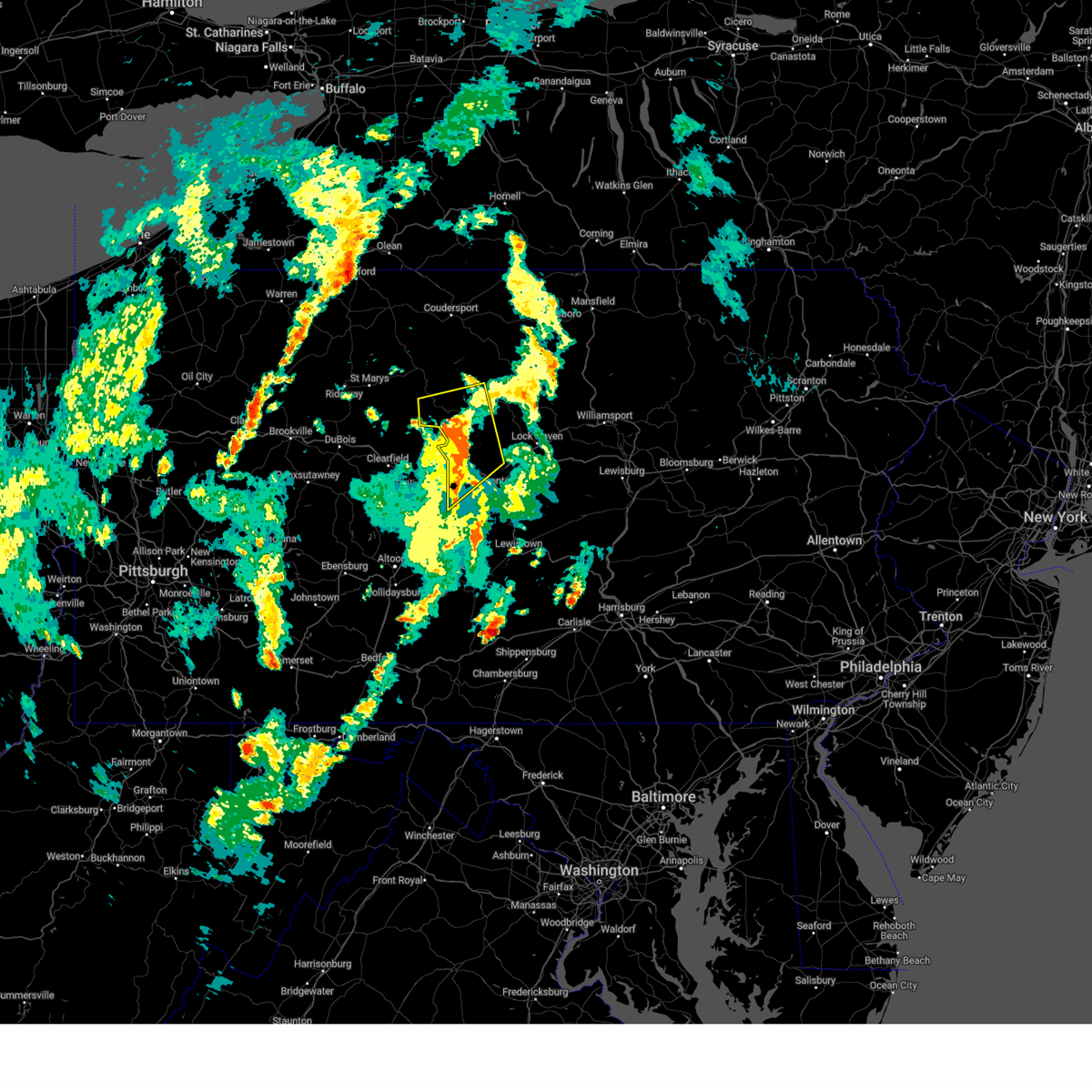
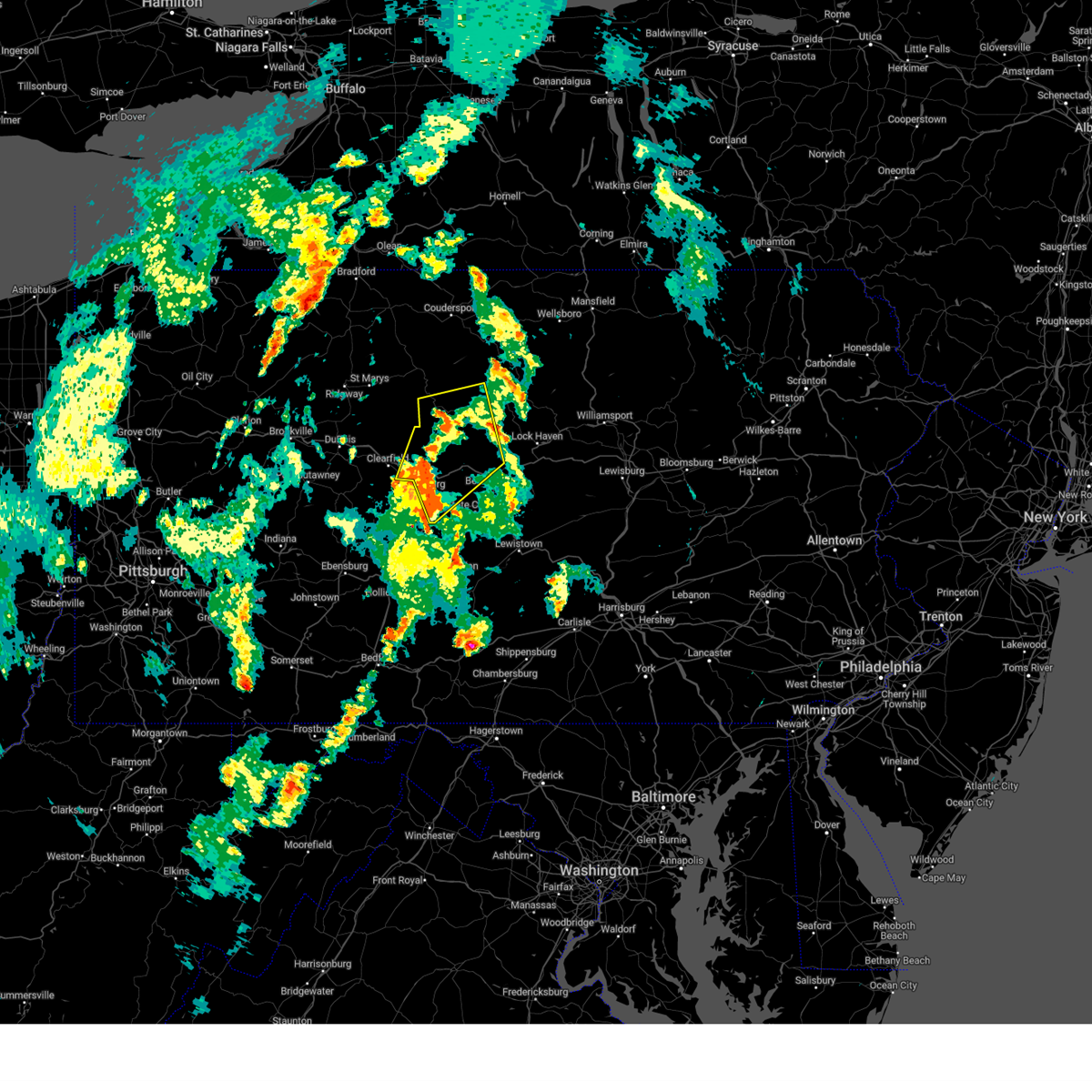
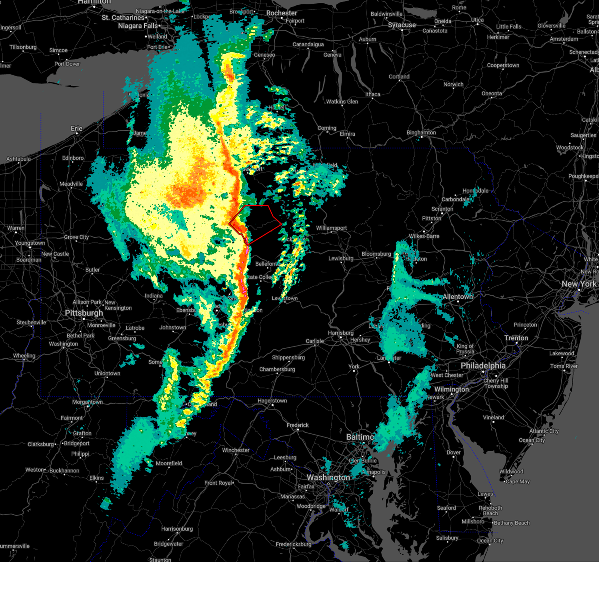
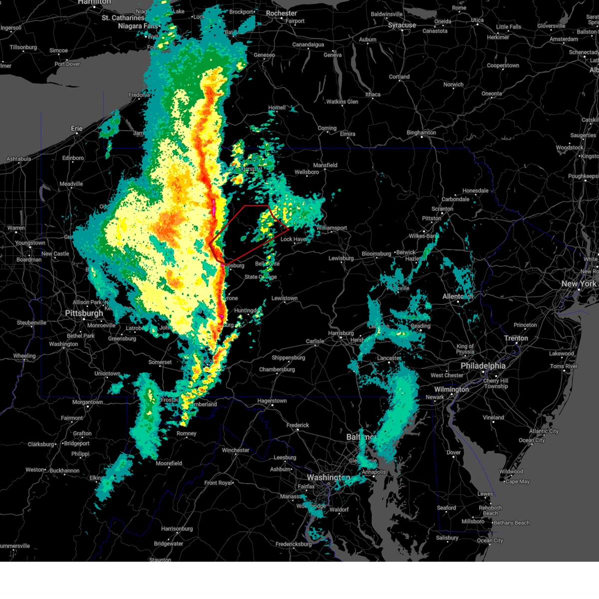
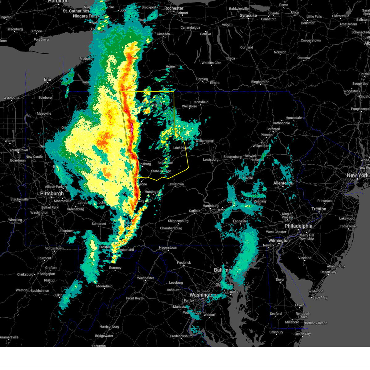
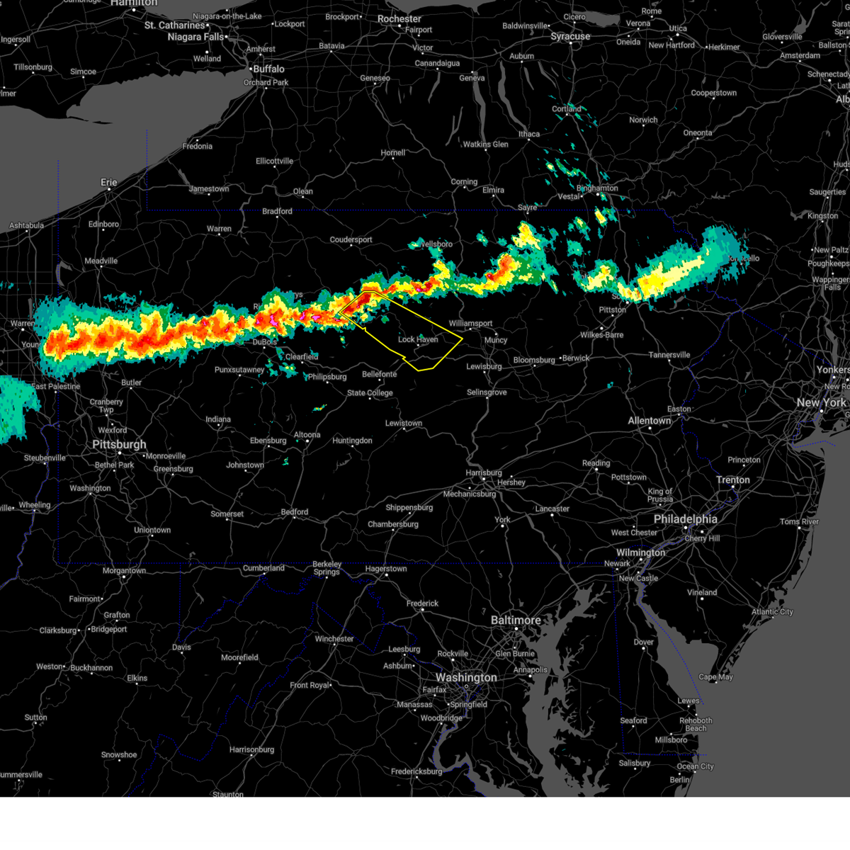
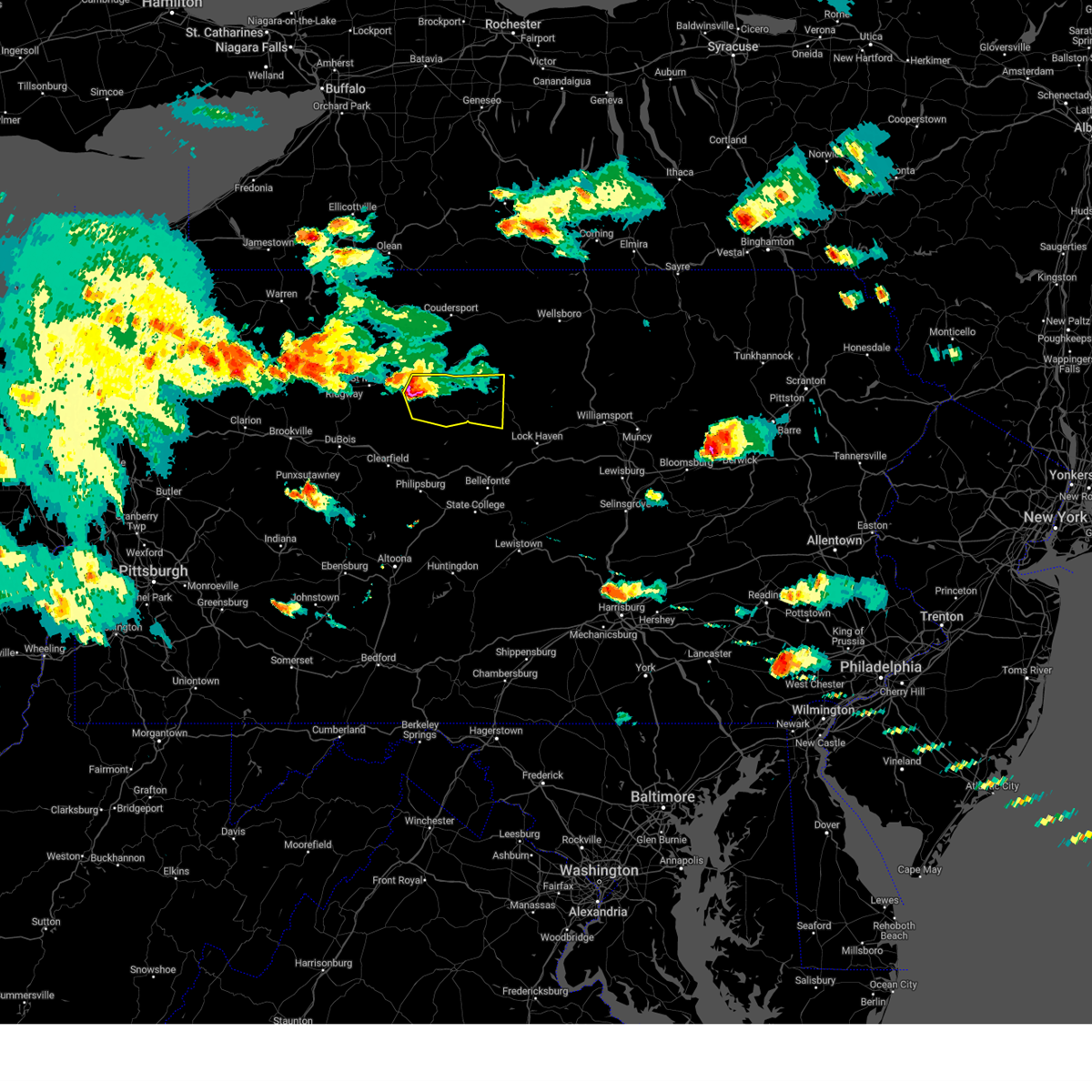
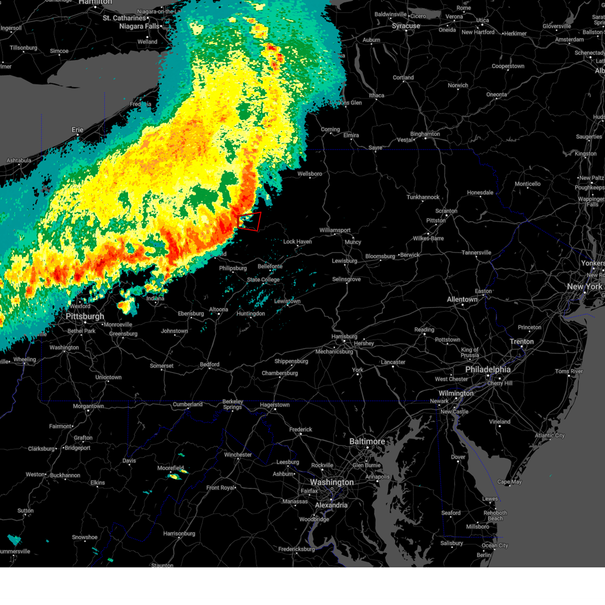
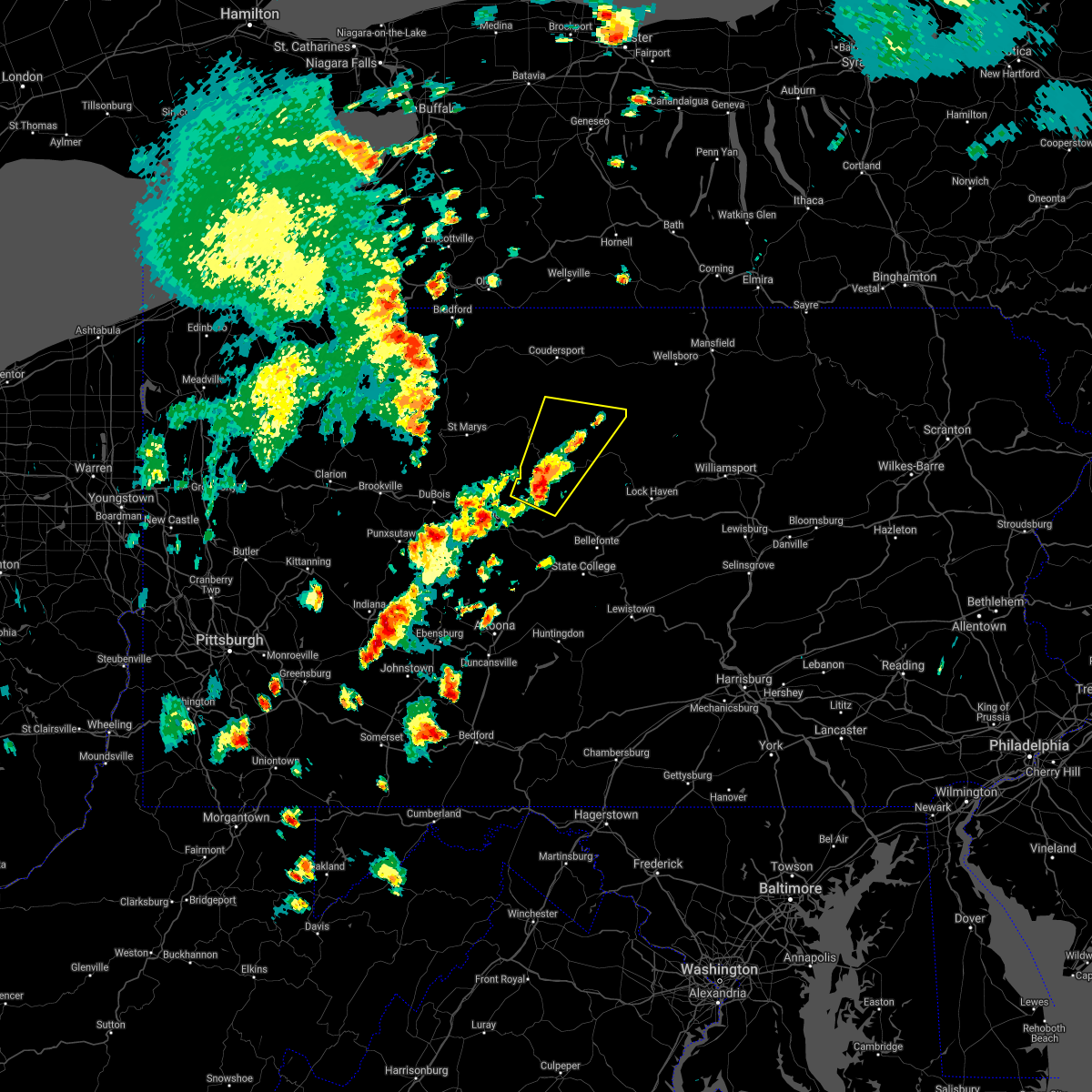
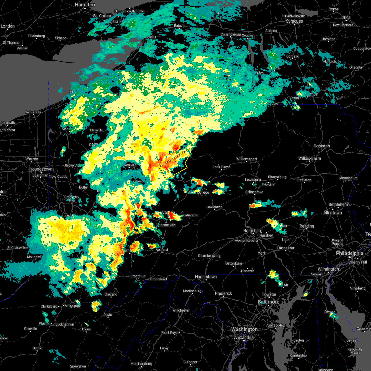
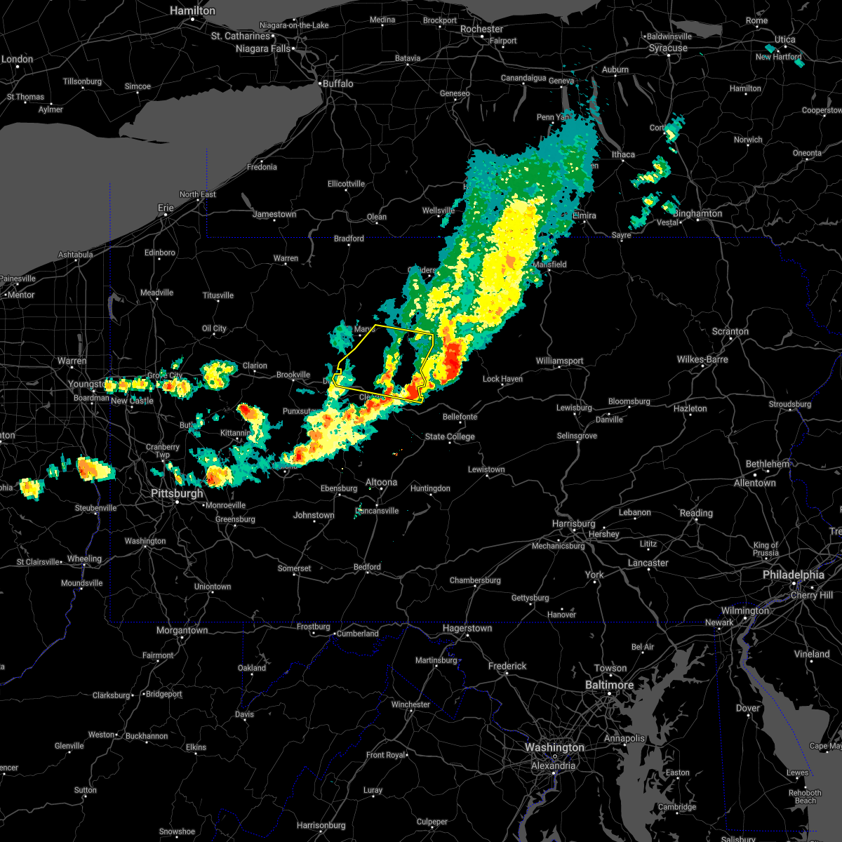
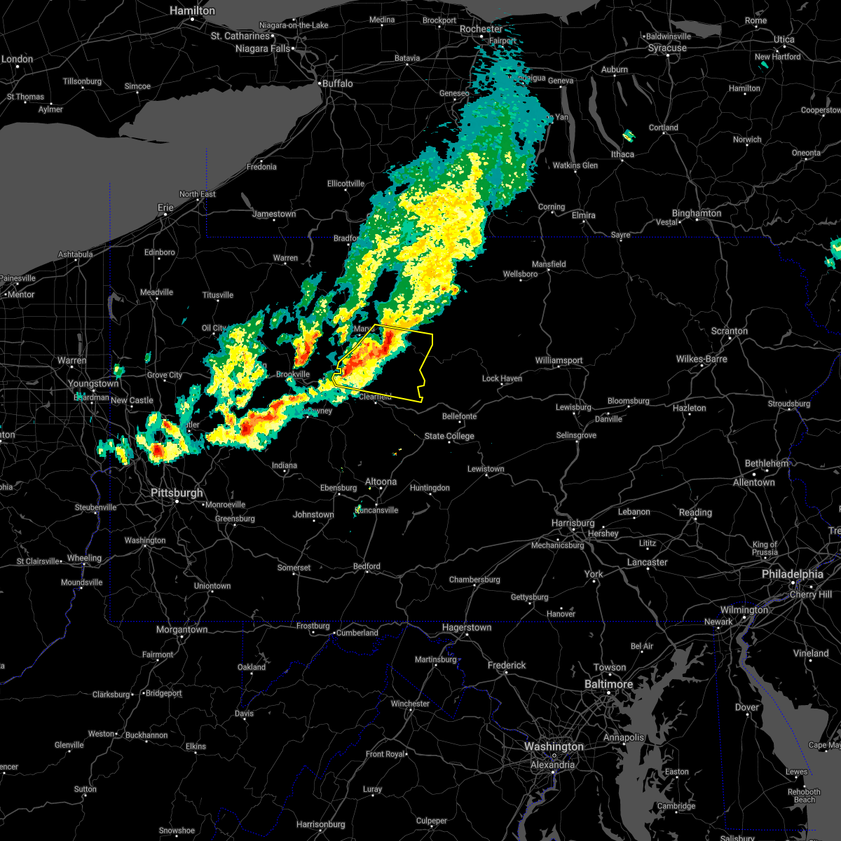
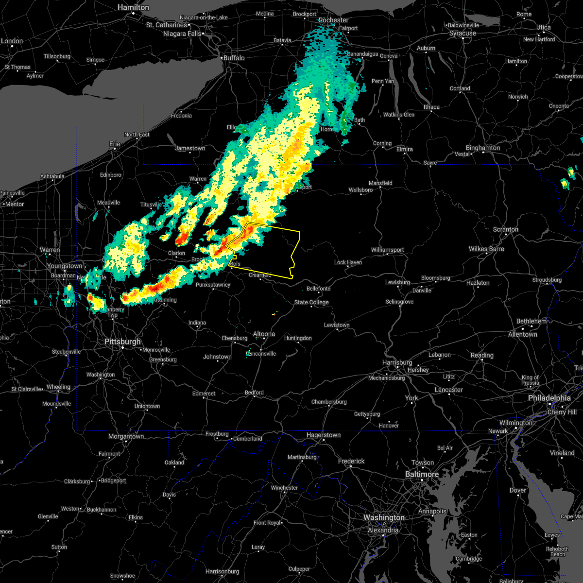
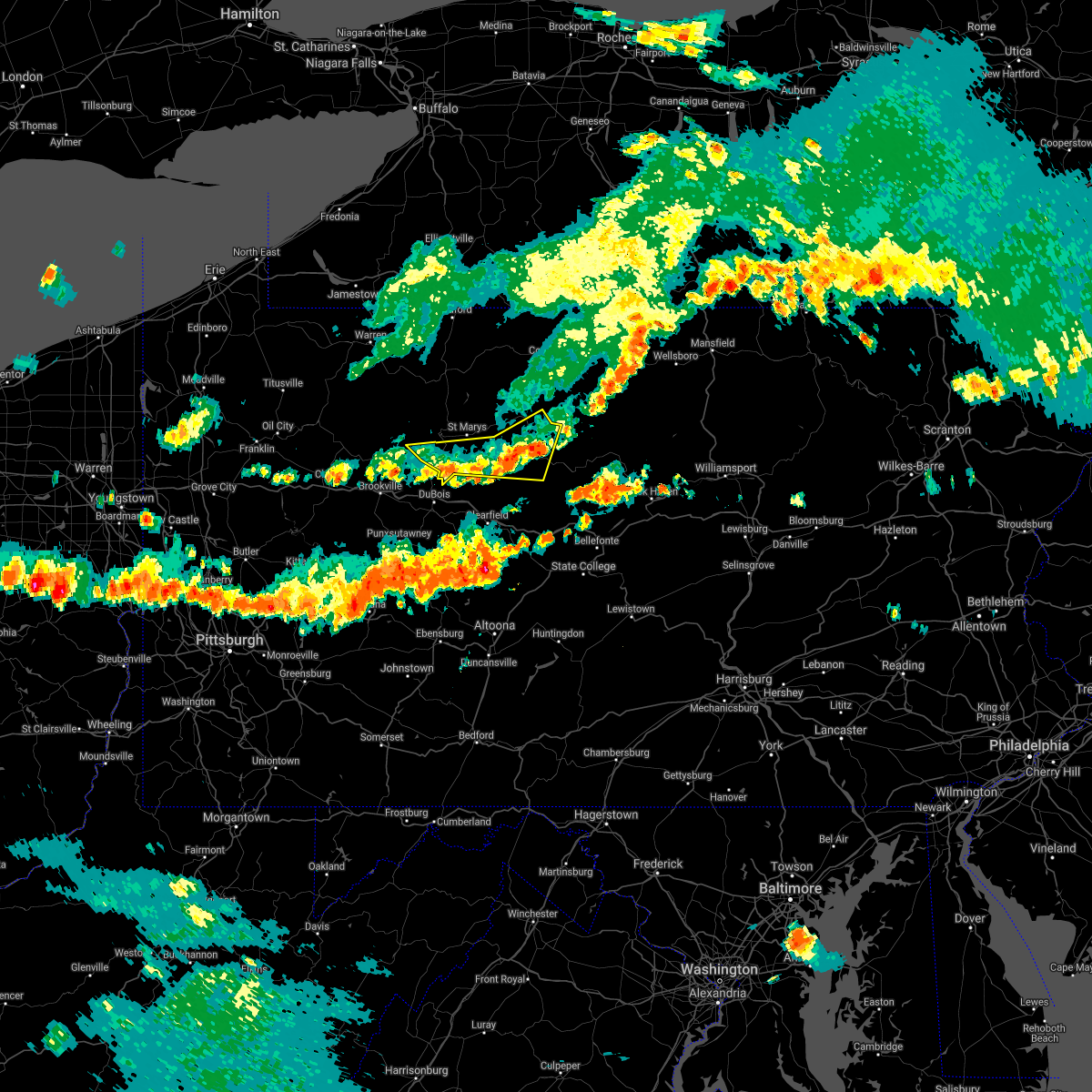
Hail Map for Driftwood, PA
The Driftwood, PA area has had 2 reports of on-the-ground hail by trained spotters, and has been under severe weather warnings 8 times during the past 12 months. Doppler radar has detected hail at or near Driftwood, PA on 21 occasions, including 1 occasion during the past year.
| Name: | Driftwood, PA |
| Where Located: | 40.3 miles NNW of State College, PA |
| Map: | Google Map for Driftwood, PA |
| Population: | 67 |
| Housing Units: | 93 |
| More Info: | Search Google for Driftwood, PA |
0
The Top Recent Hail Date for Driftwood, PA is Saturday, September 21, 2024 (21st out of 21)

Hail and Wind Damage Spotted near Driftwood, PA
| Date / Time | Report Details |
|---|---|
| 5/16/2025 4:55 PM EDT |
 Svrctp the national weather service in state college pa has issued a * severe thunderstorm warning for, southeastern cameron county in north central pennsylvania, northwestern centre county in central pennsylvania, northeastern clearfield county in central pennsylvania, northwestern clinton county in north central pennsylvania, * until 530 pm edt. * at 455 pm edt, severe thunderstorms were located along a line extending from near parker dam state park to near karthaus to pine glen, moving northeast at 30 mph (radar indicated). Hazards include 60 mph wind gusts and quarter size hail. Hail damage to vehicles is expected. Expect wind damage to roofs, siding, and trees. Svrctp the national weather service in state college pa has issued a * severe thunderstorm warning for, southeastern cameron county in north central pennsylvania, northwestern centre county in central pennsylvania, northeastern clearfield county in central pennsylvania, northwestern clinton county in north central pennsylvania, * until 530 pm edt. * at 455 pm edt, severe thunderstorms were located along a line extending from near parker dam state park to near karthaus to pine glen, moving northeast at 30 mph (radar indicated). Hazards include 60 mph wind gusts and quarter size hail. Hail damage to vehicles is expected. Expect wind damage to roofs, siding, and trees.
|
| 5/1/2025 8:39 PM EDT |
 At 838 pm edt, severe thunderstorms were located along a line extending from near karthaus to near keating to milesburg, moving northeast at 45 mph (radar indicated). Hazards include 60 mph wind gusts and quarter size hail. Hail damage to vehicles is expected. expect wind damage to roofs, siding, and trees. locations impacted include, westport, monument, orviston, moshannon, clarence, keating, tamarack, kettle creek state park, pine glen, snow shoe, driftwood, and unionville. for those driving on interstate 80, this includes areas between the kylertown and milesburg exits, specifically from mile markers 141 to 156. This includes interstate 99 from mile markers 63 to 65. At 838 pm edt, severe thunderstorms were located along a line extending from near karthaus to near keating to milesburg, moving northeast at 45 mph (radar indicated). Hazards include 60 mph wind gusts and quarter size hail. Hail damage to vehicles is expected. expect wind damage to roofs, siding, and trees. locations impacted include, westport, monument, orviston, moshannon, clarence, keating, tamarack, kettle creek state park, pine glen, snow shoe, driftwood, and unionville. for those driving on interstate 80, this includes areas between the kylertown and milesburg exits, specifically from mile markers 141 to 156. This includes interstate 99 from mile markers 63 to 65.
|
| 5/1/2025 8:39 PM EDT |
 the severe thunderstorm warning has been cancelled and is no longer in effect the severe thunderstorm warning has been cancelled and is no longer in effect
|
| 5/1/2025 8:22 PM EDT |
 Svrctp the national weather service in state college pa has issued a * severe thunderstorm warning for, southeastern cameron county in north central pennsylvania, western centre county in central pennsylvania, northeastern clearfield county in central pennsylvania, northwestern clinton county in north central pennsylvania, * until 900 pm edt. * at 822 pm edt, severe thunderstorms were located along a line extending from lecontes mills to karthaus to port matilda, moving northeast at 45 mph (radar indicated). Hazards include 60 mph wind gusts and quarter size hail. Hail damage to vehicles is expected. Expect wind damage to roofs, siding, and trees. Svrctp the national weather service in state college pa has issued a * severe thunderstorm warning for, southeastern cameron county in north central pennsylvania, western centre county in central pennsylvania, northeastern clearfield county in central pennsylvania, northwestern clinton county in north central pennsylvania, * until 900 pm edt. * at 822 pm edt, severe thunderstorms were located along a line extending from lecontes mills to karthaus to port matilda, moving northeast at 45 mph (radar indicated). Hazards include 60 mph wind gusts and quarter size hail. Hail damage to vehicles is expected. Expect wind damage to roofs, siding, and trees.
|
| 3/16/2025 2:48 PM EDT |
 At 247 pm edt, a severe squall line capable of producing both tornadoes and extensive straight line wind damage was located along a line extending from near hicks run to near kettle creek state park to keating, moving northeast at 65 mph (radar indicated rotation). Hazards include tornado and quarter size hail. Flying debris will be dangerous to those caught without shelter. mobile homes will be damaged or destroyed. damage to roofs, windows, and vehicles will occur. tree damage is likely. these dangerous storms will be near, kettle creek state park, westport, and stevenson dam around 250 pm edt. tamarack around 300 pm edt. Other locations impacted by these tornadic storms include driftwood. At 247 pm edt, a severe squall line capable of producing both tornadoes and extensive straight line wind damage was located along a line extending from near hicks run to near kettle creek state park to keating, moving northeast at 65 mph (radar indicated rotation). Hazards include tornado and quarter size hail. Flying debris will be dangerous to those caught without shelter. mobile homes will be damaged or destroyed. damage to roofs, windows, and vehicles will occur. tree damage is likely. these dangerous storms will be near, kettle creek state park, westport, and stevenson dam around 250 pm edt. tamarack around 300 pm edt. Other locations impacted by these tornadic storms include driftwood.
|
| 3/16/2025 2:48 PM EDT |
 the tornado warning has been cancelled and is no longer in effect the tornado warning has been cancelled and is no longer in effect
|
| 3/16/2025 2:30 PM EDT |
 Torctp the national weather service in state college pa has issued a * tornado warning for, southeastern cameron county in north central pennsylvania, northwestern centre county in central pennsylvania, northeastern clearfield county in central pennsylvania, northwestern clinton county in north central pennsylvania, southeastern elk county in north central pennsylvania, * until 300 pm edt. * at 230 pm edt, severe thunderstorms capable of producing both tornadoes and extensive straight line wind damage were located along a line extending from near lecontes mills to woodland, moving northeast at 60 mph (radar indicated rotation). Hazards include tornado and quarter size hail. Flying debris will be dangerous to those caught without shelter. mobile homes will be damaged or destroyed. damage to roofs, windows, and vehicles will occur. tree damage is likely. these dangerous storms will be near, karthaus and pine glen around 240 pm edt. other locations impacted by these tornadic storms include driftwood, wallaceton, kylertown, clearfield-lawrence airport, and grassflat. For those driving on interstate 80, this includes areas between the penfield and snow shoe exits, specifically from mile markers 118 to 133. Torctp the national weather service in state college pa has issued a * tornado warning for, southeastern cameron county in north central pennsylvania, northwestern centre county in central pennsylvania, northeastern clearfield county in central pennsylvania, northwestern clinton county in north central pennsylvania, southeastern elk county in north central pennsylvania, * until 300 pm edt. * at 230 pm edt, severe thunderstorms capable of producing both tornadoes and extensive straight line wind damage were located along a line extending from near lecontes mills to woodland, moving northeast at 60 mph (radar indicated rotation). Hazards include tornado and quarter size hail. Flying debris will be dangerous to those caught without shelter. mobile homes will be damaged or destroyed. damage to roofs, windows, and vehicles will occur. tree damage is likely. these dangerous storms will be near, karthaus and pine glen around 240 pm edt. other locations impacted by these tornadic storms include driftwood, wallaceton, kylertown, clearfield-lawrence airport, and grassflat. For those driving on interstate 80, this includes areas between the penfield and snow shoe exits, specifically from mile markers 118 to 133.
|
| 3/16/2025 2:27 PM EDT |
 Svrctp the national weather service in state college pa has issued a * severe thunderstorm warning for, cameron county in north central pennsylvania, centre county in central pennsylvania, eastern clearfield county in central pennsylvania, clinton county in north central pennsylvania, eastern elk county in north central pennsylvania, eastern mckean county in north central pennsylvania, potter county in north central pennsylvania, * until 345 pm edt. * at 226 pm edt, severe thunderstorms were located along a line extending from rew to betula to benezette to medix run to jeffries to sinking valley, moving east at 35 mph (trained weather spotters). Hazards include 70 mph wind gusts and quarter size hail. Hail damage to vehicles is expected. expect considerable tree damage. Wind damage is also likely to mobile homes, roofs, and outbuildings. Svrctp the national weather service in state college pa has issued a * severe thunderstorm warning for, cameron county in north central pennsylvania, centre county in central pennsylvania, eastern clearfield county in central pennsylvania, clinton county in north central pennsylvania, eastern elk county in north central pennsylvania, eastern mckean county in north central pennsylvania, potter county in north central pennsylvania, * until 345 pm edt. * at 226 pm edt, severe thunderstorms were located along a line extending from rew to betula to benezette to medix run to jeffries to sinking valley, moving east at 35 mph (trained weather spotters). Hazards include 70 mph wind gusts and quarter size hail. Hail damage to vehicles is expected. expect considerable tree damage. Wind damage is also likely to mobile homes, roofs, and outbuildings.
|
| 6/26/2024 5:17 PM EDT |
 Svrctp the national weather service in state college pa has issued a * severe thunderstorm warning for, cameron county in north central pennsylvania, northeastern clearfield county in central pennsylvania, west central clinton county in north central pennsylvania, southeastern elk county in north central pennsylvania, * until 545 pm edt. * at 517 pm edt, severe thunderstorms were located along a line extending from truman to benezette to near parker dam state park, moving east at 45 mph (radar indicated). Hazards include 60 mph wind gusts. expect damage to roofs, siding, and trees Svrctp the national weather service in state college pa has issued a * severe thunderstorm warning for, cameron county in north central pennsylvania, northeastern clearfield county in central pennsylvania, west central clinton county in north central pennsylvania, southeastern elk county in north central pennsylvania, * until 545 pm edt. * at 517 pm edt, severe thunderstorms were located along a line extending from truman to benezette to near parker dam state park, moving east at 45 mph (radar indicated). Hazards include 60 mph wind gusts. expect damage to roofs, siding, and trees
|
| 6/26/2024 4:32 PM EDT |
 Svrctp the national weather service in state college pa has issued a * severe thunderstorm warning for, cameron county in north central pennsylvania, north central clearfield county in central pennsylvania, elk county in north central pennsylvania, southeastern mckean county in north central pennsylvania, southwestern potter county in north central pennsylvania, * until 515 pm edt. * at 432 pm edt, severe thunderstorms were located along a line extending from betula to near elk river to ridgway, moving east at 30 mph (radar indicated). Hazards include 60 mph wind gusts and penny size hail. expect damage to roofs, siding, and trees Svrctp the national weather service in state college pa has issued a * severe thunderstorm warning for, cameron county in north central pennsylvania, north central clearfield county in central pennsylvania, elk county in north central pennsylvania, southeastern mckean county in north central pennsylvania, southwestern potter county in north central pennsylvania, * until 515 pm edt. * at 432 pm edt, severe thunderstorms were located along a line extending from betula to near elk river to ridgway, moving east at 30 mph (radar indicated). Hazards include 60 mph wind gusts and penny size hail. expect damage to roofs, siding, and trees
|
| 5/22/2024 4:20 PM EDT | Tree down across rt 120 near anderson r in cameron county PA, 5.9 miles SE of Driftwood, PA |
| 5/22/2024 4:15 PM EDT |
 Svrctp the national weather service in state college pa has issued a * severe thunderstorm warning for, cameron county in north central pennsylvania, northwestern clinton county in north central pennsylvania, southeastern mckean county in north central pennsylvania, potter county in north central pennsylvania, * until 530 pm edt. * at 414 pm edt, severe thunderstorms were located along a line extending from kinzua bridge state park to cameron to parker dam state park, moving northeast at 40 mph (radar indicated). Hazards include 60 mph wind gusts. expect damage to roofs, siding, and trees Svrctp the national weather service in state college pa has issued a * severe thunderstorm warning for, cameron county in north central pennsylvania, northwestern clinton county in north central pennsylvania, southeastern mckean county in north central pennsylvania, potter county in north central pennsylvania, * until 530 pm edt. * at 414 pm edt, severe thunderstorms were located along a line extending from kinzua bridge state park to cameron to parker dam state park, moving northeast at 40 mph (radar indicated). Hazards include 60 mph wind gusts. expect damage to roofs, siding, and trees
|
| 4/14/2024 5:59 PM EDT |
 Svrctp the national weather service in state college pa has issued a * severe thunderstorm warning for, east central cameron county in north central pennsylvania, clinton county in north central pennsylvania, southwestern lycoming county in north central pennsylvania, * until 645 pm edt. * at 558 pm edt, a severe thunderstorm was located over kettle creek state park, moving southeast at 55 mph (radar indicated). Hazards include 60 mph wind gusts and quarter size hail. Hail damage to vehicles is expected. Expect wind damage to roofs, siding, and trees. Svrctp the national weather service in state college pa has issued a * severe thunderstorm warning for, east central cameron county in north central pennsylvania, clinton county in north central pennsylvania, southwestern lycoming county in north central pennsylvania, * until 645 pm edt. * at 558 pm edt, a severe thunderstorm was located over kettle creek state park, moving southeast at 55 mph (radar indicated). Hazards include 60 mph wind gusts and quarter size hail. Hail damage to vehicles is expected. Expect wind damage to roofs, siding, and trees.
|
| 4/14/2024 5:29 PM EDT |
 At 529 pm edt, a severe thunderstorm was located over elk river, moving east at 60 mph (radar indicated). Hazards include 60 mph wind gusts and quarter size hail. Hail damage to vehicles is expected. expect wind damage to roofs, siding, and trees. Locations impacted include, cameron, wharton, emporium, betula, cross fork, stevenson dam, elk river, tamarack, kettle creek state park, truman, sizerville, and austin. At 529 pm edt, a severe thunderstorm was located over elk river, moving east at 60 mph (radar indicated). Hazards include 60 mph wind gusts and quarter size hail. Hail damage to vehicles is expected. expect wind damage to roofs, siding, and trees. Locations impacted include, cameron, wharton, emporium, betula, cross fork, stevenson dam, elk river, tamarack, kettle creek state park, truman, sizerville, and austin.
|
| 4/14/2024 5:11 PM EDT |
 Svrctp the national weather service in state college pa has issued a * severe thunderstorm warning for, cameron county in north central pennsylvania, northwestern clinton county in north central pennsylvania, northeastern elk county in north central pennsylvania, southeastern mckean county in north central pennsylvania, southwestern potter county in north central pennsylvania, * until 600 pm edt. * at 510 pm edt, a severe thunderstorm was located near wilcox, moving east at 60 mph (radar indicated). Hazards include 60 mph wind gusts and quarter size hail. Hail damage to vehicles is expected. Expect wind damage to roofs, siding, and trees. Svrctp the national weather service in state college pa has issued a * severe thunderstorm warning for, cameron county in north central pennsylvania, northwestern clinton county in north central pennsylvania, northeastern elk county in north central pennsylvania, southeastern mckean county in north central pennsylvania, southwestern potter county in north central pennsylvania, * until 600 pm edt. * at 510 pm edt, a severe thunderstorm was located near wilcox, moving east at 60 mph (radar indicated). Hazards include 60 mph wind gusts and quarter size hail. Hail damage to vehicles is expected. Expect wind damage to roofs, siding, and trees.
|
| 8/12/2023 4:29 PM EDT | Multiple trees down in and around cameron. time estimated by rada in cameron county PA, 8 miles SSE of Driftwood, PA |
| 8/12/2023 4:18 PM EDT |
 At 417 pm edt, a severe thunderstorm was located over cameron, moving east at 25 mph (radar indicated). Hazards include 60 mph wind gusts and quarter size hail. Hail damage to vehicles is expected. Expect wind damage to roofs, siding, and trees. At 417 pm edt, a severe thunderstorm was located over cameron, moving east at 25 mph (radar indicated). Hazards include 60 mph wind gusts and quarter size hail. Hail damage to vehicles is expected. Expect wind damage to roofs, siding, and trees.
|
| 7/20/2023 9:17 PM EDT |
 At 917 pm edt, a severe thunderstorm capable of producing a tornado was located over stevenson dam, moving east at 45 mph (radar indicated rotation). Hazards include tornado. Flying debris will be dangerous to those caught without shelter. mobile homes will be damaged or destroyed. damage to roofs, windows, and vehicles will occur. tree damage is likely. this dangerous storm will be near, stevenson dam around 920 pm edt. kettle creek state park around 930 pm edt. Other locations impacted by this tornadic thunderstorm include driftwood. At 917 pm edt, a severe thunderstorm capable of producing a tornado was located over stevenson dam, moving east at 45 mph (radar indicated rotation). Hazards include tornado. Flying debris will be dangerous to those caught without shelter. mobile homes will be damaged or destroyed. damage to roofs, windows, and vehicles will occur. tree damage is likely. this dangerous storm will be near, stevenson dam around 920 pm edt. kettle creek state park around 930 pm edt. Other locations impacted by this tornadic thunderstorm include driftwood.
|
| 7/20/2023 8:39 PM EDT |
 At 839 pm edt, severe thunderstorms were located along a line extending from elk river to st. marys to brockport, moving southeast at 45 mph (radar indicated). Hazards include 70 mph wind gusts. Expect considerable tree damage. Damage is likely to mobile homes, roofs, and outbuildings. At 839 pm edt, severe thunderstorms were located along a line extending from elk river to st. marys to brockport, moving southeast at 45 mph (radar indicated). Hazards include 70 mph wind gusts. Expect considerable tree damage. Damage is likely to mobile homes, roofs, and outbuildings.
|
| 4/1/2023 2:55 PM EDT | Mobile home unit rolled over on its roof remaining essentially intact. report relayed via social medi in cameron county PA, 0.2 miles ESE of Driftwood, PA |
| 4/1/2023 2:18 PM EDT |
 At 217 pm edt, severe thunderstorms were located along a line extending from kinzua dam to near indiana, moving east at 55 mph (automatic observing system. wind gust to 68 mph at allegheny county airport). Hazards include 70 mph wind gusts. Expect considerable tree damage. Damage is likely to mobile homes, roofs, and outbuildings. At 217 pm edt, severe thunderstorms were located along a line extending from kinzua dam to near indiana, moving east at 55 mph (automatic observing system. wind gust to 68 mph at allegheny county airport). Hazards include 70 mph wind gusts. Expect considerable tree damage. Damage is likely to mobile homes, roofs, and outbuildings.
|
| 6/22/2022 6:00 PM EDT |
 At 559 pm edt, severe thunderstorms were located along a line extending from sizerville to medix run, moving southeast at 30 mph (radar indicated). Hazards include 60 mph wind gusts and quarter size hail. Hail damage to vehicles is expected. expect wind damage to roofs, siding, and trees. locations impacted include, st. marys, cameron, wharton, emporium, force, benezette, stevenson dam, elk river, hicks run, medix run, truman and sizerville. hail threat, radar indicated max hail size, 1. 00 in wind threat, radar indicated max wind gust, 60 mph. At 559 pm edt, severe thunderstorms were located along a line extending from sizerville to medix run, moving southeast at 30 mph (radar indicated). Hazards include 60 mph wind gusts and quarter size hail. Hail damage to vehicles is expected. expect wind damage to roofs, siding, and trees. locations impacted include, st. marys, cameron, wharton, emporium, force, benezette, stevenson dam, elk river, hicks run, medix run, truman and sizerville. hail threat, radar indicated max hail size, 1. 00 in wind threat, radar indicated max wind gust, 60 mph.
|
| 6/22/2022 5:45 PM EDT |
 At 545 pm edt, severe thunderstorms were located along a line extending from keating summit to st. marys, moving southeast at 25 mph (radar indicated). Hazards include 60 mph wind gusts and quarter size hail. Hail damage to vehicles is expected. Expect wind damage to roofs, siding, and trees. At 545 pm edt, severe thunderstorms were located along a line extending from keating summit to st. marys, moving southeast at 25 mph (radar indicated). Hazards include 60 mph wind gusts and quarter size hail. Hail damage to vehicles is expected. Expect wind damage to roofs, siding, and trees.
|
| 3/7/2022 5:22 PM EST |
 At 522 pm est, severe thunderstorms were located along a line extending from canisteo to near karthaus to near boswell, moving northeast at 60 mph (radar indicated). Hazards include 60 mph wind gusts. expect damage to roofs, siding, and trees At 522 pm est, severe thunderstorms were located along a line extending from canisteo to near karthaus to near boswell, moving northeast at 60 mph (radar indicated). Hazards include 60 mph wind gusts. expect damage to roofs, siding, and trees
|
| 3/7/2022 4:49 PM EST |
 At 448 pm est, severe thunderstorms were located along a line extending from near cuba to south connellsville, moving northeast at 75 mph (radar indicated). Hazards include 60 mph wind gusts. expect damage to roofs, siding, and trees At 448 pm est, severe thunderstorms were located along a line extending from near cuba to south connellsville, moving northeast at 75 mph (radar indicated). Hazards include 60 mph wind gusts. expect damage to roofs, siding, and trees
|
| 7/13/2021 6:28 PM EDT |
 At 628 pm edt, a severe thunderstorm was located over medix run, moving northeast at 25 mph (radar indicated). Hazards include 60 mph wind gusts and quarter size hail. Hail damage to vehicles is expected. expect wind damage to roofs, siding, and trees. Locations impacted include, cameron, emporium, benezette, medix run, truman, elk river, hicks run, sizerville, weedville and driftwood. At 628 pm edt, a severe thunderstorm was located over medix run, moving northeast at 25 mph (radar indicated). Hazards include 60 mph wind gusts and quarter size hail. Hail damage to vehicles is expected. expect wind damage to roofs, siding, and trees. Locations impacted include, cameron, emporium, benezette, medix run, truman, elk river, hicks run, sizerville, weedville and driftwood.
|
| 7/13/2021 6:17 PM EDT |
 At 616 pm edt, a severe thunderstorm was located near keating, moving northeast at 35 mph (radar indicated). Hazards include 60 mph wind gusts and quarter size hail. Hail damage to vehicles is expected. expect wind damage to roofs, siding, and trees. Locations impacted include, wharton, keating, westport, cross fork, tamarack, stevenson dam, kettle creek state park, ole bull state park and driftwood. At 616 pm edt, a severe thunderstorm was located near keating, moving northeast at 35 mph (radar indicated). Hazards include 60 mph wind gusts and quarter size hail. Hail damage to vehicles is expected. expect wind damage to roofs, siding, and trees. Locations impacted include, wharton, keating, westport, cross fork, tamarack, stevenson dam, kettle creek state park, ole bull state park and driftwood.
|
| 7/13/2021 5:53 PM EDT |
 At 553 pm edt, a severe thunderstorm was located over plymptonville, moving northeast at 40 mph (radar indicated). Hazards include 60 mph wind gusts and quarter size hail. Hail damage to vehicles is expected. Expect wind damage to roofs, siding, and trees. At 553 pm edt, a severe thunderstorm was located over plymptonville, moving northeast at 40 mph (radar indicated). Hazards include 60 mph wind gusts and quarter size hail. Hail damage to vehicles is expected. Expect wind damage to roofs, siding, and trees.
|
| 7/13/2021 5:49 PM EDT |
 The national weather service in state college pa has issued a * severe thunderstorm warning for. northeastern clearfield county in central pennsylvania. northwestern centre county in central pennsylvania. southern potter county in north central pennsylvania. Eastern cameron county in north central pennsylvania. The national weather service in state college pa has issued a * severe thunderstorm warning for. northeastern clearfield county in central pennsylvania. northwestern centre county in central pennsylvania. southern potter county in north central pennsylvania. Eastern cameron county in north central pennsylvania.
|
| 7/11/2021 5:55 PM EDT |
 At 555 pm edt, severe thunderstorms were located along a line extending from stevenson dam to 7 miles west of kettle creek state park to 9 miles southeast of hicks run to near karthaus to near lecontes mills, moving northeast at 25 mph (radar indicated). Hazards include 60 mph wind gusts and quarter size hail. Hail damage to vehicles is expected. expect wind damage to roofs, siding, and trees. severe thunderstorms will be near, stevenson dam around 610 pm edt. kettle creek state park around 620 pm edt. keating, tamarack, cross fork, westport, ole bull state park, renovo and south renovo around 630 pm edt. Other locations impacted by these severe thunderstorms include driftwood. At 555 pm edt, severe thunderstorms were located along a line extending from stevenson dam to 7 miles west of kettle creek state park to 9 miles southeast of hicks run to near karthaus to near lecontes mills, moving northeast at 25 mph (radar indicated). Hazards include 60 mph wind gusts and quarter size hail. Hail damage to vehicles is expected. expect wind damage to roofs, siding, and trees. severe thunderstorms will be near, stevenson dam around 610 pm edt. kettle creek state park around 620 pm edt. keating, tamarack, cross fork, westport, ole bull state park, renovo and south renovo around 630 pm edt. Other locations impacted by these severe thunderstorms include driftwood.
|
| 7/11/2021 5:19 PM EDT |
 At 519 pm edt, a severe thunderstorm was located near s.b. elliot state park, moving northeast at 35 mph (radar indicated). Hazards include 60 mph wind gusts and quarter size hail. Hail damage to vehicles is expected. expect wind damage to roofs, siding, and trees. this severe thunderstorm will be near, lecontes mills around 530 pm edt. other locations impacted by this severe thunderstorm include driftwood and clearfield-lawrence airport. For those driving on interstate 80, this includes areas between the penfield and woodland exits, specifically from mile markers 115 to 120. At 519 pm edt, a severe thunderstorm was located near s.b. elliot state park, moving northeast at 35 mph (radar indicated). Hazards include 60 mph wind gusts and quarter size hail. Hail damage to vehicles is expected. expect wind damage to roofs, siding, and trees. this severe thunderstorm will be near, lecontes mills around 530 pm edt. other locations impacted by this severe thunderstorm include driftwood and clearfield-lawrence airport. For those driving on interstate 80, this includes areas between the penfield and woodland exits, specifically from mile markers 115 to 120.
|
| 6/14/2021 1:57 PM EDT |
 The severe thunderstorm warning for southeastern elk, northern clearfield and southern cameron counties will expire at 200 pm edt, the storms which prompted the warning have moved out of the area. therefore, the warning will be allowed to expire. a severe thunderstorm watch remains in effect until 600 pm edt for central and north central pennsylvania. to report severe weather, contact your nearest law enforcement agency. they will relay your report to the national weather service state college pa. The severe thunderstorm warning for southeastern elk, northern clearfield and southern cameron counties will expire at 200 pm edt, the storms which prompted the warning have moved out of the area. therefore, the warning will be allowed to expire. a severe thunderstorm watch remains in effect until 600 pm edt for central and north central pennsylvania. to report severe weather, contact your nearest law enforcement agency. they will relay your report to the national weather service state college pa.
|
| 6/14/2021 1:28 PM EDT | Trees and wires down in the vicinity of driftwoo in cameron county PA, 0.3 miles W of Driftwood, PA |
| 6/14/2021 1:10 PM EDT |
 At 109 pm edt, severe thunderstorms were located along a line extending from near cameron to medix run to force to near penfield, moving southeast at 35 mph (law enforcement). Hazards include 70 mph wind gusts. Expect considerable tree damage. damage is likely to mobile homes, roofs, and outbuildings. locations impacted include, st. marys, dubois, cameron, penfield, karthaus, force, benezette, stevenson dam, hicks run, brockport, parker dam state park, lecontes mills, s. b. elliot state park, medix run, truman, kersey, weedville, driftwood, treasure lake and penn state dubois. For those driving on interstate 80, this includes areas between the dubois and clearfield exits, specifically from mile markers 99 to 111. At 109 pm edt, severe thunderstorms were located along a line extending from near cameron to medix run to force to near penfield, moving southeast at 35 mph (law enforcement). Hazards include 70 mph wind gusts. Expect considerable tree damage. damage is likely to mobile homes, roofs, and outbuildings. locations impacted include, st. marys, dubois, cameron, penfield, karthaus, force, benezette, stevenson dam, hicks run, brockport, parker dam state park, lecontes mills, s. b. elliot state park, medix run, truman, kersey, weedville, driftwood, treasure lake and penn state dubois. For those driving on interstate 80, this includes areas between the dubois and clearfield exits, specifically from mile markers 99 to 111.
|
| 6/14/2021 12:47 PM EDT |
 At 1247 pm edt, severe thunderstorms were located along a line extending from near elk river to near st. marys to brandy camp to near brockway, moving east at 40 mph (radar indicated). Hazards include 60 mph wind gusts. expect damage to roofs, siding, and trees At 1247 pm edt, severe thunderstorms were located along a line extending from near elk river to near st. marys to brandy camp to near brockway, moving east at 40 mph (radar indicated). Hazards include 60 mph wind gusts. expect damage to roofs, siding, and trees
|
| 8/27/2020 6:06 PM EDT |
 At 606 pm edt, severe thunderstorms were located along a line extending from stevenson dam to near penfield, moving southeast at 60 mph (radar indicated). Hazards include 60 mph wind gusts. Expect damage to trees, roofs, and siding. locations impacted include, st. Marys, cameron, force, benezette, stevenson dam, brandy camp, hicks run, brockport, medix run, portland mills, kersey, weedville and driftwood. At 606 pm edt, severe thunderstorms were located along a line extending from stevenson dam to near penfield, moving southeast at 60 mph (radar indicated). Hazards include 60 mph wind gusts. Expect damage to trees, roofs, and siding. locations impacted include, st. Marys, cameron, force, benezette, stevenson dam, brandy camp, hicks run, brockport, medix run, portland mills, kersey, weedville and driftwood.
|
| 8/27/2020 5:50 PM EDT |
 At 550 pm edt, severe thunderstorms were located along a line extending from near sizerville to near portland mills, moving southeast at 60 mph (radar indicated). Hazards include 60 mph wind gusts. expect damage to trees, roofs, and siding At 550 pm edt, severe thunderstorms were located along a line extending from near sizerville to near portland mills, moving southeast at 60 mph (radar indicated). Hazards include 60 mph wind gusts. expect damage to trees, roofs, and siding
|
| 7/19/2020 5:11 PM EDT |
 At 510 pm edt, severe thunderstorms were located along a line extending from near lyman run state park to 7 miles southeast of hicks run, moving east at 30 mph (radar indicated). Hazards include 60 mph wind gusts and quarter size hail. Hail damage to vehicles is expected. expect wind damage to trees, roofs, and siding. Locations impacted include, wellsboro, cameron, wharton, keating, renovo, galeton, gaines, south renovo, cross fork, westport, leetonia, stevenson dam, cherry springs state park, hyner, leonard harrison state park, tamarack, kettle creek state park, ole bull state park, lyman run state park and hicks run. At 510 pm edt, severe thunderstorms were located along a line extending from near lyman run state park to 7 miles southeast of hicks run, moving east at 30 mph (radar indicated). Hazards include 60 mph wind gusts and quarter size hail. Hail damage to vehicles is expected. expect wind damage to trees, roofs, and siding. Locations impacted include, wellsboro, cameron, wharton, keating, renovo, galeton, gaines, south renovo, cross fork, westport, leetonia, stevenson dam, cherry springs state park, hyner, leonard harrison state park, tamarack, kettle creek state park, ole bull state park, lyman run state park and hicks run.
|
| 7/19/2020 4:49 PM EDT |
 At 449 pm edt, severe thunderstorms were located along a line extending from near denton hill state park to near benezette, moving east at 30 mph (radar indicated). Hazards include 60 mph wind gusts and quarter size hail. Hail damage to vehicles is expected. Expect wind damage to trees, roofs, and siding. At 449 pm edt, severe thunderstorms were located along a line extending from near denton hill state park to near benezette, moving east at 30 mph (radar indicated). Hazards include 60 mph wind gusts and quarter size hail. Hail damage to vehicles is expected. Expect wind damage to trees, roofs, and siding.
|
| 6/25/2020 7:01 PM EDT |
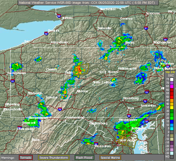 At 642 pm edt, a severe thunderstorm was located near medix run, moving east at 35 mph (radar indicated). Hazards include 60 mph wind gusts and quarter size hail. Hail damage to vehicles is expected. Expect wind damage to trees, roofs, and siding. At 642 pm edt, a severe thunderstorm was located near medix run, moving east at 35 mph (radar indicated). Hazards include 60 mph wind gusts and quarter size hail. Hail damage to vehicles is expected. Expect wind damage to trees, roofs, and siding.
|
| 6/25/2020 6:43 PM EDT |
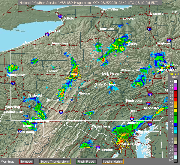 At 642 pm edt, a severe thunderstorm was located near medix run, moving east at 35 mph (radar indicated). Hazards include 60 mph wind gusts and quarter size hail. Hail damage to vehicles is expected. Expect wind damage to trees, roofs, and siding. At 642 pm edt, a severe thunderstorm was located near medix run, moving east at 35 mph (radar indicated). Hazards include 60 mph wind gusts and quarter size hail. Hail damage to vehicles is expected. Expect wind damage to trees, roofs, and siding.
|
| 6/3/2020 4:06 PM EDT |
 At 404 pm edt, a severe thunderstorm was located near monument, moving southeast at 35 mph. additional thunderstorms about 10 to 15 miles to the east, and northwest of this storm could strengthen to severe levels over the next 30 minutes (radar indicated). Hazards include 60 mph wind gusts and quarter size hail. Hail damage to vehicles is expected. expect wind damage to trees, roofs, and siding. this severe storm will be near, monument around 410 pm edt. blanchard and bald eagle state park around 420 pm edt. Other locations impacted by this severe thunderstorm include orviston, beech creek, driftwood and howard. At 404 pm edt, a severe thunderstorm was located near monument, moving southeast at 35 mph. additional thunderstorms about 10 to 15 miles to the east, and northwest of this storm could strengthen to severe levels over the next 30 minutes (radar indicated). Hazards include 60 mph wind gusts and quarter size hail. Hail damage to vehicles is expected. expect wind damage to trees, roofs, and siding. this severe storm will be near, monument around 410 pm edt. blanchard and bald eagle state park around 420 pm edt. Other locations impacted by this severe thunderstorm include orviston, beech creek, driftwood and howard.
|
| 6/3/2020 3:35 PM EDT | Trees down across wykoff run r in cameron county PA, 3.3 miles NW of Driftwood, PA |
| 6/3/2020 3:21 PM EDT |
 At 320 pm edt, a severe thunderstorm was located near hicks run, moving southeast at 35 mph (radar indicated). Hazards include 60 mph wind gusts and quarter size hail. Hail damage to vehicles is expected. expect wind damage to trees, roofs, and siding. this severe thunderstorm will be near, keating around 350 pm edt. monument, blanchard and bald eagle state park around 410 pm edt. other locations impacted by this severe thunderstorm include orviston, driftwood, beech creek and howard. This includes state road 120 between north of driftwood and west of renovo, and near north of lock haven. At 320 pm edt, a severe thunderstorm was located near hicks run, moving southeast at 35 mph (radar indicated). Hazards include 60 mph wind gusts and quarter size hail. Hail damage to vehicles is expected. expect wind damage to trees, roofs, and siding. this severe thunderstorm will be near, keating around 350 pm edt. monument, blanchard and bald eagle state park around 410 pm edt. other locations impacted by this severe thunderstorm include orviston, driftwood, beech creek and howard. This includes state road 120 between north of driftwood and west of renovo, and near north of lock haven.
|
| 3/20/2020 2:20 PM EDT |
 At 220 pm edt, severe thunderstorms were located along a line extending from near ridgway to near portland mills to near reynoldsville to 7 miles east of new bethlehem, moving east at 55 mph (radar indicated). Hazards include 60 mph wind gusts. Expect damage to trees, roofs, and siding. severe thunderstorms will be near, dubois, johnsonburg, ridgway, brandy camp, sandy, brockport and rockton around 230 pm edt. st. marys, s. b. elliot state park, force, medix run, parker dam state park, truman and penfield around 240 pm edt. benezette, hicks run, plymptonville and woodland around 250 pm edt. clearfield, curwensville, lecontes mills, hyde, cameron, karthaus and stevenson dam around 300 pm edt. other locations impacted by these severe thunderstorms include troutville, wallaceton, weedville, grampian, driftwood, lumber city, kersey, treasure lake, clearfield-lawrence airport and penn state dubois. For those driving on interstate 80, this includes areas between the dubois and kylertown exits, specifically from mile markers 97 to 131. At 220 pm edt, severe thunderstorms were located along a line extending from near ridgway to near portland mills to near reynoldsville to 7 miles east of new bethlehem, moving east at 55 mph (radar indicated). Hazards include 60 mph wind gusts. Expect damage to trees, roofs, and siding. severe thunderstorms will be near, dubois, johnsonburg, ridgway, brandy camp, sandy, brockport and rockton around 230 pm edt. st. marys, s. b. elliot state park, force, medix run, parker dam state park, truman and penfield around 240 pm edt. benezette, hicks run, plymptonville and woodland around 250 pm edt. clearfield, curwensville, lecontes mills, hyde, cameron, karthaus and stevenson dam around 300 pm edt. other locations impacted by these severe thunderstorms include troutville, wallaceton, weedville, grampian, driftwood, lumber city, kersey, treasure lake, clearfield-lawrence airport and penn state dubois. For those driving on interstate 80, this includes areas between the dubois and kylertown exits, specifically from mile markers 97 to 131.
|
| 10/3/2019 4:09 PM EDT |
 At 408 pm edt, a severe thunderstorm was located over medix run, moving east at 40 mph (radar indicated). Hazards include 60 mph wind gusts and quarter size hail. Hail damage to vehicles is expected. Expect wind damage to trees, roofs, and siding. At 408 pm edt, a severe thunderstorm was located over medix run, moving east at 40 mph (radar indicated). Hazards include 60 mph wind gusts and quarter size hail. Hail damage to vehicles is expected. Expect wind damage to trees, roofs, and siding.
|
| 8/18/2019 2:51 PM EDT |
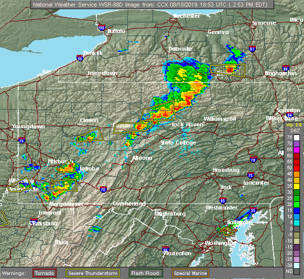 At 251 pm edt, a severe thunderstorm was located near cross fork, moving east at 30 mph (radar indicated). Hazards include 60 mph wind gusts and quarter size hail. Hail damage to vehicles is expected. expect wind damage to trees, roofs, and siding. Locations impacted include, renovo, south renovo, cross fork, westport, tamarack, kettle creek state park, hyner, ole bull state park, stevenson dam and driftwood. At 251 pm edt, a severe thunderstorm was located near cross fork, moving east at 30 mph (radar indicated). Hazards include 60 mph wind gusts and quarter size hail. Hail damage to vehicles is expected. expect wind damage to trees, roofs, and siding. Locations impacted include, renovo, south renovo, cross fork, westport, tamarack, kettle creek state park, hyner, ole bull state park, stevenson dam and driftwood.
|
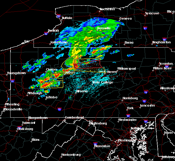
| 8/18/2019 2:28 PM EDT |
 At 228 pm edt, a severe thunderstorm was located over kettle creek state park, moving east at 35 mph (radar indicated). Hazards include 60 mph wind gusts and quarter size hail. Hail damage to vehicles is expected. Expect wind damage to trees, roofs, and siding. At 228 pm edt, a severe thunderstorm was located over kettle creek state park, moving east at 35 mph (radar indicated). Hazards include 60 mph wind gusts and quarter size hail. Hail damage to vehicles is expected. Expect wind damage to trees, roofs, and siding.
|
| 8/18/2019 2:17 PM EDT | Trees down at the intersection of first fork road and evas wa in cameron county PA, 4.1 miles WSW of Driftwood, PA |
| 8/18/2019 2:08 PM EDT | Multiple trees down along pa 120 near driftwoo in cameron county PA, 0.2 miles ESE of Driftwood, PA |
| 8/18/2019 1:36 PM EDT |
 At 135 pm edt, severe thunderstorms were located along a line extending from near gaines to near stevenson dam, moving east at 45 mph (radar indicated). Hazards include 60 mph wind gusts and nickel size hail. expect damage to trees, roofs, and siding At 135 pm edt, severe thunderstorms were located along a line extending from near gaines to near stevenson dam, moving east at 45 mph (radar indicated). Hazards include 60 mph wind gusts and nickel size hail. expect damage to trees, roofs, and siding
|
| 7/19/2019 6:48 PM EDT |
 At 647 pm edt, severe thunderstorms were located along a line extending from near emporium to medix run to near brockport, moving east at 25 mph (radar indicated). Hazards include 60 mph wind gusts. expect damage to trees, roofs, and siding At 647 pm edt, severe thunderstorms were located along a line extending from near emporium to medix run to near brockport, moving east at 25 mph (radar indicated). Hazards include 60 mph wind gusts. expect damage to trees, roofs, and siding
|
| 7/6/2019 3:14 PM EDT |
 At 313 pm edt, a severe thunderstorm was located over ridgway, moving east at 40 mph (radar indicated). Hazards include 60 mph wind gusts and quarter size hail. Hail damage to vehicles is expected. Expect wind damage to trees, roofs, and siding. At 313 pm edt, a severe thunderstorm was located over ridgway, moving east at 40 mph (radar indicated). Hazards include 60 mph wind gusts and quarter size hail. Hail damage to vehicles is expected. Expect wind damage to trees, roofs, and siding.
|
| 5/29/2019 2:26 PM EDT |
 At 226 pm edt, severe thunderstorms were located along a line extending from near cross fork to near kettle creek state park to near force, moving east at 40 mph (radar indicated). Hazards include 60 mph wind gusts and quarter size hail. Hail damage to vehicles is expected. Expect wind damage to trees, roofs, and siding. At 226 pm edt, severe thunderstorms were located along a line extending from near cross fork to near kettle creek state park to near force, moving east at 40 mph (radar indicated). Hazards include 60 mph wind gusts and quarter size hail. Hail damage to vehicles is expected. Expect wind damage to trees, roofs, and siding.
|
| 5/29/2019 2:15 PM EDT |
 At 214 pm edt, a severe thunderstorm was located near tamarack, moving east at 40 mph (radar indicated). Hazards include 70 mph wind gusts and penny size hail. Expect considerable tree damage. damage is likely to mobile homes, roofs, and outbuildings. Locations impacted include, cameron, wharton, benezette, cross fork, tamarack, stevenson dam, kettle creek state park, hicks run and driftwood. At 214 pm edt, a severe thunderstorm was located near tamarack, moving east at 40 mph (radar indicated). Hazards include 70 mph wind gusts and penny size hail. Expect considerable tree damage. damage is likely to mobile homes, roofs, and outbuildings. Locations impacted include, cameron, wharton, benezette, cross fork, tamarack, stevenson dam, kettle creek state park, hicks run and driftwood.
|
| 5/29/2019 1:41 PM EDT |
 At 140 pm edt, a severe thunderstorm was located over elk river, moving east at 40 mph (radar indicated). Hazards include 60 mph wind gusts and penny size hail. expect damage to trees, roofs, and siding At 140 pm edt, a severe thunderstorm was located over elk river, moving east at 40 mph (radar indicated). Hazards include 60 mph wind gusts and penny size hail. expect damage to trees, roofs, and siding
|
| 10/2/2018 5:27 PM EDT |
 At 526 pm edt, severe thunderstorms were located along a line extending from 6 miles northeast of east branch dam to 6 miles north of portland mills to reynoldsville, moving east at 45 mph (radar indicated). Hazards include ping pong ball size hail and 60 mph wind gusts. People and animals outdoors will be injured. expect hail damage to roofs, siding, windows, and vehicles. Expect wind damage to roofs, siding, and trees. At 526 pm edt, severe thunderstorms were located along a line extending from 6 miles northeast of east branch dam to 6 miles north of portland mills to reynoldsville, moving east at 45 mph (radar indicated). Hazards include ping pong ball size hail and 60 mph wind gusts. People and animals outdoors will be injured. expect hail damage to roofs, siding, windows, and vehicles. Expect wind damage to roofs, siding, and trees.
|
| 10/2/2018 4:26 PM EDT |
 At 425 pm edt, severe thunderstorms were located along a line extending from near st. marys to 7 miles west of portland mills to near sandy, moving east at 30 mph (radar indicated). Hazards include 60 mph wind gusts. expect damage to roofs, siding, and trees At 425 pm edt, severe thunderstorms were located along a line extending from near st. marys to 7 miles west of portland mills to near sandy, moving east at 30 mph (radar indicated). Hazards include 60 mph wind gusts. expect damage to roofs, siding, and trees
|
| 5/15/2018 1:00 PM EDT | Trees and wires down along route 120 in cameron county PA, 4 miles WNW of Driftwood, PA |
| 5/15/2018 12:56 PM EDT | Numerous trees and wires down along huston hill road in elk county PA, 7.7 miles ESE of Driftwood, PA |
| 5/15/2018 12:46 PM EDT |
 At 1246 pm edt, severe thunderstorms capable of producing a tornado were located along a line extending from near truman to near hicks run to benezette, moving east at 65 mph (radar indicated rotation). Hazards include tornado. Flying debris will be dangerous to those caught without shelter. mobile homes will be damaged or destroyed. damage to roofs, windows, and vehicles will occur. tree damage is likely. these dangerous storms will be near, hicks run and cameron around 1250 pm edt. kettle creek state park, stevenson dam and tamarack around 100 pm edt. ole bull state park, cross fork and renovo around 110 pm edt. Other locations impacted by these tornadic storms include driftwood. At 1246 pm edt, severe thunderstorms capable of producing a tornado were located along a line extending from near truman to near hicks run to benezette, moving east at 65 mph (radar indicated rotation). Hazards include tornado. Flying debris will be dangerous to those caught without shelter. mobile homes will be damaged or destroyed. damage to roofs, windows, and vehicles will occur. tree damage is likely. these dangerous storms will be near, hicks run and cameron around 1250 pm edt. kettle creek state park, stevenson dam and tamarack around 100 pm edt. ole bull state park, cross fork and renovo around 110 pm edt. Other locations impacted by these tornadic storms include driftwood.
|
| 5/15/2018 12:43 PM EDT |
 At 1242 pm edt, a severe thunderstorm was located near benezette, moving east at 60 mph. this is a very dangerous storm (radar indicated). Hazards include 80 mph wind gusts and nickel size hail. Flying debris will be dangerous to those caught without shelter. mobile homes will be heavily damaged. expect considerable damage to roofs, windows, and vehicles. Extensive tree damage and power outages are likely. At 1242 pm edt, a severe thunderstorm was located near benezette, moving east at 60 mph. this is a very dangerous storm (radar indicated). Hazards include 80 mph wind gusts and nickel size hail. Flying debris will be dangerous to those caught without shelter. mobile homes will be heavily damaged. expect considerable damage to roofs, windows, and vehicles. Extensive tree damage and power outages are likely.
|
| 5/4/2018 5:22 PM EDT |
 At 521 pm edt, severe thunderstorms were located along a line extending from near shinglehouse to near brookville, moving east at 50 mph (radar indicated). Hazards include 70 mph wind gusts. Expect considerable tree damage. Damage is likely to mobile homes, roofs, and outbuildings. At 521 pm edt, severe thunderstorms were located along a line extending from near shinglehouse to near brookville, moving east at 50 mph (radar indicated). Hazards include 70 mph wind gusts. Expect considerable tree damage. Damage is likely to mobile homes, roofs, and outbuildings.
|
| 10/15/2017 6:13 PM EDT |
 At 612 pm edt, severe thunderstorms were located along a line extending from near east branch dam to near johnsonburg to near portland mills, moving east at 40 mph (radar indicated). Hazards include 60 mph wind gusts. Expect damage to trees and power lines. severe thunderstorms will be near, elk river and east branch dam around 620 pm edt. st. marys around 630 pm edt. sizerville, truman and force around 640 pm edt. medix run and emporium around 650 pm edt. other locations impacted by these severe thunderstorms include driftwood, weedville and kersey. this includes the following highways, route 219 from brockport to north of wilcox. state road 120 from ridgway to east of driftwood. State road 255 from north of penfield to johnsonburg. At 612 pm edt, severe thunderstorms were located along a line extending from near east branch dam to near johnsonburg to near portland mills, moving east at 40 mph (radar indicated). Hazards include 60 mph wind gusts. Expect damage to trees and power lines. severe thunderstorms will be near, elk river and east branch dam around 620 pm edt. st. marys around 630 pm edt. sizerville, truman and force around 640 pm edt. medix run and emporium around 650 pm edt. other locations impacted by these severe thunderstorms include driftwood, weedville and kersey. this includes the following highways, route 219 from brockport to north of wilcox. state road 120 from ridgway to east of driftwood. State road 255 from north of penfield to johnsonburg.
|
| 8/22/2017 2:52 PM EDT |
 At 249 pm edt, severe thunderstorms were located along a line extending from near kinzua bridge state park to near st. marys to near force, moving east at 50 mph. these are very dangerous storms (radar indicated). Hazards include 70 mph wind gusts. Flying debris will be dangerous to those caught without shelter. locations impacted include, ridgway, st. marys, johnsonburg, stevenson dam, force, brandy camp, benezette, east branch dam, elk river and hicks run. A tornado watch remains in effect until 900 pm edt for north central pennsylvania. At 249 pm edt, severe thunderstorms were located along a line extending from near kinzua bridge state park to near st. marys to near force, moving east at 50 mph. these are very dangerous storms (radar indicated). Hazards include 70 mph wind gusts. Flying debris will be dangerous to those caught without shelter. locations impacted include, ridgway, st. marys, johnsonburg, stevenson dam, force, brandy camp, benezette, east branch dam, elk river and hicks run. A tornado watch remains in effect until 900 pm edt for north central pennsylvania.
|
| 8/22/2017 2:39 PM EDT |
 At 235 pm edt, severe thunderstorms were located along a line extending from 6 miles southwest of kinzua bridge state park to johnsonburg to near brockport, moving east at 50 mph. these are very dangerous storms (radar indicated). Hazards include 80 mph wind gusts near johnsonburg and ridgway. these very strong winds will be impacting east branch dam, elk river and emporium between 240 pm and 3 pm. Flying debris will be dangerous to those caught without shelter. mobile homes will be heavily damaged. expect considerable damage to roofs, windows, and vehicles. extensive tree damage and power outages are likely. locations impacted include, ridgway, kane, dubois, st. marys, johnsonburg, force, crosby, ludlow, east branch dam and hicks run. A tornado watch remains in effect until 900 pm edt for north central pennsylvania. At 235 pm edt, severe thunderstorms were located along a line extending from 6 miles southwest of kinzua bridge state park to johnsonburg to near brockport, moving east at 50 mph. these are very dangerous storms (radar indicated). Hazards include 80 mph wind gusts near johnsonburg and ridgway. these very strong winds will be impacting east branch dam, elk river and emporium between 240 pm and 3 pm. Flying debris will be dangerous to those caught without shelter. mobile homes will be heavily damaged. expect considerable damage to roofs, windows, and vehicles. extensive tree damage and power outages are likely. locations impacted include, ridgway, kane, dubois, st. marys, johnsonburg, force, crosby, ludlow, east branch dam and hicks run. A tornado watch remains in effect until 900 pm edt for north central pennsylvania.
|
| 8/22/2017 2:09 PM EDT |
 At 208 pm edt, severe thunderstorms were located along a line extending from near sheffield to near marienville to near brookville, moving east at 30 mph (radar indicated). Hazards include 60 mph wind gusts. expect damage to trees and power lines At 208 pm edt, severe thunderstorms were located along a line extending from near sheffield to near marienville to near brookville, moving east at 30 mph (radar indicated). Hazards include 60 mph wind gusts. expect damage to trees and power lines
|
| 8/4/2017 7:55 PM EDT |
 At 754 pm edt, severe thunderstorms were located along a line extending from 6 miles south of marienville to near brookville to near kittanning, moving northeast at 40 mph (radar indicated). Hazards include 60 mph wind gusts. expect damage to trees and power lines At 754 pm edt, severe thunderstorms were located along a line extending from 6 miles south of marienville to near brookville to near kittanning, moving northeast at 40 mph (radar indicated). Hazards include 60 mph wind gusts. expect damage to trees and power lines
|
| 6/15/2017 6:56 PM EDT |
 At 656 pm edt, severe thunderstorms were located along a line extending from near coudersport to hicks run, moving east at 30 mph (radar indicated). Hazards include 60 mph wind gusts. Expect damage to trees and power lines. Locations impacted include, stevenson dam, medix run, truman, benezette, hicks run, cameron, emporium, sizerville and driftwood. At 656 pm edt, severe thunderstorms were located along a line extending from near coudersport to hicks run, moving east at 30 mph (radar indicated). Hazards include 60 mph wind gusts. Expect damage to trees and power lines. Locations impacted include, stevenson dam, medix run, truman, benezette, hicks run, cameron, emporium, sizerville and driftwood.
|
| 6/15/2017 6:12 PM EDT |
 At 611 pm edt, severe thunderstorms were located along a line extending from 6 miles southwest of betula to near brockport, moving east at 30 mph (radar indicated). Hazards include 60 mph wind gusts. expect damage to trees and power lines At 611 pm edt, severe thunderstorms were located along a line extending from 6 miles southwest of betula to near brockport, moving east at 30 mph (radar indicated). Hazards include 60 mph wind gusts. expect damage to trees and power lines
|
| 5/1/2017 4:22 PM EDT |
 At 421 pm edt, severe thunderstorms were located along a line extending from st. bonaventure to near penfield, moving east at 50 mph (radar indicated). Hazards include 70 mph wind gusts. Expect considerable tree damage. Damage is likely to mobile homes, roofs, and outbuildings. At 421 pm edt, severe thunderstorms were located along a line extending from st. bonaventure to near penfield, moving east at 50 mph (radar indicated). Hazards include 70 mph wind gusts. Expect considerable tree damage. Damage is likely to mobile homes, roofs, and outbuildings.
|
| 4/20/2017 10:48 PM EDT |
 At 1047 pm edt, a severe thunderstorm was located near truman, moving east at 30 mph (radar indicated). Hazards include 60 mph wind gusts and quarter size hail. Hail damage to vehicles is expected. expect wind damage to roofs, siding, and trees. locations impacted include, st. Marys, westport, stevenson dam, benezette, hicks run, cameron, keating, tamarack, wharton, medix run, kettle creek state park, truman, emporium and driftwood. At 1047 pm edt, a severe thunderstorm was located near truman, moving east at 30 mph (radar indicated). Hazards include 60 mph wind gusts and quarter size hail. Hail damage to vehicles is expected. expect wind damage to roofs, siding, and trees. locations impacted include, st. Marys, westport, stevenson dam, benezette, hicks run, cameron, keating, tamarack, wharton, medix run, kettle creek state park, truman, emporium and driftwood.
|
| 4/20/2017 10:13 PM EDT |
 At 1013 pm edt, a severe thunderstorm was located over ridgway, moving east at 45 mph (radar indicated). Hazards include 60 mph wind gusts and quarter size hail. Hail damage to vehicles is expected. Expect wind damage to roofs, siding, and trees. At 1013 pm edt, a severe thunderstorm was located over ridgway, moving east at 45 mph (radar indicated). Hazards include 60 mph wind gusts and quarter size hail. Hail damage to vehicles is expected. Expect wind damage to roofs, siding, and trees.
|
| 4/16/2017 5:17 PM EDT |
 At 516 pm edt, a severe thunderstorm was located near force, moving east at 50 mph (radar indicated). Hazards include 60 mph wind gusts. expect damage to roofs, siding, and trees At 516 pm edt, a severe thunderstorm was located near force, moving east at 50 mph (radar indicated). Hazards include 60 mph wind gusts. expect damage to roofs, siding, and trees
|
| 8/13/2016 8:11 PM EDT |
 At 810 pm edt, severe thunderstorms with gusty winds were located along a line extending from shinglehouse to near betula to near portland mills, moving east at 50 mph (radar indicated). Hazards include 60 mph wind gusts. Expect damage to roofs. siding. And trees. At 810 pm edt, severe thunderstorms with gusty winds were located along a line extending from shinglehouse to near betula to near portland mills, moving east at 50 mph (radar indicated). Hazards include 60 mph wind gusts. Expect damage to roofs. siding. And trees.
|
| 7/25/2016 4:26 PM EDT | The severe thunderstorm warning for southeastern cameron, sullivan, north central union, lycoming and clinton counties will expire at 430 pm edt, the storms which prompted the warning have moved out of the area. therefore, the warning will be allowed to expire. a severe thunderstorm watch remains in effect until 800 pm edt for north central and central pennsylvania. |
| 7/25/2016 3:52 PM EDT |
 At 352 pm edt, severe thunderstorms were located along a line extending from near lovelton to near english center to near karthaus, moving southeast at 45 mph (radar indicated). Hazards include 60 mph wind gusts and quarter size hail. Hail damage to vehicles is expected. expect wind damage to roofs, siding, and trees. Locations impacted include, jersey shore, montoursville, lock haven, williamsport, mackeyville, flemington, hughesville, dunnstown, elimsport, allenwood, shunk, trout run, muncy valley, kettle creek gorge, slate run, ralston, cogan station, mcelhattan, keating and cammal. At 352 pm edt, severe thunderstorms were located along a line extending from near lovelton to near english center to near karthaus, moving southeast at 45 mph (radar indicated). Hazards include 60 mph wind gusts and quarter size hail. Hail damage to vehicles is expected. expect wind damage to roofs, siding, and trees. Locations impacted include, jersey shore, montoursville, lock haven, williamsport, mackeyville, flemington, hughesville, dunnstown, elimsport, allenwood, shunk, trout run, muncy valley, kettle creek gorge, slate run, ralston, cogan station, mcelhattan, keating and cammal.
|
| 7/25/2016 3:14 PM EDT |
 At 313 pm edt, severe thunderstorms were located along a line extending from canton to near cross fork to near brockport, moving east at 45 mph (radar indicated). Hazards include 60 mph wind gusts and quarter size hail. Hail damage to vehicles is expected. Expect wind damage to roofs, siding, and trees. At 313 pm edt, severe thunderstorms were located along a line extending from canton to near cross fork to near brockport, moving east at 45 mph (radar indicated). Hazards include 60 mph wind gusts and quarter size hail. Hail damage to vehicles is expected. Expect wind damage to roofs, siding, and trees.
|
| 6/16/2016 11:25 AM EDT |
 At 1124 am edt, severe thunderstorms were located along a line extending from near sandy to 10 miles north of northern cambria, moving east at 40 mph (law enforcement). Hazards include 70 mph wind gusts. Expect considerable tree damage. damage is possible to mobile homes, roofs, and outbuildings. these severe storms will be near, curwensville, rockton and hyde around 1140 am edt. Other locations impacted by these severe thunderstorms include lumber city, brisbin, troutville, weedville, coalport, new washington, driftwood, irvona, grampian and morrisdale. At 1124 am edt, severe thunderstorms were located along a line extending from near sandy to 10 miles north of northern cambria, moving east at 40 mph (law enforcement). Hazards include 70 mph wind gusts. Expect considerable tree damage. damage is possible to mobile homes, roofs, and outbuildings. these severe storms will be near, curwensville, rockton and hyde around 1140 am edt. Other locations impacted by these severe thunderstorms include lumber city, brisbin, troutville, weedville, coalport, new washington, driftwood, irvona, grampian and morrisdale.
|
| 6/16/2016 11:04 AM EDT |
 At 1102 am edt, severe thunderstorms were located along a line extending from near punxsutawney to 12 miles northwest of northern cambria, moving east at 40 mph. Hazards include 70 mph wind gusts. Expect tree damage. severe thunderstorms will be near, sandy around 1110 am edt. rockton around 1120 am edt. curwensville and s. b. elliot state park around 1130 am edt. clearfield, hyde, plymptonville, woodland, houtzdale and jeffries around 1140 am edt. other locations impacted by these severe thunderstorms include lumber city, brisbin, troutville, weedville, coalport, new washington, driftwood, irvona, grampian and morrisdale. For those driving on interstate 80, this includes areas between the dubois and kylertown exits, specifically from mile markers 97 to 132. At 1102 am edt, severe thunderstorms were located along a line extending from near punxsutawney to 12 miles northwest of northern cambria, moving east at 40 mph. Hazards include 70 mph wind gusts. Expect tree damage. severe thunderstorms will be near, sandy around 1110 am edt. rockton around 1120 am edt. curwensville and s. b. elliot state park around 1130 am edt. clearfield, hyde, plymptonville, woodland, houtzdale and jeffries around 1140 am edt. other locations impacted by these severe thunderstorms include lumber city, brisbin, troutville, weedville, coalport, new washington, driftwood, irvona, grampian and morrisdale. For those driving on interstate 80, this includes areas between the dubois and kylertown exits, specifically from mile markers 97 to 132.
|
| 6/5/2016 6:49 PM EDT |
 At 648 pm edt, severe thunderstorms were located along a line extending from near stevenson dam to near medix run, moving east at 45 mph (radar indicated). Hazards include 60 mph wind gusts. Expect damage to roofs. siding. and trees. locations impacted include, force, stevenson dam, medix run, benezette, cameron, hicks run, driftwood and weedville. These storms appear to be weakening, but have made wind damage. At 648 pm edt, severe thunderstorms were located along a line extending from near stevenson dam to near medix run, moving east at 45 mph (radar indicated). Hazards include 60 mph wind gusts. Expect damage to roofs. siding. and trees. locations impacted include, force, stevenson dam, medix run, benezette, cameron, hicks run, driftwood and weedville. These storms appear to be weakening, but have made wind damage.
|
| 6/5/2016 6:28 PM EDT |
 At 627 pm edt, severe thunderstorms were located along a line extending from near elk river to near brandy camp to near brockway, moving east at 40 mph (radar indicated). Hazards include 60 mph wind gusts. Expect damage to roofs. siding. And trees. At 627 pm edt, severe thunderstorms were located along a line extending from near elk river to near brandy camp to near brockway, moving east at 40 mph (radar indicated). Hazards include 60 mph wind gusts. Expect damage to roofs. siding. And trees.
|
| 7/19/2015 8:50 PM EDT | Tree fell down hit wires in cameron county PA, 0.2 miles ESE of Driftwood, PA |
| 7/19/2015 8:30 PM EDT |
 At 830 pm edt, doppler radar indicated a severe thunderstorm capable of producing damaging winds around 60 mph. this storm was located near penfield, and moving east at 40 mph. At 830 pm edt, doppler radar indicated a severe thunderstorm capable of producing damaging winds around 60 mph. this storm was located near penfield, and moving east at 40 mph.
|
| 7/7/2015 10:07 PM EDT |
 The severe thunderstorm warning for elk, cameron and northern clearfield counties will expire at 1015 pm edt, the line of storms which prompted the warning have weakened below severe limits, and no longer poses an immediate threat to life or property. therefore the warning will be allowed to expire. however gusty winds are still possible with these thunderstorms. The severe thunderstorm warning for elk, cameron and northern clearfield counties will expire at 1015 pm edt, the line of storms which prompted the warning have weakened below severe limits, and no longer poses an immediate threat to life or property. therefore the warning will be allowed to expire. however gusty winds are still possible with these thunderstorms.
|
| 7/7/2015 9:45 PM EDT |
 At 945 pm edt, doppler radar indicated a line of severe thunderstorms capable of producing damaging winds in excess of 60 mph. these storms were located along a line extending from near portland mills to near brandy camp to near dubois to near reynoldsville, moving east at 40 mph. locations impacted include, johnsonburg, ridgway, st. marys, benezette, brandy camp, brockport, cameron, chester hill, east branch dam, elk river, emporium, force, hicks run, james city, karthaus, lecontes mills, medix run, north philipsburg, osceola mills and parker dam state park. At 945 pm edt, doppler radar indicated a line of severe thunderstorms capable of producing damaging winds in excess of 60 mph. these storms were located along a line extending from near portland mills to near brandy camp to near dubois to near reynoldsville, moving east at 40 mph. locations impacted include, johnsonburg, ridgway, st. marys, benezette, brandy camp, brockport, cameron, chester hill, east branch dam, elk river, emporium, force, hicks run, james city, karthaus, lecontes mills, medix run, north philipsburg, osceola mills and parker dam state park.
|
| 7/7/2015 9:19 PM EDT |
 At 919 pm edt, doppler radar indicated a line of severe thunderstorms capable of producing damaging winds around 60 mph. these storms were located along a line extending from near marienville to 11 miles west of brockway to near brookville to near new bethlehem, and moving east at 40 mph. At 919 pm edt, doppler radar indicated a line of severe thunderstorms capable of producing damaging winds around 60 mph. these storms were located along a line extending from near marienville to 11 miles west of brockway to near brookville to near new bethlehem, and moving east at 40 mph.
|
| 6/23/2015 6:59 AM EDT |
 At 659 am edt, doppler radar indicated a line of severe thunderstorms capable of producing damaging winds in excess of 60 mph. these storms were located along a line extending from near kettle creek state park to near reynoldsville, moving east at 60 mph. locations impacted include, clearfield, dubois, st. marys, benezette, brandy camp, brockport, cameron, curwensville, force, hicks run, hyde, karthaus, lecontes mills, medix run, parker dam state park, penfield, plymptonville, rockton, s.b. elliot state park and sandy. At 659 am edt, doppler radar indicated a line of severe thunderstorms capable of producing damaging winds in excess of 60 mph. these storms were located along a line extending from near kettle creek state park to near reynoldsville, moving east at 60 mph. locations impacted include, clearfield, dubois, st. marys, benezette, brandy camp, brockport, cameron, curwensville, force, hicks run, hyde, karthaus, lecontes mills, medix run, parker dam state park, penfield, plymptonville, rockton, s.b. elliot state park and sandy.
|
| 6/23/2015 6:18 AM EDT |
 At 617 am edt, doppler radar indicated a line of severe thunderstorms capable of producing damaging winds around 60 mph. these storms were located along a line extending from near portland mills to near emlenton, and moving east at 60 mph. At 617 am edt, doppler radar indicated a line of severe thunderstorms capable of producing damaging winds around 60 mph. these storms were located along a line extending from near portland mills to near emlenton, and moving east at 60 mph.
|
| 6/12/2015 7:32 PM EDT |
 At 731 pm edt, local law enforcement reported a line of severe thunderstorms which has downed trees and wires in parts of clearfield county. these storms were located along a line extending from clear creek state park to near brookville to near rural valley. these storms were nearly stationary. locations impacted include, bellefonte, clearfield, state college, tyrone, bald eagle, bald eagle state park, black moshannon state park, blanchard, blandburg, boalsburg, centre hall, chester hill, clarence, curwensville, force, glen union, houserville, houtzdale, hyde and hyner. At 731 pm edt, local law enforcement reported a line of severe thunderstorms which has downed trees and wires in parts of clearfield county. these storms were located along a line extending from clear creek state park to near brookville to near rural valley. these storms were nearly stationary. locations impacted include, bellefonte, clearfield, state college, tyrone, bald eagle, bald eagle state park, black moshannon state park, blanchard, blandburg, boalsburg, centre hall, chester hill, clarence, curwensville, force, glen union, houserville, houtzdale, hyde and hyner.
|
| 6/12/2015 6:32 PM EDT |
 At 631 pm edt, doppler radar indicated a line of severe thunderstorms capable of producing damaging winds of 60 to 70 mph. these storms were located along a line extending from clear creek state park to near brookville to near rural valley, and moving east at 50 mph. At 631 pm edt, doppler radar indicated a line of severe thunderstorms capable of producing damaging winds of 60 to 70 mph. these storms were located along a line extending from clear creek state park to near brookville to near rural valley, and moving east at 50 mph.
|
| 6/12/2015 6:09 PM EDT |
 At 609 pm edt, doppler radar indicated a line of severe thunderstorms capable of producing quarter size hail and destructive winds in excess of 70 mph. these storms were located along a line extending from near smethport to near betula to near portland mills, moving east at 45 mph. locations impacted include, johnsonburg, ridgway, st. marys, benezette, betula, brandy camp, brockport, cameron, coudersport, crosby, cyclone, east branch dam, elk river, emporium, force, hicks run, keating summit, kinzua bridge state park, medix run and port allegany. At 609 pm edt, doppler radar indicated a line of severe thunderstorms capable of producing quarter size hail and destructive winds in excess of 70 mph. these storms were located along a line extending from near smethport to near betula to near portland mills, moving east at 45 mph. locations impacted include, johnsonburg, ridgway, st. marys, benezette, betula, brandy camp, brockport, cameron, coudersport, crosby, cyclone, east branch dam, elk river, emporium, force, hicks run, keating summit, kinzua bridge state park, medix run and port allegany.
|
| 6/12/2015 5:36 PM EDT |
 At 534 pm edt, doppler radar indicated a line of severe thunderstorms capable of producing quarter size hail and destructive winds greater than 70 mph. these storms were located along a line extending from near ludlow to near wetmore to near cook forest state park, and moving east at 45 mph. At 534 pm edt, doppler radar indicated a line of severe thunderstorms capable of producing quarter size hail and destructive winds greater than 70 mph. these storms were located along a line extending from near ludlow to near wetmore to near cook forest state park, and moving east at 45 mph.
|
| 6/8/2015 2:35 PM EDT |
 At 234 pm edt, doppler radar indicated a severe thunderstorm capable of producing damaging winds of 60 to 70 mph. this storm was located near tamarack, and moving east northeast at 55 mph. penny size hail may also accompany the damaging winds. At 234 pm edt, doppler radar indicated a severe thunderstorm capable of producing damaging winds of 60 to 70 mph. this storm was located near tamarack, and moving east northeast at 55 mph. penny size hail may also accompany the damaging winds.
|
| 5/11/2015 11:36 PM EDT | At 1135 pm edt, doppler radar indicated a line of severe thunderstorms capable of producing damaging winds in excess of 60 mph. these storms were located along a line extending from near tamarack to near monument to near milesburg to near mcalevys fort to near trough creek state park, moving east at 45 mph. locations impacted include, state college, lock haven, lewistown, huntingdon, bellefonte, park forest village, carroll, woodward, boalsburg, keating, pleasant gap, lamar, mount union, stormstown, lemont, burnham, zion, martinsburg, belleville and houserville. |
| 5/11/2015 11:06 PM EDT | At 1106 pm edt, doppler radar indicated a line of severe thunderstorms capable of producing damaging winds around 60 mph. these storms were located along a line extending from near hicks run to near lecontes mills to near north philipsburg to birmingham to near roaring spring, and moving east at 45 mph. |
| 1/1/0001 12:00 AM | Numerous trees down in cameron county PA, 0.2 miles ESE of Driftwood, PA |
| 1/1/0001 12:00 AM | Golf Ball sized hail reported 0.2 miles ESE of Driftwood, PA |
| 1/1/0001 12:00 AM | Golf Ball sized hail reported 0.2 miles ESE of Driftwood, PA |
Hail Maps for Driftwood, PA


Connect with Interactive Hail Maps