

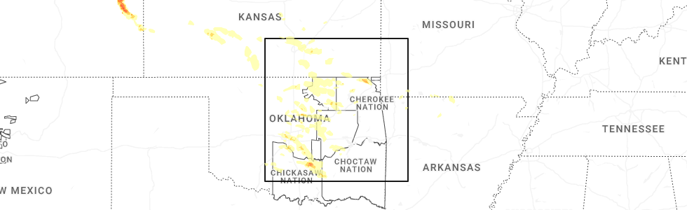
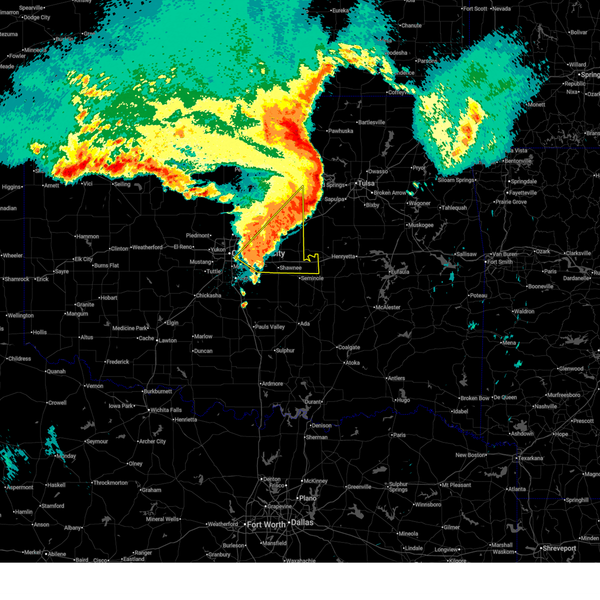
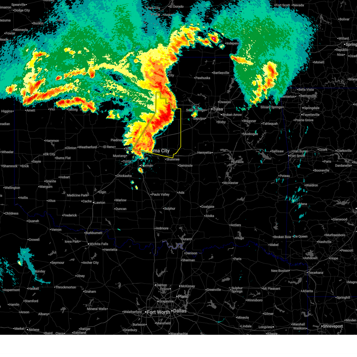
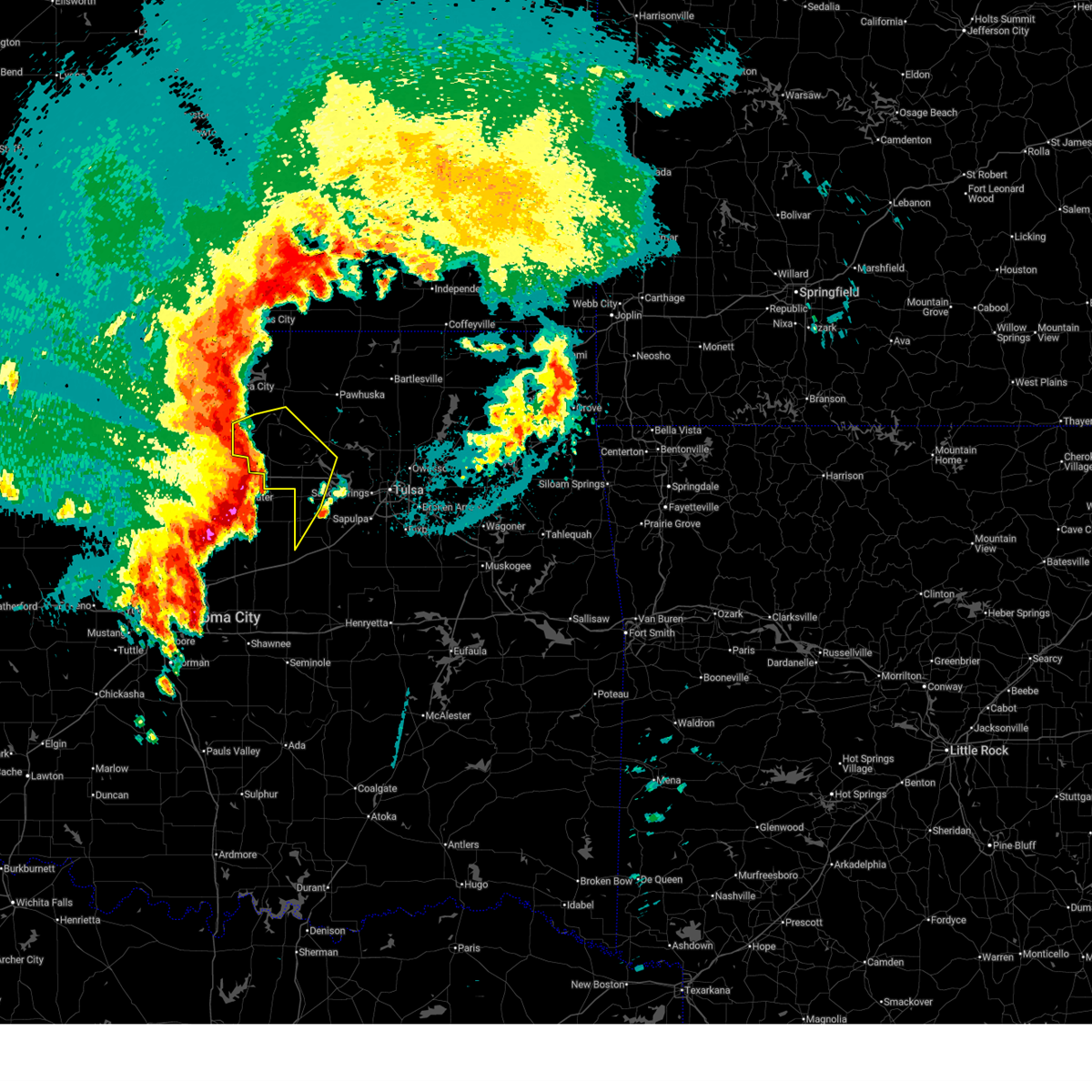
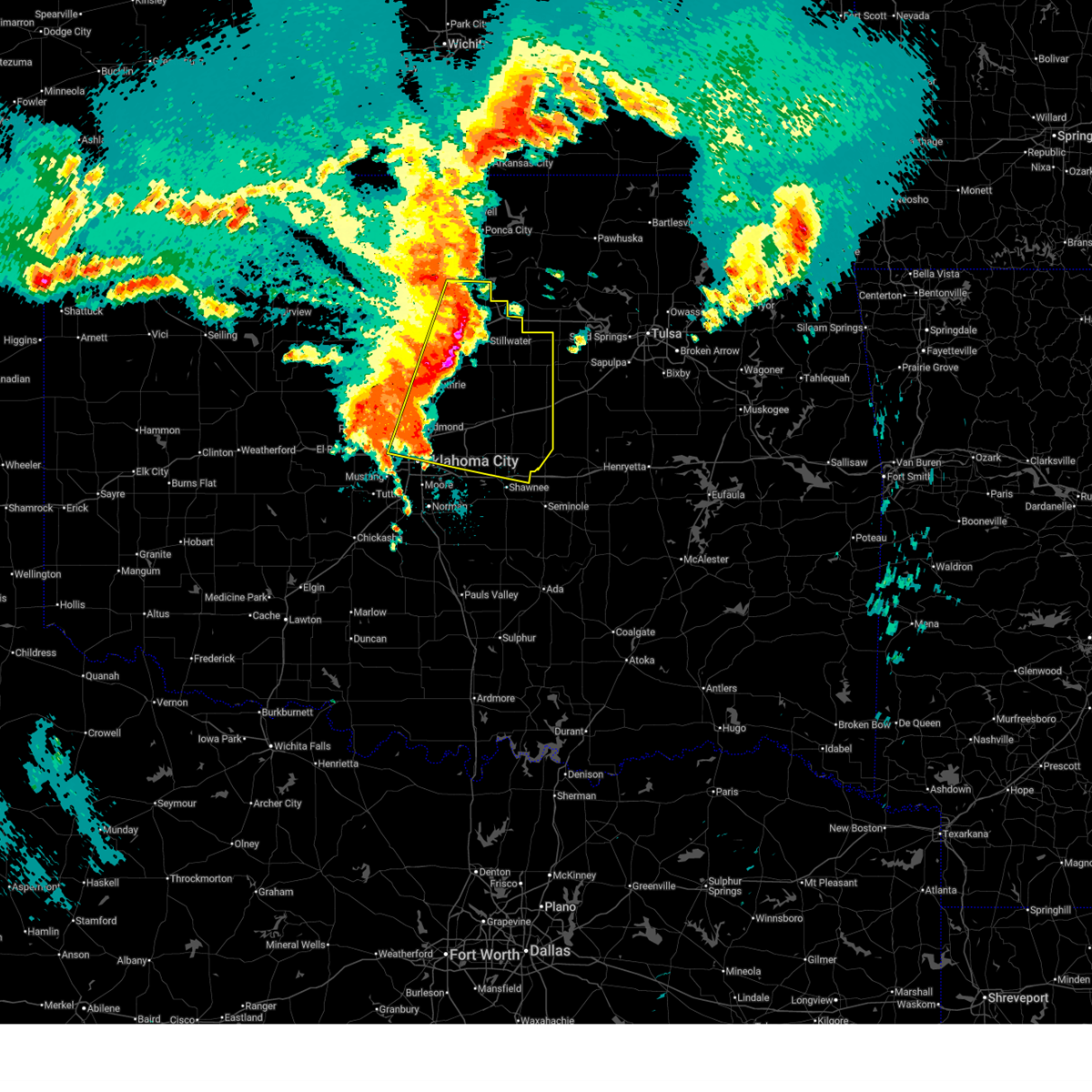
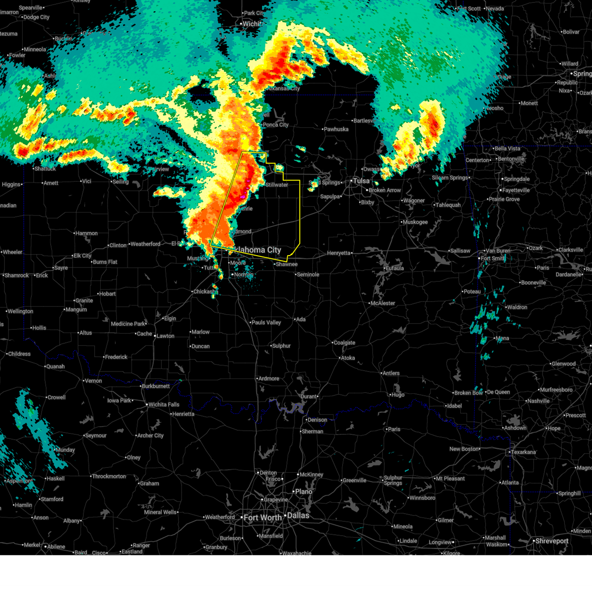
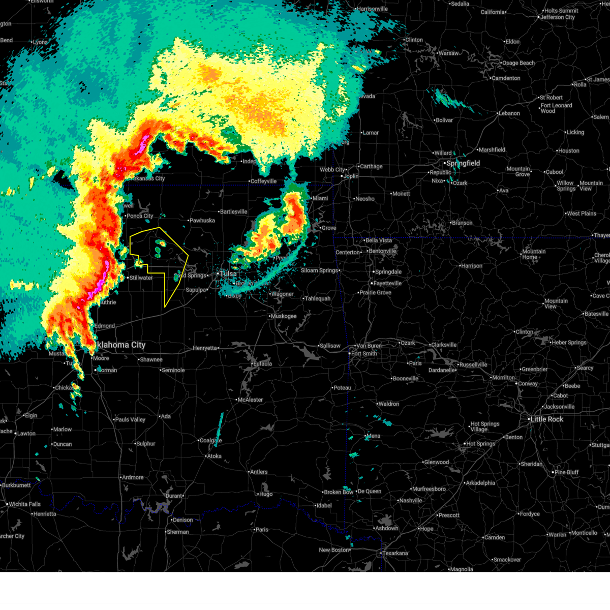
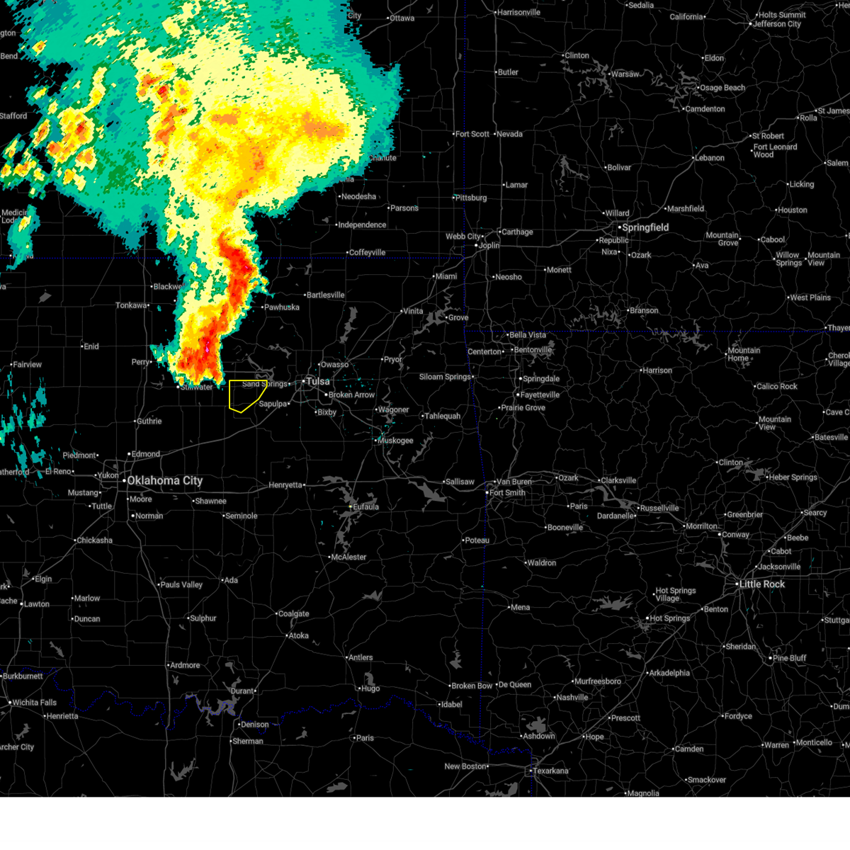
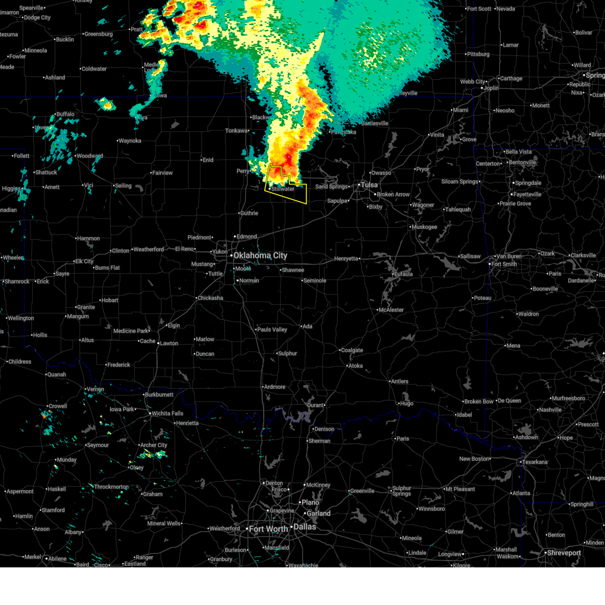
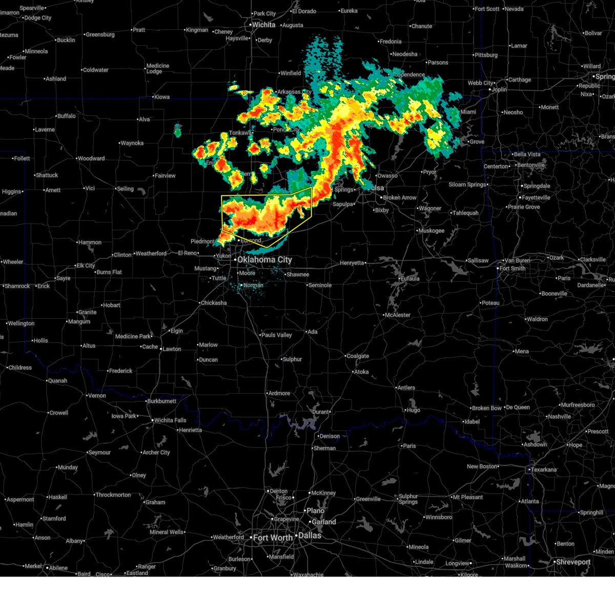
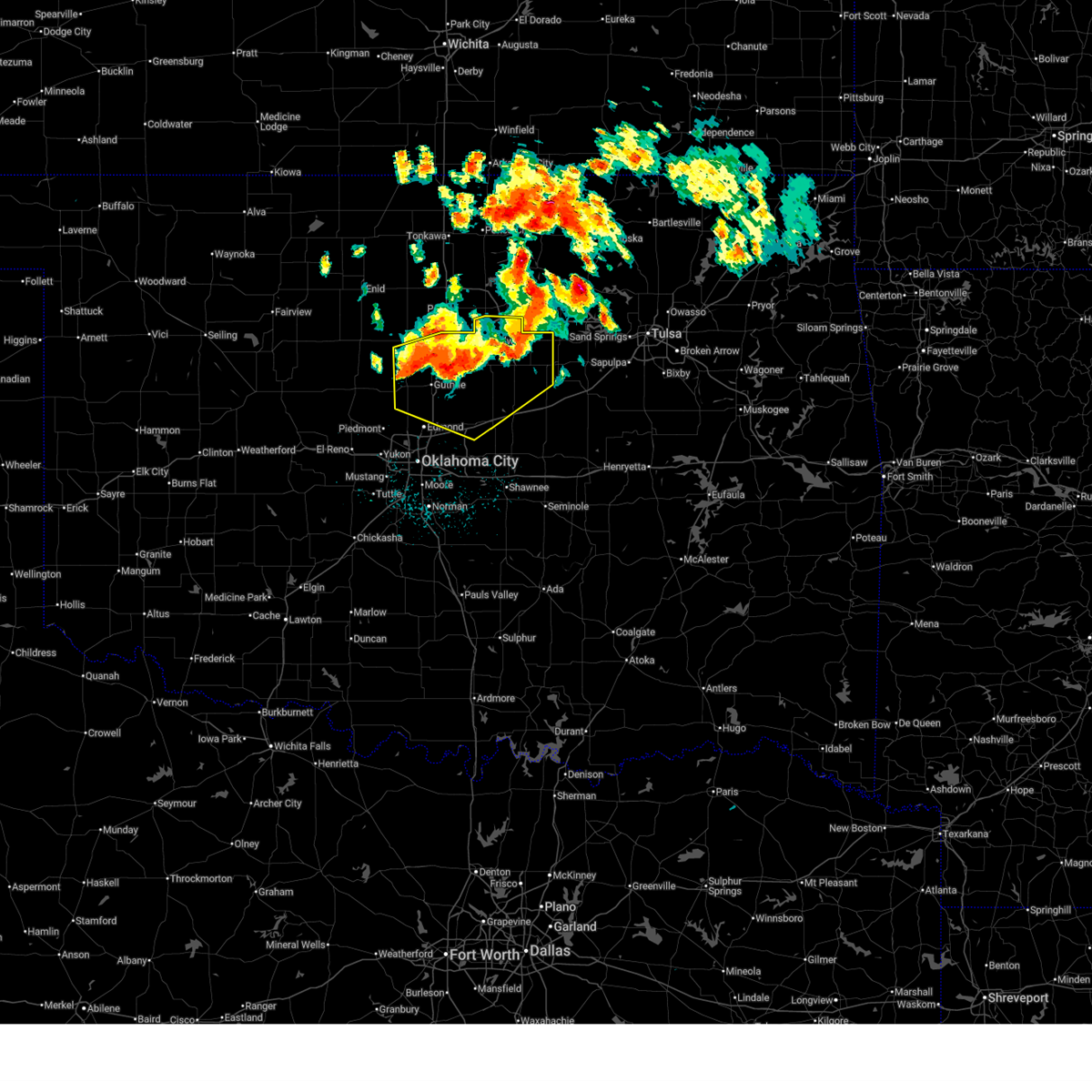
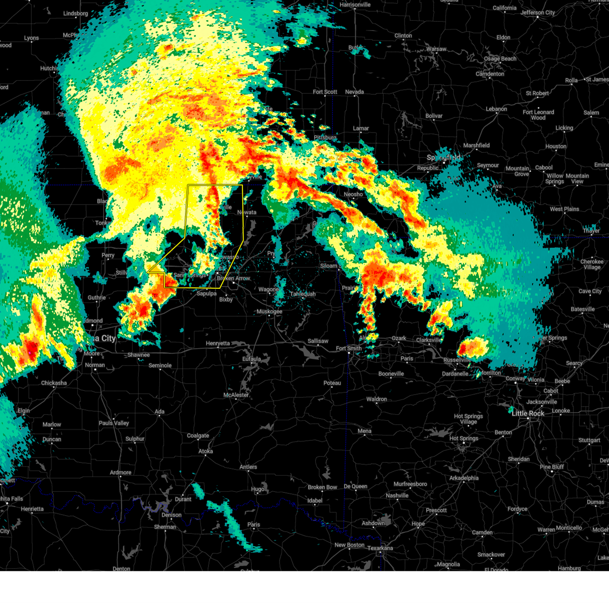
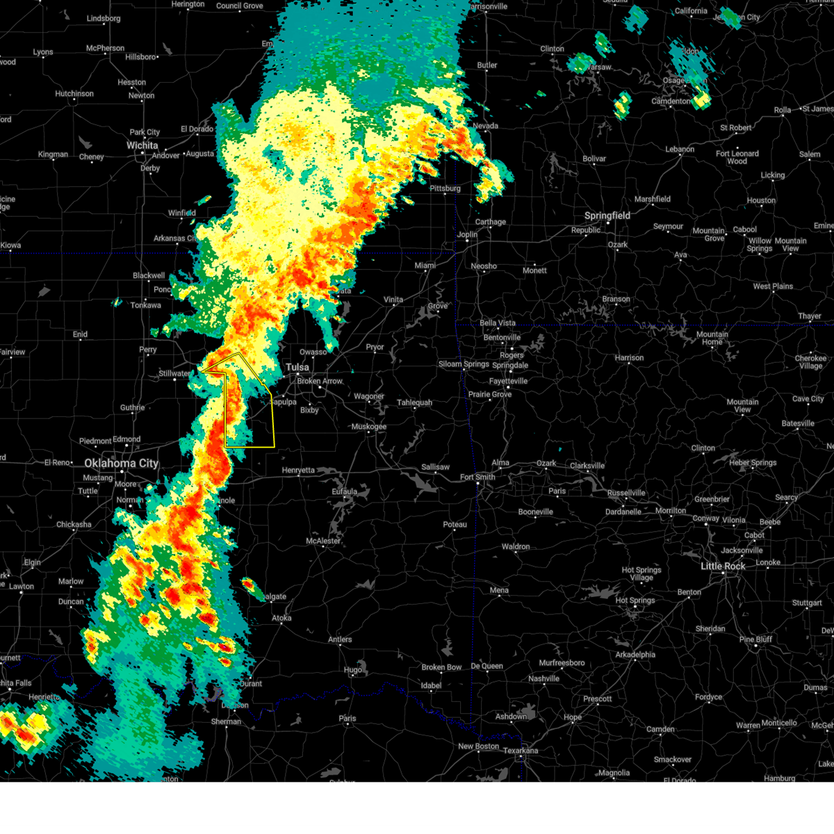
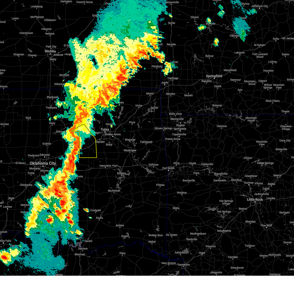
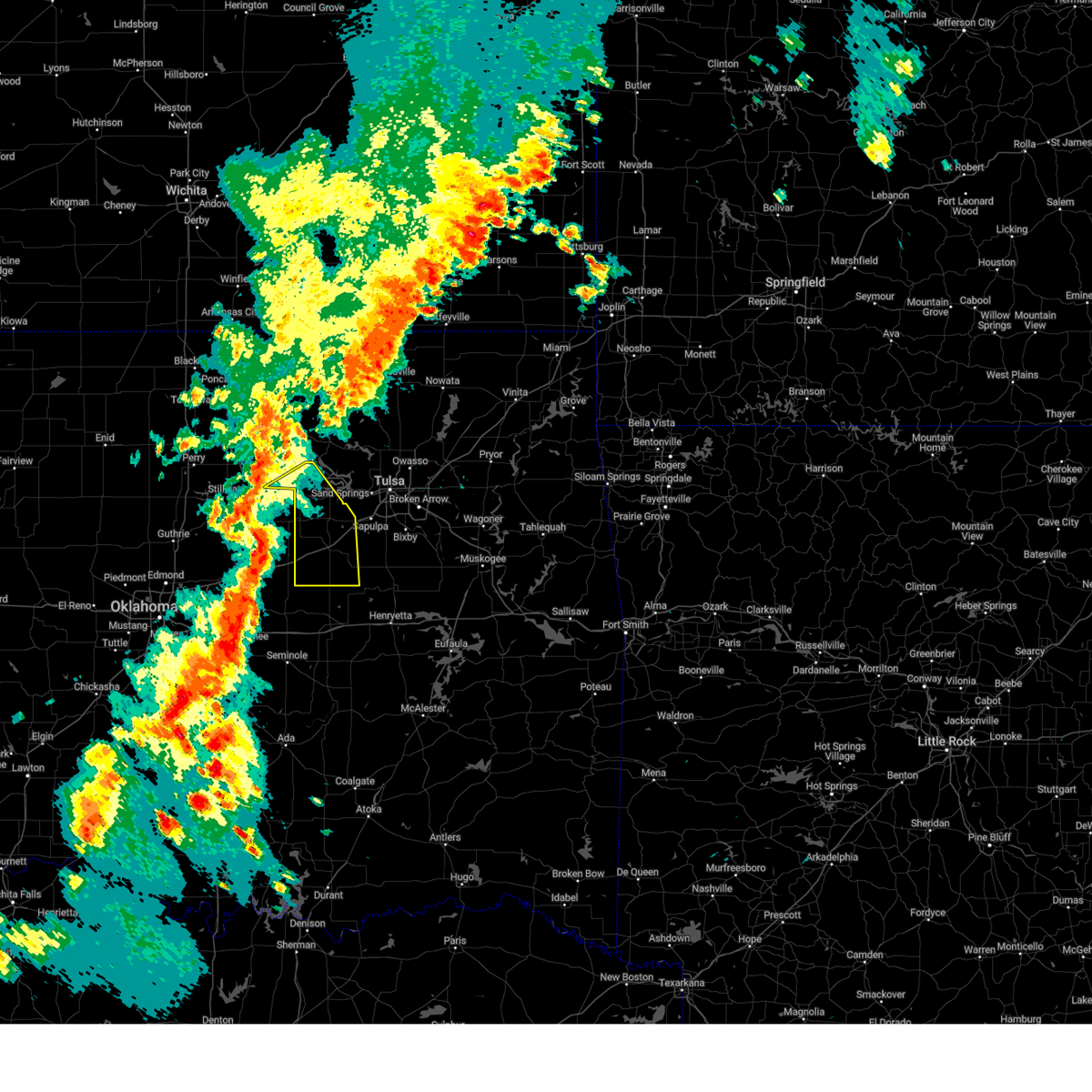
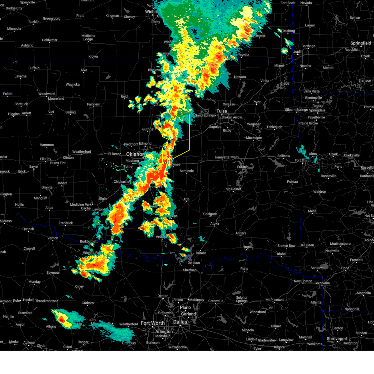
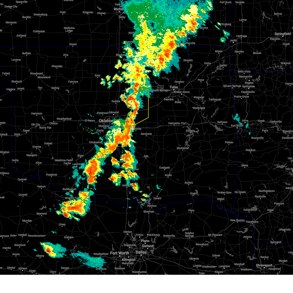
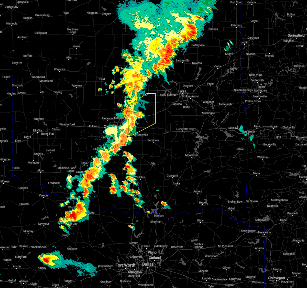
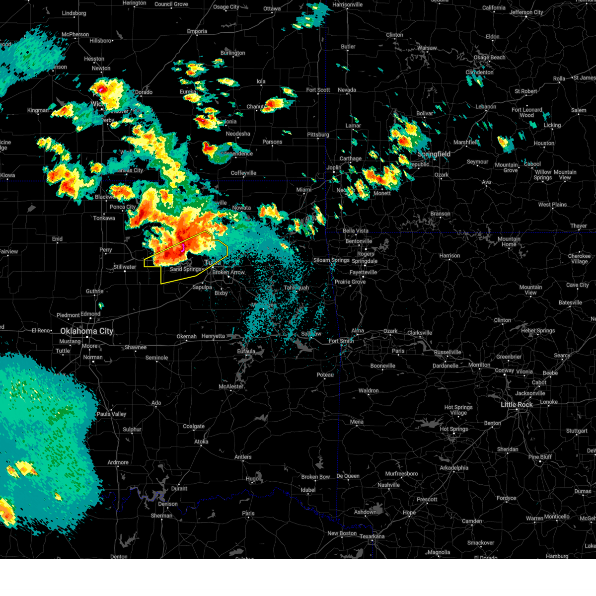
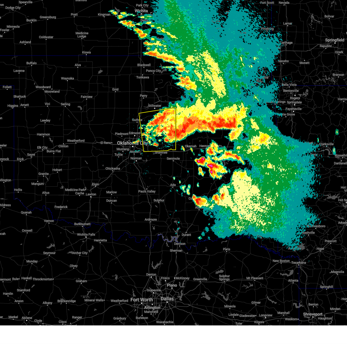
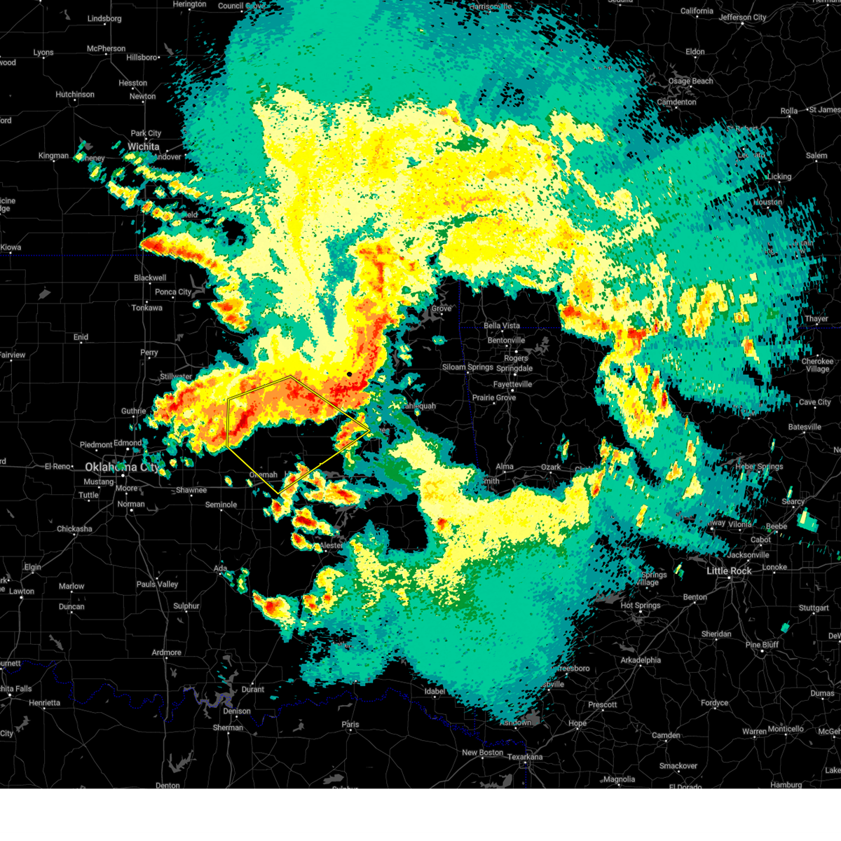
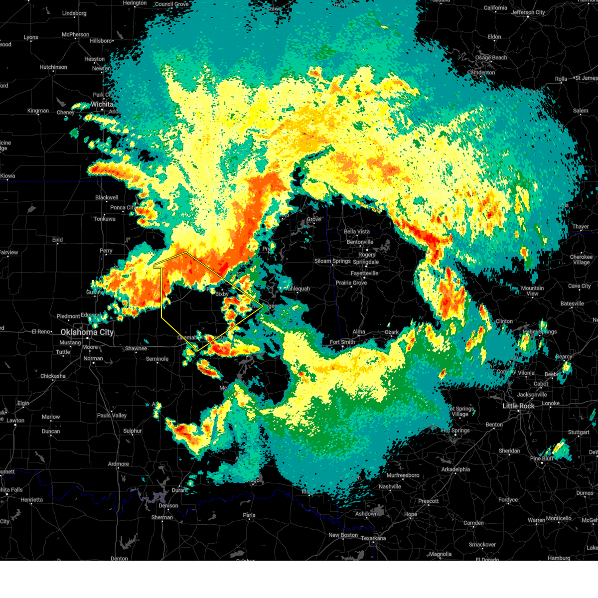
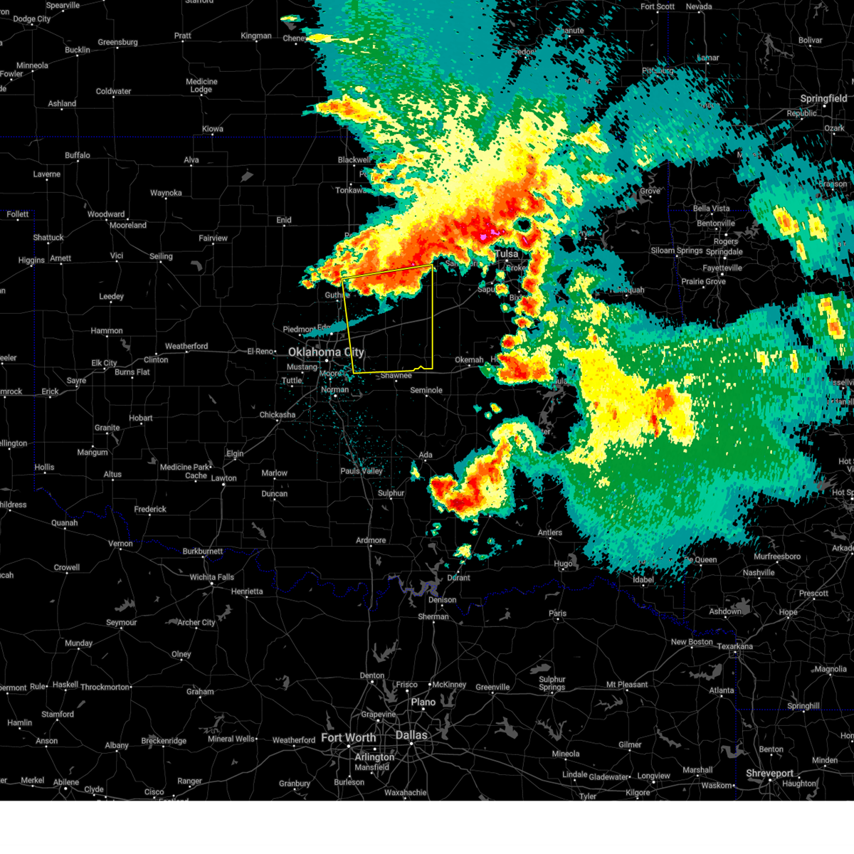
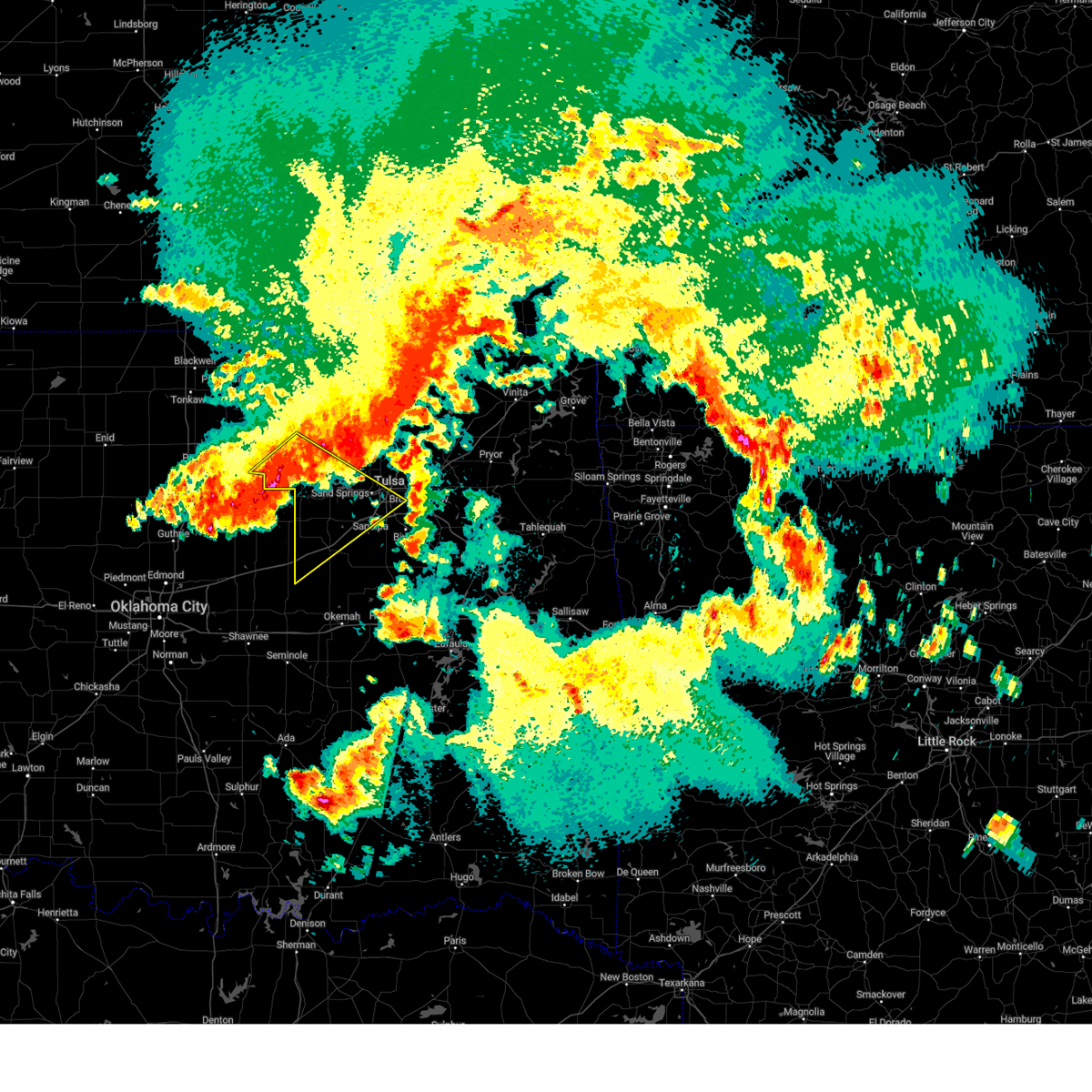
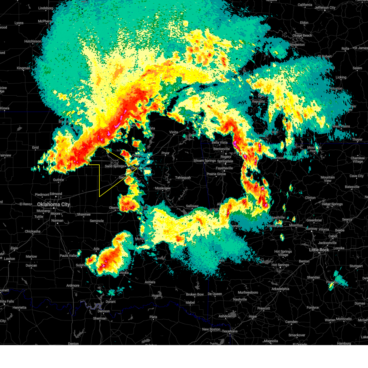
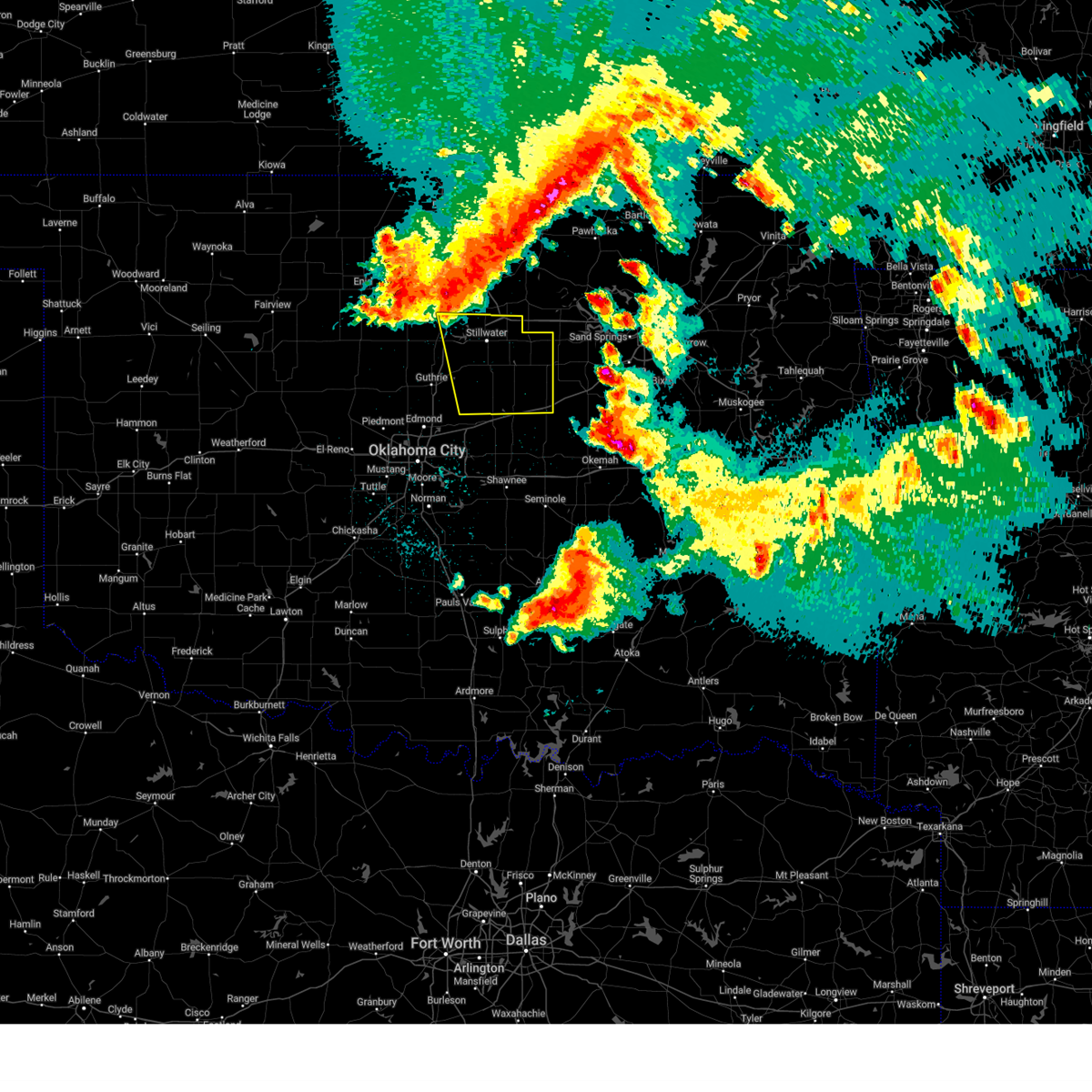
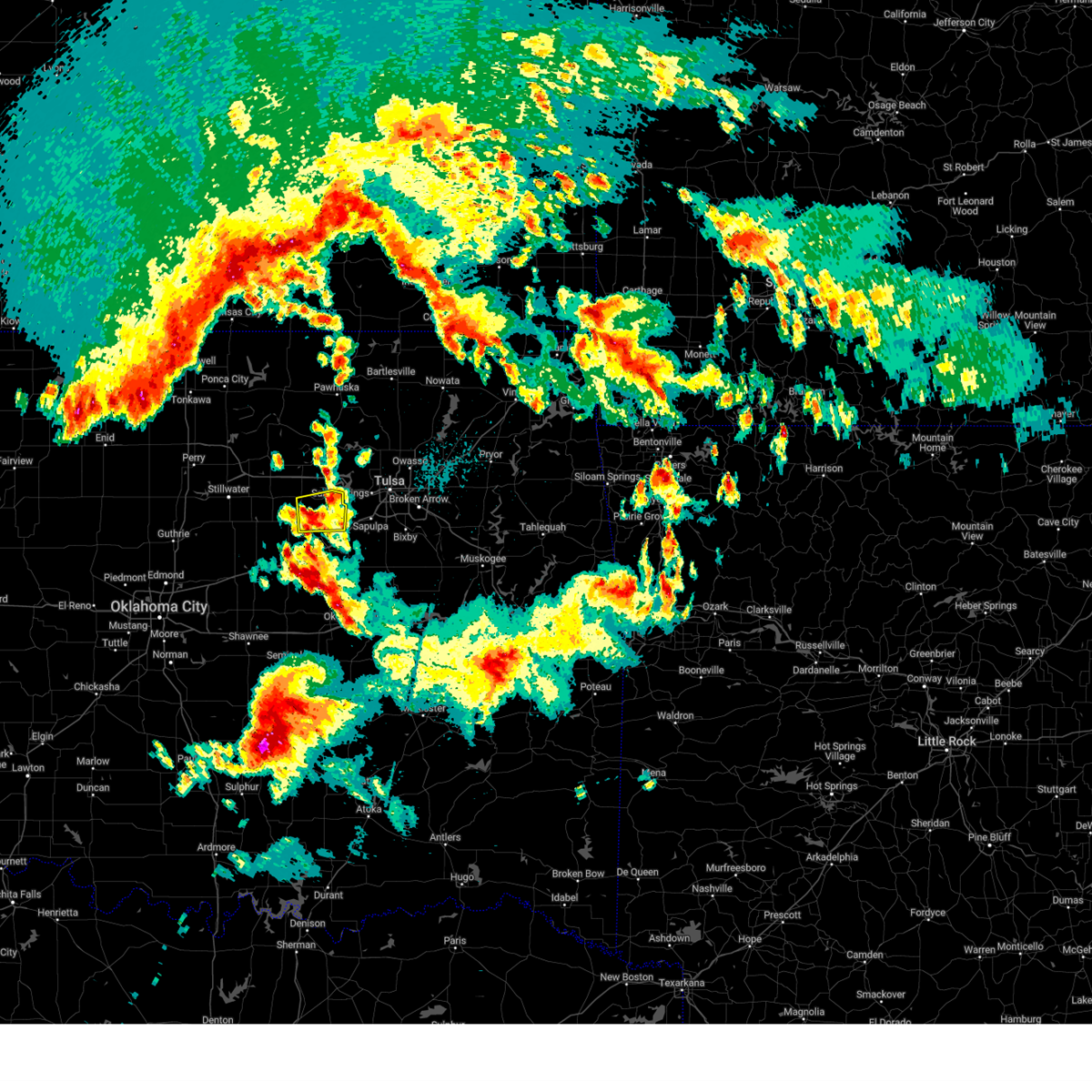
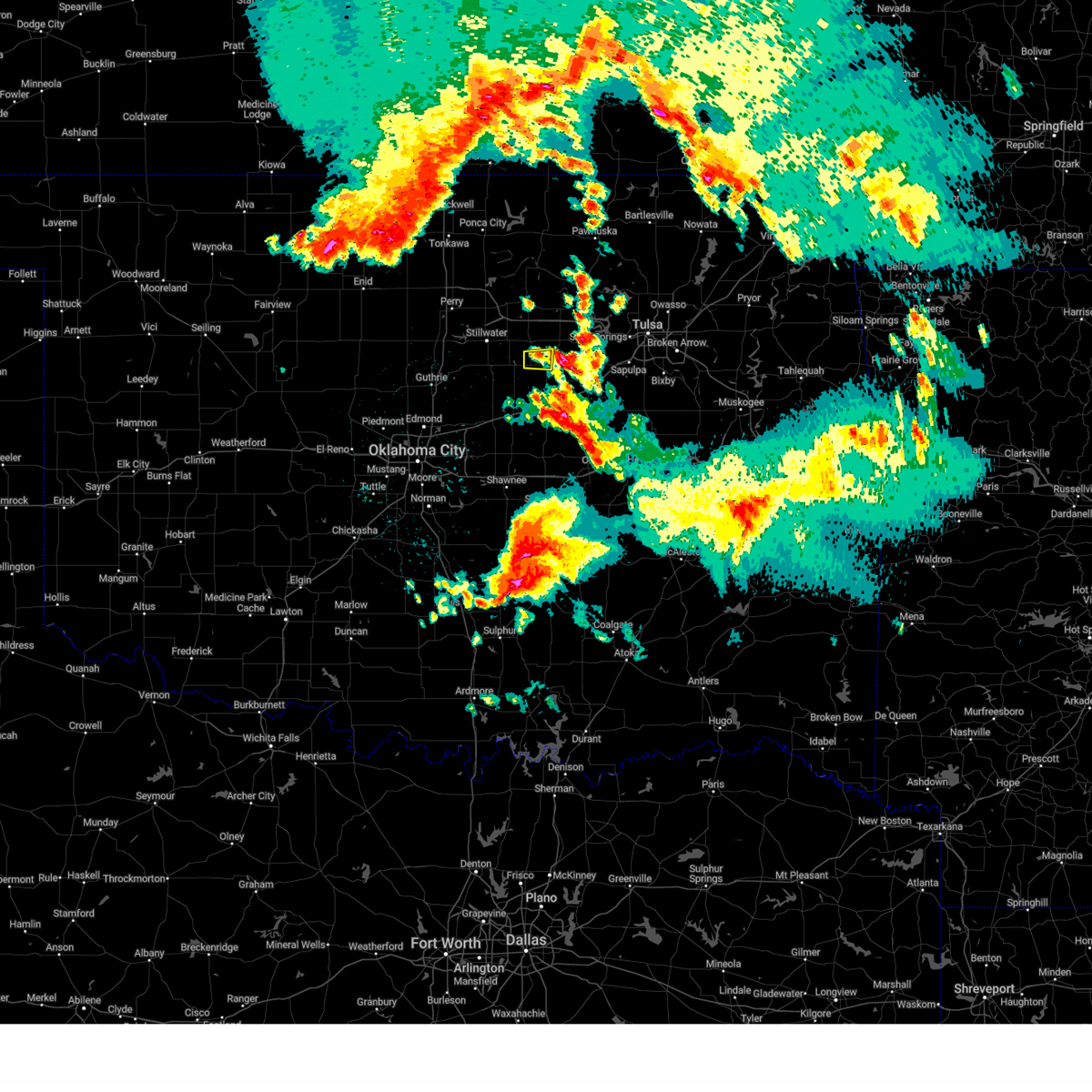
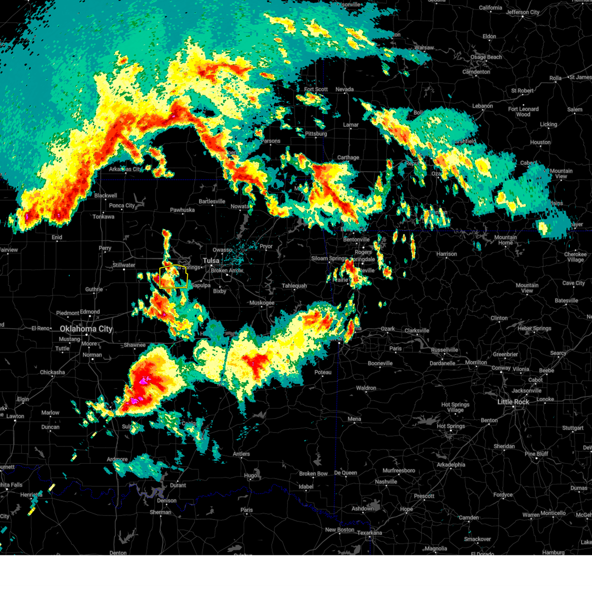
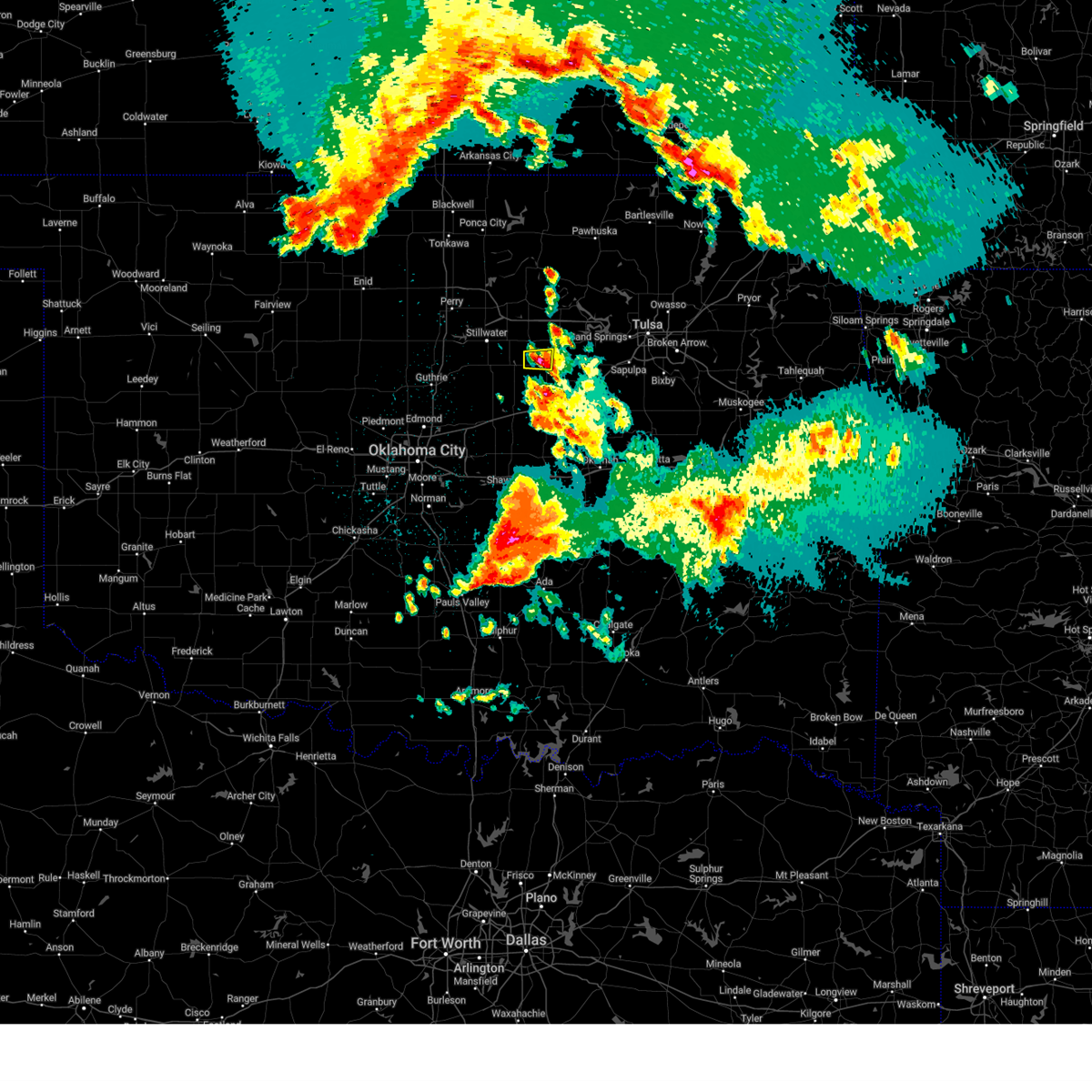
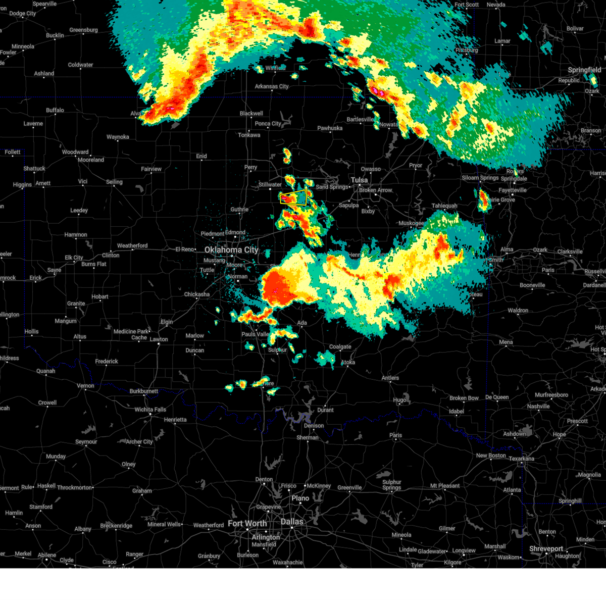
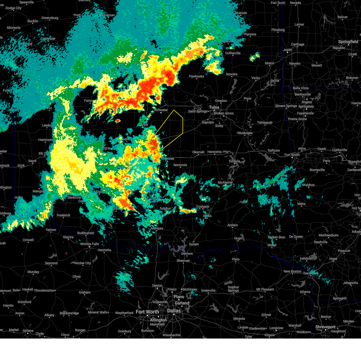
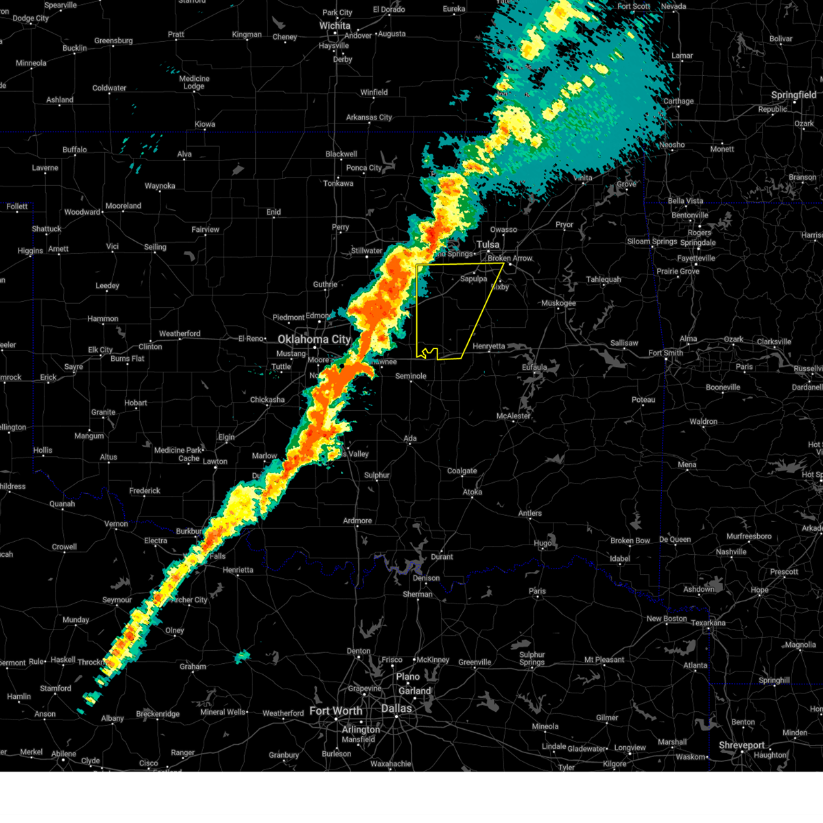
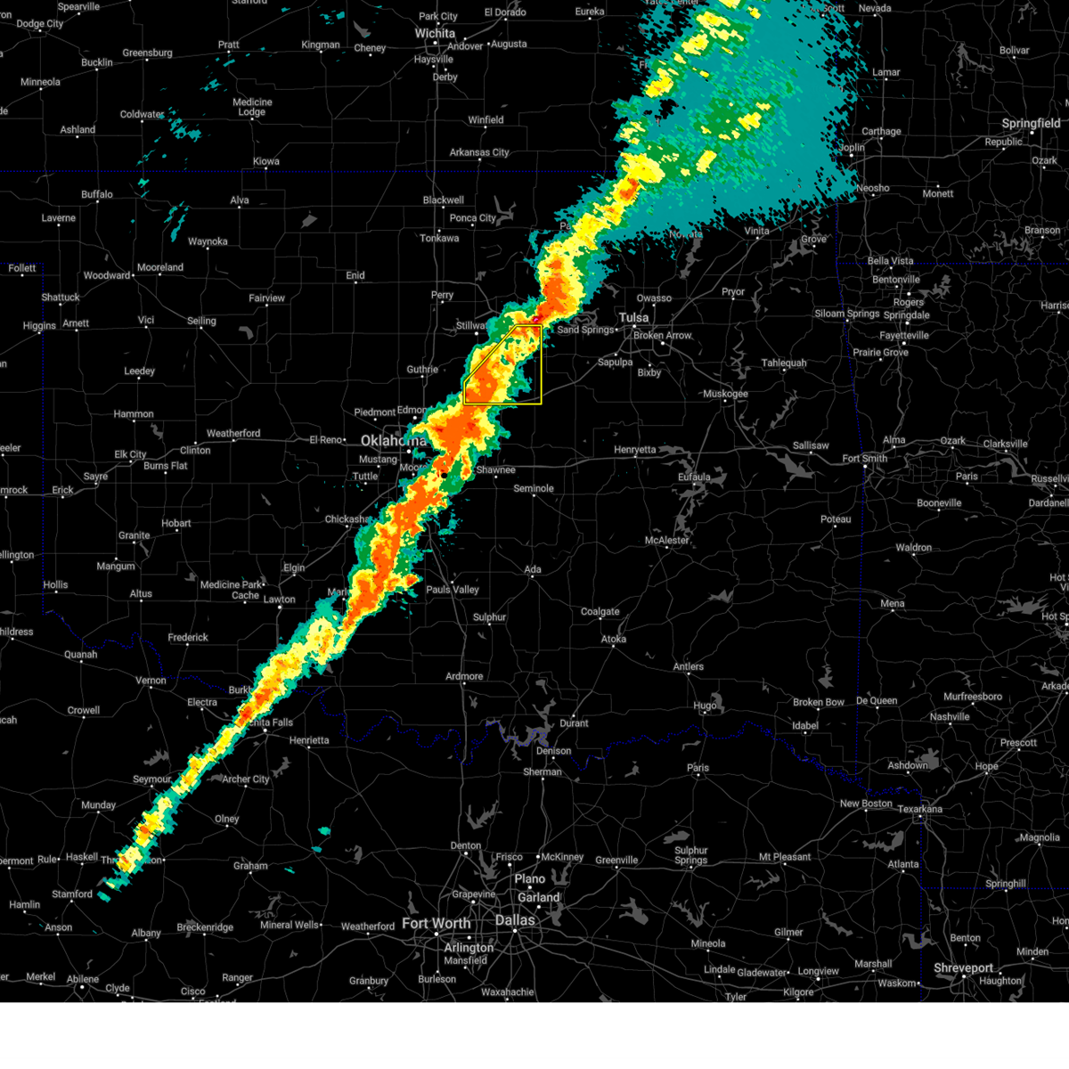
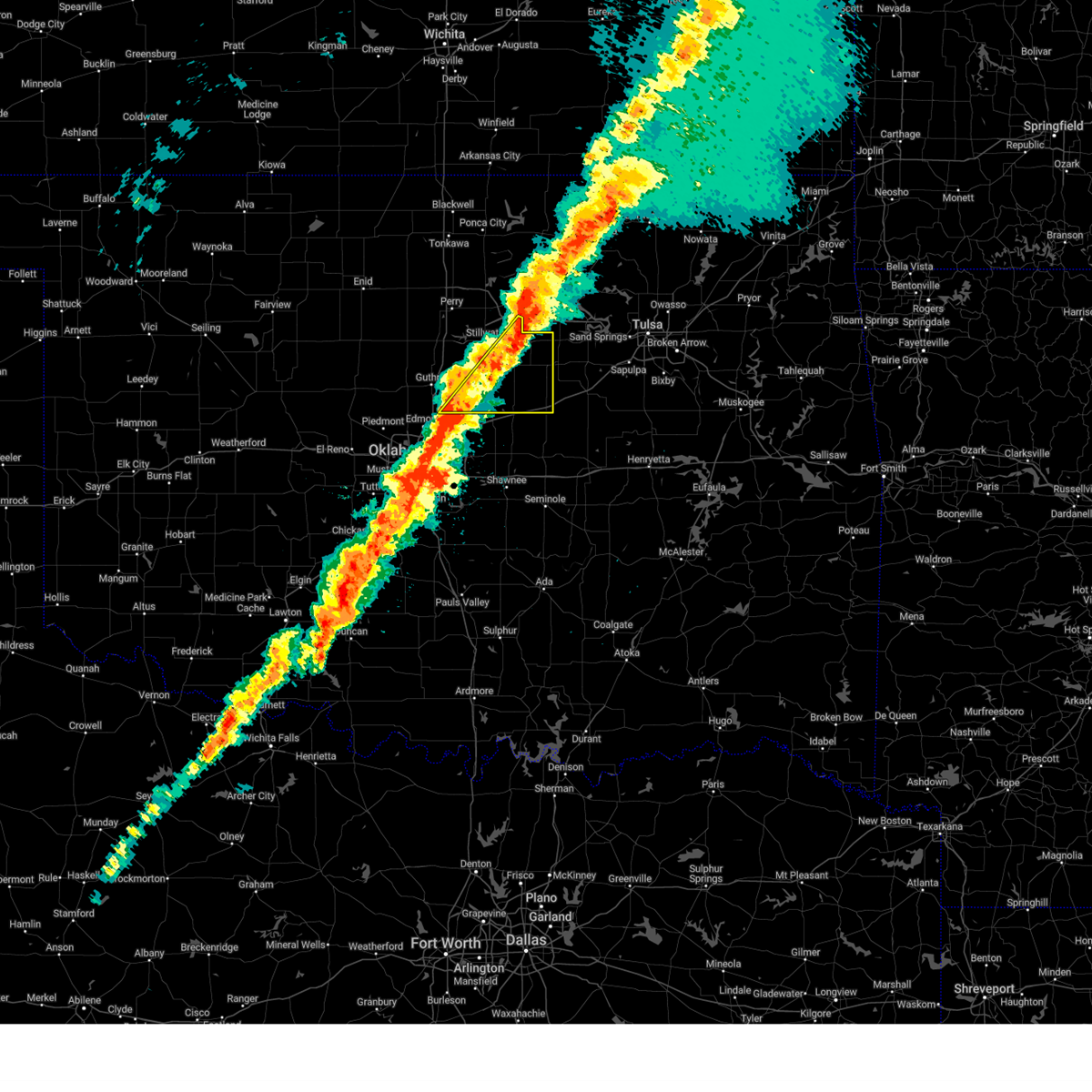
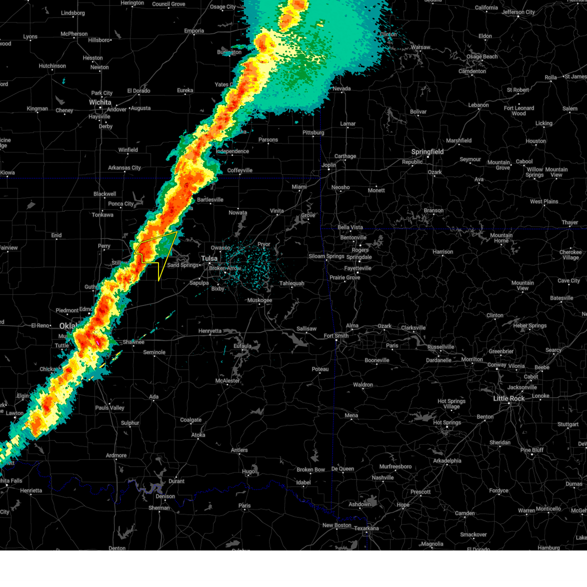
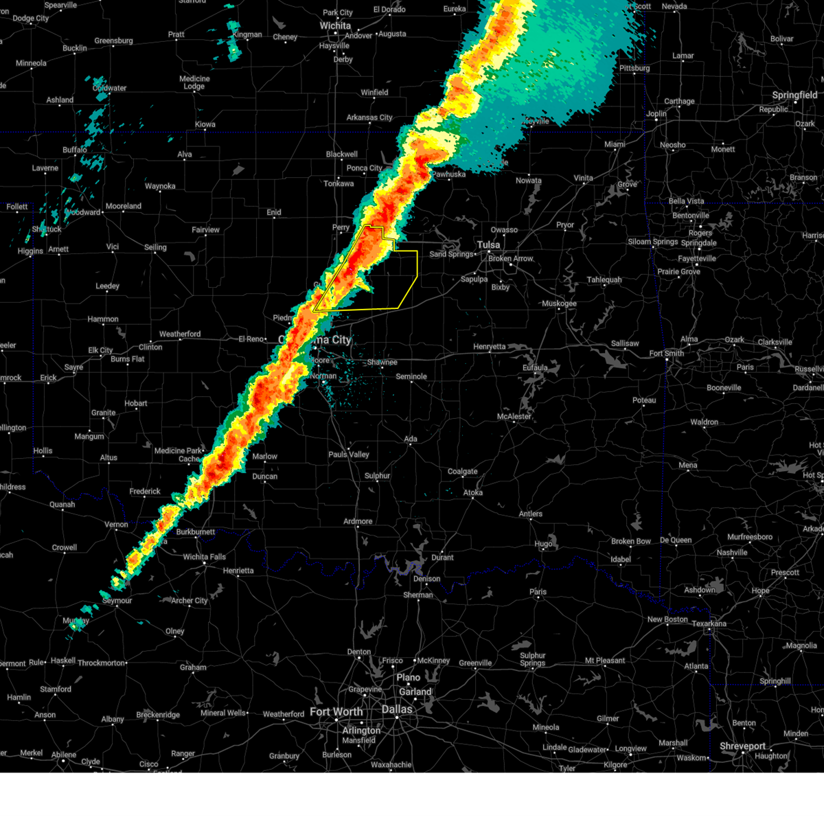
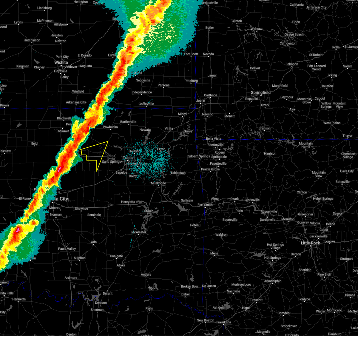
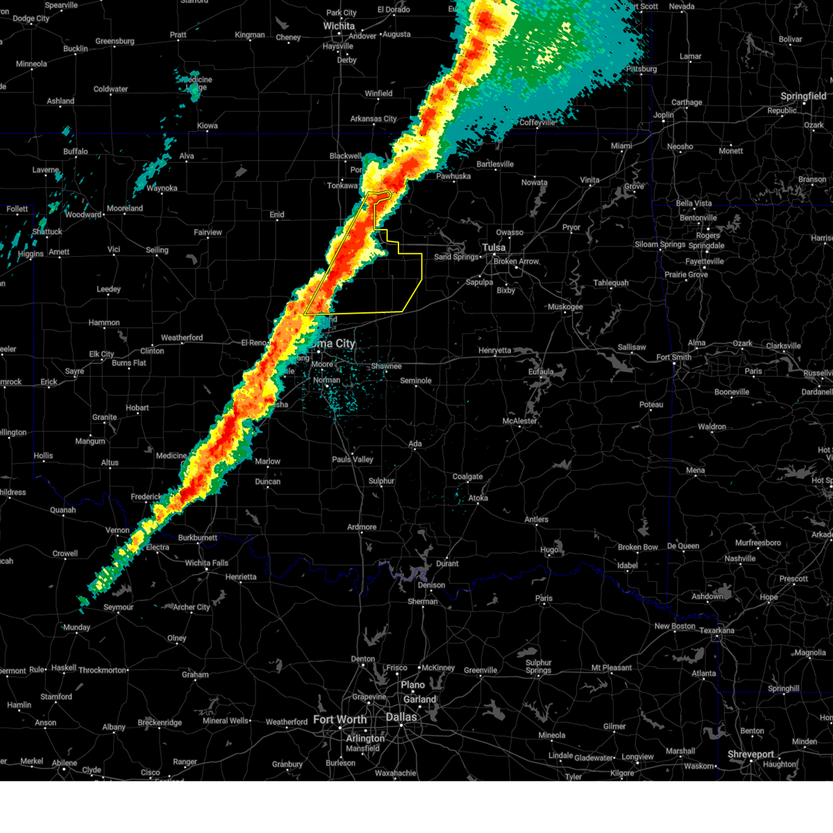
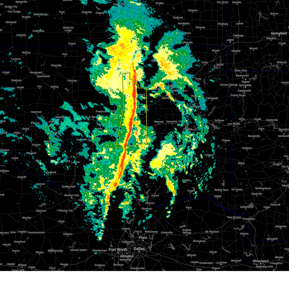
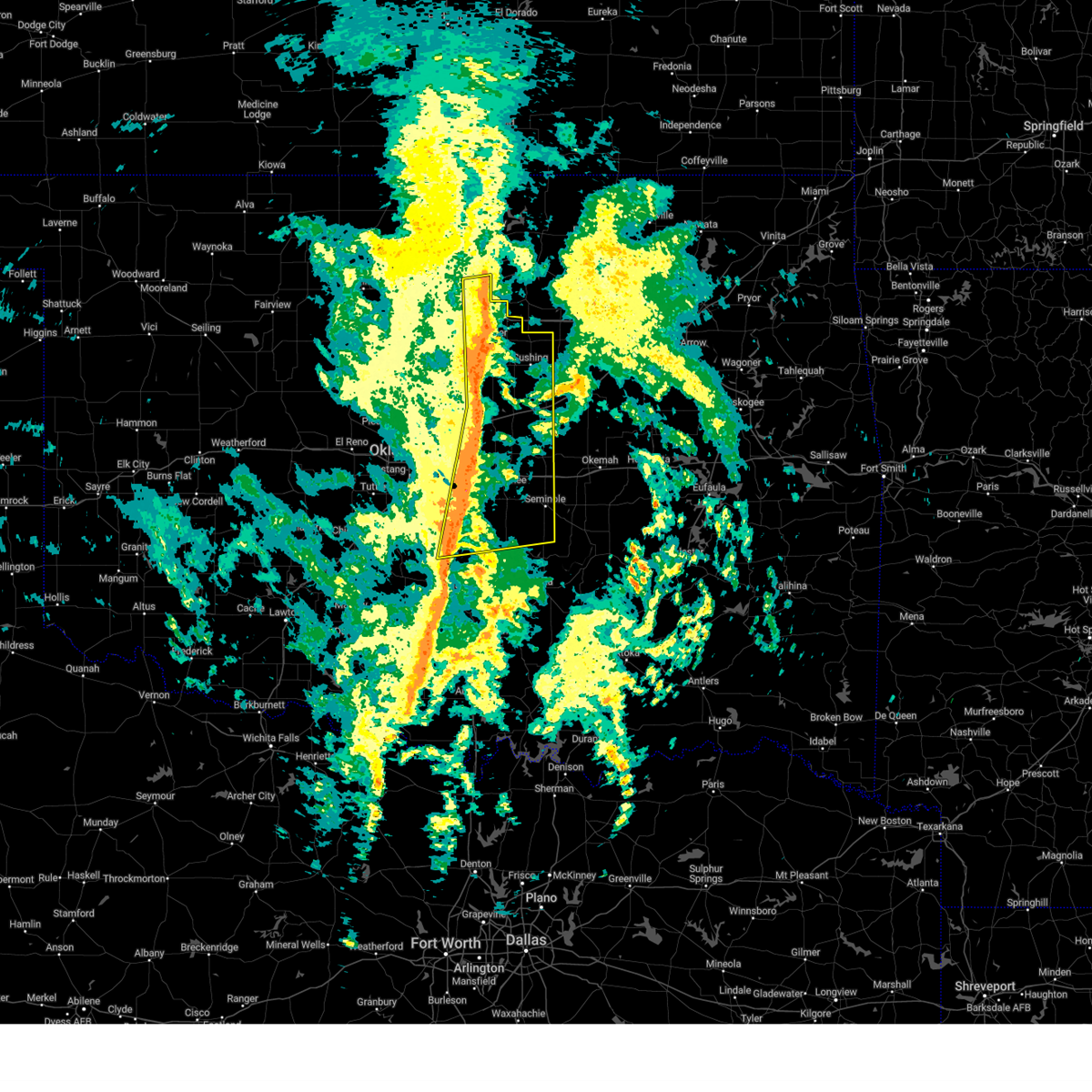
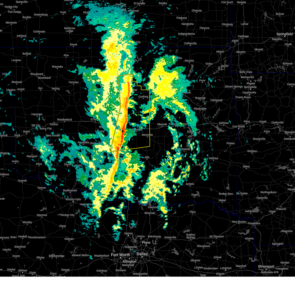
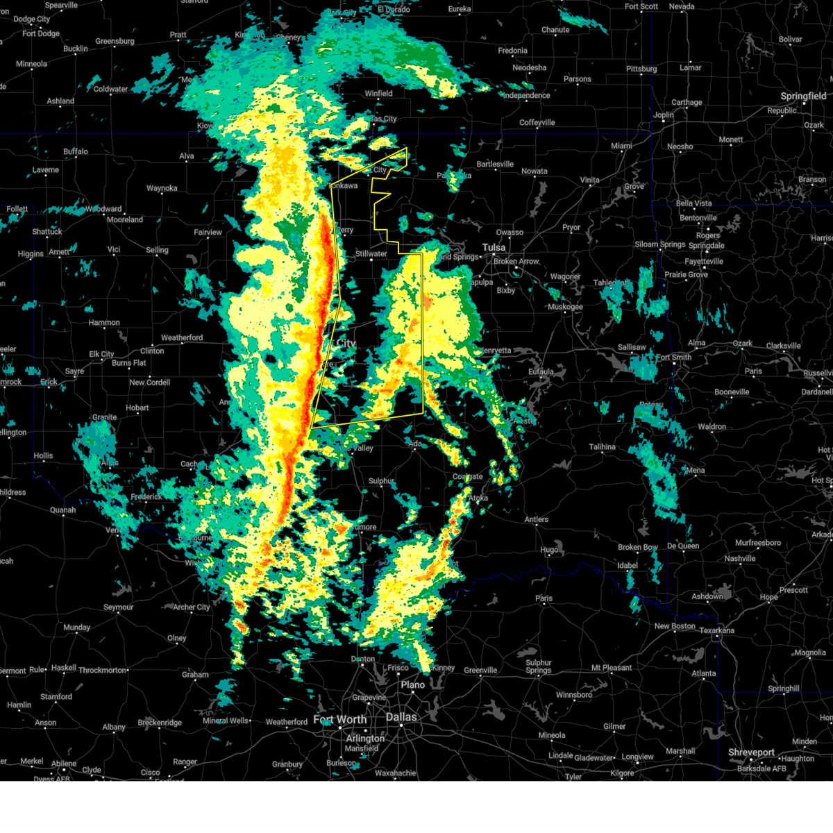
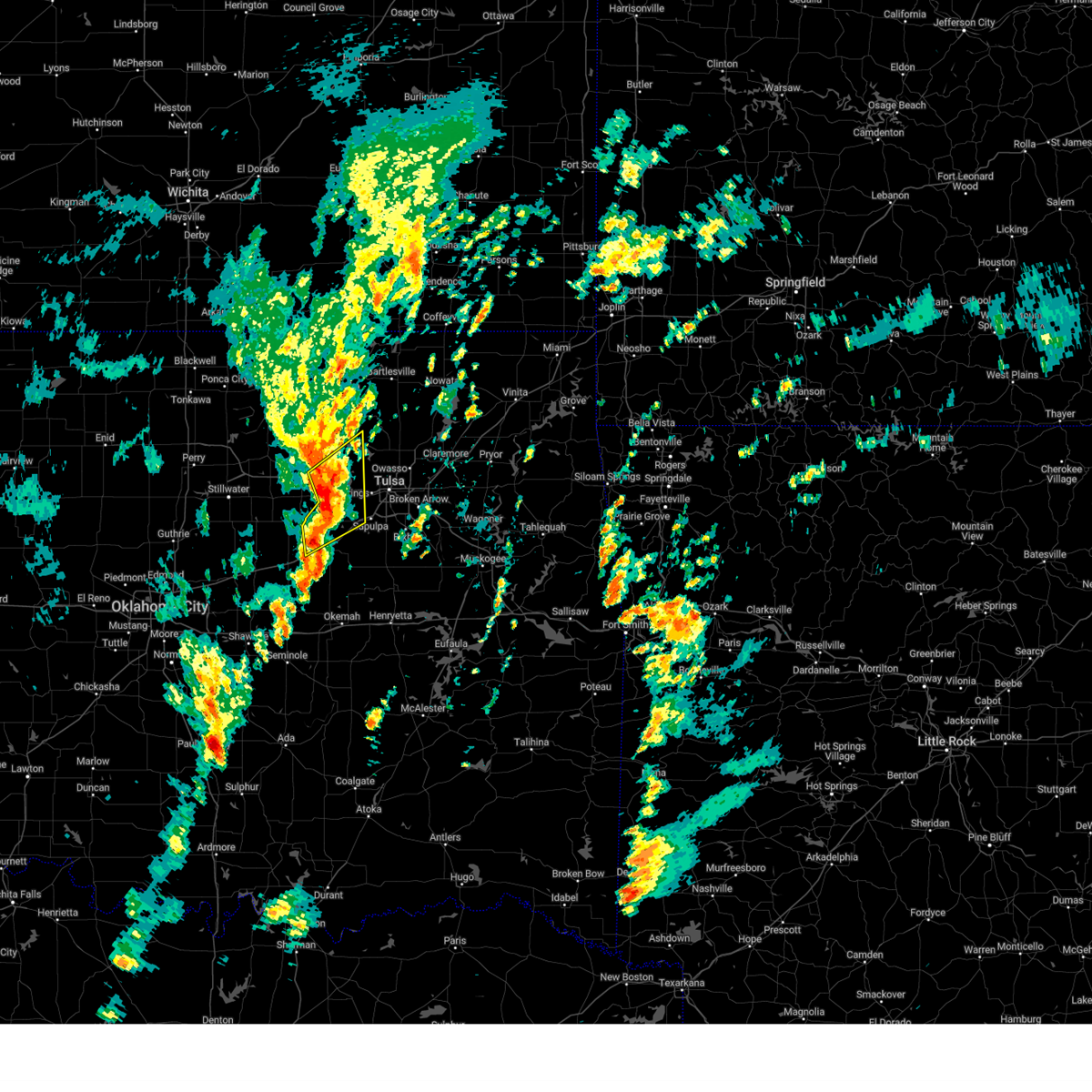
Hail Map for Drumright, OK
The Drumright, OK area has had 7 reports of on-the-ground hail by trained spotters, and has been under severe weather warnings 86 times during the past 12 months. Doppler radar has detected hail at or near Drumright, OK on 92 occasions, including 4 occasions during the past year.
| Name: | Drumright, OK |
| Where Located: | 35.6 miles WSW of Tulsa, OK |
| Map: | Google Map for Drumright, OK |
| Population: | 2907 |
| Housing Units: | 1392 |
| More Info: | Search Google for Drumright, OK |
1
The Top Recent Hail Date for Drumright, OK is Friday, May 23, 2025 (16th out of 92)
Hail and Wind Damage Spotted near Drumright, OK
| Date / Time | Report Details |
|---|---|
| 6/27/2025 2:40 PM CDT |
 At 240 pm cdt, severe thunderstorms were located along a line extending from 10 miles southwest of mannford to near slick, moving east-northeast at 15 mph (radar indicated). Hazards include 60 mph wind gusts. Expect damage to roofs, siding, and trees. Locations impacted include, bristow, kellyville, and slick. At 240 pm cdt, severe thunderstorms were located along a line extending from 10 miles southwest of mannford to near slick, moving east-northeast at 15 mph (radar indicated). Hazards include 60 mph wind gusts. Expect damage to roofs, siding, and trees. Locations impacted include, bristow, kellyville, and slick.
|
| 6/27/2025 2:23 PM CDT |
 Svrtsa the national weather service in tulsa has issued a * severe thunderstorm warning for, central creek county in northeastern oklahoma, northwestern okmulgee county in northeastern oklahoma, * until 315 pm cdt. * at 223 pm cdt, severe thunderstorms were located along a line extending from 4 miles northeast of shamrock to 5 miles south of bristow, moving northeast at 25 mph (radar indicated). Hazards include 60 mph wind gusts and quarter size hail. Hail damage to vehicles is expected. Expect wind damage to roofs, siding, and trees. Svrtsa the national weather service in tulsa has issued a * severe thunderstorm warning for, central creek county in northeastern oklahoma, northwestern okmulgee county in northeastern oklahoma, * until 315 pm cdt. * at 223 pm cdt, severe thunderstorms were located along a line extending from 4 miles northeast of shamrock to 5 miles south of bristow, moving northeast at 25 mph (radar indicated). Hazards include 60 mph wind gusts and quarter size hail. Hail damage to vehicles is expected. Expect wind damage to roofs, siding, and trees.
|
| 6/18/2025 12:13 AM CDT |
 The storms which prompted the warning have weakened below severe limits, therefore the warning will be allowed to expire. however, gusty winds are still possible with these thunderstorms. The storms which prompted the warning have weakened below severe limits, therefore the warning will be allowed to expire. however, gusty winds are still possible with these thunderstorms.
|
| 6/17/2025 11:41 PM CDT |
 Svroun the national weather service in norman has issued a * severe thunderstorm warning for, northern seminole county in east central oklahoma, lincoln county in central oklahoma, southeastern oklahoma county in central oklahoma, northeastern cleveland county in central oklahoma, southeastern payne county in central oklahoma, northern pottawatomie county in central oklahoma, * until 1215 am cdt. * at 1141 pm cdt, severe thunderstorms were located along a line extending from 4 miles east of shamrock to 4 miles northeast of pink, moving east at 40 mph (radar indicated). Hazards include 60 mph wind gusts and quarter size hail. Hail damage to vehicles is expected. Expect wind damage to roofs, siding, and trees. Svroun the national weather service in norman has issued a * severe thunderstorm warning for, northern seminole county in east central oklahoma, lincoln county in central oklahoma, southeastern oklahoma county in central oklahoma, northeastern cleveland county in central oklahoma, southeastern payne county in central oklahoma, northern pottawatomie county in central oklahoma, * until 1215 am cdt. * at 1141 pm cdt, severe thunderstorms were located along a line extending from 4 miles east of shamrock to 4 miles northeast of pink, moving east at 40 mph (radar indicated). Hazards include 60 mph wind gusts and quarter size hail. Hail damage to vehicles is expected. Expect wind damage to roofs, siding, and trees.
|
| 6/17/2025 11:31 PM CDT |
 Svrtsa the national weather service in tulsa has issued a * severe thunderstorm warning for, southeastern osage county in northeastern oklahoma, creek county in northeastern oklahoma, southwestern washington county in northeastern oklahoma, northwestern okmulgee county in northeastern oklahoma, eastern pawnee county in northeastern oklahoma, tulsa county in northeastern oklahoma, * until 1215 am cdt. * at 1130 pm cdt, severe thunderstorms were located along a line extending from near fairfax to near jennings to 3 miles southeast of avery, moving east at 45 mph (radar indicated). Hazards include 70 mph wind gusts and quarter size hail. Hail damage to vehicles is expected. expect considerable tree damage. Wind damage is also likely to mobile homes, roofs, and outbuildings. Svrtsa the national weather service in tulsa has issued a * severe thunderstorm warning for, southeastern osage county in northeastern oklahoma, creek county in northeastern oklahoma, southwestern washington county in northeastern oklahoma, northwestern okmulgee county in northeastern oklahoma, eastern pawnee county in northeastern oklahoma, tulsa county in northeastern oklahoma, * until 1215 am cdt. * at 1130 pm cdt, severe thunderstorms were located along a line extending from near fairfax to near jennings to 3 miles southeast of avery, moving east at 45 mph (radar indicated). Hazards include 70 mph wind gusts and quarter size hail. Hail damage to vehicles is expected. expect considerable tree damage. Wind damage is also likely to mobile homes, roofs, and outbuildings.
|
| 6/17/2025 11:28 PM CDT |
 the severe thunderstorm warning has been cancelled and is no longer in effect the severe thunderstorm warning has been cancelled and is no longer in effect
|
| 6/17/2025 11:28 PM CDT |
 At 1128 pm cdt, severe thunderstorms were located along a line extending from near maramec to near avery to 3 miles east of mcloud, moving east at 55 mph (radar indicated). Hazards include 70 mph wind gusts and quarter size hail. Hail damage to vehicles is expected. expect considerable tree damage. wind damage is also likely to mobile homes, roofs, and outbuildings. Locations impacted include, oklahoma city, edmond, midwest city, stillwater, shawnee, del city, cushing, chandler, choctaw, the village, harrah, mcloud, spencer, nichols hills, perkins, jones, stroud, nicoma park, prague, and langston. At 1128 pm cdt, severe thunderstorms were located along a line extending from near maramec to near avery to 3 miles east of mcloud, moving east at 55 mph (radar indicated). Hazards include 70 mph wind gusts and quarter size hail. Hail damage to vehicles is expected. expect considerable tree damage. wind damage is also likely to mobile homes, roofs, and outbuildings. Locations impacted include, oklahoma city, edmond, midwest city, stillwater, shawnee, del city, cushing, chandler, choctaw, the village, harrah, mcloud, spencer, nichols hills, perkins, jones, stroud, nicoma park, prague, and langston.
|
| 6/17/2025 11:23 PM CDT |
 At 1123 pm cdt, severe thunderstorms were located along a line extending from 4 miles south of pawnee to near agra to near mcloud, moving east at 55 mph (emergency management reported a 76 mph wind gust near cushing). Hazards include 70 mph wind gusts and quarter size hail. Hail damage to vehicles is expected. expect considerable tree damage. wind damage is also likely to mobile homes, roofs, and outbuildings. Locations impacted include, oklahoma city, edmond, midwest city, stillwater, shawnee, del city, cushing, chandler, choctaw, the village, harrah, mcloud, spencer, nichols hills, perkins, jones, stroud, nicoma park, prague, and langston. At 1123 pm cdt, severe thunderstorms were located along a line extending from 4 miles south of pawnee to near agra to near mcloud, moving east at 55 mph (emergency management reported a 76 mph wind gust near cushing). Hazards include 70 mph wind gusts and quarter size hail. Hail damage to vehicles is expected. expect considerable tree damage. wind damage is also likely to mobile homes, roofs, and outbuildings. Locations impacted include, oklahoma city, edmond, midwest city, stillwater, shawnee, del city, cushing, chandler, choctaw, the village, harrah, mcloud, spencer, nichols hills, perkins, jones, stroud, nicoma park, prague, and langston.
|
| 6/17/2025 11:21 PM CDT |
 the severe thunderstorm warning has been cancelled and is no longer in effect the severe thunderstorm warning has been cancelled and is no longer in effect
|
| 6/17/2025 11:21 PM CDT |
 At 1120 pm cdt, severe thunderstorms were located along a line extending from 3 miles south of pawnee to near agra to near harrah, moving east at 55 mph (radar indicated). Hazards include 60 mph wind gusts and quarter size hail. Hail damage to vehicles is expected. expect wind damage to roofs, siding, and trees. Locations impacted include, oklahoma city, edmond, midwest city, stillwater, shawnee, del city, cushing, chandler, choctaw, the village, harrah, mcloud, spencer, nichols hills, perkins, jones, stroud, nicoma park, prague, and langston. At 1120 pm cdt, severe thunderstorms were located along a line extending from 3 miles south of pawnee to near agra to near harrah, moving east at 55 mph (radar indicated). Hazards include 60 mph wind gusts and quarter size hail. Hail damage to vehicles is expected. expect wind damage to roofs, siding, and trees. Locations impacted include, oklahoma city, edmond, midwest city, stillwater, shawnee, del city, cushing, chandler, choctaw, the village, harrah, mcloud, spencer, nichols hills, perkins, jones, stroud, nicoma park, prague, and langston.
|
| 6/17/2025 11:13 PM CDT |
 At 1113 pm cdt, severe thunderstorms were located along a line extending from near sooner lake to 5 miles north of glencoe to 5 miles southeast of stillwater to near meridian, moving east at 65 mph (radar indicated). Hazards include 70 mph wind gusts and quarter size hail. Hail damage to vehicles is expected. expect considerable tree damage. wind damage is also likely to mobile homes, roofs, and outbuildings. Locations impacted include, pawnee, cleveland, drumright, fairfax, oilton, jennings, ralston, osage, hallett, blackburn, terlton, shamrock, maramec, skedee, sooner lake, and silver city. At 1113 pm cdt, severe thunderstorms were located along a line extending from near sooner lake to 5 miles north of glencoe to 5 miles southeast of stillwater to near meridian, moving east at 65 mph (radar indicated). Hazards include 70 mph wind gusts and quarter size hail. Hail damage to vehicles is expected. expect considerable tree damage. wind damage is also likely to mobile homes, roofs, and outbuildings. Locations impacted include, pawnee, cleveland, drumright, fairfax, oilton, jennings, ralston, osage, hallett, blackburn, terlton, shamrock, maramec, skedee, sooner lake, and silver city.
|
| 6/17/2025 11:08 PM CDT |
 the severe thunderstorm warning has been cancelled and is no longer in effect the severe thunderstorm warning has been cancelled and is no longer in effect
|
| 6/17/2025 11:08 PM CDT |
 At 1107 pm cdt, severe thunderstorms were located along a line extending from near morrison to 4 miles southwest of perkins to near spencer, moving east at 55 mph (radar indicated). Hazards include 70 mph wind gusts and quarter size hail. Hail damage to vehicles is expected. expect considerable tree damage. wind damage is also likely to mobile homes, roofs, and outbuildings. Locations impacted include, oklahoma city, edmond, midwest city, stillwater, shawnee, del city, guthrie, cushing, perry, chandler, yukon, bethany, choctaw, warr acres, the village, harrah, mcloud, spencer, nichols hills, and perkins. At 1107 pm cdt, severe thunderstorms were located along a line extending from near morrison to 4 miles southwest of perkins to near spencer, moving east at 55 mph (radar indicated). Hazards include 70 mph wind gusts and quarter size hail. Hail damage to vehicles is expected. expect considerable tree damage. wind damage is also likely to mobile homes, roofs, and outbuildings. Locations impacted include, oklahoma city, edmond, midwest city, stillwater, shawnee, del city, guthrie, cushing, perry, chandler, yukon, bethany, choctaw, warr acres, the village, harrah, mcloud, spencer, nichols hills, and perkins.
|
| 6/17/2025 10:56 PM CDT |
 Svroun the national weather service in norman has issued a * severe thunderstorm warning for, southeastern kingfisher county in central oklahoma, lincoln county in central oklahoma, oklahoma county in central oklahoma, southern noble county in northern oklahoma, logan county in central oklahoma, payne county in central oklahoma, southeastern garfield county in northern oklahoma, northeastern canadian county in central oklahoma, northwestern pottawatomie county in central oklahoma, * until 1145 pm cdt. * at 1055 pm cdt, severe thunderstorms were located along a line extending from 6 miles northeast of perry to near langston to near oklahoma city, moving east at 55 mph (numerous reports of 60-70 mph wind gusts). Hazards include 70 mph wind gusts and quarter size hail. Hail damage to vehicles is expected. expect considerable tree damage. Wind damage is also likely to mobile homes, roofs, and outbuildings. Svroun the national weather service in norman has issued a * severe thunderstorm warning for, southeastern kingfisher county in central oklahoma, lincoln county in central oklahoma, oklahoma county in central oklahoma, southern noble county in northern oklahoma, logan county in central oklahoma, payne county in central oklahoma, southeastern garfield county in northern oklahoma, northeastern canadian county in central oklahoma, northwestern pottawatomie county in central oklahoma, * until 1145 pm cdt. * at 1055 pm cdt, severe thunderstorms were located along a line extending from 6 miles northeast of perry to near langston to near oklahoma city, moving east at 55 mph (numerous reports of 60-70 mph wind gusts). Hazards include 70 mph wind gusts and quarter size hail. Hail damage to vehicles is expected. expect considerable tree damage. Wind damage is also likely to mobile homes, roofs, and outbuildings.
|
| 6/17/2025 10:53 PM CDT |
 Svrtsa the national weather service in tulsa has issued a * severe thunderstorm warning for, southwestern osage county in northeastern oklahoma, northwestern creek county in northeastern oklahoma, pawnee county in northeastern oklahoma, * until 1145 pm cdt. * at 1053 pm cdt, severe thunderstorms were located along a line extending from 8 miles west of red rock to 4 miles east of perry to 4 miles east of mulhall to 3 miles southeast of cedar valley, moving east at 65 mph (radar indicated). Hazards include 70 mph wind gusts and quarter size hail. Hail damage to vehicles is expected. expect considerable tree damage. Wind damage is also likely to mobile homes, roofs, and outbuildings. Svrtsa the national weather service in tulsa has issued a * severe thunderstorm warning for, southwestern osage county in northeastern oklahoma, northwestern creek county in northeastern oklahoma, pawnee county in northeastern oklahoma, * until 1145 pm cdt. * at 1053 pm cdt, severe thunderstorms were located along a line extending from 8 miles west of red rock to 4 miles east of perry to 4 miles east of mulhall to 3 miles southeast of cedar valley, moving east at 65 mph (radar indicated). Hazards include 70 mph wind gusts and quarter size hail. Hail damage to vehicles is expected. expect considerable tree damage. Wind damage is also likely to mobile homes, roofs, and outbuildings.
|
| 6/17/2025 8:12 AM CDT |
 At 811 am cdt, severe thunderstorms were located along a line extending from 6 miles northeast of walnut creek state park to 4 miles northwest of kellyville to 4 miles west of slick, moving southeast at 35 mph (radar indicated). Hazards include 60 mph wind gusts and penny size hail. Expect damage to roofs, siding, and trees. Locations impacted include, tulsa, sand springs, bristow, sapulpa, jenks, glenpool, hominy, cleveland, mannford, kiefer, beggs, sperry, mounds, kellyville, depew, westport, osage, slick, terlton, and shamrock. At 811 am cdt, severe thunderstorms were located along a line extending from 6 miles northeast of walnut creek state park to 4 miles northwest of kellyville to 4 miles west of slick, moving southeast at 35 mph (radar indicated). Hazards include 60 mph wind gusts and penny size hail. Expect damage to roofs, siding, and trees. Locations impacted include, tulsa, sand springs, bristow, sapulpa, jenks, glenpool, hominy, cleveland, mannford, kiefer, beggs, sperry, mounds, kellyville, depew, westport, osage, slick, terlton, and shamrock.
|
| 6/17/2025 7:38 AM CDT |
 the severe thunderstorm warning has been cancelled and is no longer in effect the severe thunderstorm warning has been cancelled and is no longer in effect
|
| 6/17/2025 7:38 AM CDT |
 At 737 am cdt, a severe thunderstorm was located 4 miles southeast of yale, moving southeast at 35 mph (radar indicated). Hazards include 60 mph wind gusts and quarter size hail. Hail damage to vehicles is expected. expect wind damage to roofs, siding, and trees. Locations impacted include, yale and quay. At 737 am cdt, a severe thunderstorm was located 4 miles southeast of yale, moving southeast at 35 mph (radar indicated). Hazards include 60 mph wind gusts and quarter size hail. Hail damage to vehicles is expected. expect wind damage to roofs, siding, and trees. Locations impacted include, yale and quay.
|
| 6/17/2025 7:38 AM CDT |
 Svrtsa the national weather service in tulsa has issued a * severe thunderstorm warning for, southeastern osage county in northeastern oklahoma, creek county in northeastern oklahoma, northwestern okmulgee county in northeastern oklahoma, southeastern pawnee county in northeastern oklahoma, central tulsa county in northeastern oklahoma, * until 830 am cdt. * at 738 am cdt, severe thunderstorms were located along a line extending from 3 miles southwest of hominy to 7 miles southeast of oilton to near shamrock, moving southeast at 35 mph (radar indicated). Hazards include 60 mph wind gusts and penny size hail. expect damage to roofs, siding, and trees Svrtsa the national weather service in tulsa has issued a * severe thunderstorm warning for, southeastern osage county in northeastern oklahoma, creek county in northeastern oklahoma, northwestern okmulgee county in northeastern oklahoma, southeastern pawnee county in northeastern oklahoma, central tulsa county in northeastern oklahoma, * until 830 am cdt. * at 738 am cdt, severe thunderstorms were located along a line extending from 3 miles southwest of hominy to 7 miles southeast of oilton to near shamrock, moving southeast at 35 mph (radar indicated). Hazards include 60 mph wind gusts and penny size hail. expect damage to roofs, siding, and trees
|
| 6/17/2025 7:10 AM CDT |
 Svrtsa the national weather service in tulsa has issued a * severe thunderstorm warning for, northwestern creek county in northeastern oklahoma, * until 745 am cdt. * at 709 am cdt, severe thunderstorms were located along a line extending from 6 miles north of blackburn to near quay to 5 miles east of stillwater, moving southeast at 40 mph (radar indicated). Hazards include 60 mph wind gusts and quarter size hail. Hail damage to vehicles is expected. Expect wind damage to roofs, siding, and trees. Svrtsa the national weather service in tulsa has issued a * severe thunderstorm warning for, northwestern creek county in northeastern oklahoma, * until 745 am cdt. * at 709 am cdt, severe thunderstorms were located along a line extending from 6 miles north of blackburn to near quay to 5 miles east of stillwater, moving southeast at 40 mph (radar indicated). Hazards include 60 mph wind gusts and quarter size hail. Hail damage to vehicles is expected. Expect wind damage to roofs, siding, and trees.
|
| 6/17/2025 7:07 AM CDT |
 Svroun the national weather service in norman has issued a * severe thunderstorm warning for, southeastern noble county in northern oklahoma, northeastern payne county in central oklahoma, * until 745 am cdt. * at 707 am cdt, the leading edge of winds from a line of severe thunderstorms was located near glencoe, moving southeast at 35 mph (the stillwater asos measured a 66 mph wind gust). Hazards include 60 mph wind gusts. expect damage to roofs, siding, and trees Svroun the national weather service in norman has issued a * severe thunderstorm warning for, southeastern noble county in northern oklahoma, northeastern payne county in central oklahoma, * until 745 am cdt. * at 707 am cdt, the leading edge of winds from a line of severe thunderstorms was located near glencoe, moving southeast at 35 mph (the stillwater asos measured a 66 mph wind gust). Hazards include 60 mph wind gusts. expect damage to roofs, siding, and trees
|
| 6/14/2025 11:28 PM CDT |
 At 1127 pm cdt, a severe thunderstorm was located over carney, or 7 miles northwest of chandler, moving southeast at 20 mph (radar indicated). Hazards include 65 mph wind gusts and half dollar size hail. Hail damage to vehicles is expected. expect wind damage to roofs, siding, and trees. This severe thunderstorm will remain over mainly rural areas of northern lincoln, northeastern oklahoma, logan and payne counties, including the following locations, parkland, navina, and seward. At 1127 pm cdt, a severe thunderstorm was located over carney, or 7 miles northwest of chandler, moving southeast at 20 mph (radar indicated). Hazards include 65 mph wind gusts and half dollar size hail. Hail damage to vehicles is expected. expect wind damage to roofs, siding, and trees. This severe thunderstorm will remain over mainly rural areas of northern lincoln, northeastern oklahoma, logan and payne counties, including the following locations, parkland, navina, and seward.
|
| 6/14/2025 10:41 PM CDT |
 Svroun the national weather service in norman has issued a * severe thunderstorm warning for, northern lincoln county in central oklahoma, northeastern oklahoma county in central oklahoma, logan county in central oklahoma, payne county in central oklahoma, * until 1145 pm cdt. * at 1041 pm cdt, a severe thunderstorm was located over coyle, or 14 miles southwest of stillwater, moving southeast at 20 mph (radar indicated). Hazards include 60 mph wind gusts and half dollar size hail. Hail damage to vehicles is expected. expect wind damage to roofs, siding, and trees. this severe thunderstorm will be near, carney around 1105 pm cdt. Other locations impacted by this severe thunderstorm include ingalls, navina, parkland, and seward. Svroun the national weather service in norman has issued a * severe thunderstorm warning for, northern lincoln county in central oklahoma, northeastern oklahoma county in central oklahoma, logan county in central oklahoma, payne county in central oklahoma, * until 1145 pm cdt. * at 1041 pm cdt, a severe thunderstorm was located over coyle, or 14 miles southwest of stillwater, moving southeast at 20 mph (radar indicated). Hazards include 60 mph wind gusts and half dollar size hail. Hail damage to vehicles is expected. expect wind damage to roofs, siding, and trees. this severe thunderstorm will be near, carney around 1105 pm cdt. Other locations impacted by this severe thunderstorm include ingalls, navina, parkland, and seward.
|
| 6/7/2025 3:39 AM CDT |
 At 339 am cdt, severe thunderstorms were located along a line extending from 3 miles east of hulah to 2 miles south of ramona to 2 miles west of sand springs, moving east at 55 mph (radar indicated). Hazards include 60 mph wind gusts. Expect damage to roofs, siding, and trees. Locations in or near the path include, barnsdall, sand springs, bigheart, wann, mannford, dewey, hallett, bartlesville municipal airport, collinsville, jenks riverside airport, jennings, tallant, sperry, pawhuska, cleveland, osage hills state park, skiatook, pershing, ramona, vera, this includes interstate 44 between mile markers 212 and 226. At 339 am cdt, severe thunderstorms were located along a line extending from 3 miles east of hulah to 2 miles south of ramona to 2 miles west of sand springs, moving east at 55 mph (radar indicated). Hazards include 60 mph wind gusts. Expect damage to roofs, siding, and trees. Locations in or near the path include, barnsdall, sand springs, bigheart, wann, mannford, dewey, hallett, bartlesville municipal airport, collinsville, jenks riverside airport, jennings, tallant, sperry, pawhuska, cleveland, osage hills state park, skiatook, pershing, ramona, vera, this includes interstate 44 between mile markers 212 and 226.
|
| 6/7/2025 3:27 AM CDT |
 At 326 am cdt, severe thunderstorms were located along a line extending from 5 miles south of chautauqua to 3 miles southeast of barnsdall to near mannford, moving east at 55 mph (radar indicated). Hazards include 60 to 70 mph wind gusts. Expect considerable tree damage. damage is likely to mobile homes, roofs, and outbuildings. Locations in or near the path include, barnsdall, sand springs, wann, collinsville, jenks riverside airport, pawhuska, osage hills state park, vera, nelagoney, wolco, owasso, keystone state park, hominy, oilton, ochelata, sunset lake, tulsa, silver city, maramec, bartlesville, this includes interstate 44 between mile markers 212 and 226. At 326 am cdt, severe thunderstorms were located along a line extending from 5 miles south of chautauqua to 3 miles southeast of barnsdall to near mannford, moving east at 55 mph (radar indicated). Hazards include 60 to 70 mph wind gusts. Expect considerable tree damage. damage is likely to mobile homes, roofs, and outbuildings. Locations in or near the path include, barnsdall, sand springs, wann, collinsville, jenks riverside airport, pawhuska, osage hills state park, vera, nelagoney, wolco, owasso, keystone state park, hominy, oilton, ochelata, sunset lake, tulsa, silver city, maramec, bartlesville, this includes interstate 44 between mile markers 212 and 226.
|
| 6/7/2025 3:11 AM CDT |
 Svrtsa the national weather service in tulsa has issued a * severe thunderstorm warning for, northwestern rogers county in northeastern oklahoma, osage county in northeastern oklahoma, northern creek county in northeastern oklahoma, washington county in northeastern oklahoma, western nowata county in northeastern oklahoma, pawnee county in northeastern oklahoma, central tulsa county in northeastern oklahoma, * until 400 am cdt. * at 310 am cdt, severe thunderstorms were located along a line extending from 9 miles northeast of foraker to 4 miles west of wynona to 3 miles southwest of jennings, moving east at 55 mph (radar indicated). Hazards include 60 to 70 mph wind gusts and penny size hail. Expect considerable tree damage. damage is likely to mobile homes, roofs, and outbuildings. Locations in or near the path include, barnsdall, sand springs, wann, collinsville, jenks riverside airport, pawhuska, ralston, osage hills state park, grainola, vera, nelagoney, wolco, owasso, keystone state park, hominy, oilton, ochelata, apperson, sunset lake, fairfax, this includes interstate 44 between mile markers 212 and 226. Svrtsa the national weather service in tulsa has issued a * severe thunderstorm warning for, northwestern rogers county in northeastern oklahoma, osage county in northeastern oklahoma, northern creek county in northeastern oklahoma, washington county in northeastern oklahoma, western nowata county in northeastern oklahoma, pawnee county in northeastern oklahoma, central tulsa county in northeastern oklahoma, * until 400 am cdt. * at 310 am cdt, severe thunderstorms were located along a line extending from 9 miles northeast of foraker to 4 miles west of wynona to 3 miles southwest of jennings, moving east at 55 mph (radar indicated). Hazards include 60 to 70 mph wind gusts and penny size hail. Expect considerable tree damage. damage is likely to mobile homes, roofs, and outbuildings. Locations in or near the path include, barnsdall, sand springs, wann, collinsville, jenks riverside airport, pawhuska, ralston, osage hills state park, grainola, vera, nelagoney, wolco, owasso, keystone state park, hominy, oilton, ochelata, apperson, sunset lake, fairfax, this includes interstate 44 between mile markers 212 and 226.
|
| 6/6/2025 4:47 AM CDT |
 Svroun the national weather service in norman has issued a * severe thunderstorm warning for, northern seminole county in east central oklahoma, lincoln county in central oklahoma, southeastern oklahoma county in central oklahoma, northeastern cleveland county in central oklahoma, southeastern payne county in central oklahoma, pottawatomie county in central oklahoma, * until 600 am cdt. * at 446 am cdt, severe thunderstorms were located along a line extending from tryon to near warwick to near valley brook, moving east at 50 mph (radar indicated). Hazards include 60 mph wind gusts and quarter size hail. Hail damage to vehicles is expected. Expect wind damage to roofs, siding, and trees. Svroun the national weather service in norman has issued a * severe thunderstorm warning for, northern seminole county in east central oklahoma, lincoln county in central oklahoma, southeastern oklahoma county in central oklahoma, northeastern cleveland county in central oklahoma, southeastern payne county in central oklahoma, pottawatomie county in central oklahoma, * until 600 am cdt. * at 446 am cdt, severe thunderstorms were located along a line extending from tryon to near warwick to near valley brook, moving east at 50 mph (radar indicated). Hazards include 60 mph wind gusts and quarter size hail. Hail damage to vehicles is expected. Expect wind damage to roofs, siding, and trees.
|
| 6/3/2025 6:27 PM CDT |
 At 627 pm cdt, severe thunderstorms were located along a line extending from near jennings to 6 miles southeast of oilton to 2 miles north of depew to 8 miles southeast of davenport, moving east at 35 mph (radar indicated). Hazards include 60 mph wind gusts. Expect damage to roofs, siding, and trees. Locations in or near the path include, milfay, silver city, drumright, shamrock, bristow, terlton, hallett, oilton, depew, slick, jennings, mannford, this includes interstate 44 between mile markers 178 and 204. At 627 pm cdt, severe thunderstorms were located along a line extending from near jennings to 6 miles southeast of oilton to 2 miles north of depew to 8 miles southeast of davenport, moving east at 35 mph (radar indicated). Hazards include 60 mph wind gusts. Expect damage to roofs, siding, and trees. Locations in or near the path include, milfay, silver city, drumright, shamrock, bristow, terlton, hallett, oilton, depew, slick, jennings, mannford, this includes interstate 44 between mile markers 178 and 204.
|
| 6/3/2025 6:18 PM CDT | the severe thunderstorm warning has been cancelled and is no longer in effect |
| 6/3/2025 6:18 PM CDT | At 617 pm cdt, severe thunderstorms were located along a line extending from 4 miles northeast of ripley to 3 miles northeast of shamrock to 2 miles east of sparks, moving northeast at 45 mph (radar indicated). Hazards include 60 mph wind gusts. Expect damage to roofs, siding, and trees. Locations in or near the path include, ingalls, kendrick, cushing, stroud, yale, davenport, quay, avery, sparks, chandler, ripley, meeker, this includes interstate 44 between mile markers 162 and 177. |
| 6/3/2025 6:13 PM CDT |
 At 613 pm cdt, severe thunderstorms were located along a line extending from 5 miles west of quay to 3 miles west of drumright to 4 miles north of stroud to 3 miles east of sparks, moving northeast at 35 mph (radar indicated). Hazards include 60 mph wind gusts. Expect damage to roofs, siding, and trees. Locations in or near the path include, milfay, silver city, drumright, shamrock, bristow, terlton, hallett, oilton, depew, slick, jennings, mannford, this includes interstate 44 between mile markers 178 and 204. At 613 pm cdt, severe thunderstorms were located along a line extending from 5 miles west of quay to 3 miles west of drumright to 4 miles north of stroud to 3 miles east of sparks, moving northeast at 35 mph (radar indicated). Hazards include 60 mph wind gusts. Expect damage to roofs, siding, and trees. Locations in or near the path include, milfay, silver city, drumright, shamrock, bristow, terlton, hallett, oilton, depew, slick, jennings, mannford, this includes interstate 44 between mile markers 178 and 204.
|
| 6/3/2025 6:01 PM CDT |
 Svrtsa the national weather service in tulsa has issued a * severe thunderstorm warning for, creek county in northeastern oklahoma, south central pawnee county in northeastern oklahoma, * until 645 pm cdt. * at 600 pm cdt, severe thunderstorms were located along a line extending from near ripley to near avery to 4 miles north of meeker, moving east at 30 mph (radar indicated). Hazards include 60 mph wind gusts and penny size hail. Expect damage to roofs, siding, and trees. Locations in or near the path include, milfay, silver city, drumright, shamrock, bristow, terlton, hallett, oilton, depew, slick, jennings, mannford, this includes interstate 44 between mile markers 178 and 204. Svrtsa the national weather service in tulsa has issued a * severe thunderstorm warning for, creek county in northeastern oklahoma, south central pawnee county in northeastern oklahoma, * until 645 pm cdt. * at 600 pm cdt, severe thunderstorms were located along a line extending from near ripley to near avery to 4 miles north of meeker, moving east at 30 mph (radar indicated). Hazards include 60 mph wind gusts and penny size hail. Expect damage to roofs, siding, and trees. Locations in or near the path include, milfay, silver city, drumright, shamrock, bristow, terlton, hallett, oilton, depew, slick, jennings, mannford, this includes interstate 44 between mile markers 178 and 204.
|
| 6/3/2025 5:53 PM CDT |
 At 552 pm cdt, severe thunderstorms were located along a line extending from 3 miles west of perkins to 2 miles southwest of avery to 6 miles northeast of mcloud, moving northeast at 45 mph (radar indicated). Hazards include 60 mph wind gusts. Expect damage to roofs, siding, and trees. locations in or near the path include, warwick, wellston, ingalls, perkins, meeker, yale, agra, parkland, sparks, ripley, carney, tryon, mcloud, kendrick, cushing, stroud, davenport, quay, avery, chandler, this includes the following highways, interstate 40 in oklahoma between mile markers 172 and 173. Interstate 44 between mile markers 150 and 177. At 552 pm cdt, severe thunderstorms were located along a line extending from 3 miles west of perkins to 2 miles southwest of avery to 6 miles northeast of mcloud, moving northeast at 45 mph (radar indicated). Hazards include 60 mph wind gusts. Expect damage to roofs, siding, and trees. locations in or near the path include, warwick, wellston, ingalls, perkins, meeker, yale, agra, parkland, sparks, ripley, carney, tryon, mcloud, kendrick, cushing, stroud, davenport, quay, avery, chandler, this includes the following highways, interstate 40 in oklahoma between mile markers 172 and 173. Interstate 44 between mile markers 150 and 177.
|
| 6/3/2025 5:53 PM CDT |
 the severe thunderstorm warning has been cancelled and is no longer in effect the severe thunderstorm warning has been cancelled and is no longer in effect
|
| 6/3/2025 5:30 PM CDT |
 Svroun the national weather service in norman has issued a * severe thunderstorm warning for, eastern oklahoma county in central oklahoma, lincoln county in central oklahoma, southeastern logan county in central oklahoma, southeastern payne county in central oklahoma, northwestern pottawatomie county in central oklahoma, * until 630 pm cdt. * at 530 pm cdt, severe thunderstorms were located along a line extending from 4 miles northwest of meridian to 4 miles north of warwick to 3 miles west of newalla, moving northeast at 45 mph (radar indicated). Hazards include 60 mph wind gusts. Expect damage to roofs, siding, and trees. locations in or near the path include, warwick, ingalls, yale, parkland, carney, mcloud, davenport, newalla, quay, luther, chandler, wellston, perkins, meeker, harrah, agra, sparks, meridian, ripley, tryon, this includes the following highways, interstate 40 in oklahoma between mile markers 171 and 173. Interstate 44 between mile markers 147 and 177. Svroun the national weather service in norman has issued a * severe thunderstorm warning for, eastern oklahoma county in central oklahoma, lincoln county in central oklahoma, southeastern logan county in central oklahoma, southeastern payne county in central oklahoma, northwestern pottawatomie county in central oklahoma, * until 630 pm cdt. * at 530 pm cdt, severe thunderstorms were located along a line extending from 4 miles northwest of meridian to 4 miles north of warwick to 3 miles west of newalla, moving northeast at 45 mph (radar indicated). Hazards include 60 mph wind gusts. Expect damage to roofs, siding, and trees. locations in or near the path include, warwick, ingalls, yale, parkland, carney, mcloud, davenport, newalla, quay, luther, chandler, wellston, perkins, meeker, harrah, agra, sparks, meridian, ripley, tryon, this includes the following highways, interstate 40 in oklahoma between mile markers 171 and 173. Interstate 44 between mile markers 147 and 177.
|
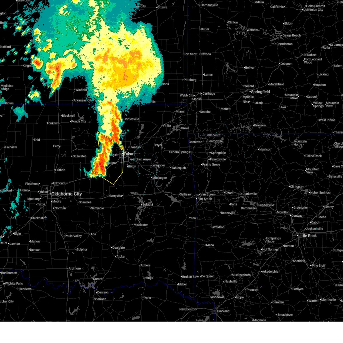
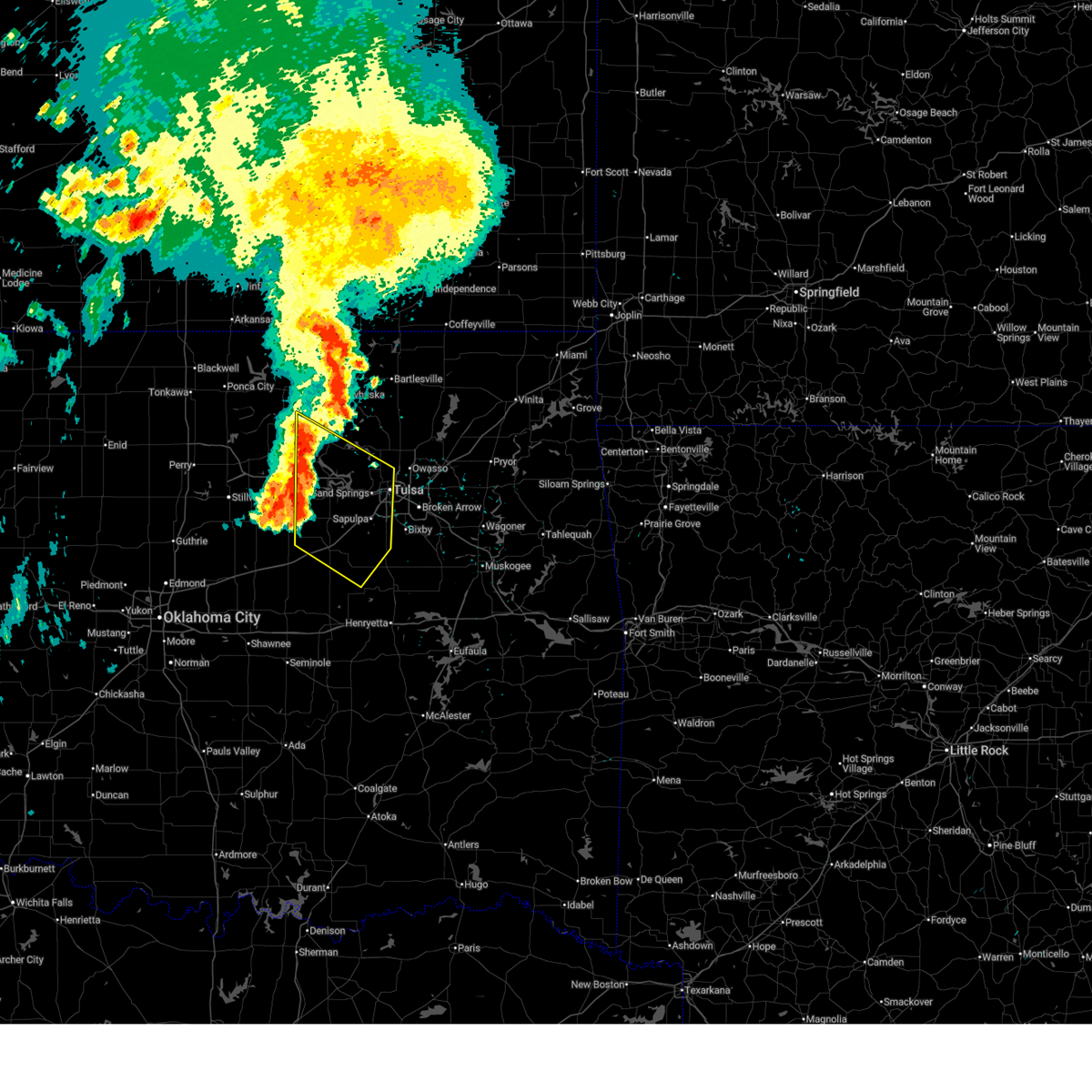
| 5/25/2025 2:53 AM CDT |
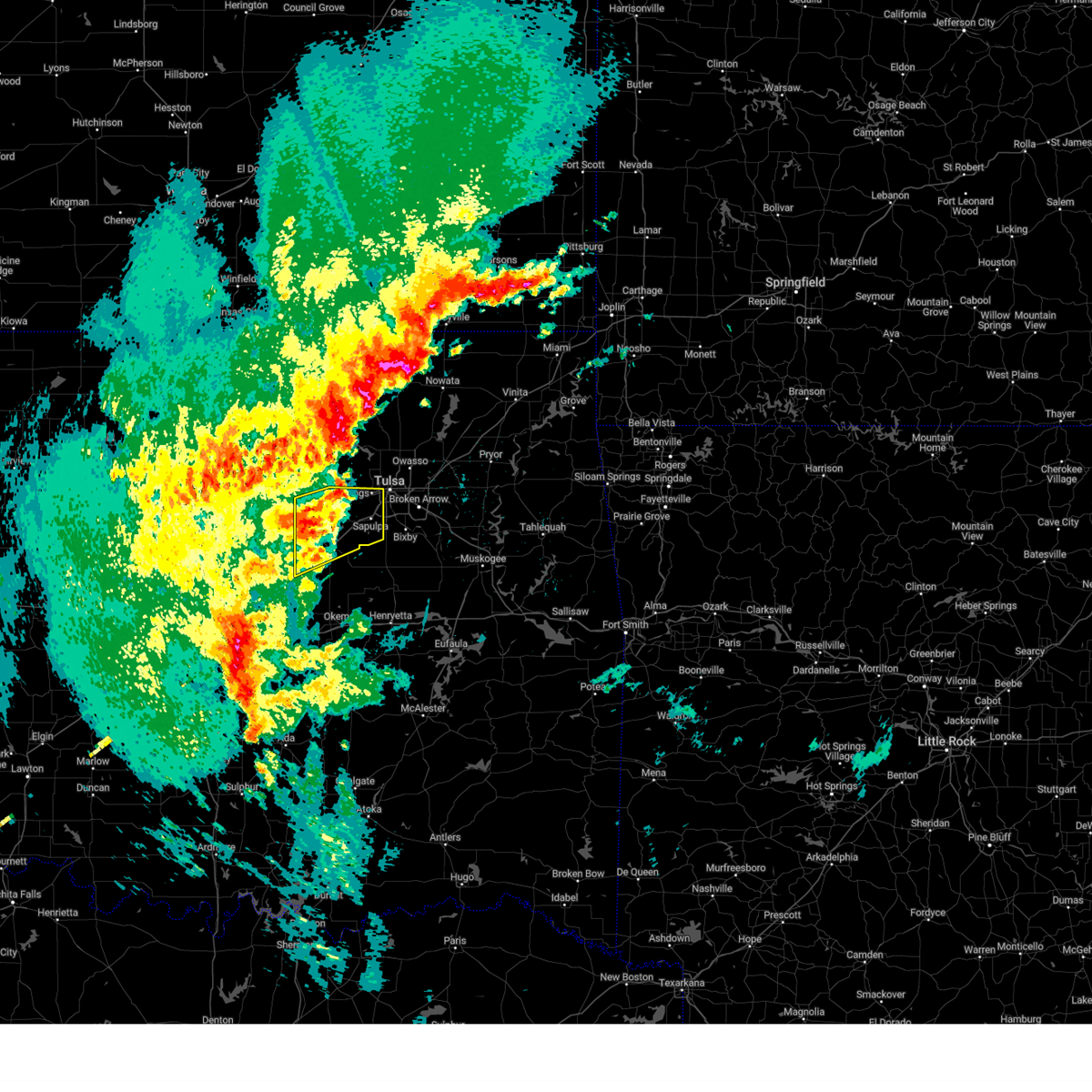
 At 253 am cdt, severe thunderstorms were located along a line extending from 3 miles east of skiatook to 2 miles northeast of sapulpa to 6 miles east of drumright, moving southeast at 35 mph (radar indicated). Hazards include ping pong ball size hail and 60 mph wind gusts. People and animals outdoors will be injured. expect hail damage to roofs, siding, windows, and vehicles. expect wind damage to roofs, siding, and trees. Locations in or near the path include, beggs, sand springs, broken arrow, shamrock, preston, mannford, sapulpa, collinsville, jenks riverside airport, liberty, depew, sperry, skiatook, mounds, stonebluff, hectorville, vera, leonard, jenks, bixby, this includes interstate 44 between mile markers 178 and 248. At 253 am cdt, severe thunderstorms were located along a line extending from 3 miles east of skiatook to 2 miles northeast of sapulpa to 6 miles east of drumright, moving southeast at 35 mph (radar indicated). Hazards include ping pong ball size hail and 60 mph wind gusts. People and animals outdoors will be injured. expect hail damage to roofs, siding, windows, and vehicles. expect wind damage to roofs, siding, and trees. Locations in or near the path include, beggs, sand springs, broken arrow, shamrock, preston, mannford, sapulpa, collinsville, jenks riverside airport, liberty, depew, sperry, skiatook, mounds, stonebluff, hectorville, vera, leonard, jenks, bixby, this includes interstate 44 between mile markers 178 and 248.
|
| 5/25/2025 2:45 AM CDT |
 Svrtsa the national weather service in tulsa has issued a * severe thunderstorm warning for, southwestern rogers county in northeastern oklahoma, southeastern osage county in northeastern oklahoma, creek county in northeastern oklahoma, southern washington county in northeastern oklahoma, northwestern wagoner county in northeastern oklahoma, northern okmulgee county in northeastern oklahoma, tulsa county in northeastern oklahoma, * until 330 am cdt. * at 244 am cdt, severe thunderstorms were located along a line extending from near skiatook to 4 miles north of sapulpa to 4 miles east of drumright, moving southeast at 35 mph (radar indicated). Hazards include golf ball size hail and 60 mph wind gusts. People and animals outdoors will be injured. expect hail damage to roofs, siding, windows, and vehicles. expect wind damage to roofs, siding, and trees. Locations in or near the path include, beggs, sand springs, broken arrow, shamrock, preston, mannford, sapulpa, collinsville, jenks riverside airport, liberty, depew, sperry, skiatook, mounds, stonebluff, hectorville, vera, leonard, jenks, bixby, this includes interstate 44 between mile markers 178 and 248. Svrtsa the national weather service in tulsa has issued a * severe thunderstorm warning for, southwestern rogers county in northeastern oklahoma, southeastern osage county in northeastern oklahoma, creek county in northeastern oklahoma, southern washington county in northeastern oklahoma, northwestern wagoner county in northeastern oklahoma, northern okmulgee county in northeastern oklahoma, tulsa county in northeastern oklahoma, * until 330 am cdt. * at 244 am cdt, severe thunderstorms were located along a line extending from near skiatook to 4 miles north of sapulpa to 4 miles east of drumright, moving southeast at 35 mph (radar indicated). Hazards include golf ball size hail and 60 mph wind gusts. People and animals outdoors will be injured. expect hail damage to roofs, siding, windows, and vehicles. expect wind damage to roofs, siding, and trees. Locations in or near the path include, beggs, sand springs, broken arrow, shamrock, preston, mannford, sapulpa, collinsville, jenks riverside airport, liberty, depew, sperry, skiatook, mounds, stonebluff, hectorville, vera, leonard, jenks, bixby, this includes interstate 44 between mile markers 178 and 248.
|
| 5/25/2025 2:41 AM CDT |
 At 241 am cdt, severe thunderstorms were located along a line extending from near skiatook to 3 miles west of sand springs to near oilton, moving southeast at 35 mph (radar indicated). Hazards include golf ball size hail and 60 mph wind gusts. People and animals outdoors will be injured. expect hail damage to roofs, siding, windows, and vehicles. expect wind damage to roofs, siding, and trees. Locations in or near the path include, westport, sand springs, keystone state park, walnut creek state park, mannford, collinsville, oilton, jennings, sperry, cleveland, silver city, skiatook, turley, osage, terlton, owasso, tulsa,. At 241 am cdt, severe thunderstorms were located along a line extending from near skiatook to 3 miles west of sand springs to near oilton, moving southeast at 35 mph (radar indicated). Hazards include golf ball size hail and 60 mph wind gusts. People and animals outdoors will be injured. expect hail damage to roofs, siding, windows, and vehicles. expect wind damage to roofs, siding, and trees. Locations in or near the path include, westport, sand springs, keystone state park, walnut creek state park, mannford, collinsville, oilton, jennings, sperry, cleveland, silver city, skiatook, turley, osage, terlton, owasso, tulsa,.
|
| 5/25/2025 2:15 AM CDT |
 Svrtsa the national weather service in tulsa has issued a * severe thunderstorm warning for, southeastern osage county in northeastern oklahoma, northwestern creek county in northeastern oklahoma, southeastern pawnee county in northeastern oklahoma, northern tulsa county in northeastern oklahoma, * until 300 am cdt. * at 215 am cdt, severe thunderstorms were located along a line extending from 4 miles southwest of avant to 5 miles southeast of hominy to 2 miles southwest of maramec, moving southeast at 25 mph (radar indicated). Hazards include golf ball size hail and 60 mph wind gusts. People and animals outdoors will be injured. expect hail damage to roofs, siding, windows, and vehicles. expect wind damage to roofs, siding, and trees. Locations in or near the path include, westport, sand springs, keystone state park, walnut creek state park, mannford, hallett, collinsville, oilton, jennings, sperry, cleveland, silver city, skiatook, turley, maramec, osage, terlton, avant, owasso, tulsa,. Svrtsa the national weather service in tulsa has issued a * severe thunderstorm warning for, southeastern osage county in northeastern oklahoma, northwestern creek county in northeastern oklahoma, southeastern pawnee county in northeastern oklahoma, northern tulsa county in northeastern oklahoma, * until 300 am cdt. * at 215 am cdt, severe thunderstorms were located along a line extending from 4 miles southwest of avant to 5 miles southeast of hominy to 2 miles southwest of maramec, moving southeast at 25 mph (radar indicated). Hazards include golf ball size hail and 60 mph wind gusts. People and animals outdoors will be injured. expect hail damage to roofs, siding, windows, and vehicles. expect wind damage to roofs, siding, and trees. Locations in or near the path include, westport, sand springs, keystone state park, walnut creek state park, mannford, hallett, collinsville, oilton, jennings, sperry, cleveland, silver city, skiatook, turley, maramec, osage, terlton, avant, owasso, tulsa,.
|
| 5/24/2025 6:25 AM CDT |
 The storms which prompted the warning have weakened below severe limits, therefore the warning will be allowed to expire. however, small hail and heavy rain are still possible with these thunderstorms. The storms which prompted the warning have weakened below severe limits, therefore the warning will be allowed to expire. however, small hail and heavy rain are still possible with these thunderstorms.
|
| 5/24/2025 6:17 AM CDT |
 the severe thunderstorm warning has been cancelled and is no longer in effect the severe thunderstorm warning has been cancelled and is no longer in effect
|
| 5/24/2025 6:17 AM CDT |
 At 617 am cdt, severe thunderstorms were located along a line extending from 4 miles south of coweta to 3 miles west of preston to 7 miles west of welty, moving southeast at 50 mph (radar indicated). Hazards include 70 mph wind gusts and penny size hail. Expect considerable tree damage. damage is likely to mobile homes, roofs, and outbuildings. locations in or near the path include, beggs, sand springs, shamrock, preston, sapulpa, jenks riverside airport, liberty, depew, mounds, clearview, schulter, stonebluff, hectorville, eram, haskell, leonard, jenks, morris, pharoah, bixby, this includes the following highways, interstate 40 in oklahoma between mile markers 221 and 236. Interstate 44 between mile markers 178 and 223. At 617 am cdt, severe thunderstorms were located along a line extending from 4 miles south of coweta to 3 miles west of preston to 7 miles west of welty, moving southeast at 50 mph (radar indicated). Hazards include 70 mph wind gusts and penny size hail. Expect considerable tree damage. damage is likely to mobile homes, roofs, and outbuildings. locations in or near the path include, beggs, sand springs, shamrock, preston, sapulpa, jenks riverside airport, liberty, depew, mounds, clearview, schulter, stonebluff, hectorville, eram, haskell, leonard, jenks, morris, pharoah, bixby, this includes the following highways, interstate 40 in oklahoma between mile markers 221 and 236. Interstate 44 between mile markers 178 and 223.
|
| 5/24/2025 5:58 AM CDT |
 Svrtsa the national weather service in tulsa has issued a * severe thunderstorm warning for, south central osage county in northeastern oklahoma, creek county in northeastern oklahoma, southwestern wagoner county in northeastern oklahoma, okmulgee county in northeastern oklahoma, northwestern muskogee county in east central oklahoma, southeastern pawnee county in northeastern oklahoma, southern tulsa county in northeastern oklahoma, eastern okfuskee county in east central oklahoma, * until 700 am cdt. * at 558 am cdt, severe thunderstorms were located along a line extending from 4 miles northwest of broken arrow to 6 miles southwest of mannford to 2 miles south of shamrock, moving southeast at 45 mph (radar indicated). Hazards include 70 mph wind gusts and penny size hail. Expect considerable tree damage. damage is likely to mobile homes, roofs, and outbuildings. locations in or near the path include, beggs, sand springs, shamrock, sapulpa, jenks riverside airport, depew, mounds, clearview, schulter, stonebluff, hectorville, eram, haskell, leonard, morris, pharoah, keystone state park, okmulgee, oilton, okfuskee, this includes the following highways, interstate 40 in oklahoma between mile markers 221 and 236. Interstate 44 between mile markers 178 and 223. Svrtsa the national weather service in tulsa has issued a * severe thunderstorm warning for, south central osage county in northeastern oklahoma, creek county in northeastern oklahoma, southwestern wagoner county in northeastern oklahoma, okmulgee county in northeastern oklahoma, northwestern muskogee county in east central oklahoma, southeastern pawnee county in northeastern oklahoma, southern tulsa county in northeastern oklahoma, eastern okfuskee county in east central oklahoma, * until 700 am cdt. * at 558 am cdt, severe thunderstorms were located along a line extending from 4 miles northwest of broken arrow to 6 miles southwest of mannford to 2 miles south of shamrock, moving southeast at 45 mph (radar indicated). Hazards include 70 mph wind gusts and penny size hail. Expect considerable tree damage. damage is likely to mobile homes, roofs, and outbuildings. locations in or near the path include, beggs, sand springs, shamrock, sapulpa, jenks riverside airport, depew, mounds, clearview, schulter, stonebluff, hectorville, eram, haskell, leonard, morris, pharoah, keystone state park, okmulgee, oilton, okfuskee, this includes the following highways, interstate 40 in oklahoma between mile markers 221 and 236. Interstate 44 between mile markers 178 and 223.
|
| 5/24/2025 5:42 AM CDT |
 Svroun the national weather service in norman has issued a * severe thunderstorm warning for, lincoln county in central oklahoma, eastern oklahoma county in central oklahoma, southeastern logan county in central oklahoma, southern payne county in central oklahoma, northern pottawatomie county in central oklahoma, * until 630 am cdt. * at 541 am cdt, severe thunderstorms were located along a line extending from 4 miles west of shamrock to near meridian, moving southeast at 40 mph (radar indicated). Hazards include 60 mph wind gusts and penny size hail. expect damage to roofs, siding, and trees Svroun the national weather service in norman has issued a * severe thunderstorm warning for, lincoln county in central oklahoma, eastern oklahoma county in central oklahoma, southeastern logan county in central oklahoma, southern payne county in central oklahoma, northern pottawatomie county in central oklahoma, * until 630 am cdt. * at 541 am cdt, severe thunderstorms were located along a line extending from 4 miles west of shamrock to near meridian, moving southeast at 40 mph (radar indicated). Hazards include 60 mph wind gusts and penny size hail. expect damage to roofs, siding, and trees
|
| 5/24/2025 5:38 AM CDT |
 At 538 am cdt, severe thunderstorms were located along a line extending from 3 miles east of osage to near tryon, moving southeast at 65 mph (radar indicated). Hazards include 70 mph wind gusts and penny size hail. Expect considerable tree damage. damage is likely to mobile homes, roofs, and outbuildings. Locations in or near the path include, sand springs, skedee, shamrock, mannford, sapulpa, hallett, jenks riverside airport, depew, jennings, cleveland, blackburn, westport, keystone state park, bristow, walnut creek state park, oilton, milfay, silver city, drumright, maramec, this includes interstate 44 between mile markers 178 and 226. At 538 am cdt, severe thunderstorms were located along a line extending from 3 miles east of osage to near tryon, moving southeast at 65 mph (radar indicated). Hazards include 70 mph wind gusts and penny size hail. Expect considerable tree damage. damage is likely to mobile homes, roofs, and outbuildings. Locations in or near the path include, sand springs, skedee, shamrock, mannford, sapulpa, hallett, jenks riverside airport, depew, jennings, cleveland, blackburn, westport, keystone state park, bristow, walnut creek state park, oilton, milfay, silver city, drumright, maramec, this includes interstate 44 between mile markers 178 and 226.
|
| 5/24/2025 5:22 AM CDT |
 Svrtsa the national weather service in tulsa has issued a * severe thunderstorm warning for, south central osage county in northeastern oklahoma, creek county in northeastern oklahoma, pawnee county in northeastern oklahoma, west central tulsa county in northeastern oklahoma, * until 615 am cdt. * at 521 am cdt, severe thunderstorms were located along a line extending from 2 miles northwest of blackburn to 3 miles northeast of coyle, moving east at 35 mph (radar indicated. a 64 mph gust was reported at the pawnee mesonet). Hazards include 70 mph wind gusts. Expect considerable tree damage. damage is likely to mobile homes, roofs, and outbuildings. Locations in or near the path include, sand springs, skedee, shamrock, mannford, sapulpa, hallett, jenks riverside airport, depew, jennings, cleveland, blackburn, westport, keystone state park, bristow, walnut creek state park, oilton, milfay, silver city, drumright, maramec, this includes interstate 44 between mile markers 178 and 226. Svrtsa the national weather service in tulsa has issued a * severe thunderstorm warning for, south central osage county in northeastern oklahoma, creek county in northeastern oklahoma, pawnee county in northeastern oklahoma, west central tulsa county in northeastern oklahoma, * until 615 am cdt. * at 521 am cdt, severe thunderstorms were located along a line extending from 2 miles northwest of blackburn to 3 miles northeast of coyle, moving east at 35 mph (radar indicated. a 64 mph gust was reported at the pawnee mesonet). Hazards include 70 mph wind gusts. Expect considerable tree damage. damage is likely to mobile homes, roofs, and outbuildings. Locations in or near the path include, sand springs, skedee, shamrock, mannford, sapulpa, hallett, jenks riverside airport, depew, jennings, cleveland, blackburn, westport, keystone state park, bristow, walnut creek state park, oilton, milfay, silver city, drumright, maramec, this includes interstate 44 between mile markers 178 and 226.
|
| 5/24/2025 5:05 AM CDT |
 Svroun the national weather service in norman has issued a * severe thunderstorm warning for, northern lincoln county in central oklahoma, southern noble county in northern oklahoma, eastern logan county in central oklahoma, payne county in central oklahoma, * until 545 am cdt. * at 505 am cdt, severe thunderstorms were located along a line extending from 4 miles northeast of morrison to 3 miles southeast of orlando, moving southeast at 35 mph (radar indicated). Hazards include 60 mph wind gusts and penny size hail. expect damage to roofs, siding, and trees Svroun the national weather service in norman has issued a * severe thunderstorm warning for, northern lincoln county in central oklahoma, southern noble county in northern oklahoma, eastern logan county in central oklahoma, payne county in central oklahoma, * until 545 am cdt. * at 505 am cdt, severe thunderstorms were located along a line extending from 4 miles northeast of morrison to 3 miles southeast of orlando, moving southeast at 35 mph (radar indicated). Hazards include 60 mph wind gusts and penny size hail. expect damage to roofs, siding, and trees
|
| 5/24/2025 4:13 AM CDT |
 At 413 am cdt, a severe thunderstorm was located 5 miles southeast of oilton, moving east at 25 mph (radar indicated). Hazards include 60 mph wind gusts and quarter size hail. Hail damage to vehicles is expected. expect wind damage to roofs, siding, and trees. Locations in or near the path include, oilton, silver city, mannford,. At 413 am cdt, a severe thunderstorm was located 5 miles southeast of oilton, moving east at 25 mph (radar indicated). Hazards include 60 mph wind gusts and quarter size hail. Hail damage to vehicles is expected. expect wind damage to roofs, siding, and trees. Locations in or near the path include, oilton, silver city, mannford,.
|
| 5/24/2025 4:10 AM CDT |
 The storm which prompted the warning has moved out of the area. therefore, the warning will be allowed to expire. The storm which prompted the warning has moved out of the area. therefore, the warning will be allowed to expire.
|
| 5/24/2025 3:59 AM CDT |
 Svrtsa the national weather service in tulsa has issued a * severe thunderstorm warning for, northwestern creek county in northeastern oklahoma, * until 445 am cdt. * at 359 am cdt, a severe thunderstorm was located 3 miles northwest of drumright, moving east at 25 mph (radar indicated). Hazards include 60 mph wind gusts and quarter size hail. Hail damage to vehicles is expected. expect wind damage to roofs, siding, and trees. Locations in or near the path include, oilton, silver city, drumright, mannford,. Svrtsa the national weather service in tulsa has issued a * severe thunderstorm warning for, northwestern creek county in northeastern oklahoma, * until 445 am cdt. * at 359 am cdt, a severe thunderstorm was located 3 miles northwest of drumright, moving east at 25 mph (radar indicated). Hazards include 60 mph wind gusts and quarter size hail. Hail damage to vehicles is expected. expect wind damage to roofs, siding, and trees. Locations in or near the path include, oilton, silver city, drumright, mannford,.
|
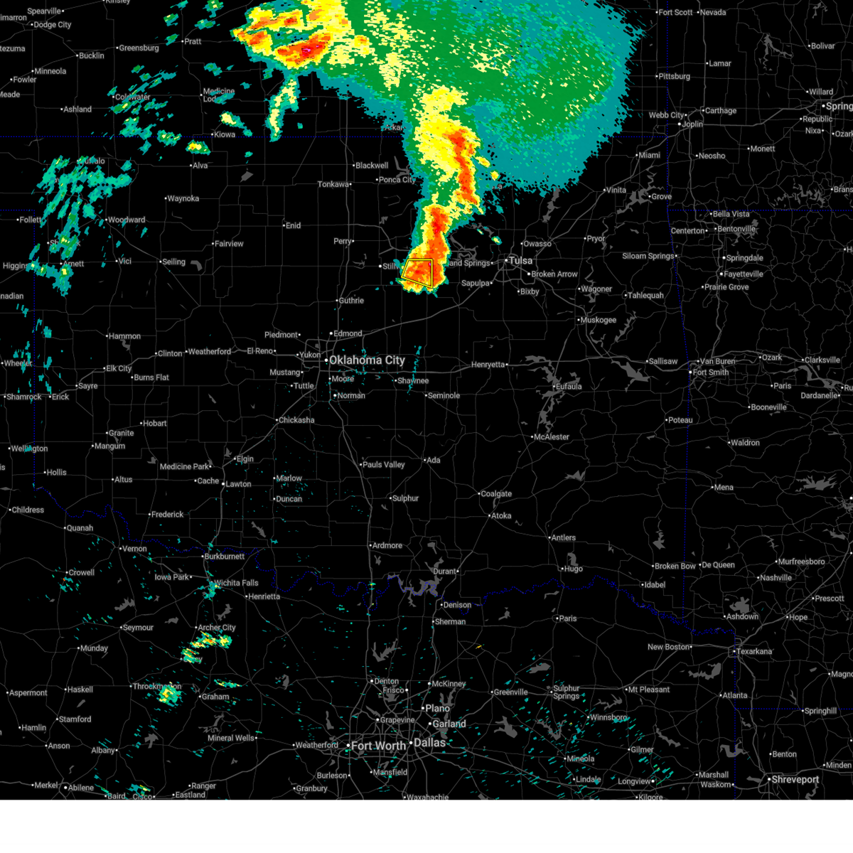
| 5/24/2025 3:46 AM CDT |
 At 346 am cdt, a severe thunderstorm was located near cushing, moving east at 30 mph (radar indicated). Hazards include 60 mph wind gusts and quarter size hail. Hail damage to vehicles is expected. expect wind damage to roofs, siding, and trees. Locations impacted include, cushing. At 346 am cdt, a severe thunderstorm was located near cushing, moving east at 30 mph (radar indicated). Hazards include 60 mph wind gusts and quarter size hail. Hail damage to vehicles is expected. expect wind damage to roofs, siding, and trees. Locations impacted include, cushing.
|
| 5/24/2025 3:28 AM CDT |
 Svroun the national weather service in norman has issued a * severe thunderstorm warning for, southeastern payne county in central oklahoma, * until 415 am cdt. * at 328 am cdt, a severe thunderstorm was located near ripley, moving east at 25 mph (radar indicated). Hazards include 60 mph wind gusts and quarter size hail. Hail damage to vehicles is expected. Expect wind damage to roofs, siding, and trees. Svroun the national weather service in norman has issued a * severe thunderstorm warning for, southeastern payne county in central oklahoma, * until 415 am cdt. * at 328 am cdt, a severe thunderstorm was located near ripley, moving east at 25 mph (radar indicated). Hazards include 60 mph wind gusts and quarter size hail. Hail damage to vehicles is expected. Expect wind damage to roofs, siding, and trees.
|
| 4/29/2025 6:40 AM CDT |
 At 640 am cdt, a severe thunderstorm was located 8 miles west of kellyville, moving northeast at 45 mph (radar indicated). Hazards include 60 mph wind gusts. Expect damage to roofs, siding, and trees. Locations in or near the path include, sand springs, keystone state park, shamrock, bristow, mannford, sapulpa, oilton, depew, milfay, silver city, drumright, kellyville, kiefer, tulsa, this includes interstate 44 between mile markers 178 and 218. At 640 am cdt, a severe thunderstorm was located 8 miles west of kellyville, moving northeast at 45 mph (radar indicated). Hazards include 60 mph wind gusts. Expect damage to roofs, siding, and trees. Locations in or near the path include, sand springs, keystone state park, shamrock, bristow, mannford, sapulpa, oilton, depew, milfay, silver city, drumright, kellyville, kiefer, tulsa, this includes interstate 44 between mile markers 178 and 218.
|
| 4/29/2025 6:26 AM CDT |
 Svrtsa the national weather service in tulsa has issued a * severe thunderstorm warning for, creek county in northeastern oklahoma, southwestern tulsa county in northeastern oklahoma, * until 715 am cdt. * at 626 am cdt, a severe thunderstorm was located near shamrock, moving northeast at 45 mph (radar indicated). Hazards include 60 mph wind gusts and nickel size hail. Expect damage to roofs, siding, and trees. Locations in or near the path include, sand springs, keystone state park, shamrock, bristow, mannford, sapulpa, oilton, depew, milfay, silver city, drumright, kellyville, kiefer, tulsa, this includes interstate 44 between mile markers 178 and 218. Svrtsa the national weather service in tulsa has issued a * severe thunderstorm warning for, creek county in northeastern oklahoma, southwestern tulsa county in northeastern oklahoma, * until 715 am cdt. * at 626 am cdt, a severe thunderstorm was located near shamrock, moving northeast at 45 mph (radar indicated). Hazards include 60 mph wind gusts and nickel size hail. Expect damage to roofs, siding, and trees. Locations in or near the path include, sand springs, keystone state park, shamrock, bristow, mannford, sapulpa, oilton, depew, milfay, silver city, drumright, kellyville, kiefer, tulsa, this includes interstate 44 between mile markers 178 and 218.
|
| 4/29/2025 5:51 AM CDT |
 At 551 am cdt, a severe thunderstorm was located near warwick, moving northeast at 50 mph (radar indicated). Hazards include 60 mph wind gusts and half dollar size hail. Hail damage to vehicles is expected. expect wind damage to roofs, siding, and trees. Locations impacted include, cushing, chandler, stroud, davenport, wellston, carney, tryon, ripley, agra, warwick, kendrick, fallis, avery, and parkland. At 551 am cdt, a severe thunderstorm was located near warwick, moving northeast at 50 mph (radar indicated). Hazards include 60 mph wind gusts and half dollar size hail. Hail damage to vehicles is expected. expect wind damage to roofs, siding, and trees. Locations impacted include, cushing, chandler, stroud, davenport, wellston, carney, tryon, ripley, agra, warwick, kendrick, fallis, avery, and parkland.
|
| 4/29/2025 5:51 AM CDT |
 the severe thunderstorm warning has been cancelled and is no longer in effect the severe thunderstorm warning has been cancelled and is no longer in effect
|
| 4/29/2025 5:45 AM CDT |
 Svroun the national weather service in norman has issued a * severe thunderstorm warning for, lincoln county in central oklahoma, northeastern oklahoma county in central oklahoma, southeastern logan county in central oklahoma, southeastern payne county in central oklahoma, * until 630 am cdt. * at 545 am cdt, a severe thunderstorm was located near wellston, moving northeast at 50 mph (radar indicated). Hazards include 60 mph wind gusts and quarter size hail. Hail damage to vehicles is expected. Expect wind damage to roofs, siding, and trees. Svroun the national weather service in norman has issued a * severe thunderstorm warning for, lincoln county in central oklahoma, northeastern oklahoma county in central oklahoma, southeastern logan county in central oklahoma, southeastern payne county in central oklahoma, * until 630 am cdt. * at 545 am cdt, a severe thunderstorm was located near wellston, moving northeast at 50 mph (radar indicated). Hazards include 60 mph wind gusts and quarter size hail. Hail damage to vehicles is expected. Expect wind damage to roofs, siding, and trees.
|
| 4/2/2025 6:00 AM CDT |
 Svrtsa the national weather service in tulsa has issued a * severe thunderstorm warning for, creek county in northeastern oklahoma, northwestern okmulgee county in northeastern oklahoma, southeastern tulsa county in northeastern oklahoma, okfuskee county in east central oklahoma, * until 645 am cdt. * at 559 am cdt, severe thunderstorms were located along a line extending from near oilton to 4 miles northeast of dale, moving east at 60 mph (radar indicated). Hazards include 60 mph wind gusts and quarter size hail. Hail damage to vehicles is expected. expect wind damage to roofs, siding, and trees. locations in or near the path include, beggs, shamrock, bristow, boley, sapulpa, paden, okemah, jenks riverside airport, liberty, depew, okfuskee, milfay, mounds, drumright, mason, castle, jenks, glenpool, welty, slick, this includes the following highways, interstate 40 in oklahoma between mile markers 212 and 224. Interstate 44 between mile markers 178 and 215. Svrtsa the national weather service in tulsa has issued a * severe thunderstorm warning for, creek county in northeastern oklahoma, northwestern okmulgee county in northeastern oklahoma, southeastern tulsa county in northeastern oklahoma, okfuskee county in east central oklahoma, * until 645 am cdt. * at 559 am cdt, severe thunderstorms were located along a line extending from near oilton to 4 miles northeast of dale, moving east at 60 mph (radar indicated). Hazards include 60 mph wind gusts and quarter size hail. Hail damage to vehicles is expected. expect wind damage to roofs, siding, and trees. locations in or near the path include, beggs, shamrock, bristow, boley, sapulpa, paden, okemah, jenks riverside airport, liberty, depew, okfuskee, milfay, mounds, drumright, mason, castle, jenks, glenpool, welty, slick, this includes the following highways, interstate 40 in oklahoma between mile markers 212 and 224. Interstate 44 between mile markers 178 and 215.
|
| 4/2/2025 5:47 AM CDT |
 At 547 am cdt, a severe thunderstorm was located near agra, moving northeast at 50 mph (radar indicated). Hazards include 60 mph wind gusts and quarter size hail. Hail damage to vehicles is expected. expect wind damage to roofs, siding, and trees. Locations impacted include, kendrick, cushing, stroud, yale, fallis, agra, quay, parkland, avery, ripley, carney, and tryon. At 547 am cdt, a severe thunderstorm was located near agra, moving northeast at 50 mph (radar indicated). Hazards include 60 mph wind gusts and quarter size hail. Hail damage to vehicles is expected. expect wind damage to roofs, siding, and trees. Locations impacted include, kendrick, cushing, stroud, yale, fallis, agra, quay, parkland, avery, ripley, carney, and tryon.
|
| 4/2/2025 5:47 AM CDT |
 the severe thunderstorm warning has been cancelled and is no longer in effect the severe thunderstorm warning has been cancelled and is no longer in effect
|
| 4/2/2025 5:30 AM CDT |
 Svroun the national weather service in norman has issued a * severe thunderstorm warning for, northern lincoln county in central oklahoma, southeastern logan county in central oklahoma, eastern payne county in central oklahoma, * until 615 am cdt. * at 530 am cdt, severe thunderstorms were located along a line extending from 4 miles west of quay to near fallis, moving northeast at 50 mph (radar indicated). Hazards include 60 mph wind gusts and quarter size hail. Hail damage to vehicles is expected. Expect wind damage to roofs, siding, and trees. Svroun the national weather service in norman has issued a * severe thunderstorm warning for, northern lincoln county in central oklahoma, southeastern logan county in central oklahoma, eastern payne county in central oklahoma, * until 615 am cdt. * at 530 am cdt, severe thunderstorms were located along a line extending from 4 miles west of quay to near fallis, moving northeast at 50 mph (radar indicated). Hazards include 60 mph wind gusts and quarter size hail. Hail damage to vehicles is expected. Expect wind damage to roofs, siding, and trees.
|
| 4/2/2025 5:26 AM CDT |
 At 526 am cdt, severe thunderstorms were located along a line extending from 7 miles north of blackburn to 3 miles northeast of ripley, moving northeast at 65 mph (radar indicated). Hazards include 70 mph wind gusts and quarter size hail. Hail damage to vehicles is expected. expect considerable tree damage. wind damage is also likely to mobile homes, roofs, and outbuildings. Locations in or near the path include, maramec, skedee, hallett, oilton, pawnee, jennings, blackburn, cleveland,. At 526 am cdt, severe thunderstorms were located along a line extending from 7 miles north of blackburn to 3 miles northeast of ripley, moving northeast at 65 mph (radar indicated). Hazards include 70 mph wind gusts and quarter size hail. Hail damage to vehicles is expected. expect considerable tree damage. wind damage is also likely to mobile homes, roofs, and outbuildings. Locations in or near the path include, maramec, skedee, hallett, oilton, pawnee, jennings, blackburn, cleveland,.
|
| 4/2/2025 5:08 AM CDT |
 At 508 am cdt, severe thunderstorms were located along a line extending from near morrison to 6 miles northeast of edmond, moving northeast at 55 mph (radar indicated). Hazards include 60 mph wind gusts and half dollar size hail. Hail damage to vehicles is expected. expect wind damage to roofs, siding, and trees. Locations impacted include, ingalls, coyle, langston, glencoe, perkins, morrison, lake mcmurtry, yale, agra, parkland, meridian, ripley, carney, tryon, kendrick, cushing, fallis, guthrie, quay, and stillwater. At 508 am cdt, severe thunderstorms were located along a line extending from near morrison to 6 miles northeast of edmond, moving northeast at 55 mph (radar indicated). Hazards include 60 mph wind gusts and half dollar size hail. Hail damage to vehicles is expected. expect wind damage to roofs, siding, and trees. Locations impacted include, ingalls, coyle, langston, glencoe, perkins, morrison, lake mcmurtry, yale, agra, parkland, meridian, ripley, carney, tryon, kendrick, cushing, fallis, guthrie, quay, and stillwater.
|
| 4/2/2025 4:57 AM CDT |
 Svrtsa the national weather service in tulsa has issued a * severe thunderstorm warning for, south central osage county in northeastern oklahoma, northwestern creek county in northeastern oklahoma, southwestern pawnee county in northeastern oklahoma, * until 545 am cdt. * at 457 am cdt, severe thunderstorms were located along a line extending from 3 miles east of sooner lake to 2 miles southeast of guthrie, moving northeast at 55 mph (radar indicated). Hazards include 60 mph wind gusts and half dollar size hail. Hail damage to vehicles is expected. expect wind damage to roofs, siding, and trees. Locations in or near the path include, maramec, skedee, hallett, oilton, pawnee, jennings, blackburn, cleveland,. Svrtsa the national weather service in tulsa has issued a * severe thunderstorm warning for, south central osage county in northeastern oklahoma, northwestern creek county in northeastern oklahoma, southwestern pawnee county in northeastern oklahoma, * until 545 am cdt. * at 457 am cdt, severe thunderstorms were located along a line extending from 3 miles east of sooner lake to 2 miles southeast of guthrie, moving northeast at 55 mph (radar indicated). Hazards include 60 mph wind gusts and half dollar size hail. Hail damage to vehicles is expected. expect wind damage to roofs, siding, and trees. Locations in or near the path include, maramec, skedee, hallett, oilton, pawnee, jennings, blackburn, cleveland,.
|
| 4/2/2025 4:52 AM CDT |
 Svroun the national weather service in norman has issued a * severe thunderstorm warning for, northern lincoln county in central oklahoma, central noble county in northern oklahoma, logan county in central oklahoma, payne county in central oklahoma, * until 530 am cdt. * at 452 am cdt, severe thunderstorms were located along a line extending from near sooner lake to 5 miles south of guthrie, moving east-northeast at 55 mph (radar indicated). Hazards include 60 mph wind gusts and half dollar size hail. Hail damage to vehicles is expected. Expect wind damage to roofs, siding, and trees. Svroun the national weather service in norman has issued a * severe thunderstorm warning for, northern lincoln county in central oklahoma, central noble county in northern oklahoma, logan county in central oklahoma, payne county in central oklahoma, * until 530 am cdt. * at 452 am cdt, severe thunderstorms were located along a line extending from near sooner lake to 5 miles south of guthrie, moving east-northeast at 55 mph (radar indicated). Hazards include 60 mph wind gusts and half dollar size hail. Hail damage to vehicles is expected. Expect wind damage to roofs, siding, and trees.
|
| 11/18/2024 8:11 AM CST |
 The storms which prompted the warning have weakened below severe limits, therefore the warning will be allowed to expire. however, gusty winds and heavy rain are still possible with these thunderstorms. The storms which prompted the warning have weakened below severe limits, therefore the warning will be allowed to expire. however, gusty winds and heavy rain are still possible with these thunderstorms.
|
| 11/18/2024 7:42 AM CST |
 At 742 am cst, severe thunderstorms were located along a line extending from 7 miles east of marland to 4 miles southeast of stillwater to near etowah, moving northeast at 30 mph (radar indicated). Hazards include 60 mph wind gusts. Expect damage to roofs, siding, and trees. Locations impacted include, eastern oklahoma city, eastern norman, stillwater, shawnee, cushing, seminole, tecumseh, purcell, chandler, choctaw, harrah, slaughterville, mcloud, perkins, stroud, prague, lexington, pink, yale, and luther. At 742 am cst, severe thunderstorms were located along a line extending from 7 miles east of marland to 4 miles southeast of stillwater to near etowah, moving northeast at 30 mph (radar indicated). Hazards include 60 mph wind gusts. Expect damage to roofs, siding, and trees. Locations impacted include, eastern oklahoma city, eastern norman, stillwater, shawnee, cushing, seminole, tecumseh, purcell, chandler, choctaw, harrah, slaughterville, mcloud, perkins, stroud, prague, lexington, pink, yale, and luther.
|
| 11/18/2024 7:34 AM CST |
 At 734 am cst, severe thunderstorms were located along a line extending from 5 miles southeast of marland to 5 miles northwest of perkins to near slaughterville, moving northeast at 35 mph (radar indicated). Hazards include 60 mph wind gusts. Expect damage to roofs, siding, and trees. Locations impacted include, eastern oklahoma city, norman, eastern edmond, moore, midwest city, stillwater, shawnee, del city, cushing, newcastle, seminole, tecumseh, purcell, perry, chandler, choctaw, noble, harrah, slaughterville, and mcloud. At 734 am cst, severe thunderstorms were located along a line extending from 5 miles southeast of marland to 5 miles northwest of perkins to near slaughterville, moving northeast at 35 mph (radar indicated). Hazards include 60 mph wind gusts. Expect damage to roofs, siding, and trees. Locations impacted include, eastern oklahoma city, norman, eastern edmond, moore, midwest city, stillwater, shawnee, del city, cushing, newcastle, seminole, tecumseh, purcell, perry, chandler, choctaw, noble, harrah, slaughterville, and mcloud.
|
| 11/18/2024 7:34 AM CST |
 the severe thunderstorm warning has been cancelled and is no longer in effect the severe thunderstorm warning has been cancelled and is no longer in effect
|
| 11/18/2024 7:10 AM CST |
 Svroun the national weather service in norman has issued a * severe thunderstorm warning for, southern kay county in northern oklahoma, northwestern seminole county in east central oklahoma, lincoln county in central oklahoma, eastern oklahoma county in central oklahoma, noble county in northern oklahoma, cleveland county in central oklahoma, eastern logan county in central oklahoma, payne county in central oklahoma, pottawatomie county in central oklahoma, southwestern mcclain county in central oklahoma, * until 815 am cst. * at 709 am cst, severe thunderstorms were located along a line extending from 4 miles east of billings to 4 miles west of langston to near criner, moving northeast at 35 mph (radar indicated). Hazards include 60 mph wind gusts and penny size hail. expect damage to roofs, siding, and trees Svroun the national weather service in norman has issued a * severe thunderstorm warning for, southern kay county in northern oklahoma, northwestern seminole county in east central oklahoma, lincoln county in central oklahoma, eastern oklahoma county in central oklahoma, noble county in northern oklahoma, cleveland county in central oklahoma, eastern logan county in central oklahoma, payne county in central oklahoma, pottawatomie county in central oklahoma, southwestern mcclain county in central oklahoma, * until 815 am cst. * at 709 am cst, severe thunderstorms were located along a line extending from 4 miles east of billings to 4 miles west of langston to near criner, moving northeast at 35 mph (radar indicated). Hazards include 60 mph wind gusts and penny size hail. expect damage to roofs, siding, and trees
|
| 11/4/2024 12:00 PM CST |
 At 1200 pm cst, severe thunderstorms were located along a line extending from 2 miles east of osage to 7 miles northwest of kellyville, moving northeast at 40 mph (radar indicated). Hazards include 60 mph wind gusts and penny size hail. Expect damage to roofs, siding, and trees. Locations in or near the path include, sand springs, mannford, westport, osage, terlton, keystone state park, walnut creek state park, this includes interstate 44 near mile marker 182, and between mile markers 199 and 208. At 1200 pm cst, severe thunderstorms were located along a line extending from 2 miles east of osage to 7 miles northwest of kellyville, moving northeast at 40 mph (radar indicated). Hazards include 60 mph wind gusts and penny size hail. Expect damage to roofs, siding, and trees. Locations in or near the path include, sand springs, mannford, westport, osage, terlton, keystone state park, walnut creek state park, this includes interstate 44 near mile marker 182, and between mile markers 199 and 208.
|
| 11/4/2024 11:49 AM CST |
 At 1149 am cst, severe thunderstorms were located along a line extending from 2 miles northeast of terlton to 5 miles northwest of bristow, moving northeast at 55 mph (radar indicated). Hazards include 60 mph wind gusts and quarter size hail. Hail damage to vehicles is expected. expect wind damage to roofs, siding, and trees. Locations in or near the path include, sand springs, mannford, depew, jennings, westport, osage, terlton, shamrock, keystone state park, walnut creek state park, silver city, this includes interstate 44 between mile markers 178 and 186, and between mile markers 197 and 208. At 1149 am cst, severe thunderstorms were located along a line extending from 2 miles northeast of terlton to 5 miles northwest of bristow, moving northeast at 55 mph (radar indicated). Hazards include 60 mph wind gusts and quarter size hail. Hail damage to vehicles is expected. expect wind damage to roofs, siding, and trees. Locations in or near the path include, sand springs, mannford, depew, jennings, westport, osage, terlton, shamrock, keystone state park, walnut creek state park, silver city, this includes interstate 44 between mile markers 178 and 186, and between mile markers 197 and 208.
|
| 11/4/2024 11:39 AM CST |
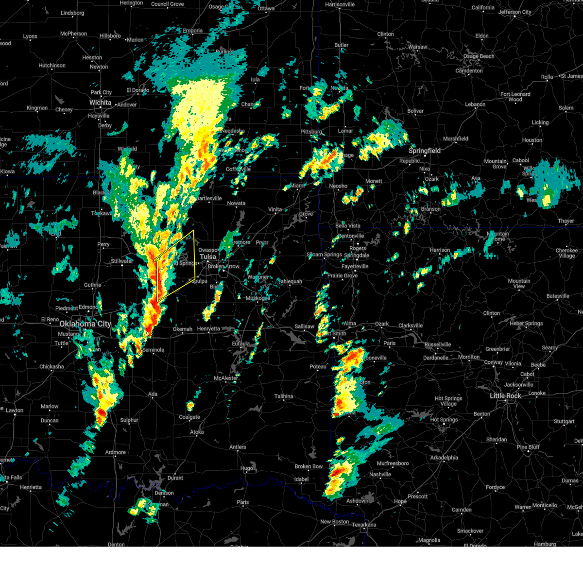 Svrtsa the national weather service in tulsa has issued a * severe thunderstorm warning for, southeastern osage county in northeastern oklahoma, northern creek county in northeastern oklahoma, southeastern pawnee county in northeastern oklahoma, west central tulsa county in northeastern oklahoma, * until 1230 pm cst. * at 1138 am cst, severe thunderstorms were located along a line extending from 3 miles southwest of jennings to 4 miles northwest of depew, moving northeast at 40 mph (radar indicated). Hazards include 60 mph wind gusts and quarter size hail. Hail damage to vehicles is expected. expect wind damage to roofs, siding, and trees. Locations in or near the path include, sand springs, mannford, drumright, oilton, depew, jennings, westport, osage, terlton, shamrock, keystone state park, walnut creek state park, silver city, this includes interstate 44 between mile markers 178 and 186, and between mile markers 197 and 208. Svrtsa the national weather service in tulsa has issued a * severe thunderstorm warning for, southeastern osage county in northeastern oklahoma, northern creek county in northeastern oklahoma, southeastern pawnee county in northeastern oklahoma, west central tulsa county in northeastern oklahoma, * until 1230 pm cst. * at 1138 am cst, severe thunderstorms were located along a line extending from 3 miles southwest of jennings to 4 miles northwest of depew, moving northeast at 40 mph (radar indicated). Hazards include 60 mph wind gusts and quarter size hail. Hail damage to vehicles is expected. expect wind damage to roofs, siding, and trees. Locations in or near the path include, sand springs, mannford, drumright, oilton, depew, jennings, westport, osage, terlton, shamrock, keystone state park, walnut creek state park, silver city, this includes interstate 44 between mile markers 178 and 186, and between mile markers 197 and 208.
|
| 11/3/2024 3:24 AM CST |
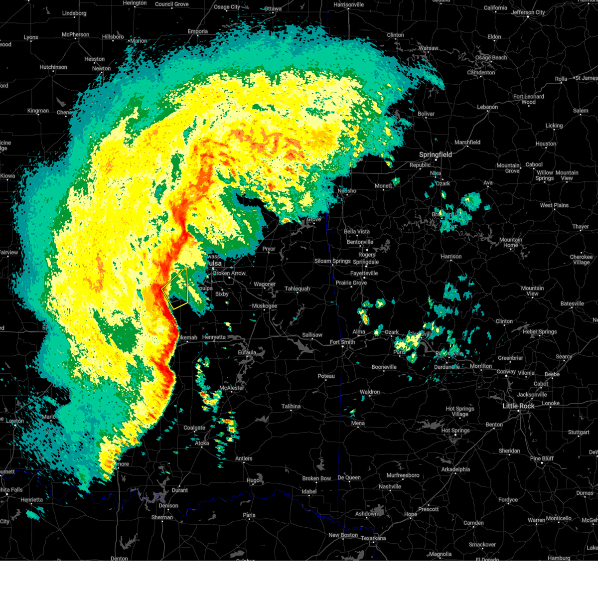 Svrtsa the national weather service in tulsa has issued a * severe thunderstorm warning for, western creek county in northeastern oklahoma, * until 345 am cst. * at 324 am cst, severe thunderstorms were located along a line extending from 3 miles northeast of shamrock to 4 miles southwest of bristow, moving northeast at 70 mph (radar indicated). Hazards include 70 mph wind gusts. Expect considerable tree damage. damage is likely to mobile homes, roofs, and outbuildings. Locations in or near the path include, bristow, mannford, depew, shamrock, this includes interstate 44 between mile markers 184 and 197. Svrtsa the national weather service in tulsa has issued a * severe thunderstorm warning for, western creek county in northeastern oklahoma, * until 345 am cst. * at 324 am cst, severe thunderstorms were located along a line extending from 3 miles northeast of shamrock to 4 miles southwest of bristow, moving northeast at 70 mph (radar indicated). Hazards include 70 mph wind gusts. Expect considerable tree damage. damage is likely to mobile homes, roofs, and outbuildings. Locations in or near the path include, bristow, mannford, depew, shamrock, this includes interstate 44 between mile markers 184 and 197.
|
| 11/3/2024 2:52 AM CST |
 Svrtsa the national weather service in tulsa has issued a * severe thunderstorm warning for, western creek county in northeastern oklahoma, northwestern okfuskee county in east central oklahoma, * until 330 am cst. * at 251 am cst, severe thunderstorms were located along a line extending from 2 miles east of chandler to 3 miles east of sparks to 3 miles north of earlsboro, moving northeast at 60 mph (radar indicated). Hazards include 60 mph wind gusts. Expect damage to roofs, siding, and trees. Locations in or near the path include, drumright, boley, oilton, depew, paden, shamrock, silver city, milfay, this includes interstate 44 between mile markers 178 and 190. Svrtsa the national weather service in tulsa has issued a * severe thunderstorm warning for, western creek county in northeastern oklahoma, northwestern okfuskee county in east central oklahoma, * until 330 am cst. * at 251 am cst, severe thunderstorms were located along a line extending from 2 miles east of chandler to 3 miles east of sparks to 3 miles north of earlsboro, moving northeast at 60 mph (radar indicated). Hazards include 60 mph wind gusts. Expect damage to roofs, siding, and trees. Locations in or near the path include, drumright, boley, oilton, depew, paden, shamrock, silver city, milfay, this includes interstate 44 between mile markers 178 and 190.
|
| 11/3/2024 2:41 AM CST |
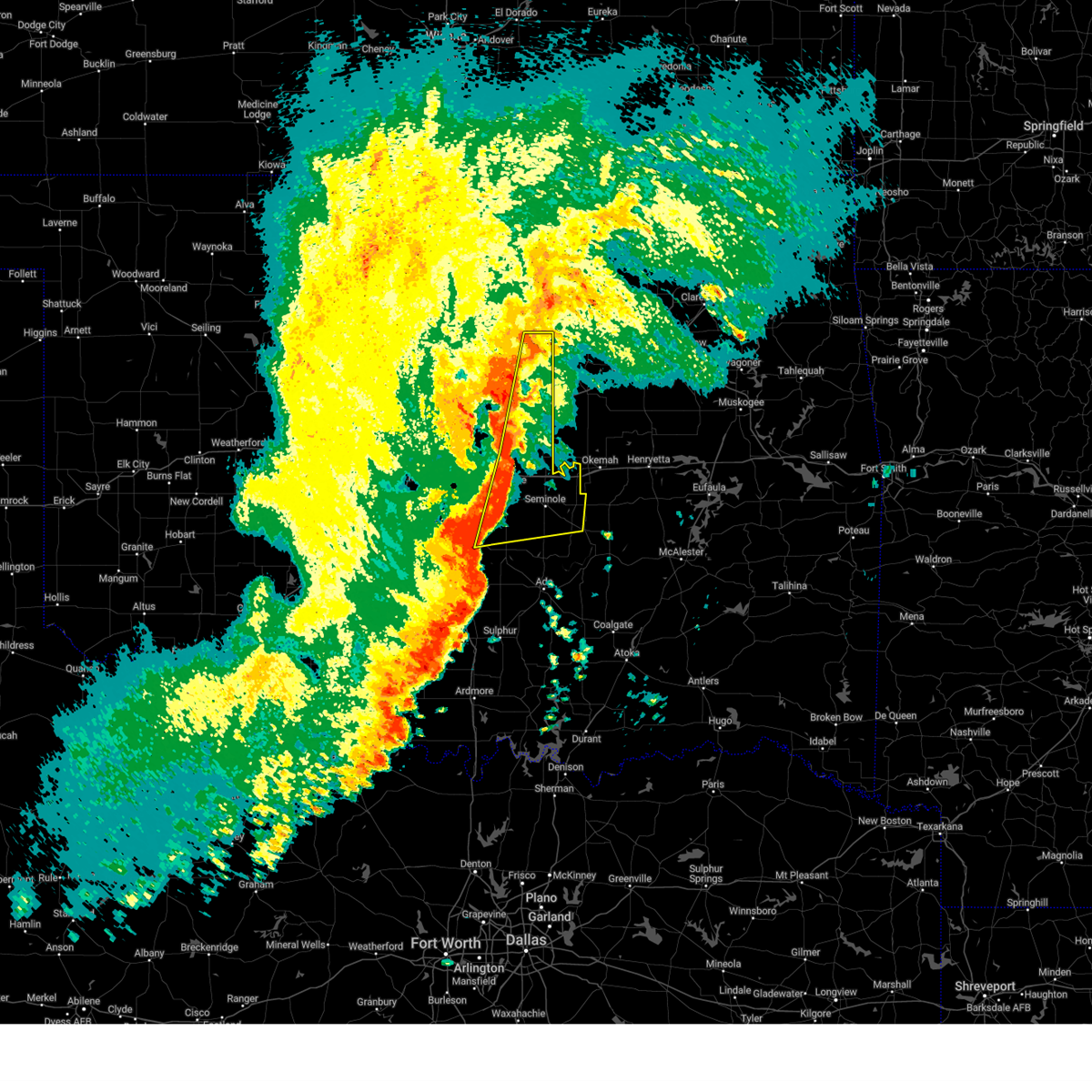 Svroun the national weather service in norman has issued a * severe thunderstorm warning for, seminole county in east central oklahoma, eastern lincoln county in central oklahoma, southeastern payne county in central oklahoma, pottawatomie county in central oklahoma, northwestern hughes county in southeastern oklahoma, * until 330 am cst. * at 241 am cst, severe thunderstorms were located along a line extending from near yale to near meeker to near tribbey, moving east at 25 mph (radar indicated). Hazards include 60 mph wind gusts and quarter size hail. Hail damage to vehicles is expected. Expect wind damage to roofs, siding, and trees. Svroun the national weather service in norman has issued a * severe thunderstorm warning for, seminole county in east central oklahoma, eastern lincoln county in central oklahoma, southeastern payne county in central oklahoma, pottawatomie county in central oklahoma, northwestern hughes county in southeastern oklahoma, * until 330 am cst. * at 241 am cst, severe thunderstorms were located along a line extending from near yale to near meeker to near tribbey, moving east at 25 mph (radar indicated). Hazards include 60 mph wind gusts and quarter size hail. Hail damage to vehicles is expected. Expect wind damage to roofs, siding, and trees.
|
| 11/3/2024 2:07 AM CST |
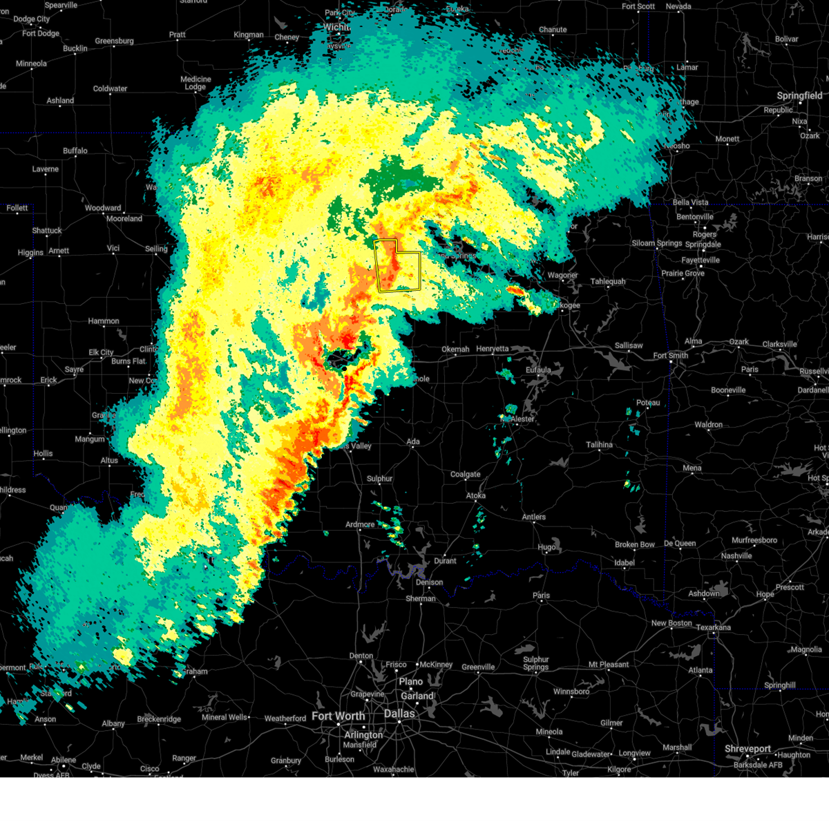 Svroun the national weather service in norman has issued a * severe thunderstorm warning for, northeastern lincoln county in central oklahoma, eastern payne county in central oklahoma, * until 230 am cst. * at 207 am cst, a severe thunderstorm was located 5 miles southwest of yale, moving northeast at 30 mph (radar indicated). Hazards include 60 mph wind gusts and quarter size hail. Hail damage to vehicles is expected. Expect wind damage to roofs, siding, and trees. Svroun the national weather service in norman has issued a * severe thunderstorm warning for, northeastern lincoln county in central oklahoma, eastern payne county in central oklahoma, * until 230 am cst. * at 207 am cst, a severe thunderstorm was located 5 miles southwest of yale, moving northeast at 30 mph (radar indicated). Hazards include 60 mph wind gusts and quarter size hail. Hail damage to vehicles is expected. Expect wind damage to roofs, siding, and trees.
|
| 10/30/2024 9:13 PM CDT |
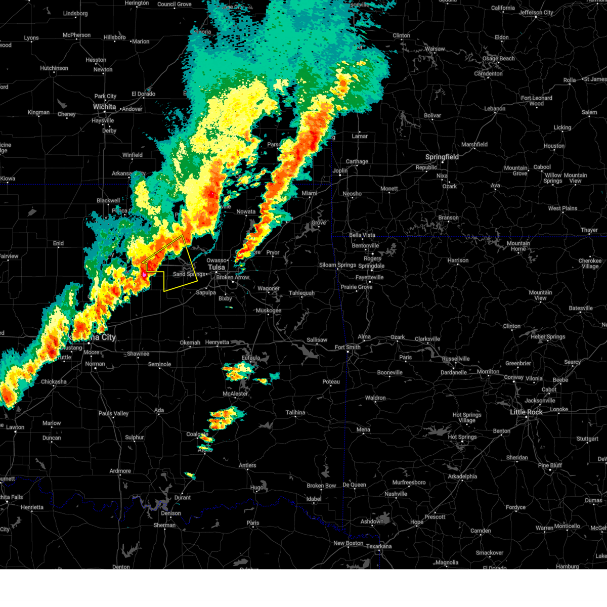 Svrtsa the national weather service in tulsa has issued a * severe thunderstorm warning for, south central osage county in northeastern oklahoma, northwestern creek county in northeastern oklahoma, southern pawnee county in northeastern oklahoma, west central tulsa county in northeastern oklahoma, * until 1000 pm cdt. * at 912 pm cdt, a severe thunderstorm was located 7 miles northeast of ripley, moving northeast at 45 mph (radar indicated). Hazards include 60 mph wind gusts and quarter size hail. Hail damage to vehicles is expected. expect wind damage to roofs, siding, and trees. Locations in or near the path include, hominy, cleveland, mannford, drumright, oilton, jennings, westport, osage, hallett, blackburn, terlton, maramec, keystone state park, silver city,. Svrtsa the national weather service in tulsa has issued a * severe thunderstorm warning for, south central osage county in northeastern oklahoma, northwestern creek county in northeastern oklahoma, southern pawnee county in northeastern oklahoma, west central tulsa county in northeastern oklahoma, * until 1000 pm cdt. * at 912 pm cdt, a severe thunderstorm was located 7 miles northeast of ripley, moving northeast at 45 mph (radar indicated). Hazards include 60 mph wind gusts and quarter size hail. Hail damage to vehicles is expected. expect wind damage to roofs, siding, and trees. Locations in or near the path include, hominy, cleveland, mannford, drumright, oilton, jennings, westport, osage, hallett, blackburn, terlton, maramec, keystone state park, silver city,.
|
| 10/30/2024 8:53 PM CDT |
 At 853 pm cdt, a severe thunderstorm was located 5 miles south of stillwater, moving northeast at 55 mph (radar indicated). Hazards include ping pong ball size hail and 60 mph wind gusts. People and animals outdoors will be injured. expect hail damage to roofs, siding, windows, and vehicles. expect wind damage to roofs, siding, and trees. Locations impacted include, stillwater, cushing, perkins, yale, glencoe, tryon, ripley, lake carl blackwell, lake mcmurtry, quay, and ingalls. At 853 pm cdt, a severe thunderstorm was located 5 miles south of stillwater, moving northeast at 55 mph (radar indicated). Hazards include ping pong ball size hail and 60 mph wind gusts. People and animals outdoors will be injured. expect hail damage to roofs, siding, windows, and vehicles. expect wind damage to roofs, siding, and trees. Locations impacted include, stillwater, cushing, perkins, yale, glencoe, tryon, ripley, lake carl blackwell, lake mcmurtry, quay, and ingalls.
|
| 10/30/2024 8:46 PM CDT |
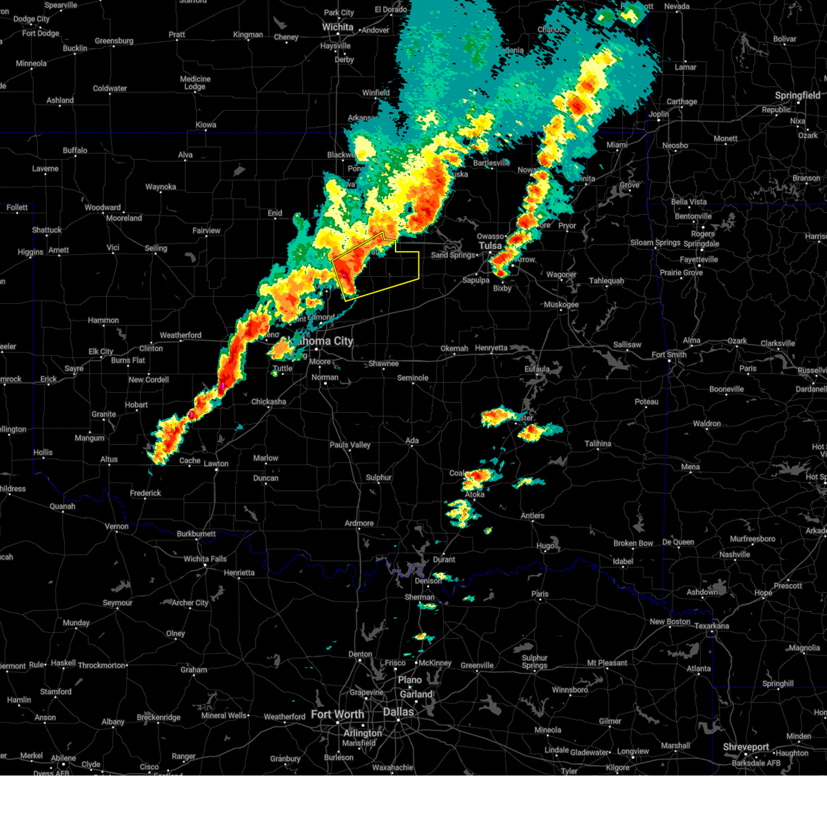 At 846 pm cdt, a severe thunderstorm was located near coyle, moving northeast at 55 mph (radar indicated). Hazards include 60 mph wind gusts and quarter size hail. Hail damage to vehicles is expected. expect wind damage to roofs, siding, and trees. Locations impacted include, stillwater, cushing, perkins, langston, yale, glencoe, tryon, ripley, coyle, meridian, lake carl blackwell, lake mcmurtry, quay, and ingalls. At 846 pm cdt, a severe thunderstorm was located near coyle, moving northeast at 55 mph (radar indicated). Hazards include 60 mph wind gusts and quarter size hail. Hail damage to vehicles is expected. expect wind damage to roofs, siding, and trees. Locations impacted include, stillwater, cushing, perkins, langston, yale, glencoe, tryon, ripley, coyle, meridian, lake carl blackwell, lake mcmurtry, quay, and ingalls.
|
| 10/30/2024 8:40 PM CDT |
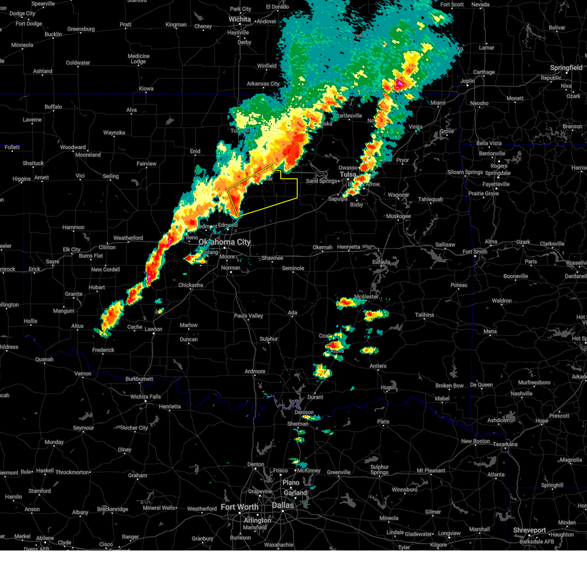 Svroun the national weather service in norman has issued a * severe thunderstorm warning for, northwestern lincoln county in central oklahoma, southeastern noble county in northern oklahoma, eastern logan county in central oklahoma, payne county in central oklahoma, * until 930 pm cdt. * at 840 pm cdt, a severe thunderstorm was located near langston, moving northeast at 55 mph (radar indicated). Hazards include 60 mph wind gusts and half dollar size hail. Hail damage to vehicles is expected. Expect wind damage to roofs, siding, and trees. Svroun the national weather service in norman has issued a * severe thunderstorm warning for, northwestern lincoln county in central oklahoma, southeastern noble county in northern oklahoma, eastern logan county in central oklahoma, payne county in central oklahoma, * until 930 pm cdt. * at 840 pm cdt, a severe thunderstorm was located near langston, moving northeast at 55 mph (radar indicated). Hazards include 60 mph wind gusts and half dollar size hail. Hail damage to vehicles is expected. Expect wind damage to roofs, siding, and trees.
|
| 7/4/2024 8:12 PM CDT |
 the severe thunderstorm warning has been cancelled and is no longer in effect the severe thunderstorm warning has been cancelled and is no longer in effect
|
| 7/4/2024 8:03 PM CDT |
 At 803 pm cdt, a severe thunderstorm was located near yale, moving east at 25 mph (radar indicated). Hazards include 60 mph wind gusts. Expect damage to roofs, siding, and trees. Locations impacted include, cushing, yale, and quay. At 803 pm cdt, a severe thunderstorm was located near yale, moving east at 25 mph (radar indicated). Hazards include 60 mph wind gusts. Expect damage to roofs, siding, and trees. Locations impacted include, cushing, yale, and quay.
|
| 7/4/2024 7:41 PM CDT |
 Svroun the national weather service in norman has issued a * severe thunderstorm warning for, eastern payne county in central oklahoma, * until 830 pm cdt. * at 740 pm cdt, a severe thunderstorm was located near ripley, moving east at 25 mph (radar indicated). Hazards include 60 mph wind gusts and quarter size hail. Hail damage to vehicles is expected. Expect wind damage to roofs, siding, and trees. Svroun the national weather service in norman has issued a * severe thunderstorm warning for, eastern payne county in central oklahoma, * until 830 pm cdt. * at 740 pm cdt, a severe thunderstorm was located near ripley, moving east at 25 mph (radar indicated). Hazards include 60 mph wind gusts and quarter size hail. Hail damage to vehicles is expected. Expect wind damage to roofs, siding, and trees.
|
| 7/4/2024 6:55 PM CDT |
 The severe thunderstorm which prompted the warning is weakening. therefore, the warning for northeastern lincoln and southeastern payne counties will be allowed to expire. The severe thunderstorm which prompted the warning is weakening. therefore, the warning for northeastern lincoln and southeastern payne counties will be allowed to expire.
|
| 7/4/2024 6:34 PM CDT |
 Svroun the national weather service in norman has issued a * severe thunderstorm warning for, northeastern lincoln county in central oklahoma, southeastern payne county in central oklahoma, * until 700 pm cdt. * at 633 pm cdt, a severe thunderstorm was located 4 miles north of avery, moving east at 20 mph (radar indicated). Hazards include 60 mph wind gusts and quarter size hail. Hail damage to vehicles is expected. Expect wind damage to roofs, siding, and trees. Svroun the national weather service in norman has issued a * severe thunderstorm warning for, northeastern lincoln county in central oklahoma, southeastern payne county in central oklahoma, * until 700 pm cdt. * at 633 pm cdt, a severe thunderstorm was located 4 miles north of avery, moving east at 20 mph (radar indicated). Hazards include 60 mph wind gusts and quarter size hail. Hail damage to vehicles is expected. Expect wind damage to roofs, siding, and trees.
|
| 5/20/2024 3:13 AM CDT |
 At 313 am cdt, severe thunderstorms were located along a line extending from near avery to near kendrick to near sparks, moving east at 40 mph (radar indicated). Hazards include ping pong ball size hail and 60 mph wind gusts. People and animals outdoors will be injured. expect hail damage to roofs, siding, windows, and vehicles. expect wind damage to roofs, siding, and trees. Locations impacted include, cushing, chandler, stroud, prague, meeker, davenport, tryon, agra, sparks, warwick, kendrick, avery, and parkland. At 313 am cdt, severe thunderstorms were located along a line extending from near avery to near kendrick to near sparks, moving east at 40 mph (radar indicated). Hazards include ping pong ball size hail and 60 mph wind gusts. People and animals outdoors will be injured. expect hail damage to roofs, siding, windows, and vehicles. expect wind damage to roofs, siding, and trees. Locations impacted include, cushing, chandler, stroud, prague, meeker, davenport, tryon, agra, sparks, warwick, kendrick, avery, and parkland.
|
| 5/20/2024 2:53 AM CDT |
 Svroun the national weather service in norman has issued a * severe thunderstorm warning for, lincoln county in central oklahoma, southeastern payne county in central oklahoma, * until 345 am cdt. * at 252 am cdt, severe thunderstorms were located along a line extending from 3 miles northeast of agra to near carney to 4 miles south of wellston, moving east at 45 mph (radar indicated). Hazards include 60 mph wind gusts and quarter size hail. Hail damage to vehicles is expected. Expect wind damage to roofs, siding, and trees. Svroun the national weather service in norman has issued a * severe thunderstorm warning for, lincoln county in central oklahoma, southeastern payne county in central oklahoma, * until 345 am cdt. * at 252 am cdt, severe thunderstorms were located along a line extending from 3 miles northeast of agra to near carney to 4 miles south of wellston, moving east at 45 mph (radar indicated). Hazards include 60 mph wind gusts and quarter size hail. Hail damage to vehicles is expected. Expect wind damage to roofs, siding, and trees.
|
| 5/6/2024 11:13 PM CDT |
 At 1113 pm cdt, a severe thunderstorm was located near keystone state park, moving east at 50 mph (radar indicated). Hazards include 60 mph wind gusts and quarter size hail. Hail damage to vehicles is expected. expect wind damage to roofs, siding, and trees. Locations in or near the path include, tulsa, broken arrow, sand springs, claremore, bristow, pryor, owasso, bixby, sapulpa, jenks, glenpool, coweta, pryor creek, catoosa, verdigris, mannford, drumright, chouteau, inola, kiefer, this includes interstate 44 between mile markers 178 and 252. At 1113 pm cdt, a severe thunderstorm was located near keystone state park, moving east at 50 mph (radar indicated). Hazards include 60 mph wind gusts and quarter size hail. Hail damage to vehicles is expected. expect wind damage to roofs, siding, and trees. Locations in or near the path include, tulsa, broken arrow, sand springs, claremore, bristow, pryor, owasso, bixby, sapulpa, jenks, glenpool, coweta, pryor creek, catoosa, verdigris, mannford, drumright, chouteau, inola, kiefer, this includes interstate 44 between mile markers 178 and 252.
|
| 5/6/2024 11:06 PM CDT |
 At 1106 pm cdt, severe thunderstorms were located along a line extending from 6 miles west of pryor to near oneta to 3 miles southeast of depew, moving east at 25 mph (radar indicated). Hazards include 60 mph wind gusts and quarter size hail. Hail damage to vehicles is expected. expect wind damage to roofs, siding, and trees. Locations in or near the path include, tulsa, broken arrow, sand springs, claremore, bristow, pryor, owasso, bixby, sapulpa, jenks, glenpool, coweta, pryor creek, catoosa, verdigris, mannford, drumright, chouteau, inola, kiefer, this includes interstate 44 between mile markers 178 and 252. At 1106 pm cdt, severe thunderstorms were located along a line extending from 6 miles west of pryor to near oneta to 3 miles southeast of depew, moving east at 25 mph (radar indicated). Hazards include 60 mph wind gusts and quarter size hail. Hail damage to vehicles is expected. expect wind damage to roofs, siding, and trees. Locations in or near the path include, tulsa, broken arrow, sand springs, claremore, bristow, pryor, owasso, bixby, sapulpa, jenks, glenpool, coweta, pryor creek, catoosa, verdigris, mannford, drumright, chouteau, inola, kiefer, this includes interstate 44 between mile markers 178 and 252.
|
| 5/6/2024 10:45 PM CDT |
 Svroun the national weather service in norman has issued a * severe thunderstorm warning for, southeastern kingfisher county in central oklahoma, lincoln county in central oklahoma, northeastern oklahoma county in central oklahoma, logan county in central oklahoma, southern payne county in central oklahoma, * until 1130 pm cdt. * at 1045 pm cdt, severe thunderstorms were located along a line extending from 4 miles east of drumright to near carney to 3 miles west of cashion, moving east at 15 mph (radar indicated). Hazards include golf ball size hail and 60 mph wind gusts. People and animals outdoors will be injured. expect hail damage to roofs, siding, windows, and vehicles. Expect wind damage to roofs, siding, and trees. Svroun the national weather service in norman has issued a * severe thunderstorm warning for, southeastern kingfisher county in central oklahoma, lincoln county in central oklahoma, northeastern oklahoma county in central oklahoma, logan county in central oklahoma, southern payne county in central oklahoma, * until 1130 pm cdt. * at 1045 pm cdt, severe thunderstorms were located along a line extending from 4 miles east of drumright to near carney to 3 miles west of cashion, moving east at 15 mph (radar indicated). Hazards include golf ball size hail and 60 mph wind gusts. People and animals outdoors will be injured. expect hail damage to roofs, siding, windows, and vehicles. Expect wind damage to roofs, siding, and trees.
|
| 5/6/2024 10:42 PM CDT |
 Svrtsa the national weather service in tulsa has issued a * severe thunderstorm warning for, southern rogers county in northeastern oklahoma, southeastern osage county in northeastern oklahoma, creek county in northeastern oklahoma, west central mayes county in northeastern oklahoma, northwestern wagoner county in northeastern oklahoma, northwestern okmulgee county in northeastern oklahoma, southern pawnee county in northeastern oklahoma, tulsa county in northeastern oklahoma, * until 1130 pm cdt. * at 1041 pm cdt, severe thunderstorms were located along a line extending from near claremore to 3 miles east of jenks riverside airport to 2 miles north of stroud, moving east at 25 mph (radar indicated). Hazards include 60 mph wind gusts and half dollar size hail. Hail damage to vehicles is expected. expect wind damage to roofs, siding, and trees. Locations in or near the path include, tulsa, broken arrow, sand springs, claremore, bristow, pryor, owasso, bixby, sapulpa, jenks, glenpool, coweta, pryor creek, catoosa, verdigris, mannford, drumright, chouteau, inola, kiefer, this includes interstate 44 between mile markers 178 and 252. Svrtsa the national weather service in tulsa has issued a * severe thunderstorm warning for, southern rogers county in northeastern oklahoma, southeastern osage county in northeastern oklahoma, creek county in northeastern oklahoma, west central mayes county in northeastern oklahoma, northwestern wagoner county in northeastern oklahoma, northwestern okmulgee county in northeastern oklahoma, southern pawnee county in northeastern oklahoma, tulsa county in northeastern oklahoma, * until 1130 pm cdt. * at 1041 pm cdt, severe thunderstorms were located along a line extending from near claremore to 3 miles east of jenks riverside airport to 2 miles north of stroud, moving east at 25 mph (radar indicated). Hazards include 60 mph wind gusts and half dollar size hail. Hail damage to vehicles is expected. expect wind damage to roofs, siding, and trees. Locations in or near the path include, tulsa, broken arrow, sand springs, claremore, bristow, pryor, owasso, bixby, sapulpa, jenks, glenpool, coweta, pryor creek, catoosa, verdigris, mannford, drumright, chouteau, inola, kiefer, this includes interstate 44 between mile markers 178 and 252.
|
| 5/6/2024 10:27 PM CDT |
 At 1027 pm cdt, severe thunderstorms were located along a line extending from 3 miles southeast of terlton to 4 miles southeast of tryon to near okarche, moving east at 40 mph (emergency management reported golf ball size hail south of guthrie). Hazards include golf ball size hail and 60 mph wind gusts. People and animals outdoors will be injured. expect hail damage to roofs, siding, windows, and vehicles. expect wind damage to roofs, siding, and trees. Locations impacted include, guthrie, cushing, kingfisher, perkins, langston, crescent, yale, okarche, cashion, carney, tryon, ripley, agra, coyle, cedar valley, cimarron city, meridian, fallis, quay, and avery. At 1027 pm cdt, severe thunderstorms were located along a line extending from 3 miles southeast of terlton to 4 miles southeast of tryon to near okarche, moving east at 40 mph (emergency management reported golf ball size hail south of guthrie). Hazards include golf ball size hail and 60 mph wind gusts. People and animals outdoors will be injured. expect hail damage to roofs, siding, windows, and vehicles. expect wind damage to roofs, siding, and trees. Locations impacted include, guthrie, cushing, kingfisher, perkins, langston, crescent, yale, okarche, cashion, carney, tryon, ripley, agra, coyle, cedar valley, cimarron city, meridian, fallis, quay, and avery.
|
| 5/6/2024 10:18 PM CDT |
 Svroun the national weather service in norman has issued a * severe thunderstorm warning for, southern kingfisher county in central oklahoma, northern lincoln county in central oklahoma, logan county in central oklahoma, payne county in central oklahoma, * until 1100 pm cdt. * at 1018 pm cdt, severe thunderstorms were located along a line extending from near jennings to near carney to 6 miles west of okarche, moving east at 40 mph (radar indicated). Hazards include 60 mph wind gusts and quarter size hail. Hail damage to vehicles is expected. Expect wind damage to roofs, siding, and trees. Svroun the national weather service in norman has issued a * severe thunderstorm warning for, southern kingfisher county in central oklahoma, northern lincoln county in central oklahoma, logan county in central oklahoma, payne county in central oklahoma, * until 1100 pm cdt. * at 1018 pm cdt, severe thunderstorms were located along a line extending from near jennings to near carney to 6 miles west of okarche, moving east at 40 mph (radar indicated). Hazards include 60 mph wind gusts and quarter size hail. Hail damage to vehicles is expected. Expect wind damage to roofs, siding, and trees.
|
| 5/6/2024 10:10 PM CDT |
 the severe thunderstorm warning has been cancelled and is no longer in effect the severe thunderstorm warning has been cancelled and is no longer in effect
|
| 5/6/2024 10:10 PM CDT |
 At 1010 pm cdt, severe thunderstorms were located along a line extending from 4 miles northeast of ripley to near tryon to 5 miles northwest of calumet, moving east at 35 mph (radar indicated). Hazards include 60 mph wind gusts and quarter size hail. Hail damage to vehicles is expected. expect wind damage to roofs, siding, and trees. Locations impacted include, northern oklahoma city, edmond, stillwater, guthrie, cushing, kingfisher, yukon, bethany, warr acres, the village, piedmont, nichols hills, perkins, langston, yale, luther, okarche, cashion, wellston, and carney. At 1010 pm cdt, severe thunderstorms were located along a line extending from 4 miles northeast of ripley to near tryon to 5 miles northwest of calumet, moving east at 35 mph (radar indicated). Hazards include 60 mph wind gusts and quarter size hail. Hail damage to vehicles is expected. expect wind damage to roofs, siding, and trees. Locations impacted include, northern oklahoma city, edmond, stillwater, guthrie, cushing, kingfisher, yukon, bethany, warr acres, the village, piedmont, nichols hills, perkins, langston, yale, luther, okarche, cashion, wellston, and carney.
|
| 5/6/2024 10:05 PM CDT |
 At 1004 pm cdt, severe thunderstorms were located along a line extending from 3 miles northeast of osage hills state park to 3 miles east of ramona to near sand springs, moving east at 60 mph (radar indicated). Hazards include 70 mph wind gusts and nickel size hail. Expect considerable tree damage. damage is likely to mobile homes, roofs, and outbuildings. Locations in or near the path include, tulsa, bartlesville, sand springs, sapulpa, skiatook, hominy, cleveland, mannford, drumright, barnsdall, oilton, jennings, avant, westport, osage, hallett, blackburn, terlton, maramec, bigheart, this includes interstate 44 between mile markers 206 and 218. At 1004 pm cdt, severe thunderstorms were located along a line extending from 3 miles northeast of osage hills state park to 3 miles east of ramona to near sand springs, moving east at 60 mph (radar indicated). Hazards include 70 mph wind gusts and nickel size hail. Expect considerable tree damage. damage is likely to mobile homes, roofs, and outbuildings. Locations in or near the path include, tulsa, bartlesville, sand springs, sapulpa, skiatook, hominy, cleveland, mannford, drumright, barnsdall, oilton, jennings, avant, westport, osage, hallett, blackburn, terlton, maramec, bigheart, this includes interstate 44 between mile markers 206 and 218.
|
| 5/6/2024 9:58 PM CDT |
 Svrtsa the national weather service in tulsa has issued a * severe thunderstorm warning for, rogers county in northeastern oklahoma, southeastern osage county in northeastern oklahoma, creek county in northeastern oklahoma, southern washington county in northeastern oklahoma, southwestern nowata county in northeastern oklahoma, northwestern wagoner county in northeastern oklahoma, southeastern pawnee county in northeastern oklahoma, tulsa county in northeastern oklahoma, * until 1045 pm cdt. * at 958 pm cdt, severe thunderstorms were located along a line extending from 4 miles south of ochelata to 7 miles west of sperry to 8 miles south of mannford, moving east at 50 mph (radar indicated). Hazards include 70 mph wind gusts and penny size hail. Expect considerable tree damage. damage is likely to mobile homes, roofs, and outbuildings. Locations in or near the path include, tulsa, broken arrow, sand springs, claremore, owasso, bixby, sapulpa, jenks, glenpool, coweta, skiatook, catoosa, collinsville, verdigris, mannford, drumright, chelsea, inola, kiefer, sperry, this includes interstate 44 between mile markers 194 and 259. Svrtsa the national weather service in tulsa has issued a * severe thunderstorm warning for, rogers county in northeastern oklahoma, southeastern osage county in northeastern oklahoma, creek county in northeastern oklahoma, southern washington county in northeastern oklahoma, southwestern nowata county in northeastern oklahoma, northwestern wagoner county in northeastern oklahoma, southeastern pawnee county in northeastern oklahoma, tulsa county in northeastern oklahoma, * until 1045 pm cdt. * at 958 pm cdt, severe thunderstorms were located along a line extending from 4 miles south of ochelata to 7 miles west of sperry to 8 miles south of mannford, moving east at 50 mph (radar indicated). Hazards include 70 mph wind gusts and penny size hail. Expect considerable tree damage. damage is likely to mobile homes, roofs, and outbuildings. Locations in or near the path include, tulsa, broken arrow, sand springs, claremore, owasso, bixby, sapulpa, jenks, glenpool, coweta, skiatook, catoosa, collinsville, verdigris, mannford, drumright, chelsea, inola, kiefer, sperry, this includes interstate 44 between mile markers 194 and 259.
|
| 5/6/2024 9:39 PM CDT |
 At 938 pm cdt, severe thunderstorms were located along a line extending from 5 miles southeast of shidler to 5 miles south of wynona to near oilton, moving east at 70 mph (radar indicated). Hazards include 70 mph wind gusts and nickel size hail. Expect considerable tree damage. damage is likely to mobile homes, roofs, and outbuildings. Locations in or near the path include, tulsa, bartlesville, sand springs, pawhuska, pawnee, sapulpa, skiatook, hominy, cleveland, mannford, drumright, fairfax, barnsdall, oilton, wynona, jennings, ralston, avant, westport, osage, this includes interstate 44 between mile markers 206 and 218. At 938 pm cdt, severe thunderstorms were located along a line extending from 5 miles southeast of shidler to 5 miles south of wynona to near oilton, moving east at 70 mph (radar indicated). Hazards include 70 mph wind gusts and nickel size hail. Expect considerable tree damage. damage is likely to mobile homes, roofs, and outbuildings. Locations in or near the path include, tulsa, bartlesville, sand springs, pawhuska, pawnee, sapulpa, skiatook, hominy, cleveland, mannford, drumright, fairfax, barnsdall, oilton, wynona, jennings, ralston, avant, westport, osage, this includes interstate 44 between mile markers 206 and 218.
|
| 5/6/2024 9:27 PM CDT |
 Svroun the national weather service in norman has issued a * severe thunderstorm warning for, southeastern kingfisher county in central oklahoma, northern lincoln county in central oklahoma, northern oklahoma county in central oklahoma, southern noble county in northern oklahoma, logan county in central oklahoma, payne county in central oklahoma, southeastern garfield county in northern oklahoma, northern canadian county in central oklahoma, * until 1030 pm cdt. * at 927 pm cdt, severe thunderstorms were located along a line extending from 4 miles west of quay to 4 miles west of perkins to near guthrie to 3 miles south of okarche, moving east at 55 mph (radar indicated). Hazards include 60 mph wind gusts and quarter size hail. Hail damage to vehicles is expected. Expect wind damage to roofs, siding, and trees. Svroun the national weather service in norman has issued a * severe thunderstorm warning for, southeastern kingfisher county in central oklahoma, northern lincoln county in central oklahoma, northern oklahoma county in central oklahoma, southern noble county in northern oklahoma, logan county in central oklahoma, payne county in central oklahoma, southeastern garfield county in northern oklahoma, northern canadian county in central oklahoma, * until 1030 pm cdt. * at 927 pm cdt, severe thunderstorms were located along a line extending from 4 miles west of quay to 4 miles west of perkins to near guthrie to 3 miles south of okarche, moving east at 55 mph (radar indicated). Hazards include 60 mph wind gusts and quarter size hail. Hail damage to vehicles is expected. Expect wind damage to roofs, siding, and trees.
|
| 5/6/2024 9:17 PM CDT |
 Svrtsa the national weather service in tulsa has issued a * severe thunderstorm warning for, osage county in northeastern oklahoma, northern creek county in northeastern oklahoma, pawnee county in northeastern oklahoma, west central tulsa county in northeastern oklahoma, * until 1015 pm cdt. * at 917 pm cdt, severe thunderstorms were located along a line extending from 6 miles southeast of ponca city to 4 miles northwest of maramec to 2 miles northwest of ripley, moving east at 60 mph (radar indicated). Hazards include 70 mph wind gusts and quarter size hail. Hail damage to vehicles is expected. expect considerable tree damage. wind damage is also likely to mobile homes, roofs, and outbuildings. Locations in or near the path include, tulsa, bartlesville, sand springs, pawhuska, pawnee, sapulpa, skiatook, hominy, cleveland, mannford, drumright, fairfax, barnsdall, oilton, shidler, wynona, jennings, ralston, avant, westport, this includes interstate 44 between mile markers 206 and 218. Svrtsa the national weather service in tulsa has issued a * severe thunderstorm warning for, osage county in northeastern oklahoma, northern creek county in northeastern oklahoma, pawnee county in northeastern oklahoma, west central tulsa county in northeastern oklahoma, * until 1015 pm cdt. * at 917 pm cdt, severe thunderstorms were located along a line extending from 6 miles southeast of ponca city to 4 miles northwest of maramec to 2 miles northwest of ripley, moving east at 60 mph (radar indicated). Hazards include 70 mph wind gusts and quarter size hail. Hail damage to vehicles is expected. expect considerable tree damage. wind damage is also likely to mobile homes, roofs, and outbuildings. Locations in or near the path include, tulsa, bartlesville, sand springs, pawhuska, pawnee, sapulpa, skiatook, hominy, cleveland, mannford, drumright, fairfax, barnsdall, oilton, shidler, wynona, jennings, ralston, avant, westport, this includes interstate 44 between mile markers 206 and 218.
|
| 4/27/2024 11:00 PM CDT | Hwy 33 & 9 in creek county OK, 0.1 miles E of Drumright, OK |
| 4/27/2024 10:56 PM CDT | Strong winds blew roof off a building in drumrigh in creek county OK, 3.2 miles W of Drumright, OK |
| 4/27/2024 10:49 PM CDT |
 At 1048 pm cdt, severe thunderstorms were located along a line extending from 4 miles west of yale to 3 miles northeast of drumright to 6 miles southeast of depew to 3 miles northeast of paden, moving northeast at 40 mph (radar indicated). Hazards include 70 mph wind gusts and nickel size hail. Expect considerable tree damage. damage is likely to mobile homes, roofs, and outbuildings. locations in or near the path include, bristow, okemah, okfuskee, mannford, drumright, boley, kellyville, oilton, depew, paden, bearden, slick, castle, shamrock, welty, silver city, milfay, mason, this includes the following highways, interstate 40 in oklahoma between mile markers 212 and 220. Interstate 44 between mile markers 178 and 205. At 1048 pm cdt, severe thunderstorms were located along a line extending from 4 miles west of yale to 3 miles northeast of drumright to 6 miles southeast of depew to 3 miles northeast of paden, moving northeast at 40 mph (radar indicated). Hazards include 70 mph wind gusts and nickel size hail. Expect considerable tree damage. damage is likely to mobile homes, roofs, and outbuildings. locations in or near the path include, bristow, okemah, okfuskee, mannford, drumright, boley, kellyville, oilton, depew, paden, bearden, slick, castle, shamrock, welty, silver city, milfay, mason, this includes the following highways, interstate 40 in oklahoma between mile markers 212 and 220. Interstate 44 between mile markers 178 and 205.
|
| 4/27/2024 10:36 PM CDT |
 Toroun the national weather service in norman has issued a * tornado warning for, northeastern lincoln county in central oklahoma, southeastern payne county in central oklahoma, * until 1115 pm cdt. * at 1036 pm cdt, a severe thunderstorm capable of producing a tornado was located near avery, moving northeast at 40 mph (radar indicated rotation). Hazards include tornado and quarter size hail. Flying debris will be dangerous to those caught without shelter. mobile homes will be damaged or destroyed. damage to roofs, windows, and vehicles will occur. Tree damage is likely. Toroun the national weather service in norman has issued a * tornado warning for, northeastern lincoln county in central oklahoma, southeastern payne county in central oklahoma, * until 1115 pm cdt. * at 1036 pm cdt, a severe thunderstorm capable of producing a tornado was located near avery, moving northeast at 40 mph (radar indicated rotation). Hazards include tornado and quarter size hail. Flying debris will be dangerous to those caught without shelter. mobile homes will be damaged or destroyed. damage to roofs, windows, and vehicles will occur. Tree damage is likely.
|
| 4/27/2024 10:36 PM CDT |
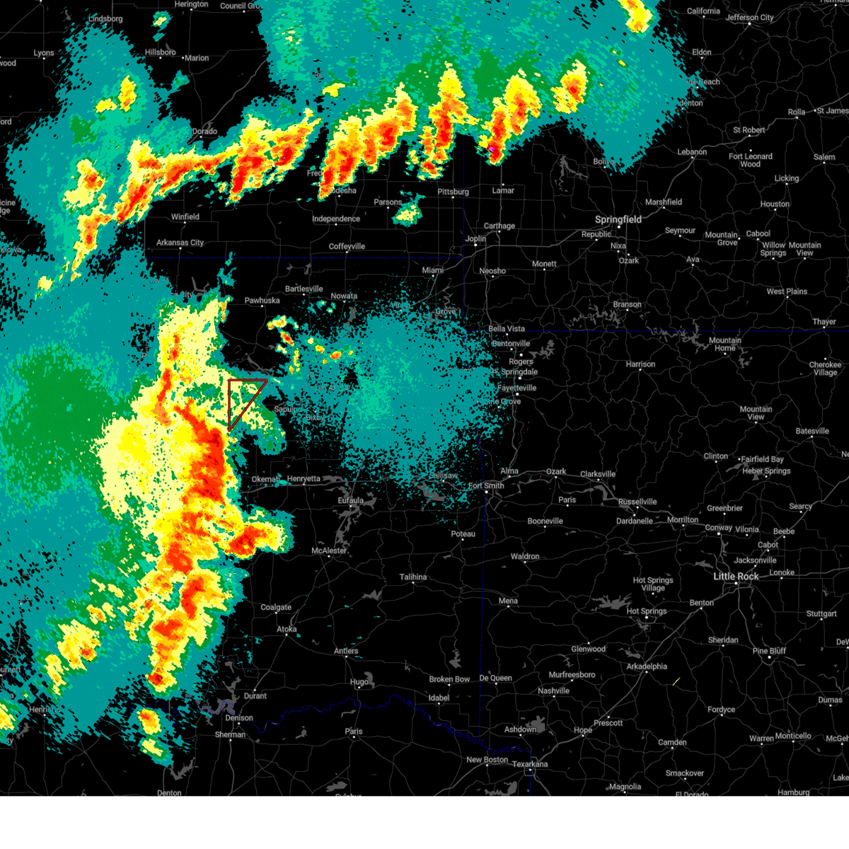 Tortsa the national weather service in tulsa has issued a * tornado warning for, northwestern creek county in northeastern oklahoma, * until 1115 pm cdt. * at 1036 pm cdt, a severe thunderstorm capable of producing a tornado was located 3 miles east of avery, moving northeast at 55 mph (radar indicated rotation). Hazards include tornado. Flying debris will be dangerous to those caught without shelter. mobile homes will be damaged or destroyed. damage to roofs, windows, and vehicles will occur. tree damage is likely. Locations in or near the path include, mannford, drumright, oilton, shamrock, silver city,. Tortsa the national weather service in tulsa has issued a * tornado warning for, northwestern creek county in northeastern oklahoma, * until 1115 pm cdt. * at 1036 pm cdt, a severe thunderstorm capable of producing a tornado was located 3 miles east of avery, moving northeast at 55 mph (radar indicated rotation). Hazards include tornado. Flying debris will be dangerous to those caught without shelter. mobile homes will be damaged or destroyed. damage to roofs, windows, and vehicles will occur. tree damage is likely. Locations in or near the path include, mannford, drumright, oilton, shamrock, silver city,.
|
| 4/27/2024 10:23 PM CDT |
 Svroun the national weather service in norman has issued a * severe thunderstorm warning for, seminole county in east central oklahoma, lincoln county in central oklahoma, northwestern pontotoc county in east central oklahoma, southeastern logan county in central oklahoma, southern payne county in central oklahoma, pottawatomie county in central oklahoma, southeastern mcclain county in central oklahoma, * until 1115 pm cdt. * at 1023 pm cdt, severe thunderstorms were located along a line extending from 3 miles southwest of langston to 4 miles south of agra to near prague to near byars, moving northeast at 20 mph (radar indicated). Hazards include 70 mph wind gusts and quarter size hail. Hail damage to vehicles is expected. expect considerable tree damage. Wind damage is also likely to mobile homes, roofs, and outbuildings. Svroun the national weather service in norman has issued a * severe thunderstorm warning for, seminole county in east central oklahoma, lincoln county in central oklahoma, northwestern pontotoc county in east central oklahoma, southeastern logan county in central oklahoma, southern payne county in central oklahoma, pottawatomie county in central oklahoma, southeastern mcclain county in central oklahoma, * until 1115 pm cdt. * at 1023 pm cdt, severe thunderstorms were located along a line extending from 3 miles southwest of langston to 4 miles south of agra to near prague to near byars, moving northeast at 20 mph (radar indicated). Hazards include 70 mph wind gusts and quarter size hail. Hail damage to vehicles is expected. expect considerable tree damage. Wind damage is also likely to mobile homes, roofs, and outbuildings.
|
| 4/27/2024 10:13 PM CDT |
 Svrtsa the national weather service in tulsa has issued a * severe thunderstorm warning for, creek county in northeastern oklahoma, okfuskee county in east central oklahoma, * until 1115 pm cdt. * at 1013 pm cdt, severe thunderstorms were located along a line extending from 5 miles north of fallis to 3 miles west of chandler to 2 miles northeast of johnson to 3 miles southeast of tecumseh, moving northeast at 60 mph (radar indicated). Hazards include 70 mph wind gusts and nickel size hail. Expect considerable tree damage. damage is likely to mobile homes, roofs, and outbuildings. locations in or near the path include, bristow, okemah, okfuskee, mannford, drumright, boley, kellyville, oilton, depew, paden, bearden, slick, castle, shamrock, welty, silver city, milfay, mason, this includes the following highways, interstate 40 in oklahoma between mile markers 212 and 220. Interstate 44 between mile markers 178 and 205. Svrtsa the national weather service in tulsa has issued a * severe thunderstorm warning for, creek county in northeastern oklahoma, okfuskee county in east central oklahoma, * until 1115 pm cdt. * at 1013 pm cdt, severe thunderstorms were located along a line extending from 5 miles north of fallis to 3 miles west of chandler to 2 miles northeast of johnson to 3 miles southeast of tecumseh, moving northeast at 60 mph (radar indicated). Hazards include 70 mph wind gusts and nickel size hail. Expect considerable tree damage. damage is likely to mobile homes, roofs, and outbuildings. locations in or near the path include, bristow, okemah, okfuskee, mannford, drumright, boley, kellyville, oilton, depew, paden, bearden, slick, castle, shamrock, welty, silver city, milfay, mason, this includes the following highways, interstate 40 in oklahoma between mile markers 212 and 220. Interstate 44 between mile markers 178 and 205.
|
| 4/27/2024 9:50 PM CDT |
 Svroun the national weather service in norman has issued a * severe thunderstorm warning for, northeastern garvin county in southern oklahoma, seminole county in east central oklahoma, lincoln county in central oklahoma, oklahoma county in central oklahoma, cleveland county in central oklahoma, northwestern pontotoc county in east central oklahoma, southeastern logan county in central oklahoma, southeastern payne county in central oklahoma, pottawatomie county in central oklahoma, northwestern hughes county in southeastern oklahoma, southern mcclain county in central oklahoma, * until 1030 pm cdt. * at 950 pm cdt, severe thunderstorms were located along a line extending from near edmond to near shawnee to near asher, moving northeast at 55 mph (radar indicated). Hazards include 70 mph wind gusts and quarter size hail. Hail damage to vehicles is expected. expect considerable tree damage. Wind damage is also likely to mobile homes, roofs, and outbuildings. Svroun the national weather service in norman has issued a * severe thunderstorm warning for, northeastern garvin county in southern oklahoma, seminole county in east central oklahoma, lincoln county in central oklahoma, oklahoma county in central oklahoma, cleveland county in central oklahoma, northwestern pontotoc county in east central oklahoma, southeastern logan county in central oklahoma, southeastern payne county in central oklahoma, pottawatomie county in central oklahoma, northwestern hughes county in southeastern oklahoma, southern mcclain county in central oklahoma, * until 1030 pm cdt. * at 950 pm cdt, severe thunderstorms were located along a line extending from near edmond to near shawnee to near asher, moving northeast at 55 mph (radar indicated). Hazards include 70 mph wind gusts and quarter size hail. Hail damage to vehicles is expected. expect considerable tree damage. Wind damage is also likely to mobile homes, roofs, and outbuildings.
|
| 4/26/2024 5:57 AM CDT |
 Tortsa the national weather service in tulsa has issued a * tornado warning for, creek county in northeastern oklahoma, northwestern okmulgee county in northeastern oklahoma, northeastern okfuskee county in east central oklahoma, * until 630 am cdt. * at 557 am cdt, a severe squall line capable of producing tornadoes that may not be visible due to heavy rain was located along a line extending from near shamrock to 2 miles north of okemah, moving northeast at 50 mph (radar indicated rotation). Hazards include tornado. Flying debris will be dangerous to those caught without shelter. mobile homes will be damaged or destroyed. damage to roofs, windows, and vehicles will occur. tree damage is likely. locations in or near the path include, okmulgee, bristow, okemah, sapulpa, okfuskee, kiefer, beggs, mounds, kellyville, depew, slick, shamrock, preston, okmulgee state park, welty, mason, this includes the following highways, interstate 40 in oklahoma between mile markers 219 and 224. Interstate 44 between mile markers 183 and 211. Tortsa the national weather service in tulsa has issued a * tornado warning for, creek county in northeastern oklahoma, northwestern okmulgee county in northeastern oklahoma, northeastern okfuskee county in east central oklahoma, * until 630 am cdt. * at 557 am cdt, a severe squall line capable of producing tornadoes that may not be visible due to heavy rain was located along a line extending from near shamrock to 2 miles north of okemah, moving northeast at 50 mph (radar indicated rotation). Hazards include tornado. Flying debris will be dangerous to those caught without shelter. mobile homes will be damaged or destroyed. damage to roofs, windows, and vehicles will occur. tree damage is likely. locations in or near the path include, okmulgee, bristow, okemah, sapulpa, okfuskee, kiefer, beggs, mounds, kellyville, depew, slick, shamrock, preston, okmulgee state park, welty, mason, this includes the following highways, interstate 40 in oklahoma between mile markers 219 and 224. Interstate 44 between mile markers 183 and 211.
|
| 4/1/2024 9:52 PM CDT |
 Svrtsa the national weather service in tulsa has issued a * severe thunderstorm warning for, southeastern osage county in northeastern oklahoma, northern creek county in northeastern oklahoma, southern washington county in northeastern oklahoma, southeastern pawnee county in northeastern oklahoma, northern tulsa county in northeastern oklahoma, * until 1030 pm cdt. * at 952 pm cdt, severe thunderstorms were located along a line extending from near terlton to 6 miles west of mannford to 6 miles southeast of oilton, moving northeast at 55 mph (radar indicated). Hazards include 60 mph wind gusts and quarter size hail. Hail damage to vehicles is expected. expect wind damage to roofs, siding, and trees. Locations in or near the path include, tulsa, sand springs, owasso, skiatook, collinsville, mannford, sperry, jennings, westport, vera, terlton, keystone state park, walnut creek state park, turley, tulsa international airport, gray, silver city, this includes interstate 44 between mile markers 230 and 231. Svrtsa the national weather service in tulsa has issued a * severe thunderstorm warning for, southeastern osage county in northeastern oklahoma, northern creek county in northeastern oklahoma, southern washington county in northeastern oklahoma, southeastern pawnee county in northeastern oklahoma, northern tulsa county in northeastern oklahoma, * until 1030 pm cdt. * at 952 pm cdt, severe thunderstorms were located along a line extending from near terlton to 6 miles west of mannford to 6 miles southeast of oilton, moving northeast at 55 mph (radar indicated). Hazards include 60 mph wind gusts and quarter size hail. Hail damage to vehicles is expected. expect wind damage to roofs, siding, and trees. Locations in or near the path include, tulsa, sand springs, owasso, skiatook, collinsville, mannford, sperry, jennings, westport, vera, terlton, keystone state park, walnut creek state park, turley, tulsa international airport, gray, silver city, this includes interstate 44 between mile markers 230 and 231.
|
| 9/19/2023 2:56 PM CDT |
 The severe thunderstorm warning for northeastern lincoln and southeastern payne counties will expire at 300 pm cdt, the storm which prompted the warning has weakened below severe limits, therefore the warning will be allowed to expire. however, small hail is still possible with this thunderstorm. The severe thunderstorm warning for northeastern lincoln and southeastern payne counties will expire at 300 pm cdt, the storm which prompted the warning has weakened below severe limits, therefore the warning will be allowed to expire. however, small hail is still possible with this thunderstorm.
|
| 9/19/2023 2:34 PM CDT |
 At 234 pm cdt, a severe thunderstorm was located 4 miles southwest of cushing, moving east at 20 mph (radar indicated). Hazards include quarter size hail. damage to vehicles is expected At 234 pm cdt, a severe thunderstorm was located 4 miles southwest of cushing, moving east at 20 mph (radar indicated). Hazards include quarter size hail. damage to vehicles is expected
|
| 9/5/2023 6:58 PM CDT |
 The severe thunderstorm warning for northeastern lincoln and southeastern payne counties will expire at 700 pm cdt, the storm which prompted the warning has moved out of the area. therefore, the warning will be allowed to expire. The severe thunderstorm warning for northeastern lincoln and southeastern payne counties will expire at 700 pm cdt, the storm which prompted the warning has moved out of the area. therefore, the warning will be allowed to expire.
|
| 9/5/2023 6:54 PM CDT |
 At 653 pm cdt, a severe thunderstorm was located 5 miles east of shamrock, moving northeast at 30 mph (radar indicated). Hazards include 70 mph wind gusts and quarter size hail. Hail damage to vehicles is expected. expect considerable tree damage. wind damage is also likely to mobile homes, roofs, and outbuildings. locations in or near the path include, mannford, this includes interstate 44 between mile markers 190 and 201. thunderstorm damage threat, considerable hail threat, radar indicated max hail size, 1. 00 in wind threat, radar indicated max wind gust, 70 mph. At 653 pm cdt, a severe thunderstorm was located 5 miles east of shamrock, moving northeast at 30 mph (radar indicated). Hazards include 70 mph wind gusts and quarter size hail. Hail damage to vehicles is expected. expect considerable tree damage. wind damage is also likely to mobile homes, roofs, and outbuildings. locations in or near the path include, mannford, this includes interstate 44 between mile markers 190 and 201. thunderstorm damage threat, considerable hail threat, radar indicated max hail size, 1. 00 in wind threat, radar indicated max wind gust, 70 mph.
|
| 9/5/2023 6:34 PM CDT |
 At 634 pm cdt, a severe thunderstorm was located 5 miles southwest of shamrock, moving northeast at 30 mph (radar indicated). Hazards include 70 mph wind gusts and quarter size hail. Hail damage to vehicles is expected. expect considerable tree damage. wind damage is also likely to mobile homes, roofs, and outbuildings. locations in or near the path include, bristow, mannford, drumright, depew, slick, shamrock, silver city, milfay, this includes interstate 44 between mile markers 178 and 201. thunderstorm damage threat, considerable hail threat, radar indicated max hail size, 1. 00 in wind threat, radar indicated max wind gust, 70 mph. At 634 pm cdt, a severe thunderstorm was located 5 miles southwest of shamrock, moving northeast at 30 mph (radar indicated). Hazards include 70 mph wind gusts and quarter size hail. Hail damage to vehicles is expected. expect considerable tree damage. wind damage is also likely to mobile homes, roofs, and outbuildings. locations in or near the path include, bristow, mannford, drumright, depew, slick, shamrock, silver city, milfay, this includes interstate 44 between mile markers 178 and 201. thunderstorm damage threat, considerable hail threat, radar indicated max hail size, 1. 00 in wind threat, radar indicated max wind gust, 70 mph.
|
| 9/5/2023 6:16 PM CDT |
 At 616 pm cdt, a severe thunderstorm was located near kendrick, moving northeast at 25 mph (radar indicated). Hazards include 60 mph wind gusts and half dollar size hail. Hail damage to vehicles is expected. Expect wind damage to roofs, siding, and trees. At 616 pm cdt, a severe thunderstorm was located near kendrick, moving northeast at 25 mph (radar indicated). Hazards include 60 mph wind gusts and half dollar size hail. Hail damage to vehicles is expected. Expect wind damage to roofs, siding, and trees.
|
| 9/5/2023 6:08 PM CDT |
 At 608 pm cdt, a severe thunderstorm was located near chandler, moving northeast at 25 mph (radar indicated). Hazards include 60 mph wind gusts and quarter size hail. Hail damage to vehicles is expected. Expect wind damage to roofs, siding, and trees. At 608 pm cdt, a severe thunderstorm was located near chandler, moving northeast at 25 mph (radar indicated). Hazards include 60 mph wind gusts and quarter size hail. Hail damage to vehicles is expected. Expect wind damage to roofs, siding, and trees.
|
| 8/13/2023 11:59 PM CDT |
 At 1158 pm cdt, severe thunderstorms were located along a line extending from near glencoe to 3 miles southeast of tryon, moving east at 45 mph (radar indicated). Hazards include 60 mph wind gusts. expect damage to roofs, siding, and trees At 1158 pm cdt, severe thunderstorms were located along a line extending from near glencoe to 3 miles southeast of tryon, moving east at 45 mph (radar indicated). Hazards include 60 mph wind gusts. expect damage to roofs, siding, and trees
|
| 8/13/2023 11:59 PM CDT |
 At 1159 pm cdt, severe thunderstorms were located along a line extending from near glencoe to 3 miles southeast of tryon, moving east at 45 mph (radar indicated). Hazards include 60 mph wind gusts. expect damage to roofs, siding, and trees At 1159 pm cdt, severe thunderstorms were located along a line extending from near glencoe to 3 miles southeast of tryon, moving east at 45 mph (radar indicated). Hazards include 60 mph wind gusts. expect damage to roofs, siding, and trees
|
| 8/13/2023 11:46 PM CDT |
 At 1146 pm cdt, severe thunderstorms were located along a line extending from 5 miles southwest of morrison to near carney, moving east at 50 mph (radar indicated). Hazards include 70 mph wind gusts. Expect considerable tree damage. damage is likely to mobile homes, roofs, and outbuildings. locations impacted include, stillwater, guthrie, cushing, perry, perkins, stroud, langston, yale, carney, glencoe, tryon, ripley, agra, coyle, mulhall, orlando, kendrick, meridian, fallis, and lake mcmurtry. thunderstorm damage threat, considerable hail threat, radar indicated max hail size, <. 75 in wind threat, radar indicated max wind gust, 70 mph. At 1146 pm cdt, severe thunderstorms were located along a line extending from 5 miles southwest of morrison to near carney, moving east at 50 mph (radar indicated). Hazards include 70 mph wind gusts. Expect considerable tree damage. damage is likely to mobile homes, roofs, and outbuildings. locations impacted include, stillwater, guthrie, cushing, perry, perkins, stroud, langston, yale, carney, glencoe, tryon, ripley, agra, coyle, mulhall, orlando, kendrick, meridian, fallis, and lake mcmurtry. thunderstorm damage threat, considerable hail threat, radar indicated max hail size, <. 75 in wind threat, radar indicated max wind gust, 70 mph.
|
| 8/13/2023 11:39 PM CDT |
 At 1138 pm cdt, severe thunderstorms were located along a line extending from 2 miles south of terlton to 9 miles west of kellyville, moving east at 55 mph (radar indicated). Hazards include 70 mph wind gusts. Expect considerable tree damage. damage is likely to mobile homes, roofs, and outbuildings. locations in or near the path include, sand springs, bristow, sapulpa, mannford, drumright, kellyville, oilton, depew, jennings, westport, hallett, terlton, shamrock, keystone state park, walnut creek state park, silver city, this includes interstate 44 between mile markers 178 and 210. thunderstorm damage threat, considerable hail threat, radar indicated max hail size, <. 75 in wind threat, radar indicated max wind gust, 70 mph. At 1138 pm cdt, severe thunderstorms were located along a line extending from 2 miles south of terlton to 9 miles west of kellyville, moving east at 55 mph (radar indicated). Hazards include 70 mph wind gusts. Expect considerable tree damage. damage is likely to mobile homes, roofs, and outbuildings. locations in or near the path include, sand springs, bristow, sapulpa, mannford, drumright, kellyville, oilton, depew, jennings, westport, hallett, terlton, shamrock, keystone state park, walnut creek state park, silver city, this includes interstate 44 between mile markers 178 and 210. thunderstorm damage threat, considerable hail threat, radar indicated max hail size, <. 75 in wind threat, radar indicated max wind gust, 70 mph.
|
| 8/13/2023 11:35 PM CDT | Mesonet station oilt oilto in creek county OK, 6.1 miles WSW of Drumright, OK |
| 8/13/2023 11:32 PM CDT |
 At 1131 pm cdt, severe thunderstorms were located along a line extending from 5 miles west of orlando to 3 miles south of yale, moving east at 35 mph (radar indicated). Hazards include 70 mph wind gusts. Expect considerable tree damage. damage is likely to mobile homes, roofs, and outbuildings. locations impacted include, stillwater, guthrie, cushing, perry, perkins, stroud, hennessey, langston, crescent, waukomis, yale, cashion, carney, glencoe, tryon, ripley, agra, coyle, cedar valley, and marshall. thunderstorm damage threat, considerable hail threat, radar indicated max hail size, <. 75 in wind threat, radar indicated max wind gust, 70 mph. At 1131 pm cdt, severe thunderstorms were located along a line extending from 5 miles west of orlando to 3 miles south of yale, moving east at 35 mph (radar indicated). Hazards include 70 mph wind gusts. Expect considerable tree damage. damage is likely to mobile homes, roofs, and outbuildings. locations impacted include, stillwater, guthrie, cushing, perry, perkins, stroud, hennessey, langston, crescent, waukomis, yale, cashion, carney, glencoe, tryon, ripley, agra, coyle, cedar valley, and marshall. thunderstorm damage threat, considerable hail threat, radar indicated max hail size, <. 75 in wind threat, radar indicated max wind gust, 70 mph.
|
| 8/13/2023 11:25 PM CDT |
 At 1125 pm cdt, severe thunderstorms were located along a line extending from 2 miles west of yale to 3 miles north of shamrock, moving east at 45 mph (radar indicated). Hazards include 70 mph wind gusts. Expect considerable tree damage. damage is likely to mobile homes, roofs, and outbuildings. locations in or near the path include, sand springs, bristow, sapulpa, mannford, drumright, kellyville, oilton, depew, jennings, westport, hallett, terlton, shamrock, keystone state park, walnut creek state park, silver city, this includes interstate 44 between mile markers 178 and 210. thunderstorm damage threat, considerable hail threat, radar indicated max hail size, <. 75 in wind threat, radar indicated max wind gust, 70 mph. At 1125 pm cdt, severe thunderstorms were located along a line extending from 2 miles west of yale to 3 miles north of shamrock, moving east at 45 mph (radar indicated). Hazards include 70 mph wind gusts. Expect considerable tree damage. damage is likely to mobile homes, roofs, and outbuildings. locations in or near the path include, sand springs, bristow, sapulpa, mannford, drumright, kellyville, oilton, depew, jennings, westport, hallett, terlton, shamrock, keystone state park, walnut creek state park, silver city, this includes interstate 44 between mile markers 178 and 210. thunderstorm damage threat, considerable hail threat, radar indicated max hail size, <. 75 in wind threat, radar indicated max wind gust, 70 mph.
|
| 8/13/2023 11:16 PM CDT |
 At 1115 pm cdt, a severe thunderstorm was located 4 miles north of cushing, moving east at 50 mph (radar indicated). Hazards include 60 mph wind gusts. Expect damage to roofs, siding, and trees. locations in or near the path include, sand springs, bristow, sapulpa, mannford, drumright, kellyville, oilton, depew, jennings, westport, hallett, terlton, shamrock, keystone state park, walnut creek state park, silver city, this includes interstate 44 between mile markers 178 and 210. hail threat, radar indicated max hail size, <. 75 in wind threat, radar indicated max wind gust, 60 mph. At 1115 pm cdt, a severe thunderstorm was located 4 miles north of cushing, moving east at 50 mph (radar indicated). Hazards include 60 mph wind gusts. Expect damage to roofs, siding, and trees. locations in or near the path include, sand springs, bristow, sapulpa, mannford, drumright, kellyville, oilton, depew, jennings, westport, hallett, terlton, shamrock, keystone state park, walnut creek state park, silver city, this includes interstate 44 between mile markers 178 and 210. hail threat, radar indicated max hail size, <. 75 in wind threat, radar indicated max wind gust, 60 mph.
|
| 8/13/2023 11:11 PM CDT |
 At 1111 pm cdt, severe thunderstorms were located along a line extending from near marshall to near ripley, moving east at 35 mph (radar indicated). Hazards include 60 mph wind gusts. expect damage to roofs, siding, and trees At 1111 pm cdt, severe thunderstorms were located along a line extending from near marshall to near ripley, moving east at 35 mph (radar indicated). Hazards include 60 mph wind gusts. expect damage to roofs, siding, and trees
|
| 7/21/2023 5:39 AM CDT |
 At 539 am cdt, severe thunderstorms were located along a line extending from 3 miles southeast of hominy to near mannford to 5 miles north of bristow, moving east at 45 mph (radar indicated). Hazards include 60 mph wind gusts. Expect damage to roofs, siding, and trees. locations in or near the path include, tulsa, sand springs, bristow, sapulpa, hominy, cleveland, mannford, kellyville, avant, westport, osage, slick, terlton, shamrock, keystone state park, walnut creek state park, gray, silver city, this includes interstate 44 between mile markers 185 and 216. hail threat, radar indicated max hail size, <. 75 in wind threat, radar indicated max wind gust, 60 mph. At 539 am cdt, severe thunderstorms were located along a line extending from 3 miles southeast of hominy to near mannford to 5 miles north of bristow, moving east at 45 mph (radar indicated). Hazards include 60 mph wind gusts. Expect damage to roofs, siding, and trees. locations in or near the path include, tulsa, sand springs, bristow, sapulpa, hominy, cleveland, mannford, kellyville, avant, westport, osage, slick, terlton, shamrock, keystone state park, walnut creek state park, gray, silver city, this includes interstate 44 between mile markers 185 and 216. hail threat, radar indicated max hail size, <. 75 in wind threat, radar indicated max wind gust, 60 mph.
|
| 7/21/2023 5:26 AM CDT |
 At 525 am cdt, severe thunderstorms were located along a line extending from 2 miles northeast of blackburn to 2 miles south of terlton to 2 miles northeast of shamrock, moving east at 50 mph (radar indicated). Hazards include 70 mph wind gusts. Expect considerable tree damage. damage is likely to mobile homes, roofs, and outbuildings. locations in or near the path include, tulsa, sand springs, bristow, pawnee, sapulpa, hominy, cleveland, mannford, drumright, kellyville, oilton, jennings, avant, westport, osage, slick, hallett, blackburn, terlton, shamrock, this includes interstate 44 between mile markers 185 and 216. thunderstorm damage threat, considerable hail threat, radar indicated max hail size, <. 75 in wind threat, radar indicated max wind gust, 70 mph. At 525 am cdt, severe thunderstorms were located along a line extending from 2 miles northeast of blackburn to 2 miles south of terlton to 2 miles northeast of shamrock, moving east at 50 mph (radar indicated). Hazards include 70 mph wind gusts. Expect considerable tree damage. damage is likely to mobile homes, roofs, and outbuildings. locations in or near the path include, tulsa, sand springs, bristow, pawnee, sapulpa, hominy, cleveland, mannford, drumright, kellyville, oilton, jennings, avant, westport, osage, slick, hallett, blackburn, terlton, shamrock, this includes interstate 44 between mile markers 185 and 216. thunderstorm damage threat, considerable hail threat, radar indicated max hail size, <. 75 in wind threat, radar indicated max wind gust, 70 mph.
|
| 7/21/2023 5:09 AM CDT |
 At 509 am cdt, severe thunderstorms were located along a line extending from 4 miles north of pawnee to near quay to 2 miles southwest of cushing, moving east at 45 mph (radar indicated). Hazards include 70 mph wind gusts. Expect considerable tree damage. damage is likely to mobile homes, roofs, and outbuildings. locations in or near the path include, tulsa, sand springs, bristow, pawnee, sapulpa, hominy, cleveland, mannford, drumright, kellyville, oilton, jennings, avant, westport, osage, slick, hallett, blackburn, terlton, shamrock, this includes interstate 44 between mile markers 185 and 216. thunderstorm damage threat, considerable hail threat, radar indicated max hail size, <. 75 in wind threat, radar indicated max wind gust, 70 mph. At 509 am cdt, severe thunderstorms were located along a line extending from 4 miles north of pawnee to near quay to 2 miles southwest of cushing, moving east at 45 mph (radar indicated). Hazards include 70 mph wind gusts. Expect considerable tree damage. damage is likely to mobile homes, roofs, and outbuildings. locations in or near the path include, tulsa, sand springs, bristow, pawnee, sapulpa, hominy, cleveland, mannford, drumright, kellyville, oilton, jennings, avant, westport, osage, slick, hallett, blackburn, terlton, shamrock, this includes interstate 44 between mile markers 185 and 216. thunderstorm damage threat, considerable hail threat, radar indicated max hail size, <. 75 in wind threat, radar indicated max wind gust, 70 mph.
|
| 7/21/2023 4:42 AM CDT |
 At 442 am cdt, severe thunderstorms were located along a line extending from 5 miles north of stillwater to 6 miles northwest of perkins to 5 miles east of guthrie, moving east at 60 mph (radar indicated). Hazards include 60 mph wind gusts. expect damage to roofs, siding, and trees At 442 am cdt, severe thunderstorms were located along a line extending from 5 miles north of stillwater to 6 miles northwest of perkins to 5 miles east of guthrie, moving east at 60 mph (radar indicated). Hazards include 60 mph wind gusts. expect damage to roofs, siding, and trees
|
| 7/14/2023 8:11 PM CDT |
 The severe thunderstorm warning for south central osage, northern creek, southeastern pawnee and west central tulsa counties will expire at 815 pm cdt, the storm which prompted the warning has weakened below severe limits, and no longer poses an immediate threat to life or property. therefore, the warning will be allowed to expire. a severe thunderstorm watch remains in effect until midnight cdt for northeastern oklahoma. The severe thunderstorm warning for south central osage, northern creek, southeastern pawnee and west central tulsa counties will expire at 815 pm cdt, the storm which prompted the warning has weakened below severe limits, and no longer poses an immediate threat to life or property. therefore, the warning will be allowed to expire. a severe thunderstorm watch remains in effect until midnight cdt for northeastern oklahoma.
|
| 7/14/2023 7:51 PM CDT |
 At 751 pm cdt, a severe thunderstorm was located over mannford, moving southeast at 30 mph (radar indicated). Hazards include 60 mph wind gusts and penny size hail. Expect damage to roofs, siding, and trees. locations in or near the path include, sand springs, sapulpa, jenks, mannford, drumright, kellyville, oilton, jennings, westport, terlton, shamrock, keystone state park, walnut creek state park, silver city, this includes interstate 44 between mile markers 198 and 216. hail threat, radar indicated max hail size, 0. 75 in wind threat, radar indicated max wind gust, 60 mph. At 751 pm cdt, a severe thunderstorm was located over mannford, moving southeast at 30 mph (radar indicated). Hazards include 60 mph wind gusts and penny size hail. Expect damage to roofs, siding, and trees. locations in or near the path include, sand springs, sapulpa, jenks, mannford, drumright, kellyville, oilton, jennings, westport, terlton, shamrock, keystone state park, walnut creek state park, silver city, this includes interstate 44 between mile markers 198 and 216. hail threat, radar indicated max hail size, 0. 75 in wind threat, radar indicated max wind gust, 60 mph.
|
| 7/14/2023 7:30 PM CDT |
 At 730 pm cdt, a severe thunderstorm was located near osage, moving south at 45 mph (radar indicated). Hazards include 60 mph wind gusts and penny size hail. Expect damage to roofs, siding, and trees. locations in or near the path include, sand springs, sapulpa, jenks, cleveland, mannford, drumright, kellyville, oilton, jennings, westport, osage, hallett, terlton, shamrock, maramec, keystone state park, walnut creek state park, silver city, this includes interstate 44 between mile markers 198 and 216. hail threat, radar indicated max hail size, 0. 75 in wind threat, radar indicated max wind gust, 60 mph. At 730 pm cdt, a severe thunderstorm was located near osage, moving south at 45 mph (radar indicated). Hazards include 60 mph wind gusts and penny size hail. Expect damage to roofs, siding, and trees. locations in or near the path include, sand springs, sapulpa, jenks, cleveland, mannford, drumright, kellyville, oilton, jennings, westport, osage, hallett, terlton, shamrock, maramec, keystone state park, walnut creek state park, silver city, this includes interstate 44 between mile markers 198 and 216. hail threat, radar indicated max hail size, 0. 75 in wind threat, radar indicated max wind gust, 60 mph.
|
| 7/3/2023 2:04 PM CDT |
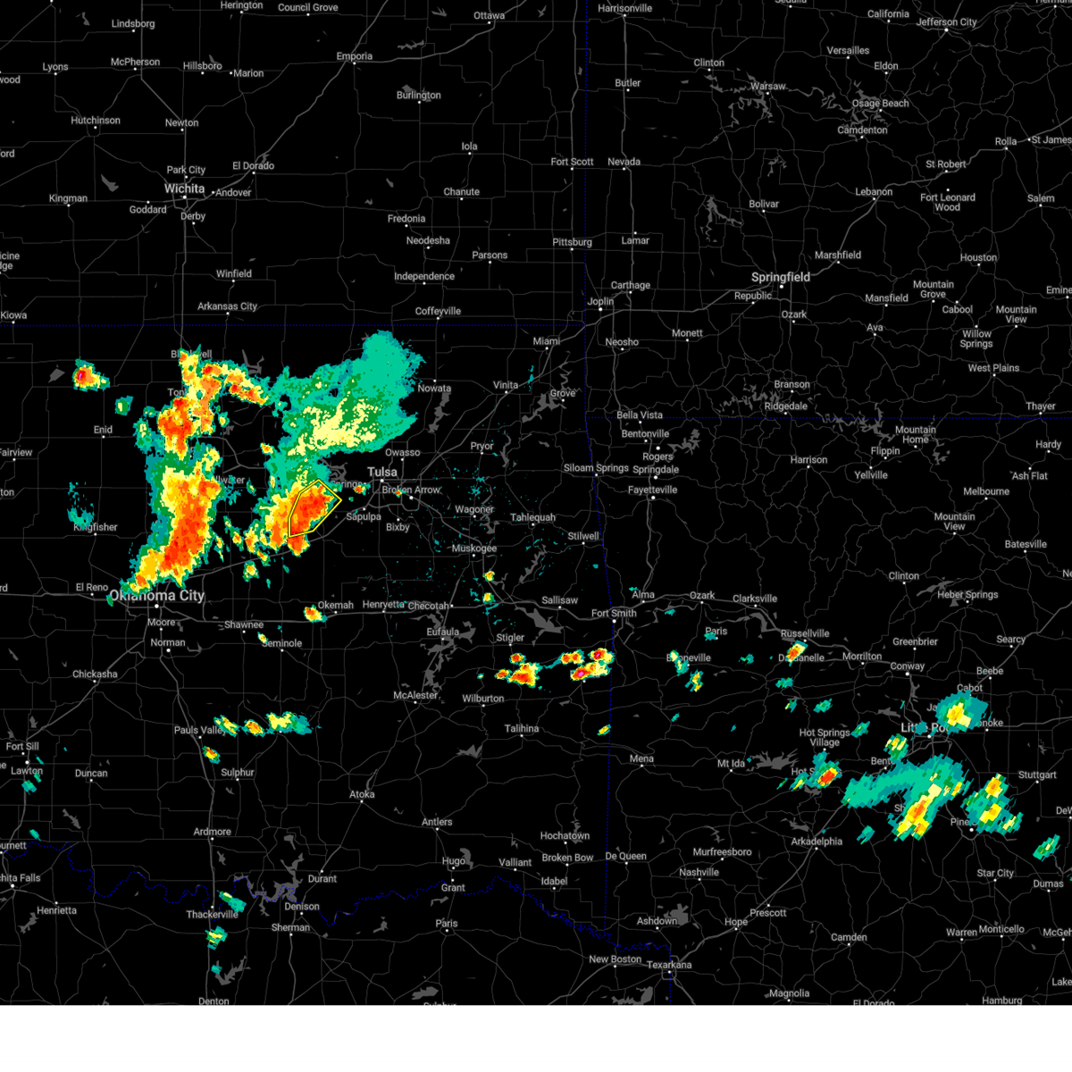 At 204 pm cdt, a severe thunderstorm was located 5 miles east of drumright, moving southeast at 15 mph (radar indicated). Hazards include 60 mph wind gusts and quarter size hail. Hail damage to vehicles is expected. expect wind damage to roofs, siding, and trees. locations in or near the path include, drumright, shamrock, silver city, hail threat, radar indicated max hail size, 1. 00 in wind threat, radar indicated max wind gust, 60 mph. At 204 pm cdt, a severe thunderstorm was located 5 miles east of drumright, moving southeast at 15 mph (radar indicated). Hazards include 60 mph wind gusts and quarter size hail. Hail damage to vehicles is expected. expect wind damage to roofs, siding, and trees. locations in or near the path include, drumright, shamrock, silver city, hail threat, radar indicated max hail size, 1. 00 in wind threat, radar indicated max wind gust, 60 mph.
|
| 7/3/2023 1:38 PM CDT |
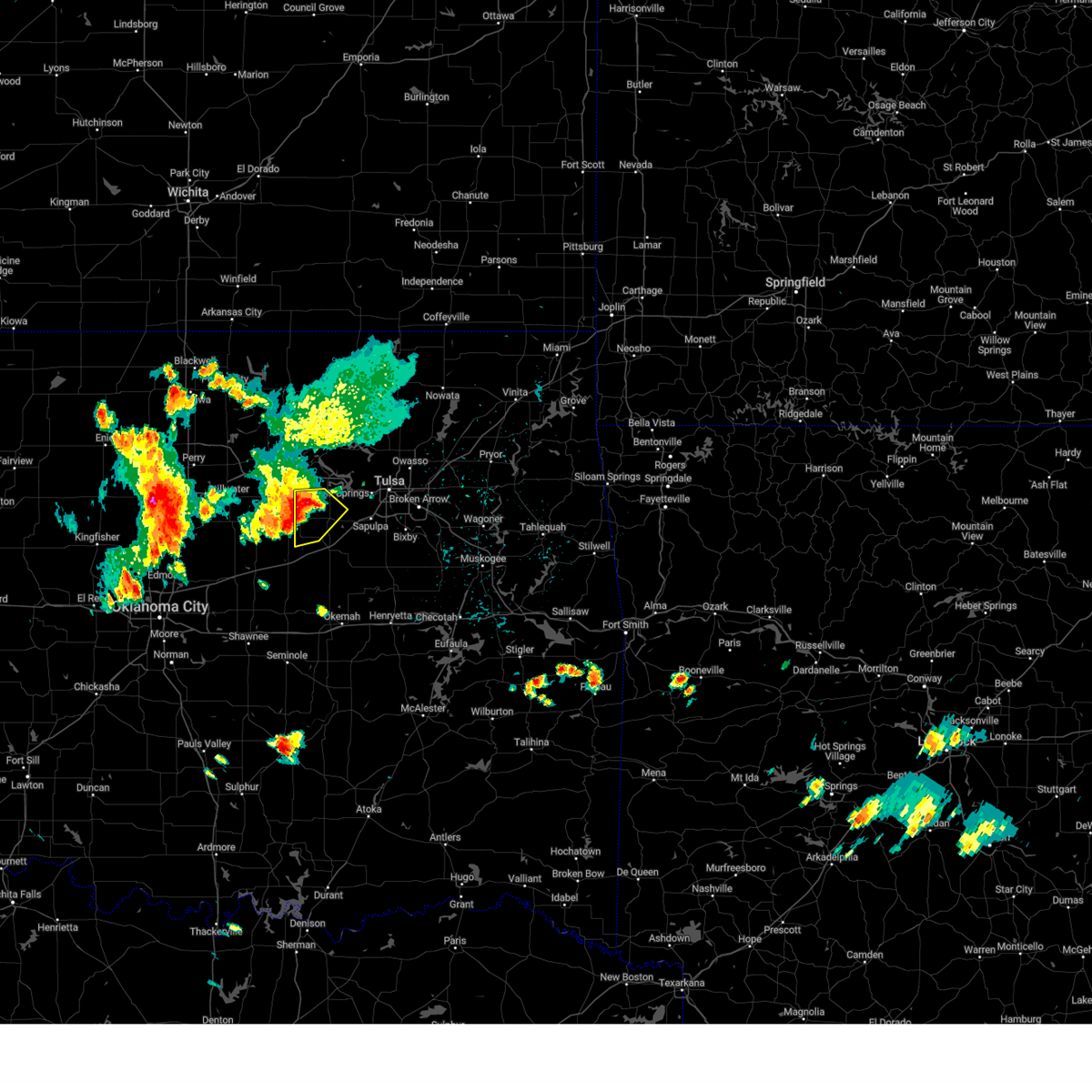 At 138 pm cdt, a severe thunderstorm was located near drumright, moving southeast at 15 mph (radar indicated). Hazards include 60 mph wind gusts and quarter size hail. Hail damage to vehicles is expected. expect wind damage to roofs, siding, and trees. locations in or near the path include, drumright, oilton, shamrock, silver city, hail threat, radar indicated max hail size, 1. 00 in wind threat, radar indicated max wind gust, 60 mph. At 138 pm cdt, a severe thunderstorm was located near drumright, moving southeast at 15 mph (radar indicated). Hazards include 60 mph wind gusts and quarter size hail. Hail damage to vehicles is expected. expect wind damage to roofs, siding, and trees. locations in or near the path include, drumright, oilton, shamrock, silver city, hail threat, radar indicated max hail size, 1. 00 in wind threat, radar indicated max wind gust, 60 mph.
|
| 6/27/2023 9:04 AM CDT |
 At 904 am cdt, severe thunderstorms were located along a line extending from 6 miles east of drumright to 3 miles south of bristow to near boley, moving east at 50 mph (radar indicated). Hazards include 70 mph wind gusts and quarter size hail. Hail damage to vehicles is expected. expect considerable tree damage. wind damage is also likely to mobile homes, roofs, and outbuildings. locations in or near the path include, bristow, okemah, okfuskee, mannford, drumright, boley, kellyville, oilton, depew, paden, bearden, slick, castle, shamrock, clearview, welty, silver city, milfay, mason, this includes the following highways, interstate 40 in oklahoma between mile markers 212 and 227. interstate 44 between mile markers 178 and 207. thunderstorm damage threat, considerable hail threat, radar indicated max hail size, 1. 00 in wind threat, radar indicated max wind gust, 70 mph. At 904 am cdt, severe thunderstorms were located along a line extending from 6 miles east of drumright to 3 miles south of bristow to near boley, moving east at 50 mph (radar indicated). Hazards include 70 mph wind gusts and quarter size hail. Hail damage to vehicles is expected. expect considerable tree damage. wind damage is also likely to mobile homes, roofs, and outbuildings. locations in or near the path include, bristow, okemah, okfuskee, mannford, drumright, boley, kellyville, oilton, depew, paden, bearden, slick, castle, shamrock, clearview, welty, silver city, milfay, mason, this includes the following highways, interstate 40 in oklahoma between mile markers 212 and 227. interstate 44 between mile markers 178 and 207. thunderstorm damage threat, considerable hail threat, radar indicated max hail size, 1. 00 in wind threat, radar indicated max wind gust, 70 mph.
|
| 6/27/2023 8:58 AM CDT |
 At 858 am cdt, severe thunderstorms were located along a line extending from 3 miles northwest of quay to 4 miles southeast of stroud to near prague, moving east at 50 mph (radar indicated). Hazards include 60 mph wind gusts and penny size hail. Expect damage to roofs, siding, and trees. locations impacted include, stillwater, cushing, chandler, perkins, stroud, prague, yale, meeker, davenport, wellston, carney, tryon, ripley, agra, sparks, warwick, kendrick, fallis, quay, and avery. hail threat, radar indicated max hail size, 0. 75 in wind threat, radar indicated max wind gust, 60 mph. At 858 am cdt, severe thunderstorms were located along a line extending from 3 miles northwest of quay to 4 miles southeast of stroud to near prague, moving east at 50 mph (radar indicated). Hazards include 60 mph wind gusts and penny size hail. Expect damage to roofs, siding, and trees. locations impacted include, stillwater, cushing, chandler, perkins, stroud, prague, yale, meeker, davenport, wellston, carney, tryon, ripley, agra, sparks, warwick, kendrick, fallis, quay, and avery. hail threat, radar indicated max hail size, 0. 75 in wind threat, radar indicated max wind gust, 60 mph.
|
| 6/27/2023 8:44 AM CDT |
 At 843 am cdt, severe thunderstorms were located along a line extending from 2 miles north of ripley to 4 miles south of sparks, moving east at 50 mph (radar indicated). Hazards include 70 mph wind gusts and quarter size hail. Hail damage to vehicles is expected. expect considerable tree damage. wind damage is also likely to mobile homes, roofs, and outbuildings. locations in or near the path include, bristow, okemah, okfuskee, mannford, drumright, boley, kellyville, oilton, depew, paden, bearden, slick, castle, shamrock, clearview, welty, silver city, milfay, mason, this includes the following highways, interstate 40 in oklahoma between mile markers 212 and 227. interstate 44 between mile markers 178 and 207. thunderstorm damage threat, considerable hail threat, radar indicated max hail size, 1. 00 in wind threat, radar indicated max wind gust, 70 mph. At 843 am cdt, severe thunderstorms were located along a line extending from 2 miles north of ripley to 4 miles south of sparks, moving east at 50 mph (radar indicated). Hazards include 70 mph wind gusts and quarter size hail. Hail damage to vehicles is expected. expect considerable tree damage. wind damage is also likely to mobile homes, roofs, and outbuildings. locations in or near the path include, bristow, okemah, okfuskee, mannford, drumright, boley, kellyville, oilton, depew, paden, bearden, slick, castle, shamrock, clearview, welty, silver city, milfay, mason, this includes the following highways, interstate 40 in oklahoma between mile markers 212 and 227. interstate 44 between mile markers 178 and 207. thunderstorm damage threat, considerable hail threat, radar indicated max hail size, 1. 00 in wind threat, radar indicated max wind gust, 70 mph.
|
| 6/27/2023 8:40 AM CDT |
 At 840 am cdt, severe thunderstorms were located along a line extending from near ripley to near agra to 4 miles southeast of carney, moving east at 50 mph. these are destructive storms for perkins and cushing (emergency management). Hazards include 80 mph wind gusts and half dollar size hail. Flying debris will be dangerous to those caught without shelter. mobile homes will be heavily damaged. expect considerable damage to roofs, windows, and vehicles. Extensive tree damage and power outages are likely. At 840 am cdt, severe thunderstorms were located along a line extending from near ripley to near agra to 4 miles southeast of carney, moving east at 50 mph. these are destructive storms for perkins and cushing (emergency management). Hazards include 80 mph wind gusts and half dollar size hail. Flying debris will be dangerous to those caught without shelter. mobile homes will be heavily damaged. expect considerable damage to roofs, windows, and vehicles. Extensive tree damage and power outages are likely.
|
| 6/27/2023 8:29 AM CDT |
 At 829 am cdt, severe thunderstorms were located along a line extending from near lake mcmurtry to near warwick to 3 miles north of mcloud, moving east at 50 mph (radar indicated). Hazards include 60 mph wind gusts and half dollar size hail. Hail damage to vehicles is expected. Expect wind damage to roofs, siding, and trees. At 829 am cdt, severe thunderstorms were located along a line extending from near lake mcmurtry to near warwick to 3 miles north of mcloud, moving east at 50 mph (radar indicated). Hazards include 60 mph wind gusts and half dollar size hail. Hail damage to vehicles is expected. Expect wind damage to roofs, siding, and trees.
|
| 6/18/2023 12:03 AM CDT |
 At 1203 am cdt, severe thunderstorms were located along a line extending from 2 miles northwest of keystone state park to 2 miles south of sapulpa to 2 miles east of slick, moving east at 70 mph. these are destructive storms for the tulsa metro area (radar indicated). Hazards include 100 mph wind gusts and quarter size hail. You are in a life-threatening situation. flying debris may be deadly to those caught without shelter. mobile homes will be destroyed. expect considerable damage to homes and businesses. expect extensive tree damage and power outages. locations in or near the path include, tulsa, broken arrow, sand springs, bristow, owasso, bixby, sapulpa, jenks, glenpool, catoosa, mannford, drumright, kiefer, beggs, sperry, mounds, kellyville, oilton, depew, jennings, this includes interstate 44 between mile markers 178 and 232. thunderstorm damage threat, destructive hail threat, radar indicated max hail size, 1. 00 in wind threat, radar indicated max wind gust, 100 mph. At 1203 am cdt, severe thunderstorms were located along a line extending from 2 miles northwest of keystone state park to 2 miles south of sapulpa to 2 miles east of slick, moving east at 70 mph. these are destructive storms for the tulsa metro area (radar indicated). Hazards include 100 mph wind gusts and quarter size hail. You are in a life-threatening situation. flying debris may be deadly to those caught without shelter. mobile homes will be destroyed. expect considerable damage to homes and businesses. expect extensive tree damage and power outages. locations in or near the path include, tulsa, broken arrow, sand springs, bristow, owasso, bixby, sapulpa, jenks, glenpool, catoosa, mannford, drumright, kiefer, beggs, sperry, mounds, kellyville, oilton, depew, jennings, this includes interstate 44 between mile markers 178 and 232. thunderstorm damage threat, destructive hail threat, radar indicated max hail size, 1. 00 in wind threat, radar indicated max wind gust, 100 mph.
|
| 6/17/2023 11:59 PM CDT |
 At 1159 pm cdt, severe thunderstorms were located along a line extending from 3 miles southeast of osage to near kellyville to 4 miles northeast of boley, moving east at 65 mph (public). Hazards include 70 mph wind gusts and quarter size hail. Hail damage to vehicles is expected. expect considerable tree damage. wind damage is also likely to mobile homes, roofs, and outbuildings. locations impacted include, cushing, stroud, prague, yale, meeker, davenport, sparks, kendrick, quay, avery, and centerview. thunderstorm damage threat, considerable hail threat, radar indicated max hail size, 1. 00 in wind threat, radar indicated max wind gust, 70 mph. At 1159 pm cdt, severe thunderstorms were located along a line extending from 3 miles southeast of osage to near kellyville to 4 miles northeast of boley, moving east at 65 mph (public). Hazards include 70 mph wind gusts and quarter size hail. Hail damage to vehicles is expected. expect considerable tree damage. wind damage is also likely to mobile homes, roofs, and outbuildings. locations impacted include, cushing, stroud, prague, yale, meeker, davenport, sparks, kendrick, quay, avery, and centerview. thunderstorm damage threat, considerable hail threat, radar indicated max hail size, 1. 00 in wind threat, radar indicated max wind gust, 70 mph.
|
| 6/17/2023 11:57 PM CDT |
 At 1156 pm cdt, severe thunderstorms were located along a line extending from 4 miles northwest of mannford to 2 miles northwest of kellyville to 3 miles southeast of bristow, moving east at 70 mph. these are destructive storms moving into the western tulsa metro (radar indicated). Hazards include 90 mph wind gusts and quarter size hail. You are in a life-threatening situation. flying debris may be deadly to those caught without shelter. mobile homes will be heavily damaged or destroyed. homes and businesses will have substantial roof and window damage. expect extensive tree damage and power outages. locations in or near the path include, tulsa, broken arrow, sand springs, bristow, owasso, bixby, sapulpa, jenks, glenpool, catoosa, mannford, drumright, kiefer, beggs, sperry, mounds, kellyville, oilton, depew, jennings, this includes interstate 44 between mile markers 178 and 232. thunderstorm damage threat, destructive hail threat, radar indicated max hail size, 1. 00 in wind threat, radar indicated max wind gust, 90 mph. At 1156 pm cdt, severe thunderstorms were located along a line extending from 4 miles northwest of mannford to 2 miles northwest of kellyville to 3 miles southeast of bristow, moving east at 70 mph. these are destructive storms moving into the western tulsa metro (radar indicated). Hazards include 90 mph wind gusts and quarter size hail. You are in a life-threatening situation. flying debris may be deadly to those caught without shelter. mobile homes will be heavily damaged or destroyed. homes and businesses will have substantial roof and window damage. expect extensive tree damage and power outages. locations in or near the path include, tulsa, broken arrow, sand springs, bristow, owasso, bixby, sapulpa, jenks, glenpool, catoosa, mannford, drumright, kiefer, beggs, sperry, mounds, kellyville, oilton, depew, jennings, this includes interstate 44 between mile markers 178 and 232. thunderstorm damage threat, destructive hail threat, radar indicated max hail size, 1. 00 in wind threat, radar indicated max wind gust, 90 mph.
|
| 6/17/2023 11:39 PM CDT |
 At 1137 pm cdt, severe thunderstorms were located along a line extending from 3 miles west of quay to drumright to 3 miles east of kendrick, moving east at 50 mph. these are destructive storms for across creek and tulsa counties including the tulsa metro area (radar indicated). Hazards include 90 mph wind gusts and quarter size hail. You are in a life-threatening situation. flying debris may be deadly to those caught without shelter. mobile homes will be heavily damaged or destroyed. homes and businesses will have substantial roof and window damage. expect extensive tree damage and power outages. locations in or near the path include, tulsa, broken arrow, sand springs, bristow, owasso, bixby, sapulpa, jenks, glenpool, catoosa, mannford, drumright, kiefer, beggs, sperry, mounds, kellyville, oilton, depew, jennings, this includes interstate 44 between mile markers 178 and 232. thunderstorm damage threat, destructive hail threat, radar indicated max hail size, 1. 00 in wind threat, radar indicated max wind gust, 90 mph. At 1137 pm cdt, severe thunderstorms were located along a line extending from 3 miles west of quay to drumright to 3 miles east of kendrick, moving east at 50 mph. these are destructive storms for across creek and tulsa counties including the tulsa metro area (radar indicated). Hazards include 90 mph wind gusts and quarter size hail. You are in a life-threatening situation. flying debris may be deadly to those caught without shelter. mobile homes will be heavily damaged or destroyed. homes and businesses will have substantial roof and window damage. expect extensive tree damage and power outages. locations in or near the path include, tulsa, broken arrow, sand springs, bristow, owasso, bixby, sapulpa, jenks, glenpool, catoosa, mannford, drumright, kiefer, beggs, sperry, mounds, kellyville, oilton, depew, jennings, this includes interstate 44 between mile markers 178 and 232. thunderstorm damage threat, destructive hail threat, radar indicated max hail size, 1. 00 in wind threat, radar indicated max wind gust, 90 mph.
|
| 6/17/2023 11:24 PM CDT |
 At 1124 pm cdt, severe thunderstorms were located along a line extending from 4 miles southwest of morrison to near agra to 5 miles north of mcloud, moving east at 65 mph (public). Hazards include 70 mph wind gusts and quarter size hail. Hail damage to vehicles is expected. expect considerable tree damage. Wind damage is also likely to mobile homes, roofs, and outbuildings. At 1124 pm cdt, severe thunderstorms were located along a line extending from 4 miles southwest of morrison to near agra to 5 miles north of mcloud, moving east at 65 mph (public). Hazards include 70 mph wind gusts and quarter size hail. Hail damage to vehicles is expected. expect considerable tree damage. Wind damage is also likely to mobile homes, roofs, and outbuildings.
|
| 6/17/2023 11:23 PM CDT |
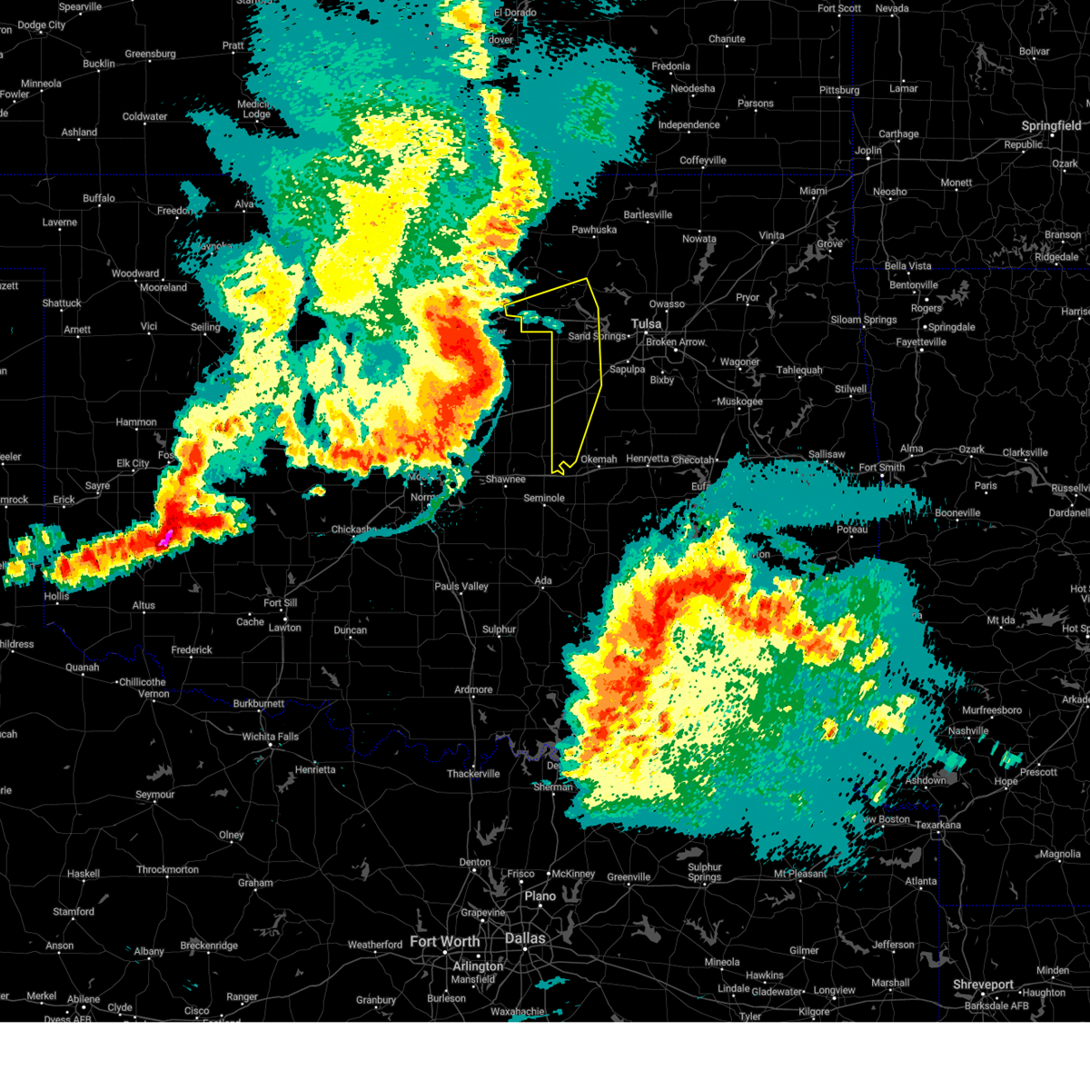 At 1122 pm cdt, severe thunderstorms were located along a line extending from 4 miles north of stillwater to 3 miles southwest of ripley to 3 miles south of wellston, moving east at 60 mph (radar indicated). Hazards include 80 mph wind gusts and quarter size hail. Flying debris will be dangerous to those caught without shelter. mobile homes will be heavily damaged. expect considerable damage to roofs, windows, and vehicles. extensive tree damage and power outages are likely. locations in or near the path include, bristow, pawnee, hominy, cleveland, mannford, drumright, boley, oilton, depew, paden, jennings, westport, osage, hallett, blackburn, terlton, shamrock, maramec, welty, silver city, this includes interstate 44 between mile markers 178 and 198. thunderstorm damage threat, destructive hail threat, radar indicated max hail size, 1. 00 in wind threat, radar indicated max wind gust, 80 mph. At 1122 pm cdt, severe thunderstorms were located along a line extending from 4 miles north of stillwater to 3 miles southwest of ripley to 3 miles south of wellston, moving east at 60 mph (radar indicated). Hazards include 80 mph wind gusts and quarter size hail. Flying debris will be dangerous to those caught without shelter. mobile homes will be heavily damaged. expect considerable damage to roofs, windows, and vehicles. extensive tree damage and power outages are likely. locations in or near the path include, bristow, pawnee, hominy, cleveland, mannford, drumright, boley, oilton, depew, paden, jennings, westport, osage, hallett, blackburn, terlton, shamrock, maramec, welty, silver city, this includes interstate 44 between mile markers 178 and 198. thunderstorm damage threat, destructive hail threat, radar indicated max hail size, 1. 00 in wind threat, radar indicated max wind gust, 80 mph.
|
| 6/17/2023 11:19 PM CDT |
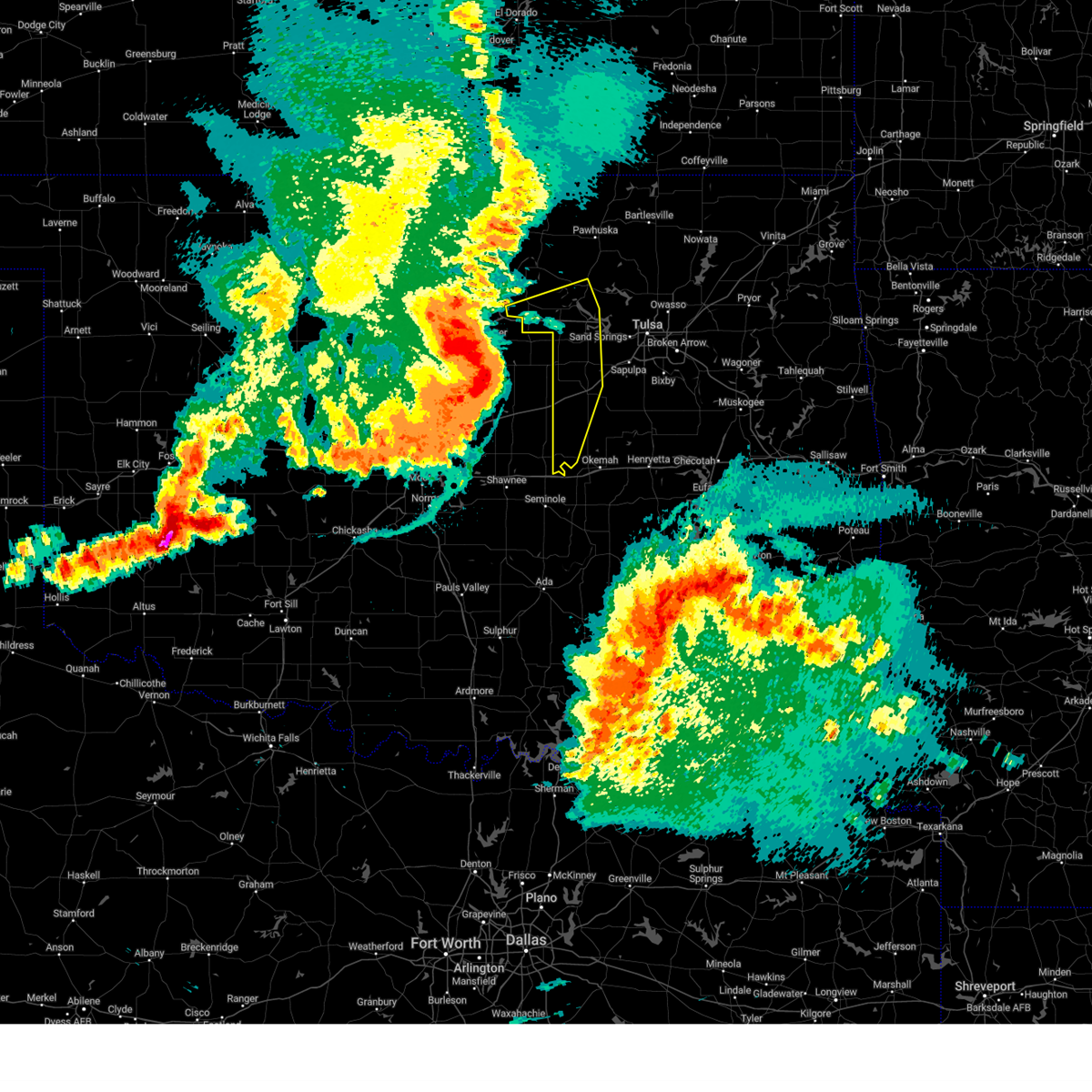 At 1119 pm cdt, severe thunderstorms were located along a line extending from 4 miles northwest of stillwater to 2 miles east of perkins to 3 miles east of luther, moving east at 55 mph (radar indicated). Hazards include 70 mph wind gusts and quarter size hail. Hail damage to vehicles is expected. expect considerable tree damage. wind damage is also likely to mobile homes, roofs, and outbuildings. locations in or near the path include, bristow, pawnee, hominy, cleveland, mannford, drumright, boley, oilton, depew, paden, jennings, westport, osage, hallett, blackburn, terlton, shamrock, maramec, welty, silver city, this includes interstate 44 between mile markers 178 and 198. thunderstorm damage threat, considerable hail threat, radar indicated max hail size, 1. 00 in wind threat, radar indicated max wind gust, 70 mph. At 1119 pm cdt, severe thunderstorms were located along a line extending from 4 miles northwest of stillwater to 2 miles east of perkins to 3 miles east of luther, moving east at 55 mph (radar indicated). Hazards include 70 mph wind gusts and quarter size hail. Hail damage to vehicles is expected. expect considerable tree damage. wind damage is also likely to mobile homes, roofs, and outbuildings. locations in or near the path include, bristow, pawnee, hominy, cleveland, mannford, drumright, boley, oilton, depew, paden, jennings, westport, osage, hallett, blackburn, terlton, shamrock, maramec, welty, silver city, this includes interstate 44 between mile markers 178 and 198. thunderstorm damage threat, considerable hail threat, radar indicated max hail size, 1. 00 in wind threat, radar indicated max wind gust, 70 mph.
|
| 6/17/2023 11:17 PM CDT |
 At 1116 pm cdt, severe thunderstorms were located along a line extending from near tryon to near mcloud to near cole, moving east at 65 mph. numerous reports of wind gusts of 60-70 mph have been reported across the oklahoma city metro area (public). Hazards include 70 mph wind gusts and quarter size hail. Hail damage to vehicles is expected. expect considerable tree damage. wind damage is also likely to mobile homes, roofs, and outbuildings. locations impacted include, oklahoma city, norman, edmond, moore, midwest city, stillwater, shawnee, del city, guthrie, cushing, newcastle, blanchard, tecumseh, purcell, chandler, bethany, mustang, choctaw, warr acres, and the village. thunderstorm damage threat, considerable hail threat, radar indicated max hail size, 1. 00 in wind threat, radar indicated max wind gust, 70 mph. At 1116 pm cdt, severe thunderstorms were located along a line extending from near tryon to near mcloud to near cole, moving east at 65 mph. numerous reports of wind gusts of 60-70 mph have been reported across the oklahoma city metro area (public). Hazards include 70 mph wind gusts and quarter size hail. Hail damage to vehicles is expected. expect considerable tree damage. wind damage is also likely to mobile homes, roofs, and outbuildings. locations impacted include, oklahoma city, norman, edmond, moore, midwest city, stillwater, shawnee, del city, guthrie, cushing, newcastle, blanchard, tecumseh, purcell, chandler, bethany, mustang, choctaw, warr acres, and the village. thunderstorm damage threat, considerable hail threat, radar indicated max hail size, 1. 00 in wind threat, radar indicated max wind gust, 70 mph.
|
| 6/17/2023 10:52 PM CDT |
 At 1052 pm cdt, severe thunderstorms were located along a line extending from 4 miles southeast of mulhall to near oklahoma city to 3 miles northwest of pocasset, moving east at 65 mph (radar indicated). Hazards include 70 mph wind gusts and quarter size hail. Hail damage to vehicles is expected. expect considerable tree damage. Wind damage is also likely to mobile homes, roofs, and outbuildings. At 1052 pm cdt, severe thunderstorms were located along a line extending from 4 miles southeast of mulhall to near oklahoma city to 3 miles northwest of pocasset, moving east at 65 mph (radar indicated). Hazards include 70 mph wind gusts and quarter size hail. Hail damage to vehicles is expected. expect considerable tree damage. Wind damage is also likely to mobile homes, roofs, and outbuildings.
|
| 6/15/2023 10:11 PM CDT |
 The severe thunderstorm warning for southeastern kay, northern lincoln, central noble, east central logan and payne counties will expire at 1015 pm cdt, the storms which prompted the warning have weakened below severe limits, therefore the warning will be allowed to expire. however, gusty winds are still possible with these thunderstorms. The severe thunderstorm warning for southeastern kay, northern lincoln, central noble, east central logan and payne counties will expire at 1015 pm cdt, the storms which prompted the warning have weakened below severe limits, therefore the warning will be allowed to expire. however, gusty winds are still possible with these thunderstorms.
|
| 6/15/2023 9:57 PM CDT |
 At 956 pm cdt, severe thunderstorms were located along a line extending from 6 miles west of burbank to near carney, moving east at 35 mph (radar indicated). Hazards include 70 mph wind gusts. Expect considerable tree damage. damage is likely to mobile homes, roofs, and outbuildings. locations impacted include, stillwater, ponca city, cushing, perry, perkins, langston, yale, morrison, glencoe, tryon, ripley, kaw city, agra, coyle, red rock, marland, lake carl blackwell, kaw lake, lake mcmurtry, and quay. thunderstorm damage threat, considerable hail threat, radar indicated max hail size, <. 75 in wind threat, radar indicated max wind gust, 70 mph. At 956 pm cdt, severe thunderstorms were located along a line extending from 6 miles west of burbank to near carney, moving east at 35 mph (radar indicated). Hazards include 70 mph wind gusts. Expect considerable tree damage. damage is likely to mobile homes, roofs, and outbuildings. locations impacted include, stillwater, ponca city, cushing, perry, perkins, langston, yale, morrison, glencoe, tryon, ripley, kaw city, agra, coyle, red rock, marland, lake carl blackwell, kaw lake, lake mcmurtry, and quay. thunderstorm damage threat, considerable hail threat, radar indicated max hail size, <. 75 in wind threat, radar indicated max wind gust, 70 mph.
|
| 6/15/2023 9:39 PM CDT |
 At 939 pm cdt, severe thunderstorms were located along a line extending from 4 miles southeast of newkirk to 7 miles north of sooner lake to 2 miles north of perkins, moving east at 45 mph (radar indicated). Hazards include 60 mph wind gusts and penny size hail. Expect damage to roofs, siding, and trees. locations in or near the path include, pawnee, cleveland, drumright, fairfax, oilton, shidler, jennings, ralston, burbank, hallett, blackburn, terlton, shamrock, maramec, skedee, grainola, foraker, webb city, apperson, silver city, hail threat, radar indicated max hail size, 0. 75 in wind threat, radar indicated max wind gust, 60 mph. At 939 pm cdt, severe thunderstorms were located along a line extending from 4 miles southeast of newkirk to 7 miles north of sooner lake to 2 miles north of perkins, moving east at 45 mph (radar indicated). Hazards include 60 mph wind gusts and penny size hail. Expect damage to roofs, siding, and trees. locations in or near the path include, pawnee, cleveland, drumright, fairfax, oilton, shidler, jennings, ralston, burbank, hallett, blackburn, terlton, shamrock, maramec, skedee, grainola, foraker, webb city, apperson, silver city, hail threat, radar indicated max hail size, 0. 75 in wind threat, radar indicated max wind gust, 60 mph.
|
| 6/15/2023 9:26 PM CDT |
 At 925 pm cdt, severe thunderstorms were located along a line extending from 4 miles west of ponca city to 5 miles northeast of guthrie, moving east at 35 mph (radar indicated). Hazards include 70 mph wind gusts. Expect considerable tree damage. Damage is likely to mobile homes, roofs, and outbuildings. At 925 pm cdt, severe thunderstorms were located along a line extending from 4 miles west of ponca city to 5 miles northeast of guthrie, moving east at 35 mph (radar indicated). Hazards include 70 mph wind gusts. Expect considerable tree damage. Damage is likely to mobile homes, roofs, and outbuildings.
|
| 6/15/2023 9:15 PM CDT |
 At 915 pm cdt, severe thunderstorms were located along a line extending from 3 miles north of blackwell to 7 miles northwest of red rock to 5 miles southeast of mulhall, moving east at 45 mph (radar indicated). Hazards include 70 mph wind gusts and nickel size hail. Expect considerable tree damage. damage is likely to mobile homes, roofs, and outbuildings. locations in or near the path include, pawnee, cleveland, drumright, fairfax, oilton, shidler, jennings, ralston, burbank, hallett, blackburn, terlton, shamrock, maramec, skedee, grainola, foraker, webb city, apperson, silver city, thunderstorm damage threat, considerable hail threat, radar indicated max hail size, 0. 88 in wind threat, radar indicated max wind gust, 70 mph. At 915 pm cdt, severe thunderstorms were located along a line extending from 3 miles north of blackwell to 7 miles northwest of red rock to 5 miles southeast of mulhall, moving east at 45 mph (radar indicated). Hazards include 70 mph wind gusts and nickel size hail. Expect considerable tree damage. damage is likely to mobile homes, roofs, and outbuildings. locations in or near the path include, pawnee, cleveland, drumright, fairfax, oilton, shidler, jennings, ralston, burbank, hallett, blackburn, terlton, shamrock, maramec, skedee, grainola, foraker, webb city, apperson, silver city, thunderstorm damage threat, considerable hail threat, radar indicated max hail size, 0. 88 in wind threat, radar indicated max wind gust, 70 mph.
|
| 2/26/2023 10:27 PM CST |
 At 1026 pm cst, a severe thunderstorm was located 6 miles southeast of slick, moving northeast at 105 mph (radar indicated). Hazards include 70 mph wind gusts and penny size hail. Expect considerable tree damage. damage is likely to mobile homes, roofs, and outbuildings. this storm ha a history of producing wind damage and tornadoes. Locations in or near the path include, tulsa, broken arrow, muskogee, sand springs, claremore, okmulgee, wagoner, bristow, okemah, owasso, bixby, sapulpa, jenks, okfuskee, glenpool, coweta, skiatook, catoosa, collinsville, verdigris, this includes interstate 44 between mile markers 179 and 247. At 1026 pm cst, a severe thunderstorm was located 6 miles southeast of slick, moving northeast at 105 mph (radar indicated). Hazards include 70 mph wind gusts and penny size hail. Expect considerable tree damage. damage is likely to mobile homes, roofs, and outbuildings. this storm ha a history of producing wind damage and tornadoes. Locations in or near the path include, tulsa, broken arrow, muskogee, sand springs, claremore, okmulgee, wagoner, bristow, okemah, owasso, bixby, sapulpa, jenks, okfuskee, glenpool, coweta, skiatook, catoosa, collinsville, verdigris, this includes interstate 44 between mile markers 179 and 247.
|
| 7/28/2022 9:26 PM CDT |
 At 925 pm cdt, a severe thunderstorm was located near walnut creek state park, moving east at 25 mph. another severe thunderstorm was just east of oilton (radar indicated). Hazards include 60 mph wind gusts and quarter size hail. Hail damage to vehicles is expected. expect wind damage to roofs, siding, and trees. locations in or near the path include, tulsa, broken arrow, sand springs, owasso, bixby, jenks, skiatook, catoosa, collinsville, mannford, sperry, westport, keystone state park, walnut creek state park, jenks riverside airport, turley, tulsa international airport, gray, silver city, this includes interstate 44 between mile markers 209 and 232. hail threat, radar indicated max hail size, 1. 00 in wind threat, radar indicated max wind gust, 60 mph. At 925 pm cdt, a severe thunderstorm was located near walnut creek state park, moving east at 25 mph. another severe thunderstorm was just east of oilton (radar indicated). Hazards include 60 mph wind gusts and quarter size hail. Hail damage to vehicles is expected. expect wind damage to roofs, siding, and trees. locations in or near the path include, tulsa, broken arrow, sand springs, owasso, bixby, jenks, skiatook, catoosa, collinsville, mannford, sperry, westport, keystone state park, walnut creek state park, jenks riverside airport, turley, tulsa international airport, gray, silver city, this includes interstate 44 between mile markers 209 and 232. hail threat, radar indicated max hail size, 1. 00 in wind threat, radar indicated max wind gust, 60 mph.
|
| 6/10/2022 5:03 AM CDT |
 At 502 am cdt, severe thunderstorms were located along a line extending from 4 miles south of shamrock to near tryon to 5 miles northeast of guthrie, moving south at 65 mph (the stillwater asos measured a 71 mph wind gust). Hazards include 70 mph wind gusts. Expect considerable tree damage. damage is likely to mobile homes, roofs, and outbuildings. locations impacted include, stillwater, cushing, perkins, langston, yale, ripley, coyle, mulhall, orlando, lake carl blackwell, quay and ingalls. thunderstorm damage threat, considerable hail threat, radar indicated max hail size, <. 75 in wind threat, observed max wind gust, 70 mph. At 502 am cdt, severe thunderstorms were located along a line extending from 4 miles south of shamrock to near tryon to 5 miles northeast of guthrie, moving south at 65 mph (the stillwater asos measured a 71 mph wind gust). Hazards include 70 mph wind gusts. Expect considerable tree damage. damage is likely to mobile homes, roofs, and outbuildings. locations impacted include, stillwater, cushing, perkins, langston, yale, ripley, coyle, mulhall, orlando, lake carl blackwell, quay and ingalls. thunderstorm damage threat, considerable hail threat, radar indicated max hail size, <. 75 in wind threat, observed max wind gust, 70 mph.
|
| 6/10/2022 4:44 AM CDT |
 At 444 am cdt, severe thunderstorms were located along a line extending from 3 miles south of maramec to near orlando, moving southeast at 55 mph (the red rock mesonet measured a 70 mph wind gust). Hazards include 70 mph wind gusts. Expect considerable tree damage. damage is likely to mobile homes, roofs, and outbuildings. locations impacted include, stillwater, cushing, perry, perkins, langston, yale, morrison, glencoe, ripley, coyle, red rock, mulhall, orlando, lake carl blackwell, lake mcmurtry, lucien, quay, sooner lake, ingalls and ceres. thunderstorm damage threat, considerable hail threat, radar indicated max hail size, <. 75 in wind threat, observed max wind gust, 70 mph. At 444 am cdt, severe thunderstorms were located along a line extending from 3 miles south of maramec to near orlando, moving southeast at 55 mph (the red rock mesonet measured a 70 mph wind gust). Hazards include 70 mph wind gusts. Expect considerable tree damage. damage is likely to mobile homes, roofs, and outbuildings. locations impacted include, stillwater, cushing, perry, perkins, langston, yale, morrison, glencoe, ripley, coyle, red rock, mulhall, orlando, lake carl blackwell, lake mcmurtry, lucien, quay, sooner lake, ingalls and ceres. thunderstorm damage threat, considerable hail threat, radar indicated max hail size, <. 75 in wind threat, observed max wind gust, 70 mph.
|
| 6/10/2022 4:43 AM CDT |
 At 442 am cdt, severe thunderstorms were located along a line extending from near quay to near mulhall, moving south at 60 mph (the stillwater asos measured a 71 mph wind gust). Hazards include 70 mph wind gusts. Expect considerable tree damage. Damage is likely to mobile homes, roofs, and outbuildings. At 442 am cdt, severe thunderstorms were located along a line extending from near quay to near mulhall, moving south at 60 mph (the stillwater asos measured a 71 mph wind gust). Hazards include 70 mph wind gusts. Expect considerable tree damage. Damage is likely to mobile homes, roofs, and outbuildings.
|
| 6/10/2022 4:14 AM CDT |
 At 413 am cdt, severe thunderstorms were located along a line extending from 9 miles west of ralston to 3 miles north of garber, moving southeast at 55 mph (the blackwell mesonet measured a 70 mph wind gust). Hazards include 70 mph wind gusts. Expect considerable tree damage. Damage is likely to mobile homes, roofs, and outbuildings. At 413 am cdt, severe thunderstorms were located along a line extending from 9 miles west of ralston to 3 miles north of garber, moving southeast at 55 mph (the blackwell mesonet measured a 70 mph wind gust). Hazards include 70 mph wind gusts. Expect considerable tree damage. Damage is likely to mobile homes, roofs, and outbuildings.
|
| 6/6/2022 2:25 AM CDT |
 The severe thunderstorm warning for northern creek, southern pawnee and southwestern tulsa counties will expire at 230 am cdt, the storms which prompted the warning have weakened below severe limits, and no longer pose an immediate threat to life or property. therefore, the warning will be allowed to expire. however gusty winds 45 to 55 mph are still possible with these thunderstorms. a severe thunderstorm watch remains in effect until 300 am cdt for northeastern oklahoma. The severe thunderstorm warning for northern creek, southern pawnee and southwestern tulsa counties will expire at 230 am cdt, the storms which prompted the warning have weakened below severe limits, and no longer pose an immediate threat to life or property. therefore, the warning will be allowed to expire. however gusty winds 45 to 55 mph are still possible with these thunderstorms. a severe thunderstorm watch remains in effect until 300 am cdt for northeastern oklahoma.
|
| 6/6/2022 2:10 AM CDT |
 At 210 am cdt, severe thunderstorms were located along a line extending from 4 miles west of westport to 5 miles north of perkins, moving southeast at 40 mph (radar indicated). Hazards include 60 mph wind gusts. Expect damage to roofs, siding, and trees. locations in or near the path include, tulsa, sand springs, sapulpa, jenks, glenpool, mannford, drumright, kellyville, oilton, jennings, hallett, terlton, shamrock, maramec, keystone state park, jenks riverside airport, silver city, this includes interstate 44 between mile markers 196 and 216. hail threat, radar indicated max hail size, <. 75 in wind threat, radar indicated max wind gust, 60 mph. At 210 am cdt, severe thunderstorms were located along a line extending from 4 miles west of westport to 5 miles north of perkins, moving southeast at 40 mph (radar indicated). Hazards include 60 mph wind gusts. Expect damage to roofs, siding, and trees. locations in or near the path include, tulsa, sand springs, sapulpa, jenks, glenpool, mannford, drumright, kellyville, oilton, jennings, hallett, terlton, shamrock, maramec, keystone state park, jenks riverside airport, silver city, this includes interstate 44 between mile markers 196 and 216. hail threat, radar indicated max hail size, <. 75 in wind threat, radar indicated max wind gust, 60 mph.
|
| 6/6/2022 1:50 AM CDT |
 At 150 am cdt, severe thunderstorms were located along a line extending from 2 miles north of hallett to 3 miles south of lake carl blackwell, moving southeast at 45 mph (radar indicated). Hazards include 60 mph wind gusts. Expect damage to roofs, siding, and trees. locations in or near the path include, tulsa, sand springs, pawnee, sapulpa, jenks, glenpool, mannford, drumright, kellyville, oilton, jennings, hallett, terlton, shamrock, maramec, keystone state park, jenks riverside airport, silver city, this includes interstate 44 between mile markers 196 and 216. hail threat, radar indicated max hail size, <. 75 in wind threat, radar indicated max wind gust, 60 mph. At 150 am cdt, severe thunderstorms were located along a line extending from 2 miles north of hallett to 3 miles south of lake carl blackwell, moving southeast at 45 mph (radar indicated). Hazards include 60 mph wind gusts. Expect damage to roofs, siding, and trees. locations in or near the path include, tulsa, sand springs, pawnee, sapulpa, jenks, glenpool, mannford, drumright, kellyville, oilton, jennings, hallett, terlton, shamrock, maramec, keystone state park, jenks riverside airport, silver city, this includes interstate 44 between mile markers 196 and 216. hail threat, radar indicated max hail size, <. 75 in wind threat, radar indicated max wind gust, 60 mph.
|
| 6/6/2022 12:42 AM CDT |
 At 1241 am cdt, severe thunderstorms were located along a line extending from 7 miles west of hardy to near marland to 5 miles northeast of garber, moving southeast at 35 mph (radar indicated). Hazards include 60 mph wind gusts and penny size hail. expect damage to roofs, siding, and trees At 1241 am cdt, severe thunderstorms were located along a line extending from 7 miles west of hardy to near marland to 5 miles northeast of garber, moving southeast at 35 mph (radar indicated). Hazards include 60 mph wind gusts and penny size hail. expect damage to roofs, siding, and trees
|
| 6/1/2022 2:16 AM CDT |
 At 216 am cdt, severe thunderstorms were located along a line extending from 3 miles north of warwick to near sparks to near johnson, moving northeast at 55 mph (radar indicated). Hazards include 60 mph wind gusts. expect damage to roofs, siding, and trees At 216 am cdt, severe thunderstorms were located along a line extending from 3 miles north of warwick to near sparks to near johnson, moving northeast at 55 mph (radar indicated). Hazards include 60 mph wind gusts. expect damage to roofs, siding, and trees
|
| 5/19/2022 3:53 AM CDT |
 At 353 am cdt, severe thunderstorms were located along a line extending from 3 miles northwest of hardy to 5 miles east of fairfax to near cushing, moving east at 60 mph (radar indicated). Hazards include 60 mph wind gusts. Expect damage to roofs, siding, and trees. locations in or near the path include, pawhuska, hominy, cleveland, mannford, drumright, oilton, shidler, wynona, jennings, westport, osage, burbank, hallett, blackburn, terlton, maramec, grainola, foraker, pearsonia, sunset lake, hail threat, radar indicated max hail size, <. 75 in wind threat, radar indicated max wind gust, 60 mph. At 353 am cdt, severe thunderstorms were located along a line extending from 3 miles northwest of hardy to 5 miles east of fairfax to near cushing, moving east at 60 mph (radar indicated). Hazards include 60 mph wind gusts. Expect damage to roofs, siding, and trees. locations in or near the path include, pawhuska, hominy, cleveland, mannford, drumright, oilton, shidler, wynona, jennings, westport, osage, burbank, hallett, blackburn, terlton, maramec, grainola, foraker, pearsonia, sunset lake, hail threat, radar indicated max hail size, <. 75 in wind threat, radar indicated max wind gust, 60 mph.
|
| 5/19/2022 3:27 AM CDT |
 At 326 am cdt, severe thunderstorms were located along a line extending from 4 miles southeast of braman to sooner lake to 4 miles east of meridian, moving east at 60 mph (radar indicated). Hazards include 60 mph wind gusts. Expect damage to roofs, siding, and trees. locations in or near the path include, pawhuska, pawnee, hominy, cleveland, mannford, drumright, fairfax, oilton, shidler, wynona, jennings, ralston, westport, osage, burbank, hallett, blackburn, terlton, maramec, skedee, hail threat, radar indicated max hail size, <. 75 in wind threat, radar indicated max wind gust, 60 mph. At 326 am cdt, severe thunderstorms were located along a line extending from 4 miles southeast of braman to sooner lake to 4 miles east of meridian, moving east at 60 mph (radar indicated). Hazards include 60 mph wind gusts. Expect damage to roofs, siding, and trees. locations in or near the path include, pawhuska, pawnee, hominy, cleveland, mannford, drumright, fairfax, oilton, shidler, wynona, jennings, ralston, westport, osage, burbank, hallett, blackburn, terlton, maramec, skedee, hail threat, radar indicated max hail size, <. 75 in wind threat, radar indicated max wind gust, 60 mph.
|
| 5/4/2022 11:51 PM CDT |
 At 1150 pm cdt, severe thunderstorms were located along a line extending from 2 miles south of westport to 2 miles south of depew, moving east at 30 mph (radar indicated). Hazards include 60 mph wind gusts and quarter size hail. Hail damage to vehicles is expected. expect wind damage to roofs, siding, and trees. locations in or near the path include, bristow, mannford, drumright, oilton, depew, westport, terlton, shamrock, keystone state park, walnut creek state park, silver city, milfay, this includes interstate 44 between mile markers 178 and 204. hail threat, radar indicated max hail size, 1. 00 in wind threat, radar indicated max wind gust, 60 mph. At 1150 pm cdt, severe thunderstorms were located along a line extending from 2 miles south of westport to 2 miles south of depew, moving east at 30 mph (radar indicated). Hazards include 60 mph wind gusts and quarter size hail. Hail damage to vehicles is expected. expect wind damage to roofs, siding, and trees. locations in or near the path include, bristow, mannford, drumright, oilton, depew, westport, terlton, shamrock, keystone state park, walnut creek state park, silver city, milfay, this includes interstate 44 between mile markers 178 and 204. hail threat, radar indicated max hail size, 1. 00 in wind threat, radar indicated max wind gust, 60 mph.
|
| 5/4/2022 11:30 PM CDT |
 At 1129 pm cdt, severe thunderstorms were located along a line extending from 3 miles southwest of terlton to near stroud, moving east at 30 mph (radar indicated). Hazards include 60 mph wind gusts and penny size hail. Expect damage to roofs, siding, and trees. locations in or near the path include, bristow, mannford, drumright, oilton, depew, westport, terlton, shamrock, keystone state park, walnut creek state park, silver city, milfay, this includes interstate 44 between mile markers 178 and 204. hail threat, radar indicated max hail size, 0. 75 in wind threat, radar indicated max wind gust, 60 mph. At 1129 pm cdt, severe thunderstorms were located along a line extending from 3 miles southwest of terlton to near stroud, moving east at 30 mph (radar indicated). Hazards include 60 mph wind gusts and penny size hail. Expect damage to roofs, siding, and trees. locations in or near the path include, bristow, mannford, drumright, oilton, depew, westport, terlton, shamrock, keystone state park, walnut creek state park, silver city, milfay, this includes interstate 44 between mile markers 178 and 204. hail threat, radar indicated max hail size, 0. 75 in wind threat, radar indicated max wind gust, 60 mph.
|
| 5/2/2022 7:32 PM CDT |
 At 731 pm cdt, severe thunderstorms were located along a line extending from 4 miles southwest of turley to 2 miles south of glenpool to near welty, moving east at 60 mph (radar indicated). Hazards include 70 mph wind gusts and quarter size hail. Hail damage to vehicles is expected. expect considerable tree damage. wind damage is also likely to mobile homes, roofs, and outbuildings. locations in or near the path include, tulsa, broken arrow, sand springs, okmulgee, bristow, okemah, owasso, bixby, sapulpa, jenks, okfuskee, glenpool, catoosa, henryetta, mannford, kiefer, morris, beggs, sperry, boley, this includes the following highways, interstate 40 in oklahoma between mile markers 217 and 243. Interstate 44 between mile markers 178 and 234. At 731 pm cdt, severe thunderstorms were located along a line extending from 4 miles southwest of turley to 2 miles south of glenpool to near welty, moving east at 60 mph (radar indicated). Hazards include 70 mph wind gusts and quarter size hail. Hail damage to vehicles is expected. expect considerable tree damage. wind damage is also likely to mobile homes, roofs, and outbuildings. locations in or near the path include, tulsa, broken arrow, sand springs, okmulgee, bristow, okemah, owasso, bixby, sapulpa, jenks, okfuskee, glenpool, catoosa, henryetta, mannford, kiefer, morris, beggs, sperry, boley, this includes the following highways, interstate 40 in oklahoma between mile markers 217 and 243. Interstate 44 between mile markers 178 and 234.
|
| 5/2/2022 7:19 PM CDT |
 At 718 pm cdt, severe thunderstorms were located along a line extending from 4 miles southeast of walnut creek state park to 2 miles southeast of kellyville to 7 miles north of paden, moving east at 50 mph (radar indicated). Hazards include 70 mph wind gusts and quarter size hail. Hail damage to vehicles is expected. expect considerable tree damage. wind damage is also likely to mobile homes, roofs, and outbuildings. locations in or near the path include, tulsa, broken arrow, sand springs, okmulgee, bristow, okemah, owasso, bixby, sapulpa, jenks, okfuskee, glenpool, catoosa, henryetta, mannford, drumright, kiefer, morris, beggs, sperry, this includes the following highways, interstate 40 in oklahoma between mile markers 217 and 243. Interstate 44 between mile markers 177 and 234. At 718 pm cdt, severe thunderstorms were located along a line extending from 4 miles southeast of walnut creek state park to 2 miles southeast of kellyville to 7 miles north of paden, moving east at 50 mph (radar indicated). Hazards include 70 mph wind gusts and quarter size hail. Hail damage to vehicles is expected. expect considerable tree damage. wind damage is also likely to mobile homes, roofs, and outbuildings. locations in or near the path include, tulsa, broken arrow, sand springs, okmulgee, bristow, okemah, owasso, bixby, sapulpa, jenks, okfuskee, glenpool, catoosa, henryetta, mannford, drumright, kiefer, morris, beggs, sperry, this includes the following highways, interstate 40 in oklahoma between mile markers 217 and 243. Interstate 44 between mile markers 177 and 234.
|
| 5/2/2022 7:09 PM CDT |
 The tornado warning for northwestern creek and southeastern pawnee counties will expire at 715 pm cdt, the tornado threat has diminished and the tornado warning has been cancelled. however, damaging winds remain likely and a severe thunderstorm warning remains in effect for the area. a tornado watch remains in effect until 1000 pm cdt for northeastern oklahoma. The tornado warning for northwestern creek and southeastern pawnee counties will expire at 715 pm cdt, the tornado threat has diminished and the tornado warning has been cancelled. however, damaging winds remain likely and a severe thunderstorm warning remains in effect for the area. a tornado watch remains in effect until 1000 pm cdt for northeastern oklahoma.
|
| 5/2/2022 6:56 PM CDT |
 At 656 pm cdt, severe thunderstorms were located along a line extending from 3 miles west of mannford to 6 miles east of sparks, moving east at 60 mph (radar indicated). Hazards include 70 mph wind gusts and quarter size hail. Hail damage to vehicles is expected. expect considerable tree damage. wind damage is also likely to mobile homes, roofs, and outbuildings. locations in or near the path include, tulsa, broken arrow, sand springs, okmulgee, bristow, okemah, owasso, bixby, sapulpa, jenks, okfuskee, glenpool, catoosa, henryetta, mannford, drumright, kiefer, morris, beggs, sperry, this includes the following highways, interstate 40 in oklahoma between mile markers 217 and 243. interstate 44 between mile markers 177 and 234. thunderstorm damage threat, considerable hail threat, radar indicated max hail size, 1. 00 in wind threat, radar indicated max wind gust, 70 mph. At 656 pm cdt, severe thunderstorms were located along a line extending from 3 miles west of mannford to 6 miles east of sparks, moving east at 60 mph (radar indicated). Hazards include 70 mph wind gusts and quarter size hail. Hail damage to vehicles is expected. expect considerable tree damage. wind damage is also likely to mobile homes, roofs, and outbuildings. locations in or near the path include, tulsa, broken arrow, sand springs, okmulgee, bristow, okemah, owasso, bixby, sapulpa, jenks, okfuskee, glenpool, catoosa, henryetta, mannford, drumright, kiefer, morris, beggs, sperry, this includes the following highways, interstate 40 in oklahoma between mile markers 217 and 243. interstate 44 between mile markers 177 and 234. thunderstorm damage threat, considerable hail threat, radar indicated max hail size, 1. 00 in wind threat, radar indicated max wind gust, 70 mph.
|
| 5/2/2022 6:53 PM CDT |
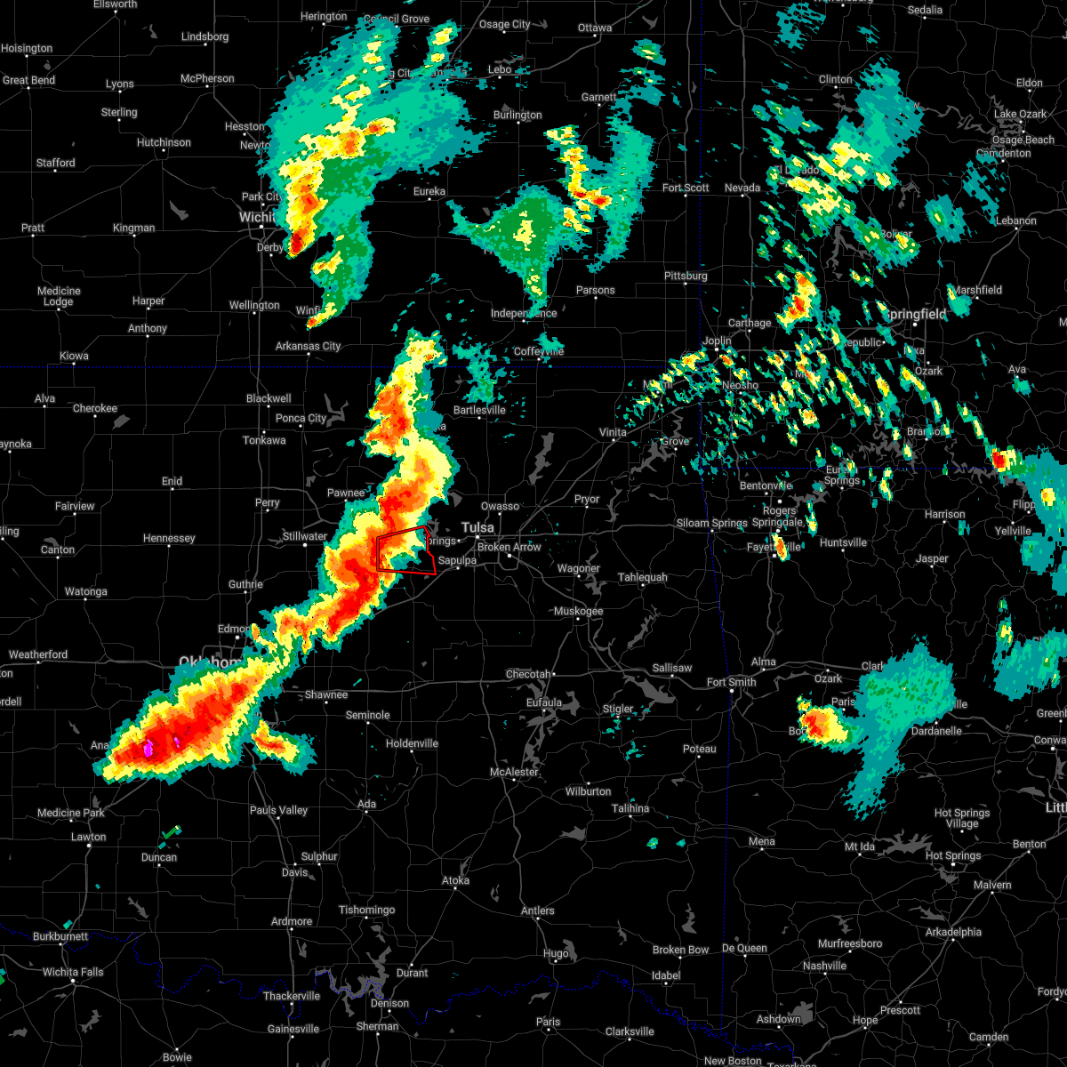 At 653 pm cdt, a severe thunderstorm capable of producing a tornado was located near oilton, moving east at 35 mph (radar indicated rotation). Hazards include tornado and quarter size hail. Flying debris will be dangerous to those caught without shelter. mobile homes will be damaged or destroyed. damage to roofs, windows, and vehicles will occur. tree damage is likely. Locations in or near the path include, mannford, oilton, silver city,. At 653 pm cdt, a severe thunderstorm capable of producing a tornado was located near oilton, moving east at 35 mph (radar indicated rotation). Hazards include tornado and quarter size hail. Flying debris will be dangerous to those caught without shelter. mobile homes will be damaged or destroyed. damage to roofs, windows, and vehicles will occur. tree damage is likely. Locations in or near the path include, mannford, oilton, silver city,.
|
| 5/2/2022 6:40 PM CDT |
 At 640 pm cdt, a severe thunderstorm capable of producing a tornado was located 5 miles northeast of cushing, moving east at 40 mph. a second area of rotation was detected 3 miles east of yale (radar indicated rotation). Hazards include tornado and golf ball size hail. Flying debris will be dangerous to those caught without shelter. mobile homes will be damaged or destroyed. damage to roofs, windows, and vehicles will occur. Tree damage is likely. At 640 pm cdt, a severe thunderstorm capable of producing a tornado was located 5 miles northeast of cushing, moving east at 40 mph. a second area of rotation was detected 3 miles east of yale (radar indicated rotation). Hazards include tornado and golf ball size hail. Flying debris will be dangerous to those caught without shelter. mobile homes will be damaged or destroyed. damage to roofs, windows, and vehicles will occur. Tree damage is likely.
|
| 5/2/2022 6:34 PM CDT |
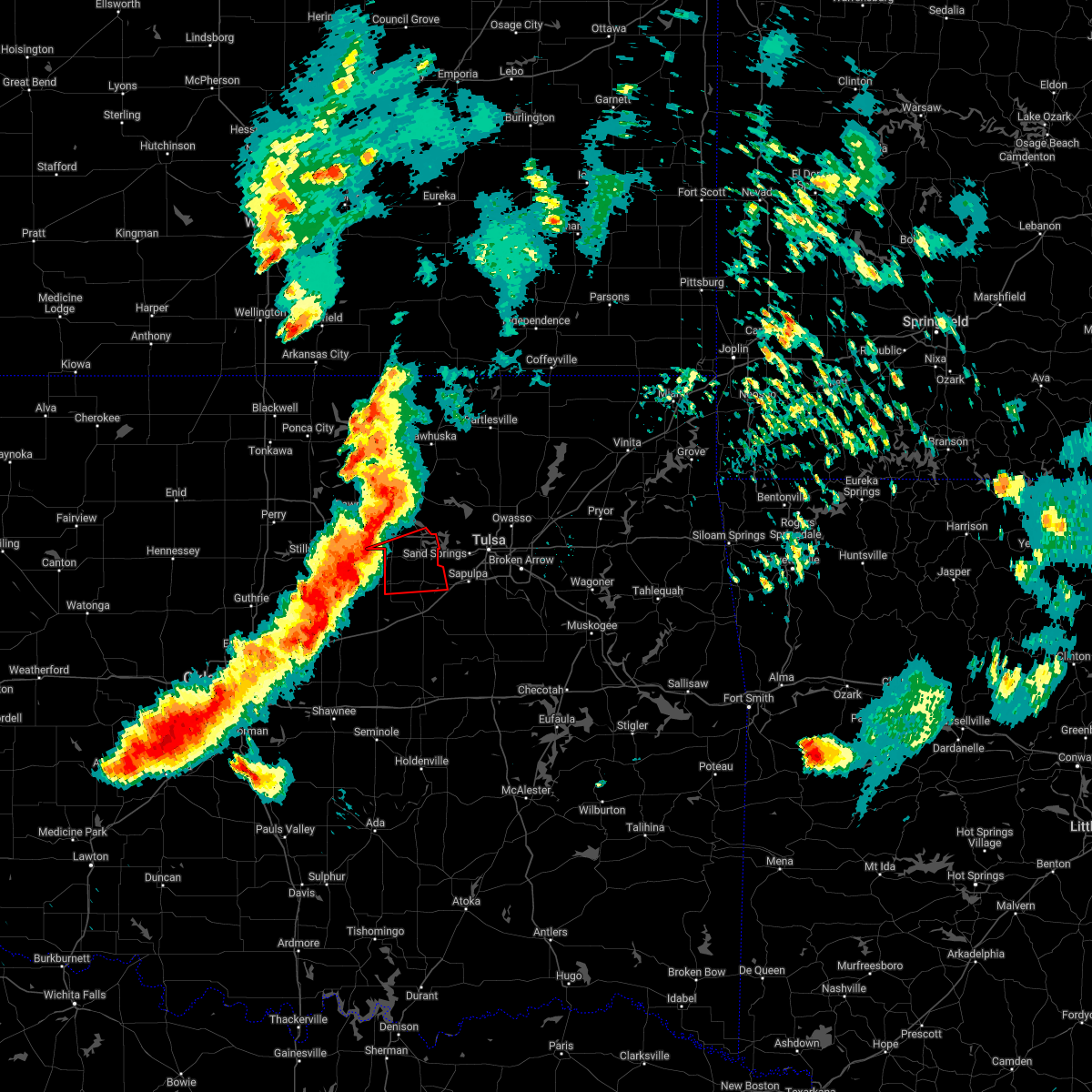 At 634 pm cdt, a severe thunderstorm capable of producing a tornado was located 4 miles north of cushing, moving east at 45 mph (radar indicated rotation). Hazards include tornado and quarter size hail. Flying debris will be dangerous to those caught without shelter. mobile homes will be damaged or destroyed. damage to roofs, windows, and vehicles will occur. tree damage is likely. Locations in or near the path include, mannford, drumright, oilton, jennings, westport, terlton, silver city,. At 634 pm cdt, a severe thunderstorm capable of producing a tornado was located 4 miles north of cushing, moving east at 45 mph (radar indicated rotation). Hazards include tornado and quarter size hail. Flying debris will be dangerous to those caught without shelter. mobile homes will be damaged or destroyed. damage to roofs, windows, and vehicles will occur. tree damage is likely. Locations in or near the path include, mannford, drumright, oilton, jennings, westport, terlton, silver city,.
|
| 5/2/2022 6:28 PM CDT |
 At 627 pm cdt, a confirmed tornado was located 3 miles east of ripley, moving east at 35 mph (emergency management confirmed tornado). Hazards include damaging tornado and quarter size hail. Flying debris will be dangerous to those caught without shelter. mobile homes will be damaged or destroyed. damage to roofs, windows, and vehicles will occur. tree damage is likely. Locations impacted include, cushing and ripley. At 627 pm cdt, a confirmed tornado was located 3 miles east of ripley, moving east at 35 mph (emergency management confirmed tornado). Hazards include damaging tornado and quarter size hail. Flying debris will be dangerous to those caught without shelter. mobile homes will be damaged or destroyed. damage to roofs, windows, and vehicles will occur. tree damage is likely. Locations impacted include, cushing and ripley.
|
| 5/2/2022 6:20 PM CDT |
 At 620 pm cdt, a severe thunderstorm capable of producing a tornado was located near ripley, moving east at 35 mph (radar indicated rotation). Hazards include tornado and quarter size hail. Flying debris will be dangerous to those caught without shelter. mobile homes will be damaged or destroyed. damage to roofs, windows, and vehicles will occur. Tree damage is likely. At 620 pm cdt, a severe thunderstorm capable of producing a tornado was located near ripley, moving east at 35 mph (radar indicated rotation). Hazards include tornado and quarter size hail. Flying debris will be dangerous to those caught without shelter. mobile homes will be damaged or destroyed. damage to roofs, windows, and vehicles will occur. Tree damage is likely.
|
| 4/30/2022 1:17 AM CDT |
 At 117 am cdt, severe thunderstorms were located along a line extending from 8 miles east of drumright to 2 miles northeast of stroud, moving southeast at 35 mph (radar indicated). Hazards include 60 mph wind gusts and half dollar size hail. Hail damage to vehicles is expected. expect wind damage to roofs, siding, and trees. locations in or near the path include, bristow, sapulpa, drumright, kellyville, oilton, depew, shamrock, silver city, milfay, this includes interstate 44 between mile markers 178 and 213. hail threat, radar indicated max hail size, 1. 25 in wind threat, radar indicated max wind gust, 60 mph. At 117 am cdt, severe thunderstorms were located along a line extending from 8 miles east of drumright to 2 miles northeast of stroud, moving southeast at 35 mph (radar indicated). Hazards include 60 mph wind gusts and half dollar size hail. Hail damage to vehicles is expected. expect wind damage to roofs, siding, and trees. locations in or near the path include, bristow, sapulpa, drumright, kellyville, oilton, depew, shamrock, silver city, milfay, this includes interstate 44 between mile markers 178 and 213. hail threat, radar indicated max hail size, 1. 25 in wind threat, radar indicated max wind gust, 60 mph.
|
| 4/30/2022 1:10 AM CDT |
 At 110 am cdt, a severe thunderstorm was located 4 miles east of avery, moving east at 40 mph (law enforcement). Hazards include golf ball size hail and 60 mph wind gusts. People and animals outdoors will be injured. expect hail damage to roofs, siding, windows, and vehicles. expect wind damage to roofs, siding, and trees. locations impacted include, cushing, chandler, stroud, davenport, kendrick, avery and parkland. thunderstorm damage threat, considerable hail threat, observed max hail size, 1. 75 in wind threat, radar indicated max wind gust, 60 mph. At 110 am cdt, a severe thunderstorm was located 4 miles east of avery, moving east at 40 mph (law enforcement). Hazards include golf ball size hail and 60 mph wind gusts. People and animals outdoors will be injured. expect hail damage to roofs, siding, windows, and vehicles. expect wind damage to roofs, siding, and trees. locations impacted include, cushing, chandler, stroud, davenport, kendrick, avery and parkland. thunderstorm damage threat, considerable hail threat, observed max hail size, 1. 75 in wind threat, radar indicated max wind gust, 60 mph.
|
| 4/30/2022 12:59 AM CDT |
 At 1259 am cdt, severe thunderstorms were located along a line extending from oilton to 2 miles south of avery, moving southeast at 35 mph (radar indicated). Hazards include 60 mph wind gusts and half dollar size hail. Hail damage to vehicles is expected. expect wind damage to roofs, siding, and trees. locations in or near the path include, bristow, sapulpa, drumright, kellyville, oilton, depew, shamrock, silver city, milfay, this includes interstate 44 between mile markers 178 and 213. hail threat, radar indicated max hail size, 1. 25 in wind threat, radar indicated max wind gust, 60 mph. At 1259 am cdt, severe thunderstorms were located along a line extending from oilton to 2 miles south of avery, moving southeast at 35 mph (radar indicated). Hazards include 60 mph wind gusts and half dollar size hail. Hail damage to vehicles is expected. expect wind damage to roofs, siding, and trees. locations in or near the path include, bristow, sapulpa, drumright, kellyville, oilton, depew, shamrock, silver city, milfay, this includes interstate 44 between mile markers 178 and 213. hail threat, radar indicated max hail size, 1. 25 in wind threat, radar indicated max wind gust, 60 mph.
|
| 4/30/2022 12:59 AM CDT |
 At 1259 am cdt, a severe thunderstorm was located near drumright, moving east at 30 mph (radar indicated). Hazards include 60 mph wind gusts and quarter size hail. Hail damage to vehicles is expected. expect wind damage to roofs, siding, and trees. locations impacted include, cushing and yale. hail threat, radar indicated max hail size, 1. 00 in wind threat, radar indicated max wind gust, 60 mph. At 1259 am cdt, a severe thunderstorm was located near drumright, moving east at 30 mph (radar indicated). Hazards include 60 mph wind gusts and quarter size hail. Hail damage to vehicles is expected. expect wind damage to roofs, siding, and trees. locations impacted include, cushing and yale. hail threat, radar indicated max hail size, 1. 00 in wind threat, radar indicated max wind gust, 60 mph.
|
| 4/30/2022 12:58 AM CDT |
 At 1257 am cdt, a severe thunderstorm was located near avery, moving east at 50 mph (radar indicated). Hazards include 60 mph wind gusts and quarter size hail. Hail damage to vehicles is expected. Expect wind damage to roofs, siding, and trees. At 1257 am cdt, a severe thunderstorm was located near avery, moving east at 50 mph (radar indicated). Hazards include 60 mph wind gusts and quarter size hail. Hail damage to vehicles is expected. Expect wind damage to roofs, siding, and trees.
|
| 4/30/2022 12:39 AM CDT |
 At 1239 am cdt, severe thunderstorms were located along a line extending from 3 miles southwest of caney to quay, moving east at 45 mph (radar indicated). Hazards include 60 mph wind gusts and quarter size hail. Hail damage to vehicles is expected. expect wind damage to roofs, siding, and trees. locations in or near the path include, bartlesville, pawhuska, hominy, dewey, cleveland, mannford, barnsdall, oilton, south coffeyville, copan, ramona, wynona, ochelata, jennings, avant, westport, lenapah, osage, wann, hallett, hail threat, radar indicated max hail size, 1. 00 in wind threat, radar indicated max wind gust, 60 mph. At 1239 am cdt, severe thunderstorms were located along a line extending from 3 miles southwest of caney to quay, moving east at 45 mph (radar indicated). Hazards include 60 mph wind gusts and quarter size hail. Hail damage to vehicles is expected. expect wind damage to roofs, siding, and trees. locations in or near the path include, bartlesville, pawhuska, hominy, dewey, cleveland, mannford, barnsdall, oilton, south coffeyville, copan, ramona, wynona, ochelata, jennings, avant, westport, lenapah, osage, wann, hallett, hail threat, radar indicated max hail size, 1. 00 in wind threat, radar indicated max wind gust, 60 mph.
|
| 4/30/2022 12:37 AM CDT |
 At 1236 am cdt, a severe thunderstorm was located 6 miles west of yale, moving east at 40 mph (radar indicated). Hazards include 60 mph wind gusts and quarter size hail. Hail damage to vehicles is expected. expect wind damage to roofs, siding, and trees. locations impacted include, cushing, perkins, yale, ripley, quay and ingalls. hail threat, radar indicated max hail size, 1. 00 in wind threat, radar indicated max wind gust, 60 mph. At 1236 am cdt, a severe thunderstorm was located 6 miles west of yale, moving east at 40 mph (radar indicated). Hazards include 60 mph wind gusts and quarter size hail. Hail damage to vehicles is expected. expect wind damage to roofs, siding, and trees. locations impacted include, cushing, perkins, yale, ripley, quay and ingalls. hail threat, radar indicated max hail size, 1. 00 in wind threat, radar indicated max wind gust, 60 mph.
|
| 4/30/2022 12:28 AM CDT |
 At 1228 am cdt, a severe thunderstorm was located 5 miles north of ripley, moving east at 35 mph (trained weather spotters). Hazards include ping pong ball size hail and 60 mph wind gusts. People and animals outdoors will be injured. expect hail damage to roofs, siding, windows, and vehicles. expect wind damage to roofs, siding, and trees. locations impacted include, stillwater, cushing, perkins, yale, glencoe, ripley, quay and ingalls. hail threat, radar indicated max hail size, 1. 50 in wind threat, radar indicated max wind gust, 60 mph. At 1228 am cdt, a severe thunderstorm was located 5 miles north of ripley, moving east at 35 mph (trained weather spotters). Hazards include ping pong ball size hail and 60 mph wind gusts. People and animals outdoors will be injured. expect hail damage to roofs, siding, windows, and vehicles. expect wind damage to roofs, siding, and trees. locations impacted include, stillwater, cushing, perkins, yale, glencoe, ripley, quay and ingalls. hail threat, radar indicated max hail size, 1. 50 in wind threat, radar indicated max wind gust, 60 mph.
|
| 4/30/2022 12:23 AM CDT |
 At 1223 am cdt, a severe thunderstorm was located 6 miles northwest of ripley, moving east at 45 mph (trained weather spotters). Hazards include 60 mph wind gusts and quarter size hail. Hail damage to vehicles is expected. Expect wind damage to roofs, siding, and trees. At 1223 am cdt, a severe thunderstorm was located 6 miles northwest of ripley, moving east at 45 mph (trained weather spotters). Hazards include 60 mph wind gusts and quarter size hail. Hail damage to vehicles is expected. Expect wind damage to roofs, siding, and trees.
|
| 4/30/2022 12:22 AM CDT |
 At 1222 am cdt, severe thunderstorms were located along a line extending from 3 miles south of chautauqua to 4 miles south of glencoe, moving east at 45 mph (radar indicated). Hazards include 60 mph wind gusts and quarter size hail. Hail damage to vehicles is expected. expect wind damage to roofs, siding, and trees. locations in or near the path include, bartlesville, pawhuska, pawnee, hominy, dewey, cleveland, mannford, fairfax, barnsdall, oilton, south coffeyville, copan, ramona, wynona, ochelata, jennings, ralston, avant, westport, lenapah, hail threat, radar indicated max hail size, 1. 00 in wind threat, radar indicated max wind gust, 60 mph. At 1222 am cdt, severe thunderstorms were located along a line extending from 3 miles south of chautauqua to 4 miles south of glencoe, moving east at 45 mph (radar indicated). Hazards include 60 mph wind gusts and quarter size hail. Hail damage to vehicles is expected. expect wind damage to roofs, siding, and trees. locations in or near the path include, bartlesville, pawhuska, pawnee, hominy, dewey, cleveland, mannford, fairfax, barnsdall, oilton, south coffeyville, copan, ramona, wynona, ochelata, jennings, ralston, avant, westport, lenapah, hail threat, radar indicated max hail size, 1. 00 in wind threat, radar indicated max wind gust, 60 mph.
|
| 3/17/2022 9:33 PM CDT |
 At 932 pm cdt, a severe thunderstorm was located 4 miles north of cushing, moving northeast at 35 mph (radar indicated). Hazards include 60 mph wind gusts, quarter size hail, and accumulating small hail. Hail damage to vehicles is expected. expect wind damage to roofs, siding, and trees. locations impacted include, cushing, yale, ripley and quay. hail threat, radar indicated max hail size, 1. 00 in wind threat, radar indicated max wind gust, 60 mph. At 932 pm cdt, a severe thunderstorm was located 4 miles north of cushing, moving northeast at 35 mph (radar indicated). Hazards include 60 mph wind gusts, quarter size hail, and accumulating small hail. Hail damage to vehicles is expected. expect wind damage to roofs, siding, and trees. locations impacted include, cushing, yale, ripley and quay. hail threat, radar indicated max hail size, 1. 00 in wind threat, radar indicated max wind gust, 60 mph.
|
| 3/17/2022 9:13 PM CDT |
 A severe thunderstorm warning remains in effect until 945 pm cdt for north central lincoln and eastern payne counties. at 912 pm cdt, a severe thunderstorm was located near ripley, moving northeast at 35 mph. hazard. 60 mph wind gusts, quarter size hail, and accumulating small hail. A severe thunderstorm warning remains in effect until 945 pm cdt for north central lincoln and eastern payne counties. at 912 pm cdt, a severe thunderstorm was located near ripley, moving northeast at 35 mph. hazard. 60 mph wind gusts, quarter size hail, and accumulating small hail.
|
| 3/17/2022 9:12 PM CDT |
 At 910 pm cdt, a severe thunderstorm was located 3 miles west of ripley, moving northeast at 25 mph (radar indicated). Hazards include 60 mph wind gusts and quarter size hail. Hail damage to vehicles is expected. expect wind damage to roofs, siding, and trees. locations in or near the path include, pawnee, mannford, drumright, oilton, jennings, hallett, terlton, maramec, skedee, silver city, hail threat, radar indicated max hail size, 1. 00 in wind threat, radar indicated max wind gust, 60 mph. At 910 pm cdt, a severe thunderstorm was located 3 miles west of ripley, moving northeast at 25 mph (radar indicated). Hazards include 60 mph wind gusts and quarter size hail. Hail damage to vehicles is expected. expect wind damage to roofs, siding, and trees. locations in or near the path include, pawnee, mannford, drumright, oilton, jennings, hallett, terlton, maramec, skedee, silver city, hail threat, radar indicated max hail size, 1. 00 in wind threat, radar indicated max wind gust, 60 mph.
|
| 3/17/2022 9:06 PM CDT |
 At 905 pm cdt, a severe thunderstorm was located over perkins, moving northeast at 35 mph (radar indicated). Hazards include 60 mph wind gusts and quarter size hail. Hail damage to vehicles is expected. Expect wind damage to roofs, siding, and trees. At 905 pm cdt, a severe thunderstorm was located over perkins, moving northeast at 35 mph (radar indicated). Hazards include 60 mph wind gusts and quarter size hail. Hail damage to vehicles is expected. Expect wind damage to roofs, siding, and trees.
|
| 11/10/2021 7:02 PM CST |
 At 702 pm cst, severe thunderstorms were located along a line extending from 4 miles west of shamrock to 7 miles south of wellston, moving east at 30 mph (emergency management reported quarter size hail in harrah). Hazards include 60 mph wind gusts and quarter size hail. Hail damage to vehicles is expected. expect wind damage to roofs, siding, and trees. locations impacted include, eastern oklahoma city, shawnee, chandler, choctaw, harrah, mcloud, stroud, prague, meeker, davenport, wellston, carney, agra, johnson, sparks, warwick, kendrick, newalla, avery and parkland. hail threat, observed max hail size, 1. 00 in wind threat, radar indicated max wind gust, 60 mph. At 702 pm cst, severe thunderstorms were located along a line extending from 4 miles west of shamrock to 7 miles south of wellston, moving east at 30 mph (emergency management reported quarter size hail in harrah). Hazards include 60 mph wind gusts and quarter size hail. Hail damage to vehicles is expected. expect wind damage to roofs, siding, and trees. locations impacted include, eastern oklahoma city, shawnee, chandler, choctaw, harrah, mcloud, stroud, prague, meeker, davenport, wellston, carney, agra, johnson, sparks, warwick, kendrick, newalla, avery and parkland. hail threat, observed max hail size, 1. 00 in wind threat, radar indicated max wind gust, 60 mph.
|
| 11/10/2021 6:47 PM CST |
 At 647 pm cst, severe thunderstorms were located along a line extending from near avery to 5 miles north of harrah, moving east at 25 mph (radar indicated). Hazards include 60 mph wind gusts and quarter size hail. Hail damage to vehicles is expected. expect wind damage to roofs, siding, and trees. locations impacted include, eastern oklahoma city, shawnee, chandler, choctaw, harrah, mcloud, stroud, prague, meeker, davenport, wellston, carney, agra, johnson, sparks, warwick, kendrick, newalla, avery and parkland. hail threat, radar indicated max hail size, 1. 00 in wind threat, radar indicated max wind gust, 60 mph. At 647 pm cst, severe thunderstorms were located along a line extending from near avery to 5 miles north of harrah, moving east at 25 mph (radar indicated). Hazards include 60 mph wind gusts and quarter size hail. Hail damage to vehicles is expected. expect wind damage to roofs, siding, and trees. locations impacted include, eastern oklahoma city, shawnee, chandler, choctaw, harrah, mcloud, stroud, prague, meeker, davenport, wellston, carney, agra, johnson, sparks, warwick, kendrick, newalla, avery and parkland. hail threat, radar indicated max hail size, 1. 00 in wind threat, radar indicated max wind gust, 60 mph.
|
| 11/10/2021 6:38 PM CST |
 At 638 pm cst, a severe thunderstorm was located 3 miles northeast of oilton, moving east at 30 mph (radar indicated). Hazards include 60 mph wind gusts and quarter size hail. Hail damage to vehicles is expected. expect wind damage to roofs, siding, and trees. locations in or near the path include, mannford, terlton, silver city, hail threat, radar indicated max hail size, 1. 00 in wind threat, radar indicated max wind gust, 60 mph. At 638 pm cst, a severe thunderstorm was located 3 miles northeast of oilton, moving east at 30 mph (radar indicated). Hazards include 60 mph wind gusts and quarter size hail. Hail damage to vehicles is expected. expect wind damage to roofs, siding, and trees. locations in or near the path include, mannford, terlton, silver city, hail threat, radar indicated max hail size, 1. 00 in wind threat, radar indicated max wind gust, 60 mph.
|
| 11/10/2021 6:27 PM CST |
 At 626 pm cst, severe thunderstorms were located along a line extending from near agra to near jones, moving east at 30 mph (trained weather spotters reported quarters in tryon). Hazards include 60 mph wind gusts and quarter size hail. Hail damage to vehicles is expected. expect wind damage to roofs, siding, and trees. locations impacted include, eastern oklahoma city, southeastern edmond, midwest city, shawnee, del city, cushing, chandler, choctaw, harrah, mcloud, spencer, perkins, jones, stroud, nicoma park, prague, luther, meeker, davenport and wellston. hail threat, observed max hail size, 1. 00 in wind threat, radar indicated max wind gust, 60 mph. At 626 pm cst, severe thunderstorms were located along a line extending from near agra to near jones, moving east at 30 mph (trained weather spotters reported quarters in tryon). Hazards include 60 mph wind gusts and quarter size hail. Hail damage to vehicles is expected. expect wind damage to roofs, siding, and trees. locations impacted include, eastern oklahoma city, southeastern edmond, midwest city, shawnee, del city, cushing, chandler, choctaw, harrah, mcloud, spencer, perkins, jones, stroud, nicoma park, prague, luther, meeker, davenport and wellston. hail threat, observed max hail size, 1. 00 in wind threat, radar indicated max wind gust, 60 mph.
|
| 11/10/2021 6:24 PM CST |
 At 624 pm cst, severe thunderstorms were located along a line extending from near tryon to near oklahoma city, moving east at 30 mph (radar indicated). Hazards include 60 mph wind gusts and quarter size hail. Hail damage to vehicles is expected. Expect wind damage to roofs, siding, and trees. At 624 pm cst, severe thunderstorms were located along a line extending from near tryon to near oklahoma city, moving east at 30 mph (radar indicated). Hazards include 60 mph wind gusts and quarter size hail. Hail damage to vehicles is expected. Expect wind damage to roofs, siding, and trees.
|
| 11/10/2021 6:18 PM CST |
 At 617 pm cst, a severe thunderstorm was located 4 miles south of yale, moving east at 30 mph (broadcast media reported wind gust of 67 mph north of cushion). Hazards include 70 mph wind gusts and quarter size hail. Hail damage to vehicles is expected. expect considerable tree damage. Wind damage is also likely to mobile homes, roofs, and outbuildings. At 617 pm cst, a severe thunderstorm was located 4 miles south of yale, moving east at 30 mph (broadcast media reported wind gust of 67 mph north of cushion). Hazards include 70 mph wind gusts and quarter size hail. Hail damage to vehicles is expected. expect considerable tree damage. Wind damage is also likely to mobile homes, roofs, and outbuildings.
|
| 11/10/2021 6:17 PM CST |
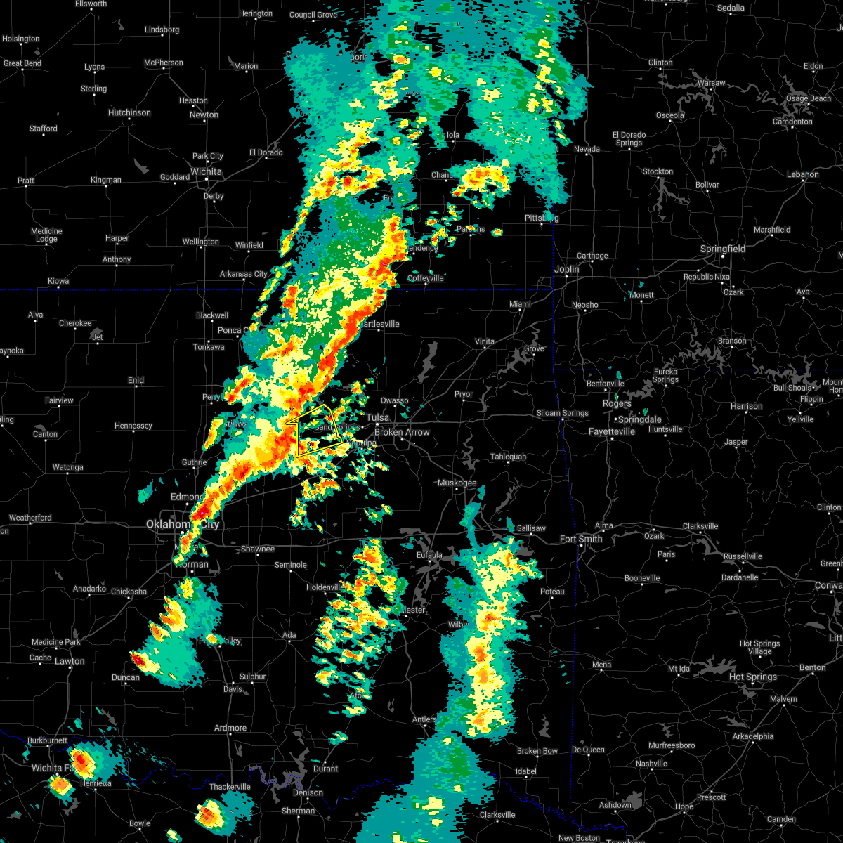 At 616 pm cst, a severe thunderstorm was located 4 miles south of yale, moving east at 30 mph (radar indicated). Hazards include 60 mph wind gusts and quarter size hail. Hail damage to vehicles is expected. expect wind damage to roofs, siding, and trees. locations in or near the path include, mannford, drumright, oilton, jennings, terlton, silver city, hail threat, radar indicated max hail size, 1. 00 in wind threat, radar indicated max wind gust, 60 mph. At 616 pm cst, a severe thunderstorm was located 4 miles south of yale, moving east at 30 mph (radar indicated). Hazards include 60 mph wind gusts and quarter size hail. Hail damage to vehicles is expected. expect wind damage to roofs, siding, and trees. locations in or near the path include, mannford, drumright, oilton, jennings, terlton, silver city, hail threat, radar indicated max hail size, 1. 00 in wind threat, radar indicated max wind gust, 60 mph.
|
| 10/27/2021 1:27 AM CDT |
 At 127 am cdt, severe thunderstorms were located along a line extending from 3 miles southeast of stillwater to 5 miles west of sparks to 6 miles southwest of vanoss, moving east at 30 mph (radar indicated). Hazards include 60 mph wind gusts. expect damage to roofs, siding, and trees At 127 am cdt, severe thunderstorms were located along a line extending from 3 miles southeast of stillwater to 5 miles west of sparks to 6 miles southwest of vanoss, moving east at 30 mph (radar indicated). Hazards include 60 mph wind gusts. expect damage to roofs, siding, and trees
|
| 10/27/2021 1:08 AM CDT |
 At 108 am cdt, severe thunderstorms were located along a line extending from near lake mcmurtry to 5 miles south of wellston to 5 miles east of wynnewood, moving east at 40 mph (radar indicated). Hazards include 70 mph wind gusts. Expect considerable tree damage. damage is likely to mobile homes, roofs, and outbuildings. Locations impacted include, southeastern oklahoma city, eastern norman, stillwater, shawnee, ada, cushing, seminole, tecumseh, pauls valley, chandler, harrah, mcloud, perkins, stroud, prague, wynnewood, pink, langston, stratford and konawa. At 108 am cdt, severe thunderstorms were located along a line extending from near lake mcmurtry to 5 miles south of wellston to 5 miles east of wynnewood, moving east at 40 mph (radar indicated). Hazards include 70 mph wind gusts. Expect considerable tree damage. damage is likely to mobile homes, roofs, and outbuildings. Locations impacted include, southeastern oklahoma city, eastern norman, stillwater, shawnee, ada, cushing, seminole, tecumseh, pauls valley, chandler, harrah, mcloud, perkins, stroud, prague, wynnewood, pink, langston, stratford and konawa.
|
| 10/27/2021 12:43 AM CDT |
 At 1242 am cdt, severe thunderstorms were located along a line extending from 4 miles southeast of marshall to near oklahoma city to 4 miles east of antioch, moving east at 45 mph (radar indicated). Hazards include 70 mph wind gusts and penny size hail. Expect considerable tree damage. Damage is likely to mobile homes, roofs, and outbuildings. At 1242 am cdt, severe thunderstorms were located along a line extending from 4 miles southeast of marshall to near oklahoma city to 4 miles east of antioch, moving east at 45 mph (radar indicated). Hazards include 70 mph wind gusts and penny size hail. Expect considerable tree damage. Damage is likely to mobile homes, roofs, and outbuildings.
|
| 10/10/2021 9:17 PM CDT |
 At 917 pm cdt, severe thunderstorms were located along a line extending from near stroud to near little to near konawa, moving east-northeast at 45 mph (radar indicated). Hazards include 60 mph wind gusts and quarter size hail. Hail damage to vehicles is expected. Expect wind damage to roofs, siding, and trees. At 917 pm cdt, severe thunderstorms were located along a line extending from near stroud to near little to near konawa, moving east-northeast at 45 mph (radar indicated). Hazards include 60 mph wind gusts and quarter size hail. Hail damage to vehicles is expected. Expect wind damage to roofs, siding, and trees.
|
| 10/10/2021 9:14 PM CDT |
 At 914 pm cdt, severe thunderstorms were located along a line extending from 2 miles northwest of drumright to 8 miles southeast of stroud to 5 miles west of cromwell, moving northeast at 40 mph (radar indicated). Hazards include 70 mph wind gusts and quarter size hail. Hail damage to vehicles is expected. expect considerable tree damage. wind damage is also likely to mobile homes, roofs, and outbuildings. locations in or near the path include, bristow, okemah, okfuskee, mannford, drumright, boley, depew, paden, bearden, slick, castle, shamrock, welty, milfay, mason, this includes the following highways, interstate 40 in oklahoma between mile markers 212 and 225. interstate 44 between mile markers 178 and 203. thunderstorm damage threat, considerable hail threat, radar indicated max hail size, 1. 00 in wind threat, radar indicated max wind gust, 70 mph. At 914 pm cdt, severe thunderstorms were located along a line extending from 2 miles northwest of drumright to 8 miles southeast of stroud to 5 miles west of cromwell, moving northeast at 40 mph (radar indicated). Hazards include 70 mph wind gusts and quarter size hail. Hail damage to vehicles is expected. expect considerable tree damage. wind damage is also likely to mobile homes, roofs, and outbuildings. locations in or near the path include, bristow, okemah, okfuskee, mannford, drumright, boley, depew, paden, bearden, slick, castle, shamrock, welty, milfay, mason, this includes the following highways, interstate 40 in oklahoma between mile markers 212 and 225. interstate 44 between mile markers 178 and 203. thunderstorm damage threat, considerable hail threat, radar indicated max hail size, 1. 00 in wind threat, radar indicated max wind gust, 70 mph.
|
| 10/10/2021 8:41 PM CDT |
 At 841 pm cdt, severe thunderstorms were located along a line extending from 3 miles southeast of tryon to 5 miles northeast of johnson to 3 miles east of brooksville, moving northeast at 40 mph (radar indicated). Hazards include 70 mph wind gusts and half dollar size hail. Hail damage to vehicles is expected. expect considerable tree damage. wind damage is also likely to mobile homes, roofs, and outbuildings. locations in or near the path include, bristow, okemah, okfuskee, mannford, drumright, boley, depew, paden, bearden, slick, castle, shamrock, welty, milfay, mason, this includes the following highways, interstate 40 in oklahoma between mile markers 212 and 225. interstate 44 between mile markers 178 and 203. thunderstorm damage threat, considerable hail threat, radar indicated max hail size, 1. 25 in wind threat, radar indicated max wind gust, 70 mph. At 841 pm cdt, severe thunderstorms were located along a line extending from 3 miles southeast of tryon to 5 miles northeast of johnson to 3 miles east of brooksville, moving northeast at 40 mph (radar indicated). Hazards include 70 mph wind gusts and half dollar size hail. Hail damage to vehicles is expected. expect considerable tree damage. wind damage is also likely to mobile homes, roofs, and outbuildings. locations in or near the path include, bristow, okemah, okfuskee, mannford, drumright, boley, depew, paden, bearden, slick, castle, shamrock, welty, milfay, mason, this includes the following highways, interstate 40 in oklahoma between mile markers 212 and 225. interstate 44 between mile markers 178 and 203. thunderstorm damage threat, considerable hail threat, radar indicated max hail size, 1. 25 in wind threat, radar indicated max wind gust, 70 mph.
|
| 8/21/2021 7:16 PM CDT |
 At 716 pm cdt, a severe thunderstorm was located 5 miles northeast of avery, moving north at 30 mph (radar indicated). Hazards include 60 mph wind gusts and quarter size hail. Hail damage to vehicles is expected. Expect wind damage to roofs, siding, and trees. At 716 pm cdt, a severe thunderstorm was located 5 miles northeast of avery, moving north at 30 mph (radar indicated). Hazards include 60 mph wind gusts and quarter size hail. Hail damage to vehicles is expected. Expect wind damage to roofs, siding, and trees.
|
| 7/10/2021 8:34 PM CDT |
 At 833 pm cdt, severe thunderstorms were located along a line extending from 3 miles south of stroud to near chandler to near wellston to 8 miles southeast of cashion, moving southeast at 30 mph (radar indicated). Hazards include 60 mph wind gusts and quarter size hail. Hail damage to vehicles is expected. expect wind damage to roofs, siding, and trees. Locations impacted include, northeastern oklahoma city, edmond, guthrie, cushing, chandler, stroud, luther, davenport, cashion, wellston, carney, tryon, agra, arcadia, warwick, kendrick, meridian, fallis, avery and seward. At 833 pm cdt, severe thunderstorms were located along a line extending from 3 miles south of stroud to near chandler to near wellston to 8 miles southeast of cashion, moving southeast at 30 mph (radar indicated). Hazards include 60 mph wind gusts and quarter size hail. Hail damage to vehicles is expected. expect wind damage to roofs, siding, and trees. Locations impacted include, northeastern oklahoma city, edmond, guthrie, cushing, chandler, stroud, luther, davenport, cashion, wellston, carney, tryon, agra, arcadia, warwick, kendrick, meridian, fallis, avery and seward.
|
| 7/10/2021 8:05 PM CDT |
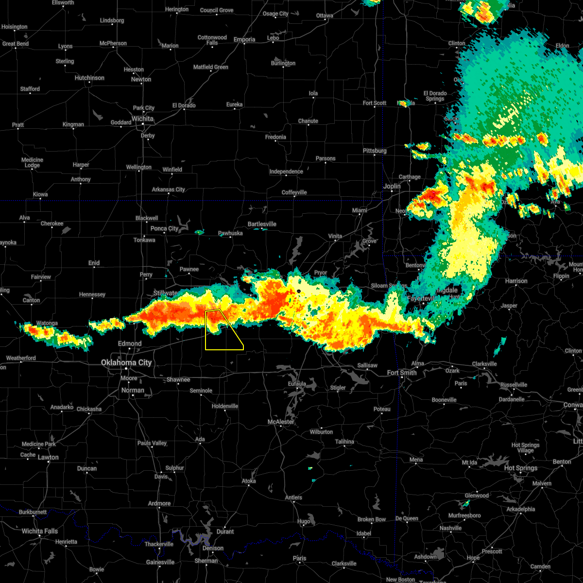 At 805 pm cdt, a severe thunderstorm was located 3 miles southeast of shamrock, moving southeast at 30 mph (radar indicated). Hazards include 70 mph wind gusts and nickel size hail. Expect considerable tree damage. damage is likely to mobile homes, roofs, and outbuildings. Locations in or near the path include, bristow, drumright, depew, slick, shamrock, milfay, this includes interstate 44 between mile markers 178 and 194. At 805 pm cdt, a severe thunderstorm was located 3 miles southeast of shamrock, moving southeast at 30 mph (radar indicated). Hazards include 70 mph wind gusts and nickel size hail. Expect considerable tree damage. damage is likely to mobile homes, roofs, and outbuildings. Locations in or near the path include, bristow, drumright, depew, slick, shamrock, milfay, this includes interstate 44 between mile markers 178 and 194.
|
| 7/10/2021 7:58 PM CDT |
 At 758 pm cdt, severe thunderstorms were located along a line extending from 3 miles northwest of shamrock to 3 miles north of tryon to near coyle to 6 miles north of cashion, moving southeast at 25 mph (radar indicated). Hazards include 60 mph wind gusts and quarter size hail. Hail damage to vehicles is expected. Expect wind damage to roofs, siding, and trees. At 758 pm cdt, severe thunderstorms were located along a line extending from 3 miles northwest of shamrock to 3 miles north of tryon to near coyle to 6 miles north of cashion, moving southeast at 25 mph (radar indicated). Hazards include 60 mph wind gusts and quarter size hail. Hail damage to vehicles is expected. Expect wind damage to roofs, siding, and trees.
|
| 7/10/2021 7:51 PM CDT |
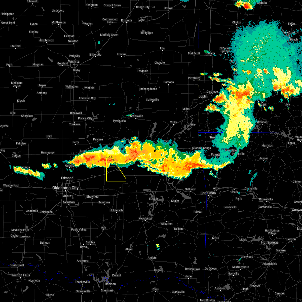 At 751 pm cdt, a severe thunderstorm was located over drumright, moving southeast at 35 mph (radar indicated). Hazards include 70 mph wind gusts and quarter size hail. Hail damage to vehicles is expected. expect considerable tree damage. wind damage is also likely to mobile homes, roofs, and outbuildings. Locations in or near the path include, bristow, drumright, depew, slick, shamrock, milfay, this includes interstate 44 between mile markers 178 and 194. At 751 pm cdt, a severe thunderstorm was located over drumright, moving southeast at 35 mph (radar indicated). Hazards include 70 mph wind gusts and quarter size hail. Hail damage to vehicles is expected. expect considerable tree damage. wind damage is also likely to mobile homes, roofs, and outbuildings. Locations in or near the path include, bristow, drumright, depew, slick, shamrock, milfay, this includes interstate 44 between mile markers 178 and 194.
|
| 7/10/2021 7:44 PM CDT |
 At 743 pm cdt, severe thunderstorms were located along a line extending from 3 miles north of drumright to near ripley to 3 miles south of mulhall, moving southeast at 30 mph (radar indicated). Hazards include 60 mph wind gusts and quarter size hail. Hail damage to vehicles is expected. expect wind damage to roofs, siding, and trees. Locations impacted include, stillwater, cushing, perkins, langston, yale, tryon, ripley, agra, coyle, marshall, mulhall, orlando, lake carl blackwell, quay and ingalls. At 743 pm cdt, severe thunderstorms were located along a line extending from 3 miles north of drumright to near ripley to 3 miles south of mulhall, moving southeast at 30 mph (radar indicated). Hazards include 60 mph wind gusts and quarter size hail. Hail damage to vehicles is expected. expect wind damage to roofs, siding, and trees. Locations impacted include, stillwater, cushing, perkins, langston, yale, tryon, ripley, agra, coyle, marshall, mulhall, orlando, lake carl blackwell, quay and ingalls.
|
| 7/10/2021 7:33 PM CDT |
 At 733 pm cdt, severe thunderstorms were located along a line extending from mannford to near yale, moving southeast at 30 mph (radar indicated). Hazards include 60 mph wind gusts and penny size hail. Expect damage to roofs, siding, and trees. Locations in or near the path include, mannford, drumright, oilton, shamrock, silver city,. At 733 pm cdt, severe thunderstorms were located along a line extending from mannford to near yale, moving southeast at 30 mph (radar indicated). Hazards include 60 mph wind gusts and penny size hail. Expect damage to roofs, siding, and trees. Locations in or near the path include, mannford, drumright, oilton, shamrock, silver city,.
|
| 7/10/2021 7:23 PM CDT |
 At 722 pm cdt, severe thunderstorms were located along a line extending from near quay to near stillwater to 3 miles southeast of marshall, moving southeast at 25 mph (radar indicated). Hazards include 60 mph wind gusts and quarter size hail. Hail damage to vehicles is expected. Expect wind damage to roofs, siding, and trees. At 722 pm cdt, severe thunderstorms were located along a line extending from near quay to near stillwater to 3 miles southeast of marshall, moving southeast at 25 mph (radar indicated). Hazards include 60 mph wind gusts and quarter size hail. Hail damage to vehicles is expected. Expect wind damage to roofs, siding, and trees.
|
| 7/10/2021 7:08 PM CDT |
 At 707 pm cdt, severe thunderstorms were located along a line extending from 3 miles northwest of cleveland to 4 miles west of quay, moving southeast at 40 mph (radar indicated). Hazards include 60 mph wind gusts and quarter size hail. Hail damage to vehicles is expected. expect wind damage to roofs, siding, and trees. Locations in or near the path include, sand springs, cleveland, mannford, drumright, oilton, jennings, westport, osage, hallett, blackburn, terlton, shamrock, maramec, walnut creek state park, silver city,. At 707 pm cdt, severe thunderstorms were located along a line extending from 3 miles northwest of cleveland to 4 miles west of quay, moving southeast at 40 mph (radar indicated). Hazards include 60 mph wind gusts and quarter size hail. Hail damage to vehicles is expected. expect wind damage to roofs, siding, and trees. Locations in or near the path include, sand springs, cleveland, mannford, drumright, oilton, jennings, westport, osage, hallett, blackburn, terlton, shamrock, maramec, walnut creek state park, silver city,.
|
| 6/12/2021 12:41 AM CDT |
 At 1158 pm cdt, a severe thunderstorm was located 4 miles north of stillwater, moving south at 30 mph (radar indicated). Hazards include 60 mph wind gusts and penny size hail. expect damage to roofs, siding, and trees At 1158 pm cdt, a severe thunderstorm was located 4 miles north of stillwater, moving south at 30 mph (radar indicated). Hazards include 60 mph wind gusts and penny size hail. expect damage to roofs, siding, and trees
|
| 6/11/2021 11:58 PM CDT |
 At 1158 pm cdt, a severe thunderstorm was located 4 miles north of stillwater, moving south at 30 mph (radar indicated). Hazards include 60 mph wind gusts and penny size hail. expect damage to roofs, siding, and trees At 1158 pm cdt, a severe thunderstorm was located 4 miles north of stillwater, moving south at 30 mph (radar indicated). Hazards include 60 mph wind gusts and penny size hail. expect damage to roofs, siding, and trees
|
| 5/27/2021 4:50 PM CDT |
 At 448 pm cdt, a severe thunderstorm was located near chandler, moving east at 40 mph. this storm is capable of producing baseball size hail. another severe storm is located near luther may produce quarter size hail this is a very dangerous storm (radar indicated). Hazards include baseball size hail and 60 mph wind gusts. People and animals outdoors will be severely injured. expect shattered windows, extensive damage to roofs, siding, and vehicles. Locations impacted include, northeastern oklahoma city, eastern edmond, guthrie, cushing, chandler, perkins, stroud, langston, luther, davenport, wellston, carney, tryon, ripley, agra, arcadia, warwick, kendrick, meridian and fallis. At 448 pm cdt, a severe thunderstorm was located near chandler, moving east at 40 mph. this storm is capable of producing baseball size hail. another severe storm is located near luther may produce quarter size hail this is a very dangerous storm (radar indicated). Hazards include baseball size hail and 60 mph wind gusts. People and animals outdoors will be severely injured. expect shattered windows, extensive damage to roofs, siding, and vehicles. Locations impacted include, northeastern oklahoma city, eastern edmond, guthrie, cushing, chandler, perkins, stroud, langston, luther, davenport, wellston, carney, tryon, ripley, agra, arcadia, warwick, kendrick, meridian and fallis.
|
| 5/27/2021 4:43 PM CDT |
 At 442 pm cdt, a severe thunderstorm was located 4 miles northwest of chandler, moving east at 40 mph. this thunderstorm is capable of producing two inch hail. another severe thunderstorm was located near luther and may produce golf ball size hail (radar indicated). Hazards include two inch hail and 60 mph wind gusts. People and animals outdoors will be injured. expect hail damage to roofs, siding, windows, and vehicles. expect wind damage to roofs, siding, and trees. Locations impacted include, northeastern oklahoma city, eastern edmond, guthrie, cushing, chandler, perkins, stroud, langston, luther, davenport, wellston, carney, tryon, ripley, agra, arcadia, warwick, kendrick, meridian and fallis. At 442 pm cdt, a severe thunderstorm was located 4 miles northwest of chandler, moving east at 40 mph. this thunderstorm is capable of producing two inch hail. another severe thunderstorm was located near luther and may produce golf ball size hail (radar indicated). Hazards include two inch hail and 60 mph wind gusts. People and animals outdoors will be injured. expect hail damage to roofs, siding, windows, and vehicles. expect wind damage to roofs, siding, and trees. Locations impacted include, northeastern oklahoma city, eastern edmond, guthrie, cushing, chandler, perkins, stroud, langston, luther, davenport, wellston, carney, tryon, ripley, agra, arcadia, warwick, kendrick, meridian and fallis.
|
| 5/27/2021 4:27 PM CDT |
 At 426 pm cdt, a severe thunderstorm was located near fallis, moving east at 30 mph. this storm is capable of producing golf ball size hail. another severe storm was located near arcadia, and may produce half dollar size hail (radar indicated). Hazards include golf ball size hail and 60 mph wind gusts. People and animals outdoors will be injured. expect hail damage to roofs, siding, windows, and vehicles. expect wind damage to roofs, siding, and trees. Locations impacted include, northeastern oklahoma city, edmond, guthrie, cushing, chandler, perkins, stroud, langston, luther, davenport, wellston, carney, tryon, ripley, agra, arcadia, warwick, kendrick, meridian and fallis. At 426 pm cdt, a severe thunderstorm was located near fallis, moving east at 30 mph. this storm is capable of producing golf ball size hail. another severe storm was located near arcadia, and may produce half dollar size hail (radar indicated). Hazards include golf ball size hail and 60 mph wind gusts. People and animals outdoors will be injured. expect hail damage to roofs, siding, windows, and vehicles. expect wind damage to roofs, siding, and trees. Locations impacted include, northeastern oklahoma city, edmond, guthrie, cushing, chandler, perkins, stroud, langston, luther, davenport, wellston, carney, tryon, ripley, agra, arcadia, warwick, kendrick, meridian and fallis.
|
| 5/27/2021 4:10 PM CDT |
 At 410 pm cdt, severe thunderstorms were located 4 miles east of guthrie, near edmond and 4 miles west of fallis, moving east at 50 mph (radar indicated). Hazards include two inch hail and 60 mph wind gusts. People and animals outdoors will be injured. expect hail damage to roofs, siding, windows, and vehicles. Expect wind damage to roofs, siding, and trees. At 410 pm cdt, severe thunderstorms were located 4 miles east of guthrie, near edmond and 4 miles west of fallis, moving east at 50 mph (radar indicated). Hazards include two inch hail and 60 mph wind gusts. People and animals outdoors will be injured. expect hail damage to roofs, siding, windows, and vehicles. Expect wind damage to roofs, siding, and trees.
|
| 5/27/2021 3:30 PM CDT |
 At 329 pm cdt, severe thunderstorms were located along a line extending from 3 miles southeast of cushing to near davenport, moving east at 40 mph (radar indicated). Hazards include ping pong ball size hail and 60 mph wind gusts. People and animals outdoors will be injured. expect hail damage to roofs, siding, windows, and vehicles. Expect wind damage to roofs, siding, and trees. At 329 pm cdt, severe thunderstorms were located along a line extending from 3 miles southeast of cushing to near davenport, moving east at 40 mph (radar indicated). Hazards include ping pong ball size hail and 60 mph wind gusts. People and animals outdoors will be injured. expect hail damage to roofs, siding, windows, and vehicles. Expect wind damage to roofs, siding, and trees.
|
| 5/27/2021 3:26 PM CDT |
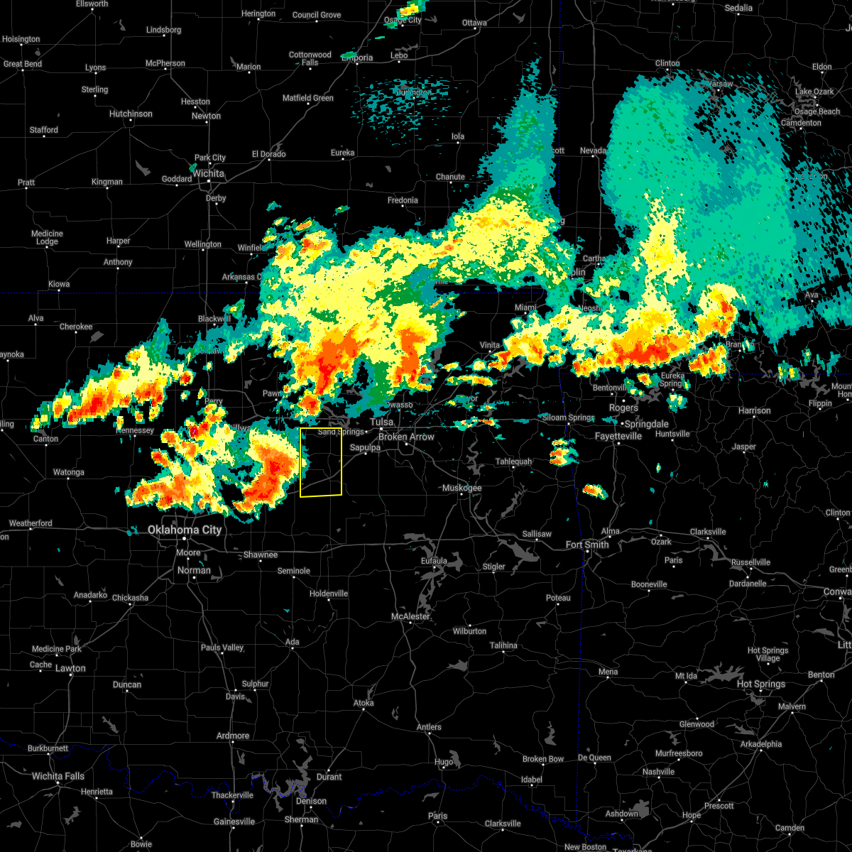 At 326 pm cdt, a severe thunderstorm was located near avery, moving east at 30 mph (radar indicated). Hazards include 60 mph wind gusts and quarter size hail. Hail damage to vehicles is expected. expect wind damage to roofs, siding, and trees. locations in or near the path include, bristow, mannford, drumright, oilton, depew, shamrock, silver city, milfay, this includes interstate 44 between mile markers 178 and 198. A tornado watch remains in effect until 700 pm cdt for northeastern oklahoma. At 326 pm cdt, a severe thunderstorm was located near avery, moving east at 30 mph (radar indicated). Hazards include 60 mph wind gusts and quarter size hail. Hail damage to vehicles is expected. expect wind damage to roofs, siding, and trees. locations in or near the path include, bristow, mannford, drumright, oilton, depew, shamrock, silver city, milfay, this includes interstate 44 between mile markers 178 and 198. A tornado watch remains in effect until 700 pm cdt for northeastern oklahoma.
|
| 5/27/2021 3:18 PM CDT |
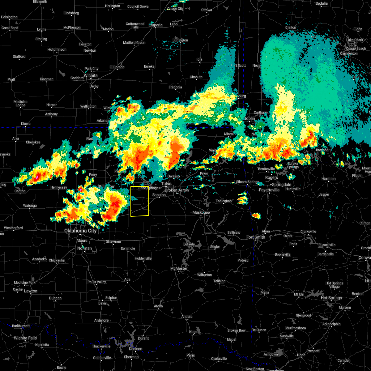 At 317 pm cdt, a severe thunderstorm was located over agra, moving east at 30 mph (radar indicated). Hazards include golf ball size hail and 60 mph wind gusts. People and animals outdoors will be injured. expect hail damage to roofs, siding, windows, and vehicles. expect wind damage to roofs, siding, and trees. locations in or near the path include, bristow, mannford, drumright, oilton, depew, shamrock, silver city, milfay, this includes interstate 44 between mile markers 178 and 198. A tornado watch remains in effect until 700 pm cdt for northeastern oklahoma. At 317 pm cdt, a severe thunderstorm was located over agra, moving east at 30 mph (radar indicated). Hazards include golf ball size hail and 60 mph wind gusts. People and animals outdoors will be injured. expect hail damage to roofs, siding, windows, and vehicles. expect wind damage to roofs, siding, and trees. locations in or near the path include, bristow, mannford, drumright, oilton, depew, shamrock, silver city, milfay, this includes interstate 44 between mile markers 178 and 198. A tornado watch remains in effect until 700 pm cdt for northeastern oklahoma.
|
| 5/27/2021 3:07 PM CDT |
 At 306 pm cdt, severe thunderstorms were located along a line extending from 7 miles southeast of coyle to near fallis, moving east at 50 mph (radar indicated). Hazards include two inch hail and 60 mph wind gusts. People and animals outdoors will be injured. expect hail damage to roofs, siding, windows, and vehicles. expect wind damage to roofs, siding, and trees. Locations impacted include, cushing, chandler, perkins, stroud, langston, yale, carney, tryon, ripley, agra, coyle, kendrick, meridian, fallis, avery, ingalls and parkland. At 306 pm cdt, severe thunderstorms were located along a line extending from 7 miles southeast of coyle to near fallis, moving east at 50 mph (radar indicated). Hazards include two inch hail and 60 mph wind gusts. People and animals outdoors will be injured. expect hail damage to roofs, siding, windows, and vehicles. expect wind damage to roofs, siding, and trees. Locations impacted include, cushing, chandler, perkins, stroud, langston, yale, carney, tryon, ripley, agra, coyle, kendrick, meridian, fallis, avery, ingalls and parkland.
|
| 5/27/2021 2:34 PM CDT |
 At 233 pm cdt, severe thunderstorms were located along a line extending from 3 miles west of langston to 6 miles southwest of meridian, moving east at 35 mph (radar indicated). Hazards include golf ball size hail and 60 mph wind gusts. People and animals outdoors will be injured. expect hail damage to roofs, siding, windows, and vehicles. Expect wind damage to roofs, siding, and trees. At 233 pm cdt, severe thunderstorms were located along a line extending from 3 miles west of langston to 6 miles southwest of meridian, moving east at 35 mph (radar indicated). Hazards include golf ball size hail and 60 mph wind gusts. People and animals outdoors will be injured. expect hail damage to roofs, siding, windows, and vehicles. Expect wind damage to roofs, siding, and trees.
|
| 8/31/2020 5:27 PM CDT |
 At 527 pm cdt, a severe thunderstorm was located 4 miles northeast of ripley, moving northeast at 25 mph (radar indicated). Hazards include ping pong ball size hail and 60 mph wind gusts. People and animals outdoors will be injured. expect hail damage to roofs, siding, windows, and vehicles. expect wind damage to roofs, siding, and trees. Locations impacted include, cushing, yale, ripley, quay and ingalls. At 527 pm cdt, a severe thunderstorm was located 4 miles northeast of ripley, moving northeast at 25 mph (radar indicated). Hazards include ping pong ball size hail and 60 mph wind gusts. People and animals outdoors will be injured. expect hail damage to roofs, siding, windows, and vehicles. expect wind damage to roofs, siding, and trees. Locations impacted include, cushing, yale, ripley, quay and ingalls.
|
| 8/31/2020 5:06 PM CDT |
 At 506 pm cdt, a severe thunderstorm was located 4 miles south of ripley, moving northeast at 25 mph (emergency management). Hazards include golf ball size hail and up to 60 mph wind gusts. People and animals outdoors will be injured. expect hail damage to roofs, siding, windows, and vehicles. Expect wind damage to roofs, siding, and trees. At 506 pm cdt, a severe thunderstorm was located 4 miles south of ripley, moving northeast at 25 mph (emergency management). Hazards include golf ball size hail and up to 60 mph wind gusts. People and animals outdoors will be injured. expect hail damage to roofs, siding, windows, and vehicles. Expect wind damage to roofs, siding, and trees.
|
| 7/11/2020 11:40 PM CDT |
 At 1140 pm cdt, severe thunderstorms were located along a line extending from 2 miles northwest of bristow to 7 miles southeast of stroud to 3 miles south of sparks, moving southeast at 50 mph (radar indicated). Hazards include 60 mph wind gusts. Expect damage to roofs, siding, and trees. locations in or near the path include, okmulgee, bristow, okemah, okfuskee, henryetta, morris, beggs, boley, weleetka, dewar, schulter, depew, paden, bearden, slick, castle, shamrock, clearview, preston, pharoah, this includes the following highways, interstate 40 in oklahoma between mile markers 212 and 238. Interstate 44 between mile markers 178 and 195. At 1140 pm cdt, severe thunderstorms were located along a line extending from 2 miles northwest of bristow to 7 miles southeast of stroud to 3 miles south of sparks, moving southeast at 50 mph (radar indicated). Hazards include 60 mph wind gusts. Expect damage to roofs, siding, and trees. locations in or near the path include, okmulgee, bristow, okemah, okfuskee, henryetta, morris, beggs, boley, weleetka, dewar, schulter, depew, paden, bearden, slick, castle, shamrock, clearview, preston, pharoah, this includes the following highways, interstate 40 in oklahoma between mile markers 212 and 238. Interstate 44 between mile markers 178 and 195.
|
| 7/11/2020 10:54 PM CDT |
 At 1054 pm cdt, severe thunderstorms were located along a line extending from near stillwater to near drumright, moving southeast at 50 mph (radar indicated). Hazards include up to 60 mph wind gusts. Expect damage to roofs, siding, and trees. Locations impacted include, stillwater, cushing, perkins, yale, glencoe, ripley, quay and ingalls. At 1054 pm cdt, severe thunderstorms were located along a line extending from near stillwater to near drumright, moving southeast at 50 mph (radar indicated). Hazards include up to 60 mph wind gusts. Expect damage to roofs, siding, and trees. Locations impacted include, stillwater, cushing, perkins, yale, glencoe, ripley, quay and ingalls.
|
| 7/11/2020 10:45 PM CDT |
 At 1045 pm cdt, severe thunderstorms were located along a line extending from near lake mcmurtry to 5 miles north of ripley, moving southeast at 45 mph (radar indicated). Hazards include 60 mph wind gusts. Expect damage to roofs, siding, and trees. Locations impacted include, stillwater, cushing, perkins, yale, glencoe, ripley, lake carl blackwell, quay and ingalls. At 1045 pm cdt, severe thunderstorms were located along a line extending from near lake mcmurtry to 5 miles north of ripley, moving southeast at 45 mph (radar indicated). Hazards include 60 mph wind gusts. Expect damage to roofs, siding, and trees. Locations impacted include, stillwater, cushing, perkins, yale, glencoe, ripley, lake carl blackwell, quay and ingalls.
|
| 7/11/2020 10:35 PM CDT |
 At 1035 pm cdt, severe thunderstorms were located along a line extending from near lake carl blackwell to near sooner lake, moving southeast at 35 mph (radar indicated). Hazards include 60 mph wind gusts. Expect damage to roofs, siding, and trees. Locations impacted include, stillwater, cushing, perkins, yale, glencoe, ripley, lake carl blackwell, quay and ingalls. At 1035 pm cdt, severe thunderstorms were located along a line extending from near lake carl blackwell to near sooner lake, moving southeast at 35 mph (radar indicated). Hazards include 60 mph wind gusts. Expect damage to roofs, siding, and trees. Locations impacted include, stillwater, cushing, perkins, yale, glencoe, ripley, lake carl blackwell, quay and ingalls.
|
| 7/11/2020 10:10 PM CDT |
 At 1010 pm cdt, severe thunderstorms were located along a line extending from near lucien to 3 miles southeast of glencoe, moving east at 35 mph (radar indicated). Hazards include 70 mph wind gusts and nickel size hail. Expect considerable tree damage. Damage is likely to mobile homes, roofs, and outbuildings. At 1010 pm cdt, severe thunderstorms were located along a line extending from near lucien to 3 miles southeast of glencoe, moving east at 35 mph (radar indicated). Hazards include 70 mph wind gusts and nickel size hail. Expect considerable tree damage. Damage is likely to mobile homes, roofs, and outbuildings.
|
| 5/22/2020 5:46 AM CDT |
 At 545 am cdt, severe thunderstorms were located along a line extending from 7 miles north of blackburn to near oilton to near sparks, moving east at 35 mph (radar indicated. at 535 am...the pawnee mesonet station 3 miles east northeast of pawnee reported a 65 mph wind gust). Hazards include 60 mph wind gusts. Expect damage to roofs, siding, and trees. Locations in or near the path include, sand springs, bristow, sapulpa, hominy, cleveland, mannford, drumright, barnsdall, boley, kellyville, oilton, depew, paden, wynona, jennings, westport, osage, slick, hallett, blackburn, this includes interstate 44 between mile markers 178 and 210. At 545 am cdt, severe thunderstorms were located along a line extending from 7 miles north of blackburn to near oilton to near sparks, moving east at 35 mph (radar indicated. at 535 am...the pawnee mesonet station 3 miles east northeast of pawnee reported a 65 mph wind gust). Hazards include 60 mph wind gusts. Expect damage to roofs, siding, and trees. Locations in or near the path include, sand springs, bristow, sapulpa, hominy, cleveland, mannford, drumright, barnsdall, boley, kellyville, oilton, depew, paden, wynona, jennings, westport, osage, slick, hallett, blackburn, this includes interstate 44 between mile markers 178 and 210.
|
| 5/22/2020 5:39 AM CDT |
 At 538 am cdt, severe thunderstorms were located along a line extending from 3 miles southeast of pawnee to near oklahoma city, moving east at 45 mph (radar indicated). Hazards include 70 mph wind gusts and nickel size hail. Expect considerable tree damage. Damage is likely to mobile homes, roofs, and outbuildings. At 538 am cdt, severe thunderstorms were located along a line extending from 3 miles southeast of pawnee to near oklahoma city, moving east at 45 mph (radar indicated). Hazards include 70 mph wind gusts and nickel size hail. Expect considerable tree damage. Damage is likely to mobile homes, roofs, and outbuildings.
|
| 5/22/2020 5:35 AM CDT |
 At 534 am cdt, severe thunderstorms were located along a line extending from near ralston to 3 miles west of yale to 2 miles south of warwick, moving east at 40 mph (radar indicated). Hazards include 60 mph wind gusts. Expect damage to roofs, siding, and trees. Locations in or near the path include, sand springs, bristow, sapulpa, hominy, cleveland, mannford, drumright, barnsdall, boley, kellyville, oilton, depew, paden, wynona, jennings, westport, osage, slick, hallett, blackburn, this includes interstate 44 between mile markers 178 and 210. At 534 am cdt, severe thunderstorms were located along a line extending from near ralston to 3 miles west of yale to 2 miles south of warwick, moving east at 40 mph (radar indicated). Hazards include 60 mph wind gusts. Expect damage to roofs, siding, and trees. Locations in or near the path include, sand springs, bristow, sapulpa, hominy, cleveland, mannford, drumright, barnsdall, boley, kellyville, oilton, depew, paden, wynona, jennings, westport, osage, slick, hallett, blackburn, this includes interstate 44 between mile markers 178 and 210.
|
| 5/22/2020 5:07 AM CDT |
 At 507 am cdt, severe thunderstorms were located along a line extending from 3 miles northwest of pawnee to near oklahoma city, moving east at 45 mph (radar indicated). Hazards include 70 mph wind gusts and nickel size hail. Expect considerable tree damage. Damage is likely to mobile homes, roofs, and outbuildings. At 507 am cdt, severe thunderstorms were located along a line extending from 3 miles northwest of pawnee to near oklahoma city, moving east at 45 mph (radar indicated). Hazards include 70 mph wind gusts and nickel size hail. Expect considerable tree damage. Damage is likely to mobile homes, roofs, and outbuildings.
|
| 5/8/2020 12:12 AM CDT |
 At 1211 am cdt, severe thunderstorms were located along a line extending from 3 miles southwest of glencoe to 3 miles northeast of cushing, moving east at 55 mph (radar indicated). Hazards include 60 mph wind gusts and quarter size hail. Hail damage to vehicles is expected. expect wind damage to roofs, siding, and trees. Locations impacted include, stillwater, yale, glencoe, quay and ingalls. At 1211 am cdt, severe thunderstorms were located along a line extending from 3 miles southwest of glencoe to 3 miles northeast of cushing, moving east at 55 mph (radar indicated). Hazards include 60 mph wind gusts and quarter size hail. Hail damage to vehicles is expected. expect wind damage to roofs, siding, and trees. Locations impacted include, stillwater, yale, glencoe, quay and ingalls.
|
| 5/7/2020 11:44 PM CDT |
 At 1143 pm cdt, a severe thunderstorm was located 4 miles northeast of orlando, moving east at 55 mph (radar indicated). Hazards include 60 mph wind gusts and quarter size hail. Hail damage to vehicles is expected. Expect wind damage to roofs, siding, and trees. At 1143 pm cdt, a severe thunderstorm was located 4 miles northeast of orlando, moving east at 55 mph (radar indicated). Hazards include 60 mph wind gusts and quarter size hail. Hail damage to vehicles is expected. Expect wind damage to roofs, siding, and trees.
|
| 4/28/2020 5:45 PM CDT |
 At 544 pm cdt, severe thunderstorms were located along a line extending from 7 miles east of drumright to 6 miles southeast of stroud, moving east at 30 mph (radar indicated). Hazards include 60 mph wind gusts and quarter size hail. Hail damage to vehicles is expected. expect wind damage to roofs, siding, and trees. locations in or near the path include, bristow, drumright, kellyville, oilton, depew, slick, shamrock, milfay, this includes interstate 44 between mile markers 178 and 204. A tornado watch remains in effect until 1100 pm cdt for northeastern and east central oklahoma. At 544 pm cdt, severe thunderstorms were located along a line extending from 7 miles east of drumright to 6 miles southeast of stroud, moving east at 30 mph (radar indicated). Hazards include 60 mph wind gusts and quarter size hail. Hail damage to vehicles is expected. expect wind damage to roofs, siding, and trees. locations in or near the path include, bristow, drumright, kellyville, oilton, depew, slick, shamrock, milfay, this includes interstate 44 between mile markers 178 and 204. A tornado watch remains in effect until 1100 pm cdt for northeastern and east central oklahoma.
|
| 4/22/2020 9:43 AM CDT |
 The severe thunderstorm warning for northeastern lincoln and southeastern payne counties will expire at 945 am cdt, the storm which prompted the warning is moving into creek county. therefore, the warning will be allowed to expire for lincoln and payne counties. The severe thunderstorm warning for northeastern lincoln and southeastern payne counties will expire at 945 am cdt, the storm which prompted the warning is moving into creek county. therefore, the warning will be allowed to expire for lincoln and payne counties.
|
| 4/22/2020 9:35 AM CDT |
 At 935 am cdt, a severe thunderstorm was located over drumright, moving northeast at 70 mph (radar indicated). Hazards include quarter size hail. Damage to vehicles is expected. Locations in or near the path include, sand springs, mannford, drumright, oilton, westport, terlton, shamrock, keystone state park, silver city, this includes interstate 44 between mile markers 207 and 208, and near mile marker 212. At 935 am cdt, a severe thunderstorm was located over drumright, moving northeast at 70 mph (radar indicated). Hazards include quarter size hail. Damage to vehicles is expected. Locations in or near the path include, sand springs, mannford, drumright, oilton, westport, terlton, shamrock, keystone state park, silver city, this includes interstate 44 between mile markers 207 and 208, and near mile marker 212.
|
| 4/22/2020 9:21 AM CDT |
 At 920 am cdt, a severe thunderstorm was located near agra, moving northeast at 60 mph (radar indicated). Hazards include 60 mph wind gusts and quarter size hail. Hail damage to vehicles is expected. Expect wind damage to roofs, siding, and trees. At 920 am cdt, a severe thunderstorm was located near agra, moving northeast at 60 mph (radar indicated). Hazards include 60 mph wind gusts and quarter size hail. Hail damage to vehicles is expected. Expect wind damage to roofs, siding, and trees.
|
| 3/28/2020 6:00 AM CDT |
 At 559 am cdt, a severe thunderstorm was located 3 miles east of terlton, moving northeast at 65 mph (radar indicated). Hazards include 60 mph wind gusts and quarter size hail. Hail damage to vehicles is expected. expect wind damage to roofs, siding, and trees. Locations in or near the path include, tulsa, sand springs, hominy, cleveland, mannford, sperry, wynona, westport, osage, hallett, terlton, keystone state park, walnut creek state park, turley, gray, silver city,. At 559 am cdt, a severe thunderstorm was located 3 miles east of terlton, moving northeast at 65 mph (radar indicated). Hazards include 60 mph wind gusts and quarter size hail. Hail damage to vehicles is expected. expect wind damage to roofs, siding, and trees. Locations in or near the path include, tulsa, sand springs, hominy, cleveland, mannford, sperry, wynona, westport, osage, hallett, terlton, keystone state park, walnut creek state park, turley, gray, silver city,.
|
| 3/28/2020 5:52 AM CDT |
 The severe thunderstorm warning for northeastern lincoln and southeastern payne counties will expire at 600 am cdt, the storm which prompted the warning has moved out of the area. therefore, the warning will be allowed to expire. The severe thunderstorm warning for northeastern lincoln and southeastern payne counties will expire at 600 am cdt, the storm which prompted the warning has moved out of the area. therefore, the warning will be allowed to expire.
|
| 3/28/2020 5:46 AM CDT |
 At 545 am cdt, a severe thunderstorm was located near oilton, moving northeast at 70 mph (radar indicated). Hazards include 60 mph wind gusts and quarter size hail. Hail damage to vehicles is expected. expect wind damage to roofs, siding, and trees. Locations impacted include, cushing, yale, kendrick and avery. At 545 am cdt, a severe thunderstorm was located near oilton, moving northeast at 70 mph (radar indicated). Hazards include 60 mph wind gusts and quarter size hail. Hail damage to vehicles is expected. expect wind damage to roofs, siding, and trees. Locations impacted include, cushing, yale, kendrick and avery.
|
| 3/28/2020 5:38 AM CDT |
 At 538 am cdt, a severe thunderstorm was located 3 miles northeast of cushing, moving northeast at 80 mph (radar indicated). Hazards include 60 mph wind gusts and quarter size hail. Hail damage to vehicles is expected. expect wind damage to roofs, siding, and trees. Locations in or near the path include, tulsa, sand springs, hominy, cleveland, mannford, drumright, sperry, oilton, wynona, jennings, westport, osage, hallett, terlton, shamrock, keystone state park, walnut creek state park, turley, gray, silver city,. At 538 am cdt, a severe thunderstorm was located 3 miles northeast of cushing, moving northeast at 80 mph (radar indicated). Hazards include 60 mph wind gusts and quarter size hail. Hail damage to vehicles is expected. expect wind damage to roofs, siding, and trees. Locations in or near the path include, tulsa, sand springs, hominy, cleveland, mannford, drumright, sperry, oilton, wynona, jennings, westport, osage, hallett, terlton, shamrock, keystone state park, walnut creek state park, turley, gray, silver city,.
|
| 3/28/2020 5:30 AM CDT |
 At 530 am cdt, a severe thunderstorm was located near agra, moving northeast at 75 mph (radar indicated). Hazards include 60 mph wind gusts and quarter size hail. Hail damage to vehicles is expected. expect wind damage to roofs, siding, and trees. locations impacted include, cushing, chandler, yale, wellston, carney, tryon, agra, warwick, kendrick, fallis, avery and parkland. This includes interstate 44 between mile markers 156 and 170. At 530 am cdt, a severe thunderstorm was located near agra, moving northeast at 75 mph (radar indicated). Hazards include 60 mph wind gusts and quarter size hail. Hail damage to vehicles is expected. expect wind damage to roofs, siding, and trees. locations impacted include, cushing, chandler, yale, wellston, carney, tryon, agra, warwick, kendrick, fallis, avery and parkland. This includes interstate 44 between mile markers 156 and 170.
|
| 3/28/2020 5:15 AM CDT |
 At 514 am cdt, a severe thunderstorm was located near wellston, moving northeast at 75 mph (radar indicated). Hazards include 60 mph wind gusts and penny size hail. expect damage to roofs, siding, and trees At 514 am cdt, a severe thunderstorm was located near wellston, moving northeast at 75 mph (radar indicated). Hazards include 60 mph wind gusts and penny size hail. expect damage to roofs, siding, and trees
|
| 3/27/2020 2:01 PM CDT |
 At 200 pm cdt, a severe thunderstorm was located near ripley, moving northeast at 60 mph (radar indicated). Hazards include quarter to half dollar size hail and 45 mph winds. Damage to vehicles is expected. Locations impacted include, cushing, yale, ripley, quay and ingalls. At 200 pm cdt, a severe thunderstorm was located near ripley, moving northeast at 60 mph (radar indicated). Hazards include quarter to half dollar size hail and 45 mph winds. Damage to vehicles is expected. Locations impacted include, cushing, yale, ripley, quay and ingalls.
|
| 3/27/2020 1:45 PM CDT |
 At 145 pm cdt, a severe thunderstorm was located 6 miles northwest of carney, moving northeast at 60 mph (radar indicated). Hazards include quarter size hail. damage to vehicles is expected At 145 pm cdt, a severe thunderstorm was located 6 miles northwest of carney, moving northeast at 60 mph (radar indicated). Hazards include quarter size hail. damage to vehicles is expected
|
| 1/10/2020 10:52 AM CST |
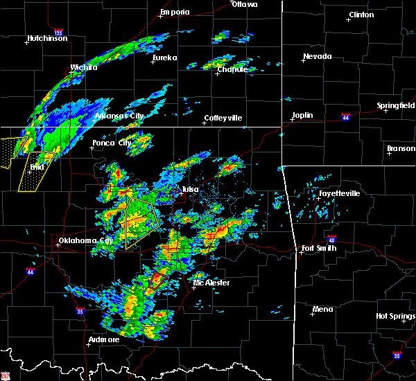 At 1051 am cst, severe thunderstorms were located along a line extending from 3 miles northeast of stroud to 5 miles southwest of depew to 6 miles north of paden, moving northeast at 40 mph (radar indicated). Hazards include 60 mph wind gusts. Expect damage to roofs, siding, and trees. locations in or near the path include, bristow, depew, shamrock, milfay, this includes interstate 44 between mile markers 178 and 199. A tornado watch remains in effect until 600 pm cst for northeastern and east central oklahoma. At 1051 am cst, severe thunderstorms were located along a line extending from 3 miles northeast of stroud to 5 miles southwest of depew to 6 miles north of paden, moving northeast at 40 mph (radar indicated). Hazards include 60 mph wind gusts. Expect damage to roofs, siding, and trees. locations in or near the path include, bristow, depew, shamrock, milfay, this includes interstate 44 between mile markers 178 and 199. A tornado watch remains in effect until 600 pm cst for northeastern and east central oklahoma.
|
| 1/10/2020 10:42 AM CST |
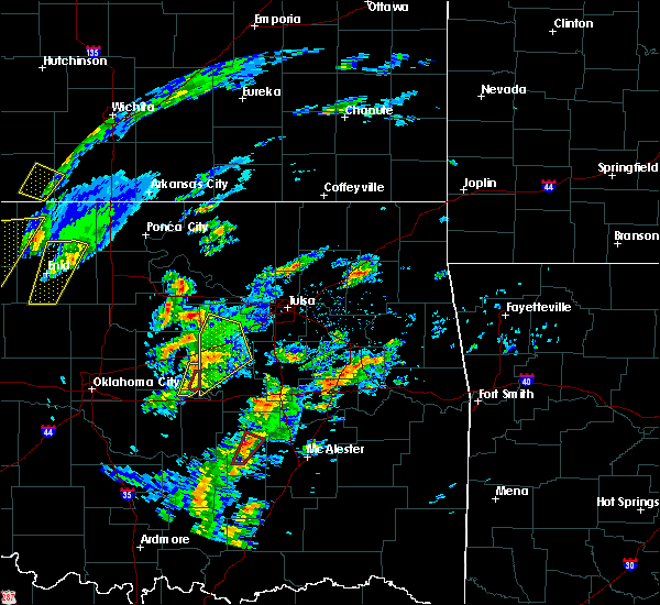 At 1041 am cst, severe thunderstorms were located along a line extending from 3 miles south of stroud to 10 miles east of davenport to 3 miles east of prague, moving northeast at 45 mph (radar indicated). Hazards include 60 mph wind gusts and penny size hail. Expect damage to roofs, siding, and trees. locations in or near the path include, bristow, depew, paden, slick, shamrock, welty, milfay, this includes interstate 44 between mile markers 178 and 200. A tornado watch remains in effect until 600 pm cst for northeastern and east central oklahoma. At 1041 am cst, severe thunderstorms were located along a line extending from 3 miles south of stroud to 10 miles east of davenport to 3 miles east of prague, moving northeast at 45 mph (radar indicated). Hazards include 60 mph wind gusts and penny size hail. Expect damage to roofs, siding, and trees. locations in or near the path include, bristow, depew, paden, slick, shamrock, welty, milfay, this includes interstate 44 between mile markers 178 and 200. A tornado watch remains in effect until 600 pm cst for northeastern and east central oklahoma.
|
| 10/20/2019 10:08 PM CDT | Tennis Ball sized hail reported 0.1 miles E of Drumright, OK, hail size estimated from picture on social media. time is estimated from radar. |
| 10/20/2019 9:20 PM CDT |
 At 920 pm cdt, a severe thunderstorm was located 6 miles east of oilton, moving northeast at 60 mph (radar indicated). Hazards include 60 mph wind gusts and quarter size hail. Hail damage to vehicles is expected. expect wind damage to roofs, siding, and trees. Locations in or near the path include, sand springs, mannford, oilton, westport, terlton, keystone state park, walnut creek state park, silver city, a tornado watch remains in effect until 300 am cdt for northeastern oklahoma. At 920 pm cdt, a severe thunderstorm was located 6 miles east of oilton, moving northeast at 60 mph (radar indicated). Hazards include 60 mph wind gusts and quarter size hail. Hail damage to vehicles is expected. expect wind damage to roofs, siding, and trees. Locations in or near the path include, sand springs, mannford, oilton, westport, terlton, keystone state park, walnut creek state park, silver city, a tornado watch remains in effect until 300 am cdt for northeastern oklahoma.
|
| 10/20/2019 9:10 PM CDT | Golf Ball sized hail reported 1 miles W of Drumright, OK, golf ball sized hail reported via multiple pictures on social media. time is estimated from radar. |
| 10/20/2019 9:10 PM CDT |
 At 910 pm cdt, a severe thunderstorm was located over drumright, moving northeast at 60 mph (radar indicated). Hazards include 60 mph wind gusts and quarter size hail. Hail damage to vehicles is expected. expect wind damage to roofs, siding, and trees. Locations in or near the path include, sand springs, mannford, drumright, oilton, westport, terlton, shamrock, keystone state park, walnut creek state park, silver city, a tornado watch remains in effect until 300 am cdt for northeastern oklahoma. At 910 pm cdt, a severe thunderstorm was located over drumright, moving northeast at 60 mph (radar indicated). Hazards include 60 mph wind gusts and quarter size hail. Hail damage to vehicles is expected. expect wind damage to roofs, siding, and trees. Locations in or near the path include, sand springs, mannford, drumright, oilton, westport, terlton, shamrock, keystone state park, walnut creek state park, silver city, a tornado watch remains in effect until 300 am cdt for northeastern oklahoma.
|
| 9/26/2019 12:49 AM CDT |
 At 1249 am cdt, severe thunderstorms were located along a line extending from 4 miles southwest of ramona to 2 miles northwest of keystone state park to 4 miles south of stillwater, moving southeast at 40 mph (radar indicated). Hazards include 60 mph wind gusts and penny size hail. Expect damage to roofs, siding, and trees. Locations in or near the path include, tulsa, sand springs, owasso, sapulpa, jenks, skiatook, collinsville, mannford, drumright, sperry, oilton, ramona, avant, westport, vera, terlton, shamrock, keystone state park, walnut creek state park, turley, this includes interstate 44 between mile markers 202 and 223. At 1249 am cdt, severe thunderstorms were located along a line extending from 4 miles southwest of ramona to 2 miles northwest of keystone state park to 4 miles south of stillwater, moving southeast at 40 mph (radar indicated). Hazards include 60 mph wind gusts and penny size hail. Expect damage to roofs, siding, and trees. Locations in or near the path include, tulsa, sand springs, owasso, sapulpa, jenks, skiatook, collinsville, mannford, drumright, sperry, oilton, ramona, avant, westport, vera, terlton, shamrock, keystone state park, walnut creek state park, turley, this includes interstate 44 between mile markers 202 and 223.
|
| 9/26/2019 12:21 AM CDT |
 At 1220 am cdt, severe thunderstorms were located along a line extending from 4 miles southwest of okesa to 4 miles east of blackburn to 3 miles south of perry, moving southeast at 40 mph (radar indicated). Hazards include 60 mph wind gusts and penny size hail. Expect damage to roofs, siding, and trees. Locations in or near the path include, tulsa, sand springs, pawnee, owasso, sapulpa, jenks, glenpool, skiatook, catoosa, collinsville, hominy, cleveland, mannford, drumright, kiefer, barnsdall, sperry, kellyville, oologah, oilton, this includes interstate 44 between mile markers 199 and 229. At 1220 am cdt, severe thunderstorms were located along a line extending from 4 miles southwest of okesa to 4 miles east of blackburn to 3 miles south of perry, moving southeast at 40 mph (radar indicated). Hazards include 60 mph wind gusts and penny size hail. Expect damage to roofs, siding, and trees. Locations in or near the path include, tulsa, sand springs, pawnee, owasso, sapulpa, jenks, glenpool, skiatook, catoosa, collinsville, hominy, cleveland, mannford, drumright, kiefer, barnsdall, sperry, kellyville, oologah, oilton, this includes interstate 44 between mile markers 199 and 229.
|
| 9/12/2019 6:29 PM CDT |
 At 628 pm cdt, severe thunderstorms were located along a line extending from 2 miles north of cleveland to 4 miles northeast of terlton to 5 miles east of oilton to 3 miles northwest of drumright, moving southeast at 45 mph (radar indicated). Hazards include 60 mph wind gusts. Expect damage to roofs, siding, and trees. Locations in or near the path include, tulsa, sand springs, bixby, sapulpa, jenks, glenpool, skiatook, hominy, cleveland, mannford, drumright, kiefer, sperry, mounds, kellyville, oilton, jennings, westport, osage, terlton, this includes interstate 44 between mile markers 193 and 224. At 628 pm cdt, severe thunderstorms were located along a line extending from 2 miles north of cleveland to 4 miles northeast of terlton to 5 miles east of oilton to 3 miles northwest of drumright, moving southeast at 45 mph (radar indicated). Hazards include 60 mph wind gusts. Expect damage to roofs, siding, and trees. Locations in or near the path include, tulsa, sand springs, bixby, sapulpa, jenks, glenpool, skiatook, hominy, cleveland, mannford, drumright, kiefer, sperry, mounds, kellyville, oilton, jennings, westport, osage, terlton, this includes interstate 44 between mile markers 193 and 224.
|
| 8/30/2019 3:54 AM CDT |
 The severe thunderstorm warning for rogers, southern osage, northern creek, mayes, southern washington, southwestern nowata, northern wagoner, pawnee and tulsa counties will expire at 400 am cdt, the storms which prompted the warning have weakened below severe limits, and no longer pose an immediate threat to life or property. therefore the warning will be allowed to expire. however gusty winds 50 to 55 mph and heavy rain are still possible with these thunderstorms. The severe thunderstorm warning for rogers, southern osage, northern creek, mayes, southern washington, southwestern nowata, northern wagoner, pawnee and tulsa counties will expire at 400 am cdt, the storms which prompted the warning have weakened below severe limits, and no longer pose an immediate threat to life or property. therefore the warning will be allowed to expire. however gusty winds 50 to 55 mph and heavy rain are still possible with these thunderstorms.
|
| 8/30/2019 3:33 AM CDT |
 At 333 am cdt, severe thunderstorms were located along a line extending from near chelsea to 2 miles northeast of owasso to 3 miles north of maramec, moving southeast at 45 mph (radar indicated). Hazards include 60 mph wind gusts and nickel size hail. Expect damage to roofs, siding, and trees. Locations in or near the path include, tulsa, broken arrow, sand springs, claremore, pawnee, pryor, owasso, bixby, jenks, coweta, pryor creek, skiatook, catoosa, collinsville, verdigris, hominy, cleveland, mannford, chouteau, chelsea, this includes interstate 44 between mile markers 212 and 272. At 333 am cdt, severe thunderstorms were located along a line extending from near chelsea to 2 miles northeast of owasso to 3 miles north of maramec, moving southeast at 45 mph (radar indicated). Hazards include 60 mph wind gusts and nickel size hail. Expect damage to roofs, siding, and trees. Locations in or near the path include, tulsa, broken arrow, sand springs, claremore, pawnee, pryor, owasso, bixby, jenks, coweta, pryor creek, skiatook, catoosa, collinsville, verdigris, hominy, cleveland, mannford, chouteau, chelsea, this includes interstate 44 between mile markers 212 and 272.
|
| 8/30/2019 3:15 AM CDT |
 At 314 am cdt, severe thunderstorms were located along a line extending from 4 miles north of new alluwe to near vera to 2 miles north of skedee, moving southeast at 55 mph (radar indicated. at 305 am, the oklahoma mesonet station 2 miles south of wynona reported a 62 mph wind gust). Hazards include 60 mph wind gusts and nickel size hail. Expect damage to roofs, siding, and trees. Locations in or near the path include, tulsa, broken arrow, sand springs, claremore, pawhuska, pawnee, pryor, owasso, bixby, jenks, coweta, pryor creek, skiatook, catoosa, collinsville, verdigris, hominy, cleveland, mannford, chouteau, this includes interstate 44 between mile markers 212 and 272. At 314 am cdt, severe thunderstorms were located along a line extending from 4 miles north of new alluwe to near vera to 2 miles north of skedee, moving southeast at 55 mph (radar indicated. at 305 am, the oklahoma mesonet station 2 miles south of wynona reported a 62 mph wind gust). Hazards include 60 mph wind gusts and nickel size hail. Expect damage to roofs, siding, and trees. Locations in or near the path include, tulsa, broken arrow, sand springs, claremore, pawhuska, pawnee, pryor, owasso, bixby, jenks, coweta, pryor creek, skiatook, catoosa, collinsville, verdigris, hominy, cleveland, mannford, chouteau, this includes interstate 44 between mile markers 212 and 272.
|
| 6/23/2019 7:25 AM CDT |
 At 725 am cdt, severe thunderstorms were located along a line extending from 4 miles south of pawnee to near ripley to near carney, moving east at 30 mph (radar indicated). Hazards include 60 mph wind gusts. Expect damage to roofs, siding, and trees. Locations impacted include, cushing, perkins, yale, carney, glencoe, tryon, ripley, agra, quay, avery, ingalls and parkland. At 725 am cdt, severe thunderstorms were located along a line extending from 4 miles south of pawnee to near ripley to near carney, moving east at 30 mph (radar indicated). Hazards include 60 mph wind gusts. Expect damage to roofs, siding, and trees. Locations impacted include, cushing, perkins, yale, carney, glencoe, tryon, ripley, agra, quay, avery, ingalls and parkland.
|
| 6/23/2019 7:06 AM CDT |
 At 706 am cdt, severe thunderstorms were located along a line extending from near morrison to near stillwater to 6 miles northeast of meridian, moving east at 35 mph (radar indicated). Hazards include 60 mph wind gusts. Expect damage to roofs, siding, and trees. Locations impacted include, stillwater, cushing, perkins, yale, morrison, carney, glencoe, tryon, ripley, agra, meridian, quay, avery, ingalls and parkland. At 706 am cdt, severe thunderstorms were located along a line extending from near morrison to near stillwater to 6 miles northeast of meridian, moving east at 35 mph (radar indicated). Hazards include 60 mph wind gusts. Expect damage to roofs, siding, and trees. Locations impacted include, stillwater, cushing, perkins, yale, morrison, carney, glencoe, tryon, ripley, agra, meridian, quay, avery, ingalls and parkland.
|
| 6/23/2019 6:56 AM CDT |
 At 655 am cdt, severe thunderstorms were located along a line extending from near lake mcmurtry to near meridian, moving east at 40 mph (radar indicated). Hazards include 60 mph wind gusts and penny size hail. expect damage to roofs, siding, and trees At 655 am cdt, severe thunderstorms were located along a line extending from near lake mcmurtry to near meridian, moving east at 40 mph (radar indicated). Hazards include 60 mph wind gusts and penny size hail. expect damage to roofs, siding, and trees
|
| 6/16/2019 12:53 AM CDT |
 At 1253 am cdt, severe thunderstorms were located along a line extending from 3 miles northeast of maramec to 4 miles west of beggs to 4 miles southwest of horntown, moving east at 45 mph (radar indicated). Hazards include 60 mph wind gusts. Expect damage to roofs, siding, and trees. locations in or near the path include, tulsa, broken arrow, sand springs, okmulgee, okemah, eufaula, pawnee, owasso, bixby, sapulpa, jenks, okfuskee, glenpool, coweta, skiatook, catoosa, henryetta, hominy, cleveland, mannford, this includes the following highways, interstate 40 in oklahoma between mile markers 219 and 261. Interstate 44 between mile markers 192 and 232. At 1253 am cdt, severe thunderstorms were located along a line extending from 3 miles northeast of maramec to 4 miles west of beggs to 4 miles southwest of horntown, moving east at 45 mph (radar indicated). Hazards include 60 mph wind gusts. Expect damage to roofs, siding, and trees. locations in or near the path include, tulsa, broken arrow, sand springs, okmulgee, okemah, eufaula, pawnee, owasso, bixby, sapulpa, jenks, okfuskee, glenpool, coweta, skiatook, catoosa, henryetta, hominy, cleveland, mannford, this includes the following highways, interstate 40 in oklahoma between mile markers 219 and 261. Interstate 44 between mile markers 192 and 232.
|
| 6/16/2019 12:37 AM CDT |
 At 1236 am cdt, severe thunderstorms were located along a line extending from near maramec to 3 miles northeast of welty to 3 miles northwest of yeager, moving east at 50 mph (radar indicated). Hazards include 60 mph wind gusts. Expect damage to roofs, siding, and trees. locations in or near the path include, bristow, okemah, pawnee, okfuskee, cleveland, mannford, drumright, boley, oilton, weleetka, depew, paden, jennings, bearden, slick, hallett, blackburn, terlton, castle, shamrock, this includes the following highways, interstate 40 in oklahoma between mile markers 212 and 234. Interstate 44 between mile markers 178 and 202. At 1236 am cdt, severe thunderstorms were located along a line extending from near maramec to 3 miles northeast of welty to 3 miles northwest of yeager, moving east at 50 mph (radar indicated). Hazards include 60 mph wind gusts. Expect damage to roofs, siding, and trees. locations in or near the path include, bristow, okemah, pawnee, okfuskee, cleveland, mannford, drumright, boley, oilton, weleetka, depew, paden, jennings, bearden, slick, hallett, blackburn, terlton, castle, shamrock, this includes the following highways, interstate 40 in oklahoma between mile markers 212 and 234. Interstate 44 between mile markers 178 and 202.
|
| 6/16/2019 12:13 AM CDT |
 At 1212 am cdt, severe thunderstorms were located along a line extending from 3 miles southeast of lake carl blackwell to 5 miles east of sparks to near bowlegs, moving east at 50 mph (radar indicated). Hazards include 70 mph wind gusts and quarter size hail. Hail damage to vehicles is expected. expect considerable tree damage. wind damage is also likely to mobile homes, roofs, and outbuildings. locations in or near the path include, bristow, okemah, pawnee, okfuskee, cleveland, mannford, drumright, boley, oilton, weleetka, depew, paden, jennings, bearden, slick, hallett, blackburn, terlton, castle, shamrock, this includes the following highways, interstate 40 in oklahoma between mile markers 212 and 234. Interstate 44 between mile markers 178 and 202. At 1212 am cdt, severe thunderstorms were located along a line extending from 3 miles southeast of lake carl blackwell to 5 miles east of sparks to near bowlegs, moving east at 50 mph (radar indicated). Hazards include 70 mph wind gusts and quarter size hail. Hail damage to vehicles is expected. expect considerable tree damage. wind damage is also likely to mobile homes, roofs, and outbuildings. locations in or near the path include, bristow, okemah, pawnee, okfuskee, cleveland, mannford, drumright, boley, oilton, weleetka, depew, paden, jennings, bearden, slick, hallett, blackburn, terlton, castle, shamrock, this includes the following highways, interstate 40 in oklahoma between mile markers 212 and 234. Interstate 44 between mile markers 178 and 202.
|
| 6/16/2019 12:05 AM CDT |
 At 1204 am cdt, severe thunderstorms were located along a line extending from 5 miles southwest of lake carl blackwell to 3 miles south of meeker to 5 miles southeast of brooksville, moving east at 40 mph (radar indicated). Hazards include 70 mph wind gusts and quarter size hail. brief gustnadoes may occur on the leading edge of the line, which could enhance the potential for wind damage. Hail damage to vehicles is expected. expect considerable tree damage. Wind damage is also likely to mobile homes, roofs, and outbuildings. At 1204 am cdt, severe thunderstorms were located along a line extending from 5 miles southwest of lake carl blackwell to 3 miles south of meeker to 5 miles southeast of brooksville, moving east at 40 mph (radar indicated). Hazards include 70 mph wind gusts and quarter size hail. brief gustnadoes may occur on the leading edge of the line, which could enhance the potential for wind damage. Hail damage to vehicles is expected. expect considerable tree damage. Wind damage is also likely to mobile homes, roofs, and outbuildings.
|
| 5/25/2019 11:58 PM CDT |
 At 1158 pm cdt, severe thunderstorms were located along a line extending from 3 miles southwest of jennings to near oilton to near drumright, moving east at 20 mph (radar indicated). Hazards include 60 mph wind gusts. Expect damage to roofs, siding, and trees. Locations in or near the path include, mannford, drumright, oilton, jennings, terlton, silver city,. At 1158 pm cdt, severe thunderstorms were located along a line extending from 3 miles southwest of jennings to near oilton to near drumright, moving east at 20 mph (radar indicated). Hazards include 60 mph wind gusts. Expect damage to roofs, siding, and trees. Locations in or near the path include, mannford, drumright, oilton, jennings, terlton, silver city,.
|
| 5/25/2019 11:57 PM CDT |
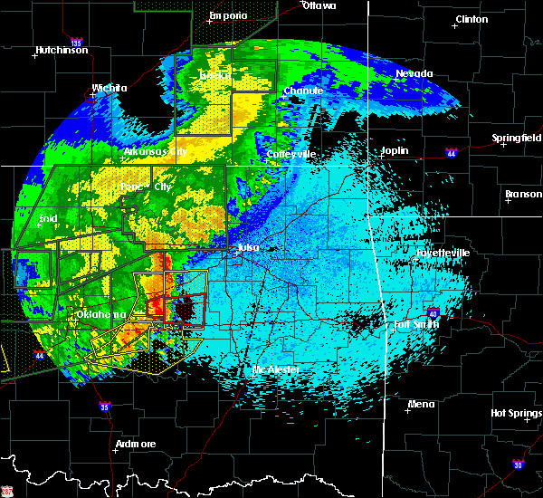 At 1157 pm cdt, severe thunderstorms were located along a line extending from 3 miles southwest of jennings to near oilton to near drumright, moving east at 20 mph (radar indicated). Hazards include 60 mph wind gusts. Expect damage to roofs, siding, and trees. Locations in or near the path include, mannford, drumright, oilton, jennings, terlton, silver city,. At 1157 pm cdt, severe thunderstorms were located along a line extending from 3 miles southwest of jennings to near oilton to near drumright, moving east at 20 mph (radar indicated). Hazards include 60 mph wind gusts. Expect damage to roofs, siding, and trees. Locations in or near the path include, mannford, drumright, oilton, jennings, terlton, silver city,.
|
| 5/21/2019 5:17 AM CDT |
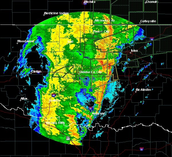 At 517 am cdt, severe thunderstorms were located along a line extending from 4 miles southeast of stroud to 6 miles west of welty to 4 miles east of francis, moving east at 40 mph (radar indicated). Hazards include 60 mph wind gusts and quarter size hail. Hail damage to vehicles is expected. expect wind damage to roofs, siding, and trees. locations in or near the path include, bristow, drumright, boley, oilton, depew, paden, bearden, castle, shamrock, welty, silver city, milfay, mason, this includes the following highways, interstate 40 in oklahoma between mile markers 212 and 219. interstate 44 between mile markers 178 and 191. A tornado watch remains in effect until noon cdt for northeastern and east central oklahoma. At 517 am cdt, severe thunderstorms were located along a line extending from 4 miles southeast of stroud to 6 miles west of welty to 4 miles east of francis, moving east at 40 mph (radar indicated). Hazards include 60 mph wind gusts and quarter size hail. Hail damage to vehicles is expected. expect wind damage to roofs, siding, and trees. locations in or near the path include, bristow, drumright, boley, oilton, depew, paden, bearden, castle, shamrock, welty, silver city, milfay, mason, this includes the following highways, interstate 40 in oklahoma between mile markers 212 and 219. interstate 44 between mile markers 178 and 191. A tornado watch remains in effect until noon cdt for northeastern and east central oklahoma.
|
| 5/21/2019 4:59 AM CDT |
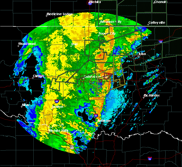 At 458 am cdt, severe thunderstorms were located along a line extending from 3 miles southwest of kendrick to 4 miles southeast of davenport to 2 miles southeast of konawa, moving northeast at 40 mph (radar indicated). Hazards include 60 mph wind gusts and quarter size hail. Hail damage to vehicles is expected. expect wind damage to roofs, siding, and trees. locations in or near the path include, bristow, drumright, boley, oilton, depew, paden, bearden, castle, shamrock, welty, silver city, milfay, mason, this includes the following highways, interstate 40 in oklahoma between mile markers 212 and 219. Interstate 44 between mile markers 178 and 191. At 458 am cdt, severe thunderstorms were located along a line extending from 3 miles southwest of kendrick to 4 miles southeast of davenport to 2 miles southeast of konawa, moving northeast at 40 mph (radar indicated). Hazards include 60 mph wind gusts and quarter size hail. Hail damage to vehicles is expected. expect wind damage to roofs, siding, and trees. locations in or near the path include, bristow, drumright, boley, oilton, depew, paden, bearden, castle, shamrock, welty, silver city, milfay, mason, this includes the following highways, interstate 40 in oklahoma between mile markers 212 and 219. Interstate 44 between mile markers 178 and 191.
|
| 5/20/2019 9:18 PM CDT |
 At 918 pm cdt, a severe thunderstorm was located near avery, moving northeast at 35 mph (radar indicated). Hazards include quarter size hail. Damage to vehicles is expected. Locations impacted include, cushing, stroud, kendrick and avery. At 918 pm cdt, a severe thunderstorm was located near avery, moving northeast at 35 mph (radar indicated). Hazards include quarter size hail. Damage to vehicles is expected. Locations impacted include, cushing, stroud, kendrick and avery.
|
| 5/20/2019 8:54 PM CDT |
 At 854 pm cdt, a severe thunderstorm was located near carney, moving northeast at 35 mph (radar indicated). Hazards include quarter size hail. damage to vehicles is expected At 854 pm cdt, a severe thunderstorm was located near carney, moving northeast at 35 mph (radar indicated). Hazards include quarter size hail. damage to vehicles is expected
|
| 5/20/2019 8:48 PM CDT |
 At 848 pm cdt, a severe thunderstorm was located near ripley, moving east at 30 mph (radar indicated). Hazards include quarter size hail. damage to vehicles is expected At 848 pm cdt, a severe thunderstorm was located near ripley, moving east at 30 mph (radar indicated). Hazards include quarter size hail. damage to vehicles is expected
|
| 5/20/2019 8:46 PM CDT |
 At 846 pm cdt, severe thunderstorms were located along a line extending from near drumright to 2 miles east of collinsville, moving east at 25 mph (radar indicated). Hazards include 60 mph wind gusts and penny size hail. Expect damage to roofs, siding, and trees. locations in or near the path include, tulsa, broken arrow, sand springs, claremore, pryor, owasso, sapulpa, jenks, glenpool, pryor creek, skiatook, catoosa, collinsville, verdigris, cleveland, mannford, drumright, kiefer, sperry, kellyville, this includes interstate 44 between mile markers 199 and 262. a tornado watch remains in effect until 1000 pm cdt for northeastern oklahoma. A tornado watch also remains in effect until 100 am cdt for northeastern oklahoma. At 846 pm cdt, severe thunderstorms were located along a line extending from near drumright to 2 miles east of collinsville, moving east at 25 mph (radar indicated). Hazards include 60 mph wind gusts and penny size hail. Expect damage to roofs, siding, and trees. locations in or near the path include, tulsa, broken arrow, sand springs, claremore, pryor, owasso, sapulpa, jenks, glenpool, pryor creek, skiatook, catoosa, collinsville, verdigris, cleveland, mannford, drumright, kiefer, sperry, kellyville, this includes interstate 44 between mile markers 199 and 262. a tornado watch remains in effect until 1000 pm cdt for northeastern oklahoma. A tornado watch also remains in effect until 100 am cdt for northeastern oklahoma.
|
| 5/20/2019 8:03 PM CDT |
 The national weather service in tulsa has issued a * tornado warning for. northwestern creek county in northeastern oklahoma. southeastern pawnee county in northeastern oklahoma. until 845 pm cdt. At 803 pm cdt, a severe thunderstorm capable of producing a tornado. The national weather service in tulsa has issued a * tornado warning for. northwestern creek county in northeastern oklahoma. southeastern pawnee county in northeastern oklahoma. until 845 pm cdt. At 803 pm cdt, a severe thunderstorm capable of producing a tornado.
|
| 5/20/2019 7:54 PM CDT |
 The national weather service in norman has issued a * severe thunderstorm warning for. southeastern payne county in central oklahoma. until 815 pm cdt. At 754 pm cdt, a severe thunderstorm was located near yale, moving northeast at 30 mph. The national weather service in norman has issued a * severe thunderstorm warning for. southeastern payne county in central oklahoma. until 815 pm cdt. At 754 pm cdt, a severe thunderstorm was located near yale, moving northeast at 30 mph.
|
| 5/18/2019 10:22 AM CDT |
 At 1021 am cdt, severe thunderstorms were located along a line extending from 6 miles north of bristow to near boley, moving northeast at 65 mph (radar indicated). Hazards include 60 mph wind gusts. Expect damage to roofs, siding, and trees. locations in or near the path include, bristow, okemah, sapulpa, okfuskee, drumright, kiefer, beggs, boley, mounds, kellyville, depew, paden, slick, castle, shamrock, clearview, okmulgee state park, welty, pharoah, bryant, this includes the following highways, interstate 40 in oklahoma between mile markers 212 and 233. interstate 44 between mile markers 178 and 215. A tornado watch remains in effect until 500 pm cdt for northeastern and east central oklahoma. At 1021 am cdt, severe thunderstorms were located along a line extending from 6 miles north of bristow to near boley, moving northeast at 65 mph (radar indicated). Hazards include 60 mph wind gusts. Expect damage to roofs, siding, and trees. locations in or near the path include, bristow, okemah, sapulpa, okfuskee, drumright, kiefer, beggs, boley, mounds, kellyville, depew, paden, slick, castle, shamrock, clearview, okmulgee state park, welty, pharoah, bryant, this includes the following highways, interstate 40 in oklahoma between mile markers 212 and 233. interstate 44 between mile markers 178 and 215. A tornado watch remains in effect until 500 pm cdt for northeastern and east central oklahoma.
|
| 5/6/2019 1:25 AM CDT |
 The severe thunderstorm warning for northwestern creek and southeastern pawnee counties will expire at 130 am cdt, the storms which prompted the warning have weakened below severe limits, and no longer pose an immediate threat to life or property. therefore the warning will be allowed to expire. however small hail and gusty winds are still possible with these thunderstorms. a severe thunderstorm watch remains in effect until 400 am cdt for northeastern oklahoma. to report severe weather, contact your nearest law enforcement agency. they will relay your report to the national weather service tulsa. The severe thunderstorm warning for northwestern creek and southeastern pawnee counties will expire at 130 am cdt, the storms which prompted the warning have weakened below severe limits, and no longer pose an immediate threat to life or property. therefore the warning will be allowed to expire. however small hail and gusty winds are still possible with these thunderstorms. a severe thunderstorm watch remains in effect until 400 am cdt for northeastern oklahoma. to report severe weather, contact your nearest law enforcement agency. they will relay your report to the national weather service tulsa.
|
| 5/6/2019 1:07 AM CDT |
 At 107 am cdt, severe thunderstorms were located along a line extending from 3 miles north of terlton to 2 miles east of drumright to avery, moving east at 40 mph (radar indicated). Hazards include 60 mph wind gusts and quarter size hail. Hail damage to vehicles is expected. expect wind damage to roofs, siding, and trees. Locations in or near the path include, bristow, cleveland, mannford, drumright, oilton, depew, jennings, westport, hallett, terlton, shamrock, silver city, this includes interstate 44 between mile markers 178 and 203. At 107 am cdt, severe thunderstorms were located along a line extending from 3 miles north of terlton to 2 miles east of drumright to avery, moving east at 40 mph (radar indicated). Hazards include 60 mph wind gusts and quarter size hail. Hail damage to vehicles is expected. expect wind damage to roofs, siding, and trees. Locations in or near the path include, bristow, cleveland, mannford, drumright, oilton, depew, jennings, westport, hallett, terlton, shamrock, silver city, this includes interstate 44 between mile markers 178 and 203.
|
| 5/6/2019 1:01 AM CDT |
 At 1241 am cdt, severe thunderstorms were located along a line extending from near ripley to near agra to near carney, moving east at 30 mph (radar indicated). Hazards include 60 mph wind gusts and quarter size hail. Hail damage to vehicles is expected. Expect wind damage to roofs, siding, and trees. At 1241 am cdt, severe thunderstorms were located along a line extending from near ripley to near agra to near carney, moving east at 30 mph (radar indicated). Hazards include 60 mph wind gusts and quarter size hail. Hail damage to vehicles is expected. Expect wind damage to roofs, siding, and trees.
|
| 5/6/2019 12:41 AM CDT |
 At 1241 am cdt, severe thunderstorms were located along a line extending from near ripley to near agra to near carney, moving east at 30 mph (radar indicated). Hazards include 60 mph wind gusts and quarter size hail. Hail damage to vehicles is expected. Expect wind damage to roofs, siding, and trees. At 1241 am cdt, severe thunderstorms were located along a line extending from near ripley to near agra to near carney, moving east at 30 mph (radar indicated). Hazards include 60 mph wind gusts and quarter size hail. Hail damage to vehicles is expected. Expect wind damage to roofs, siding, and trees.
|
| 5/6/2019 12:39 AM CDT |
 At 1239 am cdt, severe thunderstorms were located along a line extending from 6 miles northwest of quay to 3 miles south of ripley to 4 miles northwest of carney, moving east at 40 mph (radar indicated). Hazards include 60 mph wind gusts and quarter size hail. Hail damage to vehicles is expected. expect wind damage to roofs, siding, and trees. Locations in or near the path include, bristow, cleveland, mannford, drumright, oilton, depew, jennings, westport, hallett, terlton, shamrock, maramec, silver city, this includes interstate 44 between mile markers 178 and 203. At 1239 am cdt, severe thunderstorms were located along a line extending from 6 miles northwest of quay to 3 miles south of ripley to 4 miles northwest of carney, moving east at 40 mph (radar indicated). Hazards include 60 mph wind gusts and quarter size hail. Hail damage to vehicles is expected. expect wind damage to roofs, siding, and trees. Locations in or near the path include, bristow, cleveland, mannford, drumright, oilton, depew, jennings, westport, hallett, terlton, shamrock, maramec, silver city, this includes interstate 44 between mile markers 178 and 203.
|
| 5/6/2019 12:28 AM CDT |
 At 1227 am cdt, severe thunderstorms were located along a line extending from 5 miles east of glencoe to 4 miles south of perkins to near meridian, moving southeast at 40 mph (radar indicated). Hazards include ping pong ball size hail and 60 mph wind gusts. People and animals outdoors will be injured. expect hail damage to roofs, siding, windows, and vehicles. expect wind damage to roofs, siding, and trees. locations impacted include, stillwater, cushing, chandler, perkins, stroud, langston, yale, davenport, wellston, morrison, carney, glencoe, tryon, ripley, agra, coyle, warwick, kendrick, meridian and fallis. The most dangerous part of the storm, with the potential for large hail, will be near perkins. At 1227 am cdt, severe thunderstorms were located along a line extending from 5 miles east of glencoe to 4 miles south of perkins to near meridian, moving southeast at 40 mph (radar indicated). Hazards include ping pong ball size hail and 60 mph wind gusts. People and animals outdoors will be injured. expect hail damage to roofs, siding, windows, and vehicles. expect wind damage to roofs, siding, and trees. locations impacted include, stillwater, cushing, chandler, perkins, stroud, langston, yale, davenport, wellston, morrison, carney, glencoe, tryon, ripley, agra, coyle, warwick, kendrick, meridian and fallis. The most dangerous part of the storm, with the potential for large hail, will be near perkins.
|
| 5/6/2019 12:20 AM CDT |
 At 1220 am cdt, severe thunderstorms were located along a line extending from 3 miles northeast of glencoe to 3 miles southwest of perkins to 7 miles north of arcadia, moving southeast at 35 mph (radar indicated). Hazards include ping pong ball size hail and 60 mph wind gusts. People and animals outdoors will be injured. expect hail damage to roofs, siding, windows, and vehicles. expect wind damage to roofs, siding, and trees. locations impacted include, stillwater, guthrie, cushing, chandler, perkins, stroud, langston, yale, luther, davenport, wellston, morrison, carney, glencoe, tryon, ripley, agra, coyle, cedar valley and cimarron city. The most likely area for large hail is near perkins. At 1220 am cdt, severe thunderstorms were located along a line extending from 3 miles northeast of glencoe to 3 miles southwest of perkins to 7 miles north of arcadia, moving southeast at 35 mph (radar indicated). Hazards include ping pong ball size hail and 60 mph wind gusts. People and animals outdoors will be injured. expect hail damage to roofs, siding, windows, and vehicles. expect wind damage to roofs, siding, and trees. locations impacted include, stillwater, guthrie, cushing, chandler, perkins, stroud, langston, yale, luther, davenport, wellston, morrison, carney, glencoe, tryon, ripley, agra, coyle, cedar valley and cimarron city. The most likely area for large hail is near perkins.
|
| 5/6/2019 12:04 AM CDT |
 At 1204 am cdt, severe thunderstorms were located along a line extending from 3 miles east of morrison to 5 miles northeast of coyle to 5 miles south of guthrie, moving southeast at 45 mph (radar indicated). Hazards include 60 mph wind gusts and quarter size hail. Hail damage to vehicles is expected. Expect wind damage to roofs, siding, and trees. At 1204 am cdt, severe thunderstorms were located along a line extending from 3 miles east of morrison to 5 miles northeast of coyle to 5 miles south of guthrie, moving southeast at 45 mph (radar indicated). Hazards include 60 mph wind gusts and quarter size hail. Hail damage to vehicles is expected. Expect wind damage to roofs, siding, and trees.
|
| 4/17/2019 10:40 PM CDT |
 The severe thunderstorm warning for northern lincoln and eastern payne counties will expire at 1045 pm cdt, the storms which prompted the warning have weakened below severe limits, and no longer pose an immediate threat to life or property. therefore, the warning will be allowed to expire. however gusty winds and heavy rain are still possible with these thunderstorms. The severe thunderstorm warning for northern lincoln and eastern payne counties will expire at 1045 pm cdt, the storms which prompted the warning have weakened below severe limits, and no longer pose an immediate threat to life or property. therefore, the warning will be allowed to expire. however gusty winds and heavy rain are still possible with these thunderstorms.
|
| 4/17/2019 10:28 PM CDT |
 At 1028 pm cdt, severe thunderstorms were located along a line extending from near hallett to 4 miles southeast of cushing, moving east at 40 mph (radar indicated). Hazards include 60 mph wind gusts and penny size hail. Expect damage to roofs, siding, and trees. Locations impacted include, cushing, perkins, yale, carney, tryon, ripley, agra, quay, avery, ingalls and parkland. At 1028 pm cdt, severe thunderstorms were located along a line extending from near hallett to 4 miles southeast of cushing, moving east at 40 mph (radar indicated). Hazards include 60 mph wind gusts and penny size hail. Expect damage to roofs, siding, and trees. Locations impacted include, cushing, perkins, yale, carney, tryon, ripley, agra, quay, avery, ingalls and parkland.
|
| 4/17/2019 9:58 PM CDT |
 At 957 pm cdt, severe thunderstorms were located along a line extending from near glencoe to 4 miles northwest of tryon, moving east at 40 mph (radar indicated). Hazards include 60 mph wind gusts and penny size hail. expect damage to roofs, siding, and trees At 957 pm cdt, severe thunderstorms were located along a line extending from near glencoe to 4 miles northwest of tryon, moving east at 40 mph (radar indicated). Hazards include 60 mph wind gusts and penny size hail. expect damage to roofs, siding, and trees
|
| 10/9/2018 9:56 AM CDT |
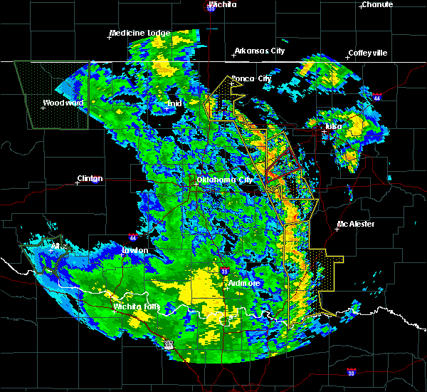 At 956 am cdt, severe thunderstorms were located along a line extending from 2 miles east of drumright to horntown, moving northeast at 35 mph (radar indicated). Hazards include 60 mph wind gusts. Expect damage to roofs, siding, and trees. locations in or near the path include, bristow, okemah, okfuskee, drumright, boley, weleetka, depew, paden, bearden, slick, castle, shamrock, clearview, welty, pharoah, milfay, mason, this includes the following highways, interstate 40 in oklahoma between mile markers 212 and 231. interstate 44 between mile markers 178 and 197. A tornado watch remains in effect until 200 pm cdt for northeastern and east central oklahoma. At 956 am cdt, severe thunderstorms were located along a line extending from 2 miles east of drumright to horntown, moving northeast at 35 mph (radar indicated). Hazards include 60 mph wind gusts. Expect damage to roofs, siding, and trees. locations in or near the path include, bristow, okemah, okfuskee, drumright, boley, weleetka, depew, paden, bearden, slick, castle, shamrock, clearview, welty, pharoah, milfay, mason, this includes the following highways, interstate 40 in oklahoma between mile markers 212 and 231. interstate 44 between mile markers 178 and 197. A tornado watch remains in effect until 200 pm cdt for northeastern and east central oklahoma.
|
| 10/9/2018 9:53 AM CDT |
 At 952 am cdt, severe thunderstorms were located along a line extending from 7 miles west of red rock to 4 miles southeast of glencoe to 4 miles northeast of avery to 3 miles south of stroud to 6 miles south of bearden, moving north at 45 mph (radar indicated). Hazards include 70 mph wind gusts. Expect considerable tree damage. damage is likely to mobile homes, roofs, and outbuildings. locations impacted include, ponca city, cushing, holdenville, perry, wewoka, stroud, wetumka, yale, davenport, morrison, glencoe, ripley, dustin, cromwell, red rock, marland, lamar, kendrick, horntown and yeager. this includes the following highways, interstate 35 between mile markers 185 and 204. interstate 40 between mile markers 203 and 212. Interstate 44 between mile markers 173 and 182. At 952 am cdt, severe thunderstorms were located along a line extending from 7 miles west of red rock to 4 miles southeast of glencoe to 4 miles northeast of avery to 3 miles south of stroud to 6 miles south of bearden, moving north at 45 mph (radar indicated). Hazards include 70 mph wind gusts. Expect considerable tree damage. damage is likely to mobile homes, roofs, and outbuildings. locations impacted include, ponca city, cushing, holdenville, perry, wewoka, stroud, wetumka, yale, davenport, morrison, glencoe, ripley, dustin, cromwell, red rock, marland, lamar, kendrick, horntown and yeager. this includes the following highways, interstate 35 between mile markers 185 and 204. interstate 40 between mile markers 203 and 212. Interstate 44 between mile markers 173 and 182.
|
| 10/9/2018 9:29 AM CDT |
 At 929 am cdt, severe thunderstorms were located along a line extending from 3 miles southeast of lucien to 5 miles east of perkins to near davenport to 3 miles southwest of prague to 5 miles north of sasakwa, moving northeast at 45 mph (radar indicated). Hazards include 70 mph wind gusts. Expect considerable tree damage. Damage is likely to mobile homes, roofs, and outbuildings. At 929 am cdt, severe thunderstorms were located along a line extending from 3 miles southeast of lucien to 5 miles east of perkins to near davenport to 3 miles southwest of prague to 5 miles north of sasakwa, moving northeast at 45 mph (radar indicated). Hazards include 70 mph wind gusts. Expect considerable tree damage. Damage is likely to mobile homes, roofs, and outbuildings.
|
| 10/9/2018 9:29 AM CDT |
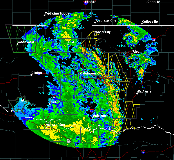 At 928 am cdt, severe thunderstorms were located along a line extending from near agra to 4 miles east of sasakwa, moving northeast at 40 mph (radar indicated). Hazards include 60 mph wind gusts. Expect damage to roofs, siding, and trees. locations in or near the path include, bristow, okemah, okfuskee, drumright, boley, weleetka, depew, paden, bearden, slick, castle, shamrock, clearview, welty, pharoah, milfay, mason, this includes the following highways, interstate 40 in oklahoma between mile markers 212 and 231. interstate 44 between mile markers 178 and 197. A tornado watch remains in effect until 200 pm cdt for northeastern and east central oklahoma. At 928 am cdt, severe thunderstorms were located along a line extending from near agra to 4 miles east of sasakwa, moving northeast at 40 mph (radar indicated). Hazards include 60 mph wind gusts. Expect damage to roofs, siding, and trees. locations in or near the path include, bristow, okemah, okfuskee, drumright, boley, weleetka, depew, paden, bearden, slick, castle, shamrock, clearview, welty, pharoah, milfay, mason, this includes the following highways, interstate 40 in oklahoma between mile markers 212 and 231. interstate 44 between mile markers 178 and 197. A tornado watch remains in effect until 200 pm cdt for northeastern and east central oklahoma.
|
| 8/16/2018 4:34 PM CDT |
 At 434 pm cdt, severe thunderstorms were located along a line extending from 5 miles north of depew to 3 miles east of kellyville to near jenks riverside airport, moving southeast at 20 mph (radar indicated). Hazards include 60 mph wind gusts and quarter size hail. Hail damage to vehicles is expected. expect wind damage to roofs, siding, and trees. Locations in or near the path include, tulsa, broken arrow, sand springs, owasso, bixby, sapulpa, jenks, glenpool, mannford, kiefer, mounds, kellyville, shamrock, keystone state park, jenks riverside airport, tulsa international airport, turley, liberty, gray, this includes interstate 44 between mile markers 194 and 232. At 434 pm cdt, severe thunderstorms were located along a line extending from 5 miles north of depew to 3 miles east of kellyville to near jenks riverside airport, moving southeast at 20 mph (radar indicated). Hazards include 60 mph wind gusts and quarter size hail. Hail damage to vehicles is expected. expect wind damage to roofs, siding, and trees. Locations in or near the path include, tulsa, broken arrow, sand springs, owasso, bixby, sapulpa, jenks, glenpool, mannford, kiefer, mounds, kellyville, shamrock, keystone state park, jenks riverside airport, tulsa international airport, turley, liberty, gray, this includes interstate 44 between mile markers 194 and 232.
|
| 8/16/2018 4:16 PM CDT |
 At 416 pm cdt, severe thunderstorms were located along a line extending from near drumright to 5 miles southeast of keystone state park to jenks riverside airport, moving east at 40 mph (radar indicated). Hazards include 60 mph wind gusts and quarter size hail. Hail damage to vehicles is expected. expect wind damage to roofs, siding, and trees. Locations in or near the path include, tulsa, broken arrow, sand springs, owasso, bixby, sapulpa, jenks, glenpool, mannford, drumright, kiefer, mounds, kellyville, oilton, jennings, westport, hallett, terlton, shamrock, jenks riverside airport, this includes interstate 44 between mile markers 194 and 232. At 416 pm cdt, severe thunderstorms were located along a line extending from near drumright to 5 miles southeast of keystone state park to jenks riverside airport, moving east at 40 mph (radar indicated). Hazards include 60 mph wind gusts and quarter size hail. Hail damage to vehicles is expected. expect wind damage to roofs, siding, and trees. Locations in or near the path include, tulsa, broken arrow, sand springs, owasso, bixby, sapulpa, jenks, glenpool, mannford, drumright, kiefer, mounds, kellyville, oilton, jennings, westport, hallett, terlton, shamrock, jenks riverside airport, this includes interstate 44 between mile markers 194 and 232.
|
| 8/16/2018 4:13 PM CDT |
 The severe thunderstorm warning for southeastern payne county will expire at 415 pm cdt, the storms which prompted the warning have moved into creek county. therefore, the warning for payne county will be allowed to expire. The severe thunderstorm warning for southeastern payne county will expire at 415 pm cdt, the storms which prompted the warning have moved into creek county. therefore, the warning for payne county will be allowed to expire.
|
| 8/16/2018 3:57 PM CDT |
 At 357 pm cdt, severe thunderstorms were located along a line extending from 3 miles west of drumright to near jennings to 2 miles north of jenks riverside airport, moving east at 20 mph (radar indicated). Hazards include 60 mph wind gusts. Expect damage to roofs, siding, and trees. Locations in or near the path include, tulsa, broken arrow, sand springs, owasso, bixby, sapulpa, jenks, glenpool, mannford, drumright, kiefer, mounds, kellyville, oilton, jennings, westport, hallett, terlton, shamrock, jenks riverside airport, this includes interstate 44 between mile markers 194 and 232. At 357 pm cdt, severe thunderstorms were located along a line extending from 3 miles west of drumright to near jennings to 2 miles north of jenks riverside airport, moving east at 20 mph (radar indicated). Hazards include 60 mph wind gusts. Expect damage to roofs, siding, and trees. Locations in or near the path include, tulsa, broken arrow, sand springs, owasso, bixby, sapulpa, jenks, glenpool, mannford, drumright, kiefer, mounds, kellyville, oilton, jennings, westport, hallett, terlton, shamrock, jenks riverside airport, this includes interstate 44 between mile markers 194 and 232.
|
| 8/16/2018 3:45 PM CDT |
 At 344 pm cdt, severe thunderstorms were located along a line extending from near yale to near cushing, moving east at 25 mph (radar indicated). Hazards include 60 mph wind gusts and quarter size hail. Hail damage to vehicles is expected. Expect wind damage to roofs, siding, and trees. At 344 pm cdt, severe thunderstorms were located along a line extending from near yale to near cushing, moving east at 25 mph (radar indicated). Hazards include 60 mph wind gusts and quarter size hail. Hail damage to vehicles is expected. Expect wind damage to roofs, siding, and trees.
|
| 7/30/2018 4:08 PM CDT |
 The severe thunderstorm warning for southeastern payne county will expire at 415 pm cdt, the storms which prompted the warning have weakened below severe limits, and have exited the warned area. therefore, the warning will be allowed to expire. The severe thunderstorm warning for southeastern payne county will expire at 415 pm cdt, the storms which prompted the warning have weakened below severe limits, and have exited the warned area. therefore, the warning will be allowed to expire.
|
| 7/30/2018 3:58 PM CDT |
 At 358 pm cdt, severe thunderstorms were located along a line extending from 3 miles southwest of oilton to 4 miles south of ripley, moving southeast at 25 mph (radar indicated). Hazards include 60 mph wind gusts. Expect damage to roofs, siding, and trees. Locations impacted include, cushing, perkins, yale, ripley and quay. At 358 pm cdt, severe thunderstorms were located along a line extending from 3 miles southwest of oilton to 4 miles south of ripley, moving southeast at 25 mph (radar indicated). Hazards include 60 mph wind gusts. Expect damage to roofs, siding, and trees. Locations impacted include, cushing, perkins, yale, ripley and quay.
|
| 7/30/2018 3:43 PM CDT |
 At 343 pm cdt, severe thunderstorms were located along a line extending from 4 miles southwest of quay to near ripley, moving southeast at 40 mph (radar indicated). Hazards include 60 mph wind gusts. Expect damage to roofs, siding, and trees. Locations impacted include, cushing, perkins, yale, ripley, quay and ingalls. At 343 pm cdt, severe thunderstorms were located along a line extending from 4 miles southwest of quay to near ripley, moving southeast at 40 mph (radar indicated). Hazards include 60 mph wind gusts. Expect damage to roofs, siding, and trees. Locations impacted include, cushing, perkins, yale, ripley, quay and ingalls.
|
| 7/30/2018 3:22 PM CDT |
 At 321 pm cdt, a severe thunderstorm was located near stillwater, moving southeast at 25 mph. another severe thunderstorm was located near glencoe also moving southeast at 25 mph (radar indicated). Hazards include 60 mph wind gusts and quarter size hail. Hail damage to vehicles is expected. Expect wind damage to roofs, siding, and trees. At 321 pm cdt, a severe thunderstorm was located near stillwater, moving southeast at 25 mph. another severe thunderstorm was located near glencoe also moving southeast at 25 mph (radar indicated). Hazards include 60 mph wind gusts and quarter size hail. Hail damage to vehicles is expected. Expect wind damage to roofs, siding, and trees.
|
| 6/30/2018 6:26 PM CDT |
 At 606 pm cdt, severe thunderstorms were located along a line extending from 5 miles west of newkirk to 3 miles north of maramec to 4 miles southeast of stroud, moving northeast at 35 mph (radar indicated). Hazards include 60 mph wind gusts and nickel size hail. Expect damage to roofs, siding, and trees. Locations in or near the path include, bristow, pawnee, hominy, cleveland, mannford, drumright, fairfax, kellyville, oilton, depew, shidler, jennings, ralston, westport, osage, burbank, hallett, blackburn, terlton, shamrock, this includes interstate 44 between mile markers 178 and 205. At 606 pm cdt, severe thunderstorms were located along a line extending from 5 miles west of newkirk to 3 miles north of maramec to 4 miles southeast of stroud, moving northeast at 35 mph (radar indicated). Hazards include 60 mph wind gusts and nickel size hail. Expect damage to roofs, siding, and trees. Locations in or near the path include, bristow, pawnee, hominy, cleveland, mannford, drumright, fairfax, kellyville, oilton, depew, shidler, jennings, ralston, westport, osage, burbank, hallett, blackburn, terlton, shamrock, this includes interstate 44 between mile markers 178 and 205.
|
| 6/30/2018 6:06 PM CDT |
 At 606 pm cdt, severe thunderstorms were located along a line extending from 5 miles west of newkirk to 3 miles north of maramec to 4 miles southeast of stroud, moving northeast at 35 mph (radar indicated). Hazards include 60 mph wind gusts and nickel size hail. Expect damage to roofs, siding, and trees. Locations in or near the path include, bristow, pawnee, hominy, cleveland, mannford, drumright, fairfax, kellyville, oilton, depew, shidler, jennings, ralston, westport, osage, burbank, hallett, blackburn, terlton, shamrock, this includes interstate 44 between mile markers 178 and 205. At 606 pm cdt, severe thunderstorms were located along a line extending from 5 miles west of newkirk to 3 miles north of maramec to 4 miles southeast of stroud, moving northeast at 35 mph (radar indicated). Hazards include 60 mph wind gusts and nickel size hail. Expect damage to roofs, siding, and trees. Locations in or near the path include, bristow, pawnee, hominy, cleveland, mannford, drumright, fairfax, kellyville, oilton, depew, shidler, jennings, ralston, westport, osage, burbank, hallett, blackburn, terlton, shamrock, this includes interstate 44 between mile markers 178 and 205.
|
| 6/30/2018 5:54 PM CDT |
 The severe thunderstorm warning for lincoln, southeastern noble and payne counties will expire at 600 pm cdt, the storms which prompted the warning are weakening and moving east out of the area. therefore, the warning for lincoln, noble and payne counties will be allowed to expire. however gusty winds will still be possible with these thunderstorms through 615 pm. The severe thunderstorm warning for lincoln, southeastern noble and payne counties will expire at 600 pm cdt, the storms which prompted the warning are weakening and moving east out of the area. therefore, the warning for lincoln, noble and payne counties will be allowed to expire. however gusty winds will still be possible with these thunderstorms through 615 pm.
|
| 6/30/2018 5:35 PM CDT |
 At 534 pm cdt, severe thunderstorms were located along a line extending from 5 miles northeast of billings to 6 miles east of stillwater to 5 miles southeast of sparks, moving northeast at 35 mph (radar indicated). Hazards include 60 mph wind gusts and nickel size hail. Expect damage to roofs, siding, and trees. Locations in or near the path include, bristow, pawnee, hominy, cleveland, mannford, drumright, fairfax, kellyville, oilton, depew, shidler, jennings, ralston, westport, osage, burbank, hallett, blackburn, terlton, shamrock, this includes interstate 44 between mile markers 178 and 205. At 534 pm cdt, severe thunderstorms were located along a line extending from 5 miles northeast of billings to 6 miles east of stillwater to 5 miles southeast of sparks, moving northeast at 35 mph (radar indicated). Hazards include 60 mph wind gusts and nickel size hail. Expect damage to roofs, siding, and trees. Locations in or near the path include, bristow, pawnee, hominy, cleveland, mannford, drumright, fairfax, kellyville, oilton, depew, shidler, jennings, ralston, westport, osage, burbank, hallett, blackburn, terlton, shamrock, this includes interstate 44 between mile markers 178 and 205.
|
| 6/30/2018 5:17 PM CDT |
 At 516 pm cdt, severe thunderstorms were located along a line extending from 4 miles southwest of lake carl blackwell to 3 miles southwest of chandler, moving east at 30 mph (radar indicated). Hazards include 60 mph wind gusts and quarter size hail. Hail damage to vehicles is expected. Expect wind damage to roofs, siding, and trees. At 516 pm cdt, severe thunderstorms were located along a line extending from 4 miles southwest of lake carl blackwell to 3 miles southwest of chandler, moving east at 30 mph (radar indicated). Hazards include 60 mph wind gusts and quarter size hail. Hail damage to vehicles is expected. Expect wind damage to roofs, siding, and trees.
|
| 6/25/2018 3:53 AM CDT |
 The severe thunderstorm warning for eastern osage, northwestern creek and southeastern pawnee counties will expire at 400 am cdt, the line of storms which prompted the warning have weakened below severe limits, and no longer pose an immediate threat to life or property. therefore the warning will be allowed to expire. however gusty winds to 50 mph are still possible with these thunderstorms. a severe thunderstorm watch remains in effect until 800 am cdt for northeastern oklahoma. The severe thunderstorm warning for eastern osage, northwestern creek and southeastern pawnee counties will expire at 400 am cdt, the line of storms which prompted the warning have weakened below severe limits, and no longer pose an immediate threat to life or property. therefore the warning will be allowed to expire. however gusty winds to 50 mph are still possible with these thunderstorms. a severe thunderstorm watch remains in effect until 800 am cdt for northeastern oklahoma.
|
| 6/25/2018 3:42 AM CDT |
 At 342 am cdt, severe thunderstorms were located along a line extending from 4 miles northwest of caney to 8 miles north of bristow, moving east at 35 mph (radar indicated). Hazards include 60 mph wind gusts and penny size hail. Expect damage to roofs, siding, and trees. Locations in or near the path include, pawhuska, hominy, cleveland, mannford, drumright, barnsdall, oilton, depew, wynona, westport, osage, terlton, shamrock, elgin, bigheart, osage hills state park, walnut creek state park, hulah, sunset lake, okesa, this includes interstate 44 between mile markers 182 and 190. At 342 am cdt, severe thunderstorms were located along a line extending from 4 miles northwest of caney to 8 miles north of bristow, moving east at 35 mph (radar indicated). Hazards include 60 mph wind gusts and penny size hail. Expect damage to roofs, siding, and trees. Locations in or near the path include, pawhuska, hominy, cleveland, mannford, drumright, barnsdall, oilton, depew, wynona, westport, osage, terlton, shamrock, elgin, bigheart, osage hills state park, walnut creek state park, hulah, sunset lake, okesa, this includes interstate 44 between mile markers 182 and 190.
|
| 6/25/2018 3:30 AM CDT |
 At 301 am cdt, severe thunderstorms were located along a line extending from 7 miles south of cedar vale to cushing, moving east at 35 mph (radar indicated). Hazards include 60 mph wind gusts and penny size hail. Expect damage to roofs, siding, and trees. Locations in or near the path include, pawhuska, pawnee, hominy, cleveland, mannford, drumright, fairfax, barnsdall, oilton, depew, shidler, wynona, jennings, ralston, westport, osage, hallett, blackburn, terlton, shamrock, this includes interstate 44 between mile markers 182 and 190. At 301 am cdt, severe thunderstorms were located along a line extending from 7 miles south of cedar vale to cushing, moving east at 35 mph (radar indicated). Hazards include 60 mph wind gusts and penny size hail. Expect damage to roofs, siding, and trees. Locations in or near the path include, pawhuska, pawnee, hominy, cleveland, mannford, drumright, fairfax, barnsdall, oilton, depew, shidler, wynona, jennings, ralston, westport, osage, hallett, blackburn, terlton, shamrock, this includes interstate 44 between mile markers 182 and 190.
|
| 6/25/2018 3:12 AM CDT |
 At 312 am cdt, severe thunderstorms were located along a line extending from near yale to near oklahoma city to near rush springs, moving southeast at 35 mph (radar indicated). Hazards include 60 mph wind gusts and nickel size hail. Expect damage to roofs, siding, and trees. locations impacted include, oklahoma city, norman, eastern edmond, moore, midwest city, shawnee, duncan, del city, chickasha, cushing, newcastle, blanchard, tecumseh, purcell, marlow, chandler, choctaw, noble, tuttle and harrah. this includes the following highways, interstate 35 between mile markers 81 and 133. interstate 40 between mile markers 150 and 194. interstate 44 between mile markers 71 and 115, and between mile markers 137 and 182. Interstate 240 between mile markers 1 and 16. At 312 am cdt, severe thunderstorms were located along a line extending from near yale to near oklahoma city to near rush springs, moving southeast at 35 mph (radar indicated). Hazards include 60 mph wind gusts and nickel size hail. Expect damage to roofs, siding, and trees. locations impacted include, oklahoma city, norman, eastern edmond, moore, midwest city, shawnee, duncan, del city, chickasha, cushing, newcastle, blanchard, tecumseh, purcell, marlow, chandler, choctaw, noble, tuttle and harrah. this includes the following highways, interstate 35 between mile markers 81 and 133. interstate 40 between mile markers 150 and 194. interstate 44 between mile markers 71 and 115, and between mile markers 137 and 182. Interstate 240 between mile markers 1 and 16.
|
| 6/25/2018 3:01 AM CDT |
 The national weather service in tulsa has issued a * severe thunderstorm warning for. osage county in northeastern oklahoma. northwestern creek county in northeastern oklahoma. pawnee county in northeastern oklahoma. Until 400 am cdt. The national weather service in tulsa has issued a * severe thunderstorm warning for. osage county in northeastern oklahoma. northwestern creek county in northeastern oklahoma. pawnee county in northeastern oklahoma. Until 400 am cdt.
|
| 6/25/2018 2:44 AM CDT |
 At 243 am cdt, severe thunderstorms were located along a line extending from near foraker to near jones to near norge, moving south at 50 mph (radar indicated). Hazards include 60 mph wind gusts and quarter size hail. Hail damage to vehicles is expected. Expect wind damage to roofs, siding, and trees. At 243 am cdt, severe thunderstorms were located along a line extending from near foraker to near jones to near norge, moving south at 50 mph (radar indicated). Hazards include 60 mph wind gusts and quarter size hail. Hail damage to vehicles is expected. Expect wind damage to roofs, siding, and trees.
|
| 6/24/2018 4:28 AM CDT |
 The severe thunderstorm warning for lincoln, southeastern logan and southeastern payne counties will expire at 430 am cdt, the storms which prompted the warning have weakened below severe limits, and no longer pose an immediate threat to life or property. therefore, the warning will be allowed to expire. however gusty winds and heavy rain are still possible with these thunderstorms. The severe thunderstorm warning for lincoln, southeastern logan and southeastern payne counties will expire at 430 am cdt, the storms which prompted the warning have weakened below severe limits, and no longer pose an immediate threat to life or property. therefore, the warning will be allowed to expire. however gusty winds and heavy rain are still possible with these thunderstorms.
|
| 6/24/2018 4:21 AM CDT |
 At 401 am cdt, severe thunderstorms were located along a line extending from 2 miles southwest of ralston to 3 miles northwest of quay to 2 miles east of perkins to 5 miles northeast of meridian, moving east at 40 mph (radar indicated). Hazards include 70 mph wind gusts and nickel size hail. Expect considerable tree damage. damage is likely to mobile homes, roofs, and outbuildings. Locations in or near the path include, tulsa, sand springs, bristow, pawnee, sapulpa, glenpool, skiatook, hominy, cleveland, mannford, drumright, kiefer, kellyville, oilton, depew, jennings, westport, osage, slick, hallett, this includes interstate 44 between mile markers 178 and 219. At 401 am cdt, severe thunderstorms were located along a line extending from 2 miles southwest of ralston to 3 miles northwest of quay to 2 miles east of perkins to 5 miles northeast of meridian, moving east at 40 mph (radar indicated). Hazards include 70 mph wind gusts and nickel size hail. Expect considerable tree damage. damage is likely to mobile homes, roofs, and outbuildings. Locations in or near the path include, tulsa, sand springs, bristow, pawnee, sapulpa, glenpool, skiatook, hominy, cleveland, mannford, drumright, kiefer, kellyville, oilton, depew, jennings, westport, osage, slick, hallett, this includes interstate 44 between mile markers 178 and 219.
|
| 6/24/2018 4:15 AM CDT |
 At 414 am cdt, severe thunderstorms were located along a line extending from 3 miles northwest of blackburn to 3 miles east of yale to near fallis, moving southeast at 45 mph (radar indicated). Hazards include 60 mph wind gusts and quarter size hail. Hail damage to vehicles is expected. expect wind damage to roofs, siding, and trees. locations impacted include, cushing, chandler, stroud, yale, davenport, wellston, carney, tryon, agra, sparks, warwick, kendrick, meridian, fallis, avery and parkland. This includes interstate 44 between mile markers 158 and 182. At 414 am cdt, severe thunderstorms were located along a line extending from 3 miles northwest of blackburn to 3 miles east of yale to near fallis, moving southeast at 45 mph (radar indicated). Hazards include 60 mph wind gusts and quarter size hail. Hail damage to vehicles is expected. expect wind damage to roofs, siding, and trees. locations impacted include, cushing, chandler, stroud, yale, davenport, wellston, carney, tryon, agra, sparks, warwick, kendrick, meridian, fallis, avery and parkland. This includes interstate 44 between mile markers 158 and 182.
|
| 6/24/2018 4:01 AM CDT |
 The national weather service in tulsa has issued a * severe thunderstorm warning for. southern osage county in northeastern oklahoma. creek county in northeastern oklahoma. pawnee county in northeastern oklahoma. Southwestern tulsa county in northeastern oklahoma. The national weather service in tulsa has issued a * severe thunderstorm warning for. southern osage county in northeastern oklahoma. creek county in northeastern oklahoma. pawnee county in northeastern oklahoma. Southwestern tulsa county in northeastern oklahoma.
|
| 6/24/2018 3:52 AM CDT |
 At 351 am cdt, severe thunderstorms were located along a line extending from 9 miles west of ralston to near glencoe to 5 miles west of meridian, moving southeast at 45 mph (radar indicated). Hazards include 60 mph wind gusts and quarter size hail. Hail damage to vehicles is expected. Expect wind damage to roofs, siding, and trees. At 351 am cdt, severe thunderstorms were located along a line extending from 9 miles west of ralston to near glencoe to 5 miles west of meridian, moving southeast at 45 mph (radar indicated). Hazards include 60 mph wind gusts and quarter size hail. Hail damage to vehicles is expected. Expect wind damage to roofs, siding, and trees.
|
| 6/22/2018 11:48 PM CDT |
 At 1148 pm cdt, severe thunderstorms were located along a line extending from 2 miles northwest of skiatook to 9 miles north of bristow, moving east at 40 mph (radar indicated). Hazards include 60 mph wind gusts. Expect damage to roofs, siding, and trees. Locations in or near the path include, tulsa, broken arrow, sand springs, owasso, bixby, sapulpa, jenks, glenpool, skiatook, catoosa, collinsville, mannford, kiefer, sperry, mounds, kellyville, westport, jenks riverside airport, keystone state park, walnut creek state park, this includes interstate 44 between mile markers 197 and 239. At 1148 pm cdt, severe thunderstorms were located along a line extending from 2 miles northwest of skiatook to 9 miles north of bristow, moving east at 40 mph (radar indicated). Hazards include 60 mph wind gusts. Expect damage to roofs, siding, and trees. Locations in or near the path include, tulsa, broken arrow, sand springs, owasso, bixby, sapulpa, jenks, glenpool, skiatook, catoosa, collinsville, mannford, kiefer, sperry, mounds, kellyville, westport, jenks riverside airport, keystone state park, walnut creek state park, this includes interstate 44 between mile markers 197 and 239.
|
| 6/22/2018 11:25 PM CDT |
 At 1125 pm cdt, severe thunderstorms were located along a line extending from 5 miles east of hominy to 4 miles west of drumright, moving east at 40 mph (radar indicated). Hazards include 60 mph wind gusts. Expect damage to roofs, siding, and trees. Locations in or near the path include, tulsa, broken arrow, sand springs, owasso, bixby, sapulpa, jenks, glenpool, skiatook, catoosa, collinsville, hominy, cleveland, mannford, drumright, kiefer, sperry, mounds, kellyville, oilton, this includes interstate 44 between mile markers 197 and 239. At 1125 pm cdt, severe thunderstorms were located along a line extending from 5 miles east of hominy to 4 miles west of drumright, moving east at 40 mph (radar indicated). Hazards include 60 mph wind gusts. Expect damage to roofs, siding, and trees. Locations in or near the path include, tulsa, broken arrow, sand springs, owasso, bixby, sapulpa, jenks, glenpool, skiatook, catoosa, collinsville, hominy, cleveland, mannford, drumright, kiefer, sperry, mounds, kellyville, oilton, this includes interstate 44 between mile markers 197 and 239.
|
| 6/22/2018 11:06 PM CDT |
 At 1106 pm cdt, severe thunderstorms were located along a line extending from 9 miles east of fairfax to 5 miles southeast of glencoe, moving east at 45 mph (radar indicated). Hazards include 70 mph wind gusts. Expect considerable tree damage. damage is likely to mobile homes, roofs, and outbuildings. Locations in or near the path include, pawnee, hominy, cleveland, mannford, drumright, oilton, jennings, ralston, westport, osage, hallett, blackburn, terlton, maramec, skedee, silver city,. At 1106 pm cdt, severe thunderstorms were located along a line extending from 9 miles east of fairfax to 5 miles southeast of glencoe, moving east at 45 mph (radar indicated). Hazards include 70 mph wind gusts. Expect considerable tree damage. damage is likely to mobile homes, roofs, and outbuildings. Locations in or near the path include, pawnee, hominy, cleveland, mannford, drumright, oilton, jennings, ralston, westport, osage, hallett, blackburn, terlton, maramec, skedee, silver city,.
|
| 6/22/2018 10:53 PM CDT |
 At 1053 pm cdt, severe thunderstorms were located along a line extending from 5 miles north of ripley to near oklahoma city to near cogar, moving southeast at 50 mph (radar indicated). Hazards include 70 mph wind gusts. Expect considerable tree damage. damage is likely to mobile homes, roofs, and outbuildings. locations impacted include, oklahoma city, norman, edmond, moore, midwest city, stillwater, del city, el reno, chickasha, guthrie, cushing, newcastle, blanchard, watonga, kingfisher, chandler, yukon, bethany, mustang and choctaw. this includes the following highways, interstate 35 between mile markers 98 and 182. interstate 40 between mile markers 88 and 174. interstate 44 between mile markers 75 and 170. Interstate 240 between mile markers 1 and 16. At 1053 pm cdt, severe thunderstorms were located along a line extending from 5 miles north of ripley to near oklahoma city to near cogar, moving southeast at 50 mph (radar indicated). Hazards include 70 mph wind gusts. Expect considerable tree damage. damage is likely to mobile homes, roofs, and outbuildings. locations impacted include, oklahoma city, norman, edmond, moore, midwest city, stillwater, del city, el reno, chickasha, guthrie, cushing, newcastle, blanchard, watonga, kingfisher, chandler, yukon, bethany, mustang and choctaw. this includes the following highways, interstate 35 between mile markers 98 and 182. interstate 40 between mile markers 88 and 174. interstate 44 between mile markers 75 and 170. Interstate 240 between mile markers 1 and 16.
|
| 6/22/2018 10:39 PM CDT |
 At 1038 pm cdt, a severe thunderstorm was located 3 miles northwest of morrison, moving east at 55 mph (radar indicated). Hazards include 70 mph wind gusts. Expect considerable tree damage. damage is likely to mobile homes, roofs, and outbuildings. Locations in or near the path include, pawnee, hominy, cleveland, mannford, drumright, oilton, jennings, ralston, westport, osage, hallett, blackburn, terlton, maramec, skedee, sooner lake, silver city,. At 1038 pm cdt, a severe thunderstorm was located 3 miles northwest of morrison, moving east at 55 mph (radar indicated). Hazards include 70 mph wind gusts. Expect considerable tree damage. damage is likely to mobile homes, roofs, and outbuildings. Locations in or near the path include, pawnee, hominy, cleveland, mannford, drumright, oilton, jennings, ralston, westport, osage, hallett, blackburn, terlton, maramec, skedee, sooner lake, silver city,.
|
| 6/22/2018 10:28 PM CDT |
 At 1022 pm cdt, severe thunderstorms were located along a line extending from near mulhall to 3 miles northeast of binger, moving southeast at 65 mph (radar indicated). Hazards include 70 mph wind gusts. Expect considerable tree damage. Damage is likely to mobile homes, roofs, and outbuildings. At 1022 pm cdt, severe thunderstorms were located along a line extending from near mulhall to 3 miles northeast of binger, moving southeast at 65 mph (radar indicated). Hazards include 70 mph wind gusts. Expect considerable tree damage. Damage is likely to mobile homes, roofs, and outbuildings.
|
| 6/22/2018 10:23 PM CDT |
 At 1022 pm cdt, severe thunderstorms were located along a line extending from near mulhall to 3 miles northeast of binger, moving southeast at 65 mph (radar indicated). Hazards include 70 mph wind gusts. Expect considerable tree damage. Damage is likely to mobile homes, roofs, and outbuildings. At 1022 pm cdt, severe thunderstorms were located along a line extending from near mulhall to 3 miles northeast of binger, moving southeast at 65 mph (radar indicated). Hazards include 70 mph wind gusts. Expect considerable tree damage. Damage is likely to mobile homes, roofs, and outbuildings.
|
| 6/12/2018 7:33 AM CDT |
 At 733 am cdt, severe thunderstorms were located along a line extending from 4 miles northeast of stroud to 5 miles southwest of perkins, moving south at 30 mph (radar indicated). Hazards include 60 mph wind gusts and quarter size hail. Hail damage to vehicles is expected. expect wind damage to roofs, siding, and trees. locations impacted include, cushing, perkins, stroud, tryon, ripley, agra, kendrick, avery and parkland. This includes interstate 44 between mile markers 180 and 182. At 733 am cdt, severe thunderstorms were located along a line extending from 4 miles northeast of stroud to 5 miles southwest of perkins, moving south at 30 mph (radar indicated). Hazards include 60 mph wind gusts and quarter size hail. Hail damage to vehicles is expected. expect wind damage to roofs, siding, and trees. locations impacted include, cushing, perkins, stroud, tryon, ripley, agra, kendrick, avery and parkland. This includes interstate 44 between mile markers 180 and 182.
|
| 6/12/2018 7:17 AM CDT |
 At 717 am cdt, severe thunderstorms were located along a line extending from 3 miles northwest of tryon to 4 miles northeast of slick, moving south at 30 mph (radar indicated). Hazards include 60 mph wind gusts and nickel size hail. Expect damage to roofs, siding, and trees. Locations in or near the path include, bristow, sapulpa, drumright, kellyville, depew, slick, shamrock, this includes interstate 44 between mile markers 178 and 210. At 717 am cdt, severe thunderstorms were located along a line extending from 3 miles northwest of tryon to 4 miles northeast of slick, moving south at 30 mph (radar indicated). Hazards include 60 mph wind gusts and nickel size hail. Expect damage to roofs, siding, and trees. Locations in or near the path include, bristow, sapulpa, drumright, kellyville, depew, slick, shamrock, this includes interstate 44 between mile markers 178 and 210.
|
| 6/12/2018 7:02 AM CDT |
 The national weather service in norman has issued a * severe thunderstorm warning for. northern lincoln county in central oklahoma. southeastern payne county in central oklahoma. Until 745 am cdt * at 702 am cdt, a severe thunderstorm was located 6 miles northeast. The national weather service in norman has issued a * severe thunderstorm warning for. northern lincoln county in central oklahoma. southeastern payne county in central oklahoma. Until 745 am cdt * at 702 am cdt, a severe thunderstorm was located 6 miles northeast.
|
| 6/12/2018 6:55 AM CDT |
 At 654 am cdt, severe thunderstorms were located along a line extending from near ripley to 3 miles north of kellyville, moving south at 30 mph (radar indicated). Hazards include 60 mph wind gusts and nickel size hail. Expect damage to roofs, siding, and trees. Locations in or near the path include, sand springs, bristow, sapulpa, mannford, drumright, kellyville, oilton, depew, slick, shamrock, keystone state park, silver city, this includes interstate 44 between mile markers 178 and 213. At 654 am cdt, severe thunderstorms were located along a line extending from near ripley to 3 miles north of kellyville, moving south at 30 mph (radar indicated). Hazards include 60 mph wind gusts and nickel size hail. Expect damage to roofs, siding, and trees. Locations in or near the path include, sand springs, bristow, sapulpa, mannford, drumright, kellyville, oilton, depew, slick, shamrock, keystone state park, silver city, this includes interstate 44 between mile markers 178 and 213.
|
| 6/12/2018 6:41 AM CDT |
 At 640 am cdt, severe thunderstorms were located along a line extending from 3 miles north of oilton to 5 miles west of yale, moving south at 20 mph (radar indicated). Hazards include 60 mph wind gusts and quarter size hail. Hail damage to vehicles is expected. expect wind damage to roofs, siding, and trees. Locations impacted include, cushing, yale and quay. At 640 am cdt, severe thunderstorms were located along a line extending from 3 miles north of oilton to 5 miles west of yale, moving south at 20 mph (radar indicated). Hazards include 60 mph wind gusts and quarter size hail. Hail damage to vehicles is expected. expect wind damage to roofs, siding, and trees. Locations impacted include, cushing, yale and quay.
|
| 6/12/2018 6:29 AM CDT |
 At 629 am cdt, severe thunderstorms were located along a line extending from 7 miles southeast of glencoe to 2 miles west of keystone state park, moving southwest at 25 mph (radar indicated). Hazards include 60 mph wind gusts and nickel size hail. Expect damage to roofs, siding, and trees. Locations in or near the path include, sand springs, bristow, sapulpa, mannford, drumright, kellyville, oilton, depew, jennings, slick, terlton, shamrock, keystone state park, silver city, this includes interstate 44 between mile markers 178 and 213. At 629 am cdt, severe thunderstorms were located along a line extending from 7 miles southeast of glencoe to 2 miles west of keystone state park, moving southwest at 25 mph (radar indicated). Hazards include 60 mph wind gusts and nickel size hail. Expect damage to roofs, siding, and trees. Locations in or near the path include, sand springs, bristow, sapulpa, mannford, drumright, kellyville, oilton, depew, jennings, slick, terlton, shamrock, keystone state park, silver city, this includes interstate 44 between mile markers 178 and 213.
|
| 6/12/2018 6:16 AM CDT |
 At 616 am cdt, a severe thunderstorm was located near maramec, moving south at 20 mph (radar indicated). Hazards include ping pong ball size hail and 60 mph wind gusts. People and animals outdoors will be injured. expect hail damage to roofs, siding, windows, and vehicles. Expect wind damage to roofs, siding, and trees. At 616 am cdt, a severe thunderstorm was located near maramec, moving south at 20 mph (radar indicated). Hazards include ping pong ball size hail and 60 mph wind gusts. People and animals outdoors will be injured. expect hail damage to roofs, siding, windows, and vehicles. Expect wind damage to roofs, siding, and trees.
|
| 6/12/2018 5:41 AM CDT |
 At 540 am cdt, severe thunderstorms were located along a line extending from 4 miles south of avant to 5 miles northeast of skedee, moving southwest at 35 mph (radar indicated). Hazards include 60 mph wind gusts and half dollar size hail. Hail damage to vehicles is expected. expect wind damage to roofs, siding, and trees. Locations in or near the path include, sand springs, pawnee, skiatook, hominy, cleveland, mannford, drumright, oilton, jennings, westport, osage, hallett, blackburn, terlton, maramec, skedee, keystone state park, walnut creek state park, silver city, this includes interstate 44 between mile markers 205 and 207. At 540 am cdt, severe thunderstorms were located along a line extending from 4 miles south of avant to 5 miles northeast of skedee, moving southwest at 35 mph (radar indicated). Hazards include 60 mph wind gusts and half dollar size hail. Hail damage to vehicles is expected. expect wind damage to roofs, siding, and trees. Locations in or near the path include, sand springs, pawnee, skiatook, hominy, cleveland, mannford, drumright, oilton, jennings, westport, osage, hallett, blackburn, terlton, maramec, skedee, keystone state park, walnut creek state park, silver city, this includes interstate 44 between mile markers 205 and 207.
|
| 6/7/2018 8:09 AM CDT |
 At 809 am cdt, severe thunderstorms were located along a line extending from near stillwater to near perkins to near langston, moving east at 45 mph (radar indicated). Hazards include 60 mph wind gusts and quarter size hail. Hail damage to vehicles is expected. expect wind damage to roofs, siding, and trees. locations impacted include, stillwater, guthrie, cushing, perkins, langston, yale, tryon, ripley, agra, coyle, lake carl blackwell, quay, avery and ingalls. This includes interstate 35 between mile markers 159 and 170. At 809 am cdt, severe thunderstorms were located along a line extending from near stillwater to near perkins to near langston, moving east at 45 mph (radar indicated). Hazards include 60 mph wind gusts and quarter size hail. Hail damage to vehicles is expected. expect wind damage to roofs, siding, and trees. locations impacted include, stillwater, guthrie, cushing, perkins, langston, yale, tryon, ripley, agra, coyle, lake carl blackwell, quay, avery and ingalls. This includes interstate 35 between mile markers 159 and 170.
|
| 6/7/2018 7:53 AM CDT |
 At 752 am cdt, severe thunderstorms were located along a line extending from near lake carl blackwell to 5 miles north of coyle to 4 miles northwest of guthrie, moving east at 50 mph (radar indicated). Hazards include 60 mph wind gusts and quarter size hail. Hail damage to vehicles is expected. Expect wind damage to roofs, siding, and trees. At 752 am cdt, severe thunderstorms were located along a line extending from near lake carl blackwell to 5 miles north of coyle to 4 miles northwest of guthrie, moving east at 50 mph (radar indicated). Hazards include 60 mph wind gusts and quarter size hail. Hail damage to vehicles is expected. Expect wind damage to roofs, siding, and trees.
|
| 5/31/2018 3:32 AM CDT |
 At 331 am cdt, a severe thunderstorm was located near tryon, moving east at 55 mph (radar indicated). Hazards include 60 mph wind gusts and quarter size hail. Hail damage to vehicles is expected. Expect wind damage to roofs, siding, and trees. At 331 am cdt, a severe thunderstorm was located near tryon, moving east at 55 mph (radar indicated). Hazards include 60 mph wind gusts and quarter size hail. Hail damage to vehicles is expected. Expect wind damage to roofs, siding, and trees.
|
| 5/31/2018 2:47 AM CDT |
 At 247 am cdt, severe thunderstorms were located along a line extending from 4 miles south of barnsdall to 6 miles northeast of bristow, moving east at 50 mph (radar indicated). Hazards include 60 mph wind gusts and penny size hail. Expect damage to roofs, siding, and trees. Locations in or near the path include, bristow, hominy, cleveland, mannford, drumright, oilton, depew, jennings, westport, osage, hallett, terlton, shamrock, silver city, this includes interstate 44 between mile markers 182 and 196. At 247 am cdt, severe thunderstorms were located along a line extending from 4 miles south of barnsdall to 6 miles northeast of bristow, moving east at 50 mph (radar indicated). Hazards include 60 mph wind gusts and penny size hail. Expect damage to roofs, siding, and trees. Locations in or near the path include, bristow, hominy, cleveland, mannford, drumright, oilton, depew, jennings, westport, osage, hallett, terlton, shamrock, silver city, this includes interstate 44 between mile markers 182 and 196.
|
| 5/31/2018 2:17 AM CDT |
 At 217 am cdt, severe thunderstorms were located along a line extending from near grainola to 4 miles southeast of burbank to near yale to near avery to 3 miles southeast of warwick to near oklahoma city, moving east at 45 mph (radar indicated). Hazards include 60 mph wind gusts and nickel size hail. Expect damage to roofs, siding, and trees. locations impacted include, eastern oklahoma city, edmond, midwest city, del city, cushing, choctaw, harrah, spencer, jones, nicoma park, yale, luther, wellston, carney, glencoe, tryon, ripley, agra, arcadia and warwick. this includes the following highways, interstate 35 between mile markers 131 and 144. interstate 40 between mile markers 158 and 163. interstate 44 between mile markers 129 and 165. Interstate 240 near mile marker 13. At 217 am cdt, severe thunderstorms were located along a line extending from near grainola to 4 miles southeast of burbank to near yale to near avery to 3 miles southeast of warwick to near oklahoma city, moving east at 45 mph (radar indicated). Hazards include 60 mph wind gusts and nickel size hail. Expect damage to roofs, siding, and trees. locations impacted include, eastern oklahoma city, edmond, midwest city, del city, cushing, choctaw, harrah, spencer, jones, nicoma park, yale, luther, wellston, carney, glencoe, tryon, ripley, agra, arcadia and warwick. this includes the following highways, interstate 35 between mile markers 131 and 144. interstate 40 between mile markers 158 and 163. interstate 44 between mile markers 129 and 165. Interstate 240 near mile marker 13.
|
| 5/31/2018 2:08 AM CDT |
 At 207 am cdt, severe thunderstorms were located along a line extending from 4 miles south of ralston to 3 miles southwest of agra, moving east at 50 mph (radar indicated). Hazards include 70 mph wind gusts and nickel size hail. Expect considerable tree damage. damage is likely to mobile homes, roofs, and outbuildings. Locations in or near the path include, bristow, hominy, cleveland, mannford, drumright, oilton, depew, jennings, westport, osage, hallett, blackburn, terlton, shamrock, maramec, skedee, silver city, this includes interstate 44 between mile markers 182 and 196. At 207 am cdt, severe thunderstorms were located along a line extending from 4 miles south of ralston to 3 miles southwest of agra, moving east at 50 mph (radar indicated). Hazards include 70 mph wind gusts and nickel size hail. Expect considerable tree damage. damage is likely to mobile homes, roofs, and outbuildings. Locations in or near the path include, bristow, hominy, cleveland, mannford, drumright, oilton, depew, jennings, westport, osage, hallett, blackburn, terlton, shamrock, maramec, skedee, silver city, this includes interstate 44 between mile markers 182 and 196.
|
| 5/31/2018 2:02 AM CDT |
 At 202 am cdt, severe thunderstorms were located along a line extending from 3 miles southeast of hardy to 5 miles southwest of burbank to near glencoe to 4 miles east of perkins to near wellston to near oklahoma city, moving southeast at 30 mph (radar indicated). Hazards include 60 mph wind gusts and quarter size hail. Hail damage to vehicles is expected. expect wind damage to roofs, siding, and trees. locations impacted include, eastern oklahoma city, edmond, midwest city, stillwater, ponca city, del city, guthrie, cushing, perry, choctaw, harrah, spencer, perkins, jones, nicoma park, newkirk, langston, crescent, yale and luther. this includes the following highways, interstate 35 between mile markers 131 and 193. interstate 40 between mile markers 158 and 163. interstate 44 between mile markers 129 and 165. Interstate 240 near mile marker 13. At 202 am cdt, severe thunderstorms were located along a line extending from 3 miles southeast of hardy to 5 miles southwest of burbank to near glencoe to 4 miles east of perkins to near wellston to near oklahoma city, moving southeast at 30 mph (radar indicated). Hazards include 60 mph wind gusts and quarter size hail. Hail damage to vehicles is expected. expect wind damage to roofs, siding, and trees. locations impacted include, eastern oklahoma city, edmond, midwest city, stillwater, ponca city, del city, guthrie, cushing, perry, choctaw, harrah, spencer, perkins, jones, nicoma park, newkirk, langston, crescent, yale and luther. this includes the following highways, interstate 35 between mile markers 131 and 193. interstate 40 between mile markers 158 and 163. interstate 44 between mile markers 129 and 165. Interstate 240 near mile marker 13.
|
| 5/31/2018 1:29 AM CDT |
 At 128 am cdt, severe thunderstorms were located along a line extending from near chilocco to 6 miles east of marland to 4 miles southwest of lake carl blackwell to 7 miles northwest of piedmont, moving east at 40 mph (radar indicated). Hazards include 60 mph wind gusts and quarter size hail. Hail damage to vehicles is expected. Expect wind damage to roofs, siding, and trees. At 128 am cdt, severe thunderstorms were located along a line extending from near chilocco to 6 miles east of marland to 4 miles southwest of lake carl blackwell to 7 miles northwest of piedmont, moving east at 40 mph (radar indicated). Hazards include 60 mph wind gusts and quarter size hail. Hail damage to vehicles is expected. Expect wind damage to roofs, siding, and trees.
|
| 5/30/2018 12:32 AM CDT |
 At 1232 am cdt, a severe thunderstorm was located 4 miles east of ripley, moving east at 80 mph (radar indicated). Hazards include 60 mph wind gusts and nickel size hail. Expect damage to roofs, siding, and trees. locations impacted include, stillwater, cushing, perkins, stroud, yale, glencoe, tryon, ripley, agra, kendrick, quay, avery, ingalls and parkland. This includes interstate 44 between mile markers 174 and 182. At 1232 am cdt, a severe thunderstorm was located 4 miles east of ripley, moving east at 80 mph (radar indicated). Hazards include 60 mph wind gusts and nickel size hail. Expect damage to roofs, siding, and trees. locations impacted include, stillwater, cushing, perkins, stroud, yale, glencoe, tryon, ripley, agra, kendrick, quay, avery, ingalls and parkland. This includes interstate 44 between mile markers 174 and 182.
|
| 5/30/2018 12:30 AM CDT |
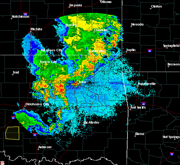 At 1230 am cdt, a severe thunderstorm was located 7 miles south of mannford, moving east at 55 mph (radar indicated). Hazards include 60 mph wind gusts and quarter size hail. Hail damage to vehicles is expected. expect wind damage to roofs, siding, and trees. Locations in or near the path include, mannford, drumright, oilton, shamrock, silver city, this includes interstate 44 between mile markers 195 and 198. At 1230 am cdt, a severe thunderstorm was located 7 miles south of mannford, moving east at 55 mph (radar indicated). Hazards include 60 mph wind gusts and quarter size hail. Hail damage to vehicles is expected. expect wind damage to roofs, siding, and trees. Locations in or near the path include, mannford, drumright, oilton, shamrock, silver city, this includes interstate 44 between mile markers 195 and 198.
|
| 5/30/2018 12:09 AM CDT |
 At 1208 am cdt, severe thunderstorms were located along a line extending from 5 miles north of lake mcmurtry to near mulhall to 7 miles northeast of crescent, moving east at 55 mph. another severe storm was located 3 miles northeast of cushing moving east at 50 mph (radar indicated). Hazards include 60 mph wind gusts and quarter size hail. Hail damage to vehicles is expected. Expect wind damage to roofs, siding, and trees. At 1208 am cdt, severe thunderstorms were located along a line extending from 5 miles north of lake mcmurtry to near mulhall to 7 miles northeast of crescent, moving east at 55 mph. another severe storm was located 3 miles northeast of cushing moving east at 50 mph (radar indicated). Hazards include 60 mph wind gusts and quarter size hail. Hail damage to vehicles is expected. Expect wind damage to roofs, siding, and trees.
|
| 5/30/2018 12:06 AM CDT |
 At 1205 am cdt, a severe thunderstorm was located 4 miles north of cushing, moving east at 40 mph (radar indicated). Hazards include 60 mph wind gusts and quarter size hail. Hail damage to vehicles is expected. expect wind damage to roofs, siding, and trees. Locations in or near the path include, mannford, drumright, oilton, shamrock, silver city, this includes interstate 44 between mile markers 195 and 198. At 1205 am cdt, a severe thunderstorm was located 4 miles north of cushing, moving east at 40 mph (radar indicated). Hazards include 60 mph wind gusts and quarter size hail. Hail damage to vehicles is expected. expect wind damage to roofs, siding, and trees. Locations in or near the path include, mannford, drumright, oilton, shamrock, silver city, this includes interstate 44 between mile markers 195 and 198.
|
| 5/29/2018 11:37 PM CDT |
 At 1137 pm cdt, a severe thunderstorm was located near stillwater, moving east at 40 mph (radar indicated). Hazards include 60 mph wind gusts and quarter size hail. Hail damage to vehicles is expected. Expect wind damage to roofs, siding, and trees. At 1137 pm cdt, a severe thunderstorm was located near stillwater, moving east at 40 mph (radar indicated). Hazards include 60 mph wind gusts and quarter size hail. Hail damage to vehicles is expected. Expect wind damage to roofs, siding, and trees.
|
| 5/2/2018 10:08 PM CDT |
 The severe thunderstorm warning for northern lincoln, southeastern noble and payne counties will expire at 1015 pm cdt, the storms which prompted the warning have moved out of the area. therefore the warning will be allowed to expire. The severe thunderstorm warning for northern lincoln, southeastern noble and payne counties will expire at 1015 pm cdt, the storms which prompted the warning have moved out of the area. therefore the warning will be allowed to expire.
|
| 5/2/2018 9:36 PM CDT |
 At 936 pm cdt, severe thunderstorms were located along a line extending from 2 miles southwest of cushing to 2 miles northwest of seminole, moving northeast at 45 mph (radar indicated). Hazards include 60 mph wind gusts. Expect damage to roofs, siding, and trees. locations in or near the path include, bristow, okemah, sapulpa, okfuskee, henryetta, drumright, beggs, boley, kellyville, weleetka, depew, paden, bearden, slick, castle, shamrock, clearview, okmulgee state park, welty, pharoah, this includes the following highways, interstate 40 in oklahoma between mile markers 212 and 236. interstate 44 between mile markers 178 and 211. A tornado watch remains in effect until 300 am cdt for southeastern, northeastern and east central oklahoma. At 936 pm cdt, severe thunderstorms were located along a line extending from 2 miles southwest of cushing to 2 miles northwest of seminole, moving northeast at 45 mph (radar indicated). Hazards include 60 mph wind gusts. Expect damage to roofs, siding, and trees. locations in or near the path include, bristow, okemah, sapulpa, okfuskee, henryetta, drumright, beggs, boley, kellyville, weleetka, depew, paden, bearden, slick, castle, shamrock, clearview, okmulgee state park, welty, pharoah, this includes the following highways, interstate 40 in oklahoma between mile markers 212 and 236. interstate 44 between mile markers 178 and 211. A tornado watch remains in effect until 300 am cdt for southeastern, northeastern and east central oklahoma.
|
| 5/2/2018 9:32 PM CDT |
 At 932 pm cdt, severe thunderstorms were located along a line extending from 4 miles north of morrison to 3 miles northwest of chandler, moving northeast at 25 mph (radar indicated). Hazards include 60 mph wind gusts. expect damage to roofs, siding, and trees At 932 pm cdt, severe thunderstorms were located along a line extending from 4 miles north of morrison to 3 miles northwest of chandler, moving northeast at 25 mph (radar indicated). Hazards include 60 mph wind gusts. expect damage to roofs, siding, and trees
|
| 5/2/2018 9:29 PM CDT |
 At 929 pm cdt, severe thunderstorms were located along a line extending from 7 miles northwest of pawnee to 2 miles south of ripley, moving northeast at 45 mph (radar indicated). Hazards include 60 mph wind gusts. Expect damage to roofs, siding, and trees. Locations in or near the path include, pawhuska, pawnee, hominy, cleveland, mannford, fairfax, oilton, wynona, jennings, ralston, westport, osage, hallett, blackburn, terlton, maramec, skedee, sooner lake, silver city, a tornado watch remains in effect until 300 am cdt for northeastern oklahoma. At 929 pm cdt, severe thunderstorms were located along a line extending from 7 miles northwest of pawnee to 2 miles south of ripley, moving northeast at 45 mph (radar indicated). Hazards include 60 mph wind gusts. Expect damage to roofs, siding, and trees. Locations in or near the path include, pawhuska, pawnee, hominy, cleveland, mannford, fairfax, oilton, wynona, jennings, ralston, westport, osage, hallett, blackburn, terlton, maramec, skedee, sooner lake, silver city, a tornado watch remains in effect until 300 am cdt for northeastern oklahoma.
|
| 4/13/2018 2:51 PM CDT |
 At 250 pm cdt, a severe thunderstorm was located 5 miles northeast of osage, moving northeast at 50 mph (radar indicated). Hazards include 60 mph wind gusts and quarter size hail. Hail damage to vehicles is expected. expect wind damage to roofs, siding, and trees. Locations in or near the path include, skiatook, hominy, cleveland, barnsdall, oilton, wynona, jennings, avant, westport, osage, hallett, terlton, maramec, walnut creek state park, tallant, silver city, pershing, nelagoney, wolco, a tornado watch remains in effect until 1000 pm cdt for northeastern oklahoma. At 250 pm cdt, a severe thunderstorm was located 5 miles northeast of osage, moving northeast at 50 mph (radar indicated). Hazards include 60 mph wind gusts and quarter size hail. Hail damage to vehicles is expected. expect wind damage to roofs, siding, and trees. Locations in or near the path include, skiatook, hominy, cleveland, barnsdall, oilton, wynona, jennings, avant, westport, osage, hallett, terlton, maramec, walnut creek state park, tallant, silver city, pershing, nelagoney, wolco, a tornado watch remains in effect until 1000 pm cdt for northeastern oklahoma.
|
| 4/13/2018 2:30 PM CDT |
 At 229 pm cdt, a severe thunderstorm was located over jennings, moving northeast at 50 mph (radar indicated). Hazards include 60 mph wind gusts and half dollar size hail. Hail damage to vehicles is expected. expect wind damage to roofs, siding, and trees. Locations in or near the path include, skiatook, hominy, cleveland, barnsdall, oilton, wynona, jennings, avant, westport, osage, hallett, terlton, maramec, walnut creek state park, tallant, silver city, pershing, nelagoney, wolco, a tornado watch remains in effect until 1000 pm cdt for northeastern oklahoma. At 229 pm cdt, a severe thunderstorm was located over jennings, moving northeast at 50 mph (radar indicated). Hazards include 60 mph wind gusts and half dollar size hail. Hail damage to vehicles is expected. expect wind damage to roofs, siding, and trees. Locations in or near the path include, skiatook, hominy, cleveland, barnsdall, oilton, wynona, jennings, avant, westport, osage, hallett, terlton, maramec, walnut creek state park, tallant, silver city, pershing, nelagoney, wolco, a tornado watch remains in effect until 1000 pm cdt for northeastern oklahoma.
|
| 4/13/2018 2:00 PM CDT |
 At 200 pm cdt, a severe thunderstorm was located near ripley, moving northeast at 60 mph (radar indicated). Hazards include 60 mph wind gusts and quarter size hail. Hail damage to vehicles is expected. expect wind damage to roofs, siding, and trees. Locations impacted include, cushing, perkins, yale, tryon, ripley, agra, quay and ingalls. At 200 pm cdt, a severe thunderstorm was located near ripley, moving northeast at 60 mph (radar indicated). Hazards include 60 mph wind gusts and quarter size hail. Hail damage to vehicles is expected. expect wind damage to roofs, siding, and trees. Locations impacted include, cushing, perkins, yale, tryon, ripley, agra, quay and ingalls.
|
| 4/13/2018 1:49 PM CDT |
 At 148 pm cdt, a severe thunderstorm was located near perkins, moving northeast at 55 mph (radar indicated). Hazards include 60 mph wind gusts and quarter size hail. Hail damage to vehicles is expected. expect wind damage to roofs, siding, and trees. Locations impacted include, cushing, perkins, yale, carney, tryon, ripley, agra, fallis, quay and ingalls. At 148 pm cdt, a severe thunderstorm was located near perkins, moving northeast at 55 mph (radar indicated). Hazards include 60 mph wind gusts and quarter size hail. Hail damage to vehicles is expected. expect wind damage to roofs, siding, and trees. Locations impacted include, cushing, perkins, yale, carney, tryon, ripley, agra, fallis, quay and ingalls.
|
| 4/13/2018 1:39 PM CDT |
 At 138 pm cdt, a severe thunderstorm was located 5 miles northwest of carney, moving northeast at 65 mph (radar indicated). Hazards include ping pong ball size hail and 60 mph wind gusts. People and animals outdoors will be injured. expect hail damage to roofs, siding, windows, and vehicles. Expect wind damage to roofs, siding, and trees. At 138 pm cdt, a severe thunderstorm was located 5 miles northwest of carney, moving northeast at 65 mph (radar indicated). Hazards include ping pong ball size hail and 60 mph wind gusts. People and animals outdoors will be injured. expect hail damage to roofs, siding, windows, and vehicles. Expect wind damage to roofs, siding, and trees.
|
| 8/16/2017 9:50 PM CDT |
 At 950 pm cdt, severe thunderstorms were located along a line extending from 3 miles northwest of agra to near wellston, moving east at 25 mph (radar indicated). Hazards include 60 mph wind gusts and quarter size hail. expect wind damage to roofs, siding, and trees At 950 pm cdt, severe thunderstorms were located along a line extending from 3 miles northwest of agra to near wellston, moving east at 25 mph (radar indicated). Hazards include 60 mph wind gusts and quarter size hail. expect wind damage to roofs, siding, and trees
|
| 8/15/2017 4:44 PM CDT |
 At 444 pm cdt, severe thunderstorms were located along a line extending from near cleveland to mannford to 8 miles northwest of kellyville to 3 miles northeast of stroud, moving northeast at 30 mph (radar indicated). Hazards include 60 mph wind gusts and quarter size hail. Hail damage to vehicles is expected. expect wind damage to roofs, siding, and trees. Locations in or near the path include, sand springs, bristow, sapulpa, cleveland, mannford, drumright, kellyville, oilton, depew, jennings, westport, osage, slick, hallett, terlton, shamrock, keystone state park, walnut creek state park, silver city, this includes interstate 44 between mile markers 178 and 214. At 444 pm cdt, severe thunderstorms were located along a line extending from near cleveland to mannford to 8 miles northwest of kellyville to 3 miles northeast of stroud, moving northeast at 30 mph (radar indicated). Hazards include 60 mph wind gusts and quarter size hail. Hail damage to vehicles is expected. expect wind damage to roofs, siding, and trees. Locations in or near the path include, sand springs, bristow, sapulpa, cleveland, mannford, drumright, kellyville, oilton, depew, jennings, westport, osage, slick, hallett, terlton, shamrock, keystone state park, walnut creek state park, silver city, this includes interstate 44 between mile markers 178 and 214.
|
| 8/15/2017 4:29 PM CDT |
 At 429 pm cdt, severe thunderstorms were located along a line extending from 2 miles southeast of hallett to 7 miles east of drumright to 4 miles south of shamrock, moving east at 35 mph (radar indicated). Hazards include 60 mph wind gusts and nickel size hail. Expect damage to roofs, siding, and trees. Locations in or near the path include, sand springs, bristow, sapulpa, cleveland, mannford, drumright, kellyville, oilton, depew, jennings, westport, osage, slick, hallett, terlton, shamrock, maramec, keystone state park, walnut creek state park, silver city, this includes interstate 44 between mile markers 178 and 214. At 429 pm cdt, severe thunderstorms were located along a line extending from 2 miles southeast of hallett to 7 miles east of drumright to 4 miles south of shamrock, moving east at 35 mph (radar indicated). Hazards include 60 mph wind gusts and nickel size hail. Expect damage to roofs, siding, and trees. Locations in or near the path include, sand springs, bristow, sapulpa, cleveland, mannford, drumright, kellyville, oilton, depew, jennings, westport, osage, slick, hallett, terlton, shamrock, maramec, keystone state park, walnut creek state park, silver city, this includes interstate 44 between mile markers 178 and 214.
|
| 8/15/2017 4:12 PM CDT |
 At 412 pm cdt, severe thunderstorms were located along a line extending from 3 miles north of quay to near drumright to 3 miles southeast of avery, moving east at 35 mph (radar indicated). Hazards include 60 mph wind gusts and quarter size hail. Hail damage to vehicles is expected. expect wind damage to roofs, siding, and trees. Locations in or near the path include, sand springs, bristow, sapulpa, cleveland, mannford, drumright, kellyville, oilton, depew, jennings, westport, osage, slick, hallett, terlton, shamrock, maramec, keystone state park, walnut creek state park, silver city, this includes interstate 44 between mile markers 178 and 214. At 412 pm cdt, severe thunderstorms were located along a line extending from 3 miles north of quay to near drumright to 3 miles southeast of avery, moving east at 35 mph (radar indicated). Hazards include 60 mph wind gusts and quarter size hail. Hail damage to vehicles is expected. expect wind damage to roofs, siding, and trees. Locations in or near the path include, sand springs, bristow, sapulpa, cleveland, mannford, drumright, kellyville, oilton, depew, jennings, westport, osage, slick, hallett, terlton, shamrock, maramec, keystone state park, walnut creek state park, silver city, this includes interstate 44 between mile markers 178 and 214.
|
| 7/3/2017 10:44 PM CDT |
 At 1044 pm cdt, severe thunderstorms were located along a line extending from 8 miles west of kellyville to depew to near paden, moving northeast at 40 mph (radar indicated). Hazards include 60 mph wind gusts. Expect damage to roofs, siding, and trees. Locations in or near the path include, bristow, okfuskee, mannford, drumright, beggs, boley, kellyville, oilton, depew, paden, slick, shamrock, keystone state park, okmulgee state park, welty, milfay, silver city, mason, this includes interstate 44 between mile markers 178 and 207. At 1044 pm cdt, severe thunderstorms were located along a line extending from 8 miles west of kellyville to depew to near paden, moving northeast at 40 mph (radar indicated). Hazards include 60 mph wind gusts. Expect damage to roofs, siding, and trees. Locations in or near the path include, bristow, okfuskee, mannford, drumright, beggs, boley, kellyville, oilton, depew, paden, slick, shamrock, keystone state park, okmulgee state park, welty, milfay, silver city, mason, this includes interstate 44 between mile markers 178 and 207.
|
| 7/3/2017 10:40 PM CDT |
 The severe thunderstorm warning for lincoln, south central noble and payne counties will expire at 1045 pm cdt, the storm which prompted the warning has weakened below severe limits, and no longer poses an immediate threat to life or property. therefore, the warning will be allowed to expire. however, gusty winds and heavy rain are still possible with this thunderstorm. The severe thunderstorm warning for lincoln, south central noble and payne counties will expire at 1045 pm cdt, the storm which prompted the warning has weakened below severe limits, and no longer poses an immediate threat to life or property. therefore, the warning will be allowed to expire. however, gusty winds and heavy rain are still possible with this thunderstorm.
|
| 7/3/2017 10:18 PM CDT |
 At 1017 pm cdt, a severe thunderstorm was located near tryon, moving east at 20 mph (radar indicated). Hazards include 60 mph wind gusts and penny size hail. Expect damage to roofs, siding, and trees. locations impacted include, stillwater, cushing, chandler, perkins, stroud, prague, yale, meeker, davenport, wellston, carney, glencoe, tryon, ripley, agra, sparks, warwick, kendrick, fallis and lake mcmurtry. This includes interstate 44 between mile markers 153 and 182. At 1017 pm cdt, a severe thunderstorm was located near tryon, moving east at 20 mph (radar indicated). Hazards include 60 mph wind gusts and penny size hail. Expect damage to roofs, siding, and trees. locations impacted include, stillwater, cushing, chandler, perkins, stroud, prague, yale, meeker, davenport, wellston, carney, glencoe, tryon, ripley, agra, sparks, warwick, kendrick, fallis and lake mcmurtry. This includes interstate 44 between mile markers 153 and 182.
|
| 7/3/2017 10:14 PM CDT |
 At 1013 pm cdt, severe thunderstorms were located along a line extending from 2 miles north of agra to 4 miles northwest of prague, moving east at 40 mph (radar indicated). Hazards include 60 mph wind gusts. Expect damage to roofs, siding, and trees. Locations in or near the path include, bristow, okfuskee, mannford, drumright, beggs, boley, kellyville, oilton, depew, paden, slick, shamrock, keystone state park, okmulgee state park, welty, milfay, silver city, mason, this includes interstate 44 between mile markers 178 and 207. At 1013 pm cdt, severe thunderstorms were located along a line extending from 2 miles north of agra to 4 miles northwest of prague, moving east at 40 mph (radar indicated). Hazards include 60 mph wind gusts. Expect damage to roofs, siding, and trees. Locations in or near the path include, bristow, okfuskee, mannford, drumright, beggs, boley, kellyville, oilton, depew, paden, slick, shamrock, keystone state park, okmulgee state park, welty, milfay, silver city, mason, this includes interstate 44 between mile markers 178 and 207.
|
| 7/3/2017 9:59 PM CDT |
 The national weather service in norman has issued a * severe thunderstorm warning for. eastern oklahoma county in central oklahoma. lincoln county in central oklahoma. southeastern noble county in northern oklahoma. Northeastern cleveland county in central oklahoma. The national weather service in norman has issued a * severe thunderstorm warning for. eastern oklahoma county in central oklahoma. lincoln county in central oklahoma. southeastern noble county in northern oklahoma. Northeastern cleveland county in central oklahoma.
|
| 7/3/2017 9:34 PM CDT |
 At 934 pm cdt, severe thunderstorms were located along a line extending from 4 miles southwest of grainola to 7 miles west of ralston to near carney to near oklahoma city to near apache, moving east at 30 mph (radar indicated. in addition, tinker air force base just recorded a 58 mph wind gust). Hazards include 70 mph wind gusts and nickel size hail. Expect considerable tree damage. damage is likely to mobile homes, roofs, and outbuildings. locations impacted include, oklahoma city, norman, edmond, moore, midwest city, stillwater, ponca city, del city, chickasha, guthrie, cushing, newcastle, blanchard, anadarko, perry, chandler, yukon, bethany, mustang and choctaw. this includes the following highways, interstate 35 between mile markers 102 and 178. interstate 40 between mile markers 130 and 174. interstate 44 between mile markers 44 and 178. Interstate 240 between mile markers 1 and 16. At 934 pm cdt, severe thunderstorms were located along a line extending from 4 miles southwest of grainola to 7 miles west of ralston to near carney to near oklahoma city to near apache, moving east at 30 mph (radar indicated. in addition, tinker air force base just recorded a 58 mph wind gust). Hazards include 70 mph wind gusts and nickel size hail. Expect considerable tree damage. damage is likely to mobile homes, roofs, and outbuildings. locations impacted include, oklahoma city, norman, edmond, moore, midwest city, stillwater, ponca city, del city, chickasha, guthrie, cushing, newcastle, blanchard, anadarko, perry, chandler, yukon, bethany, mustang and choctaw. this includes the following highways, interstate 35 between mile markers 102 and 178. interstate 40 between mile markers 130 and 174. interstate 44 between mile markers 44 and 178. Interstate 240 between mile markers 1 and 16.
|
| 7/3/2017 9:21 PM CDT |
 At 920 pm cdt, severe thunderstorms were located along a line extending from 10 miles northwest of ralston to 3 miles southwest of perkins, moving east at 35 mph (radar indicated. at 910 pm, the oklahoma mesonet site at red rock reported a 59 mph wind gust). Hazards include 70 mph wind gusts and quarter size hail. Hail damage to vehicles is expected. expect considerable tree damage. wind damage is also likely to mobile homes, roofs, and outbuildings. Locations in or near the path include, pawnee, cleveland, drumright, fairfax, oilton, shidler, jennings, ralston, burbank, hallett, blackburn, terlton, shamrock, maramec, skedee, grainola, foraker, pearsonia, southwestern kaw lake, webb city, this includes interstate 44 between mile markers 178 and 182. At 920 pm cdt, severe thunderstorms were located along a line extending from 10 miles northwest of ralston to 3 miles southwest of perkins, moving east at 35 mph (radar indicated. at 910 pm, the oklahoma mesonet site at red rock reported a 59 mph wind gust). Hazards include 70 mph wind gusts and quarter size hail. Hail damage to vehicles is expected. expect considerable tree damage. wind damage is also likely to mobile homes, roofs, and outbuildings. Locations in or near the path include, pawnee, cleveland, drumright, fairfax, oilton, shidler, jennings, ralston, burbank, hallett, blackburn, terlton, shamrock, maramec, skedee, grainola, foraker, pearsonia, southwestern kaw lake, webb city, this includes interstate 44 between mile markers 178 and 182.
|
| 7/3/2017 9:08 PM CDT |
 At 907 pm cdt, severe thunderstorms were located along a line extending from 7 miles northeast of newkirk to 4 miles southeast of marland to near meridian to near oklahoma city to 6 miles west of boone, moving east at 30 mph (at 905 pm, a personal weather station reported 68 mph wind gusts in edmond). Hazards include 70 mph wind gusts and quarter size hail. Hail damage to vehicles is expected. expect considerable tree damage. wind damage is also likely to mobile homes, roofs, and outbuildings. locations impacted include, oklahoma city, norman, edmond, moore, midwest city, stillwater, ponca city, del city, el reno, chickasha, guthrie, cushing, newcastle, blanchard, blackwell, anadarko, perry, tonkawa, chandler and yukon. this includes the following highways, interstate 35 between mile markers 102 and 236. interstate 40 between mile markers 115 and 174. interstate 44 between mile markers 44 and 178. Interstate 240 between mile markers 1 and 16. At 907 pm cdt, severe thunderstorms were located along a line extending from 7 miles northeast of newkirk to 4 miles southeast of marland to near meridian to near oklahoma city to 6 miles west of boone, moving east at 30 mph (at 905 pm, a personal weather station reported 68 mph wind gusts in edmond). Hazards include 70 mph wind gusts and quarter size hail. Hail damage to vehicles is expected. expect considerable tree damage. wind damage is also likely to mobile homes, roofs, and outbuildings. locations impacted include, oklahoma city, norman, edmond, moore, midwest city, stillwater, ponca city, del city, el reno, chickasha, guthrie, cushing, newcastle, blanchard, blackwell, anadarko, perry, tonkawa, chandler and yukon. this includes the following highways, interstate 35 between mile markers 102 and 236. interstate 40 between mile markers 115 and 174. interstate 44 between mile markers 44 and 178. Interstate 240 between mile markers 1 and 16.
|
| 7/3/2017 8:58 PM CDT |
 The national weather service in norman has issued a * severe thunderstorm warning for. southeastern washita county in western oklahoma. northern comanche county in southwestern oklahoma. southeastern kingfisher county in central oklahoma. Grady county in central oklahoma. The national weather service in norman has issued a * severe thunderstorm warning for. southeastern washita county in western oklahoma. northern comanche county in southwestern oklahoma. southeastern kingfisher county in central oklahoma. Grady county in central oklahoma.
|
| 7/3/2017 8:55 PM CDT |
 At 855 pm cdt, severe thunderstorms were located along a line extending from 2 miles north of red rock to near meridian, moving east at 35 mph (radar indicated). Hazards include 70 mph wind gusts and quarter size hail. Hail damage to vehicles is expected. expect considerable tree damage. wind damage is also likely to mobile homes, roofs, and outbuildings. Locations in or near the path include, pawnee, cleveland, drumright, fairfax, oilton, shidler, jennings, ralston, burbank, hallett, blackburn, terlton, shamrock, maramec, skedee, grainola, foraker, pearsonia, southwestern kaw lake, webb city, this includes interstate 44 between mile markers 178 and 182. At 855 pm cdt, severe thunderstorms were located along a line extending from 2 miles north of red rock to near meridian, moving east at 35 mph (radar indicated). Hazards include 70 mph wind gusts and quarter size hail. Hail damage to vehicles is expected. expect considerable tree damage. wind damage is also likely to mobile homes, roofs, and outbuildings. Locations in or near the path include, pawnee, cleveland, drumright, fairfax, oilton, shidler, jennings, ralston, burbank, hallett, blackburn, terlton, shamrock, maramec, skedee, grainola, foraker, pearsonia, southwestern kaw lake, webb city, this includes interstate 44 between mile markers 178 and 182.
|
| 7/2/2017 3:49 PM CDT |
 At 348 pm cdt, severe thunderstorms were located along a line extending from 4 miles northeast of lake mcmurtry to 6 miles northeast of ripley to 3 miles south of stroud, moving northeast at 35 mph. tree damage has been reported in stillwater (radar indicated). Hazards include 70 mph wind gusts and half dollar size hail. Hail damage to vehicles is expected. expect considerable tree damage. wind damage is also likely to mobile homes, roofs, and outbuildings. locations impacted include, stillwater, cushing, chandler, perkins, stroud, yale, davenport, morrison, glencoe, tryon, ripley, agra, kendrick, lake carl blackwell, lake mcmurtry, sooner lake, quay, avery, ingalls and parkland. This includes interstate 44 between mile markers 166 and 182. At 348 pm cdt, severe thunderstorms were located along a line extending from 4 miles northeast of lake mcmurtry to 6 miles northeast of ripley to 3 miles south of stroud, moving northeast at 35 mph. tree damage has been reported in stillwater (radar indicated). Hazards include 70 mph wind gusts and half dollar size hail. Hail damage to vehicles is expected. expect considerable tree damage. wind damage is also likely to mobile homes, roofs, and outbuildings. locations impacted include, stillwater, cushing, chandler, perkins, stroud, yale, davenport, morrison, glencoe, tryon, ripley, agra, kendrick, lake carl blackwell, lake mcmurtry, sooner lake, quay, avery, ingalls and parkland. This includes interstate 44 between mile markers 166 and 182.
|
| 7/2/2017 3:19 PM CDT |
 At 318 pm cdt, severe thunderstorms were located along a line extending from near orlando to near tryon to near chandler, moving northeast at 35 mph. strong winds may occur anywhere along this line of storms. the most likely area for large hail is currently with a storm near chandler (radar indicated). Hazards include 70 mph wind gusts and half dollar size hail. Hail damage to vehicles is expected. expect considerable tree damage. Wind damage is also likely to mobile homes, roofs, and outbuildings. At 318 pm cdt, severe thunderstorms were located along a line extending from near orlando to near tryon to near chandler, moving northeast at 35 mph. strong winds may occur anywhere along this line of storms. the most likely area for large hail is currently with a storm near chandler (radar indicated). Hazards include 70 mph wind gusts and half dollar size hail. Hail damage to vehicles is expected. expect considerable tree damage. Wind damage is also likely to mobile homes, roofs, and outbuildings.
|
| 6/15/2017 9:57 PM CDT |
 At 957 pm cdt, severe thunderstorms were located along a line extending from 8 miles south of billings to 9 miles west of ralston, moving southeast at 45 mph (radar indicated). Hazards include 60 mph wind gusts and penny size hail. expect damage to roofs, siding, and trees At 957 pm cdt, severe thunderstorms were located along a line extending from 8 miles south of billings to 9 miles west of ralston, moving southeast at 45 mph (radar indicated). Hazards include 60 mph wind gusts and penny size hail. expect damage to roofs, siding, and trees
|
| 5/18/2017 8:33 PM CDT |
 At 832 pm cdt, a severe thunderstorm was located over boley, moving northeast at 40 mph (radar indicated). Hazards include 60 mph wind gusts and quarter size hail. Hail damage to vehicles is expected. expect wind damage to roofs, siding, and trees. locations in or near the path include, bristow, okemah, okfuskee, drumright, boley, kellyville, depew, paden, bearden, slick, castle, shamrock, welty, milfay, mason, this includes the following highways, interstate 40 in oklahoma between mile markers 212 and 225. interstate 44 between mile markers 178 and 206. A tornado watch remains in effect until midnight cdt for northeastern and east central oklahoma. At 832 pm cdt, a severe thunderstorm was located over boley, moving northeast at 40 mph (radar indicated). Hazards include 60 mph wind gusts and quarter size hail. Hail damage to vehicles is expected. expect wind damage to roofs, siding, and trees. locations in or near the path include, bristow, okemah, okfuskee, drumright, boley, kellyville, depew, paden, bearden, slick, castle, shamrock, welty, milfay, mason, this includes the following highways, interstate 40 in oklahoma between mile markers 212 and 225. interstate 44 between mile markers 178 and 206. A tornado watch remains in effect until midnight cdt for northeastern and east central oklahoma.
|
| 5/18/2017 7:40 PM CDT |
 At 739 pm cdt, severe thunderstorms were located along a line extending from 8 miles east of drumright to 4 miles south of bristow to 3 miles northeast of prague, moving northeast at 45 mph (radar indicated). Hazards include 60 mph wind gusts and nickel size hail. Expect damage to roofs, siding, and trees. locations in or near the path include, bristow, okfuskee, mannford, drumright, boley, depew, paden, slick, shamrock, welty, milfay, mason, this includes interstate 44 between mile markers 178 and 202. A tornado watch remains in effect until midnight cdt for northeastern and east central oklahoma. At 739 pm cdt, severe thunderstorms were located along a line extending from 8 miles east of drumright to 4 miles south of bristow to 3 miles northeast of prague, moving northeast at 45 mph (radar indicated). Hazards include 60 mph wind gusts and nickel size hail. Expect damage to roofs, siding, and trees. locations in or near the path include, bristow, okfuskee, mannford, drumright, boley, depew, paden, slick, shamrock, welty, milfay, mason, this includes interstate 44 between mile markers 178 and 202. A tornado watch remains in effect until midnight cdt for northeastern and east central oklahoma.
|
| 5/18/2017 7:17 PM CDT |
 At 716 pm cdt, a severe thunderstorm was located over stroud, moving northeast at 45 mph (radar indicated). Hazards include 60 mph wind gusts and quarter size hail. Hail damage to vehicles is expected. expect wind damage to roofs, siding, and trees. locations in or near the path include, bristow, okfuskee, mannford, drumright, boley, depew, paden, slick, shamrock, welty, milfay, mason, this includes interstate 44 between mile markers 178 and 202. A tornado watch remains in effect until midnight cdt for northeastern and east central oklahoma. At 716 pm cdt, a severe thunderstorm was located over stroud, moving northeast at 45 mph (radar indicated). Hazards include 60 mph wind gusts and quarter size hail. Hail damage to vehicles is expected. expect wind damage to roofs, siding, and trees. locations in or near the path include, bristow, okfuskee, mannford, drumright, boley, depew, paden, slick, shamrock, welty, milfay, mason, this includes interstate 44 between mile markers 178 and 202. A tornado watch remains in effect until midnight cdt for northeastern and east central oklahoma.
|
| 5/11/2017 4:25 PM CDT |
 At 425 pm cdt, a severe thunderstorm was located 3 miles south of terlton, moving east at 20 mph (radar indicated). Hazards include 60 mph wind gusts and quarter size hail. Hail damage to vehicles is expected. expect wind damage to roofs, siding, and trees. Locations in or near the path include, sand springs, sapulpa, mannford, drumright, oilton, jennings, westport, terlton, keystone state park, walnut creek state park, silver city, this includes interstate 44 between mile markers 204 and 215. At 425 pm cdt, a severe thunderstorm was located 3 miles south of terlton, moving east at 20 mph (radar indicated). Hazards include 60 mph wind gusts and quarter size hail. Hail damage to vehicles is expected. expect wind damage to roofs, siding, and trees. Locations in or near the path include, sand springs, sapulpa, mannford, drumright, oilton, jennings, westport, terlton, keystone state park, walnut creek state park, silver city, this includes interstate 44 between mile markers 204 and 215.
|
| 5/11/2017 4:01 PM CDT |
 At 401 pm cdt, a severe thunderstorm was located near agra, moving northeast at 40 mph (radar indicated). Hazards include ping pong ball size hail and 60 mph wind gusts. People and animals outdoors will be injured. expect hail damage to roofs, siding, windows, and vehicles. expect wind damage to roofs, siding, and trees. Locations impacted include, cushing, yale, ripley and quay. At 401 pm cdt, a severe thunderstorm was located near agra, moving northeast at 40 mph (radar indicated). Hazards include ping pong ball size hail and 60 mph wind gusts. People and animals outdoors will be injured. expect hail damage to roofs, siding, windows, and vehicles. expect wind damage to roofs, siding, and trees. Locations impacted include, cushing, yale, ripley and quay.
|
| 5/11/2017 3:28 PM CDT |
 At 328 pm cdt, a severe thunderstorm was located near ripley, moving east at 35 mph (radar indicated). Hazards include golf ball size hail and 70 mph wind gusts. People and animals outdoors will be injured. expect hail damage to roofs, siding, windows, and vehicles. expect considerable tree damage. Wind damage is also likely to mobile homes, roofs, and outbuildings. At 328 pm cdt, a severe thunderstorm was located near ripley, moving east at 35 mph (radar indicated). Hazards include golf ball size hail and 70 mph wind gusts. People and animals outdoors will be injured. expect hail damage to roofs, siding, windows, and vehicles. expect considerable tree damage. Wind damage is also likely to mobile homes, roofs, and outbuildings.
|
| 5/10/2017 10:02 PM CDT |
 At 1002 pm cdt, severe thunderstorms were located along a line extending from 3 miles northwest of hallett to 4 miles east of oilton to 3 miles southeast of shamrock, moving east at 50 mph (radar indicated). Hazards include 60 mph wind gusts and penny size hail. Expect damage to roofs, siding, and trees. Locations in or near the path include, pawnee, cleveland, mannford, drumright, oilton, jennings, westport, hallett, terlton, shamrock, maramec, silver city, this includes interstate 44 near mile marker 201. At 1002 pm cdt, severe thunderstorms were located along a line extending from 3 miles northwest of hallett to 4 miles east of oilton to 3 miles southeast of shamrock, moving east at 50 mph (radar indicated). Hazards include 60 mph wind gusts and penny size hail. Expect damage to roofs, siding, and trees. Locations in or near the path include, pawnee, cleveland, mannford, drumright, oilton, jennings, westport, hallett, terlton, shamrock, maramec, silver city, this includes interstate 44 near mile marker 201.
|
| 5/10/2017 9:58 PM CDT |
 The severe thunderstorm warning for northeastern lincoln and eastern payne counties will expire at 1000 pm cdt, the storms which prompted the warning have weakened below severe limits, and no longer pose an immediate threat to life or property. therefore the warning will be allowed to expire. however heavy rain is still possible with these thunderstorms. The severe thunderstorm warning for northeastern lincoln and eastern payne counties will expire at 1000 pm cdt, the storms which prompted the warning have weakened below severe limits, and no longer pose an immediate threat to life or property. therefore the warning will be allowed to expire. however heavy rain is still possible with these thunderstorms.
|
| 5/10/2017 9:42 PM CDT |
 At 942 pm cdt, severe thunderstorms were located along a line extending from 5 miles west of pawnee to 4 miles northwest of cushing to 5 miles south of agra, moving east at 45 mph (radar indicated). Hazards include 60 mph wind gusts and quarter size hail. Hail damage to vehicles is expected. Expect wind damage to roofs, siding, and trees. At 942 pm cdt, severe thunderstorms were located along a line extending from 5 miles west of pawnee to 4 miles northwest of cushing to 5 miles south of agra, moving east at 45 mph (radar indicated). Hazards include 60 mph wind gusts and quarter size hail. Hail damage to vehicles is expected. Expect wind damage to roofs, siding, and trees.
|
| 5/10/2017 9:41 PM CDT |
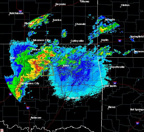 At 940 pm cdt, severe thunderstorms were located along a line extending from glencoe to 4 miles northeast of ripley to 4 miles south of agra, moving east at 50 mph (radar indicated). Hazards include 60 mph wind gusts and penny size hail. at 930 pm, the oklahoma mesonet station at perkins oklahoma measured a 61 mph wind gust. Expect damage to roofs, siding, and trees. Locations in or near the path include, bristow, pawnee, cleveland, mannford, drumright, oilton, jennings, westport, hallett, terlton, shamrock, maramec, silver city, this includes interstate 44 between mile markers 185 and 201. At 940 pm cdt, severe thunderstorms were located along a line extending from glencoe to 4 miles northeast of ripley to 4 miles south of agra, moving east at 50 mph (radar indicated). Hazards include 60 mph wind gusts and penny size hail. at 930 pm, the oklahoma mesonet station at perkins oklahoma measured a 61 mph wind gust. Expect damage to roofs, siding, and trees. Locations in or near the path include, bristow, pawnee, cleveland, mannford, drumright, oilton, jennings, westport, hallett, terlton, shamrock, maramec, silver city, this includes interstate 44 between mile markers 185 and 201.
|
| 4/29/2017 4:12 AM CDT |
 The severe thunderstorm warning for northeastern lincoln and southeastern payne counties will expire at 415 am cdt, the storms which prompted the warning have moved out of the area. therefore the warning will be allowed to expire. however heavy rain is still possible with additional thunderstorms moving into the area and this could cause minor flooding. The severe thunderstorm warning for northeastern lincoln and southeastern payne counties will expire at 415 am cdt, the storms which prompted the warning have moved out of the area. therefore the warning will be allowed to expire. however heavy rain is still possible with additional thunderstorms moving into the area and this could cause minor flooding.
|
| 4/29/2017 4:07 AM CDT |
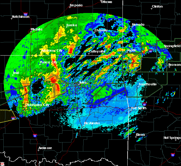 At 407 am cdt, severe thunderstorms were located along a line extending from 3 miles northwest of hallett to 5 miles east of oilton to 3 miles north of depew, moving northeast at 40 mph (radar indicated). Hazards include 60 mph wind gusts and quarter size hail. Hail damage to vehicles is expected. expect wind damage to roofs, siding, and trees. Locations in or near the path include, mannford, drumright, oilton, jennings, hallett, blackburn, terlton, shamrock, maramec, silver city, this includes interstate 44 near mile marker 198. At 407 am cdt, severe thunderstorms were located along a line extending from 3 miles northwest of hallett to 5 miles east of oilton to 3 miles north of depew, moving northeast at 40 mph (radar indicated). Hazards include 60 mph wind gusts and quarter size hail. Hail damage to vehicles is expected. expect wind damage to roofs, siding, and trees. Locations in or near the path include, mannford, drumright, oilton, jennings, hallett, blackburn, terlton, shamrock, maramec, silver city, this includes interstate 44 near mile marker 198.
|
| 4/29/2017 3:58 AM CDT |
 At 358 am cdt, severe thunderstorms were located along a line extending from near yale to near drumright to near stroud, moving east at 35 mph (radar indicated). Hazards include 60 mph wind gusts and nickel size hail. Expect damage to roofs, siding, and trees. Locations impacted include, yale and quay. At 358 am cdt, severe thunderstorms were located along a line extending from near yale to near drumright to near stroud, moving east at 35 mph (radar indicated). Hazards include 60 mph wind gusts and nickel size hail. Expect damage to roofs, siding, and trees. Locations impacted include, yale and quay.
|
| 4/29/2017 3:53 AM CDT |
 At 352 am cdt, severe thunderstorms were located along a line extending from 4 miles northwest of quay to 2 miles northwest of drumright to 2 miles north of stroud, moving northeast at 40 mph (radar indicated). Hazards include 60 mph wind gusts and quarter size hail. Hail damage to vehicles is expected. expect wind damage to roofs, siding, and trees. Locations in or near the path include, mannford, drumright, oilton, jennings, hallett, blackburn, terlton, shamrock, maramec, silver city, this includes interstate 44 near mile marker 198. At 352 am cdt, severe thunderstorms were located along a line extending from 4 miles northwest of quay to 2 miles northwest of drumright to 2 miles north of stroud, moving northeast at 40 mph (radar indicated). Hazards include 60 mph wind gusts and quarter size hail. Hail damage to vehicles is expected. expect wind damage to roofs, siding, and trees. Locations in or near the path include, mannford, drumright, oilton, jennings, hallett, blackburn, terlton, shamrock, maramec, silver city, this includes interstate 44 near mile marker 198.
|
| 4/29/2017 3:41 AM CDT |
 At 341 am cdt, severe thunderstorms were located along a line extending from 6 miles northeast of ripley to near cushing to near davenport, moving northeast at 45 mph (radar indicated). Hazards include 60 mph wind gusts and nickel size hail. Expect damage to roofs, siding, and trees. Locations impacted include, stillwater, cushing, chandler, stroud, yale, davenport, ripley, agra, kendrick, quay, avery, ingalls and parkland. At 341 am cdt, severe thunderstorms were located along a line extending from 6 miles northeast of ripley to near cushing to near davenport, moving northeast at 45 mph (radar indicated). Hazards include 60 mph wind gusts and nickel size hail. Expect damage to roofs, siding, and trees. Locations impacted include, stillwater, cushing, chandler, stroud, yale, davenport, ripley, agra, kendrick, quay, avery, ingalls and parkland.
|
| 4/29/2017 3:34 AM CDT |
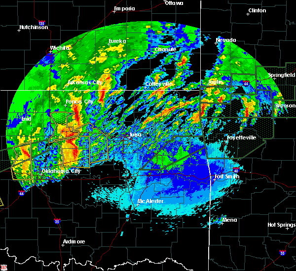 At 334 am cdt, severe thunderstorms were located along a line extending from 5 miles east of stillwater to 3 miles northeast of agra to near chandler, moving northeast at 40 mph (radar indicated). Hazards include 60 mph wind gusts and half dollar size hail. Hail damage to vehicles is expected. expect wind damage to roofs, siding, and trees. Locations in or near the path include, bristow, mannford, drumright, oilton, depew, jennings, hallett, blackburn, terlton, shamrock, maramec, milfay, silver city, this includes interstate 44 between mile markers 178 and 198. At 334 am cdt, severe thunderstorms were located along a line extending from 5 miles east of stillwater to 3 miles northeast of agra to near chandler, moving northeast at 40 mph (radar indicated). Hazards include 60 mph wind gusts and half dollar size hail. Hail damage to vehicles is expected. expect wind damage to roofs, siding, and trees. Locations in or near the path include, bristow, mannford, drumright, oilton, depew, jennings, hallett, blackburn, terlton, shamrock, maramec, milfay, silver city, this includes interstate 44 between mile markers 178 and 198.
|
| 4/29/2017 3:23 AM CDT |
 At 322 am cdt, severe thunderstorms were located along a line extending from near stillwater to near wellston, moving east at 40 mph (trained weather spotters). Hazards include 60 mph wind gusts and quarter size hail. Hail damage to vehicles is possible. expect wind damage to roofs, siding, and trees. Locations impacted include, stillwater, cushing, chandler, perkins, stroud, yale, davenport, wellston, carney, tryon, ripley, agra, sparks, warwick, kendrick, quay, avery, ingalls and parkland. At 322 am cdt, severe thunderstorms were located along a line extending from near stillwater to near wellston, moving east at 40 mph (trained weather spotters). Hazards include 60 mph wind gusts and quarter size hail. Hail damage to vehicles is possible. expect wind damage to roofs, siding, and trees. Locations impacted include, stillwater, cushing, chandler, perkins, stroud, yale, davenport, wellston, carney, tryon, ripley, agra, sparks, warwick, kendrick, quay, avery, ingalls and parkland.
|
| 4/29/2017 2:55 AM CDT |
 At 255 am cdt, severe thunderstorms were located along a line extending from 5 miles southeast of mulhall to near arcadia, moving east at 35 mph (trained weather spotters reported golf ball size hail as the storm moved through guthrie). Hazards include golf ball size hail and 60 mph wind gusts. People and animals outdoors will be injured. expect hail damage to roofs, siding, windows, and vehicles. Expect wind damage to roofs, siding, and trees. At 255 am cdt, severe thunderstorms were located along a line extending from 5 miles southeast of mulhall to near arcadia, moving east at 35 mph (trained weather spotters reported golf ball size hail as the storm moved through guthrie). Hazards include golf ball size hail and 60 mph wind gusts. People and animals outdoors will be injured. expect hail damage to roofs, siding, windows, and vehicles. Expect wind damage to roofs, siding, and trees.
|
| 4/28/2017 11:40 PM CDT |
 At 1139 pm cdt, a severe thunderstorm was located 7 miles east of drumright, moving northeast at 40 mph (radar indicated). Hazards include 60 mph wind gusts and quarter size hail. Hail damage to vehicles is expected. expect wind damage to roofs, siding, and trees. Locations in or near the path include, sand springs, cleveland, mannford, drumright, westport, osage, terlton, shamrock, keystone state park, walnut creek state park, silver city,. At 1139 pm cdt, a severe thunderstorm was located 7 miles east of drumright, moving northeast at 40 mph (radar indicated). Hazards include 60 mph wind gusts and quarter size hail. Hail damage to vehicles is expected. expect wind damage to roofs, siding, and trees. Locations in or near the path include, sand springs, cleveland, mannford, drumright, westport, osage, terlton, shamrock, keystone state park, walnut creek state park, silver city,.
|
| 4/25/2017 9:39 PM CDT |
 The severe thunderstorm warning for northwestern creek county will expire at 945 pm cdt, the storm which prompted the warning has weakened below severe limits, and no longer poses an immediate threat to life or property. therefore the warning will be allowed to expire. a severe thunderstorm watch remains in effect until 200 am cdt for northeastern oklahoma. The severe thunderstorm warning for northwestern creek county will expire at 945 pm cdt, the storm which prompted the warning has weakened below severe limits, and no longer poses an immediate threat to life or property. therefore the warning will be allowed to expire. a severe thunderstorm watch remains in effect until 200 am cdt for northeastern oklahoma.
|
| 4/25/2017 9:33 PM CDT |
 At 932 pm cdt, a severe thunderstorm was located near shamrock, moving northeast at 60 mph (radar indicated). Hazards include 60 mph wind gusts and quarter size hail. Hail damage to vehicles is expected. expect wind damage to roofs, siding, and trees. locations in or near the path include, shamrock, this includes interstate 44 between mile markers 194 and 202. recent trends suggest that the storms are weakening. If this trend continues, the warning may be cancelled early. At 932 pm cdt, a severe thunderstorm was located near shamrock, moving northeast at 60 mph (radar indicated). Hazards include 60 mph wind gusts and quarter size hail. Hail damage to vehicles is expected. expect wind damage to roofs, siding, and trees. locations in or near the path include, shamrock, this includes interstate 44 between mile markers 194 and 202. recent trends suggest that the storms are weakening. If this trend continues, the warning may be cancelled early.
|
| 4/25/2017 9:21 PM CDT |
 At 921 pm cdt, a severe thunderstorm was located 3 miles southwest of shamrock, moving northeast at 45 mph (radar indicated). Hazards include quarter size hail. Damage to vehicles is expected. Locations in or near the path include, shamrock, this includes interstate 44 between mile markers 194 and 202. At 921 pm cdt, a severe thunderstorm was located 3 miles southwest of shamrock, moving northeast at 45 mph (radar indicated). Hazards include quarter size hail. Damage to vehicles is expected. Locations in or near the path include, shamrock, this includes interstate 44 between mile markers 194 and 202.
|
| 4/25/2017 9:07 PM CDT |
 At 907 pm cdt, a severe thunderstorm was located over oilton, moving northeast at 50 mph (radar indicated). Hazards include 60 mph wind gusts and half dollar size hail. Hail damage to vehicles is expected. expect wind damage to roofs, siding, and trees. Locations in or near the path include, oilton, jennings, hallett, terlton, silver city,. At 907 pm cdt, a severe thunderstorm was located over oilton, moving northeast at 50 mph (radar indicated). Hazards include 60 mph wind gusts and half dollar size hail. Hail damage to vehicles is expected. expect wind damage to roofs, siding, and trees. Locations in or near the path include, oilton, jennings, hallett, terlton, silver city,.
|
| 4/25/2017 9:03 PM CDT |
 The national weather service in norman has issued a * severe thunderstorm warning for. east central payne county in central oklahoma. Until 930 pm cdt * at 903 pm cdt, a severe thunderstorm was located near drumright, moving northeast at 40 mph. The national weather service in norman has issued a * severe thunderstorm warning for. east central payne county in central oklahoma. Until 930 pm cdt * at 903 pm cdt, a severe thunderstorm was located near drumright, moving northeast at 40 mph.
|
| 4/4/2017 4:45 PM CDT |
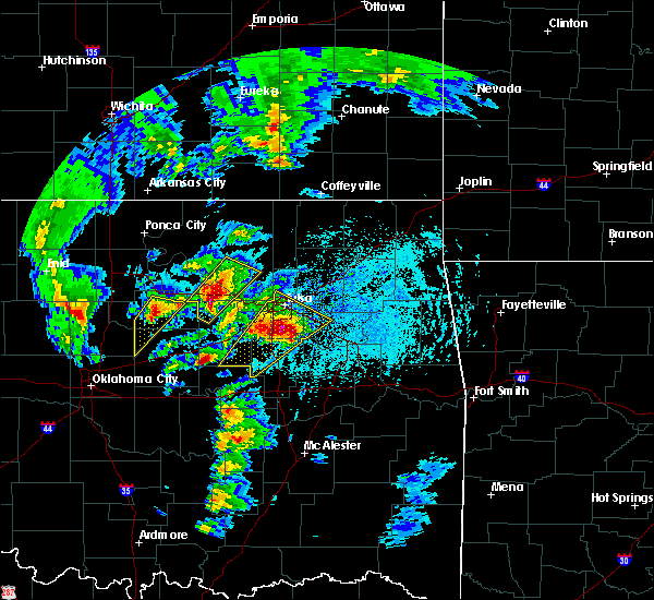 At 445 pm cdt, a severe thunderstorm was located 3 miles southwest of osage, moving northeast at 45 mph (radar indicated). Hazards include 60 mph wind gusts and quarter size hail. Hail damage to vehicles is expected. expect wind damage to roofs, siding, and trees. Locations in or near the path include, hominy, cleveland, oilton, jennings, westport, osage, hallett, terlton, walnut creek state park, silver city,. At 445 pm cdt, a severe thunderstorm was located 3 miles southwest of osage, moving northeast at 45 mph (radar indicated). Hazards include 60 mph wind gusts and quarter size hail. Hail damage to vehicles is expected. expect wind damage to roofs, siding, and trees. Locations in or near the path include, hominy, cleveland, oilton, jennings, westport, osage, hallett, terlton, walnut creek state park, silver city,.
|
| 4/4/2017 4:34 PM CDT |
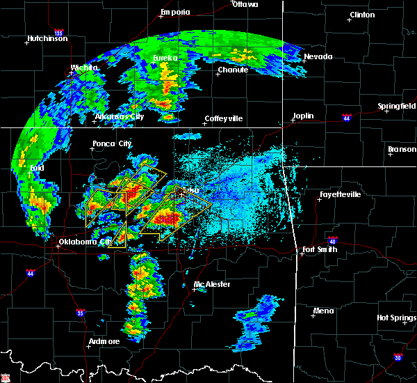 At 433 pm cdt, a severe thunderstorm was located near jennings, moving northeast at 45 mph (radar indicated). Hazards include 60 mph wind gusts and quarter size hail. Hail damage to vehicles is expected. expect wind damage to roofs, siding, and trees. Locations in or near the path include, hominy, cleveland, oilton, jennings, westport, osage, hallett, terlton, walnut creek state park, silver city,. At 433 pm cdt, a severe thunderstorm was located near jennings, moving northeast at 45 mph (radar indicated). Hazards include 60 mph wind gusts and quarter size hail. Hail damage to vehicles is expected. expect wind damage to roofs, siding, and trees. Locations in or near the path include, hominy, cleveland, oilton, jennings, westport, osage, hallett, terlton, walnut creek state park, silver city,.
|
| 4/4/2017 4:25 PM CDT |
 At 425 pm cdt, a severe thunderstorm was located 4 miles west of drumright, moving northeast at 45 mph (radar indicated). Hazards include 60 mph wind gusts and half dollar size hail. Hail damage to vehicles is expected. Expect wind damage to roofs, siding, and trees. At 425 pm cdt, a severe thunderstorm was located 4 miles west of drumright, moving northeast at 45 mph (radar indicated). Hazards include 60 mph wind gusts and half dollar size hail. Hail damage to vehicles is expected. Expect wind damage to roofs, siding, and trees.
|
| 4/4/2017 4:23 PM CDT |
 At 423 pm cdt, a severe thunderstorm was located 4 miles southwest of oilton, moving northeast at 55 mph (radar indicated). Hazards include 60 mph wind gusts and half dollar size hail. Hail damage to vehicles is expected. expect wind damage to roofs, siding, and trees. Locations in or near the path include, mannford, drumright, oilton, jennings, hallett, terlton, shamrock, maramec, silver city,. At 423 pm cdt, a severe thunderstorm was located 4 miles southwest of oilton, moving northeast at 55 mph (radar indicated). Hazards include 60 mph wind gusts and half dollar size hail. Hail damage to vehicles is expected. expect wind damage to roofs, siding, and trees. Locations in or near the path include, mannford, drumright, oilton, jennings, hallett, terlton, shamrock, maramec, silver city,.
|
| 4/4/2017 4:06 PM CDT |
 At 405 pm cdt, a severe thunderstorm was located 3 miles west of avery, moving northeast at 55 mph (radar indicated). Hazards include 60 mph wind gusts and half dollar size hail. Hail damage to vehicles is expected. expect wind damage to roofs, siding, and trees. Locations in or near the path include, mannford, drumright, oilton, jennings, hallett, terlton, shamrock, maramec, silver city,. At 405 pm cdt, a severe thunderstorm was located 3 miles west of avery, moving northeast at 55 mph (radar indicated). Hazards include 60 mph wind gusts and half dollar size hail. Hail damage to vehicles is expected. expect wind damage to roofs, siding, and trees. Locations in or near the path include, mannford, drumright, oilton, jennings, hallett, terlton, shamrock, maramec, silver city,.
|
| 4/4/2017 4:03 PM CDT |
 At 403 pm cdt, a severe thunderstorm was located near agra, moving northeast at 40 mph (radar indicated). Hazards include 60 mph wind gusts and half dollar size hail. Hail damage to vehicles is expected. expect wind damage to roofs, siding, and trees. locations impacted include, cushing, chandler, stroud, yale, davenport, wellston, tryon, agra, warwick, kendrick, quay, avery and parkland. This includes interstate 44 between mile markers 158 and 178. At 403 pm cdt, a severe thunderstorm was located near agra, moving northeast at 40 mph (radar indicated). Hazards include 60 mph wind gusts and half dollar size hail. Hail damage to vehicles is expected. expect wind damage to roofs, siding, and trees. locations impacted include, cushing, chandler, stroud, yale, davenport, wellston, tryon, agra, warwick, kendrick, quay, avery and parkland. This includes interstate 44 between mile markers 158 and 178.
|
| 4/4/2017 3:47 PM CDT |
 At 347 pm cdt, a severe thunderstorm was located near chandler, moving northeast at 45 mph (radar indicated). Hazards include 60 mph wind gusts and half dollar size hail. Hail damage to vehicles is expected. Expect wind damage to roofs, siding, and trees. At 347 pm cdt, a severe thunderstorm was located near chandler, moving northeast at 45 mph (radar indicated). Hazards include 60 mph wind gusts and half dollar size hail. Hail damage to vehicles is expected. Expect wind damage to roofs, siding, and trees.
|
| 3/6/2017 9:27 PM CST |
 The severe thunderstorm warning for southeastern payne county will expire at 930 pm cst, the storm which prompted the warning has moved east into creek county. therefore the warning will be allowed to expire for payne county. The severe thunderstorm warning for southeastern payne county will expire at 930 pm cst, the storm which prompted the warning has moved east into creek county. therefore the warning will be allowed to expire for payne county.
|
| 3/6/2017 9:19 PM CST |
 At 918 pm cst, severe thunderstorms were located along a line extending from near hominy to 3 miles east of avery, moving east at 30 mph (radar indicated). Hazards include 60 mph wind gusts and quarter size hail. Hail damage to vehicles is expected. expect wind damage to roofs, siding, and trees. locations in or near the path include, northwestern tulsa, sand springs, bristow, skiatook, hominy, cleveland, mannford, drumright, sperry, oilton, ramona, depew, jennings, avant, westport, osage, terlton, shamrock, keystone state park, walnut creek state park, this includes interstate 44 between mile markers 178 and 202. A tornado watch remains in effect until 300 am cst for northeastern oklahoma. At 918 pm cst, severe thunderstorms were located along a line extending from near hominy to 3 miles east of avery, moving east at 30 mph (radar indicated). Hazards include 60 mph wind gusts and quarter size hail. Hail damage to vehicles is expected. expect wind damage to roofs, siding, and trees. locations in or near the path include, northwestern tulsa, sand springs, bristow, skiatook, hominy, cleveland, mannford, drumright, sperry, oilton, ramona, depew, jennings, avant, westport, osage, terlton, shamrock, keystone state park, walnut creek state park, this includes interstate 44 between mile markers 178 and 202. A tornado watch remains in effect until 300 am cst for northeastern oklahoma.
|
| 3/6/2017 9:18 PM CST |
 At 918 pm cst, a severe thunderstorm was located in southeast payne county southwest of drumright, moving northeast at 55 mph (radar indicated). Hazards include 60 mph wind gusts and quarter size hail. Hail damage to vehicles is expected. expect wind damage to roofs, siding, and trees. Locations impacted include, rural southeastern payne county. At 918 pm cst, a severe thunderstorm was located in southeast payne county southwest of drumright, moving northeast at 55 mph (radar indicated). Hazards include 60 mph wind gusts and quarter size hail. Hail damage to vehicles is expected. expect wind damage to roofs, siding, and trees. Locations impacted include, rural southeastern payne county.
|
| 3/6/2017 8:52 PM CST |
 At 852 pm cst, a severe thunderstorm was located near ripley, moving northeast at 70 mph (radar indicated). Hazards include 60 mph wind gusts and half dollar size hail. Hail damage to vehicles is expected. Expect wind damage to roofs, siding, and trees. At 852 pm cst, a severe thunderstorm was located near ripley, moving northeast at 70 mph (radar indicated). Hazards include 60 mph wind gusts and half dollar size hail. Hail damage to vehicles is expected. Expect wind damage to roofs, siding, and trees.
|
| 9/9/2016 10:42 PM CDT |
 At 1042 pm cdt, the leading edge of winds from a line of severe thunderstorms was located along a line extending from near avery to near oklahoma city, moving southeast at 45 mph (radar indicated). Hazards include 60 mph wind gusts and penny size hail. Expect damage to roofs. siding. And trees. At 1042 pm cdt, the leading edge of winds from a line of severe thunderstorms was located along a line extending from near avery to near oklahoma city, moving southeast at 45 mph (radar indicated). Hazards include 60 mph wind gusts and penny size hail. Expect damage to roofs. siding. And trees.
|
| 9/9/2016 9:59 PM CDT |
 At 959 pm cdt, the leading edge of winds from a line of severe thunderstorms was located along a line extending from 4 miles west of stillwater to near guthrie to 5 miles southeast of okarche, moving southeast at 65 mph (radar indicated). Hazards include 60 mph wind gusts and nickel size hail. Expect damage to roofs. siding. And trees. At 959 pm cdt, the leading edge of winds from a line of severe thunderstorms was located along a line extending from 4 miles west of stillwater to near guthrie to 5 miles southeast of okarche, moving southeast at 65 mph (radar indicated). Hazards include 60 mph wind gusts and nickel size hail. Expect damage to roofs. siding. And trees.
|
| 8/25/2016 7:13 PM CDT |
 At 712 pm cdt, a severe thunderstorm was located near ripley, moving east at 25 mph (radar indicated). Hazards include 60 mph wind gusts and quarter size hail. Hail damage to vehicles is expected. Expect wind damage to roofs, siding, and trees. At 712 pm cdt, a severe thunderstorm was located near ripley, moving east at 25 mph (radar indicated). Hazards include 60 mph wind gusts and quarter size hail. Hail damage to vehicles is expected. Expect wind damage to roofs, siding, and trees.
|
| 7/15/2016 1:08 AM CDT |
 At 108 am cdt, a severe thunderstorm was located near ripley, moving east at 15 mph (radar indicated). Hazards include 60 mph wind gusts and half dollar size hail. Hail damage to vehicles is expected. Expect wind damage to roofs, siding, and trees. At 108 am cdt, a severe thunderstorm was located near ripley, moving east at 15 mph (radar indicated). Hazards include 60 mph wind gusts and half dollar size hail. Hail damage to vehicles is expected. Expect wind damage to roofs, siding, and trees.
|
| 7/14/2016 1:25 AM CDT |
 At 125 am cdt, severe thunderstorms were located along a line extending from 4 miles south of keystone state park to 5 miles southeast of stroud, moving southeast at 40 mph (radar indicated). Hazards include 60 mph wind gusts and quarter size hail. Hail damage to vehicles is expected. expect wind damage to roofs, siding, and trees. Locations in or near the path include, bristow, sapulpa, mannford, drumright, kellyville, oilton, depew, slick, shamrock, milfay, silver city, this includes interstate 44 between mile markers 178 and 208. At 125 am cdt, severe thunderstorms were located along a line extending from 4 miles south of keystone state park to 5 miles southeast of stroud, moving southeast at 40 mph (radar indicated). Hazards include 60 mph wind gusts and quarter size hail. Hail damage to vehicles is expected. expect wind damage to roofs, siding, and trees. Locations in or near the path include, bristow, sapulpa, mannford, drumright, kellyville, oilton, depew, slick, shamrock, milfay, silver city, this includes interstate 44 between mile markers 178 and 208.
|
| 7/14/2016 1:10 AM CDT |
 At 110 am cdt, severe thunderstorms were located along a line extending from 3 miles southwest of oilton to 4 miles southeast of avery to near fallis, moving east at 30 mph (radar indicated). Hazards include 60 mph wind gusts and quarter size hail. Hail damage to vehicles is expected. expect wind damage to roofs, siding, and trees. locations impacted include, cushing, chandler, stroud, prague, yale, meeker, davenport, wellston, carney, tryon, ripley, agra, sparks, warwick, kendrick, fallis, quay, avery and parkland. This includes interstate 44 between mile markers 154 and 182. At 110 am cdt, severe thunderstorms were located along a line extending from 3 miles southwest of oilton to 4 miles southeast of avery to near fallis, moving east at 30 mph (radar indicated). Hazards include 60 mph wind gusts and quarter size hail. Hail damage to vehicles is expected. expect wind damage to roofs, siding, and trees. locations impacted include, cushing, chandler, stroud, prague, yale, meeker, davenport, wellston, carney, tryon, ripley, agra, sparks, warwick, kendrick, fallis, quay, avery and parkland. This includes interstate 44 between mile markers 154 and 182.
|
| 7/14/2016 12:58 AM CDT |
 At 1257 am cdt, severe thunderstorms were located along a line extending from near yale to near avery to near fallis, moving east at 30 mph (radar indicated). Hazards include 60 mph wind gusts and half dollar size hail. Hail damage to vehicles is expected. expect wind damage to roofs, siding, and trees. locations impacted include, cushing, chandler, perkins, stroud, prague, yale, meeker, davenport, wellston, carney, tryon, ripley, agra, sparks, warwick, kendrick, meridian, fallis, quay and avery. This includes interstate 44 between mile markers 154 and 182. At 1257 am cdt, severe thunderstorms were located along a line extending from near yale to near avery to near fallis, moving east at 30 mph (radar indicated). Hazards include 60 mph wind gusts and half dollar size hail. Hail damage to vehicles is expected. expect wind damage to roofs, siding, and trees. locations impacted include, cushing, chandler, perkins, stroud, prague, yale, meeker, davenport, wellston, carney, tryon, ripley, agra, sparks, warwick, kendrick, meridian, fallis, quay and avery. This includes interstate 44 between mile markers 154 and 182.
|
| 7/14/2016 12:44 AM CDT |
 At 1244 am cdt, a severe thunderstorm was located near yale, moving southeast at 35 mph (radar indicated). Hazards include 60 mph wind gusts and quarter size hail. Hail damage to vehicles is expected. expect wind damage to roofs, siding, and trees. Locations in or near the path include, bristow, sapulpa, mannford, drumright, kellyville, oilton, depew, slick, shamrock, milfay, silver city, this includes interstate 44 between mile markers 178 and 208. At 1244 am cdt, a severe thunderstorm was located near yale, moving southeast at 35 mph (radar indicated). Hazards include 60 mph wind gusts and quarter size hail. Hail damage to vehicles is expected. expect wind damage to roofs, siding, and trees. Locations in or near the path include, bristow, sapulpa, mannford, drumright, kellyville, oilton, depew, slick, shamrock, milfay, silver city, this includes interstate 44 between mile markers 178 and 208.
|
| 7/14/2016 12:40 AM CDT |
 At 1239 am cdt, severe thunderstorms were located along a line extending from 3 miles southwest of yale to 4 miles southwest of perkins, moving southeast at 25 mph. the most dangerous storm was located between ingalls and yale, moving toward cushing (radar indicated). Hazards include golf ball size hail and 70 mph wind gusts. People and animals outdoors will be injured. expect hail damage to roofs, siding, windows, and vehicles. expect considerable tree damage. wind damage is also likely to mobile homes, roofs, and outbuildings. locations impacted include, stillwater, cushing, chandler, perkins, stroud, prague, langston, yale, meeker, davenport, wellston, carney, tryon, ripley, agra, coyle, mulhall, sparks, orlando and warwick. this includes the following highways, interstate 35 between mile markers 165 and 178. Interstate 44 between mile markers 154 and 182. At 1239 am cdt, severe thunderstorms were located along a line extending from 3 miles southwest of yale to 4 miles southwest of perkins, moving southeast at 25 mph. the most dangerous storm was located between ingalls and yale, moving toward cushing (radar indicated). Hazards include golf ball size hail and 70 mph wind gusts. People and animals outdoors will be injured. expect hail damage to roofs, siding, windows, and vehicles. expect considerable tree damage. wind damage is also likely to mobile homes, roofs, and outbuildings. locations impacted include, stillwater, cushing, chandler, perkins, stroud, prague, langston, yale, meeker, davenport, wellston, carney, tryon, ripley, agra, coyle, mulhall, sparks, orlando and warwick. this includes the following highways, interstate 35 between mile markers 165 and 178. Interstate 44 between mile markers 154 and 182.
|
| 7/14/2016 12:18 AM CDT |
 At 1218 am cdt, a severe thunderstorm was located near stillwater, moving southeast at 30 mph (radar indicated). Hazards include golf ball size hail and 70 mph wind gusts. People and animals outdoors will be injured. expect hail damage to roofs, siding, windows, and vehicles. expect considerable tree damage. Wind damage is also likely to mobile homes, roofs, and outbuildings. At 1218 am cdt, a severe thunderstorm was located near stillwater, moving southeast at 30 mph (radar indicated). Hazards include golf ball size hail and 70 mph wind gusts. People and animals outdoors will be injured. expect hail damage to roofs, siding, windows, and vehicles. expect considerable tree damage. Wind damage is also likely to mobile homes, roofs, and outbuildings.
|
| 7/8/2016 8:35 AM CDT | Quarter sized hail reported 2.4 miles E of Drumright, OK, . |
| 7/8/2016 8:26 AM CDT |
 At 826 am cdt, severe thunderstorms were located along a line extending from 2 miles southwest of hallett to 2 miles southwest of jennings to 5 miles east of oilton to 5 miles south of stroud, moving east at 35 mph (radar indicated). Hazards include 60 mph wind gusts and quarter size hail. Hail damage to vehicles is expected. expect wind damage to roofs, siding, and trees. Locations in or near the path include, bristow, okfuskee, cleveland, mannford, drumright, oilton, depew, jennings, westport, slick, hallett, terlton, shamrock, maramec, welty, milfay, silver city, this includes interstate 44 between mile markers 178 and 203. At 826 am cdt, severe thunderstorms were located along a line extending from 2 miles southwest of hallett to 2 miles southwest of jennings to 5 miles east of oilton to 5 miles south of stroud, moving east at 35 mph (radar indicated). Hazards include 60 mph wind gusts and quarter size hail. Hail damage to vehicles is expected. expect wind damage to roofs, siding, and trees. Locations in or near the path include, bristow, okfuskee, cleveland, mannford, drumright, oilton, depew, jennings, westport, slick, hallett, terlton, shamrock, maramec, welty, milfay, silver city, this includes interstate 44 between mile markers 178 and 203.
|
| 7/8/2016 8:16 AM CDT |
 At 815 am cdt, severe thunderstorms were located along a line extending from 3 miles east of glencoe to quay to near oilton to 6 miles southeast of davenport, moving east at 40 mph (radar indicated). Hazards include 60 mph wind gusts and quarter size hail. Hail damage to vehicles is expected. expect wind damage to roofs, siding, and trees. Locations in or near the path include, bristow, okfuskee, hominy, cleveland, mannford, drumright, oilton, depew, jennings, westport, osage, slick, hallett, terlton, shamrock, maramec, welty, milfay, silver city, this includes interstate 44 between mile markers 178 and 203. At 815 am cdt, severe thunderstorms were located along a line extending from 3 miles east of glencoe to quay to near oilton to 6 miles southeast of davenport, moving east at 40 mph (radar indicated). Hazards include 60 mph wind gusts and quarter size hail. Hail damage to vehicles is expected. expect wind damage to roofs, siding, and trees. Locations in or near the path include, bristow, okfuskee, hominy, cleveland, mannford, drumright, oilton, depew, jennings, westport, osage, slick, hallett, terlton, shamrock, maramec, welty, milfay, silver city, this includes interstate 44 between mile markers 178 and 203.
|
| 7/8/2016 8:12 AM CDT |
 At 812 am cdt, severe thunderstorms were located along a line extending from 4 miles east of glencoe to near avery, moving northeast at 30 mph (radar indicated). Hazards include 60 mph wind gusts and quarter size hail. Hail damage to vehicles is expected. Expect wind damage to roofs, siding, and trees. At 812 am cdt, severe thunderstorms were located along a line extending from 4 miles east of glencoe to near avery, moving northeast at 30 mph (radar indicated). Hazards include 60 mph wind gusts and quarter size hail. Hail damage to vehicles is expected. Expect wind damage to roofs, siding, and trees.
|
| 7/8/2016 8:04 AM CDT |
 At 804 am cdt, severe thunderstorms were located along a line extending from glencoe to 2 miles west of cushing to 2 miles southeast of sparks, moving east at 35 mph (radar indicated). Hazards include 60 mph wind gusts and quarter size hail. Hail damage to vehicles is expected. expect wind damage to roofs, siding, and trees. Locations in or near the path include, bristow, pawnee, okfuskee, hominy, cleveland, mannford, drumright, oilton, depew, jennings, westport, osage, slick, hallett, blackburn, terlton, shamrock, maramec, skedee, welty, this includes interstate 44 between mile markers 178 and 203. At 804 am cdt, severe thunderstorms were located along a line extending from glencoe to 2 miles west of cushing to 2 miles southeast of sparks, moving east at 35 mph (radar indicated). Hazards include 60 mph wind gusts and quarter size hail. Hail damage to vehicles is expected. expect wind damage to roofs, siding, and trees. Locations in or near the path include, bristow, pawnee, okfuskee, hominy, cleveland, mannford, drumright, oilton, depew, jennings, westport, osage, slick, hallett, blackburn, terlton, shamrock, maramec, skedee, welty, this includes interstate 44 between mile markers 178 and 203.
|
| 5/24/2016 11:39 PM CDT |
 At 1139 pm cdt, a severe thunderstorm was located near sparks, moving northeast at 35 mph (radar indicated). Hazards include 60 mph wind gusts and half dollar size hail. Hail damage to vehicles is expected. Expect wind damage to roofs, siding, and trees. At 1139 pm cdt, a severe thunderstorm was located near sparks, moving northeast at 35 mph (radar indicated). Hazards include 60 mph wind gusts and half dollar size hail. Hail damage to vehicles is expected. Expect wind damage to roofs, siding, and trees.
|
| 5/24/2016 10:57 PM CDT | The national weather service in tulsa has issued a * severe thunderstorm warning for. northwestern creek county in northeastern oklahoma. until 1145 pm cdt * at 1056 pm cdt. a severe thunderstorm was located over stroud. Moving northeast at 30 mph. |
| 5/24/2016 5:13 PM CDT | The national weather service in tulsa has issued a * severe thunderstorm warning for. western creek county in northeastern oklahoma. until 615 pm cdt * at 512 pm cdt. a severe thunderstorm was located over drumright. Moving east at 15 mph. |
| 5/24/2016 5:06 PM CDT | Relayed via amateur radi in creek county OK, 0.1 miles E of Drumright, OK |
| 4/26/2016 9:57 PM CDT |
 At 957 pm cdt, severe thunderstorms were located along a line extending from 3 miles northeast of cleveland to 6 miles northwest of kellyville to 4 miles northeast of castle, moving northeast at 60 mph (radar indicated). Hazards include 70 mph wind gusts. Expect considerable tree damage. damage is likely to mobile homes, roofs, and outbuildings. locations in or near the path include, bristow, okfuskee, hominy, cleveland, mannford, beggs, kellyville, oilton, depew, jennings, westport, osage, slick, hallett, blackburn, castle, terlton, welty, walnut creek state park, keystone state park, this includes interstate 44 between mile markers 183 and 208. A tornado watch remains in effect until midnight cdt for northeastern oklahoma. At 957 pm cdt, severe thunderstorms were located along a line extending from 3 miles northeast of cleveland to 6 miles northwest of kellyville to 4 miles northeast of castle, moving northeast at 60 mph (radar indicated). Hazards include 70 mph wind gusts. Expect considerable tree damage. damage is likely to mobile homes, roofs, and outbuildings. locations in or near the path include, bristow, okfuskee, hominy, cleveland, mannford, beggs, kellyville, oilton, depew, jennings, westport, osage, slick, hallett, blackburn, castle, terlton, welty, walnut creek state park, keystone state park, this includes interstate 44 between mile markers 183 and 208. A tornado watch remains in effect until midnight cdt for northeastern oklahoma.
|
| 4/26/2016 9:31 PM CDT |
 At 930 pm cdt, severe thunderstorms were located along a line extending from 5 miles west of quay to 3 miles west of paden, moving northeast at 60 mph (radar indicated). Hazards include 70 mph wind gusts and penny size hail. Expect considerable tree damage. damage is likely to mobile homes, roofs, and outbuildings. locations in or near the path include, bristow, pawnee, okfuskee, hominy, cleveland, mannford, drumright, beggs, boley, kellyville, oilton, depew, paden, jennings, westport, osage, slick, hallett, blackburn, castle, this includes interstate 44 between mile markers 178 and 208. A tornado watch remains in effect until midnight cdt for northeastern oklahoma. At 930 pm cdt, severe thunderstorms were located along a line extending from 5 miles west of quay to 3 miles west of paden, moving northeast at 60 mph (radar indicated). Hazards include 70 mph wind gusts and penny size hail. Expect considerable tree damage. damage is likely to mobile homes, roofs, and outbuildings. locations in or near the path include, bristow, pawnee, okfuskee, hominy, cleveland, mannford, drumright, beggs, boley, kellyville, oilton, depew, paden, jennings, westport, osage, slick, hallett, blackburn, castle, this includes interstate 44 between mile markers 178 and 208. A tornado watch remains in effect until midnight cdt for northeastern oklahoma.
|
| 4/26/2016 9:28 PM CDT |
 At 928 pm cdt, severe thunderstorms were located along a line extending from near glencoe to near davenport to near brooksville to near rosedale, moving northeast at 60 mph (radar indicated). Hazards include 60 mph wind gusts and nickel size hail. Expect damage to roofs. siding. And trees. At 928 pm cdt, severe thunderstorms were located along a line extending from near glencoe to near davenport to near brooksville to near rosedale, moving northeast at 60 mph (radar indicated). Hazards include 60 mph wind gusts and nickel size hail. Expect damage to roofs. siding. And trees.
|
| 4/26/2016 9:19 PM CDT |
 At 918 pm cdt, severe thunderstorms were located along a line extending from 6 miles east of stillwater to 4 miles northwest of chandler to 3 miles northwest of shawnee to 6 miles northeast of rosedale, moving northeast at 30 mph (radar indicated). Hazards include 60 mph wind gusts and quarter size hail. Hail damage to vehicles is expected. expect wind damage to roofs, siding, and trees. locations impacted include, eastern norman, midwest city, stillwater, shawnee, cushing, seminole, tecumseh, purcell, chandler, choctaw, harrah, slaughterville, mcloud, wewoka, perkins, jones, stroud, prague, lexington and pink. this includes the following highways, interstate 35 between mile markers 86 and 90, and between mile markers 165 and 178. interstate 40 between mile markers 164 and 212. interstate 44 between mile markers 143 and 182. Interstate 240 near mile marker 16. At 918 pm cdt, severe thunderstorms were located along a line extending from 6 miles east of stillwater to 4 miles northwest of chandler to 3 miles northwest of shawnee to 6 miles northeast of rosedale, moving northeast at 30 mph (radar indicated). Hazards include 60 mph wind gusts and quarter size hail. Hail damage to vehicles is expected. expect wind damage to roofs, siding, and trees. locations impacted include, eastern norman, midwest city, stillwater, shawnee, cushing, seminole, tecumseh, purcell, chandler, choctaw, harrah, slaughterville, mcloud, wewoka, perkins, jones, stroud, prague, lexington and pink. this includes the following highways, interstate 35 between mile markers 86 and 90, and between mile markers 165 and 178. interstate 40 between mile markers 164 and 212. interstate 44 between mile markers 143 and 182. Interstate 240 near mile marker 16.
|
| 4/26/2016 8:41 PM CDT |
 At 841 pm cdt, severe thunderstorms were located along a line extending from near mulhall to near edmond to near norman to 4 miles west of wayne, moving east at 45 mph (radar indicated). Hazards include 70 mph wind gusts. Expect considerable tree damage. Damage is likely to mobile homes, roofs, and outbuildings. At 841 pm cdt, severe thunderstorms were located along a line extending from near mulhall to near edmond to near norman to 4 miles west of wayne, moving east at 45 mph (radar indicated). Hazards include 70 mph wind gusts. Expect considerable tree damage. Damage is likely to mobile homes, roofs, and outbuildings.
|
| 4/26/2016 11:13 AM CDT |
 At 1112 am cdt, a severe thunderstorm was located over avery, moving northeast at 25 mph (trained weather spotters have reported quarter size hail with this storm). Hazards include 60 mph wind gusts and quarter size hail. Hail damage to vehicles is expected. Expect wind damage to roofs, siding, and trees. At 1112 am cdt, a severe thunderstorm was located over avery, moving northeast at 25 mph (trained weather spotters have reported quarter size hail with this storm). Hazards include 60 mph wind gusts and quarter size hail. Hail damage to vehicles is expected. Expect wind damage to roofs, siding, and trees.
|
| 3/30/2016 11:21 AM CDT |
 At 1120 am cdt, a severe thunderstorm was located near cushing, moving northeast at 45 mph (radar indicated). Hazards include 60 mph wind gusts and half dollar size hail. Hail damage to vehicles is expected. Expect wind damage to roofs, siding, and trees. At 1120 am cdt, a severe thunderstorm was located near cushing, moving northeast at 45 mph (radar indicated). Hazards include 60 mph wind gusts and half dollar size hail. Hail damage to vehicles is expected. Expect wind damage to roofs, siding, and trees.
|
| 11/17/2015 3:37 AM CST |
 At 337 am cst, severe thunderstorms were located along a line extending from 3 miles south of keystone state park to 4 miles northwest of bristow to near boley, moving east at 35 mph (radar indicated). Hazards include 60 mph wind gusts. Damage to roofs. siding and trees is possible. locations in or near the path include, tulsa, broken arrow, sand springs, okmulgee, bristow, okemah, bixby, sapulpa, jenks, okfuskee, glenpool, coweta, catoosa, henryetta, drumright, haskell, inola, kiefer, morris, beggs, this includes the following highways, interstate 40 in oklahoma between mile markers 217 and 225. Interstate 44 between mile markers 178 and 230. At 337 am cst, severe thunderstorms were located along a line extending from 3 miles south of keystone state park to 4 miles northwest of bristow to near boley, moving east at 35 mph (radar indicated). Hazards include 60 mph wind gusts. Damage to roofs. siding and trees is possible. locations in or near the path include, tulsa, broken arrow, sand springs, okmulgee, bristow, okemah, bixby, sapulpa, jenks, okfuskee, glenpool, coweta, catoosa, henryetta, drumright, haskell, inola, kiefer, morris, beggs, this includes the following highways, interstate 40 in oklahoma between mile markers 217 and 225. Interstate 44 between mile markers 178 and 230.
|
| 11/17/2015 3:11 AM CST |
 At 311 am cst, severe thunderstorms were located along a line extending from 2 miles north of drumright to 3 miles northwest of prague, moving east at 45 mph (radar indicated). Hazards include 60 mph wind gusts. Damage to roofs. siding and trees is possible. locations in or near the path include, tulsa, broken arrow, sand springs, okmulgee, bristow, okemah, bixby, sapulpa, jenks, okfuskee, glenpool, coweta, catoosa, henryetta, drumright, haskell, inola, kiefer, morris, beggs, this includes the following highways, interstate 40 in oklahoma between mile markers 217 and 225. Interstate 44 between mile markers 178 and 230. At 311 am cst, severe thunderstorms were located along a line extending from 2 miles north of drumright to 3 miles northwest of prague, moving east at 45 mph (radar indicated). Hazards include 60 mph wind gusts. Damage to roofs. siding and trees is possible. locations in or near the path include, tulsa, broken arrow, sand springs, okmulgee, bristow, okemah, bixby, sapulpa, jenks, okfuskee, glenpool, coweta, catoosa, henryetta, drumright, haskell, inola, kiefer, morris, beggs, this includes the following highways, interstate 40 in oklahoma between mile markers 217 and 225. Interstate 44 between mile markers 178 and 230.
|
| 9/18/2015 5:57 PM CDT | The severe thunderstorm warning for southeastern payne county will expire at 600 pm cdt, the storm which prompted the warning has weakened below severe limits, and no longer pose an immediate threat to life or property. therefore the warning will be allowed to expire. however small. |
| 9/18/2015 5:25 PM CDT |
 At 525 pm cdt, a severe thunderstorm was located east of ripley, moving northeast at 20 mph (radar indicated). Hazards include 70 mph wind gusts and half dollar size hail. Hail damage to vehicles is expected. expect considerable tree damage. wind damage is also likely to mobile homes, roofs and outbuildings. Locations impacted include, cushing, yale and ripley. At 525 pm cdt, a severe thunderstorm was located east of ripley, moving northeast at 20 mph (radar indicated). Hazards include 70 mph wind gusts and half dollar size hail. Hail damage to vehicles is expected. expect considerable tree damage. wind damage is also likely to mobile homes, roofs and outbuildings. Locations impacted include, cushing, yale and ripley.
|
| 9/18/2015 5:11 PM CDT |
 At 511 pm cdt, a severe thunderstorm was located near ripley, moving east at 20 mph (radar indicated). Hazards include 70 mph wind gusts and half dollar size hail. Hail damage to vehicles is expected. expect considerable tree damage. Wind damage is also likely to mobile homes, roofs and outbuildings. At 511 pm cdt, a severe thunderstorm was located near ripley, moving east at 20 mph (radar indicated). Hazards include 70 mph wind gusts and half dollar size hail. Hail damage to vehicles is expected. expect considerable tree damage. Wind damage is also likely to mobile homes, roofs and outbuildings.
|
| 7/2/2015 5:25 PM CDT |
 At 525 pm cdt, a severe thunderstorm was located near ripley, moving southeast at 10 mph (radar indicated). Hazards include 60 mph wind gusts and quarter size hail. Hail damage to vehicles is expected. expect wind damage to roofs, siding and trees. Locations impacted include, cushing, ripley and agra. At 525 pm cdt, a severe thunderstorm was located near ripley, moving southeast at 10 mph (radar indicated). Hazards include 60 mph wind gusts and quarter size hail. Hail damage to vehicles is expected. expect wind damage to roofs, siding and trees. Locations impacted include, cushing, ripley and agra.
|
| 7/2/2015 5:11 PM CDT |
 At 510 pm cdt, a severe thunderstorm was located over ripley, moving southeast at 10 mph (radar indicated). Hazards include 70 mph wind gusts and half dollar size hail. Hail damage to vehicles is expected. expect considerable tree damage. Wind damage is also likely to mobile homes, roofs and outbuildings. At 510 pm cdt, a severe thunderstorm was located over ripley, moving southeast at 10 mph (radar indicated). Hazards include 70 mph wind gusts and half dollar size hail. Hail damage to vehicles is expected. expect considerable tree damage. Wind damage is also likely to mobile homes, roofs and outbuildings.
|
| 5/26/2015 3:38 PM CDT | At 337 pm cdt, a severe thunderstorm was located 4 miles northeast of ripley, moving northeast at 35 mph (radar indicated). Hazards include half dollar size hail. Damage to vehicles is expected. Locations impacted include, cushing, yale, ripley and quay. |
| 5/26/2015 3:17 PM CDT | At 316 pm cdt, a severe thunderstorm was located 4 miles south of ripley, moving northeast at 30 mph (radar indicated). Hazards include half dollar size hail. damage to vehicles is expected |
| 5/23/2015 7:36 PM CDT | At 734 pm cdt, severe thunderstorms were located along a line extending from hominy to stroud, and moving east at 20 mph (radar indicated). Hazards include 60 mph wind gusts. Expect damage to roofs. siding and trees. Locations in or near the path include, shamrock, cleveland, terlton, hominy, silver city, osage, depew, walnut creek state park, mannford, bristow and westport this includes interstate 44 between mile markers 178 and 195. |
| 5/23/2015 7:17 PM CDT | At 715 pm cdt, severe thunderstorms were located along a line extending from 6 miles north of blackburn to avery, and moving east at 20 mph (radar indicated). Hazards include 60 mph wind gusts. Expect damage to roofs. siding and trees. locations in or near the path include, hallett, jennings, oilton, drumright, cleveland, shamrock, terlton, hominy, silver city, osage, depew, walnut creek state park, mannford, bristow and westport. This includes interstate 44 between mile markers 178 and 195. |
| 5/16/2015 10:06 PM CDT | The severe thunderstorm warning for payne, northern lincoln and southeastern noble counties will expire at 1015 pm cdt, the storm which prompted the warning has moved out of the area. therefore the warning will be allowed to expire. |
| 5/16/2015 9:55 PM CDT | At 954 pm cdt, the leading edge of an area of strong to severe thunderstorm was located near yale, moving east at 55 mph. other strong to severe storms were located from near carney to near sparks (radar indicated). Hazards include 60 mph wind gusts. Expect damage to roofs. siding and trees. locations impacted include, stillwater, cushing, chandler, perkins, stroud, yale, davenport, morrison, carney, glencoe, tryon, ripley, agra, kendrick, fallis, quay, avery, ingalls and parkland. Possible. |
| 5/16/2015 9:32 PM CDT | At 930 pm cdt, a severe thunderstorm was located 7 miles south of stroud, and moving northeast at 35 mph (radar indicated). Hazards include 60 mph wind gusts and quarter size hail. Hail damage to vehicles is expected. expect wind damage to roofs, siding and trees. locations in or near the path include, milfay, depew, shamrock, bristow and drumright. this includes interstate 44 between mile markers 178 and 198. 1. 00in. |
| 5/16/2015 9:26 PM CDT | At 925 pm cdt, severe thunderstorms were located along a line extending from 5 miles east of sooner lake to 6 miles northwest of arcadia, moving northeast at 55 mph (radar indicated). Hazards include 60 mph wind gusts and quarter size hail. Hail damage to vehicles is expected. Expect wind damage to roofs, siding and trees. |
| 4/19/2015 4:28 PM CDT | At 426 pm cdt, a severe thunderstorm was located near shamrock, and moving southeast at 30 mph (radar indicated). Hazards include 60 mph wind gusts and quarter size hail. Hail damage to vehicles is expected. expect wind damage to roofs, siding and trees. locations in or near the path include, milfay, depew, bristow and slick. this includes interstate 44 between mile markers 178 and 192. 1. 00in. |
| 3/25/2015 6:21 PM CDT | A severe thunderstorm warning remains in effect for northwestern wagoner. tulsa. rogers. pawnee. southeastern osage. mayes. northern creek and southeastern craig counties until 700 pm cdt. at 619 pm cdt. severe thunderstorms were located along a line extending from 5 miles northwest of foyil to catoosa to tulsa to sapulpa to 9 miles east of drumright. And moving east at 40 mph. |
| 3/25/2015 6:14 PM CDT | A severe thunderstorm warning remains in effect for southern washington. northwestern wagoner. tulsa. rogers. pawnee. southeastern osage. mayes. northern creek and southeastern craig counties in northeast oklahoma until 700 pm cdt. at 612 pm cdt. Severe thunderstorms were located along a line extending from talala to catoosa to tulsa to 6 miles north of. |
| 3/25/2015 6:14 PM CDT | The national weather service in norman has issued a * severe thunderstorm warning for. southeastern logan county in central oklahoma. northeastern oklahoma county in central oklahoma. southeastern payne county in central oklahoma. Lincoln county in central oklahoma. |
| 3/25/2015 6:01 PM CDT | The national weather service in tulsa has issued a * severe thunderstorm warning for. southeastern craig county in northeast oklahoma. northern creek county in northeast oklahoma. mayes county in northeast oklahoma. Southeastern osage county in northeast oklahoma. |
| 3/25/2015 5:58 PM CDT | A severe thunderstorm warning remains in effect until 615 pm cdt for southeastern logan. northeastern oklahoma. southeastern payne and northern lincoln counties. at 557 pm cdt. severe thunderstorms were located along a line extending from near oilton to 3 miles north of luther. Moving east at 20 mph. |
| 3/25/2015 5:30 PM CDT | The national weather service in norman has issued a * severe thunderstorm warning for. southeastern logan county in central oklahoma. northeastern oklahoma county in central oklahoma. payne county in central oklahoma. Northern lincoln county in central oklahoma. |
| 3/25/2015 3:48 PM CDT | A severe thunderstorm warning remains in effect for pawnee and northwestern creek counties until 415 pm cdt. at 345 pm cdt. a severe thunderstorm was located near oilton. and moving east at 30 mph. hazard. 60 mph wind gusts and quarter size hail. source. Radar indicated. |
| 3/25/2015 3:38 PM CDT | The national weather service in norman has issued a * severe thunderstorm warning for. southeastern payne county in central oklahoma. until 415 pm cdt * at 338 pm cdt. a severe thunderstorm was located near cushing. Moving northeast at 35 mph. |
| 3/25/2015 3:35 PM CDT | The national weather service in tulsa has issued a * severe thunderstorm warning for. northwestern creek county in northeast oklahoma. pawnee county in northeast oklahoma. until 415 pm cdt * at 333 pm cdt. A severe thunderstorm was located near drumright. |
| 3/25/2015 3:30 PM CDT | The national weather service in tulsa has issued a * severe thunderstorm warning for. western creek county in northeast oklahoma. until 415 pm cdt * at 329 pm cdt. a severe thunderstorm was located near stroud. And moving northeast at 50 mph. |
| 8/9/2013 1:36 AM CDT | 1 inch tree limbs down in drumright in creek county OK, 0.1 miles E of Drumright, OK |
| 5/31/2013 7:45 PM CDT | Golf Ball sized hail reported 1.3 miles E of Drumright, OK, reported on highway 33 |
| 5/19/2013 6:40 PM CDT | Quarter sized hail reported 0.1 miles E of Drumright, OK |
| 1/1/0001 12:00 AM | Storm damage reported in creek county OK, 0.1 miles E of Drumright, OK |
| 6/14/2011 8:42 PM CDT | Golf Ball sized hail reported 2.1 miles N of Drumright, OK |
| 1/1/0001 12:00 AM | Quarter sized hail reported 13.3 miles N of Drumright, OK |
Hail Maps for Drumright, OK


Connect with Interactive Hail Maps